

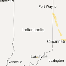
Hail Map for Monday, June 5, 2017

Number of Impacted Households on 6/5/2017
0
Impacted by 1" or Larger Hail
0
Impacted by 1.75" or Larger Hail
0
Impacted by 2.5" or Larger Hail
Square Miles of Populated Area Impacted on 6/5/2017
0
Impacted by 1" or Larger Hail
0
Impacted by 1.75" or Larger Hail
0
Impacted by 2.5" or Larger Hail


Cities Most Affected by Hail Storms of 6/5/2017
| Hail Size | Demographics of Zip Codes Affected | ||||||
|---|---|---|---|---|---|---|---|
| City | Count | Average | Largest | Pop Density | House Value | Income | Age |
| Rockport, TX | 1 | 1.75 | 1.75 | 205 | $82k | $31.5k | 49.5 |
Hail and Wind Damage Spotted on 6/5/2017
Filter by Report Type:Hail ReportsWind Reports
States Impacted
Texas, New York, Ohio, Colorado, North Carolina, South Dakota, Michigan, North Dakota, Kentucky, Indiana, Florida, South Carolina, WyomingTexas
| Local Time | Report Details |
|---|---|
| 8:15 AM CDT | A couple of utility poles were reported down along fm 491 approximately one mile west of bus 7 in willacy county TX, 42.1 miles NNW of Brownsville, TX |
| 2:44 PM CDT | Ping Pong Ball sized hail reported near Driscoll, TX, 22.9 miles WSW of Corpus Christi, TX, quarter size hail with a few stones nearly golf ball size |
| 2:50 PM CDT | Images submitted of power poles and lines down near intersection of fm665 and fm892. corrected tim in nueces county TX, 18.5 miles WSW of Corpus Christi, TX |
| 3:06 PM CDT | Additional power poles and lines down northeast of petronila in nueces county TX, 14.3 miles WSW of Corpus Christi, TX |
| 3:07 PM CDT | Images submitted of power poles and lines down near intersection of fm665 and fm892 in nueces county TX, 18.5 miles WSW of Corpus Christi, TX |
| 5:00 PM CDT | Large tree down via social media post. time estimated at around 5 p in willacy county TX, 44.3 miles NNW of Brownsville, TX |
| 5:20 PM CDT | Trees down. tree limbs down along general brant road near olmito north roa in cameron county TX, 22.8 miles N of Brownsville, TX |
| 5:35 PM CDT | 51 knots gusts reported by asos in cameron county TX, 17.7 miles NNE of Brownsville, TX |
| 7:24 PM CDT | Quarter sized hail reported near Refugio, TX, 35.6 miles NNE of Corpus Christi, TX, deputy reported quarter size hail at the north city limits of refugio. |
| 7:30 PM CDT | Golf Ball sized hail reported near Rockport, TX, 33.7 miles NE of Corpus Christi, TX, golf ball size hail reported at lamar... tx. |
New York
| Local Time | Report Details |
|---|---|
| 2:14 PM EDT | Multiple trees and wires down mainly in northeast part of county. also in cherry valley... milfor in otsego county NY, 46.1 miles W of Schenectady, NY |
| 2:18 PM EDT | Storm damage reported in otsego county NY, 53.7 miles WSW of Schenectady, NY |
| 2:41 PM EDT | Large tree down in schoharie county NY, 41.1 miles SW of Schenectady, NY |
| 4:05 PM EDT | Trees down in tioga county NY, 51.8 miles S of Syracuse, NY |
| 4:55 PM EDT | Quarter sized hail reported near Moravia, NY, 27.2 miles SSW of Syracuse, NY |
| 5:20 PM EDT | Quarter sized hail reported near Homer, NY, 28.3 miles S of Syracuse, NY |
| 5:20 PM EDT | Multiple trees and wires down... also in little york in cortland county NY, 28.3 miles S of Syracuse, NY |
| 5:25 PM EDT | Quarter sized hail reported near Elmira, NY, 74.4 miles SSW of Syracuse, NY, also tv met with 3/4 inch |
| 5:35 PM EDT | Multiple trees down... also in mcgraw in cortland county NY, 28.3 miles S of Syracuse, NY |
Ohio
| Local Time | Report Details |
|---|---|
| 3:15 PM EDT | Quarter sized hail reported near Convoy, OH, 21.1 miles ESE of Fort Wayne, IN |
| 3:17 PM EDT | Tree limb down near intersection of w. taylor school road and brooks rd. time estimated by rada in butler county OH, 26 miles N of Cincinnati, OH |
| 3:30 PM EDT | Also reported torrential rain. location was on foster school road (96) and harrison willshire road (35 in van wert county OH, 24.9 miles SE of Fort Wayne, IN |
| 3:40 PM EDT | Telephone poles snapped and lines dow in van wert county OH, 30 miles SE of Fort Wayne, IN |
| 3:50 PM EDT | Tree limb dow in van wert county OH, 26.1 miles SE of Fort Wayne, IN |
| 3:53 PM EDT | Several tree limbs 7 to 8 inches in diameter downed in rockford area. time estimated by rada in mercer county OH, 35.5 miles SE of Fort Wayne, IN |
| 4:03 PM EDT | Tree down across the road at oregon road and township line road. time estimated by rada in mercer county OH, 38.6 miles SE of Fort Wayne, IN |
| 4:11 PM EDT | Quarter sized hail reported near Celina, OH, 44.4 miles SE of Fort Wayne, IN, report from mercer county emergency management. |
| 4:40 PM EDT | Quarter sized hail reported near Maria Stein, OH, 56 miles SE of Fort Wayne, IN |
| 5:09 PM EDT | Several trees downed and a barn damaged in camp creek township. time estimated by rada in pike county OH, 68.1 miles S of Columbus, OH |
| 5:31 PM EDT | Several large trees and powerpoles down near horseshoe bend rd. barn heavily damaged. additional powerlines downed near ellemen rd. time estimated by rada in miami county OH, 62.9 miles N of Cincinnati, OH |
| 5:33 PM EDT | Large tree split in half. time estimated by rada in miami county OH, 62.3 miles N of Cincinnati, OH |
| 5:51 PM EDT | Half Dollar sized hail reported near Englewood, OH, 53 miles N of Cincinnati, OH |
| 5:59 PM EDT | Half Dollar sized hail reported near Dayton, OH, 50.3 miles NNE of Cincinnati, OH, time estimated by radar. |
| 6:04 PM EDT | Large tree down on redder ave. time estimated by rada in montgomery county OH, 50.2 miles NNE of Cincinnati, OH |
| 6:12 PM EDT | Half Dollar sized hail reported near Dayton, OH, 48.6 miles NNE of Cincinnati, OH, hail estimated from social media photo. time estimated by radar. |
| 6:22 PM EDT | Large tree downed in kettering. time estimated by rada in montgomery county OH, 45.1 miles NNE of Cincinnati, OH |
| 6:22 PM EDT | A tree snapped and a few large limbs down near irelan park near marshall rd. time estimated by rada in montgomery county OH, 44.1 miles NNE of Cincinnati, OH |
| 6:24 PM EDT | Quarter sized hail reported near Dayton, OH, 45.1 miles NNE of Cincinnati, OH, time estimated by radar. |
| 6:25 PM EDT | Ping Pong Ball sized hail reported near Dayton, OH, 45.1 miles NNE of Cincinnati, OH, based on photo from social media. time estimated by radar. |
| 6:27 PM EDT | Large tree downed in village south park. time estimated by rada in montgomery county OH, 42 miles NNE of Cincinnati, OH |
| 6:30 PM EDT | Quarter sized hail reported near Dayton, OH, 41.7 miles NNE of Cincinnati, OH |
Colorado
| Local Time | Report Details |
|---|---|
| 2:32 PM MDT | Storm damage reported in arapahoe county CO, 29.9 miles E of Denver, CO |
| 2:38 PM MDT | One power pole snapped near the i-70 and highway 36 interchange near mile marker 9 in arapahoe county CO, 31.5 miles E of Denver, CO |
North Carolina
| Local Time | Report Details |
|---|---|
| 4:53 PM EDT | Damage to roofs of 3 homes from a thunderstorm wind gust. time estimated from rada in bertie county NC, 75.7 miles SW of Virginia Beach, VA |
South Dakota
| Local Time | Report Details |
|---|---|
| 3:10 PM MDT | Quarter sized hail reported near Lead, SD, 34.1 miles WNW of Rapid City, SD |
| 4:42 PM MDT | Quarter sized hail reported near Hill City, SD, 19.7 miles WSW of Rapid City, SD |
| 4:42 PM MDT | Quarter sized hail reported near Hill City, SD, 20.3 miles WSW of Rapid City, SD |
| 4:42 PM MDT | Quarter sized hail reported near Hill City, SD, 17.6 miles WSW of Rapid City, SD |
| 4:57 PM MDT | Quarter sized hail reported near Buffalo, SD, 108.8 miles ESE of Miles City, MT |
| 8:17 PM MDT | Storm damage reported in fall river county SD, 50.5 miles SSW of Rapid City, SD |
| 8:25 PM MDT | Storm damage reported in fall river county SD, 53.5 miles S of Rapid City, SD |
Michigan
| Local Time | Report Details |
|---|---|
| 5:12 PM EDT | Top of tree broken of in roscommon county MI, 53.2 miles ESE of Traverse City, MI |
North Dakota
| Local Time | Report Details |
|---|---|
| 4:01 PM MDT | Quarter sized hail reported near Rhame, ND, 97 miles ESE of Miles City, MT, relayed to nws by emergency manager. |
Kentucky
| Local Time | Report Details |
|---|---|
| 6:30 PM EDT | Downed trees near prospect in the wolf pen/springdale are in jefferson county KY, 23.6 miles NNE of Louisville, KY |
| 6:40 PM EDT | Power outages in prospec in jefferson county KY, 25.6 miles NNE of Louisville, KY |
| 6:45 PM EDT | Trees down in lyndo in jefferson county KY, 20 miles NNE of Louisville, KY |
| 6:50 PM EDT | Downed tree blocking a portion of hwy 53 south of ballardsville. highest wind gusts were no more than 40 mp in oldham county KY, 32.3 miles NE of Louisville, KY |
| 6:59 PM EDT | Tree on vechicle and structural damag in jefferson county KY, 17.4 miles N of Louisville, KY |
| 6:59 PM EDT | Several downed trees blocking cherokee parkwa in jefferson county KY, 17.4 miles N of Louisville, KY |
Indiana
| Local Time | Report Details |
|---|---|
| 7:00 PM EDT | Large tree snapped in half and mailboxes torn off post in harrison county IN, 28.2 miles NW of Louisville, KY |
Florida
| Local Time | Report Details |
|---|---|
| 7:02 PM EDT | Tree down into power lines in the area of pines and nw 155th. time estimated by rada in broward county FL, 20.6 miles NNW of Miami, FL |
South Carolina
| Local Time | Report Details |
|---|---|
| 8:30 PM EDT | Report of tree down on society street at sc 381. time estimated by rada in marlboro county SC, 85.5 miles ESE of Charlotte, NC |
| 8:34 PM EDT | Report of a tree in roadway on fire tower rd. time estimated by rada in dillon county SC, 90.3 miles NNE of Charleston, SC |
Wyoming
| Local Time | Report Details |
|---|---|
| 7:20 PM MDT | Quarter sized hail reported near Evansville, WY, 5.7 miles ENE of Casper, WY, dime to quarter size hail. |
Connect with Interactive Hail Maps