

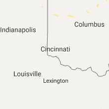
Hail Map for Sunday, June 4, 2017

Number of Impacted Households on 6/4/2017
0
Impacted by 1" or Larger Hail
0
Impacted by 1.75" or Larger Hail
0
Impacted by 2.5" or Larger Hail
Square Miles of Populated Area Impacted on 6/4/2017
0
Impacted by 1" or Larger Hail
0
Impacted by 1.75" or Larger Hail
0
Impacted by 2.5" or Larger Hail


Cities Most Affected by Hail Storms of 6/4/2017
| Hail Size | Demographics of Zip Codes Affected | ||||||
|---|---|---|---|---|---|---|---|
| City | Count | Average | Largest | Pop Density | House Value | Income | Age |
| Goliad, TX | 1 | 2.75 | 2.75 | 6 | $52k | $32.6k | 45.6 |
| Falfurrias, TX | 1 | 1.75 | 1.75 | 19 | $35k | $17.9k | 37.2 |
| Corpus Christi, TX | 1 | 1.75 | 1.75 | 387 | $56k | $31.0k | 32.7 |
Hail and Wind Damage Spotted on 6/4/2017
Filter by Report Type:Hail ReportsWind Reports
States Impacted
Indiana, North Carolina, Ohio, South Carolina, Virginia, Texas, Montana, Idaho, New Mexico, Wyoming, UtahIndiana
| Local Time | Report Details |
|---|---|
| 3:15 PM EDT | Tree limb dow in kosciusko county IN, 37.2 miles WNW of Fort Wayne, IN |
| 4:05 PM EDT | Uprooted tree in noble county IN, 20.3 miles NW of Fort Wayne, IN |
| 4:08 PM EDT | Shed destroyed. debris was blown into a field. garage had windows shattered and door buckled. location and time estimated by radar. location was in noble county... but in noble county IN, 16.4 miles NW of Fort Wayne, IN |
| 5:20 PM EDT | Large tree dow in marshall county IN, 64.2 miles WNW of Fort Wayne, IN |
| 5:50 PM EDT | 4" diameter healthy limb down and shingle damage along with pea sized hai in huntington county IN, 18.6 miles SW of Fort Wayne, IN |
| 5:51 PM EDT | Large limb dow in wells county IN, 19 miles SW of Fort Wayne, IN |
| 6:10 PM EDT | 18" non-healthy tree limb fell on edge of a hous in huntington county IN, 24.9 miles WSW of Fort Wayne, IN |
North Carolina
| Local Time | Report Details |
|---|---|
| 3:35 PM EDT | Trees and powerlines down at the intersection of nc16 and macedonia church rd. also tree on mobile home at daniels estates. no injuries reported at this tim in alexander county NC, 49.9 miles NNW of Charlotte, NC |
| 3:54 PM EDT | 911 call center reported tree down on fallswood drive in gaston county NC, 21.1 miles W of Charlotte, NC |
| 3:55 PM EDT | 15 inch diameter tree downed in gaston county NC, 20.1 miles W of Charlotte, NC |
| 4:20 PM EDT | *** 1 inj *** tree on car at intersection of west sugar creek road and conner ridge roa in mecklenburg county NC, 7 miles NNE of Charlotte, NC |
| 4:21 PM EDT | 911 call center reported powerlines down on west charlotte ave in mt holl in gaston county NC, 12.4 miles WNW of Charlotte, NC |
| 4:40 PM EDT | Fire dept/rescue reported trees down at intersection of pineville road and buffalo shoals roa in iredell county NC, 34.4 miles NNW of Charlotte, NC |
| 4:40 PM EDT | Tree and arbor blown over at home in mecklenburg county NC, 15.7 miles N of Charlotte, NC |
| 4:41 PM EDT | 911 call center reported powerlines down on west charlotte ave in mt holl in gaston county NC, 12.4 miles WNW of Charlotte, NC |
| 4:42 PM EDT | *** 1 inj *** tree on car at intersection of west sugar creek road and conner ridge roa in mecklenburg county NC, 7 miles NNE of Charlotte, NC |
| 4:50 PM EDT | Trained spotter reported trees down at shearers road and owens farm roa in iredell county NC, 21.9 miles N of Charlotte, NC |
| 4:50 PM EDT | Social media reported trees down in iredell county NC, 21.2 miles N of Charlotte, NC |
| 5:35 PM EDT | Tree dow in durham county NC, 18.4 miles NW of Raleigh, NC |
| 7:18 PM EDT | Multiple trees dow in halifax county NC, 60.5 miles NE of Raleigh, NC |
Ohio
| Local Time | Report Details |
|---|---|
| 3:45 PM EDT | Report of a few trees snapped near richey road. size of trees unknow in van wert county OH, 31.1 miles SE of Fort Wayne, IN |
| 3:50 PM EDT | Estimated 55-60 mph wind gusts along with several branches dow in medina county OH, 39.4 miles SSW of Cleveland, OH |
| 3:54 PM EDT | Large tree downed in richwood area. time estimated by rada in union county OH, 35.9 miles NNW of Columbus, OH |
| 4:00 PM EDT | Shed tossed 80 yds and destroye in van wert county OH, 24.9 miles ESE of Fort Wayne, IN |
| 5:25 PM EDT | Richland county sheriff reported two trees down in the lucas are in richland county OH, 59.5 miles NNE of Columbus, OH |
| 5:25 PM EDT | A trained spotter reported a downed healthy tree off of route 314 in ontari in richland county OH, 58.6 miles NNE of Columbus, OH |
| 5:35 PM EDT | Richland county sheriff reported a tree down north of lexingto in richland county OH, 54.8 miles NNE of Columbus, OH |
| 5:40 PM EDT | Tree down near intersection of hayes st. and s. boggs st. time estimated by rada in logan county OH, 54.2 miles WNW of Columbus, OH |
South Carolina
| Local Time | Report Details |
|---|---|
| 3:48 PM EDT | Tree down on lloyd white roa in york county SC, 24.4 miles WSW of Charlotte, NC |
| 3:50 PM EDT | Tree reported down on galway lan in york county SC, 22.8 miles WSW of Charlotte, NC |
Virginia
| Local Time | Report Details |
|---|---|
| 4:30 PM EDT | Trees down in franklin county VA, 16.5 miles SE of Roanoke, VA |
| 4:33 PM EDT | Trees down in franklin county VA, 22.8 miles SSW of Roanoke, VA |
| 5:14 PM EDT | Tree down in bedford county VA, 21.2 miles E of Roanoke, VA |
| 5:18 PM EDT | Large limb blocking smith mountain lake pkwy. time radar estimated in bedford county VA, 23 miles ESE of Roanoke, VA |
| 6:14 PM EDT | Tree down over maple rd. time radar estimate in pittsylvania county VA, 38.2 miles SSE of Roanoke, VA |
| 6:18 PM EDT | Tree down across pleasant gap rd. time radar estimate in pittsylvania county VA, 47.1 miles SE of Roanoke, VA |
| 6:24 PM EDT | Tree down across riceville rd. time radar estimate in pittsylvania county VA, 49.9 miles ESE of Roanoke, VA |
| 6:30 PM EDT | Tree down on chatham road in halifax county VA, 56.5 miles ESE of Roanoke, VA |
| 6:37 PM EDT | Tree down. marble size hail also reported. time from rada in halifax county VA, 54.2 miles ESE of Roanoke, VA |
| 10:24 PM EDT | Mesonet station xhmp... hampton flat in city of hampton county VA, 23.8 miles NW of Virginia Beach, VA |
| 10:26 PM EDT | Mesonet station xmgl... middle ground lighthous in anz638 county VA, 22.7 miles NW of Virginia Beach, VA |
Texas
| Local Time | Report Details |
|---|---|
| 5:23 PM CDT | Storm damage reported in nueces county TX, 3.3 miles SSW of Corpus Christi, TX |
| 5:55 PM CDT | Photos reveal a large metal storage roof was ripped from its structure and wrapped around a nearby large tree. large tree branches torn of in dewitt county TX, 63.8 miles ESE of San Antonio, TX |
| 5:55 PM CDT | Relayed to emc by westoff fire dept official in dewitt county TX, 63.9 miles ESE of San Antonio, TX |
| 6:06 PM CDT | Quarter sized hail reported near Corpus Christi, TX, 3.3 miles SSW of Corpus Christi, TX, near alameda and everhart street |
| 6:06 PM CDT | Golf Ball sized hail reported near Corpus Christi, TX, 3.3 miles SSW of Corpus Christi, TX, alameda and airline intersection |
| 6:17 PM CDT | Baseball sized hail reported near Goliad, TX, 65.8 miles N of Corpus Christi, TX |
| 8:25 PM CDT | Quarter sized hail reported near Goliad, TX, 60.2 miles N of Corpus Christi, TX |
| 8:25 PM CDT | Storm damage reported in goliad county TX, 60.2 miles N of Corpus Christi, TX |
| 8:55 PM CDT | Pea size hail occurred along with high wind gust in bandera county TX, 51.6 miles WNW of San Antonio, TX |
| 9:47 PM CDT | Asos peak wind gust from the north. fastest 2-minute wind speed was 54 mph from the nort in medina county TX, 41.6 miles W of San Antonio, TX |
| 10:06 PM CDT | Several people trapped in an overturned mobile home or trailer. injuries unknown in aransas county TX, 28.7 miles NE of Corpus Christi, TX |
| 10:06 PM CDT | Several people trapped in an overturned mobile home or trailer. injuries unknown in aransas county TX, 22.4 miles NE of Corpus Christi, TX |
| 10:24 PM CDT | High thunderstorm wind gusts near hwy 173 and fm1343 during travel to devin in medina county TX, 32.9 miles WSW of San Antonio, TX |
| 10:45 PM CDT | Golf Ball sized hail reported near Falfurrias, TX, 60.2 miles SW of Corpus Christi, TX, brooks county so reported golf ball size hail 5 miles of highway 77 on e 285. |
Montana
| Local Time | Report Details |
|---|---|
| 4:32 PM MDT | Spotter estimated 60 mph gust and penny-size hai in cascade county MT, 8.2 miles E of Great Falls, MT |
| 4:43 PM MDT | Quarter sized hail reported near Great Falls, MT, 12.3 miles ENE of Great Falls, MT, spotter reported quarter-size hail. |
| 5:11 PM MDT | Chaser estimated 70 mph gust. wind was rocking ca in chouteau county MT, 36 miles NE of Great Falls, MT |
Idaho
| Local Time | Report Details |
|---|---|
| 4:46 PM MDT | Measured at materials fuels complex noaa arl mesonet site. time estimated from rada in bingham county ID, 31.3 miles WNW of Idaho Falls, ID |
| 4:55 PM MDT | Measured at the rover noaa arl mesonet site. time estimated from rada in jefferson county ID, 29.1 miles WNW of Idaho Falls, ID |
| 5:11 PM MDT | Measured at the terreton noaa arl mesonet site. time estimated from rada in jefferson county ID, 30.6 miles NW of Idaho Falls, ID |
| 5:30 PM MDT | A former nws senior forecaster reported very strong wind gusts associated with a fast moving outflow boundary from nearby storms. locally lots of tree branches down...s in canyon county ID, 26.8 miles WNW of Boise, ID |
| 6:36 PM MDT | Storm damage reported in elmore county ID, 41.8 miles SSE of Boise, ID |
| 6:52 PM MDT | With passage of cold front in elmore county ID, 43 miles SSE of Boise, ID |
| 6:55 PM MDT | With passage of cold front in owyhee county ID, 38.3 miles WNW of Twin Falls, ID |
| 7:00 PM MDT | Measured at the noaa arl mesonet site near minidok in minidoka county ID, 47.9 miles ENE of Twin Falls, ID |
| 7:45 PM MDT | With passage of cold front in elmore county ID, 49.3 miles SE of Boise, ID |
New Mexico
| Local Time | Report Details |
|---|---|
| 5:19 PM MDT | Storm damage reported in chaves county NM, 35.6 miles N of Roswell, NM |
Wyoming
| Local Time | Report Details |
|---|---|
| 5:59 PM MDT | Dry microburst from shower activity at the riverton airpor in fremont county WY, 3.9 miles NW of Riverton, WY |
Utah
| Local Time | Report Details |
|---|---|
| 9:10 PM MDT | Winds from a dry microburst knocked over a section of fence and caused damage to large tree limbs in clearfiel in davis county UT, 24.5 miles NNW of Salt Lake City, UT |
| 9:15 PM MDT | Hill air force base sensor. winds caused by dry microburst moving through the are in davis county UT, 24.5 miles N of Salt Lake City, UT |
Connect with Interactive Hail Maps