

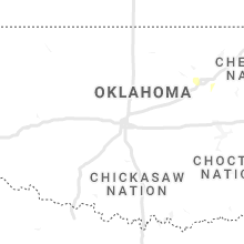
Hail Map for Wednesday, March 17, 2021

Number of Impacted Households on 3/17/2021
0
Impacted by 1" or Larger Hail
0
Impacted by 1.75" or Larger Hail
0
Impacted by 2.5" or Larger Hail
Square Miles of Populated Area Impacted on 3/17/2021
0
Impacted by 1" or Larger Hail
0
Impacted by 1.75" or Larger Hail
0
Impacted by 2.5" or Larger Hail


Cities Most Affected by Hail Storms of 3/17/2021
| Hail Size | Demographics of Zip Codes Affected | ||||||
|---|---|---|---|---|---|---|---|
| City | Count | Average | Largest | Pop Density | House Value | Income | Age |
| Anderson, MO | 2 | 1.88 | 2.00 | 42 | $59k | $29.8k | 38.4 |
| Gordo, AL | 1 | 2.75 | 2.75 | 21 | $73k | $34.2k | 39.8 |
| Eagle Rock, MO | 1 | 2.00 | 2.00 | 24 | $87k | $30.2k | 53.8 |
| Aurora, MO | 1 | 2.00 | 2.00 | 75 | $62k | $27.4k | 39.7 |
| Mount Vernon, MO | 1 | 1.75 | 1.75 | 65 | $74k | $32.9k | 41.1 |
| Pineville, MO | 1 | 1.75 | 1.75 | 35 | $70k | $27.5k | 38.2 |
| Garfield, AR | 1 | 1.75 | 1.75 | 57 | $95k | $37.6k | 44.9 |
Hail and Wind Damage Spotted on 3/17/2021
Filter by Report Type:Hail ReportsWind Reports
States Impacted
Texas, Missouri, Arkansas, Alabama, Oklahoma, Tennessee, Louisiana, Mississippi, Georgia, FloridaTexas
| Local Time | Report Details |
|---|---|
| 7:08 AM CDT | Sheriff office reports multiple highway signs down on i-30 as well as a few trees also down in the same northern part of the county along i-30. small hail was also repo in titus county TX, 75.2 miles SW of Nashville, AR |
| 7:13 AM CDT | Many trees and power lines reported down in city of mount pleasant by p in titus county TX, 84.1 miles SW of Nashville, AR |
| 7:15 AM CDT | Mcdonalds sign blown over and gas pump blown over at convenience store... winds estimated at 60-75 mp in titus county TX, 79.7 miles SW of Nashville, AR |
| 7:15 AM CDT | Corrects previous tstm wnd dmg report from 5 ne mount pleasant. mcdonalds sign blown over and gas pump blown over at convenience store e-z mart... at i-30 and bus 27 in titus county TX, 85.4 miles SW of Nashville, AR |
| 7:15 AM CDT | Corrects previous tstm wnd dmg report from 1 nw mount pleasant. public sent pictures via nws shreveport twitter of wind damage to fences and scoreboard at softball fiel in titus county TX, 84.5 miles SW of Nashville, AR |
| 7:28 AM CDT | Tree in the south bound lane of us 259 at the intersection of cr 423 in bowie county TX, 59.3 miles SW of Nashville, AR |
| 7:52 AM CDT | Multiple trees reported down in the south east part of the count in smith county TX, 65.4 miles NNW of Lufkin, TX |
| 8:38 AM CDT | Trees reported dow in harrison county TX, 49.9 miles WNW of Shreveport, LA |
| 8:52 AM CDT | Trees down in karnack... trooper vehicle damaged with falling tree... no injurie in harrison county TX, 26.9 miles WNW of Shreveport, LA |
| 8:55 AM CDT | Trees down in elysian fields and a tree fell on a troopers vehicle damaging the vehicle... no injurie in harrison county TX, 29.1 miles W of Shreveport, LA |
| 9:15 AM CDT | Several trees dow in panola county TX, 43.9 miles SW of Shreveport, LA |
| 11:10 AM CDT | Quarter sized hail reported near Houston, TX, 5.8 miles WNW of Houston, TX, social media photo post of 1 inch hail . |
Missouri
| Local Time | Report Details |
|---|---|
| 8:05 AM CDT | Quarter sized hail reported near California, MO, 19.6 miles SSW of Columbia, MO |
| 8:10 AM CDT | Quarter sized hail reported near Centertown, MO, 23.7 miles S of Columbia, MO, via twitter with picture. |
| 8:14 AM CDT | Quarter sized hail reported near Centertown, MO, 24.3 miles S of Columbia, MO, report from mping: quarter (1.00 in.). |
| 3:45 PM CDT | Half Dollar sized hail reported near Noel, MO, 78.5 miles WSW of Springfield, MO, public report relayed by law enforcement. |
| 3:54 PM CDT | Quarter sized hail reported near Anderson, MO, 74.3 miles WSW of Springfield, MO |
| 3:55 PM CDT | Golf Ball sized hail reported near Pineville, MO, 73.5 miles SW of Springfield, MO |
| 3:57 PM CDT | Quarter sized hail reported near Anderson, MO, 75.1 miles WSW of Springfield, MO |
| 3:58 PM CDT | Golf Ball sized hail reported near Anderson, MO, 74.3 miles WSW of Springfield, MO |
| 3:59 PM CDT | Quarter sized hail reported near Anderson, MO, 74.1 miles WSW of Springfield, MO |
| 4:01 PM CDT | Hen Egg sized hail reported near Anderson, MO, 74.3 miles WSW of Springfield, MO, damage reported to vehicle windows. |
| 4:23 PM CDT | Quarter sized hail reported near Stella, MO, 61.9 miles WSW of Springfield, MO |
| 5:05 PM CDT | Quarter sized hail reported near Stella, MO, 57.8 miles WSW of Springfield, MO |
| 5:18 PM CDT | Half Dollar sized hail reported near Seligman, MO, 59.6 miles SW of Springfield, MO |
| 5:21 PM CDT | Quarter sized hail reported near Cassville, MO, 48.5 miles SW of Springfield, MO |
| 5:30 PM CDT | Quarter sized hail reported near Eagle Rock, MO, 52.9 miles SSW of Springfield, MO |
| 5:34 PM CDT | Half Dollar sized hail reported near Eagle Rock, MO, 52.1 miles SW of Springfield, MO, half dollar sized hail reported via mping. |
| 5:36 PM CDT | Half Dollar sized hail reported near Monett, MO, 40.9 miles SW of Springfield, MO |
| 5:42 PM CDT | Quarter sized hail reported near Monett, MO, 40.4 miles WSW of Springfield, MO |
| 5:43 PM CDT | Quarter sized hail reported near Sarcoxie, MO, 41.2 miles WSW of Springfield, MO, quarter sized hail reported via mping. |
| 5:52 PM CDT | Hen Egg sized hail reported near Eagle Rock, MO, 52.1 miles SW of Springfield, MO, two inch hail reported via mping. |
| 5:54 PM CDT | Large tree was reported down on highway 76 blocking traffi in barry county MO, 44.4 miles SSW of Springfield, MO |
| 6:04 PM CDT | Half Dollar sized hail reported near Mount Vernon, MO, 30 miles WSW of Springfield, MO |
| 6:06 PM CDT | Golf Ball sized hail reported near Mount Vernon, MO, 30.5 miles WSW of Springfield, MO |
| 6:06 PM CDT | Quarter sized hail reported near Mount Vernon, MO, 29.8 miles WSW of Springfield, MO, quarter sized hail reported via mping. |
| 6:10 PM CDT | Significant damage reported to a barn and garage. a trampoline was reported to have impaled into a hom in barry county MO, 43.6 miles SW of Springfield, MO |
| 6:16 PM CDT | Quarter sized hail reported near Mount Vernon, MO, 29.6 miles WSW of Springfield, MO |
| 6:27 PM CDT | Hen Egg sized hail reported near Aurora, MO, 31.6 miles SW of Springfield, MO, hen egg sized hail reported via mping. |
| 6:27 PM CDT | Many trees reported down near the intersection of highway 413 and wheeler branch roa in stone county MO, 27.7 miles SSW of Springfield, MO |
| 6:37 PM CDT | Trees were reported down and road blocked on highway 41 in stone county MO, 27.7 miles SSW of Springfield, MO |
| 6:42 PM CDT | Several large trees were reported down blocking highway u near lake branch roa in stone county MO, 18.7 miles SSW of Springfield, MO |
| 6:53 PM CDT | Winds were estimated at 65-70mph along with nickle sized hai in stone county MO, 17.7 miles SSW of Springfield, MO |
| 6:56 PM CDT | Quarter sized hail reported near Clever, MO, 13.1 miles SSW of Springfield, MO, quarter sized hail reported via mping. |
| 6:58 PM CDT | Quarter sized hail reported near Nixa, MO, 11.7 miles S of Springfield, MO |
| 7:00 PM CDT | Ping Pong Ball sized hail reported near Highlandville, MO, 19.9 miles S of Springfield, MO, ping pong ball sized hail was reported. |
| 7:10 PM CDT | Quarter sized hail reported near Ozark, MO, 13.5 miles SSE of Springfield, MO, quarter sized hail reported via mping. |
| 7:58 PM CDT | Quarter sized hail reported near Seymour, MO, 29.1 miles E of Springfield, MO, report of quarter sized hail. |
Arkansas
| Local Time | Report Details |
|---|---|
| 8:47 AM CDT | Several trees reported down in the nashville are in howard county AR, 0.2 miles NW of Nashville, AR |
| 5:07 PM CDT | Golf Ball sized hail reported near Garfield, AR, 60.9 miles SW of Springfield, MO, relayed via social media |
Alabama
| Local Time | Report Details |
|---|---|
| 12:19 PM CDT | Quarter sized hail reported near Sulligent, AL, 49.3 miles NE of Starkville, MS, corrects previous hail report from 1 ene lamar county airport. mostly dime size hail... but a few to quarter size near the lamar county airport. hail lasted only a minu |
| 12:31 PM CDT | Quarter sized hail reported near Sulligent, AL, 49.3 miles NE of Starkville, MS, mostly dime size hail... but a few to quarter size near the lamar county airport. hail lasted only a minute or two. |
| 12:37 PM CDT | 20 to 30 trees blown down and minor structural damage near highway 17 and walker roa in sumter county AL, 62.9 miles WNW of Camden, AL |
| 12:44 PM CDT | Several trees and power lines were blown down along highway 83... highway 84... highway 528... and highway 26. at least one structure was damaged. possible tornad in dallas county AL, 41.2 miles NNE of Camden, AL |
| 1:02 PM CDT | Several trees were blown down and at least 4 structures were damaged in bluffport. damage was reported at highway 21 and valley road. possible tornad in sumter county AL, 63.6 miles NW of Camden, AL |
| 1:57 PM CDT | Baseball sized hail reported near Gordo, AL, 53.7 miles E of Starkville, MS, baseball and golfball size hail in gordo. relayed through social media pictures. |
| 3:30 PM CDT | Report from mping: 3-inch tree limbs broken; power poles broke in coosa county AL, 51.3 miles WNW of Auburn, AL |
| 4:00 PM CDT | Four homes damaged and trees down on silas branch rd in the silas communit in choctaw county AL, 62.3 miles WSW of Camden, AL |
| 5:05 PM CDT | Damage reported along hwy 31. possible tornad in jefferson county AL, 11.7 miles N of Birmingham, AL |
| 5:52 PM CDT | Trees down near the intersection of hwy 231 and cr 33. possible tornad in blount county AL, 36.7 miles NNE of Birmingham, AL |
| 6:02 PM CDT | Structural damage along promise lane. possible tornad in blount county AL, 41.1 miles NNE of Birmingham, AL |
| 7:32 PM CDT | Trees and power lines down on cr747 near cr1514 intersection north of simcoe. report relayed from em in cullman county AL, 50.5 miles N of Birmingham, AL |
| 8:00 PM CDT | Possible structure damage in the gold ridge area north of simcoe on cr152 in cullman county AL, 52.6 miles N of Birmingham, AL |
Oklahoma
| Local Time | Report Details |
|---|---|
| 1:53 PM CDT | Quarter sized hail reported near Broken Arrow, OK, 15.4 miles SE of Tulsa, OK, off duty meteorologist 1 mile west of nsu ba. |
| 2:42 PM CDT | Quarter sized hail reported near Tulsa, OK, 5.8 miles SSW of Tulsa, OK, report from mping: quarter (1.00 in.). |
Tennessee
| Local Time | Report Details |
|---|---|
| 1:53 PM CDT | Trees down and likely power lines too along riverside and rochell road in medo in madison county TN, 50.4 miles SSW of Mc Kenzie, TN |
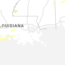
Louisiana
| Local Time | Report Details |
|---|---|
| 3:47 PM CDT | Kara measured a 60kt peak wind gus in iberia county LA, 15.5 miles SSE of Lafayette, LA |
| 4:27 PM CDT | Public reported via social media about a fallen tree in denham springs on hwy 447/walker s rd and both nb/sb of hammack rd/hood r in livingston county LA, 63.6 miles NW of New Orleans, LA |
| 4:32 PM CDT | Report from east baton rouge parish about power line down and tree on vehicle near jefferson and stumberg by tiger ben in east baton rouge county LA, 59.6 miles ENE of Lafayette, LA |
| 5:43 PM CDT | Cajun navy via social media reports roof damage to a home. time estimated by rada in livingston county LA, 59.7 miles NW of New Orleans, LA |
| 5:48 PM CDT | Numerous trees and power lines down... and some roof damage to some homes. damage was reported parsh-wide... but occurred mostly north and east of franklinto in washington county LA, 63.8 miles N of New Orleans, LA |
Mississippi
| Local Time | Report Details |
|---|---|
| 3:52 PM CDT | Public reported tree debris on road 61 via social media in wilkinson county. possible tornad in wilkinson county MS, 66.1 miles NNE of Lafayette, LA |
| 4:39 PM CDT | Tree limbs downed along us 8 in franklin county MS, 74 miles SW of Jackson, MS |
| 4:54 PM CDT | Utility pole and lines downed on clay st near i-2 in warren county MS, 39.3 miles W of Jackson, MS |
| 5:08 PM CDT | Trees downed in utica and along the natchez trace parkwa in hinds county MS, 28.3 miles WSW of Jackson, MS |
| 5:10 PM CDT | Quarter sized hail reported near Pontotoc, MS, 51 miles N of Starkville, MS, quarter size hail in black zion |
| 5:16 PM CDT | Trees downe in hinds county MS, 16.7 miles WNW of Jackson, MS |
| 5:17 PM CDT | Trees downe in hinds county MS, 18.4 miles NW of Jackson, MS |
| 5:18 PM CDT | Small to medium sized limbs downed along ms highway in yazoo county MS, 33.6 miles NW of Jackson, MS |
| 5:23 PM CDT | Ping Pong Ball sized hail reported near Belden, MS, 59 miles N of Starkville, MS, estimated 1 1/2 inch sized hail reported in endville community. corrected time and location. |
| 5:35 PM CDT | Half Dollar sized hail reported near Belden, MS, 58.2 miles N of Starkville, MS, quarter to half dollar sized hail near belden. |
| 5:43 PM CDT | Ping Pong Ball sized hail reported near Batesville, MS, 58 miles S of Memphis, TN, estimated 1 1/2 inch sized hail reported in endville. |
| 5:44 PM CDT | Scattered trees and tree limbs downed across madison count in madison county MS, 23 miles NNE of Jackson, MS |
| 5:50 PM CDT | Measured at the jan aso in rankin county MS, 6.1 miles ENE of Jackson, MS |
| 5:51 PM CDT | Powerlines down at the corner of hwy 13 and riverbend roa in marion county MS, 66.9 miles SSE of Jackson, MS |
| 5:58 PM CDT | Tree downed on a house on harper r in madison county MS, 43.1 miles NNE of Jackson, MS |
| 6:01 PM CDT | One home damaged and trees down on military r in marion county MS, 74.4 miles NNE of New Orleans, LA |
| 6:01 PM CDT | Trees and power lines down on buddy price r in jefferson davis county MS, 51.7 miles SSE of Jackson, MS |
| 6:03 PM CDT | Possible tornado...report received via sm of considerable damage to a few homes along highway 43 about 15 miles south of columbi in marion county MS, 78 miles NNE of New Orleans, LA |
| 6:03 PM CDT | Corrects previous tstm wnd dmg report from progress. a few trees down on progress r in jefferson davis county MS, 54.3 miles SSE of Jackson, MS |
| 6:05 PM CDT | Trees and powerlines down on mt. zion rd. near hwy 8 in jefferson davis county MS, 50.9 miles SSE of Jackson, MS |
| 6:05 PM CDT | Trees down on hall r in jefferson davis county MS, 50.5 miles SSE of Jackson, MS |
| 6:18 PM CDT | Several trees and limbs downed on roads across leake count in leake county MS, 48.2 miles NE of Jackson, MS |
| 6:23 PM CDT | Trees downed across leake count in leake county MS, 47 miles ENE of Jackson, MS |
| 6:23 PM CDT | Scattered trees downed around attala count in attala county MS, 53 miles WSW of Starkville, MS |
| 6:24 PM CDT | Scattered downed trees across covington count in covington county MS, 58.2 miles SE of Jackson, MS |
| 6:24 PM CDT | Tree downed on ms highway 589 at luther lee r in lamar county MS, 85.9 miles SSE of Jackson, MS |
| 6:32 PM CDT | Six trees downed and damage to the roof of a home along ms highway 14 near the winston/attala county lin in winston county MS, 39.7 miles SW of Starkville, MS |
| 6:36 PM CDT | Tree blown down onto a hous in forrest county MS, 84.5 miles SE of Jackson, MS |
| 6:37 PM CDT | Trees down on ollie williams r in forrest county MS, 80.2 miles WNW of Mobile, AL |
| 6:38 PM CDT | Trees down on anderson r in forrest county MS, 79.3 miles WNW of Mobile, AL |
| 6:45 PM CDT | Tree downed on ms highway 1 in jasper county MS, 61.9 miles ESE of Jackson, MS |
| 6:52 PM CDT | Trees downed blocking both lanes of ms highway 12 near the oktibbeha/choctaw county lin in oktibbeha county MS, 18.2 miles WSW of Starkville, MS |
| 6:57 PM CDT | Tree downed on a power line along ms highway 1 in choctaw county MS, 20.4 miles W of Starkville, MS |
| 7:05 PM CDT | Multiple trees downed across self creek rd. reported via social medi in oktibbeha county MS, 9.2 miles W of Starkville, MS |
| 7:06 PM CDT | Tree downed along ms highway 389 north of starkvill in oktibbeha county MS, 5.2 miles NNW of Starkville, MS |
| 7:07 PM CDT | Reported by meteorology students on the campus of mississippi state universit in oktibbeha county MS, 1.7 miles SE of Starkville, MS |
| 7:19 PM CDT | Trees downed along ms highway 50 near ms highway 4 in clay county MS, 10.8 miles NNE of Starkville, MS |
| 7:21 PM CDT | Trees downed on houses in west poin in clay county MS, 13.7 miles NE of Starkville, MS |
| 7:30 PM CDT | Large tree snapped at the trunk near egypt communit in chickasaw county MS, 30.3 miles N of Starkville, MS |
| 7:32 PM CDT | Tree downed along 5th st in lowndes county MS, 22.2 miles E of Starkville, MS |
| 7:39 PM CDT | Tree downed along tabernacle r in lowndes county MS, 28.7 miles E of Starkville, MS |
| 7:42 PM CDT | Several trees down on a few roads in nettleton.maple road and benton street and a few other road in lee county MS, 44.4 miles NNE of Starkville, MS |
| 7:45 PM CDT | Several trees down between nettleton and richmond on highways 452 and 141 in lee county MS, 44.4 miles NNE of Starkville, MS |
| 7:48 PM CDT | Several trees down in richmond in lee county MS, 50.8 miles N of Starkville, MS |
| 7:55 PM CDT | A few trees down in fulton on south and north cummings street in itawamba county MS, 55.7 miles SW of Florence, AL |
| 8:24 PM CDT | Trees down in richmond in lee county MS, 50.8 miles N of Starkville, MS |
| 8:26 PM CDT | A few trees down on progress r in jefferson davis county MS, 54.3 miles SSE of Jackson, MS |
Georgia
| Local Time | Report Details |
|---|---|
| 6:13 PM EDT | Quarter sized hail reported near Americus, GA, 76.1 miles ESE of Auburn, AL, hail up to a quarter sized in diameter was reported along hwy 30 in between buchanan rd and youngs mill rd. |
| 7:05 PM EDT | Quarter sized hail reported near Americus, GA, 76.1 miles ESE of Auburn, AL, hail up to a quarter sized in diameter was reported along hwy 30 in between buchanan rd and youngs mill rd. |
Florida
| Local Time | Report Details |
|---|---|
| 3:25 AM CDT | 52 knot wind gust over santa rosa soun in santa rosa county FL, 44.2 miles W of Miramar Beach, FL |
| 6:04 AM CDT | At 1100z... asos reported a gust to 64 kt (74 mph). follow up with tower observer indicated a peak wind of 71 kt (82 mph) at 1104z for a 2 minute duratio in bay county FL, 33.5 miles E of Miramar Beach, FL |
Connect with Interactive Hail Maps