

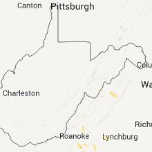
Hail Map for Tuesday, March 20, 2012

Number of Impacted Households on 3/20/2012
0
Impacted by 1" or Larger Hail
0
Impacted by 1.75" or Larger Hail
0
Impacted by 2.5" or Larger Hail
Square Miles of Populated Area Impacted on 3/20/2012
0
Impacted by 1" or Larger Hail
0
Impacted by 1.75" or Larger Hail
0
Impacted by 2.5" or Larger Hail


Cities Most Affected by Hail Storms of 3/20/2012
| Hail Size | Demographics of Zip Codes Affected | ||||||
|---|---|---|---|---|---|---|---|
| City | Count | Average | Largest | Pop Density | House Value | Income | Age |
| Harrisonburg, VA | 1 | 1.75 | 1.75 | 289 | $99k | $34.4k | 32.6 |
Hail and Wind Damage Spotted on 3/20/2012
Filter by Report Type:Hail ReportsWind Reports
Texas
| Local Time | Report Details |
|---|---|
| 8:00 AM CDT | Many trees down and damage to homes. possible tornad in harris county TX, 9 miles W of Houston, TX |
| 8:00 AM CDT | Trees down. no damage reported to home in harris county TX, 9 miles W of Houston, TX |
| 8:00 AM CDT | Trees down and fences blown down. time esimated based on rada in harris county TX, 11.5 miles W of Houston, TX |
| 8:22 AM CDT | Shingles blown off a roof and a fence blown down south fork subdivisio in brazoria county TX, 16 miles S of Houston, TX |
| 8:32 AM CDT | Tree snapped. limbs off other trees. truck moved by win in harris county TX, 3 miles SSE of Houston, TX |
| 8:36 AM CDT | Trees down. damage to carport in harris county TX, 7.8 miles E of Houston, TX |
| 8:40 AM CDT | Trees down on the 4600 block of gibson stree in harris county TX, 2.5 miles WNW of Houston, TX |
| 3:45 PM CDT | Dry microburst in midland county TX, 20.2 miles ENE of Odessa, TX |
Louisiana
| Local Time | Report Details |
|---|---|
| 12:00 PM CDT | Trees down and power out century road and plainview road areas in sabine county LA, 74.7 miles E of Lufkin, TX |
| 12:15 PM CDT | Numerous trees and power lines down in mount carmel in sabine county LA, 74.5 miles SSE of Shreveport, LA |
| 12:15 PM CDT | Trees down on hwy 487 near marthaville in natchitoches county LA, 56.9 miles SSE of Shreveport, LA |
| 12:30 PM CDT | Trees down on hwy 117 near provencal in natchitoches county LA, 67.7 miles SSE of Shreveport, LA |
| 1:00 PM CDT | Trees down on hwy 155 near ashland in natchitoches county LA, 46.1 miles SE of Shreveport, LA |
| 1:40 PM CDT | Trees down on hwy 1233 near calvin in winn county LA, 63.5 miles ESE of Shreveport, LA |
| 1:45 PM CDT | Trees down on hwy 156 between winnfield and calvin in winn county LA, 72.5 miles SW of Bastrop, LA |
| 1:55 PM CDT | Trees down on highways 34 and 1231 converging near winnfield in winn county LA, 72.8 miles SW of Bastrop, LA |
| 2:15 PM CDT | Tree down on a house along peace road in union county LA, 25 miles W of Bastrop, LA |
| 3:45 PM CDT | Tree down on hwy 143 near rocky branch blocking both lane in union county LA, 19.1 miles WNW of Bastrop, LA |
| 5:18 PM CDT | Tractor trailer overturned on 171 and cars tossed around in a parking lot. radar did show some rotation at that tim in beauregard county LA, 53.2 miles NNE of Beaumont, TX |
| 5:18 PM CDT | Camper partially overturned at cars plus lot on hwy 171. radar did show some rotation at that tim in beauregard county LA, 54.7 miles NNE of Beaumont, TX |
| 4:33 AM CDT | Quarter sized hail reported near Jennings, LA, 38.5 miles W of Lafayette, LA, kplc-tv relayed public report of quarter size hail near 1-10 and jennings. |
| 5:13 AM CDT | Vermillion sheriff reports a house destroyed at 600 garland st in gueydan due to a possible tornado touchdow in vermilion county LA, 32.3 miles WSW of Lafayette, LA |
| 5:25 AM CDT | Kplc tv relayed a public report of roofs blown off of homes and numerous powerlines down in lake arthur. the main street in lake arthur is blocked in jefferson davis county LA, 40.8 miles WSW of Lafayette, LA |
| 5:52 AM CDT | Debris on south henry rd near the abbeville airport. a vehicle struck a tree on the roadway. a shed was also destroye in vermilion county LA, 18.3 miles SSW of Lafayette, LA |
| 5:52 AM CDT | Debris and trees reported on the perry bridg in vermilion county LA, 20.2 miles SSW of Lafayette, LA |
| 6:00 AM CDT | Klfy reports powerlines down along highway 82 near perry in vermilion county LA, 20.2 miles SSW of Lafayette, LA |
| 6:05 AM CDT | Public reports an estimated wind gust of 60 mph near abbevill in vermilion county LA, 18.3 miles SSW of Lafayette, LA |
North Carolina
| Local Time | Report Details |
|---|---|
| 2:52 PM EDT | Quarter sized hail reported near Morganton, NC, 60.3 miles NW of Charlotte, NC |
| 5:10 PM EDT | Quarter sized hail reported near Chocowinity, NC, 87.8 miles ESE of Raleigh, NC, broadcast media relayed public report of nickel to quarter size hail. |
| 5:14 PM EDT | Quarter sized hail reported near Louisburg, NC, 31.7 miles NE of Raleigh, NC |
| 5:15 PM EDT | Quarter sized hail reported near Chocowinity, NC, 85 miles ESE of Raleigh, NC, beaufort 911 center relayed public report of nickel to quarter size hail on hodges rd west of chocowinity. |
| 5:18 PM EDT | Quarter sized hail reported near Chocowinity, NC, 88.9 miles ESE of Raleigh, NC, broadcast media relayed public report of quarter size hail at andys in chocowinity. |
| 5:54 PM EDT | Quarter sized hail reported near Louisburg, NC, 21.7 miles NE of Raleigh, NC, quarter size hail reported west of bunn |
| 6:00 PM EDT | Quarter sized hail reported near Louisburg, NC, 22.3 miles ENE of Raleigh, NC, quarter size hail reported on bob richards road |
| 7:07 PM EDT | Quarter sized hail reported near Ruffin, NC, 57.1 miles SSE of Roanoke, VA |
| 7:34 PM EDT | Quarter sized hail reported near Winston-Salem, NC, 62.4 miles NNE of Charlotte, NC, quarter sized hail reported at the walmart off of highway 150 |
Arkansas
| Local Time | Report Details |
|---|---|
| 3:31 PM CDT | Quarter sized hail reported near Sheridan, AR, 31.2 miles SSW of Little Rock, AR, dime to quarter size hail reported in and around sheridan. |
| 3:33 PM CDT | *** 1 inj *** trees and power lines were blown down. some trees fell on houses. one injury was caused by a tree falling into a house. a fence was blown down and the fas in conway county AR, 38.8 miles NW of Little Rock, AR |
| 3:33 PM CDT | A fence was blown down and there was damage to the fascia of a churc in conway county AR, 38.8 miles NW of Little Rock, AR |
| 3:33 PM CDT | A fence was blown down and there was damage to the fascia of a church. trees and power lines were blown down as wel in conway county AR, 38.8 miles NW of Little Rock, AR |
| 4:49 PM CDT | Several trees limbs repotrted down and pieces of siding blown off hous in van buren county AR, 46.1 miles N of Little Rock, AR |
| 4:53 PM CDT | Roofs were blown off two barns and a few trees were blown dow in van buren county AR, 46.3 miles N of Little Rock, AR |
| 5:21 PM CDT | Tree down over angora mountain road in stone county AR, 74.2 miles N of Little Rock, AR |
| 6:07 PM CDT | Nws storm survey team found straight line winds to be the cause of the damage at the mobile home park in midway with winds estimated at 75 mp in baxter county AR, 73.1 miles SE of Springfield, MO |
| 6:07 PM CDT | Two to three mobile homes collapased with people trapped inside. no reports of injuries at this tim in baxter county AR, 73.1 miles SE of Springfield, MO |
| 6:07 PM CDT | Trees down and siding ripped off of a home in baxter county AR, 69.4 miles SE of Springfield, MO |
Virginia
| Local Time | Report Details |
|---|---|
| 4:40 PM EDT | Quarter sized hail reported near Evington, VA, 40.4 miles E of Roanoke, VA |
| 4:45 PM EDT | Quarter sized hail reported near Evington, VA, 39.2 miles E of Roanoke, VA |
| 5:06 PM EDT | Quarter sized hail reported near Moneta, VA, 19.6 miles ESE of Roanoke, VA |
| 5:25 PM EDT | Quarter sized hail reported near Weyers Cave, VA, 67.3 miles SE of Elkins, WV, several minutes of nickel sized hail mixed with a few quarter sized. |
| 5:45 PM EDT | Quarter sized hail reported near Danville, VA, 56 miles SSE of Roanoke, VA |
| 5:45 PM EDT | Quarter sized hail reported near Chatham, VA, 42.7 miles SE of Roanoke, VA |
| 5:45 PM EDT | Quarter sized hail reported near Hardy, VA, 14.3 miles SE of Roanoke, VA, hail lasted 5 minutes. fell on middle valley road just outside of the town of hardy near west lake corner. no street address available. |
| 5:50 PM EDT | Quarter sized hail reported near Danville, VA, 56 miles SSE of Roanoke, VA |
| 5:55 PM EDT | Quarter sized hail reported near Hardy, VA, 15.2 miles SE of Roanoke, VA |
| 6:08 PM EDT | Quarter sized hail reported near Chatham, VA, 38.1 miles SE of Roanoke, VA |
| 6:15 PM EDT | Quarter sized hail reported near Danville, VA, 50.5 miles SSE of Roanoke, VA, lasted until 625 pm edt |
| 6:25 PM EDT | Quarter sized hail reported near Danville, VA, 53.1 miles SSE of Roanoke, VA |
| 6:25 PM EDT | Quarter sized hail reported near Dry Fork, VA, 47.6 miles SSE of Roanoke, VA |
| 6:34 PM EDT | Golf Ball sized hail reported near Harrisonburg, VA, 63.7 miles ESE of Elkins, WV |
| 6:35 PM EDT | Quarter sized hail reported near Harrisonburg, VA, 64.7 miles ESE of Elkins, WV |
| 6:37 PM EDT | Quarter sized hail reported near Keezletown, VA, 66.3 miles ESE of Elkins, WV |
| 6:37 PM EDT | Ping Pong Ball sized hail reported near Keezletown, VA, 67.1 miles ESE of Elkins, WV |
| 7:26 PM EDT | Quarter sized hail reported near Elkton, VA, 78.4 miles ESE of Elkins, WV, a few hailstones as large as nickels. |
Missouri
| Local Time | Report Details |
|---|---|
| 6:50 PM CDT | Emergency manager relayed a report of wind damage to a building off of county road 333 and highway n in douglas county MO, 52.6 miles ESE of Springfield, MO |
| 7:05 PM CDT | Report of powerline down along hwy p in wright county MO, 49.4 miles E of Springfield, MO |
Connect with Interactive Hail Maps