

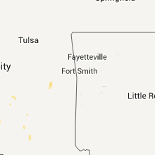
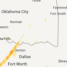
Hail Map for Monday, March 19, 2012

Number of Impacted Households on 3/19/2012
0
Impacted by 1" or Larger Hail
0
Impacted by 1.75" or Larger Hail
0
Impacted by 2.5" or Larger Hail
Square Miles of Populated Area Impacted on 3/19/2012
0
Impacted by 1" or Larger Hail
0
Impacted by 1.75" or Larger Hail
0
Impacted by 2.5" or Larger Hail


Cities Most Affected by Hail Storms of 3/19/2012
| Hail Size | Demographics of Zip Codes Affected | ||||||
|---|---|---|---|---|---|---|---|
| City | Count | Average | Largest | Pop Density | House Value | Income | Age |
| Leakey, TX | 3 | 1.75 | 1.75 | 1 | $64k | $26.1k | 50.1 |
| Utopia, TX | 2 | 1.75 | 1.75 | 1 | $91k | $34.4k | 53.8 |
| Dilley, TX | 2 | 1.75 | 1.75 | 5 | $26k | $22.0k | 30.6 |
| Ingram, TX | 2 | 1.75 | 1.75 | 87 | $89k | $33.5k | 46.7 |
| Hunt, TX | 1 | 2.75 | 2.75 | 2 | $188k | $43.5k | 51.8 |
| Fredericksburg, TX | 1 | 2.00 | 2.00 | 30 | $105k | $37.9k | 49.3 |
| Fredonia, TX | 1 | 1.75 | 1.75 | 1 | $37k | $17.1k | 48.8 |
| Bridgeport, TX | 1 | 1.75 | 1.75 | 81 | $83k | $40.2k | 35.8 |
| San Saba, TX | 1 | 1.75 | 1.75 | 7 | $47k | $29.6k | 37.0 |
| Pearsall, TX | 1 | 1.75 | 1.75 | 14 | $37k | $24.0k | 32.1 |
| Knippa, TX | 1 | 1.75 | 1.75 | 2 | $41k | $29.8k | 39.7 |
| Mason, TX | 1 | 1.75 | 1.75 | 1 | $56k | $32.0k | 48.6 |
| Kerrville, TX | 1 | 1.75 | 1.75 | 154 | $99k | $34.4k | 48.0 |
| Sonora, TX | 1 | 1.75 | 1.75 | 2 | $50k | $35.0k | 38.9 |
| Vanderpool, TX | 1 | 1.75 | 1.75 | 1 | $85k | $40.5k | 59.8 |
| Center Point, TX | 1 | 1.75 | 1.75 | 28 | $76k | $35.1k | 43.1 |
| Stonewall, TX | 1 | 1.75 | 1.75 | 7 | $84k | $35.5k | 47.1 |
| Whitefield, OK | 1 | 1.75 | 1.75 | 27 | $28k | $21.1k | 36.0 |
Hail and Wind Damage Spotted on 3/19/2012
Filter by Report Type:Hail ReportsWind Reports
States Impacted
Oklahoma, Kansas, South Dakota, North Carolina, South Carolina, Texas, Ohio, Missouri, West Virginia, Iowa, Virginia, Minnesota, Wisconsin, ArkansasOklahoma
| Local Time | Report Details |
|---|---|
| 11:43 AM CDT | Report of power poles damamaged near 45th and south 129th east avenue in tulsa in tulsa county OK, 9.2 miles E of Tulsa, OK |
| 5:00 PM CDT | Quarter sized hail reported near Marietta, OK, 65 miles WSW of Atoka, OK, the report was relayed by wfo fort worth. |
| 7:30 PM CDT | Golf Ball sized hail reported near Whitefield, OK, 47.2 miles W of Fort Smith, AR |
| 7:52 PM CDT | Quarter sized hail reported near Atoka, OK, 10.8 miles SSE of Atoka, OK |
| 9:30 PM CDT | Large tree down and blocking road off hwy 59 on north side of panam in le flore county OK, 20.4 miles SW of Fort Smith, AR |
| 9:50 PM CDT | Barn blown into hous in sequoyah county OK, 10.2 miles W of Fort Smith, AR |
| 10:00 PM CDT | Power pole and trees down in rolan in sequoyah county OK, 5.6 miles WNW of Fort Smith, AR |
Kansas
| Local Time | Report Details |
|---|---|
| 1:00 PM CDT | Barn blown down reported by emergency manager in cherokee county KS, 45.8 miles SE of Chanute, KS |
South Dakota
| Local Time | Report Details |
|---|---|
| 1:20 PM CDT | Outbuildings to farmstead were damaged by thunderstorm wind in moody county SD, 25.5 miles NNE of Sioux Falls, SD |
| 1:24 PM CDT | Quarter sized hail reported near Flandreau, SD, 38.7 miles NNE of Sioux Falls, SD, quarter size hail on 228th street. |
North Carolina
| Local Time | Report Details |
|---|---|
| 3:01 PM EDT | Quarter sized hail reported near Oak Island, NC, 24.4 miles SSW of Wilmington, NC, 15st street at yacht drive. lasted approximately three minutes. |
South Carolina
| Local Time | Report Details |
|---|---|
| 3:06 PM EDT | Quarter sized hail reported near Nichols, SC, 63.8 miles W of Wilmington, NC, 1 inch hail occurred briefly on u.s. highway 76...reported by public. |
| 3:23 PM EDT | Quarter sized hail reported near Green Sea, SC, 61.8 miles W of Wilmington, NC, 1 inch hail and two bradford pear trees downed. |
| 4:38 PM EDT | Quarter sized hail reported near Conway, SC, 64.5 miles NE of Charleston, SC, storm chaser reported one inch hail. |
| 4:42 PM EDT | Half Dollar sized hail reported near Conway, SC, 63.2 miles NE of Charleston, SC, lasted for approximately eight minutes. |
| 5:13 PM EDT | Quarter sized hail reported near Bishopville, SC, 71.7 miles N of Charleston, SC, hail covered the ground near the intersection of cypress road and cypress cemetary road. lots of dime to nickel size hail with some pieces up to the size of a quarter. |
Texas
| Local Time | Report Details |
|---|---|
| 2:25 PM CDT | Quarter sized hail reported near Bluff Dale, TX, 77.3 miles E of Abilene, TX, spotter reports quarters in thurber |
| 3:10 PM CDT | Quarter sized hail reported near Del Rio, TX, 62.4 miles N of Del Rio, TX |
| 3:12 PM CDT | Quarter sized hail reported near Sonora, TX, 64.3 miles N of Del Rio, TX, quarter size hail was reported 4 miles east of the intersection of the caverns of sonora road and rr 189. |
| 3:23 PM CDT | Golf Ball sized hail reported near Bridgeport, TX, 65.6 miles WNW of Dallas, TX, a few golfballs mixed with mostly dime and nickel hail |
| 3:30 PM CDT | Quarter sized hail reported near Poolville, TX, 62.9 miles WNW of Dallas, TX, public reported 1 inch hail in poolville |
| 4:02 PM CDT | Golf Ball sized hail reported near Sonora, TX, 84.2 miles NNE of Del Rio, TX, reported by traveler via local radio station. time was estimated per radar. |
| 4:48 PM CDT | Golf Ball sized hail reported near Junction, TX, 101.5 miles NE of Del Rio, TX, one vehicle was dented by this hail. |
| 5:10 PM CDT | Four wooden high tension power poles snapped off at the base along us 37 in kimble county TX, 104.6 miles NW of San Antonio, TX |
| 5:10 PM CDT | Power poles snapped off at the base along us 37 in kimble county TX, 104.6 miles NW of San Antonio, TX |
| 5:16 PM CDT | Quarter sized hail reported near Junction, TX, 100.9 miles NW of San Antonio, TX |
| 5:27 PM CDT | Golf Ball sized hail reported near Mason, TX, 99.4 miles NNW of San Antonio, TX |
| 5:32 PM CDT | Golf Ball sized hail reported near Knippa, TX, 69.7 miles W of San Antonio, TX, golfball size hail reported 4 miles south of highway 90 near knippa. |
| 6:03 PM CDT | Golf Ball sized hail reported near Fredonia, TX, 82.1 miles W of Killeen, TX |
| 6:12 PM CDT | Golf Ball sized hail reported near Utopia, TX, 60.9 miles WNW of San Antonio, TX, quarter up to golfball hail in utopia. |
| 6:13 PM CDT | Golf Ball sized hail reported near San Saba, TX, 75.3 miles W of Killeen, TX |
| 6:25 PM CDT | Golf Ball sized hail reported near Dilley, TX, 63 miles SW of San Antonio, TX |
| 6:35 PM CDT | Golf Ball sized hail reported near Leakey, TX, 73.4 miles ENE of Del Rio, TX |
| 6:39 PM CDT | Golf Ball sized hail reported near Pearsall, TX, 54.4 miles SW of San Antonio, TX, intersection of us57 and fm140 wall cloud went over house |
| 6:46 PM CDT | Golf Ball sized hail reported near Pearsall, TX, 53 miles SW of San Antonio, TX, damage to pickup on fm1582 |
| 6:54 PM CDT | Quarter sized hail reported near Mountain Home, TX, 75.9 miles NW of San Antonio, TX |
| 6:58 PM CDT | Quarter sized hail reported near San Saba, TX, 46.4 miles W of Killeen, TX, hail up to the size of quarters nearly covering the ground. |
| 7:00 PM CDT | Golf Ball sized hail reported near Leakey, TX, 73.4 miles ENE of Del Rio, TX, golfball size hail along with 2 inches of rainfall in less than an hour. |
| 7:12 PM CDT | Golf Ball sized hail reported near Vanderpool, TX, 71.9 miles WNW of San Antonio, TX |
| 7:25 PM CDT | Quarter sized hail reported near Lampasas, TX, 27 miles W of Killeen, TX, quarter size hail 1 n of city of lampasas at airport |
| 7:26 PM CDT | Golf Ball sized hail reported near Dilley, TX, 66.1 miles SW of San Antonio, TX |
| 7:28 PM CDT | Quarter sized hail reported near Lampasas, TX, 27 miles W of Killeen, TX, quarter sized hail 1 n of city of lampasas |
| 8:00 PM CDT | Golf Ball sized hail reported near Leakey, TX, 73.4 miles ENE of Del Rio, TX, pea to golfball size hail with some damage. |
| 8:10 PM CDT | Golf Ball sized hail reported near Ingram, TX, 65.3 miles NW of San Antonio, TX, inch to inch and three quarter size hail. |
| 8:15 PM CDT | Golf Ball sized hail reported near Kerrville, TX, 60.3 miles NW of San Antonio, TX, golfball hail reported near upper turtle creek 6 1 2 miles west of highway 16. |
| 8:15 PM CDT | Baseball sized hail reported near Hunt, TX, 66.3 miles NW of San Antonio, TX, walnut size to near baseball size hail. |
| 8:28 PM CDT | Quarter sized hail reported near Ingram, TX, 63.6 miles NW of San Antonio, TX |
| 8:29 PM CDT | Golf Ball sized hail reported near Ingram, TX, 65.8 miles NW of San Antonio, TX |
| 8:30 PM CDT | Golf Ball sized hail reported near Ingram, TX, 63.1 miles NW of San Antonio, TX, golfball size hail. |
| 8:45 PM CDT | Quarter sized hail reported near Copperas Cove, TX, 11.5 miles W of Killeen, TX, pd reports 1 inch hail |
| 9:05 PM CDT | Half Dollar sized hail reported near Uvalde, TX, 70.8 miles E of Del Rio, TX |
| 9:20 PM CDT | Tennis Ball sized hail reported near Utopia, TX, 63.8 miles WNW of San Antonio, TX |
| 9:40 PM CDT | Quarter sized hail reported near Brady, TX, 92.8 miles W of Killeen, TX, hail reported on us highway 87 5 miles sse of brady. |
| 10:00 PM CDT | Golf Ball sized hail reported near Vanderpool, TX, 70.8 miles WNW of San Antonio, TX, 2.04 inches of rainfall also |
| 10:00 PM CDT | Golf Ball sized hail reported near Utopia, TX, 66.2 miles WNW of San Antonio, TX, hail ranged in size from pea to golf ball size |
| 10:34 PM CDT | Quarter sized hail reported near Fredericksburg, TX, 59.9 miles NNW of San Antonio, TX |
| 10:40 PM CDT | Golf Ball sized hail reported near Center Point, TX, 51.7 miles NW of San Antonio, TX, 4.70 in rain. hail fell fo about an hour. mostly pea to dime size with golf ball mixed in. |
| 10:41 PM CDT | Golf Ball sized hail reported near Stonewall, TX, 57 miles N of San Antonio, TX, report relayed by broadcast media of golfball size hail in stonewall. |
| 10:41 PM CDT | Hen Egg sized hail reported near Fredericksburg, TX, 60.5 miles NNW of San Antonio, TX, 2 inch hail east of fredericksburg near highway 290 reported by spotter. |
| 12:20 AM CDT | Large trees were knocked down near cr 1256 and highway 19 in van zandt county TX, 60.7 miles ESE of Dallas, TX |
| 1:10 AM CDT | Trees reported down inside and outside mineola city limits by mineola p in wood county TX, 76.4 miles E of Dallas, TX |
| 1:20 AM CDT | Quarter sized hail reported near Carrizo Springs, TX, 71.5 miles NNW of Laredo, TX |
| 1:59 AM CDT | Large tree limbs were blown down and blocked the roadway at the intersection of fm 1600 and cr 21 in milam county TX, 48 miles ESE of Killeen, TX |
| 2:08 AM CDT | A large tree was blocking fm 908 south of rockdal in milam county TX, 55.1 miles SE of Killeen, TX |
| 2:15 AM CDT | Multiple trees down in falls county TX, 53.8 miles E of Killeen, TX |
| 2:20 AM CDT | Trees were knocked down and blocking roads on fm 2095 and county roads 265 in robertson county TX, 60 miles ESE of Killeen, TX |
| 3:27 AM CDT | Nws storm survey concluded a downburst occurred in george west with winds estimated between 60-80 mph. the most significant damage occurred along and east of hwy 281 be in live oak county TX, 57.1 miles NW of Corpus Christi, TX |
| 3:30 AM CDT | Reports of several trees down...as well as one light pole. reports of roof and structural damage to several buildings in the downtown are in live oak county TX, 57.1 miles NW of Corpus Christi, TX |
| 4:58 AM CDT | Tree down on hwy 155 north between gilmer and diana in upshur county TX, 69.4 miles WNW of Shreveport, LA |
Ohio
| Local Time | Report Details |
|---|---|
| 3:35 PM EDT | Quarter sized hail reported near Nevada, OH, 59.6 miles N of Columbus, OH |
| 4:35 PM EDT | Half Dollar sized hail reported near Crestline, OH, 58.8 miles NNE of Columbus, OH |
| 5:20 PM EDT | Half Dollar sized hail reported near Marietta, OH, 72.8 miles N of Charleston, WV, event occured in reno... two vehicles damaged. |
| 6:15 PM EDT | Quarter sized hail reported near West Salem, OH, 49.4 miles SSW of Cleveland, OH, hail covered the ground in rowsburg. |
| 6:20 PM EDT | Quarter sized hail reported near West Salem, OH, 42.9 miles SSW of Cleveland, OH |
Missouri
| Local Time | Report Details |
|---|---|
| 3:15 PM CDT | Thunderstorm wind gusts were estimated up to 60 mph. a few strips of siding were blown off a house. a privacy fence was partially blown down. a six inch diameter tree w in livingston county MO, 72.8 miles NE of Kansas City, MO |
| 3:15 PM CDT | Two billboards were reported blown over. a sign for a catepillar dealer was blown off. a metal barn roof was peeled back. thunderstorm wind gusts were estimated up to 6 in livingston county MO, 74 miles NE of Kansas City, MO |
| 3:29 PM CDT | A shed was blown over and small trees were reported snapped off. thunderstorm wind gusts were estimated up to 60 mp in grundy county MO, 87.3 miles NE of Kansas City, MO |
West Virginia
| Local Time | Report Details |
|---|---|
| 5:32 PM EDT | Quarter sized hail reported near Waverly, WV, 67.5 miles NNE of Charleston, WV |
| 5:40 PM EDT | Quarter sized hail reported near Waverly, WV, 67.5 miles NNE of Charleston, WV |
| 8:02 PM EDT | Quarter sized hail reported near Volga, WV, 18.8 miles NW of Elkins, WV, spotter reported quarter sized hail |
Iowa
| Local Time | Report Details |
|---|---|
| 5:14 PM CDT | Several trees downe in polk county IA, 6 miles SW of Des Moines, IA |
| 5:19 PM CDT | Poles down. small tree limbs dow in polk county IA, 4.8 miles WSW of Des Moines, IA |
| 5:43 PM CDT | Storm damage reported in cerro gordo county IA, 6.6 miles W of Mason City, IA |
| 8:50 PM CDT | Law enforcement reported a power pole down in the city of waukon in allamakee county IA, 39.2 miles SSW of La Crosse, WI |
Virginia
| Local Time | Report Details |
|---|---|
| 6:42 PM EDT | One tree down at jim barnett par in city of winchester county VA, 83 miles W of Baltimore, MD |
| 7:00 PM EDT | Quarter sized hail reported near Fairfield, VA, 54.8 miles NE of Roanoke, VA |
| 7:08 PM EDT | One tree down at jim barnett par in city of winchester county VA, 83 miles W of Baltimore, MD |
Minnesota
| Local Time | Report Details |
|---|---|
| 6:02 PM CDT | Damage to barn and a few trees snapped of in todd county MN, 90.3 miles S of Bemidji, MN |
| 6:05 PM CDT | Damage to gas station in downtown carver. roof of gas pump roof had sheet metal ripped of in carver county MN, 23.5 miles SW of Minneapolis, MN |
| 6:05 PM CDT | Damage to gas station in downtown carver. roof of gas pumps had sheet metal ripped of in carver county MN, 23.5 miles SW of Minneapolis, MN |
| 6:08 PM CDT | Grain bin approximately 15 feet tall blown ove in freeborn county MN, 37.8 miles NNW of Mason City, IA |
| 6:36 PM CDT | Forty foot evergreen tree topple in le sueur county MN, 57.6 miles SSW of Minneapolis, MN |
| 6:36 PM CDT | Numerous roofs ripped off between lake elysian and lake francis. public report of possible tornad in le sueur county MN, 57.6 miles SSW of Minneapolis, MN |
| 6:42 PM CDT | Two small boats flipped over at lake elysia in le sueur county MN, 57.6 miles SSW of Minneapolis, MN |
| 7:05 PM CDT | Damage to gas station in downtown carver. roof of gas pumps had sheet metal ripped of in carver county MN, 23.5 miles SW of Minneapolis, MN |
| 7:07 PM CDT | Fifty foot tall tree fell on automobil in rice county MN, 38 miles S of Minneapolis, MN |
| 7:12 PM CDT | Street light topple in rice county MN, 36.8 miles S of Minneapolis, MN |
| 7:12 PM CDT | Transformer blew up...causing power outag in rice county MN, 36.8 miles S of Minneapolis, MN |
| 7:14 PM CDT | Phone lines blown dow in rice county MN, 36.8 miles S of Minneapolis, MN |
| 8:04 PM CDT | From the rochester airport asos in olmsted county MN, 62.7 miles W of La Crosse, WI |
| 9:07 PM CDT | Power poles and lines down...also a barn lifted onto a house southwest of eitzen in houston county MN, 23.3 miles SSW of La Crosse, WI |
Wisconsin
| Local Time | Report Details |
|---|---|
| 9:42 PM CDT | Power pole down at intersection of sand lake road and main street in la crosse county WI, 5.6 miles NNE of La Crosse, WI |
Arkansas
| Local Time | Report Details |
|---|---|
| 9:50 PM CDT | Trees broken 2 ft off ground and fence in concrete sucked out of the ground. possible tornado. time estimate in crawford county AR, 13.5 miles N of Fort Smith, AR |
| 9:56 PM CDT | Storm damage reported in crawford county AR, 13.5 miles N of Fort Smith, AR |
| 10:00 PM CDT | Around 15 trees between 1 and 2 feet in diameter up-rooted or broken off. possible tornado. time estimate in crawford county AR, 13.1 miles NNE of Fort Smith, AR |
| 10:00 PM CDT | Trees down and buildings destroyed. possible tornad in crawford county AR, 13.1 miles NNE of Fort Smith, AR |
| 10:05 PM CDT | 3 foot diameter tree down at ar hwy 220 east and lucian wood road near cedarvill in crawford county AR, 13.1 miles NNE of Fort Smith, AR |
| 10:15 PM CDT | Trees down. time estimate in crawford county AR, 24.5 miles NNE of Fort Smith, AR |
| 10:15 PM CDT | East side of fayetteville...damage to a roof...construction trailers destroyed...shed destroye in washington county AR, 48.8 miles NNE of Fort Smith, AR |
| 10:20 PM CDT | Large limbs down...damage to the cart holders at a walmart on east side of tow in washington county AR, 48.8 miles NNE of Fort Smith, AR |
| 11:05 PM CDT | Several trees blown down on highway 2 in carroll county AR, 57.3 miles SSW of Springfield, MO |
Connect with Interactive Hail Maps