

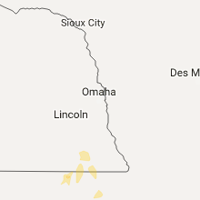
Hail Map for Friday, May 26, 2017

Number of Impacted Households on 5/26/2017
0
Impacted by 1" or Larger Hail
0
Impacted by 1.75" or Larger Hail
0
Impacted by 2.5" or Larger Hail
Square Miles of Populated Area Impacted on 5/26/2017
0
Impacted by 1" or Larger Hail
0
Impacted by 1.75" or Larger Hail
0
Impacted by 2.5" or Larger Hail


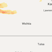


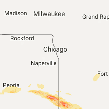


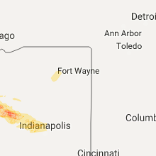
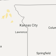


Cities Most Affected by Hail Storms of 5/26/2017
| Hail Size | Demographics of Zip Codes Affected | ||||||
|---|---|---|---|---|---|---|---|
| City | Count | Average | Largest | Pop Density | House Value | Income | Age |
| Goodland, KS | 3 | 1.92 | 2.00 | 9 | $65k | $33.1k | 41.5 |
| Rankin, IL | 2 | 2.25 | 2.50 | 8 | $51k | $28.8k | 38.3 |
| Hoopeston, IL | 2 | 2.00 | 2.00 | 53 | $51k | $32.8k | 41.7 |
| Prairie City, IL | 2 | 1.88 | 2.00 | 17 | $26k | $38.1k | 42.2 |
| Omaha, AR | 2 | 1.88 | 2.00 | 24 | $79k | $27.2k | 44.2 |
| Rossville, IL | 2 | 1.88 | 2.00 | 23 | $60k | $38.5k | 42.0 |
| Blue Eye, MO | 2 | 1.75 | 1.75 | 78 | $124k | $32.5k | 55.1 |
| Monument, CO | 1 | 2.00 | 2.00 | 691 | $270k | $87.9k | 42.8 |
| Lead Hill, AR | 1 | 2.00 | 2.00 | 23 | $38k | $26.3k | 48.2 |
| Peyton, CO | 1 | 1.75 | 1.75 | 127 | $173k | $54.4k | 36.2 |
| Colby, KS | 1 | 1.75 | 1.75 | 13 | $79k | $37.3k | 35.7 |
| Bushnell, IL | 1 | 1.75 | 1.75 | 87 | $45k | $32.5k | 41.0 |
| Lampe, MO | 1 | 1.75 | 1.75 | 63 | $110k | $35.3k | 52.8 |
| Sibley, IL | 1 | 1.75 | 1.75 | 8 | $43k | $41.8k | 42.2 |
| Carpenter, WY | 1 | 1.75 | 1.75 | 4 | $103k | $33.8k | 39.2 |
| Williamsport, IN | 1 | 1.75 | 1.75 | 27 | $73k | $41.6k | 42.8 |
| Veedersburg, IN | 1 | 1.75 | 1.75 | 32 | $66k | $39.5k | 41.0 |
| Ellis, KS | 1 | 1.75 | 1.75 | 8 | $55k | $30.4k | 40.4 |
Hail and Wind Damage Spotted on 5/26/2017
Filter by Report Type:Hail ReportsWind Reports
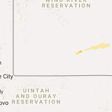
Wyoming
| Local Time | Report Details |
|---|---|
| 12:40 PM MDT | Storm damage reported in sweetwater county WY, 49.7 miles E of Rock Springs, WY |
| 2:22 PM MDT | Storm damage reported in carbon county WY, 87.1 miles SSW of Casper, WY |
| 2:30 PM MDT | Upr sit in carbon county WY, 82.8 miles WNW of Laramie, WY |
| 3:40 PM MDT | Wydot skyline sit in carbon county WY, 52.9 miles WSW of Laramie, WY |
| 3:45 PM MDT | Wydot skyline sit in carbon county WY, 52.9 miles WSW of Laramie, WY |
| 6:00 PM MDT | Quarter sized hail reported near Cheyenne, WY, 41.6 miles E of Laramie, WY, nws employee measured quarter size hail north of cheyenne. |
| 6:45 PM MDT | Quarter sized hail reported near Cheyenne, WY, 45.6 miles WSW of Scottsbluff, NE |
| 6:55 PM MDT | Quarter sized hail reported near Cheyenne, WY, 43.1 miles ESE of Laramie, WY, received a report of quarter size hail on sheridan street in cheyenne. |
| 7:40 PM MDT | Golf Ball sized hail reported near Carpenter, WY, 66.5 miles SSW of Scottsbluff, NE, about 1 inch of hail depth covering the road near the intersection of county roads 151 and 202. |
| 7:42 PM MDT | Quarter sized hail reported near Carpenter, WY, 67.3 miles SSW of Scottsbluff, NE |
Illinois
| Local Time | Report Details |
|---|---|
| 2:26 PM CDT | Golf Ball sized hail reported near Prairie City, IL, 46.1 miles W of Peoria, IL |
| 2:33 PM CDT | Hen Egg sized hail reported near Prairie City, IL, 46.1 miles W of Peoria, IL, hail approximately 2 inches in diameter. |
| 2:35 PM CDT | Golf Ball sized hail reported near Bushnell, IL, 49 miles WSW of Peoria, IL, hail lasted four to 5 minutes and ended at 235 pm. report was delayed and relayed by wgem. |
| 3:01 PM CDT | Quarter sized hail reported near East Peoria, IL, 4.6 miles SE of Peoria, IL, quarter sized hail reported near springfield and muller |
| 3:06 PM CDT | Quarter sized hail reported near East Peoria, IL, 2.5 miles SE of Peoria, IL, at the intersection of meadows and pleasant hill rd |
| 3:07 PM CDT | Many trees and powerlines blown down in morton north of i-74...including north morton ave...and near tennessee rd and lakeland rd. traffic signs also blown down on hard in tazewell county IL, 8.4 miles SE of Peoria, IL |
| 3:08 PM CDT | Quarter sized hail reported near Morton, IL, 8.4 miles SE of Peoria, IL, quarter sized hail measured near jefferson and 4th street |
| 3:38 PM CDT | Tree down across the road on route 116 near graymon in livingston county IL, 43.8 miles ENE of Peoria, IL |
| 4:35 PM CDT | Golf Ball sized hail reported near Sibley, IL, 63.9 miles E of Peoria, IL, golfball size hail near sibley. time estimated. |
| 4:47 PM CDT | Trees were blown down south of roberts. half inch hail was also reported in robert in ford county IL, 74.2 miles E of Peoria, IL |
| 5:01 PM CDT | Half Dollar sized hail reported near Buckley, IL, 79.2 miles NNE of Mattoon, IL, half dollar size hail on route 45 south of buckley. |
| 5:07 PM CDT | Half Dollar sized hail reported near Paxton, IL, 69.1 miles NNE of Mattoon, IL, ford county emergency manager reported half dollar size hail just north of paxton near i-57 |
| 5:26 PM CDT | Tennis Ball sized hail reported near Rankin, IL, 72.1 miles NNE of Mattoon, IL |
| 5:35 PM CDT | Ping Pong Ball sized hail reported near Hoopeston, IL, 76.3 miles NNE of Mattoon, IL |
| 5:40 PM CDT | Hen Egg sized hail reported near Rankin, IL, 72.6 miles NNE of Mattoon, IL, location is 1 south ot east lynn. |
| 5:40 PM CDT | Location 1 south of east lynn in vermilion county IL, 72.6 miles NNE of Mattoon, IL |
| 5:43 PM CDT | Hen Egg sized hail reported near Hoopeston, IL, 76.3 miles NNE of Mattoon, IL, lasting 4 minutes....breaking windshields...on route 9 west of hoopeston. |
| 5:48 PM CDT | Hen Egg sized hail reported near Rossville, IL, 70.1 miles NNE of Mattoon, IL, wind-driven hail did extensive to siding and roof of a house. |
| 5:48 PM CDT | Storm damage reported in vermilion county IL, 70.1 miles NNE of Mattoon, IL |
| 5:52 PM CDT | Trees snapped near illinois route 1 south of 3200 n road in vermilion county IL, 70.2 miles NE of Mattoon, IL |
| 5:54 PM CDT | Pole barn destroyed near country club...roof and walls were blown about 300 yards into the field to the south-southwest...tree also snapped in hal in vermilion county IL, 72.8 miles NNE of Mattoon, IL |
| 5:58 PM CDT | Large tree limb blown down on the south side of rossville...power lines also blown down on summit stree in vermilion county IL, 72.4 miles NNE of Mattoon, IL |
| 5:58 PM CDT | Golf Ball sized hail reported near Rossville, IL, 72.4 miles NNE of Mattoon, IL |
| 6:00 PM CDT | Hen Egg sized hail reported near Hoopeston, IL, 76.8 miles NNE of Mattoon, IL, up to 2 inch diameter hail reported west of hoopeston...hail drifts of 1.5 to 3 feet in flooded areas of west hoopeston |
| 6:00 PM CDT | Numerous trees blown down...street light damaged...large tree limb blown down on a car...fence blown ove in vermilion county IL, 72.4 miles NNE of Mattoon, IL |
| 6:06 PM CDT | Storm damage reported in vermilion county IL, 68.8 miles NE of Mattoon, IL |
| 6:15 PM CDT | Numerous trees...power lines...and power poles blown dow in vermilion county IL, 68.3 miles NE of Mattoon, IL |
Colorado
| Local Time | Report Details |
|---|---|
| 4:05 PM MDT | Ping Pong Ball sized hail reported near Woodrow, CO, 47.1 miles WSW of Yuma, CO |
| 4:17 PM MDT | Ping Pong Ball sized hail reported near Woodrow, CO, 48.1 miles WSW of Yuma, CO |
| 4:20 PM MDT | Quarter sized hail reported near Woodrow, CO, 44.5 miles WSW of Yuma, CO |
| 4:39 PM MDT | Quarter sized hail reported near Palmer Lake, CO, 42.2 miles S of Denver, CO |
| 4:47 PM MDT | Ping Pong Ball sized hail reported near Monument, CO, 43.4 miles S of Denver, CO |
| 4:50 PM MDT | Hen Egg sized hail reported near Monument, CO, 43.4 miles S of Denver, CO, slightly larger than 2 inches. |
| 4:50 PM MDT | Half Dollar sized hail reported near Akron, CO, 28.8 miles WSW of Yuma, CO |
| 4:50 PM MDT | Ping Pong Ball sized hail reported near Larkspur, CO, 42.7 miles S of Denver, CO |
| 4:56 PM MDT | Quarter sized hail reported near Larkspur, CO, 38.9 miles S of Denver, CO |
| 5:20 PM MDT | Quarter sized hail reported near Akron, CO, 18.1 miles SW of Yuma, CO |
| 5:35 PM MDT | Quarter sized hail reported near Peyton, CO, 53.3 miles N of Pueblo, CO |
| 5:44 PM MDT | Quarter sized hail reported near Woodrow, CO, 44.5 miles WSW of Yuma, CO |
| 5:50 PM MDT | Golf Ball sized hail reported near Peyton, CO, 53.9 miles N of Pueblo, CO |
| 6:15 PM MDT | Half Dollar sized hail reported near Kirk, CO, 32.4 miles SSE of Yuma, CO, storm chaser measured hail of 1.25 inch diameter. |
| 6:26 PM MDT | Ping Pong Ball sized hail reported near Calhan, CO, 50.4 miles NNE of Pueblo, CO |
| 6:50 PM MDT | Quarter sized hail reported near Calhan, CO, 52.8 miles NNE of Pueblo, CO |
| 6:50 PM MDT | Quarter sized hail reported near Idalia, CO, 34.5 miles SSE of Yuma, CO, storm chaser reported hail of 1 inch diameter. |
| 10:23 PM MDT | Quarter sized hail reported near Flagler, CO, 60.4 miles SSW of Yuma, CO |
Indiana
| Local Time | Report Details |
|---|---|
| 7:22 PM EDT | 16 inch tree downed. time estimated from rada in warren county IN, 73.9 miles WNW of Indianapolis, IN |
| 7:23 PM EDT | Golf Ball sized hail reported near Williamsport, IN, 72.3 miles NE of Mattoon, IL |
| 7:29 PM EDT | Quarter sized hail reported near Williamsport, IN, 70.4 miles WNW of Indianapolis, IN |
| 6:30 PM CDT | Multiple trees down at columbia ave and ridge rd. one tree is snapped 5 ft from the base of the tre in lake county IN, 24.1 miles SSE of Chicago, IL |
| 6:38 PM CDT | Large oak tree 1 foot in diameter fell onto a telephone pole and shattered the telephone pole. grand blvd and miller av in lake county IN, 24.8 miles SE of Chicago, IL |
| 7:45 PM EDT | 10 inch trees dow in warren county IN, 72.3 miles NE of Mattoon, IL |
| 7:50 PM EDT | Golf Ball sized hail reported near Veedersburg, IN, 58.1 miles WNW of Indianapolis, IN, time radar estimated. |
| 6:51 PM CDT | Power lines and power poles down near jellystone park in porter county IN, 28.9 miles SE of Chicago, IL |
| 6:52 PM CDT | Tree limbs down on a house and car. time estimate in porter county IN, 31 miles SE of Chicago, IL |
| 8:08 PM EDT | Storm damage reported in montgomery county IN, 51 miles WNW of Indianapolis, IN |
| 8:08 PM EDT | Several reports of trees of up to 12 inches in diameter were downed across crawfordsville. time estimated from rada in montgomery county IN, 44.1 miles WNW of Indianapolis, IN |
| 8:14 PM EDT | Tree limbs snapped... several large signs blown over - including a gas station price sign... power was out for 10 minute in montgomery county IN, 45.8 miles WNW of Indianapolis, IN |
| 8:46 PM EDT | Utility poles laid down... power outage reports... and trees down. time radar estimate in hendricks county IN, 19.5 miles WNW of Indianapolis, IN |
| 8:46 PM EDT | Amateur radio operator wa9fd0 reported a measured 75 mph wind gus in hendricks county IN, 17.6 miles WNW of Indianapolis, IN |
| 10:14 PM EDT | Widespread wind damage reported from burket to sidney and including the claypool and silver lake areas. numerous trees and power poles blown dow in kosciusko county IN, 40.9 miles W of Fort Wayne, IN |
Kansas
| Local Time | Report Details |
|---|---|
| 6:45 PM MDT | Half Dollar sized hail reported near Kanorado, KS, 51.6 miles WNW of Colby, KS, storm spotter reported 1.25 inch diameter hail. |
| 6:45 PM MDT | Nws goodland soo reports wind gust of 65 mp in sherman county KS, 41 miles W of Colby, KS |
| 6:45 PM MDT | Nws goodland mic reports 63 mph wind gus in sherman county KS, 39.5 miles W of Colby, KS |
| 6:45 PM MDT | Nws employee reported wind gust of 60 mph. also had large amounts of dime sized hai in sherman county KS, 32.1 miles WNW of Colby, KS |
| 8:25 PM MDT | Ping Pong Ball sized hail reported near Goodland, KS, 30.8 miles W of Colby, KS |
| 8:30 PM MDT | Ping Pong Ball sized hail reported near Goodland, KS, 28.9 miles W of Colby, KS |
| 8:40 PM MDT | Nws employee reports wind gust of 60 mph. also had large amounts of nickel and dime sized hai in sherman county KS, 32.1 miles WNW of Colby, KS |
| 10:19 PM CDT | Quarter sized hail reported near Levant, KS, 9.6 miles WSW of Colby, KS |
| 9:32 PM MDT | Quarter sized hail reported near Goodland, KS, 32.1 miles WNW of Colby, KS |
| 10:33 PM CDT | Half Dollar sized hail reported near Colby, KS, 2.7 miles SSW of Colby, KS |
| 10:36 PM CDT | Golf Ball sized hail reported near Colby, KS, 0.6 miles SSW of Colby, KS |
| 10:42 PM CDT | Quarter sized hail reported near Colby, KS, 3.7 miles N of Colby, KS |
| 10:43 PM CDT | Ping Pong Ball sized hail reported near Colby, KS, 2.7 miles SSE of Colby, KS |
| 10:47 PM CDT | Quarter sized hail reported near Colby, KS, 0.6 miles SSW of Colby, KS |
| 10:48 PM CDT | Quarter sized hail reported near Colby, KS, 0.6 miles SSW of Colby, KS, report of estimated wind of 75 to 80 mph. wind driven hail shattered the back of a car window. |
| 9:54 PM MDT | Golf Ball sized hail reported near Goodland, KS, 35.8 miles W of Colby, KS |
| 9:55 PM MDT | Hen Egg sized hail reported near Goodland, KS, 35.8 miles W of Colby, KS |
| 10:01 PM MDT | Hen Egg sized hail reported near Goodland, KS, 35.6 miles W of Colby, KS |
| 11:50 PM CDT | Storm damage reported in thomas county KS, 0.6 miles SSW of Colby, KS |
| 12:12 AM CDT | Quarter sized hail reported near Hoxie, KS, 37.3 miles E of Colby, KS |
| 12:23 AM CDT | Storm damage reported in sheridan county KS, 23.8 miles SE of Colby, KS |
| 12:37 AM CDT | Storm damage reported in sheridan county KS, 34 miles E of Colby, KS |
| 1:20 AM CDT | Zero visibility in blowing dust. also nickel sized hai in gove county KS, 47.3 miles ESE of Colby, KS |
| 2:49 AM CDT | Golf Ball sized hail reported near Ellis, KS, 21.9 miles W of Hays, KS |
| 3:13 AM CDT | Quarter sized hail reported near Hays, KS, 11.1 miles S of Hays, KS |
Missouri
| Local Time | Report Details |
|---|---|
| 12:02 AM CDT | Quarter sized hail reported near Seligman, MO, 58.6 miles SW of Springfield, MO, law enforcement reported quarter size hail 3 miles north of seligman. |
| 12:08 AM CDT | Ping Pong Ball sized hail reported near Washburn, MO, 54.9 miles SW of Springfield, MO, public reports ping pong size hail. |
| 12:19 AM CDT | Quarter sized hail reported near Cassville, MO, 52.4 miles SW of Springfield, MO, law enforcement reported quarter size hail at roaring river state park. |
| 12:55 AM CDT | Golf Ball sized hail reported near Lampe, MO, 48.4 miles S of Springfield, MO, golf ball size hail reported at dogwood canyon. |
| 1:09 AM CDT | Golf Ball sized hail reported near Blue Eye, MO, 48.6 miles S of Springfield, MO, golf ball size hail in blue eye. |
| 1:09 AM CDT | Golf Ball sized hail reported near Blue Eye, MO, 49.3 miles S of Springfield, MO |
| 1:23 AM CDT | Ping Pong Ball sized hail reported near Ridgedale, MO, 49.1 miles S of Springfield, MO, ping pong hail at gas station on state line and highway 65. |
| 4:09 AM CDT | Tree and several large limbs were reported down on middleton roa in oregon county MO, 76.3 miles S of Salem, MO |
Arkansas
| Local Time | Report Details |
|---|---|
| 1:16 AM CDT | Golf Ball sized hail reported near Omaha, AR, 50.3 miles S of Springfield, MO |
| 1:30 AM CDT | Ping Pong Ball sized hail reported near Omaha, AR, 52.6 miles S of Springfield, MO |
| 1:32 AM CDT | Hen Egg sized hail reported near Omaha, AR, 52.6 miles S of Springfield, MO |
| 1:44 AM CDT | Hen Egg sized hail reported near Lead Hill, AR, 53.9 miles SSE of Springfield, MO |
| 2:52 AM CDT | Tree limbs down and shingles blown off a roo in baxter county AR, 76.7 miles SE of Springfield, MO |
| 2:58 AM CDT | Ping Pong Ball sized hail reported near Clarkridge, AR, 76.4 miles SE of Springfield, MO, wind gusts estimated between 40 and 50 mph. report relayed via nws springfield mo. |
| 4:01 AM CDT | Half Dollar sized hail reported near Horseshoe Bend, AR, 98.4 miles S of Salem, MO, media report of half dollar size hail in horseshoe bend. |
| 6:05 AM CDT | Quarter sized hail reported near Bono, AR, 67.4 miles NW of Memphis, TN, 1 inch hail in bono. |
| 6:20 AM CDT | Quarter sized hail reported near Jonesboro, AR, 58.7 miles NW of Memphis, TN, sage meadows area of north jonesboro had 1 inch hail. |
Connect with Interactive Hail Maps