

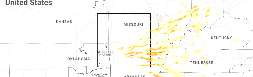
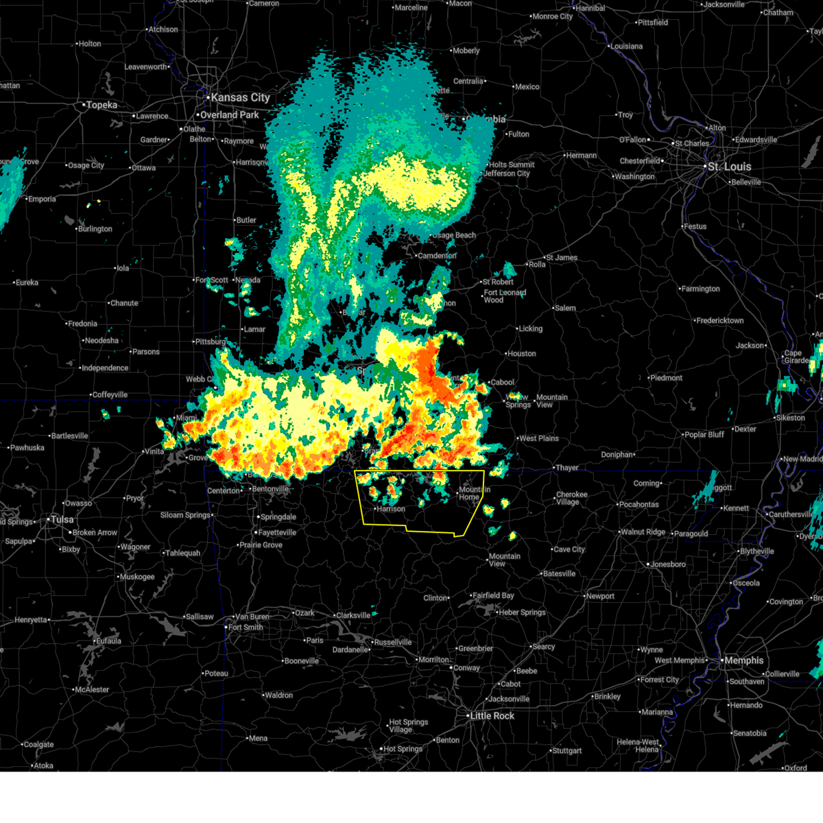
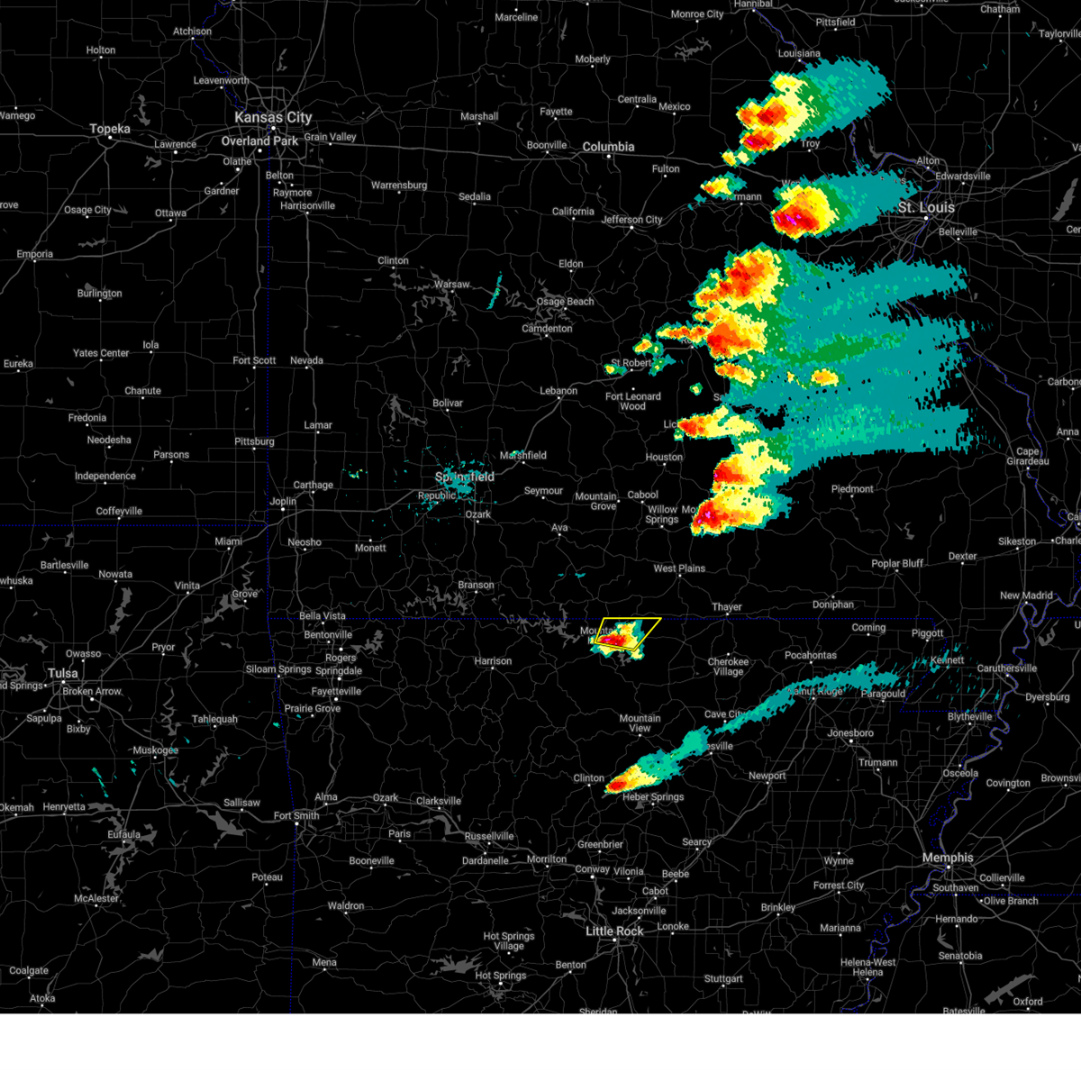
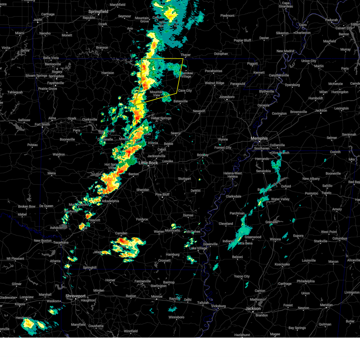
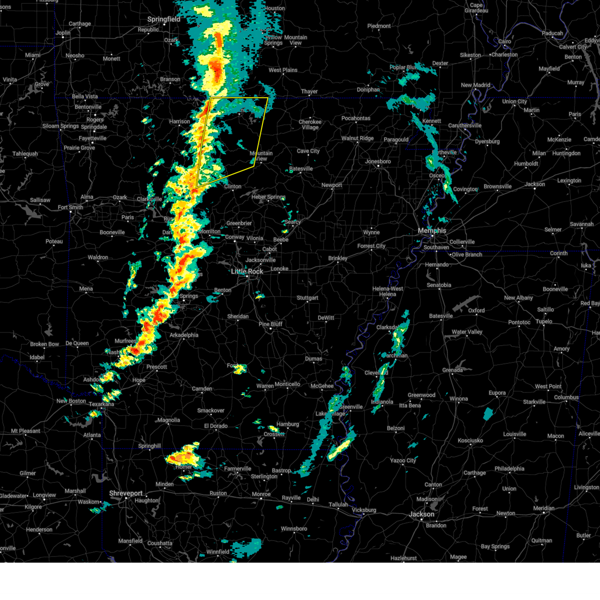
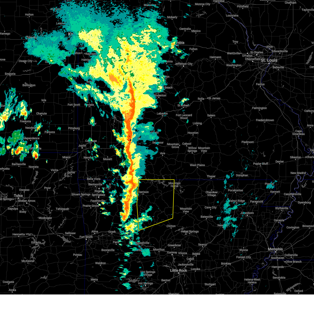
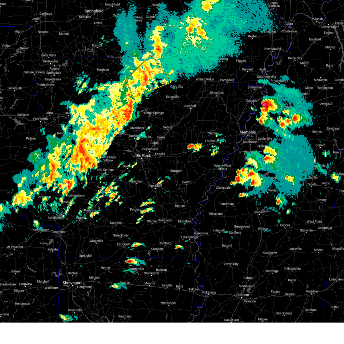
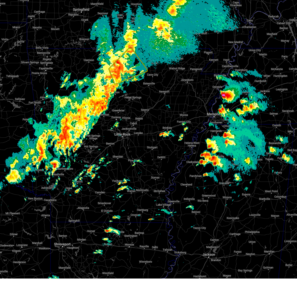
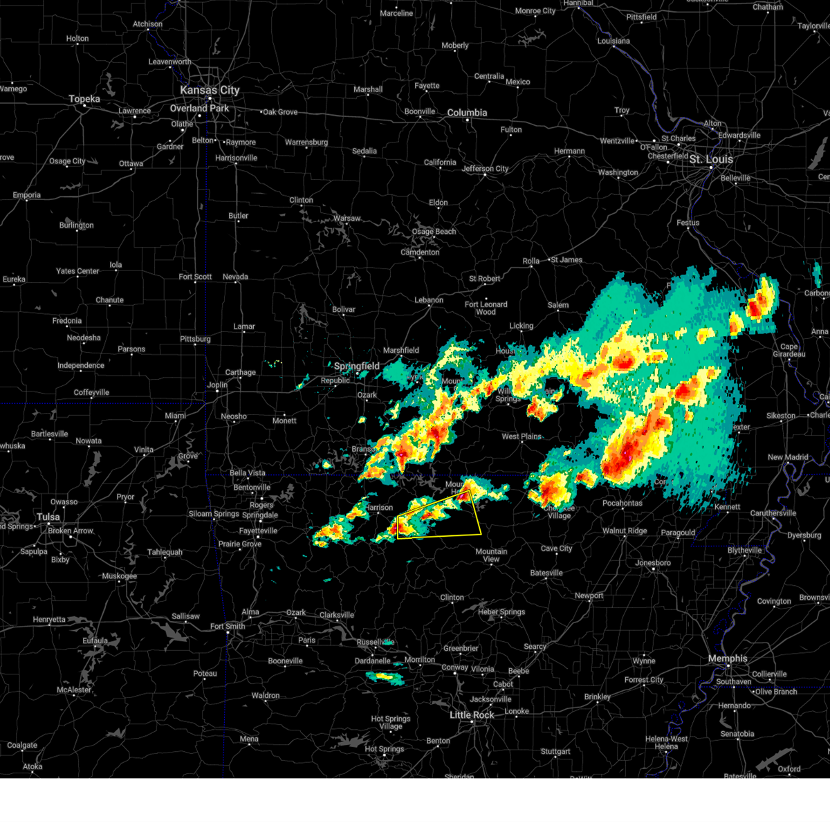
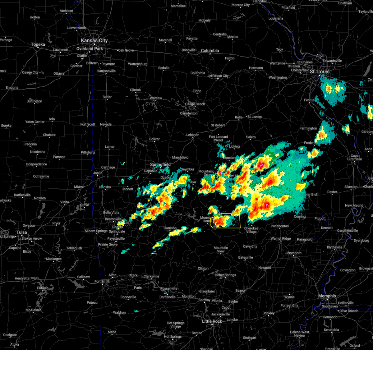
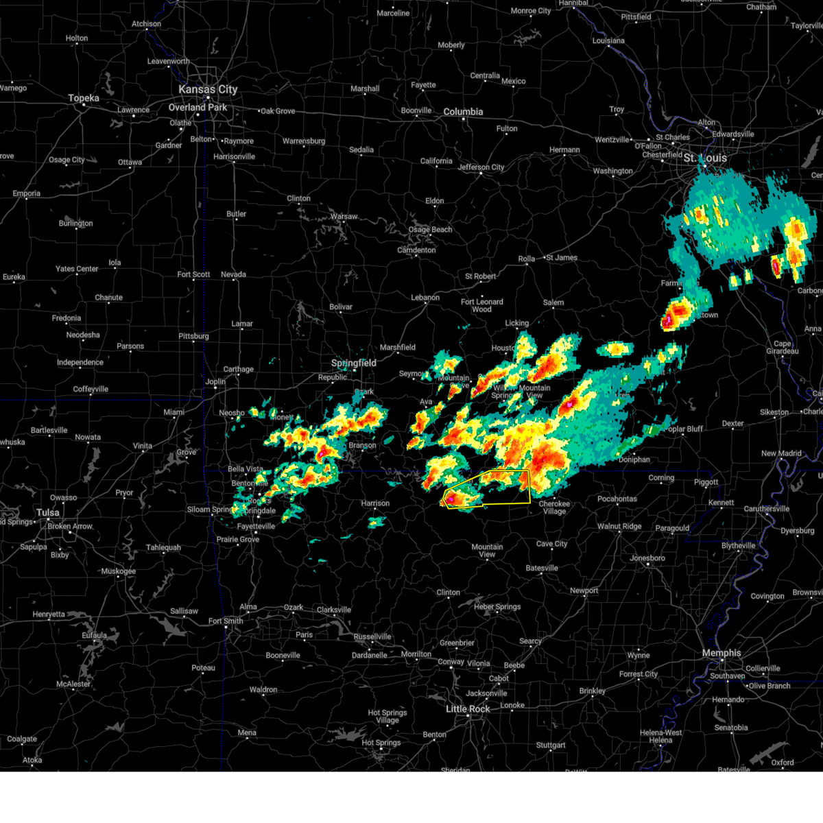
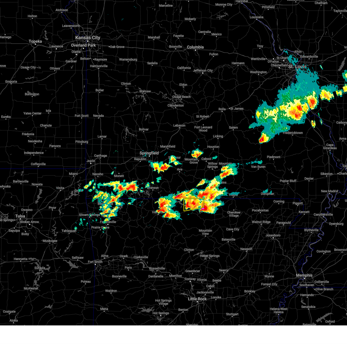
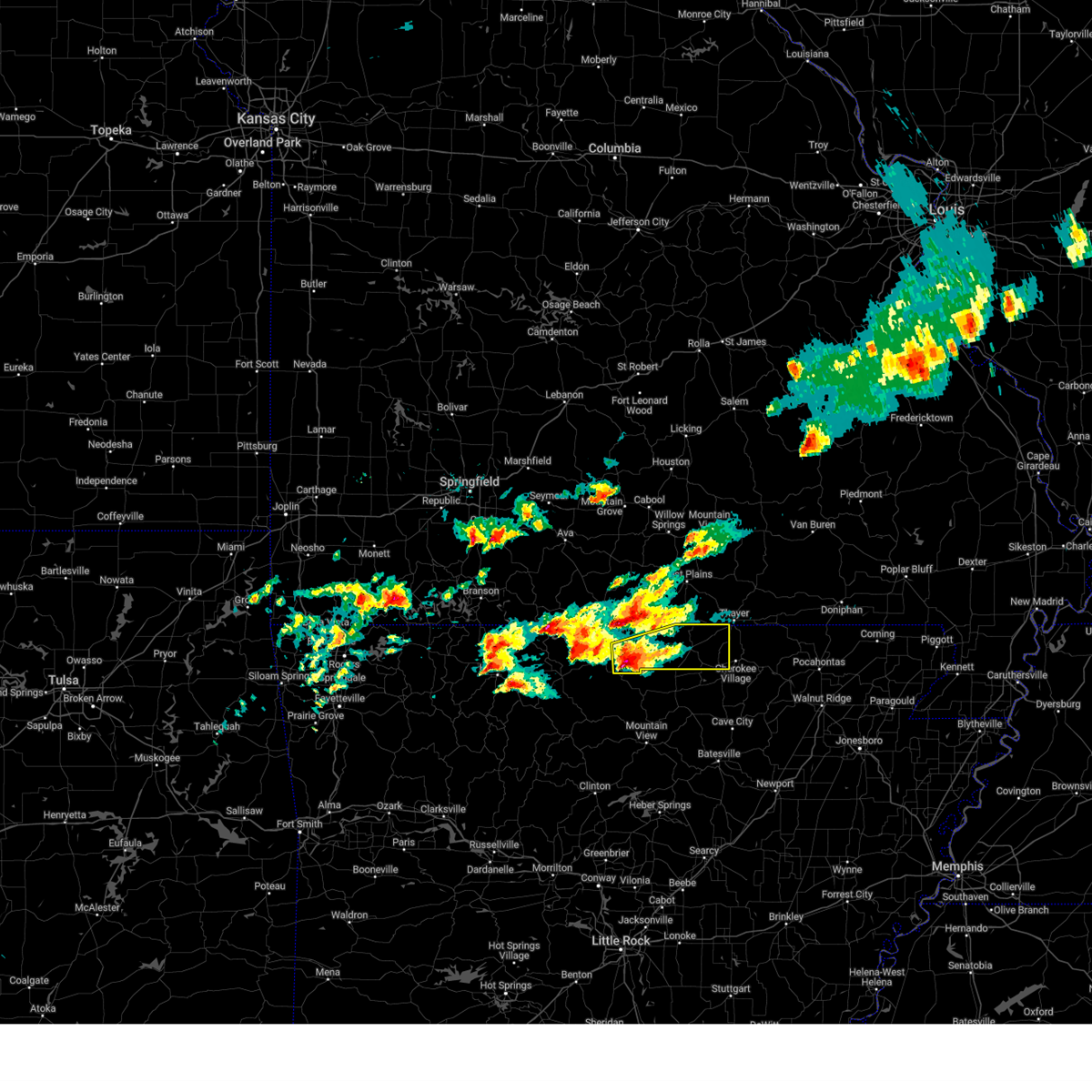
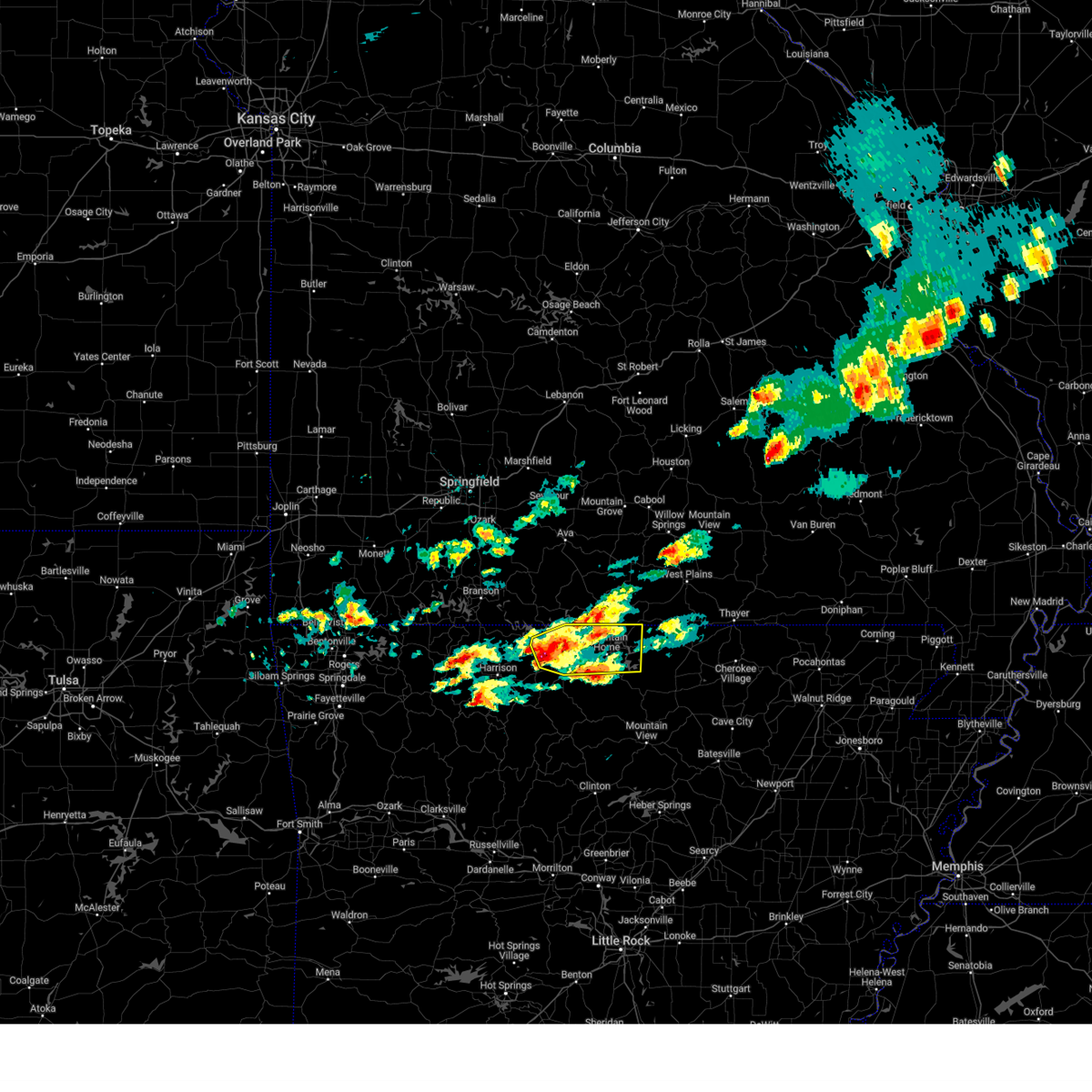
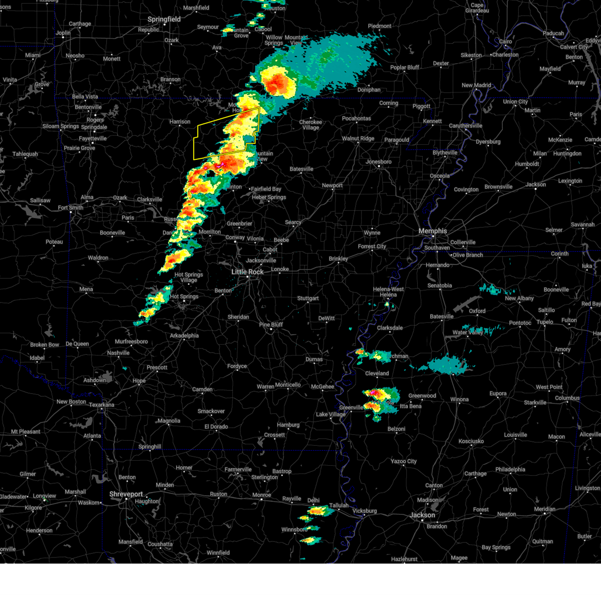
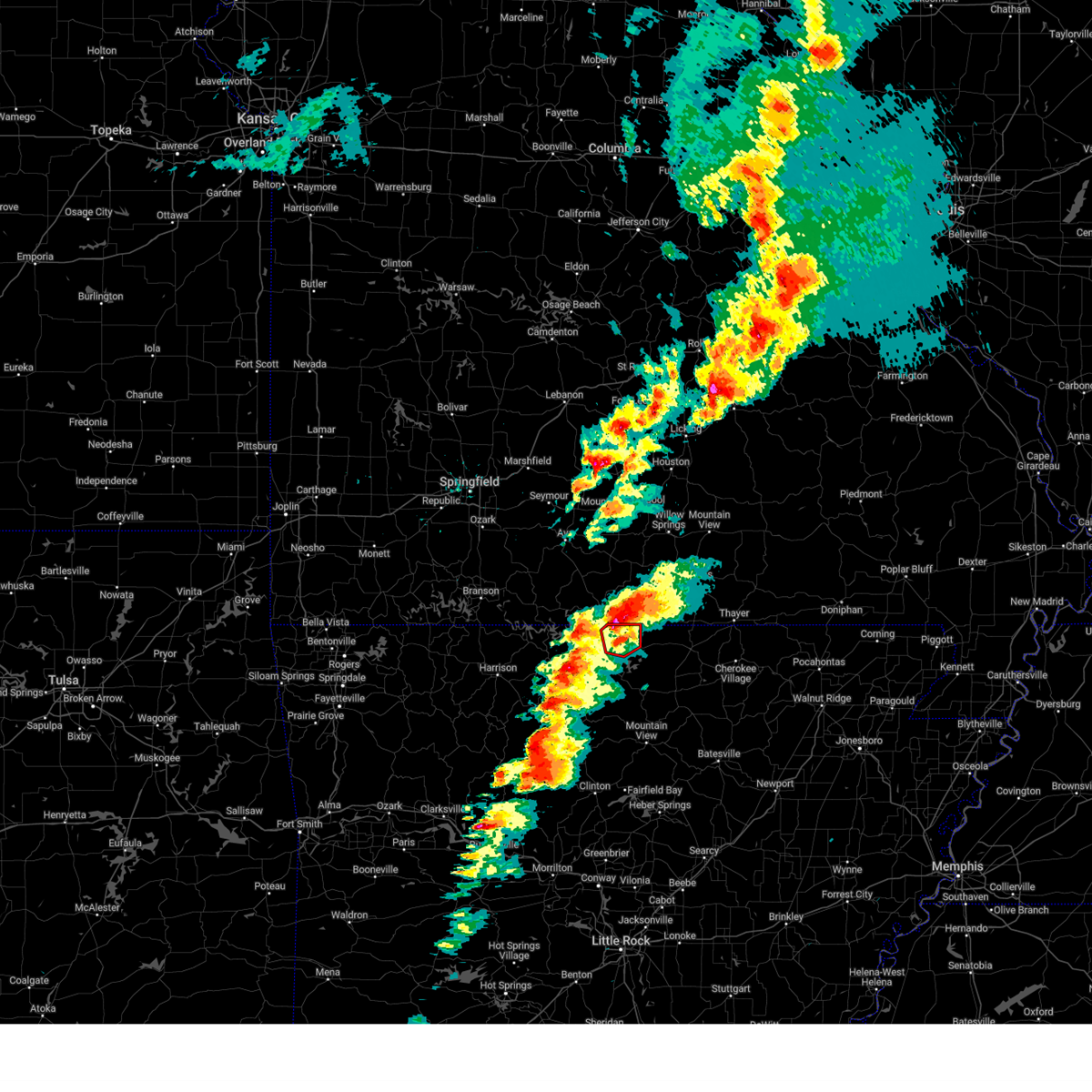
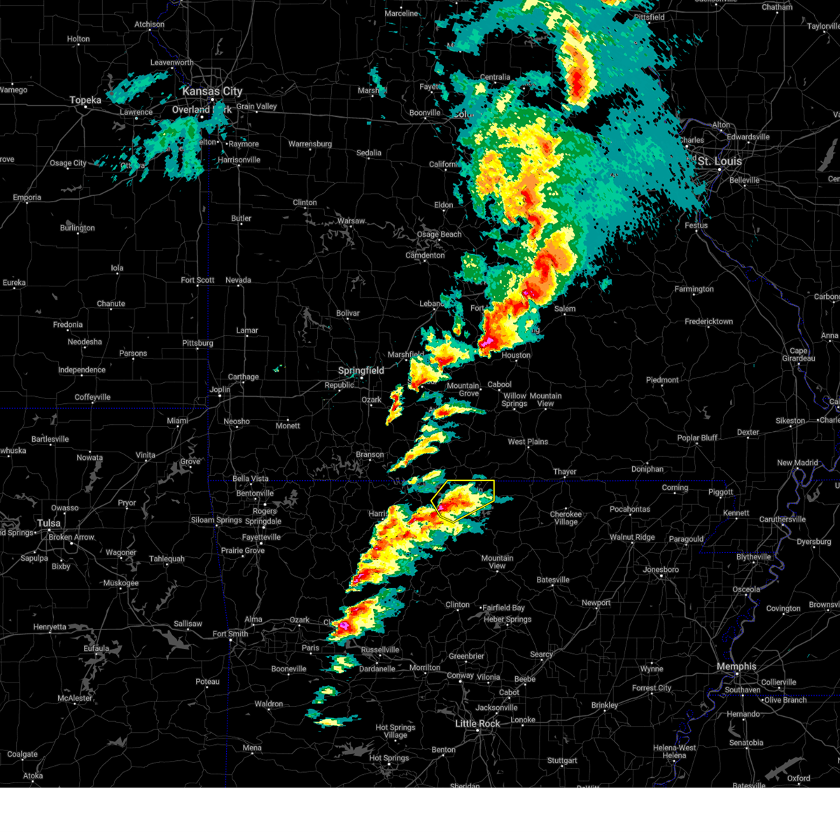
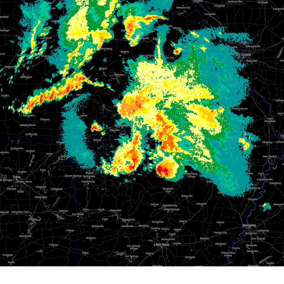
Hail Map for Mountain Home, AR
The Mountain Home, AR area has had 36 reports of on-the-ground hail by trained spotters, and has been under severe weather warnings 44 times during the past 12 months. Doppler radar has detected hail at or near Mountain Home, AR on 80 occasions, including 7 occasions during the past year.
| Name: | Mountain Home, AR |
| Where Located: | 78.7 miles SE of Springfield, MO |
| Map: | Google Map for Mountain Home, AR |
| Population: | 12448 |
| Housing Units: | 6407 |
| More Info: | Search Google for Mountain Home, AR |
2
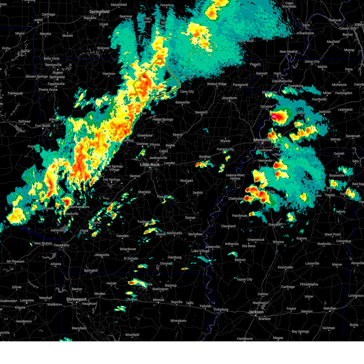
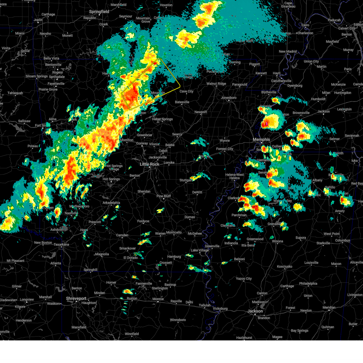
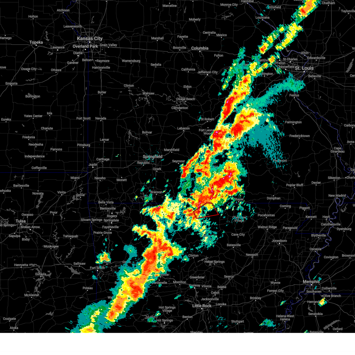
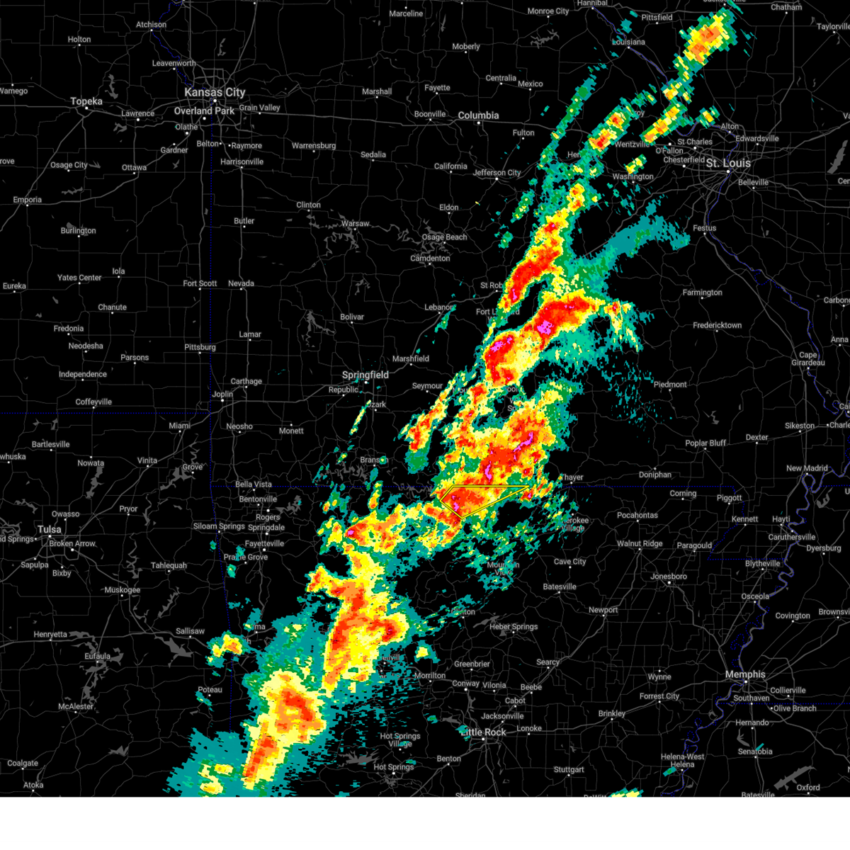
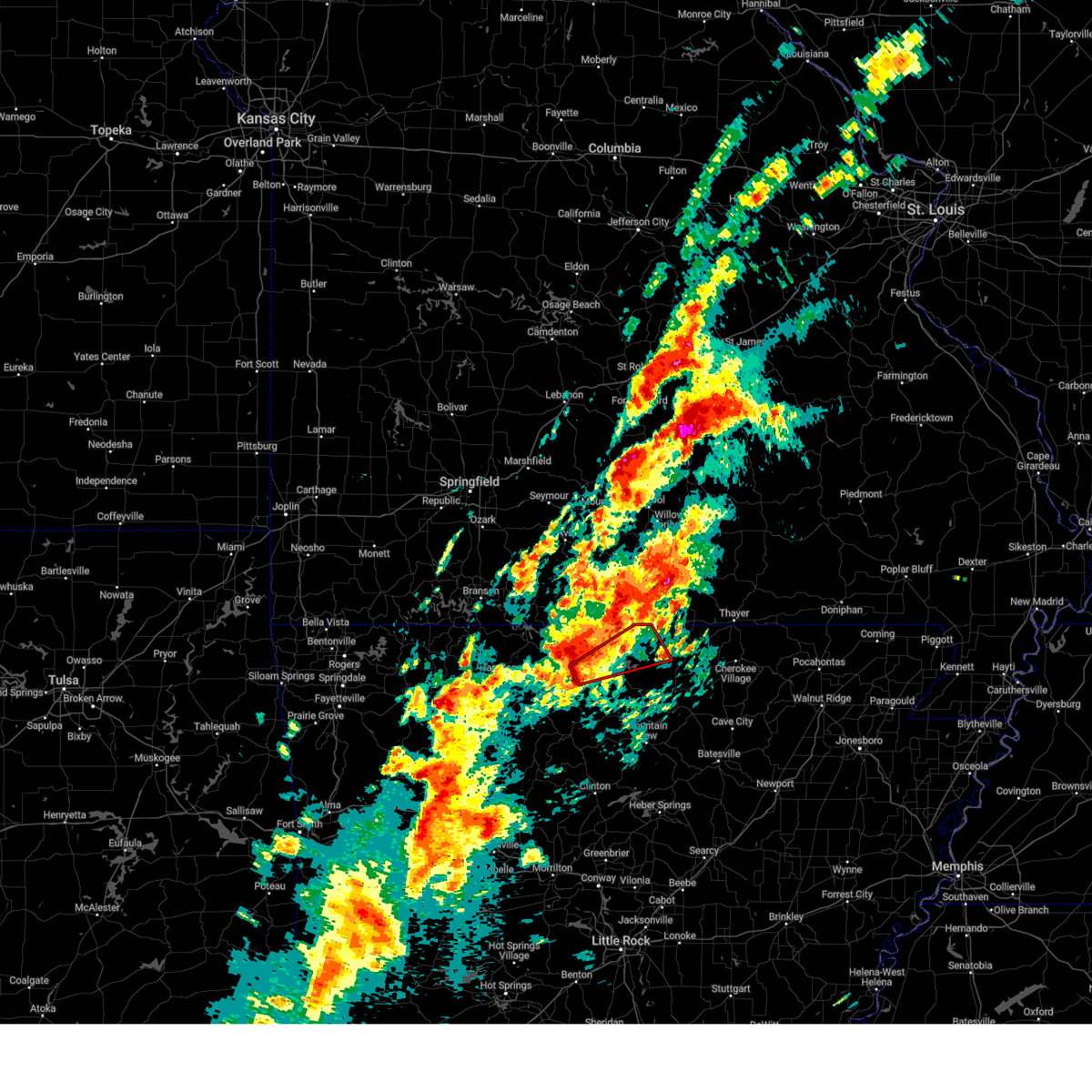
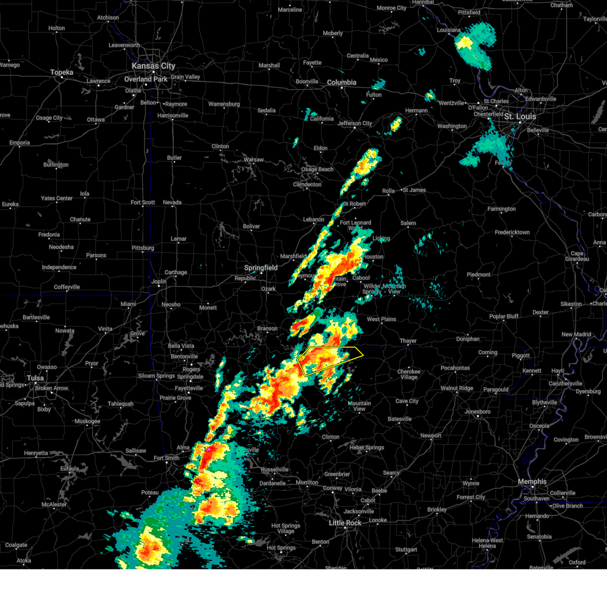
The Top Recent Hail Date for Mountain Home, AR is Sunday, March 30, 2025 (5th out of 80)
Hail and Wind Damage Spotted near Mountain Home, AR
| Date / Time | Report Details |
|---|---|
| 6/29/2025 5:38 PM CDT |
 Svrlzk the national weather service in little rock has issued a * severe thunderstorm warning for, marion county in north central arkansas, boone county in north central arkansas, baxter county in north central arkansas, * until 630 pm cdt. * at 538 pm cdt, severe thunderstorms were located along a line extending from 15 miles east of taneyville to 6 miles northeast of omaha, moving southeast at 45 mph (radar indicated). Hazards include 60 mph wind gusts. expect damage to roofs, siding, and trees Svrlzk the national weather service in little rock has issued a * severe thunderstorm warning for, marion county in north central arkansas, boone county in north central arkansas, baxter county in north central arkansas, * until 630 pm cdt. * at 538 pm cdt, severe thunderstorms were located along a line extending from 15 miles east of taneyville to 6 miles northeast of omaha, moving southeast at 45 mph (radar indicated). Hazards include 60 mph wind gusts. expect damage to roofs, siding, and trees
|
| 5/16/2025 1:54 PM CDT | At 154 pm cdt, a severe thunderstorm was located over gamaliel landing, or 11 miles northeast of mountain home, moving northeast at 45 mph (radar indicated). Hazards include ping pong ball size hail and 60 mph wind gusts. People and animals outdoors will be injured. expect hail damage to roofs, siding, windows, and vehicles. expect wind damage to roofs, siding, and trees. Locations impacted include, fawn park, vidette, clarkridge, norfork lake, robinson point landing, gamaliel, henderson, ott, gepp, gamaliel landing,. |
| 5/16/2025 1:51 PM CDT |
 Svrlzk the national weather service in little rock has issued a * severe thunderstorm warning for, northeastern baxter county in north central arkansas, northwestern fulton county in north central arkansas, * until 215 pm cdt. * at 151 pm cdt, a severe thunderstorm was located over gamaliel landing, or 9 miles northeast of mountain home, moving northeast at 45 mph (radar indicated). Hazards include 60 mph wind gusts and quarter size hail. Hail damage to vehicles is expected. Expect wind damage to roofs, siding, and trees. Svrlzk the national weather service in little rock has issued a * severe thunderstorm warning for, northeastern baxter county in north central arkansas, northwestern fulton county in north central arkansas, * until 215 pm cdt. * at 151 pm cdt, a severe thunderstorm was located over gamaliel landing, or 9 miles northeast of mountain home, moving northeast at 45 mph (radar indicated). Hazards include 60 mph wind gusts and quarter size hail. Hail damage to vehicles is expected. Expect wind damage to roofs, siding, and trees.
|
| 5/16/2025 1:45 PM CDT | Quarter sized hail reported 2.1 miles SSE of Mountain Home, AR |
| 4/20/2025 5:44 PM CDT |
 Svrlzk the national weather service in little rock has issued a * severe thunderstorm warning for, northern stone county in north central arkansas, northwestern independence county in north central arkansas, southeastern searcy county in north central arkansas, izard county in north central arkansas, southeastern marion county in north central arkansas, north central van buren county in north central arkansas, baxter county in north central arkansas, fulton county in north central arkansas, west central sharp county in north central arkansas, * until 630 pm cdt. * at 544 pm cdt, severe thunderstorms were located along a line extending from near bakersfield to herron to near old lexington, moving northeast at 50 mph (radar indicated). Hazards include 60 mph wind gusts and penny size hail. expect damage to roofs, siding, and trees Svrlzk the national weather service in little rock has issued a * severe thunderstorm warning for, northern stone county in north central arkansas, northwestern independence county in north central arkansas, southeastern searcy county in north central arkansas, izard county in north central arkansas, southeastern marion county in north central arkansas, north central van buren county in north central arkansas, baxter county in north central arkansas, fulton county in north central arkansas, west central sharp county in north central arkansas, * until 630 pm cdt. * at 544 pm cdt, severe thunderstorms were located along a line extending from near bakersfield to herron to near old lexington, moving northeast at 50 mph (radar indicated). Hazards include 60 mph wind gusts and penny size hail. expect damage to roofs, siding, and trees
|
| 4/20/2025 4:53 PM CDT |
 Svrlzk the national weather service in little rock has issued a * severe thunderstorm warning for, northwestern stone county in north central arkansas, searcy county in north central arkansas, northwestern izard county in north central arkansas, marion county in north central arkansas, northwestern van buren county in north central arkansas, baxter county in north central arkansas, western fulton county in north central arkansas, northeastern pope county in central arkansas, * until 545 pm cdt. * at 453 pm cdt, severe thunderstorms were located along a line extending from near price place to near maumee to near dabney, moving northeast at 50 mph (radar indicated). Hazards include 60 mph wind gusts and penny size hail. expect damage to roofs, siding, and trees Svrlzk the national weather service in little rock has issued a * severe thunderstorm warning for, northwestern stone county in north central arkansas, searcy county in north central arkansas, northwestern izard county in north central arkansas, marion county in north central arkansas, northwestern van buren county in north central arkansas, baxter county in north central arkansas, western fulton county in north central arkansas, northeastern pope county in central arkansas, * until 545 pm cdt. * at 453 pm cdt, severe thunderstorms were located along a line extending from near price place to near maumee to near dabney, moving northeast at 50 mph (radar indicated). Hazards include 60 mph wind gusts and penny size hail. expect damage to roofs, siding, and trees
|
| 4/20/2025 4:10 PM CDT |
 Svrlzk the national weather service in little rock has issued a * severe thunderstorm warning for, searcy county in north central arkansas, eastern newton county in north central arkansas, northeastern johnson county in western arkansas, marion county in north central arkansas, northwestern van buren county in north central arkansas, boone county in north central arkansas, western baxter county in north central arkansas, northern pope county in central arkansas, * until 500 pm cdt. * at 410 pm cdt, severe thunderstorms were located along a line extending from 9 miles northeast of omaha to near pruitt to near bertha, moving northeast at 85 mph (radar indicated). Hazards include 60 mph wind gusts and penny size hail. expect damage to roofs, siding, and trees Svrlzk the national weather service in little rock has issued a * severe thunderstorm warning for, searcy county in north central arkansas, eastern newton county in north central arkansas, northeastern johnson county in western arkansas, marion county in north central arkansas, northwestern van buren county in north central arkansas, boone county in north central arkansas, western baxter county in north central arkansas, northern pope county in central arkansas, * until 500 pm cdt. * at 410 pm cdt, severe thunderstorms were located along a line extending from 9 miles northeast of omaha to near pruitt to near bertha, moving northeast at 85 mph (radar indicated). Hazards include 60 mph wind gusts and penny size hail. expect damage to roofs, siding, and trees
|
| 4/2/2025 4:05 PM CDT |
 the severe thunderstorm warning has been cancelled and is no longer in effect the severe thunderstorm warning has been cancelled and is no longer in effect
|
| 4/2/2025 3:57 PM CDT |
 At 357 pm cdt, a severe thunderstorm was located 7 miles south of advance, or 17 miles northeast of marshall, moving northeast at 65 mph (radar indicated). Hazards include 60 mph wind gusts and quarter size hail. Hail damage to vehicles is expected. expect wind damage to roofs, siding, and trees. Locations impacted include, franklin, mt olive in izard county, violet hill, ott, melbourne, larkin, timbo, briarcliff, gunner pool campground, salesville, calico rock, lone star, wideman, viola, herron, wild cherry, byron, rodney, advance, boswell,. At 357 pm cdt, a severe thunderstorm was located 7 miles south of advance, or 17 miles northeast of marshall, moving northeast at 65 mph (radar indicated). Hazards include 60 mph wind gusts and quarter size hail. Hail damage to vehicles is expected. expect wind damage to roofs, siding, and trees. Locations impacted include, franklin, mt olive in izard county, violet hill, ott, melbourne, larkin, timbo, briarcliff, gunner pool campground, salesville, calico rock, lone star, wideman, viola, herron, wild cherry, byron, rodney, advance, boswell,.
|
| 4/2/2025 3:57 PM CDT |
 the severe thunderstorm warning has been cancelled and is no longer in effect the severe thunderstorm warning has been cancelled and is no longer in effect
|
| 4/2/2025 3:44 PM CDT |
 Svrlzk the national weather service in little rock has issued a * severe thunderstorm warning for, northwestern stone county in north central arkansas, searcy county in north central arkansas, izard county in north central arkansas, southeastern marion county in north central arkansas, north central van buren county in north central arkansas, baxter county in north central arkansas, western fulton county in north central arkansas, * until 430 pm cdt. * at 344 pm cdt, a severe thunderstorm was located near marshall, moving northeast at 65 mph (radar indicated). Hazards include 60 mph wind gusts and quarter size hail. Hail damage to vehicles is expected. Expect wind damage to roofs, siding, and trees. Svrlzk the national weather service in little rock has issued a * severe thunderstorm warning for, northwestern stone county in north central arkansas, searcy county in north central arkansas, izard county in north central arkansas, southeastern marion county in north central arkansas, north central van buren county in north central arkansas, baxter county in north central arkansas, western fulton county in north central arkansas, * until 430 pm cdt. * at 344 pm cdt, a severe thunderstorm was located near marshall, moving northeast at 65 mph (radar indicated). Hazards include 60 mph wind gusts and quarter size hail. Hail damage to vehicles is expected. Expect wind damage to roofs, siding, and trees.
|
| 4/2/2025 3:13 PM CDT |
 Svrlzk the national weather service in little rock has issued a * severe thunderstorm warning for, northeastern searcy county in north central arkansas, eastern marion county in north central arkansas, baxter county in north central arkansas, northwestern fulton county in north central arkansas, * until 345 pm cdt. * at 313 pm cdt, a severe thunderstorm was located near rush, or near yellville, moving northeast at 60 mph (radar indicated). Hazards include 60 mph wind gusts and quarter size hail. Hail damage to vehicles is expected. Expect wind damage to roofs, siding, and trees. Svrlzk the national weather service in little rock has issued a * severe thunderstorm warning for, northeastern searcy county in north central arkansas, eastern marion county in north central arkansas, baxter county in north central arkansas, northwestern fulton county in north central arkansas, * until 345 pm cdt. * at 313 pm cdt, a severe thunderstorm was located near rush, or near yellville, moving northeast at 60 mph (radar indicated). Hazards include 60 mph wind gusts and quarter size hail. Hail damage to vehicles is expected. Expect wind damage to roofs, siding, and trees.
|
| 4/2/2025 2:58 PM CDT |
 The storm which prompted the warning has moved out of the area. therefore, the warning will be allowed to expire. however gusty winds and heavy rain are still possible with this thunderstorm. a tornado watch remains in effect until 400 pm cdt for north central arkansas. The storm which prompted the warning has moved out of the area. therefore, the warning will be allowed to expire. however gusty winds and heavy rain are still possible with this thunderstorm. a tornado watch remains in effect until 400 pm cdt for north central arkansas.
|
| 4/2/2025 2:39 PM CDT |
 At 238 pm cdt, a severe thunderstorm capable of producing a tornado was located near gamaliel landing, or 8 miles northeast of mountain home, moving northeast at 50 mph (radar indicated rotation). Hazards include tornado and half dollar size hail. Flying debris will be dangerous to those caught without shelter. mobile homes will be damaged or destroyed. damage to roofs, windows, and vehicles will occur. tree damage is likely. Locations impacted include, vidette, diamond bay, gamaliel, gamaliel landing, mountain home, fawn park, elizabeth, norfork lake, mitchell, briarcliff, robinson point landing, colfax, henderson, gepp, byron,. At 238 pm cdt, a severe thunderstorm capable of producing a tornado was located near gamaliel landing, or 8 miles northeast of mountain home, moving northeast at 50 mph (radar indicated rotation). Hazards include tornado and half dollar size hail. Flying debris will be dangerous to those caught without shelter. mobile homes will be damaged or destroyed. damage to roofs, windows, and vehicles will occur. tree damage is likely. Locations impacted include, vidette, diamond bay, gamaliel, gamaliel landing, mountain home, fawn park, elizabeth, norfork lake, mitchell, briarcliff, robinson point landing, colfax, henderson, gepp, byron,.
|
| 4/2/2025 2:39 PM CDT |
 the tornado warning has been cancelled and is no longer in effect the tornado warning has been cancelled and is no longer in effect
|
| 4/2/2025 2:30 PM CDT |
 Svrlzk the national weather service in little rock has issued a * severe thunderstorm warning for, north central marion county in north central arkansas, northern baxter county in north central arkansas, northwestern fulton county in north central arkansas, * until 300 pm cdt. * at 230 pm cdt, a severe thunderstorm was located over ozark regional airport, or near mountain home, moving northeast at 55 mph (radar indicated). Hazards include 60 mph wind gusts and quarter size hail. Hail damage to vehicles is expected. Expect wind damage to roofs, siding, and trees. Svrlzk the national weather service in little rock has issued a * severe thunderstorm warning for, north central marion county in north central arkansas, northern baxter county in north central arkansas, northwestern fulton county in north central arkansas, * until 300 pm cdt. * at 230 pm cdt, a severe thunderstorm was located over ozark regional airport, or near mountain home, moving northeast at 55 mph (radar indicated). Hazards include 60 mph wind gusts and quarter size hail. Hail damage to vehicles is expected. Expect wind damage to roofs, siding, and trees.
|
| 4/2/2025 2:22 PM CDT |
 Torlzk the national weather service in little rock has issued a * tornado warning for, east central marion county in north central arkansas, northern baxter county in north central arkansas, western fulton county in north central arkansas, * until 300 pm cdt. * at 221 pm cdt, a severe thunderstorm capable of producing a tornado was located over gassville, or 7 miles southwest of mountain home, moving northeast at 50 mph (radar indicated rotation). Hazards include tornado and ping pong ball size hail. Flying debris will be dangerous to those caught without shelter. mobile homes will be damaged or destroyed. damage to roofs, windows, and vehicles will occur. Tree damage is likely. Torlzk the national weather service in little rock has issued a * tornado warning for, east central marion county in north central arkansas, northern baxter county in north central arkansas, western fulton county in north central arkansas, * until 300 pm cdt. * at 221 pm cdt, a severe thunderstorm capable of producing a tornado was located over gassville, or 7 miles southwest of mountain home, moving northeast at 50 mph (radar indicated rotation). Hazards include tornado and ping pong ball size hail. Flying debris will be dangerous to those caught without shelter. mobile homes will be damaged or destroyed. damage to roofs, windows, and vehicles will occur. Tree damage is likely.
|
| 4/2/2025 1:43 PM CDT |
 Svrlzk the national weather service in little rock has issued a * severe thunderstorm warning for, northwestern marion county in north central arkansas, northern baxter county in north central arkansas, west central fulton county in north central arkansas, * until 230 pm cdt. * at 143 pm cdt, a severe thunderstorm was located near lakeway, or near bull shoals, moving northeast at 50 mph (radar indicated). Hazards include golf ball size hail and 60 mph wind gusts. People and animals outdoors will be injured. expect hail damage to roofs, siding, windows, and vehicles. Expect wind damage to roofs, siding, and trees. Svrlzk the national weather service in little rock has issued a * severe thunderstorm warning for, northwestern marion county in north central arkansas, northern baxter county in north central arkansas, west central fulton county in north central arkansas, * until 230 pm cdt. * at 143 pm cdt, a severe thunderstorm was located near lakeway, or near bull shoals, moving northeast at 50 mph (radar indicated). Hazards include golf ball size hail and 60 mph wind gusts. People and animals outdoors will be injured. expect hail damage to roofs, siding, windows, and vehicles. Expect wind damage to roofs, siding, and trees.
|
| 3/30/2025 5:14 PM CDT | Torlzk the national weather service in little rock has issued a * tornado warning for, northeastern baxter county in north central arkansas, fulton county in north central arkansas, * until 600 pm cdt. * at 514 pm cdt, a severe thunderstorm capable of producing a tornado was located over diamond bay, or 9 miles east of mountain home, moving east at 45 mph (radar indicated rotation). Hazards include tornado and half dollar size hail. Flying debris will be dangerous to those caught without shelter. mobile homes will be damaged or destroyed. damage to roofs, windows, and vehicles will occur. Tree damage is likely. |
| 3/30/2025 5:04 PM CDT | At 503 pm cdt, a severe thunderstorm was located near rush, or near yellville, moving east at 45 mph. this storm most recently produced golf ball sized hail near ralph in marion county (radar indicated). Hazards include golf ball size hail and 60 mph wind gusts. People and animals outdoors will be injured. expect hail damage to roofs, siding, windows, and vehicles. expect wind damage to roofs, siding, and trees. Locations impacted include, buffalo city, ralph, advance, cartney, summit, buford, lone rock, mountain home, flippin, norfork, culp, shipp, rea valley, briarcliff, salesville, yellville, herron, colfax, cotter, gassville,. |
| 3/30/2025 4:59 PM CDT | At 458 pm cdt, a severe thunderstorm was located near yellville, moving east at 45 mph (radar indicated). Hazards include ping pong ball size hail and 60 mph wind gusts. People and animals outdoors will be injured. expect hail damage to roofs, siding, windows, and vehicles. expect wind damage to roofs, siding, and trees. Locations impacted include, ralph, summit, bruno, flippin, shipp, rea valley, briarcliff, salesville, yellville, herron, colfax, cotter, gassville, lion hill, push mountian, rush, buffalo city, advance, cartney, mull,. |
| 3/30/2025 4:59 PM CDT | the severe thunderstorm warning has been cancelled and is no longer in effect |
| 3/30/2025 4:49 PM CDT |
 Svrlzk the national weather service in little rock has issued a * severe thunderstorm warning for, northwestern searcy county in north central arkansas, southern marion county in north central arkansas, southeastern boone county in north central arkansas, central baxter county in north central arkansas, * until 530 pm cdt. * at 448 pm cdt, a severe thunderstorm was located near dugger, or 11 miles southwest of yellville, moving east at 45 mph (radar indicated). Hazards include 60 mph wind gusts and quarter size hail. Hail damage to vehicles is expected. Expect wind damage to roofs, siding, and trees. Svrlzk the national weather service in little rock has issued a * severe thunderstorm warning for, northwestern searcy county in north central arkansas, southern marion county in north central arkansas, southeastern boone county in north central arkansas, central baxter county in north central arkansas, * until 530 pm cdt. * at 448 pm cdt, a severe thunderstorm was located near dugger, or 11 miles southwest of yellville, moving east at 45 mph (radar indicated). Hazards include 60 mph wind gusts and quarter size hail. Hail damage to vehicles is expected. Expect wind damage to roofs, siding, and trees.
|
| 3/30/2025 4:42 PM CDT |
 Svrlzk the national weather service in little rock has issued a * severe thunderstorm warning for, northern baxter county in north central arkansas, northwestern fulton county in north central arkansas, * until 545 pm cdt. * at 442 pm cdt, a severe thunderstorm was located over mountain home, moving east at 40 mph (radar indicated). Hazards include 60 mph wind gusts and quarter size hail. Hail damage to vehicles is expected. Expect wind damage to roofs, siding, and trees. Svrlzk the national weather service in little rock has issued a * severe thunderstorm warning for, northern baxter county in north central arkansas, northwestern fulton county in north central arkansas, * until 545 pm cdt. * at 442 pm cdt, a severe thunderstorm was located over mountain home, moving east at 40 mph (radar indicated). Hazards include 60 mph wind gusts and quarter size hail. Hail damage to vehicles is expected. Expect wind damage to roofs, siding, and trees.
|
| 3/30/2025 4:08 PM CDT |
 At 407 pm cdt, a severe thunderstorm was located near diamond bay, or 9 miles east of mountain home, moving east at 45 mph (radar indicated). Hazards include 60 mph wind gusts and quarter size hail. Hail damage to vehicles is expected. expect wind damage to roofs, siding, and trees. Locations impacted include, byron, moko, glencoe, vidette, diamond bay, flint springs, wheeling, ott, gamaliel landing, salem in fulton county, elizabeth, sturkie, salem airport, norfork lake, mitchell, bexar, robinson point landing, viola, henderson, gepp,. At 407 pm cdt, a severe thunderstorm was located near diamond bay, or 9 miles east of mountain home, moving east at 45 mph (radar indicated). Hazards include 60 mph wind gusts and quarter size hail. Hail damage to vehicles is expected. expect wind damage to roofs, siding, and trees. Locations impacted include, byron, moko, glencoe, vidette, diamond bay, flint springs, wheeling, ott, gamaliel landing, salem in fulton county, elizabeth, sturkie, salem airport, norfork lake, mitchell, bexar, robinson point landing, viola, henderson, gepp,.
|
| 3/30/2025 3:56 PM CDT | Golf Ball sized hail reported 2.9 miles N of Mountain Home, AR |
| 3/30/2025 3:54 PM CDT |
 Svrlzk the national weather service in little rock has issued a * severe thunderstorm warning for, northern baxter county in north central arkansas, western fulton county in north central arkansas, * until 445 pm cdt. * at 354 pm cdt, a severe thunderstorm was located over colfax, or over mountain home, moving east at 45 mph (radar indicated). Hazards include 60 mph wind gusts and quarter size hail. Hail damage to vehicles is expected. Expect wind damage to roofs, siding, and trees. Svrlzk the national weather service in little rock has issued a * severe thunderstorm warning for, northern baxter county in north central arkansas, western fulton county in north central arkansas, * until 445 pm cdt. * at 354 pm cdt, a severe thunderstorm was located over colfax, or over mountain home, moving east at 45 mph (radar indicated). Hazards include 60 mph wind gusts and quarter size hail. Hail damage to vehicles is expected. Expect wind damage to roofs, siding, and trees.
|
| 3/30/2025 3:19 PM CDT |
 At 319 pm cdt, a severe thunderstorm was located over arkawana, or near mountain home, moving east at 40 mph (radar indicated). Hazards include 60 mph wind gusts and quarter size hail. Hail damage to vehicles is expected. expect wind damage to roofs, siding, and trees. Locations impacted include, clarkridge, gamaliel, ozark regional airport, gamaliel landing, mountain home, arkawana, fawn park, norfork lake, three brothers, midway in baxter county, robinson point landing, lakeview in baxter county, henderson, colfax, oakland, bull shoals state park, cotter, bull shoals,. At 319 pm cdt, a severe thunderstorm was located over arkawana, or near mountain home, moving east at 40 mph (radar indicated). Hazards include 60 mph wind gusts and quarter size hail. Hail damage to vehicles is expected. expect wind damage to roofs, siding, and trees. Locations impacted include, clarkridge, gamaliel, ozark regional airport, gamaliel landing, mountain home, arkawana, fawn park, norfork lake, three brothers, midway in baxter county, robinson point landing, lakeview in baxter county, henderson, colfax, oakland, bull shoals state park, cotter, bull shoals,.
|
| 3/30/2025 3:13 PM CDT |
 Svrlzk the national weather service in little rock has issued a * severe thunderstorm warning for, northeastern baxter county in north central arkansas, fulton county in north central arkansas, * until 400 pm cdt. * at 313 pm cdt, a severe thunderstorm was located over diamond bay, or 10 miles east of mountain home, moving east at 45 mph. this storm has a history of producing severe hail, most recently in briarcliff (radar indicated). Hazards include 60 mph wind gusts and quarter size hail. Hail damage to vehicles is expected. Expect wind damage to roofs, siding, and trees. Svrlzk the national weather service in little rock has issued a * severe thunderstorm warning for, northeastern baxter county in north central arkansas, fulton county in north central arkansas, * until 400 pm cdt. * at 313 pm cdt, a severe thunderstorm was located over diamond bay, or 10 miles east of mountain home, moving east at 45 mph. this storm has a history of producing severe hail, most recently in briarcliff (radar indicated). Hazards include 60 mph wind gusts and quarter size hail. Hail damage to vehicles is expected. Expect wind damage to roofs, siding, and trees.
|
| 3/30/2025 3:03 PM CDT | Quarter sized hail reported 4.9 miles NW of Mountain Home, AR |
| 3/30/2025 3:02 PM CDT |
 the severe thunderstorm warning has been cancelled and is no longer in effect the severe thunderstorm warning has been cancelled and is no longer in effect
|
| 3/30/2025 3:02 PM CDT |
 At 301 pm cdt, a severe thunderstorm was located near lakeway, or near bull shoals, moving east at 40 mph (radar indicated). Hazards include 60 mph wind gusts and quarter size hail. Hail damage to vehicles is expected. expect wind damage to roofs, siding, and trees. Locations impacted include, norfork dam, diamond bay, summit, gamaliel, oakland, ozark regional airport, gamaliel landing, ozark isle, fawn park, flippin, lakeway, norfork lake, bull shoals state park, briarcliff, peel, three brothers, midway in baxter county, clark hill, colfax, cotter,. At 301 pm cdt, a severe thunderstorm was located near lakeway, or near bull shoals, moving east at 40 mph (radar indicated). Hazards include 60 mph wind gusts and quarter size hail. Hail damage to vehicles is expected. expect wind damage to roofs, siding, and trees. Locations impacted include, norfork dam, diamond bay, summit, gamaliel, oakland, ozark regional airport, gamaliel landing, ozark isle, fawn park, flippin, lakeway, norfork lake, bull shoals state park, briarcliff, peel, three brothers, midway in baxter county, clark hill, colfax, cotter,.
|
| 3/30/2025 2:50 PM CDT | Svrlzk the national weather service in little rock has issued a * severe thunderstorm warning for, northern marion county in north central arkansas, east central boone county in north central arkansas, baxter county in north central arkansas, * until 330 pm cdt. * at 250 pm cdt, a severe thunderstorm was located over clark hill, or 11 miles northwest of yellville, moving east at 40 mph (radar indicated). Hazards include 60 mph wind gusts and quarter size hail. Hail damage to vehicles is expected. Expect wind damage to roofs, siding, and trees. |
| 3/14/2025 9:20 PM CDT |
 The storm which prompted the warning has weakened below severe limits, and no longer poses an immediate threat to life or property. therefore, the warning will be allowed to expire. a tornado watch remains in effect until 1100 pm cdt for north central arkansas. The storm which prompted the warning has weakened below severe limits, and no longer poses an immediate threat to life or property. therefore, the warning will be allowed to expire. a tornado watch remains in effect until 1100 pm cdt for north central arkansas.
|
| 3/14/2025 8:57 PM CDT |
 the severe thunderstorm warning has been cancelled and is no longer in effect the severe thunderstorm warning has been cancelled and is no longer in effect
|
| 3/14/2025 8:57 PM CDT |
 At 857 pm cdt, a severe thunderstorm was located over gamaliel landing, or 10 miles northeast of mountain home, moving northeast at 55 mph (radar indicated). Hazards include 60 mph wind gusts and quarter size hail. Hail damage to vehicles is expected. expect wind damage to roofs, siding, and trees. Locations impacted include, fawn park, vidette, clarkridge, norfork lake, robinson point landing, gamaliel, henderson, ott, gamaliel landing, gepp, mountain home,. At 857 pm cdt, a severe thunderstorm was located over gamaliel landing, or 10 miles northeast of mountain home, moving northeast at 55 mph (radar indicated). Hazards include 60 mph wind gusts and quarter size hail. Hail damage to vehicles is expected. expect wind damage to roofs, siding, and trees. Locations impacted include, fawn park, vidette, clarkridge, norfork lake, robinson point landing, gamaliel, henderson, ott, gamaliel landing, gepp, mountain home,.
|
| 3/14/2025 8:53 PM CDT |
 the severe thunderstorm warning has been cancelled and is no longer in effect the severe thunderstorm warning has been cancelled and is no longer in effect
|
| 3/14/2025 8:45 PM CDT | the tornado warning has been cancelled and is no longer in effect |
| 3/14/2025 8:43 PM CDT | Therefore, the warning will be allowed to expire. however hail and damaging winds will still possible with this thunderstorm. remember, a new severe thunderstorm warning is now in effect for marion and baxter counties until 930 pm cdt. a tornado watch remains in effect until 1100 pm cdt for north central arkansas. |
| 3/14/2025 8:42 PM CDT |
 Svrlzk the national weather service in little rock has issued a * severe thunderstorm warning for, northeastern marion county in north central arkansas, northern baxter county in north central arkansas, northwestern fulton county in north central arkansas, * until 930 pm cdt. * at 841 pm cdt, a severe thunderstorm was located over gassville, or near bull shoals, moving northeast at 45 mph (radar indicated). Hazards include 60 mph wind gusts and quarter size hail. Hail damage to vehicles is expected. Expect wind damage to roofs, siding, and trees. Svrlzk the national weather service in little rock has issued a * severe thunderstorm warning for, northeastern marion county in north central arkansas, northern baxter county in north central arkansas, northwestern fulton county in north central arkansas, * until 930 pm cdt. * at 841 pm cdt, a severe thunderstorm was located over gassville, or near bull shoals, moving northeast at 45 mph (radar indicated). Hazards include 60 mph wind gusts and quarter size hail. Hail damage to vehicles is expected. Expect wind damage to roofs, siding, and trees.
|
| 3/14/2025 8:38 PM CDT |
 At 838 pm cdt, a severe thunderstorm was located over flippin, or near yellville, moving northeast at 45 mph (radar indicated). Hazards include 60 mph wind gusts and quarter size hail. Hail damage to vehicles is expected. expect wind damage to roofs, siding, and trees. Locations impacted include, bull shoals, clarkridge, fairview in marion county, gamaliel, oakland, ozark regional airport, buford, gamaliel landing, mountain home, arkawana, fawn park, flippin, norfork lake, bull shoals state park, three brothers, midway in baxter county, robinson point landing, lakeview in baxter county, colfax, henderson,. At 838 pm cdt, a severe thunderstorm was located over flippin, or near yellville, moving northeast at 45 mph (radar indicated). Hazards include 60 mph wind gusts and quarter size hail. Hail damage to vehicles is expected. expect wind damage to roofs, siding, and trees. Locations impacted include, bull shoals, clarkridge, fairview in marion county, gamaliel, oakland, ozark regional airport, buford, gamaliel landing, mountain home, arkawana, fawn park, flippin, norfork lake, bull shoals state park, three brothers, midway in baxter county, robinson point landing, lakeview in baxter county, colfax, henderson,.
|
| 3/14/2025 8:33 PM CDT |
 At 833 pm cdt, a severe thunderstorm capable of producing a tornado was located near gamaliel landing, or 10 miles northeast of mountain home, moving northeast at 40 mph (radar indicated rotation). Hazards include tornado and quarter size hail. Flying debris will be dangerous to those caught without shelter. mobile homes will be damaged or destroyed. damage to roofs, windows, and vehicles will occur. tree damage is likely. Locations impacted include, fawn park, clarkridge, norfork lake, robinson point landing, gamaliel, henderson, gamaliel landing, mountain home,. At 833 pm cdt, a severe thunderstorm capable of producing a tornado was located near gamaliel landing, or 10 miles northeast of mountain home, moving northeast at 40 mph (radar indicated rotation). Hazards include tornado and quarter size hail. Flying debris will be dangerous to those caught without shelter. mobile homes will be damaged or destroyed. damage to roofs, windows, and vehicles will occur. tree damage is likely. Locations impacted include, fawn park, clarkridge, norfork lake, robinson point landing, gamaliel, henderson, gamaliel landing, mountain home,.
|
| 3/14/2025 8:26 PM CDT | Svrlzk the national weather service in little rock has issued a * severe thunderstorm warning for, northern searcy county in north central arkansas, southern marion county in north central arkansas, baxter county in north central arkansas, * until 915 pm cdt. * at 826 pm cdt, a severe thunderstorm was located near duff, or 11 miles northwest of marshall, moving northeast at 65 mph (radar indicated). Hazards include 60 mph wind gusts and quarter size hail. Hail damage to vehicles is expected. Expect wind damage to roofs, siding, and trees. |
| 3/14/2025 8:25 PM CDT | At 825 pm cdt, a severe thunderstorm capable of producing a tornado was located over fawn park, or near mountain home, moving northeast at 35 mph (radar indicated rotation). Hazards include tornado and quarter size hail. Flying debris will be dangerous to those caught without shelter. mobile homes will be damaged or destroyed. damage to roofs, windows, and vehicles will occur. tree damage is likely. Locations impacted include, mountain home, arkawana, fawn park, clarkridge, norfork lake, midway in baxter county, robinson point landing, gamaliel, henderson, gamaliel landing, ozark regional airport,. |
| 3/14/2025 8:18 PM CDT | At 817 pm cdt, a severe thunderstorm capable of producing a tornado was located over ozark regional airport, or near mountain home, moving northeast at 40 mph (radar indicated rotation). Hazards include tornado and quarter size hail. Flying debris will be dangerous to those caught without shelter. mobile homes will be damaged or destroyed. damage to roofs, windows, and vehicles will occur. tree damage is likely. Locations impacted include, clarkridge, gamaliel, ozark regional airport, gamaliel landing, mountain home, arkawana, fawn park, norfork lake, midway in baxter county, robinson point landing, colfax, henderson, lakeview in baxter county,. |
| 3/14/2025 8:11 PM CDT | Torlzk the national weather service in little rock has issued a * tornado warning for, northern baxter county in north central arkansas, * until 900 pm cdt. * at 811 pm cdt, a severe thunderstorm capable of producing a tornado was located over gassville, or near bull shoals, moving northeast at 35 mph (radar indicated rotation). Hazards include tornado and quarter size hail. Flying debris will be dangerous to those caught without shelter. mobile homes will be damaged or destroyed. damage to roofs, windows, and vehicles will occur. Tree damage is likely. |
| 3/14/2025 8:02 PM CDT |
 Svrlzk the national weather service in little rock has issued a * severe thunderstorm warning for, northeastern marion county in north central arkansas, northern baxter county in north central arkansas, * until 845 pm cdt. * at 801 pm cdt, a severe thunderstorm was located over bull shoals state park, or near bull shoals, moving northeast at 50 mph (radar indicated). Hazards include 60 mph wind gusts and quarter size hail. Hail damage to vehicles is expected. Expect wind damage to roofs, siding, and trees. Svrlzk the national weather service in little rock has issued a * severe thunderstorm warning for, northeastern marion county in north central arkansas, northern baxter county in north central arkansas, * until 845 pm cdt. * at 801 pm cdt, a severe thunderstorm was located over bull shoals state park, or near bull shoals, moving northeast at 50 mph (radar indicated). Hazards include 60 mph wind gusts and quarter size hail. Hail damage to vehicles is expected. Expect wind damage to roofs, siding, and trees.
|
| 9/20/2024 4:54 PM CDT | A tree was blown down onto a power lin in baxter county AR, 2.3 miles W of Mountain Home, AR |
| 6/9/2024 12:44 AM CDT |
 the severe thunderstorm warning has been cancelled and is no longer in effect the severe thunderstorm warning has been cancelled and is no longer in effect
|
| 6/9/2024 12:27 AM CDT |
 Svrlzk the national weather service in little rock has issued a * severe thunderstorm warning for, central marion county in north central arkansas, baxter county in north central arkansas, * until 115 am cdt. * at 1226 am cdt, a severe thunderstorm was located near gainesville, or 19 miles north of bull shoals, moving southeast at 35 mph (radar indicated). Hazards include 60 mph wind gusts. expect damage to roofs, siding, and trees Svrlzk the national weather service in little rock has issued a * severe thunderstorm warning for, central marion county in north central arkansas, baxter county in north central arkansas, * until 115 am cdt. * at 1226 am cdt, a severe thunderstorm was located near gainesville, or 19 miles north of bull shoals, moving southeast at 35 mph (radar indicated). Hazards include 60 mph wind gusts. expect damage to roofs, siding, and trees
|
| 5/26/2024 7:04 PM CDT |
 the severe thunderstorm warning has been cancelled and is no longer in effect the severe thunderstorm warning has been cancelled and is no longer in effect
|
| 5/26/2024 6:46 PM CDT |
 Svrlzk the national weather service in little rock has issued a * severe thunderstorm warning for, central marion county in north central arkansas, central baxter county in north central arkansas, * until 730 pm cdt. * at 646 pm cdt, a severe thunderstorm was located near dodd city, or near yellville, moving east at 45 mph (radar indicated). Hazards include 60 mph wind gusts and quarter size hail. Hail damage to vehicles is expected. Expect wind damage to roofs, siding, and trees. Svrlzk the national weather service in little rock has issued a * severe thunderstorm warning for, central marion county in north central arkansas, central baxter county in north central arkansas, * until 730 pm cdt. * at 646 pm cdt, a severe thunderstorm was located near dodd city, or near yellville, moving east at 45 mph (radar indicated). Hazards include 60 mph wind gusts and quarter size hail. Hail damage to vehicles is expected. Expect wind damage to roofs, siding, and trees.
|
| 5/26/2024 5:07 AM CDT |
 Svrlzk the national weather service in little rock has issued a * severe thunderstorm warning for, northern stone county in north central arkansas, northwestern izard county in north central arkansas, southern marion county in north central arkansas, western fulton county in north central arkansas, baxter county in north central arkansas, * until 545 am cdt. * at 507 am cdt, severe thunderstorms were located along a line extending from 9 miles northwest of gainesville to near bull shoals to near pyatt, moving east at 60 mph (radar indicated). Hazards include 60 mph wind gusts and quarter size hail. Hail damage to vehicles is expected. Expect wind damage to roofs, siding, and trees. Svrlzk the national weather service in little rock has issued a * severe thunderstorm warning for, northern stone county in north central arkansas, northwestern izard county in north central arkansas, southern marion county in north central arkansas, western fulton county in north central arkansas, baxter county in north central arkansas, * until 545 am cdt. * at 507 am cdt, severe thunderstorms were located along a line extending from 9 miles northwest of gainesville to near bull shoals to near pyatt, moving east at 60 mph (radar indicated). Hazards include 60 mph wind gusts and quarter size hail. Hail damage to vehicles is expected. Expect wind damage to roofs, siding, and trees.
|
| 5/26/2024 5:02 AM CDT |
 the severe thunderstorm warning has been cancelled and is no longer in effect the severe thunderstorm warning has been cancelled and is no longer in effect
|
| 5/26/2024 5:02 AM CDT |
 At 501 am cdt, severe thunderstorms were located along a line extending from near gainesville to near lakeview in baxter county to yellville, moving east at 60 mph (radar indicated). Hazards include 60 mph wind gusts and quarter size hail. Hail damage to vehicles is expected. expect wind damage to roofs, siding, and trees. Locations impacted include, mountain home, bull shoals, yellville, gassville, flippin, lakeview in baxter county, arkawana, ozark regional airport, fawn park, bull shoals state park, colfax, lion hill, price place, ozark isle, cotter, summit, midway in baxter county, fairview in marion county, oakland, rea valley,. At 501 am cdt, severe thunderstorms were located along a line extending from near gainesville to near lakeview in baxter county to yellville, moving east at 60 mph (radar indicated). Hazards include 60 mph wind gusts and quarter size hail. Hail damage to vehicles is expected. expect wind damage to roofs, siding, and trees. Locations impacted include, mountain home, bull shoals, yellville, gassville, flippin, lakeview in baxter county, arkawana, ozark regional airport, fawn park, bull shoals state park, colfax, lion hill, price place, ozark isle, cotter, summit, midway in baxter county, fairview in marion county, oakland, rea valley,.
|
| 5/26/2024 4:56 AM CDT |
 The storm which prompted the warning has moved out of the area. therefore, the warning will be allowed to expire. a tornado watch remains in effect until 1000 am cdt for north central arkansas. The storm which prompted the warning has moved out of the area. therefore, the warning will be allowed to expire. a tornado watch remains in effect until 1000 am cdt for north central arkansas.
|
| 5/26/2024 4:43 AM CDT |
 Svrlzk the national weather service in little rock has issued a * severe thunderstorm warning for, northern marion county in north central arkansas, east central boone county in north central arkansas, northwestern baxter county in north central arkansas, * until 515 am cdt. * at 443 am cdt, severe thunderstorms were located along a line extending from 12 miles northwest of price place to near lakeway to near bergman, moving east at 60 mph (radar indicated). Hazards include 60 mph wind gusts and quarter size hail. Hail damage to vehicles is expected. Expect wind damage to roofs, siding, and trees. Svrlzk the national weather service in little rock has issued a * severe thunderstorm warning for, northern marion county in north central arkansas, east central boone county in north central arkansas, northwestern baxter county in north central arkansas, * until 515 am cdt. * at 443 am cdt, severe thunderstorms were located along a line extending from 12 miles northwest of price place to near lakeway to near bergman, moving east at 60 mph (radar indicated). Hazards include 60 mph wind gusts and quarter size hail. Hail damage to vehicles is expected. Expect wind damage to roofs, siding, and trees.
|
| 5/26/2024 4:36 AM CDT |
 Torlzk the national weather service in little rock has issued a * tornado warning for, northern izard county in north central arkansas, fulton county in north central arkansas, east central baxter county in north central arkansas, west central sharp county in north central arkansas, * until 515 am cdt. * at 435 am cdt, a tornado producing storm was located over rodney, or 12 miles east of mountain home, moving east at 50 mph (radar confirmed tornado). Hazards include damaging tornado and quarter size hail. Flying debris will be dangerous to those caught without shelter. mobile homes will be damaged or destroyed. damage to roofs, windows, and vehicles will occur. Tree damage is likely. Torlzk the national weather service in little rock has issued a * tornado warning for, northern izard county in north central arkansas, fulton county in north central arkansas, east central baxter county in north central arkansas, west central sharp county in north central arkansas, * until 515 am cdt. * at 435 am cdt, a tornado producing storm was located over rodney, or 12 miles east of mountain home, moving east at 50 mph (radar confirmed tornado). Hazards include damaging tornado and quarter size hail. Flying debris will be dangerous to those caught without shelter. mobile homes will be damaged or destroyed. damage to roofs, windows, and vehicles will occur. Tree damage is likely.
|
| 5/26/2024 4:35 AM CDT |
 At 435 am cdt, a severe thunderstorm was located near diamond bay, or 11 miles east of mountain home, moving east at 60 mph (radar indicated). Hazards include 60 mph wind gusts and quarter size hail. Hail damage to vehicles is expected. expect wind damage to roofs, siding, and trees. Locations impacted include, mountain home, norfork, salesville, briarcliff, rodney, advance, norfork dam, cartney, diamond bay, fawn park, shipp, herron, colfax, gamaliel landing, buford, lone rock, robinson point landing, jordan, henderson, gamaliel,. At 435 am cdt, a severe thunderstorm was located near diamond bay, or 11 miles east of mountain home, moving east at 60 mph (radar indicated). Hazards include 60 mph wind gusts and quarter size hail. Hail damage to vehicles is expected. expect wind damage to roofs, siding, and trees. Locations impacted include, mountain home, norfork, salesville, briarcliff, rodney, advance, norfork dam, cartney, diamond bay, fawn park, shipp, herron, colfax, gamaliel landing, buford, lone rock, robinson point landing, jordan, henderson, gamaliel,.
|
| 5/26/2024 4:35 AM CDT |
 the severe thunderstorm warning has been cancelled and is no longer in effect the severe thunderstorm warning has been cancelled and is no longer in effect
|
| 5/26/2024 4:33 AM CDT |
 the tornado warning has been cancelled and is no longer in effect the tornado warning has been cancelled and is no longer in effect
|
| 5/26/2024 4:33 AM CDT |
 At 433 am cdt, a severe thunderstorm capable of producing a tornado was located over briarcliff, or 8 miles southeast of mountain home, moving east at 40 mph (radar indicated rotation). Hazards include tornado and quarter size hail. Flying debris will be dangerous to those caught without shelter. mobile homes will be damaged or destroyed. damage to roofs, windows, and vehicles will occur. tree damage is likely. Locations impacted include, mountain home, calico rock, norfork, salesville, pineville, briarcliff, rodney, norfork dam, cartney, diamond bay, shipp, herron, colfax, dolph, lone rock, robinson point landing, jordan, henderson, norfork lake,. At 433 am cdt, a severe thunderstorm capable of producing a tornado was located over briarcliff, or 8 miles southeast of mountain home, moving east at 40 mph (radar indicated rotation). Hazards include tornado and quarter size hail. Flying debris will be dangerous to those caught without shelter. mobile homes will be damaged or destroyed. damage to roofs, windows, and vehicles will occur. tree damage is likely. Locations impacted include, mountain home, calico rock, norfork, salesville, pineville, briarcliff, rodney, norfork dam, cartney, diamond bay, shipp, herron, colfax, dolph, lone rock, robinson point landing, jordan, henderson, norfork lake,.
|
| 5/26/2024 4:31 AM CDT |
 the tornado warning has been cancelled and is no longer in effect the tornado warning has been cancelled and is no longer in effect
|
| 5/26/2024 4:31 AM CDT |
 At 431 am cdt, a severe thunderstorm capable of producing a tornado was located over briarcliff, or near mountain home, moving east at 35 mph (radar indicated rotation). Hazards include tornado and half dollar size hail. Flying debris will be dangerous to those caught without shelter. mobile homes will be damaged or destroyed. damage to roofs, windows, and vehicles will occur. tree damage is likely. Locations impacted include, mountain home, norfork, colfax, shipp, buford,. At 431 am cdt, a severe thunderstorm capable of producing a tornado was located over briarcliff, or near mountain home, moving east at 35 mph (radar indicated rotation). Hazards include tornado and half dollar size hail. Flying debris will be dangerous to those caught without shelter. mobile homes will be damaged or destroyed. damage to roofs, windows, and vehicles will occur. tree damage is likely. Locations impacted include, mountain home, norfork, colfax, shipp, buford,.
|
| 5/26/2024 4:22 AM CDT |
 At 422 am cdt, a severe thunderstorm capable of producing a tornado was located over shipp, or near mountain home, moving east at 45 mph (radar indicated rotation). Hazards include tornado and half dollar size hail. Flying debris will be dangerous to those caught without shelter. mobile homes will be damaged or destroyed. damage to roofs, windows, and vehicles will occur. tree damage is likely. Locations impacted include, mountain home, gassville, flippin, norfork, shipp, colfax, cotter, rea valley, buford,. At 422 am cdt, a severe thunderstorm capable of producing a tornado was located over shipp, or near mountain home, moving east at 45 mph (radar indicated rotation). Hazards include tornado and half dollar size hail. Flying debris will be dangerous to those caught without shelter. mobile homes will be damaged or destroyed. damage to roofs, windows, and vehicles will occur. tree damage is likely. Locations impacted include, mountain home, gassville, flippin, norfork, shipp, colfax, cotter, rea valley, buford,.
|
| 5/26/2024 4:21 AM CDT |
 At 421 am cdt, a severe thunderstorm was located near gamaliel landing, or 11 miles northeast of mountain home, moving northeast at 50 mph (radar indicated). Hazards include 60 mph wind gusts and quarter size hail. Hail damage to vehicles is expected. expect wind damage to roofs, siding, and trees. Locations impacted include, mountain home, bull shoals, gassville, flippin, lakeview in baxter county, norfork, salesville, briarcliff, arkawana, norfork dam, diamond bay, ozark regional airport, fawn park, bull shoals state park, shipp, colfax, lion hill, rodney, cartney, gamaliel landing,. At 421 am cdt, a severe thunderstorm was located near gamaliel landing, or 11 miles northeast of mountain home, moving northeast at 50 mph (radar indicated). Hazards include 60 mph wind gusts and quarter size hail. Hail damage to vehicles is expected. expect wind damage to roofs, siding, and trees. Locations impacted include, mountain home, bull shoals, gassville, flippin, lakeview in baxter county, norfork, salesville, briarcliff, arkawana, norfork dam, diamond bay, ozark regional airport, fawn park, bull shoals state park, shipp, colfax, lion hill, rodney, cartney, gamaliel landing,.
|
| 5/26/2024 4:21 AM CDT |
 the severe thunderstorm warning has been cancelled and is no longer in effect the severe thunderstorm warning has been cancelled and is no longer in effect
|
| 5/26/2024 4:17 AM CDT |
 Torlzk the national weather service in little rock has issued a * tornado warning for, northwestern izard county in north central arkansas, southeastern marion county in north central arkansas, southwestern fulton county in north central arkansas, central baxter county in north central arkansas, * until 500 am cdt. * at 417 am cdt, a severe thunderstorm capable of producing a tornado was located over lion hill, or 9 miles southwest of mountain home, moving east at 30 mph (radar indicated rotation). Hazards include tornado and quarter size hail. Flying debris will be dangerous to those caught without shelter. mobile homes will be damaged or destroyed. damage to roofs, windows, and vehicles will occur. Tree damage is likely. Torlzk the national weather service in little rock has issued a * tornado warning for, northwestern izard county in north central arkansas, southeastern marion county in north central arkansas, southwestern fulton county in north central arkansas, central baxter county in north central arkansas, * until 500 am cdt. * at 417 am cdt, a severe thunderstorm capable of producing a tornado was located over lion hill, or 9 miles southwest of mountain home, moving east at 30 mph (radar indicated rotation). Hazards include tornado and quarter size hail. Flying debris will be dangerous to those caught without shelter. mobile homes will be damaged or destroyed. damage to roofs, windows, and vehicles will occur. Tree damage is likely.
|
| 5/26/2024 4:11 AM CDT |
 At 411 am cdt, a confirmed tornado was located near flippin, or 7 miles east of yellville, moving east at 40 mph (radar confirmed tornado). Hazards include damaging tornado and half dollar size hail. Flying debris will be dangerous to those caught without shelter. mobile homes will be damaged or destroyed. damage to roofs, windows, and vehicles will occur. tree damage is likely. Locations impacted include, mountain home, yellville, gassville, flippin, lakeview in baxter county, norfork, ozark regional airport, bull shoals state park, shipp, colfax, cotter, summit, midway in baxter county, fairview in marion county, ralph, buford, rea valley,. At 411 am cdt, a confirmed tornado was located near flippin, or 7 miles east of yellville, moving east at 40 mph (radar confirmed tornado). Hazards include damaging tornado and half dollar size hail. Flying debris will be dangerous to those caught without shelter. mobile homes will be damaged or destroyed. damage to roofs, windows, and vehicles will occur. tree damage is likely. Locations impacted include, mountain home, yellville, gassville, flippin, lakeview in baxter county, norfork, ozark regional airport, bull shoals state park, shipp, colfax, cotter, summit, midway in baxter county, fairview in marion county, ralph, buford, rea valley,.
|
| 5/26/2024 4:11 AM CDT |
 the tornado warning has been cancelled and is no longer in effect the tornado warning has been cancelled and is no longer in effect
|
| 5/26/2024 3:54 AM CDT |
 Svrlzk the national weather service in little rock has issued a * severe thunderstorm warning for, northwestern izard county in north central arkansas, marion county in north central arkansas, east central boone county in north central arkansas, baxter county in north central arkansas, * until 445 am cdt. * at 354 am cdt, a severe thunderstorm was located near lakeway, or near bull shoals, moving northeast at 50 mph (radar indicated). Hazards include 60 mph wind gusts and half dollar size hail. Hail damage to vehicles is expected. Expect wind damage to roofs, siding, and trees. Svrlzk the national weather service in little rock has issued a * severe thunderstorm warning for, northwestern izard county in north central arkansas, marion county in north central arkansas, east central boone county in north central arkansas, baxter county in north central arkansas, * until 445 am cdt. * at 354 am cdt, a severe thunderstorm was located near lakeway, or near bull shoals, moving northeast at 50 mph (radar indicated). Hazards include 60 mph wind gusts and half dollar size hail. Hail damage to vehicles is expected. Expect wind damage to roofs, siding, and trees.
|
| 5/26/2024 3:54 AM CDT |
 Torlzk the national weather service in little rock has issued a * tornado warning for, central marion county in north central arkansas, east central boone county in north central arkansas, northwestern baxter county in north central arkansas, * until 445 am cdt. * at 354 am cdt, a tornado producing storm was located over pyatt, or near yellville, moving east at 35 mph (radar confirmed tornado). Hazards include damaging tornado and half dollar size hail. Flying debris will be dangerous to those caught without shelter. mobile homes will be damaged or destroyed. damage to roofs, windows, and vehicles will occur. Tree damage is likely. Torlzk the national weather service in little rock has issued a * tornado warning for, central marion county in north central arkansas, east central boone county in north central arkansas, northwestern baxter county in north central arkansas, * until 445 am cdt. * at 354 am cdt, a tornado producing storm was located over pyatt, or near yellville, moving east at 35 mph (radar confirmed tornado). Hazards include damaging tornado and half dollar size hail. Flying debris will be dangerous to those caught without shelter. mobile homes will be damaged or destroyed. damage to roofs, windows, and vehicles will occur. Tree damage is likely.
|
| 5/8/2024 8:55 PM CDT |
 the severe thunderstorm warning has been cancelled and is no longer in effect the severe thunderstorm warning has been cancelled and is no longer in effect
|
| 5/8/2024 8:45 PM CDT |
 the severe thunderstorm warning has been cancelled and is no longer in effect the severe thunderstorm warning has been cancelled and is no longer in effect
|
| 5/8/2024 8:45 PM CDT |
 At 845 pm cdt, a severe thunderstorm was located over lakeway, or 9 miles northwest of yellville, moving east at 35 mph (radar indicated). Hazards include 60 mph wind gusts and quarter size hail. Hail damage to vehicles is expected. expect wind damage to roofs, siding, and trees. Locations impacted include, mountain home, bull shoals, gassville, lakeview in baxter county, briarcliff, arkawana, dodd city, ozark regional airport, ozark isle, fawn park, lakeway, bull shoals state park, colfax, cotter, midway in baxter county, fairview in marion county, clarkridge, oakland, three brothers, monarch,. At 845 pm cdt, a severe thunderstorm was located over lakeway, or 9 miles northwest of yellville, moving east at 35 mph (radar indicated). Hazards include 60 mph wind gusts and quarter size hail. Hail damage to vehicles is expected. expect wind damage to roofs, siding, and trees. Locations impacted include, mountain home, bull shoals, gassville, lakeview in baxter county, briarcliff, arkawana, dodd city, ozark regional airport, ozark isle, fawn park, lakeway, bull shoals state park, colfax, cotter, midway in baxter county, fairview in marion county, clarkridge, oakland, three brothers, monarch,.
|
| 5/8/2024 8:37 PM CDT |
 Svrlzk the national weather service in little rock has issued a * severe thunderstorm warning for, northern marion county in north central arkansas, east central boone county in north central arkansas, northwestern baxter county in north central arkansas, * until 915 pm cdt. * at 837 pm cdt, a severe thunderstorm was located over clark hill, or 12 miles northwest of yellville, moving east at 35 mph (radar indicated). Hazards include 60 mph wind gusts and quarter size hail. Hail damage to vehicles is expected. Expect wind damage to roofs, siding, and trees. Svrlzk the national weather service in little rock has issued a * severe thunderstorm warning for, northern marion county in north central arkansas, east central boone county in north central arkansas, northwestern baxter county in north central arkansas, * until 915 pm cdt. * at 837 pm cdt, a severe thunderstorm was located over clark hill, or 12 miles northwest of yellville, moving east at 35 mph (radar indicated). Hazards include 60 mph wind gusts and quarter size hail. Hail damage to vehicles is expected. Expect wind damage to roofs, siding, and trees.
|
| 5/7/2024 5:34 AM CDT |
 the severe thunderstorm warning has been cancelled and is no longer in effect the severe thunderstorm warning has been cancelled and is no longer in effect
|
| 5/7/2024 5:06 AM CDT |
 At 506 am cdt, a severe thunderstorm was located over salesville, or 8 miles southeast of mountain home, moving east at 55 mph (radar indicated). Hazards include 60 mph wind gusts and quarter size hail. Hail damage to vehicles is expected. expect wind damage to roofs, siding, and trees. Locations impacted include, mountain home, gassville, advance, cartney, shipp, colfax, buffalo city, buford, lone rock,. At 506 am cdt, a severe thunderstorm was located over salesville, or 8 miles southeast of mountain home, moving east at 55 mph (radar indicated). Hazards include 60 mph wind gusts and quarter size hail. Hail damage to vehicles is expected. expect wind damage to roofs, siding, and trees. Locations impacted include, mountain home, gassville, advance, cartney, shipp, colfax, buffalo city, buford, lone rock,.
|
| 5/7/2024 5:03 AM CDT |
 Svrlzk the national weather service in little rock has issued a * severe thunderstorm warning for, northwestern izard county in north central arkansas, western fulton county in north central arkansas, central baxter county in north central arkansas, * until 545 am cdt. * at 503 am cdt, a severe thunderstorm was located near cartney, or 9 miles south of mountain home, moving east at 55 mph (radar indicated). Hazards include 60 mph wind gusts and quarter size hail. Hail damage to vehicles is expected. Expect wind damage to roofs, siding, and trees. Svrlzk the national weather service in little rock has issued a * severe thunderstorm warning for, northwestern izard county in north central arkansas, western fulton county in north central arkansas, central baxter county in north central arkansas, * until 545 am cdt. * at 503 am cdt, a severe thunderstorm was located near cartney, or 9 miles south of mountain home, moving east at 55 mph (radar indicated). Hazards include 60 mph wind gusts and quarter size hail. Hail damage to vehicles is expected. Expect wind damage to roofs, siding, and trees.
|
| 5/7/2024 4:48 AM CDT |
 At 448 am cdt, a severe thunderstorm was located near rush, or near yellville, moving east at 55 mph (radar indicated). Hazards include 60 mph wind gusts and quarter size hail. Hail damage to vehicles is expected. expect wind damage to roofs, siding, and trees. Locations impacted include, mountain home, yellville, gassville, flippin, advance, cartney, ozark regional airport, fawn park, shipp, colfax, rush, lion hill, cotter, summit, fairview in marion county, buffalo city, ralph, mull, buford, lone rock,. At 448 am cdt, a severe thunderstorm was located near rush, or near yellville, moving east at 55 mph (radar indicated). Hazards include 60 mph wind gusts and quarter size hail. Hail damage to vehicles is expected. expect wind damage to roofs, siding, and trees. Locations impacted include, mountain home, yellville, gassville, flippin, advance, cartney, ozark regional airport, fawn park, shipp, colfax, rush, lion hill, cotter, summit, fairview in marion county, buffalo city, ralph, mull, buford, lone rock,.
|
| 5/7/2024 4:48 AM CDT |
 the severe thunderstorm warning has been cancelled and is no longer in effect the severe thunderstorm warning has been cancelled and is no longer in effect
|
| 5/7/2024 4:34 AM CDT |
 Svrlzk the national weather service in little rock has issued a * severe thunderstorm warning for, northern searcy county in north central arkansas, marion county in north central arkansas, southeastern boone county in north central arkansas, central baxter county in north central arkansas, * until 515 am cdt. * at 434 am cdt, a severe thunderstorm was located near crawford, or 8 miles southwest of yellville, moving east at 55 mph (radar indicated). Hazards include 60 mph wind gusts and quarter size hail. Hail damage to vehicles is expected. Expect wind damage to roofs, siding, and trees. Svrlzk the national weather service in little rock has issued a * severe thunderstorm warning for, northern searcy county in north central arkansas, marion county in north central arkansas, southeastern boone county in north central arkansas, central baxter county in north central arkansas, * until 515 am cdt. * at 434 am cdt, a severe thunderstorm was located near crawford, or 8 miles southwest of yellville, moving east at 55 mph (radar indicated). Hazards include 60 mph wind gusts and quarter size hail. Hail damage to vehicles is expected. Expect wind damage to roofs, siding, and trees.
|
| 4/18/2024 8:54 PM CDT |
 Svrlzk the national weather service in little rock has issued a * severe thunderstorm warning for, northwestern izard county in north central arkansas, southwestern fulton county in north central arkansas, northeastern baxter county in north central arkansas, * until 945 pm cdt. * at 853 pm cdt, a severe thunderstorm was located over mountain home, moving southeast at 30 mph (radar indicated). Hazards include 60 mph wind gusts and quarter size hail. Hail damage to vehicles is expected. Expect wind damage to roofs, siding, and trees. Svrlzk the national weather service in little rock has issued a * severe thunderstorm warning for, northwestern izard county in north central arkansas, southwestern fulton county in north central arkansas, northeastern baxter county in north central arkansas, * until 945 pm cdt. * at 853 pm cdt, a severe thunderstorm was located over mountain home, moving southeast at 30 mph (radar indicated). Hazards include 60 mph wind gusts and quarter size hail. Hail damage to vehicles is expected. Expect wind damage to roofs, siding, and trees.
|
| 3/14/2024 5:27 PM CDT | Quarter sized hail reported 1.4 miles SSE of Mountain Home, AR, report from mping: quarter (1.00 in.). |
| 3/14/2024 5:22 PM CDT |
 At 520 pm cdt, severe thunderstorms were located along a line extending from mountain home to 7 miles northwest of big flat to 5 miles west of marshall, moving east at 35 mph (radar indicated). Hazards include 60 mph wind gusts and quarter size hail. Hail damage to vehicles is expected. expect wind damage to roofs, siding, and trees. Locations impacted include, mountain home, marshall, gassville, norfork, salesville, briarcliff, arkawana, marsena, duff, point peter, herron, colfax, maumee, advance, bohannon, cartney, elberta, watts, thola, norfork dam,. At 520 pm cdt, severe thunderstorms were located along a line extending from mountain home to 7 miles northwest of big flat to 5 miles west of marshall, moving east at 35 mph (radar indicated). Hazards include 60 mph wind gusts and quarter size hail. Hail damage to vehicles is expected. expect wind damage to roofs, siding, and trees. Locations impacted include, mountain home, marshall, gassville, norfork, salesville, briarcliff, arkawana, marsena, duff, point peter, herron, colfax, maumee, advance, bohannon, cartney, elberta, watts, thola, norfork dam,.
|
| 3/14/2024 5:04 PM CDT |
 At 504 pm cdt, severe thunderstorms were located along a line extending from lakeview in baxter county to near rush to near eula, moving east at 40 mph (radar indicated). Hazards include 60 mph wind gusts and quarter size hail. Hail damage to vehicles is expected. expect wind damage to roofs, siding, and trees. Locations impacted include, mountain home, bull shoals, marshall, yellville, gassville, flippin, lakeview in baxter county, norfork, salesville, briarcliff, arkawana, marsena, duff, bull shoals state park, point peter, herron, colfax, maumee, advance, bohannon,. At 504 pm cdt, severe thunderstorms were located along a line extending from lakeview in baxter county to near rush to near eula, moving east at 40 mph (radar indicated). Hazards include 60 mph wind gusts and quarter size hail. Hail damage to vehicles is expected. expect wind damage to roofs, siding, and trees. Locations impacted include, mountain home, bull shoals, marshall, yellville, gassville, flippin, lakeview in baxter county, norfork, salesville, briarcliff, arkawana, marsena, duff, bull shoals state park, point peter, herron, colfax, maumee, advance, bohannon,.
|
| 3/14/2024 4:48 PM CDT |
 Svrlzk the national weather service in little rock has issued a * severe thunderstorm warning for, searcy county in north central arkansas, southeastern newton county in north central arkansas, marion county in north central arkansas, baxter county in north central arkansas, * until 545 pm cdt. * at 447 pm cdt, severe thunderstorms were located along a line extending from near lakeway to 6 miles east of dugger to 7 miles northwest of moore, moving east at 40 mph (radar indicated). Hazards include 60 mph wind gusts and quarter size hail. Hail damage to vehicles is expected. Expect wind damage to roofs, siding, and trees. Svrlzk the national weather service in little rock has issued a * severe thunderstorm warning for, searcy county in north central arkansas, southeastern newton county in north central arkansas, marion county in north central arkansas, baxter county in north central arkansas, * until 545 pm cdt. * at 447 pm cdt, severe thunderstorms were located along a line extending from near lakeway to 6 miles east of dugger to 7 miles northwest of moore, moving east at 40 mph (radar indicated). Hazards include 60 mph wind gusts and quarter size hail. Hail damage to vehicles is expected. Expect wind damage to roofs, siding, and trees.
|
| 8/9/2023 7:55 PM CDT | Multiple trees down across roadways... downed power line in baxter county AR, 0.1 miles NW of Mountain Home, AR |
| 8/9/2023 7:53 PM CDT | Measured 68 mph wind gusts... with power outage in baxter county AR, 1.4 miles SSE of Mountain Home, AR |
| 8/9/2023 7:53 PM CDT | Report from mping: large tree limbs broken; shingles blown of in baxter county AR, 1.2 miles ESE of Mountain Home, AR |
| 8/9/2023 7:50 PM CDT | Large trees and limbs dow in baxter county AR, 9.8 miles S of Mountain Home, AR |
| 8/9/2023 7:40 PM CDT |
 At 738 pm cdt, a severe thunderstorm was located in southern missouri near the arkansas border. strong and damaging winds were surging southward well in advance of the storm into portions of northeast marion and northern baxter county (radar indicated). Hazards include 70 mph wind gusts and quarter size hail. Wind damage is likely to trees, mobile homes, roofs, and outbuildings. locations impacted include, mountain home, bull shoals, gassville, lakeview in baxter county, norfork, salesville, briarcliff, arkawana, norfork dam, diamond bay, ozark regional airport, gamaliel landing, ozark isle, fawn park, bull shoals state park, shipp, herron, colfax, price place, cotter, thunderstorm damage threat, considerable hail threat, radar indicated max hail size, 1. 00 in wind threat, radar indicated max wind gust, 70 mph. At 738 pm cdt, a severe thunderstorm was located in southern missouri near the arkansas border. strong and damaging winds were surging southward well in advance of the storm into portions of northeast marion and northern baxter county (radar indicated). Hazards include 70 mph wind gusts and quarter size hail. Wind damage is likely to trees, mobile homes, roofs, and outbuildings. locations impacted include, mountain home, bull shoals, gassville, lakeview in baxter county, norfork, salesville, briarcliff, arkawana, norfork dam, diamond bay, ozark regional airport, gamaliel landing, ozark isle, fawn park, bull shoals state park, shipp, herron, colfax, price place, cotter, thunderstorm damage threat, considerable hail threat, radar indicated max hail size, 1. 00 in wind threat, radar indicated max wind gust, 70 mph.
|
| 8/9/2023 7:26 PM CDT |
 At 725 pm cdt, a severe thunderstorm was located near price place, or 13 miles north of bull shoals, moving southeast at 35 mph (radar indicated). Hazards include 70 mph wind gusts and quarter size hail. Hail damage to vehicles is expected. expect considerable tree damage. Wind damage is also likely to mobile homes, roofs, and outbuildings. At 725 pm cdt, a severe thunderstorm was located near price place, or 13 miles north of bull shoals, moving southeast at 35 mph (radar indicated). Hazards include 70 mph wind gusts and quarter size hail. Hail damage to vehicles is expected. expect considerable tree damage. Wind damage is also likely to mobile homes, roofs, and outbuildings.
|
| 7/31/2023 12:26 AM CDT |
 At 1226 am cdt, severe thunderstorms were located along a line extending from near pyatt to 7 miles east of upper buffalo wilderness area, moving southeast at 55 mph (radar indicated). Hazards include 70 mph wind gusts. Expect considerable tree damage. damage is likely to mobile homes, roofs, and outbuildings. locations impacted include, harrison, mountain home, bull shoals, marshall, yellville, jasper, gassville, flippin, lakeview in baxter county, diamond city, norfork, salesville, bergman, western grove, lead hill, briarcliff, pyatt, valley springs, arkawana, dugger, thunderstorm damage threat, considerable hail threat, radar indicated max hail size, <. 75 in wind threat, radar indicated max wind gust, 70 mph. At 1226 am cdt, severe thunderstorms were located along a line extending from near pyatt to 7 miles east of upper buffalo wilderness area, moving southeast at 55 mph (radar indicated). Hazards include 70 mph wind gusts. Expect considerable tree damage. damage is likely to mobile homes, roofs, and outbuildings. locations impacted include, harrison, mountain home, bull shoals, marshall, yellville, jasper, gassville, flippin, lakeview in baxter county, diamond city, norfork, salesville, bergman, western grove, lead hill, briarcliff, pyatt, valley springs, arkawana, dugger, thunderstorm damage threat, considerable hail threat, radar indicated max hail size, <. 75 in wind threat, radar indicated max wind gust, 70 mph.
|
| 7/31/2023 12:08 AM CDT |
 At 1206 am cdt, severe thunderstorms were located along a line extending from near diamond city to near kingston, moving southeast at 55 mph. these are destructive storms for harrison in boone county and jasper in newton county (radar indicated). Hazards include 80 mph wind gusts. Flying debris will be dangerous to those caught without shelter. mobile homes will be heavily damaged. expect considerable damage to roofs, windows, and vehicles. Extensive tree damage and power outages are likely. At 1206 am cdt, severe thunderstorms were located along a line extending from near diamond city to near kingston, moving southeast at 55 mph. these are destructive storms for harrison in boone county and jasper in newton county (radar indicated). Hazards include 80 mph wind gusts. Flying debris will be dangerous to those caught without shelter. mobile homes will be heavily damaged. expect considerable damage to roofs, windows, and vehicles. Extensive tree damage and power outages are likely.
|
| 7/29/2023 8:38 PM CDT |
 At 838 pm cdt, a severe thunderstorm was located near viola, or 11 miles west of salem in fulton county, moving southeast at 30 mph (radar indicated). Hazards include 60 mph wind gusts. Expect damage to roofs, siding, and trees. locations impacted include, mountain home, salem in fulton county, horseshoe bend, calico rock, oxford, norfork, salesville, viola, pineville, briarcliff, franklin, arkawana, bexar, flint springs, ott, sturkie, wideman, herron, byron, rodney, hail threat, radar indicated max hail size, <. 75 in wind threat, radar indicated max wind gust, 60 mph. At 838 pm cdt, a severe thunderstorm was located near viola, or 11 miles west of salem in fulton county, moving southeast at 30 mph (radar indicated). Hazards include 60 mph wind gusts. Expect damage to roofs, siding, and trees. locations impacted include, mountain home, salem in fulton county, horseshoe bend, calico rock, oxford, norfork, salesville, viola, pineville, briarcliff, franklin, arkawana, bexar, flint springs, ott, sturkie, wideman, herron, byron, rodney, hail threat, radar indicated max hail size, <. 75 in wind threat, radar indicated max wind gust, 60 mph.
|
| 7/29/2023 8:25 PM CDT | A large tree fell down... damaging a house and a vehicl in baxter county AR, 4.8 miles SW of Mountain Home, AR |
| 7/29/2023 8:04 PM CDT |
 At 803 pm cdt, a severe thunderstorm was located 7 miles west of bakersfield, or 16 miles north of mountain home, moving southeast at 30 mph (radar indicated). Hazards include 60 mph wind gusts. expect damage to roofs, siding, and trees At 803 pm cdt, a severe thunderstorm was located 7 miles west of bakersfield, or 16 miles north of mountain home, moving southeast at 30 mph (radar indicated). Hazards include 60 mph wind gusts. expect damage to roofs, siding, and trees
|
| 7/17/2023 9:07 PM CDT |
 The severe thunderstorm warning for southeastern marion and central baxter counties will expire at 915 pm cdt, the storm which prompted the warning has weakened below severe limits, and no longer poses an immediate threat to life or property. therefore, the warning will be allowed to expire. however small hail, gusty winds and heavy rain are still possible with this thunderstorm. a severe thunderstorm watch remains in effect until midnight cdt for north central arkansas. The severe thunderstorm warning for southeastern marion and central baxter counties will expire at 915 pm cdt, the storm which prompted the warning has weakened below severe limits, and no longer poses an immediate threat to life or property. therefore, the warning will be allowed to expire. however small hail, gusty winds and heavy rain are still possible with this thunderstorm. a severe thunderstorm watch remains in effect until midnight cdt for north central arkansas.
|
| 7/17/2023 8:58 PM CDT |
 At 858 pm cdt, a severe thunderstorm was located near lion hill, or 10 miles south of mountain home, moving southeast at 50 mph (radar indicated). Hazards include 60 mph wind gusts and quarter size hail. Hail damage to vehicles is expected. expect wind damage to roofs, siding, and trees. locations impacted include, mountain home, gassville, flippin, norfork, advance, cartney, shipp, herron, colfax, lion hill, cotter, buffalo city, buford, lone rock, rea valley, hail threat, radar indicated max hail size, 1. 00 in wind threat, radar indicated max wind gust, 60 mph. At 858 pm cdt, a severe thunderstorm was located near lion hill, or 10 miles south of mountain home, moving southeast at 50 mph (radar indicated). Hazards include 60 mph wind gusts and quarter size hail. Hail damage to vehicles is expected. expect wind damage to roofs, siding, and trees. locations impacted include, mountain home, gassville, flippin, norfork, advance, cartney, shipp, herron, colfax, lion hill, cotter, buffalo city, buford, lone rock, rea valley, hail threat, radar indicated max hail size, 1. 00 in wind threat, radar indicated max wind gust, 60 mph.
|
| 7/17/2023 8:48 PM CDT |
 At 848 pm cdt, a severe thunderstorm was located over flippin, or near bull shoals, moving southeast at 45 mph (radar indicated). Hazards include 60 mph wind gusts and half dollar size hail. Hail damage to vehicles is expected. expect wind damage to roofs, siding, and trees. locations impacted include, mountain home, bull shoals, yellville, gassville, flippin, lakeview in baxter county, norfork, salesville, briarcliff, ozark regional airport, bull shoals state park, shipp, herron, colfax, rush, lion hill, advance, cartney, cotter, summit, hail threat, radar indicated max hail size, 1. 25 in wind threat, radar indicated max wind gust, 60 mph. At 848 pm cdt, a severe thunderstorm was located over flippin, or near bull shoals, moving southeast at 45 mph (radar indicated). Hazards include 60 mph wind gusts and half dollar size hail. Hail damage to vehicles is expected. expect wind damage to roofs, siding, and trees. locations impacted include, mountain home, bull shoals, yellville, gassville, flippin, lakeview in baxter county, norfork, salesville, briarcliff, ozark regional airport, bull shoals state park, shipp, herron, colfax, rush, lion hill, advance, cartney, cotter, summit, hail threat, radar indicated max hail size, 1. 25 in wind threat, radar indicated max wind gust, 60 mph.
|
| 7/17/2023 8:41 PM CDT |
 At 841 pm cdt, a severe thunderstorm was located near flippin, or near bull shoals, moving southeast at 50 mph (radar indicated). Hazards include 60 mph wind gusts and quarter size hail. Hail damage to vehicles is expected. expect wind damage to roofs, siding, and trees. locations impacted include, mountain home, bull shoals, yellville, gassville, flippin, lakeview in baxter county, norfork, salesville, briarcliff, pyatt, ozark regional airport, lakeway, bull shoals state park, shipp, clark hill, herron, colfax, rush, lion hill, advance, hail threat, radar indicated max hail size, 1. 00 in wind threat, radar indicated max wind gust, 60 mph. At 841 pm cdt, a severe thunderstorm was located near flippin, or near bull shoals, moving southeast at 50 mph (radar indicated). Hazards include 60 mph wind gusts and quarter size hail. Hail damage to vehicles is expected. expect wind damage to roofs, siding, and trees. locations impacted include, mountain home, bull shoals, yellville, gassville, flippin, lakeview in baxter county, norfork, salesville, briarcliff, pyatt, ozark regional airport, lakeway, bull shoals state park, shipp, clark hill, herron, colfax, rush, lion hill, advance, hail threat, radar indicated max hail size, 1. 00 in wind threat, radar indicated max wind gust, 60 mph.
|
| 7/17/2023 8:29 PM CDT |
 At 829 pm cdt, a severe thunderstorm was located near lakeway, or 10 miles west of bull shoals, moving southeast at 50 mph (radar indicated). Hazards include 60 mph wind gusts and quarter size hail. Hail damage to vehicles is expected. Expect wind damage to roofs, siding, and trees. At 829 pm cdt, a severe thunderstorm was located near lakeway, or 10 miles west of bull shoals, moving southeast at 50 mph (radar indicated). Hazards include 60 mph wind gusts and quarter size hail. Hail damage to vehicles is expected. Expect wind damage to roofs, siding, and trees.
|
| 7/17/2023 6:10 PM CDT |
 At 610 pm cdt, severe thunderstorms were located along a line extending from near maumee to near advance to near diamond bay, moving southeast at 45 mph (radar indicated). Hazards include 60 mph wind gusts and quarter size hail. Hail damage to vehicles is expected. expect wind damage to roofs, siding, and trees. locations impacted include, mountain home, mountain view, melbourne, yellville, calico rock, norfork, salesville, pineville, briarcliff, lone star, herron, maumee, herpel, rodney, advance, cartney, culp, elberta, blanchard springs campground, thola, hail threat, radar indicated max hail size, 1. 00 in wind threat, radar indicated max wind gust, 60 mph. At 610 pm cdt, severe thunderstorms were located along a line extending from near maumee to near advance to near diamond bay, moving southeast at 45 mph (radar indicated). Hazards include 60 mph wind gusts and quarter size hail. Hail damage to vehicles is expected. expect wind damage to roofs, siding, and trees. locations impacted include, mountain home, mountain view, melbourne, yellville, calico rock, norfork, salesville, pineville, briarcliff, lone star, herron, maumee, herpel, rodney, advance, cartney, culp, elberta, blanchard springs campground, thola, hail threat, radar indicated max hail size, 1. 00 in wind threat, radar indicated max wind gust, 60 mph.
|
| 7/17/2023 5:55 PM CDT |
 At 555 pm cdt, severe thunderstorms were located along a line extending from yellville to cartney to near fawn park, moving southeast at 45 mph (radar indicated). Hazards include 70 mph wind gusts and half dollar size hail. Hail damage to vehicles is expected. expect considerable tree damage. Wind damage is also likely to mobile homes, roofs, and outbuildings. At 555 pm cdt, severe thunderstorms were located along a line extending from yellville to cartney to near fawn park, moving southeast at 45 mph (radar indicated). Hazards include 70 mph wind gusts and half dollar size hail. Hail damage to vehicles is expected. expect considerable tree damage. Wind damage is also likely to mobile homes, roofs, and outbuildings.
|
| 7/17/2023 5:42 PM CDT |
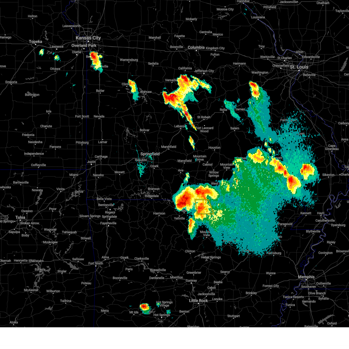 At 542 pm cdt, a severe thunderstorm was located over diamond bay, or 10 miles east of mountain home, moving east at 25 mph (radar indicated). Hazards include 60 mph wind gusts and quarter size hail. Hail damage to vehicles is expected. expect wind damage to roofs, siding, and trees. locations impacted include, briarcliff, bexar, diamond bay, gamaliel landing, vidette, clarkridge, gamaliel, elizabeth, mitchell, robinson point landing, wild cherry, henderson, gepp, norfork lake, hail threat, radar indicated max hail size, 1. 00 in wind threat, radar indicated max wind gust, 60 mph. At 542 pm cdt, a severe thunderstorm was located over diamond bay, or 10 miles east of mountain home, moving east at 25 mph (radar indicated). Hazards include 60 mph wind gusts and quarter size hail. Hail damage to vehicles is expected. expect wind damage to roofs, siding, and trees. locations impacted include, briarcliff, bexar, diamond bay, gamaliel landing, vidette, clarkridge, gamaliel, elizabeth, mitchell, robinson point landing, wild cherry, henderson, gepp, norfork lake, hail threat, radar indicated max hail size, 1. 00 in wind threat, radar indicated max wind gust, 60 mph.
|
| 7/17/2023 5:27 PM CDT |
 At 527 pm cdt, severe thunderstorms were located along a line extending from 6 miles west of ozark isle to 7 miles northwest of gamaliel landing, moving southeast at 40 mph (radar indicated). Hazards include 70 mph wind gusts and quarter size hail. Hail damage to vehicles is expected. expect considerable tree damage. wind damage is also likely to mobile homes, roofs, and outbuildings. locations impacted include, mountain home, bull shoals, yellville, gassville, flippin, lakeview in baxter county, norfork, pyatt, arkawana, ozark regional airport, ozark isle, fawn park, lakeway, bull shoals state park, shipp, herron, colfax, rush, lion hill, advance, thunderstorm damage threat, considerable hail threat, radar indicated max hail size, 1. 00 in wind threat, radar indicated max wind gust, 70 mph. At 527 pm cdt, severe thunderstorms were located along a line extending from 6 miles west of ozark isle to 7 miles northwest of gamaliel landing, moving southeast at 40 mph (radar indicated). Hazards include 70 mph wind gusts and quarter size hail. Hail damage to vehicles is expected. expect considerable tree damage. wind damage is also likely to mobile homes, roofs, and outbuildings. locations impacted include, mountain home, bull shoals, yellville, gassville, flippin, lakeview in baxter county, norfork, pyatt, arkawana, ozark regional airport, ozark isle, fawn park, lakeway, bull shoals state park, shipp, herron, colfax, rush, lion hill, advance, thunderstorm damage threat, considerable hail threat, radar indicated max hail size, 1. 00 in wind threat, radar indicated max wind gust, 70 mph.
|
| 7/17/2023 5:21 PM CDT |
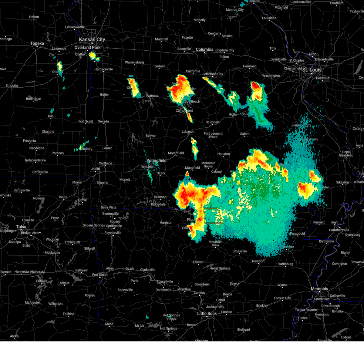 At 520 pm cdt, a severe thunderstorm was located 7 miles east of gainesville, or 20 miles north of mountain home, moving southeast at 25 mph (radar indicated). Hazards include 60 mph wind gusts and quarter size hail. Hail damage to vehicles is expected. Expect wind damage to roofs, siding, and trees. At 520 pm cdt, a severe thunderstorm was located 7 miles east of gainesville, or 20 miles north of mountain home, moving southeast at 25 mph (radar indicated). Hazards include 60 mph wind gusts and quarter size hail. Hail damage to vehicles is expected. Expect wind damage to roofs, siding, and trees.
|
| 7/17/2023 5:12 PM CDT |
 At 511 pm cdt, severe thunderstorms were located along a line extending from 8 miles southeast of taneyville to near gainesville, moving south at 25 mph (radar indicated). Hazards include 70 mph wind gusts and quarter size hail. Hail damage to vehicles is expected. expect considerable tree damage. wind damage is also likely to mobile homes, roofs, and outbuildings. locations impacted include, mountain home, bull shoals, yellville, gassville, flippin, lakeview in baxter county, diamond city, norfork, bergman, lead hill, pyatt, arkawana, lakeway, bull shoals state park, winington, clark hill, herron, colfax, advance, cartney, thunderstorm damage threat, considerable hail threat, radar indicated max hail size, 1. 00 in wind threat, radar indicated max wind gust, 70 mph. At 511 pm cdt, severe thunderstorms were located along a line extending from 8 miles southeast of taneyville to near gainesville, moving south at 25 mph (radar indicated). Hazards include 70 mph wind gusts and quarter size hail. Hail damage to vehicles is expected. expect considerable tree damage. wind damage is also likely to mobile homes, roofs, and outbuildings. locations impacted include, mountain home, bull shoals, yellville, gassville, flippin, lakeview in baxter county, diamond city, norfork, bergman, lead hill, pyatt, arkawana, lakeway, bull shoals state park, winington, clark hill, herron, colfax, advance, cartney, thunderstorm damage threat, considerable hail threat, radar indicated max hail size, 1. 00 in wind threat, radar indicated max wind gust, 70 mph.
|
| 7/17/2023 4:58 PM CDT |
 At 458 pm cdt, severe thunderstorms were located along a line extending from near taneyville to near gainesville, moving south at 25 mph (radar indicated). Hazards include 60 mph wind gusts and quarter size hail. Hail damage to vehicles is expected. Expect wind damage to roofs, siding, and trees. At 458 pm cdt, severe thunderstorms were located along a line extending from near taneyville to near gainesville, moving south at 25 mph (radar indicated). Hazards include 60 mph wind gusts and quarter size hail. Hail damage to vehicles is expected. Expect wind damage to roofs, siding, and trees.
|
| 7/14/2023 10:08 PM CDT |
 The severe thunderstorm warning for northwestern stone, northwestern izard, southeastern marion, western fulton and baxter counties will expire at 1015 pm cdt, the storms which prompted the warning have weakened below severe limits, and no longer pose an immediate threat to life or property. therefore, the warning will be allowed to expire. however gusty winds are still possible with these thunderstorms. a severe thunderstorm watch remains in effect until 200 am cdt for north central arkansas. The severe thunderstorm warning for northwestern stone, northwestern izard, southeastern marion, western fulton and baxter counties will expire at 1015 pm cdt, the storms which prompted the warning have weakened below severe limits, and no longer pose an immediate threat to life or property. therefore, the warning will be allowed to expire. however gusty winds are still possible with these thunderstorms. a severe thunderstorm watch remains in effect until 200 am cdt for north central arkansas.
|
| 7/14/2023 9:54 PM CDT |
 At 954 pm cdt, severe thunderstorms were located along a line extending from near gainesville to diamond bay to near advance, moving east at 40 mph (radar indicated). Hazards include 60 mph wind gusts and penny size hail. Expect damage to roofs, siding, and trees. locations impacted include, mountain home, calico rock, oxford, norfork, salesville, viola, pineville, briarcliff, arkawana, bexar, norfork dam, diamond bay, ott, gamaliel landing, fawn park, shipp, wideman, gorby, herron, colfax, hail threat, radar indicated max hail size, 0. 75 in wind threat, radar indicated max wind gust, 60 mph. At 954 pm cdt, severe thunderstorms were located along a line extending from near gainesville to diamond bay to near advance, moving east at 40 mph (radar indicated). Hazards include 60 mph wind gusts and penny size hail. Expect damage to roofs, siding, and trees. locations impacted include, mountain home, calico rock, oxford, norfork, salesville, viola, pineville, briarcliff, arkawana, bexar, norfork dam, diamond bay, ott, gamaliel landing, fawn park, shipp, wideman, gorby, herron, colfax, hail threat, radar indicated max hail size, 0. 75 in wind threat, radar indicated max wind gust, 60 mph.
|
| 7/14/2023 9:38 PM CDT |
 At 938 pm cdt, severe thunderstorms were located along a line extending from 6 miles west of gainesville to near mountain home to maumee, moving east at 45 mph (radar indicated). Hazards include 60 mph wind gusts and penny size hail. Expect damage to roofs, siding, and trees. locations impacted include, mountain home, bull shoals, gassville, lakeview in baxter county, arkawana, advance, cartney, price place, ozark regional airport, fawn park, shipp, colfax, rush, lion hill, cotter, midway in baxter county, buffalo city, oakland, buford, lone rock, hail threat, radar indicated max hail size, 0. 75 in wind threat, radar indicated max wind gust, 60 mph. At 938 pm cdt, severe thunderstorms were located along a line extending from 6 miles west of gainesville to near mountain home to maumee, moving east at 45 mph (radar indicated). Hazards include 60 mph wind gusts and penny size hail. Expect damage to roofs, siding, and trees. locations impacted include, mountain home, bull shoals, gassville, lakeview in baxter county, arkawana, advance, cartney, price place, ozark regional airport, fawn park, shipp, colfax, rush, lion hill, cotter, midway in baxter county, buffalo city, oakland, buford, lone rock, hail threat, radar indicated max hail size, 0. 75 in wind threat, radar indicated max wind gust, 60 mph.
|
| 7/14/2023 9:35 PM CDT |
 At 935 pm cdt, severe thunderstorms were located along a line extending from 11 miles north of price place to mountain home to near rush, moving east at 40 mph (radar indicated). Hazards include 60 mph wind gusts and penny size hail. expect damage to roofs, siding, and trees At 935 pm cdt, severe thunderstorms were located along a line extending from 11 miles north of price place to mountain home to near rush, moving east at 40 mph (radar indicated). Hazards include 60 mph wind gusts and penny size hail. expect damage to roofs, siding, and trees
|
| 7/14/2023 9:15 PM CDT |
 At 915 pm cdt, severe thunderstorms were located along a line extending from 13 miles north of price place to near rush to near carver, moving southeast at 50 mph (radar indicated). Hazards include 60 mph wind gusts and penny size hail. Expect damage to roofs, siding, and trees. locations impacted include, mountain home, bull shoals, yellville, gassville, flippin, lakeview in baxter county, arkawana, ozark regional airport, ozark isle, fawn park, lakeway, bull shoals state park, shipp, colfax, rush, lion hill, advance, cartney, dodd city, price place, hail threat, radar indicated max hail size, 0. 75 in wind threat, radar indicated max wind gust, 60 mph. At 915 pm cdt, severe thunderstorms were located along a line extending from 13 miles north of price place to near rush to near carver, moving southeast at 50 mph (radar indicated). Hazards include 60 mph wind gusts and penny size hail. Expect damage to roofs, siding, and trees. locations impacted include, mountain home, bull shoals, yellville, gassville, flippin, lakeview in baxter county, arkawana, ozark regional airport, ozark isle, fawn park, lakeway, bull shoals state park, shipp, colfax, rush, lion hill, advance, cartney, dodd city, price place, hail threat, radar indicated max hail size, 0. 75 in wind threat, radar indicated max wind gust, 60 mph.
|
| 7/14/2023 8:54 PM CDT |
 At 853 pm cdt, severe thunderstorms were located along a line extending from near taneyville to near pyatt to erbie, moving southeast at 50 mph (radar indicated). Hazards include 60 mph wind gusts and penny size hail. expect damage to roofs, siding, and trees At 853 pm cdt, severe thunderstorms were located along a line extending from near taneyville to near pyatt to erbie, moving southeast at 50 mph (radar indicated). Hazards include 60 mph wind gusts and penny size hail. expect damage to roofs, siding, and trees
|
| 7/5/2023 1:20 PM CDT | A few trees blown down across mountain hom in baxter county AR, 0.5 miles E of Mountain Home, AR |
| 7/1/2023 5:09 PM CDT |
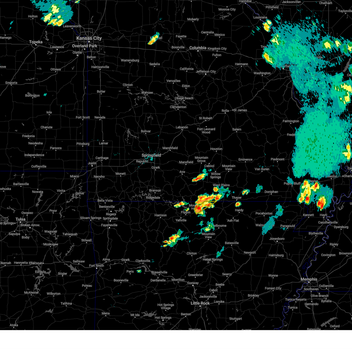 At 508 pm cdt, a severe thunderstorm was located 3 miles northeast of mountain home, moving northeast at 45 mph (radar indicated). Hazards include 60 mph wind gusts and half dollar size hail. Hail damage to vehicles is expected. expect wind damage to roofs, siding, and trees. locations impacted include, mountain home, fawn park, ott, gamaliel landing, vidette, robinson point landing, gamaliel, henderson, norfork lake, hail threat, radar indicated max hail size, 1. 25 in wind threat, radar indicated max wind gust, 60 mph. At 508 pm cdt, a severe thunderstorm was located 3 miles northeast of mountain home, moving northeast at 45 mph (radar indicated). Hazards include 60 mph wind gusts and half dollar size hail. Hail damage to vehicles is expected. expect wind damage to roofs, siding, and trees. locations impacted include, mountain home, fawn park, ott, gamaliel landing, vidette, robinson point landing, gamaliel, henderson, norfork lake, hail threat, radar indicated max hail size, 1. 25 in wind threat, radar indicated max wind gust, 60 mph.
|
| 7/1/2023 5:00 PM CDT |
 At 459 pm cdt, a severe thunderstorm was located 2 miles southwest of mountain home, moving northeast at 45 mph (radar indicated). Hazards include 60 mph wind gusts and nickel size hail. expect damage to roofs, siding, and trees At 459 pm cdt, a severe thunderstorm was located 2 miles southwest of mountain home, moving northeast at 45 mph (radar indicated). Hazards include 60 mph wind gusts and nickel size hail. expect damage to roofs, siding, and trees
|
| 4/5/2023 9:30 AM CDT |
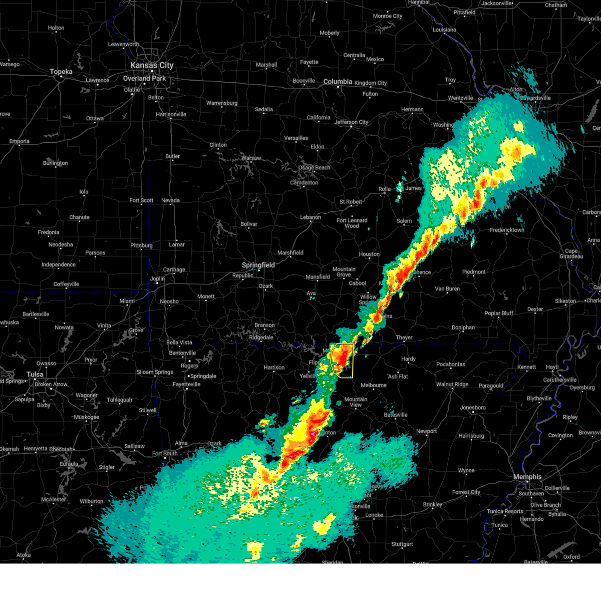 At 930 am cdt, a severe thunderstorm was located over shipp, or 8 miles south of mountain home, moving east at 40 mph (radar indicated). Hazards include 60 mph wind gusts and quarter size hail. Hail damage to vehicles is expected. expect wind damage to roofs, siding, and trees. locations impacted include, mountain home, norfork, salesville, briarcliff, rodney, norfork dam, diamond bay, gamaliel landing, fawn park, shipp, colfax, clarkridge, gamaliel, robinson point landing, jordan, henderson, norfork lake, hail threat, radar indicated max hail size, 1. 00 in wind threat, radar indicated max wind gust, 60 mph. At 930 am cdt, a severe thunderstorm was located over shipp, or 8 miles south of mountain home, moving east at 40 mph (radar indicated). Hazards include 60 mph wind gusts and quarter size hail. Hail damage to vehicles is expected. expect wind damage to roofs, siding, and trees. locations impacted include, mountain home, norfork, salesville, briarcliff, rodney, norfork dam, diamond bay, gamaliel landing, fawn park, shipp, colfax, clarkridge, gamaliel, robinson point landing, jordan, henderson, norfork lake, hail threat, radar indicated max hail size, 1. 00 in wind threat, radar indicated max wind gust, 60 mph.
|
| 4/5/2023 8:59 AM CDT |
 At 858 am cdt, a severe thunderstorm was located near maumee, or 8 miles south of yellville, moving east at 40 mph (radar indicated). Hazards include 60 mph wind gusts and quarter size hail. Hail damage to vehicles is expected. Expect wind damage to roofs, siding, and trees. At 858 am cdt, a severe thunderstorm was located near maumee, or 8 miles south of yellville, moving east at 40 mph (radar indicated). Hazards include 60 mph wind gusts and quarter size hail. Hail damage to vehicles is expected. Expect wind damage to roofs, siding, and trees.
|
| 4/5/2023 8:23 AM CDT |
 At 823 am cdt, severe thunderstorms were located along a line extending from near lakeway to 8 miles northeast of walnut, moving east at 50 mph (radar indicated). Hazards include 60 mph wind gusts and quarter size hail. Hail damage to vehicles is expected. Expect wind damage to roofs, siding, and trees. At 823 am cdt, severe thunderstorms were located along a line extending from near lakeway to 8 miles northeast of walnut, moving east at 50 mph (radar indicated). Hazards include 60 mph wind gusts and quarter size hail. Hail damage to vehicles is expected. Expect wind damage to roofs, siding, and trees.
|
| 2/16/2023 2:42 AM CST |
 The severe thunderstorm warning for southeastern marion and west central baxter counties will expire at 245 am cst, the storm which prompted the warning has moved out of the area. therefore, the warning will be allowed to expire. a severe thunderstorm watch remains in effect until 500 am cst for north central arkansas. remember, a tornado warning still remains in effect for portions of baxter county. The severe thunderstorm warning for southeastern marion and west central baxter counties will expire at 245 am cst, the storm which prompted the warning has moved out of the area. therefore, the warning will be allowed to expire. a severe thunderstorm watch remains in effect until 500 am cst for north central arkansas. remember, a tornado warning still remains in effect for portions of baxter county.
|
| 2/16/2023 2:36 AM CST |
 At 236 am cst, a severe thunderstorm capable of producing a tornado was located near lion hill, or 9 miles southwest of mountain home, moving northeast at 40 mph (radar indicated rotation). Hazards include tornado. Flying debris will be dangerous to those caught without shelter. mobile homes will be damaged or destroyed. damage to roofs, windows, and vehicles will occur. Tree damage is likely. At 236 am cst, a severe thunderstorm capable of producing a tornado was located near lion hill, or 9 miles southwest of mountain home, moving northeast at 40 mph (radar indicated rotation). Hazards include tornado. Flying debris will be dangerous to those caught without shelter. mobile homes will be damaged or destroyed. damage to roofs, windows, and vehicles will occur. Tree damage is likely.
|
| 2/16/2023 2:17 AM CST |
 At 216 am cst, a severe thunderstorm capable of producing a tornado was located near yellville, moving northeast at 45 mph (radar indicated rotation). Hazards include tornado and half dollar size hail. Flying debris will be dangerous to those caught without shelter. mobile homes will be damaged or destroyed. damage to roofs, windows, and vehicles will occur. Tree damage is likely. At 216 am cst, a severe thunderstorm capable of producing a tornado was located near yellville, moving northeast at 45 mph (radar indicated rotation). Hazards include tornado and half dollar size hail. Flying debris will be dangerous to those caught without shelter. mobile homes will be damaged or destroyed. damage to roofs, windows, and vehicles will occur. Tree damage is likely.
|
| 2/16/2023 2:15 AM CST |
 At 215 am cst, a severe thunderstorm was located near yellville, moving northeast at 45 mph (radar indicated). Hazards include 60 mph wind gusts and quarter size hail. Hail damage to vehicles is expected. Expect wind damage to roofs, siding, and trees. At 215 am cst, a severe thunderstorm was located near yellville, moving northeast at 45 mph (radar indicated). Hazards include 60 mph wind gusts and quarter size hail. Hail damage to vehicles is expected. Expect wind damage to roofs, siding, and trees.
|
| 11/4/2022 9:53 PM CDT |
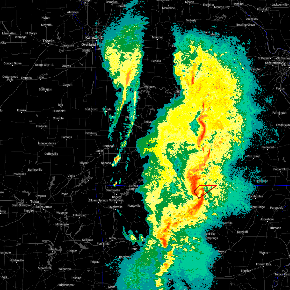 At 953 pm cdt, a severe thunderstorm capable of producing a tornado was located over gamaliel landing, or 8 miles east of mountain home, moving northeast at 55 mph (radar indicated rotation). Hazards include tornado. Flying debris will be dangerous to those caught without shelter. mobile homes will be damaged or destroyed. damage to roofs, windows, and vehicles will occur. Tree damage is likely. At 953 pm cdt, a severe thunderstorm capable of producing a tornado was located over gamaliel landing, or 8 miles east of mountain home, moving northeast at 55 mph (radar indicated rotation). Hazards include tornado. Flying debris will be dangerous to those caught without shelter. mobile homes will be damaged or destroyed. damage to roofs, windows, and vehicles will occur. Tree damage is likely.
|
| 11/4/2022 9:44 PM CDT |
 At 943 pm cdt, severe thunderstorms were located along a line extending from mountain home to near norfork dam to 7 miles northeast of thola, moving northeast at 60 mph (radar indicated). Hazards include 60 mph wind gusts. Expect damage to roofs, siding, and trees. locations impacted include, mountain home, gassville, lakeview in baxter county, norfork, salesville, briarcliff, arkawana, norfork dam, diamond bay, ozark regional airport, fawn park, shipp, herron, colfax, rodney, advance, cartney, culp, bull shoals state park, cotter, hail threat, radar indicated max hail size, <. 75 in wind threat, radar indicated max wind gust, 60 mph. At 943 pm cdt, severe thunderstorms were located along a line extending from mountain home to near norfork dam to 7 miles northeast of thola, moving northeast at 60 mph (radar indicated). Hazards include 60 mph wind gusts. Expect damage to roofs, siding, and trees. locations impacted include, mountain home, gassville, lakeview in baxter county, norfork, salesville, briarcliff, arkawana, norfork dam, diamond bay, ozark regional airport, fawn park, shipp, herron, colfax, rodney, advance, cartney, culp, bull shoals state park, cotter, hail threat, radar indicated max hail size, <. 75 in wind threat, radar indicated max wind gust, 60 mph.
|
| 11/4/2022 9:41 PM CDT |
 At 940 pm cdt, severe thunderstorms were located along a line extending from near colfax to norfork to 7 miles south of advance, moving northeast at 55 mph (radar indicated). Hazards include 60 mph wind gusts. expect damage to roofs, siding, and trees At 940 pm cdt, severe thunderstorms were located along a line extending from near colfax to norfork to 7 miles south of advance, moving northeast at 55 mph (radar indicated). Hazards include 60 mph wind gusts. expect damage to roofs, siding, and trees
|
| 11/4/2022 9:28 PM CDT |
 At 927 pm cdt, severe thunderstorms were located along a line extending from near rush to 8 miles southwest of advance to near watts, moving northeast at 55 mph (radar indicated). Hazards include 60 mph wind gusts. Expect damage to roofs, siding, and trees. locations impacted include, mountain home, marshall, yellville, gassville, flippin, lakeview in baxter county, norfork, salesville, briarcliff, arkawana, rocky hill, herron, colfax, maumee, rodney, advance, cartney, imo, culp, elberta, hail threat, radar indicated max hail size, <. 75 in wind threat, radar indicated max wind gust, 60 mph. At 927 pm cdt, severe thunderstorms were located along a line extending from near rush to 8 miles southwest of advance to near watts, moving northeast at 55 mph (radar indicated). Hazards include 60 mph wind gusts. Expect damage to roofs, siding, and trees. locations impacted include, mountain home, marshall, yellville, gassville, flippin, lakeview in baxter county, norfork, salesville, briarcliff, arkawana, rocky hill, herron, colfax, maumee, rodney, advance, cartney, imo, culp, elberta, hail threat, radar indicated max hail size, <. 75 in wind threat, radar indicated max wind gust, 60 mph.
|
| 11/4/2022 9:08 PM CDT |
 At 907 pm cdt, severe thunderstorms were located along a line extending from 9 miles southwest of piercetown to moore to near broomfield, moving northeast at 60 mph (radar indicated). Hazards include 60 mph wind gusts. expect damage to roofs, siding, and trees At 907 pm cdt, severe thunderstorms were located along a line extending from 9 miles southwest of piercetown to moore to near broomfield, moving northeast at 60 mph (radar indicated). Hazards include 60 mph wind gusts. expect damage to roofs, siding, and trees
|
| 10/15/2022 10:26 PM CDT |
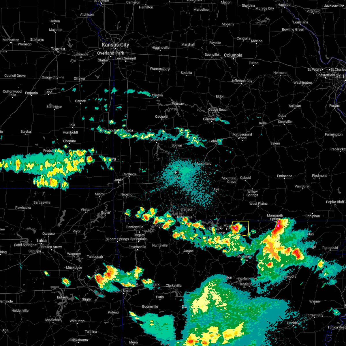 At 1026 pm cdt, a severe thunderstorm was located over gamaliel landing, or 8 miles northeast of mountain home, moving east at 30 mph (radar indicated). Hazards include quarter size hail. Damage to vehicles is expected. locations impacted include, mountain home, diamond bay, ott, gamaliel landing, fawn park, vidette, clarkridge, gamaliel, elizabeth, robinson point landing, henderson, gepp, norfork lake, hail threat, radar indicated max hail size, 1. 00 in wind threat, radar indicated max wind gust, <50 mph. At 1026 pm cdt, a severe thunderstorm was located over gamaliel landing, or 8 miles northeast of mountain home, moving east at 30 mph (radar indicated). Hazards include quarter size hail. Damage to vehicles is expected. locations impacted include, mountain home, diamond bay, ott, gamaliel landing, fawn park, vidette, clarkridge, gamaliel, elizabeth, robinson point landing, henderson, gepp, norfork lake, hail threat, radar indicated max hail size, 1. 00 in wind threat, radar indicated max wind gust, <50 mph.
|
| 10/15/2022 10:15 PM CDT | Quarter sized hail reported 2.7 miles S of Mountain Home, AR |
| 10/15/2022 10:09 PM CDT |
 At 1008 pm cdt, a severe thunderstorm was located over arkawana, or near mountain home, moving east at 30 mph (radar indicated). Hazards include quarter size hail. damage to vehicles is expected At 1008 pm cdt, a severe thunderstorm was located over arkawana, or near mountain home, moving east at 30 mph (radar indicated). Hazards include quarter size hail. damage to vehicles is expected
|
| 5/21/2022 4:29 PM CDT |
 At 429 pm cdt, a severe thunderstorm was located over duff, or 9 miles northwest of marshall, moving northeast at 50 mph (radar indicated). Hazards include 60 mph wind gusts and quarter size hail. Hail damage to vehicles is expected. Expect wind damage to roofs, siding, and trees. At 429 pm cdt, a severe thunderstorm was located over duff, or 9 miles northwest of marshall, moving northeast at 50 mph (radar indicated). Hazards include 60 mph wind gusts and quarter size hail. Hail damage to vehicles is expected. Expect wind damage to roofs, siding, and trees.
|
| 5/5/2022 3:36 AM CDT | Quarter sized hail reported 3.6 miles SSW of Mountain Home, AR |
| 5/5/2022 3:29 AM CDT |
 At 329 am cdt, a severe thunderstorm was located over fawn park, or over mountain home, moving northeast at 60 mph (radar indicated). Hazards include 60 mph wind gusts and quarter size hail. Hail damage to vehicles is expected. Expect wind damage to roofs, siding, and trees. At 329 am cdt, a severe thunderstorm was located over fawn park, or over mountain home, moving northeast at 60 mph (radar indicated). Hazards include 60 mph wind gusts and quarter size hail. Hail damage to vehicles is expected. Expect wind damage to roofs, siding, and trees.
|
| 5/3/2022 12:36 AM CDT |
 At 1236 am cdt, severe thunderstorms were located along a line extending from near gamaliel landing to near rodney to near blanchard springs campground, moving east at 50 mph (radar indicated). Hazards include 60 mph wind gusts. Expect damage to roofs, siding, and trees. locations impacted include, mountain home, bull shoals, melbourne, horseshoe bend, gassville, calico rock, lakeview in baxter county, oxford, norfork, salesville, viola, pineville, briarcliff, franklin, arkawana, bexar, flint springs, ott, bull shoals state park, lone star, hail threat, radar indicated max hail size, <. 75 in wind threat, radar indicated max wind gust, 60 mph. At 1236 am cdt, severe thunderstorms were located along a line extending from near gamaliel landing to near rodney to near blanchard springs campground, moving east at 50 mph (radar indicated). Hazards include 60 mph wind gusts. Expect damage to roofs, siding, and trees. locations impacted include, mountain home, bull shoals, melbourne, horseshoe bend, gassville, calico rock, lakeview in baxter county, oxford, norfork, salesville, viola, pineville, briarcliff, franklin, arkawana, bexar, flint springs, ott, bull shoals state park, lone star, hail threat, radar indicated max hail size, <. 75 in wind threat, radar indicated max wind gust, 60 mph.
|
| 5/3/2022 12:15 AM CDT |
 At 1215 am cdt, severe thunderstorms were located along a line extending from near lakeway to near rush to near marshall, moving east at 50 mph (radar indicated). Hazards include 60 mph wind gusts. expect damage to roofs, siding, and trees At 1215 am cdt, severe thunderstorms were located along a line extending from near lakeway to near rush to near marshall, moving east at 50 mph (radar indicated). Hazards include 60 mph wind gusts. expect damage to roofs, siding, and trees
|
| 4/15/2022 6:37 PM CDT |
 At 636 pm cdt, a severe thunderstorm was located near fawn park, or 8 miles north of mountain home, moving east at 50 mph (radar indicated). Hazards include 60 mph wind gusts and half dollar size hail. Hail damage to vehicles is expected. expect wind damage to roofs, siding, and trees. locations impacted include, mountain home, cherokee village, bull shoals, salem in fulton county, ash flat, horseshoe bend, mammoth spring, lakeview in baxter county, oxford, viola, franklin, ballard, arkawana, bexar, flint springs, ott, sturkie, byron, diamond bay, ozark regional airport, hail threat, radar indicated max hail size, 1. 25 in wind threat, radar indicated max wind gust, 60 mph. At 636 pm cdt, a severe thunderstorm was located near fawn park, or 8 miles north of mountain home, moving east at 50 mph (radar indicated). Hazards include 60 mph wind gusts and half dollar size hail. Hail damage to vehicles is expected. expect wind damage to roofs, siding, and trees. locations impacted include, mountain home, cherokee village, bull shoals, salem in fulton county, ash flat, horseshoe bend, mammoth spring, lakeview in baxter county, oxford, viola, franklin, ballard, arkawana, bexar, flint springs, ott, sturkie, byron, diamond bay, ozark regional airport, hail threat, radar indicated max hail size, 1. 25 in wind threat, radar indicated max wind gust, 60 mph.
|
| 4/15/2022 6:25 PM CDT |
 At 624 pm cdt, a severe thunderstorm was located near arkawana, or 9 miles north of mountain home, moving east at 60 mph (radar indicated). Hazards include 60 mph wind gusts and quarter size hail. Hail damage to vehicles is expected. Expect wind damage to roofs, siding, and trees. At 624 pm cdt, a severe thunderstorm was located near arkawana, or 9 miles north of mountain home, moving east at 60 mph (radar indicated). Hazards include 60 mph wind gusts and quarter size hail. Hail damage to vehicles is expected. Expect wind damage to roofs, siding, and trees.
|
| 3/30/2022 9:55 AM CDT |
 The severe thunderstorm warning for central marion, northern baxter and northwestern fulton counties will expire at 1000 am cdt, the storm which prompted the warning has moved out of the area. therefore, the warning will be allowed to expire. a tornado watch remains in effect until 100 pm cdt for north central arkansas. The severe thunderstorm warning for central marion, northern baxter and northwestern fulton counties will expire at 1000 am cdt, the storm which prompted the warning has moved out of the area. therefore, the warning will be allowed to expire. a tornado watch remains in effect until 100 pm cdt for north central arkansas.
|
| 3/30/2022 9:45 AM CDT |
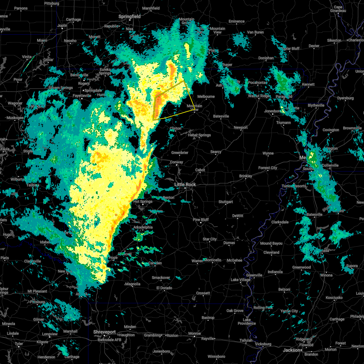 At 945 am cdt, severe thunderstorms were located along a line extending from near yellville to near marshall to near imo, moving northeast at 60 mph (radar indicated). Hazards include 60 mph wind gusts. Expect damage to roofs, siding, and trees. locations impacted include, marshall, norfork, salesville, briarcliff, marsena, witts spring, duff, herron, maumee, advance, cartney, bohannon, imo, culp, elberta, watts, blanchard springs campground, thola, kay, shipp, hail threat, radar indicated max hail size, <. 75 in wind threat, radar indicated max wind gust, 60 mph. At 945 am cdt, severe thunderstorms were located along a line extending from near yellville to near marshall to near imo, moving northeast at 60 mph (radar indicated). Hazards include 60 mph wind gusts. Expect damage to roofs, siding, and trees. locations impacted include, marshall, norfork, salesville, briarcliff, marsena, witts spring, duff, herron, maumee, advance, cartney, bohannon, imo, culp, elberta, watts, blanchard springs campground, thola, kay, shipp, hail threat, radar indicated max hail size, <. 75 in wind threat, radar indicated max wind gust, 60 mph.
|
| 3/30/2022 9:41 AM CDT |
 At 941 am cdt, a severe thunderstorm was located near arkawana, or 10 miles northeast of bull shoals, moving northeast at 65 mph (radar indicated). Hazards include 60 mph wind gusts. Expect damage to roofs, siding, and trees. locations impacted include, mountain home, bull shoals, yellville, gassville, flippin, lakeview in baxter county, briarcliff, arkawana, ott, ozark regional airport, gamaliel landing, ozark isle, lakeway, fawn park, bull shoals state park, colfax, dodd city, price place, diamond bay, cotter, hail threat, radar indicated max hail size, <. 75 in wind threat, radar indicated max wind gust, 60 mph. At 941 am cdt, a severe thunderstorm was located near arkawana, or 10 miles northeast of bull shoals, moving northeast at 65 mph (radar indicated). Hazards include 60 mph wind gusts. Expect damage to roofs, siding, and trees. locations impacted include, mountain home, bull shoals, yellville, gassville, flippin, lakeview in baxter county, briarcliff, arkawana, ott, ozark regional airport, gamaliel landing, ozark isle, lakeway, fawn park, bull shoals state park, colfax, dodd city, price place, diamond bay, cotter, hail threat, radar indicated max hail size, <. 75 in wind threat, radar indicated max wind gust, 60 mph.
|
| 3/30/2022 9:28 AM CDT |
 At 927 am cdt, severe thunderstorms were located along a line extending from near point peter to witts spring to near solo, moving northeast at 60 mph (radar indicated). Hazards include 60 mph wind gusts. expect damage to roofs, siding, and trees At 927 am cdt, severe thunderstorms were located along a line extending from near point peter to witts spring to near solo, moving northeast at 60 mph (radar indicated). Hazards include 60 mph wind gusts. expect damage to roofs, siding, and trees
|
| 3/30/2022 9:11 AM CDT |
 At 911 am cdt, a severe thunderstorm was located over dugger, or 12 miles southwest of yellville, moving northeast at 65 mph (radar indicated). Hazards include 60 mph wind gusts. expect damage to roofs, siding, and trees At 911 am cdt, a severe thunderstorm was located over dugger, or 12 miles southwest of yellville, moving northeast at 65 mph (radar indicated). Hazards include 60 mph wind gusts. expect damage to roofs, siding, and trees
|
| 10/23/2021 3:43 PM CDT | Quarter sized hail reported 2.8 miles SSW of Mountain Home, AR, quarter size hail reported 3 nne of mountain home. |
| 10/23/2021 3:32 PM CDT | Quarter sized hail reported 5.5 miles WSW of Mountain Home, AR |
| 10/23/2021 3:27 PM CDT |
 At 327 pm cdt, a severe thunderstorm was located over fawn park, or near mountain home, moving southeast at 40 mph (radar indicated). Hazards include 60 mph wind gusts and quarter size hail. Hail damage to vehicles is expected. Expect wind damage to roofs, siding, and trees. At 327 pm cdt, a severe thunderstorm was located over fawn park, or near mountain home, moving southeast at 40 mph (radar indicated). Hazards include 60 mph wind gusts and quarter size hail. Hail damage to vehicles is expected. Expect wind damage to roofs, siding, and trees.
|
| 10/23/2021 3:11 PM CDT |
 At 310 pm cdt, severe thunderstorms were located along a line extending from near gainesville to near arkawana to near ozark isle, moving east at 40 mph (radar indicated). Hazards include 60 mph wind gusts and quarter size hail. Hail damage to vehicles is expected. expect wind damage to roofs, siding, and trees. locations impacted include, mountain home, bull shoals, gassville, flippin, lakeview in baxter county, norfork, salesville, briarcliff, arkawana, norfork dam, diamond bay, ozark regional airport, gamaliel landing, ozark isle, fawn park, bull shoals state park, shipp, colfax, advance, cartney, hail threat, radar indicated max hail size, 1. 00 in wind threat, radar indicated max wind gust, 60 mph. At 310 pm cdt, severe thunderstorms were located along a line extending from near gainesville to near arkawana to near ozark isle, moving east at 40 mph (radar indicated). Hazards include 60 mph wind gusts and quarter size hail. Hail damage to vehicles is expected. expect wind damage to roofs, siding, and trees. locations impacted include, mountain home, bull shoals, gassville, flippin, lakeview in baxter county, norfork, salesville, briarcliff, arkawana, norfork dam, diamond bay, ozark regional airport, gamaliel landing, ozark isle, fawn park, bull shoals state park, shipp, colfax, advance, cartney, hail threat, radar indicated max hail size, 1. 00 in wind threat, radar indicated max wind gust, 60 mph.
|
| 10/23/2021 2:44 PM CDT |
 At 243 pm cdt, severe thunderstorms were located along a line extending from 12 miles north of ozark isle to 7 miles northwest of price place to near diamond city, moving southeast at 40 mph (radar indicated). Hazards include 60 mph wind gusts and quarter size hail. Hail damage to vehicles is expected. Expect wind damage to roofs, siding, and trees. At 243 pm cdt, severe thunderstorms were located along a line extending from 12 miles north of ozark isle to 7 miles northwest of price place to near diamond city, moving southeast at 40 mph (radar indicated). Hazards include 60 mph wind gusts and quarter size hail. Hail damage to vehicles is expected. Expect wind damage to roofs, siding, and trees.
|
| 8/13/2021 7:27 PM CDT |
 At 726 pm cdt, severe thunderstorms were located along a line extending from near ozark isle to near maumee to marsena, moving southeast at 15 mph (radar indicated). Hazards include 60 mph wind gusts and quarter size hail. Hail damage to vehicles is expected. expect wind damage to roofs, siding, and trees. locations impacted include, mountain home, bull shoals, marshall, yellville, gassville, flippin, lakeview in baxter county, pyatt, arkawana, marsena, duff, lakeway, bull shoals state park, clark hill, point peter, maumee, colfax, advance, cartney, bohannon, hail threat, radar indicated max hail size, 1. 00 in wind threat, radar indicated max wind gust, 60 mph. At 726 pm cdt, severe thunderstorms were located along a line extending from near ozark isle to near maumee to marsena, moving southeast at 15 mph (radar indicated). Hazards include 60 mph wind gusts and quarter size hail. Hail damage to vehicles is expected. expect wind damage to roofs, siding, and trees. locations impacted include, mountain home, bull shoals, marshall, yellville, gassville, flippin, lakeview in baxter county, pyatt, arkawana, marsena, duff, lakeway, bull shoals state park, clark hill, point peter, maumee, colfax, advance, cartney, bohannon, hail threat, radar indicated max hail size, 1. 00 in wind threat, radar indicated max wind gust, 60 mph.
|
| 8/13/2021 7:05 PM CDT |
 At 704 pm cdt, severe thunderstorms were located along a line extending from near lakeway to near maumee to 6 miles west of duff, moving east at 10 mph (radar indicated). Hazards include 60 mph wind gusts and quarter size hail. Hail damage to vehicles is expected. Expect wind damage to roofs, siding, and trees. At 704 pm cdt, severe thunderstorms were located along a line extending from near lakeway to near maumee to 6 miles west of duff, moving east at 10 mph (radar indicated). Hazards include 60 mph wind gusts and quarter size hail. Hail damage to vehicles is expected. Expect wind damage to roofs, siding, and trees.
|
| 6/11/2021 9:42 PM CDT | Multiple trees were blown down in the sycamore springs neighborhoo in baxter county AR, 7.3 miles WNW of Mountain Home, AR |
| 6/11/2021 9:23 PM CDT |
 At 923 pm cdt, severe thunderstorms were located along a line extending from ozark isle to near arkawana to near gamaliel landing, moving southeast at 30 mph (radar indicated). Hazards include 60 mph wind gusts and penny size hail. Expect damage to roofs, siding, and trees. Locations impacted include, mountain home, bull shoals, gassville, flippin, lakeview in baxter county, salesville, briarcliff, arkawana, diamond bay, ozark regional airport, gamaliel landing, ozark isle, fawn park, bull shoals state park, shipp, colfax, cartney, price place, cotter, midway in baxter county,. At 923 pm cdt, severe thunderstorms were located along a line extending from ozark isle to near arkawana to near gamaliel landing, moving southeast at 30 mph (radar indicated). Hazards include 60 mph wind gusts and penny size hail. Expect damage to roofs, siding, and trees. Locations impacted include, mountain home, bull shoals, gassville, flippin, lakeview in baxter county, salesville, briarcliff, arkawana, diamond bay, ozark regional airport, gamaliel landing, ozark isle, fawn park, bull shoals state park, shipp, colfax, cartney, price place, cotter, midway in baxter county,.
|
| 6/11/2021 9:17 PM CDT | Trees were blown down on the east side of mountain hom in baxter county AR, 2.9 miles WSW of Mountain Home, AR |
| 6/11/2021 8:59 PM CDT |
 At 858 pm cdt, severe thunderstorms were located along a line extending from 14 miles northwest of ozark isle to 6 miles north of price place to gainesville, moving south at 30 mph (radar indicated). Hazards include 60 mph wind gusts and nickel size hail. expect damage to roofs, siding, and trees At 858 pm cdt, severe thunderstorms were located along a line extending from 14 miles northwest of ozark isle to 6 miles north of price place to gainesville, moving south at 30 mph (radar indicated). Hazards include 60 mph wind gusts and nickel size hail. expect damage to roofs, siding, and trees
|
| 5/4/2021 12:26 AM CDT |
 At 1226 am cdt, severe thunderstorms were located along a line extending from near gassville to near culp to near blanchard springs campground to mountain view, moving northeast at 40 mph (radar indicated). Hazards include 60 mph wind gusts and quarter size hail. Hail damage to vehicles is expected. expect wind damage to roofs, siding, and trees. Locations impacted include, mountain home, mountain view, bull shoals, melbourne, gassville, calico rock, flippin, lakeview in baxter county, oxford, norfork, salesville, pineville, briarcliff, arkawana, bull shoals state park, lone star, wideman, herron, colfax, gid,. At 1226 am cdt, severe thunderstorms were located along a line extending from near gassville to near culp to near blanchard springs campground to mountain view, moving northeast at 40 mph (radar indicated). Hazards include 60 mph wind gusts and quarter size hail. Hail damage to vehicles is expected. expect wind damage to roofs, siding, and trees. Locations impacted include, mountain home, mountain view, bull shoals, melbourne, gassville, calico rock, flippin, lakeview in baxter county, oxford, norfork, salesville, pineville, briarcliff, arkawana, bull shoals state park, lone star, wideman, herron, colfax, gid,.
|
| 5/4/2021 12:10 AM CDT |
 At 1210 am cdt, severe thunderstorms were located along a line extending from near rush to 9 miles southwest of culp to 7 miles southwest of blanchard springs campground to 8 miles east of elba, moving northeast at 45 mph (radar indicated). Hazards include 60 mph wind gusts and quarter size hail. Hail damage to vehicles is expected. Expect wind damage to roofs, siding, and trees. At 1210 am cdt, severe thunderstorms were located along a line extending from near rush to 9 miles southwest of culp to 7 miles southwest of blanchard springs campground to 8 miles east of elba, moving northeast at 45 mph (radar indicated). Hazards include 60 mph wind gusts and quarter size hail. Hail damage to vehicles is expected. Expect wind damage to roofs, siding, and trees.
|
| 5/3/2021 11:48 PM CDT |
 At 1123 pm cdt, severe thunderstorms were located along a line extending from near osage to near pruitt to piercetown to near moore to near smyrna, moving northeast at 50 mph (radar indicated). Hazards include 60 mph wind gusts and penny size hail. expect damage to roofs, siding, and trees At 1123 pm cdt, severe thunderstorms were located along a line extending from near osage to near pruitt to piercetown to near moore to near smyrna, moving northeast at 50 mph (radar indicated). Hazards include 60 mph wind gusts and penny size hail. expect damage to roofs, siding, and trees
|
| 5/3/2021 11:24 PM CDT |
 The national weather service in little rock has issued a * severe thunderstorm warning for. stone county in north central arkansas. searcy county in north central arkansas. eastern newton county in north central arkansas. Marion county in north central arkansas. The national weather service in little rock has issued a * severe thunderstorm warning for. stone county in north central arkansas. searcy county in north central arkansas. eastern newton county in north central arkansas. Marion county in north central arkansas.
|
| 4/9/2021 3:31 PM CDT |
 At 331 pm cdt, severe thunderstorms were located along a line extending from near arkawana to near bexar, moving northeast at 60 mph (radar indicated). Hazards include 60 mph wind gusts and half dollar size hail. Hail damage to vehicles is expected. expect wind damage to roofs, siding, and trees. Locations impacted include, mountain home, bull shoals, lakeview in baxter county, viola, arkawana, bexar, diamond bay, flint springs, ott, ozark regional airport, gamaliel landing, fawn park, sturkie, byron, ozark isle, midway in baxter county, moko, gamaliel, oakland, mitchell,. At 331 pm cdt, severe thunderstorms were located along a line extending from near arkawana to near bexar, moving northeast at 60 mph (radar indicated). Hazards include 60 mph wind gusts and half dollar size hail. Hail damage to vehicles is expected. expect wind damage to roofs, siding, and trees. Locations impacted include, mountain home, bull shoals, lakeview in baxter county, viola, arkawana, bexar, diamond bay, flint springs, ott, ozark regional airport, gamaliel landing, fawn park, sturkie, byron, ozark isle, midway in baxter county, moko, gamaliel, oakland, mitchell,.
|
| 4/9/2021 3:19 PM CDT | Storm damage reported in baxter county AR, 2.1 miles SSE of Mountain Home, AR |
| 4/9/2021 3:17 PM CDT | Baseball sized hail reported 4.1 miles ENE of Mountain Home, AR |
| 4/9/2021 3:14 PM CDT |
 At 313 pm cdt, severe thunderstorms were located along a line extending from near bull shoals state park to near rodney, moving northeast at 65 mph (radar indicated). Hazards include 60 mph wind gusts and half dollar size hail. Hail damage to vehicles is expected. Expect wind damage to roofs, siding, and trees. At 313 pm cdt, severe thunderstorms were located along a line extending from near bull shoals state park to near rodney, moving northeast at 65 mph (radar indicated). Hazards include 60 mph wind gusts and half dollar size hail. Hail damage to vehicles is expected. Expect wind damage to roofs, siding, and trees.
|
| 11/14/2020 10:58 PM CST |
 At 1056 pm cst, severe thunderstorms were located along a line extending from near mountain home to 7 miles southwest of norfork, moving east at 50 mph (radar indicated). Hazards include 60 mph wind gusts and penny size hail. Expect damage to roofs, siding, and trees. Locations impacted include, mountain home, gassville, flippin, norfork, salesville, briarcliff, norfork dam, diamond bay, gamaliel landing, shipp, herron, colfax, lion hill, rodney, advance, cartney, cotter, rea valley, jordan, buffalo city,. At 1056 pm cst, severe thunderstorms were located along a line extending from near mountain home to 7 miles southwest of norfork, moving east at 50 mph (radar indicated). Hazards include 60 mph wind gusts and penny size hail. Expect damage to roofs, siding, and trees. Locations impacted include, mountain home, gassville, flippin, norfork, salesville, briarcliff, norfork dam, diamond bay, gamaliel landing, shipp, herron, colfax, lion hill, rodney, advance, cartney, cotter, rea valley, jordan, buffalo city,.
|
| 11/14/2020 10:35 PM CST | Storm damage reported in baxter county AR, 0.5 miles E of Mountain Home, AR |
| 11/14/2020 10:34 PM CST |
 At 1034 pm cst, a severe thunderstorm was located near yellville, moving east at 50 mph (radar indicated). Hazards include 60 mph wind gusts and nickel size hail. expect damage to roofs, siding, and trees At 1034 pm cst, a severe thunderstorm was located near yellville, moving east at 50 mph (radar indicated). Hazards include 60 mph wind gusts and nickel size hail. expect damage to roofs, siding, and trees
|
| 7/7/2020 6:00 PM CDT | Numerous limbs down in the area as well as a couple of tree in baxter county AR, 6.5 miles SW of Mountain Home, AR |
| 7/1/2020 12:28 PM CDT |
 At 1228 pm cdt, severe thunderstorms were located along a line extending from bexar to near harrison, moving south at 35 mph (radar indicated). Hazards include 60 mph wind gusts and quarter size hail. Hail damage to vehicles is expected. Expect wind damage to roofs, siding, and trees. At 1228 pm cdt, severe thunderstorms were located along a line extending from bexar to near harrison, moving south at 35 mph (radar indicated). Hazards include 60 mph wind gusts and quarter size hail. Hail damage to vehicles is expected. Expect wind damage to roofs, siding, and trees.
|
| 7/1/2020 11:51 AM CDT |
 At 1150 am cdt, severe thunderstorms were located along a line extending from near diamond city to 6 miles northwest of bakersfield, moving southeast at 25 mph (radar indicated). Hazards include 60 mph wind gusts and quarter size hail. Hail damage to vehicles is expected. Expect wind damage to roofs, siding, and trees. At 1150 am cdt, severe thunderstorms were located along a line extending from near diamond city to 6 miles northwest of bakersfield, moving southeast at 25 mph (radar indicated). Hazards include 60 mph wind gusts and quarter size hail. Hail damage to vehicles is expected. Expect wind damage to roofs, siding, and trees.
|
| 6/4/2020 6:01 AM CDT |
 At 601 am cdt, severe thunderstorms were located along a line extending from 10 miles southeast of ava to near diamond city, moving southeast at 55 mph (radar indicated). Hazards include 60 mph wind gusts and penny size hail. expect damage to roofs, siding, and trees At 601 am cdt, severe thunderstorms were located along a line extending from 10 miles southeast of ava to near diamond city, moving southeast at 55 mph (radar indicated). Hazards include 60 mph wind gusts and penny size hail. expect damage to roofs, siding, and trees
|
| 5/25/2020 10:42 PM CDT |
 At 1042 pm cdt, severe thunderstorms were located along a line extending from near culp to advance to 7 miles northwest of maumee, moving northwest at 55 mph (radar indicated). Hazards include 60 mph wind gusts. expect damage to roofs, siding, and trees At 1042 pm cdt, severe thunderstorms were located along a line extending from near culp to advance to 7 miles northwest of maumee, moving northwest at 55 mph (radar indicated). Hazards include 60 mph wind gusts. expect damage to roofs, siding, and trees
|
| 5/3/2020 12:26 PM CDT | Tennis Ball sized hail reported 0.8 miles SE of Mountain Home, AR, public report of tennis ball sized hail. |
| 5/3/2020 12:13 PM CDT |
 At 1212 pm cdt, a severe thunderstorm was located over diamond bay, or 10 miles east of mountain home, moving east at 40 mph. another line of severe thunderstorms was also located in eastern marion county and moving into baxter county at 45 mph (radar indicated). Hazards include 70 mph wind gusts and quarter size hail. Hail damage to vehicles is expected. expect considerable tree damage. wind damage is also likely to mobile homes, roofs, and outbuildings. Locations impacted include, mountain home, bull shoals, gassville, lakeview in baxter county, oxford, norfork, salesville, viola, pineville, briarcliff, arkawana, bexar, norfork dam, diamond bay, flint springs, ott, ozark regional airport, gamaliel landing, fawn park, bull shoals state park,. At 1212 pm cdt, a severe thunderstorm was located over diamond bay, or 10 miles east of mountain home, moving east at 40 mph. another line of severe thunderstorms was also located in eastern marion county and moving into baxter county at 45 mph (radar indicated). Hazards include 70 mph wind gusts and quarter size hail. Hail damage to vehicles is expected. expect considerable tree damage. wind damage is also likely to mobile homes, roofs, and outbuildings. Locations impacted include, mountain home, bull shoals, gassville, lakeview in baxter county, oxford, norfork, salesville, viola, pineville, briarcliff, arkawana, bexar, norfork dam, diamond bay, flint springs, ott, ozark regional airport, gamaliel landing, fawn park, bull shoals state park,.
|
| 5/3/2020 12:00 PM CDT | Quarter sized hail reported 0.5 miles E of Mountain Home, AR, one inch hail was reported at the baxter regional hospital. |
| 5/3/2020 12:00 PM CDT | Ping Pong Ball sized hail reported 0.5 miles E of Mountain Home, AR |
| 5/3/2020 11:53 AM CDT | Ping Pong Ball sized hail reported 3.4 miles SE of Mountain Home, AR |
| 5/3/2020 11:44 AM CDT |
 At 1143 am cdt, a severe thunderstorm was located over lakeview in baxter county, or over bull shoals, moving east at 40 mph (radar indicated). Hazards include 60 mph wind gusts and quarter size hail. Hail damage to vehicles is expected. expect considerable tree damage. Wind damage is also likely to mobile homes, roofs, and outbuildings. At 1143 am cdt, a severe thunderstorm was located over lakeview in baxter county, or over bull shoals, moving east at 40 mph (radar indicated). Hazards include 60 mph wind gusts and quarter size hail. Hail damage to vehicles is expected. expect considerable tree damage. Wind damage is also likely to mobile homes, roofs, and outbuildings.
|
| 4/28/2020 9:27 PM CDT |
 The severe thunderstorm warning for northern searcy, northeastern newton, southeastern marion, baxter and western fulton counties will expire at 930 pm cdt, the storms which prompted the warning have moved out of the area. therefore, the warning will be allowed to expire. however gusty winds and heavy rain are still possible with these thunderstorms. a severe thunderstorm watch remains in effect until 300 am cdt for north central arkansas. The severe thunderstorm warning for northern searcy, northeastern newton, southeastern marion, baxter and western fulton counties will expire at 930 pm cdt, the storms which prompted the warning have moved out of the area. therefore, the warning will be allowed to expire. however gusty winds and heavy rain are still possible with these thunderstorms. a severe thunderstorm watch remains in effect until 300 am cdt for north central arkansas.
|
| 4/28/2020 9:10 PM CDT |
 At 909 pm cdt, severe thunderstorms were located along a line extending from shipp to near rush to duff, moving east at 55 mph (radar indicated). Hazards include 60 mph wind gusts and quarter size hail. Hail damage to vehicles is expected. expect wind damage to roofs, siding, and trees. Locations impacted include, mountain home, bull shoals, yellville, jasper, gassville, flippin, lakeview in baxter county, norfork, salesville, western grove, viola, briarcliff, valley springs, arkawana, dugger, ott, carver, duff, bull shoals state park, herron,. At 909 pm cdt, severe thunderstorms were located along a line extending from shipp to near rush to duff, moving east at 55 mph (radar indicated). Hazards include 60 mph wind gusts and quarter size hail. Hail damage to vehicles is expected. expect wind damage to roofs, siding, and trees. Locations impacted include, mountain home, bull shoals, yellville, jasper, gassville, flippin, lakeview in baxter county, norfork, salesville, western grove, viola, briarcliff, valley springs, arkawana, dugger, ott, carver, duff, bull shoals state park, herron,.
|
| 4/28/2020 8:42 PM CDT |
 At 841 pm cdt, severe thunderstorms were located along a line extending from near clark hill to crawford to jasper, moving east at 50 mph (radar indicated). Hazards include 60 mph wind gusts and quarter size hail. Hail damage to vehicles is expected. Expect wind damage to roofs, siding, and trees. At 841 pm cdt, severe thunderstorms were located along a line extending from near clark hill to crawford to jasper, moving east at 50 mph (radar indicated). Hazards include 60 mph wind gusts and quarter size hail. Hail damage to vehicles is expected. Expect wind damage to roofs, siding, and trees.
|
| 4/8/2020 4:56 PM CDT |
 At 456 pm cdt, a severe thunderstorm was located over fawn park, or near mountain home, moving east at 35 mph (radar indicated). Hazards include 60 mph wind gusts and quarter size hail. Hail damage to vehicles is expected. expect wind damage to roofs, siding, and trees. Locations impacted include, mountain home, fawn park, diamond bay, gamaliel landing, robinson point landing, gamaliel, henderson, norfork lake,. At 456 pm cdt, a severe thunderstorm was located over fawn park, or near mountain home, moving east at 35 mph (radar indicated). Hazards include 60 mph wind gusts and quarter size hail. Hail damage to vehicles is expected. expect wind damage to roofs, siding, and trees. Locations impacted include, mountain home, fawn park, diamond bay, gamaliel landing, robinson point landing, gamaliel, henderson, norfork lake,.
|
| 4/8/2020 4:46 PM CDT |
 At 446 pm cdt, a severe thunderstorm was located over ozark regional airport, or near mountain home, moving east at 35 mph (radar indicated). Hazards include 60 mph wind gusts and quarter size hail. Hail damage to vehicles is expected. Expect wind damage to roofs, siding, and trees. At 446 pm cdt, a severe thunderstorm was located over ozark regional airport, or near mountain home, moving east at 35 mph (radar indicated). Hazards include 60 mph wind gusts and quarter size hail. Hail damage to vehicles is expected. Expect wind damage to roofs, siding, and trees.
|
| 3/19/2020 7:49 PM CDT |
 At 749 pm cdt, a confirmed tornado was located near fawn park, or 7 miles northeast of mountain home, moving northeast at 40 mph (public confirmed tornado). Hazards include damaging tornado. Flying debris will be dangerous to those caught without shelter. mobile homes will be damaged or destroyed. damage to roofs, windows, and vehicles will occur. tree damage is likely. Locations impacted include, mountain home, arkawana, fawn park, gamaliel landing, midway in baxter county, clarkridge, robinson point landing, gamaliel, henderson, norfork lake,. At 749 pm cdt, a confirmed tornado was located near fawn park, or 7 miles northeast of mountain home, moving northeast at 40 mph (public confirmed tornado). Hazards include damaging tornado. Flying debris will be dangerous to those caught without shelter. mobile homes will be damaged or destroyed. damage to roofs, windows, and vehicles will occur. tree damage is likely. Locations impacted include, mountain home, arkawana, fawn park, gamaliel landing, midway in baxter county, clarkridge, robinson point landing, gamaliel, henderson, norfork lake,.
|
| 3/19/2020 7:46 PM CDT |
 At 745 pm cdt, a severe thunderstorm capable of producing a tornado was located over fawn park, or near mountain home, moving northeast at 45 mph (radar indicated rotation). Hazards include tornado and quarter size hail. Flying debris will be dangerous to those caught without shelter. mobile homes will be damaged or destroyed. damage to roofs, windows, and vehicles will occur. tree damage is likely. Locations impacted include, mountain home, arkawana, fawn park, gamaliel landing, midway in baxter county, clarkridge, robinson point landing, gamaliel, henderson, norfork lake,. At 745 pm cdt, a severe thunderstorm capable of producing a tornado was located over fawn park, or near mountain home, moving northeast at 45 mph (radar indicated rotation). Hazards include tornado and quarter size hail. Flying debris will be dangerous to those caught without shelter. mobile homes will be damaged or destroyed. damage to roofs, windows, and vehicles will occur. tree damage is likely. Locations impacted include, mountain home, arkawana, fawn park, gamaliel landing, midway in baxter county, clarkridge, robinson point landing, gamaliel, henderson, norfork lake,.
|
| 3/19/2020 7:34 PM CDT |
 At 733 pm cdt, a severe thunderstorm capable of producing a tornado was located over ozark regional airport, or near bull shoals, moving northeast at 35 mph (radar indicated rotation). Hazards include tornado and quarter size hail. Flying debris will be dangerous to those caught without shelter. mobile homes will be damaged or destroyed. damage to roofs, windows, and vehicles will occur. tree damage is likely. Locations impacted include, mountain home, bull shoals, gassville, lakeview in baxter county, arkawana, ozark regional airport, gamaliel landing, fawn park, bull shoals state park, colfax, cotter, midway in baxter county, fairview in marion county, clarkridge, gamaliel, oakland, three brothers, robinson point landing, henderson, norfork lake,. At 733 pm cdt, a severe thunderstorm capable of producing a tornado was located over ozark regional airport, or near bull shoals, moving northeast at 35 mph (radar indicated rotation). Hazards include tornado and quarter size hail. Flying debris will be dangerous to those caught without shelter. mobile homes will be damaged or destroyed. damage to roofs, windows, and vehicles will occur. tree damage is likely. Locations impacted include, mountain home, bull shoals, gassville, lakeview in baxter county, arkawana, ozark regional airport, gamaliel landing, fawn park, bull shoals state park, colfax, cotter, midway in baxter county, fairview in marion county, clarkridge, gamaliel, oakland, three brothers, robinson point landing, henderson, norfork lake,.
|
| 3/19/2020 7:30 PM CDT | Storm damage reported in baxter county AR, 2.7 miles S of Mountain Home, AR |
| 3/19/2020 7:23 PM CDT |
 At 723 pm cdt, a severe thunderstorm capable of producing a tornado was located near flippin, or near bull shoals, moving northeast at 45 mph (radar indicated rotation). Hazards include tornado and quarter size hail. Flying debris will be dangerous to those caught without shelter. mobile homes will be damaged or destroyed. damage to roofs, windows, and vehicles will occur. tree damage is likely. Locations impacted include, mountain home, bull shoals, gassville, flippin, lakeview in baxter county, arkawana, ozark regional airport, gamaliel landing, fawn park, bull shoals state park, colfax, cotter, summit, midway in baxter county, fairview in marion county, clarkridge, gamaliel, oakland, three brothers, robinson point landing,. At 723 pm cdt, a severe thunderstorm capable of producing a tornado was located near flippin, or near bull shoals, moving northeast at 45 mph (radar indicated rotation). Hazards include tornado and quarter size hail. Flying debris will be dangerous to those caught without shelter. mobile homes will be damaged or destroyed. damage to roofs, windows, and vehicles will occur. tree damage is likely. Locations impacted include, mountain home, bull shoals, gassville, flippin, lakeview in baxter county, arkawana, ozark regional airport, gamaliel landing, fawn park, bull shoals state park, colfax, cotter, summit, midway in baxter county, fairview in marion county, clarkridge, gamaliel, oakland, three brothers, robinson point landing,.
|
| 3/19/2020 7:10 PM CDT |
 At 710 pm cdt, a severe thunderstorm capable of producing a tornado was located near pyatt, or near yellville, moving northeast at 45 mph (radar indicated rotation). Hazards include tornado and quarter size hail. Flying debris will be dangerous to those caught without shelter. mobile homes will be damaged or destroyed. damage to roofs, windows, and vehicles will occur. Tree damage is likely. At 710 pm cdt, a severe thunderstorm capable of producing a tornado was located near pyatt, or near yellville, moving northeast at 45 mph (radar indicated rotation). Hazards include tornado and quarter size hail. Flying debris will be dangerous to those caught without shelter. mobile homes will be damaged or destroyed. damage to roofs, windows, and vehicles will occur. Tree damage is likely.
|
| 3/12/2020 4:26 PM CDT |
 At 426 pm cdt, a severe thunderstorm was located near diamond bay, or 12 miles east of mountain home, moving east at 30 mph (radar indicated). Hazards include 60 mph wind gusts and half dollar size hail. Hail damage to vehicles is expected. expect wind damage to roofs, siding, and trees. Locations impacted include, mountain home, cherokee village, melbourne, salem in fulton county, horseshoe bend, calico rock, oxford, norfork, salesville, viola, pineville, briarcliff, franklin, bexar, flint springs, wideman, colfax, byron, rodney, norfork dam,. At 426 pm cdt, a severe thunderstorm was located near diamond bay, or 12 miles east of mountain home, moving east at 30 mph (radar indicated). Hazards include 60 mph wind gusts and half dollar size hail. Hail damage to vehicles is expected. expect wind damage to roofs, siding, and trees. Locations impacted include, mountain home, cherokee village, melbourne, salem in fulton county, horseshoe bend, calico rock, oxford, norfork, salesville, viola, pineville, briarcliff, franklin, bexar, flint springs, wideman, colfax, byron, rodney, norfork dam,.
|
| 3/12/2020 4:08 PM CDT | Half Dollar sized hail reported 3.5 miles S of Mountain Home, AR |
| 3/12/2020 4:07 PM CDT |
 At 407 pm cdt, a severe thunderstorm was located over fawn park, or near mountain home, moving east at 45 mph (radar indicated). Hazards include ping pong ball size hail and 60 mph wind gusts. People and animals outdoors will be injured. expect hail damage to roofs, siding, windows, and vehicles. Expect wind damage to roofs, siding, and trees. At 407 pm cdt, a severe thunderstorm was located over fawn park, or near mountain home, moving east at 45 mph (radar indicated). Hazards include ping pong ball size hail and 60 mph wind gusts. People and animals outdoors will be injured. expect hail damage to roofs, siding, windows, and vehicles. Expect wind damage to roofs, siding, and trees.
|
| 1/10/2020 10:05 PM CST |
 At 1003 pm cst, severe thunderstorms were located along a line extending from near gamaliel to 10 miles west of mountain view to 5 miles southwest of clinton, moving northeast at 40 mph (radar indicated). Hazards include 60 mph wind gusts. Expect damage to roofs, siding, and trees. Locations impacted include, mountain home, mountain view, clinton, fairfield bay, melbourne, salem in fulton county, horseshoe bend, calico rock, greers ferry, oxford, norfork, salesville, viola, shirley, pineville, briarcliff, franklin, higden, arkawana, bexar,. At 1003 pm cst, severe thunderstorms were located along a line extending from near gamaliel to 10 miles west of mountain view to 5 miles southwest of clinton, moving northeast at 40 mph (radar indicated). Hazards include 60 mph wind gusts. Expect damage to roofs, siding, and trees. Locations impacted include, mountain home, mountain view, clinton, fairfield bay, melbourne, salem in fulton county, horseshoe bend, calico rock, greers ferry, oxford, norfork, salesville, viola, shirley, pineville, briarcliff, franklin, higden, arkawana, bexar,.
|
| 1/10/2020 9:44 PM CST |
 At 944 pm cst, severe thunderstorms were located along a line extending from near ozark regional airport to 8 miles northwest of thola to near elba to near cleveland, moving east at 45 mph (radar indicated). Hazards include 60 mph wind gusts. expect damage to roofs, siding, and trees At 944 pm cst, severe thunderstorms were located along a line extending from near ozark regional airport to 8 miles northwest of thola to near elba to near cleveland, moving east at 45 mph (radar indicated). Hazards include 60 mph wind gusts. expect damage to roofs, siding, and trees
|
| 1/10/2020 9:40 PM CST |
 At 938 pm cst, severe thunderstorms were located along a line extending from near flippin to near marshall to near watts to near cleveland, moving east at 35 mph (radar indicated). Hazards include 70 mph wind gusts and quarter size hail. Hail damage to vehicles is expected. expect considerable tree damage. wind damage is also likely to mobile homes, roofs, and outbuildings. Locations impacted include, mountain home, clinton, bull shoals, marshall, yellville, gassville, flippin, lakeview in baxter county, norfork, salesville, shirley, briarcliff, arkawana, rocky hill, bull shoals state park, maumee, colfax, advance, cartney, imo,. At 938 pm cst, severe thunderstorms were located along a line extending from near flippin to near marshall to near watts to near cleveland, moving east at 35 mph (radar indicated). Hazards include 70 mph wind gusts and quarter size hail. Hail damage to vehicles is expected. expect considerable tree damage. wind damage is also likely to mobile homes, roofs, and outbuildings. Locations impacted include, mountain home, clinton, bull shoals, marshall, yellville, gassville, flippin, lakeview in baxter county, norfork, salesville, shirley, briarcliff, arkawana, rocky hill, bull shoals state park, maumee, colfax, advance, cartney, imo,.
|
| 1/10/2020 8:46 PM CST |
 At 846 pm cst, severe thunderstorms were located along a line extending from near pruitt to near piercetown to near bertha to near broomfield to near dover, moving northeast at 45 mph (radar indicated). Hazards include 60 mph wind gusts and quarter size hail. Hail damage to vehicles is expected. Expect wind damage to roofs, siding, and trees. At 846 pm cst, severe thunderstorms were located along a line extending from near pruitt to near piercetown to near bertha to near broomfield to near dover, moving northeast at 45 mph (radar indicated). Hazards include 60 mph wind gusts and quarter size hail. Hail damage to vehicles is expected. Expect wind damage to roofs, siding, and trees.
|
| 10/21/2019 1:47 AM CDT |
 At 147 am cdt, severe thunderstorms were located along a line extending from 8 miles west of price place to near woodland, moving east at 55 mph (radar indicated). Hazards include 60 mph wind gusts and quarter size hail. Hail damage to vehicles is expected. Expect wind damage to roofs, siding, and trees. At 147 am cdt, severe thunderstorms were located along a line extending from 8 miles west of price place to near woodland, moving east at 55 mph (radar indicated). Hazards include 60 mph wind gusts and quarter size hail. Hail damage to vehicles is expected. Expect wind damage to roofs, siding, and trees.
|
| 8/21/2019 3:50 PM CDT | Power lines were blown dow in baxter county AR, 0.5 miles E of Mountain Home, AR |
| 8/21/2019 3:45 PM CDT |
 At 344 pm cdt, a severe thunderstorm was located over mountain home, moving northeast at 5 mph (radar indicated). Hazards include 60 mph wind gusts and quarter size hail. Hail damage to vehicles is expected. Expect wind damage to roofs, siding, and trees. At 344 pm cdt, a severe thunderstorm was located over mountain home, moving northeast at 5 mph (radar indicated). Hazards include 60 mph wind gusts and quarter size hail. Hail damage to vehicles is expected. Expect wind damage to roofs, siding, and trees.
|
| 7/10/2019 1:15 PM CDT |
 At 113 pm cdt, severe thunderstorms were located near oakland, to lakeway, to near yellville, moving southeast at 15 mph (radar indicated). Hazards include 60 mph wind gusts. Expect damage to roofs, siding, and trees. Locations impacted include, mountain home, bull shoals, yellville, gassville, flippin, lakeview in baxter county, pyatt, arkawana, ozark regional airport, ozark isle, lakeway, fawn park, bull shoals state park, clark hill, colfax, dodd city, cotter, summit, midway in baxter county, fairview in marion county,. At 113 pm cdt, severe thunderstorms were located near oakland, to lakeway, to near yellville, moving southeast at 15 mph (radar indicated). Hazards include 60 mph wind gusts. Expect damage to roofs, siding, and trees. Locations impacted include, mountain home, bull shoals, yellville, gassville, flippin, lakeview in baxter county, pyatt, arkawana, ozark regional airport, ozark isle, lakeway, fawn park, bull shoals state park, clark hill, colfax, dodd city, cotter, summit, midway in baxter county, fairview in marion county,.
|
| 7/10/2019 12:58 PM CDT |
 At 1257 pm cdt, a severe thunderstorm was located near lakeway, or 10 miles west of bull shoals, moving southeast at 15 mph (radar indicated). Hazards include 60 mph wind gusts and quarter size hail. Hail damage to vehicles is expected. Expect wind damage to roofs, siding, and trees. At 1257 pm cdt, a severe thunderstorm was located near lakeway, or 10 miles west of bull shoals, moving southeast at 15 mph (radar indicated). Hazards include 60 mph wind gusts and quarter size hail. Hail damage to vehicles is expected. Expect wind damage to roofs, siding, and trees.
|
| 6/26/2019 3:14 PM CDT |
 At 313 pm cdt, a severe thunderstorm was located 3 miles north of salesville, moving northeast at 25 mph (radar indicated). Hazards include 60 mph wind gusts and nickel size hail. expect damage to roofs, siding, and trees At 313 pm cdt, a severe thunderstorm was located 3 miles north of salesville, moving northeast at 25 mph (radar indicated). Hazards include 60 mph wind gusts and nickel size hail. expect damage to roofs, siding, and trees
|
| 6/23/2019 12:24 PM CDT | Trained storm spotter reported several large trees uprooted near and just east of clarkridge. damage to power lines and power poles as wel in baxter county AR, 10 miles SSW of Mountain Home, AR |
| 6/23/2019 12:24 PM CDT | Reports of numerous trees down near mountain home in the buffalo ridge area. many trees were blocking roads... but there was no structural damage reported at this tim in baxter county AR, 3.6 miles SW of Mountain Home, AR |
| 5/21/2019 3:30 PM CDT | Trees and power lines down on hwy 5 north near mountain hom in baxter county AR, 0.5 miles E of Mountain Home, AR |
| 5/21/2019 3:17 PM CDT |
 At 316 pm cdt, severe thunderstorms were located along a line extending from 8 miles northwest of price place to near gassville to near rush, moving northeast at 60 mph (radar indicated). Hazards include 60 mph wind gusts and quarter size hail. Hail damage to vehicles is expected. expect wind damage to roofs, siding, and trees. Locations impacted include, mountain home, bull shoals, marshall, yellville, gassville, flippin, lakeview in baxter county, norfork, salesville, briarcliff, arkawana, bull shoals state park, herron, maumee, colfax, advance, cartney, culp, elberta, watts, a tornado watch remains in effect until 700 pm cdt for north central arkansas. At 316 pm cdt, severe thunderstorms were located along a line extending from 8 miles northwest of price place to near gassville to near rush, moving northeast at 60 mph (radar indicated). Hazards include 60 mph wind gusts and quarter size hail. Hail damage to vehicles is expected. expect wind damage to roofs, siding, and trees. Locations impacted include, mountain home, bull shoals, marshall, yellville, gassville, flippin, lakeview in baxter county, norfork, salesville, briarcliff, arkawana, bull shoals state park, herron, maumee, colfax, advance, cartney, culp, elberta, watts, a tornado watch remains in effect until 700 pm cdt for north central arkansas.
|
| 5/21/2019 3:06 PM CDT |
 At 306 pm cdt, severe thunderstorms were located along a line extending from 7 miles east of diamond city to near yellville to near maumee, moving northeast at 55 mph (radar indicated). Hazards include 60 mph wind gusts and quarter size hail. Hail damage to vehicles is expected. expect wind damage to roofs, siding, and trees. Locations impacted include, mountain home, bull shoals, marshall, yellville, gassville, flippin, lakeview in baxter county, diamond city, norfork, salesville, lead hill, briarcliff, pyatt, arkawana, marsena, duff, lakeway, bull shoals state park, clark hill, herron, a tornado watch remains in effect until 700 pm cdt for north central arkansas. At 306 pm cdt, severe thunderstorms were located along a line extending from 7 miles east of diamond city to near yellville to near maumee, moving northeast at 55 mph (radar indicated). Hazards include 60 mph wind gusts and quarter size hail. Hail damage to vehicles is expected. expect wind damage to roofs, siding, and trees. Locations impacted include, mountain home, bull shoals, marshall, yellville, gassville, flippin, lakeview in baxter county, diamond city, norfork, salesville, lead hill, briarcliff, pyatt, arkawana, marsena, duff, lakeway, bull shoals state park, clark hill, herron, a tornado watch remains in effect until 700 pm cdt for north central arkansas.
|
| 5/21/2019 2:40 PM CDT |
 At 240 pm cdt, severe thunderstorms were located along a line extending from bergman to point peter to near smyrna, moving northeast at 60 mph (radar indicated). Hazards include 60 mph wind gusts and quarter size hail. Hail damage to vehicles is expected. Expect wind damage to roofs, siding, and trees. At 240 pm cdt, severe thunderstorms were located along a line extending from bergman to point peter to near smyrna, moving northeast at 60 mph (radar indicated). Hazards include 60 mph wind gusts and quarter size hail. Hail damage to vehicles is expected. Expect wind damage to roofs, siding, and trees.
|
| 2/7/2019 4:48 AM CST |
 At 447 am cst, a severe thunderstorm was located near diamond bay, or near mountain home, moving northeast at 65 mph (radar indicated). Hazards include 60 mph wind gusts and quarter size hail. Hail damage to vehicles is expected. Expect wind damage to roofs, siding, and trees. At 447 am cst, a severe thunderstorm was located near diamond bay, or near mountain home, moving northeast at 65 mph (radar indicated). Hazards include 60 mph wind gusts and quarter size hail. Hail damage to vehicles is expected. Expect wind damage to roofs, siding, and trees.
|
| 2/7/2019 4:41 AM CST |
 At 440 am cst, a severe thunderstorm capable of producing a tornado was located 1 mile south of gassville, moving northeast at 55 mph (radar indicated rotation). Hazards include tornado. Flying debris will be dangerous to those caught without shelter. mobile homes will be damaged or destroyed. damage to roofs, windows, and vehicles will occur. tree damage is likely. Locations impacted include, mountain home, gassville, flippin, norfork, salesville, briarcliff, norfork dam, cartney, diamond bay, gamaliel landing, fawn park, shipp, colfax, lion hill, cotter, buffalo city, gamaliel, buford, lone rock, rea valley,. At 440 am cst, a severe thunderstorm capable of producing a tornado was located 1 mile south of gassville, moving northeast at 55 mph (radar indicated rotation). Hazards include tornado. Flying debris will be dangerous to those caught without shelter. mobile homes will be damaged or destroyed. damage to roofs, windows, and vehicles will occur. tree damage is likely. Locations impacted include, mountain home, gassville, flippin, norfork, salesville, briarcliff, norfork dam, cartney, diamond bay, gamaliel landing, fawn park, shipp, colfax, lion hill, cotter, buffalo city, gamaliel, buford, lone rock, rea valley,.
|
| 2/7/2019 4:35 AM CST |
 At 434 am cst, a severe thunderstorm was located 3 miles southeast of yellville, moving northeast at 55 mph (radar indicated). Hazards include 60 mph wind gusts and quarter size hail. Hail damage to vehicles is expected. expect wind damage to roofs, siding, and trees. Locations impacted include, mountain home, bull shoals, yellville, gassville, flippin, lakeview in baxter county, norfork, salesville, briarcliff, arkawana, ozark regional airport, bull shoals state park, shipp, colfax, rush, lion hill, cartney, cotter, summit, midway in baxter county,. At 434 am cst, a severe thunderstorm was located 3 miles southeast of yellville, moving northeast at 55 mph (radar indicated). Hazards include 60 mph wind gusts and quarter size hail. Hail damage to vehicles is expected. expect wind damage to roofs, siding, and trees. Locations impacted include, mountain home, bull shoals, yellville, gassville, flippin, lakeview in baxter county, norfork, salesville, briarcliff, arkawana, ozark regional airport, bull shoals state park, shipp, colfax, rush, lion hill, cartney, cotter, summit, midway in baxter county,.
|
| 2/7/2019 4:32 AM CST |
 At 431 am cst, a severe thunderstorm capable of producing a tornado was located 2 miles south of yellville, moving northeast at 55 mph (radar indicated rotation). Hazards include tornado. Flying debris will be dangerous to those caught without shelter. mobile homes will be damaged or destroyed. damage to roofs, windows, and vehicles will occur. tree damage is likely. Locations impacted include, mountain home, yellville, gassville, flippin, norfork, salesville, briarcliff, norfork dam, diamond bay, ozark regional airport, gamaliel landing, fawn park, shipp, colfax, rush, lion hill, cartney, cotter, summit, midway in baxter county,. At 431 am cst, a severe thunderstorm capable of producing a tornado was located 2 miles south of yellville, moving northeast at 55 mph (radar indicated rotation). Hazards include tornado. Flying debris will be dangerous to those caught without shelter. mobile homes will be damaged or destroyed. damage to roofs, windows, and vehicles will occur. tree damage is likely. Locations impacted include, mountain home, yellville, gassville, flippin, norfork, salesville, briarcliff, norfork dam, diamond bay, ozark regional airport, gamaliel landing, fawn park, shipp, colfax, rush, lion hill, cartney, cotter, summit, midway in baxter county,.
|
| 2/7/2019 4:23 AM CST |
 At 420 am cst, a severe thunderstorm was located 4 miles southwest of yellville, moving northeast at 60 mph (radar indicated). Hazards include 60 mph wind gusts and quarter size hail. Hail damage to vehicles is expected. expect wind damage to roofs, siding, and trees. Locations impacted include, mountain home, bull shoals, yellville, gassville, flippin, lakeview in baxter county, norfork, salesville, briarcliff, pyatt, valley springs, arkawana, dugger, olvey, ozark regional airport, ozark isle, lakeway, bull shoals state park, shipp, colfax,. At 420 am cst, a severe thunderstorm was located 4 miles southwest of yellville, moving northeast at 60 mph (radar indicated). Hazards include 60 mph wind gusts and quarter size hail. Hail damage to vehicles is expected. expect wind damage to roofs, siding, and trees. Locations impacted include, mountain home, bull shoals, yellville, gassville, flippin, lakeview in baxter county, norfork, salesville, briarcliff, pyatt, valley springs, arkawana, dugger, olvey, ozark regional airport, ozark isle, lakeway, bull shoals state park, shipp, colfax,.
|
| 2/7/2019 4:23 AM CST |
 At 423 am cst, a severe thunderstorm capable of producing a tornado was located 7 miles northwest of maumee, or 5 miles southwest of yellville, moving northeast at 55 mph (radar indicated rotation). Hazards include tornado. Flying debris will be dangerous to those caught without shelter. mobile homes will be damaged or destroyed. damage to roofs, windows, and vehicles will occur. Tree damage is likely. At 423 am cst, a severe thunderstorm capable of producing a tornado was located 7 miles northwest of maumee, or 5 miles southwest of yellville, moving northeast at 55 mph (radar indicated rotation). Hazards include tornado. Flying debris will be dangerous to those caught without shelter. mobile homes will be damaged or destroyed. damage to roofs, windows, and vehicles will occur. Tree damage is likely.
|
| 2/7/2019 3:58 AM CST |
 At 357 am cst, a severe thunderstorm was located near pruitt, or 5 miles northeast of jasper, moving northeast at 55 mph (radar indicated). Hazards include 60 mph wind gusts and quarter size hail. Hail damage to vehicles is expected. Expect wind damage to roofs, siding, and trees. At 357 am cst, a severe thunderstorm was located near pruitt, or 5 miles northeast of jasper, moving northeast at 55 mph (radar indicated). Hazards include 60 mph wind gusts and quarter size hail. Hail damage to vehicles is expected. Expect wind damage to roofs, siding, and trees.
|
| 12/1/2018 1:13 AM CST |
 At 112 am cst, severe thunderstorms were located along a line extending from near arkawana to colfax to near herron, moving northeast at 60 mph (radar indicated). Hazards include 60 mph wind gusts. Expect damage to roofs, siding, and trees. Locations impacted include, mountain home, bull shoals, salem in fulton county, gassville, calico rock, lakeview in baxter county, oxford, norfork, salesville, viola, pineville, briarcliff, arkawana, bexar, flint springs, sturkie, bull shoals state park, wideman, herron, colfax, a tornado watch remains in effect until 200 am cst for north central arkansas. At 112 am cst, severe thunderstorms were located along a line extending from near arkawana to colfax to near herron, moving northeast at 60 mph (radar indicated). Hazards include 60 mph wind gusts. Expect damage to roofs, siding, and trees. Locations impacted include, mountain home, bull shoals, salem in fulton county, gassville, calico rock, lakeview in baxter county, oxford, norfork, salesville, viola, pineville, briarcliff, arkawana, bexar, flint springs, sturkie, bull shoals state park, wideman, herron, colfax, a tornado watch remains in effect until 200 am cst for north central arkansas.
|
| 12/1/2018 12:52 AM CST |
 At 1251 am cst, severe thunderstorms were located along a line extending from near lead hill to near yellville to maumee to near marshall, moving northeast at 70 mph (radar indicated). Hazards include 70 mph wind gusts. Expect considerable tree damage. Damage is likely to mobile homes, roofs, and outbuildings. At 1251 am cst, severe thunderstorms were located along a line extending from near lead hill to near yellville to maumee to near marshall, moving northeast at 70 mph (radar indicated). Hazards include 70 mph wind gusts. Expect considerable tree damage. Damage is likely to mobile homes, roofs, and outbuildings.
|
| 8/7/2018 1:19 PM CDT |
 At 119 pm cdt, severe thunderstorms were located along a line extending from mountain home to near yellville to near pindall, moving east at 25 mph (radar indicated). Hazards include 60 mph wind gusts and penny size hail. Expect damage to roofs, siding, and trees. locations impacted include, mountain home, yellville, gassville, flippin, salesville, briarcliff, ozark regional airport, fawn park, shipp, maumee, colfax, lion hill, rush, advance, cartney, bull shoals state park, cotter, summit, st. Joe, pindall,. At 119 pm cdt, severe thunderstorms were located along a line extending from mountain home to near yellville to near pindall, moving east at 25 mph (radar indicated). Hazards include 60 mph wind gusts and penny size hail. Expect damage to roofs, siding, and trees. locations impacted include, mountain home, yellville, gassville, flippin, salesville, briarcliff, ozark regional airport, fawn park, shipp, maumee, colfax, lion hill, rush, advance, cartney, bull shoals state park, cotter, summit, st. Joe, pindall,.
|
| 8/7/2018 1:02 PM CDT |
 At 102 pm cdt, severe thunderstorms were located along a line extending from near bull shoals state park to near dugger, moving east at 25 mph (radar indicated). Hazards include 60 mph wind gusts and penny size hail. expect damage to roofs, siding, and trees At 102 pm cdt, severe thunderstorms were located along a line extending from near bull shoals state park to near dugger, moving east at 25 mph (radar indicated). Hazards include 60 mph wind gusts and penny size hail. expect damage to roofs, siding, and trees
|
| 7/20/2018 8:14 AM CDT |
 At 814 am cdt, a severe thunderstorm was located over briarcliff, or 7 miles southeast of mountain home, moving southeast at 45 mph (trained weather spotters). Hazards include golf ball size hail. People and animals outdoors will be injured. Expect damage to roofs, siding, windows, and vehicles. At 814 am cdt, a severe thunderstorm was located over briarcliff, or 7 miles southeast of mountain home, moving southeast at 45 mph (trained weather spotters). Hazards include golf ball size hail. People and animals outdoors will be injured. Expect damage to roofs, siding, windows, and vehicles.
|
| 7/20/2018 8:11 AM CDT | Quarter sized hail reported 5.7 miles NW of Mountain Home, AR |
| 7/20/2018 8:11 AM CDT |
 At 810 am cdt, a severe thunderstorm was located over briarcliff, or near mountain home, moving southeast at 45 mph (trained weather spotters). Hazards include golf ball size hail. People and animals outdoors will be injured. expect damage to roofs, siding, windows, and vehicles. Locations impacted include, mountain home, gassville, calico rock, oxford, norfork, salesville, pineville, briarcliff, norfork dam, shipp, wideman, gorby, herron, colfax, rodney, cartney, culp, brandenberg, mt olive in izard county, jordan,. At 810 am cdt, a severe thunderstorm was located over briarcliff, or near mountain home, moving southeast at 45 mph (trained weather spotters). Hazards include golf ball size hail. People and animals outdoors will be injured. expect damage to roofs, siding, windows, and vehicles. Locations impacted include, mountain home, gassville, calico rock, oxford, norfork, salesville, pineville, briarcliff, norfork dam, shipp, wideman, gorby, herron, colfax, rodney, cartney, culp, brandenberg, mt olive in izard county, jordan,.
|
| 7/20/2018 8:09 AM CDT | Golf Ball sized hail reported 0.5 miles E of Mountain Home, AR, heavy hail was falling in mountain home... ranging from nickel to golfball size. |
| 7/20/2018 8:06 AM CDT |
 At 805 am cdt, a severe thunderstorm was located over mountain home, moving southeast at 45 mph (radar indicated). Hazards include half dollar size hail. damage to vehicles is expected At 805 am cdt, a severe thunderstorm was located over mountain home, moving southeast at 45 mph (radar indicated). Hazards include half dollar size hail. damage to vehicles is expected
|
| 7/20/2018 7:49 AM CDT |
 The national weather service in little rock has issued a * severe thunderstorm warning for. northeastern izard county in north central arkansas. north central marion county in north central arkansas. northern baxter county in north central arkansas. Southern fulton county in north central arkansas. The national weather service in little rock has issued a * severe thunderstorm warning for. northeastern izard county in north central arkansas. north central marion county in north central arkansas. northern baxter county in north central arkansas. Southern fulton county in north central arkansas.
|
| 7/19/2018 8:22 PM CDT |
 At 822 pm cdt, severe thunderstorms were located along a line extending from near fawn park to cartney to near rush, moving southeast at 50 mph (radar indicated). Hazards include 60 mph wind gusts. expect damage to roofs, siding, and trees At 822 pm cdt, severe thunderstorms were located along a line extending from near fawn park to cartney to near rush, moving southeast at 50 mph (radar indicated). Hazards include 60 mph wind gusts. expect damage to roofs, siding, and trees
|
| 6/25/2018 11:27 PM CDT |
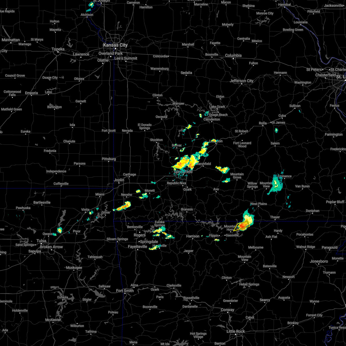 The severe thunderstorm warning for northeastern baxter and northwestern fulton counties will expire at 1130 pm cdt, the storm which prompted the warning has weakened below severe limits, and no longer poses an immediate threat to life or property. therefore, the warning will be allowed to expire. however gusty winds and heavy rain are still possible with this thunderstorm. The severe thunderstorm warning for northeastern baxter and northwestern fulton counties will expire at 1130 pm cdt, the storm which prompted the warning has weakened below severe limits, and no longer poses an immediate threat to life or property. therefore, the warning will be allowed to expire. however gusty winds and heavy rain are still possible with this thunderstorm.
|
| 6/25/2018 11:19 PM CDT |
 At 1119 pm cdt, a severe thunderstorm was located over gamaliel landing, or 10 miles northeast of mountain home, moving east at 15 mph (radar indicated). Hazards include 60 mph wind gusts and penny size hail. Expect damage to roofs, siding, and trees. Locations impacted include, ott, gamaliel landing, vidette, gamaliel, henderson, norfork lake,. At 1119 pm cdt, a severe thunderstorm was located over gamaliel landing, or 10 miles northeast of mountain home, moving east at 15 mph (radar indicated). Hazards include 60 mph wind gusts and penny size hail. Expect damage to roofs, siding, and trees. Locations impacted include, ott, gamaliel landing, vidette, gamaliel, henderson, norfork lake,.
|
| 6/25/2018 10:59 PM CDT |
 At 1058 pm cdt, a severe thunderstorm was located over fawn park, or near mountain home, moving east at 20 mph (radar indicated). Hazards include 60 mph wind gusts and quarter size hail. Hail damage to vehicles is expected. expect wind damage to roofs, siding, and trees. Locations impacted include, mountain home, fawn park, ott, gamaliel landing, vidette, clarkridge, gamaliel, henderson, norfork lake,. At 1058 pm cdt, a severe thunderstorm was located over fawn park, or near mountain home, moving east at 20 mph (radar indicated). Hazards include 60 mph wind gusts and quarter size hail. Hail damage to vehicles is expected. expect wind damage to roofs, siding, and trees. Locations impacted include, mountain home, fawn park, ott, gamaliel landing, vidette, clarkridge, gamaliel, henderson, norfork lake,.
|
| 6/25/2018 10:45 PM CDT |
 The national weather service in little rock has issued a * severe thunderstorm warning for. north central marion county in north central arkansas. northern baxter county in north central arkansas. northwestern fulton county in north central arkansas. Until 1130 pm cdt. The national weather service in little rock has issued a * severe thunderstorm warning for. north central marion county in north central arkansas. northern baxter county in north central arkansas. northwestern fulton county in north central arkansas. Until 1130 pm cdt.
|
| 6/24/2018 8:50 AM CDT |
 At 850 am cdt, a line of severe thunderstorms were located over kay, or 7 miles southwest of marshall, moving northeast at 50 mph (radar indicated). Hazards include 60 mph wind gusts. expect damage to roofs, siding, and trees At 850 am cdt, a line of severe thunderstorms were located over kay, or 7 miles southwest of marshall, moving northeast at 50 mph (radar indicated). Hazards include 60 mph wind gusts. expect damage to roofs, siding, and trees
|
| 6/8/2018 4:58 PM CDT |
 At 456 pm cdt, a severe thunderstorm was located in the vicinity of flippin and gassville, and was drifting very slowly to the west. quarter sized hail, 60 mph wind gusts, and torrential downpours are possible with this storm (radar indicated). Hazards include 60 mph wind gusts and quarter size hail. Hail damage to vehicles is expected. expect wind damage to roofs, siding, and trees. Locations impacted include, mountain home, yellville, gassville, flippin, advance, cartney, shipp, colfax, lion hill, rush, cotter, summit, buffalo city, ralph, buford, lone rock, rea valley,. At 456 pm cdt, a severe thunderstorm was located in the vicinity of flippin and gassville, and was drifting very slowly to the west. quarter sized hail, 60 mph wind gusts, and torrential downpours are possible with this storm (radar indicated). Hazards include 60 mph wind gusts and quarter size hail. Hail damage to vehicles is expected. expect wind damage to roofs, siding, and trees. Locations impacted include, mountain home, yellville, gassville, flippin, advance, cartney, shipp, colfax, lion hill, rush, cotter, summit, buffalo city, ralph, buford, lone rock, rea valley,.
|
| 6/8/2018 4:45 PM CDT |
 At 445 pm cdt, a severe thunderstorm was located near flippin, or 7 miles east of yellville, moving west at 10 mph (radar indicated). Hazards include 60 mph wind gusts and quarter size hail. Hail damage to vehicles is expected. Expect wind damage to roofs, siding, and trees. At 445 pm cdt, a severe thunderstorm was located near flippin, or 7 miles east of yellville, moving west at 10 mph (radar indicated). Hazards include 60 mph wind gusts and quarter size hail. Hail damage to vehicles is expected. Expect wind damage to roofs, siding, and trees.
|
| 6/2/2018 8:00 PM CDT |
 At 800 pm cdt, a severe thunderstorm was located over colfax, or near mountain home, moving southeast at 25 mph (radar indicated). Hazards include 60 mph wind gusts and quarter size hail. Hail damage to vehicles is expected. expect wind damage to roofs, siding, and trees. Locations impacted include, mountain home, gassville, flippin, norfork, salesville, briarcliff, norfork dam, advance, cartney, diamond bay, ozark regional airport, shipp, colfax, lion hill, fawn park, cotter, buffalo city, buford, lone rock, rea valley,. At 800 pm cdt, a severe thunderstorm was located over colfax, or near mountain home, moving southeast at 25 mph (radar indicated). Hazards include 60 mph wind gusts and quarter size hail. Hail damage to vehicles is expected. expect wind damage to roofs, siding, and trees. Locations impacted include, mountain home, gassville, flippin, norfork, salesville, briarcliff, norfork dam, advance, cartney, diamond bay, ozark regional airport, shipp, colfax, lion hill, fawn park, cotter, buffalo city, buford, lone rock, rea valley,.
|
| 6/2/2018 7:51 PM CDT |
 At 751 pm cdt, a severe thunderstorm was located over colfax, or near mountain home, moving southeast at 30 mph (radar indicated). Hazards include 60 mph wind gusts and quarter size hail. Hail damage to vehicles is expected. expect wind damage to roofs, siding, and trees. Locations impacted include, mountain home, bull shoals, gassville, flippin, lakeview in baxter county, norfork, salesville, briarcliff, arkawana, norfork dam, diamond bay, ozark regional airport, fawn park, bull shoals state park, shipp, colfax, lion hill, advance, cartney, cotter,. At 751 pm cdt, a severe thunderstorm was located over colfax, or near mountain home, moving southeast at 30 mph (radar indicated). Hazards include 60 mph wind gusts and quarter size hail. Hail damage to vehicles is expected. expect wind damage to roofs, siding, and trees. Locations impacted include, mountain home, bull shoals, gassville, flippin, lakeview in baxter county, norfork, salesville, briarcliff, arkawana, norfork dam, diamond bay, ozark regional airport, fawn park, bull shoals state park, shipp, colfax, lion hill, advance, cartney, cotter,.
|
| 6/2/2018 7:35 PM CDT | Several boat docks were turned over on bull shoals lak in marion county AR, 11.3 miles ESE of Mountain Home, AR |
| 6/2/2018 7:33 PM CDT |
 At 732 pm cdt, a severe thunderstorm was located near arkawana, or 7 miles northeast of bull shoals, moving southeast at 25 mph (radar indicated). Hazards include 60 mph wind gusts and quarter size hail. Hail damage to vehicles is expected. Expect wind damage to roofs, siding, and trees. At 732 pm cdt, a severe thunderstorm was located near arkawana, or 7 miles northeast of bull shoals, moving southeast at 25 mph (radar indicated). Hazards include 60 mph wind gusts and quarter size hail. Hail damage to vehicles is expected. Expect wind damage to roofs, siding, and trees.
|
| 5/31/2018 10:35 PM CDT |
 At 1035 pm cdt, a severe thunderstorm was located near bexar, or 12 miles west of salem in fulton county, moving southeast at 35 mph (radar indicated). Hazards include 60 mph wind gusts and quarter size hail. Hail damage to vehicles is expected. expect wind damage to roofs, siding, and trees. Locations impacted include, mountain home, salem in fulton county, horseshoe bend, oxford, viola, franklin, bexar, diamond bay, flint springs, ott, gamaliel landing, sturkie, byron, myron, agnos, heart, moko, gamaliel, union, salem airport,. At 1035 pm cdt, a severe thunderstorm was located near bexar, or 12 miles west of salem in fulton county, moving southeast at 35 mph (radar indicated). Hazards include 60 mph wind gusts and quarter size hail. Hail damage to vehicles is expected. expect wind damage to roofs, siding, and trees. Locations impacted include, mountain home, salem in fulton county, horseshoe bend, oxford, viola, franklin, bexar, diamond bay, flint springs, ott, gamaliel landing, sturkie, byron, myron, agnos, heart, moko, gamaliel, union, salem airport,.
|
| 5/31/2018 10:13 PM CDT |
 At 1013 pm cdt, a severe thunderstorm was located over gamaliel landing, or 9 miles northeast of mountain home, moving southeast at 35 mph (radar indicated). Hazards include 60 mph wind gusts and quarter size hail. Hail damage to vehicles is expected. Expect wind damage to roofs, siding, and trees. At 1013 pm cdt, a severe thunderstorm was located over gamaliel landing, or 9 miles northeast of mountain home, moving southeast at 35 mph (radar indicated). Hazards include 60 mph wind gusts and quarter size hail. Hail damage to vehicles is expected. Expect wind damage to roofs, siding, and trees.
|
| 5/3/2018 3:27 AM CDT |
 At 326 am cdt, severe thunderstorms were located along a line extending from near gamaliel landing to near advance, moving east at 55 mph (radar indicated). Hazards include 60 mph wind gusts and nickel size hail. expect damage to roofs, siding, and trees At 326 am cdt, severe thunderstorms were located along a line extending from near gamaliel landing to near advance, moving east at 55 mph (radar indicated). Hazards include 60 mph wind gusts and nickel size hail. expect damage to roofs, siding, and trees
|
| 4/13/2018 8:44 PM CDT |
 The national weather service in little rock has issued a * severe thunderstorm warning for. stone county in north central arkansas. izard county in north central arkansas. eastern searcy county in north central arkansas. Eastern marion county in north central arkansas. The national weather service in little rock has issued a * severe thunderstorm warning for. stone county in north central arkansas. izard county in north central arkansas. eastern searcy county in north central arkansas. Eastern marion county in north central arkansas.
|
| 4/13/2018 8:44 PM CDT |
 At 844 pm cdt, severe thunderstorms were located along a line extending from 6 miles northwest of gamaliel landing to diamond bay to 8 miles south of advance to near rocky hill to near jerusalem, moving northeast at 40 mph (radar indicated). Hazards include 60 mph wind gusts and penny size hail. expect damage to roofs, siding, and trees At 844 pm cdt, severe thunderstorms were located along a line extending from 6 miles northwest of gamaliel landing to diamond bay to 8 miles south of advance to near rocky hill to near jerusalem, moving northeast at 40 mph (radar indicated). Hazards include 60 mph wind gusts and penny size hail. expect damage to roofs, siding, and trees
|
| 4/13/2018 8:37 PM CDT |
 At 837 pm cdt, severe thunderstorms were located along a line extending from fawn park to briarcliff to 7 miles north of thola to near kay to 6 miles southeast of dabney, moving northeast at 40 mph (radar indicated). Hazards include 60 mph wind gusts and nickel size hail. Expect damage to roofs, siding, and trees. Locations impacted include, russellville, mountain home, clinton, bull shoals, marshall, yellville, gassville, calico rock, dover, flippin, london, lakeview in baxter county, norfork, hector, salesville, viola, pineville, briarcliff, arkawana, witts spring, a tornado watch remains in effect until 1000 pm cdt for central, western and north central arkansas. At 837 pm cdt, severe thunderstorms were located along a line extending from fawn park to briarcliff to 7 miles north of thola to near kay to 6 miles southeast of dabney, moving northeast at 40 mph (radar indicated). Hazards include 60 mph wind gusts and nickel size hail. Expect damage to roofs, siding, and trees. Locations impacted include, russellville, mountain home, clinton, bull shoals, marshall, yellville, gassville, calico rock, dover, flippin, london, lakeview in baxter county, norfork, hector, salesville, viola, pineville, briarcliff, arkawana, witts spring, a tornado watch remains in effect until 1000 pm cdt for central, western and north central arkansas.
|
| 4/13/2018 8:35 PM CDT | Reports of damage to multiple structures and powerlines down in baxter county AR, 1 miles E of Mountain Home, AR |
| 4/13/2018 8:31 PM CDT |
 At 830 pm cdt, a severe thunderstorm capable of producing a tornado was located over colfax, or 3 miles southwest of mountain home, moving northeast at 50 mph (radar indicated rotation). Hazards include tornado. Flying debris will be dangerous to those caught without shelter. mobile homes will be damaged or destroyed. damage to roofs, windows, and vehicles will occur. Tree damage is likely. At 830 pm cdt, a severe thunderstorm capable of producing a tornado was located over colfax, or 3 miles southwest of mountain home, moving northeast at 50 mph (radar indicated rotation). Hazards include tornado. Flying debris will be dangerous to those caught without shelter. mobile homes will be damaged or destroyed. damage to roofs, windows, and vehicles will occur. Tree damage is likely.
|
| 4/13/2018 8:05 PM CDT |
 At 805 pm cdt, severe thunderstorms were located along a line extending from yellville to near rush to bohannon to near solo to near dover, moving northeast at 40 mph (radar indicated). Hazards include 60 mph wind gusts and penny size hail. expect damage to roofs, siding, and trees At 805 pm cdt, severe thunderstorms were located along a line extending from yellville to near rush to bohannon to near solo to near dover, moving northeast at 40 mph (radar indicated). Hazards include 60 mph wind gusts and penny size hail. expect damage to roofs, siding, and trees
|
| 4/13/2018 7:50 PM CDT |
 At 750 pm cdt, severe thunderstorms were located along a line extending from near crawford to near duff to near eula to 7 miles northwest of broomfield, moving northeast at 40 mph (radar indicated). Hazards include 60 mph wind gusts and penny size hail. Expect damage to roofs, siding, and trees. Locations impacted include, mountain home, bull shoals, marshall, yellville, gassville, flippin, lakeview in baxter county, western grove, pyatt, valley springs, arkawana, dugger, marsena, olvey, witts spring, moore, duff, lakeway, dabney, bull shoals state park, a tornado watch remains in effect until 1000 pm cdt for western, central and north central arkansas. At 750 pm cdt, severe thunderstorms were located along a line extending from near crawford to near duff to near eula to 7 miles northwest of broomfield, moving northeast at 40 mph (radar indicated). Hazards include 60 mph wind gusts and penny size hail. Expect damage to roofs, siding, and trees. Locations impacted include, mountain home, bull shoals, marshall, yellville, gassville, flippin, lakeview in baxter county, western grove, pyatt, valley springs, arkawana, dugger, marsena, olvey, witts spring, moore, duff, lakeway, dabney, bull shoals state park, a tornado watch remains in effect until 1000 pm cdt for western, central and north central arkansas.
|
| 4/13/2018 7:26 PM CDT |
 At 726 pm cdt, severe thunderstorms were located along a line extending from near western grove to near carver to near moore to holman, moving northeast at 50 mph (radar indicated). Hazards include 60 mph wind gusts and nickel size hail. expect damage to roofs, siding, and trees At 726 pm cdt, severe thunderstorms were located along a line extending from near western grove to near carver to near moore to holman, moving northeast at 50 mph (radar indicated). Hazards include 60 mph wind gusts and nickel size hail. expect damage to roofs, siding, and trees
|
| 2/24/2018 2:37 PM CST |
 At 236 pm cst, severe thunderstorms were located along a line extending from ozark regional airport to near mountain home to advance, moving northeast at 80 mph (radar indicated). Hazards include 60 mph wind gusts. expect damage to roofs, siding, and trees At 236 pm cst, severe thunderstorms were located along a line extending from ozark regional airport to near mountain home to advance, moving northeast at 80 mph (radar indicated). Hazards include 60 mph wind gusts. expect damage to roofs, siding, and trees
|
| 6/23/2017 2:27 PM CDT |
 At 227 pm cdt, a severe thunderstorm continues and was located over colfax, or over mountain home, moving southeast at 25 mph (radar indicated). Hazards include 60 mph wind gusts and quarter size hail. Hail damage to vehicles is expected. expect wind damage to roofs, siding, and trees. Locations impacted include, mountain home, gassville, norfork, salesville, briarcliff, norfork dam, diamond bay, fawn park, shipp, herron, colfax, lion hill, rodney, advance, cartney, culp, ozark regional airport, cotter, rea valley, jordan,. At 227 pm cdt, a severe thunderstorm continues and was located over colfax, or over mountain home, moving southeast at 25 mph (radar indicated). Hazards include 60 mph wind gusts and quarter size hail. Hail damage to vehicles is expected. expect wind damage to roofs, siding, and trees. Locations impacted include, mountain home, gassville, norfork, salesville, briarcliff, norfork dam, diamond bay, fawn park, shipp, herron, colfax, lion hill, rodney, advance, cartney, culp, ozark regional airport, cotter, rea valley, jordan,.
|
| 6/23/2017 2:25 PM CDT | Numerous trees down and power outages across mountain hom in baxter county AR, 1 miles E of Mountain Home, AR |
| 6/23/2017 2:16 PM CDT |
 At 216 pm cdt, a severe thunderstorm was located over ozark regional airport, or near mountain home, moving southeast at 20 mph (radar indicated). Hazards include 60 mph wind gusts and quarter size hail. Hail damage to vehicles is expected. Expect wind damage to roofs, siding, and trees. At 216 pm cdt, a severe thunderstorm was located over ozark regional airport, or near mountain home, moving southeast at 20 mph (radar indicated). Hazards include 60 mph wind gusts and quarter size hail. Hail damage to vehicles is expected. Expect wind damage to roofs, siding, and trees.
|
| 6/23/2017 2:07 PM CDT |
 At 206 pm cdt, a severe thunderstorm was located over ozark isle, or near bull shoals, moving southeast at 25 mph (radar indicated). Hazards include 60 mph wind gusts and quarter size hail. Hail damage to vehicles is expected. expect wind damage to roofs, siding, and trees. Locations impacted include, mountain home, bull shoals, yellville, gassville, flippin, lakeview in baxter county, arkawana, dodd city, price place, ozark regional airport, ozark isle, fawn park, lakeway, bull shoals state park, clark hill, colfax, cotter, summit, midway in baxter county, fairview in marion county,. At 206 pm cdt, a severe thunderstorm was located over ozark isle, or near bull shoals, moving southeast at 25 mph (radar indicated). Hazards include 60 mph wind gusts and quarter size hail. Hail damage to vehicles is expected. expect wind damage to roofs, siding, and trees. Locations impacted include, mountain home, bull shoals, yellville, gassville, flippin, lakeview in baxter county, arkawana, dodd city, price place, ozark regional airport, ozark isle, fawn park, lakeway, bull shoals state park, clark hill, colfax, cotter, summit, midway in baxter county, fairview in marion county,.
|
| 6/23/2017 2:00 PM CDT |
 At 159 pm cdt, a severe thunderstorm continued to be located over ozark isle, or 7 miles northwest of bull shoals, moving southeast at 25 mph (radar indicated). Hazards include 60 mph wind gusts and quarter size hail. Hail damage to vehicles is expected. expect wind damage to roofs, siding, and trees. Locations impacted include, mountain home, bull shoals, yellville, gassville, flippin, lakeview in baxter county, diamond city, lead hill, arkawana, ozark regional airport, ozark isle, fawn park, lakeway, bull shoals state park, winington, clark hill, colfax, dodd city, price place, cotter,. At 159 pm cdt, a severe thunderstorm continued to be located over ozark isle, or 7 miles northwest of bull shoals, moving southeast at 25 mph (radar indicated). Hazards include 60 mph wind gusts and quarter size hail. Hail damage to vehicles is expected. expect wind damage to roofs, siding, and trees. Locations impacted include, mountain home, bull shoals, yellville, gassville, flippin, lakeview in baxter county, diamond city, lead hill, arkawana, ozark regional airport, ozark isle, fawn park, lakeway, bull shoals state park, winington, clark hill, colfax, dodd city, price place, cotter,.
|
| 6/23/2017 1:46 PM CDT |
 At 145 pm cdt, a severe thunderstorm was located near ozark isle, or 11 miles northwest of bull shoals, moving southeast at 25 mph (radar indicated). Hazards include 60 mph wind gusts and quarter size hail. Hail damage to vehicles is expected. Expect wind damage to roofs, siding, and trees. At 145 pm cdt, a severe thunderstorm was located near ozark isle, or 11 miles northwest of bull shoals, moving southeast at 25 mph (radar indicated). Hazards include 60 mph wind gusts and quarter size hail. Hail damage to vehicles is expected. Expect wind damage to roofs, siding, and trees.
|
| 5/27/2017 10:36 PM CDT |
 The severe thunderstorm warning for northeastern baxter and fulton counties will expire at 1045 pm cdt, the storm which prompted the warning has weakened below severe limits, and no longer poses an immediate threat to life or property. therefore, the warning will be allowed to expire. a tornado watch remains in effect until 200 am cdt for north central arkansas. The severe thunderstorm warning for northeastern baxter and fulton counties will expire at 1045 pm cdt, the storm which prompted the warning has weakened below severe limits, and no longer poses an immediate threat to life or property. therefore, the warning will be allowed to expire. a tornado watch remains in effect until 200 am cdt for north central arkansas.
|
| 5/27/2017 10:03 PM CDT |
 At 1003 pm cdt, a severe thunderstorm was located near diamond bay, or near mountain home, moving east at 45 mph (radar indicated). Hazards include 60 mph wind gusts and quarter size hail. Hail damage to vehicles is expected. Expect wind damage to roofs, siding, and trees. At 1003 pm cdt, a severe thunderstorm was located near diamond bay, or near mountain home, moving east at 45 mph (radar indicated). Hazards include 60 mph wind gusts and quarter size hail. Hail damage to vehicles is expected. Expect wind damage to roofs, siding, and trees.
|
| 5/27/2017 8:09 PM CDT |
 At 809 pm cdt, severe thunderstorms were located along a line extending from 6 miles east of price place to bakersfield to 8 miles north of sturkie, moving southeast at 35 mph (radar indicated). Hazards include 60 mph wind gusts and quarter size hail. Hail damage to vehicles is expected. Expect wind damage to roofs, siding, and trees. At 809 pm cdt, severe thunderstorms were located along a line extending from 6 miles east of price place to bakersfield to 8 miles north of sturkie, moving southeast at 35 mph (radar indicated). Hazards include 60 mph wind gusts and quarter size hail. Hail damage to vehicles is expected. Expect wind damage to roofs, siding, and trees.
|
| 5/27/2017 3:25 AM CDT |
 At 324 am cdt, severe thunderstorms were located along a line extending from near viola to near diamond bay to near shipp, moving east at 30 mph (radar indicated). Hazards include ping pong ball size hail and 60 mph wind gusts. People and animals outdoors will be injured. expect hail damage to roofs, siding, windows, and vehicles. expect wind damage to roofs, siding, and trees. Locations impacted include, mountain home, cherokee village, salem in fulton county, ash flat, horseshoe bend, calico rock, highland in sharp county, mammoth spring, hardy, oxford, norfork, salesville, viola, pineville, briarcliff, franklin, ballard, bexar, flint springs, ott,. At 324 am cdt, severe thunderstorms were located along a line extending from near viola to near diamond bay to near shipp, moving east at 30 mph (radar indicated). Hazards include ping pong ball size hail and 60 mph wind gusts. People and animals outdoors will be injured. expect hail damage to roofs, siding, windows, and vehicles. expect wind damage to roofs, siding, and trees. Locations impacted include, mountain home, cherokee village, salem in fulton county, ash flat, horseshoe bend, calico rock, highland in sharp county, mammoth spring, hardy, oxford, norfork, salesville, viola, pineville, briarcliff, franklin, ballard, bexar, flint springs, ott,.
|
| 5/27/2017 3:07 AM CDT |
 At 306 am cdt, severe thunderstorms were located along a line extending from near viola to near diamond bay to near flippin, moving east at 40 mph (radar indicated). Hazards include ping pong ball size hail and 60 mph wind gusts. People and animals outdoors will be injured. expect hail damage to roofs, siding, windows, and vehicles. Expect wind damage to roofs, siding, and trees. At 306 am cdt, severe thunderstorms were located along a line extending from near viola to near diamond bay to near flippin, moving east at 40 mph (radar indicated). Hazards include ping pong ball size hail and 60 mph wind gusts. People and animals outdoors will be injured. expect hail damage to roofs, siding, windows, and vehicles. Expect wind damage to roofs, siding, and trees.
|
| 5/27/2017 2:58 AM CDT | Ping Pong Ball sized hail reported 7.9 miles SSW of Mountain Home, AR, wind gusts estimated between 40 and 50 mph. report relayed via nws springfield mo. |
| 5/27/2017 2:55 AM CDT |
 At 255 am cdt, severe thunderstorms were located along a line extending from near gamaliel landing to near diamond bay to near mountain home to near lakeway, moving east at 45 mph (radar indicated). Hazards include 60 mph wind gusts and half dollar size hail. Hail damage to vehicles is expected. expect wind damage to roofs, siding, and trees. Locations impacted include, mountain home, bull shoals, yellville, gassville, flippin, lakeview in baxter county, oxford, norfork, salesville, viola, briarcliff, arkawana, bexar, flint springs, ott, lakeway, sturkie, bull shoals state park, herron, colfax,. At 255 am cdt, severe thunderstorms were located along a line extending from near gamaliel landing to near diamond bay to near mountain home to near lakeway, moving east at 45 mph (radar indicated). Hazards include 60 mph wind gusts and half dollar size hail. Hail damage to vehicles is expected. expect wind damage to roofs, siding, and trees. Locations impacted include, mountain home, bull shoals, yellville, gassville, flippin, lakeview in baxter county, oxford, norfork, salesville, viola, briarcliff, arkawana, bexar, flint springs, ott, lakeway, sturkie, bull shoals state park, herron, colfax,.
|
| 5/27/2017 2:52 AM CDT | Tree limbs down and shingles blown off a roo in baxter county AR, 2.7 miles S of Mountain Home, AR |
| 5/27/2017 2:38 AM CDT |
 At 237 am cdt, severe thunderstorms were located along a line extending from 7 miles northeast of arkawana to near fawn park to near ozark regional airport to near bull shoals state park, moving east at 40 mph (radar indicated). Hazards include 60 mph wind gusts and quarter size hail. Hail damage to vehicles is expected. expect wind damage to roofs, siding, and trees. Locations impacted include, mountain home, bull shoals, yellville, gassville, flippin, lakeview in baxter county, oxford, norfork, salesville, viola, briarcliff, arkawana, bexar, flint springs, ott, lakeway, sturkie, bull shoals state park, herron, colfax,. At 237 am cdt, severe thunderstorms were located along a line extending from 7 miles northeast of arkawana to near fawn park to near ozark regional airport to near bull shoals state park, moving east at 40 mph (radar indicated). Hazards include 60 mph wind gusts and quarter size hail. Hail damage to vehicles is expected. expect wind damage to roofs, siding, and trees. Locations impacted include, mountain home, bull shoals, yellville, gassville, flippin, lakeview in baxter county, oxford, norfork, salesville, viola, briarcliff, arkawana, bexar, flint springs, ott, lakeway, sturkie, bull shoals state park, herron, colfax,.
|
| 5/27/2017 2:25 AM CDT |
 At 224 am cdt, severe thunderstorms were located along a line extending from near price place to near bull shoals to near bull shoals state park to near lakeway, moving east at 40 mph (radar indicated). Hazards include 60 mph wind gusts and quarter size hail. Hail damage to vehicles is expected. Expect wind damage to roofs, siding, and trees. At 224 am cdt, severe thunderstorms were located along a line extending from near price place to near bull shoals to near bull shoals state park to near lakeway, moving east at 40 mph (radar indicated). Hazards include 60 mph wind gusts and quarter size hail. Hail damage to vehicles is expected. Expect wind damage to roofs, siding, and trees.
|
| 5/19/2017 2:25 AM CDT |
 At 225 am cdt, severe thunderstorms were located along a line extending from 6 miles northeast of arkawana to near mountain home to near advance, moving east at 45 mph (radar indicated). Hazards include 60 mph wind gusts and penny size hail. Expect damage to roofs, siding, and trees. Locations impacted include, mountain home, bull shoals, gassville, calico rock, lakeview in baxter county, norfork, salesville, viola, pineville, briarcliff, arkawana, bexar, evening star, bull shoals state park, wideman, herron, colfax, rodney, advance, cartney, a tornado watch remains in effect until 600 am cdt for north central arkansas. At 225 am cdt, severe thunderstorms were located along a line extending from 6 miles northeast of arkawana to near mountain home to near advance, moving east at 45 mph (radar indicated). Hazards include 60 mph wind gusts and penny size hail. Expect damage to roofs, siding, and trees. Locations impacted include, mountain home, bull shoals, gassville, calico rock, lakeview in baxter county, norfork, salesville, viola, pineville, briarcliff, arkawana, bexar, evening star, bull shoals state park, wideman, herron, colfax, rodney, advance, cartney, a tornado watch remains in effect until 600 am cdt for north central arkansas.
|
| 5/19/2017 2:10 AM CDT |
 At 210 am cdt, severe thunderstorms were located along a line extending from near price place to near lion hill to near kay, moving east at 40 mph (radar indicated). Hazards include 60 mph wind gusts and penny size hail. expect damage to roofs, siding, and trees At 210 am cdt, severe thunderstorms were located along a line extending from near price place to near lion hill to near kay, moving east at 40 mph (radar indicated). Hazards include 60 mph wind gusts and penny size hail. expect damage to roofs, siding, and trees
|
| 5/11/2017 5:11 PM CDT | Quarter sized hail reported 1.2 miles ESE of Mountain Home, AR |
| 5/11/2017 5:10 PM CDT |
 The severe thunderstorm warning for northern baxter county will expire at 515 pm cdt, the storm which prompted the warning has weakened below severe limits, and no longer poses an immediate threat to life or property. therefore, the warning will be allowed to expire. however gusty winds and heavy rain are still possible with this thunderstorm. a severe thunderstorm watch remains in effect until 1000 pm cdt for north central arkansas. The severe thunderstorm warning for northern baxter county will expire at 515 pm cdt, the storm which prompted the warning has weakened below severe limits, and no longer poses an immediate threat to life or property. therefore, the warning will be allowed to expire. however gusty winds and heavy rain are still possible with this thunderstorm. a severe thunderstorm watch remains in effect until 1000 pm cdt for north central arkansas.
|
| 5/11/2017 4:55 PM CDT |
 At 455 pm cdt, a severe thunderstorm was located over fawn park, or near mountain home, moving east at 30 mph (radar indicated). Hazards include golf ball size hail and 60 mph wind gusts. People and animals outdoors will be injured. expect hail damage to roofs, siding, windows, and vehicles. expect wind damage to roofs, siding, and trees. Locations impacted include, mountain home, arkawana, fawn park, ozark regional airport, gamaliel landing, midway in baxter county, clarkridge, robinson point landing, gamaliel, henderson, three brothers,. At 455 pm cdt, a severe thunderstorm was located over fawn park, or near mountain home, moving east at 30 mph (radar indicated). Hazards include golf ball size hail and 60 mph wind gusts. People and animals outdoors will be injured. expect hail damage to roofs, siding, windows, and vehicles. expect wind damage to roofs, siding, and trees. Locations impacted include, mountain home, arkawana, fawn park, ozark regional airport, gamaliel landing, midway in baxter county, clarkridge, robinson point landing, gamaliel, henderson, three brothers,.
|
| 5/11/2017 4:36 PM CDT |
 At 436 pm cdt, a severe thunderstorm was located over bull shoals, moving northeast at 25 mph (radar indicated). Hazards include golf ball size hail and 60 mph wind gusts. People and animals outdoors will be injured. expect hail damage to roofs, siding, windows, and vehicles. Expect wind damage to roofs, siding, and trees. At 436 pm cdt, a severe thunderstorm was located over bull shoals, moving northeast at 25 mph (radar indicated). Hazards include golf ball size hail and 60 mph wind gusts. People and animals outdoors will be injured. expect hail damage to roofs, siding, windows, and vehicles. Expect wind damage to roofs, siding, and trees.
|
| 4/29/2017 6:45 PM CDT | Quarter sized hail reported 0.5 miles E of Mountain Home, AR |
| 4/29/2017 6:23 PM CDT |
 At 622 pm cdt, a severe thunderstorm was located over marshall, moving north at 40 mph (radar indicated). Hazards include 60 mph wind gusts and quarter size hail. Hail damage to vehicles is expected. Expect wind damage to roofs, siding, and trees. At 622 pm cdt, a severe thunderstorm was located over marshall, moving north at 40 mph (radar indicated). Hazards include 60 mph wind gusts and quarter size hail. Hail damage to vehicles is expected. Expect wind damage to roofs, siding, and trees.
|
| 4/29/2017 5:39 PM CDT |
 At 538 pm cdt, severe thunderstorms were located along a line extending from lakeview in baxter county to near lakeway to near crawford, moving northeast at 45 mph (radar indicated). Hazards include 60 mph wind gusts. Expect damage to roofs, siding, and trees. Locations impacted include, mountain home, bull shoals, yellville, gassville, flippin, lakeview in baxter county, western grove, pyatt, valley springs, arkawana, dugger, olvey, ozark regional airport, ozark isle, fawn park, lakeway, bull shoals state park, winington, clark hill, colfax,. At 538 pm cdt, severe thunderstorms were located along a line extending from lakeview in baxter county to near lakeway to near crawford, moving northeast at 45 mph (radar indicated). Hazards include 60 mph wind gusts. Expect damage to roofs, siding, and trees. Locations impacted include, mountain home, bull shoals, yellville, gassville, flippin, lakeview in baxter county, western grove, pyatt, valley springs, arkawana, dugger, olvey, ozark regional airport, ozark isle, fawn park, lakeway, bull shoals state park, winington, clark hill, colfax,.
|
| 4/29/2017 5:13 PM CDT |
 At 513 pm cdt, severe thunderstorms were located along a line extending from near ozark isle to dodd city to western grove, moving northeast at 40 mph (radar indicated). Hazards include 60 mph wind gusts and penny size hail. expect damage to roofs, siding, and trees At 513 pm cdt, severe thunderstorms were located along a line extending from near ozark isle to dodd city to western grove, moving northeast at 40 mph (radar indicated). Hazards include 60 mph wind gusts and penny size hail. expect damage to roofs, siding, and trees
|
| 4/26/2017 2:52 AM CDT |
 The severe thunderstorm warning for northern baxter county will expire at 300 am cdt, the storms which prompted the warning have weakened below severe limits, and no longer pose an immediate threat to life or property. therefore, the warning will be allowed to expire. however gusty winds and heavy rain are still possible with these thunderstorms. The severe thunderstorm warning for northern baxter county will expire at 300 am cdt, the storms which prompted the warning have weakened below severe limits, and no longer pose an immediate threat to life or property. therefore, the warning will be allowed to expire. however gusty winds and heavy rain are still possible with these thunderstorms.
|
| 4/26/2017 2:47 AM CDT |
 At 246 am cdt, severe thunderstorms were located along a line extending from near gainesville to near arkawana to near lakeview in baxter county, moving east at 60 mph (radar indicated). Hazards include 60 mph wind gusts. Expect damage to roofs, siding, and trees. Locations impacted include, mountain home, gassville, lakeview in baxter county, briarcliff, arkawana, diamond bay, ozark regional airport, gamaliel landing, fawn park, bull shoals state park, colfax, cotter, midway in baxter county, clarkridge, gamaliel, buford, three brothers, robinson point landing, henderson,. At 246 am cdt, severe thunderstorms were located along a line extending from near gainesville to near arkawana to near lakeview in baxter county, moving east at 60 mph (radar indicated). Hazards include 60 mph wind gusts. Expect damage to roofs, siding, and trees. Locations impacted include, mountain home, gassville, lakeview in baxter county, briarcliff, arkawana, diamond bay, ozark regional airport, gamaliel landing, fawn park, bull shoals state park, colfax, cotter, midway in baxter county, clarkridge, gamaliel, buford, three brothers, robinson point landing, henderson,.
|
| 4/26/2017 2:30 AM CDT |
 At 229 am cdt, severe thunderstorms were located along a line extending from near price place to near ozark isle to near pyatt, moving east at 60 mph (radar indicated). Hazards include 60 mph wind gusts. expect damage to roofs, siding, and trees At 229 am cdt, severe thunderstorms were located along a line extending from near price place to near ozark isle to near pyatt, moving east at 60 mph (radar indicated). Hazards include 60 mph wind gusts. expect damage to roofs, siding, and trees
|
| 4/4/2017 11:05 PM CDT |
 At 1105 pm cdt, severe thunderstorms were located along a line extending from near lakeview in baxter county to near gassville to near lion hill to near evening star, moving northeast at 45 mph (radar indicated). Hazards include 60 mph wind gusts and quarter size hail. Hail damage to vehicles is expected. expect wind damage to roofs, siding, and trees. Locations impacted include, mountain home, bull shoals, gassville, flippin, lakeview in baxter county, arkawana, advance, cartney, ozark regional airport, bull shoals state park, shipp, colfax, rush, lion hill, fawn park, cotter, midway in baxter county, fairview in marion county, buffalo city, cozahome,. At 1105 pm cdt, severe thunderstorms were located along a line extending from near lakeview in baxter county to near gassville to near lion hill to near evening star, moving northeast at 45 mph (radar indicated). Hazards include 60 mph wind gusts and quarter size hail. Hail damage to vehicles is expected. expect wind damage to roofs, siding, and trees. Locations impacted include, mountain home, bull shoals, gassville, flippin, lakeview in baxter county, arkawana, advance, cartney, ozark regional airport, bull shoals state park, shipp, colfax, rush, lion hill, fawn park, cotter, midway in baxter county, fairview in marion county, buffalo city, cozahome,.
|
| 4/4/2017 10:44 PM CDT |
 At 1044 pm cdt, severe thunderstorms were located along a line extending from near yellville to 6 miles west of rush to near maumee to near duff, moving northeast at 45 mph (radar indicated). Hazards include 60 mph wind gusts and quarter size hail. Hail damage to vehicles is expected. Expect wind damage to roofs, siding, and trees. At 1044 pm cdt, severe thunderstorms were located along a line extending from near yellville to 6 miles west of rush to near maumee to near duff, moving northeast at 45 mph (radar indicated). Hazards include 60 mph wind gusts and quarter size hail. Hail damage to vehicles is expected. Expect wind damage to roofs, siding, and trees.
|
| 3/29/2017 8:54 PM CDT |
 The severe thunderstorm warning for northeastern baxter county will expire at 900 pm cdt, the storm which prompted the warning has weakened below severe limits, and no longer pose an immediate threat to life or property. therefore, the warning will be allowed to expire. a tornado watch remains in effect until midnight cdt for north central arkansas. The severe thunderstorm warning for northeastern baxter county will expire at 900 pm cdt, the storm which prompted the warning has weakened below severe limits, and no longer pose an immediate threat to life or property. therefore, the warning will be allowed to expire. a tornado watch remains in effect until midnight cdt for north central arkansas.
|
| 3/29/2017 8:51 PM CDT |
 At 851 pm cdt, a severe thunderstorm was located over briarcliff, or near mountain home, moving northeast at 40 mph (radar indicated). Hazards include 60 mph wind gusts. Expect damage to roofs, siding, and trees. Locations impacted include, mountain home, norfork, salesville, briarcliff, rodney, fawn park, norfork dam, diamond bay, colfax, robinson point landing, jordan, henderson, a tornado watch remains in effect until midnight cdt for north central arkansas. At 851 pm cdt, a severe thunderstorm was located over briarcliff, or near mountain home, moving northeast at 40 mph (radar indicated). Hazards include 60 mph wind gusts. Expect damage to roofs, siding, and trees. Locations impacted include, mountain home, norfork, salesville, briarcliff, rodney, fawn park, norfork dam, diamond bay, colfax, robinson point landing, jordan, henderson, a tornado watch remains in effect until midnight cdt for north central arkansas.
|
| 3/29/2017 8:35 PM CDT |
 At 834 pm cdt, a severe thunderstorm was located over shipp, or 8 miles south of mountain home, moving northeast at 55 mph (radar indicated). Hazards include 60 mph wind gusts and quarter size hail. Hail damage to vehicles is expected. expect wind damage to roofs, siding, and trees. Locations impacted include, mountain home, norfork, salesville, briarcliff, rodney, norfork dam, advance, cartney, diamond bay, gamaliel landing, fawn park, shipp, herron, colfax, lion hill, buffalo city, gamaliel, buford, lone rock, robinson point landing, a tornado watch remains in effect until midnight cdt for north central arkansas. At 834 pm cdt, a severe thunderstorm was located over shipp, or 8 miles south of mountain home, moving northeast at 55 mph (radar indicated). Hazards include 60 mph wind gusts and quarter size hail. Hail damage to vehicles is expected. expect wind damage to roofs, siding, and trees. Locations impacted include, mountain home, norfork, salesville, briarcliff, rodney, norfork dam, advance, cartney, diamond bay, gamaliel landing, fawn park, shipp, herron, colfax, lion hill, buffalo city, gamaliel, buford, lone rock, robinson point landing, a tornado watch remains in effect until midnight cdt for north central arkansas.
|
| 3/29/2017 8:33 PM CDT | Quarter sized hail reported 12.4 miles NNE of Mountain Home, AR |
| 3/29/2017 8:23 PM CDT |
 At 822 pm cdt, a severe thunderstorm was located near evening star, or 13 miles northeast of marshall, moving northeast at 55 mph (radar indicated). Hazards include 60 mph wind gusts and quarter size hail. Hail damage to vehicles is expected. expect wind damage to roofs, siding, and trees. Locations impacted include, mountain home, gassville, norfork, salesville, briarcliff, norfork dam, diamond bay, evening star, gamaliel landing, fawn park, shipp, herron, colfax, lion hill, rodney, advance, cartney, big flat, gamaliel, jordan, a tornado watch remains in effect until midnight cdt for north central arkansas. At 822 pm cdt, a severe thunderstorm was located near evening star, or 13 miles northeast of marshall, moving northeast at 55 mph (radar indicated). Hazards include 60 mph wind gusts and quarter size hail. Hail damage to vehicles is expected. expect wind damage to roofs, siding, and trees. Locations impacted include, mountain home, gassville, norfork, salesville, briarcliff, norfork dam, diamond bay, evening star, gamaliel landing, fawn park, shipp, herron, colfax, lion hill, rodney, advance, cartney, big flat, gamaliel, jordan, a tornado watch remains in effect until midnight cdt for north central arkansas.
|
| 3/29/2017 8:16 PM CDT |
 At 816 pm cdt, a severe thunderstorm was located over evening star, or 7 miles northeast of marshall, moving northeast at 55 mph (radar indicated). Hazards include 60 mph wind gusts and quarter size hail. Hail damage to vehicles is expected. Expect wind damage to roofs, siding, and trees. At 816 pm cdt, a severe thunderstorm was located over evening star, or 7 miles northeast of marshall, moving northeast at 55 mph (radar indicated). Hazards include 60 mph wind gusts and quarter size hail. Hail damage to vehicles is expected. Expect wind damage to roofs, siding, and trees.
|
| 3/9/2017 8:14 PM CST |
 At 814 pm cst, a severe thunderstorm capable of producing a tornado was located over bull shoals, moving southeast at 25 mph (radar indicated rotation). Hazards include tornado and quarter size hail. Flying debris will be dangerous to those caught without shelter. mobile homes will be damaged or destroyed. damage to roofs, windows, and vehicles will occur. tree damage is likely. Locations impacted include, mountain home, bull shoals, gassville, flippin, lakeview in baxter county, arkawana, ozark regional airport, ozark isle, fawn park, bull shoals state park, colfax, lion hill, lakeway, cotter, midway in baxter county, fairview in marion county, buffalo city, oakland, buford, rea valley,. At 814 pm cst, a severe thunderstorm capable of producing a tornado was located over bull shoals, moving southeast at 25 mph (radar indicated rotation). Hazards include tornado and quarter size hail. Flying debris will be dangerous to those caught without shelter. mobile homes will be damaged or destroyed. damage to roofs, windows, and vehicles will occur. tree damage is likely. Locations impacted include, mountain home, bull shoals, gassville, flippin, lakeview in baxter county, arkawana, ozark regional airport, ozark isle, fawn park, bull shoals state park, colfax, lion hill, lakeway, cotter, midway in baxter county, fairview in marion county, buffalo city, oakland, buford, rea valley,.
|
| 3/9/2017 8:02 PM CST |
 At 800 pm cst, a severe thunderstorm was located over ozark isle, or near bull shoals, moving southeast at 35 mph (public). Hazards include golf ball size hail and 60 mph wind gusts. this will be primarily for areas near omaha in boone county and near peel in baxter county. People and animals outdoors will be injured. expect hail damage to roofs, siding, windows, and vehicles. expect wind damage to roofs, siding, and trees. Locations impacted include, harrison, mountain home, bull shoals, gassville, flippin, lakeview in baxter county, diamond city, bergman, lead hill, briarcliff, pyatt, omaha, arkawana, myrtle, roberson hollow, self, ozark regional airport, ozark isle, fawn park, lakeway,. At 800 pm cst, a severe thunderstorm was located over ozark isle, or near bull shoals, moving southeast at 35 mph (public). Hazards include golf ball size hail and 60 mph wind gusts. this will be primarily for areas near omaha in boone county and near peel in baxter county. People and animals outdoors will be injured. expect hail damage to roofs, siding, windows, and vehicles. expect wind damage to roofs, siding, and trees. Locations impacted include, harrison, mountain home, bull shoals, gassville, flippin, lakeview in baxter county, diamond city, bergman, lead hill, briarcliff, pyatt, omaha, arkawana, myrtle, roberson hollow, self, ozark regional airport, ozark isle, fawn park, lakeway,.
|
| 3/9/2017 7:56 PM CST |
 At 755 pm cst, a severe thunderstorm capable of producing a tornado was located near ozark isle, or 8 miles northwest of bull shoals, moving southeast at 25 mph (radar indicated rotation). Hazards include tornado and ping pong ball size hail. Flying debris will be dangerous to those caught without shelter. mobile homes will be damaged or destroyed. damage to roofs, windows, and vehicles will occur. Tree damage is likely. At 755 pm cst, a severe thunderstorm capable of producing a tornado was located near ozark isle, or 8 miles northwest of bull shoals, moving southeast at 25 mph (radar indicated rotation). Hazards include tornado and ping pong ball size hail. Flying debris will be dangerous to those caught without shelter. mobile homes will be damaged or destroyed. damage to roofs, windows, and vehicles will occur. Tree damage is likely.
|
| 3/9/2017 7:18 PM CST |
 At 717 pm cst, a severe thunderstorm was located 7 miles southeast of forsyth, moving southeast at 35 mph (public). Hazards include golf ball size hail and 60 mph wind gusts. People and animals outdoors will be injured. expect hail damage to roofs, siding, windows, and vehicles. Expect wind damage to roofs, siding, and trees. At 717 pm cst, a severe thunderstorm was located 7 miles southeast of forsyth, moving southeast at 35 mph (public). Hazards include golf ball size hail and 60 mph wind gusts. People and animals outdoors will be injured. expect hail damage to roofs, siding, windows, and vehicles. Expect wind damage to roofs, siding, and trees.
|
| 3/7/2017 1:02 AM CST |
 At 101 am cst, severe thunderstorms were located along a line extending from 7 miles northwest of gamaliel landing to near maumee, moving east at 60 mph (radar indicated). Hazards include 60 mph wind gusts and penny size hail. Expect damage to roofs, siding, and trees. Locations impacted include, harrison, mountain home, bull shoals, salem in fulton county, yellville, gassville, flippin, lakeview in baxter county, norfork, salesville, bergman, western grove, viola, briarcliff, pyatt, valley springs, arkawana, bexar, dugger, olvey, a tornado watch remains in effect until 500 am cst for north central arkansas. At 101 am cst, severe thunderstorms were located along a line extending from 7 miles northwest of gamaliel landing to near maumee, moving east at 60 mph (radar indicated). Hazards include 60 mph wind gusts and penny size hail. Expect damage to roofs, siding, and trees. Locations impacted include, harrison, mountain home, bull shoals, salem in fulton county, yellville, gassville, flippin, lakeview in baxter county, norfork, salesville, bergman, western grove, viola, briarcliff, pyatt, valley springs, arkawana, bexar, dugger, olvey, a tornado watch remains in effect until 500 am cst for north central arkansas.
|
| 3/7/2017 12:46 AM CST |
 At 1245 am cst, a severe thunderstorm capable of producing a tornado was located over rush, or 11 miles southeast of yellville, moving east at 45 mph (radar indicated rotation. this storm has a history of producing damage). Hazards include tornado and ping pong ball size hail. Flying debris will be dangerous to those caught without shelter. mobile homes will be damaged or destroyed. damage to roofs, windows, and vehicles will occur. tree damage is likely. Locations impacted include, mountain home, gassville, advance, cartney, evening star, shipp, maumee, rush, lion hill, cotter, big flat, buffalo city, cozahome, mull, buford, lone rock, maumee crossing, rea valley, push mountian,. At 1245 am cst, a severe thunderstorm capable of producing a tornado was located over rush, or 11 miles southeast of yellville, moving east at 45 mph (radar indicated rotation. this storm has a history of producing damage). Hazards include tornado and ping pong ball size hail. Flying debris will be dangerous to those caught without shelter. mobile homes will be damaged or destroyed. damage to roofs, windows, and vehicles will occur. tree damage is likely. Locations impacted include, mountain home, gassville, advance, cartney, evening star, shipp, maumee, rush, lion hill, cotter, big flat, buffalo city, cozahome, mull, buford, lone rock, maumee crossing, rea valley, push mountian,.
|
| 3/7/2017 12:39 AM CST |
 At 1239 am cst, a severe thunderstorm capable of producing a tornado was located near maumee, or 10 miles south of yellville, moving east at 45 mph (radar indicated rotation). Hazards include tornado and ping pong ball size hail. Flying debris will be dangerous to those caught without shelter. mobile homes will be damaged or destroyed. damage to roofs, windows, and vehicles will occur. tree damage is likely. Locations impacted include, mountain home, yellville, gassville, advance, cartney, evening star, shipp, maumee, rush, lion hill, cotter, big flat, buffalo city, ralph, cozahome, mull, buford, lone rock, maumee crossing, rea valley,. At 1239 am cst, a severe thunderstorm capable of producing a tornado was located near maumee, or 10 miles south of yellville, moving east at 45 mph (radar indicated rotation). Hazards include tornado and ping pong ball size hail. Flying debris will be dangerous to those caught without shelter. mobile homes will be damaged or destroyed. damage to roofs, windows, and vehicles will occur. tree damage is likely. Locations impacted include, mountain home, yellville, gassville, advance, cartney, evening star, shipp, maumee, rush, lion hill, cotter, big flat, buffalo city, ralph, cozahome, mull, buford, lone rock, maumee crossing, rea valley,.
|
| 3/7/2017 12:36 AM CST |
 At 1236 am cst, severe thunderstorms were located along a line extending from 7 miles northwest of ozark isle to near pruitt, moving east at 60 mph (radar indicated). Hazards include 60 mph wind gusts and penny size hail. expect damage to roofs, siding, and trees At 1236 am cst, severe thunderstorms were located along a line extending from 7 miles northwest of ozark isle to near pruitt, moving east at 60 mph (radar indicated). Hazards include 60 mph wind gusts and penny size hail. expect damage to roofs, siding, and trees
|
| 3/7/2017 12:25 AM CST |
 At 1224 am cst, a severe thunderstorm capable of producing a tornado was located near duff, or 13 miles northwest of marshall, moving east at 45 mph (radar indicated rotation). Hazards include tornado and ping pong ball size hail. Flying debris will be dangerous to those caught without shelter. mobile homes will be damaged or destroyed. damage to roofs, windows, and vehicles will occur. Tree damage is likely. At 1224 am cst, a severe thunderstorm capable of producing a tornado was located near duff, or 13 miles northwest of marshall, moving east at 45 mph (radar indicated rotation). Hazards include tornado and ping pong ball size hail. Flying debris will be dangerous to those caught without shelter. mobile homes will be damaged or destroyed. damage to roofs, windows, and vehicles will occur. Tree damage is likely.
|
| 3/1/2017 2:43 AM CST |
 At 243 am cst, severe thunderstorms were located along a line extending from near bakersfield to rodney, moving east at 65 mph (radar indicated). Hazards include 60 mph wind gusts. expect damage to roofs, siding, and trees At 243 am cst, severe thunderstorms were located along a line extending from near bakersfield to rodney, moving east at 65 mph (radar indicated). Hazards include 60 mph wind gusts. expect damage to roofs, siding, and trees
|
| 3/1/2017 2:30 AM CST | Trained storm spotter estimated winds in excess of 60 mph with trees down in the are in baxter county AR, 1.5 miles NNE of Mountain Home, AR |
| 2/7/2017 1:16 AM CST |
 At 114 am cst, severe thunderstorms were located over norfork, and 3 miles southwest of viola, moving northeast at 40 mph (radar indicated). Hazards include quarter size hail. Damage to vehicles is expected. Locations impacted include, norfork, salesville, briarcliff, rodney, norfork dam, diamond bay, shipp, byron, vidette, lone rock, elizabeth, mitchell, robinson point landing, jordan, henderson, gepp,. At 114 am cst, severe thunderstorms were located over norfork, and 3 miles southwest of viola, moving northeast at 40 mph (radar indicated). Hazards include quarter size hail. Damage to vehicles is expected. Locations impacted include, norfork, salesville, briarcliff, rodney, norfork dam, diamond bay, shipp, byron, vidette, lone rock, elizabeth, mitchell, robinson point landing, jordan, henderson, gepp,.
|
| 2/7/2017 12:51 AM CST | Quarter sized hail reported 4.5 miles W of Mountain Home, AR |
| 2/7/2017 12:51 AM CST |
 At 1250 am cst, severe thunderstorms were located 5 miles south of gassville, and 5 miles east of mountain home, moving northeast at 45 mph (radar indicated). Hazards include quarter to half dollar size hail. Damage to vehicles is expected. Locations impacted include, mountain home, gassville, norfork, salesville, briarcliff, norfork dam, diamond bay, gamaliel landing, shipp, colfax, lion hill, rodney, cartney, byron, cotter, gamaliel, mitchell, rea valley, jordan, gepp,. At 1250 am cst, severe thunderstorms were located 5 miles south of gassville, and 5 miles east of mountain home, moving northeast at 45 mph (radar indicated). Hazards include quarter to half dollar size hail. Damage to vehicles is expected. Locations impacted include, mountain home, gassville, norfork, salesville, briarcliff, norfork dam, diamond bay, gamaliel landing, shipp, colfax, lion hill, rodney, cartney, byron, cotter, gamaliel, mitchell, rea valley, jordan, gepp,.
|
| 2/7/2017 12:45 AM CST |
 At 1244 am cst, a severe thunderstorm was located 5 miles south of gassville, or 10 miles southwest of mountain home, moving northeast at 45 mph (radar indicated). Hazards include ping pong ball size hail. People and animals outdoors will be injured. expect damage to roofs, siding, windows, and vehicles. Locations impacted include, mountain home, yellville, gassville, flippin, norfork, salesville, briarcliff, norfork dam, diamond bay, gamaliel landing, fawn park, shipp, colfax, rush, lion hill, rodney, advance, cartney, byron, cotter,. At 1244 am cst, a severe thunderstorm was located 5 miles south of gassville, or 10 miles southwest of mountain home, moving northeast at 45 mph (radar indicated). Hazards include ping pong ball size hail. People and animals outdoors will be injured. expect damage to roofs, siding, windows, and vehicles. Locations impacted include, mountain home, yellville, gassville, flippin, norfork, salesville, briarcliff, norfork dam, diamond bay, gamaliel landing, fawn park, shipp, colfax, rush, lion hill, rodney, advance, cartney, byron, cotter,.
|
| 2/7/2017 12:39 AM CST |
 At 1238 am cst, a severe thunderstorm was located over lion hill, or 8 miles southeast of yellville, moving northeast at 45 mph (radar indicated). Hazards include quarter size hail. damage to vehicles is expected At 1238 am cst, a severe thunderstorm was located over lion hill, or 8 miles southeast of yellville, moving northeast at 45 mph (radar indicated). Hazards include quarter size hail. damage to vehicles is expected
|
| 7/29/2016 2:55 PM CDT |
 At 254 pm cdt, a severe thunderstorm was located near salem in fulton county, moving east at 15 mph (radar indicated). Hazards include 70 mph wind gusts and quarter size hail. Hail damage to vehicles is expected. expect considerable tree damage. wind damage is also likely to mobile homes, roofs, and outbuildings. Locations impacted include, mountain home, salem in fulton county, horseshoe bend, oxford, norfork, salesville, viola, briarcliff, bexar, rodney, shipp, byron, norfork dam, diamond bay, flint springs, cartney, sturkie, agnos, dolph, fryatt,. At 254 pm cdt, a severe thunderstorm was located near salem in fulton county, moving east at 15 mph (radar indicated). Hazards include 70 mph wind gusts and quarter size hail. Hail damage to vehicles is expected. expect considerable tree damage. wind damage is also likely to mobile homes, roofs, and outbuildings. Locations impacted include, mountain home, salem in fulton county, horseshoe bend, oxford, norfork, salesville, viola, briarcliff, bexar, rodney, shipp, byron, norfork dam, diamond bay, flint springs, cartney, sturkie, agnos, dolph, fryatt,.
|
| 7/29/2016 2:39 PM CDT |
 At 238 pm cdt, a severe thunderstorm was located near gamaliel landing, or 12 miles east of mountain home, moving southeast at 10 mph (radar indicated). Hazards include 60 mph wind gusts and penny size hail. Expect damage to roofs. siding. and trees. Locations impacted include, mountain home, salem in fulton county, horseshoe bend, oxford, norfork, salesville, viola, briarcliff, bexar, rodney, ott, shipp, gamaliel landing, byron, norfork dam, diamond bay, flint springs, cartney, sturkie, colfax,. At 238 pm cdt, a severe thunderstorm was located near gamaliel landing, or 12 miles east of mountain home, moving southeast at 10 mph (radar indicated). Hazards include 60 mph wind gusts and penny size hail. Expect damage to roofs. siding. and trees. Locations impacted include, mountain home, salem in fulton county, horseshoe bend, oxford, norfork, salesville, viola, briarcliff, bexar, rodney, ott, shipp, gamaliel landing, byron, norfork dam, diamond bay, flint springs, cartney, sturkie, colfax,.
|
| 7/29/2016 2:28 PM CDT |
 At 228 pm cdt, a severe thunderstorm was located near ott, or 16 miles northeast of mountain home, moving east at 15 mph (radar indicated). Hazards include 60 mph wind gusts and quarter size hail. Hail damage to vehicles is expected. Expect wind damage to roofs, siding, and trees. At 228 pm cdt, a severe thunderstorm was located near ott, or 16 miles northeast of mountain home, moving east at 15 mph (radar indicated). Hazards include 60 mph wind gusts and quarter size hail. Hail damage to vehicles is expected. Expect wind damage to roofs, siding, and trees.
|
| 7/6/2016 10:40 AM CDT |
 At 1040 am cdt, a severe thunderstorm was located near diamond bay, or 9 miles east of mountain home, moving east at 45 mph (radar indicated). Hazards include 60 mph wind gusts and quarter size hail. Hail damage to vehicles is expected. expect wind damage to roofs, siding, and trees. Locations impacted include, mountain home, norfork, salesville, viola, briarcliff, bexar, rodney, shipp, gamaliel landing, norfork dam, diamond bay, fawn park, byron, robinson point landing, clarkridge, dolph, gepp, henderson, gamaliel, wild cherry,. At 1040 am cdt, a severe thunderstorm was located near diamond bay, or 9 miles east of mountain home, moving east at 45 mph (radar indicated). Hazards include 60 mph wind gusts and quarter size hail. Hail damage to vehicles is expected. expect wind damage to roofs, siding, and trees. Locations impacted include, mountain home, norfork, salesville, viola, briarcliff, bexar, rodney, shipp, gamaliel landing, norfork dam, diamond bay, fawn park, byron, robinson point landing, clarkridge, dolph, gepp, henderson, gamaliel, wild cherry,.
|
| 7/6/2016 10:27 AM CDT |
 At 1027 am cdt, a severe thunderstorm was located over mountain home, moving east at 45 mph (radar indicated). Hazards include 60 mph wind gusts and quarter size hail. Hail damage to vehicles is expected. Expect wind damage to roofs, siding, and trees. At 1027 am cdt, a severe thunderstorm was located over mountain home, moving east at 45 mph (radar indicated). Hazards include 60 mph wind gusts and quarter size hail. Hail damage to vehicles is expected. Expect wind damage to roofs, siding, and trees.
|
| 7/2/2016 3:28 PM CDT |
 At 327 pm cdt, a severe thunderstorm was located over gamaliel landing, or 9 miles east of mountain home, moving east at 40 mph (radar indicated). Hazards include 60 mph wind gusts and quarter size hail. Hail damage to vehicles is expected. Expect wind damage to roofs, siding, and trees. At 327 pm cdt, a severe thunderstorm was located over gamaliel landing, or 9 miles east of mountain home, moving east at 40 mph (radar indicated). Hazards include 60 mph wind gusts and quarter size hail. Hail damage to vehicles is expected. Expect wind damage to roofs, siding, and trees.
|
| 7/2/2016 3:19 PM CDT | Spotter measured 62 mph wind. additionally...reported hail of up to an inc in baxter county AR, 3.4 miles S of Mountain Home, AR |
| 6/12/2016 3:47 PM CDT |
 At 347 pm cdt, a severe thunderstorm was located over shipp, or 9 miles south of mountain home, moving northeast at 5 mph (radar indicated). Hazards include 60 mph wind gusts and penny size hail. Expect damage to roofs. siding. And trees. At 347 pm cdt, a severe thunderstorm was located over shipp, or 9 miles south of mountain home, moving northeast at 5 mph (radar indicated). Hazards include 60 mph wind gusts and penny size hail. Expect damage to roofs. siding. And trees.
|
| 5/9/2016 6:40 PM CDT | Quarter sized hail reported 4.5 miles W of Mountain Home, AR |
| 4/30/2016 9:19 PM CDT |
 At 918 pm cdt, a severe thunderstorm was located near gamaliel landing, or 7 miles northeast of mountain home, moving northeast at 30 mph (radar indicated). Hazards include quarter size hail. Damage to vehicles is expected. Locations impacted include, mountain home, arkawana, ott, gamaliel landing, fawn park, vidette, robinson point landi, clarkridge, henderson, gamaliel, three brothers, gepp,. At 918 pm cdt, a severe thunderstorm was located near gamaliel landing, or 7 miles northeast of mountain home, moving northeast at 30 mph (radar indicated). Hazards include quarter size hail. Damage to vehicles is expected. Locations impacted include, mountain home, arkawana, ott, gamaliel landing, fawn park, vidette, robinson point landi, clarkridge, henderson, gamaliel, three brothers, gepp,.
|
| 4/30/2016 9:02 PM CDT |
 At 902 pm cdt, a severe thunderstorm was located over mountain home, moving northeast at 30 mph (radar indicated). Hazards include 60 mph wind gusts and half dollar size hail. Hail damage to vehicles is expected. Expect wind damage to roofs, siding, and trees. At 902 pm cdt, a severe thunderstorm was located over mountain home, moving northeast at 30 mph (radar indicated). Hazards include 60 mph wind gusts and half dollar size hail. Hail damage to vehicles is expected. Expect wind damage to roofs, siding, and trees.
|
| 4/30/2016 6:10 PM CDT | Quarter sized hail reported 7.6 miles WNW of Mountain Home, AR |
| 4/30/2016 6:10 PM CDT | Golf Ball sized hail reported 5.7 miles NW of Mountain Home, AR |
| 4/30/2016 6:03 PM CDT |
 At 602 pm cdt, a severe thunderstorm was located near colfax, or near mountain home, moving east at 20 mph (radar indicated). Hazards include 60 mph wind gusts and quarter size hail. Hail damage to vehicles is expected. expect wind damage to roofs, siding, and trees. Locations impacted include, mountain home, gassville, norfork, salesville, briarcliff, shipp, gamaliel landing, norfork dam, diamond bay, cartney, colfax, robinson point landi, henderson, jordan, buford,. At 602 pm cdt, a severe thunderstorm was located near colfax, or near mountain home, moving east at 20 mph (radar indicated). Hazards include 60 mph wind gusts and quarter size hail. Hail damage to vehicles is expected. expect wind damage to roofs, siding, and trees. Locations impacted include, mountain home, gassville, norfork, salesville, briarcliff, shipp, gamaliel landing, norfork dam, diamond bay, cartney, colfax, robinson point landi, henderson, jordan, buford,.
|
| 4/30/2016 6:00 PM CDT | Quarter sized hail reported 3.5 miles N of Mountain Home, AR |
| 4/30/2016 5:42 PM CDT |
 At 542 pm cdt, a severe thunderstorm was located over gassville, or 8 miles southwest of mountain home, moving east at 20 mph (radar indicated). Hazards include 60 mph wind gusts and quarter size hail. Hail damage to vehicles is expected. Expect wind damage to roofs, siding, and trees. At 542 pm cdt, a severe thunderstorm was located over gassville, or 8 miles southwest of mountain home, moving east at 20 mph (radar indicated). Hazards include 60 mph wind gusts and quarter size hail. Hail damage to vehicles is expected. Expect wind damage to roofs, siding, and trees.
|
| 4/30/2016 5:05 PM CDT |
 At 505 pm cdt, a severe thunderstorm was located over yellville, moving northeast at 10 mph (radar indicated). Hazards include 60 mph wind gusts and quarter size hail. Hail damage to vehicles is expected. expect wind damage to roofs, siding, and trees. Locations impacted include, mountain home, bull shoals, yellville, gassville, flippin, lakeview in baxter c, norfork, salesville, briarcliff, pyatt, arkawana, shipp, ozark regional airpo, norfork dam, diamond bay, colfax, bull shoals state pa, lion hill, cartney, fawn park,. At 505 pm cdt, a severe thunderstorm was located over yellville, moving northeast at 10 mph (radar indicated). Hazards include 60 mph wind gusts and quarter size hail. Hail damage to vehicles is expected. expect wind damage to roofs, siding, and trees. Locations impacted include, mountain home, bull shoals, yellville, gassville, flippin, lakeview in baxter c, norfork, salesville, briarcliff, pyatt, arkawana, shipp, ozark regional airpo, norfork dam, diamond bay, colfax, bull shoals state pa, lion hill, cartney, fawn park,.
|
| 4/30/2016 4:45 PM CDT |
 At 444 pm cdt, a severe thunderstorm was located near flippin, or near yellville, moving northeast at 40 mph (radar indicated). Hazards include 60 mph wind gusts and quarter size hail. Hail damage to vehicles is expected. Expect wind damage to roofs, siding, and trees. At 444 pm cdt, a severe thunderstorm was located near flippin, or near yellville, moving northeast at 40 mph (radar indicated). Hazards include 60 mph wind gusts and quarter size hail. Hail damage to vehicles is expected. Expect wind damage to roofs, siding, and trees.
|
| 7/24/2015 9:28 PM CDT |
 At 927 pm cdt, severe thunderstorms were located along a line extending from near price place to mountain home to near diamond bay, moving south at 30 mph (radar indicated). Hazards include 60 mph wind gusts. Expect damage to roofs. siding and trees. Locations impacted include, mountain home, bull shoals, gassville, flippin, lakeview in baxter county, norfork, salesville, briarcliff, arkawana, shipp, gamaliel landing, ozark regional airport, norfork dam, diamond bay, colfax, bull shoals state park, cartney, fawn park, cotter and midway in baxter county. At 927 pm cdt, severe thunderstorms were located along a line extending from near price place to mountain home to near diamond bay, moving south at 30 mph (radar indicated). Hazards include 60 mph wind gusts. Expect damage to roofs. siding and trees. Locations impacted include, mountain home, bull shoals, gassville, flippin, lakeview in baxter county, norfork, salesville, briarcliff, arkawana, shipp, gamaliel landing, ozark regional airport, norfork dam, diamond bay, colfax, bull shoals state park, cartney, fawn park, cotter and midway in baxter county.
|
| 7/24/2015 9:00 PM CDT |
 At 859 pm cdt, severe thunderstorms were located along a line extending from near gainesville to 7 miles north of fawn park to near gamaliel landing, moving south at 30 mph (radar indicated). Hazards include 60 mph wind gusts. Expect damage to roofs. Siding and trees. At 859 pm cdt, severe thunderstorms were located along a line extending from near gainesville to 7 miles north of fawn park to near gamaliel landing, moving south at 30 mph (radar indicated). Hazards include 60 mph wind gusts. Expect damage to roofs. Siding and trees.
|
| 7/15/2015 5:29 PM CDT |
 At 529 pm cdt, severe thunderstorms were located along a line extending from near lion hill to near rodney, moving south at 10 mph (radar indicated). Hazards include 60 mph wind gusts. Expect damage to roofs. siding and trees. Locations impacted include, mountain home, bull shoals, gassville, calico rock, flippin, lakeview in baxter county, norfork, salesville, pineville, briarcliff, arkawana, rodney, rush, shipp, gamaliel landing, ozark regional airport, norfork dam, diamond bay, advance and herron. At 529 pm cdt, severe thunderstorms were located along a line extending from near lion hill to near rodney, moving south at 10 mph (radar indicated). Hazards include 60 mph wind gusts. Expect damage to roofs. siding and trees. Locations impacted include, mountain home, bull shoals, gassville, calico rock, flippin, lakeview in baxter county, norfork, salesville, pineville, briarcliff, arkawana, rodney, rush, shipp, gamaliel landing, ozark regional airport, norfork dam, diamond bay, advance and herron.
|
| 7/15/2015 5:26 PM CDT | Trees down on hwy 62e between mountain home and henderso in baxter county AR, 5 miles WSW of Mountain Home, AR |
| 7/15/2015 5:24 PM CDT | Trees down across hwy 5n between mountain home and midwa in baxter county AR, 2.1 miles SE of Mountain Home, AR |
| 7/15/2015 5:01 PM CDT |
 At 501 pm cdt, severe thunderstorms were located along a line extending from near arkawana to near gamaliel landing, moving south at 15 mph (radar indicated). Hazards include 60 mph wind gusts. Expect damage to roofs. Siding and trees. At 501 pm cdt, severe thunderstorms were located along a line extending from near arkawana to near gamaliel landing, moving south at 15 mph (radar indicated). Hazards include 60 mph wind gusts. Expect damage to roofs. Siding and trees.
|
| 5/25/2015 9:51 PM CDT | At 950 pm cdt, severe thunderstorms were located along a line extending from mountain home to norfork dam to pineville to brandenberg to herpel to 10 miles west of concord, and moving northeast at 40 mph (radar indicated). Hazards include 60 mph wind gusts and penny size hail. Expect damage to roofs. Siding and trees. |
| 5/25/2015 9:41 PM CDT | At 939 pm cdt, severe thunderstorms were located along a line extending from norfork to gorby to mountain view, and moving northeast at 35 mph (radar indicated). Hazards include 60 mph wind gusts. Expect damage to roofs. Siding and trees. |
| 5/25/2015 9:09 PM CDT | At 908 pm cdt, severe thunderstorms were located along a line extending from 5 miles south of evening star to thola to shirley, and moving northeast at 35 mph (radar indicated). Hazards include 60 mph wind gusts. Expect damage to roofs. Siding and trees. |
| 5/25/2015 7:54 PM CDT | At 752 pm cdt, a severe thunderstorm was located near gassville, and moving north at 35 mph (radar indicated). Hazards include 60 mph wind gusts and quarter size hail. Hail damage to vehicles is expected. Expect wind damage to roofs, siding and trees. |
| 5/25/2015 7:36 PM CDT | At 733 pm cdt, a severe thunderstorm was located near rush, and moving north at 35 mph (radar indicated). Hazards include 60 mph wind gusts and quarter size hail. Hail damage to vehicles is expected. Expect wind damage to roofs, siding and trees. |
| 5/24/2015 5:42 PM CDT | At 541 pm cdt, severe thunderstorms were located along a line extending from mountain home to pineville to lone star, and moving north at 55 mph (radar indicated). Hazards include 60 mph wind gusts. Expect damage to roofs. Siding and trees. |
| 5/24/2015 5:20 PM CDT | At 517 pm cdt, severe thunderstorms were located along a line extending from 5 miles east of evening star to 5 miles south of fifty six to 11 miles northeast of greers ferry, and moving northeast at 50 mph (radar indicated). Hazards include 60 mph wind gusts. Expect damage to roofs. Siding and trees. |
| 5/24/2015 3:56 PM CDT | At 355 pm cdt, a severe thunderstorm was located near mountain home, and moving north at 45 mph (radar indicated). Hazards include 60 mph wind gusts. Expect damage to roofs. Siding and trees. |
| 5/24/2015 3:38 PM CDT | At 337 pm cdt, a severe thunderstorm capable of producing a tornado was located near lion hill, and moving north at 45 mph (radar indicated rotation). Hazards include tornado. Flying debris will be dangerous to those caught without shelter. mobile homes will be damaged or destroyed. damage to roofs, windows and vehicles will occur. Tree damage is likely. |
| 5/24/2015 3:28 PM CDT | At 326 pm cdt, a severe thunderstorm capable of producing a tornado was located near lower buffalo wilderness area, and moving north at 45 mph (radar indicated rotation). Hazards include tornado. Flying debris will be dangerous to those caught without shelter. mobile homes will be damaged or destroyed. damage to roofs, windows and vehicles will occur. Tree damage is likely. |
| 5/24/2015 3:21 PM CDT | At 318 pm cdt, a severe thunderstorm capable of producing a tornado was located near evening star, and moving north at 45 mph (radar indicated rotation). Hazards include tornado and quarter size hail. Flying debris will be dangerous to those caught without shelter. mobile homes will be damaged or destroyed. damage to roofs, windows and vehicles will occur. tree damage is likely. Locations in the path of this dangerous storm include, mountain home, rush, lower buffalo wilderness area, lion hill, gassville, evening star, colfax, cartney, rea valley, cozahome, cotter, buford, buffalo river state park, buffalo city,. |
| 4/3/2015 5:12 AM CDT | The national weather service in little rock has issued a * severe thunderstorm warning for. northern baxter county in north central arkansas. north central marion county in north central arkansas. until 600 am cdt * at 510 am cdt. A severe thunderstorm was located near price. |
| 4/3/2015 2:22 AM CDT | The national weather service in little rock has issued a * severe thunderstorm warning for. central baxter county in north central arkansas. southwestern fulton county in north central arkansas. northern izard county in north central arkansas. Until 300 am cdt. |
| 4/3/2015 2:19 AM CDT | A severe thunderstorm warning remains in effect for east central marion and central baxter counties until 230 am cdt. at 218 am cdt. a severe thunderstorm was located near cartney. and moving east at 45 mph. hazard. golf ball size hail and 60 mph wind gusts. source. trained weather spotters. Golf ball sized hail was. |
| 4/3/2015 2:13 AM CDT | A severe thunderstorm warning remains in effect for east central marion and central baxter counties until 230 am cdt. at 212 am cdt. a severe thunderstorm was located near gassville. and moving east at 50 mph. hazard. 60 mph wind gusts and quarter size hail. source. Radar indicated. |
| 4/3/2015 1:58 AM CDT | A severe thunderstorm warning remains in effect for central marion and central baxter counties until 230 am cdt. at 156 am cdt. a severe thunderstorm was located near dodd city. and moving east at 55 mph. hazard. 60 mph wind gusts and half dollar size hail. source. Radar indicated. |
| 4/3/2015 1:44 AM CDT | The national weather service in little rock has issued a * severe thunderstorm warning for. central baxter county in north central arkansas. east central boone county in north central arkansas. central marion county in north central arkansas. Until 230 am cdt. |
| 4/3/2015 1:09 AM CDT | The national weather service in little rock has issued a * severe thunderstorm warning for. baxter county in north central arkansas. east central boone county in north central arkansas. marion county in north central arkansas. Until 200 am cdt. |
| 3/25/2015 9:23 PM CDT | The national weather service in little rock has issued a * severe thunderstorm warning for. northern baxter county in north central arkansas. northern marion county in north central arkansas. until 1015 pm cdt * at 920 pm cdt. National weather service doppler radar indicated a. |
| 3/25/2015 7:54 PM CDT | A severe thunderstorm warning remains in effect for northern baxter county until 800 pm cdt. at 752 pm cdt. national weather service doppler radar continued to indicate a severe thunderstorm capable of producing ping pong ball size hail. and damaging winds in excess of 60 mph. this storm was located 4 miles north of gamaliel landing. Or 14 miles northeast of. |
| 3/25/2015 7:44 PM CDT | The national weather service in little rock has issued a * severe thunderstorm warning for. northern baxter county in north central arkansas. until 800 pm cdt * at 742 pm cdt. National weather service doppler radar indicated a severe thunderstorm capable of producing ping pong ball size. |
| 3/24/2015 7:38 PM CDT | The severe thunderstorm warning for northern marion and northern baxter counties will expire at 745 pm cdt. the storm which prompted the warning has weakened below severe limits. and no longer poses an immediate threat to life or property. additional strong thunderstorms are still possible. And a severe thunderstorm watch remains in effect until 10 pm. |
| 3/24/2015 7:14 PM CDT | The national weather service in little rock has issued a * severe thunderstorm warning for. northern baxter county in north central arkansas. northern marion county in north central arkansas. until 745 pm cdt * at 713 pm cdt. National weather service doppler radar indicated a. |
| 10/2/2014 7:09 PM CDT | Storm damage reported in baxter county AR, 2.8 miles SSW of Mountain Home, AR |
| 7/23/2014 2:54 PM CDT | Trees down south of mountain hom in baxter county AR, 5.7 miles N of Mountain Home, AR |
| 7/23/2014 2:50 PM CDT | Quarter sized hail reported 4.4 miles E of Mountain Home, AR, trained spotter reported quarter size hail 4 miles west of mountain home. |
| 7/23/2014 2:31 PM CDT | Buzzard roost marina sustained some dock damage. rural parts of baxter county had trees down as wel in baxter county AR, 4.6 miles W of Mountain Home, AR |
| 7/23/2014 2:25 PM CDT | Thunderstorm gusts were estimated around 60 mph a couple of miles north of mountain hom in baxter county AR, 1.4 miles SSE of Mountain Home, AR |
| 4/27/2014 4:24 PM CDT | Golf Ball sized hail reported 8.1 miles WSW of Mountain Home, AR, golf ball size hail...plus a few bigger hailstones... covered the ground at panther bay marina. |
| 4/27/2014 4:23 PM CDT | Tennis Ball sized hail reported 6.9 miles W of Mountain Home, AR, relayed by ky3 in springfield. |
| 4/27/2014 4:22 PM CDT | Ping Pong Ball sized hail reported 4.5 miles W of Mountain Home, AR |
| 8/5/2013 8:45 PM CDT | Quarter sized hail reported 0.5 miles E of Mountain Home, AR |
| 5/30/2013 3:00 PM CDT | Numerous trees reported down in and near mountain hom in baxter county AR, 0.5 miles E of Mountain Home, AR |
| 9/7/2012 4:00 PM CDT | Trees were blown down in mountain home...and other parts of the count in baxter county AR, 0.5 miles E of Mountain Home, AR |
| 9/7/2012 3:12 PM CDT | Half Dollar sized hail reported 2.8 miles SSW of Mountain Home, AR |
| 6/4/2012 12:43 AM CDT | Golf Ball sized hail reported 0.5 miles E of Mountain Home, AR |
| 6/4/2012 12:40 AM CDT | Half Dollar sized hail reported 0.5 miles E of Mountain Home, AR |
| 1/1/0001 12:00 AM | Half Dollar sized hail reported 0.5 miles E of Mountain Home, AR |
| 1/1/0001 12:00 AM | Multiple trees were down south and east of mountain hom in baxter county AR, 0.5 miles E of Mountain Home, AR |
| 1/1/0001 12:00 AM | Large tree limbs and branches have fallen. wind speed was measured at 61 mph and penny sized hail fell. some minor property damage was note in baxter county AR, 2.8 miles SSW of Mountain Home, AR |
| 1/1/0001 12:00 AM | Golf Ball sized hail reported 0.8 miles N of Mountain Home, AR |
| 1/1/0001 12:00 AM | Storm damage reported in baxter county AR, 0.8 miles N of Mountain Home, AR |
| 1/1/0001 12:00 AM | Quarter sized hail reported 2.8 miles SSW of Mountain Home, AR, quarter size hail...measured 56 mph wind gust...0.80 inches of rain in 30 minutes |
| 1/1/0001 12:00 AM | Spotter reported wind gusts of 60 mph with a handheld anemometer as well as hail ranging from pea sized to quarter size in baxter county AR, 1.5 miles NNE of Mountain Home, AR |
Hail Maps for Mountain Home, AR

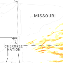


Connect with Interactive Hail Maps