

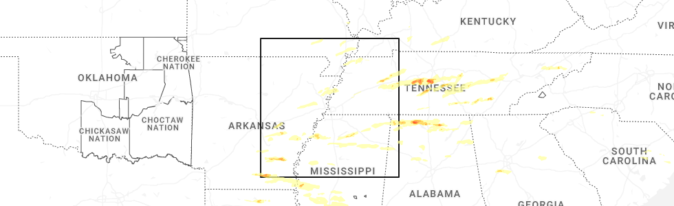
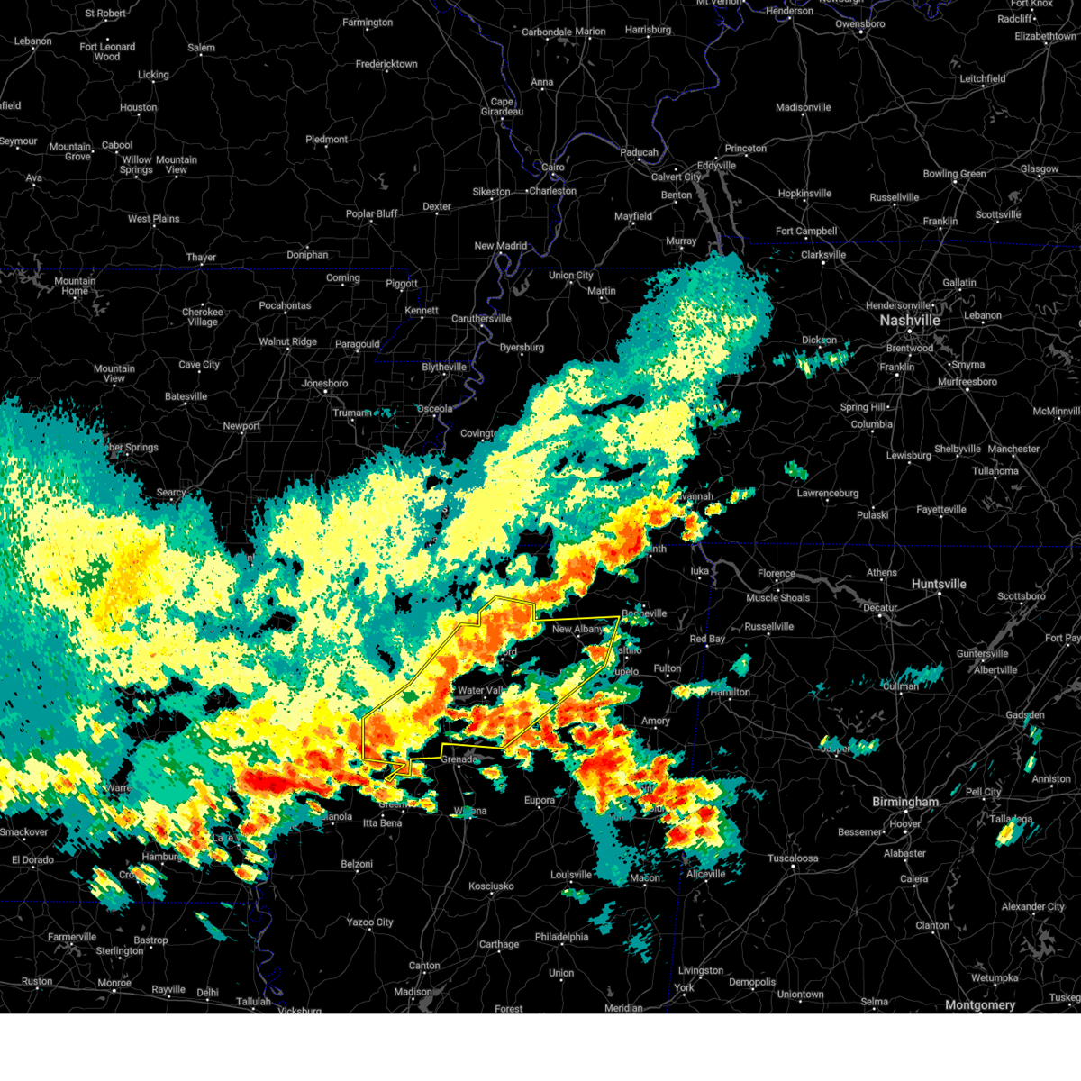
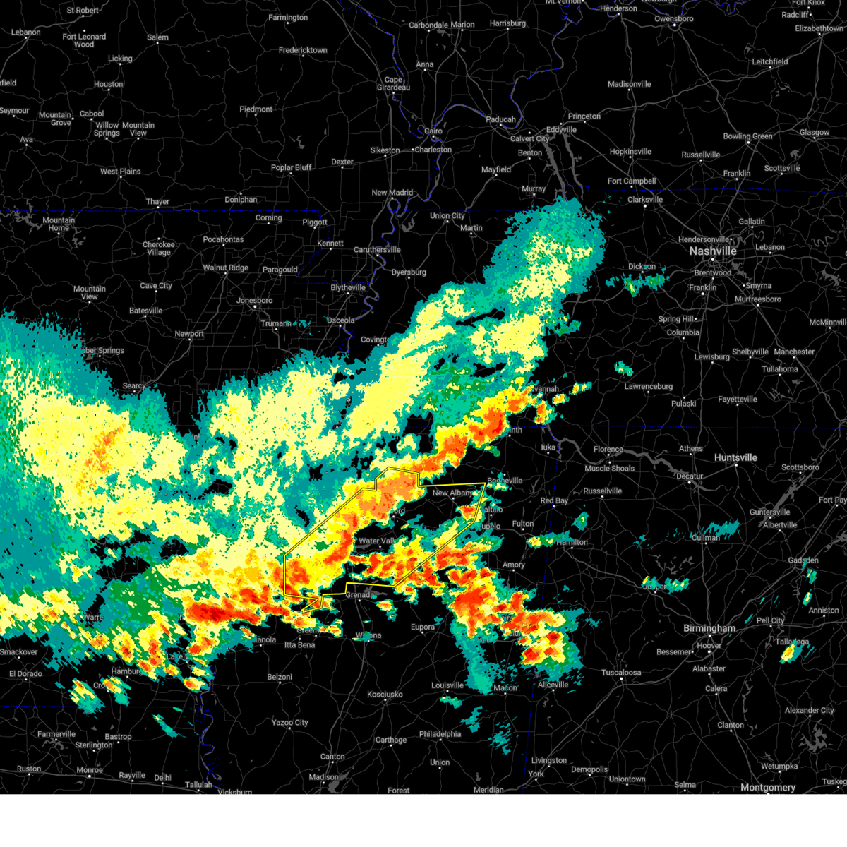
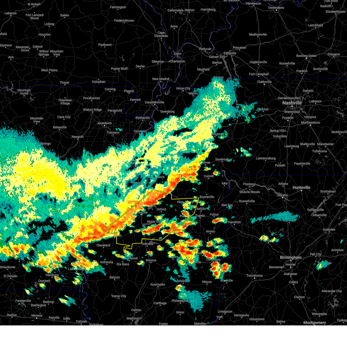
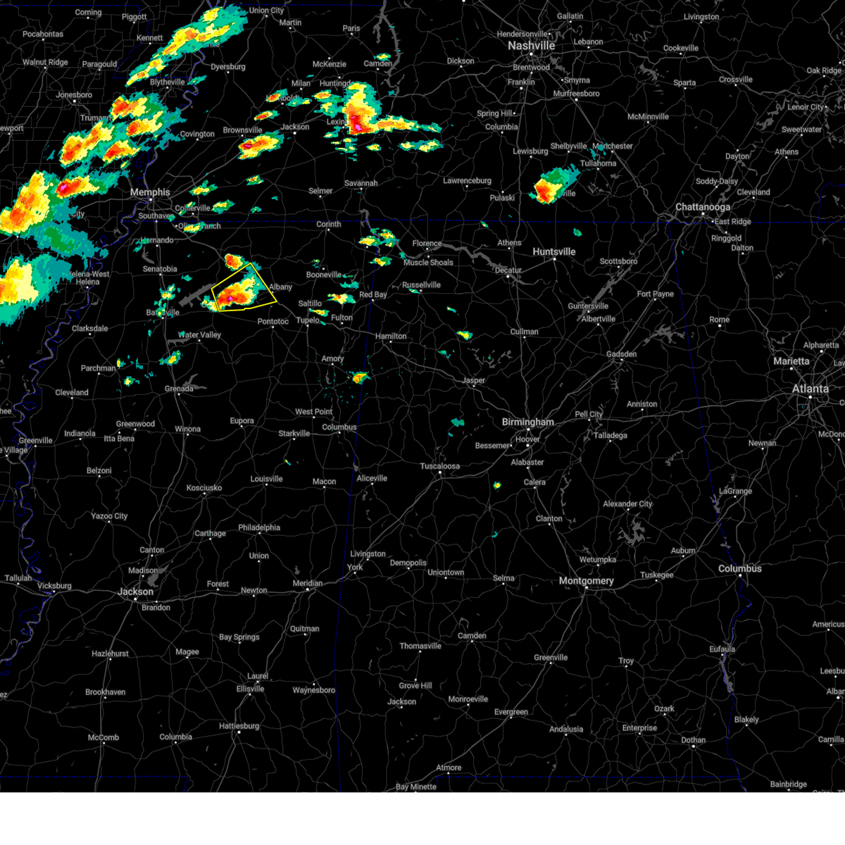
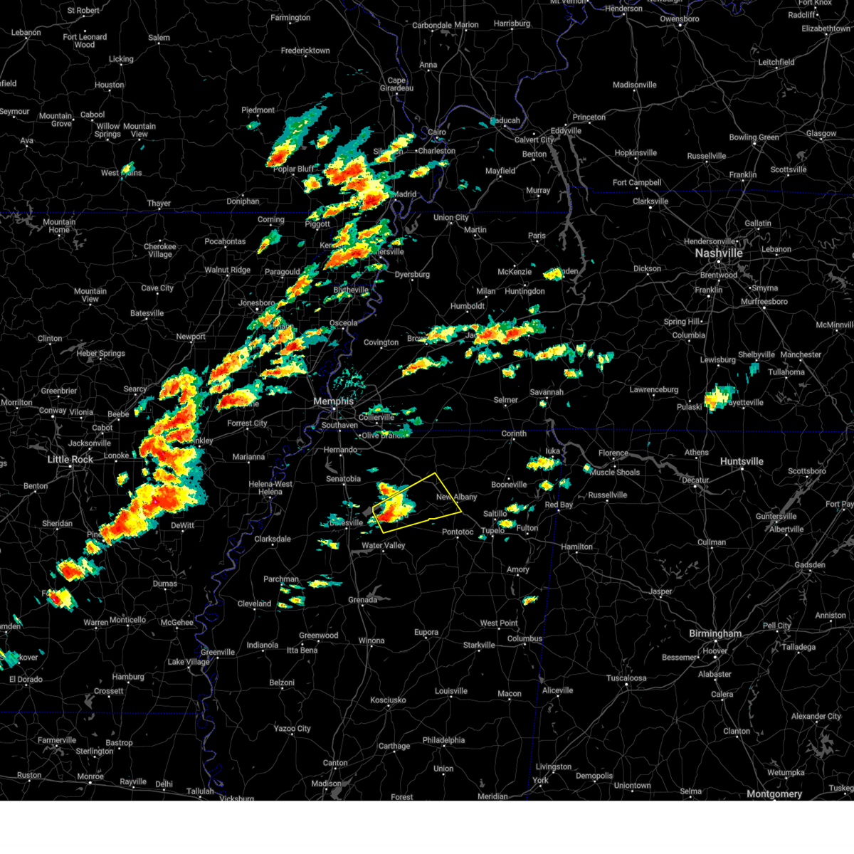
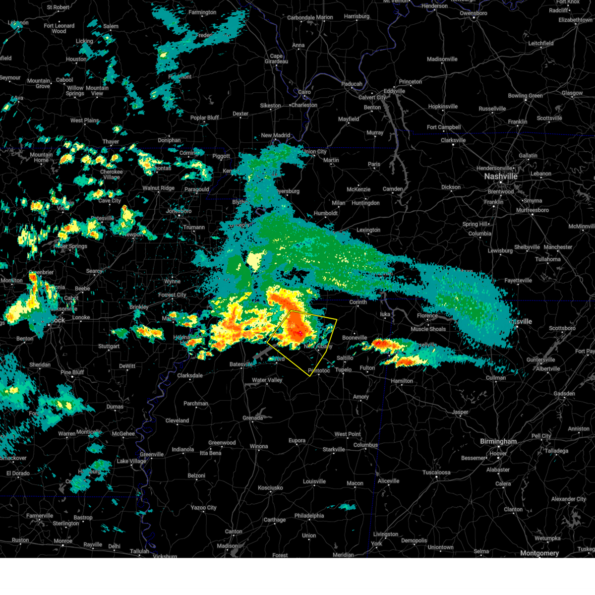
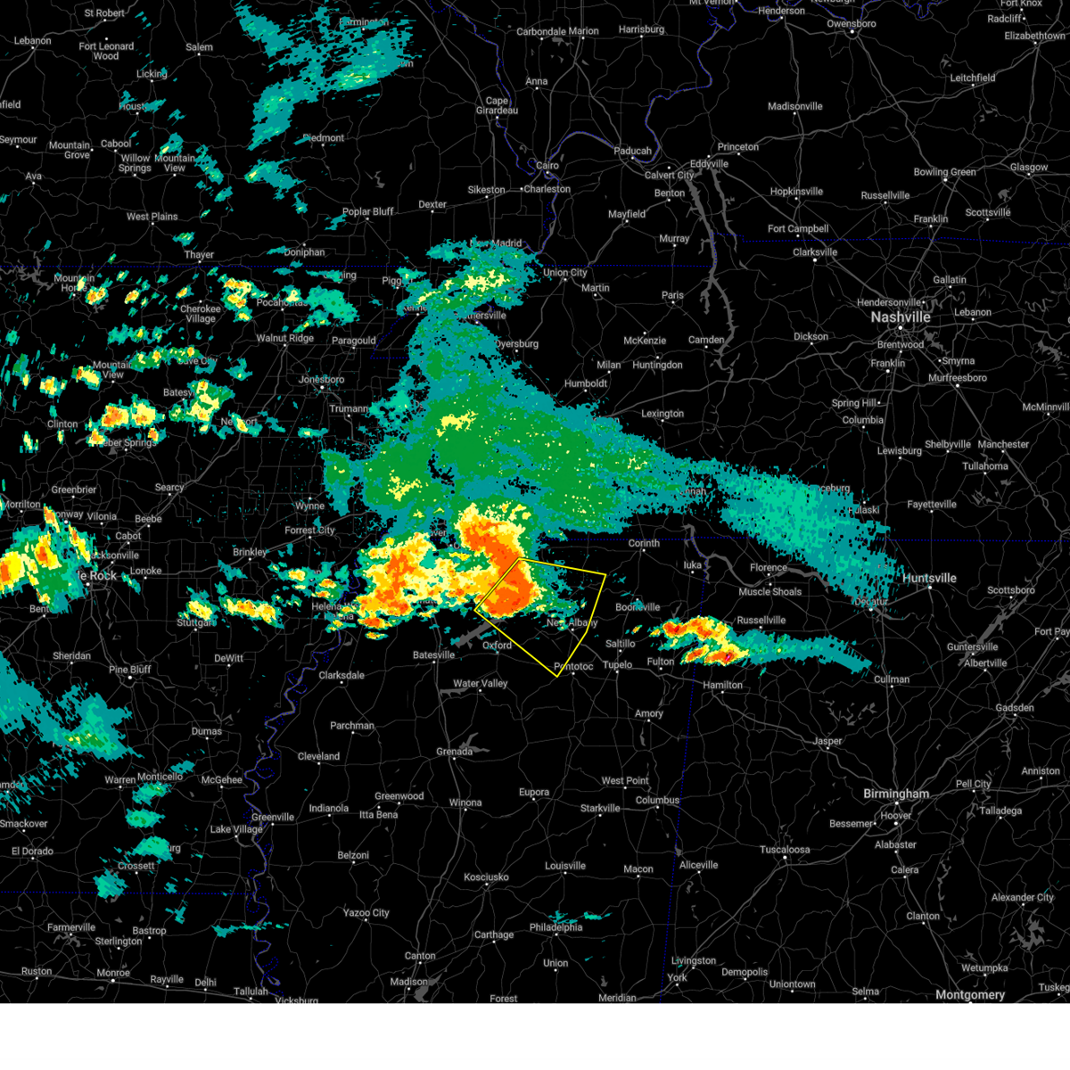
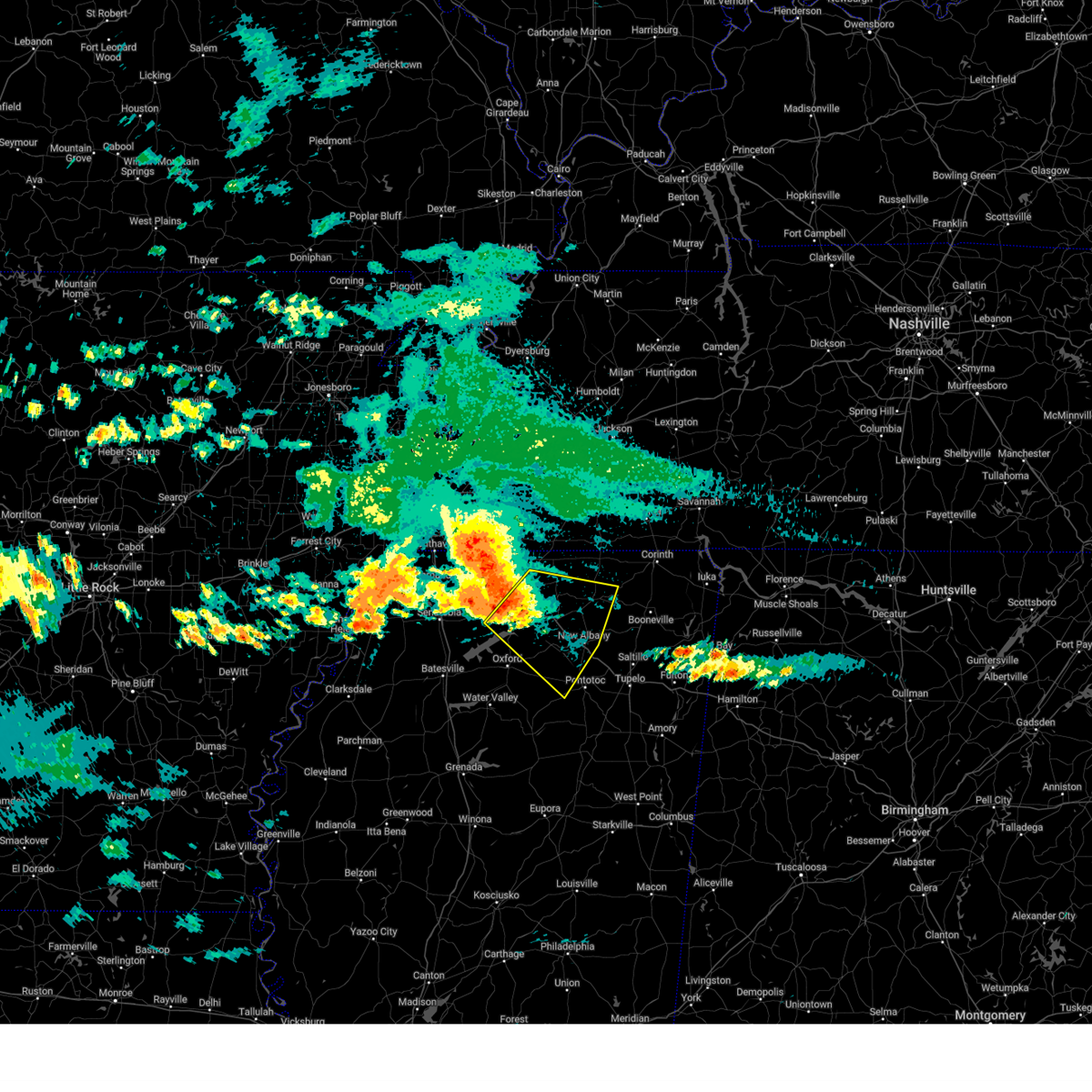
Hail Map for Abbeville, MS
The Abbeville, MS area has had 2 reports of on-the-ground hail by trained spotters, and has been under severe weather warnings 37 times during the past 12 months. Doppler radar has detected hail at or near Abbeville, MS on 52 occasions, including 2 occasions during the past year.
| Name: | Abbeville, MS |
| Where Located: | 54.4 miles SE of Memphis, TN |
| Map: | Google Map for Abbeville, MS |
| Population: | 419 |
| Housing Units: | 187 |
| More Info: | Search Google for Abbeville, MS |
0
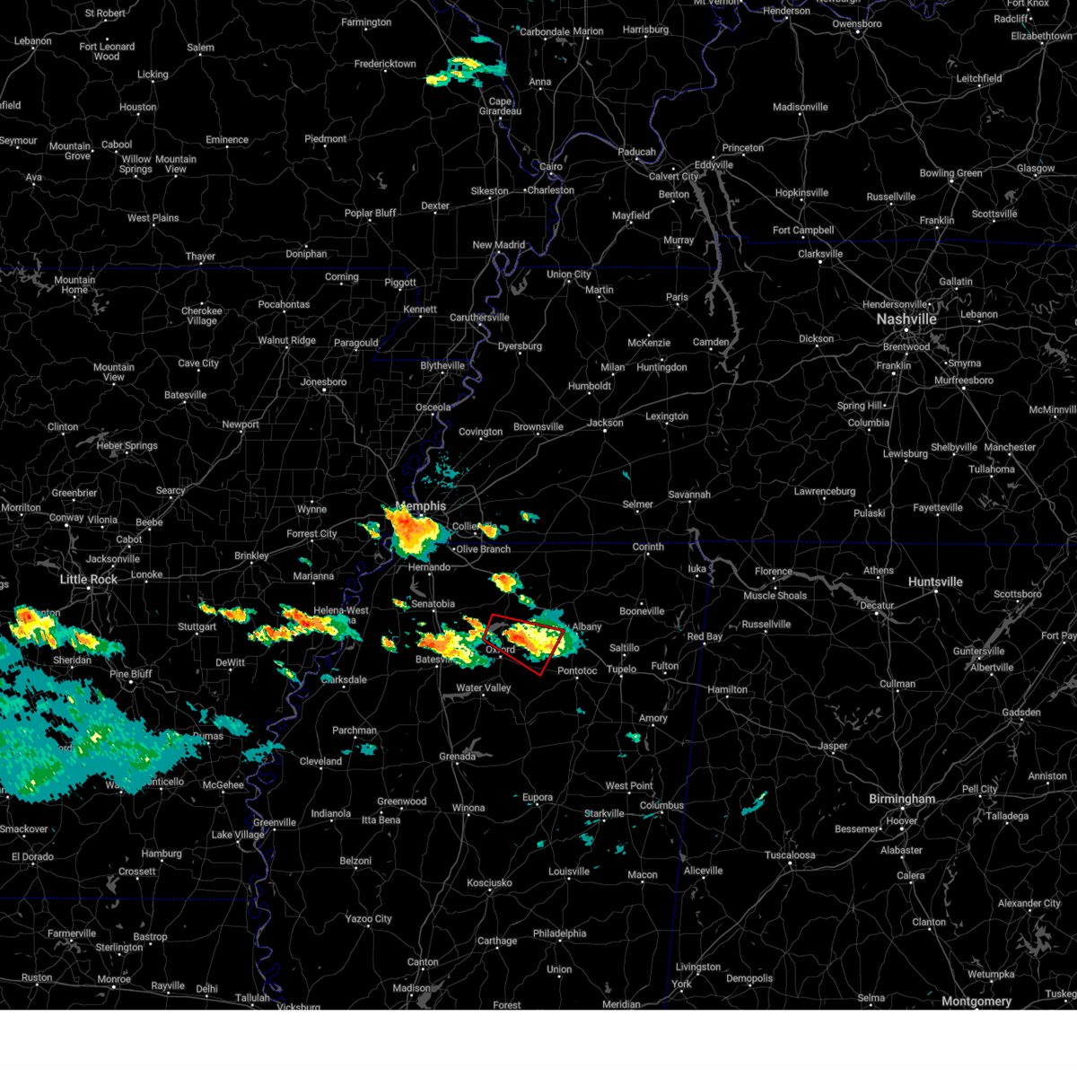
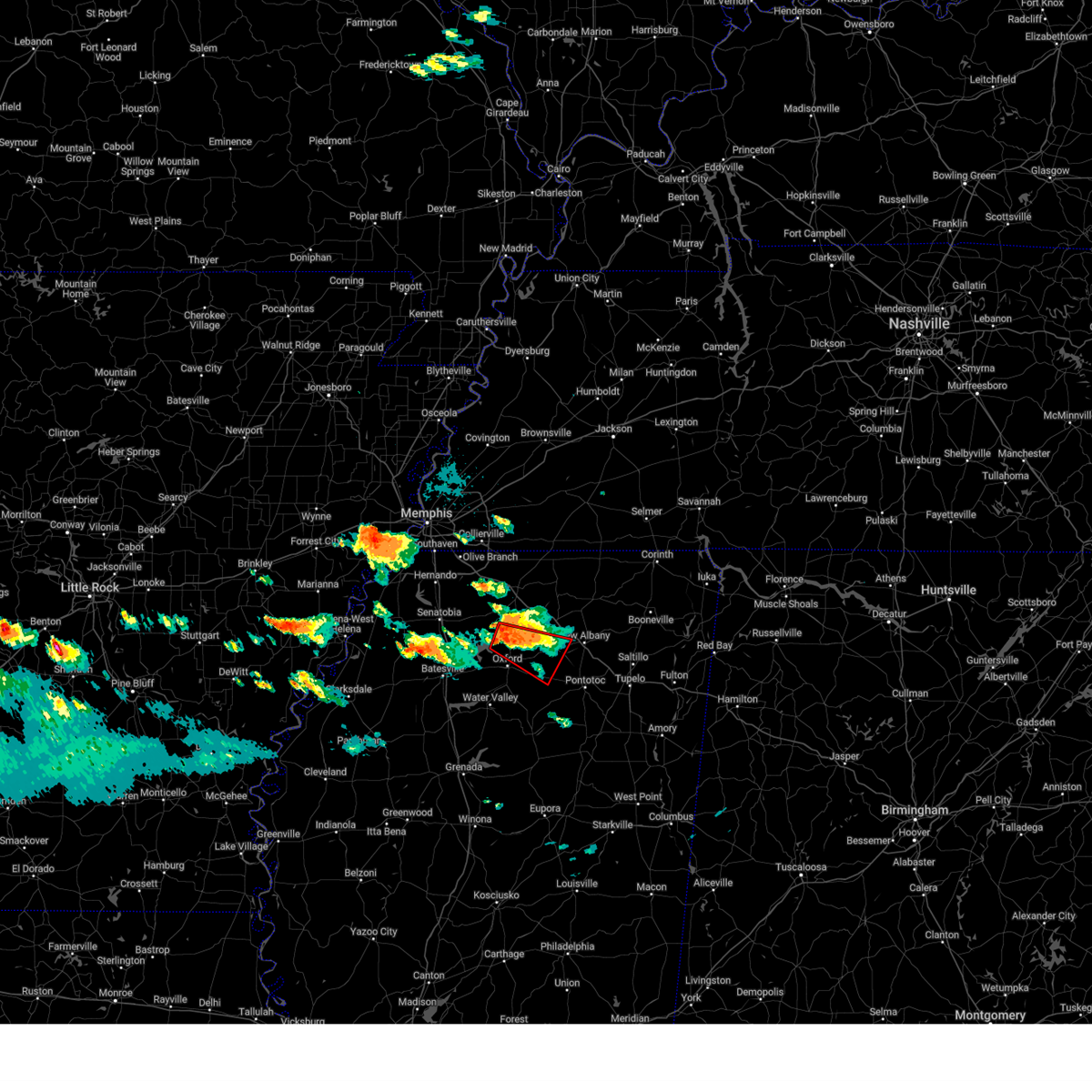
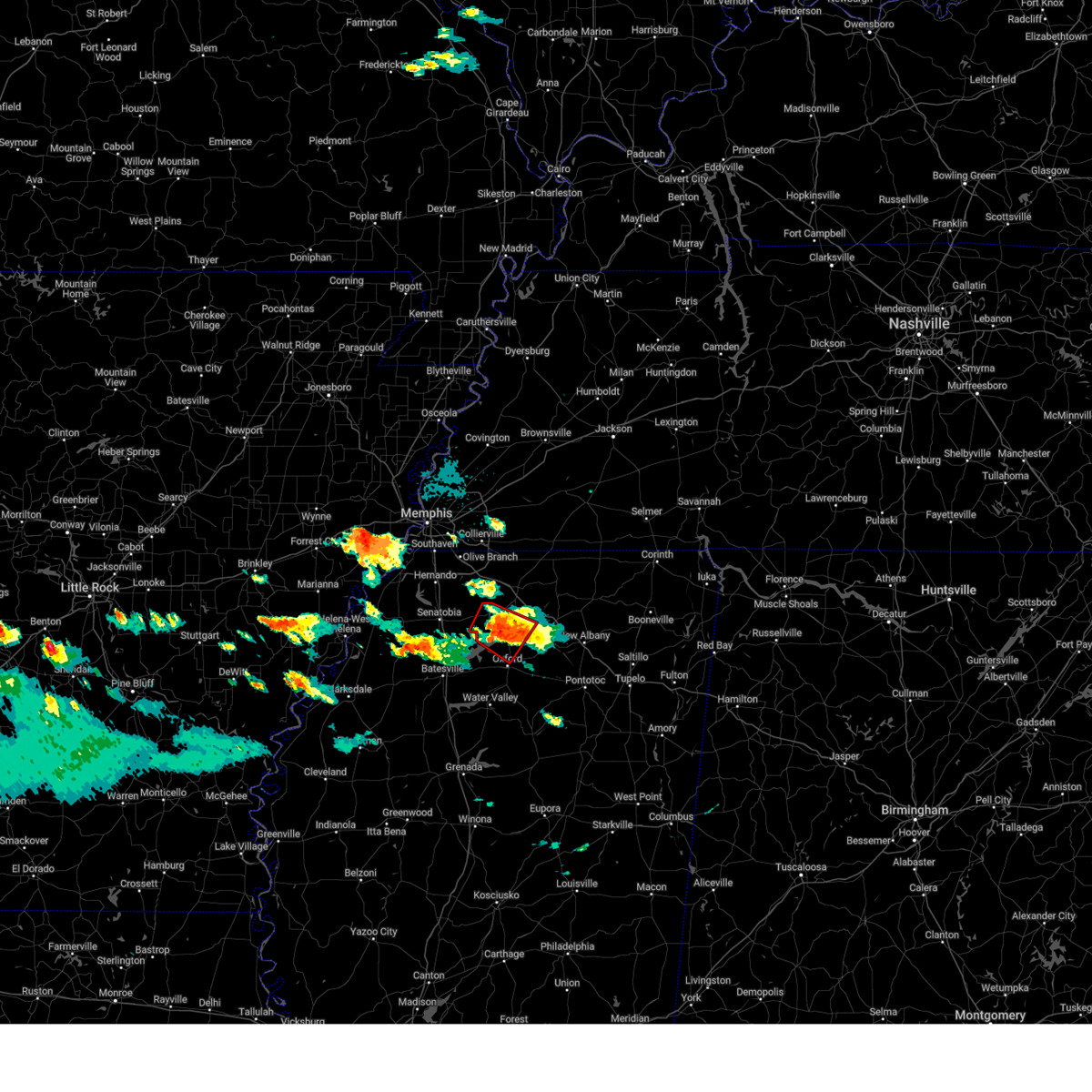
The Top Recent Hail Date for Abbeville, MS is Tuesday, May 20, 2025 (52nd out of 52)
Hail and Wind Damage Spotted near Abbeville, MS
| Date / Time | Report Details |
|---|---|
| 6/7/2025 9:42 PM CDT |
 the tornado warning has been cancelled and is no longer in effect the tornado warning has been cancelled and is no longer in effect
|
| 6/7/2025 9:22 PM CDT |
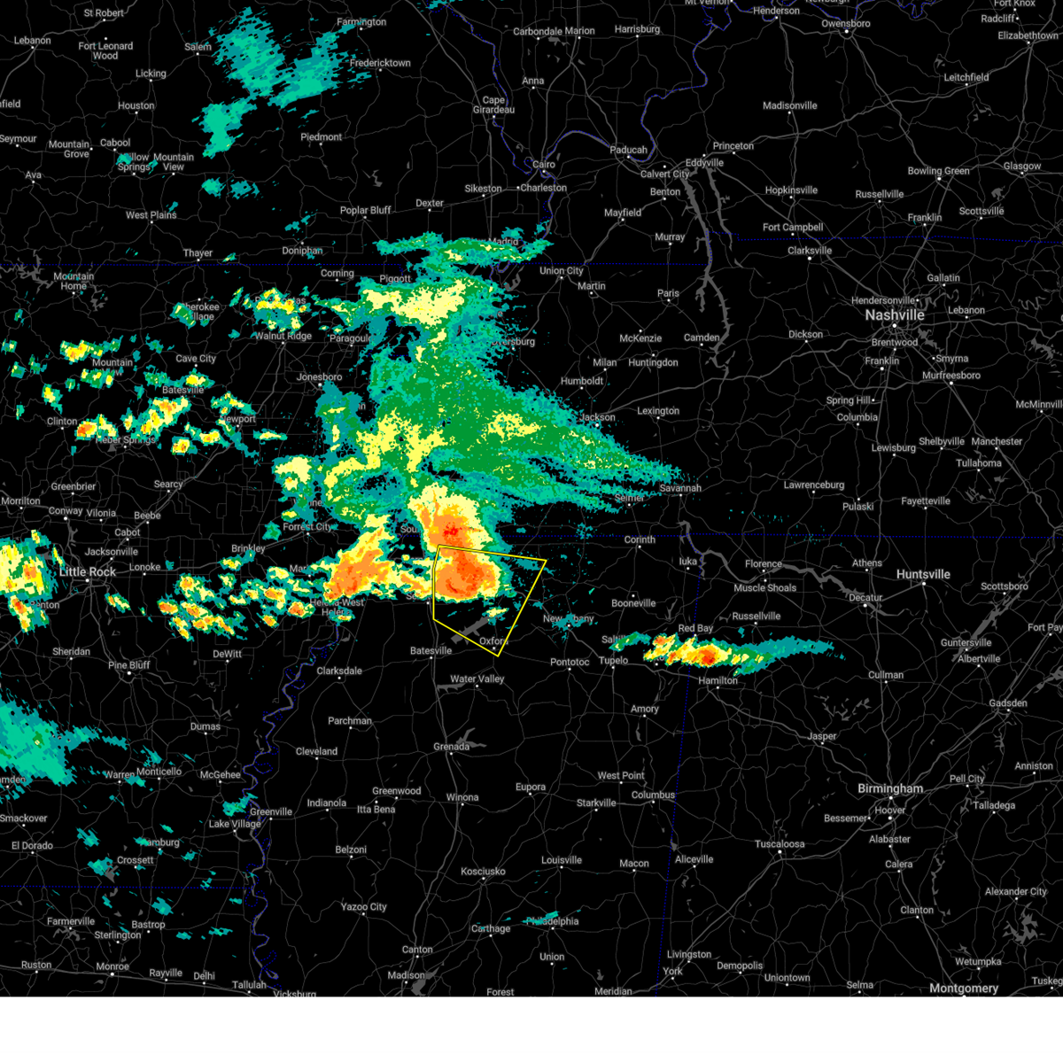
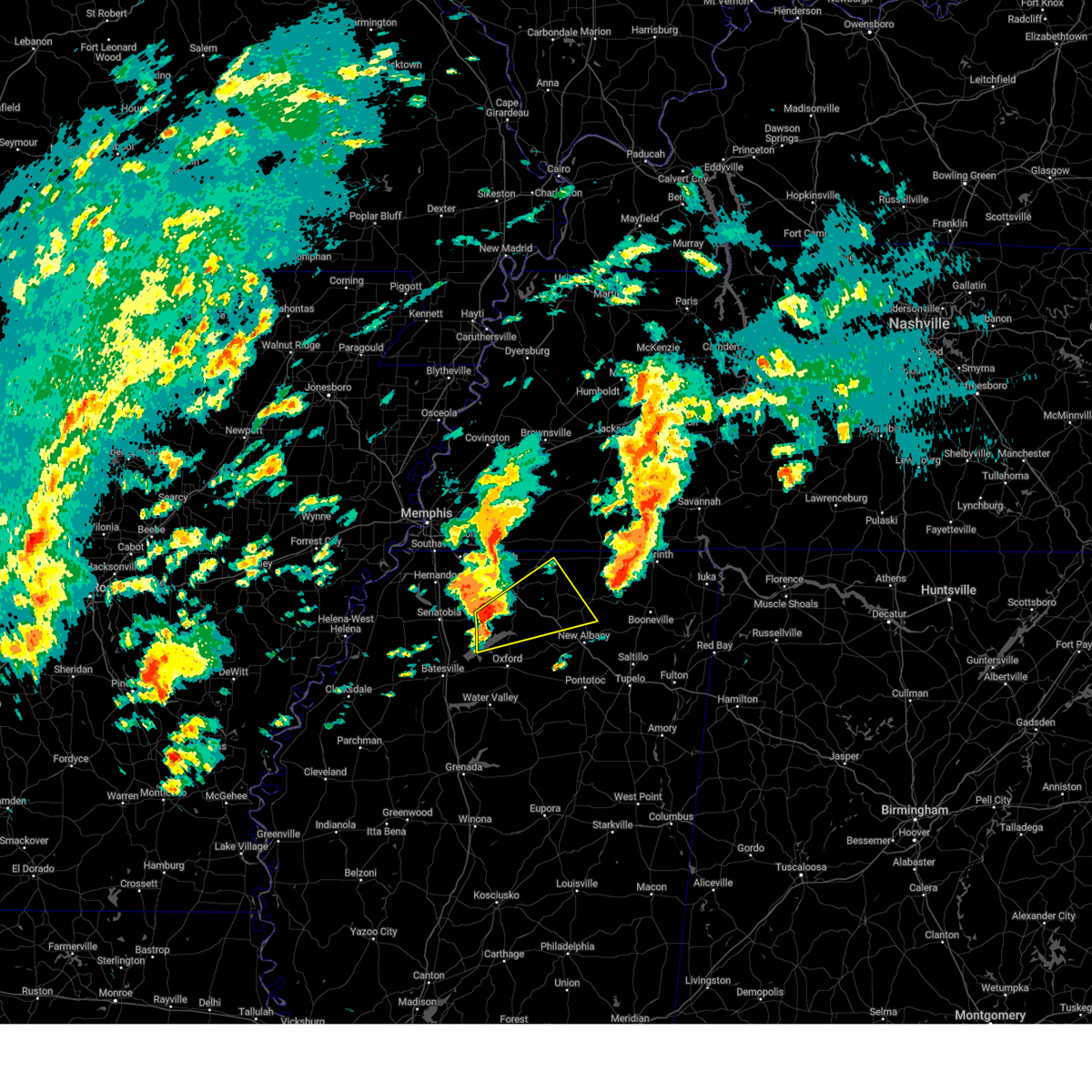
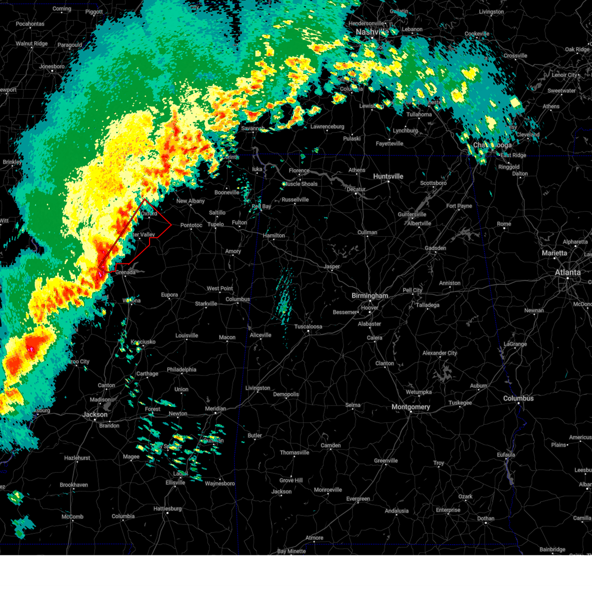
 Tormeg the national weather service in memphis has issued a * tornado warning for, northern lafayette county in northwestern mississippi, southwestern union county in northeastern mississippi, northwestern pontotoc county in northeastern mississippi, southeastern marshall county in northwestern mississippi, * until 1015 pm cdt. * at 922 pm cdt, a severe thunderstorm capable of producing a tornado was located near laws hill, or 9 miles north of oxford, moving east at 30 mph (radar indicated rotation). Hazards include tornado and quarter size hail. Flying debris will be dangerous to those caught without shelter. mobile homes will be damaged or destroyed. damage to roofs, windows, and vehicles will occur. Tree damage is likely. Tormeg the national weather service in memphis has issued a * tornado warning for, northern lafayette county in northwestern mississippi, southwestern union county in northeastern mississippi, northwestern pontotoc county in northeastern mississippi, southeastern marshall county in northwestern mississippi, * until 1015 pm cdt. * at 922 pm cdt, a severe thunderstorm capable of producing a tornado was located near laws hill, or 9 miles north of oxford, moving east at 30 mph (radar indicated rotation). Hazards include tornado and quarter size hail. Flying debris will be dangerous to those caught without shelter. mobile homes will be damaged or destroyed. damage to roofs, windows, and vehicles will occur. Tree damage is likely.
|
| 6/7/2025 9:17 PM CDT |
 the tornado warning has been cancelled and is no longer in effect the tornado warning has been cancelled and is no longer in effect
|
| 6/7/2025 9:07 PM CDT |
 the tornado warning has been cancelled and is no longer in effect the tornado warning has been cancelled and is no longer in effect
|
| 6/7/2025 9:07 PM CDT |
 At 907 pm cdt, a severe thunderstorm capable of producing a tornado was located over harmontown, or 11 miles northeast of john w kyle state park, moving southeast at 25 mph (radar indicated rotation). Hazards include tornado and quarter size hail. Flying debris will be dangerous to those caught without shelter. mobile homes will be damaged or destroyed. damage to roofs, windows, and vehicles will occur. tree damage is likely. Locations impacted include, oxford, harmontown, laws hill, abbeville, malone, blackwater, teckville, waterford, wyatte, tyro, chulahoma, college hill station, college hill, galena, and spraggins. At 907 pm cdt, a severe thunderstorm capable of producing a tornado was located over harmontown, or 11 miles northeast of john w kyle state park, moving southeast at 25 mph (radar indicated rotation). Hazards include tornado and quarter size hail. Flying debris will be dangerous to those caught without shelter. mobile homes will be damaged or destroyed. damage to roofs, windows, and vehicles will occur. tree damage is likely. Locations impacted include, oxford, harmontown, laws hill, abbeville, malone, blackwater, teckville, waterford, wyatte, tyro, chulahoma, college hill station, college hill, galena, and spraggins.
|
| 6/7/2025 8:54 PM CDT |
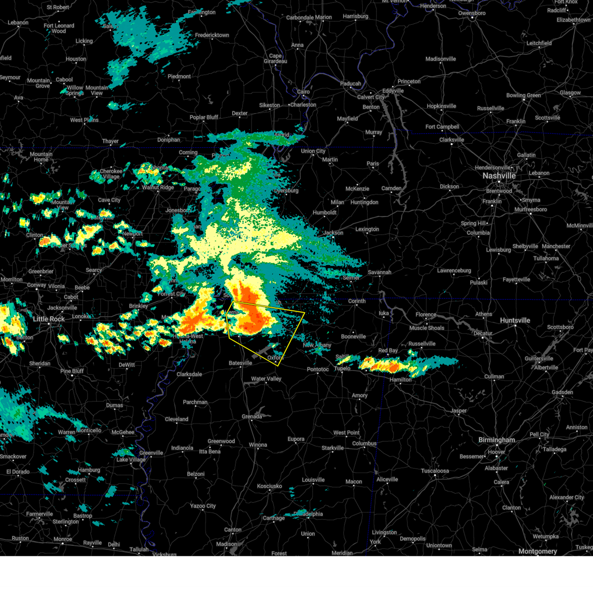
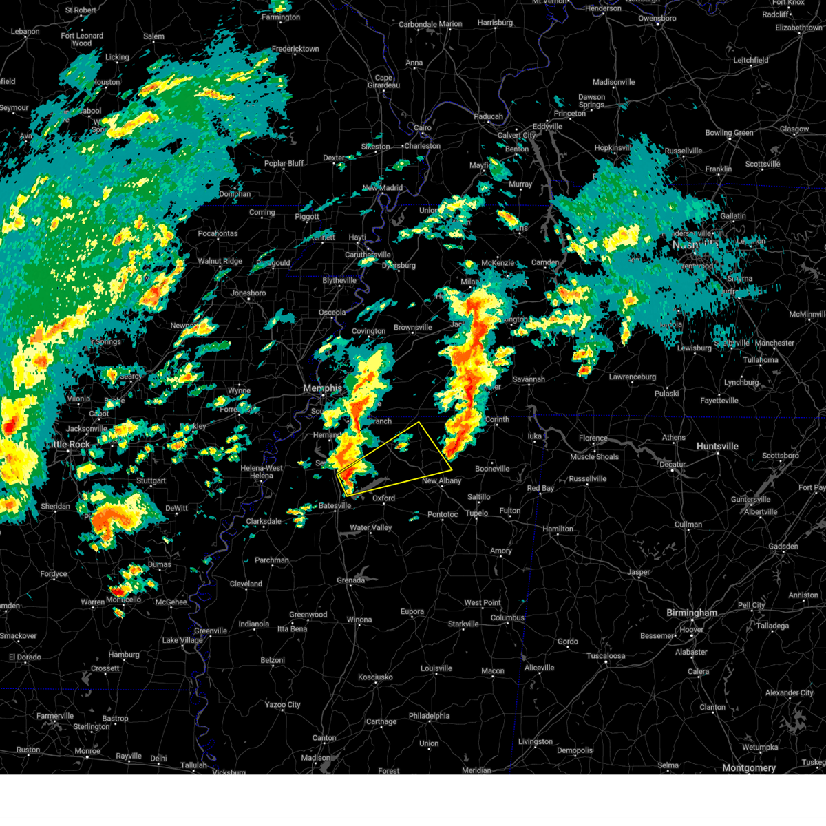
 Tormeg the national weather service in memphis has issued a * tornado warning for, northwestern lafayette county in northwestern mississippi, southern marshall county in northwestern mississippi, southeastern tate county in northwestern mississippi, northeastern panola county in northwestern mississippi, * until 945 pm cdt. * at 853 pm cdt, a severe thunderstorm capable of producing a tornado was located near barr, or 10 miles north of john w kyle state park, moving southeast at 25 mph (radar indicated rotation). Hazards include tornado and half dollar size hail. Flying debris will be dangerous to those caught without shelter. mobile homes will be damaged or destroyed. damage to roofs, windows, and vehicles will occur. Tree damage is likely. Tormeg the national weather service in memphis has issued a * tornado warning for, northwestern lafayette county in northwestern mississippi, southern marshall county in northwestern mississippi, southeastern tate county in northwestern mississippi, northeastern panola county in northwestern mississippi, * until 945 pm cdt. * at 853 pm cdt, a severe thunderstorm capable of producing a tornado was located near barr, or 10 miles north of john w kyle state park, moving southeast at 25 mph (radar indicated rotation). Hazards include tornado and half dollar size hail. Flying debris will be dangerous to those caught without shelter. mobile homes will be damaged or destroyed. damage to roofs, windows, and vehicles will occur. Tree damage is likely.
|
| 6/7/2025 11:14 AM CDT |
 Svrmeg the national weather service in memphis has issued a * severe thunderstorm warning for, lafayette county in northwestern mississippi, western union county in northeastern mississippi, northwestern pontotoc county in northeastern mississippi, southern marshall county in northwestern mississippi, southwestern benton county in northeastern mississippi, * until noon cdt. * at 1114 am cdt, a severe thunderstorm was located over burgess, or near holly springs national forest, moving east at 20 mph (radar indicated). Hazards include 60 mph wind gusts and nickel size hail. expect damage to roofs, siding, and trees Svrmeg the national weather service in memphis has issued a * severe thunderstorm warning for, lafayette county in northwestern mississippi, western union county in northeastern mississippi, northwestern pontotoc county in northeastern mississippi, southern marshall county in northwestern mississippi, southwestern benton county in northeastern mississippi, * until noon cdt. * at 1114 am cdt, a severe thunderstorm was located over burgess, or near holly springs national forest, moving east at 20 mph (radar indicated). Hazards include 60 mph wind gusts and nickel size hail. expect damage to roofs, siding, and trees
|
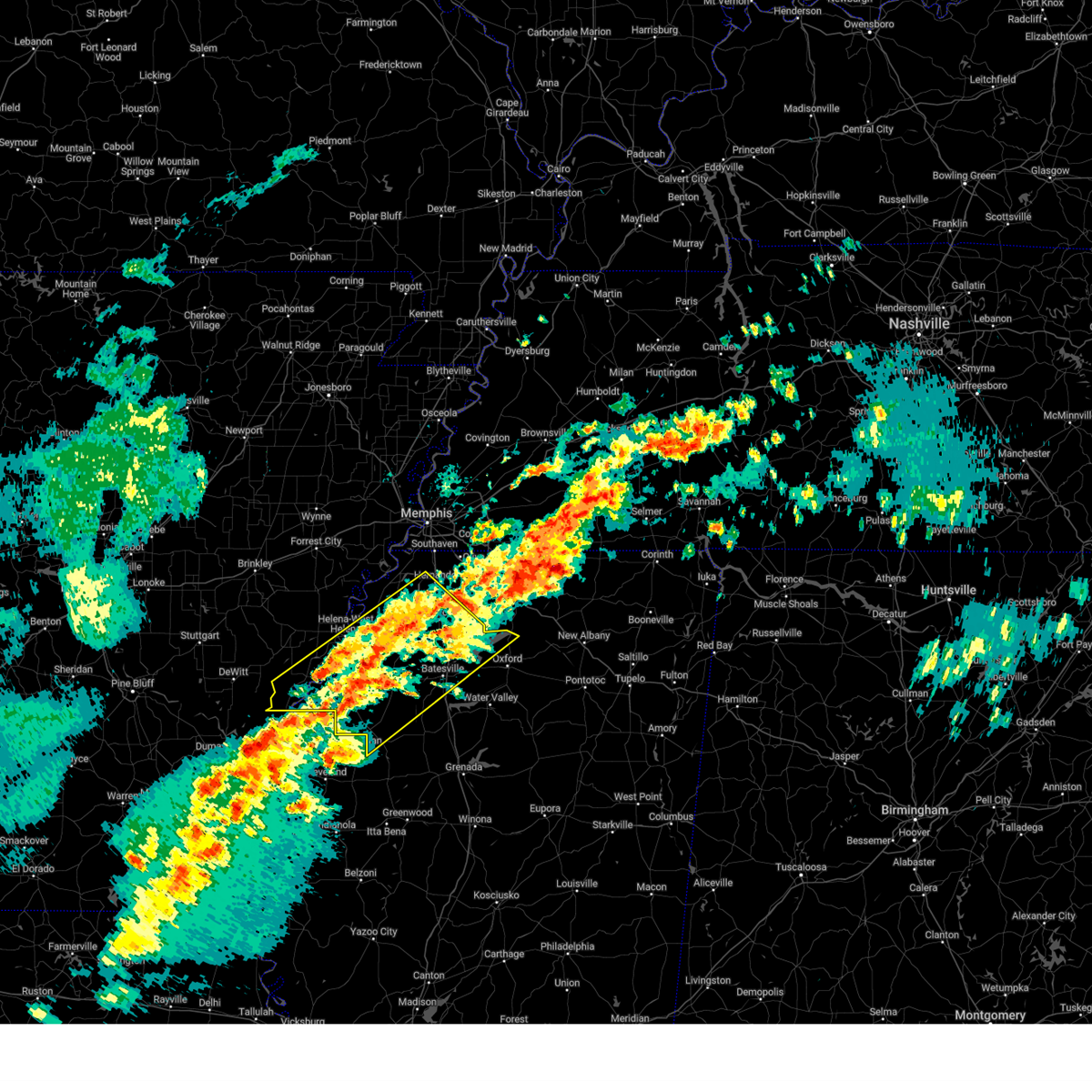
| 5/25/2025 7:20 PM CDT |
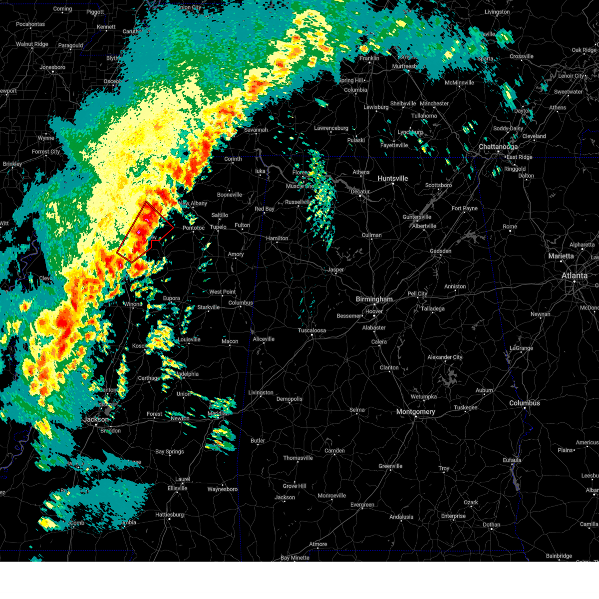
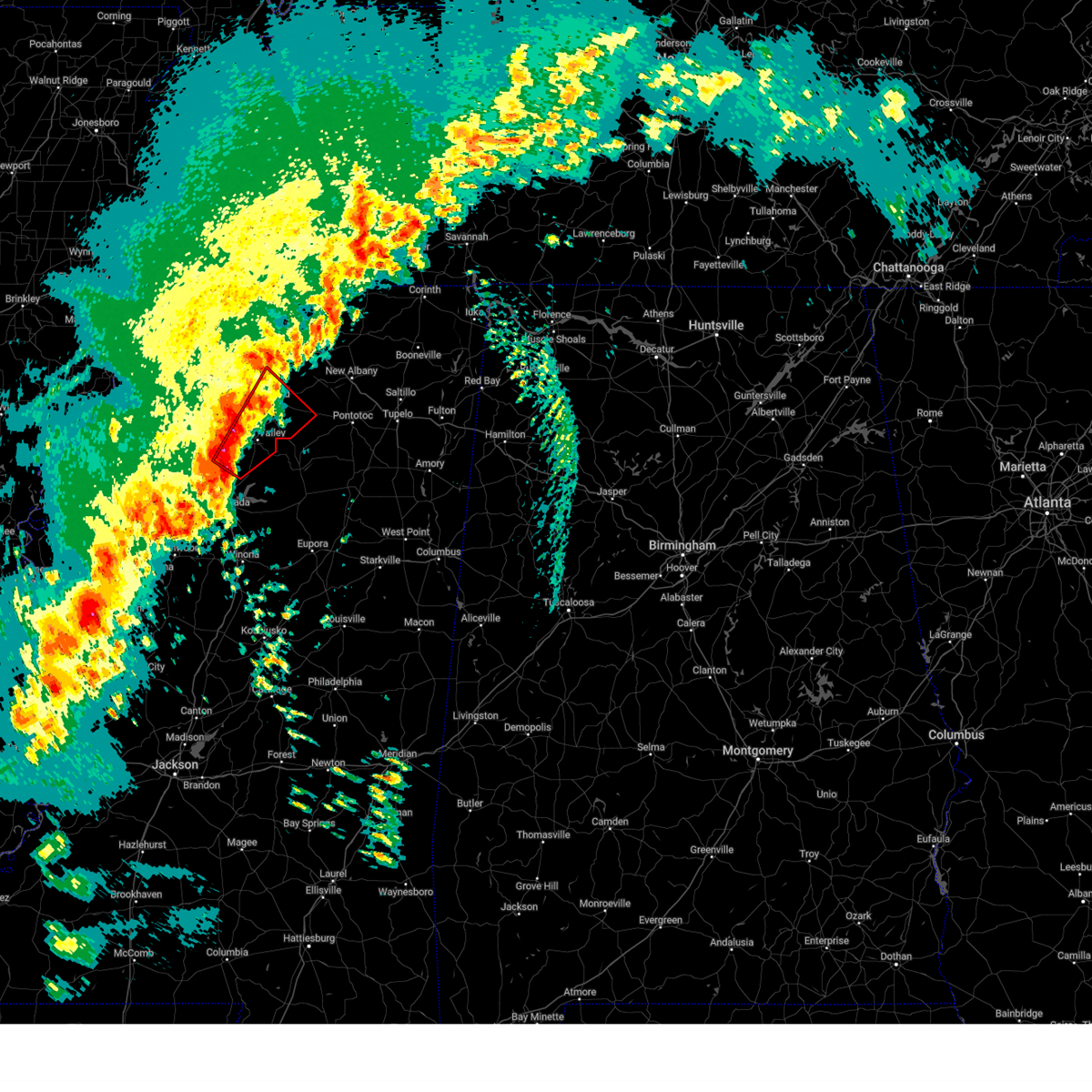
 At 719 pm cdt, severe thunderstorms were located along a line extending from blair to near scobey, moving east at 60 mph (radar indicated). Hazards include 70 mph wind gusts and quarter size hail. Hail damage to vehicles is expected. expect considerable tree damage. wind damage is also likely to mobile homes, roofs, and outbuildings. Locations impacted include, shari, robbs, keel, graham, esperanza, endville, paynes, pumpkin center, oakland, cambridge, delay, tyson, gums, keownville, new harmony, randolph, rough edge, smalco, glenfield, and rosebloom. At 719 pm cdt, severe thunderstorms were located along a line extending from blair to near scobey, moving east at 60 mph (radar indicated). Hazards include 70 mph wind gusts and quarter size hail. Hail damage to vehicles is expected. expect considerable tree damage. wind damage is also likely to mobile homes, roofs, and outbuildings. Locations impacted include, shari, robbs, keel, graham, esperanza, endville, paynes, pumpkin center, oakland, cambridge, delay, tyson, gums, keownville, new harmony, randolph, rough edge, smalco, glenfield, and rosebloom.
|
| 5/25/2025 7:09 PM CDT | the severe thunderstorm warning has been cancelled and is no longer in effect |
| 5/25/2025 7:09 PM CDT | At 708 pm cdt, severe thunderstorms were located along a line extending from near keownville to near paynes, moving east at 60 mph (radar indicated). Hazards include 70 mph wind gusts and quarter size hail. Hail damage to vehicles is expected. expect considerable tree damage. wind damage is also likely to mobile homes, roofs, and outbuildings. Locations impacted include, shari, robbs, charleston, esperanza, paynes, swan lake, pumpkin center, cambridge, tyson, gums, new harmony, rough edge, glenfield, rosebloom, bryant, altus, bethlehem, toccopola, cascilla, and alpine. |
| 5/25/2025 7:00 PM CDT |
 At 700 pm cdt, severe thunderstorms were located along a line extending from new albany to near paynes, moving east at 60 mph (radar indicated). Hazards include 70 mph wind gusts and quarter size hail. Hail damage to vehicles is expected. expect considerable tree damage. wind damage is also likely to mobile homes, roofs, and outbuildings. Locations impacted include, shari, robbs, charleston, esperanza, paynes, swan lake, pumpkin center, cambridge, chulahoma, tyson, gums, albin, new harmony, rough edge, glenfield, rosebloom, bryant, altus, bethlehem, and toccopola. At 700 pm cdt, severe thunderstorms were located along a line extending from new albany to near paynes, moving east at 60 mph (radar indicated). Hazards include 70 mph wind gusts and quarter size hail. Hail damage to vehicles is expected. expect considerable tree damage. wind damage is also likely to mobile homes, roofs, and outbuildings. Locations impacted include, shari, robbs, charleston, esperanza, paynes, swan lake, pumpkin center, cambridge, chulahoma, tyson, gums, albin, new harmony, rough edge, glenfield, rosebloom, bryant, altus, bethlehem, and toccopola.
|
| 5/25/2025 6:53 PM CDT |
 At 653 pm cdt, severe thunderstorms were located along a line extending from 6 miles northeast of etta to 7 miles east of webb, moving east at 60 mph (radar indicated). Hazards include 60 mph wind gusts and quarter size hail. Hail damage to vehicles is expected. expect wind damage to roofs, siding, and trees. Locations impacted include, shari, robbs, charleston, esperanza, paynes, swan lake, pumpkin center, cambridge, chulahoma, tyson, gums, albin, new harmony, rough edge, glenfield, rosebloom, bryant, altus, bethlehem, and toccopola. At 653 pm cdt, severe thunderstorms were located along a line extending from 6 miles northeast of etta to 7 miles east of webb, moving east at 60 mph (radar indicated). Hazards include 60 mph wind gusts and quarter size hail. Hail damage to vehicles is expected. expect wind damage to roofs, siding, and trees. Locations impacted include, shari, robbs, charleston, esperanza, paynes, swan lake, pumpkin center, cambridge, chulahoma, tyson, gums, albin, new harmony, rough edge, glenfield, rosebloom, bryant, altus, bethlehem, and toccopola.
|
| 5/25/2025 6:53 PM CDT |
 the severe thunderstorm warning has been cancelled and is no longer in effect the severe thunderstorm warning has been cancelled and is no longer in effect
|
| 5/25/2025 6:33 PM CDT |
 Svrmeg the national weather service in memphis has issued a * severe thunderstorm warning for, lafayette county in northwestern mississippi, yalobusha county in northwestern mississippi, southeastern coahoma county in northwestern mississippi, northern calhoun county in northeastern mississippi, union county in northeastern mississippi, pontotoc county in northeastern mississippi, southern marshall county in northwestern mississippi, southeastern tate county in northwestern mississippi, tallahatchie county in northwestern mississippi, quitman county in northwestern mississippi, panola county in northwestern mississippi, * until 730 pm cdt. * at 632 pm cdt, severe thunderstorms were located along a line extending from near wall doxey state park to near dublin, moving east at 60 mph (radar indicated). Hazards include 60 mph wind gusts and quarter size hail. Hail damage to vehicles is expected. Expect wind damage to roofs, siding, and trees. Svrmeg the national weather service in memphis has issued a * severe thunderstorm warning for, lafayette county in northwestern mississippi, yalobusha county in northwestern mississippi, southeastern coahoma county in northwestern mississippi, northern calhoun county in northeastern mississippi, union county in northeastern mississippi, pontotoc county in northeastern mississippi, southern marshall county in northwestern mississippi, southeastern tate county in northwestern mississippi, tallahatchie county in northwestern mississippi, quitman county in northwestern mississippi, panola county in northwestern mississippi, * until 730 pm cdt. * at 632 pm cdt, severe thunderstorms were located along a line extending from near wall doxey state park to near dublin, moving east at 60 mph (radar indicated). Hazards include 60 mph wind gusts and quarter size hail. Hail damage to vehicles is expected. Expect wind damage to roofs, siding, and trees.
|
| 5/20/2025 5:43 PM CDT | the severe thunderstorm warning has been cancelled and is no longer in effect |
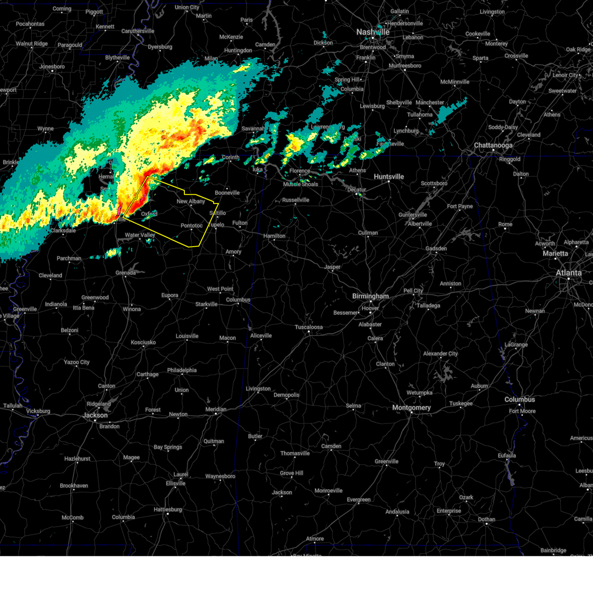
| 5/20/2025 5:43 PM CDT | At 542 pm cdt, a severe thunderstorm was located near cambridge, or 11 miles northeast of oxford, moving east at 45 mph (radar indicated). Hazards include 60 mph wind gusts and quarter size hail. Hail damage to vehicles is expected. expect wind damage to roofs, siding, and trees. Locations impacted include, malone, keel, blackwater, teckville, burgess, bethlehem, burt, cambridge, college hill station, abbeville, college hill, harmontown, spraggins, holly springs national forest, cornersville, oxford, and potts camp. |
| 5/20/2025 5:20 PM CDT | Svrmeg the national weather service in memphis has issued a * severe thunderstorm warning for, northern lafayette county in northwestern mississippi, southern marshall county in northwestern mississippi, northeastern panola county in northwestern mississippi, * until 600 pm cdt. * at 520 pm cdt, a severe thunderstorm was located near burgess, or near john w kyle state park, moving east at 45 mph (radar indicated). Hazards include 60 mph wind gusts and nickel size hail. expect damage to roofs, siding, and trees |
| 5/20/2025 2:38 PM CDT |
 At 238 pm cdt, a severe thunderstorm was located over cambridge, or 11 miles northeast of oxford, moving northeast at 40 mph (radar indicated). Hazards include two inch hail and 60 mph wind gusts. People and animals outdoors will be injured. expect hail damage to roofs, siding, windows, and vehicles. expect wind damage to roofs, siding, and trees. Locations impacted include, hickory flat, shari, keel, winborn, poolville, martintown, myrtle, bethlehem, old myrtle, burt, bald hill, cambridge, abbeville, pinedale, cornersville, etta, smalco, glenfield, new albany, and potts camp. At 238 pm cdt, a severe thunderstorm was located over cambridge, or 11 miles northeast of oxford, moving northeast at 40 mph (radar indicated). Hazards include two inch hail and 60 mph wind gusts. People and animals outdoors will be injured. expect hail damage to roofs, siding, windows, and vehicles. expect wind damage to roofs, siding, and trees. Locations impacted include, hickory flat, shari, keel, winborn, poolville, martintown, myrtle, bethlehem, old myrtle, burt, bald hill, cambridge, abbeville, pinedale, cornersville, etta, smalco, glenfield, new albany, and potts camp.
|
| 5/20/2025 2:31 PM CDT | At 231 pm cdt, a severe thunderstorm was located near cambridge, or near oxford, moving northeast at 40 mph (radar indicated). Hazards include golf ball size hail and 60 mph wind gusts. People and animals outdoors will be injured. expect hail damage to roofs, siding, windows, and vehicles. expect wind damage to roofs, siding, and trees. Locations impacted include, hickory flat, shari, keel, winborn, poolville, martintown, myrtle, bethlehem, old myrtle, burt, bald hill, cambridge, college hill station, abbeville, pinedale, cornersville, etta, smalco, glenfield, and new albany. |
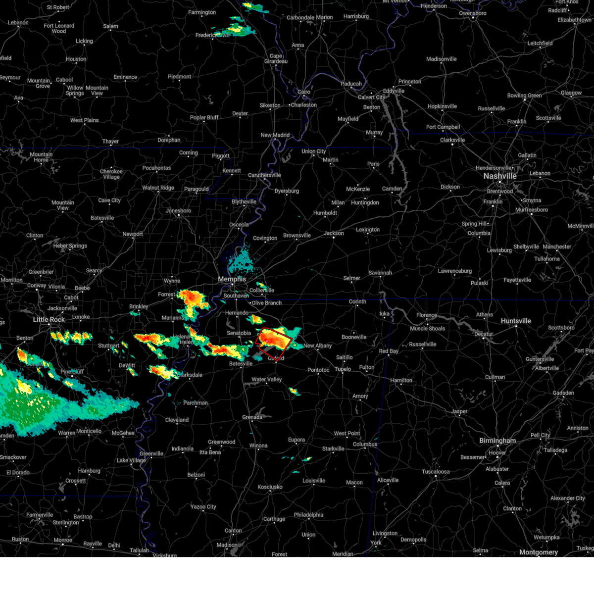
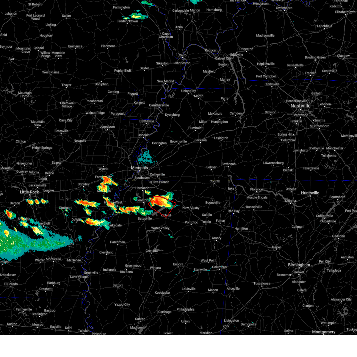
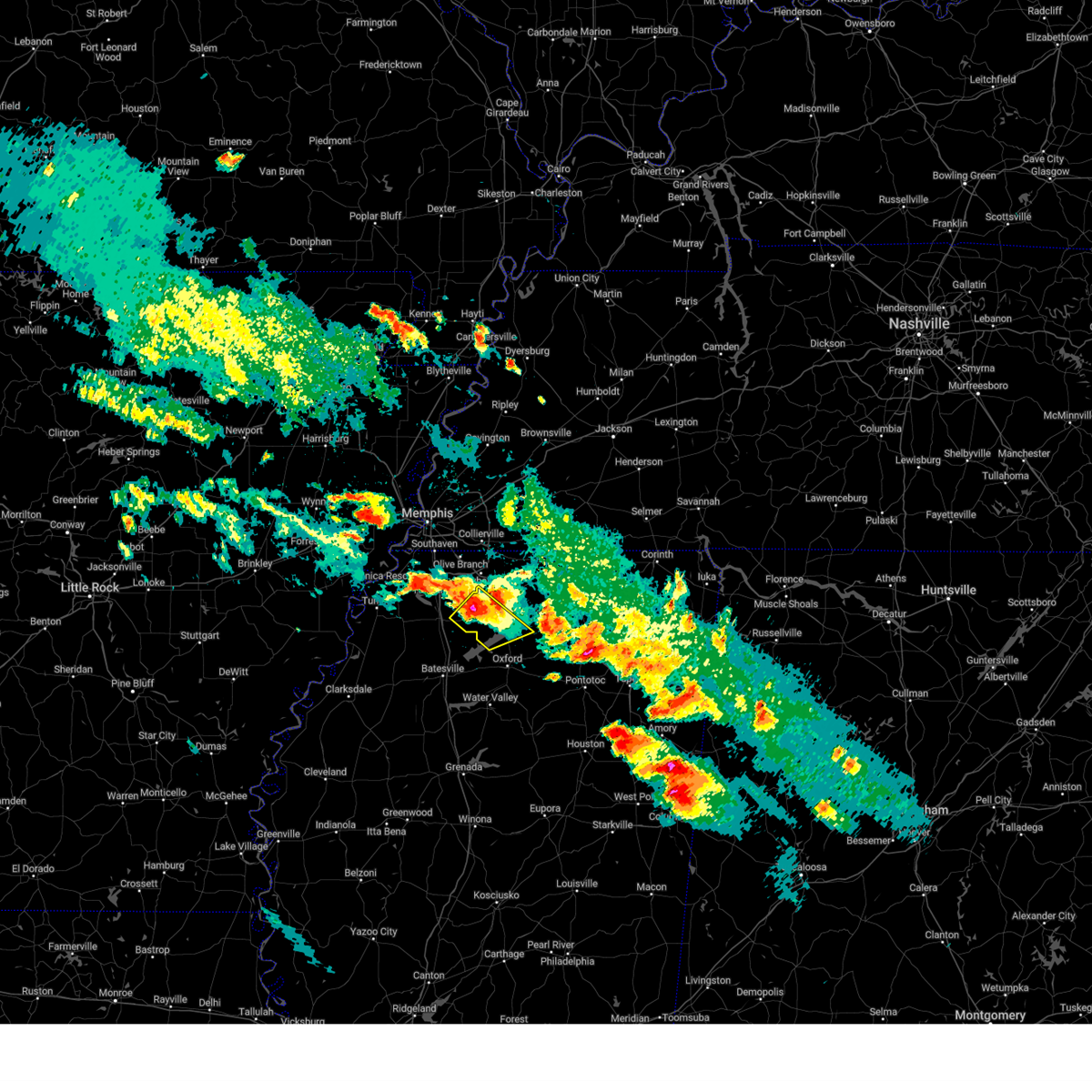
| 5/20/2025 2:29 PM CDT | Quarter sized hail reported 6.5 miles NNW of Abbeville, MS, quarter sized hail 5mi ne of oxford on hwy 30. |
| 5/20/2025 2:20 PM CDT |
 Svrmeg the national weather service in memphis has issued a * severe thunderstorm warning for, northern lafayette county in northwestern mississippi, western union county in northeastern mississippi, southeastern marshall county in northwestern mississippi, southwestern benton county in northeastern mississippi, * until 300 pm cdt. * at 219 pm cdt, a severe thunderstorm was located near holly springs national forest, moving northeast at 40 mph (radar indicated). Hazards include 60 mph wind gusts and half dollar size hail. Hail damage to vehicles is expected. Expect wind damage to roofs, siding, and trees. Svrmeg the national weather service in memphis has issued a * severe thunderstorm warning for, northern lafayette county in northwestern mississippi, western union county in northeastern mississippi, southeastern marshall county in northwestern mississippi, southwestern benton county in northeastern mississippi, * until 300 pm cdt. * at 219 pm cdt, a severe thunderstorm was located near holly springs national forest, moving northeast at 40 mph (radar indicated). Hazards include 60 mph wind gusts and half dollar size hail. Hail damage to vehicles is expected. Expect wind damage to roofs, siding, and trees.
|
| 5/18/2025 11:37 PM CDT |
 At 1137 pm cdt, a severe thunderstorm was located 7 miles north of etta, or 10 miles northwest of new albany, moving southeast at 30 mph (radar indicated). Hazards include 70 mph wind gusts and nickel size hail. Expect considerable tree damage. damage is likely to mobile homes, roofs, and outbuildings. Locations impacted include, hickory flat, shari, snow lake shores, keel, murry, esperanza, waterford, pumpkin center, cambridge, lake center, keownville, bethel, smalco, glenfield, union hill, ecru, winborn, martintown, bethlehem, and buchannan. At 1137 pm cdt, a severe thunderstorm was located 7 miles north of etta, or 10 miles northwest of new albany, moving southeast at 30 mph (radar indicated). Hazards include 70 mph wind gusts and nickel size hail. Expect considerable tree damage. damage is likely to mobile homes, roofs, and outbuildings. Locations impacted include, hickory flat, shari, snow lake shores, keel, murry, esperanza, waterford, pumpkin center, cambridge, lake center, keownville, bethel, smalco, glenfield, union hill, ecru, winborn, martintown, bethlehem, and buchannan.
|
| 5/18/2025 11:24 PM CDT |
 At 1124 pm cdt, a severe thunderstorm was located near bethlehem, or 12 miles east of wall doxey state park, moving east at 35 mph (radar indicated). Hazards include 70 mph wind gusts and nickel size hail. Expect considerable tree damage. damage is likely to mobile homes, roofs, and outbuildings. Locations impacted include, hickory flat, shari, snow lake shores, keel, murry, esperanza, waterford, pumpkin center, cambridge, lake center, keownville, bethel, smalco, glenfield, union hill, ecru, winborn, martintown, bethlehem, and holly springs. At 1124 pm cdt, a severe thunderstorm was located near bethlehem, or 12 miles east of wall doxey state park, moving east at 35 mph (radar indicated). Hazards include 70 mph wind gusts and nickel size hail. Expect considerable tree damage. damage is likely to mobile homes, roofs, and outbuildings. Locations impacted include, hickory flat, shari, snow lake shores, keel, murry, esperanza, waterford, pumpkin center, cambridge, lake center, keownville, bethel, smalco, glenfield, union hill, ecru, winborn, martintown, bethlehem, and holly springs.
|
| 5/18/2025 11:08 PM CDT |
 Svrmeg the national weather service in memphis has issued a * severe thunderstorm warning for, northeastern lafayette county in northwestern mississippi, union county in northeastern mississippi, northwestern pontotoc county in northeastern mississippi, southeastern marshall county in northwestern mississippi, southern tippah county in northeastern mississippi, southern benton county in northeastern mississippi, * until midnight cdt. * at 1107 pm cdt, a severe thunderstorm was located over wall doxey state park, moving east at 40 mph (radar indicated). Hazards include 70 mph wind gusts and nickel size hail. Expect considerable tree damage. Damage is likely to mobile homes, roofs, and outbuildings. Svrmeg the national weather service in memphis has issued a * severe thunderstorm warning for, northeastern lafayette county in northwestern mississippi, union county in northeastern mississippi, northwestern pontotoc county in northeastern mississippi, southeastern marshall county in northwestern mississippi, southern tippah county in northeastern mississippi, southern benton county in northeastern mississippi, * until midnight cdt. * at 1107 pm cdt, a severe thunderstorm was located over wall doxey state park, moving east at 40 mph (radar indicated). Hazards include 70 mph wind gusts and nickel size hail. Expect considerable tree damage. Damage is likely to mobile homes, roofs, and outbuildings.
|
| 5/18/2025 11:03 PM CDT |
 At 1101 pm cdt, a severe thunderstorm was located near laws hill, or near wall doxey state park, moving east at 45 mph (emergency management). Hazards include 60 mph wind gusts and nickel size hail. Expect damage to roofs, siding, and trees. Locations impacted include, snow lake shores, waterford, crossroad, tyro, watson, chulahoma, lake center, glenville, harmontown, teckville, lurline, victoria, holly springs, hudsonville, wyatte, lewisburg, abbeville, red banks, miller, and mack. At 1101 pm cdt, a severe thunderstorm was located near laws hill, or near wall doxey state park, moving east at 45 mph (emergency management). Hazards include 60 mph wind gusts and nickel size hail. Expect damage to roofs, siding, and trees. Locations impacted include, snow lake shores, waterford, crossroad, tyro, watson, chulahoma, lake center, glenville, harmontown, teckville, lurline, victoria, holly springs, hudsonville, wyatte, lewisburg, abbeville, red banks, miller, and mack.
|
| 5/18/2025 10:50 PM CDT |
 At 1050 pm cdt, a severe thunderstorm was located near barr, or 12 miles west of wall doxey state park, moving east at 35 mph (radar indicated). Hazards include 70 mph wind gusts and quarter size hail. Hail damage to vehicles is expected. expect considerable tree damage. wind damage is also likely to mobile homes, roofs, and outbuildings. Locations impacted include, snow lake shores, waterford, horn lake, crossroad, tyro, watson, senatobia, bright, chulahoma, lake center, glenville, harmontown, coldwater, bluff, robinson gin, teckville, alden, lurline, fairhaven, and victoria. At 1050 pm cdt, a severe thunderstorm was located near barr, or 12 miles west of wall doxey state park, moving east at 35 mph (radar indicated). Hazards include 70 mph wind gusts and quarter size hail. Hail damage to vehicles is expected. expect considerable tree damage. wind damage is also likely to mobile homes, roofs, and outbuildings. Locations impacted include, snow lake shores, waterford, horn lake, crossroad, tyro, watson, senatobia, bright, chulahoma, lake center, glenville, harmontown, coldwater, bluff, robinson gin, teckville, alden, lurline, fairhaven, and victoria.
|
| 5/18/2025 10:31 PM CDT |
 Svrmeg the national weather service in memphis has issued a * severe thunderstorm warning for, northwestern lafayette county in northwestern mississippi, desoto county in northwestern mississippi, marshall county in northwestern mississippi, tate county in northwestern mississippi, southwestern benton county in northeastern mississippi, northeastern panola county in northwestern mississippi, * until 1115 pm cdt. * at 1031 pm cdt, a severe thunderstorm was located near independence, or 9 miles northeast of senatobia, moving east at 45 mph (radar indicated). Hazards include 60 mph wind gusts and quarter size hail. Hail damage to vehicles is expected. Expect wind damage to roofs, siding, and trees. Svrmeg the national weather service in memphis has issued a * severe thunderstorm warning for, northwestern lafayette county in northwestern mississippi, desoto county in northwestern mississippi, marshall county in northwestern mississippi, tate county in northwestern mississippi, southwestern benton county in northeastern mississippi, northeastern panola county in northwestern mississippi, * until 1115 pm cdt. * at 1031 pm cdt, a severe thunderstorm was located near independence, or 9 miles northeast of senatobia, moving east at 45 mph (radar indicated). Hazards include 60 mph wind gusts and quarter size hail. Hail damage to vehicles is expected. Expect wind damage to roofs, siding, and trees.
|
| 4/5/2025 5:58 PM CDT |
 Tormeg the national weather service in memphis has issued a * tornado warning for, northwestern lafayette county in northwestern mississippi, southeastern marshall county in northwestern mississippi, southwestern benton county in northeastern mississippi, * until 645 pm cdt. * at 558 pm cdt, a severe thunderstorm capable of producing a tornado was located near holly springs national forest, moving northeast at 30 mph (radar indicated rotation). Hazards include tornado. Flying debris will be dangerous to those caught without shelter. mobile homes will be damaged or destroyed. damage to roofs, windows, and vehicles will occur. Tree damage is likely. Tormeg the national weather service in memphis has issued a * tornado warning for, northwestern lafayette county in northwestern mississippi, southeastern marshall county in northwestern mississippi, southwestern benton county in northeastern mississippi, * until 645 pm cdt. * at 558 pm cdt, a severe thunderstorm capable of producing a tornado was located near holly springs national forest, moving northeast at 30 mph (radar indicated rotation). Hazards include tornado. Flying debris will be dangerous to those caught without shelter. mobile homes will be damaged or destroyed. damage to roofs, windows, and vehicles will occur. Tree damage is likely.
|
| 4/3/2025 4:27 PM CDT |
 At 427 pm cdt, a severe thunderstorm was located near laws hill, or near wall doxey state park, moving northeast at 55 mph (radar indicated). Hazards include 60 mph wind gusts and quarter size hail. Hail damage to vehicles is expected. expect wind damage to roofs, siding, and trees. Locations impacted include, malone, hickory flat, snow lake shores, waterford, spring hill, higdon, tyro, gilton, chulahoma, lake center, blue mountain, harmontown, whitten town, potts camp, galena, bethel, ashland, cotton plant, winborn, and blackwater. At 427 pm cdt, a severe thunderstorm was located near laws hill, or near wall doxey state park, moving northeast at 55 mph (radar indicated). Hazards include 60 mph wind gusts and quarter size hail. Hail damage to vehicles is expected. expect wind damage to roofs, siding, and trees. Locations impacted include, malone, hickory flat, snow lake shores, waterford, spring hill, higdon, tyro, gilton, chulahoma, lake center, blue mountain, harmontown, whitten town, potts camp, galena, bethel, ashland, cotton plant, winborn, and blackwater.
|
| 4/3/2025 4:27 PM CDT |
 the severe thunderstorm warning has been cancelled and is no longer in effect the severe thunderstorm warning has been cancelled and is no longer in effect
|
| 4/3/2025 4:14 PM CDT |
 Svrmeg the national weather service in memphis has issued a * severe thunderstorm warning for, northwestern lafayette county in northwestern mississippi, northwestern union county in northeastern mississippi, southern marshall county in northwestern mississippi, southwestern tippah county in northeastern mississippi, southeastern tate county in northwestern mississippi, benton county in northeastern mississippi, northeastern panola county in northwestern mississippi, * until 500 pm cdt. * at 413 pm cdt, a severe thunderstorm was located near barr, or 8 miles north of john w kyle state park, moving northeast at 50 mph (radar indicated). Hazards include 60 mph wind gusts and quarter size hail. Hail damage to vehicles is expected. Expect wind damage to roofs, siding, and trees. Svrmeg the national weather service in memphis has issued a * severe thunderstorm warning for, northwestern lafayette county in northwestern mississippi, northwestern union county in northeastern mississippi, southern marshall county in northwestern mississippi, southwestern tippah county in northeastern mississippi, southeastern tate county in northwestern mississippi, benton county in northeastern mississippi, northeastern panola county in northwestern mississippi, * until 500 pm cdt. * at 413 pm cdt, a severe thunderstorm was located near barr, or 8 miles north of john w kyle state park, moving northeast at 50 mph (radar indicated). Hazards include 60 mph wind gusts and quarter size hail. Hail damage to vehicles is expected. Expect wind damage to roofs, siding, and trees.
|
| 3/15/2025 11:14 AM CDT |
 The tornado threat has diminished and the tornado warning has been cancelled. however, large hail and damaging winds remain likely and a severe thunderstorm warning remains in effect for the area. a tornado watch remains in effect until 100 pm cdt for northwestern mississippi. a tornado watch also remains in effect until 600 pm cdt for northeastern and northwestern mississippi. The tornado threat has diminished and the tornado warning has been cancelled. however, large hail and damaging winds remain likely and a severe thunderstorm warning remains in effect for the area. a tornado watch remains in effect until 100 pm cdt for northwestern mississippi. a tornado watch also remains in effect until 600 pm cdt for northeastern and northwestern mississippi.
|
| 3/15/2025 11:05 AM CDT |
 At 1104 am cdt, a severe thunderstorm capable of producing a tornado was located over springdale, or near water valley, moving northeast at 60 mph (radar indicated rotation). Hazards include tornado and ping pong ball size hail. Flying debris will be dangerous to those caught without shelter. mobile homes will be damaged or destroyed. damage to roofs, windows, and vehicles will occur. tree damage is likely. Locations impacted include, springdale, altus, burgess, taylor, oakland, water valley, delay, college hill station, tula, college hill, denmark, holly springs national forest, velma, oxford, paris, yocona, coffeeville, and abbeville. At 1104 am cdt, a severe thunderstorm capable of producing a tornado was located over springdale, or near water valley, moving northeast at 60 mph (radar indicated rotation). Hazards include tornado and ping pong ball size hail. Flying debris will be dangerous to those caught without shelter. mobile homes will be damaged or destroyed. damage to roofs, windows, and vehicles will occur. tree damage is likely. Locations impacted include, springdale, altus, burgess, taylor, oakland, water valley, delay, college hill station, tula, college hill, denmark, holly springs national forest, velma, oxford, paris, yocona, coffeeville, and abbeville.
|
| 3/15/2025 11:05 AM CDT |
 the tornado warning has been cancelled and is no longer in effect the tornado warning has been cancelled and is no longer in effect
|
| 3/15/2025 10:57 AM CDT |
 At 1057 am cdt, a severe thunderstorm capable of producing a tornado was located near water valley, moving northeast at 60 mph (radar indicated rotation). Hazards include tornado and ping pong ball size hail. Flying debris will be dangerous to those caught without shelter. mobile homes will be damaged or destroyed. damage to roofs, windows, and vehicles will occur. tree damage is likely. Locations impacted include, springdale, altus, burgess, shuford, george payne state park, taylor, paynes, cascilla, oakland, water valley, delay, college hill station, tula, college hill, leverett, denmark, holly springs national forest, velma, oxford, and paris. At 1057 am cdt, a severe thunderstorm capable of producing a tornado was located near water valley, moving northeast at 60 mph (radar indicated rotation). Hazards include tornado and ping pong ball size hail. Flying debris will be dangerous to those caught without shelter. mobile homes will be damaged or destroyed. damage to roofs, windows, and vehicles will occur. tree damage is likely. Locations impacted include, springdale, altus, burgess, shuford, george payne state park, taylor, paynes, cascilla, oakland, water valley, delay, college hill station, tula, college hill, leverett, denmark, holly springs national forest, velma, oxford, and paris.
|
| 3/15/2025 10:34 AM CDT |
 Tormeg the national weather service in memphis has issued a * tornado warning for, lafayette county in northwestern mississippi, yalobusha county in northwestern mississippi, east central tallahatchie county in northwestern mississippi, southeastern panola county in northwestern mississippi, * until 1115 am cdt. * at 1034 am cdt, a severe thunderstorm capable of producing a tornado was located near paynes, or 9 miles southeast of charleston, moving northeast at 60 mph (radar indicated rotation). Hazards include tornado and ping pong ball size hail. Flying debris will be dangerous to those caught without shelter. mobile homes will be damaged or destroyed. damage to roofs, windows, and vehicles will occur. Tree damage is likely. Tormeg the national weather service in memphis has issued a * tornado warning for, lafayette county in northwestern mississippi, yalobusha county in northwestern mississippi, east central tallahatchie county in northwestern mississippi, southeastern panola county in northwestern mississippi, * until 1115 am cdt. * at 1034 am cdt, a severe thunderstorm capable of producing a tornado was located near paynes, or 9 miles southeast of charleston, moving northeast at 60 mph (radar indicated rotation). Hazards include tornado and ping pong ball size hail. Flying debris will be dangerous to those caught without shelter. mobile homes will be damaged or destroyed. damage to roofs, windows, and vehicles will occur. Tree damage is likely.
|
| 3/15/2025 7:11 AM CDT |
 Svrmeg the national weather service in memphis has issued a * severe thunderstorm warning for, central phillips county in eastern arkansas, northwestern lafayette county in northwestern mississippi, southwestern desoto county in northwestern mississippi, coahoma county in northwestern mississippi, tunica county in northwestern mississippi, tate county in northwestern mississippi, northwestern tallahatchie county in northwestern mississippi, quitman county in northwestern mississippi, panola county in northwestern mississippi, * until 800 am cdt. * at 710 am cdt, a cluster of severe thunderstorms was located 7 miles northwest of darling, or 16 miles southeast of helena-west helena, moving northeast at 50 mph (radar indicated). Hazards include 60 mph wind gusts and quarter size hail. Hail damage to vehicles is expected. Expect wind damage to roofs, siding, and trees. Svrmeg the national weather service in memphis has issued a * severe thunderstorm warning for, central phillips county in eastern arkansas, northwestern lafayette county in northwestern mississippi, southwestern desoto county in northwestern mississippi, coahoma county in northwestern mississippi, tunica county in northwestern mississippi, tate county in northwestern mississippi, northwestern tallahatchie county in northwestern mississippi, quitman county in northwestern mississippi, panola county in northwestern mississippi, * until 800 am cdt. * at 710 am cdt, a cluster of severe thunderstorms was located 7 miles northwest of darling, or 16 miles southeast of helena-west helena, moving northeast at 50 mph (radar indicated). Hazards include 60 mph wind gusts and quarter size hail. Hail damage to vehicles is expected. Expect wind damage to roofs, siding, and trees.
|
| 12/16/2024 8:41 PM CST |
 Svrmeg the national weather service in memphis has issued a * severe thunderstorm warning for, lafayette county in northwestern mississippi, union county in northeastern mississippi, pontotoc county in northeastern mississippi, southern marshall county in northwestern mississippi, northwestern lee county in northeastern mississippi, southwestern benton county in northeastern mississippi, east central panola county in northwestern mississippi, * until 930 pm cst. * at 840 pm cst, a severe thunderstorm was located near harmontown, or 9 miles north of holly springs national forest, moving east at 25 mph (radar indicated). Hazards include 60 mph wind gusts. expect damage to roofs, siding, and trees Svrmeg the national weather service in memphis has issued a * severe thunderstorm warning for, lafayette county in northwestern mississippi, union county in northeastern mississippi, pontotoc county in northeastern mississippi, southern marshall county in northwestern mississippi, northwestern lee county in northeastern mississippi, southwestern benton county in northeastern mississippi, east central panola county in northwestern mississippi, * until 930 pm cst. * at 840 pm cst, a severe thunderstorm was located near harmontown, or 9 miles north of holly springs national forest, moving east at 25 mph (radar indicated). Hazards include 60 mph wind gusts. expect damage to roofs, siding, and trees
|
| 5/14/2024 2:23 PM CDT |
 The storm which prompted the warning has weakened below severe limits, and no longer poses an immediate threat to life or property. therefore, the warning will be allowed to expire. a severe thunderstorm watch remains in effect until 800 pm cdt for northeastern and northwestern mississippi. The storm which prompted the warning has weakened below severe limits, and no longer poses an immediate threat to life or property. therefore, the warning will be allowed to expire. a severe thunderstorm watch remains in effect until 800 pm cdt for northeastern and northwestern mississippi.
|
| 5/14/2024 2:16 PM CDT |
 At 216 pm cdt, a severe thunderstorm was located near harmontown, or 8 miles north of oxford, moving northeast at 45 mph (radar indicated). Hazards include 60 mph wind gusts and quarter size hail. Hail damage to vehicles is expected. expect wind damage to roofs, siding, and trees. Locations impacted include, oxford, burgess, bethlehem, cambridge, harmontown, abbeville, malone, blackwater, teckville, burt, college hill station, college hill, and spraggins. At 216 pm cdt, a severe thunderstorm was located near harmontown, or 8 miles north of oxford, moving northeast at 45 mph (radar indicated). Hazards include 60 mph wind gusts and quarter size hail. Hail damage to vehicles is expected. expect wind damage to roofs, siding, and trees. Locations impacted include, oxford, burgess, bethlehem, cambridge, harmontown, abbeville, malone, blackwater, teckville, burt, college hill station, college hill, and spraggins.
|
| 5/14/2024 2:07 PM CDT |
 Svrmeg the national weather service in memphis has issued a * severe thunderstorm warning for, northern lafayette county in northwestern mississippi, south central marshall county in northwestern mississippi, * until 230 pm cdt. * at 207 pm cdt, a severe thunderstorm was located near harmontown, or 8 miles east of john w kyle state park, moving northeast at 40 mph (radar indicated). Hazards include 60 mph wind gusts and quarter size hail. Hail damage to vehicles is expected. Expect wind damage to roofs, siding, and trees. Svrmeg the national weather service in memphis has issued a * severe thunderstorm warning for, northern lafayette county in northwestern mississippi, south central marshall county in northwestern mississippi, * until 230 pm cdt. * at 207 pm cdt, a severe thunderstorm was located near harmontown, or 8 miles east of john w kyle state park, moving northeast at 40 mph (radar indicated). Hazards include 60 mph wind gusts and quarter size hail. Hail damage to vehicles is expected. Expect wind damage to roofs, siding, and trees.
|
| 5/6/2024 1:44 AM CDT |
 the tornado warning has been cancelled and is no longer in effect the tornado warning has been cancelled and is no longer in effect
|
| 5/6/2024 1:35 AM CDT |
 At 135 am cdt, a severe thunderstorm capable of producing a tornado was located near cambridge, or 9 miles north of oxford, moving east at 45 mph (radar indicated rotation). Hazards include tornado. Flying debris will be dangerous to those caught without shelter. mobile homes will be damaged or destroyed. damage to roofs, windows, and vehicles will occur. tree damage is likely. Locations impacted include, bethlehem, potts camp, abbeville, malone, spraggins, cornersville, and burt. At 135 am cdt, a severe thunderstorm capable of producing a tornado was located near cambridge, or 9 miles north of oxford, moving east at 45 mph (radar indicated rotation). Hazards include tornado. Flying debris will be dangerous to those caught without shelter. mobile homes will be damaged or destroyed. damage to roofs, windows, and vehicles will occur. tree damage is likely. Locations impacted include, bethlehem, potts camp, abbeville, malone, spraggins, cornersville, and burt.
|
| 5/6/2024 1:23 AM CDT |
 Tormeg the national weather service in memphis has issued a * tornado warning for, northern lafayette county in northwestern mississippi, southeastern marshall county in northwestern mississippi, * until 200 am cdt. * at 123 am cdt, a severe thunderstorm capable of producing a tornado was located near harmontown, or 7 miles northwest of holly springs national forest, moving east at 45 mph (radar indicated rotation). Hazards include tornado. Flying debris will be dangerous to those caught without shelter. mobile homes will be damaged or destroyed. damage to roofs, windows, and vehicles will occur. Tree damage is likely. Tormeg the national weather service in memphis has issued a * tornado warning for, northern lafayette county in northwestern mississippi, southeastern marshall county in northwestern mississippi, * until 200 am cdt. * at 123 am cdt, a severe thunderstorm capable of producing a tornado was located near harmontown, or 7 miles northwest of holly springs national forest, moving east at 45 mph (radar indicated rotation). Hazards include tornado. Flying debris will be dangerous to those caught without shelter. mobile homes will be damaged or destroyed. damage to roofs, windows, and vehicles will occur. Tree damage is likely.
|
| 12/9/2023 4:51 PM CST |
 The severe thunderstorm warning for northeastern lafayette, northwestern pontotoc, union, southeastern marshall, northwestern lee, southern tippah and southern benton counties will expire at 500 pm cst, the storm which prompted the warning has weakened below severe limits, and no longer poses an immediate threat to life or property. therefore, the warning will be allowed to expire. a tornado watch remains in effect until 700 pm cst for northeastern and northwestern mississippi. a tornado watch also remains in effect until midnight cst for northeastern mississippi. The severe thunderstorm warning for northeastern lafayette, northwestern pontotoc, union, southeastern marshall, northwestern lee, southern tippah and southern benton counties will expire at 500 pm cst, the storm which prompted the warning has weakened below severe limits, and no longer poses an immediate threat to life or property. therefore, the warning will be allowed to expire. a tornado watch remains in effect until 700 pm cst for northeastern and northwestern mississippi. a tornado watch also remains in effect until midnight cst for northeastern mississippi.
|
| 12/9/2023 4:38 PM CST |
 At 438 pm cst, a severe thunderstorm was located near keownville, or near new albany, moving east at 55 mph (radar indicated). Hazards include half dollar size hail. Damage to vehicles is expected. locations impacted include, new albany, ripley, blue mountain, ecru, cambridge, keownville, new harmony, bethlehem, etta, blair, pinedale, hickory flat, potts camp, myrtle, dumas, abbeville, blue springs, shari, keel, and murry. hail threat, observed max hail size, 1. 25 in wind threat, radar indicated max wind gust, <50 mph. At 438 pm cst, a severe thunderstorm was located near keownville, or near new albany, moving east at 55 mph (radar indicated). Hazards include half dollar size hail. Damage to vehicles is expected. locations impacted include, new albany, ripley, blue mountain, ecru, cambridge, keownville, new harmony, bethlehem, etta, blair, pinedale, hickory flat, potts camp, myrtle, dumas, abbeville, blue springs, shari, keel, and murry. hail threat, observed max hail size, 1. 25 in wind threat, radar indicated max wind gust, <50 mph.
|
| 12/9/2023 4:23 PM CST |
 The severe thunderstorm warning for lafayette county will expire at 430 pm cst, the severe thunderstorm which prompted the warning has moved out of the warned area. therefore, the warning will be allowed to expire. a tornado watch remains in effect until 700 pm cst for northwestern mississippi. a tornado watch also remains in effect until midnight cst for northeastern and northwestern mississippi. remember, a severe thunderstorm warning still remains in effect for northern lafayette county until 5pm. The severe thunderstorm warning for lafayette county will expire at 430 pm cst, the severe thunderstorm which prompted the warning has moved out of the warned area. therefore, the warning will be allowed to expire. a tornado watch remains in effect until 700 pm cst for northwestern mississippi. a tornado watch also remains in effect until midnight cst for northeastern and northwestern mississippi. remember, a severe thunderstorm warning still remains in effect for northern lafayette county until 5pm.
|
| 12/9/2023 4:17 PM CST |
 At 416 pm cst, a severe thunderstorm was located over oxford, moving east at 45 mph (radar indicated). Hazards include ping pong ball size hail and 60 mph wind gusts. People and animals outdoors will be injured. expect hail damage to roofs, siding, windows, and vehicles. expect wind damage to roofs, siding, and trees. locations impacted include, oxford, water valley, holly springs national forest, springdale, burgess, cambridge, tula, denmark, abbeville, taylor, toccopola, altus, keel, delay, college hill station, college hill, lafayette springs, and yocona. hail threat, radar indicated max hail size, 1. 50 in wind threat, radar indicated max wind gust, 60 mph. At 416 pm cst, a severe thunderstorm was located over oxford, moving east at 45 mph (radar indicated). Hazards include ping pong ball size hail and 60 mph wind gusts. People and animals outdoors will be injured. expect hail damage to roofs, siding, windows, and vehicles. expect wind damage to roofs, siding, and trees. locations impacted include, oxford, water valley, holly springs national forest, springdale, burgess, cambridge, tula, denmark, abbeville, taylor, toccopola, altus, keel, delay, college hill station, college hill, lafayette springs, and yocona. hail threat, radar indicated max hail size, 1. 50 in wind threat, radar indicated max wind gust, 60 mph.
|
| 12/9/2023 4:09 PM CST |
 The severe thunderstorm warning for northwestern lafayette, southwestern marshall, southeastern tate and northeastern panola counties will expire at 415 pm cst, the storm which prompted the warning has moved out of the area. therefore, the warning will be allowed to expire. a tornado watch remains in effect until 700 pm cst for northwestern mississippi. The severe thunderstorm warning for northwestern lafayette, southwestern marshall, southeastern tate and northeastern panola counties will expire at 415 pm cst, the storm which prompted the warning has moved out of the area. therefore, the warning will be allowed to expire. a tornado watch remains in effect until 700 pm cst for northwestern mississippi.
|
| 12/9/2023 4:08 PM CST |
 At 408 pm cst, a severe thunderstorm was located near cambridge, or 10 miles northeast of oxford, moving east at 55 mph (radar indicated). Hazards include two inch hail. People and animals outdoors will be injured. Expect damage to roofs, siding, windows, and vehicles. At 408 pm cst, a severe thunderstorm was located near cambridge, or 10 miles northeast of oxford, moving east at 55 mph (radar indicated). Hazards include two inch hail. People and animals outdoors will be injured. Expect damage to roofs, siding, windows, and vehicles.
|
| 12/9/2023 3:48 PM CST |
 At 348 pm cst, a severe thunderstorm was located near burgess, or 7 miles northwest of holly springs national forest, moving east at 50 mph (radar indicated). Hazards include ping pong ball size hail and 60 mph wind gusts. People and animals outdoors will be injured. expect hail damage to roofs, siding, windows, and vehicles. expect wind damage to roofs, siding, and trees. locations impacted include, oxford, holly springs national forest, john w kyle state park, sardis, como, burgess, harmontown, laws hill, abbeville, malone, altus, blackwater, teckville, tyro, glenville, college hill station, college hill, galena, hayes crossing, and spraggins. hail threat, radar indicated max hail size, 1. 50 in wind threat, radar indicated max wind gust, 60 mph. At 348 pm cst, a severe thunderstorm was located near burgess, or 7 miles northwest of holly springs national forest, moving east at 50 mph (radar indicated). Hazards include ping pong ball size hail and 60 mph wind gusts. People and animals outdoors will be injured. expect hail damage to roofs, siding, windows, and vehicles. expect wind damage to roofs, siding, and trees. locations impacted include, oxford, holly springs national forest, john w kyle state park, sardis, como, burgess, harmontown, laws hill, abbeville, malone, altus, blackwater, teckville, tyro, glenville, college hill station, college hill, galena, hayes crossing, and spraggins. hail threat, radar indicated max hail size, 1. 50 in wind threat, radar indicated max wind gust, 60 mph.
|
| 12/9/2023 3:47 PM CST |
 At 346 pm cst, a severe thunderstorm was located over batesville, moving east at 45 mph (radar indicated). Hazards include ping pong ball size hail and 60 mph wind gusts. People and animals outdoors will be injured. expect hail damage to roofs, siding, windows, and vehicles. Expect wind damage to roofs, siding, and trees. At 346 pm cst, a severe thunderstorm was located over batesville, moving east at 45 mph (radar indicated). Hazards include ping pong ball size hail and 60 mph wind gusts. People and animals outdoors will be injured. expect hail damage to roofs, siding, windows, and vehicles. Expect wind damage to roofs, siding, and trees.
|
| 12/9/2023 3:41 PM CST |
 At 340 pm cst, a severe thunderstorm was located over john w kyle state park, moving east at 50 mph. this is a destructive storm for panola and lafayette counties (radar indicated). Hazards include baseball size hail and 60 mph wind gusts. People and animals outdoors will be severely injured. expect shattered windows, extensive damage to roofs, siding, and vehicles. locations impacted include, oxford, batesville, holly springs national forest, john w kyle state park, sardis, como, pleasant grove, harmontown, burgess, laws hill, courtland, abbeville, taylor, malone, tyro, asa, glenville, college hill station, college hill, and galena. thunderstorm damage threat, destructive hail threat, observed max hail size, 2. 75 in wind threat, radar indicated max wind gust, 60 mph. At 340 pm cst, a severe thunderstorm was located over john w kyle state park, moving east at 50 mph. this is a destructive storm for panola and lafayette counties (radar indicated). Hazards include baseball size hail and 60 mph wind gusts. People and animals outdoors will be severely injured. expect shattered windows, extensive damage to roofs, siding, and vehicles. locations impacted include, oxford, batesville, holly springs national forest, john w kyle state park, sardis, como, pleasant grove, harmontown, burgess, laws hill, courtland, abbeville, taylor, malone, tyro, asa, glenville, college hill station, college hill, and galena. thunderstorm damage threat, destructive hail threat, observed max hail size, 2. 75 in wind threat, radar indicated max wind gust, 60 mph.
|
| 12/9/2023 3:27 PM CST |
 At 327 pm cst, a severe thunderstorm was located near batesville, moving east at 50 mph (radar indicated). Hazards include two inch hail and 60 mph wind gusts. People and animals outdoors will be injured. expect hail damage to roofs, siding, windows, and vehicles. expect wind damage to roofs, siding, and trees. locations impacted include, oxford, batesville, holly springs national forest, john w kyle state park, sardis, como, pleasant grove, harmontown, burgess, laws hill, courtland, abbeville, taylor, malone, tyro, asa, glenville, college hill station, college hill, and galena. thunderstorm damage threat, considerable hail threat, radar indicated max hail size, 2. 00 in wind threat, radar indicated max wind gust, 60 mph. At 327 pm cst, a severe thunderstorm was located near batesville, moving east at 50 mph (radar indicated). Hazards include two inch hail and 60 mph wind gusts. People and animals outdoors will be injured. expect hail damage to roofs, siding, windows, and vehicles. expect wind damage to roofs, siding, and trees. locations impacted include, oxford, batesville, holly springs national forest, john w kyle state park, sardis, como, pleasant grove, harmontown, burgess, laws hill, courtland, abbeville, taylor, malone, tyro, asa, glenville, college hill station, college hill, and galena. thunderstorm damage threat, considerable hail threat, radar indicated max hail size, 2. 00 in wind threat, radar indicated max wind gust, 60 mph.
|
| 12/9/2023 3:23 PM CST |
 At 323 pm cst, a severe thunderstorm was located near batesville, moving east at 50 mph (radar indicated). Hazards include ping pong ball size hail and 60 mph wind gusts. People and animals outdoors will be injured. expect hail damage to roofs, siding, windows, and vehicles. Expect wind damage to roofs, siding, and trees. At 323 pm cst, a severe thunderstorm was located near batesville, moving east at 50 mph (radar indicated). Hazards include ping pong ball size hail and 60 mph wind gusts. People and animals outdoors will be injured. expect hail damage to roofs, siding, windows, and vehicles. Expect wind damage to roofs, siding, and trees.
|
| 9/6/2023 6:58 PM CDT |
 At 657 pm cdt, severe thunderstorms were located along a line extending from near denmark to 7 miles east of batesville to near sledge, moving southeast at 25 mph (radar indicated). Hazards include 60 mph wind gusts and quarter size hail. Hail damage to vehicles is expected. expect wind damage to roofs, siding, and trees. locations impacted include, oxford, batesville, water valley, holly springs national forest, john w kyle state park, sardis, crenshaw, crowder, sledge, pope, cambridge, pleasant grove, curtis station, darling, springdale, burgess, tula, denmark, paris and courtland. hail threat, radar indicated max hail size, 1. 00 in wind threat, radar indicated max wind gust, 60 mph. At 657 pm cdt, severe thunderstorms were located along a line extending from near denmark to 7 miles east of batesville to near sledge, moving southeast at 25 mph (radar indicated). Hazards include 60 mph wind gusts and quarter size hail. Hail damage to vehicles is expected. expect wind damage to roofs, siding, and trees. locations impacted include, oxford, batesville, water valley, holly springs national forest, john w kyle state park, sardis, crenshaw, crowder, sledge, pope, cambridge, pleasant grove, curtis station, darling, springdale, burgess, tula, denmark, paris and courtland. hail threat, radar indicated max hail size, 1. 00 in wind threat, radar indicated max wind gust, 60 mph.
|
| 9/6/2023 6:41 PM CDT |
 At 641 pm cdt, severe thunderstorms were located along a line extending from near cambridge to john w kyle state park to sledge, moving southeast at 25 mph (radar indicated). Hazards include 60 mph wind gusts and quarter size hail. Hail damage to vehicles is expected. Expect wind damage to roofs, siding, and trees. At 641 pm cdt, severe thunderstorms were located along a line extending from near cambridge to john w kyle state park to sledge, moving southeast at 25 mph (radar indicated). Hazards include 60 mph wind gusts and quarter size hail. Hail damage to vehicles is expected. Expect wind damage to roofs, siding, and trees.
|
| 7/2/2023 5:38 PM CDT |
 At 538 pm cdt, a severe thunderstorm was located near barr, or near senatobia, moving east at 25 mph (radar indicated). Hazards include 60 mph wind gusts and quarter size hail. Hail damage to vehicles is expected. Expect wind damage to roofs, siding, and trees. At 538 pm cdt, a severe thunderstorm was located near barr, or near senatobia, moving east at 25 mph (radar indicated). Hazards include 60 mph wind gusts and quarter size hail. Hail damage to vehicles is expected. Expect wind damage to roofs, siding, and trees.
|
| 7/2/2023 4:15 PM CDT | Numerous trees and powerlines dow in marshall county MS, 6.7 miles SSW of Abbeville, MS |
| 7/2/2023 4:03 PM CDT | Numerous trees and powerlines dow in lafayette county MS, 2.6 miles E of Abbeville, MS |
| 7/2/2023 4:00 PM CDT |
 At 400 pm cdt, a severe thunderstorm was located near laws hill, or 9 miles north of oxford, moving east at 20 mph (radar indicated). Hazards include 60 mph wind gusts and quarter size hail. Hail damage to vehicles is expected. expect wind damage to roofs, siding, and trees. locations impacted include, bethlehem, potts camp, abbeville, malone, spraggins and cornersville. hail threat, radar indicated max hail size, 1. 00 in wind threat, radar indicated max wind gust, 60 mph. At 400 pm cdt, a severe thunderstorm was located near laws hill, or 9 miles north of oxford, moving east at 20 mph (radar indicated). Hazards include 60 mph wind gusts and quarter size hail. Hail damage to vehicles is expected. expect wind damage to roofs, siding, and trees. locations impacted include, bethlehem, potts camp, abbeville, malone, spraggins and cornersville. hail threat, radar indicated max hail size, 1. 00 in wind threat, radar indicated max wind gust, 60 mph.
|
| 7/2/2023 3:50 PM CDT |
 At 350 pm cdt, a severe thunderstorm was located near harmontown, or 9 miles north of holly springs national forest, moving east at 20 mph (radar indicated). Hazards include 60 mph wind gusts and quarter size hail. Hail damage to vehicles is expected. Expect wind damage to roofs, siding, and trees. At 350 pm cdt, a severe thunderstorm was located near harmontown, or 9 miles north of holly springs national forest, moving east at 20 mph (radar indicated). Hazards include 60 mph wind gusts and quarter size hail. Hail damage to vehicles is expected. Expect wind damage to roofs, siding, and trees.
|
| 6/25/2023 8:32 PM CDT |
 At 832 pm cdt, severe thunderstorms were located along a line extending from near cambridge to 7 miles northwest of coffeeville, moving southeast at 45 mph (radar indicated). Hazards include 60 mph wind gusts and quarter size hail. Hail damage to vehicles is expected. expect wind damage to roofs, siding, and trees. locations impacted include, tupelo, oxford, pontotoc, water valley, trace state park, george payne state park, holly springs national forest, bruce, calhoun city, coffeeville, ecru, pittsboro, enid, sabougla, cambridge, randolph, velma, springdale, burgess and banner. hail threat, radar indicated max hail size, 1. 00 in wind threat, radar indicated max wind gust, 60 mph. At 832 pm cdt, severe thunderstorms were located along a line extending from near cambridge to 7 miles northwest of coffeeville, moving southeast at 45 mph (radar indicated). Hazards include 60 mph wind gusts and quarter size hail. Hail damage to vehicles is expected. expect wind damage to roofs, siding, and trees. locations impacted include, tupelo, oxford, pontotoc, water valley, trace state park, george payne state park, holly springs national forest, bruce, calhoun city, coffeeville, ecru, pittsboro, enid, sabougla, cambridge, randolph, velma, springdale, burgess and banner. hail threat, radar indicated max hail size, 1. 00 in wind threat, radar indicated max wind gust, 60 mph.
|
| 6/25/2023 8:11 PM CDT |
 At 811 pm cdt, severe thunderstorms were located along a line extending from near harmontown to near enid, moving southeast at 45 mph (radar indicated). Hazards include 60 mph wind gusts and quarter size hail. Hail damage to vehicles is expected. Expect wind damage to roofs, siding, and trees. At 811 pm cdt, severe thunderstorms were located along a line extending from near harmontown to near enid, moving southeast at 45 mph (radar indicated). Hazards include 60 mph wind gusts and quarter size hail. Hail damage to vehicles is expected. Expect wind damage to roofs, siding, and trees.
|
| 6/16/2023 4:39 PM CDT |
 At 439 pm cdt, a severe thunderstorm was located near independence, or 14 miles east of senatobia, moving southeast at 25 mph (radar indicated). Hazards include 60 mph wind gusts and quarter size hail. Hail damage to vehicles is expected. Expect wind damage to roofs, siding, and trees. At 439 pm cdt, a severe thunderstorm was located near independence, or 14 miles east of senatobia, moving southeast at 25 mph (radar indicated). Hazards include 60 mph wind gusts and quarter size hail. Hail damage to vehicles is expected. Expect wind damage to roofs, siding, and trees.
|
| 6/11/2023 7:51 PM CDT |
 At 751 pm cdt, a severe thunderstorm was located over cambridge, or 9 miles northeast of oxford, moving southeast at 50 mph (radar indicated). Hazards include 60 mph wind gusts and quarter size hail. Hail damage to vehicles is expected. expect wind damage to roofs, siding, and trees. locations impacted include, oxford, wall doxey state park, holly springs national forest, bethlehem, cambridge, harmontown, laws hill, abbeville, taylor, malone, altus, keel, blackwater, teckville, waterford, burt, college hill station, college hill and spraggins. hail threat, radar indicated max hail size, 1. 00 in wind threat, radar indicated max wind gust, 60 mph. At 751 pm cdt, a severe thunderstorm was located over cambridge, or 9 miles northeast of oxford, moving southeast at 50 mph (radar indicated). Hazards include 60 mph wind gusts and quarter size hail. Hail damage to vehicles is expected. expect wind damage to roofs, siding, and trees. locations impacted include, oxford, wall doxey state park, holly springs national forest, bethlehem, cambridge, harmontown, laws hill, abbeville, taylor, malone, altus, keel, blackwater, teckville, waterford, burt, college hill station, college hill and spraggins. hail threat, radar indicated max hail size, 1. 00 in wind threat, radar indicated max wind gust, 60 mph.
|
| 6/11/2023 7:33 PM CDT |
 At 733 pm cdt, a severe thunderstorm was located over laws hill, or 9 miles southwest of wall doxey state park, moving southeast at 50 mph (radar indicated). Hazards include 60 mph wind gusts and quarter size hail. Hail damage to vehicles is expected. Expect wind damage to roofs, siding, and trees. At 733 pm cdt, a severe thunderstorm was located over laws hill, or 9 miles southwest of wall doxey state park, moving southeast at 50 mph (radar indicated). Hazards include 60 mph wind gusts and quarter size hail. Hail damage to vehicles is expected. Expect wind damage to roofs, siding, and trees.
|
| 6/11/2023 7:18 PM CDT |
 At 718 pm cdt, a severe thunderstorm was located near marianna, or 10 miles west of wall doxey state park, moving east at 40 mph (radar indicated). Hazards include 60 mph wind gusts and quarter size hail. Hail damage to vehicles is expected. Expect wind damage to roofs, siding, and trees. At 718 pm cdt, a severe thunderstorm was located near marianna, or 10 miles west of wall doxey state park, moving east at 40 mph (radar indicated). Hazards include 60 mph wind gusts and quarter size hail. Hail damage to vehicles is expected. Expect wind damage to roofs, siding, and trees.
|
| 6/11/2023 6:40 PM CDT |
 At 640 pm cdt, a severe thunderstorm was located over crenshaw, or 16 miles southwest of senatobia, moving east at 45 mph (radar indicated). Hazards include 60 mph wind gusts and quarter size hail. Hail damage to vehicles is expected. Expect wind damage to roofs, siding, and trees. At 640 pm cdt, a severe thunderstorm was located over crenshaw, or 16 miles southwest of senatobia, moving east at 45 mph (radar indicated). Hazards include 60 mph wind gusts and quarter size hail. Hail damage to vehicles is expected. Expect wind damage to roofs, siding, and trees.
|
| 2/8/2023 7:15 PM CST |
 At 715 pm cst, a severe thunderstorm was located over water valley, moving northeast at 30 mph (radar indicated). Hazards include 60 mph wind gusts. expect damage to roofs, siding, and trees At 715 pm cst, a severe thunderstorm was located over water valley, moving northeast at 30 mph (radar indicated). Hazards include 60 mph wind gusts. expect damage to roofs, siding, and trees
|
| 1/3/2023 8:50 AM CST |
 At 850 am cst, a severe thunderstorm was located near etta, or 8 miles northwest of new albany, moving northeast at 55 mph (radar indicated). Hazards include 60 mph wind gusts. Expect damage to roofs, siding, and trees. Locations impacted include, new albany, ripley, blue mountain, cambridge, keownville, etta, bethlehem, denmark, pinedale, hickory flat, myrtle, dumas, abbeville, shari, keel, murry, poolville, graham, esperanza and old myrtle. At 850 am cst, a severe thunderstorm was located near etta, or 8 miles northwest of new albany, moving northeast at 55 mph (radar indicated). Hazards include 60 mph wind gusts. Expect damage to roofs, siding, and trees. Locations impacted include, new albany, ripley, blue mountain, cambridge, keownville, etta, bethlehem, denmark, pinedale, hickory flat, myrtle, dumas, abbeville, shari, keel, murry, poolville, graham, esperanza and old myrtle.
|
| 1/3/2023 8:22 AM CST |
 At 822 am cst, a severe thunderstorm was located over holly springs national forest, moving northeast at 55 mph (radar indicated). Hazards include 60 mph wind gusts. expect damage to roofs, siding, and trees At 822 am cst, a severe thunderstorm was located over holly springs national forest, moving northeast at 55 mph (radar indicated). Hazards include 60 mph wind gusts. expect damage to roofs, siding, and trees
|
| 1/3/2023 7:51 AM CST |
 At 750 am cst, a severe thunderstorm was located near john w kyle state park, moving northeast at 55 mph (radar indicated). Hazards include 60 mph wind gusts. Expect damage to roofs, siding, and trees. Locations impacted include, oxford, batesville, holly springs national forest, john w kyle state park, sardis, pope, burgess, cambridge, harmontown, laws hill, courtland, abbeville, malone, blackwater, teckville, glenville, college hill station, college hill, hayes crossing and spraggins. At 750 am cst, a severe thunderstorm was located near john w kyle state park, moving northeast at 55 mph (radar indicated). Hazards include 60 mph wind gusts. Expect damage to roofs, siding, and trees. Locations impacted include, oxford, batesville, holly springs national forest, john w kyle state park, sardis, pope, burgess, cambridge, harmontown, laws hill, courtland, abbeville, malone, blackwater, teckville, glenville, college hill station, college hill, hayes crossing and spraggins.
|
| 1/3/2023 7:34 AM CST |
 At 733 am cst, a severe thunderstorm was located near batesville, moving northeast at 55 mph (radar indicated). Hazards include 60 mph wind gusts. Expect damage to roofs, siding, and trees. Locations impacted include, oxford, batesville, holly springs national forest, john w kyle state park, sardis, crowder, pope, cambridge, harmontown, curtis station, burgess, laws hill, courtland, abbeville, malone, mims, asa, glenville, college hill station and college hill. At 733 am cst, a severe thunderstorm was located near batesville, moving northeast at 55 mph (radar indicated). Hazards include 60 mph wind gusts. Expect damage to roofs, siding, and trees. Locations impacted include, oxford, batesville, holly springs national forest, john w kyle state park, sardis, crowder, pope, cambridge, harmontown, curtis station, burgess, laws hill, courtland, abbeville, malone, mims, asa, glenville, college hill station and college hill.
|
| 1/3/2023 7:23 AM CST |
 At 720 am cst, a severe thunderstorm was located near crowder, or 15 miles northwest of charleston, moving northeast at 55 mph (radar indicated). Hazards include 60 mph wind gusts. expect damage to roofs, siding, and trees At 720 am cst, a severe thunderstorm was located near crowder, or 15 miles northwest of charleston, moving northeast at 55 mph (radar indicated). Hazards include 60 mph wind gusts. expect damage to roofs, siding, and trees
|
| 12/13/2022 11:34 PM CST |
 At 1133 pm cst, a severe thunderstorm was located near cambridge, or 10 miles northeast of oxford, moving northeast at 65 mph (radar indicated). Hazards include 60 mph wind gusts. Expect damage to roofs, siding, and trees. locations impacted include, oxford, holly springs national forest, springdale, burgess, bethlehem, cambridge, denmark, pinedale, etta, potts camp, abbeville, taylor, malone, altus, keel, esperanza, burt, lake center, college hill station and college hill. hail threat, radar indicated max hail size, <. 75 in wind threat, radar indicated max wind gust, 60 mph. At 1133 pm cst, a severe thunderstorm was located near cambridge, or 10 miles northeast of oxford, moving northeast at 65 mph (radar indicated). Hazards include 60 mph wind gusts. Expect damage to roofs, siding, and trees. locations impacted include, oxford, holly springs national forest, springdale, burgess, bethlehem, cambridge, denmark, pinedale, etta, potts camp, abbeville, taylor, malone, altus, keel, esperanza, burt, lake center, college hill station and college hill. hail threat, radar indicated max hail size, <. 75 in wind threat, radar indicated max wind gust, 60 mph.
|
| 12/13/2022 11:16 PM CST |
 At 1116 pm cst, a severe thunderstorm was located over burgess, or 9 miles west of holly springs national forest, moving northeast at 65 mph (radar indicated). Hazards include 60 mph wind gusts. expect damage to roofs, siding, and trees At 1116 pm cst, a severe thunderstorm was located over burgess, or 9 miles west of holly springs national forest, moving northeast at 65 mph (radar indicated). Hazards include 60 mph wind gusts. expect damage to roofs, siding, and trees
|
| 10/12/2022 8:38 PM CDT |
 The severe thunderstorm warning for northern lafayette, southern marshall, southeastern tate and northeastern panola counties will expire at 845 pm cdt, the storm which prompted the warning has weakened below severe limits, and no longer poses an immediate threat to life or property. therefore, the warning will be allowed to expire. a severe thunderstorm watch remains in effect until 1000 pm cdt for northwestern mississippi. The severe thunderstorm warning for northern lafayette, southern marshall, southeastern tate and northeastern panola counties will expire at 845 pm cdt, the storm which prompted the warning has weakened below severe limits, and no longer poses an immediate threat to life or property. therefore, the warning will be allowed to expire. a severe thunderstorm watch remains in effect until 1000 pm cdt for northwestern mississippi.
|
| 10/12/2022 7:54 PM CDT |
 At 754 pm cdt, a severe thunderstorm was located near harmontown, or 7 miles northeast of john w kyle state park, moving east at 40 mph (radar indicated). Hazards include quarter size hail. damage to vehicles is expected At 754 pm cdt, a severe thunderstorm was located near harmontown, or 7 miles northeast of john w kyle state park, moving east at 40 mph (radar indicated). Hazards include quarter size hail. damage to vehicles is expected
|
| 7/9/2022 3:07 PM CDT |
 The severe thunderstorm warning for central lafayette county will expire at 315 pm cdt, the storm which prompted the warning has weakened below severe limits, and no longer poses an immediate threat to life or property. therefore, the warning will be allowed to expire. however gusty winds and heavy rain are still possible with this thunderstorm. The severe thunderstorm warning for central lafayette county will expire at 315 pm cdt, the storm which prompted the warning has weakened below severe limits, and no longer poses an immediate threat to life or property. therefore, the warning will be allowed to expire. however gusty winds and heavy rain are still possible with this thunderstorm.
|
| 7/9/2022 2:49 PM CDT |
 At 248 pm cdt, a severe thunderstorm was located near holly springs national forest, moving east at 15 mph (radar indicated). Hazards include 60 mph wind gusts. Expect damage to roofs, siding, and trees. locations impacted include, oxford, holly springs national forest, burgess, cambridge, denmark, abbeville, altus, keel, teckville, burt, college hill station, college hill and lafayette springs. hail threat, radar indicated max hail size, <. 75 in wind threat, radar indicated max wind gust, 60 mph. At 248 pm cdt, a severe thunderstorm was located near holly springs national forest, moving east at 15 mph (radar indicated). Hazards include 60 mph wind gusts. Expect damage to roofs, siding, and trees. locations impacted include, oxford, holly springs national forest, burgess, cambridge, denmark, abbeville, altus, keel, teckville, burt, college hill station, college hill and lafayette springs. hail threat, radar indicated max hail size, <. 75 in wind threat, radar indicated max wind gust, 60 mph.
|
| 7/9/2022 2:29 PM CDT |
 At 229 pm cdt, a severe thunderstorm was located near burgess, or 7 miles east of john w kyle state park, moving east at 20 mph (radar indicated). Hazards include 60 mph wind gusts and quarter size hail. Hail damage to vehicles is expected. Expect wind damage to roofs, siding, and trees. At 229 pm cdt, a severe thunderstorm was located near burgess, or 7 miles east of john w kyle state park, moving east at 20 mph (radar indicated). Hazards include 60 mph wind gusts and quarter size hail. Hail damage to vehicles is expected. Expect wind damage to roofs, siding, and trees.
|
| 5/13/2022 1:12 PM CDT |
 The severe thunderstorm warning for northwestern lafayette, southwestern marshall and northeastern panola counties will expire at 115 pm cdt, the storm which prompted the warning has weakened below severe limits, and no longer poses an immediate threat to life or property. therefore, the warning will be allowed to expire. however heavy rain is still possible with this thunderstorm. The severe thunderstorm warning for northwestern lafayette, southwestern marshall and northeastern panola counties will expire at 115 pm cdt, the storm which prompted the warning has weakened below severe limits, and no longer poses an immediate threat to life or property. therefore, the warning will be allowed to expire. however heavy rain is still possible with this thunderstorm.
|
| 4/16/2022 2:17 AM CDT |
 At 216 am cdt, a severe thunderstorm was located near cambridge, or 13 miles east of oxford, moving southeast at 30 mph (radar indicated). Hazards include quarter size hail. Damage to vehicles is expected. locations impacted include, cambridge, denmark, pinedale, etta, thaxton, toccopola, altus, hortontown, keel, poolville, martintown, esperanza, ingomar, burt, bald hill, delay, buchannan, college hill station and lafayette springs. hail threat, radar indicated max hail size, 1. 00 in wind threat, radar indicated max wind gust, <50 mph. At 216 am cdt, a severe thunderstorm was located near cambridge, or 13 miles east of oxford, moving southeast at 30 mph (radar indicated). Hazards include quarter size hail. Damage to vehicles is expected. locations impacted include, cambridge, denmark, pinedale, etta, thaxton, toccopola, altus, hortontown, keel, poolville, martintown, esperanza, ingomar, burt, bald hill, delay, buchannan, college hill station and lafayette springs. hail threat, radar indicated max hail size, 1. 00 in wind threat, radar indicated max wind gust, <50 mph.
|
| 4/16/2022 2:01 AM CDT |
 At 200 am cdt, a severe thunderstorm was located near cambridge, or 9 miles northeast of oxford, moving east at 50 mph (radar indicated). Hazards include quarter size hail. Damage to vehicles is expected. locations impacted include, cambridge, denmark, pinedale, etta, thaxton, abbeville, toccopola, altus, hortontown, keel, poolville, martintown, esperanza, ingomar, burt, bald hill, delay, buchannan, college hill station and lafayette springs. hail threat, radar indicated max hail size, 1. 00 in wind threat, radar indicated max wind gust, <50 mph. At 200 am cdt, a severe thunderstorm was located near cambridge, or 9 miles northeast of oxford, moving east at 50 mph (radar indicated). Hazards include quarter size hail. Damage to vehicles is expected. locations impacted include, cambridge, denmark, pinedale, etta, thaxton, abbeville, toccopola, altus, hortontown, keel, poolville, martintown, esperanza, ingomar, burt, bald hill, delay, buchannan, college hill station and lafayette springs. hail threat, radar indicated max hail size, 1. 00 in wind threat, radar indicated max wind gust, <50 mph.
|
| 4/16/2022 1:50 AM CDT |
 At 150 am cdt, a severe thunderstorm was located near harmontown, or 10 miles north of holly springs national forest, moving southeast at 30 mph (radar indicated). Hazards include quarter size hail. damage to vehicles is expected At 150 am cdt, a severe thunderstorm was located near harmontown, or 10 miles north of holly springs national forest, moving southeast at 30 mph (radar indicated). Hazards include quarter size hail. damage to vehicles is expected
|
| 4/16/2022 1:49 AM CDT | Quarter sized hail reported 0.7 miles SSW of Abbeville, MS, photo of quarter-sized hail in abbeville. |
| 4/13/2022 6:36 PM CDT |
 At 636 pm cdt, a severe thunderstorm was located near oxford, moving east at 50 mph (radar indicated). Hazards include 60 mph wind gusts. expect damage to roofs, siding, and trees At 636 pm cdt, a severe thunderstorm was located near oxford, moving east at 50 mph (radar indicated). Hazards include 60 mph wind gusts. expect damage to roofs, siding, and trees
|
| 4/13/2022 5:32 PM CDT |
 At 532 pm cdt, severe thunderstorms were located along a line extending from near mt pleasant to marianna to near pleasant grove, moving east at 50 mph (radar indicated). Hazards include 70 mph wind gusts. Expect considerable tree damage. Damage is likely to mobile homes, roofs, and outbuildings. At 532 pm cdt, severe thunderstorms were located along a line extending from near mt pleasant to marianna to near pleasant grove, moving east at 50 mph (radar indicated). Hazards include 70 mph wind gusts. Expect considerable tree damage. Damage is likely to mobile homes, roofs, and outbuildings.
|
| 3/30/2022 5:21 PM CDT |
 At 520 pm cdt, severe thunderstorms were located along a line extending from near wall doxey state park to near denmark to 7 miles west of pittsboro, moving northeast at 60 mph (radar indicated). Hazards include 70 mph wind gusts. Expect considerable tree damage. Damage is likely to mobile homes, roofs, and outbuildings. At 520 pm cdt, severe thunderstorms were located along a line extending from near wall doxey state park to near denmark to 7 miles west of pittsboro, moving northeast at 60 mph (radar indicated). Hazards include 70 mph wind gusts. Expect considerable tree damage. Damage is likely to mobile homes, roofs, and outbuildings.
|
| 3/30/2022 5:15 PM CDT |
 At 515 pm cdt, severe thunderstorms were located along a line extending from near wall doxey state park to near denmark to near pittsboro, moving east at 50 mph (radar indicated). Hazards include 70 mph wind gusts. Expect considerable tree damage. damage is likely to mobile homes, roofs, and outbuildings. Locations impacted include, oxford, water valley, holly springs national forest, john w kyle state park, bruce, calhoun city, vardaman, derma, coffeeville, pittsboro, slate springs, sabougla, cambridge, harmontown, velma, springdale, burgess, banner, tula and denmark. At 515 pm cdt, severe thunderstorms were located along a line extending from near wall doxey state park to near denmark to near pittsboro, moving east at 50 mph (radar indicated). Hazards include 70 mph wind gusts. Expect considerable tree damage. damage is likely to mobile homes, roofs, and outbuildings. Locations impacted include, oxford, water valley, holly springs national forest, john w kyle state park, bruce, calhoun city, vardaman, derma, coffeeville, pittsboro, slate springs, sabougla, cambridge, harmontown, velma, springdale, burgess, banner, tula and denmark.
|
| 3/30/2022 5:12 PM CDT |
 At 512 pm cdt, severe thunderstorms were located along a line extending from 7 miles south of munford to near byhalia to wall doxey state park, moving east at 55 mph (radar indicated). Hazards include 70 mph wind gusts. Expect considerable tree damage. Damage is likely to mobile homes, roofs, and outbuildings. At 512 pm cdt, severe thunderstorms were located along a line extending from 7 miles south of munford to near byhalia to wall doxey state park, moving east at 55 mph (radar indicated). Hazards include 70 mph wind gusts. Expect considerable tree damage. Damage is likely to mobile homes, roofs, and outbuildings.
|
| 3/30/2022 4:45 PM CDT |
 At 444 pm cdt, severe thunderstorms were located along a line extending from near como to near george payne state park to near bew springs, moving east at 50 mph (radar indicated). Hazards include 60 mph wind gusts. expect damage to roofs, siding, and trees At 444 pm cdt, severe thunderstorms were located along a line extending from near como to near george payne state park to near bew springs, moving east at 50 mph (radar indicated). Hazards include 60 mph wind gusts. expect damage to roofs, siding, and trees
|
| 1/1/2022 2:36 PM CST |
 At 235 pm cst, a severe thunderstorm was located near bethlehem, or 7 miles south of wall doxey state park, moving northeast at 50 mph (radar indicated). Hazards include 60 mph wind gusts and penny size hail. expect damage to roofs, siding, and trees At 235 pm cst, a severe thunderstorm was located near bethlehem, or 7 miles south of wall doxey state park, moving northeast at 50 mph (radar indicated). Hazards include 60 mph wind gusts and penny size hail. expect damage to roofs, siding, and trees
|
| 1/1/2022 2:29 PM CST |
 At 228 pm cst, a severe thunderstorm was located near harmontown, or 7 miles northwest of holly springs national forest, moving northeast at 45 mph (radar indicated). Hazards include 60 mph wind gusts. Expect damage to roofs, siding, and trees. Locations impacted include, oxford, harmontown, burgess, laws hill, abbeville, malone, college hill station, blackwater, college hill, teckville and spraggins. At 228 pm cst, a severe thunderstorm was located near harmontown, or 7 miles northwest of holly springs national forest, moving northeast at 45 mph (radar indicated). Hazards include 60 mph wind gusts. Expect damage to roofs, siding, and trees. Locations impacted include, oxford, harmontown, burgess, laws hill, abbeville, malone, college hill station, blackwater, college hill, teckville and spraggins.
|
| 1/1/2022 2:21 PM CST |
 At 221 pm cst, a severe thunderstorm was located near burgess, or near john w kyle state park, moving northeast at 45 mph (radar indicated). Hazards include 60 mph wind gusts. Expect damage to roofs, siding, and trees. locations impacted include, oxford, harmontown, burgess, laws hill, abbeville, malone, college hill station, blackwater, college hill, teckville and spraggins. hail threat, radar indicated max hail size, <. 75 in wind threat, radar indicated max wind gust, 60 mph. At 221 pm cst, a severe thunderstorm was located near burgess, or near john w kyle state park, moving northeast at 45 mph (radar indicated). Hazards include 60 mph wind gusts. Expect damage to roofs, siding, and trees. locations impacted include, oxford, harmontown, burgess, laws hill, abbeville, malone, college hill station, blackwater, college hill, teckville and spraggins. hail threat, radar indicated max hail size, <. 75 in wind threat, radar indicated max wind gust, 60 mph.
|
| 1/1/2022 1:59 PM CST |
 At 159 pm cst, a severe thunderstorm was located near pope, or near batesville, moving northeast at 45 mph (radar indicated). Hazards include 60 mph wind gusts and penny size hail. expect damage to roofs, siding, and trees At 159 pm cst, a severe thunderstorm was located near pope, or near batesville, moving northeast at 45 mph (radar indicated). Hazards include 60 mph wind gusts and penny size hail. expect damage to roofs, siding, and trees
|
| 5/9/2021 7:06 PM CDT |
 The severe thunderstorm warning for lafayette, northwestern calhoun, southwestern union, western pontotoc and southeastern marshall counties will expire at 715 pm cdt, the storm which prompted the warning has moved out of the area. therefore, the warning will be allowed to expire. a severe thunderstorm watch remains in effect until 900 pm cdt for northeastern and northwestern mississippi. The severe thunderstorm warning for lafayette, northwestern calhoun, southwestern union, western pontotoc and southeastern marshall counties will expire at 715 pm cdt, the storm which prompted the warning has moved out of the area. therefore, the warning will be allowed to expire. a severe thunderstorm watch remains in effect until 900 pm cdt for northeastern and northwestern mississippi.
|
| 5/9/2021 6:31 PM CDT |
 At 631 pm cdt, a severe thunderstorm was located near harmontown, or 9 miles northwest of holly springs national forest, moving southeast at 40 mph (radar indicated). Hazards include 70 mph wind gusts and quarter size hail. Hail damage to vehicles is expected. expect considerable tree damage. Wind damage is also likely to mobile homes, roofs, and outbuildings. At 631 pm cdt, a severe thunderstorm was located near harmontown, or 9 miles northwest of holly springs national forest, moving southeast at 40 mph (radar indicated). Hazards include 70 mph wind gusts and quarter size hail. Hail damage to vehicles is expected. expect considerable tree damage. Wind damage is also likely to mobile homes, roofs, and outbuildings.
|
| 5/9/2021 6:01 PM CDT |
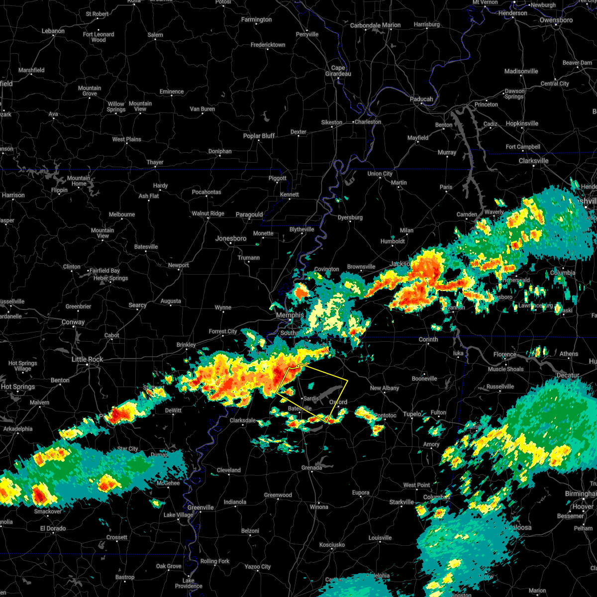 The national weather service in memphis has issued a * severe thunderstorm warning for. northwestern lafayette county in northwestern mississippi. southwestern marshall county in northwestern mississippi. tate county in northwestern mississippi. Northern panola county in northwestern mississippi. The national weather service in memphis has issued a * severe thunderstorm warning for. northwestern lafayette county in northwestern mississippi. southwestern marshall county in northwestern mississippi. tate county in northwestern mississippi. Northern panola county in northwestern mississippi.
|
| 5/6/2021 5:24 PM CDT |
 At 523 pm cdt, severe thunderstorms were located along a line extending from near cherokee to near keownville to near harmontown, moving southeast at 70 mph (radar indicated). Hazards include 60 mph wind gusts. expect damage to roofs, siding, and trees At 523 pm cdt, severe thunderstorms were located along a line extending from near cherokee to near keownville to near harmontown, moving southeast at 70 mph (radar indicated). Hazards include 60 mph wind gusts. expect damage to roofs, siding, and trees
|
| 5/4/2021 1:55 PM CDT |
 The severe thunderstorm warning for northern lafayette, northwestern union, southern marshall, southeastern tate and southwestern benton counties will expire at 200 pm cdt, the storm which prompted the warning has weakened below severe limits, and no longer poses an immediate threat to life or property. therefore, the warning will be allowed to expire. however small hail is still possible with this thunderstorm. a severe thunderstorm watch remains in effect until 400 pm cdt for northeastern and northwestern mississippi. The severe thunderstorm warning for northern lafayette, northwestern union, southern marshall, southeastern tate and southwestern benton counties will expire at 200 pm cdt, the storm which prompted the warning has weakened below severe limits, and no longer poses an immediate threat to life or property. therefore, the warning will be allowed to expire. however small hail is still possible with this thunderstorm. a severe thunderstorm watch remains in effect until 400 pm cdt for northeastern and northwestern mississippi.
|
| 5/4/2021 1:50 PM CDT |
 At 149 pm cdt, a severe thunderstorm was located near bethlehem, or 7 miles east of wall doxey state park, moving east at 30 mph (radar indicated). Hazards include 60 mph wind gusts and quarter size hail. Hail damage to vehicles is expected. expect wind damage to roofs, siding, and trees. Locations impacted include, wall doxey state park, harmontown, bethlehem, laws hill, hickory flat, potts camp, myrtle, abbeville, malone, waterford, spring hill, tyro, gilton, chulahoma, lake center, galena, winborn, blackwater, teckville and wyatte. At 149 pm cdt, a severe thunderstorm was located near bethlehem, or 7 miles east of wall doxey state park, moving east at 30 mph (radar indicated). Hazards include 60 mph wind gusts and quarter size hail. Hail damage to vehicles is expected. expect wind damage to roofs, siding, and trees. Locations impacted include, wall doxey state park, harmontown, bethlehem, laws hill, hickory flat, potts camp, myrtle, abbeville, malone, waterford, spring hill, tyro, gilton, chulahoma, lake center, galena, winborn, blackwater, teckville and wyatte.
|
| 5/4/2021 1:27 PM CDT |
 At 127 pm cdt, a severe thunderstorm was located over laws hill, or 7 miles southwest of wall doxey state park, moving east at 30 mph (radar indicated). Hazards include 60 mph wind gusts and quarter size hail. Hail damage to vehicles is expected. Expect wind damage to roofs, siding, and trees. At 127 pm cdt, a severe thunderstorm was located over laws hill, or 7 miles southwest of wall doxey state park, moving east at 30 mph (radar indicated). Hazards include 60 mph wind gusts and quarter size hail. Hail damage to vehicles is expected. Expect wind damage to roofs, siding, and trees.
|
| 5/4/2021 1:06 PM CDT |
 At 105 pm cdt, a severe thunderstorm was located near como, or 7 miles south of senatobia, moving northeast at 30 mph (radar indicated). Hazards include quarter size hail. damage to vehicles is expected At 105 pm cdt, a severe thunderstorm was located near como, or 7 miles south of senatobia, moving northeast at 30 mph (radar indicated). Hazards include quarter size hail. damage to vehicles is expected
|
| 3/31/2021 4:21 AM CDT |
 The severe thunderstorm warning for northwestern lafayette and southwestern marshall counties will expire at 430 am cdt, the storm which prompted the warning has weakened below severe limits, and no longer poses an immediate threat to life or property. therefore, the warning will be allowed to expire. however gusty winds and heavy rain are still possible with this thunderstorm. The severe thunderstorm warning for northwestern lafayette and southwestern marshall counties will expire at 430 am cdt, the storm which prompted the warning has weakened below severe limits, and no longer poses an immediate threat to life or property. therefore, the warning will be allowed to expire. however gusty winds and heavy rain are still possible with this thunderstorm.
|
| 3/31/2021 4:06 AM CDT |
 At 406 am cdt, a severe thunderstorm was located near harmontown, or 7 miles northwest of holly springs national forest, moving east at 45 mph (radar indicated). Hazards include 60 mph wind gusts. Expect damage to roofs, siding, and trees. Locations impacted include, oxford, holly springs national forest, harmontown, burgess, abbeville, malone, college hill station, blackwater, college hill, teckville and spraggins. At 406 am cdt, a severe thunderstorm was located near harmontown, or 7 miles northwest of holly springs national forest, moving east at 45 mph (radar indicated). Hazards include 60 mph wind gusts. Expect damage to roofs, siding, and trees. Locations impacted include, oxford, holly springs national forest, harmontown, burgess, abbeville, malone, college hill station, blackwater, college hill, teckville and spraggins.
|
| 3/31/2021 3:49 AM CDT |
 At 349 am cdt, a severe thunderstorm was located over john w kyle state park, moving east at 45 mph (radar indicated). Hazards include 60 mph wind gusts. expect damage to roofs, siding, and trees At 349 am cdt, a severe thunderstorm was located over john w kyle state park, moving east at 45 mph (radar indicated). Hazards include 60 mph wind gusts. expect damage to roofs, siding, and trees
|
| 3/28/2021 12:17 AM CDT |
 At 1216 am cdt, a severe thunderstorm was located over keownville, or 9 miles northeast of new albany, moving southeast at 45 mph (radar indicated). Hazards include 60 mph wind gusts. expect damage to roofs, siding, and trees At 1216 am cdt, a severe thunderstorm was located over keownville, or 9 miles northeast of new albany, moving southeast at 45 mph (radar indicated). Hazards include 60 mph wind gusts. expect damage to roofs, siding, and trees
|
| 3/27/2021 11:33 PM CDT |
 At 1133 pm cdt, severe thunderstorms were located along a line extending from 6 miles east of canaan to near blue mountain to near cambridge, moving east at 60 mph (radar indicated). Hazards include 60 mph wind gusts. expect damage to roofs, siding, and trees At 1133 pm cdt, severe thunderstorms were located along a line extending from 6 miles east of canaan to near blue mountain to near cambridge, moving east at 60 mph (radar indicated). Hazards include 60 mph wind gusts. expect damage to roofs, siding, and trees
|
| 3/27/2021 11:28 PM CDT |
 At 1128 pm cdt, doppler radar indicated a severe squall line producing both tornadoes and extensive straight line wind damage was located near gravestown, or 10 miles northwest of ripley, moving northeast at 50 mph (radar indicated rotation). Hazards include tornado. Flying debris will be dangerous to those caught without shelter. mobile homes will be damaged or destroyed. damage to roofs, windows, and vehicles will occur. tree damage is likely. Locations impacted include, ripley, wall doxey state park, blue mountain, snow lake shores, canaan, harmontown, bethlehem, gravestown, laws hill, hickory flat, ashland, potts camp, falkner, abbeville, malone, murry, brody, waterford, spring hill and gilton. At 1128 pm cdt, doppler radar indicated a severe squall line producing both tornadoes and extensive straight line wind damage was located near gravestown, or 10 miles northwest of ripley, moving northeast at 50 mph (radar indicated rotation). Hazards include tornado. Flying debris will be dangerous to those caught without shelter. mobile homes will be damaged or destroyed. damage to roofs, windows, and vehicles will occur. tree damage is likely. Locations impacted include, ripley, wall doxey state park, blue mountain, snow lake shores, canaan, harmontown, bethlehem, gravestown, laws hill, hickory flat, ashland, potts camp, falkner, abbeville, malone, murry, brody, waterford, spring hill and gilton.
|
| 3/27/2021 11:16 PM CDT |
 At 1116 pm cdt, doppler radar indicated a severe squall line producing both tornadoes and extensive straight line wind damage was located over snow lake shores, or 13 miles east of holly springs, moving northeast at 60 mph (radar indicated rotation). Hazards include tornado. Flying debris will be dangerous to those caught without shelter. mobile homes will be damaged or destroyed. damage to roofs, windows, and vehicles will occur. tree damage is likely. Locations impacted include, holly springs, ripley, wall doxey state park, lamar, blue mountain, snow lake shores, canaan, harmontown, bethlehem, gravestown, laws hill, marianna, hickory flat, ashland, potts camp, falkner, abbeville, malone, murry and brody. At 1116 pm cdt, doppler radar indicated a severe squall line producing both tornadoes and extensive straight line wind damage was located over snow lake shores, or 13 miles east of holly springs, moving northeast at 60 mph (radar indicated rotation). Hazards include tornado. Flying debris will be dangerous to those caught without shelter. mobile homes will be damaged or destroyed. damage to roofs, windows, and vehicles will occur. tree damage is likely. Locations impacted include, holly springs, ripley, wall doxey state park, lamar, blue mountain, snow lake shores, canaan, harmontown, bethlehem, gravestown, laws hill, marianna, hickory flat, ashland, potts camp, falkner, abbeville, malone, murry and brody.
|
| 3/27/2021 11:05 PM CDT |
 At 1104 pm cdt, doppler radar indicated a severe squall line producing both tornadoes and extensive straight line wind damage was located over holly springs, moving northeast at 55 mph. a second rotation is located near waterford (radar indicated rotation). Hazards include tornado. Flying debris will be dangerous to those caught without shelter. mobile homes will be damaged or destroyed. damage to roofs, windows, and vehicles will occur. tree damage is likely. Locations impacted include, holly springs, ripley, wall doxey state park, lamar, blue mountain, snow lake shores, canaan, harmontown, bethlehem, gravestown, red banks, laws hill, marianna, hickory flat, ashland, potts camp, falkner, abbeville, malone and wakefield. At 1104 pm cdt, doppler radar indicated a severe squall line producing both tornadoes and extensive straight line wind damage was located over holly springs, moving northeast at 55 mph. a second rotation is located near waterford (radar indicated rotation). Hazards include tornado. Flying debris will be dangerous to those caught without shelter. mobile homes will be damaged or destroyed. damage to roofs, windows, and vehicles will occur. tree damage is likely. Locations impacted include, holly springs, ripley, wall doxey state park, lamar, blue mountain, snow lake shores, canaan, harmontown, bethlehem, gravestown, red banks, laws hill, marianna, hickory flat, ashland, potts camp, falkner, abbeville, malone and wakefield.
|
| 3/27/2021 10:56 PM CDT |
 At 1055 pm cdt, doppler radar indicated severe thunderstorms producing both tornadoes and extensive straight line wind damage were located over marianna, or near wall doxey state park, moving northeast at 55 mph (radar indicated rotation). Hazards include tornado. Flying debris will be dangerous to those caught without shelter. mobile homes will be damaged or destroyed. damage to roofs, windows, and vehicles will occur. Tree damage is likely. At 1055 pm cdt, doppler radar indicated severe thunderstorms producing both tornadoes and extensive straight line wind damage were located over marianna, or near wall doxey state park, moving northeast at 55 mph (radar indicated rotation). Hazards include tornado. Flying debris will be dangerous to those caught without shelter. mobile homes will be damaged or destroyed. damage to roofs, windows, and vehicles will occur. Tree damage is likely.
|
| 3/27/2021 10:51 PM CDT |
 At 1049 pm cdt, doppler radar indicated a severe thunderstorm producing a tornado was located near wyatte, moving northeast at 55 mph. a second area of rotation near independence (radar indicated rotation). Hazards include tornado. Flying debris will be dangerous to those caught without shelter. mobile homes will be damaged or destroyed. damage to roofs, windows, and vehicles will occur. tree damage is likely. Locations impacted include, holly springs, wall doxey state park, john w kyle state park, sardis, byhalia, como, barr, harmontown, independence, red banks, laws hill, marianna, abbeville, malone, wakefield, waterford, cockrum, aiken, crossroad and tyro. At 1049 pm cdt, doppler radar indicated a severe thunderstorm producing a tornado was located near wyatte, moving northeast at 55 mph. a second area of rotation near independence (radar indicated rotation). Hazards include tornado. Flying debris will be dangerous to those caught without shelter. mobile homes will be damaged or destroyed. damage to roofs, windows, and vehicles will occur. tree damage is likely. Locations impacted include, holly springs, wall doxey state park, john w kyle state park, sardis, byhalia, como, barr, harmontown, independence, red banks, laws hill, marianna, abbeville, malone, wakefield, waterford, cockrum, aiken, crossroad and tyro.
|
| 3/27/2021 10:39 PM CDT |
 At 1039 pm cdt, doppler radar indicated a severe thunderstorm producing a tornado was located near barr, or near senatobia, moving east at 35 mph (radar indicated rotation). Hazards include tornado. Flying debris will be dangerous to those caught without shelter. mobile homes will be damaged or destroyed. damage to roofs, windows, and vehicles will occur. tree damage is likely. Locations impacted include, senatobia, holly springs, wall doxey state park, john w kyle state park, sardis, coldwater, byhalia, como, harmontown, red banks, laws hill, barr, independence, marianna, abbeville, waterford, crossroad, tyro, watson and chulahoma. At 1039 pm cdt, doppler radar indicated a severe thunderstorm producing a tornado was located near barr, or near senatobia, moving east at 35 mph (radar indicated rotation). Hazards include tornado. Flying debris will be dangerous to those caught without shelter. mobile homes will be damaged or destroyed. damage to roofs, windows, and vehicles will occur. tree damage is likely. Locations impacted include, senatobia, holly springs, wall doxey state park, john w kyle state park, sardis, coldwater, byhalia, como, harmontown, red banks, laws hill, barr, independence, marianna, abbeville, waterford, crossroad, tyro, watson and chulahoma.
|
| 3/27/2021 10:31 PM CDT |
 At 1030 pm cdt, doppler radar indicated a severe thunderstorm producing a tornado was located over senatobia, moving east at 35 mph (radar indicated rotation). Hazards include tornado. Flying debris will be dangerous to those caught without shelter. mobile homes will be damaged or destroyed. damage to roofs, windows, and vehicles will occur. Tree damage is likely. At 1030 pm cdt, doppler radar indicated a severe thunderstorm producing a tornado was located over senatobia, moving east at 35 mph (radar indicated rotation). Hazards include tornado. Flying debris will be dangerous to those caught without shelter. mobile homes will be damaged or destroyed. damage to roofs, windows, and vehicles will occur. Tree damage is likely.
|
| 2/28/2021 8:14 PM CST |
 At 813 pm cst, doppler radar indicated a severe thunderstorm producing a tornado was located over laws hill, or 9 miles southwest of wall doxey state park, moving east at 55 mph (radar indicated rotation). Hazards include tornado and quarter size hail. Flying debris will be dangerous to those caught without shelter. mobile homes will be damaged or destroyed. damage to roofs, windows, and vehicles will occur. Tree damage is likely. At 813 pm cst, doppler radar indicated a severe thunderstorm producing a tornado was located over laws hill, or 9 miles southwest of wall doxey state park, moving east at 55 mph (radar indicated rotation). Hazards include tornado and quarter size hail. Flying debris will be dangerous to those caught without shelter. mobile homes will be damaged or destroyed. damage to roofs, windows, and vehicles will occur. Tree damage is likely.
|
| 2/28/2021 8:06 PM CST |
 At 805 pm cst, a severe thunderstorm was located near harmontown, or 12 miles northeast of john w kyle state park, moving east at 50 mph (radar indicated). Hazards include 60 mph wind gusts and quarter size hail. Hail damage to vehicles is expected. Expect wind damage to roofs, siding, and trees. At 805 pm cst, a severe thunderstorm was located near harmontown, or 12 miles northeast of john w kyle state park, moving east at 50 mph (radar indicated). Hazards include 60 mph wind gusts and quarter size hail. Hail damage to vehicles is expected. Expect wind damage to roofs, siding, and trees.
|
| 8/28/2020 6:41 AM CDT |
 The severe thunderstorm warning for central lafayette county will expire at 645 am cdt, the severe thunderstorm which prompted the warning has moved out of the warned area. therefore, the warning will be allowed to expire. remember, a tornado warning still remains in effect for lafayette county until 645am. The severe thunderstorm warning for central lafayette county will expire at 645 am cdt, the severe thunderstorm which prompted the warning has moved out of the warned area. therefore, the warning will be allowed to expire. remember, a tornado warning still remains in effect for lafayette county until 645am.
|
| 8/28/2020 6:37 AM CDT |
 At 637 am cdt, doppler radar indicated a severe thunderstorm producing a tornado was located near cambridge, or 7 miles northeast of oxford, moving northeast at 45 mph (radar indicated rotation). Hazards include tornado. Flying debris will be dangerous to those caught without shelter. mobile homes will be damaged or destroyed. damage to roofs, windows, and vehicles will occur. Tree damage is likely. At 637 am cdt, doppler radar indicated a severe thunderstorm producing a tornado was located near cambridge, or 7 miles northeast of oxford, moving northeast at 45 mph (radar indicated rotation). Hazards include tornado. Flying debris will be dangerous to those caught without shelter. mobile homes will be damaged or destroyed. damage to roofs, windows, and vehicles will occur. Tree damage is likely.
|
| 8/28/2020 6:28 AM CDT |
 At 628 am cdt, doppler radar indicated a severe thunderstorm producing a tornado was located near oxford, moving northeast at 50 mph (radar indicated rotation). Hazards include tornado. Flying debris will be dangerous to those caught without shelter. mobile homes will be damaged or destroyed. damage to roofs, windows, and vehicles will occur. tree damage is likely. Locations impacted include, oxford, holly springs national forest, cambridge, abbeville, college hill station, keel, college hill, burt and altus. At 628 am cdt, doppler radar indicated a severe thunderstorm producing a tornado was located near oxford, moving northeast at 50 mph (radar indicated rotation). Hazards include tornado. Flying debris will be dangerous to those caught without shelter. mobile homes will be damaged or destroyed. damage to roofs, windows, and vehicles will occur. tree damage is likely. Locations impacted include, oxford, holly springs national forest, cambridge, abbeville, college hill station, keel, college hill, burt and altus.
|
| 8/28/2020 6:21 AM CDT |
 At 620 am cdt, doppler radar indicated a severe thunderstorm producing a tornado was located over holly springs national forest, moving northeast at 50 mph (radar indicated rotation). Hazards include tornado. Flying debris will be dangerous to those caught without shelter. mobile homes will be damaged or destroyed. damage to roofs, windows, and vehicles will occur. Tree damage is likely. At 620 am cdt, doppler radar indicated a severe thunderstorm producing a tornado was located over holly springs national forest, moving northeast at 50 mph (radar indicated rotation). Hazards include tornado. Flying debris will be dangerous to those caught without shelter. mobile homes will be damaged or destroyed. damage to roofs, windows, and vehicles will occur. Tree damage is likely.
|
| 8/28/2020 6:18 AM CDT |
 At 617 am cdt, a severe thunderstorm was located near burgess, or near holly springs national forest, moving northeast at 30 mph (radar indicated). Hazards include 60 mph wind gusts. expect damage to roofs, siding, and trees At 617 am cdt, a severe thunderstorm was located near burgess, or near holly springs national forest, moving northeast at 30 mph (radar indicated). Hazards include 60 mph wind gusts. expect damage to roofs, siding, and trees
|
| 6/5/2020 2:21 PM CDT |
 At 221 pm cdt, severe thunderstorms were located along a line extending from near gravestown to near harmontown to near crenshaw, moving south at 35 mph (radar indicated). Hazards include 60 mph wind gusts and penny size hail. Expect damage to roofs, siding, and trees. Locations impacted include, hernando, senatobia, holly springs, wall doxey state park, john w kyle state park, lamar, sardis, coldwater, byhalia, como, tunica, crenshaw, sledge, snow lake shores, strayhorn, dubbs, bethlehem, north tunica, red banks and laws hill. At 221 pm cdt, severe thunderstorms were located along a line extending from near gravestown to near harmontown to near crenshaw, moving south at 35 mph (radar indicated). Hazards include 60 mph wind gusts and penny size hail. Expect damage to roofs, siding, and trees. Locations impacted include, hernando, senatobia, holly springs, wall doxey state park, john w kyle state park, lamar, sardis, coldwater, byhalia, como, tunica, crenshaw, sledge, snow lake shores, strayhorn, dubbs, bethlehem, north tunica, red banks and laws hill.
|
| 6/5/2020 1:54 PM CDT |
 At 154 pm cdt, severe thunderstorms were located along a line extending from near lamar to near byhalia to near north tunica, moving south at 40 mph (radar indicated). Hazards include 60 mph wind gusts. expect damage to roofs, siding, and trees At 154 pm cdt, severe thunderstorms were located along a line extending from near lamar to near byhalia to near north tunica, moving south at 40 mph (radar indicated). Hazards include 60 mph wind gusts. expect damage to roofs, siding, and trees
|
| 4/12/2020 10:35 PM CDT |
 The severe thunderstorm warning for western lafayette, central desoto, eastern yalobusha, southwestern marshall, eastern tate and eastern panola counties will expire at 1045 pm cdt, the storms which prompted the warning have moved out of the area. therefore, the warning will be allowed to expire. a severe thunderstorm watch remains in effect until 100 am cdt for eastern arkansas, and northwestern mississippi. The severe thunderstorm warning for western lafayette, central desoto, eastern yalobusha, southwestern marshall, eastern tate and eastern panola counties will expire at 1045 pm cdt, the storms which prompted the warning have moved out of the area. therefore, the warning will be allowed to expire. a severe thunderstorm watch remains in effect until 100 am cdt for eastern arkansas, and northwestern mississippi.
|
| 4/12/2020 10:28 PM CDT |
 At 1028 pm cdt, severe thunderstorms were located along a line extending from near downtown memphis to near marianna to near sabougla, moving northeast at 75 mph (radar indicated). Hazards include 70 mph wind gusts. Expect considerable tree damage. damage is likely to mobile homes, roofs, and outbuildings. Locations impacted include, southaven, olive branch, horn lake, oxford, new albany, holly springs, pontotoc, houston, wall doxey state park, bruce, calhoun city, vardaman, byhalia, derma, blue mountain, ecru, snow lake shores, pittsboro, slate springs and cambridge. At 1028 pm cdt, severe thunderstorms were located along a line extending from near downtown memphis to near marianna to near sabougla, moving northeast at 75 mph (radar indicated). Hazards include 70 mph wind gusts. Expect considerable tree damage. damage is likely to mobile homes, roofs, and outbuildings. Locations impacted include, southaven, olive branch, horn lake, oxford, new albany, holly springs, pontotoc, houston, wall doxey state park, bruce, calhoun city, vardaman, byhalia, derma, blue mountain, ecru, snow lake shores, pittsboro, slate springs and cambridge.
|
| 4/12/2020 10:23 PM CDT |
 At 1022 pm cdt, severe thunderstorms were located along a line extending from near midtown memphis to harmontown to near velma, moving northeast at 70 mph (radar indicated). Hazards include 70 mph wind gusts. Expect considerable tree damage. damage is likely to mobile homes, roofs, and outbuildings. Locations impacted include, southaven, horn lake, oxford, hernando, water valley, holly springs national forest, coldwater, walls, coffeeville, lake cormorant, harmontown, eudora, velma, laws hill, barr, lynchburg, springdale, burgess, independence and abbeville. At 1022 pm cdt, severe thunderstorms were located along a line extending from near midtown memphis to harmontown to near velma, moving northeast at 70 mph (radar indicated). Hazards include 70 mph wind gusts. Expect considerable tree damage. damage is likely to mobile homes, roofs, and outbuildings. Locations impacted include, southaven, horn lake, oxford, hernando, water valley, holly springs national forest, coldwater, walls, coffeeville, lake cormorant, harmontown, eudora, velma, laws hill, barr, lynchburg, springdale, burgess, independence and abbeville.
|
| 4/12/2020 10:17 PM CDT |
 At 1017 pm cdt, severe thunderstorms were located along a line extending from whitehaven to 6 miles north of burgess to coffeeville, moving northeast at 75 mph (radar indicated). Hazards include 70 mph wind gusts. Expect considerable tree damage. damage is likely to mobile homes, roofs, and outbuildings. Locations impacted include, southaven, horn lake, oxford, hernando, senatobia, batesville, water valley, george payne state park, holly springs national forest, john w kyle state park, sardis, coldwater, como, walls, coffeeville, pope, lake cormorant, enid, harmontown and eudora. At 1017 pm cdt, severe thunderstorms were located along a line extending from whitehaven to 6 miles north of burgess to coffeeville, moving northeast at 75 mph (radar indicated). Hazards include 70 mph wind gusts. Expect considerable tree damage. damage is likely to mobile homes, roofs, and outbuildings. Locations impacted include, southaven, horn lake, oxford, hernando, senatobia, batesville, water valley, george payne state park, holly springs national forest, john w kyle state park, sardis, coldwater, como, walls, coffeeville, pope, lake cormorant, enid, harmontown and eudora.
|
| 4/12/2020 10:13 PM CDT |
 At 1013 pm cdt, severe thunderstorms were located along a line extending from horseshoe lake to near barr to near scobey, moving northeast at 75 mph (radar indicated). Hazards include 60 mph wind gusts. expect damage to roofs, siding, and trees At 1013 pm cdt, severe thunderstorms were located along a line extending from horseshoe lake to near barr to near scobey, moving northeast at 75 mph (radar indicated). Hazards include 60 mph wind gusts. expect damage to roofs, siding, and trees
|
| 4/12/2020 10:03 PM CDT |
 At 1001 pm cdt, severe thunderstorms were located along a line extending from near horseshoe lake to near batesville to near paynes, moving east at 75 mph (radar indicated. tunica airport reported 60 mph winds at 10 pm). Hazards include 70 mph wind gusts. Expect considerable tree damage. damage is likely to mobile homes, roofs, and outbuildings. Locations impacted include, southaven, horn lake, oxford, hernando, senatobia, batesville, water valley, charleston, george payne state park, holly springs national forest, john w kyle state park, sardis, coldwater, como, walls, tunica, coffeeville, crenshaw, crowder and pope. At 1001 pm cdt, severe thunderstorms were located along a line extending from near horseshoe lake to near batesville to near paynes, moving east at 75 mph (radar indicated. tunica airport reported 60 mph winds at 10 pm). Hazards include 70 mph wind gusts. Expect considerable tree damage. damage is likely to mobile homes, roofs, and outbuildings. Locations impacted include, southaven, horn lake, oxford, hernando, senatobia, batesville, water valley, charleston, george payne state park, holly springs national forest, john w kyle state park, sardis, coldwater, como, walls, tunica, coffeeville, crenshaw, crowder and pope.
|
| 4/12/2020 9:50 PM CDT |
 At 950 pm cdt, severe thunderstorms were located along a line extending from madison to 6 miles southeast of dundee to tutwiler, moving northeast at 70 mph (radar indicated). Hazards include 70 mph wind gusts. Expect considerable tree damage. Damage is likely to mobile homes, roofs, and outbuildings. At 950 pm cdt, severe thunderstorms were located along a line extending from madison to 6 miles southeast of dundee to tutwiler, moving northeast at 70 mph (radar indicated). Hazards include 70 mph wind gusts. Expect considerable tree damage. Damage is likely to mobile homes, roofs, and outbuildings.
|
| 3/28/2020 10:08 PM CDT |
 At 1008 pm cdt, a severe thunderstorm was located near batesville, moving northeast at 65 mph (radar indicated). Hazards include 60 mph wind gusts and quarter size hail. Hail damage to vehicles is expected. expect wind damage to roofs, siding, and trees. Locations impacted include, oxford, batesville, holly springs national forest, john w kyle state park, pope, burgess, cambridge, harmontown, laws hill, courtland, abbeville, taylor, malone, keel, blackwater, teckville, shuford, glenville, college hill station and college hill. At 1008 pm cdt, a severe thunderstorm was located near batesville, moving northeast at 65 mph (radar indicated). Hazards include 60 mph wind gusts and quarter size hail. Hail damage to vehicles is expected. expect wind damage to roofs, siding, and trees. Locations impacted include, oxford, batesville, holly springs national forest, john w kyle state park, pope, burgess, cambridge, harmontown, laws hill, courtland, abbeville, taylor, malone, keel, blackwater, teckville, shuford, glenville, college hill station and college hill.
|
| 3/28/2020 9:57 PM CDT |
 The national weather service in memphis has issued a * severe thunderstorm warning for. northern lafayette county in northwestern mississippi. southwestern marshall county in northwestern mississippi. northeastern tallahatchie county in northwestern mississippi. Southeastern panola county in northwestern mississippi. The national weather service in memphis has issued a * severe thunderstorm warning for. northern lafayette county in northwestern mississippi. southwestern marshall county in northwestern mississippi. northeastern tallahatchie county in northwestern mississippi. Southeastern panola county in northwestern mississippi.
|
| 3/28/2020 8:54 PM CDT |
 The severe thunderstorm warning for western lafayette and panola counties will expire at 900 pm cdt, the storm which prompted the warning has weakened below severe limits, and has exited the warned area. therefore, the warning will be allowed to expire. a tornado watch remains in effect until 200 am cdt for northwestern mississippi. The severe thunderstorm warning for western lafayette and panola counties will expire at 900 pm cdt, the storm which prompted the warning has weakened below severe limits, and has exited the warned area. therefore, the warning will be allowed to expire. a tornado watch remains in effect until 200 am cdt for northwestern mississippi.
|
| 3/28/2020 8:25 PM CDT |
 At 825 pm cdt, a severe thunderstorm was located near sardis, or near batesville, moving northeast at 50 mph (radar indicated). Hazards include 60 mph wind gusts. Expect damage to roofs, siding, and trees. Locations impacted include, batesville, john w kyle state park, sardis, como, pope, burgess, harmontown, courtland, abbeville, blackwater, teckville, shuford, mcghee, asa, glenville, college hill, hayes crossing, eureka springs and chapeltown. At 825 pm cdt, a severe thunderstorm was located near sardis, or near batesville, moving northeast at 50 mph (radar indicated). Hazards include 60 mph wind gusts. Expect damage to roofs, siding, and trees. Locations impacted include, batesville, john w kyle state park, sardis, como, pope, burgess, harmontown, courtland, abbeville, blackwater, teckville, shuford, mcghee, asa, glenville, college hill, hayes crossing, eureka springs and chapeltown.
|
| 3/28/2020 8:16 PM CDT |
 At 815 pm cdt, a severe thunderstorm was located near curtis station, or 8 miles west of batesville, moving northeast at 60 mph (radar indicated). Hazards include 60 mph wind gusts. expect damage to roofs, siding, and trees At 815 pm cdt, a severe thunderstorm was located near curtis station, or 8 miles west of batesville, moving northeast at 60 mph (radar indicated). Hazards include 60 mph wind gusts. expect damage to roofs, siding, and trees
|
| 3/23/2020 1:41 AM CDT |
 The severe thunderstorm warning for northern lafayette and southeastern marshall counties will expire at 145 am cdt, the storm which prompted the warning has moved out of the area. therefore, the warning will be allowed to expire. The severe thunderstorm warning for northern lafayette and southeastern marshall counties will expire at 145 am cdt, the storm which prompted the warning has moved out of the area. therefore, the warning will be allowed to expire.
|
| 3/23/2020 1:17 AM CDT |
 At 117 am cdt, a severe thunderstorm was located near holly springs national forest, moving northeast at 60 mph (radar indicated). Hazards include ping pong ball size hail. People and animals outdoors will be injured. expect damage to roofs, siding, windows, and vehicles. Locations impacted include, oxford, holly springs national forest, burgess, bethlehem, cambridge, potts camp, abbeville, malone, keel, burt, college hill station, college hill, spraggins, cornersville and teckville. At 117 am cdt, a severe thunderstorm was located near holly springs national forest, moving northeast at 60 mph (radar indicated). Hazards include ping pong ball size hail. People and animals outdoors will be injured. expect damage to roofs, siding, windows, and vehicles. Locations impacted include, oxford, holly springs national forest, burgess, bethlehem, cambridge, potts camp, abbeville, malone, keel, burt, college hill station, college hill, spraggins, cornersville and teckville.
|
| 3/23/2020 1:10 AM CDT |
 At 110 am cdt, a severe thunderstorm was located near burgess, or near john w kyle state park, moving northeast at 60 mph (radar indicated). Hazards include quarter size hail. damage to vehicles is expected At 110 am cdt, a severe thunderstorm was located near burgess, or near john w kyle state park, moving northeast at 60 mph (radar indicated). Hazards include quarter size hail. damage to vehicles is expected
|
| 1/11/2020 5:19 AM CST |
 At 519 am cst, severe thunderstorms were located along a line extending from harmontown to 6 miles southwest of coffeeville, moving east at 40 mph (radar indicated). Hazards include 60 mph wind gusts. expect damage to roofs, siding, and trees At 519 am cst, severe thunderstorms were located along a line extending from harmontown to 6 miles southwest of coffeeville, moving east at 40 mph (radar indicated). Hazards include 60 mph wind gusts. expect damage to roofs, siding, and trees
|
| 1/11/2020 5:16 AM CST |
 At 516 am cst, severe thunderstorms were located along a line extending from near hernando to near barr to 7 miles southeast of enid, moving northeast at 55 mph (radar indicated). Hazards include 70 mph wind gusts. Expect considerable tree damage. damage is likely to mobile homes, roofs, and outbuildings. Locations impacted include, oxford, senatobia, holly springs, batesville, water valley, george payne state park, holly springs national forest, wall doxey state park, john w kyle state park, coffeeville, pope, enid, harmontown, velma, laws hill, barr, springdale, burgess, scobey and marianna. At 516 am cst, severe thunderstorms were located along a line extending from near hernando to near barr to 7 miles southeast of enid, moving northeast at 55 mph (radar indicated). Hazards include 70 mph wind gusts. Expect considerable tree damage. damage is likely to mobile homes, roofs, and outbuildings. Locations impacted include, oxford, senatobia, holly springs, batesville, water valley, george payne state park, holly springs national forest, wall doxey state park, john w kyle state park, coffeeville, pope, enid, harmontown, velma, laws hill, barr, springdale, burgess, scobey and marianna.
|
| 1/11/2020 4:55 AM CST |
 At 454 am cst, severe thunderstorms were located along a line extending from near little texas to near batesville to near paynes, moving northeast at 50 mph (radar indicated). Hazards include 70 mph wind gusts. Expect considerable tree damage. Damage is likely to mobile homes, roofs, and outbuildings. At 454 am cst, severe thunderstorms were located along a line extending from near little texas to near batesville to near paynes, moving northeast at 50 mph (radar indicated). Hazards include 70 mph wind gusts. Expect considerable tree damage. Damage is likely to mobile homes, roofs, and outbuildings.
|
| 12/16/2019 3:01 PM CST |
 At 251 pm cst, doppler radar indicated a severe thunderstorm producing a tornado was located over springdale, or 7 miles north of water valley, moving northeast at 40 mph (radar indicated rotation). Hazards include tornado. Flying debris will be dangerous to those caught without shelter. mobile homes will be damaged or destroyed. damage to roofs, windows, and vehicles will occur. Tree damage is likely. At 251 pm cst, doppler radar indicated a severe thunderstorm producing a tornado was located over springdale, or 7 miles north of water valley, moving northeast at 40 mph (radar indicated rotation). Hazards include tornado. Flying debris will be dangerous to those caught without shelter. mobile homes will be damaged or destroyed. damage to roofs, windows, and vehicles will occur. Tree damage is likely.
|
| 12/16/2019 2:51 PM CST |
 At 251 pm cst, doppler radar indicated a severe thunderstorm producing a tornado was located over springdale, or 7 miles north of water valley, moving northeast at 40 mph (radar indicated rotation). Hazards include tornado. Flying debris will be dangerous to those caught without shelter. mobile homes will be damaged or destroyed. damage to roofs, windows, and vehicles will occur. Tree damage is likely. At 251 pm cst, doppler radar indicated a severe thunderstorm producing a tornado was located over springdale, or 7 miles north of water valley, moving northeast at 40 mph (radar indicated rotation). Hazards include tornado. Flying debris will be dangerous to those caught without shelter. mobile homes will be damaged or destroyed. damage to roofs, windows, and vehicles will occur. Tree damage is likely.
|
| 12/16/2019 2:40 PM CST |
 At 239 pm cst, a severe thunderstorm was located near springdale, or near water valley, moving northeast at 55 mph (radar indicated). Hazards include 60 mph wind gusts and quarter size hail. Hail damage to vehicles is expected. expect wind damage to roofs, siding, and trees. Locations impacted include, oxford, batesville, water valley, holly springs national forest, springdale, burgess, cambridge, tula, denmark, velma, paris, abbeville, taylor, toccopola, altus, keel, shuford, delay, college hill station and college hill. At 239 pm cst, a severe thunderstorm was located near springdale, or near water valley, moving northeast at 55 mph (radar indicated). Hazards include 60 mph wind gusts and quarter size hail. Hail damage to vehicles is expected. expect wind damage to roofs, siding, and trees. Locations impacted include, oxford, batesville, water valley, holly springs national forest, springdale, burgess, cambridge, tula, denmark, velma, paris, abbeville, taylor, toccopola, altus, keel, shuford, delay, college hill station and college hill.
|
| 12/16/2019 2:18 PM CST |
 At 218 pm cst, a severe thunderstorm was located near enid, or 7 miles west of george payne state park, moving northeast at 65 mph (radar indicated). Hazards include 60 mph wind gusts and quarter size hail. Hail damage to vehicles is expected. Expect wind damage to roofs, siding, and trees. At 218 pm cst, a severe thunderstorm was located near enid, or 7 miles west of george payne state park, moving northeast at 65 mph (radar indicated). Hazards include 60 mph wind gusts and quarter size hail. Hail damage to vehicles is expected. Expect wind damage to roofs, siding, and trees.
|
| 11/30/2019 2:50 PM CST |
 The severe thunderstorm warning for northern lafayette and southern marshall counties will expire at 300 pm cst, the storm which prompted the warning has weakened below severe limits, and has exited the warned area. therefore, the warning will be allowed to expire. The severe thunderstorm warning for northern lafayette and southern marshall counties will expire at 300 pm cst, the storm which prompted the warning has weakened below severe limits, and has exited the warned area. therefore, the warning will be allowed to expire.
|
| 11/30/2019 2:35 PM CST |
 At 235 pm cst, a severe thunderstorm was located over laws hill, or 8 miles southwest of wall doxey state park, moving northeast at 80 mph (radar indicated). Hazards include 60 mph wind gusts and quarter size hail. Hail damage to vehicles is expected. expect wind damage to roofs, siding, and trees. Locations impacted include, wall doxey state park, bethlehem, harmontown, laws hill, potts camp, abbeville, malone, blackwater, waterford, burt, lake center, college hill station, college hill, galena, spraggins, cornersville, waites and gilton. At 235 pm cst, a severe thunderstorm was located over laws hill, or 8 miles southwest of wall doxey state park, moving northeast at 80 mph (radar indicated). Hazards include 60 mph wind gusts and quarter size hail. Hail damage to vehicles is expected. expect wind damage to roofs, siding, and trees. Locations impacted include, wall doxey state park, bethlehem, harmontown, laws hill, potts camp, abbeville, malone, blackwater, waterford, burt, lake center, college hill station, college hill, galena, spraggins, cornersville, waites and gilton.
|
| 11/30/2019 2:15 PM CST |
 At 215 pm cst, a severe thunderstorm was located near batesville, moving northeast at 80 mph (radar indicated). Hazards include 60 mph wind gusts and quarter size hail. Hail damage to vehicles is expected. Expect wind damage to roofs, siding, and trees. At 215 pm cst, a severe thunderstorm was located near batesville, moving northeast at 80 mph (radar indicated). Hazards include 60 mph wind gusts and quarter size hail. Hail damage to vehicles is expected. Expect wind damage to roofs, siding, and trees.
|
| 6/24/2019 5:09 AM CDT |
 The severe thunderstorm warning for lafayette, northeastern yalobusha, northern calhoun, western pontotoc and western union counties will expire at 515 am cdt, the storm which prompted the warning has weakened below severe limits, and no longer poses an immediate threat to life or property. therefore, the warning will be allowed to expire. The severe thunderstorm warning for lafayette, northeastern yalobusha, northern calhoun, western pontotoc and western union counties will expire at 515 am cdt, the storm which prompted the warning has weakened below severe limits, and no longer poses an immediate threat to life or property. therefore, the warning will be allowed to expire.
|
| 6/24/2019 4:51 AM CDT |
 At 451 am cdt, a severe thunderstorm was located near denmark, or near oxford, moving northeast at 55 mph (radar indicated). Hazards include 60 mph wind gusts. Expect damage to roofs, siding, and trees. Locations impacted include, oxford, water valley, holly springs national forest, cambridge, randolph, etta, springdale, burgess, banner, tula, denmark, pinedale, paris, thaxton, myrtle, taylor, toccopola, robbs, keel and poolville. At 451 am cdt, a severe thunderstorm was located near denmark, or near oxford, moving northeast at 55 mph (radar indicated). Hazards include 60 mph wind gusts. Expect damage to roofs, siding, and trees. Locations impacted include, oxford, water valley, holly springs national forest, cambridge, randolph, etta, springdale, burgess, banner, tula, denmark, pinedale, paris, thaxton, myrtle, taylor, toccopola, robbs, keel and poolville.
|
| 6/24/2019 4:33 AM CDT |
 At 432 am cdt, a severe thunderstorm was located near springdale, or near water valley, moving northeast at 55 mph (radar indicated). Hazards include 60 mph wind gusts. expect damage to roofs, siding, and trees At 432 am cdt, a severe thunderstorm was located near springdale, or near water valley, moving northeast at 55 mph (radar indicated). Hazards include 60 mph wind gusts. expect damage to roofs, siding, and trees
|
| 12/1/2018 8:41 AM CST |
 At 841 am cst, a severe thunderstorm was located near marianna, or near holly springs, moving northeast at 60 mph (radar indicated). Hazards include 60 mph wind gusts and quarter size hail. Hail damage to vehicles is expected. Expect wind damage to roofs, siding, and trees. At 841 am cst, a severe thunderstorm was located near marianna, or near holly springs, moving northeast at 60 mph (radar indicated). Hazards include 60 mph wind gusts and quarter size hail. Hail damage to vehicles is expected. Expect wind damage to roofs, siding, and trees.
|
| 11/5/2018 9:19 PM CST |
 At 919 pm cst, doppler radar indicated a severe thunderstorm producing a tornado was located near cambridge, or 7 miles north of oxford, moving northeast at 40 mph (radar indicated rotation). Hazards include tornado. Flying debris will be dangerous to those caught without shelter. mobile homes will be damaged or destroyed. damage to roofs, windows, and vehicles will occur. tree damage is likely. Locations impacted include, new albany, cambridge, etta, bethlehem, hickory flat, potts camp, myrtle, abbeville, malone, shari, keel, poolville, old myrtle, pumpkin center, college hill station, bethel, smalco, glenfield, winborn and martintown. At 919 pm cst, doppler radar indicated a severe thunderstorm producing a tornado was located near cambridge, or 7 miles north of oxford, moving northeast at 40 mph (radar indicated rotation). Hazards include tornado. Flying debris will be dangerous to those caught without shelter. mobile homes will be damaged or destroyed. damage to roofs, windows, and vehicles will occur. tree damage is likely. Locations impacted include, new albany, cambridge, etta, bethlehem, hickory flat, potts camp, myrtle, abbeville, malone, shari, keel, poolville, old myrtle, pumpkin center, college hill station, bethel, smalco, glenfield, winborn and martintown.
|
| 11/5/2018 9:06 PM CST |
 At 906 pm cst, doppler radar indicated a severe thunderstorm producing a tornado was located near burgess, or near holly springs national forest, moving northeast at 45 mph (radar indicated rotation). Hazards include tornado. Flying debris will be dangerous to those caught without shelter. mobile homes will be damaged or destroyed. damage to roofs, windows, and vehicles will occur. Tree damage is likely. At 906 pm cst, doppler radar indicated a severe thunderstorm producing a tornado was located near burgess, or near holly springs national forest, moving northeast at 45 mph (radar indicated rotation). Hazards include tornado. Flying debris will be dangerous to those caught without shelter. mobile homes will be damaged or destroyed. damage to roofs, windows, and vehicles will occur. Tree damage is likely.
|
| 11/5/2018 8:59 PM CST |
 At 859 pm cst, doppler radar indicated a severe thunderstorm producing a tornado was located near burgess, or near john w kyle state park, moving northeast at 50 mph (radar indicated rotation). Hazards include tornado. Flying debris will be dangerous to those caught without shelter. mobile homes will be damaged or destroyed. damage to roofs, windows, and vehicles will occur. tree damage is likely. Locations impacted include, oxford, batesville, john w kyle state park, wall doxey state park, sardis, burgess, cambridge, harmontown, laws hill, courtland, abbeville, malone, blackwater, teckville, college hill station, glenville, college hill, hayes crossing and spraggins. At 859 pm cst, doppler radar indicated a severe thunderstorm producing a tornado was located near burgess, or near john w kyle state park, moving northeast at 50 mph (radar indicated rotation). Hazards include tornado. Flying debris will be dangerous to those caught without shelter. mobile homes will be damaged or destroyed. damage to roofs, windows, and vehicles will occur. tree damage is likely. Locations impacted include, oxford, batesville, john w kyle state park, wall doxey state park, sardis, burgess, cambridge, harmontown, laws hill, courtland, abbeville, malone, blackwater, teckville, college hill station, glenville, college hill, hayes crossing and spraggins.
|
| 11/5/2018 8:44 PM CST |
 At 844 pm cst, doppler radar indicated a severe thunderstorm producing a tornado was located over batesville, moving east at 45 mph (radar indicated rotation). Hazards include tornado. Flying debris will be dangerous to those caught without shelter. mobile homes will be damaged or destroyed. damage to roofs, windows, and vehicles will occur. tree damage is likely. Locations impacted include, oxford, batesville, john w kyle state park, wall doxey state park, sardis, burgess, cambridge, harmontown, laws hill, courtland, abbeville, malone, blackwater, teckville, college hill station, glenville, college hill, hayes crossing and spraggins. At 844 pm cst, doppler radar indicated a severe thunderstorm producing a tornado was located over batesville, moving east at 45 mph (radar indicated rotation). Hazards include tornado. Flying debris will be dangerous to those caught without shelter. mobile homes will be damaged or destroyed. damage to roofs, windows, and vehicles will occur. tree damage is likely. Locations impacted include, oxford, batesville, john w kyle state park, wall doxey state park, sardis, burgess, cambridge, harmontown, laws hill, courtland, abbeville, malone, blackwater, teckville, college hill station, glenville, college hill, hayes crossing and spraggins.
|
| 11/5/2018 8:27 PM CST |
 At 827 pm cst, doppler radar indicated a severe thunderstorm producing a tornado was located near curtis station, or 9 miles west of batesville, moving northeast at 50 mph (radar indicated rotation). Hazards include tornado. Flying debris will be dangerous to those caught without shelter. mobile homes will be damaged or destroyed. damage to roofs, windows, and vehicles will occur. Tree damage is likely. At 827 pm cst, doppler radar indicated a severe thunderstorm producing a tornado was located near curtis station, or 9 miles west of batesville, moving northeast at 50 mph (radar indicated rotation). Hazards include tornado. Flying debris will be dangerous to those caught without shelter. mobile homes will be damaged or destroyed. damage to roofs, windows, and vehicles will occur. Tree damage is likely.
|
| 6/23/2018 8:19 AM CDT |
 At 818 am cdt, a severe thunderstorm was located near laws hill, or 11 miles west of wall doxey state park, moving east at 55 mph (radar indicated). Hazards include 60 mph wind gusts. Expect damage to roofs, siding, and trees. Locations impacted include, oxford, senatobia, holly springs, batesville, holly springs national forest, wall doxey state park, john w kyle state park, sardis, coldwater, como, pleasant grove, harmontown, curtis station, laws hill, barr, burgess, independence, marianna, abbeville and waterford. At 818 am cdt, a severe thunderstorm was located near laws hill, or 11 miles west of wall doxey state park, moving east at 55 mph (radar indicated). Hazards include 60 mph wind gusts. Expect damage to roofs, siding, and trees. Locations impacted include, oxford, senatobia, holly springs, batesville, holly springs national forest, wall doxey state park, john w kyle state park, sardis, coldwater, como, pleasant grove, harmontown, curtis station, laws hill, barr, burgess, independence, marianna, abbeville and waterford.
|
| 6/23/2018 8:09 AM CDT |
 At 809 am cdt, a severe thunderstorm was located over barr, or 9 miles east of senatobia, moving east at 55 mph (radar indicated). Hazards include 60 mph wind gusts. Expect damage to roofs, siding, and trees. Locations impacted include, oxford, senatobia, holly springs, batesville, holly springs national forest, wall doxey state park, john w kyle state park, sardis, coldwater, como, crenshaw, sledge, strayhorn, pleasant grove, harmontown, curtis station, arkabutla, laws hill, barr and darling. At 809 am cdt, a severe thunderstorm was located over barr, or 9 miles east of senatobia, moving east at 55 mph (radar indicated). Hazards include 60 mph wind gusts. Expect damage to roofs, siding, and trees. Locations impacted include, oxford, senatobia, holly springs, batesville, holly springs national forest, wall doxey state park, john w kyle state park, sardis, coldwater, como, crenshaw, sledge, strayhorn, pleasant grove, harmontown, curtis station, arkabutla, laws hill, barr and darling.
|
| 6/23/2018 7:50 AM CDT |
 At 750 am cdt, a severe thunderstorm was located near crenshaw, or 9 miles southwest of senatobia, moving east at 55 mph (radar indicated). Hazards include 60 mph wind gusts. expect damage to roofs, siding, and trees At 750 am cdt, a severe thunderstorm was located near crenshaw, or 9 miles southwest of senatobia, moving east at 55 mph (radar indicated). Hazards include 60 mph wind gusts. expect damage to roofs, siding, and trees
|
| 6/3/2018 1:45 AM CDT |
 At 145 am cdt, a severe thunderstorm was located near new albany, moving southeast at 45 mph (radar indicated). Hazards include 60 mph wind gusts and quarter size hail. Hail damage to vehicles is expected. expect wind damage to roofs, siding, and trees. Locations impacted include, oxford, new albany, holly springs national forest, bethlehem, cambridge, pinedale, etta, myrtle, abbeville, shari, keel, poolville, martintown, old myrtle, ingomar, burt, bald hill, pumpkin center, college hill station and college hill. At 145 am cdt, a severe thunderstorm was located near new albany, moving southeast at 45 mph (radar indicated). Hazards include 60 mph wind gusts and quarter size hail. Hail damage to vehicles is expected. expect wind damage to roofs, siding, and trees. Locations impacted include, oxford, new albany, holly springs national forest, bethlehem, cambridge, pinedale, etta, myrtle, abbeville, shari, keel, poolville, martintown, old myrtle, ingomar, burt, bald hill, pumpkin center, college hill station and college hill.
|
| 6/3/2018 1:33 AM CDT |
 At 133 am cdt, a severe thunderstorm was located near etta, or 11 miles northwest of new albany, moving southeast at 45 mph (radar indicated). Hazards include 60 mph wind gusts and quarter size hail. Hail damage to vehicles is expected. expect wind damage to roofs, siding, and trees. Locations impacted include, oxford, new albany, wall doxey state park, holly springs national forest, cambridge, etta, bethlehem, pinedale, hickory flat, potts camp, myrtle, abbeville, malone, shari, keel, poolville, waterford, old myrtle, pumpkin center and lake center. At 133 am cdt, a severe thunderstorm was located near etta, or 11 miles northwest of new albany, moving southeast at 45 mph (radar indicated). Hazards include 60 mph wind gusts and quarter size hail. Hail damage to vehicles is expected. expect wind damage to roofs, siding, and trees. Locations impacted include, oxford, new albany, wall doxey state park, holly springs national forest, cambridge, etta, bethlehem, pinedale, hickory flat, potts camp, myrtle, abbeville, malone, shari, keel, poolville, waterford, old myrtle, pumpkin center and lake center.
|
| 6/3/2018 1:26 AM CDT |
 At 126 am cdt, a severe thunderstorm was located near bethlehem, or 12 miles east of wall doxey state park, moving southeast at 45 mph (radar indicated). Hazards include 60 mph wind gusts and quarter size hail. Hail damage to vehicles is expected. expect wind damage to roofs, siding, and trees. Locations impacted include, oxford, new albany, wall doxey state park, holly springs national forest, cambridge, harmontown, etta, burgess, bethlehem, pinedale, laws hill, marianna, hickory flat, potts camp, myrtle, abbeville, malone, shari, keel and poolville. At 126 am cdt, a severe thunderstorm was located near bethlehem, or 12 miles east of wall doxey state park, moving southeast at 45 mph (radar indicated). Hazards include 60 mph wind gusts and quarter size hail. Hail damage to vehicles is expected. expect wind damage to roofs, siding, and trees. Locations impacted include, oxford, new albany, wall doxey state park, holly springs national forest, cambridge, harmontown, etta, burgess, bethlehem, pinedale, laws hill, marianna, hickory flat, potts camp, myrtle, abbeville, malone, shari, keel and poolville.
|
| 6/3/2018 1:19 AM CDT |
 At 118 am cdt, a severe thunderstorm was located 7 miles north of bethlehem, or 8 miles east of wall doxey state park, moving southeast at 45 mph (radar indicated). Hazards include 70 mph wind gusts and quarter size hail. Hail damage to vehicles is expected. expect considerable tree damage. wind damage is also likely to mobile homes, roofs, and outbuildings. Locations impacted include, oxford, new albany, holly springs, holly springs national forest, wall doxey state park, blue mountain, cambridge, harmontown, new harmony, bethlehem, laws hill, etta, burgess, gravestown, pinedale, marianna, hickory flat, potts camp, myrtle and abbeville. At 118 am cdt, a severe thunderstorm was located 7 miles north of bethlehem, or 8 miles east of wall doxey state park, moving southeast at 45 mph (radar indicated). Hazards include 70 mph wind gusts and quarter size hail. Hail damage to vehicles is expected. expect considerable tree damage. wind damage is also likely to mobile homes, roofs, and outbuildings. Locations impacted include, oxford, new albany, holly springs, holly springs national forest, wall doxey state park, blue mountain, cambridge, harmontown, new harmony, bethlehem, laws hill, etta, burgess, gravestown, pinedale, marianna, hickory flat, potts camp, myrtle and abbeville.
|
| 6/3/2018 1:10 AM CDT |
 At 110 am cdt, a severe thunderstorm was located near holly springs, moving southeast at 45 mph (radar indicated). Hazards include 60 mph wind gusts and quarter size hail. Hail damage to vehicles is expected. expect wind damage to roofs, siding, and trees. Locations impacted include, oxford, new albany, holly springs, holly springs national forest, wall doxey state park, blue mountain, cambridge, harmontown, new harmony, bethlehem, laws hill, etta, burgess, gravestown, pinedale, marianna, hickory flat, potts camp, myrtle and abbeville. At 110 am cdt, a severe thunderstorm was located near holly springs, moving southeast at 45 mph (radar indicated). Hazards include 60 mph wind gusts and quarter size hail. Hail damage to vehicles is expected. expect wind damage to roofs, siding, and trees. Locations impacted include, oxford, new albany, holly springs, holly springs national forest, wall doxey state park, blue mountain, cambridge, harmontown, new harmony, bethlehem, laws hill, etta, burgess, gravestown, pinedale, marianna, hickory flat, potts camp, myrtle and abbeville.
|
| 6/3/2018 1:08 AM CDT |
 At 110 am cdt, a severe thunderstorm was located near holly springs, moving southeast at 45 mph (radar indicated). Hazards include 60 mph wind gusts and quarter size hail. Hail damage to vehicles is expected. expect wind damage to roofs, siding, and trees. Locations impacted include, oxford, new albany, holly springs, holly springs national forest, wall doxey state park, blue mountain, cambridge, harmontown, new harmony, bethlehem, laws hill, etta, burgess, gravestown, pinedale, marianna, hickory flat, potts camp, myrtle and abbeville. At 110 am cdt, a severe thunderstorm was located near holly springs, moving southeast at 45 mph (radar indicated). Hazards include 60 mph wind gusts and quarter size hail. Hail damage to vehicles is expected. expect wind damage to roofs, siding, and trees. Locations impacted include, oxford, new albany, holly springs, holly springs national forest, wall doxey state park, blue mountain, cambridge, harmontown, new harmony, bethlehem, laws hill, etta, burgess, gravestown, pinedale, marianna, hickory flat, potts camp, myrtle and abbeville.
|
| 6/1/2018 3:10 PM CDT | Northeast power reporting downed trees and powerlines near abbeville/cornersville. time estimated via rada in lafayette county MS, 0.2 miles W of Abbeville, MS |
| 6/1/2018 2:21 PM CDT |
 At 221 pm cdt, a severe thunderstorm was located near cambridge, or near oxford, moving southeast at 20 mph (radar indicated). Hazards include 60 mph wind gusts and quarter size hail. Hail damage to vehicles is expected. expect wind damage to roofs, siding, and trees. Locations impacted include, oxford, holly springs national forest, cambridge, denmark, thaxton, abbeville, taylor, altus, keel, delay, college hill station, college hill, lafayette springs and yocona. At 221 pm cdt, a severe thunderstorm was located near cambridge, or near oxford, moving southeast at 20 mph (radar indicated). Hazards include 60 mph wind gusts and quarter size hail. Hail damage to vehicles is expected. expect wind damage to roofs, siding, and trees. Locations impacted include, oxford, holly springs national forest, cambridge, denmark, thaxton, abbeville, taylor, altus, keel, delay, college hill station, college hill, lafayette springs and yocona.
|
| 6/1/2018 2:10 PM CDT | Northeast power reporting downed trees and powerlines near abbeville/cornersville. time estimated via rada in lafayette county MS, 0.2 miles W of Abbeville, MS |
| 6/1/2018 2:05 PM CDT |
 At 204 pm cdt, a severe thunderstorm was located near cambridge, or 10 miles northeast of oxford, moving southeast at 25 mph (radar indicated). Hazards include 60 mph wind gusts and quarter size hail. Hail damage to vehicles is expected. Expect wind damage to roofs, siding, and trees. At 204 pm cdt, a severe thunderstorm was located near cambridge, or 10 miles northeast of oxford, moving southeast at 25 mph (radar indicated). Hazards include 60 mph wind gusts and quarter size hail. Hail damage to vehicles is expected. Expect wind damage to roofs, siding, and trees.
|
| 5/25/2018 6:10 PM CDT |
 The severe thunderstorm warning for northern lafayette county will expire at 615 pm cdt, the storm which prompted the warning has weakened below severe limits, and no longer poses an immediate threat to life or property. therefore, the warning will be allowed to expire. however heavy rain is still possible with this thunderstorm. The severe thunderstorm warning for northern lafayette county will expire at 615 pm cdt, the storm which prompted the warning has weakened below severe limits, and no longer poses an immediate threat to life or property. therefore, the warning will be allowed to expire. however heavy rain is still possible with this thunderstorm.
|
| 5/25/2018 5:44 PM CDT |
 At 544 pm cdt, a severe thunderstorm was located near oxford, moving northeast at 20 mph (radar indicated). Hazards include 60 mph wind gusts and quarter size hail. Hail damage to vehicles is expected. Expect wind damage to roofs, siding, and trees. At 544 pm cdt, a severe thunderstorm was located near oxford, moving northeast at 20 mph (radar indicated). Hazards include 60 mph wind gusts and quarter size hail. Hail damage to vehicles is expected. Expect wind damage to roofs, siding, and trees.
|
| 4/14/2018 4:46 AM CDT |
 At 446 am cdt, a severe thunderstorm producing a tornado was located near cambridge, or near oxford, moving northeast at 55 mph (radar indicated rotation). Hazards include tornado. Flying debris will be dangerous to those caught without shelter. mobile homes will be damaged or destroyed. damage to roofs, windows, and vehicles will occur. Tree damage is likely. At 446 am cdt, a severe thunderstorm producing a tornado was located near cambridge, or near oxford, moving northeast at 55 mph (radar indicated rotation). Hazards include tornado. Flying debris will be dangerous to those caught without shelter. mobile homes will be damaged or destroyed. damage to roofs, windows, and vehicles will occur. Tree damage is likely.
|
| 3/10/2018 10:21 PM CDT |
 The severe thunderstorm warning for northwestern lafayette, south central marshall and northeastern panola counties will expire at 930 pm cst, the storm which prompted the warning has weakened below severe limits, and no longer pose an immediate threat to life or property. therefore, the warning will be allowed to expire. however small hail is still possible with this thunderstorm. The severe thunderstorm warning for northwestern lafayette, south central marshall and northeastern panola counties will expire at 930 pm cst, the storm which prompted the warning has weakened below severe limits, and no longer pose an immediate threat to life or property. therefore, the warning will be allowed to expire. however small hail is still possible with this thunderstorm.
|
| 3/10/2018 10:08 PM CDT |
 At 908 pm cst, a severe thunderstorm was located near burgess, or 7 miles east of john w kyle state park, moving east at 25 mph (radar indicated). Hazards include quarter size hail. Damage to vehicles is expected. Locations impacted include, oxford, holly springs national forest, john w kyle state park, burgess, harmontown, abbeville, malone, blackwater, teckville, glenville, college hill station, college hill, hayes crossing and spraggins. At 908 pm cst, a severe thunderstorm was located near burgess, or 7 miles east of john w kyle state park, moving east at 25 mph (radar indicated). Hazards include quarter size hail. Damage to vehicles is expected. Locations impacted include, oxford, holly springs national forest, john w kyle state park, burgess, harmontown, abbeville, malone, blackwater, teckville, glenville, college hill station, college hill, hayes crossing and spraggins.
|
| 3/10/2018 9:44 PM CDT |
 At 843 pm cst, a severe thunderstorm was located over john w kyle state park, moving east at 25 mph (radar indicated). Hazards include quarter size hail. damage to vehicles is expected At 843 pm cst, a severe thunderstorm was located over john w kyle state park, moving east at 25 mph (radar indicated). Hazards include quarter size hail. damage to vehicles is expected
|
| 8/31/2017 11:09 AM CDT |
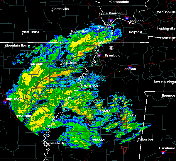 At 1108 am cdt, a severe thunderstorm was located near laws hill, or 9 miles south of wall doxey state park, moving northwest at 35 mph. this storm may produce fast moving short tracked tornadoes with little advanced warning. please be prepared to act quickly if the severe thunderstorm warning is upgraded to a tornado warning (radar indicated). Hazards include 60 mph wind gusts. short-lived brief tornadoes possible. expect damage to roofs, siding, and trees At 1108 am cdt, a severe thunderstorm was located near laws hill, or 9 miles south of wall doxey state park, moving northwest at 35 mph. this storm may produce fast moving short tracked tornadoes with little advanced warning. please be prepared to act quickly if the severe thunderstorm warning is upgraded to a tornado warning (radar indicated). Hazards include 60 mph wind gusts. short-lived brief tornadoes possible. expect damage to roofs, siding, and trees
|
| 5/27/2017 11:57 PM CDT |
 At 1157 pm cdt, a severe thunderstorm was located 7 miles east of wall doxey state park, moving southeast at 65 mph (radar indicated). Hazards include 60 mph wind gusts and quarter size hail. Hail damage to vehicles is expected. expect wind damage to roofs, siding, and trees. locations impacted include, southaven, olive branch, horn lake, oxford, hernando, senatobia, holly springs, wall doxey state park, john w kyle state park, lamar, sardis, coldwater, byhalia, como, walls, tunica, crenshaw, sledge, snow lake shores and horseshoe lake. A tornado watch remains in effect until 500 am cdt for eastern arkansas, and northeastern and northwestern mississippi. At 1157 pm cdt, a severe thunderstorm was located 7 miles east of wall doxey state park, moving southeast at 65 mph (radar indicated). Hazards include 60 mph wind gusts and quarter size hail. Hail damage to vehicles is expected. expect wind damage to roofs, siding, and trees. locations impacted include, southaven, olive branch, horn lake, oxford, hernando, senatobia, holly springs, wall doxey state park, john w kyle state park, lamar, sardis, coldwater, byhalia, como, walls, tunica, crenshaw, sledge, snow lake shores and horseshoe lake. A tornado watch remains in effect until 500 am cdt for eastern arkansas, and northeastern and northwestern mississippi.
|
| 5/27/2017 11:41 PM CDT |
 At 1141 pm cdt, a severe thunderstorm was located near mt pleasant, or 10 miles northwest of holly springs, moving southeast at 65 mph (radar indicated). Hazards include 70 mph wind gusts and quarter size hail. Hail damage to vehicles is expected. expect considerable tree damage. Wind damage is also likely to mobile homes, roofs, and outbuildings. At 1141 pm cdt, a severe thunderstorm was located near mt pleasant, or 10 miles northwest of holly springs, moving southeast at 65 mph (radar indicated). Hazards include 70 mph wind gusts and quarter size hail. Hail damage to vehicles is expected. expect considerable tree damage. Wind damage is also likely to mobile homes, roofs, and outbuildings.
|
| 5/27/2017 11:04 PM CDT |
 At 1104 pm cdt, a severe thunderstorm was located over southwest memphis, or over t o fuller state park, moving southeast at 50 mph. this is a very dangerous storm (radar indicated). Hazards include 80 mph wind gusts and quarter size hail. Flying debris will be dangerous to those caught without shelter. mobile homes will be heavily damaged. expect considerable damage to roofs, windows, and vehicles. Extensive tree damage and power outages are likely. At 1104 pm cdt, a severe thunderstorm was located over southwest memphis, or over t o fuller state park, moving southeast at 50 mph. this is a very dangerous storm (radar indicated). Hazards include 80 mph wind gusts and quarter size hail. Flying debris will be dangerous to those caught without shelter. mobile homes will be heavily damaged. expect considerable damage to roofs, windows, and vehicles. Extensive tree damage and power outages are likely.
|
| 4/30/2017 10:34 AM CDT |
 At 1034 am cdt, severe thunderstorms were located along a line extending from near curtis station to scobey, moving northeast at 40 mph (radar indicated). Hazards include 60 mph wind gusts. expect damage to roofs, siding, and trees At 1034 am cdt, severe thunderstorms were located along a line extending from near curtis station to scobey, moving northeast at 40 mph (radar indicated). Hazards include 60 mph wind gusts. expect damage to roofs, siding, and trees
|
| 4/29/2017 8:23 PM CDT |
 At 823 pm cdt, severe thunderstorms were located along a line extending from whitehaven to curtis station, moving northeast at 20 mph (radar indicated). Hazards include 60 mph wind gusts. expect damage to roofs, siding, and trees At 823 pm cdt, severe thunderstorms were located along a line extending from whitehaven to curtis station, moving northeast at 20 mph (radar indicated). Hazards include 60 mph wind gusts. expect damage to roofs, siding, and trees
|
| 3/25/2017 5:06 AM CDT |
 The severe thunderstorm warning for lafayette county will expire at 515 am cdt, the storm which prompted the warning has weakened below severe limits, and no longer pose an immediate threat to life or property. therefore, the warning will be allowed to expire. however gusty winds are still possible with this thunderstorm. The severe thunderstorm warning for lafayette county will expire at 515 am cdt, the storm which prompted the warning has weakened below severe limits, and no longer pose an immediate threat to life or property. therefore, the warning will be allowed to expire. however gusty winds are still possible with this thunderstorm.
|
| 3/25/2017 4:46 AM CDT |
 At 446 am cdt, a severe thunderstorm was located over burgess, or near holly springs national forest, moving northeast at 45 mph (radar indicated). Hazards include 60 mph wind gusts. Expect damage to roofs, siding, and trees. Locations impacted include, oxford, water valley, holly springs national forest, springdale, burgess, cambridge, harmontown, denmark, abbeville, taylor, altus, keel, blackwater, teckville, college hill station and college hill. At 446 am cdt, a severe thunderstorm was located over burgess, or near holly springs national forest, moving northeast at 45 mph (radar indicated). Hazards include 60 mph wind gusts. Expect damage to roofs, siding, and trees. Locations impacted include, oxford, water valley, holly springs national forest, springdale, burgess, cambridge, harmontown, denmark, abbeville, taylor, altus, keel, blackwater, teckville, college hill station and college hill.
|
| 3/25/2017 4:25 AM CDT |
 At 425 am cdt, a severe thunderstorm was located 7 miles southeast of batesville, moving northeast at 55 mph (radar indicated). Hazards include 60 mph wind gusts. expect damage to roofs, siding, and trees At 425 am cdt, a severe thunderstorm was located 7 miles southeast of batesville, moving northeast at 55 mph (radar indicated). Hazards include 60 mph wind gusts. expect damage to roofs, siding, and trees
|
| 3/25/2017 4:11 AM CDT |
 At 411 am cdt, a severe thunderstorm was located over pope, or near batesville, moving northeast at 50 mph (radar indicated). Hazards include 60 mph wind gusts. Expect damage to roofs, siding, and trees. Locations impacted include, oxford, batesville, water valley, charleston, george payne state park, holly springs national forest, john w kyle state park, sardis, pope, enid, harmontown, springdale, burgess, courtland, abbeville, taylor, glenville, college hill station, college hill and hayes crossing. At 411 am cdt, a severe thunderstorm was located over pope, or near batesville, moving northeast at 50 mph (radar indicated). Hazards include 60 mph wind gusts. Expect damage to roofs, siding, and trees. Locations impacted include, oxford, batesville, water valley, charleston, george payne state park, holly springs national forest, john w kyle state park, sardis, pope, enid, harmontown, springdale, burgess, courtland, abbeville, taylor, glenville, college hill station, college hill and hayes crossing.
|
| 3/25/2017 3:52 AM CDT |
 At 350 am cdt, a severe thunderstorm was located near crowder, or 7 miles northwest of charleston, moving northeast at 60 mph (radar indicated). Hazards include 60 mph wind gusts. expect damage to roofs, siding, and trees At 350 am cdt, a severe thunderstorm was located near crowder, or 7 miles northwest of charleston, moving northeast at 60 mph (radar indicated). Hazards include 60 mph wind gusts. expect damage to roofs, siding, and trees
|
| 3/10/2017 12:48 AM CST |
 At 1248 am cst, a severe thunderstorm was located near etta, or 8 miles west of new albany, moving southeast at 45 mph (radar indicated). Hazards include 70 mph wind gusts. Expect considerable tree damage. damage is likely to mobile homes, roofs, and outbuildings. Locations impacted include, oxford, new albany, ripley, holly springs national forest, blue mountain, cambridge, keownville, etta, burgess, bethlehem, gravestown, pinedale, hickory flat, potts camp, myrtle, dumas, abbeville, taylor, malone and shari. At 1248 am cst, a severe thunderstorm was located near etta, or 8 miles west of new albany, moving southeast at 45 mph (radar indicated). Hazards include 70 mph wind gusts. Expect considerable tree damage. damage is likely to mobile homes, roofs, and outbuildings. Locations impacted include, oxford, new albany, ripley, holly springs national forest, blue mountain, cambridge, keownville, etta, burgess, bethlehem, gravestown, pinedale, hickory flat, potts camp, myrtle, dumas, abbeville, taylor, malone and shari.
|
| 3/10/2017 12:39 AM CST |
 At 1238 am cst, a severe thunderstorm was located near bethlehem, or 12 miles east of wall doxey state park, moving southeast at 45 mph (radar indicated). Hazards include 70 mph wind gusts. Expect considerable tree damage. damage is likely to mobile homes, roofs, and outbuildings. Locations impacted include, oxford, new albany, holly springs, ripley, holly springs national forest, wall doxey state park, blue mountain, snow lake shores, cambridge, harmontown, keownville, bethlehem, laws hill, barr, etta, burgess, gravestown, pinedale, marianna and hickory flat. At 1238 am cst, a severe thunderstorm was located near bethlehem, or 12 miles east of wall doxey state park, moving southeast at 45 mph (radar indicated). Hazards include 70 mph wind gusts. Expect considerable tree damage. damage is likely to mobile homes, roofs, and outbuildings. Locations impacted include, oxford, new albany, holly springs, ripley, holly springs national forest, wall doxey state park, blue mountain, snow lake shores, cambridge, harmontown, keownville, bethlehem, laws hill, barr, etta, burgess, gravestown, pinedale, marianna and hickory flat.
|
| 3/10/2017 12:25 AM CST |
 At 1225 am cst, a severe thunderstorm was located near wall doxey state park, moving southeast at 45 mph (radar indicated). Hazards include 70 mph wind gusts. Expect considerable tree damage. damage is likely to mobile homes, roofs, and outbuildings. Locations impacted include, oxford, new albany, holly springs, ripley, holly springs national forest, wall doxey state park, blue mountain, snow lake shores, cambridge, harmontown, keownville, bethlehem, laws hill, barr, etta, burgess, gravestown, pinedale, marianna and hickory flat. At 1225 am cst, a severe thunderstorm was located near wall doxey state park, moving southeast at 45 mph (radar indicated). Hazards include 70 mph wind gusts. Expect considerable tree damage. damage is likely to mobile homes, roofs, and outbuildings. Locations impacted include, oxford, new albany, holly springs, ripley, holly springs national forest, wall doxey state park, blue mountain, snow lake shores, cambridge, harmontown, keownville, bethlehem, laws hill, barr, etta, burgess, gravestown, pinedale, marianna and hickory flat.
|
| 3/10/2017 12:21 AM CST |
 At 1220 am cst, a severe thunderstorm was located over holly springs, moving southeast at 45 mph (radar indicated). Hazards include 70 mph wind gusts. Expect considerable tree damage. Damage is likely to mobile homes, roofs, and outbuildings. At 1220 am cst, a severe thunderstorm was located over holly springs, moving southeast at 45 mph (radar indicated). Hazards include 70 mph wind gusts. Expect considerable tree damage. Damage is likely to mobile homes, roofs, and outbuildings.
|
| 12/17/2016 10:14 PM CST |
 At 1013 pm cst, dopplar radar indicated a tornado near 8 miles west of oxford, moving northeast at 70 mph (radar indicated rotation). Hazards include tornado. Flying debris will be dangerous to those caught without shelter. mobile homes will be damaged or destroyed. damage to roofs, windows, and vehicles will occur. tree damage is likely. this tornadic storm will be near, cambridge around 1025 pm cst. bethlehem around 1030 pm cst. Other locations impacted by this tornadic thunderstorm include burt, abbeville, keel, college hill, cornersville, college hill station and spraggins. At 1013 pm cst, dopplar radar indicated a tornado near 8 miles west of oxford, moving northeast at 70 mph (radar indicated rotation). Hazards include tornado. Flying debris will be dangerous to those caught without shelter. mobile homes will be damaged or destroyed. damage to roofs, windows, and vehicles will occur. tree damage is likely. this tornadic storm will be near, cambridge around 1025 pm cst. bethlehem around 1030 pm cst. Other locations impacted by this tornadic thunderstorm include burt, abbeville, keel, college hill, cornersville, college hill station and spraggins.
|
| 12/17/2016 9:57 PM CST |
 At 957 pm cst, a severe thunderstorm producing a tornado was located over marianna, or 8 miles west of wall doxey state park, moving northeast at 70 mph (radar indicated rotation). Hazards include tornado. Flying debris will be dangerous to those caught without shelter. mobile homes will be damaged or destroyed. damage to roofs, windows, and vehicles will occur. tree damage is likely. this dangerous storm will be near, wall doxey state park around 1000 pm cst. holly springs around 1005 pm cst. lamar around 1015 pm cst. Other locations impacted by this tornadic thunderstorm include mahon, glenville, potts camp, blackwater, waites, hayes crossing, teckville, lake center, aiken and waterford. At 957 pm cst, a severe thunderstorm producing a tornado was located over marianna, or 8 miles west of wall doxey state park, moving northeast at 70 mph (radar indicated rotation). Hazards include tornado. Flying debris will be dangerous to those caught without shelter. mobile homes will be damaged or destroyed. damage to roofs, windows, and vehicles will occur. tree damage is likely. this dangerous storm will be near, wall doxey state park around 1000 pm cst. holly springs around 1005 pm cst. lamar around 1015 pm cst. Other locations impacted by this tornadic thunderstorm include mahon, glenville, potts camp, blackwater, waites, hayes crossing, teckville, lake center, aiken and waterford.
|
| 12/17/2016 9:36 PM CST |
 At 936 pm cst, a severe thunderstorm was located over barr, or 10 miles east of senatobia, moving northeast at 70 mph (radar indicated). Hazards include 60 mph wind gusts. Expect damage to roofs, siding, and trees. locations impacted include, holly springs, batesville, wall doxey state park, john w kyle state park, sardis, como, bethlehem, red banks, harmontown, marianna, independence, barr, laws hill, potts camp, abbeville, mahon, looxahoma, glenville, blackwater and mc ghee. A tornado watch remains in effect until 300 am cst for northeastern and northwestern mississippi. At 936 pm cst, a severe thunderstorm was located over barr, or 10 miles east of senatobia, moving northeast at 70 mph (radar indicated). Hazards include 60 mph wind gusts. Expect damage to roofs, siding, and trees. locations impacted include, holly springs, batesville, wall doxey state park, john w kyle state park, sardis, como, bethlehem, red banks, harmontown, marianna, independence, barr, laws hill, potts camp, abbeville, mahon, looxahoma, glenville, blackwater and mc ghee. A tornado watch remains in effect until 300 am cst for northeastern and northwestern mississippi.
|
| 12/17/2016 9:30 PM CST |
 At 929 pm cst, a severe thunderstorm was located over como, or 7 miles southeast of senatobia, moving northeast at 70 mph (radar indicated). Hazards include 60 mph wind gusts. expect damage to roofs, siding, and trees At 929 pm cst, a severe thunderstorm was located over como, or 7 miles southeast of senatobia, moving northeast at 70 mph (radar indicated). Hazards include 60 mph wind gusts. expect damage to roofs, siding, and trees
|
| 8/5/2016 4:53 PM CDT |
 At 452 pm cdt, a severe thunderstorm was located over laws hill, or 8 miles southwest of wall doxey state park, and is nearly stationary (radar indicated). Hazards include 60 mph wind gusts. Expect damage to roofs. siding. And trees. At 452 pm cdt, a severe thunderstorm was located over laws hill, or 8 miles southwest of wall doxey state park, and is nearly stationary (radar indicated). Hazards include 60 mph wind gusts. Expect damage to roofs. siding. And trees.
|
| 7/29/2016 6:37 PM CDT |
 The severe thunderstorm warning for northern lafayette, marshall, eastern tate and northern panola counties will expire at 645 pm cdt, the storm which prompted the warning has weakened below severe limits, and no longer pose an immediate threat to life or property. therefore, the warning will be allowed to expire. however gusty winds and heavy rain are still possible with this thunderstorm. to report severe weather, contact your nearest law enforcement agency. they will relay your report to the national weather service memphis. The severe thunderstorm warning for northern lafayette, marshall, eastern tate and northern panola counties will expire at 645 pm cdt, the storm which prompted the warning has weakened below severe limits, and no longer pose an immediate threat to life or property. therefore, the warning will be allowed to expire. however gusty winds and heavy rain are still possible with this thunderstorm. to report severe weather, contact your nearest law enforcement agency. they will relay your report to the national weather service memphis.
|
| 7/29/2016 6:29 PM CDT |
 At 628 pm cdt, a severe thunderstorm was located over laws hill, or near wall doxey state park, moving east at 40 mph (radar indicated). Hazards include 60 mph wind gusts. Expect damage to roofs. siding. and trees. Locations impacted include, senatobia, holly springs, wall doxey state park, john w kyle state park, sardis, como, bethlehem, cambridge, harmontown, marianna, independence, barr, laws hill, potts camp, abbeville, burt, mahon, looxahoma, glenville and blackwater. At 628 pm cdt, a severe thunderstorm was located over laws hill, or near wall doxey state park, moving east at 40 mph (radar indicated). Hazards include 60 mph wind gusts. Expect damage to roofs. siding. and trees. Locations impacted include, senatobia, holly springs, wall doxey state park, john w kyle state park, sardis, como, bethlehem, cambridge, harmontown, marianna, independence, barr, laws hill, potts camp, abbeville, burt, mahon, looxahoma, glenville and blackwater.
|
| 7/29/2016 6:01 PM CDT |
 At 601 pm cdt, a severe thunderstorm was located near independence, or 9 miles northeast of senatobia, moving east at 40 mph (radar indicated). Hazards include 60 mph wind gusts. Expect damage to roofs. siding. And trees. At 601 pm cdt, a severe thunderstorm was located near independence, or 9 miles northeast of senatobia, moving east at 40 mph (radar indicated). Hazards include 60 mph wind gusts. Expect damage to roofs. siding. And trees.
|
| 6/17/2016 4:52 PM CDT |
 At 451 pm cdt, a severe thunderstorm was located over laws hill, or 7 miles southwest of wall doxey state park, moving south at 30 mph (radar indicated). Hazards include 60 mph wind gusts and penny size hail. Expect damage to roofs. siding. And trees. At 451 pm cdt, a severe thunderstorm was located over laws hill, or 7 miles southwest of wall doxey state park, moving south at 30 mph (radar indicated). Hazards include 60 mph wind gusts and penny size hail. Expect damage to roofs. siding. And trees.
|
| 4/29/2016 1:32 PM CDT |
 At 132 pm cdt, a severe thunderstorm was located near bethlehem, or 13 miles west of new albany, moving east at 40 mph (radar indicated). Hazards include 60 mph wind gusts and quarter size hail. Hail damage to vehicles is expected. expect wind damage to roofs, siding, and trees. Locations impacted include, oxford, new albany, ripley, blue mountain, etta, bethlehem, cambridge, pinedale, new harmony, keownville, gravestown, hickory flat, potts camp, myrtle, abbeville, blue springs, burt, clarysville, bethel and union hill. At 132 pm cdt, a severe thunderstorm was located near bethlehem, or 13 miles west of new albany, moving east at 40 mph (radar indicated). Hazards include 60 mph wind gusts and quarter size hail. Hail damage to vehicles is expected. expect wind damage to roofs, siding, and trees. Locations impacted include, oxford, new albany, ripley, blue mountain, etta, bethlehem, cambridge, pinedale, new harmony, keownville, gravestown, hickory flat, potts camp, myrtle, abbeville, blue springs, burt, clarysville, bethel and union hill.
|
| 4/29/2016 1:20 PM CDT |
 At 120 pm cdt, a severe thunderstorm was located near cambridge, or 11 miles south of wall doxey state park, moving east at 40 mph (radar indicated). Hazards include 60 mph wind gusts and quarter size hail. Hail damage to vehicles is expected. Expect wind damage to roofs, siding, and trees. At 120 pm cdt, a severe thunderstorm was located near cambridge, or 11 miles south of wall doxey state park, moving east at 40 mph (radar indicated). Hazards include 60 mph wind gusts and quarter size hail. Hail damage to vehicles is expected. Expect wind damage to roofs, siding, and trees.
|
| 12/25/2015 3:36 AM CST |
 The severe thunderstorm warning for southern benton, northern lafayette, southern marshall and northwestern union counties will expire at 345 am cst, the storm which prompted the warning has weakened below severe limits, and no longer poses an immediate threat to life or property. therefore the warning will be allowed to expire. The severe thunderstorm warning for southern benton, northern lafayette, southern marshall and northwestern union counties will expire at 345 am cst, the storm which prompted the warning has weakened below severe limits, and no longer poses an immediate threat to life or property. therefore the warning will be allowed to expire.
|
| 12/25/2015 3:10 AM CST |
 At 309 am cst, a severe thunderstorm was located over laws hill, or near wall doxey state park, moving northeast at 55 mph (radar indicated). Hazards include 60 mph wind gusts and penny size hail. Expect damage to roofs. siding and trees. Locations impacted include, wall doxey state park, snow lake shores, harmontown, bethlehem, laws hill, hickory flat, ashland, potts camp, myrtle, abbeville, pine grove, blackwater, waites, teckville, lake center, bethel, waterford, malone, cornersville and spraggins. At 309 am cst, a severe thunderstorm was located over laws hill, or near wall doxey state park, moving northeast at 55 mph (radar indicated). Hazards include 60 mph wind gusts and penny size hail. Expect damage to roofs. siding and trees. Locations impacted include, wall doxey state park, snow lake shores, harmontown, bethlehem, laws hill, hickory flat, ashland, potts camp, myrtle, abbeville, pine grove, blackwater, waites, teckville, lake center, bethel, waterford, malone, cornersville and spraggins.
|
| 12/25/2015 2:54 AM CST |
 At 254 am cst, a severe thunderstorm was located near john w kyle state park, moving northeast at 55 mph (radar indicated). Hazards include 60 mph wind gusts and penny size hail. Expect damage to roofs. Siding and trees. At 254 am cst, a severe thunderstorm was located near john w kyle state park, moving northeast at 55 mph (radar indicated). Hazards include 60 mph wind gusts and penny size hail. Expect damage to roofs. Siding and trees.
|
| 12/25/2015 2:52 AM CST |
 At 252 am cst, a severe thunderstorm was located near barr, or 11 miles north of john w kyle state park, moving northeast at 55 mph (radar indicated). Hazards include 60 mph wind gusts and quarter size hail. Hail damage to vehicles is expected. expect wind damage to roofs, siding and trees. Locations impacted include, john w kyle state park, sardis, harmontown, marianna, barr, laws hill, abbeville, looxahoma, glenville, rockhill, blackwater, hayes crossing, teckville, aiken, malone, spraggins, wyatte, tyro, bett and thyatira. At 252 am cst, a severe thunderstorm was located near barr, or 11 miles north of john w kyle state park, moving northeast at 55 mph (radar indicated). Hazards include 60 mph wind gusts and quarter size hail. Hail damage to vehicles is expected. expect wind damage to roofs, siding and trees. Locations impacted include, john w kyle state park, sardis, harmontown, marianna, barr, laws hill, abbeville, looxahoma, glenville, rockhill, blackwater, hayes crossing, teckville, aiken, malone, spraggins, wyatte, tyro, bett and thyatira.
|
| 12/25/2015 2:34 AM CST |
 At 234 am cst, a severe thunderstorm was located near sardis, or 10 miles north of batesville, moving northeast at 55 mph (radar indicated). Hazards include 60 mph wind gusts and quarter size hail. Hail damage to vehicles is expected. Expect wind damage to roofs, siding and trees. At 234 am cst, a severe thunderstorm was located near sardis, or 10 miles north of batesville, moving northeast at 55 mph (radar indicated). Hazards include 60 mph wind gusts and quarter size hail. Hail damage to vehicles is expected. Expect wind damage to roofs, siding and trees.
|
| 12/23/2015 4:52 PM CST | At 452 pm cst, a confirmed large and extremely dangerous tornado was located near holly springs national forest, moving northeast at 65 mph. this is a particularly dangerous situation (radar confirmed tornado). Hazards include damaging tornado. You are in a life threatening situation. flying debris may be deadly to those caught without shelter. mobile homes will be destroyed. considerable damage to homes, businesses and vehicles is likely and complete destruction is possible. the tornado will be near, cambridge around 505 pm cst. bethlehem around 510 pm cst. Other locations impacted by this tornadic thunderstorm include burt, keel, abbeville, college hill, cornersville and college hill station. |
| 12/23/2015 4:45 PM CST | At 445 pm cst, a severe thunderstorm producing a tornado was located over burgess, or 8 miles southeast of john w kyle state park, moving northeast at 60 mph (radar indicated rotation). Hazards include tornado and golf ball size hail. Flying debris will be dangerous to those caught without shelter. mobile homes will be damaged or destroyed. damage to roofs, windows and vehicles will occur. tree damage is likely. this dangerous storm will be near, oxford and holly springs national forest around 455 pm cst. cambridge around 505 pm cst. bethlehem around 510 pm cst. Other locations impacted by this tornadic thunderstorm include burt, keel, abbeville, college hill, cornersville and college hill station. |
| 7/14/2015 5:30 PM CDT |
 At 529 pm cdt, severe thunderstorms were located along a line extending from near corinth to 7 miles southeast of ripley to near holly springs national forest, moving southeast at 50 mph (radar indicated). Hazards include 60 mph wind gusts. Expect damage to roofs. siding and trees. Locations impacted include, ripley, wall doxey state park, john w kyle state park, sardis, blue mountain, snow lake shores, pocahontas, harmontown, theo, bethlehem, laws hill, gravestown, walnut, middleton, hickory flat, ashland, potts camp, falkner, myrtle and dumas. At 529 pm cdt, severe thunderstorms were located along a line extending from near corinth to 7 miles southeast of ripley to near holly springs national forest, moving southeast at 50 mph (radar indicated). Hazards include 60 mph wind gusts. Expect damage to roofs. siding and trees. Locations impacted include, ripley, wall doxey state park, john w kyle state park, sardis, blue mountain, snow lake shores, pocahontas, harmontown, theo, bethlehem, laws hill, gravestown, walnut, middleton, hickory flat, ashland, potts camp, falkner, myrtle and dumas.
|
| 7/14/2015 5:26 PM CDT |
 At 526 pm cdt, severe thunderstorms were located along a line extending from near theo to near new albany to near oxford, moving southeast at 60 mph (radar indicated). Hazards include 60 mph wind gusts. Expect damage to roofs. Siding and trees. At 526 pm cdt, severe thunderstorms were located along a line extending from near theo to near new albany to near oxford, moving southeast at 60 mph (radar indicated). Hazards include 60 mph wind gusts. Expect damage to roofs. Siding and trees.
|
| 7/14/2015 5:01 PM CDT |
 At 501 pm cdt, severe thunderstorms were located along a line extending from 7 miles northwest of pocahontas to near snow lake shores to near senatobia, moving southeast at 50 mph (radar indicated). Hazards include 60 mph wind gusts. Expect damage to roofs. Siding and trees. At 501 pm cdt, severe thunderstorms were located along a line extending from 7 miles northwest of pocahontas to near snow lake shores to near senatobia, moving southeast at 50 mph (radar indicated). Hazards include 60 mph wind gusts. Expect damage to roofs. Siding and trees.
|
| 4/19/2015 11:35 PM CDT | At 1134 pm cdt, a severe thunderstorm was located near new albany, moving east at 60 mph (radar indicated). Hazards include 60 mph wind gusts and quarter size hail. Hail damage to vehicles is expected. expect wind damage to roofs, siding and trees. locations impacted include, oxford, new albany, ripley, holly springs national forest, blue mountain, etta, cambridge, burgess, pinedale, new harmony, keownville, myrtle, abbeville, blue springs, burt, union hill, ingomar, concord, reese and glenfield. a tornado watch remains in effect until 300 am cdt for northern mississippi. 1. 00in. |
| 4/19/2015 11:04 PM CDT | At 1103 pm cdt, a severe thunderstorm was located near holly springs national forest, moving east at 60 mph (radar indicated). Hazards include 60 mph wind gusts and quarter size hail. Hail damage to vehicles is expected. Expect wind damage to roofs, siding and trees. |
| 4/19/2015 10:47 PM CDT | At 1046 pm cdt, a severe thunderstorm was located near harmontown, or 7 miles northwest of holly springs national forest, moving northeast at 45 mph (radar indicated). Hazards include 60 mph wind gusts and quarter size hail. Hail damage to vehicles is expected. expect wind damage to roofs, siding and trees. locations impacted include, oxford, harmontown, burgess, abbeville, burt, teckville, college hill and college hill station. a tornado watch remains in effect until 300 am cdt for northwestern mississippi. 1. 00in. |
| 4/19/2015 10:10 PM CDT | At 1010 pm cdt, a severe thunderstorm was located over george payne state park, moving northeast at 45 mph (radar indicated). Hazards include 60 mph wind gusts and quarter size hail. Hail damage to vehicles is expected. Expect wind damage to roofs, siding and trees. |
| 6/27/2013 8:07 PM CDT | Media reports of a mobile home being flipped in lafayette county MS, 8.6 miles ESE of Abbeville, MS |
Hail Maps for Abbeville, MS


Connect with Interactive Hail Maps