

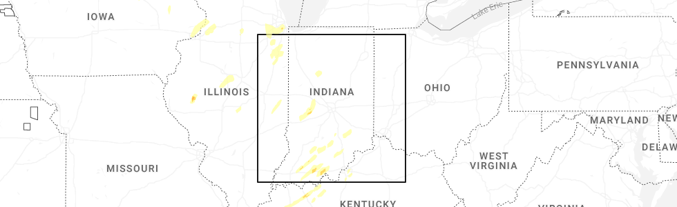
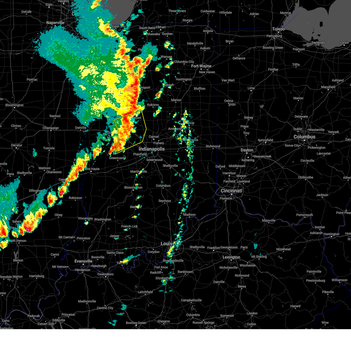
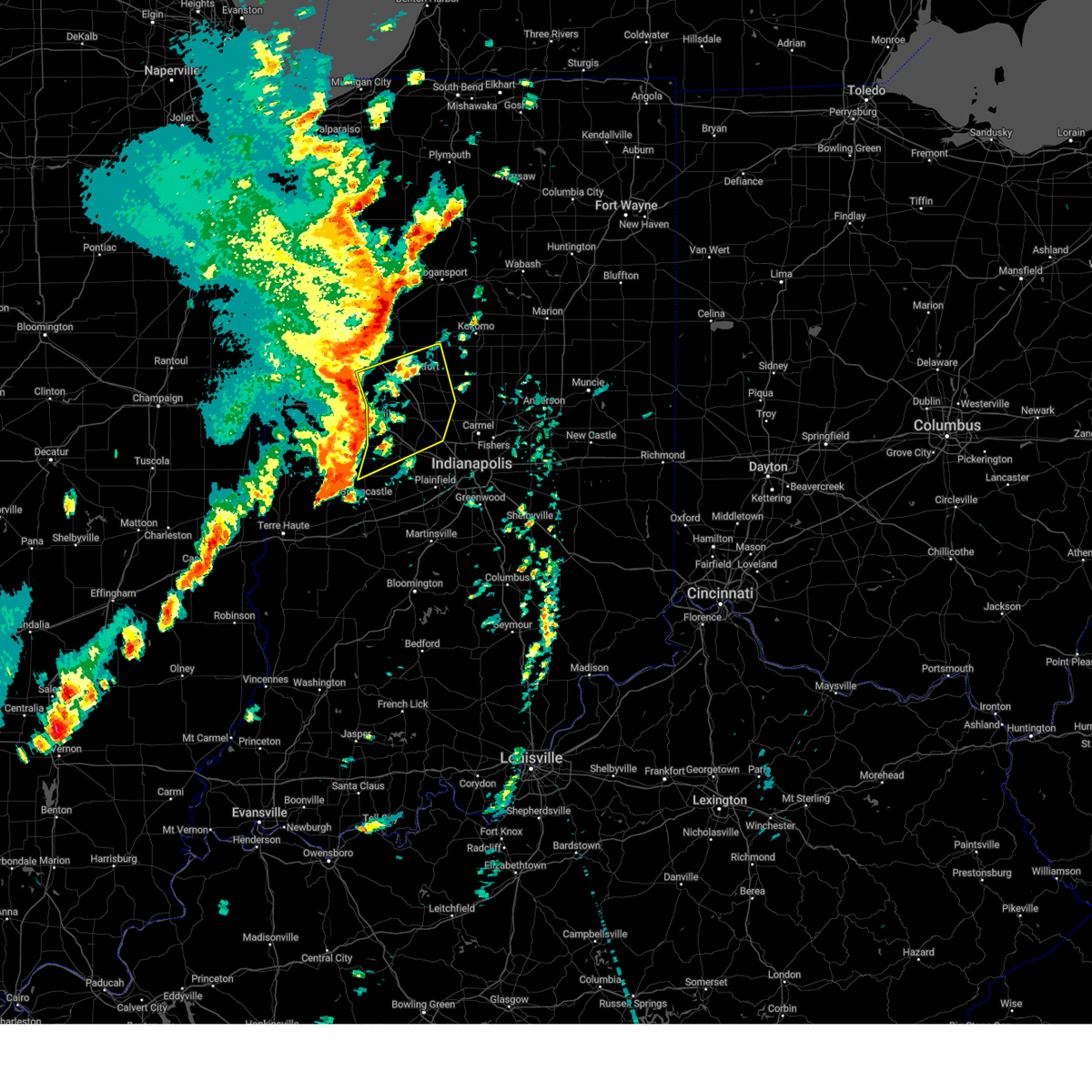
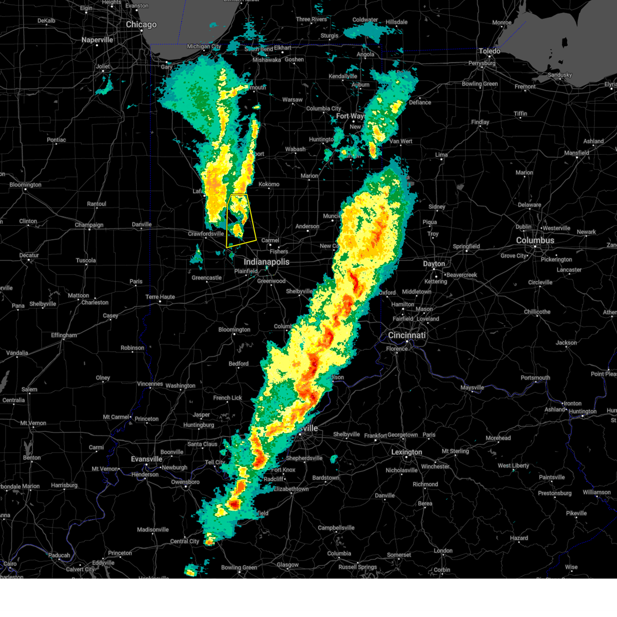
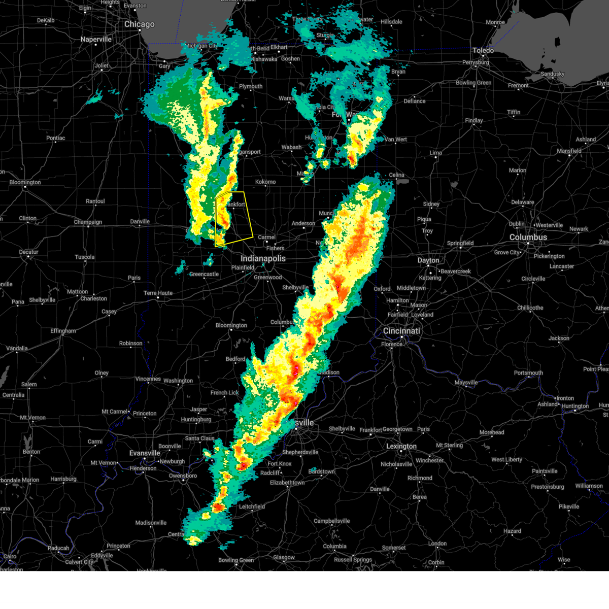
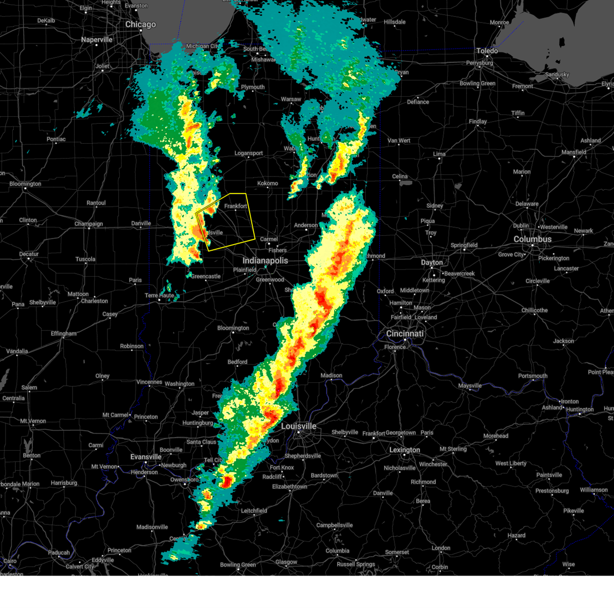
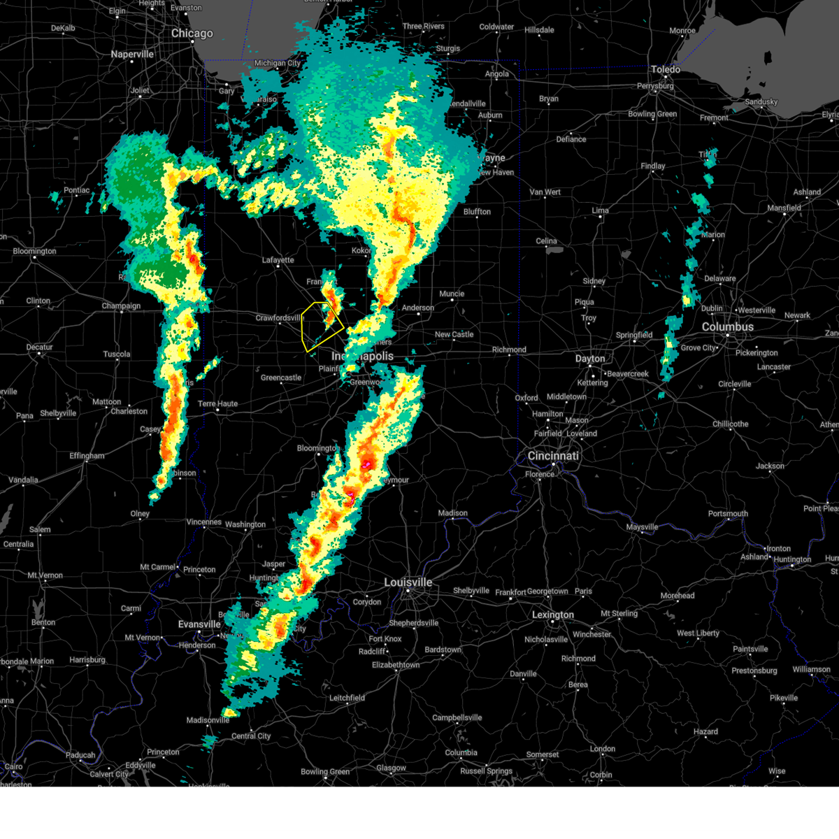
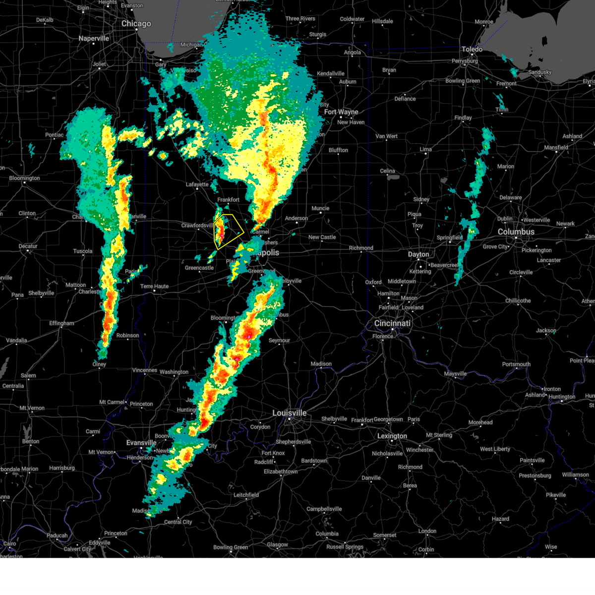
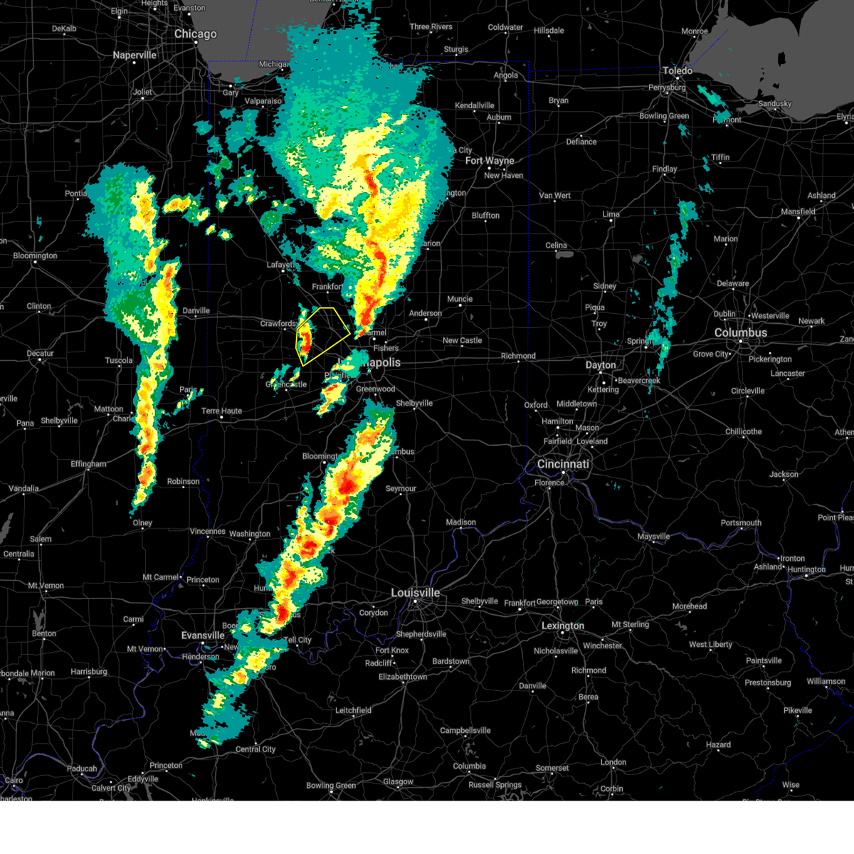
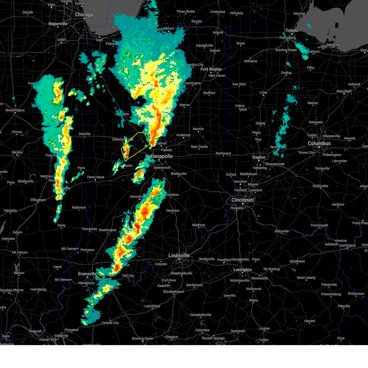
Hail Map for Advance, IN
The Advance, IN area has had 0 reports of on-the-ground hail by trained spotters, and has been under severe weather warnings 33 times during the past 12 months. Doppler radar has detected hail at or near Advance, IN on 59 occasions, including 1 occasion during the past year.
| Name: | Advance, IN |
| Where Located: | 29.5 miles WNW of Indianapolis, IN |
| Map: | Google Map for Advance, IN |
| Population: | 477 |
| Housing Units: | 178 |
| More Info: | Search Google for Advance, IN |
0
The Top Recent Hail Date for Advance, IN is Wednesday, March 19, 2025 (59th out of 59)
Hail and Wind Damage Spotted near Advance, IN
| Date / Time | Report Details |
|---|---|
| 6/18/2025 4:10 PM EDT |
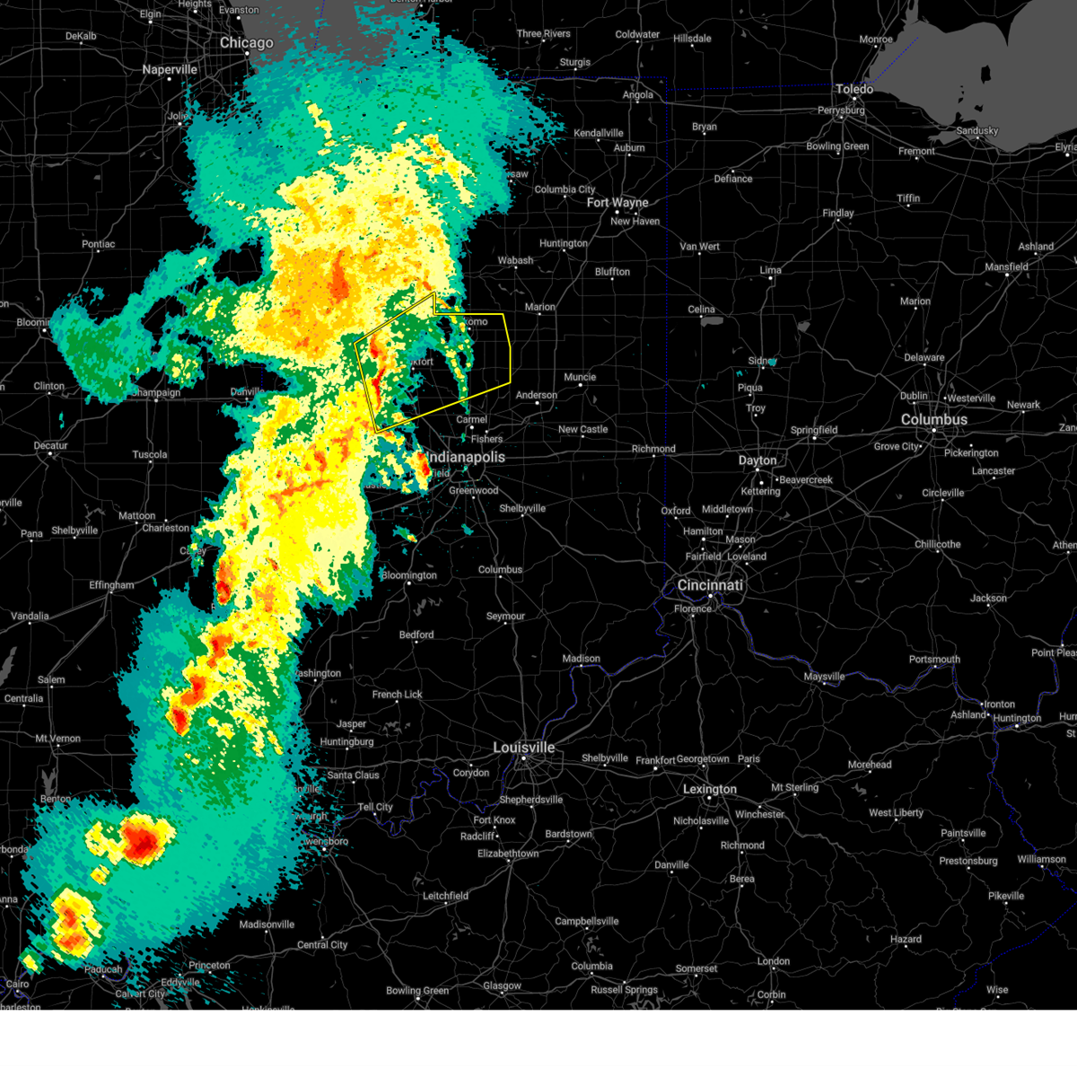
 At 410 pm edt, severe thunderstorms were located along a line extending from 6 miles east of delphi to 11 miles east of frankfort, moving northeast at 55 mph (radar indicated). Hazards include 60 mph wind gusts and penny size hail. Expect damage to roofs, siding, and trees. locations impacted include, kokomo, frankfort, lebanon, delphi, flora, rossville, thorntown, mulberry, russiaville, ladoga, jamestown, darlington, kirklin, colfax, camden, clarks hill, burlington, advance, michigantown, and new ross. this includes the following highways, interstate 65 between mile markers 134 and 164. Interstate 74 between mile markers 37 and 53. At 410 pm edt, severe thunderstorms were located along a line extending from 6 miles east of delphi to 11 miles east of frankfort, moving northeast at 55 mph (radar indicated). Hazards include 60 mph wind gusts and penny size hail. Expect damage to roofs, siding, and trees. locations impacted include, kokomo, frankfort, lebanon, delphi, flora, rossville, thorntown, mulberry, russiaville, ladoga, jamestown, darlington, kirklin, colfax, camden, clarks hill, burlington, advance, michigantown, and new ross. this includes the following highways, interstate 65 between mile markers 134 and 164. Interstate 74 between mile markers 37 and 53.
|
| 6/18/2025 4:10 PM EDT |
 the severe thunderstorm warning has been cancelled and is no longer in effect the severe thunderstorm warning has been cancelled and is no longer in effect
|
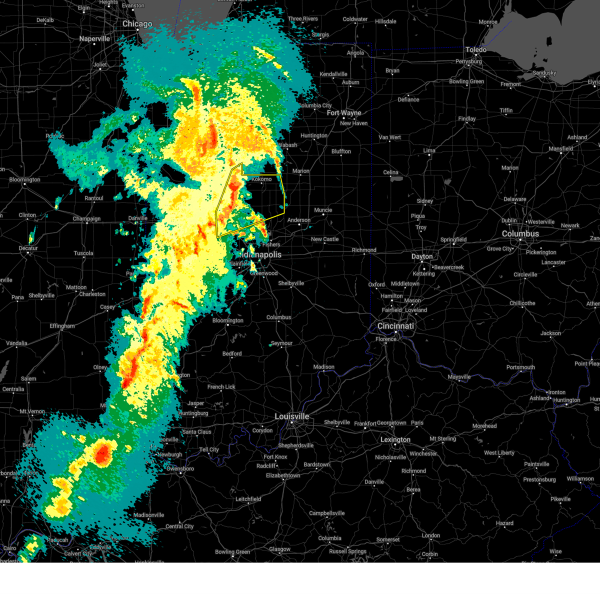
| 6/18/2025 3:43 PM EDT | Svrind the national weather service in indianapolis has issued a * severe thunderstorm warning for, carroll county in north central indiana, southeastern fountain county in west central indiana, eastern tippecanoe county in west central indiana, clinton county in central indiana, howard county in central indiana, northeastern parke county in west central indiana, boone county in central indiana, western tipton county in central indiana, montgomery county in west central indiana, * until 430 pm edt. * at 343 pm edt, severe thunderstorms were located along a line extending from 9 miles southwest of logansport to 7 miles south of crawfordsville, moving northeast at 45 mph (radar indicated). Hazards include 60 mph wind gusts and penny size hail. expect damage to roofs, siding, and trees |
| 5/16/2025 6:53 PM EDT |
 At 653 pm edt, severe thunderstorms were located along a line extending from near monticello to 6 miles east of frankfort, moving east at 70 mph (radar indicated). Hazards include 60 mph wind gusts. Expect damage to roofs, siding, and trees. locations impacted include, lafayette, frankfort, west lafayette, lebanon, delphi, flora, rossville, shadeland, thorntown, dayton, battle ground, mulberry, russiaville, darlington, kirklin, linden, colfax, camden, clarks hill, and burlington. this includes the following highways, interstate 65 between mile markers 136 and 184. Interstate 74 between mile markers 35 and 50. At 653 pm edt, severe thunderstorms were located along a line extending from near monticello to 6 miles east of frankfort, moving east at 70 mph (radar indicated). Hazards include 60 mph wind gusts. Expect damage to roofs, siding, and trees. locations impacted include, lafayette, frankfort, west lafayette, lebanon, delphi, flora, rossville, shadeland, thorntown, dayton, battle ground, mulberry, russiaville, darlington, kirklin, linden, colfax, camden, clarks hill, and burlington. this includes the following highways, interstate 65 between mile markers 136 and 184. Interstate 74 between mile markers 35 and 50.
|
| 5/16/2025 6:53 PM EDT |
 the severe thunderstorm warning has been cancelled and is no longer in effect the severe thunderstorm warning has been cancelled and is no longer in effect
|
| 5/16/2025 6:28 PM EDT | Svrind the national weather service in indianapolis has issued a * severe thunderstorm warning for, carroll county in north central indiana, fountain county in west central indiana, tippecanoe county in west central indiana, clinton county in central indiana, western howard county in central indiana, northeastern parke county in west central indiana, boone county in central indiana, warren county in west central indiana, montgomery county in west central indiana, * until 730 pm edt. * at 627 pm edt, severe thunderstorms were located along a line extending from near oxford to 7 miles southeast of crawfordsville, moving northeast at 50 mph (emergency management). Hazards include 60 mph wind gusts. expect damage to roofs, siding, and trees |
| 4/2/2025 9:01 PM EDT | At 900 pm edt, a severe thunderstorm was located 9 miles east of crawfordsville, moving northeast at 65 mph (radar indicated). Hazards include 70 mph wind gusts and penny size hail. Expect considerable tree damage. damage is likely to mobile homes, roofs, and outbuildings. locations impacted include, north salem, mulberry, new richmond, advance, thorntown, carpentersville, lizton, ulen, crawfordsville, darlington, groveland, ladoga, dayton, lebanon, jamestown, new ross, linden, clarks hill, roachdale, and colfax. this includes the following highways, interstate 65 between mile markers 132 and 169. Interstate 74 between mile markers 31 and 59. |
| 4/2/2025 9:01 PM EDT | the severe thunderstorm warning has been cancelled and is no longer in effect |
| 4/2/2025 8:52 PM EDT | At 852 pm edt, a severe thunderstorm was located 8 miles south of crawfordsville, moving northeast at 65 mph (radar indicated). Hazards include 70 mph wind gusts and penny size hail. Expect considerable tree damage. damage is likely to mobile homes, roofs, and outbuildings. locations impacted include, north salem, new richmond, carpentersville, lizton, ulen, mellott, darlington, russellville, ladoga, dayton, bridgeton, bainbridge, yeddo, linden, brazil, shades state park, roachdale, kingman, knightsville, and alamo. this includes the following highways, interstate 65 between mile markers 132 and 169. interstate 70 near mile marker 21. Interstate 74 between mile markers 16 and 59. |
| 4/2/2025 8:34 PM EDT | Svrind the national weather service in indianapolis has issued a * severe thunderstorm warning for, southern fountain county in west central indiana, southeastern tippecanoe county in west central indiana, western clinton county in central indiana, northwestern hendricks county in central indiana, northwestern clay county in west central indiana, parke county in west central indiana, western boone county in central indiana, montgomery county in west central indiana, northern putnam county in west central indiana, * until 915 pm edt. * at 834 pm edt, severe thunderstorms were located along a line extending from 8 miles northeast of newport to near brazil, moving northeast at 65 mph (radar indicated). Hazards include 70 mph wind gusts and penny size hail. Expect considerable tree damage. Damage is likely to mobile homes, roofs, and outbuildings. |
| 3/30/2025 4:31 PM EDT |
 At 431 pm edt, a severe thunderstorm was located 8 miles southeast of frankfort, moving east at 50 mph (radar indicated). Hazards include 60 mph wind gusts and penny size hail. Expect damage to roofs, siding, and trees. locations impacted include, north salem, kirklin, advance, thorntown, carpentersville, lizton, ulen, michigantown, whitestown, darlington, ladoga, lebanon, jamestown, new ross, frankfort, and roachdale. this includes the following highways, interstate 65 between mile markers 130 and 155. Interstate 74 between mile markers 37 and 59. At 431 pm edt, a severe thunderstorm was located 8 miles southeast of frankfort, moving east at 50 mph (radar indicated). Hazards include 60 mph wind gusts and penny size hail. Expect damage to roofs, siding, and trees. locations impacted include, north salem, kirklin, advance, thorntown, carpentersville, lizton, ulen, michigantown, whitestown, darlington, ladoga, lebanon, jamestown, new ross, frankfort, and roachdale. this includes the following highways, interstate 65 between mile markers 130 and 155. Interstate 74 between mile markers 37 and 59.
|
| 3/30/2025 4:31 PM EDT |
 the severe thunderstorm warning has been cancelled and is no longer in effect the severe thunderstorm warning has been cancelled and is no longer in effect
|
| 3/30/2025 4:17 PM EDT |
 At 416 pm edt, a severe thunderstorm was located near lebanon, or 10 miles south of frankfort, moving east at 60 mph (radar indicated). Hazards include 60 mph wind gusts and penny size hail. Expect damage to roofs, siding, and trees. locations impacted include, north salem, mulberry, kirklin, advance, thorntown, carpentersville, lizton, ulen, michigantown, whitestown, darlington, ladoga, lebanon, jamestown, new ross, clarks hill, frankfort, roachdale, and colfax. this includes the following highways, interstate 65 between mile markers 130 and 165. Interstate 74 between mile markers 37 and 59. At 416 pm edt, a severe thunderstorm was located near lebanon, or 10 miles south of frankfort, moving east at 60 mph (radar indicated). Hazards include 60 mph wind gusts and penny size hail. Expect damage to roofs, siding, and trees. locations impacted include, north salem, mulberry, kirklin, advance, thorntown, carpentersville, lizton, ulen, michigantown, whitestown, darlington, ladoga, lebanon, jamestown, new ross, clarks hill, frankfort, roachdale, and colfax. this includes the following highways, interstate 65 between mile markers 130 and 165. Interstate 74 between mile markers 37 and 59.
|
| 3/30/2025 3:58 PM EDT |
 Svrind the national weather service in indianapolis has issued a * severe thunderstorm warning for, southeastern tippecanoe county in west central indiana, clinton county in central indiana, northwestern hendricks county in central indiana, boone county in central indiana, eastern montgomery county in west central indiana, northeastern putnam county in west central indiana, * until 445 pm edt. * at 357 pm edt, severe thunderstorms were located along a line extending from 14 miles south of lafayette to near crawfordsville to 9 miles northwest of greencastle, moving northeast at 55 mph (radar indicated). Hazards include 60 mph wind gusts and penny size hail. expect damage to roofs, siding, and trees Svrind the national weather service in indianapolis has issued a * severe thunderstorm warning for, southeastern tippecanoe county in west central indiana, clinton county in central indiana, northwestern hendricks county in central indiana, boone county in central indiana, eastern montgomery county in west central indiana, northeastern putnam county in west central indiana, * until 445 pm edt. * at 357 pm edt, severe thunderstorms were located along a line extending from 14 miles south of lafayette to near crawfordsville to 9 miles northwest of greencastle, moving northeast at 55 mph (radar indicated). Hazards include 60 mph wind gusts and penny size hail. expect damage to roofs, siding, and trees
|
| 3/19/2025 9:56 PM EDT |
 The storms which prompted the warning have weakened below severe limits, and no longer pose an immediate threat to life or property. therefore, the warning will be allowed to expire. however, gusty winds up to 50 mph are still possible with these thunderstorms. a severe thunderstorm watch remains in effect until 100 am edt for central indiana. The storms which prompted the warning have weakened below severe limits, and no longer pose an immediate threat to life or property. therefore, the warning will be allowed to expire. however, gusty winds up to 50 mph are still possible with these thunderstorms. a severe thunderstorm watch remains in effect until 100 am edt for central indiana.
|
| 3/19/2025 9:49 PM EDT |
 the severe thunderstorm warning has been cancelled and is no longer in effect the severe thunderstorm warning has been cancelled and is no longer in effect
|
| 3/19/2025 9:49 PM EDT |
 At 948 pm edt, severe thunderstorms were located along a line extending from near frankfort to lebanon, moving east at 55 mph (radar indicated). Hazards include 60 mph wind gusts. Expect damage to roofs, siding, and trees. locations impacted include, lebanon, kirklin, advance, thorntown, ulen, michigantown, frankfort, and rossville. This includes interstate 65 between mile markers 135 and 155. At 948 pm edt, severe thunderstorms were located along a line extending from near frankfort to lebanon, moving east at 55 mph (radar indicated). Hazards include 60 mph wind gusts. Expect damage to roofs, siding, and trees. locations impacted include, lebanon, kirklin, advance, thorntown, ulen, michigantown, frankfort, and rossville. This includes interstate 65 between mile markers 135 and 155.
|
| 3/19/2025 9:37 PM EDT |
 At 937 pm edt, severe thunderstorms were located along a line extending from 10 miles west of frankfort to 8 miles west of lebanon, moving east at 55 mph (radar indicated). Hazards include 60 mph wind gusts. Expect damage to roofs, siding, and trees. locations impacted include, lebanon, mulberry, kirklin, advance, thorntown, new ross, ulen, michigantown, frankfort, rossville, colfax, and clarks hill. this includes the following highways, interstate 65 between mile markers 135 and 162. Interstate 74 between mile markers 45 and 51. At 937 pm edt, severe thunderstorms were located along a line extending from 10 miles west of frankfort to 8 miles west of lebanon, moving east at 55 mph (radar indicated). Hazards include 60 mph wind gusts. Expect damage to roofs, siding, and trees. locations impacted include, lebanon, mulberry, kirklin, advance, thorntown, new ross, ulen, michigantown, frankfort, rossville, colfax, and clarks hill. this includes the following highways, interstate 65 between mile markers 135 and 162. Interstate 74 between mile markers 45 and 51.
|
| 3/19/2025 9:25 PM EDT |
 Svrind the national weather service in indianapolis has issued a * severe thunderstorm warning for, southeastern tippecanoe county in west central indiana, clinton county in central indiana, boone county in central indiana, eastern montgomery county in west central indiana, * until 1000 pm edt. * at 925 pm edt, severe thunderstorms were located along a line extending from 10 miles south of lafayette to 6 miles southeast of crawfordsville, moving east at 55 mph (radar indicated). Hazards include 60 mph wind gusts. expect damage to roofs, siding, and trees Svrind the national weather service in indianapolis has issued a * severe thunderstorm warning for, southeastern tippecanoe county in west central indiana, clinton county in central indiana, boone county in central indiana, eastern montgomery county in west central indiana, * until 1000 pm edt. * at 925 pm edt, severe thunderstorms were located along a line extending from 10 miles south of lafayette to 6 miles southeast of crawfordsville, moving east at 55 mph (radar indicated). Hazards include 60 mph wind gusts. expect damage to roofs, siding, and trees
|
| 3/19/2025 8:34 PM EDT |
 the severe thunderstorm warning has been cancelled and is no longer in effect the severe thunderstorm warning has been cancelled and is no longer in effect
|
| 3/19/2025 8:22 PM EDT |
 At 821 pm edt, a severe thunderstorm was located near lebanon, or 19 miles east of crawfordsville, moving east at 65 mph (radar indicated). Hazards include 60 mph wind gusts and quarter size hail. Hail damage to vehicles is expected. expect wind damage to roofs, siding, and trees. locations impacted include, lebanon, north salem, jamestown, advance, thorntown, ulen, and whitestown. this includes the following highways, interstate 65 between mile markers 133 and 150. Interstate 74 between mile markers 48 and 56. At 821 pm edt, a severe thunderstorm was located near lebanon, or 19 miles east of crawfordsville, moving east at 65 mph (radar indicated). Hazards include 60 mph wind gusts and quarter size hail. Hail damage to vehicles is expected. expect wind damage to roofs, siding, and trees. locations impacted include, lebanon, north salem, jamestown, advance, thorntown, ulen, and whitestown. this includes the following highways, interstate 65 between mile markers 133 and 150. Interstate 74 between mile markers 48 and 56.
|
| 3/19/2025 8:22 PM EDT |
 the severe thunderstorm warning has been cancelled and is no longer in effect the severe thunderstorm warning has been cancelled and is no longer in effect
|
| 3/19/2025 8:17 PM EDT |
 At 817 pm edt, a severe thunderstorm was located 10 miles southwest of lebanon, or 16 miles southeast of crawfordsville, moving northeast at 65 mph (radar indicated). Hazards include 60 mph wind gusts and quarter size hail. Hail damage to vehicles is expected. expect wind damage to roofs, siding, and trees. locations impacted include, lebanon, north salem, jamestown, advance, thorntown, new ross, ulen, and whitestown. this includes the following highways, interstate 65 between mile markers 133 and 150. Interstate 74 between mile markers 43 and 57. At 817 pm edt, a severe thunderstorm was located 10 miles southwest of lebanon, or 16 miles southeast of crawfordsville, moving northeast at 65 mph (radar indicated). Hazards include 60 mph wind gusts and quarter size hail. Hail damage to vehicles is expected. expect wind damage to roofs, siding, and trees. locations impacted include, lebanon, north salem, jamestown, advance, thorntown, new ross, ulen, and whitestown. this includes the following highways, interstate 65 between mile markers 133 and 150. Interstate 74 between mile markers 43 and 57.
|
| 3/19/2025 8:09 PM EDT |
 Svrind the national weather service in indianapolis has issued a * severe thunderstorm warning for, northwestern hendricks county in central indiana, boone county in central indiana, southeastern montgomery county in west central indiana, northeastern putnam county in west central indiana, * until 845 pm edt. * at 809 pm edt, a severe thunderstorm was located 13 miles northwest of danville, or 15 miles southeast of crawfordsville, moving northeast at 65 mph (radar indicated). Hazards include 60 mph wind gusts and quarter size hail. Hail damage to vehicles is expected. Expect wind damage to roofs, siding, and trees. Svrind the national weather service in indianapolis has issued a * severe thunderstorm warning for, northwestern hendricks county in central indiana, boone county in central indiana, southeastern montgomery county in west central indiana, northeastern putnam county in west central indiana, * until 845 pm edt. * at 809 pm edt, a severe thunderstorm was located 13 miles northwest of danville, or 15 miles southeast of crawfordsville, moving northeast at 65 mph (radar indicated). Hazards include 60 mph wind gusts and quarter size hail. Hail damage to vehicles is expected. Expect wind damage to roofs, siding, and trees.
|
| 3/19/2025 7:56 PM EDT |
 The storms which prompted the warning have moved out of the area. therefore, the warning will be allowed to expire. however, gusty winds are still possible with these thunderstorms. a tornado watch remains in effect until 1000 pm edt for west central indiana. a severe thunderstorm watch remains in effect until 100 am edt for central and north central indiana. remember, a severe thunderstorm warning still remains in effect for portions of boone, clinton and hendricks counties. The storms which prompted the warning have moved out of the area. therefore, the warning will be allowed to expire. however, gusty winds are still possible with these thunderstorms. a tornado watch remains in effect until 1000 pm edt for west central indiana. a severe thunderstorm watch remains in effect until 100 am edt for central and north central indiana. remember, a severe thunderstorm warning still remains in effect for portions of boone, clinton and hendricks counties.
|
| 3/19/2025 7:42 PM EDT |
 At 742 pm edt, severe thunderstorms were located along a line extending from 7 miles west of frankfort to near greencastle, moving northeast at 50 mph (radar indicated). Hazards include 70 mph wind gusts and quarter size hail. Hail damage to vehicles is expected. expect considerable tree damage. wind damage is also likely to mobile homes, roofs, and outbuildings. locations impacted include, north salem, pittsboro, advance, thorntown, lizton, ulen, groveland, danville, lebanon, jamestown, new ross, clarks hill, frankfort, colfax, and mulberry. this includes the following highways, interstate 65 between mile markers 138 and 162. Interstate 74 between mile markers 43 and 62. At 742 pm edt, severe thunderstorms were located along a line extending from 7 miles west of frankfort to near greencastle, moving northeast at 50 mph (radar indicated). Hazards include 70 mph wind gusts and quarter size hail. Hail damage to vehicles is expected. expect considerable tree damage. wind damage is also likely to mobile homes, roofs, and outbuildings. locations impacted include, north salem, pittsboro, advance, thorntown, lizton, ulen, groveland, danville, lebanon, jamestown, new ross, clarks hill, frankfort, colfax, and mulberry. this includes the following highways, interstate 65 between mile markers 138 and 162. Interstate 74 between mile markers 43 and 62.
|
| 3/19/2025 7:17 PM EDT |
 Svrind the national weather service in indianapolis has issued a * severe thunderstorm warning for, southeastern carroll county in north central indiana, southeastern tippecanoe county in west central indiana, western clinton county in central indiana, western hendricks county in central indiana, western boone county in central indiana, montgomery county in west central indiana, central putnam county in west central indiana, * until 800 pm edt. * at 716 pm edt, severe thunderstorms were located along a line extending from near crawfordsville to near brazil, moving northeast at 50 mph (radar indicated). Hazards include 70 mph wind gusts and quarter size hail. Hail damage to vehicles is expected. expect considerable tree damage. Wind damage is also likely to mobile homes, roofs, and outbuildings. Svrind the national weather service in indianapolis has issued a * severe thunderstorm warning for, southeastern carroll county in north central indiana, southeastern tippecanoe county in west central indiana, western clinton county in central indiana, western hendricks county in central indiana, western boone county in central indiana, montgomery county in west central indiana, central putnam county in west central indiana, * until 800 pm edt. * at 716 pm edt, severe thunderstorms were located along a line extending from near crawfordsville to near brazil, moving northeast at 50 mph (radar indicated). Hazards include 70 mph wind gusts and quarter size hail. Hail damage to vehicles is expected. expect considerable tree damage. Wind damage is also likely to mobile homes, roofs, and outbuildings.
|
| 3/15/2025 3:37 AM EDT | the severe thunderstorm warning has been cancelled and is no longer in effect |
| 3/15/2025 3:37 AM EDT | At 336 am edt, severe thunderstorms were located along a line extending from near walton to 7 miles west of tipton, moving northeast at 55 mph (radar indicated). Hazards include 70 mph wind gusts. Expect considerable tree damage. damage is likely to mobile homes, roofs, and outbuildings. locations impacted include, greentown, kirklin, kokomo, thorntown, ulen, michigantown, tipton, russiaville, lebanon, sheridan, indian heights, arcadia, atlanta, kempton, windfall, frankfort, sharpsville, and advance. This includes interstate 65 between mile markers 140 and 153. |
| 3/15/2025 3:17 AM EDT |
 the severe thunderstorm warning has been cancelled and is no longer in effect the severe thunderstorm warning has been cancelled and is no longer in effect
|
| 3/15/2025 3:17 AM EDT |
 At 317 am edt, severe thunderstorms were located along a line extending from 9 miles southeast of delphi to 6 miles north of lebanon, moving northeast at 55 mph (radar indicated). Hazards include 70 mph wind gusts. Expect considerable tree damage. damage is likely to mobile homes, roofs, and outbuildings. locations impacted include, greentown, kirklin, kokomo, advance, thorntown, ulen, michigantown, tipton, russiaville, lebanon, sheridan, indian heights, arcadia, atlanta, burlington, kempton, windfall, frankfort, colfax, and sharpsville. This includes interstate 65 between mile markers 140 and 158. At 317 am edt, severe thunderstorms were located along a line extending from 9 miles southeast of delphi to 6 miles north of lebanon, moving northeast at 55 mph (radar indicated). Hazards include 70 mph wind gusts. Expect considerable tree damage. damage is likely to mobile homes, roofs, and outbuildings. locations impacted include, greentown, kirklin, kokomo, advance, thorntown, ulen, michigantown, tipton, russiaville, lebanon, sheridan, indian heights, arcadia, atlanta, burlington, kempton, windfall, frankfort, colfax, and sharpsville. This includes interstate 65 between mile markers 140 and 158.
|
| 3/15/2025 3:04 AM EDT |
 At 304 am edt, severe thunderstorms were located along a line extending from 7 miles east of lafayette to 7 miles west of lebanon, moving northeast at 55 mph (radar indicated). Hazards include 70 mph wind gusts. Expect considerable tree damage. damage is likely to mobile homes, roofs, and outbuildings. locations impacted include, greentown, kokomo, ulen, michigantown, darlington, russiaville, dayton, indian heights, atlanta, burlington, kempton, rossville, colfax, sharpsville, mulberry, kirklin, advance, thorntown, tipton, and lebanon. this includes the following highways, interstate 65 between mile markers 139 and 174. Interstate 74 between mile markers 42 and 48. At 304 am edt, severe thunderstorms were located along a line extending from 7 miles east of lafayette to 7 miles west of lebanon, moving northeast at 55 mph (radar indicated). Hazards include 70 mph wind gusts. Expect considerable tree damage. damage is likely to mobile homes, roofs, and outbuildings. locations impacted include, greentown, kokomo, ulen, michigantown, darlington, russiaville, dayton, indian heights, atlanta, burlington, kempton, rossville, colfax, sharpsville, mulberry, kirklin, advance, thorntown, tipton, and lebanon. this includes the following highways, interstate 65 between mile markers 139 and 174. Interstate 74 between mile markers 42 and 48.
|
| 3/15/2025 2:57 AM EDT |
 Svrind the national weather service in indianapolis has issued a * severe thunderstorm warning for, southern carroll county in north central indiana, southeastern tippecanoe county in west central indiana, clinton county in central indiana, howard county in central indiana, northern boone county in central indiana, northern hamilton county in central indiana, tipton county in central indiana, northeastern montgomery county in west central indiana, * until 345 am edt. * at 256 am edt, severe thunderstorms were located along a line extending from near lafayette to 8 miles east of crawfordsville, moving northeast at 55 mph (radar indicated). Hazards include 60 mph wind gusts. expect damage to roofs, siding, and trees Svrind the national weather service in indianapolis has issued a * severe thunderstorm warning for, southern carroll county in north central indiana, southeastern tippecanoe county in west central indiana, clinton county in central indiana, howard county in central indiana, northern boone county in central indiana, northern hamilton county in central indiana, tipton county in central indiana, northeastern montgomery county in west central indiana, * until 345 am edt. * at 256 am edt, severe thunderstorms were located along a line extending from near lafayette to 8 miles east of crawfordsville, moving northeast at 55 mph (radar indicated). Hazards include 60 mph wind gusts. expect damage to roofs, siding, and trees
|
| 6/14/2024 12:07 AM EDT |
 Svrind the national weather service in indianapolis has issued a * severe thunderstorm warning for, north central morgan county in central indiana, hendricks county in central indiana, southwestern boone county in central indiana, southeastern montgomery county in west central indiana, northeastern putnam county in west central indiana, * until 1230 am edt. * at 1207 am edt, severe thunderstorms were located along a line extending from 8 miles southwest of lebanon to 11 miles north of greencastle, moving southeast at 50 mph (radar indicated). Hazards include 60 mph wind gusts. expect damage to roofs, siding, and trees Svrind the national weather service in indianapolis has issued a * severe thunderstorm warning for, north central morgan county in central indiana, hendricks county in central indiana, southwestern boone county in central indiana, southeastern montgomery county in west central indiana, northeastern putnam county in west central indiana, * until 1230 am edt. * at 1207 am edt, severe thunderstorms were located along a line extending from 8 miles southwest of lebanon to 11 miles north of greencastle, moving southeast at 50 mph (radar indicated). Hazards include 60 mph wind gusts. expect damage to roofs, siding, and trees
|
| 5/24/2024 5:23 PM EDT |
 At 523 pm edt, severe thunderstorms were located along a line extending from 10 miles southeast of lafayette to 9 miles southwest of lebanon, moving east at 40 mph (radar indicated). Hazards include 60 mph wind gusts and penny size hail. Expect damage to roofs, siding, and trees. locations impacted include, frankfort, brownsburg, lebanon, pittsboro, whitestown, shadeland, thorntown, jamestown, darlington, colfax, clarks hill, lizton, advance, and ulen. this includes the following highways, interstate 65 between mile markers 128 and 164. Interstate 74 between mile markers 45 and 64. At 523 pm edt, severe thunderstorms were located along a line extending from 10 miles southeast of lafayette to 9 miles southwest of lebanon, moving east at 40 mph (radar indicated). Hazards include 60 mph wind gusts and penny size hail. Expect damage to roofs, siding, and trees. locations impacted include, frankfort, brownsburg, lebanon, pittsboro, whitestown, shadeland, thorntown, jamestown, darlington, colfax, clarks hill, lizton, advance, and ulen. this includes the following highways, interstate 65 between mile markers 128 and 164. Interstate 74 between mile markers 45 and 64.
|
| 5/24/2024 5:11 PM EDT |
 Svrind the national weather service in indianapolis has issued a * severe thunderstorm warning for, southeastern tippecanoe county in west central indiana, western clinton county in central indiana, northern hendricks county in central indiana, boone county in central indiana, northeastern montgomery county in west central indiana, * until 545 pm edt. * at 511 pm edt, severe thunderstorms were located along a line extending from 11 miles southwest of lafayette to near danville, moving east at 40 mph (radar indicated). Hazards include 60 mph wind gusts and penny size hail. expect damage to roofs, siding, and trees Svrind the national weather service in indianapolis has issued a * severe thunderstorm warning for, southeastern tippecanoe county in west central indiana, western clinton county in central indiana, northern hendricks county in central indiana, boone county in central indiana, northeastern montgomery county in west central indiana, * until 545 pm edt. * at 511 pm edt, severe thunderstorms were located along a line extending from 11 miles southwest of lafayette to near danville, moving east at 40 mph (radar indicated). Hazards include 60 mph wind gusts and penny size hail. expect damage to roofs, siding, and trees
|
| 5/24/2024 4:59 PM EDT |
 At 459 pm edt, severe thunderstorms were located along a line extending from 12 miles southwest of lafayette to near crawfordsville to 8 miles southwest of danville, moving northeast at 35 mph (radar indicated). Hazards include 60 mph wind gusts and quarter size hail. Hail damage to vehicles is expected. expect wind damage to roofs, siding, and trees. locations impacted include, crawfordsville, brownsburg, danville, avon, pittsboro, ladoga, clayton, jamestown, waynetown, roachdale, darlington, linden, bainbridge, new market, fillmore, coatesville, north salem, lizton, advance, and waveland. This includes interstate 74 between mile markers 25 and 61. At 459 pm edt, severe thunderstorms were located along a line extending from 12 miles southwest of lafayette to near crawfordsville to 8 miles southwest of danville, moving northeast at 35 mph (radar indicated). Hazards include 60 mph wind gusts and quarter size hail. Hail damage to vehicles is expected. expect wind damage to roofs, siding, and trees. locations impacted include, crawfordsville, brownsburg, danville, avon, pittsboro, ladoga, clayton, jamestown, waynetown, roachdale, darlington, linden, bainbridge, new market, fillmore, coatesville, north salem, lizton, advance, and waveland. This includes interstate 74 between mile markers 25 and 61.
|
| 5/24/2024 4:36 PM EDT |
 Svrind the national weather service in indianapolis has issued a * severe thunderstorm warning for, southwestern tippecanoe county in west central indiana, hendricks county in central indiana, southwestern boone county in central indiana, montgomery county in west central indiana, northeastern putnam county in west central indiana, * until 515 pm edt. * at 435 pm edt, severe thunderstorms were located along a line extending from 6 miles southwest of veedersburg to 10 miles southeast of greencastle, moving northeast at 35 mph (radar indicated). Hazards include 60 mph wind gusts and quarter size hail. Hail damage to vehicles is expected. Expect wind damage to roofs, siding, and trees. Svrind the national weather service in indianapolis has issued a * severe thunderstorm warning for, southwestern tippecanoe county in west central indiana, hendricks county in central indiana, southwestern boone county in central indiana, montgomery county in west central indiana, northeastern putnam county in west central indiana, * until 515 pm edt. * at 435 pm edt, severe thunderstorms were located along a line extending from 6 miles southwest of veedersburg to 10 miles southeast of greencastle, moving northeast at 35 mph (radar indicated). Hazards include 60 mph wind gusts and quarter size hail. Hail damage to vehicles is expected. Expect wind damage to roofs, siding, and trees.
|
| 3/14/2024 8:02 PM EDT |
 the severe thunderstorm warning has been cancelled and is no longer in effect the severe thunderstorm warning has been cancelled and is no longer in effect
|
| 3/14/2024 8:02 PM EDT |
 At 801 pm edt, a severe thunderstorm was located over lebanon, or 17 miles south of frankfort, moving east at 50 mph (radar indicated). Hazards include ping pong ball size hail and 60 mph wind gusts. People and animals outdoors will be injured. expect hail damage to roofs, siding, windows, and vehicles. expect wind damage to roofs, siding, and trees. locations impacted include, lebanon, zionsville, whitestown, sheridan, advance, and ulen. this includes the following highways, interstate 65 between mile markers 129 and 145. Interstate 74 between mile markers 50 and 51. At 801 pm edt, a severe thunderstorm was located over lebanon, or 17 miles south of frankfort, moving east at 50 mph (radar indicated). Hazards include ping pong ball size hail and 60 mph wind gusts. People and animals outdoors will be injured. expect hail damage to roofs, siding, windows, and vehicles. expect wind damage to roofs, siding, and trees. locations impacted include, lebanon, zionsville, whitestown, sheridan, advance, and ulen. this includes the following highways, interstate 65 between mile markers 129 and 145. Interstate 74 between mile markers 50 and 51.
|
| 3/14/2024 7:51 PM EDT |
 Svrind the national weather service in indianapolis has issued a * severe thunderstorm warning for, boone county in central indiana, southwestern hamilton county in central indiana, east central montgomery county in west central indiana, * until 830 pm edt. * at 750 pm edt, a severe thunderstorm was located 9 miles west of lebanon, or 13 miles east of crawfordsville, moving east at 50 mph (radar indicated). Hazards include 60 mph wind gusts and half dollar size hail. Hail damage to vehicles is expected. Expect wind damage to roofs, siding, and trees. Svrind the national weather service in indianapolis has issued a * severe thunderstorm warning for, boone county in central indiana, southwestern hamilton county in central indiana, east central montgomery county in west central indiana, * until 830 pm edt. * at 750 pm edt, a severe thunderstorm was located 9 miles west of lebanon, or 13 miles east of crawfordsville, moving east at 50 mph (radar indicated). Hazards include 60 mph wind gusts and half dollar size hail. Hail damage to vehicles is expected. Expect wind damage to roofs, siding, and trees.
|
| 3/14/2024 6:49 PM EDT |
 Svrind the national weather service in indianapolis has issued a * severe thunderstorm warning for, southern boone county in central indiana, east central montgomery county in west central indiana, * until 715 pm edt. * at 649 pm edt, a severe thunderstorm was located 10 miles east of crawfordsville, moving east at 50 mph (radar indicated). Hazards include ping pong ball size hail and 60 mph wind gusts. People and animals outdoors will be injured. expect hail damage to roofs, siding, windows, and vehicles. Expect wind damage to roofs, siding, and trees. Svrind the national weather service in indianapolis has issued a * severe thunderstorm warning for, southern boone county in central indiana, east central montgomery county in west central indiana, * until 715 pm edt. * at 649 pm edt, a severe thunderstorm was located 10 miles east of crawfordsville, moving east at 50 mph (radar indicated). Hazards include ping pong ball size hail and 60 mph wind gusts. People and animals outdoors will be injured. expect hail damage to roofs, siding, windows, and vehicles. Expect wind damage to roofs, siding, and trees.
|
| 3/14/2024 11:06 AM EDT |
 Svrind the national weather service in indianapolis has issued a * severe thunderstorm warning for, northeastern vigo county in west central indiana, western carroll county in north central indiana, eastern fountain county in west central indiana, tippecanoe county in west central indiana, western clinton county in central indiana, northwestern hendricks county in central indiana, eastern parke county in west central indiana, western boone county in central indiana, east central warren county in west central indiana, montgomery county in west central indiana, northern putnam county in west central indiana, * until 1130 am edt. * at 1105 am edt, severe thunderstorms were located along a line extending from 8 miles south of otterbein to 12 miles west of crawfordsville to 8 miles northwest of brazil, moving northeast at 70 mph (radar indicated). Hazards include 60 mph wind gusts and quarter size hail. Hail damage to vehicles is expected. Expect wind damage to roofs, siding, and trees. Svrind the national weather service in indianapolis has issued a * severe thunderstorm warning for, northeastern vigo county in west central indiana, western carroll county in north central indiana, eastern fountain county in west central indiana, tippecanoe county in west central indiana, western clinton county in central indiana, northwestern hendricks county in central indiana, eastern parke county in west central indiana, western boone county in central indiana, east central warren county in west central indiana, montgomery county in west central indiana, northern putnam county in west central indiana, * until 1130 am edt. * at 1105 am edt, severe thunderstorms were located along a line extending from 8 miles south of otterbein to 12 miles west of crawfordsville to 8 miles northwest of brazil, moving northeast at 70 mph (radar indicated). Hazards include 60 mph wind gusts and quarter size hail. Hail damage to vehicles is expected. Expect wind damage to roofs, siding, and trees.
|
| 6/29/2023 2:59 PM EDT |
 At 259 pm edt, severe thunderstorms were located along a line extending from 9 miles northeast of veedersburg to 7 miles south of terre haute, moving east at 80 mph (radar indicated). Hazards include 70 mph wind gusts. Expect considerable tree damage. damage is likely to mobile homes, roofs, and outbuildings. severe thunderstorms will be near, new richmond around 305 pm edt. linden and center point around 310 pm edt. darlington, colfax, bowling green and patricksburg around 315 pm edt. other locations in the path of these severe thunderstorms include thorntown, cagles mill lake, spencer, gosport, devore, quincy, mccormicks creek state park, paragon, stinesville and martinsville. this includes the following highways, interstate 65 between mile markers 128 and 147. interstate 70 between mile markers 21 and 68. interstate 74 between mile markers 28 and 69. thunderstorm damage threat, considerable hail threat, radar indicated max hail size, <. 75 in wind threat, radar indicated max wind gust, 70 mph. At 259 pm edt, severe thunderstorms were located along a line extending from 9 miles northeast of veedersburg to 7 miles south of terre haute, moving east at 80 mph (radar indicated). Hazards include 70 mph wind gusts. Expect considerable tree damage. damage is likely to mobile homes, roofs, and outbuildings. severe thunderstorms will be near, new richmond around 305 pm edt. linden and center point around 310 pm edt. darlington, colfax, bowling green and patricksburg around 315 pm edt. other locations in the path of these severe thunderstorms include thorntown, cagles mill lake, spencer, gosport, devore, quincy, mccormicks creek state park, paragon, stinesville and martinsville. this includes the following highways, interstate 65 between mile markers 128 and 147. interstate 70 between mile markers 21 and 68. interstate 74 between mile markers 28 and 69. thunderstorm damage threat, considerable hail threat, radar indicated max hail size, <. 75 in wind threat, radar indicated max wind gust, 70 mph.
|
| 5/7/2023 1:21 AM EDT |
 At 121 am edt, a severe thunderstorm was located near lebanon, or 17 miles east of crawfordsville, moving east at 35 mph (radar indicated). Hazards include quarter size hail. Damage to vehicles is expected. this severe thunderstorm will be near, lebanon and ulen around 135 am edt. whitestown around 140 am edt. this includes the following highways, interstate 65 between mile markers 131 and 146. interstate 74 between mile markers 51 and 54. hail threat, radar indicated max hail size, 1. 00 in wind threat, radar indicated max wind gust, <50 mph. At 121 am edt, a severe thunderstorm was located near lebanon, or 17 miles east of crawfordsville, moving east at 35 mph (radar indicated). Hazards include quarter size hail. Damage to vehicles is expected. this severe thunderstorm will be near, lebanon and ulen around 135 am edt. whitestown around 140 am edt. this includes the following highways, interstate 65 between mile markers 131 and 146. interstate 74 between mile markers 51 and 54. hail threat, radar indicated max hail size, 1. 00 in wind threat, radar indicated max wind gust, <50 mph.
|
| 5/7/2023 12:11 AM EDT |
 At 1210 am edt, a severe thunderstorm was located near crawfordsville, moving east at 30 mph (radar indicated). Hazards include quarter size hail. Damage to vehicles is expected. this severe thunderstorm will be near, thorntown and colfax around 1230 am edt. other locations in the path of this severe thunderstorm include lebanon and ulen. this includes the following highways, interstate 65 between mile markers 138 and 155. interstate 74 between mile markers 36 and 46. hail threat, radar indicated max hail size, 1. 00 in wind threat, radar indicated max wind gust, <50 mph. At 1210 am edt, a severe thunderstorm was located near crawfordsville, moving east at 30 mph (radar indicated). Hazards include quarter size hail. Damage to vehicles is expected. this severe thunderstorm will be near, thorntown and colfax around 1230 am edt. other locations in the path of this severe thunderstorm include lebanon and ulen. this includes the following highways, interstate 65 between mile markers 138 and 155. interstate 74 between mile markers 36 and 46. hail threat, radar indicated max hail size, 1. 00 in wind threat, radar indicated max wind gust, <50 mph.
|
| 4/5/2023 12:05 PM EDT |
 At 1205 pm edt, severe thunderstorms were located along a line extending from near lebanon to 13 miles northwest of danville, moving east at 45 mph (radar indicated). Hazards include 60 mph wind gusts. Expect damage to roofs, siding, and trees. locations impacted include, lebanon, ulen, whitestown, lizton, brownsburg, pittsboro, sheridan, zionsville, westfield, morse reservoir and carmel. this includes the following highways, interstate 65 between mile markers 124 and 145. Interstate 74 between mile markers 50 and 64. At 1205 pm edt, severe thunderstorms were located along a line extending from near lebanon to 13 miles northwest of danville, moving east at 45 mph (radar indicated). Hazards include 60 mph wind gusts. Expect damage to roofs, siding, and trees. locations impacted include, lebanon, ulen, whitestown, lizton, brownsburg, pittsboro, sheridan, zionsville, westfield, morse reservoir and carmel. this includes the following highways, interstate 65 between mile markers 124 and 145. Interstate 74 between mile markers 50 and 64.
|
| 4/5/2023 12:02 PM EDT |
 At 1201 pm edt, a severe thunderstorm capable of producing a tornado was located 9 miles southwest of lebanon, or 14 miles east of crawfordsville, moving east at 45 mph (radar indicated rotation). Hazards include tornado. Flying debris will be dangerous to those caught without shelter. mobile homes will be damaged or destroyed. damage to roofs, windows, and vehicles will occur. tree damage is likely. this dangerous storm will be near, lebanon around 1215 pm edt. this includes the following highways, interstate 65 between mile markers 134 and 139. Interstate 74 between mile markers 49 and 52. At 1201 pm edt, a severe thunderstorm capable of producing a tornado was located 9 miles southwest of lebanon, or 14 miles east of crawfordsville, moving east at 45 mph (radar indicated rotation). Hazards include tornado. Flying debris will be dangerous to those caught without shelter. mobile homes will be damaged or destroyed. damage to roofs, windows, and vehicles will occur. tree damage is likely. this dangerous storm will be near, lebanon around 1215 pm edt. this includes the following highways, interstate 65 between mile markers 134 and 139. Interstate 74 between mile markers 49 and 52.
|
| 4/5/2023 11:57 AM EDT |
 At 1156 am edt, a severe thunderstorm capable of producing a tornado was located 10 miles southeast of crawfordsville, moving east at 45 mph (radar indicated rotation). Hazards include tornado. Flying debris will be dangerous to those caught without shelter. mobile homes will be damaged or destroyed. damage to roofs, windows, and vehicles will occur. tree damage is likely. this dangerous storm will be near, jamestown and advance around 1205 pm edt. other locations in the path of this tornadic thunderstorm include lebanon and ulen. this includes the following highways, interstate 65 between mile markers 134 and 141. Interstate 74 between mile markers 43 and 53. At 1156 am edt, a severe thunderstorm capable of producing a tornado was located 10 miles southeast of crawfordsville, moving east at 45 mph (radar indicated rotation). Hazards include tornado. Flying debris will be dangerous to those caught without shelter. mobile homes will be damaged or destroyed. damage to roofs, windows, and vehicles will occur. tree damage is likely. this dangerous storm will be near, jamestown and advance around 1205 pm edt. other locations in the path of this tornadic thunderstorm include lebanon and ulen. this includes the following highways, interstate 65 between mile markers 134 and 141. Interstate 74 between mile markers 43 and 53.
|
| 4/5/2023 11:53 AM EDT |
 At 1153 am edt, a severe thunderstorm capable of producing a tornado was located 8 miles southeast of crawfordsville, moving east at 45 mph (radar indicated rotation). Hazards include tornado. Flying debris will be dangerous to those caught without shelter. mobile homes will be damaged or destroyed. damage to roofs, windows, and vehicles will occur. tree damage is likely. this dangerous storm will be near, jamestown and advance around 1205 pm edt. other locations in the path of this tornadic thunderstorm include lebanon and ulen. this includes the following highways, interstate 65 between mile markers 134 and 141. Interstate 74 between mile markers 43 and 54. At 1153 am edt, a severe thunderstorm capable of producing a tornado was located 8 miles southeast of crawfordsville, moving east at 45 mph (radar indicated rotation). Hazards include tornado. Flying debris will be dangerous to those caught without shelter. mobile homes will be damaged or destroyed. damage to roofs, windows, and vehicles will occur. tree damage is likely. this dangerous storm will be near, jamestown and advance around 1205 pm edt. other locations in the path of this tornadic thunderstorm include lebanon and ulen. this includes the following highways, interstate 65 between mile markers 134 and 141. Interstate 74 between mile markers 43 and 54.
|
| 4/5/2023 11:51 AM EDT |
 At 1151 am edt, severe thunderstorms were located along a line extending from 7 miles east of crawfordsville to 14 miles north of greencastle, moving east at 45 mph (radar indicated). Hazards include 60 mph wind gusts. Expect damage to roofs, siding, and trees. severe thunderstorms will be near, advance around 1200 pm edt. new ross around 1205 pm edt. jamestown around 1210 pm edt. other locations in the path of these severe thunderstorms include lebanon, ulen, whitestown, lizton, brownsburg, pittsboro, westfield and sheridan. this includes the following highways, interstate 65 between mile markers 124 and 145. Interstate 74 between mile markers 40 and 64. At 1151 am edt, severe thunderstorms were located along a line extending from 7 miles east of crawfordsville to 14 miles north of greencastle, moving east at 45 mph (radar indicated). Hazards include 60 mph wind gusts. Expect damage to roofs, siding, and trees. severe thunderstorms will be near, advance around 1200 pm edt. new ross around 1205 pm edt. jamestown around 1210 pm edt. other locations in the path of these severe thunderstorms include lebanon, ulen, whitestown, lizton, brownsburg, pittsboro, westfield and sheridan. this includes the following highways, interstate 65 between mile markers 124 and 145. Interstate 74 between mile markers 40 and 64.
|
| 8/1/2022 8:41 AM EDT |
 The severe thunderstorm warning for northwestern monroe, western morgan, western hendricks, central clay, northern owen, southwestern boone, southeastern montgomery and putnam counties will expire at 845 am edt, the storm which prompted the warning has moved out of the area. therefore, the warning will be allowed to expire. however gusty winds are still possible with this thunderstorm. The severe thunderstorm warning for northwestern monroe, western morgan, western hendricks, central clay, northern owen, southwestern boone, southeastern montgomery and putnam counties will expire at 845 am edt, the storm which prompted the warning has moved out of the area. therefore, the warning will be allowed to expire. however gusty winds are still possible with this thunderstorm.
|
| 8/1/2022 8:28 AM EDT |
 At 827 am edt, a severe thunderstorm was located near greencastle, or 31 miles northwest of bloomington, moving east at 40 mph (radar indicated). Hazards include 60 mph wind gusts and nickel size hail. Expect damage to roofs, siding, and trees. locations impacted include, stilesville, quincy, eminence, little point and paragon. this includes the following highways, interstate 70 between mile markers 17 and 19, and between mile markers 29 and 56. interstate 74 between mile markers 34 and 58. hail threat, radar indicated max hail size, 0. 88 in wind threat, radar indicated max wind gust, 60 mph. At 827 am edt, a severe thunderstorm was located near greencastle, or 31 miles northwest of bloomington, moving east at 40 mph (radar indicated). Hazards include 60 mph wind gusts and nickel size hail. Expect damage to roofs, siding, and trees. locations impacted include, stilesville, quincy, eminence, little point and paragon. this includes the following highways, interstate 70 between mile markers 17 and 19, and between mile markers 29 and 56. interstate 74 between mile markers 34 and 58. hail threat, radar indicated max hail size, 0. 88 in wind threat, radar indicated max wind gust, 60 mph.
|
| 8/1/2022 8:12 AM EDT |
 At 812 am edt, a severe thunderstorm was located 8 miles northeast of brazil, or 22 miles northeast of terre haute, moving east at 45 mph (radar indicated). Hazards include 60 mph wind gusts. Expect damage to roofs, siding, and trees. this severe thunderstorm will be near, reelsville around 815 am edt. greencastle around 820 am edt. cloverdale and cagles mill lake around 825 am edt. belle union and devore around 830 am edt. other locations in the path of this severe thunderstorm include eminence, quincy, little point and paragon. this includes the following highways, interstate 70 between mile markers 17 and 19, and between mile markers 29 and 56. interstate 74 between mile markers 34 and 58. hail threat, radar indicated max hail size, <. 75 in wind threat, radar indicated max wind gust, 60 mph. At 812 am edt, a severe thunderstorm was located 8 miles northeast of brazil, or 22 miles northeast of terre haute, moving east at 45 mph (radar indicated). Hazards include 60 mph wind gusts. Expect damage to roofs, siding, and trees. this severe thunderstorm will be near, reelsville around 815 am edt. greencastle around 820 am edt. cloverdale and cagles mill lake around 825 am edt. belle union and devore around 830 am edt. other locations in the path of this severe thunderstorm include eminence, quincy, little point and paragon. this includes the following highways, interstate 70 between mile markers 17 and 19, and between mile markers 29 and 56. interstate 74 between mile markers 34 and 58. hail threat, radar indicated max hail size, <. 75 in wind threat, radar indicated max wind gust, 60 mph.
|
| 3/6/2022 2:42 AM EST |
 At 241 am est, a severe thunderstorm was located 11 miles northwest of danville, or 17 miles southeast of crawfordsville, moving northeast at 75 mph (radar indicated). Hazards include 70 mph wind gusts. Expect considerable tree damage. damage is likely to mobile homes, roofs, and outbuildings. this severe thunderstorm will be near, jamestown around 245 am est. pittsboro and lizton around 250 am est. brownsburg around 255 am est. zionsville and whitestown around 300 am est. other locations in the path of this severe thunderstorm include meridian hills, williams creek, carmel, westfield, fishers, noblesville, cicero, arcadia and morse reservoir. this includes the following highways, interstate 65 between mile markers 123 and 152. interstate 69 between mile markers 205 and 210. interstate 74 between mile markers 44 and 68. thunderstorm damage threat, considerable hail threat, radar indicated max hail size, <. 75 in wind threat, radar indicated max wind gust, 70 mph. At 241 am est, a severe thunderstorm was located 11 miles northwest of danville, or 17 miles southeast of crawfordsville, moving northeast at 75 mph (radar indicated). Hazards include 70 mph wind gusts. Expect considerable tree damage. damage is likely to mobile homes, roofs, and outbuildings. this severe thunderstorm will be near, jamestown around 245 am est. pittsboro and lizton around 250 am est. brownsburg around 255 am est. zionsville and whitestown around 300 am est. other locations in the path of this severe thunderstorm include meridian hills, williams creek, carmel, westfield, fishers, noblesville, cicero, arcadia and morse reservoir. this includes the following highways, interstate 65 between mile markers 123 and 152. interstate 69 between mile markers 205 and 210. interstate 74 between mile markers 44 and 68. thunderstorm damage threat, considerable hail threat, radar indicated max hail size, <. 75 in wind threat, radar indicated max wind gust, 70 mph.
|
| 3/6/2022 2:34 AM EST |
 At 233 am est, a severe thunderstorm was located near lebanon, or 13 miles south of frankfort, moving northeast at 80 mph (radar indicated). Hazards include 70 mph wind gusts. Expect considerable tree damage. damage is likely to mobile homes, roofs, and outbuildings. this severe thunderstorm will remain over mainly rural areas of northern vigo, southwestern clinton, hendricks, northwestern clay, southern parke, boone, southern vermillion, southeastern montgomery and putnam counties. this includes the following highways, interstate 65 between mile markers 134 and 153. interstate 70 between mile markers 1 and 5. interstate 74 between mile markers 42 and 66. thunderstorm damage threat, considerable hail threat, radar indicated max hail size, <. 75 in wind threat, radar indicated max wind gust, 70 mph. At 233 am est, a severe thunderstorm was located near lebanon, or 13 miles south of frankfort, moving northeast at 80 mph (radar indicated). Hazards include 70 mph wind gusts. Expect considerable tree damage. damage is likely to mobile homes, roofs, and outbuildings. this severe thunderstorm will remain over mainly rural areas of northern vigo, southwestern clinton, hendricks, northwestern clay, southern parke, boone, southern vermillion, southeastern montgomery and putnam counties. this includes the following highways, interstate 65 between mile markers 134 and 153. interstate 70 between mile markers 1 and 5. interstate 74 between mile markers 42 and 66. thunderstorm damage threat, considerable hail threat, radar indicated max hail size, <. 75 in wind threat, radar indicated max wind gust, 70 mph.
|
| 3/6/2022 2:11 AM EST |
 At 210 am est, a severe thunderstorm was located 10 miles southwest of crawfordsville, moving east at 80 mph (radar indicated). Hazards include 70 mph wind gusts. Expect considerable tree damage. damage is likely to mobile homes, roofs, and outbuildings. this severe thunderstorm will be near, ladoga and new ross around 220 am est. jamestown and advance around 225 am est. thorntown around 230 am est. other locations in the path of this severe thunderstorm include lebanon and ulen. this includes the following highways, interstate 65 between mile markers 134 and 153. interstate 70 between mile markers 1 and 5. interstate 74 between mile markers 23 and 66. thunderstorm damage threat, considerable hail threat, radar indicated max hail size, <. 75 in wind threat, radar indicated max wind gust, 70 mph. At 210 am est, a severe thunderstorm was located 10 miles southwest of crawfordsville, moving east at 80 mph (radar indicated). Hazards include 70 mph wind gusts. Expect considerable tree damage. damage is likely to mobile homes, roofs, and outbuildings. this severe thunderstorm will be near, ladoga and new ross around 220 am est. jamestown and advance around 225 am est. thorntown around 230 am est. other locations in the path of this severe thunderstorm include lebanon and ulen. this includes the following highways, interstate 65 between mile markers 134 and 153. interstate 70 between mile markers 1 and 5. interstate 74 between mile markers 23 and 66. thunderstorm damage threat, considerable hail threat, radar indicated max hail size, <. 75 in wind threat, radar indicated max wind gust, 70 mph.
|
| 3/27/2021 10:00 PM EDT |
 At 959 pm edt, a severe thunderstorm was located 11 miles southwest of lebanon, or 13 miles southeast of crawfordsville, moving east at 55 mph (radar indicated). Hazards include 60 mph wind gusts and penny size hail. expect damage to roofs, siding, and trees At 959 pm edt, a severe thunderstorm was located 11 miles southwest of lebanon, or 13 miles southeast of crawfordsville, moving east at 55 mph (radar indicated). Hazards include 60 mph wind gusts and penny size hail. expect damage to roofs, siding, and trees
|
| 8/10/2020 6:50 PM EDT |
 At 650 pm edt, a severe thunderstorm was located near lebanon, or 16 miles south of frankfort, moving east at 40 mph (radar indicated). Hazards include 70 mph wind gusts. Expect considerable tree damage. damage is likely to mobile homes, roofs, and outbuildings. locations impacted include, crawfordsville, brownsburg, lebanon, pittsboro, thorntown, ladoga, jamestown, darlington, linden, new market, north salem, lizton, advance, waveland, new ross, ulen, alamo and shades state park. this includes the following highways, interstate 65 between mile markers 133 and 150. Interstate 74 between mile markers 27 and 64. At 650 pm edt, a severe thunderstorm was located near lebanon, or 16 miles south of frankfort, moving east at 40 mph (radar indicated). Hazards include 70 mph wind gusts. Expect considerable tree damage. damage is likely to mobile homes, roofs, and outbuildings. locations impacted include, crawfordsville, brownsburg, lebanon, pittsboro, thorntown, ladoga, jamestown, darlington, linden, new market, north salem, lizton, advance, waveland, new ross, ulen, alamo and shades state park. this includes the following highways, interstate 65 between mile markers 133 and 150. Interstate 74 between mile markers 27 and 64.
|
| 8/10/2020 6:27 PM EDT |
 At 626 pm edt, a severe thunderstorm was located near crawfordsville, moving east at 60 mph (radar indicated). Hazards include 70 mph wind gusts. Expect considerable tree damage. Damage is likely to mobile homes, roofs, and outbuildings. At 626 pm edt, a severe thunderstorm was located near crawfordsville, moving east at 60 mph (radar indicated). Hazards include 70 mph wind gusts. Expect considerable tree damage. Damage is likely to mobile homes, roofs, and outbuildings.
|
| 7/12/2020 12:39 AM EDT |
 At 1239 am edt, a severe thunderstorm was located 13 miles southeast of crawfordsville, moving east at 35 mph (radar indicated). Hazards include 60 mph wind gusts and penny size hail. expect damage to roofs, siding, and trees At 1239 am edt, a severe thunderstorm was located 13 miles southeast of crawfordsville, moving east at 35 mph (radar indicated). Hazards include 60 mph wind gusts and penny size hail. expect damage to roofs, siding, and trees
|
| 6/27/2020 8:19 AM EDT |
 At 819 am edt, a severe thunderstorm was located 8 miles north of crawfordsville, moving east at 35 mph (radar indicated). Hazards include 60 mph wind gusts. expect damage to roofs, siding, and trees At 819 am edt, a severe thunderstorm was located 8 miles north of crawfordsville, moving east at 35 mph (radar indicated). Hazards include 60 mph wind gusts. expect damage to roofs, siding, and trees
|
| 6/3/2020 6:52 PM EDT |
 At 652 pm edt, a severe thunderstorm was located near lebanon, or 19 miles south of frankfort, moving east at 30 mph (radar indicated). Hazards include 60 mph wind gusts and quarter size hail. Hail damage to vehicles is expected. expect wind damage to roofs, siding, and trees. locations impacted include, lebanon, zionsville, whitestown, advance and ulen. This includes interstate 65 between mile markers 128 and 142. At 652 pm edt, a severe thunderstorm was located near lebanon, or 19 miles south of frankfort, moving east at 30 mph (radar indicated). Hazards include 60 mph wind gusts and quarter size hail. Hail damage to vehicles is expected. expect wind damage to roofs, siding, and trees. locations impacted include, lebanon, zionsville, whitestown, advance and ulen. This includes interstate 65 between mile markers 128 and 142.
|
| 6/3/2020 6:37 PM EDT |
 At 636 pm edt, a severe thunderstorm was located 10 miles west of lebanon, or 13 miles east of crawfordsville, moving east at 30 mph (radar indicated). Hazards include 60 mph wind gusts and quarter size hail. Hail damage to vehicles is expected. Expect wind damage to roofs, siding, and trees. At 636 pm edt, a severe thunderstorm was located 10 miles west of lebanon, or 13 miles east of crawfordsville, moving east at 30 mph (radar indicated). Hazards include 60 mph wind gusts and quarter size hail. Hail damage to vehicles is expected. Expect wind damage to roofs, siding, and trees.
|
| 4/8/2020 8:15 PM EDT |
 At 813 pm edt, a severe thunderstorm was located over lebanon, or 15 miles south of frankfort, moving east at 45 mph. quarter size hail was reported with this storm near thorntown. this storm may produce wind gusts up to 80 mph. this is a very dangerous storm (public). Hazards include 80 mph wind gusts and quarter size hail. Flying debris will be dangerous to those caught without shelter. mobile homes will be heavily damaged. expect considerable damage to roofs, windows, and vehicles. extensive tree damage and power outages are likely. locations impacted include, indianapolis, anderson, carmel, fishers, noblesville, lawrence, greenfield, lebanon, zionsville, westfield, cumberland, cicero, mccordsville, pendleton, fortville, whitestown, sheridan, ingalls, lapel and new palestine. this includes the following highways, interstate 65 between mile markers 123 and 152. interstate 69 between mile markers 200 and 221. Interstate 70 between mile markers 86 and 104. At 813 pm edt, a severe thunderstorm was located over lebanon, or 15 miles south of frankfort, moving east at 45 mph. quarter size hail was reported with this storm near thorntown. this storm may produce wind gusts up to 80 mph. this is a very dangerous storm (public). Hazards include 80 mph wind gusts and quarter size hail. Flying debris will be dangerous to those caught without shelter. mobile homes will be heavily damaged. expect considerable damage to roofs, windows, and vehicles. extensive tree damage and power outages are likely. locations impacted include, indianapolis, anderson, carmel, fishers, noblesville, lawrence, greenfield, lebanon, zionsville, westfield, cumberland, cicero, mccordsville, pendleton, fortville, whitestown, sheridan, ingalls, lapel and new palestine. this includes the following highways, interstate 65 between mile markers 123 and 152. interstate 69 between mile markers 200 and 221. Interstate 70 between mile markers 86 and 104.
|
| 4/8/2020 7:58 PM EDT |
 At 758 pm edt, a severe thunderstorm was located 11 miles northeast of crawfordsville, moving east at 60 mph. this is a very dangerous storm (radar indicated). Hazards include 80 mph wind gusts and quarter size hail. Flying debris will be dangerous to those caught without shelter. mobile homes will be heavily damaged. expect considerable damage to roofs, windows, and vehicles. Extensive tree damage and power outages are likely. At 758 pm edt, a severe thunderstorm was located 11 miles northeast of crawfordsville, moving east at 60 mph. this is a very dangerous storm (radar indicated). Hazards include 80 mph wind gusts and quarter size hail. Flying debris will be dangerous to those caught without shelter. mobile homes will be heavily damaged. expect considerable damage to roofs, windows, and vehicles. Extensive tree damage and power outages are likely.
|
| 3/28/2020 5:24 PM EDT |
 The severe thunderstorm warning for northwestern hendricks, southwestern boone and southern montgomery counties will expire at 530 pm edt, the storm which prompted the warning has weakened below severe limits, and no longer poses an immediate threat to life or property. therefore, the warning will be allowed to expire. a severe thunderstorm watch remains in effect until 800 pm edt for central and west central indiana. The severe thunderstorm warning for northwestern hendricks, southwestern boone and southern montgomery counties will expire at 530 pm edt, the storm which prompted the warning has weakened below severe limits, and no longer poses an immediate threat to life or property. therefore, the warning will be allowed to expire. a severe thunderstorm watch remains in effect until 800 pm edt for central and west central indiana.
|
| 3/28/2020 5:15 PM EDT |
 At 515 pm edt, a severe thunderstorm was located 9 miles southeast of crawfordsville, moving northeast at 55 mph (radar indicated). Hazards include quarter size hail. Damage to vehicles is expected. locations impacted include, crawfordsville, ladoga, jamestown, darlington, new market, lizton, advance, waveland, new ross, alamo and shades state park. This includes interstate 74 between mile markers 36 and 58. At 515 pm edt, a severe thunderstorm was located 9 miles southeast of crawfordsville, moving northeast at 55 mph (radar indicated). Hazards include quarter size hail. Damage to vehicles is expected. locations impacted include, crawfordsville, ladoga, jamestown, darlington, new market, lizton, advance, waveland, new ross, alamo and shades state park. This includes interstate 74 between mile markers 36 and 58.
|
| 3/28/2020 4:56 PM EDT |
 At 456 pm edt, a severe thunderstorm was located near rockville, or 20 miles southwest of crawfordsville, moving northeast at 55 mph (radar indicated). Hazards include quarter size hail. damage to vehicles is expected At 456 pm edt, a severe thunderstorm was located near rockville, or 20 miles southwest of crawfordsville, moving northeast at 55 mph (radar indicated). Hazards include quarter size hail. damage to vehicles is expected
|
| 3/28/2020 4:13 PM EDT |
 At 412 pm edt, a severe thunderstorm was located near lebanon, or 17 miles south of frankfort, moving east at 50 mph (trained weather spotters). Hazards include quarter size hail. Damage to vehicles is expected. locations impacted include, lebanon, pittsboro, whitestown, thorntown, ladoga, jamestown, north salem, lizton, advance, new ross and ulen. this includes the following highways, interstate 65 between mile markers 128 and 148. Interstate 74 between mile markers 41 and 62. At 412 pm edt, a severe thunderstorm was located near lebanon, or 17 miles south of frankfort, moving east at 50 mph (trained weather spotters). Hazards include quarter size hail. Damage to vehicles is expected. locations impacted include, lebanon, pittsboro, whitestown, thorntown, ladoga, jamestown, north salem, lizton, advance, new ross and ulen. this includes the following highways, interstate 65 between mile markers 128 and 148. Interstate 74 between mile markers 41 and 62.
|
| 3/28/2020 3:56 PM EDT |
 At 356 pm edt, a severe thunderstorm was located 7 miles southeast of crawfordsville, moving east at 50 mph (trained weather spotters). Hazards include quarter size hail. damage to vehicles is expected At 356 pm edt, a severe thunderstorm was located 7 miles southeast of crawfordsville, moving east at 50 mph (trained weather spotters). Hazards include quarter size hail. damage to vehicles is expected
|
| 3/28/2020 2:28 PM EDT |
 The severe thunderstorm warning for western boone and southeastern montgomery counties will expire at 230 pm edt, the storm which prompted the warning has weakened below severe limits, and no longer poses an immediate threat to life or property. therefore, the warning will be allowed to expire. a severe thunderstorm watch remains in effect until 800 pm edt for central and west central indiana. The severe thunderstorm warning for western boone and southeastern montgomery counties will expire at 230 pm edt, the storm which prompted the warning has weakened below severe limits, and no longer poses an immediate threat to life or property. therefore, the warning will be allowed to expire. a severe thunderstorm watch remains in effect until 800 pm edt for central and west central indiana.
|
| 3/28/2020 2:16 PM EDT |
 At 215 pm edt, a severe thunderstorm was located 8 miles east of crawfordsville, moving east at 50 mph (radar indicated). Hazards include 60 mph wind gusts and quarter size hail. Hail damage to vehicles is expected. expect wind damage to roofs, siding, and trees. locations impacted include, lebanon, thorntown, advance, new ross and ulen. this includes the following highways, interstate 65 between mile markers 132 and 150. Interstate 74 between mile markers 40 and 51. At 215 pm edt, a severe thunderstorm was located 8 miles east of crawfordsville, moving east at 50 mph (radar indicated). Hazards include 60 mph wind gusts and quarter size hail. Hail damage to vehicles is expected. expect wind damage to roofs, siding, and trees. locations impacted include, lebanon, thorntown, advance, new ross and ulen. this includes the following highways, interstate 65 between mile markers 132 and 150. Interstate 74 between mile markers 40 and 51.
|
| 3/28/2020 2:02 PM EDT |
 At 202 pm edt, a severe thunderstorm was located near crawfordsville, moving east at 50 mph (radar indicated). Hazards include 60 mph wind gusts and quarter size hail. Hail damage to vehicles is expected. Expect wind damage to roofs, siding, and trees. At 202 pm edt, a severe thunderstorm was located near crawfordsville, moving east at 50 mph (radar indicated). Hazards include 60 mph wind gusts and quarter size hail. Hail damage to vehicles is expected. Expect wind damage to roofs, siding, and trees.
|
| 8/20/2019 2:17 PM EDT |
 At 216 pm edt, severe thunderstorms were located along a line extending from 12 miles west of kokomo to near lebanon to near danville, moving southeast at 45 mph (radar indicated). Hazards include 60 mph wind gusts. Expect damage to roofs, siding, and trees. locations impacted include, frankfort, crawfordsville, brownsburg, lebanon, danville, avon, pittsboro, whitestown, flora, rossville, thorntown, dayton, mulberry, russiaville, ladoga, jamestown, roachdale, darlington, kirklin and colfax. this includes the following highways, interstate 65 between mile markers 129 and 170. Interstate 74 between mile markers 34 and 67. At 216 pm edt, severe thunderstorms were located along a line extending from 12 miles west of kokomo to near lebanon to near danville, moving southeast at 45 mph (radar indicated). Hazards include 60 mph wind gusts. Expect damage to roofs, siding, and trees. locations impacted include, frankfort, crawfordsville, brownsburg, lebanon, danville, avon, pittsboro, whitestown, flora, rossville, thorntown, dayton, mulberry, russiaville, ladoga, jamestown, roachdale, darlington, kirklin and colfax. this includes the following highways, interstate 65 between mile markers 129 and 170. Interstate 74 between mile markers 34 and 67.
|
| 8/20/2019 1:54 PM EDT |
 The national weather service in indianapolis has issued a * severe thunderstorm warning for. southern carroll county in north central indiana. tippecanoe county in west central indiana. clinton county in central indiana. Western howard county in central indiana. The national weather service in indianapolis has issued a * severe thunderstorm warning for. southern carroll county in north central indiana. tippecanoe county in west central indiana. clinton county in central indiana. Western howard county in central indiana.
|
| 8/18/2019 7:10 PM EDT |
 At 708 pm edt, severe thunderstorms were located along a line extending from 13 miles northeast of lebanon to near brownsburg to near danville to 6 miles east of greencastle, moving east at 35 mph (radar indicated). Hazards include 60 mph wind gusts and quarter size hail. Hail damage to vehicles is expected. expect wind damage to roofs, siding, and trees. locations impacted include, indianapolis, carmel, fishers, noblesville, lawrence, plainfield, brownsburg, lebanon, beech grove, zionsville, speedway, greencastle, danville, rockville, westfield, avon, cicero, mccordsville, pittsboro and whitestown. those attending outdoor events in the indianapolis metro area are in the path of these storms and should prepare for dangerous weather conditions. seek shelter now! this includes the following highways, interstate 65 between mile markers 108 and 150. interstate 69 between mile markers 200 and 210. interstate 70 between mile markers 63 and 92. Interstate 74 between mile markers 42 and 73. At 708 pm edt, severe thunderstorms were located along a line extending from 13 miles northeast of lebanon to near brownsburg to near danville to 6 miles east of greencastle, moving east at 35 mph (radar indicated). Hazards include 60 mph wind gusts and quarter size hail. Hail damage to vehicles is expected. expect wind damage to roofs, siding, and trees. locations impacted include, indianapolis, carmel, fishers, noblesville, lawrence, plainfield, brownsburg, lebanon, beech grove, zionsville, speedway, greencastle, danville, rockville, westfield, avon, cicero, mccordsville, pittsboro and whitestown. those attending outdoor events in the indianapolis metro area are in the path of these storms and should prepare for dangerous weather conditions. seek shelter now! this includes the following highways, interstate 65 between mile markers 108 and 150. interstate 69 between mile markers 200 and 210. interstate 70 between mile markers 63 and 92. Interstate 74 between mile markers 42 and 73.
|
| 8/18/2019 6:55 PM EDT |
 At 655 pm edt, severe thunderstorms were located along a line extending from 9 miles southeast of frankfort to 6 miles northwest of brownsburg to near danville to greencastle, moving east at 40 mph (radar indicated). Hazards include 70 mph wind gusts and quarter size hail. Hail damage to vehicles is expected. expect considerable tree damage. wind damage is also likely to mobile homes, roofs, and outbuildings. locations impacted include, indianapolis, crawfordsville, carmel, fishers, noblesville, lawrence, plainfield, brownsburg, lebanon, beech grove, zionsville, speedway, greencastle, danville, clinton, rockville, westfield, avon, cicero and mccordsville. those attending outdoor events in the indianapolis metro area are in the path of these storms and should prepare for imminent dangerous weather conditions. seek shelter now! this includes the following highways, interstate 65 between mile markers 108 and 150. interstate 69 between mile markers 200 and 210. interstate 70 between mile markers 63 and 92. Interstate 74 between mile markers 32 and 73. At 655 pm edt, severe thunderstorms were located along a line extending from 9 miles southeast of frankfort to 6 miles northwest of brownsburg to near danville to greencastle, moving east at 40 mph (radar indicated). Hazards include 70 mph wind gusts and quarter size hail. Hail damage to vehicles is expected. expect considerable tree damage. wind damage is also likely to mobile homes, roofs, and outbuildings. locations impacted include, indianapolis, crawfordsville, carmel, fishers, noblesville, lawrence, plainfield, brownsburg, lebanon, beech grove, zionsville, speedway, greencastle, danville, clinton, rockville, westfield, avon, cicero and mccordsville. those attending outdoor events in the indianapolis metro area are in the path of these storms and should prepare for imminent dangerous weather conditions. seek shelter now! this includes the following highways, interstate 65 between mile markers 108 and 150. interstate 69 between mile markers 200 and 210. interstate 70 between mile markers 63 and 92. Interstate 74 between mile markers 32 and 73.
|
| 8/18/2019 6:35 PM EDT |
 At 634 pm edt, severe thunderstorms were located along a line extending from 10 miles northwest of lebanon to 12 miles southeast of crawfordsville to 6 miles southeast of rockville, moving east at 35 mph (radar indicated). Hazards include 70 mph wind gusts and quarter size hail. Hail damage to vehicles is expected. expect considerable tree damage. wind damage is also likely to mobile homes, roofs, and outbuildings. locations impacted include, indianapolis, crawfordsville, carmel, fishers, noblesville, lawrence, plainfield, brownsburg, lebanon, beech grove, zionsville, speedway, greencastle, danville, clinton, rockville, westfield, avon, cicero and mccordsville. those attending outdoor events in the indianapolis metro area are in the path of these storms and should prepare for imminent dangerous weather conditions. seek shelter now! this includes the following highways, interstate 65 between mile markers 108 and 150. interstate 69 between mile markers 200 and 210. interstate 70 between mile markers 63 and 92. Interstate 74 between mile markers 32 and 73. At 634 pm edt, severe thunderstorms were located along a line extending from 10 miles northwest of lebanon to 12 miles southeast of crawfordsville to 6 miles southeast of rockville, moving east at 35 mph (radar indicated). Hazards include 70 mph wind gusts and quarter size hail. Hail damage to vehicles is expected. expect considerable tree damage. wind damage is also likely to mobile homes, roofs, and outbuildings. locations impacted include, indianapolis, crawfordsville, carmel, fishers, noblesville, lawrence, plainfield, brownsburg, lebanon, beech grove, zionsville, speedway, greencastle, danville, clinton, rockville, westfield, avon, cicero and mccordsville. those attending outdoor events in the indianapolis metro area are in the path of these storms and should prepare for imminent dangerous weather conditions. seek shelter now! this includes the following highways, interstate 65 between mile markers 108 and 150. interstate 69 between mile markers 200 and 210. interstate 70 between mile markers 63 and 92. Interstate 74 between mile markers 32 and 73.
|
| 8/18/2019 6:13 PM EDT |
 At 612 pm edt, severe thunderstorms were located along a line extending from 7 miles north of crawfordsville to 15 miles northeast of rockville to near clinton, moving east at 35 mph. these are very dangerous storms (radar indicated). Hazards include 80 mph wind gusts and quarter size hail. Flying debris will be dangerous to those caught without shelter. mobile homes will be heavily damaged. expect considerable damage to roofs, windows, and vehicles. Extensive tree damage and power outages are likely. At 612 pm edt, severe thunderstorms were located along a line extending from 7 miles north of crawfordsville to 15 miles northeast of rockville to near clinton, moving east at 35 mph. these are very dangerous storms (radar indicated). Hazards include 80 mph wind gusts and quarter size hail. Flying debris will be dangerous to those caught without shelter. mobile homes will be heavily damaged. expect considerable damage to roofs, windows, and vehicles. Extensive tree damage and power outages are likely.
|
| 6/30/2019 6:30 PM EDT |
 At 630 pm edt, a severe thunderstorm was located over brownsburg, or 15 miles west of indianapolis, moving southeast at 35 mph (radar indicated). Hazards include 70 mph wind gusts. Expect considerable tree damage. damage is likely to mobile homes, roofs, and outbuildings. locations impacted include, frankfort, plainfield, brownsburg, lebanon, danville, avon, pittsboro, whitestown, rossville, thorntown, mulberry, russiaville, monrovia, clayton, jamestown, roachdale, kirklin, colfax, coatesville and north salem. this includes the following highways, interstate 65 between mile markers 129 and 160. interstate 70 between mile markers 55 and 63. Interstate 74 between mile markers 48 and 67. At 630 pm edt, a severe thunderstorm was located over brownsburg, or 15 miles west of indianapolis, moving southeast at 35 mph (radar indicated). Hazards include 70 mph wind gusts. Expect considerable tree damage. damage is likely to mobile homes, roofs, and outbuildings. locations impacted include, frankfort, plainfield, brownsburg, lebanon, danville, avon, pittsboro, whitestown, rossville, thorntown, mulberry, russiaville, monrovia, clayton, jamestown, roachdale, kirklin, colfax, coatesville and north salem. this includes the following highways, interstate 65 between mile markers 129 and 160. interstate 70 between mile markers 55 and 63. Interstate 74 between mile markers 48 and 67.
|
| 6/30/2019 6:03 PM EDT |
 At 603 pm edt, a severe thunderstorm was located 11 miles southwest of lebanon, or 16 miles southeast of crawfordsville, moving southeast at 45 mph (radar indicated). Hazards include 70 mph wind gusts. Expect considerable tree damage. Damage is likely to mobile homes, roofs, and outbuildings. At 603 pm edt, a severe thunderstorm was located 11 miles southwest of lebanon, or 16 miles southeast of crawfordsville, moving southeast at 45 mph (radar indicated). Hazards include 70 mph wind gusts. Expect considerable tree damage. Damage is likely to mobile homes, roofs, and outbuildings.
|
| 6/16/2019 2:57 AM EDT |
 The severe thunderstorm warning for clinton, boone, hamilton, southern tipton and eastern montgomery counties will expire at 300 am edt, the storm which prompted the warning has weakened below severe limits, and no longer poses an immediate threat to life or property. therefore, the warning will be allowed to expire. however gusty winds are still possible with this thunderstorm. The severe thunderstorm warning for clinton, boone, hamilton, southern tipton and eastern montgomery counties will expire at 300 am edt, the storm which prompted the warning has weakened below severe limits, and no longer poses an immediate threat to life or property. therefore, the warning will be allowed to expire. however gusty winds are still possible with this thunderstorm.
|
| 6/16/2019 2:37 AM EDT |
 At 237 am edt, a severe thunderstorm was located 9 miles west of lebanon, or 14 miles southwest of frankfort, moving east at 55 mph (radar indicated). Hazards include 60 mph wind gusts. expect damage to roofs, siding, and trees At 237 am edt, a severe thunderstorm was located 9 miles west of lebanon, or 14 miles southwest of frankfort, moving east at 55 mph (radar indicated). Hazards include 60 mph wind gusts. expect damage to roofs, siding, and trees
|
| 6/5/2019 4:27 PM EDT |
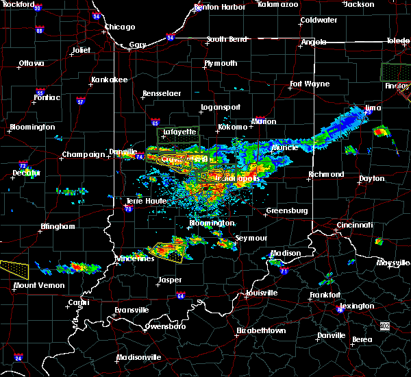 At 426 pm edt, a severe thunderstorm was located near crawfordsville, moving southeast at 35 mph (radar indicated). Hazards include quarter size hail. damage to vehicles is expected At 426 pm edt, a severe thunderstorm was located near crawfordsville, moving southeast at 35 mph (radar indicated). Hazards include quarter size hail. damage to vehicles is expected
|
| 6/5/2019 4:18 PM EDT |
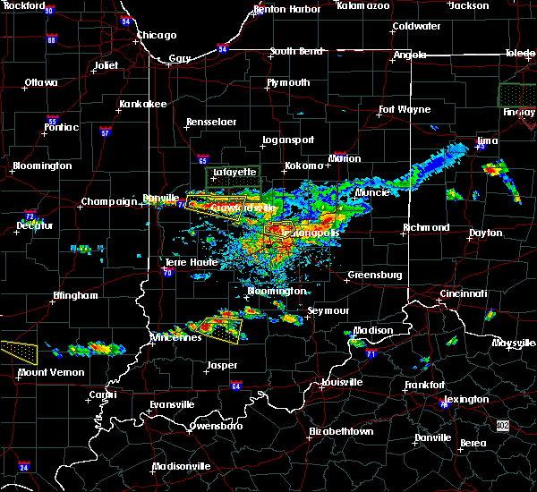 At 418 pm edt, a severe thunderstorm was located near crawfordsville, moving southeast at 35 mph (radar indicated). Hazards include quarter size hail. Damage to vehicles is expected. locations impacted include, crawfordsville, thorntown, darlington and advance. this includes the following highways, interstate 65 between mile markers 149 and 150. Interstate 74 between mile markers 32 and 42. At 418 pm edt, a severe thunderstorm was located near crawfordsville, moving southeast at 35 mph (radar indicated). Hazards include quarter size hail. Damage to vehicles is expected. locations impacted include, crawfordsville, thorntown, darlington and advance. this includes the following highways, interstate 65 between mile markers 149 and 150. Interstate 74 between mile markers 32 and 42.
|
| 6/5/2019 3:49 PM EDT |
 At 349 pm edt, a severe thunderstorm was located 9 miles north of crawfordsville, moving east at 25 mph (radar indicated). Hazards include quarter size hail. damage to vehicles is expected At 349 pm edt, a severe thunderstorm was located 9 miles north of crawfordsville, moving east at 25 mph (radar indicated). Hazards include quarter size hail. damage to vehicles is expected
|
| 5/26/2019 4:28 AM EDT |
 At 428 am edt, severe thunderstorms were located along a line extending from 7 miles south of walton to 11 miles west of tipton to 9 miles north of greencastle, moving east at 45 mph (radar indicated). Hazards include 60 mph wind gusts and nickel size hail. Expect damage to roofs, siding, and trees. locations impacted include, kokomo, frankfort, brownsburg, lebanon, zionsville, danville, tipton, windfall, westfield, pittsboro, whitestown, sheridan, greentown, flora, rossville, thorntown, russiaville, ladoga, jamestown and roachdale. this includes the following highways, interstate 65 between mile markers 128 and 155. Interstate 74 between mile markers 41 and 67. At 428 am edt, severe thunderstorms were located along a line extending from 7 miles south of walton to 11 miles west of tipton to 9 miles north of greencastle, moving east at 45 mph (radar indicated). Hazards include 60 mph wind gusts and nickel size hail. Expect damage to roofs, siding, and trees. locations impacted include, kokomo, frankfort, brownsburg, lebanon, zionsville, danville, tipton, windfall, westfield, pittsboro, whitestown, sheridan, greentown, flora, rossville, thorntown, russiaville, ladoga, jamestown and roachdale. this includes the following highways, interstate 65 between mile markers 128 and 155. Interstate 74 between mile markers 41 and 67.
|
| 5/26/2019 4:09 AM EDT |
 At 406 am edt, severe thunderstorms were located along a line extending from 8 miles southeast of delphi to near frankfort to 8 miles east of rockville, moving east at 45 mph (radar indicated). Hazards include 60 mph wind gusts and nickel size hail. expect damage to roofs, siding, and trees At 406 am edt, severe thunderstorms were located along a line extending from 8 miles southeast of delphi to near frankfort to 8 miles east of rockville, moving east at 45 mph (radar indicated). Hazards include 60 mph wind gusts and nickel size hail. expect damage to roofs, siding, and trees
|
| 5/23/2019 4:42 AM EDT |
 At 441 am edt, severe thunderstorms were located along a line extending from near grissom afb to 11 miles southwest of kokomo to 10 miles southwest of lebanon, moving northeast at 60 mph (radar indicated). Hazards include 70 mph wind gusts and penny size hail. Expect considerable tree damage. damage is likely to mobile homes, roofs, and outbuildings. locations impacted include, kokomo, frankfort, lebanon, zionsville, tipton, windfall, whitestown, sheridan, greentown, thorntown, russiaville, ladoga, jamestown, kirklin, colfax, sharpsville, burlington, advance, michigantown and new ross. this includes the following highways, interstate 65 between mile markers 128 and 158. Interstate 74 between mile markers 40 and 54. At 441 am edt, severe thunderstorms were located along a line extending from near grissom afb to 11 miles southwest of kokomo to 10 miles southwest of lebanon, moving northeast at 60 mph (radar indicated). Hazards include 70 mph wind gusts and penny size hail. Expect considerable tree damage. damage is likely to mobile homes, roofs, and outbuildings. locations impacted include, kokomo, frankfort, lebanon, zionsville, tipton, windfall, whitestown, sheridan, greentown, thorntown, russiaville, ladoga, jamestown, kirklin, colfax, sharpsville, burlington, advance, michigantown and new ross. this includes the following highways, interstate 65 between mile markers 128 and 158. Interstate 74 between mile markers 40 and 54.
|
| 5/23/2019 4:13 AM EDT |
 The national weather service in indianapolis has issued a * severe thunderstorm warning for. carroll county in north central indiana. southeastern tippecanoe county in west central indiana. clinton county in central indiana. Howard county in central indiana. The national weather service in indianapolis has issued a * severe thunderstorm warning for. carroll county in north central indiana. southeastern tippecanoe county in west central indiana. clinton county in central indiana. Howard county in central indiana.
|
| 5/19/2019 5:30 PM EDT |
 At 529 pm edt, severe thunderstorms were located along a line extending from near frankfort to 11 miles southeast of crawfordsville, moving east at 45 mph. this storm has a history of producing 60 mph winds (public). Hazards include 60 mph wind gusts and quarter size hail. Hail damage to vehicles is expected. expect wind damage to roofs, siding, and trees. locations impacted include, frankfort, lebanon, whitestown, sheridan, thorntown, ladoga, jamestown, kirklin, colfax, sharpsville, advance, michigantown, new ross, kempton and ulen. this includes the following highways, interstate 65 between mile markers 130 and 159. Interstate 74 between mile markers 42 and 54. At 529 pm edt, severe thunderstorms were located along a line extending from near frankfort to 11 miles southeast of crawfordsville, moving east at 45 mph. this storm has a history of producing 60 mph winds (public). Hazards include 60 mph wind gusts and quarter size hail. Hail damage to vehicles is expected. expect wind damage to roofs, siding, and trees. locations impacted include, frankfort, lebanon, whitestown, sheridan, thorntown, ladoga, jamestown, kirklin, colfax, sharpsville, advance, michigantown, new ross, kempton and ulen. this includes the following highways, interstate 65 between mile markers 130 and 159. Interstate 74 between mile markers 42 and 54.
|
| 5/19/2019 5:11 PM EDT |
 At 511 pm edt, severe thunderstorms were located along a line extending from 15 miles southwest of frankfort to 10 miles south of crawfordsville, moving east at 45 mph (public). Hazards include 60 mph wind gusts and quarter size hail. Hail damage to vehicles is expected. Expect wind damage to roofs, siding, and trees. At 511 pm edt, severe thunderstorms were located along a line extending from 15 miles southwest of frankfort to 10 miles south of crawfordsville, moving east at 45 mph (public). Hazards include 60 mph wind gusts and quarter size hail. Hail damage to vehicles is expected. Expect wind damage to roofs, siding, and trees.
|
| 8/7/2018 12:34 AM EDT |
 At 1234 am edt, severe thunderstorms were located along a line extending from 6 miles southwest of lebanon to 6 miles northwest of danville, moving east at 35 mph (radar indicated). Hazards include 60 mph wind gusts and nickel size hail. expect damage to roofs, siding, and trees At 1234 am edt, severe thunderstorms were located along a line extending from 6 miles southwest of lebanon to 6 miles northwest of danville, moving east at 35 mph (radar indicated). Hazards include 60 mph wind gusts and nickel size hail. expect damage to roofs, siding, and trees
|
| 8/7/2018 12:21 AM EDT |
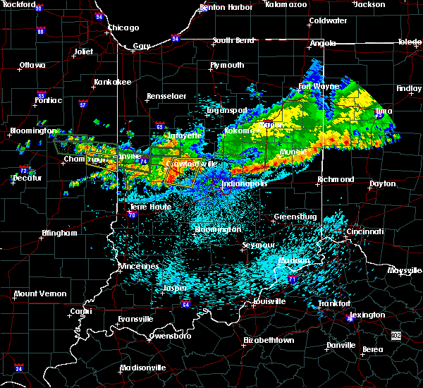 At 1221 am edt, severe thunderstorms were located along a line extending from 13 miles southwest of frankfort to 12 miles south of crawfordsville, moving east at 35 mph (radar indicated). Hazards include 60 mph wind gusts and quarter size hail. Hail damage to vehicles is expected. expect wind damage to roofs, siding, and trees. locations impacted include, lebanon, thorntown, ladoga, jamestown, roachdale, darlington, north salem, lizton, advance, new ross and ulen. this includes the following highways, interstate 65 between mile markers 139 and 150. Interstate 74 between mile markers 38 and 59. At 1221 am edt, severe thunderstorms were located along a line extending from 13 miles southwest of frankfort to 12 miles south of crawfordsville, moving east at 35 mph (radar indicated). Hazards include 60 mph wind gusts and quarter size hail. Hail damage to vehicles is expected. expect wind damage to roofs, siding, and trees. locations impacted include, lebanon, thorntown, ladoga, jamestown, roachdale, darlington, north salem, lizton, advance, new ross and ulen. this includes the following highways, interstate 65 between mile markers 139 and 150. Interstate 74 between mile markers 38 and 59.
|
| 8/7/2018 12:06 AM EDT |
 At 1206 am edt, severe thunderstorms were located along a line extending from 10 miles north of crawfordsville to 16 miles northeast of rockville, moving east at 35 mph (radar indicated). Hazards include 60 mph wind gusts and quarter size hail. Hail damage to vehicles is expected. Expect wind damage to roofs, siding, and trees. At 1206 am edt, severe thunderstorms were located along a line extending from 10 miles north of crawfordsville to 16 miles northeast of rockville, moving east at 35 mph (radar indicated). Hazards include 60 mph wind gusts and quarter size hail. Hail damage to vehicles is expected. Expect wind damage to roofs, siding, and trees.
|
| 6/10/2018 7:08 AM EDT |
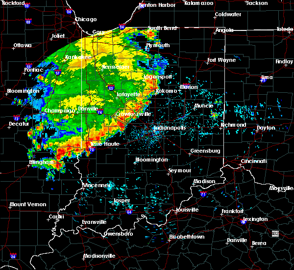 The severe thunderstorm warning for southern clinton, northwestern boone and northeastern montgomery counties will expire at 715 am edt, the storms which prompted the warning have weakened below severe limits, and no longer pose an immediate threat to life or property. therefore, the warning will be allowed to expire. however gusty winds are still possible with these thunderstorms. The severe thunderstorm warning for southern clinton, northwestern boone and northeastern montgomery counties will expire at 715 am edt, the storms which prompted the warning have weakened below severe limits, and no longer pose an immediate threat to life or property. therefore, the warning will be allowed to expire. however gusty winds are still possible with these thunderstorms.
|
| 6/10/2018 7:00 AM EDT |
 A severe thunderstorm warning remains in effect until 715 am edt for southern clinton. northwestern boone and northeastern montgomery counties. at 659 am edt, severe thunderstorms were located along a line extending from near frankfort to 6 miles southeast of crawfordsville, moving southeast at 40 mph. At 636 am edt, tree. A severe thunderstorm warning remains in effect until 715 am edt for southern clinton. northwestern boone and northeastern montgomery counties. at 659 am edt, severe thunderstorms were located along a line extending from near frankfort to 6 miles southeast of crawfordsville, moving southeast at 40 mph. At 636 am edt, tree.
|
| 6/10/2018 6:46 AM EDT |
 At 645 am edt, severe thunderstorms were located along a line extending from 10 miles northwest of frankfort to near crawfordsville, moving east at 45 mph (radar indicated). Hazards include 60 mph wind gusts and penny size hail. Expect damage to roofs, siding, and trees. locations impacted include, frankfort, crawfordsville, thorntown, dayton, mulberry, darlington, linden, colfax, clarks hill, advance, new ross and new richmond. this includes the following highways, interstate 65 between mile markers 145 and 169. Interstate 74 between mile markers 28 and 49. At 645 am edt, severe thunderstorms were located along a line extending from 10 miles northwest of frankfort to near crawfordsville, moving east at 45 mph (radar indicated). Hazards include 60 mph wind gusts and penny size hail. Expect damage to roofs, siding, and trees. locations impacted include, frankfort, crawfordsville, thorntown, dayton, mulberry, darlington, linden, colfax, clarks hill, advance, new ross and new richmond. this includes the following highways, interstate 65 between mile markers 145 and 169. Interstate 74 between mile markers 28 and 49.
|
| 6/10/2018 6:30 AM EDT |
 At 630 am edt, a severe thunderstorm was located 12 miles southwest of lafayette, moving southeast at 40 mph (radar indicated). Hazards include 60 mph wind gusts and penny size hail. expect damage to roofs, siding, and trees At 630 am edt, a severe thunderstorm was located 12 miles southwest of lafayette, moving southeast at 40 mph (radar indicated). Hazards include 60 mph wind gusts and penny size hail. expect damage to roofs, siding, and trees
|
| 11/5/2017 2:54 PM EDT |
 At 153 pm est, a severe thunderstorm was located 10 miles southwest of frankfort, moving east at 50 mph (radar indicated). Hazards include 60 mph wind gusts and quarter size hail. Hail damage to vehicles is expected. expect wind damage to roofs, siding, and trees. locations impacted include, frankfort, crawfordsville, lebanon, whitestown, thorntown, darlington, kirklin, colfax, clarks hill, advance and ulen. this includes the following highways, interstate 65 between mile markers 129 and 165. interstate 74 between mile markers 32 and 40. A tornado watch remains in effect until 700 pm est for central and west central indiana. At 153 pm est, a severe thunderstorm was located 10 miles southwest of frankfort, moving east at 50 mph (radar indicated). Hazards include 60 mph wind gusts and quarter size hail. Hail damage to vehicles is expected. expect wind damage to roofs, siding, and trees. locations impacted include, frankfort, crawfordsville, lebanon, whitestown, thorntown, darlington, kirklin, colfax, clarks hill, advance and ulen. this includes the following highways, interstate 65 between mile markers 129 and 165. interstate 74 between mile markers 32 and 40. A tornado watch remains in effect until 700 pm est for central and west central indiana.
|
| 11/5/2017 2:37 PM EDT |
 At 136 pm est, a severe thunderstorm was located 11 miles north of crawfordsville, moving east at 50 mph (radar indicated). Hazards include 60 mph wind gusts and quarter size hail. Hail damage to vehicles is expected. Expect wind damage to roofs, siding, and trees. At 136 pm est, a severe thunderstorm was located 11 miles north of crawfordsville, moving east at 50 mph (radar indicated). Hazards include 60 mph wind gusts and quarter size hail. Hail damage to vehicles is expected. Expect wind damage to roofs, siding, and trees.
|
| 7/22/2017 3:42 AM EDT |
 The severe thunderstorm warning for southern clinton and boone counties will expire at 345 am edt, the storms which prompted the warning have weakened below severe limits, and no longer pose an immediate threat to life or property. therefore the warning will be allowed to expire. however gusty winds and heavy rain are still possible with these thunderstorms. a severe thunderstorm watch remains in effect until 700 am edt for central and west central indiana. The severe thunderstorm warning for southern clinton and boone counties will expire at 345 am edt, the storms which prompted the warning have weakened below severe limits, and no longer pose an immediate threat to life or property. therefore the warning will be allowed to expire. however gusty winds and heavy rain are still possible with these thunderstorms. a severe thunderstorm watch remains in effect until 700 am edt for central and west central indiana.
|
| 7/22/2017 3:36 AM EDT |
 At 336 am edt, severe thunderstorms were located along a line extending from 12 miles north of zionsville to near lebanon to 15 miles northwest of brownsburg, moving southeast at 30 mph (radar indicated). Hazards include 60 mph wind gusts. Expect damage to roofs, siding, and trees. locations impacted include, lebanon, zionsville, whitestown, thorntown, kirklin, colfax, advance and ulen. This includes interstate 65 between mile markers 130 and 154. At 336 am edt, severe thunderstorms were located along a line extending from 12 miles north of zionsville to near lebanon to 15 miles northwest of brownsburg, moving southeast at 30 mph (radar indicated). Hazards include 60 mph wind gusts. Expect damage to roofs, siding, and trees. locations impacted include, lebanon, zionsville, whitestown, thorntown, kirklin, colfax, advance and ulen. This includes interstate 65 between mile markers 130 and 154.
|
| 7/22/2017 3:25 AM EDT |
 At 324 am edt, severe thunderstorms were located along a line extending from 6 miles southwest of kokomo to 12 miles southeast of frankfort to 6 miles west of lebanon, moving southeast at 40 mph (radar indicated. at 318 am edt a spotter near thorntown reported 60 mph winds). Hazards include 60 mph wind gusts. Expect damage to roofs, siding, and trees. locations impacted include, frankfort, crawfordsville, lebanon, zionsville, whitestown, rossville, thorntown, mulberry, darlington, kirklin, colfax, advance, michigantown and ulen. this includes the following highways, interstate 65 between mile markers 130 and 160. Interstate 74 between mile markers 37 and 45. At 324 am edt, severe thunderstorms were located along a line extending from 6 miles southwest of kokomo to 12 miles southeast of frankfort to 6 miles west of lebanon, moving southeast at 40 mph (radar indicated. at 318 am edt a spotter near thorntown reported 60 mph winds). Hazards include 60 mph wind gusts. Expect damage to roofs, siding, and trees. locations impacted include, frankfort, crawfordsville, lebanon, zionsville, whitestown, rossville, thorntown, mulberry, darlington, kirklin, colfax, advance, michigantown and ulen. this includes the following highways, interstate 65 between mile markers 130 and 160. Interstate 74 between mile markers 37 and 45.
|
| 7/22/2017 3:14 AM EDT |
 At 313 am edt, severe thunderstorms were located along a line extending from 9 miles west of kokomo to 7 miles southeast of frankfort to 10 miles east of crawfordsville, moving southeast at 40 mph (radar indicated. at 230 am edt, tippecanoe county sheriff reported numerous trees downed in the county). Hazards include 60 mph wind gusts. Expect damage to roofs, siding, and trees. locations impacted include, lafayette, frankfort, crawfordsville, west lafayette, lebanon, zionsville, whitestown, flora, rossville, shadeland, thorntown, dayton, mulberry, russiaville, waynetown, darlington, kirklin, linden, colfax and clarks hill. this includes the following highways, interstate 65 between mile markers 130 and 176. Interstate 74 between mile markers 25 and 45. At 313 am edt, severe thunderstorms were located along a line extending from 9 miles west of kokomo to 7 miles southeast of frankfort to 10 miles east of crawfordsville, moving southeast at 40 mph (radar indicated. at 230 am edt, tippecanoe county sheriff reported numerous trees downed in the county). Hazards include 60 mph wind gusts. Expect damage to roofs, siding, and trees. locations impacted include, lafayette, frankfort, crawfordsville, west lafayette, lebanon, zionsville, whitestown, flora, rossville, shadeland, thorntown, dayton, mulberry, russiaville, waynetown, darlington, kirklin, linden, colfax and clarks hill. this includes the following highways, interstate 65 between mile markers 130 and 176. Interstate 74 between mile markers 25 and 45.
|
| 7/22/2017 2:58 AM EDT |
 At 257 am edt, severe thunderstorms were located along a line extending from 12 miles southwest of walton to near frankfort to near crawfordsville, moving southeast at 40 mph (radar indicated). Hazards include 60 mph wind gusts. Expect damage to roofs, siding, and trees. locations impacted include, lafayette, frankfort, crawfordsville, west lafayette, lebanon, zionsville, delphi, whitestown, flora, rossville, shadeland, thorntown, dayton, battle ground, mulberry, russiaville, jamestown, waynetown, darlington and kirklin. this includes the following highways, interstate 65 between mile markers 129 and 184. Interstate 74 between mile markers 21 and 54. At 257 am edt, severe thunderstorms were located along a line extending from 12 miles southwest of walton to near frankfort to near crawfordsville, moving southeast at 40 mph (radar indicated). Hazards include 60 mph wind gusts. Expect damage to roofs, siding, and trees. locations impacted include, lafayette, frankfort, crawfordsville, west lafayette, lebanon, zionsville, delphi, whitestown, flora, rossville, shadeland, thorntown, dayton, battle ground, mulberry, russiaville, jamestown, waynetown, darlington and kirklin. this includes the following highways, interstate 65 between mile markers 129 and 184. Interstate 74 between mile markers 21 and 54.
|
| 7/22/2017 2:45 AM EDT |
 At 245 am edt, severe thunderstorms were located along a line extending from 6 miles northeast of delphi to 10 miles southeast of lafayette to 10 miles northwest of crawfordsville, moving southeast at 40 mph (radar indicated). Hazards include 60 mph wind gusts. expect damage to roofs, siding, and trees At 245 am edt, severe thunderstorms were located along a line extending from 6 miles northeast of delphi to 10 miles southeast of lafayette to 10 miles northwest of crawfordsville, moving southeast at 40 mph (radar indicated). Hazards include 60 mph wind gusts. expect damage to roofs, siding, and trees
|
| 7/11/2017 12:31 PM EDT |
 At 1231 pm edt, severe thunderstorms were located along a line extending from near lebanon to 7 miles west of mooresville, moving east at 50 mph (radar indicated). Hazards include 60 mph wind gusts and penny size hail. expect damage to roofs, siding, and trees At 1231 pm edt, severe thunderstorms were located along a line extending from near lebanon to 7 miles west of mooresville, moving east at 50 mph (radar indicated). Hazards include 60 mph wind gusts and penny size hail. expect damage to roofs, siding, and trees
|
| 7/11/2017 12:10 PM EDT |
 At 1209 pm edt, severe thunderstorms were located along a line extending from near crawfordsville to 6 miles northwest of greencastle, moving east at 50 mph. this storm has a history of winds with excess of 60 mph (trained weather spotters). Hazards include 60 mph wind gusts and penny size hail. expect damage to roofs, siding, and trees At 1209 pm edt, severe thunderstorms were located along a line extending from near crawfordsville to 6 miles northwest of greencastle, moving east at 50 mph. this storm has a history of winds with excess of 60 mph (trained weather spotters). Hazards include 60 mph wind gusts and penny size hail. expect damage to roofs, siding, and trees
|
| 7/7/2017 3:40 PM EDT |
 At 340 pm edt, a severe thunderstorm was located 9 miles northwest of danville, or 19 miles southeast of crawfordsville, moving southeast at 30 mph (radar indicated). Hazards include 60 mph wind gusts and quarter size hail. Hail damage to vehicles is expected. Expect wind damage to roofs, siding, and trees. At 340 pm edt, a severe thunderstorm was located 9 miles northwest of danville, or 19 miles southeast of crawfordsville, moving southeast at 30 mph (radar indicated). Hazards include 60 mph wind gusts and quarter size hail. Hail damage to vehicles is expected. Expect wind damage to roofs, siding, and trees.
|
| 7/7/2017 3:20 PM EDT |
 At 320 pm edt, a severe thunderstorm was located 13 miles southeast of crawfordsville, moving east at 30 mph (radar indicated). Hazards include ping pong ball size hail and 60 mph wind gusts. People and animals outdoors will be injured. expect hail damage to roofs, siding, windows, and vehicles. expect wind damage to roofs, siding, and trees. locations impacted include, lebanon, danville, pittsboro, ladoga, jamestown, roachdale, north salem, lizton, advance and new ross. this includes the following highways, interstate 65 between mile markers 134 and 138. Interstate 74 between mile markers 43 and 62. At 320 pm edt, a severe thunderstorm was located 13 miles southeast of crawfordsville, moving east at 30 mph (radar indicated). Hazards include ping pong ball size hail and 60 mph wind gusts. People and animals outdoors will be injured. expect hail damage to roofs, siding, windows, and vehicles. expect wind damage to roofs, siding, and trees. locations impacted include, lebanon, danville, pittsboro, ladoga, jamestown, roachdale, north salem, lizton, advance and new ross. this includes the following highways, interstate 65 between mile markers 134 and 138. Interstate 74 between mile markers 43 and 62.
|
| 7/7/2017 3:07 PM EDT |
 At 307 pm edt, a severe thunderstorm was located 11 miles southeast of crawfordsville, moving east at 40 mph (radar indicated). Hazards include ping pong ball size hail and 60 mph wind gusts. People and animals outdoors will be injured. expect hail damage to roofs, siding, windows, and vehicles. expect wind damage to roofs, siding, and trees. locations impacted include, crawfordsville, lebanon, danville, pittsboro, ladoga, jamestown, roachdale, new market, north salem, lizton, advance and new ross. this includes the following highways, interstate 65 between mile markers 134 and 138. Interstate 74 between mile markers 38 and 62. At 307 pm edt, a severe thunderstorm was located 11 miles southeast of crawfordsville, moving east at 40 mph (radar indicated). Hazards include ping pong ball size hail and 60 mph wind gusts. People and animals outdoors will be injured. expect hail damage to roofs, siding, windows, and vehicles. expect wind damage to roofs, siding, and trees. locations impacted include, crawfordsville, lebanon, danville, pittsboro, ladoga, jamestown, roachdale, new market, north salem, lizton, advance and new ross. this includes the following highways, interstate 65 between mile markers 134 and 138. Interstate 74 between mile markers 38 and 62.
|
| 7/7/2017 2:53 PM EDT |
 At 253 pm edt, a severe thunderstorm was located near crawfordsville, moving east at 40 mph (radar indicated). Hazards include ping pong ball size hail and 60 mph wind gusts. People and animals outdoors will be injured. expect hail damage to roofs, siding, windows, and vehicles. Expect wind damage to roofs, siding, and trees. At 253 pm edt, a severe thunderstorm was located near crawfordsville, moving east at 40 mph (radar indicated). Hazards include ping pong ball size hail and 60 mph wind gusts. People and animals outdoors will be injured. expect hail damage to roofs, siding, windows, and vehicles. Expect wind damage to roofs, siding, and trees.
|
| 5/26/2017 8:34 PM EDT |
 At 834 pm edt, a severe thunderstorm was located 8 miles southeast of frankfort, moving east at 50 mph (trained weather spotters). Hazards include 70 mph wind gusts. Expect considerable tree damage. damage is likely to mobile homes, roofs, and outbuildings. locations impacted include, brownsburg, lebanon, pittsboro, whitestown, jamestown, kirklin, lizton, advance, kempton and ulen. this includes the following highways, interstate 65 between mile markers 128 and 148. interstate 74 between mile markers 50 and 64. A tornado watch remains in effect until 900 pm edt for central indiana. At 834 pm edt, a severe thunderstorm was located 8 miles southeast of frankfort, moving east at 50 mph (trained weather spotters). Hazards include 70 mph wind gusts. Expect considerable tree damage. damage is likely to mobile homes, roofs, and outbuildings. locations impacted include, brownsburg, lebanon, pittsboro, whitestown, jamestown, kirklin, lizton, advance, kempton and ulen. this includes the following highways, interstate 65 between mile markers 128 and 148. interstate 74 between mile markers 50 and 64. A tornado watch remains in effect until 900 pm edt for central indiana.
|
| 5/26/2017 8:20 PM EDT |
 At 817 pm edt, a severe thunderstorm was located 10 miles southwest of frankfort, moving east at 50 mph (trained weather spotters reported 70 mph winds 4 miles east and northeast of waynetown at 808 pm edt). Hazards include 70 mph wind gusts. Expect considerable tree damage. damage is likely to mobile homes, roofs, and outbuildings. locations impacted include, frankfort, brownsburg, lebanon, pittsboro, whitestown, thorntown, ladoga, jamestown, kirklin, colfax, new market, lizton, advance, new ross, kempton and ulen. this includes the following highways, interstate 65 between mile markers 128 and 160. interstate 74 between mile markers 39 and 64. A tornado watch remains in effect until 900 pm edt for central and west central indiana. At 817 pm edt, a severe thunderstorm was located 10 miles southwest of frankfort, moving east at 50 mph (trained weather spotters reported 70 mph winds 4 miles east and northeast of waynetown at 808 pm edt). Hazards include 70 mph wind gusts. Expect considerable tree damage. damage is likely to mobile homes, roofs, and outbuildings. locations impacted include, frankfort, brownsburg, lebanon, pittsboro, whitestown, thorntown, ladoga, jamestown, kirklin, colfax, new market, lizton, advance, new ross, kempton and ulen. this includes the following highways, interstate 65 between mile markers 128 and 160. interstate 74 between mile markers 39 and 64. A tornado watch remains in effect until 900 pm edt for central and west central indiana.
|
| 5/26/2017 8:06 PM EDT |
 At 805 pm edt, a severe thunderstorm was located 9 miles north of crawfordsville, moving east at 50 mph (radar indicated). Hazards include 60 mph wind gusts. expect damage to roofs, siding, and trees At 805 pm edt, a severe thunderstorm was located 9 miles north of crawfordsville, moving east at 50 mph (radar indicated). Hazards include 60 mph wind gusts. expect damage to roofs, siding, and trees
|
| 4/26/2017 7:25 PM EDT |
 At 725 pm edt, a severe thunderstorm was located over brownsburg, or 16 miles west of indianapolis, moving northeast at 50 mph (trained weather spotters). Hazards include 70 mph wind gusts and quarter size hail. Hail damage to vehicles is expected. expect considerable tree damage. Wind damage is also likely to mobile homes, roofs, and outbuildings. At 725 pm edt, a severe thunderstorm was located over brownsburg, or 16 miles west of indianapolis, moving northeast at 50 mph (trained weather spotters). Hazards include 70 mph wind gusts and quarter size hail. Hail damage to vehicles is expected. expect considerable tree damage. Wind damage is also likely to mobile homes, roofs, and outbuildings.
|
| 4/26/2017 6:53 PM EDT |
 At 653 pm edt, a severe thunderstorm was located 11 miles southwest of lebanon, or 14 miles southeast of crawfordsville, moving northeast at 40 mph (radar indicated). Hazards include 60 mph wind gusts and nickel size hail. expect damage to roofs, siding, and trees At 653 pm edt, a severe thunderstorm was located 11 miles southwest of lebanon, or 14 miles southeast of crawfordsville, moving northeast at 40 mph (radar indicated). Hazards include 60 mph wind gusts and nickel size hail. expect damage to roofs, siding, and trees
|
| 4/10/2017 4:07 PM EDT |
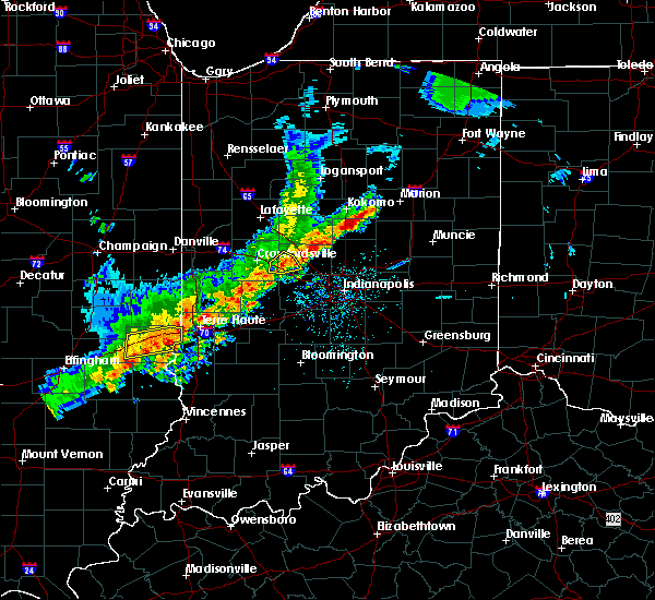 The severe thunderstorm warning for southwestern boone and east central montgomery counties will expire at 415 pm edt, the storm which prompted the warning has weakened below severe limits, and no longer poses an immediate threat to life or property. therefore, the warning will be allowed to expire. however heavy rain is still possible with this thunderstorm. to report severe weather, contact your nearest law enforcement agency. they will relay your report to the national weather service indianapolis. The severe thunderstorm warning for southwestern boone and east central montgomery counties will expire at 415 pm edt, the storm which prompted the warning has weakened below severe limits, and no longer poses an immediate threat to life or property. therefore, the warning will be allowed to expire. however heavy rain is still possible with this thunderstorm. to report severe weather, contact your nearest law enforcement agency. they will relay your report to the national weather service indianapolis.
|
| 4/10/2017 3:59 PM EDT |
 At 358 pm edt, a severe thunderstorm was located 10 miles east of crawfordsville, moving northeast at 50 mph (radar indicated). Hazards include quarter size hail. Damage to vehicles is expected. locations impacted include, advance and new ross. This includes interstate 74 between mile markers 43 and 51. At 358 pm edt, a severe thunderstorm was located 10 miles east of crawfordsville, moving northeast at 50 mph (radar indicated). Hazards include quarter size hail. Damage to vehicles is expected. locations impacted include, advance and new ross. This includes interstate 74 between mile markers 43 and 51.
|
| 4/10/2017 3:51 PM EDT |
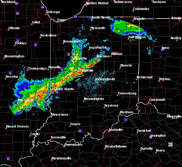 At 350 pm edt, a severe thunderstorm was located 7 miles southeast of crawfordsville, moving northeast at 50 mph (radar indicated). Hazards include quarter size hail. Damage to vehicles is expected. locations impacted include, ladoga, jamestown, advance and new ross. This includes interstate 74 between mile markers 41 and 53. At 350 pm edt, a severe thunderstorm was located 7 miles southeast of crawfordsville, moving northeast at 50 mph (radar indicated). Hazards include quarter size hail. Damage to vehicles is expected. locations impacted include, ladoga, jamestown, advance and new ross. This includes interstate 74 between mile markers 41 and 53.
|
| 4/10/2017 3:43 PM EDT |
 At 343 pm edt, a severe thunderstorm was located 9 miles south of crawfordsville, moving northeast at 50 mph (radar indicated). Hazards include quarter size hail. Damage to vehicles is expected. locations impacted include, crawfordsville, ladoga, jamestown, roachdale, darlington, new market, advance and new ross. This includes interstate 74 between mile markers 37 and 56. At 343 pm edt, a severe thunderstorm was located 9 miles south of crawfordsville, moving northeast at 50 mph (radar indicated). Hazards include quarter size hail. Damage to vehicles is expected. locations impacted include, crawfordsville, ladoga, jamestown, roachdale, darlington, new market, advance and new ross. This includes interstate 74 between mile markers 37 and 56.
|
| 4/10/2017 3:38 PM EDT |
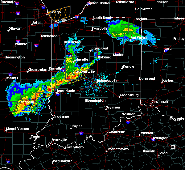 At 338 pm edt, a severe thunderstorm was located 12 miles south of crawfordsville, moving northeast at 50 mph (radar indicated). Hazards include quarter size hail. damage to vehicles is expected At 338 pm edt, a severe thunderstorm was located 12 miles south of crawfordsville, moving northeast at 50 mph (radar indicated). Hazards include quarter size hail. damage to vehicles is expected
|
| 3/20/2017 3:42 PM EDT |
 At 341 pm edt, a severe thunderstorm was located near lebanon, or 20 miles south of frankfort, moving southeast at 40 mph. recent reports from lebanon indicated mostly half inch diameter hail occurring with this storm (radar indicated). Hazards include quarter size hail. Damage to vehicles is expected. locations impacted include, lebanon, zionsville, whitestown, thorntown, advance and ulen. This includes interstate 65 between mile markers 129 and 149. At 341 pm edt, a severe thunderstorm was located near lebanon, or 20 miles south of frankfort, moving southeast at 40 mph. recent reports from lebanon indicated mostly half inch diameter hail occurring with this storm (radar indicated). Hazards include quarter size hail. Damage to vehicles is expected. locations impacted include, lebanon, zionsville, whitestown, thorntown, advance and ulen. This includes interstate 65 between mile markers 129 and 149.
|
| 3/20/2017 3:28 PM EDT |
 At 328 pm edt, a severe thunderstorm was located near lebanon, or 16 miles south of frankfort, moving southeast at 50 mph (radar indicated). Hazards include quarter size hail. damage to vehicles is expected At 328 pm edt, a severe thunderstorm was located near lebanon, or 16 miles south of frankfort, moving southeast at 50 mph (radar indicated). Hazards include quarter size hail. damage to vehicles is expected
|
| 3/20/2017 3:22 PM EDT |
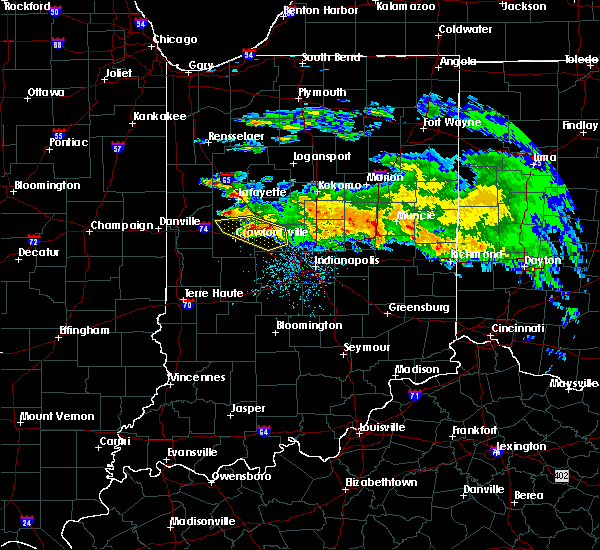 At 321 pm edt, a severe thunderstorm was located near lebanon, or 17 miles south of frankfort, moving southeast at 35 mph (trained weather spotters). Hazards include quarter size hail. Damage to vehicles is expected. locations impacted include, lebanon, thorntown, advance and ulen. this includes the following highways, interstate 65 between mile markers 135 and 150. Interstate 74 between mile markers 41 and 42. At 321 pm edt, a severe thunderstorm was located near lebanon, or 17 miles south of frankfort, moving southeast at 35 mph (trained weather spotters). Hazards include quarter size hail. Damage to vehicles is expected. locations impacted include, lebanon, thorntown, advance and ulen. this includes the following highways, interstate 65 between mile markers 135 and 150. Interstate 74 between mile markers 41 and 42.
|
| 3/20/2017 3:09 PM EDT |
 At 308 pm edt, a severe thunderstorm was located 11 miles west of lebanon, or 11 miles east of crawfordsville, moving southeast at 35 mph (trained weather spotters). Hazards include quarter size hail. Damage to vehicles is expected. locations impacted include, lebanon, thorntown, darlington, linden, colfax, clarks hill, advance, new richmond and ulen. this includes the following highways, interstate 65 between mile markers 135 and 152. Interstate 74 between mile markers 32 and 42. At 308 pm edt, a severe thunderstorm was located 11 miles west of lebanon, or 11 miles east of crawfordsville, moving southeast at 35 mph (trained weather spotters). Hazards include quarter size hail. Damage to vehicles is expected. locations impacted include, lebanon, thorntown, darlington, linden, colfax, clarks hill, advance, new richmond and ulen. this includes the following highways, interstate 65 between mile markers 135 and 152. Interstate 74 between mile markers 32 and 42.
|
| 3/20/2017 2:55 PM EDT |
 At 255 pm edt, a severe thunderstorm was located 7 miles northeast of crawfordsville, moving southeast at 35 mph (trained weather spotters). Hazards include quarter size hail. damage to vehicles is expected At 255 pm edt, a severe thunderstorm was located 7 miles northeast of crawfordsville, moving southeast at 35 mph (trained weather spotters). Hazards include quarter size hail. damage to vehicles is expected
|
| 11/18/2016 5:25 PM EST |
 The severe thunderstorm warning for carroll, northwestern boone, clinton, central montgomery, eastern tippecanoe and northwestern howard counties will expire at 530 pm est, the storms which prompted the warning have weakened below severe limits, and no longer pose an immediate threat to life or property. therefore, the warning will be allowed to expire. however gusty winds to around 50 mph are still possible with these thunderstorms. The severe thunderstorm warning for carroll, northwestern boone, clinton, central montgomery, eastern tippecanoe and northwestern howard counties will expire at 530 pm est, the storms which prompted the warning have weakened below severe limits, and no longer pose an immediate threat to life or property. therefore, the warning will be allowed to expire. however gusty winds to around 50 mph are still possible with these thunderstorms.
|
| 11/18/2016 5:11 PM EST |
 At 511 pm est, severe thunderstorms were located along a line extending from 9 miles south of royal center to 10 miles southeast of delphi to near crawfordsville, moving northeast at 65 mph (radar indicated). Hazards include 60 mph wind gusts. Expect damage to roofs. siding. and trees. locations impacted include, lafayette, frankfort, crawfordsville, monticello, delphi, flora, rossville, thorntown, dayton, battle ground, mulberry, darlington, linden, colfax, clarks hill, camden, burlington, advance, michigantown and yeoman. this includes the following highways, interstate 65 between mile markers 147 and 178. Interstate 74 between mile markers 29 and 45. At 511 pm est, severe thunderstorms were located along a line extending from 9 miles south of royal center to 10 miles southeast of delphi to near crawfordsville, moving northeast at 65 mph (radar indicated). Hazards include 60 mph wind gusts. Expect damage to roofs. siding. and trees. locations impacted include, lafayette, frankfort, crawfordsville, monticello, delphi, flora, rossville, thorntown, dayton, battle ground, mulberry, darlington, linden, colfax, clarks hill, camden, burlington, advance, michigantown and yeoman. this includes the following highways, interstate 65 between mile markers 147 and 178. Interstate 74 between mile markers 29 and 45.
|
| 11/18/2016 4:54 PM EST |
 At 453 pm est, severe thunderstorms were located along a line extending from near brookston to 7 miles south of lafayette to 9 miles southwest of crawfordsville, moving northeast at 65 mph (radar indicated). Hazards include 60 mph wind gusts. Expect damage to roofs. siding. And trees. At 453 pm est, severe thunderstorms were located along a line extending from near brookston to 7 miles south of lafayette to 9 miles southwest of crawfordsville, moving northeast at 65 mph (radar indicated). Hazards include 60 mph wind gusts. Expect damage to roofs. siding. And trees.
|
| 8/24/2016 3:32 PM EDT |
 At 332 pm edt, a severe thunderstorm was located near brownsburg, or 17 miles northwest of indianapolis, moving east at 35 mph (radar indicated). Hazards include 60 mph wind gusts and quarter size hail. Hail damage to vehicles is expected. expect wind damage to roofs, siding, and trees. locations impacted include, indianapolis, carmel, brownsburg, lebanon, zionsville, westfield, pittsboro, whitestown, clermont, jamestown, north salem, lizton, advance, wynnedale, spring hill and eagle creek reservoir. this includes the following highways, interstate 65 between mile markers 118 and 139. interstate 74 between mile markers 48 and 72. A tornado watch remains in effect until 900 pm edt for west central and central indiana. At 332 pm edt, a severe thunderstorm was located near brownsburg, or 17 miles northwest of indianapolis, moving east at 35 mph (radar indicated). Hazards include 60 mph wind gusts and quarter size hail. Hail damage to vehicles is expected. expect wind damage to roofs, siding, and trees. locations impacted include, indianapolis, carmel, brownsburg, lebanon, zionsville, westfield, pittsboro, whitestown, clermont, jamestown, north salem, lizton, advance, wynnedale, spring hill and eagle creek reservoir. this includes the following highways, interstate 65 between mile markers 118 and 139. interstate 74 between mile markers 48 and 72. A tornado watch remains in effect until 900 pm edt for west central and central indiana.
|
| 8/24/2016 3:13 PM EDT |
 At 312 pm edt, severe thunderstorms were located along a line extending from lebanon to 10 miles northwest of danville, moving east at 45 mph (radar indicated). Hazards include 60 mph wind gusts. Expect damage to roofs. siding. And trees. At 312 pm edt, severe thunderstorms were located along a line extending from lebanon to 10 miles northwest of danville, moving east at 45 mph (radar indicated). Hazards include 60 mph wind gusts. Expect damage to roofs. siding. And trees.
|
| 8/24/2016 3:04 PM EDT |
 At 304 pm edt, a severe thunderstorm was located near lebanon, or 18 miles east of crawfordsville, moving east at 35 mph (radar indicated). Hazards include 60 mph wind gusts. Expect damage to roofs. siding. and trees. locations impacted include, brownsburg, lebanon, pittsboro, ladoga, jamestown, lizton, advance, new ross and ulen. this includes the following highways, interstate 65 between mile markers 134 and 143. Interstate 74 between mile markers 44 and 64. At 304 pm edt, a severe thunderstorm was located near lebanon, or 18 miles east of crawfordsville, moving east at 35 mph (radar indicated). Hazards include 60 mph wind gusts. Expect damage to roofs. siding. and trees. locations impacted include, brownsburg, lebanon, pittsboro, ladoga, jamestown, lizton, advance, new ross and ulen. this includes the following highways, interstate 65 between mile markers 134 and 143. Interstate 74 between mile markers 44 and 64.
|
| 8/24/2016 2:57 PM EDT |
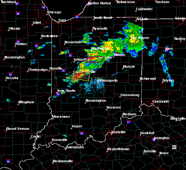 At 257 pm edt, a severe thunderstorm capable of producing a tornado was located 11 miles west of lebanon, or 11 miles east of crawfordsville, moving east at 20 mph (radar indicated rotation). Hazards include tornado. Flying debris will be dangerous to those caught without shelter. mobile homes will be damaged or destroyed. damage to roofs, windows, and vehicles will occur. tree damage is likely. This dangerous storm will be near, advance around 305 pm edt. At 257 pm edt, a severe thunderstorm capable of producing a tornado was located 11 miles west of lebanon, or 11 miles east of crawfordsville, moving east at 20 mph (radar indicated rotation). Hazards include tornado. Flying debris will be dangerous to those caught without shelter. mobile homes will be damaged or destroyed. damage to roofs, windows, and vehicles will occur. tree damage is likely. This dangerous storm will be near, advance around 305 pm edt.
|
| 8/24/2016 2:48 PM EDT |
 At 247 pm edt, a severe thunderstorm was located 9 miles southeast of crawfordsville, moving east at 35 mph (radar indicated). Hazards include 60 mph wind gusts. Expect damage to roofs. siding. and trees. locations impacted include, brownsburg, lebanon, pittsboro, ladoga, jamestown, darlington, new market, lizton, advance, new ross and ulen. this includes the following highways, interstate 65 between mile markers 134 and 144. Interstate 74 between mile markers 38 and 64. At 247 pm edt, a severe thunderstorm was located 9 miles southeast of crawfordsville, moving east at 35 mph (radar indicated). Hazards include 60 mph wind gusts. Expect damage to roofs. siding. and trees. locations impacted include, brownsburg, lebanon, pittsboro, ladoga, jamestown, darlington, new market, lizton, advance, new ross and ulen. this includes the following highways, interstate 65 between mile markers 134 and 144. Interstate 74 between mile markers 38 and 64.
|
| 8/24/2016 2:45 PM EDT |
 At 245 pm edt, a confirmed tornado was located near crawfordsville, moving east at 30 mph (radar confirmed tornado). Hazards include damaging tornado. Flying debris will be dangerous to those caught without shelter. mobile homes will be damaged or destroyed. damage to roofs, windows, and vehicles will occur. tree damage is likely. this tornado will be near, new ross around 255 pm edt. jamestown and advance around 300 pm edt. This includes interstate 74 between mile markers 40 and 54. At 245 pm edt, a confirmed tornado was located near crawfordsville, moving east at 30 mph (radar confirmed tornado). Hazards include damaging tornado. Flying debris will be dangerous to those caught without shelter. mobile homes will be damaged or destroyed. damage to roofs, windows, and vehicles will occur. tree damage is likely. this tornado will be near, new ross around 255 pm edt. jamestown and advance around 300 pm edt. This includes interstate 74 between mile markers 40 and 54.
|
| 8/24/2016 2:37 PM EDT |
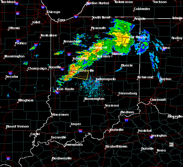 The national weather service in indianapolis has issued a * tornado warning for. southwestern boone county in central indiana. southeastern montgomery county in west central indiana. until 300 pm edt * at 237 pm edt. A severe thunderstorm capable of producing a. The national weather service in indianapolis has issued a * tornado warning for. southwestern boone county in central indiana. southeastern montgomery county in west central indiana. until 300 pm edt * at 237 pm edt. A severe thunderstorm capable of producing a.
|
| 8/24/2016 2:34 PM EDT |
 At 233 pm edt, a severe thunderstorm was located over crawfordsville, moving east at 35 mph (radar indicated). Hazards include 60 mph wind gusts and penny size hail. Expect damage to roofs. siding. And trees. At 233 pm edt, a severe thunderstorm was located over crawfordsville, moving east at 35 mph (radar indicated). Hazards include 60 mph wind gusts and penny size hail. Expect damage to roofs. siding. And trees.
|
| 7/13/2016 4:31 PM EDT |
 At 430 pm edt, severe thunderstorms were located along a line extending from 8 miles northeast of lebanon to 6 miles northwest of greencastle, moving east at 30 mph (trained spotters. at 425 pm...wind gusts of 58 mph were measured just south of lebanon). Hazards include 60 mph wind gusts and quarter size hail. Hail damage to vehicles is expected. expect wind damage to roofs, siding, and trees. locations impacted include, plainfield, brownsburg, lebanon, zionsville, danville, avon, pittsboro, whitestown, thorntown, ladoga, jamestown, roachdale, kirklin, bainbridge, colfax, north salem, lizton, advance, russellville and new ross. this includes the following highways, interstate 65 between mile markers 128 and 151. Interstate 74 between mile markers 44 and 69. At 430 pm edt, severe thunderstorms were located along a line extending from 8 miles northeast of lebanon to 6 miles northwest of greencastle, moving east at 30 mph (trained spotters. at 425 pm...wind gusts of 58 mph were measured just south of lebanon). Hazards include 60 mph wind gusts and quarter size hail. Hail damage to vehicles is expected. expect wind damage to roofs, siding, and trees. locations impacted include, plainfield, brownsburg, lebanon, zionsville, danville, avon, pittsboro, whitestown, thorntown, ladoga, jamestown, roachdale, kirklin, bainbridge, colfax, north salem, lizton, advance, russellville and new ross. this includes the following highways, interstate 65 between mile markers 128 and 151. Interstate 74 between mile markers 44 and 69.
|
| 7/13/2016 4:20 PM EDT |
 At 420 pm edt, severe thunderstorms were located along a line extending from 7 miles south of frankfort to 9 miles north of greencastle, moving east at 60 mph (radar indicated). Hazards include 60 mph wind gusts and quarter size hail. Hail damage to vehicles is expected. expect wind damage to roofs, siding, and trees. locations impacted include, plainfield, brownsburg, lebanon, zionsville, danville, avon, pittsboro, whitestown, thorntown, ladoga, jamestown, roachdale, kirklin, bainbridge, colfax, north salem, lizton, advance, russellville and new ross. this includes the following highways, interstate 65 between mile markers 128 and 151. Interstate 74 between mile markers 44 and 69. At 420 pm edt, severe thunderstorms were located along a line extending from 7 miles south of frankfort to 9 miles north of greencastle, moving east at 60 mph (radar indicated). Hazards include 60 mph wind gusts and quarter size hail. Hail damage to vehicles is expected. expect wind damage to roofs, siding, and trees. locations impacted include, plainfield, brownsburg, lebanon, zionsville, danville, avon, pittsboro, whitestown, thorntown, ladoga, jamestown, roachdale, kirklin, bainbridge, colfax, north salem, lizton, advance, russellville and new ross. this includes the following highways, interstate 65 between mile markers 128 and 151. Interstate 74 between mile markers 44 and 69.
|
| 7/13/2016 4:11 PM EDT |
 At 411 pm edt, severe thunderstorms were located along a line extending from 13 miles west of frankfort to 9 miles northwest of greencastle, moving southeast at 35 mph (radar indicated). Hazards include 60 mph wind gusts and quarter size hail. Hail damage to vehicles is expected. Expect wind damage to roofs, siding, and trees. At 411 pm edt, severe thunderstorms were located along a line extending from 13 miles west of frankfort to 9 miles northwest of greencastle, moving southeast at 35 mph (radar indicated). Hazards include 60 mph wind gusts and quarter size hail. Hail damage to vehicles is expected. Expect wind damage to roofs, siding, and trees.
|
| 7/13/2016 4:01 PM EDT |
 At 400 pm edt, severe thunderstorms were located along a line extending from 12 miles west of frankfort to 13 miles south of crawfordsville, moving northeast at 60 mph (trained weather spotters. at 345 pm...trained spotters reported 55 mph winds in new market). Hazards include 60 mph wind gusts and nickel size hail. Expect damage to roofs. siding. and trees. locations impacted include, crawfordsville, thorntown, ladoga, jamestown, darlington, colfax, new market, clarks hill, advance, waveland, new ross, alamo and shades state park. this includes the following highways, interstate 65 between mile markers 156 and 164. Interstate 74 between mile markers 30 and 54. At 400 pm edt, severe thunderstorms were located along a line extending from 12 miles west of frankfort to 13 miles south of crawfordsville, moving northeast at 60 mph (trained weather spotters. at 345 pm...trained spotters reported 55 mph winds in new market). Hazards include 60 mph wind gusts and nickel size hail. Expect damage to roofs. siding. and trees. locations impacted include, crawfordsville, thorntown, ladoga, jamestown, darlington, colfax, new market, clarks hill, advance, waveland, new ross, alamo and shades state park. this includes the following highways, interstate 65 between mile markers 156 and 164. Interstate 74 between mile markers 30 and 54.
|
| 7/13/2016 3:43 PM EDT |
 At 343 pm edt, a severe thunderstorm was located 12 miles north of rockville, or 16 miles southwest of crawfordsville, moving northeast at 30 mph (radar indicated). Hazards include 60 mph wind gusts and nickel size hail. Expect damage to roofs. siding. And trees. At 343 pm edt, a severe thunderstorm was located 12 miles north of rockville, or 16 miles southwest of crawfordsville, moving northeast at 30 mph (radar indicated). Hazards include 60 mph wind gusts and nickel size hail. Expect damage to roofs. siding. And trees.
|
| 6/15/2016 5:19 PM EDT |
 At 519 pm edt, a severe thunderstorm was located 9 miles southwest of lebanon, or 18 miles east of crawfordsville, moving southeast at 35 mph (radar indicated). Hazards include 70 mph wind gusts. Expect considerable tree damage. damage is likely to mobile homes, roofs, and outbuildings. locations impacted include, lebanon, whitestown, thorntown, jamestown, north salem, lizton, advance, new ross and ulen. this includes the following highways, interstate 65 between mile markers 131 and 143. Interstate 74 between mile markers 40 and 60. At 519 pm edt, a severe thunderstorm was located 9 miles southwest of lebanon, or 18 miles east of crawfordsville, moving southeast at 35 mph (radar indicated). Hazards include 70 mph wind gusts. Expect considerable tree damage. damage is likely to mobile homes, roofs, and outbuildings. locations impacted include, lebanon, whitestown, thorntown, jamestown, north salem, lizton, advance, new ross and ulen. this includes the following highways, interstate 65 between mile markers 131 and 143. Interstate 74 between mile markers 40 and 60.
|
| 6/15/2016 5:07 PM EDT |
 At 507 pm edt, a severe thunderstorm was located 10 miles west of lebanon, or 12 miles east of crawfordsville, moving southeast at 35 mph (radar indicated). Hazards include 60 mph wind gusts. Expect damage to roofs. siding. and trees. locations impacted include, crawfordsville, lebanon, whitestown, thorntown, jamestown, darlington, north salem, lizton, advance, new ross and ulen. this includes the following highways, interstate 65 between mile markers 131 and 143. Interstate 74 between mile markers 32 and 60. At 507 pm edt, a severe thunderstorm was located 10 miles west of lebanon, or 12 miles east of crawfordsville, moving southeast at 35 mph (radar indicated). Hazards include 60 mph wind gusts. Expect damage to roofs. siding. and trees. locations impacted include, crawfordsville, lebanon, whitestown, thorntown, jamestown, darlington, north salem, lizton, advance, new ross and ulen. this includes the following highways, interstate 65 between mile markers 131 and 143. Interstate 74 between mile markers 32 and 60.
|
| 6/15/2016 4:54 PM EDT |
 At 454 pm edt, a severe thunderstorm was located 8 miles northeast of crawfordsville, moving southeast at 35 mph (radar indicated). Hazards include 60 mph wind gusts. Expect damage to roofs. siding. And trees. At 454 pm edt, a severe thunderstorm was located 8 miles northeast of crawfordsville, moving southeast at 35 mph (radar indicated). Hazards include 60 mph wind gusts. Expect damage to roofs. siding. And trees.
|
| 7/17/2015 5:47 PM EDT |
 At 547 pm edt, a severe thunderstorm was located near brownsburg, or 19 miles northwest of indianapolis, moving southeast at 25 mph (radar indicated). Hazards include 70 mph wind gusts and penny size hail. Expect considerable tree damage. damage is likely to mobile homes, roofs and outbuildings. locations impacted include, brownsburg, lebanon, danville, pittsboro, jamestown, lizton and advance. this includes the following highways, interstate 65 between mile markers 136 and 140. Interstate 74 between mile markers 50 and 69. At 547 pm edt, a severe thunderstorm was located near brownsburg, or 19 miles northwest of indianapolis, moving southeast at 25 mph (radar indicated). Hazards include 70 mph wind gusts and penny size hail. Expect considerable tree damage. damage is likely to mobile homes, roofs and outbuildings. locations impacted include, brownsburg, lebanon, danville, pittsboro, jamestown, lizton and advance. this includes the following highways, interstate 65 between mile markers 136 and 140. Interstate 74 between mile markers 50 and 69.
|
| 7/17/2015 5:35 PM EDT |
 At 535 pm edt, a severe thunderstorm was located near lebanon, or 20 miles east of crawfordsville, moving southeast at 25 mph (radar indicated). Hazards include 70 mph wind gusts and penny size hail. Expect considerable tree damage. Damage is likely to mobile homes, roofs and outbuildings. At 535 pm edt, a severe thunderstorm was located near lebanon, or 20 miles east of crawfordsville, moving southeast at 25 mph (radar indicated). Hazards include 70 mph wind gusts and penny size hail. Expect considerable tree damage. Damage is likely to mobile homes, roofs and outbuildings.
|
| 7/17/2015 5:27 PM EDT |
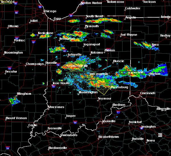 At 527 pm edt, a severe thunderstorm was located 8 miles west of lebanon, or 13 miles east of crawfordsville, moving southeast at 30 mph (radar indicated). Hazards include 60 mph wind gusts and nickel size hail. Expect damage to roofs. siding and trees. locations impacted include, crawfordsville, lebanon, thorntown, darlington, advance and new ross. this includes the following highways, interstate 65 between mile markers 139 and 140. Interstate 74 between mile markers 34 and 49. At 527 pm edt, a severe thunderstorm was located 8 miles west of lebanon, or 13 miles east of crawfordsville, moving southeast at 30 mph (radar indicated). Hazards include 60 mph wind gusts and nickel size hail. Expect damage to roofs. siding and trees. locations impacted include, crawfordsville, lebanon, thorntown, darlington, advance and new ross. this includes the following highways, interstate 65 between mile markers 139 and 140. Interstate 74 between mile markers 34 and 49.
|
| 7/17/2015 5:15 PM EDT |
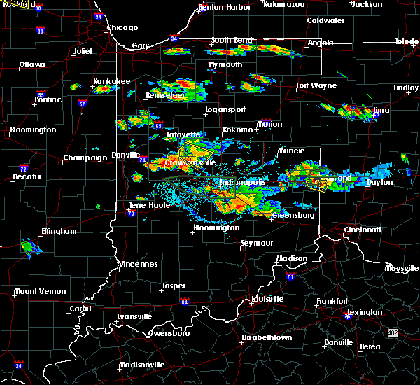 At 514 pm edt, a severe thunderstorm was located 8 miles east of crawfordsville, moving southeast at 25 mph (radar indicated). Hazards include 60 mph wind gusts. Expect damage to roofs. Siding and trees. At 514 pm edt, a severe thunderstorm was located 8 miles east of crawfordsville, moving southeast at 25 mph (radar indicated). Hazards include 60 mph wind gusts. Expect damage to roofs. Siding and trees.
|
| 7/13/2015 9:11 PM EDT |
 The tornado warning for southwestern boone, northern hendricks, southeastern montgomery and northeastern putnam counties will expire at 915 pm edt/815 pm cdt/, the tornado threat has diminished, therefore the tornado warning has expired. however, a severe thunderstorm warning remains in effect for the area. additional strong thunderstorms are still possible, and a tornado watch remains in effect until 3 am edt. The tornado warning for southwestern boone, northern hendricks, southeastern montgomery and northeastern putnam counties will expire at 915 pm edt/815 pm cdt/, the tornado threat has diminished, therefore the tornado warning has expired. however, a severe thunderstorm warning remains in effect for the area. additional strong thunderstorms are still possible, and a tornado watch remains in effect until 3 am edt.
|
| 7/13/2015 8:51 PM EDT |
 At 847 pm edt, a severe thunderstorm capable of producing a tornado was located 14 miles southeast of crawfordsville, and moving southeast at 55 mph (radar indicated rotation). Hazards include tornado and ping pong ball size hail. Flying debris will be dangerous to those caught without shelter. mobile homes will be damaged or destroyed. damage to roofs, windows and vehicles will occur. Tree damage is likely. At 847 pm edt, a severe thunderstorm capable of producing a tornado was located 14 miles southeast of crawfordsville, and moving southeast at 55 mph (radar indicated rotation). Hazards include tornado and ping pong ball size hail. Flying debris will be dangerous to those caught without shelter. mobile homes will be damaged or destroyed. damage to roofs, windows and vehicles will occur. Tree damage is likely.
|
| 7/13/2015 8:44 PM EDT |
 At 842 pm edt, a severe thunderstorm was located 8 miles southeast of crawfordsville, and moving southeast at 25 mph (radar indicated). Hazards include 60 mph wind gusts and half dollar size hail. Hail damage to vehicles is expected. Expect wind damage to roofs, siding and trees. At 842 pm edt, a severe thunderstorm was located 8 miles southeast of crawfordsville, and moving southeast at 25 mph (radar indicated). Hazards include 60 mph wind gusts and half dollar size hail. Hail damage to vehicles is expected. Expect wind damage to roofs, siding and trees.
|
| 7/13/2015 11:39 AM EDT |
 At 1137 am edt, severe thunderstorms were located along a line extending from fishers to speedway to 10 miles west of danville, and moving southeast at 45 mph (radar indicated. 65 mph wind was reported near noblesville. 60 mph wind was reported near brownsburg). Hazards include 70 mph wind gusts and penny size hail. Expect considerable tree damage. damage is likely to mobile homes, roofs and outbuildings. locations impacted include, indianapolis, danville, speedway, greencastle, lawrence, plainfield, beech grove, southport, castleton, wynnedale, spring hill, rocky ripple, crows nest, broad ripple, avon, geist reservoir, indiana state fairgrounds, fillmore, coatesville and amo. this includes interstate 65 between mile markers 102 and 144. this includes interstate 69 between mile markers 200 and 209. this includes interstate 70 between mile markers 62 and 93. This includes interstate 74 between mile markers 37 and 100. At 1137 am edt, severe thunderstorms were located along a line extending from fishers to speedway to 10 miles west of danville, and moving southeast at 45 mph (radar indicated. 65 mph wind was reported near noblesville. 60 mph wind was reported near brownsburg). Hazards include 70 mph wind gusts and penny size hail. Expect considerable tree damage. damage is likely to mobile homes, roofs and outbuildings. locations impacted include, indianapolis, danville, speedway, greencastle, lawrence, plainfield, beech grove, southport, castleton, wynnedale, spring hill, rocky ripple, crows nest, broad ripple, avon, geist reservoir, indiana state fairgrounds, fillmore, coatesville and amo. this includes interstate 65 between mile markers 102 and 144. this includes interstate 69 between mile markers 200 and 209. this includes interstate 70 between mile markers 62 and 93. This includes interstate 74 between mile markers 37 and 100.
|
| 7/13/2015 11:30 AM EDT |
 At 1126 am edt, severe thunderstorms were located along a line extending from noblesville to zionsville to 13 miles southeast of crawfordsville, and moving southeast at 45 mph (radar indicated). Hazards include 70 mph wind gusts and penny size hail. Expect considerable tree damage. damage is likely to mobile homes, roofs and outbuildings. locations impacted include, indianapolis, brownsburg, carmel, fishers, danville, speedway, greencastle, lawrence, plainfield, beech grove, southport, pittsboro, carpentersville, bainbridge, eagle creek reservoir, meridian hills, williams creek, groveland, rocky ripple and clermont. this includes interstate 65 between mile markers 101 and 148. this includes interstate 69 between mile markers 200 and 209. this includes interstate 70 between mile markers 62 and 93. This includes interstate 74 between mile markers 24 and 100. At 1126 am edt, severe thunderstorms were located along a line extending from noblesville to zionsville to 13 miles southeast of crawfordsville, and moving southeast at 45 mph (radar indicated). Hazards include 70 mph wind gusts and penny size hail. Expect considerable tree damage. damage is likely to mobile homes, roofs and outbuildings. locations impacted include, indianapolis, brownsburg, carmel, fishers, danville, speedway, greencastle, lawrence, plainfield, beech grove, southport, pittsboro, carpentersville, bainbridge, eagle creek reservoir, meridian hills, williams creek, groveland, rocky ripple and clermont. this includes interstate 65 between mile markers 101 and 148. this includes interstate 69 between mile markers 200 and 209. this includes interstate 70 between mile markers 62 and 93. This includes interstate 74 between mile markers 24 and 100.
|
| 7/13/2015 11:11 AM EDT |
 At 1108 am edt, severe thunderstorms were located along a line extending from 7 miles west of tipton to lebanon to crawfordsville, and moving southeast at 45 mph (radar indicated). Hazards include 60 mph wind gusts and penny size hail. Expect damage to roofs. Siding and trees. At 1108 am edt, severe thunderstorms were located along a line extending from 7 miles west of tipton to lebanon to crawfordsville, and moving southeast at 45 mph (radar indicated). Hazards include 60 mph wind gusts and penny size hail. Expect damage to roofs. Siding and trees.
|
| 6/21/2015 1:57 AM EDT |
 At 154 am edt, severe thunderstorms were located along a line extending from lebanon to 7 miles west of danville, and moving southeast at 45 mph (radar indicated). Hazards include 60 mph wind gusts. Expect damage to roofs. siding and trees. locations impacted include, zionsville and whitestown. this includes interstate 65 between mile markers 129 and 149. This includes interstate 74 between mile markers 47 and 54. At 154 am edt, severe thunderstorms were located along a line extending from lebanon to 7 miles west of danville, and moving southeast at 45 mph (radar indicated). Hazards include 60 mph wind gusts. Expect damage to roofs. siding and trees. locations impacted include, zionsville and whitestown. this includes interstate 65 between mile markers 129 and 149. This includes interstate 74 between mile markers 47 and 54.
|
| 6/21/2015 1:43 AM EDT |
 At 138 am edt, severe thunderstorms were located along a line extending from 13 miles southwest of frankfort to 11 miles south of crawfordsville, and moving southeast at 45 mph (radar indicated). Hazards include 60 mph wind gusts. Expect damage to roofs. Siding and trees. At 138 am edt, severe thunderstorms were located along a line extending from 13 miles southwest of frankfort to 11 miles south of crawfordsville, and moving southeast at 45 mph (radar indicated). Hazards include 60 mph wind gusts. Expect damage to roofs. Siding and trees.
|
| 6/18/2015 3:13 PM EDT | The severe thunderstorm warning for southwestern boone, northern hendricks, southeastern montgomery and northeastern putnam counties will expire at 315 pm edt/215 pm cdt/, the storm which prompted the warning has weakened below severe limits, and no longer poses an immediate threat to life or property. however, gusty winds are still possible with this thunderstorm. to report severe weather, contact your nearest law enforcement agency. they will relay your report to the national weather service in indianapolis. |
| 6/18/2015 3:03 PM EDT | At 301 pm edt, a severe thunderstorm was located 12 miles northwest of danville, and moving east at 45 mph (radar indicated). Hazards include 60 mph wind gusts. Expect damage to roofs. siding and trees. locations impacted include, advance, lizton and pittsboro. this includes interstate 65 between mile markers 128 and 139. This includes interstate 74 between mile markers 47 and 64. |
| 6/18/2015 2:51 PM EDT | At 247 pm edt, a severe thunderstorm was located 13 miles south of crawfordsville, and moving east at 40 mph (radar indicated). Hazards include 60 mph wind gusts. Expect damage to roofs. Siding and trees. |
| 6/12/2015 6:29 PM EDT |
 At 626 pm edt, severe thunderstorms were located along a line extending from 10 miles southeast of lafayette to 11 miles west of crawfordsville, and moving east at 30 mph (radar indicated). Hazards include 60 mph wind gusts and quarter size hail. Hail damage to vehicles is expected. expect wind damage to roofs, siding and trees. locations impacted include, crawfordsville, frankfort, clarks hill, darlington, colfax and thorntown. this includes interstate 65 between mile markers 148 and 160. This includes interstate 74 between mile markers 24 and 47. At 626 pm edt, severe thunderstorms were located along a line extending from 10 miles southeast of lafayette to 11 miles west of crawfordsville, and moving east at 30 mph (radar indicated). Hazards include 60 mph wind gusts and quarter size hail. Hail damage to vehicles is expected. expect wind damage to roofs, siding and trees. locations impacted include, crawfordsville, frankfort, clarks hill, darlington, colfax and thorntown. this includes interstate 65 between mile markers 148 and 160. This includes interstate 74 between mile markers 24 and 47.
|
| 6/12/2015 6:14 PM EDT |
 At 613 pm edt, severe thunderstorms were located along a line extending from 9 miles south of lafayette to 8 miles south of veedersburg, and moving east at 35 mph (radar indicated). Hazards include 60 mph wind gusts and quarter size hail. Hail damage to vehicles is expected. Expect wind damage to roofs, siding and trees. At 613 pm edt, severe thunderstorms were located along a line extending from 9 miles south of lafayette to 8 miles south of veedersburg, and moving east at 35 mph (radar indicated). Hazards include 60 mph wind gusts and quarter size hail. Hail damage to vehicles is expected. Expect wind damage to roofs, siding and trees.
|
| 6/7/2015 10:42 PM EDT | The severe thunderstorm warning for southern clinton, boone and east central montgomery counties will expire at 1045 pm edt/945 pm cdt/, the storm which prompted the warning has weakened below severe limits, and no longer poses an immediate threat to life or property. |
| 6/7/2015 10:25 PM EDT | At 1023 pm edt, a severe thunderstorm was located 5 miles northeast of lebanon, and moving east at 50 mph (radar indicated). Hazards include 60 mph wind gusts. Expect damage to roofs. siding and trees. locations impacted include, zionsville and whitestown. this includes interstate 65 between mile markers 131 and 155. This includes interstate 74 between mile markers 40 and 47. |
| 6/7/2015 10:17 PM EDT | At 1014 pm edt, a severe thunderstorm was located 5 miles northwest of lebanon, and moving east at 50 mph (radar indicated). Hazards include 60 mph wind gusts. Expect damage to roofs. siding and trees. locations impacted include, lebanon, zionsville, ulen, kirklin and whitestown. this includes interstate 65 between mile markers 131 and 155. This includes interstate 74 between mile markers 40 and 47. |
| 6/7/2015 10:08 PM EDT | At 1006 pm edt, a severe thunderstorm was located 10 miles west of lebanon, and moving east at 40 mph (radar indicated). Hazards include 60 mph wind gusts. Expect damage to roofs. siding and trees. locations impacted include, lebanon, zionsville, ulen, kirklin and whitestown. this includes interstate 65 between mile markers 131 and 155. This includes interstate 74 between mile markers 38 and 47. |
| 6/7/2015 9:55 PM EDT | At 952 pm edt, a severe thunderstorm was located 8 miles northeast of crawfordsville, and moving east at 45 mph (radar indicated). Hazards include 60 mph wind gusts. Expect damage to roofs. Siding and trees. |
| 7/1/2014 2:00 AM EDT | 4 to 5 inch diameter tree limb downed along state route 7 in boone county IN, 0.4 miles S of Advance, IN |
| 1/1/0001 12:00 AM | 8 telephone poles down in the 6000 south and state road 75 area. time appro in boone county IN, 1.7 miles NNW of Advance, IN |
Hail Maps for Advance, IN
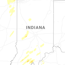


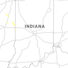


Connect with Interactive Hail Maps