

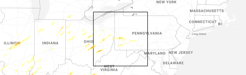
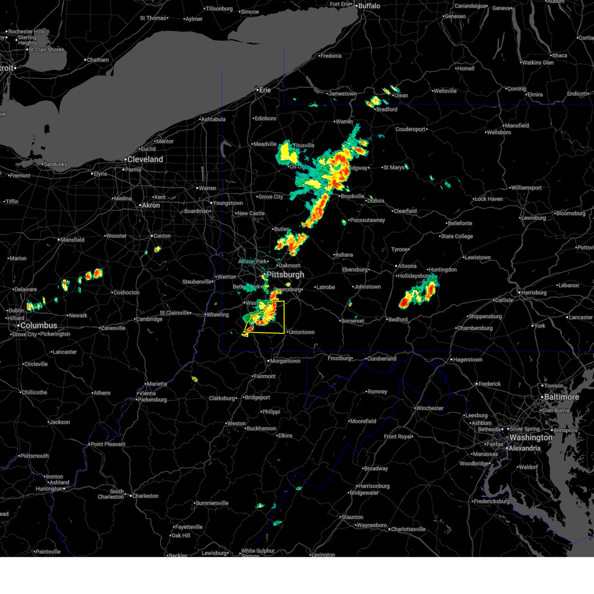
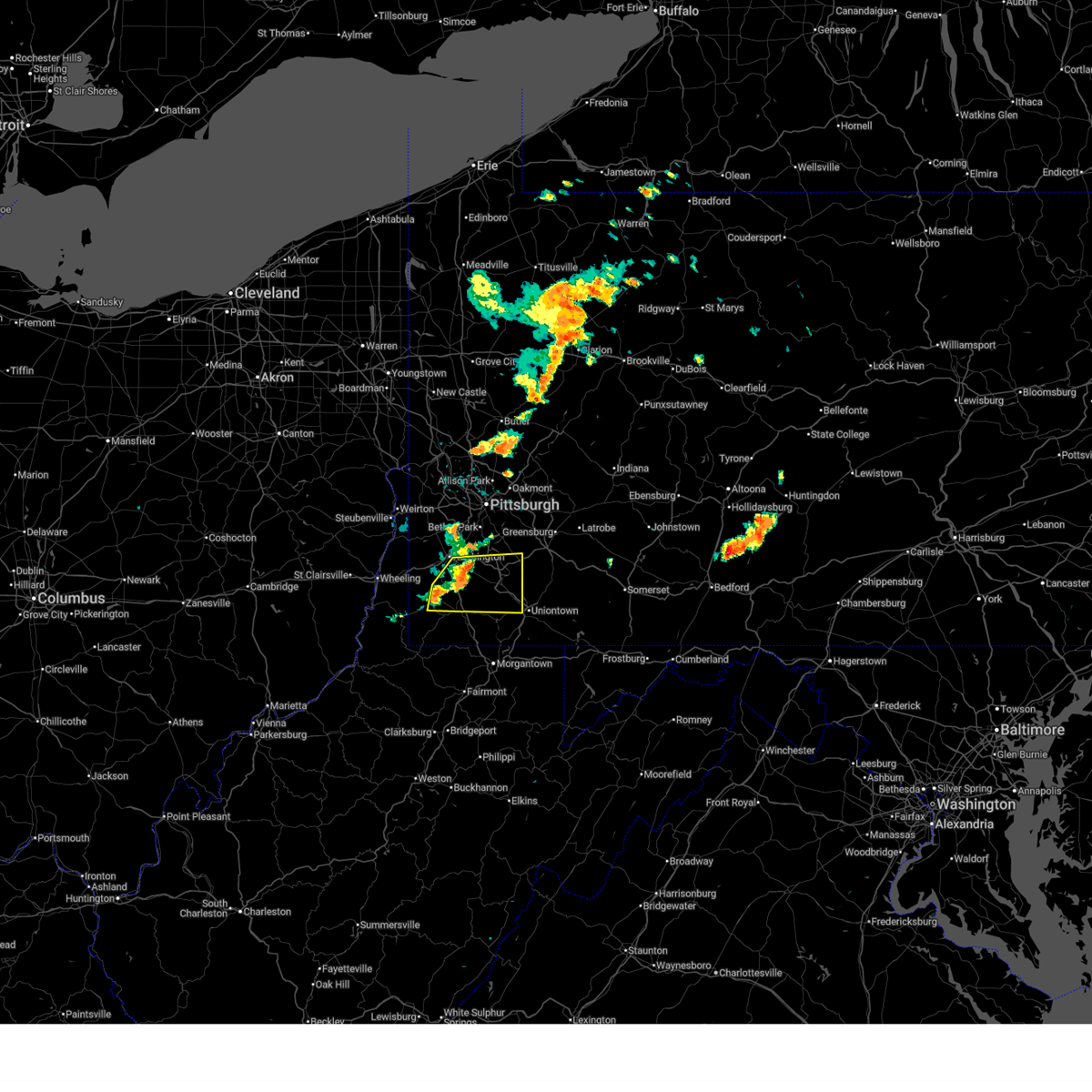
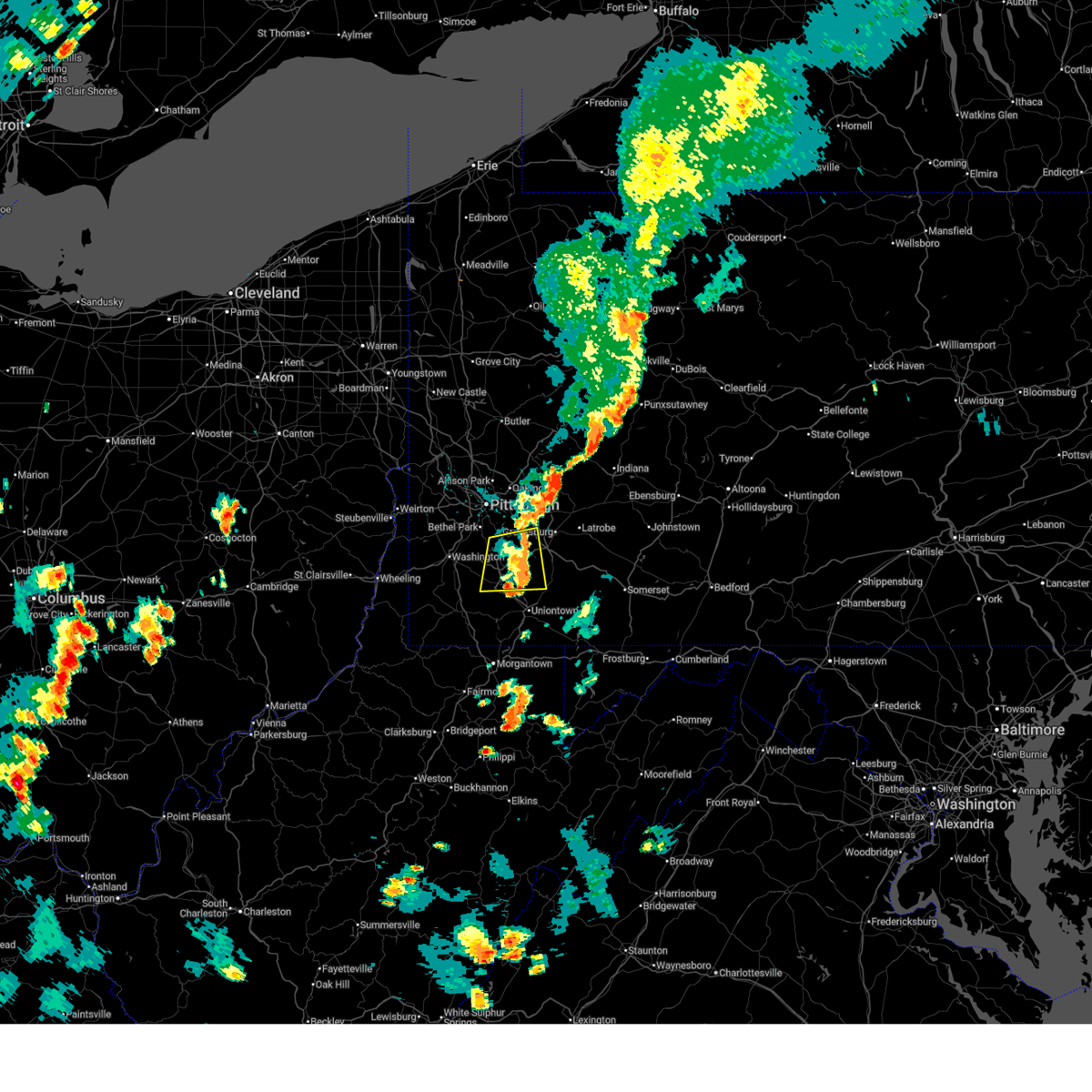
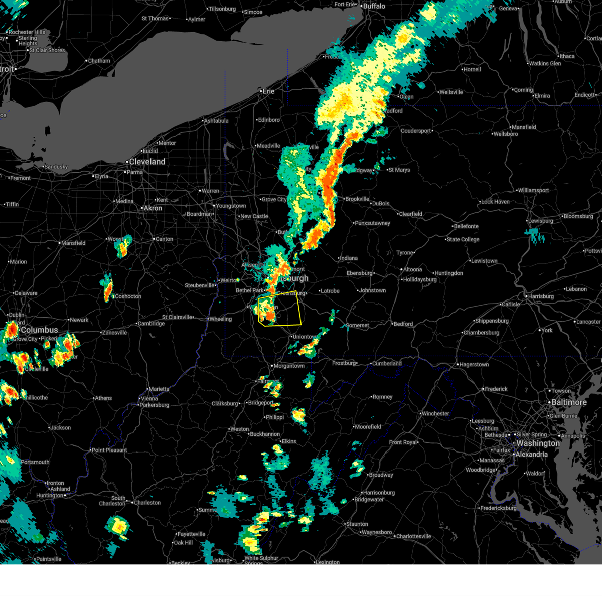
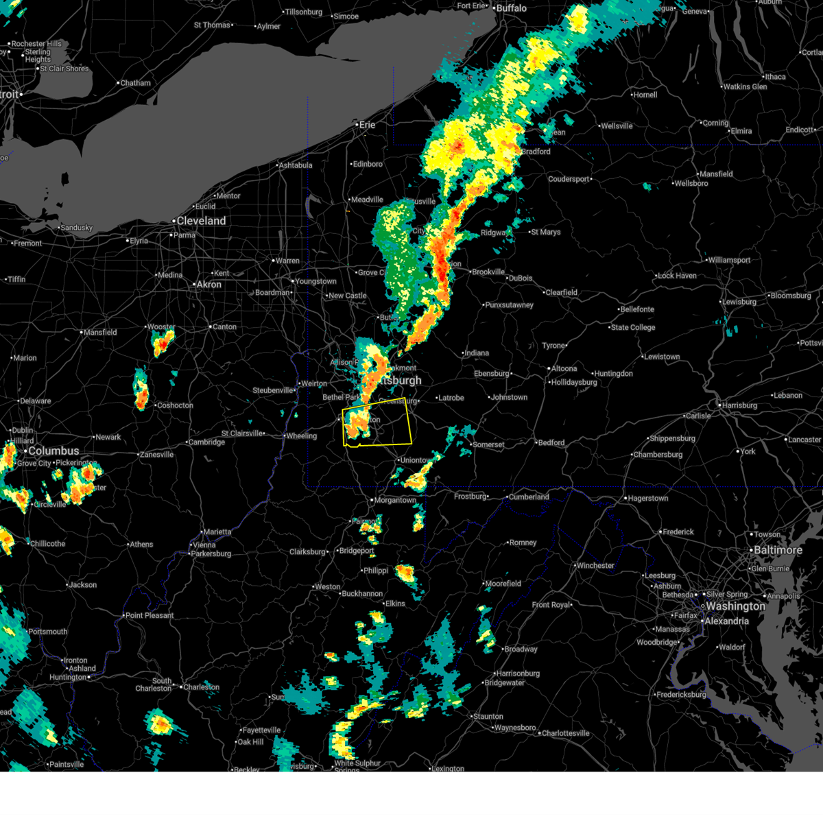
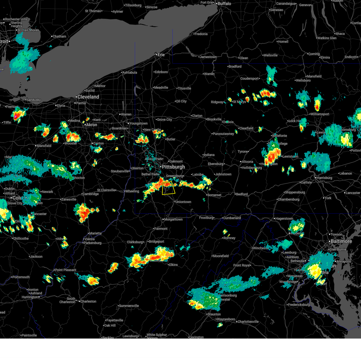
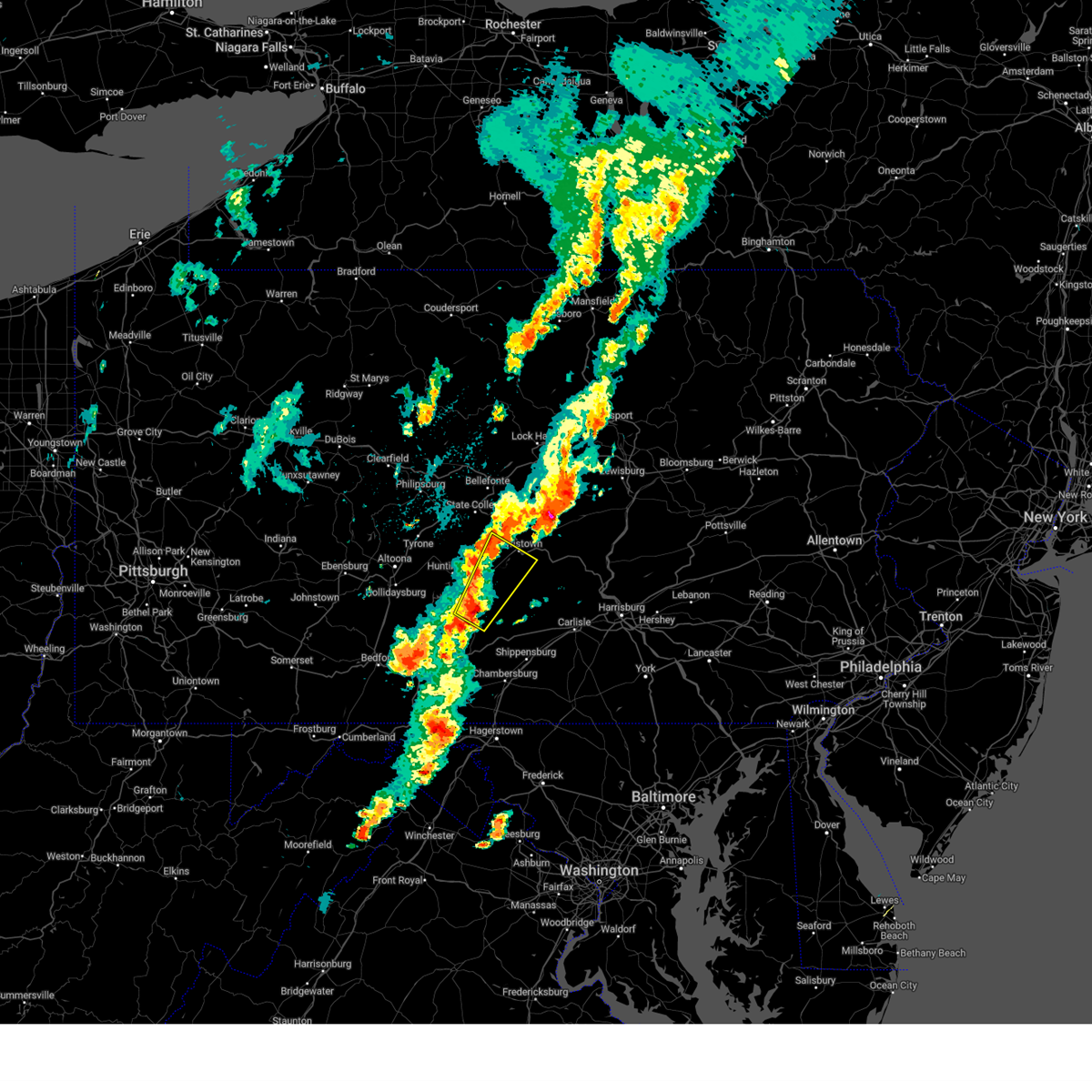
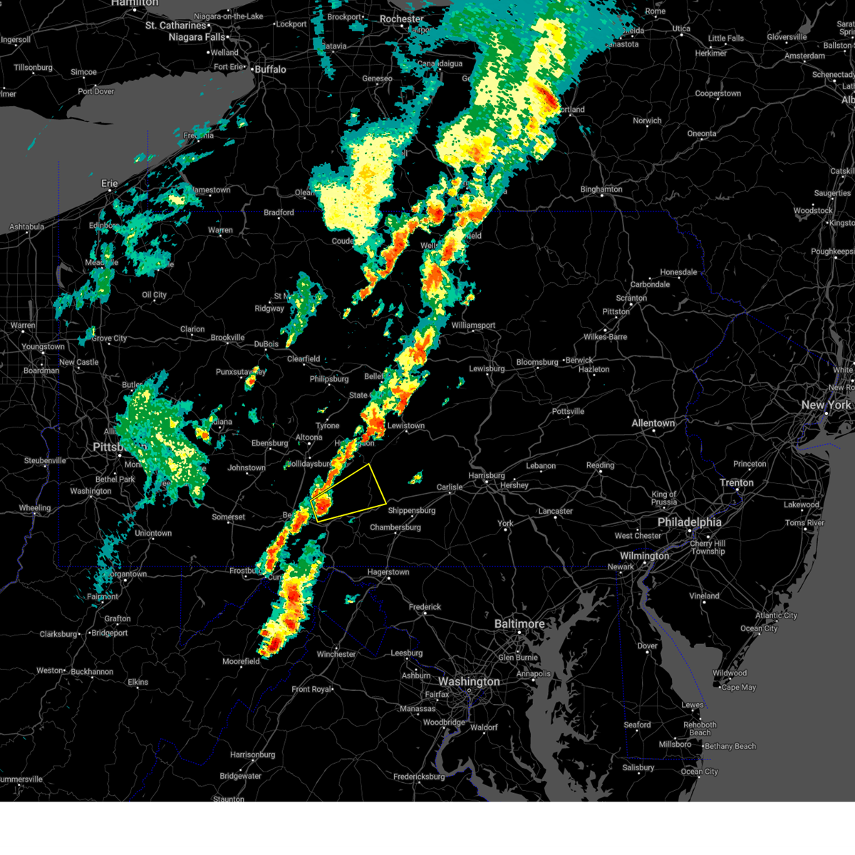
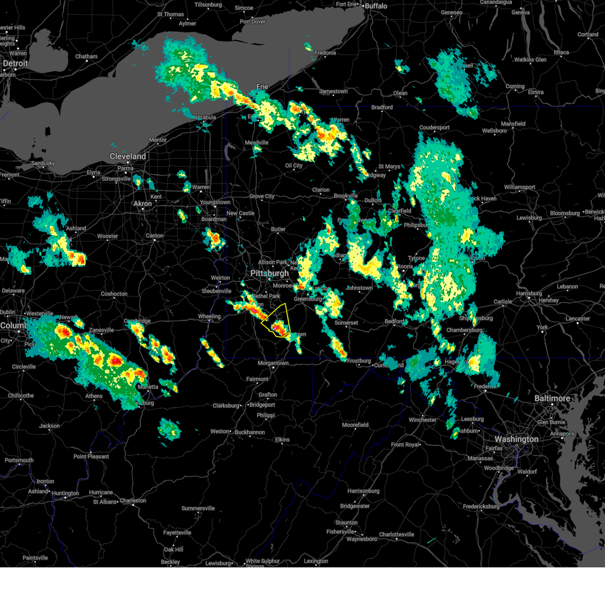
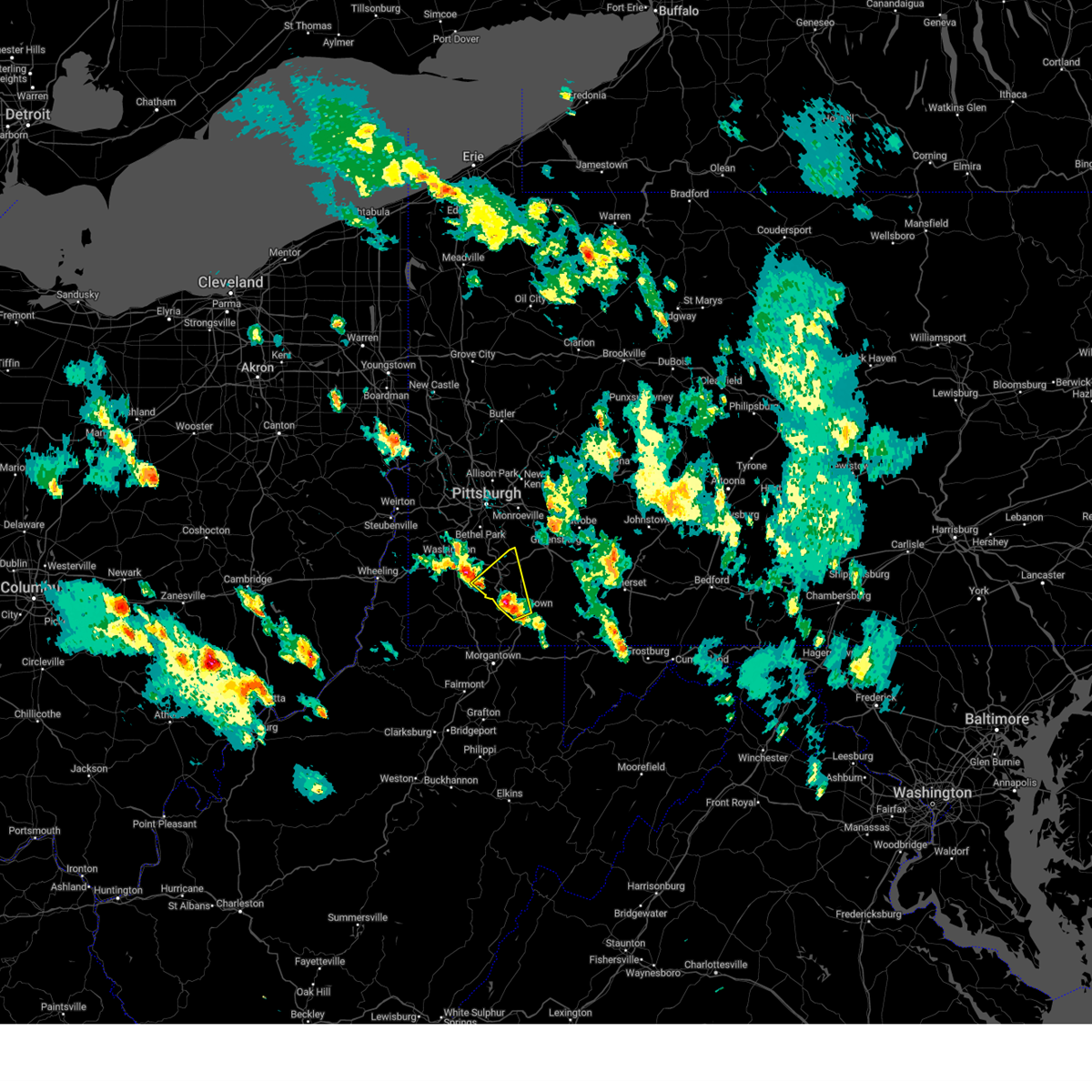
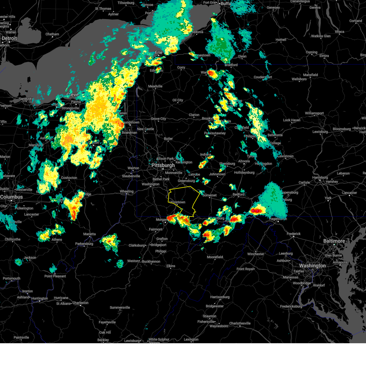
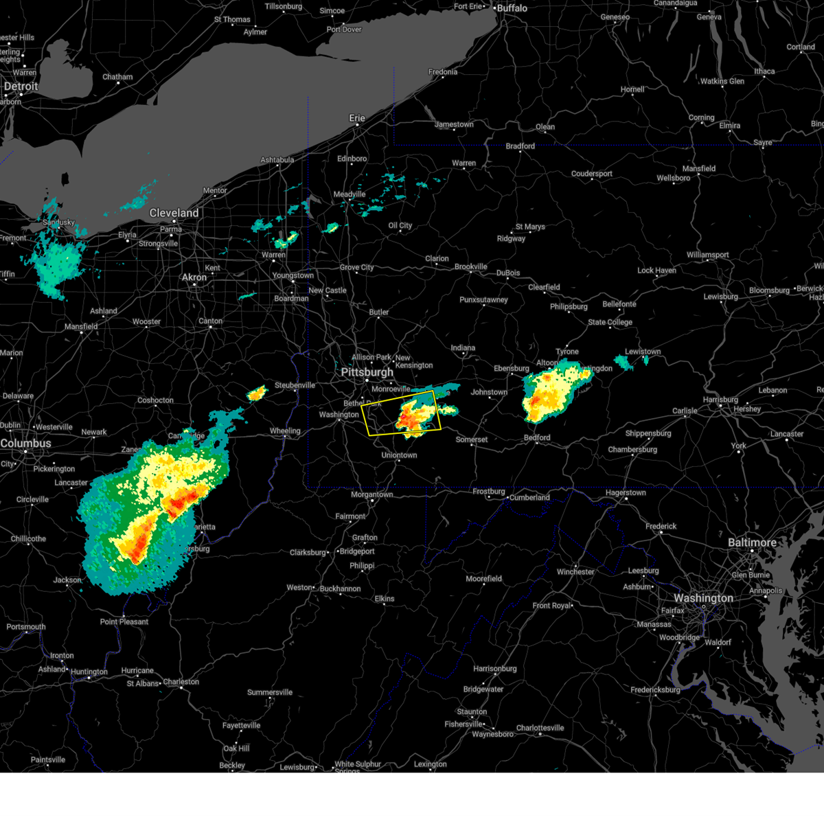
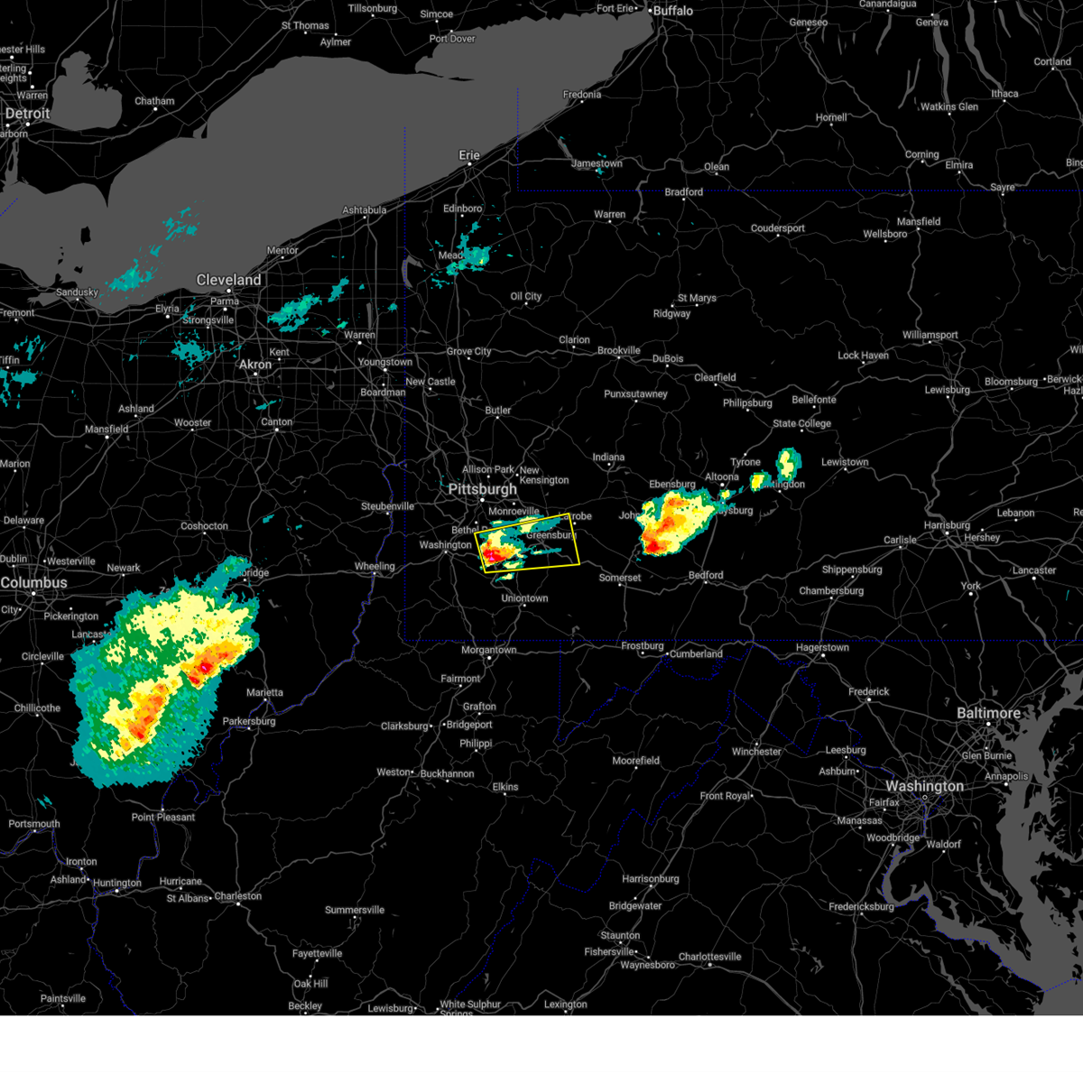
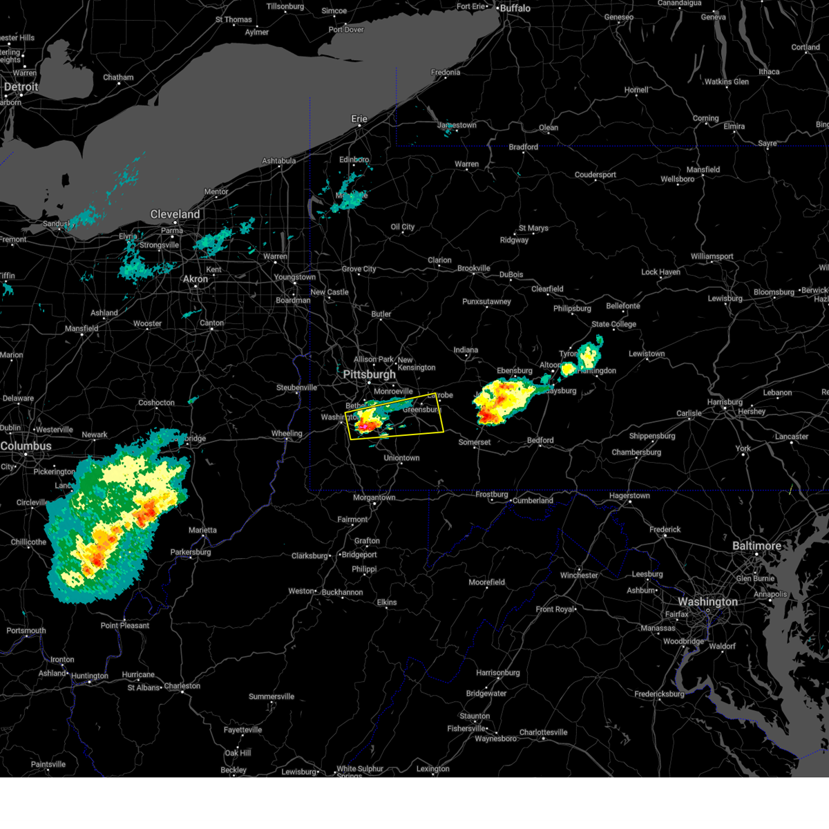
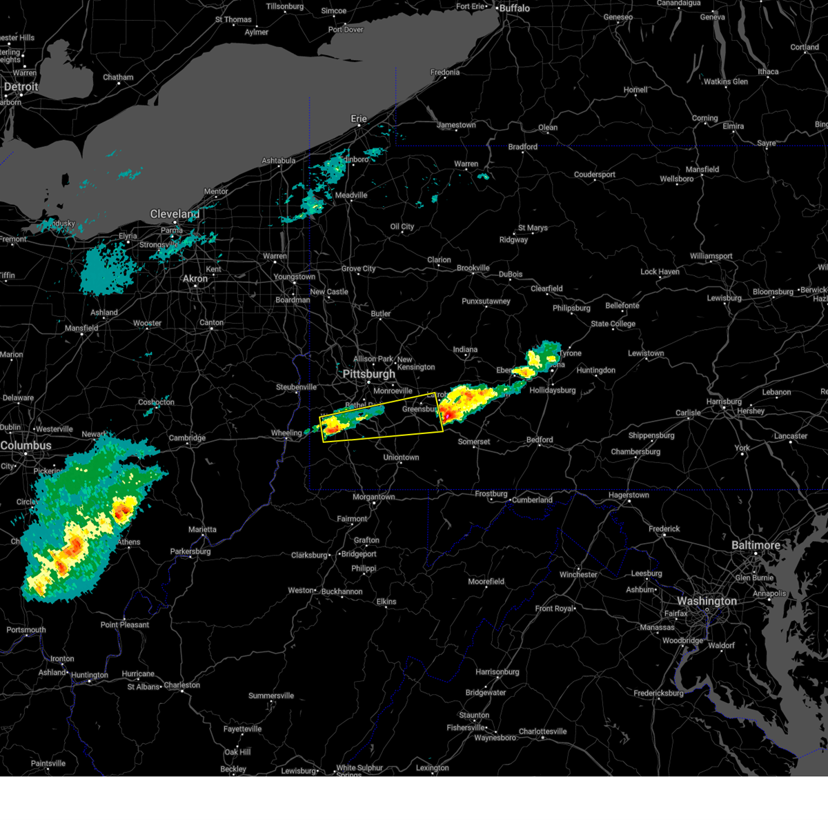
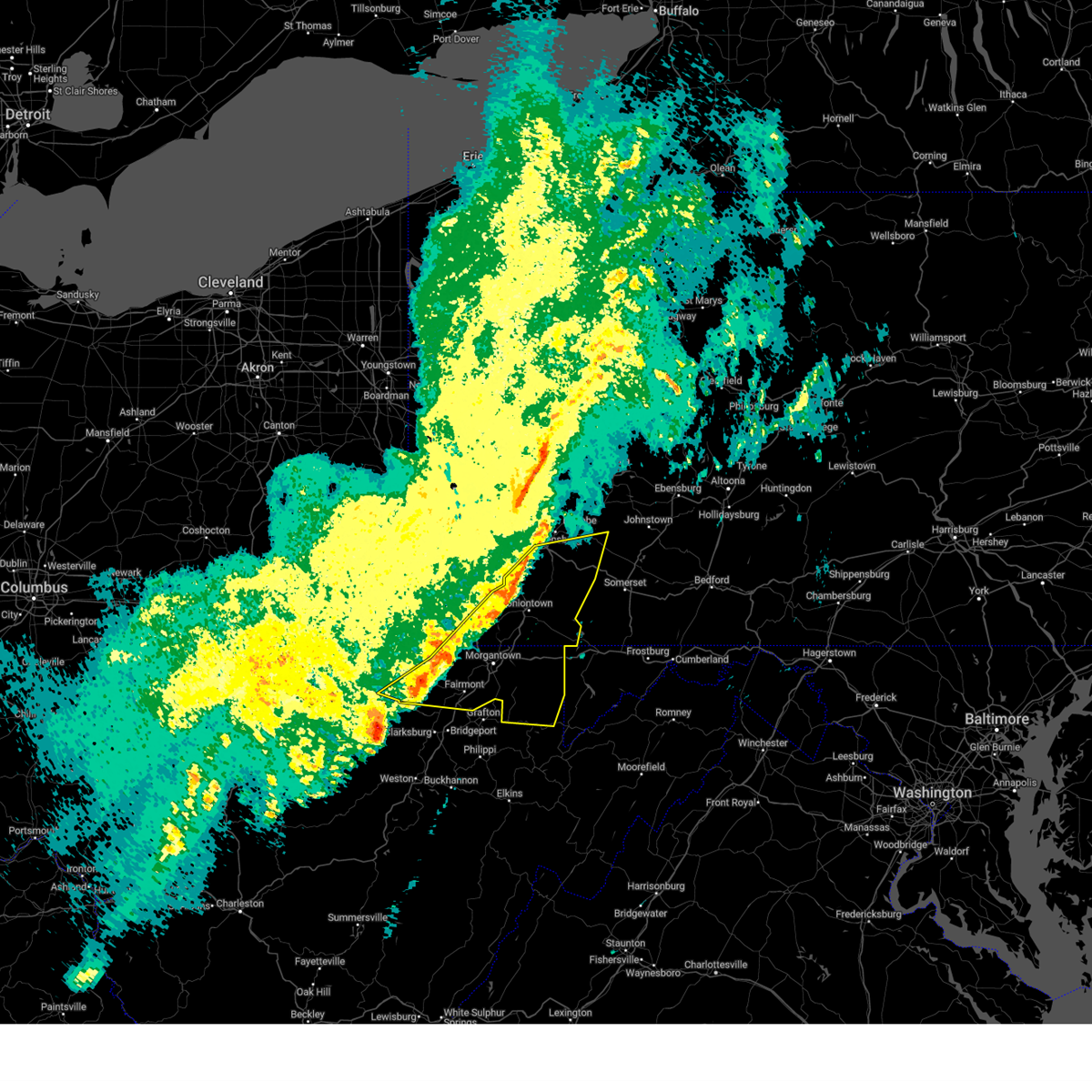
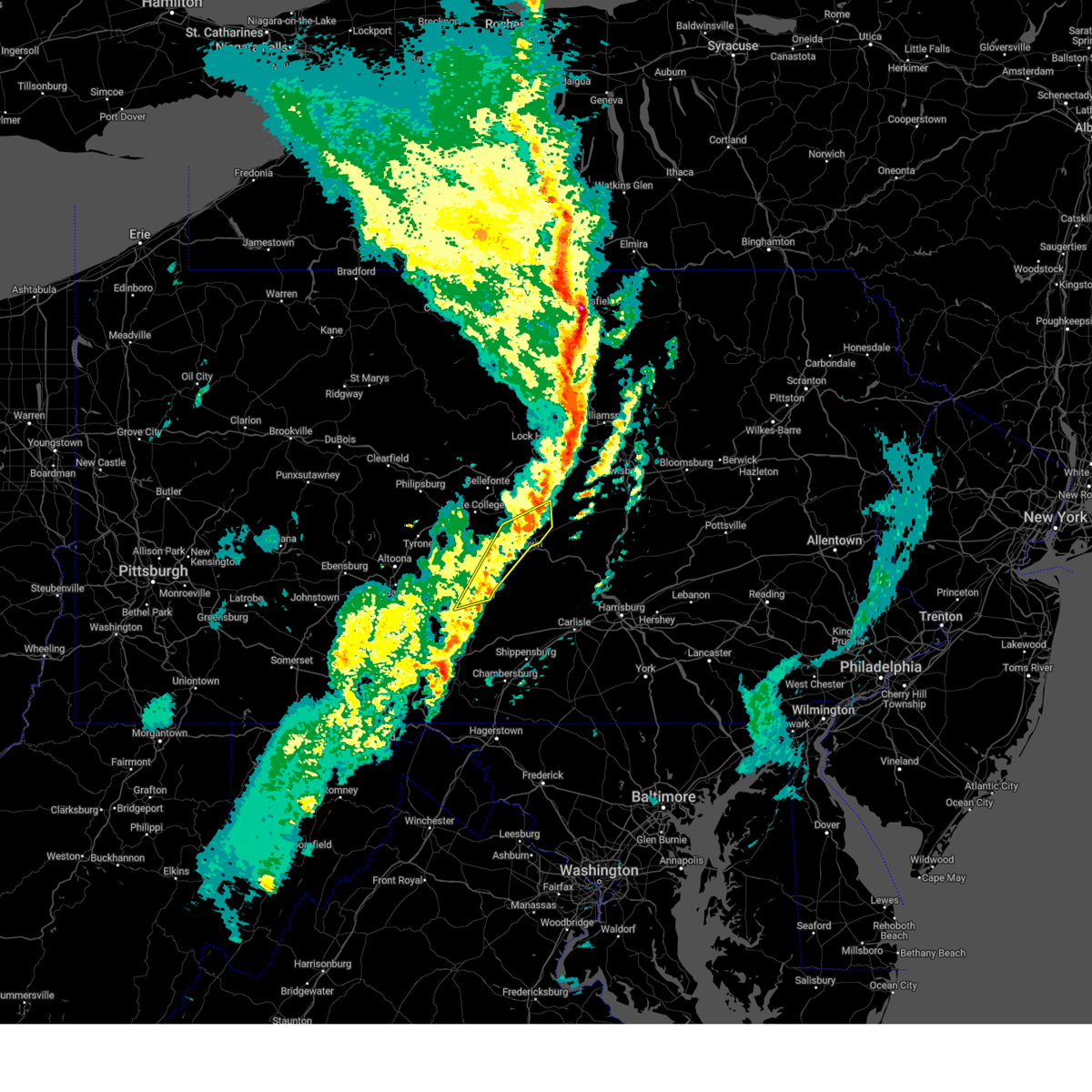
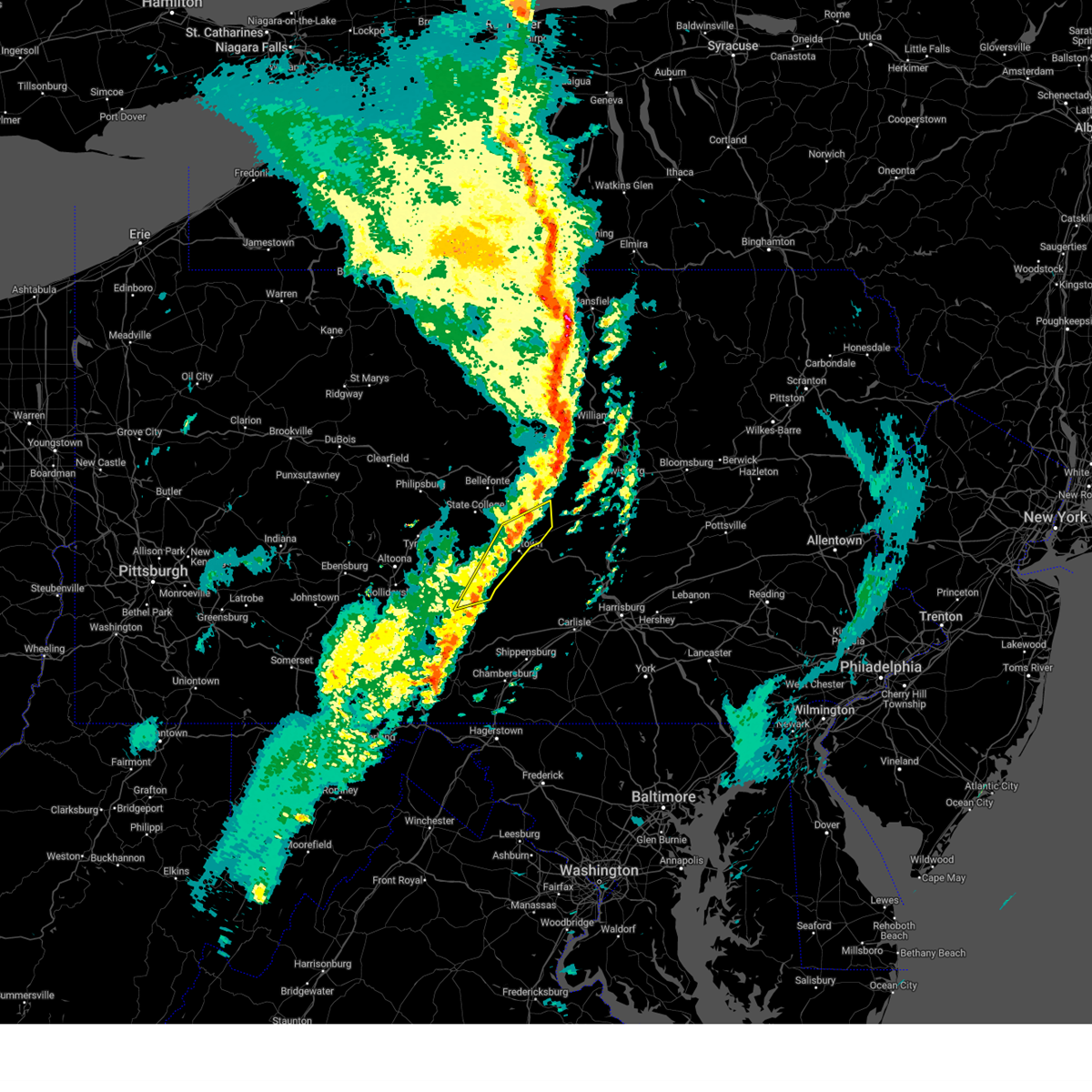
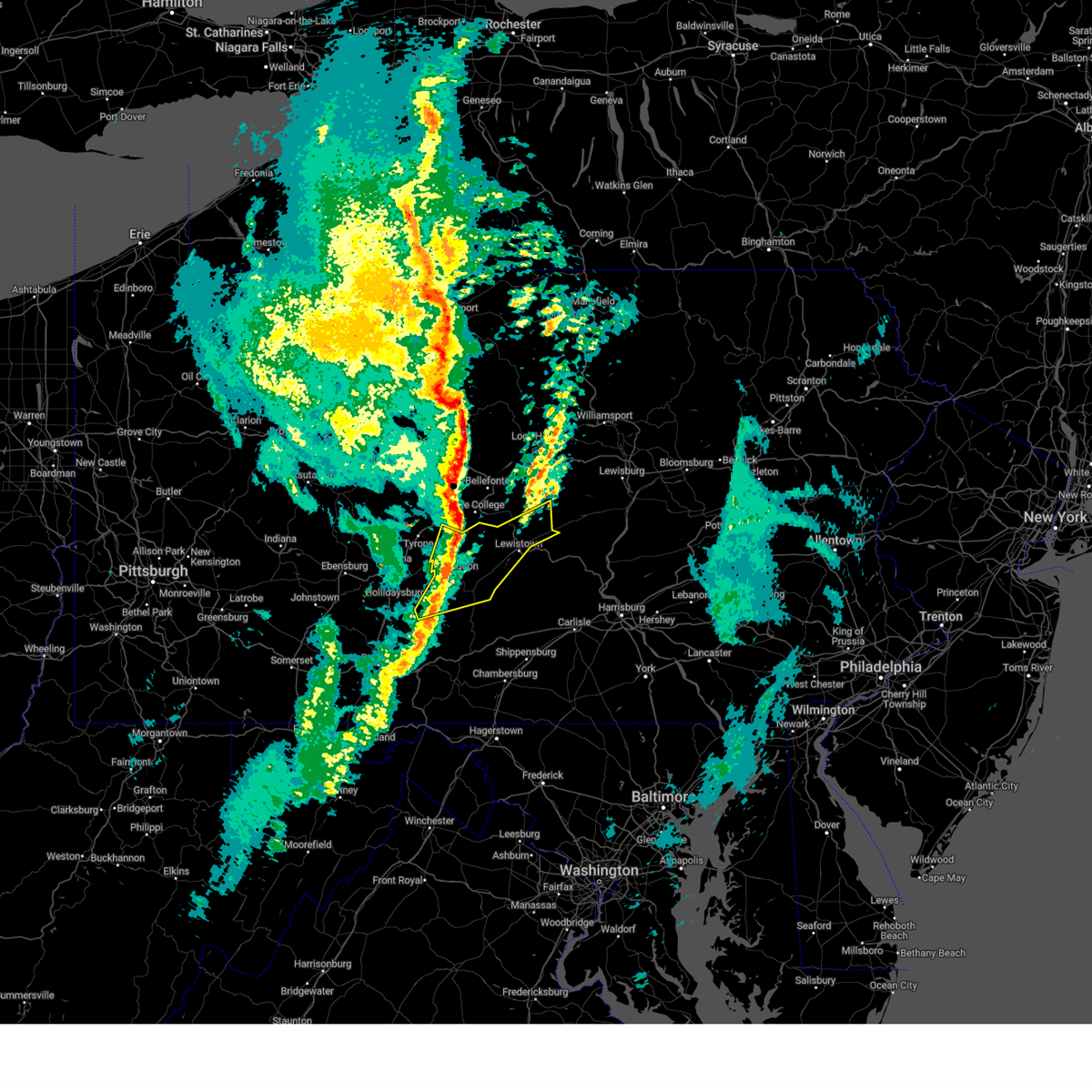
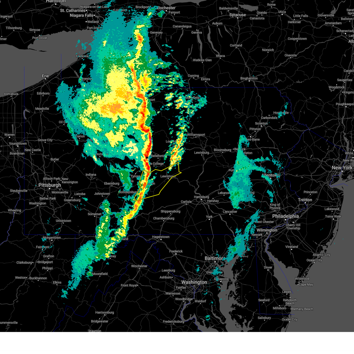
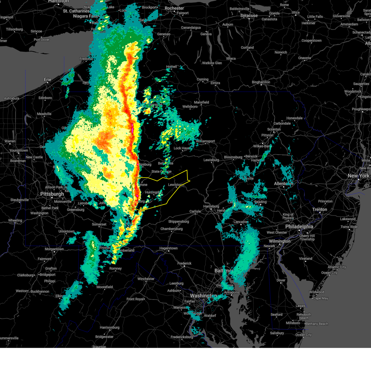
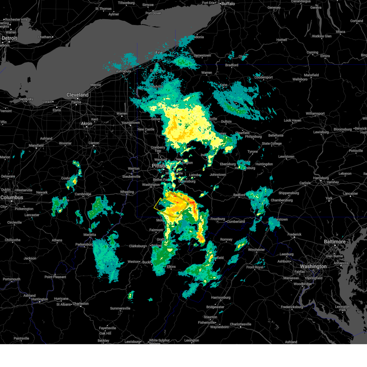
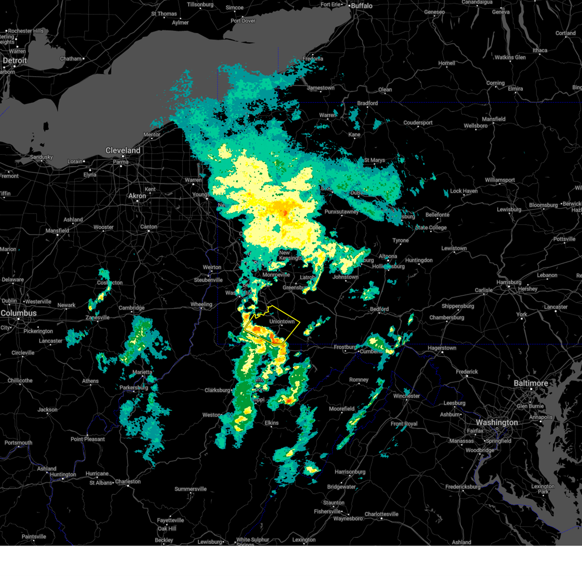
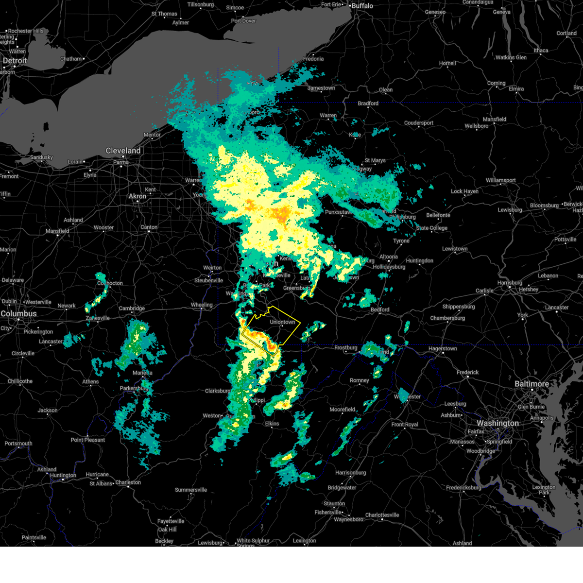
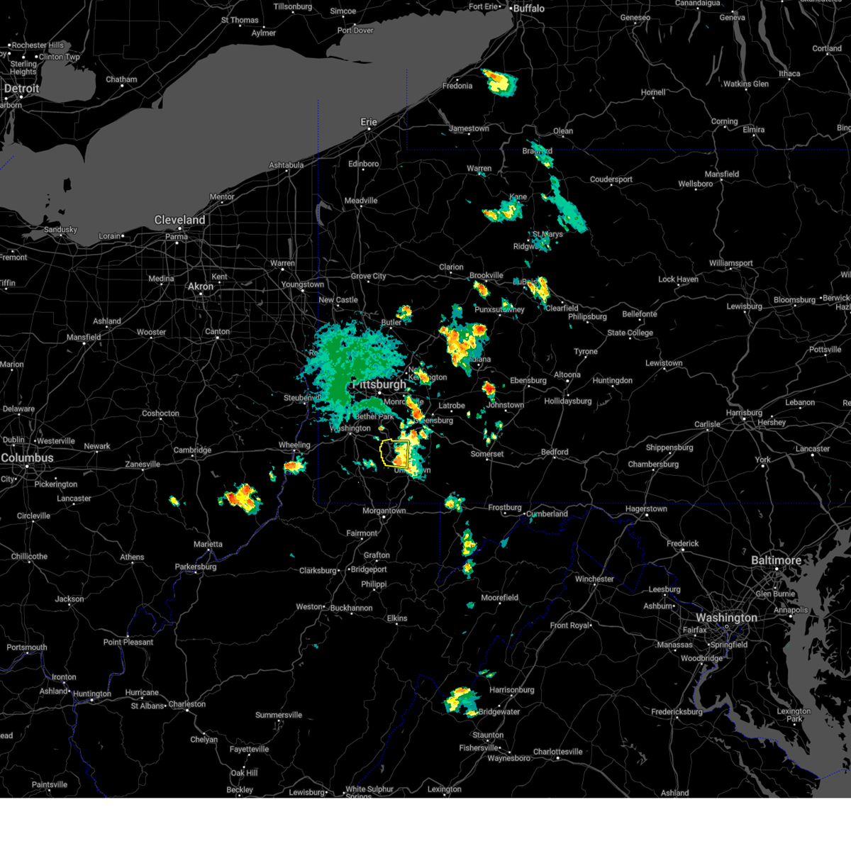
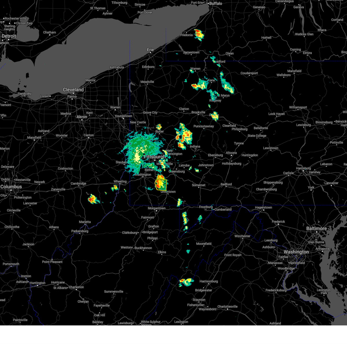
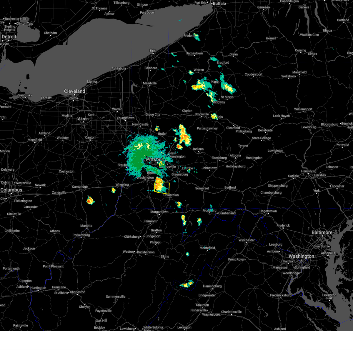
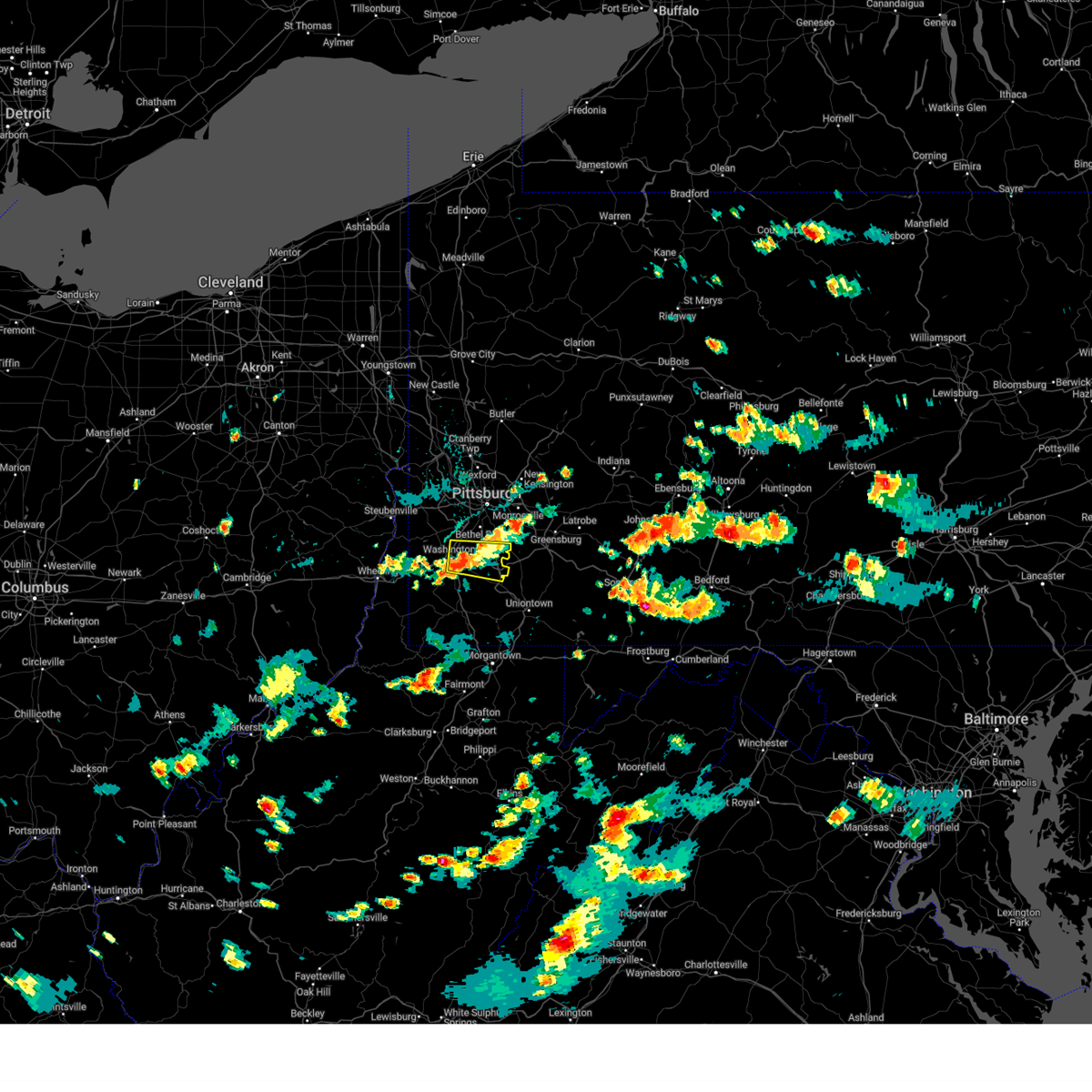
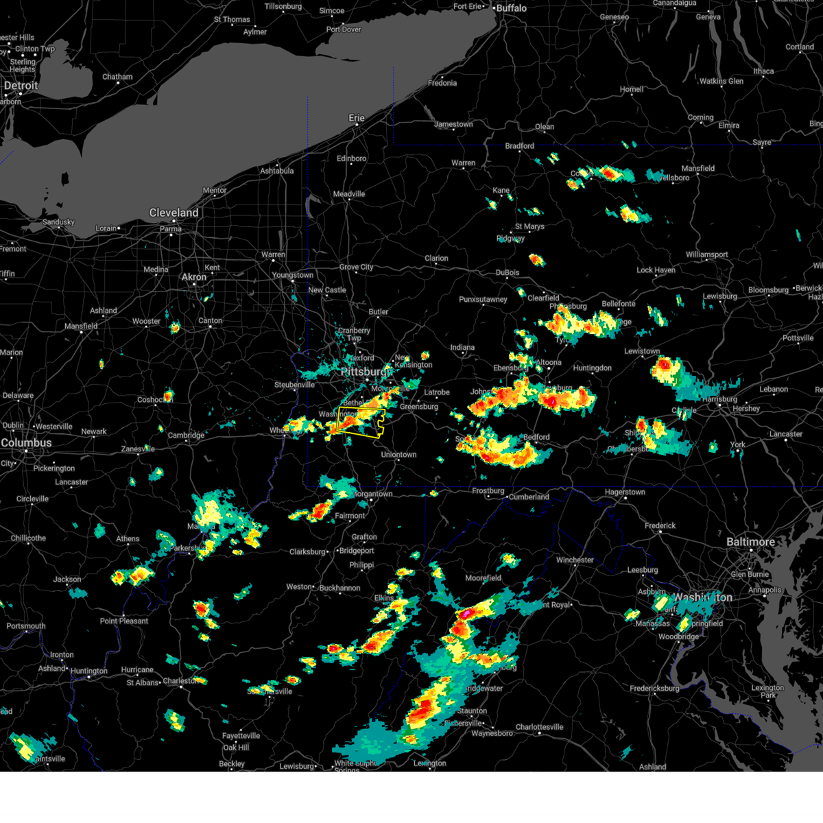
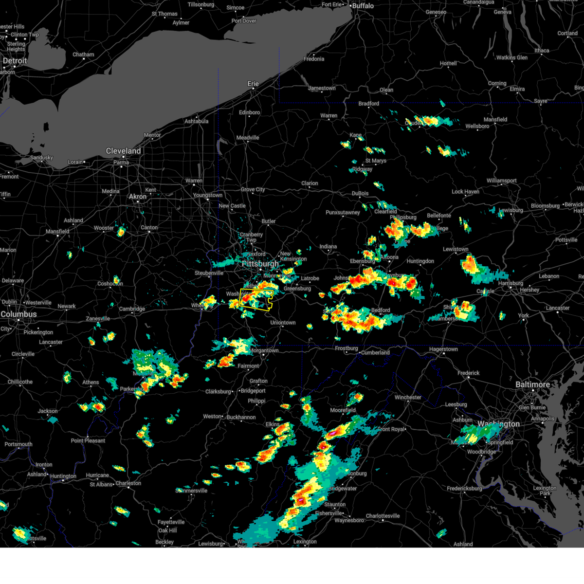
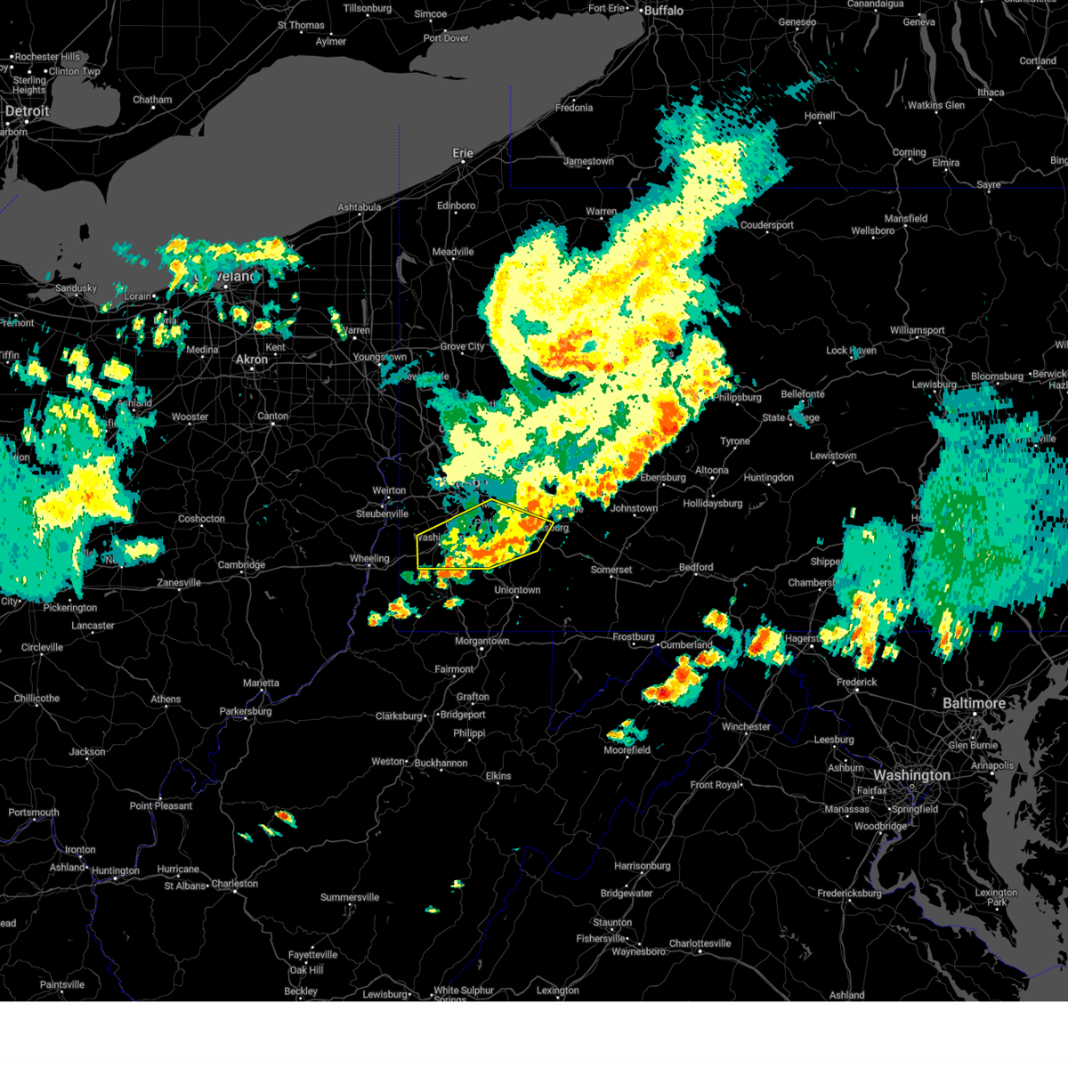
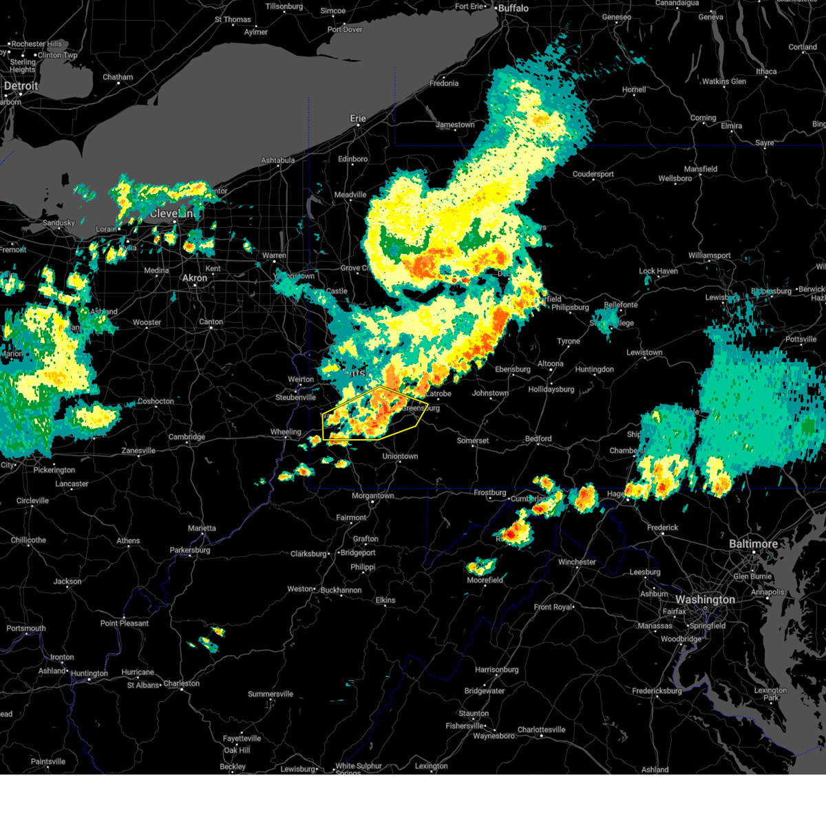
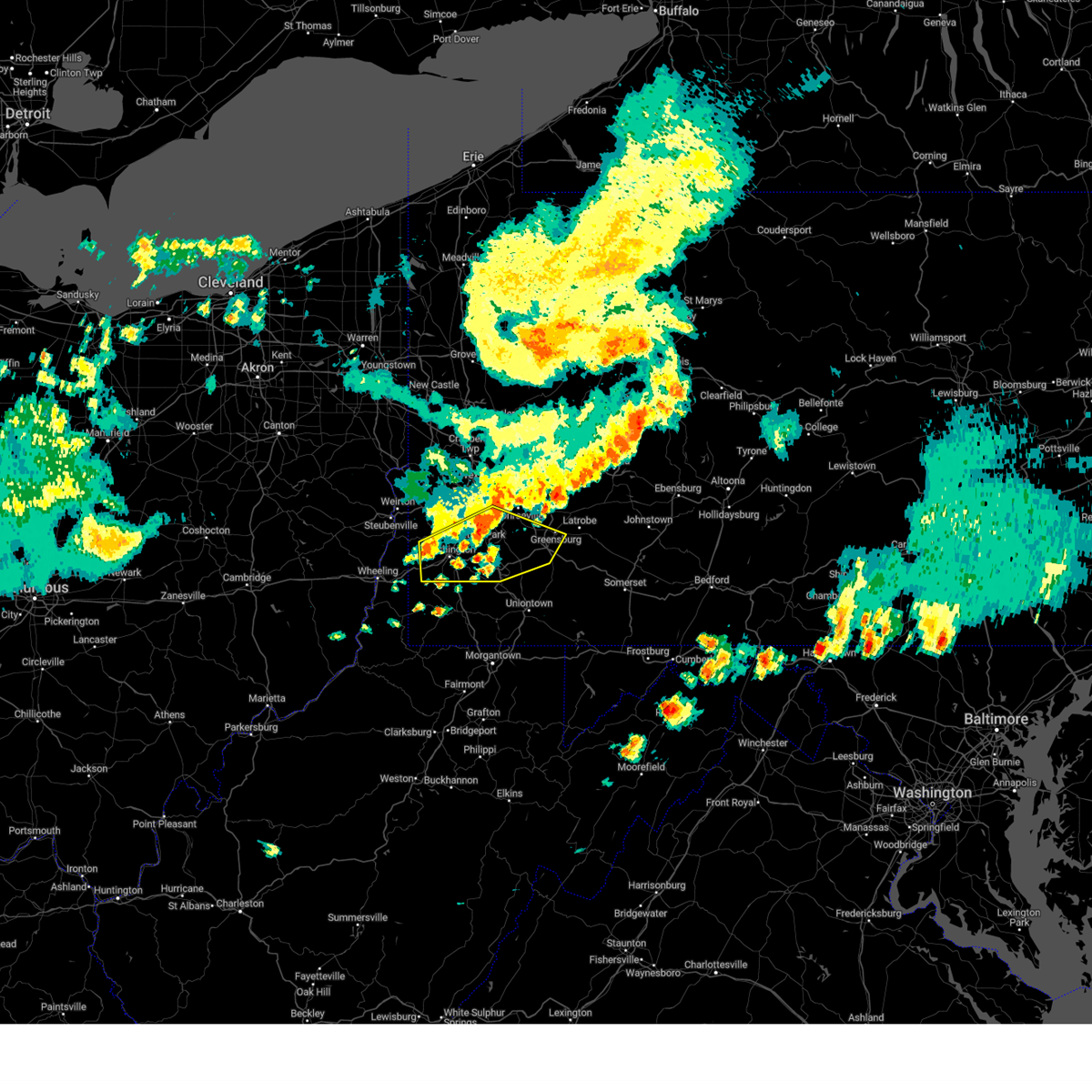
Hail Map for Allenport, PA
The Allenport, PA area has had 0 reports of on-the-ground hail by trained spotters, and has been under severe weather warnings 74 times during the past 12 months. Doppler radar has detected hail at or near Allenport, PA on 66 occasions, including 6 occasions during the past year.
| Name: | Allenport, PA |
| Where Located: | 29.1 miles S of State College, PA |
| Map: | Google Map for Allenport, PA |
| Population: | 648 |
| Housing Units: | 285 |
| More Info: | Search Google for Allenport, PA |
1
The Top Recent Hail Date for Allenport, PA is Wednesday, April 2, 2025 (12th out of 66)
Hail and Wind Damage Spotted near Allenport, PA
| Date / Time | Report Details |
|---|---|
| 7/7/2025 7:15 PM EDT |
 At 715 pm edt, a severe thunderstorm was located over blacklog, moving east at 20 mph (radar indicated). Hazards include 60 mph wind gusts. Expect damage to roofs, siding, and trees. Locations impacted include, mount union, honey grove, spruce hill, strodes mills, rockhill furnace, east waterford, perulack, blacklog, orbisonia, mcveytown, kistler, and longfellow. At 715 pm edt, a severe thunderstorm was located over blacklog, moving east at 20 mph (radar indicated). Hazards include 60 mph wind gusts. Expect damage to roofs, siding, and trees. Locations impacted include, mount union, honey grove, spruce hill, strodes mills, rockhill furnace, east waterford, perulack, blacklog, orbisonia, mcveytown, kistler, and longfellow.
|
| 7/7/2025 6:57 PM EDT |
 Svrctp the national weather service in state college pa has issued a * severe thunderstorm warning for, southeastern huntingdon county in central pennsylvania, southwestern juniata county in central pennsylvania, southwestern mifflin county in central pennsylvania, * until 745 pm edt. * at 656 pm edt, a severe thunderstorm was located over mount union, moving east at 20 mph (radar indicated). Hazards include 60 mph wind gusts. expect damage to roofs, siding, and trees Svrctp the national weather service in state college pa has issued a * severe thunderstorm warning for, southeastern huntingdon county in central pennsylvania, southwestern juniata county in central pennsylvania, southwestern mifflin county in central pennsylvania, * until 745 pm edt. * at 656 pm edt, a severe thunderstorm was located over mount union, moving east at 20 mph (radar indicated). Hazards include 60 mph wind gusts. expect damage to roofs, siding, and trees
|
| 6/28/2025 12:58 PM EDT |
 The storm which prompted the warning has moved out of the area. therefore, the warning will be allowed to expire. however, gusty winds are still possible with this thunderstorm. to report severe weather, contact your nearest law enforcement agency. they will send your report to the national weather service office. a severe thunderstorm watch remains in effect until 800 pm edt saturday for a portion of southwest pennsylvania. The storm which prompted the warning has moved out of the area. therefore, the warning will be allowed to expire. however, gusty winds are still possible with this thunderstorm. to report severe weather, contact your nearest law enforcement agency. they will send your report to the national weather service office. a severe thunderstorm watch remains in effect until 800 pm edt saturday for a portion of southwest pennsylvania.
|
| 6/28/2025 12:45 PM EDT |
 At 1245 pm edt, a severe thunderstorm was located over california, or 15 miles northwest of uniontown, moving east at 25 mph (radar indicated). Hazards include 60 mph wind gusts. Expect damage to roofs, siding, and trees. Locations impacted include, waynesburg, monessen, california, donora, monongahela, charleroi, bentleyville, brownsville, fredericktown-millsboro, perryopolis, fairdale, jefferson boro, north belle vernon, wickerham manor-fisher, baidland, north charleroi, speers, isabella, belle vernon and lynnwood-pricedale. At 1245 pm edt, a severe thunderstorm was located over california, or 15 miles northwest of uniontown, moving east at 25 mph (radar indicated). Hazards include 60 mph wind gusts. Expect damage to roofs, siding, and trees. Locations impacted include, waynesburg, monessen, california, donora, monongahela, charleroi, bentleyville, brownsville, fredericktown-millsboro, perryopolis, fairdale, jefferson boro, north belle vernon, wickerham manor-fisher, baidland, north charleroi, speers, isabella, belle vernon and lynnwood-pricedale.
|
| 6/28/2025 12:18 PM EDT |
 Svrpbz the national weather service in pittsburgh has issued a * severe thunderstorm warning for, northwestern fayette county in southwestern pennsylvania, northern greene county in southwestern pennsylvania, southeastern washington county in southwestern pennsylvania, southwestern westmoreland county in southwestern pennsylvania, * until 100 pm edt. * at 1218 pm edt, a severe thunderstorm was located 7 miles southwest of bentleyville, or 11 miles southeast of washington, moving east at 25 mph (radar indicated). Hazards include 60 mph wind gusts. expect damage to roofs, siding, and trees Svrpbz the national weather service in pittsburgh has issued a * severe thunderstorm warning for, northwestern fayette county in southwestern pennsylvania, northern greene county in southwestern pennsylvania, southeastern washington county in southwestern pennsylvania, southwestern westmoreland county in southwestern pennsylvania, * until 100 pm edt. * at 1218 pm edt, a severe thunderstorm was located 7 miles southwest of bentleyville, or 11 miles southeast of washington, moving east at 25 mph (radar indicated). Hazards include 60 mph wind gusts. expect damage to roofs, siding, and trees
|
| 6/27/2025 6:39 PM EDT |
 The storm which prompted the warning has weakened below severe limits, and no longer poses an immediate threat to life or property. therefore, the warning will be allowed to expire. however, gusty winds and heavy rain are still possible with this thunderstorm. The storm which prompted the warning has weakened below severe limits, and no longer poses an immediate threat to life or property. therefore, the warning will be allowed to expire. however, gusty winds and heavy rain are still possible with this thunderstorm.
|
| 6/27/2025 6:14 PM EDT |
 At 614 pm edt, a severe thunderstorm was located near perryopolis, or 13 miles west of connellsville, moving east at 20 mph (radar indicated). Hazards include 60 mph wind gusts. Expect damage to roofs, siding, and trees. Locations impacted include, connellsville, south park township, jefferson hills, monessen, clairton, california, donora, monongahela, charleroi, irwin, west newton, bentleyville, brownsville, fredericktown-millsboro, perryopolis, new eagle, north belle vernon, wickerham manor-fisher, baidland and elizabeth. At 614 pm edt, a severe thunderstorm was located near perryopolis, or 13 miles west of connellsville, moving east at 20 mph (radar indicated). Hazards include 60 mph wind gusts. Expect damage to roofs, siding, and trees. Locations impacted include, connellsville, south park township, jefferson hills, monessen, clairton, california, donora, monongahela, charleroi, irwin, west newton, bentleyville, brownsville, fredericktown-millsboro, perryopolis, new eagle, north belle vernon, wickerham manor-fisher, baidland and elizabeth.
|
| 6/27/2025 6:04 PM EDT |
 At 604 pm edt, a severe thunderstorm was located over california, or 14 miles southeast of gastonville, moving east at 20 mph (radar indicated). Hazards include 60 mph wind gusts. Expect damage to roofs, siding, and trees. Locations impacted include, connellsville, gastonville, south park township, jefferson hills, monessen, clairton, california, donora, monongahela, charleroi, irwin, west newton, bentleyville, brownsville, fredericktown-millsboro, perryopolis, new eagle, north belle vernon, wickerham manor-fisher and baidland. At 604 pm edt, a severe thunderstorm was located over california, or 14 miles southeast of gastonville, moving east at 20 mph (radar indicated). Hazards include 60 mph wind gusts. Expect damage to roofs, siding, and trees. Locations impacted include, connellsville, gastonville, south park township, jefferson hills, monessen, clairton, california, donora, monongahela, charleroi, irwin, west newton, bentleyville, brownsville, fredericktown-millsboro, perryopolis, new eagle, north belle vernon, wickerham manor-fisher and baidland.
|
| 6/27/2025 5:54 PM EDT |
 Svrpbz the national weather service in pittsburgh has issued a * severe thunderstorm warning for, southeastern allegheny county in southwestern pennsylvania, northwestern fayette county in southwestern pennsylvania, southeastern washington county in southwestern pennsylvania, southwestern westmoreland county in southwestern pennsylvania, * until 645 pm edt. * at 554 pm edt, a severe thunderstorm was located near bentleyville, or 14 miles south of gastonville, moving east at 20 mph (radar indicated). Hazards include 60 mph wind gusts. expect damage to roofs, siding, and trees Svrpbz the national weather service in pittsburgh has issued a * severe thunderstorm warning for, southeastern allegheny county in southwestern pennsylvania, northwestern fayette county in southwestern pennsylvania, southeastern washington county in southwestern pennsylvania, southwestern westmoreland county in southwestern pennsylvania, * until 645 pm edt. * at 554 pm edt, a severe thunderstorm was located near bentleyville, or 14 miles south of gastonville, moving east at 20 mph (radar indicated). Hazards include 60 mph wind gusts. expect damage to roofs, siding, and trees
|
| 6/26/2025 7:16 PM EDT |
 Svrctp the national weather service in state college pa has issued a * severe thunderstorm warning for, central huntingdon county in central pennsylvania, southwestern mifflin county in central pennsylvania, * until 800 pm edt. * at 716 pm edt, a severe thunderstorm was located over raystown dam, moving southeast at 15 mph (radar indicated). Hazards include 60 mph wind gusts. expect damage to roofs, siding, and trees Svrctp the national weather service in state college pa has issued a * severe thunderstorm warning for, central huntingdon county in central pennsylvania, southwestern mifflin county in central pennsylvania, * until 800 pm edt. * at 716 pm edt, a severe thunderstorm was located over raystown dam, moving southeast at 15 mph (radar indicated). Hazards include 60 mph wind gusts. expect damage to roofs, siding, and trees
|
| 6/25/2025 5:36 PM EDT |
 The storm which prompted the warning has weakened below severe limits, and no longer poses an immediate threat to life or property. therefore, the warning will be allowed to expire. however, gusty winds and heavy rain are still possible with this thunderstorm. The storm which prompted the warning has weakened below severe limits, and no longer poses an immediate threat to life or property. therefore, the warning will be allowed to expire. however, gusty winds and heavy rain are still possible with this thunderstorm.
|
| 6/25/2025 5:29 PM EDT |
 the severe thunderstorm warning has been cancelled and is no longer in effect the severe thunderstorm warning has been cancelled and is no longer in effect
|
| 6/25/2025 5:29 PM EDT |
 At 529 pm edt, a severe thunderstorm was located near monessen, or 15 miles southeast of gastonville, moving south at 10 mph (radar indicated). Hazards include 60 mph wind gusts. Expect damage to roofs, siding, and trees. Locations impacted include, california, brownsville, perryopolis, north belle vernon, speers, belle vernon, lynnwood-pricedale, west brownsville, roscoe, fayette city, newell, allenport, stockdale, long branch, dunlevy, elco, grindstone, twilight, centerville and coal center. At 529 pm edt, a severe thunderstorm was located near monessen, or 15 miles southeast of gastonville, moving south at 10 mph (radar indicated). Hazards include 60 mph wind gusts. Expect damage to roofs, siding, and trees. Locations impacted include, california, brownsville, perryopolis, north belle vernon, speers, belle vernon, lynnwood-pricedale, west brownsville, roscoe, fayette city, newell, allenport, stockdale, long branch, dunlevy, elco, grindstone, twilight, centerville and coal center.
|
| 6/25/2025 5:07 PM EDT |
 At 507 pm edt, a severe thunderstorm was located over monessen, or 12 miles southeast of gastonville, moving south at 10 mph (radar indicated). Hazards include 60 mph wind gusts and small hail. Expect damage to roofs, siding, and trees. Locations impacted include, monessen, california, donora, monongahela, charleroi, west newton, brownsville, perryopolis, north belle vernon, wickerham manor-fisher, baidland, north charleroi, speers, belle vernon, lynnwood-pricedale, west brownsville, roscoe, fayette city, newell and allenport. At 507 pm edt, a severe thunderstorm was located over monessen, or 12 miles southeast of gastonville, moving south at 10 mph (radar indicated). Hazards include 60 mph wind gusts and small hail. Expect damage to roofs, siding, and trees. Locations impacted include, monessen, california, donora, monongahela, charleroi, west newton, brownsville, perryopolis, north belle vernon, wickerham manor-fisher, baidland, north charleroi, speers, belle vernon, lynnwood-pricedale, west brownsville, roscoe, fayette city, newell and allenport.
|
| 6/25/2025 4:56 PM EDT | Svrpbz the national weather service in pittsburgh has issued a * severe thunderstorm warning for, northwestern fayette county in southwestern pennsylvania, southeastern washington county in southwestern pennsylvania, southwestern westmoreland county in southwestern pennsylvania, * until 545 pm edt. * at 456 pm edt, a severe thunderstorm was located over monessen, or 11 miles southeast of gastonville, moving south at 10 mph (radar indicated). Hazards include 60 mph wind gusts. expect damage to roofs, siding, and trees |
| 6/9/2025 10:05 PM EDT |
 Svrctp the national weather service in state college pa has issued a * severe thunderstorm warning for, eastern huntingdon county in central pennsylvania, southwestern juniata county in central pennsylvania, southwestern mifflin county in central pennsylvania, * until 1045 pm edt. * at 1004 pm edt, a severe thunderstorm was located over rockhill furnace, moving northeast at 25 mph (radar indicated). Hazards include 60 mph wind gusts and quarter size hail. Hail damage to vehicles is expected. expect wind damage to roofs, siding, and trees. this severe thunderstorm will be near, mount union around 1010 pm edt. blacklog around 1030 pm edt. Other locations impacted by this severe thunderstorm include kistler, shirleysburg, newton hamilton, mcveytown, and orbisonia. Svrctp the national weather service in state college pa has issued a * severe thunderstorm warning for, eastern huntingdon county in central pennsylvania, southwestern juniata county in central pennsylvania, southwestern mifflin county in central pennsylvania, * until 1045 pm edt. * at 1004 pm edt, a severe thunderstorm was located over rockhill furnace, moving northeast at 25 mph (radar indicated). Hazards include 60 mph wind gusts and quarter size hail. Hail damage to vehicles is expected. expect wind damage to roofs, siding, and trees. this severe thunderstorm will be near, mount union around 1010 pm edt. blacklog around 1030 pm edt. Other locations impacted by this severe thunderstorm include kistler, shirleysburg, newton hamilton, mcveytown, and orbisonia.
|
| 6/9/2025 9:05 PM EDT |
 Svrctp the national weather service in state college pa has issued a * severe thunderstorm warning for, northeastern bedford county in south central pennsylvania, north central franklin county in south central pennsylvania, northeastern fulton county in south central pennsylvania, southern huntingdon county in central pennsylvania, * until 945 pm edt. * at 905 pm edt, a severe thunderstorm was located over wells tannery, moving northeast at 25 mph (radar indicated). Hazards include 60 mph wind gusts and quarter size hail. Hail damage to vehicles is expected. Expect wind damage to roofs, siding, and trees. Svrctp the national weather service in state college pa has issued a * severe thunderstorm warning for, northeastern bedford county in south central pennsylvania, north central franklin county in south central pennsylvania, northeastern fulton county in south central pennsylvania, southern huntingdon county in central pennsylvania, * until 945 pm edt. * at 905 pm edt, a severe thunderstorm was located over wells tannery, moving northeast at 25 mph (radar indicated). Hazards include 60 mph wind gusts and quarter size hail. Hail damage to vehicles is expected. Expect wind damage to roofs, siding, and trees.
|
| 5/5/2025 4:51 PM EDT | the severe thunderstorm warning has been cancelled and is no longer in effect |
| 5/5/2025 4:50 PM EDT | At 450 pm edt, a severe thunderstorm was located over california, or 15 miles south of gastonville, moving northwest at 30 mph (radar indicated). Hazards include quarter size hail. Damage to vehicles is expected. Locations impacted include, monessen, california, donora, charleroi, bentleyville, brownsville, fredericktown-millsboro, north belle vernon, wickerham manor-fisher, north charleroi, speers, belle vernon, ellsworth, lynnwood-pricedale, west brownsville, roscoe, deemston, fayette city, newell and allenport. |
| 5/5/2025 4:42 PM EDT |
 At 442 pm edt, a severe thunderstorm was located over brownsville, or 14 miles northwest of uniontown, moving northwest at 30 mph (radar indicated). Hazards include half dollar size hail. Damage to vehicles is expected. Locations impacted include, monessen, california, donora, charleroi, bentleyville, brownsville, fredericktown-millsboro, north belle vernon, wickerham manor-fisher, north charleroi, speers, isabella, belle vernon, ellsworth, lynnwood-pricedale, west brownsville, roscoe, deemston, fayette city and newell. At 442 pm edt, a severe thunderstorm was located over brownsville, or 14 miles northwest of uniontown, moving northwest at 30 mph (radar indicated). Hazards include half dollar size hail. Damage to vehicles is expected. Locations impacted include, monessen, california, donora, charleroi, bentleyville, brownsville, fredericktown-millsboro, north belle vernon, wickerham manor-fisher, north charleroi, speers, isabella, belle vernon, ellsworth, lynnwood-pricedale, west brownsville, roscoe, deemston, fayette city and newell.
|
| 5/5/2025 4:34 PM EDT |
 Svrpbz the national weather service in pittsburgh has issued a * severe thunderstorm warning for, northwestern fayette county in southwestern pennsylvania, southeastern washington county in southwestern pennsylvania, western westmoreland county in southwestern pennsylvania, * until 500 pm edt. * at 434 pm edt, a severe thunderstorm was located near brownsville, or 10 miles northwest of uniontown, moving northwest at 30 mph (radar indicated). Hazards include half dollar size hail. damage to vehicles is expected Svrpbz the national weather service in pittsburgh has issued a * severe thunderstorm warning for, northwestern fayette county in southwestern pennsylvania, southeastern washington county in southwestern pennsylvania, western westmoreland county in southwestern pennsylvania, * until 500 pm edt. * at 434 pm edt, a severe thunderstorm was located near brownsville, or 10 miles northwest of uniontown, moving northwest at 30 mph (radar indicated). Hazards include half dollar size hail. damage to vehicles is expected
|
| 5/1/2025 6:05 PM EDT | At 605 pm edt, severe thunderstorms were located along a line from near masontown to 10 miles east of farmington, or along a line from 9 miles southwest of uniontown to 20 miles southeast of uniontown, moving north at 40 mph (radar indicated). Hazards include 60 mph wind gusts and quarter size hail. Hail damage to vehicles is expected. expect wind damage to roofs, siding, and trees. Locations impacted include, uniontown, connellsville, california, mount pleasant, scottdale, brownsville, south connellsville, farmington, perryopolis, seven springs, north belle vernon, belle vernon, dunbar, lynnwood-pricedale, west brownsville, roscoe, everson, fayette city, newell and allenport. |
| 5/1/2025 6:05 PM EDT | the severe thunderstorm warning has been cancelled and is no longer in effect |
| 5/1/2025 5:58 PM EDT |
 Svrpbz the national weather service in pittsburgh has issued a * severe thunderstorm warning for, fayette county in southwestern pennsylvania, southwestern westmoreland county in southwestern pennsylvania, northeastern preston county in northeastern west virginia, * until 645 pm edt. * at 558 pm edt, severe thunderstorms were located along a line from over point marion to 14 miles southeast of farmington, or along a line from 9 miles northeast of star city to 16 miles northeast of terra alta, moving north at 40 mph (radar indicated). Hazards include 60 mph wind gusts. expect damage to roofs, siding, and trees Svrpbz the national weather service in pittsburgh has issued a * severe thunderstorm warning for, fayette county in southwestern pennsylvania, southwestern westmoreland county in southwestern pennsylvania, northeastern preston county in northeastern west virginia, * until 645 pm edt. * at 558 pm edt, severe thunderstorms were located along a line from over point marion to 14 miles southeast of farmington, or along a line from 9 miles northeast of star city to 16 miles northeast of terra alta, moving north at 40 mph (radar indicated). Hazards include 60 mph wind gusts. expect damage to roofs, siding, and trees
|
| 4/29/2025 6:33 PM EDT |
 Svrctp the national weather service in state college pa has issued a * severe thunderstorm warning for, huntingdon county in central pennsylvania, * until 715 pm edt. * at 632 pm edt, severe thunderstorms were located along a line extending from osceola mills to sinking valley to roaring spring, moving east at 65 mph (radar indicated). Hazards include 60 mph wind gusts. expect damage to roofs, siding, and trees Svrctp the national weather service in state college pa has issued a * severe thunderstorm warning for, huntingdon county in central pennsylvania, * until 715 pm edt. * at 632 pm edt, severe thunderstorms were located along a line extending from osceola mills to sinking valley to roaring spring, moving east at 65 mph (radar indicated). Hazards include 60 mph wind gusts. expect damage to roofs, siding, and trees
|
| 4/29/2025 5:29 PM EDT | The storms which prompted the warning have moved out of the area. therefore, the warning will be allowed to expire. however, gusty winds are still possible with these thunderstorms. a severe thunderstorm watch remains in effect until 700 pm edt for northern west virginia. a severe thunderstorm watch also remains in effect until 1000 pm edt for southwestern pennsylvania, and northern west virginia. remember, a severe thunderstorm warning still remains in effect for fayette and westmoreland counties. |
| 4/29/2025 5:24 PM EDT | Svrpbz the national weather service in pittsburgh has issued a * severe thunderstorm warning for, southeastern washington county in southwestern pennsylvania, southern allegheny county in southwestern pennsylvania, southern westmoreland county in southwestern pennsylvania, eastern greene county in southwestern pennsylvania, fayette county in southwestern pennsylvania, * until 630 pm edt. * at 524 pm edt, severe thunderstorms were located along a line extending from near donora to 7 miles east of hundred, moving east at 65 mph (radar indicated). Hazards include 70 mph wind gusts. Trees snapped and uprooted. Power outages can be expected. |
| 4/29/2025 5:12 PM EDT | At 511 pm edt, severe thunderstorms were located along a line extending from near east washington to 6 miles southeast of cameron, moving east at 55 mph (radar indicated). Hazards include 70 mph wind gusts. Trees snapped and uprooted. power outages can be expected. Locations impacted include, washington, uniontown, waynesburg, monessen, california, donora, mount pleasant, scottdale, monongahela, charleroi, masontown, youngwood, west newton, bentleyville, brownsville, east washington, new stanton, fredericktown-millsboro, perryopolis, and fairdale. |
| 4/29/2025 5:12 PM EDT | the severe thunderstorm warning has been cancelled and is no longer in effect |
| 4/29/2025 4:50 PM EDT |
 Svrpbz the national weather service in pittsburgh has issued a * severe thunderstorm warning for, southern washington county in southwestern pennsylvania, southwestern westmoreland county in southwestern pennsylvania, greene county in southwestern pennsylvania, western fayette county in southwestern pennsylvania, ohio county in northern west virginia, marshall county in northern west virginia, * until 530 pm edt. * at 450 pm edt, severe thunderstorms were located along a line extending from near west liberty to 6 miles south of powhatan point, moving east at 55 mph (radar indicated). Hazards include 70 mph wind gusts. Trees snapped and uprooted. Power outages can be expected. Svrpbz the national weather service in pittsburgh has issued a * severe thunderstorm warning for, southern washington county in southwestern pennsylvania, southwestern westmoreland county in southwestern pennsylvania, greene county in southwestern pennsylvania, western fayette county in southwestern pennsylvania, ohio county in northern west virginia, marshall county in northern west virginia, * until 530 pm edt. * at 450 pm edt, severe thunderstorms were located along a line extending from near west liberty to 6 miles south of powhatan point, moving east at 55 mph (radar indicated). Hazards include 70 mph wind gusts. Trees snapped and uprooted. Power outages can be expected.
|
| 4/19/2025 6:53 PM EDT |
 the severe thunderstorm warning has been cancelled and is no longer in effect the severe thunderstorm warning has been cancelled and is no longer in effect
|
| 4/19/2025 6:43 PM EDT |
 At 643 pm edt, a severe thunderstorm was located over donora, or 10 miles southeast of gastonville, moving east at 60 mph (radar indicated). Hazards include 60 mph wind gusts and quarter size hail. Hail damage to vehicles is expected. expect wind damage to roofs, siding, and trees. Locations impacted include, greensburg, jeannette, gastonville, south park township, jefferson hills, monessen, clairton, california, donora, mount pleasant, scottdale, monongahela, charleroi, irwin, manor, youngwood, west newton, bentleyville, lawson heights and new stanton. At 643 pm edt, a severe thunderstorm was located over donora, or 10 miles southeast of gastonville, moving east at 60 mph (radar indicated). Hazards include 60 mph wind gusts and quarter size hail. Hail damage to vehicles is expected. expect wind damage to roofs, siding, and trees. Locations impacted include, greensburg, jeannette, gastonville, south park township, jefferson hills, monessen, clairton, california, donora, mount pleasant, scottdale, monongahela, charleroi, irwin, manor, youngwood, west newton, bentleyville, lawson heights and new stanton.
|
| 4/19/2025 6:33 PM EDT |
 At 633 pm edt, a severe thunderstorm was located near bentleyville, or 7 miles south of gastonville, moving east at 75 mph (radar indicated). Hazards include 60 mph wind gusts and quarter size hail. Hail damage to vehicles is expected. expect wind damage to roofs, siding, and trees. Locations impacted include, greensburg, jeannette, gastonville, south park township, jefferson hills, monessen, clairton, california, donora, mount pleasant, scottdale, monongahela, charleroi, irwin, manor, youngwood, west newton, bentleyville, lawson heights and new stanton. At 633 pm edt, a severe thunderstorm was located near bentleyville, or 7 miles south of gastonville, moving east at 75 mph (radar indicated). Hazards include 60 mph wind gusts and quarter size hail. Hail damage to vehicles is expected. expect wind damage to roofs, siding, and trees. Locations impacted include, greensburg, jeannette, gastonville, south park township, jefferson hills, monessen, clairton, california, donora, mount pleasant, scottdale, monongahela, charleroi, irwin, manor, youngwood, west newton, bentleyville, lawson heights and new stanton.
|
| 4/19/2025 6:22 PM EDT |
 Svrpbz the national weather service in pittsburgh has issued a * severe thunderstorm warning for, southeastern allegheny county in southwestern pennsylvania, northwestern fayette county in southwestern pennsylvania, central washington county in southwestern pennsylvania, southwestern westmoreland county in southwestern pennsylvania, * until 700 pm edt. * at 622 pm edt, a severe thunderstorm was located near washington, moving east at 60 mph (radar indicated). Hazards include 60 mph wind gusts and quarter size hail. Hail damage to vehicles is expected. Expect wind damage to roofs, siding, and trees. Svrpbz the national weather service in pittsburgh has issued a * severe thunderstorm warning for, southeastern allegheny county in southwestern pennsylvania, northwestern fayette county in southwestern pennsylvania, central washington county in southwestern pennsylvania, southwestern westmoreland county in southwestern pennsylvania, * until 700 pm edt. * at 622 pm edt, a severe thunderstorm was located near washington, moving east at 60 mph (radar indicated). Hazards include 60 mph wind gusts and quarter size hail. Hail damage to vehicles is expected. Expect wind damage to roofs, siding, and trees.
|
| 4/3/2025 5:02 AM EDT |
 At 502 am edt, severe thunderstorms were located along a line from over jeannette to 7 miles north of fairview, or along a line from over jeannette to 12 miles north of mannington, moving east at 60 mph (radar indicated). Hazards include 60 mph wind gusts. Expect damage to roofs, siding, and trees. Locations impacted include, morgantown, fairmont, uniontown, connellsville, westover, kingwood, mannington, star city, terra alta, rowlesburg, california, mount pleasant, scottdale, masontown, pleasant valley, youngwood, brownsville, winfield, new stanton and south connellsville. At 502 am edt, severe thunderstorms were located along a line from over jeannette to 7 miles north of fairview, or along a line from over jeannette to 12 miles north of mannington, moving east at 60 mph (radar indicated). Hazards include 60 mph wind gusts. Expect damage to roofs, siding, and trees. Locations impacted include, morgantown, fairmont, uniontown, connellsville, westover, kingwood, mannington, star city, terra alta, rowlesburg, california, mount pleasant, scottdale, masontown, pleasant valley, youngwood, brownsville, winfield, new stanton and south connellsville.
|
| 4/3/2025 5:02 AM EDT |
 the severe thunderstorm warning has been cancelled and is no longer in effect the severe thunderstorm warning has been cancelled and is no longer in effect
|
| 4/3/2025 4:53 AM EDT | the severe thunderstorm warning has been cancelled and is no longer in effect |
| 4/3/2025 4:53 AM EDT | At 453 am edt, severe thunderstorms were located along a line from over white oak to near hundred, or along a line from near mckeesport to 10 miles northwest of mannington, moving east at 60 mph (radar indicated). Hazards include 60 mph wind gusts. Expect damage to roofs, siding, and trees. Locations impacted include, morgantown, fairmont, uniontown, connellsville, waynesburg, westover, kingwood, mannington, star city, terra alta, rowlesburg, monessen, california, donora, mount pleasant, scottdale, charleroi, masontown, pleasant valley and youngwood. |
| 4/3/2025 4:44 AM EDT | At 444 am edt, severe thunderstorms were located along a line from over jefferson hills to 6 miles northeast of jacksonburg, or along a line from over gastonville to 14 miles northwest of mannington, moving east at 60 mph (radar indicated). Hazards include 60 mph wind gusts. Expect damage to roofs, siding, and trees. Locations impacted include, morgantown, fairmont, uniontown, connellsville, waynesburg, westover, kingwood, mannington, star city, terra alta, rowlesburg, monessen, california, donora, mount pleasant, scottdale, monongahela, charleroi, masontown and pleasant valley. |
| 4/3/2025 4:28 AM EDT | Svrpbz the national weather service in pittsburgh has issued a * severe thunderstorm warning for, fayette county in southwestern pennsylvania, greene county in southwestern pennsylvania, southern washington county in southwestern pennsylvania, southwestern westmoreland county in southwestern pennsylvania, preston county in northeastern west virginia, marion county in northern west virginia, marshall county in northern west virginia, monongalia county in northern west virginia, wetzel county in northern west virginia, * until 530 am edt. * at 428 am edt, severe thunderstorms were located along a line from over washington to 10 miles south of new martinsville, moving east at 60 mph (radar indicated). Hazards include 60 mph wind gusts. expect damage to roofs, siding, and trees |
| 4/2/2025 2:20 PM EDT |
 At 220 pm edt, a severe thunderstorm was located over california, or 14 miles southeast of gastonville, moving east at 55 mph (radar indicated). Hazards include half dollar size hail. Damage to vehicles is expected. Locations impacted include, greensburg, monessen, california, donora, mount pleasant, scottdale, charleroi, youngwood, west newton, brownsville, new stanton, perryopolis, north belle vernon, wickerham manor-fisher, calumet-norvelt, north charleroi, speers, belle vernon, lynnwood-pricedale and west brownsville. At 220 pm edt, a severe thunderstorm was located over california, or 14 miles southeast of gastonville, moving east at 55 mph (radar indicated). Hazards include half dollar size hail. Damage to vehicles is expected. Locations impacted include, greensburg, monessen, california, donora, mount pleasant, scottdale, charleroi, youngwood, west newton, brownsville, new stanton, perryopolis, north belle vernon, wickerham manor-fisher, calumet-norvelt, north charleroi, speers, belle vernon, lynnwood-pricedale and west brownsville.
|
| 4/2/2025 2:20 PM EDT |
 the severe thunderstorm warning has been cancelled and is no longer in effect the severe thunderstorm warning has been cancelled and is no longer in effect
|
| 4/2/2025 2:14 PM EDT |
 the severe thunderstorm warning has been cancelled and is no longer in effect the severe thunderstorm warning has been cancelled and is no longer in effect
|
| 4/2/2025 2:14 PM EDT |
 At 214 pm edt, a severe thunderstorm was located over california, or 14 miles south of gastonville, moving east at 55 mph (radar indicated). Hazards include 60 mph wind gusts and quarter size hail. Hail damage to vehicles is expected. expect wind damage to roofs, siding, and trees. Locations impacted include, greensburg, jeannette, monessen, california, donora, mount pleasant, scottdale, monongahela, charleroi, youngwood, west newton, bentleyville, brownsville, new stanton, fredericktown-millsboro, perryopolis, north belle vernon, wickerham manor-fisher, baidland and calumet-norvelt. At 214 pm edt, a severe thunderstorm was located over california, or 14 miles south of gastonville, moving east at 55 mph (radar indicated). Hazards include 60 mph wind gusts and quarter size hail. Hail damage to vehicles is expected. expect wind damage to roofs, siding, and trees. Locations impacted include, greensburg, jeannette, monessen, california, donora, mount pleasant, scottdale, monongahela, charleroi, youngwood, west newton, bentleyville, brownsville, new stanton, fredericktown-millsboro, perryopolis, north belle vernon, wickerham manor-fisher, baidland and calumet-norvelt.
|
| 4/2/2025 2:02 PM EDT |
 Svrpbz the national weather service in pittsburgh has issued a * severe thunderstorm warning for, southeastern allegheny county in southwestern pennsylvania, northern fayette county in southwestern pennsylvania, northeastern greene county in southwestern pennsylvania, southeastern washington county in southwestern pennsylvania, southwestern westmoreland county in southwestern pennsylvania, * until 245 pm edt. * at 202 pm edt, a severe thunderstorm was located 7 miles northwest of jefferson boro, or 8 miles north of waynesburg, moving east at 55 mph (radar indicated). Hazards include 60 mph wind gusts and quarter size hail. Hail damage to vehicles is expected. Expect wind damage to roofs, siding, and trees. Svrpbz the national weather service in pittsburgh has issued a * severe thunderstorm warning for, southeastern allegheny county in southwestern pennsylvania, northern fayette county in southwestern pennsylvania, northeastern greene county in southwestern pennsylvania, southeastern washington county in southwestern pennsylvania, southwestern westmoreland county in southwestern pennsylvania, * until 245 pm edt. * at 202 pm edt, a severe thunderstorm was located 7 miles northwest of jefferson boro, or 8 miles north of waynesburg, moving east at 55 mph (radar indicated). Hazards include 60 mph wind gusts and quarter size hail. Hail damage to vehicles is expected. Expect wind damage to roofs, siding, and trees.
|
| 3/16/2025 3:42 PM EDT |
 The storms which prompted the warning have weakened below severe limits, and no longer pose an immediate threat to life or property. therefore, the warning will be allowed to expire. however, gusty winds are still possible with these thunderstorms. a tornado watch remains in effect until 700 pm edt for central pennsylvania. to report severe weather, contact your nearest law enforcement agency. they will relay your report to the national weather service state college pa. The storms which prompted the warning have weakened below severe limits, and no longer pose an immediate threat to life or property. therefore, the warning will be allowed to expire. however, gusty winds are still possible with these thunderstorms. a tornado watch remains in effect until 700 pm edt for central pennsylvania. to report severe weather, contact your nearest law enforcement agency. they will relay your report to the national weather service state college pa.
|
| 3/16/2025 3:36 PM EDT |
 At 335 pm edt, severe thunderstorms were located along a line extending from reeds gap state park to mount union, moving northeast at 35 mph (trained weather spotters). Hazards include 60 mph wind gusts. Expect damage to roofs, siding, and trees. Locations impacted include, highland park, yeagertown, belltown, alfarata, barrville, belleville, reedsville, juniata terrace, atkinson mills, longfellow, siglerville, and mount union. At 335 pm edt, severe thunderstorms were located along a line extending from reeds gap state park to mount union, moving northeast at 35 mph (trained weather spotters). Hazards include 60 mph wind gusts. Expect damage to roofs, siding, and trees. Locations impacted include, highland park, yeagertown, belltown, alfarata, barrville, belleville, reedsville, juniata terrace, atkinson mills, longfellow, siglerville, and mount union.
|
| 3/16/2025 2:50 PM EDT |
 the severe thunderstorm warning has been cancelled and is no longer in effect the severe thunderstorm warning has been cancelled and is no longer in effect
|
| 3/16/2025 2:50 PM EDT |
 At 250 pm edt, severe thunderstorms were located along a line extending from rock springs to trough creek state park, moving east at 45 mph (trained weather spotters). Hazards include 60 mph wind gusts and quarter size hail. Hail damage to vehicles is expected. expect wind damage to roofs, siding, and trees. Locations impacted include, franklinville, whipple dam state park, yeagertown, wagner, alfarata, raystown dam, reedsville, mapleton, juniata terrace, atkinson mills, mcconnellstown, and siglerville. At 250 pm edt, severe thunderstorms were located along a line extending from rock springs to trough creek state park, moving east at 45 mph (trained weather spotters). Hazards include 60 mph wind gusts and quarter size hail. Hail damage to vehicles is expected. expect wind damage to roofs, siding, and trees. Locations impacted include, franklinville, whipple dam state park, yeagertown, wagner, alfarata, raystown dam, reedsville, mapleton, juniata terrace, atkinson mills, mcconnellstown, and siglerville.
|
| 3/16/2025 2:27 PM EDT |
 Svrctp the national weather service in state college pa has issued a * severe thunderstorm warning for, blair county in central pennsylvania, huntingdon county in central pennsylvania, mifflin county in central pennsylvania, * until 345 pm edt. * at 226 pm edt, severe thunderstorms were located along a line extending from blandburg to lakemont to claysburg, moving northeast at 65 mph (trained weather spotters). Hazards include 60 mph wind gusts and quarter size hail. Hail damage to vehicles is expected. Expect wind damage to roofs, siding, and trees. Svrctp the national weather service in state college pa has issued a * severe thunderstorm warning for, blair county in central pennsylvania, huntingdon county in central pennsylvania, mifflin county in central pennsylvania, * until 345 pm edt. * at 226 pm edt, severe thunderstorms were located along a line extending from blandburg to lakemont to claysburg, moving northeast at 65 mph (trained weather spotters). Hazards include 60 mph wind gusts and quarter size hail. Hail damage to vehicles is expected. Expect wind damage to roofs, siding, and trees.
|
| 3/16/2025 1:06 PM EDT |
 The severe thunderstorm warning that was previously in effect has been reissued for preston, fayette, and westmoreland counties and is in effect until 200 pm edt. please refer to that bulletin for the latest severe weather information. to report severe weather, contact your nearest law enforcement agency. they will send your report to the national weather service office. The severe thunderstorm warning that was previously in effect has been reissued for preston, fayette, and westmoreland counties and is in effect until 200 pm edt. please refer to that bulletin for the latest severe weather information. to report severe weather, contact your nearest law enforcement agency. they will send your report to the national weather service office.
|
| 3/16/2025 12:41 PM EDT |
 At 1241 pm edt, severe thunderstorms were located along a line from over monongahela to 9 miles south of newburg, or along a line from 6 miles southeast of gastonville to 14 miles southwest of rowlesburg, moving northeast at 60 mph (radar indicated). Hazards include 70 mph wind gusts. Expect considerable tree damage. damage is likely to mobile homes, roofs, and outbuildings. Locations impacted include, morgantown, greensburg, uniontown, jeannette, connellsville, westover, kingwood, star city, terra alta, monessen, california, donora, mount pleasant, scottdale, monongahela, charleroi, masontown, youngwood, west newton and bentleyville. At 1241 pm edt, severe thunderstorms were located along a line from over monongahela to 9 miles south of newburg, or along a line from 6 miles southeast of gastonville to 14 miles southwest of rowlesburg, moving northeast at 60 mph (radar indicated). Hazards include 70 mph wind gusts. Expect considerable tree damage. damage is likely to mobile homes, roofs, and outbuildings. Locations impacted include, morgantown, greensburg, uniontown, jeannette, connellsville, westover, kingwood, star city, terra alta, monessen, california, donora, mount pleasant, scottdale, monongahela, charleroi, masontown, youngwood, west newton and bentleyville.
|
| 3/16/2025 12:41 PM EDT |
 the severe thunderstorm warning has been cancelled and is no longer in effect the severe thunderstorm warning has been cancelled and is no longer in effect
|
| 3/16/2025 12:26 PM EDT |
 Svrpbz the national weather service in pittsburgh has issued a * severe thunderstorm warning for, fayette county in southwestern pennsylvania, eastern greene county in southwestern pennsylvania, southeastern washington county in southwestern pennsylvania, southwestern westmoreland county in southwestern pennsylvania, preston county in northeastern west virginia, eastern marion county in northern west virginia, monongalia county in northern west virginia, * until 115 pm edt. * at 1226 pm edt, severe thunderstorms were located along a line from 7 miles northwest of fredericktown-millsboro to 24 miles south of pleasant valley, or along a line from 10 miles north of waynesburg to 23 miles west of parsons, moving northeast at 60 mph (radar indicated). Hazards include 60 mph wind gusts. expect damage to roofs, siding, and trees Svrpbz the national weather service in pittsburgh has issued a * severe thunderstorm warning for, fayette county in southwestern pennsylvania, eastern greene county in southwestern pennsylvania, southeastern washington county in southwestern pennsylvania, southwestern westmoreland county in southwestern pennsylvania, preston county in northeastern west virginia, eastern marion county in northern west virginia, monongalia county in northern west virginia, * until 115 pm edt. * at 1226 pm edt, severe thunderstorms were located along a line from 7 miles northwest of fredericktown-millsboro to 24 miles south of pleasant valley, or along a line from 10 miles north of waynesburg to 23 miles west of parsons, moving northeast at 60 mph (radar indicated). Hazards include 60 mph wind gusts. expect damage to roofs, siding, and trees
|
| 12/31/2024 2:48 PM EST |
 the severe thunderstorm warning has been cancelled and is no longer in effect the severe thunderstorm warning has been cancelled and is no longer in effect
|
| 12/31/2024 2:24 PM EST |
 the severe thunderstorm warning has been cancelled and is no longer in effect the severe thunderstorm warning has been cancelled and is no longer in effect
|
| 12/31/2024 2:24 PM EST |
 At 224 pm est, a severe thunderstorm was located over fairdale, or 11 miles east of waynesburg, moving northeast at 40 mph (radar indicated). Hazards include 60 mph wind gusts and small hail. Expect damage to roofs, siding, and trees. Locations impacted include, uniontown, california, masontown, brownsville, fredericktown-millsboro, fairdale, jefferson boro, fairchance, isabella, dunbar, west brownsville, smithfield, roscoe, deemston, newell, allenport, stockdale, republic, nemacolin and carmichaels. At 224 pm est, a severe thunderstorm was located over fairdale, or 11 miles east of waynesburg, moving northeast at 40 mph (radar indicated). Hazards include 60 mph wind gusts and small hail. Expect damage to roofs, siding, and trees. Locations impacted include, uniontown, california, masontown, brownsville, fredericktown-millsboro, fairdale, jefferson boro, fairchance, isabella, dunbar, west brownsville, smithfield, roscoe, deemston, newell, allenport, stockdale, republic, nemacolin and carmichaels.
|
| 12/31/2024 2:12 PM EST |
 Svrpbz the national weather service in pittsburgh has issued a * severe thunderstorm warning for, western fayette county in southwestern pennsylvania, eastern greene county in southwestern pennsylvania, northeastern monongalia county in northern west virginia, * until 300 pm est. * at 212 pm est, a severe thunderstorm was located 9 miles south of jefferson boro, or 9 miles southeast of waynesburg, moving northeast at 40 mph (radar indicated). Hazards include 60 mph wind gusts and small hail. expect damage to roofs, siding, and trees Svrpbz the national weather service in pittsburgh has issued a * severe thunderstorm warning for, western fayette county in southwestern pennsylvania, eastern greene county in southwestern pennsylvania, northeastern monongalia county in northern west virginia, * until 300 pm est. * at 212 pm est, a severe thunderstorm was located 9 miles south of jefferson boro, or 9 miles southeast of waynesburg, moving northeast at 40 mph (radar indicated). Hazards include 60 mph wind gusts and small hail. expect damage to roofs, siding, and trees
|
| 9/21/2024 1:55 PM EDT |
 The storm which prompted the warning has weakened below severe limits, and no longer poses an immediate threat to life or property. therefore, the warning will be allowed to expire. to report severe weather, contact your nearest law enforcement agency. they will send your report to the national weather service office. The storm which prompted the warning has weakened below severe limits, and no longer poses an immediate threat to life or property. therefore, the warning will be allowed to expire. to report severe weather, contact your nearest law enforcement agency. they will send your report to the national weather service office.
|
| 9/21/2024 1:39 PM EDT |
 At 139 pm edt, a severe thunderstorm was located over california, or 15 miles northwest of uniontown, moving east at 20 mph (law enforcement reported). Hazards include 60 mph wind gusts and small hail. Expect damage to roofs, siding, and trees. Locations impacted include, california, charleroi, brownsville, perryopolis, north belle vernon, speers, belle vernon, lynnwood-pricedale, west brownsville, roscoe, fayette city, newell, allenport, stockdale, republic, long branch, dunlevy, elco, grindstone and twilight. At 139 pm edt, a severe thunderstorm was located over california, or 15 miles northwest of uniontown, moving east at 20 mph (law enforcement reported). Hazards include 60 mph wind gusts and small hail. Expect damage to roofs, siding, and trees. Locations impacted include, california, charleroi, brownsville, perryopolis, north belle vernon, speers, belle vernon, lynnwood-pricedale, west brownsville, roscoe, fayette city, newell, allenport, stockdale, republic, long branch, dunlevy, elco, grindstone and twilight.
|
| 9/21/2024 1:31 PM EDT |
 At 131 pm edt, a severe thunderstorm was located over california, or 15 miles south of gastonville, moving east at 20 mph (radar indicated). Hazards include 60 mph wind gusts and small hail. Expect damage to roofs, siding, and trees. Locations impacted include, california, charleroi, bentleyville, brownsville, perryopolis, north belle vernon, speers, belle vernon, lynnwood-pricedale, west brownsville, roscoe, deemston, fayette city, newell, allenport, stockdale, republic, long branch, dunlevy and elco. At 131 pm edt, a severe thunderstorm was located over california, or 15 miles south of gastonville, moving east at 20 mph (radar indicated). Hazards include 60 mph wind gusts and small hail. Expect damage to roofs, siding, and trees. Locations impacted include, california, charleroi, bentleyville, brownsville, perryopolis, north belle vernon, speers, belle vernon, lynnwood-pricedale, west brownsville, roscoe, deemston, fayette city, newell, allenport, stockdale, republic, long branch, dunlevy and elco.
|
| 9/21/2024 1:22 PM EDT |
 Svrpbz the national weather service in pittsburgh has issued a * severe thunderstorm warning for, northwestern fayette county in southwestern pennsylvania, southeastern washington county in southwestern pennsylvania, * until 200 pm edt. * at 122 pm edt, a severe thunderstorm was located near fredericktown-millsboro, or 15 miles south of gastonville, moving east at 20 mph (radar indicated). Hazards include 60 mph wind gusts and small hail. expect damage to roofs, siding, and trees Svrpbz the national weather service in pittsburgh has issued a * severe thunderstorm warning for, northwestern fayette county in southwestern pennsylvania, southeastern washington county in southwestern pennsylvania, * until 200 pm edt. * at 122 pm edt, a severe thunderstorm was located near fredericktown-millsboro, or 15 miles south of gastonville, moving east at 20 mph (radar indicated). Hazards include 60 mph wind gusts and small hail. expect damage to roofs, siding, and trees
|
| 8/29/2024 4:31 PM EDT |
 At 431 pm edt, a severe thunderstorm was located 8 miles south of mcmurray, or 7 miles east of washington, moving east at 10 mph (radar indicated). Hazards include 60 mph wind gusts and small hail. Expect damage to roofs, siding, and trees. Locations impacted include, washington, canonsburg, monessen, california, donora, monongahela, charleroi, mcgovern, bentleyville, east washington, new eagle, wickerham manor-fisher, baidland, north charleroi, houston, speers, belle vernon, ellsworth, lynnwood-pricedale and roscoe. At 431 pm edt, a severe thunderstorm was located 8 miles south of mcmurray, or 7 miles east of washington, moving east at 10 mph (radar indicated). Hazards include 60 mph wind gusts and small hail. Expect damage to roofs, siding, and trees. Locations impacted include, washington, canonsburg, monessen, california, donora, monongahela, charleroi, mcgovern, bentleyville, east washington, new eagle, wickerham manor-fisher, baidland, north charleroi, houston, speers, belle vernon, ellsworth, lynnwood-pricedale and roscoe.
|
| 8/29/2024 4:24 PM EDT |
 At 424 pm edt, a severe thunderstorm was located 5 miles east of east washington, or 6 miles east of washington, moving east at 10 mph (radar indicated). Hazards include 60 mph wind gusts. Expect damage to roofs, siding, and trees. Locations impacted include, washington, canonsburg, monessen, california, donora, monongahela, charleroi, mcgovern, bentleyville, east washington, new eagle, wickerham manor-fisher, baidland, north charleroi, houston, speers, belle vernon, ellsworth, lynnwood-pricedale and roscoe. At 424 pm edt, a severe thunderstorm was located 5 miles east of east washington, or 6 miles east of washington, moving east at 10 mph (radar indicated). Hazards include 60 mph wind gusts. Expect damage to roofs, siding, and trees. Locations impacted include, washington, canonsburg, monessen, california, donora, monongahela, charleroi, mcgovern, bentleyville, east washington, new eagle, wickerham manor-fisher, baidland, north charleroi, houston, speers, belle vernon, ellsworth, lynnwood-pricedale and roscoe.
|
| 8/29/2024 4:12 PM EDT |
 Svrpbz the national weather service in pittsburgh has issued a * severe thunderstorm warning for, south central allegheny county in southwestern pennsylvania, southeastern washington county in southwestern pennsylvania, * until 500 pm edt. * at 412 pm edt, a severe thunderstorm was located 8 miles south of mcmurray, or 7 miles east of washington, moving east at 10 mph (radar indicated). Hazards include 60 mph wind gusts. expect damage to roofs, siding, and trees Svrpbz the national weather service in pittsburgh has issued a * severe thunderstorm warning for, south central allegheny county in southwestern pennsylvania, southeastern washington county in southwestern pennsylvania, * until 500 pm edt. * at 412 pm edt, a severe thunderstorm was located 8 miles south of mcmurray, or 7 miles east of washington, moving east at 10 mph (radar indicated). Hazards include 60 mph wind gusts. expect damage to roofs, siding, and trees
|
| 8/6/2024 7:57 PM EDT |
 the severe thunderstorm warning has been cancelled and is no longer in effect the severe thunderstorm warning has been cancelled and is no longer in effect
|
| 8/6/2024 7:57 PM EDT |
 At 756 pm edt, severe thunderstorms were located along a line extending from near derry to near mount pleasant to near uniontown, moving southeast at 45 mph (law enforcement reported trees and wires down across westmoreland county). Hazards include 60 mph wind gusts. Expect damage to trees and power lines, resulting in some power outages. Locations impacted include, greensburg, jeannette, latrobe, connellsville, monessen, california, mount pleasant, scottdale, charleroi, mcchesneytown-loyalhanna, blairsville, youngwood, derry, delmont, west newton, lawson heights, brownsville, new stanton, south connellsville, and perryopolis. At 756 pm edt, severe thunderstorms were located along a line extending from near derry to near mount pleasant to near uniontown, moving southeast at 45 mph (law enforcement reported trees and wires down across westmoreland county). Hazards include 60 mph wind gusts. Expect damage to trees and power lines, resulting in some power outages. Locations impacted include, greensburg, jeannette, latrobe, connellsville, monessen, california, mount pleasant, scottdale, charleroi, mcchesneytown-loyalhanna, blairsville, youngwood, derry, delmont, west newton, lawson heights, brownsville, new stanton, south connellsville, and perryopolis.
|
| 8/6/2024 7:43 PM EDT |
 The storms which prompted the warning have moved out of the area. therefore, the warning will be allowed to expire. to report severe weather, contact your nearest law enforcement agency. they will relay your report to the national weather service pittsburgh. remember, a severe thunderstorm warning still remains in effect for washington, fayette, and westmoreland counties until 8:30 pm edt. The storms which prompted the warning have moved out of the area. therefore, the warning will be allowed to expire. to report severe weather, contact your nearest law enforcement agency. they will relay your report to the national weather service pittsburgh. remember, a severe thunderstorm warning still remains in effect for washington, fayette, and westmoreland counties until 8:30 pm edt.
|
| 8/6/2024 7:42 PM EDT |
 Svrpbz the national weather service in pittsburgh has issued a * severe thunderstorm warning for, southeastern washington county in southwestern pennsylvania, southwestern indiana county in west central pennsylvania, southeastern allegheny county in southwestern pennsylvania, westmoreland county in southwestern pennsylvania, northern fayette county in southwestern pennsylvania, * until 830 pm edt. * at 742 pm edt, severe thunderstorms were located along a line extending from near latrobe to near new stanton to brownsville, moving southeast at 45 mph (radar indicated). Hazards include 60 mph wind gusts. expect damage to trees and power lines, resulting in some power outages Svrpbz the national weather service in pittsburgh has issued a * severe thunderstorm warning for, southeastern washington county in southwestern pennsylvania, southwestern indiana county in west central pennsylvania, southeastern allegheny county in southwestern pennsylvania, westmoreland county in southwestern pennsylvania, northern fayette county in southwestern pennsylvania, * until 830 pm edt. * at 742 pm edt, severe thunderstorms were located along a line extending from near latrobe to near new stanton to brownsville, moving southeast at 45 mph (radar indicated). Hazards include 60 mph wind gusts. expect damage to trees and power lines, resulting in some power outages
|
| 8/6/2024 7:32 PM EDT |
 At 732 pm edt, severe thunderstorms were located along a line extending from jeannette to west newton to near east washington, moving east at 50 mph (law enforcement reported wind damage in washington). Hazards include 60 mph wind gusts. Expect damage to trees and power lines, resulting in some power outages. locations impacted include, pittsburgh, bethel park, mcmurray, greensburg, mckeesport, washington, jeannette, canonsburg, gastonville, west mifflin, baldwin, upper st. Clair, whitehall, south park township, munhall, jefferson hills, north versailles, brentwood, castle shannon, and pleasant hills. At 732 pm edt, severe thunderstorms were located along a line extending from jeannette to west newton to near east washington, moving east at 50 mph (law enforcement reported wind damage in washington). Hazards include 60 mph wind gusts. Expect damage to trees and power lines, resulting in some power outages. locations impacted include, pittsburgh, bethel park, mcmurray, greensburg, mckeesport, washington, jeannette, canonsburg, gastonville, west mifflin, baldwin, upper st. Clair, whitehall, south park township, munhall, jefferson hills, north versailles, brentwood, castle shannon, and pleasant hills.
|
| 8/6/2024 7:21 PM EDT |
 the severe thunderstorm warning has been cancelled and is no longer in effect the severe thunderstorm warning has been cancelled and is no longer in effect
|
| 8/6/2024 7:21 PM EDT |
 At 721 pm edt, severe thunderstorms were located along a line extending from white oak to near jefferson hills to wolfdale, moving east at 50 mph (radar indicated). Hazards include 60 mph wind gusts. Expect damage to trees and power lines, resulting in some power outages. locations impacted include, pittsburgh, mount lebanon, bethel park, mcmurray, greensburg, mckeesport, washington, jeannette, canonsburg, gastonville, west mifflin, baldwin, upper st. Clair, scott township, whitehall, south park township, munhall, cecil-bishop, jefferson hills, and north versailles. At 721 pm edt, severe thunderstorms were located along a line extending from white oak to near jefferson hills to wolfdale, moving east at 50 mph (radar indicated). Hazards include 60 mph wind gusts. Expect damage to trees and power lines, resulting in some power outages. locations impacted include, pittsburgh, mount lebanon, bethel park, mcmurray, greensburg, mckeesport, washington, jeannette, canonsburg, gastonville, west mifflin, baldwin, upper st. Clair, scott township, whitehall, south park township, munhall, cecil-bishop, jefferson hills, and north versailles.
|
| 8/6/2024 7:06 PM EDT |
 Svrpbz the national weather service in pittsburgh has issued a * severe thunderstorm warning for, washington county in southwestern pennsylvania, southern allegheny county in southwestern pennsylvania, southwestern westmoreland county in southwestern pennsylvania, northwestern fayette county in southwestern pennsylvania, ohio county in northern west virginia, * until 745 pm edt. * at 706 pm edt, severe thunderstorms were located along a line extending from mount oliver to near cecil-bishop to near avella, moving east at 50 mph (radar indicated). Hazards include 60 mph wind gusts. expect damage to trees and power lines, resulting in some power outages Svrpbz the national weather service in pittsburgh has issued a * severe thunderstorm warning for, washington county in southwestern pennsylvania, southern allegheny county in southwestern pennsylvania, southwestern westmoreland county in southwestern pennsylvania, northwestern fayette county in southwestern pennsylvania, ohio county in northern west virginia, * until 745 pm edt. * at 706 pm edt, severe thunderstorms were located along a line extending from mount oliver to near cecil-bishop to near avella, moving east at 50 mph (radar indicated). Hazards include 60 mph wind gusts. expect damage to trees and power lines, resulting in some power outages
|
| 8/6/2024 4:52 PM EDT |
 Svrctp the national weather service in state college pa has issued a * severe thunderstorm warning for, northeastern bedford county in south central pennsylvania, southeastern blair county in central pennsylvania, north central franklin county in south central pennsylvania, huntingdon county in central pennsylvania, southwestern juniata county in central pennsylvania, southwestern mifflin county in central pennsylvania, perry county in south central pennsylvania, * until 530 pm edt. * at 452 pm edt, severe thunderstorms were located along a line extending from mexico to blacklog to mount union to dudley, moving southeast at 20 mph (radar indicated). Hazards include 60 mph wind gusts and quarter size hail. Hail damage to vehicles is expected. Expect wind damage to roofs, siding, and trees. Svrctp the national weather service in state college pa has issued a * severe thunderstorm warning for, northeastern bedford county in south central pennsylvania, southeastern blair county in central pennsylvania, north central franklin county in south central pennsylvania, huntingdon county in central pennsylvania, southwestern juniata county in central pennsylvania, southwestern mifflin county in central pennsylvania, perry county in south central pennsylvania, * until 530 pm edt. * at 452 pm edt, severe thunderstorms were located along a line extending from mexico to blacklog to mount union to dudley, moving southeast at 20 mph (radar indicated). Hazards include 60 mph wind gusts and quarter size hail. Hail damage to vehicles is expected. Expect wind damage to roofs, siding, and trees.
|
| 6/29/2024 4:49 PM EDT |
 At 448 pm edt, severe thunderstorms were located along a line extending from belltown to juniata terrace to allensville to mount union, moving east at 40 mph (radar indicated). Hazards include 70 mph wind gusts. Expect considerable tree damage. damage is likely to mobile homes, roofs, and outbuildings. Locations impacted include, lewistown, mount union, burnham, belleville, highland park, yeagertown, mcalisterville, spruce hill, strodes mills, reedsville, juniata terrace, and allensville. At 448 pm edt, severe thunderstorms were located along a line extending from belltown to juniata terrace to allensville to mount union, moving east at 40 mph (radar indicated). Hazards include 70 mph wind gusts. Expect considerable tree damage. damage is likely to mobile homes, roofs, and outbuildings. Locations impacted include, lewistown, mount union, burnham, belleville, highland park, yeagertown, mcalisterville, spruce hill, strodes mills, reedsville, juniata terrace, and allensville.
|
| 6/29/2024 4:49 PM EDT |
 the severe thunderstorm warning has been cancelled and is no longer in effect the severe thunderstorm warning has been cancelled and is no longer in effect
|
| 6/29/2024 4:28 PM EDT |
 Svrctp the national weather service in state college pa has issued a * severe thunderstorm warning for, east central blair county in central pennsylvania, central huntingdon county in central pennsylvania, juniata county in central pennsylvania, mifflin county in central pennsylvania, * until 515 pm edt. * at 428 pm edt, severe thunderstorms were located along a line extending from reedsville to allensville to huntingdon to entriken, moving east at 40 mph (radar indicated). Hazards include 60 mph wind gusts. expect damage to roofs, siding, and trees Svrctp the national weather service in state college pa has issued a * severe thunderstorm warning for, east central blair county in central pennsylvania, central huntingdon county in central pennsylvania, juniata county in central pennsylvania, mifflin county in central pennsylvania, * until 515 pm edt. * at 428 pm edt, severe thunderstorms were located along a line extending from reedsville to allensville to huntingdon to entriken, moving east at 40 mph (radar indicated). Hazards include 60 mph wind gusts. expect damage to roofs, siding, and trees
|
| 6/26/2024 9:52 PM EDT |
 Svrctp the national weather service in state college pa has issued a * severe thunderstorm warning for, east central bedford county in south central pennsylvania, northwestern cumberland county in south central pennsylvania, central franklin county in south central pennsylvania, northeastern fulton county in south central pennsylvania, southeastern huntingdon county in central pennsylvania, juniata county in central pennsylvania, mifflin county in central pennsylvania, perry county in south central pennsylvania, * until 1030 pm edt. * at 951 pm edt, severe thunderstorms were located along a line extending from belleville to mount union to wells tannery, moving east at 40 mph (radar indicated). Hazards include 60 mph wind gusts. expect damage to roofs, siding, and trees Svrctp the national weather service in state college pa has issued a * severe thunderstorm warning for, east central bedford county in south central pennsylvania, northwestern cumberland county in south central pennsylvania, central franklin county in south central pennsylvania, northeastern fulton county in south central pennsylvania, southeastern huntingdon county in central pennsylvania, juniata county in central pennsylvania, mifflin county in central pennsylvania, perry county in south central pennsylvania, * until 1030 pm edt. * at 951 pm edt, severe thunderstorms were located along a line extending from belleville to mount union to wells tannery, moving east at 40 mph (radar indicated). Hazards include 60 mph wind gusts. expect damage to roofs, siding, and trees
|
| 6/23/2024 8:39 PM EDT |
 the severe thunderstorm warning has been cancelled and is no longer in effect the severe thunderstorm warning has been cancelled and is no longer in effect
|
| 6/23/2024 8:39 PM EDT |
 At 839 pm edt, a severe thunderstorm was located over perryopolis, or 10 miles northwest of connellsville, moving east at 35 mph (radar indicated). Hazards include 60 mph wind gusts. Expect damage to trees and power lines, resulting in some power outages. Locations impacted include, connellsville, california, mount pleasant, scottdale, south connellsville, perryopolis, seven springs, dunbar, everson, fayette city, newell, allenport, vanderbilt, smithton, dawson, grindstone, donegal, champion, mill run, and indian head. At 839 pm edt, a severe thunderstorm was located over perryopolis, or 10 miles northwest of connellsville, moving east at 35 mph (radar indicated). Hazards include 60 mph wind gusts. Expect damage to trees and power lines, resulting in some power outages. Locations impacted include, connellsville, california, mount pleasant, scottdale, south connellsville, perryopolis, seven springs, dunbar, everson, fayette city, newell, allenport, vanderbilt, smithton, dawson, grindstone, donegal, champion, mill run, and indian head.
|
| 6/23/2024 8:20 PM EDT |
 Svrpbz the national weather service in pittsburgh has issued a * severe thunderstorm warning for, southeastern washington county in southwestern pennsylvania, southwestern westmoreland county in southwestern pennsylvania, northern fayette county in southwestern pennsylvania, * until 915 pm edt. * at 820 pm edt, a severe thunderstorm was located over monessen, or 10 miles southeast of gastonville, moving east at 40 mph (radar indicated). Hazards include 60 mph wind gusts. expect damage to trees and power lines, resulting in some power outages Svrpbz the national weather service in pittsburgh has issued a * severe thunderstorm warning for, southeastern washington county in southwestern pennsylvania, southwestern westmoreland county in southwestern pennsylvania, northern fayette county in southwestern pennsylvania, * until 915 pm edt. * at 820 pm edt, a severe thunderstorm was located over monessen, or 10 miles southeast of gastonville, moving east at 40 mph (radar indicated). Hazards include 60 mph wind gusts. expect damage to trees and power lines, resulting in some power outages
|
| 6/18/2024 4:58 PM EDT |
 The storm which prompted the warning has moved northwest out of the area. therefore, the warning will be allowed to expire. a severe thunderstorm warning remains in effect for portions of eastern and northeast washington counties, for areas northwest of monongahela, including finleyville and mcmurray, effective until 530 pm edt. The storm which prompted the warning has moved northwest out of the area. therefore, the warning will be allowed to expire. a severe thunderstorm warning remains in effect for portions of eastern and northeast washington counties, for areas northwest of monongahela, including finleyville and mcmurray, effective until 530 pm edt.
|
| 6/18/2024 4:46 PM EDT |
 the severe thunderstorm warning has been cancelled and is no longer in effect the severe thunderstorm warning has been cancelled and is no longer in effect
|
| 6/18/2024 4:46 PM EDT |
 At 446 pm edt, a severe thunderstorm was located over monessen, or 10 miles southeast of gastonville, moving northwest at 10 mph (the national weather service has received numerous reports of wind damage, as well as quarter sized hail with these storms). Hazards include 70 mph wind gusts and quarter size hail. Hail damage to vehicles is expected. expect considerable tree damage. wind damage is also likely to mobile homes, roofs, and outbuildings. Locations impacted include, monessen, california, donora, charleroi, bentleyville, north belle vernon, wickerham manor-fisher, north charleroi, speers, belle vernon, lynnwood-pricedale, roscoe, newell, allenport, stockdale, long branch, dunlevy, elco, twilight and coal center. At 446 pm edt, a severe thunderstorm was located over monessen, or 10 miles southeast of gastonville, moving northwest at 10 mph (the national weather service has received numerous reports of wind damage, as well as quarter sized hail with these storms). Hazards include 70 mph wind gusts and quarter size hail. Hail damage to vehicles is expected. expect considerable tree damage. wind damage is also likely to mobile homes, roofs, and outbuildings. Locations impacted include, monessen, california, donora, charleroi, bentleyville, north belle vernon, wickerham manor-fisher, north charleroi, speers, belle vernon, lynnwood-pricedale, roscoe, newell, allenport, stockdale, long branch, dunlevy, elco, twilight and coal center.
|
| 6/18/2024 4:26 PM EDT |
 At 426 pm edt, a severe thunderstorm was located over california, or 14 miles southeast of gastonville, moving northwest at 10 mph (radar indicated). Hazards include 70 mph wind gusts and half dollar size hail. Hail damage to vehicles is expected. expect considerable tree damage. wind damage is also likely to mobile homes, roofs, and outbuildings. Locations impacted include, monessen, california, donora, charleroi, bentleyville, brownsville, fredericktown-millsboro, perryopolis, north belle vernon, wickerham manor-fisher, north charleroi, speers, belle vernon, ellsworth, lynnwood-pricedale, west brownsville, roscoe, deemston, fayette city and newell. At 426 pm edt, a severe thunderstorm was located over california, or 14 miles southeast of gastonville, moving northwest at 10 mph (radar indicated). Hazards include 70 mph wind gusts and half dollar size hail. Hail damage to vehicles is expected. expect considerable tree damage. wind damage is also likely to mobile homes, roofs, and outbuildings. Locations impacted include, monessen, california, donora, charleroi, bentleyville, brownsville, fredericktown-millsboro, perryopolis, north belle vernon, wickerham manor-fisher, north charleroi, speers, belle vernon, ellsworth, lynnwood-pricedale, west brownsville, roscoe, deemston, fayette city and newell.
|
| 6/18/2024 4:13 PM EDT |
 Svrpbz the national weather service in pittsburgh has issued a * severe thunderstorm warning for, northwestern fayette county in southwestern pennsylvania, southeastern washington county in southwestern pennsylvania, southwestern westmoreland county in southwestern pennsylvania, * until 500 pm edt. * at 413 pm edt, a severe thunderstorm was located near brownsville, or 14 miles northwest of uniontown, moving northwest at 5 mph (radar indicated). Hazards include 60 mph wind gusts and small hail. expect damage to roofs, siding, and trees Svrpbz the national weather service in pittsburgh has issued a * severe thunderstorm warning for, northwestern fayette county in southwestern pennsylvania, southeastern washington county in southwestern pennsylvania, southwestern westmoreland county in southwestern pennsylvania, * until 500 pm edt. * at 413 pm edt, a severe thunderstorm was located near brownsville, or 14 miles northwest of uniontown, moving northwest at 5 mph (radar indicated). Hazards include 60 mph wind gusts and small hail. expect damage to roofs, siding, and trees
|
| 6/17/2024 7:09 PM EDT |
 Svrctp the national weather service in state college pa has issued a * severe thunderstorm warning for, blair county in central pennsylvania, northeastern cambria county in central pennsylvania, southwestern centre county in central pennsylvania, south central clearfield county in central pennsylvania, northern huntingdon county in central pennsylvania, * until 800 pm edt. * at 707 pm edt, severe thunderstorms were located along a line extending from osceola mills to tipton to horseshoe curve, moving east at 45 mph (radar indicated). Hazards include 60 mph wind gusts and quarter size hail. Hail damage to vehicles is expected. Expect wind damage to roofs, siding, and trees. Svrctp the national weather service in state college pa has issued a * severe thunderstorm warning for, blair county in central pennsylvania, northeastern cambria county in central pennsylvania, southwestern centre county in central pennsylvania, south central clearfield county in central pennsylvania, northern huntingdon county in central pennsylvania, * until 800 pm edt. * at 707 pm edt, severe thunderstorms were located along a line extending from osceola mills to tipton to horseshoe curve, moving east at 45 mph (radar indicated). Hazards include 60 mph wind gusts and quarter size hail. Hail damage to vehicles is expected. Expect wind damage to roofs, siding, and trees.
|
| 5/26/2024 8:00 PM EDT |
 the severe thunderstorm warning has been cancelled and is no longer in effect the severe thunderstorm warning has been cancelled and is no longer in effect
|
| 5/26/2024 8:00 PM EDT |
 At 800 pm edt, severe thunderstorms were located along a line extending from pleasant hills to 6 miles west of farmington, moving northeast at 40 mph (radar indicated). Hazards include 60 mph wind gusts. Expect damage to trees and power lines, resulting in some power outages. Locations impacted include, monroeville, greensburg, mckeesport, uniontown, jeannette, latrobe, connellsville, plum, west mifflin, murrysville, south park township, jefferson hills, north versailles, pleasant hills, white oak, monessen, clairton, duquesne, turtle creek, and north braddock. At 800 pm edt, severe thunderstorms were located along a line extending from pleasant hills to 6 miles west of farmington, moving northeast at 40 mph (radar indicated). Hazards include 60 mph wind gusts. Expect damage to trees and power lines, resulting in some power outages. Locations impacted include, monroeville, greensburg, mckeesport, uniontown, jeannette, latrobe, connellsville, plum, west mifflin, murrysville, south park township, jefferson hills, north versailles, pleasant hills, white oak, monessen, clairton, duquesne, turtle creek, and north braddock.
|
| 5/26/2024 7:50 PM EDT |
 At 750 pm edt, severe thunderstorms were located along a line extending from south park township to 7 miles east of point marion, moving northeast at 40 mph (radar indicated). Hazards include 60 mph wind gusts. Expect damage to trees and power lines, resulting in some power outages. Locations impacted include, bethel park, monroeville, mcmurray, greensburg, mckeesport, uniontown, jeannette, latrobe, connellsville, gastonville, plum, west mifflin, murrysville, south park township, jefferson hills, north versailles, pleasant hills, white oak, monessen, and clairton. At 750 pm edt, severe thunderstorms were located along a line extending from south park township to 7 miles east of point marion, moving northeast at 40 mph (radar indicated). Hazards include 60 mph wind gusts. Expect damage to trees and power lines, resulting in some power outages. Locations impacted include, bethel park, monroeville, mcmurray, greensburg, mckeesport, uniontown, jeannette, latrobe, connellsville, gastonville, plum, west mifflin, murrysville, south park township, jefferson hills, north versailles, pleasant hills, white oak, monessen, and clairton.
|
| 5/26/2024 7:29 PM EDT |
 Svrpbz the national weather service in pittsburgh has issued a * severe thunderstorm warning for, southeastern washington county in southwestern pennsylvania, southeastern allegheny county in southwestern pennsylvania, westmoreland county in southwestern pennsylvania, eastern greene county in southwestern pennsylvania, fayette county in southwestern pennsylvania, northern monongalia county in northern west virginia, northern preston county in northeastern west virginia, * until 830 pm edt. * at 729 pm edt, severe thunderstorms were located along a line extending from canonsburg to near cassville, moving northeast at 40 mph (radar indicated). Hazards include 60 mph wind gusts. expect damage to trees and power lines, resulting in some power outages Svrpbz the national weather service in pittsburgh has issued a * severe thunderstorm warning for, southeastern washington county in southwestern pennsylvania, southeastern allegheny county in southwestern pennsylvania, westmoreland county in southwestern pennsylvania, eastern greene county in southwestern pennsylvania, fayette county in southwestern pennsylvania, northern monongalia county in northern west virginia, northern preston county in northeastern west virginia, * until 830 pm edt. * at 729 pm edt, severe thunderstorms were located along a line extending from canonsburg to near cassville, moving northeast at 40 mph (radar indicated). Hazards include 60 mph wind gusts. expect damage to trees and power lines, resulting in some power outages
|
| 5/25/2024 5:21 PM EDT |
 The storm which prompted the warning has moved out of the area. therefore, the warning will be allowed to expire. to report severe weather, contact your nearest law enforcement agency. they will relay your report to the national weather service pittsburgh. The storm which prompted the warning has moved out of the area. therefore, the warning will be allowed to expire. to report severe weather, contact your nearest law enforcement agency. they will relay your report to the national weather service pittsburgh.
|
| 5/25/2024 5:02 PM EDT |
 the severe thunderstorm warning has been cancelled and is no longer in effect the severe thunderstorm warning has been cancelled and is no longer in effect
|
| 5/25/2024 5:02 PM EDT |
 At 502 pm edt, a severe thunderstorm was located near uniontown, moving east at 25 mph (radar indicated). Hazards include 60 mph wind gusts. Expect damage to trees and power lines, resulting in some power outages. Locations impacted include, uniontown, connellsville, south connellsville, perryopolis, dunbar, republic, vanderbilt, dawson, grindstone, and new salem. At 502 pm edt, a severe thunderstorm was located near uniontown, moving east at 25 mph (radar indicated). Hazards include 60 mph wind gusts. Expect damage to trees and power lines, resulting in some power outages. Locations impacted include, uniontown, connellsville, south connellsville, perryopolis, dunbar, republic, vanderbilt, dawson, grindstone, and new salem.
|
| 5/25/2024 4:51 PM EDT |
 Svrpbz the national weather service in pittsburgh has issued a * severe thunderstorm warning for, southeastern washington county in southwestern pennsylvania, east central greene county in southwestern pennsylvania, northwestern fayette county in southwestern pennsylvania, * until 530 pm edt. * at 451 pm edt, a severe thunderstorm was located near brownsville, or 10 miles northwest of uniontown, moving east at 25 mph (radar indicated). Hazards include 60 mph wind gusts. expect damage to trees and power lines, resulting in some power outages Svrpbz the national weather service in pittsburgh has issued a * severe thunderstorm warning for, southeastern washington county in southwestern pennsylvania, east central greene county in southwestern pennsylvania, northwestern fayette county in southwestern pennsylvania, * until 530 pm edt. * at 451 pm edt, a severe thunderstorm was located near brownsville, or 10 miles northwest of uniontown, moving east at 25 mph (radar indicated). Hazards include 60 mph wind gusts. expect damage to trees and power lines, resulting in some power outages
|
| 5/11/2024 6:41 PM EDT |
 At 641 pm edt, a severe thunderstorm was located over fredericktown-millsboro, or 12 miles northeast of waynesburg, moving east at 30 mph (radar indicated). Hazards include ping pong ball size hail and 60 mph wind gusts. People and animals outdoors will be injured. expect hail damage to roofs, siding, windows, and vehicles. expect wind damage to trees and power lines, resulting in some power outages. Locations impacted include, california, charleroi, bentleyville, brownsville, fredericktown-millsboro, north belle vernon, north charleroi, speers, isabella, belle vernon, ellsworth, lynnwood-pricedale, west brownsville, roscoe, deemston, cokeburg, fayette city, newell, allenport, and stockdale. At 641 pm edt, a severe thunderstorm was located over fredericktown-millsboro, or 12 miles northeast of waynesburg, moving east at 30 mph (radar indicated). Hazards include ping pong ball size hail and 60 mph wind gusts. People and animals outdoors will be injured. expect hail damage to roofs, siding, windows, and vehicles. expect wind damage to trees and power lines, resulting in some power outages. Locations impacted include, california, charleroi, bentleyville, brownsville, fredericktown-millsboro, north belle vernon, north charleroi, speers, isabella, belle vernon, ellsworth, lynnwood-pricedale, west brownsville, roscoe, deemston, cokeburg, fayette city, newell, allenport, and stockdale.
|
| 5/11/2024 6:22 PM EDT |
 At 621 pm edt, a severe thunderstorm was located 7 miles south of east washington, or 8 miles south of washington, moving southeast at 30 mph (radar indicated). Hazards include golf ball size hail and 60 mph wind gusts. People and animals outdoors will be injured. expect hail damage to roofs, siding, windows, and vehicles. expect wind damage to trees and power lines, resulting in some power outages. Locations impacted include, california, charleroi, bentleyville, brownsville, fredericktown-millsboro, north belle vernon, north charleroi, speers, isabella, belle vernon, ellsworth, lynnwood-pricedale, west brownsville, roscoe, deemston, eighty four, cokeburg, fayette city, newell, and allenport. At 621 pm edt, a severe thunderstorm was located 7 miles south of east washington, or 8 miles south of washington, moving southeast at 30 mph (radar indicated). Hazards include golf ball size hail and 60 mph wind gusts. People and animals outdoors will be injured. expect hail damage to roofs, siding, windows, and vehicles. expect wind damage to trees and power lines, resulting in some power outages. Locations impacted include, california, charleroi, bentleyville, brownsville, fredericktown-millsboro, north belle vernon, north charleroi, speers, isabella, belle vernon, ellsworth, lynnwood-pricedale, west brownsville, roscoe, deemston, eighty four, cokeburg, fayette city, newell, and allenport.
|
| 5/11/2024 6:14 PM EDT |
 At 613 pm edt, a severe thunderstorm was located near east washington, or near washington, moving east at 30 mph (radar indicated). Hazards include 60 mph wind gusts and quarter size hail. Minor hail damage to vehicles is possible. expect wind damage to trees and power lines, resulting in some power outages. Locations impacted include, washington, california, charleroi, wolfdale, bentleyville, brownsville, east washington, fredericktown-millsboro, north belle vernon, north charleroi, speers, isabella, belle vernon, ellsworth, lynnwood-pricedale, west brownsville, roscoe, deemston, eighty four, and cokeburg. At 613 pm edt, a severe thunderstorm was located near east washington, or near washington, moving east at 30 mph (radar indicated). Hazards include 60 mph wind gusts and quarter size hail. Minor hail damage to vehicles is possible. expect wind damage to trees and power lines, resulting in some power outages. Locations impacted include, washington, california, charleroi, wolfdale, bentleyville, brownsville, east washington, fredericktown-millsboro, north belle vernon, north charleroi, speers, isabella, belle vernon, ellsworth, lynnwood-pricedale, west brownsville, roscoe, deemston, eighty four, and cokeburg.
|
| 5/11/2024 6:09 PM EDT |
 Svrpbz the national weather service in pittsburgh has issued a * severe thunderstorm warning for, southern washington county in southwestern pennsylvania, northwestern fayette county in southwestern pennsylvania, * until 700 pm edt. * at 608 pm edt, a severe thunderstorm was located near washington, moving east at 30 mph (radar indicated). Hazards include 60 mph wind gusts and quarter size hail. Minor hail damage to vehicles is possible. Expect wind damage to trees and power lines, resulting in some power outages. Svrpbz the national weather service in pittsburgh has issued a * severe thunderstorm warning for, southern washington county in southwestern pennsylvania, northwestern fayette county in southwestern pennsylvania, * until 700 pm edt. * at 608 pm edt, a severe thunderstorm was located near washington, moving east at 30 mph (radar indicated). Hazards include 60 mph wind gusts and quarter size hail. Minor hail damage to vehicles is possible. Expect wind damage to trees and power lines, resulting in some power outages.
|
| 9/7/2023 12:57 PM EDT |
 At 1256 pm edt, a severe thunderstorm was located near raystown dam, moving northeast at 30 mph (radar indicated). Hazards include 60 mph wind gusts and penny size hail. expect damage to roofs, siding, and trees At 1256 pm edt, a severe thunderstorm was located near raystown dam, moving northeast at 30 mph (radar indicated). Hazards include 60 mph wind gusts and penny size hail. expect damage to roofs, siding, and trees
|
| 8/25/2023 2:24 AM EDT |
 The severe thunderstorm warning for southeastern jefferson, washington, southern allegheny, northwestern westmoreland, northwestern greene, northwestern fayette, ohio and brooke counties will expire at 230 am edt, the storms which prompted the warning have moved out of the area. therefore, the warning will be allowed to expire. The severe thunderstorm warning for southeastern jefferson, washington, southern allegheny, northwestern westmoreland, northwestern greene, northwestern fayette, ohio and brooke counties will expire at 230 am edt, the storms which prompted the warning have moved out of the area. therefore, the warning will be allowed to expire.
|
| 8/25/2023 2:09 AM EDT |
 At 209 am edt, severe thunderstorms were located along a line extending from 7 miles east of delmont to near monessen to 9 miles northwest of waynesburg, moving southeast at 45 mph (radar indicated). Hazards include 60 mph wind gusts. Expect damage to trees and power lines, resulting in some power outages. locations impacted include, pittsburgh, penn hills, mount lebanon, bethel park, monroeville, mcmurray, greensburg, mckeesport, washington, jeannette, canonsburg, wellsburg, west liberty, avella, valley grove, gastonville, shaler township, plum, west mifflin, and north side pittsburgh. hail threat, radar indicated max hail size, <. 75 in wind threat, radar indicated max wind gust, 60 mph. At 209 am edt, severe thunderstorms were located along a line extending from 7 miles east of delmont to near monessen to 9 miles northwest of waynesburg, moving southeast at 45 mph (radar indicated). Hazards include 60 mph wind gusts. Expect damage to trees and power lines, resulting in some power outages. locations impacted include, pittsburgh, penn hills, mount lebanon, bethel park, monroeville, mcmurray, greensburg, mckeesport, washington, jeannette, canonsburg, wellsburg, west liberty, avella, valley grove, gastonville, shaler township, plum, west mifflin, and north side pittsburgh. hail threat, radar indicated max hail size, <. 75 in wind threat, radar indicated max wind gust, 60 mph.
|
| 8/25/2023 1:51 AM EDT |
 At 151 am edt, severe thunderstorms were located along a line extending from near harrison township to upper st. clair to near west liberty, moving southeast at 75 mph (radar indicated). Hazards include 60 mph wind gusts. Expect damage to trees and power lines, resulting in some power outages. locations impacted include, pittsburgh, penn hills, mount lebanon, bethel park, ross township, mccandless township, monroeville, mcmurray, greensburg, weirton, mckeesport, steubenville, washington, franklin park, jeannette, canonsburg, wellsburg, west liberty, avella, and valley grove. hail threat, radar indicated max hail size, <. 75 in wind threat, radar indicated max wind gust, 60 mph. At 151 am edt, severe thunderstorms were located along a line extending from near harrison township to upper st. clair to near west liberty, moving southeast at 75 mph (radar indicated). Hazards include 60 mph wind gusts. Expect damage to trees and power lines, resulting in some power outages. locations impacted include, pittsburgh, penn hills, mount lebanon, bethel park, ross township, mccandless township, monroeville, mcmurray, greensburg, weirton, mckeesport, steubenville, washington, franklin park, jeannette, canonsburg, wellsburg, west liberty, avella, and valley grove. hail threat, radar indicated max hail size, <. 75 in wind threat, radar indicated max wind gust, 60 mph.
|
| 8/25/2023 1:38 AM EDT |
 At 137 am edt, severe thunderstorms were located along a line extending from near oak hills to near imperial to 7 miles west of wintersville, moving southeast at 55 mph (radar indicated). Hazards include 60 mph wind gusts. expect damage to trees and power lines, resulting in some power outages At 137 am edt, severe thunderstorms were located along a line extending from near oak hills to near imperial to 7 miles west of wintersville, moving southeast at 55 mph (radar indicated). Hazards include 60 mph wind gusts. expect damage to trees and power lines, resulting in some power outages
|
| 8/12/2023 9:28 PM EDT |
 At 928 pm edt, a severe thunderstorm was located over uniontown, moving east at 40 mph (radar indicated). Hazards include 60 mph wind gusts and nickel size hail. expect damage to trees and power lines, resulting in some power outages At 928 pm edt, a severe thunderstorm was located over uniontown, moving east at 40 mph (radar indicated). Hazards include 60 mph wind gusts and nickel size hail. expect damage to trees and power lines, resulting in some power outages
|
| 8/12/2023 9:07 PM EDT |
 At 907 pm edt, a severe thunderstorm was located over brownsville, or 12 miles northwest of uniontown, moving east at 30 mph (radar indicated). Hazards include 60 mph wind gusts and quarter size hail. Minor hail damage to vehicles is possible. expect wind damage to trees and power lines, resulting in some power outages. Locations impacted include, uniontown, california, bentleyville, brownsville, fredericktown-millsboro, perryopolis, speers, isabella, belle vernon, ellsworth, lynnwood-pricedale, west brownsville, roscoe, deemston, cokeburg, fayette city, newell, allenport, stockdale, and republic. At 907 pm edt, a severe thunderstorm was located over brownsville, or 12 miles northwest of uniontown, moving east at 30 mph (radar indicated). Hazards include 60 mph wind gusts and quarter size hail. Minor hail damage to vehicles is possible. expect wind damage to trees and power lines, resulting in some power outages. Locations impacted include, uniontown, california, bentleyville, brownsville, fredericktown-millsboro, perryopolis, speers, isabella, belle vernon, ellsworth, lynnwood-pricedale, west brownsville, roscoe, deemston, cokeburg, fayette city, newell, allenport, stockdale, and republic.
|
| 8/12/2023 9:06 PM EDT |
 At 906 pm edt, a severe thunderstorm was located over brownsville, or 13 miles northwest of uniontown, moving east at 30 mph (radar indicated). Hazards include 60 mph wind gusts and quarter size hail. Minor hail damage to vehicles is possible. expect wind damage to trees and power lines, resulting in some power outages. locations impacted include, uniontown, california, bentleyville, brownsville, fredericktown-millsboro, perryopolis, speers, isabella, belle vernon, ellsworth, lynnwood-pricedale, west brownsville, roscoe, deemston, cokeburg, fayette city, newell, allenport, stockdale, and republic. hail threat, radar indicated max hail size, 1. 00 in wind threat, radar indicated max wind gust, 60 mph. At 906 pm edt, a severe thunderstorm was located over brownsville, or 13 miles northwest of uniontown, moving east at 30 mph (radar indicated). Hazards include 60 mph wind gusts and quarter size hail. Minor hail damage to vehicles is possible. expect wind damage to trees and power lines, resulting in some power outages. locations impacted include, uniontown, california, bentleyville, brownsville, fredericktown-millsboro, perryopolis, speers, isabella, belle vernon, ellsworth, lynnwood-pricedale, west brownsville, roscoe, deemston, cokeburg, fayette city, newell, allenport, stockdale, and republic. hail threat, radar indicated max hail size, 1. 00 in wind threat, radar indicated max wind gust, 60 mph.
|
| 8/12/2023 8:52 PM EDT |
 At 851 pm edt, a severe thunderstorm was located near fredericktown-millsboro, or 12 miles northeast of waynesburg, moving east at 30 mph (radar indicated). Hazards include 60 mph wind gusts and half dollar size hail. Minor hail damage to vehicles is possible. Expect wind damage to trees and power lines, resulting in some power outages. At 851 pm edt, a severe thunderstorm was located near fredericktown-millsboro, or 12 miles northeast of waynesburg, moving east at 30 mph (radar indicated). Hazards include 60 mph wind gusts and half dollar size hail. Minor hail damage to vehicles is possible. Expect wind damage to trees and power lines, resulting in some power outages.
|
| 8/4/2023 7:01 PM EDT |
 At 700 pm edt, a severe thunderstorm was located over doylesburg, moving southeast at 30 mph (radar indicated). Hazards include 60 mph wind gusts and quarter size hail. Hail damage to vehicles is expected. expect wind damage to roofs, siding, and trees. locations impacted include, shippensburg, mount union, newville, rockhill furnace, roxbury, big spring state park, doylesburg, mapleton, orbisonia, orrstown, shirleysburg and shippensburg university. this includes the following roadways, the pennsylvania turnpike from mile markers 194 to 216. interstate 81 from mile markers 23 to 30. route 11 from south of chambersburg to shippensburg. route 522 from orbisonia to south of mount union. hail threat, radar indicated max hail size, 1. 00 in wind threat, radar indicated max wind gust, 60 mph. At 700 pm edt, a severe thunderstorm was located over doylesburg, moving southeast at 30 mph (radar indicated). Hazards include 60 mph wind gusts and quarter size hail. Hail damage to vehicles is expected. expect wind damage to roofs, siding, and trees. locations impacted include, shippensburg, mount union, newville, rockhill furnace, roxbury, big spring state park, doylesburg, mapleton, orbisonia, orrstown, shirleysburg and shippensburg university. this includes the following roadways, the pennsylvania turnpike from mile markers 194 to 216. interstate 81 from mile markers 23 to 30. route 11 from south of chambersburg to shippensburg. route 522 from orbisonia to south of mount union. hail threat, radar indicated max hail size, 1. 00 in wind threat, radar indicated max wind gust, 60 mph.
|
| 8/4/2023 6:43 PM EDT |
 At 641 pm edt, a severe thunderstorm was located near mount union, moving southeast at 35 mph (radar indicated). Hazards include 60 mph wind gusts and quarter size hail. Hail damage to vehicles is expected. expect wind damage to roofs, siding, and trees. locations impacted include, shippensburg, mount union, newville, rockhill furnace, roxbury, big spring state park, doylesburg, mapleton, orbisonia, mill creek, kistler and orrstown. this includes the following interstates, the pennsylvania turnpike from mile markers 194 to 216. interstate 81 from mile markers 23 to 30. hail threat, radar indicated max hail size, 1. 00 in wind threat, radar indicated max wind gust, 60 mph. At 641 pm edt, a severe thunderstorm was located near mount union, moving southeast at 35 mph (radar indicated). Hazards include 60 mph wind gusts and quarter size hail. Hail damage to vehicles is expected. expect wind damage to roofs, siding, and trees. locations impacted include, shippensburg, mount union, newville, rockhill furnace, roxbury, big spring state park, doylesburg, mapleton, orbisonia, mill creek, kistler and orrstown. this includes the following interstates, the pennsylvania turnpike from mile markers 194 to 216. interstate 81 from mile markers 23 to 30. hail threat, radar indicated max hail size, 1. 00 in wind threat, radar indicated max wind gust, 60 mph.
|
| 8/4/2023 6:27 PM EDT |
 At 627 pm edt, a severe thunderstorm was located over mount union, moving southeast at 35 mph (radar indicated). Hazards include 60 mph wind gusts and quarter size hail. Hail damage to vehicles is expected. Expect wind damage to roofs, siding, and trees. At 627 pm edt, a severe thunderstorm was located over mount union, moving southeast at 35 mph (radar indicated). Hazards include 60 mph wind gusts and quarter size hail. Hail damage to vehicles is expected. Expect wind damage to roofs, siding, and trees.
|
| 7/20/2023 11:46 PM EDT |
 At 1145 pm edt, severe thunderstorms were located along a line extending from sunbury to alfarata to raystown dam to shy beaver to near buffalo mills, moving east at 40 mph (radar indicated). Hazards include 60 mph wind gusts and penny size hail. expect damage to roofs, siding, and trees At 1145 pm edt, severe thunderstorms were located along a line extending from sunbury to alfarata to raystown dam to shy beaver to near buffalo mills, moving east at 40 mph (radar indicated). Hazards include 60 mph wind gusts and penny size hail. expect damage to roofs, siding, and trees
|
| 7/20/2023 10:57 PM EDT |
 At 1055 pm edt, severe thunderstorms were located along a line extending from mcalevys fort to franklinville to canoe creek state park to horseshoe curve, moving southeast at 15 mph (radar indicated). Hazards include 60 mph wind gusts. expect damage to roofs, siding, and trees At 1055 pm edt, severe thunderstorms were located along a line extending from mcalevys fort to franklinville to canoe creek state park to horseshoe curve, moving southeast at 15 mph (radar indicated). Hazards include 60 mph wind gusts. expect damage to roofs, siding, and trees
|
| 7/13/2023 8:01 PM EDT |
 At 801 pm edt, a severe thunderstorm was located near perryopolis, or 12 miles west of connellsville, moving northeast at 45 mph (radar indicated). Hazards include 60 mph wind gusts and nickel size hail. expect damage to trees and power lines, resulting in some power outages At 801 pm edt, a severe thunderstorm was located near perryopolis, or 12 miles west of connellsville, moving northeast at 45 mph (radar indicated). Hazards include 60 mph wind gusts and nickel size hail. expect damage to trees and power lines, resulting in some power outages
|
| 4/1/2023 2:58 PM EDT |
 At 257 pm edt, a severe thunderstorm was located over california, or 15 miles south of gastonville, moving east at 65 mph (radar indicated). Hazards include 60 mph wind gusts and penny size hail. Expect damage to trees and power lines, resulting in some power outages. locations impacted include, latrobe, connellsville, monessen, california, donora, mount pleasant, scottdale, monongahela, charleroi, mcchesneytown-loyalhanna, youngwood, and west newton. hail threat, radar indicated max hail size, 0. 75 in wind threat, radar indicated max wind gust, 60 mph. At 257 pm edt, a severe thunderstorm was located over california, or 15 miles south of gastonville, moving east at 65 mph (radar indicated). Hazards include 60 mph wind gusts and penny size hail. Expect damage to trees and power lines, resulting in some power outages. locations impacted include, latrobe, connellsville, monessen, california, donora, mount pleasant, scottdale, monongahela, charleroi, mcchesneytown-loyalhanna, youngwood, and west newton. hail threat, radar indicated max hail size, 0. 75 in wind threat, radar indicated max wind gust, 60 mph.
|
| 4/1/2023 2:45 PM EDT |
 At 245 pm edt, a severe thunderstorm was located 7 miles north of waynesburg, moving east at 65 mph (radar indicated). Hazards include 60 mph wind gusts. Expect damage to trees and power lines, resulting in some power outages. Ith these thunderstorms. At 245 pm edt, a severe thunderstorm was located 7 miles north of waynesburg, moving east at 65 mph (radar indicated). Hazards include 60 mph wind gusts. Expect damage to trees and power lines, resulting in some power outages. Ith these thunderstorms.
|
| 4/1/2023 2:22 PM EDT |
 At 222 pm edt, a severe thunderstorm was located over wolfdale, or near washington, moving east at 65 mph (radar indicated). Hazards include 60 mph wind gusts. expect damage to trees and power lines, resulting in some power outages At 222 pm edt, a severe thunderstorm was located over wolfdale, or near washington, moving east at 65 mph (radar indicated). Hazards include 60 mph wind gusts. expect damage to trees and power lines, resulting in some power outages
|
| 11/27/2022 2:39 PM EST | Roof partially blown off of a house in washington county PA, 0.2 miles SE of Allenport, PA |
| 11/27/2022 2:35 PM EST |
 At 234 pm est, a severe thunderstorm was located over california, or 15 miles south of gastonville, moving northeast at 60 mph (radar indicated). Hazards include ping pong ball size hail and 60 mph wind gusts. People and animals outdoors will be injured. expect hail damage to roofs, siding, windows, and vehicles. expect wind damage to trees and power lines, resulting in some power outages. locations impacted include, greensburg, jeannette, latrobe, monessen, california, donora, mount pleasant, scottdale, monongahela, charleroi, mcchesneytown-loyalhanna, and blairsville. hail threat, radar indicated max hail size, 1. 50 in wind threat, radar indicated max wind gust, 60 mph. At 234 pm est, a severe thunderstorm was located over california, or 15 miles south of gastonville, moving northeast at 60 mph (radar indicated). Hazards include ping pong ball size hail and 60 mph wind gusts. People and animals outdoors will be injured. expect hail damage to roofs, siding, windows, and vehicles. expect wind damage to trees and power lines, resulting in some power outages. locations impacted include, greensburg, jeannette, latrobe, monessen, california, donora, mount pleasant, scottdale, monongahela, charleroi, mcchesneytown-loyalhanna, and blairsville. hail threat, radar indicated max hail size, 1. 50 in wind threat, radar indicated max wind gust, 60 mph.
|
| 11/27/2022 2:29 PM EST |
 At 228 pm est, a severe thunderstorm was located over fredericktown-millsboro, or 10 miles northeast of waynesburg, moving northeast at 60 mph (radar indicated). Hazards include 60 mph wind gusts and quarter size hail. Minor hail damage to vehicles is possible. Expect wind damage to trees and power lines, resulting in some power outages. At 228 pm est, a severe thunderstorm was located over fredericktown-millsboro, or 10 miles northeast of waynesburg, moving northeast at 60 mph (radar indicated). Hazards include 60 mph wind gusts and quarter size hail. Minor hail damage to vehicles is possible. Expect wind damage to trees and power lines, resulting in some power outages.
|
| 11/11/2022 11:34 PM EST |
 At 1133 pm est, a severe thunderstorm was located over rockhill furnace, moving northeast at 30 mph (radar indicated). Hazards include 60 mph wind gusts. Expect damage to roofs, siding, and trees. Locations impacted include, rockhill furnace, orbisonia, shirleysburg and shade gap. At 1133 pm est, a severe thunderstorm was located over rockhill furnace, moving northeast at 30 mph (radar indicated). Hazards include 60 mph wind gusts. Expect damage to roofs, siding, and trees. Locations impacted include, rockhill furnace, orbisonia, shirleysburg and shade gap.
|
| 11/11/2022 11:14 PM EST |
 At 1113 pm est, a severe thunderstorm was located over waterfall, moving northeast at 40 mph (radar indicated). Hazards include 60 mph wind gusts. expect damage to roofs, siding, and trees At 1113 pm est, a severe thunderstorm was located over waterfall, moving northeast at 40 mph (radar indicated). Hazards include 60 mph wind gusts. expect damage to roofs, siding, and trees
|
| 8/4/2022 1:18 PM EDT |
 At 118 pm edt, a severe thunderstorm was located over trough creek state park, moving east at 35 mph (radar indicated). Hazards include 60 mph wind gusts and nickel size hail. expect damage to roofs, siding, and trees At 118 pm edt, a severe thunderstorm was located over trough creek state park, moving east at 35 mph (radar indicated). Hazards include 60 mph wind gusts and nickel size hail. expect damage to roofs, siding, and trees
|
| 8/1/2022 6:48 PM EDT |
 At 648 pm edt, a severe thunderstorm was located near fredericktown-millsboro, or 9 miles north of waynesburg, moving east at 20 mph (radar indicated). Hazards include quarter size hail. damage to vehicles is expected At 648 pm edt, a severe thunderstorm was located near fredericktown-millsboro, or 9 miles north of waynesburg, moving east at 20 mph (radar indicated). Hazards include quarter size hail. damage to vehicles is expected
|
| 7/24/2022 7:52 AM EDT |
 At 752 am edt, a severe thunderstorm was located over fredericktown-millsboro, or 11 miles northeast of waynesburg, moving east at 35 mph (radar indicated). Hazards include 60 mph wind gusts and penny size hail. Expect damage to trees and power lines, resulting in some power outages. locations impacted include, waynesburg, california, masontown, bentleyville, brownsville, fredericktown-millsboro, fairdale, jefferson boro, isabella, ellsworth, rogersville, and west brownsville. hail threat, radar indicated max hail size, 0. 75 in wind threat, radar indicated max wind gust, 60 mph. At 752 am edt, a severe thunderstorm was located over fredericktown-millsboro, or 11 miles northeast of waynesburg, moving east at 35 mph (radar indicated). Hazards include 60 mph wind gusts and penny size hail. Expect damage to trees and power lines, resulting in some power outages. locations impacted include, waynesburg, california, masontown, bentleyville, brownsville, fredericktown-millsboro, fairdale, jefferson boro, isabella, ellsworth, rogersville, and west brownsville. hail threat, radar indicated max hail size, 0. 75 in wind threat, radar indicated max wind gust, 60 mph.
|
| 7/24/2022 7:35 AM EDT |
 At 735 am edt, a severe thunderstorm was located near waynesburg, moving east at 30 mph (radar indicated). Hazards include 60 mph wind gusts and penny size hail. expect damage to trees and power lines, resulting in some power outages At 735 am edt, a severe thunderstorm was located near waynesburg, moving east at 30 mph (radar indicated). Hazards include 60 mph wind gusts and penny size hail. expect damage to trees and power lines, resulting in some power outages
|
| 7/23/2022 3:30 PM EDT |
 At 330 pm edt, a severe thunderstorm was located near delmont, or 8 miles north of greensburg, moving east at 40 mph (radar indicated). Hazards include 60 mph wind gusts and quarter size hail. Minor hail damage to vehicles is possible. expect wind damage to trees and power lines, resulting in some power outages. locations impacted include, pittsburgh, penn hills, monroeville, greensburg, mckeesport, uniontown, jeannette, connellsville, vandergrift, waynesburg, apollo, and plum. hail threat, radar indicated max hail size, 1. 00 in wind threat, radar indicated max wind gust, 60 mph. At 330 pm edt, a severe thunderstorm was located near delmont, or 8 miles north of greensburg, moving east at 40 mph (radar indicated). Hazards include 60 mph wind gusts and quarter size hail. Minor hail damage to vehicles is possible. expect wind damage to trees and power lines, resulting in some power outages. locations impacted include, pittsburgh, penn hills, monroeville, greensburg, mckeesport, uniontown, jeannette, connellsville, vandergrift, waynesburg, apollo, and plum. hail threat, radar indicated max hail size, 1. 00 in wind threat, radar indicated max wind gust, 60 mph.
|
| 7/23/2022 3:04 PM EDT |
 At 303 pm edt, a severe thunderstorm was located over forest hills, or near penn hills, moving east at 40 mph (radar indicated). Hazards include 60 mph wind gusts and quarter size hail. Minor hail damage to vehicles is possible. expect wind damage to trees and power lines, resulting in some power outages. locations impacted include, pittsburgh, penn hills, mount lebanon, bethel park, ross township, mccandless township, monroeville, moon township, mcmurray, mckeesport, washington, and franklin park. hail threat, radar indicated max hail size, 1. 00 in wind threat, observed max wind gust, 60 mph. At 303 pm edt, a severe thunderstorm was located over forest hills, or near penn hills, moving east at 40 mph (radar indicated). Hazards include 60 mph wind gusts and quarter size hail. Minor hail damage to vehicles is possible. expect wind damage to trees and power lines, resulting in some power outages. locations impacted include, pittsburgh, penn hills, mount lebanon, bethel park, ross township, mccandless township, monroeville, moon township, mcmurray, mckeesport, washington, and franklin park. hail threat, radar indicated max hail size, 1. 00 in wind threat, observed max wind gust, 60 mph.
|
| 7/23/2022 3:02 PM EDT |
 At 302 pm edt, a severe thunderstorm was located over north braddock, or near mckeesport, moving east at 40 mph (radar indicated). Hazards include 70 mph wind gusts and quarter size hail. Minor hail damage to vehicles is possible. trees snapped and uprooted. Power outages can be expected. At 302 pm edt, a severe thunderstorm was located over north braddock, or near mckeesport, moving east at 40 mph (radar indicated). Hazards include 70 mph wind gusts and quarter size hail. Minor hail damage to vehicles is possible. trees snapped and uprooted. Power outages can be expected.
|
| 7/23/2022 2:58 PM EDT |
 At 258 pm edt, a severe thunderstorm was located over homestead, or near pittsburgh, moving east at 40 mph (radar indicated). Hazards include 60 mph wind gusts and quarter size hail. Minor hail damage to vehicles is possible. expect wind damage to trees and power lines, resulting in some power outages. locations impacted include, pittsburgh, penn hills, mount lebanon, bethel park, ross township, mccandless township, monroeville, cranberry, moon township, mcmurray, mckeesport, and washington. hail threat, radar indicated max hail size, 1. 00 in wind threat, observed max wind gust, 60 mph. At 258 pm edt, a severe thunderstorm was located over homestead, or near pittsburgh, moving east at 40 mph (radar indicated). Hazards include 60 mph wind gusts and quarter size hail. Minor hail damage to vehicles is possible. expect wind damage to trees and power lines, resulting in some power outages. locations impacted include, pittsburgh, penn hills, mount lebanon, bethel park, ross township, mccandless township, monroeville, cranberry, moon township, mcmurray, mckeesport, and washington. hail threat, radar indicated max hail size, 1. 00 in wind threat, observed max wind gust, 60 mph.
|
| 7/23/2022 2:33 PM EDT |
 At 232 pm edt, a severe thunderstorm was located over mcdonald, or 8 miles northwest of canonsburg, moving east at 40 mph (radar indicated). Hazards include 70 mph wind gusts and quarter size hail. Minor hail damage to vehicles is possible. trees snapped and uprooted. power outages can be expected. locations impacted include, pittsburgh, penn hills, mount lebanon, bethel park, ross township, wheeling, mccandless township, monroeville, cranberry, moon township, mcmurray, and weirton. thunderstorm damage threat, considerable hail threat, radar indicated max hail size, 1. 00 in wind threat, observed max wind gust, 70 mph. At 232 pm edt, a severe thunderstorm was located over mcdonald, or 8 miles northwest of canonsburg, moving east at 40 mph (radar indicated). Hazards include 70 mph wind gusts and quarter size hail. Minor hail damage to vehicles is possible. trees snapped and uprooted. power outages can be expected. locations impacted include, pittsburgh, penn hills, mount lebanon, bethel park, ross township, wheeling, mccandless township, monroeville, cranberry, moon township, mcmurray, and weirton. thunderstorm damage threat, considerable hail threat, radar indicated max hail size, 1. 00 in wind threat, observed max wind gust, 70 mph.
|
| 7/23/2022 2:26 PM EDT |
 At 225 pm edt, a severe thunderstorm was located near mcdonald, or 8 miles northeast of avella, moving east at 40 mph (radar indicated). Hazards include 60 mph wind gusts and quarter size hail. Minor hail damage to vehicles is possible. Expect wind damage to trees and power lines, resulting in some power outages. At 225 pm edt, a severe thunderstorm was located near mcdonald, or 8 miles northeast of avella, moving east at 40 mph (radar indicated). Hazards include 60 mph wind gusts and quarter size hail. Minor hail damage to vehicles is possible. Expect wind damage to trees and power lines, resulting in some power outages.
|
| 6/22/2022 5:58 PM EDT |
 At 558 pm edt, a severe thunderstorm was located near scottdale, or near connellsville, moving southeast at 30 mph (radar indicated). Hazards include 60 mph wind gusts. Expect damage to trees and power lines, resulting in some power outages. locations impacted include, connellsville, california, mount pleasant, scottdale, south connellsville, perryopolis, seven springs, dunbar, roscoe, everson, fayette city, and newell. hail threat, radar indicated max hail size, <. 75 in wind threat, radar indicated max wind gust, 60 mph. At 558 pm edt, a severe thunderstorm was located near scottdale, or near connellsville, moving southeast at 30 mph (radar indicated). Hazards include 60 mph wind gusts. Expect damage to trees and power lines, resulting in some power outages. locations impacted include, connellsville, california, mount pleasant, scottdale, south connellsville, perryopolis, seven springs, dunbar, roscoe, everson, fayette city, and newell. hail threat, radar indicated max hail size, <. 75 in wind threat, radar indicated max wind gust, 60 mph.
|
| 6/22/2022 5:52 PM EDT |
 At 551 pm edt, a severe thunderstorm was located near perryopolis, or 9 miles northwest of connellsville, moving southeast at 30 mph (radar indicated). Hazards include 60 mph wind gusts. Expect damage to trees and power lines, resulting in some power outages. locations impacted include, connellsville, monessen, california, donora, mount pleasant, scottdale, charleroi, youngwood, west newton, new stanton, south connellsville, and perryopolis. hail threat, radar indicated max hail size, <. 75 in wind threat, radar indicated max wind gust, 60 mph. At 551 pm edt, a severe thunderstorm was located near perryopolis, or 9 miles northwest of connellsville, moving southeast at 30 mph (radar indicated). Hazards include 60 mph wind gusts. Expect damage to trees and power lines, resulting in some power outages. locations impacted include, connellsville, monessen, california, donora, mount pleasant, scottdale, charleroi, youngwood, west newton, new stanton, south connellsville, and perryopolis. hail threat, radar indicated max hail size, <. 75 in wind threat, radar indicated max wind gust, 60 mph.
|
| 6/22/2022 5:42 PM EDT |
 At 542 pm edt, a severe thunderstorm was located near west newton, or 12 miles south of mckeesport, moving southeast at 30 mph (radar indicated). Hazards include 60 mph wind gusts. expect damage to trees and power lines, resulting in some power outages At 542 pm edt, a severe thunderstorm was located near west newton, or 12 miles south of mckeesport, moving southeast at 30 mph (radar indicated). Hazards include 60 mph wind gusts. expect damage to trees and power lines, resulting in some power outages
|
| 6/22/2022 5:32 PM EDT |
 At 531 pm edt, severe thunderstorms center near west newton, or 8 miles southeast of mckeesport, are moving southeast at 30 mph (radar indicated). Hazards include 60 mph wind gusts. Expect damage to trees and power lines, resulting in some power outages. locations impacted include, monroeville, mcmurray, greensburg, mckeesport, jeannette, connellsville, gastonville, plum, murrysville, south park township, jefferson hills, and north versailles. hail threat, radar indicated max hail size, <. 75 in wind threat, radar indicated max wind gust, 60 mph. At 531 pm edt, severe thunderstorms center near west newton, or 8 miles southeast of mckeesport, are moving southeast at 30 mph (radar indicated). Hazards include 60 mph wind gusts. Expect damage to trees and power lines, resulting in some power outages. locations impacted include, monroeville, mcmurray, greensburg, mckeesport, jeannette, connellsville, gastonville, plum, murrysville, south park township, jefferson hills, and north versailles. hail threat, radar indicated max hail size, <. 75 in wind threat, radar indicated max wind gust, 60 mph.
|
| 6/22/2022 5:18 PM EDT |
 At 518 pm edt, severe thunderstorms centered over liberty, or over mckeesport, moving southeast at 30 mph (radar indicated). Hazards include 60 mph wind gusts. Expect damage to trees and power lines, resulting in some power outages. locations impacted include, pittsburgh, penn hills, mount lebanon, bethel park, monroeville, mcmurray, greensburg, mckeesport, jeannette, canonsburg, connellsville, and gastonville. hail threat, radar indicated max hail size, <. 75 in wind threat, radar indicated max wind gust, 60 mph. At 518 pm edt, severe thunderstorms centered over liberty, or over mckeesport, moving southeast at 30 mph (radar indicated). Hazards include 60 mph wind gusts. Expect damage to trees and power lines, resulting in some power outages. locations impacted include, pittsburgh, penn hills, mount lebanon, bethel park, monroeville, mcmurray, greensburg, mckeesport, jeannette, canonsburg, connellsville, and gastonville. hail threat, radar indicated max hail size, <. 75 in wind threat, radar indicated max wind gust, 60 mph.
|
| 6/22/2022 5:02 PM EDT |
 At 501 pm edt, severe thunderstorms were centered near mount oliver, or over pittsburgh, moving southeast at 30 mph (radar indicated). Hazards include 60 mph wind gusts. expect damage to trees and power lines, resulting in some power outages At 501 pm edt, severe thunderstorms were centered near mount oliver, or over pittsburgh, moving southeast at 30 mph (radar indicated). Hazards include 60 mph wind gusts. expect damage to trees and power lines, resulting in some power outages
|
| 3/31/2022 4:06 PM EDT |
 At 404 pm edt, severe thunderstorms were located along a line extending from mount union to waterfall to fort littleton to mcconnellsburg to needmore to warfordsburg, moving northeast at 80 mph. the strongest winds in the line of storms will be from fort littleton to willow hill (radar indicated). Hazards include 70 mph wind gusts. Expect considerable tree damage. damage is likely to mobile homes, roofs, and outbuildings. locations impacted include, mcconnellsburg, breezewood, warfordsburg, mount union, clearville, everett, harrisonville, fort loudon, big cove tannery, crystal springs, waterfall and rockhill furnace. this includes the following interstates, interstate 70 from mile markers 147 to 170. the pennsylvania turnpike from mile markers 155 to 200. thunderstorm damage threat, considerable hail threat, radar indicated max hail size, <. 75 in wind threat, radar indicated max wind gust, 70 mph. At 404 pm edt, severe thunderstorms were located along a line extending from mount union to waterfall to fort littleton to mcconnellsburg to needmore to warfordsburg, moving northeast at 80 mph. the strongest winds in the line of storms will be from fort littleton to willow hill (radar indicated). Hazards include 70 mph wind gusts. Expect considerable tree damage. damage is likely to mobile homes, roofs, and outbuildings. locations impacted include, mcconnellsburg, breezewood, warfordsburg, mount union, clearville, everett, harrisonville, fort loudon, big cove tannery, crystal springs, waterfall and rockhill furnace. this includes the following interstates, interstate 70 from mile markers 147 to 170. the pennsylvania turnpike from mile markers 155 to 200. thunderstorm damage threat, considerable hail threat, radar indicated max hail size, <. 75 in wind threat, radar indicated max wind gust, 70 mph.
|
| 3/31/2022 3:48 PM EDT |
 At 348 pm edt, severe thunderstorms were located along a line extending from valley-hi to crystal springs to locust grove to inglesmith to near barnes gap, moving northeast at 50 mph (radar indicated). Hazards include 60 mph wind gusts. expect damage to roofs, siding, and trees At 348 pm edt, severe thunderstorms were located along a line extending from valley-hi to crystal springs to locust grove to inglesmith to near barnes gap, moving northeast at 50 mph (radar indicated). Hazards include 60 mph wind gusts. expect damage to roofs, siding, and trees
|
| 3/31/2022 3:45 PM EDT |
 At 345 pm edt, severe thunderstorms were located along a line extending from burnham to strodes mills to mount union, moving northeast at 50 mph (radar indicated). Hazards include 60 mph wind gusts and penny size hail. expect damage to roofs, siding, and trees At 345 pm edt, severe thunderstorms were located along a line extending from burnham to strodes mills to mount union, moving northeast at 50 mph (radar indicated). Hazards include 60 mph wind gusts and penny size hail. expect damage to roofs, siding, and trees
|
| 3/31/2022 3:14 PM EDT |
 At 313 pm edt, severe thunderstorms were located along a line extending from whipple dam state park to raystown dam to dudley, moving northeast at 65 mph (radar indicated). Hazards include 60 mph wind gusts and penny size hail. expect damage to roofs, siding, and trees At 313 pm edt, severe thunderstorms were located along a line extending from whipple dam state park to raystown dam to dudley, moving northeast at 65 mph (radar indicated). Hazards include 60 mph wind gusts and penny size hail. expect damage to roofs, siding, and trees
|
| 3/7/2022 6:12 PM EST |
 The severe thunderstorm warning for bedford, huntingdon and eastern blair counties will expire at 615 pm est, the storms which prompted the warning have weakened below severe limits, and have exited the warned area. therefore, the warning will be allowed to expire. however gusty winds are still possible with this line of showers. a severe thunderstorm watch remains in effect until 900 pm est for south central and central pennsylvania. The severe thunderstorm warning for bedford, huntingdon and eastern blair counties will expire at 615 pm est, the storms which prompted the warning have weakened below severe limits, and have exited the warned area. therefore, the warning will be allowed to expire. however gusty winds are still possible with this line of showers. a severe thunderstorm watch remains in effect until 900 pm est for south central and central pennsylvania.
|
| 3/7/2022 6:10 PM EST |
 At 609 pm est, severe thunderstorms were located along a line extending from whipple dam state park to raystown dam, moving east at 55 mph (trained weather spotters). Hazards include 60 mph wind gusts. expect damage to roofs, siding, and trees At 609 pm est, severe thunderstorms were located along a line extending from whipple dam state park to raystown dam, moving east at 55 mph (trained weather spotters). Hazards include 60 mph wind gusts. expect damage to roofs, siding, and trees
|
| 3/7/2022 5:51 PM EST |
 At 550 pm est, severe thunderstorms were located along a line extending from port matilda to martinsburg to buffalo mills, moving east at 60 mph (trained weather spotters). Hazards include 60 mph wind gusts. Expect damage to roofs, siding, and trees. locations impacted include, huntingdon, hollidaysburg, tyrone, bedford, breezewood, roaring spring, mount union, clearville, bald eagle, new enterprise, martinsburg, everett, bellwood, warriors mark, williamsburg, osterburg, tipton, buffalo mills, allensville and spruce creek. this includes the following interstates, interstate 70 from mile markers 147 to 150. the pennsylvania turnpike from mile markers 136 to 165. interstate 99 between mile markers 0 and 14, and from mile markers 38 to 55. hail threat, radar indicated max hail size, <. 75 in wind threat, radar indicated max wind gust, 60 mph. At 550 pm est, severe thunderstorms were located along a line extending from port matilda to martinsburg to buffalo mills, moving east at 60 mph (trained weather spotters). Hazards include 60 mph wind gusts. Expect damage to roofs, siding, and trees. locations impacted include, huntingdon, hollidaysburg, tyrone, bedford, breezewood, roaring spring, mount union, clearville, bald eagle, new enterprise, martinsburg, everett, bellwood, warriors mark, williamsburg, osterburg, tipton, buffalo mills, allensville and spruce creek. this includes the following interstates, interstate 70 from mile markers 147 to 150. the pennsylvania turnpike from mile markers 136 to 165. interstate 99 between mile markers 0 and 14, and from mile markers 38 to 55. hail threat, radar indicated max hail size, <. 75 in wind threat, radar indicated max wind gust, 60 mph.
|
| 3/7/2022 5:27 PM EST |
 At 527 pm est, severe thunderstorms were located along a line extending from prince gallitzin state park to ogletown to meyersdale, moving east at 60 mph (trained weather spotters). Hazards include 60 mph wind gusts. expect damage to roofs, siding, and trees At 527 pm est, severe thunderstorms were located along a line extending from prince gallitzin state park to ogletown to meyersdale, moving east at 60 mph (trained weather spotters). Hazards include 60 mph wind gusts. expect damage to roofs, siding, and trees
|
| 3/7/2022 4:28 PM EST |
 At 428 pm est, severe rated winds were located along a line extending from near leechburg to fredericktown-millsboro, moving east at 55 mph (radar indicated). Hazards include 60 mph wind gusts. expect damage to trees and power lines, resulting in some power outages At 428 pm est, severe rated winds were located along a line extending from near leechburg to fredericktown-millsboro, moving east at 55 mph (radar indicated). Hazards include 60 mph wind gusts. expect damage to trees and power lines, resulting in some power outages
|
| 8/13/2021 7:02 PM EDT |
 At 702 pm edt, severe thunderstorms were located along a line extending from donora to near south connellsville, moving east at 25 mph (radar indicated). Hazards include 60 mph wind gusts. damage to trees and power lines At 702 pm edt, severe thunderstorms were located along a line extending from donora to near south connellsville, moving east at 25 mph (radar indicated). Hazards include 60 mph wind gusts. damage to trees and power lines
|
| 8/12/2021 9:20 PM EDT |
 At 919 pm edt, a severe thunderstorm was located over new stanton, or 8 miles south of jeannette, moving east at 25 mph (radar indicated). Hazards include 60 mph wind gusts. Expect damage to trees and power lines, resulting in some power outages. locations impacted include, pittsburgh, monroeville, greensburg, mckeesport, jeannette, latrobe, west mifflin, murrysville, munhall, jefferson hills, north versailles, and pleasant hills. hail threat, radar indicated max hail size, <. 75 in wind threat, radar indicated max wind gust, 60 mph. At 919 pm edt, a severe thunderstorm was located over new stanton, or 8 miles south of jeannette, moving east at 25 mph (radar indicated). Hazards include 60 mph wind gusts. Expect damage to trees and power lines, resulting in some power outages. locations impacted include, pittsburgh, monroeville, greensburg, mckeesport, jeannette, latrobe, west mifflin, murrysville, munhall, jefferson hills, north versailles, and pleasant hills. hail threat, radar indicated max hail size, <. 75 in wind threat, radar indicated max wind gust, 60 mph.
|
| 8/11/2021 3:54 PM EDT |
 The severe thunderstorm warning for southeastern washington, south central allegheny, southwestern westmoreland and northwestern fayette counties will expire at 400 pm edt, the storm which prompted the warning has weakened below severe limits, and no longer poses an immediate threat to life or property. therefore, the warning will be allowed to expire. however, gusty winds and heavy rain are still possible with this thunderstorm. The severe thunderstorm warning for southeastern washington, south central allegheny, southwestern westmoreland and northwestern fayette counties will expire at 400 pm edt, the storm which prompted the warning has weakened below severe limits, and no longer poses an immediate threat to life or property. therefore, the warning will be allowed to expire. however, gusty winds and heavy rain are still possible with this thunderstorm.
|
| 8/11/2021 3:39 PM EDT |
 At 339 pm edt, a severe thunderstorm was located over monongahela, or 8 miles southeast of gastonville, moving northeast at 35 mph (radar indicated). Hazards include 60 mph wind gusts. Expect damage to trees and power lines, resulting in some power outages. locations impacted include, bethel park, gastonville, south park township, jefferson hills, monessen, california, donora, monongahela, charleroi, west newton, bentleyville, and perryopolis. hail threat, radar indicated max hail size, <. 75 in wind threat, radar indicated max wind gust, 60 mph. At 339 pm edt, a severe thunderstorm was located over monongahela, or 8 miles southeast of gastonville, moving northeast at 35 mph (radar indicated). Hazards include 60 mph wind gusts. Expect damage to trees and power lines, resulting in some power outages. locations impacted include, bethel park, gastonville, south park township, jefferson hills, monessen, california, donora, monongahela, charleroi, west newton, bentleyville, and perryopolis. hail threat, radar indicated max hail size, <. 75 in wind threat, radar indicated max wind gust, 60 mph.
|
| 8/11/2021 3:25 PM EDT |
 At 325 pm edt, a severe thunderstorm was located near bentleyville, or 9 miles southeast of washington, moving northeast at 35 mph (radar indicated). Hazards include 60 mph wind gusts. expect damage to trees and power lines, resulting in some power outages At 325 pm edt, a severe thunderstorm was located near bentleyville, or 9 miles southeast of washington, moving northeast at 35 mph (radar indicated). Hazards include 60 mph wind gusts. expect damage to trees and power lines, resulting in some power outages
|
| 8/10/2021 2:26 PM EDT |
 At 226 pm edt, a severe thunderstorm was located near new stanton, or 8 miles south of jeannette, moving east at 55 mph (radar indicated). Hazards include 60 mph wind gusts and quarter size hail. Minor hail damage to vehicles is possible. expect wind damage to trees and power lines, resulting in some power outages. locations impacted include, bethel park, greensburg, latrobe, connellsville, gastonville, west mifflin, south park township, jefferson hills, pleasant hills, white oak, monessen, and clairton. hail threat, radar indicated max hail size, 1. 00 in wind threat, radar indicated max wind gust, 60 mph. At 226 pm edt, a severe thunderstorm was located near new stanton, or 8 miles south of jeannette, moving east at 55 mph (radar indicated). Hazards include 60 mph wind gusts and quarter size hail. Minor hail damage to vehicles is possible. expect wind damage to trees and power lines, resulting in some power outages. locations impacted include, bethel park, greensburg, latrobe, connellsville, gastonville, west mifflin, south park township, jefferson hills, pleasant hills, white oak, monessen, and clairton. hail threat, radar indicated max hail size, 1. 00 in wind threat, radar indicated max wind gust, 60 mph.
|
| 8/10/2021 2:13 PM EDT |
 At 213 pm edt, a severe thunderstorm was located over monongahela, or near gastonville, moving east at 40 mph (radar indicated). Hazards include 60 mph wind gusts and quarter size hail. Minor hail damage to vehicles is possible. expect wind damage to trees and power lines, resulting in some power outages. locations impacted include, bethel park, greensburg, latrobe, connellsville, gastonville, west mifflin, south park township, jefferson hills, pleasant hills, white oak, monessen, and clairton. hail threat, radar indicated max hail size, 1. 00 in wind threat, radar indicated max wind gust, 60 mph. At 213 pm edt, a severe thunderstorm was located over monongahela, or near gastonville, moving east at 40 mph (radar indicated). Hazards include 60 mph wind gusts and quarter size hail. Minor hail damage to vehicles is possible. expect wind damage to trees and power lines, resulting in some power outages. locations impacted include, bethel park, greensburg, latrobe, connellsville, gastonville, west mifflin, south park township, jefferson hills, pleasant hills, white oak, monessen, and clairton. hail threat, radar indicated max hail size, 1. 00 in wind threat, radar indicated max wind gust, 60 mph.
|
| 8/10/2021 2:03 PM EDT |
 At 203 pm edt, a severe thunderstorm was located over monongahela, or near gastonville, moving east at 50 mph (radar indicated). Hazards include 60 mph wind gusts and quarter size hail. Minor hail damage to vehicles is possible. Expect wind damage to trees and power lines, resulting in some power outages. At 203 pm edt, a severe thunderstorm was located over monongahela, or near gastonville, moving east at 50 mph (radar indicated). Hazards include 60 mph wind gusts and quarter size hail. Minor hail damage to vehicles is possible. Expect wind damage to trees and power lines, resulting in some power outages.
|
| 7/17/2021 4:37 PM EDT |
 At 436 pm edt, severe thunderstorms were located along a line extending from seven mountains to near blacklog, moving northeast at 35 mph (radar indicated). Hazards include 60 mph wind gusts. Expect damage to roofs, siding, and trees. Locations impacted include, lewistown, woodward, mount union, burnham, belleville, milroy, highland park, honey grove, yeagertown, millheim, spruce hill, strodes mills, reedsville, aaronsburg, juniata terrace, mexico, coburn, east waterford, alfarata and reeds gap state park. At 436 pm edt, severe thunderstorms were located along a line extending from seven mountains to near blacklog, moving northeast at 35 mph (radar indicated). Hazards include 60 mph wind gusts. Expect damage to roofs, siding, and trees. Locations impacted include, lewistown, woodward, mount union, burnham, belleville, milroy, highland park, honey grove, yeagertown, millheim, spruce hill, strodes mills, reedsville, aaronsburg, juniata terrace, mexico, coburn, east waterford, alfarata and reeds gap state park.
|
| 7/17/2021 4:05 PM EDT |
 At 405 pm edt, severe thunderstorms were located along a line extending from near allensville to near rockhill furnace, moving northeast at 30 mph (radar indicated). Hazards include 60 mph wind gusts. expect damage to roofs, siding, and trees At 405 pm edt, severe thunderstorms were located along a line extending from near allensville to near rockhill furnace, moving northeast at 30 mph (radar indicated). Hazards include 60 mph wind gusts. expect damage to roofs, siding, and trees
|
| 7/13/2021 6:05 PM EDT |
 At 605 pm edt, a severe thunderstorm was located over monessen, or 12 miles southeast of gastonville, moving northeast at 40 mph (radar). Hazards include wind gusts to 60 mph and quarter-size hail. Minor hail damage to vehicles is possible. expect wind damage to trees and power lines, resulting in some power outages. Locations impacted include, jefferson hills, monessen, california, donora, monongahela, charleroi, west newton, bentleyville, brownsville, perryopolis, new eagle, north belle vernon, this includes interstate 70 in pennsylvania between mile markers 34 and 51. At 605 pm edt, a severe thunderstorm was located over monessen, or 12 miles southeast of gastonville, moving northeast at 40 mph (radar). Hazards include wind gusts to 60 mph and quarter-size hail. Minor hail damage to vehicles is possible. expect wind damage to trees and power lines, resulting in some power outages. Locations impacted include, jefferson hills, monessen, california, donora, monongahela, charleroi, west newton, bentleyville, brownsville, perryopolis, new eagle, north belle vernon, this includes interstate 70 in pennsylvania between mile markers 34 and 51.
|
| 7/13/2021 5:57 PM EDT |
 At 557 pm edt, a severe thunderstorm was located over california, or 13 miles southeast of gastonville, moving northeast at 40 mph (radar). Hazards include wind gusts to 60 mph and quarter-size hail. Minor hail damage to vehicles is possible. expect wind damage to trees and power lines, resulting in some power outages. Locations impacted include, jefferson hills, monessen, california, donora, monongahela, charleroi, west newton, bentleyville, brownsville, fredericktown-millsboro, perryopolis, new eagle, this includes interstate 70 in pennsylvania between mile markers 33 and 51. At 557 pm edt, a severe thunderstorm was located over california, or 13 miles southeast of gastonville, moving northeast at 40 mph (radar). Hazards include wind gusts to 60 mph and quarter-size hail. Minor hail damage to vehicles is possible. expect wind damage to trees and power lines, resulting in some power outages. Locations impacted include, jefferson hills, monessen, california, donora, monongahela, charleroi, west newton, bentleyville, brownsville, fredericktown-millsboro, perryopolis, new eagle, this includes interstate 70 in pennsylvania between mile markers 33 and 51.
|
| 7/13/2021 5:47 PM EDT |
 At 547 pm edt, a severe thunderstorm was located over fredericktown-millsboro, or 13 miles northeast of waynesburg, moving northeast at 40 mph (radar). Hazards include wind gusts to 60 mph. expect damage to trees and power lines, resulting in some power outages At 547 pm edt, a severe thunderstorm was located over fredericktown-millsboro, or 13 miles northeast of waynesburg, moving northeast at 40 mph (radar). Hazards include wind gusts to 60 mph. expect damage to trees and power lines, resulting in some power outages
|
| 7/13/2021 3:43 AM EDT |
 At 342 am edt, a severe thunderstorm was located near east washington, or near canonsburg, moving east at 45 mph (radar). Hazards include wind gusts to 60 mph. Expect damage to trees and power lines, resulting in some power outages. locations impacted include, washington, gastonville, monessen, california, donora, monongahela, charleroi, wolfdale, bentleyville, east washington, new eagle, wickerham manor-fisher, this includes the following highways, interstate 70 in pennsylvania between mile markers 15 and 40. Interstate 79 in pennsylvania between mile markers 28 and 42. At 342 am edt, a severe thunderstorm was located near east washington, or near canonsburg, moving east at 45 mph (radar). Hazards include wind gusts to 60 mph. Expect damage to trees and power lines, resulting in some power outages. locations impacted include, washington, gastonville, monessen, california, donora, monongahela, charleroi, wolfdale, bentleyville, east washington, new eagle, wickerham manor-fisher, this includes the following highways, interstate 70 in pennsylvania between mile markers 15 and 40. Interstate 79 in pennsylvania between mile markers 28 and 42.
|
| 7/13/2021 3:37 AM EDT |
 At 337 am edt, a severe thunderstorm was located over east washington, or over washington, moving east at 45 mph (radar). Hazards include wind gusts to 60 mph. expect damage to trees and power lines, resulting in some power outages At 337 am edt, a severe thunderstorm was located over east washington, or over washington, moving east at 45 mph (radar). Hazards include wind gusts to 60 mph. expect damage to trees and power lines, resulting in some power outages
|
| 7/11/2021 6:57 PM EDT |
 At 655 pm edt, severe thunderstorms were located along a line extending from near julian to near huntingdon to near trough creek state park to near everett to near lake gordon, moving east at 40 mph (radar indicated). Hazards include 70 mph wind gusts. Expect considerable tree damage. Damage is likely to mobile homes, roofs, and outbuildings. At 655 pm edt, severe thunderstorms were located along a line extending from near julian to near huntingdon to near trough creek state park to near everett to near lake gordon, moving east at 40 mph (radar indicated). Hazards include 70 mph wind gusts. Expect considerable tree damage. Damage is likely to mobile homes, roofs, and outbuildings.
|
| 6/21/2021 4:41 PM EDT |
 At 441 pm edt, severe thunderstorms were located along a line extending from near west newton to brownsville, moving east at 45 mph (radar). Hazards include wind gusts to 60 mph. expect damage to trees and power lines, resulting in some power outages At 441 pm edt, severe thunderstorms were located along a line extending from near west newton to brownsville, moving east at 45 mph (radar). Hazards include wind gusts to 60 mph. expect damage to trees and power lines, resulting in some power outages
|
| 6/21/2021 4:33 PM EDT |
 At 433 pm edt, severe thunderstorms were located along a line extending from near lawson heights to jefferson boro, moving east at 45 mph (radar). Hazards include wind gusts to 60 mph. Expect damage to trees and power lines, resulting in some power outages. locations impacted include, monessen, california, charleroi, bentleyville, brownsville, fredericktown-millsboro, perryopolis, fairdale, jefferson boro, north belle vernon, north charleroi, speers, this includes the following highways, interstate 70 in pennsylvania between mile markers 35 and 43. Interstate 79 in pennsylvania between mile markers 16 and 24. At 433 pm edt, severe thunderstorms were located along a line extending from near lawson heights to jefferson boro, moving east at 45 mph (radar). Hazards include wind gusts to 60 mph. Expect damage to trees and power lines, resulting in some power outages. locations impacted include, monessen, california, charleroi, bentleyville, brownsville, fredericktown-millsboro, perryopolis, fairdale, jefferson boro, north belle vernon, north charleroi, speers, this includes the following highways, interstate 70 in pennsylvania between mile markers 35 and 43. Interstate 79 in pennsylvania between mile markers 16 and 24.
|
| 6/21/2021 4:20 PM EDT |
 At 420 pm edt, a severe thunderstorm was located over bentleyville, or 11 miles south of gastonville, moving east at 60 mph (radar). Hazards include wind gusts to 60 mph. Expect damage to trees and power lines, resulting in some power outages. locations impacted include, jefferson hills, monessen, california, donora, monongahela, charleroi, bentleyville, new eagle, north belle vernon, wickerham manor-fisher, baidland, north charleroi, this includes the following highways, interstate 70 in pennsylvania near mile marker 25, and between mile markers 27 and 44. Interstate 79 in pennsylvania between mile markers 22 and 30. At 420 pm edt, a severe thunderstorm was located over bentleyville, or 11 miles south of gastonville, moving east at 60 mph (radar). Hazards include wind gusts to 60 mph. Expect damage to trees and power lines, resulting in some power outages. locations impacted include, jefferson hills, monessen, california, donora, monongahela, charleroi, bentleyville, new eagle, north belle vernon, wickerham manor-fisher, baidland, north charleroi, this includes the following highways, interstate 70 in pennsylvania near mile marker 25, and between mile markers 27 and 44. Interstate 79 in pennsylvania between mile markers 22 and 30.
|
| 6/21/2021 4:18 PM EDT |
 At 418 pm edt, severe thunderstorms were located along a line extending from near youngwood to 6 miles northwest of waynesburg, moving east at 40 mph (radar). Hazards include wind gusts to 60 mph. expect damage to trees and power lines, resulting in some power outages At 418 pm edt, severe thunderstorms were located along a line extending from near youngwood to 6 miles northwest of waynesburg, moving east at 40 mph (radar). Hazards include wind gusts to 60 mph. expect damage to trees and power lines, resulting in some power outages
|
| 6/21/2021 4:10 PM EDT |
 At 410 pm edt, a severe thunderstorm was located over bentleyville, or 7 miles south of gastonville, moving east at 90 mph (radar). Hazards include wind gusts to 60 mph. Expect damage to trees and power lines, resulting in some power outages. locations impacted include, washington, jefferson hills, monessen, california, donora, monongahela, charleroi, wolfdale, bentleyville, brownsville, east washington, perryopolis, this includes the following highways, interstate 70 in west virginia between mile markers 13 and 14. interstate 70 in pennsylvania between mile markers 0 and 44. Interstate 79 in pennsylvania between mile markers 22 and 41. At 410 pm edt, a severe thunderstorm was located over bentleyville, or 7 miles south of gastonville, moving east at 90 mph (radar). Hazards include wind gusts to 60 mph. Expect damage to trees and power lines, resulting in some power outages. locations impacted include, washington, jefferson hills, monessen, california, donora, monongahela, charleroi, wolfdale, bentleyville, brownsville, east washington, perryopolis, this includes the following highways, interstate 70 in west virginia between mile markers 13 and 14. interstate 70 in pennsylvania between mile markers 0 and 44. Interstate 79 in pennsylvania between mile markers 22 and 41.
|
| 6/21/2021 3:53 PM EDT |
 At 353 pm edt, a severe thunderstorm was located near valley grove, moving east at 90 mph (radar). Hazards include wind gusts to 60 mph. expect damage to trees and power lines, resulting in some power outages At 353 pm edt, a severe thunderstorm was located near valley grove, moving east at 90 mph (radar). Hazards include wind gusts to 60 mph. expect damage to trees and power lines, resulting in some power outages
|
| 6/14/2021 3:52 PM EDT |
 At 352 pm edt, a severe thunderstorm was located over bentleyville, or 11 miles southeast of washington, moving southeast at 20 mph (radar). Hazards include wind gusts to 60 mph and quarter-size hail. Minor hail damage to vehicles is possible. Expect wind damage to trees and power lines, resulting in some power outages. At 352 pm edt, a severe thunderstorm was located over bentleyville, or 11 miles southeast of washington, moving southeast at 20 mph (radar). Hazards include wind gusts to 60 mph and quarter-size hail. Minor hail damage to vehicles is possible. Expect wind damage to trees and power lines, resulting in some power outages.
|
| 11/15/2020 3:08 PM EST |
 At 308 pm est, severe thunderstorms were located along a line extending from near leechburg to near point marion, moving east at 50 mph (law enforcement). Hazards include wind gusts to 60 mph. Expect damage to trees and power lines, resulting in some power outages. locations impacted include, pittsburgh, penn hills, bethel park, monroeville, mckeesport, gastonville, shaler township, plum, west mifflin, baldwin, murrysville, hampton township, this includes the following highways, interstate 70 in pennsylvania between mile markers 29 and 48. pennsylvania turnpike between mile markers 40 and 60. interstate 79 in pennsylvania between mile markers 8 and 14. Interstate 376 in pennsylvania between mile markers 72 and 84. At 308 pm est, severe thunderstorms were located along a line extending from near leechburg to near point marion, moving east at 50 mph (law enforcement). Hazards include wind gusts to 60 mph. Expect damage to trees and power lines, resulting in some power outages. locations impacted include, pittsburgh, penn hills, bethel park, monroeville, mckeesport, gastonville, shaler township, plum, west mifflin, baldwin, murrysville, hampton township, this includes the following highways, interstate 70 in pennsylvania between mile markers 29 and 48. pennsylvania turnpike between mile markers 40 and 60. interstate 79 in pennsylvania between mile markers 8 and 14. Interstate 376 in pennsylvania between mile markers 72 and 84.
|
| 11/15/2020 3:02 PM EST |
 At 302 pm est, severe thunderstorms were located along a line extending from near west kittanning to near uniontown, moving east at 65 mph (radar). Hazards include wind gusts to 70 mph. Trees snapped and uprooted. Power outages can be expected. At 302 pm est, severe thunderstorms were located along a line extending from near west kittanning to near uniontown, moving east at 65 mph (radar). Hazards include wind gusts to 70 mph. Trees snapped and uprooted. Power outages can be expected.
|
| 11/15/2020 2:51 PM EST |
 At 251 pm est, severe thunderstorms were located along a line extending from near sarver to 6 miles north of cassville, moving east at 50 mph (law enforcement). Hazards include wind gusts to 60 mph. Expect damage to trees and power lines, resulting in some power outages. locations impacted include, pittsburgh, penn hills, mount lebanon, bethel park, ross township, mccandless township, monroeville, cranberry, moon township, mcmurray, mckeesport, washington, this includes the following highways, interstate 70 in pennsylvania between mile markers 8 and 48. pennsylvania turnpike between mile markers 23 and 60. interstate 79 in pennsylvania between mile markers 8 and 86. Interstate 376 in pennsylvania between mile markers 54 and 84. At 251 pm est, severe thunderstorms were located along a line extending from near sarver to 6 miles north of cassville, moving east at 50 mph (law enforcement). Hazards include wind gusts to 60 mph. Expect damage to trees and power lines, resulting in some power outages. locations impacted include, pittsburgh, penn hills, mount lebanon, bethel park, ross township, mccandless township, monroeville, cranberry, moon township, mcmurray, mckeesport, washington, this includes the following highways, interstate 70 in pennsylvania between mile markers 8 and 48. pennsylvania turnpike between mile markers 23 and 60. interstate 79 in pennsylvania between mile markers 8 and 86. Interstate 376 in pennsylvania between mile markers 54 and 84.
|
| 11/15/2020 2:36 PM EST |
 At 236 pm est, severe thunderstorms were located along a line extending from mars to 9 miles southwest of waynesburg, moving east at 50 mph (law enforcement). Hazards include wind gusts to 60 mph. expect damage to trees and power lines, resulting in some power outages At 236 pm est, severe thunderstorms were located along a line extending from mars to 9 miles southwest of waynesburg, moving east at 50 mph (law enforcement). Hazards include wind gusts to 60 mph. expect damage to trees and power lines, resulting in some power outages
|
| 8/28/2020 1:29 PM EDT |
 At 127 pm edt, severe thunderstorms were located along a line extending from near huntingdon to dudley to near ogletown, moving east at 45 mph (radar indicated). Hazards include 60 mph wind gusts and penny size hail. expect damage to trees, roofs, and siding At 127 pm edt, severe thunderstorms were located along a line extending from near huntingdon to dudley to near ogletown, moving east at 45 mph (radar indicated). Hazards include 60 mph wind gusts and penny size hail. expect damage to trees, roofs, and siding
|
| 8/27/2020 8:13 PM EDT |
 At 813 pm edt, severe thunderstorms were located along a line extending from near new centerville to near ursina to near fredericktown-millsboro to 11 miles northeast of cameron, moving southeast at 30 mph (radar). Hazards include wind gusts to 60 mph. Expect damage to trees and power lines, resulting in some power outages. locations impacted include, morgantown, uniontown, connellsville, waynesburg, westover, star city, valley grove, bittinger, california, masontown, bentleyville, brownsville, this includes the following highways, interstate 68 in maryland between mile markers 1 and 30. interstate 68 in west virginia between mile markers 4 and 32. interstate 70 in west virginia between mile markers 11 and 14. interstate 70 in pennsylvania between mile markers 0 and 2, and between mile markers 37 and 39. interstate 79 in pennsylvania between mile markers 0 and 28. Interstate 79 in west virginia between mile markers 152 and 160. At 813 pm edt, severe thunderstorms were located along a line extending from near new centerville to near ursina to near fredericktown-millsboro to 11 miles northeast of cameron, moving southeast at 30 mph (radar). Hazards include wind gusts to 60 mph. Expect damage to trees and power lines, resulting in some power outages. locations impacted include, morgantown, uniontown, connellsville, waynesburg, westover, star city, valley grove, bittinger, california, masontown, bentleyville, brownsville, this includes the following highways, interstate 68 in maryland between mile markers 1 and 30. interstate 68 in west virginia between mile markers 4 and 32. interstate 70 in west virginia between mile markers 11 and 14. interstate 70 in pennsylvania between mile markers 0 and 2, and between mile markers 37 and 39. interstate 79 in pennsylvania between mile markers 0 and 28. Interstate 79 in west virginia between mile markers 152 and 160.
|
| 8/27/2020 7:40 PM EDT |
 At 739 pm edt, severe thunderstorms were located along a line extending from 6 miles northeast of seven springs to near connellsville to near east washington to near west liberty, moving southeast at 30 mph (radar). Hazards include wind gusts to 60 mph. expect damage to trees and power lines, resulting in some power outages At 739 pm edt, severe thunderstorms were located along a line extending from 6 miles northeast of seven springs to near connellsville to near east washington to near west liberty, moving southeast at 30 mph (radar). Hazards include wind gusts to 60 mph. expect damage to trees and power lines, resulting in some power outages
|
| 8/27/2020 7:37 PM EDT |
 At 736 pm edt, severe thunderstorms were located along a line extending from near mount pleasant to near scottdale to near california, moving southeast at 45 mph (law enforcement). Hazards include wind gusts to 60 mph. Expect damage to trees and power lines, resulting in some power outages. locations impacted include, uniontown, connellsville, monessen, california, donora, mount pleasant, scottdale, monongahela, charleroi, bentleyville, brownsville, south connellsville, this includes the following highways, interstate 70 in pennsylvania between mile markers 29 and 51. Pennsylvania turnpike between mile markers 79 and 96. At 736 pm edt, severe thunderstorms were located along a line extending from near mount pleasant to near scottdale to near california, moving southeast at 45 mph (law enforcement). Hazards include wind gusts to 60 mph. Expect damage to trees and power lines, resulting in some power outages. locations impacted include, uniontown, connellsville, monessen, california, donora, mount pleasant, scottdale, monongahela, charleroi, bentleyville, brownsville, south connellsville, this includes the following highways, interstate 70 in pennsylvania between mile markers 29 and 51. Pennsylvania turnpike between mile markers 79 and 96.
|
| 8/27/2020 7:13 PM EDT |
 At 712 pm edt, severe thunderstorms were located along a line extending from near irwin to near clairton to near gastonville, moving southeast at 40 mph (law enforcement). Hazards include wind gusts to 60 mph. Expect damage to trees and power lines, resulting in some power outages. locations impacted include, bethel park, monroeville, mcmurray, greensburg, mckeesport, uniontown, jeannette, latrobe, connellsville, gastonville, west mifflin, baldwin, this includes the following highways, interstate 70 in pennsylvania between mile markers 29 and 57. Pennsylvania turnpike between mile markers 57 and 95. At 712 pm edt, severe thunderstorms were located along a line extending from near irwin to near clairton to near gastonville, moving southeast at 40 mph (law enforcement). Hazards include wind gusts to 60 mph. Expect damage to trees and power lines, resulting in some power outages. locations impacted include, bethel park, monroeville, mcmurray, greensburg, mckeesport, uniontown, jeannette, latrobe, connellsville, gastonville, west mifflin, baldwin, this includes the following highways, interstate 70 in pennsylvania between mile markers 29 and 57. Pennsylvania turnpike between mile markers 57 and 95.
|
| 8/27/2020 6:41 PM EDT |
 At 641 pm edt, severe thunderstorms were located along a line extending from bellevue to near sturgeon-noblestown to 6 miles west of mcdonald, moving southeast at 45 mph (radar). Hazards include wind gusts to 60 mph. expect damage to trees and power lines, resulting in some power outages At 641 pm edt, severe thunderstorms were located along a line extending from bellevue to near sturgeon-noblestown to 6 miles west of mcdonald, moving southeast at 45 mph (radar). Hazards include wind gusts to 60 mph. expect damage to trees and power lines, resulting in some power outages
|
| 8/25/2020 5:25 PM EDT |
 The severe thunderstorm warning for east central washington, south central allegheny, southwestern westmoreland and northwestern fayette counties will expire at 530 pm edt, the storm which prompted the warning has weakened below severe limits, and has exited the warned area. therefore, the warning will be allowed to expire. however gusty winds are still possible with this thunderstorm. a severe thunderstorm watch remains in effect until 1100 pm edt for southwestern pennsylvania. The severe thunderstorm warning for east central washington, south central allegheny, southwestern westmoreland and northwestern fayette counties will expire at 530 pm edt, the storm which prompted the warning has weakened below severe limits, and has exited the warned area. therefore, the warning will be allowed to expire. however gusty winds are still possible with this thunderstorm. a severe thunderstorm watch remains in effect until 1100 pm edt for southwestern pennsylvania.
|
| 8/25/2020 5:17 PM EDT |
 At 517 pm edt, a severe thunderstorm was located over monongahela, or 7 miles southeast of gastonville, moving southeast at 25 mph (radar). Hazards include wind gusts to 60 mph. Expect damage to trees and power lines, resulting in some power outages. Locations impacted include, gastonville, monessen, california, donora, monongahela, charleroi, bentleyville, perryopolis, new eagle, north belle vernon, wickerham manor-fisher, baidland, this includes interstate 70 in pennsylvania between mile markers 30 and 48. At 517 pm edt, a severe thunderstorm was located over monongahela, or 7 miles southeast of gastonville, moving southeast at 25 mph (radar). Hazards include wind gusts to 60 mph. Expect damage to trees and power lines, resulting in some power outages. Locations impacted include, gastonville, monessen, california, donora, monongahela, charleroi, bentleyville, perryopolis, new eagle, north belle vernon, wickerham manor-fisher, baidland, this includes interstate 70 in pennsylvania between mile markers 30 and 48.
|
| 8/25/2020 5:01 PM EDT |
 At 500 pm edt, a severe thunderstorm was located over gastonville, moving southeast at 25 mph (radar). Hazards include wind gusts to 60 mph. expect damage to trees and power lines, resulting in some power outages At 500 pm edt, a severe thunderstorm was located over gastonville, moving southeast at 25 mph (radar). Hazards include wind gusts to 60 mph. expect damage to trees and power lines, resulting in some power outages
|
| 7/10/2020 6:41 PM EDT |
 At 640 pm edt, severe thunderstorms were located along a line extending from near ellwood city to etna to near white oak to near uniontown, moving east at 20 mph. several trees and power lines have been reported down with this line of thunderstorms (trained weather spotters). Hazards include wind gusts to 60 mph. Expect damage to trees and power lines, resulting in some power outages. locations impacted include, pittsburgh, penn hills, mount lebanon, bethel park, ross township, mccandless township, monroeville, cranberry, greensburg, mckeesport, butler, franklin park, this includes the following highways, interstate 70 in pennsylvania between mile markers 39 and 57. pennsylvania turnpike between mile markers 21 and 99. interstate 79 in pennsylvania between mile markers 70 and 104. Interstate 376 in pennsylvania between mile markers 67 and 84. At 640 pm edt, severe thunderstorms were located along a line extending from near ellwood city to etna to near white oak to near uniontown, moving east at 20 mph. several trees and power lines have been reported down with this line of thunderstorms (trained weather spotters). Hazards include wind gusts to 60 mph. Expect damage to trees and power lines, resulting in some power outages. locations impacted include, pittsburgh, penn hills, mount lebanon, bethel park, ross township, mccandless township, monroeville, cranberry, greensburg, mckeesport, butler, franklin park, this includes the following highways, interstate 70 in pennsylvania between mile markers 39 and 57. pennsylvania turnpike between mile markers 21 and 99. interstate 79 in pennsylvania between mile markers 70 and 104. Interstate 376 in pennsylvania between mile markers 67 and 84.
|
| 7/10/2020 6:38 PM EDT |
 At 637 pm edt, severe thunderstorms were located along a line extending from west newton to near connellsville, moving east at 10 mph (radar). Hazards include wind gusts to 60 mph. Expect damage to trees and power lines, resulting in some power outages. locations impacted include, greensburg, uniontown, jeannette, connellsville, monessen, donora, mount pleasant, scottdale, monongahela, charleroi, irwin, manor, this includes the following highways, interstate 70 in pennsylvania between mile markers 39 and 57. Pennsylvania turnpike between mile markers 67 and 86. At 637 pm edt, severe thunderstorms were located along a line extending from west newton to near connellsville, moving east at 10 mph (radar). Hazards include wind gusts to 60 mph. Expect damage to trees and power lines, resulting in some power outages. locations impacted include, greensburg, uniontown, jeannette, connellsville, monessen, donora, mount pleasant, scottdale, monongahela, charleroi, irwin, manor, this includes the following highways, interstate 70 in pennsylvania between mile markers 39 and 57. Pennsylvania turnpike between mile markers 67 and 86.
|
| 7/10/2020 6:30 PM EDT |
 At 629 pm edt, severe thunderstorms were located along a line extending from near ellwood city to millvale to near liberty to near uniontown, moving east at 20 mph (radar). Hazards include wind gusts to 60 mph. expect damage to trees and power lines, resulting in some power outages At 629 pm edt, severe thunderstorms were located along a line extending from near ellwood city to millvale to near liberty to near uniontown, moving east at 20 mph (radar). Hazards include wind gusts to 60 mph. expect damage to trees and power lines, resulting in some power outages
|
| 7/10/2020 6:12 PM EDT |
 At 612 pm edt, severe thunderstorms were located along a line extending from donora to 6 miles south of perryopolis, moving east at 30 mph (radar). Hazards include wind gusts to 60 mph. expect damage to trees and power lines, resulting in some power outages At 612 pm edt, severe thunderstorms were located along a line extending from donora to 6 miles south of perryopolis, moving east at 30 mph (radar). Hazards include wind gusts to 60 mph. expect damage to trees and power lines, resulting in some power outages
|
| 6/10/2020 6:32 PM EDT |
 At 631 pm edt, a severe thunderstorm was located near monessen, or 13 miles southeast of gastonville, moving north at 40 mph (radar). Hazards include wind gusts to 60 mph and quarter-size hail. Minor hail damage to vehicles is possible. Expect wind damage to trees and power lines, resulting in some power outages. At 631 pm edt, a severe thunderstorm was located near monessen, or 13 miles southeast of gastonville, moving north at 40 mph (radar). Hazards include wind gusts to 60 mph and quarter-size hail. Minor hail damage to vehicles is possible. Expect wind damage to trees and power lines, resulting in some power outages.
|
| 6/4/2020 6:55 PM EDT |
 At 654 pm edt, severe thunderstorms were located along a line extending from near trough creek state park to 7 miles northeast of roxbury, moving northeast at 35 mph (radar indicated). Hazards include 60 mph wind gusts. expect damage to trees, roofs, and siding At 654 pm edt, severe thunderstorms were located along a line extending from near trough creek state park to 7 miles northeast of roxbury, moving northeast at 35 mph (radar indicated). Hazards include 60 mph wind gusts. expect damage to trees, roofs, and siding
|
| 6/4/2020 5:14 PM EDT |
 At 514 pm edt, severe thunderstorms were located along a line extending from near mars to etna to near east washington, moving east at 30 mph (radar). Hazards include wind gusts to 60 mph. Expect damage to trees and power lines, resulting in some power outages. locations impacted include, pittsburgh, penn hills, mount lebanon, bethel park, monroeville, mcmurray, greensburg, mckeesport, indiana, jeannette, latrobe, connellsville, this includes the following highways, interstate 70 in pennsylvania between mile markers 20 and 57. pennsylvania turnpike between mile markers 41 and 99. interstate 79 in pennsylvania between mile markers 29 and 35. Interstate 376 in pennsylvania between mile markers 73 and 84. At 514 pm edt, severe thunderstorms were located along a line extending from near mars to etna to near east washington, moving east at 30 mph (radar). Hazards include wind gusts to 60 mph. Expect damage to trees and power lines, resulting in some power outages. locations impacted include, pittsburgh, penn hills, mount lebanon, bethel park, monroeville, mcmurray, greensburg, mckeesport, indiana, jeannette, latrobe, connellsville, this includes the following highways, interstate 70 in pennsylvania between mile markers 20 and 57. pennsylvania turnpike between mile markers 41 and 99. interstate 79 in pennsylvania between mile markers 29 and 35. Interstate 376 in pennsylvania between mile markers 73 and 84.
|
| 6/4/2020 4:43 PM EDT |
 At 442 pm edt, severe thunderstorms were located along a line extending from near rochester to moon township to 6 miles west of wolfdale, moving east at 30 mph (radar). Hazards include wind gusts to 60 mph. expect damage to trees and power lines, resulting in some power outages At 442 pm edt, severe thunderstorms were located along a line extending from near rochester to moon township to 6 miles west of wolfdale, moving east at 30 mph (radar). Hazards include wind gusts to 60 mph. expect damage to trees and power lines, resulting in some power outages
|
| 4/8/2020 2:26 AM EDT |
 At 226 am edt, severe thunderstorms were located along a line extending from 6 miles northwest of doylesburg to 6 miles west of bedford, moving east at 75 mph (radar indicated). Hazards include 60 mph wind gusts and quarter size hail. Hail damage to vehicles is expected. Expect wind damage to trees, roofs, and siding. At 226 am edt, severe thunderstorms were located along a line extending from 6 miles northwest of doylesburg to 6 miles west of bedford, moving east at 75 mph (radar indicated). Hazards include 60 mph wind gusts and quarter size hail. Hail damage to vehicles is expected. Expect wind damage to trees, roofs, and siding.
|
| 4/8/2020 1:40 AM EDT |
 At 140 am edt, severe thunderstorms were located along a line extending from near homer city to near bentleyville, moving southeast at 65 mph (radar). Hazards include wind gusts to 60 mph and quarter-size hail. Minor hail damage to vehicles is possible. expect wind damage to trees and power lines, resulting in some power outages. locations impacted include, greensburg, jeannette, latrobe, homer city, murrysville, jefferson hills, white oak, monessen, clairton, california, donora, monongahela, this includes the following highways, interstate 70 in pennsylvania between mile markers 37 and 57. Pennsylvania turnpike between mile markers 62 and 76. At 140 am edt, severe thunderstorms were located along a line extending from near homer city to near bentleyville, moving southeast at 65 mph (radar). Hazards include wind gusts to 60 mph and quarter-size hail. Minor hail damage to vehicles is possible. expect wind damage to trees and power lines, resulting in some power outages. locations impacted include, greensburg, jeannette, latrobe, homer city, murrysville, jefferson hills, white oak, monessen, clairton, california, donora, monongahela, this includes the following highways, interstate 70 in pennsylvania between mile markers 37 and 57. Pennsylvania turnpike between mile markers 62 and 76.
|
| 4/8/2020 1:39 AM EDT |
 At 138 am edt, severe thunderstorms were located along a line extending from 8 miles northwest of indiana to near gastonville, moving southeast at 50 mph (radar). Hazards include wind gusts to 60 mph and quarter-size hail. Minor hail damage to vehicles is possible. Expect wind damage to trees and power lines, resulting in some power outages. At 138 am edt, severe thunderstorms were located along a line extending from 8 miles northwest of indiana to near gastonville, moving southeast at 50 mph (radar). Hazards include wind gusts to 60 mph and quarter-size hail. Minor hail damage to vehicles is possible. Expect wind damage to trees and power lines, resulting in some power outages.
|
| 4/8/2020 1:22 AM EDT |
 At 122 am edt, severe thunderstorms were located along a line extending from 6 miles south of ford city to near cecil-bishop, moving southeast at 65 mph (radar). Hazards include wind gusts to 70 mph. Trees snapped and uprooted. Power outages can be expected. At 122 am edt, severe thunderstorms were located along a line extending from 6 miles south of ford city to near cecil-bishop, moving southeast at 65 mph (radar). Hazards include wind gusts to 70 mph. Trees snapped and uprooted. Power outages can be expected.
|
| 3/28/2020 5:40 PM EDT |
 At 540 pm edt, a severe thunderstorm was located over south connellsville, or over connellsville, moving east at 45 mph (radar). Hazards include wind gusts to 60 mph and quarter-size hail. Minor hail damage to vehicles is possible. expect wind damage to trees and power lines, resulting in some power outages. Locations impacted include, uniontown, connellsville, california, scottdale, brownsville, fredericktown-millsboro, south connellsville, farmington, perryopolis, seven springs, isabella, dunbar,. At 540 pm edt, a severe thunderstorm was located over south connellsville, or over connellsville, moving east at 45 mph (radar). Hazards include wind gusts to 60 mph and quarter-size hail. Minor hail damage to vehicles is possible. expect wind damage to trees and power lines, resulting in some power outages. Locations impacted include, uniontown, connellsville, california, scottdale, brownsville, fredericktown-millsboro, south connellsville, farmington, perryopolis, seven springs, isabella, dunbar,.
|
| 3/28/2020 5:38 PM EDT |
 At 538 pm edt, a severe thunderstorm was located near connellsville, moving east at 45 mph (radar). Hazards include wind gusts to 60 mph and quarter-size hail. Minor hail damage to vehicles is possible. Expect wind damage to trees and power lines, resulting in some power outages. At 538 pm edt, a severe thunderstorm was located near connellsville, moving east at 45 mph (radar). Hazards include wind gusts to 60 mph and quarter-size hail. Minor hail damage to vehicles is possible. Expect wind damage to trees and power lines, resulting in some power outages.
|
| 9/28/2019 7:58 PM EDT |
 The severe thunderstorm warning for eastern washington, southeastern allegheny, southwestern westmoreland and north central fayette counties will expire at 800 pm edt, the storm that prompted the warning has weakened below severe limits. therefore, the warning will be allowed to expire. The severe thunderstorm warning for eastern washington, southeastern allegheny, southwestern westmoreland and north central fayette counties will expire at 800 pm edt, the storm that prompted the warning has weakened below severe limits. therefore, the warning will be allowed to expire.
|
| 9/28/2019 7:50 PM EDT |
 At 750 pm edt, a severe thunderstorm was located near monongahela, or 7 miles east of gastonville, moving southeast at 25 mph (radar). Hazards include wind gusts to 60 mph and quarter-size hail. Minor hail damage to vehicles is possible. expect wind damage to trees and power lines, resulting in some power outages. locations impacted include, mckeesport, white oak, monessen, donora, monongahela, west newton, new stanton, perryopolis, north belle vernon, wickerham manor-fisher, versailles, elizabeth, this includes the following highways, interstate 70 in pennsylvania between mile markers 41 and 56. Pennsylvania turnpike between mile markers 73 and 75. At 750 pm edt, a severe thunderstorm was located near monongahela, or 7 miles east of gastonville, moving southeast at 25 mph (radar). Hazards include wind gusts to 60 mph and quarter-size hail. Minor hail damage to vehicles is possible. expect wind damage to trees and power lines, resulting in some power outages. locations impacted include, mckeesport, white oak, monessen, donora, monongahela, west newton, new stanton, perryopolis, north belle vernon, wickerham manor-fisher, versailles, elizabeth, this includes the following highways, interstate 70 in pennsylvania between mile markers 41 and 56. Pennsylvania turnpike between mile markers 73 and 75.
|
| 9/28/2019 7:29 PM EDT |
 At 729 pm edt, a severe thunderstorm was located over south park township, or over bethel park, moving southeast at 25 mph (radar). Hazards include wind gusts to 60 mph and quarter-size hail. Minor hail damage to vehicles is possible. expect wind damage to trees and power lines, resulting in some power outages. locations impacted include, pittsburgh, mount lebanon, bethel park, mcmurray, mckeesport, gastonville, west mifflin, baldwin, upper st. clair, whitehall, south park township, jefferson hills, this includes the following highways, interstate 70 in pennsylvania between mile markers 39 and 56. Pennsylvania turnpike between mile markers 73 and 75. At 729 pm edt, a severe thunderstorm was located over south park township, or over bethel park, moving southeast at 25 mph (radar). Hazards include wind gusts to 60 mph and quarter-size hail. Minor hail damage to vehicles is possible. expect wind damage to trees and power lines, resulting in some power outages. locations impacted include, pittsburgh, mount lebanon, bethel park, mcmurray, mckeesport, gastonville, west mifflin, baldwin, upper st. clair, whitehall, south park township, jefferson hills, this includes the following highways, interstate 70 in pennsylvania between mile markers 39 and 56. Pennsylvania turnpike between mile markers 73 and 75.
|
| 9/28/2019 7:15 PM EDT |
 At 715 pm edt, a severe thunderstorm was located over bridgeville, or over mount lebanon, moving southeast at 25 mph (radar). Hazards include wind gusts to 60 mph and quarter-size hail. Minor hail damage to vehicles is possible. Expect wind damage to trees and power lines, resulting in some power outages. At 715 pm edt, a severe thunderstorm was located over bridgeville, or over mount lebanon, moving southeast at 25 mph (radar). Hazards include wind gusts to 60 mph and quarter-size hail. Minor hail damage to vehicles is possible. Expect wind damage to trees and power lines, resulting in some power outages.
|
| 9/28/2019 7:12 PM EDT |
 The severe thunderstorm warning for southeastern washington, northern greene and northwestern fayette counties will expire at 715 pm edt, the storm that prompted the warning has weakened below severe limits. therefore, the warning will be allowed to expire. The severe thunderstorm warning for southeastern washington, northern greene and northwestern fayette counties will expire at 715 pm edt, the storm that prompted the warning has weakened below severe limits. therefore, the warning will be allowed to expire.
|
| 9/28/2019 6:53 PM EDT |
 At 653 pm edt, a severe thunderstorm was located 9 miles northwest of waynesburg, moving east at 20 mph (radar). Hazards include wind gusts to 60 mph and quarter-size hail. Minor hail damage to vehicles is possible. expect wind damage to trees and power lines, resulting in some power outages. Locations impacted include, waynesburg, california, masontown, brownsville, fredericktown-millsboro, fairdale, jefferson boro, isabella, west brownsville, roscoe, deemston, newell, this includes interstate 79 in pennsylvania between mile markers 12 and 28. At 653 pm edt, a severe thunderstorm was located 9 miles northwest of waynesburg, moving east at 20 mph (radar). Hazards include wind gusts to 60 mph and quarter-size hail. Minor hail damage to vehicles is possible. expect wind damage to trees and power lines, resulting in some power outages. Locations impacted include, waynesburg, california, masontown, brownsville, fredericktown-millsboro, fairdale, jefferson boro, isabella, west brownsville, roscoe, deemston, newell, this includes interstate 79 in pennsylvania between mile markers 12 and 28.
|
| 9/28/2019 6:32 PM EDT |
 At 632 pm edt, a severe thunderstorm was located 11 miles east of valley grove, moving east at 25 mph (radar). Hazards include wind gusts to 60 mph and quarter-size hail. Minor hail damage to vehicles is possible. Expect wind damage to trees and power lines, resulting in some power outages. At 632 pm edt, a severe thunderstorm was located 11 miles east of valley grove, moving east at 25 mph (radar). Hazards include wind gusts to 60 mph and quarter-size hail. Minor hail damage to vehicles is possible. Expect wind damage to trees and power lines, resulting in some power outages.
|
| 9/1/2019 5:54 PM EDT |
 The severe thunderstorm warning for western fayette county will expire at 600 pm edt, the storm that prompted the warning has weakened below severe limits and has exited the warned area. therefore, the warning will be allowed to expire. however small hail, gusty winds and heavy rain are still possible with this thunderstorm. The severe thunderstorm warning for western fayette county will expire at 600 pm edt, the storm that prompted the warning has weakened below severe limits and has exited the warned area. therefore, the warning will be allowed to expire. however small hail, gusty winds and heavy rain are still possible with this thunderstorm.
|
| 9/1/2019 5:35 PM EDT |
 At 534 pm edt, a severe thunderstorm was located near uniontown, moving northeast at 25 mph (radar). Hazards include wind gusts to 60 mph and quarter-size hail. Minor hail damage to vehicles is possible. expect wind damage to trees and power lines, resulting in some power outages. Locations impacted include, uniontown, california, masontown, brownsville, perryopolis, point marion, fairchance, isabella, west brownsville, smithfield, roscoe, fayette city,. At 534 pm edt, a severe thunderstorm was located near uniontown, moving northeast at 25 mph (radar). Hazards include wind gusts to 60 mph and quarter-size hail. Minor hail damage to vehicles is possible. expect wind damage to trees and power lines, resulting in some power outages. Locations impacted include, uniontown, california, masontown, brownsville, perryopolis, point marion, fairchance, isabella, west brownsville, smithfield, roscoe, fayette city,.
|
| 9/1/2019 5:26 PM EDT |
 At 526 pm edt, a severe thunderstorm was located near masontown, or near uniontown, moving north at 20 mph (radar). Hazards include wind gusts to 60 mph and quarter-size hail. Minor hail damage to vehicles is possible. expect wind damage to trees and power lines, resulting in some power outages. Locations impacted include, uniontown, california, masontown, brownsville, perryopolis, point marion, fairchance, isabella, west brownsville, smithfield, roscoe, fayette city,. At 526 pm edt, a severe thunderstorm was located near masontown, or near uniontown, moving north at 20 mph (radar). Hazards include wind gusts to 60 mph and quarter-size hail. Minor hail damage to vehicles is possible. expect wind damage to trees and power lines, resulting in some power outages. Locations impacted include, uniontown, california, masontown, brownsville, perryopolis, point marion, fairchance, isabella, west brownsville, smithfield, roscoe, fayette city,.
|
| 9/1/2019 5:17 PM EDT |
 At 517 pm edt, a severe thunderstorm was located near masontown, or 9 miles southwest of uniontown, moving north at 20 mph (radar). Hazards include wind gusts to 60 mph and quarter-size hail. Minor hail damage to vehicles is possible. Expect wind damage to trees and power lines, resulting in some power outages. At 517 pm edt, a severe thunderstorm was located near masontown, or 9 miles southwest of uniontown, moving north at 20 mph (radar). Hazards include wind gusts to 60 mph and quarter-size hail. Minor hail damage to vehicles is possible. Expect wind damage to trees and power lines, resulting in some power outages.
|
| 8/18/2019 3:38 PM EDT |
 The national weather service in pittsburgh has issued a * severe thunderstorm warning for. southeastern washington county in southwestern pennsylvania. southwestern westmoreland county in southwestern pennsylvania. northwestern fayette county in southwestern pennsylvania. Until 430 pm edt. The national weather service in pittsburgh has issued a * severe thunderstorm warning for. southeastern washington county in southwestern pennsylvania. southwestern westmoreland county in southwestern pennsylvania. northwestern fayette county in southwestern pennsylvania. Until 430 pm edt.
|
| 8/18/2019 2:52 PM EDT |
 The severe thunderstorm warning for southwestern westmoreland and northern fayette counties will expire at 300 pm edt, the storm that prompted the warning has weakened below severe limits and no longer pose an immediate threat to life and property. therefore, the warning will be allowed to expire. however gusty winds are still possible with this thunderstorm. The severe thunderstorm warning for southwestern westmoreland and northern fayette counties will expire at 300 pm edt, the storm that prompted the warning has weakened below severe limits and no longer pose an immediate threat to life and property. therefore, the warning will be allowed to expire. however gusty winds are still possible with this thunderstorm.
|
| 8/18/2019 2:19 PM EDT |
 At 219 pm edt, a severe thunderstorm was located over west newton, or 13 miles southwest of jeannette, moving northeast at 30 mph (radar). Hazards include wind gusts to 60 mph and quarter-size hail. Minor hail damage to vehicles is possible. expect wind damage to trees and power lines, resulting in some power outages. locations impacted include, monessen, california, donora, mount pleasant, scottdale, charleroi, youngwood, west newton, new stanton, perryopolis, north belle vernon, speers, this includes the following highways, interstate 70 in pennsylvania between mile markers 41 and 57. Pennsylvania turnpike between mile markers 71 and 82. At 219 pm edt, a severe thunderstorm was located over west newton, or 13 miles southwest of jeannette, moving northeast at 30 mph (radar). Hazards include wind gusts to 60 mph and quarter-size hail. Minor hail damage to vehicles is possible. expect wind damage to trees and power lines, resulting in some power outages. locations impacted include, monessen, california, donora, mount pleasant, scottdale, charleroi, youngwood, west newton, new stanton, perryopolis, north belle vernon, speers, this includes the following highways, interstate 70 in pennsylvania between mile markers 41 and 57. Pennsylvania turnpike between mile markers 71 and 82.
|
| 8/18/2019 2:17 PM EDT |
 At 217 pm edt, a severe thunderstorm was located near california, or 12 miles northwest of uniontown, moving east at 25 mph (radar). Hazards include wind gusts to 60 mph. expect damage to trees and power lines, resulting in some power outages At 217 pm edt, a severe thunderstorm was located near california, or 12 miles northwest of uniontown, moving east at 25 mph (radar). Hazards include wind gusts to 60 mph. expect damage to trees and power lines, resulting in some power outages
|
| 8/18/2019 2:02 PM EDT |
 The national weather service in pittsburgh has issued a * severe thunderstorm warning for. southeastern washington county in southwestern pennsylvania. southeastern allegheny county in southwestern pennsylvania. southwestern westmoreland county in southwestern pennsylvania. Northwestern fayette county in southwestern pennsylvania. The national weather service in pittsburgh has issued a * severe thunderstorm warning for. southeastern washington county in southwestern pennsylvania. southeastern allegheny county in southwestern pennsylvania. southwestern westmoreland county in southwestern pennsylvania. Northwestern fayette county in southwestern pennsylvania.
|
| 8/15/2019 7:43 PM EDT |
 At 742 pm edt, severe thunderstorms were located along a line extending from paxtonville to near richfield to 6 miles north of newport to near ickesburg to near honey grove, moving east at 30 mph (radar indicated). Hazards include 60 mph wind gusts and quarter size hail. Hail damage to vehicles is expected. expect wind damage to trees, roofs, and siding. Locations impacted include, lewistown, mount union, newport, honey grove, new bloomfield, mcalisterville, spruce hill, richfield, juniata terrace, mexico, east waterford, loysville, ickesburg, colonel denning state park, blacklog, perulack, walnut, liverpool, mifflintown and port royal. At 742 pm edt, severe thunderstorms were located along a line extending from paxtonville to near richfield to 6 miles north of newport to near ickesburg to near honey grove, moving east at 30 mph (radar indicated). Hazards include 60 mph wind gusts and quarter size hail. Hail damage to vehicles is expected. expect wind damage to trees, roofs, and siding. Locations impacted include, lewistown, mount union, newport, honey grove, new bloomfield, mcalisterville, spruce hill, richfield, juniata terrace, mexico, east waterford, loysville, ickesburg, colonel denning state park, blacklog, perulack, walnut, liverpool, mifflintown and port royal.
|
| 8/15/2019 6:55 PM EDT |
 The national weather service in state college pa has issued a * severe thunderstorm warning for. east central huntingdon county in central pennsylvania. mifflin county in central pennsylvania. juniata county in central pennsylvania. Snyder county in central pennsylvania. The national weather service in state college pa has issued a * severe thunderstorm warning for. east central huntingdon county in central pennsylvania. mifflin county in central pennsylvania. juniata county in central pennsylvania. Snyder county in central pennsylvania.
|
| 8/8/2019 6:02 PM EDT |
 At 602 pm edt, a severe thunderstorm was located over washington, moving east at 35 mph (radar). Hazards include wind gusts to 60 mph. Expect damage to trees and power lines, resulting in some power outages. locations impacted include, washington, canonsburg, gastonville, jefferson hills, monessen, california, donora, monongahela, charleroi, wolfdale, mcgovern, bentleyville, this includes the following highways, interstate 70 in pennsylvania between mile markers 11 and 43. Interstate 79 in pennsylvania between mile markers 24 and 44. At 602 pm edt, a severe thunderstorm was located over washington, moving east at 35 mph (radar). Hazards include wind gusts to 60 mph. Expect damage to trees and power lines, resulting in some power outages. locations impacted include, washington, canonsburg, gastonville, jefferson hills, monessen, california, donora, monongahela, charleroi, wolfdale, mcgovern, bentleyville, this includes the following highways, interstate 70 in pennsylvania between mile markers 11 and 43. Interstate 79 in pennsylvania between mile markers 24 and 44.
|
| 8/8/2019 5:46 PM EDT |
 At 546 pm edt, a severe thunderstorm was located 7 miles southwest of wolfdale, or 8 miles northeast of valley grove, moving east at 35 mph (radar). Hazards include wind gusts to 60 mph and quarter-size hail. Minor hail damage to vehicles is possible. Expect wind damage to trees and power lines, resulting in some power outages. At 546 pm edt, a severe thunderstorm was located 7 miles southwest of wolfdale, or 8 miles northeast of valley grove, moving east at 35 mph (radar). Hazards include wind gusts to 60 mph and quarter-size hail. Minor hail damage to vehicles is possible. Expect wind damage to trees and power lines, resulting in some power outages.
|
| 8/8/2019 5:32 PM EDT |
 At 532 pm edt, a severe thunderstorm was located over clairton, or near mckeesport, moving southeast at 30 mph (radar). Hazards include wind gusts to 60 mph. Expect damage to trees and power lines, resulting in some power outages. locations impacted include, pittsburgh, bethel park, mcmurray, mckeesport, gastonville, west mifflin, baldwin, whitehall, south park township, munhall, jefferson hills, north versailles, this includes the following highways, interstate 70 in pennsylvania between mile markers 40 and 51. Pennsylvania turnpike between mile markers 68 and 72. At 532 pm edt, a severe thunderstorm was located over clairton, or near mckeesport, moving southeast at 30 mph (radar). Hazards include wind gusts to 60 mph. Expect damage to trees and power lines, resulting in some power outages. locations impacted include, pittsburgh, bethel park, mcmurray, mckeesport, gastonville, west mifflin, baldwin, whitehall, south park township, munhall, jefferson hills, north versailles, this includes the following highways, interstate 70 in pennsylvania between mile markers 40 and 51. Pennsylvania turnpike between mile markers 68 and 72.
|
| 8/8/2019 5:10 PM EDT |
 At 510 pm edt, a severe thunderstorm was located over mount lebanon, moving southeast at 30 mph (radar). Hazards include wind gusts to 60 mph. Expect damage to trees and power lines, resulting in some power outages. locations impacted include, pittsburgh, mount lebanon, bethel park, mcmurray, mckeesport, gastonville, west mifflin, baldwin, upper st. clair, scott township, whitehall, south park township, this includes the following highways, interstate 70 in pennsylvania between mile markers 40 and 51. pennsylvania turnpike between mile markers 68 and 72. interstate 79 in pennsylvania between mile markers 50 and 62. Interstate 376 in pennsylvania between mile markers 61 and 73. At 510 pm edt, a severe thunderstorm was located over mount lebanon, moving southeast at 30 mph (radar). Hazards include wind gusts to 60 mph. Expect damage to trees and power lines, resulting in some power outages. locations impacted include, pittsburgh, mount lebanon, bethel park, mcmurray, mckeesport, gastonville, west mifflin, baldwin, upper st. clair, scott township, whitehall, south park township, this includes the following highways, interstate 70 in pennsylvania between mile markers 40 and 51. pennsylvania turnpike between mile markers 68 and 72. interstate 79 in pennsylvania between mile markers 50 and 62. Interstate 376 in pennsylvania between mile markers 61 and 73.
|
| 8/8/2019 4:54 PM EDT |
 At 453 pm edt, a severe thunderstorm was located over imperial, or near moon township, moving southeast at 30 mph (radar). Hazards include wind gusts to 60 mph. expect damage to trees and power lines, resulting in some power outages At 453 pm edt, a severe thunderstorm was located over imperial, or near moon township, moving southeast at 30 mph (radar). Hazards include wind gusts to 60 mph. expect damage to trees and power lines, resulting in some power outages
|
| 8/2/2019 4:50 PM EDT |
 At 450 pm edt, a severe thunderstorm was located over west newton, or 12 miles south of mckeesport, moving southeast at 5 mph (radar). Hazards include wind gusts to 60 mph and quarter-size hail. Minor hail damage to vehicles is possible. expect wind damage to trees and power lines, resulting in some power outages. Locations impacted include, monessen, donora, mount pleasant, scottdale, monongahela, charleroi, west newton, perryopolis, north belle vernon, wickerham manor-fisher, north charleroi, speers, this includes interstate 70 in pennsylvania between mile markers 40 and 55. At 450 pm edt, a severe thunderstorm was located over west newton, or 12 miles south of mckeesport, moving southeast at 5 mph (radar). Hazards include wind gusts to 60 mph and quarter-size hail. Minor hail damage to vehicles is possible. expect wind damage to trees and power lines, resulting in some power outages. Locations impacted include, monessen, donora, mount pleasant, scottdale, monongahela, charleroi, west newton, perryopolis, north belle vernon, wickerham manor-fisher, north charleroi, speers, this includes interstate 70 in pennsylvania between mile markers 40 and 55.
|
| 8/2/2019 4:31 PM EDT |
 At 430 pm edt, a severe thunderstorm was located over west newton, or 11 miles south of mckeesport, moving southeast at 5 mph (radar). Hazards include wind gusts to 60 mph and quarter-size hail. Minor hail damage to vehicles is possible. Expect wind damage to trees and power lines, resulting in some power outages. At 430 pm edt, a severe thunderstorm was located over west newton, or 11 miles south of mckeesport, moving southeast at 5 mph (radar). Hazards include wind gusts to 60 mph and quarter-size hail. Minor hail damage to vehicles is possible. Expect wind damage to trees and power lines, resulting in some power outages.
|
| 7/6/2019 4:56 PM EDT |
 At 456 pm edt, severe thunderstorms were located along a line extending from near washington to lawson heights, moving southeast at 45 mph (radar). Hazards include wind gusts to 60 mph. expect damage to trees and power lines, resulting in some power outages At 456 pm edt, severe thunderstorms were located along a line extending from near washington to lawson heights, moving southeast at 45 mph (radar). Hazards include wind gusts to 60 mph. expect damage to trees and power lines, resulting in some power outages
|
| 7/2/2019 9:12 PM EDT |
 The severe thunderstorm warning for central fayette county will expire at 915 pm edt. the storm that prompted the warning is weakening so the warning will be allowed to expire. However gusty winds are still possible with this thunderstorm. The severe thunderstorm warning for central fayette county will expire at 915 pm edt. the storm that prompted the warning is weakening so the warning will be allowed to expire. However gusty winds are still possible with this thunderstorm.
|
| 7/2/2019 8:55 PM EDT |
 At 854 pm edt, a severe thunderstorm was located near perryopolis, or 7 miles west of connellsville, moving southeast at 30 mph (radar). Hazards include wind gusts to 60 mph. reports of down power lines have been received. Expect damage to trees and power lines, resulting in some power outages. Locations impacted include, uniontown, connellsville, scottdale, brownsville, south connellsville, perryopolis, seven springs, dunbar, west brownsville, roscoe, everson, fayette city,. At 854 pm edt, a severe thunderstorm was located near perryopolis, or 7 miles west of connellsville, moving southeast at 30 mph (radar). Hazards include wind gusts to 60 mph. reports of down power lines have been received. Expect damage to trees and power lines, resulting in some power outages. Locations impacted include, uniontown, connellsville, scottdale, brownsville, south connellsville, perryopolis, seven springs, dunbar, west brownsville, roscoe, everson, fayette city,.
|
| 7/2/2019 8:48 PM EDT |
 At 848 pm edt, a severe thunderstorm was located over perryopolis, or 10 miles west of connellsville, moving southeast at 30 mph (radar). Hazards include wind gusts to 60 mph. expect damage to trees and power lines, resulting in some power outages At 848 pm edt, a severe thunderstorm was located over perryopolis, or 10 miles west of connellsville, moving southeast at 30 mph (radar). Hazards include wind gusts to 60 mph. expect damage to trees and power lines, resulting in some power outages
|
| 6/29/2019 1:22 PM EDT |
 At 120 pm edt, a severe thunderstorm was located near rockhill furnace, moving southeast at 45 mph. this storm was part of a band of storms that extended to the west and south (radar indicated). Hazards include 60 mph wind gusts and quarter size hail. Hail damage to vehicles is expected. expect wind damage to trees, roofs, and siding. locations impacted include, chambersburg, shippensburg, guilford, mount union, scotland, newville, rockhill furnace, roxbury, big spring state park, doylesburg, upper strasburg, trough creek state park, willow hill, fannettsburg, three springs, mapleton, orbisonia, saltillo, kistler and orrstown. this includes the following interstates, the pennsylvania turnpike from mile markers 184 to 215. Interstate 81 from mile markers 13 to 29. At 120 pm edt, a severe thunderstorm was located near rockhill furnace, moving southeast at 45 mph. this storm was part of a band of storms that extended to the west and south (radar indicated). Hazards include 60 mph wind gusts and quarter size hail. Hail damage to vehicles is expected. expect wind damage to trees, roofs, and siding. locations impacted include, chambersburg, shippensburg, guilford, mount union, scotland, newville, rockhill furnace, roxbury, big spring state park, doylesburg, upper strasburg, trough creek state park, willow hill, fannettsburg, three springs, mapleton, orbisonia, saltillo, kistler and orrstown. this includes the following interstates, the pennsylvania turnpike from mile markers 184 to 215. Interstate 81 from mile markers 13 to 29.
|
| 6/29/2019 12:59 PM EDT |
 At 1258 pm edt, a severe thunderstorm was located near trough creek state park, moving southeast at 35 mph (radar indicated). Hazards include 60 mph wind gusts and quarter size hail. Hail damage to vehicles is expected. Expect wind damage to trees, roofs, and siding. At 1258 pm edt, a severe thunderstorm was located near trough creek state park, moving southeast at 35 mph (radar indicated). Hazards include 60 mph wind gusts and quarter size hail. Hail damage to vehicles is expected. Expect wind damage to trees, roofs, and siding.
|
| 5/29/2019 4:30 PM EDT |
 At 429 pm edt, a severe thunderstorm was located over waterfall, moving east at 60 mph (radar indicated). Hazards include ping pong ball size hail and 60 mph wind gusts. People and animals outdoors will be injured. expect hail damage to roofs, siding, windows, and vehicles. Expect wind damage to trees, roofs, and siding. At 429 pm edt, a severe thunderstorm was located over waterfall, moving east at 60 mph (radar indicated). Hazards include ping pong ball size hail and 60 mph wind gusts. People and animals outdoors will be injured. expect hail damage to roofs, siding, windows, and vehicles. Expect wind damage to trees, roofs, and siding.
|
| 5/29/2019 4:12 PM EDT |
 At 412 pm edt, severe thunderstorms were located along a line extending from near strodes mills to near allensville to roaring spring, moving east at 25 mph (radar indicated). Hazards include 60 mph wind gusts and quarter size hail. Hail damage to vehicles is expected. expect wind damage to trees, roofs, and siding. locations impacted include, huntingdon, roaring spring, mount union, martinsburg, claysburg, williamsburg, allensville, dudley, raystown dam, entriken, royer, shy beaver, trough creek state park, mcconnellstown, east freedom, broad top city, mapleton, mcveytown, mill creek and kistler. This includes interstate 99 from mile markers 18 to 22. At 412 pm edt, severe thunderstorms were located along a line extending from near strodes mills to near allensville to roaring spring, moving east at 25 mph (radar indicated). Hazards include 60 mph wind gusts and quarter size hail. Hail damage to vehicles is expected. expect wind damage to trees, roofs, and siding. locations impacted include, huntingdon, roaring spring, mount union, martinsburg, claysburg, williamsburg, allensville, dudley, raystown dam, entriken, royer, shy beaver, trough creek state park, mcconnellstown, east freedom, broad top city, mapleton, mcveytown, mill creek and kistler. This includes interstate 99 from mile markers 18 to 22.
|
| 5/29/2019 3:57 PM EDT |
 At 356 pm edt, severe thunderstorms were located along a line extending from near mackeyville to near belleville to williamsburg, moving east at 40 mph (radar indicated). Hazards include 60 mph wind gusts and quarter size hail. Hail damage to vehicles is expected. expect wind damage to trees, roofs, and siding. locations impacted include, lewistown, huntingdon, hollidaysburg, roaring spring, mount union, burnham, martinsburg, belleville, claysburg, milroy, highland park, williamsburg, yeagertown, strodes mills, reedsville, juniata terrace, allensville, spruce creek, dudley and whipple dam state park. This includes interstate 99 from mile markers 18 to 23. At 356 pm edt, severe thunderstorms were located along a line extending from near mackeyville to near belleville to williamsburg, moving east at 40 mph (radar indicated). Hazards include 60 mph wind gusts and quarter size hail. Hail damage to vehicles is expected. expect wind damage to trees, roofs, and siding. locations impacted include, lewistown, huntingdon, hollidaysburg, roaring spring, mount union, burnham, martinsburg, belleville, claysburg, milroy, highland park, williamsburg, yeagertown, strodes mills, reedsville, juniata terrace, allensville, spruce creek, dudley and whipple dam state park. This includes interstate 99 from mile markers 18 to 23.
|
| 5/29/2019 3:30 PM EDT |
 At 330 pm edt, severe thunderstorms were located along a line extending from near milesburg to 6 miles north of huntingdon to near cresson, moving east at 40 mph (radar indicated). Hazards include 60 mph wind gusts and quarter size hail. Hail damage to vehicles is expected. Expect wind damage to trees, roofs, and siding. At 330 pm edt, severe thunderstorms were located along a line extending from near milesburg to 6 miles north of huntingdon to near cresson, moving east at 40 mph (radar indicated). Hazards include 60 mph wind gusts and quarter size hail. Hail damage to vehicles is expected. Expect wind damage to trees, roofs, and siding.
|
| 5/29/2019 3:19 PM EDT |
 At 319 pm edt, a severe thunderstorm was located over raystown dam, moving east at 25 mph (radar indicated). Hazards include 60 mph wind gusts and quarter size hail. Hail damage to vehicles is expected. expect wind damage to trees, roofs, and siding. this severe thunderstorm will be near, mount union around 330 pm edt. allensville around 340 pm edt. Other locations impacted by this severe thunderstorm include mill creek, kistler, mapleton, newton hamilton, mcveytown, atkinson mills, longfellow, mcconnellstown and juniata college. At 319 pm edt, a severe thunderstorm was located over raystown dam, moving east at 25 mph (radar indicated). Hazards include 60 mph wind gusts and quarter size hail. Hail damage to vehicles is expected. expect wind damage to trees, roofs, and siding. this severe thunderstorm will be near, mount union around 330 pm edt. allensville around 340 pm edt. Other locations impacted by this severe thunderstorm include mill creek, kistler, mapleton, newton hamilton, mcveytown, atkinson mills, longfellow, mcconnellstown and juniata college.
|
| 5/28/2019 4:27 PM EDT |
 At 427 pm edt, a severe thunderstorm was located near huntingdon, moving southeast at 40 mph (radar indicated). Hazards include ping pong ball size hail and 60 mph wind gusts. People and animals outdoors will be injured. expect hail damage to roofs, siding, windows, and vehicles. Expect wind damage to trees, roofs, and siding. At 427 pm edt, a severe thunderstorm was located near huntingdon, moving southeast at 40 mph (radar indicated). Hazards include ping pong ball size hail and 60 mph wind gusts. People and animals outdoors will be injured. expect hail damage to roofs, siding, windows, and vehicles. Expect wind damage to trees, roofs, and siding.
|
| 5/19/2019 5:45 PM EDT |
 At 544 pm edt, severe thunderstorms were located along a line extending from near rockhill furnace to near willow hill to near upper strasburg to near st. thomas, moving northeast at 50 mph (radar indicated). Hazards include 60 mph wind gusts. Expect damage to trees, roofs, and siding. severe thunderstorms will be near, doylesburg, big spring state park and mount union around 550 pm edt. shippensburg, blacklog, east waterford and perulack around 600 pm edt. colonel denning state park, loysville, newville, honey grove, walnut, bloserville, spruce hill and juniata terrace around 610 pm edt. other locations impacted by these severe thunderstorms include orrstown, liverpool, port royal, wagner, landisburg, blain, shade gap, thompsontown, longfellow and east salem. This includes the pennsylvania turnpike from mile markers 190 to 220. At 544 pm edt, severe thunderstorms were located along a line extending from near rockhill furnace to near willow hill to near upper strasburg to near st. thomas, moving northeast at 50 mph (radar indicated). Hazards include 60 mph wind gusts. Expect damage to trees, roofs, and siding. severe thunderstorms will be near, doylesburg, big spring state park and mount union around 550 pm edt. shippensburg, blacklog, east waterford and perulack around 600 pm edt. colonel denning state park, loysville, newville, honey grove, walnut, bloserville, spruce hill and juniata terrace around 610 pm edt. other locations impacted by these severe thunderstorms include orrstown, liverpool, port royal, wagner, landisburg, blain, shade gap, thompsontown, longfellow and east salem. This includes the pennsylvania turnpike from mile markers 190 to 220.
|
| 4/20/2019 5:15 PM EDT |
 At 514 pm edt, a severe thunderstorm was located over monessen, or 12 miles southeast of gastonville, moving north at 10 mph (radar). Hazards include quarter-size hail. Minor damage to vehicles is possible. Locations impacted include, monessen, california, donora, monongahela, charleroi, west newton, new eagle, north belle vernon, wickerham manor-fisher, baidland, north charleroi, speers, this includes interstate 70 in pennsylvania between mile markers 36 and 49. At 514 pm edt, a severe thunderstorm was located over monessen, or 12 miles southeast of gastonville, moving north at 10 mph (radar). Hazards include quarter-size hail. Minor damage to vehicles is possible. Locations impacted include, monessen, california, donora, monongahela, charleroi, west newton, new eagle, north belle vernon, wickerham manor-fisher, baidland, north charleroi, speers, this includes interstate 70 in pennsylvania between mile markers 36 and 49.
|
| 4/20/2019 5:09 PM EDT |
 At 508 pm edt, a severe thunderstorm was located near monessen, or 13 miles southeast of gastonville, moving north at 15 mph (radar). Hazards include quarter-size hail. minor damage to vehicles is possible At 508 pm edt, a severe thunderstorm was located near monessen, or 13 miles southeast of gastonville, moving north at 15 mph (radar). Hazards include quarter-size hail. minor damage to vehicles is possible
|
| 4/19/2019 7:12 PM EDT |
 At 712 pm edt, a severe thunderstorm was located over fort littleton, moving northeast at 50 mph (radar indicated). Hazards include 60 mph wind gusts. expect damage to roofs, siding, and trees At 712 pm edt, a severe thunderstorm was located over fort littleton, moving northeast at 50 mph (radar indicated). Hazards include 60 mph wind gusts. expect damage to roofs, siding, and trees
|
| 4/14/2019 11:34 PM EDT |
 At 1134 pm edt, severe thunderstorms were located along a line extending from near south renovo to near lemont to mount union, moving east at 50 mph (radar indicated). Hazards include 60 mph wind gusts and penny size hail. expect damage to roofs, siding, and trees At 1134 pm edt, severe thunderstorms were located along a line extending from near south renovo to near lemont to mount union, moving east at 50 mph (radar indicated). Hazards include 60 mph wind gusts and penny size hail. expect damage to roofs, siding, and trees
|
| 4/14/2019 11:28 PM EDT |
 At 1128 pm edt, severe thunderstorms were located along a line extending from near julian to near rockhill furnace to near needmore, moving northeast at 55 mph (radar indicated). Hazards include 60 mph wind gusts and penny size hail. Expect damage to roofs, siding, and trees. locations impacted include, state college, huntingdon, bellefonte, park forest village, boalsburg, warfordsburg, mount union, stormstown, lemont, houserville, mercersburg, pine grove mills, mcconnellsburg, harrisonville, milesburg, fort loudon, ramblewood, big cove tannery, port matilda and allensville. for those driving on interstate 80, this includes areas between the snow shoe and milesburg exits, specifically from mile markers 149 to 157. this includes the following interstates, interstate 70 from mile markers 162 to 170. the pennsylvania turnpike from mile markers 167 to 190. interstate 99 from mile markers 58 to 79. A tornado watch remains in effect until 300 am edt for central and south central pennsylvania. At 1128 pm edt, severe thunderstorms were located along a line extending from near julian to near rockhill furnace to near needmore, moving northeast at 55 mph (radar indicated). Hazards include 60 mph wind gusts and penny size hail. Expect damage to roofs, siding, and trees. locations impacted include, state college, huntingdon, bellefonte, park forest village, boalsburg, warfordsburg, mount union, stormstown, lemont, houserville, mercersburg, pine grove mills, mcconnellsburg, harrisonville, milesburg, fort loudon, ramblewood, big cove tannery, port matilda and allensville. for those driving on interstate 80, this includes areas between the snow shoe and milesburg exits, specifically from mile markers 149 to 157. this includes the following interstates, interstate 70 from mile markers 162 to 170. the pennsylvania turnpike from mile markers 167 to 190. interstate 99 from mile markers 58 to 79. A tornado watch remains in effect until 300 am edt for central and south central pennsylvania.
|
| 4/14/2019 10:58 PM EDT |
 At 1058 pm edt, severe thunderstorms were located along a line extending from near blandburg to near everett to 6 miles west of inglesmith, moving northeast at 55 mph (radar indicated). Hazards include 60 mph wind gusts and penny size hail. expect damage to roofs, siding, and trees At 1058 pm edt, severe thunderstorms were located along a line extending from near blandburg to near everett to 6 miles west of inglesmith, moving northeast at 55 mph (radar indicated). Hazards include 60 mph wind gusts and penny size hail. expect damage to roofs, siding, and trees
|
| 8/7/2018 12:58 PM EDT |
 At 1258 pm edt, severe thunderstorms were located along a line extending from near perryopolis to brownsville, moving east at 10 mph (radar). Hazards include wind gusts to 60 mph. expect damage to trees and power lines, resulting in some power outages At 1258 pm edt, severe thunderstorms were located along a line extending from near perryopolis to brownsville, moving east at 10 mph (radar). Hazards include wind gusts to 60 mph. expect damage to trees and power lines, resulting in some power outages
|
| 7/31/2018 3:11 PM EDT |
 The severe thunderstorm warning for southeastern washington, southwestern westmoreland, eastern greene and northwestern fayette counties will expire at 315 pm edt, the storm that prompted the warning has weakened. no severe reports have been received and the warning will be allowed to expire. The severe thunderstorm warning for southeastern washington, southwestern westmoreland, eastern greene and northwestern fayette counties will expire at 315 pm edt, the storm that prompted the warning has weakened. no severe reports have been received and the warning will be allowed to expire.
|
| 7/31/2018 3:02 PM EDT |
 At 248 pm edt, a severe thunderstorm was located over jefferson boro, or near waynesburg, moving northeast at 25 mph (radar). Hazards include wind gusts to 60 mph. Expect damage to trees and power lines, resulting in some power outages. locations impacted include, waynesburg, monessen, california, charleroi, bentleyville, brownsville, fredericktown-millsboro, perryopolis, fairdale, jefferson boro, north belle vernon, wickerham manor-fisher, this includes the following highways, interstate 70 in pennsylvania between mile markers 27 and 41. Interstate 79 in pennsylvania between mile markers 3 and 25. At 248 pm edt, a severe thunderstorm was located over jefferson boro, or near waynesburg, moving northeast at 25 mph (radar). Hazards include wind gusts to 60 mph. Expect damage to trees and power lines, resulting in some power outages. locations impacted include, waynesburg, monessen, california, charleroi, bentleyville, brownsville, fredericktown-millsboro, perryopolis, fairdale, jefferson boro, north belle vernon, wickerham manor-fisher, this includes the following highways, interstate 70 in pennsylvania between mile markers 27 and 41. Interstate 79 in pennsylvania between mile markers 3 and 25.
|
| 7/31/2018 2:48 PM EDT |
 At 248 pm edt, a severe thunderstorm was located over jefferson boro, or near waynesburg, moving northeast at 25 mph (radar). Hazards include wind gusts to 60 mph. Expect damage to trees and power lines, resulting in some power outages. locations impacted include, waynesburg, monessen, california, charleroi, bentleyville, brownsville, fredericktown-millsboro, perryopolis, fairdale, jefferson boro, north belle vernon, wickerham manor-fisher, this includes the following highways, interstate 70 in pennsylvania between mile markers 27 and 41. Interstate 79 in pennsylvania between mile markers 3 and 25. At 248 pm edt, a severe thunderstorm was located over jefferson boro, or near waynesburg, moving northeast at 25 mph (radar). Hazards include wind gusts to 60 mph. Expect damage to trees and power lines, resulting in some power outages. locations impacted include, waynesburg, monessen, california, charleroi, bentleyville, brownsville, fredericktown-millsboro, perryopolis, fairdale, jefferson boro, north belle vernon, wickerham manor-fisher, this includes the following highways, interstate 70 in pennsylvania between mile markers 27 and 41. Interstate 79 in pennsylvania between mile markers 3 and 25.
|
| 7/31/2018 2:34 PM EDT |
 At 233 pm edt, a severe thunderstorm was located near waynesburg, moving northeast at 25 mph (radar). Hazards include wind gusts to 60 mph and quarter-size hail. Minor hail damage to vehicles is possible. Expect wind damage to trees and power lines, resulting in some power outages. At 233 pm edt, a severe thunderstorm was located near waynesburg, moving northeast at 25 mph (radar). Hazards include wind gusts to 60 mph and quarter-size hail. Minor hail damage to vehicles is possible. Expect wind damage to trees and power lines, resulting in some power outages.
|
| 5/22/2018 7:47 PM EDT |
 At 747 pm edt, a severe thunderstorm was located over south park township, or over bethel park, moving southeast at 30 mph (radar). Hazards include wind gusts to 60 mph. Damage to trees and power lines. Locations impacted include, mckeesport, gastonville, west mifflin, south park township, jefferson hills, pleasant hills, monessen, clairton, california, donora, glassport, monongahela, this includes interstate 70 in pennsylvania between mile markers 27 and 53. At 747 pm edt, a severe thunderstorm was located over south park township, or over bethel park, moving southeast at 30 mph (radar). Hazards include wind gusts to 60 mph. Damage to trees and power lines. Locations impacted include, mckeesport, gastonville, west mifflin, south park township, jefferson hills, pleasant hills, monessen, clairton, california, donora, glassport, monongahela, this includes interstate 70 in pennsylvania between mile markers 27 and 53.
|
| 5/22/2018 7:26 PM EDT |
 At 725 pm edt, a severe thunderstorm was located over mcmurray, moving southeast at 30 mph (radar). Hazards include wind gusts to 70 mph and quarter-size hail. Hail damage to vehicles. trees snapped and uprooted. Power outages. At 725 pm edt, a severe thunderstorm was located over mcmurray, moving southeast at 30 mph (radar). Hazards include wind gusts to 70 mph and quarter-size hail. Hail damage to vehicles. trees snapped and uprooted. Power outages.
|
| 5/15/2018 3:04 PM EDT |
 At 303 pm edt, severe thunderstorms were located along a line extending from mcalisterville to near honey grove to near rockhill furnace, moving east at 40 mph (radar indicated). Hazards include 60 mph wind gusts. Expect damage to trees and power lines. Locations impacted include, lewistown, newport, loysville, ickesburg, juniata terrace, east waterford, new bloomfield, honey grove, blacklog and perulack. At 303 pm edt, severe thunderstorms were located along a line extending from mcalisterville to near honey grove to near rockhill furnace, moving east at 40 mph (radar indicated). Hazards include 60 mph wind gusts. Expect damage to trees and power lines. Locations impacted include, lewistown, newport, loysville, ickesburg, juniata terrace, east waterford, new bloomfield, honey grove, blacklog and perulack.
|
| 5/15/2018 2:34 PM EDT |
 At 233 pm edt, severe thunderstorms were located along a line extending from near belleville to near allensville to martinsburg, moving east at 50 mph (radar indicated). Hazards include 60 mph wind gusts. Expect damage to trees and power lines. severe thunderstorms will be near, lewistown, yeagertown, highland park, allensville, burnham, juniata terrace and belleville around 240 pm edt. strodes mills, blacklog and raystown dam around 250 pm edt. spruce hill, mcalisterville, walnut and mount union around 300 pm edt. ickesburg and mexico around 310 pm edt. other locations impacted by these severe thunderstorms include cassville, port royal, marklesburg, blain, mapleton, thompsontown, atkinson mills, longfellow, east salem and mifflin. This includes interstate 99 near mile marker 18. At 233 pm edt, severe thunderstorms were located along a line extending from near belleville to near allensville to martinsburg, moving east at 50 mph (radar indicated). Hazards include 60 mph wind gusts. Expect damage to trees and power lines. severe thunderstorms will be near, lewistown, yeagertown, highland park, allensville, burnham, juniata terrace and belleville around 240 pm edt. strodes mills, blacklog and raystown dam around 250 pm edt. spruce hill, mcalisterville, walnut and mount union around 300 pm edt. ickesburg and mexico around 310 pm edt. other locations impacted by these severe thunderstorms include cassville, port royal, marklesburg, blain, mapleton, thompsontown, atkinson mills, longfellow, east salem and mifflin. This includes interstate 99 near mile marker 18.
|
| 5/12/2018 5:59 PM EDT |
 At 559 pm edt, severe thunderstorms were located along a line extending from near irwin to near donora to near mcmurray, moving east at 45 mph (radar). Hazards include wind gusts to 60 mph. Damage to trees and power lines. locations impacted include, mckeesport, canonsburg, gastonville, jefferson hills, white oak, monessen, clairton, california, donora, mount pleasant, monongahela, charleroi, this includes the following highways, interstate 70 in pennsylvania between mile markers 27 and 57. Pennsylvania turnpike between mile markers 67 and 80. At 559 pm edt, severe thunderstorms were located along a line extending from near irwin to near donora to near mcmurray, moving east at 45 mph (radar). Hazards include wind gusts to 60 mph. Damage to trees and power lines. locations impacted include, mckeesport, canonsburg, gastonville, jefferson hills, white oak, monessen, clairton, california, donora, mount pleasant, monongahela, charleroi, this includes the following highways, interstate 70 in pennsylvania between mile markers 27 and 57. Pennsylvania turnpike between mile markers 67 and 80.
|
| 5/12/2018 5:52 PM EDT |
 At 552 pm edt, a severe thunderstorm was located over donora, or 8 miles southeast of gastonville, moving southeast at 40 mph (radar). Hazards include quarter-size hail. Minor damage to vehicles is possible. locations impacted include, bethel park, mcmurray, mckeesport, jeannette, canonsburg, gastonville, west mifflin, south park township, jefferson hills, north versailles, pleasant hills, white oak, this includes the following highways, interstate 70 in pennsylvania between mile markers 25 and 57. Pennsylvania turnpike between mile markers 65 and 80. At 552 pm edt, a severe thunderstorm was located over donora, or 8 miles southeast of gastonville, moving southeast at 40 mph (radar). Hazards include quarter-size hail. Minor damage to vehicles is possible. locations impacted include, bethel park, mcmurray, mckeesport, jeannette, canonsburg, gastonville, west mifflin, south park township, jefferson hills, north versailles, pleasant hills, white oak, this includes the following highways, interstate 70 in pennsylvania between mile markers 25 and 57. Pennsylvania turnpike between mile markers 65 and 80.
|
| 5/12/2018 5:30 PM EDT |
 The national weather service in pittsburgh has issued a * severe thunderstorm warning for. southeastern washington county in southwestern pennsylvania. southeastern allegheny county in southwestern pennsylvania. southwestern westmoreland county in southwestern pennsylvania. Northeastern greene county in southwestern pennsylvania. The national weather service in pittsburgh has issued a * severe thunderstorm warning for. southeastern washington county in southwestern pennsylvania. southeastern allegheny county in southwestern pennsylvania. southwestern westmoreland county in southwestern pennsylvania. Northeastern greene county in southwestern pennsylvania.
|
| 5/12/2018 5:03 PM EDT |
 At 503 pm edt, a severe thunderstorm was located near mount pleasant, or 7 miles northeast of connellsville, moving east at 45 mph (radar). Hazards include half dollar-size hail. Minor damage to vehicles is possible. Locations impacted include, connellsville, california, mount pleasant, scottdale, south connellsville, perryopolis, seven springs, west brownsville, roscoe, everson, fayette city, newell, this includes pennsylvania turnpike between mile markers 84 and 99. At 503 pm edt, a severe thunderstorm was located near mount pleasant, or 7 miles northeast of connellsville, moving east at 45 mph (radar). Hazards include half dollar-size hail. Minor damage to vehicles is possible. Locations impacted include, connellsville, california, mount pleasant, scottdale, south connellsville, perryopolis, seven springs, west brownsville, roscoe, everson, fayette city, newell, this includes pennsylvania turnpike between mile markers 84 and 99.
|
| 5/12/2018 4:37 PM EDT |
 At 437 pm edt, a severe thunderstorm was located near monessen, or 12 miles southeast of gastonville, moving east at 45 mph (radar). Hazards include wind gusts to 60 mph and half dollar-size hail. Minor hail damage to vehicles is possible. Expect wind damage to trees and power lines, resulting in some power outages. At 437 pm edt, a severe thunderstorm was located near monessen, or 12 miles southeast of gastonville, moving east at 45 mph (radar). Hazards include wind gusts to 60 mph and half dollar-size hail. Minor hail damage to vehicles is possible. Expect wind damage to trees and power lines, resulting in some power outages.
|
| 8/22/2017 4:45 PM EDT |
 At 445 pm edt, severe thunderstorms were located along a line extending from near new stanton to near perryopolis to near brownsville, moving east at 40 mph (radar). Hazards include 70 mph wind gusts. Trees snapped and uprooted. power outages can be expected. locations impacted include, greensburg, jeannette, latrobe, connellsville, california, mount pleasant, scottdale, mcchesneytown-loyalhanna, youngwood, west newton, lawson heights, brownsville, this includes the following highways, interstate 70 in pennsylvania between mile markers 44 and 57. Pennsylvania turnpike between mile markers 67 and 86. At 445 pm edt, severe thunderstorms were located along a line extending from near new stanton to near perryopolis to near brownsville, moving east at 40 mph (radar). Hazards include 70 mph wind gusts. Trees snapped and uprooted. power outages can be expected. locations impacted include, greensburg, jeannette, latrobe, connellsville, california, mount pleasant, scottdale, mcchesneytown-loyalhanna, youngwood, west newton, lawson heights, brownsville, this includes the following highways, interstate 70 in pennsylvania between mile markers 44 and 57. Pennsylvania turnpike between mile markers 67 and 86.
|
| 8/22/2017 4:26 PM EDT |
 At 426 pm edt, severe thunderstorms were located along a line extending from near monongahela to near bentleyville to near jefferson boro, moving east at 40 mph (radar). Hazards include 60 mph wind gusts. expect damage to trees and power lines, resulting in some power outages At 426 pm edt, severe thunderstorms were located along a line extending from near monongahela to near bentleyville to near jefferson boro, moving east at 40 mph (radar). Hazards include 60 mph wind gusts. expect damage to trees and power lines, resulting in some power outages
|
| 8/19/2017 6:44 PM EDT |
 At 642 pm edt, severe thunderstorms were located along a line extending from rebersburg to near reeds gap state park to juniata terrace to near rockhill furnace to near waterfall, moving east at 45 mph (radar indicated). Hazards include 60 mph wind gusts and penny size hail. Expect damage to trees and power lines. these severe storms will affect, rebersburg, aaronsburg, millheim, madisonburg, poe valley state park coburn and woodward. Other locations impacted by these severe thunderstorms include saltillo, cassville, shade gap, mapleton, mccall dam state park, mill creek, kistler, shirleysburg, coalmont and orbisonia. At 642 pm edt, severe thunderstorms were located along a line extending from rebersburg to near reeds gap state park to juniata terrace to near rockhill furnace to near waterfall, moving east at 45 mph (radar indicated). Hazards include 60 mph wind gusts and penny size hail. Expect damage to trees and power lines. these severe storms will affect, rebersburg, aaronsburg, millheim, madisonburg, poe valley state park coburn and woodward. Other locations impacted by these severe thunderstorms include saltillo, cassville, shade gap, mapleton, mccall dam state park, mill creek, kistler, shirleysburg, coalmont and orbisonia.
|
| 8/19/2017 6:10 PM EDT |
 At 529 pm edt, severe thunderstorms were located along a line extending from plymptonville to near blandburg to sankertown to westmont, moving east at 45 mph (radar indicated). Hazards include 60 mph wind gusts and penny size hail. Expect damage to trees and power lines. severe thunderstorms will be near, blandburg around 530 pm edt. tyrone, hollidaysburg, duncansville, lakemont, bald eagle, birmingham, horseshoe curve, tipton and sinking valley around 540 pm edt. franklinville, royer, warriors mark, canoe creek state park, spruce creek, black moshannon state park, roaring spring, pine glen and north philipsburg around 550 pm edt. rock springs, snow shoe, clarence, whipple dam state park, moshannon, ski gap, entriken, williamsburg, trough creek state park and ramblewood around 600 pm edt. other locations impacted by these severe thunderstorms include saltillo, shade gap, mapleton, mcconnellstown, shirleysburg, howard, petersburg, east freedom, alexandria and orbisonia. for those driving on interstate 80, this includes areas between the kylertown and lamar exits, specifically from mile markers 139 to 171. this includes the following interstates, the pennsylvania turnpike from mile markers 184 to 186. Interstate 99 from mile markers 15 to 85. At 529 pm edt, severe thunderstorms were located along a line extending from plymptonville to near blandburg to sankertown to westmont, moving east at 45 mph (radar indicated). Hazards include 60 mph wind gusts and penny size hail. Expect damage to trees and power lines. severe thunderstorms will be near, blandburg around 530 pm edt. tyrone, hollidaysburg, duncansville, lakemont, bald eagle, birmingham, horseshoe curve, tipton and sinking valley around 540 pm edt. franklinville, royer, warriors mark, canoe creek state park, spruce creek, black moshannon state park, roaring spring, pine glen and north philipsburg around 550 pm edt. rock springs, snow shoe, clarence, whipple dam state park, moshannon, ski gap, entriken, williamsburg, trough creek state park and ramblewood around 600 pm edt. other locations impacted by these severe thunderstorms include saltillo, shade gap, mapleton, mcconnellstown, shirleysburg, howard, petersburg, east freedom, alexandria and orbisonia. for those driving on interstate 80, this includes areas between the kylertown and lamar exits, specifically from mile markers 139 to 171. this includes the following interstates, the pennsylvania turnpike from mile markers 184 to 186. Interstate 99 from mile markers 15 to 85.
|
| 8/19/2017 5:50 PM EDT |
 At 550 pm edt, a severe thunderstorm was located over south connellsville, or near connellsville, moving southeast at 30 mph (radar). Hazards include 60 mph wind gusts. Expect damage to trees and power lines, resulting in some power outages. Locations impacted include, uniontown, connellsville, monessen, donora, brownsville, fredericktown-millsboro, south connellsville, farmington, perryopolis, north belle vernon, speers, isabella, this includes interstate 70 in pennsylvania between mile markers 41 and 46. At 550 pm edt, a severe thunderstorm was located over south connellsville, or near connellsville, moving southeast at 30 mph (radar). Hazards include 60 mph wind gusts. Expect damage to trees and power lines, resulting in some power outages. Locations impacted include, uniontown, connellsville, monessen, donora, brownsville, fredericktown-millsboro, south connellsville, farmington, perryopolis, north belle vernon, speers, isabella, this includes interstate 70 in pennsylvania between mile markers 41 and 46.
|
| 8/19/2017 5:29 PM EDT |
 At 529 pm edt, severe thunderstorms were located along a line extending from plymptonville to near blandburg to sankertown to westmont, moving east at 45 mph (radar indicated). Hazards include 60 mph wind gusts and penny size hail. Expect damage to trees and power lines. severe thunderstorms will be near, blandburg around 530 pm edt. tyrone, hollidaysburg, duncansville, lakemont, bald eagle, birmingham, horseshoe curve, tipton and sinking valley around 540 pm edt. franklinville, royer, warriors mark, canoe creek state park, spruce creek, black moshannon state park, roaring spring, pine glen and north philipsburg around 550 pm edt. rock springs, snow shoe, clarence, whipple dam state park, moshannon, ski gap, entriken, williamsburg, trough creek state park and ramblewood around 600 pm edt. other locations impacted by these severe thunderstorms include saltillo, shade gap, mapleton, mcconnellstown, shirleysburg, howard, petersburg, east freedom, alexandria and orbisonia. for those driving on interstate 80, this includes areas between the kylertown and lamar exits, specifically from mile markers 139 to 171. this includes the following interstates, the pennsylvania turnpike from mile markers 184 to 186. Interstate 99 from mile markers 15 to 85. At 529 pm edt, severe thunderstorms were located along a line extending from plymptonville to near blandburg to sankertown to westmont, moving east at 45 mph (radar indicated). Hazards include 60 mph wind gusts and penny size hail. Expect damage to trees and power lines. severe thunderstorms will be near, blandburg around 530 pm edt. tyrone, hollidaysburg, duncansville, lakemont, bald eagle, birmingham, horseshoe curve, tipton and sinking valley around 540 pm edt. franklinville, royer, warriors mark, canoe creek state park, spruce creek, black moshannon state park, roaring spring, pine glen and north philipsburg around 550 pm edt. rock springs, snow shoe, clarence, whipple dam state park, moshannon, ski gap, entriken, williamsburg, trough creek state park and ramblewood around 600 pm edt. other locations impacted by these severe thunderstorms include saltillo, shade gap, mapleton, mcconnellstown, shirleysburg, howard, petersburg, east freedom, alexandria and orbisonia. for those driving on interstate 80, this includes areas between the kylertown and lamar exits, specifically from mile markers 139 to 171. this includes the following interstates, the pennsylvania turnpike from mile markers 184 to 186. Interstate 99 from mile markers 15 to 85.
|
| 8/19/2017 5:16 PM EDT |
 At 516 pm edt, a severe thunderstorm was located near california, or 13 miles west of connellsville, moving southeast at 40 mph (radar). Hazards include 60 mph wind gusts and quarter-size hail. Minor hail damage to vehicles is possible. Expect wind damage to trees and power lines, resulting in some power outages. At 516 pm edt, a severe thunderstorm was located near california, or 13 miles west of connellsville, moving southeast at 40 mph (radar). Hazards include 60 mph wind gusts and quarter-size hail. Minor hail damage to vehicles is possible. Expect wind damage to trees and power lines, resulting in some power outages.
|
| 6/23/2017 3:47 PM EDT |
 At 346 pm edt, a severe thunderstorm was located over perryopolis, or 12 miles northwest of connellsville, moving east at 45 mph (radar). Hazards include 60 mph wind gusts. expect damage to trees and power lines, resulting in some power outages At 346 pm edt, a severe thunderstorm was located over perryopolis, or 12 miles northwest of connellsville, moving east at 45 mph (radar). Hazards include 60 mph wind gusts. expect damage to trees and power lines, resulting in some power outages
|
| 6/23/2017 3:22 PM EDT |
 At 321 pm edt, a severe thunderstorm was located near east washington, or near washington, moving east at 45 mph (radar). Hazards include 60 mph wind gusts. Expect damage to trees and power lines, resulting in some power outages. Locations impacted include, washington, gastonville, south park township, jefferson hills, monessen, california, donora, monongahela, charleroi, mcgovern, bentleyville, brownsville, this includes interstate 70 in pennsylvania between mile markers 17 and 44. At 321 pm edt, a severe thunderstorm was located near east washington, or near washington, moving east at 45 mph (radar). Hazards include 60 mph wind gusts. Expect damage to trees and power lines, resulting in some power outages. Locations impacted include, washington, gastonville, south park township, jefferson hills, monessen, california, donora, monongahela, charleroi, mcgovern, bentleyville, brownsville, this includes interstate 70 in pennsylvania between mile markers 17 and 44.
|
| 6/23/2017 3:09 PM EDT |
 The national weather service in pittsburgh has issued a * severe thunderstorm warning for. southern washington county in southwestern pennsylvania. southeastern allegheny county in southwestern pennsylvania. western westmoreland county in southwestern pennsylvania. Northwestern fayette county in southwestern pennsylvania. The national weather service in pittsburgh has issued a * severe thunderstorm warning for. southern washington county in southwestern pennsylvania. southeastern allegheny county in southwestern pennsylvania. western westmoreland county in southwestern pennsylvania. Northwestern fayette county in southwestern pennsylvania.
|
| 6/16/2017 2:51 PM EDT |
 At 251 pm edt, a severe thunderstorm was located over monongahela, or near gastonville, moving east at 20 mph (radar). Hazards include 60 mph wind gusts and quarter-size hail. Minor hail damage to vehicles is possible. Expect wind damage to trees and power lines, resulting in some power outages. At 251 pm edt, a severe thunderstorm was located over monongahela, or near gastonville, moving east at 20 mph (radar). Hazards include 60 mph wind gusts and quarter-size hail. Minor hail damage to vehicles is possible. Expect wind damage to trees and power lines, resulting in some power outages.
|
| 5/30/2017 2:26 PM EDT |
 At 226 pm edt, severe thunderstorms were located along a line extending from near strodes mills to near mount union, moving east at 20 mph (radar indicated). Hazards include 60 mph wind gusts and quarter size hail. Hail damage to vehicles is possible. expect wind damage to trees and power lines. Locations impacted include, lewistown, mount union, allensville, strodes mills, juniata terrace, mill creek, kistler, newton hamilton, mcveytown and atkinson mills. At 226 pm edt, severe thunderstorms were located along a line extending from near strodes mills to near mount union, moving east at 20 mph (radar indicated). Hazards include 60 mph wind gusts and quarter size hail. Hail damage to vehicles is possible. expect wind damage to trees and power lines. Locations impacted include, lewistown, mount union, allensville, strodes mills, juniata terrace, mill creek, kistler, newton hamilton, mcveytown and atkinson mills.
|
| 5/30/2017 1:45 PM EDT |
 At 144 pm edt, severe thunderstorms were located along a line extending from near allensville to near huntingdon, moving east at 20 mph (radar indicated). Hazards include 60 mph wind gusts and quarter size hail. Hail damage to vehicles is possible. Expect wind damage to trees and power lines. At 144 pm edt, severe thunderstorms were located along a line extending from near allensville to near huntingdon, moving east at 20 mph (radar indicated). Hazards include 60 mph wind gusts and quarter size hail. Hail damage to vehicles is possible. Expect wind damage to trees and power lines.
|
| 5/19/2017 5:12 PM EDT |
 At 512 pm edt, a severe thunderstorm was located near uniontown, moving northeast at 15 mph (radar). Hazards include 60 mph wind gusts and quarter-size hail. Minor hail damage to vehicles is possible. Expect wind damage to trees and power lines, resulting in some power outages. At 512 pm edt, a severe thunderstorm was located near uniontown, moving northeast at 15 mph (radar). Hazards include 60 mph wind gusts and quarter-size hail. Minor hail damage to vehicles is possible. Expect wind damage to trees and power lines, resulting in some power outages.
|
| 5/1/2017 8:45 PM EDT |
 At 844 pm edt, severe thunderstorms were located along a line extending from near rockhill furnace to near needmore, moving northeast at 45 mph (radar indicated). Hazards include 70 mph wind gusts. Expect considerable tree damage. damage is likely to mobile homes, roofs, and outbuildings. locations impacted include, waterfall, roxbury, rockhill furnace, doylesburg, upper strasburg, harrisonville, willow hill, fort littleton, sideling hill rest area and fannettsburg. A tornado watch remains in effect until 1000 pm edt for south central and central pennsylvania. At 844 pm edt, severe thunderstorms were located along a line extending from near rockhill furnace to near needmore, moving northeast at 45 mph (radar indicated). Hazards include 70 mph wind gusts. Expect considerable tree damage. damage is likely to mobile homes, roofs, and outbuildings. locations impacted include, waterfall, roxbury, rockhill furnace, doylesburg, upper strasburg, harrisonville, willow hill, fort littleton, sideling hill rest area and fannettsburg. A tornado watch remains in effect until 1000 pm edt for south central and central pennsylvania.
|
| 5/1/2017 8:29 PM EDT |
 At 828 pm edt, severe thunderstorms were located along a line extending from near waterfall to locust grove, moving northeast at 45 mph (radar indicated). Hazards include 60 mph wind gusts. expect damage to roofs, siding, and trees At 828 pm edt, severe thunderstorms were located along a line extending from near waterfall to locust grove, moving northeast at 45 mph (radar indicated). Hazards include 60 mph wind gusts. expect damage to roofs, siding, and trees
|
| 5/1/2017 6:06 PM EDT |
 At 606 pm edt, severe thunderstorms were located along a line extending from port matilda to near bedford, moving east at 35 mph (radar indicated). Hazards include 60 mph wind gusts. expect damage to roofs, siding, and trees At 606 pm edt, severe thunderstorms were located along a line extending from port matilda to near bedford, moving east at 35 mph (radar indicated). Hazards include 60 mph wind gusts. expect damage to roofs, siding, and trees
|
| 5/1/2017 3:19 PM EDT |
 At 319 pm edt, severe thunderstorms were located along a line extending from white oak to near pleasant valley, moving east at 30 mph (radar). Hazards include 60 mph wind gusts. Expect damage to trees and power lines, resulting in some power outages. locations impacted include, morgantown, uniontown, connellsville, westover, star city, monessen, california, donora, mount pleasant, scottdale, charleroi, masontown, this includes the following highways, interstate 68 in west virginia between mile markers 1 and 14. interstate 70 in pennsylvania between mile markers 39 and 57. pennsylvania turnpike between mile markers 70 and 85. interstate 79 in pennsylvania between mile markers 0 and 2. interstate 79 in west virginia between mile markers 148 and 160. A tornado watch remains in effect until 700 pm edt for southwestern pennsylvania, and northern and northeastern west virginia. At 319 pm edt, severe thunderstorms were located along a line extending from white oak to near pleasant valley, moving east at 30 mph (radar). Hazards include 60 mph wind gusts. Expect damage to trees and power lines, resulting in some power outages. locations impacted include, morgantown, uniontown, connellsville, westover, star city, monessen, california, donora, mount pleasant, scottdale, charleroi, masontown, this includes the following highways, interstate 68 in west virginia between mile markers 1 and 14. interstate 70 in pennsylvania between mile markers 39 and 57. pennsylvania turnpike between mile markers 70 and 85. interstate 79 in pennsylvania between mile markers 0 and 2. interstate 79 in west virginia between mile markers 148 and 160. A tornado watch remains in effect until 700 pm edt for southwestern pennsylvania, and northern and northeastern west virginia.
|
| 5/1/2017 3:16 PM EDT |
 At 319 pm edt, severe thunderstorms were located along a line extending from white oak to near pleasant valley, moving east at 30 mph (radar). Hazards include 60 mph wind gusts. Expect damage to trees and power lines, resulting in some power outages. locations impacted include, morgantown, uniontown, connellsville, westover, star city, monessen, california, donora, mount pleasant, scottdale, charleroi, masontown, this includes the following highways, interstate 68 in west virginia between mile markers 1 and 14. interstate 70 in pennsylvania between mile markers 39 and 57. pennsylvania turnpike between mile markers 70 and 85. interstate 79 in pennsylvania between mile markers 0 and 2. interstate 79 in west virginia between mile markers 148 and 160. A tornado watch remains in effect until 700 pm edt for southwestern pennsylvania, and northern and northeastern west virginia. At 319 pm edt, severe thunderstorms were located along a line extending from white oak to near pleasant valley, moving east at 30 mph (radar). Hazards include 60 mph wind gusts. Expect damage to trees and power lines, resulting in some power outages. locations impacted include, morgantown, uniontown, connellsville, westover, star city, monessen, california, donora, mount pleasant, scottdale, charleroi, masontown, this includes the following highways, interstate 68 in west virginia between mile markers 1 and 14. interstate 70 in pennsylvania between mile markers 39 and 57. pennsylvania turnpike between mile markers 70 and 85. interstate 79 in pennsylvania between mile markers 0 and 2. interstate 79 in west virginia between mile markers 148 and 160. A tornado watch remains in effect until 700 pm edt for southwestern pennsylvania, and northern and northeastern west virginia.
|
| 5/1/2017 2:54 PM EDT |
 At 254 pm edt, severe thunderstorms were located along a line extending from castle shannon to near lumberport, moving east at 35 mph (radar). Hazards include 60 mph wind gusts. expect damage to trees and power lines, resulting in some power outages At 254 pm edt, severe thunderstorms were located along a line extending from castle shannon to near lumberport, moving east at 35 mph (radar). Hazards include 60 mph wind gusts. expect damage to trees and power lines, resulting in some power outages
|
| 5/1/2017 2:54 PM EDT |
 The national weather service in pittsburgh has issued a * severe thunderstorm warning for. southeastern washington county in southwestern pennsylvania. southeastern allegheny county in southwestern pennsylvania. southwestern westmoreland county in southwestern pennsylvania. Eastern greene county in southwestern pennsylvania. The national weather service in pittsburgh has issued a * severe thunderstorm warning for. southeastern washington county in southwestern pennsylvania. southeastern allegheny county in southwestern pennsylvania. southwestern westmoreland county in southwestern pennsylvania. Eastern greene county in southwestern pennsylvania.
|
| 5/1/2017 2:41 PM EDT |
 At 241 pm edt, severe thunderstorms were located along a line extending from near mcdonald to 10 miles southwest of waynesburg, moving northeast at 55 mph (radar). Hazards include 70 mph wind gusts. Trees snapped and uprooted. power outages can be expected. locations impacted include, bethel park, morgantown, mcmurray, mckeesport, washington, canonsburg, waynesburg, star city, gastonville, west mifflin, baldwin, upper st. clair, this includes the following highways, interstate 70 in pennsylvania between mile markers 17 and 40. interstate 79 in pennsylvania between mile markers 0 and 21. interstate 79 in west virginia between mile markers 154 and 160. A tornado watch remains in effect until 700 pm edt for southwestern pennsylvania, and northern west virginia. At 241 pm edt, severe thunderstorms were located along a line extending from near mcdonald to 10 miles southwest of waynesburg, moving northeast at 55 mph (radar). Hazards include 70 mph wind gusts. Trees snapped and uprooted. power outages can be expected. locations impacted include, bethel park, morgantown, mcmurray, mckeesport, washington, canonsburg, waynesburg, star city, gastonville, west mifflin, baldwin, upper st. clair, this includes the following highways, interstate 70 in pennsylvania between mile markers 17 and 40. interstate 79 in pennsylvania between mile markers 0 and 21. interstate 79 in west virginia between mile markers 154 and 160. A tornado watch remains in effect until 700 pm edt for southwestern pennsylvania, and northern west virginia.
|
| 5/1/2017 2:36 PM EDT |
 At 236 pm edt, severe thunderstorms were located along a line extending from near cecil-bishop to 7 miles northeast of hundred, moving northeast at 55 mph (radar). Hazards include 70 mph wind gusts. Trees snapped and uprooted. power outages can be expected. locations impacted include, bethel park, morgantown, mcmurray, mckeesport, washington, canonsburg, waynesburg, star city, gastonville, west mifflin, baldwin, upper st. clair, this includes the following highways, interstate 70 in pennsylvania between mile markers 11 and 40. interstate 79 in pennsylvania between mile markers 0 and 21. interstate 79 in west virginia between mile markers 154 and 160. A tornado watch remains in effect until 700 pm edt for southwestern pennsylvania, and northern west virginia. At 236 pm edt, severe thunderstorms were located along a line extending from near cecil-bishop to 7 miles northeast of hundred, moving northeast at 55 mph (radar). Hazards include 70 mph wind gusts. Trees snapped and uprooted. power outages can be expected. locations impacted include, bethel park, morgantown, mcmurray, mckeesport, washington, canonsburg, waynesburg, star city, gastonville, west mifflin, baldwin, upper st. clair, this includes the following highways, interstate 70 in pennsylvania between mile markers 11 and 40. interstate 79 in pennsylvania between mile markers 0 and 21. interstate 79 in west virginia between mile markers 154 and 160. A tornado watch remains in effect until 700 pm edt for southwestern pennsylvania, and northern west virginia.
|
| 5/1/2017 2:27 PM EDT |
 At 226 pm edt, severe thunderstorms were located along a line extending from near avella to near hundred, moving northeast at 55 mph (radar). Hazards include 70 mph wind gusts. Trees snapped and uprooted. power outages can be expected. locations impacted include, bethel park, morgantown, mcmurray, mckeesport, washington, canonsburg, waynesburg, star city, gastonville, west mifflin, baldwin, upper st. clair, this includes the following highways, interstate 70 in pennsylvania between mile markers 3 and 40. interstate 79 in pennsylvania between mile markers 0 and 21. interstate 79 in west virginia between mile markers 154 and 160. A tornado watch remains in effect until 700 pm edt for southwestern pennsylvania, and northern west virginia. At 226 pm edt, severe thunderstorms were located along a line extending from near avella to near hundred, moving northeast at 55 mph (radar). Hazards include 70 mph wind gusts. Trees snapped and uprooted. power outages can be expected. locations impacted include, bethel park, morgantown, mcmurray, mckeesport, washington, canonsburg, waynesburg, star city, gastonville, west mifflin, baldwin, upper st. clair, this includes the following highways, interstate 70 in pennsylvania between mile markers 3 and 40. interstate 79 in pennsylvania between mile markers 0 and 21. interstate 79 in west virginia between mile markers 154 and 160. A tornado watch remains in effect until 700 pm edt for southwestern pennsylvania, and northern west virginia.
|
| 5/1/2017 2:11 PM EDT |
 At 210 pm edt, severe thunderstorms were located along a line extending from near west liberty to near pine grove, moving northeast at 55 mph (radar). Hazards include 70 mph wind gusts. Trees snapped and uprooted. Power outages can be expected. At 210 pm edt, severe thunderstorms were located along a line extending from near west liberty to near pine grove, moving northeast at 55 mph (radar). Hazards include 70 mph wind gusts. Trees snapped and uprooted. Power outages can be expected.
|
| 3/1/2017 12:06 PM EST |
 At 1205 pm est, a severe thunderstorm was located near new enterprise, moving east at 60 mph (radar indicated). Hazards include 60 mph wind gusts. Expect damage to roofs, siding, and trees. this severe thunderstorm will be near, coaldale, dudley and wells tannery around 1210 pm est. waterfall around 1220 pm est. rockhill furnace around 1230 pm est. Other locations impacted by this severe thunderstorm include saltillo, cassville, hopewell, shade gap, kistler, coalmont, shirleysburg, woodbury, saxton and defiance. At 1205 pm est, a severe thunderstorm was located near new enterprise, moving east at 60 mph (radar indicated). Hazards include 60 mph wind gusts. Expect damage to roofs, siding, and trees. this severe thunderstorm will be near, coaldale, dudley and wells tannery around 1210 pm est. waterfall around 1220 pm est. rockhill furnace around 1230 pm est. Other locations impacted by this severe thunderstorm include saltillo, cassville, hopewell, shade gap, kistler, coalmont, shirleysburg, woodbury, saxton and defiance.
|
| 3/1/2017 10:50 AM EST |
 At 1049 am est, severe thunderstorms were located along a line extending from 6 miles west of connellsville to 7 miles southwest of cassville, moving east at 50 mph (radar). Hazards include 60 mph wind gusts. Expect damage to trees and power lines, resulting in some power outages. locations impacted include, morgantown, uniontown, connellsville, westover, star city, california, scottdale, masontown, brownsville, south connellsville, perryopolis, fairdale, this includes the following highways, interstate 68 in west virginia between mile markers 3 and 11. interstate 79 in pennsylvania between mile markers 0 and 7. Interstate 79 in west virginia between mile markers 150 and 160. At 1049 am est, severe thunderstorms were located along a line extending from 6 miles west of connellsville to 7 miles southwest of cassville, moving east at 50 mph (radar). Hazards include 60 mph wind gusts. Expect damage to trees and power lines, resulting in some power outages. locations impacted include, morgantown, uniontown, connellsville, westover, star city, california, scottdale, masontown, brownsville, south connellsville, perryopolis, fairdale, this includes the following highways, interstate 68 in west virginia between mile markers 3 and 11. interstate 79 in pennsylvania between mile markers 0 and 7. Interstate 79 in west virginia between mile markers 150 and 160.
|
| 3/1/2017 10:40 AM EST |
 At 1039 am est, severe thunderstorms were located along a line extending from near brownsville to near mannington, moving east at 70 mph (radar). Hazards include 60 mph wind gusts. a brief tornado may be possible with individual cells embedded in the line. Expect damage to trees and power lines, resulting in some power outages. locations impacted include, morgantown, uniontown, connellsville, waynesburg, westover, star city, california, scottdale, masontown, brownsville, fredericktown-millsboro, south connellsville, this includes the following highways, interstate 68 in west virginia between mile markers 3 and 11. interstate 79 in pennsylvania between mile markers 0 and 21. Interstate 79 in west virginia between mile markers 150 and 160. At 1039 am est, severe thunderstorms were located along a line extending from near brownsville to near mannington, moving east at 70 mph (radar). Hazards include 60 mph wind gusts. a brief tornado may be possible with individual cells embedded in the line. Expect damage to trees and power lines, resulting in some power outages. locations impacted include, morgantown, uniontown, connellsville, waynesburg, westover, star city, california, scottdale, masontown, brownsville, fredericktown-millsboro, south connellsville, this includes the following highways, interstate 68 in west virginia between mile markers 3 and 11. interstate 79 in pennsylvania between mile markers 0 and 21. Interstate 79 in west virginia between mile markers 150 and 160.
|
| 3/1/2017 10:17 AM EST |
 At 1015 am est, severe thunderstorms were located along a line extending from 7 miles north of waynesburg to near pine grove, moving east at 50 mph (radar). Hazards include 60 mph wind gusts. a brief tornado may be possible with individual cells embedded in the line. expect damage to trees and power lines, resulting in some power outages At 1015 am est, severe thunderstorms were located along a line extending from 7 miles north of waynesburg to near pine grove, moving east at 50 mph (radar). Hazards include 60 mph wind gusts. a brief tornado may be possible with individual cells embedded in the line. expect damage to trees and power lines, resulting in some power outages
|
| 3/1/2017 8:32 AM EST |
 At 832 am est, a severe thunderstorm was located over bethlehem, moving east at 45 mph (radar). Hazards include 60 mph wind gusts. Expect damage to trees and power lines, resulting in some power outages. locations impacted include, bethel park, wheeling, mcmurray, washington, moundsville, canonsburg, martins ferry, st. clairsville, bellaire, warwood, bethlehem, west liberty, this includes the following highways, interstate 70 in ohio between mile markers 217 and 225. interstate 70 in west virginia between mile markers 0 and 14. interstate 70 in pennsylvania between mile markers 0 and 42. Interstate 79 in pennsylvania between mile markers 16 and 21. At 832 am est, a severe thunderstorm was located over bethlehem, moving east at 45 mph (radar). Hazards include 60 mph wind gusts. Expect damage to trees and power lines, resulting in some power outages. locations impacted include, bethel park, wheeling, mcmurray, washington, moundsville, canonsburg, martins ferry, st. clairsville, bellaire, warwood, bethlehem, west liberty, this includes the following highways, interstate 70 in ohio between mile markers 217 and 225. interstate 70 in west virginia between mile markers 0 and 14. interstate 70 in pennsylvania between mile markers 0 and 42. Interstate 79 in pennsylvania between mile markers 16 and 21.
|
| 3/1/2017 8:15 AM EST |
 At 814 am est, a severe thunderstorm was located over wheeling, moving east at 85 mph (radar). Hazards include 60 mph wind gusts. expect damage to trees and power lines, resulting in some power outages At 814 am est, a severe thunderstorm was located over wheeling, moving east at 85 mph (radar). Hazards include 60 mph wind gusts. expect damage to trees and power lines, resulting in some power outages
|
| 2/12/2017 8:59 PM EST |
 At 857 pm est, severe thunderstorms were located along a line extending from near williamsburg to near ursina, moving southeast at 45 mph (radar indicated). Hazards include 60 mph wind gusts. expect downed tree limbs, causing isolated damage to roofs and siding At 857 pm est, severe thunderstorms were located along a line extending from near williamsburg to near ursina, moving southeast at 45 mph (radar indicated). Hazards include 60 mph wind gusts. expect downed tree limbs, causing isolated damage to roofs and siding
|
| 2/12/2017 8:32 PM EST |
 At 831 pm est, severe thunderstorms were located along a line extending from east conemaugh to near jefferson boro, moving east at 45 mph (public). Hazards include 60 mph wind gusts. Expect damage to trees and power lines, resulting in some power outages. locations impacted include, uniontown, latrobe, connellsville, waynesburg, california, mount pleasant, scottdale, masontown, mcchesneytown-loyalhanna, youngwood, derry, lawson heights, this includes the following highways, interstate 70 in pennsylvania between mile markers 46 and 52, and between mile markers 55 and 57. pennsylvania turnpike between mile markers 75 and 100. Interstate 79 in pennsylvania between mile markers 10 and 20. At 831 pm est, severe thunderstorms were located along a line extending from east conemaugh to near jefferson boro, moving east at 45 mph (public). Hazards include 60 mph wind gusts. Expect damage to trees and power lines, resulting in some power outages. locations impacted include, uniontown, latrobe, connellsville, waynesburg, california, mount pleasant, scottdale, masontown, mcchesneytown-loyalhanna, youngwood, derry, lawson heights, this includes the following highways, interstate 70 in pennsylvania between mile markers 46 and 52, and between mile markers 55 and 57. pennsylvania turnpike between mile markers 75 and 100. Interstate 79 in pennsylvania between mile markers 10 and 20.
|
| 2/12/2017 8:18 PM EST |
 At 817 pm est, severe thunderstorms were located along a line extending from 7 miles northwest of westmont to near waynesburg, moving east at 45 mph (public, law enforcement, and automated weather sensors). Hazards include 60 mph wind gusts. Expect damage to trees and power lines, resulting in some power outages. locations impacted include, greensburg, uniontown, jeannette, latrobe, connellsville, waynesburg, homer city, gastonville, murrysville, jefferson hills, monessen, california, this includes the following highways, interstate 70 in pennsylvania between mile markers 23 and 57. pennsylvania turnpike between mile markers 62 and 100. Interstate 79 in pennsylvania between mile markers 10 and 21, and between mile markers 155 and 166. At 817 pm est, severe thunderstorms were located along a line extending from 7 miles northwest of westmont to near waynesburg, moving east at 45 mph (public, law enforcement, and automated weather sensors). Hazards include 60 mph wind gusts. Expect damage to trees and power lines, resulting in some power outages. locations impacted include, greensburg, uniontown, jeannette, latrobe, connellsville, waynesburg, homer city, gastonville, murrysville, jefferson hills, monessen, california, this includes the following highways, interstate 70 in pennsylvania between mile markers 23 and 57. pennsylvania turnpike between mile markers 62 and 100. Interstate 79 in pennsylvania between mile markers 10 and 21, and between mile markers 155 and 166.
|
| 2/12/2017 7:59 PM EST |
 At 758 pm est, severe thunderstorms were located along a line extending from near blairsville to 7 miles southeast of valley grove, moving east at 45 mph (radar). Hazards include 60 mph wind gusts. expect damage to trees and power lines, resulting in some power outages At 758 pm est, severe thunderstorms were located along a line extending from near blairsville to 7 miles southeast of valley grove, moving east at 45 mph (radar). Hazards include 60 mph wind gusts. expect damage to trees and power lines, resulting in some power outages
|
| 10/20/2016 5:27 PM EDT |
 At 527 pm edt, a severe thunderstorm was located 8 miles southwest of waynesburg, moving northeast at 45 mph (radar indicated). Hazards include 60 mph wind gusts and quarter size hail. Hail damage to vehicles is expected. Expect wind damage to trees and power lines, resulting in some power outages. At 527 pm edt, a severe thunderstorm was located 8 miles southwest of waynesburg, moving northeast at 45 mph (radar indicated). Hazards include 60 mph wind gusts and quarter size hail. Hail damage to vehicles is expected. Expect wind damage to trees and power lines, resulting in some power outages.
|
| 7/30/2016 2:18 PM EDT |
 At 218 pm edt, a severe thunderstorm was located near mount union, moving east at 15 mph (radar indicated). Hazards include 60 mph wind gusts. Expect damage to roofs. siding. And trees. At 218 pm edt, a severe thunderstorm was located near mount union, moving east at 15 mph (radar indicated). Hazards include 60 mph wind gusts. Expect damage to roofs. siding. And trees.
|
| 7/25/2016 5:15 PM EDT |
 At 515 pm edt, severe thunderstorms were located along a line extending from near mcalevys fort to near trough creek state park, moving east at 40 mph (radar indicated). Hazards include 60 mph wind gusts. Expect damage to roofs. siding. and trees. Locations impacted include, huntingdon, mcalevys fort, trough creek state park, whipple dam state park, shy beaver, dudley, raystown dam, entriken, rockhill furnace, mount union, mcconnellstown, orbisonia, petersburg, three springs, marklesburg, broad top city, saltillo, shade gap, shirleysburg and kistler. At 515 pm edt, severe thunderstorms were located along a line extending from near mcalevys fort to near trough creek state park, moving east at 40 mph (radar indicated). Hazards include 60 mph wind gusts. Expect damage to roofs. siding. and trees. Locations impacted include, huntingdon, mcalevys fort, trough creek state park, whipple dam state park, shy beaver, dudley, raystown dam, entriken, rockhill furnace, mount union, mcconnellstown, orbisonia, petersburg, three springs, marklesburg, broad top city, saltillo, shade gap, shirleysburg and kistler.
|
| 7/25/2016 4:29 PM EDT |
 At 428 pm edt, severe thunderstorms were located along a line extending from bald eagle to near lilly, moving southeast at 30 mph (radar indicated). Hazards include 60 mph wind gusts and quarter size hail. Hail damage to vehicles is expected. Expect wind damage to roofs, siding, and trees. At 428 pm edt, severe thunderstorms were located along a line extending from bald eagle to near lilly, moving southeast at 30 mph (radar indicated). Hazards include 60 mph wind gusts and quarter size hail. Hail damage to vehicles is expected. Expect wind damage to roofs, siding, and trees.
|
| 7/25/2016 4:24 PM EDT |
 At 424 pm edt, a severe thunderstorm was located near scottdale, or 8 miles north of connellsville, moving east at 25 mph (radar indicated). Hazards include 60 mph wind gusts. Expect damage to trees and power lines. resulting in some power outages. locations impacted include, connellsville, scottdale, perryopolis, roscoe, everson, fayette city, allenport, stockdale, vanderbilt and dawson. Please report severe weather by calling 4 1 2, 2 6 2, 1 9 8 8, posting to the nws pittsburgh facebook page, or using twitter @nwspittsburgh. At 424 pm edt, a severe thunderstorm was located near scottdale, or 8 miles north of connellsville, moving east at 25 mph (radar indicated). Hazards include 60 mph wind gusts. Expect damage to trees and power lines. resulting in some power outages. locations impacted include, connellsville, scottdale, perryopolis, roscoe, everson, fayette city, allenport, stockdale, vanderbilt and dawson. Please report severe weather by calling 4 1 2, 2 6 2, 1 9 8 8, posting to the nws pittsburgh facebook page, or using twitter @nwspittsburgh.
|
| 7/25/2016 4:23 PM EDT |
 At 423 pm edt, a severe thunderstorm was located near perryopolis, or 9 miles west of connellsville, moving southeast at 35 mph (radar indicated). Hazards include 60 mph wind gusts. Expect damage to trees and power lines. Resulting in some power outages. At 423 pm edt, a severe thunderstorm was located near perryopolis, or 9 miles west of connellsville, moving southeast at 35 mph (radar indicated). Hazards include 60 mph wind gusts. Expect damage to trees and power lines. Resulting in some power outages.
|
| 7/25/2016 4:15 PM EDT |
 At 415 pm edt, a severe thunderstorm was located near perryopolis, or 10 miles northwest of connellsville, moving east at 25 mph (radar indicated). Hazards include 60 mph wind gusts. Expect damage to trees and power lines. resulting in some power outages. locations impacted include, connellsville, monessen, donora, mount pleasant, scottdale, monongahela, charleroi, west newton, bentleyville, new stanton, perryopolis, north belle vernon, wickerham manor-fisher, calumet-norvelt, north charleroi, speers, belle vernon, lynnwood-pricedale, roscoe and everson. this includes the following highways, interstate 70 in pennsylvania between mile markers 34 and 35, and between mile markers 37 and 53. pennsylvania turnpike between mile markers 78 and 82. Please report severe weather by calling 4 1 2, 2 6 2, 1 9 8 8, posting to the nws pittsburgh facebook page, or using twitter @nwspittsburgh. At 415 pm edt, a severe thunderstorm was located near perryopolis, or 10 miles northwest of connellsville, moving east at 25 mph (radar indicated). Hazards include 60 mph wind gusts. Expect damage to trees and power lines. resulting in some power outages. locations impacted include, connellsville, monessen, donora, mount pleasant, scottdale, monongahela, charleroi, west newton, bentleyville, new stanton, perryopolis, north belle vernon, wickerham manor-fisher, calumet-norvelt, north charleroi, speers, belle vernon, lynnwood-pricedale, roscoe and everson. this includes the following highways, interstate 70 in pennsylvania between mile markers 34 and 35, and between mile markers 37 and 53. pennsylvania turnpike between mile markers 78 and 82. Please report severe weather by calling 4 1 2, 2 6 2, 1 9 8 8, posting to the nws pittsburgh facebook page, or using twitter @nwspittsburgh.
|
| 7/25/2016 4:04 PM EDT |
 At 404 pm edt, a severe thunderstorm was located near west newton, or 13 miles south of mckeesport, moving east at 25 mph (radar indicated). Hazards include 60 mph wind gusts. Expect damage to trees and power lines. resulting in some power outages. locations impacted include, connellsville, monessen, donora, mount pleasant, scottdale, monongahela, charleroi, west newton, bentleyville, new stanton, perryopolis, north belle vernon, wickerham manor-fisher, calumet-norvelt, north charleroi, speers, belle vernon, lynnwood-pricedale, roscoe and everson. this includes the following highways, interstate 70 in pennsylvania between mile markers 34 and 35, and between mile markers 37 and 57. pennsylvania turnpike between mile markers 75 and 82. Please report severe weather by calling 4 1 2, 2 6 2, 1 9 8 8, posting to the nws pittsburgh facebook page, or using twitter @nwspittsburgh. At 404 pm edt, a severe thunderstorm was located near west newton, or 13 miles south of mckeesport, moving east at 25 mph (radar indicated). Hazards include 60 mph wind gusts. Expect damage to trees and power lines. resulting in some power outages. locations impacted include, connellsville, monessen, donora, mount pleasant, scottdale, monongahela, charleroi, west newton, bentleyville, new stanton, perryopolis, north belle vernon, wickerham manor-fisher, calumet-norvelt, north charleroi, speers, belle vernon, lynnwood-pricedale, roscoe and everson. this includes the following highways, interstate 70 in pennsylvania between mile markers 34 and 35, and between mile markers 37 and 57. pennsylvania turnpike between mile markers 75 and 82. Please report severe weather by calling 4 1 2, 2 6 2, 1 9 8 8, posting to the nws pittsburgh facebook page, or using twitter @nwspittsburgh.
|
| 7/25/2016 3:41 PM EDT |
 At 341 pm edt, a severe thunderstorm was located over monongahela, or near gastonville, moving east at 25 mph (radar indicated). Hazards include 60 mph wind gusts. Expect damage to trees and power lines. Resulting in some power outages. At 341 pm edt, a severe thunderstorm was located over monongahela, or near gastonville, moving east at 25 mph (radar indicated). Hazards include 60 mph wind gusts. Expect damage to trees and power lines. Resulting in some power outages.
|
| 7/23/2016 4:59 PM EDT |
 At 459 pm edt, a severe thunderstorm was located near monongahela, or 7 miles south of gastonville, moving southeast at 10 mph (radar indicated). Hazards include 60 mph wind gusts and penny size hail. Expect damage to trees and power lines. resulting in some power outages. locations impacted include, california, charleroi, bentleyville, north belle vernon, speers, belle vernon, lynnwood-pricedale, roscoe, fayette city, newell, allenport, stockdale, long branch, dunlevy, elco, twilight, centerville and coal center. this includes interstate 70 in pennsylvania between mile markers 35 and 40. Please report severe weather by calling 4 1 2, 2 6 2, 1 9 8 8, posting to the nws pittsburgh facebook page, or using twitter @nwspittsburgh. At 459 pm edt, a severe thunderstorm was located near monongahela, or 7 miles south of gastonville, moving southeast at 10 mph (radar indicated). Hazards include 60 mph wind gusts and penny size hail. Expect damage to trees and power lines. resulting in some power outages. locations impacted include, california, charleroi, bentleyville, north belle vernon, speers, belle vernon, lynnwood-pricedale, roscoe, fayette city, newell, allenport, stockdale, long branch, dunlevy, elco, twilight, centerville and coal center. this includes interstate 70 in pennsylvania between mile markers 35 and 40. Please report severe weather by calling 4 1 2, 2 6 2, 1 9 8 8, posting to the nws pittsburgh facebook page, or using twitter @nwspittsburgh.
|
| 7/23/2016 4:48 PM EDT |
 At 448 pm edt, a severe thunderstorm was located near monongahela, or near gastonville, moving southeast at 10 mph (radar indicated). Hazards include 60 mph wind gusts and penny size hail. Expect damage to trees and power lines. resulting in some power outages. locations impacted include, monessen, california, donora, monongahela, charleroi, bentleyville, perryopolis, new eagle, north belle vernon, wickerham manor-fisher, baidland, north charleroi, speers, belle vernon, lynnwood-pricedale, west brownsville, roscoe, fayette city, newell and allenport. this includes interstate 70 in pennsylvania between mile markers 33 and 43. Please report severe weather by calling 4 1 2, 2 6 2, 1 9 8 8, posting to the nws pittsburgh facebook page, or using twitter @nwspittsburgh. At 448 pm edt, a severe thunderstorm was located near monongahela, or near gastonville, moving southeast at 10 mph (radar indicated). Hazards include 60 mph wind gusts and penny size hail. Expect damage to trees and power lines. resulting in some power outages. locations impacted include, monessen, california, donora, monongahela, charleroi, bentleyville, perryopolis, new eagle, north belle vernon, wickerham manor-fisher, baidland, north charleroi, speers, belle vernon, lynnwood-pricedale, west brownsville, roscoe, fayette city, newell and allenport. this includes interstate 70 in pennsylvania between mile markers 33 and 43. Please report severe weather by calling 4 1 2, 2 6 2, 1 9 8 8, posting to the nws pittsburgh facebook page, or using twitter @nwspittsburgh.
|
| 7/23/2016 4:33 PM EDT |
 At 433 pm edt, a severe thunderstorm was located near gastonville, moving southeast at 10 mph (radar indicated). Hazards include 60 mph wind gusts and quarter size hail. Hail damage to vehicles is expected. Expect wind damage to trees and power lines, resulting in some power outages. At 433 pm edt, a severe thunderstorm was located near gastonville, moving southeast at 10 mph (radar indicated). Hazards include 60 mph wind gusts and quarter size hail. Hail damage to vehicles is expected. Expect wind damage to trees and power lines, resulting in some power outages.
|
| 6/16/2016 4:28 PM EDT |
 At 428 pm edt, severe thunderstorms were located along a line extending from swissvale to near gastonville, moving east at 30 mph (law enforcement). Hazards include 60 mph wind gusts and quarter size hail. Hail damage to vehicles is expected. expect wind damage to trees and power lines, resulting in some power outages. locations impacted include, pittsburgh, penn hills, mount lebanon, bethel park, monroeville, mcmurray, mckeesport, gastonville, plum, west mifflin, north side pittsburgh, baldwin, upper st. clair, scott township, wilkinsburg, whitehall, south park township, robinson township, munhall and jefferson hills. this includes the following highways, interstate 70 in pennsylvania between mile markers 24 and 40. pennsylvania turnpike between mile markers 55 and 57. interstate 79 in pennsylvania between mile markers 54 and 56. interstate 279 in pennsylvania between mile markers 1 and 2. interstate 376 in pennsylvania between mile markers 64 and 84. Please report severe weather by calling 4 1 2, 2 6 2, 1 9 8 8, posting to the nws pittsburgh facebook page, or using twitter @nwspittsburgh. At 428 pm edt, severe thunderstorms were located along a line extending from swissvale to near gastonville, moving east at 30 mph (law enforcement). Hazards include 60 mph wind gusts and quarter size hail. Hail damage to vehicles is expected. expect wind damage to trees and power lines, resulting in some power outages. locations impacted include, pittsburgh, penn hills, mount lebanon, bethel park, monroeville, mcmurray, mckeesport, gastonville, plum, west mifflin, north side pittsburgh, baldwin, upper st. clair, scott township, wilkinsburg, whitehall, south park township, robinson township, munhall and jefferson hills. this includes the following highways, interstate 70 in pennsylvania between mile markers 24 and 40. pennsylvania turnpike between mile markers 55 and 57. interstate 79 in pennsylvania between mile markers 54 and 56. interstate 279 in pennsylvania between mile markers 1 and 2. interstate 376 in pennsylvania between mile markers 64 and 84. Please report severe weather by calling 4 1 2, 2 6 2, 1 9 8 8, posting to the nws pittsburgh facebook page, or using twitter @nwspittsburgh.
|
| 6/16/2016 4:16 PM EDT |
 At 416 pm edt, severe thunderstorms were located along a line extending from 6 miles west of bentleyville to near waynesburg, moving east at 40 mph (radar indicated). Hazards include 60 mph wind gusts and nickel size hail. Expect damage to trees and power lines. Resulting in some power outages. At 416 pm edt, severe thunderstorms were located along a line extending from 6 miles west of bentleyville to near waynesburg, moving east at 40 mph (radar indicated). Hazards include 60 mph wind gusts and nickel size hail. Expect damage to trees and power lines. Resulting in some power outages.
|
| 6/16/2016 3:57 PM EDT |
 At 355 pm edt, severe thunderstorms were located along a line extending from near sturgeon-noblestown to near wolfdale, moving east at 30 mph (radar indicated). Hazards include 60 mph wind gusts and quarter size hail. Hail damage to vehicles is expected. expect wind damage to trees and power lines, resulting in some power outages. locations impacted include, pittsburgh, penn hills, mount lebanon, bethel park, monroeville, mcmurray, mckeesport, washington, canonsburg, gastonville, plum, west mifflin, north side pittsburgh, baldwin, upper st. clair, scott township, wilkinsburg, whitehall, south park township and robinson township. this includes the following highways, interstate 70 in pennsylvania between mile markers 10 and 40. pennsylvania turnpike between mile markers 55 and 57. interstate 79 in pennsylvania between mile markers 50 and 61, and between mile markers 29 and 49. interstate 279 in pennsylvania between mile markers 1 and 2. interstate 376 in pennsylvania between mile markers 55 and 84. Please report severe weather by calling 4 1 2, 2 6 2, 1 9 8 8, posting to the nws pittsburgh facebook page, or using twitter @nwspittsburgh. At 355 pm edt, severe thunderstorms were located along a line extending from near sturgeon-noblestown to near wolfdale, moving east at 30 mph (radar indicated). Hazards include 60 mph wind gusts and quarter size hail. Hail damage to vehicles is expected. expect wind damage to trees and power lines, resulting in some power outages. locations impacted include, pittsburgh, penn hills, mount lebanon, bethel park, monroeville, mcmurray, mckeesport, washington, canonsburg, gastonville, plum, west mifflin, north side pittsburgh, baldwin, upper st. clair, scott township, wilkinsburg, whitehall, south park township and robinson township. this includes the following highways, interstate 70 in pennsylvania between mile markers 10 and 40. pennsylvania turnpike between mile markers 55 and 57. interstate 79 in pennsylvania between mile markers 50 and 61, and between mile markers 29 and 49. interstate 279 in pennsylvania between mile markers 1 and 2. interstate 376 in pennsylvania between mile markers 55 and 84. Please report severe weather by calling 4 1 2, 2 6 2, 1 9 8 8, posting to the nws pittsburgh facebook page, or using twitter @nwspittsburgh.
|
| 6/16/2016 3:43 PM EDT |
 At 342 pm edt, severe thunderstorms were located along a line extending from near imperial to near west liberty, moving east at 30 mph (radar indicated). Hazards include 60 mph wind gusts and quarter size hail. Hail damage to vehicles is expected. Expect wind damage to trees and power lines, resulting in some power outages. At 342 pm edt, severe thunderstorms were located along a line extending from near imperial to near west liberty, moving east at 30 mph (radar indicated). Hazards include 60 mph wind gusts and quarter size hail. Hail damage to vehicles is expected. Expect wind damage to trees and power lines, resulting in some power outages.
|
| 6/6/2016 10:48 PM EDT |
 At 1047 pm edt, a severe thunderstorm was located near donora, or 13 miles southeast of gastonville, moving east at 30 mph (radar indicated). Hazards include 60 mph wind gusts and nickel size hail. Expect damage to trees and power lines. resulting in some power outages. locations impacted include, monessen, donora, scottdale, charleroi, west newton, perryopolis, north belle vernon, speers, belle vernon, lynnwood-pricedale, roscoe, everson, fayette city, newell, allenport, stockdale, smithton, dunlevy, elco and coal center. this includes interstate 70 in pennsylvania between mile markers 41 and 55. Please report severe weather by calling 4 1 2, 2 6 2, 1 9 8 8, posting to the nws pittsburgh facebook page, or using twitter @nwspittsburgh. At 1047 pm edt, a severe thunderstorm was located near donora, or 13 miles southeast of gastonville, moving east at 30 mph (radar indicated). Hazards include 60 mph wind gusts and nickel size hail. Expect damage to trees and power lines. resulting in some power outages. locations impacted include, monessen, donora, scottdale, charleroi, west newton, perryopolis, north belle vernon, speers, belle vernon, lynnwood-pricedale, roscoe, everson, fayette city, newell, allenport, stockdale, smithton, dunlevy, elco and coal center. this includes interstate 70 in pennsylvania between mile markers 41 and 55. Please report severe weather by calling 4 1 2, 2 6 2, 1 9 8 8, posting to the nws pittsburgh facebook page, or using twitter @nwspittsburgh.
|
| 6/6/2016 10:33 PM EDT |
 At 1032 pm edt, a severe thunderstorm was located over bentleyville, or 11 miles south of gastonville, moving east at 30 mph (radar indicated). Hazards include 60 mph wind gusts and nickel size hail. Expect damage to trees and power lines. Resulting in some power outages. At 1032 pm edt, a severe thunderstorm was located over bentleyville, or 11 miles south of gastonville, moving east at 30 mph (radar indicated). Hazards include 60 mph wind gusts and nickel size hail. Expect damage to trees and power lines. Resulting in some power outages.
|
| 8/4/2015 12:13 AM EDT |
 At 1212 am edt, a severe thunderstorm was located over washington, moving east at 40 mph (radar indicated). Hazards include 60 mph wind gusts and quarter size hail. Hail damage to vehicles is expected. Expect wind damage to trees and some power outages. At 1212 am edt, a severe thunderstorm was located over washington, moving east at 40 mph (radar indicated). Hazards include 60 mph wind gusts and quarter size hail. Hail damage to vehicles is expected. Expect wind damage to trees and some power outages.
|
| 8/3/2015 6:52 PM EDT |
 At 651 pm edt, a severe thunderstorm was located over fredericktown-millsboro, or 13 miles northeast of waynesburg, moving southeast at 30 mph (radar indicated). Hazards include 60 mph wind gusts and quarter size hail. Hail damage to vehicles is expected. Expect wind damage to trees and some power outages. At 651 pm edt, a severe thunderstorm was located over fredericktown-millsboro, or 13 miles northeast of waynesburg, moving southeast at 30 mph (radar indicated). Hazards include 60 mph wind gusts and quarter size hail. Hail damage to vehicles is expected. Expect wind damage to trees and some power outages.
|
| 7/9/2015 2:07 PM EDT |
 At 206 pm edt, severe thunderstorms were located along a line extending from near brownsville to near uniontown to 6 miles northwest of newburg to near bridgeport, moving east at 45 mph (radar indicated). Hazards include 60 mph wind gusts. Expect damage to trees and some power outages locations impacted include, morgantown, fairmont, uniontown, connellsville, westover, kingwood, terra alta, rowlesburg, california, mount pleasant, scottdale, pleasant valley, brownsville, winfield, south connellsville, farmington, perryopolis, point marion, newburg and seven springs. A tornado watch remains in effect until 900 pm edt for western maryland, southwestern pennsylvania and northern west virginia. At 206 pm edt, severe thunderstorms were located along a line extending from near brownsville to near uniontown to 6 miles northwest of newburg to near bridgeport, moving east at 45 mph (radar indicated). Hazards include 60 mph wind gusts. Expect damage to trees and some power outages locations impacted include, morgantown, fairmont, uniontown, connellsville, westover, kingwood, terra alta, rowlesburg, california, mount pleasant, scottdale, pleasant valley, brownsville, winfield, south connellsville, farmington, perryopolis, point marion, newburg and seven springs. A tornado watch remains in effect until 900 pm edt for western maryland, southwestern pennsylvania and northern west virginia.
|
| 7/9/2015 1:44 PM EDT |
 At 143 pm edt, severe thunderstorms were located along a line extending from 6 miles west of fredericktown-millsboro to near fairdale to monongah to near salem, moving east at 45 mph (radar indicated). Hazards include 60 mph wind gusts. expect damage to trees and some power outages At 143 pm edt, severe thunderstorms were located along a line extending from 6 miles west of fredericktown-millsboro to near fairdale to monongah to near salem, moving east at 45 mph (radar indicated). Hazards include 60 mph wind gusts. expect damage to trees and some power outages
|
| 6/23/2015 3:44 PM EDT |
 At 343 pm edt, a severe thunderstorm was located over perryopolis, or 9 miles northwest of connellsville, moving southeast at 30 mph (radar indicated). Hazards include 60 mph wind gusts and quarter size hail. Hail damage to vehicles is expected. expect wind damage to roofs, siding and trees. Locations impacted include, connellsville, monessen, california, donora, mount pleasant, scottdale, monongahela, charleroi, west newton, bentleyville, new stanton, south connellsville, perryopolis, seven springs, north belle vernon, wickerham manor-fisher, baidland, north charleroi, speers and belle vernon. At 343 pm edt, a severe thunderstorm was located over perryopolis, or 9 miles northwest of connellsville, moving southeast at 30 mph (radar indicated). Hazards include 60 mph wind gusts and quarter size hail. Hail damage to vehicles is expected. expect wind damage to roofs, siding and trees. Locations impacted include, connellsville, monessen, california, donora, mount pleasant, scottdale, monongahela, charleroi, west newton, bentleyville, new stanton, south connellsville, perryopolis, seven springs, north belle vernon, wickerham manor-fisher, baidland, north charleroi, speers and belle vernon.
|
| 6/23/2015 3:19 PM EDT |
 At 319 pm edt, a severe thunderstorm was located over monongahela, or near gastonville, moving southeast at 30 mph (radar indicated). Hazards include 60 mph wind gusts and quarter size hail. Hail damage to vehicles is expected. Expect wind damage to roofs, siding and trees. At 319 pm edt, a severe thunderstorm was located over monongahela, or near gastonville, moving southeast at 30 mph (radar indicated). Hazards include 60 mph wind gusts and quarter size hail. Hail damage to vehicles is expected. Expect wind damage to roofs, siding and trees.
|
| 6/18/2015 9:35 PM EDT | At 935 pm edt, severe thunderstorms were located along a line extending from near murrysville to near clairton to near gastonville, moving southeast at 35 mph (radar indicated). Hazards include 60 mph wind gusts. Expect damage to roofs. Siding and trees. |
| 6/12/2015 8:33 PM EDT |
 At 832 pm edt, doppler radar indicated a line of severe thunderstorms capable of producing damaging winds in excess of 60 mph. these storms were located along a line extending from rock springs to near huntingdon to near trough creek state park. these storms were nearly stationary. locations impacted include, lewistown, alfarata, belleville, belltown, big spring state park, blacklog, burnham, colonel denning state park, duncannon, east rutherford, highland park, honey grove, ickesburg, juniata terrace, loysville, mcalisterville, mexico, milroy, mount union and new bloomfield. At 832 pm edt, doppler radar indicated a line of severe thunderstorms capable of producing damaging winds in excess of 60 mph. these storms were located along a line extending from rock springs to near huntingdon to near trough creek state park. these storms were nearly stationary. locations impacted include, lewistown, alfarata, belleville, belltown, big spring state park, blacklog, burnham, colonel denning state park, duncannon, east rutherford, highland park, honey grove, ickesburg, juniata terrace, loysville, mcalisterville, mexico, milroy, mount union and new bloomfield.
|
| 6/12/2015 8:14 PM EDT |
 The national weather service in state college pa has issued a * severe thunderstorm warning for. mifflin county in central pennsylvania. central huntingdon county in central pennsylvania. perry county in south central pennsylvania. South central centre county in central pennsylvania. The national weather service in state college pa has issued a * severe thunderstorm warning for. mifflin county in central pennsylvania. central huntingdon county in central pennsylvania. perry county in south central pennsylvania. South central centre county in central pennsylvania.
|
| 6/12/2015 8:14 PM EDT |
 At 813 pm edt, doppler radar indicated a line of severe thunderstorms capable of producing damaging winds around 60 mph. these storms were located along a line extending from rock springs to near huntingdon to near trough creek state park, and moving east at 45 mph. At 813 pm edt, doppler radar indicated a line of severe thunderstorms capable of producing damaging winds around 60 mph. these storms were located along a line extending from rock springs to near huntingdon to near trough creek state park, and moving east at 45 mph.
|
| 6/12/2015 7:23 PM EDT |
 At 723 pm edt, severe thunderstorms were located along a line extending from near new stanton to near brownsville, moving east at 35 mph (radar indicated). Hazards include 60 mph wind gusts. Expect damage to roofs. Siding and trees. At 723 pm edt, severe thunderstorms were located along a line extending from near new stanton to near brownsville, moving east at 35 mph (radar indicated). Hazards include 60 mph wind gusts. Expect damage to roofs. Siding and trees.
|
| 6/8/2015 3:20 PM EDT |
 At 318 pm edt, doppler radar indicated a severe thunderstorm capable of producing destructive winds in excess of 70 mph. this storm was located near royer, moving east northeast at 45 mph. penny size hail may also accompany the damaging winds. additional thunderstorms will likely strengthen to near severe levels and move into the western part of the warned area, near windber around 330 pm. locations impacted include, belmont, hollidaysburg, huntingdon, johnstown, portage, windber, beaverdale-lloydell, blue knob state park, canoe creek state park, claysburg, davidsville, duncansville, dunlo, entriken, ferndale, geistown, lakemont, martinsburg, mount union and ogletown. At 318 pm edt, doppler radar indicated a severe thunderstorm capable of producing destructive winds in excess of 70 mph. this storm was located near royer, moving east northeast at 45 mph. penny size hail may also accompany the damaging winds. additional thunderstorms will likely strengthen to near severe levels and move into the western part of the warned area, near windber around 330 pm. locations impacted include, belmont, hollidaysburg, huntingdon, johnstown, portage, windber, beaverdale-lloydell, blue knob state park, canoe creek state park, claysburg, davidsville, duncansville, dunlo, entriken, ferndale, geistown, lakemont, martinsburg, mount union and ogletown.
|
| 6/8/2015 2:44 PM EDT |
 At 244 pm edt, doppler radar indicated a severe thunderstorm capable of producing damaging winds of 60 to 70 mph. this storm was located near ski gap, and moving east northeast at 55 mph. penny size hail may also accompany the damaging winds. At 244 pm edt, doppler radar indicated a severe thunderstorm capable of producing damaging winds of 60 to 70 mph. this storm was located near ski gap, and moving east northeast at 55 mph. penny size hail may also accompany the damaging winds.
|
| 5/31/2015 3:48 PM EDT | At 347 pm edt, doppler radar indicated a severe thunderstorm capable of producing quarter size hail and damaging winds in excess of 60 mph. this storm was located near fort littleton, moving northeast at 25 mph. locations impacted include, fort littleton, rockhill furnace, orbisonia, saltillo, shade gap, shirleysburg and three springs. |
| 5/31/2015 3:12 PM EDT | At 312 pm edt, doppler radar indicated a severe thunderstorm capable of producing quarter size hail and damaging winds around 60 mph. this storm was located near big cove tannery, and moving north at 25 mph. |
| 5/11/2015 11:36 PM EDT | At 1135 pm edt, doppler radar indicated a line of severe thunderstorms capable of producing damaging winds in excess of 60 mph. these storms were located along a line extending from near tamarack to near monument to near milesburg to near mcalevys fort to near trough creek state park, moving east at 45 mph. locations impacted include, state college, lock haven, lewistown, huntingdon, bellefonte, park forest village, carroll, woodward, boalsburg, keating, pleasant gap, lamar, mount union, stormstown, lemont, burnham, zion, martinsburg, belleville and houserville. |
| 5/11/2015 11:06 PM EDT | At 1106 pm edt, doppler radar indicated a line of severe thunderstorms capable of producing damaging winds around 60 mph. these storms were located along a line extending from near hicks run to near lecontes mills to near north philipsburg to birmingham to near roaring spring, and moving east at 45 mph. |
| 4/9/2015 6:37 PM EDT | A severe thunderstorm warning remains in effect until 645 pm edt for northwestern fayette. northeastern greene. southwestern armstrong. southeastern butler. southeastern washington. western westmoreland and eastern allegheny counties. at 637 pm edt. Severe thunderstorms were located along a line extending from 6 miles west of west hills to saltsburg to new stanton. |
| 4/9/2015 6:17 PM EDT | The national weather service in pittsburgh has issued a * severe thunderstorm warning for. northwestern fayette county in southwestern pennsylvania. central greene county in southwestern pennsylvania. southwestern armstrong county in west central pennsylvania. Southern butler county in west central pennsylvania. |
| 6/11/2014 6:15 PM EDT | Multiple trees down in washington county PA, 0.4 miles WSW of Allenport, PA |
| 7/7/2012 6:30 PM EDT | Trees and wires dow in huntingdon county PA, 2.6 miles NW of Allenport, PA |
| 7/7/2012 6:28 PM EDT | Trees reported down south of mount unio in huntingdon county PA, 1 miles NE of Allenport, PA |
Hail Maps for Allenport, PA
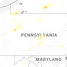


Connect with Interactive Hail Maps