

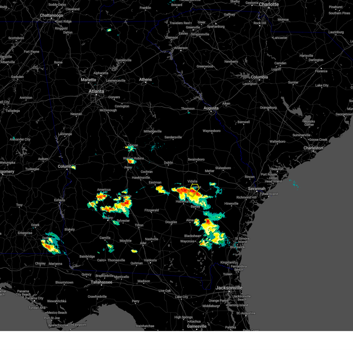
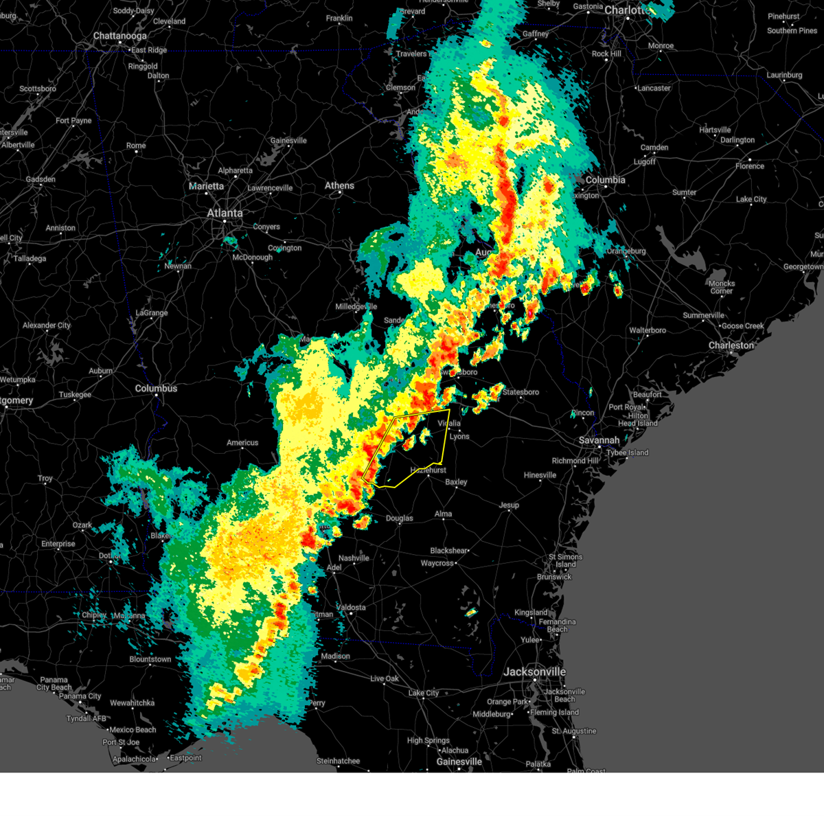
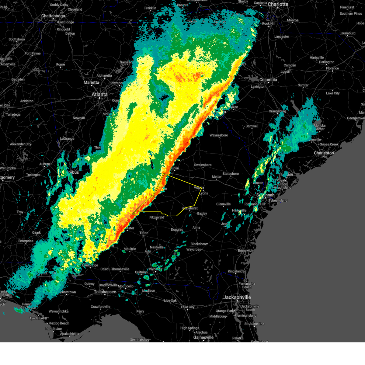
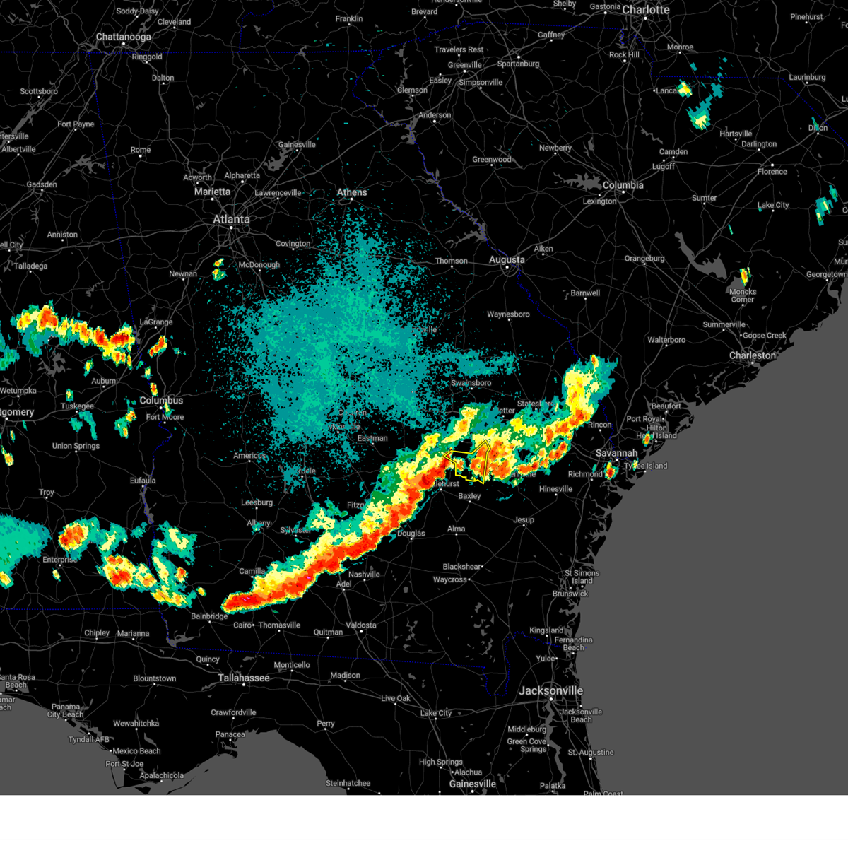
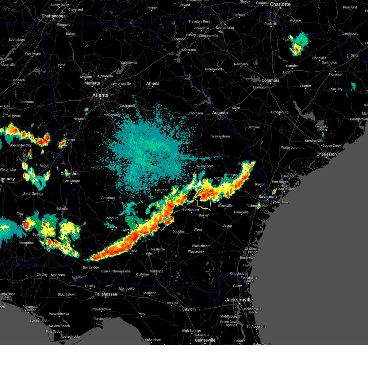
Hail Map for Alston, GA
The Alston, GA area has had 0 reports of on-the-ground hail by trained spotters, and has been under severe weather warnings 19 times during the past 12 months. Doppler radar has detected hail at or near Alston, GA on 67 occasions, including 4 occasions during the past year.
| Name: | Alston, GA |
| Where Located: | 45.1 miles NNE of Douglas, GA |
| Map: | Google Map for Alston, GA |
| Population: | 159 |
| Housing Units: | 76 |
| More Info: | Search Google for Alston, GA |
1
The Top Recent Hail Date for Alston, GA is Sunday, August 18, 2024 (20th out of 67)

Hail and Wind Damage Spotted near Alston, GA
| Date / Time | Report Details |
|---|---|
| 6/26/2025 12:55 AM EDT |
 Svrffc the national weather service in peachtree city has issued a * severe thunderstorm warning for, southern toombs county in southeastern georgia, southeastern telfair county in central georgia, southeastern wheeler county in central georgia, southern montgomery county in central georgia, * until 130 am edt. * at 1255 am edt, severe thunderstorms were located along a line extending from near glenwood to uvalda to altamaha, moving southwest at 35 mph (radar indicated). Hazards include 60 mph wind gusts and penny size hail. expect damage to roofs, siding, and trees Svrffc the national weather service in peachtree city has issued a * severe thunderstorm warning for, southern toombs county in southeastern georgia, southeastern telfair county in central georgia, southeastern wheeler county in central georgia, southern montgomery county in central georgia, * until 130 am edt. * at 1255 am edt, severe thunderstorms were located along a line extending from near glenwood to uvalda to altamaha, moving southwest at 35 mph (radar indicated). Hazards include 60 mph wind gusts and penny size hail. expect damage to roofs, siding, and trees
|
| 6/26/2025 12:18 AM EDT |
 Svrffc the national weather service in peachtree city has issued a * severe thunderstorm warning for, toombs county in southeastern georgia, south central emanuel county in east central georgia, eastern treutlen county in east central georgia, east central wheeler county in central georgia, montgomery county in central georgia, * until 100 am edt. * at 1218 am edt, severe thunderstorms were located along a line extending from norristown to aline, moving south at 45 mph (radar indicated). Hazards include 60 mph wind gusts and quarter size hail. Hail damage to vehicles is expected. Expect wind damage to roofs, siding, and trees. Svrffc the national weather service in peachtree city has issued a * severe thunderstorm warning for, toombs county in southeastern georgia, south central emanuel county in east central georgia, eastern treutlen county in east central georgia, east central wheeler county in central georgia, montgomery county in central georgia, * until 100 am edt. * at 1218 am edt, severe thunderstorms were located along a line extending from norristown to aline, moving south at 45 mph (radar indicated). Hazards include 60 mph wind gusts and quarter size hail. Hail damage to vehicles is expected. Expect wind damage to roofs, siding, and trees.
|
| 5/12/2025 8:12 PM EDT |
 Svrffc the national weather service in peachtree city has issued a * severe thunderstorm warning for, toombs county in southeastern georgia, southeastern emanuel county in east central georgia, east central treutlen county in east central georgia, eastern montgomery county in central georgia, * until 900 pm edt. * at 812 pm edt, severe thunderstorms were located along a line extending from near nunez to rock springs, moving northeast at 25 mph (radar indicated). Hazards include 60 mph wind gusts and penny size hail. expect damage to roofs, siding, and trees Svrffc the national weather service in peachtree city has issued a * severe thunderstorm warning for, toombs county in southeastern georgia, southeastern emanuel county in east central georgia, east central treutlen county in east central georgia, eastern montgomery county in central georgia, * until 900 pm edt. * at 812 pm edt, severe thunderstorms were located along a line extending from near nunez to rock springs, moving northeast at 25 mph (radar indicated). Hazards include 60 mph wind gusts and penny size hail. expect damage to roofs, siding, and trees
|
| 5/12/2025 4:22 PM EDT |
 Svrffc the national weather service in peachtree city has issued a * severe thunderstorm warning for, toombs county in southeastern georgia, south central emanuel county in east central georgia, southeastern montgomery county in central georgia, * until 500 pm edt. * at 421 pm edt, a severe thunderstorm was located over rock springs, or 9 miles northwest of plant hatch, moving northeast at 30 mph (radar indicated). Hazards include 60 mph wind gusts and penny size hail. expect damage to roofs, siding, and trees Svrffc the national weather service in peachtree city has issued a * severe thunderstorm warning for, toombs county in southeastern georgia, south central emanuel county in east central georgia, southeastern montgomery county in central georgia, * until 500 pm edt. * at 421 pm edt, a severe thunderstorm was located over rock springs, or 9 miles northwest of plant hatch, moving northeast at 30 mph (radar indicated). Hazards include 60 mph wind gusts and penny size hail. expect damage to roofs, siding, and trees
|
| 4/27/2025 8:09 PM EDT |
 Svrffc the national weather service in peachtree city has issued a * severe thunderstorm warning for, southwestern toombs county in southeastern georgia, southeastern montgomery county in central georgia, * until 900 pm edt. * at 809 pm edt, a severe thunderstorm was located over rock springs, or 8 miles southwest of lyons, moving northeast at 5 mph (radar indicated). Hazards include 60 mph wind gusts and quarter size hail. Hail damage to vehicles is expected. Expect wind damage to roofs, siding, and trees. Svrffc the national weather service in peachtree city has issued a * severe thunderstorm warning for, southwestern toombs county in southeastern georgia, southeastern montgomery county in central georgia, * until 900 pm edt. * at 809 pm edt, a severe thunderstorm was located over rock springs, or 8 miles southwest of lyons, moving northeast at 5 mph (radar indicated). Hazards include 60 mph wind gusts and quarter size hail. Hail damage to vehicles is expected. Expect wind damage to roofs, siding, and trees.
|
| 3/31/2025 4:23 PM EDT |
 At 423 pm edt, severe thunderstorms were located along a line extending from center to near lumber city, moving east at 45 mph (radar indicated). Hazards include 60 mph wind gusts. Expect damage to roofs, siding, and trees. Locations impacted include, uvalda, towns, horse creek wma, spring hill, higgston, alston, jordan, charlotteville, lumber city, ailey, mount vernon, and vidalia. At 423 pm edt, severe thunderstorms were located along a line extending from center to near lumber city, moving east at 45 mph (radar indicated). Hazards include 60 mph wind gusts. Expect damage to roofs, siding, and trees. Locations impacted include, uvalda, towns, horse creek wma, spring hill, higgston, alston, jordan, charlotteville, lumber city, ailey, mount vernon, and vidalia.
|
| 3/31/2025 4:10 PM EDT |
 At 409 pm edt, severe thunderstorms were located along a line extending from near mount vernon to 6 miles northeast of horse creek wma, moving east at 40 mph (radar indicated). Hazards include 60 mph wind gusts. Expect damage to roofs, siding, and trees. Locations impacted include, horse creek wma, spring hill, higgston, landsburg, glenwood, scotland, tarrytown, lumber city, kibbee, uvalda, towns, mount vernon, alston, jordan, charlotteville, jacksonville, ailey, alamo, workmore, and mcrae. At 409 pm edt, severe thunderstorms were located along a line extending from near mount vernon to 6 miles northeast of horse creek wma, moving east at 40 mph (radar indicated). Hazards include 60 mph wind gusts. Expect damage to roofs, siding, and trees. Locations impacted include, horse creek wma, spring hill, higgston, landsburg, glenwood, scotland, tarrytown, lumber city, kibbee, uvalda, towns, mount vernon, alston, jordan, charlotteville, jacksonville, ailey, alamo, workmore, and mcrae.
|
| 3/31/2025 4:10 PM EDT |
 the severe thunderstorm warning has been cancelled and is no longer in effect the severe thunderstorm warning has been cancelled and is no longer in effect
|
| 3/31/2025 3:59 PM EDT |
 At 358 pm edt, severe thunderstorms were located along a line extending from alamo to near jacksonville, moving east at 45 mph (radar indicated). Hazards include 60 mph wind gusts. Expect damage to roofs, siding, and trees. Locations impacted include, horse creek wma, spring hill, cedar grove, scotland, barnhill, uvalda, towns, china hill, mount vernon, helena, alston, jordan, jacksonville, ailey, alamo, higgston, landsburg, glenwood, tarrytown, and mcrae. At 358 pm edt, severe thunderstorms were located along a line extending from alamo to near jacksonville, moving east at 45 mph (radar indicated). Hazards include 60 mph wind gusts. Expect damage to roofs, siding, and trees. Locations impacted include, horse creek wma, spring hill, cedar grove, scotland, barnhill, uvalda, towns, china hill, mount vernon, helena, alston, jordan, jacksonville, ailey, alamo, higgston, landsburg, glenwood, tarrytown, and mcrae.
|
| 3/31/2025 3:59 PM EDT |
 the severe thunderstorm warning has been cancelled and is no longer in effect the severe thunderstorm warning has been cancelled and is no longer in effect
|
| 3/31/2025 3:39 PM EDT |
 Svrffc the national weather service in peachtree city has issued a * severe thunderstorm warning for, southeastern laurens county in central georgia, southeastern dodge county in central georgia, telfair county in central georgia, southern treutlen county in east central georgia, southeastern wilcox county in central georgia, wheeler county in central georgia, montgomery county in central georgia, * until 430 pm edt. * at 338 pm edt, severe thunderstorms were located along a line extending from chauncey to bowens mill, moving east at 45 mph (radar indicated). Hazards include 60 mph wind gusts. expect damage to roofs, siding, and trees Svrffc the national weather service in peachtree city has issued a * severe thunderstorm warning for, southeastern laurens county in central georgia, southeastern dodge county in central georgia, telfair county in central georgia, southern treutlen county in east central georgia, southeastern wilcox county in central georgia, wheeler county in central georgia, montgomery county in central georgia, * until 430 pm edt. * at 338 pm edt, severe thunderstorms were located along a line extending from chauncey to bowens mill, moving east at 45 mph (radar indicated). Hazards include 60 mph wind gusts. expect damage to roofs, siding, and trees
|
| 2/16/2025 7:48 AM EST |
 Svrffc the national weather service in peachtree city has issued a * severe thunderstorm warning for, toombs county in southeastern georgia, montgomery county in central georgia, * until 815 am est. * at 748 am est, severe thunderstorms were located along a line extending from near normantown to near ailey to near spring hill, moving east at 45 mph (radar indicated). Hazards include 60 mph wind gusts. expect damage to roofs, siding, and trees Svrffc the national weather service in peachtree city has issued a * severe thunderstorm warning for, toombs county in southeastern georgia, montgomery county in central georgia, * until 815 am est. * at 748 am est, severe thunderstorms were located along a line extending from near normantown to near ailey to near spring hill, moving east at 45 mph (radar indicated). Hazards include 60 mph wind gusts. expect damage to roofs, siding, and trees
|
| 2/16/2025 7:37 AM EST |
 the severe thunderstorm warning has been cancelled and is no longer in effect the severe thunderstorm warning has been cancelled and is no longer in effect
|
| 2/16/2025 7:37 AM EST |
 At 736 am est, severe thunderstorms were located along a line extending from near landsburg to towns to ocilla, moving southeast at 45 mph (radar indicated). Hazards include 60 mph wind gusts. Expect damage to roofs, siding, and trees. Locations impacted include, mcrae, alamo, mount vernon, vidalia, helena, lumber city, glenwood, milan, uvalda, ailey, scotland, higgston, alston, jacksonville, tarrytown, towns, horse creek wma, spring hill, barnhill, and china hill. At 736 am est, severe thunderstorms were located along a line extending from near landsburg to towns to ocilla, moving southeast at 45 mph (radar indicated). Hazards include 60 mph wind gusts. Expect damage to roofs, siding, and trees. Locations impacted include, mcrae, alamo, mount vernon, vidalia, helena, lumber city, glenwood, milan, uvalda, ailey, scotland, higgston, alston, jacksonville, tarrytown, towns, horse creek wma, spring hill, barnhill, and china hill.
|
| 2/16/2025 6:57 AM EST |
 Svrffc the national weather service in peachtree city has issued a * severe thunderstorm warning for, southern laurens county in central georgia, northwestern toombs county in southeastern georgia, dodge county in central georgia, telfair county in central georgia, southwestern treutlen county in east central georgia, wilcox county in central georgia, wheeler county in central georgia, southeastern crisp county in central georgia, montgomery county in central georgia, * until 800 am est. * at 657 am est, severe thunderstorms were located along a line extending from dexter to near eastman to dakota, moving southeast at 45 mph (radar indicated). Hazards include 60 mph wind gusts. expect damage to roofs, siding, and trees Svrffc the national weather service in peachtree city has issued a * severe thunderstorm warning for, southern laurens county in central georgia, northwestern toombs county in southeastern georgia, dodge county in central georgia, telfair county in central georgia, southwestern treutlen county in east central georgia, wilcox county in central georgia, wheeler county in central georgia, southeastern crisp county in central georgia, montgomery county in central georgia, * until 800 am est. * at 657 am est, severe thunderstorms were located along a line extending from dexter to near eastman to dakota, moving southeast at 45 mph (radar indicated). Hazards include 60 mph wind gusts. expect damage to roofs, siding, and trees
|
| 8/18/2024 9:45 PM EDT | Svrffc the national weather service in peachtree city has issued a * severe thunderstorm warning for, southeastern wheeler county in central georgia, south central montgomery county in central georgia, * until 1000 pm edt. * at 945 pm edt, a severe thunderstorm was located over charlotteville, or 9 miles northeast of hazlehurst, and is nearly stationary (radar indicated). Hazards include 60 mph wind gusts. expect damage to roofs, siding, and trees |
| 8/18/2024 9:29 PM EDT |
 At 929 pm edt, a severe thunderstorm was located near new branch, or near reidsville, moving southeast at 25 mph (radar indicated). Hazards include 60 mph wind gusts. Expect damage to roofs, siding, and trees. Locations impacted include, alston, south thompson, english eddy, center, toombs central, ohoopee, new branch, rock springs, cedar crossing, johnson corner, and grays landing. At 929 pm edt, a severe thunderstorm was located near new branch, or near reidsville, moving southeast at 25 mph (radar indicated). Hazards include 60 mph wind gusts. Expect damage to roofs, siding, and trees. Locations impacted include, alston, south thompson, english eddy, center, toombs central, ohoopee, new branch, rock springs, cedar crossing, johnson corner, and grays landing.
|
| 8/18/2024 9:13 PM EDT |
 Svrffc the national weather service in peachtree city has issued a * severe thunderstorm warning for, toombs county in southeastern georgia, east central montgomery county in central georgia, * until 1015 pm edt. * at 913 pm edt, a severe thunderstorm was located over santa claus, or near lyons, moving southeast at 25 mph (radar indicated). Hazards include 60 mph wind gusts. expect damage to roofs, siding, and trees Svrffc the national weather service in peachtree city has issued a * severe thunderstorm warning for, toombs county in southeastern georgia, east central montgomery county in central georgia, * until 1015 pm edt. * at 913 pm edt, a severe thunderstorm was located over santa claus, or near lyons, moving southeast at 25 mph (radar indicated). Hazards include 60 mph wind gusts. expect damage to roofs, siding, and trees
|
| 8/18/2024 9:07 PM EDT | Svrffc the national weather service in peachtree city has issued a * severe thunderstorm warning for, eastern telfair county in central georgia, southern wheeler county in central georgia, southwestern montgomery county in central georgia, * until 945 pm edt. * at 907 pm edt, severe thunderstorms were located along a line extending from near uvalda to near horse creek wma, moving east at 25 mph (radar indicated). Hazards include 60 mph wind gusts. expect damage to roofs, siding, and trees |
| 6/10/2024 2:43 PM EDT |
 Svrffc the national weather service in peachtree city has issued a * severe thunderstorm warning for, southern toombs county in southeastern georgia, southeastern montgomery county in central georgia, * until 330 pm edt. * at 242 pm edt, a severe thunderstorm was located over cedar crossing, or 8 miles northwest of plant hatch, moving east at 20 mph (radar indicated). Hazards include 60 mph wind gusts and quarter size hail. Hail damage to vehicles is expected. Expect wind damage to roofs, siding, and trees. Svrffc the national weather service in peachtree city has issued a * severe thunderstorm warning for, southern toombs county in southeastern georgia, southeastern montgomery county in central georgia, * until 330 pm edt. * at 242 pm edt, a severe thunderstorm was located over cedar crossing, or 8 miles northwest of plant hatch, moving east at 20 mph (radar indicated). Hazards include 60 mph wind gusts and quarter size hail. Hail damage to vehicles is expected. Expect wind damage to roofs, siding, and trees.
|
| 5/25/2024 3:16 PM EDT |
 The storm which prompted the warning has weakened below severe limits, and no longer poses an immediate threat to life or property. therefore, the warning will be allowed to expire. however, small hail, gusty winds and heavy rain are still possible with this thunderstorm. a severe thunderstorm watch remains in effect until 800 pm edt for central, southeastern and east central georgia. to report severe weather, contact your nearest law enforcement agency. they will relay your report to the national weather service peachtree city. The storm which prompted the warning has weakened below severe limits, and no longer poses an immediate threat to life or property. therefore, the warning will be allowed to expire. however, small hail, gusty winds and heavy rain are still possible with this thunderstorm. a severe thunderstorm watch remains in effect until 800 pm edt for central, southeastern and east central georgia. to report severe weather, contact your nearest law enforcement agency. they will relay your report to the national weather service peachtree city.
|
| 5/25/2024 2:34 PM EDT |
 Svrffc the national weather service in peachtree city has issued a * severe thunderstorm warning for, northwestern toombs county in southeastern georgia, southwestern treutlen county in east central georgia, northeastern wheeler county in central georgia, montgomery county in central georgia, * until 315 pm edt. * at 233 pm edt, a severe thunderstorm was located near barnhill, or 7 miles northwest of mount vernon, moving southeast at 15 mph (radar indicated). Hazards include 60 mph wind gusts and quarter size hail. Hail damage to vehicles is expected. Expect wind damage to roofs, siding, and trees. Svrffc the national weather service in peachtree city has issued a * severe thunderstorm warning for, northwestern toombs county in southeastern georgia, southwestern treutlen county in east central georgia, northeastern wheeler county in central georgia, montgomery county in central georgia, * until 315 pm edt. * at 233 pm edt, a severe thunderstorm was located near barnhill, or 7 miles northwest of mount vernon, moving southeast at 15 mph (radar indicated). Hazards include 60 mph wind gusts and quarter size hail. Hail damage to vehicles is expected. Expect wind damage to roofs, siding, and trees.
|
| 5/9/2024 2:01 PM EDT |
 At 201 pm edt, a severe thunderstorm was located over johnson corner, or 8 miles south of lyons, moving east at 40 mph (radar indicated). Hazards include 60 mph wind gusts and quarter size hail. Hail damage to vehicles is expected. expect wind damage to roofs, siding, and trees. Locations impacted include, lyons, vidalia, santa claus, alston, center, toombs central, ohoopee, new branch, ponderosa, south thompson, english eddy, rock springs, cedar crossing, johnson corner, and normantown. At 201 pm edt, a severe thunderstorm was located over johnson corner, or 8 miles south of lyons, moving east at 40 mph (radar indicated). Hazards include 60 mph wind gusts and quarter size hail. Hail damage to vehicles is expected. expect wind damage to roofs, siding, and trees. Locations impacted include, lyons, vidalia, santa claus, alston, center, toombs central, ohoopee, new branch, ponderosa, south thompson, english eddy, rock springs, cedar crossing, johnson corner, and normantown.
|
| 5/9/2024 2:01 PM EDT |
 the severe thunderstorm warning has been cancelled and is no longer in effect the severe thunderstorm warning has been cancelled and is no longer in effect
|
| 5/9/2024 1:48 PM EDT |
 At 147 pm edt, a severe thunderstorm was located over rock springs, or 10 miles southwest of lyons, moving east at 55 mph (radar indicated). Hazards include 60 mph wind gusts and quarter size hail. Hail damage to vehicles is expected. expect wind damage to roofs, siding, and trees. Locations impacted include, lyons, mount vernon, vidalia, uvalda, ailey, higgston, santa claus, alston, center, toombs central, ohoopee, new branch, ponderosa, kibbee, south thompson, english eddy, rock springs, cedar crossing, johnson corner, and charlotteville. At 147 pm edt, a severe thunderstorm was located over rock springs, or 10 miles southwest of lyons, moving east at 55 mph (radar indicated). Hazards include 60 mph wind gusts and quarter size hail. Hail damage to vehicles is expected. expect wind damage to roofs, siding, and trees. Locations impacted include, lyons, mount vernon, vidalia, uvalda, ailey, higgston, santa claus, alston, center, toombs central, ohoopee, new branch, ponderosa, kibbee, south thompson, english eddy, rock springs, cedar crossing, johnson corner, and charlotteville.
|
| 5/9/2024 1:43 PM EDT |
 Torffc the national weather service in peachtree city has issued a * tornado warning for, toombs county in southeastern georgia, southeastern wheeler county in central georgia, montgomery county in central georgia, * until 230 pm edt. * at 143 pm edt, a confirmed tornado was located near alston, or near mount vernon, moving east at 55 mph (weather spotters confirmed tornado). Hazards include damaging tornado. Flying debris will be dangerous to those caught without shelter. mobile homes will be damaged or destroyed. damage to roofs, windows, and vehicles will occur. Tree damage is likely. Torffc the national weather service in peachtree city has issued a * tornado warning for, toombs county in southeastern georgia, southeastern wheeler county in central georgia, montgomery county in central georgia, * until 230 pm edt. * at 143 pm edt, a confirmed tornado was located near alston, or near mount vernon, moving east at 55 mph (weather spotters confirmed tornado). Hazards include damaging tornado. Flying debris will be dangerous to those caught without shelter. mobile homes will be damaged or destroyed. damage to roofs, windows, and vehicles will occur. Tree damage is likely.
|
| 5/9/2024 1:35 PM EDT |
 Svrffc the national weather service in peachtree city has issued a * severe thunderstorm warning for, toombs county in southeastern georgia, northeastern wheeler county in central georgia, montgomery county in central georgia, * until 215 pm edt. * at 135 pm edt, a severe thunderstorm was located over glenwood, or near mount vernon, moving east at 40 mph (radar indicated). Hazards include 60 mph wind gusts and quarter size hail. Hail damage to vehicles is expected. Expect wind damage to roofs, siding, and trees. Svrffc the national weather service in peachtree city has issued a * severe thunderstorm warning for, toombs county in southeastern georgia, northeastern wheeler county in central georgia, montgomery county in central georgia, * until 215 pm edt. * at 135 pm edt, a severe thunderstorm was located over glenwood, or near mount vernon, moving east at 40 mph (radar indicated). Hazards include 60 mph wind gusts and quarter size hail. Hail damage to vehicles is expected. Expect wind damage to roofs, siding, and trees.
|
| 1/9/2024 1:08 PM EST |
 At 107 pm est, severe thunderstorms were located along a line extending from near twin city to cedar crossing, moving east at 40 mph (radar indicated). Hazards include 60 mph wind gusts. Expect damage to roofs, siding, and trees. Locations impacted include, swainsboro, lyons, vidalia, twin city, stillmore, oak park, higgston, santa claus, alston, nunez, ohoopee, new branch, mcnatt falls, south thompson, english eddy, cedar crossing, johnson corner, george l smith state park, center, and toombs central. At 107 pm est, severe thunderstorms were located along a line extending from near twin city to cedar crossing, moving east at 40 mph (radar indicated). Hazards include 60 mph wind gusts. Expect damage to roofs, siding, and trees. Locations impacted include, swainsboro, lyons, vidalia, twin city, stillmore, oak park, higgston, santa claus, alston, nunez, ohoopee, new branch, mcnatt falls, south thompson, english eddy, cedar crossing, johnson corner, george l smith state park, center, and toombs central.
|
| 1/9/2024 12:38 PM EST |
 At 1237 pm est, severe thunderstorms were located along a line extending from near blackville to 6 miles southwest of lumber city, moving northeast at 45 mph (radar indicated). Hazards include 60 mph wind gusts. expect damage to roofs, siding, and trees At 1237 pm est, severe thunderstorms were located along a line extending from near blackville to 6 miles southwest of lumber city, moving northeast at 45 mph (radar indicated). Hazards include 60 mph wind gusts. expect damage to roofs, siding, and trees
|
| 8/25/2023 4:28 PM EDT |
 At 428 pm edt, a severe thunderstorm was located near lumber city, or near hazlehurst, moving southeast at 10 mph (radar indicated). Hazards include 60 mph wind gusts. expect damage to roofs, siding, and trees At 428 pm edt, a severe thunderstorm was located near lumber city, or near hazlehurst, moving southeast at 10 mph (radar indicated). Hazards include 60 mph wind gusts. expect damage to roofs, siding, and trees
|
| 8/8/2023 6:44 PM EDT |
 At 644 pm edt, severe thunderstorms were located along a line extending from near scott to near lothair to near landsburg, moving east at 50 mph (radar indicated). Hazards include 60 mph wind gusts and quarter size hail. Hail damage to vehicles is expected. Expect wind damage to roofs, siding, and trees. At 644 pm edt, severe thunderstorms were located along a line extending from near scott to near lothair to near landsburg, moving east at 50 mph (radar indicated). Hazards include 60 mph wind gusts and quarter size hail. Hail damage to vehicles is expected. Expect wind damage to roofs, siding, and trees.
|
| 8/8/2023 5:57 PM EDT |
 The severe thunderstorm warning for southwestern toombs, southeastern wheeler and southern montgomery counties will expire at 600 pm edt, the storm which prompted the warning has weakened below severe limits, and no longer poses an immediate threat to life or property. therefore, the warning will be allowed to expire. however, gusty winds and heavy rain are still possible with this thunderstorm. a severe thunderstorm watch remains in effect until 900 pm edt for central georgia. a severe thunderstorm watch also remains in effect until 1100 pm edt for central and southeastern georgia. The severe thunderstorm warning for southwestern toombs, southeastern wheeler and southern montgomery counties will expire at 600 pm edt, the storm which prompted the warning has weakened below severe limits, and no longer poses an immediate threat to life or property. therefore, the warning will be allowed to expire. however, gusty winds and heavy rain are still possible with this thunderstorm. a severe thunderstorm watch remains in effect until 900 pm edt for central georgia. a severe thunderstorm watch also remains in effect until 1100 pm edt for central and southeastern georgia.
|
| 8/8/2023 5:47 PM EDT |
 At 547 pm edt, a severe thunderstorm was located over charlotteville, or 9 miles north of hazlehurst, moving east at 25 mph (radar indicated). Hazards include 60 mph wind gusts and penny size hail. Expect damage to roofs, siding, and trees. locations impacted include, uvalda, alston, cedar crossing, charlotteville, mcnatt falls, and grays landing. hail threat, radar indicated max hail size, 0. 75 in wind threat, radar indicated max wind gust, 60 mph. At 547 pm edt, a severe thunderstorm was located over charlotteville, or 9 miles north of hazlehurst, moving east at 25 mph (radar indicated). Hazards include 60 mph wind gusts and penny size hail. Expect damage to roofs, siding, and trees. locations impacted include, uvalda, alston, cedar crossing, charlotteville, mcnatt falls, and grays landing. hail threat, radar indicated max hail size, 0. 75 in wind threat, radar indicated max wind gust, 60 mph.
|
| 8/8/2023 5:10 PM EDT |
 At 510 pm edt, a severe thunderstorm was located over towns, or 8 miles south of alamo, moving east at 25 mph (radar indicated). Hazards include 60 mph wind gusts and quarter size hail. Hail damage to vehicles is expected. Expect wind damage to roofs, siding, and trees. At 510 pm edt, a severe thunderstorm was located over towns, or 8 miles south of alamo, moving east at 25 mph (radar indicated). Hazards include 60 mph wind gusts and quarter size hail. Hail damage to vehicles is expected. Expect wind damage to roofs, siding, and trees.
|
| 7/30/2023 6:10 PM EDT |
 At 609 pm edt, a severe thunderstorm was located near ailey, or near mount vernon, moving east at 25 mph (radar indicated). Hazards include 60 mph wind gusts and quarter size hail. Hail damage to vehicles is expected. Expect wind damage to roofs, siding, and trees. At 609 pm edt, a severe thunderstorm was located near ailey, or near mount vernon, moving east at 25 mph (radar indicated). Hazards include 60 mph wind gusts and quarter size hail. Hail damage to vehicles is expected. Expect wind damage to roofs, siding, and trees.
|
| 7/30/2023 5:47 PM EDT |
 At 547 pm edt, a severe thunderstorm was located near landsburg, or near alamo, moving east at 20 mph (radar indicated). Hazards include 60 mph wind gusts and quarter size hail. Hail damage to vehicles is expected. Expect wind damage to roofs, siding, and trees. At 547 pm edt, a severe thunderstorm was located near landsburg, or near alamo, moving east at 20 mph (radar indicated). Hazards include 60 mph wind gusts and quarter size hail. Hail damage to vehicles is expected. Expect wind damage to roofs, siding, and trees.
|
| 6/14/2023 9:33 AM EDT |
 At 932 am edt, severe thunderstorms were located along a line extending from near tarrytown to mount vernon to near jordan, moving east at 50 mph (radar indicated). Hazards include 60 mph wind gusts. Expect damage to roofs, siding, and trees. locations impacted include, soperton, mount vernon, vidalia, glenwood, uvalda, ailey, higgston, alston, tarrytown, lothair, landsburg, barnhill, kibbee, jordan, charlotteville and zaidee. hail threat, radar indicated max hail size, <. 75 in wind threat, radar indicated max wind gust, 60 mph. At 932 am edt, severe thunderstorms were located along a line extending from near tarrytown to mount vernon to near jordan, moving east at 50 mph (radar indicated). Hazards include 60 mph wind gusts. Expect damage to roofs, siding, and trees. locations impacted include, soperton, mount vernon, vidalia, glenwood, uvalda, ailey, higgston, alston, tarrytown, lothair, landsburg, barnhill, kibbee, jordan, charlotteville and zaidee. hail threat, radar indicated max hail size, <. 75 in wind threat, radar indicated max wind gust, 60 mph.
|
| 6/14/2023 9:15 AM EDT |
 At 915 am edt, severe thunderstorms were located along a line extending from near lowery to near cedar grove to near little ocmulgee state park, moving east at 50 mph (radar indicated). Hazards include 60 mph wind gusts. expect damage to roofs, siding, and trees At 915 am edt, severe thunderstorms were located along a line extending from near lowery to near cedar grove to near little ocmulgee state park, moving east at 50 mph (radar indicated). Hazards include 60 mph wind gusts. expect damage to roofs, siding, and trees
|
| 4/27/2023 4:25 PM EDT |
 At 425 pm edt, a severe thunderstorm was located over uvalda, or 11 miles northwest of plant hatch, moving northeast at 15 mph (radar indicated). Hazards include 60 mph wind gusts and quarter size hail. Hail damage to vehicles is expected. Expect wind damage to roofs, siding, and trees. At 425 pm edt, a severe thunderstorm was located over uvalda, or 11 miles northwest of plant hatch, moving northeast at 15 mph (radar indicated). Hazards include 60 mph wind gusts and quarter size hail. Hail damage to vehicles is expected. Expect wind damage to roofs, siding, and trees.
|
| 1/12/2023 8:36 PM EST |
 The severe thunderstorm warning for toombs, south central emanuel, southern treutlen, eastern wheeler and montgomery counties will expire at 845 pm est, the storms which prompted the warning have weakened below severe limits, and no longer pose an immediate threat to life or property. therefore, the warning will be allowed to expire. a tornado watch remains in effect until 900 pm est for central, southeastern and east central georgia. The severe thunderstorm warning for toombs, south central emanuel, southern treutlen, eastern wheeler and montgomery counties will expire at 845 pm est, the storms which prompted the warning have weakened below severe limits, and no longer pose an immediate threat to life or property. therefore, the warning will be allowed to expire. a tornado watch remains in effect until 900 pm est for central, southeastern and east central georgia.
|
| 1/12/2023 7:57 PM EST |
 At 757 pm est, severe thunderstorms were located along a line extending from near soperton to near higgston to near alston to spring hill, moving east at 55 mph (radar indicated). Hazards include 60 mph wind gusts. expect damage to roofs, siding, and trees At 757 pm est, severe thunderstorms were located along a line extending from near soperton to near higgston to near alston to spring hill, moving east at 55 mph (radar indicated). Hazards include 60 mph wind gusts. expect damage to roofs, siding, and trees
|
| 10/12/2022 10:08 PM EDT |
 The tornado warning for southeastern wheeler and southern montgomery counties will expire at 1015 pm edt, the storm which prompted the warning has weakened below severe limits, and no longer appears capable of producing a tornado. therefore, the warning will be allowed to expire. however gusty winds are still possible with this thunderstorm. The tornado warning for southeastern wheeler and southern montgomery counties will expire at 1015 pm edt, the storm which prompted the warning has weakened below severe limits, and no longer appears capable of producing a tornado. therefore, the warning will be allowed to expire. however gusty winds are still possible with this thunderstorm.
|
| 10/12/2022 9:45 PM EDT |
 At 945 pm edt, severe thunderstorms capable of producing both tornadoes and extensive straight line wind damage were located over jordan, or 10 miles south of mount vernon, moving northeast at 20 mph (radar indicated rotation). Hazards include tornado. Flying debris will be dangerous to those caught without shelter. mobile homes will be damaged or destroyed. damage to roofs, windows, and vehicles will occur. Tree damage is likely. At 945 pm edt, severe thunderstorms capable of producing both tornadoes and extensive straight line wind damage were located over jordan, or 10 miles south of mount vernon, moving northeast at 20 mph (radar indicated rotation). Hazards include tornado. Flying debris will be dangerous to those caught without shelter. mobile homes will be damaged or destroyed. damage to roofs, windows, and vehicles will occur. Tree damage is likely.
|
| 6/14/2022 2:29 PM EDT |
 At 229 pm edt, severe thunderstorms were located along a line extending from near mcrae to near towns to near charlotteville, moving north at 10 mph (radar indicated). Hazards include 60 mph wind gusts and quarter size hail. Hail damage to vehicles is expected. Expect wind damage to roofs, siding, and trees. At 229 pm edt, severe thunderstorms were located along a line extending from near mcrae to near towns to near charlotteville, moving north at 10 mph (radar indicated). Hazards include 60 mph wind gusts and quarter size hail. Hail damage to vehicles is expected. Expect wind damage to roofs, siding, and trees.
|
| 6/14/2022 1:14 PM EDT |
 At 114 pm edt, a severe thunderstorm was located over vidalia, or near lyons, moving south at 15 mph (radar indicated). Hazards include 60 mph wind gusts and quarter size hail. Hail damage to vehicles is expected. Expect wind damage to roofs, siding, and trees. At 114 pm edt, a severe thunderstorm was located over vidalia, or near lyons, moving south at 15 mph (radar indicated). Hazards include 60 mph wind gusts and quarter size hail. Hail damage to vehicles is expected. Expect wind damage to roofs, siding, and trees.
|
| 5/30/2022 1:36 PM EDT |
 The severe thunderstorm warning for southwestern toombs, southeastern wheeler and southern montgomery counties will expire at 145 pm edt, the storm which prompted the warning has weakened below severe limits, and has exited the warned area. therefore, the warning will be allowed to expire. to report severe weather, contact your nearest law enforcement agency. they will relay your report to the national weather service peachtree city. The severe thunderstorm warning for southwestern toombs, southeastern wheeler and southern montgomery counties will expire at 145 pm edt, the storm which prompted the warning has weakened below severe limits, and has exited the warned area. therefore, the warning will be allowed to expire. to report severe weather, contact your nearest law enforcement agency. they will relay your report to the national weather service peachtree city.
|
| 5/30/2022 1:07 PM EDT |
 At 107 pm edt, a severe thunderstorm was located over uvalda, or 9 miles southeast of mount vernon, moving northwest at 10 mph (radar indicated). Hazards include 60 mph wind gusts and quarter size hail. Hail damage to vehicles is expected. Expect wind damage to roofs, siding, and trees. At 107 pm edt, a severe thunderstorm was located over uvalda, or 9 miles southeast of mount vernon, moving northwest at 10 mph (radar indicated). Hazards include 60 mph wind gusts and quarter size hail. Hail damage to vehicles is expected. Expect wind damage to roofs, siding, and trees.
|
| 5/24/2022 6:29 PM EDT |
 At 629 pm edt, a severe thunderstorm was located over center, or 7 miles southwest of lyons, moving north at 25 mph (radar indicated). Hazards include 60 mph wind gusts and quarter size hail. Hail damage to vehicles is expected. Expect wind damage to roofs, siding, and trees. At 629 pm edt, a severe thunderstorm was located over center, or 7 miles southwest of lyons, moving north at 25 mph (radar indicated). Hazards include 60 mph wind gusts and quarter size hail. Hail damage to vehicles is expected. Expect wind damage to roofs, siding, and trees.
|
| 5/22/2022 4:52 PM EDT |
 At 451 pm edt, a severe thunderstorm was located over alamo, moving east at 25 mph (radar indicated). Hazards include 60 mph wind gusts and quarter size hail. Hail damage to vehicles is expected. Expect wind damage to roofs, siding, and trees. At 451 pm edt, a severe thunderstorm was located over alamo, moving east at 25 mph (radar indicated). Hazards include 60 mph wind gusts and quarter size hail. Hail damage to vehicles is expected. Expect wind damage to roofs, siding, and trees.
|
| 5/22/2022 3:29 PM EDT |
 At 329 pm edt, a severe thunderstorm was located over uvalda, or 10 miles northwest of plant hatch, moving northeast at 20 mph (radar indicated). Hazards include 60 mph wind gusts and quarter size hail. Hail damage to vehicles is expected. Expect wind damage to roofs, siding, and trees. At 329 pm edt, a severe thunderstorm was located over uvalda, or 10 miles northwest of plant hatch, moving northeast at 20 mph (radar indicated). Hazards include 60 mph wind gusts and quarter size hail. Hail damage to vehicles is expected. Expect wind damage to roofs, siding, and trees.
|
| 5/3/2022 4:20 PM EDT |
 The severe thunderstorm warning for central toombs, southeastern wheeler and southeastern montgomery counties will expire at 430 pm edt, the storm which prompted the warning has weakened below severe limits, and no longer poses an immediate threat to life or property. therefore, the warning will be allowed to expire. The severe thunderstorm warning for central toombs, southeastern wheeler and southeastern montgomery counties will expire at 430 pm edt, the storm which prompted the warning has weakened below severe limits, and no longer poses an immediate threat to life or property. therefore, the warning will be allowed to expire.
|
| 5/3/2022 3:58 PM EDT |
 At 358 pm edt, a severe thunderstorm was located over uvalda, or 10 miles northwest of plant hatch, moving northeast at 15 mph (radar indicated). Hazards include 60 mph wind gusts and quarter size hail. Hail damage to vehicles is expected. expect wind damage to roofs, siding, and trees. locations impacted include, lyons, vidalia, uvalda, higgston, santa claus, alston, center, toombs central, mcnatt falls, south thompson, english eddy, rock springs, cedar crossing, johnson corner, charlotteville and grays landing. hail threat, radar indicated max hail size, 1. 00 in wind threat, radar indicated max wind gust, 60 mph. At 358 pm edt, a severe thunderstorm was located over uvalda, or 10 miles northwest of plant hatch, moving northeast at 15 mph (radar indicated). Hazards include 60 mph wind gusts and quarter size hail. Hail damage to vehicles is expected. expect wind damage to roofs, siding, and trees. locations impacted include, lyons, vidalia, uvalda, higgston, santa claus, alston, center, toombs central, mcnatt falls, south thompson, english eddy, rock springs, cedar crossing, johnson corner, charlotteville and grays landing. hail threat, radar indicated max hail size, 1. 00 in wind threat, radar indicated max wind gust, 60 mph.
|
| 5/3/2022 3:44 PM EDT |
 At 344 pm edt, a severe thunderstorm was located over uvalda, or 11 miles southeast of mount vernon, moving northeast at 10 mph (radar indicated). Hazards include 60 mph wind gusts and quarter size hail. Hail damage to vehicles is expected. Expect wind damage to roofs, siding, and trees. At 344 pm edt, a severe thunderstorm was located over uvalda, or 11 miles southeast of mount vernon, moving northeast at 10 mph (radar indicated). Hazards include 60 mph wind gusts and quarter size hail. Hail damage to vehicles is expected. Expect wind damage to roofs, siding, and trees.
|
| 4/6/2022 8:12 PM EDT |
 At 811 pm edt, severe thunderstorms were located along a line extending from near spann to near cedar grove to near jay bird springs, moving east at 65 mph (radar indicated). Hazards include 60 mph wind gusts. expect damage to roofs, siding, and trees At 811 pm edt, severe thunderstorms were located along a line extending from near spann to near cedar grove to near jay bird springs, moving east at 65 mph (radar indicated). Hazards include 60 mph wind gusts. expect damage to roofs, siding, and trees
|
| 4/5/2022 5:47 PM EDT |
 At 547 pm edt, severe thunderstorms were located along a line extending from jenkins county hospital to parish to near reidsville, moving east at 50 mph (radar indicated). Hazards include 60 mph wind gusts and penny size hail. Expect damage to roofs, siding, and trees. locations impacted include, lyons, vidalia, twin city, uvalda, stillmore, oak park, garfield, santa claus, summertown, alston, ohoopee, new branch, canoochee, mcnatt falls, south thompson, english eddy, cedar crossing, johnson corner, george l smith state park and center. hail threat, radar indicated max hail size, 0. 75 in wind threat, radar indicated max wind gust, 60 mph. At 547 pm edt, severe thunderstorms were located along a line extending from jenkins county hospital to parish to near reidsville, moving east at 50 mph (radar indicated). Hazards include 60 mph wind gusts and penny size hail. Expect damage to roofs, siding, and trees. locations impacted include, lyons, vidalia, twin city, uvalda, stillmore, oak park, garfield, santa claus, summertown, alston, ohoopee, new branch, canoochee, mcnatt falls, south thompson, english eddy, cedar crossing, johnson corner, george l smith state park and center. hail threat, radar indicated max hail size, 0. 75 in wind threat, radar indicated max wind gust, 60 mph.
|
| 4/5/2022 5:38 PM EDT |
 At 538 pm edt, severe thunderstorms were located along a line extending from near rogers to metter municiple airport to near new branch, moving east at 50 mph (radar indicated). Hazards include 60 mph wind gusts and penny size hail. Expect damage to roofs, siding, and trees. locations impacted include, swainsboro, lyons, vidalia, twin city, uvalda, stillmore, oak park, garfield, santa claus, summertown, alston, nunez, ohoopee, new branch, modoc, canoochee, mcnatt falls, south thompson, english eddy and cedar crossing. hail threat, radar indicated max hail size, 0. 75 in wind threat, radar indicated max wind gust, 60 mph. At 538 pm edt, severe thunderstorms were located along a line extending from near rogers to metter municiple airport to near new branch, moving east at 50 mph (radar indicated). Hazards include 60 mph wind gusts and penny size hail. Expect damage to roofs, siding, and trees. locations impacted include, swainsboro, lyons, vidalia, twin city, uvalda, stillmore, oak park, garfield, santa claus, summertown, alston, nunez, ohoopee, new branch, modoc, canoochee, mcnatt falls, south thompson, english eddy and cedar crossing. hail threat, radar indicated max hail size, 0. 75 in wind threat, radar indicated max wind gust, 60 mph.
|
| 4/5/2022 5:29 PM EDT |
 At 526 pm edt, a severe thunderstorm was located near lumber city, or 8 miles west of hazlehurst, moving east at 60 mph (radar indicated). Hazards include 60 mph wind gusts and penny size hail. expect damage to roofs, siding, and trees At 526 pm edt, a severe thunderstorm was located near lumber city, or 8 miles west of hazlehurst, moving east at 60 mph (radar indicated). Hazards include 60 mph wind gusts and penny size hail. expect damage to roofs, siding, and trees
|
| 4/5/2022 5:25 PM EDT |
 At 521 pm edt, severe thunderstorms were located along a line extending from near colemans lake to near lexsy to alston, moving east at 50 mph (radar indicated). Hazards include 60 mph wind gusts and penny size hail. expect damage to roofs, siding, and trees At 521 pm edt, severe thunderstorms were located along a line extending from near colemans lake to near lexsy to alston, moving east at 50 mph (radar indicated). Hazards include 60 mph wind gusts and penny size hail. expect damage to roofs, siding, and trees
|
| 4/5/2022 5:18 PM EDT |
 At 518 pm edt, severe thunderstorms were located along a line extending from near waynesboro to near canoochee to near higgston, moving northeast at 75 mph (radar indicated). Hazards include 60 mph wind gusts and penny size hail. Expect damage to roofs, siding, and trees. locations impacted include, swainsboro, mcrae, lyons, soperton, mount vernon, wrightsville, vidalia, wadley, twin city, glenwood, adrian, stillmore, oak park, ailey, scotland, higgston, garfield, santa claus, summertown and alston. hail threat, radar indicated max hail size, 0. 75 in wind threat, radar indicated max wind gust, 60 mph. At 518 pm edt, severe thunderstorms were located along a line extending from near waynesboro to near canoochee to near higgston, moving northeast at 75 mph (radar indicated). Hazards include 60 mph wind gusts and penny size hail. Expect damage to roofs, siding, and trees. locations impacted include, swainsboro, mcrae, lyons, soperton, mount vernon, wrightsville, vidalia, wadley, twin city, glenwood, adrian, stillmore, oak park, ailey, scotland, higgston, garfield, santa claus, summertown and alston. hail threat, radar indicated max hail size, 0. 75 in wind threat, radar indicated max wind gust, 60 mph.
|
| 4/5/2022 4:47 PM EDT |
 At 446 pm edt, severe thunderstorms were located along a line extending from donovan to lowery to near china hill, moving northeast at 60 mph (radar indicated). Hazards include 60 mph wind gusts and penny size hail. expect damage to roofs, siding, and trees At 446 pm edt, severe thunderstorms were located along a line extending from donovan to lowery to near china hill, moving northeast at 60 mph (radar indicated). Hazards include 60 mph wind gusts and penny size hail. expect damage to roofs, siding, and trees
|
| 8/12/2020 3:34 PM EDT |
 At 334 pm edt, a severe thunderstorm was located over barnhill, or near soperton, and is nearly stationary (radar indicated). Hazards include 60 mph wind gusts and nickel size hail. expect damage to roofs, siding, and trees At 334 pm edt, a severe thunderstorm was located over barnhill, or near soperton, and is nearly stationary (radar indicated). Hazards include 60 mph wind gusts and nickel size hail. expect damage to roofs, siding, and trees
|
| 6/8/2020 7:17 PM EDT |
 At 716 pm edt, a severe thunderstorm was located over santa claus, or near lyons, moving north at 15 mph (radar indicated). Hazards include 60 mph wind gusts and penny size hail. Expect damage to roofs, siding, and trees. Locations impacted include, lyons, vidalia, santa claus, alston, south thompson, center, toombs central, ohoopee, new branch, ponderosa, rock springs and johnson corner. At 716 pm edt, a severe thunderstorm was located over santa claus, or near lyons, moving north at 15 mph (radar indicated). Hazards include 60 mph wind gusts and penny size hail. Expect damage to roofs, siding, and trees. Locations impacted include, lyons, vidalia, santa claus, alston, south thompson, center, toombs central, ohoopee, new branch, ponderosa, rock springs and johnson corner.
|
| 4/13/2020 4:58 AM EDT |
 At 458 am edt, severe thunderstorms were located along a line extending from gillis springs to mcrae, moving east at 40 mph (radar indicated). Hazards include 60 mph wind gusts. expect damage to roofs, siding, and trees At 458 am edt, severe thunderstorms were located along a line extending from gillis springs to mcrae, moving east at 40 mph (radar indicated). Hazards include 60 mph wind gusts. expect damage to roofs, siding, and trees
|
| 6/22/2019 10:49 PM EDT |
 At 1049 pm edt, severe thunderstorms were located along a line extending from near ponderosa to near mcnatt falls, moving east at 40 mph (radar indicated). Hazards include 60 mph wind gusts. Expect damage to roofs, siding, and trees. Locations impacted include, lyons, vidalia, uvalda, higgston, santa claus, alston, center, toombs central, ohoopee, new branch, ponderosa, mcnatt falls, south thompson, english eddy, grays landing, rock springs, cedar crossing, johnson corner, charlotteville and normantown. At 1049 pm edt, severe thunderstorms were located along a line extending from near ponderosa to near mcnatt falls, moving east at 40 mph (radar indicated). Hazards include 60 mph wind gusts. Expect damage to roofs, siding, and trees. Locations impacted include, lyons, vidalia, uvalda, higgston, santa claus, alston, center, toombs central, ohoopee, new branch, ponderosa, mcnatt falls, south thompson, english eddy, grays landing, rock springs, cedar crossing, johnson corner, charlotteville and normantown.
|
| 6/22/2019 10:20 PM EDT |
 At 1019 pm edt, severe thunderstorms were located along a line extending from near mount vernon to near horse creek wma, moving east at 40 mph (radar indicated). Hazards include 60 mph wind gusts and quarter size hail. Hail damage to vehicles is expected. Expect wind damage to roofs, siding, and trees. At 1019 pm edt, severe thunderstorms were located along a line extending from near mount vernon to near horse creek wma, moving east at 40 mph (radar indicated). Hazards include 60 mph wind gusts and quarter size hail. Hail damage to vehicles is expected. Expect wind damage to roofs, siding, and trees.
|
| 6/22/2019 4:36 PM EDT |
 At 436 pm edt, a severe thunderstorm was located near jordan, or 9 miles south of mount vernon, moving southeast at 15 mph (radar indicated). Hazards include 60 mph wind gusts. Expect damage to roofs, siding, and trees. Locations impacted include, uvalda, alston, jordan and charlotteville. At 436 pm edt, a severe thunderstorm was located near jordan, or 9 miles south of mount vernon, moving southeast at 15 mph (radar indicated). Hazards include 60 mph wind gusts. Expect damage to roofs, siding, and trees. Locations impacted include, uvalda, alston, jordan and charlotteville.
|
| 6/22/2019 4:07 PM EDT |
 At 407 pm edt, a severe thunderstorm was located near glenwood, or near mount vernon, moving southeast at 15 mph (radar indicated). Hazards include 60 mph wind gusts and quarter size hail. Hail damage to vehicles is expected. Expect wind damage to roofs, siding, and trees. At 407 pm edt, a severe thunderstorm was located near glenwood, or near mount vernon, moving southeast at 15 mph (radar indicated). Hazards include 60 mph wind gusts and quarter size hail. Hail damage to vehicles is expected. Expect wind damage to roofs, siding, and trees.
|
| 6/20/2019 6:58 PM EDT |
 At 658 pm edt, a severe thunderstorm was located over johnson corner, or 7 miles north of plant hatch, moving east at 45 mph (radar indicated). Hazards include 60 mph wind gusts. Expect damage to roofs, siding, and trees. Locations impacted include, lyons, mount vernon, vidalia, lumber city, uvalda, oak park, ailey, higgston, santa claus, alston, jacksonville, towns, ohoopee, horse creek wma, new branch, spring hill, mcnatt falls, south thompson, english eddy and cedar crossing. At 658 pm edt, a severe thunderstorm was located over johnson corner, or 7 miles north of plant hatch, moving east at 45 mph (radar indicated). Hazards include 60 mph wind gusts. Expect damage to roofs, siding, and trees. Locations impacted include, lyons, mount vernon, vidalia, lumber city, uvalda, oak park, ailey, higgston, santa claus, alston, jacksonville, towns, ohoopee, horse creek wma, new branch, spring hill, mcnatt falls, south thompson, english eddy and cedar crossing.
|
| 6/20/2019 6:43 PM EDT |
 At 643 pm edt, a severe thunderstorm was located over alston, or 9 miles southeast of mount vernon, moving east at 45 mph (radar indicated). Hazards include 60 mph wind gusts. Expect damage to roofs, siding, and trees. Locations impacted include, mcrae, lyons, alamo, mount vernon, vidalia, lumber city, glenwood, uvalda, stillmore, oak park, ailey, scotland, higgston, santa claus, alston, jacksonville, tarrytown, towns, ohoopee and horse creek wma. At 643 pm edt, a severe thunderstorm was located over alston, or 9 miles southeast of mount vernon, moving east at 45 mph (radar indicated). Hazards include 60 mph wind gusts. Expect damage to roofs, siding, and trees. Locations impacted include, mcrae, lyons, alamo, mount vernon, vidalia, lumber city, glenwood, uvalda, stillmore, oak park, ailey, scotland, higgston, santa claus, alston, jacksonville, tarrytown, towns, ohoopee and horse creek wma.
|
| 6/20/2019 6:36 PM EDT |
 At 636 pm edt, a severe thunderstorm was located near mount vernon, moving east at 45 mph (radar indicated). Hazards include 60 mph wind gusts. Expect damage to roofs, siding, and trees. Locations impacted include, mcrae, lyons, soperton, alamo, mount vernon, vidalia, helena, lumber city, glenwood, uvalda, stillmore, oak park, ailey, scotland, higgston, santa claus, alston, jacksonville, tarrytown and towns. At 636 pm edt, a severe thunderstorm was located near mount vernon, moving east at 45 mph (radar indicated). Hazards include 60 mph wind gusts. Expect damage to roofs, siding, and trees. Locations impacted include, mcrae, lyons, soperton, alamo, mount vernon, vidalia, helena, lumber city, glenwood, uvalda, stillmore, oak park, ailey, scotland, higgston, santa claus, alston, jacksonville, tarrytown and towns.
|
| 6/20/2019 6:17 PM EDT |
 At 616 pm edt, a severe thunderstorm was located near alamo, moving east at 45 mph (radar indicated). Hazards include 60 mph wind gusts. expect damage to roofs, siding, and trees At 616 pm edt, a severe thunderstorm was located near alamo, moving east at 45 mph (radar indicated). Hazards include 60 mph wind gusts. expect damage to roofs, siding, and trees
|
| 4/19/2019 11:10 AM EDT |
 At 1109 am edt, a severe thunderstorm was located over grays landing, or near plant hatch, moving northeast at 55 mph (radar indicated). Hazards include 60 mph wind gusts and penny size hail. expect damage to roofs, siding, and trees At 1109 am edt, a severe thunderstorm was located over grays landing, or near plant hatch, moving northeast at 55 mph (radar indicated). Hazards include 60 mph wind gusts and penny size hail. expect damage to roofs, siding, and trees
|
| 8/9/2018 4:08 PM EDT |
 The severe thunderstorm warning for northeastern wheeler and montgomery counties will expire at 415 pm edt, the storm which prompted the warning has weakened below severe limits, and no longer poses an immediate threat to life or property. therefore, the warning will be allowed to expire. however gusty winds and heavy rain are still possible with this thunderstorm. The severe thunderstorm warning for northeastern wheeler and montgomery counties will expire at 415 pm edt, the storm which prompted the warning has weakened below severe limits, and no longer poses an immediate threat to life or property. therefore, the warning will be allowed to expire. however gusty winds and heavy rain are still possible with this thunderstorm.
|
| 8/9/2018 3:46 PM EDT |
 At 346 pm edt, a severe thunderstorm was located over mount vernon, moving east at 5 mph (radar indicated). Hazards include 60 mph wind gusts and quarter size hail. Hail damage to vehicles is expected. Expect wind damage to roofs, siding, and trees. At 346 pm edt, a severe thunderstorm was located over mount vernon, moving east at 5 mph (radar indicated). Hazards include 60 mph wind gusts and quarter size hail. Hail damage to vehicles is expected. Expect wind damage to roofs, siding, and trees.
|
| 8/6/2018 5:28 PM EDT |
 The severe thunderstorm warning for southwestern toombs, southeastern wheeler and southern montgomery counties will expire at 530 pm edt, the storm which prompted the warning has moved out of the area. therefore, the warning will be allowed to expire. however gusty winds and heavy rain are still possible with this thunderstorm. to report severe weather, contact your nearest law enforcement agency. they will relay your report to the national weather service peachtree city. The severe thunderstorm warning for southwestern toombs, southeastern wheeler and southern montgomery counties will expire at 530 pm edt, the storm which prompted the warning has moved out of the area. therefore, the warning will be allowed to expire. however gusty winds and heavy rain are still possible with this thunderstorm. to report severe weather, contact your nearest law enforcement agency. they will relay your report to the national weather service peachtree city.
|
| 8/6/2018 5:26 PM EDT |
 The severe thunderstorm warning for northeastern wheeler and montgomery counties will expire at 530 pm edt, the storm which prompted the warning has moved out of the area. therefore, the warning will be allowed to expire. however heavy rain is still possible with this thunderstorm. to report severe weather, contact your nearest law enforcement agency. they will relay your report to the national weather service peachtree city. The severe thunderstorm warning for northeastern wheeler and montgomery counties will expire at 530 pm edt, the storm which prompted the warning has moved out of the area. therefore, the warning will be allowed to expire. however heavy rain is still possible with this thunderstorm. to report severe weather, contact your nearest law enforcement agency. they will relay your report to the national weather service peachtree city.
|
| 8/6/2018 5:01 PM EDT |
 At 501 pm edt, a severe thunderstorm was located near alston, or near mount vernon, moving south at 20 mph (radar indicated). Hazards include 60 mph wind gusts and nickel size hail. expect damage to roofs, siding, and trees At 501 pm edt, a severe thunderstorm was located near alston, or near mount vernon, moving south at 20 mph (radar indicated). Hazards include 60 mph wind gusts and nickel size hail. expect damage to roofs, siding, and trees
|
| 8/6/2018 4:38 PM EDT |
 At 438 pm edt, a severe thunderstorm was located over kibbee, or near mount vernon, moving south at 15 mph (radar indicated). Hazards include 60 mph wind gusts and quarter size hail. Hail damage to vehicles is expected. Expect wind damage to roofs, siding, and trees. At 438 pm edt, a severe thunderstorm was located over kibbee, or near mount vernon, moving south at 15 mph (radar indicated). Hazards include 60 mph wind gusts and quarter size hail. Hail damage to vehicles is expected. Expect wind damage to roofs, siding, and trees.
|
| 6/27/2018 5:58 PM EDT |
 At 558 pm edt, a severe thunderstorm was located near uvalda, or 8 miles south of mount vernon, moving northeast at 10 mph (radar indicated). Hazards include 60 mph wind gusts and quarter size hail. Hail damage to vehicles is expected. Expect wind damage to roofs, siding, and trees. At 558 pm edt, a severe thunderstorm was located near uvalda, or 8 miles south of mount vernon, moving northeast at 10 mph (radar indicated). Hazards include 60 mph wind gusts and quarter size hail. Hail damage to vehicles is expected. Expect wind damage to roofs, siding, and trees.
|
| 6/2/2018 3:10 PM EDT |
 At 310 pm edt, a severe thunderstorm was located near mount vernon, moving southeast at 30 mph (radar indicated). Hazards include 60 mph wind gusts and quarter size hail. Hail damage to vehicles is expected. Expect wind damage to roofs, siding, and trees. At 310 pm edt, a severe thunderstorm was located near mount vernon, moving southeast at 30 mph (radar indicated). Hazards include 60 mph wind gusts and quarter size hail. Hail damage to vehicles is expected. Expect wind damage to roofs, siding, and trees.
|
| 4/23/2018 6:51 PM EDT |
 At 651 pm edt, a severe thunderstorm was located near glenwood, or near alamo, moving northeast at 20 mph (radar indicated). Hazards include 60 mph wind gusts and nickel size hail. expect damage to roofs, siding, and trees At 651 pm edt, a severe thunderstorm was located near glenwood, or near alamo, moving northeast at 20 mph (radar indicated). Hazards include 60 mph wind gusts and nickel size hail. expect damage to roofs, siding, and trees
|
| 4/15/2018 11:46 AM EDT |
 At 1146 am edt, severe thunderstorms were located along a line extending from near jordan to near uvalda to near alston to mcnatt falls to near pine grove, moving northeast at 50 mph (radar indicated). Hazards include 60 mph wind gusts. Expect damage to roofs, siding, and trees. locations impacted include, lyons, mount vernon, vidalia, uvalda, ailey, higgston, santa claus, alston, tarrytown, center, mcnatt falls, kibbee, south thompson, grays landing, rock springs, cedar crossing, charlotteville and normantown. A tornado watch remains in effect until 600 pm edt for central, southeastern and east central georgia. At 1146 am edt, severe thunderstorms were located along a line extending from near jordan to near uvalda to near alston to mcnatt falls to near pine grove, moving northeast at 50 mph (radar indicated). Hazards include 60 mph wind gusts. Expect damage to roofs, siding, and trees. locations impacted include, lyons, mount vernon, vidalia, uvalda, ailey, higgston, santa claus, alston, tarrytown, center, mcnatt falls, kibbee, south thompson, grays landing, rock springs, cedar crossing, charlotteville and normantown. A tornado watch remains in effect until 600 pm edt for central, southeastern and east central georgia.
|
| 4/15/2018 11:35 AM EDT |
 At 1134 am edt, severe thunderstorms were located along a line extending from near lumber city to near jordan to near charlotteville to near hazlehurst to 6 miles south of graham, moving northeast at 50 mph (radar indicated). Hazards include 60 mph wind gusts. Expect damage to roofs, siding, and trees. locations impacted include, lyons, alamo, mount vernon, vidalia, glenwood, uvalda, ailey, scotland, higgston, santa claus, alston, tarrytown, center, spring hill, landsburg, mcnatt falls, kibbee, south thompson, grays landing and rock springs. A tornado watch remains in effect until 600 pm edt for central, southeastern and east central georgia. At 1134 am edt, severe thunderstorms were located along a line extending from near lumber city to near jordan to near charlotteville to near hazlehurst to 6 miles south of graham, moving northeast at 50 mph (radar indicated). Hazards include 60 mph wind gusts. Expect damage to roofs, siding, and trees. locations impacted include, lyons, alamo, mount vernon, vidalia, glenwood, uvalda, ailey, scotland, higgston, santa claus, alston, tarrytown, center, spring hill, landsburg, mcnatt falls, kibbee, south thompson, grays landing and rock springs. A tornado watch remains in effect until 600 pm edt for central, southeastern and east central georgia.
|
| 4/15/2018 11:18 AM EDT |
 At 1117 am edt, severe thunderstorms were located along a line extending from near horse creek wma to near snipesville to denton to near nicholls, moving northeast at 50 mph (radar indicated). Hazards include 60 mph wind gusts. expect damage to roofs, siding, and trees At 1117 am edt, severe thunderstorms were located along a line extending from near horse creek wma to near snipesville to denton to near nicholls, moving northeast at 50 mph (radar indicated). Hazards include 60 mph wind gusts. expect damage to roofs, siding, and trees
|
| 9/1/2017 1:29 PM EDT |
 At 129 pm edt, a severe thunderstorm was located over vidalia, or near lyons, moving northeast at 30 mph (radar indicated). Hazards include 60 mph wind gusts. Expect damage to roofs, siding, and trees. Locations impacted include, lyons, vidalia, oak park, santa claus, alston, south thompson, center, ohoopee, ponderosa and normantown. At 129 pm edt, a severe thunderstorm was located over vidalia, or near lyons, moving northeast at 30 mph (radar indicated). Hazards include 60 mph wind gusts. Expect damage to roofs, siding, and trees. Locations impacted include, lyons, vidalia, oak park, santa claus, alston, south thompson, center, ohoopee, ponderosa and normantown.
|
| 9/1/2017 1:10 PM EDT |
 At 110 pm edt, a severe thunderstorm was located near higgston, or near mount vernon, moving northeast at 30 mph (radar indicated). Hazards include 60 mph wind gusts. expect damage to roofs, siding, and trees At 110 pm edt, a severe thunderstorm was located near higgston, or near mount vernon, moving northeast at 30 mph (radar indicated). Hazards include 60 mph wind gusts. expect damage to roofs, siding, and trees
|
| 7/19/2017 10:50 PM EDT |
 At 1050 pm edt, a severe thunderstorm was located over uvalda, or 8 miles south of mount vernon, moving southwest at 15 mph (radar indicated). Hazards include 60 mph wind gusts and half dollar size hail. Hail damage to vehicles is expected. Expect wind damage to roofs, siding, and trees. At 1050 pm edt, a severe thunderstorm was located over uvalda, or 8 miles south of mount vernon, moving southwest at 15 mph (radar indicated). Hazards include 60 mph wind gusts and half dollar size hail. Hail damage to vehicles is expected. Expect wind damage to roofs, siding, and trees.
|
| 5/23/2017 3:22 PM EDT |
 The severe thunderstorm warning for east central telfair, southeastern wheeler and southwestern montgomery counties will expire at 330 pm edt, the storm which prompted the warning has weakened below severe limits, and no longer poses an immediate threat to life or property. therefore the warning will be allowed to expire. a tornado watch remains in effect until 600 pm edt for central and southeastern georgia. The severe thunderstorm warning for east central telfair, southeastern wheeler and southwestern montgomery counties will expire at 330 pm edt, the storm which prompted the warning has weakened below severe limits, and no longer poses an immediate threat to life or property. therefore the warning will be allowed to expire. a tornado watch remains in effect until 600 pm edt for central and southeastern georgia.
|
| 5/23/2017 3:00 PM EDT |
 The national weather service in peachtree city has issued a * severe thunderstorm warning for. east central telfair county in central georgia. southeastern wheeler county in central georgia. southwestern montgomery county in central georgia. Until 330 pm edt. The national weather service in peachtree city has issued a * severe thunderstorm warning for. east central telfair county in central georgia. southeastern wheeler county in central georgia. southwestern montgomery county in central georgia. Until 330 pm edt.
|
| 4/5/2017 5:55 PM EDT |
 At 555 pm edt, a severe thunderstorm capable of producing a tornado was located near charlotteville, or 9 miles south of mount vernon, moving northeast at 35 mph (radar indicated rotation). Hazards include tornado. Flying debris will be dangerous to those caught without shelter. mobile homes will be damaged or destroyed. damage to roofs, windows, and vehicles will occur. Tree damage is likely. At 555 pm edt, a severe thunderstorm capable of producing a tornado was located near charlotteville, or 9 miles south of mount vernon, moving northeast at 35 mph (radar indicated rotation). Hazards include tornado. Flying debris will be dangerous to those caught without shelter. mobile homes will be damaged or destroyed. damage to roofs, windows, and vehicles will occur. Tree damage is likely.
|
| 4/5/2017 4:40 PM EDT |
 At 440 pm edt, a severe thunderstorm was located near towns, or 10 miles southeast of mcrae, moving northeast at 35 mph (radar indicated). Hazards include 60 mph wind gusts and quarter size hail. Hail damage to vehicles is expected. Expect wind damage to roofs, siding, and trees. At 440 pm edt, a severe thunderstorm was located near towns, or 10 miles southeast of mcrae, moving northeast at 35 mph (radar indicated). Hazards include 60 mph wind gusts and quarter size hail. Hail damage to vehicles is expected. Expect wind damage to roofs, siding, and trees.
|
| 4/5/2017 4:30 PM EDT |
 At 429 pm edt, a severe thunderstorm was located over workmore, or 11 miles south of mcrae, moving northeast at 35 mph (radar indicated). Hazards include 60 mph wind gusts and quarter size hail. Hail damage to vehicles is expected. expect wind damage to roofs, siding, and trees. locations impacted include, mcrae, alamo, mount vernon, vidalia, helena, lumber city, glenwood, milan, uvalda, ailey, scotland, chauncey, higgston, alston, jacksonville, towns, horse creek wma, spring hill, mcnatt falls and jay bird springs. A tornado watch remains in effect until 800 pm edt for central and southeastern georgia. At 429 pm edt, a severe thunderstorm was located over workmore, or 11 miles south of mcrae, moving northeast at 35 mph (radar indicated). Hazards include 60 mph wind gusts and quarter size hail. Hail damage to vehicles is expected. expect wind damage to roofs, siding, and trees. locations impacted include, mcrae, alamo, mount vernon, vidalia, helena, lumber city, glenwood, milan, uvalda, ailey, scotland, chauncey, higgston, alston, jacksonville, towns, horse creek wma, spring hill, mcnatt falls and jay bird springs. A tornado watch remains in effect until 800 pm edt for central and southeastern georgia.
|
| 4/5/2017 4:04 PM EDT |
 At 404 pm edt, a severe thunderstorm was located over china hill, or 14 miles northeast of fitzgerald, moving east at 60 mph (radar indicated). Hazards include 60 mph wind gusts and quarter size hail. Hail damage to vehicles is expected. Expect wind damage to roofs, siding, and trees. At 404 pm edt, a severe thunderstorm was located over china hill, or 14 miles northeast of fitzgerald, moving east at 60 mph (radar indicated). Hazards include 60 mph wind gusts and quarter size hail. Hail damage to vehicles is expected. Expect wind damage to roofs, siding, and trees.
|
| 4/3/2017 3:29 PM EDT |
 At 329 pm edt, a severe thunderstorm was located near horse creek wma, or 11 miles north of broxton, moving northeast at 55 mph (radar indicated). Hazards include 60 mph wind gusts and quarter size hail. Hail damage to vehicles is expected. Expect wind damage to roofs, siding, and trees. At 329 pm edt, a severe thunderstorm was located near horse creek wma, or 11 miles north of broxton, moving northeast at 55 mph (radar indicated). Hazards include 60 mph wind gusts and quarter size hail. Hail damage to vehicles is expected. Expect wind damage to roofs, siding, and trees.
|
| 1/21/2017 2:12 PM EST |
 At 211 pm est, severe thunderstorms extended from herndon to near garfield to near oak park to near uvalda to near horse creek, moving east at 45 mph (radar indicated). Hazards include 60 mph wind gusts. expect damage to roofs, siding, and trees At 211 pm est, severe thunderstorms extended from herndon to near garfield to near oak park to near uvalda to near horse creek, moving east at 45 mph (radar indicated). Hazards include 60 mph wind gusts. expect damage to roofs, siding, and trees
|
| 1/21/2017 1:31 PM EST |
 At 130 pm est, severe thunderstorms were located extending from near lowery to near jay bird springs to near bowens mill, moving east at 50 mph (radar indicated). Hazards include 60 mph wind gusts. expect damage to roofs, siding, and trees At 130 pm est, severe thunderstorms were located extending from near lowery to near jay bird springs to near bowens mill, moving east at 50 mph (radar indicated). Hazards include 60 mph wind gusts. expect damage to roofs, siding, and trees
|
| 6/17/2016 6:44 PM EDT |
 At 643 pm edt, severe thunderstorms were located along a line extending from gordonia altamaha state park to near uvalda, moving southeast at 30 mph (radar indicated). Hazards include 60 mph wind gusts and quarter size hail. Hail damage to vehicles is expected. expect wind damage to roofs, siding, and trees. Other locations in the warning include but are not limited to uvalda, santa claus, alston, cedar crossing, johnson corner, rock springs, charlotteville, toombs central, south thompson, english eddy, center, grays landing, new branch and mcnatt falls. At 643 pm edt, severe thunderstorms were located along a line extending from gordonia altamaha state park to near uvalda, moving southeast at 30 mph (radar indicated). Hazards include 60 mph wind gusts and quarter size hail. Hail damage to vehicles is expected. expect wind damage to roofs, siding, and trees. Other locations in the warning include but are not limited to uvalda, santa claus, alston, cedar crossing, johnson corner, rock springs, charlotteville, toombs central, south thompson, english eddy, center, grays landing, new branch and mcnatt falls.
|
| 6/17/2016 6:12 PM EDT |
 At 612 pm edt, severe thunderstorms were located along a line extending from near lyons to near glenwood, moving southeast at 35 mph (radar indicated). Hazards include 60 mph wind gusts and quarter size hail. Hail damage to vehicles is expected. expect wind damage to roofs, siding, and trees. Other locations in the warning include but are not limited to lyons, mount vernon, vidalia, uvalda, ailey, higgston, santa claus, alston, cedar crossing, johnson corner, rock springs, charlotteville, ponderosa, toombs central, ohoopee, south thompson, english eddy, center, grays landing and new branch. At 612 pm edt, severe thunderstorms were located along a line extending from near lyons to near glenwood, moving southeast at 35 mph (radar indicated). Hazards include 60 mph wind gusts and quarter size hail. Hail damage to vehicles is expected. expect wind damage to roofs, siding, and trees. Other locations in the warning include but are not limited to lyons, mount vernon, vidalia, uvalda, ailey, higgston, santa claus, alston, cedar crossing, johnson corner, rock springs, charlotteville, ponderosa, toombs central, ohoopee, south thompson, english eddy, center, grays landing and new branch.
|
| 6/2/2016 3:19 PM EDT |
 At 318 pm edt, a severe thunderstorm was located over alston, or 9 miles southeast of mount vernon, moving north at 15 mph (radar indicated). Hazards include 60 mph wind gusts and penny size hail. Expect damage to roofs. siding. and trees. Other locations in the warning include but are not limited to lyons, vidalia, uvalda, ailey, higgston, santa claus, alston, cedar crossing, rock springs, south thompson, center and charlotteville. At 318 pm edt, a severe thunderstorm was located over alston, or 9 miles southeast of mount vernon, moving north at 15 mph (radar indicated). Hazards include 60 mph wind gusts and penny size hail. Expect damage to roofs. siding. and trees. Other locations in the warning include but are not limited to lyons, vidalia, uvalda, ailey, higgston, santa claus, alston, cedar crossing, rock springs, south thompson, center and charlotteville.
|
| 6/1/2016 5:26 PM EDT |
 At 525 pm edt, a severe thunderstorm was located over uvalda, or 10 miles southeast of mount vernon, moving north at 10 mph (radar indicated). Hazards include 60 mph wind gusts and quarter size hail. Hail damage to vehicles is expected. expect wind damage to roofs, siding, and trees. Other locations in the warning include but are not limited to mount vernon, glenwood, uvalda, ailey, higgston, alston, charlotteville, grays landing and mcnatt falls. At 525 pm edt, a severe thunderstorm was located over uvalda, or 10 miles southeast of mount vernon, moving north at 10 mph (radar indicated). Hazards include 60 mph wind gusts and quarter size hail. Hail damage to vehicles is expected. expect wind damage to roofs, siding, and trees. Other locations in the warning include but are not limited to mount vernon, glenwood, uvalda, ailey, higgston, alston, charlotteville, grays landing and mcnatt falls.
|
| 5/3/2016 6:40 PM EDT |
 At 640 pm edt, a severe thunderstorm was located over lumber city, or near hazlehurst, moving northeast at 40 mph (radar indicated). Hazards include 60 mph wind gusts and half dollar size hail. Hail damage to vehicles is expected. expect wind damage to roofs, siding, and trees. Other locations in the warning include but are not limited to lyons, vidalia, uvalda, santa claus, alston, cedar crossing, johnson corner, rock springs, charlotteville, toombs central, jordan, south thompson, english eddy, center, grays landing, new branch, spring hill and mcnatt falls. At 640 pm edt, a severe thunderstorm was located over lumber city, or near hazlehurst, moving northeast at 40 mph (radar indicated). Hazards include 60 mph wind gusts and half dollar size hail. Hail damage to vehicles is expected. expect wind damage to roofs, siding, and trees. Other locations in the warning include but are not limited to lyons, vidalia, uvalda, santa claus, alston, cedar crossing, johnson corner, rock springs, charlotteville, toombs central, jordan, south thompson, english eddy, center, grays landing, new branch, spring hill and mcnatt falls.
|
| 11/2/2015 5:41 PM EST |
 The tornado warning for southern montgomery and southwestern toombs counties will expire at 545 pm est, the tornadic thunderstorm which prompted the warning has weakened. therefore the warning will be allowed to expire. gusty winds and heavy rain will still be possible with this storm through at least 600 pm est. a tornado watch remains in effect until 700 pm est for southeastern georgia. The tornado warning for southern montgomery and southwestern toombs counties will expire at 545 pm est, the tornadic thunderstorm which prompted the warning has weakened. therefore the warning will be allowed to expire. gusty winds and heavy rain will still be possible with this storm through at least 600 pm est. a tornado watch remains in effect until 700 pm est for southeastern georgia.
|
| 11/2/2015 5:15 PM EST |
 At 514 pm est, a severe thunderstorm capable of producing a tornado was located just west of uvalda, or 11 miles south of mount vernon, moving northeast at 30 mph (radar indicated rotation). Hazards include tornado. Flying debris will be dangerous to those caught without shelter. mobile homes will be damaged or destroyed. damage to roofs, windows and vehicles will occur. tree damage is likely. Other locations in the warning include but are not limited to vidalia, uvalda, santa claus, alston, cedar crossing, toombs central, johnson corner, rock springs, charlotteville, south thompson and center. At 514 pm est, a severe thunderstorm capable of producing a tornado was located just west of uvalda, or 11 miles south of mount vernon, moving northeast at 30 mph (radar indicated rotation). Hazards include tornado. Flying debris will be dangerous to those caught without shelter. mobile homes will be damaged or destroyed. damage to roofs, windows and vehicles will occur. tree damage is likely. Other locations in the warning include but are not limited to vidalia, uvalda, santa claus, alston, cedar crossing, toombs central, johnson corner, rock springs, charlotteville, south thompson and center.
|
| 11/2/2015 4:59 PM EST |
 At 459 pm est, a severe thunderstorm capable of producing a tornado was located near lumber city, or 9 miles north of hazlehurst, moving northeast at 40 mph (radar indicated rotation). Hazards include tornado. Flying debris will be dangerous to those caught without shelter. mobile homes will be damaged or destroyed. damage to roofs, windows and vehicles will occur. tree damage is likely. Other locations in the warning include but are not limited to vidalia, uvalda, santa claus, alston, cedar crossing, johnson corner, rock springs, charlotteville, toombs central, jordan, south thompson, center, spring hill and mcnatt falls. At 459 pm est, a severe thunderstorm capable of producing a tornado was located near lumber city, or 9 miles north of hazlehurst, moving northeast at 40 mph (radar indicated rotation). Hazards include tornado. Flying debris will be dangerous to those caught without shelter. mobile homes will be damaged or destroyed. damage to roofs, windows and vehicles will occur. tree damage is likely. Other locations in the warning include but are not limited to vidalia, uvalda, santa claus, alston, cedar crossing, johnson corner, rock springs, charlotteville, toombs central, jordan, south thompson, center, spring hill and mcnatt falls.
|
| 4/25/2015 8:55 PM EDT | The severe thunderstorm warning for southeastern montgomery and southern toombs counties will expire at 900 pm edt, the storms which prompted the warning have moved out of the area. therefore the warning will be allowed to expire. however heavy rain and minor flooding are still possible with these thunderstorms. a severe thunderstorm watch remains in effect until 1100 pm edt. |
| 4/25/2015 8:41 PM EDT | At 841 pm edt, severe thunderstorms were located along a line extending from near hazlehurst to 6 miles northeast of plant hatch, moving south at 40 mph (radar indicated). Hazards include 60 mph wind gusts and penny size hail. Expect damage to roofs. siding and trees. other locations in the warning include but are not limited to uvalda, alston, cedar crossing, johnson corner, toombs central, rock springs, charlotteville, english eddy, grays landing, mcnatt falls and south thompson. 0. 75in. |
| 4/25/2015 8:17 PM EDT | At 817 pm edt, severe thunderstorms were located along a line extending from near scotland to near lumber city, moving east at 50 mph (radar indicated). Hazards include 65 mph wind gusts and penny size hail. Expect damage to roofs. siding and trees. other locations in the warning include but are not limited to mcrae, alamo, lumber city, uvalda, scotland, alston, towns, cedar crossing, johnson corner, rock springs, charlotteville, toombs central, jordan, south thompson, english eddy, grays landing, spring hill, mcnatt falls and little ocmulgee state park. 0. 75in. |
| 4/25/2015 7:57 PM EDT | At 756 pm edt, severe thunderstorms were located along a line extending from near milan to jacksonville, moving east at 50 mph (radar indicated). Hazards include 60 mph wind gusts and penny size hail. Expect damage to roofs. siding and trees. other locations in the warning include but are not limited to mcrae, alamo, helena, lumber city, milan, uvalda, scotland, alston, jacksonville, towns, workmore, cedar crossing, johnson corner, rock springs, charlotteville, little ocmulgee state park, toombs central, jordan, south thompson and horse creek wma. 0. 75in. |
| 3/31/2015 10:07 PM EDT | The national weather service in peachtree city has issued a * severe thunderstorm warning for. montgomery county in central georgia. toombs county in southeastern georgia. wheeler county in central georgia. Eastern telfair county in central georgia. |
| 6/10/2014 9:15 PM EDT | Many trees down along highway 56 in toombs county GA, 5.9 miles NW of Alston, GA |
| 5/28/2014 8:25 PM EDT | Powerlines and a tree down along sam beasely road in toombs county GA, 8.8 miles WNW of Alston, GA |
| 4/7/2014 3:09 PM EDT | Em relayed a report of damage on hwy 147 and us hwy 1. approximately 6 trees were downed. damage to a couple of old barns and a center pivot irrigation system was repor in toombs county GA, 9 miles NW of Alston, GA |
| 6/25/2013 3:15 PM EDT | Two trees were blown down near the intersection of turner bridge road and buddy mosley roa in toombs county GA, 3.7 miles NW of Alston, GA |
| 7/1/2012 8:46 PM EDT | Toombs county 911 relayed reports of several downed trees in the southern part of the county. radar estimated time of 2046 edt to 2100 ed in toombs county GA, 8.3 miles WNW of Alston, GA |
| 5/22/2012 3:00 PM EDT | Public reported nine pine trees down and the roofs of tin shelters pulled of in toombs county GA, 10.1 miles WNW of Alston, GA |
| 5/22/2012 3:00 PM EDT | Public reported nine pine trees down and the tin roofs of shelters pulled of in toombs county GA, 10.1 miles WNW of Alston, GA |
| 1/1/0001 12:00 AM | Montgomery county emergency manager reports 2 downed trees on fire tower roa in montgomery county GA, 4 miles ESE of Alston, GA |
Hail Maps for Alston, GA


Connect with Interactive Hail Maps