

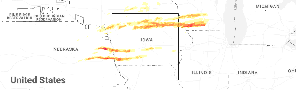
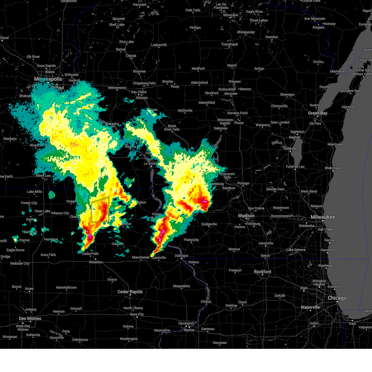
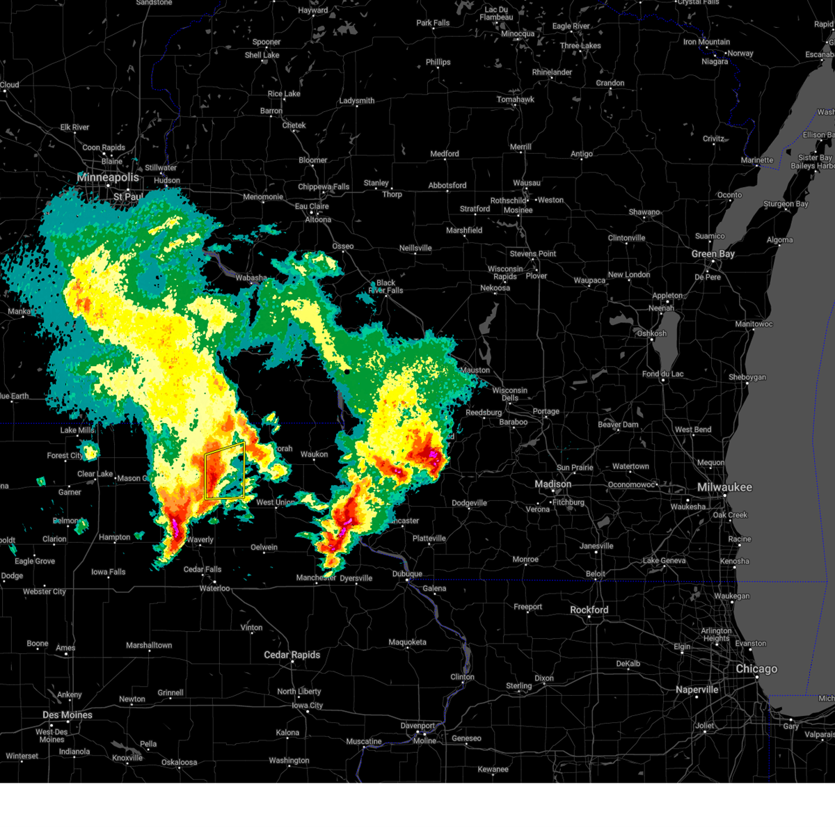
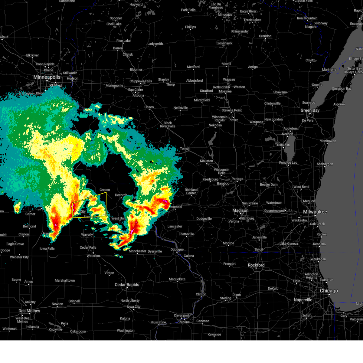
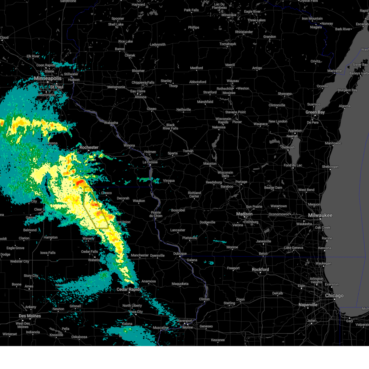
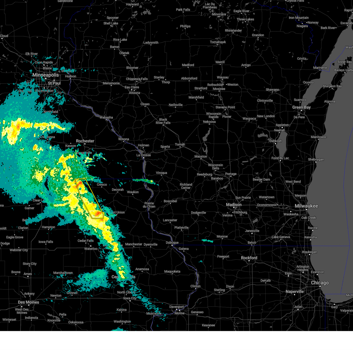
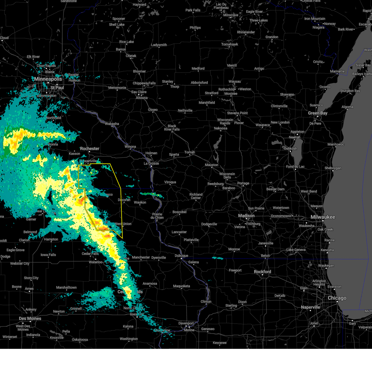
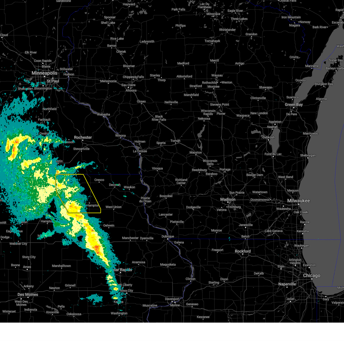
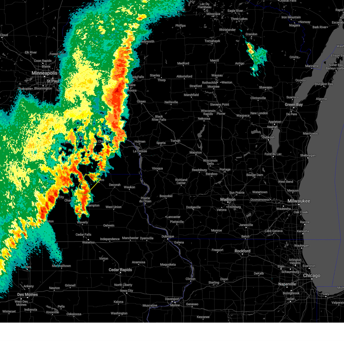
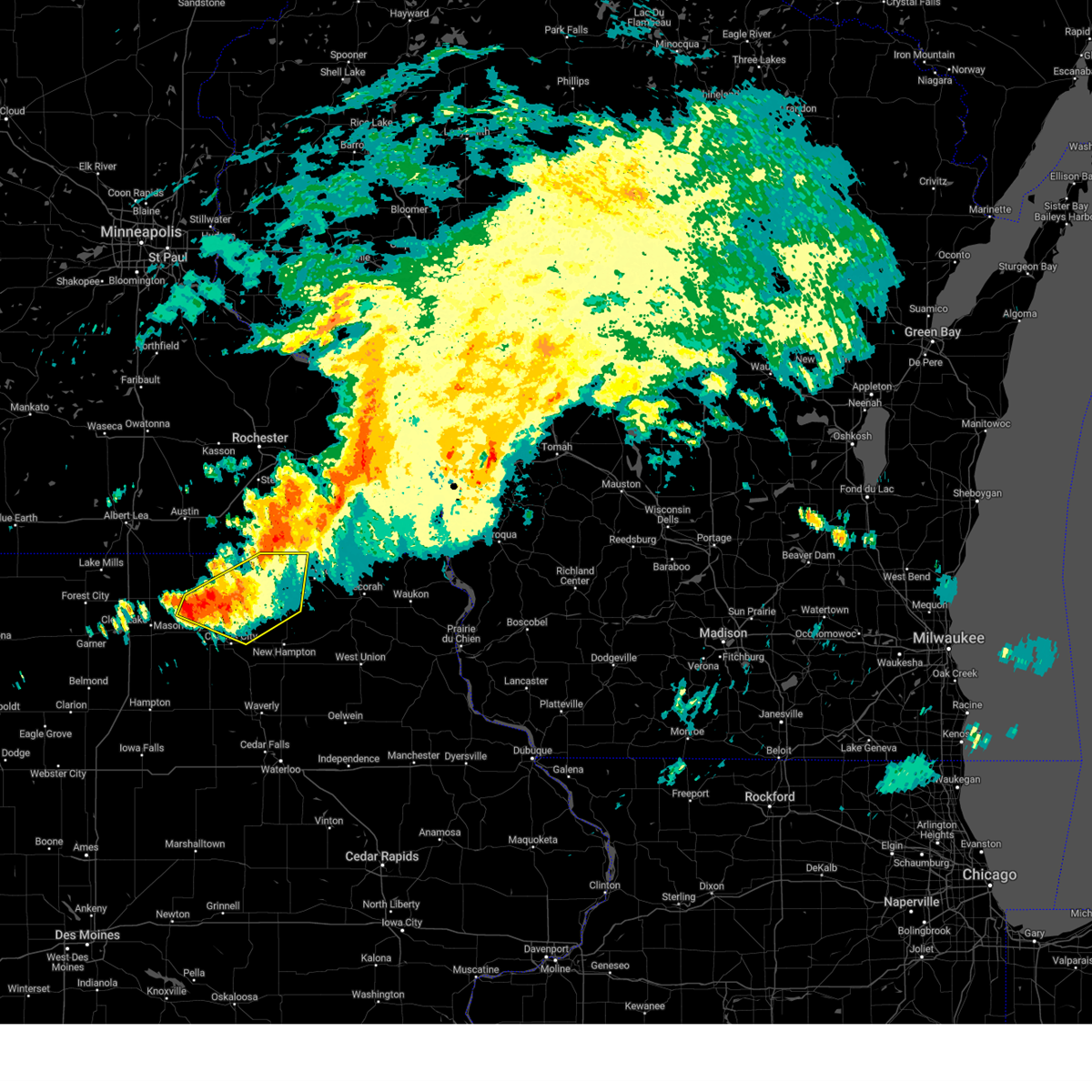
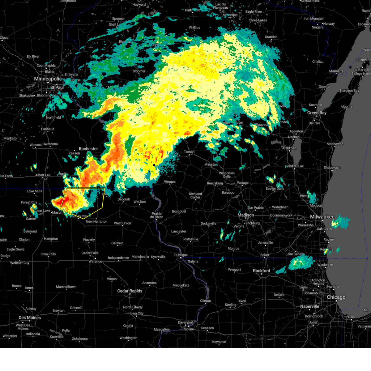
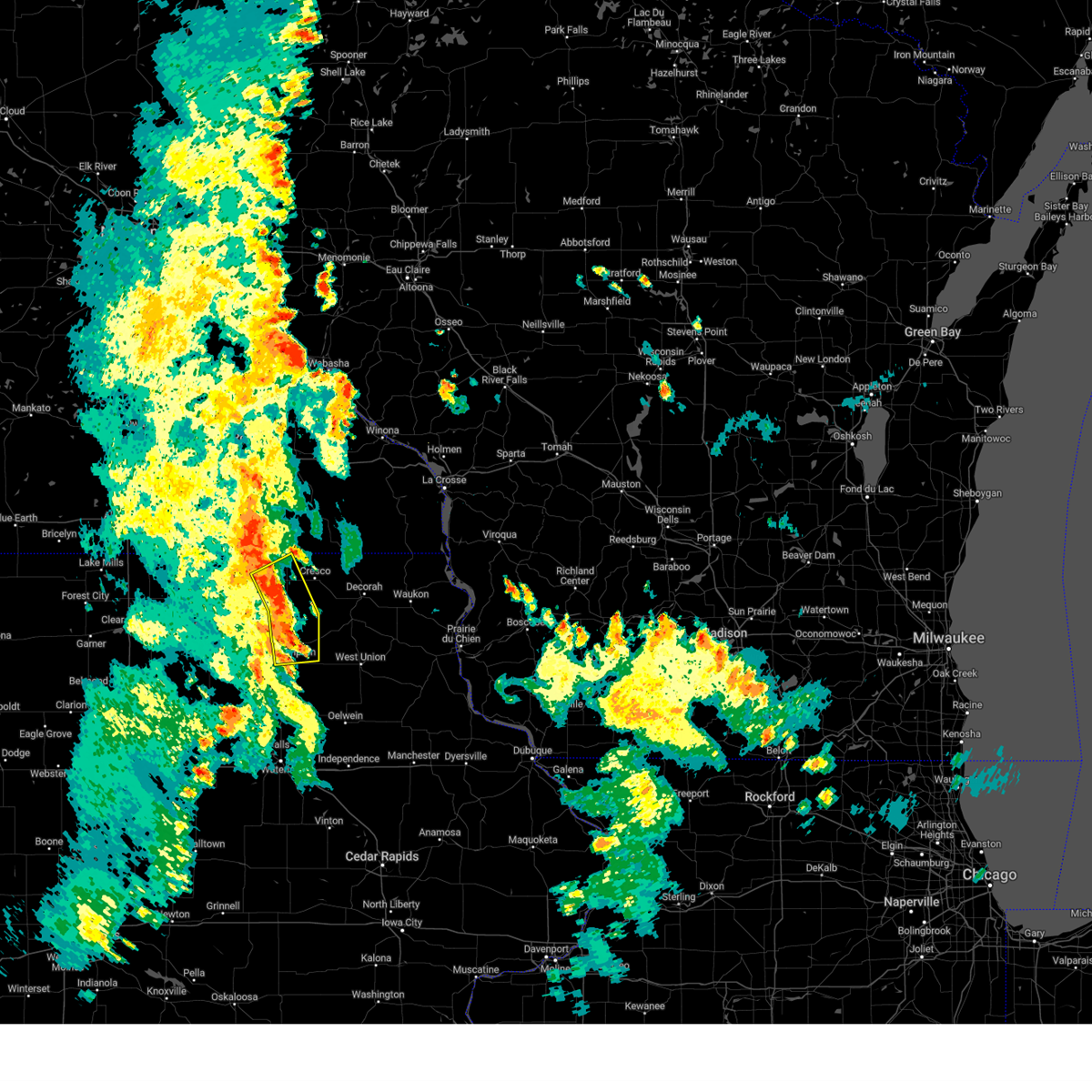
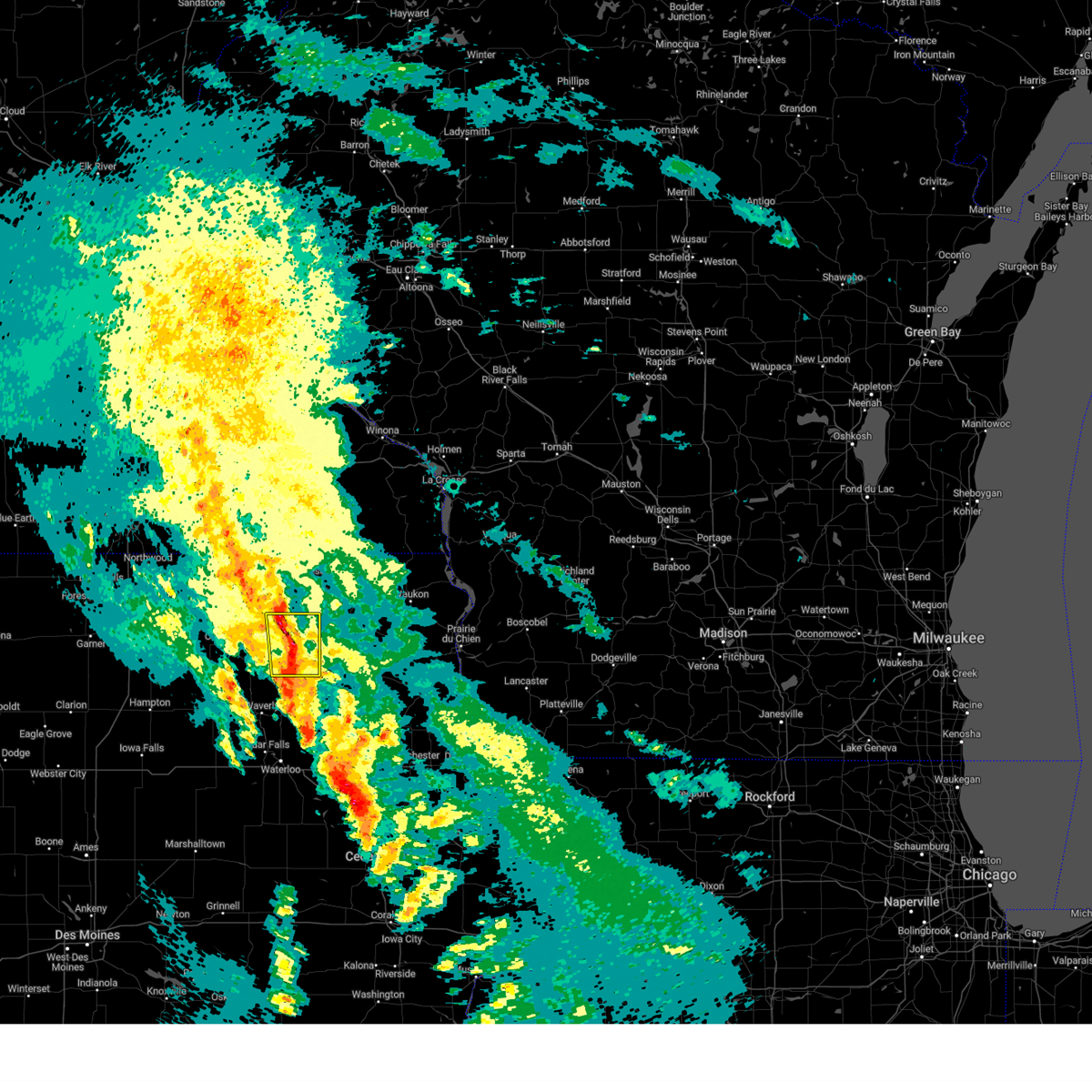
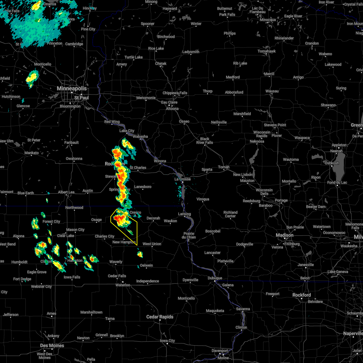
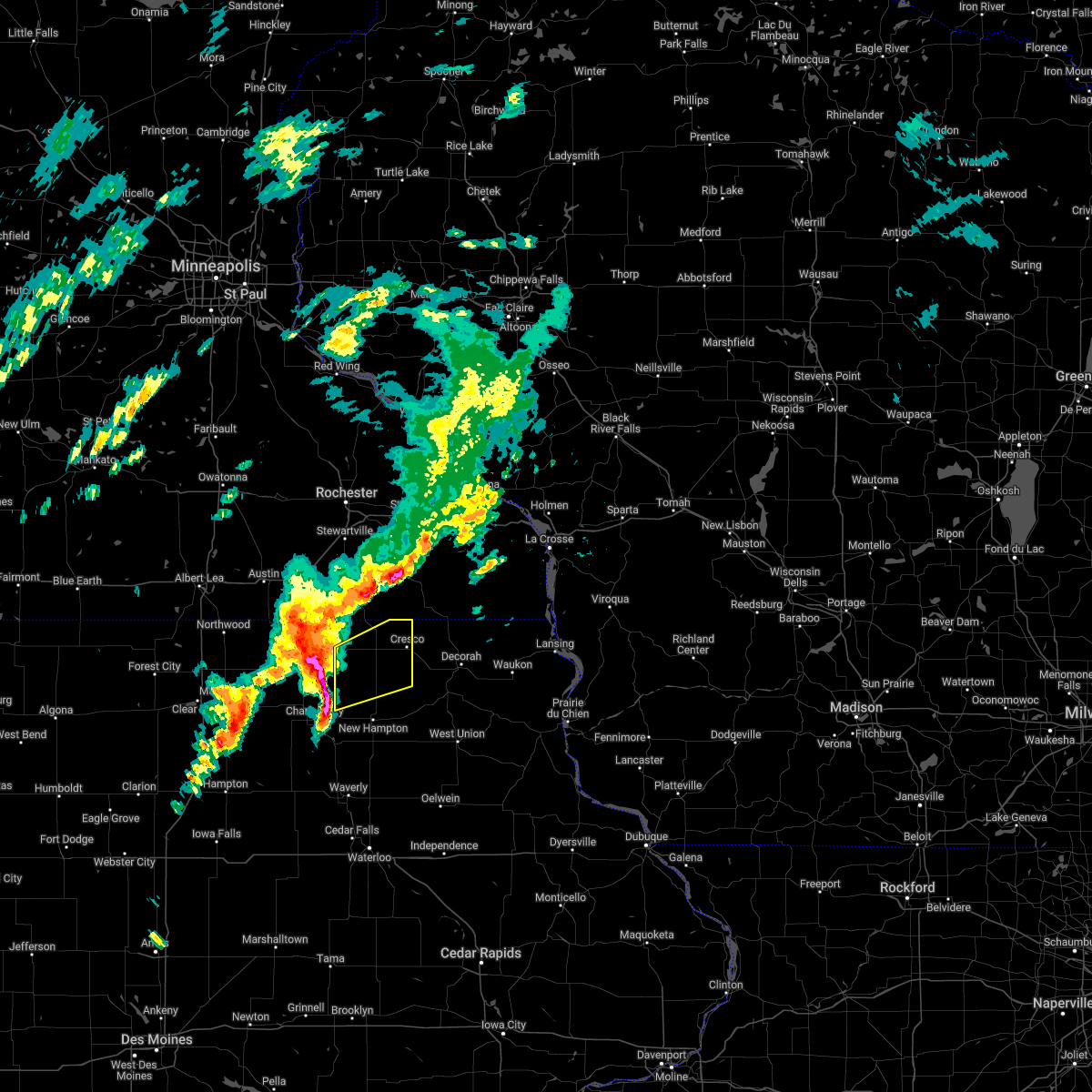
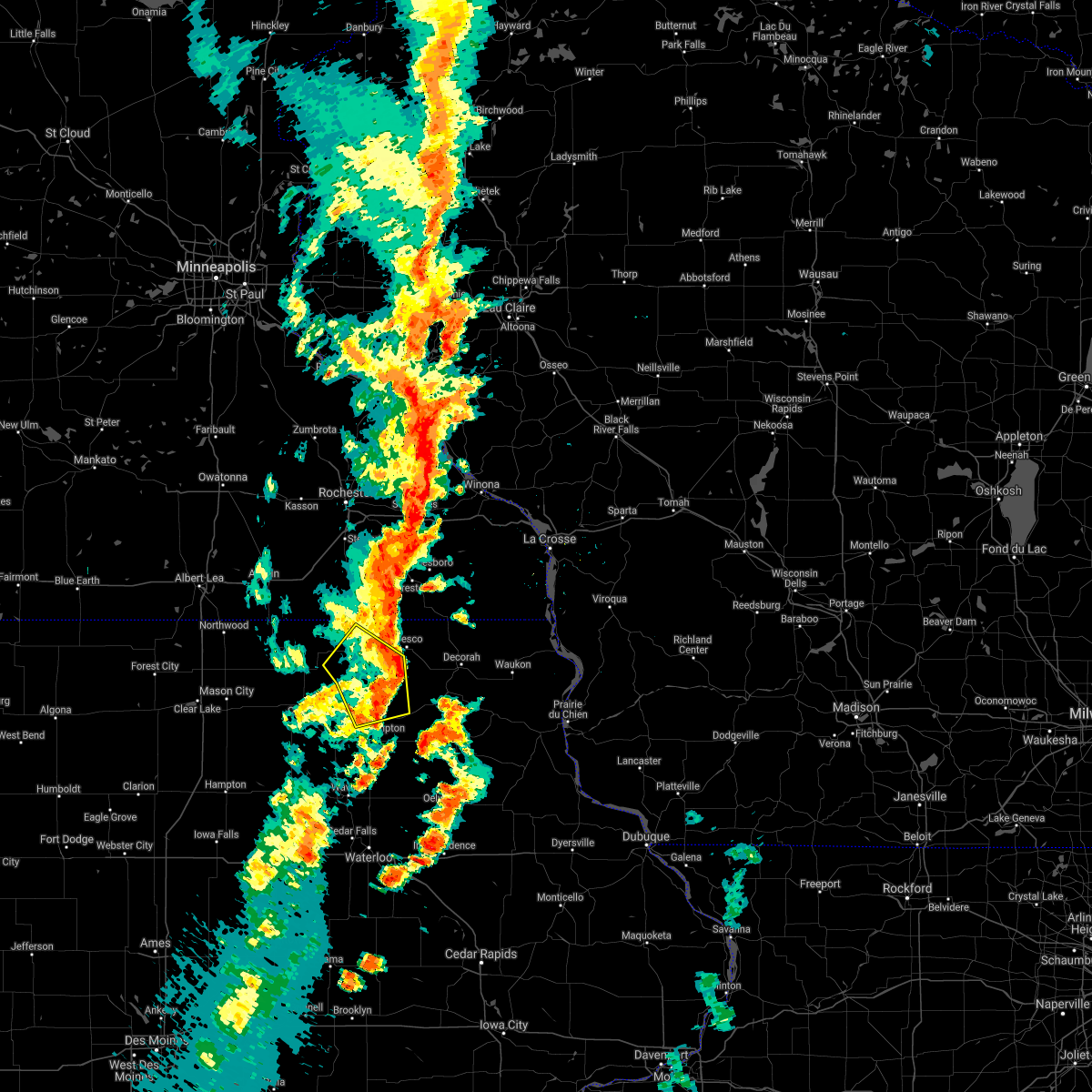
Hail Map for Alta Vista, IA
The Alta Vista, IA area has had 0 reports of on-the-ground hail by trained spotters, and has been under severe weather warnings 17 times during the past 12 months. Doppler radar has detected hail at or near Alta Vista, IA on 44 occasions, including 2 occasions during the past year.
| Name: | Alta Vista, IA |
| Where Located: | 39.7 miles E of Mason City, IA |
| Map: | Google Map for Alta Vista, IA |
| Population: | 266 |
| Housing Units: | 132 |
| More Info: | Search Google for Alta Vista, IA |
3
The Top Recent Hail Date for Alta Vista, IA is Thursday, April 17, 2025 (7th out of 44)
Hail and Wind Damage Spotted near Alta Vista, IA
| Date / Time | Report Details |
|---|---|
| 4/18/2025 5:24 AM CDT |
 the severe thunderstorm warning has been cancelled and is no longer in effect the severe thunderstorm warning has been cancelled and is no longer in effect
|
| 4/18/2025 5:12 AM CDT |
 the severe thunderstorm warning has been cancelled and is no longer in effect the severe thunderstorm warning has been cancelled and is no longer in effect
|
| 4/18/2025 5:12 AM CDT |
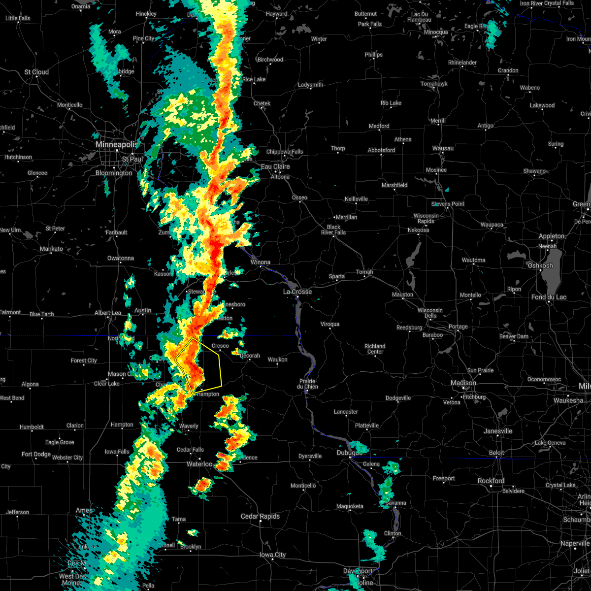
 At 512 am cdt, a severe thunderstorm was located near jerico, or 10 miles northeast of new hampton, moving east at 55 mph (radar indicated). Hazards include 60 mph wind gusts and quarter size hail. Hail damage to vehicles is expected. expect wind damage to roofs, siding, and trees. this severe storm will be near, protivin around 515 am cdt. Other locations impacted by this severe thunderstorm include vernon springs county park, vernon springs, county roads v 58 and a 46, new hampton airport, schley, county roads v 56 and b 33, and alta vista. At 512 am cdt, a severe thunderstorm was located near jerico, or 10 miles northeast of new hampton, moving east at 55 mph (radar indicated). Hazards include 60 mph wind gusts and quarter size hail. Hail damage to vehicles is expected. expect wind damage to roofs, siding, and trees. this severe storm will be near, protivin around 515 am cdt. Other locations impacted by this severe thunderstorm include vernon springs county park, vernon springs, county roads v 58 and a 46, new hampton airport, schley, county roads v 56 and b 33, and alta vista.
|
| 4/18/2025 4:48 AM CDT |
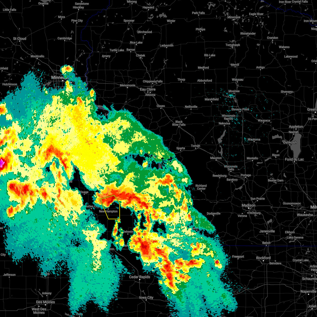
 Svrarx the national weather service in la crosse has issued a * severe thunderstorm warning for, southeastern mitchell county in north central iowa, southern howard county in northeastern iowa, northeastern floyd county in north central iowa, chickasaw county in northeastern iowa, * until 545 am cdt. * at 447 am cdt, a severe thunderstorm was located near floyd, or near charles city, moving east at 40 mph (radar indicated). Hazards include 60 mph wind gusts and quarter size hail. Hail damage to vehicles is expected. expect wind damage to roofs, siding, and trees. this severe thunderstorm will be near, jerico around 515 am cdt. protivin around 525 am cdt. Other locations impacted by this severe thunderstorm include vernon springs county park, vernon springs, chickasaw, county roads v 58 and a 46, new hampton airport, county roads b 28 and v 18, and highway 18 and county v 18. Svrarx the national weather service in la crosse has issued a * severe thunderstorm warning for, southeastern mitchell county in north central iowa, southern howard county in northeastern iowa, northeastern floyd county in north central iowa, chickasaw county in northeastern iowa, * until 545 am cdt. * at 447 am cdt, a severe thunderstorm was located near floyd, or near charles city, moving east at 40 mph (radar indicated). Hazards include 60 mph wind gusts and quarter size hail. Hail damage to vehicles is expected. expect wind damage to roofs, siding, and trees. this severe thunderstorm will be near, jerico around 515 am cdt. protivin around 525 am cdt. Other locations impacted by this severe thunderstorm include vernon springs county park, vernon springs, chickasaw, county roads v 58 and a 46, new hampton airport, county roads b 28 and v 18, and highway 18 and county v 18.
|
| 3/14/2025 8:37 PM CDT |
 the severe thunderstorm warning has been cancelled and is no longer in effect the severe thunderstorm warning has been cancelled and is no longer in effect
|
| 3/14/2025 8:37 PM CDT |
 At 836 pm cdt, severe thunderstorms were located along a line extending from near le roy to near new hampton, moving north at 50 mph (radar indicated). Hazards include 60 mph wind gusts. Expect damage to roofs, siding, and trees. Locations impacted include, new hampton airport, alta vista, fredericksburg, deerfield, jacksonville, lylahs marsh county park, riceville, saratoga, maple leaf, boyd, williamstown, lawler, new and hampton,. At 836 pm cdt, severe thunderstorms were located along a line extending from near le roy to near new hampton, moving north at 50 mph (radar indicated). Hazards include 60 mph wind gusts. Expect damage to roofs, siding, and trees. Locations impacted include, new hampton airport, alta vista, fredericksburg, deerfield, jacksonville, lylahs marsh county park, riceville, saratoga, maple leaf, boyd, williamstown, lawler, new and hampton,.
|
| 3/14/2025 8:26 PM CDT |
 At 825 pm cdt, severe thunderstorms were located along a line extending from near le roy to near fredericksburg, moving north at 60 mph (radar indicated). Hazards include 60 mph wind gusts. Expect damage to roofs, siding, and trees. Locations impacted include, new hampton airport, alta vista, fredericksburg, deerfield, jacksonville, bailey, lylahs, marsh county park, riceville, saratoga, maple leaf, boyd, williamstown, lawler, and new hampton. At 825 pm cdt, severe thunderstorms were located along a line extending from near le roy to near fredericksburg, moving north at 60 mph (radar indicated). Hazards include 60 mph wind gusts. Expect damage to roofs, siding, and trees. Locations impacted include, new hampton airport, alta vista, fredericksburg, deerfield, jacksonville, bailey, lylahs, marsh county park, riceville, saratoga, maple leaf, boyd, williamstown, lawler, and new hampton.
|
| 3/14/2025 8:26 PM CDT |
 the severe thunderstorm warning has been cancelled and is no longer in effect the severe thunderstorm warning has been cancelled and is no longer in effect
|
| 3/14/2025 8:22 PM CDT |
 Svrarx the national weather service in la crosse has issued a * severe thunderstorm warning for, howard county in northeastern iowa, northwestern fayette county in northeastern iowa, western winneshiek county in northeastern iowa, chickasaw county in northeastern iowa, eastern mower county in southeastern minnesota, fillmore county in southeastern minnesota, * until 915 pm cdt. * at 822 pm cdt, severe thunderstorms were located along a line extending from near riceville to near elma to 6 miles east of sumner, moving north at 60 mph (radar indicated). Hazards include 60 mph wind gusts. expect damage to roofs, siding, and trees Svrarx the national weather service in la crosse has issued a * severe thunderstorm warning for, howard county in northeastern iowa, northwestern fayette county in northeastern iowa, western winneshiek county in northeastern iowa, chickasaw county in northeastern iowa, eastern mower county in southeastern minnesota, fillmore county in southeastern minnesota, * until 915 pm cdt. * at 822 pm cdt, severe thunderstorms were located along a line extending from near riceville to near elma to 6 miles east of sumner, moving north at 60 mph (radar indicated). Hazards include 60 mph wind gusts. expect damage to roofs, siding, and trees
|
| 3/14/2025 7:54 PM CDT |
 Svrarx the national weather service in la crosse has issued a * severe thunderstorm warning for, mitchell county in north central iowa, western howard county in northeastern iowa, floyd county in north central iowa, chickasaw county in northeastern iowa, * until 845 pm cdt. * at 753 pm cdt, severe thunderstorms were located along a line extending from st. ansgar to charles city to near tripoli, moving north at 50 mph (radar indicated). Hazards include 60 mph wind gusts. expect damage to roofs, siding, and trees Svrarx the national weather service in la crosse has issued a * severe thunderstorm warning for, mitchell county in north central iowa, western howard county in northeastern iowa, floyd county in north central iowa, chickasaw county in northeastern iowa, * until 845 pm cdt. * at 753 pm cdt, severe thunderstorms were located along a line extending from st. ansgar to charles city to near tripoli, moving north at 50 mph (radar indicated). Hazards include 60 mph wind gusts. expect damage to roofs, siding, and trees
|
| 8/29/2024 7:21 PM CDT |
 Svrarx the national weather service in la crosse has issued a * severe thunderstorm warning for, central howard county in northeastern iowa, north central chickasaw county in northeastern iowa, * until 800 pm cdt. * at 720 pm cdt, a severe thunderstorm was located over elma, or 15 miles northwest of new hampton, moving northeast at 45 mph (public reported 60 mph wind gusts in colwell at 710 pm). Hazards include 60 mph wind gusts. Expect damage to roofs, siding, and trees. this severe thunderstorm will be near, lime springs around 735 pm cdt. Other locations impacted by this severe thunderstorm include lylahs marsh county park, chester, saratoga, davis corners, county b 17 and bell avenue, maple leaf, and alta vista. Svrarx the national weather service in la crosse has issued a * severe thunderstorm warning for, central howard county in northeastern iowa, north central chickasaw county in northeastern iowa, * until 800 pm cdt. * at 720 pm cdt, a severe thunderstorm was located over elma, or 15 miles northwest of new hampton, moving northeast at 45 mph (public reported 60 mph wind gusts in colwell at 710 pm). Hazards include 60 mph wind gusts. Expect damage to roofs, siding, and trees. this severe thunderstorm will be near, lime springs around 735 pm cdt. Other locations impacted by this severe thunderstorm include lylahs marsh county park, chester, saratoga, davis corners, county b 17 and bell avenue, maple leaf, and alta vista.
|
| 8/29/2024 7:16 PM CDT |
 At 715 pm cdt, a severe thunderstorm was located near elma, or 11 miles northeast of charles city, moving northeast at 40 mph (public reported 60 mph wind gusts in colwell at 710 pm). Hazards include 60 mph wind gusts. Expect damage to roofs, siding, and trees. this severe storm will be near, elma around 720 pm cdt. Other locations impacted by this severe thunderstorm include lylahs marsh county park, county roads b 33 and t 76, county b 17 and bell avenue, alta vista, colwell, county roads 17 and t 72, and highway 63 and county b 22. At 715 pm cdt, a severe thunderstorm was located near elma, or 11 miles northeast of charles city, moving northeast at 40 mph (public reported 60 mph wind gusts in colwell at 710 pm). Hazards include 60 mph wind gusts. Expect damage to roofs, siding, and trees. this severe storm will be near, elma around 720 pm cdt. Other locations impacted by this severe thunderstorm include lylahs marsh county park, county roads b 33 and t 76, county b 17 and bell avenue, alta vista, colwell, county roads 17 and t 72, and highway 63 and county b 22.
|
| 8/29/2024 7:08 PM CDT |
 At 708 pm cdt, a severe thunderstorm was located near charles city, moving northeast at 40 mph (radar indicated). Hazards include 60 mph wind gusts. Expect damage to roofs, siding, and trees. this severe storm will be near, elma around 720 pm cdt. Other locations impacted by this severe thunderstorm include lylahs marsh county park, chickasaw, bassett, and colwell county park. At 708 pm cdt, a severe thunderstorm was located near charles city, moving northeast at 40 mph (radar indicated). Hazards include 60 mph wind gusts. Expect damage to roofs, siding, and trees. this severe storm will be near, elma around 720 pm cdt. Other locations impacted by this severe thunderstorm include lylahs marsh county park, chickasaw, bassett, and colwell county park.
|
| 8/29/2024 7:02 PM CDT |
 Svrarx the national weather service in la crosse has issued a * severe thunderstorm warning for, southeastern mitchell county in north central iowa, southwestern howard county in northeastern iowa, northeastern floyd county in north central iowa, northwestern chickasaw county in northeastern iowa, * until 730 pm cdt. * at 701 pm cdt, a severe thunderstorm was located over charles city, moving northeast at 40 mph (radar indicated). Hazards include 60 mph wind gusts. Expect damage to roofs, siding, and trees. this severe thunderstorm will be near, elma around 720 pm cdt. Other locations impacted by this severe thunderstorm include lylahs marsh county park, county roads b 33 and t 76, county b 17 and bell avenue, howards wood recreational area, chickasaw, bassett, and carrville. Svrarx the national weather service in la crosse has issued a * severe thunderstorm warning for, southeastern mitchell county in north central iowa, southwestern howard county in northeastern iowa, northeastern floyd county in north central iowa, northwestern chickasaw county in northeastern iowa, * until 730 pm cdt. * at 701 pm cdt, a severe thunderstorm was located over charles city, moving northeast at 40 mph (radar indicated). Hazards include 60 mph wind gusts. Expect damage to roofs, siding, and trees. this severe thunderstorm will be near, elma around 720 pm cdt. Other locations impacted by this severe thunderstorm include lylahs marsh county park, county roads b 33 and t 76, county b 17 and bell avenue, howards wood recreational area, chickasaw, bassett, and carrville.
|
| 8/5/2024 9:36 PM CDT |
 The storm which prompted the warning has weakened below severe limits, and no longer poses an immediate threat to life or property. therefore, the warning will be allowed to expire. however, gusty winds are still possible with this thunderstorm. a tornado watch remains in effect until midnight cdt for north central and northeastern iowa. remember, a tornado warning still remains in effect for eastern howard county until 1015pm. The storm which prompted the warning has weakened below severe limits, and no longer poses an immediate threat to life or property. therefore, the warning will be allowed to expire. however, gusty winds are still possible with this thunderstorm. a tornado watch remains in effect until midnight cdt for north central and northeastern iowa. remember, a tornado warning still remains in effect for eastern howard county until 1015pm.
|
| 8/5/2024 9:10 PM CDT |
 At 909 pm cdt, a severe thunderstorm was located over osage, moving southeast at 30 mph (radar indicated). Hazards include 60 mph wind gusts and quarter size hail. Hail damage to vehicles is expected. expect wind damage to roofs, siding, and trees. This severe thunderstorm will remain over mainly rural areas of southern mitchell, howard, northern floyd and northwestern chickasaw counties, including the following locations, rock creek, idlewilde state park, brownville, and colwell county park. At 909 pm cdt, a severe thunderstorm was located over osage, moving southeast at 30 mph (radar indicated). Hazards include 60 mph wind gusts and quarter size hail. Hail damage to vehicles is expected. expect wind damage to roofs, siding, and trees. This severe thunderstorm will remain over mainly rural areas of southern mitchell, howard, northern floyd and northwestern chickasaw counties, including the following locations, rock creek, idlewilde state park, brownville, and colwell county park.
|
| 8/5/2024 8:57 PM CDT |
 Svrarx the national weather service in la crosse has issued a * severe thunderstorm warning for, mitchell county in north central iowa, howard county in northeastern iowa, northern floyd county in north central iowa, northwestern chickasaw county in northeastern iowa, * until 945 pm cdt. * at 857 pm cdt, a severe thunderstorm was located near osage, moving southeast at 30 mph (radar indicated). Hazards include 60 mph wind gusts and nickel size hail. Expect damage to roofs, siding, and trees. this severe thunderstorm will be near, osage around 900 pm cdt. Other locations impacted by this severe thunderstorm include meyer, rock creek, idlewilde state park, brownville, county roads t 54 and a 31, highways 9 and 218, and county roads b 28 and v 18. Svrarx the national weather service in la crosse has issued a * severe thunderstorm warning for, mitchell county in north central iowa, howard county in northeastern iowa, northern floyd county in north central iowa, northwestern chickasaw county in northeastern iowa, * until 945 pm cdt. * at 857 pm cdt, a severe thunderstorm was located near osage, moving southeast at 30 mph (radar indicated). Hazards include 60 mph wind gusts and nickel size hail. Expect damage to roofs, siding, and trees. this severe thunderstorm will be near, osage around 900 pm cdt. Other locations impacted by this severe thunderstorm include meyer, rock creek, idlewilde state park, brownville, county roads t 54 and a 31, highways 9 and 218, and county roads b 28 and v 18.
|
| 6/4/2024 8:06 PM CDT |
 the severe thunderstorm warning has been cancelled and is no longer in effect the severe thunderstorm warning has been cancelled and is no longer in effect
|
| 6/4/2024 8:06 PM CDT |
 At 805 pm cdt, severe thunderstorms were located along a line extending from 6 miles southeast of le roy to fredericksburg, moving east at 25 mph (radar indicated). Hazards include 60 mph wind gusts. Expect damage to roofs, siding, and trees. these severe storms will be near, lawler and jerico around 810 pm cdt. lime springs around 815 pm cdt. protivin around 820 pm cdt. Other locations impacted by these severe thunderstorms include saratoga, maple leaf, boyd, williamstown, hayden prairie, new hampton airport, and schley. At 805 pm cdt, severe thunderstorms were located along a line extending from 6 miles southeast of le roy to fredericksburg, moving east at 25 mph (radar indicated). Hazards include 60 mph wind gusts. Expect damage to roofs, siding, and trees. these severe storms will be near, lawler and jerico around 810 pm cdt. lime springs around 815 pm cdt. protivin around 820 pm cdt. Other locations impacted by these severe thunderstorms include saratoga, maple leaf, boyd, williamstown, hayden prairie, new hampton airport, and schley.
|
| 6/4/2024 7:47 PM CDT |
 Svrarx the national weather service in la crosse has issued a * severe thunderstorm warning for, southeastern mitchell county in north central iowa, howard county in northeastern iowa, chickasaw county in northeastern iowa, * until 830 pm cdt. * at 746 pm cdt, severe thunderstorms were located along a line extending from near riceville to 8 miles east of nashua, moving east at 25 mph (radar indicated). Hazards include 60 mph wind gusts. Expect damage to roofs, siding, and trees. severe thunderstorms will be near, new hampton, riceville, and elma around 750 pm cdt. fredericksburg around 800 pm cdt. jerico around 805 pm cdt. lawler around 810 pm cdt. lime springs around 815 pm cdt. Other locations impacted by these severe thunderstorms include chickasaw, new hampton airport, county roads b 28 and v 18, republic, highway 18 and county v 18, davis corners, and county roads v 56 and b 33. Svrarx the national weather service in la crosse has issued a * severe thunderstorm warning for, southeastern mitchell county in north central iowa, howard county in northeastern iowa, chickasaw county in northeastern iowa, * until 830 pm cdt. * at 746 pm cdt, severe thunderstorms were located along a line extending from near riceville to 8 miles east of nashua, moving east at 25 mph (radar indicated). Hazards include 60 mph wind gusts. Expect damage to roofs, siding, and trees. severe thunderstorms will be near, new hampton, riceville, and elma around 750 pm cdt. fredericksburg around 800 pm cdt. jerico around 805 pm cdt. lawler around 810 pm cdt. lime springs around 815 pm cdt. Other locations impacted by these severe thunderstorms include chickasaw, new hampton airport, county roads b 28 and v 18, republic, highway 18 and county v 18, davis corners, and county roads v 56 and b 33.
|
| 5/24/2024 6:34 AM CDT |
 At 634 am cdt, severe thunderstorms were located along a line extending from 6 miles southeast of adams to denver, moving east at 55 mph (radar indicated). Hazards include 60 mph wind gusts and quarter size hail. Hail damage to vehicles is expected. expect wind damage to roofs, siding, and trees. these severe storms will be near, new hampton, fredericksburg, riceville, and elma around 640 am cdt. lawler and jerico around 645 am cdt. lime springs around 650 am cdt. Other locations impacted by these severe thunderstorms include toeterville, otranto, chickasaw, brownville, county roads t 54 and a 31, county roads b 28 and v 18, and highway 18 and county v 18. At 634 am cdt, severe thunderstorms were located along a line extending from 6 miles southeast of adams to denver, moving east at 55 mph (radar indicated). Hazards include 60 mph wind gusts and quarter size hail. Hail damage to vehicles is expected. expect wind damage to roofs, siding, and trees. these severe storms will be near, new hampton, fredericksburg, riceville, and elma around 640 am cdt. lawler and jerico around 645 am cdt. lime springs around 650 am cdt. Other locations impacted by these severe thunderstorms include toeterville, otranto, chickasaw, brownville, county roads t 54 and a 31, county roads b 28 and v 18, and highway 18 and county v 18.
|
| 5/24/2024 6:34 AM CDT |
 the severe thunderstorm warning has been cancelled and is no longer in effect the severe thunderstorm warning has been cancelled and is no longer in effect
|
| 5/24/2024 6:01 AM CDT |
 Svrarx the national weather service in la crosse has issued a * severe thunderstorm warning for, mitchell county in north central iowa, howard county in northeastern iowa, floyd county in north central iowa, chickasaw county in northeastern iowa, * until 645 am cdt. * at 559 am cdt, severe thunderstorms were located along a line extending from near northwood to 7 miles north of aplington, moving east at 55 mph (automated weather observations). Hazards include 60 mph wind gusts and quarter size hail. Hail damage to vehicles is expected. expect wind damage to roofs, siding, and trees. severe thunderstorms will be near, nora springs, rockford, rudd, and marble rock around 605 am cdt. st. ansgar around 610 am cdt. charles city, osage, lyle, and floyd around 615 am cdt. nashua and stacyville around 620 am cdt. riceville and ionia around 630 am cdt. new hampton and elma around 635 am cdt. Other locations impacted by these severe thunderstorms include toeterville, county roads b 60 and t 18, rock creek, idlewilde state park, bradford, otranto, and chickasaw. Svrarx the national weather service in la crosse has issued a * severe thunderstorm warning for, mitchell county in north central iowa, howard county in northeastern iowa, floyd county in north central iowa, chickasaw county in northeastern iowa, * until 645 am cdt. * at 559 am cdt, severe thunderstorms were located along a line extending from near northwood to 7 miles north of aplington, moving east at 55 mph (automated weather observations). Hazards include 60 mph wind gusts and quarter size hail. Hail damage to vehicles is expected. expect wind damage to roofs, siding, and trees. severe thunderstorms will be near, nora springs, rockford, rudd, and marble rock around 605 am cdt. st. ansgar around 610 am cdt. charles city, osage, lyle, and floyd around 615 am cdt. nashua and stacyville around 620 am cdt. riceville and ionia around 630 am cdt. new hampton and elma around 635 am cdt. Other locations impacted by these severe thunderstorms include toeterville, county roads b 60 and t 18, rock creek, idlewilde state park, bradford, otranto, and chickasaw.
|
| 5/21/2024 6:17 PM CDT |
 At 617 pm cdt, severe thunderstorms were located along a line extending from near rollingstone to near rushford to near spring grove to near ossian, moving east at 60 mph (radar indicated). Hazards include 70 mph wind gusts and penny size hail. Expect considerable tree damage. damage is likely to mobile homes, roofs, and outbuildings. These severe thunderstorms will remain over mainly rural areas of howard, chickasaw and western fillmore counties, including the following locations, vernon springs county park, forestville state park, vernon springs, bradford, chickasaw, county roads v 58 and a 46, and fillmore. At 617 pm cdt, severe thunderstorms were located along a line extending from near rollingstone to near rushford to near spring grove to near ossian, moving east at 60 mph (radar indicated). Hazards include 70 mph wind gusts and penny size hail. Expect considerable tree damage. damage is likely to mobile homes, roofs, and outbuildings. These severe thunderstorms will remain over mainly rural areas of howard, chickasaw and western fillmore counties, including the following locations, vernon springs county park, forestville state park, vernon springs, bradford, chickasaw, county roads v 58 and a 46, and fillmore.
|
| 5/21/2024 6:17 PM CDT |
 the severe thunderstorm warning has been cancelled and is no longer in effect the severe thunderstorm warning has been cancelled and is no longer in effect
|
| 5/21/2024 5:24 PM CDT |
 Svrarx the national weather service in la crosse has issued a * severe thunderstorm warning for, howard county in northeastern iowa, chickasaw county in northeastern iowa, olmsted county in southeastern minnesota, western fillmore county in southeastern minnesota, * until 630 pm cdt. * at 523 pm cdt, severe thunderstorms were located along a line extending from near hayfield to near adams to near riceville to near clarksville, moving east at 60 mph (radar indicated). Hazards include 70 mph wind gusts and penny size hail. Expect considerable tree damage. damage is likely to mobile homes, roofs, and outbuildings. severe thunderstorms will be near, nashua, elma, and ionia around 530 pm cdt. rochester, stewartville, spring valley, and lime springs around 535 pm cdt. new hampton, wykoff, and jerico around 540 pm cdt. cresco, chatfield, fredericksburg, lawler, and fountain around 545 pm cdt. preston, eyota, dover, and protivin around 550 pm cdt. other locations impacted by these severe thunderstorms include vernon springs county park, forestville state park, vernon springs, county roads 9 and 10, bradford, potsdam, and chickasaw. This includes interstate 90 in minnesota between mile markers 205 and 232. Svrarx the national weather service in la crosse has issued a * severe thunderstorm warning for, howard county in northeastern iowa, chickasaw county in northeastern iowa, olmsted county in southeastern minnesota, western fillmore county in southeastern minnesota, * until 630 pm cdt. * at 523 pm cdt, severe thunderstorms were located along a line extending from near hayfield to near adams to near riceville to near clarksville, moving east at 60 mph (radar indicated). Hazards include 70 mph wind gusts and penny size hail. Expect considerable tree damage. damage is likely to mobile homes, roofs, and outbuildings. severe thunderstorms will be near, nashua, elma, and ionia around 530 pm cdt. rochester, stewartville, spring valley, and lime springs around 535 pm cdt. new hampton, wykoff, and jerico around 540 pm cdt. cresco, chatfield, fredericksburg, lawler, and fountain around 545 pm cdt. preston, eyota, dover, and protivin around 550 pm cdt. other locations impacted by these severe thunderstorms include vernon springs county park, forestville state park, vernon springs, county roads 9 and 10, bradford, potsdam, and chickasaw. This includes interstate 90 in minnesota between mile markers 205 and 232.
|
| 4/16/2024 3:07 PM CDT |
 The storms which prompted the warning have weakened below severe limits, and no longer pose an immediate threat to life or property. therefore, the warning will be allowed to expire. however, gusty winds are still possible with these thunderstorms. a tornado watch remains in effect until 800 pm cdt for northeastern iowa. The storms which prompted the warning have weakened below severe limits, and no longer pose an immediate threat to life or property. therefore, the warning will be allowed to expire. however, gusty winds are still possible with these thunderstorms. a tornado watch remains in effect until 800 pm cdt for northeastern iowa.
|
| 4/16/2024 2:57 PM CDT |
 At 257 pm cdt, severe thunderstorms were located along a line extending from near jerico to near fredericksburg, moving northeast at 40 mph (radar indicated). Hazards include 60 mph wind gusts. Expect damage to roofs, siding, and trees. these severe storms will be near, lawler and jerico around 305 pm cdt. protivin around 310 pm cdt. Other locations impacted by these severe thunderstorms include boyd, williamstown, new hampton airport, county roads b 28 and v 18, republic, highway 18 and county v 18, and county roads b 54 and v 56. At 257 pm cdt, severe thunderstorms were located along a line extending from near jerico to near fredericksburg, moving northeast at 40 mph (radar indicated). Hazards include 60 mph wind gusts. Expect damage to roofs, siding, and trees. these severe storms will be near, lawler and jerico around 305 pm cdt. protivin around 310 pm cdt. Other locations impacted by these severe thunderstorms include boyd, williamstown, new hampton airport, county roads b 28 and v 18, republic, highway 18 and county v 18, and county roads b 54 and v 56.
|
| 4/16/2024 2:39 PM CDT |
 At 239 pm cdt, severe thunderstorms were located along a line extending from ionia to near tripoli, moving northeast at 45 mph (radar indicated). Hazards include 60 mph wind gusts. Expect damage to roofs, siding, and trees. these severe storms will be near, new hampton and fredericksburg around 245 pm cdt. lawler around 250 pm cdt. jerico around 255 pm cdt. protivin around 305 pm cdt. Other locations impacted by these severe thunderstorms include bradford, chickasaw, new hampton airport, county roads b 28 and v 18, republic, highway 18 and county v 18, and county roads v 56 and b 33. At 239 pm cdt, severe thunderstorms were located along a line extending from ionia to near tripoli, moving northeast at 45 mph (radar indicated). Hazards include 60 mph wind gusts. Expect damage to roofs, siding, and trees. these severe storms will be near, new hampton and fredericksburg around 245 pm cdt. lawler around 250 pm cdt. jerico around 255 pm cdt. protivin around 305 pm cdt. Other locations impacted by these severe thunderstorms include bradford, chickasaw, new hampton airport, county roads b 28 and v 18, republic, highway 18 and county v 18, and county roads v 56 and b 33.
|
| 4/16/2024 2:26 PM CDT |
 Svrarx the national weather service in la crosse has issued a * severe thunderstorm warning for, chickasaw county in northeastern iowa, * until 315 pm cdt. * at 225 pm cdt, severe thunderstorms were located along a line extending from near nashua to near denver, moving northeast at 45 mph (radar indicated). Hazards include 60 mph wind gusts. Expect damage to roofs, siding, and trees. severe thunderstorms will be near, nashua around 230 pm cdt. ionia around 235 pm cdt. new hampton around 240 pm cdt. fredericksburg around 245 pm cdt. lawler and jerico around 250 pm cdt. protivin around 305 pm cdt. Other locations impacted by these severe thunderstorms include bradford, chickasaw, new hampton airport, county roads b 28 and v 18, republic, highway 18 and county v 18, and county roads v 56 and b 33. Svrarx the national weather service in la crosse has issued a * severe thunderstorm warning for, chickasaw county in northeastern iowa, * until 315 pm cdt. * at 225 pm cdt, severe thunderstorms were located along a line extending from near nashua to near denver, moving northeast at 45 mph (radar indicated). Hazards include 60 mph wind gusts. Expect damage to roofs, siding, and trees. severe thunderstorms will be near, nashua around 230 pm cdt. ionia around 235 pm cdt. new hampton around 240 pm cdt. fredericksburg around 245 pm cdt. lawler and jerico around 250 pm cdt. protivin around 305 pm cdt. Other locations impacted by these severe thunderstorms include bradford, chickasaw, new hampton airport, county roads b 28 and v 18, republic, highway 18 and county v 18, and county roads v 56 and b 33.
|
| 7/10/2022 11:27 AM CDT |
 At 1125 am cdt, a severe thunderstorm was located near elma, or 12 miles southwest of cresco, moving southeast at 35 mph (radar indicated). Hazards include quarter size hail. Damage to vehicles is expected. this severe storm will be near, jerico around 1135 am cdt. protivin around 1145 am cdt. lawler around 1155 am cdt. other locations impacted by this severe thunderstorm include lylahs marsh county park, saratoga, maple leaf, county roads v 58 and a 46, schley, davis corners and county roads v 56 and b 33. hail threat, radar indicated max hail size, 1. 00 in wind threat, radar indicated max wind gust, <50 mph. At 1125 am cdt, a severe thunderstorm was located near elma, or 12 miles southwest of cresco, moving southeast at 35 mph (radar indicated). Hazards include quarter size hail. Damage to vehicles is expected. this severe storm will be near, jerico around 1135 am cdt. protivin around 1145 am cdt. lawler around 1155 am cdt. other locations impacted by this severe thunderstorm include lylahs marsh county park, saratoga, maple leaf, county roads v 58 and a 46, schley, davis corners and county roads v 56 and b 33. hail threat, radar indicated max hail size, 1. 00 in wind threat, radar indicated max wind gust, <50 mph.
|
| 7/10/2022 11:17 AM CDT |
 At 1116 am cdt, a severe thunderstorm was located near elma, or 13 miles west of cresco, moving southeast at 35 mph (riceville fire department reported quarter size hail at 1106 am). Hazards include quarter size hail. Damage to vehicles is expected. this severe storm will be near, jerico around 1135 am cdt. protivin around 1140 am cdt. lawler around 1150 am cdt. other locations impacted by this severe thunderstorm include lylahs marsh county park, saratoga, maple leaf, county roads v 58 and a 46, schley, davis corners and county roads v 56 and b 33. hail threat, radar indicated max hail size, 1. 00 in wind threat, radar indicated max wind gust, <50 mph. At 1116 am cdt, a severe thunderstorm was located near elma, or 13 miles west of cresco, moving southeast at 35 mph (riceville fire department reported quarter size hail at 1106 am). Hazards include quarter size hail. Damage to vehicles is expected. this severe storm will be near, jerico around 1135 am cdt. protivin around 1140 am cdt. lawler around 1150 am cdt. other locations impacted by this severe thunderstorm include lylahs marsh county park, saratoga, maple leaf, county roads v 58 and a 46, schley, davis corners and county roads v 56 and b 33. hail threat, radar indicated max hail size, 1. 00 in wind threat, radar indicated max wind gust, <50 mph.
|
| 7/10/2022 11:10 AM CDT |
 At 1109 am cdt, a severe thunderstorm was located near riceville, or 16 miles west of cresco, moving southeast at 35 mph (radar indicated). Hazards include quarter size hail. Damage to vehicles is expected. this severe thunderstorm will be near, elma around 1115 am cdt. jerico around 1135 am cdt. protivin around 1145 am cdt. lawler around 1150 am cdt. other locations impacted by this severe thunderstorm include lylahs marsh county park, saratoga, maple leaf, county roads v 58 and a 46, schley, davis corners and county roads v 56 and b 33. hail threat, radar indicated max hail size, 1. 00 in wind threat, radar indicated max wind gust, <50 mph. At 1109 am cdt, a severe thunderstorm was located near riceville, or 16 miles west of cresco, moving southeast at 35 mph (radar indicated). Hazards include quarter size hail. Damage to vehicles is expected. this severe thunderstorm will be near, elma around 1115 am cdt. jerico around 1135 am cdt. protivin around 1145 am cdt. lawler around 1150 am cdt. other locations impacted by this severe thunderstorm include lylahs marsh county park, saratoga, maple leaf, county roads v 58 and a 46, schley, davis corners and county roads v 56 and b 33. hail threat, radar indicated max hail size, 1. 00 in wind threat, radar indicated max wind gust, <50 mph.
|
| 7/5/2022 8:15 PM CDT |
 At 815 pm cdt, severe thunderstorms were located along a line extending from near riceville to near nashua, moving east at 40 mph (radar indicated). Hazards include 60 mph wind gusts. Expect damage to roofs, siding, and trees. these severe storms will be near, fredericksburg around 840 pm cdt. other locations impacted by these severe thunderstorms include bradford, chickasaw, new hampton airport, county roads b 28 and v 18, republic, highway 18 and county v 18 and county roads v 56 and b 33. hail threat, radar indicated max hail size, <. 75 in wind threat, radar indicated max wind gust, 60 mph. At 815 pm cdt, severe thunderstorms were located along a line extending from near riceville to near nashua, moving east at 40 mph (radar indicated). Hazards include 60 mph wind gusts. Expect damage to roofs, siding, and trees. these severe storms will be near, fredericksburg around 840 pm cdt. other locations impacted by these severe thunderstorms include bradford, chickasaw, new hampton airport, county roads b 28 and v 18, republic, highway 18 and county v 18 and county roads v 56 and b 33. hail threat, radar indicated max hail size, <. 75 in wind threat, radar indicated max wind gust, 60 mph.
|
| 7/5/2022 7:40 PM CDT |
 At 739 pm cdt, severe thunderstorms were located along a line extending from near st. ansgar to near marble rock, moving east at 40 mph (trained weather spotters and automated weather observation systems). Hazards include 60 mph wind gusts. Expect damage to roofs, siding, and trees. severe thunderstorms will be near, nashua around 810 pm cdt. riceville around 815 pm cdt. fredericksburg and lime springs around 835 pm cdt. cresco around 850 pm cdt. other locations impacted by these severe thunderstorms include vernon springs county park, vernon springs, bradford, chickasaw, county roads v 58 and a 46, new hampton airport and county roads b 28 and v 18. hail threat, radar indicated max hail size, <. 75 in wind threat, observed max wind gust, 60 mph. At 739 pm cdt, severe thunderstorms were located along a line extending from near st. ansgar to near marble rock, moving east at 40 mph (trained weather spotters and automated weather observation systems). Hazards include 60 mph wind gusts. Expect damage to roofs, siding, and trees. severe thunderstorms will be near, nashua around 810 pm cdt. riceville around 815 pm cdt. fredericksburg and lime springs around 835 pm cdt. cresco around 850 pm cdt. other locations impacted by these severe thunderstorms include vernon springs county park, vernon springs, bradford, chickasaw, county roads v 58 and a 46, new hampton airport and county roads b 28 and v 18. hail threat, radar indicated max hail size, <. 75 in wind threat, observed max wind gust, 60 mph.
|
| 6/15/2022 10:38 AM CDT |
 At 1037 am cdt, a severe thunderstorm was located near elma, or 12 miles west of cresco, moving northeast at 50 mph (law enforcement. small brances and pea sized hail were reprted in colwell at 1030 am. nickel sized hail was reported in alta vista at 1038 am). Hazards include 60 mph wind gusts and quarter size hail. Hail damage to vehicles is expected. expect wind damage to roofs, siding, and trees. this severe storm will be near, lime springs around 1045 am cdt. cresco around 1055 am cdt. other locations impacted by this severe thunderstorm include vernon springs county park, saratoga, maple leaf, vernon springs, bonair, county roads v 58 and a 46 and hayden prairie. hail threat, radar indicated max hail size, 1. 00 in wind threat, observed max wind gust, 60 mph. At 1037 am cdt, a severe thunderstorm was located near elma, or 12 miles west of cresco, moving northeast at 50 mph (law enforcement. small brances and pea sized hail were reprted in colwell at 1030 am. nickel sized hail was reported in alta vista at 1038 am). Hazards include 60 mph wind gusts and quarter size hail. Hail damage to vehicles is expected. expect wind damage to roofs, siding, and trees. this severe storm will be near, lime springs around 1045 am cdt. cresco around 1055 am cdt. other locations impacted by this severe thunderstorm include vernon springs county park, saratoga, maple leaf, vernon springs, bonair, county roads v 58 and a 46 and hayden prairie. hail threat, radar indicated max hail size, 1. 00 in wind threat, observed max wind gust, 60 mph.
|
| 6/15/2022 10:25 AM CDT |
 At 1024 am cdt, a severe thunderstorm was located near elma, or 13 miles east of osage, moving northeast at 50 mph (law enforcement. trees and power lines were downed near rudd around 1010 am). Hazards include 60 mph wind gusts and quarter size hail. Hail damage to vehicles is expected. expect wind damage to roofs, siding, and trees. this severe thunderstorm will be near, lime springs around 1045 am cdt. cresco around 1050 am cdt. other locations impacted by this severe thunderstorm include lylahs marsh county park, vernon springs county park, saratoga, county roads b 33 and t 76, county b 17 and bell avenue, maple leaf and vernon springs. hail threat, radar indicated max hail size, 1. 00 in wind threat, observed max wind gust, 60 mph. At 1024 am cdt, a severe thunderstorm was located near elma, or 13 miles east of osage, moving northeast at 50 mph (law enforcement. trees and power lines were downed near rudd around 1010 am). Hazards include 60 mph wind gusts and quarter size hail. Hail damage to vehicles is expected. expect wind damage to roofs, siding, and trees. this severe thunderstorm will be near, lime springs around 1045 am cdt. cresco around 1050 am cdt. other locations impacted by this severe thunderstorm include lylahs marsh county park, vernon springs county park, saratoga, county roads b 33 and t 76, county b 17 and bell avenue, maple leaf and vernon springs. hail threat, radar indicated max hail size, 1. 00 in wind threat, observed max wind gust, 60 mph.
|
| 5/30/2022 9:42 PM CDT |
 The severe thunderstorm warning for howard and northern chickasaw counties will expire at 945 pm cdt, the storms which prompted the warning have weakened below severe limits, and no longer pose an immediate threat to life or property. therefore, the warning will be allowed to expire. a severe thunderstorm watch remains in effect until 200 am cdt for northeastern iowa. The severe thunderstorm warning for howard and northern chickasaw counties will expire at 945 pm cdt, the storms which prompted the warning have weakened below severe limits, and no longer pose an immediate threat to life or property. therefore, the warning will be allowed to expire. a severe thunderstorm watch remains in effect until 200 am cdt for northeastern iowa.
|
| 5/30/2022 9:39 PM CDT |
 At 938 pm cdt, severe thunderstorms were located along a line extending from near lime springs to near new hampton, moving northeast at 60 mph (radar indicated). Hazards include 60 mph wind gusts. Expect damage to roofs, siding, and trees. these severe storms will be near, lime springs around 945 pm cdt. other locations in the path of these severe thunderstorms include protivin and cresco. hail threat, radar indicated max hail size, <. 75 in wind threat, observed max wind gust, 60 mph. At 938 pm cdt, severe thunderstorms were located along a line extending from near lime springs to near new hampton, moving northeast at 60 mph (radar indicated). Hazards include 60 mph wind gusts. Expect damage to roofs, siding, and trees. these severe storms will be near, lime springs around 945 pm cdt. other locations in the path of these severe thunderstorms include protivin and cresco. hail threat, radar indicated max hail size, <. 75 in wind threat, observed max wind gust, 60 mph.
|
| 5/30/2022 9:30 PM CDT |
 At 930 pm cdt, severe thunderstorms were located along a line extending from riceville to near ionia, moving northeast at 55 mph (radar indicated). Hazards include 60 mph wind gusts. Expect damage to roofs, siding, and trees. these severe storms will be near, riceville around 935 pm cdt. other locations in the path of these severe thunderstorms include cresco and lime springs. hail threat, radar indicated max hail size, <. 75 in wind threat, observed max wind gust, 60 mph. At 930 pm cdt, severe thunderstorms were located along a line extending from riceville to near ionia, moving northeast at 55 mph (radar indicated). Hazards include 60 mph wind gusts. Expect damage to roofs, siding, and trees. these severe storms will be near, riceville around 935 pm cdt. other locations in the path of these severe thunderstorms include cresco and lime springs. hail threat, radar indicated max hail size, <. 75 in wind threat, observed max wind gust, 60 mph.
|
| 5/30/2022 9:22 PM CDT |
 At 920 pm cdt, severe thunderstorms were located along a line extending from near riceville to near charles city, moving northeast at 55 mph (trained weather spotters near colwell reported 60 to 70 mph winds at 905 pm). Hazards include 70 mph wind gusts. Expect considerable tree damage. damage is likely to mobile homes, roofs, and outbuildings. these severe storms will be near, riceville around 925 pm cdt. other locations in the path of these severe thunderstorms include elma, jerico, cresco and lime springs. thunderstorm damage threat, considerable hail threat, radar indicated max hail size, <. 75 in wind threat, observed max wind gust, 70 mph. At 920 pm cdt, severe thunderstorms were located along a line extending from near riceville to near charles city, moving northeast at 55 mph (trained weather spotters near colwell reported 60 to 70 mph winds at 905 pm). Hazards include 70 mph wind gusts. Expect considerable tree damage. damage is likely to mobile homes, roofs, and outbuildings. these severe storms will be near, riceville around 925 pm cdt. other locations in the path of these severe thunderstorms include elma, jerico, cresco and lime springs. thunderstorm damage threat, considerable hail threat, radar indicated max hail size, <. 75 in wind threat, observed max wind gust, 70 mph.
|
| 5/30/2022 9:16 PM CDT |
 At 913 pm cdt, severe thunderstorms were located along a line extending from 7 miles southeast of osage to near charles city, moving northeast at 60 mph (trained weather spotters reported a 72 mph wind gust 1 mile south of rockford just before 9 pm). Hazards include 70 mph wind gusts. Expect considerable tree damage. damage is likely to mobile homes, roofs, and outbuildings. these severe storms will be near, riceville around 925 pm cdt. other locations in the path of these severe thunderstorms include elma, jerico, lime springs and cresco. thunderstorm damage threat, considerable hail threat, radar indicated max hail size, <. 75 in wind threat, observed max wind gust, 70 mph. At 913 pm cdt, severe thunderstorms were located along a line extending from 7 miles southeast of osage to near charles city, moving northeast at 60 mph (trained weather spotters reported a 72 mph wind gust 1 mile south of rockford just before 9 pm). Hazards include 70 mph wind gusts. Expect considerable tree damage. damage is likely to mobile homes, roofs, and outbuildings. these severe storms will be near, riceville around 925 pm cdt. other locations in the path of these severe thunderstorms include elma, jerico, lime springs and cresco. thunderstorm damage threat, considerable hail threat, radar indicated max hail size, <. 75 in wind threat, observed max wind gust, 70 mph.
|
| 5/30/2022 9:07 PM CDT |
 At 906 pm cdt, severe thunderstorms were located along a line extending from near floyd to near greene, moving northeast at 55 mph (trained weather spotters reported trees down in rudd just before 9 pm). Hazards include 60 mph wind gusts. Expect damage to roofs, siding, and trees. severe thunderstorms will be near, osage around 915 pm cdt. riceville around 925 pm cdt. elma around 935 pm cdt. hail threat, radar indicated max hail size, <. 75 in wind threat, observed max wind gust, 60 mph. At 906 pm cdt, severe thunderstorms were located along a line extending from near floyd to near greene, moving northeast at 55 mph (trained weather spotters reported trees down in rudd just before 9 pm). Hazards include 60 mph wind gusts. Expect damage to roofs, siding, and trees. severe thunderstorms will be near, osage around 915 pm cdt. riceville around 925 pm cdt. elma around 935 pm cdt. hail threat, radar indicated max hail size, <. 75 in wind threat, observed max wind gust, 60 mph.
|
| 4/12/2022 11:15 PM CDT |
 At 1115 pm cdt, severe thunderstorms were located along a line extending from near lime springs to near nashua, moving east at 45 mph (law enforcement). Hazards include 60 mph wind gusts. expect damage to roofs, siding, and trees At 1115 pm cdt, severe thunderstorms were located along a line extending from near lime springs to near nashua, moving east at 45 mph (law enforcement). Hazards include 60 mph wind gusts. expect damage to roofs, siding, and trees
|
| 4/12/2022 10:59 PM CDT |
 At 1059 pm cdt, severe thunderstorms were located along a line extending from 6 miles southeast of stewartville to marble rock, moving east at 60 mph (radar indicated). Hazards include 60 mph wind gusts and quarter size hail. Hail damage to vehicles is expected. expect wind damage to roofs, siding, and trees. these severe storms will be near, wykoff around 1105 pm cdt. chatfield and fountain around 1110 pm cdt. nashua around 1115 pm cdt. ionia around 1120 pm cdt. other locations impacted by these severe thunderstorms include forestville state park, county roads b 60 and t 18, idlewilde state park, bradford, chickasaw, brownville and county roads t 54 and a 31. this includes interstate 90 in minnesota between mile markers 190 and 206. hail threat, radar indicated max hail size, 1. 00 in wind threat, radar indicated max wind gust, 60 mph. At 1059 pm cdt, severe thunderstorms were located along a line extending from 6 miles southeast of stewartville to marble rock, moving east at 60 mph (radar indicated). Hazards include 60 mph wind gusts and quarter size hail. Hail damage to vehicles is expected. expect wind damage to roofs, siding, and trees. these severe storms will be near, wykoff around 1105 pm cdt. chatfield and fountain around 1110 pm cdt. nashua around 1115 pm cdt. ionia around 1120 pm cdt. other locations impacted by these severe thunderstorms include forestville state park, county roads b 60 and t 18, idlewilde state park, bradford, chickasaw, brownville and county roads t 54 and a 31. this includes interstate 90 in minnesota between mile markers 190 and 206. hail threat, radar indicated max hail size, 1. 00 in wind threat, radar indicated max wind gust, 60 mph.
|
| 4/12/2022 10:30 PM CDT |
 At 1030 pm cdt, severe thunderstorms were located along a line extending from near ellendale to near rockwell, moving east at 45 mph (radar indicated). Hazards include 60 mph wind gusts and quarter size hail. Hail damage to vehicles is expected. expect wind damage to roofs, siding, and trees. severe thunderstorms will be near, rockford around 1045 pm cdt. marble rock around 1050 pm cdt. nashua around 1115 pm cdt. stewartville and ionia around 1120 pm cdt. new hampton around 1130 pm cdt. other locations impacted by these severe thunderstorms include forestville state park, toeterville, bradford, chickasaw, county roads t 54 and a 31, fillmore and mayville. this includes interstate 90 in minnesota between mile markers 175 and 206. hail threat, radar indicated max hail size, 1. 00 in wind threat, radar indicated max wind gust, 60 mph. At 1030 pm cdt, severe thunderstorms were located along a line extending from near ellendale to near rockwell, moving east at 45 mph (radar indicated). Hazards include 60 mph wind gusts and quarter size hail. Hail damage to vehicles is expected. expect wind damage to roofs, siding, and trees. severe thunderstorms will be near, rockford around 1045 pm cdt. marble rock around 1050 pm cdt. nashua around 1115 pm cdt. stewartville and ionia around 1120 pm cdt. new hampton around 1130 pm cdt. other locations impacted by these severe thunderstorms include forestville state park, toeterville, bradford, chickasaw, county roads t 54 and a 31, fillmore and mayville. this includes interstate 90 in minnesota between mile markers 175 and 206. hail threat, radar indicated max hail size, 1. 00 in wind threat, radar indicated max wind gust, 60 mph.
|
| 12/15/2021 7:31 PM CST |
 At 730 pm cst, severe thunderstorms were located along a line extending from 6 miles northeast of brownsdale to near lime springs to near fredericksburg, moving northeast at 75 mph (radar indicated). Hazards include 70 mph wind gusts. Expect considerable tree damage. damage is likely to mobile homes, roofs, and outbuildings. locations impacted include, austin, cresco, new hampton, spring valley, grand meadow, fredericksburg, le roy, adams, riceville, brownsdale, elma, lime springs, wykoff, lawler, and rose creek. This includes interstate 90 in minnesota between mile markers 182 and 204. At 730 pm cst, severe thunderstorms were located along a line extending from 6 miles northeast of brownsdale to near lime springs to near fredericksburg, moving northeast at 75 mph (radar indicated). Hazards include 70 mph wind gusts. Expect considerable tree damage. damage is likely to mobile homes, roofs, and outbuildings. locations impacted include, austin, cresco, new hampton, spring valley, grand meadow, fredericksburg, le roy, adams, riceville, brownsdale, elma, lime springs, wykoff, lawler, and rose creek. This includes interstate 90 in minnesota between mile markers 182 and 204.
|
| 12/15/2021 7:05 PM CST |
 At 704 pm cst, severe thunderstorms were located along a line extending from near northwood to 6 miles northeast of charles city to near dike, moving northeast at 75 mph (radar indicated). Hazards include 70 mph wind gusts. Expect considerable tree damage. damage is likely to mobile homes, roofs, and outbuildings. locations impacted include, riceville, lyle, elma, austin, rose creek, brownsdale, lime springs, fredericksburg and lawler. This includes interstate 90 in minnesota between mile markers 175 and 204. At 704 pm cst, severe thunderstorms were located along a line extending from near northwood to 6 miles northeast of charles city to near dike, moving northeast at 75 mph (radar indicated). Hazards include 70 mph wind gusts. Expect considerable tree damage. damage is likely to mobile homes, roofs, and outbuildings. locations impacted include, riceville, lyle, elma, austin, rose creek, brownsdale, lime springs, fredericksburg and lawler. This includes interstate 90 in minnesota between mile markers 175 and 204.
|
| 12/15/2021 6:52 PM CST |
 At 652 pm cst, severe thunderstorms were located along a line extending from 8 miles southeast of rice lake to near marble rock to 6 miles northwest of grundy center, moving northeast at 75 mph (radar indicated). Hazards include 70 mph wind gusts. Expect considerable tree damage. damage is likely to mobile homes, roofs, and outbuildings. these severe storms will be near, marble rock around 655 pm cst. charles city and floyd around 700 pm cst. riceville, lyle and elma around 715 pm cst. austin and rose creek around 720 pm cst. Brownsdale and lime springs around 725 pm cst. At 652 pm cst, severe thunderstorms were located along a line extending from 8 miles southeast of rice lake to near marble rock to 6 miles northwest of grundy center, moving northeast at 75 mph (radar indicated). Hazards include 70 mph wind gusts. Expect considerable tree damage. damage is likely to mobile homes, roofs, and outbuildings. these severe storms will be near, marble rock around 655 pm cst. charles city and floyd around 700 pm cst. riceville, lyle and elma around 715 pm cst. austin and rose creek around 720 pm cst. Brownsdale and lime springs around 725 pm cst.
|
| 9/20/2021 5:07 PM CDT |
 The severe thunderstorm warning for east central mitchell, howard and northern chickasaw counties will expire at 515 pm cdt, the storm which prompted the warning has weakened below severe limits, and no longer poses an immediate threat to life or property. therefore, the warning will be allowed to expire. however gusty winds and heavy rain are still possible with this thunderstorm. a severe thunderstorm watch remains in effect until 1000 pm cdt for north central and northeastern iowa. The severe thunderstorm warning for east central mitchell, howard and northern chickasaw counties will expire at 515 pm cdt, the storm which prompted the warning has weakened below severe limits, and no longer poses an immediate threat to life or property. therefore, the warning will be allowed to expire. however gusty winds and heavy rain are still possible with this thunderstorm. a severe thunderstorm watch remains in effect until 1000 pm cdt for north central and northeastern iowa.
|
| 9/20/2021 4:54 PM CDT |
 At 453 pm cdt, a severe thunderstorm was located near elma, or 11 miles north of new hampton, moving northeast at 45 mph (law enforcement). Hazards include 60 mph wind gusts and penny size hail. Expect damage to roofs, siding, and trees. this severe thunderstorm will remain over mainly rural areas of east central mitchell, howard and northern chickasaw counties, including the following locations, lylahs marsh county park, saratoga, county b 17 and bell avenue, maple leaf, vernon springs, hayden prairie and new hampton airport. hail threat, radar indicated max hail size, 0. 75 in wind threat, observed max wind gust, 60 mph. At 453 pm cdt, a severe thunderstorm was located near elma, or 11 miles north of new hampton, moving northeast at 45 mph (law enforcement). Hazards include 60 mph wind gusts and penny size hail. Expect damage to roofs, siding, and trees. this severe thunderstorm will remain over mainly rural areas of east central mitchell, howard and northern chickasaw counties, including the following locations, lylahs marsh county park, saratoga, county b 17 and bell avenue, maple leaf, vernon springs, hayden prairie and new hampton airport. hail threat, radar indicated max hail size, 0. 75 in wind threat, observed max wind gust, 60 mph.
|
| 9/20/2021 4:44 PM CDT |
 At 444 pm cdt, a severe thunderstorm was located near elma, or 11 miles northeast of charles city, moving northeast at 45 mph (law enforcement). Hazards include 60 mph wind gusts and penny size hail. Expect damage to roofs, siding, and trees. this severe storm will be near, elma around 450 pm cdt. jerico around 500 pm cdt. other locations impacted by this severe thunderstorm include vernon springs, bradford, chickasaw, new hampton airport, county roads b 28 and v 18, highway 18 and county v 18 and colwell county park. hail threat, radar indicated max hail size, 0. 75 in wind threat, observed max wind gust, 60 mph. At 444 pm cdt, a severe thunderstorm was located near elma, or 11 miles northeast of charles city, moving northeast at 45 mph (law enforcement). Hazards include 60 mph wind gusts and penny size hail. Expect damage to roofs, siding, and trees. this severe storm will be near, elma around 450 pm cdt. jerico around 500 pm cdt. other locations impacted by this severe thunderstorm include vernon springs, bradford, chickasaw, new hampton airport, county roads b 28 and v 18, highway 18 and county v 18 and colwell county park. hail threat, radar indicated max hail size, 0. 75 in wind threat, observed max wind gust, 60 mph.
|
| 9/20/2021 4:35 PM CDT |
 At 435 pm cdt, a severe thunderstorm was located near charles city, moving northeast at 45 mph (law enforcement). Hazards include 60 mph wind gusts and penny size hail. Expect damage to roofs, siding, and trees. this severe storm will be near, elma around 450 pm cdt. jerico around 500 pm cdt. other locations impacted by this severe thunderstorm include vernon springs, idlewilde state park, bradford, chickasaw, oakwood, new hampton airport and powersville. hail threat, radar indicated max hail size, 0. 75 in wind threat, observed max wind gust, 60 mph. At 435 pm cdt, a severe thunderstorm was located near charles city, moving northeast at 45 mph (law enforcement). Hazards include 60 mph wind gusts and penny size hail. Expect damage to roofs, siding, and trees. this severe storm will be near, elma around 450 pm cdt. jerico around 500 pm cdt. other locations impacted by this severe thunderstorm include vernon springs, idlewilde state park, bradford, chickasaw, oakwood, new hampton airport and powersville. hail threat, radar indicated max hail size, 0. 75 in wind threat, observed max wind gust, 60 mph.
|
| 9/20/2021 4:25 PM CDT |
 At 424 pm cdt, a severe thunderstorm was located near charles city, moving northeast at 50 mph (radar indicated. wind gusts of 40 to 50 mph have already been reported with this storm). Hazards include 60 mph wind gusts and penny size hail. Expect damage to roofs, siding, and trees. this severe thunderstorm will be near, floyd around 430 pm cdt. charles city around 435 pm cdt. elma around 455 pm cdt. jerico around 500 pm cdt. other locations impacted by this severe thunderstorm include vernon springs, idlewilde state park, bradford, chickasaw, roseville, oakwood and new hampton airport. hail threat, radar indicated max hail size, 0. 75 in wind threat, radar indicated max wind gust, 60 mph. At 424 pm cdt, a severe thunderstorm was located near charles city, moving northeast at 50 mph (radar indicated. wind gusts of 40 to 50 mph have already been reported with this storm). Hazards include 60 mph wind gusts and penny size hail. Expect damage to roofs, siding, and trees. this severe thunderstorm will be near, floyd around 430 pm cdt. charles city around 435 pm cdt. elma around 455 pm cdt. jerico around 500 pm cdt. other locations impacted by this severe thunderstorm include vernon springs, idlewilde state park, bradford, chickasaw, roseville, oakwood and new hampton airport. hail threat, radar indicated max hail size, 0. 75 in wind threat, radar indicated max wind gust, 60 mph.
|
| 9/6/2020 2:04 AM CDT |
 At 204 am cdt, severe thunderstorms were located along a line extending from protivin to near ionia, moving southeast at 30 mph. these storms produced wind gusts between 50 and 60 mph earlier (radar indicated). Hazards include 60 mph wind gusts. Expect damage to roofs, siding, and trees. these severe storms will be near, lawler around 220 am cdt. fredericksburg around 230 am cdt. Other locations impacted by these severe thunderstorms include boyd, williamstown, new hampton airport, county roads b 28 and v 18, county roads b 54 and v 56, county roads v 56 and b 33 and alta vista. At 204 am cdt, severe thunderstorms were located along a line extending from protivin to near ionia, moving southeast at 30 mph. these storms produced wind gusts between 50 and 60 mph earlier (radar indicated). Hazards include 60 mph wind gusts. Expect damage to roofs, siding, and trees. these severe storms will be near, lawler around 220 am cdt. fredericksburg around 230 am cdt. Other locations impacted by these severe thunderstorms include boyd, williamstown, new hampton airport, county roads b 28 and v 18, county roads b 54 and v 56, county roads v 56 and b 33 and alta vista.
|
| 9/6/2020 1:52 AM CDT |
 At 151 am cdt, a severe thunderstorm was located over jerico, or 9 miles north of new hampton, moving southeast at 35 mph. this line of storms produced wind gusts of 50 to 60 mph in rural howard county closer to 130 am (radar indicated). Hazards include 60 mph wind gusts. Expect damage to roofs, siding, and trees. this severe storm will be near, jerico around 155 am cdt. new hampton around 205 am cdt. lawler around 210 am cdt. fredericksburg around 220 am cdt. Other locations impacted by this severe thunderstorm include lylahs marsh county park, county b 17 and bell avenue, maple leaf, boyd, williamstown, new hampton airport and county roads b 28 and v 18. At 151 am cdt, a severe thunderstorm was located over jerico, or 9 miles north of new hampton, moving southeast at 35 mph. this line of storms produced wind gusts of 50 to 60 mph in rural howard county closer to 130 am (radar indicated). Hazards include 60 mph wind gusts. Expect damage to roofs, siding, and trees. this severe storm will be near, jerico around 155 am cdt. new hampton around 205 am cdt. lawler around 210 am cdt. fredericksburg around 220 am cdt. Other locations impacted by this severe thunderstorm include lylahs marsh county park, county b 17 and bell avenue, maple leaf, boyd, williamstown, new hampton airport and county roads b 28 and v 18.
|
| 9/6/2020 1:41 AM CDT |
 At 141 am cdt, a severe thunderstorm was located near elma, or 14 miles north of new hampton, moving southeast at 35 mph (radar indicated). Hazards include 60 mph wind gusts. Expect damage to roofs, siding, and trees. this severe thunderstorm will be near, jerico around 155 am cdt. new hampton around 205 am cdt. lawler around 210 am cdt. fredericksburg around 220 am cdt. Other locations impacted by this severe thunderstorm include lylahs marsh county park, county b 17 and bell avenue, maple leaf, boyd, williamstown, new hampton airport and county roads b 28 and v 18. At 141 am cdt, a severe thunderstorm was located near elma, or 14 miles north of new hampton, moving southeast at 35 mph (radar indicated). Hazards include 60 mph wind gusts. Expect damage to roofs, siding, and trees. this severe thunderstorm will be near, jerico around 155 am cdt. new hampton around 205 am cdt. lawler around 210 am cdt. fredericksburg around 220 am cdt. Other locations impacted by this severe thunderstorm include lylahs marsh county park, county b 17 and bell avenue, maple leaf, boyd, williamstown, new hampton airport and county roads b 28 and v 18.
|
| 7/11/2020 5:53 PM CDT |
 The severe thunderstorm warning for eastern howard and northeastern chickasaw counties will expire at 600 pm cdt, the storms which prompted the warning have weakened. therefore, the warning will be allowed to expire. a severe thunderstorm watch remains in effect until 800 pm cdt for northeastern iowa. The severe thunderstorm warning for eastern howard and northeastern chickasaw counties will expire at 600 pm cdt, the storms which prompted the warning have weakened. therefore, the warning will be allowed to expire. a severe thunderstorm watch remains in effect until 800 pm cdt for northeastern iowa.
|
| 7/11/2020 5:47 PM CDT |
 At 544 pm cdt, severe thunderstorms were located along a line extending from lime springs to cresco to near new hampton, moving east at 45 mph. this line of storms has had a history of producing 50 mph wind gusts. this line has shown some weakening during the past 15 minutes (trained weather spotters). Hazards include 60 mph wind gusts. Expect damage to roofs, siding, and trees. these severe storms will be near, lawler around 600 pm cdt. Other locations impacted by these severe thunderstorms include vernon springs county park, maple leaf, vernon springs, bonair, county roads v 58 and a 46, new hampton airport and schley. At 544 pm cdt, severe thunderstorms were located along a line extending from lime springs to cresco to near new hampton, moving east at 45 mph. this line of storms has had a history of producing 50 mph wind gusts. this line has shown some weakening during the past 15 minutes (trained weather spotters). Hazards include 60 mph wind gusts. Expect damage to roofs, siding, and trees. these severe storms will be near, lawler around 600 pm cdt. Other locations impacted by these severe thunderstorms include vernon springs county park, maple leaf, vernon springs, bonair, county roads v 58 and a 46, new hampton airport and schley.
|
| 7/11/2020 5:37 PM CDT |
 At 536 pm cdt, severe thunderstorms were located along a line extending from near lime springs to near cresco to 6 miles north of ionia, moving southeast at 45 mph. spotters in mower county in southeast minnesota and mitchell county in northeast iowa have reported 50 mph wind gusts with this line (trained weather spotters). Hazards include 60 mph wind gusts. Expect damage to roofs, siding, and trees. these severe storms will be near, cresco around 540 pm cdt. new hampton around 545 pm cdt. lawler around 555 pm cdt. Fredericksburg around 600 pm cdt. At 536 pm cdt, severe thunderstorms were located along a line extending from near lime springs to near cresco to 6 miles north of ionia, moving southeast at 45 mph. spotters in mower county in southeast minnesota and mitchell county in northeast iowa have reported 50 mph wind gusts with this line (trained weather spotters). Hazards include 60 mph wind gusts. Expect damage to roofs, siding, and trees. these severe storms will be near, cresco around 540 pm cdt. new hampton around 545 pm cdt. lawler around 555 pm cdt. Fredericksburg around 600 pm cdt.
|
| 7/11/2020 5:30 PM CDT |
 At 527 pm cdt, severe thunderstorms were located along a line extending from near spring valley to lime springs to near elma, moving east at 45 mph. spotters in mower county in southeast minnesota and mitchell county in northeast iowa have reported 50 mph wind gusts with this line (trained weather spotters). Hazards include 60 mph wind gusts. Expect damage to roofs, siding, and trees. these severe storms will be near, cresco around 540 pm cdt. jerico around 545 pm cdt. Lawler and protivin around 555 pm cdt. At 527 pm cdt, severe thunderstorms were located along a line extending from near spring valley to lime springs to near elma, moving east at 45 mph. spotters in mower county in southeast minnesota and mitchell county in northeast iowa have reported 50 mph wind gusts with this line (trained weather spotters). Hazards include 60 mph wind gusts. Expect damage to roofs, siding, and trees. these severe storms will be near, cresco around 540 pm cdt. jerico around 545 pm cdt. Lawler and protivin around 555 pm cdt.
|
| 7/11/2020 5:19 PM CDT |
 At 517 pm cdt, severe thunderstorms were located along a line extending from near grand meadow to near le roy to 6 miles southwest of riceville, moving southeast at 50 mph. trained spotters have reported 50 mph winds with this line of storms. the latest wind report just came from stacyville (trained weather spotters). Hazards include 60 mph wind gusts. Expect damage to roofs, siding, and trees. these severe storms will be near, spring valley around 525 pm cdt. elma and lime springs around 530 pm cdt. cresco around 540 pm cdt. New hampton, lawler and jerico around 545 pm cdt. At 517 pm cdt, severe thunderstorms were located along a line extending from near grand meadow to near le roy to 6 miles southwest of riceville, moving southeast at 50 mph. trained spotters have reported 50 mph winds with this line of storms. the latest wind report just came from stacyville (trained weather spotters). Hazards include 60 mph wind gusts. Expect damage to roofs, siding, and trees. these severe storms will be near, spring valley around 525 pm cdt. elma and lime springs around 530 pm cdt. cresco around 540 pm cdt. New hampton, lawler and jerico around 545 pm cdt.
|
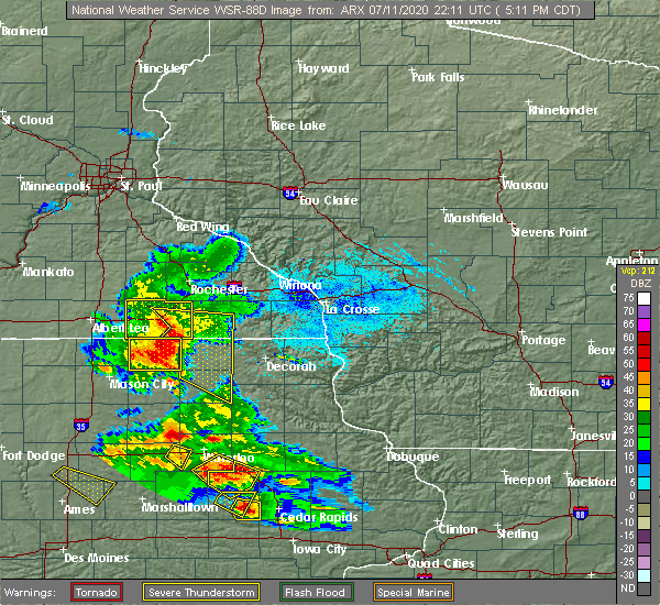
| 7/11/2020 5:11 PM CDT |
 At 509 pm cdt, severe thunderstorms were located along a line extending from near grand meadow to near le roy to near stacyville, moving east at 45 mph. spotters are reporting wind gusts of near 50 mph (radar indicated). Hazards include 60 mph wind gusts. Expect damage to roofs, siding, and trees. severe thunderstorms will be near, le roy around 515 pm cdt. riceville around 520 pm cdt. spring valley around 525 pm cdt. elma, lime springs and wykoff around 530 pm cdt. cresco around 540 pm cdt. jerico around 545 pm cdt. Protivin around 555 pm cdt. At 509 pm cdt, severe thunderstorms were located along a line extending from near grand meadow to near le roy to near stacyville, moving east at 45 mph. spotters are reporting wind gusts of near 50 mph (radar indicated). Hazards include 60 mph wind gusts. Expect damage to roofs, siding, and trees. severe thunderstorms will be near, le roy around 515 pm cdt. riceville around 520 pm cdt. spring valley around 525 pm cdt. elma, lime springs and wykoff around 530 pm cdt. cresco around 540 pm cdt. jerico around 545 pm cdt. Protivin around 555 pm cdt.
|
| 7/11/2020 5:11 PM CDT |
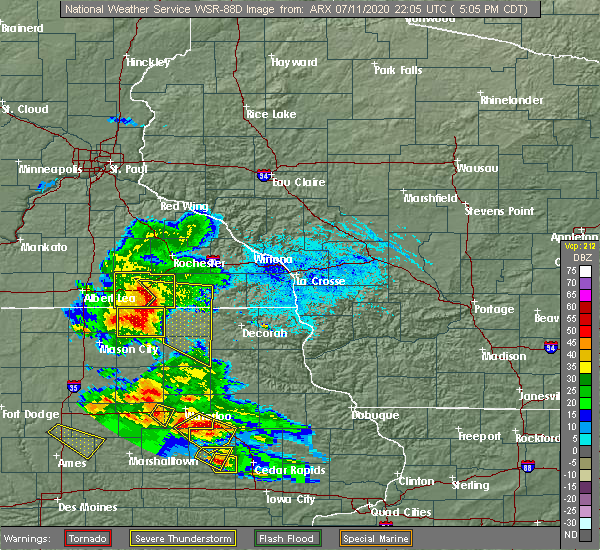 At 509 pm cdt, severe thunderstorms were located along a line extending from near grand meadow to near le roy to near stacyville, moving east at 45 mph. spotters are reporting wind gusts of near 50 mph (radar indicated). Hazards include 60 mph wind gusts. Expect damage to roofs, siding, and trees. severe thunderstorms will be near, le roy around 515 pm cdt. riceville around 520 pm cdt. spring valley around 525 pm cdt. elma, lime springs and wykoff around 530 pm cdt. cresco around 540 pm cdt. jerico around 545 pm cdt. Protivin around 555 pm cdt. At 509 pm cdt, severe thunderstorms were located along a line extending from near grand meadow to near le roy to near stacyville, moving east at 45 mph. spotters are reporting wind gusts of near 50 mph (radar indicated). Hazards include 60 mph wind gusts. Expect damage to roofs, siding, and trees. severe thunderstorms will be near, le roy around 515 pm cdt. riceville around 520 pm cdt. spring valley around 525 pm cdt. elma, lime springs and wykoff around 530 pm cdt. cresco around 540 pm cdt. jerico around 545 pm cdt. Protivin around 555 pm cdt.
|
| 7/11/2020 8:21 AM CDT |
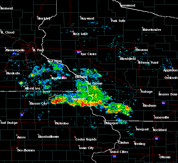 At 820 am cdt, a severe thunderstorm was located near new hampton, moving southeast at 35 mph (radar indicated). Hazards include 60 mph wind gusts and quarter size hail. Hail damage to vehicles is expected. expect wind damage to roofs, siding, and trees. this severe thunderstorm will be near, lawler around 830 am cdt. fredericksburg and waucoma around 840 am cdt. hawkeye around 855 am cdt. other locations impacted by this severe thunderstorm include boyd, williamstown, richfield, new hampton airport, st. Lucas, county roads b 28 and v 18 and county roads b 54 and v 56. At 820 am cdt, a severe thunderstorm was located near new hampton, moving southeast at 35 mph (radar indicated). Hazards include 60 mph wind gusts and quarter size hail. Hail damage to vehicles is expected. expect wind damage to roofs, siding, and trees. this severe thunderstorm will be near, lawler around 830 am cdt. fredericksburg and waucoma around 840 am cdt. hawkeye around 855 am cdt. other locations impacted by this severe thunderstorm include boyd, williamstown, richfield, new hampton airport, st. Lucas, county roads b 28 and v 18 and county roads b 54 and v 56.
|
| 6/2/2020 8:41 PM CDT |
 The severe thunderstorm warning for southeastern mitchell, howard, floyd and chickasaw counties will expire at 845 pm cdt, the storms which prompted the warning have weakened below severe limits, and have exited the warned area. therefore, the warning will be allowed to expire. however gusty winds are still possible in the area. a severe thunderstorm watch remains in effect until midnight cdt for north central and northeastern iowa. The severe thunderstorm warning for southeastern mitchell, howard, floyd and chickasaw counties will expire at 845 pm cdt, the storms which prompted the warning have weakened below severe limits, and have exited the warned area. therefore, the warning will be allowed to expire. however gusty winds are still possible in the area. a severe thunderstorm watch remains in effect until midnight cdt for north central and northeastern iowa.
|
| 6/2/2020 8:22 PM CDT |
 At 821 pm cdt, severe thunderstorms were located along a line extending from waucoma to near new hampton to 6 miles west of greene, moving southeast at 45 mph (law enforcement. these storms have a history of blowing down trees). Hazards include 60 mph wind gusts. Expect damage to roofs, siding, and trees. these severe storms will be near, lawler around 825 pm cdt. fredericksburg around 830 pm cdt. Other locations impacted by these severe thunderstorms include vernon springs county park, county roads b 60 and t 18, vernon springs, idlewilde state park, bradford, chickasaw and county roads v 58 and a 46. At 821 pm cdt, severe thunderstorms were located along a line extending from waucoma to near new hampton to 6 miles west of greene, moving southeast at 45 mph (law enforcement. these storms have a history of blowing down trees). Hazards include 60 mph wind gusts. Expect damage to roofs, siding, and trees. these severe storms will be near, lawler around 825 pm cdt. fredericksburg around 830 pm cdt. Other locations impacted by these severe thunderstorms include vernon springs county park, county roads b 60 and t 18, vernon springs, idlewilde state park, bradford, chickasaw and county roads v 58 and a 46.
|
| 6/2/2020 7:55 PM CDT |
 At 754 pm cdt, severe thunderstorms were located along a line extending from 7 miles south of lime springs to 8 miles northeast of floyd to near nora springs, moving southeast at 75 mph (law enforcement. at 750 pm, law enforcement reported trees downed in osage). Hazards include 60 mph wind gusts. Expect damage to roofs, siding, and trees. severe thunderstorms will be near, charles city and jerico around 800 pm cdt. marble rock, ionia and protivin around 805 pm cdt. nashua and lawler around 810 pm cdt. Other locations impacted by these severe thunderstorms include vernon springs county park, county roads b 60 and t 18, rock creek, vernon springs, idlewilde state park, bradford and chickasaw. At 754 pm cdt, severe thunderstorms were located along a line extending from 7 miles south of lime springs to 8 miles northeast of floyd to near nora springs, moving southeast at 75 mph (law enforcement. at 750 pm, law enforcement reported trees downed in osage). Hazards include 60 mph wind gusts. Expect damage to roofs, siding, and trees. severe thunderstorms will be near, charles city and jerico around 800 pm cdt. marble rock, ionia and protivin around 805 pm cdt. nashua and lawler around 810 pm cdt. Other locations impacted by these severe thunderstorms include vernon springs county park, county roads b 60 and t 18, rock creek, vernon springs, idlewilde state park, bradford and chickasaw.
|
| 9/12/2019 5:09 PM CDT | Trained spotter reported tops of trees blown down on roadway seven miles east of colwel in chickasaw county IA, 3.3 miles NE of Alta Vista, IA |
| 9/12/2019 4:12 PM CDT |
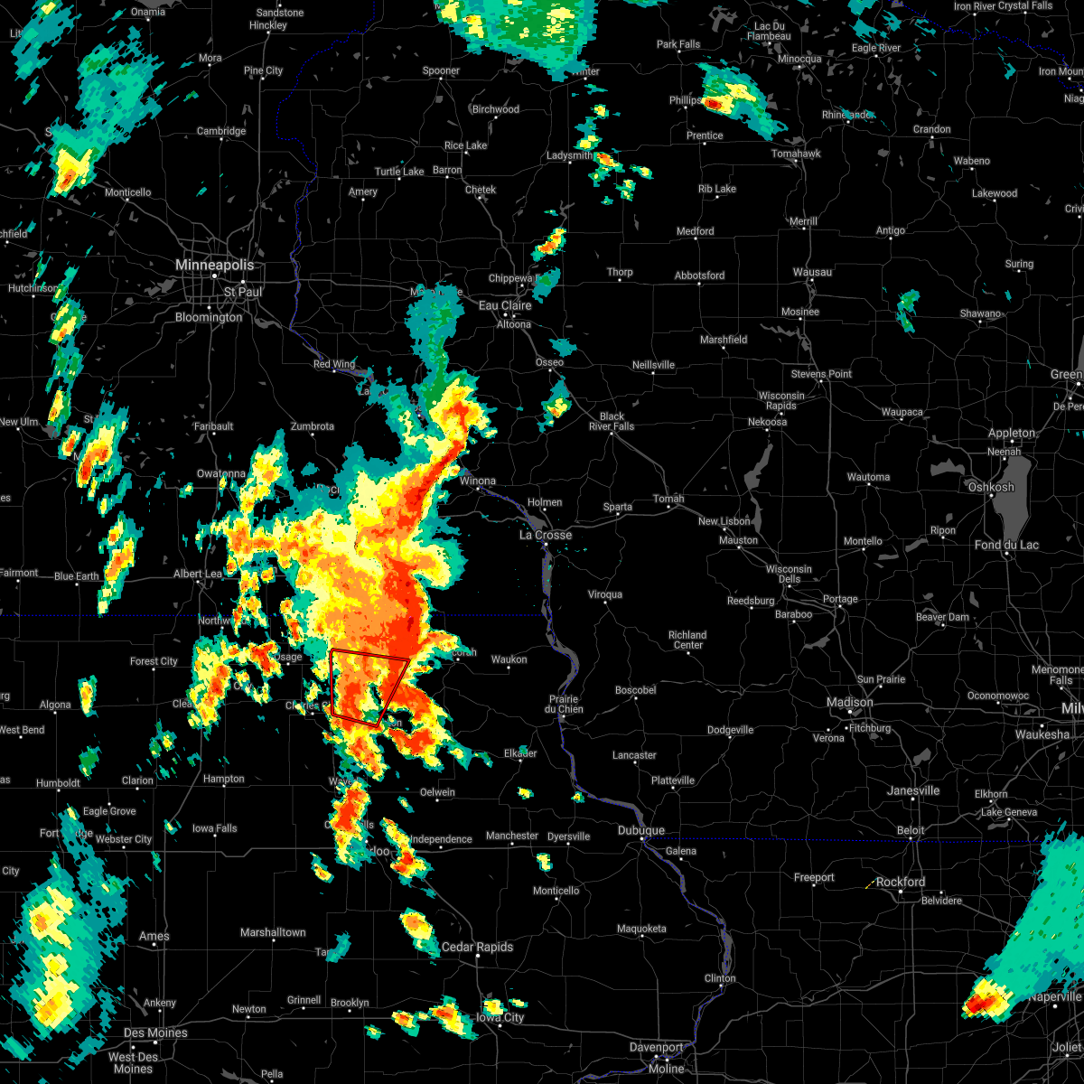 The tornado warning for southern howard and northern chickasaw counties will expire at 415 pm cdt, the storm which prompted the warning has weakened below severe limits, and no longer appears capable of producing a tornado. therefore, the warning will be allowed to expire. a tornado watch remains in effect until 1000 pm cdt for north central and northeastern iowa. The tornado warning for southern howard and northern chickasaw counties will expire at 415 pm cdt, the storm which prompted the warning has weakened below severe limits, and no longer appears capable of producing a tornado. therefore, the warning will be allowed to expire. a tornado watch remains in effect until 1000 pm cdt for north central and northeastern iowa.
|
| 9/12/2019 3:50 PM CDT |
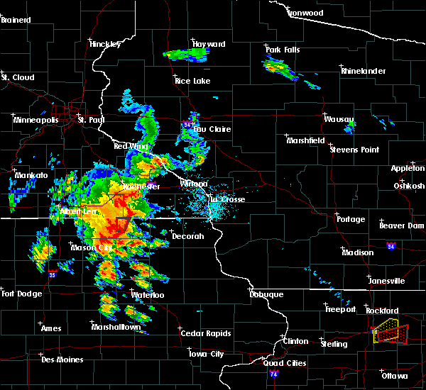 The national weather service in la crosse has issued a * tornado warning for. southern howard county in northeastern iowa. northern chickasaw county in northeastern iowa. until 415 pm cdt. At 349 pm cdt, severe thunderstorms capable of producing a tornado. The national weather service in la crosse has issued a * tornado warning for. southern howard county in northeastern iowa. northern chickasaw county in northeastern iowa. until 415 pm cdt. At 349 pm cdt, severe thunderstorms capable of producing a tornado.
|
| 7/20/2019 12:17 PM CDT |
 At 1217 pm cdt, severe thunderstorms were located along a line extending from 8 miles north of ridgeway to fredericksburg, moving east at 45 mph (radar indicated). Hazards include 70 mph wind gusts. Expect considerable tree damage. damage is likely to mobile homes, roofs, and outbuildings. These severe thunderstorms will remain over mainly rural areas of eastern howard and chickasaw counties, including the following locations, vernon springs county park, vernon springs, bradford, county roads v 58 and a 46, new hampton airport, county roads b 28 and v 18 and republic. At 1217 pm cdt, severe thunderstorms were located along a line extending from 8 miles north of ridgeway to fredericksburg, moving east at 45 mph (radar indicated). Hazards include 70 mph wind gusts. Expect considerable tree damage. damage is likely to mobile homes, roofs, and outbuildings. These severe thunderstorms will remain over mainly rural areas of eastern howard and chickasaw counties, including the following locations, vernon springs county park, vernon springs, bradford, county roads v 58 and a 46, new hampton airport, county roads b 28 and v 18 and republic.
|
| 7/20/2019 11:56 AM CDT |
 At 1156 am cdt, severe thunderstorms were located along a line extending from near lime springs to ionia, moving east at 65 mph (radar indicated). Hazards include 70 mph wind gusts. Expect considerable tree damage. damage is likely to mobile homes, roofs, and outbuildings. these severe storms will be near, lime springs around 1200 pm cdt. cresco around 1205 pm cdt. fredericksburg and lawler around 1210 pm cdt. Other locations impacted by these severe thunderstorms include vernon springs county park, vernon springs, bradford, chickasaw, county roads v 58 and a 46, new hampton airport and county roads b 28 and v 18. At 1156 am cdt, severe thunderstorms were located along a line extending from near lime springs to ionia, moving east at 65 mph (radar indicated). Hazards include 70 mph wind gusts. Expect considerable tree damage. damage is likely to mobile homes, roofs, and outbuildings. these severe storms will be near, lime springs around 1200 pm cdt. cresco around 1205 pm cdt. fredericksburg and lawler around 1210 pm cdt. Other locations impacted by these severe thunderstorms include vernon springs county park, vernon springs, bradford, chickasaw, county roads v 58 and a 46, new hampton airport and county roads b 28 and v 18.
|
| 7/20/2019 11:40 AM CDT |
 At 1139 am cdt, severe thunderstorms were located along a line extending from 6 miles southwest of le roy to 6 miles southwest of floyd, moving east at 65 mph (radar indicated). Hazards include 70 mph wind gusts. Expect considerable tree damage. damage is likely to mobile homes, roofs, and outbuildings. severe thunderstorms will be near, nashua, lime springs and ionia around 1155 am cdt. cresco, new hampton and jerico around 1205 pm cdt. fredericksburg and lawler around 1210 pm cdt. Other locations impacted by these severe thunderstorms include vernon springs county park, vernon springs, bradford, chickasaw, county roads v 58 and a 46, new hampton airport and county roads b 28 and v 18. At 1139 am cdt, severe thunderstorms were located along a line extending from 6 miles southwest of le roy to 6 miles southwest of floyd, moving east at 65 mph (radar indicated). Hazards include 70 mph wind gusts. Expect considerable tree damage. damage is likely to mobile homes, roofs, and outbuildings. severe thunderstorms will be near, nashua, lime springs and ionia around 1155 am cdt. cresco, new hampton and jerico around 1205 pm cdt. fredericksburg and lawler around 1210 pm cdt. Other locations impacted by these severe thunderstorms include vernon springs county park, vernon springs, bradford, chickasaw, county roads v 58 and a 46, new hampton airport and county roads b 28 and v 18.
|
| 6/30/2019 4:53 PM CDT |
 At 425 pm cdt, severe thunderstorms were located along a line extending from near rockford to monona to near harpers ferry, moving south at 35 mph (radar indicated). Hazards include 60 mph wind gusts. Expect damage to roofs, siding, and trees. these severe storms will be near, monona around 430 pm cdt. prairie du chien around 435 pm cdt. mcgregor, marquette, marble rock and farmersburg around 440 pm cdt. Other locations impacted by these severe thunderstorms include volney, bradford, nordness, chickasaw, giard, county roads v 56 and b 33 and waucoma campground. At 425 pm cdt, severe thunderstorms were located along a line extending from near rockford to monona to near harpers ferry, moving south at 35 mph (radar indicated). Hazards include 60 mph wind gusts. Expect damage to roofs, siding, and trees. these severe storms will be near, monona around 430 pm cdt. prairie du chien around 435 pm cdt. mcgregor, marquette, marble rock and farmersburg around 440 pm cdt. Other locations impacted by these severe thunderstorms include volney, bradford, nordness, chickasaw, giard, county roads v 56 and b 33 and waucoma campground.
|
| 6/30/2019 4:25 PM CDT |
 At 425 pm cdt, severe thunderstorms were located along a line extending from near rockford to monona to near harpers ferry, moving south at 35 mph (radar indicated). Hazards include 60 mph wind gusts. Expect damage to roofs, siding, and trees. these severe storms will be near, monona around 430 pm cdt. prairie du chien around 435 pm cdt. mcgregor, marquette, marble rock and farmersburg around 440 pm cdt. Other locations impacted by these severe thunderstorms include volney, bradford, nordness, chickasaw, giard, county roads v 56 and b 33 and waucoma campground. At 425 pm cdt, severe thunderstorms were located along a line extending from near rockford to monona to near harpers ferry, moving south at 35 mph (radar indicated). Hazards include 60 mph wind gusts. Expect damage to roofs, siding, and trees. these severe storms will be near, monona around 430 pm cdt. prairie du chien around 435 pm cdt. mcgregor, marquette, marble rock and farmersburg around 440 pm cdt. Other locations impacted by these severe thunderstorms include volney, bradford, nordness, chickasaw, giard, county roads v 56 and b 33 and waucoma campground.
|
| 6/30/2019 4:09 PM CDT |
 The national weather service in la crosse has issued a * severe thunderstorm warning for. northwestern clayton county in northeastern iowa. northern fayette county in northeastern iowa. southern allamakee county in northeastern iowa. Floyd county in north central iowa. The national weather service in la crosse has issued a * severe thunderstorm warning for. northwestern clayton county in northeastern iowa. northern fayette county in northeastern iowa. southern allamakee county in northeastern iowa. Floyd county in north central iowa.
|
| 6/27/2019 1:12 PM CDT |
 At 111 pm cdt, a severe thunderstorm was located near elma, or 10 miles northwest of new hampton, moving northeast at 25 mph (law enforcement. at 1248 pm nickle sized hail was reported on the northeast side of charles city with this storm). Hazards include quarter size hail. Damage to vehicles is expected. This severe thunderstorm will remain over mainly rural areas of northwestern chickasaw county, including the following locations, highway 18 and county v 18, county roads b 33 and t 76, alta vista, chickasaw, devon, highway 63 and county b 33 and new hampton airport. At 111 pm cdt, a severe thunderstorm was located near elma, or 10 miles northwest of new hampton, moving northeast at 25 mph (law enforcement. at 1248 pm nickle sized hail was reported on the northeast side of charles city with this storm). Hazards include quarter size hail. Damage to vehicles is expected. This severe thunderstorm will remain over mainly rural areas of northwestern chickasaw county, including the following locations, highway 18 and county v 18, county roads b 33 and t 76, alta vista, chickasaw, devon, highway 63 and county b 33 and new hampton airport.
|
| 6/27/2019 1:00 PM CDT |
 At 100 pm cdt, a severe thunderstorm was located 7 miles southwest of elma, or 10 miles northeast of charles city, moving northeast at 25 mph (radar indicated). Hazards include quarter size hail. Damage to vehicles is expected. this severe storm will be near, elma around 115 pm cdt. Other locations impacted by this severe thunderstorm include county roads b 33 and t 76, chickasaw, new hampton airport, bassett, carrville, county roads b 28 and v 18 and highway 18 and county v 18. At 100 pm cdt, a severe thunderstorm was located 7 miles southwest of elma, or 10 miles northeast of charles city, moving northeast at 25 mph (radar indicated). Hazards include quarter size hail. Damage to vehicles is expected. this severe storm will be near, elma around 115 pm cdt. Other locations impacted by this severe thunderstorm include county roads b 33 and t 76, chickasaw, new hampton airport, bassett, carrville, county roads b 28 and v 18 and highway 18 and county v 18.
|
| 6/27/2019 12:48 PM CDT |
 At 1247 pm cdt, a severe thunderstorm was located near charles city, moving northeast at 25 mph (radar indicated). Hazards include quarter size hail. damage to vehicles is expected At 1247 pm cdt, a severe thunderstorm was located near charles city, moving northeast at 25 mph (radar indicated). Hazards include quarter size hail. damage to vehicles is expected
|
| 5/27/2019 1:07 PM CDT |
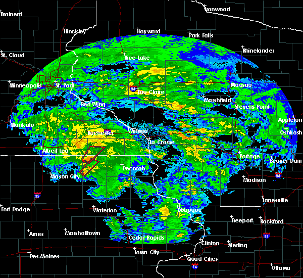 The national weather service in la crosse has issued a * tornado warning for. southwestern howard county in northeastern iowa. eastern floyd county in north central iowa. northwestern chickasaw county in northeastern iowa. Until 145 pm cdt. The national weather service in la crosse has issued a * tornado warning for. southwestern howard county in northeastern iowa. eastern floyd county in north central iowa. northwestern chickasaw county in northeastern iowa. Until 145 pm cdt.
|
| 8/28/2018 9:24 AM CDT |
 At 924 am cdt, a severe thunderstorm was located over new hampton, moving east at 45 mph (trained weather spotters. this storm has a history of producing quarter size hail). Hazards include 60 mph wind gusts and quarter size hail. Hail damage to vehicles is expected. expect wind damage to roofs, siding, and trees. Locations impacted include, nashua, ionia, chickasaw, alta vista, north washington, bassett, county roads b 33 and t 76, bradford, county roads b 28 and v 18, republic, highway 18 and county v 18, twin ponds park, river ranch campground, devon and deerfield. At 924 am cdt, a severe thunderstorm was located over new hampton, moving east at 45 mph (trained weather spotters. this storm has a history of producing quarter size hail). Hazards include 60 mph wind gusts and quarter size hail. Hail damage to vehicles is expected. expect wind damage to roofs, siding, and trees. Locations impacted include, nashua, ionia, chickasaw, alta vista, north washington, bassett, county roads b 33 and t 76, bradford, county roads b 28 and v 18, republic, highway 18 and county v 18, twin ponds park, river ranch campground, devon and deerfield.
|
| 8/28/2018 9:14 AM CDT |
 At 913 am cdt, a severe thunderstorm was located over ionia, or near new hampton, moving east at 50 mph (trained weather spotters. this storm has a history of producing quarter size hail). Hazards include 60 mph wind gusts and half dollar size hail. Hail damage to vehicles is expected. expect wind damage to roofs, siding, and trees. This severe thunderstorm will remain over mainly rural areas of southeastern mitchell, southwestern howard, eastern floyd and western chickasaw counties, including the following locations, chickasaw, alta vista, north washington, colwell and bassett. At 913 am cdt, a severe thunderstorm was located over ionia, or near new hampton, moving east at 50 mph (trained weather spotters. this storm has a history of producing quarter size hail). Hazards include 60 mph wind gusts and half dollar size hail. Hail damage to vehicles is expected. expect wind damage to roofs, siding, and trees. This severe thunderstorm will remain over mainly rural areas of southeastern mitchell, southwestern howard, eastern floyd and western chickasaw counties, including the following locations, chickasaw, alta vista, north washington, colwell and bassett.
|
| 8/28/2018 8:59 AM CDT |
 At 859 am cdt, a severe thunderstorm was located near charles city, moving east at 45 mph (trained weather spotters. at 853 am cdt, quarter size hail was reported in marble rock). Hazards include 60 mph wind gusts and half dollar size hail. Hail damage to vehicles is expected. expect wind damage to roofs, siding, and trees. this severe storm will be near, nashua around 905 am cdt. ionia around 910 am cdt. elma around 915 am cdt. Other locations impacted by this severe thunderstorm include chickasaw, alta vista, north washington, colwell and orchard. At 859 am cdt, a severe thunderstorm was located near charles city, moving east at 45 mph (trained weather spotters. at 853 am cdt, quarter size hail was reported in marble rock). Hazards include 60 mph wind gusts and half dollar size hail. Hail damage to vehicles is expected. expect wind damage to roofs, siding, and trees. this severe storm will be near, nashua around 905 am cdt. ionia around 910 am cdt. elma around 915 am cdt. Other locations impacted by this severe thunderstorm include chickasaw, alta vista, north washington, colwell and orchard.
|
| 8/28/2018 8:50 AM CDT |
 At 850 am cdt, a severe thunderstorm was located over floyd, or near charles city, moving east at 45 mph (public. this storm has a history of producing golf ball size hail). Hazards include 60 mph wind gusts and half dollar size hail. Hail damage to vehicles is expected. expect wind damage to roofs, siding, and trees. this severe thunderstorm will be near, charles city around 855 am cdt. nashua around 905 am cdt. ionia around 910 am cdt. elma around 915 am cdt. Other locations impacted by this severe thunderstorm include chickasaw, alta vista, north washington, colwell and orchard. At 850 am cdt, a severe thunderstorm was located over floyd, or near charles city, moving east at 45 mph (public. this storm has a history of producing golf ball size hail). Hazards include 60 mph wind gusts and half dollar size hail. Hail damage to vehicles is expected. expect wind damage to roofs, siding, and trees. this severe thunderstorm will be near, charles city around 855 am cdt. nashua around 905 am cdt. ionia around 910 am cdt. elma around 915 am cdt. Other locations impacted by this severe thunderstorm include chickasaw, alta vista, north washington, colwell and orchard.
|
| 8/1/2018 6:05 PM CDT |
 At 605 pm cdt, a severe thunderstorm was located near jerico, or 7 miles north of new hampton, moving east at 30 mph (radar indicated). Hazards include quarter size hail. Damage to vehicles is expected. this severe storm will be near, jerico and lawler around 615 pm cdt. Other locations impacted by this severe thunderstorm include alta vista, north washington, colwell, bassett and county roads b 33 and t 76. At 605 pm cdt, a severe thunderstorm was located near jerico, or 7 miles north of new hampton, moving east at 30 mph (radar indicated). Hazards include quarter size hail. Damage to vehicles is expected. this severe storm will be near, jerico and lawler around 615 pm cdt. Other locations impacted by this severe thunderstorm include alta vista, north washington, colwell, bassett and county roads b 33 and t 76.
|
| 8/1/2018 5:49 PM CDT |
 At 549 pm cdt, a severe thunderstorm was located near elma, or 11 miles northeast of charles city, moving east at 25 mph (radar indicated). Hazards include quarter size hail. Damage to vehicles is expected. this severe storm will be near, elma around 555 pm cdt. new hampton around 610 pm cdt. jerico and lawler around 615 pm cdt. Other locations impacted by this severe thunderstorm include alta vista, north washington, colwell, bassett and county roads b 33 and t 76. At 549 pm cdt, a severe thunderstorm was located near elma, or 11 miles northeast of charles city, moving east at 25 mph (radar indicated). Hazards include quarter size hail. Damage to vehicles is expected. this severe storm will be near, elma around 555 pm cdt. new hampton around 610 pm cdt. jerico and lawler around 615 pm cdt. Other locations impacted by this severe thunderstorm include alta vista, north washington, colwell, bassett and county roads b 33 and t 76.
|
| 8/1/2018 5:26 PM CDT |
 At 525 pm cdt, a severe thunderstorm was located near floyd, or near charles city, moving east at 30 mph (radar indicated). Hazards include quarter size hail. Damage to vehicles is expected. this severe thunderstorm will be near, ionia around 545 pm cdt. elma around 550 pm cdt. new hampton around 600 pm cdt. jerico around 610 pm cdt. lawler around 615 pm cdt. Other locations impacted by this severe thunderstorm include alta vista, north washington, colwell, bassett and county roads b 33 and t 76. At 525 pm cdt, a severe thunderstorm was located near floyd, or near charles city, moving east at 30 mph (radar indicated). Hazards include quarter size hail. Damage to vehicles is expected. this severe thunderstorm will be near, ionia around 545 pm cdt. elma around 550 pm cdt. new hampton around 600 pm cdt. jerico around 610 pm cdt. lawler around 615 pm cdt. Other locations impacted by this severe thunderstorm include alta vista, north washington, colwell, bassett and county roads b 33 and t 76.
|
| 6/9/2018 5:44 PM CDT |
 At 543 pm cdt, a severe thunderstorm was located just west of new hampton, moving east at 25 mph. this storm has a history of producing damaging wind and large hail (trained weather spotters). Hazards include 70 mph wind gusts and quarter size hail. Hail damage to vehicles is expected. expect considerable tree damage. wind damage is also likely to mobile homes, roofs, and outbuildings. this severe storm will be near, jerico around 550 pm cdt. fredericksburg and lawler around 600 pm cdt. other locations impacted by this severe thunderstorm include chickasaw, alta vista, north washington, colwell and bassett. people attending heartland days should seek safe shelter immediately! this warning will be extended past 6pm. A tornado watch remains in effect until 1000 pm cdt for north central and northeastern iowa. At 543 pm cdt, a severe thunderstorm was located just west of new hampton, moving east at 25 mph. this storm has a history of producing damaging wind and large hail (trained weather spotters). Hazards include 70 mph wind gusts and quarter size hail. Hail damage to vehicles is expected. expect considerable tree damage. wind damage is also likely to mobile homes, roofs, and outbuildings. this severe storm will be near, jerico around 550 pm cdt. fredericksburg and lawler around 600 pm cdt. other locations impacted by this severe thunderstorm include chickasaw, alta vista, north washington, colwell and bassett. people attending heartland days should seek safe shelter immediately! this warning will be extended past 6pm. A tornado watch remains in effect until 1000 pm cdt for north central and northeastern iowa.
|
| 6/9/2018 5:26 PM CDT |
 At 525 pm cdt, a severe thunderstorm was located near ionia, or 7 miles east of charles city, moving east at 15 mph. there have been numerous reports of wind gusts of 60 to 80 mph and large hail with this storm (trained weather spotters). Hazards include golf ball size hail and 70 mph wind gusts. People and animals outdoors will be injured. expect hail damage to roofs, siding, windows, and vehicles. expect considerable tree damage. wind damage is also likely to mobile homes, roofs, and outbuildings. this severe storm will be near, ionia around 535 pm cdt. new hampton, fredericksburg, jerico and lawler around 600 pm cdt. other locations impacted by this severe thunderstorm include chickasaw, alta vista, north washington, colwell and bassett. People attending heartland days should seek safe shelter immediately! a tornado watch remains in effect until 1000 pm cdt for north central and northeastern iowa. At 525 pm cdt, a severe thunderstorm was located near ionia, or 7 miles east of charles city, moving east at 15 mph. there have been numerous reports of wind gusts of 60 to 80 mph and large hail with this storm (trained weather spotters). Hazards include golf ball size hail and 70 mph wind gusts. People and animals outdoors will be injured. expect hail damage to roofs, siding, windows, and vehicles. expect considerable tree damage. wind damage is also likely to mobile homes, roofs, and outbuildings. this severe storm will be near, ionia around 535 pm cdt. new hampton, fredericksburg, jerico and lawler around 600 pm cdt. other locations impacted by this severe thunderstorm include chickasaw, alta vista, north washington, colwell and bassett. People attending heartland days should seek safe shelter immediately! a tornado watch remains in effect until 1000 pm cdt for north central and northeastern iowa.
|
| 6/9/2018 5:01 PM CDT |
 At 440 pm cdt, a severe thunderstorm was located over floyd, or near charles city, moving east at 35 mph (trained weather spotters). Hazards include golf ball size hail and 70 mph wind gusts. People and animals outdoors will be injured. expect hail damage to roofs, siding, windows, and vehicles. expect considerable tree damage. wind damage is also likely to mobile homes, roofs, and outbuildings. this severe thunderstorm will be near, charles city around 445 pm cdt. nashua around 500 pm cdt. ionia around 505 pm cdt. new hampton around 515 pm cdt. jerico around 520 pm cdt. fredericksburg around 525 pm cdt. lawler and protivin around 530 pm cdt. other locations impacted by this severe thunderstorm include chickasaw, alta vista, north washington, colwell and bassett. people attending heartland days should seek safe shelter immediately! this warning extends the previous severe thunderstorm warning for floyd county. A tornado watch remains in effect until 1000 pm cdt for north central and northeastern iowa. At 440 pm cdt, a severe thunderstorm was located over floyd, or near charles city, moving east at 35 mph (trained weather spotters). Hazards include golf ball size hail and 70 mph wind gusts. People and animals outdoors will be injured. expect hail damage to roofs, siding, windows, and vehicles. expect considerable tree damage. wind damage is also likely to mobile homes, roofs, and outbuildings. this severe thunderstorm will be near, charles city around 445 pm cdt. nashua around 500 pm cdt. ionia around 505 pm cdt. new hampton around 515 pm cdt. jerico around 520 pm cdt. fredericksburg around 525 pm cdt. lawler and protivin around 530 pm cdt. other locations impacted by this severe thunderstorm include chickasaw, alta vista, north washington, colwell and bassett. people attending heartland days should seek safe shelter immediately! this warning extends the previous severe thunderstorm warning for floyd county. A tornado watch remains in effect until 1000 pm cdt for north central and northeastern iowa.
|
| 6/9/2018 4:41 PM CDT |
 At 440 pm cdt, a severe thunderstorm was located over floyd, or near charles city, moving east at 35 mph (trained weather spotters). Hazards include golf ball size hail and 70 mph wind gusts. People and animals outdoors will be injured. expect hail damage to roofs, siding, windows, and vehicles. expect considerable tree damage. wind damage is also likely to mobile homes, roofs, and outbuildings. this severe thunderstorm will be near, charles city around 445 pm cdt. nashua around 500 pm cdt. ionia around 505 pm cdt. new hampton around 515 pm cdt. jerico around 520 pm cdt. fredericksburg around 525 pm cdt. lawler and protivin around 530 pm cdt. other locations impacted by this severe thunderstorm include chickasaw, alta vista, north washington, colwell and bassett. people attending heartland days should seek safe shelter immediately! this warning extends the previous severe thunderstorm warning for floyd county. A tornado watch remains in effect until 1000 pm cdt for north central and northeastern iowa. At 440 pm cdt, a severe thunderstorm was located over floyd, or near charles city, moving east at 35 mph (trained weather spotters). Hazards include golf ball size hail and 70 mph wind gusts. People and animals outdoors will be injured. expect hail damage to roofs, siding, windows, and vehicles. expect considerable tree damage. wind damage is also likely to mobile homes, roofs, and outbuildings. this severe thunderstorm will be near, charles city around 445 pm cdt. nashua around 500 pm cdt. ionia around 505 pm cdt. new hampton around 515 pm cdt. jerico around 520 pm cdt. fredericksburg around 525 pm cdt. lawler and protivin around 530 pm cdt. other locations impacted by this severe thunderstorm include chickasaw, alta vista, north washington, colwell and bassett. people attending heartland days should seek safe shelter immediately! this warning extends the previous severe thunderstorm warning for floyd county. A tornado watch remains in effect until 1000 pm cdt for north central and northeastern iowa.
|
| 4/13/2018 8:55 PM CDT |
 The severe thunderstorm warning for north central chickasaw county will expire at 900 pm cdt, the storm which prompted the warning has moved out of the area. therefore the warning will be allowed to expire. The severe thunderstorm warning for north central chickasaw county will expire at 900 pm cdt, the storm which prompted the warning has moved out of the area. therefore the warning will be allowed to expire.
|
| 4/13/2018 8:47 PM CDT |
 At 846 pm cdt, a severe thunderstorm was located near jerico, or 11 miles southwest of cresco, moving northeast at 40 mph (public. at 830 pm cdt, quarter size hail was reported west of new hampton). Hazards include quarter size hail. Damage to vehicles is expected. Locations impacted include, jerico, alta vista, and saude. At 846 pm cdt, a severe thunderstorm was located near jerico, or 11 miles southwest of cresco, moving northeast at 40 mph (public. at 830 pm cdt, quarter size hail was reported west of new hampton). Hazards include quarter size hail. Damage to vehicles is expected. Locations impacted include, jerico, alta vista, and saude.
|
| 4/13/2018 8:38 PM CDT |
 At 837 pm cdt, a severe thunderstorm was located near jerico, or 7 miles north of new hampton, moving northeast at 45 mph (radar indicated). Hazards include quarter size hail. Damage to vehicles is expected. This severe thunderstorm will remain over mainly rural areas of northwestern chickasaw county, including the following locations: alta vista, north washington, saude, and devon. At 837 pm cdt, a severe thunderstorm was located near jerico, or 7 miles north of new hampton, moving northeast at 45 mph (radar indicated). Hazards include quarter size hail. Damage to vehicles is expected. This severe thunderstorm will remain over mainly rural areas of northwestern chickasaw county, including the following locations: alta vista, north washington, saude, and devon.
|
| 4/13/2018 8:25 PM CDT |
 At 825 pm cdt, a severe thunderstorm was located over ionia, or near new hampton, moving northeast at 40 mph (radar indicated). Hazards include quarter size hail. Damage to vehicles is expected. this severe thunderstorm will be near, new hampton around 835 pm cdt. jerico around 845 pm cdt. Other locations impacted by this severe thunderstorm include chickasaw, alta vista, north washington, and bassett. At 825 pm cdt, a severe thunderstorm was located over ionia, or near new hampton, moving northeast at 40 mph (radar indicated). Hazards include quarter size hail. Damage to vehicles is expected. this severe thunderstorm will be near, new hampton around 835 pm cdt. jerico around 845 pm cdt. Other locations impacted by this severe thunderstorm include chickasaw, alta vista, north washington, and bassett.
|
| 7/19/2017 5:31 PM CDT |
 At 530 pm cdt, severe thunderstorms were located along a line extending from near cresco to near protivin to near fredericksburg, moving east at 65 mph (trained weather spotters). Hazards include 70 mph wind gusts. Expect considerable tree damage. damage is likely to mobile homes, roofs, and outbuildings. these severe storms will be near, ridgeway around 535 pm cdt. Other locations impacted by these severe thunderstorms include chickasaw, alta vista, chester, north washington and bassett. At 530 pm cdt, severe thunderstorms were located along a line extending from near cresco to near protivin to near fredericksburg, moving east at 65 mph (trained weather spotters). Hazards include 70 mph wind gusts. Expect considerable tree damage. damage is likely to mobile homes, roofs, and outbuildings. these severe storms will be near, ridgeway around 535 pm cdt. Other locations impacted by these severe thunderstorms include chickasaw, alta vista, chester, north washington and bassett.
|
| 7/19/2017 5:20 PM CDT | Widespread tree damage... one tree laying on power line in chickasaw county IA, 0.3 miles SSE of Alta Vista, IA |
| 7/19/2017 5:09 PM CDT |
 At 508 pm cdt, severe thunderstorms were located along a line extending from 6 miles southwest of le roy to 7 miles west of elma to near greene, moving east at 70 mph (trained weather spotters report winds of 65 to 70 mph with power outages and trees down in osage and charles city). Hazards include 70 mph wind gusts. Expect considerable tree damage. damage is likely to mobile homes, roofs, and outbuildings. these severe storms will be near, elma and ionia around 515 pm cdt. new hampton and nashua around 520 pm cdt. jerico and lime springs around 525 pm cdt. cresco, protivin and lawler around 530 pm cdt. Ridgeway and fredericksburg around 535 pm cdt. At 508 pm cdt, severe thunderstorms were located along a line extending from 6 miles southwest of le roy to 7 miles west of elma to near greene, moving east at 70 mph (trained weather spotters report winds of 65 to 70 mph with power outages and trees down in osage and charles city). Hazards include 70 mph wind gusts. Expect considerable tree damage. damage is likely to mobile homes, roofs, and outbuildings. these severe storms will be near, elma and ionia around 515 pm cdt. new hampton and nashua around 520 pm cdt. jerico and lime springs around 525 pm cdt. cresco, protivin and lawler around 530 pm cdt. Ridgeway and fredericksburg around 535 pm cdt.
|
| 7/19/2017 4:57 PM CDT |
 At 455 pm cdt, severe thunderstorms were located along a line extending from near lyle to near osage to near rockwell, moving east at 65 mph (law enforcement. these storms have a history of 55 to 65 mph winds. a measured wind gust of 65 mph was reported 2 miles north of charles city). Hazards include 70 mph wind gusts. Expect considerable tree damage. damage is likely to mobile homes, roofs, and outbuildings. severe thunderstorms will be near, riceville around 510 pm cdt. lime springs around 520 pm cdt. nashua around 525 pm cdt. cresco around 530 pm cdt. new hampton around 535 pm cdt. fredericksburg and lawler around 540 pm cdt. Other locations impacted by these severe thunderstorms include chickasaw, alta vista, chester, north washington and bassett. At 455 pm cdt, severe thunderstorms were located along a line extending from near lyle to near osage to near rockwell, moving east at 65 mph (law enforcement. these storms have a history of 55 to 65 mph winds. a measured wind gust of 65 mph was reported 2 miles north of charles city). Hazards include 70 mph wind gusts. Expect considerable tree damage. damage is likely to mobile homes, roofs, and outbuildings. severe thunderstorms will be near, riceville around 510 pm cdt. lime springs around 520 pm cdt. nashua around 525 pm cdt. cresco around 530 pm cdt. new hampton around 535 pm cdt. fredericksburg and lawler around 540 pm cdt. Other locations impacted by these severe thunderstorms include chickasaw, alta vista, chester, north washington and bassett.
|
| 6/22/2017 9:33 PM CDT |
 At 932 pm cdt, a severe thunderstorm was located over new hampton, moving east at 30 mph (law enforcement. this storm has a history of producing quarter size hail). Hazards include quarter size hail. winds up to 50 mph are also possible. Damage to vehicles is expected. this severe storm will be near, lawler and fredericksburg around 945 pm cdt. Other locations impacted by this severe thunderstorm include alta vista, north washington, county roads b 28 and v 18, highway 18 and county v 18 and county roads v 56 and b 33. At 932 pm cdt, a severe thunderstorm was located over new hampton, moving east at 30 mph (law enforcement. this storm has a history of producing quarter size hail). Hazards include quarter size hail. winds up to 50 mph are also possible. Damage to vehicles is expected. this severe storm will be near, lawler and fredericksburg around 945 pm cdt. Other locations impacted by this severe thunderstorm include alta vista, north washington, county roads b 28 and v 18, highway 18 and county v 18 and county roads v 56 and b 33.
|
| 6/22/2017 9:08 PM CDT |
 At 907 pm cdt, a severe thunderstorm was located near ionia, or 9 miles east of charles city, moving east at 30 mph (law enforcement. around 850 pm, quarter size hail was reported in floyd). Hazards include quarter size hail. Damage to vehicles is expected. this severe thunderstorm will be near, ionia around 910 pm cdt. new hampton around 925 pm cdt. jerico around 930 pm cdt. fredericksburg around 940 pm cdt. lawler and protivin around 945 pm cdt. Other locations impacted by this severe thunderstorm include chickasaw, alta vista, north washington, bassett and county roads b 28 and v 18. At 907 pm cdt, a severe thunderstorm was located near ionia, or 9 miles east of charles city, moving east at 30 mph (law enforcement. around 850 pm, quarter size hail was reported in floyd). Hazards include quarter size hail. Damage to vehicles is expected. this severe thunderstorm will be near, ionia around 910 pm cdt. new hampton around 925 pm cdt. jerico around 930 pm cdt. fredericksburg around 940 pm cdt. lawler and protivin around 945 pm cdt. Other locations impacted by this severe thunderstorm include chickasaw, alta vista, north washington, bassett and county roads b 28 and v 18.
|
| 5/17/2017 6:25 PM CDT | Storm damage reported in chickasaw county IA, 0.3 miles SSE of Alta Vista, IA |
| 5/16/2017 11:10 PM CDT | Trees blown down in chickasaw county IA, 0.3 miles SSE of Alta Vista, IA |
| 5/16/2017 10:51 PM CDT |
 At 1050 pm cdt, severe thunderstorms were located along a line extending from 6 miles east of stacyville to near nashua, moving east at 35 mph (radar indicated. these storms have had a history of producing wind gusts over 60 mph near interstate 35 mph). Hazards include 60 mph wind gusts and nickel size hail. Expect damage to roofs, siding, and trees. severe thunderstorms will be near, riceville around 1055 pm cdt. ionia around 1110 pm cdt. new hampton and lime springs around 1120 pm cdt. fredericksburg around 1125 pm cdt. lawler around 1135 pm cdt. Other locations impacted by these severe thunderstorms include chickasaw, alta vista, chester, north washington and bassett. At 1050 pm cdt, severe thunderstorms were located along a line extending from 6 miles east of stacyville to near nashua, moving east at 35 mph (radar indicated. these storms have had a history of producing wind gusts over 60 mph near interstate 35 mph). Hazards include 60 mph wind gusts and nickel size hail. Expect damage to roofs, siding, and trees. severe thunderstorms will be near, riceville around 1055 pm cdt. ionia around 1110 pm cdt. new hampton and lime springs around 1120 pm cdt. fredericksburg around 1125 pm cdt. lawler around 1135 pm cdt. Other locations impacted by these severe thunderstorms include chickasaw, alta vista, chester, north washington and bassett.
|
| 5/15/2017 6:36 PM CDT |
 At 633 pm cdt, severe thunderstorms were located along a line extending from near protivin to near nashua, moving east at 35 mph. trained spotters reported numerous trees down in nashua at 627 pm cdt (trained weather spotters). Hazards include ping pong ball size hail and 60 mph wind gusts. People and animals outdoors will be injured. expect hail damage to roofs, siding, windows, and vehicles. expect wind damage to roofs, siding, and trees. these severe storms will be near, cresco and protivin around 640 pm cdt. Other locations impacted by these severe thunderstorms include chickasaw, alta vista, north washington, colwell and bassett. At 633 pm cdt, severe thunderstorms were located along a line extending from near protivin to near nashua, moving east at 35 mph. trained spotters reported numerous trees down in nashua at 627 pm cdt (trained weather spotters). Hazards include ping pong ball size hail and 60 mph wind gusts. People and animals outdoors will be injured. expect hail damage to roofs, siding, windows, and vehicles. expect wind damage to roofs, siding, and trees. these severe storms will be near, cresco and protivin around 640 pm cdt. Other locations impacted by these severe thunderstorms include chickasaw, alta vista, north washington, colwell and bassett.
|
| 5/15/2017 6:16 PM CDT |
 At 615 pm cdt, severe thunderstorms were located along a line extending from near cresco to near marble rock, moving east at 40 mph. quarter size hail and wind gusts to 60 mph were reported 3 miles south of charles city at 611 pm cdt (trained weather spotters). Hazards include two inch hail and 60 mph wind gusts. People and animals outdoors will be injured. expect hail damage to roofs, siding, windows, and vehicles. expect wind damage to roofs, siding, and trees. these severe storms will be near, cresco around 620 pm cdt. protivin around 625 pm cdt. nashua around 640 pm cdt. ionia around 645 pm cdt. Other locations impacted by these severe thunderstorms include chickasaw, alta vista, north washington, colwell and orchard. At 615 pm cdt, severe thunderstorms were located along a line extending from near cresco to near marble rock, moving east at 40 mph. quarter size hail and wind gusts to 60 mph were reported 3 miles south of charles city at 611 pm cdt (trained weather spotters). Hazards include two inch hail and 60 mph wind gusts. People and animals outdoors will be injured. expect hail damage to roofs, siding, windows, and vehicles. expect wind damage to roofs, siding, and trees. these severe storms will be near, cresco around 620 pm cdt. protivin around 625 pm cdt. nashua around 640 pm cdt. ionia around 645 pm cdt. Other locations impacted by these severe thunderstorms include chickasaw, alta vista, north washington, colwell and orchard.
|
| 5/15/2017 6:01 PM CDT |
 At 559 pm cdt, severe thunderstorms were located along a line extending from near lime springs to 7 miles east of rockwell, moving east at 40 mph. quarter size hail and estimated winds to 60 mph were reported at 557 pm cdt near marble rock (trained weather spotters). Hazards include two inch hail and 60 mph wind gusts. People and animals outdoors will be injured. expect hail damage to roofs, siding, windows, and vehicles. expect wind damage to roofs, siding, and trees. these severe storms will be near, elma around 605 pm cdt. cresco and protivin around 620 pm cdt. charles city around 625 pm cdt. nashua and ionia around 640 pm cdt. new hampton around 645 pm cdt. Other locations impacted by these severe thunderstorms include chickasaw, alta vista, mitchell, north washington and colwell. At 559 pm cdt, severe thunderstorms were located along a line extending from near lime springs to 7 miles east of rockwell, moving east at 40 mph. quarter size hail and estimated winds to 60 mph were reported at 557 pm cdt near marble rock (trained weather spotters). Hazards include two inch hail and 60 mph wind gusts. People and animals outdoors will be injured. expect hail damage to roofs, siding, windows, and vehicles. expect wind damage to roofs, siding, and trees. these severe storms will be near, elma around 605 pm cdt. cresco and protivin around 620 pm cdt. charles city around 625 pm cdt. nashua and ionia around 640 pm cdt. new hampton around 645 pm cdt. Other locations impacted by these severe thunderstorms include chickasaw, alta vista, mitchell, north washington and colwell.
|
| 5/15/2017 5:49 PM CDT |
 At 548 pm cdt, severe thunderstorms were located along a line extending from near riceville to rockwell, moving east at 40 mph. law enforcement reported a few trees and power lines blown down in osage (trained weather spotters). Hazards include two inch hail and 60 mph wind gusts. People and animals outdoors will be injured. expect hail damage to roofs, siding, windows, and vehicles. expect wind damage to roofs, siding, and trees. these severe storms will be near, riceville and elma around 555 pm cdt. cresco around 615 pm cdt. protivin around 620 pm cdt. charles city around 625 pm cdt. nashua around 635 pm cdt. ionia around 640 pm cdt. new hampton and fredericksburg around 645 pm cdt. Other locations impacted by these severe thunderstorms include chickasaw, alta vista, mitchell, north washington and colwell. At 548 pm cdt, severe thunderstorms were located along a line extending from near riceville to rockwell, moving east at 40 mph. law enforcement reported a few trees and power lines blown down in osage (trained weather spotters). Hazards include two inch hail and 60 mph wind gusts. People and animals outdoors will be injured. expect hail damage to roofs, siding, windows, and vehicles. expect wind damage to roofs, siding, and trees. these severe storms will be near, riceville and elma around 555 pm cdt. cresco around 615 pm cdt. protivin around 620 pm cdt. charles city around 625 pm cdt. nashua around 635 pm cdt. ionia around 640 pm cdt. new hampton and fredericksburg around 645 pm cdt. Other locations impacted by these severe thunderstorms include chickasaw, alta vista, mitchell, north washington and colwell.
|
| 5/15/2017 5:40 PM CDT |
 At 539 pm cdt, severe thunderstorms were located along a line extending from near riceville to near rockwell, moving east at 40 mph (radar indicated). Hazards include two inch hail and 60 mph wind gusts. People and animals outdoors will be injured. expect hail damage to roofs, siding, windows, and vehicles. expect wind damage to roofs, siding, and trees. severe thunderstorms will be near, riceville around 545 pm cdt. elma around 550 pm cdt. rockford around 600 pm cdt. marble rock around 610 pm cdt. cresco and protivin around 615 pm cdt. charles city around 620 pm cdt. nashua and ionia around 635 pm cdt. new hampton and fredericksburg around 645 pm cdt. Other locations impacted by these severe thunderstorms include chickasaw, alta vista, mitchell, north washington and colwell. At 539 pm cdt, severe thunderstorms were located along a line extending from near riceville to near rockwell, moving east at 40 mph (radar indicated). Hazards include two inch hail and 60 mph wind gusts. People and animals outdoors will be injured. expect hail damage to roofs, siding, windows, and vehicles. expect wind damage to roofs, siding, and trees. severe thunderstorms will be near, riceville around 545 pm cdt. elma around 550 pm cdt. rockford around 600 pm cdt. marble rock around 610 pm cdt. cresco and protivin around 615 pm cdt. charles city around 620 pm cdt. nashua and ionia around 635 pm cdt. new hampton and fredericksburg around 645 pm cdt. Other locations impacted by these severe thunderstorms include chickasaw, alta vista, mitchell, north washington and colwell.
|
| 4/9/2017 10:37 PM CDT |
 The severe thunderstorm warning for southeastern mitchell, howard, northern floyd and northern chickasaw counties will expire at 1045 pm cdt, the severe thunderstorm which prompted the warning has weakened. therefore, the warning will be allowed to expire. a severe thunderstorm watch remains in effect until 100 am cdt for north central and northeastern iowa, and southeastern minnesota. The severe thunderstorm warning for southeastern mitchell, howard, northern floyd and northern chickasaw counties will expire at 1045 pm cdt, the severe thunderstorm which prompted the warning has weakened. therefore, the warning will be allowed to expire. a severe thunderstorm watch remains in effect until 100 am cdt for north central and northeastern iowa, and southeastern minnesota.
|
| 4/9/2017 10:27 PM CDT |
 At 1027 pm cdt, a severe thunderstorm was located near riceville, or 10 miles northeast of osage, moving northeast at 50 mph (radar indicated). Hazards include quarter size hail. Damage to vehicles is expected. this severe storm will be near, riceville around 1030 pm cdt. lime springs around 1045 pm cdt. Other locations impacted by this severe thunderstorm include alta vista, mitchell, chester, mcintire and north washington. At 1027 pm cdt, a severe thunderstorm was located near riceville, or 10 miles northeast of osage, moving northeast at 50 mph (radar indicated). Hazards include quarter size hail. Damage to vehicles is expected. this severe storm will be near, riceville around 1030 pm cdt. lime springs around 1045 pm cdt. Other locations impacted by this severe thunderstorm include alta vista, mitchell, chester, mcintire and north washington.
|
| 4/9/2017 10:05 PM CDT |
 At 1004 pm cdt, a severe thunderstorm was located near stacyville, or 11 miles northeast of osage, moving east at 45 mph (trained weather spotters). Hazards include half dollar size hail was reported in saint ansgar at 950 pm. People and animals outdoors will be injured. expect damage to roofs, siding, windows, and vehicles. this severe storm will be near, riceville around 1010 pm cdt. lime springs around 1030 pm cdt. Other locations impacted by this severe thunderstorm include alta vista, mitchell, chester, mcintire and north washington. At 1004 pm cdt, a severe thunderstorm was located near stacyville, or 11 miles northeast of osage, moving east at 45 mph (trained weather spotters). Hazards include half dollar size hail was reported in saint ansgar at 950 pm. People and animals outdoors will be injured. expect damage to roofs, siding, windows, and vehicles. this severe storm will be near, riceville around 1010 pm cdt. lime springs around 1030 pm cdt. Other locations impacted by this severe thunderstorm include alta vista, mitchell, chester, mcintire and north washington.
|
| 4/9/2017 9:57 PM CDT |
 At 956 pm cdt, a severe thunderstorm was located near stacyville, or near osage, moving east at 50 mph (radar indicated). Hazards include ping pong ball size hail. People and animals outdoors will be injured. expect damage to roofs, siding, windows, and vehicles. this severe thunderstorm will be near, riceville around 1010 pm cdt. elma around 1015 pm cdt. lime springs around 1025 pm cdt. cresco around 1035 pm cdt. Other locations impacted by this severe thunderstorm include alta vista, mitchell, chester, mcintire and north washington. At 956 pm cdt, a severe thunderstorm was located near stacyville, or near osage, moving east at 50 mph (radar indicated). Hazards include ping pong ball size hail. People and animals outdoors will be injured. expect damage to roofs, siding, windows, and vehicles. this severe thunderstorm will be near, riceville around 1010 pm cdt. elma around 1015 pm cdt. lime springs around 1025 pm cdt. cresco around 1035 pm cdt. Other locations impacted by this severe thunderstorm include alta vista, mitchell, chester, mcintire and north washington.
|
| 3/6/2017 7:40 PM CST |
 At 737 pm cst, severe thunderstorms were located along a line extending from near chatfield to near lawler, moving east at 50 mph (law enforcement. these storms have a history of producing wind damage in northeast iowa, north of charles city iowa). Hazards include 60 mph wind gusts and penny size hail. Expect damage to roofs, siding, and trees. these severe storms will be near, preston, fountain and chatfield around 740 pm cst. lanesboro around 745 pm cst. ridgeway around 750 pm cst. rushford around 800 pm cst. the most intense portion of the storms is near lime springs and moving northeast toward southern minnesota and southern fillmore county. a tornado watch remains in effect until 1000 pm cst for northeastern iowa. A tornado watch also remains in effect until 1000 pm cst for southeastern minnesota. At 737 pm cst, severe thunderstorms were located along a line extending from near chatfield to near lawler, moving east at 50 mph (law enforcement. these storms have a history of producing wind damage in northeast iowa, north of charles city iowa). Hazards include 60 mph wind gusts and penny size hail. Expect damage to roofs, siding, and trees. these severe storms will be near, preston, fountain and chatfield around 740 pm cst. lanesboro around 745 pm cst. ridgeway around 750 pm cst. rushford around 800 pm cst. the most intense portion of the storms is near lime springs and moving northeast toward southern minnesota and southern fillmore county. a tornado watch remains in effect until 1000 pm cst for northeastern iowa. A tornado watch also remains in effect until 1000 pm cst for southeastern minnesota.
|
| 3/6/2017 7:37 PM CST |
 At 721 pm cst, severe thunderstorms were located along a line extending from near stewartville to near elma iowa and into ionia, moving northeast at 70 mph (law enforcement has reported isolated pockets of large hail and winds to 70 mph over the past hour with these storms). Hazards include 70 mph wind gusts and quarter size hail. Hail damage to vehicles is expected. expect considerable tree damage. wind damage is also likely to mobile homes, roofs, and outbuildings. these severe storms will be near, chatfield around 725 pm cst. protivin around 735 pm cst. cresco, lime springs and ridgeway around 740 pm cst. canton and harmony around 750 pm cst. lanesboro around 800 pm cst. rushford around 810 pm cst. most can expect to see 50 mph winds, however pockets of very strong winds can develop anywhere on this line of storms. seek shelter as storms approach. a tornado watch remains in effect until 1000 pm cst for northeastern iowa. A tornado watch also remains in effect until 1000 pm cst for southeastern minnesota. At 721 pm cst, severe thunderstorms were located along a line extending from near stewartville to near elma iowa and into ionia, moving northeast at 70 mph (law enforcement has reported isolated pockets of large hail and winds to 70 mph over the past hour with these storms). Hazards include 70 mph wind gusts and quarter size hail. Hail damage to vehicles is expected. expect considerable tree damage. wind damage is also likely to mobile homes, roofs, and outbuildings. these severe storms will be near, chatfield around 725 pm cst. protivin around 735 pm cst. cresco, lime springs and ridgeway around 740 pm cst. canton and harmony around 750 pm cst. lanesboro around 800 pm cst. rushford around 810 pm cst. most can expect to see 50 mph winds, however pockets of very strong winds can develop anywhere on this line of storms. seek shelter as storms approach. a tornado watch remains in effect until 1000 pm cst for northeastern iowa. A tornado watch also remains in effect until 1000 pm cst for southeastern minnesota.
|
| 3/6/2017 7:13 PM CST |
 At 710 pm cst, severe thunderstorms were located along a line extending from near chalres city to new hampton iowa, to east of austin minnesota, moving northeast at 60 mph (law enforcement has reported pockets of damaging winds with this line of storms over the past 30 minutes. hail damage to vehicles is expected. expect considerable tree damage. wind damage is also likely to mobile homes, roofs, and outbuildings. * severe thunderstorms will be near, lime springs around 720 pm cst. new hampton and spring valley around 725 pm cst. preston and harmony around 735 pm cst. fountain and chatfield around 740 pm cst. cresco and lanesboro around 745 pm cst. rushford around 755 pm cst. a tornado watch remains in effect until 1000 pm cst for northeastern iowa. a tornado watch also remains in effect until 1000 pm cst for southeastern minnesota). Hazards include 70 mph wind gusts and quarter size hail. At 710 pm cst, severe thunderstorms were located along a line extending from near chalres city to new hampton iowa, to east of austin minnesota, moving northeast at 60 mph (law enforcement has reported pockets of damaging winds with this line of storms over the past 30 minutes. hail damage to vehicles is expected. expect considerable tree damage. wind damage is also likely to mobile homes, roofs, and outbuildings. * severe thunderstorms will be near, lime springs around 720 pm cst. new hampton and spring valley around 725 pm cst. preston and harmony around 735 pm cst. fountain and chatfield around 740 pm cst. cresco and lanesboro around 745 pm cst. rushford around 755 pm cst. a tornado watch remains in effect until 1000 pm cst for northeastern iowa. a tornado watch also remains in effect until 1000 pm cst for southeastern minnesota). Hazards include 70 mph wind gusts and quarter size hail.
|
| 6/14/2016 1:55 PM CDT |
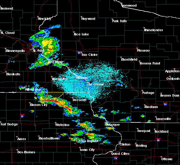 At 155 pm cdt, severe thunderstorms were located along a line extending from 7 miles northeast of floyd to elma, moving northeast at 25 mph (radar indicated). Hazards include 60 mph wind gusts and quarter size hail. Hail damage to vehicles is expected. expect wind damage to roofs, siding, and trees. severe thunderstorms will be near, elma around 200 pm cdt. riceville around 220 pm cdt. lime springs around 240 pm cdt. Other locations impacted by these severe thunderstorms include alta vista, chester, mcintire, lylahs marsh county park and maple leaf. At 155 pm cdt, severe thunderstorms were located along a line extending from 7 miles northeast of floyd to elma, moving northeast at 25 mph (radar indicated). Hazards include 60 mph wind gusts and quarter size hail. Hail damage to vehicles is expected. expect wind damage to roofs, siding, and trees. severe thunderstorms will be near, elma around 200 pm cdt. riceville around 220 pm cdt. lime springs around 240 pm cdt. Other locations impacted by these severe thunderstorms include alta vista, chester, mcintire, lylahs marsh county park and maple leaf.
|
| 6/18/2014 4:33 AM CDT | Trees down. time estimated from radar. wind speed unknow in chickasaw county IA, 0.3 miles SSE of Alta Vista, IA |
Hail Maps for Alta Vista, IA


Connect with Interactive Hail Maps