

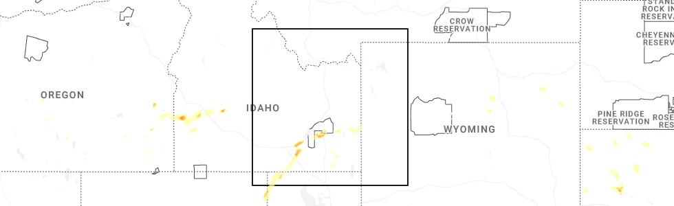
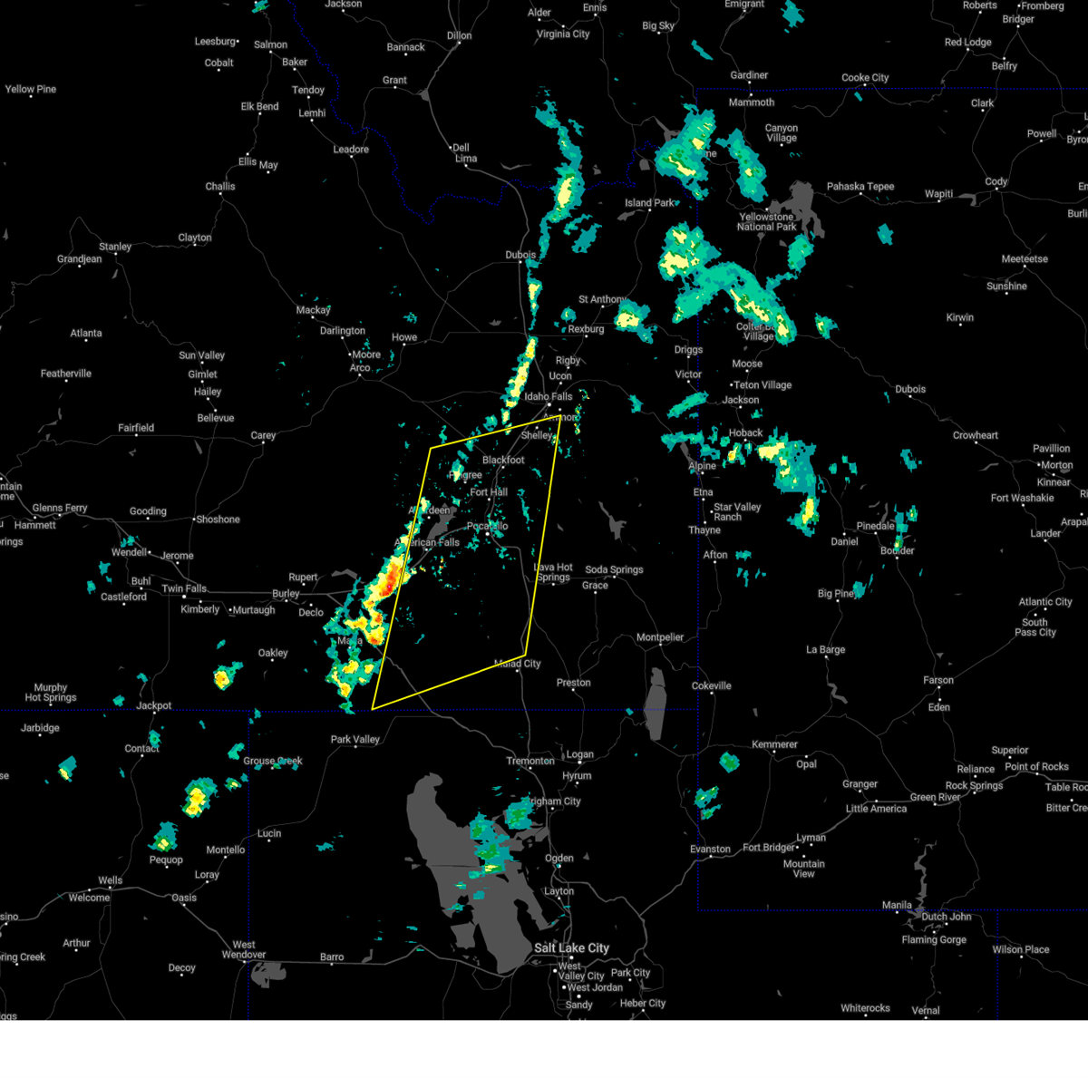
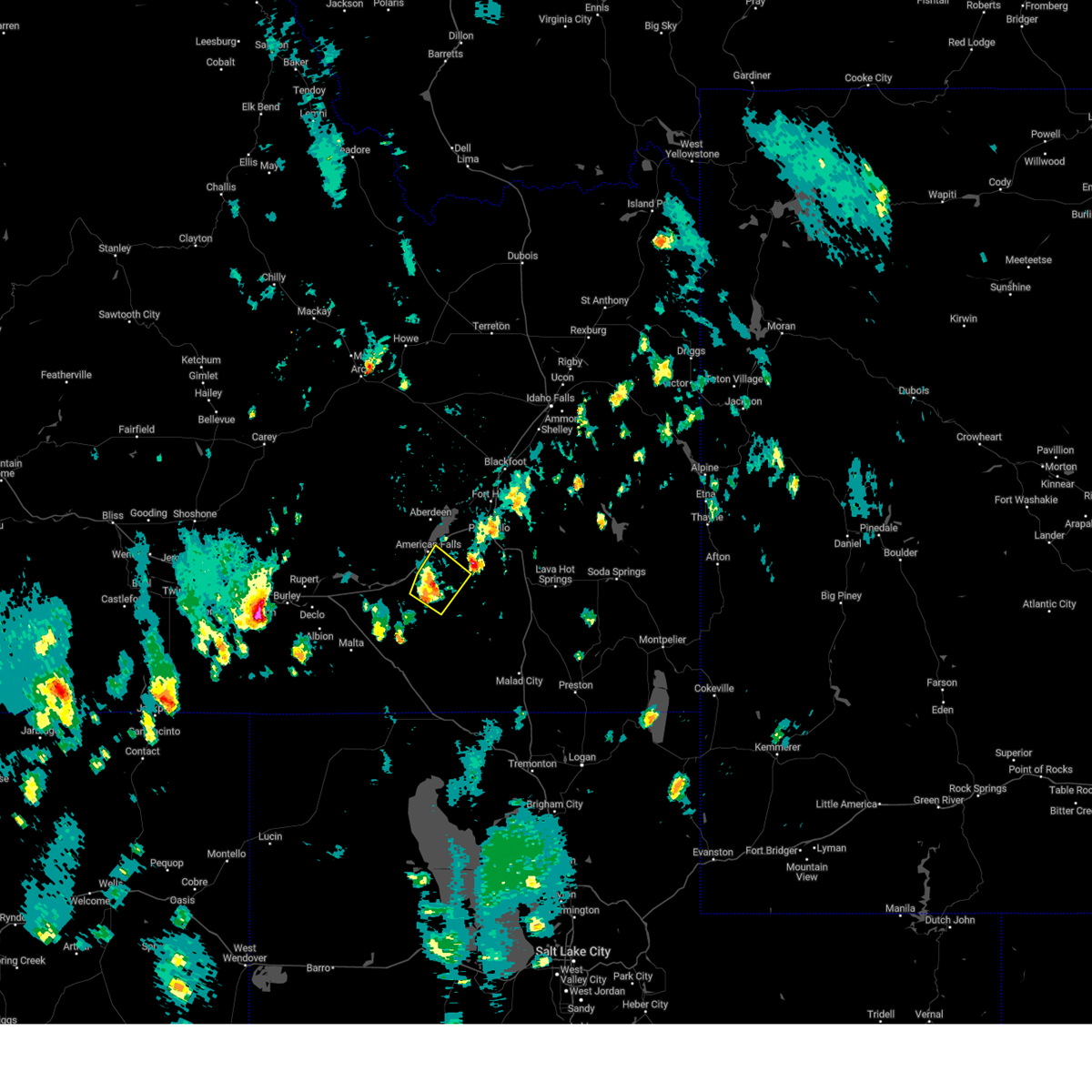
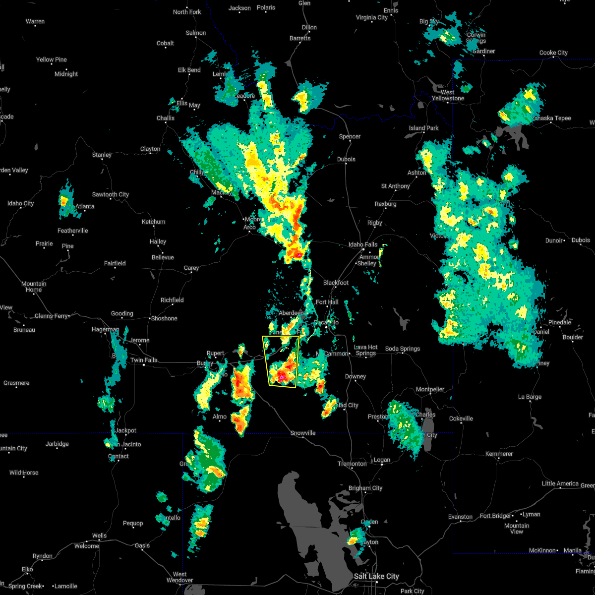
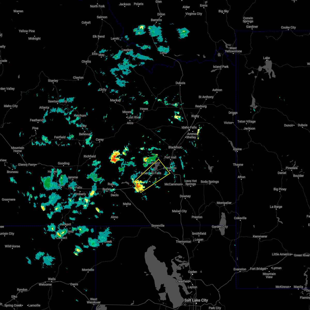
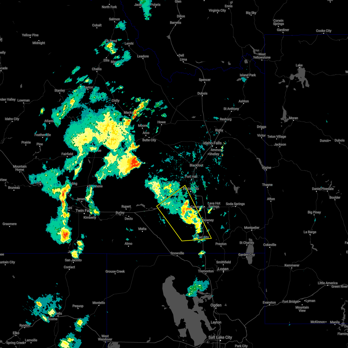
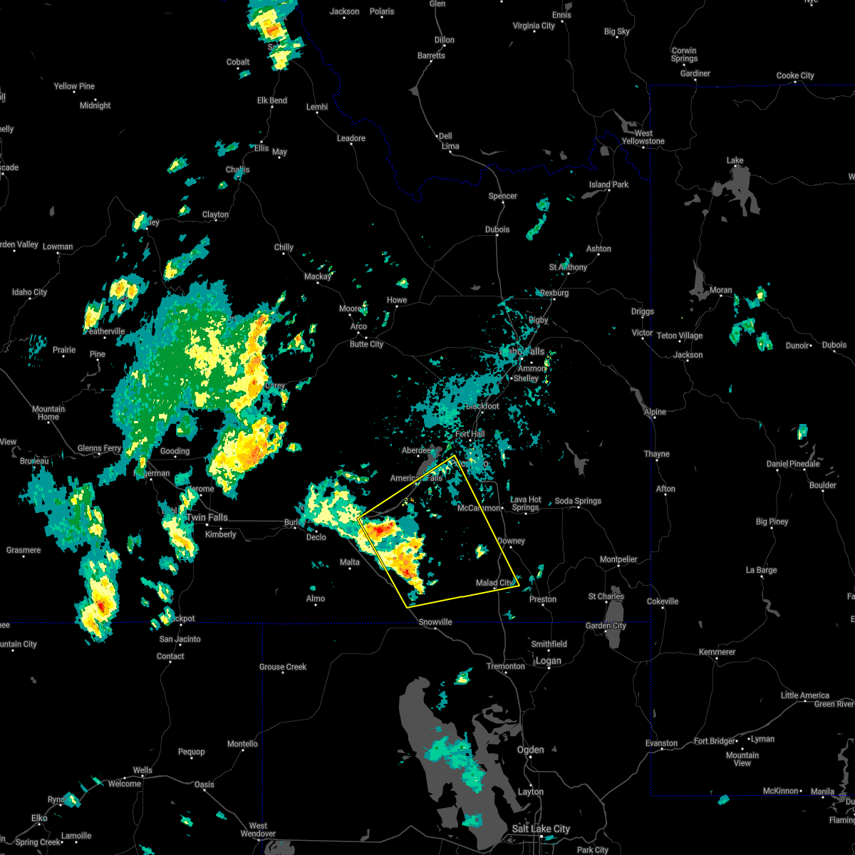
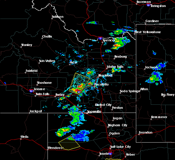
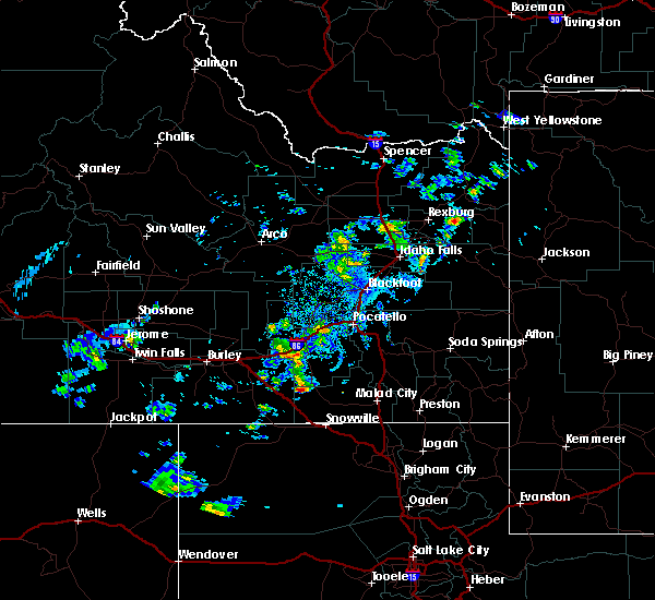
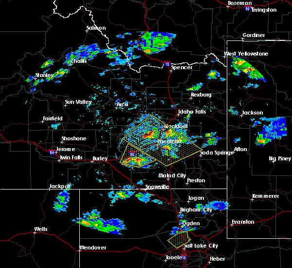
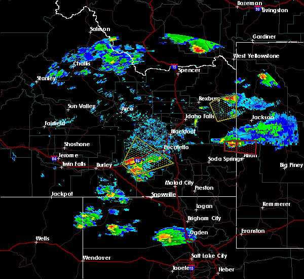
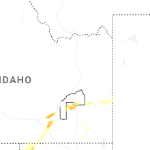
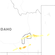
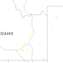
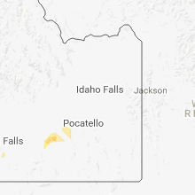
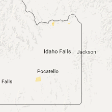
Hail Map for American Falls, ID
The American Falls, ID area has had 5 reports of on-the-ground hail by trained spotters, and has been under severe weather warnings 7 times during the past 12 months. Doppler radar has detected hail at or near American Falls, ID on 19 occasions, including 2 occasions during the past year.
| Name: | American Falls, ID |
| Where Located: | 63.6 miles SW of Idaho Falls, ID |
| Map: | Google Map for American Falls, ID |
| Population: | 4457 |
| Housing Units: | 1612 |
| More Info: | Search Google for American Falls, ID |
0
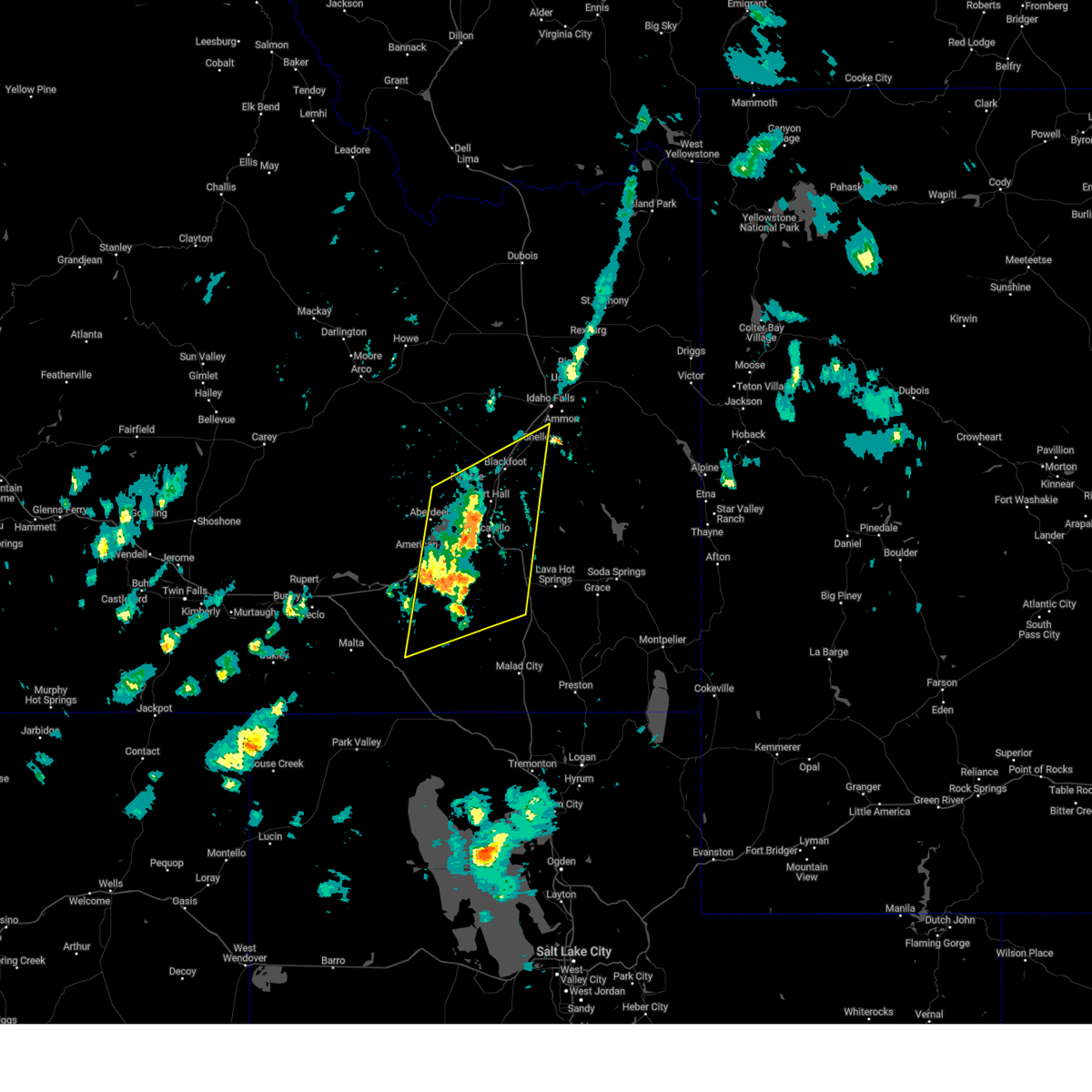
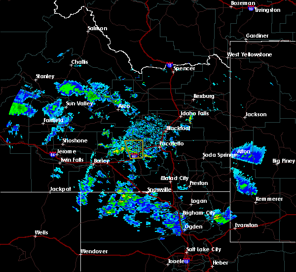
The Top Recent Hail Date for American Falls, ID is Friday, July 4, 2025 (19th out of 19)
Hail and Wind Damage Spotted near American Falls, ID
| Date / Time | Report Details |
|---|---|
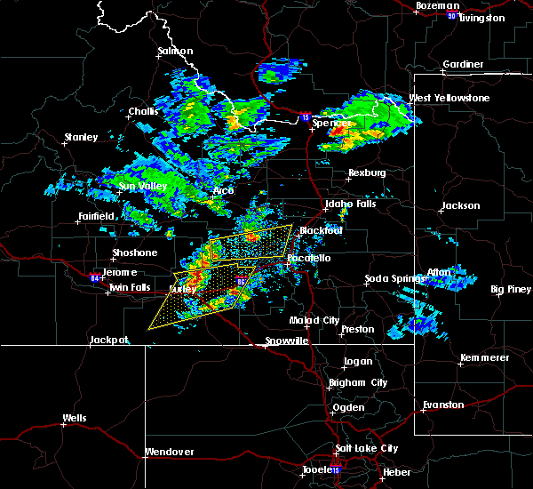
| 7/4/2025 4:17 PM MDT | Quarter sized hail reported 17.9 miles NE of American Falls, ID, estimated quarter size hail in the area of i-86 exit 21 osborn loop near and just east of cold water rest area. time estimated based on radar. |
| 5/11/2025 1:14 PM MDT |
 The storm which prompted the warning has weakened below severe limits, and no longer poses an immediate threat to life or property. therefore, the warning will be allowed to expire. however, gusty winds and heavy rain are still possible with these thunderstorms. a severe thunderstorm watch remains in effect until 800 pm mdt for southeastern idaho. The storm which prompted the warning has weakened below severe limits, and no longer poses an immediate threat to life or property. therefore, the warning will be allowed to expire. however, gusty winds and heavy rain are still possible with these thunderstorms. a severe thunderstorm watch remains in effect until 800 pm mdt for southeastern idaho.
|
| 5/11/2025 1:04 PM MDT |
 At 102 pm mdt, a line of severe thunderstorms was located from near springfield to roy moving northeast at 35 mph (trained weather spotters. a gust to 59 mph was reported at connor summit). Hazards include 60 mph wind gusts. Expect damage to roofs, siding, and trees. Locations impacted include, sterling, aberdeen, rose, rockland, mink creek pass, hawkins reservoir, mccammon, american falls, basalt, arbon, shelley, inkom, fort hall bannock creek lodge, pingree, american falls reservoir, pocatello airport, fort hall putnam lodge, fort hall buffalo lodge, pauline, and pocatello. At 102 pm mdt, a line of severe thunderstorms was located from near springfield to roy moving northeast at 35 mph (trained weather spotters. a gust to 59 mph was reported at connor summit). Hazards include 60 mph wind gusts. Expect damage to roofs, siding, and trees. Locations impacted include, sterling, aberdeen, rose, rockland, mink creek pass, hawkins reservoir, mccammon, american falls, basalt, arbon, shelley, inkom, fort hall bannock creek lodge, pingree, american falls reservoir, pocatello airport, fort hall putnam lodge, fort hall buffalo lodge, pauline, and pocatello.
|
| 5/11/2025 12:51 PM MDT |
 At 1249 pm mdt, a line of severe thunderstorms extended from aberdeen to near sweetzer summit, moving northeast at 35 mph (radar indicated and mesonet observations. this storm has a history of producing gusts to near 60 mph). Hazards include 60 mph wind gusts and penny size hail. Expect damage to roofs, siding, and trees. Locations impacted include, sterling, aberdeen, rose, rockland, mink creek pass, sweetzer summit, hawkins reservoir, mccammon, arimo, american falls, basalt, arbon, sublett reservoir, shelley, malad pass, inkom, fort hall bannock creek lodge, pingree, american falls reservoir, and pocatello airport. At 1249 pm mdt, a line of severe thunderstorms extended from aberdeen to near sweetzer summit, moving northeast at 35 mph (radar indicated and mesonet observations. this storm has a history of producing gusts to near 60 mph). Hazards include 60 mph wind gusts and penny size hail. Expect damage to roofs, siding, and trees. Locations impacted include, sterling, aberdeen, rose, rockland, mink creek pass, sweetzer summit, hawkins reservoir, mccammon, arimo, american falls, basalt, arbon, sublett reservoir, shelley, malad pass, inkom, fort hall bannock creek lodge, pingree, american falls reservoir, and pocatello airport.
|
| 5/11/2025 12:51 PM MDT |
 the severe thunderstorm warning has been cancelled and is no longer in effect the severe thunderstorm warning has been cancelled and is no longer in effect
|
| 5/11/2025 12:27 PM MDT |
 Svrpih the national weather service in pocatello has issued a * severe thunderstorm warning for, northwestern caribou county in southeastern idaho, central oneida county in southeastern idaho, bannock county in southeastern idaho, power county in southeastern idaho, central bonneville county in southeastern idaho, central bingham county in southeastern idaho, southeastern cassia county in southeastern idaho, * until 115 pm mdt. * at 1225 pm mdt, a line of severe thunderstorms extended from near city of rocks to near aberdeen, moving northeast at 45 mph (radar indicated and mesonet observations. a gust to 59 mph was reported at connor summit). Hazards include 60 mph wind gusts. expect damage to roofs, siding, and trees Svrpih the national weather service in pocatello has issued a * severe thunderstorm warning for, northwestern caribou county in southeastern idaho, central oneida county in southeastern idaho, bannock county in southeastern idaho, power county in southeastern idaho, central bonneville county in southeastern idaho, central bingham county in southeastern idaho, southeastern cassia county in southeastern idaho, * until 115 pm mdt. * at 1225 pm mdt, a line of severe thunderstorms extended from near city of rocks to near aberdeen, moving northeast at 45 mph (radar indicated and mesonet observations. a gust to 59 mph was reported at connor summit). Hazards include 60 mph wind gusts. expect damage to roofs, siding, and trees
|
| 8/23/2024 2:30 PM MDT | Large tree limb down damaging a fenc in power county ID, 0.3 miles N of American Falls, ID |
| 8/15/2024 5:13 PM MDT |
 The storms which prompted the warning have weakened below severe limits, and no longer pose an immediate threat to life or property. therefore, the warning will be allowed to expire. however, small hail and gusty winds are still possible with these thunderstorms. The storms which prompted the warning have weakened below severe limits, and no longer pose an immediate threat to life or property. therefore, the warning will be allowed to expire. however, small hail and gusty winds are still possible with these thunderstorms.
|
| 8/15/2024 4:25 PM MDT |
 Svrpih the national weather service in pocatello has issued a * severe thunderstorm warning for, southeastern blaine county in central idaho, northwestern caribou county in southeastern idaho, north central oneida county in southeastern idaho, bannock county in southeastern idaho, southeastern butte county in southeastern idaho, power county in southeastern idaho, west central bonneville county in southeastern idaho, bingham county in southeastern idaho, northeastern cassia county in southeastern idaho, * until 515 pm mdt. * at 423 pm mdt, severe thunderstorms were located along a line extending from 6 miles northwest of springfield to near fort hall mount putnam, moving northeast at 45 mph (radar indicated). Hazards include 60 mph wind gusts and penny size hail. expect damage to roofs, siding, and trees Svrpih the national weather service in pocatello has issued a * severe thunderstorm warning for, southeastern blaine county in central idaho, northwestern caribou county in southeastern idaho, north central oneida county in southeastern idaho, bannock county in southeastern idaho, southeastern butte county in southeastern idaho, power county in southeastern idaho, west central bonneville county in southeastern idaho, bingham county in southeastern idaho, northeastern cassia county in southeastern idaho, * until 515 pm mdt. * at 423 pm mdt, severe thunderstorms were located along a line extending from 6 miles northwest of springfield to near fort hall mount putnam, moving northeast at 45 mph (radar indicated). Hazards include 60 mph wind gusts and penny size hail. expect damage to roofs, siding, and trees
|
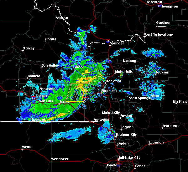
| 6/9/2024 5:03 PM MDT |
 At 503 pm mdt, a severe thunderstorm was located near fort hall bannock creek lodge, or near american falls, moving northeast at 20 mph (radar indicated). Hazards include 60 mph wind gusts and half dollar size hail. Hail damage to vehicles is expected. expect wind damage to roofs, siding, and trees. Locations impacted include, american falls, neeley, american falls reservoir, fort hall bannock creek lodge, and pocatello airport. At 503 pm mdt, a severe thunderstorm was located near fort hall bannock creek lodge, or near american falls, moving northeast at 20 mph (radar indicated). Hazards include 60 mph wind gusts and half dollar size hail. Hail damage to vehicles is expected. expect wind damage to roofs, siding, and trees. Locations impacted include, american falls, neeley, american falls reservoir, fort hall bannock creek lodge, and pocatello airport.
|
| 6/9/2024 4:57 PM MDT | Idaho power reports over 100 customers without power in and just northeast of american fall in power county ID, 1 miles S of American Falls, ID |
| 6/9/2024 4:54 PM MDT | Quarter sized hail reported 0.3 miles N of American Falls, ID, 2 inches of rain... estimated 1 inch hail... and estimated 60 mph winds reported on sunset ln. time estimated based on radar. |
| 6/9/2024 4:54 PM MDT | 2 inches of rain... estimated 1 inch hail... and estimated 60 mph winds reported on sunset ln. time estimated based on rada in power county ID, 0.3 miles N of American Falls, ID |
| 6/9/2024 4:53 PM MDT | Tree snapped off in the area of fort hall ave and madison st. report and photo received via social media. time estimated based on radar and nearby report in power county ID, 0.4 miles S of American Falls, ID |
| 6/9/2024 4:52 PM MDT |
 Svrpih the national weather service in pocatello has issued a * severe thunderstorm warning for, northwestern bannock county in southeastern idaho, central power county in southeastern idaho, southwestern bingham county in southeastern idaho, * until 515 pm mdt. * at 451 pm mdt, a severe thunderstorm was located over american falls, moving northeast at 25 mph (radar indicated). Hazards include 60 mph wind gusts and quarter size hail. Hail damage to vehicles is expected. Expect wind damage to roofs, siding, and trees. Svrpih the national weather service in pocatello has issued a * severe thunderstorm warning for, northwestern bannock county in southeastern idaho, central power county in southeastern idaho, southwestern bingham county in southeastern idaho, * until 515 pm mdt. * at 451 pm mdt, a severe thunderstorm was located over american falls, moving northeast at 25 mph (radar indicated). Hazards include 60 mph wind gusts and quarter size hail. Hail damage to vehicles is expected. Expect wind damage to roofs, siding, and trees.
|
| 6/9/2024 4:50 PM MDT | Portion of a tree and wires down in the area of bannock ave and sunbeam rd. report and photos received via social media. time estimated based on rada in power county ID, 0.3 miles N of American Falls, ID |
| 6/9/2024 4:48 PM MDT | Large tree several feet in diameter uprooted and down on top of a house along van buren st. road also flooded. time estimated based on rada in power county ID, 0.3 miles N of American Falls, ID |
| 5/13/2024 5:59 PM MDT |
 At 558 pm mdt, severe thunderstorms were located along a line extending from rockford to chubbuck to 14 miles west of virginia, moving east at 45 mph (radar indicated). Hazards include 60 mph wind gusts. Expect damage to roofs, siding, and trees. Locations impacted include, pocatello, blackfoot, american falls, mccammon, american falls reservoir, chubbuck, aberdeen, inkom, downey, arimo, rockland, rose, fort hall bannock creek lodge, pingree, pocatello airport, fort hall putnam lodge, fort hall buffalo lodge, fort hall eagle lodge, fort hall lincoln creek lodge, and taber. At 558 pm mdt, severe thunderstorms were located along a line extending from rockford to chubbuck to 14 miles west of virginia, moving east at 45 mph (radar indicated). Hazards include 60 mph wind gusts. Expect damage to roofs, siding, and trees. Locations impacted include, pocatello, blackfoot, american falls, mccammon, american falls reservoir, chubbuck, aberdeen, inkom, downey, arimo, rockland, rose, fort hall bannock creek lodge, pingree, pocatello airport, fort hall putnam lodge, fort hall buffalo lodge, fort hall eagle lodge, fort hall lincoln creek lodge, and taber.
|
| 5/13/2024 5:59 PM MDT |
 the severe thunderstorm warning has been cancelled and is no longer in effect the severe thunderstorm warning has been cancelled and is no longer in effect
|
| 5/13/2024 5:19 PM MDT |
 Svrpih the national weather service in pocatello has issued a * severe thunderstorm warning for, southeastern blaine county in central idaho, central oneida county in southeastern idaho, bannock county in southeastern idaho, power county in southeastern idaho, southwestern bingham county in southeastern idaho, * until 615 pm mdt. * at 518 pm mdt, severe thunderstorms were located along a line extending from 13 miles northwest of aberdeen to near neeley to 13 miles south of rockland, moving east at 45 mph (radar indicated). Hazards include 60 mph wind gusts. expect damage to roofs, siding, and trees Svrpih the national weather service in pocatello has issued a * severe thunderstorm warning for, southeastern blaine county in central idaho, central oneida county in southeastern idaho, bannock county in southeastern idaho, power county in southeastern idaho, southwestern bingham county in southeastern idaho, * until 615 pm mdt. * at 518 pm mdt, severe thunderstorms were located along a line extending from 13 miles northwest of aberdeen to near neeley to 13 miles south of rockland, moving east at 45 mph (radar indicated). Hazards include 60 mph wind gusts. expect damage to roofs, siding, and trees
|
| 5/13/2024 5:01 PM MDT |
 At 501 pm mdt, severe thunderstorms were located along a line extending from 20 miles northeast of minidoka to 8 miles north of cold water rest area to 12 miles east of malta, moving east at 45 mph (radar indicated). Hazards include 60 mph wind gusts. Expect damage to roofs, siding, and trees. Locations impacted include, american falls, malta, neeley, lake walcott, american falls reservoir, aberdeen, rockland, minidoka, cold water rest area, juniper, fort hall bannock peak, yale rest area, massacre rocks, bear trap airport, sweetzer summit, pilar butte, idahome, holbrook, sublett reservoir, and roy. At 501 pm mdt, severe thunderstorms were located along a line extending from 20 miles northeast of minidoka to 8 miles north of cold water rest area to 12 miles east of malta, moving east at 45 mph (radar indicated). Hazards include 60 mph wind gusts. Expect damage to roofs, siding, and trees. Locations impacted include, american falls, malta, neeley, lake walcott, american falls reservoir, aberdeen, rockland, minidoka, cold water rest area, juniper, fort hall bannock peak, yale rest area, massacre rocks, bear trap airport, sweetzer summit, pilar butte, idahome, holbrook, sublett reservoir, and roy.
|
| 5/13/2024 5:00 PM MDT | Measured at the coldwater itd mesonet sit in power county ID, 19.9 miles NE of American Falls, ID |
| 5/13/2024 4:34 PM MDT |
 Svrpih the national weather service in pocatello has issued a * severe thunderstorm warning for, southeastern blaine county in central idaho, northwestern oneida county in southeastern idaho, power county in southeastern idaho, southwestern bingham county in southeastern idaho, eastern cassia county in southeastern idaho, southeastern minidoka county in south central idaho, * until 530 pm mdt. * at 433 pm mdt, severe thunderstorms were located along a line extending from 13 miles northwest of minidoka to 6 miles east of rupert to near elba, moving east at 45 mph (radar indicated). Hazards include 60 mph wind gusts. expect damage to roofs, siding, and trees Svrpih the national weather service in pocatello has issued a * severe thunderstorm warning for, southeastern blaine county in central idaho, northwestern oneida county in southeastern idaho, power county in southeastern idaho, southwestern bingham county in southeastern idaho, eastern cassia county in southeastern idaho, southeastern minidoka county in south central idaho, * until 530 pm mdt. * at 433 pm mdt, severe thunderstorms were located along a line extending from 13 miles northwest of minidoka to 6 miles east of rupert to near elba, moving east at 45 mph (radar indicated). Hazards include 60 mph wind gusts. expect damage to roofs, siding, and trees
|
| 5/26/2023 3:17 PM MDT | Quarter sized hail reported 25.7 miles NE of American Falls, ID |
| 5/24/2023 3:11 PM MDT |
 At 311 pm mdt, a severe thunderstorm was located near rockland, or 8 miles southeast of neeley, moving northeast at 20 mph (radar indicated). Hazards include 60 mph wind gusts and quarter size hail. Hail damage to vehicles is expected. expect wind damage to roofs, siding, and trees. locations impacted include, rockland and fort hall bannock peak. hail threat, radar indicated max hail size, 1. 00 in wind threat, radar indicated max wind gust, 60 mph. At 311 pm mdt, a severe thunderstorm was located near rockland, or 8 miles southeast of neeley, moving northeast at 20 mph (radar indicated). Hazards include 60 mph wind gusts and quarter size hail. Hail damage to vehicles is expected. expect wind damage to roofs, siding, and trees. locations impacted include, rockland and fort hall bannock peak. hail threat, radar indicated max hail size, 1. 00 in wind threat, radar indicated max wind gust, 60 mph.
|
| 5/24/2023 2:50 PM MDT |
 At 249 pm mdt, a severe thunderstorm was located over rockland, or 14 miles south of neeley, moving northeast at 20 mph (radar indicated). Hazards include 60 mph wind gusts and quarter size hail. Hail damage to vehicles is expected. Expect wind damage to roofs, siding, and trees. At 249 pm mdt, a severe thunderstorm was located over rockland, or 14 miles south of neeley, moving northeast at 20 mph (radar indicated). Hazards include 60 mph wind gusts and quarter size hail. Hail damage to vehicles is expected. Expect wind damage to roofs, siding, and trees.
|
| 9/21/2022 7:00 PM MDT |
 At 659 pm mdt, a severe thunderstorm was located near fort hall bannock peak, or 10 miles southeast of american falls, moving northeast at 35 mph (radar indicated). Hazards include 60 mph wind gusts and nickel size hail. expect damage to roofs, siding, and trees At 659 pm mdt, a severe thunderstorm was located near fort hall bannock peak, or 10 miles southeast of american falls, moving northeast at 35 mph (radar indicated). Hazards include 60 mph wind gusts and nickel size hail. expect damage to roofs, siding, and trees
|
| 9/21/2022 6:32 PM MDT |
 At 632 pm mdt, a severe thunderstorm was located near rockland, or 17 miles south of neeley, moving northeast at 35 mph (radar indicated). Hazards include 60 mph wind gusts and nickel size hail. expect damage to roofs, siding, and trees At 632 pm mdt, a severe thunderstorm was located near rockland, or 17 miles south of neeley, moving northeast at 35 mph (radar indicated). Hazards include 60 mph wind gusts and nickel size hail. expect damage to roofs, siding, and trees
|
| 9/21/2022 4:57 PM MDT |
 The severe thunderstorm warning for southwestern power and east central cassia counties will expire at 500 pm mdt, the storm which prompted the warning has weakened below severe limits, and no longer poses an immediate threat to life or property. therefore, the warning will be allowed to expire. however gusty winds are still possible with this thunderstorm. a severe thunderstorm watch remains in effect until 800 pm mdt for southeastern idaho. The severe thunderstorm warning for southwestern power and east central cassia counties will expire at 500 pm mdt, the storm which prompted the warning has weakened below severe limits, and no longer poses an immediate threat to life or property. therefore, the warning will be allowed to expire. however gusty winds are still possible with this thunderstorm. a severe thunderstorm watch remains in effect until 800 pm mdt for southeastern idaho.
|
| 9/21/2022 4:48 PM MDT |
 At 448 pm mdt, a severe thunderstorm was located near rockland, or 16 miles south of neeley, moving north at 50 mph (radar indicated). Hazards include 60 mph wind gusts and quarter size hail. Hail damage to vehicles is expected. expect wind damage to roofs, siding, and trees. locations impacted include, american falls, neeley, rockland and massacre rocks. hail threat, radar indicated max hail size, 1. 00 in wind threat, radar indicated max wind gust, 60 mph. At 448 pm mdt, a severe thunderstorm was located near rockland, or 16 miles south of neeley, moving north at 50 mph (radar indicated). Hazards include 60 mph wind gusts and quarter size hail. Hail damage to vehicles is expected. expect wind damage to roofs, siding, and trees. locations impacted include, american falls, neeley, rockland and massacre rocks. hail threat, radar indicated max hail size, 1. 00 in wind threat, radar indicated max wind gust, 60 mph.
|
| 9/21/2022 4:34 PM MDT |
 At 434 pm mdt, a severe thunderstorm was located 12 miles north of juniper, or 22 miles east of malta, moving north at 50 mph (radar indicated). Hazards include 60 mph wind gusts and quarter size hail. Hail damage to vehicles is expected. Expect wind damage to roofs, siding, and trees. At 434 pm mdt, a severe thunderstorm was located 12 miles north of juniper, or 22 miles east of malta, moving north at 50 mph (radar indicated). Hazards include 60 mph wind gusts and quarter size hail. Hail damage to vehicles is expected. Expect wind damage to roofs, siding, and trees.
|
| 7/13/2022 3:05 PM MDT |
 At 305 pm mdt, severe thunderstorms were located along a line extending from 17 miles northeast of minidoka to near lake walcott to 6 miles southeast of almo, moving east at 30 mph (radar indicated). Hazards include 60 mph wind gusts. expect damage to roofs, siding, and trees At 305 pm mdt, severe thunderstorms were located along a line extending from 17 miles northeast of minidoka to near lake walcott to 6 miles southeast of almo, moving east at 30 mph (radar indicated). Hazards include 60 mph wind gusts. expect damage to roofs, siding, and trees
|
| 5/26/2022 4:53 PM MDT |
 At 453 pm mdt, a severe thunderstorm was located near cold water rest area, or 10 miles southwest of neeley, moving northeast at 45 mph (radar indicated). Hazards include 60 mph wind gusts and penny size hail. expect damage to roofs, siding, and trees At 453 pm mdt, a severe thunderstorm was located near cold water rest area, or 10 miles southwest of neeley, moving northeast at 45 mph (radar indicated). Hazards include 60 mph wind gusts and penny size hail. expect damage to roofs, siding, and trees
|
| 5/2/2022 6:18 PM MDT |
 At 617 pm mdt, severe thunderstorms were located along a line extending from 7 miles southwest of northwest inl to near rockford to near fort hall bannock peak, moving northeast at 40 mph (radar indicated). Hazards include 60 mph wind gusts. Expect damage to roofs, siding, and trees. locations impacted include, idaho falls, pocatello, blackfoot, american falls, arco, american falls reservoir, terreton, goshen, chubbuck, shelley, aberdeen, roberts, firth, mud lake, atomic city, rose, southeast inl, southwest inl, fort hall bannock creek lodge and pingree. hail threat, radar indicated max hail size, <. 75 in wind threat, radar indicated max wind gust, 60 mph. At 617 pm mdt, severe thunderstorms were located along a line extending from 7 miles southwest of northwest inl to near rockford to near fort hall bannock peak, moving northeast at 40 mph (radar indicated). Hazards include 60 mph wind gusts. Expect damage to roofs, siding, and trees. locations impacted include, idaho falls, pocatello, blackfoot, american falls, arco, american falls reservoir, terreton, goshen, chubbuck, shelley, aberdeen, roberts, firth, mud lake, atomic city, rose, southeast inl, southwest inl, fort hall bannock creek lodge and pingree. hail threat, radar indicated max hail size, <. 75 in wind threat, radar indicated max wind gust, 60 mph.
|
| 5/2/2022 5:59 PM MDT |
 At 559 pm mdt, severe thunderstorms were located along a line extending from 12 miles southwest of northwest inl to near pingree to near fort hall bannock peak, moving east at 40 mph (radar indicated). Hazards include 70 mph wind gusts and penny size hail. Expect considerable tree damage. Damage is likely to mobile homes, roofs, and outbuildings. At 559 pm mdt, severe thunderstorms were located along a line extending from 12 miles southwest of northwest inl to near pingree to near fort hall bannock peak, moving east at 40 mph (radar indicated). Hazards include 70 mph wind gusts and penny size hail. Expect considerable tree damage. Damage is likely to mobile homes, roofs, and outbuildings.
|
| 5/2/2022 5:48 PM MDT |
 At 547 pm mdt, severe thunderstorms were located along a line extending from near darlington to 7 miles northwest of central inl to 9 miles northwest of springfield to rockland, moving east at 40 mph (radar indicated). Hazards include 70 mph wind gusts and penny size hail. Expect considerable tree damage. damage is likely to mobile homes, roofs, and outbuildings. locations impacted include, pocatello, american falls, arco, mackay, lake walcott, american falls reservoir, grouse, neeley, chubbuck, aberdeen, rockland, minidoka, atomic city, darlington, southeast inl, southwest inl, fort hall bannock creek lodge, pingree, pocatello airport and cold water rest area. thunderstorm damage threat, considerable hail threat, radar indicated max hail size, 0. 75 in wind threat, observed max wind gust, 70 mph. At 547 pm mdt, severe thunderstorms were located along a line extending from near darlington to 7 miles northwest of central inl to 9 miles northwest of springfield to rockland, moving east at 40 mph (radar indicated). Hazards include 70 mph wind gusts and penny size hail. Expect considerable tree damage. damage is likely to mobile homes, roofs, and outbuildings. locations impacted include, pocatello, american falls, arco, mackay, lake walcott, american falls reservoir, grouse, neeley, chubbuck, aberdeen, rockland, minidoka, atomic city, darlington, southeast inl, southwest inl, fort hall bannock creek lodge, pingree, pocatello airport and cold water rest area. thunderstorm damage threat, considerable hail threat, radar indicated max hail size, 0. 75 in wind threat, observed max wind gust, 70 mph.
|
| 5/2/2022 5:33 PM MDT |
 At 533 pm mdt, severe thunderstorms were located along a line extending from near darlington to 7 miles northwest of southwest inl to 13 miles west of springfield to near rockland, moving east at 40 mph (radar indicated). Hazards include 70 mph wind gusts and penny size hail. Expect considerable tree damage. Damage is likely to mobile homes, roofs, and outbuildings. At 533 pm mdt, severe thunderstorms were located along a line extending from near darlington to 7 miles northwest of southwest inl to 13 miles west of springfield to near rockland, moving east at 40 mph (radar indicated). Hazards include 70 mph wind gusts and penny size hail. Expect considerable tree damage. Damage is likely to mobile homes, roofs, and outbuildings.
|
| 8/2/2021 7:14 PM MDT |
 At 711 pm mdt, a severe thunderstorm was located near portneuf gap, or 9 miles southeast of pocatello, moving southeast at 25 mph (radar indicated up to 60 mph. recorded observation of 49 mph). Hazards include gusts of 45 mph with gusts up to 60 mph wind. Expect damage to roofs, siding, and trees. Locations impacted include, pocatello, blackfoot, american falls, american falls reservoir, chubbuck, firth, fort hall buffalo lodge, rose, fort hall eagle lodge, fort hall lincoln creek lodge, fort hall townsite, fort hall bannock creek lodge, pocatello airport, fort hall putnam lodge, groveland, wapello and trail creek campground. At 711 pm mdt, a severe thunderstorm was located near portneuf gap, or 9 miles southeast of pocatello, moving southeast at 25 mph (radar indicated up to 60 mph. recorded observation of 49 mph). Hazards include gusts of 45 mph with gusts up to 60 mph wind. Expect damage to roofs, siding, and trees. Locations impacted include, pocatello, blackfoot, american falls, american falls reservoir, chubbuck, firth, fort hall buffalo lodge, rose, fort hall eagle lodge, fort hall lincoln creek lodge, fort hall townsite, fort hall bannock creek lodge, pocatello airport, fort hall putnam lodge, groveland, wapello and trail creek campground.
|
| 8/2/2021 6:54 PM MDT |
 At 654 pm mdt, a severe thunderstorm was located over pocatello airport, or near pocatello, moving southeast at 55 mph (radar indicated). Hazards include 60 mph wind gusts. expect damage to roofs, siding, and trees At 654 pm mdt, a severe thunderstorm was located over pocatello airport, or near pocatello, moving southeast at 55 mph (radar indicated). Hazards include 60 mph wind gusts. expect damage to roofs, siding, and trees
|
| 7/17/2021 4:03 PM MDT |
 At 402 pm mdt, a severe thunderstorm was located near springfield, or 9 miles northeast of american falls reservoir, moving north at 15 mph (radar indicated). Hazards include 60 mph wind gusts. Expect damage to roofs, siding, and trees. Locations impacted include, western pocatello, american falls, american falls reservoir, chubbuck, aberdeen, fort hall buffalo lodge, fort hall eagle lodge, fort hall townsite, springfield, rockford, moreland, pingree, pocatello airport and sterling. At 402 pm mdt, a severe thunderstorm was located near springfield, or 9 miles northeast of american falls reservoir, moving north at 15 mph (radar indicated). Hazards include 60 mph wind gusts. Expect damage to roofs, siding, and trees. Locations impacted include, western pocatello, american falls, american falls reservoir, chubbuck, aberdeen, fort hall buffalo lodge, fort hall eagle lodge, fort hall townsite, springfield, rockford, moreland, pingree, pocatello airport and sterling.
|
| 7/17/2021 3:42 PM MDT |
 At 341 pm mdt, a severe thunderstorm was located over northeastern american falls reservoir, moving north at 25 mph (radar indicated). Hazards include 60 mph wind gusts. expect damage to roofs, siding, and trees At 341 pm mdt, a severe thunderstorm was located over northeastern american falls reservoir, moving north at 25 mph (radar indicated). Hazards include 60 mph wind gusts. expect damage to roofs, siding, and trees
|
| 5/16/2021 6:54 PM MDT |
 At 652 pm mdt, very strong winds associated with thunderstorm outflows were located along a line extending from near chubbuck to 10 miles southwest of burley, moving north at 35 mph (trained weather spotters). Hazards include 60 mph wind gusts. Expect damage to roofs, siding, and trees. Blowing dust may suddenly reduce visibility to near zero. At 652 pm mdt, very strong winds associated with thunderstorm outflows were located along a line extending from near chubbuck to 10 miles southwest of burley, moving north at 35 mph (trained weather spotters). Hazards include 60 mph wind gusts. Expect damage to roofs, siding, and trees. Blowing dust may suddenly reduce visibility to near zero.
|
| 8/25/2020 4:42 PM MDT |
 The severe thunderstorm warning for central oneida, central bannock, southeastern power, northwestern franklin and northeastern cassia counties will expire at 445 pm mdt, the storms which prompted the warning have weakened below severe limits, and no longer pose an immediate threat to life or property. therefore, the warning will be allowed to expire. however gusty winds are still possible with these thunderstorms. the storms in this line may still re-strengthen and bear watching. The severe thunderstorm warning for central oneida, central bannock, southeastern power, northwestern franklin and northeastern cassia counties will expire at 445 pm mdt, the storms which prompted the warning have weakened below severe limits, and no longer pose an immediate threat to life or property. therefore, the warning will be allowed to expire. however gusty winds are still possible with these thunderstorms. the storms in this line may still re-strengthen and bear watching.
|
| 8/25/2020 4:20 PM MDT |
 At 418 pm mdt, severe thunderstorms were located along a line extending from fort hall bannock peak to near pleasantview, moving east at 40 mph (radar indicated). Hazards include 60 mph wind gusts and penny size hail. Expect damage to roofs, siding, and trees. Locations impacted include, american falls, malad, neeley, rockland, fort hall bannock peak, fort hall bannock creek lodge, pocatello airport, pauline, massacre rocks, mink creek pass, daniels reservoir, arbon, malad pass and hawkins reservoir. At 418 pm mdt, severe thunderstorms were located along a line extending from fort hall bannock peak to near pleasantview, moving east at 40 mph (radar indicated). Hazards include 60 mph wind gusts and penny size hail. Expect damage to roofs, siding, and trees. Locations impacted include, american falls, malad, neeley, rockland, fort hall bannock peak, fort hall bannock creek lodge, pocatello airport, pauline, massacre rocks, mink creek pass, daniels reservoir, arbon, malad pass and hawkins reservoir.
|
| 8/25/2020 3:55 PM MDT |
 At 354 pm mdt, severe thunderstorms were located along a line extending from 7 miles southwest of cold water rest area to 10 miles north of juniper, moving east at 50 mph (radar indicated). Hazards include 60 mph wind gusts and penny size hail. expect damage to roofs, siding, and trees At 354 pm mdt, severe thunderstorms were located along a line extending from 7 miles southwest of cold water rest area to 10 miles north of juniper, moving east at 50 mph (radar indicated). Hazards include 60 mph wind gusts and penny size hail. expect damage to roofs, siding, and trees
|
| 8/5/2020 6:03 PM MDT |
 At 602 pm mdt, a severe thunderstorm capable of producing a tornado was located near neeley, moving north at 10 mph (weather spotters reported funnel cloud). Hazards include tornado. Flying debris will be dangerous to those caught without shelter. mobile homes will be damaged or destroyed. damage to roofs, windows, and vehicles will occur. tree damage is likely. this dangerous storm will be near, american falls around 625 pm mdt. Other locations impacted by this tornadic thunderstorm include massacre rocks. At 602 pm mdt, a severe thunderstorm capable of producing a tornado was located near neeley, moving north at 10 mph (weather spotters reported funnel cloud). Hazards include tornado. Flying debris will be dangerous to those caught without shelter. mobile homes will be damaged or destroyed. damage to roofs, windows, and vehicles will occur. tree damage is likely. this dangerous storm will be near, american falls around 625 pm mdt. Other locations impacted by this tornadic thunderstorm include massacre rocks.
|
| 5/30/2020 7:36 PM MDT |
 At 736 pm mdt, a severe thunderstorm was located over neeley, moving north at 25 mph (radar indicated). Hazards include 60 mph wind gusts. expect damage to roofs, siding, and trees At 736 pm mdt, a severe thunderstorm was located over neeley, moving north at 25 mph (radar indicated). Hazards include 60 mph wind gusts. expect damage to roofs, siding, and trees
|
| 5/30/2020 7:35 PM MDT | Report of 25 power poles knocked down just west of american falls. idaho power outage map reports over 1700 customers without power in this area. location and time esti in power county ID, 2.1 miles E of American Falls, ID |
| 4/30/2020 6:25 PM MDT |
 At 624 pm mdt, severe thunderstorms were located along a line extending from near aberdeen to near rockland to 18 miles southeast of cold water rest area, moving east at 40 mph (radar indicated). Hazards include 60 mph wind gusts and up to nickel size hail. Expect damage to roofs, siding, and trees. Locations impacted include, pocatello, american falls, mccammon, american falls reservoir, neeley, chubbuck, aberdeen, inkom, rockland, fort hall bannock creek lodge, pocatello airport, fort hall putnam lodge, cold water rest area, fort hall buffalo lodge, fort hall bannock peak, portneuf gap, fort hall townsite, massacre rocks, mink creek pass and hawkins reservoir. At 624 pm mdt, severe thunderstorms were located along a line extending from near aberdeen to near rockland to 18 miles southeast of cold water rest area, moving east at 40 mph (radar indicated). Hazards include 60 mph wind gusts and up to nickel size hail. Expect damage to roofs, siding, and trees. Locations impacted include, pocatello, american falls, mccammon, american falls reservoir, neeley, chubbuck, aberdeen, inkom, rockland, fort hall bannock creek lodge, pocatello airport, fort hall putnam lodge, cold water rest area, fort hall buffalo lodge, fort hall bannock peak, portneuf gap, fort hall townsite, massacre rocks, mink creek pass and hawkins reservoir.
|
| 4/30/2020 5:59 PM MDT |
 At 558 pm mdt, severe thunderstorms were located along a line extending from 10 miles northeast of minidoka to near lake walcott to near malta, moving east at 45 mph (radar indicated). Hazards include 60 mph wind gusts and nickel size hail. expect damage to roofs, siding, and trees At 558 pm mdt, severe thunderstorms were located along a line extending from 10 miles northeast of minidoka to near lake walcott to near malta, moving east at 45 mph (radar indicated). Hazards include 60 mph wind gusts and nickel size hail. expect damage to roofs, siding, and trees
|
| 4/30/2020 5:40 PM MDT |
 At 539 pm mdt, severe thunderstorms were located along a line extending from 10 miles south of craters of the moon to 6 miles northeast of minidoka to 7 miles southwest of albion, moving northeast at 55 mph. gusts in excess of 50 mph have been reported by wind sensors in this area (radar indicated). Hazards include 60 mph wind gusts. Expect damage to roofs, siding, and trees. Locations impacted include, burley, rupert, american falls, heyburn, lake walcott, neeley, oakley reservoir, western american falls reservoir, oakley, declo, albion, minidoka, cold water rest area, acequia, yale rest area, massacre rocks, mt harrison, idahome and interstate 84 and 86 junction. At 539 pm mdt, severe thunderstorms were located along a line extending from 10 miles south of craters of the moon to 6 miles northeast of minidoka to 7 miles southwest of albion, moving northeast at 55 mph. gusts in excess of 50 mph have been reported by wind sensors in this area (radar indicated). Hazards include 60 mph wind gusts. Expect damage to roofs, siding, and trees. Locations impacted include, burley, rupert, american falls, heyburn, lake walcott, neeley, oakley reservoir, western american falls reservoir, oakley, declo, albion, minidoka, cold water rest area, acequia, yale rest area, massacre rocks, mt harrison, idahome and interstate 84 and 86 junction.
|
| 4/30/2020 5:17 PM MDT |
 At 516 pm mdt, severe thunderstorms were located along a line extending from 13 miles southeast of carey to 6 miles west of minidoka to near oakley, moving northeast at 55 mph (radar indicated). Hazards include 60 mph wind gusts. expect damage to roofs, siding, and trees At 516 pm mdt, severe thunderstorms were located along a line extending from 13 miles southeast of carey to 6 miles west of minidoka to near oakley, moving northeast at 55 mph (radar indicated). Hazards include 60 mph wind gusts. expect damage to roofs, siding, and trees
|
| 10/19/2019 3:27 PM MDT |
 At 325 pm mdt, severe thunderstorms were located along a line extending from 15 miles southwest of atomic city to 6 miles north of cold water rest area, moving east at 45 mph (radar indicated). Hazards include 60 mph wind gusts. expect damage to roofs, siding, and trees At 325 pm mdt, severe thunderstorms were located along a line extending from 15 miles southwest of atomic city to 6 miles north of cold water rest area, moving east at 45 mph (radar indicated). Hazards include 60 mph wind gusts. expect damage to roofs, siding, and trees
|
| 6/6/2019 7:23 PM MDT |
 The severe thunderstorm warning for west central bannock, central power, east central cassia and southwestern bingham counties will expire at 730 pm mdt, the storm which prompted the warning is moving out of the area. therefore, the warning will be allowed to expire. a severe thunderstorm watch remains in effect until 1100 pm mdt for southeastern idaho. remember, a new severe thunderstorm warning has been issued as these storms move off to the northeast. The severe thunderstorm warning for west central bannock, central power, east central cassia and southwestern bingham counties will expire at 730 pm mdt, the storm which prompted the warning is moving out of the area. therefore, the warning will be allowed to expire. a severe thunderstorm watch remains in effect until 1100 pm mdt for southeastern idaho. remember, a new severe thunderstorm warning has been issued as these storms move off to the northeast.
|
| 6/6/2019 7:22 PM MDT |
 At 721 pm mdt, severe thunderstorms were located along a line extending from 11 miles northwest of aberdeen to american falls reservoir to near fort hall bannock peak, moving northeast at 45 mph (radar indicated). Hazards include 60 mph wind gusts. expect damage to roofs, siding, and trees At 721 pm mdt, severe thunderstorms were located along a line extending from 11 miles northwest of aberdeen to american falls reservoir to near fort hall bannock peak, moving northeast at 45 mph (radar indicated). Hazards include 60 mph wind gusts. expect damage to roofs, siding, and trees
|
| 6/6/2019 7:10 PM MDT |
 At 708 pm mdt, a severe thunderstorm was located over neeley to near rockland, moving northeast at 40 mph (radar indicated). Hazards include 60 mph wind gusts. Expect damage to roofs, siding, and trees. Locations impacted include, american falls, neeley, american falls reservoir, aberdeen, rockland, fort hall bannock peak, fort hall bannock creek lodge and massacre rocks. At 708 pm mdt, a severe thunderstorm was located over neeley to near rockland, moving northeast at 40 mph (radar indicated). Hazards include 60 mph wind gusts. Expect damage to roofs, siding, and trees. Locations impacted include, american falls, neeley, american falls reservoir, aberdeen, rockland, fort hall bannock peak, fort hall bannock creek lodge and massacre rocks.
|
| 6/6/2019 6:56 PM MDT |
 At 655 pm mdt, a severe thunderstorm was located over the cold water rest area or 10 miles southwest of neeley, moving northeast at 35 mph (radar indicated). Hazards include 60 mph wind gusts. Expect damage to roofs, siding, and trees. Locations impacted include, american falls, neeley, american falls reservoir, aberdeen, rockland, fort hall bannock peak, cold water rest area, fort hall bannock creek lodge and massacre rocks. At 655 pm mdt, a severe thunderstorm was located over the cold water rest area or 10 miles southwest of neeley, moving northeast at 35 mph (radar indicated). Hazards include 60 mph wind gusts. Expect damage to roofs, siding, and trees. Locations impacted include, american falls, neeley, american falls reservoir, aberdeen, rockland, fort hall bannock peak, cold water rest area, fort hall bannock creek lodge and massacre rocks.
|
| 6/6/2019 6:45 PM MDT |
 At 645 pm mdt, a severe thunderstorm was located near cold water rest area or 16 miles southwest of neeley, moving northeast at 40 mph (radar indicated). Hazards include 60 mph wind gusts. expect damage to roofs, siding, and trees At 645 pm mdt, a severe thunderstorm was located near cold water rest area or 16 miles southwest of neeley, moving northeast at 40 mph (radar indicated). Hazards include 60 mph wind gusts. expect damage to roofs, siding, and trees
|
| 6/6/2019 3:32 PM MDT |
 At 331 pm mdt, a severe thunderstorm was located 7 miles west of aberdeen or 12 miles northwest of american falls, moving northeast at 45 mph. another severe storm is located northwest of neeley, also moving northeast at 45 mph (radar indicated). Hazards include 60 mph wind gusts and half dollar size hail. Hail damage to vehicles is expected. expect wind damage to roofs, siding, and trees. Locations impacted include, western american falls reservoir, aberdeen, springfield, massacre rocks, sterling and pilar butte. At 331 pm mdt, a severe thunderstorm was located 7 miles west of aberdeen or 12 miles northwest of american falls, moving northeast at 45 mph. another severe storm is located northwest of neeley, also moving northeast at 45 mph (radar indicated). Hazards include 60 mph wind gusts and half dollar size hail. Hail damage to vehicles is expected. expect wind damage to roofs, siding, and trees. Locations impacted include, western american falls reservoir, aberdeen, springfield, massacre rocks, sterling and pilar butte.
|
| 6/6/2019 3:17 PM MDT |
 At 316 pm mdt, a severe thunderstorm was located 11 miles north of cold water rest area or 11 miles west of neeley, moving northeast at 45 mph. a second severe thunderstorm was located just west of the cold water rest area (radar indicated). Hazards include 60 mph wind gusts and half dollar size hail. Hail damage to vehicles is expected. Expect wind damage to roofs, siding, and trees. At 316 pm mdt, a severe thunderstorm was located 11 miles north of cold water rest area or 11 miles west of neeley, moving northeast at 45 mph. a second severe thunderstorm was located just west of the cold water rest area (radar indicated). Hazards include 60 mph wind gusts and half dollar size hail. Hail damage to vehicles is expected. Expect wind damage to roofs, siding, and trees.
|
| 5/17/2018 5:21 PM MDT |
 At 520 pm mdt, a severe thunderstorm was located over fort hall bannock peak or 13 miles southeast of neeley, moving north at 25 mph (radar indicated). Hazards include 60 mph wind gusts and quarter size hail. Hail damage to vehicles is expected. Expect wind damage to roofs, siding, and trees. At 520 pm mdt, a severe thunderstorm was located over fort hall bannock peak or 13 miles southeast of neeley, moving north at 25 mph (radar indicated). Hazards include 60 mph wind gusts and quarter size hail. Hail damage to vehicles is expected. Expect wind damage to roofs, siding, and trees.
|
| 5/16/2018 3:11 PM MDT | Ping Pong Ball sized hail reported 1.1 miles SSW of American Falls, ID, photo of estimated half dollar to ping pong ball size hail posted to kifi michael coats facebook page. time estimated based on radar. |
| 5/6/2017 4:08 PM MDT |
 At 407 pm mdt, doppler radar indicated a severe thunderstorm capable of producing damaging winds in excess of 60 mph. this storm was located near fort hall bannock creek lodge, or 8 miles east of american falls, and moving north at 25 mph. At 407 pm mdt, doppler radar indicated a severe thunderstorm capable of producing damaging winds in excess of 60 mph. this storm was located near fort hall bannock creek lodge, or 8 miles east of american falls, and moving north at 25 mph.
|
| 10/30/2016 8:50 PM MDT | Siding blown off a home. estimated winds at 55mp in power county ID, 0.4 miles S of American Falls, ID |
| 10/30/2016 8:35 PM MDT |
 At 835 pm mdt, doppler radar indicated severe thunderstorms capable of producing damaging winds in excess of 60 mph. these storms were located along a line extending from 6 miles southeast of southeast inl to 6 miles north of pocatello airport, moving northeast at 40 mph. locations impacted include, idaho falls, pocatello, blackfoot, american falls, american falls reservoir, neeley, chubbuck, shelley, aberdeen, roberts, firth, atomic city, fort hall buffalo lodge, springfield, fort hall lincoln creek lodge, taber, rockford, pingree, fort hall putnam lodge and rose. At 835 pm mdt, doppler radar indicated severe thunderstorms capable of producing damaging winds in excess of 60 mph. these storms were located along a line extending from 6 miles southeast of southeast inl to 6 miles north of pocatello airport, moving northeast at 40 mph. locations impacted include, idaho falls, pocatello, blackfoot, american falls, american falls reservoir, neeley, chubbuck, shelley, aberdeen, roberts, firth, atomic city, fort hall buffalo lodge, springfield, fort hall lincoln creek lodge, taber, rockford, pingree, fort hall putnam lodge and rose.
|
| 10/30/2016 8:12 PM MDT |
 At 812 pm mdt, doppler radar indicated a line of severe thunderstorms capable of producing damaging winds in excess of 60 mph. these storms were located along a line extending from near atomic city to near aberdeen, and moving northeast at 40 mph. At 812 pm mdt, doppler radar indicated a line of severe thunderstorms capable of producing damaging winds in excess of 60 mph. these storms were located along a line extending from near atomic city to near aberdeen, and moving northeast at 40 mph.
|
| 10/30/2016 7:53 PM MDT |
 At 752 pm mdt, doppler radar indicated severe thunderstorms capable of producing damaging winds in excess of 60 mph. these storms were located along a line extending from 13 miles east of craters of the moon to 17 miles west of aberdeen to 8 miles northwest of cold water rest area, moving northeast at 50 mph. locations impacted include, american falls, lake walcott, american falls reservoir, neeley, aberdeen, atomic city, southwest inl, fort hall buffalo lodge, springfield, monteview, taber, rockford, pingree, pocatello airport, northwest inl, fort hall townsite, central inl, southeast inl, moreland and fort hall eagle lodge. At 752 pm mdt, doppler radar indicated severe thunderstorms capable of producing damaging winds in excess of 60 mph. these storms were located along a line extending from 13 miles east of craters of the moon to 17 miles west of aberdeen to 8 miles northwest of cold water rest area, moving northeast at 50 mph. locations impacted include, american falls, lake walcott, american falls reservoir, neeley, aberdeen, atomic city, southwest inl, fort hall buffalo lodge, springfield, monteview, taber, rockford, pingree, pocatello airport, northwest inl, fort hall townsite, central inl, southeast inl, moreland and fort hall eagle lodge.
|
| 10/30/2016 7:31 PM MDT |
 At 730 pm mdt, doppler radar indicated a line of severe thunderstorms capable of producing damaging winds in excess of 60 mph. these storms were located along a line extending from 12 miles south of craters of the moon to 11 miles northeast of minidoka to near lake walcott, and moving northeast at 65 mph. At 730 pm mdt, doppler radar indicated a line of severe thunderstorms capable of producing damaging winds in excess of 60 mph. these storms were located along a line extending from 12 miles south of craters of the moon to 11 miles northeast of minidoka to near lake walcott, and moving northeast at 65 mph.
|
| 9/13/2016 9:57 PM MDT |
 The severe thunderstorm warning for eastern lincoln, northeastern cassia, southeastern custer, southwestern bingham, northwestern power, blaine, northwestern bannock, southwestern butte and minidoka counties will expire at 1000 pm mdt, the storms which prompted the warning have weakened. therefore the warning will be allowed to expire. however, wind over 40mph are still possible. The severe thunderstorm warning for eastern lincoln, northeastern cassia, southeastern custer, southwestern bingham, northwestern power, blaine, northwestern bannock, southwestern butte and minidoka counties will expire at 1000 pm mdt, the storms which prompted the warning have weakened. therefore the warning will be allowed to expire. however, wind over 40mph are still possible.
|
| 9/13/2016 9:28 PM MDT |
 At 926 pm mdt, doppler radar and mesonet observations indicated outflow winds producing damaging winds in excess of 60 mph. these storms were located along a line extending from near gannett to near lake walcott, and moving northeast at 35 mph. At 926 pm mdt, doppler radar and mesonet observations indicated outflow winds producing damaging winds in excess of 60 mph. these storms were located along a line extending from near gannett to near lake walcott, and moving northeast at 35 mph.
|
| 8/6/2016 3:06 PM MDT |
 At 305 pm mdt, doppler radar indicated a severe thunderstorm capable of producing quarter size hail and damaging winds in excess of 60 mph. this storm was located over american falls, and moving northeast at 30 mph. At 305 pm mdt, doppler radar indicated a severe thunderstorm capable of producing quarter size hail and damaging winds in excess of 60 mph. this storm was located over american falls, and moving northeast at 30 mph.
|
| 8/29/2015 7:11 PM MDT |
 At 710 pm mdt, doppler radar indicated a severe thunderstorm capable of producing damaging winds in excess of 60 mph. this storm was located near cold water rest area, or 15 miles southwest of neeley, and moving northeast at 25 mph. At 710 pm mdt, doppler radar indicated a severe thunderstorm capable of producing damaging winds in excess of 60 mph. this storm was located near cold water rest area, or 15 miles southwest of neeley, and moving northeast at 25 mph.
|
| 8/14/2015 5:52 PM MDT |
 At 551 pm mdt, doppler radar indicated a severe thunderstorm capable of producing damaging winds in excess of 60 mph. this storm was located 13 miles west of aberdeen, or 17 miles northwest of american falls, moving northeast at 35 mph. locations impacted include, american falls, neeley, western american falls reservoir, aberdeen, coxs well airport, bear trap airport and pilar butte. At 551 pm mdt, doppler radar indicated a severe thunderstorm capable of producing damaging winds in excess of 60 mph. this storm was located 13 miles west of aberdeen, or 17 miles northwest of american falls, moving northeast at 35 mph. locations impacted include, american falls, neeley, western american falls reservoir, aberdeen, coxs well airport, bear trap airport and pilar butte.
|
| 8/14/2015 5:23 PM MDT |
 At 520 pm mdt, doppler radar indicated a severe thunderstorm capable of producing damaging winds in excess of 60 mph. this storm was located near minidoka, or 10 miles north of lake walcott, and moving northeast at 35 mph. At 520 pm mdt, doppler radar indicated a severe thunderstorm capable of producing damaging winds in excess of 60 mph. this storm was located near minidoka, or 10 miles north of lake walcott, and moving northeast at 35 mph.
|
| 8/5/2015 1:44 PM MDT |
 A severe thunderstorm warning remains in effect until 200 pm mdt for bingham. southwestern jefferson. northwestern bannock. southeastern blaine. northeastern cassia. southeastern butte. western bonneville. power and eastern minidoka counties. at 143 pm mdt. Doppler radar indicated a line of severe thunderstorms capable of producing destructive winds in excess of 70. A severe thunderstorm warning remains in effect until 200 pm mdt for bingham. southwestern jefferson. northwestern bannock. southeastern blaine. northeastern cassia. southeastern butte. western bonneville. power and eastern minidoka counties. at 143 pm mdt. Doppler radar indicated a line of severe thunderstorms capable of producing destructive winds in excess of 70.
|
| 8/5/2015 1:44 PM MDT |
 At 143 pm mdt, doppler radar indicated a line of severe thunderstorms capable of producing destructive winds in excess of 70 mph. these storms were located along a line extending from 18 miles south of southwest inl to 9 miles west of springfield to 10 miles north of cold water rest area, moving east at 50 mph. locations impacted include, pocatello, blackfoot, american falls, lake walcott, american falls reservoir, neeley, chubbuck, aberdeen, rockland, minidoka, atomic city, fort hall buffalo lodge, springfield, fort hall bannock peak, rockford, pingree, fort hall bannock creek lodge and rose. At 143 pm mdt, doppler radar indicated a line of severe thunderstorms capable of producing destructive winds in excess of 70 mph. these storms were located along a line extending from 18 miles south of southwest inl to 9 miles west of springfield to 10 miles north of cold water rest area, moving east at 50 mph. locations impacted include, pocatello, blackfoot, american falls, lake walcott, american falls reservoir, neeley, chubbuck, aberdeen, rockland, minidoka, atomic city, fort hall buffalo lodge, springfield, fort hall bannock peak, rockford, pingree, fort hall bannock creek lodge and rose.
|
| 8/5/2015 1:30 PM MDT |
 At 129 pm mdt, doppler radar indicated a line of severe thunderstorms capable of producing winds in excess of 70 mph. these storms were located along a line extending from 19 miles southeast of craters of the moon to 14 miles northwest of aberdeen to near lake walcott, moving northeast at 45 mph. locations impacted include, pocatello, blackfoot, rupert, american falls, lake walcott, american falls reservoir, neeley, chubbuck, aberdeen, rockland, minidoka, atomic city, fort hall buffalo lodge, springfield, fort hall bannock peak, taber, rockford, pingree, fort hall bannock creek lodge and rose. At 129 pm mdt, doppler radar indicated a line of severe thunderstorms capable of producing winds in excess of 70 mph. these storms were located along a line extending from 19 miles southeast of craters of the moon to 14 miles northwest of aberdeen to near lake walcott, moving northeast at 45 mph. locations impacted include, pocatello, blackfoot, rupert, american falls, lake walcott, american falls reservoir, neeley, chubbuck, aberdeen, rockland, minidoka, atomic city, fort hall buffalo lodge, springfield, fort hall bannock peak, taber, rockford, pingree, fort hall bannock creek lodge and rose.
|
| 8/5/2015 1:16 PM MDT |
 At 115 pm mdt, doppler radar indicated a line of severe thunderstorms capable of producing damaging winds in excess of 60 mph. these storms were located along a line extending from 20 miles south of craters of the moon to 18 miles northeast of minidoka to 6 miles west of lake walcott, and moving northeast at 45 mph. At 115 pm mdt, doppler radar indicated a line of severe thunderstorms capable of producing damaging winds in excess of 60 mph. these storms were located along a line extending from 20 miles south of craters of the moon to 18 miles northeast of minidoka to 6 miles west of lake walcott, and moving northeast at 45 mph.
|
| 6/15/2015 6:54 PM MDT |
 At 652 pm mdt, doppler radar indicated a severe thunderstorm capable of producing half dollar size hail and damaging winds in excess of 60 mph. this storm was located from over pocatello west southwest to near american falls, moving northeast at 45 mph. one inch hail has occurred at the pocatello airport! locations impacted include, pocatello, blackfoot, american falls, chubbuck, aberdeen, fort hall buffalo lodge, springfield, fort hall lincoln creek lodge, fort hall, taber, rockford, fort hall putnam lodge, fort hall bannock creek lodge, rose, fort hall eagle lodge and groveland. At 652 pm mdt, doppler radar indicated a severe thunderstorm capable of producing half dollar size hail and damaging winds in excess of 60 mph. this storm was located from over pocatello west southwest to near american falls, moving northeast at 45 mph. one inch hail has occurred at the pocatello airport! locations impacted include, pocatello, blackfoot, american falls, chubbuck, aberdeen, fort hall buffalo lodge, springfield, fort hall lincoln creek lodge, fort hall, taber, rockford, fort hall putnam lodge, fort hall bannock creek lodge, rose, fort hall eagle lodge and groveland.
|
| 6/15/2015 6:42 PM MDT |
 At 641 pm mdt, doppler radar indicated a severe thunderstorm capable of producing half dollar size hail and damaging winds in excess of 60 mph. this storm was located near fort hall bannock creek lodge, or over the arbon valley, and moving northeast at 45 mph. At 641 pm mdt, doppler radar indicated a severe thunderstorm capable of producing half dollar size hail and damaging winds in excess of 60 mph. this storm was located near fort hall bannock creek lodge, or over the arbon valley, and moving northeast at 45 mph.
|
| 6/15/2015 6:13 PM MDT |
 At 612 pm mdt, doppler radar indicated a severe thunderstorm capable of producing quarter size hail. this storm was located over fort hall bannock peak, or 9 miles southeast of neeley, moving northeast at 45 mph. a second severe storm is located just southeast of the cold water rest area. locations impacted include, american falls, neeley, rockland, cold water rest area, fort hall bannock peak, massacre rocks and pauline. At 612 pm mdt, doppler radar indicated a severe thunderstorm capable of producing quarter size hail. this storm was located over fort hall bannock peak, or 9 miles southeast of neeley, moving northeast at 45 mph. a second severe storm is located just southeast of the cold water rest area. locations impacted include, american falls, neeley, rockland, cold water rest area, fort hall bannock peak, massacre rocks and pauline.
|
| 6/15/2015 5:58 PM MDT |
 The national weather service in pocatello has issued a * severe thunderstorm warning for. southwestern bingham county in southeastern idaho. northeastern cassia county in southeastern idaho. southern power county in southeastern idaho. Until 645 pm mdt. The national weather service in pocatello has issued a * severe thunderstorm warning for. southwestern bingham county in southeastern idaho. northeastern cassia county in southeastern idaho. southern power county in southeastern idaho. Until 645 pm mdt.
|
| 6/15/2015 5:24 PM MDT |
 At 500 pm mdt, doppler radar indicated a severe thunderstorm capable of producing half dollar size hail and damaging winds in excess of 60 mph. this storm was located near cold water rest area, or 12 miles east of lake walcott. this storm was moving northeast at 20 mph. At 500 pm mdt, doppler radar indicated a severe thunderstorm capable of producing half dollar size hail and damaging winds in excess of 60 mph. this storm was located near cold water rest area, or 12 miles east of lake walcott. this storm was moving northeast at 20 mph.
|
| 6/15/2015 5:01 PM MDT |
 The national weather service in pocatello has issued a * severe thunderstorm warning for. southwestern bingham county in southeastern idaho. west central bannock county in southeastern idaho. southeastern blaine county in central idaho. Northeastern cassia county in southeastern idaho. The national weather service in pocatello has issued a * severe thunderstorm warning for. southwestern bingham county in southeastern idaho. west central bannock county in southeastern idaho. southeastern blaine county in central idaho. Northeastern cassia county in southeastern idaho.
|
| 6/1/2015 3:50 PM MDT | Submitted to idaho state journal via social media. reported several large tree limbs down as well as some powerlines and road signs. time based from rada in power county ID, 10.2 miles ESE of American Falls, ID |
| 10/16/2012 1:15 PM MDT | Storm damage reported in power county ID, 8.2 miles E of American Falls, ID |
| 10/16/2012 1:15 PM MDT | 1.5 miles west of neely 3 power poles down. 2.0 miles north of neely irrigation pivot tower down plus a 40x60 foot wooden shed demolished by the win in power county ID, 8.2 miles E of American Falls, ID |
| 9/1/2012 5:50 PM MDT | Idaho power lost three 60+ foot towers near rast road in american falls due to thunderstorm wind gust in power county ID, 8.2 miles E of American Falls, ID |
| 1/1/0001 12:00 AM | Quarter sized hail reported 3.2 miles WSW of American Falls, ID |
| 1/1/0001 12:00 AM | Severe thunderstorms. reports out of american falls indicate roof of building blown off into power lines. power out in parts of american fall in power county ID, 0.3 miles N of American Falls, ID |
| 1/1/0001 12:00 AM | Storm damage reported in power county ID, 0.3 miles N of American Falls, ID |
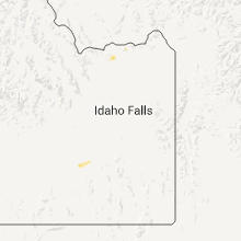
Hail Maps for American Falls, ID


Connect with Interactive Hail Maps