

Hail Map for Angleton, TX
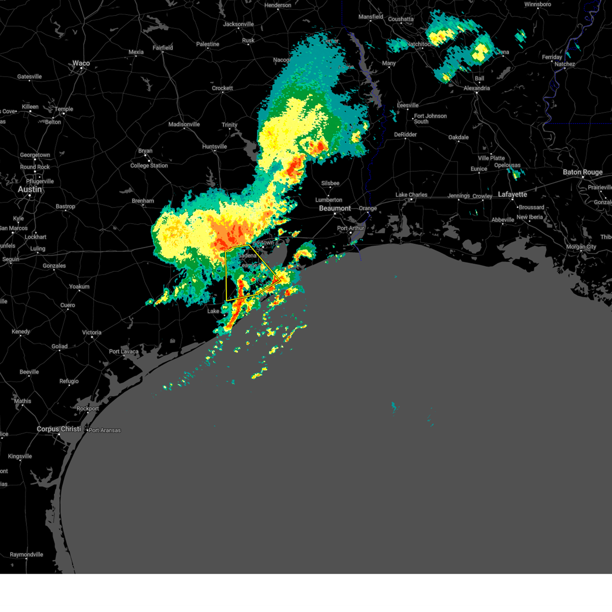
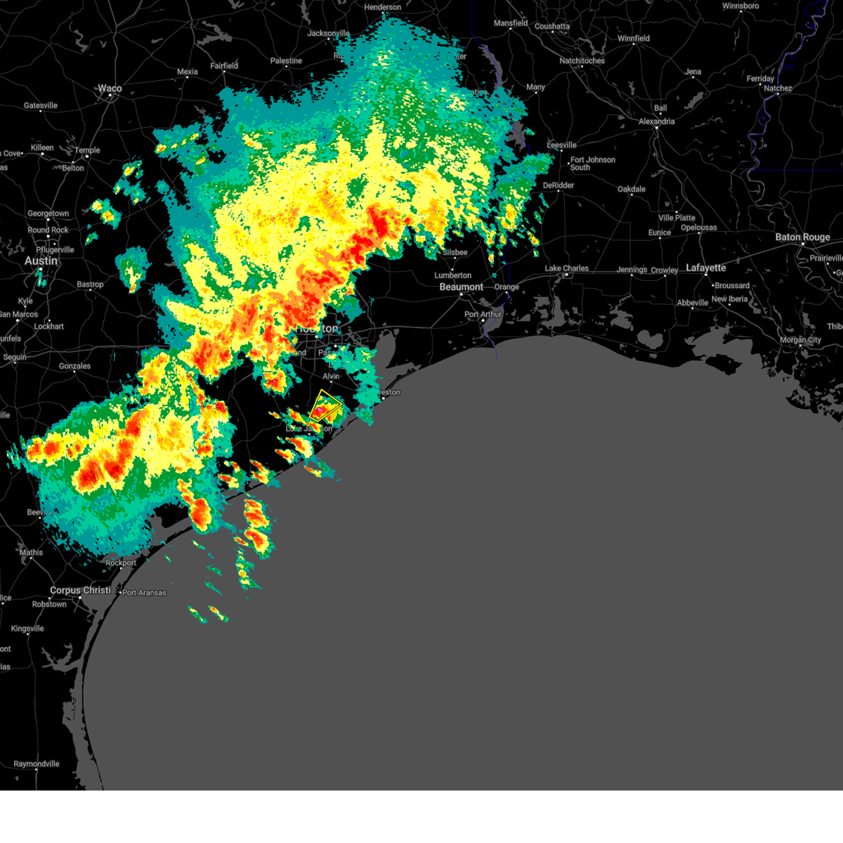
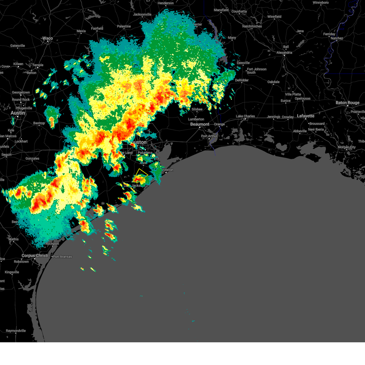
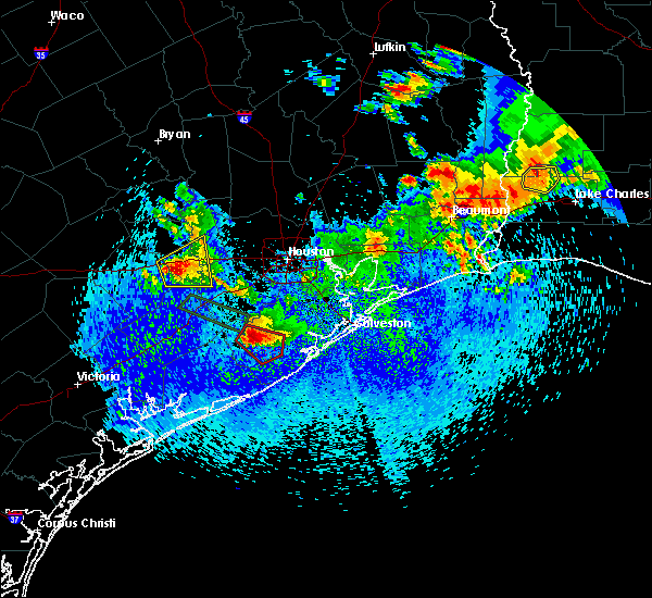
The Angleton, TX area has had 5 reports of on-the-ground hail by trained spotters, and has been under severe weather warnings 6 times during the past 12 months. Doppler radar has detected hail at or near Angleton, TX on 29 occasions, including 2 occasions during the past year.
| Name: | Angleton, TX |
| Where Located: | 41.4 miles S of Houston, TX |
| Map: | Google Map for Angleton, TX |
| Population: | 18862 |
| Housing Units: | 7621 |
| More Info: | Search Google for Angleton, TX |
1
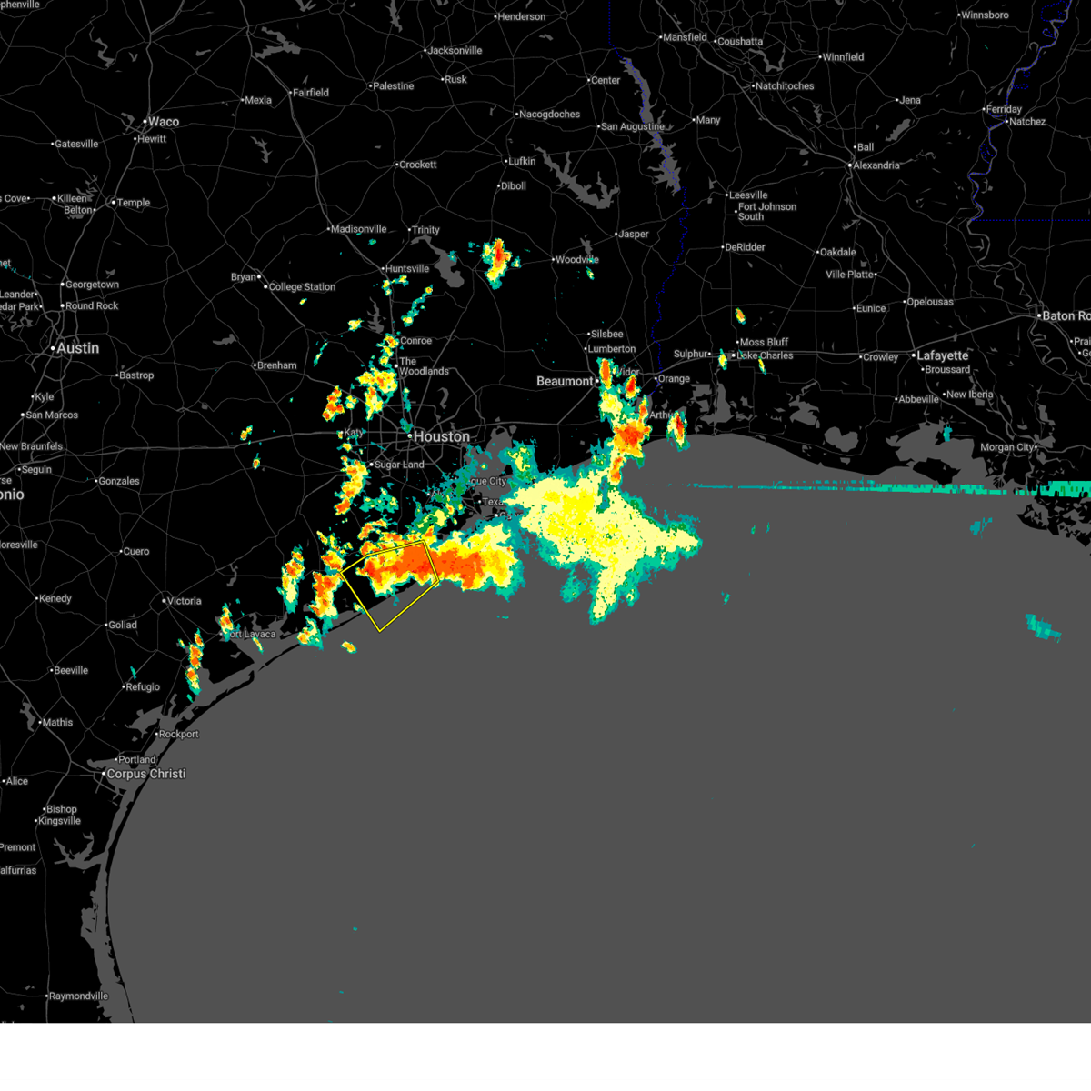
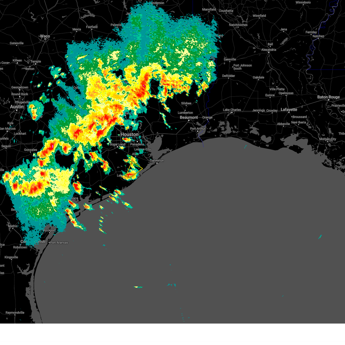
The Top Recent Hail Date for Angleton, TX is Tuesday, December 24, 2024 (7th out of 29)

Hail and Wind Damage Spotted near Angleton, TX
| Date / Time | Report Details |
|---|---|
| 6/14/2025 9:38 AM CDT |
 Svrhgx the national weather service in league city has issued a * severe thunderstorm warning for, southern brazoria county in southeastern texas, east central matagorda county in southeastern texas, * until 1030 am cdt. * at 938 am cdt, a severe thunderstorm was located over northeastern freeport, moving southwest at 5 mph (radar indicated). Hazards include 60 mph wind gusts. expect damage to roofs, siding, and trees Svrhgx the national weather service in league city has issued a * severe thunderstorm warning for, southern brazoria county in southeastern texas, east central matagorda county in southeastern texas, * until 1030 am cdt. * at 938 am cdt, a severe thunderstorm was located over northeastern freeport, moving southwest at 5 mph (radar indicated). Hazards include 60 mph wind gusts. expect damage to roofs, siding, and trees
|
| 3/24/2025 3:05 AM CDT |
 Svrhgx the national weather service in league city has issued a * severe thunderstorm warning for, galveston county in southeastern texas, northeastern brazoria county in southeastern texas, southeastern harris county in southeastern texas, * until 330 am cdt. * at 304 am cdt, severe thunderstorms were located along a line extending from deer park to greater hobby area to fort bend houston, moving southeast at 40 mph (radar indicated). Hazards include 60 mph wind gusts. expect damage to roofs, siding, and trees Svrhgx the national weather service in league city has issued a * severe thunderstorm warning for, galveston county in southeastern texas, northeastern brazoria county in southeastern texas, southeastern harris county in southeastern texas, * until 330 am cdt. * at 304 am cdt, severe thunderstorms were located along a line extending from deer park to greater hobby area to fort bend houston, moving southeast at 40 mph (radar indicated). Hazards include 60 mph wind gusts. expect damage to roofs, siding, and trees
|
| 12/25/2024 1:20 AM CST |
 At 120 am cst, a severe thunderstorm was located over danbury, or 7 miles northeast of angleton, moving northeast at 15 mph (radar indicated). Hazards include ping pong ball size hail and 60 mph wind gusts. People and animals outdoors will be injured. expect hail damage to roofs, siding, windows, and vehicles. expect wind damage to roofs, siding, and trees. Locations impacted include, northeastern angleton, danbury, liverpool, and chocolate bayou. At 120 am cst, a severe thunderstorm was located over danbury, or 7 miles northeast of angleton, moving northeast at 15 mph (radar indicated). Hazards include ping pong ball size hail and 60 mph wind gusts. People and animals outdoors will be injured. expect hail damage to roofs, siding, windows, and vehicles. expect wind damage to roofs, siding, and trees. Locations impacted include, northeastern angleton, danbury, liverpool, and chocolate bayou.
|
| 12/25/2024 1:08 AM CST |
 Svrhgx the national weather service in league city has issued a * severe thunderstorm warning for, east central brazoria county in southeastern texas, * until 130 am cst. * at 107 am cst, a severe thunderstorm was located near danbury, or near angleton, moving northeast at 20 mph (radar indicated). Hazards include 60 mph wind gusts and quarter size hail. Hail damage to vehicles is expected. Expect wind damage to roofs, siding, and trees. Svrhgx the national weather service in league city has issued a * severe thunderstorm warning for, east central brazoria county in southeastern texas, * until 130 am cst. * at 107 am cst, a severe thunderstorm was located near danbury, or near angleton, moving northeast at 20 mph (radar indicated). Hazards include 60 mph wind gusts and quarter size hail. Hail damage to vehicles is expected. Expect wind damage to roofs, siding, and trees.
|
| 12/25/2024 12:35 AM CST |
 At 1234 am cst, a severe thunderstorm was located over richwood, or near clute, moving northeast at 10 mph (radar indicated). Hazards include quarter size hail. Damage to vehicles is expected. Locations impacted include, eastern lake jackson, richwood, danbury, and liverpool. At 1234 am cst, a severe thunderstorm was located over richwood, or near clute, moving northeast at 10 mph (radar indicated). Hazards include quarter size hail. Damage to vehicles is expected. Locations impacted include, eastern lake jackson, richwood, danbury, and liverpool.
|
| 12/25/2024 12:20 AM CST |
 Svrhgx the national weather service in league city has issued a * severe thunderstorm warning for, east central brazoria county in southeastern texas, * until 100 am cst. * at 1219 am cst, a severe thunderstorm was located over richwood, or near clute, moving northeast at 15 mph (radar indicated). Hazards include quarter size hail. damage to vehicles is expected Svrhgx the national weather service in league city has issued a * severe thunderstorm warning for, east central brazoria county in southeastern texas, * until 100 am cst. * at 1219 am cst, a severe thunderstorm was located over richwood, or near clute, moving northeast at 15 mph (radar indicated). Hazards include quarter size hail. damage to vehicles is expected
|
| 6/5/2024 11:25 AM CDT |
 The storms which prompted the warning have weakened below severe limits, and no longer pose an immediate threat to life or property. therefore, the warning will be allowed to expire. however, gusty winds are still possible with these thunderstorms. The storms which prompted the warning have weakened below severe limits, and no longer pose an immediate threat to life or property. therefore, the warning will be allowed to expire. however, gusty winds are still possible with these thunderstorms.
|
| 6/5/2024 10:54 AM CDT |
 Svrhgx the national weather service in league city has issued a * severe thunderstorm warning for, northwestern galveston county in southeastern texas, southeastern brazoria county in southeastern texas, * until 1130 am cdt. * at 1053 am cdt, severe thunderstorms were located along a line extending from 13 miles southeast of galveston pleasure pier to near galveston state park to near jamaica beach, moving south at 35 mph. a mesonet site on galveston island measured a 63 mph wind gust from the outflow of these storms (radar indicated and sensor reported). Hazards include 60 mph wind gusts. expect damage to roofs, siding, and trees Svrhgx the national weather service in league city has issued a * severe thunderstorm warning for, northwestern galveston county in southeastern texas, southeastern brazoria county in southeastern texas, * until 1130 am cdt. * at 1053 am cdt, severe thunderstorms were located along a line extending from 13 miles southeast of galveston pleasure pier to near galveston state park to near jamaica beach, moving south at 35 mph. a mesonet site on galveston island measured a 63 mph wind gust from the outflow of these storms (radar indicated and sensor reported). Hazards include 60 mph wind gusts. expect damage to roofs, siding, and trees
|
| 6/1/2024 12:01 PM CDT |
 the severe thunderstorm warning has been cancelled and is no longer in effect the severe thunderstorm warning has been cancelled and is no longer in effect
|
| 6/1/2024 11:54 AM CDT |
 The storm which prompted the warning has weakened below severe limits, and has exited the warned area. therefore, the warning will be allowed to expire. however, gusty winds are still possible with this thunderstorm. a severe thunderstorm watch remains in effect until 600 pm cdt for southeastern texas. remember, a severe thunderstorm warning still remains in effect for portions of brazoria county, mainly near the coastline. The storm which prompted the warning has weakened below severe limits, and has exited the warned area. therefore, the warning will be allowed to expire. however, gusty winds are still possible with this thunderstorm. a severe thunderstorm watch remains in effect until 600 pm cdt for southeastern texas. remember, a severe thunderstorm warning still remains in effect for portions of brazoria county, mainly near the coastline.
|
| 6/1/2024 11:33 AM CDT |
 Svrhgx the national weather service in league city has issued a * severe thunderstorm warning for, southwestern galveston county in southeastern texas, southeastern brazoria county in southeastern texas, * until 1230 pm cdt. * at 1132 am cdt, a severe thunderstorm was located 7 miles northeast of oyster creek, or 9 miles north of surfside beach, moving northeast at 5 mph. a landspout has been observed with this storm by the local emergency manager, as well as members of the public (radar indicated). Hazards include 60 mph wind gusts and quarter size hail. Hail damage to vehicles is expected. Expect wind damage to roofs, siding, and trees. Svrhgx the national weather service in league city has issued a * severe thunderstorm warning for, southwestern galveston county in southeastern texas, southeastern brazoria county in southeastern texas, * until 1230 pm cdt. * at 1132 am cdt, a severe thunderstorm was located 7 miles northeast of oyster creek, or 9 miles north of surfside beach, moving northeast at 5 mph. a landspout has been observed with this storm by the local emergency manager, as well as members of the public (radar indicated). Hazards include 60 mph wind gusts and quarter size hail. Hail damage to vehicles is expected. Expect wind damage to roofs, siding, and trees.
|
| 6/1/2024 11:15 AM CDT |
 At 1114 am cdt, a severe thunderstorm was located over northern freeport, moving south at 5 mph. a landspout has been observed with this storm by the local emergency manager, as well as members of the public (radar indicated). Hazards include 60 mph wind gusts and quarter size hail. Hail damage to vehicles is expected. expect wind damage to roofs, siding, and trees. Locations impacted include, galveston island west end, lake jackson, angleton, freeport, clute, surfside beach, richwood, brazoria, jones creek, oyster creek, holiday lakes, bailey's prairie, and san luis pass. At 1114 am cdt, a severe thunderstorm was located over northern freeport, moving south at 5 mph. a landspout has been observed with this storm by the local emergency manager, as well as members of the public (radar indicated). Hazards include 60 mph wind gusts and quarter size hail. Hail damage to vehicles is expected. expect wind damage to roofs, siding, and trees. Locations impacted include, galveston island west end, lake jackson, angleton, freeport, clute, surfside beach, richwood, brazoria, jones creek, oyster creek, holiday lakes, bailey's prairie, and san luis pass.
|
| 6/1/2024 10:57 AM CDT |
 Svrhgx the national weather service in league city has issued a * severe thunderstorm warning for, southwestern galveston county in southeastern texas, southeastern brazoria county in southeastern texas, * until noon cdt. * at 1055 am cdt, a severe thunderstorm was located over oyster creek, or near freeport, moving south at 5 mph. a landspout has been observed with this storm by the local emergency manager, as well as members of the public (radar indicated). Hazards include 60 mph wind gusts and penny size hail. expect damage to roofs, siding, and trees Svrhgx the national weather service in league city has issued a * severe thunderstorm warning for, southwestern galveston county in southeastern texas, southeastern brazoria county in southeastern texas, * until noon cdt. * at 1055 am cdt, a severe thunderstorm was located over oyster creek, or near freeport, moving south at 5 mph. a landspout has been observed with this storm by the local emergency manager, as well as members of the public (radar indicated). Hazards include 60 mph wind gusts and penny size hail. expect damage to roofs, siding, and trees
|
| 5/31/2024 7:57 AM CDT |
 At 757 am cdt, severe thunderstorms were located along a line extending from smith point to 6 miles southeast of danbury, moving east at 25 mph (radar indicated). Hazards include 70 mph wind gusts and nickel size hail. Expect considerable tree damage. damage is likely to mobile homes, roofs, and outbuildings. Locations impacted include, galveston causeway, galveston island west end, texas city, northern lake jackson, angleton, dickinson, la marque, santa fe, hitchcock, galveston pier 21, danbury, bayou vista, jamaica beach, tiki island, san leon, scholes field, port bolivar, offatts bayou, galveston pleasure pier, and pelican island. At 757 am cdt, severe thunderstorms were located along a line extending from smith point to 6 miles southeast of danbury, moving east at 25 mph (radar indicated). Hazards include 70 mph wind gusts and nickel size hail. Expect considerable tree damage. damage is likely to mobile homes, roofs, and outbuildings. Locations impacted include, galveston causeway, galveston island west end, texas city, northern lake jackson, angleton, dickinson, la marque, santa fe, hitchcock, galveston pier 21, danbury, bayou vista, jamaica beach, tiki island, san leon, scholes field, port bolivar, offatts bayou, galveston pleasure pier, and pelican island.
|
| 5/31/2024 7:47 AM CDT |
 Svrhgx the national weather service in league city has issued a * severe thunderstorm warning for, galveston county in southeastern texas, east central brazoria county in southeastern texas, south central chambers county in southeastern texas, * until 815 am cdt. * at 746 am cdt, severe thunderstorms were located along a line extending from near smith point to near angleton, moving east at 25 mph (radar indicated). Hazards include 60 mph wind gusts and nickel size hail. expect damage to roofs, siding, and trees Svrhgx the national weather service in league city has issued a * severe thunderstorm warning for, galveston county in southeastern texas, east central brazoria county in southeastern texas, south central chambers county in southeastern texas, * until 815 am cdt. * at 746 am cdt, severe thunderstorms were located along a line extending from near smith point to near angleton, moving east at 25 mph (radar indicated). Hazards include 60 mph wind gusts and nickel size hail. expect damage to roofs, siding, and trees
|
| 5/13/2024 4:22 PM CDT |
 The storm which prompted the warning has weakened below severe limits, and no longer poses an immediate threat to life or property. therefore, the warning will be allowed to expire. however, small hail, gusty winds and heavy rain are still possible with this thunderstorm. a severe thunderstorm watch remains in effect until 800 pm cdt for southeastern texas. The storm which prompted the warning has weakened below severe limits, and no longer poses an immediate threat to life or property. therefore, the warning will be allowed to expire. however, small hail, gusty winds and heavy rain are still possible with this thunderstorm. a severe thunderstorm watch remains in effect until 800 pm cdt for southeastern texas.
|
| 5/13/2024 4:13 PM CDT |
 the severe thunderstorm warning has been cancelled and is no longer in effect the severe thunderstorm warning has been cancelled and is no longer in effect
|
| 5/13/2024 4:13 PM CDT |
 At 412 pm cdt, a severe thunderstorm was located near sweeny, moving east at 45 mph (radar indicated). Hazards include 60 mph wind gusts and quarter size hail. Hail damage to vehicles is expected. expect wind damage to roofs, siding, and trees. Locations impacted include, lake jackson, angleton, northwestern freeport, clute, west columbia, sweeny, richwood, brazoria, jones creek, holiday lakes, bailey's prairie, wild peach village, and van vleck. At 412 pm cdt, a severe thunderstorm was located near sweeny, moving east at 45 mph (radar indicated). Hazards include 60 mph wind gusts and quarter size hail. Hail damage to vehicles is expected. expect wind damage to roofs, siding, and trees. Locations impacted include, lake jackson, angleton, northwestern freeport, clute, west columbia, sweeny, richwood, brazoria, jones creek, holiday lakes, bailey's prairie, wild peach village, and van vleck.
|
| 5/13/2024 3:54 PM CDT |
 Svrhgx the national weather service in league city has issued a * severe thunderstorm warning for, southeastern wharton county in southeastern texas, southwestern brazoria county in southeastern texas, northeastern matagorda county in southeastern texas, * until 430 pm cdt. * at 354 pm cdt, a severe thunderstorm was located over van vleck, or near bay city, moving east at 45 mph (radar indicated). Hazards include 60 mph wind gusts and quarter size hail. Hail damage to vehicles is expected. Expect wind damage to roofs, siding, and trees. Svrhgx the national weather service in league city has issued a * severe thunderstorm warning for, southeastern wharton county in southeastern texas, southwestern brazoria county in southeastern texas, northeastern matagorda county in southeastern texas, * until 430 pm cdt. * at 354 pm cdt, a severe thunderstorm was located over van vleck, or near bay city, moving east at 45 mph (radar indicated). Hazards include 60 mph wind gusts and quarter size hail. Hail damage to vehicles is expected. Expect wind damage to roofs, siding, and trees.
|
| 4/10/2024 3:59 AM CDT |
 the severe thunderstorm warning has been cancelled and is no longer in effect the severe thunderstorm warning has been cancelled and is no longer in effect
|
| 4/10/2024 3:38 AM CDT |
 At 338 am cdt, severe thunderstorms were located along a line extending from near fresno to bonney to near bailey's prairie, moving east at 50 mph (radar indicated). Hazards include 60 mph wind gusts. Expect damage to roofs, siding, and trees. Locations impacted include, pearland, sugar land, missouri city, rosenberg, lake jackson, alvin, angleton, stafford, richmond, clute, manvel, west columbia, sweeny, fresno, first colony, pecan grove, greater hobby area, richwood, brazoria, and needville. At 338 am cdt, severe thunderstorms were located along a line extending from near fresno to bonney to near bailey's prairie, moving east at 50 mph (radar indicated). Hazards include 60 mph wind gusts. Expect damage to roofs, siding, and trees. Locations impacted include, pearland, sugar land, missouri city, rosenberg, lake jackson, alvin, angleton, stafford, richmond, clute, manvel, west columbia, sweeny, fresno, first colony, pecan grove, greater hobby area, richwood, brazoria, and needville.
|
| 4/10/2024 3:23 AM CDT |
 Svrhgx the national weather service in league city has issued a * severe thunderstorm warning for, east central wharton county in southeastern texas, fort bend county in southeastern texas, brazoria county in southeastern texas, north central matagorda county in southeastern texas, south central harris county in southeastern texas, * until 415 am cdt. * at 323 am cdt, severe thunderstorms were located along a line extending from riverstone to near brazos bend state park to near west columbia, moving east at 35 mph (radar indicated). Hazards include 70 mph wind gusts. Expect considerable tree damage. Damage is likely to mobile homes, roofs, and outbuildings. Svrhgx the national weather service in league city has issued a * severe thunderstorm warning for, east central wharton county in southeastern texas, fort bend county in southeastern texas, brazoria county in southeastern texas, north central matagorda county in southeastern texas, south central harris county in southeastern texas, * until 415 am cdt. * at 323 am cdt, severe thunderstorms were located along a line extending from riverstone to near brazos bend state park to near west columbia, moving east at 35 mph (radar indicated). Hazards include 70 mph wind gusts. Expect considerable tree damage. Damage is likely to mobile homes, roofs, and outbuildings.
|
| 3/16/2024 4:26 AM CDT |
 The storm which prompted the warning has weakened below severe limits, and no longer poses an immediate threat to life or property. therefore, the warning will be allowed to expire. however, small hail is still possible with this thunderstorm. The storm which prompted the warning has weakened below severe limits, and no longer poses an immediate threat to life or property. therefore, the warning will be allowed to expire. however, small hail is still possible with this thunderstorm.
|
| 3/16/2024 4:01 AM CDT |
 Svrhgx the national weather service in league city has issued a * severe thunderstorm warning for, west central galveston county in southeastern texas, northeastern brazoria county in southeastern texas, * until 430 am cdt. * at 400 am cdt, a severe thunderstorm was located over bonney, or 10 miles north of angleton, moving east at 25 mph (radar indicated). Hazards include half dollar size hail. damage to vehicles is expected Svrhgx the national weather service in league city has issued a * severe thunderstorm warning for, west central galveston county in southeastern texas, northeastern brazoria county in southeastern texas, * until 430 am cdt. * at 400 am cdt, a severe thunderstorm was located over bonney, or 10 miles north of angleton, moving east at 25 mph (radar indicated). Hazards include half dollar size hail. damage to vehicles is expected
|
| 3/16/2024 3:52 AM CDT |
 At 352 am cdt, a severe thunderstorm was located over bonney, or 7 miles north of angleton, moving east at 30 mph (radar indicated). Hazards include 60 mph wind gusts and half dollar size hail. Hail damage to vehicles is expected. expect wind damage to roofs, siding, and trees. Locations impacted include, northwestern angleton, bonney, and rosharon. At 352 am cdt, a severe thunderstorm was located over bonney, or 7 miles north of angleton, moving east at 30 mph (radar indicated). Hazards include 60 mph wind gusts and half dollar size hail. Hail damage to vehicles is expected. expect wind damage to roofs, siding, and trees. Locations impacted include, northwestern angleton, bonney, and rosharon.
|
| 3/16/2024 3:43 AM CDT |
 At 342 am cdt, a severe thunderstorm was located near bonney, or 11 miles northwest of angleton, moving east at 30 mph (radar indicated). Hazards include two inch hail and 60 mph wind gusts. People and animals outdoors will be injured. expect hail damage to roofs, siding, windows, and vehicles. expect wind damage to roofs, siding, and trees. Locations impacted include, northwestern angleton, holiday lakes, bailey's prairie, bonney, brazos bend state park, and rosharon. At 342 am cdt, a severe thunderstorm was located near bonney, or 11 miles northwest of angleton, moving east at 30 mph (radar indicated). Hazards include two inch hail and 60 mph wind gusts. People and animals outdoors will be injured. expect hail damage to roofs, siding, windows, and vehicles. expect wind damage to roofs, siding, and trees. Locations impacted include, northwestern angleton, holiday lakes, bailey's prairie, bonney, brazos bend state park, and rosharon.
|
| 3/16/2024 3:29 AM CDT |
 Svrhgx the national weather service in league city has issued a * severe thunderstorm warning for, southeastern fort bend county in southeastern texas, central brazoria county in southeastern texas, * until 400 am cdt. * at 328 am cdt, a severe thunderstorm was located near brazos bend state park, or 12 miles north of west columbia, moving east at 30 mph. this is a destructive storm for southeastern fort bend and central brazoria counties (radar indicated). Hazards include baseball size hail and 60 mph wind gusts. People and animals outdoors will be severely injured. Expect shattered windows, extensive damage to roofs, siding, and vehicles. Svrhgx the national weather service in league city has issued a * severe thunderstorm warning for, southeastern fort bend county in southeastern texas, central brazoria county in southeastern texas, * until 400 am cdt. * at 328 am cdt, a severe thunderstorm was located near brazos bend state park, or 12 miles north of west columbia, moving east at 30 mph. this is a destructive storm for southeastern fort bend and central brazoria counties (radar indicated). Hazards include baseball size hail and 60 mph wind gusts. People and animals outdoors will be severely injured. Expect shattered windows, extensive damage to roofs, siding, and vehicles.
|
| 3/15/2024 6:38 PM CDT |
 At 637 pm cdt, a severe thunderstorm was located near san luis pass, or 12 miles northeast of surfside beach, moving southeast at 30 mph (public). Hazards include golf ball size hail and 70 mph wind gusts. People and animals outdoors will be injured. expect hail damage to roofs, siding, windows, and vehicles. expect considerable tree damage. wind damage is also likely to mobile homes, roofs, and outbuildings. Locations impacted include, galveston island west end, southern lake jackson, angleton, freeport, clute, surfside beach, richwood, jones creek, danbury, oyster creek, northeastern bailey's prairie, and san luis pass. At 637 pm cdt, a severe thunderstorm was located near san luis pass, or 12 miles northeast of surfside beach, moving southeast at 30 mph (public). Hazards include golf ball size hail and 70 mph wind gusts. People and animals outdoors will be injured. expect hail damage to roofs, siding, windows, and vehicles. expect considerable tree damage. wind damage is also likely to mobile homes, roofs, and outbuildings. Locations impacted include, galveston island west end, southern lake jackson, angleton, freeport, clute, surfside beach, richwood, jones creek, danbury, oyster creek, northeastern bailey's prairie, and san luis pass.
|
| 3/15/2024 6:36 PM CDT | Storm damage reported in brazoria county TX, 3.9 miles NNE of Angleton, TX |
| 3/15/2024 6:29 PM CDT | Golf Ball sized hail reported 3 miles SSW of Angleton, TX |
| 3/15/2024 6:27 PM CDT | Quarter sized hail reported 2.9 miles SSE of Angleton, TX |
| 3/15/2024 6:26 PM CDT |
 the severe thunderstorm warning has been cancelled and is no longer in effect the severe thunderstorm warning has been cancelled and is no longer in effect
|
| 3/15/2024 6:26 PM CDT |
 At 625 pm cdt, a severe thunderstorm was located near danbury, or 7 miles east of angleton, moving southeast at 30 mph (radar indicated). Hazards include two inch hail and 70 mph wind gusts. People and animals outdoors will be injured. expect hail damage to roofs, siding, windows, and vehicles. expect considerable tree damage. wind damage is also likely to mobile homes, roofs, and outbuildings. Locations impacted include, galveston island west end, lake jackson, angleton, freeport, clute, surfside beach, richwood, brazoria, jones creek, danbury, oyster creek, holiday lakes, bailey's prairie, bonney, and san luis pass. At 625 pm cdt, a severe thunderstorm was located near danbury, or 7 miles east of angleton, moving southeast at 30 mph (radar indicated). Hazards include two inch hail and 70 mph wind gusts. People and animals outdoors will be injured. expect hail damage to roofs, siding, windows, and vehicles. expect considerable tree damage. wind damage is also likely to mobile homes, roofs, and outbuildings. Locations impacted include, galveston island west end, lake jackson, angleton, freeport, clute, surfside beach, richwood, brazoria, jones creek, danbury, oyster creek, holiday lakes, bailey's prairie, bonney, and san luis pass.
|
| 3/15/2024 6:22 PM CDT |
 The storm which prompted the warning has moved out of the area. therefore, the warning will be allowed to expire. a severe thunderstorm watch remains in effect until 800 pm cdt for southeastern texas. remember, a severe thunderstorm warning still remains in effect for fort bend and brazoria counties. The storm which prompted the warning has moved out of the area. therefore, the warning will be allowed to expire. a severe thunderstorm watch remains in effect until 800 pm cdt for southeastern texas. remember, a severe thunderstorm warning still remains in effect for fort bend and brazoria counties.
|
| 3/15/2024 6:15 PM CDT | Handheld anemometer measuremen in brazoria county TX, 2.9 miles SSE of Angleton, TX |
| 3/15/2024 6:11 PM CDT | Power lines and trees down at brazoria county fairgrounds. time estimated by rada in brazoria county TX, 1 miles NW of Angleton, TX |
| 3/15/2024 6:11 PM CDT | Large tree uprooted and knocked down wood fencin in brazoria county TX, 2.2 miles N of Angleton, TX |
| 3/15/2024 6:04 PM CDT |
 Svrhgx the national weather service in league city has issued a * severe thunderstorm warning for, southern galveston county in southeastern texas, southeastern fort bend county in southeastern texas, southern brazoria county in southeastern texas, * until 645 pm cdt. * at 603 pm cdt, a severe thunderstorm was located near holiday lakes, or near angleton, moving southeast at 30 mph (radar indicated). Hazards include two inch hail and 70 mph wind gusts. People and animals outdoors will be injured. expect hail damage to roofs, siding, windows, and vehicles. expect considerable tree damage. Wind damage is also likely to mobile homes, roofs, and outbuildings. Svrhgx the national weather service in league city has issued a * severe thunderstorm warning for, southern galveston county in southeastern texas, southeastern fort bend county in southeastern texas, southern brazoria county in southeastern texas, * until 645 pm cdt. * at 603 pm cdt, a severe thunderstorm was located near holiday lakes, or near angleton, moving southeast at 30 mph (radar indicated). Hazards include two inch hail and 70 mph wind gusts. People and animals outdoors will be injured. expect hail damage to roofs, siding, windows, and vehicles. expect considerable tree damage. Wind damage is also likely to mobile homes, roofs, and outbuildings.
|
| 3/15/2024 5:56 PM CDT |
 At 556 pm cdt, a severe thunderstorm was located near brazos bend state park, or 10 miles northeast of west columbia, moving southeast at 20 mph (radar indicated). Hazards include two inch hail and 70 mph wind gusts. People and animals outdoors will be injured. expect hail damage to roofs, siding, windows, and vehicles. expect considerable tree damage. wind damage is also likely to mobile homes, roofs, and outbuildings. Locations impacted include, west columbia, holiday lakes, western bailey's prairie, bonney, brazos bend state park, wild peach village, and rosharon. At 556 pm cdt, a severe thunderstorm was located near brazos bend state park, or 10 miles northeast of west columbia, moving southeast at 20 mph (radar indicated). Hazards include two inch hail and 70 mph wind gusts. People and animals outdoors will be injured. expect hail damage to roofs, siding, windows, and vehicles. expect considerable tree damage. wind damage is also likely to mobile homes, roofs, and outbuildings. Locations impacted include, west columbia, holiday lakes, western bailey's prairie, bonney, brazos bend state park, wild peach village, and rosharon.
|
| 3/15/2024 5:43 PM CDT |
 Svrhgx the national weather service in league city has issued a * severe thunderstorm warning for, southeastern fort bend county in southeastern texas, central brazoria county in southeastern texas, * until 630 pm cdt. * at 543 pm cdt, a severe thunderstorm was located near brazos bend state park, or 11 miles north of west columbia, moving southeast at 20 mph (radar indicated). Hazards include two inch hail and 60 mph wind gusts. People and animals outdoors will be injured. expect hail damage to roofs, siding, windows, and vehicles. Expect wind damage to roofs, siding, and trees. Svrhgx the national weather service in league city has issued a * severe thunderstorm warning for, southeastern fort bend county in southeastern texas, central brazoria county in southeastern texas, * until 630 pm cdt. * at 543 pm cdt, a severe thunderstorm was located near brazos bend state park, or 11 miles north of west columbia, moving southeast at 20 mph (radar indicated). Hazards include two inch hail and 60 mph wind gusts. People and animals outdoors will be injured. expect hail damage to roofs, siding, windows, and vehicles. Expect wind damage to roofs, siding, and trees.
|
| 1/5/2024 5:56 AM CST |
 At 556 am cst, a severe thunderstorm capable of producing a tornado was located over lake jackson, moving northeast at 30 mph (radar indicated rotation). Hazards include tornado. Flying debris will be dangerous to those caught without shelter. mobile homes will be damaged or destroyed. damage to roofs, windows, and vehicles will occur. tree damage is likely. This dangerous storm will be near, lake jackson, angleton, richwood, and bailey`s prairie around 600 am cst. At 556 am cst, a severe thunderstorm capable of producing a tornado was located over lake jackson, moving northeast at 30 mph (radar indicated rotation). Hazards include tornado. Flying debris will be dangerous to those caught without shelter. mobile homes will be damaged or destroyed. damage to roofs, windows, and vehicles will occur. tree damage is likely. This dangerous storm will be near, lake jackson, angleton, richwood, and bailey`s prairie around 600 am cst.
|
| 10/5/2023 9:51 AM CDT |
 At 950 am cdt, severe thunderstorms were located along a line extending from 10 miles south of galveston state park to 17 miles south of freeport to 6 miles southeast of schicke point, moving southeast at 35 mph (radar indicated). Hazards include 70 mph wind gusts. Expect considerable tree damage. damage is likely to mobile homes, roofs, and outbuildings. locations impacted include, galveston island west end, matagorda, lake jackson, freeport, clute, hitchcock, palacios, surfside beach, south texas nuclear plant, richwood, brazoria, jones creek, oyster creek, jamaica beach, galveston state park, sargent, san luis pass, and wadsworth. thunderstorm damage threat, considerable hail threat, radar indicated max hail size, <. 75 in wind threat, observed max wind gust, 70 mph. At 950 am cdt, severe thunderstorms were located along a line extending from 10 miles south of galveston state park to 17 miles south of freeport to 6 miles southeast of schicke point, moving southeast at 35 mph (radar indicated). Hazards include 70 mph wind gusts. Expect considerable tree damage. damage is likely to mobile homes, roofs, and outbuildings. locations impacted include, galveston island west end, matagorda, lake jackson, freeport, clute, hitchcock, palacios, surfside beach, south texas nuclear plant, richwood, brazoria, jones creek, oyster creek, jamaica beach, galveston state park, sargent, san luis pass, and wadsworth. thunderstorm damage threat, considerable hail threat, radar indicated max hail size, <. 75 in wind threat, observed max wind gust, 70 mph.
|
| 10/5/2023 9:37 AM CDT |
 At 936 am cdt, severe thunderstorms were located along a line extending from near jamaica beach to 11 miles southeast of sargent to schicke point, moving southeast at 35 mph. palacios reported a wind gust of 75 mph at 929 am cdt (radar indicated). Hazards include 70 mph wind gusts. Expect considerable tree damage. Damage is likely to mobile homes, roofs, and outbuildings. At 936 am cdt, severe thunderstorms were located along a line extending from near jamaica beach to 11 miles southeast of sargent to schicke point, moving southeast at 35 mph. palacios reported a wind gust of 75 mph at 929 am cdt (radar indicated). Hazards include 70 mph wind gusts. Expect considerable tree damage. Damage is likely to mobile homes, roofs, and outbuildings.
|
| 6/21/2023 9:52 PM CDT |
 At 951 pm cdt, severe thunderstorms were located along a line extending from near smith point to santa fe to 6 miles west of holiday lakes, moving south at 40 mph (radar indicated). Hazards include 60 mph wind gusts. expect damage to roofs, siding, and trees At 951 pm cdt, severe thunderstorms were located along a line extending from near smith point to santa fe to 6 miles west of holiday lakes, moving south at 40 mph (radar indicated). Hazards include 60 mph wind gusts. expect damage to roofs, siding, and trees
|
| 6/21/2023 9:27 PM CDT |
 At 927 pm cdt, severe thunderstorms were located along a line extending from near barrett to bellaire to near east bernard, moving south at 20 mph (radar indicated). Hazards include 70 mph wind gusts. Expect considerable tree damage. Damage is likely to mobile homes, roofs, and outbuildings. At 927 pm cdt, severe thunderstorms were located along a line extending from near barrett to bellaire to near east bernard, moving south at 20 mph (radar indicated). Hazards include 70 mph wind gusts. Expect considerable tree damage. Damage is likely to mobile homes, roofs, and outbuildings.
|
| 6/4/2023 2:26 AM CDT |
 At 225 am cdt, severe thunderstorms were located along a line extending from 7 miles northwest of smith point to near san leon to near bayou vista to 6 miles north of san luis pass to oyster creek, moving southeast at 25 mph (radar indicated). Hazards include 60 mph wind gusts. expect damage to roofs, siding, and trees At 225 am cdt, severe thunderstorms were located along a line extending from 7 miles northwest of smith point to near san leon to near bayou vista to 6 miles north of san luis pass to oyster creek, moving southeast at 25 mph (radar indicated). Hazards include 60 mph wind gusts. expect damage to roofs, siding, and trees
|
| 5/10/2023 6:29 AM CDT |
 At 628 am cdt, severe thunderstorms were located along a line extending from pearland to 16 miles southeast of surfside beach, moving east at 20 mph (radar indicated). Hazards include 60 mph wind gusts. expect damage to roofs, siding, and trees At 628 am cdt, severe thunderstorms were located along a line extending from pearland to 16 miles southeast of surfside beach, moving east at 20 mph (radar indicated). Hazards include 60 mph wind gusts. expect damage to roofs, siding, and trees
|
| 5/10/2023 5:54 AM CDT |
 At 554 am cdt, severe thunderstorms were located along a line extending from near riverstone to near richwood to 16 miles southeast of sargent, moving east at 25 mph (radar indicated). Hazards include 60 mph wind gusts. expect damage to roofs, siding, and trees At 554 am cdt, severe thunderstorms were located along a line extending from near riverstone to near richwood to 16 miles southeast of sargent, moving east at 25 mph (radar indicated). Hazards include 60 mph wind gusts. expect damage to roofs, siding, and trees
|
| 3/28/2023 3:03 AM CDT |
 At 303 am cdt, a severe thunderstorm was located over northern lake jackson, moving east at 30 mph (radar indicated). Hazards include quarter size hail. Damage to vehicles is expected. locations impacted include, lake jackson, southern angleton, northwestern freeport, clute, richwood, brazoria, southern bailey`s prairie and southeastern wild peach village. hail threat, radar indicated max hail size, 1. 00 in wind threat, radar indicated max wind gust, <50 mph. At 303 am cdt, a severe thunderstorm was located over northern lake jackson, moving east at 30 mph (radar indicated). Hazards include quarter size hail. Damage to vehicles is expected. locations impacted include, lake jackson, southern angleton, northwestern freeport, clute, richwood, brazoria, southern bailey`s prairie and southeastern wild peach village. hail threat, radar indicated max hail size, 1. 00 in wind threat, radar indicated max wind gust, <50 mph.
|
| 3/28/2023 2:50 AM CDT |
 At 250 am cdt, a severe thunderstorm was located over brazoria, or near lake jackson, moving east at 30 mph (radar indicated). Hazards include quarter size hail. Damage to vehicles is expected. locations impacted include, lake jackson, angleton, northwestern freeport, clute, west columbia, sweeny, richwood, brazoria, bailey`s prairie and wild peach village. hail threat, radar indicated max hail size, 1. 00 in wind threat, radar indicated max wind gust, <50 mph. At 250 am cdt, a severe thunderstorm was located over brazoria, or near lake jackson, moving east at 30 mph (radar indicated). Hazards include quarter size hail. Damage to vehicles is expected. locations impacted include, lake jackson, angleton, northwestern freeport, clute, west columbia, sweeny, richwood, brazoria, bailey`s prairie and wild peach village. hail threat, radar indicated max hail size, 1. 00 in wind threat, radar indicated max wind gust, <50 mph.
|
| 3/28/2023 2:43 AM CDT |
 At 243 am cdt, a severe thunderstorm was located over wild peach village, or near west columbia, moving east at 30 mph (radar indicated). Hazards include quarter size hail. damage to vehicles is expected At 243 am cdt, a severe thunderstorm was located over wild peach village, or near west columbia, moving east at 30 mph (radar indicated). Hazards include quarter size hail. damage to vehicles is expected
|
| 1/24/2023 2:00 PM CST |
 At 159 pm cst, a line of severe thunderstorms were located along a line extending from arcola to holiday lakes to near sweeny, moving east at 50 mph (radar indicated). Hazards include 60 mph wind gusts. expect damage to roofs, siding, and trees At 159 pm cst, a line of severe thunderstorms were located along a line extending from arcola to holiday lakes to near sweeny, moving east at 50 mph (radar indicated). Hazards include 60 mph wind gusts. expect damage to roofs, siding, and trees
|
| 5/24/2022 9:42 AM CDT |
 At 941 am cdt, a severe thunderstorm was located near richwood, or near clute, moving north at 40 mph (radar indicated). Hazards include 60 mph wind gusts. Expect damage to roofs, siding, and trees. locations impacted include, galveston island west end, lake jackson, angleton, freeport, clute, hitchcock, surfside beach, richwood, brazoria, jones creek, danbury, oyster creek, bailey`s prairie, san luis pass and eastern wild peach village. hail threat, radar indicated max hail size, <. 75 in wind threat, radar indicated max wind gust, 60 mph. At 941 am cdt, a severe thunderstorm was located near richwood, or near clute, moving north at 40 mph (radar indicated). Hazards include 60 mph wind gusts. Expect damage to roofs, siding, and trees. locations impacted include, galveston island west end, lake jackson, angleton, freeport, clute, hitchcock, surfside beach, richwood, brazoria, jones creek, danbury, oyster creek, bailey`s prairie, san luis pass and eastern wild peach village. hail threat, radar indicated max hail size, <. 75 in wind threat, radar indicated max wind gust, 60 mph.
|
| 5/24/2022 9:27 AM CDT |
 At 927 am cdt, a severe thunderstorm was located over freeport, moving north at 40 mph (radar indicated). Hazards include 60 mph wind gusts. expect damage to roofs, siding, and trees At 927 am cdt, a severe thunderstorm was located over freeport, moving north at 40 mph (radar indicated). Hazards include 60 mph wind gusts. expect damage to roofs, siding, and trees
|
| 6/3/2021 8:21 PM CDT |
 At 821 pm cdt, a severe thunderstorm capable of producing a tornado was located over richwood, or over clute, moving northeast at 5 mph (radar indicated rotation). Hazards include tornado. Expect damage to mobile homes, roofs, and vehicles. This tornadic thunderstorm will remain over mainly rural areas of central brazoria county. At 821 pm cdt, a severe thunderstorm capable of producing a tornado was located over richwood, or over clute, moving northeast at 5 mph (radar indicated rotation). Hazards include tornado. Expect damage to mobile homes, roofs, and vehicles. This tornadic thunderstorm will remain over mainly rural areas of central brazoria county.
|
| 1/6/2021 6:16 PM CST |
 At 616 pm cst, a severe thunderstorm was located over san leon, or 7 miles northeast of texas city, moving east at 50 mph (radar indicated). Hazards include 60 mph wind gusts and quarter size hail. Hail damage to vehicles is expected. Expect wind damage to roofs, siding, and trees. At 616 pm cst, a severe thunderstorm was located over san leon, or 7 miles northeast of texas city, moving east at 50 mph (radar indicated). Hazards include 60 mph wind gusts and quarter size hail. Hail damage to vehicles is expected. Expect wind damage to roofs, siding, and trees.
|
| 5/28/2020 4:52 PM CDT |
 At 452 pm cdt, severe thunderstorms were located along a line extending from near danbury to near angleton to near holiday lakes, moving southwest at 10 mph (radar indicated). Hazards include 60 mph wind gusts and half dollar size hail. Hail damage to vehicles is expected. Expect wind damage to roofs, siding, and trees. At 452 pm cdt, severe thunderstorms were located along a line extending from near danbury to near angleton to near holiday lakes, moving southwest at 10 mph (radar indicated). Hazards include 60 mph wind gusts and half dollar size hail. Hail damage to vehicles is expected. Expect wind damage to roofs, siding, and trees.
|
| 4/29/2020 5:51 AM CDT |
 At 550 am cdt, severe thunderstorms were located along a line extending from near bolivar peninsula to near hitchcock to angleton to 9 miles west of west columbia, moving south at 45 mph (trained weather spotters have reported wind gusts to 60 mph with these storms. there have also been reports of wind damage to trees). Hazards include 60 mph wind gusts and penny size hail. Expect damage to trees. Locations impacted include, league city, galveston causeway, galveston island west end, texas city, southern friendswood, lake jackson, alvin, angleton, dickinson, la marque, santa fe, freeport, clute, webster, hitchcock, southeastern manvel, west columbia, kemah, surfside beach and galveston pier 21. At 550 am cdt, severe thunderstorms were located along a line extending from near bolivar peninsula to near hitchcock to angleton to 9 miles west of west columbia, moving south at 45 mph (trained weather spotters have reported wind gusts to 60 mph with these storms. there have also been reports of wind damage to trees). Hazards include 60 mph wind gusts and penny size hail. Expect damage to trees. Locations impacted include, league city, galveston causeway, galveston island west end, texas city, southern friendswood, lake jackson, alvin, angleton, dickinson, la marque, santa fe, freeport, clute, webster, hitchcock, southeastern manvel, west columbia, kemah, surfside beach and galveston pier 21.
|
| 4/29/2020 5:41 AM CDT |
 At 540 am cdt, severe thunderstorms continnued with a gust front located along a line extending from near bolivar peninsula to near santa fe to near bonney to 8 miles south of needville, moving south at 45 mph (trained weather spotters have reported gusts to 60 mph in this line of storms. small hail was observed at the nws houston/galveston office). Hazards include 60 mph wind gusts and penny size hail. Expect damage to trees. Locations impacted include, southeastern pasadena, pearland, league city, southeastern baytown, galveston causeway, galveston island west end, texas city, friendswood, la porte, lake jackson, alvin, angleton, dickinson, la marque, santa fe, freeport, seabrook, clute, webster and hitchcock. At 540 am cdt, severe thunderstorms continnued with a gust front located along a line extending from near bolivar peninsula to near santa fe to near bonney to 8 miles south of needville, moving south at 45 mph (trained weather spotters have reported gusts to 60 mph in this line of storms. small hail was observed at the nws houston/galveston office). Hazards include 60 mph wind gusts and penny size hail. Expect damage to trees. Locations impacted include, southeastern pasadena, pearland, league city, southeastern baytown, galveston causeway, galveston island west end, texas city, friendswood, la porte, lake jackson, alvin, angleton, dickinson, la marque, santa fe, freeport, seabrook, clute, webster and hitchcock.
|
| 4/29/2020 5:29 AM CDT |
 At 528 am cdt, severe thunderstorms continued with a gust front located along a line extending from near stowell to near san leon to near alvin to near brazos bend state park to near east bernard, moving south at 45 mph (radar indicated. this line of storms has a history of producing measured gusts over 50 mph and small hail). Hazards include 60 mph wind gusts and penny size hail. Expect damage to roofs, siding, and trees. Locations impacted include, pasadena, pearland, league city, sugar land, baytown, missouri city, galveston causeway, galveston island west end, texas city, friendswood, la porte, deer park, rosenberg, lake jackson, alvin, angleton, dickinson, stafford, south houston and bellaire. At 528 am cdt, severe thunderstorms continued with a gust front located along a line extending from near stowell to near san leon to near alvin to near brazos bend state park to near east bernard, moving south at 45 mph (radar indicated. this line of storms has a history of producing measured gusts over 50 mph and small hail). Hazards include 60 mph wind gusts and penny size hail. Expect damage to roofs, siding, and trees. Locations impacted include, pasadena, pearland, league city, sugar land, baytown, missouri city, galveston causeway, galveston island west end, texas city, friendswood, la porte, deer park, rosenberg, lake jackson, alvin, angleton, dickinson, stafford, south houston and bellaire.
|
| 4/29/2020 5:18 AM CDT |
 At 516 am cdt, severe thunderstorms were located along a line extending from near winnie to near shoreacres to near pearland to thompsons to near wallis, moving south at 45 mph (radar indicated. this storm has produced a gust to 56 mph at hobby airport, along with reports of small hail). Hazards include 60 mph wind gusts and penny size hail. Expect damage to roofs, siding, and trees. Locations impacted include, pasadena, pearland, league city, sugar land, baytown, missouri city, galveston island west end, galveston causeway, texas city, friendswood, la porte, deer park, rosenberg, lake jackson, alvin, angleton, dickinson, stafford, south houston and bellaire. At 516 am cdt, severe thunderstorms were located along a line extending from near winnie to near shoreacres to near pearland to thompsons to near wallis, moving south at 45 mph (radar indicated. this storm has produced a gust to 56 mph at hobby airport, along with reports of small hail). Hazards include 60 mph wind gusts and penny size hail. Expect damage to roofs, siding, and trees. Locations impacted include, pasadena, pearland, league city, sugar land, baytown, missouri city, galveston island west end, galveston causeway, texas city, friendswood, la porte, deer park, rosenberg, lake jackson, alvin, angleton, dickinson, stafford, south houston and bellaire.
|
| 4/29/2020 4:59 AM CDT |
 The national weather service in league city has issued a * severe thunderstorm warning for. eastern austin county in southeastern texas. galveston county in southeastern texas. fort bend county in southeastern texas. Brazoria county in southeastern texas. The national weather service in league city has issued a * severe thunderstorm warning for. eastern austin county in southeastern texas. galveston county in southeastern texas. fort bend county in southeastern texas. Brazoria county in southeastern texas.
|
| 4/28/2020 2:45 PM CDT |
 At 243 pm cdt, a severe thunderstorm was located near west columbia, moving southeast at around 15 mph (radar indicated). Hazards include 60 mph wind gusts and quarter size hail. Hail damage to vehicles is expected. Expect wind damage to roofs, siding, and trees. At 243 pm cdt, a severe thunderstorm was located near west columbia, moving southeast at around 15 mph (radar indicated). Hazards include 60 mph wind gusts and quarter size hail. Hail damage to vehicles is expected. Expect wind damage to roofs, siding, and trees.
|
| 4/28/2020 2:36 PM CDT |
 At 235 pm cdt, a severe thunderstorm capable of producing a tornado was located over west columbia, moving southeast at 15 mph (radar indicated rotation). Hazards include tornado and quarter size hail. Flying debris will be dangerous to those caught without shelter. mobile homes will be damaged or destroyed. damage to roofs, windows, and vehicles will occur. tree damage is likely. this dangerous storm will be near, wild peach village around 250 pm cdt. holiday lakes around 255 pm cdt. Lake jackson, brazoria and bailey`s prairie around 300 pm cdt. At 235 pm cdt, a severe thunderstorm capable of producing a tornado was located over west columbia, moving southeast at 15 mph (radar indicated rotation). Hazards include tornado and quarter size hail. Flying debris will be dangerous to those caught without shelter. mobile homes will be damaged or destroyed. damage to roofs, windows, and vehicles will occur. tree damage is likely. this dangerous storm will be near, wild peach village around 250 pm cdt. holiday lakes around 255 pm cdt. Lake jackson, brazoria and bailey`s prairie around 300 pm cdt.
|
| 4/28/2020 2:22 PM CDT |
 At 222 pm cdt, a severe thunderstorm capable of producing a tornado was located near west columbia, moving southeast at 20 mph (radar indicated rotation). Hazards include tornado and quarter size hail. Flying debris will be dangerous to those caught without shelter. mobile homes will be damaged or destroyed. damage to roofs, windows, and vehicles will occur. tree damage is likely. this dangerous storm will be near, west columbia around 235 pm cdt. brazoria, holiday lakes, bailey`s prairie and wild peach village around 245 pm cdt. Other locations impacted by this tornadic thunderstorm include damon. At 222 pm cdt, a severe thunderstorm capable of producing a tornado was located near west columbia, moving southeast at 20 mph (radar indicated rotation). Hazards include tornado and quarter size hail. Flying debris will be dangerous to those caught without shelter. mobile homes will be damaged or destroyed. damage to roofs, windows, and vehicles will occur. tree damage is likely. this dangerous storm will be near, west columbia around 235 pm cdt. brazoria, holiday lakes, bailey`s prairie and wild peach village around 245 pm cdt. Other locations impacted by this tornadic thunderstorm include damon.
|
| 4/19/2020 2:54 PM CDT |
 At 252 pm cdt, a cluster of severe thunderstorms was centered near liverpool, or 12 miles northeast of angleton, moving east at 40 mph (radar indicated). Hazards include 60 mph wind gusts and quarter size hail. Hail damage to vehicles is possible. Wind damage to roofs, siding, and trees is possible. At 252 pm cdt, a cluster of severe thunderstorms was centered near liverpool, or 12 miles northeast of angleton, moving east at 40 mph (radar indicated). Hazards include 60 mph wind gusts and quarter size hail. Hail damage to vehicles is possible. Wind damage to roofs, siding, and trees is possible.
|
| 4/19/2020 2:42 PM CDT |
 At 242 pm cdt, a severe thunderstorm capable of producing a tornado was located over danbury, or near angleton, moving east at 35 mph (radar indicated rotation). Hazards include tornado and half dollar size hail. Flying debris will be dangerous to those caught without shelter. mobile homes will be damaged or destroyed. damage to roofs, windows, and vehicles will occur. tree damage is likely. this dangerous storm will be near, liverpool around 250 pm cdt. Other locations impacted by this tornadic thunderstorm include chocolate bayou. At 242 pm cdt, a severe thunderstorm capable of producing a tornado was located over danbury, or near angleton, moving east at 35 mph (radar indicated rotation). Hazards include tornado and half dollar size hail. Flying debris will be dangerous to those caught without shelter. mobile homes will be damaged or destroyed. damage to roofs, windows, and vehicles will occur. tree damage is likely. this dangerous storm will be near, liverpool around 250 pm cdt. Other locations impacted by this tornadic thunderstorm include chocolate bayou.
|
| 4/19/2020 2:27 PM CDT |
 At 224 pm cdt, a severe thunderstorm with a history of producing a tornado was located over holiday lakes, or near angleton, moving east at 35 mph (radar indicated rotation). Hazards include tornado and half dollar size hail. Flying debris will be dangerous to those caught without shelter. mobile homes will be damaged or destroyed. damage to roofs, windows, and vehicles will occur. tree damage is likely. this dangerous storm will be near, angleton around 235 pm cdt. danbury around 240 pm cdt. liverpool around 250 pm cdt. Other locations impacted by this tornadic thunderstorm include chocolate bayou. At 224 pm cdt, a severe thunderstorm with a history of producing a tornado was located over holiday lakes, or near angleton, moving east at 35 mph (radar indicated rotation). Hazards include tornado and half dollar size hail. Flying debris will be dangerous to those caught without shelter. mobile homes will be damaged or destroyed. damage to roofs, windows, and vehicles will occur. tree damage is likely. this dangerous storm will be near, angleton around 235 pm cdt. danbury around 240 pm cdt. liverpool around 250 pm cdt. Other locations impacted by this tornadic thunderstorm include chocolate bayou.
|
| 9/18/2019 7:05 PM CDT |
 The severe thunderstorm warning for central brazoria county will expire at 715 pm cdt, the storm which prompted the warning has weakened below severe limits, and no longer poses an immediate threat to life or property. therefore, the warning will be allowed to expire. The severe thunderstorm warning for central brazoria county will expire at 715 pm cdt, the storm which prompted the warning has weakened below severe limits, and no longer poses an immediate threat to life or property. therefore, the warning will be allowed to expire.
|
| 9/18/2019 6:24 PM CDT |
 At 624 pm cdt, a severe thunderstorm was located over west columbia, moving east at 30 mph (radar indicated). Hazards include 60 mph wind gusts. expect damage to roofs, siding, and trees At 624 pm cdt, a severe thunderstorm was located over west columbia, moving east at 30 mph (radar indicated). Hazards include 60 mph wind gusts. expect damage to roofs, siding, and trees
|
| 5/10/2019 12:45 AM CDT |
 At 1244 am cdt, severe thunderstorms were located along a line extending from 6 miles south of jamaica beach to 16 miles south of matagorda, moving east at 60 mph. dime size hail was reported in lake jackson (radar indicated). Hazards include 60 mph wind gusts and quarter size hail. Hail damage to vehicles is expected. Expect wind damage to roofs, siding, and trees. At 1244 am cdt, severe thunderstorms were located along a line extending from 6 miles south of jamaica beach to 16 miles south of matagorda, moving east at 60 mph. dime size hail was reported in lake jackson (radar indicated). Hazards include 60 mph wind gusts and quarter size hail. Hail damage to vehicles is expected. Expect wind damage to roofs, siding, and trees.
|
| 5/9/2019 11:10 PM CDT |
 At 1110 pm cdt, a line of severe thunderstorms was centered near smith point, or 10 miles south of beach city, moving east at 45 mph (radar indicated). Hazards include ping pong ball size hail and 60 mph wind gusts. People and animals outdoors will be injured. expect hail damage to roofs, siding, windows, and vehicles. Expect wind damage to roofs, siding, and trees. At 1110 pm cdt, a line of severe thunderstorms was centered near smith point, or 10 miles south of beach city, moving east at 45 mph (radar indicated). Hazards include ping pong ball size hail and 60 mph wind gusts. People and animals outdoors will be injured. expect hail damage to roofs, siding, windows, and vehicles. Expect wind damage to roofs, siding, and trees.
|
| 4/7/2019 12:35 PM CDT |
 At 1235 pm cdt, severe thunderstorms were located along a line extending from pinehurst to friendswood, moving northeast at 50 mph. pea size hail has been reported with these storms. some of the storms show weak rotation and funnel clouds could be possible. weak tornadoes could form with little to no warning (radar indicated). Hazards include 60 mph wind gusts and penny size hail. expect damage to roofs, siding, and trees At 1235 pm cdt, severe thunderstorms were located along a line extending from pinehurst to friendswood, moving northeast at 50 mph. pea size hail has been reported with these storms. some of the storms show weak rotation and funnel clouds could be possible. weak tornadoes could form with little to no warning (radar indicated). Hazards include 60 mph wind gusts and penny size hail. expect damage to roofs, siding, and trees
|
| 4/7/2019 12:04 PM CDT |
 At 1204 pm cdt, severe thunderstorms were located along a line extending from 6 miles northwest of katy to near danbury, moving northeast at 55 mph (radar indicated). Hazards include 60 mph wind gusts. expect damage to roofs, siding, and trees At 1204 pm cdt, severe thunderstorms were located along a line extending from 6 miles northwest of katy to near danbury, moving northeast at 55 mph (radar indicated). Hazards include 60 mph wind gusts. expect damage to roofs, siding, and trees
|
| 4/7/2019 11:45 AM CDT |
 At 1144 am cdt, severe thunderstorms were located along a line extending from near brookshire to 6 miles southwest of brazos bend state park, moving northeast at 50 mph. in excess of 70 mph winds approaching southern fort bend county (radar indicated). Hazards include 60 mph wind gusts. Expect damage to roofs, siding, and trees. Locations impacted include, sugar land, southwestern missouri city, rosenberg, lake jackson, angleton, stafford, eastern bay city, katy, freeport, richmond, clute, wharton, sealy, prairie view, brookshire, west columbia, sweeny, surfside beach, mission bend and town west. At 1144 am cdt, severe thunderstorms were located along a line extending from near brookshire to 6 miles southwest of brazos bend state park, moving northeast at 50 mph. in excess of 70 mph winds approaching southern fort bend county (radar indicated). Hazards include 60 mph wind gusts. Expect damage to roofs, siding, and trees. Locations impacted include, sugar land, southwestern missouri city, rosenberg, lake jackson, angleton, stafford, eastern bay city, katy, freeport, richmond, clute, wharton, sealy, prairie view, brookshire, west columbia, sweeny, surfside beach, mission bend and town west.
|
| 4/7/2019 11:23 AM CDT |
 At 1122 am cdt, severe thunderstorms were located along a line extending from near east bernard to near van vleck, moving northeast at 50 mph (radar indicated). Hazards include 60 mph wind gusts. expect damage to roofs, siding, and trees At 1122 am cdt, severe thunderstorms were located along a line extending from near east bernard to near van vleck, moving northeast at 50 mph (radar indicated). Hazards include 60 mph wind gusts. expect damage to roofs, siding, and trees
|
| 10/15/2018 8:38 AM CDT |
 At 838 am cdt, a severe thunderstorm capable of producing a tornado was located near holiday lakes, or near angleton, moving north at 20 mph (radar indicated rotation). Hazards include tornado. Flying debris will be dangerous to those caught without shelter. mobile homes will be damaged or destroyed. damage to roofs, windows, and vehicles will occur. tree damage is likely. Locations impacted include, northern angleton, iowa colony, holiday lakes, bonney and rosharon. At 838 am cdt, a severe thunderstorm capable of producing a tornado was located near holiday lakes, or near angleton, moving north at 20 mph (radar indicated rotation). Hazards include tornado. Flying debris will be dangerous to those caught without shelter. mobile homes will be damaged or destroyed. damage to roofs, windows, and vehicles will occur. tree damage is likely. Locations impacted include, northern angleton, iowa colony, holiday lakes, bonney and rosharon.
|
| 5/26/2018 10:11 PM CDT |
 At 1010 pm cdt, a severe thunderstorm was located near angleton, moving south at 50 mph (radar indicated). Hazards include 60 mph wind gusts and penny size hail. expect damage to roofs, siding, and trees At 1010 pm cdt, a severe thunderstorm was located near angleton, moving south at 50 mph (radar indicated). Hazards include 60 mph wind gusts and penny size hail. expect damage to roofs, siding, and trees
|
| 5/26/2018 10:08 PM CDT | Storm damage reported in brazoria county TX, 0.8 miles SE of Angleton, TX |
| 5/26/2018 9:51 PM CDT |
 At 950 pm cdt, a severe thunderstorm was located over bonney, or 9 miles north of angleton, moving south at 35 mph (radar indicated). Hazards include 60 mph wind gusts and quarter size hail. Hail damage to vehicles is expected. expect wind damage to roofs, siding, and trees. Locations impacted include, northern lake jackson, angleton, southwestern manvel, richwood, danbury, iowa colony, holiday lakes, bailey`s prairie, liverpool, bonney, brazos bend state park, southeastern sienna plantation, juliff, chocolate bayou and rosharon. At 950 pm cdt, a severe thunderstorm was located over bonney, or 9 miles north of angleton, moving south at 35 mph (radar indicated). Hazards include 60 mph wind gusts and quarter size hail. Hail damage to vehicles is expected. expect wind damage to roofs, siding, and trees. Locations impacted include, northern lake jackson, angleton, southwestern manvel, richwood, danbury, iowa colony, holiday lakes, bailey`s prairie, liverpool, bonney, brazos bend state park, southeastern sienna plantation, juliff, chocolate bayou and rosharon.
|
| 5/26/2018 9:41 PM CDT | Metal roof torn from two-story building at msr houston (near cr48s and sh 288 in brazoria county TX, 8.2 miles S of Angleton, TX |
| 5/26/2018 9:34 PM CDT |
 At 933 pm cdt, a severe thunderstorm was located over iowa colony, or near manvel, moving southwest at 35 mph (radar indicated). Hazards include 60 mph wind gusts and quarter size hail. Hail damage to vehicles is expected. Expect wind damage to roofs, siding, and trees. At 933 pm cdt, a severe thunderstorm was located over iowa colony, or near manvel, moving southwest at 35 mph (radar indicated). Hazards include 60 mph wind gusts and quarter size hail. Hail damage to vehicles is expected. Expect wind damage to roofs, siding, and trees.
|
| 3/29/2018 2:53 AM CDT |
 At 253 am cdt, severe thunderstorms were located along a line extending from shoreacres to 6 miles east of sargent, moving east at 30 mph (radar indicated). Hazards include 60 mph wind gusts and possible brief tornadoes. expect damage to roofs, siding, and trees At 253 am cdt, severe thunderstorms were located along a line extending from shoreacres to 6 miles east of sargent, moving east at 30 mph (radar indicated). Hazards include 60 mph wind gusts and possible brief tornadoes. expect damage to roofs, siding, and trees
|
| 3/29/2018 2:28 AM CDT |
 At 227 am cdt, severe thunderstorms were located along a line extending from greater hobby area to near matagorda, moving east at 45 mph. brief tornadoes may be possible along the leading edge of this line (radar indicated). Hazards include 60 mph wind gusts and nickel size hail. expect damage to roofs, siding, and trees At 227 am cdt, severe thunderstorms were located along a line extending from greater hobby area to near matagorda, moving east at 45 mph. brief tornadoes may be possible along the leading edge of this line (radar indicated). Hazards include 60 mph wind gusts and nickel size hail. expect damage to roofs, siding, and trees
|
| 3/29/2018 2:20 AM CDT |
 At 219 am cdt, severe thunderstorms were located along a line extending from near west columbia to 6 miles southwest of south texas nuclear plant, moving east at 45 mph (radar indicated). Hazards include 60 mph wind gusts and quarter size hail. Hail damage to vehicles is expected. expect wind damage to roofs, siding, and trees. Locations impacted include, matagorda, northwestern lake jackson, angleton, bay city, palacios, west columbia, sweeny, south texas nuclear plant, brazoria, holiday lakes, bailey`s prairie, bonney, sargent, wild peach village, van vleck, damon, wadsworth and rosharon. At 219 am cdt, severe thunderstorms were located along a line extending from near west columbia to 6 miles southwest of south texas nuclear plant, moving east at 45 mph (radar indicated). Hazards include 60 mph wind gusts and quarter size hail. Hail damage to vehicles is expected. expect wind damage to roofs, siding, and trees. Locations impacted include, matagorda, northwestern lake jackson, angleton, bay city, palacios, west columbia, sweeny, south texas nuclear plant, brazoria, holiday lakes, bailey`s prairie, bonney, sargent, wild peach village, van vleck, damon, wadsworth and rosharon.
|
| 3/29/2018 1:52 AM CDT |
 At 151 am cdt, severe thunderstorms were located along a line extending from near boling-iago to near point comfort, moving east at 45 mph (radar indicated). Hazards include 60 mph wind gusts and quarter size hail. Hail damage to vehicles is expected. Expect wind damage to roofs, siding, and trees. At 151 am cdt, severe thunderstorms were located along a line extending from near boling-iago to near point comfort, moving east at 45 mph (radar indicated). Hazards include 60 mph wind gusts and quarter size hail. Hail damage to vehicles is expected. Expect wind damage to roofs, siding, and trees.
|
| 8/27/2017 8:25 AM CDT |
 At 825 am cdt, a severe thunderstorm capable of producing a tornado was located near brazoria, or near lake jackson, moving north at 30 mph (radar indicated rotation). Hazards include tornado. Flying debris will be dangerous to those caught without shelter. mobile homes will be damaged or destroyed. damage to roofs, windows, and vehicles will occur. Tree damage is likely. At 825 am cdt, a severe thunderstorm capable of producing a tornado was located near brazoria, or near lake jackson, moving north at 30 mph (radar indicated rotation). Hazards include tornado. Flying debris will be dangerous to those caught without shelter. mobile homes will be damaged or destroyed. damage to roofs, windows, and vehicles will occur. Tree damage is likely.
|
| 8/26/2017 7:20 PM CDT |
 At 719 pm cdt, a severe thunderstorm capable of producing a tornado was located near holiday lakes, or 8 miles northwest of angleton, moving north at 15 mph. at 715 pm cdt, a trained weather spotter reported a rotating wall cloud near highway 30 and fm 521 (radar indicated rotation). Hazards include tornado. Flying debris will be dangerous to those caught without shelter. mobile homes will be damaged or destroyed. damage to roofs, windows, and vehicles will occur. tree damage is likely. Locations impacted include, northwestern angleton, iowa colony, holiday lakes, bonney, brazos bend state park and rosharon. At 719 pm cdt, a severe thunderstorm capable of producing a tornado was located near holiday lakes, or 8 miles northwest of angleton, moving north at 15 mph. at 715 pm cdt, a trained weather spotter reported a rotating wall cloud near highway 30 and fm 521 (radar indicated rotation). Hazards include tornado. Flying debris will be dangerous to those caught without shelter. mobile homes will be damaged or destroyed. damage to roofs, windows, and vehicles will occur. tree damage is likely. Locations impacted include, northwestern angleton, iowa colony, holiday lakes, bonney, brazos bend state park and rosharon.
|
| 8/26/2017 7:01 PM CDT |
 At 701 pm cdt, a severe thunderstorm capable of producing a tornado was located over southwestern bailey`s prairie, or near angleton, moving north at 30 mph (radar indicated rotation). Hazards include tornado. Flying debris will be dangerous to those caught without shelter. mobile homes will be damaged or destroyed. damage to roofs, windows, and vehicles will occur. Tree damage is likely. At 701 pm cdt, a severe thunderstorm capable of producing a tornado was located over southwestern bailey`s prairie, or near angleton, moving north at 30 mph (radar indicated rotation). Hazards include tornado. Flying debris will be dangerous to those caught without shelter. mobile homes will be damaged or destroyed. damage to roofs, windows, and vehicles will occur. Tree damage is likely.
|
| 8/25/2017 11:50 PM CDT |
 At 1150 pm cdt, a severe thunderstorm capable of producing a tornado was located near san luis pass, or 14 miles southwest of hitchcock, moving northwest at 35 mph (radar indicated rotation). Hazards include tornado. Flying debris will be dangerous to those caught without shelter. mobile homes will be damaged or destroyed. damage to roofs, windows, and vehicles will occur. Tree damage is likely. At 1150 pm cdt, a severe thunderstorm capable of producing a tornado was located near san luis pass, or 14 miles southwest of hitchcock, moving northwest at 35 mph (radar indicated rotation). Hazards include tornado. Flying debris will be dangerous to those caught without shelter. mobile homes will be damaged or destroyed. damage to roofs, windows, and vehicles will occur. Tree damage is likely.
|
| 8/25/2017 9:42 PM CDT |
 At 941 pm cdt, a severe thunderstorm capable of producing a tornado was located over danbury, or near angleton, moving northwest at 35 mph (radar indicated rotation). Hazards include tornado. Flying debris will be dangerous to those caught without shelter. mobile homes will be damaged or destroyed. damage to roofs, windows, and vehicles will occur. Tree damage is likely. At 941 pm cdt, a severe thunderstorm capable of producing a tornado was located over danbury, or near angleton, moving northwest at 35 mph (radar indicated rotation). Hazards include tornado. Flying debris will be dangerous to those caught without shelter. mobile homes will be damaged or destroyed. damage to roofs, windows, and vehicles will occur. Tree damage is likely.
|
| 8/25/2017 9:05 PM CDT |
 At 905 pm cdt, a severe thunderstorm capable of producing a tornado was located near danbury, or near angleton, moving northwest at 40 mph (radar indicated rotation). Hazards include tornado. Flying debris will be dangerous to those caught without shelter. mobile homes will be damaged or destroyed. damage to roofs, windows, and vehicles will occur. Tree damage is likely. At 905 pm cdt, a severe thunderstorm capable of producing a tornado was located near danbury, or near angleton, moving northwest at 40 mph (radar indicated rotation). Hazards include tornado. Flying debris will be dangerous to those caught without shelter. mobile homes will be damaged or destroyed. damage to roofs, windows, and vehicles will occur. Tree damage is likely.
|
| 8/25/2017 8:33 PM CDT |
 At 833 pm cdt, a severe thunderstorm capable of producing a tornado was located near san luis pass, or 11 miles east of surfside beach, moving northwest at 35 mph (radar indicated rotation). Hazards include tornado. Flying debris will be dangerous to those caught without shelter. mobile homes will be damaged or destroyed. damage to roofs, windows, and vehicles will occur. Tree damage is likely. At 833 pm cdt, a severe thunderstorm capable of producing a tornado was located near san luis pass, or 11 miles east of surfside beach, moving northwest at 35 mph (radar indicated rotation). Hazards include tornado. Flying debris will be dangerous to those caught without shelter. mobile homes will be damaged or destroyed. damage to roofs, windows, and vehicles will occur. Tree damage is likely.
|
| 8/25/2017 8:18 PM CDT |
 At 818 pm cdt, a severe thunderstorm capable of producing a tornado was located near san luis pass, or 7 miles east of surfside beach, moving west at 20 mph (radar indicated rotation). Hazards include tornado. Flying debris will be dangerous to those caught without shelter. mobile homes will be damaged or destroyed. damage to roofs, windows, and vehicles will occur. Tree damage is likely. At 818 pm cdt, a severe thunderstorm capable of producing a tornado was located near san luis pass, or 7 miles east of surfside beach, moving west at 20 mph (radar indicated rotation). Hazards include tornado. Flying debris will be dangerous to those caught without shelter. mobile homes will be damaged or destroyed. damage to roofs, windows, and vehicles will occur. Tree damage is likely.
|
| 8/25/2017 7:36 PM CDT |
 The tornado warning for east central brazoria county will expire at 745 pm cdt, the storm which prompted the warning has moved out of the area. therefore the warning will be allowed to expire. a tornado watch remains in effect until 200 am cdt for southeastern texas. The tornado warning for east central brazoria county will expire at 745 pm cdt, the storm which prompted the warning has moved out of the area. therefore the warning will be allowed to expire. a tornado watch remains in effect until 200 am cdt for southeastern texas.
|
| 8/25/2017 7:28 PM CDT |
 At 728 pm cdt, a severe thunderstorm capable of producing a tornado was located near danbury, or near angleton, moving northwest at 35 mph (radar indicated rotation). Hazards include tornado. Flying debris will be dangerous to those caught without shelter. mobile homes will be damaged or destroyed. damage to roofs, windows, and vehicles will occur. tree damage is likely. Locations impacted include, angleton and danbury. At 728 pm cdt, a severe thunderstorm capable of producing a tornado was located near danbury, or near angleton, moving northwest at 35 mph (radar indicated rotation). Hazards include tornado. Flying debris will be dangerous to those caught without shelter. mobile homes will be damaged or destroyed. damage to roofs, windows, and vehicles will occur. tree damage is likely. Locations impacted include, angleton and danbury.
|
| 8/25/2017 7:08 PM CDT |
 At 708 pm cdt, a severe thunderstorm capable of producing a tornado was located 8 miles southeast of danbury, or 11 miles east of angleton, moving northwest at 35 mph (radar indicated rotation). Hazards include tornado. Flying debris will be dangerous to those caught without shelter. mobile homes will be damaged or destroyed. damage to roofs, windows, and vehicles will occur. Tree damage is likely. At 708 pm cdt, a severe thunderstorm capable of producing a tornado was located 8 miles southeast of danbury, or 11 miles east of angleton, moving northwest at 35 mph (radar indicated rotation). Hazards include tornado. Flying debris will be dangerous to those caught without shelter. mobile homes will be damaged or destroyed. damage to roofs, windows, and vehicles will occur. Tree damage is likely.
|
| 8/25/2017 6:48 PM CDT |
 At 648 pm cdt, a severe thunderstorm capable of producing a tornado was located over eastern bailey`s prairie, or over angleton, moving northwest at 35 mph (radar indicated rotation). Hazards include tornado. Flying debris will be dangerous to those caught without shelter. mobile homes will be damaged or destroyed. damage to roofs, windows, and vehicles will occur. tree damage is likely. Locations impacted include, northeastern lake jackson, angleton, west columbia, richwood, holiday lakes and bailey`s prairie. At 648 pm cdt, a severe thunderstorm capable of producing a tornado was located over eastern bailey`s prairie, or over angleton, moving northwest at 35 mph (radar indicated rotation). Hazards include tornado. Flying debris will be dangerous to those caught without shelter. mobile homes will be damaged or destroyed. damage to roofs, windows, and vehicles will occur. tree damage is likely. Locations impacted include, northeastern lake jackson, angleton, west columbia, richwood, holiday lakes and bailey`s prairie.
|
| 8/25/2017 6:35 PM CDT |
 At 635 pm cdt, a severe thunderstorm capable of producing a tornado was located near richwood, or near clute, moving northwest at 40 mph (radar indicated rotation). Hazards include tornado. Flying debris will be dangerous to those caught without shelter. mobile homes will be damaged or destroyed. damage to roofs, windows, and vehicles will occur. Tree damage is likely. At 635 pm cdt, a severe thunderstorm capable of producing a tornado was located near richwood, or near clute, moving northwest at 40 mph (radar indicated rotation). Hazards include tornado. Flying debris will be dangerous to those caught without shelter. mobile homes will be damaged or destroyed. damage to roofs, windows, and vehicles will occur. Tree damage is likely.
|
| 8/25/2017 6:28 PM CDT |
 At 626 pm cdt, a severe thunderstorm capable of producing a tornado was located near west columbia, moving northwest at 40 mph (radar indicated rotation). Hazards include tornado. Flying debris will be dangerous to those caught without shelter. mobile homes will be damaged or destroyed. damage to roofs, windows, and vehicles will occur. tree damage is likely. Locations impacted include, northwestern angleton, west columbia, needville, holiday lakes, pleak, fairchilds, bailey`s prairie, boling-iago and damon. At 626 pm cdt, a severe thunderstorm capable of producing a tornado was located near west columbia, moving northwest at 40 mph (radar indicated rotation). Hazards include tornado. Flying debris will be dangerous to those caught without shelter. mobile homes will be damaged or destroyed. damage to roofs, windows, and vehicles will occur. tree damage is likely. Locations impacted include, northwestern angleton, west columbia, needville, holiday lakes, pleak, fairchilds, bailey`s prairie, boling-iago and damon.
|
| 8/25/2017 6:13 PM CDT |
 At 612 pm cdt, a severe thunderstorm capable of producing a tornado was located over bailey`s prairie, or near west columbia, moving northwest at 40 mph. another severe thunderstorm capable of producing a tornado was located near west columbia, moving northwest at 40 mph (radar indicated rotation). Hazards include tornado. Flying debris will be dangerous to those caught without shelter. mobile homes will be damaged or destroyed. damage to roofs, windows, and vehicles will occur. Tree damage is likely. At 612 pm cdt, a severe thunderstorm capable of producing a tornado was located over bailey`s prairie, or near west columbia, moving northwest at 40 mph. another severe thunderstorm capable of producing a tornado was located near west columbia, moving northwest at 40 mph (radar indicated rotation). Hazards include tornado. Flying debris will be dangerous to those caught without shelter. mobile homes will be damaged or destroyed. damage to roofs, windows, and vehicles will occur. Tree damage is likely.
|
| 8/25/2017 5:45 PM CDT |
 At 543 pm cdt, a severe thunderstorm capable of producing a tornado was located near surfside beach. additional cells to the north up to near angleton and holiday lakes were also capable of producing tornadoes. movement was northwest at 45 mph (radar indicated rotation). Hazards include tornado. Flying debris will be dangerous to those caught without shelter. mobile homes will be damaged or destroyed. damage to roofs, windows, and vehicles will occur. Tree damage is likely. At 543 pm cdt, a severe thunderstorm capable of producing a tornado was located near surfside beach. additional cells to the north up to near angleton and holiday lakes were also capable of producing tornadoes. movement was northwest at 45 mph (radar indicated rotation). Hazards include tornado. Flying debris will be dangerous to those caught without shelter. mobile homes will be damaged or destroyed. damage to roofs, windows, and vehicles will occur. Tree damage is likely.
|
| 8/25/2017 3:09 PM CDT |
 At 309 pm cdt, a severe thunderstorm capable of producing a tornado was located near surfside beach, moving northwest at 40 mph (radar indicated rotation). Hazards include tornado. Flying debris will be dangerous to those caught without shelter. mobile homes will be damaged or destroyed. damage to roofs, windows, and vehicles will occur. Tree damage is likely. At 309 pm cdt, a severe thunderstorm capable of producing a tornado was located near surfside beach, moving northwest at 40 mph (radar indicated rotation). Hazards include tornado. Flying debris will be dangerous to those caught without shelter. mobile homes will be damaged or destroyed. damage to roofs, windows, and vehicles will occur. Tree damage is likely.
|
| 8/25/2017 3:03 PM CDT |
 At 303 pm cdt, a severe thunderstorm capable of producing a tornado was located near jones creek, or near freeport, moving northwest at 20 mph (radar indicated rotation). Hazards include tornado. Flying debris will be dangerous to those caught without shelter. mobile homes will be damaged or destroyed. damage to roofs, windows, and vehicles will occur. Tree damage is likely. At 303 pm cdt, a severe thunderstorm capable of producing a tornado was located near jones creek, or near freeport, moving northwest at 20 mph (radar indicated rotation). Hazards include tornado. Flying debris will be dangerous to those caught without shelter. mobile homes will be damaged or destroyed. damage to roofs, windows, and vehicles will occur. Tree damage is likely.
|
| 5/23/2017 8:24 PM CDT |
 At 823 pm cdt, a severe thunderstorm was located over dickinson, moving east at 45 mph (radar indicated). Hazards include 60 mph wind gusts and penny size hail. expect damage to roofs, siding, and trees At 823 pm cdt, a severe thunderstorm was located over dickinson, moving east at 45 mph (radar indicated). Hazards include 60 mph wind gusts and penny size hail. expect damage to roofs, siding, and trees
|
| 5/23/2017 8:05 PM CDT |
 At 804 pm cdt, a severe thunderstorm capable of producing a tornado was located over holiday lakes, or near angleton, moving east at 45 mph (radar indicated rotation). Hazards include tornado. Flying debris will be dangerous to those caught without shelter. mobile homes will be damaged or destroyed. damage to roofs, windows, and vehicles will occur. Tree damage is likely. At 804 pm cdt, a severe thunderstorm capable of producing a tornado was located over holiday lakes, or near angleton, moving east at 45 mph (radar indicated rotation). Hazards include tornado. Flying debris will be dangerous to those caught without shelter. mobile homes will be damaged or destroyed. damage to roofs, windows, and vehicles will occur. Tree damage is likely.
|
| 5/23/2017 7:55 PM CDT |
 At 754 pm cdt, a severe thunderstorm was located near west columbia, moving southeast at 65 mph. golf ball size has been reported near reading road and fm 762 (radar indicated). Hazards include 70 mph wind gusts and nickel size hail. Expect considerable tree damage. damage is likely to mobile homes, roofs, and outbuildings. Locations impacted include, southwestern pearland, southwestern league city, sugar land, missouri city, southwestern friendswood, southeastern rosenberg, lake jackson, alvin, angleton, stafford, santa fe, richmond, manvel, west columbia, sweeny, first colony, fresno, pecan grove, richwood and brazoria. At 754 pm cdt, a severe thunderstorm was located near west columbia, moving southeast at 65 mph. golf ball size has been reported near reading road and fm 762 (radar indicated). Hazards include 70 mph wind gusts and nickel size hail. Expect considerable tree damage. damage is likely to mobile homes, roofs, and outbuildings. Locations impacted include, southwestern pearland, southwestern league city, sugar land, missouri city, southwestern friendswood, southeastern rosenberg, lake jackson, alvin, angleton, stafford, santa fe, richmond, manvel, west columbia, sweeny, first colony, fresno, pecan grove, richwood and brazoria.
|
| 5/23/2017 7:49 PM CDT |
 At 748 pm cdt, a severe thunderstorm was located 8 miles southwest of brazos bend state park, or 12 miles northwest of west columbia, moving southeast at 65 mph. very strong winds will effect the communities of fresno and arcola (radar indicated). Hazards include 70 mph wind gusts and nickel size hail. Expect considerable tree damage. damage is likely to mobile homes, roofs, and outbuildings. Locations impacted include, southwestern pearland, southwestern league city, sugar land, missouri city, southwestern friendswood, southeastern rosenberg, lake jackson, alvin, angleton, stafford, santa fe, richmond, manvel, west columbia, sweeny, first colony, fresno, pecan grove, richwood and brazoria. At 748 pm cdt, a severe thunderstorm was located 8 miles southwest of brazos bend state park, or 12 miles northwest of west columbia, moving southeast at 65 mph. very strong winds will effect the communities of fresno and arcola (radar indicated). Hazards include 70 mph wind gusts and nickel size hail. Expect considerable tree damage. damage is likely to mobile homes, roofs, and outbuildings. Locations impacted include, southwestern pearland, southwestern league city, sugar land, missouri city, southwestern friendswood, southeastern rosenberg, lake jackson, alvin, angleton, stafford, santa fe, richmond, manvel, west columbia, sweeny, first colony, fresno, pecan grove, richwood and brazoria.
|
| 5/23/2017 7:42 PM CDT |
 At 742 pm cdt, a severe thunderstorm was located over needville, or 12 miles south of rosenberg, moving southeast at 65 mph (radar indicated). Hazards include 60 mph wind gusts and nickel size hail. expect damage to roofs, siding, and trees At 742 pm cdt, a severe thunderstorm was located over needville, or 12 miles south of rosenberg, moving southeast at 65 mph (radar indicated). Hazards include 60 mph wind gusts and nickel size hail. expect damage to roofs, siding, and trees
|
| 5/22/2017 9:55 AM CDT | Reported damage to a well house and trailo in brazoria county TX, 5 miles SE of Angleton, TX |
| 5/22/2017 9:35 AM CDT | Reported damage to a well house and traile in brazoria county TX, 5 miles SE of Angleton, TX |
| 3/5/2017 1:58 PM CST |
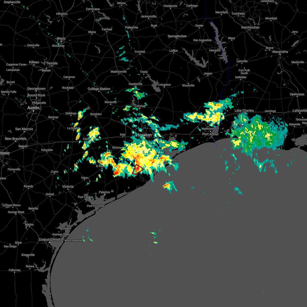 The tornado warning for central brazoria county will expire at 200 pm cst, the storm which prompted the warning has weakened below severe limits, and no longer appears capable of producing a tornado. therefore the warning will be allowed to expire. to report severe weather, contact your nearest law enforcement agency. they will relay your report to the national weather service league city. The tornado warning for central brazoria county will expire at 200 pm cst, the storm which prompted the warning has weakened below severe limits, and no longer appears capable of producing a tornado. therefore the warning will be allowed to expire. to report severe weather, contact your nearest law enforcement agency. they will relay your report to the national weather service league city.
|
| 3/5/2017 1:43 PM CST |
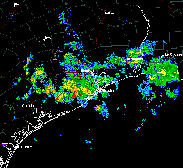 At 142 pm cst, a severe thunderstorm capable of producing a tornado was located near bailey`s prairie, or near west columbia, moving northeast at 25 mph (radar indicated rotation). Hazards include tornado. Flying debris will be dangerous to those caught without shelter. mobile homes will be damaged or destroyed. damage to roofs, windows, and vehicles will occur. tree damage is likely. Locations impacted include, angleton, holiday lakes and bailey`s prairie. At 142 pm cst, a severe thunderstorm capable of producing a tornado was located near bailey`s prairie, or near west columbia, moving northeast at 25 mph (radar indicated rotation). Hazards include tornado. Flying debris will be dangerous to those caught without shelter. mobile homes will be damaged or destroyed. damage to roofs, windows, and vehicles will occur. tree damage is likely. Locations impacted include, angleton, holiday lakes and bailey`s prairie.
|
| 3/5/2017 1:31 PM CST |
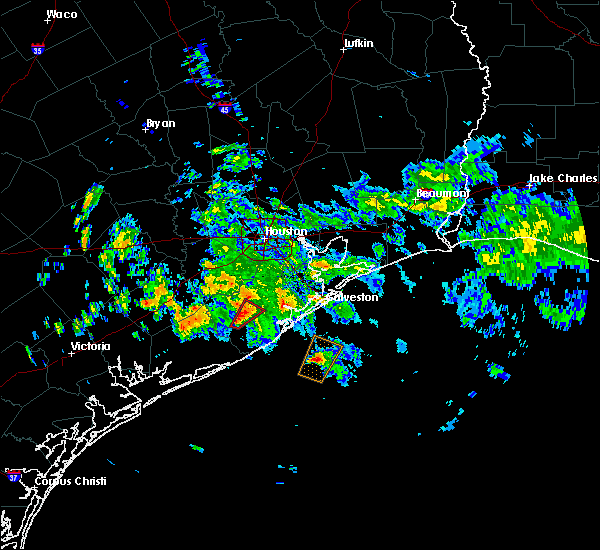 At 131 pm cst, a severe thunderstorm capable of producing a tornado was located over wild peach village, or near west columbia, moving northeast at 25 mph (radar indicated rotation). Hazards include tornado. Flying debris will be dangerous to those caught without shelter. mobile homes will be damaged or destroyed. damage to roofs, windows, and vehicles will occur. Tree damage is likely. At 131 pm cst, a severe thunderstorm capable of producing a tornado was located over wild peach village, or near west columbia, moving northeast at 25 mph (radar indicated rotation). Hazards include tornado. Flying debris will be dangerous to those caught without shelter. mobile homes will be damaged or destroyed. damage to roofs, windows, and vehicles will occur. Tree damage is likely.
|
| 3/5/2017 12:58 PM CST |
 The severe thunderstorm warning for central brazoria county will expire at 100 pm cst. the storm which prompted the warning has weakened below severe limits, and no longer pose an immediate threat to life or property. therefore the warning will be allowed to expire. However heavy rain is still possible with this thunderstorm. The severe thunderstorm warning for central brazoria county will expire at 100 pm cst. the storm which prompted the warning has weakened below severe limits, and no longer pose an immediate threat to life or property. therefore the warning will be allowed to expire. However heavy rain is still possible with this thunderstorm.
|
| 3/5/2017 12:34 PM CST |
 At 1234 pm cst, a severe thunderstorm was located over lake jackson, moving northeast at 15 mph (radar indicated). Hazards include 60 mph wind gusts and quarter size hail. Hail damage to vehicles is expected. expect wind damage to roofs, siding, and trees. Locations impacted include, lake jackson, angleton, richwood and bailey`s prairie. At 1234 pm cst, a severe thunderstorm was located over lake jackson, moving northeast at 15 mph (radar indicated). Hazards include 60 mph wind gusts and quarter size hail. Hail damage to vehicles is expected. expect wind damage to roofs, siding, and trees. Locations impacted include, lake jackson, angleton, richwood and bailey`s prairie.
|
| 3/5/2017 12:15 PM CST |
 At 1214 pm cst, a severe thunderstorm was located near lake jackson, moving northeast at 15 mph (radar indicated). Hazards include 60 mph wind gusts and quarter size hail. Hail damage to vehicles is expected. Expect wind damage to roofs, siding, and trees. At 1214 pm cst, a severe thunderstorm was located near lake jackson, moving northeast at 15 mph (radar indicated). Hazards include 60 mph wind gusts and quarter size hail. Hail damage to vehicles is expected. Expect wind damage to roofs, siding, and trees.
|
| 2/14/2017 9:24 AM CST |
 At 924 am cst, a severe thunderstorm capable of producing a tornado was located near angleton, moving east at 35 mph (radar indicated rotation). Hazards include tornado. Flying debris will be dangerous to those caught without shelter. mobile homes will be damaged or destroyed. damage to roofs, windows, and vehicles will occur. Tree damage is likely. At 924 am cst, a severe thunderstorm capable of producing a tornado was located near angleton, moving east at 35 mph (radar indicated rotation). Hazards include tornado. Flying debris will be dangerous to those caught without shelter. mobile homes will be damaged or destroyed. damage to roofs, windows, and vehicles will occur. Tree damage is likely.
|
| 2/14/2017 9:21 AM CST |
 At 920 am cst, severe thunderstorms were located along a line extending from near danbury to near freeport to 9 miles southeast of sargent, moving east at 50 mph (radar indicated). Hazards include 60 mph wind gusts. expect damage to roofs, siding, and trees At 920 am cst, severe thunderstorms were located along a line extending from near danbury to near freeport to 9 miles southeast of sargent, moving east at 50 mph (radar indicated). Hazards include 60 mph wind gusts. expect damage to roofs, siding, and trees
|
| 2/14/2017 9:13 AM CST |
 At 913 am cst, severe thunderstorms were located along a line extending from near brazos bend state park to bailey`s prairie, moving northeast at 50 mph. this warning replaces the tornado warning that was in effect (radar indicated). Hazards include 60 mph wind gusts. expect damage to roofs, siding, and trees At 913 am cst, severe thunderstorms were located along a line extending from near brazos bend state park to bailey`s prairie, moving northeast at 50 mph. this warning replaces the tornado warning that was in effect (radar indicated). Hazards include 60 mph wind gusts. expect damage to roofs, siding, and trees
|
| 2/14/2017 8:59 AM CST |
 At 858 am cst, a severe thunderstorm capable of producing a tornado was located between wild peach village and west columbia, moving northeast at 25 mph (radar indicated rotation). Hazards include tornado. Flying debris will be dangerous to those caught without shelter. mobile homes will be damaged or destroyed. damage to roofs, windows, and vehicles will occur. tree damage is likely. Locations impacted include, southwestern league city, southwestern friendswood, northern lake jackson, alvin, angleton, santa fe, hitchcock, west columbia, sweeny, brazoria, danbury, holiday lakes, hillcrest, bailey`s prairie, liverpool, bonney, wild peach village and chocolate bayou. At 858 am cst, a severe thunderstorm capable of producing a tornado was located between wild peach village and west columbia, moving northeast at 25 mph (radar indicated rotation). Hazards include tornado. Flying debris will be dangerous to those caught without shelter. mobile homes will be damaged or destroyed. damage to roofs, windows, and vehicles will occur. tree damage is likely. Locations impacted include, southwestern league city, southwestern friendswood, northern lake jackson, alvin, angleton, santa fe, hitchcock, west columbia, sweeny, brazoria, danbury, holiday lakes, hillcrest, bailey`s prairie, liverpool, bonney, wild peach village and chocolate bayou.
|
| 2/14/2017 8:45 AM CST |
 At 844 am cst, a severe thunderstorm was located near brazoria, or near sweeny, moving east at 50 mph (radar indicated). Hazards include 60 mph wind gusts. expect damage to roofs, siding, and trees At 844 am cst, a severe thunderstorm was located near brazoria, or near sweeny, moving east at 50 mph (radar indicated). Hazards include 60 mph wind gusts. expect damage to roofs, siding, and trees
|
| 2/14/2017 8:42 AM CST |
 At 842 am cst, a severe thunderstorm capable of producing a tornado was located over sweeny, moving northeast at 25 mph (radar indicated rotation). Hazards include tornado. Flying debris will be dangerous to those caught without shelter. mobile homes will be damaged or destroyed. damage to roofs, windows, and vehicles will occur. Tree damage is likely. At 842 am cst, a severe thunderstorm capable of producing a tornado was located over sweeny, moving northeast at 25 mph (radar indicated rotation). Hazards include tornado. Flying debris will be dangerous to those caught without shelter. mobile homes will be damaged or destroyed. damage to roofs, windows, and vehicles will occur. Tree damage is likely.
|
| 2/14/2017 7:25 AM CST |
 At 724 am cst, severe thunderstorms were located along a line extending from near wallis to near lolita, moving east at 30 mph (radar indicated). Hazards include 60 mph wind gusts. expect damage to roofs, siding, and trees At 724 am cst, severe thunderstorms were located along a line extending from near wallis to near lolita, moving east at 30 mph (radar indicated). Hazards include 60 mph wind gusts. expect damage to roofs, siding, and trees
|
| 5/19/2016 2:56 PM CDT | Tree down near northside elementary school in anglleto in brazoria county TX, 0.6 miles S of Angleton, TX |
| 5/13/2016 2:11 PM CDT |
 At 210 pm cdt, a severe thunderstorm was located near brazoria, or 7 miles southeast of sweeny, and is nearly stationary (radar indicated). Hazards include 60 mph wind gusts and quarter size hail. Hail damage to vehicles is expected. Expect wind damage to roofs, siding, and trees. At 210 pm cdt, a severe thunderstorm was located near brazoria, or 7 miles southeast of sweeny, and is nearly stationary (radar indicated). Hazards include 60 mph wind gusts and quarter size hail. Hail damage to vehicles is expected. Expect wind damage to roofs, siding, and trees.
|
| 4/27/2016 5:18 AM CDT |
 At 518 am cdt, severe thunderstorms were located along a line extending from lake houston dam to south park to near first colony, moving southeast at 40 mph (radar indicated). Hazards include 60 mph wind gusts. Expect damage to roofs. siding. And trees. At 518 am cdt, severe thunderstorms were located along a line extending from lake houston dam to south park to near first colony, moving southeast at 40 mph (radar indicated). Hazards include 60 mph wind gusts. Expect damage to roofs. siding. And trees.
|
| 4/13/2016 2:27 AM CDT |
 At 224 am cdt, severe thunderstorms were located along a line extending from old river-winfree to league city to near danbury to near bay city, moving southeast at 40 mph (radar indicated). Hazards include 60 mph wind gusts and quarter size hail. Hail damage to vehicles is expected. Expect wind damage to roofs, siding, and trees. At 224 am cdt, severe thunderstorms were located along a line extending from old river-winfree to league city to near danbury to near bay city, moving southeast at 40 mph (radar indicated). Hazards include 60 mph wind gusts and quarter size hail. Hail damage to vehicles is expected. Expect wind damage to roofs, siding, and trees.
|
| 4/13/2016 1:41 AM CDT |
 At 141 am cdt, severe thunderstorms were located along a line extending from spring branch central to fairchilds to near needville to near boling-iago, moving east at 45 mph (radar indicated). Hazards include 60 mph wind gusts and quarter size hail. Hail damage to vehicles is expected. Expect wind damage to roofs, siding, and trees. At 141 am cdt, severe thunderstorms were located along a line extending from spring branch central to fairchilds to near needville to near boling-iago, moving east at 45 mph (radar indicated). Hazards include 60 mph wind gusts and quarter size hail. Hail damage to vehicles is expected. Expect wind damage to roofs, siding, and trees.
|
| 2/23/2016 6:45 AM CST | Thunderstorm wind damage to a health clini in brazoria county TX, 2.3 miles SW of Angleton, TX |
| 10/31/2015 4:45 AM CDT |
 At 444 am cdt, a severe thunderstorm capable of producing a tornado was located over liverpool, or 7 miles south of alvin, moving northeast at 30 mph (radar indicated rotation). Hazards include tornado. Flying debris will be dangerous to those caught without shelter. mobile homes will be damaged or destroyed. damage to roofs, windows and vehicles will occur. tree damage is likely. this dangerous storm will be near, hillcrest around 455 am cdt. alvin and santa fe around 500 am cdt. southeastern pearland, southwestern league city, southwestern friendswood and dickinson around 515 am cdt. Other locations impacted by this tornadic thunderstorm include chocolate bayou. At 444 am cdt, a severe thunderstorm capable of producing a tornado was located over liverpool, or 7 miles south of alvin, moving northeast at 30 mph (radar indicated rotation). Hazards include tornado. Flying debris will be dangerous to those caught without shelter. mobile homes will be damaged or destroyed. damage to roofs, windows and vehicles will occur. tree damage is likely. this dangerous storm will be near, hillcrest around 455 am cdt. alvin and santa fe around 500 am cdt. southeastern pearland, southwestern league city, southwestern friendswood and dickinson around 515 am cdt. Other locations impacted by this tornadic thunderstorm include chocolate bayou.
|
| 10/31/2015 4:14 AM CDT |
 At 413 am cdt, a severe thunderstorm capable of producing a tornado was located over angleton, moving northeast at 40 mph (radar indicated rotation). Hazards include tornado. Flying debris will be dangerous to those caught without shelter. mobile homes will be damaged or destroyed. damage to roofs, windows and vehicles will occur. Tree damage is likely. At 413 am cdt, a severe thunderstorm capable of producing a tornado was located over angleton, moving northeast at 40 mph (radar indicated rotation). Hazards include tornado. Flying debris will be dangerous to those caught without shelter. mobile homes will be damaged or destroyed. damage to roofs, windows and vehicles will occur. Tree damage is likely.
|
| 10/31/2015 3:27 AM CDT |
 At 325 am cdt, a severe thunderstorm capable of producing a tornado was located near jones creek, or 7 miles west of freeport, moving northeast at 30 mph (radar indicated rotation). Hazards include tornado. Flying debris will be dangerous to those caught without shelter. mobile homes will be damaged or destroyed. damage to roofs, windows and vehicles will occur. Tree damage is likely. At 325 am cdt, a severe thunderstorm capable of producing a tornado was located near jones creek, or 7 miles west of freeport, moving northeast at 30 mph (radar indicated rotation). Hazards include tornado. Flying debris will be dangerous to those caught without shelter. mobile homes will be damaged or destroyed. damage to roofs, windows and vehicles will occur. Tree damage is likely.
|
| 5/24/2015 6:08 AM CDT | At 608 am cdt, doppler radar indicated a line of severe thunderstorms capable of producing damaging winds in excess of 60 mph. these storms were located along a line extending from near thompsons to near bonney to 6 miles south of danbury to near quintana to 20 miles south of surfside beach, and moving northeast at 50 mph. |
| 5/24/2015 5:39 AM CDT | At 535 am cdt, doppler radar indicated a line of severe thunderstorms capable of producing damaging winds in excess of 60 mph. these storms were located along a line extending from near bellville to near san felipe to kendleton to 7 miles west of sargent to 25 miles southeast of matagorda, moving east northeast at 20 mph. the segment of the line between bellville to simonton to wallis appears to be bowing out which signals potentially damaging winds as the line pushes through austin, waller, northern fort bend and western harris counties. locations impacted include, sugar land, missouri city, rosenberg, lake jackson, angleton, stafford, eastern bay city, katy, freeport, richmond, clute, sealy, hempstead, prairie view, brookshire, bellville, west columbia, sweeny, surfside beach and town west. |
| 5/24/2015 5:16 AM CDT | At 516 am cdt, doppler radar indicated a line of severe thunderstorms capable of producing damaging winds in excess of 60 mph. these storms were located along a line extending from near bellville to near sealy to near kendleton to 11 miles west of sargent to 23 miles southeast of matagorda, and moving northeast at 20 mph. |
| 4/26/2015 6:49 PM CDT | At 649 pm cdt, doppler radar indicated a severe thunderstorm capable of producing quarter size hail and damaging winds in excess of 60 mph. this storm was located over brazos bend state park, or 13 miles north of west columbia, and moving east at 15 mph. |
| 4/26/2015 6:16 PM CDT | At 615 pm cdt, doppler radar indicated a severe thunderstorm capable of producing quarter size hail and destructive winds in excess of 70 mph. this storm was located near boling-lago, or 14 miles northwest of west columbia, and moving east at 35 mph. |
| 4/25/2015 8:33 AM CDT | At 832 am cdt, doppler radar indicated a rapidly intensifying severe thunderstorm capable of producing a tornado. this dangerous storm was located over brazoria, or near lake jackson, and moving northeast at 35 mph. |
| 4/25/2015 8:23 AM CDT | At 823 am cdt, doppler radar indicated a line of severe thunderstorms capable of producing quarter size hail and damaging winds in excess of 60 mph. these storms were located along a line extending from webster to 7 miles northwest of san luis pass to near jones creek, and moving east at 50 mph. |
| 4/25/2015 8:13 AM CDT | At 813 am cdt, doppler radar indicated a severe thunderstorm capable of producing quarter size hail and damaging winds in excess of 60 mph. this storm was located over richwood, or over lake jackson, and moving east at 40 mph. |
| 4/17/2015 8:00 PM CDT | Quarter sized hail reported 0.6 miles S of Angleton, TX, quarter sized hail and 6 inch tree limbs down due to strong tstm winds in angleton. |
| 4/17/2015 7:53 PM CDT | At 752 pm cdt, doppler radar indicated a line of severe thunderstorms capable of producing destructive winds in excess of 75 mph. these storms were located along a line extending from near four corners to near liverpool to near freeport, moving east at 45 mph. locations impacted include, pasadena, pearland, league city, sugar land, missouri city, galveston island west end, texas city, friendswood, la porte, deer park, lake jackson, alvin, angleton, dickinson, stafford, south houston, bellaire, west university place, la marque and santa fe. a tornado watch remains in effect until 200 am cdt for southeastern texas. |
| 4/17/2015 7:50 PM CDT | Quarter sized hail reported 0.6 miles S of Angleton, TX, multiple quarter sized hail reports around angleton. |
| 4/17/2015 7:50 PM CDT | Circus tent collapse at the angleton fairgrounds...police on scen in brazoria county TX, 0.6 miles S of Angleton, TX |
| 4/17/2015 7:40 PM CDT | Tennis Ball sized hail reported 0.6 miles S of Angleton, TX, egg to tennis ball sized hail in angleton. |
| 4/17/2015 7:37 PM CDT | At 735 pm cdt, doppler radar indicated a line of severe thunderstorms capable of producing damaging winds in excess of 60 mph. these storms were located along a line extending from mission bend to bonney to near brazoria, and moving east at 40 mph. |
| 4/17/2015 6:56 PM CDT | At 655 pm cdt, doppler radar indicated a line of severe thunderstorms capable of producing damaging winds in excess of 60 mph. these storms were located along a line extending from near east bernard to near brazoria, and moving northeast at 35 mph. |
| 8/16/2013 7:28 PM CDT | Trees down in the central areas of the county near angleton and holiday lake in brazoria county TX, 2.3 miles SSE of Angleton, TX |
| 5/11/2012 2:13 AM CDT | Wind estimates in excess of 70 mph at highway 35 and highway 28 in brazoria county TX, 0.6 miles S of Angleton, TX |
Hail Maps for Angleton, TX


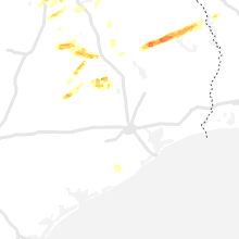


Connect with Interactive Hail Maps