

Hail Map for Arlington, IL
The Arlington, IL area has had 4 reports of on-the-ground hail by trained spotters, and has been under severe weather warnings 20 times during the past 12 months. Doppler radar has detected hail at or near Arlington, IL on 43 occasions.
| Name: | Arlington, IL |
| Where Located: | 56.7 miles NNE of Peoria, IL |
| Map: | Google Map for Arlington, IL |
| Population: | 193 |
| Housing Units: | 86 |
| More Info: | Search Google for Arlington, IL |
0
The Top Recent Hail Date for Arlington, IL is Sunday, June 16, 2024 (43rd out of 43)

Hail and Wind Damage Spotted near Arlington, IL
| Date / Time | Report Details |
|---|---|
| 6/3/2025 8:19 PM CDT |
 At 818 pm cdt, severe thunderstorms were located along a line extending from hitt to near harmon to van orin, moving northeast at 45 mph (radar indicated). Hazards include 70 mph wind gusts and penny size hail. Expect considerable tree damage. damage is likely to mobile homes, roofs, and outbuildings. locations impacted include, freeport, sterling, rock falls, princeton, mount carroll, lanark, walnut, milledgeville, fairhaven, shannon, la moille, davis, chadwick, german valley, ridott, coleta, emerson, ohio, malden, and arlington. this includes the following highways, interstate 80 in illinois between mile markers 56 and 61. interstate 88 between mile markers 37 and 44. Interstate 180 near mile marker 13. At 818 pm cdt, severe thunderstorms were located along a line extending from hitt to near harmon to van orin, moving northeast at 45 mph (radar indicated). Hazards include 70 mph wind gusts and penny size hail. Expect considerable tree damage. damage is likely to mobile homes, roofs, and outbuildings. locations impacted include, freeport, sterling, rock falls, princeton, mount carroll, lanark, walnut, milledgeville, fairhaven, shannon, la moille, davis, chadwick, german valley, ridott, coleta, emerson, ohio, malden, and arlington. this includes the following highways, interstate 80 in illinois between mile markers 56 and 61. interstate 88 between mile markers 37 and 44. Interstate 180 near mile marker 13.
|
| 6/3/2025 8:06 PM CDT |
 the severe thunderstorm warning has been cancelled and is no longer in effect the severe thunderstorm warning has been cancelled and is no longer in effect
|
| 6/3/2025 8:06 PM CDT |
 At 805 pm cdt, severe thunderstorms were located along a line extending from franklin corners to rock falls to near dover, moving northeast at 60 mph (radar indicated). Hazards include 70 mph wind gusts and penny size hail. Expect considerable tree damage. damage is likely to mobile homes, roofs, and outbuildings. locations impacted include, freeport, sterling, rock falls, princeton, morrison, mount carroll, prophetstown, lanark, walnut, milledgeville, wyanet, fairhaven, tampico, shannon, la moille, davis, lyndon, chadwick, buda, and german valley. this includes the following highways, interstate 80 in illinois between mile markers 45 and 61. interstate 88 between mile markers 26 and 44. Interstate 180 near mile marker 13. At 805 pm cdt, severe thunderstorms were located along a line extending from franklin corners to rock falls to near dover, moving northeast at 60 mph (radar indicated). Hazards include 70 mph wind gusts and penny size hail. Expect considerable tree damage. damage is likely to mobile homes, roofs, and outbuildings. locations impacted include, freeport, sterling, rock falls, princeton, morrison, mount carroll, prophetstown, lanark, walnut, milledgeville, wyanet, fairhaven, tampico, shannon, la moille, davis, lyndon, chadwick, buda, and german valley. this includes the following highways, interstate 80 in illinois between mile markers 45 and 61. interstate 88 between mile markers 26 and 44. Interstate 180 near mile marker 13.
|
| 6/3/2025 8:04 PM CDT |
 At 804 pm cdt, severe thunderstorms were located along a line extending from franklin corners to whiteside county airport to near princeton, moving northeast at 60 mph (radar indicated). Hazards include 70 mph wind gusts and penny size hail. Expect considerable tree damage. damage is likely to mobile homes, roofs, and outbuildings. locations impacted include, clinton, freeport, sterling, rock falls, princeton, morrison, mount carroll, fulton, prophetstown, erie, lanark, walnut, garden plain, milledgeville, wyanet, sheffield, fairhaven, annawan, tampico, and shannon. this includes the following highways, interstate 80 in illinois between mile markers 30 and 61. interstate 88 between mile markers 17 and 44. Interstate 180 near mile marker 13. At 804 pm cdt, severe thunderstorms were located along a line extending from franklin corners to whiteside county airport to near princeton, moving northeast at 60 mph (radar indicated). Hazards include 70 mph wind gusts and penny size hail. Expect considerable tree damage. damage is likely to mobile homes, roofs, and outbuildings. locations impacted include, clinton, freeport, sterling, rock falls, princeton, morrison, mount carroll, fulton, prophetstown, erie, lanark, walnut, garden plain, milledgeville, wyanet, sheffield, fairhaven, annawan, tampico, and shannon. this includes the following highways, interstate 80 in illinois between mile markers 30 and 61. interstate 88 between mile markers 17 and 44. Interstate 180 near mile marker 13.
|
| 6/3/2025 7:49 PM CDT |
 Svrdvn the national weather service in the quad cities has issued a * severe thunderstorm warning for, whiteside county in northwestern illinois, northeastern henry county in northwestern illinois, carroll county in northwestern illinois, southeastern stephenson county in northwestern illinois, bureau county in north central illinois, east central clinton county in east central iowa, * until 845 pm cdt. * at 748 pm cdt, severe thunderstorms were located along a line extending from east clinton to portland corners to sheffield, moving northeast at 60 mph (radar indicated). Hazards include 70 mph wind gusts and penny size hail. Expect considerable tree damage. Damage is likely to mobile homes, roofs, and outbuildings. Svrdvn the national weather service in the quad cities has issued a * severe thunderstorm warning for, whiteside county in northwestern illinois, northeastern henry county in northwestern illinois, carroll county in northwestern illinois, southeastern stephenson county in northwestern illinois, bureau county in north central illinois, east central clinton county in east central iowa, * until 845 pm cdt. * at 748 pm cdt, severe thunderstorms were located along a line extending from east clinton to portland corners to sheffield, moving northeast at 60 mph (radar indicated). Hazards include 70 mph wind gusts and penny size hail. Expect considerable tree damage. Damage is likely to mobile homes, roofs, and outbuildings.
|
| 5/20/2025 3:43 PM CDT | the severe thunderstorm warning has been cancelled and is no longer in effect |
| 5/20/2025 3:35 PM CDT |
 At 335 pm cdt, severe thunderstorms were located along a line extending from near kasbeer to ladd to near magnolia, moving northeast at 30 mph (radar indicated). Hazards include 60 mph wind gusts. Expect damage to roofs, siding, and trees. locations impacted include, princeton, hennepin, spring valley, depue, granville, ladd, dalzell, bureau junction, mcnabb, mark, cherry, malden, seatonville, magnolia, standard, arlington, dover, hollowayville, coal hollow, and zearing. this includes the following highways, interstate 80 in illinois between mile markers 55 and 72. Interstate 180 between mile markers 8 and 13. At 335 pm cdt, severe thunderstorms were located along a line extending from near kasbeer to ladd to near magnolia, moving northeast at 30 mph (radar indicated). Hazards include 60 mph wind gusts. Expect damage to roofs, siding, and trees. locations impacted include, princeton, hennepin, spring valley, depue, granville, ladd, dalzell, bureau junction, mcnabb, mark, cherry, malden, seatonville, magnolia, standard, arlington, dover, hollowayville, coal hollow, and zearing. this includes the following highways, interstate 80 in illinois between mile markers 55 and 72. Interstate 180 between mile markers 8 and 13.
|
| 5/20/2025 3:19 PM CDT | At 319 pm cdt, severe thunderstorms were located along a line extending from near bureau junction to near lostant, moving northeast at 40 mph (radar indicated). Hazards include 60 mph wind gusts. Expect damage to roofs, siding, and trees. locations impacted include, princeton, hennepin, spring valley, depue, granville, ladd, wyanet, tiskilwa, dalzell, bureau junction, mcnabb, putnam, mark, cherry, malden, seatonville, magnolia, standard, arlington, and dover. this includes the following highways, interstate 80 in illinois between mile markers 52 and 72. Interstate 180 between mile markers 1 and 13. |
| 5/20/2025 2:56 PM CDT | Svrdvn the national weather service in the quad cities has issued a * severe thunderstorm warning for, putnam county in north central illinois, central bureau county in north central illinois, * until 400 pm cdt. * at 255 pm cdt, severe thunderstorms were located along a line extending from near bradford to la rose, moving northeast at 40 mph (radar indicated). Hazards include 60 mph wind gusts. expect damage to roofs, siding, and trees |
| 3/14/2025 11:08 PM CDT |
 The storms which prompted the warning have weakened below severe limits, and have exited the warned area. therefore, the warning will be allowed to expire. however, gusty winds are still possible with these thunderstorms. a severe thunderstorm watch remains in effect until 200 am cdt for north central illinois. The storms which prompted the warning have weakened below severe limits, and have exited the warned area. therefore, the warning will be allowed to expire. however, gusty winds are still possible with these thunderstorms. a severe thunderstorm watch remains in effect until 200 am cdt for north central illinois.
|
| 3/14/2025 10:57 PM CDT | At 1057 pm cdt, severe thunderstorms were located along a line extending from rock grove to near sublette, moving northeast at 55 mph (radar indicated). Hazards include 70 mph wind gusts. Expect considerable tree damage. damage is likely to mobile homes, roofs, and outbuildings. locations impacted include, seatonville, dalzell, cherry, mark, standard, magnolia, spring valley, zearing, ottville, ladd, hennepin, depue, mcnabb, la moille, granville, van orin, hollowayville, florid, arlington, and bureau junction. this includes the following highways, interstate 80 in illinois between mile markers 62 and 72. Interstate 180 near mile marker 1. |
| 3/14/2025 10:44 PM CDT |
 At 1043 pm cdt, severe thunderstorms were located along a line extending from near baileyville to depue, moving northeast at 50 mph (radar indicated). Hazards include 70 mph wind gusts. Expect considerable tree damage. damage is likely to mobile homes, roofs, and outbuildings. locations impacted include, seatonville, dalzell, cherry, mark, standard, coal hollow, ottville, kasbeer, wyanet, la moille, van orin, milo, arlington, putnam, providence, princeton, bureau junction, dover, magnolia, and spring valley. this includes the following highways, interstate 80 in illinois between mile markers 48 and 72. Interstate 180 between mile markers 1 and 13. At 1043 pm cdt, severe thunderstorms were located along a line extending from near baileyville to depue, moving northeast at 50 mph (radar indicated). Hazards include 70 mph wind gusts. Expect considerable tree damage. damage is likely to mobile homes, roofs, and outbuildings. locations impacted include, seatonville, dalzell, cherry, mark, standard, coal hollow, ottville, kasbeer, wyanet, la moille, van orin, milo, arlington, putnam, providence, princeton, bureau junction, dover, magnolia, and spring valley. this includes the following highways, interstate 80 in illinois between mile markers 48 and 72. Interstate 180 between mile markers 1 and 13.
|
| 3/14/2025 10:31 PM CDT | At 1030 pm cdt, severe thunderstorms were located along a line extending from near lanark to lone tree corners, moving northeast at 60 mph (radar indicated). Hazards include 70 mph wind gusts. Expect considerable tree damage. damage is likely to mobile homes, roofs, and outbuildings. locations impacted include, seatonville, dalzell, cherry, mark, standard, coal hollow, ottville, kasbeer, wyanet, manlius, la moille, neponset, van orin, milo, arlington, mineral, thomas, putnam, providence, and princeton. this includes the following highways, interstate 80 in illinois between mile markers 36 and 72. Interstate 180 between mile markers 1 and 13. |
| 3/14/2025 10:31 PM CDT | the severe thunderstorm warning has been cancelled and is no longer in effect |
| 3/14/2025 10:15 PM CDT | the severe thunderstorm warning has been cancelled and is no longer in effect |
| 3/14/2025 10:15 PM CDT | At 1015 pm cdt, severe thunderstorms were located along a line extending from morrison-rockwood state park to lawn ridge, moving east at 45 mph (radar indicated). Hazards include 70 mph wind gusts. Expect considerable tree damage. damage is likely to mobile homes, roofs, and outbuildings. locations impacted include, dalzell, cherry, coal hollow, kasbeer, manlius, la moille, kewanee municipal airport, neponset, van orin, milo, arlington, providence, princeton, magnolia, buda, hennepin, granville, sheffield, malden, and lake thunderbird. this includes the following highways, interstate 80 in illinois between mile markers 29 and 72. Interstate 180 between mile markers 1 and 13. |
| 3/14/2025 9:58 PM CDT | Svrdvn the national weather service in the quad cities has issued a * severe thunderstorm warning for, east central rock island county in northwestern illinois, putnam county in north central illinois, henry county in northwestern illinois, bureau county in north central illinois, * until 1115 pm cdt. * at 957 pm cdt, severe thunderstorms were located along a line extending from near hillsdale to near jubilee college state park, moving northeast at 65 mph (radar indicated). Hazards include 70 mph wind gusts. Expect considerable tree damage. Damage is likely to mobile homes, roofs, and outbuildings. |
| 7/15/2024 8:55 PM CDT |
 The storms which prompted the warning have moved out of the area. therefore, the warning will be allowed to expire. however, heavy rain is still possible with these thunderstorms. a tornado watch remains in effect until 100 am cdt for north central illinois. The storms which prompted the warning have moved out of the area. therefore, the warning will be allowed to expire. however, heavy rain is still possible with these thunderstorms. a tornado watch remains in effect until 100 am cdt for north central illinois.
|
| 7/15/2024 8:33 PM CDT |
 At 832 pm cdt, severe thunderstorms were located along a line extending from near van orin to lone tree corners, moving east at 60 mph (radar indicated). Hazards include 80 mph wind gusts. Flying debris will be dangerous to those caught without shelter. mobile homes will be heavily damaged. expect considerable damage to roofs, windows, and vehicles. extensive tree damage and power outages are likely. locations impacted include, princeton, hennepin, spring valley, depue, granville, walnut, ladd, wyanet, sheffield, tiskilwa, la moille, dalzell, buda, bureau junction, mcnabb, putnam, mark, ohio, cherry, and neponset. this includes the following highways, interstate 80 in illinois between mile markers 36 and 72. Interstate 180 between mile markers 1 and 13. At 832 pm cdt, severe thunderstorms were located along a line extending from near van orin to lone tree corners, moving east at 60 mph (radar indicated). Hazards include 80 mph wind gusts. Flying debris will be dangerous to those caught without shelter. mobile homes will be heavily damaged. expect considerable damage to roofs, windows, and vehicles. extensive tree damage and power outages are likely. locations impacted include, princeton, hennepin, spring valley, depue, granville, walnut, ladd, wyanet, sheffield, tiskilwa, la moille, dalzell, buda, bureau junction, mcnabb, putnam, mark, ohio, cherry, and neponset. this includes the following highways, interstate 80 in illinois between mile markers 36 and 72. Interstate 180 between mile markers 1 and 13.
|
| 7/15/2024 8:07 PM CDT |
 Svrdvn the national weather service in the quad cities has issued a * severe thunderstorm warning for, putnam county in north central illinois, bureau county in north central illinois, * until 900 pm cdt. * at 806 pm cdt, severe thunderstorms were located along a line extending from near yorktown to near kewanee municipal airport, moving east at 55 mph. these are destructive storms for princeton, mcnabb, and hennepin (radar indicated). Hazards include 80 mph wind gusts. Flying debris will be dangerous to those caught without shelter. mobile homes will be heavily damaged. expect considerable damage to roofs, windows, and vehicles. Extensive tree damage and power outages are likely. Svrdvn the national weather service in the quad cities has issued a * severe thunderstorm warning for, putnam county in north central illinois, bureau county in north central illinois, * until 900 pm cdt. * at 806 pm cdt, severe thunderstorms were located along a line extending from near yorktown to near kewanee municipal airport, moving east at 55 mph. these are destructive storms for princeton, mcnabb, and hennepin (radar indicated). Hazards include 80 mph wind gusts. Flying debris will be dangerous to those caught without shelter. mobile homes will be heavily damaged. expect considerable damage to roofs, windows, and vehicles. Extensive tree damage and power outages are likely.
|
| 6/25/2024 7:44 AM CDT |
 At 744 am cdt, severe thunderstorms were located along a line extending from near north utica to near florid to near bradford, moving east at 50 mph (radar indicated). Hazards include 60 mph wind gusts and quarter size hail. Hail damage to vehicles is expected. expect wind damage to roofs, siding, and trees. locations impacted include, kewanee, princeton, hennepin, spring valley, galva, depue, granville, ladd, wyanet, tiskilwa, dalzell, buda, bureau junction, mcnabb, putnam, mark, cherry, neponset, malden, and seatonville. this includes the following highways, interstate 80 in illinois between mile markers 53 and 72. Interstate 180 between mile markers 1 and 13. At 744 am cdt, severe thunderstorms were located along a line extending from near north utica to near florid to near bradford, moving east at 50 mph (radar indicated). Hazards include 60 mph wind gusts and quarter size hail. Hail damage to vehicles is expected. expect wind damage to roofs, siding, and trees. locations impacted include, kewanee, princeton, hennepin, spring valley, galva, depue, granville, ladd, wyanet, tiskilwa, dalzell, buda, bureau junction, mcnabb, putnam, mark, cherry, neponset, malden, and seatonville. this includes the following highways, interstate 80 in illinois between mile markers 53 and 72. Interstate 180 between mile markers 1 and 13.
|
| 6/25/2024 7:37 AM CDT |
 At 736 am cdt, severe thunderstorms were located along a line extending from near troy grove to near lake thunderbird to osceola, moving east at 50 mph (radar indicated). Hazards include 60 mph wind gusts and quarter size hail. Hail damage to vehicles is expected. expect wind damage to roofs, siding, and trees. locations impacted include, kewanee, princeton, hennepin, spring valley, galva, depue, granville, ladd, wyanet, sheffield, tiskilwa, dalzell, buda, bureau junction, mcnabb, putnam, mark, cherry, neponset, and malden. this includes the following highways, interstate 80 in illinois between mile markers 39 and 72. Interstate 180 between mile markers 1 and 13. At 736 am cdt, severe thunderstorms were located along a line extending from near troy grove to near lake thunderbird to osceola, moving east at 50 mph (radar indicated). Hazards include 60 mph wind gusts and quarter size hail. Hail damage to vehicles is expected. expect wind damage to roofs, siding, and trees. locations impacted include, kewanee, princeton, hennepin, spring valley, galva, depue, granville, ladd, wyanet, sheffield, tiskilwa, dalzell, buda, bureau junction, mcnabb, putnam, mark, cherry, neponset, and malden. this includes the following highways, interstate 80 in illinois between mile markers 39 and 72. Interstate 180 between mile markers 1 and 13.
|
| 6/25/2024 7:28 AM CDT |
 At 727 am cdt, severe thunderstorms were located along a line extending from near cherry to near tiskilwa to kewanee, moving east at 50 mph (radar indicated). Hazards include 60 mph wind gusts and quarter size hail. Hail damage to vehicles is expected. expect wind damage to roofs, siding, and trees. locations impacted include, kewanee, princeton, hennepin, spring valley, galva, depue, granville, ladd, wyanet, sheffield, tiskilwa, dalzell, buda, bureau junction, mcnabb, putnam, mark, cherry, neponset, and malden. this includes the following highways, interstate 80 in illinois between mile markers 36 and 72. Interstate 180 between mile markers 1 and 13. At 727 am cdt, severe thunderstorms were located along a line extending from near cherry to near tiskilwa to kewanee, moving east at 50 mph (radar indicated). Hazards include 60 mph wind gusts and quarter size hail. Hail damage to vehicles is expected. expect wind damage to roofs, siding, and trees. locations impacted include, kewanee, princeton, hennepin, spring valley, galva, depue, granville, ladd, wyanet, sheffield, tiskilwa, dalzell, buda, bureau junction, mcnabb, putnam, mark, cherry, neponset, and malden. this includes the following highways, interstate 80 in illinois between mile markers 36 and 72. Interstate 180 between mile markers 1 and 13.
|
| 6/25/2024 7:20 AM CDT |
 At 720 am cdt, severe thunderstorms were located along a line extending from arlington to near providence to near german corner, moving east at 50 mph (radar indicated). Hazards include 60 mph wind gusts and quarter size hail. Hail damage to vehicles is expected. expect wind damage to roofs, siding, and trees. locations impacted include, kewanee, princeton, cambridge, hennepin, spring valley, galva, depue, granville, walnut, ladd, wyanet, sheffield, annawan, tiskilwa, la moille, dalzell, buda, bureau junction, mcnabb, and putnam. this includes the following highways, interstate 80 in illinois between mile markers 29 and 72. Interstate 180 between mile markers 1 and 13. At 720 am cdt, severe thunderstorms were located along a line extending from arlington to near providence to near german corner, moving east at 50 mph (radar indicated). Hazards include 60 mph wind gusts and quarter size hail. Hail damage to vehicles is expected. expect wind damage to roofs, siding, and trees. locations impacted include, kewanee, princeton, cambridge, hennepin, spring valley, galva, depue, granville, walnut, ladd, wyanet, sheffield, annawan, tiskilwa, la moille, dalzell, buda, bureau junction, mcnabb, and putnam. this includes the following highways, interstate 80 in illinois between mile markers 29 and 72. Interstate 180 between mile markers 1 and 13.
|
| 6/25/2024 7:11 AM CDT |
 Svrdvn the national weather service in the quad cities has issued a * severe thunderstorm warning for, putnam county in north central illinois, southeastern henry county in northwestern illinois, bureau county in north central illinois, * until 815 am cdt. * at 710 am cdt, severe thunderstorms were located along a line extending from near dover to neponset to ulah, moving east at 50 mph (radar indicated). Hazards include 60 mph wind gusts and quarter size hail. Hail damage to vehicles is expected. Expect wind damage to roofs, siding, and trees. Svrdvn the national weather service in the quad cities has issued a * severe thunderstorm warning for, putnam county in north central illinois, southeastern henry county in northwestern illinois, bureau county in north central illinois, * until 815 am cdt. * at 710 am cdt, severe thunderstorms were located along a line extending from near dover to neponset to ulah, moving east at 50 mph (radar indicated). Hazards include 60 mph wind gusts and quarter size hail. Hail damage to vehicles is expected. Expect wind damage to roofs, siding, and trees.
|
| 6/16/2024 4:31 PM CDT |
 The storms which prompted the warning have weakened below severe limits, and have exited the warned area. therefore, the warning has been allowed to expire. a severe thunderstorm watch remains in effect until 800 pm cdt for north central illinois. remember, a severe thunderstorm warning still remains in effect for southeastern bureau and putnam counties until 515 pm. The storms which prompted the warning have weakened below severe limits, and have exited the warned area. therefore, the warning has been allowed to expire. a severe thunderstorm watch remains in effect until 800 pm cdt for north central illinois. remember, a severe thunderstorm warning still remains in effect for southeastern bureau and putnam counties until 515 pm.
|
| 6/16/2024 3:59 PM CDT |
 At 359 pm cdt, severe thunderstorms were located along a line extending from near van orin to near coal hollow, moving east at 25 mph (radar indicated). Hazards include 60 mph wind gusts and half dollar size hail. Hail damage to vehicles is expected. expect wind damage to roofs, siding, and trees. locations impacted include, princeton, ladd, la moille, ohio, cherry, malden, seatonville, arlington, dover, zearing, kasbeer, van orin, and bureau county fairgrounds. this includes the following highways, interstate 80 in illinois between mile markers 53 and 69. Interstate 180 between mile markers 12 and 13. At 359 pm cdt, severe thunderstorms were located along a line extending from near van orin to near coal hollow, moving east at 25 mph (radar indicated). Hazards include 60 mph wind gusts and half dollar size hail. Hail damage to vehicles is expected. expect wind damage to roofs, siding, and trees. locations impacted include, princeton, ladd, la moille, ohio, cherry, malden, seatonville, arlington, dover, zearing, kasbeer, van orin, and bureau county fairgrounds. this includes the following highways, interstate 80 in illinois between mile markers 53 and 69. Interstate 180 between mile markers 12 and 13.
|
| 6/16/2024 3:46 PM CDT |
 The storms which prompted the warning have moved out of the area. therefore, the warning has been allowed to expire. a severe thunderstorm watch remains in effect until 800 pm cdt for north central and northwestern illinois. remember, a severe thunderstorm warning still remains in effect for northeastern bureau county until 430 pm. The storms which prompted the warning have moved out of the area. therefore, the warning has been allowed to expire. a severe thunderstorm watch remains in effect until 800 pm cdt for north central and northwestern illinois. remember, a severe thunderstorm warning still remains in effect for northeastern bureau county until 430 pm.
|
| 6/16/2024 3:40 PM CDT |
 Svrdvn the national weather service in the quad cities has issued a * severe thunderstorm warning for, northeastern bureau county in north central illinois, * until 430 pm cdt. * at 339 pm cdt, severe thunderstorms were located along a line extending from near ohio to princeton, moving east at 25 mph (radar indicated). Hazards include 60 mph wind gusts and half dollar size hail. Hail damage to vehicles is expected. Expect wind damage to roofs, siding, and trees. Svrdvn the national weather service in the quad cities has issued a * severe thunderstorm warning for, northeastern bureau county in north central illinois, * until 430 pm cdt. * at 339 pm cdt, severe thunderstorms were located along a line extending from near ohio to princeton, moving east at 25 mph (radar indicated). Hazards include 60 mph wind gusts and half dollar size hail. Hail damage to vehicles is expected. Expect wind damage to roofs, siding, and trees.
|
| 6/16/2024 3:33 PM CDT |
 At 332 pm cdt, severe thunderstorms were located along a line extending from lee center to sublette, moving east at 45 mph (radar indicated). Hazards include 60 mph wind gusts and quarter size hail. Hail damage to vehicles is expected. expect wind damage to roofs, siding, and trees. locations impacted include, princeton, walnut, la moille, ohio, cherry, yorktown, malden, manlius, mineral, arlington, dover, new bedford, thomas, zearing, kasbeer, van orin, and normandy. This includes interstate 80 in illinois between mile markers 36 and 40. At 332 pm cdt, severe thunderstorms were located along a line extending from lee center to sublette, moving east at 45 mph (radar indicated). Hazards include 60 mph wind gusts and quarter size hail. Hail damage to vehicles is expected. expect wind damage to roofs, siding, and trees. locations impacted include, princeton, walnut, la moille, ohio, cherry, yorktown, malden, manlius, mineral, arlington, dover, new bedford, thomas, zearing, kasbeer, van orin, and normandy. This includes interstate 80 in illinois between mile markers 36 and 40.
|
| 6/16/2024 3:33 PM CDT |
 the severe thunderstorm warning has been cancelled and is no longer in effect the severe thunderstorm warning has been cancelled and is no longer in effect
|
| 6/16/2024 3:18 PM CDT |
 At 317 pm cdt, severe thunderstorms were located along a line extending from near eldena to near ohio, moving east at 45 mph (radar indicated). Hazards include 60 mph wind gusts and quarter size hail. Hail damage to vehicles is expected. expect wind damage to roofs, siding, and trees. locations impacted include, princeton, walnut, tampico, la moille, deer grove, ohio, cherry, yorktown, malden, manlius, mineral, arlington, dover, new bedford, thomas, zearing, kasbeer, leon corners, van orin, and normandy. This includes interstate 80 in illinois between mile markers 36 and 40. At 317 pm cdt, severe thunderstorms were located along a line extending from near eldena to near ohio, moving east at 45 mph (radar indicated). Hazards include 60 mph wind gusts and quarter size hail. Hail damage to vehicles is expected. expect wind damage to roofs, siding, and trees. locations impacted include, princeton, walnut, tampico, la moille, deer grove, ohio, cherry, yorktown, malden, manlius, mineral, arlington, dover, new bedford, thomas, zearing, kasbeer, leon corners, van orin, and normandy. This includes interstate 80 in illinois between mile markers 36 and 40.
|
| 6/16/2024 3:18 PM CDT |
 the severe thunderstorm warning has been cancelled and is no longer in effect the severe thunderstorm warning has been cancelled and is no longer in effect
|
| 6/16/2024 2:58 PM CDT |
 At 257 pm cdt, severe thunderstorms were located along a line extending from near deer grove to near new bedford, moving east at 45 mph (radar indicated). Hazards include 60 mph wind gusts and quarter size hail. Hail damage to vehicles is expected. expect wind damage to roofs, siding, and trees. locations impacted include, princeton, walnut, annawan, tampico, la moille, hooppole, deer grove, ohio, cherry, yorktown, malden, manlius, mineral, arlington, dover, new bedford, thomas, zearing, kasbeer, and leon corners. This includes interstate 80 in illinois between mile markers 33 and 38. At 257 pm cdt, severe thunderstorms were located along a line extending from near deer grove to near new bedford, moving east at 45 mph (radar indicated). Hazards include 60 mph wind gusts and quarter size hail. Hail damage to vehicles is expected. expect wind damage to roofs, siding, and trees. locations impacted include, princeton, walnut, annawan, tampico, la moille, hooppole, deer grove, ohio, cherry, yorktown, malden, manlius, mineral, arlington, dover, new bedford, thomas, zearing, kasbeer, and leon corners. This includes interstate 80 in illinois between mile markers 33 and 38.
|
| 6/16/2024 2:45 PM CDT |
 Svrdvn the national weather service in the quad cities has issued a * severe thunderstorm warning for, southeastern whiteside county in northwestern illinois, northeastern henry county in northwestern illinois, northern bureau county in north central illinois, * until 345 pm cdt. * at 244 pm cdt, severe thunderstorms were located along a line extending from yorktown to near thomas, moving east at 45 mph (radar indicated). Hazards include 60 mph wind gusts and quarter size hail. Hail damage to vehicles is expected. Expect wind damage to roofs, siding, and trees. Svrdvn the national weather service in the quad cities has issued a * severe thunderstorm warning for, southeastern whiteside county in northwestern illinois, northeastern henry county in northwestern illinois, northern bureau county in north central illinois, * until 345 pm cdt. * at 244 pm cdt, severe thunderstorms were located along a line extending from yorktown to near thomas, moving east at 45 mph (radar indicated). Hazards include 60 mph wind gusts and quarter size hail. Hail damage to vehicles is expected. Expect wind damage to roofs, siding, and trees.
|
| 5/24/2024 9:27 AM CDT |
 The storms which prompted the warning have weakened below severe limits, and have exited the warned area. therefore, the warning will be allowed to expire. however, gusty winds are still possible with these thunderstorms. a severe thunderstorm watch remains in effect until 100 pm cdt for north central and northwestern illinois. The storms which prompted the warning have weakened below severe limits, and have exited the warned area. therefore, the warning will be allowed to expire. however, gusty winds are still possible with these thunderstorms. a severe thunderstorm watch remains in effect until 100 pm cdt for north central and northwestern illinois.
|
| 5/24/2024 9:14 AM CDT |
 At 914 am cdt, severe thunderstorms were located along a line extending from near dixon to van orin to near lone tree corners, moving east at 60 mph (radar indicated). Hazards include 60 mph wind gusts and penny size hail. Expect damage to roofs, siding, and trees. locations impacted include, sterling, kewanee, rock falls, princeton, hennepin, spring valley, galva, henry, prophetstown, depue, granville, walnut, ladd, wyanet, atkinson, sheffield, annawan, tiskilwa, tampico, and la moille. this includes the following highways, interstate 80 in illinois between mile markers 28 and 72. interstate 88 between mile markers 28 and 44. Interstate 180 between mile markers 1 and 13. At 914 am cdt, severe thunderstorms were located along a line extending from near dixon to van orin to near lone tree corners, moving east at 60 mph (radar indicated). Hazards include 60 mph wind gusts and penny size hail. Expect damage to roofs, siding, and trees. locations impacted include, sterling, kewanee, rock falls, princeton, hennepin, spring valley, galva, henry, prophetstown, depue, granville, walnut, ladd, wyanet, atkinson, sheffield, annawan, tiskilwa, tampico, and la moille. this includes the following highways, interstate 80 in illinois between mile markers 28 and 72. interstate 88 between mile markers 28 and 44. Interstate 180 between mile markers 1 and 13.
|
| 5/24/2024 9:06 AM CDT |
 the severe thunderstorm warning has been cancelled and is no longer in effect the severe thunderstorm warning has been cancelled and is no longer in effect
|
| 5/24/2024 9:06 AM CDT |
 At 905 am cdt, severe thunderstorms were located along a line extending from near penrose to ohio to near bradford, moving east at 55 mph (radar indicated). Hazards include 60 mph wind gusts and penny size hail. Expect damage to roofs, siding, and trees. locations impacted include, sterling, kewanee, rock falls, princeton, morrison, hennepin, spring valley, galva, henry, prophetstown, depue, granville, walnut, ladd, wyanet, atkinson, sheffield, annawan, tiskilwa, and tampico. this includes the following highways, interstate 80 in illinois between mile markers 23 and 72. interstate 88 between mile markers 21 and 44. Interstate 180 between mile markers 1 and 13. At 905 am cdt, severe thunderstorms were located along a line extending from near penrose to ohio to near bradford, moving east at 55 mph (radar indicated). Hazards include 60 mph wind gusts and penny size hail. Expect damage to roofs, siding, and trees. locations impacted include, sterling, kewanee, rock falls, princeton, morrison, hennepin, spring valley, galva, henry, prophetstown, depue, granville, walnut, ladd, wyanet, atkinson, sheffield, annawan, tiskilwa, and tampico. this includes the following highways, interstate 80 in illinois between mile markers 23 and 72. interstate 88 between mile markers 21 and 44. Interstate 180 between mile markers 1 and 13.
|
| 5/24/2024 8:54 AM CDT |
 At 853 am cdt, severe thunderstorms were located along a line extending from near coleta to near normandy to near elmira, moving east at 60 mph (radar indicated). Hazards include 60 mph wind gusts and penny size hail. Expect damage to roofs, siding, and trees. locations impacted include, clinton, sterling, kewanee, rock falls, princeton, morrison, cambridge, hennepin, geneseo, spring valley, fulton, galva, henry, prophetstown, depue, erie, granville, walnut, ladd, and garden plain. this includes the following highways, interstate 80 in illinois between mile markers 18 and 72. interstate 88 between mile markers 13 and 44. Interstate 180 between mile markers 1 and 13. At 853 am cdt, severe thunderstorms were located along a line extending from near coleta to near normandy to near elmira, moving east at 60 mph (radar indicated). Hazards include 60 mph wind gusts and penny size hail. Expect damage to roofs, siding, and trees. locations impacted include, clinton, sterling, kewanee, rock falls, princeton, morrison, cambridge, hennepin, geneseo, spring valley, fulton, galva, henry, prophetstown, depue, erie, granville, walnut, ladd, and garden plain. this includes the following highways, interstate 80 in illinois between mile markers 18 and 72. interstate 88 between mile markers 13 and 44. Interstate 180 between mile markers 1 and 13.
|
| 5/24/2024 8:54 AM CDT |
 the severe thunderstorm warning has been cancelled and is no longer in effect the severe thunderstorm warning has been cancelled and is no longer in effect
|
| 5/24/2024 8:40 AM CDT |
 At 840 am cdt, severe thunderstorms were located along a line extending from ustick to near thomas to galva, moving east at 60 mph (radar indicated). Hazards include 60 mph wind gusts and penny size hail. Expect damage to roofs, siding, and trees. locations impacted include, clinton, sterling, kewanee, rock falls, princeton, morrison, cambridge, hennepin, geneseo, spring valley, colona, camanche, fulton, galva, henry, prophetstown, orion, depue, port byron, and erie. this includes the following highways, interstate 80 in illinois between mile markers 2 and 72. interstate 74 in illinois between mile markers 12 and 33. interstate 88 between mile markers 1 and 44. Interstate 180 between mile markers 1 and 13. At 840 am cdt, severe thunderstorms were located along a line extending from ustick to near thomas to galva, moving east at 60 mph (radar indicated). Hazards include 60 mph wind gusts and penny size hail. Expect damage to roofs, siding, and trees. locations impacted include, clinton, sterling, kewanee, rock falls, princeton, morrison, cambridge, hennepin, geneseo, spring valley, colona, camanche, fulton, galva, henry, prophetstown, orion, depue, port byron, and erie. this includes the following highways, interstate 80 in illinois between mile markers 2 and 72. interstate 74 in illinois between mile markers 12 and 33. interstate 88 between mile markers 1 and 44. Interstate 180 between mile markers 1 and 13.
|
| 5/24/2024 8:40 AM CDT |
 the severe thunderstorm warning has been cancelled and is no longer in effect the severe thunderstorm warning has been cancelled and is no longer in effect
|
| 5/24/2024 8:26 AM CDT |
 Svrdvn the national weather service in the quad cities has issued a * severe thunderstorm warning for, northeastern rock island county in northwestern illinois, putnam county in north central illinois, east central mercer county in northwestern illinois, whiteside county in northwestern illinois, henry county in northwestern illinois, bureau county in north central illinois, northeastern scott county in east central iowa, southeastern clinton county in east central iowa, * until 930 am cdt. * at 825 am cdt, severe thunderstorms were located along a line extending from clinton to near shady beach to near woodhull, moving east at 60 mph (radar indicated). Hazards include 60 mph wind gusts and penny size hail. expect damage to roofs, siding, and trees Svrdvn the national weather service in the quad cities has issued a * severe thunderstorm warning for, northeastern rock island county in northwestern illinois, putnam county in north central illinois, east central mercer county in northwestern illinois, whiteside county in northwestern illinois, henry county in northwestern illinois, bureau county in north central illinois, northeastern scott county in east central iowa, southeastern clinton county in east central iowa, * until 930 am cdt. * at 825 am cdt, severe thunderstorms were located along a line extending from clinton to near shady beach to near woodhull, moving east at 60 mph (radar indicated). Hazards include 60 mph wind gusts and penny size hail. expect damage to roofs, siding, and trees
|
| 5/7/2024 7:29 PM CDT |
 the severe thunderstorm warning has been cancelled and is no longer in effect the severe thunderstorm warning has been cancelled and is no longer in effect
|
| 5/7/2024 7:18 PM CDT |
 At 718 pm cdt, a severe thunderstorm was located 2 miles north of la moille, moving east at 50 mph (radar indicated). Hazards include 60 mph wind gusts and penny size hail. Expect damage to roofs, siding, and trees. Locations impacted include, la moille and arlington. At 718 pm cdt, a severe thunderstorm was located 2 miles north of la moille, moving east at 50 mph (radar indicated). Hazards include 60 mph wind gusts and penny size hail. Expect damage to roofs, siding, and trees. Locations impacted include, la moille and arlington.
|
| 5/7/2024 7:05 PM CDT |
 At 704 pm cdt, a severe thunderstorm was located near ohio, or 10 miles north of princeton, moving east at 50 mph (radar indicated). Hazards include 60 mph wind gusts and nickel size hail. Expect damage to roofs, siding, and trees. Locations impacted include, la moille, ohio, arlington, kasbeer, and van orin. At 704 pm cdt, a severe thunderstorm was located near ohio, or 10 miles north of princeton, moving east at 50 mph (radar indicated). Hazards include 60 mph wind gusts and nickel size hail. Expect damage to roofs, siding, and trees. Locations impacted include, la moille, ohio, arlington, kasbeer, and van orin.
|
| 5/7/2024 6:52 PM CDT |
 Svrdvn the national weather service in the quad cities has issued a * severe thunderstorm warning for, northern bureau county in north central illinois, * until 745 pm cdt. * at 652 pm cdt, a severe thunderstorm was located near manlius, or 12 miles northwest of princeton, moving east at 50 mph (radar indicated). Hazards include 60 mph wind gusts and quarter size hail. Hail damage to vehicles is expected. Expect wind damage to roofs, siding, and trees. Svrdvn the national weather service in the quad cities has issued a * severe thunderstorm warning for, northern bureau county in north central illinois, * until 745 pm cdt. * at 652 pm cdt, a severe thunderstorm was located near manlius, or 12 miles northwest of princeton, moving east at 50 mph (radar indicated). Hazards include 60 mph wind gusts and quarter size hail. Hail damage to vehicles is expected. Expect wind damage to roofs, siding, and trees.
|
| 7/28/2023 10:41 PM CDT |
 The severe thunderstorm warning for northeastern bureau county will expire at 1045 pm cdt, the storms which prompted the warning have weakened below severe limits, and have exited the warned area. therefore, the warning will be allowed to expire. however gusty winds are still possible with these thunderstorms. a severe thunderstorm watch remains in effect until 200 am cdt for north central illinois. The severe thunderstorm warning for northeastern bureau county will expire at 1045 pm cdt, the storms which prompted the warning have weakened below severe limits, and have exited the warned area. therefore, the warning will be allowed to expire. however gusty winds are still possible with these thunderstorms. a severe thunderstorm watch remains in effect until 200 am cdt for north central illinois.
|
| 7/28/2023 10:34 PM CDT |
 At 1033 pm cdt, severe thunderstorms were located along a line extending from near waterman to near lostant, moving east at 60 mph (trained weather spotters). Hazards include 70 mph wind gusts. Expect considerable tree damage. damage is likely to mobile homes, roofs, and outbuildings. Locations impacted include, princeton, spring valley, ladd, la moille, dalzell, ohio, cherry, malden, seatonville, arlington, dover, zearing, kasbeer and van orin. At 1033 pm cdt, severe thunderstorms were located along a line extending from near waterman to near lostant, moving east at 60 mph (trained weather spotters). Hazards include 70 mph wind gusts. Expect considerable tree damage. damage is likely to mobile homes, roofs, and outbuildings. Locations impacted include, princeton, spring valley, ladd, la moille, dalzell, ohio, cherry, malden, seatonville, arlington, dover, zearing, kasbeer and van orin.
|
| 7/28/2023 10:18 PM CDT |
 At 1017 pm cdt, severe thunderstorms were located along a line extending from near steward to putnam, moving east at 60 mph (trained weather spotters). Hazards include 70 mph wind gusts. Expect considerable tree damage. damage is likely to mobile homes, roofs, and outbuildings. Locations impacted include, sterling, rock falls, princeton, spring valley, walnut, ladd, tampico, la moille, dalzell, deer grove, emerson, ohio, cherry, yorktown, malden, manlius, seatonville, arlington, dover and new bedford. At 1017 pm cdt, severe thunderstorms were located along a line extending from near steward to putnam, moving east at 60 mph (trained weather spotters). Hazards include 70 mph wind gusts. Expect considerable tree damage. damage is likely to mobile homes, roofs, and outbuildings. Locations impacted include, sterling, rock falls, princeton, spring valley, walnut, ladd, tampico, la moille, dalzell, deer grove, emerson, ohio, cherry, yorktown, malden, manlius, seatonville, arlington, dover and new bedford.
|
| 7/28/2023 10:02 PM CDT |
 At 1002 pm cdt, severe thunderstorms were located along a line extending from near ashton to near providence, moving east at 60 mph (trained weather spotters). Hazards include 70 mph wind gusts. Expect considerable tree damage. damage is likely to mobile homes, roofs, and outbuildings. Locations impacted include, sterling, rock falls, princeton, morrison, spring valley, prophetstown, walnut, ladd, milledgeville, tampico, la moille, dalzell, lyndon, chadwick, hooppole, coleta, deer grove, emerson, ohio and cherry. At 1002 pm cdt, severe thunderstorms were located along a line extending from near ashton to near providence, moving east at 60 mph (trained weather spotters). Hazards include 70 mph wind gusts. Expect considerable tree damage. damage is likely to mobile homes, roofs, and outbuildings. Locations impacted include, sterling, rock falls, princeton, morrison, spring valley, prophetstown, walnut, ladd, milledgeville, tampico, la moille, dalzell, lyndon, chadwick, hooppole, coleta, deer grove, emerson, ohio and cherry.
|
| 7/28/2023 9:41 PM CDT |
 At 941 pm cdt, severe thunderstorms were located along a line extending from near polo to near german corner, moving east at 60 mph (trained weather spotters). Hazards include 70 mph wind gusts. Expect considerable tree damage. damage is likely to mobile homes, roofs, and outbuildings. Locations impacted include, sterling, rock falls, princeton, morrison, mount carroll, spring valley, prophetstown, lanark, walnut, ladd, milledgeville, fairhaven, tampico, shannon, la moille, dalzell, lyndon, chadwick, hooppole and coleta. At 941 pm cdt, severe thunderstorms were located along a line extending from near polo to near german corner, moving east at 60 mph (trained weather spotters). Hazards include 70 mph wind gusts. Expect considerable tree damage. damage is likely to mobile homes, roofs, and outbuildings. Locations impacted include, sterling, rock falls, princeton, morrison, mount carroll, spring valley, prophetstown, lanark, walnut, ladd, milledgeville, fairhaven, tampico, shannon, la moille, dalzell, lyndon, chadwick, hooppole and coleta.
|
| 7/28/2023 9:25 PM CDT |
 At 925 pm cdt, severe thunderstorms were located along a line extending from near chadwick to morristown, moving east at 60 mph (trained weather spotters). Hazards include 70 mph wind gusts. Expect considerable tree damage. Damage is likely to mobile homes, roofs, and outbuildings. At 925 pm cdt, severe thunderstorms were located along a line extending from near chadwick to morristown, moving east at 60 mph (trained weather spotters). Hazards include 70 mph wind gusts. Expect considerable tree damage. Damage is likely to mobile homes, roofs, and outbuildings.
|
| 7/28/2023 2:51 AM CDT |
 The severe thunderstorm warning for northeastern bureau county will expire at 300 am cdt, the storm which prompted the warning has weakened below severe limits, and has exited the warned area. therefore, the warning will be allowed to expire. The severe thunderstorm warning for northeastern bureau county will expire at 300 am cdt, the storm which prompted the warning has weakened below severe limits, and has exited the warned area. therefore, the warning will be allowed to expire.
|
| 7/28/2023 2:39 AM CDT |
 At 239 am cdt, a severe thunderstorm was located near sublette, or near mendota, moving east at 25 mph (radar indicated). Hazards include 60 mph wind gusts. Expect damage to roofs, siding, and trees. locations impacted include, la moille, cherry, malden, arlington, dover, zearing and van orin. hail threat, radar indicated max hail size, <. 75 in wind threat, radar indicated max wind gust, 60 mph. At 239 am cdt, a severe thunderstorm was located near sublette, or near mendota, moving east at 25 mph (radar indicated). Hazards include 60 mph wind gusts. Expect damage to roofs, siding, and trees. locations impacted include, la moille, cherry, malden, arlington, dover, zearing and van orin. hail threat, radar indicated max hail size, <. 75 in wind threat, radar indicated max wind gust, 60 mph.
|
| 7/28/2023 2:25 AM CDT |
 At 224 am cdt, a severe thunderstorm was located over van orin, or 10 miles south of amboy, moving east at 25 mph (radar indicated). Hazards include 60 mph wind gusts and penny size hail. Expect damage to roofs, siding, and trees. locations impacted include, princeton, walnut, la moille, ohio, cherry, malden, arlington, dover, zearing, kasbeer and van orin. hail threat, radar indicated max hail size, 0. 75 in wind threat, radar indicated max wind gust, 60 mph. At 224 am cdt, a severe thunderstorm was located over van orin, or 10 miles south of amboy, moving east at 25 mph (radar indicated). Hazards include 60 mph wind gusts and penny size hail. Expect damage to roofs, siding, and trees. locations impacted include, princeton, walnut, la moille, ohio, cherry, malden, arlington, dover, zearing, kasbeer and van orin. hail threat, radar indicated max hail size, 0. 75 in wind threat, radar indicated max wind gust, 60 mph.
|
| 7/28/2023 2:08 AM CDT |
 At 208 am cdt, a severe thunderstorm was located over ohio, or 11 miles north of princeton, moving east at 25 mph (radar indicated). Hazards include 60 mph wind gusts and quarter size hail. Hail damage to vehicles is expected. expect wind damage to roofs, siding, and trees. locations impacted include, princeton, walnut, la moille, ohio, cherry, malden, arlington, dover, zearing, kasbeer, van orin and normandy. hail threat, radar indicated max hail size, 1. 00 in wind threat, radar indicated max wind gust, 60 mph. At 208 am cdt, a severe thunderstorm was located over ohio, or 11 miles north of princeton, moving east at 25 mph (radar indicated). Hazards include 60 mph wind gusts and quarter size hail. Hail damage to vehicles is expected. expect wind damage to roofs, siding, and trees. locations impacted include, princeton, walnut, la moille, ohio, cherry, malden, arlington, dover, zearing, kasbeer, van orin and normandy. hail threat, radar indicated max hail size, 1. 00 in wind threat, radar indicated max wind gust, 60 mph.
|
| 7/28/2023 1:55 AM CDT |
 At 155 am cdt, a severe thunderstorm was located near walnut, or 10 miles north of princeton, moving east at 25 mph (radar indicated). Hazards include 60 mph wind gusts and quarter size hail. Hail damage to vehicles is expected. Expect wind damage to roofs, siding, and trees. At 155 am cdt, a severe thunderstorm was located near walnut, or 10 miles north of princeton, moving east at 25 mph (radar indicated). Hazards include 60 mph wind gusts and quarter size hail. Hail damage to vehicles is expected. Expect wind damage to roofs, siding, and trees.
|
| 7/14/2023 7:44 PM CDT |
 At 744 pm cdt, severe thunderstorms were located along a line extending from near van orin to near neponset, moving east at 40 mph (radar indicated). Hazards include 60 mph wind gusts. expect damage to roofs, siding, and trees At 744 pm cdt, severe thunderstorms were located along a line extending from near van orin to near neponset, moving east at 40 mph (radar indicated). Hazards include 60 mph wind gusts. expect damage to roofs, siding, and trees
|
| 6/29/2023 2:50 PM CDT |
 The severe thunderstorm warning for northeastern putnam and northeastern bureau counties will expire at 300 pm cdt, the storms which prompted the warning have weakened below severe limits, and have exited the warned area. therefore, the warning will be allowed to expire. a severe thunderstorm watch remains in effect until 500 pm cdt for north central illinois. The severe thunderstorm warning for northeastern putnam and northeastern bureau counties will expire at 300 pm cdt, the storms which prompted the warning have weakened below severe limits, and have exited the warned area. therefore, the warning will be allowed to expire. a severe thunderstorm watch remains in effect until 500 pm cdt for north central illinois.
|
| 6/29/2023 2:29 PM CDT |
 At 229 pm cdt, severe thunderstorms were located along a line extending from near woodhaven lakes to near mcnabb, moving east at 20 mph (radar indicated). Hazards include 60 mph wind gusts. Expect damage to roofs, siding, and trees. These severe thunderstorms will remain over mainly rural areas of northeastern putnam and northeastern bureau counties, including the following locations, zearing, seatonville, ottville, cherry, van orin, malden, coal hollow, hollowayville and arlington. At 229 pm cdt, severe thunderstorms were located along a line extending from near woodhaven lakes to near mcnabb, moving east at 20 mph (radar indicated). Hazards include 60 mph wind gusts. Expect damage to roofs, siding, and trees. These severe thunderstorms will remain over mainly rural areas of northeastern putnam and northeastern bureau counties, including the following locations, zearing, seatonville, ottville, cherry, van orin, malden, coal hollow, hollowayville and arlington.
|
| 6/29/2023 2:14 PM CDT |
 At 214 pm cdt, a severe thunderstorm capable of producing a tornado was located over la moille, or 8 miles west of mendota, moving east at 20 mph (radar indicated rotation). Hazards include tornado. Flying debris will be dangerous to those caught without shelter. mobile homes will be damaged or destroyed. damage to roofs, windows, and vehicles will occur. tree damage is likely. This dangerous storm will be near, cherry around 225 pm cdt. At 214 pm cdt, a severe thunderstorm capable of producing a tornado was located over la moille, or 8 miles west of mendota, moving east at 20 mph (radar indicated rotation). Hazards include tornado. Flying debris will be dangerous to those caught without shelter. mobile homes will be damaged or destroyed. damage to roofs, windows, and vehicles will occur. tree damage is likely. This dangerous storm will be near, cherry around 225 pm cdt.
|
| 6/29/2023 2:12 PM CDT |
 At 212 pm cdt, severe thunderstorms were located along a line extending from near van orin to near putnam, moving east at 20 mph (radar indicated). Hazards include 60 mph wind gusts. Expect damage to roofs, siding, and trees. these severe storms will be near, florid around 220 pm cdt. la moille and mark around 225 pm cdt. Other locations in the path of these severe thunderstorms include granville, mcnabb, magnolia and standard. At 212 pm cdt, severe thunderstorms were located along a line extending from near van orin to near putnam, moving east at 20 mph (radar indicated). Hazards include 60 mph wind gusts. Expect damage to roofs, siding, and trees. these severe storms will be near, florid around 220 pm cdt. la moille and mark around 225 pm cdt. Other locations in the path of these severe thunderstorms include granville, mcnabb, magnolia and standard.
|
| 6/29/2023 2:09 PM CDT |
 At 208 pm cdt, severe thunderstorms were located along a line extending from near van orin to putnam, moving east at 20 mph (radar indicated). Hazards include 60 mph wind gusts. Expect damage to roofs, siding, and trees. severe thunderstorms will be near, van orin around 215 pm cdt. florid around 220 pm cdt. la moille around 225 pm cdt. other locations in the path of these severe thunderstorms include granville, mcnabb, mark, magnolia and standard. hail threat, radar indicated max hail size, <. 75 in wind threat, radar indicated max wind gust, 60 mph. At 208 pm cdt, severe thunderstorms were located along a line extending from near van orin to putnam, moving east at 20 mph (radar indicated). Hazards include 60 mph wind gusts. Expect damage to roofs, siding, and trees. severe thunderstorms will be near, van orin around 215 pm cdt. florid around 220 pm cdt. la moille around 225 pm cdt. other locations in the path of these severe thunderstorms include granville, mcnabb, mark, magnolia and standard. hail threat, radar indicated max hail size, <. 75 in wind threat, radar indicated max wind gust, 60 mph.
|
| 5/7/2023 7:59 PM CDT |
 At 759 pm cdt, a severe thunderstorm was located over kasbeer, or 8 miles north of princeton, moving east at 30 mph (radar indicated). Hazards include 60 mph wind gusts and nickel size hail. Expect damage to roofs, siding, and trees. locations impacted include, princeton, ladd, la moille, cherry, malden, arlington, dover, zearing and van orin. hail threat, radar indicated max hail size, 0. 88 in wind threat, radar indicated max wind gust, 60 mph. At 759 pm cdt, a severe thunderstorm was located over kasbeer, or 8 miles north of princeton, moving east at 30 mph (radar indicated). Hazards include 60 mph wind gusts and nickel size hail. Expect damage to roofs, siding, and trees. locations impacted include, princeton, ladd, la moille, cherry, malden, arlington, dover, zearing and van orin. hail threat, radar indicated max hail size, 0. 88 in wind threat, radar indicated max wind gust, 60 mph.
|
| 5/7/2023 7:45 PM CDT |
 At 744 pm cdt, a severe thunderstorm was located near walnut, or 11 miles northwest of princeton, moving east at 30 mph (radar indicated). Hazards include 70 mph wind gusts and quarter size hail. Hail damage to vehicles is expected. expect considerable tree damage. wind damage is also likely to mobile homes, roofs, and outbuildings. locations impacted include, ohio, kasbeer, princeton, malden, dover, van orin, zearing, la moille, arlington, ladd and cherry. thunderstorm damage threat, considerable hail threat, radar indicated max hail size, 1. 00 in wind threat, radar indicated max wind gust, 70 mph. At 744 pm cdt, a severe thunderstorm was located near walnut, or 11 miles northwest of princeton, moving east at 30 mph (radar indicated). Hazards include 70 mph wind gusts and quarter size hail. Hail damage to vehicles is expected. expect considerable tree damage. wind damage is also likely to mobile homes, roofs, and outbuildings. locations impacted include, ohio, kasbeer, princeton, malden, dover, van orin, zearing, la moille, arlington, ladd and cherry. thunderstorm damage threat, considerable hail threat, radar indicated max hail size, 1. 00 in wind threat, radar indicated max wind gust, 70 mph.
|
| 5/7/2023 7:24 PM CDT |
 The severe thunderstorm warning for east central rock island, whiteside, northern henry, southeastern carroll, bureau and southeastern scott counties will expire at 730 pm cdt, the severe thunderstorm which prompted the warning has moved out of the warned area. therefore, the warning will be allowed to expire. a severe thunderstorm watch remains in effect until midnight cdt for north central and northwestern illinois, and east central iowa. The severe thunderstorm warning for east central rock island, whiteside, northern henry, southeastern carroll, bureau and southeastern scott counties will expire at 730 pm cdt, the severe thunderstorm which prompted the warning has moved out of the warned area. therefore, the warning will be allowed to expire. a severe thunderstorm watch remains in effect until midnight cdt for north central and northwestern illinois, and east central iowa.
|
| 5/7/2023 7:23 PM CDT |
 At 723 pm cdt, a severe thunderstorm was located over thomas, or 18 miles south of rock falls, moving east at 30 mph (radar indicated). Hazards include 60 mph wind gusts and quarter size hail. Hail damage to vehicles is expected. expect wind damage to roofs, siding, and trees. this severe thunderstorm will be near, new bedford around 735 pm cdt. manlius and normandy around 740 pm cdt. other locations in the path of this severe thunderstorm include walnut, ohio, kasbeer, princeton, malden, dover, van orin, la moille and zearing. hail threat, radar indicated max hail size, 1. 00 in wind threat, radar indicated max wind gust, 60 mph. At 723 pm cdt, a severe thunderstorm was located over thomas, or 18 miles south of rock falls, moving east at 30 mph (radar indicated). Hazards include 60 mph wind gusts and quarter size hail. Hail damage to vehicles is expected. expect wind damage to roofs, siding, and trees. this severe thunderstorm will be near, new bedford around 735 pm cdt. manlius and normandy around 740 pm cdt. other locations in the path of this severe thunderstorm include walnut, ohio, kasbeer, princeton, malden, dover, van orin, la moille and zearing. hail threat, radar indicated max hail size, 1. 00 in wind threat, radar indicated max wind gust, 60 mph.
|
| 5/7/2023 7:16 PM CDT |
 At 716 pm cdt, a severe thunderstorm was located near kasbeer, or 8 miles northwest of princeton, moving east at 40 mph (radar indicated). Hazards include ping pong ball size hail and 60 mph wind gusts. People and animals outdoors will be injured. expect hail damage to roofs, siding, windows, and vehicles. expect wind damage to roofs, siding, and trees. locations impacted include, moline, rock island, bettendorf, east moline, sterling, rock falls, princeton, morrison, silvis, geneseo, spring valley, colona, le claire, coal valley, prophetstown, hampton, port byron, erie, walnut and ladd. hail threat, radar indicated max hail size, 1. 50 in wind threat, radar indicated max wind gust, 60 mph. At 716 pm cdt, a severe thunderstorm was located near kasbeer, or 8 miles northwest of princeton, moving east at 40 mph (radar indicated). Hazards include ping pong ball size hail and 60 mph wind gusts. People and animals outdoors will be injured. expect hail damage to roofs, siding, windows, and vehicles. expect wind damage to roofs, siding, and trees. locations impacted include, moline, rock island, bettendorf, east moline, sterling, rock falls, princeton, morrison, silvis, geneseo, spring valley, colona, le claire, coal valley, prophetstown, hampton, port byron, erie, walnut and ladd. hail threat, radar indicated max hail size, 1. 50 in wind threat, radar indicated max wind gust, 60 mph.
|
| 5/7/2023 7:07 PM CDT |
 At 707 pm cdt, a severe thunderstorm was located over new bedford, or 13 miles northwest of princeton, moving east at 40 mph (radar indicated). Hazards include ping pong ball size hail and 60 mph wind gusts. People and animals outdoors will be injured. expect hail damage to roofs, siding, windows, and vehicles. expect wind damage to roofs, siding, and trees. locations impacted include, princeton, ohio, kasbeer, bureau county fairgrounds, malden, dover, van orin, zearing, coal hollow, la moille, seatonville, arlington, hollowayville, spring valley, ladd and cherry. hail threat, radar indicated max hail size, 1. 50 in wind threat, radar indicated max wind gust, 60 mph. At 707 pm cdt, a severe thunderstorm was located over new bedford, or 13 miles northwest of princeton, moving east at 40 mph (radar indicated). Hazards include ping pong ball size hail and 60 mph wind gusts. People and animals outdoors will be injured. expect hail damage to roofs, siding, windows, and vehicles. expect wind damage to roofs, siding, and trees. locations impacted include, princeton, ohio, kasbeer, bureau county fairgrounds, malden, dover, van orin, zearing, coal hollow, la moille, seatonville, arlington, hollowayville, spring valley, ladd and cherry. hail threat, radar indicated max hail size, 1. 50 in wind threat, radar indicated max wind gust, 60 mph.
|
| 5/7/2023 6:41 PM CDT |
 At 641 pm cdt, a severe thunderstorm was located near hooppole, or 18 miles northeast of cambridge, moving east at 40 mph (radar indicated). Hazards include ping pong ball size hail and 60 mph wind gusts. People and animals outdoors will be injured. expect hail damage to roofs, siding, windows, and vehicles. expect wind damage to roofs, siding, and trees. this severe thunderstorm will be near, annawan, hooppole and leon corners around 650 pm cdt. yorktown and thomas around 655 pm cdt. other locations in the path of this severe thunderstorm include deer grove, new bedford, manlius, normandy, walnut, princeton, ohio, kasbeer, bureau county fairgrounds, malden, arlington, dover, zearing, van orin and coal hollow. hail threat, radar indicated max hail size, 1. 50 in wind threat, radar indicated max wind gust, 60 mph. At 641 pm cdt, a severe thunderstorm was located near hooppole, or 18 miles northeast of cambridge, moving east at 40 mph (radar indicated). Hazards include ping pong ball size hail and 60 mph wind gusts. People and animals outdoors will be injured. expect hail damage to roofs, siding, windows, and vehicles. expect wind damage to roofs, siding, and trees. this severe thunderstorm will be near, annawan, hooppole and leon corners around 650 pm cdt. yorktown and thomas around 655 pm cdt. other locations in the path of this severe thunderstorm include deer grove, new bedford, manlius, normandy, walnut, princeton, ohio, kasbeer, bureau county fairgrounds, malden, arlington, dover, zearing, van orin and coal hollow. hail threat, radar indicated max hail size, 1. 50 in wind threat, radar indicated max wind gust, 60 mph.
|
| 4/20/2023 5:02 PM CDT |
 At 502 pm cdt, a severe thunderstorm was located near arlington, or near mendota, moving northeast at 50 mph (radar indicated). Hazards include 60 mph wind gusts and half dollar size hail. Hail damage to vehicles is expected. expect wind damage to roofs, siding, and trees. locations impacted include, princeton, spring valley, ladd, la moille, cherry, malden, seatonville, arlington, dover, zearing and van orin. hail threat, radar indicated max hail size, 1. 25 in wind threat, radar indicated max wind gust, 60 mph. At 502 pm cdt, a severe thunderstorm was located near arlington, or near mendota, moving northeast at 50 mph (radar indicated). Hazards include 60 mph wind gusts and half dollar size hail. Hail damage to vehicles is expected. expect wind damage to roofs, siding, and trees. locations impacted include, princeton, spring valley, ladd, la moille, cherry, malden, seatonville, arlington, dover, zearing and van orin. hail threat, radar indicated max hail size, 1. 25 in wind threat, radar indicated max wind gust, 60 mph.
|
| 4/20/2023 5:00 PM CDT |
 At 500 pm cdt, a severe thunderstorm was located over arlington, or 7 miles southwest of mendota, moving northeast at 50 mph (radar indicated). Hazards include ping pong ball size hail and 60 mph wind gusts. People and animals outdoors will be injured. expect hail damage to roofs, siding, windows, and vehicles. expect wind damage to roofs, siding, and trees. locations impacted include, princeton, spring valley, ladd, la moille, ohio, cherry, malden, seatonville, arlington, dover, zearing, kasbeer and van orin. hail threat, radar indicated max hail size, 1. 50 in wind threat, radar indicated max wind gust, 60 mph. At 500 pm cdt, a severe thunderstorm was located over arlington, or 7 miles southwest of mendota, moving northeast at 50 mph (radar indicated). Hazards include ping pong ball size hail and 60 mph wind gusts. People and animals outdoors will be injured. expect hail damage to roofs, siding, windows, and vehicles. expect wind damage to roofs, siding, and trees. locations impacted include, princeton, spring valley, ladd, la moille, ohio, cherry, malden, seatonville, arlington, dover, zearing, kasbeer and van orin. hail threat, radar indicated max hail size, 1. 50 in wind threat, radar indicated max wind gust, 60 mph.
|
| 4/20/2023 4:51 PM CDT |
 At 451 pm cdt, a severe thunderstorm was located over malden, or near princeton, moving northeast at 50 mph (radar indicated). Hazards include 70 mph wind gusts and ping pong ball size hail. People and animals outdoors will be injured. expect hail damage to roofs, siding, windows, and vehicles. expect considerable tree damage. wind damage is also likely to mobile homes, roofs, and outbuildings. Locations impacted include, princeton, spring valley, depue, ladd, wyanet, la moille, dalzell, ohio, cherry, malden, seatonville, arlington, dover, hollowayville, spring valley airport, coal hollow, zearing, ottville, kasbeer and van orin. At 451 pm cdt, a severe thunderstorm was located over malden, or near princeton, moving northeast at 50 mph (radar indicated). Hazards include 70 mph wind gusts and ping pong ball size hail. People and animals outdoors will be injured. expect hail damage to roofs, siding, windows, and vehicles. expect considerable tree damage. wind damage is also likely to mobile homes, roofs, and outbuildings. Locations impacted include, princeton, spring valley, depue, ladd, wyanet, la moille, dalzell, ohio, cherry, malden, seatonville, arlington, dover, hollowayville, spring valley airport, coal hollow, zearing, ottville, kasbeer and van orin.
|
| 4/20/2023 4:47 PM CDT |
 At 447 pm cdt, a severe thunderstorm was located over dover, or near princeton, moving northeast at 50 mph (radar indicated). Hazards include 70 mph wind gusts and ping pong ball size hail. People and animals outdoors will be injured. expect hail damage to roofs, siding, windows, and vehicles. expect considerable tree damage. wind damage is also likely to mobile homes, roofs, and outbuildings. locations impacted include, princeton, spring valley, depue, ladd, wyanet, la moille, dalzell, ohio, cherry, malden, manlius, seatonville, arlington, dover, hollowayville, spring valley airport, coal hollow, zearing, ottville and kasbeer. thunderstorm damage threat, considerable hail threat, radar indicated max hail size, 1. 50 in wind threat, radar indicated max wind gust, 70 mph. At 447 pm cdt, a severe thunderstorm was located over dover, or near princeton, moving northeast at 50 mph (radar indicated). Hazards include 70 mph wind gusts and ping pong ball size hail. People and animals outdoors will be injured. expect hail damage to roofs, siding, windows, and vehicles. expect considerable tree damage. wind damage is also likely to mobile homes, roofs, and outbuildings. locations impacted include, princeton, spring valley, depue, ladd, wyanet, la moille, dalzell, ohio, cherry, malden, manlius, seatonville, arlington, dover, hollowayville, spring valley airport, coal hollow, zearing, ottville and kasbeer. thunderstorm damage threat, considerable hail threat, radar indicated max hail size, 1. 50 in wind threat, radar indicated max wind gust, 70 mph.
|
| 4/20/2023 4:41 PM CDT |
 At 440 pm cdt, a severe thunderstorm was located over bureau county fairgrounds, or over princeton, moving northeast at 50 mph (radar indicated). Hazards include tennis ball size hail and 70 mph wind gusts. People and animals outdoors will be injured. expect hail damage to roofs, siding, windows, and vehicles. expect considerable tree damage. wind damage is also likely to mobile homes, roofs, and outbuildings. locations impacted include, princeton, hennepin, spring valley, depue, granville, ladd, wyanet, sheffield, tiskilwa, la moille, dalzell, buda, bureau junction, mark, ohio, cherry, malden, manlius, seatonville and standard. thunderstorm damage threat, considerable hail threat, radar indicated max hail size, 2. 50 in wind threat, radar indicated max wind gust, 70 mph. At 440 pm cdt, a severe thunderstorm was located over bureau county fairgrounds, or over princeton, moving northeast at 50 mph (radar indicated). Hazards include tennis ball size hail and 70 mph wind gusts. People and animals outdoors will be injured. expect hail damage to roofs, siding, windows, and vehicles. expect considerable tree damage. wind damage is also likely to mobile homes, roofs, and outbuildings. locations impacted include, princeton, hennepin, spring valley, depue, granville, ladd, wyanet, sheffield, tiskilwa, la moille, dalzell, buda, bureau junction, mark, ohio, cherry, malden, manlius, seatonville and standard. thunderstorm damage threat, considerable hail threat, radar indicated max hail size, 2. 50 in wind threat, radar indicated max wind gust, 70 mph.
|
| 4/20/2023 4:36 PM CDT |
 At 436 pm cdt, a severe thunderstorm was located over wyanet, or near princeton, moving northeast at 50 mph (radar indicated). Hazards include golf ball size hail and 60 mph wind gusts. People and animals outdoors will be injured. expect hail damage to roofs, siding, windows, and vehicles. Expect wind damage to roofs, siding, and trees. At 436 pm cdt, a severe thunderstorm was located over wyanet, or near princeton, moving northeast at 50 mph (radar indicated). Hazards include golf ball size hail and 60 mph wind gusts. People and animals outdoors will be injured. expect hail damage to roofs, siding, windows, and vehicles. Expect wind damage to roofs, siding, and trees.
|
| 4/19/2023 3:22 PM CDT |
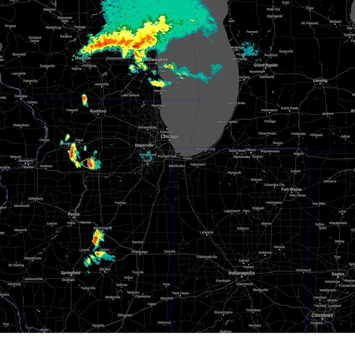 At 322 pm cdt, a severe thunderstorm was located over arlington, or near mendota, moving east at 30 mph (radar indicated). Hazards include ping pong ball size hail. People and animals outdoors will be injured. expect damage to roofs, siding, windows, and vehicles. this severe thunderstorm will remain over mainly rural areas of northeastern bureau county, including the following locations, van orin and arlington. hail threat, observed max hail size, 1. 50 in wind threat, radar indicated max wind gust, <50 mph. At 322 pm cdt, a severe thunderstorm was located over arlington, or near mendota, moving east at 30 mph (radar indicated). Hazards include ping pong ball size hail. People and animals outdoors will be injured. expect damage to roofs, siding, windows, and vehicles. this severe thunderstorm will remain over mainly rural areas of northeastern bureau county, including the following locations, van orin and arlington. hail threat, observed max hail size, 1. 50 in wind threat, radar indicated max wind gust, <50 mph.
|
| 4/19/2023 3:12 PM CDT |
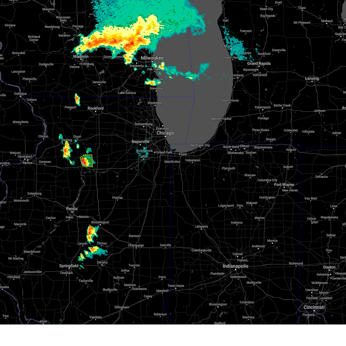 At 312 pm cdt, a severe thunderstorm was located over zearing, or 10 miles northeast of princeton, moving east at 30 mph (radar indicated). Hazards include half dollar size hail. Damage to vehicles is expected. this severe storm will be near, la moille, cherry and arlington around 320 pm cdt. hail threat, observed max hail size, 1. 25 in wind threat, radar indicated max wind gust, <50 mph. At 312 pm cdt, a severe thunderstorm was located over zearing, or 10 miles northeast of princeton, moving east at 30 mph (radar indicated). Hazards include half dollar size hail. Damage to vehicles is expected. this severe storm will be near, la moille, cherry and arlington around 320 pm cdt. hail threat, observed max hail size, 1. 25 in wind threat, radar indicated max wind gust, <50 mph.
|
| 4/19/2023 3:04 PM CDT |
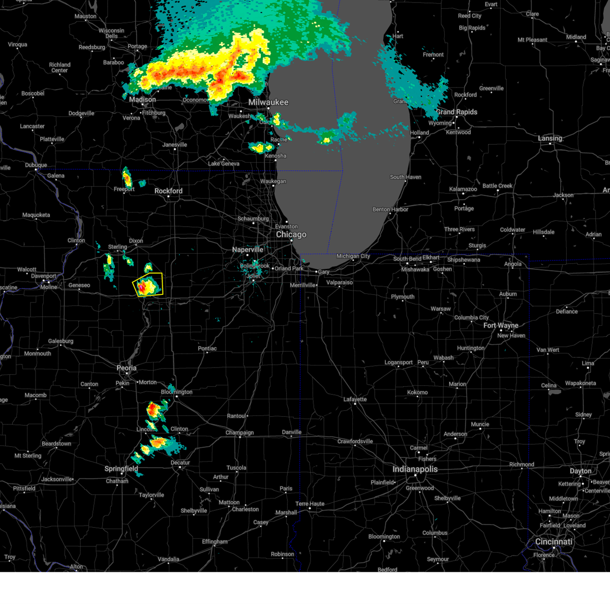 At 304 pm cdt, a severe thunderstorm was located over dover, or 7 miles northeast of princeton, moving east at 30 mph (radar indicated). Hazards include half dollar size hail. Damage to vehicles is expected. this severe thunderstorm will be near, zearing and van orin around 310 pm cdt. la moille, cherry and arlington around 320 pm cdt. hail threat, observed max hail size, 1. 25 in wind threat, radar indicated max wind gust, <50 mph. At 304 pm cdt, a severe thunderstorm was located over dover, or 7 miles northeast of princeton, moving east at 30 mph (radar indicated). Hazards include half dollar size hail. Damage to vehicles is expected. this severe thunderstorm will be near, zearing and van orin around 310 pm cdt. la moille, cherry and arlington around 320 pm cdt. hail threat, observed max hail size, 1. 25 in wind threat, radar indicated max wind gust, <50 mph.
|
| 4/5/2023 5:45 AM CDT |
 At 545 am cdt, severe thunderstorms were located along a line extending from near dixon to lawn ridge, moving east at 50 mph (radar indicated). Hazards include 60 mph wind gusts and quarter size hail. Hail damage to vehicles is expected. expect wind damage to roofs, siding, and trees. Locations impacted include, princeton, hennepin, spring valley, henry, depue, granville, walnut, ladd, wyanet, tiskilwa, la moille, dalzell, bureau junction, mcnabb, putnam, mark, ohio, cherry, malden and seatonville. At 545 am cdt, severe thunderstorms were located along a line extending from near dixon to lawn ridge, moving east at 50 mph (radar indicated). Hazards include 60 mph wind gusts and quarter size hail. Hail damage to vehicles is expected. expect wind damage to roofs, siding, and trees. Locations impacted include, princeton, hennepin, spring valley, henry, depue, granville, walnut, ladd, wyanet, tiskilwa, la moille, dalzell, bureau junction, mcnabb, putnam, mark, ohio, cherry, malden and seatonville.
|
| 4/5/2023 5:38 AM CDT |
 At 538 am cdt, severe thunderstorms were located along a line extending from nelson to princeville, moving east at 50 mph (radar indicated). Hazards include 60 mph wind gusts and quarter size hail. Hail damage to vehicles is expected. expect wind damage to roofs, siding, and trees. These severe thunderstorms will remain over mainly rural areas of putnam, eastern whiteside and bureau counties, including the following locations, seatonville, spring valley airport, cherry, penrose, mark, standard, coal hollow, ottville, kasbeer and manlius. At 538 am cdt, severe thunderstorms were located along a line extending from nelson to princeville, moving east at 50 mph (radar indicated). Hazards include 60 mph wind gusts and quarter size hail. Hail damage to vehicles is expected. expect wind damage to roofs, siding, and trees. These severe thunderstorms will remain over mainly rural areas of putnam, eastern whiteside and bureau counties, including the following locations, seatonville, spring valley airport, cherry, penrose, mark, standard, coal hollow, ottville, kasbeer and manlius.
|
| 4/4/2023 11:34 AM CDT | Hen Egg sized hail reported 5.1 miles NW of Arlington, IL |
| 4/4/2023 11:30 AM CDT | Golf Ball sized hail reported 0.8 miles SE of Arlington, IL, delayed report. |
| 4/4/2023 11:24 AM CDT |
 The severe thunderstorm warning for northeastern putnam, southeastern whiteside and eastern bureau counties will expire at 1130 am cdt, this has been replaced with a new severe thunderstorm warning for northeastern bureau and putnam counties, with damaging winds and large hail still a threat. The severe thunderstorm warning for northeastern putnam, southeastern whiteside and eastern bureau counties will expire at 1130 am cdt, this has been replaced with a new severe thunderstorm warning for northeastern bureau and putnam counties, with damaging winds and large hail still a threat.
|
| 4/4/2023 11:23 AM CDT |
 At 1122 am cdt, a severe thunderstorm was located near dover, or 8 miles northeast of princeton, moving east at 35 mph. this is a destructive storm! (radar indicated). Hazards include 80 mph wind gusts and two inch hail. Flying debris will be dangerous to those caught without shelter. mobile homes will be heavily damaged. expect considerable damage to roofs, windows, and vehicles. extensive tree damage and power outages are likely. this severe thunderstorm will be near, la moille around 1130 am cdt. Ladd, cherry and arlington around 1135 am cdt. At 1122 am cdt, a severe thunderstorm was located near dover, or 8 miles northeast of princeton, moving east at 35 mph. this is a destructive storm! (radar indicated). Hazards include 80 mph wind gusts and two inch hail. Flying debris will be dangerous to those caught without shelter. mobile homes will be heavily damaged. expect considerable damage to roofs, windows, and vehicles. extensive tree damage and power outages are likely. this severe thunderstorm will be near, la moille around 1130 am cdt. Ladd, cherry and arlington around 1135 am cdt.
|
| 4/4/2023 11:12 AM CDT |
 At 1112 am cdt, a severe thunderstorm was located near van orin, or 8 miles south of amboy, moving east at 40 mph. this is a destructive storm! (radar indicated). Hazards include 80 mph wind gusts and two inch hail. Flying debris will be dangerous to those caught without shelter. mobile homes will be heavily damaged. expect considerable damage to roofs, windows, and vehicles. extensive tree damage and power outages are likely. locations impacted include, la moille. thunderstorm damage threat, destructive hail threat, radar indicated max hail size, 2. 00 in wind threat, radar indicated max wind gust, 80 mph. At 1112 am cdt, a severe thunderstorm was located near van orin, or 8 miles south of amboy, moving east at 40 mph. this is a destructive storm! (radar indicated). Hazards include 80 mph wind gusts and two inch hail. Flying debris will be dangerous to those caught without shelter. mobile homes will be heavily damaged. expect considerable damage to roofs, windows, and vehicles. extensive tree damage and power outages are likely. locations impacted include, la moille. thunderstorm damage threat, destructive hail threat, radar indicated max hail size, 2. 00 in wind threat, radar indicated max wind gust, 80 mph.
|
| 4/4/2023 10:57 AM CDT |
 At 1056 am cdt, a severe thunderstorm was located over walnut, or 14 miles north of princeton, moving east at 40 mph (radar indicated). Hazards include two inch hail and 70 mph wind gusts. People and animals outdoors will be injured. expect hail damage to roofs, siding, windows, and vehicles. expect considerable tree damage. wind damage is also likely to mobile homes, roofs, and outbuildings. this severe storm will be near, ohio and kasbeer around 1105 am cdt. other locations in the path of this severe thunderstorm include van orin and la moille. thunderstorm damage threat, considerable hail threat, radar indicated max hail size, 2. 00 in wind threat, radar indicated max wind gust, 70 mph. At 1056 am cdt, a severe thunderstorm was located over walnut, or 14 miles north of princeton, moving east at 40 mph (radar indicated). Hazards include two inch hail and 70 mph wind gusts. People and animals outdoors will be injured. expect hail damage to roofs, siding, windows, and vehicles. expect considerable tree damage. wind damage is also likely to mobile homes, roofs, and outbuildings. this severe storm will be near, ohio and kasbeer around 1105 am cdt. other locations in the path of this severe thunderstorm include van orin and la moille. thunderstorm damage threat, considerable hail threat, radar indicated max hail size, 2. 00 in wind threat, radar indicated max wind gust, 70 mph.
|
| 4/4/2023 10:50 AM CDT |
 At 1050 am cdt, a severe thunderstorm was located over normandy, or 14 miles south of rock falls, moving east at 40 mph (radar indicated). Hazards include 70 mph wind gusts and ping pong ball size hail. People and animals outdoors will be injured. expect hail damage to roofs, siding, windows, and vehicles. expect considerable tree damage. wind damage is also likely to mobile homes, roofs, and outbuildings. this severe storm will be near, walnut around 1055 am cdt. other locations in the path of this severe thunderstorm include ohio, kasbeer, van orin and la moille. thunderstorm damage threat, considerable hail threat, radar indicated max hail size, 1. 50 in wind threat, radar indicated max wind gust, 70 mph. At 1050 am cdt, a severe thunderstorm was located over normandy, or 14 miles south of rock falls, moving east at 40 mph (radar indicated). Hazards include 70 mph wind gusts and ping pong ball size hail. People and animals outdoors will be injured. expect hail damage to roofs, siding, windows, and vehicles. expect considerable tree damage. wind damage is also likely to mobile homes, roofs, and outbuildings. this severe storm will be near, walnut around 1055 am cdt. other locations in the path of this severe thunderstorm include ohio, kasbeer, van orin and la moille. thunderstorm damage threat, considerable hail threat, radar indicated max hail size, 1. 50 in wind threat, radar indicated max wind gust, 70 mph.
|
| 4/4/2023 10:41 AM CDT |
 At 1040 am cdt, a severe thunderstorm was located over yorktown, or 15 miles south of rock falls, moving east at 40 mph. this is a destructive storm! (radar indicated). Hazards include 80 mph wind gusts and ping pong ball size hail. Flying debris will be dangerous to those caught without shelter. mobile homes will be heavily damaged. expect considerable damage to roofs, windows, and vehicles. extensive tree damage and power outages are likely. this severe storm will be near, new bedford around 1045 am cdt. other locations in the path of this severe thunderstorm include deer grove, manlius, normandy, walnut, ohio, kasbeer, van orin and la moille. thunderstorm damage threat, destructive hail threat, radar indicated max hail size, 1. 50 in wind threat, radar indicated max wind gust, 80 mph. At 1040 am cdt, a severe thunderstorm was located over yorktown, or 15 miles south of rock falls, moving east at 40 mph. this is a destructive storm! (radar indicated). Hazards include 80 mph wind gusts and ping pong ball size hail. Flying debris will be dangerous to those caught without shelter. mobile homes will be heavily damaged. expect considerable damage to roofs, windows, and vehicles. extensive tree damage and power outages are likely. this severe storm will be near, new bedford around 1045 am cdt. other locations in the path of this severe thunderstorm include deer grove, manlius, normandy, walnut, ohio, kasbeer, van orin and la moille. thunderstorm damage threat, destructive hail threat, radar indicated max hail size, 1. 50 in wind threat, radar indicated max wind gust, 80 mph.
|
| 4/4/2023 10:26 AM CDT |
 At 1024 am cdt, a severe thunderstorm was located near spring hill, or 17 miles south of morrison, moving east at 40 mph. this is a destructive storm! (radar indicated). Hazards include 80 mph wind gusts and two inch hail. Flying debris will be dangerous to those caught without shelter. mobile homes will be heavily damaged. expect considerable damage to roofs, windows, and vehicles. extensive tree damage and power outages are likely. this severe thunderstorm will be near, hooppole and leon corners around 1030 am cdt. yorktown around 1035 am cdt. tampico and thomas around 1040 am cdt. other locations in the path of this severe thunderstorm include new bedford, deer grove, manlius, normandy, walnut, kasbeer and ohio. thunderstorm damage threat, destructive hail threat, radar indicated max hail size, 2. 00 in wind threat, radar indicated max wind gust, 80 mph. At 1024 am cdt, a severe thunderstorm was located near spring hill, or 17 miles south of morrison, moving east at 40 mph. this is a destructive storm! (radar indicated). Hazards include 80 mph wind gusts and two inch hail. Flying debris will be dangerous to those caught without shelter. mobile homes will be heavily damaged. expect considerable damage to roofs, windows, and vehicles. extensive tree damage and power outages are likely. this severe thunderstorm will be near, hooppole and leon corners around 1030 am cdt. yorktown around 1035 am cdt. tampico and thomas around 1040 am cdt. other locations in the path of this severe thunderstorm include new bedford, deer grove, manlius, normandy, walnut, kasbeer and ohio. thunderstorm damage threat, destructive hail threat, radar indicated max hail size, 2. 00 in wind threat, radar indicated max wind gust, 80 mph.
|
| 3/26/2023 2:54 PM CDT | Half Dollar sized hail reported 7.1 miles NNW of Arlington, IL, relayed by kwqc tv. time estimated based on radar. |
| 11/5/2022 10:00 AM CDT |
 At 1000 am cdt, severe thunderstorms were located along a line extending from nachusa to near standard, moving northeast at 50 mph (radar indicated). Hazards include 60 mph wind gusts. Expect damage to roofs, siding, and trees. Locations impacted include, hennepin, spring valley, depue, granville, ladd, la moille, dalzell, mcnabb, mark, cherry, seatonville, magnolia, standard, arlington, hollowayville, spring valley airport, zearing, ottville, van orin and florid. At 1000 am cdt, severe thunderstorms were located along a line extending from nachusa to near standard, moving northeast at 50 mph (radar indicated). Hazards include 60 mph wind gusts. Expect damage to roofs, siding, and trees. Locations impacted include, hennepin, spring valley, depue, granville, ladd, la moille, dalzell, mcnabb, mark, cherry, seatonville, magnolia, standard, arlington, hollowayville, spring valley airport, zearing, ottville, van orin and florid.
|
| 11/5/2022 9:54 AM CDT |
 At 953 am cdt, severe thunderstorms were located along a line extending from eldena to mcnabb, moving northeast at 45 mph (radar indicated). Hazards include 60 mph wind gusts. Expect damage to roofs, siding, and trees. Locations impacted include, spring valley airport and dalzell. At 953 am cdt, severe thunderstorms were located along a line extending from eldena to mcnabb, moving northeast at 45 mph (radar indicated). Hazards include 60 mph wind gusts. Expect damage to roofs, siding, and trees. Locations impacted include, spring valley airport and dalzell.
|
| 11/5/2022 9:31 AM CDT |
 At 931 am cdt, severe thunderstorms were located along a line extending from normandy to near sparland, moving northeast at 50 mph (radar indicated). Hazards include 60 mph wind gusts. Expect damage to roofs, siding, and trees. severe thunderstorms will be near, walnut around 935 am cdt. lake thunderbird around 940 am cdt. mcnabb and magnolia around 945 am cdt. hennepin, granville, bureau junction, mark and florid around 950 am cdt. Other locations in the path of these severe thunderstorms include depue, seatonville, standard, hollowayville, spring valley airport, ottville, spring valley, ladd, dalzell and cherry. At 931 am cdt, severe thunderstorms were located along a line extending from normandy to near sparland, moving northeast at 50 mph (radar indicated). Hazards include 60 mph wind gusts. Expect damage to roofs, siding, and trees. severe thunderstorms will be near, walnut around 935 am cdt. lake thunderbird around 940 am cdt. mcnabb and magnolia around 945 am cdt. hennepin, granville, bureau junction, mark and florid around 950 am cdt. Other locations in the path of these severe thunderstorms include depue, seatonville, standard, hollowayville, spring valley airport, ottville, spring valley, ladd, dalzell and cherry.
|
| 7/23/2022 6:28 AM CDT |
 At 627 am cdt, a severe thunderstorm was located over kasbeer, or 9 miles north of princeton, moving east at 30 mph (radar indicated). Hazards include 60 mph wind gusts and nickel size hail. Expect damage to roofs, siding, and trees. locations impacted include, princeton, la moille, ohio, cherry, malden, arlington, dover, zearing, kasbeer and van orin. hail threat, radar indicated max hail size, 0. 88 in wind threat, radar indicated max wind gust, 60 mph. At 627 am cdt, a severe thunderstorm was located over kasbeer, or 9 miles north of princeton, moving east at 30 mph (radar indicated). Hazards include 60 mph wind gusts and nickel size hail. Expect damage to roofs, siding, and trees. locations impacted include, princeton, la moille, ohio, cherry, malden, arlington, dover, zearing, kasbeer and van orin. hail threat, radar indicated max hail size, 0. 88 in wind threat, radar indicated max wind gust, 60 mph.
|
| 7/23/2022 6:15 AM CDT |
 At 615 am cdt, a severe thunderstorm was located near walnut, or 10 miles northwest of princeton, moving east at 30 mph (radar indicated). Hazards include 60 mph wind gusts and nickel size hail. expect damage to roofs, siding, and trees At 615 am cdt, a severe thunderstorm was located near walnut, or 10 miles northwest of princeton, moving east at 30 mph (radar indicated). Hazards include 60 mph wind gusts and nickel size hail. expect damage to roofs, siding, and trees
|
| 6/6/2022 4:37 PM CDT |
 At 437 pm cdt, a severe thunderstorm was located over bureau junction, or near hennepin, moving northeast at 25 mph (radar indicated). Hazards include 60 mph wind gusts and quarter size hail. Hail damage to vehicles is expected. expect wind damage to roofs, siding, and trees. locations impacted include, hennepin, depue, coal hollow, malden, seatonville, dover, hollowayville, ottville, spring valley airport, spring valley, ladd, dalzell, zearing, cherry and arlington. hail threat, radar indicated max hail size, 1. 00 in wind threat, radar indicated max wind gust, 60 mph. At 437 pm cdt, a severe thunderstorm was located over bureau junction, or near hennepin, moving northeast at 25 mph (radar indicated). Hazards include 60 mph wind gusts and quarter size hail. Hail damage to vehicles is expected. expect wind damage to roofs, siding, and trees. locations impacted include, hennepin, depue, coal hollow, malden, seatonville, dover, hollowayville, ottville, spring valley airport, spring valley, ladd, dalzell, zearing, cherry and arlington. hail threat, radar indicated max hail size, 1. 00 in wind threat, radar indicated max wind gust, 60 mph.
|
| 6/6/2022 4:23 PM CDT |
 At 423 pm cdt, a severe thunderstorm was located over tiskilwa, or 8 miles west of hennepin, moving northeast at 25 mph (radar indicated). Hazards include 60 mph wind gusts and quarter size hail. Hail damage to vehicles is expected. expect wind damage to roofs, siding, and trees. this severe thunderstorm will be near, bureau junction around 435 pm cdt. hennepin and bureau county fairgrounds around 440 pm cdt. other locations in the path of this severe thunderstorm include princeton, depue, coal hollow, malden, seatonville, dover, hollowayville, ottville, spring valley airport, spring valley, ladd, zearing, cherry and arlington. hail threat, radar indicated max hail size, 1. 00 in wind threat, radar indicated max wind gust, 60 mph. At 423 pm cdt, a severe thunderstorm was located over tiskilwa, or 8 miles west of hennepin, moving northeast at 25 mph (radar indicated). Hazards include 60 mph wind gusts and quarter size hail. Hail damage to vehicles is expected. expect wind damage to roofs, siding, and trees. this severe thunderstorm will be near, bureau junction around 435 pm cdt. hennepin and bureau county fairgrounds around 440 pm cdt. other locations in the path of this severe thunderstorm include princeton, depue, coal hollow, malden, seatonville, dover, hollowayville, ottville, spring valley airport, spring valley, ladd, zearing, cherry and arlington. hail threat, radar indicated max hail size, 1. 00 in wind threat, radar indicated max wind gust, 60 mph.
|
| 3/5/2022 10:39 PM CST |
 The severe thunderstorm warning for putnam and bureau counties will expire at 1045 pm cst, the storm which prompted the warning has moved out of the area. therefore, the warning will be allowed to expire. a severe thunderstorm watch remains in effect until 200 am cst for north central illinois. The severe thunderstorm warning for putnam and bureau counties will expire at 1045 pm cst, the storm which prompted the warning has moved out of the area. therefore, the warning will be allowed to expire. a severe thunderstorm watch remains in effect until 200 am cst for north central illinois.
|
| 3/5/2022 10:21 PM CST |
 At 1021 pm cst, a severe thunderstorm was located over ladd, or near peru, moving east at 50 mph (radar indicated). Hazards include 60 mph wind gusts and penny size hail. Expect damage to roofs, siding, and trees. This severe thunderstorm will remain over mainly rural areas of putnam and bureau counties, including the following locations, seatonville, spring valley airport, cherry, mark, standard, coal hollow, ottville, kasbeer, manlius and van orin. At 1021 pm cst, a severe thunderstorm was located over ladd, or near peru, moving east at 50 mph (radar indicated). Hazards include 60 mph wind gusts and penny size hail. Expect damage to roofs, siding, and trees. This severe thunderstorm will remain over mainly rural areas of putnam and bureau counties, including the following locations, seatonville, spring valley airport, cherry, mark, standard, coal hollow, ottville, kasbeer, manlius and van orin.
|
| 3/5/2022 9:56 PM CST |
 At 955 pm cst, a severe thunderstorm was located over wyanet, or 8 miles west of princeton, moving east at 50 mph (radar indicated). Hazards include 60 mph wind gusts. Expect damage to roofs, siding, and trees. this severe thunderstorm will be near, princeton and tiskilwa around 1005 pm cst. hennepin, depue and bureau junction around 1015 pm cst. other locations in the path of this severe thunderstorm include spring valley, granville, ladd and dalzell. hail threat, radar indicated max hail size, <. 75 in wind threat, radar indicated max wind gust, 60 mph. At 955 pm cst, a severe thunderstorm was located over wyanet, or 8 miles west of princeton, moving east at 50 mph (radar indicated). Hazards include 60 mph wind gusts. Expect damage to roofs, siding, and trees. this severe thunderstorm will be near, princeton and tiskilwa around 1005 pm cst. hennepin, depue and bureau junction around 1015 pm cst. other locations in the path of this severe thunderstorm include spring valley, granville, ladd and dalzell. hail threat, radar indicated max hail size, <. 75 in wind threat, radar indicated max wind gust, 60 mph.
|
| 10/11/2021 6:32 PM CDT |
 At 632 pm cdt, a severe thunderstorm capable of producing a tornado was located near ladd, or near peru, moving northeast at 35 mph (radar indicated rotation). Hazards include tornado. Flying debris will be dangerous to those caught without shelter. mobile homes will be damaged or destroyed. damage to roofs, windows, and vehicles will occur. tree damage is likely. This tornadic thunderstorm will remain over mainly rural areas of northeastern putnam and northeastern bureau counties, including the following locations, seatonville, ottville, spring valley airport, cherry, hollowayville and arlington. At 632 pm cdt, a severe thunderstorm capable of producing a tornado was located near ladd, or near peru, moving northeast at 35 mph (radar indicated rotation). Hazards include tornado. Flying debris will be dangerous to those caught without shelter. mobile homes will be damaged or destroyed. damage to roofs, windows, and vehicles will occur. tree damage is likely. This tornadic thunderstorm will remain over mainly rural areas of northeastern putnam and northeastern bureau counties, including the following locations, seatonville, ottville, spring valley airport, cherry, hollowayville and arlington.
|
| 10/11/2021 6:13 PM CDT |
 At 613 pm cdt, a severe thunderstorm capable of producing a tornado was located over depue, or near hennepin, moving northeast at 35 mph (radar indicated rotation). Hazards include tornado. Flying debris will be dangerous to those caught without shelter. mobile homes will be damaged or destroyed. damage to roofs, windows, and vehicles will occur. tree damage is likely. Locations impacted include, dalzell and ladd. At 613 pm cdt, a severe thunderstorm capable of producing a tornado was located over depue, or near hennepin, moving northeast at 35 mph (radar indicated rotation). Hazards include tornado. Flying debris will be dangerous to those caught without shelter. mobile homes will be damaged or destroyed. damage to roofs, windows, and vehicles will occur. tree damage is likely. Locations impacted include, dalzell and ladd.
|
| 10/11/2021 5:58 PM CDT |
 At 558 pm cdt, a severe thunderstorm capable of producing a tornado was located over hennepin, moving northeast at 35 mph (radar indicated rotation). Hazards include tornado. Flying debris will be dangerous to those caught without shelter. mobile homes will be damaged or destroyed. damage to roofs, windows, and vehicles will occur. tree damage is likely. this dangerous storm will be near, depue around 610 pm cdt. spring valley and dalzell around 615 pm cdt. Other locations in the path of this tornadic thunderstorm include ladd. At 558 pm cdt, a severe thunderstorm capable of producing a tornado was located over hennepin, moving northeast at 35 mph (radar indicated rotation). Hazards include tornado. Flying debris will be dangerous to those caught without shelter. mobile homes will be damaged or destroyed. damage to roofs, windows, and vehicles will occur. tree damage is likely. this dangerous storm will be near, depue around 610 pm cdt. spring valley and dalzell around 615 pm cdt. Other locations in the path of this tornadic thunderstorm include ladd.
|
| 8/24/2021 6:24 PM CDT |
 The severe thunderstorm warning for southern henry and bureau counties will expire at 630 pm cdt, the storms which prompted the warning have weakened. therefore, the warning will be allowed to expire. this warning was issued primarly for the damaging outflow winds ahead of the storms. there will be additional thunderstorms behind this initial surge, that do not produce strong winds. The severe thunderstorm warning for southern henry and bureau counties will expire at 630 pm cdt, the storms which prompted the warning have weakened. therefore, the warning will be allowed to expire. this warning was issued primarly for the damaging outflow winds ahead of the storms. there will be additional thunderstorms behind this initial surge, that do not produce strong winds.
|
| 8/24/2021 6:20 PM CDT |
 At 619 pm cdt, severe thunderstorms were located along a line extending from near paw paw to near kewanee, moving southeast at 55 mph (trained weather spotters). Hazards include 60 mph wind gusts. Expect damage to roofs, siding, and trees. these severe thunderstorms will remain over mainly rural areas of southern henry and bureau counties, including the following locations, mineral, seatonville, bishop hill, providence, cherry, german corner, dover, coal hollow, zearing and kasbeer. hail threat, radar indicated max hail size, <. 75 in wind threat, radar indicated max wind gust, 60 mph. At 619 pm cdt, severe thunderstorms were located along a line extending from near paw paw to near kewanee, moving southeast at 55 mph (trained weather spotters). Hazards include 60 mph wind gusts. Expect damage to roofs, siding, and trees. these severe thunderstorms will remain over mainly rural areas of southern henry and bureau counties, including the following locations, mineral, seatonville, bishop hill, providence, cherry, german corner, dover, coal hollow, zearing and kasbeer. hail threat, radar indicated max hail size, <. 75 in wind threat, radar indicated max wind gust, 60 mph.
|
| 8/24/2021 6:10 PM CDT |
 At 610 pm cdt, severe thunderstorms were located along a line extending from 9 miles west of paw paw to near galva, moving southeast at 55 mph (trained weather spotters). Hazards include 60 mph wind gusts. Expect damage to roofs, siding, and trees. these severe thunderstorms will remain over mainly rural areas of south central rock island, northeastern mercer, southeastern whiteside, henry and bureau counties, including the following locations, preemption, seatonville, henry county fairgrounds, ophiem, cherry, german corner, coal hollow, kasbeer, manlius and nekoma. hail threat, radar indicated max hail size, <. 75 in wind threat, radar indicated max wind gust, 60 mph. At 610 pm cdt, severe thunderstorms were located along a line extending from 9 miles west of paw paw to near galva, moving southeast at 55 mph (trained weather spotters). Hazards include 60 mph wind gusts. Expect damage to roofs, siding, and trees. these severe thunderstorms will remain over mainly rural areas of south central rock island, northeastern mercer, southeastern whiteside, henry and bureau counties, including the following locations, preemption, seatonville, henry county fairgrounds, ophiem, cherry, german corner, coal hollow, kasbeer, manlius and nekoma. hail threat, radar indicated max hail size, <. 75 in wind threat, radar indicated max wind gust, 60 mph.
|
| 8/24/2021 6:03 PM CDT |
 At 602 pm cdt, outflow from severe thunderstorms were located along a line extending from near amboy to near cambridge, moving southeast at 55 mph (trained weather spotters). Hazards include 60 mph wind gusts. Expect damage to roofs, siding, and trees. locations impacted include, kewanee. hail threat, radar indicated max hail size, <. 75 in wind threat, radar indicated max wind gust, 60 mph. At 602 pm cdt, outflow from severe thunderstorms were located along a line extending from near amboy to near cambridge, moving southeast at 55 mph (trained weather spotters). Hazards include 60 mph wind gusts. Expect damage to roofs, siding, and trees. locations impacted include, kewanee. hail threat, radar indicated max hail size, <. 75 in wind threat, radar indicated max wind gust, 60 mph.
|
| 8/24/2021 5:46 PM CDT |
 At 545 pm cdt, severe thunderstorms were located along a line extending from near dixon to near sherrard, moving southeast at 55 mph (trained weather spotters). Hazards include 60 mph wind gusts. Expect damage to roofs, siding, and trees. severe thunderstorms will be near, woodhull around 600 pm cdt. cambridge around 605 pm cdt. other locations in the path of these severe thunderstorms include galva and kewanee. hail threat, radar indicated max hail size, <. 75 in wind threat, radar indicated max wind gust, 60 mph. At 545 pm cdt, severe thunderstorms were located along a line extending from near dixon to near sherrard, moving southeast at 55 mph (trained weather spotters). Hazards include 60 mph wind gusts. Expect damage to roofs, siding, and trees. severe thunderstorms will be near, woodhull around 600 pm cdt. cambridge around 605 pm cdt. other locations in the path of these severe thunderstorms include galva and kewanee. hail threat, radar indicated max hail size, <. 75 in wind threat, radar indicated max wind gust, 60 mph.
|
| 8/11/2021 9:21 AM CDT |
 The severe thunderstorm warning for putnam, eastern whiteside and bureau counties will expire at 930 am cdt, the storms which prompted the warning have moved out of the warned area. therefore, the warning will be allowed to expire. however very gusty winds still expected behind the storms. an area of strong winds will continue behind the storms, with an extended period of near 60 mph winds expected to last up to one hour. a high wind warning continues through 10 am for winds up to 60 mph. The severe thunderstorm warning for putnam, eastern whiteside and bureau counties will expire at 930 am cdt, the storms which prompted the warning have moved out of the warned area. therefore, the warning will be allowed to expire. however very gusty winds still expected behind the storms. an area of strong winds will continue behind the storms, with an extended period of near 60 mph winds expected to last up to one hour. a high wind warning continues through 10 am for winds up to 60 mph.
|
| 8/11/2021 9:11 AM CDT |
 At 910 am cdt, severe thunderstorms were located along a line extending from near paw paw to near wenona, moving east at 50 mph (radar indicated). Hazards include 60 mph wind gusts will continue. an area of strong winds will continue behind the storms, with an extended period of near 60 mph winds expected to last up to one hour. a high wind warning continues through 10 am for winds up to 60 mph. Expect damage to roofs, siding, and trees. locations impacted include, sterling, rock falls, princeton, hennepin, spring valley, depue, granville, walnut, ladd, wyanet, sheffield, tiskilwa, tampico, la moille, dalzell, buda, bureau junction, mcnabb, deer grove and emerson. hail threat, radar indicated max hail size, <. 75 in wind threat, radar indicated max wind gust, 60 mph. At 910 am cdt, severe thunderstorms were located along a line extending from near paw paw to near wenona, moving east at 50 mph (radar indicated). Hazards include 60 mph wind gusts will continue. an area of strong winds will continue behind the storms, with an extended period of near 60 mph winds expected to last up to one hour. a high wind warning continues through 10 am for winds up to 60 mph. Expect damage to roofs, siding, and trees. locations impacted include, sterling, rock falls, princeton, hennepin, spring valley, depue, granville, walnut, ladd, wyanet, sheffield, tiskilwa, tampico, la moille, dalzell, buda, bureau junction, mcnabb, deer grove and emerson. hail threat, radar indicated max hail size, <. 75 in wind threat, radar indicated max wind gust, 60 mph.
|
| 8/11/2021 9:02 AM CDT |
 At 901 am cdt, severe thunderstorms were located along a line extending from 7 miles southeast of amboy to varna, moving east at 50 mph. an area of strong winds will continue behind the storms, with an extended period of near 60 mph winds expected to last up to one hour. a high wind warning continues through 10 am for winds up to 60 mph (radar indicated). Hazards include 70 mph wind gusts and quarter size hail. Hail damage to vehicles is expected. expect considerable tree damage. wind damage is also likely to mobile homes, roofs, and outbuildings. locations impacted include, sterling, rock falls, princeton, hennepin, spring valley, depue, granville, walnut, ladd, wyanet, sheffield, tiskilwa, tampico, la moille, dalzell, buda, bureau junction, mcnabb, deer grove and emerson. thunderstorm damage threat, considerable hail threat, radar indicated max hail size, 1. 00 in wind threat, radar indicated max wind gust, 70 mph. At 901 am cdt, severe thunderstorms were located along a line extending from 7 miles southeast of amboy to varna, moving east at 50 mph. an area of strong winds will continue behind the storms, with an extended period of near 60 mph winds expected to last up to one hour. a high wind warning continues through 10 am for winds up to 60 mph (radar indicated). Hazards include 70 mph wind gusts and quarter size hail. Hail damage to vehicles is expected. expect considerable tree damage. wind damage is also likely to mobile homes, roofs, and outbuildings. locations impacted include, sterling, rock falls, princeton, hennepin, spring valley, depue, granville, walnut, ladd, wyanet, sheffield, tiskilwa, tampico, la moille, dalzell, buda, bureau junction, mcnabb, deer grove and emerson. thunderstorm damage threat, considerable hail threat, radar indicated max hail size, 1. 00 in wind threat, radar indicated max wind gust, 70 mph.
|
| 8/11/2021 8:56 AM CDT |
 The severe thunderstorm warning for northeastern rock island, whiteside, henry and bureau counties will expire at 900 am cdt, the storms which prompted the warning have moved out of the area. therefore, the warning will be allowed to expire. however gusty winds are still possible with these thunderstorms. severe thunderstorm warnings continue for portions of bureau, putnam, and eastern whiteside county. an area of strong winds will continue behind the storms, with an extended period of near 60 mph winds expected to last up to one hour. a high wind warning continues through 10 am for winds up to 60 mph. to report severe weather, contact your nearest law enforcement agency. they will relay your report to the national weather service the quad cities. The severe thunderstorm warning for northeastern rock island, whiteside, henry and bureau counties will expire at 900 am cdt, the storms which prompted the warning have moved out of the area. therefore, the warning will be allowed to expire. however gusty winds are still possible with these thunderstorms. severe thunderstorm warnings continue for portions of bureau, putnam, and eastern whiteside county. an area of strong winds will continue behind the storms, with an extended period of near 60 mph winds expected to last up to one hour. a high wind warning continues through 10 am for winds up to 60 mph. to report severe weather, contact your nearest law enforcement agency. they will relay your report to the national weather service the quad cities.
|
| 8/11/2021 8:50 AM CDT |
 At 850 am cdt, severe thunderstorms were located along a line extending from near amboy to near henry, moving east at 60 mph. an area of strong winds will continue behind the storms, with an extended period of near 60 mph winds expected to last up to 2 hours (radar indicated). Hazards include 75 mph wind gusts and quarter size hail. Hail damage to vehicles is expected. expect considerable tree damage. wind damage is also likely to mobile homes, roofs, and outbuildings. locations impacted include, sterling, rock falls, princeton, hennepin, spring valley, depue, granville, walnut, ladd, wyanet, sheffield, tiskilwa, tampico, la moille, dalzell, buda, bureau junction, mcnabb, deer grove and emerson. thunderstorm damage threat, considerable hail threat, radar indicated max hail size, 1. 00 in wind threat, radar indicated max wind gust, 70 mph. At 850 am cdt, severe thunderstorms were located along a line extending from near amboy to near henry, moving east at 60 mph. an area of strong winds will continue behind the storms, with an extended period of near 60 mph winds expected to last up to 2 hours (radar indicated). Hazards include 75 mph wind gusts and quarter size hail. Hail damage to vehicles is expected. expect considerable tree damage. wind damage is also likely to mobile homes, roofs, and outbuildings. locations impacted include, sterling, rock falls, princeton, hennepin, spring valley, depue, granville, walnut, ladd, wyanet, sheffield, tiskilwa, tampico, la moille, dalzell, buda, bureau junction, mcnabb, deer grove and emerson. thunderstorm damage threat, considerable hail threat, radar indicated max hail size, 1. 00 in wind threat, radar indicated max wind gust, 70 mph.
|
| 8/11/2021 8:49 AM CDT |
 At 848 am cdt, severe thunderstorms were located along a line extending from near sterling to near buda, moving east at 45 mph. an area of strong winds will continue behind the storms, with an extended period of near 60 mph winds expected to last up to 2 hours (trained weather spotters). Hazards include 75 mph wind gusts with storm moving through bureau county. Expect considerable tree damage. damage is likely to mobile homes, roofs, and outbuildings. locations impacted include, princeton, bureau junction, hennepin, depue and spring valley. thunderstorm damage threat, considerable hail threat, radar indicated max hail size, <. 75 in wind threat, radar indicated max wind gust, 70 mph. At 848 am cdt, severe thunderstorms were located along a line extending from near sterling to near buda, moving east at 45 mph. an area of strong winds will continue behind the storms, with an extended period of near 60 mph winds expected to last up to 2 hours (trained weather spotters). Hazards include 75 mph wind gusts with storm moving through bureau county. Expect considerable tree damage. damage is likely to mobile homes, roofs, and outbuildings. locations impacted include, princeton, bureau junction, hennepin, depue and spring valley. thunderstorm damage threat, considerable hail threat, radar indicated max hail size, <. 75 in wind threat, radar indicated max wind gust, 70 mph.
|
| 8/11/2021 8:41 AM CDT |
 At 841 am cdt, severe thunderstorms were located along a line extending from near rock falls to near castleton, moving east at 50 mph. an area of strong winds will continue behind the storms, with an extended period of near 60 mph winds expected to last up to 2 hours (radar indicated). Hazards include 75 mph wind gusts and quarter size hail. Hail damage to vehicles is expected. expect considerable tree damage. wind damage is also likely to mobile homes, roofs, and outbuildings. locations impacted include, sterling, rock falls, princeton, hennepin, spring valley, depue, granville, walnut, ladd, wyanet, sheffield, tiskilwa, tampico, la moille, dalzell, buda, bureau junction, mcnabb, deer grove and emerson. thunderstorm damage threat, considerable hail threat, radar indicated max hail size, 1. 00 in wind threat, radar indicated max wind gust, 70 mph. At 841 am cdt, severe thunderstorms were located along a line extending from near rock falls to near castleton, moving east at 50 mph. an area of strong winds will continue behind the storms, with an extended period of near 60 mph winds expected to last up to 2 hours (radar indicated). Hazards include 75 mph wind gusts and quarter size hail. Hail damage to vehicles is expected. expect considerable tree damage. wind damage is also likely to mobile homes, roofs, and outbuildings. locations impacted include, sterling, rock falls, princeton, hennepin, spring valley, depue, granville, walnut, ladd, wyanet, sheffield, tiskilwa, tampico, la moille, dalzell, buda, bureau junction, mcnabb, deer grove and emerson. thunderstorm damage threat, considerable hail threat, radar indicated max hail size, 1. 00 in wind threat, radar indicated max wind gust, 70 mph.
|
| 8/11/2021 8:33 AM CDT |
 At 832 am cdt, severe thunderstorms were located along a line extending from near rock falls to near castleton, moving east at 50 mph. an area of strong winds will continue behind the storms, with an extended period of near 60 mph winds expected to last up to 2 hours (radar indicated). Hazards include 70 mph wind gusts and quarter size hail. Hail damage to vehicles is expected. expect considerable tree damage. wind damage is also likely to mobile homes, roofs, and outbuildings. these severe thunderstorms will remain over mainly rural areas of putnam, eastern whiteside and bureau counties, including the following locations, seatonville, spring valley airport, cherry, penrose, round grove, mark, standard, coal hollow, como and ottville. thunderstorm damage threat, considerable hail threat, radar indicated max hail size, 1. 00 in wind threat, radar indicated max wind gust, 70 mph. At 832 am cdt, severe thunderstorms were located along a line extending from near rock falls to near castleton, moving east at 50 mph. an area of strong winds will continue behind the storms, with an extended period of near 60 mph winds expected to last up to 2 hours (radar indicated). Hazards include 70 mph wind gusts and quarter size hail. Hail damage to vehicles is expected. expect considerable tree damage. wind damage is also likely to mobile homes, roofs, and outbuildings. these severe thunderstorms will remain over mainly rural areas of putnam, eastern whiteside and bureau counties, including the following locations, seatonville, spring valley airport, cherry, penrose, round grove, mark, standard, coal hollow, como and ottville. thunderstorm damage threat, considerable hail threat, radar indicated max hail size, 1. 00 in wind threat, radar indicated max wind gust, 70 mph.
|
| 8/11/2021 8:27 AM CDT |
 At 826 am cdt, severe thunderstorms were located along a line extending from morrison to near kewanee, moving east at 45 mph. an area of strong winds will continue behind the storms, with an extended period of near 60 mph winds expected to last up to 2 hours (radar indicated). Hazards include 60 mph wind gusts. Expect damage to roofs, siding, and trees. these severe storms will be near, morrison and lyndon around 830 am cdt. other locations in the path of these severe thunderstorms include rock falls, coleta, emerson, sterling, sheffield, buda, wyanet, tiskilwa, princeton, bureau junction, hennepin, spring valley and depue. hail threat, radar indicated max hail size, <. 75 in wind threat, radar indicated max wind gust, 60 mph. At 826 am cdt, severe thunderstorms were located along a line extending from morrison to near kewanee, moving east at 45 mph. an area of strong winds will continue behind the storms, with an extended period of near 60 mph winds expected to last up to 2 hours (radar indicated). Hazards include 60 mph wind gusts. Expect damage to roofs, siding, and trees. these severe storms will be near, morrison and lyndon around 830 am cdt. other locations in the path of these severe thunderstorms include rock falls, coleta, emerson, sterling, sheffield, buda, wyanet, tiskilwa, princeton, bureau junction, hennepin, spring valley and depue. hail threat, radar indicated max hail size, <. 75 in wind threat, radar indicated max wind gust, 60 mph.
|
| 8/11/2021 8:13 AM CDT |
 At 813 am cdt, severe thunderstorms were located along a line extending from near garden plain to near altona, moving east at 45 mph. an area of strong winds will continue behind the storms, with an extended period of near 60 mph winds expected to last up to 2 hours (radar indicated). Hazards include 60 mph wind gusts. Expect damage to roofs, siding, and trees. these severe storms will be near, prophetstown around 820 am cdt. morrison and lyndon around 825 am cdt. other locations in the path of these severe thunderstorms include kewanee, coleta, emerson, rock falls, sterling, sheffield, buda and wyanet. hail threat, radar indicated max hail size, <. 75 in wind threat, radar indicated max wind gust, 60 mph. At 813 am cdt, severe thunderstorms were located along a line extending from near garden plain to near altona, moving east at 45 mph. an area of strong winds will continue behind the storms, with an extended period of near 60 mph winds expected to last up to 2 hours (radar indicated). Hazards include 60 mph wind gusts. Expect damage to roofs, siding, and trees. these severe storms will be near, prophetstown around 820 am cdt. morrison and lyndon around 825 am cdt. other locations in the path of these severe thunderstorms include kewanee, coleta, emerson, rock falls, sterling, sheffield, buda and wyanet. hail threat, radar indicated max hail size, <. 75 in wind threat, radar indicated max wind gust, 60 mph.
|
| 8/11/2021 8:07 AM CDT |
 At 806 am cdt, severe thunderstorms were located along a line extending from near garden plain to near altona, moving east at 45 mph. in additionl strong gradient winds are occuring behind the storms and will also result in winds to 60 mph (radar indicated). Hazards include 60 mph wind gusts. Expect damage to roofs, siding, and trees. severe thunderstorms will be near, erie, garden plain and albany around 810 am cdt. morrison, prophetstown and lyndon around 820 am cdt. other locations in the path of these severe thunderstorms include kewanee, rock falls, coleta, emerson, sterling, sheffield, buda, wyanet, tiskilwa, princeton and bureau junction. hail threat, radar indicated max hail size, <. 75 in wind threat, radar indicated max wind gust, 60 mph. At 806 am cdt, severe thunderstorms were located along a line extending from near garden plain to near altona, moving east at 45 mph. in additionl strong gradient winds are occuring behind the storms and will also result in winds to 60 mph (radar indicated). Hazards include 60 mph wind gusts. Expect damage to roofs, siding, and trees. severe thunderstorms will be near, erie, garden plain and albany around 810 am cdt. morrison, prophetstown and lyndon around 820 am cdt. other locations in the path of these severe thunderstorms include kewanee, rock falls, coleta, emerson, sterling, sheffield, buda, wyanet, tiskilwa, princeton and bureau junction. hail threat, radar indicated max hail size, <. 75 in wind threat, radar indicated max wind gust, 60 mph.
|
| 8/10/2021 7:03 PM CDT |
 At 703 pm cdt, a severe thunderstorm was located over la moille, or near mendota, moving east at 50 mph (radar indicated). Hazards include 60 mph wind gusts and nickel size hail. Expect damage to roofs, siding, and trees. this severe thunderstorm will remain over mainly rural areas of northeastern bureau county, including the following locations, zearing, seatonville, ottville, spring valley airport, cherry, dover, van orin, malden, coal hollow and hollowayville. hail threat, radar indicated max hail size, 0. 88 in wind threat, radar indicated max wind gust, 60 mph. At 703 pm cdt, a severe thunderstorm was located over la moille, or near mendota, moving east at 50 mph (radar indicated). Hazards include 60 mph wind gusts and nickel size hail. Expect damage to roofs, siding, and trees. this severe thunderstorm will remain over mainly rural areas of northeastern bureau county, including the following locations, zearing, seatonville, ottville, spring valley airport, cherry, dover, van orin, malden, coal hollow and hollowayville. hail threat, radar indicated max hail size, 0. 88 in wind threat, radar indicated max wind gust, 60 mph.
|
| 8/10/2021 6:50 PM CDT |
 At 650 pm cdt, a severe thunderstorm was located 7 miles north of princeton, moving east at 50 mph (radar indicated). Hazards include 60 mph wind gusts and nickel size hail. Expect damage to roofs, siding, and trees. this severe thunderstorm will be near, la moille around 700 pm cdt. hail threat, radar indicated max hail size, 0. 88 in wind threat, radar indicated max wind gust, 60 mph. At 650 pm cdt, a severe thunderstorm was located 7 miles north of princeton, moving east at 50 mph (radar indicated). Hazards include 60 mph wind gusts and nickel size hail. Expect damage to roofs, siding, and trees. this severe thunderstorm will be near, la moille around 700 pm cdt. hail threat, radar indicated max hail size, 0. 88 in wind threat, radar indicated max wind gust, 60 mph.
|
| 8/9/2021 7:37 PM CDT |
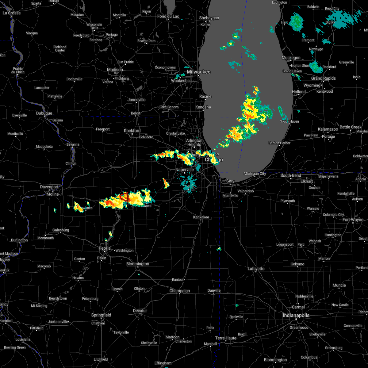 At 737 pm cdt, a severe thunderstorm capable of producing a tornado was located near ladd, or near peru, moving east at 25 mph (weather spotters reported a funnel cloud east of zearing at 723 pm cdt). Hazards include tornado. Flying debris will be dangerous to those caught without shelter. mobile homes will be damaged or destroyed. damage to roofs, windows, and vehicles will occur. tree damage is likely. This tornadic thunderstorm will remain over mainly rural areas of eastern bureau county, including the following locations, cherry and arlington. At 737 pm cdt, a severe thunderstorm capable of producing a tornado was located near ladd, or near peru, moving east at 25 mph (weather spotters reported a funnel cloud east of zearing at 723 pm cdt). Hazards include tornado. Flying debris will be dangerous to those caught without shelter. mobile homes will be damaged or destroyed. damage to roofs, windows, and vehicles will occur. tree damage is likely. This tornadic thunderstorm will remain over mainly rural areas of eastern bureau county, including the following locations, cherry and arlington.
|
| 8/9/2021 7:24 PM CDT |
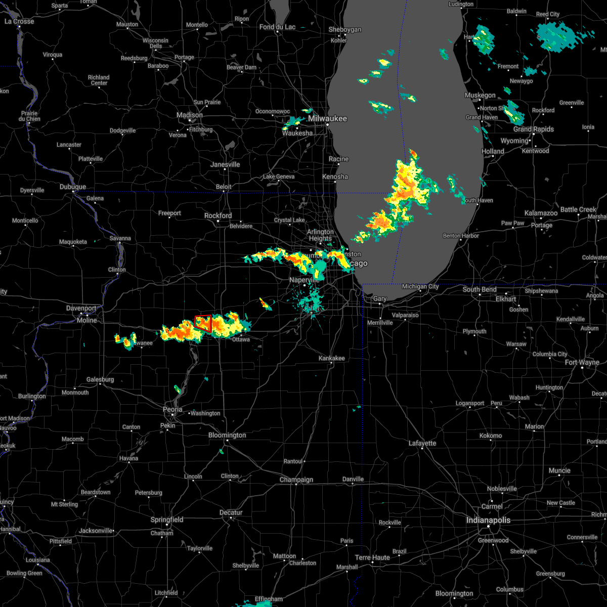 At 724 pm cdt, a severe thunderstorm capable of producing a tornado was located near ladd, or 9 miles northwest of peru, moving east at 20 mph (radar indicated rotation). Hazards include tornado. Flying debris will be dangerous to those caught without shelter. mobile homes will be damaged or destroyed. damage to roofs, windows, and vehicles will occur. tree damage is likely. This dangerous storm will be near, ladd around 735 pm cdt. At 724 pm cdt, a severe thunderstorm capable of producing a tornado was located near ladd, or 9 miles northwest of peru, moving east at 20 mph (radar indicated rotation). Hazards include tornado. Flying debris will be dangerous to those caught without shelter. mobile homes will be damaged or destroyed. damage to roofs, windows, and vehicles will occur. tree damage is likely. This dangerous storm will be near, ladd around 735 pm cdt.
|
| 8/9/2021 7:17 PM CDT |
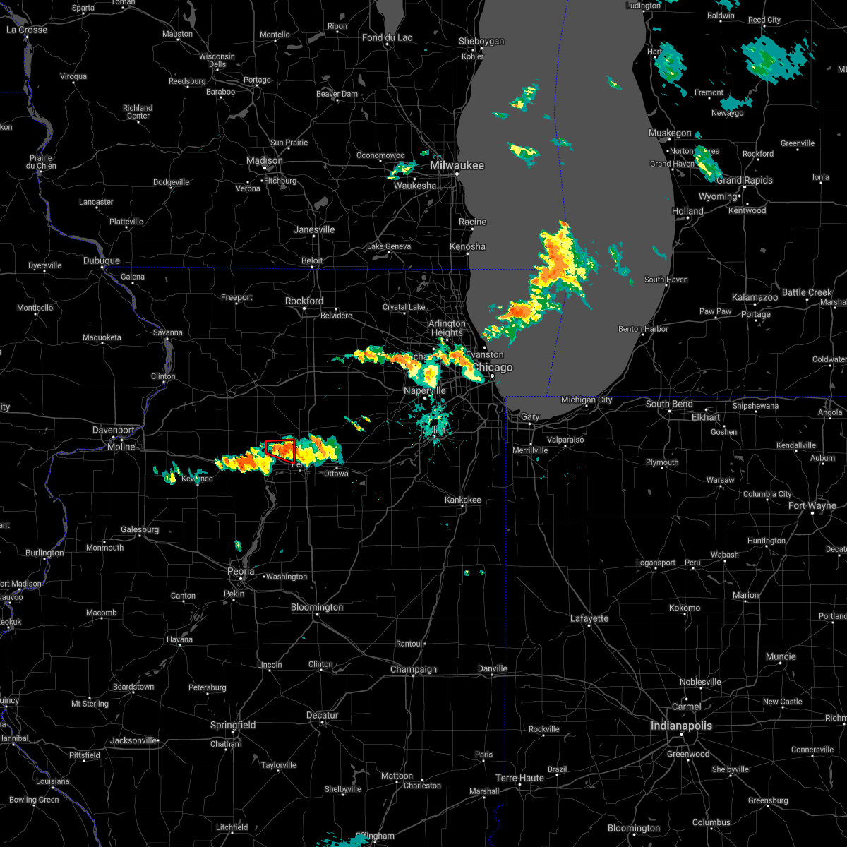 At 717 pm cdt, a severe thunderstorm capable of producing a tornado was located near la moille, or 10 miles northeast of princeton, moving east at 25 mph (radar indicated rotation). Hazards include tornado. Flying debris will be dangerous to those caught without shelter. mobile homes will be damaged or destroyed. damage to roofs, windows, and vehicles will occur. tree damage is likely. This dangerous storm will be near, ladd around 730 pm cdt. At 717 pm cdt, a severe thunderstorm capable of producing a tornado was located near la moille, or 10 miles northeast of princeton, moving east at 25 mph (radar indicated rotation). Hazards include tornado. Flying debris will be dangerous to those caught without shelter. mobile homes will be damaged or destroyed. damage to roofs, windows, and vehicles will occur. tree damage is likely. This dangerous storm will be near, ladd around 730 pm cdt.
|
| 8/9/2021 7:12 PM CDT |
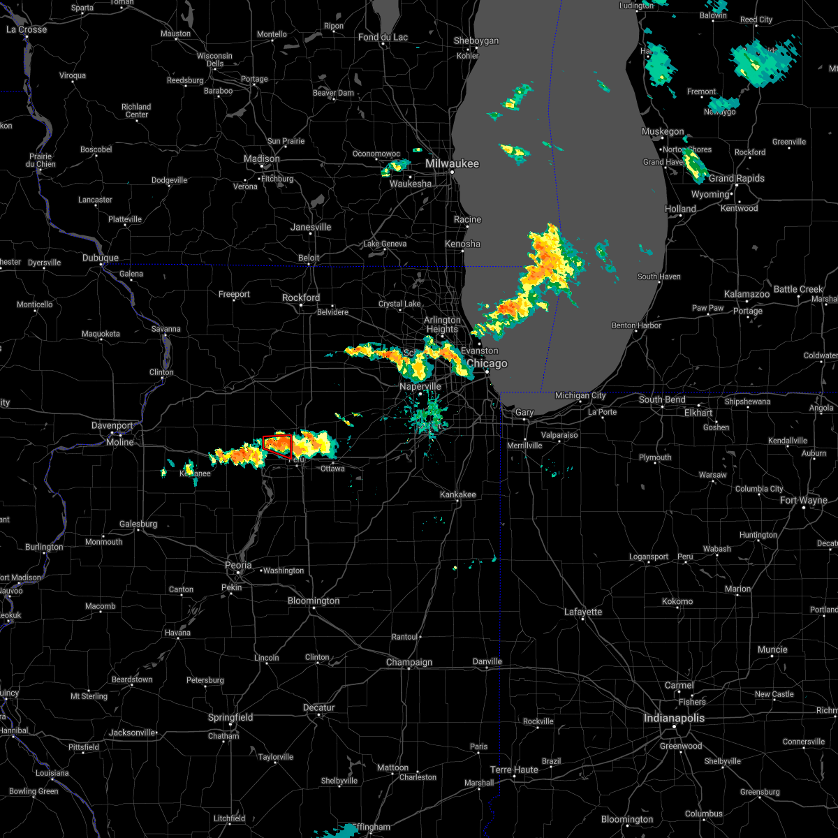 At 711 pm cdt, a confirmed tornado was located near la moille, or 8 miles northeast of princeton, moving east at 25 mph (weather spotters confirmed tornado). Hazards include damaging tornado. Flying debris will be dangerous to those caught without shelter. mobile homes will be damaged or destroyed. damage to roofs, windows, and vehicles will occur. tree damage is likely. The tornado will be near, ladd around 730 pm cdt. At 711 pm cdt, a confirmed tornado was located near la moille, or 8 miles northeast of princeton, moving east at 25 mph (weather spotters confirmed tornado). Hazards include damaging tornado. Flying debris will be dangerous to those caught without shelter. mobile homes will be damaged or destroyed. damage to roofs, windows, and vehicles will occur. tree damage is likely. The tornado will be near, ladd around 730 pm cdt.
|
| 8/9/2021 7:01 PM CDT |
 At 701 pm cdt, a severe thunderstorm capable of producing a tornado was located near la moille, or 9 miles southwest of mendota, moving east at 15 mph (radar indicated rotation). Hazards include tornado. Flying debris will be dangerous to those caught without shelter. mobile homes will be damaged or destroyed. damage to roofs, windows, and vehicles will occur. tree damage is likely. Locations impacted include, arlington. At 701 pm cdt, a severe thunderstorm capable of producing a tornado was located near la moille, or 9 miles southwest of mendota, moving east at 15 mph (radar indicated rotation). Hazards include tornado. Flying debris will be dangerous to those caught without shelter. mobile homes will be damaged or destroyed. damage to roofs, windows, and vehicles will occur. tree damage is likely. Locations impacted include, arlington.
|
| 8/9/2021 6:50 PM CDT |
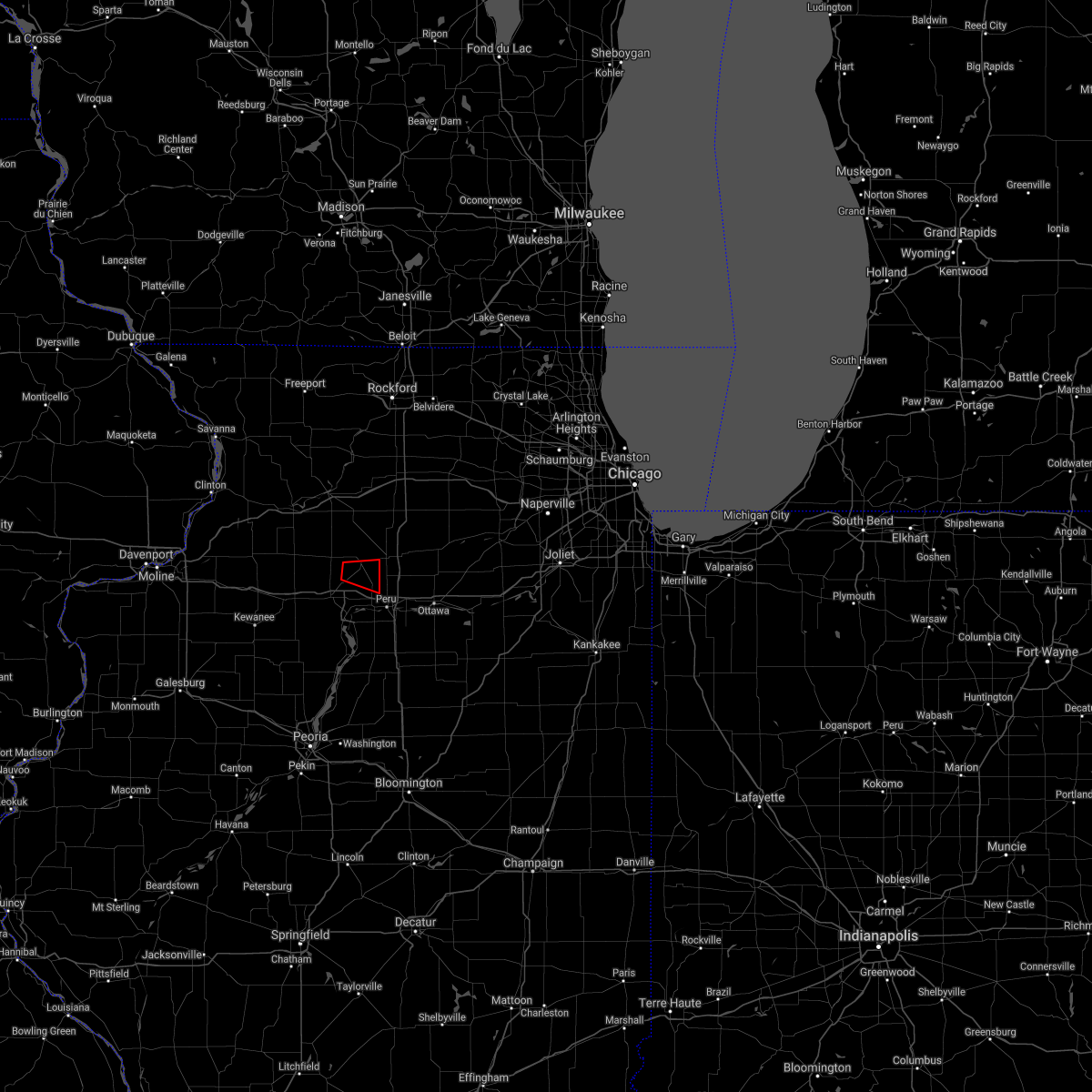 At 650 pm cdt, a severe thunderstorm capable of producing a tornado was located near la moille, or 10 miles northeast of princeton, moving east at 30 mph (radar indicated rotation). Hazards include tornado. Flying debris will be dangerous to those caught without shelter. mobile homes will be damaged or destroyed. damage to roofs, windows, and vehicles will occur. tree damage is likely. This tornadic thunderstorm will remain over mainly rural areas of northeastern bureau county, including the following locations, cherry, zearing and arlington. At 650 pm cdt, a severe thunderstorm capable of producing a tornado was located near la moille, or 10 miles northeast of princeton, moving east at 30 mph (radar indicated rotation). Hazards include tornado. Flying debris will be dangerous to those caught without shelter. mobile homes will be damaged or destroyed. damage to roofs, windows, and vehicles will occur. tree damage is likely. This tornadic thunderstorm will remain over mainly rural areas of northeastern bureau county, including the following locations, cherry, zearing and arlington.
|
| 8/9/2021 6:31 PM CDT |
 At 631 pm cdt, a severe thunderstorm capable of producing a tornado was located near la moille, or near mendota, moving east at 20 mph (radar indicated rotation). Hazards include tornado. Flying debris will be dangerous to those caught without shelter. mobile homes will be damaged or destroyed. damage to roofs, windows, and vehicles will occur. tree damage is likely. This tornadic thunderstorm will remain over mainly rural areas of northeastern bureau county, including the following locations, ohio, arlington and van orin. At 631 pm cdt, a severe thunderstorm capable of producing a tornado was located near la moille, or near mendota, moving east at 20 mph (radar indicated rotation). Hazards include tornado. Flying debris will be dangerous to those caught without shelter. mobile homes will be damaged or destroyed. damage to roofs, windows, and vehicles will occur. tree damage is likely. This tornadic thunderstorm will remain over mainly rural areas of northeastern bureau county, including the following locations, ohio, arlington and van orin.
|
| 8/9/2021 6:18 PM CDT |
 At 617 pm cdt, a severe thunderstorm capable of producing a tornado was located over la moille, or 10 miles west of mendota, moving east at 20 mph. a second tornadic circulation was located just over ohio (radar indicated rotation). Hazards include tornado. Flying debris will be dangerous to those caught without shelter. mobile homes will be damaged or destroyed. damage to roofs, windows, and vehicles will occur. tree damage is likely. This dangerous storm will be near, la moille around 625 pm cdt. At 617 pm cdt, a severe thunderstorm capable of producing a tornado was located over la moille, or 10 miles west of mendota, moving east at 20 mph. a second tornadic circulation was located just over ohio (radar indicated rotation). Hazards include tornado. Flying debris will be dangerous to those caught without shelter. mobile homes will be damaged or destroyed. damage to roofs, windows, and vehicles will occur. tree damage is likely. This dangerous storm will be near, la moille around 625 pm cdt.
|
| 8/9/2021 6:10 PM CDT |
 At 609 pm cdt, a confirmed tornado was located near la moille, or 12 miles west of mendota, moving east at 25 mph (weather spotters confirmed tornado. a brief tornado touchdown was reported east of ohio at 606 pm cdt). Hazards include damaging tornado. Flying debris will be dangerous to those caught without shelter. mobile homes will be damaged or destroyed. damage to roofs, windows, and vehicles will occur. tree damage is likely. This tornado will be near, la moille around 620 pm cdt. At 609 pm cdt, a confirmed tornado was located near la moille, or 12 miles west of mendota, moving east at 25 mph (weather spotters confirmed tornado. a brief tornado touchdown was reported east of ohio at 606 pm cdt). Hazards include damaging tornado. Flying debris will be dangerous to those caught without shelter. mobile homes will be damaged or destroyed. damage to roofs, windows, and vehicles will occur. tree damage is likely. This tornado will be near, la moille around 620 pm cdt.
|
| 8/9/2021 6:07 PM CDT |
 At 606 pm cdt, a severe thunderstorm capable of producing a tornado was located near la moille, or 12 miles northeast of princeton, moving east at 25 mph (weather spotters reported a funnel cloud). Hazards include tornado. Flying debris will be dangerous to those caught without shelter. mobile homes will be damaged or destroyed. damage to roofs, windows, and vehicles will occur. tree damage is likely. This dangerous storm will be near, la moille around 620 pm cdt. At 606 pm cdt, a severe thunderstorm capable of producing a tornado was located near la moille, or 12 miles northeast of princeton, moving east at 25 mph (weather spotters reported a funnel cloud). Hazards include tornado. Flying debris will be dangerous to those caught without shelter. mobile homes will be damaged or destroyed. damage to roofs, windows, and vehicles will occur. tree damage is likely. This dangerous storm will be near, la moille around 620 pm cdt.
|
| 8/9/2021 6:01 PM CDT |
 At 601 pm cdt, a severe thunderstorm capable of producing a tornado was located near la moille, or 11 miles south of walton, moving east at 25 mph (radar indicated rotation). Hazards include tornado. Flying debris will be dangerous to those caught without shelter. mobile homes will be damaged or destroyed. damage to roofs, windows, and vehicles will occur. tree damage is likely. Locations impacted include, la moille. At 601 pm cdt, a severe thunderstorm capable of producing a tornado was located near la moille, or 11 miles south of walton, moving east at 25 mph (radar indicated rotation). Hazards include tornado. Flying debris will be dangerous to those caught without shelter. mobile homes will be damaged or destroyed. damage to roofs, windows, and vehicles will occur. tree damage is likely. Locations impacted include, la moille.
|
| 8/9/2021 5:55 PM CDT |
 At 555 pm cdt, a severe thunderstorm capable of producing a tornado was located 7 miles east of walnut, or 11 miles south of walton, moving east at 30 mph (radar indicated rotation). Hazards include tornado. Flying debris will be dangerous to those caught without shelter. mobile homes will be damaged or destroyed. damage to roofs, windows, and vehicles will occur. tree damage is likely. This dangerous storm will be near, la moille around 615 pm cdt. At 555 pm cdt, a severe thunderstorm capable of producing a tornado was located 7 miles east of walnut, or 11 miles south of walton, moving east at 30 mph (radar indicated rotation). Hazards include tornado. Flying debris will be dangerous to those caught without shelter. mobile homes will be damaged or destroyed. damage to roofs, windows, and vehicles will occur. tree damage is likely. This dangerous storm will be near, la moille around 615 pm cdt.
|
| 11/10/2020 3:57 PM CST |
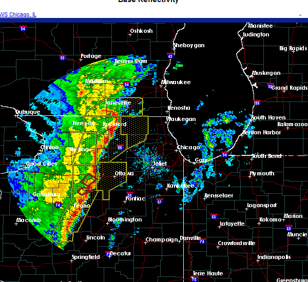 At 357 pm cst, severe thunderstorms were located along a line extending from near la moille to dalzell to near henry, moving east at 55 mph (radar indicated). Hazards include 60 mph wind gusts. expect damage to roofs, siding, and trees At 357 pm cst, severe thunderstorms were located along a line extending from near la moille to dalzell to near henry, moving east at 55 mph (radar indicated). Hazards include 60 mph wind gusts. expect damage to roofs, siding, and trees
|
| 11/10/2020 3:21 PM CST |
 At 321 pm cst, severe thunderstorms were located along a line extending from near walton to near wyanet to camp grove, moving east at 35 mph (radar indicated). Hazards include 60 mph wind gusts and penny size hail. expect damage to roofs, siding, and trees At 321 pm cst, severe thunderstorms were located along a line extending from near walton to near wyanet to camp grove, moving east at 35 mph (radar indicated). Hazards include 60 mph wind gusts and penny size hail. expect damage to roofs, siding, and trees
|
| 8/10/2020 2:00 PM CDT |
 At 159 pm cdt, severe thunderstorms were located along a line extending from near prophetstown to near la fayette, moving east at 70 mph. these are very dangerous storms! (trained weather spotters. this line of storms has a history of producing 70 to 90 mph wind gusts and significant tree damage). Hazards include 80 mph wind gusts. Flying debris will be dangerous to those caught without shelter. mobile homes will be heavily damaged. expect considerable damage to roofs, windows, and vehicles. Extensive tree damage and power outages are likely. At 159 pm cdt, severe thunderstorms were located along a line extending from near prophetstown to near la fayette, moving east at 70 mph. these are very dangerous storms! (trained weather spotters. this line of storms has a history of producing 70 to 90 mph wind gusts and significant tree damage). Hazards include 80 mph wind gusts. Flying debris will be dangerous to those caught without shelter. mobile homes will be heavily damaged. expect considerable damage to roofs, windows, and vehicles. Extensive tree damage and power outages are likely.
|
| 7/19/2020 10:27 AM CDT |
 At 1027 am cdt, a severe thunderstorm was located over granville, or near peru, moving east at 55 mph. this is a very dangerous storm (trained weather spotters). Hazards include 80 mph wind gusts. Flying debris will be dangerous to those caught without shelter. mobile homes will be heavily damaged. expect considerable damage to roofs, windows, and vehicles. extensive tree damage and power outages are likely. locations impacted include, princeton, hennepin, spring valley, henry, depue, granville, ladd, tiskilwa, la moille, dalzell, bureau junction, mcnabb, putnam, mark, cherry, malden, seatonville, magnolia, standard and arlington. this includes the following highways, interstate 80 in illinois between mile markers 56 and 72. Interstate 180 between mile markers 1 and 13. At 1027 am cdt, a severe thunderstorm was located over granville, or near peru, moving east at 55 mph. this is a very dangerous storm (trained weather spotters). Hazards include 80 mph wind gusts. Flying debris will be dangerous to those caught without shelter. mobile homes will be heavily damaged. expect considerable damage to roofs, windows, and vehicles. extensive tree damage and power outages are likely. locations impacted include, princeton, hennepin, spring valley, henry, depue, granville, ladd, tiskilwa, la moille, dalzell, bureau junction, mcnabb, putnam, mark, cherry, malden, seatonville, magnolia, standard and arlington. this includes the following highways, interstate 80 in illinois between mile markers 56 and 72. Interstate 180 between mile markers 1 and 13.
|
| 7/19/2020 10:19 AM CDT |
 At 1018 am cdt, a severe thunderstorm was located over bureau junction, or over hennepin, moving east at 55 mph. this is a very dangerous storm (trained weather spotters). Hazards include 80 mph wind gusts. Flying debris will be dangerous to those caught without shelter. mobile homes will be heavily damaged. expect considerable damage to roofs, windows, and vehicles. extensive tree damage and power outages are likely. locations impacted include, princeton, hennepin, spring valley, henry, depue, granville, ladd, wyanet, tiskilwa, la moille, dalzell, bureau junction, mcnabb, putnam, mark, ohio, cherry, malden, seatonville and magnolia. this includes the following highways, interstate 80 in illinois between mile markers 47 and 72. Interstate 180 between mile markers 1 and 13. At 1018 am cdt, a severe thunderstorm was located over bureau junction, or over hennepin, moving east at 55 mph. this is a very dangerous storm (trained weather spotters). Hazards include 80 mph wind gusts. Flying debris will be dangerous to those caught without shelter. mobile homes will be heavily damaged. expect considerable damage to roofs, windows, and vehicles. extensive tree damage and power outages are likely. locations impacted include, princeton, hennepin, spring valley, henry, depue, granville, ladd, wyanet, tiskilwa, la moille, dalzell, bureau junction, mcnabb, putnam, mark, ohio, cherry, malden, seatonville and magnolia. this includes the following highways, interstate 80 in illinois between mile markers 47 and 72. Interstate 180 between mile markers 1 and 13.
|
| 7/19/2020 10:11 AM CDT |
 At 1011 am cdt, a severe thunderstorm was located over tiskilwa, or 7 miles south of princeton, moving east at 55 mph. this is a very dangerous storm! (trained weather spotters). Hazards include 80 mph wind gusts. Flying debris will be dangerous to those caught without shelter. mobile homes will be heavily damaged. expect considerable damage to roofs, windows, and vehicles. Extensive tree damage and power outages are likely. At 1011 am cdt, a severe thunderstorm was located over tiskilwa, or 7 miles south of princeton, moving east at 55 mph. this is a very dangerous storm! (trained weather spotters). Hazards include 80 mph wind gusts. Flying debris will be dangerous to those caught without shelter. mobile homes will be heavily damaged. expect considerable damage to roofs, windows, and vehicles. Extensive tree damage and power outages are likely.
|
| 7/19/2020 10:04 AM CDT |
 At 1004 am cdt, a severe thunderstorm was located over ladd, or near peru, moving east at 60 mph (trained weather spotters). Hazards include 70 mph wind gusts. Expect considerable tree damage. damage is likely to mobile homes, roofs, and outbuildings. locations impacted include, princeton, hennepin, spring valley, depue, granville, ladd, wyanet, sheffield, tiskilwa, dalzell, buda, bureau junction, mcnabb, putnam, mark, cherry, neponset, malden, seatonville and mineral. this includes the following highways, interstate 80 in illinois between mile markers 37 and 72. Interstate 180 between mile markers 1 and 13. At 1004 am cdt, a severe thunderstorm was located over ladd, or near peru, moving east at 60 mph (trained weather spotters). Hazards include 70 mph wind gusts. Expect considerable tree damage. damage is likely to mobile homes, roofs, and outbuildings. locations impacted include, princeton, hennepin, spring valley, depue, granville, ladd, wyanet, sheffield, tiskilwa, dalzell, buda, bureau junction, mcnabb, putnam, mark, cherry, neponset, malden, seatonville and mineral. this includes the following highways, interstate 80 in illinois between mile markers 37 and 72. Interstate 180 between mile markers 1 and 13.
|
| 7/19/2020 9:50 AM CDT |
 At 950 am cdt, a severe thunderstorm was located over tiskilwa, or near princeton, moving east at 60 mph (trained weather spotters). Hazards include 70 mph wind gusts. Expect considerable tree damage. damage is likely to mobile homes, roofs, and outbuildings. locations impacted include, kewanee, princeton, hennepin, spring valley, galva, depue, granville, ladd, wyanet, sheffield, annawan, tiskilwa, dalzell, buda, bureau junction, mcnabb, putnam, mark, cherry and neponset. this includes the following highways, interstate 80 in illinois between mile markers 33 and 72. Interstate 180 between mile markers 1 and 13. At 950 am cdt, a severe thunderstorm was located over tiskilwa, or near princeton, moving east at 60 mph (trained weather spotters). Hazards include 70 mph wind gusts. Expect considerable tree damage. damage is likely to mobile homes, roofs, and outbuildings. locations impacted include, kewanee, princeton, hennepin, spring valley, galva, depue, granville, ladd, wyanet, sheffield, annawan, tiskilwa, dalzell, buda, bureau junction, mcnabb, putnam, mark, cherry and neponset. this includes the following highways, interstate 80 in illinois between mile markers 33 and 72. Interstate 180 between mile markers 1 and 13.
|
| 7/19/2020 9:42 AM CDT |
 At 942 am cdt, a severe thunderstorm was located over buda, or 10 miles southwest of princeton, moving east at 60 mph (trained weather spotters). Hazards include 70 mph wind gusts. Expect considerable tree damage. damage is likely to mobile homes, roofs, and outbuildings. locations impacted include, kewanee, princeton, hennepin, spring valley, galva, depue, granville, ladd, wyanet, sheffield, annawan, tiskilwa, woodhull, dalzell, alpha, buda, bureau junction, mcnabb, putnam and mark. this includes the following highways, interstate 80 in illinois between mile markers 33 and 72. interstate 74 in illinois between mile markers 29 and 33. Interstate 180 between mile markers 1 and 13. At 942 am cdt, a severe thunderstorm was located over buda, or 10 miles southwest of princeton, moving east at 60 mph (trained weather spotters). Hazards include 70 mph wind gusts. Expect considerable tree damage. damage is likely to mobile homes, roofs, and outbuildings. locations impacted include, kewanee, princeton, hennepin, spring valley, galva, depue, granville, ladd, wyanet, sheffield, annawan, tiskilwa, woodhull, dalzell, alpha, buda, bureau junction, mcnabb, putnam and mark. this includes the following highways, interstate 80 in illinois between mile markers 33 and 72. interstate 74 in illinois between mile markers 29 and 33. Interstate 180 between mile markers 1 and 13.
|
| 7/19/2020 9:30 AM CDT |
 At 930 am cdt, a severe thunderstorm was located near kewanee, moving east at 60 mph (trained weather spotters). Hazards include 60 mph wind gusts. expect damage to roofs, siding, and trees At 930 am cdt, a severe thunderstorm was located near kewanee, moving east at 60 mph (trained weather spotters). Hazards include 60 mph wind gusts. expect damage to roofs, siding, and trees
|
| 7/11/2020 8:56 PM CDT |
 The severe thunderstorm warning for putnam and eastern bureau counties will expire at 900 pm cdt, the storms which prompted the warning have moved out of the area. therefore, the warning will be allowed to expire. however heavy rain is still possible with these thunderstorms. a severe thunderstorm watch remains in effect until midnight cdt for north central illinois. to report severe weather, contact your nearest law enforcement agency. they will relay your report to the national weather service the quad cities. The severe thunderstorm warning for putnam and eastern bureau counties will expire at 900 pm cdt, the storms which prompted the warning have moved out of the area. therefore, the warning will be allowed to expire. however heavy rain is still possible with these thunderstorms. a severe thunderstorm watch remains in effect until midnight cdt for north central illinois. to report severe weather, contact your nearest law enforcement agency. they will relay your report to the national weather service the quad cities.
|
| 7/11/2020 8:41 PM CDT |
 At 841 pm cdt, severe thunderstorms were located along a line extending from near la moille to ladd to near henry, moving east at 45 mph (radar indicated). Hazards include 70 mph wind gusts. Expect considerable tree damage. Damage is likely to mobile homes, roofs, and outbuildings. At 841 pm cdt, severe thunderstorms were located along a line extending from near la moille to ladd to near henry, moving east at 45 mph (radar indicated). Hazards include 70 mph wind gusts. Expect considerable tree damage. Damage is likely to mobile homes, roofs, and outbuildings.
|
| 7/11/2020 8:23 PM CDT |
 At 823 pm cdt, severe thunderstorms were located along a line extending from 6 miles northwest of la moille to near depue to near henry, moving east at 55 mph (radar indicated). Hazards include 70 mph wind gusts. Expect considerable tree damage. damage is likely to mobile homes, roofs, and outbuildings. locations impacted include, princeton, hennepin, spring valley, henry, depue, granville, walnut, ladd, wyanet, tiskilwa, la moille, dalzell, buda, bureau junction, mcnabb, putnam, mark, ohio, cherry and malden. this includes the following highways, interstate 80 in illinois between mile markers 45 and 72. Interstate 180 between mile markers 1 and 13. At 823 pm cdt, severe thunderstorms were located along a line extending from 6 miles northwest of la moille to near depue to near henry, moving east at 55 mph (radar indicated). Hazards include 70 mph wind gusts. Expect considerable tree damage. damage is likely to mobile homes, roofs, and outbuildings. locations impacted include, princeton, hennepin, spring valley, henry, depue, granville, walnut, ladd, wyanet, tiskilwa, la moille, dalzell, buda, bureau junction, mcnabb, putnam, mark, ohio, cherry and malden. this includes the following highways, interstate 80 in illinois between mile markers 45 and 72. Interstate 180 between mile markers 1 and 13.
|
| 7/11/2020 8:02 PM CDT |
 At 801 pm cdt, severe thunderstorms were located along a line extending from near deer grove to near sheffield to elmira, moving east at 50 mph (radar indicated). Hazards include 70 mph wind gusts. Expect considerable tree damage. Damage is likely to mobile homes, roofs, and outbuildings. At 801 pm cdt, severe thunderstorms were located along a line extending from near deer grove to near sheffield to elmira, moving east at 50 mph (radar indicated). Hazards include 70 mph wind gusts. Expect considerable tree damage. Damage is likely to mobile homes, roofs, and outbuildings.
|
| 5/23/2020 1:35 PM CDT |
 The severe thunderstorm warning for northeastern bureau county will expire at 145 pm cdt, the storm which prompted the warning has weakened below severe limits, and no longer poses an immediate threat to life or property. therefore, the warning will be allowed to expire. however gusty winds are still possible with this thunderstorm. a tornado watch remains in effect until 800 pm cdt for north central and northwestern illinois. The severe thunderstorm warning for northeastern bureau county will expire at 145 pm cdt, the storm which prompted the warning has weakened below severe limits, and no longer poses an immediate threat to life or property. therefore, the warning will be allowed to expire. however gusty winds are still possible with this thunderstorm. a tornado watch remains in effect until 800 pm cdt for north central and northwestern illinois.
|
| 5/23/2020 1:31 PM CDT |
 At 130 pm cdt, a severe thunderstorm was located near princeton, moving north at 50 mph (radar indicated). Hazards include 60 mph wind gusts and quarter size hail. Hail damage to vehicles is expected. expect wind damage to roofs, siding, and trees. locations impacted include, princeton, depue, walnut, wyanet, la moille, ohio, cherry, malden, seatonville, arlington, dover, hollowayville, coal hollow, zearing, kasbeer, van orin, bureau county fairgrounds and ottville. this includes the following highways, interstate 80 in illinois between mile markers 47 and 68. Interstate 180 between mile markers 8 and 13. At 130 pm cdt, a severe thunderstorm was located near princeton, moving north at 50 mph (radar indicated). Hazards include 60 mph wind gusts and quarter size hail. Hail damage to vehicles is expected. expect wind damage to roofs, siding, and trees. locations impacted include, princeton, depue, walnut, wyanet, la moille, ohio, cherry, malden, seatonville, arlington, dover, hollowayville, coal hollow, zearing, kasbeer, van orin, bureau county fairgrounds and ottville. this includes the following highways, interstate 80 in illinois between mile markers 47 and 68. Interstate 180 between mile markers 8 and 13.
|
| 5/23/2020 1:18 PM CDT |
 At 118 pm cdt, a severe thunderstorm was located near wyanet, or 7 miles southwest of princeton, moving north at 50 mph (radar indicated). Hazards include 60 mph wind gusts and quarter size hail. Hail damage to vehicles is expected. Expect wind damage to roofs, siding, and trees. At 118 pm cdt, a severe thunderstorm was located near wyanet, or 7 miles southwest of princeton, moving north at 50 mph (radar indicated). Hazards include 60 mph wind gusts and quarter size hail. Hail damage to vehicles is expected. Expect wind damage to roofs, siding, and trees.
|
| 5/14/2020 11:26 PM CDT |
 The severe thunderstorm warning for northeastern bureau county will expire at 1130 pm cdt, the storms which prompted the warning have weakened below severe limits, and no longer pose an immediate threat to life or property. therefore, the warning will be allowed to expire. a severe thunderstorm watch remains in effect until 100 am cdt for north central illinois. The severe thunderstorm warning for northeastern bureau county will expire at 1130 pm cdt, the storms which prompted the warning have weakened below severe limits, and no longer pose an immediate threat to life or property. therefore, the warning will be allowed to expire. a severe thunderstorm watch remains in effect until 100 am cdt for north central illinois.
|
| 5/14/2020 11:13 PM CDT |
 At 1113 pm cdt, severe thunderstorms were located along a line extending from amboy to near la moille to near ladd, moving northeast at 50 mph (radar indicated). Hazards include 60 mph wind gusts. Expect damage to roofs, siding, and trees. locations impacted include, princeton, hennepin, spring valley, depue, ladd, wyanet, tiskilwa, la moille, dalzell, bureau junction, ohio, cherry, malden, seatonville, arlington, dover, hollowayville, spring valley airport, coal hollow and ottville. this includes the following highways, interstate 80 in illinois between mile markers 50 and 73. Interstate 180 between mile markers 5 and 13. At 1113 pm cdt, severe thunderstorms were located along a line extending from amboy to near la moille to near ladd, moving northeast at 50 mph (radar indicated). Hazards include 60 mph wind gusts. Expect damage to roofs, siding, and trees. locations impacted include, princeton, hennepin, spring valley, depue, ladd, wyanet, tiskilwa, la moille, dalzell, bureau junction, ohio, cherry, malden, seatonville, arlington, dover, hollowayville, spring valley airport, coal hollow and ottville. this includes the following highways, interstate 80 in illinois between mile markers 50 and 73. Interstate 180 between mile markers 5 and 13.
|
| 5/14/2020 10:54 PM CDT |
 At 1054 pm cdt, severe thunderstorms were located along a line extending from near walnut to 7 miles north of princeton to near tiskilwa, moving northeast at 50 mph (radar indicated). Hazards include 60 mph wind gusts. Expect damage to roofs, siding, and trees. locations impacted include, princeton, hennepin, spring valley, depue, walnut, ladd, wyanet, sheffield, tiskilwa, la moille, dalzell, buda, bureau junction, ohio, cherry, neponset, malden, manlius, seatonville and mineral. this includes the following highways, interstate 80 in illinois between mile markers 37 and 73. Interstate 180 between mile markers 5 and 13. At 1054 pm cdt, severe thunderstorms were located along a line extending from near walnut to 7 miles north of princeton to near tiskilwa, moving northeast at 50 mph (radar indicated). Hazards include 60 mph wind gusts. Expect damage to roofs, siding, and trees. locations impacted include, princeton, hennepin, spring valley, depue, walnut, ladd, wyanet, sheffield, tiskilwa, la moille, dalzell, buda, bureau junction, ohio, cherry, neponset, malden, manlius, seatonville and mineral. this includes the following highways, interstate 80 in illinois between mile markers 37 and 73. Interstate 180 between mile markers 5 and 13.
|
| 5/14/2020 10:38 PM CDT |
 The national weather service in the quad cities has issued a * severe thunderstorm warning for. bureau county in north central illinois. until 1130 pm cdt. At 1038 pm cdt, severe thunderstorms were located along a line extending from near tampico to near sheffield to near osceola,. The national weather service in the quad cities has issued a * severe thunderstorm warning for. bureau county in north central illinois. until 1130 pm cdt. At 1038 pm cdt, severe thunderstorms were located along a line extending from near tampico to near sheffield to near osceola,.
|
| 9/27/2019 6:27 PM CDT |
 The severe thunderstorm warning for northeastern bureau county will expire at 630 pm cdt, the storm which prompted the warning was moving out of the area. therefore, the warning will be allowed to expire. however small hail is still possible with this thunderstorm. a tornado watch remains in effect until 1100 pm cdt for north central illinois. The severe thunderstorm warning for northeastern bureau county will expire at 630 pm cdt, the storm which prompted the warning was moving out of the area. therefore, the warning will be allowed to expire. however small hail is still possible with this thunderstorm. a tornado watch remains in effect until 1100 pm cdt for north central illinois.
|
| 9/27/2019 6:15 PM CDT |
 At 614 pm cdt, a severe thunderstorm was located near ladd, or 9 miles northwest of peru, moving east at 45 mph (radar indicated). Hazards include quarter size hail. Damage to vehicles is expected. locations impacted include, princeton, spring valley, depue, ladd, la moille, dalzell, cherry, malden, seatonville, arlington, dover, hollowayville, coal hollow, zearing, ottville, kasbeer and spring valley airport. this includes the following highways, interstate 80 in illinois between mile markers 56 and 73. Interstate 180 between mile markers 8 and 13. At 614 pm cdt, a severe thunderstorm was located near ladd, or 9 miles northwest of peru, moving east at 45 mph (radar indicated). Hazards include quarter size hail. Damage to vehicles is expected. locations impacted include, princeton, spring valley, depue, ladd, la moille, dalzell, cherry, malden, seatonville, arlington, dover, hollowayville, coal hollow, zearing, ottville, kasbeer and spring valley airport. this includes the following highways, interstate 80 in illinois between mile markers 56 and 73. Interstate 180 between mile markers 8 and 13.
|
| 9/27/2019 6:08 PM CDT |
 At 607 pm cdt, a severe thunderstorm was located near ladd, or 9 miles northwest of peru, moving east at 45 mph (radar indicated). Hazards include quarter size hail. Damage to vehicles is expected. locations impacted include, princeton, spring valley, depue, ladd, la moille, dalzell, cherry, malden, seatonville, arlington, dover, hollowayville, coal hollow, zearing, ottville, kasbeer and spring valley airport. this includes the following highways, interstate 80 in illinois between mile markers 56 and 73. Interstate 180 between mile markers 8 and 13. At 607 pm cdt, a severe thunderstorm was located near ladd, or 9 miles northwest of peru, moving east at 45 mph (radar indicated). Hazards include quarter size hail. Damage to vehicles is expected. locations impacted include, princeton, spring valley, depue, ladd, la moille, dalzell, cherry, malden, seatonville, arlington, dover, hollowayville, coal hollow, zearing, ottville, kasbeer and spring valley airport. this includes the following highways, interstate 80 in illinois between mile markers 56 and 73. Interstate 180 between mile markers 8 and 13.
|
| 9/27/2019 5:57 PM CDT |
 At 556 pm cdt, a severe thunderstorm was located near princeton, moving east at 50 mph (radar indicated). Hazards include quarter size hail. Damage to vehicles is expected. locations impacted include, princeton, spring valley, depue, ladd, wyanet, la moille, dalzell, buda, cherry, malden, manlius, seatonville, arlington, dover, hollowayville, coal hollow, zearing, ottville, kasbeer and bureau county fairgrounds. this includes the following highways, interstate 80 in illinois between mile markers 45 and 73. Interstate 180 between mile markers 8 and 13. At 556 pm cdt, a severe thunderstorm was located near princeton, moving east at 50 mph (radar indicated). Hazards include quarter size hail. Damage to vehicles is expected. locations impacted include, princeton, spring valley, depue, ladd, wyanet, la moille, dalzell, buda, cherry, malden, manlius, seatonville, arlington, dover, hollowayville, coal hollow, zearing, ottville, kasbeer and bureau county fairgrounds. this includes the following highways, interstate 80 in illinois between mile markers 45 and 73. Interstate 180 between mile markers 8 and 13.
|
| 9/27/2019 5:49 PM CDT |
 At 548 pm cdt, a severe thunderstorm was located over princeton, moving east at 50 mph (radar indicated). Hazards include half dollar size hail. Damage to vehicles is expected. locations impacted include, princeton, spring valley, depue, ladd, wyanet, la moille, dalzell, buda, cherry, malden, manlius, seatonville, arlington, dover, hollowayville, coal hollow, zearing, ottville, kasbeer and bureau county fairgrounds. this includes the following highways, interstate 80 in illinois between mile markers 45 and 73. Interstate 180 between mile markers 8 and 13. At 548 pm cdt, a severe thunderstorm was located over princeton, moving east at 50 mph (radar indicated). Hazards include half dollar size hail. Damage to vehicles is expected. locations impacted include, princeton, spring valley, depue, ladd, wyanet, la moille, dalzell, buda, cherry, malden, manlius, seatonville, arlington, dover, hollowayville, coal hollow, zearing, ottville, kasbeer and bureau county fairgrounds. this includes the following highways, interstate 80 in illinois between mile markers 45 and 73. Interstate 180 between mile markers 8 and 13.
|
| 9/27/2019 5:40 PM CDT |
 At 540 pm cdt, a severe thunderstorm was located over buda, or 9 miles west of princeton, moving east at 50 mph (radar indicated). Hazards include half dollar size hail. Damage to vehicles is expected. locations impacted include, princeton, spring valley, depue, ladd, wyanet, sheffield, la moille, dalzell, buda, cherry, malden, manlius, seatonville, arlington, dover, hollowayville, coal hollow, zearing, ottville and kasbeer. this includes the following highways, interstate 80 in illinois between mile markers 41 and 73. Interstate 180 between mile markers 8 and 13. At 540 pm cdt, a severe thunderstorm was located over buda, or 9 miles west of princeton, moving east at 50 mph (radar indicated). Hazards include half dollar size hail. Damage to vehicles is expected. locations impacted include, princeton, spring valley, depue, ladd, wyanet, sheffield, la moille, dalzell, buda, cherry, malden, manlius, seatonville, arlington, dover, hollowayville, coal hollow, zearing, ottville and kasbeer. this includes the following highways, interstate 80 in illinois between mile markers 41 and 73. Interstate 180 between mile markers 8 and 13.
|
| 9/27/2019 5:37 PM CDT |
 At 537 pm cdt, a severe thunderstorm was located over buda, or 11 miles west of princeton, moving east at 50 mph (radar indicated). Hazards include quarter size hail. damage to vehicles is expected At 537 pm cdt, a severe thunderstorm was located over buda, or 11 miles west of princeton, moving east at 50 mph (radar indicated). Hazards include quarter size hail. damage to vehicles is expected
|
| 6/30/2019 7:44 PM CDT |
 At 744 pm cdt, severe thunderstorms were located along a line extending from mendota to depue to near camp grove, moving southeast at 40 mph (radar indicated). Hazards include 60 mph wind gusts. Expect damage to roofs, siding, and trees. locations impacted include, princeton, depue, wyanet, tiskilwa, la moille, buda, bureau junction, cherry, neponset, malden, seatonville, arlington, dover, hollowayville, providence, coal hollow, zearing, kasbeer, van orin and bureau county fairgrounds. this includes the following highways, interstate 80 in illinois between mile markers 51 and 68. Interstate 180 between mile markers 2 and 13. At 744 pm cdt, severe thunderstorms were located along a line extending from mendota to depue to near camp grove, moving southeast at 40 mph (radar indicated). Hazards include 60 mph wind gusts. Expect damage to roofs, siding, and trees. locations impacted include, princeton, depue, wyanet, tiskilwa, la moille, buda, bureau junction, cherry, neponset, malden, seatonville, arlington, dover, hollowayville, providence, coal hollow, zearing, kasbeer, van orin and bureau county fairgrounds. this includes the following highways, interstate 80 in illinois between mile markers 51 and 68. Interstate 180 between mile markers 2 and 13.
|
| 6/30/2019 7:28 PM CDT |
 At 727 pm cdt, severe thunderstorms were located along a line extending from 6 miles north of la moille to 6 miles northeast of princeton to near sheffield, moving southeast at 45 mph (radar indicated). Hazards include 60 mph wind gusts. Expect damage to roofs, siding, and trees. locations impacted include, princeton, depue, walnut, wyanet, sheffield, tiskilwa, la moille, buda, bureau junction, ohio, cherry, neponset, malden, manlius, seatonville, mineral, arlington, dover, hollowayville and new bedford. this includes the following highways, interstate 80 in illinois between mile markers 36 and 68. Interstate 180 between mile markers 2 and 13. At 727 pm cdt, severe thunderstorms were located along a line extending from 6 miles north of la moille to 6 miles northeast of princeton to near sheffield, moving southeast at 45 mph (radar indicated). Hazards include 60 mph wind gusts. Expect damage to roofs, siding, and trees. locations impacted include, princeton, depue, walnut, wyanet, sheffield, tiskilwa, la moille, buda, bureau junction, ohio, cherry, neponset, malden, manlius, seatonville, mineral, arlington, dover, hollowayville and new bedford. this includes the following highways, interstate 80 in illinois between mile markers 36 and 68. Interstate 180 between mile markers 2 and 13.
|
| 6/30/2019 7:09 PM CDT |
 The national weather service in the quad cities has issued a * severe thunderstorm warning for. southeastern whiteside county in northwestern illinois. bureau county in north central illinois. until 815 pm cdt. At 708 pm cdt, severe thunderstorms were located along a line. The national weather service in the quad cities has issued a * severe thunderstorm warning for. southeastern whiteside county in northwestern illinois. bureau county in north central illinois. until 815 pm cdt. At 708 pm cdt, severe thunderstorms were located along a line.
|
| 6/5/2019 12:07 AM CDT |
 The severe thunderstorm warning for northeastern putnam and bureau counties will expire at 1215 am cdt, the storms which prompted the warning have moved out of the area. therefore, the warning will be allowed to expire. however gusty winds and heavy rain are still possible with these thunderstorms. to report severe weather, contact your nearest law enforcement agency. they will relay your report to the national weather service the quad cities. The severe thunderstorm warning for northeastern putnam and bureau counties will expire at 1215 am cdt, the storms which prompted the warning have moved out of the area. therefore, the warning will be allowed to expire. however gusty winds and heavy rain are still possible with these thunderstorms. to report severe weather, contact your nearest law enforcement agency. they will relay your report to the national weather service the quad cities.
|
| 6/4/2019 11:51 PM CDT |
 At 1151 pm cdt, severe thunderstorms were located along a line extending from 6 miles northwest of la moille to near ladd to hennepin, moving east at 45 mph (radar indicated). Hazards include 60 mph wind gusts. Expect damage to roofs, siding, and trees. locations impacted include, princeton, hennepin, spring valley, depue, granville, walnut, ladd, wyanet, sheffield, tiskilwa, la moille, dalzell, buda, bureau junction, mark, ohio, cherry, neponset, malden and manlius. this includes the following highways, interstate 80 in illinois between mile markers 40 and 72. Interstate 180 between mile markers 1 and 13. At 1151 pm cdt, severe thunderstorms were located along a line extending from 6 miles northwest of la moille to near ladd to hennepin, moving east at 45 mph (radar indicated). Hazards include 60 mph wind gusts. Expect damage to roofs, siding, and trees. locations impacted include, princeton, hennepin, spring valley, depue, granville, walnut, ladd, wyanet, sheffield, tiskilwa, la moille, dalzell, buda, bureau junction, mark, ohio, cherry, neponset, malden and manlius. this includes the following highways, interstate 80 in illinois between mile markers 40 and 72. Interstate 180 between mile markers 1 and 13.
|
| 6/4/2019 11:40 PM CDT |
 At 1140 pm cdt, severe thunderstorms were located along a line extending from near walnut to near princeton to tiskilwa, moving east at 45 mph (radar indicated). Hazards include 60 mph wind gusts. Expect damage to roofs, siding, and trees. locations impacted include, princeton, hennepin, spring valley, depue, granville, walnut, ladd, wyanet, sheffield, tiskilwa, la moille, dalzell, buda, bureau junction, deer grove, mark, ohio, cherry, neponset and malden. this includes the following highways, interstate 80 in illinois between mile markers 37 and 72. Interstate 180 between mile markers 1 and 13. At 1140 pm cdt, severe thunderstorms were located along a line extending from near walnut to near princeton to tiskilwa, moving east at 45 mph (radar indicated). Hazards include 60 mph wind gusts. Expect damage to roofs, siding, and trees. locations impacted include, princeton, hennepin, spring valley, depue, granville, walnut, ladd, wyanet, sheffield, tiskilwa, la moille, dalzell, buda, bureau junction, deer grove, mark, ohio, cherry, neponset and malden. this includes the following highways, interstate 80 in illinois between mile markers 37 and 72. Interstate 180 between mile markers 1 and 13.
|
| 6/4/2019 11:32 PM CDT |
 At 1132 pm cdt, severe thunderstorms were located along a line extending from deer grove to 6 miles north of wyanet to near buda, moving east at 45 mph (radar indicated). Hazards include 70 mph wind gusts. Expect considerable tree damage. damage is likely to mobile homes, roofs, and outbuildings. locations impacted include, princeton, hennepin, spring valley, depue, granville, walnut, ladd, wyanet, sheffield, tiskilwa, tampico, la moille, dalzell, buda, bureau junction, deer grove, mark, ohio, cherry and neponset. this includes the following highways, interstate 80 in illinois between mile markers 37 and 72. Interstate 180 between mile markers 1 and 13. At 1132 pm cdt, severe thunderstorms were located along a line extending from deer grove to 6 miles north of wyanet to near buda, moving east at 45 mph (radar indicated). Hazards include 70 mph wind gusts. Expect considerable tree damage. damage is likely to mobile homes, roofs, and outbuildings. locations impacted include, princeton, hennepin, spring valley, depue, granville, walnut, ladd, wyanet, sheffield, tiskilwa, tampico, la moille, dalzell, buda, bureau junction, deer grove, mark, ohio, cherry and neponset. this includes the following highways, interstate 80 in illinois between mile markers 37 and 72. Interstate 180 between mile markers 1 and 13.
|
| 6/4/2019 11:24 PM CDT |
 At 1122 pm cdt, severe thunderstorms were located along a line extending from tampico to 7 miles southwest of walnut to sheffield, moving east at 40 mph (radar indicated). Hazards include 70 mph wind gusts. Expect considerable tree damage. Damage is likely to mobile homes, roofs, and outbuildings. At 1122 pm cdt, severe thunderstorms were located along a line extending from tampico to 7 miles southwest of walnut to sheffield, moving east at 40 mph (radar indicated). Hazards include 70 mph wind gusts. Expect considerable tree damage. Damage is likely to mobile homes, roofs, and outbuildings.
|
| 5/23/2019 12:21 AM CDT |
 The severe thunderstorm warning for northeastern bureau county will expire at 1230 am cdt, the storm which prompted the warning has weakened below severe limits, and no longer poses an immediate threat to life or property. therefore, the warning will be allowed to expire. to report severe weather, contact your nearest law enforcement agency. they will relay your report to the national weather service the quad cities. The severe thunderstorm warning for northeastern bureau county will expire at 1230 am cdt, the storm which prompted the warning has weakened below severe limits, and no longer poses an immediate threat to life or property. therefore, the warning will be allowed to expire. to report severe weather, contact your nearest law enforcement agency. they will relay your report to the national weather service the quad cities.
|
| 5/23/2019 12:16 AM CDT |
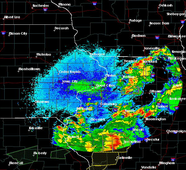 At 1216 am cdt, a severe thunderstorm was located near princeton, moving east at 55 mph (radar indicated). Hazards include 60 mph wind gusts and quarter size hail. Hail damage to vehicles is expected. expect wind damage to roofs, siding, and trees. locations impacted include, princeton, spring valley, ladd, la moille, dalzell, cherry, malden, seatonville, arlington, dover, hollowayville, coal hollow, zearing, bureau county fairgrounds and ottville. this includes the following highways, interstate 80 in illinois between mile markers 54 and 72. Interstate 180 between mile markers 10 and 13. At 1216 am cdt, a severe thunderstorm was located near princeton, moving east at 55 mph (radar indicated). Hazards include 60 mph wind gusts and quarter size hail. Hail damage to vehicles is expected. expect wind damage to roofs, siding, and trees. locations impacted include, princeton, spring valley, ladd, la moille, dalzell, cherry, malden, seatonville, arlington, dover, hollowayville, coal hollow, zearing, bureau county fairgrounds and ottville. this includes the following highways, interstate 80 in illinois between mile markers 54 and 72. Interstate 180 between mile markers 10 and 13.
|
| 5/23/2019 12:05 AM CDT |
 At 1205 am cdt, a severe thunderstorm was located over wyanet, or near princeton, moving east at 55 mph (radar indicated). Hazards include 60 mph wind gusts and quarter size hail. Hail damage to vehicles is expected. expect wind damage to roofs, siding, and trees. locations impacted include, princeton, spring valley, ladd, wyanet, la moille, dalzell, buda, cherry, malden, seatonville, arlington, dover, hollowayville, coal hollow, zearing, ottville and bureau county fairgrounds. this includes the following highways, interstate 80 in illinois between mile markers 44 and 72. Interstate 180 between mile markers 9 and 13. At 1205 am cdt, a severe thunderstorm was located over wyanet, or near princeton, moving east at 55 mph (radar indicated). Hazards include 60 mph wind gusts and quarter size hail. Hail damage to vehicles is expected. expect wind damage to roofs, siding, and trees. locations impacted include, princeton, spring valley, ladd, wyanet, la moille, dalzell, buda, cherry, malden, seatonville, arlington, dover, hollowayville, coal hollow, zearing, ottville and bureau county fairgrounds. this includes the following highways, interstate 80 in illinois between mile markers 44 and 72. Interstate 180 between mile markers 9 and 13.
|
| 5/22/2019 11:56 PM CDT |
 At 1156 pm cdt, a severe thunderstorm was located over sheffield, or 13 miles northeast of kewanee, moving east at 55 mph (radar indicated). Hazards include 60 mph wind gusts and quarter size hail. Hail damage to vehicles is expected. expect wind damage to roofs, siding, and trees. locations impacted include, princeton, spring valley, depue, ladd, wyanet, sheffield, la moille, dalzell, buda, cherry, neponset, malden, manlius, seatonville, mineral, arlington, dover, hollowayville, coal hollow and zearing. this includes the following highways, interstate 80 in illinois between mile markers 36 and 72. Interstate 180 between mile markers 8 and 13. At 1156 pm cdt, a severe thunderstorm was located over sheffield, or 13 miles northeast of kewanee, moving east at 55 mph (radar indicated). Hazards include 60 mph wind gusts and quarter size hail. Hail damage to vehicles is expected. expect wind damage to roofs, siding, and trees. locations impacted include, princeton, spring valley, depue, ladd, wyanet, sheffield, la moille, dalzell, buda, cherry, neponset, malden, manlius, seatonville, mineral, arlington, dover, hollowayville, coal hollow and zearing. this includes the following highways, interstate 80 in illinois between mile markers 36 and 72. Interstate 180 between mile markers 8 and 13.
|
| 5/22/2019 11:44 PM CDT |
 At 1144 pm cdt, a severe thunderstorm was located near annawan, or near kewanee, moving east at 50 mph (radar indicated). Hazards include 60 mph wind gusts and half dollar size hail. Hail damage to vehicles is expected. expect wind damage to roofs, siding, and trees. locations impacted include, kewanee, princeton, spring valley, depue, ladd, wyanet, sheffield, annawan, la moille, dalzell, buda, cherry, neponset, malden, manlius, seatonville, mineral, arlington, dover and hollowayville. this includes the following highways, interstate 80 in illinois between mile markers 33 and 72. Interstate 180 between mile markers 8 and 13. At 1144 pm cdt, a severe thunderstorm was located near annawan, or near kewanee, moving east at 50 mph (radar indicated). Hazards include 60 mph wind gusts and half dollar size hail. Hail damage to vehicles is expected. expect wind damage to roofs, siding, and trees. locations impacted include, kewanee, princeton, spring valley, depue, ladd, wyanet, sheffield, annawan, la moille, dalzell, buda, cherry, neponset, malden, manlius, seatonville, mineral, arlington, dover and hollowayville. this includes the following highways, interstate 80 in illinois between mile markers 33 and 72. Interstate 180 between mile markers 8 and 13.
|
| 5/22/2019 11:34 PM CDT |
 At 1134 pm cdt, a severe thunderstorm was located 7 miles east of cambridge, moving east at 55 mph (radar indicated). Hazards include 60 mph wind gusts and half dollar size hail. Hail damage to vehicles is expected. Expect wind damage to roofs, siding, and trees. At 1134 pm cdt, a severe thunderstorm was located 7 miles east of cambridge, moving east at 55 mph (radar indicated). Hazards include 60 mph wind gusts and half dollar size hail. Hail damage to vehicles is expected. Expect wind damage to roofs, siding, and trees.
|
| 5/16/2019 11:08 PM CDT |
 At 1108 pm cdt, a severe thunderstorm was located near ladd, or 7 miles southwest of mendota, moving east at 35 mph (radar indicated). Hazards include 60 mph wind gusts. Expect damage to roofs, siding, and trees. locations impacted include, spring valley, depue, ladd, la moille, dalzell, cherry, malden, seatonville, arlington, dover, hollowayville, spring valley airport, coal hollow, zearing, ottville and van orin. this includes the following highways, interstate 80 in illinois between mile markers 60 and 72. Interstate 180 between mile markers 10 and 13. At 1108 pm cdt, a severe thunderstorm was located near ladd, or 7 miles southwest of mendota, moving east at 35 mph (radar indicated). Hazards include 60 mph wind gusts. Expect damage to roofs, siding, and trees. locations impacted include, spring valley, depue, ladd, la moille, dalzell, cherry, malden, seatonville, arlington, dover, hollowayville, spring valley airport, coal hollow, zearing, ottville and van orin. this includes the following highways, interstate 80 in illinois between mile markers 60 and 72. Interstate 180 between mile markers 10 and 13.
|
| 5/16/2019 10:52 PM CDT |
 At 1052 pm cdt, a severe thunderstorm was located near la moille, or 8 miles northeast of princeton, moving east at 35 mph (radar indicated). Hazards include 60 mph wind gusts. expect damage to roofs, siding, and trees At 1052 pm cdt, a severe thunderstorm was located near la moille, or 8 miles northeast of princeton, moving east at 35 mph (radar indicated). Hazards include 60 mph wind gusts. expect damage to roofs, siding, and trees
|
| 9/25/2018 4:23 PM CDT |
 The severe thunderstorm warning for northeastern bureau county will expire at 430 pm cdt, the storms which prompted the warning have moved out of the area. therefore, the warning will be allowed to expire. a severe thunderstorm watch remains in effect until 1000 pm cdt for north central illinois. The severe thunderstorm warning for northeastern bureau county will expire at 430 pm cdt, the storms which prompted the warning have moved out of the area. therefore, the warning will be allowed to expire. a severe thunderstorm watch remains in effect until 1000 pm cdt for north central illinois.
|
| 9/25/2018 4:09 PM CDT |
 At 408 pm cdt, severe thunderstorms were located along a line extending from near amboy to near la moille to near wyanet, moving east at 60 mph. these are very dangerous storms (radar indicated). Hazards include 80 mph wind gusts. Flying debris will be dangerous to those caught without shelter. mobile homes will be heavily damaged. expect considerable damage to roofs, windows, and vehicles. extensive tree damage and power outages are likely. locations impacted include, princeton, spring valley, depue, ladd, la moille, dalzell, ohio, cherry, malden, seatonville, arlington, dover, hollowayville, spring valley airport, coal hollow, zearing, ottville, kasbeer, van orin and bureau county fairgrounds. this includes the following highways, interstate 80 in illinois between mile markers 52 and 72. Interstate 180 between mile markers 9 and 13. At 408 pm cdt, severe thunderstorms were located along a line extending from near amboy to near la moille to near wyanet, moving east at 60 mph. these are very dangerous storms (radar indicated). Hazards include 80 mph wind gusts. Flying debris will be dangerous to those caught without shelter. mobile homes will be heavily damaged. expect considerable damage to roofs, windows, and vehicles. extensive tree damage and power outages are likely. locations impacted include, princeton, spring valley, depue, ladd, la moille, dalzell, ohio, cherry, malden, seatonville, arlington, dover, hollowayville, spring valley airport, coal hollow, zearing, ottville, kasbeer, van orin and bureau county fairgrounds. this includes the following highways, interstate 80 in illinois between mile markers 52 and 72. Interstate 180 between mile markers 9 and 13.
|
| 9/25/2018 4:01 PM CDT |
 At 400 pm cdt, severe thunderstorms were located along a line extending from walton to 7 miles east of walnut to buda, moving east at 65 mph (radar indicated). Hazards include 70 mph wind gusts. Expect considerable tree damage. Damage is likely to mobile homes, roofs, and outbuildings. At 400 pm cdt, severe thunderstorms were located along a line extending from walton to 7 miles east of walnut to buda, moving east at 65 mph (radar indicated). Hazards include 70 mph wind gusts. Expect considerable tree damage. Damage is likely to mobile homes, roofs, and outbuildings.
|
| 8/28/2018 8:27 PM CDT |
 The severe thunderstorm warning for northern bureau county will expire at 830 pm cdt, the storms which prompted the warning have moved out of the area. therefore, the warning will be allowed to expire. a severe thunderstorm watch remains in effect until 1100 pm cdt for north central illinois. The severe thunderstorm warning for northern bureau county will expire at 830 pm cdt, the storms which prompted the warning have moved out of the area. therefore, the warning will be allowed to expire. a severe thunderstorm watch remains in effect until 1100 pm cdt for north central illinois.
|
| 8/28/2018 8:23 PM CDT |
 A severe thunderstorm warning remains in effect until 830 pm cdt for northern bureau county. at 823 pm cdt, severe thunderstorms were located along a line extending from near la moille to near depue, moving east at 30 mph. hazard. 60 mph wind gusts and penny size hail. source. Radar indicated. A severe thunderstorm warning remains in effect until 830 pm cdt for northern bureau county. at 823 pm cdt, severe thunderstorms were located along a line extending from near la moille to near depue, moving east at 30 mph. hazard. 60 mph wind gusts and penny size hail. source. Radar indicated.
|
| 8/28/2018 8:21 PM CDT |
 At 820 pm cdt, severe thunderstorms were located along a line extending from near polo to near franklin grove to la moille, moving east at 55 mph (radar indicated). Hazards include 60 mph wind gusts and penny size hail. Expect damage to roofs, siding, and trees. locations impacted include, sterling, rock falls, princeton, spring valley, walnut, ladd, milledgeville, wyanet, shannon, la moille, deer grove, ohio, cherry, malden, manlius, seatonville, arlington, dover, hollowayville and new bedford. this includes the following highways, interstate 80 in illinois between mile markers 43 and 72. interstate 88 between mile markers 38 and 44. Interstate 180 between mile markers 11 and 13. At 820 pm cdt, severe thunderstorms were located along a line extending from near polo to near franklin grove to la moille, moving east at 55 mph (radar indicated). Hazards include 60 mph wind gusts and penny size hail. Expect damage to roofs, siding, and trees. locations impacted include, sterling, rock falls, princeton, spring valley, walnut, ladd, milledgeville, wyanet, shannon, la moille, deer grove, ohio, cherry, malden, manlius, seatonville, arlington, dover, hollowayville and new bedford. this includes the following highways, interstate 80 in illinois between mile markers 43 and 72. interstate 88 between mile markers 38 and 44. Interstate 180 between mile markers 11 and 13.
|
| 8/28/2018 8:02 PM CDT |
 At 801 pm cdt, severe thunderstorms were located along a line extending from chadwick to near rock falls to near walnut, moving east at 55 mph (radar indicated). Hazards include 70 mph wind gusts and penny size hail. Expect considerable tree damage. damage is likely to mobile homes, roofs, and outbuildings. locations impacted include, sterling, rock falls, princeton, morrison, mount carroll, spring valley, savanna, prophetstown, lanark, walnut, ladd, milledgeville, wyanet, fairhaven, annawan, tampico, shannon, la moille, lyndon and chadwick. this includes the following highways, interstate 80 in illinois between mile markers 32 and 72. interstate 88 between mile markers 27 and 44. Interstate 180 between mile markers 11 and 13. At 801 pm cdt, severe thunderstorms were located along a line extending from chadwick to near rock falls to near walnut, moving east at 55 mph (radar indicated). Hazards include 70 mph wind gusts and penny size hail. Expect considerable tree damage. damage is likely to mobile homes, roofs, and outbuildings. locations impacted include, sterling, rock falls, princeton, morrison, mount carroll, spring valley, savanna, prophetstown, lanark, walnut, ladd, milledgeville, wyanet, fairhaven, annawan, tampico, shannon, la moille, lyndon and chadwick. this includes the following highways, interstate 80 in illinois between mile markers 32 and 72. interstate 88 between mile markers 27 and 44. Interstate 180 between mile markers 11 and 13.
|
| 8/28/2018 7:38 PM CDT |
 At 737 pm cdt, severe thunderstorms were located along a line extending from near andover to near erie to near atkinson, moving east at 55 mph (radar indicated). Hazards include 70 mph wind gusts and penny size hail. Expect considerable tree damage. Damage is likely to mobile homes, roofs, and outbuildings. At 737 pm cdt, severe thunderstorms were located along a line extending from near andover to near erie to near atkinson, moving east at 55 mph (radar indicated). Hazards include 70 mph wind gusts and penny size hail. Expect considerable tree damage. Damage is likely to mobile homes, roofs, and outbuildings.
|
| 1/22/2018 4:07 PM CST |
 The severe thunderstorm warning for northeastern bureau county will expire at 415 pm cst, the severe thunderstorm which prompted the warning has weakened. moved out of the! therefore, the warning will be allowed to expire. however small hail is still possible with this thunderstorm. to report severe weather, contact your nearest law enforcement agency. they will relay your report to the national weather service the quad cities. The severe thunderstorm warning for northeastern bureau county will expire at 415 pm cst, the severe thunderstorm which prompted the warning has weakened. moved out of the! therefore, the warning will be allowed to expire. however small hail is still possible with this thunderstorm. to report severe weather, contact your nearest law enforcement agency. they will relay your report to the national weather service the quad cities.
|
| 1/22/2018 3:56 PM CST |
 At 356 pm cst, a severe thunderstorm was located near princeton, moving north at 30 mph (radar indicated). Hazards include quarter size hail. Damage to vehicles is expected. locations impacted include, princeton, walnut, la moille, ohio, malden, arlington, dover, zearing, kasbeer, van orin, coal hollow and bureau county fairgrounds. this includes the following highways, interstate 80 in illinois between mile markers 48 and 64. Interstate 180 between mile markers 9 and 13. At 356 pm cst, a severe thunderstorm was located near princeton, moving north at 30 mph (radar indicated). Hazards include quarter size hail. Damage to vehicles is expected. locations impacted include, princeton, walnut, la moille, ohio, malden, arlington, dover, zearing, kasbeer, van orin, coal hollow and bureau county fairgrounds. this includes the following highways, interstate 80 in illinois between mile markers 48 and 64. Interstate 180 between mile markers 9 and 13.
|
| 1/22/2018 3:45 PM CST |
 At 345 pm cst, a severe thunderstorm was located over princeton, moving north at 35 mph (radar indicated). Hazards include quarter size hail. Damage to vehicles is expected. locations impacted include, princeton, walnut, wyanet, tiskilwa, la moille, ohio, malden, arlington, dover, providence, coal hollow, zearing, kasbeer, van orin and bureau county fairgrounds. this includes the following highways, interstate 80 in illinois between mile markers 48 and 64. Interstate 180 between mile markers 6 and 13. At 345 pm cst, a severe thunderstorm was located over princeton, moving north at 35 mph (radar indicated). Hazards include quarter size hail. Damage to vehicles is expected. locations impacted include, princeton, walnut, wyanet, tiskilwa, la moille, ohio, malden, arlington, dover, providence, coal hollow, zearing, kasbeer, van orin and bureau county fairgrounds. this includes the following highways, interstate 80 in illinois between mile markers 48 and 64. Interstate 180 between mile markers 6 and 13.
|
| 1/22/2018 3:37 PM CST |
 At 336 pm cst, a severe thunderstorm was located over tiskilwa, or near princeton, moving northeast at 35 mph (radar indicated). Hazards include quarter size hail. damage to vehicles is expected At 336 pm cst, a severe thunderstorm was located over tiskilwa, or near princeton, moving northeast at 35 mph (radar indicated). Hazards include quarter size hail. damage to vehicles is expected
|
| 10/14/2017 6:34 AM CDT |
 At 634 am cdt, a severe thunderstorm was located near ladd, or 8 miles southwest of mendota, moving east at 40 mph (radar indicated). Hazards include 60 mph wind gusts and quarter size hail. Hail damage to vehicles is expected. expect wind damage to roofs, siding, and trees. locations impacted include, princeton, spring valley, depue, ladd, cherry, malden, seatonville, arlington, dover, hollowayville, coal hollow, zearing and ottville. this includes the following highways, interstate 80 in illinois between mile markers 58 and 72. Interstate 180 between mile markers 7 and 13. At 634 am cdt, a severe thunderstorm was located near ladd, or 8 miles southwest of mendota, moving east at 40 mph (radar indicated). Hazards include 60 mph wind gusts and quarter size hail. Hail damage to vehicles is expected. expect wind damage to roofs, siding, and trees. locations impacted include, princeton, spring valley, depue, ladd, cherry, malden, seatonville, arlington, dover, hollowayville, coal hollow, zearing and ottville. this includes the following highways, interstate 80 in illinois between mile markers 58 and 72. Interstate 180 between mile markers 7 and 13.
|
| 10/14/2017 6:21 AM CDT |
 At 620 am cdt, a severe thunderstorm was located near princeton, moving east northeast at 40 mph (radar indicated). Hazards include quarter size hail. Damage to vehicles is expected. locations impacted include, princeton, spring valley, depue, ladd, tiskilwa, la moille, cherry, malden, seatonville, arlington, dover, hollowayville, coal hollow, zearing, ottville, kasbeer and bureau county fairgrounds. this includes the following highways, interstate 80 in illinois between mile markers 52 and 72. Interstate 180 between mile markers 7 and 13. At 620 am cdt, a severe thunderstorm was located near princeton, moving east northeast at 40 mph (radar indicated). Hazards include quarter size hail. Damage to vehicles is expected. locations impacted include, princeton, spring valley, depue, ladd, tiskilwa, la moille, cherry, malden, seatonville, arlington, dover, hollowayville, coal hollow, zearing, ottville, kasbeer and bureau county fairgrounds. this includes the following highways, interstate 80 in illinois between mile markers 52 and 72. Interstate 180 between mile markers 7 and 13.
|
| 10/14/2017 6:13 AM CDT |
 At 612 am cdt, a pair of severe thunderstorm were located near princeton and tiskilwa, moving east northeast at 40 mph (radar indicated). Hazards include quarter size hail. Damage to vehicles is expected. locations impacted include, princeton, hennepin, spring valley, depue, walnut, ladd, wyanet, tiskilwa, la moille, dalzell, buda, bureau junction, mark, ohio, cherry, malden, manlius, seatonville, milo and arlington. this includes the following highways, interstate 80 in illinois between mile markers 46 and 73. Interstate 180 between mile markers 1 and 13. At 612 am cdt, a pair of severe thunderstorm were located near princeton and tiskilwa, moving east northeast at 40 mph (radar indicated). Hazards include quarter size hail. Damage to vehicles is expected. locations impacted include, princeton, hennepin, spring valley, depue, walnut, ladd, wyanet, tiskilwa, la moille, dalzell, buda, bureau junction, mark, ohio, cherry, malden, manlius, seatonville, milo and arlington. this includes the following highways, interstate 80 in illinois between mile markers 46 and 73. Interstate 180 between mile markers 1 and 13.
|
| 10/14/2017 6:05 AM CDT |
 At 604 am cdt, a severe thunderstorm was located over wyanet, or 7 miles west of princeton, moving east at 40 mph. another storm with hail was west of providence moving the same speed and direction (radar indicated). Hazards include quarter size hail. damage to vehicles is expected At 604 am cdt, a severe thunderstorm was located over wyanet, or 7 miles west of princeton, moving east at 40 mph. another storm with hail was west of providence moving the same speed and direction (radar indicated). Hazards include quarter size hail. damage to vehicles is expected
|
| 8/10/2017 7:03 PM CDT |
 At 701 pm cdt, severe thunderstorms were located along a line extending from 6 miles northeast of princeton to buda to near osceola, moving east at 40 mph (radar indicated). Hazards include 60 mph wind gusts and penny size hail. Expect damage to roofs, siding, and trees. locations impacted include, princeton, wyanet, sheffield, tiskilwa, la moille, buda, neponset, malden, manlius, mineral, arlington, dover, providence, coal hollow, zearing, kasbeer and bureau county fairgrounds. this includes the following highways, interstate 80 in illinois between mile markers 36 and 64. Interstate 180 between mile markers 10 and 13. At 701 pm cdt, severe thunderstorms were located along a line extending from 6 miles northeast of princeton to buda to near osceola, moving east at 40 mph (radar indicated). Hazards include 60 mph wind gusts and penny size hail. Expect damage to roofs, siding, and trees. locations impacted include, princeton, wyanet, sheffield, tiskilwa, la moille, buda, neponset, malden, manlius, mineral, arlington, dover, providence, coal hollow, zearing, kasbeer and bureau county fairgrounds. this includes the following highways, interstate 80 in illinois between mile markers 36 and 64. Interstate 180 between mile markers 10 and 13.
|
| 8/10/2017 6:54 PM CDT |
 At 653 pm cdt, severe thunderstorms were located along a line extending from 6 miles northeast of princeton to buda to near osceola, moving east at 40 mph (radar indicated). Hazards include 60 mph wind gusts and penny size hail. Expect damage to roofs, siding, and trees. locations impacted include, princeton, wyanet, sheffield, tiskilwa, la moille, buda, neponset, malden, manlius, mineral, arlington, dover, providence, coal hollow, zearing, kasbeer and bureau county fairgrounds. this includes the following highways, interstate 80 in illinois between mile markers 36 and 64. Interstate 180 between mile markers 10 and 13. At 653 pm cdt, severe thunderstorms were located along a line extending from 6 miles northeast of princeton to buda to near osceola, moving east at 40 mph (radar indicated). Hazards include 60 mph wind gusts and penny size hail. Expect damage to roofs, siding, and trees. locations impacted include, princeton, wyanet, sheffield, tiskilwa, la moille, buda, neponset, malden, manlius, mineral, arlington, dover, providence, coal hollow, zearing, kasbeer and bureau county fairgrounds. this includes the following highways, interstate 80 in illinois between mile markers 36 and 64. Interstate 180 between mile markers 10 and 13.
|
| 8/10/2017 6:39 PM CDT |
 At 638 pm cdt, severe thunderstorms were located along a line extending from near walnut to near annawan to 6 miles north of kewanee, moving east at 35 mph (radar indicated). Hazards include 60 mph wind gusts and penny size hail. Expect damage to roofs, siding, and trees. locations impacted include, princeton, walnut, wyanet, atkinson, sheffield, annawan, tiskilwa, la moille, buda, ohio, neponset, malden, manlius, mineral, arlington, dover, new bedford, coal hollow, kasbeer and van orin. this includes the following highways, interstate 80 in illinois between mile markers 27 and 64. Interstate 180 between mile markers 10 and 13. At 638 pm cdt, severe thunderstorms were located along a line extending from near walnut to near annawan to 6 miles north of kewanee, moving east at 35 mph (radar indicated). Hazards include 60 mph wind gusts and penny size hail. Expect damage to roofs, siding, and trees. locations impacted include, princeton, walnut, wyanet, atkinson, sheffield, annawan, tiskilwa, la moille, buda, ohio, neponset, malden, manlius, mineral, arlington, dover, new bedford, coal hollow, kasbeer and van orin. this includes the following highways, interstate 80 in illinois between mile markers 27 and 64. Interstate 180 between mile markers 10 and 13.
|
| 8/10/2017 6:20 PM CDT |
 At 619 pm cdt, severe thunderstorms were located along a line extending from near prophetstown to near geneseo, moving east at 40 mph (radar indicated). Hazards include 60 mph wind gusts and penny size hail. expect damage to roofs, siding, and trees At 619 pm cdt, severe thunderstorms were located along a line extending from near prophetstown to near geneseo, moving east at 40 mph (radar indicated). Hazards include 60 mph wind gusts and penny size hail. expect damage to roofs, siding, and trees
|
| 7/10/2017 8:35 PM CDT | Quarter sized hail reported 3 miles N of Arlington, IL, time and location estimated by radar. |
| 6/15/2017 11:56 PM CDT |
 The severe thunderstorm warning for northern putnam and southeastern bureau counties will expire at midnight cdt, the storms which prompted the warning have moved out of the area. therefore, the warning will be allowed to expire. however gusty winds and heavy rain are still possible with these thunderstorms. The severe thunderstorm warning for northern putnam and southeastern bureau counties will expire at midnight cdt, the storms which prompted the warning have moved out of the area. therefore, the warning will be allowed to expire. however gusty winds and heavy rain are still possible with these thunderstorms.
|
| 6/15/2017 11:48 PM CDT |
 At 1148 pm cdt, severe thunderstorms were located along a line extending from mendota to peru to near mcnabb, moving east at 45 mph (radar indicated). Hazards include 70 mph wind gusts. Expect considerable tree damage. damage is likely to mobile homes, roofs, and outbuildings. locations impacted include, hennepin, spring valley, depue, granville, ladd, dalzell, bureau junction, mark, cherry, seatonville, standard, arlington, hollowayville, spring valley airport, coal hollow, ottville and florid. this includes the following highways, interstate 80 in illinois between mile markers 63 and 72. Interstate 180 between mile markers 1 and 10. At 1148 pm cdt, severe thunderstorms were located along a line extending from mendota to peru to near mcnabb, moving east at 45 mph (radar indicated). Hazards include 70 mph wind gusts. Expect considerable tree damage. damage is likely to mobile homes, roofs, and outbuildings. locations impacted include, hennepin, spring valley, depue, granville, ladd, dalzell, bureau junction, mark, cherry, seatonville, standard, arlington, hollowayville, spring valley airport, coal hollow, ottville and florid. this includes the following highways, interstate 80 in illinois between mile markers 63 and 72. Interstate 180 between mile markers 1 and 10.
|
| 6/15/2017 11:42 PM CDT |
 At 1142 pm cdt, severe thunderstorms were located along a line extending from near la moille to near depue to bureau junction, moving east at 45 mph (radar indicated). Hazards include 70 mph wind gusts. Expect considerable tree damage. damage is likely to mobile homes, roofs, and outbuildings. locations impacted include, princeton, hennepin, spring valley, depue, granville, ladd, tiskilwa, la moille, dalzell, bureau junction, mark, cherry, malden, seatonville, standard, arlington, dover, hollowayville, spring valley airport and coal hollow. this includes the following highways, interstate 80 in illinois between mile markers 58 and 72. Interstate 180 between mile markers 1 and 13. At 1142 pm cdt, severe thunderstorms were located along a line extending from near la moille to near depue to bureau junction, moving east at 45 mph (radar indicated). Hazards include 70 mph wind gusts. Expect considerable tree damage. damage is likely to mobile homes, roofs, and outbuildings. locations impacted include, princeton, hennepin, spring valley, depue, granville, ladd, tiskilwa, la moille, dalzell, bureau junction, mark, cherry, malden, seatonville, standard, arlington, dover, hollowayville, spring valley airport and coal hollow. this includes the following highways, interstate 80 in illinois between mile markers 58 and 72. Interstate 180 between mile markers 1 and 13.
|
| 6/15/2017 11:36 PM CDT |
 At 1136 pm cdt, severe thunderstorms were located along a line extending from near la moille to near depue to bureau junction, moving east at 45 mph (radar indicated). Hazards include 70 mph wind gusts. Expect considerable tree damage. damage is likely to mobile homes, roofs, and outbuildings. locations impacted include, princeton, hennepin, spring valley, depue, granville, ladd, tiskilwa, la moille, dalzell, bureau junction, mark, cherry, malden, seatonville, standard, arlington, dover, hollowayville, spring valley airport and coal hollow. this includes the following highways, interstate 80 in illinois between mile markers 58 and 72. Interstate 180 between mile markers 1 and 13. At 1136 pm cdt, severe thunderstorms were located along a line extending from near la moille to near depue to bureau junction, moving east at 45 mph (radar indicated). Hazards include 70 mph wind gusts. Expect considerable tree damage. damage is likely to mobile homes, roofs, and outbuildings. locations impacted include, princeton, hennepin, spring valley, depue, granville, ladd, tiskilwa, la moille, dalzell, bureau junction, mark, cherry, malden, seatonville, standard, arlington, dover, hollowayville, spring valley airport and coal hollow. this includes the following highways, interstate 80 in illinois between mile markers 58 and 72. Interstate 180 between mile markers 1 and 13.
|
| 6/15/2017 11:28 PM CDT |
 At 1128 pm cdt, severe thunderstorms were located along a line extending from 6 miles northwest of la moille to near princeton to near tiskilwa, moving east at 45 mph (radar indicated). Hazards include 70 mph wind gusts. Expect considerable tree damage. damage is likely to mobile homes, roofs, and outbuildings. locations impacted include, princeton, hennepin, spring valley, depue, granville, ladd, wyanet, tiskilwa, la moille, dalzell, bureau junction, mark, ohio, cherry, malden, seatonville, standard, arlington, dover and hollowayville. this includes the following highways, interstate 80 in illinois between mile markers 49 and 72. Interstate 180 between mile markers 1 and 13. At 1128 pm cdt, severe thunderstorms were located along a line extending from 6 miles northwest of la moille to near princeton to near tiskilwa, moving east at 45 mph (radar indicated). Hazards include 70 mph wind gusts. Expect considerable tree damage. damage is likely to mobile homes, roofs, and outbuildings. locations impacted include, princeton, hennepin, spring valley, depue, granville, ladd, wyanet, tiskilwa, la moille, dalzell, bureau junction, mark, ohio, cherry, malden, seatonville, standard, arlington, dover and hollowayville. this includes the following highways, interstate 80 in illinois between mile markers 49 and 72. Interstate 180 between mile markers 1 and 13.
|
| 6/15/2017 11:19 PM CDT |
 At 1119 pm cdt, severe thunderstorms were located along a line extending from near walnut to near wyanet to near tiskilwa, moving east at 45 mph (radar indicated). Hazards include 70 mph wind gusts. Expect considerable tree damage. Damage is likely to mobile homes, roofs, and outbuildings. At 1119 pm cdt, severe thunderstorms were located along a line extending from near walnut to near wyanet to near tiskilwa, moving east at 45 mph (radar indicated). Hazards include 70 mph wind gusts. Expect considerable tree damage. Damage is likely to mobile homes, roofs, and outbuildings.
|
| 6/14/2017 4:28 PM CDT |
 The severe thunderstorm warning for eastern putnam and east central bureau counties will expire at 430 pm cdt, the storm which prompted the warning is moving out of the area. therefore, the warning will be allowed to expire. a severe thunderstorm watch remains in effect until 800 pm cdt for north central illinois. The severe thunderstorm warning for eastern putnam and east central bureau counties will expire at 430 pm cdt, the storm which prompted the warning is moving out of the area. therefore, the warning will be allowed to expire. a severe thunderstorm watch remains in effect until 800 pm cdt for north central illinois.
|
| 6/14/2017 4:17 PM CDT |
 At 417 pm cdt, a severe thunderstorm was located over ladd, or near peru, moving northeast at 35 mph (radar indicated). Hazards include 60 mph wind gusts and nickel size hail. Expect damage to roofs, siding, and trees. locations impacted include, hennepin, spring valley, depue, granville, ladd, dalzell, mcnabb, mark, cherry, seatonville, standard, arlington, hollowayville, spring valley airport, ottville and florid. This includes interstate 80 in illinois between mile markers 65 and 72. At 417 pm cdt, a severe thunderstorm was located over ladd, or near peru, moving northeast at 35 mph (radar indicated). Hazards include 60 mph wind gusts and nickel size hail. Expect damage to roofs, siding, and trees. locations impacted include, hennepin, spring valley, depue, granville, ladd, dalzell, mcnabb, mark, cherry, seatonville, standard, arlington, hollowayville, spring valley airport, ottville and florid. This includes interstate 80 in illinois between mile markers 65 and 72.
|
| 6/14/2017 4:12 PM CDT |
 At 412 pm cdt, a severe thunderstorm was located over ladd, or near peru, moving northeast at 35 mph (radar indicated). Hazards include 60 mph wind gusts and nickel size hail. Expect damage to roofs, siding, and trees. locations impacted include, hennepin, spring valley, henry, depue, granville, ladd, dalzell, bureau junction, mcnabb, mark, cherry, seatonville, standard, arlington, hollowayville, spring valley airport, coal hollow, ottville and florid. this includes the following highways, interstate 80 in illinois between mile markers 63 and 72. Interstate 180 between mile markers 1 and 2, and between mile markers 8 and 11. At 412 pm cdt, a severe thunderstorm was located over ladd, or near peru, moving northeast at 35 mph (radar indicated). Hazards include 60 mph wind gusts and nickel size hail. Expect damage to roofs, siding, and trees. locations impacted include, hennepin, spring valley, henry, depue, granville, ladd, dalzell, bureau junction, mcnabb, mark, cherry, seatonville, standard, arlington, hollowayville, spring valley airport, coal hollow, ottville and florid. this includes the following highways, interstate 80 in illinois between mile markers 63 and 72. Interstate 180 between mile markers 1 and 2, and between mile markers 8 and 11.
|
| 6/14/2017 4:00 PM CDT |
 At 400 pm cdt, a severe thunderstorm was located over bureau junction, or near hennepin, moving northeast at 35 mph (radar indicated). Hazards include 60 mph wind gusts and nickel size hail. expect damage to roofs, siding, and trees At 400 pm cdt, a severe thunderstorm was located over bureau junction, or near hennepin, moving northeast at 35 mph (radar indicated). Hazards include 60 mph wind gusts and nickel size hail. expect damage to roofs, siding, and trees
|
| 5/17/2017 10:08 PM CDT |
 At 1008 pm cdt, severe thunderstorms were located along a line extending from 7 miles west of la moille to near princeton to bradford, moving east at 40 mph (radar indicated). Hazards include 60 mph wind gusts and quarter size hail. Hail damage to vehicles is expected. expect wind damage to roofs, siding, and trees. locations impacted include, princeton, hennepin, spring valley, depue, walnut, ladd, wyanet, tiskilwa, la moille, buda, bureau junction, ohio, cherry, malden, seatonville, milo, arlington, dover, hollowayville and coal hollow. this includes the following highways, interstate 80 in illinois between mile markers 47 and 70. interstate 180 between mile markers 3 and 13. A tornado watch remains in effect until 1100 pm cdt for north central illinois. At 1008 pm cdt, severe thunderstorms were located along a line extending from 7 miles west of la moille to near princeton to bradford, moving east at 40 mph (radar indicated). Hazards include 60 mph wind gusts and quarter size hail. Hail damage to vehicles is expected. expect wind damage to roofs, siding, and trees. locations impacted include, princeton, hennepin, spring valley, depue, walnut, ladd, wyanet, tiskilwa, la moille, buda, bureau junction, ohio, cherry, malden, seatonville, milo, arlington, dover, hollowayville and coal hollow. this includes the following highways, interstate 80 in illinois between mile markers 47 and 70. interstate 180 between mile markers 3 and 13. A tornado watch remains in effect until 1100 pm cdt for north central illinois.
|
| 5/17/2017 10:07 PM CDT |
 At 1007 pm cdt, severe thunderstorms were located along a line extending from 7 miles west of la moille to near princeton to bradford, moving east at 40 mph (radar indicated). Hazards include 60 mph wind gusts and quarter size hail. Hail damage to vehicles is expected. expect wind damage to roofs, siding, and trees. locations impacted include, princeton, hennepin, spring valley, depue, walnut, ladd, wyanet, sheffield, tiskilwa, la moille, buda, bureau junction, ohio, cherry, neponset, malden, manlius, seatonville, mineral and milo. this includes the following highways, interstate 80 in illinois between mile markers 36 and 70. interstate 180 between mile markers 3 and 13. A tornado watch remains in effect until 1100 pm cdt for north central and northwestern illinois. At 1007 pm cdt, severe thunderstorms were located along a line extending from 7 miles west of la moille to near princeton to bradford, moving east at 40 mph (radar indicated). Hazards include 60 mph wind gusts and quarter size hail. Hail damage to vehicles is expected. expect wind damage to roofs, siding, and trees. locations impacted include, princeton, hennepin, spring valley, depue, walnut, ladd, wyanet, sheffield, tiskilwa, la moille, buda, bureau junction, ohio, cherry, neponset, malden, manlius, seatonville, mineral and milo. this includes the following highways, interstate 80 in illinois between mile markers 36 and 70. interstate 180 between mile markers 3 and 13. A tornado watch remains in effect until 1100 pm cdt for north central and northwestern illinois.
|
| 5/17/2017 9:55 PM CDT |
 At 954 pm cdt, severe thunderstorms were located along a line extending from near walnut to near wyanet to near buda, moving northeast at 55 mph (radar indicated). Hazards include 60 mph wind gusts. Expect damage to roofs, siding, and trees. locations impacted include, princeton, hennepin, spring valley, depue, walnut, ladd, wyanet, sheffield, tiskilwa, la moille, buda, bureau junction, ohio, cherry, neponset, malden, manlius, seatonville, mineral and milo. this includes the following highways, interstate 80 in illinois between mile markers 36 and 70. interstate 180 between mile markers 3 and 13. A tornado watch remains in effect until 1100 pm cdt for north central and northwestern illinois. At 954 pm cdt, severe thunderstorms were located along a line extending from near walnut to near wyanet to near buda, moving northeast at 55 mph (radar indicated). Hazards include 60 mph wind gusts. Expect damage to roofs, siding, and trees. locations impacted include, princeton, hennepin, spring valley, depue, walnut, ladd, wyanet, sheffield, tiskilwa, la moille, buda, bureau junction, ohio, cherry, neponset, malden, manlius, seatonville, mineral and milo. this includes the following highways, interstate 80 in illinois between mile markers 36 and 70. interstate 180 between mile markers 3 and 13. A tornado watch remains in effect until 1100 pm cdt for north central and northwestern illinois.
|
| 5/17/2017 9:44 PM CDT |
 At 943 pm cdt, severe thunderstorms were located along a line extending from near annawan to near sheffield to near kewanee, moving northeast at 50 mph (law enforcement reported a power line down in kewanee at 941 pm). Hazards include 60 mph wind gusts and quarter size hail. Hail damage to vehicles is expected. expect wind damage to roofs, siding, and trees. locations impacted include, kewanee, princeton, hennepin, spring valley, galva, depue, walnut, ladd, wyanet, sheffield, annawan, tiskilwa, la moille, buda, bureau junction, ohio, cherry, neponset, malden and manlius. this includes the following highways, interstate 80 in illinois between mile markers 34 and 70. interstate 180 between mile markers 3 and 13. A tornado watch remains in effect until 1100 pm cdt for north central and northwestern illinois. At 943 pm cdt, severe thunderstorms were located along a line extending from near annawan to near sheffield to near kewanee, moving northeast at 50 mph (law enforcement reported a power line down in kewanee at 941 pm). Hazards include 60 mph wind gusts and quarter size hail. Hail damage to vehicles is expected. expect wind damage to roofs, siding, and trees. locations impacted include, kewanee, princeton, hennepin, spring valley, galva, depue, walnut, ladd, wyanet, sheffield, annawan, tiskilwa, la moille, buda, bureau junction, ohio, cherry, neponset, malden and manlius. this includes the following highways, interstate 80 in illinois between mile markers 34 and 70. interstate 180 between mile markers 3 and 13. A tornado watch remains in effect until 1100 pm cdt for north central and northwestern illinois.
|
| 5/17/2017 9:38 PM CDT |
 At 938 pm cdt, severe thunderstorms were located along a line extending from near annawan to near osceola, moving northeast at 55 mph (radar indicated). Hazards include 60 mph wind gusts and quarter size hail. Hail damage to vehicles is expected. Expect wind damage to roofs, siding, and trees. At 938 pm cdt, severe thunderstorms were located along a line extending from near annawan to near osceola, moving northeast at 55 mph (radar indicated). Hazards include 60 mph wind gusts and quarter size hail. Hail damage to vehicles is expected. Expect wind damage to roofs, siding, and trees.
|
| 3/7/2017 12:26 AM CST |
 The severe thunderstorm warning for putnam and eastern bureau counties will expire at 1230 am cst, the storms which prompted the warning have moved out of the area. therefore the warning will be allowed to expire. however gusty winds are still possible with these thunderstorms. a tornado watch remains in effect until 400 am cst for north central illinois. The severe thunderstorm warning for putnam and eastern bureau counties will expire at 1230 am cst, the storms which prompted the warning have moved out of the area. therefore the warning will be allowed to expire. however gusty winds are still possible with these thunderstorms. a tornado watch remains in effect until 400 am cst for north central illinois.
|
| 3/7/2017 12:19 AM CST |
 At 1219 am cst, severe thunderstorms were located along a line extending from 7 miles northeast of la moille to dalzell to near mcnabb, moving east at 55 mph (trained weather spotters). Hazards include 70 mph wind gusts. Expect considerable tree damage. damage is likely to mobile homes, roofs, and outbuildings. locations impacted include, hennepin, spring valley, depue, granville, ladd, la moille, dalzell, mcnabb, mark, cherry, seatonville, magnolia, standard, arlington, hollowayville, spring valley airport, zearing, ottville, van orin and florid. this includes the following highways, interstate 80 in illinois between mile markers 64 and 72. interstate 180 near mile marker 1. A tornado watch remains in effect until 400 am cst for north central illinois. At 1219 am cst, severe thunderstorms were located along a line extending from 7 miles northeast of la moille to dalzell to near mcnabb, moving east at 55 mph (trained weather spotters). Hazards include 70 mph wind gusts. Expect considerable tree damage. damage is likely to mobile homes, roofs, and outbuildings. locations impacted include, hennepin, spring valley, depue, granville, ladd, la moille, dalzell, mcnabb, mark, cherry, seatonville, magnolia, standard, arlington, hollowayville, spring valley airport, zearing, ottville, van orin and florid. this includes the following highways, interstate 80 in illinois between mile markers 64 and 72. interstate 180 near mile marker 1. A tornado watch remains in effect until 400 am cst for north central illinois.
|
| 3/7/2017 12:01 AM CST |
 At 1200 am cst, severe thunderstorms were located along a line extending from 7 miles east of walnut to princeton to 8 miles northwest of henry, moving east at 65 mph (trained weather spotters). Hazards include 70 mph wind gusts. Expect considerable tree damage. damage is likely to mobile homes, roofs, and outbuildings. locations impacted include, princeton, hennepin, spring valley, depue, granville, walnut, ladd, wyanet, tiskilwa, la moille, dalzell, bureau junction, mcnabb, putnam, mark, ohio, cherry, malden, seatonville and magnolia. this includes the following highways, interstate 80 in illinois between mile markers 48 and 72. interstate 180 between mile markers 1 and 13. A tornado watch remains in effect until 400 am cst for north central illinois. At 1200 am cst, severe thunderstorms were located along a line extending from 7 miles east of walnut to princeton to 8 miles northwest of henry, moving east at 65 mph (trained weather spotters). Hazards include 70 mph wind gusts. Expect considerable tree damage. damage is likely to mobile homes, roofs, and outbuildings. locations impacted include, princeton, hennepin, spring valley, depue, granville, walnut, ladd, wyanet, tiskilwa, la moille, dalzell, bureau junction, mcnabb, putnam, mark, ohio, cherry, malden, seatonville and magnolia. this includes the following highways, interstate 80 in illinois between mile markers 48 and 72. interstate 180 between mile markers 1 and 13. A tornado watch remains in effect until 400 am cst for north central illinois.
|
| 3/6/2017 11:53 PM CST |
 At 1153 pm cst, severe thunderstorms were located along a line extending from near rock falls to near wyanet to near bradford, moving east at 45 mph (trained weather spotters). Hazards include 70 mph wind gusts. Expect considerable tree damage. damage is likely to mobile homes, roofs, and outbuildings. locations impacted include, princeton, hennepin, spring valley, depue, granville, walnut, ladd, wyanet, sheffield, tiskilwa, la moille, dalzell, buda, bureau junction, mcnabb, deer grove, putnam, mark, ohio and cherry. this includes the following highways, interstate 80 in illinois between mile markers 40 and 72. interstate 180 between mile markers 1 and 13. A tornado watch remains in effect until 400 am cst for north central and northwestern illinois. At 1153 pm cst, severe thunderstorms were located along a line extending from near rock falls to near wyanet to near bradford, moving east at 45 mph (trained weather spotters). Hazards include 70 mph wind gusts. Expect considerable tree damage. damage is likely to mobile homes, roofs, and outbuildings. locations impacted include, princeton, hennepin, spring valley, depue, granville, walnut, ladd, wyanet, sheffield, tiskilwa, la moille, dalzell, buda, bureau junction, mcnabb, deer grove, putnam, mark, ohio and cherry. this includes the following highways, interstate 80 in illinois between mile markers 40 and 72. interstate 180 between mile markers 1 and 13. A tornado watch remains in effect until 400 am cst for north central and northwestern illinois.
|
| 3/6/2017 11:39 PM CST |
 At 1138 pm cst, severe thunderstorms were located along a line extending from near sterling to near deer grove to near hooppole to near elmira, moving east at 25 mph (trained weather spotters). Hazards include 70 mph wind gusts. Expect considerable tree damage. damage is likely to mobile homes, roofs, and outbuildings. locations impacted include, sterling, kewanee, rock falls, princeton, hennepin, spring valley, galva, depue, granville, walnut, ladd, wyanet, atkinson, sheffield, annawan, tiskilwa, tampico, la moille, dalzell and buda. this includes the following highways, interstate 80 in illinois between mile markers 26 and 72. interstate 88 between mile markers 37 and 44. interstate 180 between mile markers 1 and 13. A tornado watch remains in effect until 400 am cst for north central and northwestern illinois. At 1138 pm cst, severe thunderstorms were located along a line extending from near sterling to near deer grove to near hooppole to near elmira, moving east at 25 mph (trained weather spotters). Hazards include 70 mph wind gusts. Expect considerable tree damage. damage is likely to mobile homes, roofs, and outbuildings. locations impacted include, sterling, kewanee, rock falls, princeton, hennepin, spring valley, galva, depue, granville, walnut, ladd, wyanet, atkinson, sheffield, annawan, tiskilwa, tampico, la moille, dalzell and buda. this includes the following highways, interstate 80 in illinois between mile markers 26 and 72. interstate 88 between mile markers 37 and 44. interstate 180 between mile markers 1 and 13. A tornado watch remains in effect until 400 am cst for north central and northwestern illinois.
|
| 3/6/2017 11:13 PM CST |
 At 1112 pm cst, severe thunderstorms were located along a line extending from coleta to emerson to near hooppole to near woodhull, moving east at 55 mph (trained weather spotters). Hazards include 70 mph wind gusts. Expect considerable tree damage. Damage is likely to mobile homes, roofs, and outbuildings. At 1112 pm cst, severe thunderstorms were located along a line extending from coleta to emerson to near hooppole to near woodhull, moving east at 55 mph (trained weather spotters). Hazards include 70 mph wind gusts. Expect considerable tree damage. Damage is likely to mobile homes, roofs, and outbuildings.
|
| 2/28/2017 9:54 PM CST |
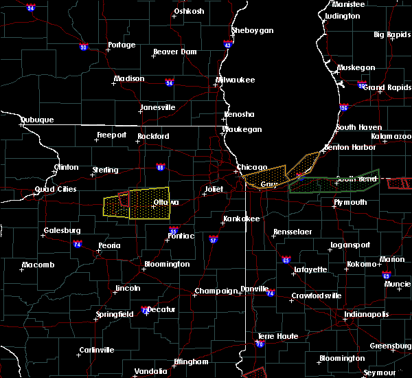 The tornado warning for northeastern bureau county will expire at 1000 pm cst, the storm which prompted the warning has moved out of the area. therefore the warning will be allowed to expire. a tornado watch remains in effect until 1000 pm cst for north central illinois. The tornado warning for northeastern bureau county will expire at 1000 pm cst, the storm which prompted the warning has moved out of the area. therefore the warning will be allowed to expire. a tornado watch remains in effect until 1000 pm cst for north central illinois.
|
| 2/28/2017 9:49 PM CST |
 At 949 pm cst, a severe squall line capable of producing both tornadoes and extensive straight line wind damage was located near ladd, or near peru, moving east at 60 mph (radar indicated rotation). Hazards include tornado and quarter size hail. Flying debris will be dangerous to those caught without shelter. mobile homes will be damaged or destroyed. damage to roofs, windows, and vehicles will occur. tree damage is likely. locations impacted include, ladd, la moille, cherry and arlington. This includes interstate 80 in illinois near mile marker 72. At 949 pm cst, a severe squall line capable of producing both tornadoes and extensive straight line wind damage was located near ladd, or near peru, moving east at 60 mph (radar indicated rotation). Hazards include tornado and quarter size hail. Flying debris will be dangerous to those caught without shelter. mobile homes will be damaged or destroyed. damage to roofs, windows, and vehicles will occur. tree damage is likely. locations impacted include, ladd, la moille, cherry and arlington. This includes interstate 80 in illinois near mile marker 72.
|
| 2/28/2017 9:43 PM CST |
 At 943 pm cst, a severe squall line capable of producing both tornadoes and extensive straight line wind damage was located near ladd, or 9 miles southwest of mendota, moving east at 55 mph (radar indicated rotation). Hazards include tornado and quarter size hail. Flying debris will be dangerous to those caught without shelter. mobile homes will be damaged or destroyed. damage to roofs, windows, and vehicles will occur. tree damage is likely. this tornadic thunderstorm will remain over mainly rural areas of northeastern bureau county, including the following locations: zearing, seatonville, ottville, spring valley airport, cherry, malden, hollowayville and arlington. This includes interstate 80 in illinois between mile markers 63 and 72. At 943 pm cst, a severe squall line capable of producing both tornadoes and extensive straight line wind damage was located near ladd, or 9 miles southwest of mendota, moving east at 55 mph (radar indicated rotation). Hazards include tornado and quarter size hail. Flying debris will be dangerous to those caught without shelter. mobile homes will be damaged or destroyed. damage to roofs, windows, and vehicles will occur. tree damage is likely. this tornadic thunderstorm will remain over mainly rural areas of northeastern bureau county, including the following locations: zearing, seatonville, ottville, spring valley airport, cherry, malden, hollowayville and arlington. This includes interstate 80 in illinois between mile markers 63 and 72.
|
| 2/28/2017 9:38 PM CST |
 At 938 pm cst, a severe thunderstorm was located near la moille, or 8 miles northeast of princeton, moving east at 65 mph (radar indicated). Hazards include 70 mph wind gusts and half dollar size hail. Hail damage to vehicles is expected. expect considerable tree damage. wind damage is also likely to mobile homes, roofs, and outbuildings. locations impacted include, princeton, hennepin, spring valley, depue, granville, ladd, tiskilwa, dalzell, bureau junction, mark, cherry, malden, seatonville, standard, arlington, dover, hollowayville, spring valley airport, coal hollow and zearing. this includes the following highways, interstate 80 in illinois between mile markers 55 and 72. interstate 180 between mile markers 1 and 13. A tornado watch remains in effect until 1000 pm cst for north central illinois. At 938 pm cst, a severe thunderstorm was located near la moille, or 8 miles northeast of princeton, moving east at 65 mph (radar indicated). Hazards include 70 mph wind gusts and half dollar size hail. Hail damage to vehicles is expected. expect considerable tree damage. wind damage is also likely to mobile homes, roofs, and outbuildings. locations impacted include, princeton, hennepin, spring valley, depue, granville, ladd, tiskilwa, dalzell, bureau junction, mark, cherry, malden, seatonville, standard, arlington, dover, hollowayville, spring valley airport, coal hollow and zearing. this includes the following highways, interstate 80 in illinois between mile markers 55 and 72. interstate 180 between mile markers 1 and 13. A tornado watch remains in effect until 1000 pm cst for north central illinois.
|
| 2/28/2017 9:35 PM CST |
 At 935 pm cst, a severe squall line capable of producing both tornadoes and extensive straight line wind damage was located near princeton, moving east at 45 mph (radar indicated rotation). Hazards include tornado. Flying debris will be dangerous to those caught without shelter. mobile homes will be damaged or destroyed. damage to roofs, windows, and vehicles will occur. tree damage is likely. these dangerous storms will be near, la moille around 950 pm cst. other locations impacted by this tornadic thunderstorm include zearing, seatonville, ottville, kasbeer, spring valley airport, cherry, dover, coal hollow, malden and hollowayville. this includes the following highways, interstate 80 in illinois between mile markers 57 and 72. Interstate 180 between mile markers 9 and 13. At 935 pm cst, a severe squall line capable of producing both tornadoes and extensive straight line wind damage was located near princeton, moving east at 45 mph (radar indicated rotation). Hazards include tornado. Flying debris will be dangerous to those caught without shelter. mobile homes will be damaged or destroyed. damage to roofs, windows, and vehicles will occur. tree damage is likely. these dangerous storms will be near, la moille around 950 pm cst. other locations impacted by this tornadic thunderstorm include zearing, seatonville, ottville, kasbeer, spring valley airport, cherry, dover, coal hollow, malden and hollowayville. this includes the following highways, interstate 80 in illinois between mile markers 57 and 72. Interstate 180 between mile markers 9 and 13.
|
| 2/28/2017 9:33 PM CST |
 At 932 pm cst, a severe thunderstorm was located near princeton, moving east at 65 mph (radar indicated). Hazards include 70 mph wind gusts and nickel size hail. Expect considerable tree damage. damage is likely to mobile homes, roofs, and outbuildings. locations impacted include, princeton, hennepin, spring valley, depue, granville, ladd, wyanet, tiskilwa, dalzell, bureau junction, mark, cherry, malden, seatonville, standard, arlington, dover, hollowayville, spring valley airport and coal hollow. this includes the following highways, interstate 80 in illinois between mile markers 48 and 72. interstate 180 between mile markers 1 and 13. A tornado watch remains in effect until 1000 pm cst for north central illinois. At 932 pm cst, a severe thunderstorm was located near princeton, moving east at 65 mph (radar indicated). Hazards include 70 mph wind gusts and nickel size hail. Expect considerable tree damage. damage is likely to mobile homes, roofs, and outbuildings. locations impacted include, princeton, hennepin, spring valley, depue, granville, ladd, wyanet, tiskilwa, dalzell, bureau junction, mark, cherry, malden, seatonville, standard, arlington, dover, hollowayville, spring valley airport and coal hollow. this includes the following highways, interstate 80 in illinois between mile markers 48 and 72. interstate 180 between mile markers 1 and 13. A tornado watch remains in effect until 1000 pm cst for north central illinois.
|
| 2/28/2017 9:27 PM CST |
 At 927 pm cst, a severe squall line capable of producing both tornadoes and extensive straight line wind damage was located near wyanet, or near princeton, moving east at 55 mph (radar indicated rotation). Hazards include tornado. Flying debris will be dangerous to those caught without shelter. mobile homes will be damaged or destroyed. damage to roofs, windows, and vehicles will occur. tree damage is likely. these dangerous storms will be near, princeton around 935 pm cst. ladd and la moille around 945 pm cst. other locations impacted by this tornadic thunderstorm include zearing, seatonville, ottville, kasbeer, spring valley airport, cherry, dover, coal hollow, malden and hollowayville. this includes the following highways, interstate 80 in illinois between mile markers 47 and 72. Interstate 180 between mile markers 9 and 13. At 927 pm cst, a severe squall line capable of producing both tornadoes and extensive straight line wind damage was located near wyanet, or near princeton, moving east at 55 mph (radar indicated rotation). Hazards include tornado. Flying debris will be dangerous to those caught without shelter. mobile homes will be damaged or destroyed. damage to roofs, windows, and vehicles will occur. tree damage is likely. these dangerous storms will be near, princeton around 935 pm cst. ladd and la moille around 945 pm cst. other locations impacted by this tornadic thunderstorm include zearing, seatonville, ottville, kasbeer, spring valley airport, cherry, dover, coal hollow, malden and hollowayville. this includes the following highways, interstate 80 in illinois between mile markers 47 and 72. Interstate 180 between mile markers 9 and 13.
|
| 2/28/2017 9:24 PM CST |
 At 923 pm cst, a severe thunderstorm was located over wyanet, or near princeton, moving east at 65 mph (radar indicated). Hazards include 70 mph wind gusts and penny size hail. Expect considerable tree damage. damage is likely to mobile homes, roofs, and outbuildings. locations impacted include, princeton, hennepin, spring valley, depue, granville, ladd, wyanet, sheffield, tiskilwa, dalzell, buda, bureau junction, mcnabb, putnam, mark, cherry, neponset, malden, seatonville and standard. this includes the following highways, interstate 80 in illinois between mile markers 41 and 72. interstate 180 between mile markers 1 and 13. A tornado watch remains in effect until 1000 pm cst for north central illinois. At 923 pm cst, a severe thunderstorm was located over wyanet, or near princeton, moving east at 65 mph (radar indicated). Hazards include 70 mph wind gusts and penny size hail. Expect considerable tree damage. damage is likely to mobile homes, roofs, and outbuildings. locations impacted include, princeton, hennepin, spring valley, depue, granville, ladd, wyanet, sheffield, tiskilwa, dalzell, buda, bureau junction, mcnabb, putnam, mark, cherry, neponset, malden, seatonville and standard. this includes the following highways, interstate 80 in illinois between mile markers 41 and 72. interstate 180 between mile markers 1 and 13. A tornado watch remains in effect until 1000 pm cst for north central illinois.
|
| 2/28/2017 9:20 PM CST |
 At 920 pm cst, severe thunderstorms capable of producing both tornadoes and extensive straight line wind damage were located over sheffield, or 12 miles west of princeton, moving east at 45 mph (radar indicated rotation). Hazards include tornado. Flying debris will be dangerous to those caught without shelter. mobile homes will be damaged or destroyed. damage to roofs, windows, and vehicles will occur. tree damage is likely. these dangerous storms will be near, wyanet around 925 pm cst. princeton around 940 pm cst. spring valley and la moille around 950 pm cst. ladd around 955 pm cst. other locations impacted by this tornadic thunderstorm include seatonville, spring valley airport, providence, cherry, mark, dover, standard, coal hollow, zearing and ottville. this includes the following highways, interstate 80 in illinois between mile markers 41 and 72. Interstate 180 between mile markers 1 and 13. At 920 pm cst, severe thunderstorms capable of producing both tornadoes and extensive straight line wind damage were located over sheffield, or 12 miles west of princeton, moving east at 45 mph (radar indicated rotation). Hazards include tornado. Flying debris will be dangerous to those caught without shelter. mobile homes will be damaged or destroyed. damage to roofs, windows, and vehicles will occur. tree damage is likely. these dangerous storms will be near, wyanet around 925 pm cst. princeton around 940 pm cst. spring valley and la moille around 950 pm cst. ladd around 955 pm cst. other locations impacted by this tornadic thunderstorm include seatonville, spring valley airport, providence, cherry, mark, dover, standard, coal hollow, zearing and ottville. this includes the following highways, interstate 80 in illinois between mile markers 41 and 72. Interstate 180 between mile markers 1 and 13.
|
| 2/28/2017 9:19 PM CST |
 At 918 pm cst, a severe thunderstorm was located over buda, or 10 miles west of princeton, moving east at 65 mph (radar indicated). Hazards include 60 mph wind gusts and penny size hail. expect damage to roofs, siding, and trees At 918 pm cst, a severe thunderstorm was located over buda, or 10 miles west of princeton, moving east at 65 mph (radar indicated). Hazards include 60 mph wind gusts and penny size hail. expect damage to roofs, siding, and trees
|
| 2/28/2017 8:41 PM CST |
 The severe thunderstorm warning for northeastern bureau county will expire at 845 pm cst, the storm which prompted the warning has moved out of the area. therefore the warning will be allowed to expire. a tornado watch remains in effect until 1000 pm cst for north central illinois. to report severe weather, contact your nearest law enforcement agency. they will relay your report to the national weather service the quad cities. The severe thunderstorm warning for northeastern bureau county will expire at 845 pm cst, the storm which prompted the warning has moved out of the area. therefore the warning will be allowed to expire. a tornado watch remains in effect until 1000 pm cst for north central illinois. to report severe weather, contact your nearest law enforcement agency. they will relay your report to the national weather service the quad cities.
|
| 2/28/2017 8:31 PM CST |
 At 830 pm cst, a severe thunderstorm was located near la moille, or 7 miles southwest of mendota, moving east at 55 mph (radar indicated). Hazards include quarter size hail. Damage to vehicles is expected. locations impacted include, la moille, cherry, arlington and zearing. A tornado watch remains in effect until 1000 pm cst for north central illinois. At 830 pm cst, a severe thunderstorm was located near la moille, or 7 miles southwest of mendota, moving east at 55 mph (radar indicated). Hazards include quarter size hail. Damage to vehicles is expected. locations impacted include, la moille, cherry, arlington and zearing. A tornado watch remains in effect until 1000 pm cst for north central illinois.
|
| 2/28/2017 8:25 PM CST |
 At 824 pm cst, a severe thunderstorm was located near la moille, or 8 miles northeast of princeton, moving east at 55 mph (radar indicated). Hazards include quarter size hail. Damage to vehicles is expected. locations impacted include, la moille, cherry, malden, arlington, dover and zearing. this includes interstate 80 in illinois between mile markers 60 and 64. A tornado watch remains in effect until 1000 pm cst for north central illinois. At 824 pm cst, a severe thunderstorm was located near la moille, or 8 miles northeast of princeton, moving east at 55 mph (radar indicated). Hazards include quarter size hail. Damage to vehicles is expected. locations impacted include, la moille, cherry, malden, arlington, dover and zearing. this includes interstate 80 in illinois between mile markers 60 and 64. A tornado watch remains in effect until 1000 pm cst for north central illinois.
|
| 2/28/2017 8:22 PM CST |
 At 821 pm cst, a severe thunderstorm was located near la moille, or 7 miles northeast of princeton, moving east at 55 mph (radar indicated). Hazards include quarter size hail. Damage to vehicles is expected. locations impacted include, princeton, la moille, cherry, malden, arlington, dover and zearing. this includes the following highways, interstate 80 in illinois between mile markers 56 and 66. interstate 180 near mile marker 13. A tornado watch remains in effect until 1000 pm cst for north central illinois. At 821 pm cst, a severe thunderstorm was located near la moille, or 7 miles northeast of princeton, moving east at 55 mph (radar indicated). Hazards include quarter size hail. Damage to vehicles is expected. locations impacted include, princeton, la moille, cherry, malden, arlington, dover and zearing. this includes the following highways, interstate 80 in illinois between mile markers 56 and 66. interstate 180 near mile marker 13. A tornado watch remains in effect until 1000 pm cst for north central illinois.
|
| 2/28/2017 8:18 PM CST |
 At 818 pm cst, a severe thunderstorm was located near princeton, moving east at 55 mph (radar indicated). Hazards include quarter size hail. damage to vehicles is expected At 818 pm cst, a severe thunderstorm was located near princeton, moving east at 55 mph (radar indicated). Hazards include quarter size hail. damage to vehicles is expected
|
| 7/17/2016 7:56 AM CDT |
 At 756 am cdt, a severe thunderstorm was located near ladd, or 7 miles north of peru, moving east at 45 mph (radar indicated). Hazards include 60 mph wind gusts. Expect damage to roofs. siding. and trees. Locations impacted include, princeton, hennepin, spring valley, depue, granville, ladd, tiskilwa, la moille, dalzell, bureau junction, mcnabb, mark, cherry, malden, seatonville, standard, arlington, dover, hollowayville and ottville. At 756 am cdt, a severe thunderstorm was located near ladd, or 7 miles north of peru, moving east at 45 mph (radar indicated). Hazards include 60 mph wind gusts. Expect damage to roofs. siding. and trees. Locations impacted include, princeton, hennepin, spring valley, depue, granville, ladd, tiskilwa, la moille, dalzell, bureau junction, mcnabb, mark, cherry, malden, seatonville, standard, arlington, dover, hollowayville and ottville.
|
| 7/17/2016 7:45 AM CDT |
 At 745 am cdt, a severe thunderstorm was located over ladd, or near peru, moving east at 55 mph (radar indicated). Hazards include 60 mph wind gusts. Expect damage to roofs. siding. and trees. Locations impacted include, princeton, hennepin, spring valley, depue, granville, ladd, wyanet, tiskilwa, la moille, dalzell, buda, bureau junction, mcnabb, mark, ohio, cherry, malden, seatonville, standard and arlington. At 745 am cdt, a severe thunderstorm was located over ladd, or near peru, moving east at 55 mph (radar indicated). Hazards include 60 mph wind gusts. Expect damage to roofs. siding. and trees. Locations impacted include, princeton, hennepin, spring valley, depue, granville, ladd, wyanet, tiskilwa, la moille, dalzell, buda, bureau junction, mcnabb, mark, ohio, cherry, malden, seatonville, standard and arlington.
|
| 7/17/2016 7:31 AM CDT |
 At 730 am cdt, a severe thunderstorm was located 7 miles north of princeton, moving east at 55 mph (radar indicated). Hazards include 60 mph wind gusts. Expect damage to roofs. siding. and trees. Locations impacted include, princeton, hennepin, spring valley, depue, granville, walnut, ladd, wyanet, sheffield, tiskilwa, la moille, dalzell, buda, bureau junction, mcnabb, mark, ohio, cherry, malden and manlius. At 730 am cdt, a severe thunderstorm was located 7 miles north of princeton, moving east at 55 mph (radar indicated). Hazards include 60 mph wind gusts. Expect damage to roofs. siding. and trees. Locations impacted include, princeton, hennepin, spring valley, depue, granville, walnut, ladd, wyanet, sheffield, tiskilwa, la moille, dalzell, buda, bureau junction, mcnabb, mark, ohio, cherry, malden and manlius.
|
| 7/17/2016 7:11 AM CDT |
 At 711 am cdt, a severe thunderstorm was located near tampico, or 15 miles south of rock falls, moving east at 55 mph (radar indicated). Hazards include 60 mph wind gusts. Expect damage to roofs. siding. And trees. At 711 am cdt, a severe thunderstorm was located near tampico, or 15 miles south of rock falls, moving east at 55 mph (radar indicated). Hazards include 60 mph wind gusts. Expect damage to roofs. siding. And trees.
|
| 7/13/2016 4:42 PM CDT |
 At 442 pm cdt, severe thunderstorms were located along a line extending from near walnut to princeton to 7 miles east of bradford, moving east at 50 mph (radar indicated). Hazards include 60 mph wind gusts. Expect damage to roofs. siding. and trees. locations impacted include, princeton, hennepin, spring valley, henry, depue, granville, walnut, ladd, wyanet, tiskilwa, la moille, dalzell, buda, bureau junction, mcnabb, putnam, mark, ohio, cherry and malden. This includes interstate 80 in illinois between mile markers 46 and 72. At 442 pm cdt, severe thunderstorms were located along a line extending from near walnut to princeton to 7 miles east of bradford, moving east at 50 mph (radar indicated). Hazards include 60 mph wind gusts. Expect damage to roofs. siding. and trees. locations impacted include, princeton, hennepin, spring valley, henry, depue, granville, walnut, ladd, wyanet, tiskilwa, la moille, dalzell, buda, bureau junction, mcnabb, putnam, mark, ohio, cherry and malden. This includes interstate 80 in illinois between mile markers 46 and 72.
|
| 7/13/2016 4:30 PM CDT |
 At 429 pm cdt, severe thunderstorms were located along a line extending from near tampico to near bradford, moving east at 35 mph (radar indicated). Hazards include 60 mph wind gusts. Expect damage to roofs. siding. and trees. locations impacted include, rock falls, princeton, hennepin, spring valley, henry, depue, granville, walnut, ladd, wyanet, sheffield, tiskilwa, tampico, la moille, dalzell, buda, bureau junction, mcnabb, deer grove and putnam. this includes the following highways, interstate 80 in illinois between mile markers 36 and 72. Interstate 88 between mile markers 36 and 44. At 429 pm cdt, severe thunderstorms were located along a line extending from near tampico to near bradford, moving east at 35 mph (radar indicated). Hazards include 60 mph wind gusts. Expect damage to roofs. siding. and trees. locations impacted include, rock falls, princeton, hennepin, spring valley, henry, depue, granville, walnut, ladd, wyanet, sheffield, tiskilwa, tampico, la moille, dalzell, buda, bureau junction, mcnabb, deer grove and putnam. this includes the following highways, interstate 80 in illinois between mile markers 36 and 72. Interstate 88 between mile markers 36 and 44.
|
| 7/13/2016 4:09 PM CDT |
 The national weather service in the quad cities has issued a * severe thunderstorm warning for. bureau county in north central illinois. putnam county in north central illinois. southeastern whiteside county in northwestern illinois. Until 500 pm cdt. The national weather service in the quad cities has issued a * severe thunderstorm warning for. bureau county in north central illinois. putnam county in north central illinois. southeastern whiteside county in northwestern illinois. Until 500 pm cdt.
|
| 7/6/2016 4:20 AM CDT |
 At 419 am cdt, a severe thunderstorm was located near cambridge, moving southeast at 30 mph (radar indicated). Hazards include 60 mph wind gusts. Expect damage to roofs. siding. and trees. locations impacted include, kewanee, princeton, cambridge, hennepin, geneseo, spring valley, colona, galva, burgess, orion, depue, granville, walnut, ladd, wyanet, atkinson, viola, sheffield, annawan and tiskilwa. This includes interstate 80 in illinois between mile markers 10 and 72. At 419 am cdt, a severe thunderstorm was located near cambridge, moving southeast at 30 mph (radar indicated). Hazards include 60 mph wind gusts. Expect damage to roofs. siding. and trees. locations impacted include, kewanee, princeton, cambridge, hennepin, geneseo, spring valley, colona, galva, burgess, orion, depue, granville, walnut, ladd, wyanet, atkinson, viola, sheffield, annawan and tiskilwa. This includes interstate 80 in illinois between mile markers 10 and 72.
|
| 7/6/2016 3:56 AM CDT |
 At 356 am cdt, severe thunderstorms were located along a line extending from 6 miles north of geneseo to alpha, moving east at 50 mph (radar indicated). Hazards include 70 mph wind gusts. Expect considerable tree damage. damage is likely to mobile homes, roofs, and outbuildings. locations impacted include, moline, rock island, east moline, kewanee, princeton, cambridge, hennepin, silvis, geneseo, spring valley, milan, colona, le claire, coal valley, galva, burgess, hampton, orion, depue and port byron. this includes the following highways, interstate 80 in illinois between mile markers 1 and 72. interstate 74 in illinois between mile markers 2 and 3. interstate 88 between mile markers 1 and 10. Interstate 280 between mile markers 13 and 18. At 356 am cdt, severe thunderstorms were located along a line extending from 6 miles north of geneseo to alpha, moving east at 50 mph (radar indicated). Hazards include 70 mph wind gusts. Expect considerable tree damage. damage is likely to mobile homes, roofs, and outbuildings. locations impacted include, moline, rock island, east moline, kewanee, princeton, cambridge, hennepin, silvis, geneseo, spring valley, milan, colona, le claire, coal valley, galva, burgess, hampton, orion, depue and port byron. this includes the following highways, interstate 80 in illinois between mile markers 1 and 72. interstate 74 in illinois between mile markers 2 and 3. interstate 88 between mile markers 1 and 10. Interstate 280 between mile markers 13 and 18.
|
| 7/6/2016 3:46 AM CDT |
 At 345 am cdt, a severe thunderstorm was located over cleveland, or near east moline, moving east at 55 mph (radar indicated). Hazards include 60 mph wind gusts. Expect damage to roofs. siding. And trees. At 345 am cdt, a severe thunderstorm was located over cleveland, or near east moline, moving east at 55 mph (radar indicated). Hazards include 60 mph wind gusts. Expect damage to roofs. siding. And trees.
|
| 6/22/2016 8:43 PM CDT |
 At 841 pm cdt, a severe thunderstorm capable of producing a tornado was located near ladd, or 7 miles east of princeton, moving east at 30 mph (weather spotters reported a funnel cloud). Hazards include tornado. Flying debris will be dangerous to those caught without shelter. mobile homes will be damaged or destroyed. damage to roofs, windows, and vehicles will occur. tree damage is likely. this dangerous storm will be near, depue around 845 pm cdt. hennepin around 850 pm cdt. spring valley and ladd around 855 pm cdt. dalzell around 900 pm cdt. other locations impacted by this tornadic thunderstorm include ottville, malden, cherry, spring valley airport, bureau county fairgrounds, dover, hollowayville, zearing, coal hollow and seatonville. at 832 pm, law enforcement report a semi truck blown over between princeton and dover. at 834 pm, law enforcement reported a funnel cloud 4 miles northeast of princeton. This includes interstate 80 in illinois between mile markers 57 and 72. At 841 pm cdt, a severe thunderstorm capable of producing a tornado was located near ladd, or 7 miles east of princeton, moving east at 30 mph (weather spotters reported a funnel cloud). Hazards include tornado. Flying debris will be dangerous to those caught without shelter. mobile homes will be damaged or destroyed. damage to roofs, windows, and vehicles will occur. tree damage is likely. this dangerous storm will be near, depue around 845 pm cdt. hennepin around 850 pm cdt. spring valley and ladd around 855 pm cdt. dalzell around 900 pm cdt. other locations impacted by this tornadic thunderstorm include ottville, malden, cherry, spring valley airport, bureau county fairgrounds, dover, hollowayville, zearing, coal hollow and seatonville. at 832 pm, law enforcement report a semi truck blown over between princeton and dover. at 834 pm, law enforcement reported a funnel cloud 4 miles northeast of princeton. This includes interstate 80 in illinois between mile markers 57 and 72.
|
| 6/22/2016 8:34 PM CDT |
 At 833 pm cdt, a severe thunderstorm capable of producing a tornado was located near princeton, moving east at 30 mph (fire officials reported a funnel cloud). Hazards include tornado. Flying debris will be dangerous to those caught without shelter. mobile homes will be damaged or destroyed. damage to roofs, windows, and vehicles will occur. tree damage is likely. this dangerous storm will be near, depue around 845 pm cdt. hennepin around 850 pm cdt. spring valley and ladd around 855 pm cdt. dalzell around 900 pm cdt. other locations impacted by this tornadic thunderstorm include ottville, dover, zearing, seatonville, cherry, malden, spring valley airport, bureau county fairgrounds, kasbeer and hollowayville. at 829 pm, the princeton fire chief reported a funnel cloud north of princeton. a tornado could develop at any time. This includes interstate 80 in illinois between mile markers 54 and 72. At 833 pm cdt, a severe thunderstorm capable of producing a tornado was located near princeton, moving east at 30 mph (fire officials reported a funnel cloud). Hazards include tornado. Flying debris will be dangerous to those caught without shelter. mobile homes will be damaged or destroyed. damage to roofs, windows, and vehicles will occur. tree damage is likely. this dangerous storm will be near, depue around 845 pm cdt. hennepin around 850 pm cdt. spring valley and ladd around 855 pm cdt. dalzell around 900 pm cdt. other locations impacted by this tornadic thunderstorm include ottville, dover, zearing, seatonville, cherry, malden, spring valley airport, bureau county fairgrounds, kasbeer and hollowayville. at 829 pm, the princeton fire chief reported a funnel cloud north of princeton. a tornado could develop at any time. This includes interstate 80 in illinois between mile markers 54 and 72.
|
| 6/22/2016 8:26 PM CDT |
 At 824 pm cdt, a severe thunderstorm capable of producing a tornado was located near princeton, moving east at 30 mph (weather spotters reported a funnel cloud). Hazards include tornado. Flying debris will be dangerous to those caught without shelter. mobile homes will be damaged or destroyed. damage to roofs, windows, and vehicles will occur. tree damage is likely. this dangerous storm will be near, princeton around 835 pm cdt. depue around 850 pm cdt. hennepin around 855 pm cdt. spring valley and ladd around 900 pm cdt. dalzell around 905 pm cdt. other locations impacted by this tornadic thunderstorm include ottville, dover, zearing, seatonville, cherry, malden, spring valley airport, bureau county fairgrounds, kasbeer and hollowayville. at 823 pm, trained spotters reported a funnel cloud southwest of kasbeer. This includes interstate 80 in illinois between mile markers 51 and 72. At 824 pm cdt, a severe thunderstorm capable of producing a tornado was located near princeton, moving east at 30 mph (weather spotters reported a funnel cloud). Hazards include tornado. Flying debris will be dangerous to those caught without shelter. mobile homes will be damaged or destroyed. damage to roofs, windows, and vehicles will occur. tree damage is likely. this dangerous storm will be near, princeton around 835 pm cdt. depue around 850 pm cdt. hennepin around 855 pm cdt. spring valley and ladd around 900 pm cdt. dalzell around 905 pm cdt. other locations impacted by this tornadic thunderstorm include ottville, dover, zearing, seatonville, cherry, malden, spring valley airport, bureau county fairgrounds, kasbeer and hollowayville. at 823 pm, trained spotters reported a funnel cloud southwest of kasbeer. This includes interstate 80 in illinois between mile markers 51 and 72.
|
| 6/22/2016 8:19 PM CDT |
 At 817 pm cdt, a severe thunderstorm capable of producing a tornado was located near walnut, or 8 miles northwest of princeton, moving east at 30 mph (radar indicated rotation). Hazards include tornado. Flying debris will be dangerous to those caught without shelter. mobile homes will be damaged or destroyed. damage to roofs, windows, and vehicles will occur. tree damage is likely. this dangerous storm will be near, princeton around 835 pm cdt. depue around 850 pm cdt. hennepin around 855 pm cdt. spring valley and ladd around 900 pm cdt. dalzell around 905 pm cdt. other locations impacted by this tornadic thunderstorm include ottville, dover, zearing, seatonville, cherry, malden, spring valley airport, bureau county fairgrounds, kasbeer and van orin. this storm produced a brief tornado 3 miles north of manlius around 807 pm. This includes interstate 80 in illinois between mile markers 49 and 72. At 817 pm cdt, a severe thunderstorm capable of producing a tornado was located near walnut, or 8 miles northwest of princeton, moving east at 30 mph (radar indicated rotation). Hazards include tornado. Flying debris will be dangerous to those caught without shelter. mobile homes will be damaged or destroyed. damage to roofs, windows, and vehicles will occur. tree damage is likely. this dangerous storm will be near, princeton around 835 pm cdt. depue around 850 pm cdt. hennepin around 855 pm cdt. spring valley and ladd around 900 pm cdt. dalzell around 905 pm cdt. other locations impacted by this tornadic thunderstorm include ottville, dover, zearing, seatonville, cherry, malden, spring valley airport, bureau county fairgrounds, kasbeer and van orin. this storm produced a brief tornado 3 miles north of manlius around 807 pm. This includes interstate 80 in illinois between mile markers 49 and 72.
|
| 6/22/2016 7:55 PM CDT |
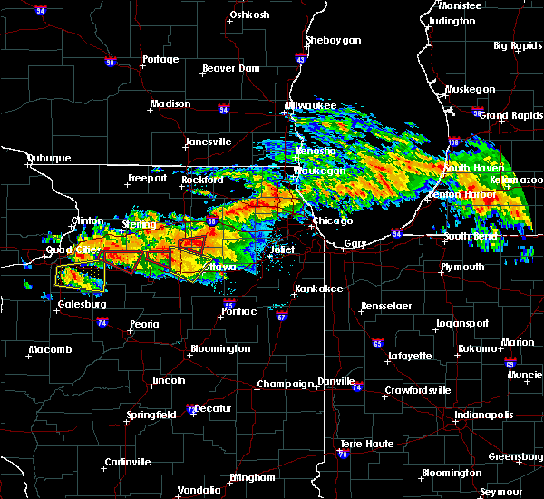 The tornado warning for northeastern bureau county will expire at 800 pm cdt, the storm which prompted the warning has moved out of the area. therefore the warning will be allowed to expire. however heavy rain is still possible with this thunderstorm. a tornado watch remains in effect until 100 am cdt for north central illinois. to report severe weather, contact your nearest law enforcement agency. they will relay your report to the national weather service the quad cities. remember, a tornado warning still remains in effect for central and western bureau county!. The tornado warning for northeastern bureau county will expire at 800 pm cdt, the storm which prompted the warning has moved out of the area. therefore the warning will be allowed to expire. however heavy rain is still possible with this thunderstorm. a tornado watch remains in effect until 100 am cdt for north central illinois. to report severe weather, contact your nearest law enforcement agency. they will relay your report to the national weather service the quad cities. remember, a tornado warning still remains in effect for central and western bureau county!.
|
| 6/22/2016 7:44 PM CDT |
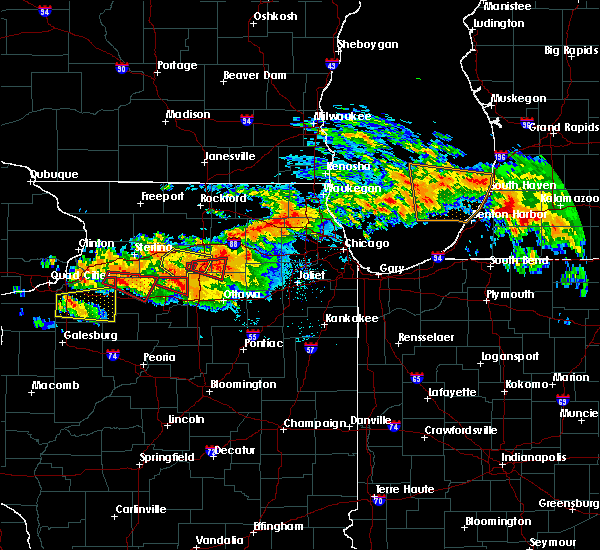 At 744 pm cdt, a severe thunderstorm capable of producing a tornado was located over la moille, or 9 miles west of mendota, moving east at 30 mph (radar indicated rotation). Hazards include tornado. Flying debris will be dangerous to those caught without shelter. mobile homes will be damaged or destroyed. damage to roofs, windows, and vehicles will occur. tree damage is likely. This tornadic thunderstorm will remain over mainly rural areas of northeastern bureau county, including the following locations: cherry, arlington and van orin. At 744 pm cdt, a severe thunderstorm capable of producing a tornado was located over la moille, or 9 miles west of mendota, moving east at 30 mph (radar indicated rotation). Hazards include tornado. Flying debris will be dangerous to those caught without shelter. mobile homes will be damaged or destroyed. damage to roofs, windows, and vehicles will occur. tree damage is likely. This tornadic thunderstorm will remain over mainly rural areas of northeastern bureau county, including the following locations: cherry, arlington and van orin.
|
| 6/22/2016 7:37 PM CDT |
 At 737 pm cdt, a severe thunderstorm capable of producing a tornado was located near la moille, or 12 miles northeast of princeton, moving east at 30 mph (radar indicated rotation). Hazards include tornado. Flying debris will be dangerous to those caught without shelter. mobile homes will be damaged or destroyed. damage to roofs, windows, and vehicles will occur. tree damage is likely. this dangerous storm will be near, la moille around 745 pm cdt. Other locations impacted by this tornadic thunderstorm include cherry, arlington, van orin and ohio. At 737 pm cdt, a severe thunderstorm capable of producing a tornado was located near la moille, or 12 miles northeast of princeton, moving east at 30 mph (radar indicated rotation). Hazards include tornado. Flying debris will be dangerous to those caught without shelter. mobile homes will be damaged or destroyed. damage to roofs, windows, and vehicles will occur. tree damage is likely. this dangerous storm will be near, la moille around 745 pm cdt. Other locations impacted by this tornadic thunderstorm include cherry, arlington, van orin and ohio.
|
| 6/22/2016 7:33 PM CDT |
 At 733 pm cdt, a severe thunderstorm capable of producing a tornado was located 7 miles west of la moille, or 11 miles south of walton, moving east at 30 mph (radar indicated rotation). Hazards include tornado. Flying debris will be dangerous to those caught without shelter. mobile homes will be damaged or destroyed. damage to roofs, windows, and vehicles will occur. tree damage is likely. this dangerous storm will be near, la moille around 750 pm cdt. Other locations impacted by this tornadic thunderstorm include cherry, zearing, arlington, kasbeer, van orin and ohio. At 733 pm cdt, a severe thunderstorm capable of producing a tornado was located 7 miles west of la moille, or 11 miles south of walton, moving east at 30 mph (radar indicated rotation). Hazards include tornado. Flying debris will be dangerous to those caught without shelter. mobile homes will be damaged or destroyed. damage to roofs, windows, and vehicles will occur. tree damage is likely. this dangerous storm will be near, la moille around 750 pm cdt. Other locations impacted by this tornadic thunderstorm include cherry, zearing, arlington, kasbeer, van orin and ohio.
|
| 3/15/2016 9:15 PM CDT |
 A severe thunderstorm warning remains in effect until 930 pm cdt for eastern bureau and northern putnam counties. at 914 pm cdt. severe thunderstorms were located along a line extending from near mendota to near ladd to granville. moving northeast at 40 mph. The most dangerous portion of this line is north of la moille and also near granville. A severe thunderstorm warning remains in effect until 930 pm cdt for eastern bureau and northern putnam counties. at 914 pm cdt. severe thunderstorms were located along a line extending from near mendota to near ladd to granville. moving northeast at 40 mph. The most dangerous portion of this line is north of la moille and also near granville.
|
| 3/15/2016 9:10 PM CDT |
 At 909 pm cdt, severe thunderstorms were located along a line extending from near la moille to ladd to near granville, moving northeast at 40 mph (radar indicated). Hazards include 60 mph wind gusts and quarter size hail. Hail damage to vehicles is expected. expect wind damage to roofs, siding, and trees. locations impacted include, hennepin, spring valley, depue, granville, ladd, la moille, dalzell, bureau junction, mark, ohio, cherry, malden, seatonville, standard, arlington, dover, hollowayville, ottville, zearing and spring valley airport. this includes interstate 80 in illinois between mile markers 59 and 72. A tornado watch remains in effect until 1100 pm cdt for north central illinois. At 909 pm cdt, severe thunderstorms were located along a line extending from near la moille to ladd to near granville, moving northeast at 40 mph (radar indicated). Hazards include 60 mph wind gusts and quarter size hail. Hail damage to vehicles is expected. expect wind damage to roofs, siding, and trees. locations impacted include, hennepin, spring valley, depue, granville, ladd, la moille, dalzell, bureau junction, mark, ohio, cherry, malden, seatonville, standard, arlington, dover, hollowayville, ottville, zearing and spring valley airport. this includes interstate 80 in illinois between mile markers 59 and 72. A tornado watch remains in effect until 1100 pm cdt for north central illinois.
|
| 3/15/2016 9:00 PM CDT |
 At 900 pm cdt, severe thunderstorms were located along a line extending from near la moille to near ladd to spring valley, moving east at 45 mph (radar indicated). Hazards include quarter size hail. Damage to vehicles is expected. locations impacted include, hennepin, spring valley, depue, granville, ladd, la moille, dalzell, bureau junction, mark, ohio, cherry, malden, seatonville, standard, arlington, dover, hollowayville, ottville, zearing and spring valley airport. this includes interstate 80 in illinois between mile markers 59 and 72. A tornado watch remains in effect until 1100 pm cdt for north central illinois. At 900 pm cdt, severe thunderstorms were located along a line extending from near la moille to near ladd to spring valley, moving east at 45 mph (radar indicated). Hazards include quarter size hail. Damage to vehicles is expected. locations impacted include, hennepin, spring valley, depue, granville, ladd, la moille, dalzell, bureau junction, mark, ohio, cherry, malden, seatonville, standard, arlington, dover, hollowayville, ottville, zearing and spring valley airport. this includes interstate 80 in illinois between mile markers 59 and 72. A tornado watch remains in effect until 1100 pm cdt for north central illinois.
|
| 3/15/2016 8:55 PM CDT |
 At 855 pm cdt, severe thunderstorms were located along a line extending from 6 miles south of amboy to near ladd to near granville, moving northeast at 45 mph (radar indicated). Hazards include quarter size hail. damage to vehicles is expected At 855 pm cdt, severe thunderstorms were located along a line extending from 6 miles south of amboy to near ladd to near granville, moving northeast at 45 mph (radar indicated). Hazards include quarter size hail. damage to vehicles is expected
|
| 11/11/2015 7:34 PM CST |
 At 733 pm cst, severe thunderstorms were located along a line extending from near walton to near princeton to near sparland, moving east at 45 mph (radar indicated). Hazards include 60 mph wind gusts. Expect damage to roofs. siding and trees. locations impacted include, princeton, hennepin, spring valley, henry, depue, granville, walnut, ladd, wyanet, tiskilwa, la moille, dalzell, bureau junction, mcnabb, putnam, mark, ohio, cherry, malden and seatonville. this includes interstate 80 in illinois between mile markers 50 and 72. A tornado watch remains in effect until 900 pm cst for north central illinois. At 733 pm cst, severe thunderstorms were located along a line extending from near walton to near princeton to near sparland, moving east at 45 mph (radar indicated). Hazards include 60 mph wind gusts. Expect damage to roofs. siding and trees. locations impacted include, princeton, hennepin, spring valley, henry, depue, granville, walnut, ladd, wyanet, tiskilwa, la moille, dalzell, bureau junction, mcnabb, putnam, mark, ohio, cherry, malden and seatonville. this includes interstate 80 in illinois between mile markers 50 and 72. A tornado watch remains in effect until 900 pm cst for north central illinois.
|
| 11/11/2015 7:17 PM CST |
 At 716 pm cst, severe thunderstorms were located along a line extending from 7 miles south of polo to near walton to near buda, moving northeast at 55 mph (radar indicated). Hazards include 60 mph wind gusts. Expect damage to roofs. siding and trees. locations impacted include, sterling, rock falls, princeton, hennepin, spring valley, henry, depue, granville, walnut, ladd, wyanet, sheffield, tiskilwa, tampico, la moille, dalzell, buda, bureau junction, mcnabb and coleta. this includes the following highways, interstate 80 in illinois between mile markers 36 and 72. interstate 88 between mile markers 33 and 44. A tornado watch remains in effect until 900 pm cst for northwestern illinois. At 716 pm cst, severe thunderstorms were located along a line extending from 7 miles south of polo to near walton to near buda, moving northeast at 55 mph (radar indicated). Hazards include 60 mph wind gusts. Expect damage to roofs. siding and trees. locations impacted include, sterling, rock falls, princeton, hennepin, spring valley, henry, depue, granville, walnut, ladd, wyanet, sheffield, tiskilwa, tampico, la moille, dalzell, buda, bureau junction, mcnabb and coleta. this includes the following highways, interstate 80 in illinois between mile markers 36 and 72. interstate 88 between mile markers 33 and 44. A tornado watch remains in effect until 900 pm cst for northwestern illinois.
|
| 11/11/2015 6:56 PM CST |
 At 655 pm cst, severe thunderstorms were located along a line extending from near lyndon to near tampico to near galva, moving northeast at 55 mph (radar indicated). Hazards include 60 mph wind gusts. Expect damage to roofs. Siding and trees. At 655 pm cst, severe thunderstorms were located along a line extending from near lyndon to near tampico to near galva, moving northeast at 55 mph (radar indicated). Hazards include 60 mph wind gusts. Expect damage to roofs. Siding and trees.
|
| 6/13/2015 4:32 PM CDT |
 A severe thunderstorm warning remains in effect until 445 pm cdt for northern putnam and eastern bureau counties. at 431 pm cdt. a severe thunderstorm was located near depue. or near princeton. moving east at 30 mph. hazard. 60 mph wind gusts. source. Radar indicated. A severe thunderstorm warning remains in effect until 445 pm cdt for northern putnam and eastern bureau counties. at 431 pm cdt. a severe thunderstorm was located near depue. or near princeton. moving east at 30 mph. hazard. 60 mph wind gusts. source. Radar indicated.
|
| 6/13/2015 4:19 PM CDT |
 At 418 pm cdt, a severe thunderstorm was located over princeton, moving east at 30 mph (radar indicated). Hazards include 60 mph wind gusts. Expect damage to roofs. siding and trees. locations impacted include, princeton, hennepin, spring valley, de pue, granville, ladd, wyanet, tiskilwa, la moille, dalzell, bureau junction, depue, bureau, mark, cherry, malden, seatonville, standard, arlington and dover. This includes interstate 80 in illinois between mile markers 48 and 72. At 418 pm cdt, a severe thunderstorm was located over princeton, moving east at 30 mph (radar indicated). Hazards include 60 mph wind gusts. Expect damage to roofs. siding and trees. locations impacted include, princeton, hennepin, spring valley, de pue, granville, ladd, wyanet, tiskilwa, la moille, dalzell, bureau junction, depue, bureau, mark, cherry, malden, seatonville, standard, arlington and dover. This includes interstate 80 in illinois between mile markers 48 and 72.
|
| 6/13/2015 4:09 PM CDT |
 At 408 pm cdt, a severe thunderstorm was located over wyanet, or near princeton, moving east at 30 mph (radar indicated). Hazards include 60 mph wind gusts and penny size hail. Expect damage to roofs. siding and trees. locations impacted include, princeton, hennepin, spring valley, de pue, granville, ladd, wyanet, sheffield, tiskilwa, la moille, dalzell, buda, bureau junction, depue, bureau, mark, cherry, neponset, malden and seatonville. This includes interstate 80 in illinois between mile markers 38 and 72. At 408 pm cdt, a severe thunderstorm was located over wyanet, or near princeton, moving east at 30 mph (radar indicated). Hazards include 60 mph wind gusts and penny size hail. Expect damage to roofs. siding and trees. locations impacted include, princeton, hennepin, spring valley, de pue, granville, ladd, wyanet, sheffield, tiskilwa, la moille, dalzell, buda, bureau junction, depue, bureau, mark, cherry, neponset, malden and seatonville. This includes interstate 80 in illinois between mile markers 38 and 72.
|
| 6/13/2015 3:55 PM CDT |
 At 355 pm cdt, a severe thunderstorm was located over buda, or 12 miles northeast of kewanee, moving east at 30 mph (radar indicated). Hazards include 60 mph wind gusts and nickel size hail. Expect damage to roofs. Siding and trees. At 355 pm cdt, a severe thunderstorm was located over buda, or 12 miles northeast of kewanee, moving east at 30 mph (radar indicated). Hazards include 60 mph wind gusts and nickel size hail. Expect damage to roofs. Siding and trees.
|
| 4/9/2015 7:39 PM CDT | A severe thunderstorm warning remains in effect for eastern bureau and northeastern putnam counties until 815 pm cdt. at 738 pm cdt. a severe thunderstorm was located near ladd. and moving northeast at 35 mph. hazard. 60 mph wind gusts and quarter size hail. source. Radar indicated. |
| 4/9/2015 7:23 PM CDT | The national weather service in the quad cities has issued a * severe thunderstorm warning for. eastern bureau county in north central illinois. putnam county in north central illinois. until 815 pm cdt * at 721 pm cdt. A severe thunderstorm was located 7 miles east of. |
Hail Maps for Arlington, IL


Connect with Interactive Hail Maps