

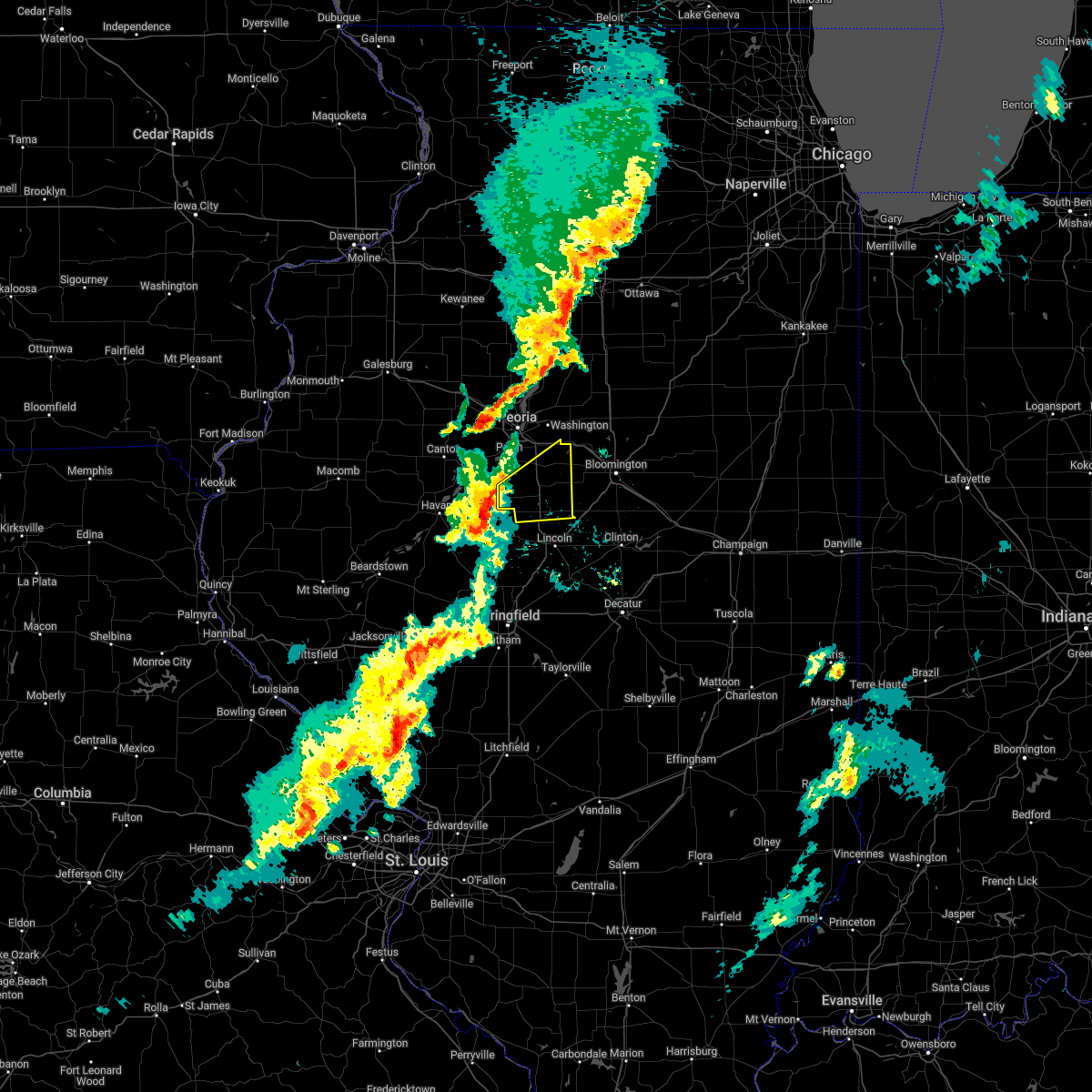
Hail Map for Armington, IL
The Armington, IL area has had 2 reports of on-the-ground hail by trained spotters, and has been under severe weather warnings 24 times during the past 12 months. Doppler radar has detected hail at or near Armington, IL on 51 occasions, including 2 occasions during the past year.
| Name: | Armington, IL |
| Where Located: | 28.3 miles SSE of Peoria, IL |
| Map: | Google Map for Armington, IL |
| Population: | 343 |
| Housing Units: | 146 |
| More Info: | Search Google for Armington, IL |
0
The Top Recent Hail Date for Armington, IL is Monday, June 30, 2025 (48th out of 51)
Hail and Wind Damage Spotted near Armington, IL
| Date / Time | Report Details |
|---|---|
| 5/15/2025 6:58 PM CDT |
 The storm which prompted the warning has moved out of the area. therefore, the warning will be allowed to expire. a tornado watch remains in effect until 1000 pm cdt for central illinois. to report severe weather, contact your nearest law enforcement agency. they will relay your report to the national weather service lincoln. a severe thunderstorm warning still remains in effect for logan county in areas near and east of i-55. The storm which prompted the warning has moved out of the area. therefore, the warning will be allowed to expire. a tornado watch remains in effect until 1000 pm cdt for central illinois. to report severe weather, contact your nearest law enforcement agency. they will relay your report to the national weather service lincoln. a severe thunderstorm warning still remains in effect for logan county in areas near and east of i-55.
|
| 5/15/2025 6:36 PM CDT |
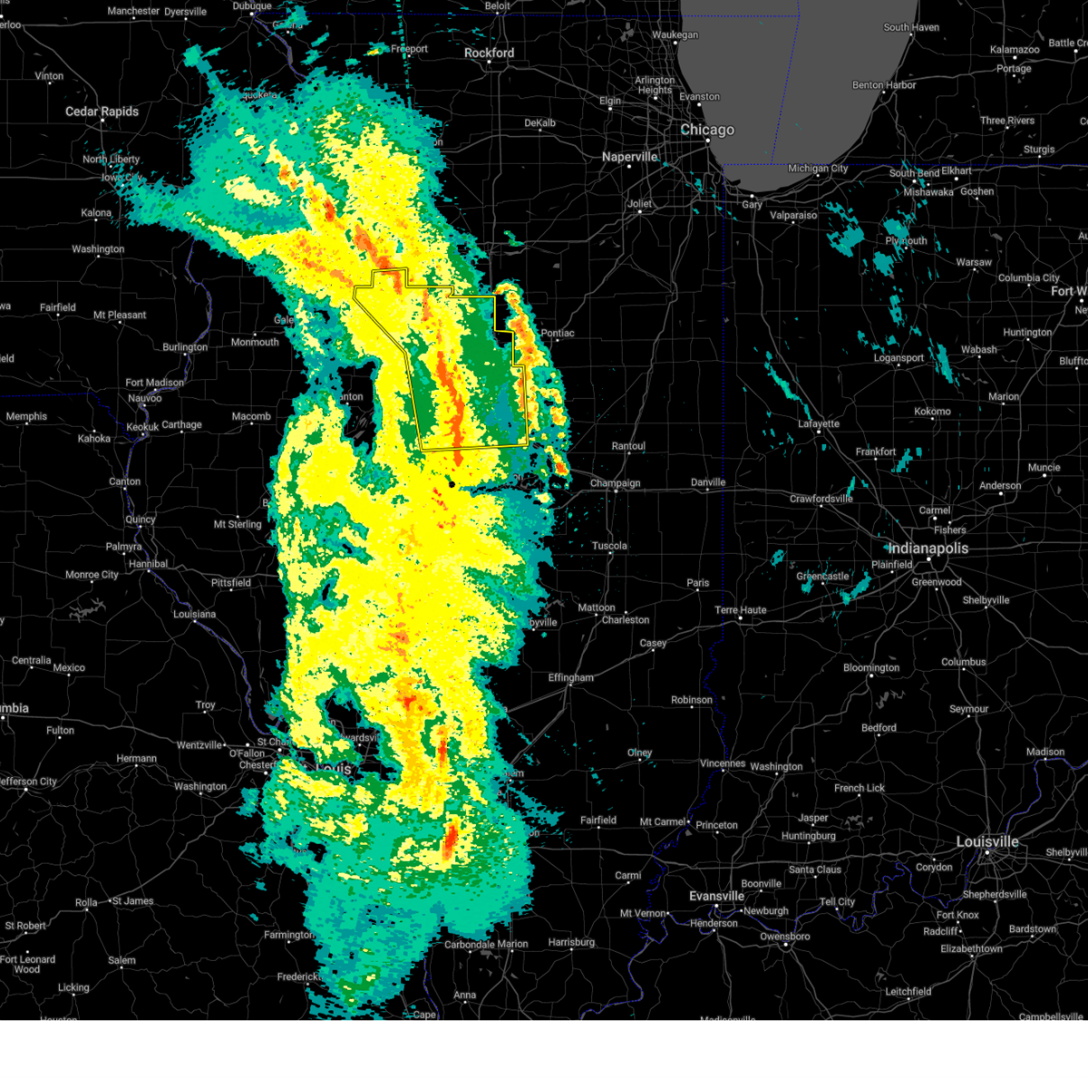
 At 636 pm cdt, a severe thunderstorm was located over hartsburg, moving northeast at 45 mph (radar indicated). Hazards include 60 mph wind gusts and half dollar size hail. Hail damage to vehicles is expected. expect wind damage to roofs, siding, and trees. this severe storm will be near, hartsburg around 640 pm cdt. armington around 645 pm cdt. other locations impacted by this severe thunderstorm include lawndale. this includes the following highways, interstate 155 between mile markers 0 and 9. Interstate 55 between mile markers 124 and 136. At 636 pm cdt, a severe thunderstorm was located over hartsburg, moving northeast at 45 mph (radar indicated). Hazards include 60 mph wind gusts and half dollar size hail. Hail damage to vehicles is expected. expect wind damage to roofs, siding, and trees. this severe storm will be near, hartsburg around 640 pm cdt. armington around 645 pm cdt. other locations impacted by this severe thunderstorm include lawndale. this includes the following highways, interstate 155 between mile markers 0 and 9. Interstate 55 between mile markers 124 and 136.
|
| 5/15/2025 6:36 PM CDT |
 the severe thunderstorm warning has been cancelled and is no longer in effect the severe thunderstorm warning has been cancelled and is no longer in effect
|
| 5/15/2025 6:23 PM CDT |
 Svrilx the national weather service in lincoln has issued a * severe thunderstorm warning for, northeastern menard county in central illinois, northwestern logan county in central illinois, southeastern tazewell county in central illinois, southeastern mason county in central illinois, * until 700 pm cdt. * at 623 pm cdt, a severe thunderstorm was located over middletown, moving northeast at 55 mph (radar indicated). Hazards include 60 mph wind gusts and half dollar size hail. Hail damage to vehicles is expected. expect wind damage to roofs, siding, and trees. this severe thunderstorm will be near, hartsburg around 630 pm cdt. other locations in the path of this severe thunderstorm include armington. this includes the following highways, interstate 155 between mile markers 0 and 9. Interstate 55 between mile markers 124 and 136. Svrilx the national weather service in lincoln has issued a * severe thunderstorm warning for, northeastern menard county in central illinois, northwestern logan county in central illinois, southeastern tazewell county in central illinois, southeastern mason county in central illinois, * until 700 pm cdt. * at 623 pm cdt, a severe thunderstorm was located over middletown, moving northeast at 55 mph (radar indicated). Hazards include 60 mph wind gusts and half dollar size hail. Hail damage to vehicles is expected. expect wind damage to roofs, siding, and trees. this severe thunderstorm will be near, hartsburg around 630 pm cdt. other locations in the path of this severe thunderstorm include armington. this includes the following highways, interstate 155 between mile markers 0 and 9. Interstate 55 between mile markers 124 and 136.
|
| 4/20/2025 9:11 PM CDT |
 the severe thunderstorm warning has been cancelled and is no longer in effect the severe thunderstorm warning has been cancelled and is no longer in effect
|
| 4/20/2025 8:56 PM CDT | Svrilx the national weather service in lincoln has issued a * severe thunderstorm warning for, marshall county in central illinois, woodford county in central illinois, stark county in north central illinois, tazewell county in central illinois, western mclean county in central illinois, northeastern peoria county in central illinois, * until 930 pm cdt. * at 855 pm cdt, severe thunderstorms were located along a line extending from near galva to washington to near armington, moving east at 50 mph (radar indicated). Hazards include 60 mph wind gusts. Expect damage to roofs, siding, and trees. severe thunderstorms will be near, peoria, rome, mackinaw, minier, spring bay, dunlap, chillicothe, armington, princeville, and germantown hills around 900 pm cdt. congerville, castleton, elmira, stanford, and danvers around 905 pm cdt. roanoke, camp grove, secor, osceola, and carlock around 910 pm cdt. bradford, sparland, washburn, el paso, lacon, normal, and bloomington around 915 pm cdt. other locations in the path of these severe thunderstorms include benson, downs, hudson and towanda. this includes the following highways, interstate 155 between mile markers 12 and 31. interstate 39 between mile markers 0 and 40. interstate 474 between mile markers 10 and 14. interstate 55 between mile markers 147 and 174. Interstate 74 between mile markers 89 and 145. |
| 4/2/2025 3:26 PM CDT |
 Svrilx the national weather service in lincoln has issued a * severe thunderstorm warning for, northern logan county in central illinois, northwestern de witt county in central illinois, southeastern tazewell county in central illinois, southwestern mclean county in central illinois, * until 400 pm cdt. * at 325 pm cdt, severe thunderstorms were located along a line extending from atlanta to near lincoln, moving northeast at 55 mph (radar indicated). Hazards include 60 mph wind gusts and quarter size hail. Hail damage to vehicles is expected. expect wind damage to roofs, siding, and trees. severe thunderstorms will be near, atlanta, mclean, and lincoln around 330 pm cdt. bloomington around 340 pm cdt. waynesville around 345 pm cdt. this includes the following highways, interstate 155 between mile markers 0 and 9. interstate 55 between mile markers 119 and 157. Interstate 74 between mile markers 133 and 135. Svrilx the national weather service in lincoln has issued a * severe thunderstorm warning for, northern logan county in central illinois, northwestern de witt county in central illinois, southeastern tazewell county in central illinois, southwestern mclean county in central illinois, * until 400 pm cdt. * at 325 pm cdt, severe thunderstorms were located along a line extending from atlanta to near lincoln, moving northeast at 55 mph (radar indicated). Hazards include 60 mph wind gusts and quarter size hail. Hail damage to vehicles is expected. expect wind damage to roofs, siding, and trees. severe thunderstorms will be near, atlanta, mclean, and lincoln around 330 pm cdt. bloomington around 340 pm cdt. waynesville around 345 pm cdt. this includes the following highways, interstate 155 between mile markers 0 and 9. interstate 55 between mile markers 119 and 157. Interstate 74 between mile markers 133 and 135.
|
| 4/2/2025 10:24 AM CDT |
 Svrilx the national weather service in lincoln has issued a * severe thunderstorm warning for, central logan county in central illinois, de witt county in central illinois, southeastern tazewell county in central illinois, southwestern mclean county in central illinois, * until 1100 am cdt. * at 1023 am cdt, severe thunderstorms were located along a line extending from near hartsburg to near lincoln, moving east at 45 mph (radar indicated). Hazards include 70 mph wind gusts. Expect considerable tree damage. damage is likely to mobile homes, roofs, and outbuildings. severe thunderstorms will be near, atlanta, armington, and lincoln around 1030 am cdt. beason and mclean around 1035 am cdt. waynesville around 1040 am cdt. other locations in the path of these severe thunderstorms include heyworth. this includes the following highways, interstate 155 between mile markers 0 and 13. interstate 55 between mile markers 118 and 152. Interstate 74 between mile markers 140 and 155. Svrilx the national weather service in lincoln has issued a * severe thunderstorm warning for, central logan county in central illinois, de witt county in central illinois, southeastern tazewell county in central illinois, southwestern mclean county in central illinois, * until 1100 am cdt. * at 1023 am cdt, severe thunderstorms were located along a line extending from near hartsburg to near lincoln, moving east at 45 mph (radar indicated). Hazards include 70 mph wind gusts. Expect considerable tree damage. damage is likely to mobile homes, roofs, and outbuildings. severe thunderstorms will be near, atlanta, armington, and lincoln around 1030 am cdt. beason and mclean around 1035 am cdt. waynesville around 1040 am cdt. other locations in the path of these severe thunderstorms include heyworth. this includes the following highways, interstate 155 between mile markers 0 and 13. interstate 55 between mile markers 118 and 152. Interstate 74 between mile markers 140 and 155.
|
| 3/19/2025 3:19 PM CDT |
 Svrilx the national weather service in lincoln has issued a * severe thunderstorm warning for, northwestern logan county in central illinois, southeastern tazewell county in central illinois, western mclean county in central illinois, northeastern mason county in central illinois, * until 400 pm cdt. * at 318 pm cdt, a severe thunderstorm was located over san jose, or 8 miles north of mason city, moving northeast at 45 mph (radar indicated). Hazards include 70 mph wind gusts and quarter size hail. Hail damage to vehicles is expected. expect considerable tree damage. wind damage is also likely to mobile homes, roofs, and outbuildings. this severe thunderstorm will be near, delavan around 325 pm cdt. hopedale around 335 pm cdt. This includes interstate 155 between mile markers 9 and 28. Svrilx the national weather service in lincoln has issued a * severe thunderstorm warning for, northwestern logan county in central illinois, southeastern tazewell county in central illinois, western mclean county in central illinois, northeastern mason county in central illinois, * until 400 pm cdt. * at 318 pm cdt, a severe thunderstorm was located over san jose, or 8 miles north of mason city, moving northeast at 45 mph (radar indicated). Hazards include 70 mph wind gusts and quarter size hail. Hail damage to vehicles is expected. expect considerable tree damage. wind damage is also likely to mobile homes, roofs, and outbuildings. this severe thunderstorm will be near, delavan around 325 pm cdt. hopedale around 335 pm cdt. This includes interstate 155 between mile markers 9 and 28.
|
| 3/14/2025 10:37 PM CDT | The tornado threat has diminished and the tornado warning has been cancelled. however, large hail and damaging winds remain likely and a severe thunderstorm warning remains in effect for the area. a tornado watch remains in effect until 300 am cdt for central illinois. remember, a severe thunderstorm warning still remains in effect for portions of tazewell county until 1100 pm cdt. |
| 3/14/2025 10:26 PM CDT | At 1025 pm cdt, a severe squall line capable of producing both tornadoes and extensive straight line wind damage was located near mackinaw, or 9 miles southeast of morton, moving northeast at 50 mph (radar indicated rotation). Hazards include tornado and quarter size hail. Flying debris will be dangerous to those caught without shelter. mobile homes will be damaged or destroyed. damage to roofs, windows, and vehicles will occur. tree damage is likely. these dangerous storms will be near, mackinaw around 1030 pm cdt. This includes interstate 155 between mile markers 11 and 19. |
| 3/14/2025 10:11 PM CDT |
 Torilx the national weather service in lincoln has issued a * tornado warning for, southeastern tazewell county in central illinois, * until 1045 pm cdt. * at 1011 pm cdt, severe thunderstorms capable of producing both tornadoes and extensive straight line wind damage were located near green valley, or 10 miles south of pekin, moving northeast at 60 mph (radar indicated rotation). Hazards include tornado and quarter size hail. Flying debris will be dangerous to those caught without shelter. mobile homes will be damaged or destroyed. damage to roofs, windows, and vehicles will occur. tree damage is likely. these dangerous storms will be near, tremont around 1015 pm cdt. mackinaw and hopedale around 1020 pm cdt. This includes interstate 155 between mile markers 11 and 27. Torilx the national weather service in lincoln has issued a * tornado warning for, southeastern tazewell county in central illinois, * until 1045 pm cdt. * at 1011 pm cdt, severe thunderstorms capable of producing both tornadoes and extensive straight line wind damage were located near green valley, or 10 miles south of pekin, moving northeast at 60 mph (radar indicated rotation). Hazards include tornado and quarter size hail. Flying debris will be dangerous to those caught without shelter. mobile homes will be damaged or destroyed. damage to roofs, windows, and vehicles will occur. tree damage is likely. these dangerous storms will be near, tremont around 1015 pm cdt. mackinaw and hopedale around 1020 pm cdt. This includes interstate 155 between mile markers 11 and 27.
|
| 3/14/2025 10:04 PM CDT |
 Svrilx the national weather service in lincoln has issued a * severe thunderstorm warning for, eastern menard county in central illinois, logan county in central illinois, western christian county in central illinois, sangamon county in central illinois, tazewell county in central illinois, southwestern mclean county in central illinois, east central mason county in central illinois, * until 1100 pm cdt. * at 1004 pm cdt, severe thunderstorms were located along a line extending from near manito to near greenview to near waverly, moving northeast at 60 mph (radar indicated). Hazards include 70 mph wind gusts. Expect considerable tree damage. damage is likely to mobile homes, roofs, and outbuildings. severe thunderstorms will be near, mason city, middletown, san jose, delavan, new holland, chatham, green valley, pekin, sherman, and springfield around 1010 pm cdt. williamsville, hartsburg, tremont, morton, elkhart, emden, hopedale, and riverton around 1015 pm cdt. mackinaw, rochester, and lincoln around 1020 pm cdt. other locations in the path of these severe thunderstorms include dawson, minier, buffalo, cornland, armington, mechanicsburg, mount pulaski, atlanta, stanford, danvers, beason, mclean, illiopolis and carlock. this includes the following highways, interstate 155 between mile markers 0 and 31. interstate 55 between mile markers 77 and 145. interstate 72 between mile markers 87 and 122. Interstate 74 between mile markers 119 and 121. Svrilx the national weather service in lincoln has issued a * severe thunderstorm warning for, eastern menard county in central illinois, logan county in central illinois, western christian county in central illinois, sangamon county in central illinois, tazewell county in central illinois, southwestern mclean county in central illinois, east central mason county in central illinois, * until 1100 pm cdt. * at 1004 pm cdt, severe thunderstorms were located along a line extending from near manito to near greenview to near waverly, moving northeast at 60 mph (radar indicated). Hazards include 70 mph wind gusts. Expect considerable tree damage. damage is likely to mobile homes, roofs, and outbuildings. severe thunderstorms will be near, mason city, middletown, san jose, delavan, new holland, chatham, green valley, pekin, sherman, and springfield around 1010 pm cdt. williamsville, hartsburg, tremont, morton, elkhart, emden, hopedale, and riverton around 1015 pm cdt. mackinaw, rochester, and lincoln around 1020 pm cdt. other locations in the path of these severe thunderstorms include dawson, minier, buffalo, cornland, armington, mechanicsburg, mount pulaski, atlanta, stanford, danvers, beason, mclean, illiopolis and carlock. this includes the following highways, interstate 155 between mile markers 0 and 31. interstate 55 between mile markers 77 and 145. interstate 72 between mile markers 87 and 122. Interstate 74 between mile markers 119 and 121.
|
| 8/1/2024 3:49 AM CDT |
 The storms which prompted the warning have moved out of the area. therefore, the warning has been allowed to expire. The storms which prompted the warning have moved out of the area. therefore, the warning has been allowed to expire.
|
| 8/1/2024 3:30 AM CDT |
 At 330 am cdt, severe thunderstorms were located along a line extending from near delavan to near abraham lincoln capital airport, moving east at 40 mph (radar indicated). Hazards include 60 mph wind gusts and quarter size hail. Hail damage to vehicles is expected. expect wind damage to roofs, siding, and trees. these severe storms will be near, springfield, sherman, williamsville, emden, middletown, hartsburg, new holland, abraham lincoln capital airport, and illinois state fairgrounds around 335 am cdt. lincoln, riverton, elkhart, and armington around 340 am cdt. dawson and cornland around 350 am cdt. buffalo around 355 am cdt. other locations impacted by these severe thunderstorms include salisbury, spaulding, clear lake, grandview, cantrall, fancy prairie, broadwell, leland grove, sweetwater, and lawndale. this includes the following highways, interstate 155 between mile markers 0 and 14. interstate 55 between mile markers 96 and 134. Interstate 72 between mile markers 102 and 114. At 330 am cdt, severe thunderstorms were located along a line extending from near delavan to near abraham lincoln capital airport, moving east at 40 mph (radar indicated). Hazards include 60 mph wind gusts and quarter size hail. Hail damage to vehicles is expected. expect wind damage to roofs, siding, and trees. these severe storms will be near, springfield, sherman, williamsville, emden, middletown, hartsburg, new holland, abraham lincoln capital airport, and illinois state fairgrounds around 335 am cdt. lincoln, riverton, elkhart, and armington around 340 am cdt. dawson and cornland around 350 am cdt. buffalo around 355 am cdt. other locations impacted by these severe thunderstorms include salisbury, spaulding, clear lake, grandview, cantrall, fancy prairie, broadwell, leland grove, sweetwater, and lawndale. this includes the following highways, interstate 155 between mile markers 0 and 14. interstate 55 between mile markers 96 and 134. Interstate 72 between mile markers 102 and 114.
|
| 8/1/2024 3:07 AM CDT |
 Svrilx the national weather service in lincoln has issued a * severe thunderstorm warning for, menard county in central illinois, logan county in central illinois, northwestern sangamon county in central illinois, southeastern tazewell county in central illinois, southeastern mason county in central illinois, * until 345 am cdt. * at 306 am cdt, severe thunderstorms were located along a line extending from 6 miles northeast of easton to near ashland, moving east at 40 mph (radar indicated). Hazards include 60 mph wind gusts and quarter size hail. Hail damage to vehicles is expected. expect wind damage to roofs, siding, and trees. severe thunderstorms will be near, mason city, petersburg, pleasant plains, and greenview around 310 am cdt. athens and san jose around 315 am cdt. delavan and new holland around 320 am cdt. springfield, emden, middletown, and abraham lincoln capital airport around 325 am cdt. other locations in the path of these severe thunderstorms include sherman, hartsburg, illinois state fairgrounds, williamsville and elkhart. this includes the following highways, interstate 155 between mile markers 0 and 14. interstate 55 between mile markers 96 and 134. Interstate 72 between mile markers 102 and 114. Svrilx the national weather service in lincoln has issued a * severe thunderstorm warning for, menard county in central illinois, logan county in central illinois, northwestern sangamon county in central illinois, southeastern tazewell county in central illinois, southeastern mason county in central illinois, * until 345 am cdt. * at 306 am cdt, severe thunderstorms were located along a line extending from 6 miles northeast of easton to near ashland, moving east at 40 mph (radar indicated). Hazards include 60 mph wind gusts and quarter size hail. Hail damage to vehicles is expected. expect wind damage to roofs, siding, and trees. severe thunderstorms will be near, mason city, petersburg, pleasant plains, and greenview around 310 am cdt. athens and san jose around 315 am cdt. delavan and new holland around 320 am cdt. springfield, emden, middletown, and abraham lincoln capital airport around 325 am cdt. other locations in the path of these severe thunderstorms include sherman, hartsburg, illinois state fairgrounds, williamsville and elkhart. this includes the following highways, interstate 155 between mile markers 0 and 14. interstate 55 between mile markers 96 and 134. Interstate 72 between mile markers 102 and 114.
|
| 7/15/2024 9:03 PM CDT |
 the severe thunderstorm warning has been cancelled and is no longer in effect the severe thunderstorm warning has been cancelled and is no longer in effect
|
| 7/15/2024 9:03 PM CDT |
 At 902 pm cdt, severe thunderstorms were located along a line extending from near flanagan to near danvers to near san jose, moving southeast at 55 mph. these are destructive storms (trained weather spotters and law enforcement have reported wind gusts of 70-80+ mph). Hazards include 80 mph wind gusts and penny size hail. Flying debris will be dangerous to those caught without shelter. mobile homes will be heavily damaged. expect considerable damage to roofs, windows, and vehicles. extensive tree damage and power outages are likely. these severe storms will be near, bloomington, normal, lincoln, hudson, gridley, danvers, stanford, armington, and hartsburg around 910 pm cdt. atlanta, mclean, and towanda around 915 pm cdt. heyworth and waynesville around 920 pm cdt. other locations impacted by these severe thunderstorms include lawndale, north pekin, kappa, banner, dillon, powerton, panola, cazenovia, low point, and groveland. this includes the following highways, interstate 155 between mile markers 0 and 31. interstate 39 between mile markers 0 and 40. interstate 474 between mile markers 6 and 14. interstate 55 between mile markers 123 and 172. Interstate 74 between mile markers 91 and 139. At 902 pm cdt, severe thunderstorms were located along a line extending from near flanagan to near danvers to near san jose, moving southeast at 55 mph. these are destructive storms (trained weather spotters and law enforcement have reported wind gusts of 70-80+ mph). Hazards include 80 mph wind gusts and penny size hail. Flying debris will be dangerous to those caught without shelter. mobile homes will be heavily damaged. expect considerable damage to roofs, windows, and vehicles. extensive tree damage and power outages are likely. these severe storms will be near, bloomington, normal, lincoln, hudson, gridley, danvers, stanford, armington, and hartsburg around 910 pm cdt. atlanta, mclean, and towanda around 915 pm cdt. heyworth and waynesville around 920 pm cdt. other locations impacted by these severe thunderstorms include lawndale, north pekin, kappa, banner, dillon, powerton, panola, cazenovia, low point, and groveland. this includes the following highways, interstate 155 between mile markers 0 and 31. interstate 39 between mile markers 0 and 40. interstate 474 between mile markers 6 and 14. interstate 55 between mile markers 123 and 172. Interstate 74 between mile markers 91 and 139.
|
| 7/15/2024 8:51 PM CDT |
 At 850 pm cdt, severe thunderstorms were located along a line extending from near minonk to deer creek to near green valley, moving southeast at 60 mph (trained weather spotters reported 70 mph wind gusts near henry, illinois in marshall county). Hazards include 70 mph wind gusts and penny size hail. Expect considerable tree damage. damage is likely to mobile homes, roofs, and outbuildings. these severe storms will be near, el paso, minonk, mackinaw, delavan, minier, hopedale, goodfield, san jose, emden, and congerville around 855 pm cdt. hudson, gridley, danvers, stanford, carlock, armington, and hartsburg around 900 pm cdt. bloomington, normal, lincoln, atlanta, and mclean around 905 pm cdt. towanda and waynesville around 910 pm cdt. heyworth around 915 pm cdt. other locations impacted by these severe thunderstorms include lawndale, smithville, dillon, powerton, panola, norwood, kickapoo, la rose, peoria heights, and shirley. this includes the following highways, interstate 155 between mile markers 0 and 31. interstate 39 between mile markers 0 and 40. interstate 474 between mile markers 0 and 14. interstate 55 between mile markers 123 and 172. Interstate 74 between mile markers 77 and 139. At 850 pm cdt, severe thunderstorms were located along a line extending from near minonk to deer creek to near green valley, moving southeast at 60 mph (trained weather spotters reported 70 mph wind gusts near henry, illinois in marshall county). Hazards include 70 mph wind gusts and penny size hail. Expect considerable tree damage. damage is likely to mobile homes, roofs, and outbuildings. these severe storms will be near, el paso, minonk, mackinaw, delavan, minier, hopedale, goodfield, san jose, emden, and congerville around 855 pm cdt. hudson, gridley, danvers, stanford, carlock, armington, and hartsburg around 900 pm cdt. bloomington, normal, lincoln, atlanta, and mclean around 905 pm cdt. towanda and waynesville around 910 pm cdt. heyworth around 915 pm cdt. other locations impacted by these severe thunderstorms include lawndale, smithville, dillon, powerton, panola, norwood, kickapoo, la rose, peoria heights, and shirley. this includes the following highways, interstate 155 between mile markers 0 and 31. interstate 39 between mile markers 0 and 40. interstate 474 between mile markers 0 and 14. interstate 55 between mile markers 123 and 172. Interstate 74 between mile markers 77 and 139.
|
| 7/15/2024 8:27 PM CDT |
 Svrilx the national weather service in lincoln has issued a * severe thunderstorm warning for, marshall county in central illinois, northern logan county in central illinois, woodford county in central illinois, northeastern fulton county in west central illinois, stark county in north central illinois, southeastern knox county in west central illinois, northwestern de witt county in central illinois, tazewell county in central illinois, western mclean county in central illinois, northeastern mason county in central illinois, peoria county in central illinois, * until 930 pm cdt. * at 827 pm cdt, severe thunderstorms were located along a line extending from near camp grove to near dunlap to near canton, moving southeast at 55 mph (radar indicated). Hazards include 70 mph wind gusts and penny size hail. Expect considerable tree damage. damage is likely to mobile homes, roofs, and outbuildings. severe thunderstorms will be near, peoria, chillicothe, bartonville, west peoria, bellevue, rome, hanna city, glasford, spring bay, and sparland around 830 pm cdt. pekin, east peoria, lacon, washington, creve coeur, germantown hills, marquette heights, manito, and mapleton around 835 pm cdt. morton, metamora, and south pekin around 840 pm cdt. tremont, washburn, green valley, and deer creek around 845 pm cdt. other locations in the path of these severe thunderstorms include eureka, mackinaw, delavan, goodfield, san jose, roanoke, hopedale, emden, congerville, minier, danvers, stanford, carlock, benson, secor, hartsburg, el paso and armington. this includes the following highways, interstate 155 between mile markers 0 and 31. interstate 39 between mile markers 0 and 40. interstate 474 between mile markers 0 and 14. interstate 55 between mile markers 123 and 172. Interstate 74 between mile markers 64 and 139. Svrilx the national weather service in lincoln has issued a * severe thunderstorm warning for, marshall county in central illinois, northern logan county in central illinois, woodford county in central illinois, northeastern fulton county in west central illinois, stark county in north central illinois, southeastern knox county in west central illinois, northwestern de witt county in central illinois, tazewell county in central illinois, western mclean county in central illinois, northeastern mason county in central illinois, peoria county in central illinois, * until 930 pm cdt. * at 827 pm cdt, severe thunderstorms were located along a line extending from near camp grove to near dunlap to near canton, moving southeast at 55 mph (radar indicated). Hazards include 70 mph wind gusts and penny size hail. Expect considerable tree damage. damage is likely to mobile homes, roofs, and outbuildings. severe thunderstorms will be near, peoria, chillicothe, bartonville, west peoria, bellevue, rome, hanna city, glasford, spring bay, and sparland around 830 pm cdt. pekin, east peoria, lacon, washington, creve coeur, germantown hills, marquette heights, manito, and mapleton around 835 pm cdt. morton, metamora, and south pekin around 840 pm cdt. tremont, washburn, green valley, and deer creek around 845 pm cdt. other locations in the path of these severe thunderstorms include eureka, mackinaw, delavan, goodfield, san jose, roanoke, hopedale, emden, congerville, minier, danvers, stanford, carlock, benson, secor, hartsburg, el paso and armington. this includes the following highways, interstate 155 between mile markers 0 and 31. interstate 39 between mile markers 0 and 40. interstate 474 between mile markers 0 and 14. interstate 55 between mile markers 123 and 172. Interstate 74 between mile markers 64 and 139.
|
| 7/15/2024 1:45 AM CDT |
 The storms which prompted the warning have weakened below severe limits, and no longer pose an immediate threat to life or property. therefore, the warning has been allowed to expire. however, gusty winds and heavy rain are still possible with these thunderstorms. a severe thunderstorm watch remains in effect until 300 am cdt for central illinois. a severe thunderstorm watch also remains in effect until 400 am cdt for central illinois. The storms which prompted the warning have weakened below severe limits, and no longer pose an immediate threat to life or property. therefore, the warning has been allowed to expire. however, gusty winds and heavy rain are still possible with these thunderstorms. a severe thunderstorm watch remains in effect until 300 am cdt for central illinois. a severe thunderstorm watch also remains in effect until 400 am cdt for central illinois.
|
| 7/15/2024 1:22 AM CDT |
 At 121 am cdt, severe thunderstorms were located along a line extending from near bloomington to mclean, moving southeast at 50 mph (radar indicated). Hazards include 60 mph wind gusts and quarter size hail. Hail damage to vehicles is expected. expect wind damage to roofs, siding, and trees. these severe storms will be near, mclean around 125 am cdt. other locations impacted by these severe thunderstorms include shirley, central illinois regional airport, and dillon. this includes the following highways, interstate 155 between mile markers 8 and 31. interstate 39 between mile markers 0 and 6. interstate 55 between mile markers 141 and 169. Interstate 74 between mile markers 102 and 109, and between mile markers 119 and 138. At 121 am cdt, severe thunderstorms were located along a line extending from near bloomington to mclean, moving southeast at 50 mph (radar indicated). Hazards include 60 mph wind gusts and quarter size hail. Hail damage to vehicles is expected. expect wind damage to roofs, siding, and trees. these severe storms will be near, mclean around 125 am cdt. other locations impacted by these severe thunderstorms include shirley, central illinois regional airport, and dillon. this includes the following highways, interstate 155 between mile markers 8 and 31. interstate 39 between mile markers 0 and 6. interstate 55 between mile markers 141 and 169. Interstate 74 between mile markers 102 and 109, and between mile markers 119 and 138.
|
| 7/15/2024 1:22 AM CDT |
 the severe thunderstorm warning has been cancelled and is no longer in effect the severe thunderstorm warning has been cancelled and is no longer in effect
|
| 7/15/2024 12:53 AM CDT |
 Svrilx the national weather service in lincoln has issued a * severe thunderstorm warning for, northeastern logan county in central illinois, south central woodford county in central illinois, eastern tazewell county in central illinois, southwestern mclean county in central illinois, * until 145 am cdt. * at 1252 am cdt, severe thunderstorms were located along a line extending from near eureka to near tremont, moving southeast at 50 mph (radar indicated). Hazards include 60 mph wind gusts and quarter size hail. Hail damage to vehicles is expected. expect wind damage to roofs, siding, and trees. severe thunderstorms will be near, mackinaw, danvers, hopedale, goodfield, carlock, and congerville around 100 am cdt. minier and stanford around 105 am cdt. bloomington, normal, and armington around 110 am cdt. other locations in the path of these severe thunderstorms include mclean and atlanta. this includes the following highways, interstate 155 between mile markers 8 and 31. interstate 39 between mile markers 0 and 5. interstate 55 between mile markers 141 and 169. Interstate 74 between mile markers 102 and 138. Svrilx the national weather service in lincoln has issued a * severe thunderstorm warning for, northeastern logan county in central illinois, south central woodford county in central illinois, eastern tazewell county in central illinois, southwestern mclean county in central illinois, * until 145 am cdt. * at 1252 am cdt, severe thunderstorms were located along a line extending from near eureka to near tremont, moving southeast at 50 mph (radar indicated). Hazards include 60 mph wind gusts and quarter size hail. Hail damage to vehicles is expected. expect wind damage to roofs, siding, and trees. severe thunderstorms will be near, mackinaw, danvers, hopedale, goodfield, carlock, and congerville around 100 am cdt. minier and stanford around 105 am cdt. bloomington, normal, and armington around 110 am cdt. other locations in the path of these severe thunderstorms include mclean and atlanta. this includes the following highways, interstate 155 between mile markers 8 and 31. interstate 39 between mile markers 0 and 5. interstate 55 between mile markers 141 and 169. Interstate 74 between mile markers 102 and 138.
|
| 6/25/2024 9:53 PM CDT |
 The storm which prompted the warning has weakened below severe limits, and no longer poses an immediate threat to life or property. therefore, the warning will be allowed to expire. however, gusty winds and heavy rain are still possible with this thunderstorm. a severe thunderstorm watch remains in effect until midnight cdt for central and west central illinois. The storm which prompted the warning has weakened below severe limits, and no longer poses an immediate threat to life or property. therefore, the warning will be allowed to expire. however, gusty winds and heavy rain are still possible with this thunderstorm. a severe thunderstorm watch remains in effect until midnight cdt for central and west central illinois.
|
| 6/25/2024 9:15 PM CDT |
 Svrilx the national weather service in lincoln has issued a * severe thunderstorm warning for, northern logan county in central illinois, central fulton county in west central illinois, tazewell county in central illinois, northeastern mason county in central illinois, south central peoria county in central illinois, * until 1000 pm cdt. * at 915 pm cdt, a severe thunderstorm was located near tremont, or 9 miles southeast of pekin, moving southeast at 35 mph (radar indicated). Hazards include 60 mph wind gusts and quarter size hail. Hail damage to vehicles is expected. expect wind damage to roofs, siding, and trees. this severe thunderstorm will be near, delavan and hopedale around 920 pm cdt. emden around 930 pm cdt. hartsburg around 935 pm cdt. this includes the following highways, interstate 155 between mile markers 5 and 29. Interstate 55 between mile markers 136 and 138. Svrilx the national weather service in lincoln has issued a * severe thunderstorm warning for, northern logan county in central illinois, central fulton county in west central illinois, tazewell county in central illinois, northeastern mason county in central illinois, south central peoria county in central illinois, * until 1000 pm cdt. * at 915 pm cdt, a severe thunderstorm was located near tremont, or 9 miles southeast of pekin, moving southeast at 35 mph (radar indicated). Hazards include 60 mph wind gusts and quarter size hail. Hail damage to vehicles is expected. expect wind damage to roofs, siding, and trees. this severe thunderstorm will be near, delavan and hopedale around 920 pm cdt. emden around 930 pm cdt. hartsburg around 935 pm cdt. this includes the following highways, interstate 155 between mile markers 5 and 29. Interstate 55 between mile markers 136 and 138.
|
| 6/14/2024 12:11 AM CDT |
 Svrilx the national weather service in lincoln has issued a * severe thunderstorm warning for, northwestern logan county in central illinois, south central tazewell county in central illinois, * until 1245 am cdt. * at 1210 am cdt, a severe thunderstorm was located over delavan, or 13 miles south of pekin, moving southeast at 25 mph (radar indicated). Hazards include 60 mph wind gusts and quarter size hail. Hail damage to vehicles is expected. expect wind damage to roofs, siding, and trees. this severe thunderstorm will be near, delavan and emden around 1215 am cdt. This includes interstate 155 between mile markers 6 and 17. Svrilx the national weather service in lincoln has issued a * severe thunderstorm warning for, northwestern logan county in central illinois, south central tazewell county in central illinois, * until 1245 am cdt. * at 1210 am cdt, a severe thunderstorm was located over delavan, or 13 miles south of pekin, moving southeast at 25 mph (radar indicated). Hazards include 60 mph wind gusts and quarter size hail. Hail damage to vehicles is expected. expect wind damage to roofs, siding, and trees. this severe thunderstorm will be near, delavan and emden around 1215 am cdt. This includes interstate 155 between mile markers 6 and 17.
|
| 8/25/2023 8:26 PM CDT |
 At 826 pm cdt, a severe thunderstorm was located near mclean, or 13 miles southwest of bloomington, moving east at 30 mph (radar indicated). Hazards include 60 mph wind gusts and quarter size hail. Hail damage to vehicles is expected. expect wind damage to roofs, siding, and trees. this severe thunderstorm will be near, waynesville around 835 pm cdt. bloomington around 840 pm cdt. other locations in the path of this severe thunderstorm include heyworth, downs, le roy and farmer city. this includes the following highways, interstate 55 between mile markers 132 and 158. interstate 74 between mile markers 133 and 157. hail threat, radar indicated max hail size, 1. 00 in wind threat, radar indicated max wind gust, 60 mph. At 826 pm cdt, a severe thunderstorm was located near mclean, or 13 miles southwest of bloomington, moving east at 30 mph (radar indicated). Hazards include 60 mph wind gusts and quarter size hail. Hail damage to vehicles is expected. expect wind damage to roofs, siding, and trees. this severe thunderstorm will be near, waynesville around 835 pm cdt. bloomington around 840 pm cdt. other locations in the path of this severe thunderstorm include heyworth, downs, le roy and farmer city. this includes the following highways, interstate 55 between mile markers 132 and 158. interstate 74 between mile markers 133 and 157. hail threat, radar indicated max hail size, 1. 00 in wind threat, radar indicated max wind gust, 60 mph.
|
| 8/25/2023 8:02 PM CDT |
 At 801 pm cdt, a severe thunderstorm was located near delavan, or 15 miles north of lincoln, moving east at 20 mph (radar indicated). Hazards include 60 mph wind gusts. Expect damage to roofs, siding, and trees. locations impacted include, delavan, hopedale, emden, armington, hartsburg and lawndale. this includes the following highways, interstate 155 between mile markers 7 and 17. interstate 55 between mile markers 135 and 136. hail threat, radar indicated max hail size, <. 75 in wind threat, radar indicated max wind gust, 60 mph. At 801 pm cdt, a severe thunderstorm was located near delavan, or 15 miles north of lincoln, moving east at 20 mph (radar indicated). Hazards include 60 mph wind gusts. Expect damage to roofs, siding, and trees. locations impacted include, delavan, hopedale, emden, armington, hartsburg and lawndale. this includes the following highways, interstate 155 between mile markers 7 and 17. interstate 55 between mile markers 135 and 136. hail threat, radar indicated max hail size, <. 75 in wind threat, radar indicated max wind gust, 60 mph.
|
| 8/25/2023 7:46 PM CDT |
 At 746 pm cdt, a severe thunderstorm was located over delavan, or 12 miles northeast of mason city, moving east at 25 mph (radar indicated). Hazards include 60 mph wind gusts and quarter size hail. Hail damage to vehicles is expected. expect wind damage to roofs, siding, and trees. locations impacted include, emden, hopedale, hartsburg and armington. this includes the following highways, interstate 155 between mile markers 6 and 18. interstate 55 between mile markers 135 and 136. hail threat, radar indicated max hail size, 1. 00 in wind threat, radar indicated max wind gust, 60 mph. At 746 pm cdt, a severe thunderstorm was located over delavan, or 12 miles northeast of mason city, moving east at 25 mph (radar indicated). Hazards include 60 mph wind gusts and quarter size hail. Hail damage to vehicles is expected. expect wind damage to roofs, siding, and trees. locations impacted include, emden, hopedale, hartsburg and armington. this includes the following highways, interstate 155 between mile markers 6 and 18. interstate 55 between mile markers 135 and 136. hail threat, radar indicated max hail size, 1. 00 in wind threat, radar indicated max wind gust, 60 mph.
|
| 8/25/2023 7:22 PM CDT |
 At 722 pm cdt, a severe thunderstorm was located near green valley, or 10 miles north of mason city, moving east at 25 mph (radar indicated). Hazards include 60 mph wind gusts and quarter size hail. Hail damage to vehicles is expected. expect wind damage to roofs, siding, and trees. this severe thunderstorm will be near, san jose around 735 pm cdt. delavan around 740 pm cdt. other locations in the path of this severe thunderstorm include hopedale, emden, hartsburg and armington. this includes the following highways, interstate 155 between mile markers 6 and 18. interstate 55 between mile markers 135 and 136. hail threat, radar indicated max hail size, 1. 00 in wind threat, radar indicated max wind gust, 60 mph. At 722 pm cdt, a severe thunderstorm was located near green valley, or 10 miles north of mason city, moving east at 25 mph (radar indicated). Hazards include 60 mph wind gusts and quarter size hail. Hail damage to vehicles is expected. expect wind damage to roofs, siding, and trees. this severe thunderstorm will be near, san jose around 735 pm cdt. delavan around 740 pm cdt. other locations in the path of this severe thunderstorm include hopedale, emden, hartsburg and armington. this includes the following highways, interstate 155 between mile markers 6 and 18. interstate 55 between mile markers 135 and 136. hail threat, radar indicated max hail size, 1. 00 in wind threat, radar indicated max wind gust, 60 mph.
|
| 8/11/2023 8:27 AM CDT |
 The severe thunderstorm warning for northeastern logan, southeastern tazewell and southwestern mclean counties will expire at 830 am cdt, the storm which prompted the warning has weakened below severe limits, and no longer poses an immediate threat to life or property. therefore, the warning will be allowed to expire. however small hail, gusty winds and heavy rain are still possible with this thunderstorm. The severe thunderstorm warning for northeastern logan, southeastern tazewell and southwestern mclean counties will expire at 830 am cdt, the storm which prompted the warning has weakened below severe limits, and no longer poses an immediate threat to life or property. therefore, the warning will be allowed to expire. however small hail, gusty winds and heavy rain are still possible with this thunderstorm.
|
| 8/11/2023 8:18 AM CDT |
 At 817 am cdt, a severe thunderstorm was located near atlanta, or 10 miles northeast of lincoln, moving southeast at 45 mph (radar indicated). Hazards include 60 mph wind gusts. Expect damage to roofs, siding, and trees. locations impacted include, atlanta, minier, mclean, stanford, emden, armington, lawndale and shirley. this includes the following highways, interstate 155 between mile markers 8 and 12. interstate 55 between mile markers 132 and 154. hail threat, radar indicated max hail size, <. 75 in wind threat, radar indicated max wind gust, 60 mph. At 817 am cdt, a severe thunderstorm was located near atlanta, or 10 miles northeast of lincoln, moving southeast at 45 mph (radar indicated). Hazards include 60 mph wind gusts. Expect damage to roofs, siding, and trees. locations impacted include, atlanta, minier, mclean, stanford, emden, armington, lawndale and shirley. this includes the following highways, interstate 155 between mile markers 8 and 12. interstate 55 between mile markers 132 and 154. hail threat, radar indicated max hail size, <. 75 in wind threat, radar indicated max wind gust, 60 mph.
|
| 8/11/2023 8:10 AM CDT |
 At 809 am cdt, a severe thunderstorm was located over armington, or 15 miles north of lincoln, moving southeast at 45 mph (radar indicated). Hazards include 60 mph wind gusts. Expect damage to roofs, siding, and trees. locations impacted include, bloomington, mackinaw, atlanta, delavan, minier, danvers, hopedale, mclean, stanford, emden, armington, lawndale and shirley. this includes the following highways, interstate 155 between mile markers 8 and 20. interstate 55 between mile markers 132 and 159. interstate 74 between mile markers 132 and 136. hail threat, radar indicated max hail size, <. 75 in wind threat, radar indicated max wind gust, 60 mph. At 809 am cdt, a severe thunderstorm was located over armington, or 15 miles north of lincoln, moving southeast at 45 mph (radar indicated). Hazards include 60 mph wind gusts. Expect damage to roofs, siding, and trees. locations impacted include, bloomington, mackinaw, atlanta, delavan, minier, danvers, hopedale, mclean, stanford, emden, armington, lawndale and shirley. this includes the following highways, interstate 155 between mile markers 8 and 20. interstate 55 between mile markers 132 and 159. interstate 74 between mile markers 132 and 136. hail threat, radar indicated max hail size, <. 75 in wind threat, radar indicated max wind gust, 60 mph.
|
| 8/11/2023 7:59 AM CDT |
 At 758 am cdt, a severe thunderstorm was located over hopedale, or 15 miles southeast of pekin, moving southeast at 45 mph (radar indicated). Hazards include 60 mph wind gusts. Expect damage to roofs, siding, and trees. locations impacted include, stanford, armington, atlanta and mclean. this includes the following highways, interstate 155 between mile markers 8 and 31. interstate 55 between mile markers 132 and 159. interstate 74 between mile markers 102 and 109, and between mile markers 131 and 136. hail threat, radar indicated max hail size, <. 75 in wind threat, observed max wind gust, 60 mph. At 758 am cdt, a severe thunderstorm was located over hopedale, or 15 miles southeast of pekin, moving southeast at 45 mph (radar indicated). Hazards include 60 mph wind gusts. Expect damage to roofs, siding, and trees. locations impacted include, stanford, armington, atlanta and mclean. this includes the following highways, interstate 155 between mile markers 8 and 31. interstate 55 between mile markers 132 and 159. interstate 74 between mile markers 102 and 109, and between mile markers 131 and 136. hail threat, radar indicated max hail size, <. 75 in wind threat, observed max wind gust, 60 mph.
|
| 8/11/2023 7:44 AM CDT |
 At 744 am cdt, a severe thunderstorm was located near pekin, moving southeast at 45 mph (radar indicated). Hazards include 70 mph wind gusts. Expect considerable tree damage. damage is likely to mobile homes, roofs, and outbuildings. this severe thunderstorm will be near, mackinaw and hopedale around 755 am cdt. minier around 800 am cdt. other locations in the path of this severe thunderstorm include stanford, armington, atlanta and mclean. this includes the following highways, interstate 155 between mile markers 8 and 31. interstate 474 between mile markers 10 and 14. interstate 55 between mile markers 132 and 159. interstate 74 between mile markers 96 and 109, and between mile markers 131 and 136. thunderstorm damage threat, considerable hail threat, radar indicated max hail size, <. 75 in wind threat, observed max wind gust, 70 mph. At 744 am cdt, a severe thunderstorm was located near pekin, moving southeast at 45 mph (radar indicated). Hazards include 70 mph wind gusts. Expect considerable tree damage. damage is likely to mobile homes, roofs, and outbuildings. this severe thunderstorm will be near, mackinaw and hopedale around 755 am cdt. minier around 800 am cdt. other locations in the path of this severe thunderstorm include stanford, armington, atlanta and mclean. this includes the following highways, interstate 155 between mile markers 8 and 31. interstate 474 between mile markers 10 and 14. interstate 55 between mile markers 132 and 159. interstate 74 between mile markers 96 and 109, and between mile markers 131 and 136. thunderstorm damage threat, considerable hail threat, radar indicated max hail size, <. 75 in wind threat, observed max wind gust, 70 mph.
|
| 6/29/2023 1:12 PM CDT |
 The severe thunderstorm warning for southeastern marshall, northeastern logan, woodford, northwestern de witt, eastern tazewell, mclean and northeastern peoria counties will expire at 115 pm cdt, the storms which prompted the warning have moved out of the area. therefore, the warning will be allowed to expire. however hail and strong wind gusts are still possible with these storms as they head east. a severe thunderstorm watch remains in effect until 500 pm cdt for central illinois. remember, a severe thunderstorm warning still remains in effect for champaign and eastern mclean counties. The severe thunderstorm warning for southeastern marshall, northeastern logan, woodford, northwestern de witt, eastern tazewell, mclean and northeastern peoria counties will expire at 115 pm cdt, the storms which prompted the warning have moved out of the area. therefore, the warning will be allowed to expire. however hail and strong wind gusts are still possible with these storms as they head east. a severe thunderstorm watch remains in effect until 500 pm cdt for central illinois. remember, a severe thunderstorm warning still remains in effect for champaign and eastern mclean counties.
|
| 6/29/2023 12:24 PM CDT |
 At 1224 pm cdt, severe thunderstorms were located along a line extending from rome to goodfield to near hopedale, moving east at 55 mph (radar indicated). Hazards include 70 mph wind gusts and quarter size hail. Hail damage to vehicles is expected. expect considerable tree damage. wind damage is also likely to mobile homes, roofs, and outbuildings. severe thunderstorms will be near, carlock and secor around 1230 pm cdt. stanford around 1235 pm cdt. normal, el paso, roanoke, hudson and mclean around 1240 pm cdt. other locations in the path of these severe thunderstorms include bloomington, towanda, heyworth, minonk, lexington, chenoa, downs, cooksville, le roy and colfax. this includes the following highways, interstate 155 between mile markers 10 and 22. interstate 39 between mile markers 0 and 31. interstate 55 between mile markers 142 and 187. interstate 74 between mile markers 106 and 155. thunderstorm damage threat, considerable hail threat, radar indicated max hail size, 1. 00 in wind threat, radar indicated max wind gust, 70 mph. At 1224 pm cdt, severe thunderstorms were located along a line extending from rome to goodfield to near hopedale, moving east at 55 mph (radar indicated). Hazards include 70 mph wind gusts and quarter size hail. Hail damage to vehicles is expected. expect considerable tree damage. wind damage is also likely to mobile homes, roofs, and outbuildings. severe thunderstorms will be near, carlock and secor around 1230 pm cdt. stanford around 1235 pm cdt. normal, el paso, roanoke, hudson and mclean around 1240 pm cdt. other locations in the path of these severe thunderstorms include bloomington, towanda, heyworth, minonk, lexington, chenoa, downs, cooksville, le roy and colfax. this includes the following highways, interstate 155 between mile markers 10 and 22. interstate 39 between mile markers 0 and 31. interstate 55 between mile markers 142 and 187. interstate 74 between mile markers 106 and 155. thunderstorm damage threat, considerable hail threat, radar indicated max hail size, 1. 00 in wind threat, radar indicated max wind gust, 70 mph.
|
| 6/29/2023 11:46 AM CDT |
 At 1145 am cdt, severe thunderstorms were located along a line extending from near maquon to near canton to 6 miles southeast of st. david, moving east at 65 mph (radar indicated). Hazards include 70 mph wind gusts and half dollar size hail. Hail damage to vehicles is expected. expect considerable tree damage. wind damage is also likely to mobile homes, roofs, and outbuildings. severe thunderstorms will be near, glasford and trivoli around 1150 am cdt. manito and brimfield around 1155 am cdt. bartonville, hanna city and south pekin around 1200 pm cdt. peoria, pekin, morton, creve coeur, marquette heights, bellevue, dunlap and green valley around 1205 pm cdt. other locations in the path of these severe thunderstorms include west peoria, tremont, delavan, east peoria, washington, germantown hills, mackinaw, hopedale, deer creek, spring bay, bay view gardens, metamora, minier, goodfield, armington and eureka. this includes the following highways, interstate 155 between mile markers 12 and 31. interstate 474 between mile markers 0 and 14. Interstate 74 between mile markers 70 and 112. At 1145 am cdt, severe thunderstorms were located along a line extending from near maquon to near canton to 6 miles southeast of st. david, moving east at 65 mph (radar indicated). Hazards include 70 mph wind gusts and half dollar size hail. Hail damage to vehicles is expected. expect considerable tree damage. wind damage is also likely to mobile homes, roofs, and outbuildings. severe thunderstorms will be near, glasford and trivoli around 1150 am cdt. manito and brimfield around 1155 am cdt. bartonville, hanna city and south pekin around 1200 pm cdt. peoria, pekin, morton, creve coeur, marquette heights, bellevue, dunlap and green valley around 1205 pm cdt. other locations in the path of these severe thunderstorms include west peoria, tremont, delavan, east peoria, washington, germantown hills, mackinaw, hopedale, deer creek, spring bay, bay view gardens, metamora, minier, goodfield, armington and eureka. this includes the following highways, interstate 155 between mile markers 12 and 31. interstate 474 between mile markers 0 and 14. Interstate 74 between mile markers 70 and 112.
|
| 5/7/2023 12:21 AM CDT |
 At 1220 am cdt, severe thunderstorms were located along a line extending from near secor to near stanford to near lincoln, moving east at 50 mph (radar indicated). Hazards include 60 mph wind gusts and nickel size hail. Expect damage to roofs, siding, and trees. these severe storms will be near, el paso around 1225 am cdt. other locations in the path of these severe thunderstorms include bloomington, normal, gridley, downs, waynesville, lexington, kenney, clinton, chenoa, wapella and cooksville. this includes the following highways, interstate 155 between mile markers 0 and 12. interstate 39 between mile markers 0 and 16. interstate 55 between mile markers 118 and 186. interstate 74 between mile markers 110 and 148. hail threat, radar indicated max hail size, 0. 88 in wind threat, radar indicated max wind gust, 60 mph. At 1220 am cdt, severe thunderstorms were located along a line extending from near secor to near stanford to near lincoln, moving east at 50 mph (radar indicated). Hazards include 60 mph wind gusts and nickel size hail. Expect damage to roofs, siding, and trees. these severe storms will be near, el paso around 1225 am cdt. other locations in the path of these severe thunderstorms include bloomington, normal, gridley, downs, waynesville, lexington, kenney, clinton, chenoa, wapella and cooksville. this includes the following highways, interstate 155 between mile markers 0 and 12. interstate 39 between mile markers 0 and 16. interstate 55 between mile markers 118 and 186. interstate 74 between mile markers 110 and 148. hail threat, radar indicated max hail size, 0. 88 in wind threat, radar indicated max wind gust, 60 mph.
|
| 5/7/2023 12:08 AM CDT |
 At 1208 am cdt, severe thunderstorms were located along a line extending from eureka to near hopedale to near mason city, moving east at 50 mph (radar indicated). Hazards include 60 mph wind gusts and quarter size hail. Hail damage to vehicles is expected. expect wind damage to roofs, siding, and trees. severe thunderstorms will be near, eureka around 1215 am cdt. danvers, stanford and secor around 1220 am cdt. lincoln and el paso around 1225 am cdt. other locations in the path of these severe thunderstorms include bloomington, hudson, atlanta, normal, gridley, beason, lexington, downs, waynesville, kenney, chenoa, clinton and wapella. this includes the following highways, interstate 155 between mile markers 0 and 18. interstate 39 between mile markers 0 and 16. interstate 55 between mile markers 118 and 187. interstate 74 between mile markers 106 and 148. hail threat, radar indicated max hail size, 1. 00 in wind threat, radar indicated max wind gust, 60 mph. At 1208 am cdt, severe thunderstorms were located along a line extending from eureka to near hopedale to near mason city, moving east at 50 mph (radar indicated). Hazards include 60 mph wind gusts and quarter size hail. Hail damage to vehicles is expected. expect wind damage to roofs, siding, and trees. severe thunderstorms will be near, eureka around 1215 am cdt. danvers, stanford and secor around 1220 am cdt. lincoln and el paso around 1225 am cdt. other locations in the path of these severe thunderstorms include bloomington, hudson, atlanta, normal, gridley, beason, lexington, downs, waynesville, kenney, chenoa, clinton and wapella. this includes the following highways, interstate 155 between mile markers 0 and 18. interstate 39 between mile markers 0 and 16. interstate 55 between mile markers 118 and 187. interstate 74 between mile markers 106 and 148. hail threat, radar indicated max hail size, 1. 00 in wind threat, radar indicated max wind gust, 60 mph.
|
| 5/7/2023 12:00 AM CDT |
 At 1159 pm cdt, severe thunderstorms were located along a line extending from near morton to san jose to easton, moving east at 50 mph (radar indicated. at 1153 pm, emergency management reported dime size airport near the south pekin airport). Hazards include 60 mph wind gusts and quarter size hail. Hail damage to vehicles is expected. expect wind damage to roofs, siding, and trees. these severe storms will be near, morton, tremont and delavan around 1205 am cdt. mackinaw and emden around 1210 am cdt. other locations in the path of these severe thunderstorms include goodfield, hartsburg and armington. this includes the following highways, interstate 155 between mile markers 1 and 31. interstate 74 between mile markers 101 and 106. hail threat, radar indicated max hail size, 1. 00 in wind threat, radar indicated max wind gust, 60 mph. At 1159 pm cdt, severe thunderstorms were located along a line extending from near morton to san jose to easton, moving east at 50 mph (radar indicated. at 1153 pm, emergency management reported dime size airport near the south pekin airport). Hazards include 60 mph wind gusts and quarter size hail. Hail damage to vehicles is expected. expect wind damage to roofs, siding, and trees. these severe storms will be near, morton, tremont and delavan around 1205 am cdt. mackinaw and emden around 1210 am cdt. other locations in the path of these severe thunderstorms include goodfield, hartsburg and armington. this includes the following highways, interstate 155 between mile markers 1 and 31. interstate 74 between mile markers 101 and 106. hail threat, radar indicated max hail size, 1. 00 in wind threat, radar indicated max wind gust, 60 mph.
|
| 5/6/2023 11:51 PM CDT |
 At 1150 pm cdt, severe thunderstorms were located along a line extending from pekin to near san jose to near easton, moving east at 50 mph (radar indicated). Hazards include 60 mph wind gusts and penny size hail. Expect damage to roofs, siding, and trees. severe thunderstorms will be near, pekin, morton, marquette heights and green valley around 1155 pm cdt. tremont, delavan and san jose around 1200 am cdt. mackinaw, hopedale and emden around 1205 am cdt. minier, goodfield and hartsburg around 1210 am cdt. other locations in the path of these severe thunderstorms include armington. this includes the following highways, interstate 155 between mile markers 1 and 31. interstate 74 between mile markers 101 and 106. hail threat, radar indicated max hail size, 0. 75 in wind threat, radar indicated max wind gust, 60 mph. At 1150 pm cdt, severe thunderstorms were located along a line extending from pekin to near san jose to near easton, moving east at 50 mph (radar indicated). Hazards include 60 mph wind gusts and penny size hail. Expect damage to roofs, siding, and trees. severe thunderstorms will be near, pekin, morton, marquette heights and green valley around 1155 pm cdt. tremont, delavan and san jose around 1200 am cdt. mackinaw, hopedale and emden around 1205 am cdt. minier, goodfield and hartsburg around 1210 am cdt. other locations in the path of these severe thunderstorms include armington. this includes the following highways, interstate 155 between mile markers 1 and 31. interstate 74 between mile markers 101 and 106. hail threat, radar indicated max hail size, 0. 75 in wind threat, radar indicated max wind gust, 60 mph.
|
| 4/15/2023 8:27 PM CDT |
 At 827 pm cdt, a severe thunderstorm was located near mackinaw, or 12 miles south of eureka, moving northeast at 45 mph (radar indicated). Hazards include 60 mph wind gusts and quarter size hail. Hail damage to vehicles is expected. expect wind damage to roofs, siding, and trees. locations impacted include, danvers, goodfield, carlock and hudson. this includes the following highways, interstate 39 between mile markers 0 and 5. interstate 55 between mile markers 158 and 168. interstate 74 between mile markers 102 and 133. hail threat, radar indicated max hail size, 1. 00 in wind threat, radar indicated max wind gust, 60 mph. At 827 pm cdt, a severe thunderstorm was located near mackinaw, or 12 miles south of eureka, moving northeast at 45 mph (radar indicated). Hazards include 60 mph wind gusts and quarter size hail. Hail damage to vehicles is expected. expect wind damage to roofs, siding, and trees. locations impacted include, danvers, goodfield, carlock and hudson. this includes the following highways, interstate 39 between mile markers 0 and 5. interstate 55 between mile markers 158 and 168. interstate 74 between mile markers 102 and 133. hail threat, radar indicated max hail size, 1. 00 in wind threat, radar indicated max wind gust, 60 mph.
|
| 4/15/2023 8:07 PM CDT |
 At 807 pm cdt, a severe thunderstorm was located over delavan, or 15 miles southeast of pekin, moving northeast at 45 mph (radar indicated). Hazards include 60 mph wind gusts and quarter size hail. Hail damage to vehicles is expected. expect wind damage to roofs, siding, and trees. this severe thunderstorm will be near, hopedale around 815 pm cdt. tremont and minier around 820 pm cdt. mackinaw and stanford around 825 pm cdt. other locations in the path of this severe thunderstorm include danvers, deer creek, goodfield, carlock and hudson. this includes the following highways, interstate 155 between mile markers 7 and 31. interstate 39 between mile markers 0 and 5. interstate 55 between mile markers 158 and 168. interstate 74 between mile markers 101 and 133. hail threat, radar indicated max hail size, 1. 00 in wind threat, radar indicated max wind gust, 60 mph. At 807 pm cdt, a severe thunderstorm was located over delavan, or 15 miles southeast of pekin, moving northeast at 45 mph (radar indicated). Hazards include 60 mph wind gusts and quarter size hail. Hail damage to vehicles is expected. expect wind damage to roofs, siding, and trees. this severe thunderstorm will be near, hopedale around 815 pm cdt. tremont and minier around 820 pm cdt. mackinaw and stanford around 825 pm cdt. other locations in the path of this severe thunderstorm include danvers, deer creek, goodfield, carlock and hudson. this includes the following highways, interstate 155 between mile markers 7 and 31. interstate 39 between mile markers 0 and 5. interstate 55 between mile markers 158 and 168. interstate 74 between mile markers 101 and 133. hail threat, radar indicated max hail size, 1. 00 in wind threat, radar indicated max wind gust, 60 mph.
|
| 8/2/2022 8:36 AM CDT |
 At 836 am cdt, a severe thunderstorm was located over waynesville, or 13 miles northwest of clinton, moving southeast at 45 mph (radar indicated). Hazards include 60 mph wind gusts. Expect damage to roofs, siding, and trees. locations impacted include, bloomington, lincoln, clinton, eureka, normal, le roy, heyworth, el paso, petersburg, lexington, farmer city, athens, hudson, chenoa, atlanta, mount pulaski, minier, danvers, colfax and downs. this includes the following highways, interstate 155 between mile markers 0 and 5. interstate 39 between mile markers 0 and 14. interstate 55 between mile markers 112 and 186. interstate 74 between mile markers 110 and 157. hail threat, radar indicated max hail size, <. 75 in wind threat, radar indicated max wind gust, 60 mph. At 836 am cdt, a severe thunderstorm was located over waynesville, or 13 miles northwest of clinton, moving southeast at 45 mph (radar indicated). Hazards include 60 mph wind gusts. Expect damage to roofs, siding, and trees. locations impacted include, bloomington, lincoln, clinton, eureka, normal, le roy, heyworth, el paso, petersburg, lexington, farmer city, athens, hudson, chenoa, atlanta, mount pulaski, minier, danvers, colfax and downs. this includes the following highways, interstate 155 between mile markers 0 and 5. interstate 39 between mile markers 0 and 14. interstate 55 between mile markers 112 and 186. interstate 74 between mile markers 110 and 157. hail threat, radar indicated max hail size, <. 75 in wind threat, radar indicated max wind gust, 60 mph.
|
| 8/2/2022 8:12 AM CDT |
 At 812 am cdt, a severe thunderstorm was located over hopedale, or 13 miles southeast of pekin, moving southeast at 55 mph (radar indicated). Hazards include 60 mph wind gusts. expect damage to roofs, siding, and trees At 812 am cdt, a severe thunderstorm was located over hopedale, or 13 miles southeast of pekin, moving southeast at 55 mph (radar indicated). Hazards include 60 mph wind gusts. expect damage to roofs, siding, and trees
|
| 8/2/2022 7:36 AM CDT |
 At 735 am cdt, a severe thunderstorm was located near trivoli, or 7 miles northeast of canton, moving southeast at 55 mph (radar indicated). Hazards include 60 mph wind gusts. expect damage to roofs, siding, and trees At 735 am cdt, a severe thunderstorm was located near trivoli, or 7 miles northeast of canton, moving southeast at 55 mph (radar indicated). Hazards include 60 mph wind gusts. expect damage to roofs, siding, and trees
|
| 8/2/2022 7:07 AM CDT |
 The severe thunderstorm warning for northeastern logan, southeastern tazewell and southwestern mclean counties will expire at 715 am cdt, the storm which prompted the warning has weakened below severe limits, and no longer poses an immediate threat to life or property. therefore, the warning will be allowed to expire. however small hail, gusty winds and heavy rain are still possible with this thunderstorm. to report severe weather, contact your nearest law enforcement agency. they will relay your report to the national weather service lincoln. The severe thunderstorm warning for northeastern logan, southeastern tazewell and southwestern mclean counties will expire at 715 am cdt, the storm which prompted the warning has weakened below severe limits, and no longer poses an immediate threat to life or property. therefore, the warning will be allowed to expire. however small hail, gusty winds and heavy rain are still possible with this thunderstorm. to report severe weather, contact your nearest law enforcement agency. they will relay your report to the national weather service lincoln.
|
| 8/2/2022 6:42 AM CDT |
 At 642 am cdt, a severe thunderstorm was located over hopedale, or 16 miles southeast of pekin, moving southeast at 30 mph (radar indicated). Hazards include 60 mph wind gusts and quarter size hail. Hail damage to vehicles is expected. Expect wind damage to roofs, siding, and trees. At 642 am cdt, a severe thunderstorm was located over hopedale, or 16 miles southeast of pekin, moving southeast at 30 mph (radar indicated). Hazards include 60 mph wind gusts and quarter size hail. Hail damage to vehicles is expected. Expect wind damage to roofs, siding, and trees.
|
| 4/30/2022 5:58 PM CDT |
 At 558 pm cdt, a severe thunderstorm was located over waynesville, or 13 miles northeast of lincoln, moving northeast at 40 mph (trained weather spotters reported half dollar sized hail 2 miles southwest of atlanta at 553 pm). Hazards include 60 mph wind gusts and half dollar size hail. Hail damage to vehicles is expected. expect wind damage to roofs, siding, and trees. locations impacted include, heyworth, downs, cooksville and colfax. this includes the following highways, interstate 39 between mile markers 0 and 3. interstate 55 between mile markers 132 and 187. interstate 74 between mile markers 126 and 146. hail threat, observed max hail size, 1. 25 in wind threat, radar indicated max wind gust, 60 mph. At 558 pm cdt, a severe thunderstorm was located over waynesville, or 13 miles northeast of lincoln, moving northeast at 40 mph (trained weather spotters reported half dollar sized hail 2 miles southwest of atlanta at 553 pm). Hazards include 60 mph wind gusts and half dollar size hail. Hail damage to vehicles is expected. expect wind damage to roofs, siding, and trees. locations impacted include, heyworth, downs, cooksville and colfax. this includes the following highways, interstate 39 between mile markers 0 and 3. interstate 55 between mile markers 132 and 187. interstate 74 between mile markers 126 and 146. hail threat, observed max hail size, 1. 25 in wind threat, radar indicated max wind gust, 60 mph.
|
| 4/30/2022 5:48 PM CDT |
 At 548 pm cdt, a severe thunderstorm was located over atlanta, or 10 miles northeast of lincoln, moving northeast at 50 mph (radar indicated). Hazards include 60 mph wind gusts and quarter size hail. Hail damage to vehicles is expected. expect wind damage to roofs, siding, and trees. this severe thunderstorm will be near, bloomington and heyworth around 605 pm cdt. other locations in the path of this severe thunderstorm include downs, cooksville and colfax. this includes the following highways, interstate 39 between mile markers 0 and 3. interstate 55 between mile markers 132 and 187. interstate 74 between mile markers 126 and 146. hail threat, radar indicated max hail size, 1. 00 in wind threat, radar indicated max wind gust, 60 mph. At 548 pm cdt, a severe thunderstorm was located over atlanta, or 10 miles northeast of lincoln, moving northeast at 50 mph (radar indicated). Hazards include 60 mph wind gusts and quarter size hail. Hail damage to vehicles is expected. expect wind damage to roofs, siding, and trees. this severe thunderstorm will be near, bloomington and heyworth around 605 pm cdt. other locations in the path of this severe thunderstorm include downs, cooksville and colfax. this includes the following highways, interstate 39 between mile markers 0 and 3. interstate 55 between mile markers 132 and 187. interstate 74 between mile markers 126 and 146. hail threat, radar indicated max hail size, 1. 00 in wind threat, radar indicated max wind gust, 60 mph.
|
| 3/5/2022 10:53 PM CST |
 The severe thunderstorm warning for north central logan and southeastern tazewell counties will expire at 1100 pm cst, the storm which prompted the warning has moved out of the area. therefore, the warning will be allowed to expire. a severe thunderstorm watch remains in effect until 200 am cst for central illinois. to report severe weather, contact your nearest law enforcement agency. they will relay your report to the national weather service lincoln. The severe thunderstorm warning for north central logan and southeastern tazewell counties will expire at 1100 pm cst, the storm which prompted the warning has moved out of the area. therefore, the warning will be allowed to expire. a severe thunderstorm watch remains in effect until 200 am cst for central illinois. to report severe weather, contact your nearest law enforcement agency. they will relay your report to the national weather service lincoln.
|
| 3/5/2022 10:37 PM CST |
 At 1037 pm cst, a severe thunderstorm was located near hopedale, or 14 miles southeast of pekin, moving northeast at 65 mph (radar indicated). Hazards include 60 mph wind gusts. Expect damage to roofs, siding, and trees. this severe storm will be near, mackinaw and minier around 1045 pm cst. this includes the following highways, interstate 155 between mile markers 10 and 23. Interstate 74 near mile marker 109. At 1037 pm cst, a severe thunderstorm was located near hopedale, or 14 miles southeast of pekin, moving northeast at 65 mph (radar indicated). Hazards include 60 mph wind gusts. Expect damage to roofs, siding, and trees. this severe storm will be near, mackinaw and minier around 1045 pm cst. this includes the following highways, interstate 155 between mile markers 10 and 23. Interstate 74 near mile marker 109.
|
| 3/5/2022 10:26 PM CST |
 At 1026 pm cst, a severe thunderstorm was located near green valley, or 10 miles north of mason city, moving northeast at 70 mph (radar indicated). Hazards include 60 mph wind gusts. Expect damage to roofs, siding, and trees. this severe thunderstorm will be near, delavan and emden around 1030 pm cst. tremont and hopedale around 1040 pm cst. mackinaw and minier around 1045 pm cst. other locations in the path of this severe thunderstorm include goodfield and deer creek. this includes the following highways, interstate 155 between mile markers 8 and 27. Interstate 74 between mile markers 108 and 109. At 1026 pm cst, a severe thunderstorm was located near green valley, or 10 miles north of mason city, moving northeast at 70 mph (radar indicated). Hazards include 60 mph wind gusts. Expect damage to roofs, siding, and trees. this severe thunderstorm will be near, delavan and emden around 1030 pm cst. tremont and hopedale around 1040 pm cst. mackinaw and minier around 1045 pm cst. other locations in the path of this severe thunderstorm include goodfield and deer creek. this includes the following highways, interstate 155 between mile markers 8 and 27. Interstate 74 between mile markers 108 and 109.
|
| 10/24/2021 7:43 PM CDT |
 The severe thunderstorm warning for eastern menard, logan, northeastern sangamon, western de witt, southeastern tazewell, southwestern mclean and northwestern macon counties will expire at 745 pm cdt, the storms which prompted the warning have weakened below severe limits, and no longer pose an immediate threat to life or property. therefore, the warning will be allowed to expire. however small hail, gusty winds and heavy rain are still possible with these thunderstorms. a tornado watch remains in effect until 100 am cdt for central illinois. The severe thunderstorm warning for eastern menard, logan, northeastern sangamon, western de witt, southeastern tazewell, southwestern mclean and northwestern macon counties will expire at 745 pm cdt, the storms which prompted the warning have weakened below severe limits, and no longer pose an immediate threat to life or property. therefore, the warning will be allowed to expire. however small hail, gusty winds and heavy rain are still possible with these thunderstorms. a tornado watch remains in effect until 100 am cdt for central illinois.
|
| 10/24/2021 7:21 PM CDT |
 At 720 pm cdt, severe thunderstorms were located along a line extending from near mclean to near cornland, moving east at 50 mph (radar indicated). Hazards include 60 mph wind gusts and penny size hail. Expect damage to roofs, siding, and trees. locations impacted include, atlanta, mclean, bloomington, beason and kenney. this includes the following highways, interstate 155 between mile markers 0 and 13. interstate 55 between mile markers 106 and 155. interstate 72 between mile markers 105 and 117. hail threat, radar indicated max hail size, 0. 75 in wind threat, radar indicated max wind gust, 60 mph. At 720 pm cdt, severe thunderstorms were located along a line extending from near mclean to near cornland, moving east at 50 mph (radar indicated). Hazards include 60 mph wind gusts and penny size hail. Expect damage to roofs, siding, and trees. locations impacted include, atlanta, mclean, bloomington, beason and kenney. this includes the following highways, interstate 155 between mile markers 0 and 13. interstate 55 between mile markers 106 and 155. interstate 72 between mile markers 105 and 117. hail threat, radar indicated max hail size, 0. 75 in wind threat, radar indicated max wind gust, 60 mph.
|
| 10/24/2021 7:04 PM CDT |
 At 704 pm cdt, severe thunderstorms were located along a line extending from near delavan to near sherman, moving northeast at 45 mph (radar indicated). Hazards include 60 mph wind gusts and quarter size hail. Hail damage to vehicles is expected. expect wind damage to roofs, siding, and trees. severe thunderstorms will be near, emden around 710 pm cdt. armington around 715 pm cdt. other locations in the path of these severe thunderstorms include mount pulaski, latham, chestnut, bloomington, beason and kenney. this includes the following highways, interstate 155 between mile markers 0 and 13. interstate 55 between mile markers 106 and 155. interstate 72 between mile markers 105 and 117. hail threat, radar indicated max hail size, 1. 00 in wind threat, radar indicated max wind gust, 60 mph. At 704 pm cdt, severe thunderstorms were located along a line extending from near delavan to near sherman, moving northeast at 45 mph (radar indicated). Hazards include 60 mph wind gusts and quarter size hail. Hail damage to vehicles is expected. expect wind damage to roofs, siding, and trees. severe thunderstorms will be near, emden around 710 pm cdt. armington around 715 pm cdt. other locations in the path of these severe thunderstorms include mount pulaski, latham, chestnut, bloomington, beason and kenney. this includes the following highways, interstate 155 between mile markers 0 and 13. interstate 55 between mile markers 106 and 155. interstate 72 between mile markers 105 and 117. hail threat, radar indicated max hail size, 1. 00 in wind threat, radar indicated max wind gust, 60 mph.
|
| 8/12/2021 4:40 AM CDT |
 At 440 am cdt, a severe thunderstorm was located over atlanta, or 9 miles northeast of lincoln, moving southeast at 45 mph (radar indicated). Hazards include 60 mph wind gusts. Expect damage to roofs, siding, and trees. locations impacted include, beason. this includes the following highways, interstate 155 between mile markers 5 and 13. interstate 55 between mile markers 129 and 145. hail threat, radar indicated max hail size, <. 75 in wind threat, radar indicated max wind gust, 60 mph. At 440 am cdt, a severe thunderstorm was located over atlanta, or 9 miles northeast of lincoln, moving southeast at 45 mph (radar indicated). Hazards include 60 mph wind gusts. Expect damage to roofs, siding, and trees. locations impacted include, beason. this includes the following highways, interstate 155 between mile markers 5 and 13. interstate 55 between mile markers 129 and 145. hail threat, radar indicated max hail size, <. 75 in wind threat, radar indicated max wind gust, 60 mph.
|
| 8/12/2021 4:26 AM CDT |
 At 426 am cdt, a severe thunderstorm was located near emden, or 12 miles north of lincoln, moving southeast at 45 mph (radar indicated). Hazards include 60 mph wind gusts. Expect damage to roofs, siding, and trees. this severe thunderstorm will be near, armington around 435 am cdt. lincoln and atlanta around 440 am cdt. mclean around 445 am cdt. other locations in the path of this severe thunderstorm include beason. this includes the following highways, interstate 155 between mile markers 5 and 20. interstate 55 between mile markers 129 and 145. hail threat, radar indicated max hail size, <. 75 in wind threat, radar indicated max wind gust, 60 mph. At 426 am cdt, a severe thunderstorm was located near emden, or 12 miles north of lincoln, moving southeast at 45 mph (radar indicated). Hazards include 60 mph wind gusts. Expect damage to roofs, siding, and trees. this severe thunderstorm will be near, armington around 435 am cdt. lincoln and atlanta around 440 am cdt. mclean around 445 am cdt. other locations in the path of this severe thunderstorm include beason. this includes the following highways, interstate 155 between mile markers 5 and 20. interstate 55 between mile markers 129 and 145. hail threat, radar indicated max hail size, <. 75 in wind threat, radar indicated max wind gust, 60 mph.
|
| 6/25/2021 7:53 PM CDT |
 At 753 pm cdt, a severe thunderstorm was located near hartsburg, or 7 miles north of lincoln, moving east at 20 mph (radar indicated). Hazards include 60 mph wind gusts and penny size hail. Expect damage to roofs, siding, and trees. this severe thunderstorm will be near, armington around 805 pm cdt. other locations in the path of this severe thunderstorm include atlanta, mclean and waynesville. This includes interstate 55 between mile markers 131 and 148. At 753 pm cdt, a severe thunderstorm was located near hartsburg, or 7 miles north of lincoln, moving east at 20 mph (radar indicated). Hazards include 60 mph wind gusts and penny size hail. Expect damage to roofs, siding, and trees. this severe thunderstorm will be near, armington around 805 pm cdt. other locations in the path of this severe thunderstorm include atlanta, mclean and waynesville. This includes interstate 55 between mile markers 131 and 148.
|
| 6/25/2021 7:49 PM CDT |
 At 749 pm cdt, a severe thunderstorm was located near hartsburg, or 9 miles north of lincoln, moving east at 20 mph (radar indicated). Hazards include 60 mph wind gusts and quarter size hail. Hail damage to vehicles is expected. expect wind damage to roofs, siding, and trees. locations impacted include, armington. This includes interstate 155 between mile markers 3 and 13. At 749 pm cdt, a severe thunderstorm was located near hartsburg, or 9 miles north of lincoln, moving east at 20 mph (radar indicated). Hazards include 60 mph wind gusts and quarter size hail. Hail damage to vehicles is expected. expect wind damage to roofs, siding, and trees. locations impacted include, armington. This includes interstate 155 between mile markers 3 and 13.
|
| 6/25/2021 7:21 PM CDT |
 At 720 pm cdt, a severe thunderstorm was located over emden, or 11 miles northeast of mason city, moving east at 25 mph (radar indicated). Hazards include 60 mph wind gusts and quarter size hail. Hail damage to vehicles is expected. expect wind damage to roofs, siding, and trees. this severe thunderstorm will be near, emden around 725 pm cdt. hartsburg around 735 pm cdt. other locations in the path of this severe thunderstorm include armington. This includes interstate 155 between mile markers 3 and 16. At 720 pm cdt, a severe thunderstorm was located over emden, or 11 miles northeast of mason city, moving east at 25 mph (radar indicated). Hazards include 60 mph wind gusts and quarter size hail. Hail damage to vehicles is expected. expect wind damage to roofs, siding, and trees. this severe thunderstorm will be near, emden around 725 pm cdt. hartsburg around 735 pm cdt. other locations in the path of this severe thunderstorm include armington. This includes interstate 155 between mile markers 3 and 16.
|
| 6/19/2021 1:19 AM CDT |
 At 118 am cdt, a severe thunderstorm was located over stanford, or 15 miles west of bloomington, moving east at 35 mph (radar indicated). Hazards include 60 mph wind gusts and quarter size hail. Hail damage to vehicles is expected. expect wind damage to roofs, siding, and trees. this severe thunderstorm will remain over mainly rural areas of north central logan, southeastern tazewell and west central mclean counties, including the following locations, dillon. This includes interstate 155 between mile markers 12 and 27. At 118 am cdt, a severe thunderstorm was located over stanford, or 15 miles west of bloomington, moving east at 35 mph (radar indicated). Hazards include 60 mph wind gusts and quarter size hail. Hail damage to vehicles is expected. expect wind damage to roofs, siding, and trees. this severe thunderstorm will remain over mainly rural areas of north central logan, southeastern tazewell and west central mclean counties, including the following locations, dillon. This includes interstate 155 between mile markers 12 and 27.
|
| 6/19/2021 1:00 AM CDT |
 At 1259 am cdt, a severe thunderstorm was located over delavan, or 13 miles south of pekin, moving east at 30 mph. this is a very dangerous storm (radar indicated). Hazards include 80 mph wind gusts and quarter size hail. emergency managers measured 77 mph winds in tremont. Flying debris will be dangerous to those caught without shelter. mobile homes will be heavily damaged. expect considerable damage to roofs, windows, and vehicles. extensive tree damage and power outages are likely. this severe storm will be near, hopedale and emden around 110 am cdt. other locations in the path of this severe thunderstorm include hartsburg and armington. This includes interstate 155 between mile markers 2 and 27. At 1259 am cdt, a severe thunderstorm was located over delavan, or 13 miles south of pekin, moving east at 30 mph. this is a very dangerous storm (radar indicated). Hazards include 80 mph wind gusts and quarter size hail. emergency managers measured 77 mph winds in tremont. Flying debris will be dangerous to those caught without shelter. mobile homes will be heavily damaged. expect considerable damage to roofs, windows, and vehicles. extensive tree damage and power outages are likely. this severe storm will be near, hopedale and emden around 110 am cdt. other locations in the path of this severe thunderstorm include hartsburg and armington. This includes interstate 155 between mile markers 2 and 27.
|
| 6/19/2021 12:52 AM CDT |
 At 1252 am cdt, a severe thunderstorm was located over green valley, or 11 miles south of pekin, moving east at 30 mph (radar indicated). Hazards include 60 mph wind gusts and quarter size hail. Hail damage to vehicles is expected. expect wind damage to roofs, siding, and trees. this severe thunderstorm will be near, delavan and san jose around 100 am cdt. hopedale and emden around 110 am cdt. other locations in the path of this severe thunderstorm include hartsburg and armington. This includes interstate 155 between mile markers 2 and 27. At 1252 am cdt, a severe thunderstorm was located over green valley, or 11 miles south of pekin, moving east at 30 mph (radar indicated). Hazards include 60 mph wind gusts and quarter size hail. Hail damage to vehicles is expected. expect wind damage to roofs, siding, and trees. this severe thunderstorm will be near, delavan and san jose around 100 am cdt. hopedale and emden around 110 am cdt. other locations in the path of this severe thunderstorm include hartsburg and armington. This includes interstate 155 between mile markers 2 and 27.
|
| 11/10/2020 4:08 PM CST |
 At 407 pm cst, severe thunderstorms were located along a line extending from mcnabb to san jose, moving northeast at 50 mph (radar indicated). Hazards include 60 mph wind gusts and penny size hail. expect damage to roofs, siding, and trees At 407 pm cst, severe thunderstorms were located along a line extending from mcnabb to san jose, moving northeast at 50 mph (radar indicated). Hazards include 60 mph wind gusts and penny size hail. expect damage to roofs, siding, and trees
|
| 8/10/2020 3:08 PM CDT |
 At 306 pm cdt, severe thunderstorms were located along a line extending from near lexington to san jose, moving east at 65 mph (radar indicated). Hazards include 70 mph wind gusts. Expect considerable tree damage. damage is likely to mobile homes, roofs, and outbuildings. locations impacted include, bloomington, pekin, normal, morton, le roy, heyworth, tremont, lexington, mackinaw, hudson, chenoa, delavan, manito, gridley, minier, danvers, south pekin, colfax, downs and hopedale. this includes the following highways, interstate 155 between mile markers 12 and 30. interstate 39 between mile markers 0 and 6. interstate 55 between mile markers 146 and 187. Interstate 74 between mile markers 122 and 153. At 306 pm cdt, severe thunderstorms were located along a line extending from near lexington to san jose, moving east at 65 mph (radar indicated). Hazards include 70 mph wind gusts. Expect considerable tree damage. damage is likely to mobile homes, roofs, and outbuildings. locations impacted include, bloomington, pekin, normal, morton, le roy, heyworth, tremont, lexington, mackinaw, hudson, chenoa, delavan, manito, gridley, minier, danvers, south pekin, colfax, downs and hopedale. this includes the following highways, interstate 155 between mile markers 12 and 30. interstate 39 between mile markers 0 and 6. interstate 55 between mile markers 146 and 187. Interstate 74 between mile markers 122 and 153.
|
| 8/10/2020 2:50 PM CDT |
 At 250 pm cdt, severe thunderstorms were located along a line extending from near roanoke to near st. david, moving southeast at 30 mph (radar indicated). Hazards include 70 mph wind gusts. Expect considerable tree damage. Damage is likely to mobile homes, roofs, and outbuildings. At 250 pm cdt, severe thunderstorms were located along a line extending from near roanoke to near st. david, moving southeast at 30 mph (radar indicated). Hazards include 70 mph wind gusts. Expect considerable tree damage. Damage is likely to mobile homes, roofs, and outbuildings.
|
| 7/11/2020 9:03 PM CDT |
 At 902 pm cdt, severe thunderstorms were located along a line extending from flanagan to near minier to near easton, moving southeast at 50 mph (radar indicated). Hazards include 70 mph wind gusts and quarter size hail. Hail damage to vehicles is expected. expect considerable tree damage. Wind damage is also likely to mobile homes, roofs, and outbuildings. At 902 pm cdt, severe thunderstorms were located along a line extending from flanagan to near minier to near easton, moving southeast at 50 mph (radar indicated). Hazards include 70 mph wind gusts and quarter size hail. Hail damage to vehicles is expected. expect considerable tree damage. Wind damage is also likely to mobile homes, roofs, and outbuildings.
|
| 4/28/2020 6:27 PM CDT |
 The severe thunderstorm warning for northeastern logan, southeastern tazewell and southwestern mclean counties will expire at 630 pm cdt, the storm which prompted the warning has weakened below severe limits, and no longer poses an immediate threat to life or property. therefore, the warning will be allowed to expire. a severe thunderstorm watch remains in effect until 1100 pm cdt for central illinois. remember, a severe thunderstorm warning still remains in effect for northern logan county. The severe thunderstorm warning for northeastern logan, southeastern tazewell and southwestern mclean counties will expire at 630 pm cdt, the storm which prompted the warning has weakened below severe limits, and no longer poses an immediate threat to life or property. therefore, the warning will be allowed to expire. a severe thunderstorm watch remains in effect until 1100 pm cdt for central illinois. remember, a severe thunderstorm warning still remains in effect for northern logan county.
|
| 4/28/2020 5:51 PM CDT |
 At 551 pm cdt, a severe thunderstorm was located near hopedale, or 12 miles southeast of pekin, moving east at 30 mph (radar indicated). Hazards include 60 mph wind gusts. expect damage to roofs, siding, and trees At 551 pm cdt, a severe thunderstorm was located near hopedale, or 12 miles southeast of pekin, moving east at 30 mph (radar indicated). Hazards include 60 mph wind gusts. expect damage to roofs, siding, and trees
|
| 9/29/2019 4:30 PM CDT |
 At 429 pm cdt, a confirmed tornado was located 2 miles east of emden, or 10 miles north of lincoln, moving east at 25 mph (weather spotters confirmed tornado). Hazards include damaging tornado and golf ball size hail. Flying debris will be dangerous to those caught without shelter. mobile homes will be damaged or destroyed. damage to roofs, windows, and vehicles will occur. tree damage is likely. the tornado will be near, armington around 445 pm cdt. atlanta around 500 pm cdt. mclean around 510 pm cdt. this includes the following highways, interstate 155 between mile markers 7 and 16. Interstate 55 between mile markers 137 and 145. At 429 pm cdt, a confirmed tornado was located 2 miles east of emden, or 10 miles north of lincoln, moving east at 25 mph (weather spotters confirmed tornado). Hazards include damaging tornado and golf ball size hail. Flying debris will be dangerous to those caught without shelter. mobile homes will be damaged or destroyed. damage to roofs, windows, and vehicles will occur. tree damage is likely. the tornado will be near, armington around 445 pm cdt. atlanta around 500 pm cdt. mclean around 510 pm cdt. this includes the following highways, interstate 155 between mile markers 7 and 16. Interstate 55 between mile markers 137 and 145.
|
| 9/29/2019 4:22 PM CDT |
 At 422 pm cdt, a severe thunderstorm capable of producing a tornado was located over emden, or 12 miles northwest of lincoln, moving east at 30 mph (radar indicated rotation). Hazards include tornado and golf ball size hail. Flying debris will be dangerous to those caught without shelter. mobile homes will be damaged or destroyed. damage to roofs, windows, and vehicles will occur. tree damage is likely. this dangerous storm will be near, armington around 430 pm cdt. This includes interstate 155 between mile markers 7 and 17. At 422 pm cdt, a severe thunderstorm capable of producing a tornado was located over emden, or 12 miles northwest of lincoln, moving east at 30 mph (radar indicated rotation). Hazards include tornado and golf ball size hail. Flying debris will be dangerous to those caught without shelter. mobile homes will be damaged or destroyed. damage to roofs, windows, and vehicles will occur. tree damage is likely. this dangerous storm will be near, armington around 430 pm cdt. This includes interstate 155 between mile markers 7 and 17.
|
| 9/29/2019 4:09 PM CDT |
 At 407 pm cdt, a severe thunderstorm capable of producing a tornado was located near san jose, or 8 miles northeast of mason city, moving east at 35 mph (radar indicated rotation. at 402 pm, a spotter reported rotation 6 miles west of san jose. this storm has a history of producing very large hail and wind damage). Hazards include tornado and golf ball size hail. Flying debris will be dangerous to those caught without shelter. mobile homes will be damaged or destroyed. damage to roofs, windows, and vehicles will occur. tree damage is likely. this dangerous storm will be near, delavan around 410 pm cdt. emden around 420 pm cdt. armington around 430 pm cdt. other locations impacted by this tornadic thunderstorm include forest city. This includes interstate 155 between mile markers 7 and 20. At 407 pm cdt, a severe thunderstorm capable of producing a tornado was located near san jose, or 8 miles northeast of mason city, moving east at 35 mph (radar indicated rotation. at 402 pm, a spotter reported rotation 6 miles west of san jose. this storm has a history of producing very large hail and wind damage). Hazards include tornado and golf ball size hail. Flying debris will be dangerous to those caught without shelter. mobile homes will be damaged or destroyed. damage to roofs, windows, and vehicles will occur. tree damage is likely. this dangerous storm will be near, delavan around 410 pm cdt. emden around 420 pm cdt. armington around 430 pm cdt. other locations impacted by this tornadic thunderstorm include forest city. This includes interstate 155 between mile markers 7 and 20.
|
| 9/29/2019 3:47 PM CDT |
 At 346 pm cdt, a severe thunderstorm capable of producing a tornado was located near manito, or 11 miles northwest of mason city, moving east at 30 mph (radar indicated rotation). Hazards include tornado and tennis ball size hail. Flying debris will be dangerous to those caught without shelter. mobile homes will be damaged or destroyed. damage to roofs, windows, and vehicles will occur. tree damage is likely. this dangerous storm will be near, green valley around 400 pm cdt. delavan and san jose around 410 pm cdt. emden around 420 pm cdt. armington around 430 pm cdt. other locations impacted by this tornadic thunderstorm include forest city. This includes interstate 155 between mile markers 7 and 20. At 346 pm cdt, a severe thunderstorm capable of producing a tornado was located near manito, or 11 miles northwest of mason city, moving east at 30 mph (radar indicated rotation). Hazards include tornado and tennis ball size hail. Flying debris will be dangerous to those caught without shelter. mobile homes will be damaged or destroyed. damage to roofs, windows, and vehicles will occur. tree damage is likely. this dangerous storm will be near, green valley around 400 pm cdt. delavan and san jose around 410 pm cdt. emden around 420 pm cdt. armington around 430 pm cdt. other locations impacted by this tornadic thunderstorm include forest city. This includes interstate 155 between mile markers 7 and 20.
|
| 6/30/2019 9:10 PM CDT |
 The severe thunderstorm warning for northeastern logan, northwestern de witt, southeastern tazewell and southwestern mclean counties will expire at 915 pm cdt, the storm which prompted the warning has weakened below severe limits, and no longer poses an immediate threat to life or property. therefore, the warning will be allowed to expire. however gusty winds are still possible with this thunderstorm. The severe thunderstorm warning for northeastern logan, northwestern de witt, southeastern tazewell and southwestern mclean counties will expire at 915 pm cdt, the storm which prompted the warning has weakened below severe limits, and no longer poses an immediate threat to life or property. therefore, the warning will be allowed to expire. however gusty winds are still possible with this thunderstorm.
|
| 6/30/2019 9:02 PM CDT |
 At 901 pm cdt, a severe thunderstorm was located near armington, or 10 miles north of lincoln, moving southeast at 40 mph (radar indicated). Hazards include 60 mph wind gusts. Expect damage to roofs, siding, and trees. locations impacted include, lincoln, heyworth, atlanta, mclean, wapella, waynesville, armington, beason, lawndale, midland city and hallsville. this includes the following highways, interstate 155 between mile markers 9 and 11. Interstate 55 between mile markers 131 and 148. At 901 pm cdt, a severe thunderstorm was located near armington, or 10 miles north of lincoln, moving southeast at 40 mph (radar indicated). Hazards include 60 mph wind gusts. Expect damage to roofs, siding, and trees. locations impacted include, lincoln, heyworth, atlanta, mclean, wapella, waynesville, armington, beason, lawndale, midland city and hallsville. this includes the following highways, interstate 155 between mile markers 9 and 11. Interstate 55 between mile markers 131 and 148.
|
| 6/30/2019 8:51 PM CDT |
 At 851 pm cdt, a severe thunderstorm was located near bloomington, moving southeast at 45 mph (radar indicated). Hazards include 60 mph wind gusts. Expect damage to roofs, siding, and trees. locations impacted include, bloomington, lincoln, normal, le roy, heyworth, lexington, hudson, atlanta, delavan, gridley, minier, danvers, colfax, downs, hopedale, mclean, stanford, wapella, carlock and towanda. this includes the following highways, interstate 155 between mile markers 9 and 17. interstate 39 between mile markers 0 and 9. interstate 55 between mile markers 131 and 181. Interstate 74 between mile markers 119 and 150. At 851 pm cdt, a severe thunderstorm was located near bloomington, moving southeast at 45 mph (radar indicated). Hazards include 60 mph wind gusts. Expect damage to roofs, siding, and trees. locations impacted include, bloomington, lincoln, normal, le roy, heyworth, lexington, hudson, atlanta, delavan, gridley, minier, danvers, colfax, downs, hopedale, mclean, stanford, wapella, carlock and towanda. this includes the following highways, interstate 155 between mile markers 9 and 17. interstate 39 between mile markers 0 and 9. interstate 55 between mile markers 131 and 181. Interstate 74 between mile markers 119 and 150.
|
| 6/30/2019 8:32 PM CDT |
 At 831 pm cdt, a severe thunderstorm was located near goodfield, or 8 miles southeast of eureka, moving southeast at 45 mph (radar indicated). Hazards include 60 mph wind gusts. expect damage to roofs, siding, and trees At 831 pm cdt, a severe thunderstorm was located near goodfield, or 8 miles southeast of eureka, moving southeast at 45 mph (radar indicated). Hazards include 60 mph wind gusts. expect damage to roofs, siding, and trees
|
| 6/15/2019 10:41 PM CDT |
 At 1041 pm cdt, a severe thunderstorm was located over goodfield, or 7 miles south of eureka, moving east at 50 mph (radar indicated). Hazards include 60 mph wind gusts. expect damage to roofs, siding, and trees At 1041 pm cdt, a severe thunderstorm was located over goodfield, or 7 miles south of eureka, moving east at 50 mph (radar indicated). Hazards include 60 mph wind gusts. expect damage to roofs, siding, and trees
|
| 6/15/2019 10:34 PM CDT |
 At 1034 pm cdt, a severe thunderstorm was located over hopedale, or 13 miles southeast of pekin, moving east at 50 mph (radar indicated). Hazards include 60 mph wind gusts. Expect damage to roofs, siding, and trees. locations impacted include, pekin, east peoria, morton, creve coeur, marquette heights, tremont, mackinaw, delavan, minier, hopedale, green valley, deer creek, armington, dillon and groveland. this includes the following highways, interstate 155 between mile markers 12 and 31. interstate 474 between mile markers 11 and 14. Interstate 74 between mile markers 95 and 108. At 1034 pm cdt, a severe thunderstorm was located over hopedale, or 13 miles southeast of pekin, moving east at 50 mph (radar indicated). Hazards include 60 mph wind gusts. Expect damage to roofs, siding, and trees. locations impacted include, pekin, east peoria, morton, creve coeur, marquette heights, tremont, mackinaw, delavan, minier, hopedale, green valley, deer creek, armington, dillon and groveland. this includes the following highways, interstate 155 between mile markers 12 and 31. interstate 474 between mile markers 11 and 14. Interstate 74 between mile markers 95 and 108.
|
| 6/15/2019 10:06 PM CDT |
 At 1006 pm cdt, a severe thunderstorm was located near glasford, or 11 miles east of canton, moving east at 45 mph (radar indicated). Hazards include 60 mph wind gusts. expect damage to roofs, siding, and trees At 1006 pm cdt, a severe thunderstorm was located near glasford, or 11 miles east of canton, moving east at 45 mph (radar indicated). Hazards include 60 mph wind gusts. expect damage to roofs, siding, and trees
|
| 5/28/2019 9:36 PM CDT |
 At 935 pm cdt, a severe thunderstorm was located over stanford, or 13 miles west of bloomington, moving east at 45 mph (radar indicated). Hazards include 70 mph wind gusts and quarter size hail. Hail damage to vehicles is expected. expect considerable tree damage. wind damage is also likely to mobile homes, roofs, and outbuildings. locations impacted include, bloomington, clinton, normal, heyworth, mackinaw, atlanta, minier, danvers, mclean, stanford, wapella, waynesville, armington, kenney, beason, lawndale, shirley, midland city and hallsville. this includes the following highways, interstate 39 between mile markers 0 and 2. interstate 55 between mile markers 132 and 169. Interstate 74 between mile markers 122 and 139. At 935 pm cdt, a severe thunderstorm was located over stanford, or 13 miles west of bloomington, moving east at 45 mph (radar indicated). Hazards include 70 mph wind gusts and quarter size hail. Hail damage to vehicles is expected. expect considerable tree damage. wind damage is also likely to mobile homes, roofs, and outbuildings. locations impacted include, bloomington, clinton, normal, heyworth, mackinaw, atlanta, minier, danvers, mclean, stanford, wapella, waynesville, armington, kenney, beason, lawndale, shirley, midland city and hallsville. this includes the following highways, interstate 39 between mile markers 0 and 2. interstate 55 between mile markers 132 and 169. Interstate 74 between mile markers 122 and 139.
|
| 5/28/2019 9:04 PM CDT |
 At 904 pm cdt, a severe thunderstorm was located near south pekin, or 8 miles south of pekin, moving east at 45 mph (radar indicated). Hazards include 70 mph wind gusts and quarter size hail. Hail damage to vehicles is expected. expect considerable tree damage. Wind damage is also likely to mobile homes, roofs, and outbuildings. At 904 pm cdt, a severe thunderstorm was located near south pekin, or 8 miles south of pekin, moving east at 45 mph (radar indicated). Hazards include 70 mph wind gusts and quarter size hail. Hail damage to vehicles is expected. expect considerable tree damage. Wind damage is also likely to mobile homes, roofs, and outbuildings.
|
| 5/25/2019 11:35 PM CDT |
 At 1135 pm cdt, severe thunderstorms were located along a line extending from near tremont to near hopedale to near emden, moving east at 40 mph (radar indicated). Hazards include 70 mph wind gusts. Expect considerable tree damage. damage is likely to mobile homes, roofs, and outbuildings. locations impacted include, delavan, minier, hopedale, san jose, emden, armington and dillon. This includes interstate 155 between mile markers 7 and 24. At 1135 pm cdt, severe thunderstorms were located along a line extending from near tremont to near hopedale to near emden, moving east at 40 mph (radar indicated). Hazards include 70 mph wind gusts. Expect considerable tree damage. damage is likely to mobile homes, roofs, and outbuildings. locations impacted include, delavan, minier, hopedale, san jose, emden, armington and dillon. This includes interstate 155 between mile markers 7 and 24.
|
| 5/25/2019 11:24 PM CDT |
 At 1123 pm cdt, severe thunderstorms were located along a line extending from near south pekin to delavan to near san jose, moving east at 35 mph (emergency management. at 1121 pm, wind gusts around 65 mph were reported at green valley). Hazards include 70 mph wind gusts. Expect considerable tree damage. damage is likely to mobile homes, roofs, and outbuildings. locations impacted include, delavan, minier, south pekin, hopedale, green valley, san jose, emden, armington, hartsburg and dillon. This includes the following highways, interstate 155 between mile markers 5 and 24. At 1123 pm cdt, severe thunderstorms were located along a line extending from near south pekin to delavan to near san jose, moving east at 35 mph (emergency management. at 1121 pm, wind gusts around 65 mph were reported at green valley). Hazards include 70 mph wind gusts. Expect considerable tree damage. damage is likely to mobile homes, roofs, and outbuildings. locations impacted include, delavan, minier, south pekin, hopedale, green valley, san jose, emden, armington, hartsburg and dillon. This includes the following highways, interstate 155 between mile markers 5 and 24.
|
| 5/25/2019 11:13 PM CDT |
 At 1113 pm cdt, severe thunderstorms were located along a line extending from near manito to near green valley to near mason city, moving east at 35 mph (radar indicated). Hazards include 60 mph wind gusts. expect damage to roofs, siding, and trees At 1113 pm cdt, severe thunderstorms were located along a line extending from near manito to near green valley to near mason city, moving east at 35 mph (radar indicated). Hazards include 60 mph wind gusts. expect damage to roofs, siding, and trees
|
| 5/23/2019 12:52 AM CDT |
 At 1251 am cdt, a severe thunderstorm was located near waynesville, or near clinton, moving east at 60 mph. this is a very dangerous storm (radar indicated). Hazards include 80 mph wind gusts and quarter size hail. brief tornados are possible with this storm. Flying debris will be dangerous to those caught without shelter. mobile homes will be heavily damaged. expect considerable damage to roofs, windows, and vehicles. extensive tree damage and power outages are likely. locations impacted include, bloomington, clinton, normal, forsyth, heyworth, maroa, williamsville, minier, warrensburg, argenta, oreana, mclean, stanford, wapella, waynesville, armington, kenney, cantrall, weldon springs state park and clinton lake dam. this includes the following highways, interstate 155 between mile markers 12 and 14. interstate 55 between mile markers 107 and 111, and between mile markers 142 and 163. interstate 72 between mile markers 148 and 156. Interstate 74 between mile markers 128 and 137. At 1251 am cdt, a severe thunderstorm was located near waynesville, or near clinton, moving east at 60 mph. this is a very dangerous storm (radar indicated). Hazards include 80 mph wind gusts and quarter size hail. brief tornados are possible with this storm. Flying debris will be dangerous to those caught without shelter. mobile homes will be heavily damaged. expect considerable damage to roofs, windows, and vehicles. extensive tree damage and power outages are likely. locations impacted include, bloomington, clinton, normal, forsyth, heyworth, maroa, williamsville, minier, warrensburg, argenta, oreana, mclean, stanford, wapella, waynesville, armington, kenney, cantrall, weldon springs state park and clinton lake dam. this includes the following highways, interstate 155 between mile markers 12 and 14. interstate 55 between mile markers 107 and 111, and between mile markers 142 and 163. interstate 72 between mile markers 148 and 156. Interstate 74 between mile markers 128 and 137.
|
| 5/23/2019 12:21 AM CDT |
 At 1220 am cdt, a severe thunderstorm was located near middletown, or 11 miles south of mason city, moving east at 60 mph. this is a very dangerous storm (radar indicated). Hazards include 80 mph wind gusts and quarter size hail. Flying debris will be dangerous to those caught without shelter. mobile homes will be heavily damaged. expect considerable damage to roofs, windows, and vehicles. Extensive tree damage and power outages are likely. At 1220 am cdt, a severe thunderstorm was located near middletown, or 11 miles south of mason city, moving east at 60 mph. this is a very dangerous storm (radar indicated). Hazards include 80 mph wind gusts and quarter size hail. Flying debris will be dangerous to those caught without shelter. mobile homes will be heavily damaged. expect considerable damage to roofs, windows, and vehicles. Extensive tree damage and power outages are likely.
|
| 8/7/2018 1:35 AM CDT |
 At 135 am cdt, severe thunderstorms were located along a line extending from south pekin to near san jose to near greenview, moving east at 35 mph (radar indicated). Hazards include 60 mph wind gusts and nickel size hail. expect damage to roofs, siding, and trees At 135 am cdt, severe thunderstorms were located along a line extending from south pekin to near san jose to near greenview, moving east at 35 mph (radar indicated). Hazards include 60 mph wind gusts and nickel size hail. expect damage to roofs, siding, and trees
|
| 6/28/2018 4:18 PM CDT |
 At 418 pm cdt, severe thunderstorms were located along a line extending from manito to petersburg to near alexander, moving east at 55 mph (radar indicated). Hazards include 70 mph wind gusts. Expect considerable tree damage. Damage is likely to mobile homes, roofs, and outbuildings. At 418 pm cdt, severe thunderstorms were located along a line extending from manito to petersburg to near alexander, moving east at 55 mph (radar indicated). Hazards include 70 mph wind gusts. Expect considerable tree damage. Damage is likely to mobile homes, roofs, and outbuildings.
|
| 6/10/2018 1:26 PM CDT |
 At 124 pm cdt, a severe thunderstorm was located near hartsburg, or 10 miles north of lincoln, moving southeast at 45 mph (public reported trees down north of delevan and estimated 60 mph winds). Hazards include 60 mph wind gusts and quarter size hail. Hail damage to vehicles is expected. expect wind damage to roofs, siding, and trees. locations impacted include, lincoln, mason city, atlanta, mount pulaski, mclean, san jose, wapella, emden, waynesville, elkhart, armington, hartsburg, chestnut, beason, new holland, lawndale, broadwell, midland city and hallsville. this includes the following highways, interstate 155 between mile markers 0 and 13. Interstate 55 between mile markers 116 and 149. At 124 pm cdt, a severe thunderstorm was located near hartsburg, or 10 miles north of lincoln, moving southeast at 45 mph (public reported trees down north of delevan and estimated 60 mph winds). Hazards include 60 mph wind gusts and quarter size hail. Hail damage to vehicles is expected. expect wind damage to roofs, siding, and trees. locations impacted include, lincoln, mason city, atlanta, mount pulaski, mclean, san jose, wapella, emden, waynesville, elkhart, armington, hartsburg, chestnut, beason, new holland, lawndale, broadwell, midland city and hallsville. this includes the following highways, interstate 155 between mile markers 0 and 13. Interstate 55 between mile markers 116 and 149.
|
| 6/10/2018 1:12 PM CDT |
 At 112 pm cdt, a severe thunderstorm was located over delavan, or 13 miles south of pekin, moving southeast at 45 mph (radar indicated). Hazards include 60 mph wind gusts and quarter size hail. Hail damage to vehicles is expected. Expect wind damage to roofs, siding, and trees. At 112 pm cdt, a severe thunderstorm was located over delavan, or 13 miles south of pekin, moving southeast at 45 mph (radar indicated). Hazards include 60 mph wind gusts and quarter size hail. Hail damage to vehicles is expected. Expect wind damage to roofs, siding, and trees.
|
| 6/10/2018 3:13 AM CDT |
 At 313 am cdt, severe thunderstorms were located along a line extending from near washburn to near normal to near hopedale, moving southeast at 55 mph (radar indicated). Hazards include 60 mph wind gusts. Expect damage to roofs, siding, and trees. locations impacted include, bloomington, pekin, eureka, normal, east peoria, morton, washington, creve coeur, metamora, le roy, germantown hills, heyworth, marquette heights, el paso, tremont, minonk, roanoke, lexington, mackinaw and hudson. this includes the following highways, interstate 155 between mile markers 11 and 31. interstate 39 between mile markers 0 and 28. interstate 474 between mile markers 11 and 14. interstate 55 between mile markers 142 and 186. Interstate 74 between mile markers 96 and 155. At 313 am cdt, severe thunderstorms were located along a line extending from near washburn to near normal to near hopedale, moving southeast at 55 mph (radar indicated). Hazards include 60 mph wind gusts. Expect damage to roofs, siding, and trees. locations impacted include, bloomington, pekin, eureka, normal, east peoria, morton, washington, creve coeur, metamora, le roy, germantown hills, heyworth, marquette heights, el paso, tremont, minonk, roanoke, lexington, mackinaw and hudson. this includes the following highways, interstate 155 between mile markers 11 and 31. interstate 39 between mile markers 0 and 28. interstate 474 between mile markers 11 and 14. interstate 55 between mile markers 142 and 186. Interstate 74 between mile markers 96 and 155.
|
| 6/10/2018 3:01 AM CDT |
 At 301 am cdt, severe thunderstorms were located along a line extending from near sparland to near goodfield to near green valley, moving southeast at 50 mph (radar indicated). Hazards include 60 mph wind gusts. Expect damage to roofs, siding, and trees. locations impacted include, bloomington, pekin, eureka, lacon, normal, east peoria, morton, washington, creve coeur, metamora, le roy, germantown hills, heyworth, marquette heights, el paso, henry, tremont, minonk, roanoke and lexington. this includes the following highways, interstate 155 between mile markers 11 and 31. interstate 39 between mile markers 0 and 41. interstate 474 between mile markers 11 and 14. interstate 55 between mile markers 142 and 186. Interstate 74 between mile markers 96 and 155. At 301 am cdt, severe thunderstorms were located along a line extending from near sparland to near goodfield to near green valley, moving southeast at 50 mph (radar indicated). Hazards include 60 mph wind gusts. Expect damage to roofs, siding, and trees. locations impacted include, bloomington, pekin, eureka, lacon, normal, east peoria, morton, washington, creve coeur, metamora, le roy, germantown hills, heyworth, marquette heights, el paso, henry, tremont, minonk, roanoke and lexington. this includes the following highways, interstate 155 between mile markers 11 and 31. interstate 39 between mile markers 0 and 41. interstate 474 between mile markers 11 and 14. interstate 55 between mile markers 142 and 186. Interstate 74 between mile markers 96 and 155.
|
| 6/10/2018 2:43 AM CDT |
 At 243 am cdt, severe thunderstorms were located along a line extending from bradford to metamora to glasford, moving southeast at 60 mph (radar indicated). Hazards include 60 mph wind gusts. expect damage to roofs, siding, and trees At 243 am cdt, severe thunderstorms were located along a line extending from bradford to metamora to glasford, moving southeast at 60 mph (radar indicated). Hazards include 60 mph wind gusts. expect damage to roofs, siding, and trees
|
| 8/3/2017 7:39 PM CDT |
 The severe thunderstorm warning for southeastern tazewell and west central mclean counties will expire at 745 pm cdt, the storm which prompted the warning has weakened below severe limits, and no longer poses an immediate threat to life or property. therefore the warning will be allowed to expire. however gusty winds are still possible with this thunderstorm. The severe thunderstorm warning for southeastern tazewell and west central mclean counties will expire at 745 pm cdt, the storm which prompted the warning has weakened below severe limits, and no longer poses an immediate threat to life or property. therefore the warning will be allowed to expire. however gusty winds are still possible with this thunderstorm.
|
| 8/3/2017 7:27 PM CDT |
 At 727 pm cdt, a severe thunderstorm was located near delavan, or 15 miles north of lincoln, moving northeast at 15 mph (radar indicated). Hazards include 60 mph wind gusts and quarter size hail. Hail damage to vehicles is expected. expect wind damage to roofs, siding, and trees. locations impacted include, normal, delavan, minier, danvers, hopedale, stanford, carlock and armington. this includes the following highways, interstate 155 between mile markers 12 and 18. Interstate 74 between mile markers 119 and 125. At 727 pm cdt, a severe thunderstorm was located near delavan, or 15 miles north of lincoln, moving northeast at 15 mph (radar indicated). Hazards include 60 mph wind gusts and quarter size hail. Hail damage to vehicles is expected. expect wind damage to roofs, siding, and trees. locations impacted include, normal, delavan, minier, danvers, hopedale, stanford, carlock and armington. this includes the following highways, interstate 155 between mile markers 12 and 18. Interstate 74 between mile markers 119 and 125.
|
| 8/3/2017 7:18 PM CDT |
 At 718 pm cdt, a severe thunderstorm was located over minier, or 18 miles west of bloomington, moving northeast at 20 mph (radar indicated). Hazards include 60 mph wind gusts and quarter size hail. Hail damage to vehicles is expected. expect wind damage to roofs, siding, and trees. locations impacted include, normal, delavan, minier, danvers, hopedale, stanford, carlock and armington. this includes the following highways, interstate 155 between mile markers 12 and 18. Interstate 74 between mile markers 119 and 125. At 718 pm cdt, a severe thunderstorm was located over minier, or 18 miles west of bloomington, moving northeast at 20 mph (radar indicated). Hazards include 60 mph wind gusts and quarter size hail. Hail damage to vehicles is expected. expect wind damage to roofs, siding, and trees. locations impacted include, normal, delavan, minier, danvers, hopedale, stanford, carlock and armington. this includes the following highways, interstate 155 between mile markers 12 and 18. Interstate 74 between mile markers 119 and 125.
|
| 8/3/2017 7:05 PM CDT |
 At 704 pm cdt, a severe thunderstorm was located over stanford, or 14 miles west of bloomington, moving northeast at 35 mph (radar indicated). Hazards include 60 mph wind gusts and quarter size hail. Hail damage to vehicles is expected. expect wind damage to roofs, siding, and trees. locations impacted include, normal, mackinaw, delavan, minier, danvers, hopedale, green valley, stanford, carlock and armington. this includes the following highways, interstate 155 between mile markers 12 and 22. interstate 39 between mile markers 8 and 9. Interstate 74 between mile markers 119 and 126. At 704 pm cdt, a severe thunderstorm was located over stanford, or 14 miles west of bloomington, moving northeast at 35 mph (radar indicated). Hazards include 60 mph wind gusts and quarter size hail. Hail damage to vehicles is expected. expect wind damage to roofs, siding, and trees. locations impacted include, normal, mackinaw, delavan, minier, danvers, hopedale, green valley, stanford, carlock and armington. this includes the following highways, interstate 155 between mile markers 12 and 22. interstate 39 between mile markers 8 and 9. Interstate 74 between mile markers 119 and 126.
|
| 8/3/2017 7:01 PM CDT |
 At 701 pm cdt, a severe thunderstorm was located near mackinaw, or 13 miles east of pekin, moving northeast at 35 mph (radar indicated). Hazards include 60 mph wind gusts and quarter size hail. Hail damage to vehicles is expected. expect wind damage to roofs, siding, and trees. locations impacted include, normal, morton, tremont, mackinaw, delavan, minier, danvers, hopedale, goodfield, green valley, deer creek, stanford, carlock, armington, dillon, congerville, kappa and evergreen lake. this includes the following highways, interstate 155 between mile markers 12 and 28. interstate 39 between mile markers 8 and 12. Interstate 74 between mile markers 106 and 126. At 701 pm cdt, a severe thunderstorm was located near mackinaw, or 13 miles east of pekin, moving northeast at 35 mph (radar indicated). Hazards include 60 mph wind gusts and quarter size hail. Hail damage to vehicles is expected. expect wind damage to roofs, siding, and trees. locations impacted include, normal, morton, tremont, mackinaw, delavan, minier, danvers, hopedale, goodfield, green valley, deer creek, stanford, carlock, armington, dillon, congerville, kappa and evergreen lake. this includes the following highways, interstate 155 between mile markers 12 and 28. interstate 39 between mile markers 8 and 12. Interstate 74 between mile markers 106 and 126.
|
| 8/3/2017 6:48 PM CDT |
 At 648 pm cdt, a severe thunderstorm was located near hopedale, or 12 miles southeast of pekin, moving northeast at 35 mph (radar indicated). Hazards include 60 mph wind gusts and quarter size hail. Hail damage to vehicles is expected. Expect wind damage to roofs, siding, and trees. At 648 pm cdt, a severe thunderstorm was located near hopedale, or 12 miles southeast of pekin, moving northeast at 35 mph (radar indicated). Hazards include 60 mph wind gusts and quarter size hail. Hail damage to vehicles is expected. Expect wind damage to roofs, siding, and trees.
|
| 7/10/2017 7:48 PM CDT |
 At 748 pm cdt, a severe thunderstorm was located over hopedale, or 14 miles southeast of pekin, moving southeast at 35 mph (radar indicated). Hazards include 60 mph wind gusts and quarter size hail. Hail damage to vehicles is expected. expect wind damage to roofs, siding, and trees. locations impacted include, tremont, delavan, minier, south pekin, hopedale, armington and dillon. This includes interstate 155 between mile markers 12 and 25. At 748 pm cdt, a severe thunderstorm was located over hopedale, or 14 miles southeast of pekin, moving southeast at 35 mph (radar indicated). Hazards include 60 mph wind gusts and quarter size hail. Hail damage to vehicles is expected. expect wind damage to roofs, siding, and trees. locations impacted include, tremont, delavan, minier, south pekin, hopedale, armington and dillon. This includes interstate 155 between mile markers 12 and 25.
|
| 7/10/2017 7:29 PM CDT |
 At 729 pm cdt, a severe thunderstorm was located over pekin, moving southeast at 35 mph (radar indicated). Hazards include 60 mph wind gusts and half dollar size hail. Hail damage to vehicles is expected. Expect wind damage to roofs, siding, and trees. At 729 pm cdt, a severe thunderstorm was located over pekin, moving southeast at 35 mph (radar indicated). Hazards include 60 mph wind gusts and half dollar size hail. Hail damage to vehicles is expected. Expect wind damage to roofs, siding, and trees.
|
| 3/7/2017 12:25 AM CST |
 The tornado warning for southeastern tazewell and west central mclean counties will expire at 1230 am cst, the storm which prompted the warning has weakened below severe limits, and has exited the warned area. therefore, the warning will be allowed to expire. a tornado watch remains in effect until 400 am cst for central illinois. a severe thunderstorm watch remains in effect until 500 am cst for central illinois. remember, a severe thunderstorm warning still remains in effect for tazewell county until 1245 am cst and for western mclean county until 115 am cst. The tornado warning for southeastern tazewell and west central mclean counties will expire at 1230 am cst, the storm which prompted the warning has weakened below severe limits, and has exited the warned area. therefore, the warning will be allowed to expire. a tornado watch remains in effect until 400 am cst for central illinois. a severe thunderstorm watch remains in effect until 500 am cst for central illinois. remember, a severe thunderstorm warning still remains in effect for tazewell county until 1245 am cst and for western mclean county until 115 am cst.
|
| 3/7/2017 12:19 AM CST |
 At 1218 am cst, severe thunderstorms were located along a line extending from near metamora to elkhart, moving east at 55 mph (radar indicated). Hazards include 70 mph wind gusts and quarter size hail. Hail damage to vehicles is expected. expect considerable tree damage. wind damage is also likely to mobile homes, roofs, and outbuildings. locations impacted include, lincoln, morton, washington, tremont, athens, mackinaw, delavan, mount pulaski, williamsville, minier, hopedale, goodfield, deer creek, san jose, emden, elkhart, armington, middletown, hartsburg and new holland. this includes the following highways, interstate 155 between mile markers 0 and 31. interstate 55 between mile markers 108 and 137. interstate 74 between mile markers 102 and 109. A tornado watch remains in effect until 400 am cst for central illinois. At 1218 am cst, severe thunderstorms were located along a line extending from near metamora to elkhart, moving east at 55 mph (radar indicated). Hazards include 70 mph wind gusts and quarter size hail. Hail damage to vehicles is expected. expect considerable tree damage. wind damage is also likely to mobile homes, roofs, and outbuildings. locations impacted include, lincoln, morton, washington, tremont, athens, mackinaw, delavan, mount pulaski, williamsville, minier, hopedale, goodfield, deer creek, san jose, emden, elkhart, armington, middletown, hartsburg and new holland. this includes the following highways, interstate 155 between mile markers 0 and 31. interstate 55 between mile markers 108 and 137. interstate 74 between mile markers 102 and 109. A tornado watch remains in effect until 400 am cst for central illinois.
|
| 3/7/2017 12:16 AM CST |
 At 1215 am cst, a severe thunderstorm capable of producing a tornado was located near hopedale, or 13 miles southeast of pekin, moving northeast at 65 mph (weather spotters reported a funnel cloud). Hazards include tornado and quarter size hail. Flying debris will be dangerous to those caught without shelter. mobile homes will be damaged or destroyed. damage to roofs, windows, and vehicles will occur. tree damage is likely. this dangerous storm will be near, goodfield around 1225 am cst. This includes interstate 155 between mile markers 12 and 25. At 1215 am cst, a severe thunderstorm capable of producing a tornado was located near hopedale, or 13 miles southeast of pekin, moving northeast at 65 mph (weather spotters reported a funnel cloud). Hazards include tornado and quarter size hail. Flying debris will be dangerous to those caught without shelter. mobile homes will be damaged or destroyed. damage to roofs, windows, and vehicles will occur. tree damage is likely. this dangerous storm will be near, goodfield around 1225 am cst. This includes interstate 155 between mile markers 12 and 25.
|
| 3/7/2017 12:03 AM CST |
 At 1203 am cst, a severe thunderstorm capable of producing a tornado was located over green valley, or 12 miles north of mason city, moving east at 65 mph (radar indicated rotation). Hazards include tornado and quarter size hail. Flying debris will be dangerous to those caught without shelter. mobile homes will be damaged or destroyed. damage to roofs, windows, and vehicles will occur. tree damage is likely. this dangerous storm will be near, hopedale around 1215 am cst. mackinaw and minier around 1220 am cst. other locations impacted by this tornadic thunderstorm include dillon. This includes interstate 155 between mile markers 12 and 25. At 1203 am cst, a severe thunderstorm capable of producing a tornado was located over green valley, or 12 miles north of mason city, moving east at 65 mph (radar indicated rotation). Hazards include tornado and quarter size hail. Flying debris will be dangerous to those caught without shelter. mobile homes will be damaged or destroyed. damage to roofs, windows, and vehicles will occur. tree damage is likely. this dangerous storm will be near, hopedale around 1215 am cst. mackinaw and minier around 1220 am cst. other locations impacted by this tornadic thunderstorm include dillon. This includes interstate 155 between mile markers 12 and 25.
|
| 3/6/2017 11:49 PM CST |
 At 1148 pm cst, severe thunderstorms were located along a line extending from near hanna city to near tallula, moving east at 55 mph (radar indicated). Hazards include 70 mph wind gusts and quarter size hail. Hail damage to vehicles is expected. expect considerable tree damage. Wind damage is also likely to mobile homes, roofs, and outbuildings. At 1148 pm cst, severe thunderstorms were located along a line extending from near hanna city to near tallula, moving east at 55 mph (radar indicated). Hazards include 70 mph wind gusts and quarter size hail. Hail damage to vehicles is expected. expect considerable tree damage. Wind damage is also likely to mobile homes, roofs, and outbuildings.
|
| 8/25/2016 2:02 AM CDT |
 At 159 am cdt, a severe thunderstorm was located near hartsburg, or 7 miles north of lincoln, moving east at 45 mph (radar indicated). Hazards include 60 mph wind gusts and nickel size hail. Expect damage to roofs. siding. And trees. At 159 am cdt, a severe thunderstorm was located near hartsburg, or 7 miles north of lincoln, moving east at 45 mph (radar indicated). Hazards include 60 mph wind gusts and nickel size hail. Expect damage to roofs. siding. And trees.
|
| 7/24/2016 10:46 PM CDT |
 At 1046 pm cdt, a severe thunderstorm was located over delavan, or 13 miles south of pekin, moving east at 35 mph (radar indicated). Hazards include 60 mph wind gusts. Expect damage to roofs. siding. And trees. At 1046 pm cdt, a severe thunderstorm was located over delavan, or 13 miles south of pekin, moving east at 35 mph (radar indicated). Hazards include 60 mph wind gusts. Expect damage to roofs. siding. And trees.
|
| 7/18/2016 8:34 AM CDT |
 At 832 am cdt, a severe thunderstorm was located over hartsburg moving east southeast at 35 mph (radar indicated). Hazards include 60 mph wind gusts. Expect damage to roofs. siding. and trees. locations impacted include, lincoln, atlanta, mount pulaski, emden, armington, hartsburg, beason and lawndale. this includes the following highways, interstate 155 between mile markers 0 and 11. Interstate 55 between mile markers 121 and 141. At 832 am cdt, a severe thunderstorm was located over hartsburg moving east southeast at 35 mph (radar indicated). Hazards include 60 mph wind gusts. Expect damage to roofs. siding. and trees. locations impacted include, lincoln, atlanta, mount pulaski, emden, armington, hartsburg, beason and lawndale. this includes the following highways, interstate 155 between mile markers 0 and 11. Interstate 55 between mile markers 121 and 141.
|
| 7/18/2016 8:12 AM CDT |
 At 812 am cdt, a severe thunderstorm was located over san jose, or 8 miles northeast of mason city, moving southeast at 45 mph (radar indicated). Hazards include 60 mph wind gusts. Expect damage to roofs. siding. And trees. At 812 am cdt, a severe thunderstorm was located over san jose, or 8 miles northeast of mason city, moving southeast at 45 mph (radar indicated). Hazards include 60 mph wind gusts. Expect damage to roofs. siding. And trees.
|
| 3/15/2016 8:33 PM CDT |
 At 833 pm cdt, severe thunderstorms were located along a line extending from near morton to near san jose, moving east at 45 mph (radar indicated). Hazards include 70 mph wind gusts and quarter size hail. Hail damage to vehicles is expected. expect considerable tree damage. Wind damage is also likely to mobile homes, roofs and outbuildings. At 833 pm cdt, severe thunderstorms were located along a line extending from near morton to near san jose, moving east at 45 mph (radar indicated). Hazards include 70 mph wind gusts and quarter size hail. Hail damage to vehicles is expected. expect considerable tree damage. Wind damage is also likely to mobile homes, roofs and outbuildings.
|
| 7/17/2015 12:25 AM CDT | Several trees down in town...some blocking roadways. time estimated from rada in tazewell county IL, 0.2 miles WSW of Armington, IL |
| 7/17/2015 12:13 AM CDT |
 At 1213 am cdt, a severe thunderstorm was located over armington, or 13 miles north of lincoln, moving east at 20 mph (radar indicated). Hazards include 60 mph wind gusts. Expect damage to roofs. Siding and trees. At 1213 am cdt, a severe thunderstorm was located over armington, or 13 miles north of lincoln, moving east at 20 mph (radar indicated). Hazards include 60 mph wind gusts. Expect damage to roofs. Siding and trees.
|
| 7/11/2015 2:25 PM CDT |
 At 224 pm cdt, a severe thunderstorm was located near san jose, or 5 miles northeast of mason city, moving east at 35 mph (radar indicated). Hazards include 60 mph wind gusts. Expect damage to roofs. Siding and trees. At 224 pm cdt, a severe thunderstorm was located near san jose, or 5 miles northeast of mason city, moving east at 35 mph (radar indicated). Hazards include 60 mph wind gusts. Expect damage to roofs. Siding and trees.
|
| 6/20/2015 9:39 PM CDT |
 At 939 pm cdt, severe thunderstorms were located along a line extending from henry to near delavan to near greenview, moving east at 40 mph (trained weather spotters). Hazards include 60 mph wind gusts and penny size hail. Expect damage to roofs. Siding and trees. At 939 pm cdt, severe thunderstorms were located along a line extending from henry to near delavan to near greenview, moving east at 40 mph (trained weather spotters). Hazards include 60 mph wind gusts and penny size hail. Expect damage to roofs. Siding and trees.
|
| 6/13/2015 9:10 PM CDT |
 The severe thunderstorm warning for northeastern logan, southeastern tazewell, southwestern mclean and northwestern de witt counties will expire at 915 pm cdt, the storm which prompted the warning has weakened below severe limits and exited the warned area. therefore the warning will be allowed to expire. The severe thunderstorm warning for northeastern logan, southeastern tazewell, southwestern mclean and northwestern de witt counties will expire at 915 pm cdt, the storm which prompted the warning has weakened below severe limits and exited the warned area. therefore the warning will be allowed to expire.
|
| 6/13/2015 8:46 PM CDT |
 At 846 pm cdt, a severe thunderstorm was located over atlanta, or 9 miles northeast of lincoln, moving northeast at 35 mph (radar indicated). Hazards include 70 mph wind gusts. Expect considerable tree damage. Damage is likely to mobile homes, roofs and outbuildings. At 846 pm cdt, a severe thunderstorm was located over atlanta, or 9 miles northeast of lincoln, moving northeast at 35 mph (radar indicated). Hazards include 70 mph wind gusts. Expect considerable tree damage. Damage is likely to mobile homes, roofs and outbuildings.
|
| 6/10/2015 9:21 PM CDT |
 At 921 pm cdt, a severe thunderstorm was located over morton, or 8 miles northeast of pekin, moving south at 35 mph (radar indicated). Hazards include 70 mph wind gusts. Expect considerable tree damage. Damage is likely to mobile homes, roofs and outbuildings. At 921 pm cdt, a severe thunderstorm was located over morton, or 8 miles northeast of pekin, moving south at 35 mph (radar indicated). Hazards include 70 mph wind gusts. Expect considerable tree damage. Damage is likely to mobile homes, roofs and outbuildings.
|
| 6/7/2015 7:52 PM CDT | At 751 pm cdt, severe thunderstorms were located along a line extending from near eureka to delavan to near greenview, moving east at 45 mph (radar indicated). Hazards include 70 mph wind gusts. Expect considerable tree damage. Damage is likely to mobile homes, roofs and outbuildings. |
| 6/7/2015 5:55 PM CDT | The severe thunderstorm warning for east central mason, northern logan, southeastern tazewell and southwestern mclean counties will expire at 600 pm cdt, the storm which prompted the warning has weakened below severe limits, and no longer poses an immediate threat to life or property. therefore the warning will be allowed to expire. however gusty winds and heavy rain are still possible with this thunderstorm. a severe thunderstorm watch remains in effect until 800 pm cdt for central illinois. |
| 6/7/2015 5:16 PM CDT | At 516 pm cdt, a severe thunderstorm was located over delavan, or 13 miles south of pekin, moving east at 25 mph (radar indicated). Hazards include 60 mph wind gusts and quarter size hail. Hail damage to vehicles is expected. Expect wind damage to roofs, siding and trees. |
| 11/17/2013 11:28 AM CST | Quarter sized hail reported 2 miles SE of Armington, IL |
| 11/17/2013 11:28 AM CST | Storm damage reported in tazewell county IL, 2 miles SE of Armington, IL |
| 7/26/2012 7:10 PM CDT | Trees and branches knocked over blocking the roads. power lines knocked down causing power outages and couple of fires. roof damage to an old school. time estimated fro in tazewell county IL, 0.2 miles WSW of Armington, IL |
| 1/1/0001 12:00 AM | Quarter sized hail reported 0.2 miles WSW of Armington, IL, hail fell for 5 minutes |
Hail Maps for Armington, IL


Connect with Interactive Hail Maps