

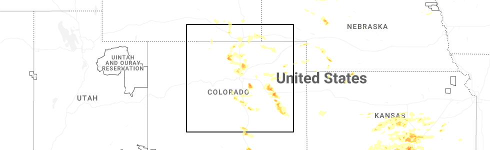
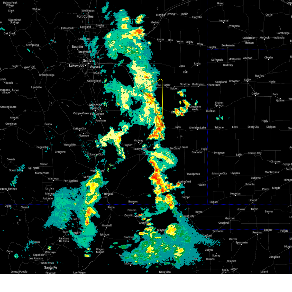
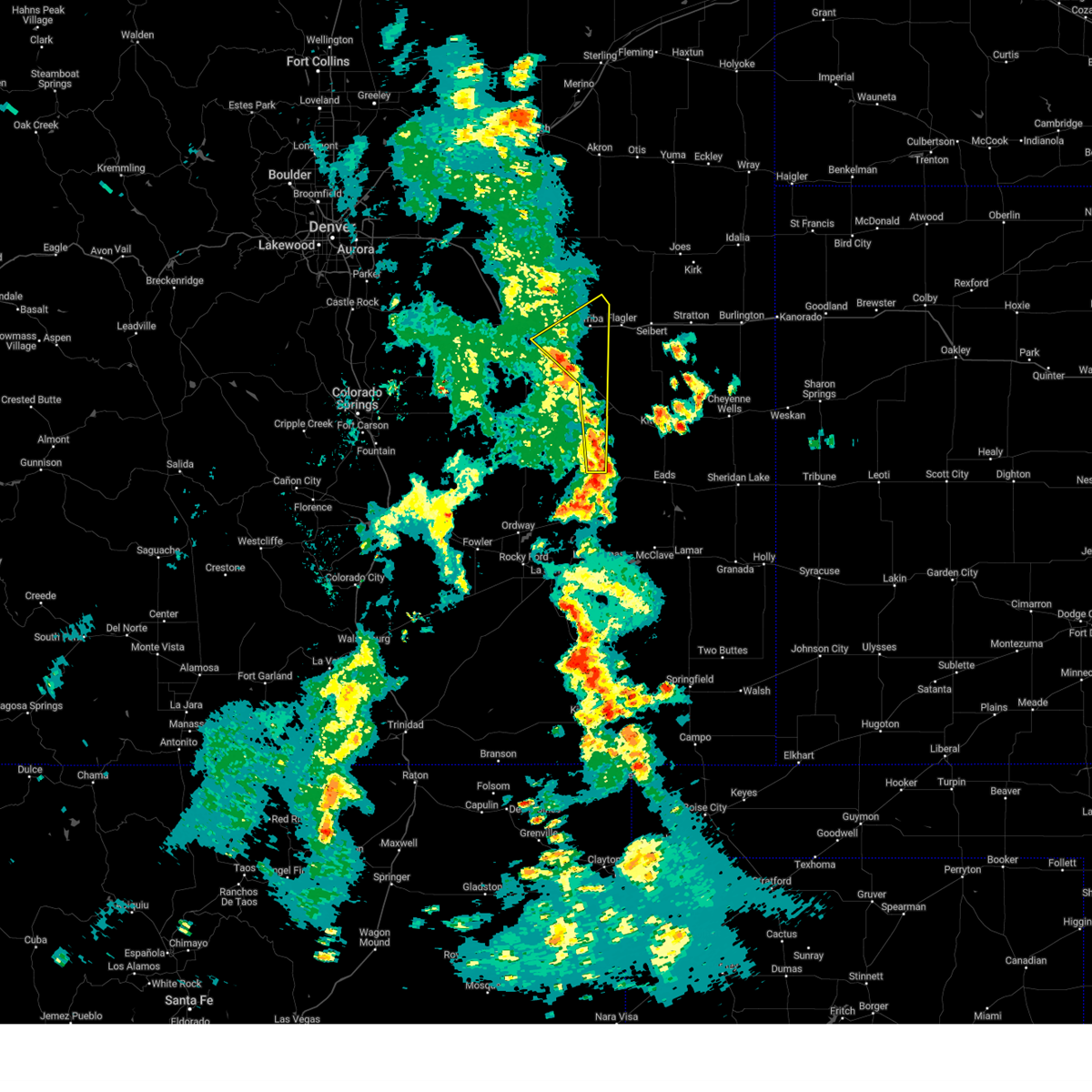
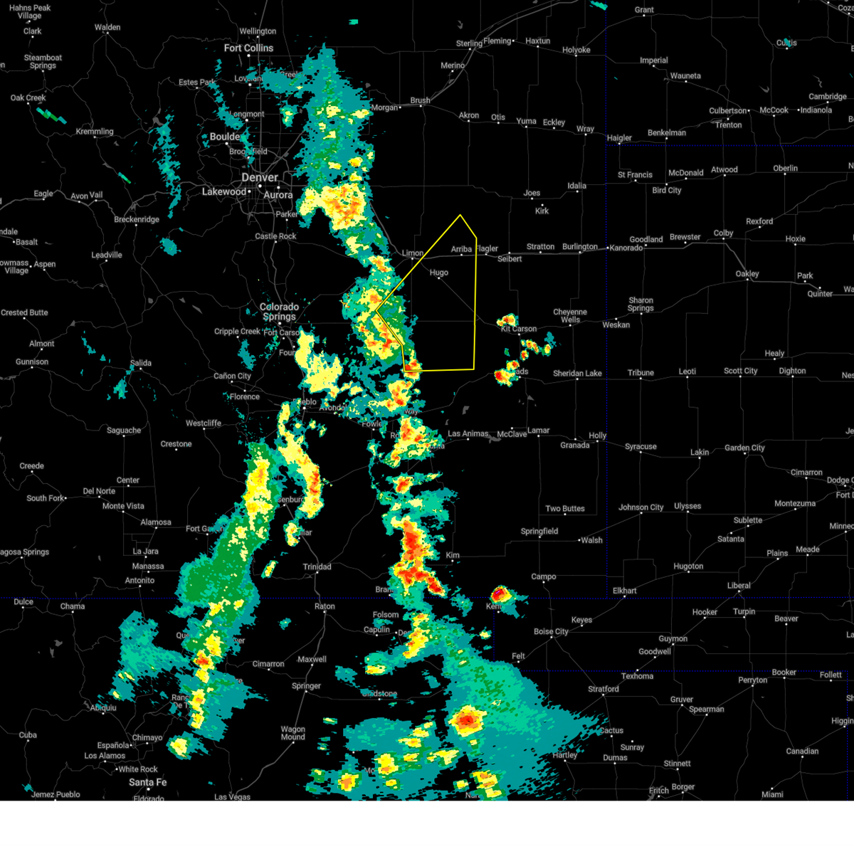
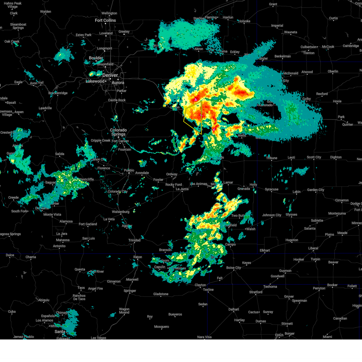
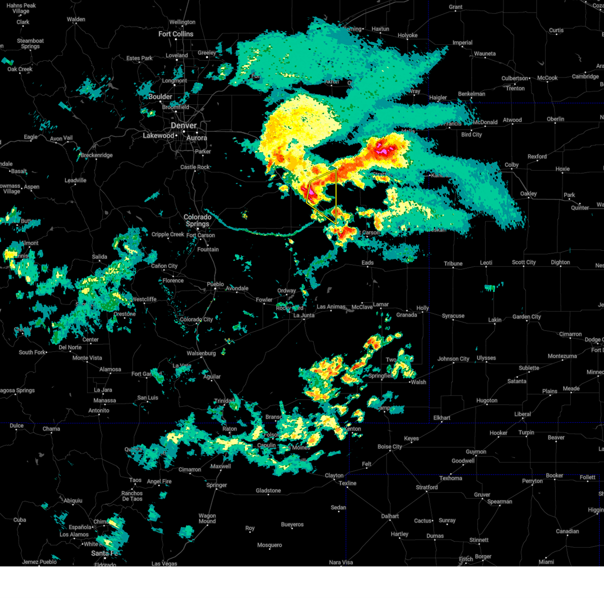
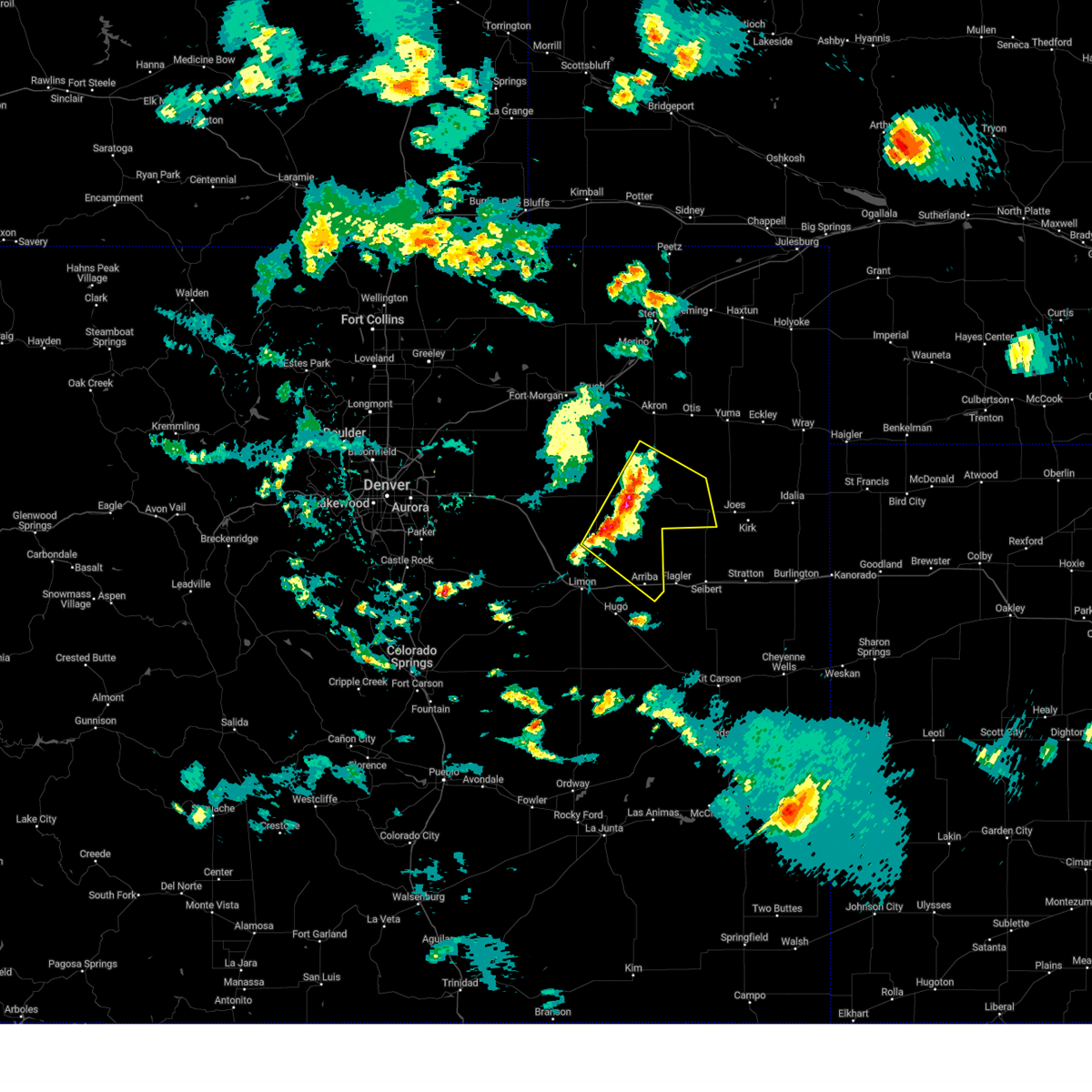
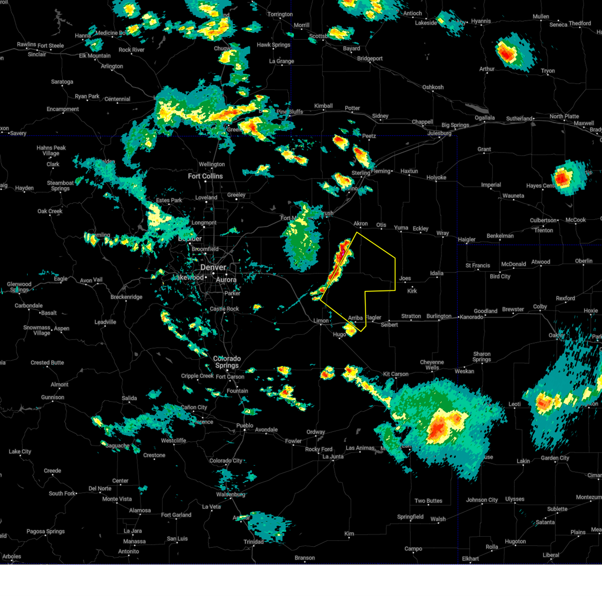
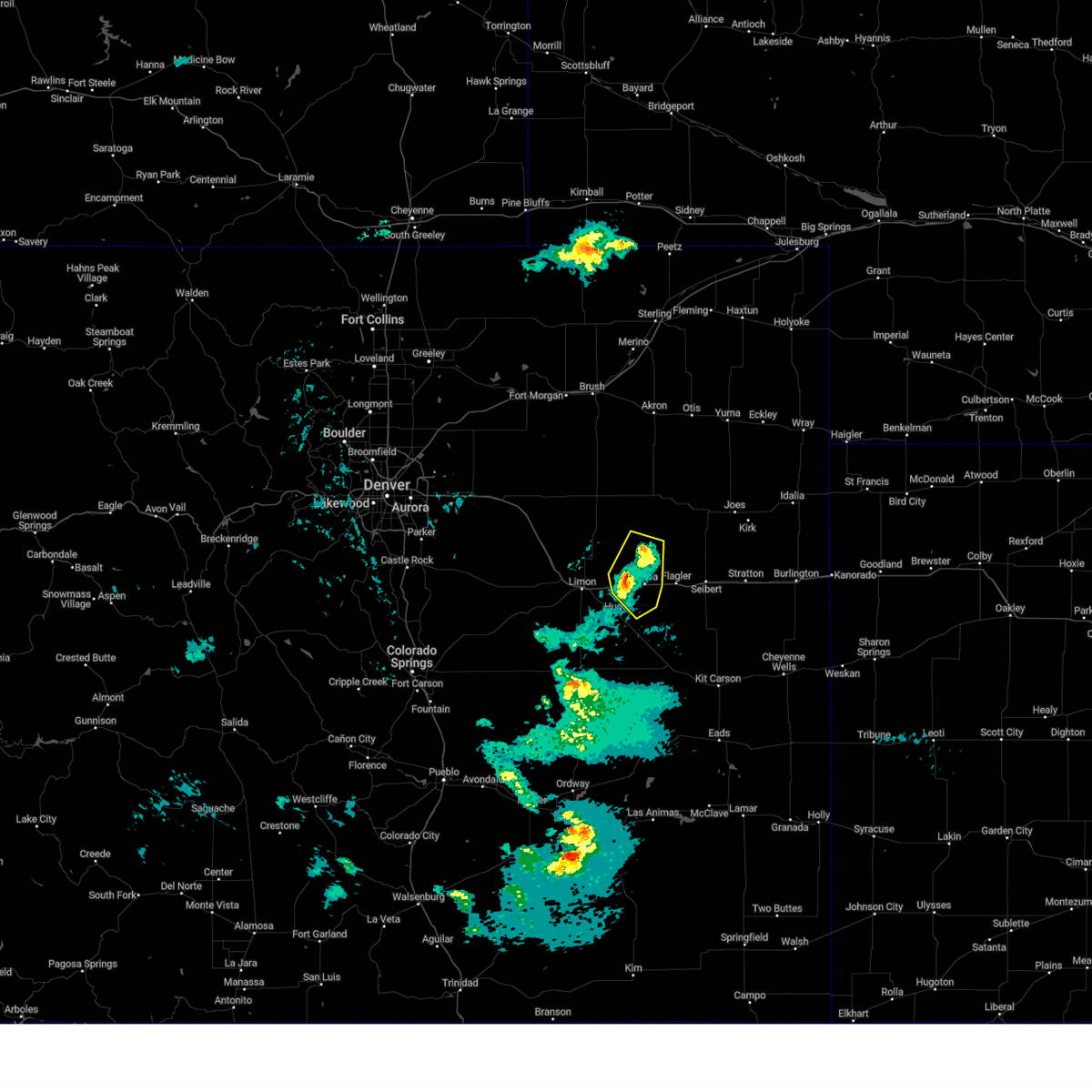
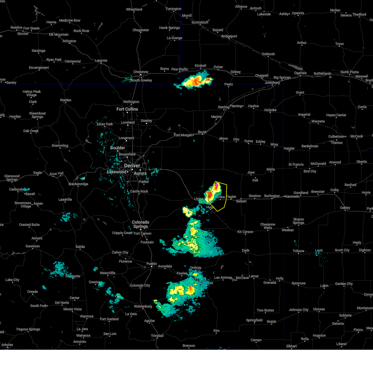
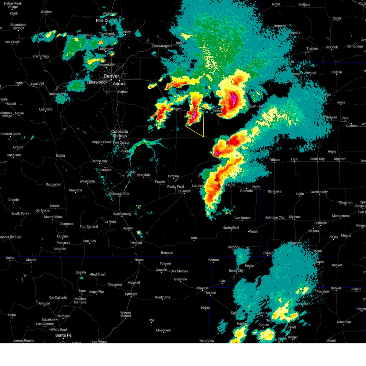
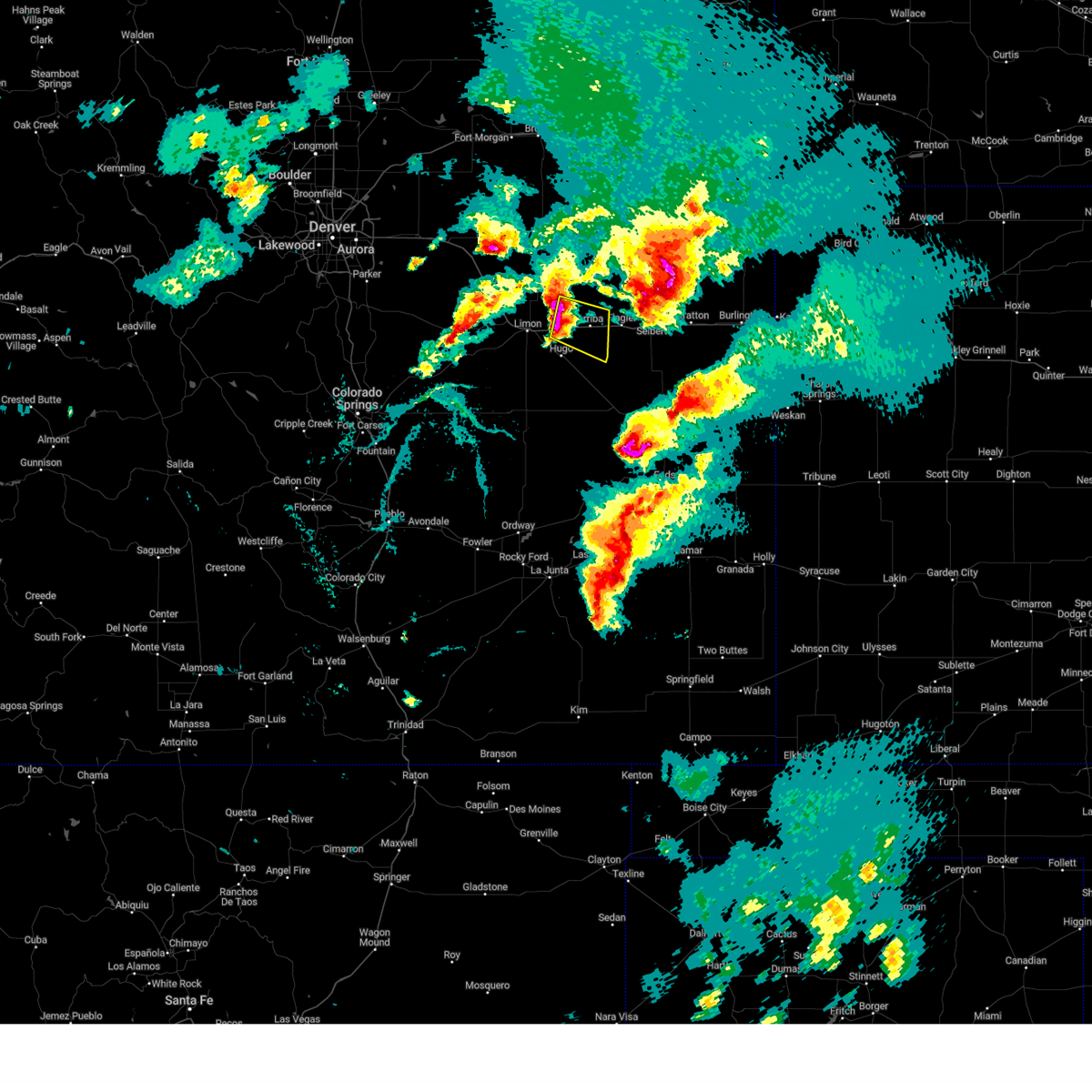
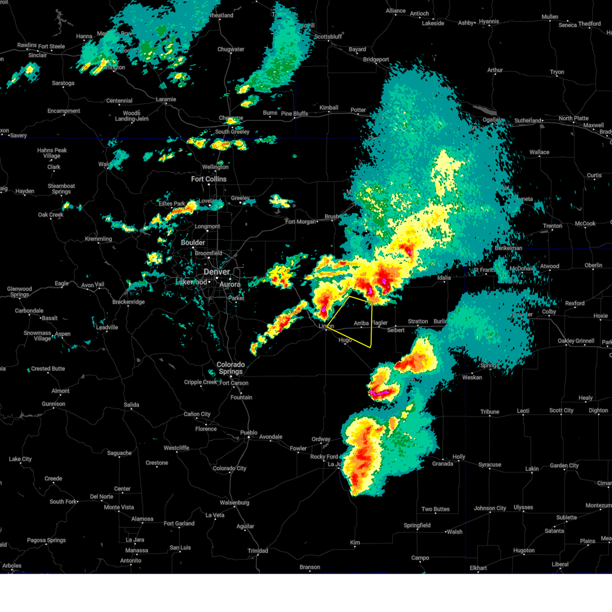
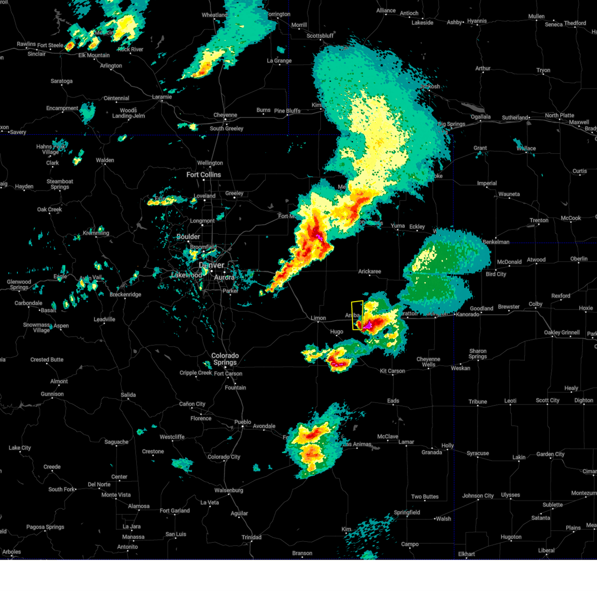
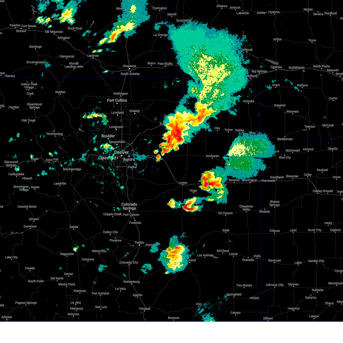
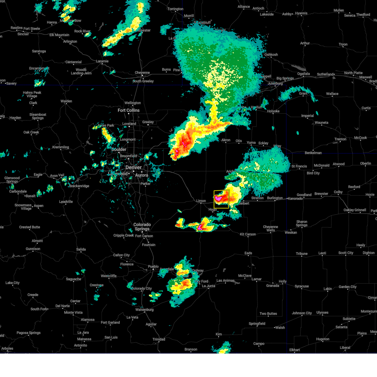
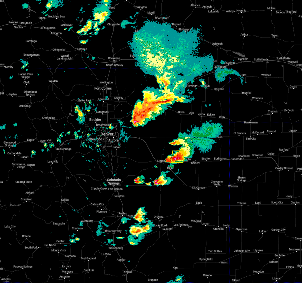
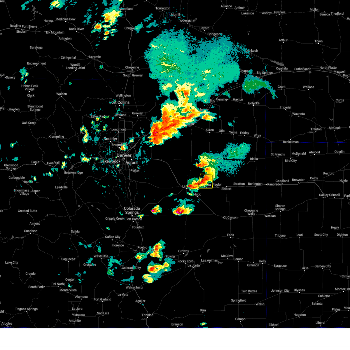
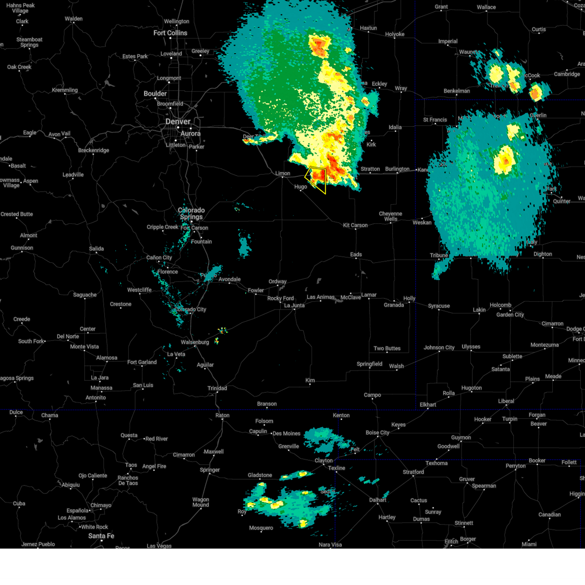
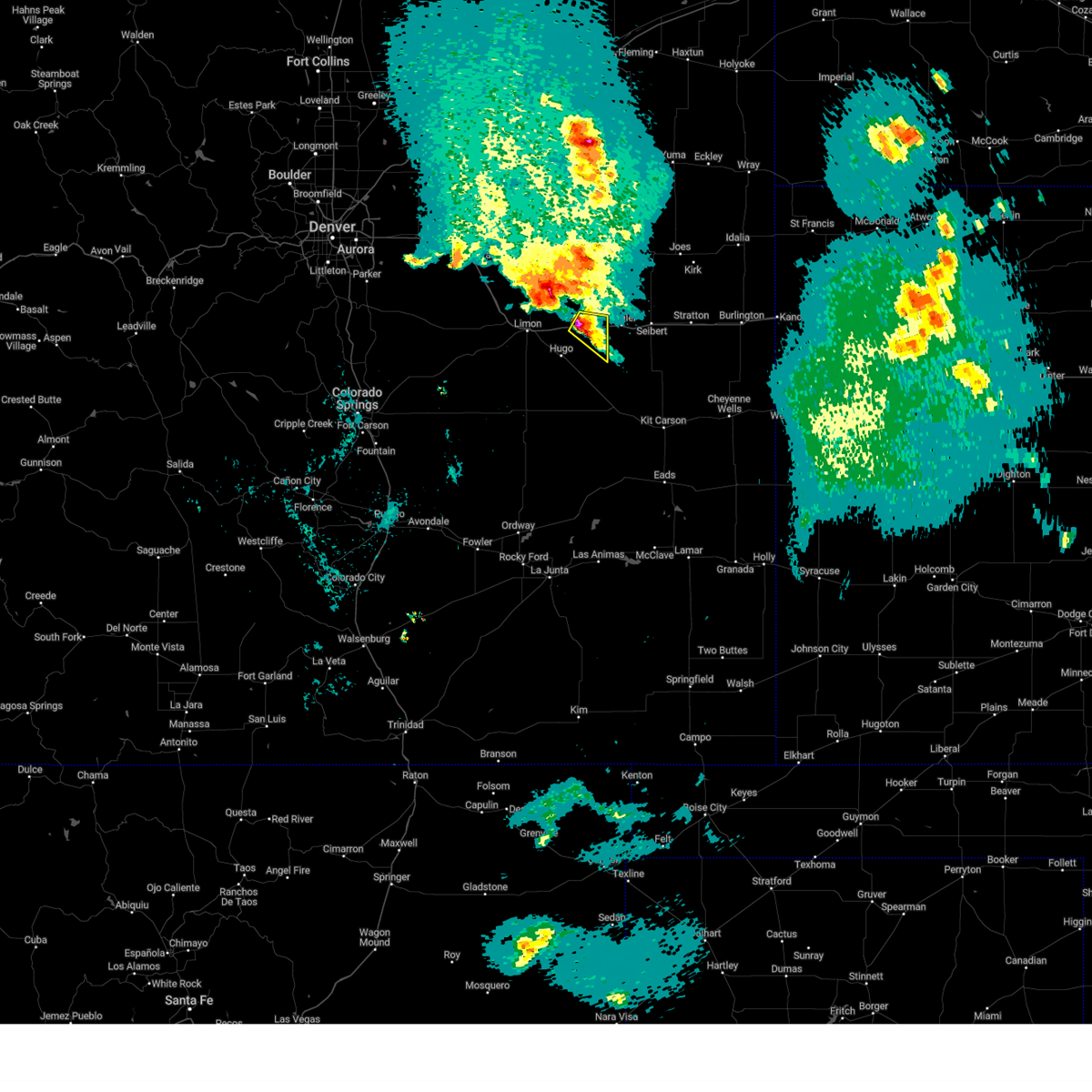
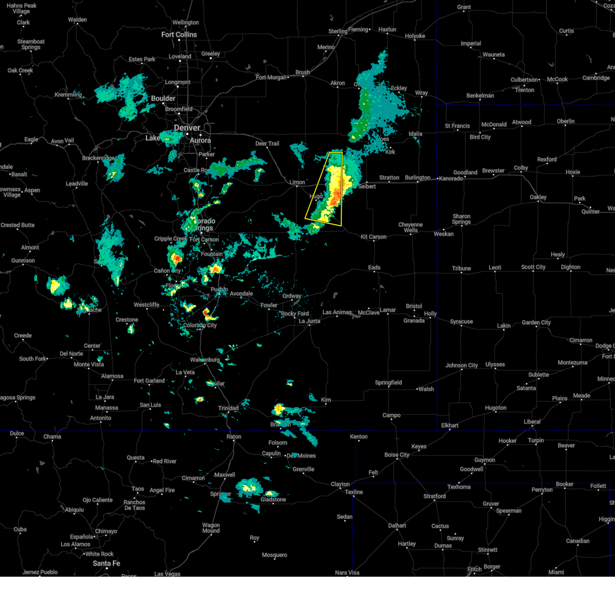
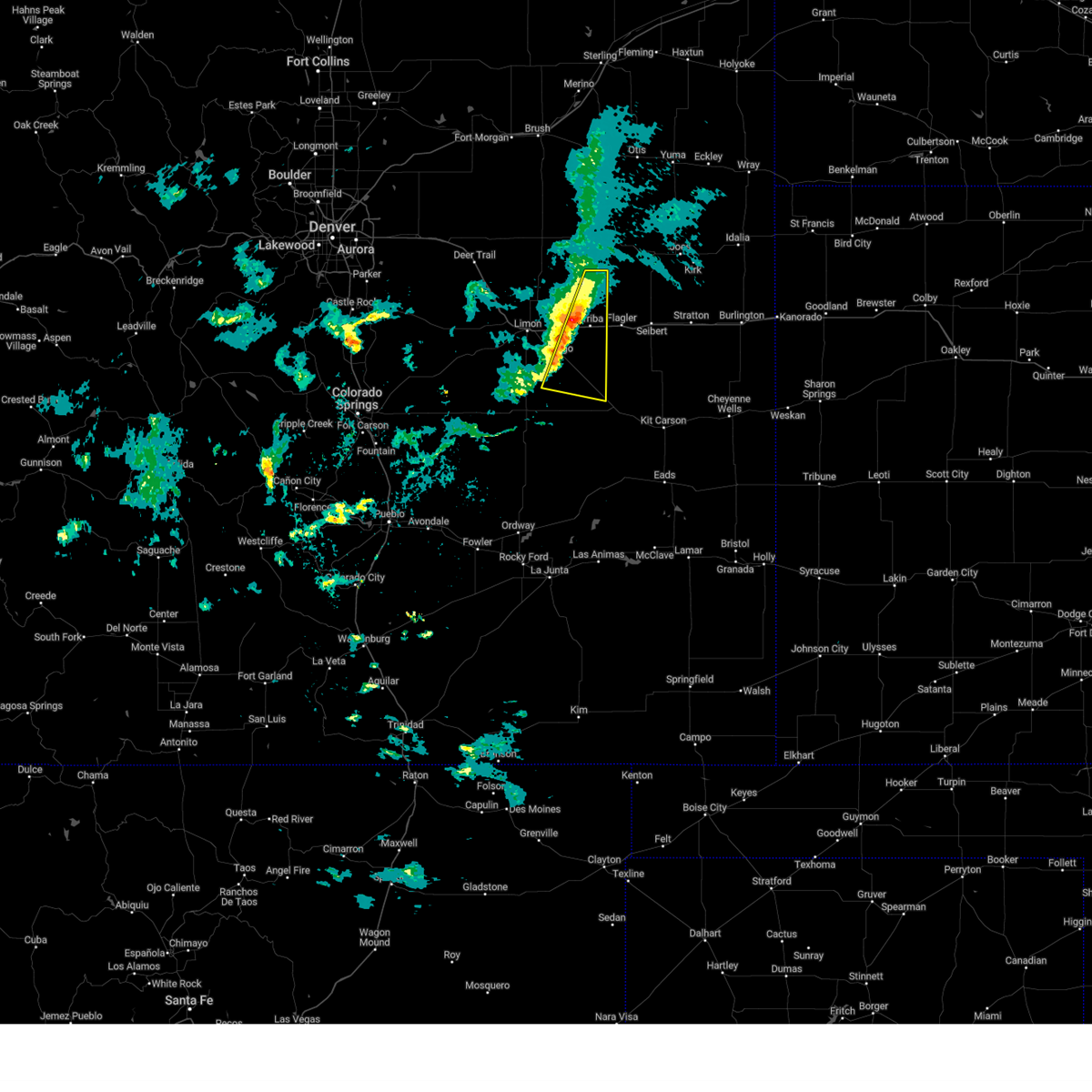
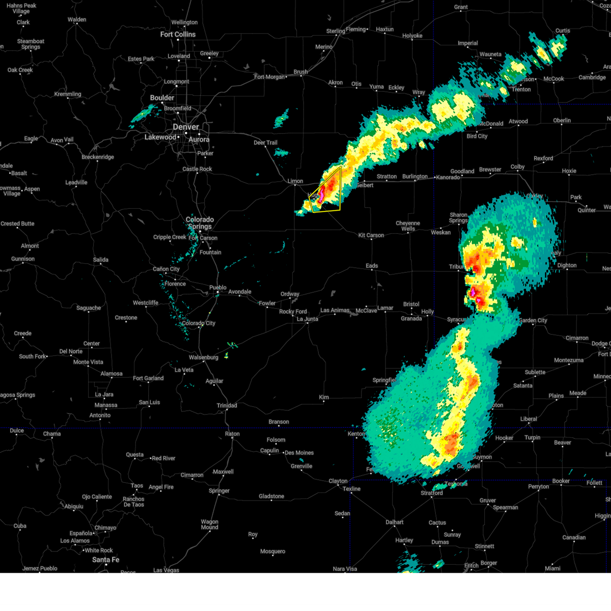
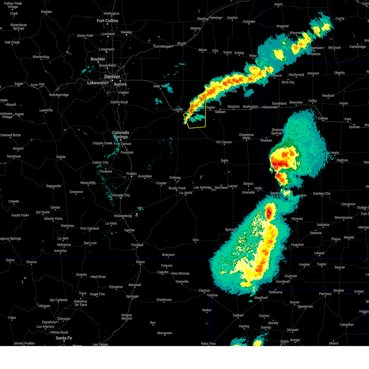
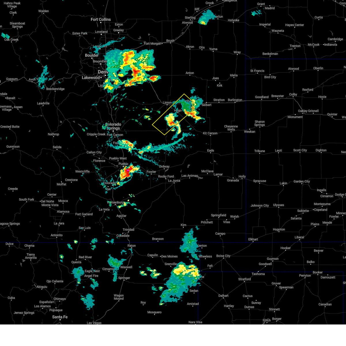
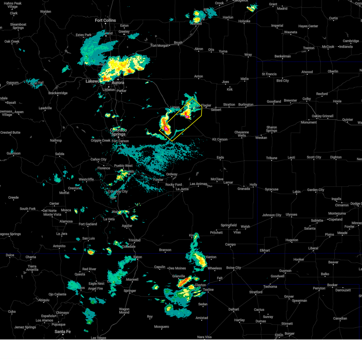
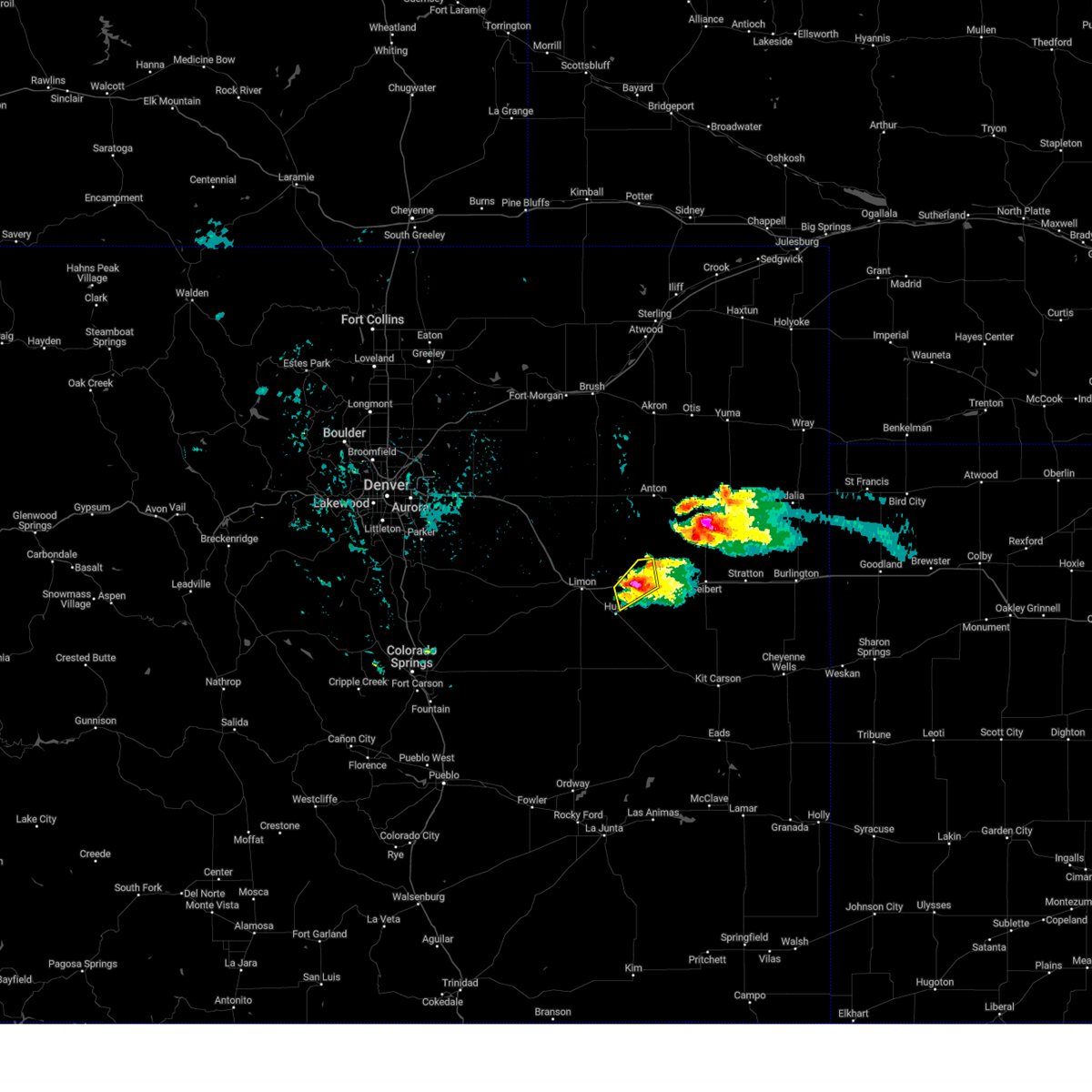
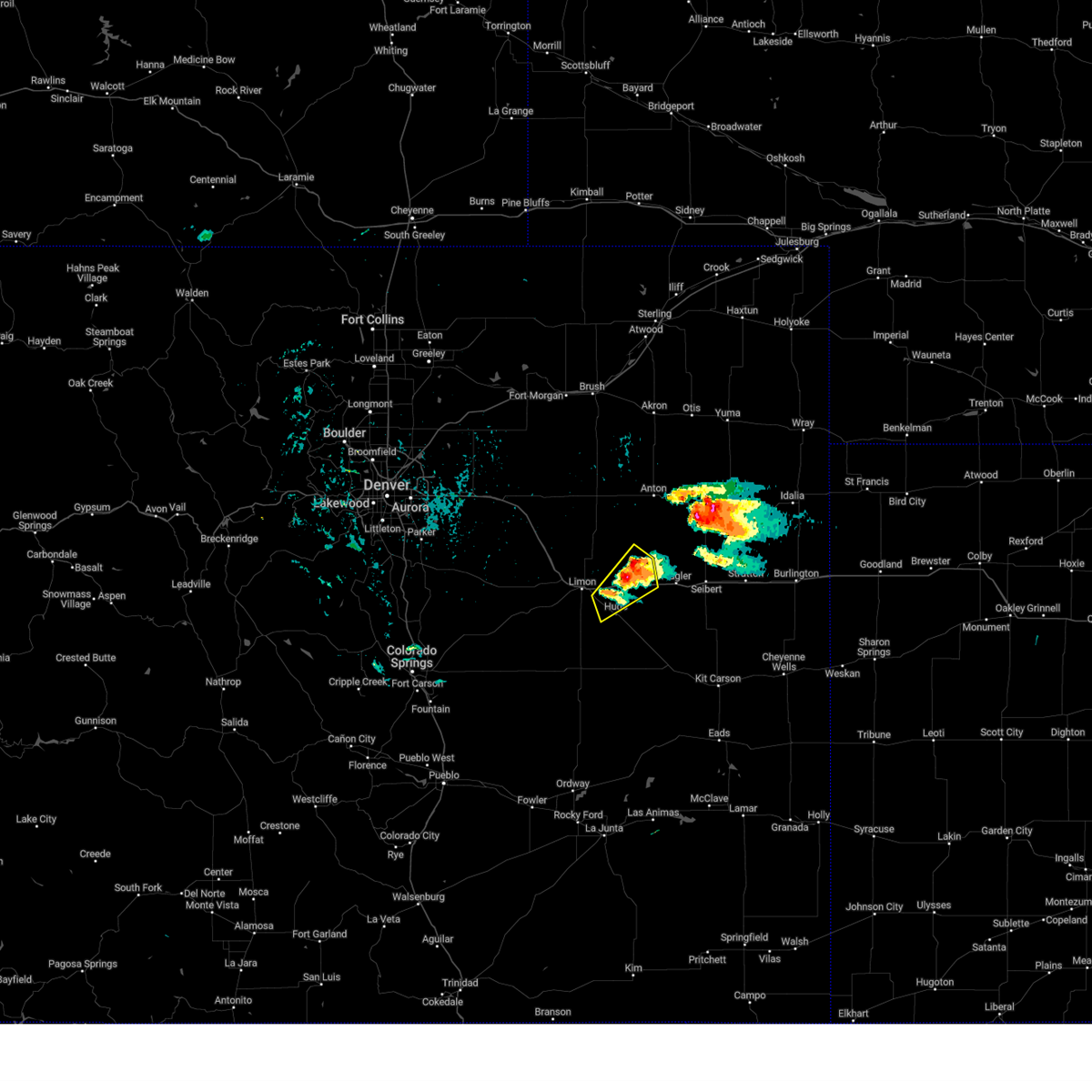
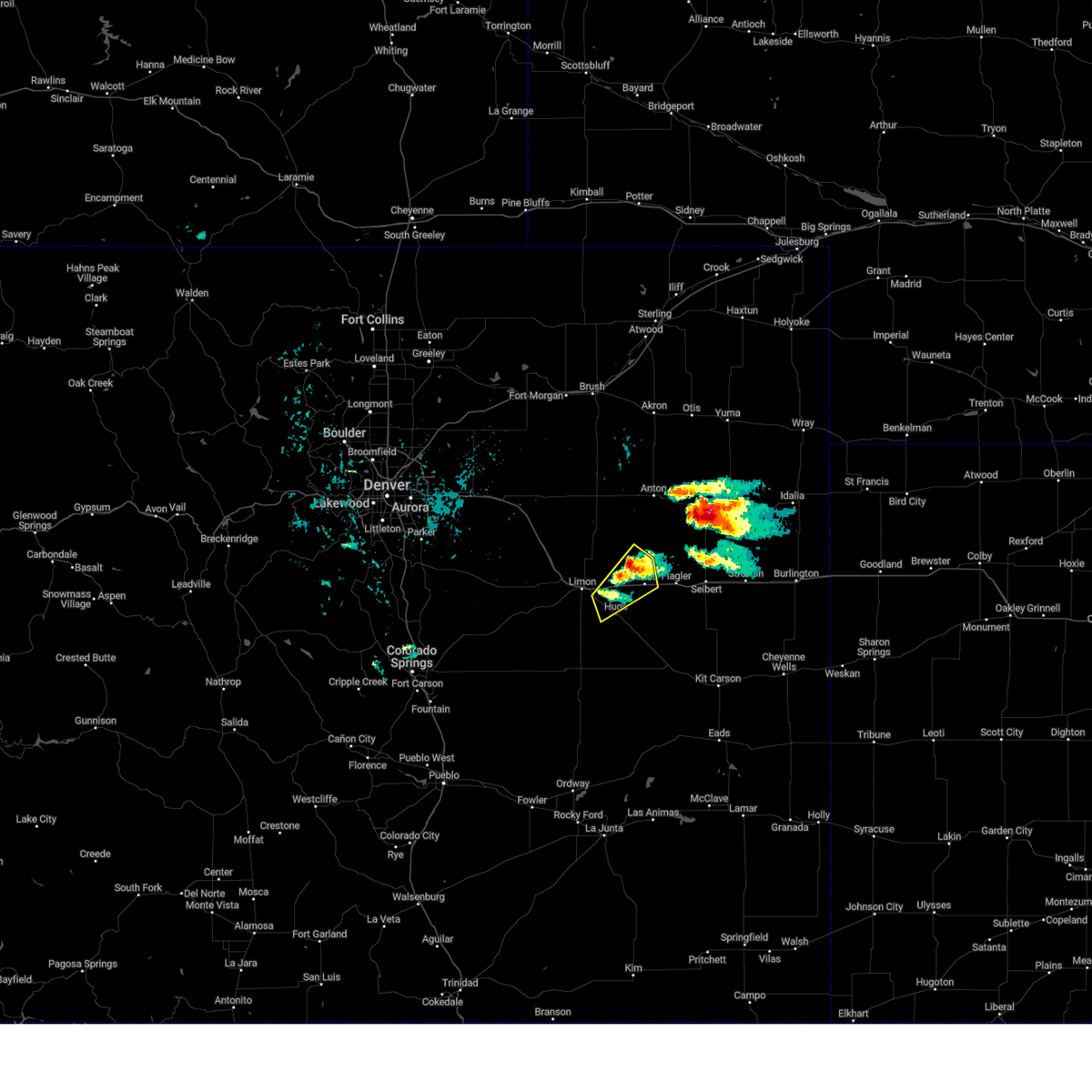
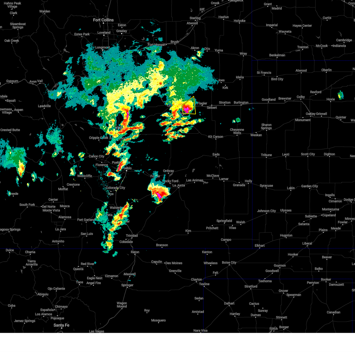
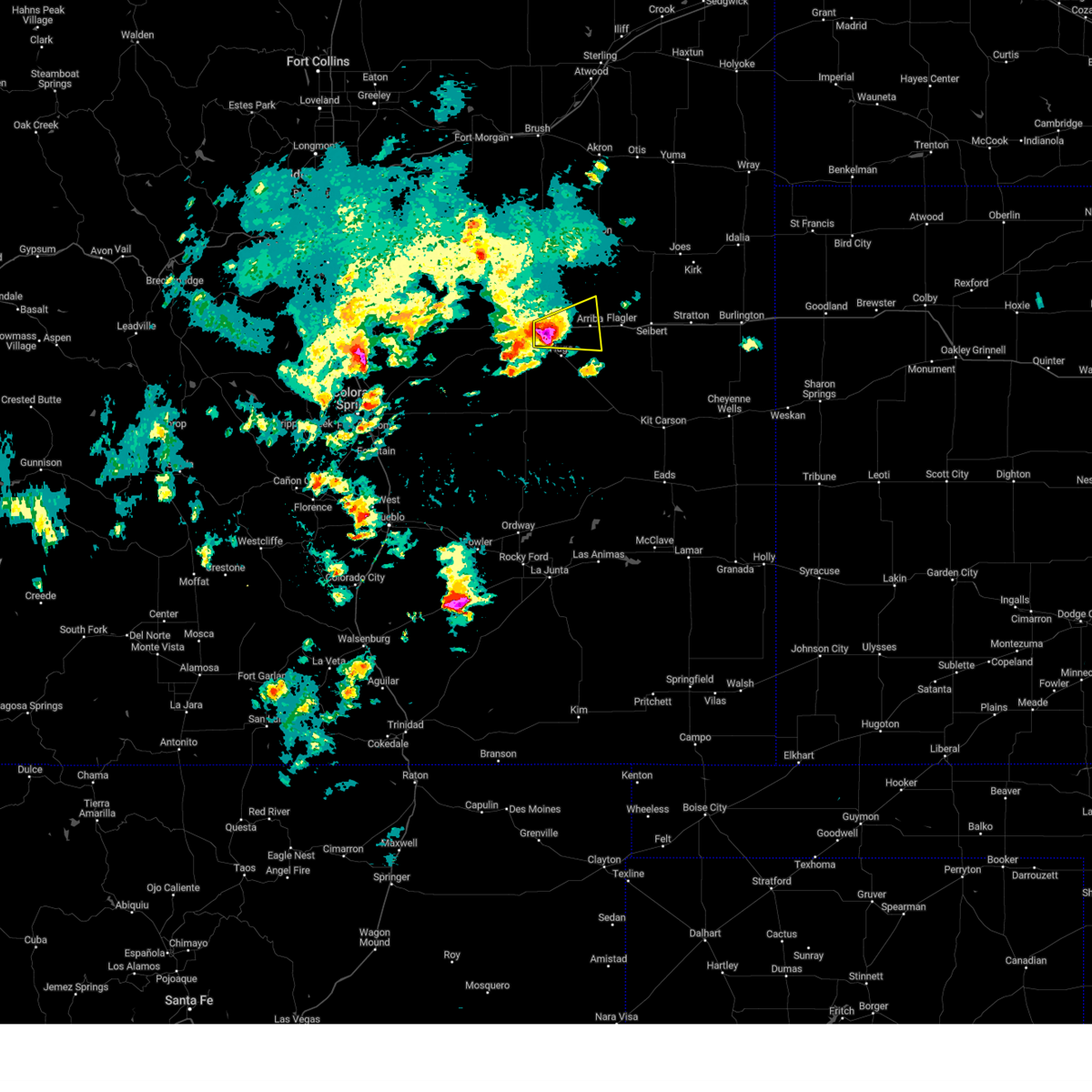
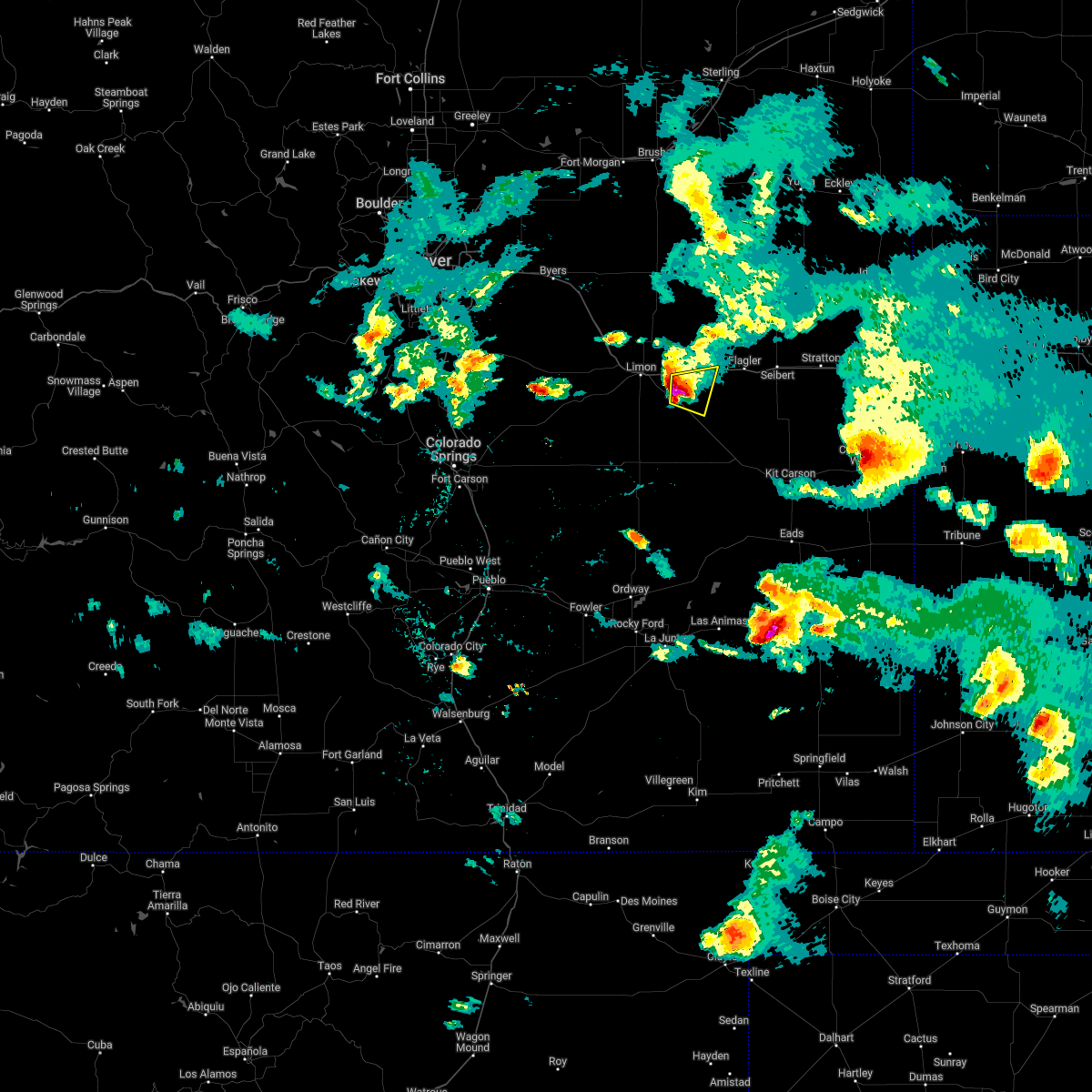
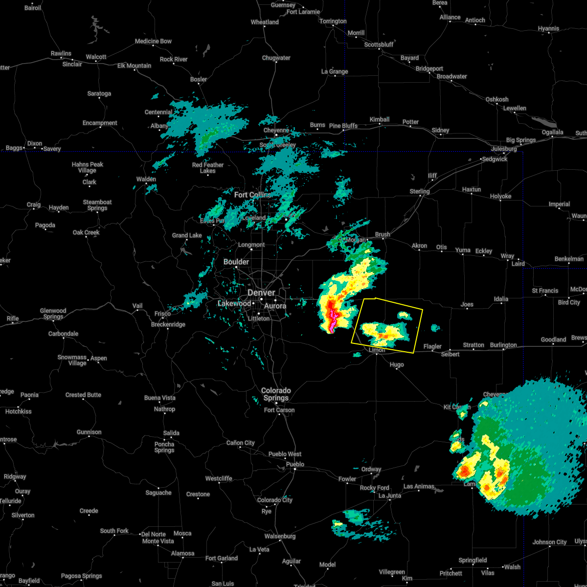
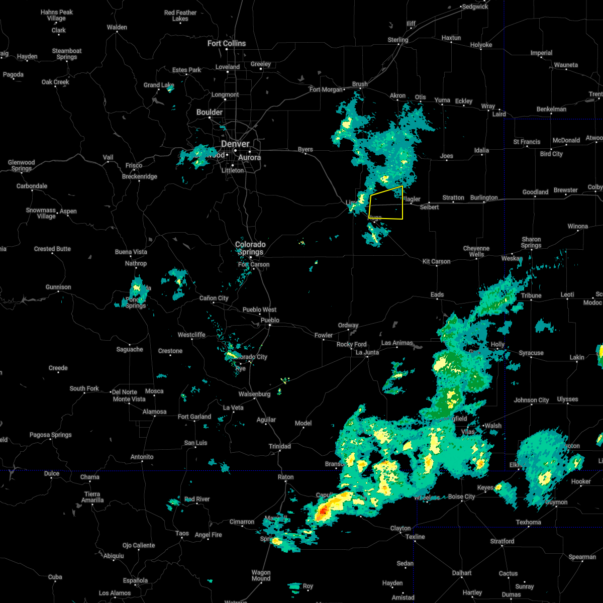
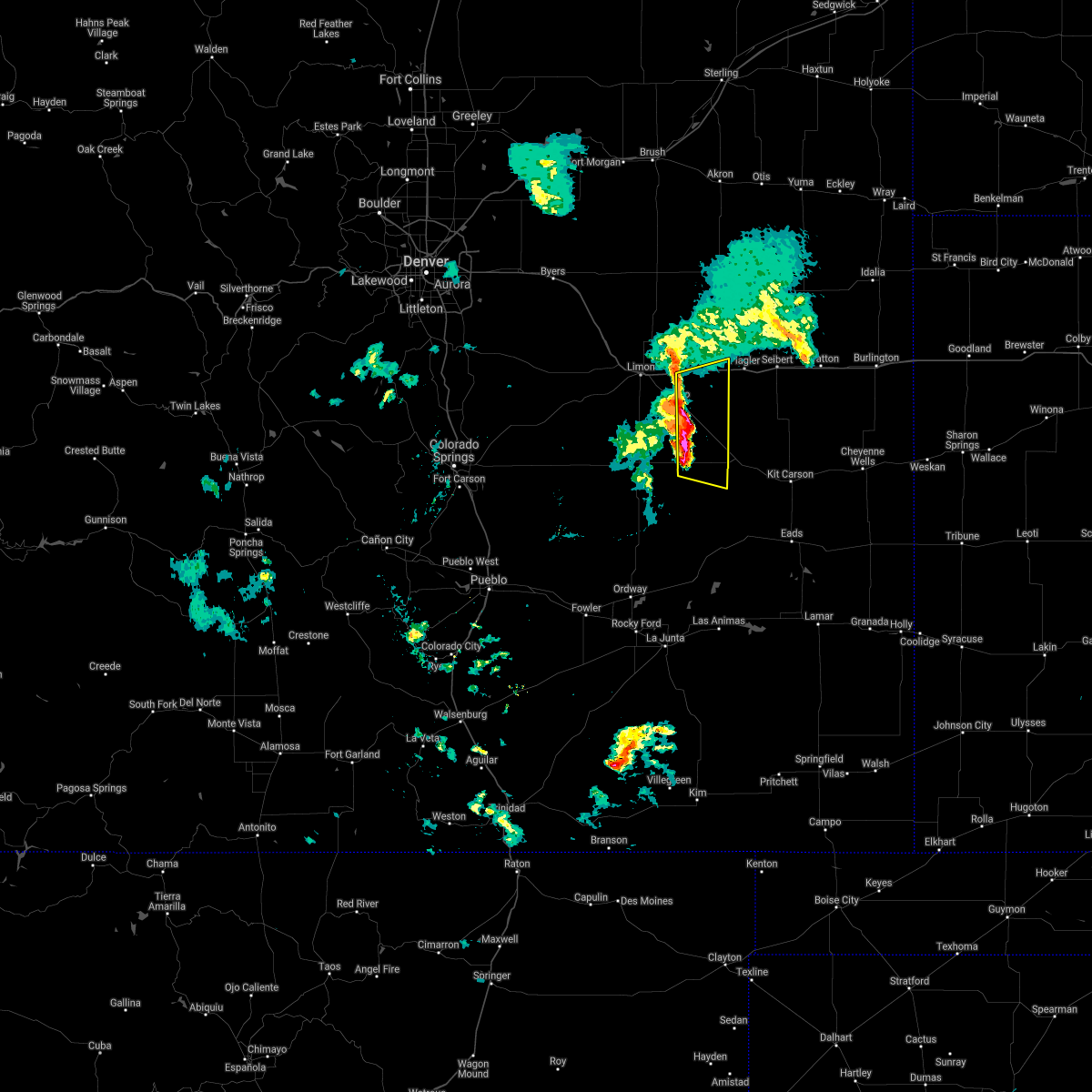
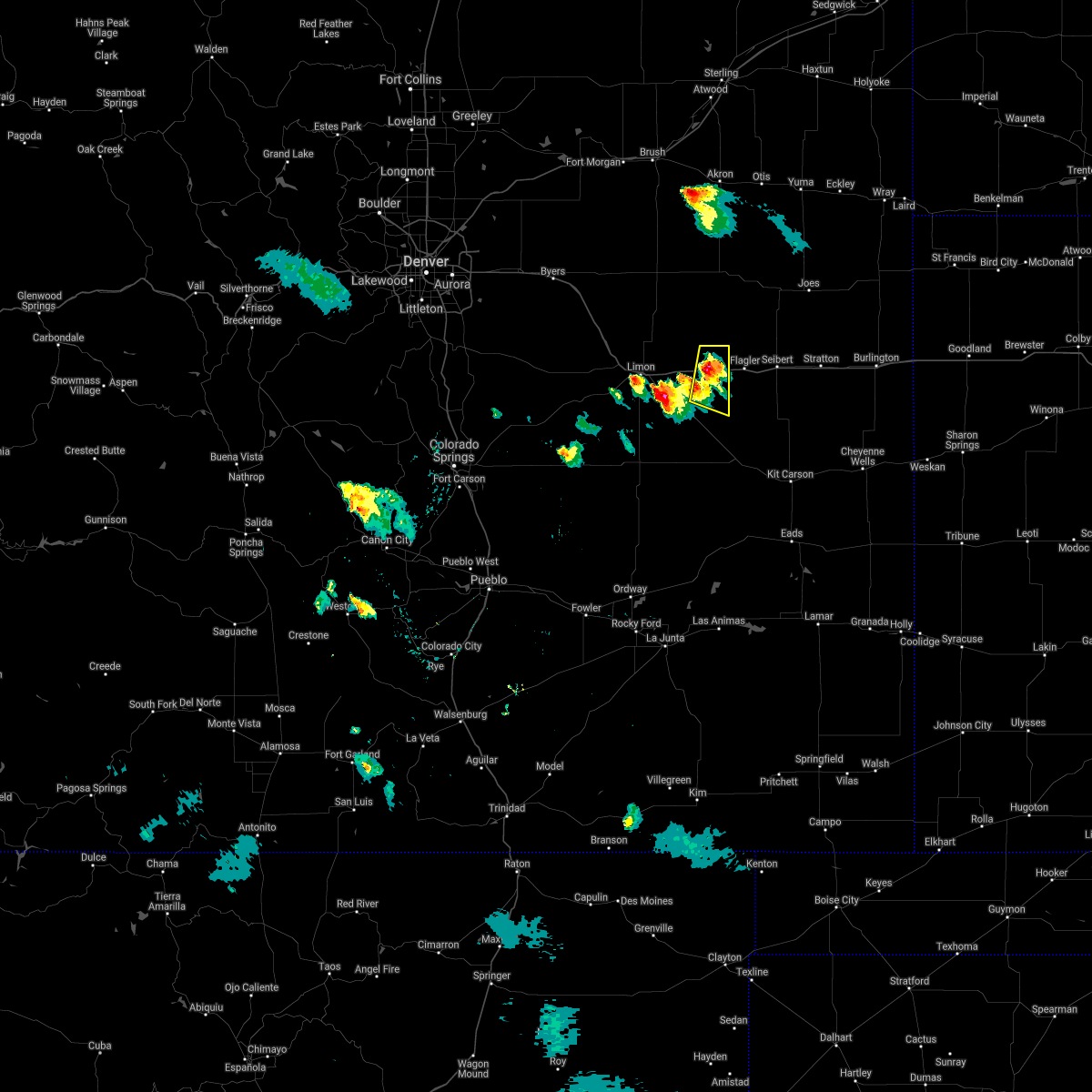
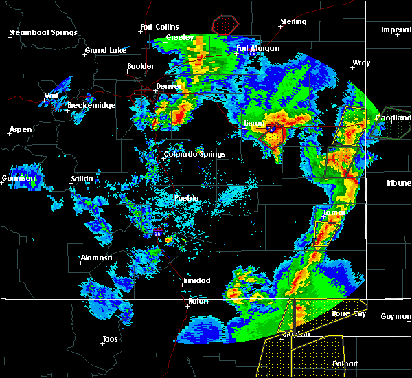
Hail Map for Arriba, CO
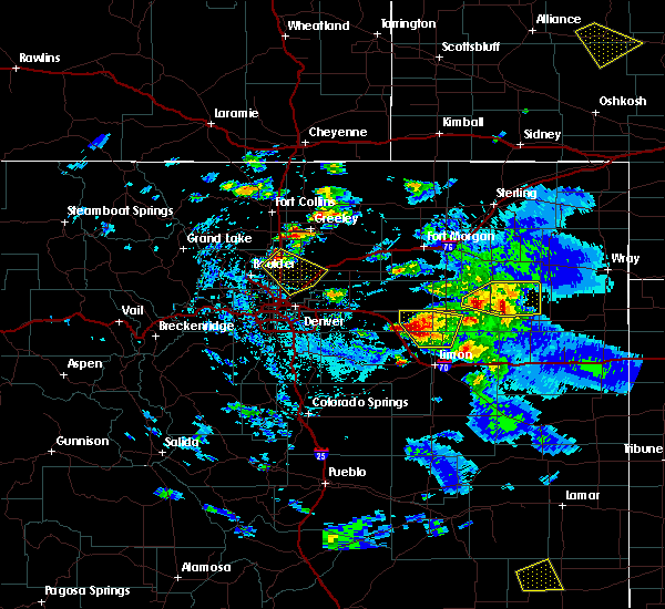
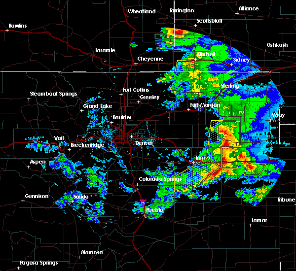
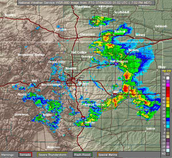
The Arriba, CO area has had 15 reports of on-the-ground hail by trained spotters, and has been under severe weather warnings 19 times during the past 12 months. Doppler radar has detected hail at or near Arriba, CO on 79 occasions, including 4 occasions during the past year.
| Name: | Arriba, CO |
| Where Located: | 64.7 miles SSW of Yuma, CO |
| Map: | Google Map for Arriba, CO |
| Population: | 193 |
| Housing Units: | 129 |
| More Info: | Search Google for Arriba, CO |
0
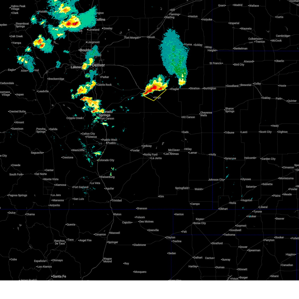
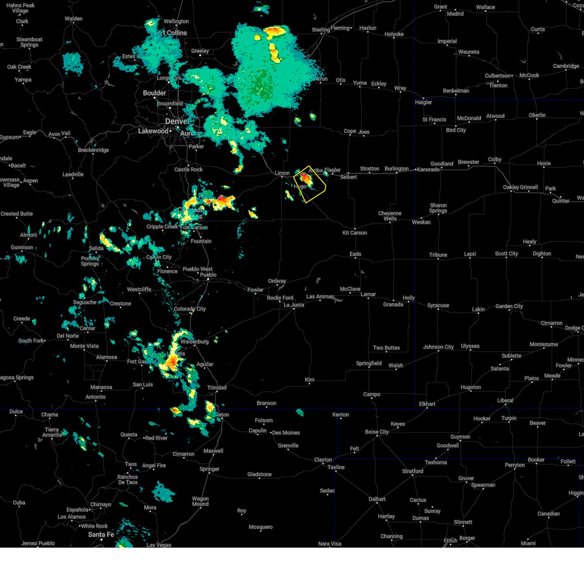
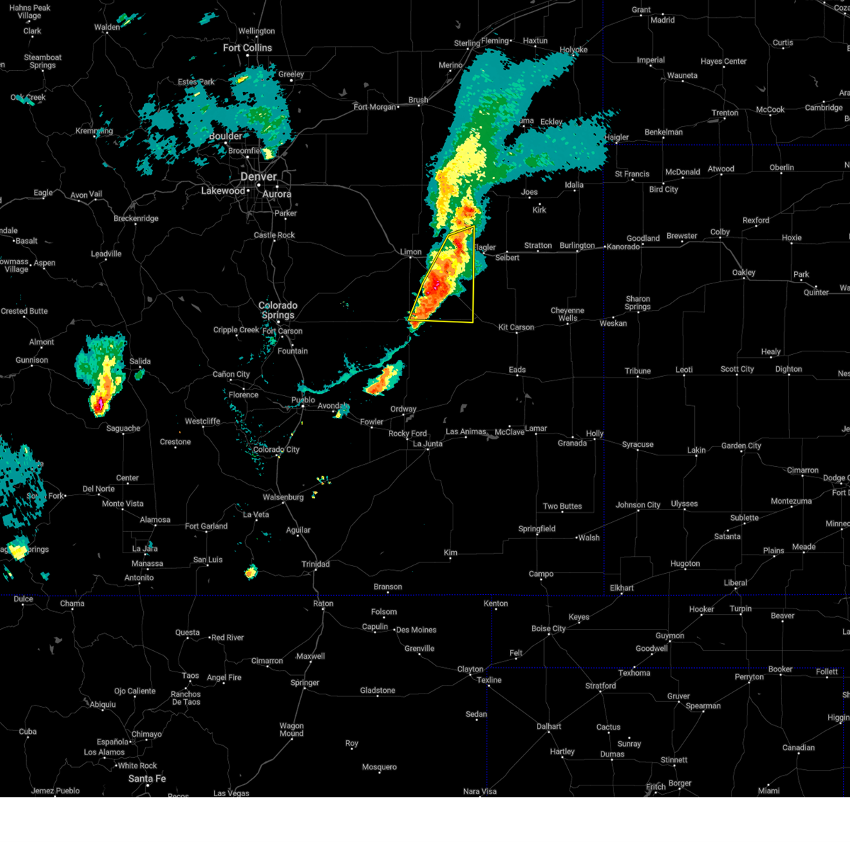
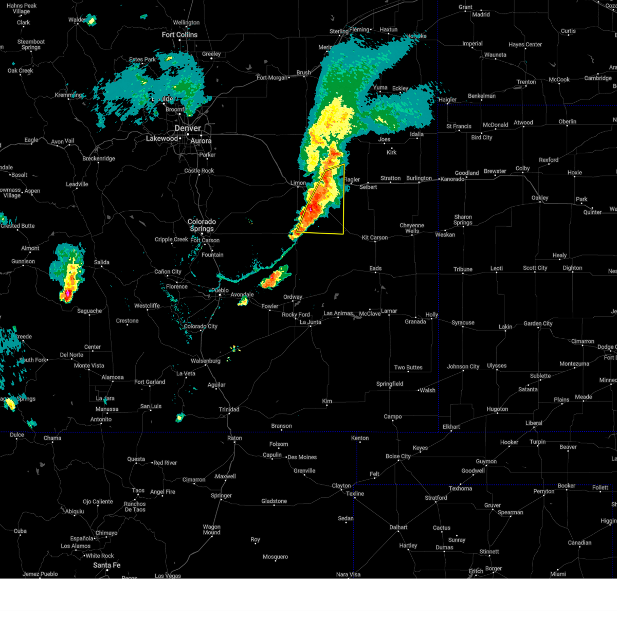
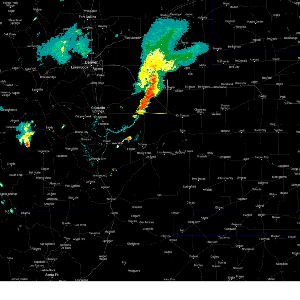
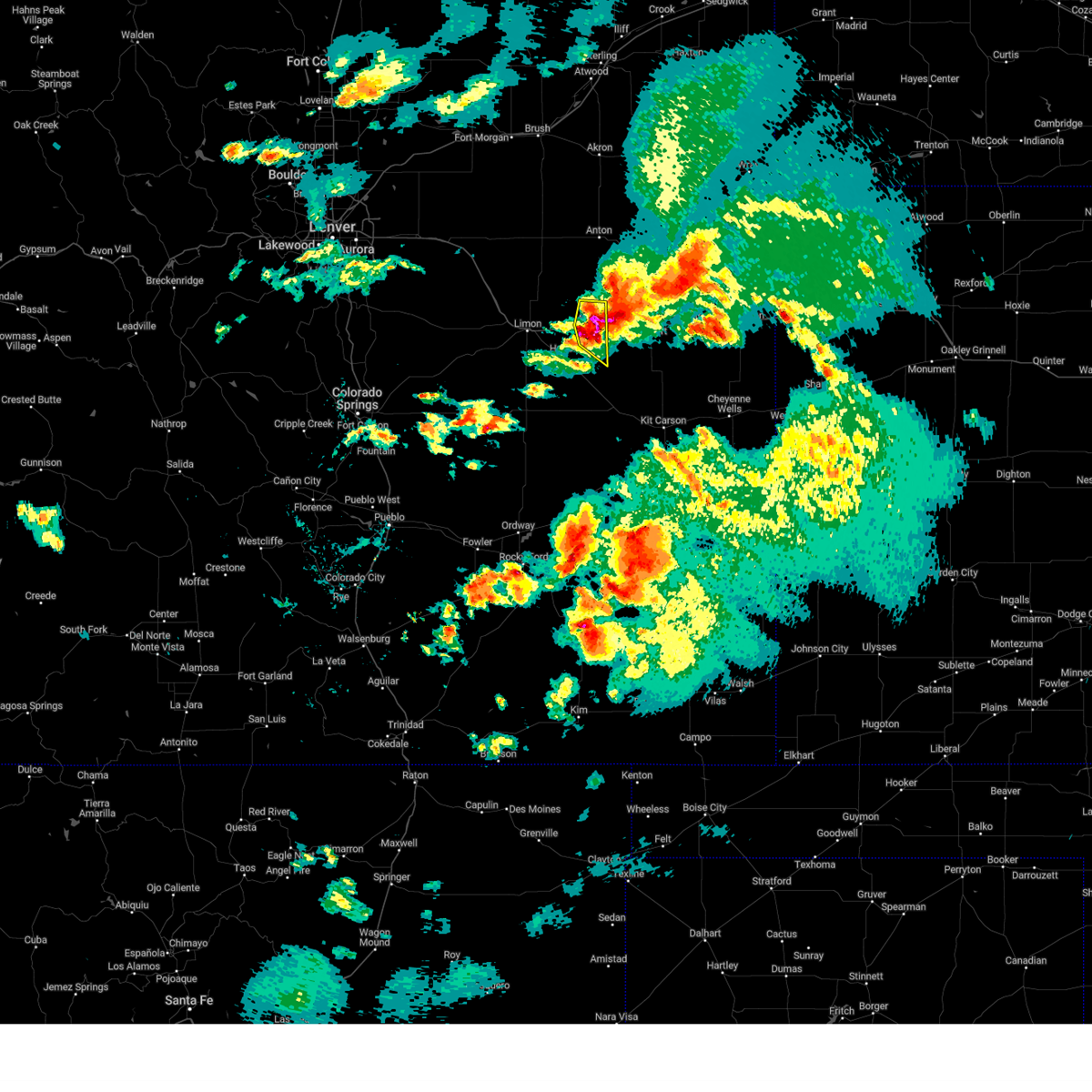
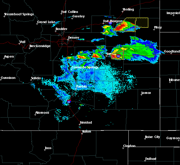
The Top Recent Hail Date for Arriba, CO is Tuesday, June 17, 2025 (37th out of 79)
Hail and Wind Damage Spotted near Arriba, CO
| Date / Time | Report Details |
|---|---|
| 6/17/2025 11:57 AM MDT |
 Svrbou the national weather service in denver has issued a * severe thunderstorm warning for, northeastern lincoln county in east central colorado, * until 1245 pm mdt. * at 1157 am mdt, a severe thunderstorm was located near genoa, or 7 miles east of limon, moving southeast at 10 mph (radar indicated). Hazards include 60 mph wind gusts and half dollar size hail. Hail damage to vehicles is expected. Expect wind damage to roofs, siding, and trees. Svrbou the national weather service in denver has issued a * severe thunderstorm warning for, northeastern lincoln county in east central colorado, * until 1245 pm mdt. * at 1157 am mdt, a severe thunderstorm was located near genoa, or 7 miles east of limon, moving southeast at 10 mph (radar indicated). Hazards include 60 mph wind gusts and half dollar size hail. Hail damage to vehicles is expected. Expect wind damage to roofs, siding, and trees.
|
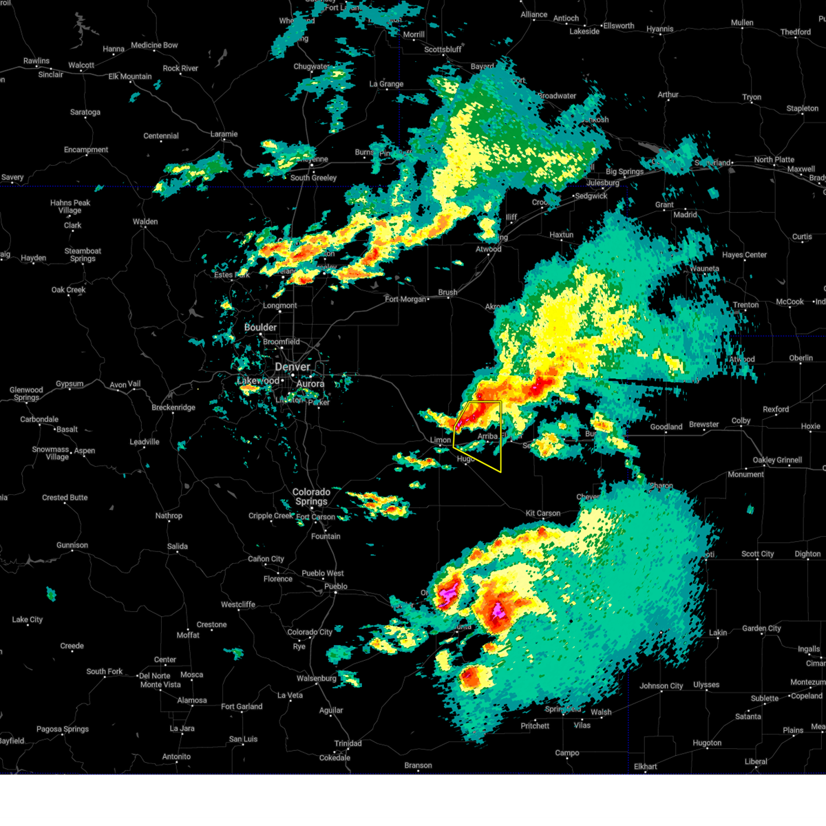
| 6/6/2025 4:28 PM MDT | Half Dollar sized hail reported 6.2 miles NNW of Arriba, CO, report from mping: half dollar (1.25 in.). |
| 6/6/2025 4:06 PM MDT | Svrbou the national weather service in denver has issued a * severe thunderstorm warning for, east central lincoln county in east central colorado, * until 430 pm mdt. * at 406 pm mdt, a severe thunderstorm was located near arriba, or 24 miles east of limon, moving east at 35 mph (radar indicated). Hazards include quarter size hail. Damage to vehicles is expected. Hail may accumulate on roadways causing hazardous travel. |
| 5/27/2025 4:53 PM MDT |
 Svrbou the national weather service in denver has issued a * severe thunderstorm warning for, northeastern lincoln county in east central colorado, * until 545 pm mdt. * at 453 pm mdt, a severe thunderstorm was located near genoa, or 15 miles east of limon, moving southeast at 15 mph (radar indicated). Hazards include quarter size hail. damage to vehicles is expected Svrbou the national weather service in denver has issued a * severe thunderstorm warning for, northeastern lincoln county in east central colorado, * until 545 pm mdt. * at 453 pm mdt, a severe thunderstorm was located near genoa, or 15 miles east of limon, moving southeast at 15 mph (radar indicated). Hazards include quarter size hail. damage to vehicles is expected
|
| 9/17/2024 4:58 PM MDT |
 The storms which prompted the warning have moved out of the area. therefore, the warning will be allowed to expire. however, gusty winds are still possible with these thunderstorms. a severe thunderstorm watch remains in effect until 900 pm mdt for east central colorado. to report severe weather, contact your nearest law enforcement agency. they will relay your report to the national weather service denver colorado. The storms which prompted the warning have moved out of the area. therefore, the warning will be allowed to expire. however, gusty winds are still possible with these thunderstorms. a severe thunderstorm watch remains in effect until 900 pm mdt for east central colorado. to report severe weather, contact your nearest law enforcement agency. they will relay your report to the national weather service denver colorado.
|
| 9/17/2024 4:46 PM MDT |
 At 446 pm mdt, severe thunderstorms were located along a line extending from 3 miles north of hugo to 6 miles north of boyero to 11 miles north of haswell, or along a line extending from 13 miles southeast of limon to 21 miles southwest of flagler to 47 miles west of cheyenne wells, moving northeast at 50 mph (radar indicated). Hazards include 60 mph wind gusts. Expect damage to roofs, siding, and trees. Locations impacted include, hugo, arriba, genoa, and boyero. At 446 pm mdt, severe thunderstorms were located along a line extending from 3 miles north of hugo to 6 miles north of boyero to 11 miles north of haswell, or along a line extending from 13 miles southeast of limon to 21 miles southwest of flagler to 47 miles west of cheyenne wells, moving northeast at 50 mph (radar indicated). Hazards include 60 mph wind gusts. Expect damage to roofs, siding, and trees. Locations impacted include, hugo, arriba, genoa, and boyero.
|
| 9/17/2024 4:46 PM MDT |
 the severe thunderstorm warning has been cancelled and is no longer in effect the severe thunderstorm warning has been cancelled and is no longer in effect
|
| 9/17/2024 4:11 PM MDT |
 Svrbou the national weather service in denver colorado has issued a * severe thunderstorm warning for, southeastern elbert county in east central colorado, lincoln county in east central colorado, * until 500 pm mdt. * at 411 pm mdt, severe thunderstorms were located along a line extending from near kutch to 5 miles northeast of forder to 3 miles northwest of wild horse point, or along a line extending from 26 miles south of limon to 48 miles southwest of flagler to 42 miles north of la junta, moving northeast at 55 mph (radar indicated). Hazards include 60 mph wind gusts. expect damage to roofs, siding, and trees Svrbou the national weather service in denver colorado has issued a * severe thunderstorm warning for, southeastern elbert county in east central colorado, lincoln county in east central colorado, * until 500 pm mdt. * at 411 pm mdt, severe thunderstorms were located along a line extending from near kutch to 5 miles northeast of forder to 3 miles northwest of wild horse point, or along a line extending from 26 miles south of limon to 48 miles southwest of flagler to 42 miles north of la junta, moving northeast at 55 mph (radar indicated). Hazards include 60 mph wind gusts. expect damage to roofs, siding, and trees
|
| 8/20/2024 8:39 PM MDT | Svrbou the national weather service in denver colorado has issued a * severe thunderstorm warning for, east central lincoln county in east central colorado, * until 915 pm mdt. * at 839 pm mdt, a severe thunderstorm was located 5 miles southwest of arriba, or 16 miles west of flagler, moving east at 25 mph (radar indicated). Hazards include 60 mph wind gusts and quarter size hail. Expect damage to roofs, siding, and trees. Hail damage to vehicles is expected. |
| 8/7/2024 7:17 PM MDT |
 The storm which prompted the warning has moved out of the area. therefore, the warning will be allowed to expire. The storm which prompted the warning has moved out of the area. therefore, the warning will be allowed to expire.
|
| 8/7/2024 6:44 PM MDT |
 Svrbou the national weather service in denver colorado has issued a * severe thunderstorm warning for, east central lincoln county in east central colorado, * until 715 pm mdt. * at 644 pm mdt, a severe thunderstorm was located 4 miles northeast of hugo, or 16 miles southeast of limon, moving east at 25 mph (radar indicated). Hazards include 70 mph wind gusts and quarter size hail. Expect considerable tree damage. damage is likely to mobile homes, roofs, and outbuildings. Hail damage to vehicles is expected. Svrbou the national weather service in denver colorado has issued a * severe thunderstorm warning for, east central lincoln county in east central colorado, * until 715 pm mdt. * at 644 pm mdt, a severe thunderstorm was located 4 miles northeast of hugo, or 16 miles southeast of limon, moving east at 25 mph (radar indicated). Hazards include 70 mph wind gusts and quarter size hail. Expect considerable tree damage. damage is likely to mobile homes, roofs, and outbuildings. Hail damage to vehicles is expected.
|
| 7/19/2024 6:45 PM MDT |
 At 645 pm mdt, a severe thunderstorm was located 10 miles east of hugo, or 17 miles southwest of flagler, moving southeast at 50 mph (law enforcement). Hazards include golf ball size hail and 60 mph wind gusts. Expect damage to roofs, siding, and trees. people and animals outdoors will be injured. expect hail damage to roofs, siding, windows, and vehicles. Locations impacted include, limon, hugo, arriba, and genoa. At 645 pm mdt, a severe thunderstorm was located 10 miles east of hugo, or 17 miles southwest of flagler, moving southeast at 50 mph (law enforcement). Hazards include golf ball size hail and 60 mph wind gusts. Expect damage to roofs, siding, and trees. people and animals outdoors will be injured. expect hail damage to roofs, siding, windows, and vehicles. Locations impacted include, limon, hugo, arriba, and genoa.
|
| 7/19/2024 6:42 PM MDT |
 At 642 pm mdt, a severe thunderstorm was located 8 miles east of hugo, or 17 miles southwest of flagler, moving southeast at 50 mph (radar indicated). Hazards include golf ball size hail and 60 mph wind gusts. Expect damage to roofs, siding, and trees. people and animals outdoors will be injured. expect hail damage to roofs, siding, windows, and vehicles. Locations impacted include, limon, hugo, arriba, and genoa. At 642 pm mdt, a severe thunderstorm was located 8 miles east of hugo, or 17 miles southwest of flagler, moving southeast at 50 mph (radar indicated). Hazards include golf ball size hail and 60 mph wind gusts. Expect damage to roofs, siding, and trees. people and animals outdoors will be injured. expect hail damage to roofs, siding, windows, and vehicles. Locations impacted include, limon, hugo, arriba, and genoa.
|
| 7/19/2024 6:36 PM MDT |
 At 635 pm mdt, a severe thunderstorm was located 5 miles northeast of hugo, or 17 miles east of limon, moving southeast at 50 mph (radar indicated). Hazards include golf ball size hail and 60 mph wind gusts. Expect damage to roofs, siding, and trees. people and animals outdoors will be injured. expect hail damage to roofs, siding, windows, and vehicles. Locations impacted include, limon, hugo, arriba, and genoa. At 635 pm mdt, a severe thunderstorm was located 5 miles northeast of hugo, or 17 miles east of limon, moving southeast at 50 mph (radar indicated). Hazards include golf ball size hail and 60 mph wind gusts. Expect damage to roofs, siding, and trees. people and animals outdoors will be injured. expect hail damage to roofs, siding, windows, and vehicles. Locations impacted include, limon, hugo, arriba, and genoa.
|
| 7/19/2024 6:25 PM MDT |
 Svrbou the national weather service in denver colorado has issued a * severe thunderstorm warning for, northeastern lincoln county in east central colorado, * until 715 pm mdt. * at 625 pm mdt, a severe thunderstorm was located over genoa, or 10 miles east of limon, moving southeast at 50 mph (radar indicated). Hazards include 60 mph wind gusts and half dollar size hail. Expect damage to roofs, siding, and trees. Hail damage to vehicles is expected. Svrbou the national weather service in denver colorado has issued a * severe thunderstorm warning for, northeastern lincoln county in east central colorado, * until 715 pm mdt. * at 625 pm mdt, a severe thunderstorm was located over genoa, or 10 miles east of limon, moving southeast at 50 mph (radar indicated). Hazards include 60 mph wind gusts and half dollar size hail. Expect damage to roofs, siding, and trees. Hail damage to vehicles is expected.
|
| 7/19/2024 5:56 PM MDT |
 The storms which prompted the warning have weakened below severe limits, and no longer pose an immediate threat to life or property. therefore, the warning will be allowed to expire. however, gusty winds are still possible with these thunderstorms. The storms which prompted the warning have weakened below severe limits, and no longer pose an immediate threat to life or property. therefore, the warning will be allowed to expire. however, gusty winds are still possible with these thunderstorms.
|
| 7/19/2024 5:51 PM MDT |
 At 551 pm mdt, severe thunderstorms were located along a line extending from 4 miles southeast of elba to 8 miles north of genoa, or along a line extending from 19 miles south of akron to 12 miles northeast of limon, moving southeast at 45 mph (radar indicated). Hazards include 60 mph wind gusts and quarter size hail. Expect damage to roofs, siding, and trees. hail damage to vehicles is expected. Locations impacted include, arriba, thurman, arickaree school, cope, anton, elba, and lindon. At 551 pm mdt, severe thunderstorms were located along a line extending from 4 miles southeast of elba to 8 miles north of genoa, or along a line extending from 19 miles south of akron to 12 miles northeast of limon, moving southeast at 45 mph (radar indicated). Hazards include 60 mph wind gusts and quarter size hail. Expect damage to roofs, siding, and trees. hail damage to vehicles is expected. Locations impacted include, arriba, thurman, arickaree school, cope, anton, elba, and lindon.
|
| 7/19/2024 5:35 PM MDT |
 Svrbou the national weather service in denver colorado has issued a * severe thunderstorm warning for, southern washington county in northeastern colorado, northeastern lincoln county in east central colorado, * until 600 pm mdt. * at 535 pm mdt, severe thunderstorms were located along a line extending from 5 miles northwest of elba to 12 miles southeast of cottonwood valley, or along a line extending from 12 miles southwest of akron to 16 miles north of limon, moving southeast at 30 mph (radar indicated). Hazards include 60 mph wind gusts and quarter size hail. Expect damage to roofs, siding, and trees. Hail damage to vehicles is expected. Svrbou the national weather service in denver colorado has issued a * severe thunderstorm warning for, southern washington county in northeastern colorado, northeastern lincoln county in east central colorado, * until 600 pm mdt. * at 535 pm mdt, severe thunderstorms were located along a line extending from 5 miles northwest of elba to 12 miles southeast of cottonwood valley, or along a line extending from 12 miles southwest of akron to 16 miles north of limon, moving southeast at 30 mph (radar indicated). Hazards include 60 mph wind gusts and quarter size hail. Expect damage to roofs, siding, and trees. Hail damage to vehicles is expected.
|
| 7/18/2024 8:34 PM MDT |
 the severe thunderstorm warning has been cancelled and is no longer in effect the severe thunderstorm warning has been cancelled and is no longer in effect
|
| 7/18/2024 8:19 PM MDT |
 Svrbou the national weather service in denver colorado has issued a * severe thunderstorm warning for, northeastern lincoln county in east central colorado, * until 900 pm mdt. * at 819 pm mdt, a severe thunderstorm was located 5 miles northeast of genoa, or 14 miles northeast of limon, moving southeast at 20 mph (radar indicated). Hazards include 50 mph wind gusts and half dollar size hail. Expect damage to roofs, siding, and trees. Hail damage to vehicles is expected. Svrbou the national weather service in denver colorado has issued a * severe thunderstorm warning for, northeastern lincoln county in east central colorado, * until 900 pm mdt. * at 819 pm mdt, a severe thunderstorm was located 5 miles northeast of genoa, or 14 miles northeast of limon, moving southeast at 20 mph (radar indicated). Hazards include 50 mph wind gusts and half dollar size hail. Expect damage to roofs, siding, and trees. Hail damage to vehicles is expected.
|
| 6/30/2024 7:45 PM MDT |
 The storms which prompted the warning have weakened below severe limits, and no longer pose an immediate threat to life or property. therefore, the warning will be allowed to expire. there is a special weather statement in effect for eastern lincoln county through 815 pm for wind gusts up to 50 mph. The storms which prompted the warning have weakened below severe limits, and no longer pose an immediate threat to life or property. therefore, the warning will be allowed to expire. there is a special weather statement in effect for eastern lincoln county through 815 pm for wind gusts up to 50 mph.
|
| 6/30/2024 7:34 PM MDT |
 At 734 pm mdt, severe thunderstorms were located along a line extending from near arriba to 8 miles east of punkin center, or along a line extending from 12 miles west of flagler to 60 miles north of north la junta, moving southeast at 20 mph (radar indicated). Hazards include 60 mph wind gusts and quarter size hail. Expect damage to roofs, siding, and trees. hail damage to vehicles is expected. Locations impacted include, hugo, arriba, boyero, and punkin center. At 734 pm mdt, severe thunderstorms were located along a line extending from near arriba to 8 miles east of punkin center, or along a line extending from 12 miles west of flagler to 60 miles north of north la junta, moving southeast at 20 mph (radar indicated). Hazards include 60 mph wind gusts and quarter size hail. Expect damage to roofs, siding, and trees. hail damage to vehicles is expected. Locations impacted include, hugo, arriba, boyero, and punkin center.
|
| 6/30/2024 7:34 PM MDT |
 the severe thunderstorm warning has been cancelled and is no longer in effect the severe thunderstorm warning has been cancelled and is no longer in effect
|
| 6/30/2024 7:11 PM MDT |
 At 710 pm mdt, severe thunderstorms were located along a line extending from 6 miles northeast of genoa to 5 miles north of punkin center, or along a line extending from 15 miles east of limon to 58 miles east of colorado springs, moving southeast at 20 mph. 1 inche diameter hail was reported 6 miles south of limon at 705 pm (trained weather spotters). Hazards include 60 mph wind gusts and quarter size hail. Expect damage to roofs, siding, and trees. hail damage to vehicles is expected. Locations impacted include, hugo, arriba, genoa, kutch, boyero, and punkin center. At 710 pm mdt, severe thunderstorms were located along a line extending from 6 miles northeast of genoa to 5 miles north of punkin center, or along a line extending from 15 miles east of limon to 58 miles east of colorado springs, moving southeast at 20 mph. 1 inche diameter hail was reported 6 miles south of limon at 705 pm (trained weather spotters). Hazards include 60 mph wind gusts and quarter size hail. Expect damage to roofs, siding, and trees. hail damage to vehicles is expected. Locations impacted include, hugo, arriba, genoa, kutch, boyero, and punkin center.
|
| 6/30/2024 6:56 PM MDT |
 Svrbou the national weather service in denver colorado has issued a * severe thunderstorm warning for, southeastern elbert county in east central colorado, northern lincoln county in east central colorado, * until 745 pm mdt. * at 655 pm mdt, severe thunderstorms were located along a line extending from 6 miles north of genoa to 12 miles west of hugo, or along a line extending from 11 miles northeast of limon to 59 miles east of colorado springs, moving east at 20 mph. this storm has a history of severe wind gusts (trained weather spotters). Hazards include 60 mph wind gusts and quarter size hail. Expect damage to roofs, siding, and trees. Hail damage to vehicles is expected. Svrbou the national weather service in denver colorado has issued a * severe thunderstorm warning for, southeastern elbert county in east central colorado, northern lincoln county in east central colorado, * until 745 pm mdt. * at 655 pm mdt, severe thunderstorms were located along a line extending from 6 miles north of genoa to 12 miles west of hugo, or along a line extending from 11 miles northeast of limon to 59 miles east of colorado springs, moving east at 20 mph. this storm has a history of severe wind gusts (trained weather spotters). Hazards include 60 mph wind gusts and quarter size hail. Expect damage to roofs, siding, and trees. Hail damage to vehicles is expected.
|
| 6/13/2024 5:36 PM MDT | Quarter sized hail reported 19.3 miles S of Arriba, CO, spotter said that a few quarter size hail fell. |
| 6/8/2024 6:21 PM MDT |
 Svrbou the national weather service in denver colorado has issued a * severe thunderstorm warning for, east central lincoln county in east central colorado, * until 645 pm mdt. * at 621 pm mdt, a severe thunderstorm was located 9 miles east of hugo, or 17 miles southwest of flagler, moving southeast at 40 mph (radar indicated). Hazards include 60 mph wind gusts and half dollar size hail. Expect damage to roofs, siding, and trees. hail damage to vehicles is expected. This severe thunderstorm will remain over mainly rural areas of east central lincoln county. Svrbou the national weather service in denver colorado has issued a * severe thunderstorm warning for, east central lincoln county in east central colorado, * until 645 pm mdt. * at 621 pm mdt, a severe thunderstorm was located 9 miles east of hugo, or 17 miles southwest of flagler, moving southeast at 40 mph (radar indicated). Hazards include 60 mph wind gusts and half dollar size hail. Expect damage to roofs, siding, and trees. hail damage to vehicles is expected. This severe thunderstorm will remain over mainly rural areas of east central lincoln county.
|
| 6/8/2024 6:02 PM MDT |
 At 602 pm mdt, a severe thunderstorm was located near genoa, or 13 miles east of limon, moving southeast at 35 mph (radar indicated). Hazards include 60 mph wind gusts and half dollar size hail. Expect damage to roofs, siding, and trees. hail damage to vehicles is expected. Locations impacted include, arriba and genoa. At 602 pm mdt, a severe thunderstorm was located near genoa, or 13 miles east of limon, moving southeast at 35 mph (radar indicated). Hazards include 60 mph wind gusts and half dollar size hail. Expect damage to roofs, siding, and trees. hail damage to vehicles is expected. Locations impacted include, arriba and genoa.
|
| 6/8/2024 5:51 PM MDT | Report via ambient weather networ in lincoln county CO, 11.7 miles SSE of Arriba, CO |
| 6/8/2024 5:39 PM MDT |
 Svrbou the national weather service in denver colorado has issued a * severe thunderstorm warning for, northeastern lincoln county in east central colorado, * until 630 pm mdt. * at 539 pm mdt, a severe thunderstorm was located 9 miles north of limon, moving southeast at 35 mph (radar indicated). Hazards include 60 mph wind gusts and half dollar size hail. Expect damage to roofs, siding, and trees. Hail damage to vehicles is expected. Svrbou the national weather service in denver colorado has issued a * severe thunderstorm warning for, northeastern lincoln county in east central colorado, * until 630 pm mdt. * at 539 pm mdt, a severe thunderstorm was located 9 miles north of limon, moving southeast at 35 mph (radar indicated). Hazards include 60 mph wind gusts and half dollar size hail. Expect damage to roofs, siding, and trees. Hail damage to vehicles is expected.
|
| 6/8/2024 4:29 PM MDT |
 The storm which prompted the warning has moved out of the area. therefore, the warning will be allowed to expire. a severe thunderstorm watch remains in effect until 700 pm mdt for east central colorado. The storm which prompted the warning has moved out of the area. therefore, the warning will be allowed to expire. a severe thunderstorm watch remains in effect until 700 pm mdt for east central colorado.
|
| 6/8/2024 4:15 PM MDT |
 At 415 pm mdt, a severe thunderstorm was located 4 miles northeast of arriba, or 8 miles west of flagler, moving east at 25 mph (radar indicated). Hazards include golf ball size hail and 60 mph wind gusts. Expect damage to roofs, siding, and trees. people and animals outdoors will be injured. expect hail damage to roofs, siding, windows, and vehicles. This severe thunderstorm will remain over mainly rural areas of northeastern lincoln county. At 415 pm mdt, a severe thunderstorm was located 4 miles northeast of arriba, or 8 miles west of flagler, moving east at 25 mph (radar indicated). Hazards include golf ball size hail and 60 mph wind gusts. Expect damage to roofs, siding, and trees. people and animals outdoors will be injured. expect hail damage to roofs, siding, windows, and vehicles. This severe thunderstorm will remain over mainly rural areas of northeastern lincoln county.
|
| 6/8/2024 3:58 PM MDT |
 Svrbou the national weather service in denver colorado has issued a * severe thunderstorm warning for, northeastern lincoln county in east central colorado, * until 430 pm mdt. * at 358 pm mdt, a severe thunderstorm was located 5 miles northwest of arriba, or 15 miles west of flagler, moving east at 25 mph (radar indicated). Hazards include two inch hail. People and animals outdoors will be injured. expect damage to roofs, siding, windows, and vehicles. This severe thunderstorm will be near, arriba around 405 pm mdt. Svrbou the national weather service in denver colorado has issued a * severe thunderstorm warning for, northeastern lincoln county in east central colorado, * until 430 pm mdt. * at 358 pm mdt, a severe thunderstorm was located 5 miles northwest of arriba, or 15 miles west of flagler, moving east at 25 mph (radar indicated). Hazards include two inch hail. People and animals outdoors will be injured. expect damage to roofs, siding, windows, and vehicles. This severe thunderstorm will be near, arriba around 405 pm mdt.
|
| 6/8/2024 3:42 PM MDT |
 At 341 pm mdt, a severe thunderstorm was located 7 miles north of arriba, or 11 miles northwest of flagler, moving east at 30 mph (radar indicated). Hazards include golf ball size hail and 60 mph wind gusts. Expect damage to roofs, siding, and trees. people and animals outdoors will be injured. expect hail damage to roofs, siding, windows, and vehicles. Locations impacted include, arriba. At 341 pm mdt, a severe thunderstorm was located 7 miles north of arriba, or 11 miles northwest of flagler, moving east at 30 mph (radar indicated). Hazards include golf ball size hail and 60 mph wind gusts. Expect damage to roofs, siding, and trees. people and animals outdoors will be injured. expect hail damage to roofs, siding, windows, and vehicles. Locations impacted include, arriba.
|
| 6/8/2024 3:24 PM MDT |
 Svrbou the national weather service in denver colorado has issued a * severe thunderstorm warning for, northeastern lincoln county in east central colorado, * until 400 pm mdt. * at 324 pm mdt, a severe thunderstorm was located 9 miles northeast of genoa, or 17 miles northeast of limon, moving east at 25 mph (radar indicated). Hazards include half dollar size hail. Damage to vehicles is expected. This severe thunderstorm will remain over mainly rural areas of northeastern lincoln county. Svrbou the national weather service in denver colorado has issued a * severe thunderstorm warning for, northeastern lincoln county in east central colorado, * until 400 pm mdt. * at 324 pm mdt, a severe thunderstorm was located 9 miles northeast of genoa, or 17 miles northeast of limon, moving east at 25 mph (radar indicated). Hazards include half dollar size hail. Damage to vehicles is expected. This severe thunderstorm will remain over mainly rural areas of northeastern lincoln county.
|
| 5/31/2024 12:59 AM MDT |
 The storm which prompted the warning has weakened below severe limits, and no longer poses an immediate threat to life or property. therefore, the warning will be allowed to expire. The storm which prompted the warning has weakened below severe limits, and no longer poses an immediate threat to life or property. therefore, the warning will be allowed to expire.
|
| 5/31/2024 12:15 AM MDT |
 Svrbou the national weather service in denver colorado has issued a * severe thunderstorm warning for, northeastern lincoln county in east central colorado, * until 100 am mdt. * at 1214 am mdt, a severe thunderstorm was located near arriba, or 14 miles west of flagler, moving east at 15 mph (radar indicated). Hazards include ping pong ball size hail. People and animals outdoors will be injured. Expect damage to roofs, siding, windows, and vehicles. Svrbou the national weather service in denver colorado has issued a * severe thunderstorm warning for, northeastern lincoln county in east central colorado, * until 100 am mdt. * at 1214 am mdt, a severe thunderstorm was located near arriba, or 14 miles west of flagler, moving east at 15 mph (radar indicated). Hazards include ping pong ball size hail. People and animals outdoors will be injured. Expect damage to roofs, siding, windows, and vehicles.
|
| 5/29/2024 6:49 PM MDT | Ping Pong Ball sized hail reported 14.3 miles S of Arriba, CO, photo provided of a hailstone slightly larger than a ping pong ball. time estimated by radar. |
| 5/29/2024 6:08 PM MDT | Golf Ball sized hail reported 18.6 miles S of Arriba, CO, hail lasted for 20 minutes total. largest hail was estimated to be about golf ball sized hail. |
| 5/18/2024 5:01 PM MDT |
 The storms which prompted the warning have weakened below severe limits, and have exited the warned area. therefore, the warning has been allowed to expire. however, gusty winds are still possible with these thunderstorms as they move east into kit carson and cheyenne counties. The storms which prompted the warning have weakened below severe limits, and have exited the warned area. therefore, the warning has been allowed to expire. however, gusty winds are still possible with these thunderstorms as they move east into kit carson and cheyenne counties.
|
| 5/18/2024 4:22 PM MDT |
 Svrbou the national weather service in denver colorado has issued a * severe thunderstorm warning for, northeastern lincoln county in east central colorado, * until 500 pm mdt. * at 421 pm mdt, severe thunderstorms were located along a line extending from 8 miles southwest of thurman to 6 miles south of hugo, or along a line extending from 18 miles northwest of flagler to 17 miles southeast of limon, moving east at 30 mph (radar indicated). Hazards include 60 mph wind gusts. expect damage to roofs, siding, and trees Svrbou the national weather service in denver colorado has issued a * severe thunderstorm warning for, northeastern lincoln county in east central colorado, * until 500 pm mdt. * at 421 pm mdt, severe thunderstorms were located along a line extending from 8 miles southwest of thurman to 6 miles south of hugo, or along a line extending from 18 miles northwest of flagler to 17 miles southeast of limon, moving east at 30 mph (radar indicated). Hazards include 60 mph wind gusts. expect damage to roofs, siding, and trees
|
| 5/3/2024 6:22 PM MDT |
 At 621 pm mdt, a severe thunderstorm was located 3 miles east of hugo, moving east at 25 mph (radar indicated). Hazards include 70 mph wind gusts and half dollar size hail. Expect considerable tree damage. damage is likely to mobile homes, roofs, and outbuildings. hail damage to vehicles is expected. This severe thunderstorm will remain over mainly rural areas of east central lincoln county. At 621 pm mdt, a severe thunderstorm was located 3 miles east of hugo, moving east at 25 mph (radar indicated). Hazards include 70 mph wind gusts and half dollar size hail. Expect considerable tree damage. damage is likely to mobile homes, roofs, and outbuildings. hail damage to vehicles is expected. This severe thunderstorm will remain over mainly rural areas of east central lincoln county.
|
| 5/3/2024 5:57 PM MDT |
 Svrbou the national weather service in denver colorado has issued a * severe thunderstorm warning for, northeastern lincoln county in east central colorado, * until 645 pm mdt. * at 557 pm mdt, a severe thunderstorm was located 5 miles east of genoa, or 15 miles east of limon, moving east at 25 mph (radar indicated). Hazards include 60 mph wind gusts and quarter size hail. Expect damage to roofs, siding, and trees. hail damage to vehicles is expected. This severe thunderstorm will be near, arriba around 605 pm mdt. Svrbou the national weather service in denver colorado has issued a * severe thunderstorm warning for, northeastern lincoln county in east central colorado, * until 645 pm mdt. * at 557 pm mdt, a severe thunderstorm was located 5 miles east of genoa, or 15 miles east of limon, moving east at 25 mph (radar indicated). Hazards include 60 mph wind gusts and quarter size hail. Expect damage to roofs, siding, and trees. hail damage to vehicles is expected. This severe thunderstorm will be near, arriba around 605 pm mdt.
|
| 7/25/2023 5:41 PM MDT |
 The severe thunderstorm warning for southeastern elbert and central lincoln counties will expire at 545 pm mdt, the storms which prompted the warning have moved out of the area. therefore, the warning will be allowed to expire. scattered showers and storms will continue through late this evening. The severe thunderstorm warning for southeastern elbert and central lincoln counties will expire at 545 pm mdt, the storms which prompted the warning have moved out of the area. therefore, the warning will be allowed to expire. scattered showers and storms will continue through late this evening.
|
| 7/25/2023 4:56 PM MDT |
 At 455 pm mdt, severe thunderstorms were located along a line extending from 10 miles south of thurman to 3 miles northwest of kutch, or along a line extending from 14 miles northwest of flagler to 24 miles southwest of limon, moving southeast at 40 mph (radar indicated). Hazards include 60 mph wind gusts. Expect damage to roofs, siding, and trees. severe thunderstorms will be near, punkin center around 515 pm mdt. hail threat, radar indicated max hail size, <. 75 in wind threat, observed max wind gust, 60 mph. At 455 pm mdt, severe thunderstorms were located along a line extending from 10 miles south of thurman to 3 miles northwest of kutch, or along a line extending from 14 miles northwest of flagler to 24 miles southwest of limon, moving southeast at 40 mph (radar indicated). Hazards include 60 mph wind gusts. Expect damage to roofs, siding, and trees. severe thunderstorms will be near, punkin center around 515 pm mdt. hail threat, radar indicated max hail size, <. 75 in wind threat, observed max wind gust, 60 mph.
|
| 7/20/2023 6:44 PM MDT |
 At 644 pm mdt, a severe thunderstorm was located near arriba, or 10 miles west of flagler, moving southeast at 35 mph (radar indicated). Hazards include 60 mph wind gusts and half dollar size hail. Expect damage to roofs, siding, and trees. hail damage to vehicles is expected. this severe thunderstorm will remain over mainly rural areas of northeastern lincoln county. hail threat, radar indicated max hail size, 1. 25 in wind threat, radar indicated max wind gust, 60 mph. At 644 pm mdt, a severe thunderstorm was located near arriba, or 10 miles west of flagler, moving southeast at 35 mph (radar indicated). Hazards include 60 mph wind gusts and half dollar size hail. Expect damage to roofs, siding, and trees. hail damage to vehicles is expected. this severe thunderstorm will remain over mainly rural areas of northeastern lincoln county. hail threat, radar indicated max hail size, 1. 25 in wind threat, radar indicated max wind gust, 60 mph.
|
| 7/20/2023 6:22 PM MDT |
 At 622 pm mdt, a severe thunderstorm was located 7 miles north of genoa, or 14 miles northeast of limon, moving southeast at 35 mph (radar indicated). Hazards include 60 mph wind gusts and half dollar size hail. Expect damage to roofs, siding, and trees. hail damage to vehicles is expected. this severe thunderstorm will be near, arriba around 640 pm mdt. hail threat, radar indicated max hail size, 1. 25 in wind threat, radar indicated max wind gust, 60 mph. At 622 pm mdt, a severe thunderstorm was located 7 miles north of genoa, or 14 miles northeast of limon, moving southeast at 35 mph (radar indicated). Hazards include 60 mph wind gusts and half dollar size hail. Expect damage to roofs, siding, and trees. hail damage to vehicles is expected. this severe thunderstorm will be near, arriba around 640 pm mdt. hail threat, radar indicated max hail size, 1. 25 in wind threat, radar indicated max wind gust, 60 mph.
|
| 7/13/2023 1:22 PM MDT |
 At 119 pm mdt, a severe thunderstorm was located 7 miles southeast of arriba, or 10 miles southwest of flagler, moving southeast at 20 mph (radar indicated). Hazards include ping pong ball size hail and 60 mph wind gusts. Expect damage to roofs, siding, and trees. people and animals outdoors will be injured. expect hail damage to roofs, siding, windows, and vehicles. locations impacted include, arriba. hail threat, radar indicated max hail size, 1. 50 in wind threat, radar indicated max wind gust, 60 mph. At 119 pm mdt, a severe thunderstorm was located 7 miles southeast of arriba, or 10 miles southwest of flagler, moving southeast at 20 mph (radar indicated). Hazards include ping pong ball size hail and 60 mph wind gusts. Expect damage to roofs, siding, and trees. people and animals outdoors will be injured. expect hail damage to roofs, siding, windows, and vehicles. locations impacted include, arriba. hail threat, radar indicated max hail size, 1. 50 in wind threat, radar indicated max wind gust, 60 mph.
|
| 7/13/2023 1:04 PM MDT |
 At 103 pm mdt, a severe thunderstorm was located near arriba, or 11 miles west of flagler, moving southeast at 20 mph (radar indicated). Hazards include ping pong ball size hail and 60 mph wind gusts. Expect damage to roofs, siding, and trees. people and animals outdoors will be injured. expect hail damage to roofs, siding, windows, and vehicles. this severe thunderstorm will remain over mainly rural areas of east central lincoln county. hail threat, radar indicated max hail size, 1. 50 in wind threat, radar indicated max wind gust, 60 mph. At 103 pm mdt, a severe thunderstorm was located near arriba, or 11 miles west of flagler, moving southeast at 20 mph (radar indicated). Hazards include ping pong ball size hail and 60 mph wind gusts. Expect damage to roofs, siding, and trees. people and animals outdoors will be injured. expect hail damage to roofs, siding, windows, and vehicles. this severe thunderstorm will remain over mainly rural areas of east central lincoln county. hail threat, radar indicated max hail size, 1. 50 in wind threat, radar indicated max wind gust, 60 mph.
|
| 7/13/2023 12:52 PM MDT |
 At 1251 pm mdt, a severe thunderstorm was located near arriba, or 14 miles west of flagler, moving southeast at 15 mph (radar indicated). Hazards include golf ball size hail and 70 mph wind gusts. Expect considerable tree damage. damage is likely to mobile homes, roofs, and outbuildings. people and animals outdoors will be injured. expect hail damage to roofs, siding, windows, and vehicles. locations impacted include, arriba. thunderstorm damage threat, considerable hail threat, radar indicated max hail size, 1. 75 in wind threat, radar indicated max wind gust, 70 mph. At 1251 pm mdt, a severe thunderstorm was located near arriba, or 14 miles west of flagler, moving southeast at 15 mph (radar indicated). Hazards include golf ball size hail and 70 mph wind gusts. Expect considerable tree damage. damage is likely to mobile homes, roofs, and outbuildings. people and animals outdoors will be injured. expect hail damage to roofs, siding, windows, and vehicles. locations impacted include, arriba. thunderstorm damage threat, considerable hail threat, radar indicated max hail size, 1. 75 in wind threat, radar indicated max wind gust, 70 mph.
|
| 7/13/2023 12:31 PM MDT |
 At 1230 pm mdt, severe thunderstorms were located along a line extending from 8 miles north of arriba to 6 miles northwest of hugo, or along a line extending from 15 miles northwest of flagler to 8 miles southeast of limon, moving south at 15 mph (radar indicated). Hazards include ping pong ball size hail and 60 mph wind gusts. Expect damage to roofs, siding, and trees. people and animals outdoors will be injured. Expect hail damage to roofs, siding, windows, and vehicles. At 1230 pm mdt, severe thunderstorms were located along a line extending from 8 miles north of arriba to 6 miles northwest of hugo, or along a line extending from 15 miles northwest of flagler to 8 miles southeast of limon, moving south at 15 mph (radar indicated). Hazards include ping pong ball size hail and 60 mph wind gusts. Expect damage to roofs, siding, and trees. people and animals outdoors will be injured. Expect hail damage to roofs, siding, windows, and vehicles.
|
| 7/13/2023 12:27 PM MDT |
 At 1227 pm mdt, severe thunderstorms were located along a line extending from 9 miles north of arriba to 6 miles southwest of genoa, or along a line extending from 15 miles northwest of flagler to 7 miles southeast of limon, moving south at 15 mph (radar indicated). Hazards include 60 mph wind gusts. expect damage to roofs, siding, and trees At 1227 pm mdt, severe thunderstorms were located along a line extending from 9 miles north of arriba to 6 miles southwest of genoa, or along a line extending from 15 miles northwest of flagler to 7 miles southeast of limon, moving south at 15 mph (radar indicated). Hazards include 60 mph wind gusts. expect damage to roofs, siding, and trees
|
| 6/16/2023 4:30 PM MDT | Hen Egg sized hail reported 4.4 miles N of Arriba, CO, report via spotternetwork. time and location adjusted slightly south of sn report based on radar. |
| 6/16/2023 4:20 PM MDT |
 At 420 pm mdt, a severe thunderstorm was located 5 miles southwest of arriba, or 16 miles west of flagler, moving east at 20 mph (radar indicated). Hazards include golf ball size hail and 70 mph wind gusts. spotters have reported golf ball sized hail with this storm. Expect considerable tree damage. damage is likely to mobile homes, roofs, and outbuildings. people and animals outdoors will be injured. expect hail damage to roofs, siding, windows, and vehicles. Locations impacted include, arriba. At 420 pm mdt, a severe thunderstorm was located 5 miles southwest of arriba, or 16 miles west of flagler, moving east at 20 mph (radar indicated). Hazards include golf ball size hail and 70 mph wind gusts. spotters have reported golf ball sized hail with this storm. Expect considerable tree damage. damage is likely to mobile homes, roofs, and outbuildings. people and animals outdoors will be injured. expect hail damage to roofs, siding, windows, and vehicles. Locations impacted include, arriba.
|
| 6/16/2023 3:56 PM MDT |
 At 355 pm mdt, a severe thunderstorm was located near genoa, or 8 miles east of limon, moving east at 20 mph (radar indicated). Hazards include two inch hail and 70 mph wind gusts. Expect considerable tree damage. damage is likely to mobile homes, roofs, and outbuildings. people and animals outdoors will be injured. expect hail damage to roofs, siding, windows, and vehicles. this severe thunderstorm will be near, genoa around 400 pm mdt. Other locations in the path of this severe thunderstorm include arriba. At 355 pm mdt, a severe thunderstorm was located near genoa, or 8 miles east of limon, moving east at 20 mph (radar indicated). Hazards include two inch hail and 70 mph wind gusts. Expect considerable tree damage. damage is likely to mobile homes, roofs, and outbuildings. people and animals outdoors will be injured. expect hail damage to roofs, siding, windows, and vehicles. this severe thunderstorm will be near, genoa around 400 pm mdt. Other locations in the path of this severe thunderstorm include arriba.
|
| 6/6/2022 6:07 PM MDT |
 The severe thunderstorm warning for east central lincoln county will expire at 615 pm mdt, the storm which prompted the warning has weakened below severe limits, and has exited the warned area. therefore, the warning will be allowed to expire. a severe thunderstorm watch remains in effect until 1000 pm mdt for east central colorado. to report severe weather, contact your nearest law enforcement agency. they will relay your report to the national weather service denver colorado. The severe thunderstorm warning for east central lincoln county will expire at 615 pm mdt, the storm which prompted the warning has weakened below severe limits, and has exited the warned area. therefore, the warning will be allowed to expire. a severe thunderstorm watch remains in effect until 1000 pm mdt for east central colorado. to report severe weather, contact your nearest law enforcement agency. they will relay your report to the national weather service denver colorado.
|
| 6/6/2022 5:56 PM MDT |
 At 554 pm mdt, a severe thunderstorm was located 4 miles northeast of hugo, or 14 miles east of limon, moving east at 40 mph (trained weather spotters. at 544 pm, quarter size hail was reported 6 miles southeast of limon). Hazards include quarter size hail. Damage to vehicles is expected. locations impacted include, hugo and arriba. hail threat, observed max hail size, 1. 00 in wind threat, radar indicated max wind gust, <50 mph. At 554 pm mdt, a severe thunderstorm was located 4 miles northeast of hugo, or 14 miles east of limon, moving east at 40 mph (trained weather spotters. at 544 pm, quarter size hail was reported 6 miles southeast of limon). Hazards include quarter size hail. Damage to vehicles is expected. locations impacted include, hugo and arriba. hail threat, observed max hail size, 1. 00 in wind threat, radar indicated max wind gust, <50 mph.
|
| 6/6/2022 5:35 PM MDT |
 At 535 pm mdt, a severe thunderstorm was located near limon, moving east at 35 mph (radar indicated). Hazards include 60 mph wind gusts and quarter size hail. Expect damage to roofs, siding, and trees. Hail damage to vehicles is expected. At 535 pm mdt, a severe thunderstorm was located near limon, moving east at 35 mph (radar indicated). Hazards include 60 mph wind gusts and quarter size hail. Expect damage to roofs, siding, and trees. Hail damage to vehicles is expected.
|
| 5/1/2022 7:12 PM MDT |
 At 711 pm mdt, severe thunderstorms were located along a line extending from 7 miles south of cottonwood valley to 9 miles south of thurman, or along a line extending from 19 miles north of limon to 14 miles northwest of flagler, moving northeast at 30 mph (radar indicated). Hazards include 60 mph wind gusts. Expect damage to roofs, siding, and trees. locations impacted include, arriba, cottonwood valley, thurman and agate. hail threat, radar indicated max hail size, <. 75 in wind threat, radar indicated max wind gust, 60 mph. At 711 pm mdt, severe thunderstorms were located along a line extending from 7 miles south of cottonwood valley to 9 miles south of thurman, or along a line extending from 19 miles north of limon to 14 miles northwest of flagler, moving northeast at 30 mph (radar indicated). Hazards include 60 mph wind gusts. Expect damage to roofs, siding, and trees. locations impacted include, arriba, cottonwood valley, thurman and agate. hail threat, radar indicated max hail size, <. 75 in wind threat, radar indicated max wind gust, 60 mph.
|
| 5/1/2022 6:57 PM MDT |
 At 657 pm mdt, severe thunderstorms were located along a line extending from 3 miles east of agate to 7 miles northwest of arriba, or along a line extending from 16 miles northwest of limon to 15 miles west of flagler, moving northeast at 30 mph (radar indicated). Hazards include 60 mph wind gusts. expect damage to roofs, siding, and trees At 657 pm mdt, severe thunderstorms were located along a line extending from 3 miles east of agate to 7 miles northwest of arriba, or along a line extending from 16 miles northwest of limon to 15 miles west of flagler, moving northeast at 30 mph (radar indicated). Hazards include 60 mph wind gusts. expect damage to roofs, siding, and trees
|
| 4/27/2022 5:41 PM MDT |
 The severe thunderstorm warning for northeastern lincoln county will expire at 545 pm mdt, the severe thunderstorm which prompted the warning has weakened. therefore, the warning will be allowed to expire. wind gusts around 45 mph and local blowing dust will still be possible. The severe thunderstorm warning for northeastern lincoln county will expire at 545 pm mdt, the severe thunderstorm which prompted the warning has weakened. therefore, the warning will be allowed to expire. wind gusts around 45 mph and local blowing dust will still be possible.
|
| 4/27/2022 5:16 PM MDT |
 At 514 pm mdt, a severe thunderstorm was located over genoa, or 11 miles east of limon, moving east at 30 mph (radar indicated). Hazards include 60 mph wind gusts. Expect damage to roofs, siding, and trees. locations impacted include, genoa and arriba. hail threat, radar indicated max hail size, <. 75 in wind threat, radar indicated max wind gust, 60 mph. At 514 pm mdt, a severe thunderstorm was located over genoa, or 11 miles east of limon, moving east at 30 mph (radar indicated). Hazards include 60 mph wind gusts. Expect damage to roofs, siding, and trees. locations impacted include, genoa and arriba. hail threat, radar indicated max hail size, <. 75 in wind threat, radar indicated max wind gust, 60 mph.
|
| 4/27/2022 5:04 PM MDT |
 At 502 pm mdt, a severe thunderstorm was located near limon, moving east at 25 mph (radar indicated). Hazards include 60 mph wind gusts. Expect damage to roofs, siding, and trees. this severe thunderstorm will be near, genoa around 520 pm mdt. other locations in the path of this severe thunderstorm include arriba. hail threat, radar indicated max hail size, <. 75 in wind threat, radar indicated max wind gust, 60 mph. At 502 pm mdt, a severe thunderstorm was located near limon, moving east at 25 mph (radar indicated). Hazards include 60 mph wind gusts. Expect damage to roofs, siding, and trees. this severe thunderstorm will be near, genoa around 520 pm mdt. other locations in the path of this severe thunderstorm include arriba. hail threat, radar indicated max hail size, <. 75 in wind threat, radar indicated max wind gust, 60 mph.
|
| 9/12/2021 5:27 PM MDT |
 At 526 pm mdt, a severe thunderstorm was located 8 miles northwest of boyero, or 24 miles southeast of limon, moving east at 40 mph (radar indicated). Hazards include 60 mph wind gusts. Expect damage to roofs, siding, and trees. this severe thunderstorm will be near, boyero around 540 pm mdt. hail threat, radar indicated max hail size, <. 75 in wind threat, radar indicated max wind gust, 60 mph. At 526 pm mdt, a severe thunderstorm was located 8 miles northwest of boyero, or 24 miles southeast of limon, moving east at 40 mph (radar indicated). Hazards include 60 mph wind gusts. Expect damage to roofs, siding, and trees. this severe thunderstorm will be near, boyero around 540 pm mdt. hail threat, radar indicated max hail size, <. 75 in wind threat, radar indicated max wind gust, 60 mph.
|
| 6/24/2021 5:21 PM MDT |
 At 521 pm mdt, a severe thunderstorm was located 5 miles east of hugo, or 19 miles southeast of limon, moving east at 15 mph (radar indicated. spotters have reported heavy rain, some street flooding and small hail with this storm in hugo). Hazards include 60 mph wind gusts and quarter size hail. Expect damage to roofs, siding, and trees. hail damage to vehicles is expected. Locations impacted include, hugo and arriba. At 521 pm mdt, a severe thunderstorm was located 5 miles east of hugo, or 19 miles southeast of limon, moving east at 15 mph (radar indicated. spotters have reported heavy rain, some street flooding and small hail with this storm in hugo). Hazards include 60 mph wind gusts and quarter size hail. Expect damage to roofs, siding, and trees. hail damage to vehicles is expected. Locations impacted include, hugo and arriba.
|
| 6/24/2021 5:02 PM MDT |
 At 502 pm mdt, a severe thunderstorm was located over hugo, or 14 miles southeast of limon, moving east at 20 mph (radar indicated). Hazards include 60 mph wind gusts and quarter size hail. Expect damage to roofs, siding, and trees. Hail damage to vehicles is expected. At 502 pm mdt, a severe thunderstorm was located over hugo, or 14 miles southeast of limon, moving east at 20 mph (radar indicated). Hazards include 60 mph wind gusts and quarter size hail. Expect damage to roofs, siding, and trees. Hail damage to vehicles is expected.
|
| 6/19/2021 4:57 PM MDT |
 The severe thunderstorm warning for northeastern lincoln county will expire at 500 pm mdt, the storms which prompted the warning have moved out of the area. therefore, the warning will be allowed to expire. a severe thunderstorm watch remains in effect until 900 pm mdt for northeastern and east central colorado. The severe thunderstorm warning for northeastern lincoln county will expire at 500 pm mdt, the storms which prompted the warning have moved out of the area. therefore, the warning will be allowed to expire. a severe thunderstorm watch remains in effect until 900 pm mdt for northeastern and east central colorado.
|
| 6/19/2021 4:09 PM MDT |
 At 409 pm mdt, severe thunderstorms were located along a line extending from 7 miles west of thurman to near karval, or along a line extending from 24 miles northwest of flagler to 53 miles north of north la junta, moving east at 25 mph (radar indicated). Hazards include 60 mph wind gusts and quarter size hail. Expect damage to roofs, siding, and trees. Hail damage to vehicles is expected. At 409 pm mdt, severe thunderstorms were located along a line extending from 7 miles west of thurman to near karval, or along a line extending from 24 miles northwest of flagler to 53 miles north of north la junta, moving east at 25 mph (radar indicated). Hazards include 60 mph wind gusts and quarter size hail. Expect damage to roofs, siding, and trees. Hail damage to vehicles is expected.
|
| 5/22/2021 10:10 PM MDT |
 The severe thunderstorm warning for northeastern lincoln county will expire at 1015 pm mdt, the storm which prompted the warning has weakened below severe limits, and no longer poses an immediate threat to life or property. therefore, the warning will be allowed to expire. however gusty winds up to 45 mph are still possible with this thunderstorm. The severe thunderstorm warning for northeastern lincoln county will expire at 1015 pm mdt, the storm which prompted the warning has weakened below severe limits, and no longer poses an immediate threat to life or property. therefore, the warning will be allowed to expire. however gusty winds up to 45 mph are still possible with this thunderstorm.
|
| 5/22/2021 9:59 PM MDT |
 At 959 pm mdt, a severe thunderstorm was located 4 miles southwest of arriba, or 15 miles west of flagler, moving north at 45 mph (radar indicated). Hazards include 60 mph wind gusts and quarter size hail. Expect damage to roofs, siding, and trees. hail damage to vehicles is expected. Locations impacted include, arriba. At 959 pm mdt, a severe thunderstorm was located 4 miles southwest of arriba, or 15 miles west of flagler, moving north at 45 mph (radar indicated). Hazards include 60 mph wind gusts and quarter size hail. Expect damage to roofs, siding, and trees. hail damage to vehicles is expected. Locations impacted include, arriba.
|
| 5/22/2021 9:37 PM MDT |
 At 935 pm mdt, a severe thunderstorm was located 5 miles north of boyero, or 22 miles southwest of flagler, moving north at 45 mph (radar indicated). Hazards include 60 mph wind gusts and quarter size hail. Expect damage to roofs, siding, and trees. Hail damage to vehicles is expected. At 935 pm mdt, a severe thunderstorm was located 5 miles north of boyero, or 22 miles southwest of flagler, moving north at 45 mph (radar indicated). Hazards include 60 mph wind gusts and quarter size hail. Expect damage to roofs, siding, and trees. Hail damage to vehicles is expected.
|
| 5/14/2021 4:30 PM MDT | Quarter sized hail reported 3 miles N of Arriba, CO |
| 5/8/2021 5:16 PM MDT |
 At 516 pm mdt, a severe thunderstorm was located 4 miles southeast of hugo, or 19 miles southeast of limon, moving southeast at 40 mph (radar indicated). Hazards include 60 mph wind gusts. expect damage to roofs, siding, and trees At 516 pm mdt, a severe thunderstorm was located 4 miles southeast of hugo, or 19 miles southeast of limon, moving southeast at 40 mph (radar indicated). Hazards include 60 mph wind gusts. expect damage to roofs, siding, and trees
|
| 4/27/2021 4:12 PM MDT |
 At 411 pm mdt, a severe thunderstorm was located 5 miles southeast of hugo, or 20 miles southeast of limon, moving northeast at 25 mph (radar indicated). Hazards include 60 mph wind gusts and quarter size hail. Expect damage to roofs, siding, and trees. hail damage to vehicles is expected. Hail may accumulate on roadways causing hazardous travel. At 411 pm mdt, a severe thunderstorm was located 5 miles southeast of hugo, or 20 miles southeast of limon, moving northeast at 25 mph (radar indicated). Hazards include 60 mph wind gusts and quarter size hail. Expect damage to roofs, siding, and trees. hail damage to vehicles is expected. Hail may accumulate on roadways causing hazardous travel.
|
| 4/27/2021 3:28 PM MDT |
 At 327 pm mdt, a severe thunderstorm was located 7 miles south of hugo, or 19 miles southeast of limon, moving northeast at 30 mph (radar indicated). Hazards include ping pong ball size hail and 60 mph wind gusts. Expect damage to roofs, siding, and trees. people and animals outdoors will be injured. expect hail damage to roofs, siding, windows, and vehicles. Hail may accumulate on roadways causing hazardous travel. At 327 pm mdt, a severe thunderstorm was located 7 miles south of hugo, or 19 miles southeast of limon, moving northeast at 30 mph (radar indicated). Hazards include ping pong ball size hail and 60 mph wind gusts. Expect damage to roofs, siding, and trees. people and animals outdoors will be injured. expect hail damage to roofs, siding, windows, and vehicles. Hail may accumulate on roadways causing hazardous travel.
|
| 8/19/2020 7:32 PM MDT |
 At 732 pm mdt, a severe thunderstorm was located over hugo, or 15 miles southeast of limon, moving southeast at 20 mph (radar indicated). Hazards include 60 mph wind gusts. Expect damage to roofs, siding, and trees. Locations impacted include, hugo and arriba. At 732 pm mdt, a severe thunderstorm was located over hugo, or 15 miles southeast of limon, moving southeast at 20 mph (radar indicated). Hazards include 60 mph wind gusts. Expect damage to roofs, siding, and trees. Locations impacted include, hugo and arriba.
|
| 8/19/2020 7:01 PM MDT |
 At 701 pm mdt, a severe thunderstorm was located near limon, moving southeast at 15 mph (radar indicated). Hazards include 60 mph wind gusts. expect damage to roofs, siding, and trees At 701 pm mdt, a severe thunderstorm was located near limon, moving southeast at 15 mph (radar indicated). Hazards include 60 mph wind gusts. expect damage to roofs, siding, and trees
|
| 8/15/2020 7:20 PM MDT |
 At 720 pm mdt, a severe thunderstorm was located 9 miles northeast of genoa, or 17 miles northeast of limon, moving southwest at 15 mph (radar indicated). Hazards include quarter size hail. damage to vehicles is expected At 720 pm mdt, a severe thunderstorm was located 9 miles northeast of genoa, or 17 miles northeast of limon, moving southwest at 15 mph (radar indicated). Hazards include quarter size hail. damage to vehicles is expected
|
| 8/15/2020 7:04 PM MDT |
 At 704 pm mdt, a severe thunderstorm was located near arriba, or 10 miles west of flagler, moving south at 20 mph (trained weather spotters). Hazards include 60 mph wind gusts and half dollar size hail. Expect damage to roofs, siding, and trees. hail damage to vehicles is expected. Locations impacted include, arriba. At 704 pm mdt, a severe thunderstorm was located near arriba, or 10 miles west of flagler, moving south at 20 mph (trained weather spotters). Hazards include 60 mph wind gusts and half dollar size hail. Expect damage to roofs, siding, and trees. hail damage to vehicles is expected. Locations impacted include, arriba.
|
| 8/15/2020 7:01 PM MDT | Quarter sized hail reported 12.4 miles SSE of Arriba, CO |
| 8/15/2020 6:38 PM MDT |
 At 638 pm mdt, a severe thunderstorm was located 10 miles north of arriba, or 16 miles northwest of flagler, moving south at 20 mph (radar indicated). Hazards include 60 mph wind gusts and half dollar size hail. Expect damage to roofs, siding, and trees. Hail damage to vehicles is expected. At 638 pm mdt, a severe thunderstorm was located 10 miles north of arriba, or 16 miles northwest of flagler, moving south at 20 mph (radar indicated). Hazards include 60 mph wind gusts and half dollar size hail. Expect damage to roofs, siding, and trees. Hail damage to vehicles is expected.
|
| 8/15/2020 5:55 PM MDT |
 At 555 pm mdt, a severe thunderstorm was located over arriba, or 10 miles west of flagler, moving east at 15 mph (radar indicated). Hazards include 60 mph wind gusts and half dollar size hail. Expect damage to roofs, siding, and trees. Hail damage to vehicles is expected. At 555 pm mdt, a severe thunderstorm was located over arriba, or 10 miles west of flagler, moving east at 15 mph (radar indicated). Hazards include 60 mph wind gusts and half dollar size hail. Expect damage to roofs, siding, and trees. Hail damage to vehicles is expected.
|
| 8/4/2020 5:58 PM MDT |
 At 558 pm mdt, a severe thunderstorm was located 6 miles northeast of genoa, or 15 miles northeast of limon, moving southeast at 25 mph (radar indicated). Hazards include golf ball size hail and 60 mph wind gusts. Expect damage to roofs, siding, and trees. people and animals outdoors will be injured. Expect hail damage to roofs, siding, windows, and vehicles. At 558 pm mdt, a severe thunderstorm was located 6 miles northeast of genoa, or 15 miles northeast of limon, moving southeast at 25 mph (radar indicated). Hazards include golf ball size hail and 60 mph wind gusts. Expect damage to roofs, siding, and trees. people and animals outdoors will be injured. Expect hail damage to roofs, siding, windows, and vehicles.
|
| 7/12/2020 4:33 PM MDT |
 At 432 pm mdt, a severe thunderstorm was located near genoa, or 7 miles east of limon, moving east at 20 mph. this replaced the previous warning that was in effect for northeast lincoln county (radar indicated). Hazards include ping pong ball size hail and 60 mph wind gusts. Expect damage to roofs, siding, and trees. people and animals outdoors will be injured. expect hail damage to roofs, siding, windows, and vehicles. this severe thunderstorm will be near, genoa around 440 pm mdt. Arriba around 515 pm mdt. At 432 pm mdt, a severe thunderstorm was located near genoa, or 7 miles east of limon, moving east at 20 mph. this replaced the previous warning that was in effect for northeast lincoln county (radar indicated). Hazards include ping pong ball size hail and 60 mph wind gusts. Expect damage to roofs, siding, and trees. people and animals outdoors will be injured. expect hail damage to roofs, siding, windows, and vehicles. this severe thunderstorm will be near, genoa around 440 pm mdt. Arriba around 515 pm mdt.
|
| 7/12/2020 3:03 PM MDT | Quarter sized hail reported 12.2 miles S of Arriba, CO |
| 7/12/2020 2:58 PM MDT | Hen Egg sized hail reported 10.8 miles S of Arriba, CO |
| 7/12/2020 2:41 PM MDT |
 At 240 pm mdt, a severe thunderstorm was located 12 miles north of genoa, or 14 miles northeast of limon, moving east at 20 mph (radar indicated). Hazards include ping pong ball size hail and 60 mph wind gusts. Expect damage to roofs, siding, and trees. people and animals outdoors will be injured. Expect hail damage to roofs, siding, windows, and vehicles. At 240 pm mdt, a severe thunderstorm was located 12 miles north of genoa, or 14 miles northeast of limon, moving east at 20 mph (radar indicated). Hazards include ping pong ball size hail and 60 mph wind gusts. Expect damage to roofs, siding, and trees. people and animals outdoors will be injured. Expect hail damage to roofs, siding, windows, and vehicles.
|
| 7/3/2020 7:28 PM MDT |
 At 728 pm mdt, a severe thunderstorm was located 7 miles east of thurman, or 21 miles north of flagler, moving northeast at 40 mph (radar indicated). Hazards include 60 mph wind gusts and quarter size hail. Expect damage to roofs, siding, and trees. hail damage to vehicles is expected. Locations impacted include, arriba, thurman, arickaree school, cope, anton and elba. At 728 pm mdt, a severe thunderstorm was located 7 miles east of thurman, or 21 miles north of flagler, moving northeast at 40 mph (radar indicated). Hazards include 60 mph wind gusts and quarter size hail. Expect damage to roofs, siding, and trees. hail damage to vehicles is expected. Locations impacted include, arriba, thurman, arickaree school, cope, anton and elba.
|
| 7/3/2020 7:01 PM MDT |
 At 701 pm mdt, a severe thunderstorm was located 9 miles south of thurman, or 14 miles northwest of flagler, moving southeast at 20 mph (radar indicated). Hazards include 60 mph wind gusts and quarter size hail. Expect damage to roofs, siding, and trees. Hail damage to vehicles is expected. At 701 pm mdt, a severe thunderstorm was located 9 miles south of thurman, or 14 miles northwest of flagler, moving southeast at 20 mph (radar indicated). Hazards include 60 mph wind gusts and quarter size hail. Expect damage to roofs, siding, and trees. Hail damage to vehicles is expected.
|
| 6/6/2020 6:08 PM MDT |
 At 605 pm mdt, severe thunderstorms were located along a line extending from 10 miles southwest of thurman to 13 miles southeast of truckton, or along a line extending from 21 miles northwest of flagler to 40 miles northeast of pueblo, moving northeast at 55 mph (radar indicated). Hazards include 70 mph wind gusts. Expect considerable tree damage. Damage is likely to mobile homes, roofs, and outbuildings. At 605 pm mdt, severe thunderstorms were located along a line extending from 10 miles southwest of thurman to 13 miles southeast of truckton, or along a line extending from 21 miles northwest of flagler to 40 miles northeast of pueblo, moving northeast at 55 mph (radar indicated). Hazards include 70 mph wind gusts. Expect considerable tree damage. Damage is likely to mobile homes, roofs, and outbuildings.
|
| 6/6/2020 5:27 PM MDT |
 At 526 pm mdt, severe thunderstorms were located along a line extending from 6 miles south of byers to 3 miles north of simla, or along a line extending from 37 miles east of denver to 20 miles west of limon, moving northeast at 60 mph (radar indicated). Hazards include 75 mph wind gusts. Expect considerable tree damage. Damage is likely to mobile homes, roofs, and outbuildings. At 526 pm mdt, severe thunderstorms were located along a line extending from 6 miles south of byers to 3 miles north of simla, or along a line extending from 37 miles east of denver to 20 miles west of limon, moving northeast at 60 mph (radar indicated). Hazards include 75 mph wind gusts. Expect considerable tree damage. Damage is likely to mobile homes, roofs, and outbuildings.
|
| 6/6/2020 4:50 PM MDT |
 At 449 pm mdt, severe thunderstorms were located along a line extending from 10 miles northeast of ponderosa park to 8 miles northwest of calhan, or along a line extending from 26 miles southeast of denver to 28 miles northeast of colorado springs, moving northeast at 60 mph. these are very dangerous storms (radar indicated). Hazards include 80 mph wind gusts. Flying debris will be dangerous to those caught without shelter. mobile homes will be heavily damaged. expect considerable damage to roofs, windows, and vehicles. Extensive tree damage and power outages are likely. At 449 pm mdt, severe thunderstorms were located along a line extending from 10 miles northeast of ponderosa park to 8 miles northwest of calhan, or along a line extending from 26 miles southeast of denver to 28 miles northeast of colorado springs, moving northeast at 60 mph. these are very dangerous storms (radar indicated). Hazards include 80 mph wind gusts. Flying debris will be dangerous to those caught without shelter. mobile homes will be heavily damaged. expect considerable damage to roofs, windows, and vehicles. Extensive tree damage and power outages are likely.
|
| 6/6/2020 2:44 PM MDT |
 At 243 pm mdt, a severe thunderstorm was located 8 miles south of thurman, or 13 miles north of flagler, moving northeast at 65 mph (radar indicated. a wind gust to 85 mph was reported at cedar point as this storm passed). Hazards include 70 mph wind gusts. Expect considerable tree damage. damage is likely to mobile homes, roofs, and outbuildings. Locations impacted include, limon, hugo, arriba, genoa, thurman, arickaree school, cope, anton, elba, woodlin school, lindon and last chance. At 243 pm mdt, a severe thunderstorm was located 8 miles south of thurman, or 13 miles north of flagler, moving northeast at 65 mph (radar indicated. a wind gust to 85 mph was reported at cedar point as this storm passed). Hazards include 70 mph wind gusts. Expect considerable tree damage. damage is likely to mobile homes, roofs, and outbuildings. Locations impacted include, limon, hugo, arriba, genoa, thurman, arickaree school, cope, anton, elba, woodlin school, lindon and last chance.
|
| 6/6/2020 2:15 PM MDT |
 At 215 pm mdt, a severe thunderstorm was located 7 miles west of hugo, or 8 miles southeast of limon, moving northeast at 65 mph. this is a very dangerous storm (radar indicated). Hazards include 80 mph wind gusts. Flying debris will be dangerous to those caught without shelter. mobile homes will be heavily damaged. expect considerable damage to roofs, windows, and vehicles. Extensive tree damage and power outages are likely. At 215 pm mdt, a severe thunderstorm was located 7 miles west of hugo, or 8 miles southeast of limon, moving northeast at 65 mph. this is a very dangerous storm (radar indicated). Hazards include 80 mph wind gusts. Flying debris will be dangerous to those caught without shelter. mobile homes will be heavily damaged. expect considerable damage to roofs, windows, and vehicles. Extensive tree damage and power outages are likely.
|
| 5/3/2020 8:55 PM MDT |
 At 854 pm mdt, a severe thunderstorm was located 4 miles southeast of arriba, or 10 miles southwest of flagler, moving east at 30 mph (radar indicated). Hazards include quarter size hail. Damage to vehicles is expected. Locations impacted include, arriba. At 854 pm mdt, a severe thunderstorm was located 4 miles southeast of arriba, or 10 miles southwest of flagler, moving east at 30 mph (radar indicated). Hazards include quarter size hail. Damage to vehicles is expected. Locations impacted include, arriba.
|
| 5/3/2020 8:32 PM MDT |
 At 831 pm mdt, a severe thunderstorm was located near genoa, or 13 miles east of limon, moving east at 30 mph (radar indicated). Hazards include ping pong ball size hail and 60 mph wind gusts. Expect damage to roofs, siding, and trees. people and animals outdoors will be injured. Expect hail damage to roofs, siding, windows, and vehicles. At 831 pm mdt, a severe thunderstorm was located near genoa, or 13 miles east of limon, moving east at 30 mph (radar indicated). Hazards include ping pong ball size hail and 60 mph wind gusts. Expect damage to roofs, siding, and trees. people and animals outdoors will be injured. Expect hail damage to roofs, siding, windows, and vehicles.
|
| 7/8/2019 3:02 PM MDT |
 At 302 pm mdt, a severe thunderstorm was located 7 miles south of arriba, or 14 miles southwest of flagler, moving east at 20 mph (radar indicated). Hazards include golf ball size hail and 60 mph wind gusts. Expect damage to roofs, siding, and trees. people and animals outdoors will be injured. expect hail damage to roofs, siding, windows, and vehicles. Locations impacted include, arriba. At 302 pm mdt, a severe thunderstorm was located 7 miles south of arriba, or 14 miles southwest of flagler, moving east at 20 mph (radar indicated). Hazards include golf ball size hail and 60 mph wind gusts. Expect damage to roofs, siding, and trees. people and animals outdoors will be injured. expect hail damage to roofs, siding, windows, and vehicles. Locations impacted include, arriba.
|
| 7/8/2019 2:49 PM MDT |
 At 249 pm mdt, a severe thunderstorm was located 4 miles northeast of hugo, or 17 miles east of limon, moving east at 20 mph (radar indicated). Hazards include 60 mph wind gusts and quarter size hail. Expect damage to roofs, siding, and trees. Hail damage to vehicles is expected. At 249 pm mdt, a severe thunderstorm was located 4 miles northeast of hugo, or 17 miles east of limon, moving east at 20 mph (radar indicated). Hazards include 60 mph wind gusts and quarter size hail. Expect damage to roofs, siding, and trees. Hail damage to vehicles is expected.
|
| 6/7/2019 8:01 PM MDT |
 At 800 pm mdt, severe thunderstorms were located along a line extending from near anton to 10 miles southwest of hugo, or along a line extending from 27 miles south of akron to 17 miles south of limon, moving east at 20 mph (radar indicated). Hazards include 60 mph wind gusts and quarter size hail. Expect damage to roofs, siding, and trees. Hail damage to vehicles is expected. At 800 pm mdt, severe thunderstorms were located along a line extending from near anton to 10 miles southwest of hugo, or along a line extending from 27 miles south of akron to 17 miles south of limon, moving east at 20 mph (radar indicated). Hazards include 60 mph wind gusts and quarter size hail. Expect damage to roofs, siding, and trees. Hail damage to vehicles is expected.
|
| 6/7/2019 7:41 PM MDT |
 At 739 pm mdt, severe thunderstorms were located along a line extending from 6 miles northwest of anton to 7 miles north of punkin center, or along a line extending from 23 miles south of akron to 21 miles south of limon, moving east at 10 mph (radar indicated. a spotter has reported quarter sized hail 9 miles south of limon with this storm). Hazards include two inch hail and 60 mph wind gusts. Expect damage to roofs, siding, and trees. people and animals outdoors will be injured. expect hail damage to roofs, siding, windows, and vehicles. Locations impacted include, limon, hugo, arriba, genoa, thurman, arickaree school, anton, boyero, woodlin school, lindon and last chance. At 739 pm mdt, severe thunderstorms were located along a line extending from 6 miles northwest of anton to 7 miles north of punkin center, or along a line extending from 23 miles south of akron to 21 miles south of limon, moving east at 10 mph (radar indicated. a spotter has reported quarter sized hail 9 miles south of limon with this storm). Hazards include two inch hail and 60 mph wind gusts. Expect damage to roofs, siding, and trees. people and animals outdoors will be injured. expect hail damage to roofs, siding, windows, and vehicles. Locations impacted include, limon, hugo, arriba, genoa, thurman, arickaree school, anton, boyero, woodlin school, lindon and last chance.
|
| 6/7/2019 7:13 PM MDT |
 At 712 pm mdt, severe thunderstorms were located along a line extending from near woodlin school to 7 miles north of punkin center, or along a line extending from 28 miles southwest of akron to 21 miles south of limon, moving northeast at 25 mph (radar indicated). Hazards include 60 mph wind gusts and quarter size hail. Expect damage to roofs, siding, and trees. Hail damage to vehicles is expected. At 712 pm mdt, severe thunderstorms were located along a line extending from near woodlin school to 7 miles north of punkin center, or along a line extending from 28 miles southwest of akron to 21 miles south of limon, moving northeast at 25 mph (radar indicated). Hazards include 60 mph wind gusts and quarter size hail. Expect damage to roofs, siding, and trees. Hail damage to vehicles is expected.
|
| 5/26/2019 6:41 PM MDT |
 The tornado warning for east central lincoln county will expire at 645 pm mdt, the storm which prompted the warning has moved out of the area. therefore, the warning will be allowed to expire. a tornado watch remains in effect until 900 pm mdt for east central colorado. The tornado warning for east central lincoln county will expire at 645 pm mdt, the storm which prompted the warning has moved out of the area. therefore, the warning will be allowed to expire. a tornado watch remains in effect until 900 pm mdt for east central colorado.
|
| 5/26/2019 6:27 PM MDT |
 At 627 pm mdt, a severe thunderstorm capable of producing a tornado was located 4 miles southeast of arriba, or 9 miles southwest of flagler, moving northeast at 40 mph (radar indicated rotation). Hazards include tornado and quarter size hail. Flying debris will be dangerous to those caught without shelter. mobile homes will be damaged or destroyed. damage to roofs, windows, and vehicles will occur. tree damage is likely. This tornadic thunderstorm will remain over mainly rural areas of east central lincoln county. At 627 pm mdt, a severe thunderstorm capable of producing a tornado was located 4 miles southeast of arriba, or 9 miles southwest of flagler, moving northeast at 40 mph (radar indicated rotation). Hazards include tornado and quarter size hail. Flying debris will be dangerous to those caught without shelter. mobile homes will be damaged or destroyed. damage to roofs, windows, and vehicles will occur. tree damage is likely. This tornadic thunderstorm will remain over mainly rural areas of east central lincoln county.
|
| 5/26/2019 6:13 PM MDT |
 At 613 pm mdt, a severe thunderstorm capable of producing a tornado was located 7 miles east of hugo, or 19 miles southwest of flagler, moving northeast at 40 mph (radar indicated rotation). Hazards include tornado. Flying debris will be dangerous to those caught without shelter. mobile homes will be damaged or destroyed. damage to roofs, windows, and vehicles will occur. tree damage is likely. This dangerous storm will be near, arriba around 630 pm mdt. At 613 pm mdt, a severe thunderstorm capable of producing a tornado was located 7 miles east of hugo, or 19 miles southwest of flagler, moving northeast at 40 mph (radar indicated rotation). Hazards include tornado. Flying debris will be dangerous to those caught without shelter. mobile homes will be damaged or destroyed. damage to roofs, windows, and vehicles will occur. tree damage is likely. This dangerous storm will be near, arriba around 630 pm mdt.
|
| 8/5/2018 3:52 PM MDT |
 At 352 pm mdt, a severe thunderstorm was located near genoa, or 7 miles east of limon, moving east at 40 mph (radar indicated). Hazards include 60 mph wind gusts and half dollar size hail. Expect damage to roofs, siding, and trees. Hail damage to vehicles is expected. At 352 pm mdt, a severe thunderstorm was located near genoa, or 7 miles east of limon, moving east at 40 mph (radar indicated). Hazards include 60 mph wind gusts and half dollar size hail. Expect damage to roofs, siding, and trees. Hail damage to vehicles is expected.
|
| 7/29/2018 7:26 PM MDT |
 The tornado warning for east central elbert and northeastern lincoln counties will expire at 730 pm mdt, the tornadic thunderstorm which prompted the warning has weakened and moved out of the warned area. therefore, the warning will be allowed to expire. a tornado watch remains in effect until 900 pm mdt for east central colorado. The tornado warning for east central elbert and northeastern lincoln counties will expire at 730 pm mdt, the tornadic thunderstorm which prompted the warning has weakened and moved out of the warned area. therefore, the warning will be allowed to expire. a tornado watch remains in effect until 900 pm mdt for east central colorado.
|
| 7/29/2018 7:11 PM MDT |
 The severe thunderstorm warning for southwestern washington and northeastern lincoln counties will expire at 715 pm mdt. the severe thunderstorm which prompted the warning has moved out of the warned area. therefore, the warning will be allowed to expire. A tornado watch remains in effect until 900 pm mdt for northeastern and east central colorado. The severe thunderstorm warning for southwestern washington and northeastern lincoln counties will expire at 715 pm mdt. the severe thunderstorm which prompted the warning has moved out of the warned area. therefore, the warning will be allowed to expire. A tornado watch remains in effect until 900 pm mdt for northeastern and east central colorado.
|
| 7/29/2018 7:04 PM MDT |
 At 703 pm mdt, a severe thunderstorm capable of producing a tornado was located over limon, moving south at 40 mph (radar indicated rotation). Hazards include tornado and ping pong ball size hail. Flying debris will be dangerous to those caught without shelter. mobile homes will be damaged or destroyed. damage to roofs, windows, and vehicles will occur. Tree damage is likely. At 703 pm mdt, a severe thunderstorm capable of producing a tornado was located over limon, moving south at 40 mph (radar indicated rotation). Hazards include tornado and ping pong ball size hail. Flying debris will be dangerous to those caught without shelter. mobile homes will be damaged or destroyed. damage to roofs, windows, and vehicles will occur. Tree damage is likely.
|
| 7/29/2018 6:25 PM MDT |
 At 624 pm mdt, a severe thunderstorm was located 9 miles south of last chance, or 23 miles north of limon, moving southeast at 35 mph (radar indicated). Hazards include 60 mph wind gusts and half dollar size hail. Expect damage to roofs, siding, and trees. Hail damage to vehicles is expected. At 624 pm mdt, a severe thunderstorm was located 9 miles south of last chance, or 23 miles north of limon, moving southeast at 35 mph (radar indicated). Hazards include 60 mph wind gusts and half dollar size hail. Expect damage to roofs, siding, and trees. Hail damage to vehicles is expected.
|
| 7/21/2018 7:42 PM MDT |
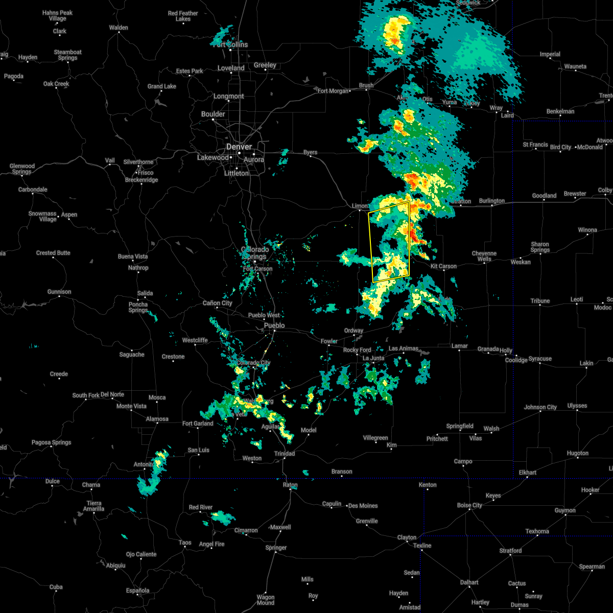 The severe thunderstorm warning for southeastern lincoln county will expire at 745 pm mdt, the storms which prompted the warning have weakened below severe limits, and have exited the warned area. therefore, the warning will be allowed to expire. however gusty winds and heavy rain are still possible with these thunderstorms. The severe thunderstorm warning for southeastern lincoln county will expire at 745 pm mdt, the storms which prompted the warning have weakened below severe limits, and have exited the warned area. therefore, the warning will be allowed to expire. however gusty winds and heavy rain are still possible with these thunderstorms.
|
| 7/21/2018 7:00 PM MDT |
 At 659 pm mdt, severe thunderstorms were located along a line extending from 4 miles east of limon to 13 miles east of karval, or along a line extending from 29 miles west of flagler to 50 miles north of north la junta, moving northeast at 30 mph (radar indicated). Hazards include 60 mph wind gusts and penny size hail. expect damage to roofs, siding, and trees At 659 pm mdt, severe thunderstorms were located along a line extending from 4 miles east of limon to 13 miles east of karval, or along a line extending from 29 miles west of flagler to 50 miles north of north la junta, moving northeast at 30 mph (radar indicated). Hazards include 60 mph wind gusts and penny size hail. expect damage to roofs, siding, and trees
|
| 6/24/2018 3:27 PM MDT |
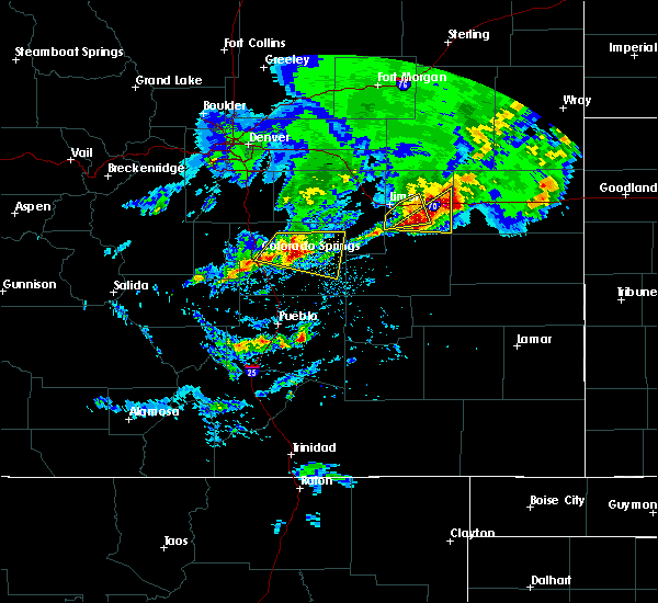 At 327 pm mdt, severe thunderstorms were located along a line extending from 8 miles northwest of flagler to 9 miles southwest of hugo, or along a line extending from 17 miles west of seibert to 13 miles south of limon, moving east at 15 mph (trained weather spotters). Hazards include 60 mph wind gusts and quarter size hail. Expect damage to roofs, siding, and trees. Hail damage to vehicles is expected. At 327 pm mdt, severe thunderstorms were located along a line extending from 8 miles northwest of flagler to 9 miles southwest of hugo, or along a line extending from 17 miles west of seibert to 13 miles south of limon, moving east at 15 mph (trained weather spotters). Hazards include 60 mph wind gusts and quarter size hail. Expect damage to roofs, siding, and trees. Hail damage to vehicles is expected.
|
| 6/24/2018 2:36 AM MDT |
 The severe thunderstorm warning for northeastern lincoln county will expire at 245 am mdt, the storm which prompted the warning has weakened below severe limits, and has exited the warned area. therefore, the warning will be allowed to expire. The severe thunderstorm warning for northeastern lincoln county will expire at 245 am mdt, the storm which prompted the warning has weakened below severe limits, and has exited the warned area. therefore, the warning will be allowed to expire.
|
| 6/24/2018 2:16 AM MDT |
 At 157 am mdt, a severe thunderstorm was located 5 miles west of arriba, or 16 miles west of flagler, moving east at 20 mph (radar indicated). Hazards include golf ball size hail and 60 mph wind gusts. Expect damage to roofs, siding, and trees. people and animals outdoors will be injured. Expect hail damage to roofs, siding, windows, and vehicles. At 157 am mdt, a severe thunderstorm was located 5 miles west of arriba, or 16 miles west of flagler, moving east at 20 mph (radar indicated). Hazards include golf ball size hail and 60 mph wind gusts. Expect damage to roofs, siding, and trees. people and animals outdoors will be injured. Expect hail damage to roofs, siding, windows, and vehicles.
|
| 6/24/2018 1:57 AM MDT |
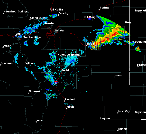 At 157 am mdt, a severe thunderstorm was located 5 miles west of arriba, or 16 miles west of flagler, moving east at 20 mph (radar indicated). Hazards include golf ball size hail and 60 mph wind gusts. Expect damage to roofs, siding, and trees. people and animals outdoors will be injured. Expect hail damage to roofs, siding, windows, and vehicles. At 157 am mdt, a severe thunderstorm was located 5 miles west of arriba, or 16 miles west of flagler, moving east at 20 mph (radar indicated). Hazards include golf ball size hail and 60 mph wind gusts. Expect damage to roofs, siding, and trees. people and animals outdoors will be injured. Expect hail damage to roofs, siding, windows, and vehicles.
|
| 6/24/2018 1:34 AM MDT |
 At 134 am mdt, severe thunderstorms were located along a line extending from 13 miles west of thurman to 5 miles northwest of hugo, or along a line extending from 35 miles northwest of seibert to 10 miles southeast of limon, moving east at 30 mph (radar indicated). Hazards include 60 mph wind gusts and quarter size hail. Expect damage to roofs, siding, and trees. hail damage to vehicles is expected. Locations impacted include, arriba and genoa. At 134 am mdt, severe thunderstorms were located along a line extending from 13 miles west of thurman to 5 miles northwest of hugo, or along a line extending from 35 miles northwest of seibert to 10 miles southeast of limon, moving east at 30 mph (radar indicated). Hazards include 60 mph wind gusts and quarter size hail. Expect damage to roofs, siding, and trees. hail damage to vehicles is expected. Locations impacted include, arriba and genoa.
|
| 6/24/2018 1:19 AM MDT |
 At 118 am mdt, severe thunderstorms were located along a line extending from 12 miles south of last chance to 4 miles southeast of limon, or along a line extending from 46 miles southwest of akron to 31 miles west of flagler, moving east at 30 mph (radar indicated). Hazards include 60 mph wind gusts and half dollar size hail. Expect damage to roofs, siding, and trees. Hail damage to vehicles is expected. At 118 am mdt, severe thunderstorms were located along a line extending from 12 miles south of last chance to 4 miles southeast of limon, or along a line extending from 46 miles southwest of akron to 31 miles west of flagler, moving east at 30 mph (radar indicated). Hazards include 60 mph wind gusts and half dollar size hail. Expect damage to roofs, siding, and trees. Hail damage to vehicles is expected.
|
| 6/19/2018 5:21 PM MDT |
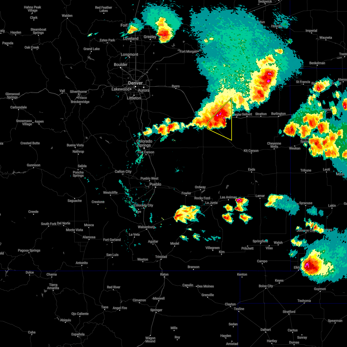 At 520 pm mdt, severe thunderstorms were located along a line extending from 8 miles northwest of flagler to 7 miles east of hugo, or along a line extending from 17 miles west of seibert to 21 miles southeast of limon, moving east at 35 mph. this storm has a history of high winds, severe hail, and brief tornadoes. there is a tornado warning in effect until 530 pm mdt for rotation near arriba (radar indicated). Hazards include 60 mph wind gusts and quarter size hail. Expect damage to roofs, siding, and trees. hail damage to vehicles is expected. locations impacted include, hugo, arriba and genoa. A tornado watch remains in effect until 700 pm mdt for northeastern and east central colorado. At 520 pm mdt, severe thunderstorms were located along a line extending from 8 miles northwest of flagler to 7 miles east of hugo, or along a line extending from 17 miles west of seibert to 21 miles southeast of limon, moving east at 35 mph. this storm has a history of high winds, severe hail, and brief tornadoes. there is a tornado warning in effect until 530 pm mdt for rotation near arriba (radar indicated). Hazards include 60 mph wind gusts and quarter size hail. Expect damage to roofs, siding, and trees. hail damage to vehicles is expected. locations impacted include, hugo, arriba and genoa. A tornado watch remains in effect until 700 pm mdt for northeastern and east central colorado.
|
| 6/19/2018 5:16 PM MDT |
 At 515 pm mdt, a confirmed tornado occurred near arriba, or 13 miles west of flagler, moving east at 35 mph (weather spotters confirmed tornado). Hazards include damaging tornado and half dollar size hail. Flying debris will be dangerous to those caught without shelter. mobile homes will be damaged or destroyed. damage to roofs, windows, and vehicles will occur. tree damage is likely. Locations impacted include, arriba. At 515 pm mdt, a confirmed tornado occurred near arriba, or 13 miles west of flagler, moving east at 35 mph (weather spotters confirmed tornado). Hazards include damaging tornado and half dollar size hail. Flying debris will be dangerous to those caught without shelter. mobile homes will be damaged or destroyed. damage to roofs, windows, and vehicles will occur. tree damage is likely. Locations impacted include, arriba.
|
| 6/19/2018 5:09 PM MDT |
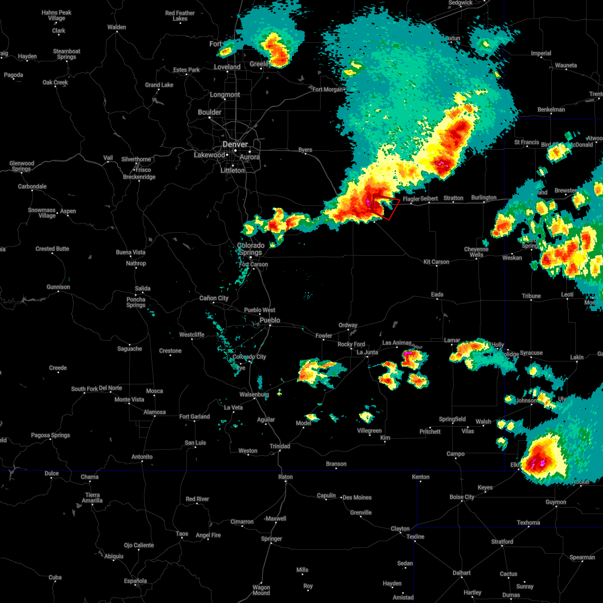 At 509 pm mdt, a severe thunderstorm capable of producing a tornado was located 4 miles east of genoa, or 14 miles east of limon, moving east at 30 mph. severe winds are likely along i-70 from genoa to arriba (radar indicated rotation). Hazards include tornado and quarter size hail. Flying debris will be dangerous to those caught without shelter. mobile homes will be damaged or destroyed. damage to roofs, windows, and vehicles will occur. tree damage is likely. Locations impacted include, arriba. At 509 pm mdt, a severe thunderstorm capable of producing a tornado was located 4 miles east of genoa, or 14 miles east of limon, moving east at 30 mph. severe winds are likely along i-70 from genoa to arriba (radar indicated rotation). Hazards include tornado and quarter size hail. Flying debris will be dangerous to those caught without shelter. mobile homes will be damaged or destroyed. damage to roofs, windows, and vehicles will occur. tree damage is likely. Locations impacted include, arriba.
|
| 6/19/2018 5:03 PM MDT |
 A severe thunderstorm warning remains in effect until 530 pm mdt for northeastern lincoln county. at 503 pm mdt, severe thunderstorms were located along a line extending from 9 miles north of arriba to 8 miles west of hugo, or along a line extending from 15 miles northwest of flagler to 9 miles southeast of limon, moving east at 35 mph. There is also a tornado. A severe thunderstorm warning remains in effect until 530 pm mdt for northeastern lincoln county. at 503 pm mdt, severe thunderstorms were located along a line extending from 9 miles north of arriba to 8 miles west of hugo, or along a line extending from 15 miles northwest of flagler to 9 miles southeast of limon, moving east at 35 mph. There is also a tornado.
|
| 6/19/2018 4:57 PM MDT |
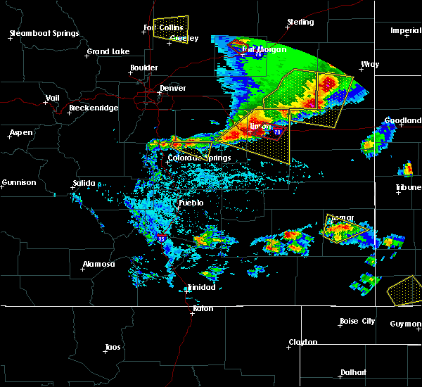 At 456 pm mdt, a confirmed tornado was located 4 miles northwest of genoa, or 7 miles northeast of limon, moving east at 30 mph. we have received reports of a tornado with damage in limon several minutes ago. this storm is capable of gusts overt 80 mph in addition to a possible tornado (law enforcement confirmed tornado). Hazards include damaging tornado and quarter size hail. Flying debris will be dangerous to those caught without shelter. mobile homes will be damaged or destroyed. damage to roofs, windows, and vehicles will occur. Tree damage is likely. At 456 pm mdt, a confirmed tornado was located 4 miles northwest of genoa, or 7 miles northeast of limon, moving east at 30 mph. we have received reports of a tornado with damage in limon several minutes ago. this storm is capable of gusts overt 80 mph in addition to a possible tornado (law enforcement confirmed tornado). Hazards include damaging tornado and quarter size hail. Flying debris will be dangerous to those caught without shelter. mobile homes will be damaged or destroyed. damage to roofs, windows, and vehicles will occur. Tree damage is likely.
|
| 6/19/2018 4:32 PM MDT |
 At 432 pm mdt, severe thunderstorms were located along a line extending from 14 miles southeast of cottonwood valley to 5 miles northeast of matheson, or along a line extending from 31 miles northwest of flagler to 12 miles west of limon, moving east at 30 mph. these are very dangerous storms (radar indicated). Hazards include 80 mph wind gusts and quarter size hail. Flying debris will be dangerous to those caught without shelter. mobile homes will be heavily damaged. expect considerable damage to roofs, windows, and vehicles. Extensive tree damage and power outages are likely. At 432 pm mdt, severe thunderstorms were located along a line extending from 14 miles southeast of cottonwood valley to 5 miles northeast of matheson, or along a line extending from 31 miles northwest of flagler to 12 miles west of limon, moving east at 30 mph. these are very dangerous storms (radar indicated). Hazards include 80 mph wind gusts and quarter size hail. Flying debris will be dangerous to those caught without shelter. mobile homes will be heavily damaged. expect considerable damage to roofs, windows, and vehicles. Extensive tree damage and power outages are likely.
|
| 6/5/2018 10:07 PM MDT |
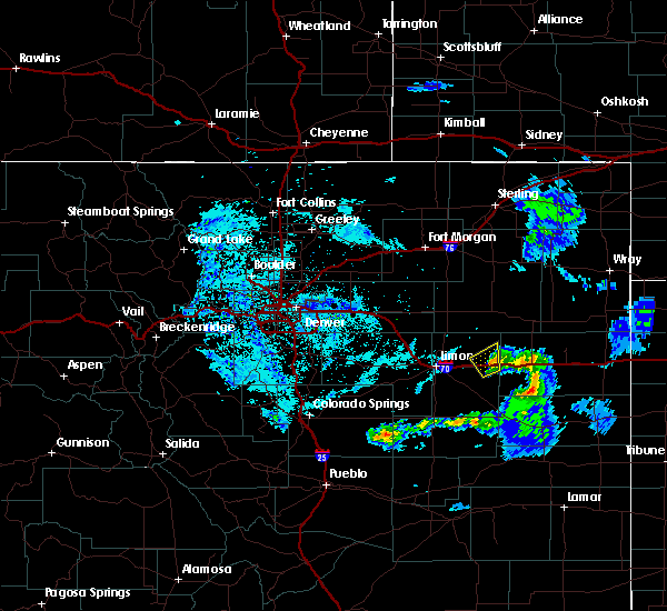 At 1006 pm mdt, a severe thunderstorm was located near arriba, or 9 miles west of flagler, moving northeast at 10 mph (radar indicated). Hazards include 60 mph wind gusts and penny size hail. Expect damage to roofs, siding, and trees. Locations impacted include, arriba. At 1006 pm mdt, a severe thunderstorm was located near arriba, or 9 miles west of flagler, moving northeast at 10 mph (radar indicated). Hazards include 60 mph wind gusts and penny size hail. Expect damage to roofs, siding, and trees. Locations impacted include, arriba.
|
| 6/5/2018 9:42 PM MDT |
 At 941 pm mdt, a severe thunderstorm was located over arriba, or 11 miles west of flagler, moving northeast at 10 mph (radar indicated). Hazards include 60 mph wind gusts and penny size hail. expect damage to roofs, siding, and trees At 941 pm mdt, a severe thunderstorm was located over arriba, or 11 miles west of flagler, moving northeast at 10 mph (radar indicated). Hazards include 60 mph wind gusts and penny size hail. expect damage to roofs, siding, and trees
|
| 5/14/2018 3:42 PM MDT |
 At 342 pm mdt, a severe thunderstorm was located 7 miles northwest of arriba, or 17 miles west of flagler, moving east at 30 mph (trained weather spotters). Hazards include 60 mph wind gusts and quarter size hail. Hail damage to vehicles is expected. expect wind damage to roofs, siding, and trees. Locations impacted include, arriba and genoa. At 342 pm mdt, a severe thunderstorm was located 7 miles northwest of arriba, or 17 miles west of flagler, moving east at 30 mph (trained weather spotters). Hazards include 60 mph wind gusts and quarter size hail. Hail damage to vehicles is expected. expect wind damage to roofs, siding, and trees. Locations impacted include, arriba and genoa.
|
| 5/14/2018 3:21 PM MDT |
 At 320 pm mdt, a severe thunderstorm was located 9 miles northwest of genoa, or 11 miles northeast of limon, moving east at 30 mph (radar indicated). Hazards include 60 mph wind gusts and half dollar size hail. Hail damage to vehicles is expected. Expect wind damage to roofs, siding, and trees. At 320 pm mdt, a severe thunderstorm was located 9 miles northwest of genoa, or 11 miles northeast of limon, moving east at 30 mph (radar indicated). Hazards include 60 mph wind gusts and half dollar size hail. Hail damage to vehicles is expected. Expect wind damage to roofs, siding, and trees.
|
| 5/10/2018 5:38 PM MDT |
 At 538 pm mdt, a severe thunderstorm was located 5 miles northeast of limon, moving northeast at 20 mph (radar indicated). Hazards include 60 mph wind gusts and half dollar size hail. Hail damage to vehicles is expected. Expect wind damage to roofs, siding, and trees. At 538 pm mdt, a severe thunderstorm was located 5 miles northeast of limon, moving northeast at 20 mph (radar indicated). Hazards include 60 mph wind gusts and half dollar size hail. Hail damage to vehicles is expected. Expect wind damage to roofs, siding, and trees.
|
| 8/15/2017 4:26 PM MDT |
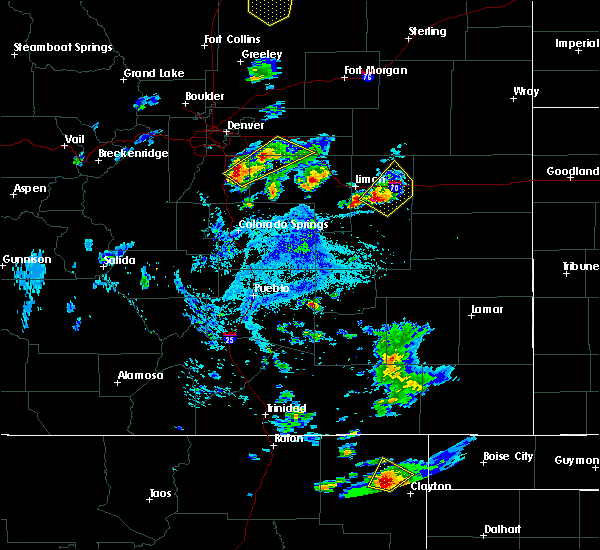 At 424 pm mdt, a severe thunderstorm was located over hugo, or 14 miles southeast of limon, moving northeast at 10 mph (law enforcement). Hazards include golf ball size hail. People and animals outdoors will be injured. expect damage to roofs, siding, windows, and vehicles. Locations impacted include, hugo, arriba and genoa. At 424 pm mdt, a severe thunderstorm was located over hugo, or 14 miles southeast of limon, moving northeast at 10 mph (law enforcement). Hazards include golf ball size hail. People and animals outdoors will be injured. expect damage to roofs, siding, windows, and vehicles. Locations impacted include, hugo, arriba and genoa.
|
| 8/15/2017 4:08 PM MDT |
 At 407 pm mdt, a severe thunderstorm was located over hugo, or 13 miles southeast of limon, moving northeast at 10 mph (radar indicated). Hazards include 60 mph wind gusts and half dollar size hail. Hail damage to vehicles is expected. Expect wind damage to roofs, siding, and trees. At 407 pm mdt, a severe thunderstorm was located over hugo, or 13 miles southeast of limon, moving northeast at 10 mph (radar indicated). Hazards include 60 mph wind gusts and half dollar size hail. Hail damage to vehicles is expected. Expect wind damage to roofs, siding, and trees.
|
| 8/10/2017 5:06 PM MDT |
 The severe thunderstorm warning for southeastern washington and northeastern lincoln counties will expire at 515 pm mdt, the storm which prompted the warning has moved out of the area. therefore the warning will be allowed to expire. however, small hail is still possible with this thunderstorm. a severe thunderstorm watch remains in effect until 1000 pm mdt for northeastern and east central colorado. The severe thunderstorm warning for southeastern washington and northeastern lincoln counties will expire at 515 pm mdt, the storm which prompted the warning has moved out of the area. therefore the warning will be allowed to expire. however, small hail is still possible with this thunderstorm. a severe thunderstorm watch remains in effect until 1000 pm mdt for northeastern and east central colorado.
|
| 8/10/2017 4:37 PM MDT |
 At 437 pm mdt, a severe thunderstorm was located over genoa, or 8 miles east of limon, moving northeast at 40 mph (law enforcement). Hazards include half dollar size hail. damage to vehicles is expected At 437 pm mdt, a severe thunderstorm was located over genoa, or 8 miles east of limon, moving northeast at 40 mph (law enforcement). Hazards include half dollar size hail. damage to vehicles is expected
|
| 7/20/2017 9:06 PM MDT |
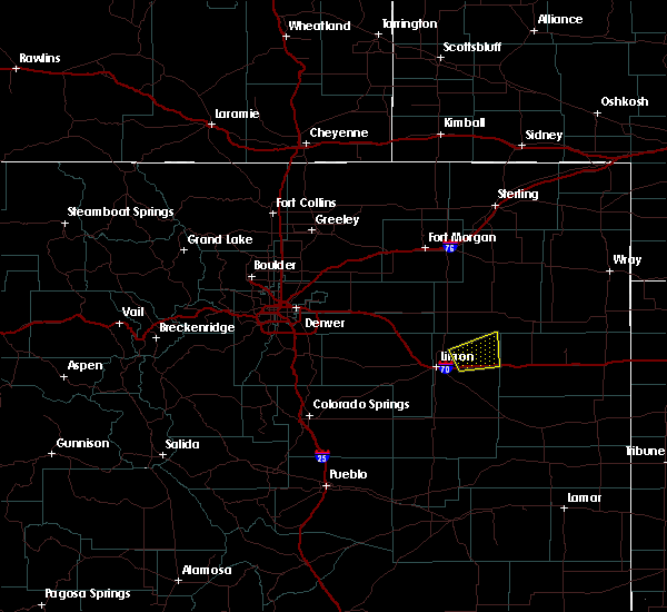 At 906 pm mdt, a severe thunderstorm was located 6 miles northeast of genoa, or 15 miles east of limon, moving northeast at 10 mph (radar indicated). Hazards include quarter size hail. damage to vehicles is expected At 906 pm mdt, a severe thunderstorm was located 6 miles northeast of genoa, or 15 miles east of limon, moving northeast at 10 mph (radar indicated). Hazards include quarter size hail. damage to vehicles is expected
|
| 7/12/2017 3:27 PM MDT |
 At 326 pm mdt, a severe thunderstorm was located near genoa, or 10 miles east of limon, moving east at 25 mph (public). Hazards include 60 mph wind gusts. expect damage to roofs, siding, and trees At 326 pm mdt, a severe thunderstorm was located near genoa, or 10 miles east of limon, moving east at 25 mph (public). Hazards include 60 mph wind gusts. expect damage to roofs, siding, and trees
|
| 7/12/2017 3:03 PM MDT |
 At 303 pm mdt, a severe thunderstorm was located near limon, moving east at 25 mph (radar indicated). Hazards include 60 mph wind gusts. expect damage to roofs, siding, and trees At 303 pm mdt, a severe thunderstorm was located near limon, moving east at 25 mph (radar indicated). Hazards include 60 mph wind gusts. expect damage to roofs, siding, and trees
|
| 8/19/2016 6:18 PM MDT | Quarter sized hail reported 11.5 miles S of Arriba, CO |
| 8/19/2016 6:15 PM MDT |
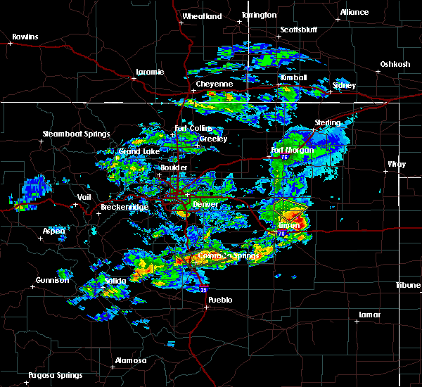 At 615 pm mdt, a severe thunderstorm was located 12 miles northwest of arriba, or 19 miles northwest of flagler, moving southeast at 35 mph (radar indicated). Hazards include ping pong ball size hail and 60 mph wind gusts. People and animals outdoors will be injured. expect hail damage to roofs, siding, windows, and vehicles. Expect wind damage to roofs, siding, and trees. At 615 pm mdt, a severe thunderstorm was located 12 miles northwest of arriba, or 19 miles northwest of flagler, moving southeast at 35 mph (radar indicated). Hazards include ping pong ball size hail and 60 mph wind gusts. People and animals outdoors will be injured. expect hail damage to roofs, siding, windows, and vehicles. Expect wind damage to roofs, siding, and trees.
|
| 8/3/2016 12:27 AM MDT |
 At 1225 am mdt, severe thunderstorms wer located 5 miles north of genoa, or 10 miles northeast of limon, and 15 miles north of genoa. the storms were moving east at 25 mph (radar indicated). Hazards include 60 mph wind gusts and nickel size hail. Expect damage to roofs. siding. and trees. Locations impacted include, arriba, genoa and thurman. At 1225 am mdt, severe thunderstorms wer located 5 miles north of genoa, or 10 miles northeast of limon, and 15 miles north of genoa. the storms were moving east at 25 mph (radar indicated). Hazards include 60 mph wind gusts and nickel size hail. Expect damage to roofs. siding. and trees. Locations impacted include, arriba, genoa and thurman.
|
| 8/2/2016 11:57 PM MDT |
 At 1156 pm mdt, a severe thunderstorm was located 7 miles north of limon, moving east at 30 mph. another storm was located 15 miles north of genoa, moving southeast at 20 mph (radar indicated). Hazards include 60 mph wind gusts and quarter size hail. Hail damage to vehicles is expected. Expect wind damage to roofs, siding, and trees. At 1156 pm mdt, a severe thunderstorm was located 7 miles north of limon, moving east at 30 mph. another storm was located 15 miles north of genoa, moving southeast at 20 mph (radar indicated). Hazards include 60 mph wind gusts and quarter size hail. Hail damage to vehicles is expected. Expect wind damage to roofs, siding, and trees.
|
| 7/27/2016 4:15 PM MDT |
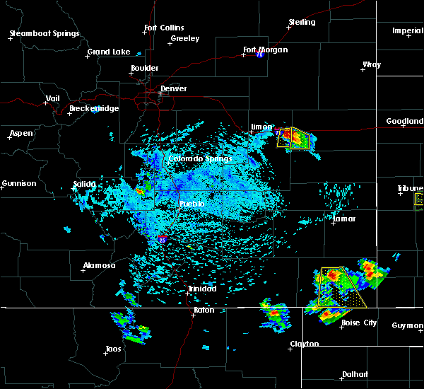 At 414 pm mdt, a severe thunderstorm was located 4 miles east of arriba, or 6 miles west of flagler, moving south at 5 mph (trained weather spotters). Hazards include golf ball size hail and 60 mph wind gusts. People and animals outdoors will be injured. expect hail damage to roofs, siding, windows, and vehicles. Expect wind damage to roofs, siding, and trees. At 414 pm mdt, a severe thunderstorm was located 4 miles east of arriba, or 6 miles west of flagler, moving south at 5 mph (trained weather spotters). Hazards include golf ball size hail and 60 mph wind gusts. People and animals outdoors will be injured. expect hail damage to roofs, siding, windows, and vehicles. Expect wind damage to roofs, siding, and trees.
|
| 7/27/2016 4:14 PM MDT | Ping Pong Ball sized hail reported 0.3 miles NW of Arriba, CO |
| 7/27/2016 4:04 PM MDT |
 At 404 pm mdt, a severe thunderstorm was located 5 miles west of flagler, moving southeast at 15 mph (trained weather spotters). Hazards include golf ball size hail and 60 mph wind gusts. People and animals outdoors will be injured. expect hail damage to roofs, siding, windows, and vehicles. expect wind damage to roofs, siding, and trees. Locations impacted include, arriba. At 404 pm mdt, a severe thunderstorm was located 5 miles west of flagler, moving southeast at 15 mph (trained weather spotters). Hazards include golf ball size hail and 60 mph wind gusts. People and animals outdoors will be injured. expect hail damage to roofs, siding, windows, and vehicles. expect wind damage to roofs, siding, and trees. Locations impacted include, arriba.
|
| 7/27/2016 3:57 PM MDT |
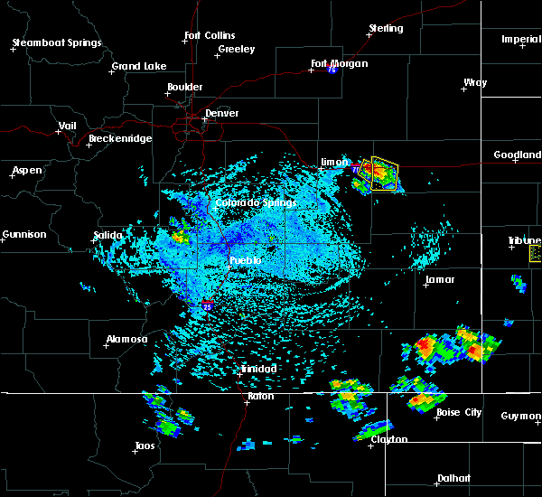 At 356 pm mdt, a severe thunderstorm was located near arriba, or 7 miles west of flagler, moving south at 10 mph (radar indicated). Hazards include 60 mph wind gusts and quarter size hail. Hail damage to vehicles is expected. expect wind damage to roofs, siding, and trees. Locations impacted include, arriba. At 356 pm mdt, a severe thunderstorm was located near arriba, or 7 miles west of flagler, moving south at 10 mph (radar indicated). Hazards include 60 mph wind gusts and quarter size hail. Hail damage to vehicles is expected. expect wind damage to roofs, siding, and trees. Locations impacted include, arriba.
|
| 7/27/2016 3:48 PM MDT | Golf Ball sized hail reported 4 miles W of Arriba, CO |
| 7/27/2016 3:42 PM MDT |
 At 342 pm mdt, a severe thunderstorm was located 4 miles west of flagler, moving southeast at 15 mph (radar indicated). Hazards include 60 mph wind gusts and quarter size hail. Hail damage to vehicles is expected. Expect wind damage to roofs, siding, and trees. At 342 pm mdt, a severe thunderstorm was located 4 miles west of flagler, moving southeast at 15 mph (radar indicated). Hazards include 60 mph wind gusts and quarter size hail. Hail damage to vehicles is expected. Expect wind damage to roofs, siding, and trees.
|
| 6/30/2016 6:39 PM MDT |
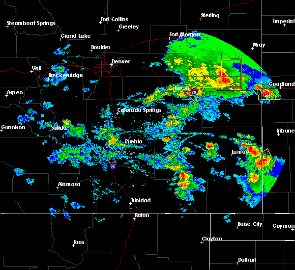 At 639 pm mdt, a severe thunderstorm was located 5 miles southwest of arriba, or 15 miles west of flagler, moving southeast at 15 mph (radar indicated). Hazards include 60 mph wind gusts and quarter size hail. Hail damage to vehicles is expected. expect wind damage to roofs, siding, and trees. Locations impacted include, arriba. At 639 pm mdt, a severe thunderstorm was located 5 miles southwest of arriba, or 15 miles west of flagler, moving southeast at 15 mph (radar indicated). Hazards include 60 mph wind gusts and quarter size hail. Hail damage to vehicles is expected. expect wind damage to roofs, siding, and trees. Locations impacted include, arriba.
|
| 6/30/2016 6:22 PM MDT |
 At 621 pm mdt, a severe thunderstorm was located near genoa, or 13 miles east of limon, moving southeast at 15 mph (radar indicated). Hazards include 60 mph wind gusts and half dollar size hail. Hail damage to vehicles is expected. Expect wind damage to roofs, siding, and trees. At 621 pm mdt, a severe thunderstorm was located near genoa, or 13 miles east of limon, moving southeast at 15 mph (radar indicated). Hazards include 60 mph wind gusts and half dollar size hail. Hail damage to vehicles is expected. Expect wind damage to roofs, siding, and trees.
|
| 6/29/2016 6:34 PM MDT |
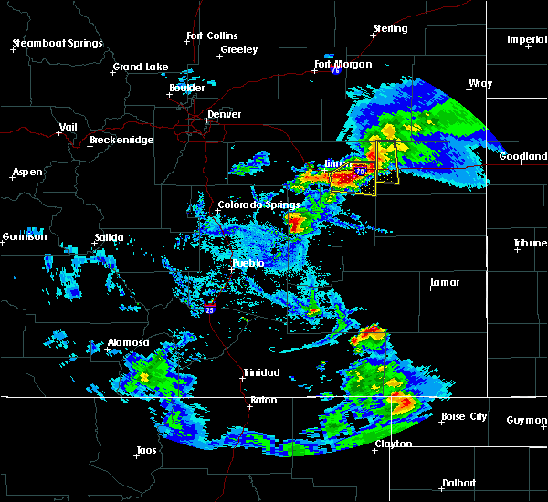 At 634 pm mdt, a severe thunderstorm was located 5 miles east of genoa, or 15 miles east of limon, moving east at 20 mph (radar indicated). Hazards include 60 mph wind gusts and quarter size hail. Hail damage to vehicles is expected. Expect wind damage to roofs, siding, and trees. At 634 pm mdt, a severe thunderstorm was located 5 miles east of genoa, or 15 miles east of limon, moving east at 20 mph (radar indicated). Hazards include 60 mph wind gusts and quarter size hail. Hail damage to vehicles is expected. Expect wind damage to roofs, siding, and trees.
|
| 8/17/2015 5:42 PM MDT |
 At 541 pm mdt, severe thunderstorms were located along a line extending from 5 miles southeast of arriba to 5 miles south of forder, or along a line extending from 8 miles southwest of flagler to 43 miles north of la junta, moving southeast at 35 mph (radar indicated). Hazards include 60 mph wind gusts and nickel size hail. Expect damage to roofs. Siding and trees. At 541 pm mdt, severe thunderstorms were located along a line extending from 5 miles southeast of arriba to 5 miles south of forder, or along a line extending from 8 miles southwest of flagler to 43 miles north of la junta, moving southeast at 35 mph (radar indicated). Hazards include 60 mph wind gusts and nickel size hail. Expect damage to roofs. Siding and trees.
|
| 8/17/2015 5:07 PM MDT |
 At 506 pm mdt, severe thunderstorms were located along a line extending from 8 miles northeast of woodlin school to 6 miles north of punkin center, or along a line extending from 23 miles southwest of akron to 22 miles south of limon, moving southeast at 40 mph (radar indicated). Hazards include 70 mph wind gusts and up to quarter size hail. Hail damage to vehicles is expected. expect considerable tree damage. Wind damage is also likely to mobile homes, roofs and outbuildings. At 506 pm mdt, severe thunderstorms were located along a line extending from 8 miles northeast of woodlin school to 6 miles north of punkin center, or along a line extending from 23 miles southwest of akron to 22 miles south of limon, moving southeast at 40 mph (radar indicated). Hazards include 70 mph wind gusts and up to quarter size hail. Hail damage to vehicles is expected. expect considerable tree damage. Wind damage is also likely to mobile homes, roofs and outbuildings.
|
| 5/28/2015 2:04 PM MDT | At 203 pm mdt, a severe thunderstorm was located 5 miles northwest of hugo, or 9 miles southeast of limon, moving east at 20 mph. another severe storm was developing just east of genoa, also moving east at 20 mph (radar indicated). Hazards include 60 mph wind gusts and half dollar size hail. Hail damage to vehicles is expected. Expect wind damage to roofs, siding and trees. |
| 5/20/2014 7:20 PM MDT | Tennis Ball sized hail reported 12.9 miles S of Arriba, CO |
| 5/20/2014 7:00 PM MDT | Ping Pong Ball sized hail reported 10.8 miles S of Arriba, CO |
| 6/15/2013 5:27 PM MDT | Quarter sized hail reported 3 miles E of Arriba, CO |
Hail Maps for Arriba, CO

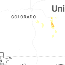
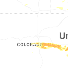


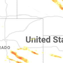


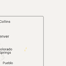


Connect with Interactive Hail Maps