

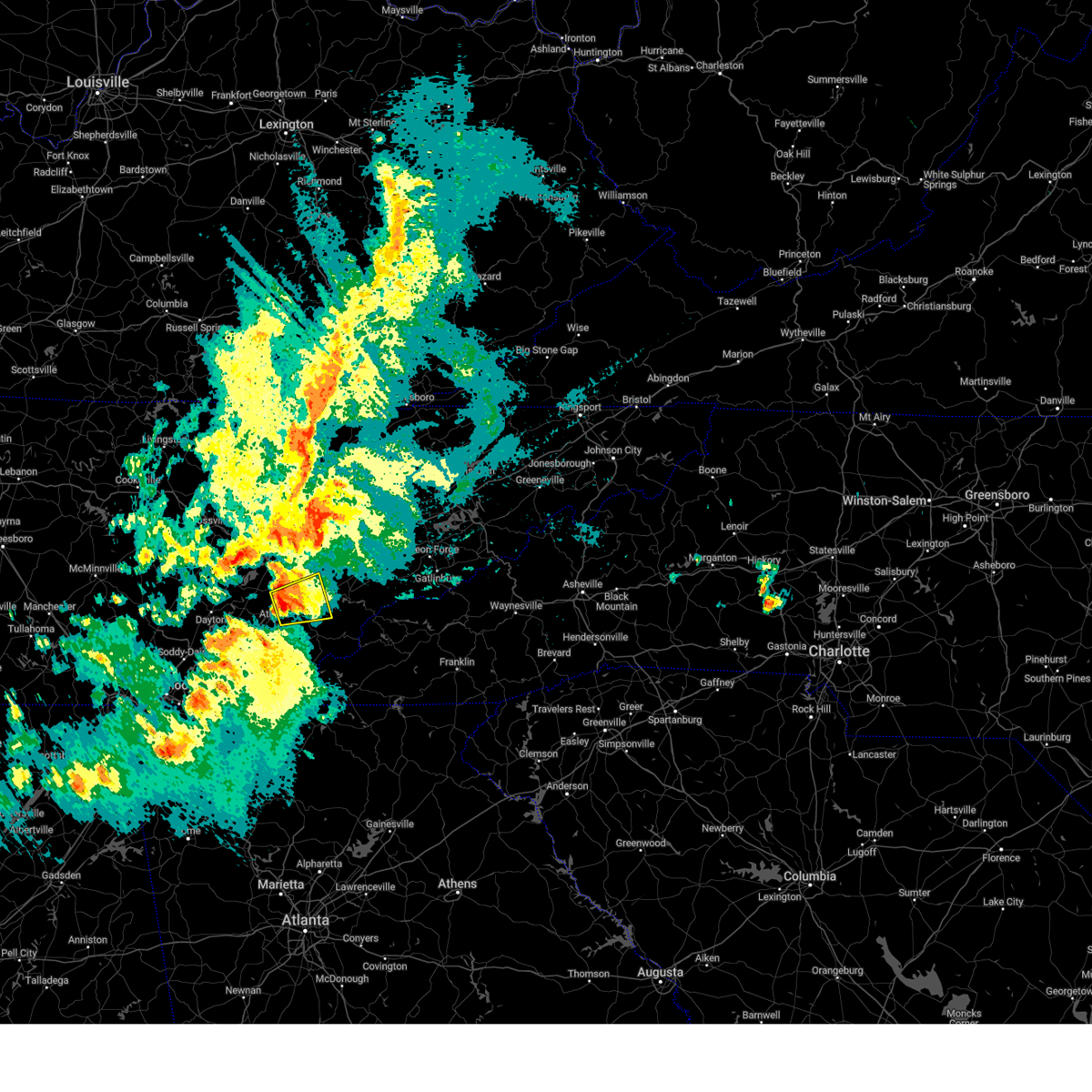
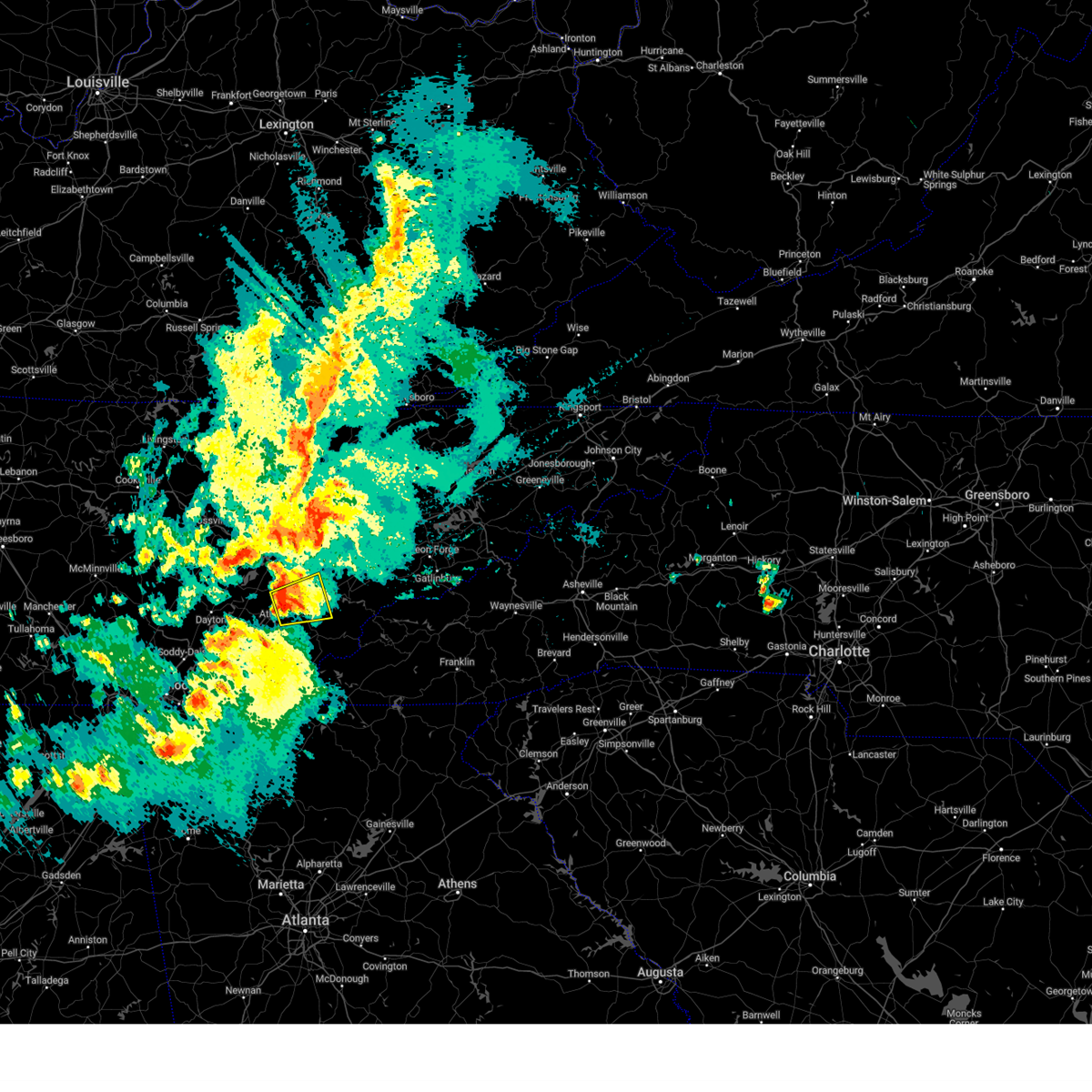
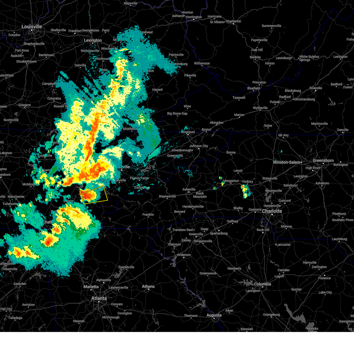
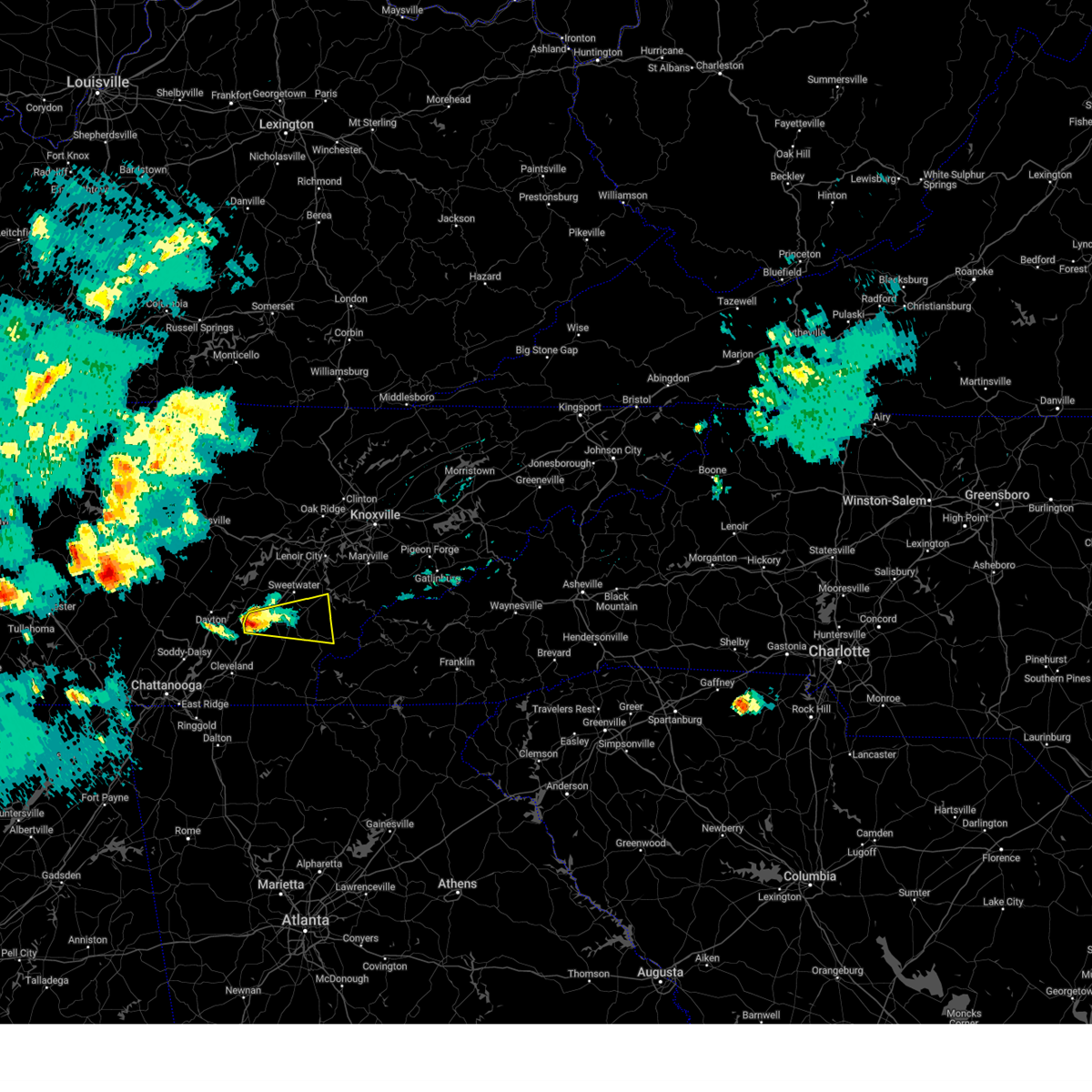
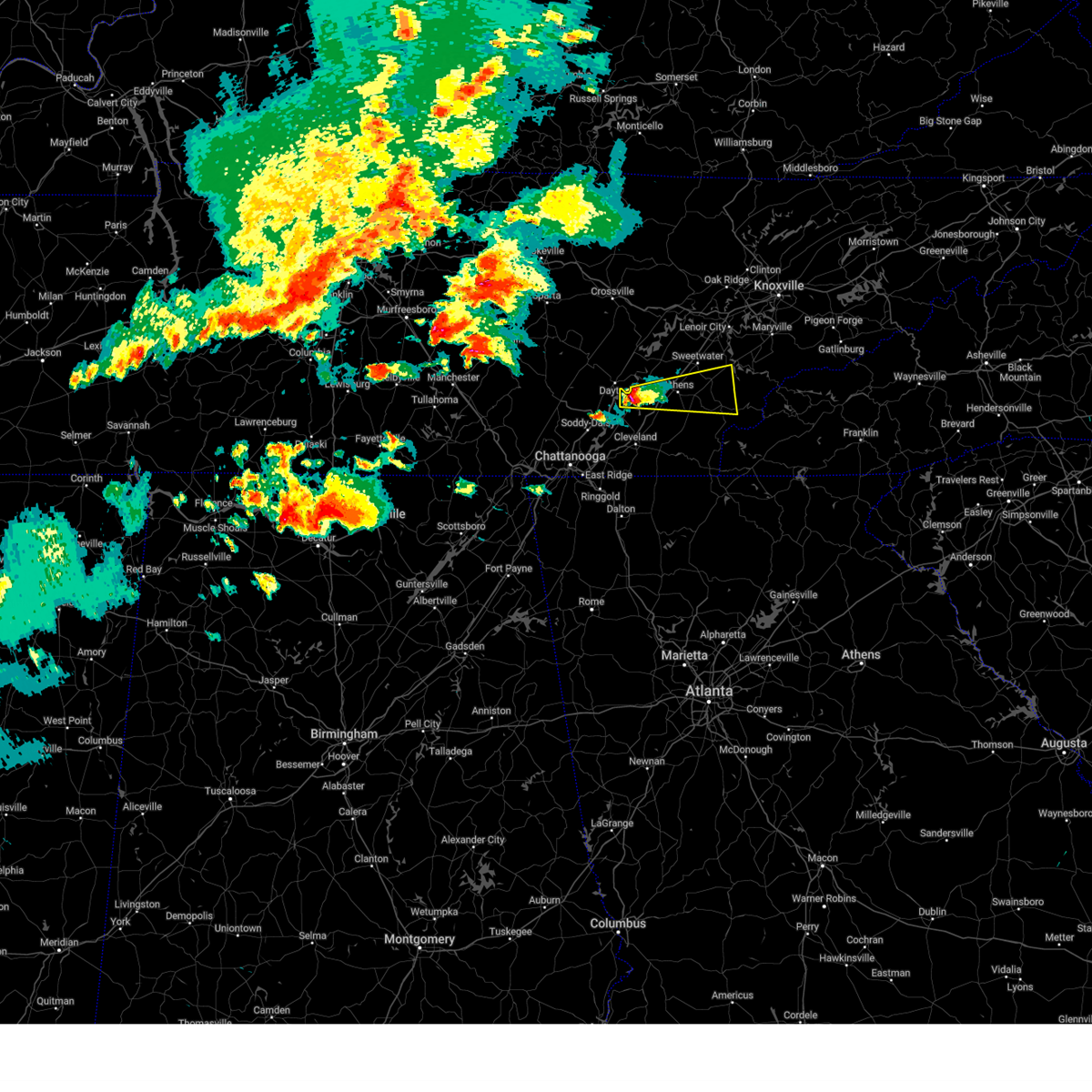
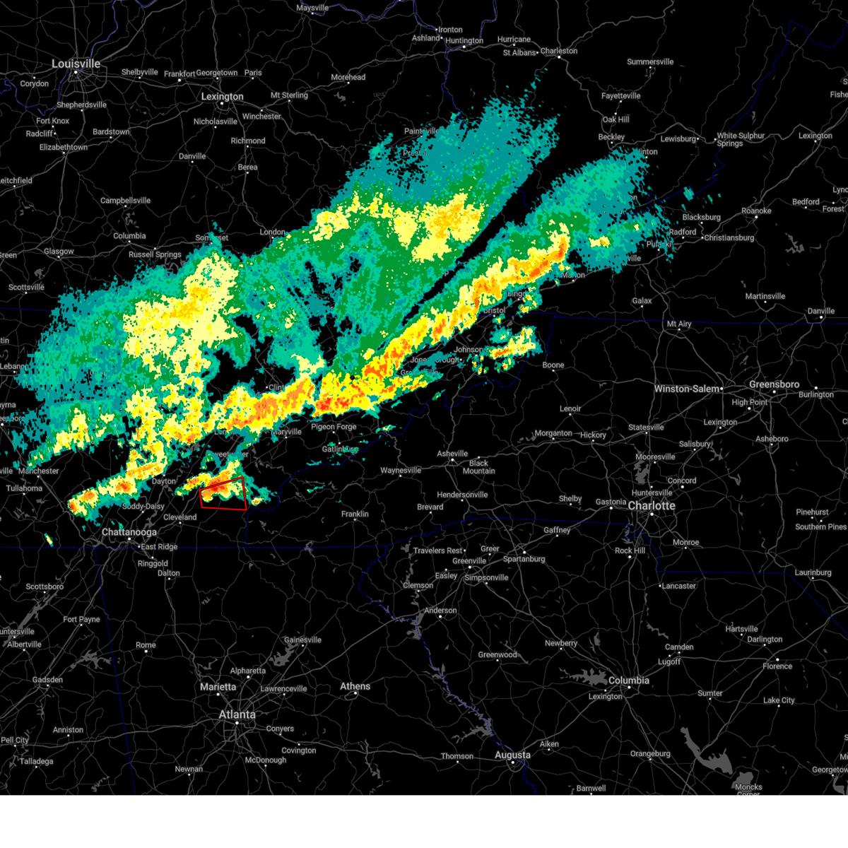
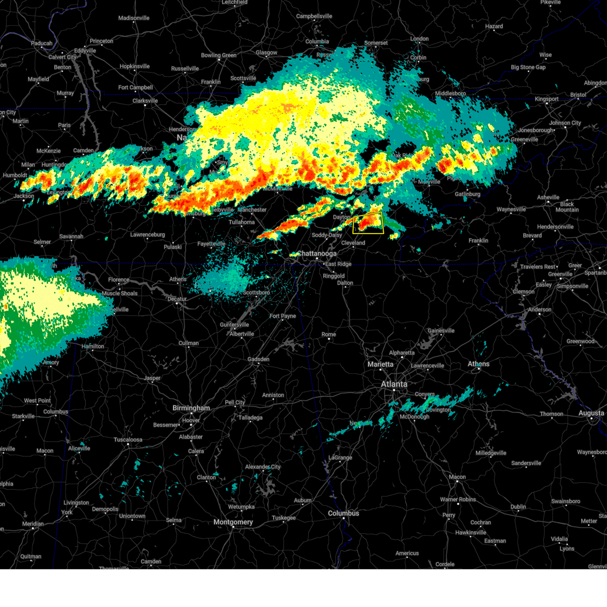
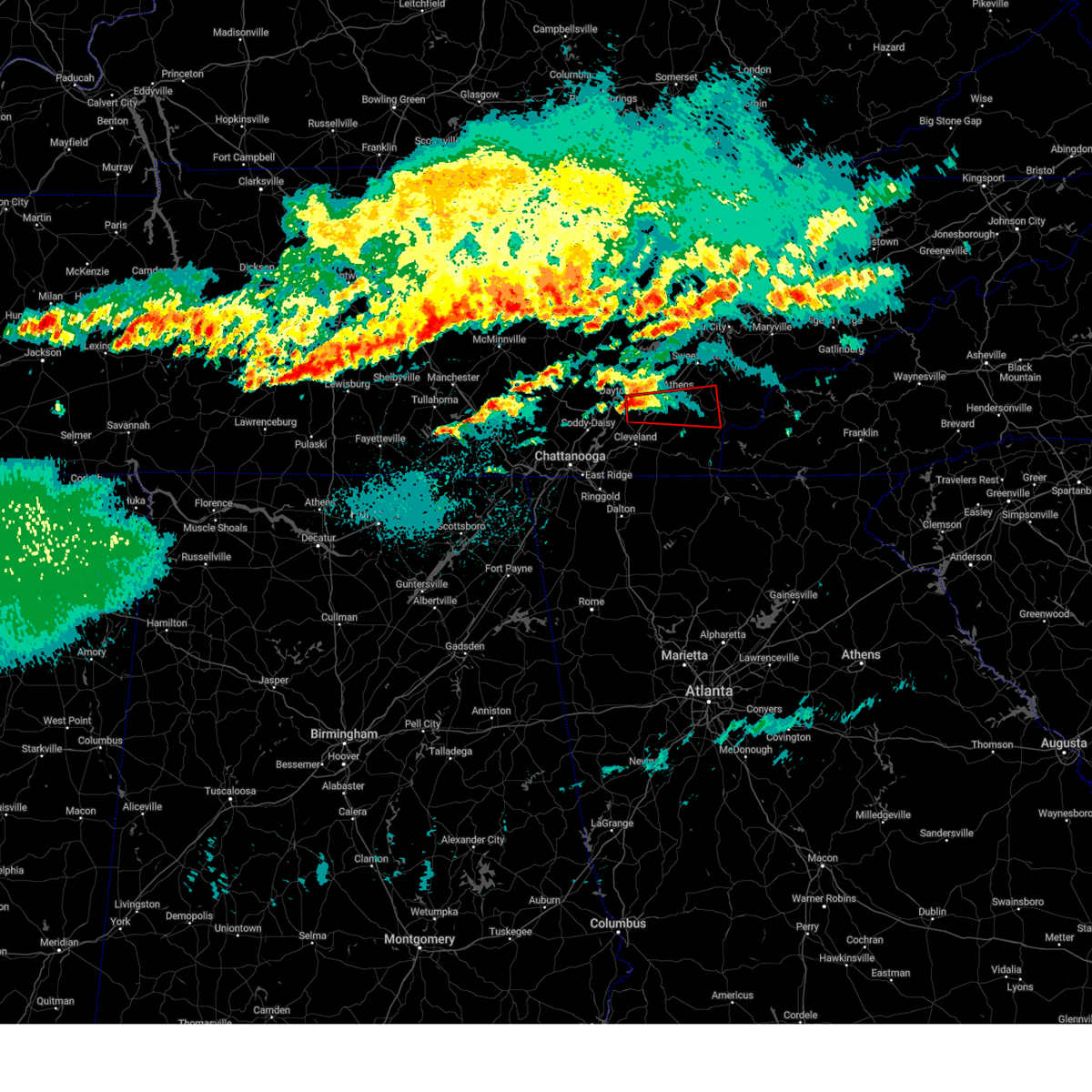
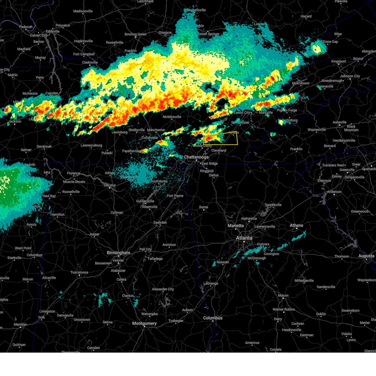
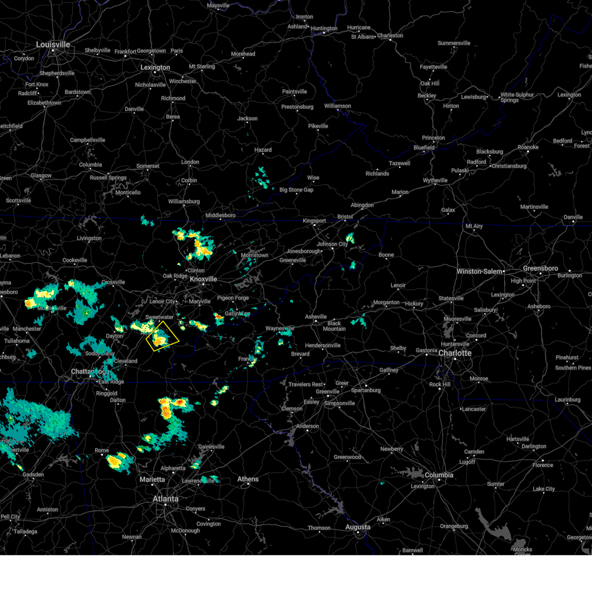
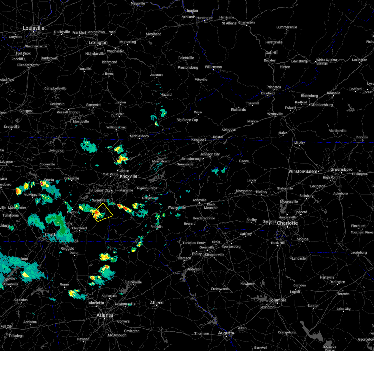
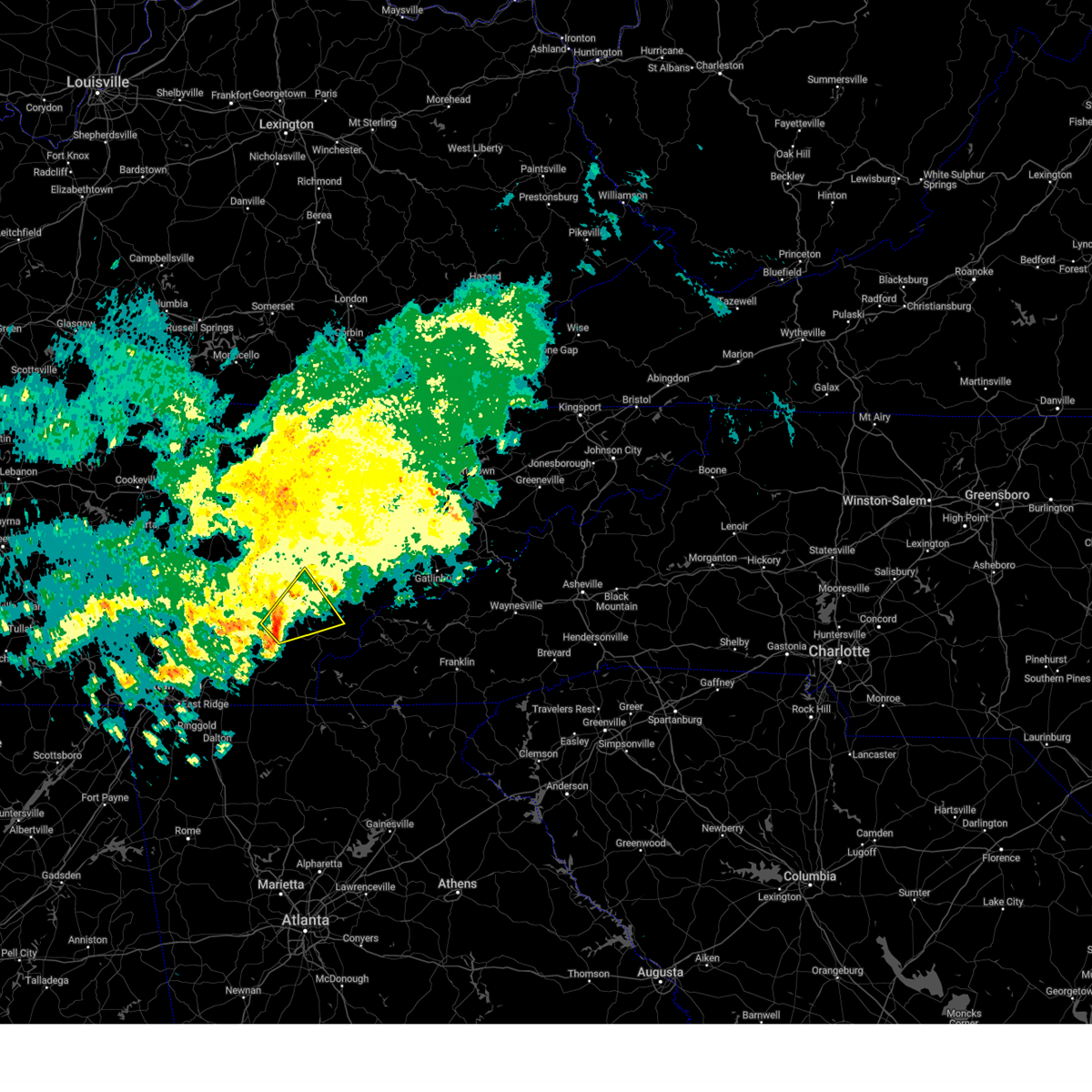
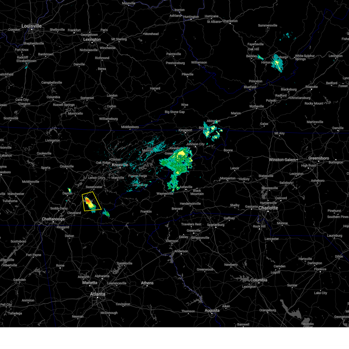
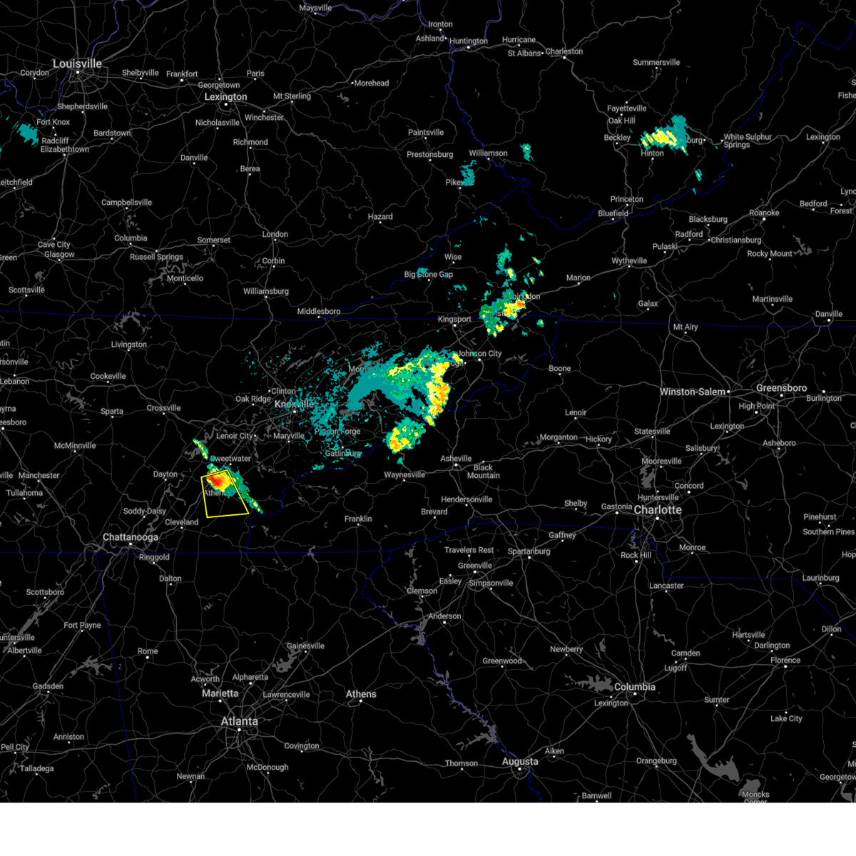
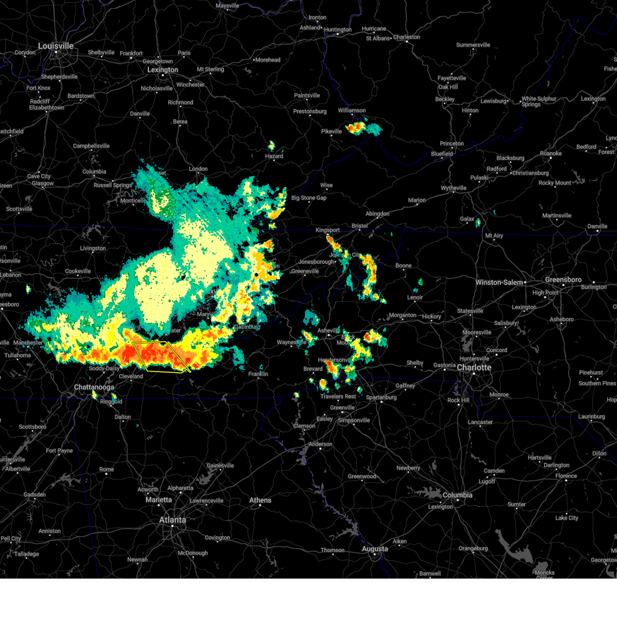
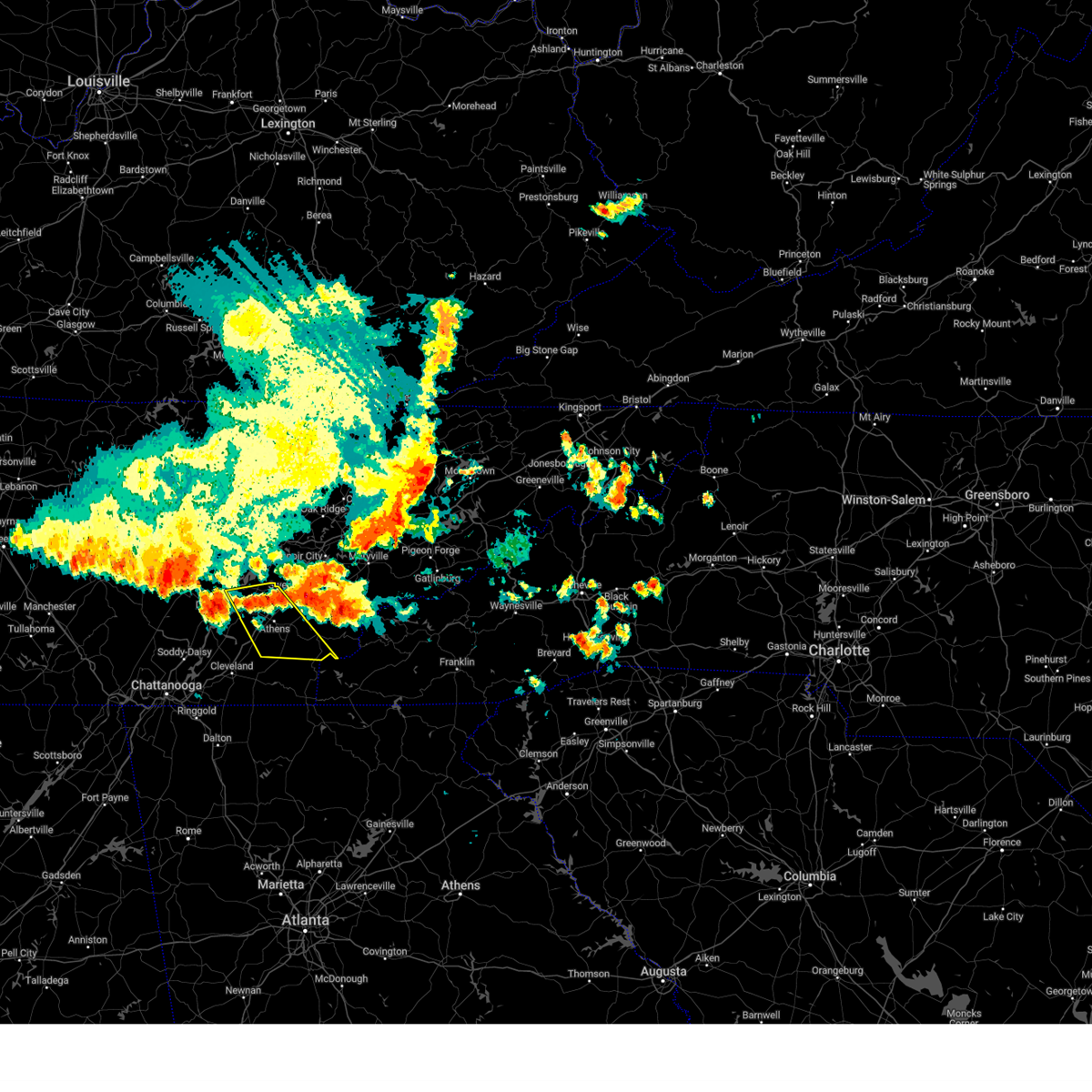
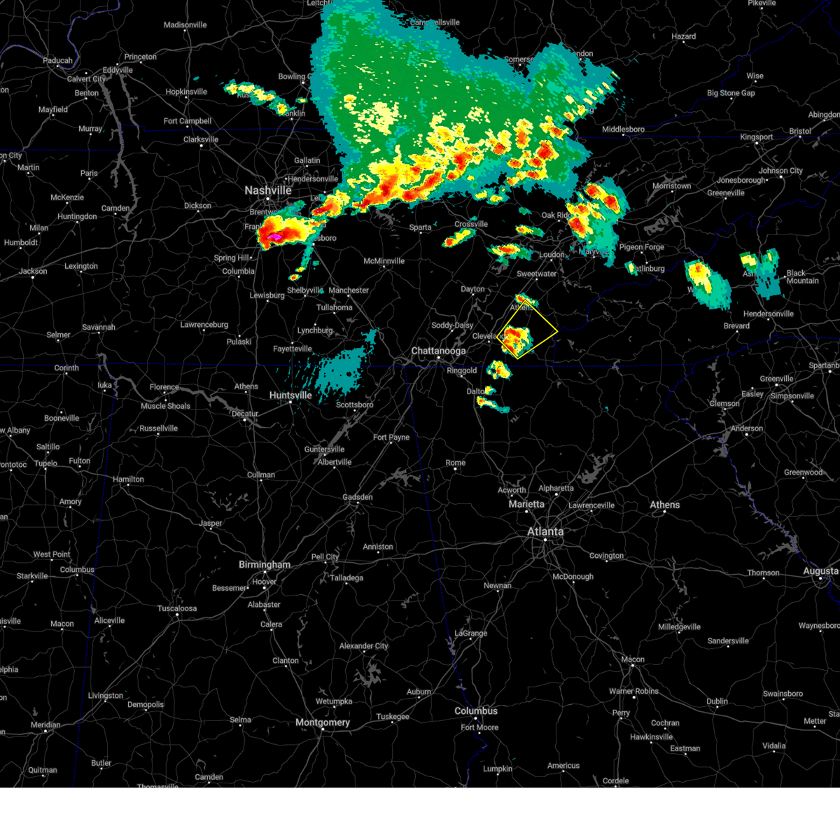
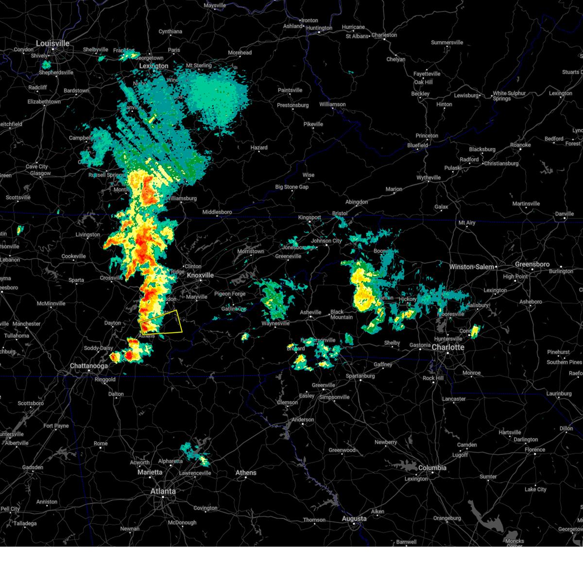
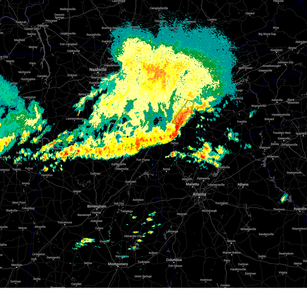
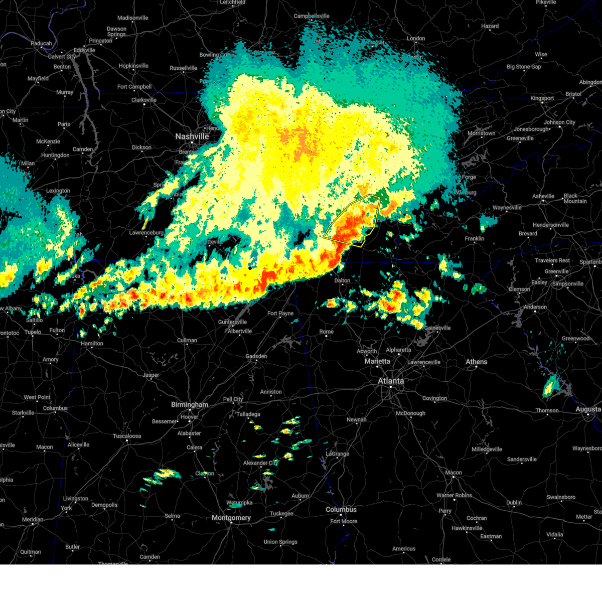
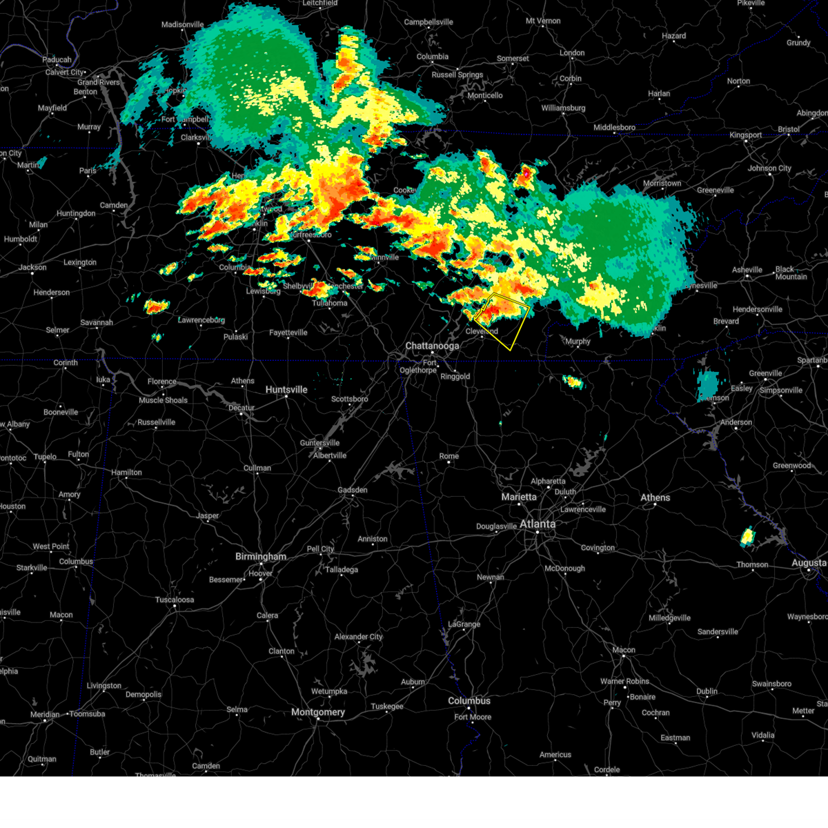
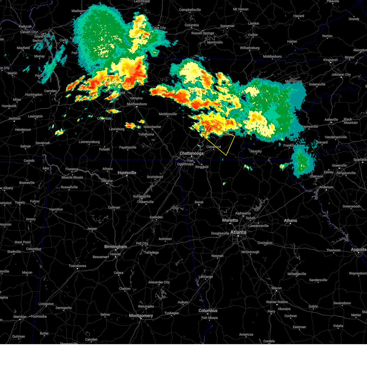
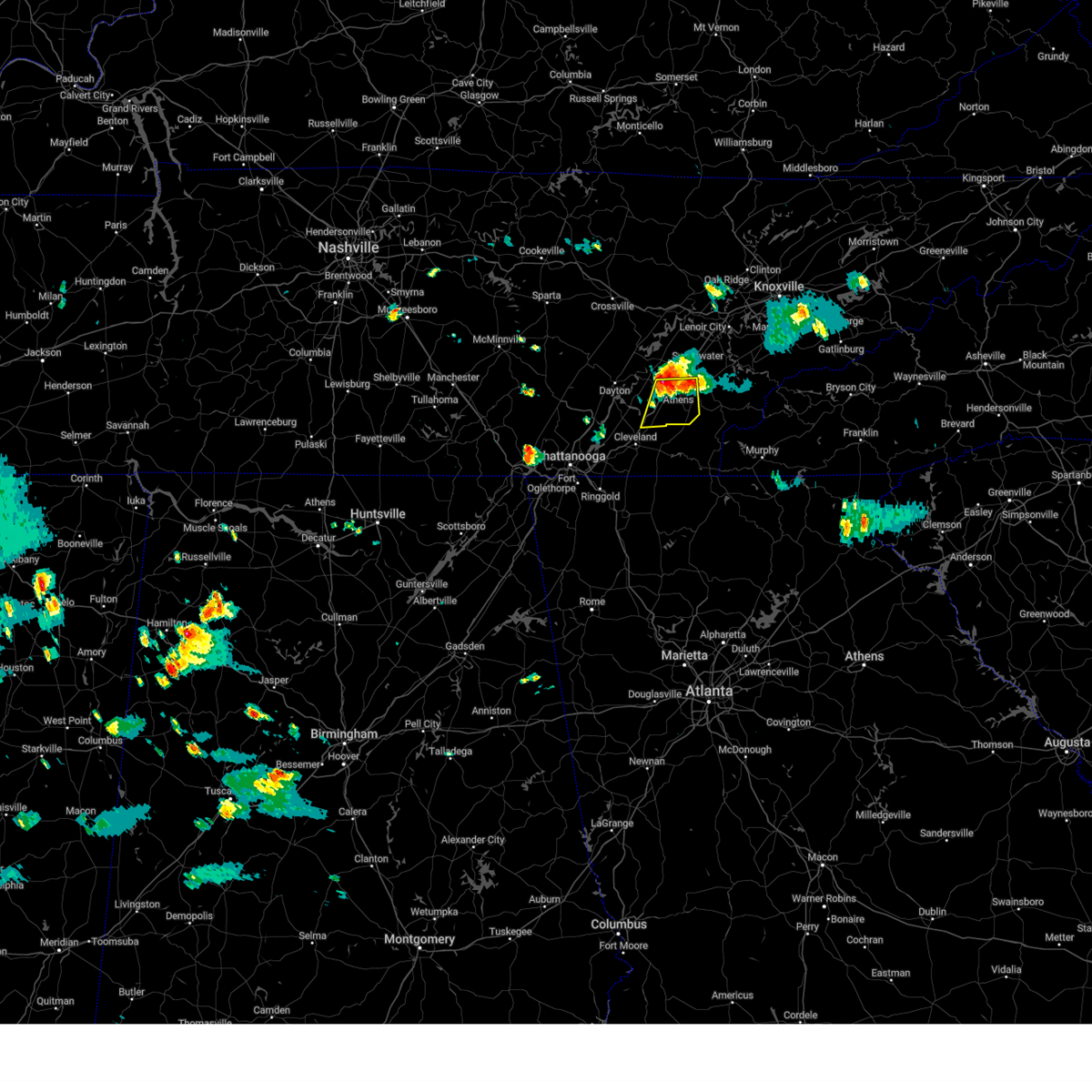
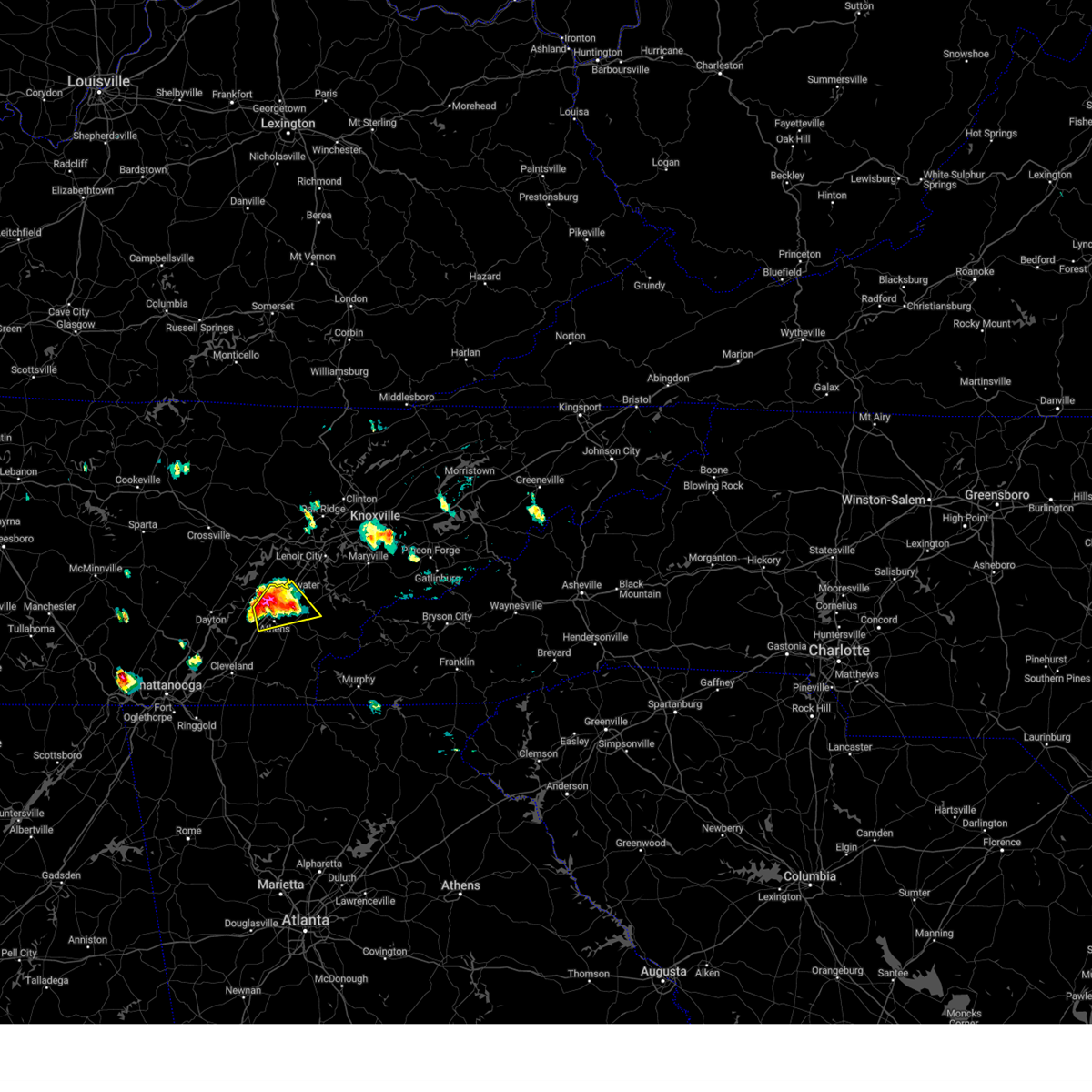
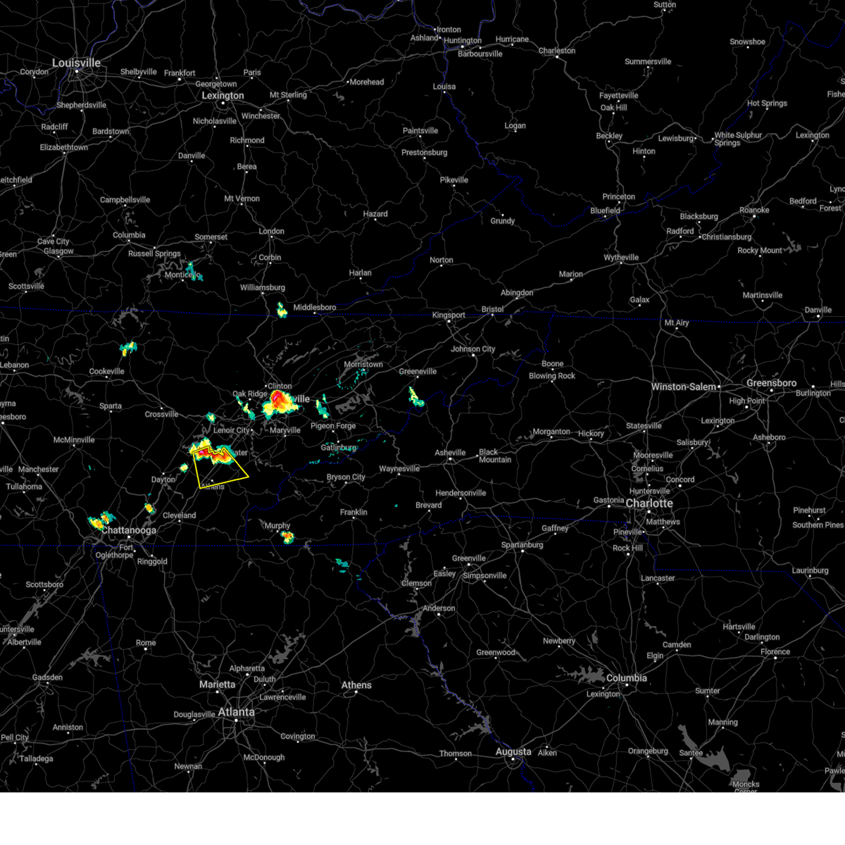
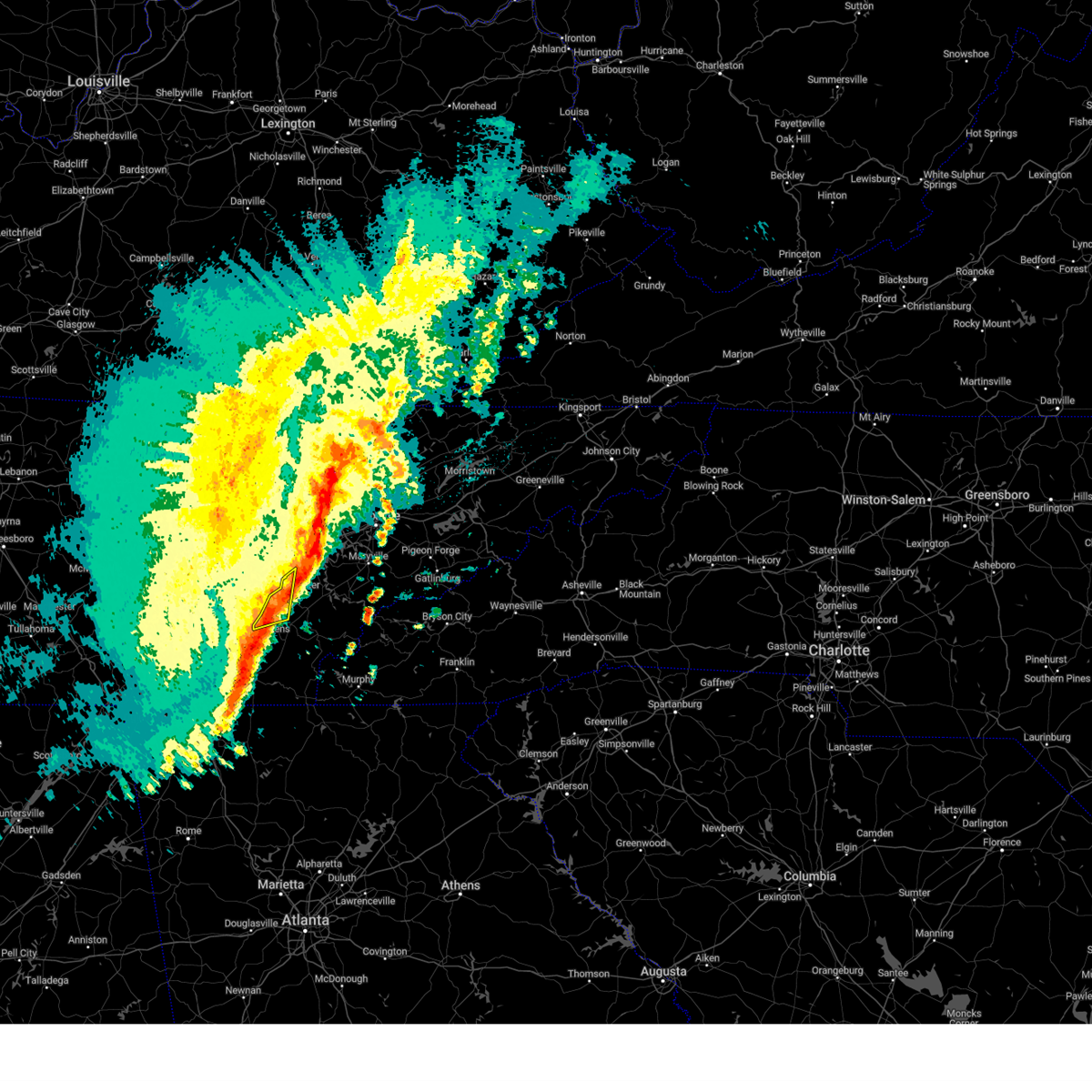
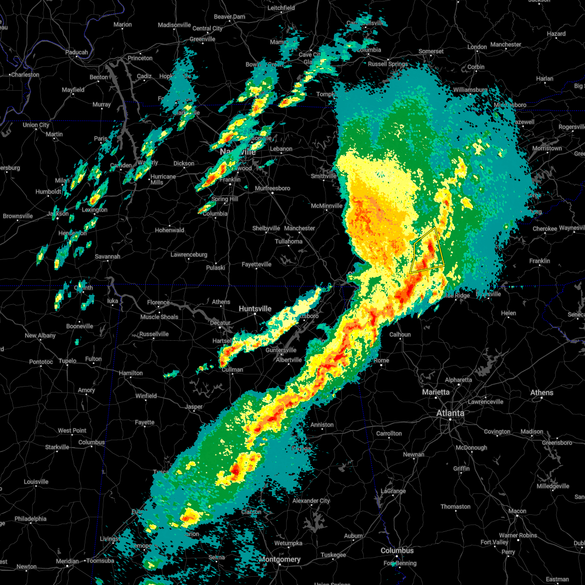
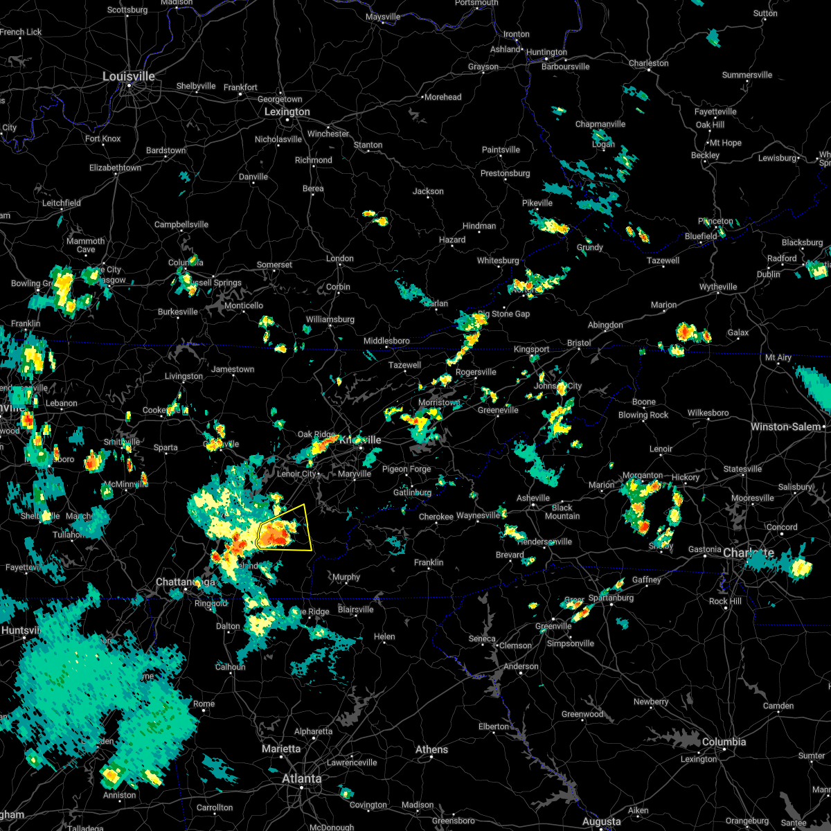
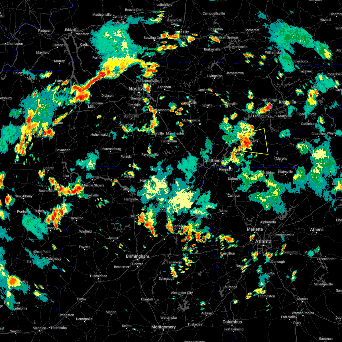
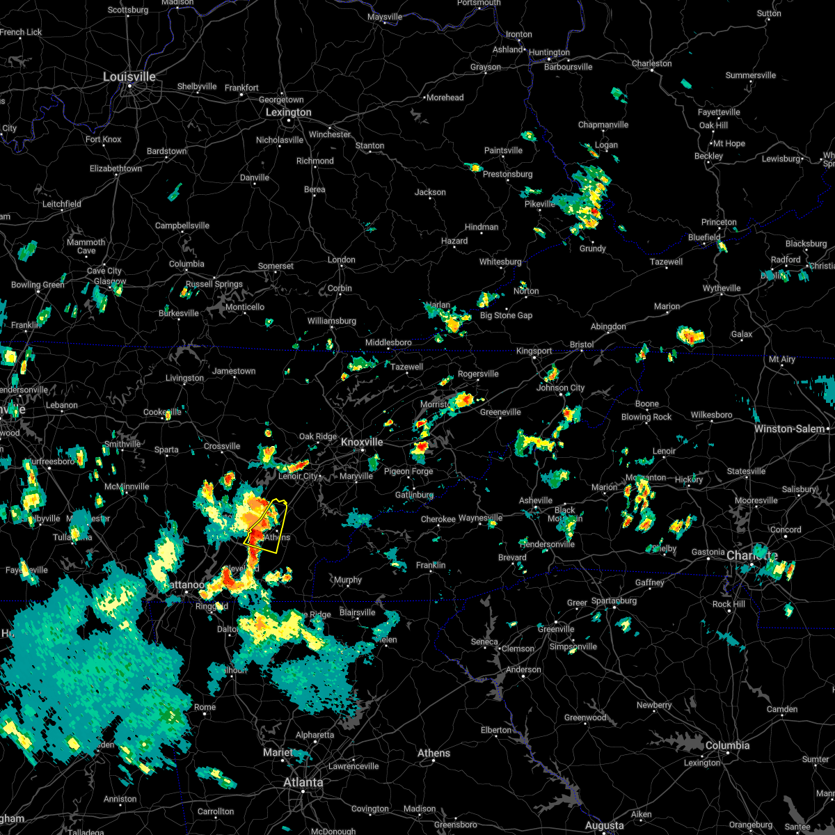
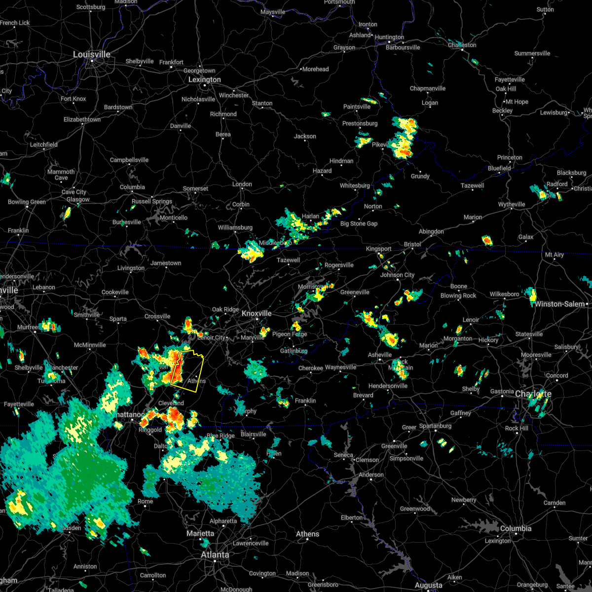
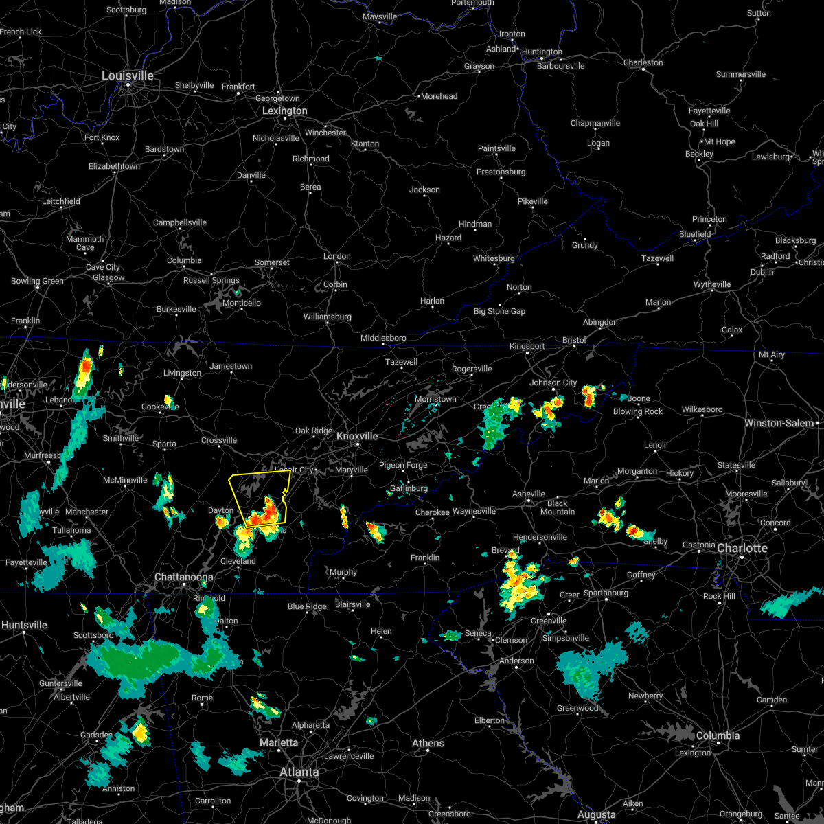
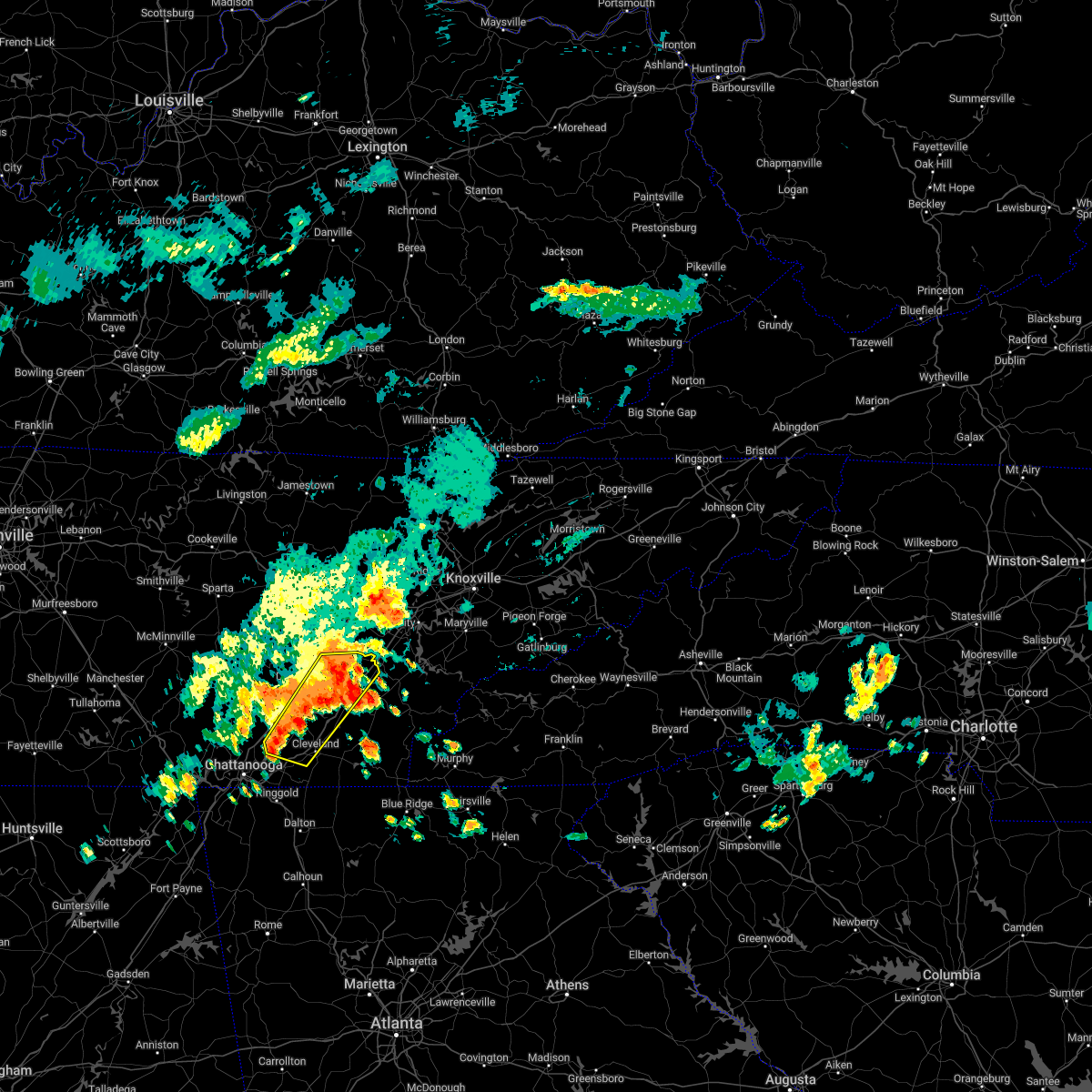
Hail Map for Athens, TN
The Athens, TN area has had 11 reports of on-the-ground hail by trained spotters, and has been under severe weather warnings 29 times during the past 12 months. Doppler radar has detected hail at or near Athens, TN on 61 occasions, including 7 occasions during the past year.
| Name: | Athens, TN |
| Where Located: | 48.5 miles NE of Chattanooga, TN |
| Map: | Google Map for Athens, TN |
| Population: | 13458 |
| Housing Units: | 6370 |
| More Info: | Search Google for Athens, TN |
1
The Top Recent Hail Date for Athens, TN is Friday, August 30, 2024 (21st out of 61)

Hail and Wind Damage Spotted near Athens, TN
| Date / Time | Report Details |
|---|---|
| 5/20/2025 9:55 PM EDT |
 At 955 pm edt, a severe thunderstorm was located near sweetwater, moving east at 35 mph (radar indicated). Hazards include 60 mph wind gusts and penny size hail. Expect damage to roofs, siding, and trees. locations impacted include, madisonville, niota, sweetwater, englewood, philadelphia, vonore, and tellico village. This includes interstate 75 in tennessee between mile markers 54 and 65. At 955 pm edt, a severe thunderstorm was located near sweetwater, moving east at 35 mph (radar indicated). Hazards include 60 mph wind gusts and penny size hail. Expect damage to roofs, siding, and trees. locations impacted include, madisonville, niota, sweetwater, englewood, philadelphia, vonore, and tellico village. This includes interstate 75 in tennessee between mile markers 54 and 65.
|
| 5/20/2025 9:55 PM EDT |
 the severe thunderstorm warning has been cancelled and is no longer in effect the severe thunderstorm warning has been cancelled and is no longer in effect
|
| 5/20/2025 9:41 PM EDT |
 Svrmrx the national weather service in morristown has issued a * severe thunderstorm warning for, south central loudon county in east tennessee, east central meigs county in east tennessee, northeastern mcminn county in east tennessee, northwestern monroe county in east tennessee, * until 1030 pm edt. * at 941 pm edt, a severe thunderstorm was located near athens, moving east at 35 mph (radar indicated). Hazards include 60 mph wind gusts and penny size hail. expect damage to roofs, siding, and trees Svrmrx the national weather service in morristown has issued a * severe thunderstorm warning for, south central loudon county in east tennessee, east central meigs county in east tennessee, northeastern mcminn county in east tennessee, northwestern monroe county in east tennessee, * until 1030 pm edt. * at 941 pm edt, a severe thunderstorm was located near athens, moving east at 35 mph (radar indicated). Hazards include 60 mph wind gusts and penny size hail. expect damage to roofs, siding, and trees
|
| 5/20/2025 7:44 PM EDT | Several trees dow in mcminn county TN, 0.7 miles SE of Athens, TN |
| 5/20/2025 7:33 PM EDT |
 the severe thunderstorm warning has been cancelled and is no longer in effect the severe thunderstorm warning has been cancelled and is no longer in effect
|
| 5/20/2025 7:33 PM EDT |
 At 733 pm edt, a severe thunderstorm was located near athens, moving east at 30 mph (radar indicated). Hazards include 60 mph wind gusts and penny size hail. Expect damage to roofs, siding, and trees. locations impacted include, riceville, madisonville, englewood, mount vernon, clear water, athens, niota, tellico plains, vonore, and etowah. This includes interstate 75 in tennessee between mile markers 41 and 53. At 733 pm edt, a severe thunderstorm was located near athens, moving east at 30 mph (radar indicated). Hazards include 60 mph wind gusts and penny size hail. Expect damage to roofs, siding, and trees. locations impacted include, riceville, madisonville, englewood, mount vernon, clear water, athens, niota, tellico plains, vonore, and etowah. This includes interstate 75 in tennessee between mile markers 41 and 53.
|
| 5/20/2025 7:11 PM EDT |
 Svrmrx the national weather service in morristown has issued a * severe thunderstorm warning for, southwestern meigs county in east tennessee, mcminn county in east tennessee, northwestern monroe county in east tennessee, * until 800 pm edt. * at 711 pm edt, a severe thunderstorm was located 9 miles northwest of charleston, or 10 miles southwest of decatur, moving east at 40 mph (radar indicated). Hazards include 60 mph wind gusts and penny size hail. expect damage to roofs, siding, and trees Svrmrx the national weather service in morristown has issued a * severe thunderstorm warning for, southwestern meigs county in east tennessee, mcminn county in east tennessee, northwestern monroe county in east tennessee, * until 800 pm edt. * at 711 pm edt, a severe thunderstorm was located 9 miles northwest of charleston, or 10 miles southwest of decatur, moving east at 40 mph (radar indicated). Hazards include 60 mph wind gusts and penny size hail. expect damage to roofs, siding, and trees
|
| 5/17/2025 2:46 AM EDT |
 the tornado warning has been cancelled and is no longer in effect the tornado warning has been cancelled and is no longer in effect
|
| 5/17/2025 2:46 AM EDT |
 At 246 am edt, a severe thunderstorm capable of producing a tornado was located near etowah, or near athens, moving east at 45 mph (radar indicated rotation). Hazards include tornado and quarter size hail. Flying debris will be dangerous to those caught without shelter. mobile homes will be damaged or destroyed. damage to roofs, windows, and vehicles will occur. tree damage is likely. this dangerous storm will be near, etowah around 250 am edt. Other locations impacted by this tornadic thunderstorm include riceville, bullet creek, englewood, mount vernon, and dentville. At 246 am edt, a severe thunderstorm capable of producing a tornado was located near etowah, or near athens, moving east at 45 mph (radar indicated rotation). Hazards include tornado and quarter size hail. Flying debris will be dangerous to those caught without shelter. mobile homes will be damaged or destroyed. damage to roofs, windows, and vehicles will occur. tree damage is likely. this dangerous storm will be near, etowah around 250 am edt. Other locations impacted by this tornadic thunderstorm include riceville, bullet creek, englewood, mount vernon, and dentville.
|
| 5/17/2025 2:41 AM EDT |
 the tornado warning has been cancelled and is no longer in effect the tornado warning has been cancelled and is no longer in effect
|
| 5/17/2025 2:41 AM EDT |
 At 241 am edt, a severe thunderstorm capable of producing a tornado was located near charleston, or 8 miles southwest of athens, moving east at 45 mph (radar indicated rotation). Hazards include tornado and quarter size hail. Flying debris will be dangerous to those caught without shelter. mobile homes will be damaged or destroyed. damage to roofs, windows, and vehicles will occur. tree damage is likely. this dangerous storm will be near, athens around 245 am edt. etowah around 250 am edt. other locations impacted by this tornadic thunderstorm include riceville, englewood, mount vernon, calhoun, hillsview, bullet creek, and dentville. This includes interstate 75 in tennessee between mile markers 35 and 44. At 241 am edt, a severe thunderstorm capable of producing a tornado was located near charleston, or 8 miles southwest of athens, moving east at 45 mph (radar indicated rotation). Hazards include tornado and quarter size hail. Flying debris will be dangerous to those caught without shelter. mobile homes will be damaged or destroyed. damage to roofs, windows, and vehicles will occur. tree damage is likely. this dangerous storm will be near, athens around 245 am edt. etowah around 250 am edt. other locations impacted by this tornadic thunderstorm include riceville, englewood, mount vernon, calhoun, hillsview, bullet creek, and dentville. This includes interstate 75 in tennessee between mile markers 35 and 44.
|
| 5/17/2025 2:38 AM EDT |
 the severe thunderstorm warning has been cancelled and is no longer in effect the severe thunderstorm warning has been cancelled and is no longer in effect
|
| 5/17/2025 2:38 AM EDT |
 At 237 am edt, a severe thunderstorm was located 7 miles north of charleston, or 8 miles southwest of athens, moving east at 45 mph (radar indicated). Hazards include 60 mph wind gusts and quarter size hail. Hail damage to vehicles is expected. expect wind damage to roofs, siding, and trees. locations impacted include, riceville, athens, etowah, calhoun, hillsview, and charleston. This includes interstate 75 in tennessee between mile markers 33 and 50. At 237 am edt, a severe thunderstorm was located 7 miles north of charleston, or 8 miles southwest of athens, moving east at 45 mph (radar indicated). Hazards include 60 mph wind gusts and quarter size hail. Hail damage to vehicles is expected. expect wind damage to roofs, siding, and trees. locations impacted include, riceville, athens, etowah, calhoun, hillsview, and charleston. This includes interstate 75 in tennessee between mile markers 33 and 50.
|
| 5/17/2025 2:27 AM EDT |
 Tormrx the national weather service in morristown has issued a * tornado warning for, northeastern bradley county in east tennessee, southwestern meigs county in east tennessee, north central polk county in east tennessee, mcminn county in east tennessee, southwestern monroe county in east tennessee, * until 315 am edt. * at 227 am edt, a severe thunderstorm capable of producing a tornado was located 7 miles northwest of charleston, or 11 miles north of cleveland, moving east at 40 mph (radar indicated rotation). Hazards include tornado and quarter size hail. Flying debris will be dangerous to those caught without shelter. mobile homes will be damaged or destroyed. damage to roofs, windows, and vehicles will occur. tree damage is likely. this dangerous storm will be near, charleston around 235 am edt. etowah around 250 am edt. other locations impacted by this tornadic thunderstorm include riceville, englewood, mount vernon, calhoun, hillsview, bullet creek, big spring, and dentville. This includes interstate 75 in tennessee between mile markers 33 and 46. Tormrx the national weather service in morristown has issued a * tornado warning for, northeastern bradley county in east tennessee, southwestern meigs county in east tennessee, north central polk county in east tennessee, mcminn county in east tennessee, southwestern monroe county in east tennessee, * until 315 am edt. * at 227 am edt, a severe thunderstorm capable of producing a tornado was located 7 miles northwest of charleston, or 11 miles north of cleveland, moving east at 40 mph (radar indicated rotation). Hazards include tornado and quarter size hail. Flying debris will be dangerous to those caught without shelter. mobile homes will be damaged or destroyed. damage to roofs, windows, and vehicles will occur. tree damage is likely. this dangerous storm will be near, charleston around 235 am edt. etowah around 250 am edt. other locations impacted by this tornadic thunderstorm include riceville, englewood, mount vernon, calhoun, hillsview, bullet creek, big spring, and dentville. This includes interstate 75 in tennessee between mile markers 33 and 46.
|
| 5/17/2025 2:11 AM EDT |
 Svrmrx the national weather service in morristown has issued a * severe thunderstorm warning for, south central rhea county in east tennessee, northeastern bradley county in east tennessee, southwestern meigs county in east tennessee, southwestern mcminn county in east tennessee, northeastern hamilton county in east tennessee, * until 300 am edt. * at 211 am edt, a severe thunderstorm was located 8 miles northeast of soddy-daisy, or 10 miles south of dayton, moving east at 45 mph (radar indicated). Hazards include 60 mph wind gusts and quarter size hail. Hail damage to vehicles is expected. Expect wind damage to roofs, siding, and trees. Svrmrx the national weather service in morristown has issued a * severe thunderstorm warning for, south central rhea county in east tennessee, northeastern bradley county in east tennessee, southwestern meigs county in east tennessee, southwestern mcminn county in east tennessee, northeastern hamilton county in east tennessee, * until 300 am edt. * at 211 am edt, a severe thunderstorm was located 8 miles northeast of soddy-daisy, or 10 miles south of dayton, moving east at 45 mph (radar indicated). Hazards include 60 mph wind gusts and quarter size hail. Hail damage to vehicles is expected. Expect wind damage to roofs, siding, and trees.
|
| 5/2/2025 4:15 PM EDT |
 the severe thunderstorm warning has been cancelled and is no longer in effect the severe thunderstorm warning has been cancelled and is no longer in effect
|
| 5/2/2025 3:54 PM EDT | At 353 pm edt, a severe thunderstorm was located near benton, moving northeast at 25 mph (radar indicated). Hazards include 60 mph wind gusts and quarter size hail. Hail damage to vehicles is expected. expect wind damage to roofs, siding, and trees. locations impacted include, englewood, mount vernon, bullet creek, athens, etowah, hiwassee ocoee state park, niota, dentville, and tellico plains. This includes interstate 75 in tennessee between mile markers 54 and 55. |
| 5/2/2025 3:38 PM EDT | Svrmrx the national weather service in morristown has issued a * severe thunderstorm warning for, central polk county in east tennessee, southeastern mcminn county in east tennessee, southwestern monroe county in east tennessee, * until 430 pm edt. * at 338 pm edt, a severe thunderstorm was located over benton, moving northeast at 25 mph (radar indicated). Hazards include 60 mph wind gusts and quarter size hail. Hail damage to vehicles is expected. Expect wind damage to roofs, siding, and trees. |
| 4/23/2025 6:25 PM EDT |
 the severe thunderstorm warning has been cancelled and is no longer in effect the severe thunderstorm warning has been cancelled and is no longer in effect
|
| 4/23/2025 6:06 PM EDT |
 Svrmrx the national weather service in morristown has issued a * severe thunderstorm warning for, southeastern mcminn county in east tennessee, northwestern monroe county in east tennessee, * until 645 pm edt. * at 606 pm edt, a severe thunderstorm was located near etowah, or near athens, moving northeast at 10 mph (radar indicated). Hazards include 60 mph wind gusts and quarter size hail. Hail damage to vehicles is expected. Expect wind damage to roofs, siding, and trees. Svrmrx the national weather service in morristown has issued a * severe thunderstorm warning for, southeastern mcminn county in east tennessee, northwestern monroe county in east tennessee, * until 645 pm edt. * at 606 pm edt, a severe thunderstorm was located near etowah, or near athens, moving northeast at 10 mph (radar indicated). Hazards include 60 mph wind gusts and quarter size hail. Hail damage to vehicles is expected. Expect wind damage to roofs, siding, and trees.
|
| 3/15/2025 7:30 PM EDT | Svrmrx the national weather service in morristown has issued a * severe thunderstorm warning for, central loudon county in east tennessee, east central meigs county in east tennessee, northeastern mcminn county in east tennessee, northwestern monroe county in east tennessee, southeastern roane county in east tennessee, * until 815 pm edt. * at 729 pm edt, a severe thunderstorm was located near athens, moving northeast at 55 mph (radar indicated). Hazards include 60 mph wind gusts. expect damage to roofs, siding, and trees |
| 3/15/2025 11:10 AM EDT | Quarter sized hail reported 3.2 miles NNW of Athens, TN |
| 3/15/2025 11:02 AM EDT |
 At 1101 am edt, a severe thunderstorm was located near athens, moving northeast at 45 mph (radar indicated). Hazards include 60 mph wind gusts and penny size hail. Expect damage to roofs, siding, and trees. locations impacted include, madisonville, tariffville, englewood, mount vernon, athens, etowah, niota, philadelphia, sweetwater, and loudon. This includes interstate 75 in tennessee between mile markers 56 and 66. At 1101 am edt, a severe thunderstorm was located near athens, moving northeast at 45 mph (radar indicated). Hazards include 60 mph wind gusts and penny size hail. Expect damage to roofs, siding, and trees. locations impacted include, madisonville, tariffville, englewood, mount vernon, athens, etowah, niota, philadelphia, sweetwater, and loudon. This includes interstate 75 in tennessee between mile markers 56 and 66.
|
| 3/15/2025 11:02 AM EDT |
 the severe thunderstorm warning has been cancelled and is no longer in effect the severe thunderstorm warning has been cancelled and is no longer in effect
|
| 3/15/2025 10:43 AM EDT |
 Svrmrx the national weather service in morristown has issued a * severe thunderstorm warning for, northeastern bradley county in east tennessee, south central loudon county in east tennessee, northwestern polk county in east tennessee, mcminn county in east tennessee, northwestern monroe county in east tennessee, * until 1130 am edt. * at 1042 am edt, a severe thunderstorm was located near charleston, or 10 miles north of benton, moving northeast at 50 mph (radar indicated). Hazards include 60 mph wind gusts and penny size hail. expect damage to roofs, siding, and trees Svrmrx the national weather service in morristown has issued a * severe thunderstorm warning for, northeastern bradley county in east tennessee, south central loudon county in east tennessee, northwestern polk county in east tennessee, mcminn county in east tennessee, northwestern monroe county in east tennessee, * until 1130 am edt. * at 1042 am edt, a severe thunderstorm was located near charleston, or 10 miles north of benton, moving northeast at 50 mph (radar indicated). Hazards include 60 mph wind gusts and penny size hail. expect damage to roofs, siding, and trees
|
| 8/17/2024 4:05 PM EDT | Svrmrx the national weather service in morristown has issued a * severe thunderstorm warning for, northern bradley county in east tennessee, southwestern meigs county in east tennessee, northwestern polk county in east tennessee, southwestern mcminn county in east tennessee, east central hamilton county in east tennessee, * until 445 pm edt. * at 405 pm edt, a severe thunderstorm was located 8 miles west of charleston, or 10 miles north of cleveland, moving east at 25 mph (radar indicated). Hazards include 60 mph wind gusts and quarter size hail. Hail damage to vehicles is expected. Expect wind damage to roofs, siding, and trees. |
| 7/31/2024 10:25 PM EDT |
 The storm which prompted the warning has weakened below severe limits, and no longer poses an immediate threat to life or property. therefore, the warning will be allowed to expire. however, gusty winds and heavy rain are still possible with this thunderstorm. The storm which prompted the warning has weakened below severe limits, and no longer poses an immediate threat to life or property. therefore, the warning will be allowed to expire. however, gusty winds and heavy rain are still possible with this thunderstorm.
|
| 7/31/2024 10:00 PM EDT |
 Svrmrx the national weather service in morristown has issued a * severe thunderstorm warning for, north central polk county in east tennessee, southeastern mcminn county in east tennessee, southwestern monroe county in east tennessee, * until 1030 pm edt. * at 959 pm edt, a severe thunderstorm was located over athens, moving south at 30 mph (radar indicated). Hazards include 60 mph wind gusts. expect damage to roofs, siding, and trees Svrmrx the national weather service in morristown has issued a * severe thunderstorm warning for, north central polk county in east tennessee, southeastern mcminn county in east tennessee, southwestern monroe county in east tennessee, * until 1030 pm edt. * at 959 pm edt, a severe thunderstorm was located over athens, moving south at 30 mph (radar indicated). Hazards include 60 mph wind gusts. expect damage to roofs, siding, and trees
|
| 7/30/2024 5:52 PM EDT |
 the severe thunderstorm warning has been cancelled and is no longer in effect the severe thunderstorm warning has been cancelled and is no longer in effect
|
| 7/30/2024 5:52 PM EDT |
 At 552 pm edt, severe thunderstorms were located along a line extending from 6 miles southwest of madisonville to 6 miles southwest of decatur, moving southeast at 15 mph (radar indicated). Hazards include 60 mph wind gusts and penny size hail. Expect damage to roofs, siding, and trees. locations impacted include, athens, decatur, etowah, englewood, tellico plains, niota, riceville, coker creek, mount vernon, and clear water. This includes interstate 75 in tennessee between mile markers 39 and 54. At 552 pm edt, severe thunderstorms were located along a line extending from 6 miles southwest of madisonville to 6 miles southwest of decatur, moving southeast at 15 mph (radar indicated). Hazards include 60 mph wind gusts and penny size hail. Expect damage to roofs, siding, and trees. locations impacted include, athens, decatur, etowah, englewood, tellico plains, niota, riceville, coker creek, mount vernon, and clear water. This includes interstate 75 in tennessee between mile markers 39 and 54.
|
| 7/30/2024 5:50 PM EDT | Multiple trees and power lines down from athens to the northern portions of the count in mcminn county TN, 0.6 miles WNW of Athens, TN |
| 7/30/2024 5:24 PM EDT |
 Svrmrx the national weather service in morristown has issued a * severe thunderstorm warning for, east central rhea county in east tennessee, east central meigs county in east tennessee, northeastern polk county in east tennessee, mcminn county in east tennessee, southwestern monroe county in east tennessee, * until 630 pm edt. * at 523 pm edt, severe thunderstorms were located along a line extending from near sweetwater to near dayton, moving southeast at 20 mph (radar indicated). Hazards include 60 mph wind gusts and penny size hail. expect damage to roofs, siding, and trees Svrmrx the national weather service in morristown has issued a * severe thunderstorm warning for, east central rhea county in east tennessee, east central meigs county in east tennessee, northeastern polk county in east tennessee, mcminn county in east tennessee, southwestern monroe county in east tennessee, * until 630 pm edt. * at 523 pm edt, severe thunderstorms were located along a line extending from near sweetwater to near dayton, moving southeast at 20 mph (radar indicated). Hazards include 60 mph wind gusts and penny size hail. expect damage to roofs, siding, and trees
|
| 5/26/2024 4:26 PM EDT |
 Svrmrx the national weather service in morristown has issued a * severe thunderstorm warning for, east central bradley county in east tennessee, central polk county in east tennessee, southeastern mcminn county in east tennessee, southwestern monroe county in east tennessee, * until 515 pm edt. * at 426 pm edt, a severe thunderstorm was located over benton, moving northeast at 25 mph (radar indicated). Hazards include 60 mph wind gusts and penny size hail. expect damage to roofs, siding, and trees Svrmrx the national weather service in morristown has issued a * severe thunderstorm warning for, east central bradley county in east tennessee, central polk county in east tennessee, southeastern mcminn county in east tennessee, southwestern monroe county in east tennessee, * until 515 pm edt. * at 426 pm edt, a severe thunderstorm was located over benton, moving northeast at 25 mph (radar indicated). Hazards include 60 mph wind gusts and penny size hail. expect damage to roofs, siding, and trees
|
| 5/23/2024 7:13 PM EDT |
 Svrmrx the national weather service in morristown has issued a * severe thunderstorm warning for, southern loudon county in east tennessee, northeastern mcminn county in east tennessee, northwestern monroe county in east tennessee, * until 800 pm edt. * at 713 pm edt, a severe thunderstorm was located over athens, moving east at 30 mph (radar indicated). Hazards include 60 mph wind gusts and quarter size hail. Hail damage to vehicles is expected. Expect wind damage to roofs, siding, and trees. Svrmrx the national weather service in morristown has issued a * severe thunderstorm warning for, southern loudon county in east tennessee, northeastern mcminn county in east tennessee, northwestern monroe county in east tennessee, * until 800 pm edt. * at 713 pm edt, a severe thunderstorm was located over athens, moving east at 30 mph (radar indicated). Hazards include 60 mph wind gusts and quarter size hail. Hail damage to vehicles is expected. Expect wind damage to roofs, siding, and trees.
|
| 5/9/2024 6:15 AM EDT |
 At 614 am edt, severe thunderstorms were located along a line extending from near sweetwater to 6 miles southwest of athens to near east cleveland, moving east at 45 mph (radar indicated). Hazards include 60 mph wind gusts and quarter size hail. Hail damage to vehicles is expected. expect wind damage to roofs, siding, and trees. locations impacted include, cleveland, athens, sweetwater, charleston, east cleveland, niota, calhoun, riceville, clear water, and hillsview. This includes interstate 75 in tennessee between mile markers 23 and 59. At 614 am edt, severe thunderstorms were located along a line extending from near sweetwater to 6 miles southwest of athens to near east cleveland, moving east at 45 mph (radar indicated). Hazards include 60 mph wind gusts and quarter size hail. Hail damage to vehicles is expected. expect wind damage to roofs, siding, and trees. locations impacted include, cleveland, athens, sweetwater, charleston, east cleveland, niota, calhoun, riceville, clear water, and hillsview. This includes interstate 75 in tennessee between mile markers 23 and 59.
|
| 5/9/2024 6:15 AM EDT |
 the severe thunderstorm warning has been cancelled and is no longer in effect the severe thunderstorm warning has been cancelled and is no longer in effect
|
| 5/9/2024 6:12 AM EDT |
 Svrmrx the national weather service in morristown has issued a * severe thunderstorm warning for, cherokee county in southwestern north carolina, bradley county in east tennessee, polk county in east tennessee, mcminn county in east tennessee, monroe county in east tennessee, * until 715 am edt. * at 611 am edt, severe thunderstorms were located along a line extending from near athens to near charleston to cleveland to cohutta, moving east at 50 mph (radar indicated). Hazards include 60 mph wind gusts and quarter size hail. Hail damage to vehicles is expected. Expect wind damage to roofs, siding, and trees. Svrmrx the national weather service in morristown has issued a * severe thunderstorm warning for, cherokee county in southwestern north carolina, bradley county in east tennessee, polk county in east tennessee, mcminn county in east tennessee, monroe county in east tennessee, * until 715 am edt. * at 611 am edt, severe thunderstorms were located along a line extending from near athens to near charleston to cleveland to cohutta, moving east at 50 mph (radar indicated). Hazards include 60 mph wind gusts and quarter size hail. Hail damage to vehicles is expected. Expect wind damage to roofs, siding, and trees.
|
| 5/9/2024 6:03 AM EDT |
 At 603 am edt, severe thunderstorms were located along a line extending from 8 miles west of sweetwater to 8 miles south of decatur to near cleveland, moving east at 45 mph (radar indicated). Hazards include 60 mph wind gusts and quarter size hail. Hail damage to vehicles is expected. expect wind damage to roofs, siding, and trees. locations impacted include, cleveland, athens, sweetwater, decatur, soddy-daisy, charleston, east cleveland, niota, calhoun, and riceville. This includes interstate 75 in tennessee between mile markers 23 and 59. At 603 am edt, severe thunderstorms were located along a line extending from 8 miles west of sweetwater to 8 miles south of decatur to near cleveland, moving east at 45 mph (radar indicated). Hazards include 60 mph wind gusts and quarter size hail. Hail damage to vehicles is expected. expect wind damage to roofs, siding, and trees. locations impacted include, cleveland, athens, sweetwater, decatur, soddy-daisy, charleston, east cleveland, niota, calhoun, and riceville. This includes interstate 75 in tennessee between mile markers 23 and 59.
|
| 5/9/2024 5:31 AM EDT |
 Svrmrx the national weather service in morristown has issued a * severe thunderstorm warning for, rhea county in east tennessee, northern bradley county in east tennessee, meigs county in east tennessee, mcminn county in east tennessee, northeastern hamilton county in east tennessee, * until 630 am edt. * at 530 am edt, severe thunderstorms were located along a line extending from 7 miles north of pikeville to 15 miles southeast of spencer to near dunlap, moving east at 45 mph (radar indicated). Hazards include 60 mph wind gusts and quarter size hail. Hail damage to vehicles is expected. Expect wind damage to roofs, siding, and trees. Svrmrx the national weather service in morristown has issued a * severe thunderstorm warning for, rhea county in east tennessee, northern bradley county in east tennessee, meigs county in east tennessee, mcminn county in east tennessee, northeastern hamilton county in east tennessee, * until 630 am edt. * at 530 am edt, severe thunderstorms were located along a line extending from 7 miles north of pikeville to 15 miles southeast of spencer to near dunlap, moving east at 45 mph (radar indicated). Hazards include 60 mph wind gusts and quarter size hail. Hail damage to vehicles is expected. Expect wind damage to roofs, siding, and trees.
|
| 5/8/2024 10:41 PM EDT |
 At 1041 pm edt/941 pm cdt/, a severe thunderstorm was located near etowah, or near athens, moving east at 45 mph (radar indicated). Hazards include 70 mph wind gusts and ping pong ball size hail. People and animals outdoors will be injured. expect hail damage to roofs, siding, windows, and vehicles. expect considerable tree damage. wind damage is also likely to mobile homes, roofs, and outbuildings. locations impacted include, cleveland, athens, dayton, decatur, benton, soddy-daisy, etowah, charleston, englewood, and graysville. This includes interstate 75 in tennessee between mile markers 26 and 52. At 1041 pm edt/941 pm cdt/, a severe thunderstorm was located near etowah, or near athens, moving east at 45 mph (radar indicated). Hazards include 70 mph wind gusts and ping pong ball size hail. People and animals outdoors will be injured. expect hail damage to roofs, siding, windows, and vehicles. expect considerable tree damage. wind damage is also likely to mobile homes, roofs, and outbuildings. locations impacted include, cleveland, athens, dayton, decatur, benton, soddy-daisy, etowah, charleston, englewood, and graysville. This includes interstate 75 in tennessee between mile markers 26 and 52.
|
| 5/8/2024 10:37 PM EDT |
 Svrmrx the national weather service in morristown has issued a * severe thunderstorm warning for, central cherokee county in southwestern north carolina, east central bradley county in east tennessee, northern polk county in east tennessee, southeastern mcminn county in east tennessee, south central blount county in east tennessee, monroe county in east tennessee, * until 1130 pm edt. * at 1037 pm edt, a severe thunderstorm was located over etowah, or 7 miles south of athens, moving east at 45 mph (radar indicated). Hazards include 70 mph wind gusts and ping pong ball size hail. People and animals outdoors will be injured. expect hail damage to roofs, siding, windows, and vehicles. expect considerable tree damage. Wind damage is also likely to mobile homes, roofs, and outbuildings. Svrmrx the national weather service in morristown has issued a * severe thunderstorm warning for, central cherokee county in southwestern north carolina, east central bradley county in east tennessee, northern polk county in east tennessee, southeastern mcminn county in east tennessee, south central blount county in east tennessee, monroe county in east tennessee, * until 1130 pm edt. * at 1037 pm edt, a severe thunderstorm was located over etowah, or 7 miles south of athens, moving east at 45 mph (radar indicated). Hazards include 70 mph wind gusts and ping pong ball size hail. People and animals outdoors will be injured. expect hail damage to roofs, siding, windows, and vehicles. expect considerable tree damage. Wind damage is also likely to mobile homes, roofs, and outbuildings.
|
| 5/8/2024 10:10 PM EDT | Trees down close to athens. location approximate. time estimated by rada in mcminn county TN, 0.2 miles N of Athens, TN |
| 5/8/2024 9:54 PM EDT |
 Svrmrx the national weather service in morristown has issued a * severe thunderstorm warning for, southern rhea county in east tennessee, northern bradley county in east tennessee, meigs county in east tennessee, east central sequatchie county in east tennessee, southwestern bledsoe county in east tennessee, northwestern polk county in east tennessee, mcminn county in east tennessee, northeastern hamilton county in east tennessee, * until 1100 pm edt/1000 pm cdt/. * at 953 pm edt/853 pm cdt/, a severe thunderstorm was located 10 miles west of dayton, moving east at 40 mph (radar indicated). Hazards include 70 mph wind gusts and ping pong ball size hail. People and animals outdoors will be injured. expect hail damage to roofs, siding, windows, and vehicles. expect considerable tree damage. Wind damage is also likely to mobile homes, roofs, and outbuildings. Svrmrx the national weather service in morristown has issued a * severe thunderstorm warning for, southern rhea county in east tennessee, northern bradley county in east tennessee, meigs county in east tennessee, east central sequatchie county in east tennessee, southwestern bledsoe county in east tennessee, northwestern polk county in east tennessee, mcminn county in east tennessee, northeastern hamilton county in east tennessee, * until 1100 pm edt/1000 pm cdt/. * at 953 pm edt/853 pm cdt/, a severe thunderstorm was located 10 miles west of dayton, moving east at 40 mph (radar indicated). Hazards include 70 mph wind gusts and ping pong ball size hail. People and animals outdoors will be injured. expect hail damage to roofs, siding, windows, and vehicles. expect considerable tree damage. Wind damage is also likely to mobile homes, roofs, and outbuildings.
|
| 2/28/2024 11:53 AM EST |
 Svrmrx the national weather service in morristown has issued a * severe thunderstorm warning for, southeastern rhea county in east tennessee, loudon county in east tennessee, meigs county in east tennessee, south central knox county in east tennessee, northern mcminn county in east tennessee, northwestern blount county in east tennessee, northwestern monroe county in east tennessee, southern roane county in east tennessee, * until 1245 pm est. * at 1153 am est, severe thunderstorms were located along a line extending from 8 miles east of spring city to near decatur to near dayton, moving east at 50 mph (radar indicated). Hazards include 60 mph wind gusts and penny size hail. expect damage to roofs, siding, and trees Svrmrx the national weather service in morristown has issued a * severe thunderstorm warning for, southeastern rhea county in east tennessee, loudon county in east tennessee, meigs county in east tennessee, south central knox county in east tennessee, northern mcminn county in east tennessee, northwestern blount county in east tennessee, northwestern monroe county in east tennessee, southern roane county in east tennessee, * until 1245 pm est. * at 1153 am est, severe thunderstorms were located along a line extending from 8 miles east of spring city to near decatur to near dayton, moving east at 50 mph (radar indicated). Hazards include 60 mph wind gusts and penny size hail. expect damage to roofs, siding, and trees
|
| 8/14/2023 11:13 PM EDT |
 The severe thunderstorm warning for east central mcminn and southwestern monroe counties will expire at 1115 pm edt, the storm which prompted the warning has weakened below severe limits, and no longer poses an immediate threat to life or property. therefore, the warning will be allowed to expire. however, heavy rain is still possible with this thunderstorm. a severe thunderstorm watch remains in effect until 300 am edt for east tennessee. The severe thunderstorm warning for east central mcminn and southwestern monroe counties will expire at 1115 pm edt, the storm which prompted the warning has weakened below severe limits, and no longer poses an immediate threat to life or property. therefore, the warning will be allowed to expire. however, heavy rain is still possible with this thunderstorm. a severe thunderstorm watch remains in effect until 300 am edt for east tennessee.
|
| 8/14/2023 10:53 PM EDT |
 At 1053 pm edt, a severe thunderstorm was located near etowah, or 10 miles southwest of madisonville, moving east at 45 mph (radar indicated). Hazards include 60 mph wind gusts. Expect damage to roofs, siding, and trees. locations impacted include, athens, madisonville, etowah, englewood, tellico plains, niota, and mount vernon. this includes interstate 75 in tennessee between mile markers 50 and 52. hail threat, radar indicated max hail size, <. 75 in wind threat, radar indicated max wind gust, 60 mph. At 1053 pm edt, a severe thunderstorm was located near etowah, or 10 miles southwest of madisonville, moving east at 45 mph (radar indicated). Hazards include 60 mph wind gusts. Expect damage to roofs, siding, and trees. locations impacted include, athens, madisonville, etowah, englewood, tellico plains, niota, and mount vernon. this includes interstate 75 in tennessee between mile markers 50 and 52. hail threat, radar indicated max hail size, <. 75 in wind threat, radar indicated max wind gust, 60 mph.
|
| 8/14/2023 10:32 PM EDT |
 At 1032 pm edt, a severe thunderstorm was located over athens, moving east at 30 mph (radar indicated). Hazards include 60 mph wind gusts. expect damage to roofs, siding, and trees At 1032 pm edt, a severe thunderstorm was located over athens, moving east at 30 mph (radar indicated). Hazards include 60 mph wind gusts. expect damage to roofs, siding, and trees
|
| 8/14/2023 9:23 PM EDT |
 At 923 pm edt, a severe thunderstorm was located near charleston, or 9 miles south of athens, moving east at 35 mph (radar indicated). Hazards include 60 mph wind gusts and quarter size hail. Hail damage to vehicles is expected. expect wind damage to roofs, siding, and trees. locations impacted include, athens, benton, etowah, charleston, englewood, tellico plains, calhoun, riceville, coker creek, and turtletown. this includes interstate 75 in tennessee between mile markers 37 and 42. hail threat, radar indicated max hail size, 1. 00 in wind threat, radar indicated max wind gust, 60 mph. At 923 pm edt, a severe thunderstorm was located near charleston, or 9 miles south of athens, moving east at 35 mph (radar indicated). Hazards include 60 mph wind gusts and quarter size hail. Hail damage to vehicles is expected. expect wind damage to roofs, siding, and trees. locations impacted include, athens, benton, etowah, charleston, englewood, tellico plains, calhoun, riceville, coker creek, and turtletown. this includes interstate 75 in tennessee between mile markers 37 and 42. hail threat, radar indicated max hail size, 1. 00 in wind threat, radar indicated max wind gust, 60 mph.
|
| 8/14/2023 8:59 PM EDT |
 At 859 pm edt, a severe thunderstorm was located near charleston, or 12 miles north of cleveland, moving east at 45 mph (radar indicated). Hazards include 60 mph wind gusts and quarter size hail. Hail damage to vehicles is expected. Expect wind damage to roofs, siding, and trees. At 859 pm edt, a severe thunderstorm was located near charleston, or 12 miles north of cleveland, moving east at 45 mph (radar indicated). Hazards include 60 mph wind gusts and quarter size hail. Hail damage to vehicles is expected. Expect wind damage to roofs, siding, and trees.
|
| 8/12/2023 3:51 PM EDT |
 At 349 pm edt, severe thunderstorms were located along a line extending from 9 miles southeast of lenoir city to 14 miles southeast of etowah, moving east at 35 mph (law enforcement. law enforcement reported trees down across the sweetwater area in monroe county). Hazards include 60 mph wind gusts. Expect damage to roofs, siding, and trees. locations impacted include, maryville, athens, loudon, madisonville, etowah, englewood, vonore, greenback, friendsville, and tellico plains. hail threat, radar indicated max hail size, <. 75 in wind threat, observed max wind gust, 60 mph. At 349 pm edt, severe thunderstorms were located along a line extending from 9 miles southeast of lenoir city to 14 miles southeast of etowah, moving east at 35 mph (law enforcement. law enforcement reported trees down across the sweetwater area in monroe county). Hazards include 60 mph wind gusts. Expect damage to roofs, siding, and trees. locations impacted include, maryville, athens, loudon, madisonville, etowah, englewood, vonore, greenback, friendsville, and tellico plains. hail threat, radar indicated max hail size, <. 75 in wind threat, observed max wind gust, 60 mph.
|
| 8/12/2023 3:38 PM EDT |
 At 337 pm edt/237 pm cdt/, severe thunderstorms were located along a line extending from 6 miles south of fairview to 6 miles west of charleston to 6 miles west of lookout mountain, moving east at 30 mph (law enforcement reported trees down in rhea and meigs counties). Hazards include 60 mph wind gusts. Expect damage to roofs, siding, and trees. locations impacted include, chattanooga, cleveland, athens, sweetwater, loudon, decatur, soddy-daisy, signal mountain, walden, and lakesite. this includes interstate 75 in tennessee between mile markers 28 and 71. hail threat, radar indicated max hail size, <. 75 in wind threat, radar indicated max wind gust, 60 mph. At 337 pm edt/237 pm cdt/, severe thunderstorms were located along a line extending from 6 miles south of fairview to 6 miles west of charleston to 6 miles west of lookout mountain, moving east at 30 mph (law enforcement reported trees down in rhea and meigs counties). Hazards include 60 mph wind gusts. Expect damage to roofs, siding, and trees. locations impacted include, chattanooga, cleveland, athens, sweetwater, loudon, decatur, soddy-daisy, signal mountain, walden, and lakesite. this includes interstate 75 in tennessee between mile markers 28 and 71. hail threat, radar indicated max hail size, <. 75 in wind threat, radar indicated max wind gust, 60 mph.
|
| 8/12/2023 3:34 PM EDT | Multiple trees dow in mcminn county TN, 3.4 miles W of Athens, TN |
| 8/12/2023 3:26 PM EDT |
 At 326 pm edt, severe thunderstorms were located along a line extending from near loudon to 6 miles northeast of benton, moving east at 35 mph (law enforcement. law enforcement reported multiple trees down across mcminn county). Hazards include 60 mph wind gusts. expect damage to roofs, siding, and trees At 326 pm edt, severe thunderstorms were located along a line extending from near loudon to 6 miles northeast of benton, moving east at 35 mph (law enforcement. law enforcement reported multiple trees down across mcminn county). Hazards include 60 mph wind gusts. expect damage to roofs, siding, and trees
|
| 8/12/2023 3:24 PM EDT |
 At 323 pm edt/223 pm cdt/, severe thunderstorms were located along a line extending from 8 miles southwest of fairview to 10 miles east of soddy-daisy to near jasper, moving east at 30 mph (law enforcement). Hazards include 70 mph wind gusts. Expect considerable tree damage. damage is likely to mobile homes, roofs, and outbuildings. locations impacted include, chattanooga, cleveland, athens, dayton, sweetwater, loudon, jasper, decatur, soddy-daisy, and signal mountain. this includes interstate 75 in tennessee between mile markers 28 and 71. thunderstorm damage threat, considerable hail threat, radar indicated max hail size, <. 75 in wind threat, radar indicated max wind gust, 70 mph. At 323 pm edt/223 pm cdt/, severe thunderstorms were located along a line extending from 8 miles southwest of fairview to 10 miles east of soddy-daisy to near jasper, moving east at 30 mph (law enforcement). Hazards include 70 mph wind gusts. Expect considerable tree damage. damage is likely to mobile homes, roofs, and outbuildings. locations impacted include, chattanooga, cleveland, athens, dayton, sweetwater, loudon, jasper, decatur, soddy-daisy, and signal mountain. this includes interstate 75 in tennessee between mile markers 28 and 71. thunderstorm damage threat, considerable hail threat, radar indicated max hail size, <. 75 in wind threat, radar indicated max wind gust, 70 mph.
|
| 8/12/2023 2:08 PM CDT |
 At 307 pm edt/207 pm cdt/, severe thunderstorms were located along a line extending from near spring city to near soddy-daisy to south pittsburg, moving east at 30 mph (law enforcement). Hazards include 60 mph wind gusts. expect damage to roofs, siding, and trees At 307 pm edt/207 pm cdt/, severe thunderstorms were located along a line extending from near spring city to near soddy-daisy to south pittsburg, moving east at 30 mph (law enforcement). Hazards include 60 mph wind gusts. expect damage to roofs, siding, and trees
|
| 8/12/2023 2:48 PM EDT |
 At 247 pm edt, severe thunderstorms were located along a line extending from near spring city to 7 miles south of decatur to near cleveland, moving east at 45 mph (law enforcement. law enforcement reported numerous trees and powerlines down for portions of hamilton and rhea counties). Hazards include 60 mph wind gusts. expect damage to roofs, siding, and trees At 247 pm edt, severe thunderstorms were located along a line extending from near spring city to 7 miles south of decatur to near cleveland, moving east at 45 mph (law enforcement. law enforcement reported numerous trees and powerlines down for portions of hamilton and rhea counties). Hazards include 60 mph wind gusts. expect damage to roofs, siding, and trees
|
| 8/10/2023 5:39 AM EDT |
 At 539 am edt, severe thunderstorms were located along a line extending from 6 miles southeast of madisonville to 9 miles east of etowah to 9 miles south of benton, moving east at 60 mph (radar indicated). Hazards include 60 mph wind gusts. Expect damage to roofs, siding, and trees. locations impacted include, benton, etowah, englewood, tellico plains, conasauga, big frog mountain, parksville, reliance, bullet creek, and archville. hail threat, radar indicated max hail size, <. 75 in wind threat, radar indicated max wind gust, 60 mph. At 539 am edt, severe thunderstorms were located along a line extending from 6 miles southeast of madisonville to 9 miles east of etowah to 9 miles south of benton, moving east at 60 mph (radar indicated). Hazards include 60 mph wind gusts. Expect damage to roofs, siding, and trees. locations impacted include, benton, etowah, englewood, tellico plains, conasauga, big frog mountain, parksville, reliance, bullet creek, and archville. hail threat, radar indicated max hail size, <. 75 in wind threat, radar indicated max wind gust, 60 mph.
|
| 8/10/2023 4:57 AM EDT |
 At 456 am edt, severe thunderstorms were located along a line extending from 9 miles southwest of dayton to near soddy-daisy to 6 miles west of lookout mountain, moving east at 60 mph (radar indicated). Hazards include 60 mph wind gusts. expect damage to roofs, siding, and trees At 456 am edt, severe thunderstorms were located along a line extending from 9 miles southwest of dayton to near soddy-daisy to 6 miles west of lookout mountain, moving east at 60 mph (radar indicated). Hazards include 60 mph wind gusts. expect damage to roofs, siding, and trees
|
| 8/7/2023 2:10 PM EDT | Multiple trees and power lines dow in mcminn county TN, 0.6 miles WNW of Athens, TN |
| 8/7/2023 1:49 PM EDT |
 At 149 pm edt/1249 pm cdt/, severe thunderstorms were located along a line extending from near fairview to near decatur to near fairmount, moving east at 50 mph (law enforcement). Hazards include 60 mph wind gusts and nickel size hail. expect damage to roofs, siding, and trees At 149 pm edt/1249 pm cdt/, severe thunderstorms were located along a line extending from near fairview to near decatur to near fairmount, moving east at 50 mph (law enforcement). Hazards include 60 mph wind gusts and nickel size hail. expect damage to roofs, siding, and trees
|
| 8/7/2023 12:08 PM CDT |
 At 107 pm edt/1207 pm cdt/, severe thunderstorms were located along a line extending from 14 miles north of pikeville to 12 miles south of spencer to 8 miles northwest of tracy city, moving east at 65 mph (radar indicated). Hazards include 70 mph wind gusts and quarter size hail. Hail damage to vehicles is expected. expect considerable tree damage. Wind damage is also likely to mobile homes, roofs, and outbuildings. At 107 pm edt/1207 pm cdt/, severe thunderstorms were located along a line extending from 14 miles north of pikeville to 12 miles south of spencer to 8 miles northwest of tracy city, moving east at 65 mph (radar indicated). Hazards include 70 mph wind gusts and quarter size hail. Hail damage to vehicles is expected. expect considerable tree damage. Wind damage is also likely to mobile homes, roofs, and outbuildings.
|
| 7/20/2023 2:37 PM EDT |
 At 237 pm edt, a severe thunderstorm was located over charleston, or 10 miles northwest of benton, moving southeast at 35 mph (radar indicated). Hazards include 60 mph wind gusts and quarter size hail. Hail damage to vehicles is expected. expect wind damage to roofs, siding, and trees. locations impacted include, cleveland, benton, etowah, charleston, calhoun, riceville, hillsview, parksville, reliance and hiwassee ocoee state park. this includes interstate 75 in tennessee between mile markers 28 and 46. hail threat, radar indicated max hail size, 1. 00 in wind threat, radar indicated max wind gust, 60 mph. At 237 pm edt, a severe thunderstorm was located over charleston, or 10 miles northwest of benton, moving southeast at 35 mph (radar indicated). Hazards include 60 mph wind gusts and quarter size hail. Hail damage to vehicles is expected. expect wind damage to roofs, siding, and trees. locations impacted include, cleveland, benton, etowah, charleston, calhoun, riceville, hillsview, parksville, reliance and hiwassee ocoee state park. this includes interstate 75 in tennessee between mile markers 28 and 46. hail threat, radar indicated max hail size, 1. 00 in wind threat, radar indicated max wind gust, 60 mph.
|
| 7/20/2023 2:16 PM EDT |
 At 216 pm edt, a severe thunderstorm was located 7 miles southeast of dayton, moving southeast at 35 mph (radar indicated). Hazards include 60 mph wind gusts and quarter size hail. Hail damage to vehicles is expected. Expect wind damage to roofs, siding, and trees. At 216 pm edt, a severe thunderstorm was located 7 miles southeast of dayton, moving southeast at 35 mph (radar indicated). Hazards include 60 mph wind gusts and quarter size hail. Hail damage to vehicles is expected. Expect wind damage to roofs, siding, and trees.
|
| 6/25/2023 2:55 PM EDT |
 The severe thunderstorm warning for rhea, meigs, northeastern bledsoe, mcminn, west central monroe and southwestern roane counties will expire at 300 pm edt/200 pm cdt/, the storms which prompted the warning have moved out of the warned area. therefore, the warning will be allowed to expire. a severe thunderstorm watch remains in effect until 700 pm edt/600 pm cdt/ for east tennessee. remember, a severe thunderstorm warning still remains in effect until 345 pm edt. The severe thunderstorm warning for rhea, meigs, northeastern bledsoe, mcminn, west central monroe and southwestern roane counties will expire at 300 pm edt/200 pm cdt/, the storms which prompted the warning have moved out of the warned area. therefore, the warning will be allowed to expire. a severe thunderstorm watch remains in effect until 700 pm edt/600 pm cdt/ for east tennessee. remember, a severe thunderstorm warning still remains in effect until 345 pm edt.
|
| 6/25/2023 2:54 PM EDT |
 At 254 pm edt/154 pm cdt/, severe thunderstorms were located along a line extending from 6 miles northeast of charleston to 10 miles southeast of dayton to 12 miles west of pikeville, moving south at 25 mph (radar indicated). Hazards include 60 mph wind gusts and quarter size hail. Hail damage to vehicles is expected. Expect wind damage to roofs, siding, and trees. At 254 pm edt/154 pm cdt/, severe thunderstorms were located along a line extending from 6 miles northeast of charleston to 10 miles southeast of dayton to 12 miles west of pikeville, moving south at 25 mph (radar indicated). Hazards include 60 mph wind gusts and quarter size hail. Hail damage to vehicles is expected. Expect wind damage to roofs, siding, and trees.
|
| 6/25/2023 2:42 PM EDT |
 At 242 pm edt/142 pm cdt/, severe thunderstorms were located along a line extending from 7 miles west of sweetwater to near decatur to near pikeville, moving southeast at 25 mph (radar indicated). Hazards include 70 mph wind gusts and quarter size hail. Hail damage to vehicles is expected. expect considerable tree damage. wind damage is also likely to mobile homes, roofs, and outbuildings. locations impacted include, athens, dayton, pikeville, decatur, etowah, spring city, englewood, graysville, niota and riceville. this includes interstate 75 in tennessee between mile markers 41 and 60. thunderstorm damage threat, considerable hail threat, radar indicated max hail size, 1. 00 in wind threat, radar indicated max wind gust, 70 mph. At 242 pm edt/142 pm cdt/, severe thunderstorms were located along a line extending from 7 miles west of sweetwater to near decatur to near pikeville, moving southeast at 25 mph (radar indicated). Hazards include 70 mph wind gusts and quarter size hail. Hail damage to vehicles is expected. expect considerable tree damage. wind damage is also likely to mobile homes, roofs, and outbuildings. locations impacted include, athens, dayton, pikeville, decatur, etowah, spring city, englewood, graysville, niota and riceville. this includes interstate 75 in tennessee between mile markers 41 and 60. thunderstorm damage threat, considerable hail threat, radar indicated max hail size, 1. 00 in wind threat, radar indicated max wind gust, 70 mph.
|
| 6/25/2023 2:20 PM EDT |
 At 220 pm edt/120 pm cdt/, severe thunderstorms were located along a line extending from near fairview to near spring city to 9 miles northwest of pikeville, moving southeast at 25 mph (radar indicated). Hazards include golf ball size hail and 70 mph wind gusts. People and animals outdoors will be injured. expect hail damage to roofs, siding, windows, and vehicles. expect considerable tree damage. Wind damage is also likely to mobile homes, roofs, and outbuildings. At 220 pm edt/120 pm cdt/, severe thunderstorms were located along a line extending from near fairview to near spring city to 9 miles northwest of pikeville, moving southeast at 25 mph (radar indicated). Hazards include golf ball size hail and 70 mph wind gusts. People and animals outdoors will be injured. expect hail damage to roofs, siding, windows, and vehicles. expect considerable tree damage. Wind damage is also likely to mobile homes, roofs, and outbuildings.
|
| 6/5/2023 5:05 PM EDT | A few trees down in athens. time estimated from rada in mcminn county TN, 0.6 miles WNW of Athens, TN |
| 6/5/2023 4:52 PM EDT |
 At 452 pm edt, a severe thunderstorm was located near athens, moving south at 15 mph (radar indicated). Hazards include half dollar size hail. damage to vehicles is expected At 452 pm edt, a severe thunderstorm was located near athens, moving south at 15 mph (radar indicated). Hazards include half dollar size hail. damage to vehicles is expected
|
| 6/5/2023 4:40 PM EDT |
 At 440 pm edt, a severe thunderstorm was located near athens, moving south at 15 mph (radar indicated). Hazards include half dollar size hail. Damage to vehicles is expected. locations impacted include, athens, sweetwater, madisonville, englewood, niota, clear water, murray store and riceville. this includes interstate 75 in tennessee between mile markers 44 and 64. hail threat, radar indicated max hail size, 1. 25 in wind threat, radar indicated max wind gust, <50 mph. At 440 pm edt, a severe thunderstorm was located near athens, moving south at 15 mph (radar indicated). Hazards include half dollar size hail. Damage to vehicles is expected. locations impacted include, athens, sweetwater, madisonville, englewood, niota, clear water, murray store and riceville. this includes interstate 75 in tennessee between mile markers 44 and 64. hail threat, radar indicated max hail size, 1. 25 in wind threat, radar indicated max wind gust, <50 mph.
|
| 6/5/2023 4:13 PM EDT |
 At 413 pm edt, a severe thunderstorm was located 8 miles west of sweetwater, moving south at 15 mph (radar indicated). Hazards include 60 mph wind gusts and quarter size hail. Hail damage to vehicles is expected. Expect wind damage to roofs, siding, and trees. At 413 pm edt, a severe thunderstorm was located 8 miles west of sweetwater, moving south at 15 mph (radar indicated). Hazards include 60 mph wind gusts and quarter size hail. Hail damage to vehicles is expected. Expect wind damage to roofs, siding, and trees.
|
| 3/25/2023 3:21 AM EDT |
 At 320 am edt, a severe thunderstorm was located 10 miles northwest of athens, moving east at 45 mph (radar indicated). Hazards include 60 mph wind gusts. Expect damage to roofs, siding, and trees. locations impacted include, athens, sweetwater, niota and clear water. This includes interstate 75 in tennessee between mile markers 44 and 65. At 320 am edt, a severe thunderstorm was located 10 miles northwest of athens, moving east at 45 mph (radar indicated). Hazards include 60 mph wind gusts. Expect damage to roofs, siding, and trees. locations impacted include, athens, sweetwater, niota and clear water. This includes interstate 75 in tennessee between mile markers 44 and 65.
|
| 3/25/2023 3:16 AM EDT |
 At 315 am edt, a severe thunderstorm was located near east cleveland, or near cleveland, moving east at 45 mph (radar indicated). Hazards include 60 mph wind gusts. expect damage to roofs, siding, and trees At 315 am edt, a severe thunderstorm was located near east cleveland, or near cleveland, moving east at 45 mph (radar indicated). Hazards include 60 mph wind gusts. expect damage to roofs, siding, and trees
|
| 3/25/2023 3:00 AM EDT |
 At 258 am edt, a severe thunderstorm was located over decatur, moving east at 45 mph (radar indicated). Hazards include 60 mph wind gusts. Expect damage to roofs, siding, and trees. locations impacted include, oak ridge, athens, dayton, kingston, sweetwater, rockwood, decatur, fairview, midtown and harriman. this includes the following highways, interstate 40 in tennessee between mile markers 342 and 358. Interstate 75 in tennessee between mile markers 43 and 65. At 258 am edt, a severe thunderstorm was located over decatur, moving east at 45 mph (radar indicated). Hazards include 60 mph wind gusts. Expect damage to roofs, siding, and trees. locations impacted include, oak ridge, athens, dayton, kingston, sweetwater, rockwood, decatur, fairview, midtown and harriman. this includes the following highways, interstate 40 in tennessee between mile markers 342 and 358. Interstate 75 in tennessee between mile markers 43 and 65.
|
| 3/25/2023 2:35 AM EDT |
 At 235 am edt/135 am cdt/, a severe thunderstorm was located 8 miles north of dayton, moving east at 45 mph (radar indicated). Hazards include 60 mph wind gusts. expect damage to roofs, siding, and trees At 235 am edt/135 am cdt/, a severe thunderstorm was located 8 miles north of dayton, moving east at 45 mph (radar indicated). Hazards include 60 mph wind gusts. expect damage to roofs, siding, and trees
|
| 3/3/2023 3:16 PM EST |
 At 315 pm est, a severe thunderstorm was located near ducktown, moving east at 40 mph (radar indicated). Hazards include 70 mph wind gusts. Expect considerable tree damage. damage is likely to mobile homes, roofs, and outbuildings. locations impacted include, athens, madisonville, ducktown, etowah, englewood, tellico plains, niota, william l. davenport refuge, coker creek and big frog mountain. this includes interstate 75 in tennessee near mile marker 53. time, mot, loc 2015z 019deg 170kt 3498 8446 thunderstorm damage threat, considerable hail threat, radar indicated max hail size, <. 75 in wind threat, observed max wind gust, 70 mph. At 315 pm est, a severe thunderstorm was located near ducktown, moving east at 40 mph (radar indicated). Hazards include 70 mph wind gusts. Expect considerable tree damage. damage is likely to mobile homes, roofs, and outbuildings. locations impacted include, athens, madisonville, ducktown, etowah, englewood, tellico plains, niota, william l. davenport refuge, coker creek and big frog mountain. this includes interstate 75 in tennessee near mile marker 53. time, mot, loc 2015z 019deg 170kt 3498 8446 thunderstorm damage threat, considerable hail threat, radar indicated max hail size, <. 75 in wind threat, observed max wind gust, 70 mph.
|
| 3/3/2023 3:11 PM EST |
 At 310 pm est, a severe thunderstorm was located near ducktown, moving northeast at 40 mph (radar indicated). Hazards include 70 mph wind gusts. Expect considerable tree damage. Damage is likely to mobile homes, roofs, and outbuildings. At 310 pm est, a severe thunderstorm was located near ducktown, moving northeast at 40 mph (radar indicated). Hazards include 70 mph wind gusts. Expect considerable tree damage. Damage is likely to mobile homes, roofs, and outbuildings.
|
| 3/3/2023 2:53 PM EST |
 At 252 pm est, a severe thunderstorm was located near sweetwater, moving east at 40 mph (radar indicated). Hazards include 70 mph wind gusts. Expect considerable tree damage. damage is likely to mobile homes, roofs, and outbuildings. locations impacted include, oak ridge, athens, lenoir city, kingston, sweetwater, loudon, decatur, fairview, vonore and greenback. this includes the following highways, interstate 40 in tennessee between mile markers 354 and 368. interstate 75 in tennessee between mile markers 44 and 84. thunderstorm damage threat, considerable hail threat, radar indicated max hail size, <. 75 in wind threat, observed max wind gust, 70 mph. At 252 pm est, a severe thunderstorm was located near sweetwater, moving east at 40 mph (radar indicated). Hazards include 70 mph wind gusts. Expect considerable tree damage. damage is likely to mobile homes, roofs, and outbuildings. locations impacted include, oak ridge, athens, lenoir city, kingston, sweetwater, loudon, decatur, fairview, vonore and greenback. this includes the following highways, interstate 40 in tennessee between mile markers 354 and 368. interstate 75 in tennessee between mile markers 44 and 84. thunderstorm damage threat, considerable hail threat, radar indicated max hail size, <. 75 in wind threat, observed max wind gust, 70 mph.
|
| 3/3/2023 2:33 PM EST |
 At 233 pm est, a severe thunderstorm was located near athens, moving northeast at 40 mph (radar indicated). Hazards include 70 mph wind gusts. Expect considerable tree damage. Damage is likely to mobile homes, roofs, and outbuildings. At 233 pm est, a severe thunderstorm was located near athens, moving northeast at 40 mph (radar indicated). Hazards include 70 mph wind gusts. Expect considerable tree damage. Damage is likely to mobile homes, roofs, and outbuildings.
|
| 3/3/2023 2:23 PM EST |
 At 223 pm est, a severe thunderstorm was located near decatur, moving northeast at 50 mph (radar indicated). Hazards include 70 mph wind gusts. Expect considerable tree damage. Damage is likely to mobile homes, roofs, and outbuildings. At 223 pm est, a severe thunderstorm was located near decatur, moving northeast at 50 mph (radar indicated). Hazards include 70 mph wind gusts. Expect considerable tree damage. Damage is likely to mobile homes, roofs, and outbuildings.
|
| 1/12/2023 12:23 PM EST |
 The severe thunderstorm warning for northeastern bradley, northwestern polk and southern mcminn counties will expire at 1230 pm est, the storms which prompted the warning have weakened below severe limits, and no longer pose an immediate threat to life or property. therefore, the warning will be allowed to expire. a tornado watch remains in effect until 500 pm est for east tennessee. to report severe weather, contact your nearest law enforcement agency. they will relay your report to the national weather service morristown. The severe thunderstorm warning for northeastern bradley, northwestern polk and southern mcminn counties will expire at 1230 pm est, the storms which prompted the warning have weakened below severe limits, and no longer pose an immediate threat to life or property. therefore, the warning will be allowed to expire. a tornado watch remains in effect until 500 pm est for east tennessee. to report severe weather, contact your nearest law enforcement agency. they will relay your report to the national weather service morristown.
|
| 1/12/2023 12:12 PM EST |
 At 1212 pm est, severe thunderstorms were located along a line extending from near charleston to near east cleveland, moving east at 55 mph (radar indicated). Hazards include 60 mph wind gusts. Expect damage to roofs, siding, and trees. locations impacted include, athens, benton, etowah, charleston, wildwood lake, niota, calhoun, riceville, reliance and hiwassee ocoee state park. this includes interstate 75 in tennessee between mile markers 36 and 50. hail threat, radar indicated max hail size, <. 75 in wind threat, radar indicated max wind gust, 60 mph. At 1212 pm est, severe thunderstorms were located along a line extending from near charleston to near east cleveland, moving east at 55 mph (radar indicated). Hazards include 60 mph wind gusts. Expect damage to roofs, siding, and trees. locations impacted include, athens, benton, etowah, charleston, wildwood lake, niota, calhoun, riceville, reliance and hiwassee ocoee state park. this includes interstate 75 in tennessee between mile markers 36 and 50. hail threat, radar indicated max hail size, <. 75 in wind threat, radar indicated max wind gust, 60 mph.
|
| 1/12/2023 12:00 PM EST |
 At 1200 pm est, severe thunderstorms were located along a line extending from 9 miles west of charleston to near south cleveland, moving east at 50 mph (radar indicated). Hazards include 60 mph wind gusts. Expect damage to roofs, siding, and trees. locations impacted include, cleveland, athens, benton, etowah, charleston, south cleveland, east cleveland, wildwood lake, niota and calhoun. this includes interstate 75 in tennessee between mile markers 18 and 52. hail threat, radar indicated max hail size, <. 75 in wind threat, radar indicated max wind gust, 60 mph. At 1200 pm est, severe thunderstorms were located along a line extending from 9 miles west of charleston to near south cleveland, moving east at 50 mph (radar indicated). Hazards include 60 mph wind gusts. Expect damage to roofs, siding, and trees. locations impacted include, cleveland, athens, benton, etowah, charleston, south cleveland, east cleveland, wildwood lake, niota and calhoun. this includes interstate 75 in tennessee between mile markers 18 and 52. hail threat, radar indicated max hail size, <. 75 in wind threat, radar indicated max wind gust, 60 mph.
|
| 1/12/2023 11:49 AM EST |
 At 1148 am est, a severe thunderstorm was located near lakesite, or 9 miles west of cleveland, moving east at 55 mph (radar indicated). Hazards include 60 mph wind gusts. expect damage to roofs, siding, and trees At 1148 am est, a severe thunderstorm was located near lakesite, or 9 miles west of cleveland, moving east at 55 mph (radar indicated). Hazards include 60 mph wind gusts. expect damage to roofs, siding, and trees
|
| 1/3/2023 2:55 PM EST | Several trees dow in mcminn county TN, 1.2 miles W of Athens, TN |
| 1/3/2023 2:55 PM EST |
 At 254 pm est, severe thunderstorms were located along a line extending from near loudon to near athens to near charleston, moving east at 40 mph (radar indicated). Hazards include 60 mph wind gusts. Expect damage to roofs, siding, and trees. locations impacted include, cleveland, athens, sweetwater, madisonville, etowah, charleston, englewood, vonore, greenback and tellico plains. this includes interstate 75 in tennessee between mile markers 28 and 66. hail threat, radar indicated max hail size, <. 75 in wind threat, radar indicated max wind gust, 60 mph. At 254 pm est, severe thunderstorms were located along a line extending from near loudon to near athens to near charleston, moving east at 40 mph (radar indicated). Hazards include 60 mph wind gusts. Expect damage to roofs, siding, and trees. locations impacted include, cleveland, athens, sweetwater, madisonville, etowah, charleston, englewood, vonore, greenback and tellico plains. this includes interstate 75 in tennessee between mile markers 28 and 66. hail threat, radar indicated max hail size, <. 75 in wind threat, radar indicated max wind gust, 60 mph.
|
| 1/3/2023 2:39 PM EST |
 At 238 pm est, severe thunderstorms were located along a line extending from 6 miles south of fairview to 8 miles north of charleston to 6 miles northwest of cleveland, moving east at 40 mph (radar indicated). Hazards include 60 mph wind gusts. expect damage to roofs, siding, and trees At 238 pm est, severe thunderstorms were located along a line extending from 6 miles south of fairview to 8 miles north of charleston to 6 miles northwest of cleveland, moving east at 40 mph (radar indicated). Hazards include 60 mph wind gusts. expect damage to roofs, siding, and trees
|
| 8/9/2022 5:33 PM EDT |
 At 533 pm edt, a severe thunderstorm was located near athens, moving east at 10 mph (radar indicated). Hazards include 60 mph wind gusts and penny size hail. Expect damage to roofs, siding, and trees. locations impacted include, athens, madisonville, etowah, englewood, niota, riceville and mount vernon. this includes interstate 75 in tennessee between mile markers 39 and 52. hail threat, radar indicated max hail size, 0. 75 in wind threat, radar indicated max wind gust, 60 mph. At 533 pm edt, a severe thunderstorm was located near athens, moving east at 10 mph (radar indicated). Hazards include 60 mph wind gusts and penny size hail. Expect damage to roofs, siding, and trees. locations impacted include, athens, madisonville, etowah, englewood, niota, riceville and mount vernon. this includes interstate 75 in tennessee between mile markers 39 and 52. hail threat, radar indicated max hail size, 0. 75 in wind threat, radar indicated max wind gust, 60 mph.
|
| 8/9/2022 5:08 PM EDT |
 At 507 pm edt, a severe thunderstorm was located near athens, moving east at 10 mph (radar indicated). Hazards include 60 mph wind gusts and penny size hail. expect damage to roofs, siding, and trees At 507 pm edt, a severe thunderstorm was located near athens, moving east at 10 mph (radar indicated). Hazards include 60 mph wind gusts and penny size hail. expect damage to roofs, siding, and trees
|
| 8/9/2022 4:55 PM EDT |
 At 454 pm edt, severe thunderstorms were located along a line extending from 9 miles east of spring city to 7 miles north of charleston, and are nearly stationary (radar indicated). Hazards include 60 mph wind gusts and penny size hail. Expect damage to roofs, siding, and trees. locations impacted include, athens, sweetwater, niota, riceville, clear water, hillsview and murray store. this includes interstate 75 in tennessee between mile markers 38 and 60. hail threat, radar indicated max hail size, 0. 75 in wind threat, radar indicated max wind gust, 60 mph. At 454 pm edt, severe thunderstorms were located along a line extending from 9 miles east of spring city to 7 miles north of charleston, and are nearly stationary (radar indicated). Hazards include 60 mph wind gusts and penny size hail. Expect damage to roofs, siding, and trees. locations impacted include, athens, sweetwater, niota, riceville, clear water, hillsview and murray store. this includes interstate 75 in tennessee between mile markers 38 and 60. hail threat, radar indicated max hail size, 0. 75 in wind threat, radar indicated max wind gust, 60 mph.
|
| 8/9/2022 4:25 PM EDT |
 At 424 pm edt, severe thunderstorms were located along a line extending from 7 miles southeast of spring city to 6 miles north of charleston, moving northeast at 5 mph (radar indicated). Hazards include 60 mph wind gusts and penny size hail. expect damage to roofs, siding, and trees At 424 pm edt, severe thunderstorms were located along a line extending from 7 miles southeast of spring city to 6 miles north of charleston, moving northeast at 5 mph (radar indicated). Hazards include 60 mph wind gusts and penny size hail. expect damage to roofs, siding, and trees
|
| 8/3/2022 7:20 PM EDT |
 At 719 pm edt, a severe thunderstorm was located near decatur, moving north at 15 mph (radar indicated). Hazards include 60 mph wind gusts and quarter size hail. Hail damage to vehicles is expected. Expect wind damage to roofs, siding, and trees. At 719 pm edt, a severe thunderstorm was located near decatur, moving north at 15 mph (radar indicated). Hazards include 60 mph wind gusts and quarter size hail. Hail damage to vehicles is expected. Expect wind damage to roofs, siding, and trees.
|
| 7/28/2022 9:28 PM EDT |
 At 928 pm edt, severe thunderstorms were located along a line extending from 6 miles northeast of decatur to lakesite, moving east at 20 mph (radar indicated). Hazards include 60 mph wind gusts. Expect damage to roofs, siding, and trees. locations impacted include, cleveland, athens, sweetwater, decatur, soddy-daisy, lakesite, charleston, south cleveland, east cleveland and harrison. this includes interstate 75 in tennessee between mile markers 15 and 60. hail threat, radar indicated max hail size, <. 75 in wind threat, radar indicated max wind gust, 60 mph. At 928 pm edt, severe thunderstorms were located along a line extending from 6 miles northeast of decatur to lakesite, moving east at 20 mph (radar indicated). Hazards include 60 mph wind gusts. Expect damage to roofs, siding, and trees. locations impacted include, cleveland, athens, sweetwater, decatur, soddy-daisy, lakesite, charleston, south cleveland, east cleveland and harrison. this includes interstate 75 in tennessee between mile markers 15 and 60. hail threat, radar indicated max hail size, <. 75 in wind threat, radar indicated max wind gust, 60 mph.
|
| 7/28/2022 9:04 PM EDT |
 At 903 pm edt, severe thunderstorms were located along a line extending from near decatur to near walden, moving east at 20 mph (radar indicated). Hazards include 60 mph wind gusts. expect damage to roofs, siding, and trees At 903 pm edt, severe thunderstorms were located along a line extending from near decatur to near walden, moving east at 20 mph (radar indicated). Hazards include 60 mph wind gusts. expect damage to roofs, siding, and trees
|
| 6/17/2022 2:57 PM EDT |
 The severe thunderstorm warning for mcminn and northwestern monroe counties will expire at 300 pm edt, the severe thunderstorm which prompted the warning has moved out of the warned area. therefore, the warning will be allowed to expire. however gusty winds are still possible with this thunderstorm. a severe thunderstorm watch remains in effect until 400 pm edt for east tennessee. remember, a severe thunderstorm warning still remains in effect for mcminn and monroe counties. The severe thunderstorm warning for mcminn and northwestern monroe counties will expire at 300 pm edt, the severe thunderstorm which prompted the warning has moved out of the warned area. therefore, the warning will be allowed to expire. however gusty winds are still possible with this thunderstorm. a severe thunderstorm watch remains in effect until 400 pm edt for east tennessee. remember, a severe thunderstorm warning still remains in effect for mcminn and monroe counties.
|
| 6/17/2022 2:52 PM EDT |
 At 252 pm edt, a severe thunderstorm was located near madisonville, moving southeast at 35 mph (law enforcement). Hazards include 60 mph wind gusts and quarter size hail. Hail damage to vehicles is expected. Expect wind damage to roofs, siding, and trees. At 252 pm edt, a severe thunderstorm was located near madisonville, moving southeast at 35 mph (law enforcement). Hazards include 60 mph wind gusts and quarter size hail. Hail damage to vehicles is expected. Expect wind damage to roofs, siding, and trees.
|
| 6/17/2022 2:46 PM EDT |
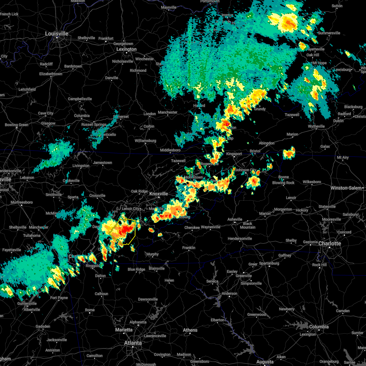 At 246 pm edt, a severe thunderstorm was located near athens, moving southeast at 35 mph (law enforcement). Hazards include 60 mph wind gusts and quarter size hail. Hail damage to vehicles is expected. expect wind damage to roofs, siding, and trees. locations impacted include, athens, sweetwater, madisonville, etowah, englewood, niota, riceville, mount vernon, clear water and murray store. this includes interstate 75 in tennessee between mile markers 41 and 64. hail threat, radar indicated max hail size, 1. 00 in wind threat, observed max wind gust, 60 mph. At 246 pm edt, a severe thunderstorm was located near athens, moving southeast at 35 mph (law enforcement). Hazards include 60 mph wind gusts and quarter size hail. Hail damage to vehicles is expected. expect wind damage to roofs, siding, and trees. locations impacted include, athens, sweetwater, madisonville, etowah, englewood, niota, riceville, mount vernon, clear water and murray store. this includes interstate 75 in tennessee between mile markers 41 and 64. hail threat, radar indicated max hail size, 1. 00 in wind threat, observed max wind gust, 60 mph.
|
| 6/17/2022 2:38 PM EDT |
 At 237 pm edt, a severe thunderstorm was located over athens, moving southeast at 35 mph (law enforcement). Hazards include 60 mph wind gusts and quarter size hail. Hail damage to vehicles is expected. expect wind damage to roofs, siding, and trees. locations impacted include, athens, sweetwater, madisonville, decatur, etowah, englewood, niota, riceville, peakland and clear water. this includes interstate 75 in tennessee between mile markers 41 and 64. hail threat, radar indicated max hail size, 1. 00 in wind threat, observed max wind gust, 60 mph. At 237 pm edt, a severe thunderstorm was located over athens, moving southeast at 35 mph (law enforcement). Hazards include 60 mph wind gusts and quarter size hail. Hail damage to vehicles is expected. expect wind damage to roofs, siding, and trees. locations impacted include, athens, sweetwater, madisonville, decatur, etowah, englewood, niota, riceville, peakland and clear water. this includes interstate 75 in tennessee between mile markers 41 and 64. hail threat, radar indicated max hail size, 1. 00 in wind threat, observed max wind gust, 60 mph.
|
| 6/17/2022 2:27 PM EDT |
 At 227 pm edt, a severe thunderstorm was located over decatur, moving southeast at 35 mph (radar indicated). Hazards include 60 mph wind gusts and half dollar size hail. Hail damage to vehicles is expected. expect wind damage to roofs, siding, and trees. locations impacted include, athens, sweetwater, madisonville, decatur, etowah, spring city, englewood, niota, riceville and peakland. this includes interstate 75 in tennessee between mile markers 41 and 64. hail threat, radar indicated max hail size, 1. 25 in wind threat, radar indicated max wind gust, 60 mph. At 227 pm edt, a severe thunderstorm was located over decatur, moving southeast at 35 mph (radar indicated). Hazards include 60 mph wind gusts and half dollar size hail. Hail damage to vehicles is expected. expect wind damage to roofs, siding, and trees. locations impacted include, athens, sweetwater, madisonville, decatur, etowah, spring city, englewood, niota, riceville and peakland. this includes interstate 75 in tennessee between mile markers 41 and 64. hail threat, radar indicated max hail size, 1. 25 in wind threat, radar indicated max wind gust, 60 mph.
|
| 6/17/2022 2:17 PM EDT |
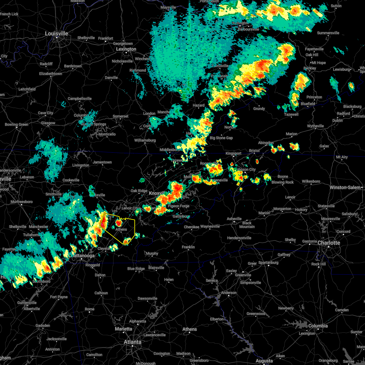 At 217 pm edt, a severe thunderstorm was located near decatur, moving southeast at 35 mph (radar indicated). Hazards include 60 mph wind gusts and half dollar size hail. Hail damage to vehicles is expected. Expect wind damage to roofs, siding, and trees. At 217 pm edt, a severe thunderstorm was located near decatur, moving southeast at 35 mph (radar indicated). Hazards include 60 mph wind gusts and half dollar size hail. Hail damage to vehicles is expected. Expect wind damage to roofs, siding, and trees.
|
| 6/2/2022 1:15 PM EDT |
 At 112 pm edt, a severe thunderstorm was located near charleston, or 9 miles southwest of athens, moving east at 20 mph. the storm was showing signs of weakening but may strengthen before it reaches athens. other strong storms were over clear water and southwest of big spring (radar indicated). Hazards include 60 mph wind gusts and quarter size hail. Hail damage to vehicles is expected. expect wind damage to roofs, siding, and trees. locations impacted include, athens, etowah, charleston, englewood, niota, calhoun, riceville, clear water, hillsview and big spring. this includes interstate 75 in tennessee between mile markers 33 and 53. hail threat, radar indicated max hail size, 1. 00 in wind threat, radar indicated max wind gust, 60 mph. At 112 pm edt, a severe thunderstorm was located near charleston, or 9 miles southwest of athens, moving east at 20 mph. the storm was showing signs of weakening but may strengthen before it reaches athens. other strong storms were over clear water and southwest of big spring (radar indicated). Hazards include 60 mph wind gusts and quarter size hail. Hail damage to vehicles is expected. expect wind damage to roofs, siding, and trees. locations impacted include, athens, etowah, charleston, englewood, niota, calhoun, riceville, clear water, hillsview and big spring. this includes interstate 75 in tennessee between mile markers 33 and 53. hail threat, radar indicated max hail size, 1. 00 in wind threat, radar indicated max wind gust, 60 mph.
|
| 6/2/2022 12:59 PM EDT |
 At 1258 pm edt, a severe thunderstorm was located 9 miles northwest of charleston, or 10 miles southwest of decatur, moving east at 20 mph (radar indicated). Hazards include 60 mph wind gusts and quarter size hail. Hail damage to vehicles is expected. Expect wind damage to roofs, siding, and trees. At 1258 pm edt, a severe thunderstorm was located 9 miles northwest of charleston, or 10 miles southwest of decatur, moving east at 20 mph (radar indicated). Hazards include 60 mph wind gusts and quarter size hail. Hail damage to vehicles is expected. Expect wind damage to roofs, siding, and trees.
|
| 5/6/2022 3:48 PM EDT |
 At 347 pm edt, a severe thunderstorm was located near athens, moving northeast at 45 mph (radar indicated). Hazards include 60 mph wind gusts and quarter size hail. Hail damage to vehicles is expected. expect wind damage to roofs, siding, and trees. locations impacted include, athens, sweetwater, loudon, madisonville, vonore, niota, philadelphia, riceville, fort loudon state park and mcgee carson peninsula. this includes interstate 75 in tennessee between mile markers 41 and 74. hail threat, radar indicated max hail size, 1. 00 in wind threat, radar indicated max wind gust, 60 mph. At 347 pm edt, a severe thunderstorm was located near athens, moving northeast at 45 mph (radar indicated). Hazards include 60 mph wind gusts and quarter size hail. Hail damage to vehicles is expected. expect wind damage to roofs, siding, and trees. locations impacted include, athens, sweetwater, loudon, madisonville, vonore, niota, philadelphia, riceville, fort loudon state park and mcgee carson peninsula. this includes interstate 75 in tennessee between mile markers 41 and 74. hail threat, radar indicated max hail size, 1. 00 in wind threat, radar indicated max wind gust, 60 mph.
|
| 5/6/2022 3:37 PM EDT |
 At 336 pm edt, a severe thunderstorm was located 7 miles south of decatur, moving northeast at 45 mph (radar indicated). Hazards include 60 mph wind gusts and quarter size hail. Hail damage to vehicles is expected. Expect wind damage to roofs, siding, and trees. At 336 pm edt, a severe thunderstorm was located 7 miles south of decatur, moving northeast at 45 mph (radar indicated). Hazards include 60 mph wind gusts and quarter size hail. Hail damage to vehicles is expected. Expect wind damage to roofs, siding, and trees.
|
| 5/6/2022 2:16 PM EDT |
 At 215 pm edt, a severe thunderstorm was located over athens, moving northeast at 35 mph (radar indicated). Hazards include 60 mph wind gusts and quarter size hail. Hail damage to vehicles is expected. Expect wind damage to roofs, siding, and trees. At 215 pm edt, a severe thunderstorm was located over athens, moving northeast at 35 mph (radar indicated). Hazards include 60 mph wind gusts and quarter size hail. Hail damage to vehicles is expected. Expect wind damage to roofs, siding, and trees.
|
| 12/6/2021 10:02 AM EST |
 At 1001 am est, severe thunderstorms were located along a line extending from near spring city to 9 miles northwest of decatur to near dayton to 12 miles north of soddy-daisy to 7 miles east of dunlap, moving east at 50 mph (radar indicated). Hazards include 60 mph wind gusts. expect damage to roofs, siding, and trees At 1001 am est, severe thunderstorms were located along a line extending from near spring city to 9 miles northwest of decatur to near dayton to 12 miles north of soddy-daisy to 7 miles east of dunlap, moving east at 50 mph (radar indicated). Hazards include 60 mph wind gusts. expect damage to roofs, siding, and trees
|
| 8/10/2021 5:07 PM EDT |
 The severe thunderstorm warning for northeastern bradley, central meigs and central mcminn counties will expire at 515 pm edt, the storm which prompted the warning has weakened below severe limits, and no longer poses an immediate threat to life or property. therefore, the warning will be allowed to expire. however gusty winds are still possible with this thunderstorm. The severe thunderstorm warning for northeastern bradley, central meigs and central mcminn counties will expire at 515 pm edt, the storm which prompted the warning has weakened below severe limits, and no longer poses an immediate threat to life or property. therefore, the warning will be allowed to expire. however gusty winds are still possible with this thunderstorm.
|
| 8/10/2021 4:59 PM EDT |
 At 459 pm edt, a severe thunderstorm was located 7 miles southwest of athens, moving northeast at 15 mph (radar indicated). Hazards include 60 mph wind gusts and quarter size hail. Hail damage to vehicles is expected. expect wind damage to roofs, siding, and trees. locations impacted include, athens, decatur, etowah, charleston, calhoun, riceville, clear water, hillsview and dentville. this includes interstate 75 in tennessee between mile markers 33 and 52. hail threat, radar indicated max hail size, 1. 00 in wind threat, radar indicated max wind gust, 60 mph. At 459 pm edt, a severe thunderstorm was located 7 miles southwest of athens, moving northeast at 15 mph (radar indicated). Hazards include 60 mph wind gusts and quarter size hail. Hail damage to vehicles is expected. expect wind damage to roofs, siding, and trees. locations impacted include, athens, decatur, etowah, charleston, calhoun, riceville, clear water, hillsview and dentville. this includes interstate 75 in tennessee between mile markers 33 and 52. hail threat, radar indicated max hail size, 1. 00 in wind threat, radar indicated max wind gust, 60 mph.
|
| 8/10/2021 4:58 PM EDT |
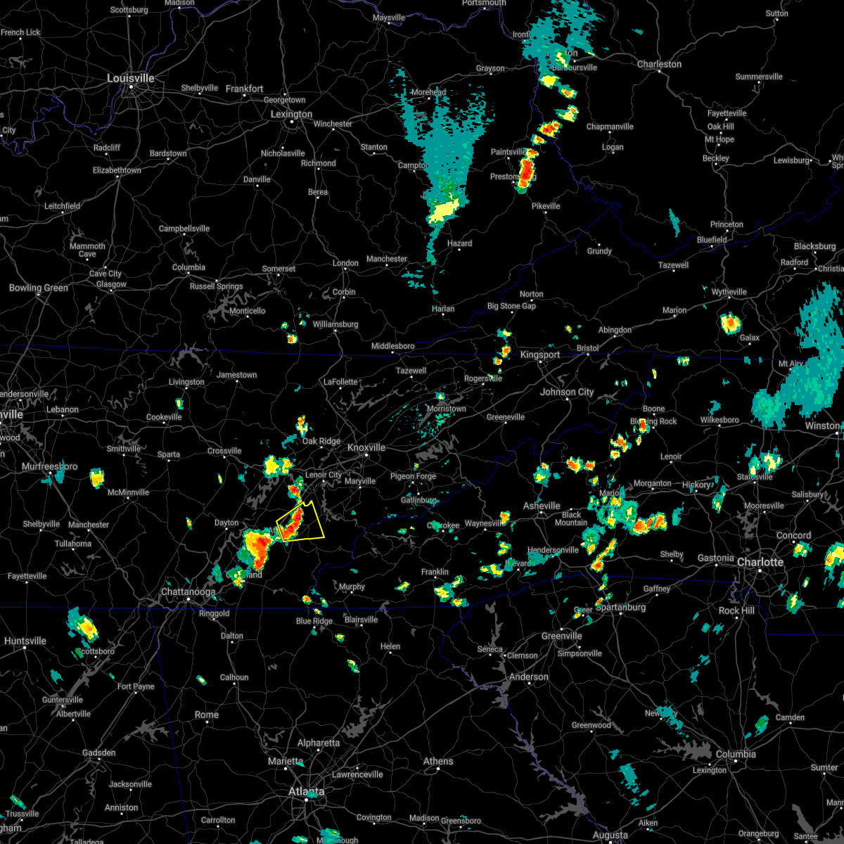 At 458 pm edt, a severe thunderstorm was located near sweetwater, moving northeast at 10 mph (radar indicated). Hazards include 60 mph wind gusts and quarter size hail. Hail damage to vehicles is expected. Expect wind damage to roofs, siding, and trees. At 458 pm edt, a severe thunderstorm was located near sweetwater, moving northeast at 10 mph (radar indicated). Hazards include 60 mph wind gusts and quarter size hail. Hail damage to vehicles is expected. Expect wind damage to roofs, siding, and trees.
|
| 8/10/2021 4:30 PM EDT |
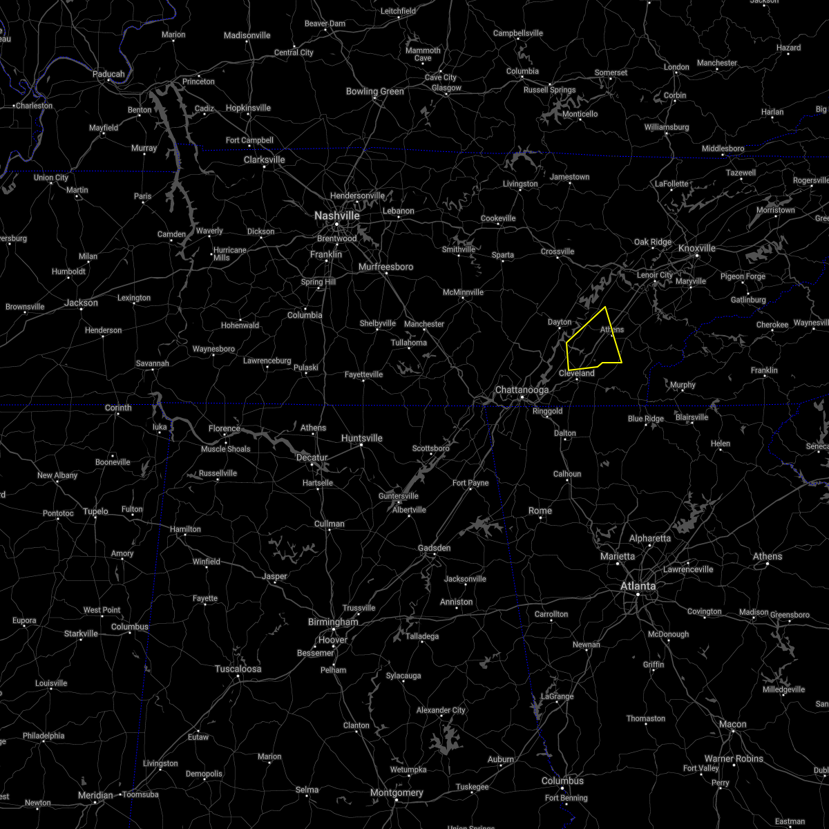 At 430 pm edt, a severe thunderstorm was located 8 miles northwest of charleston, or 12 miles southeast of dayton, moving east at 15 mph (radar indicated). Hazards include 60 mph wind gusts and quarter size hail. Hail damage to vehicles is expected. Expect wind damage to roofs, siding, and trees. At 430 pm edt, a severe thunderstorm was located 8 miles northwest of charleston, or 12 miles southeast of dayton, moving east at 15 mph (radar indicated). Hazards include 60 mph wind gusts and quarter size hail. Hail damage to vehicles is expected. Expect wind damage to roofs, siding, and trees.
|
| 6/29/2021 4:53 PM EDT |
 The severe thunderstorm warning for central mcminn county will expire at 500 pm edt, the storm which prompted the warning has weakened below severe limits, and no longer poses an immediate threat to life or property. therefore, the warning will be allowed to expire. however gusty winds and heavy rain are still possible with this thunderstorm. The severe thunderstorm warning for central mcminn county will expire at 500 pm edt, the storm which prompted the warning has weakened below severe limits, and no longer poses an immediate threat to life or property. therefore, the warning will be allowed to expire. however gusty winds and heavy rain are still possible with this thunderstorm.
|
| 6/29/2021 4:41 PM EDT |
 At 441 pm edt, a severe thunderstorm was located over athens, moving northwest at 15 mph (radar indicated). Hazards include 60 mph wind gusts and penny size hail. Expect damage to roofs, siding, and trees. locations impacted include, athens, etowah, englewood, niota, riceville, clear water and hillsview. This includes interstate 75 in tennessee between mile markers 41 and 60. At 441 pm edt, a severe thunderstorm was located over athens, moving northwest at 15 mph (radar indicated). Hazards include 60 mph wind gusts and penny size hail. Expect damage to roofs, siding, and trees. locations impacted include, athens, etowah, englewood, niota, riceville, clear water and hillsview. This includes interstate 75 in tennessee between mile markers 41 and 60.
|
| 6/29/2021 4:20 PM EDT |
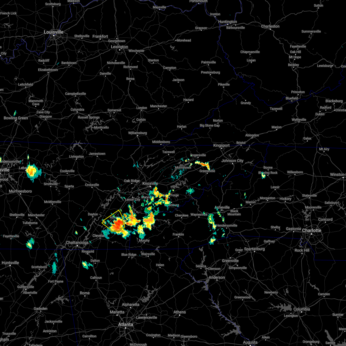 At 420 pm edt, a severe thunderstorm was located over etowah, or near athens, moving northwest at 15 mph (radar indicated). Hazards include 60 mph wind gusts and penny size hail. expect damage to roofs, siding, and trees At 420 pm edt, a severe thunderstorm was located over etowah, or near athens, moving northwest at 15 mph (radar indicated). Hazards include 60 mph wind gusts and penny size hail. expect damage to roofs, siding, and trees
|
| 6/28/2021 4:39 PM EDT |
 At 439 pm edt, a severe thunderstorm was located near madisonville, moving northwest at 15 mph (radar indicated). Hazards include 60 mph wind gusts and penny size hail. Expect damage to roofs, siding, and trees. locations impacted include, athens, sweetwater, madisonville, englewood, tellico plains, niota, philadelphia and mount vernon. This includes interstate 75 in tennessee between mile markers 50 and 66. At 439 pm edt, a severe thunderstorm was located near madisonville, moving northwest at 15 mph (radar indicated). Hazards include 60 mph wind gusts and penny size hail. Expect damage to roofs, siding, and trees. locations impacted include, athens, sweetwater, madisonville, englewood, tellico plains, niota, philadelphia and mount vernon. This includes interstate 75 in tennessee between mile markers 50 and 66.
|
| 6/28/2021 4:21 PM EDT |
 At 420 pm edt, a severe thunderstorm was located 8 miles southeast of madisonville, moving northwest at 15 mph (radar indicated). Hazards include 60 mph wind gusts and penny size hail. expect damage to roofs, siding, and trees At 420 pm edt, a severe thunderstorm was located 8 miles southeast of madisonville, moving northwest at 15 mph (radar indicated). Hazards include 60 mph wind gusts and penny size hail. expect damage to roofs, siding, and trees
|
| 7/21/2020 5:25 PM EDT |
 At 525 pm edt, a severe thunderstorm was located over athens, and is nearly stationary (law enforcement). Hazards include 60 mph wind gusts and penny size hail. Expect damage to roofs, siding, and trees. locations impacted include, athens, englewood and niota. This includes interstate 75 in tennessee between mile markers 50 and 53. At 525 pm edt, a severe thunderstorm was located over athens, and is nearly stationary (law enforcement). Hazards include 60 mph wind gusts and penny size hail. Expect damage to roofs, siding, and trees. locations impacted include, athens, englewood and niota. This includes interstate 75 in tennessee between mile markers 50 and 53.
|
| 7/21/2020 5:12 PM EDT |
 At 511 pm edt, a severe thunderstorm was located near athens, and is nearly stationary. local law enforcement reported several trees down and high winds near englewood (law enforcement). Hazards include 60 mph wind gusts and penny size hail. Expect damage to roofs, siding, and trees. locations impacted include, athens, etowah, englewood and niota. This includes interstate 75 in tennessee between mile markers 50 and 53. At 511 pm edt, a severe thunderstorm was located near athens, and is nearly stationary. local law enforcement reported several trees down and high winds near englewood (law enforcement). Hazards include 60 mph wind gusts and penny size hail. Expect damage to roofs, siding, and trees. locations impacted include, athens, etowah, englewood and niota. This includes interstate 75 in tennessee between mile markers 50 and 53.
|
| 7/21/2020 4:54 PM EDT |
 At 453 pm edt, a severe thunderstorm was located near athens, and is nearly stationary (radar indicated). Hazards include 60 mph wind gusts and penny size hail. expect damage to roofs, siding, and trees At 453 pm edt, a severe thunderstorm was located near athens, and is nearly stationary (radar indicated). Hazards include 60 mph wind gusts and penny size hail. expect damage to roofs, siding, and trees
|
| 7/5/2020 5:31 PM EDT |
 At 531 pm edt, a severe thunderstorm was located near charleston, or 8 miles southwest of athens, moving northwest at 10 mph (radar indicated). Hazards include 60 mph wind gusts and quarter size hail. Hail damage to vehicles is expected. expect wind damage to roofs, siding, and trees. locations impacted include, athens, decatur, calhoun, riceville, hillsview and big spring. This includes interstate 75 in tennessee between mile markers 36 and 48. At 531 pm edt, a severe thunderstorm was located near charleston, or 8 miles southwest of athens, moving northwest at 10 mph (radar indicated). Hazards include 60 mph wind gusts and quarter size hail. Hail damage to vehicles is expected. expect wind damage to roofs, siding, and trees. locations impacted include, athens, decatur, calhoun, riceville, hillsview and big spring. This includes interstate 75 in tennessee between mile markers 36 and 48.
|
| 7/5/2020 5:10 PM EDT |
 At 510 pm edt, a severe thunderstorm was located over etowah, or 10 miles south of athens, and is nearly stationary (radar indicated). Hazards include 60 mph wind gusts and penny size hail. expect damage to roofs, siding, and trees At 510 pm edt, a severe thunderstorm was located over etowah, or 10 miles south of athens, and is nearly stationary (radar indicated). Hazards include 60 mph wind gusts and penny size hail. expect damage to roofs, siding, and trees
|
| 6/22/2020 9:34 PM EDT |
 At 934 pm edt, severe thunderstorms were located along a line extending from 7 miles southeast of fairfield glade to 7 miles south of fairview to near athens, moving northeast at 40 mph (radar indicated). Hazards include 60 mph wind gusts. Expect damage to roofs, siding, and trees. locations impacted include, athens, spring city, englewood, niota, peakland, clear water, murray store, grandview, piney falls state park and ten mile. This includes interstate 75 in tennessee between mile markers 47 and 57. At 934 pm edt, severe thunderstorms were located along a line extending from 7 miles southeast of fairfield glade to 7 miles south of fairview to near athens, moving northeast at 40 mph (radar indicated). Hazards include 60 mph wind gusts. Expect damage to roofs, siding, and trees. locations impacted include, athens, spring city, englewood, niota, peakland, clear water, murray store, grandview, piney falls state park and ten mile. This includes interstate 75 in tennessee between mile markers 47 and 57.
|
| 6/22/2020 9:29 PM EDT |
 At 928 pm edt, severe thunderstorms were located along a line extending from 10 miles south of fairview to 7 miles southwest of sweetwater to athens, moving northeast at 25 mph (radar indicated). Hazards include 60 mph wind gusts. expect damage to roofs, siding, and trees At 928 pm edt, severe thunderstorms were located along a line extending from 10 miles south of fairview to 7 miles southwest of sweetwater to athens, moving northeast at 25 mph (radar indicated). Hazards include 60 mph wind gusts. expect damage to roofs, siding, and trees
|
| 6/22/2020 9:06 PM EDT |
 At 906 pm edt/806 pm cdt/, severe thunderstorms were located along a line extending from 9 miles south of crossville to 7 miles northeast of dayton to 7 miles north of cleveland, moving northeast at 25 mph (radar indicated). Hazards include 60 mph wind gusts. Expect damage to roofs, siding, and trees. locations impacted include, athens, dayton, decatur, spring city, englewood, niota, riceville, hillsview, peakland and clear water. This includes interstate 75 in tennessee between mile markers 39 and 57. At 906 pm edt/806 pm cdt/, severe thunderstorms were located along a line extending from 9 miles south of crossville to 7 miles northeast of dayton to 7 miles north of cleveland, moving northeast at 25 mph (radar indicated). Hazards include 60 mph wind gusts. Expect damage to roofs, siding, and trees. locations impacted include, athens, dayton, decatur, spring city, englewood, niota, riceville, hillsview, peakland and clear water. This includes interstate 75 in tennessee between mile markers 39 and 57.
|
| 6/22/2020 8:57 PM EDT |
 At 837 pm edt/737 pm cdt/, severe thunderstorms were located along a line extending from 8 miles north of pikeville to near dayton to 7 miles northwest of south cleveland, moving northeast at 25 mph (radar indicated). Hazards include 60 mph wind gusts and penny size hail. expect damage to roofs, siding, and trees At 837 pm edt/737 pm cdt/, severe thunderstorms were located along a line extending from 8 miles north of pikeville to near dayton to 7 miles northwest of south cleveland, moving northeast at 25 mph (radar indicated). Hazards include 60 mph wind gusts and penny size hail. expect damage to roofs, siding, and trees
|
| 6/22/2020 8:38 PM EDT |
 At 837 pm edt/737 pm cdt/, severe thunderstorms were located along a line extending from 8 miles north of pikeville to near dayton to 7 miles northwest of south cleveland, moving northeast at 25 mph (radar indicated). Hazards include 60 mph wind gusts and penny size hail. expect damage to roofs, siding, and trees At 837 pm edt/737 pm cdt/, severe thunderstorms were located along a line extending from 8 miles north of pikeville to near dayton to 7 miles northwest of south cleveland, moving northeast at 25 mph (radar indicated). Hazards include 60 mph wind gusts and penny size hail. expect damage to roofs, siding, and trees
|
| 6/21/2020 4:58 PM EDT | Numerous trees and power lines in the athens are in mcminn county TN, 1.2 miles W of Athens, TN |
| 6/21/2020 4:40 PM EDT |
 At 440 pm edt, a severe thunderstorm was located over athens, moving northeast at 20 mph (radar indicated). Hazards include 60 mph wind gusts. expect damage to roofs, siding, and trees At 440 pm edt, a severe thunderstorm was located over athens, moving northeast at 20 mph (radar indicated). Hazards include 60 mph wind gusts. expect damage to roofs, siding, and trees
|
| 6/21/2020 4:20 PM EDT |
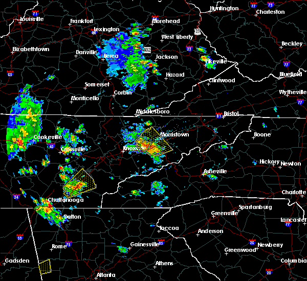 At 419 pm edt, a severe thunderstorm was located near charleston, or 8 miles southwest of athens, moving northeast at 30 mph (radar indicated). Hazards include 60 mph wind gusts and quarter size hail. Hail damage to vehicles is expected. expect wind damage to roofs, siding, and trees. locations impacted include, athens, etowah, englewood, niota, calhoun, riceville, hillsview, clear water and murray store. This includes interstate 75 in tennessee between mile markers 37 and 58. At 419 pm edt, a severe thunderstorm was located near charleston, or 8 miles southwest of athens, moving northeast at 30 mph (radar indicated). Hazards include 60 mph wind gusts and quarter size hail. Hail damage to vehicles is expected. expect wind damage to roofs, siding, and trees. locations impacted include, athens, etowah, englewood, niota, calhoun, riceville, hillsview, clear water and murray store. This includes interstate 75 in tennessee between mile markers 37 and 58.
|
| 6/21/2020 4:02 PM EDT |
 At 402 pm edt, a severe thunderstorm was located 7 miles west of charleston, or 8 miles north of cleveland, moving northeast at 30 mph (radar indicated). Hazards include 60 mph wind gusts and quarter size hail. Hail damage to vehicles is expected. Expect wind damage to roofs, siding, and trees. At 402 pm edt, a severe thunderstorm was located 7 miles west of charleston, or 8 miles north of cleveland, moving northeast at 30 mph (radar indicated). Hazards include 60 mph wind gusts and quarter size hail. Hail damage to vehicles is expected. Expect wind damage to roofs, siding, and trees.
|
| 6/14/2020 2:30 PM EDT |
 At 230 pm edt, a severe thunderstorm was located near dayton, moving northwest at 15 mph (radar indicated). Hazards include 60 mph wind gusts and quarter size hail. Hail damage to vehicles is expected. expect wind damage to roofs, siding, and trees. locations impacted include, athens, dayton, decatur, graysville, evensville, hillsview, old washington, big spring, riceville and sale creek. This includes interstate 75 in tennessee between mile markers 35 and 36, and between mile markers 39 and 49. At 230 pm edt, a severe thunderstorm was located near dayton, moving northwest at 15 mph (radar indicated). Hazards include 60 mph wind gusts and quarter size hail. Hail damage to vehicles is expected. expect wind damage to roofs, siding, and trees. locations impacted include, athens, dayton, decatur, graysville, evensville, hillsview, old washington, big spring, riceville and sale creek. This includes interstate 75 in tennessee between mile markers 35 and 36, and between mile markers 39 and 49.
|
| 6/14/2020 1:54 PM EDT |
 At 154 pm edt, a severe thunderstorm was located 10 miles northeast of decatur, moving southeast at 15 mph (radar indicated). Hazards include 60 mph wind gusts and quarter size hail. Hail damage to vehicles is expected. expect wind damage to roofs, siding, and trees. locations impacted include, athens, decatur, spring city, peakland and clear water. This includes interstate 75 in tennessee between mile markers 46 and 53. At 154 pm edt, a severe thunderstorm was located 10 miles northeast of decatur, moving southeast at 15 mph (radar indicated). Hazards include 60 mph wind gusts and quarter size hail. Hail damage to vehicles is expected. expect wind damage to roofs, siding, and trees. locations impacted include, athens, decatur, spring city, peakland and clear water. This includes interstate 75 in tennessee between mile markers 46 and 53.
|
| 6/14/2020 1:45 PM EDT |
 At 145 pm edt, a severe thunderstorm was located near dayton, moving southeast at 15 mph (radar indicated). Hazards include 60 mph wind gusts and quarter size hail. Hail damage to vehicles is expected. Expect wind damage to roofs, siding, and trees. At 145 pm edt, a severe thunderstorm was located near dayton, moving southeast at 15 mph (radar indicated). Hazards include 60 mph wind gusts and quarter size hail. Hail damage to vehicles is expected. Expect wind damage to roofs, siding, and trees.
|
| 6/14/2020 1:22 PM EDT |
 At 122 pm edt, a severe thunderstorm was located near spring city, or 11 miles north of decatur, moving southeast at 15 mph (radar indicated). Hazards include 60 mph wind gusts and quarter size hail. Hail damage to vehicles is expected. Expect wind damage to roofs, siding, and trees. At 122 pm edt, a severe thunderstorm was located near spring city, or 11 miles north of decatur, moving southeast at 15 mph (radar indicated). Hazards include 60 mph wind gusts and quarter size hail. Hail damage to vehicles is expected. Expect wind damage to roofs, siding, and trees.
|
| 5/3/2020 7:31 PM EDT |
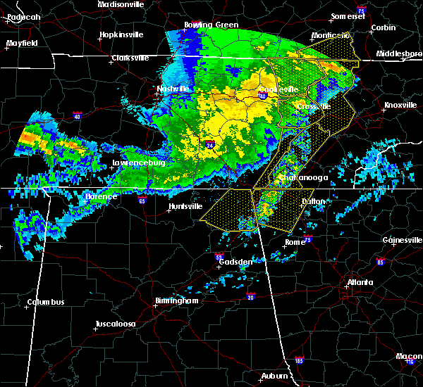 At 731 pm edt, severe thunderstorms were located along a line extending from near spring city to near chickamauga, moving east at 55 mph (radar indicated). Hazards include 60 mph wind gusts. expect damage to roofs, siding, and trees At 731 pm edt, severe thunderstorms were located along a line extending from near spring city to near chickamauga, moving east at 55 mph (radar indicated). Hazards include 60 mph wind gusts. expect damage to roofs, siding, and trees
|
| 4/25/2020 5:31 PM EDT |
 At 531 pm edt, a severe thunderstorm was located near etowah, or 8 miles southeast of athens, moving northeast at 40 mph (radar indicated). Hazards include golf ball size hail and 60 mph wind gusts. People and animals outdoors will be injured. expect hail damage to roofs, siding, windows, and vehicles. expect wind damage to roofs, siding, and trees. Locations impacted include, athens, madisonville, etowah, englewood, vonore, tellico plains, fort loudon state park, tariffville, mcgee carson peninsula and mount vernon. At 531 pm edt, a severe thunderstorm was located near etowah, or 8 miles southeast of athens, moving northeast at 40 mph (radar indicated). Hazards include golf ball size hail and 60 mph wind gusts. People and animals outdoors will be injured. expect hail damage to roofs, siding, windows, and vehicles. expect wind damage to roofs, siding, and trees. Locations impacted include, athens, madisonville, etowah, englewood, vonore, tellico plains, fort loudon state park, tariffville, mcgee carson peninsula and mount vernon.
|
| 4/25/2020 5:29 PM EDT | Golf Ball sized hail reported 7.3 miles NNW of Athens, TN, dime to golf ball sized hail. reported by public from county road 613 between athens and etowah tn. |
| 4/25/2020 5:18 PM EDT |
 At 517 pm edt, a severe thunderstorm was located near etowah, or 9 miles north of benton, moving northeast at 40 mph (radar indicated). Hazards include 60 mph wind gusts and quarter size hail. Hail damage to vehicles is expected. Expect wind damage to roofs, siding, and trees. At 517 pm edt, a severe thunderstorm was located near etowah, or 9 miles north of benton, moving northeast at 40 mph (radar indicated). Hazards include 60 mph wind gusts and quarter size hail. Hail damage to vehicles is expected. Expect wind damage to roofs, siding, and trees.
|
| 4/13/2020 12:27 AM EDT |
 The severe thunderstorm warning for polk and southeastern mcminn counties will expire at 1230 am edt, the storms which prompted the warning have moved out of the area. therefore, the warning will be allowed to expire. however gusty winds and heavy rain are still possible with these thunderstorms. a tornado watch remains in effect until 200 am edt for southwestern north carolina, and east tennessee. The severe thunderstorm warning for polk and southeastern mcminn counties will expire at 1230 am edt, the storms which prompted the warning have moved out of the area. therefore, the warning will be allowed to expire. however gusty winds and heavy rain are still possible with these thunderstorms. a tornado watch remains in effect until 200 am edt for southwestern north carolina, and east tennessee.
|
| 4/13/2020 12:16 AM EDT |
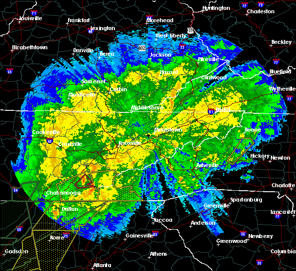 At 1215 am edt, severe thunderstorms were located along a line extending from near etowah to 12 miles east of benton to 8 miles northwest of ducktown, moving northeast at 50 mph (radar indicated). Hazards include 70 mph wind gusts. Expect considerable tree damage. damage is likely to mobile homes, roofs, and outbuildings. locations impacted include, athens, benton, ducktown, etowah, englewood, niota, william l. davenport refuge, riceville, big frog mountain and turtletown. This includes interstate 75 in tennessee between mile markers 42 and 49. At 1215 am edt, severe thunderstorms were located along a line extending from near etowah to 12 miles east of benton to 8 miles northwest of ducktown, moving northeast at 50 mph (radar indicated). Hazards include 70 mph wind gusts. Expect considerable tree damage. damage is likely to mobile homes, roofs, and outbuildings. locations impacted include, athens, benton, ducktown, etowah, englewood, niota, william l. davenport refuge, riceville, big frog mountain and turtletown. This includes interstate 75 in tennessee between mile markers 42 and 49.
|
| 4/13/2020 12:07 AM EDT |
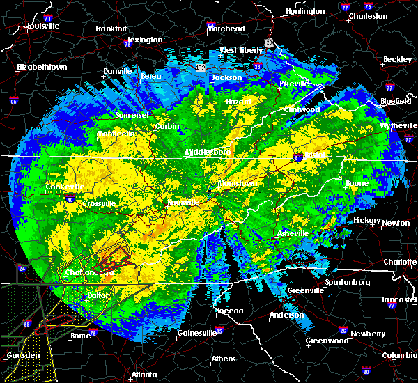 At 1207 am edt, a severe thunderstorm capable of producing a tornado was located near etowah, or 7 miles north of benton, moving northeast at 50 mph (radar indicated rotation). Hazards include tornado. Flying debris will be dangerous to those caught without shelter. mobile homes will be damaged or destroyed. damage to roofs, windows, and vehicles will occur. tree damage is likely. this dangerous storm will be near, etowah around 1215 am edt. Other locations impacted by this tornadic thunderstorm include hiwassee ocoee state park, dentville and englewood. At 1207 am edt, a severe thunderstorm capable of producing a tornado was located near etowah, or 7 miles north of benton, moving northeast at 50 mph (radar indicated rotation). Hazards include tornado. Flying debris will be dangerous to those caught without shelter. mobile homes will be damaged or destroyed. damage to roofs, windows, and vehicles will occur. tree damage is likely. this dangerous storm will be near, etowah around 1215 am edt. Other locations impacted by this tornadic thunderstorm include hiwassee ocoee state park, dentville and englewood.
|
| 4/13/2020 12:00 AM EDT |
 At 1200 am edt, a confirmed large and extremely dangerous tornado was located near charleston, or near benton, moving northeast at 50 mph. this is a particularly dangerous situation. take cover now! (radar confirmed tornado). Hazards include damaging tornado. You are in a life-threatening situation. flying debris may be deadly to those caught without shelter. mobile homes will be destroyed. considerable damage to homes, businesses, and vehicles is likely and complete destruction is possible. the tornado will be near, etowah around 1215 am edt. Other locations impacted by this tornadic thunderstorm include hiwassee ocoee state park, dentville, calhoun and englewood. At 1200 am edt, a confirmed large and extremely dangerous tornado was located near charleston, or near benton, moving northeast at 50 mph. this is a particularly dangerous situation. take cover now! (radar confirmed tornado). Hazards include damaging tornado. You are in a life-threatening situation. flying debris may be deadly to those caught without shelter. mobile homes will be destroyed. considerable damage to homes, businesses, and vehicles is likely and complete destruction is possible. the tornado will be near, etowah around 1215 am edt. Other locations impacted by this tornadic thunderstorm include hiwassee ocoee state park, dentville, calhoun and englewood.
|
| 4/12/2020 11:56 PM EDT |
 At 1156 pm edt, a severe thunderstorm capable of producing a tornado was located near charleston, or near benton, moving northeast at 50 mph (radar indicated rotation). Hazards include tornado. Flying debris will be dangerous to those caught without shelter. mobile homes will be damaged or destroyed. damage to roofs, windows, and vehicles will occur. tree damage is likely. this dangerous storm will be near, etowah around 1215 am edt. Other locations impacted by this tornadic thunderstorm include hiwassee ocoee state park, dentville, calhoun and englewood. At 1156 pm edt, a severe thunderstorm capable of producing a tornado was located near charleston, or near benton, moving northeast at 50 mph (radar indicated rotation). Hazards include tornado. Flying debris will be dangerous to those caught without shelter. mobile homes will be damaged or destroyed. damage to roofs, windows, and vehicles will occur. tree damage is likely. this dangerous storm will be near, etowah around 1215 am edt. Other locations impacted by this tornadic thunderstorm include hiwassee ocoee state park, dentville, calhoun and englewood.
|
| 4/12/2020 11:41 PM EDT |
 At 1141 pm edt, severe thunderstorms were located along a line extending from 7 miles northwest of cleveland to near south cleveland to cohutta, moving east at 50 mph (radar indicated). Hazards include 70 mph wind gusts. Expect considerable tree damage. Damage is likely to mobile homes, roofs, and outbuildings. At 1141 pm edt, severe thunderstorms were located along a line extending from 7 miles northwest of cleveland to near south cleveland to cohutta, moving east at 50 mph (radar indicated). Hazards include 70 mph wind gusts. Expect considerable tree damage. Damage is likely to mobile homes, roofs, and outbuildings.
|
| 4/9/2020 1:26 AM EDT |
 The severe thunderstorm warning for central rhea, southwestern loudon, northeastern meigs, northern mcminn, northwestern monroe and southwestern roane counties will expire at 130 am edt, the storms which prompted the warning have weakened below severe limits, and no longer pose an immediate threat to life or property. therefore, the warning will be allowed to expire. however gusty winds are still possible with these thunderstorms. a severe thunderstorm watch remains in effect until 600 am edt for east tennessee. The severe thunderstorm warning for central rhea, southwestern loudon, northeastern meigs, northern mcminn, northwestern monroe and southwestern roane counties will expire at 130 am edt, the storms which prompted the warning have weakened below severe limits, and no longer pose an immediate threat to life or property. therefore, the warning will be allowed to expire. however gusty winds are still possible with these thunderstorms. a severe thunderstorm watch remains in effect until 600 am edt for east tennessee.
|
| 4/9/2020 1:19 AM EDT |
 At 118 am edt, severe thunderstorms were located along a line extending from 7 miles southwest of rockwood to near spring city to near dayton, moving east at 45 mph (radar indicated). Hazards include 60 mph wind gusts and penny size hail. Expect damage to roofs, siding, and trees. locations impacted include, athens, dayton, sweetwater, decatur, spring city, niota, philadelphia, peakland, clear water and murray store. This includes interstate 75 in tennessee between mile markers 45 and 70. At 118 am edt, severe thunderstorms were located along a line extending from 7 miles southwest of rockwood to near spring city to near dayton, moving east at 45 mph (radar indicated). Hazards include 60 mph wind gusts and penny size hail. Expect damage to roofs, siding, and trees. locations impacted include, athens, dayton, sweetwater, decatur, spring city, niota, philadelphia, peakland, clear water and murray store. This includes interstate 75 in tennessee between mile markers 45 and 70.
|
| 4/9/2020 1:06 AM EDT |
 At 106 am edt/1206 am cdt/, severe thunderstorms were located along a line extending from 13 miles southwest of rockwood to near spring city to near pikeville, moving east at 60 mph (radar indicated). Hazards include 60 mph wind gusts and penny size hail. expect damage to roofs, siding, and trees At 106 am edt/1206 am cdt/, severe thunderstorms were located along a line extending from 13 miles southwest of rockwood to near spring city to near pikeville, moving east at 60 mph (radar indicated). Hazards include 60 mph wind gusts and penny size hail. expect damage to roofs, siding, and trees
|
| 2/12/2020 9:56 PM EST |
 The severe thunderstorm warning for southeastern rhea, southwestern loudon, bradley, meigs, mcminn, northwestern monroe, southeastern hamilton and southwestern roane counties will expire at 1000 pm est, the storms which prompted the warning have weakened below severe limits, and no longer pose an immediate threat to life or property. therefore, the warning will be allowed to expire. however gusty winds are still possible with these thunderstorms. The severe thunderstorm warning for southeastern rhea, southwestern loudon, bradley, meigs, mcminn, northwestern monroe, southeastern hamilton and southwestern roane counties will expire at 1000 pm est, the storms which prompted the warning have weakened below severe limits, and no longer pose an immediate threat to life or property. therefore, the warning will be allowed to expire. however gusty winds are still possible with these thunderstorms.
|
| 2/12/2020 9:31 PM EST |
 At 931 pm est, severe thunderstorms were located along a line extending from near fairview to 7 miles north of charleston to near ringgold, moving east at 40 mph (radar indicated). Hazards include 60 mph wind gusts. Expect damage to roofs, siding, and trees. Locations impacted include, chattanooga, cleveland, athens, sweetwater, decatur, etowah, lakesite, charleston, ridgeside and south cleveland. At 931 pm est, severe thunderstorms were located along a line extending from near fairview to 7 miles north of charleston to near ringgold, moving east at 40 mph (radar indicated). Hazards include 60 mph wind gusts. Expect damage to roofs, siding, and trees. Locations impacted include, chattanooga, cleveland, athens, sweetwater, decatur, etowah, lakesite, charleston, ridgeside and south cleveland.
|
| 2/12/2020 8:56 PM EST |
 At 855 pm est/755 pm cst/, severe thunderstorms were located along a line extending from 7 miles northwest of spring city to 7 miles north of soddy-daisy to near trenton, moving east at 40 mph (radar indicated). Hazards include 60 mph wind gusts. expect damage to roofs, siding, and trees At 855 pm est/755 pm cst/, severe thunderstorms were located along a line extending from 7 miles northwest of spring city to 7 miles north of soddy-daisy to near trenton, moving east at 40 mph (radar indicated). Hazards include 60 mph wind gusts. expect damage to roofs, siding, and trees
|
| 1/11/2020 4:20 PM EST | Multiple trees down across the count in mcminn county TN, 1.5 miles NW of Athens, TN |
| 1/11/2020 4:13 PM EST |
 At 412 pm est, severe thunderstorms were located along a line extending from 6 miles south of decatur to near wildwood lake, moving northeast at 70 mph (radar indicated). Hazards include 70 mph wind gusts. Expect considerable tree damage. Damage is likely to mobile homes, roofs, and outbuildings. At 412 pm est, severe thunderstorms were located along a line extending from 6 miles south of decatur to near wildwood lake, moving northeast at 70 mph (radar indicated). Hazards include 70 mph wind gusts. Expect considerable tree damage. Damage is likely to mobile homes, roofs, and outbuildings.
|
| 8/23/2019 2:30 PM EDT |
 At 230 pm edt, a severe thunderstorm was located over etowah, or 8 miles southeast of athens, moving east at 15 mph (radar indicated). Hazards include 60 mph wind gusts and quarter size hail. Hail damage to vehicles is expected. Expect wind damage to roofs, siding, and trees. At 230 pm edt, a severe thunderstorm was located over etowah, or 8 miles southeast of athens, moving east at 15 mph (radar indicated). Hazards include 60 mph wind gusts and quarter size hail. Hail damage to vehicles is expected. Expect wind damage to roofs, siding, and trees.
|
| 8/1/2019 7:16 PM EDT |
 At 716 pm edt, a severe thunderstorm was located near charleston, or 9 miles north of benton, moving southwest at 20 mph (radar indicated). Hazards include 60 mph wind gusts and quarter size hail. Hail damage to vehicles is expected. expect wind damage to roofs, siding, and trees. Locations impacted include, athens, etowah, englewood and dentville. At 716 pm edt, a severe thunderstorm was located near charleston, or 9 miles north of benton, moving southwest at 20 mph (radar indicated). Hazards include 60 mph wind gusts and quarter size hail. Hail damage to vehicles is expected. expect wind damage to roofs, siding, and trees. Locations impacted include, athens, etowah, englewood and dentville.
|
| 8/1/2019 6:59 PM EDT |
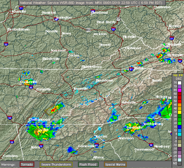 At 658 pm edt, a severe thunderstorm was located near etowah, or near athens, moving southwest at 20 mph (radar indicated). Hazards include 60 mph wind gusts and quarter size hail. Hail damage to vehicles is expected. expect wind damage to roofs, siding, and trees. Locations impacted include, athens, etowah, englewood, niota, riceville and dentville. At 658 pm edt, a severe thunderstorm was located near etowah, or near athens, moving southwest at 20 mph (radar indicated). Hazards include 60 mph wind gusts and quarter size hail. Hail damage to vehicles is expected. expect wind damage to roofs, siding, and trees. Locations impacted include, athens, etowah, englewood, niota, riceville and dentville.
|
| 8/1/2019 6:42 PM EDT |
 At 642 pm edt, a severe thunderstorm was located near athens, moving southwest at 10 mph (radar indicated). Hazards include 60 mph wind gusts and quarter size hail. Hail damage to vehicles is expected. Expect wind damage to roofs, siding, and trees. At 642 pm edt, a severe thunderstorm was located near athens, moving southwest at 10 mph (radar indicated). Hazards include 60 mph wind gusts and quarter size hail. Hail damage to vehicles is expected. Expect wind damage to roofs, siding, and trees.
|
| 6/24/2019 5:51 PM EDT |
 The severe thunderstorm warning for loudon, southern knox, central mcminn, blount, monroe and east central roane counties will expire at 600 pm edt, the storms which prompted the warning have weakened below severe limits, and have exited the warned area. therefore, the warning will be allowed to expire. however gusty winds are still possible with these thunderstorms. a severe thunderstorm watch remains in effect until 900 pm edt for east tennessee. The severe thunderstorm warning for loudon, southern knox, central mcminn, blount, monroe and east central roane counties will expire at 600 pm edt, the storms which prompted the warning have weakened below severe limits, and have exited the warned area. therefore, the warning will be allowed to expire. however gusty winds are still possible with these thunderstorms. a severe thunderstorm watch remains in effect until 900 pm edt for east tennessee.
|
| 6/24/2019 5:36 PM EDT |
 At 535 pm edt, severe thunderstorms were located along a line extending from near knoxville to near etowah, moving east at 45 mph (radar indicated). Hazards include 60 mph wind gusts. Expect damage to roofs, siding, and trees. Locations impacted include, knoxville, oak ridge, maryville, athens, lenoir city, alcoa, sweetwater, loudon, madisonville, farragut, etowah, louisville, rockford, eagleton village, englewood, vonore, greenback, friendsville, tellico plains and niota. At 535 pm edt, severe thunderstorms were located along a line extending from near knoxville to near etowah, moving east at 45 mph (radar indicated). Hazards include 60 mph wind gusts. Expect damage to roofs, siding, and trees. Locations impacted include, knoxville, oak ridge, maryville, athens, lenoir city, alcoa, sweetwater, loudon, madisonville, farragut, etowah, louisville, rockford, eagleton village, englewood, vonore, greenback, friendsville, tellico plains and niota.
|
| 6/24/2019 5:08 PM EDT |
 At 507 pm edt, severe thunderstorms were located along a line extending from near oak ridge to 6 miles northwest of charleston, moving east at 45 mph (radar indicated). Hazards include 60 mph wind gusts. expect damage to roofs, siding, and trees At 507 pm edt, severe thunderstorms were located along a line extending from near oak ridge to 6 miles northwest of charleston, moving east at 45 mph (radar indicated). Hazards include 60 mph wind gusts. expect damage to roofs, siding, and trees
|
| 6/21/2019 11:57 PM EDT |
 At 1157 pm edt, severe thunderstorms were located along a line extending from 7 miles southwest of madisonville to near charleston to near ringgold, moving east at 40 mph (radar indicated). Hazards include 65 mph wind gusts and quarter size hail. Hail damage to vehicles is expected. expect wind damage to roofs, siding, and trees. locations impacted include, cleveland, athens, benton, ducktown, etowah, charleston, south cleveland, east cleveland, wildwood lake, englewood, tellico plains, calhoun, william l. Davenport refuge, waterville, big frog mountain, hillsview, parksville, red clay state park, bullet creek and copperhill. At 1157 pm edt, severe thunderstorms were located along a line extending from 7 miles southwest of madisonville to near charleston to near ringgold, moving east at 40 mph (radar indicated). Hazards include 65 mph wind gusts and quarter size hail. Hail damage to vehicles is expected. expect wind damage to roofs, siding, and trees. locations impacted include, cleveland, athens, benton, ducktown, etowah, charleston, south cleveland, east cleveland, wildwood lake, englewood, tellico plains, calhoun, william l. Davenport refuge, waterville, big frog mountain, hillsview, parksville, red clay state park, bullet creek and copperhill.
|
| 6/21/2019 11:50 PM EDT |
 A severe thunderstorm warning remains in effect until 1215 am edt for southeastern loudon. northeastern mcminn. blount and monroe counties. At 1149 pm edt, severe thunderstorms were located along a line extending from near eagleton village to 11 miles northwest of smoky mountains-twentymile creek to 9 miles east of etowah, moving east at. A severe thunderstorm warning remains in effect until 1215 am edt for southeastern loudon. northeastern mcminn. blount and monroe counties. At 1149 pm edt, severe thunderstorms were located along a line extending from near eagleton village to 11 miles northwest of smoky mountains-twentymile creek to 9 miles east of etowah, moving east at.
|
| 6/21/2019 11:47 PM EDT |
 A severe thunderstorm warning remains in effect until 1230 am edt for bradley. polk. southwestern meigs. southern mcminn. southwestern monroe and southeastern hamilton counties. At 1146 pm edt, severe thunderstorms were located along a line extending from near athens to charleston to near chickamauga, moving east at 50 mph. A severe thunderstorm warning remains in effect until 1230 am edt for bradley. polk. southwestern meigs. southern mcminn. southwestern monroe and southeastern hamilton counties. At 1146 pm edt, severe thunderstorms were located along a line extending from near athens to charleston to near chickamauga, moving east at 50 mph.
|
| 6/21/2019 11:47 PM EDT |
 At 1146 pm edt, severe thunderstorms were located along a line extending from near athens to charleston to near chickamauga, moving east at 50 mph (radar indicated). Hazards include 65 mph wind gusts and quarter size hail. Hail damage to vehicles is expected. expect wind damage to roofs, siding, and trees. locations impacted include, chattanooga, cleveland, athens, benton, ducktown, soddy-daisy, etowah, lakesite, charleston, ridgeside, harrison, east cleveland, south cleveland, wildwood lake, red bank, collegedale, englewood, tellico plains, calhoun and william l. Davenport refuge. At 1146 pm edt, severe thunderstorms were located along a line extending from near athens to charleston to near chickamauga, moving east at 50 mph (radar indicated). Hazards include 65 mph wind gusts and quarter size hail. Hail damage to vehicles is expected. expect wind damage to roofs, siding, and trees. locations impacted include, chattanooga, cleveland, athens, benton, ducktown, soddy-daisy, etowah, lakesite, charleston, ridgeside, harrison, east cleveland, south cleveland, wildwood lake, red bank, collegedale, englewood, tellico plains, calhoun and william l. Davenport refuge.
|
| 6/21/2019 11:37 PM EDT |
 At 1135 pm edt, severe thunderstorms were located along a line extending from near eagleton village to athens, moving east at 45 mph (radar indicated). Hazards include 65 mph wind gusts and quarter size hail. Hail damage to vehicles is expected. expect wind damage to roofs, siding, and trees. Locations impacted include, maryville, athens, lenoir city, alcoa, sweetwater, loudon, madisonville, decatur, louisville, rockford, eagleton village, smoky mountains-fontana area, englewood, vonore, greenback, friendsville, tellico plains, niota, philadelphia and townsend. At 1135 pm edt, severe thunderstorms were located along a line extending from near eagleton village to athens, moving east at 45 mph (radar indicated). Hazards include 65 mph wind gusts and quarter size hail. Hail damage to vehicles is expected. expect wind damage to roofs, siding, and trees. Locations impacted include, maryville, athens, lenoir city, alcoa, sweetwater, loudon, madisonville, decatur, louisville, rockford, eagleton village, smoky mountains-fontana area, englewood, vonore, greenback, friendsville, tellico plains, niota, philadelphia and townsend.
|
| 6/21/2019 11:25 PM EDT |
 At 1124 pm edt, severe thunderstorms were located along a line extending from decatur to 8 miles northeast of soddy-daisy to near trenton, moving east at 40 mph (radar indicated). Hazards include 60 mph wind gusts and quarter size hail. Hail damage to vehicles is expected. Expect wind damage to roofs, siding, and trees. At 1124 pm edt, severe thunderstorms were located along a line extending from decatur to 8 miles northeast of soddy-daisy to near trenton, moving east at 40 mph (radar indicated). Hazards include 60 mph wind gusts and quarter size hail. Hail damage to vehicles is expected. Expect wind damage to roofs, siding, and trees.
|
| 6/21/2019 11:11 PM EDT |
 At 1110 pm edt, severe thunderstorms were located along a line extending from farragut to near dayton, moving east at 45 mph (radar indicated). Hazards include 60 mph wind gusts and quarter size hail. Hail damage to vehicles is expected. Expect wind damage to roofs, siding, and trees. At 1110 pm edt, severe thunderstorms were located along a line extending from farragut to near dayton, moving east at 45 mph (radar indicated). Hazards include 60 mph wind gusts and quarter size hail. Hail damage to vehicles is expected. Expect wind damage to roofs, siding, and trees.
|
| 6/20/2019 7:50 PM EDT | Several trees dow in mcminn county TN, 3 miles N of Athens, TN |
| 6/20/2019 7:41 PM EDT |
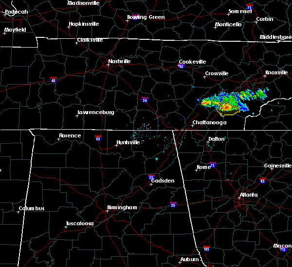 At 741 pm edt, a severe thunderstorm was located near athens, moving southeast at 35 mph (radar indicated). Hazards include 60 mph wind gusts and penny size hail. Expect damage to roofs, siding, and trees. Locations impacted include, athens, etowah, englewood, calhoun, riceville, hillsview and dentville. At 741 pm edt, a severe thunderstorm was located near athens, moving southeast at 35 mph (radar indicated). Hazards include 60 mph wind gusts and penny size hail. Expect damage to roofs, siding, and trees. Locations impacted include, athens, etowah, englewood, calhoun, riceville, hillsview and dentville.
|
| 6/20/2019 7:29 PM EDT |
 At 729 pm edt, a severe thunderstorm was located near decatur, moving southeast at 35 mph (radar indicated). Hazards include 60 mph wind gusts and penny size hail. expect damage to roofs, siding, and trees At 729 pm edt, a severe thunderstorm was located near decatur, moving southeast at 35 mph (radar indicated). Hazards include 60 mph wind gusts and penny size hail. expect damage to roofs, siding, and trees
|
| 6/20/2019 7:06 AM EDT |
 At 705 am edt, severe thunderstorms were located along a line extending from midtown to near ducktown, moving east at 50 mph (radar indicated). Hazards include 60 mph wind gusts. Expect damage to roofs, siding, and trees. Locations impacted include, oak ridge, athens, lenoir city, kingston, sweetwater, rockwood, loudon, madisonville, fairview, etowah, oliver springs, midtown, harriman, englewood, vonore, greenback, tellico plains, niota, philadelphia and mcgee carson peninsula. At 705 am edt, severe thunderstorms were located along a line extending from midtown to near ducktown, moving east at 50 mph (radar indicated). Hazards include 60 mph wind gusts. Expect damage to roofs, siding, and trees. Locations impacted include, oak ridge, athens, lenoir city, kingston, sweetwater, rockwood, loudon, madisonville, fairview, etowah, oliver springs, midtown, harriman, englewood, vonore, greenback, tellico plains, niota, philadelphia and mcgee carson peninsula.
|
| 6/20/2019 7:01 AM EDT | Several trees dow in mcminn county TN, 7.5 miles SE of Athens, TN |
| 6/20/2019 6:31 AM EDT |
 At 629 am edt, severe thunderstorms were located along a line extending from 8 miles south of crossville to near wildwood lake, moving east at 50 mph (radar indicated). Hazards include 60 mph wind gusts. expect damage to roofs, siding, and trees At 629 am edt, severe thunderstorms were located along a line extending from 8 miles south of crossville to near wildwood lake, moving east at 50 mph (radar indicated). Hazards include 60 mph wind gusts. expect damage to roofs, siding, and trees
|
| 6/17/2019 5:34 PM EDT | A few trees down in and around the athens are in mcminn county TN, 1.5 miles NW of Athens, TN |
| 4/8/2019 10:14 AM EDT |
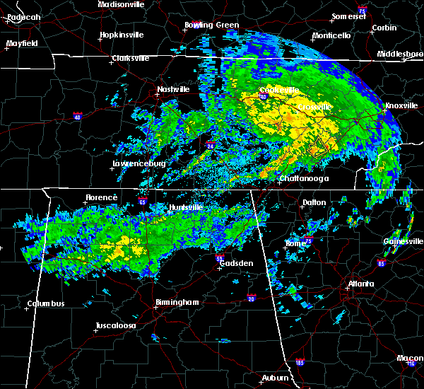 At 1013 am edt, a severe thunderstorm was located near decatur, moving northeast at 45 mph (radar indicated). Hazards include 60 mph wind gusts. Expect damage to roofs, siding, and trees. Locations impacted include, decatur and peakland. At 1013 am edt, a severe thunderstorm was located near decatur, moving northeast at 45 mph (radar indicated). Hazards include 60 mph wind gusts. Expect damage to roofs, siding, and trees. Locations impacted include, decatur and peakland.
|
| 4/8/2019 9:59 AM EDT |
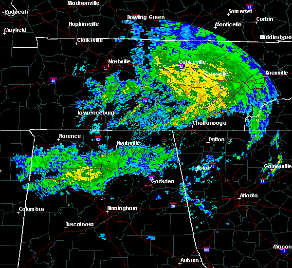 At 958 am edt, a severe thunderstorm was located 9 miles northwest of charleston, or 10 miles southeast of dayton, moving northeast at 45 mph (radar indicated). Hazards include 60 mph wind gusts. Expect damage to roofs, siding, and trees. Locations impacted include, athens, decatur, riceville, peakland, hillsview, big spring and hopewell. At 958 am edt, a severe thunderstorm was located 9 miles northwest of charleston, or 10 miles southeast of dayton, moving northeast at 45 mph (radar indicated). Hazards include 60 mph wind gusts. Expect damage to roofs, siding, and trees. Locations impacted include, athens, decatur, riceville, peakland, hillsview, big spring and hopewell.
|
| 4/8/2019 9:47 AM EDT |
 At 946 am edt, a severe thunderstorm was located near soddy-daisy, or 12 miles northwest of cleveland, moving northeast at 45 mph (radar indicated). Hazards include 60 mph wind gusts. expect damage to roofs, siding, and trees At 946 am edt, a severe thunderstorm was located near soddy-daisy, or 12 miles northwest of cleveland, moving northeast at 45 mph (radar indicated). Hazards include 60 mph wind gusts. expect damage to roofs, siding, and trees
|
| 11/6/2018 4:57 AM EST |
 At 457 am est, a severe thunderstorm capable of producing a tornado was located near etowah, or 8 miles south of athens, moving east at 40 mph (radar indicated rotation). Hazards include tornado. Flying debris will be dangerous to those caught without shelter. mobile homes will be damaged or destroyed. damage to roofs, windows, and vehicles will occur. tree damage is likely. this dangerous storm will be near, etowah around 505 am est. Other locations impacted by this tornadic thunderstorm include englewood, mount vernon, tellico plains and dentville. At 457 am est, a severe thunderstorm capable of producing a tornado was located near etowah, or 8 miles south of athens, moving east at 40 mph (radar indicated rotation). Hazards include tornado. Flying debris will be dangerous to those caught without shelter. mobile homes will be damaged or destroyed. damage to roofs, windows, and vehicles will occur. tree damage is likely. this dangerous storm will be near, etowah around 505 am est. Other locations impacted by this tornadic thunderstorm include englewood, mount vernon, tellico plains and dentville.
|
| 11/6/2018 4:22 AM EST |
 The severe thunderstorm warning for central loudon, northeastern mcminn, northwestern monroe and roane counties will expire at 430 am est, the storms which prompted the warning have moved out of the area. therefore, the warning will be allowed to expire. a tornado watch remains in effect until 900 am est for east tennessee. The severe thunderstorm warning for central loudon, northeastern mcminn, northwestern monroe and roane counties will expire at 430 am est, the storms which prompted the warning have moved out of the area. therefore, the warning will be allowed to expire. a tornado watch remains in effect until 900 am est for east tennessee.
|
| 11/6/2018 4:03 AM EST |
 At 402 am est, severe thunderstorms were located along a line extending from fairview to near athens, moving east at 50 mph (radar indicated). Hazards include 60 mph wind gusts. Expect damage to roofs, siding, and trees. locations impacted include, oak ridge, athens, lenoir city, kingston, sweetwater, rockwood, loudon, madisonville, fairview, etowah, midtown, harriman, englewood, tellico plains, niota, philadelphia, paint rock, bradbury, murray store and mount vernon. A tornado watch remains in effect until 900 am est for east tennessee. At 402 am est, severe thunderstorms were located along a line extending from fairview to near athens, moving east at 50 mph (radar indicated). Hazards include 60 mph wind gusts. Expect damage to roofs, siding, and trees. locations impacted include, oak ridge, athens, lenoir city, kingston, sweetwater, rockwood, loudon, madisonville, fairview, etowah, midtown, harriman, englewood, tellico plains, niota, philadelphia, paint rock, bradbury, murray store and mount vernon. A tornado watch remains in effect until 900 am est for east tennessee.
|
| 11/6/2018 3:53 AM EST | Tree down and small hail in mcminn county TN, 0.6 miles WNW of Athens, TN |
| 11/6/2018 3:43 AM EST |
 At 343 am est, severe thunderstorms were located along a line extending from near spring city to 8 miles south of decatur, moving east at 45 mph (radar indicated). Hazards include 60 mph wind gusts. expect damage to roofs, siding, and trees At 343 am est, severe thunderstorms were located along a line extending from near spring city to 8 miles south of decatur, moving east at 45 mph (radar indicated). Hazards include 60 mph wind gusts. expect damage to roofs, siding, and trees
|
| 11/6/2018 3:33 AM EST |
 At 333 am est, a severe thunderstorm was located near decatur, moving east at 50 mph (radar indicated). Hazards include 60 mph wind gusts. Expect damage to roofs, siding, and trees. locations impacted include, athens, dayton, decatur, spring city, graysville, evensville, peakland, clear water, old washington, grandview, piney falls state park and sale creek. a tornado watch remains in effect until 700 am est for east tennessee. A tornado watch also remains in effect until 900 am est for east tennessee. At 333 am est, a severe thunderstorm was located near decatur, moving east at 50 mph (radar indicated). Hazards include 60 mph wind gusts. Expect damage to roofs, siding, and trees. locations impacted include, athens, dayton, decatur, spring city, graysville, evensville, peakland, clear water, old washington, grandview, piney falls state park and sale creek. a tornado watch remains in effect until 700 am est for east tennessee. A tornado watch also remains in effect until 900 am est for east tennessee.
|
| 11/6/2018 3:12 AM EST |
 At 312 am est, a severe thunderstorm was located 8 miles west of dayton, moving east at 60 mph (radar indicated). Hazards include 60 mph wind gusts. expect damage to roofs, siding, and trees At 312 am est, a severe thunderstorm was located 8 miles west of dayton, moving east at 60 mph (radar indicated). Hazards include 60 mph wind gusts. expect damage to roofs, siding, and trees
|
| 8/8/2018 3:21 PM EDT |
 At 321 pm edt, a severe thunderstorm was located 8 miles south of madisonville, moving east at 25 mph (radar indicated). Hazards include 60 mph wind gusts and penny size hail. Expect damage to roofs, siding, and trees. Locations impacted include, athens, madisonville, etowah, englewood, tellico plains, coker creek, tariffville, mount vernon, citico, bullet creek, dentville and riceville. At 321 pm edt, a severe thunderstorm was located 8 miles south of madisonville, moving east at 25 mph (radar indicated). Hazards include 60 mph wind gusts and penny size hail. Expect damage to roofs, siding, and trees. Locations impacted include, athens, madisonville, etowah, englewood, tellico plains, coker creek, tariffville, mount vernon, citico, bullet creek, dentville and riceville.
|
| 8/8/2018 3:04 PM EDT |
 At 304 pm edt, a severe thunderstorm was located near etowah, or 9 miles southeast of athens, moving east at 30 mph (radar indicated). Hazards include 60 mph wind gusts and penny size hail. expect damage to roofs, siding, and trees At 304 pm edt, a severe thunderstorm was located near etowah, or 9 miles southeast of athens, moving east at 30 mph (radar indicated). Hazards include 60 mph wind gusts and penny size hail. expect damage to roofs, siding, and trees
|
| 8/8/2018 2:29 PM EDT |
 A severe thunderstorm warning remains in effect until 245 pm edt for central mcminn and northwestern monroe counties. at 229 pm edt, a severe thunderstorm was located near decatur, moving east at 15 mph. hazard. 60 mph wind gusts and penny size hail. source. Radar indicated. A severe thunderstorm warning remains in effect until 245 pm edt for central mcminn and northwestern monroe counties. at 229 pm edt, a severe thunderstorm was located near decatur, moving east at 15 mph. hazard. 60 mph wind gusts and penny size hail. source. Radar indicated.
|
| 8/8/2018 2:04 PM EDT |
 At 204 pm edt, a severe thunderstorm was located over decatur, moving east at 15 mph (radar indicated). Hazards include 60 mph wind gusts and penny size hail. expect damage to roofs, siding, and trees At 204 pm edt, a severe thunderstorm was located over decatur, moving east at 15 mph (radar indicated). Hazards include 60 mph wind gusts and penny size hail. expect damage to roofs, siding, and trees
|
| 7/21/2018 3:53 AM EDT |
 The national weather service in morristown has issued a * severe thunderstorm warning for. northwestern cherokee county in southwestern north carolina. mcminn county in east tennessee. monroe county in east tennessee. Until 445 am edt. The national weather service in morristown has issued a * severe thunderstorm warning for. northwestern cherokee county in southwestern north carolina. mcminn county in east tennessee. monroe county in east tennessee. Until 445 am edt.
|
| 7/21/2018 3:53 AM EDT |
 At 353 am edt, severe thunderstorms were located along a line extending from near athens to near charleston, moving east at 50 mph (radar indicated). Hazards include 60 mph wind gusts. expect damage to roofs, siding, and trees At 353 am edt, severe thunderstorms were located along a line extending from near athens to near charleston, moving east at 50 mph (radar indicated). Hazards include 60 mph wind gusts. expect damage to roofs, siding, and trees
|
| 7/21/2018 12:12 AM EDT |
 At 1212 am edt, a severe thunderstorm was located 8 miles west of athens, moving southeast at 25 mph (radar indicated). Hazards include 60 mph wind gusts and quarter size hail. Hail damage to vehicles is expected. expect wind damage to roofs, siding, and trees. locations impacted include, athens, decatur, charleston, calhoun, riceville, evensville, peakland, hillsview, clear water, old washington and big spring. A tornado watch remains in effect until 400 am edt for east tennessee. At 1212 am edt, a severe thunderstorm was located 8 miles west of athens, moving southeast at 25 mph (radar indicated). Hazards include 60 mph wind gusts and quarter size hail. Hail damage to vehicles is expected. expect wind damage to roofs, siding, and trees. locations impacted include, athens, decatur, charleston, calhoun, riceville, evensville, peakland, hillsview, clear water, old washington and big spring. A tornado watch remains in effect until 400 am edt for east tennessee.
|
| 7/20/2018 11:42 PM EDT |
 At 1142 pm edt, a severe thunderstorm was located near decatur, moving southeast at 25 mph (radar indicated). Hazards include 70 mph wind gusts and quarter size hail. Hail damage to vehicles is expected. expect considerable tree damage. Wind damage is also likely to mobile homes, roofs, and outbuildings. At 1142 pm edt, a severe thunderstorm was located near decatur, moving southeast at 25 mph (radar indicated). Hazards include 70 mph wind gusts and quarter size hail. Hail damage to vehicles is expected. expect considerable tree damage. Wind damage is also likely to mobile homes, roofs, and outbuildings.
|
| 6/28/2018 9:36 AM EDT |
 The severe thunderstorm warning for northeastern polk, central meigs, mcminn and southwestern monroe counties will expire at 945 am edt, the storm which prompted the warning has weakened below severe limits, and no longer poses an immediate threat to life or property. therefore, the warning will be allowed to expire. however gusty winds and heavy rain are still expected with this thunderstorm. The severe thunderstorm warning for northeastern polk, central meigs, mcminn and southwestern monroe counties will expire at 945 am edt, the storm which prompted the warning has weakened below severe limits, and no longer poses an immediate threat to life or property. therefore, the warning will be allowed to expire. however gusty winds and heavy rain are still expected with this thunderstorm.
|
| 6/28/2018 8:51 AM EDT |
 At 850 am edt, a severe thunderstorm was located near decatur, moving southeast at 25 mph (radar indicated). Hazards include 60 mph wind gusts and penny size hail. expect damage to roofs, siding, and trees At 850 am edt, a severe thunderstorm was located near decatur, moving southeast at 25 mph (radar indicated). Hazards include 60 mph wind gusts and penny size hail. expect damage to roofs, siding, and trees
|
| 6/26/2018 6:53 PM EDT |
 At 653 pm edt/553 pm cdt/, severe thunderstorms were located along a line extending from fontana village to 6 miles northwest of dunlap, moving southeast at 25 mph (radar indicated). Hazards include 60 mph wind gusts and quarter size hail. Hail damage to vehicles is expected. expect wind damage to roofs, siding, and trees. Locations impacted include, chattanooga, cleveland, athens, dayton, sweetwater, dunlap, madisonville, andrews, pikeville, decatur, benton, soddy-daisy, signal mountain, etowah, walden, lakesite, charleston, fairmount, englewood and graysville. At 653 pm edt/553 pm cdt/, severe thunderstorms were located along a line extending from fontana village to 6 miles northwest of dunlap, moving southeast at 25 mph (radar indicated). Hazards include 60 mph wind gusts and quarter size hail. Hail damage to vehicles is expected. expect wind damage to roofs, siding, and trees. Locations impacted include, chattanooga, cleveland, athens, dayton, sweetwater, dunlap, madisonville, andrews, pikeville, decatur, benton, soddy-daisy, signal mountain, etowah, walden, lakesite, charleston, fairmount, englewood and graysville.
|
| 6/26/2018 6:35 PM EDT | Trees and powerlines dow in mcminn county TN, 0.6 miles WNW of Athens, TN |
| 6/26/2018 6:25 PM EDT |
 At 624 pm edt/524 pm cdt/, severe thunderstorms were located along a line extending from near smoky mountains-twentymile creek to 8 miles north of dunlap, moving southeast at 30 mph (radar indicated). Hazards include 60 mph wind gusts and quarter size hail. Hail damage to vehicles is expected. Expect wind damage to roofs, siding, and trees. At 624 pm edt/524 pm cdt/, severe thunderstorms were located along a line extending from near smoky mountains-twentymile creek to 8 miles north of dunlap, moving southeast at 30 mph (radar indicated). Hazards include 60 mph wind gusts and quarter size hail. Hail damage to vehicles is expected. Expect wind damage to roofs, siding, and trees.
|
| 6/26/2018 6:04 PM EDT |
 At 604 pm edt/504 pm cdt/, severe thunderstorms were located along a line extending from near eagleton village to 6 miles west of pikeville, moving southeast at 35 mph (radar indicated). Hazards include 60 mph wind gusts and quarter size hail. Hail damage to vehicles is expected. expect wind damage to roofs, siding, and trees. Locations impacted include, maryville, athens, lenoir city, alcoa, dayton, sweetwater, loudon, madisonville, pikeville, decatur, fairview, louisville, spring city, eagleton village, englewood, graysville, vonore, greenback, friendsville and niota. At 604 pm edt/504 pm cdt/, severe thunderstorms were located along a line extending from near eagleton village to 6 miles west of pikeville, moving southeast at 35 mph (radar indicated). Hazards include 60 mph wind gusts and quarter size hail. Hail damage to vehicles is expected. expect wind damage to roofs, siding, and trees. Locations impacted include, maryville, athens, lenoir city, alcoa, dayton, sweetwater, loudon, madisonville, pikeville, decatur, fairview, louisville, spring city, eagleton village, englewood, graysville, vonore, greenback, friendsville and niota.
|
| 6/26/2018 5:34 PM EDT |
 At 534 pm edt/434 pm cdt/, severe thunderstorms were located along a line extending from near louisville to near spencer, moving southeast at 40 mph (radar indicated). Hazards include 60 mph wind gusts and quarter size hail. Hail damage to vehicles is expected. Expect wind damage to roofs, siding, and trees. At 534 pm edt/434 pm cdt/, severe thunderstorms were located along a line extending from near louisville to near spencer, moving southeast at 40 mph (radar indicated). Hazards include 60 mph wind gusts and quarter size hail. Hail damage to vehicles is expected. Expect wind damage to roofs, siding, and trees.
|
| 6/25/2018 2:28 PM EDT |
 At 227 pm edt, severe thunderstorms were located along a line extending from near kingston to near sweetwater to near athens, moving east at 35 mph (radar indicated). Hazards include 60 mph wind gusts and penny size hail. Expect damage to roofs, siding, and trees. Locations impacted include, athens, lenoir city, dayton, kingston, sweetwater, loudon, madisonville, decatur, farragut, etowah, englewood, graysville, vonore, greenback, friendsville, tellico plains, niota, philadelphia, mcgee carson peninsula and hillsview. At 227 pm edt, severe thunderstorms were located along a line extending from near kingston to near sweetwater to near athens, moving east at 35 mph (radar indicated). Hazards include 60 mph wind gusts and penny size hail. Expect damage to roofs, siding, and trees. Locations impacted include, athens, lenoir city, dayton, kingston, sweetwater, loudon, madisonville, decatur, farragut, etowah, englewood, graysville, vonore, greenback, friendsville, tellico plains, niota, philadelphia, mcgee carson peninsula and hillsview.
|
| 6/25/2018 1:55 PM EDT |
 At 155 pm edt, severe thunderstorms were located along a line extending from 6 miles west of rockwood to near decatur to near dayton, moving east at 35 mph (radar indicated). Hazards include 60 mph wind gusts and penny size hail. expect damage to roofs, siding, and trees At 155 pm edt, severe thunderstorms were located along a line extending from 6 miles west of rockwood to near decatur to near dayton, moving east at 35 mph (radar indicated). Hazards include 60 mph wind gusts and penny size hail. expect damage to roofs, siding, and trees
|
| 6/24/2018 6:56 PM EDT |
 At 655 pm edt, a severe thunderstorm was located 8 miles west of sweetwater, moving southeast at 25 mph (radar indicated). Hazards include 60 mph wind gusts and penny size hail. Expect damage to roofs, siding, and trees. Locations impacted include, athens, sweetwater, madisonville, englewood, vonore, tellico plains, niota, mount vernon and murray store. At 655 pm edt, a severe thunderstorm was located 8 miles west of sweetwater, moving southeast at 25 mph (radar indicated). Hazards include 60 mph wind gusts and penny size hail. Expect damage to roofs, siding, and trees. Locations impacted include, athens, sweetwater, madisonville, englewood, vonore, tellico plains, niota, mount vernon and murray store.
|
| 6/24/2018 6:16 PM EDT |
 At 616 pm edt, a severe thunderstorm was located near sweetwater, moving southeast at 15 mph (radar indicated). Hazards include 60 mph wind gusts and quarter size hail. Hail damage to vehicles is expected. Expect wind damage to roofs, siding, and trees. At 616 pm edt, a severe thunderstorm was located near sweetwater, moving southeast at 15 mph (radar indicated). Hazards include 60 mph wind gusts and quarter size hail. Hail damage to vehicles is expected. Expect wind damage to roofs, siding, and trees.
|
| 6/24/2018 4:50 PM EDT |
 At 450 pm edt, a severe thunderstorm was located near decatur, moving east at 15 mph (radar indicated). Hazards include 60 mph wind gusts and quarter size hail. Hail damage to vehicles is expected. expect wind damage to roofs, siding, and trees. Locations impacted include, athens, sweetwater, decatur, englewood, niota and clear water. At 450 pm edt, a severe thunderstorm was located near decatur, moving east at 15 mph (radar indicated). Hazards include 60 mph wind gusts and quarter size hail. Hail damage to vehicles is expected. expect wind damage to roofs, siding, and trees. Locations impacted include, athens, sweetwater, decatur, englewood, niota and clear water.
|
| 6/24/2018 4:45 PM EDT | Multiple trees down in the count in mcminn county TN, 1.2 miles ESE of Athens, TN |
| 6/24/2018 4:32 PM EDT |
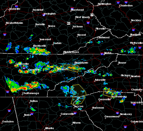 At 432 pm edt, a severe thunderstorm was located over decatur, moving east at 15 mph (radar indicated). Hazards include 60 mph wind gusts and quarter size hail. Hail damage to vehicles is expected. Expect wind damage to roofs, siding, and trees. At 432 pm edt, a severe thunderstorm was located over decatur, moving east at 15 mph (radar indicated). Hazards include 60 mph wind gusts and quarter size hail. Hail damage to vehicles is expected. Expect wind damage to roofs, siding, and trees.
|
| 6/24/2018 1:44 PM EDT |
 At 144 pm edt, a severe thunderstorm was located 7 miles south of dayton, moving east at 25 mph (radar indicated). Hazards include 60 mph wind gusts and quarter size hail. Hail damage to vehicles is expected. Expect wind damage to roofs, siding, and trees. At 144 pm edt, a severe thunderstorm was located 7 miles south of dayton, moving east at 25 mph (radar indicated). Hazards include 60 mph wind gusts and quarter size hail. Hail damage to vehicles is expected. Expect wind damage to roofs, siding, and trees.
|
| 6/23/2018 3:17 PM EDT |
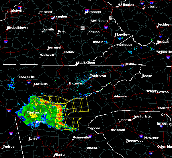 At 317 pm edt, severe thunderstorms were located along a line extending from near decatur to near athens, moving east at 35 mph (radar indicated). Hazards include 60 mph wind gusts. Expect damage to roofs, siding, and trees. Locations impacted include, athens, decatur, englewood, niota, peakland, clear water, murray store and riceville. At 317 pm edt, severe thunderstorms were located along a line extending from near decatur to near athens, moving east at 35 mph (radar indicated). Hazards include 60 mph wind gusts. Expect damage to roofs, siding, and trees. Locations impacted include, athens, decatur, englewood, niota, peakland, clear water, murray store and riceville.
|
| 6/23/2018 2:52 PM EDT |
 At 252 pm edt, severe thunderstorms were located along a line extending from near dayton to 7 miles southwest of decatur to 9 miles northwest of charleston, moving east at 35 mph (radar indicated). Hazards include 60 mph wind gusts. expect damage to roofs, siding, and trees At 252 pm edt, severe thunderstorms were located along a line extending from near dayton to 7 miles southwest of decatur to 9 miles northwest of charleston, moving east at 35 mph (radar indicated). Hazards include 60 mph wind gusts. expect damage to roofs, siding, and trees
|
| 4/4/2018 1:38 AM EDT |
 At 138 am edt, severe thunderstorms were located along a line extending from fairview to near ringgold, moving east at 45 mph (radar indicated). Hazards include 60 mph wind gusts and quarter size hail. Hail damage to vehicles is expected. expect wind damage to roofs, siding, and trees. Locations impacted include, chattanooga, cleveland, athens, sweetwater, decatur, soddy-daisy, rossville, lakesite, charleston, ridgeside, south cleveland, harrison, east cleveland, wildwood lake, collegedale, niota, calhoun, waterville, hillsview and clear water. At 138 am edt, severe thunderstorms were located along a line extending from fairview to near ringgold, moving east at 45 mph (radar indicated). Hazards include 60 mph wind gusts and quarter size hail. Hail damage to vehicles is expected. expect wind damage to roofs, siding, and trees. Locations impacted include, chattanooga, cleveland, athens, sweetwater, decatur, soddy-daisy, rossville, lakesite, charleston, ridgeside, south cleveland, harrison, east cleveland, wildwood lake, collegedale, niota, calhoun, waterville, hillsview and clear water.
|
| 4/4/2018 1:15 AM EDT |
 At 115 am edt, severe thunderstorms were located along a line extending from near spring city to near lookout mountain, moving east at 50 mph (radar indicated). Hazards include 60 mph wind gusts and quarter size hail. Hail damage to vehicles is expected. Expect wind damage to roofs, siding, and trees. At 115 am edt, severe thunderstorms were located along a line extending from near spring city to near lookout mountain, moving east at 50 mph (radar indicated). Hazards include 60 mph wind gusts and quarter size hail. Hail damage to vehicles is expected. Expect wind damage to roofs, siding, and trees.
|
| 3/17/2018 7:30 PM EDT | Quarter sized hail reported 0.6 miles WNW of Athens, TN |
| 3/17/2018 7:24 PM EDT |
 At 724 pm edt, a severe thunderstorm was located near athens, moving east at 40 mph (radar indicated). Hazards include golf ball size hail and 60 mph wind gusts. People and animals outdoors will be injured. expect hail damage to roofs, siding, windows, and vehicles. Expect wind damage to roofs, siding, and trees. At 724 pm edt, a severe thunderstorm was located near athens, moving east at 40 mph (radar indicated). Hazards include golf ball size hail and 60 mph wind gusts. People and animals outdoors will be injured. expect hail damage to roofs, siding, windows, and vehicles. Expect wind damage to roofs, siding, and trees.
|
| 3/17/2018 7:15 PM EDT |
 At 714 pm edt, a severe thunderstorm was located 7 miles west of athens, moving east at 40 mph (radar indicated). Hazards include two inch hail and 60 mph wind gusts. People and animals outdoors will be injured. expect hail damage to roofs, siding, windows, and vehicles. expect wind damage to roofs, siding, and trees. Locations impacted include, athens, etowah, englewood, niota, riceville, hillsview, clear water and dentville. At 714 pm edt, a severe thunderstorm was located 7 miles west of athens, moving east at 40 mph (radar indicated). Hazards include two inch hail and 60 mph wind gusts. People and animals outdoors will be injured. expect hail damage to roofs, siding, windows, and vehicles. expect wind damage to roofs, siding, and trees. Locations impacted include, athens, etowah, englewood, niota, riceville, hillsview, clear water and dentville.
|
| 3/17/2018 7:03 PM EDT |
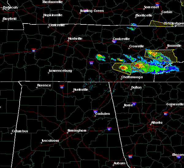 At 702 pm edt, a severe thunderstorm was located near decatur, moving east at 30 mph (radar indicated). Hazards include ping pong ball size hail and 60 mph wind gusts. People and animals outdoors will be injured. expect hail damage to roofs, siding, windows, and vehicles. expect wind damage to roofs, siding, and trees. Locations impacted include, athens, decatur, etowah, englewood, niota, calhoun, riceville, hillsview, clear water, old washington, big spring and dentville. At 702 pm edt, a severe thunderstorm was located near decatur, moving east at 30 mph (radar indicated). Hazards include ping pong ball size hail and 60 mph wind gusts. People and animals outdoors will be injured. expect hail damage to roofs, siding, windows, and vehicles. expect wind damage to roofs, siding, and trees. Locations impacted include, athens, decatur, etowah, englewood, niota, calhoun, riceville, hillsview, clear water, old washington, big spring and dentville.
|
| 3/17/2018 6:38 PM EDT |
 At 637 pm edt, a severe thunderstorm was located over dayton, moving east at 40 mph (radar indicated). Hazards include 60 mph wind gusts and quarter size hail. Hail damage to vehicles is expected. Expect wind damage to roofs, siding, and trees. At 637 pm edt, a severe thunderstorm was located over dayton, moving east at 40 mph (radar indicated). Hazards include 60 mph wind gusts and quarter size hail. Hail damage to vehicles is expected. Expect wind damage to roofs, siding, and trees.
|
| 5/27/2017 10:58 PM EDT | Numerous trees down across the county. a tree fell onto a house. no injurie in mcminn county TN, 0.6 miles WNW of Athens, TN |
| 5/27/2017 10:39 PM EDT |
 At 1039 pm edt/939 pm cdt/, severe thunderstorms were located along a line extending from near louisville to 7 miles west of madisonville to 6 miles southwest of athens to near dunlap, moving southeast at 45 mph (radar indicated). Hazards include 70 mph wind gusts and quarter size hail. Hail damage to vehicles is expected. expect considerable tree damage. wind damage is also likely to mobile homes, roofs, and outbuildings. Locations impacted include, chattanooga, cleveland, maryville, athens, alcoa, sweetwater, loudon, madisonville, jasper, decatur, soddy-daisy, signal mountain, etowah, south pittsburg, louisville, walden, lakesite, whitwell, tracy city and kimball. At 1039 pm edt/939 pm cdt/, severe thunderstorms were located along a line extending from near louisville to 7 miles west of madisonville to 6 miles southwest of athens to near dunlap, moving southeast at 45 mph (radar indicated). Hazards include 70 mph wind gusts and quarter size hail. Hail damage to vehicles is expected. expect considerable tree damage. wind damage is also likely to mobile homes, roofs, and outbuildings. Locations impacted include, chattanooga, cleveland, maryville, athens, alcoa, sweetwater, loudon, madisonville, jasper, decatur, soddy-daisy, signal mountain, etowah, south pittsburg, louisville, walden, lakesite, whitwell, tracy city and kimball.
|
| 5/27/2017 10:08 PM EDT |
 At 1008 pm edt/908 pm cdt/, severe thunderstorms were located along a line extending from oliver springs to 6 miles east of spring city to 6 miles north of dayton to 7 miles north of gruetli-laager, moving southeast at 45 mph (radar indicated). Hazards include 70 mph wind gusts and quarter size hail. Hail damage to vehicles is expected. expect considerable tree damage. Wind damage is also likely to mobile homes, roofs, and outbuildings. At 1008 pm edt/908 pm cdt/, severe thunderstorms were located along a line extending from oliver springs to 6 miles east of spring city to 6 miles north of dayton to 7 miles north of gruetli-laager, moving southeast at 45 mph (radar indicated). Hazards include 70 mph wind gusts and quarter size hail. Hail damage to vehicles is expected. expect considerable tree damage. Wind damage is also likely to mobile homes, roofs, and outbuildings.
|
| 5/12/2017 2:39 PM EDT | Tree down along county road 460. time estimated by rada in mcminn county TN, 4.5 miles W of Athens, TN |
| 4/22/2017 7:03 PM EDT |
 At 702 pm edt, severe thunderstorms were located along a line extending from near loudon to 6 miles south of sweetwater to 6 miles southwest of madisonville, moving east at 50 mph (radar indicated). Hazards include 60 mph wind gusts and quarter size hail. Hail damage to vehicles is expected. expect wind damage to roofs, siding, and trees. locations impacted include, athens, lenoir city, sweetwater, loudon, madisonville, etowah, englewood, vonore, greenback, friendsville, tellico plains, niota, philadelphia, riceville, tariffville, mcgee carson peninsula, citico beach, mount vernon, tellico village and fort loudon s. P At 702 pm edt, severe thunderstorms were located along a line extending from near loudon to 6 miles south of sweetwater to 6 miles southwest of madisonville, moving east at 50 mph (radar indicated). Hazards include 60 mph wind gusts and quarter size hail. Hail damage to vehicles is expected. expect wind damage to roofs, siding, and trees. locations impacted include, athens, lenoir city, sweetwater, loudon, madisonville, etowah, englewood, vonore, greenback, friendsville, tellico plains, niota, philadelphia, riceville, tariffville, mcgee carson peninsula, citico beach, mount vernon, tellico village and fort loudon s. P
|
| 4/22/2017 6:48 PM EDT | Numerous trees down across the count in mcminn county TN, 0.6 miles WNW of Athens, TN |
| 4/22/2017 6:38 PM EDT |
 At 638 pm edt, severe thunderstorms were located along a line extending from 8 miles southeast of spring city to near decatur to 7 miles north of charleston, moving east at 50 mph (radar indicated). Hazards include 60 mph wind gusts and quarter size hail. Hail damage to vehicles is expected. Expect wind damage to roofs, siding, and trees. At 638 pm edt, severe thunderstorms were located along a line extending from 8 miles southeast of spring city to near decatur to 7 miles north of charleston, moving east at 50 mph (radar indicated). Hazards include 60 mph wind gusts and quarter size hail. Hail damage to vehicles is expected. Expect wind damage to roofs, siding, and trees.
|
| 3/21/2017 8:00 PM EDT | A few trees down across the county - one across county road 442 and another at county road 750 near county road 604 in mcminn county TN, 0.6 miles WNW of Athens, TN |
| 3/21/2017 7:58 PM EDT |
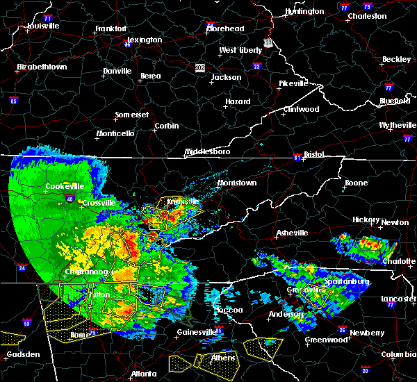 At 757 pm edt, severe thunderstorms were located along a line extending from near loudon to near madisonville to 13 miles southeast of sweetwater to 10 miles east of etowah to ducktown, moving east at 60 mph (radar indicated). Hazards include 60 mph wind gusts and quarter size hail. Hail damage to vehicles is expected. expect wind damage to roofs, siding, and trees. locations impacted include, athens, benton, ducktown, etowah, englewood, niota, william l. davenport refuge, conasauga, parksville, turtletown, murray store, reliance, archville, hiwassee ocoee s. p. And copperhill. At 757 pm edt, severe thunderstorms were located along a line extending from near loudon to near madisonville to 13 miles southeast of sweetwater to 10 miles east of etowah to ducktown, moving east at 60 mph (radar indicated). Hazards include 60 mph wind gusts and quarter size hail. Hail damage to vehicles is expected. expect wind damage to roofs, siding, and trees. locations impacted include, athens, benton, ducktown, etowah, englewood, niota, william l. davenport refuge, conasauga, parksville, turtletown, murray store, reliance, archville, hiwassee ocoee s. p. And copperhill.
|
| 3/21/2017 7:23 PM EDT |
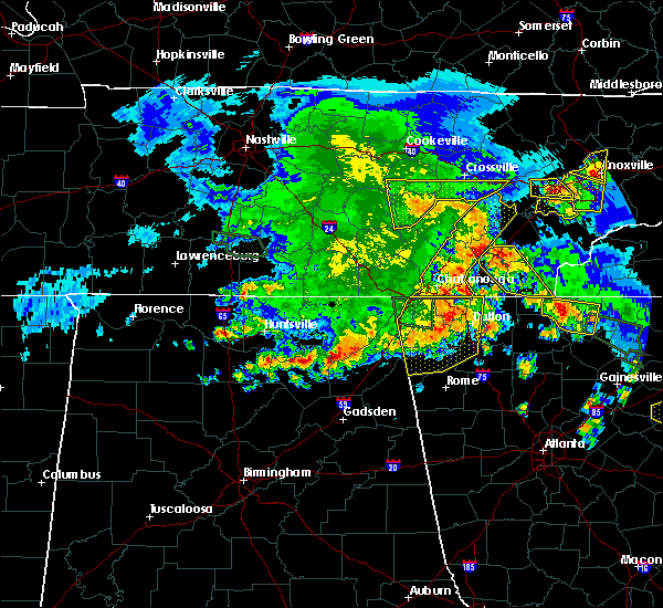 At 722 pm edt, severe thunderstorms were located along a line extending from near spring city to 6 miles west of decatur to 9 miles southeast of dayton to 8 miles west of charleston to near south cleveland to cohutta, moving east at 55 mph (radar indicated). Hazards include 60 mph wind gusts and quarter size hail. Hail damage to vehicles is expected. Expect wind damage to roofs, siding, and trees. At 722 pm edt, severe thunderstorms were located along a line extending from near spring city to 6 miles west of decatur to 9 miles southeast of dayton to 8 miles west of charleston to near south cleveland to cohutta, moving east at 55 mph (radar indicated). Hazards include 60 mph wind gusts and quarter size hail. Hail damage to vehicles is expected. Expect wind damage to roofs, siding, and trees.
|
| 3/21/2017 6:45 PM EDT | Quarter sized hail reported 0.6 miles WNW of Athens, TN, quarter size hail near highway 30 east of athens |
| 3/21/2017 5:45 PM EDT | Quarter sized hail reported 0.6 miles WNW of Athens, TN, quarter size hail near highway 30 east of athens |
| 3/21/2017 5:20 PM EDT |
 At 520 pm edt, a severe thunderstorm was located near decatur, moving southeast at 15 mph (radar indicated). Hazards include 60 mph wind gusts and quarter size hail. Hail damage to vehicles is expected. Expect wind damage to roofs, siding, and trees. At 520 pm edt, a severe thunderstorm was located near decatur, moving southeast at 15 mph (radar indicated). Hazards include 60 mph wind gusts and quarter size hail. Hail damage to vehicles is expected. Expect wind damage to roofs, siding, and trees.
|
| 11/30/2016 6:47 AM EST |
 At 646 am est, a severe thunderstorm was located 7 miles southwest of athens, moving northeast at 70 mph (radar indicated). Hazards include 60 mph wind gusts and penny size hail. Expect damage to roofs. siding. and trees. locations impacted include, athens, dayton, decatur, etowah, englewood, calhoun, riceville, peakland, dentville, big spring, old washington, hillsview and clear water. A tornado watch remains in effect until 1100 am est for eastern tennessee. At 646 am est, a severe thunderstorm was located 7 miles southwest of athens, moving northeast at 70 mph (radar indicated). Hazards include 60 mph wind gusts and penny size hail. Expect damage to roofs. siding. and trees. locations impacted include, athens, dayton, decatur, etowah, englewood, calhoun, riceville, peakland, dentville, big spring, old washington, hillsview and clear water. A tornado watch remains in effect until 1100 am est for eastern tennessee.
|
| 11/30/2016 6:25 AM EST |
 At 624 am est, a severe thunderstorm was located near lakesite, or 12 miles west of cleveland, moving northeast at 65 mph (radar indicated). Hazards include 60 mph wind gusts and penny size hail. Expect damage to roofs. siding. And trees. At 624 am est, a severe thunderstorm was located near lakesite, or 12 miles west of cleveland, moving northeast at 65 mph (radar indicated). Hazards include 60 mph wind gusts and penny size hail. Expect damage to roofs. siding. And trees.
|
| 11/30/2016 6:17 AM EST |
 At 616 am est, severe thunderstorms were located along a line extending from near eagleton village to near wildwood lake, moving northeast at 45 mph (radar indicated). Hazards include 60 mph wind gusts and penny size hail. Expect damage to roofs. siding. and trees. locations impacted include, chattanooga, cleveland, athens, sweetwater, madisonville, benton, ducktown, etowah, charleston, south cleveland, east cleveland, wildwood lake, collegedale, englewood, vonore, tellico plains, niota, calhoun, ooltewah and parksville. A tornado watch remains in effect until 1100 am est for eastern tennessee. At 616 am est, severe thunderstorms were located along a line extending from near eagleton village to near wildwood lake, moving northeast at 45 mph (radar indicated). Hazards include 60 mph wind gusts and penny size hail. Expect damage to roofs. siding. and trees. locations impacted include, chattanooga, cleveland, athens, sweetwater, madisonville, benton, ducktown, etowah, charleston, south cleveland, east cleveland, wildwood lake, collegedale, englewood, vonore, tellico plains, niota, calhoun, ooltewah and parksville. A tornado watch remains in effect until 1100 am est for eastern tennessee.
|
| 11/30/2016 5:46 AM EST |
 At 545 am est, severe thunderstorms were located along a line extending from 8 miles northeast of madisonville to near ringgold, moving northeast at 45 mph (radar indicated). Hazards include 70 mph wind gusts and penny size hail. Expect considerable tree damage. Damage is likely to mobile homes, roofs, and outbuildings. At 545 am est, severe thunderstorms were located along a line extending from 8 miles northeast of madisonville to near ringgold, moving northeast at 45 mph (radar indicated). Hazards include 70 mph wind gusts and penny size hail. Expect considerable tree damage. Damage is likely to mobile homes, roofs, and outbuildings.
|
| 11/30/2016 5:42 AM EST |
 At 542 am est, severe thunderstorms were located along a line extending from near madisonville to 6 miles northwest of cohutta, moving east at 40 mph (radar indicated). Hazards include 70 mph wind gusts and penny size hail. Expect considerable tree damage. damage is likely to mobile homes, roofs, and outbuildings. locations impacted include, chattanooga, cleveland, athens, sweetwater, madisonville, charleston, ridgeside, harrison, wildwood lake, south cleveland, east cleveland, collegedale, englewood, niota, calhoun, mcdonald, riceville, ooltewah, east brainerd and clear water. A tornado watch remains in effect until 1100 am est for eastern tennessee. At 542 am est, severe thunderstorms were located along a line extending from near madisonville to 6 miles northwest of cohutta, moving east at 40 mph (radar indicated). Hazards include 70 mph wind gusts and penny size hail. Expect considerable tree damage. damage is likely to mobile homes, roofs, and outbuildings. locations impacted include, chattanooga, cleveland, athens, sweetwater, madisonville, charleston, ridgeside, harrison, wildwood lake, south cleveland, east cleveland, collegedale, englewood, niota, calhoun, mcdonald, riceville, ooltewah, east brainerd and clear water. A tornado watch remains in effect until 1100 am est for eastern tennessee.
|
| 11/30/2016 5:32 AM EST |
 At 532 am est, severe thunderstorms were located along a line extending from near maryville to 13 miles northwest of town of santeetlah to 6 miles southeast of benton, moving east at 50 mph (radar indicated). Hazards include 60 mph wind gusts and penny size hail. Expect damage to roofs. siding. and trees. locations impacted include, cleveland, athens, madisonville, benton, ducktown, etowah, charleston, wildwood lake, south cleveland, east cleveland, englewood, vonore, tellico plains, calhoun, riceville, fort loudon s. p,. parksville, mount vernon, citico beach and bullet creek. A tornado watch remains in effect until 1100 am est for eastern tennessee. At 532 am est, severe thunderstorms were located along a line extending from near maryville to 13 miles northwest of town of santeetlah to 6 miles southeast of benton, moving east at 50 mph (radar indicated). Hazards include 60 mph wind gusts and penny size hail. Expect damage to roofs. siding. and trees. locations impacted include, cleveland, athens, madisonville, benton, ducktown, etowah, charleston, wildwood lake, south cleveland, east cleveland, englewood, vonore, tellico plains, calhoun, riceville, fort loudon s. p,. parksville, mount vernon, citico beach and bullet creek. A tornado watch remains in effect until 1100 am est for eastern tennessee.
|
| 11/30/2016 5:30 AM EST |
 At 530 am est, severe thunderstorms were located along a line extending from 8 miles southwest of fairview to 6 miles northwest of south cleveland, moving east at 50 mph (radar indicated). Hazards include 60 mph wind gusts and penny size hail. Expect damage to roofs. siding. And trees. At 530 am est, severe thunderstorms were located along a line extending from 8 miles southwest of fairview to 6 miles northwest of south cleveland, moving east at 50 mph (radar indicated). Hazards include 60 mph wind gusts and penny size hail. Expect damage to roofs. siding. And trees.
|
| 11/30/2016 5:14 AM EST |
 At 514 am est, severe thunderstorms were located along a line extending from 10 miles southwest of maryville to 8 miles south of madisonville to near wildwood lake, moving east at 50 mph (radar indicated). Hazards include 70 mph wind gusts and penny size hail. Expect considerable tree damage. Damage is likely to mobile homes, roofs, and outbuildings. At 514 am est, severe thunderstorms were located along a line extending from 10 miles southwest of maryville to 8 miles south of madisonville to near wildwood lake, moving east at 50 mph (radar indicated). Hazards include 70 mph wind gusts and penny size hail. Expect considerable tree damage. Damage is likely to mobile homes, roofs, and outbuildings.
|
| 11/30/2016 5:00 AM EST | Trees and power lines down in the athens area. widespread power outage in mcminn county TN, 0.6 miles WNW of Athens, TN |
| 11/30/2016 4:55 AM EST |
 At 455 am est, severe thunderstorms were located along a line extending from near athens to 6 miles east of charleston to near south cleveland, moving east at 50 mph (radar indicated). Hazards include 70 mph wind gusts and nickel size hail. Expect considerable tree damage. damage is likely to mobile homes, roofs, and outbuildings. locations impacted include, cleveland, athens, madisonville, decatur, benton, etowah, charleston, wildwood lake, south cleveland, east cleveland, collegedale, englewood, niota, calhoun, mcdonald, riceville, big spring, parksville, mount vernon and bullet creek. A tornado watch remains in effect until 1100 am est for eastern tennessee. At 455 am est, severe thunderstorms were located along a line extending from near athens to 6 miles east of charleston to near south cleveland, moving east at 50 mph (radar indicated). Hazards include 70 mph wind gusts and nickel size hail. Expect considerable tree damage. damage is likely to mobile homes, roofs, and outbuildings. locations impacted include, cleveland, athens, madisonville, decatur, benton, etowah, charleston, wildwood lake, south cleveland, east cleveland, collegedale, englewood, niota, calhoun, mcdonald, riceville, big spring, parksville, mount vernon and bullet creek. A tornado watch remains in effect until 1100 am est for eastern tennessee.
|
| 11/30/2016 4:42 AM EST |
 At 441 am est, severe thunderstorms were located along a line extending from near decatur to near charleston to near harrison, moving east at 50 mph (radar indicated). Hazards include 70 mph wind gusts and nickel size hail. Expect considerable tree damage. Damage is likely to mobile homes, roofs, and outbuildings. At 441 am est, severe thunderstorms were located along a line extending from near decatur to near charleston to near harrison, moving east at 50 mph (radar indicated). Hazards include 70 mph wind gusts and nickel size hail. Expect considerable tree damage. Damage is likely to mobile homes, roofs, and outbuildings.
|
| 11/30/2016 4:34 AM EST |
 At 433 am est, severe thunderstorms were located along a line extending from kingston to 6 miles southeast of decatur to 6 miles south of harrison, moving east at 45 mph (radar indicated). Hazards include 70 mph wind gusts and nickel size hail. Expect considerable tree damage. damage is likely to mobile homes, roofs, and outbuildings. locations impacted include, chattanooga, cleveland, athens, dayton, sweetwater, loudon, decatur, soddy-daisy, fairview, lakesite, charleston, ridgeside, harrison, south cleveland, east cleveland, wildwood lake, red bank, collegedale, graysville and niota. A tornado watch remains in effect until 1100 am est for eastern tennessee. At 433 am est, severe thunderstorms were located along a line extending from kingston to 6 miles southeast of decatur to 6 miles south of harrison, moving east at 45 mph (radar indicated). Hazards include 70 mph wind gusts and nickel size hail. Expect considerable tree damage. damage is likely to mobile homes, roofs, and outbuildings. locations impacted include, chattanooga, cleveland, athens, dayton, sweetwater, loudon, decatur, soddy-daisy, fairview, lakesite, charleston, ridgeside, harrison, south cleveland, east cleveland, wildwood lake, red bank, collegedale, graysville and niota. A tornado watch remains in effect until 1100 am est for eastern tennessee.
|
| 11/30/2016 4:12 AM EST |
 At 412 am est/312 am cst/, severe thunderstorms were located along a line extending from 6 miles southwest of rockwood to 6 miles south of dayton to lookout mountain, moving east at 50 mph (radar indicated). Hazards include 60 mph wind gusts. Expect damage to roofs. siding. And trees. At 412 am est/312 am cst/, severe thunderstorms were located along a line extending from 6 miles southwest of rockwood to 6 miles south of dayton to lookout mountain, moving east at 50 mph (radar indicated). Hazards include 60 mph wind gusts. Expect damage to roofs. siding. And trees.
|
| 11/30/2016 2:07 AM EST |
 At 207 am est, a severe thunderstorm was located near sweetwater, moving northeast at 60 mph (radar indicated). Hazards include 60 mph wind gusts. Expect damage to roofs. siding. And trees. At 207 am est, a severe thunderstorm was located near sweetwater, moving northeast at 60 mph (radar indicated). Hazards include 60 mph wind gusts. Expect damage to roofs. siding. And trees.
|
| 11/30/2016 1:51 AM EST |
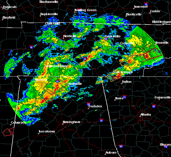 At 150 am est, a severe thunderstorm was located near decatur, moving east at 50 mph (radar indicated). Hazards include 60 mph wind gusts. Expect damage to roofs. siding. and trees. locations impacted include, athens, decatur, riceville, hillsview, big spring and clear water. A tornado watch remains in effect until 400 am est for eastern tennessee. At 150 am est, a severe thunderstorm was located near decatur, moving east at 50 mph (radar indicated). Hazards include 60 mph wind gusts. Expect damage to roofs. siding. and trees. locations impacted include, athens, decatur, riceville, hillsview, big spring and clear water. A tornado watch remains in effect until 400 am est for eastern tennessee.
|
| 11/30/2016 1:42 AM EST | Trees uprooted and hole in roof of residenc in mcminn county TN, 3.6 miles WSW of Athens, TN |
| 11/30/2016 1:36 AM EST |
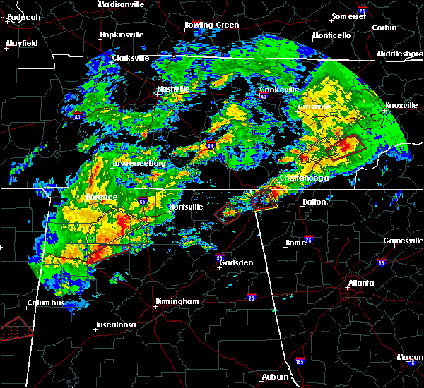 At 136 am est, a severe thunderstorm was located 8 miles south of dayton, moving northeast at 55 mph (radar indicated). Hazards include 60 mph wind gusts. Expect damage to roofs. siding. And trees. At 136 am est, a severe thunderstorm was located 8 miles south of dayton, moving northeast at 55 mph (radar indicated). Hazards include 60 mph wind gusts. Expect damage to roofs. siding. And trees.
|
| 11/30/2016 1:30 AM EST | Damage and injuries reported in deerfield estates. no further details available at this poin in mcminn county TN, 3.4 miles WSW of Athens, TN |
| 11/30/2016 1:30 AM EST | Report relayed from amateur radio and dispatch. there is damage extending along a line from county road 700... across athens... and continuing up hwy 307. multiple repo in mcminn county TN, 1.9 miles SSW of Athens, TN |
| 11/30/2016 1:28 AM EST |
 The tornado warning for southwestern mcminn county will expire at 130 am est, the storm which prompted the warning has moved out of the area. therefore the warning will be allowed to expire. however heavy rain is still possible with this thunderstorm. a tornado watch remains in effect until 400 am est for eastern tennessee. The tornado warning for southwestern mcminn county will expire at 130 am est, the storm which prompted the warning has moved out of the area. therefore the warning will be allowed to expire. however heavy rain is still possible with this thunderstorm. a tornado watch remains in effect until 400 am est for eastern tennessee.
|
| 11/30/2016 1:21 AM EST | At state road 30 and 39 intersection in athens roof blown off building. trees down... structures damaged and roads blocked south of athen in mcminn county TN, 0.6 miles WNW of Athens, TN |
| 11/30/2016 1:20 AM EST |
 At 120 am est, a severe thunderstorm capable of producing a tornado was located near athens, moving northeast at 55 mph (radar indicated rotation). Hazards include tornado. Flying debris will be dangerous to those caught without shelter. mobile homes will be damaged or destroyed. damage to roofs, windows, and vehicles will occur. tree damage is likely. this dangerous storm will be near, madisonville around 135 am est. sweetwater around 140 am est. Other locations impacted by this tornadic thunderstorm include niota, englewood and vonore. At 120 am est, a severe thunderstorm capable of producing a tornado was located near athens, moving northeast at 55 mph (radar indicated rotation). Hazards include tornado. Flying debris will be dangerous to those caught without shelter. mobile homes will be damaged or destroyed. damage to roofs, windows, and vehicles will occur. tree damage is likely. this dangerous storm will be near, madisonville around 135 am est. sweetwater around 140 am est. Other locations impacted by this tornadic thunderstorm include niota, englewood and vonore.
|
| 11/30/2016 1:14 AM EST |
 At 112 am est, a severe thunderstorm capable of producing a tornado was located near charleston, or 12 miles south of decatur, moving northeast at 50 mph (radar indicated rotation. at 1240 am est, extensive damage was reported hamilton county). Hazards include tornado and quarter size hail. Flying debris will be dangerous to those caught without shelter. mobile homes will be damaged or destroyed. damage to roofs, windows, and vehicles will occur. tree damage is likely. this dangerous storm will be near, athens and etowah around 130 am est. Other locations impacted by this tornadic thunderstorm include riceville, hillsview, calhoun, dentville and clear water. At 112 am est, a severe thunderstorm capable of producing a tornado was located near charleston, or 12 miles south of decatur, moving northeast at 50 mph (radar indicated rotation. at 1240 am est, extensive damage was reported hamilton county). Hazards include tornado and quarter size hail. Flying debris will be dangerous to those caught without shelter. mobile homes will be damaged or destroyed. damage to roofs, windows, and vehicles will occur. tree damage is likely. this dangerous storm will be near, athens and etowah around 130 am est. Other locations impacted by this tornadic thunderstorm include riceville, hillsview, calhoun, dentville and clear water.
|
| 11/30/2016 1:01 AM EST |
 At 100 am est, a severe thunderstorm capable of producing a tornado was located 7 miles northwest of cleveland, moving northeast at 50 mph (radar indicated rotation). Hazards include tornado and golf ball size hail. Flying debris will be dangerous to those caught without shelter. mobile homes will be damaged or destroyed. damage to roofs, windows, and vehicles will occur. tree damage is likely. this dangerous storm will be near, charleston around 110 am est. athens and etowah around 130 am est. Other locations impacted by this tornadic thunderstorm include hopewell, riceville, calhoun, dentville, big spring, birchwood, hillsview and clear water. At 100 am est, a severe thunderstorm capable of producing a tornado was located 7 miles northwest of cleveland, moving northeast at 50 mph (radar indicated rotation). Hazards include tornado and golf ball size hail. Flying debris will be dangerous to those caught without shelter. mobile homes will be damaged or destroyed. damage to roofs, windows, and vehicles will occur. tree damage is likely. this dangerous storm will be near, charleston around 110 am est. athens and etowah around 130 am est. Other locations impacted by this tornadic thunderstorm include hopewell, riceville, calhoun, dentville, big spring, birchwood, hillsview and clear water.
|
| 11/30/2016 12:54 AM EST |
 At 1254 am est, a severe thunderstorm capable of producing a tornado was located near lakesite, or 9 miles west of cleveland, moving northeast at 50 mph (radar indicated rotation). Hazards include tornado and quarter size hail. Flying debris will be dangerous to those caught without shelter. mobile homes will be damaged or destroyed. damage to roofs, windows, and vehicles will occur. tree damage is likely. this dangerous storm will be near, cleveland around 105 am est. charleston around 115 am est. athens and etowah around 130 am est. Other locations impacted by this tornadic thunderstorm include hopewell, riceville, calhoun, dentville, big spring, birchwood, hillsview and clear water. At 1254 am est, a severe thunderstorm capable of producing a tornado was located near lakesite, or 9 miles west of cleveland, moving northeast at 50 mph (radar indicated rotation). Hazards include tornado and quarter size hail. Flying debris will be dangerous to those caught without shelter. mobile homes will be damaged or destroyed. damage to roofs, windows, and vehicles will occur. tree damage is likely. this dangerous storm will be near, cleveland around 105 am est. charleston around 115 am est. athens and etowah around 130 am est. Other locations impacted by this tornadic thunderstorm include hopewell, riceville, calhoun, dentville, big spring, birchwood, hillsview and clear water.
|
| 8/18/2016 9:19 AM EDT |
 At 919 am edt, severe thunderstorms were located along a line extending from near spring city to near dayton to 8 miles north of soddy-daisy, moving east at 25 mph (radar indicated). Hazards include 60 mph wind gusts. Expect damage to roofs. siding. and trees. locations impacted include, athens, dayton, kingston, rockwood, decatur, fairview, spring city, midtown, graysville, niota, riceville, peakland, big spring, stinging fork falls s. p,. Birchwood, evensville, clear water, eagle furnace, old washington and paint rock. At 919 am edt, severe thunderstorms were located along a line extending from near spring city to near dayton to 8 miles north of soddy-daisy, moving east at 25 mph (radar indicated). Hazards include 60 mph wind gusts. Expect damage to roofs. siding. and trees. locations impacted include, athens, dayton, kingston, rockwood, decatur, fairview, spring city, midtown, graysville, niota, riceville, peakland, big spring, stinging fork falls s. p,. Birchwood, evensville, clear water, eagle furnace, old washington and paint rock.
|
| 8/18/2016 9:00 AM EDT |
 At 900 am edt/800 am cdt/, severe thunderstorms were located along a line extending from near spring city to near dayton to 7 miles north of soddy-daisy, moving east at 30 mph (radar indicated). Hazards include 60 mph wind gusts. Expect damage to roofs. siding. And trees. At 900 am edt/800 am cdt/, severe thunderstorms were located along a line extending from near spring city to near dayton to 7 miles north of soddy-daisy, moving east at 30 mph (radar indicated). Hazards include 60 mph wind gusts. Expect damage to roofs. siding. And trees.
|
| 7/14/2016 5:22 PM EDT |
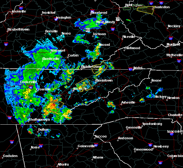 At 521 pm edt, a severe thunderstorm was located near sweetwater, moving east at 25 mph (radar indicated). Hazards include 60 mph wind gusts and quarter size hail. Hail damage to vehicles is expected. expect wind damage to roofs, siding, and trees. Locations impacted include, athens, sweetwater, madisonville, etowah, englewood, vonore, niota, murray store and clear water. At 521 pm edt, a severe thunderstorm was located near sweetwater, moving east at 25 mph (radar indicated). Hazards include 60 mph wind gusts and quarter size hail. Hail damage to vehicles is expected. expect wind damage to roofs, siding, and trees. Locations impacted include, athens, sweetwater, madisonville, etowah, englewood, vonore, niota, murray store and clear water.
|
| 7/14/2016 5:04 PM EDT | Multiple trees reported down across the county in mcminn county TN, 3.9 miles SE of Athens, TN |
| 7/14/2016 5:02 PM EDT |
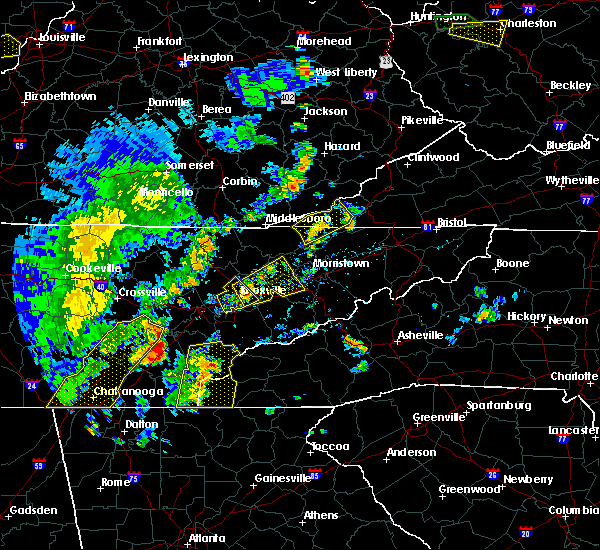 At 502 pm edt, a severe thunderstorm was located near athens, moving east at 30 mph (radar indicated). Hazards include 60 mph wind gusts and quarter size hail. Hail damage to vehicles is expected. Expect wind damage to roofs, siding, and trees. At 502 pm edt, a severe thunderstorm was located near athens, moving east at 30 mph (radar indicated). Hazards include 60 mph wind gusts and quarter size hail. Hail damage to vehicles is expected. Expect wind damage to roofs, siding, and trees.
|
| 7/14/2016 4:34 PM EDT |
 At 433 pm edt, severe thunderstorms were located along a line extending from near madisonville to near ducktown, moving northeast at 25 mph (radar indicated). Hazards include 60 mph wind gusts and quarter size hail. Hail damage to vehicles is expected. Expect wind damage to roofs, siding, and trees. At 433 pm edt, severe thunderstorms were located along a line extending from near madisonville to near ducktown, moving northeast at 25 mph (radar indicated). Hazards include 60 mph wind gusts and quarter size hail. Hail damage to vehicles is expected. Expect wind damage to roofs, siding, and trees.
|
| 7/13/2016 9:58 PM EDT | The severe thunderstorm warning for central mcminn county will expire at 1000 pm edt. the storm which prompted the warning has weakened below severe limits. and no longer poses an immediate threat to life or property. therefore. the warning will be allowed to expire. however small hail. Gusty winds to 35 mph and heavy rain are still possible with. |
| 7/13/2016 9:34 PM EDT |
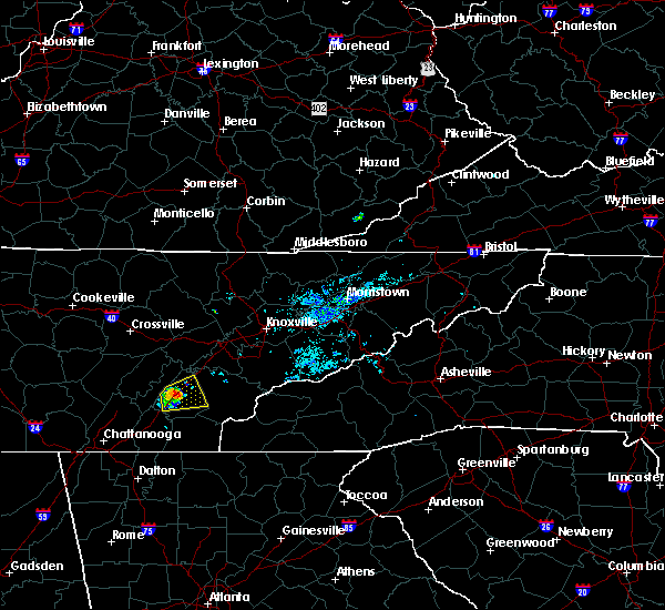 At 931 pm edt, a severe thunderstorm was located just west of athens, moving east at 15 mph. the storm has weakened slightly but could re-intensify during the next several minutes as it moves across the city of athens (radar indicated). Hazards include 60 mph wind gusts and quarter size hail. Hail damage to vehicles is possible. expect wind damage to roofs, siding, and trees. Locations impacted include, athens, sweetwater, etowah, englewood, niota, riceville and clear water. At 931 pm edt, a severe thunderstorm was located just west of athens, moving east at 15 mph. the storm has weakened slightly but could re-intensify during the next several minutes as it moves across the city of athens (radar indicated). Hazards include 60 mph wind gusts and quarter size hail. Hail damage to vehicles is possible. expect wind damage to roofs, siding, and trees. Locations impacted include, athens, sweetwater, etowah, englewood, niota, riceville and clear water.
|
| 7/13/2016 9:32 PM EDT | Two trees dow in mcminn county TN, 0.6 miles WNW of Athens, TN |
| 7/13/2016 9:14 PM EDT |
 At 913 pm edt, a severe thunderstorm was located near athens, moving east at 15 mph (radar indicated). Hazards include 60 mph wind gusts and quarter size hail. Hail damage to vehicles is possible. Expect wind damage to roofs, siding, and trees. At 913 pm edt, a severe thunderstorm was located near athens, moving east at 15 mph (radar indicated). Hazards include 60 mph wind gusts and quarter size hail. Hail damage to vehicles is possible. Expect wind damage to roofs, siding, and trees.
|
| 7/8/2016 7:21 PM EDT |
 At 720 pm edt, a severe thunderstorm was located 7 miles west of madisonville, moving southeast at 30 mph (radar indicated). Hazards include 60 mph wind gusts and quarter size hail. Hail damage to vehicles is expected. Expect wind damage to roofs, siding, and trees. At 720 pm edt, a severe thunderstorm was located 7 miles west of madisonville, moving southeast at 30 mph (radar indicated). Hazards include 60 mph wind gusts and quarter size hail. Hail damage to vehicles is expected. Expect wind damage to roofs, siding, and trees.
|
| 7/7/2016 6:38 PM EDT |
 At 637 pm edt, severe thunderstorms were located along a line extending from near lenoir city to near sweetwater to near decatur, moving southeast at 40 mph (radar indicated). Hazards include 60 mph wind gusts and penny size hail. Expect damage to roofs. siding. and trees. Locations impacted include, oak ridge, athens, lenoir city, dayton, kingston, sweetwater, loudon, madisonville, decatur, fairview, etowah, englewood, graysville, vonore, greenback, niota, philadelphia, calhoun, riceville and peakland. At 637 pm edt, severe thunderstorms were located along a line extending from near lenoir city to near sweetwater to near decatur, moving southeast at 40 mph (radar indicated). Hazards include 60 mph wind gusts and penny size hail. Expect damage to roofs. siding. and trees. Locations impacted include, oak ridge, athens, lenoir city, dayton, kingston, sweetwater, loudon, madisonville, decatur, fairview, etowah, englewood, graysville, vonore, greenback, niota, philadelphia, calhoun, riceville and peakland.
|
| 7/7/2016 6:28 PM EDT |
 At 627 pm edt/527 pm cdt/, severe thunderstorms were located along a line extending from near fairview to 7 miles northeast of decatur to near dayton, moving southeast at 40 mph (radar indicated). Hazards include 60 mph wind gusts and penny size hail. Expect damage to roofs. siding. and trees. Locations impacted include, oak ridge, athens, lenoir city, dayton, kingston, sweetwater, rockwood, loudon, madisonville, pikeville, decatur, fairview, etowah, spring city, midtown, harriman, englewood, graysville, vonore and greenback. At 627 pm edt/527 pm cdt/, severe thunderstorms were located along a line extending from near fairview to 7 miles northeast of decatur to near dayton, moving southeast at 40 mph (radar indicated). Hazards include 60 mph wind gusts and penny size hail. Expect damage to roofs. siding. and trees. Locations impacted include, oak ridge, athens, lenoir city, dayton, kingston, sweetwater, rockwood, loudon, madisonville, pikeville, decatur, fairview, etowah, spring city, midtown, harriman, englewood, graysville, vonore and greenback.
|
| 7/7/2016 6:09 PM EDT |
 At 609 pm edt/509 pm cdt/, severe thunderstorms were located along a line extending from 7 miles east of fairfield glade to 10 miles northwest of spring city to near spencer, moving southeast at 30 mph (radar indicated). Hazards include 60 mph wind gusts and penny size hail. Expect damage to roofs. siding. And trees. At 609 pm edt/509 pm cdt/, severe thunderstorms were located along a line extending from 7 miles east of fairfield glade to 10 miles northwest of spring city to near spencer, moving southeast at 30 mph (radar indicated). Hazards include 60 mph wind gusts and penny size hail. Expect damage to roofs. siding. And trees.
|
| 7/6/2016 8:12 PM EDT |
 At 812 pm edt, severe thunderstorms were located along a line extending from 6 miles north of blairsville to near ducktown to near charleston to near walden, moving southeast at 55 mph (radar indicated). Hazards include 60 mph wind gusts. Expect damage to roofs. siding. And trees. At 812 pm edt, severe thunderstorms were located along a line extending from 6 miles north of blairsville to near ducktown to near charleston to near walden, moving southeast at 55 mph (radar indicated). Hazards include 60 mph wind gusts. Expect damage to roofs. siding. And trees.
|
| 7/6/2016 6:35 PM EDT |
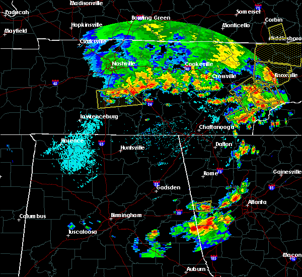 At 634 pm edt, a severe thunderstorm was located over etowah, or 8 miles south of athens, moving northeast at 20 mph (radar indicated). Hazards include 60 mph wind gusts. Expect damage to roofs. siding. and trees. Locations impacted include, etowah, englewood, calhoun and dentville. At 634 pm edt, a severe thunderstorm was located over etowah, or 8 miles south of athens, moving northeast at 20 mph (radar indicated). Hazards include 60 mph wind gusts. Expect damage to roofs. siding. and trees. Locations impacted include, etowah, englewood, calhoun and dentville.
|
| 7/6/2016 6:20 PM EDT | Several trees down county-wid in mcminn county TN, 0.6 miles WNW of Athens, TN |
| 7/6/2016 6:16 PM EDT |
 At 616 pm edt, a severe thunderstorm was located near charleston, or 8 miles southwest of athens, moving east at 30 mph (radar indicated). Hazards include 60 mph wind gusts and quarter size hail. Hail damage to vehicles is expected. expect wind damage to roofs, siding, and trees. Locations impacted include, athens, decatur, etowah, charleston, englewood, niota, calhoun, riceville, dentville, murray store, hillsview and clear water. At 616 pm edt, a severe thunderstorm was located near charleston, or 8 miles southwest of athens, moving east at 30 mph (radar indicated). Hazards include 60 mph wind gusts and quarter size hail. Hail damage to vehicles is expected. expect wind damage to roofs, siding, and trees. Locations impacted include, athens, decatur, etowah, charleston, englewood, niota, calhoun, riceville, dentville, murray store, hillsview and clear water.
|
| 7/6/2016 5:57 PM EDT |
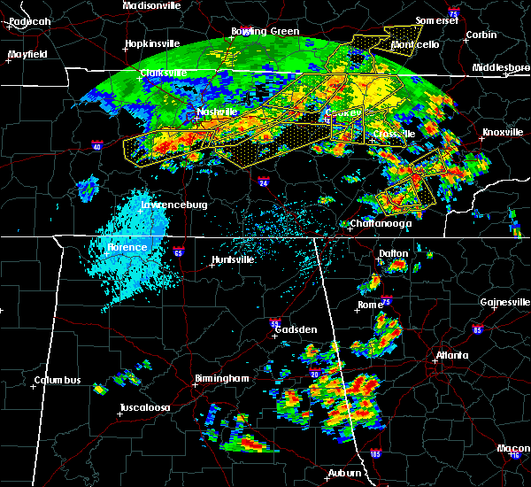 At 557 pm edt, a severe thunderstorm was located 7 miles northwest of charleston, or 11 miles north of cleveland, moving northeast at 30 mph (radar indicated). Hazards include 60 mph wind gusts and quarter size hail. Hail damage to vehicles is expected. Expect wind damage to roofs, siding, and trees. At 557 pm edt, a severe thunderstorm was located 7 miles northwest of charleston, or 11 miles north of cleveland, moving northeast at 30 mph (radar indicated). Hazards include 60 mph wind gusts and quarter size hail. Hail damage to vehicles is expected. Expect wind damage to roofs, siding, and trees.
|
| 7/6/2016 5:36 PM EDT |
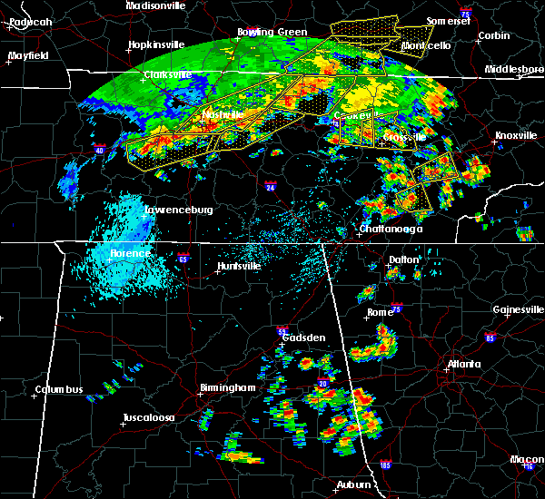 At 536 pm edt, a severe thunderstorm was located 7 miles south of decatur, moving east at 25 mph (radar indicated). Hazards include 60 mph wind gusts and quarter size hail. Hail damage to vehicles is expected. expect wind damage to roofs, siding, and trees. Locations impacted include, athens, decatur, calhoun, riceville, hillsview and clear water. At 536 pm edt, a severe thunderstorm was located 7 miles south of decatur, moving east at 25 mph (radar indicated). Hazards include 60 mph wind gusts and quarter size hail. Hail damage to vehicles is expected. expect wind damage to roofs, siding, and trees. Locations impacted include, athens, decatur, calhoun, riceville, hillsview and clear water.
|
| 7/6/2016 5:19 PM EDT |
 At 519 pm edt, a severe thunderstorm was located 9 miles southeast of dayton, moving east at 25 mph (radar indicated). Hazards include 60 mph wind gusts and quarter size hail. Hail damage to vehicles is expected. Expect wind damage to roofs, siding, and trees. At 519 pm edt, a severe thunderstorm was located 9 miles southeast of dayton, moving east at 25 mph (radar indicated). Hazards include 60 mph wind gusts and quarter size hail. Hail damage to vehicles is expected. Expect wind damage to roofs, siding, and trees.
|
| 6/3/2016 4:52 PM EDT |
 At 451 pm edt, a severe thunderstorm was located near charleston, or 10 miles southwest of athens, moving northeast at 15 mph (radar indicated). Hazards include 60 mph wind gusts and quarter size hail. Hail damage to vehicles is expected. expect wind damage to roofs, siding, and trees. Locations impacted include, athens, calhoun, hillsview and riceville. At 451 pm edt, a severe thunderstorm was located near charleston, or 10 miles southwest of athens, moving northeast at 15 mph (radar indicated). Hazards include 60 mph wind gusts and quarter size hail. Hail damage to vehicles is expected. expect wind damage to roofs, siding, and trees. Locations impacted include, athens, calhoun, hillsview and riceville.
|
| 6/3/2016 4:28 PM EDT |
 At 427 pm edt, a severe thunderstorm was located over charleston, or 10 miles northeast of cleveland, moving northeast at 15 mph (radar indicated). Hazards include 60 mph wind gusts and quarter size hail. Hail damage to vehicles is expected. Expect wind damage to roofs, siding, and trees. At 427 pm edt, a severe thunderstorm was located over charleston, or 10 miles northeast of cleveland, moving northeast at 15 mph (radar indicated). Hazards include 60 mph wind gusts and quarter size hail. Hail damage to vehicles is expected. Expect wind damage to roofs, siding, and trees.
|
| 4/22/2016 5:35 PM EDT | Quarter sized hail reported 3.3 miles S of Athens, TN |
| 2/3/2016 4:09 AM EST |
 At 408 am est, a severe thunderstorm was located near spring city, or 8 miles northwest of decatur, moving northeast at 60 mph (law enforcement). Hazards include 60 mph wind gusts and penny size hail. Expect damage to roofs. siding and trees. Locations impacted include, athens, dayton, decatur, spring city, graysville, niota, peakland, big spring, old washington, grandview, evensville, clear water, murray store and ten mile. At 408 am est, a severe thunderstorm was located near spring city, or 8 miles northwest of decatur, moving northeast at 60 mph (law enforcement). Hazards include 60 mph wind gusts and penny size hail. Expect damage to roofs. siding and trees. Locations impacted include, athens, dayton, decatur, spring city, graysville, niota, peakland, big spring, old washington, grandview, evensville, clear water, murray store and ten mile.
|
| 2/3/2016 3:45 AM EST |
 At 343 am est /243 am cst/, a severe thunderstorm was located 8 miles north of soddy-daisy, or 9 miles east of dunlap, moving northeast at 60 mph (law enforcement). Hazards include 60 mph wind gusts and penny size hail. Expect damage to roofs. Siding and trees. At 343 am est /243 am cst/, a severe thunderstorm was located 8 miles north of soddy-daisy, or 9 miles east of dunlap, moving northeast at 60 mph (law enforcement). Hazards include 60 mph wind gusts and penny size hail. Expect damage to roofs. Siding and trees.
|
| 7/14/2015 5:40 PM EDT |
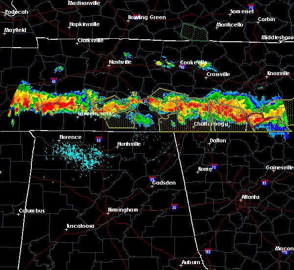 At 539 pm edt, severe thunderstorms were located along a line extending from 13 miles north of ducktown to 6 miles southeast of dayton, moving south at 30 mph (radar indicated). Hazards include 60 mph wind gusts and quarter size hail. Hail damage to vehicles is expected. expect wind damage to roofs, siding and trees. Locations impacted include, cleveland, athens, dayton, benton, ducktown, etowah, charleston, east cleveland, wildwood lake, south cleveland, englewood, calhoun, culberson, big spring, dentville, hillsview, conasauga, flint springs, hot house and bullet creek. At 539 pm edt, severe thunderstorms were located along a line extending from 13 miles north of ducktown to 6 miles southeast of dayton, moving south at 30 mph (radar indicated). Hazards include 60 mph wind gusts and quarter size hail. Hail damage to vehicles is expected. expect wind damage to roofs, siding and trees. Locations impacted include, cleveland, athens, dayton, benton, ducktown, etowah, charleston, east cleveland, wildwood lake, south cleveland, englewood, calhoun, culberson, big spring, dentville, hillsview, conasauga, flint springs, hot house and bullet creek.
|
| 7/14/2015 5:23 PM EDT |
 At 522 pm edt, severe thunderstorms were located along a line extending from 10 miles east of etowah to 6 miles east of dayton, moving south at 25 mph (radar indicated). Hazards include 60 mph wind gusts and half dollar size hail. Hail damage to vehicles is expected. Expect wind damage to roofs, siding and trees. At 522 pm edt, severe thunderstorms were located along a line extending from 10 miles east of etowah to 6 miles east of dayton, moving south at 25 mph (radar indicated). Hazards include 60 mph wind gusts and half dollar size hail. Hail damage to vehicles is expected. Expect wind damage to roofs, siding and trees.
|
| 7/14/2015 5:23 PM EDT |
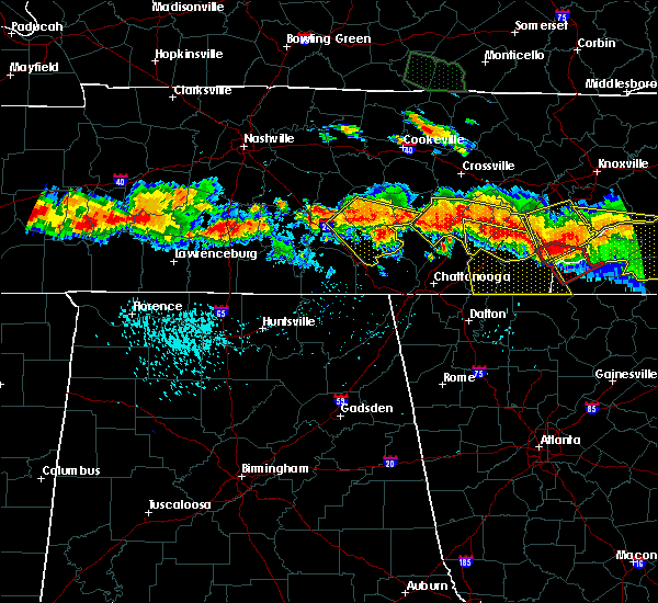 At 522 pm edt, severe thunderstorms were located along a line extending from 10 miles east of etowah to 6 miles east of dayton, moving south at 25 mph (radar indicated). Hazards include 60 mph wind gusts and half dollar size hail. Hail damage to vehicles is expected. Expect wind damage to roofs, siding and trees. At 522 pm edt, severe thunderstorms were located along a line extending from 10 miles east of etowah to 6 miles east of dayton, moving south at 25 mph (radar indicated). Hazards include 60 mph wind gusts and half dollar size hail. Hail damage to vehicles is expected. Expect wind damage to roofs, siding and trees.
|
| 7/14/2015 5:12 PM EDT |
 At 511 pm edt /411 pm cdt/, severe thunderstorms were located along a line extending from 6 miles northeast of athens to 6 miles northwest of pikeville, moving south at 25 mph (radar indicated). Hazards include 60 mph wind gusts and quarter size hail. Hail damage to vehicles is expected. expect wind damage to roofs, siding and trees. Locations impacted include, athens, dayton, sweetwater, pikeville, decatur, etowah, spring city, englewood, graysville, niota, calhoun, big spring, dentville, hillsview, old washington, murray store, melvine, ten mile, brayton and palio. At 511 pm edt /411 pm cdt/, severe thunderstorms were located along a line extending from 6 miles northeast of athens to 6 miles northwest of pikeville, moving south at 25 mph (radar indicated). Hazards include 60 mph wind gusts and quarter size hail. Hail damage to vehicles is expected. expect wind damage to roofs, siding and trees. Locations impacted include, athens, dayton, sweetwater, pikeville, decatur, etowah, spring city, englewood, graysville, niota, calhoun, big spring, dentville, hillsview, old washington, murray store, melvine, ten mile, brayton and palio.
|
| 7/14/2015 4:53 PM EDT |
 At 452 pm edt /352 pm cdt/, severe thunderstorms were located along a line extending from 7 miles west of sweetwater to 9 miles north of pikeville, moving south at 30 mph (radar indicated). Hazards include 60 mph wind gusts and quarter size hail. Hail damage to vehicles is expected. expect wind damage to roofs, siding and trees. Locations impacted include, athens, dayton, sweetwater, pikeville, decatur, etowah, spring city, englewood, graysville, niota, calhoun, big spring, dentville, hillsview, old washington, grandview, murray store, melvine, ten mile and brayton. At 452 pm edt /352 pm cdt/, severe thunderstorms were located along a line extending from 7 miles west of sweetwater to 9 miles north of pikeville, moving south at 30 mph (radar indicated). Hazards include 60 mph wind gusts and quarter size hail. Hail damage to vehicles is expected. expect wind damage to roofs, siding and trees. Locations impacted include, athens, dayton, sweetwater, pikeville, decatur, etowah, spring city, englewood, graysville, niota, calhoun, big spring, dentville, hillsview, old washington, grandview, murray store, melvine, ten mile and brayton.
|
| 7/14/2015 4:29 PM EDT |
 At 428 pm edt /328 pm cdt/, severe thunderstorms were located along a line extending from 9 miles northwest of sweetwater to 15 miles northwest of pikeville, moving south at 30 mph (radar indicated). Hazards include 60 mph wind gusts and quarter size hail. Hail damage to vehicles is expected. Expect wind damage to roofs, siding and trees. At 428 pm edt /328 pm cdt/, severe thunderstorms were located along a line extending from 9 miles northwest of sweetwater to 15 miles northwest of pikeville, moving south at 30 mph (radar indicated). Hazards include 60 mph wind gusts and quarter size hail. Hail damage to vehicles is expected. Expect wind damage to roofs, siding and trees.
|
| 7/14/2015 10:57 AM EDT |
 At 1056 am edt, severe thunderstorms were located along a line extending from near sweetwater to 8 miles northeast of madisonville, moving southeast at 35 mph (radar indicated). Hazards include 60 mph wind gusts and quarter size hail. Hail damage to vehicles is expected. Expect wind damage to roofs, siding and trees. At 1056 am edt, severe thunderstorms were located along a line extending from near sweetwater to 8 miles northeast of madisonville, moving southeast at 35 mph (radar indicated). Hazards include 60 mph wind gusts and quarter size hail. Hail damage to vehicles is expected. Expect wind damage to roofs, siding and trees.
|
| 7/1/2015 2:42 PM EDT | Several trees down in mcminn county TN, 2.8 miles NE of Athens, TN |
| 7/1/2015 2:37 PM EDT |
 At 237 pm edt, a severe thunderstorm was located near athens, moving east at 15 mph (radar indicated). Hazards include 60 mph wind gusts and quarter size hail. Hail damage to vehicles is expected. expect wind damage to roofs, siding and trees. Locations impacted include, athens, etowah, englewood, riceville and dentville. At 237 pm edt, a severe thunderstorm was located near athens, moving east at 15 mph (radar indicated). Hazards include 60 mph wind gusts and quarter size hail. Hail damage to vehicles is expected. expect wind damage to roofs, siding and trees. Locations impacted include, athens, etowah, englewood, riceville and dentville.
|
| 7/1/2015 2:27 PM EDT |
 At 227 pm edt, a severe thunderstorm was located near athens, moving east at 15 mph (radar indicated). Hazards include 60 mph wind gusts and penny size hail. Expect damage to roofs. Siding and trees. At 227 pm edt, a severe thunderstorm was located near athens, moving east at 15 mph (radar indicated). Hazards include 60 mph wind gusts and penny size hail. Expect damage to roofs. Siding and trees.
|
| 6/30/2015 2:25 PM EDT |
 The severe thunderstorm warning for central rhea, northern mcminn and meigs counties will expire at 230 pm edt, the storm which prompted the warning has weakened below severe limits, and no longer pose an immediate threat to life or property. therefore the warning will be allowed to expire. however small. The severe thunderstorm warning for central rhea, northern mcminn and meigs counties will expire at 230 pm edt, the storm which prompted the warning has weakened below severe limits, and no longer pose an immediate threat to life or property. therefore the warning will be allowed to expire. however small.
|
| 6/30/2015 1:54 PM EDT |
 At 152 pm edt, a severe thunderstorm was located near decatur, moving northeast at 20 mph (radar indicated). Hazards include 60 mph wind gusts and quarter size hail. Hail damage to vehicles is expected. expect wind damage to roofs, siding and trees. Locations impacted include, athens, dayton, decatur, spring city, niota, peakland, big spring, ten mile, old washington, murray store, evensville and clear water. At 152 pm edt, a severe thunderstorm was located near decatur, moving northeast at 20 mph (radar indicated). Hazards include 60 mph wind gusts and quarter size hail. Hail damage to vehicles is expected. expect wind damage to roofs, siding and trees. Locations impacted include, athens, dayton, decatur, spring city, niota, peakland, big spring, ten mile, old washington, murray store, evensville and clear water.
|
| 6/30/2015 1:36 PM EDT |
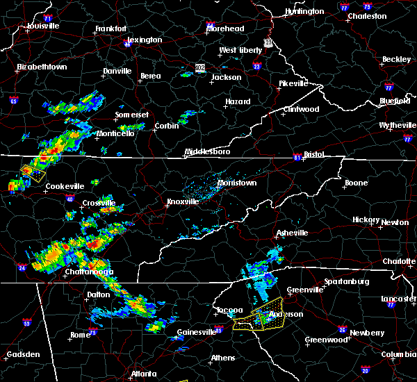 At 136 pm edt, a severe thunderstorm was located over decatur, moving northeast at 20 mph (radar indicated). Hazards include 60 mph wind gusts and quarter size hail. Hail damage to vehicles is expected. Expect wind damage to roofs, siding and trees. At 136 pm edt, a severe thunderstorm was located over decatur, moving northeast at 20 mph (radar indicated). Hazards include 60 mph wind gusts and quarter size hail. Hail damage to vehicles is expected. Expect wind damage to roofs, siding and trees.
|
| 6/19/2015 1:28 PM EDT | The severe thunderstorm warning for northwestern polk, central bradley and southern mcminn counties will expire at 130 pm edt, the storm which prompted the warning has weakened below severe limits, and no longer pose an immediate threat to life or property. therefore the warning will be allowed to expire. however small hail and gusty winds are still possible with this thunderstorm. to report severe weather, contact your nearest law enforcement agency. they will relay your report to the national weather service morristown. |
| 6/19/2015 1:01 PM EDT |
 At 101 pm edt, a severe thunderstorm was located near charleston, or near cleveland, moving northeast at 15 mph (radar indicated). Hazards include 60 mph wind gusts and quarter size hail. Hail damage to vehicles is expected. expect wind damage to roofs, siding and trees. locations impacted include, cleveland, athens, benton, etowah, charleston, east cleveland, calhoun, hopewell, riceville, dentville, tasso and hiwassee ocoee s. P At 101 pm edt, a severe thunderstorm was located near charleston, or near cleveland, moving northeast at 15 mph (radar indicated). Hazards include 60 mph wind gusts and quarter size hail. Hail damage to vehicles is expected. expect wind damage to roofs, siding and trees. locations impacted include, cleveland, athens, benton, etowah, charleston, east cleveland, calhoun, hopewell, riceville, dentville, tasso and hiwassee ocoee s. P
|
| 6/19/2015 12:47 PM EDT |
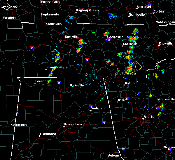 At 1247 pm edt, a severe thunderstorm was located near cleveland, moving northeast at 20 mph (radar indicated). Hazards include 60 mph wind gusts and quarter size hail. Hail damage to vehicles is expected. Expect wind damage to roofs, siding and trees. At 1247 pm edt, a severe thunderstorm was located near cleveland, moving northeast at 20 mph (radar indicated). Hazards include 60 mph wind gusts and quarter size hail. Hail damage to vehicles is expected. Expect wind damage to roofs, siding and trees.
|
| 6/8/2015 8:08 PM EDT | At 808 pm edt, severe thunderstorms were located along a line extending from rockwood to near decatur, moving east at 40 mph (radar indicated). Hazards include 60 mph wind gusts and quarter size hail. Hail damage to vehicles is expected. Expect wind damage to roofs, siding and trees. |
| 6/8/2015 8:02 PM EDT | At 801 pm edt /701 pm cdt/, severe thunderstorms were located along a line extending from 8 miles west of rockwood to near spring city to near dayton to 6 miles northeast of dunlap, moving east at 50 mph (radar indicated). Hazards include 60 mph wind gusts and penny size hail. Expect damage to roofs. siding and trees. locations impacted include, athens, dayton, sweetwater, pikeville, decatur, etowah, spring city, charleston, graysville, niota, calhoun, riceville, peakland, big spring, stinging fork falls s. p,. evensville, clear water, fall creek falls s. p,. Dentville and old washington. |
| 6/8/2015 7:44 PM EDT | At 744 pm edt, severe thunderstorms were located along a line extending from 10 miles southeast of madisonville to 11 miles south of benton, moving east at 35 mph (radar indicated). Hazards include 60 mph wind gusts and nickel size hail. Expect damage to roofs. siding and trees. Locations impacted include, cleveland, athens, sweetwater, madisonville, murphy, benton, ducktown, etowah, charleston, south cleveland, east cleveland, wildwood lake, collegedale, englewood, vonore, tellico plains, niota, calhoun, parksville and mount vernon. |
| 6/8/2015 7:44 PM EDT | At 744 pm edt, severe thunderstorms were located along a line extending from 10 miles southeast of madisonville to 11 miles south of benton, moving east at 35 mph (radar indicated). Hazards include 60 mph wind gusts and nickel size hail. Expect damage to roofs. siding and trees. Locations impacted include, cleveland, athens, sweetwater, madisonville, murphy, benton, ducktown, etowah, charleston, south cleveland, east cleveland, wildwood lake, collegedale, englewood, vonore, tellico plains, niota, calhoun, parksville and mount vernon. |
| 6/8/2015 7:28 PM EDT | At 727 pm edt /627 pm cdt/, severe thunderstorms were located along a line extending from 9 miles east of sparta to 7 miles southeast of spencer to 12 miles west of pikeville to 11 miles south of mcminnville, moving east southeast at 45 mph (radar indicated). Hazards include 65 mph wind gusts and penny size hail. Expect damage to roofs. Siding and trees. |
| 6/8/2015 7:15 PM EDT | At 715 pm edt, severe thunderstorms were located along a line extending from near etowah to cohutta, moving east at 30 mph (radar indicated). Hazards include 65 mph wind gusts and penny size hail. Expect damage to roofs. siding and trees. Locations impacted include, cleveland, athens, sweetwater, madisonville, murphy, benton, ducktown, etowah, charleston, south cleveland, east cleveland, wildwood lake, collegedale, englewood, vonore, tellico plains, niota, calhoun, parksville and mount vernon. |
| 6/8/2015 7:15 PM EDT | At 715 pm edt, severe thunderstorms were located along a line extending from near etowah to cohutta, moving east at 30 mph (radar indicated). Hazards include 65 mph wind gusts and penny size hail. Expect damage to roofs. siding and trees. Locations impacted include, cleveland, athens, sweetwater, madisonville, murphy, benton, ducktown, etowah, charleston, south cleveland, east cleveland, wildwood lake, collegedale, englewood, vonore, tellico plains, niota, calhoun, parksville and mount vernon. |
| 6/8/2015 6:55 PM EDT | At 655 pm edt, severe thunderstorms were located along a line extending from near athens to near east cleveland, moving east at 35 mph (radar indicated). Hazards include 60 mph wind gusts and penny size hail. Expect damage to roofs. Siding and trees. |
| 6/8/2015 6:55 PM EDT | At 655 pm edt, severe thunderstorms were located along a line extending from near athens to near east cleveland, moving east at 35 mph (radar indicated). Hazards include 60 mph wind gusts and penny size hail. Expect damage to roofs. Siding and trees. |
| 6/8/2015 5:27 PM EDT | At 527 pm edt, a severe thunderstorm was located near madisonville, moving northeast at 35 mph (radar indicated). Hazards include 60 mph wind gusts and penny size hail. Expect damage to roofs. siding and trees. locations impacted include, athens, sweetwater, madisonville, etowah, charleston, englewood, vonore, greenback, friendsville, tellico plains, niota, philadelphia, calhoun, riceville, fort loudon s. p,. Mount vernon, citico beach, tellico village, hillsview and clear water. |
| 6/8/2015 5:20 PM EDT | Several trees dow in mcminn county TN, 2.6 miles SSW of Athens, TN |
| 6/8/2015 5:10 PM EDT | At 509 pm edt, a severe thunderstorm was located over athens, moving east at 35 mph (radar indicated). Hazards include 60 mph wind gusts and penny size hail. Expect damage to roofs. Siding and trees. |
| 6/1/2015 10:45 PM EDT | At 1045 pm edt, a severe thunderstorm was located near etowah, or near athens, moving east at 20 mph (radar indicated). Hazards include 60 mph wind gusts and quarter size hail. Hail damage to vehicles is expected. expect wind damage to roofs, siding and trees. Locations impacted include, athens, madisonville, etowah, englewood, tellico plains and mount vernon. |
| 6/1/2015 10:33 PM EDT | At 1033 pm edt, a severe thunderstorm was located near athens, moving east at 20 mph (radar indicated). Hazards include 60 mph wind gusts and quarter size hail. Hail damage to vehicles is expected. Expect wind damage to roofs, siding and trees. |
| 5/31/2015 3:29 PM EDT | At 329 pm edt, severe thunderstorms were located along a line extending from near loudon to 12 miles southeast of madisonville, moving northeast at 30 mph (radar indicated). Hazards include 60 mph wind gusts and penny size hail. Expect damage to roofs. siding and trees. locations impacted include, knoxville, maryville, athens, lenoir city, alcoa, sweetwater, loudon, madisonville, farragut, louisville, rockford, eagleton village, englewood, vonore, greenback, friendsville, tellico plains, niota, philadelphia and fort loudon s. P |
| 5/31/2015 3:06 PM EDT | At 306 pm edt, a severe thunderstorm was located near sweetwater, moving northeast at 30 mph (radar indicated). Hazards include 60 mph wind gusts and penny size hail. Expect damage to roofs. Siding and trees. |
| 4/19/2015 8:23 PM EDT | At 822 pm edt, a severe thunderstorm was located over madisonville, moving northeast at 55 mph (radar indicated). Hazards include 60 mph wind gusts and penny size hail. Expect damage to roofs. Siding and trees. |
| 4/3/2015 9:15 PM EDT | A severe thunderstorm warning remains in effect until 1000 pm edt for southwestern monroe. mcminn. polk. meigs. bradley and hamilton counties. at 915 pm edt. severe thunderstorms were located along a line extending from 8 miles west of sweetwater to near soddy-daisy. Moving east at 30 mph. |
| 4/3/2015 8:05 PM EST | 1 tree down on county road 25 in mcminn county TN, 4 miles S of Athens, TN |
| 4/3/2015 9:02 PM EDT | A severe thunderstorm warning remains in effect until 930 pm edt for monroe. northeastern mcminn. southern blount and loudon counties. at 901 pm edt. severe thunderstorms were located along a line extending from near lenoir city to 6 miles east of decatur. Moving east at 60 mph. |
| 4/3/2015 8:58 PM EDT | The national weather service in morristown has issued a * severe thunderstorm warning for. southwestern monroe county in eastern tennessee. mcminn county in eastern tennessee. polk county in eastern tennessee. Meigs county in eastern tennessee. |
| 4/3/2015 8:46 PM EDT | The national weather service in morristown has issued a * severe thunderstorm warning for. monroe county in eastern tennessee. northeastern mcminn county in eastern tennessee. southern blount county in eastern tennessee. Loudon county in eastern tennessee. |
| 8/20/2014 4:58 PM EDT | Quarter sized hail reported 0.6 miles WNW of Athens, TN |
| 6/18/2014 6:00 PM EDT | One tree dow in mcminn county TN, 0.6 miles WNW of Athens, TN |
| 6/10/2014 5:05 PM EDT | Trees down across the city park in mcminn county TN, 0.6 miles WNW of Athens, TN |
| 4/28/2014 11:00 PM EDT | A few trees down in athen in mcminn county TN, 0.6 miles WNW of Athens, TN |
| 7/18/2013 7:50 PM EDT | Tree down on county rd 55 in mcminn county TN, 0.6 miles WNW of Athens, TN |
| 4/11/2013 7:10 PM EDT | Several trees dow in mcminn county TN, 0.6 miles WNW of Athens, TN |
| 7/5/2012 7:24 PM EDT | Several trees dow in mcminn county TN, 0.6 miles WNW of Athens, TN |
| 4/26/2012 8:35 AM EDT | Quarter sized hail reported 4 miles S of Athens, TN |
| 4/3/2012 8:52 PM EDT | Quarter sized hail reported 4.3 miles SE of Athens, TN |
| 4/3/2012 8:25 PM EDT | Structural damage to a hom in mcminn county TN, 4.3 miles ESE of Athens, TN |
| 4/3/2012 8:20 PM EDT | Quarter sized hail reported 5.6 miles SE of Athens, TN |
| 1/1/0001 12:00 AM | Multiple power lines down from fallen trees and lightning county-wid in mcminn county TN, 0.6 miles WNW of Athens, TN |
| 1/1/0001 12:00 AM | A few trees down in athens and englewoo in mcminn county TN, 0.6 miles WNW of Athens, TN |
| 1/1/0001 12:00 AM | Tree down on hom in mcminn county TN, 0.6 miles WNW of Athens, TN |
| 1/1/0001 12:00 AM | Tree down on home at 108 mason stree in mcminn county TN, 1.5 miles NW of Athens, TN |
| 1/1/0001 12:00 AM | Quarter sized hail reported 0.6 miles WNW of Athens, TN, occurring on south jackson street. |
| 1/1/0001 12:00 AM | Few trees down along route 30 in mcminn county TN, 2.1 miles SW of Athens, TN |
Hail Maps for Athens, TN


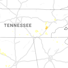


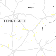


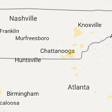


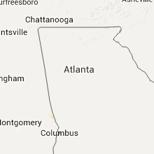


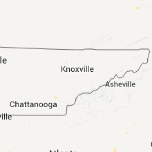


Connect with Interactive Hail Maps