

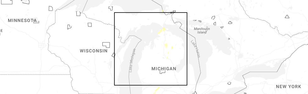
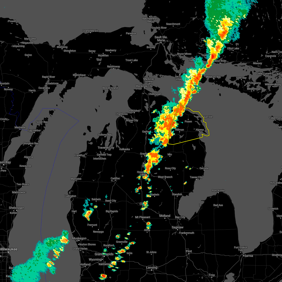
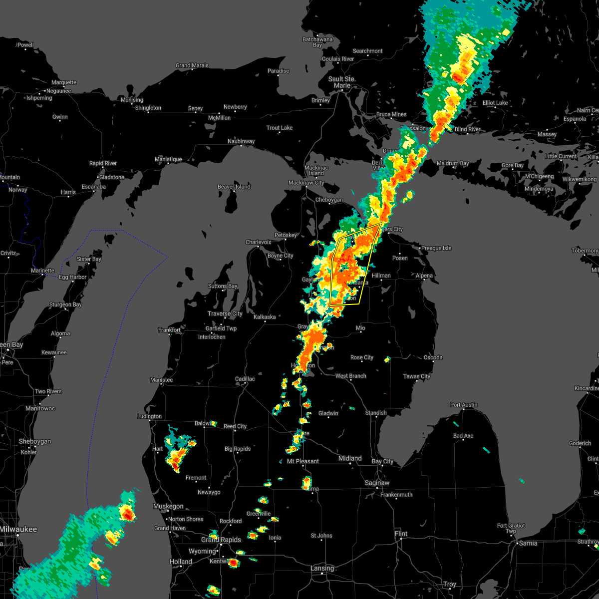
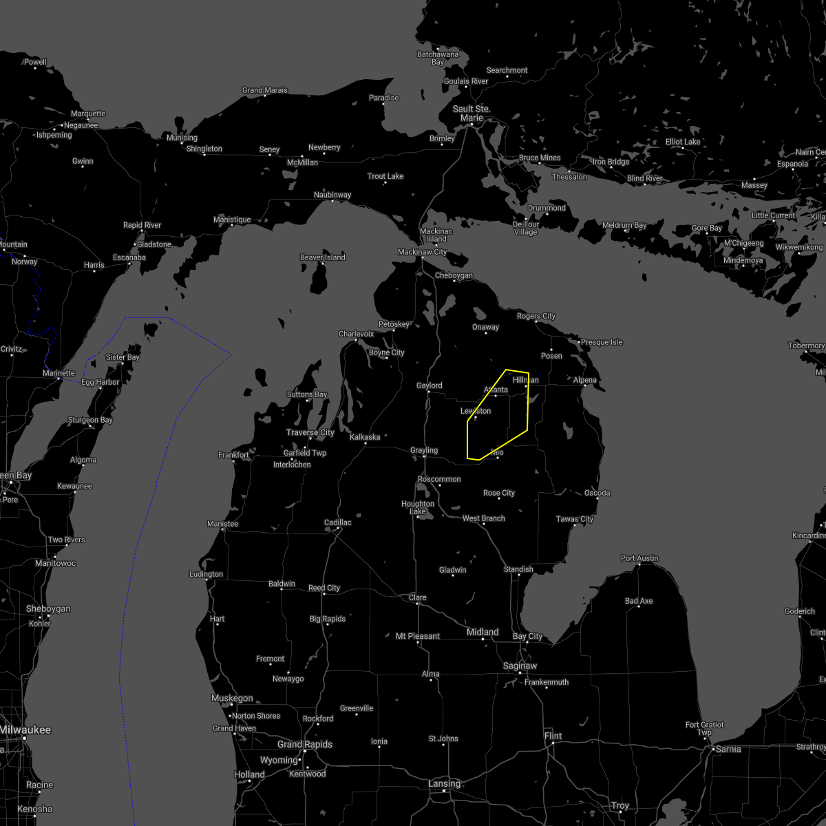
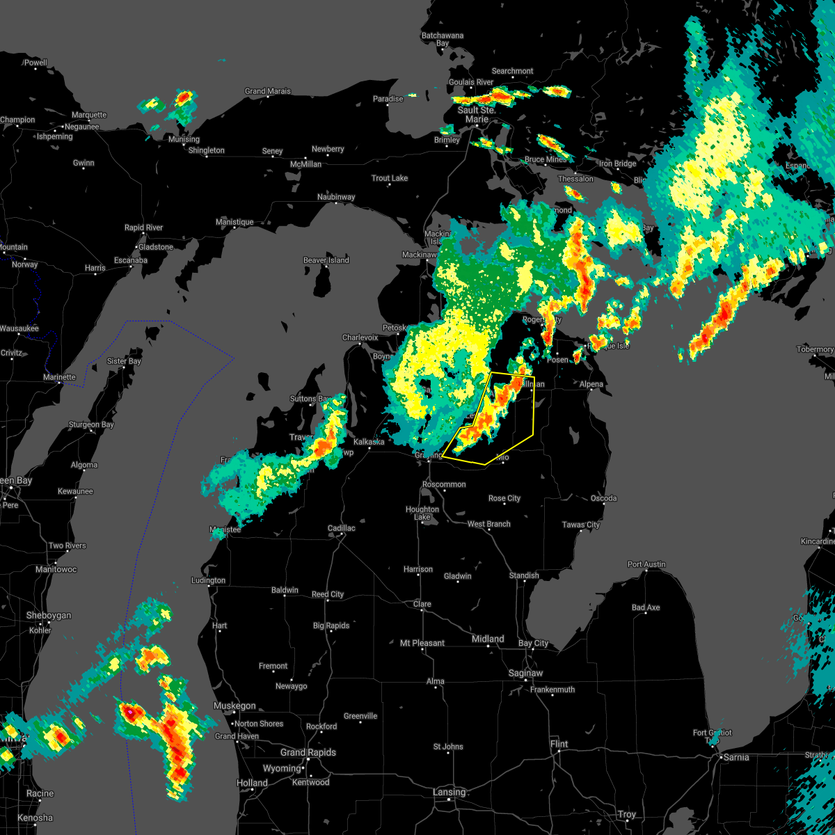
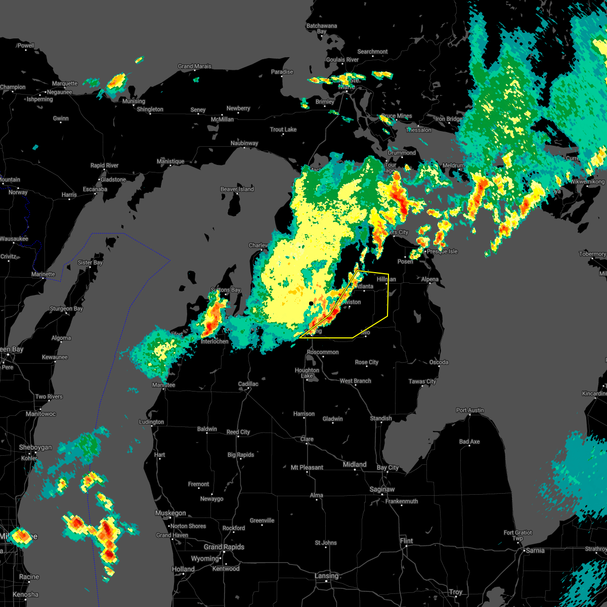
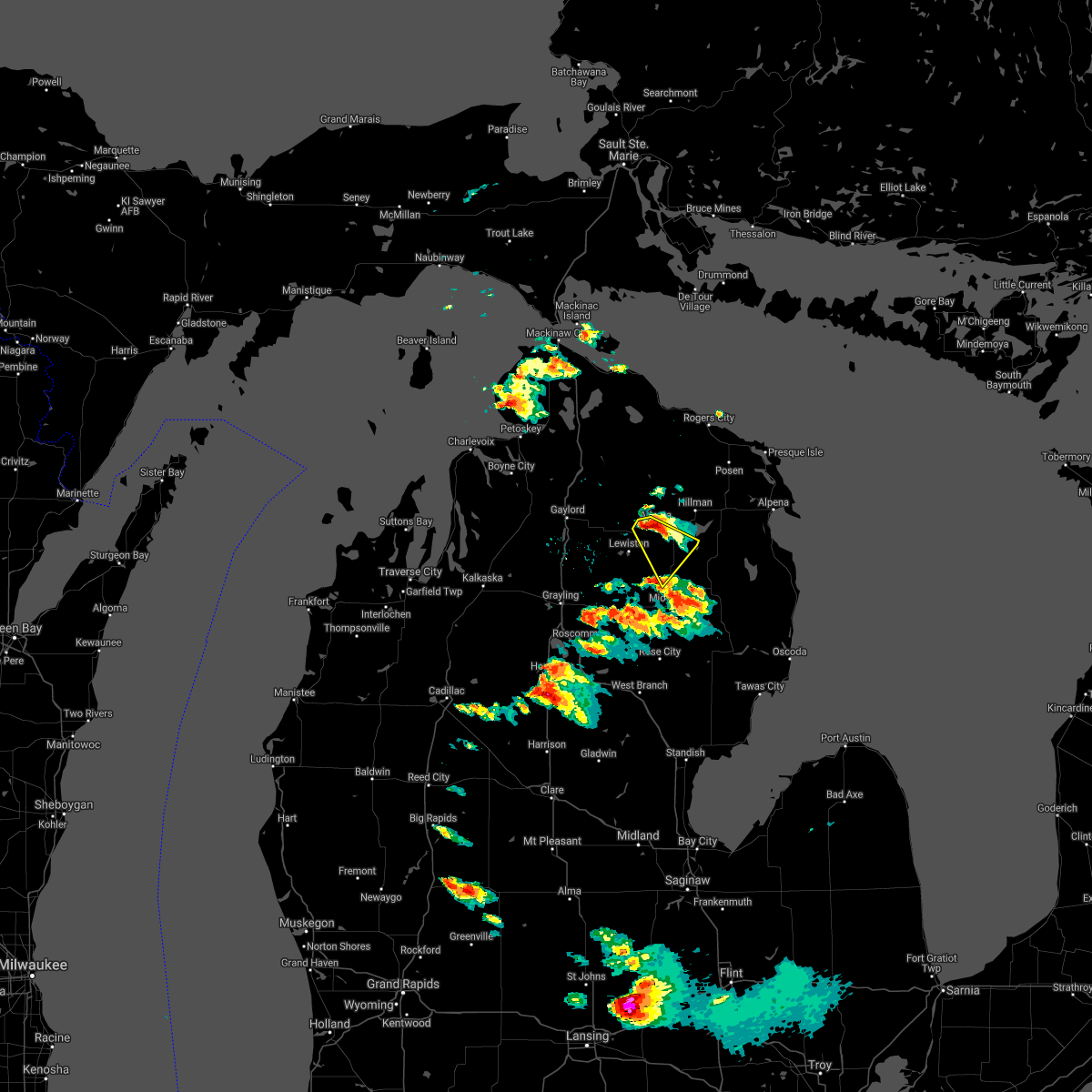
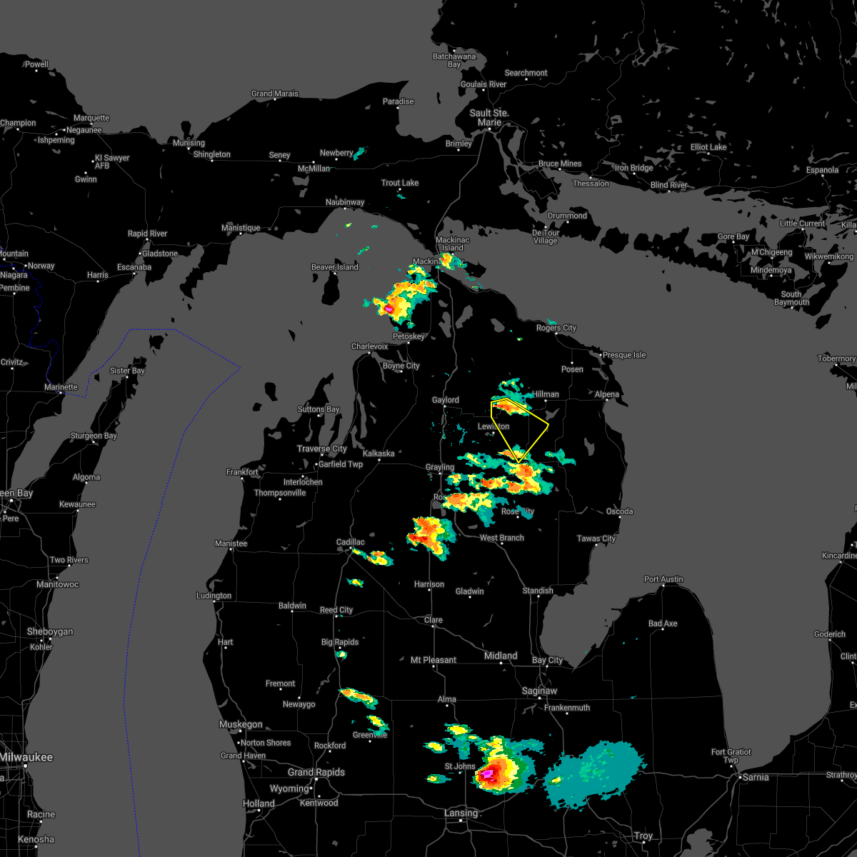
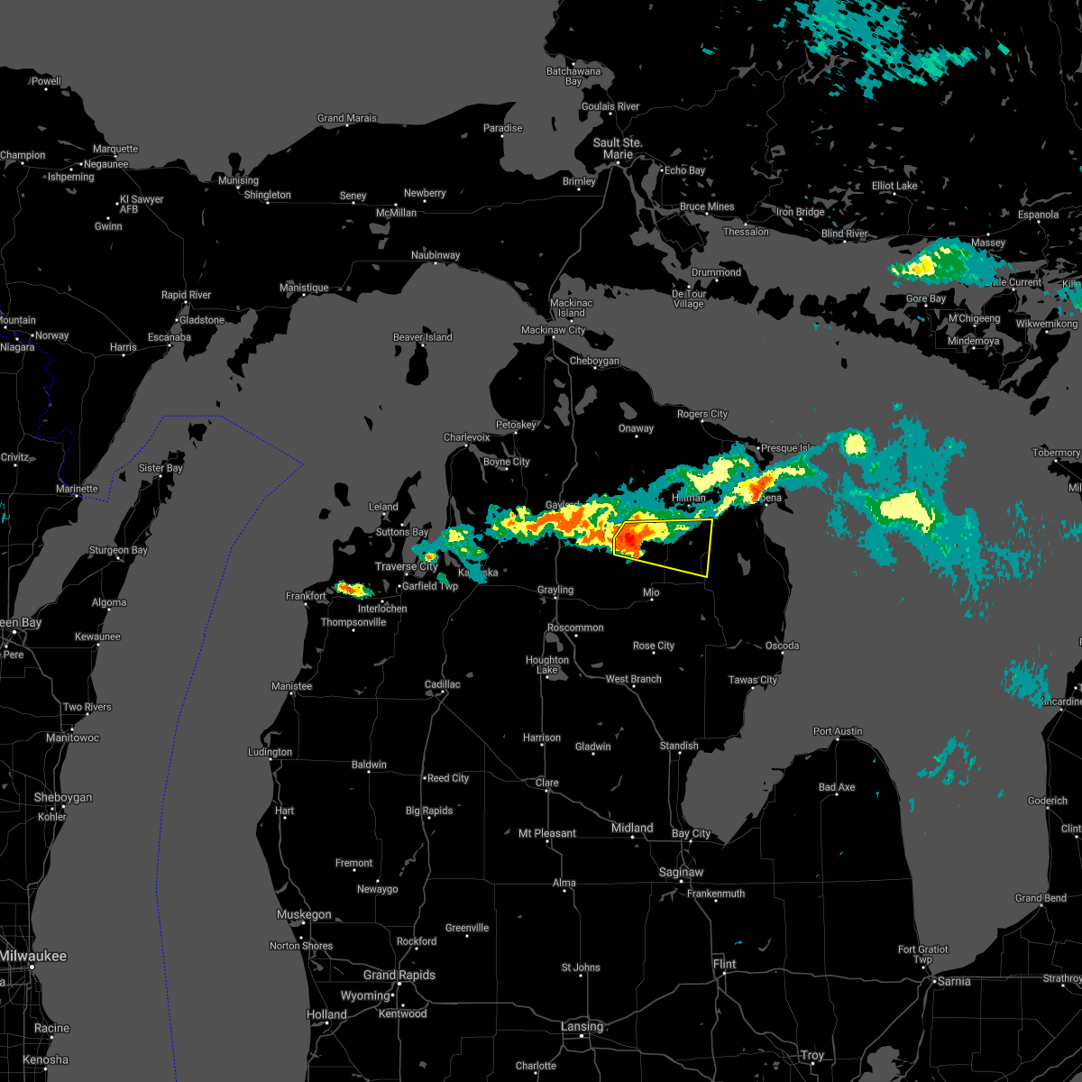
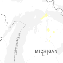
Hail Map for Atlanta, MI
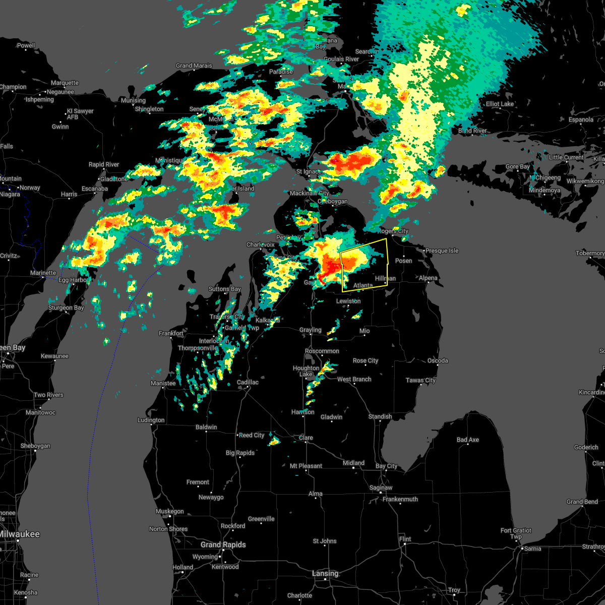
The Atlanta, MI area has had 4 reports of on-the-ground hail by trained spotters, and has been under severe weather warnings 3 times during the past 12 months. Doppler radar has detected hail at or near Atlanta, MI on 19 occasions, including 1 occasion during the past year.
| Name: | Atlanta, MI |
| Where Located: | 34.4 miles W of Alpena, MI |
| Map: | Google Map for Atlanta, MI |
| Population: | 827 |
| Housing Units: | 576 |
| More Info: | Search Google for Atlanta, MI |
0
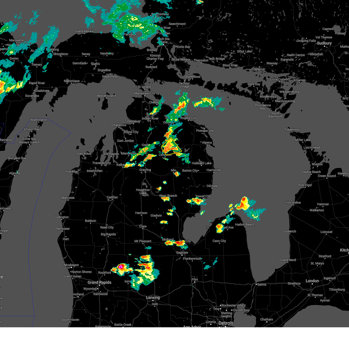
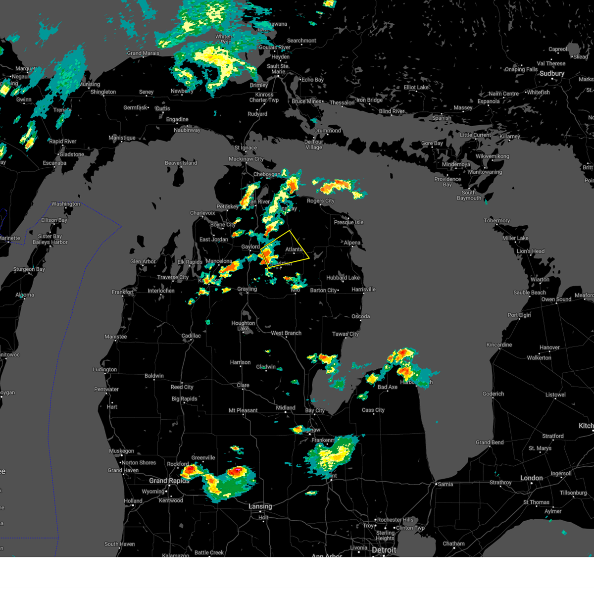
The Top Recent Hail Date for Atlanta, MI is Monday, June 9, 2025 (19th out of 19)
Hail and Wind Damage Spotted near Atlanta, MI
| Date / Time | Report Details |
|---|---|
| 7/8/2024 6:17 PM EDT |
 the severe thunderstorm warning has been cancelled and is no longer in effect the severe thunderstorm warning has been cancelled and is no longer in effect
|
| 7/8/2024 6:17 PM EDT |
 At 617 pm edt, a severe thunderstorm was located near atlanta, moving northeast at 30 mph (radar indicated). Hazards include 60 mph wind gusts and nickel size hail. Expect damage to roofs, siding, and trees. this severe storm will be near, atlanta, canada creek ranch, and briley township around 625 pm edt. Other locations impacted by this severe thunderstorm include clear lake state park. At 617 pm edt, a severe thunderstorm was located near atlanta, moving northeast at 30 mph (radar indicated). Hazards include 60 mph wind gusts and nickel size hail. Expect damage to roofs, siding, and trees. this severe storm will be near, atlanta, canada creek ranch, and briley township around 625 pm edt. Other locations impacted by this severe thunderstorm include clear lake state park.
|
| 7/8/2024 5:50 PM EDT |
 Svrapx the national weather service in gaylord has issued a * severe thunderstorm warning for, southeastern otsego county in northern michigan, montmorency county in northern michigan, * until 630 pm edt. * at 550 pm edt, a severe thunderstorm was located over johannesburg, or 9 miles northwest of lewiston, moving east at 35 mph (radar indicated). Hazards include 60 mph wind gusts and quarter size hail. Hail damage to vehicles is expected. expect wind damage to roofs, siding, and trees. this severe thunderstorm will be near, hetherton and johannesburg around 555 pm edt. atlanta and briley township around 605 pm edt. canada creek ranch around 610 pm edt. Other locations impacted by this severe thunderstorm include clear lake state park. Svrapx the national weather service in gaylord has issued a * severe thunderstorm warning for, southeastern otsego county in northern michigan, montmorency county in northern michigan, * until 630 pm edt. * at 550 pm edt, a severe thunderstorm was located over johannesburg, or 9 miles northwest of lewiston, moving east at 35 mph (radar indicated). Hazards include 60 mph wind gusts and quarter size hail. Hail damage to vehicles is expected. expect wind damage to roofs, siding, and trees. this severe thunderstorm will be near, hetherton and johannesburg around 555 pm edt. atlanta and briley township around 605 pm edt. canada creek ranch around 610 pm edt. Other locations impacted by this severe thunderstorm include clear lake state park.
|
| 5/20/2022 3:53 PM EDT |
 At 353 pm edt, a severe thunderstorm was located near elmira, or near gaylord, moving east at 55 mph (radar indicated). Hazards include 70 mph wind gusts and ping pong ball size hail. People and animals outdoors will be injured. expect hail damage to roofs, siding, windows, and vehicles. expect considerable tree damage. Wind damage is also likely to mobile homes, roofs, and outbuildings. At 353 pm edt, a severe thunderstorm was located near elmira, or near gaylord, moving east at 55 mph (radar indicated). Hazards include 70 mph wind gusts and ping pong ball size hail. People and animals outdoors will be injured. expect hail damage to roofs, siding, windows, and vehicles. expect considerable tree damage. Wind damage is also likely to mobile homes, roofs, and outbuildings.
|
| 8/29/2021 3:22 PM EDT |
 At 322 pm edt, severe thunderstorms were located along a line extending from near forty mile point to 6 miles southwest of bisma township to garland, moving northeast at 35 mph (radar indicated). Hazards include 60 mph wind gusts. Expect damage to roofs, siding, and trees. severe thunderstorms will be near, p h hoeft state park around 325 pm edt. royston around 330 pm edt. bisma township around 335 pm edt. loud township and hawks around 340 pm edt. other locations in the path of these severe thunderstorms include atlanta, metz, lockwood lake, posen, hagensville, rogers city and fletcher pond. hail threat, radar indicated max hail size, <. 75 in wind threat, radar indicated max wind gust, 60 mph. At 322 pm edt, severe thunderstorms were located along a line extending from near forty mile point to 6 miles southwest of bisma township to garland, moving northeast at 35 mph (radar indicated). Hazards include 60 mph wind gusts. Expect damage to roofs, siding, and trees. severe thunderstorms will be near, p h hoeft state park around 325 pm edt. royston around 330 pm edt. bisma township around 335 pm edt. loud township and hawks around 340 pm edt. other locations in the path of these severe thunderstorms include atlanta, metz, lockwood lake, posen, hagensville, rogers city and fletcher pond. hail threat, radar indicated max hail size, <. 75 in wind threat, radar indicated max wind gust, 60 mph.
|
| 8/29/2021 3:14 PM EDT |
 At 314 pm edt, severe thunderstorms were located along a line extending from near onaway state park to 6 miles west of allis township to near lewiston, moving east at 55 mph (radar indicated). Hazards include 60 mph wind gusts. Expect damage to roofs, siding, and trees. locations impacted include, onaway, allis township, ocqueoc, millersburg, tomahawk creek flooding, canada creek ranch and forty mile point. hail threat, radar indicated max hail size, <. 75 in wind threat, radar indicated max wind gust, 60 mph. At 314 pm edt, severe thunderstorms were located along a line extending from near onaway state park to 6 miles west of allis township to near lewiston, moving east at 55 mph (radar indicated). Hazards include 60 mph wind gusts. Expect damage to roofs, siding, and trees. locations impacted include, onaway, allis township, ocqueoc, millersburg, tomahawk creek flooding, canada creek ranch and forty mile point. hail threat, radar indicated max hail size, <. 75 in wind threat, radar indicated max wind gust, 60 mph.
|
| 8/29/2021 2:55 PM EDT |
 At 254 pm edt, severe thunderstorms were located along a line extending from near wolverine to near vanderbilt to near waters, moving northeast at 55 mph (radar indicated). Hazards include 60 mph wind gusts. Expect damage to roofs, siding, and trees. severe thunderstorms will be near, wolverine and afton around 300 pm edt. pickerel lake and eastern corwith township around 305 pm edt. johannesburg and tower around 310 pm edt. other locations in the path of these severe thunderstorms include hetherton, ocqueoc, allis township, tomahawk creek flooding, onaway, briley township, atlanta, millersburg, canada creek ranch and forty mile point. hail threat, radar indicated max hail size, <. 75 in wind threat, radar indicated max wind gust, 60 mph. At 254 pm edt, severe thunderstorms were located along a line extending from near wolverine to near vanderbilt to near waters, moving northeast at 55 mph (radar indicated). Hazards include 60 mph wind gusts. Expect damage to roofs, siding, and trees. severe thunderstorms will be near, wolverine and afton around 300 pm edt. pickerel lake and eastern corwith township around 305 pm edt. johannesburg and tower around 310 pm edt. other locations in the path of these severe thunderstorms include hetherton, ocqueoc, allis township, tomahawk creek flooding, onaway, briley township, atlanta, millersburg, canada creek ranch and forty mile point. hail threat, radar indicated max hail size, <. 75 in wind threat, radar indicated max wind gust, 60 mph.
|
| 8/11/2021 6:51 PM EDT | Widespread tree damage across montmorency county per law enforcemen in montmorency county MI, 0.5 miles SSW of Atlanta, MI |
| 8/11/2021 6:50 PM EDT |
 At 649 pm edt, severe thunderstorms were located along a line extending from royston to near garland to 8 miles south of lovells, moving east at 50 mph (radar indicated). Hazards include 60 mph wind gusts. Expect damage to roofs, siding, and trees. locations impacted include, atlanta, lewiston, mio, comins, hillman, fletcher pond, red oak, lockwood lake, loud township and garland. hail threat, radar indicated max hail size, <. 75 in wind threat, radar indicated max wind gust, 60 mph. At 649 pm edt, severe thunderstorms were located along a line extending from royston to near garland to 8 miles south of lovells, moving east at 50 mph (radar indicated). Hazards include 60 mph wind gusts. Expect damage to roofs, siding, and trees. locations impacted include, atlanta, lewiston, mio, comins, hillman, fletcher pond, red oak, lockwood lake, loud township and garland. hail threat, radar indicated max hail size, <. 75 in wind threat, radar indicated max wind gust, 60 mph.
|
| 8/11/2021 6:45 PM EDT |
 At 645 pm edt, severe thunderstorms were located along a line extending from 6 miles west of royston to garland to 6 miles east of grayling, moving east at 35 mph (radar indicated). Hazards include 60 mph wind gusts. Expect damage to roofs, siding, and trees. locations impacted include, hillman, lovells, loud township, comins, red oak, lockwood lake and mio. hail threat, radar indicated max hail size, <. 75 in wind threat, radar indicated max wind gust, 60 mph. At 645 pm edt, severe thunderstorms were located along a line extending from 6 miles west of royston to garland to 6 miles east of grayling, moving east at 35 mph (radar indicated). Hazards include 60 mph wind gusts. Expect damage to roofs, siding, and trees. locations impacted include, hillman, lovells, loud township, comins, red oak, lockwood lake and mio. hail threat, radar indicated max hail size, <. 75 in wind threat, radar indicated max wind gust, 60 mph.
|
| 8/11/2021 6:44 PM EDT | Trees of 6-8 inches in diameter dow in montmorency county MI, 7.1 miles NW of Atlanta, MI |
| 8/11/2021 6:31 PM EDT |
 At 631 pm edt, severe thunderstorms were located along a line extending from canada creek ranch to lovells to near grayling, moving east at 35 mph (radar indicated). Hazards include 60 mph wind gusts. Expect damage to roofs, siding, and trees. severe thunderstorms will be near, canada creek ranch and briley township around 635 pm edt. lewiston and garland around 645 pm edt. other locations in the path of these severe thunderstorms include hillman, loud township, comins, red oak, lockwood lake and mio. hail threat, radar indicated max hail size, <. 75 in wind threat, radar indicated max wind gust, 60 mph. At 631 pm edt, severe thunderstorms were located along a line extending from canada creek ranch to lovells to near grayling, moving east at 35 mph (radar indicated). Hazards include 60 mph wind gusts. Expect damage to roofs, siding, and trees. severe thunderstorms will be near, canada creek ranch and briley township around 635 pm edt. lewiston and garland around 645 pm edt. other locations in the path of these severe thunderstorms include hillman, loud township, comins, red oak, lockwood lake and mio. hail threat, radar indicated max hail size, <. 75 in wind threat, radar indicated max wind gust, 60 mph.
|
| 8/11/2021 12:31 AM EDT |
 At 1231 am edt, severe thunderstorms were located along a line extending from near atlanta to near mckinley, moving northeast at 40 mph (radar indicated). Hazards include 60 mph wind gusts and penny size hail. Expect damage to roofs, siding, and trees. severe thunderstorms will be near, curran around 1240 am edt. hillman around 1250 am edt. other locations in the path of these severe thunderstorms include royston, bisma township, ossineke township, hubbard lake, the town of hubbard lake, metz, spruce, posen, hagensville, ossineke and thompsons harbor state park. hail threat, radar indicated max hail size, 0. 75 in wind threat, radar indicated max wind gust, 60 mph. At 1231 am edt, severe thunderstorms were located along a line extending from near atlanta to near mckinley, moving northeast at 40 mph (radar indicated). Hazards include 60 mph wind gusts and penny size hail. Expect damage to roofs, siding, and trees. severe thunderstorms will be near, curran around 1240 am edt. hillman around 1250 am edt. other locations in the path of these severe thunderstorms include royston, bisma township, ossineke township, hubbard lake, the town of hubbard lake, metz, spruce, posen, hagensville, ossineke and thompsons harbor state park. hail threat, radar indicated max hail size, 0. 75 in wind threat, radar indicated max wind gust, 60 mph.
|
| 6/12/2021 6:36 PM EDT | Quarter sized hail reported 0.3 miles NW of Atlanta, MI |
| 6/12/2021 6:34 PM EDT |
 At 633 pm edt, a severe thunderstorm was located over atlanta, moving southeast at 25 mph (trained weather spotters. at 6:31 pm et, quarter sized hail was reported 1 mile wsw of atlanta). Hazards include 60 mph wind gusts and quarter size hail. Hail damage to vehicles is expected. expect wind damage to roofs, siding, and trees. Locations impacted include, loud township, lockwood lake and comins. At 633 pm edt, a severe thunderstorm was located over atlanta, moving southeast at 25 mph (trained weather spotters. at 6:31 pm et, quarter sized hail was reported 1 mile wsw of atlanta). Hazards include 60 mph wind gusts and quarter size hail. Hail damage to vehicles is expected. expect wind damage to roofs, siding, and trees. Locations impacted include, loud township, lockwood lake and comins.
|
| 6/12/2021 6:29 PM EDT | Quarter sized hail reported 1.6 miles NE of Atlanta, MI |
| 6/12/2021 6:21 PM EDT |
 At 621 pm edt, a severe thunderstorm was located near atlanta, moving southeast at 25 mph (radar indicated). Hazards include 60 mph wind gusts and quarter size hail. Hail damage to vehicles is expected. expect wind damage to roofs, siding, and trees. this severe thunderstorm will be near, atlanta around 630 pm edt. loud township around 640 pm edt. Other locations in the path of this severe thunderstorm include lockwood lake and comins. At 621 pm edt, a severe thunderstorm was located near atlanta, moving southeast at 25 mph (radar indicated). Hazards include 60 mph wind gusts and quarter size hail. Hail damage to vehicles is expected. expect wind damage to roofs, siding, and trees. this severe thunderstorm will be near, atlanta around 630 pm edt. loud township around 640 pm edt. Other locations in the path of this severe thunderstorm include lockwood lake and comins.
|
| 9/26/2020 12:16 PM EDT |
 At 1216 pm edt, a severe thunderstorm was located near loud township, or near lewiston, moving east at 40 mph (radar indicated). Hazards include 60 mph wind gusts and quarter size hail. Hail damage to vehicles is expected. Expect wind damage to roofs, siding, and trees. At 1216 pm edt, a severe thunderstorm was located near loud township, or near lewiston, moving east at 40 mph (radar indicated). Hazards include 60 mph wind gusts and quarter size hail. Hail damage to vehicles is expected. Expect wind damage to roofs, siding, and trees.
|
| 8/21/2020 3:18 PM EDT |
 At 317 pm edt, a severe thunderstorm was located near atlanta, moving southeast at 15 mph (radar indicated). Hazards include 60 mph wind gusts and quarter size hail. Hail damage to vehicles is expected. expect wind damage to roofs, siding, and trees. Locations impacted include, atlanta, fletcher pond, lockwood lake and loud township. At 317 pm edt, a severe thunderstorm was located near atlanta, moving southeast at 15 mph (radar indicated). Hazards include 60 mph wind gusts and quarter size hail. Hail damage to vehicles is expected. expect wind damage to roofs, siding, and trees. Locations impacted include, atlanta, fletcher pond, lockwood lake and loud township.
|
| 8/21/2020 3:04 PM EDT |
 At 304 pm edt, a severe thunderstorm was located over atlanta, moving southeast at 20 mph (radar indicated). Hazards include 60 mph wind gusts and quarter size hail. Hail damage to vehicles is expected. Expect wind damage to roofs, siding, and trees. At 304 pm edt, a severe thunderstorm was located over atlanta, moving southeast at 20 mph (radar indicated). Hazards include 60 mph wind gusts and quarter size hail. Hail damage to vehicles is expected. Expect wind damage to roofs, siding, and trees.
|
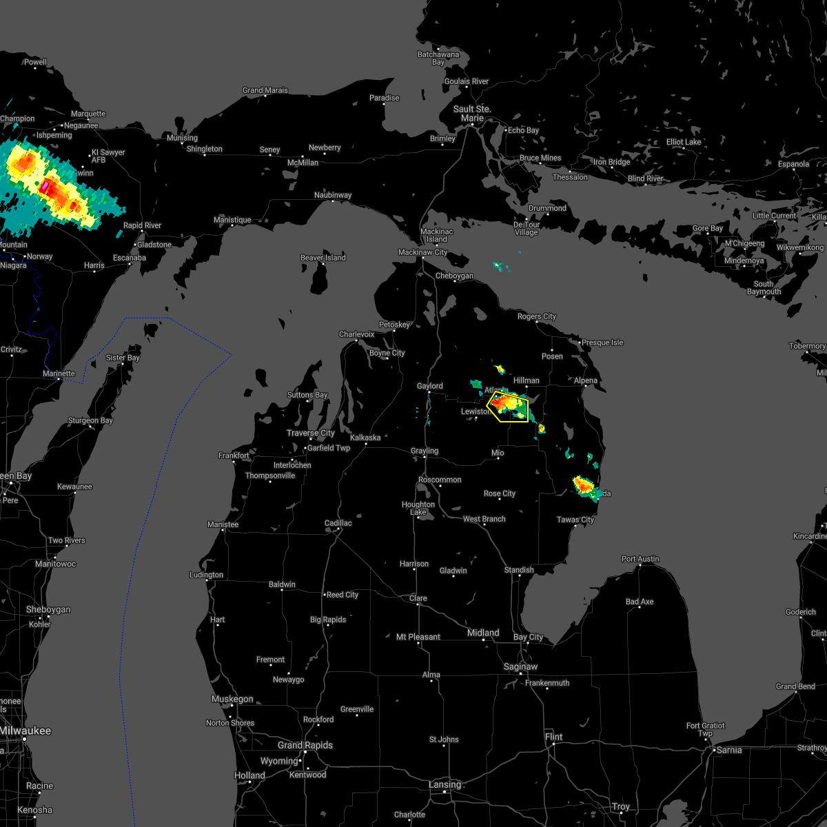
| 7/19/2020 6:48 AM EDT |
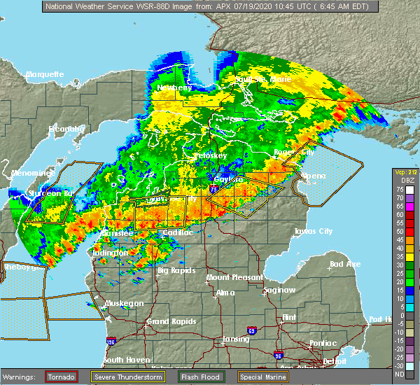 At 647 am edt, severe thunderstorms were located along a line extending from lockwood lake to red oak, moving southeast at 40 mph (radar indicated). Hazards include 60 mph wind gusts. Expect damage to roofs, siding, and trees. Locations impacted include, mio, atlanta, lewiston, comins, fairview, fletcher pond, luzerne, red oak, lockwood lake, loud township, garland and spratt. At 647 am edt, severe thunderstorms were located along a line extending from lockwood lake to red oak, moving southeast at 40 mph (radar indicated). Hazards include 60 mph wind gusts. Expect damage to roofs, siding, and trees. Locations impacted include, mio, atlanta, lewiston, comins, fairview, fletcher pond, luzerne, red oak, lockwood lake, loud township, garland and spratt.
|
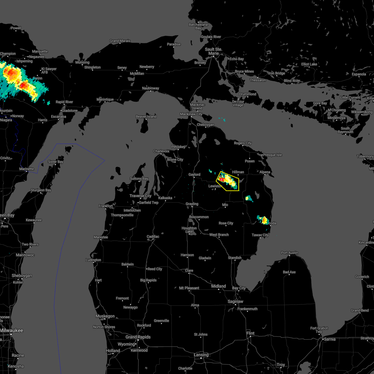
| 7/19/2020 6:14 AM EDT |
 At 614 am edt, severe thunderstorms were located along a line extending from near hetherton to near waters, moving southeast at 20 mph (radar indicated). Hazards include 60 mph wind gusts. expect damage to roofs, siding, and trees At 614 am edt, severe thunderstorms were located along a line extending from near hetherton to near waters, moving southeast at 20 mph (radar indicated). Hazards include 60 mph wind gusts. expect damage to roofs, siding, and trees
|
| 7/9/2020 6:17 PM EDT | Trees blocking road on cr 628... e of m-33 about 4-6 miles north of atlant in montmorency county MI, 7.4 miles S of Atlanta, MI |
| 8/28/2018 8:48 PM EDT |
 At 848 pm edt, a severe thunderstorm was located near briley township, or 10 miles northwest of atlanta, moving east at 40 mph (radar indicated). Hazards include 60 mph wind gusts. Expect damage to roofs, siding, and trees. Locations impacted include, atlanta, lewiston, hetherton, briley township, canada creek ranch and clear lake state park. At 848 pm edt, a severe thunderstorm was located near briley township, or 10 miles northwest of atlanta, moving east at 40 mph (radar indicated). Hazards include 60 mph wind gusts. Expect damage to roofs, siding, and trees. Locations impacted include, atlanta, lewiston, hetherton, briley township, canada creek ranch and clear lake state park.
|
| 8/28/2018 8:42 PM EDT |
 At 841 pm edt, a severe thunderstorm was located near eastern corwith township, or 13 miles east of gaylord, moving east at 45 mph (radar indicated). Hazards include 60 mph wind gusts. Expect damage to roofs, siding, and trees. Locations impacted include, atlanta, lewiston, hetherton, pickerel lake, johannesburg, briley township, eastern corwith township, canada creek ranch and clear lake state park. At 841 pm edt, a severe thunderstorm was located near eastern corwith township, or 13 miles east of gaylord, moving east at 45 mph (radar indicated). Hazards include 60 mph wind gusts. Expect damage to roofs, siding, and trees. Locations impacted include, atlanta, lewiston, hetherton, pickerel lake, johannesburg, briley township, eastern corwith township, canada creek ranch and clear lake state park.
|
| 8/28/2018 8:24 PM EDT |
 At 824 pm edt, a severe thunderstorm was located over gaylord, moving east at 45 mph (radar indicated). Hazards include 70 mph wind gusts. Expect considerable tree damage. damage is likely to mobile homes, roofs, and outbuildings. Locations impacted include, gaylord, atlanta, lewiston, vanderbilt, wolverine, sparr, otsego lake state park, pickerel lake, johannesburg, briley township, canada creek ranch, hetherton, chester township, eastern corwith township and clear lake state park. At 824 pm edt, a severe thunderstorm was located over gaylord, moving east at 45 mph (radar indicated). Hazards include 70 mph wind gusts. Expect considerable tree damage. damage is likely to mobile homes, roofs, and outbuildings. Locations impacted include, gaylord, atlanta, lewiston, vanderbilt, wolverine, sparr, otsego lake state park, pickerel lake, johannesburg, briley township, canada creek ranch, hetherton, chester township, eastern corwith township and clear lake state park.
|
| 8/28/2018 2:10 AM EDT |
 At 210 am edt, severe thunderstorms were located along a line extending from near wolverine to sparr to near sharon, moving east at 80 mph (radar indicated). Hazards include 70 mph wind gusts. Expect considerable tree damage. Damage is likely to mobile homes, roofs, and outbuildings. At 210 am edt, severe thunderstorms were located along a line extending from near wolverine to sparr to near sharon, moving east at 80 mph (radar indicated). Hazards include 70 mph wind gusts. Expect considerable tree damage. Damage is likely to mobile homes, roofs, and outbuildings.
|
| 7/8/2016 2:17 PM EDT |
 At 217 pm edt, a severe thunderstorm was located near atlanta, moving east at 35 mph (radar indicated). Hazards include two inch hail and 60 mph wind gusts. People and animals outdoors will be injured. expect hail damage to roofs, siding, windows, and vehicles. Expect wind damage to roofs, siding, and trees. At 217 pm edt, a severe thunderstorm was located near atlanta, moving east at 35 mph (radar indicated). Hazards include two inch hail and 60 mph wind gusts. People and animals outdoors will be injured. expect hail damage to roofs, siding, windows, and vehicles. Expect wind damage to roofs, siding, and trees.
|
| 7/8/2016 2:06 PM EDT |
 At 205 pm edt, severe thunderstorms were located along a line extending from near hetherton to near lovells, moving east at 40 mph (radar indicated). Hazards include 60 mph wind gusts and quarter size hail. Hail damage to vehicles is expected. expect wind damage to roofs, siding, and trees. Locations impacted include, lewiston, mio, atlanta, lovells, briley township, hetherton, red oak, garland, chester township, fairview and johannesburg. At 205 pm edt, severe thunderstorms were located along a line extending from near hetherton to near lovells, moving east at 40 mph (radar indicated). Hazards include 60 mph wind gusts and quarter size hail. Hail damage to vehicles is expected. expect wind damage to roofs, siding, and trees. Locations impacted include, lewiston, mio, atlanta, lovells, briley township, hetherton, red oak, garland, chester township, fairview and johannesburg.
|
| 7/8/2016 1:31 PM EDT |
 At 131 pm edt, a severe thunderstorm was located over waters, or 9 miles south of gaylord, moving east at 50 mph (radar indicated). Hazards include 60 mph wind gusts and quarter size hail. Hail damage to vehicles is expected. Expect wind damage to roofs, siding, and trees. At 131 pm edt, a severe thunderstorm was located over waters, or 9 miles south of gaylord, moving east at 50 mph (radar indicated). Hazards include 60 mph wind gusts and quarter size hail. Hail damage to vehicles is expected. Expect wind damage to roofs, siding, and trees.
|
| 7/8/2016 1:28 PM EDT |
 At 127 pm edt, a severe thunderstorm was located near lockwood lake, or near atlanta, moving east at 25 mph (radar indicated). Hazards include two inch hail and 70 mph wind gusts. People and animals outdoors will be injured. expect hail damage to roofs, siding, windows, and vehicles. expect considerable tree damage. Wind damage is also likely to mobile homes, roofs, and outbuildings. At 127 pm edt, a severe thunderstorm was located near lockwood lake, or near atlanta, moving east at 25 mph (radar indicated). Hazards include two inch hail and 70 mph wind gusts. People and animals outdoors will be injured. expect hail damage to roofs, siding, windows, and vehicles. expect considerable tree damage. Wind damage is also likely to mobile homes, roofs, and outbuildings.
|
| 7/8/2016 1:18 PM EDT | Quarter sized hail reported 0.4 miles NE of Atlanta, MI |
| 7/8/2016 1:11 PM EDT | Quarter sized hail reported 2.1 miles ESE of Atlanta, MI |
| 7/8/2016 1:01 PM EDT |
 At 100 pm edt, a severe thunderstorm was located near loud township, or near atlanta, moving east at 40 mph (radar indicated). Hazards include two inch hail and 60 mph wind gusts. People and animals outdoors will be injured. expect hail damage to roofs, siding, windows, and vehicles. expect wind damage to roofs, siding, and trees. Locations impacted include, lewiston, atlanta, grass lake, hillman, briley township, hetherton, lockwood lake and loud township. At 100 pm edt, a severe thunderstorm was located near loud township, or near atlanta, moving east at 40 mph (radar indicated). Hazards include two inch hail and 60 mph wind gusts. People and animals outdoors will be injured. expect hail damage to roofs, siding, windows, and vehicles. expect wind damage to roofs, siding, and trees. Locations impacted include, lewiston, atlanta, grass lake, hillman, briley township, hetherton, lockwood lake and loud township.
|
| 7/8/2016 12:34 PM EDT |
 At 1233 pm edt, a severe thunderstorm was located over chester township, or 7 miles northwest of lewiston, moving east at 40 mph (radar indicated). Hazards include two inch hail and 60 mph wind gusts. People and animals outdoors will be injured. expect hail damage to roofs, siding, windows, and vehicles. Expect wind damage to roofs, siding, and trees. At 1233 pm edt, a severe thunderstorm was located over chester township, or 7 miles northwest of lewiston, moving east at 40 mph (radar indicated). Hazards include two inch hail and 60 mph wind gusts. People and animals outdoors will be injured. expect hail damage to roofs, siding, windows, and vehicles. Expect wind damage to roofs, siding, and trees.
|
| 8/2/2015 5:00 PM EDT |
 At 459 pm edt, severe thunderstorms were located along a line extending from near warner township to 6 miles north of moorestown, moving east at 60 mph (radar indicated. earlier in grand traverse and antrim counties 60 to 70 mph winds were reported). Hazards include 70 mph wind gusts and quarter size hail. Hail damage to vehicles is expected. expect considerable tree damage. Wind damage is also likely to mobile homes, roofs and outbuildings. At 459 pm edt, severe thunderstorms were located along a line extending from near warner township to 6 miles north of moorestown, moving east at 60 mph (radar indicated. earlier in grand traverse and antrim counties 60 to 70 mph winds were reported). Hazards include 70 mph wind gusts and quarter size hail. Hail damage to vehicles is expected. expect considerable tree damage. Wind damage is also likely to mobile homes, roofs and outbuildings.
|
| 8/2/2015 1:00 PM EDT | Law enforcement reports multiple trees and power lines down between lewiston and atlanta. time estimate in montmorency county MI, 5.6 miles ENE of Atlanta, MI |
| 8/2/2015 12:54 PM EDT |
 At 1253 pm edt, severe thunderstorms were located along a line extending from near nine mile point to 8 miles south of lovells, moving east at 50 mph (radar indicated). Hazards include 60 mph wind gusts and quarter size hail. Hail damage to vehicles is expected. Expect wind damage to roofs, siding and trees. At 1253 pm edt, severe thunderstorms were located along a line extending from near nine mile point to 8 miles south of lovells, moving east at 50 mph (radar indicated). Hazards include 60 mph wind gusts and quarter size hail. Hail damage to vehicles is expected. Expect wind damage to roofs, siding and trees.
|
| 6/10/2015 6:45 AM EDT |
 At 644 am edt, severe thunderstorms were located along a line extending from metz to near hillman to loud township, moving east at 45 mph (radar indicated). Hazards include 60 mph wind gusts and nickel size hail. Expect damage to roofs. Siding and trees. At 644 am edt, severe thunderstorms were located along a line extending from metz to near hillman to loud township, moving east at 45 mph (radar indicated). Hazards include 60 mph wind gusts and nickel size hail. Expect damage to roofs. Siding and trees.
|
| 11/17/2013 5:03 PM EST | Trees dow in montmorency county MI, 4.4 miles N of Atlanta, MI |
| 7/19/2013 11:30 AM EDT | Approximately four one foot diameter trees uprooted in montmorency county MI, 0.4 miles NE of Atlanta, MI |
| 7/19/2013 11:30 AM EDT | Large tree uprooted on home in montmorency county MI, 0.4 miles NE of Atlanta, MI |
| 7/19/2013 11:30 AM EDT | Power lines down in montmorency county MI, 0.5 miles SSW of Atlanta, MI |
| 7/18/2013 12:40 PM EDT | Numerous trees down in montmorency county MI, 0.3 miles NW of Atlanta, MI |
| 1/1/0001 12:00 AM | Reports of trees down in various parts of the count in montmorency county MI, 0.4 miles NE of Atlanta, MI |
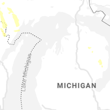
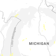
Hail Maps for Atlanta, MI


Connect with Interactive Hail Maps