

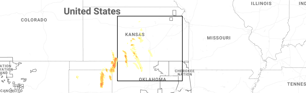
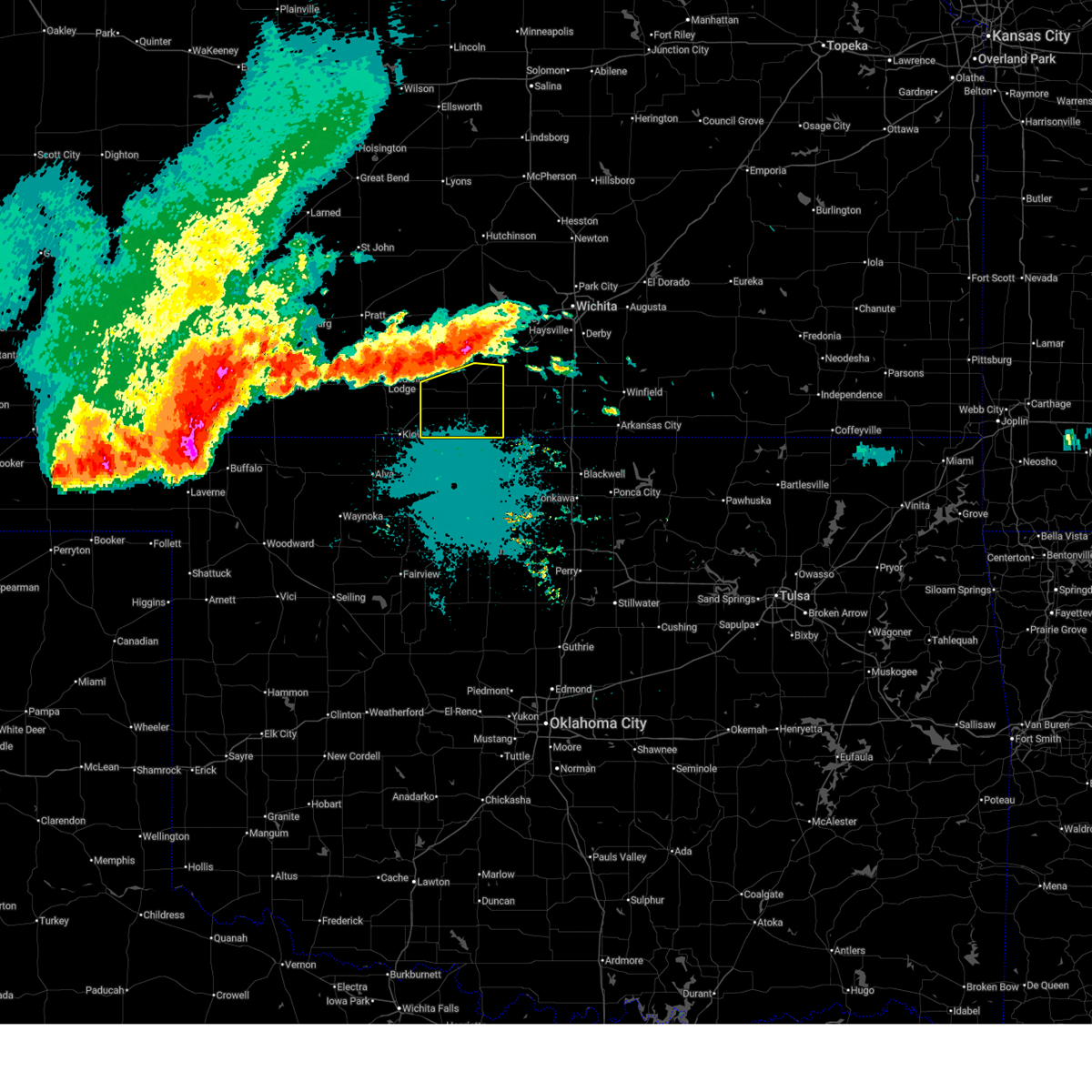
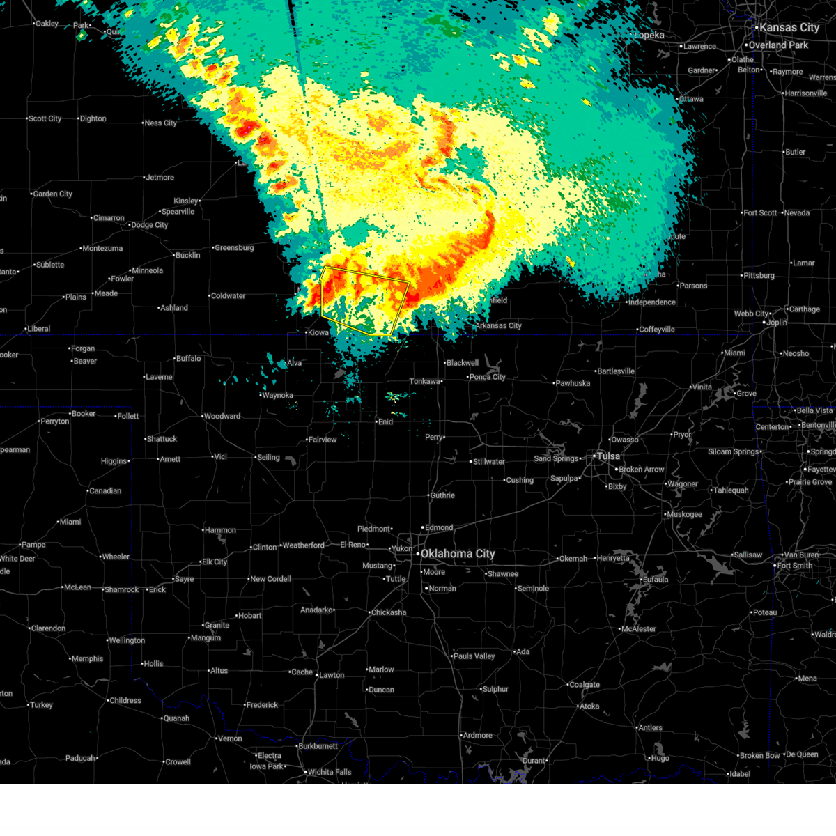
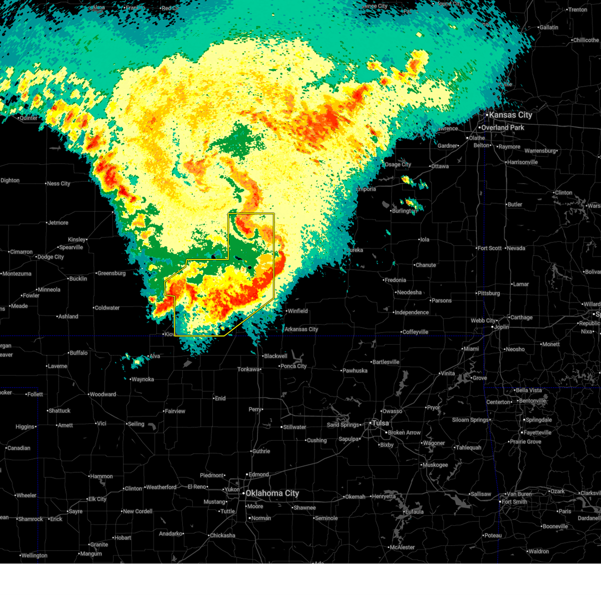
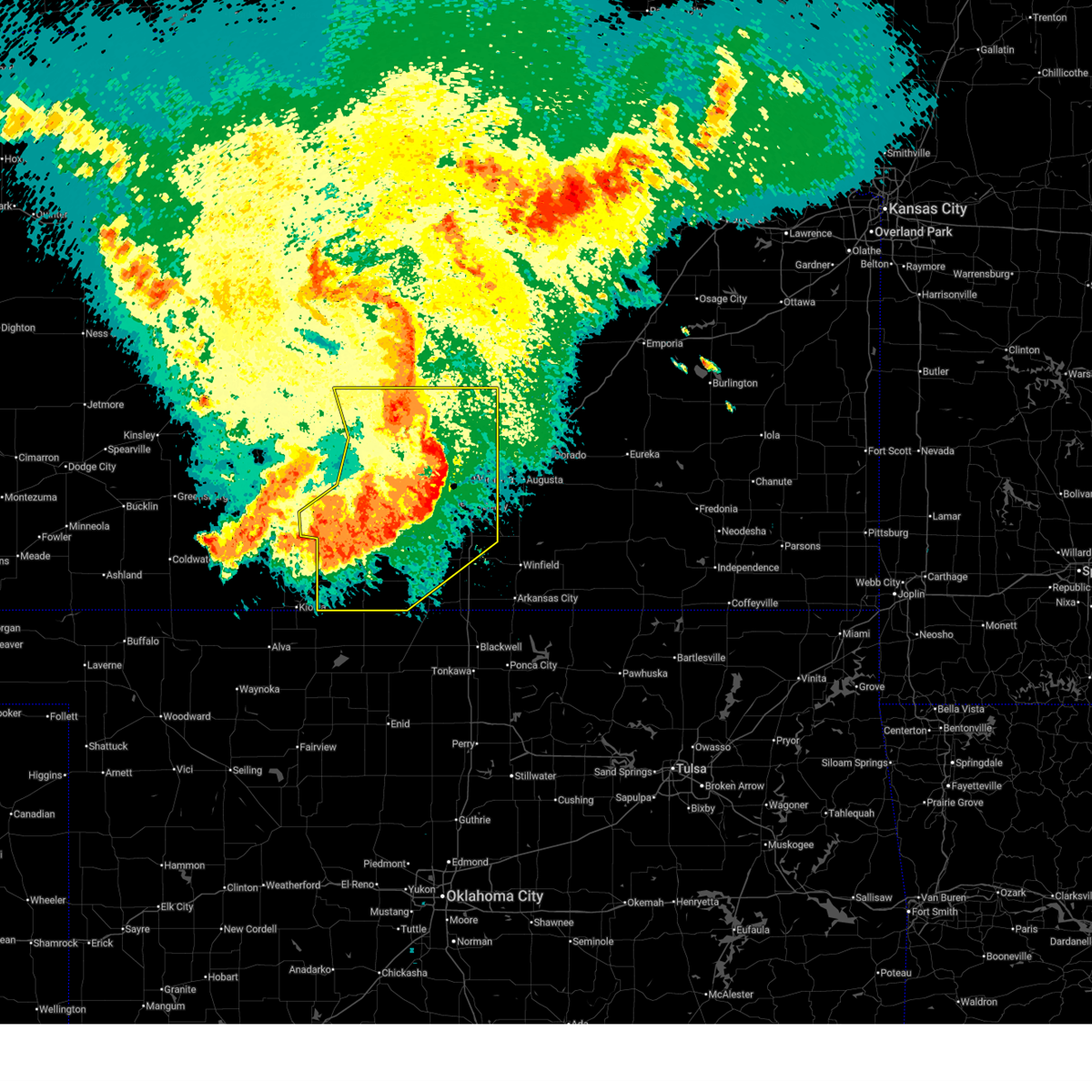
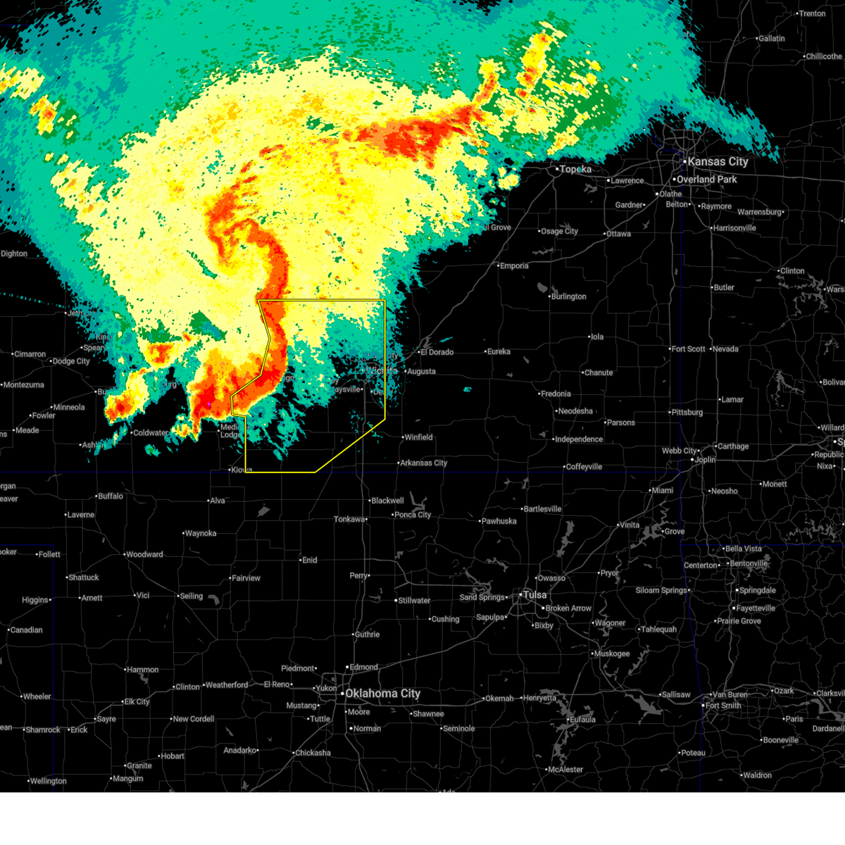
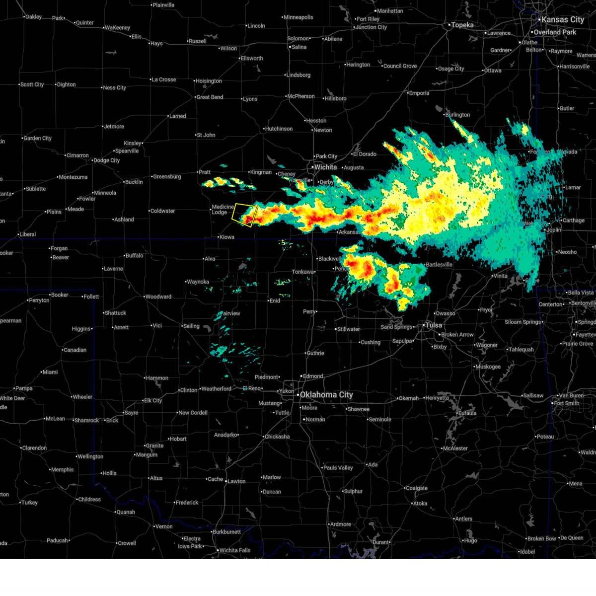
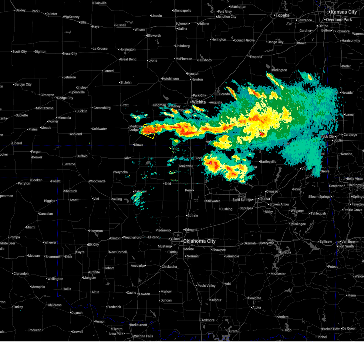
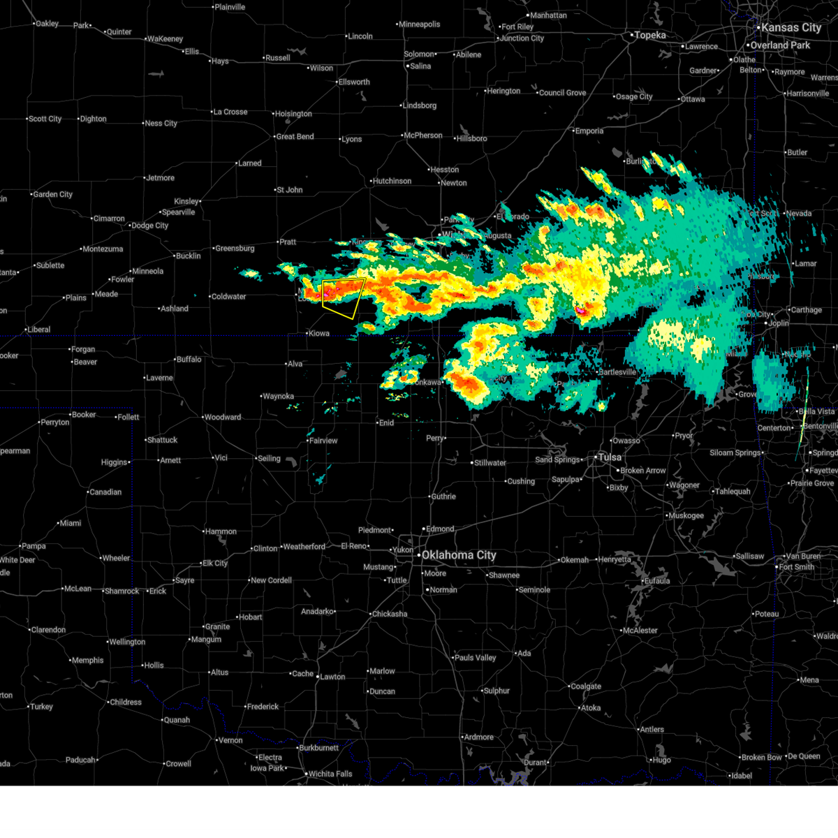
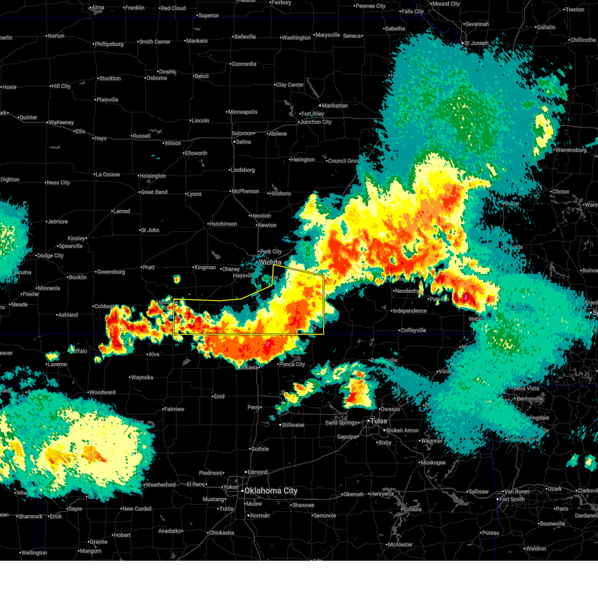
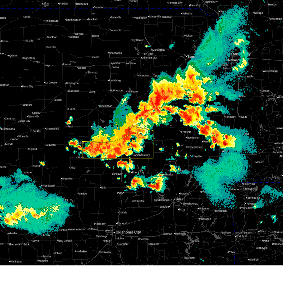
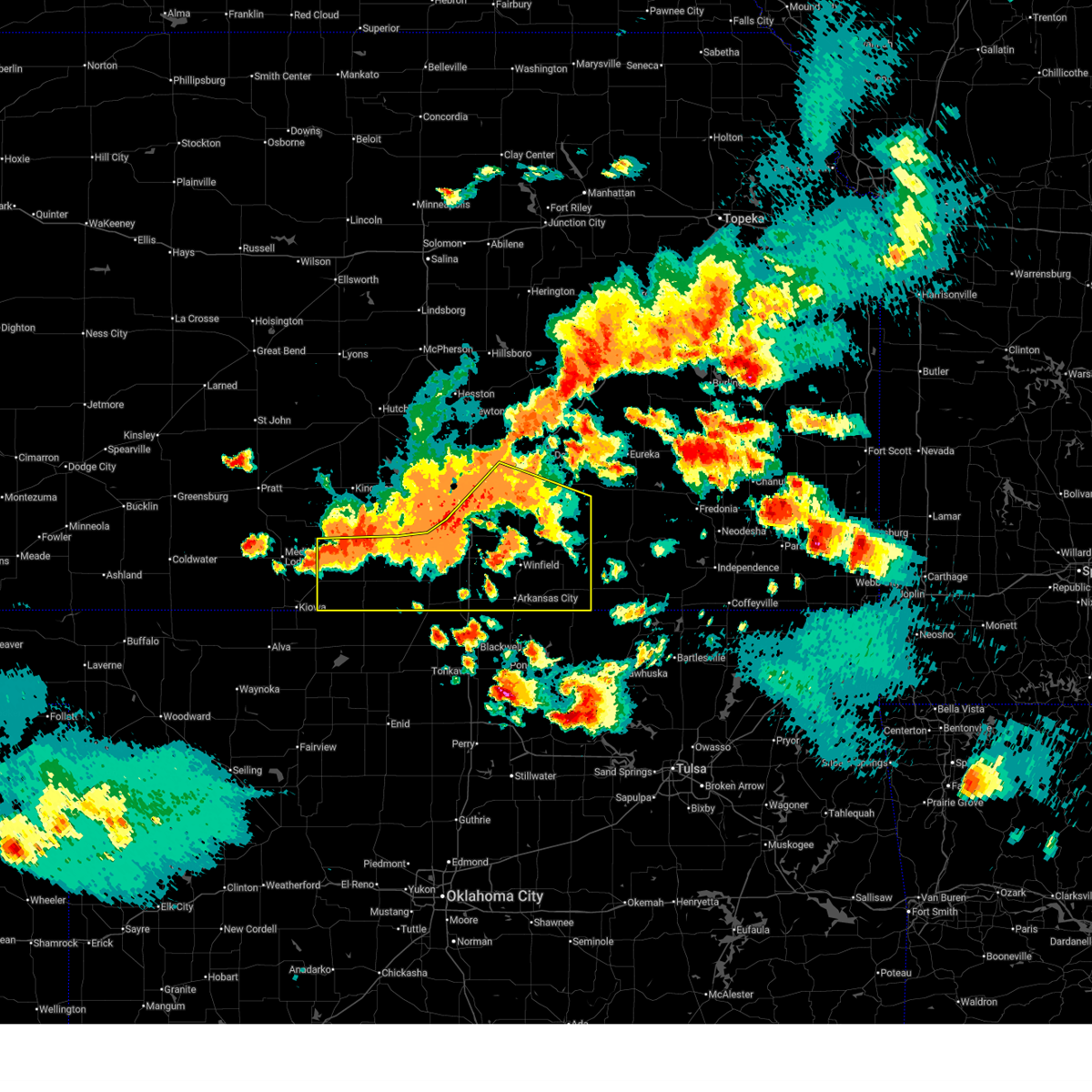
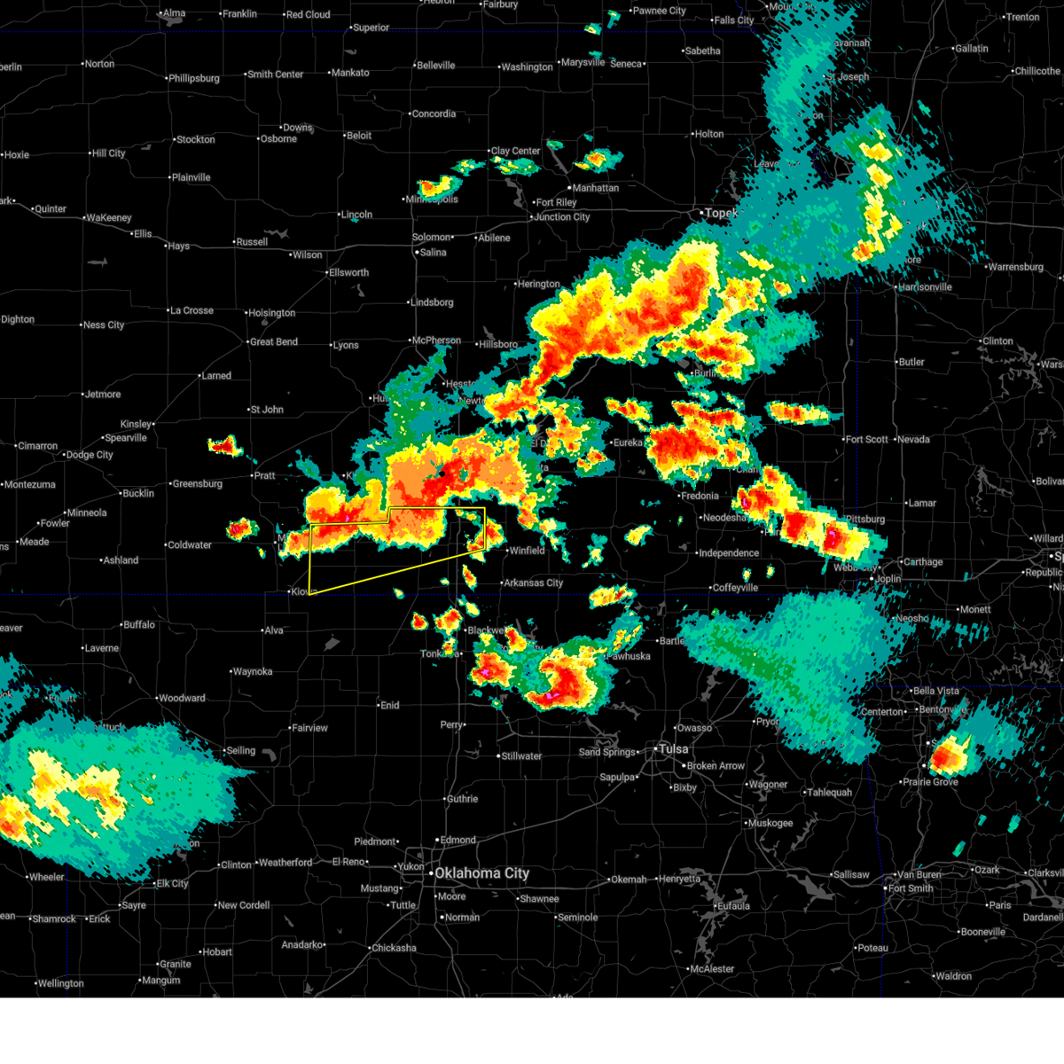
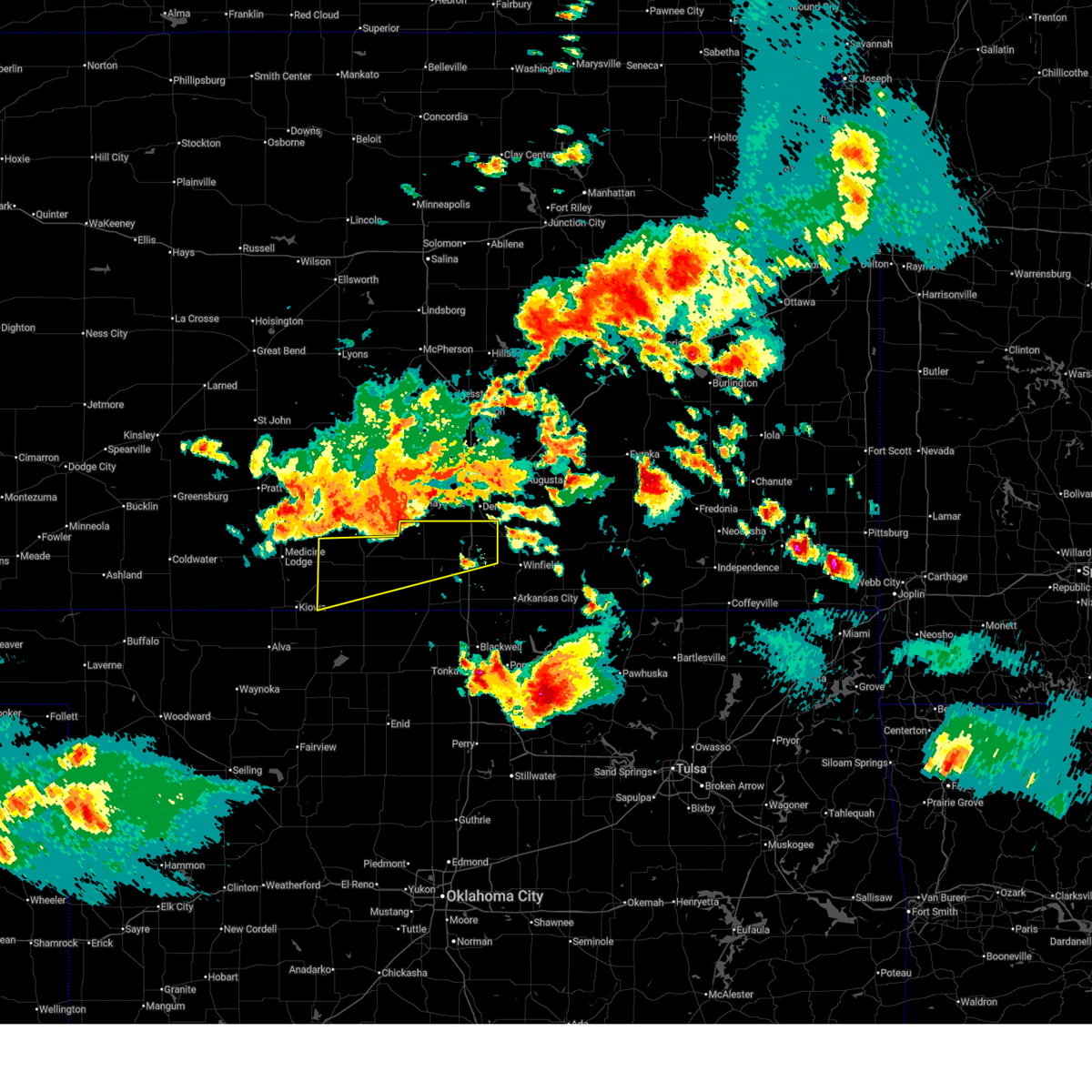
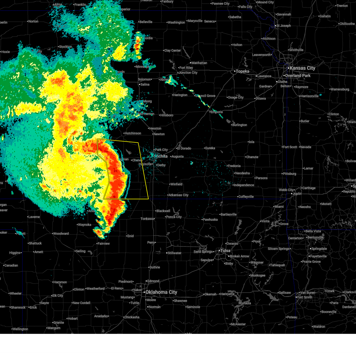
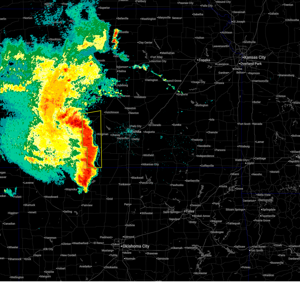
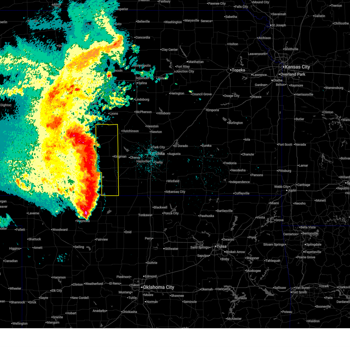
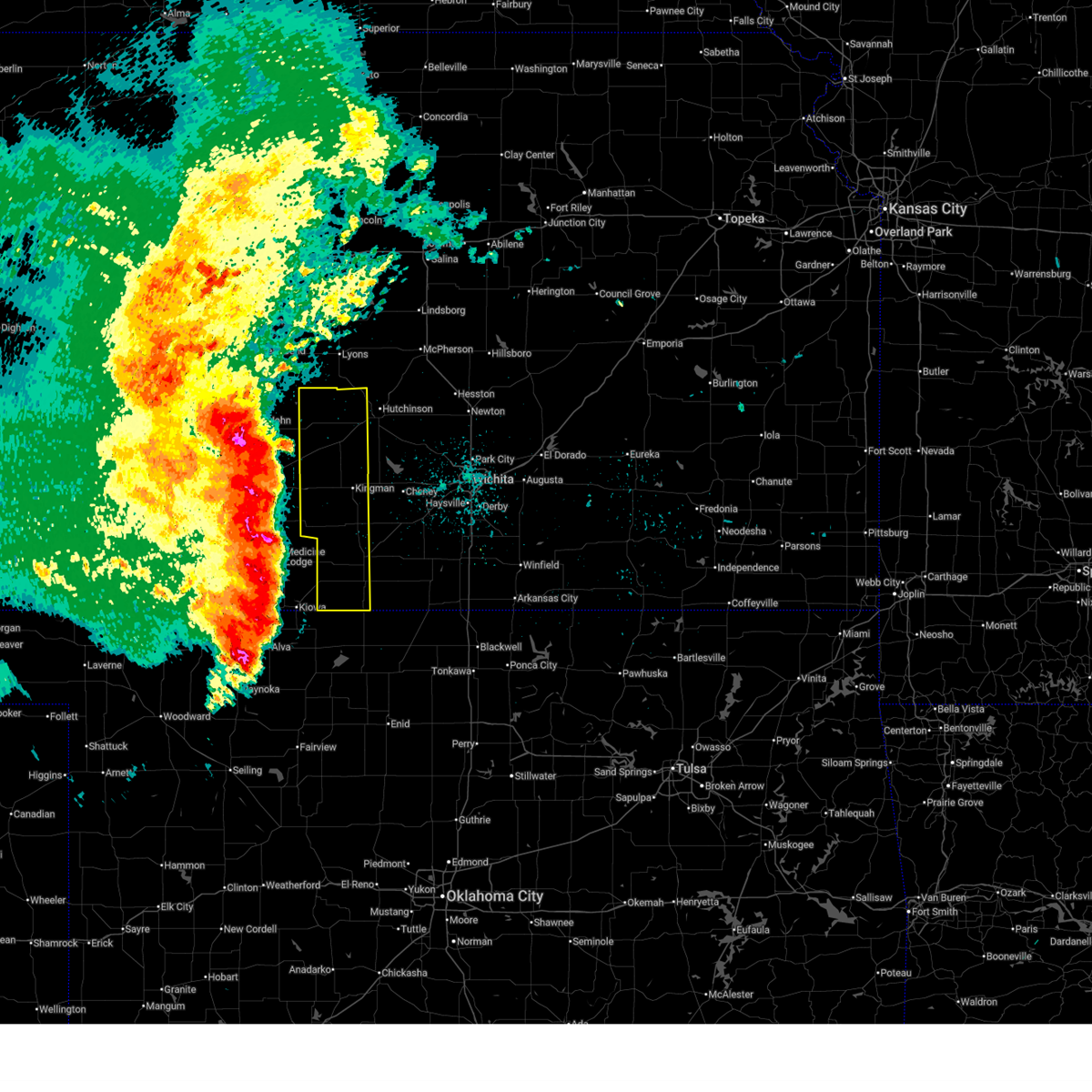
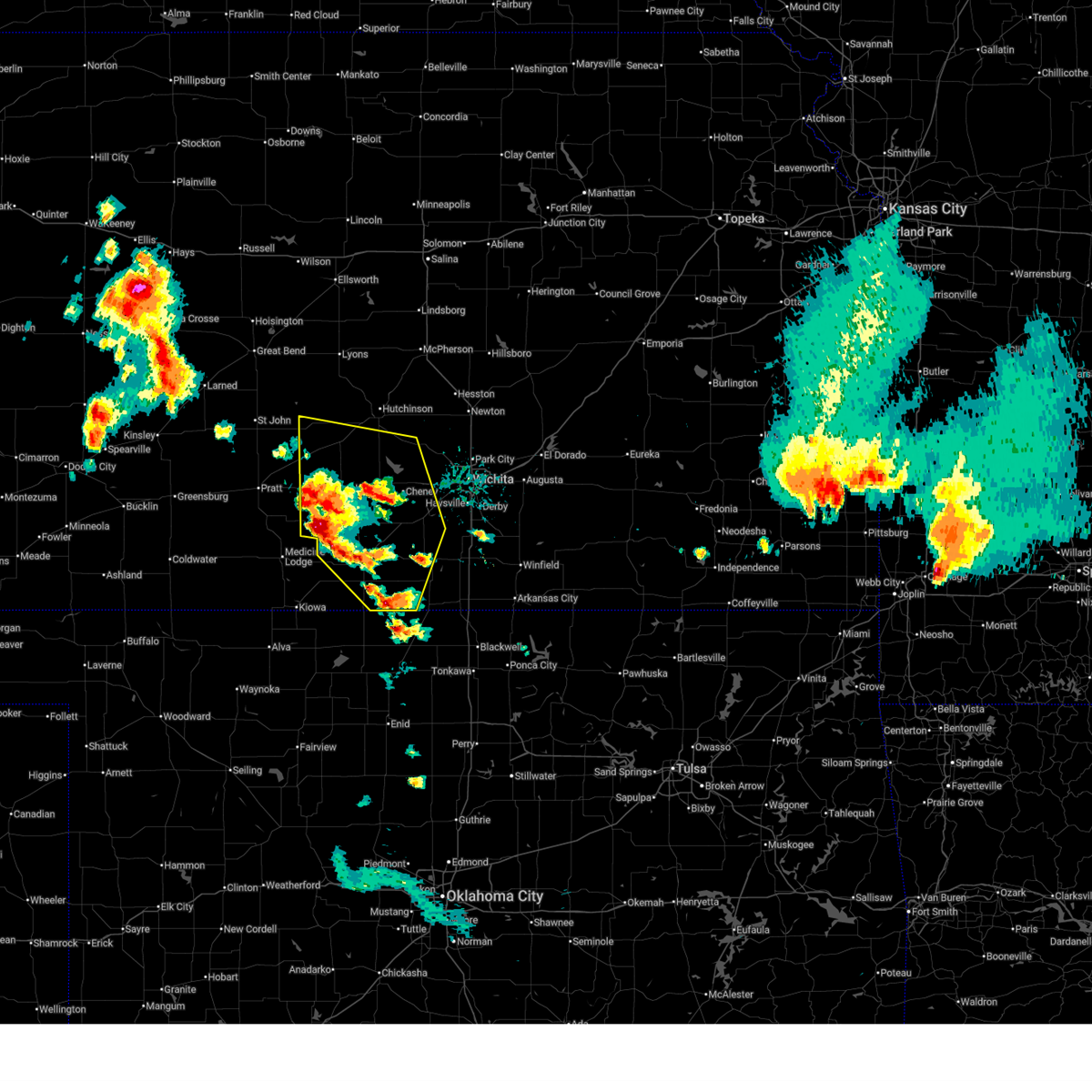
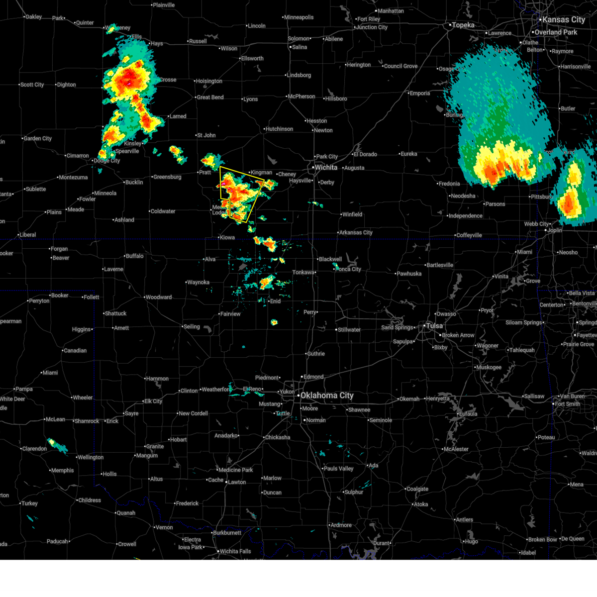
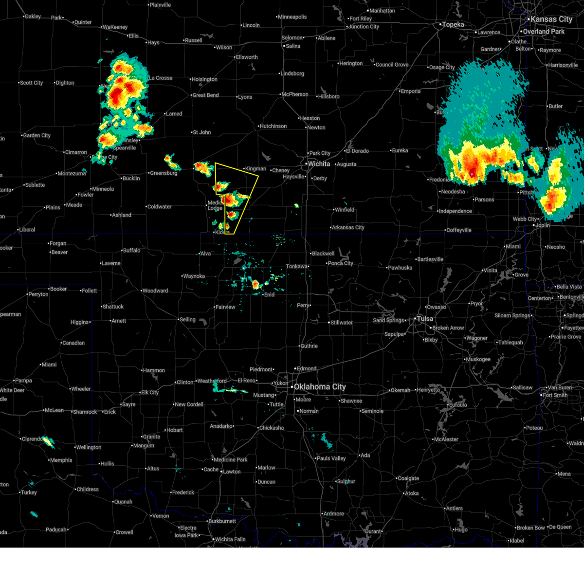
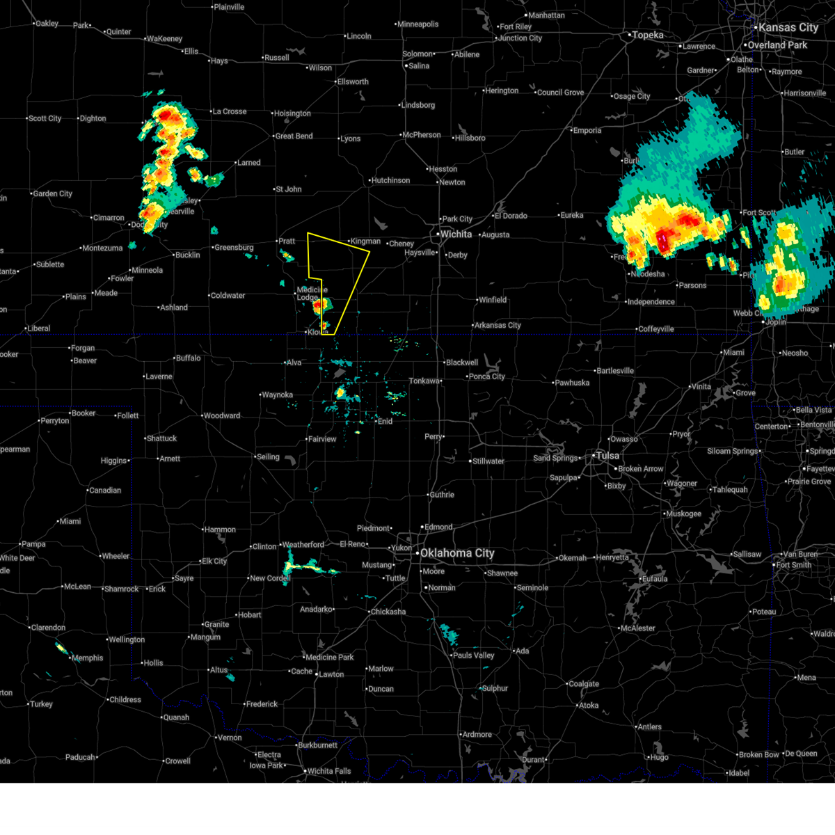
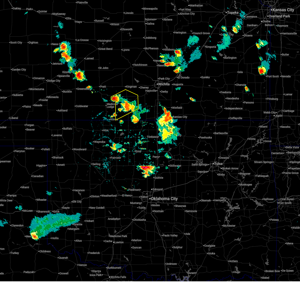
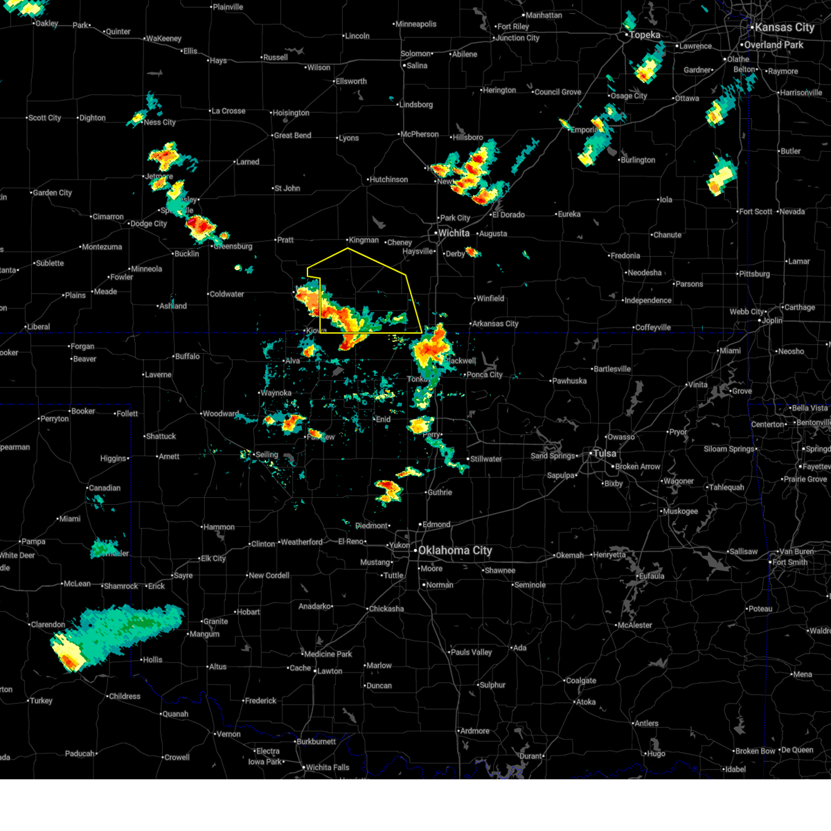
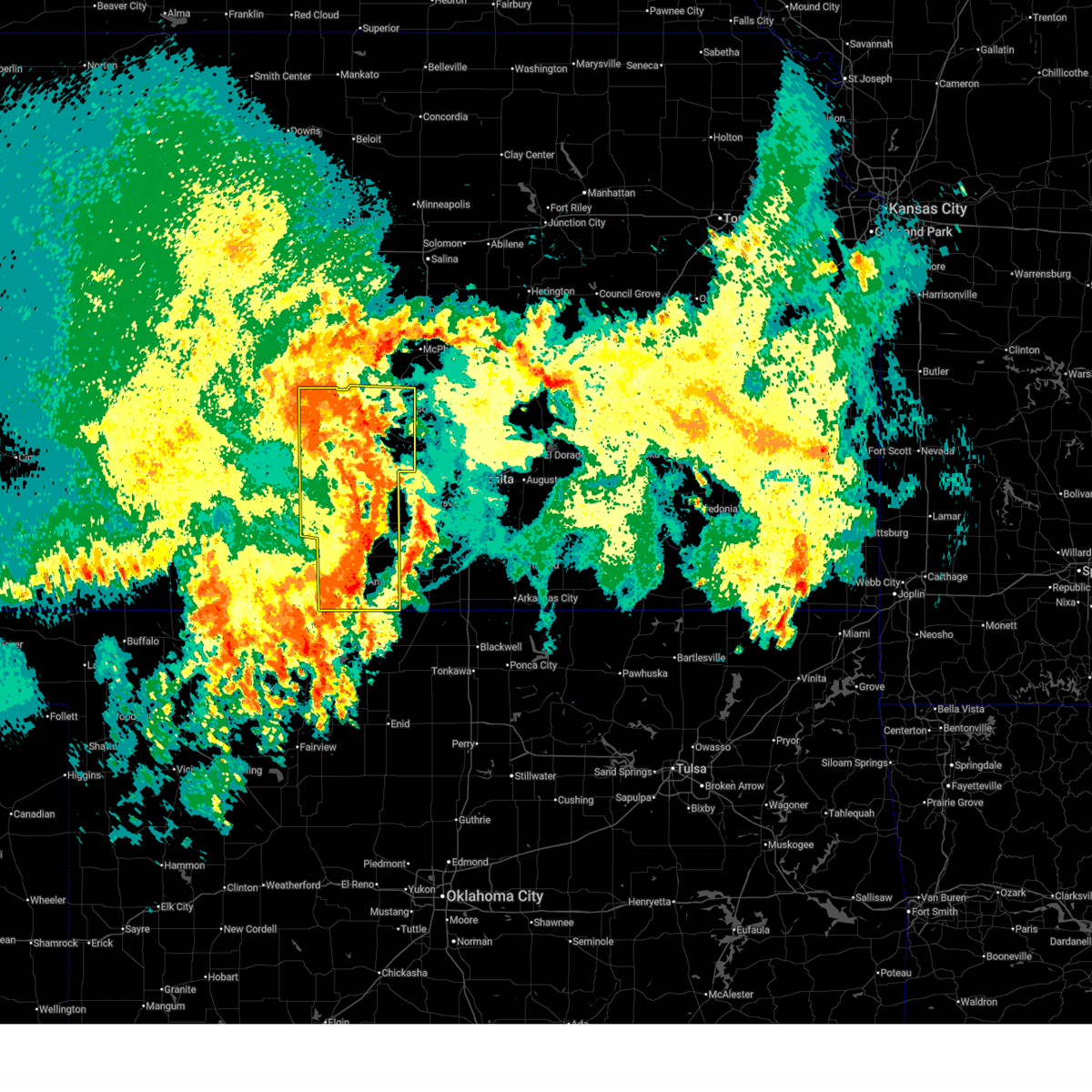
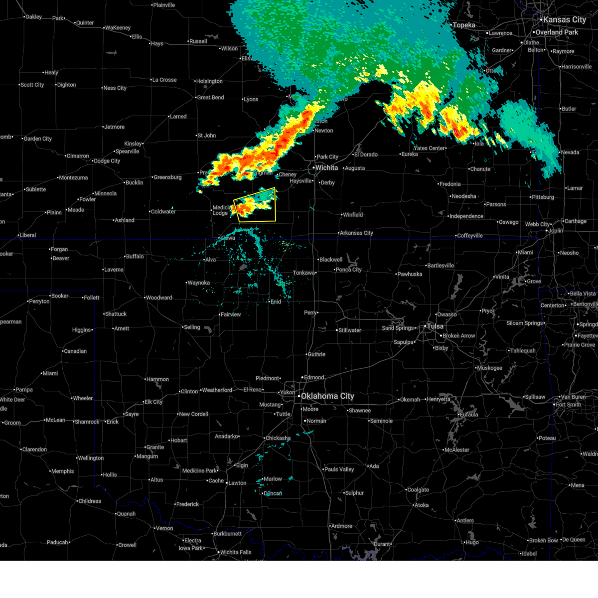
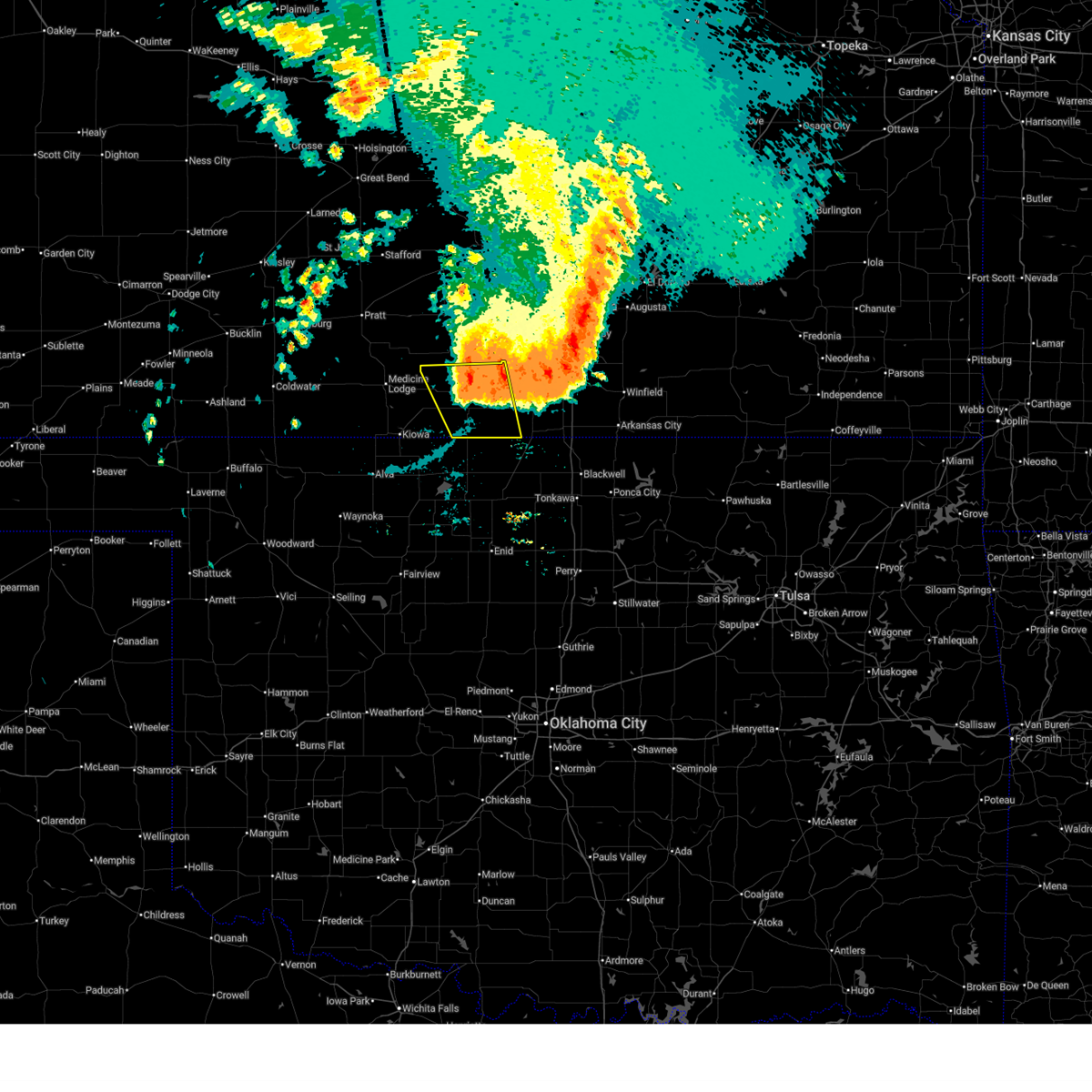
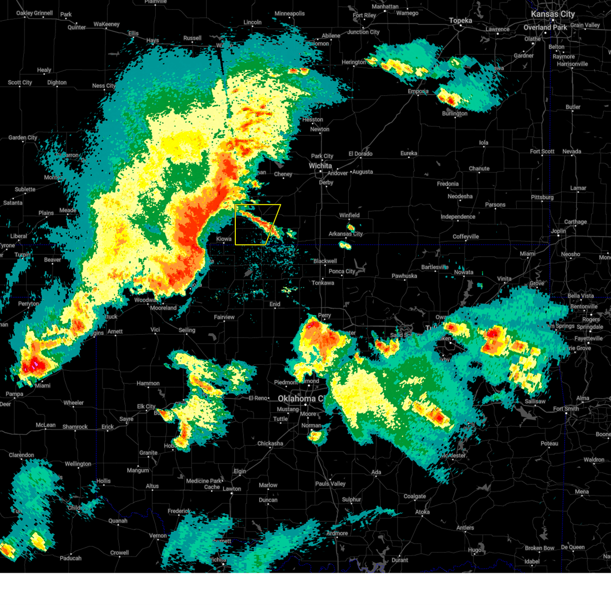
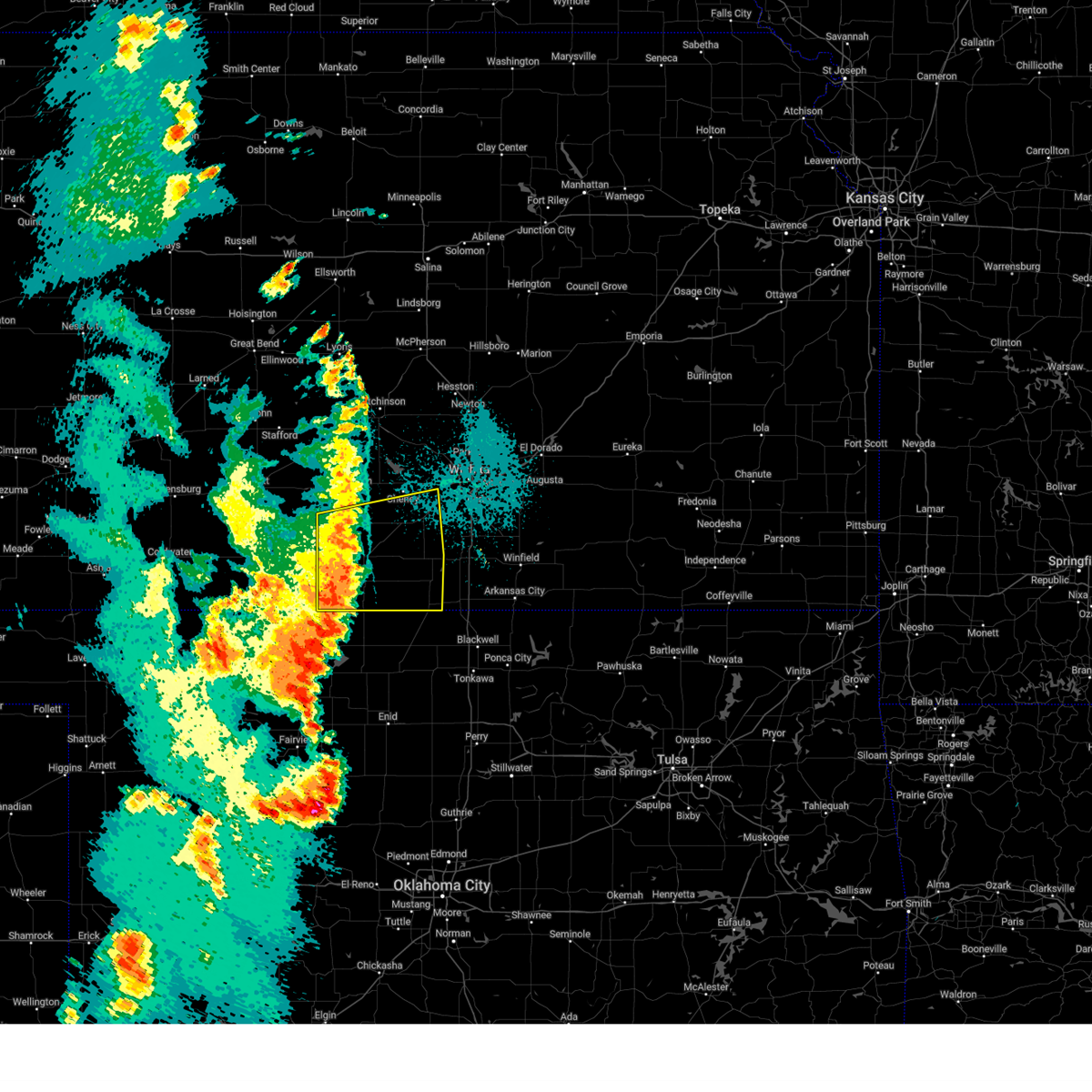
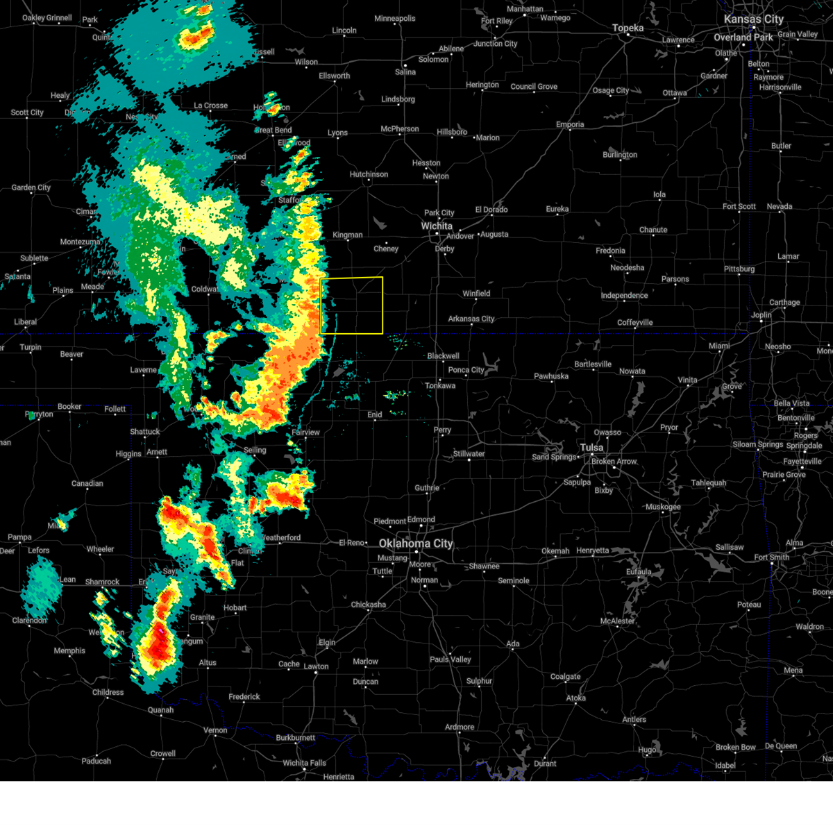
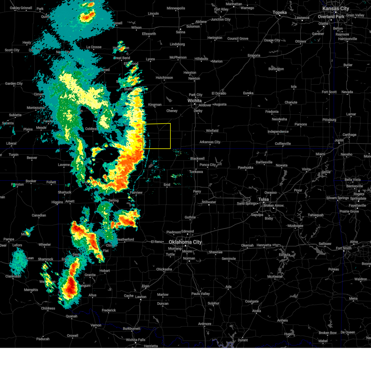
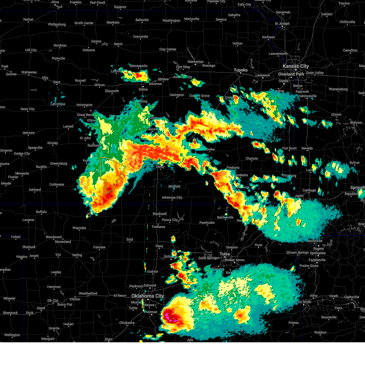
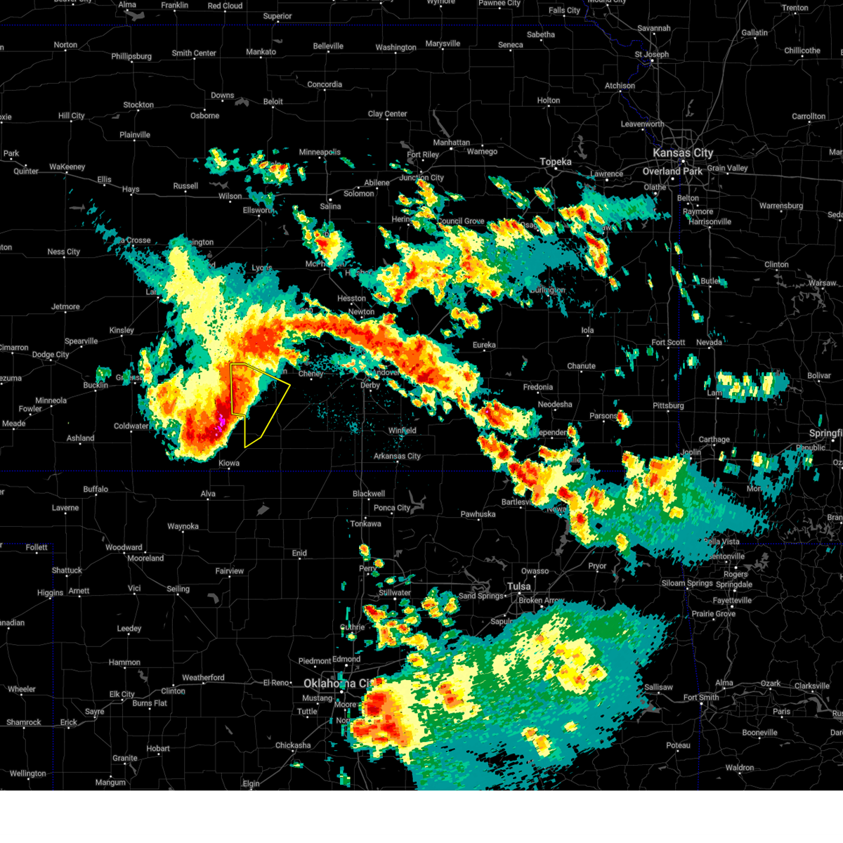
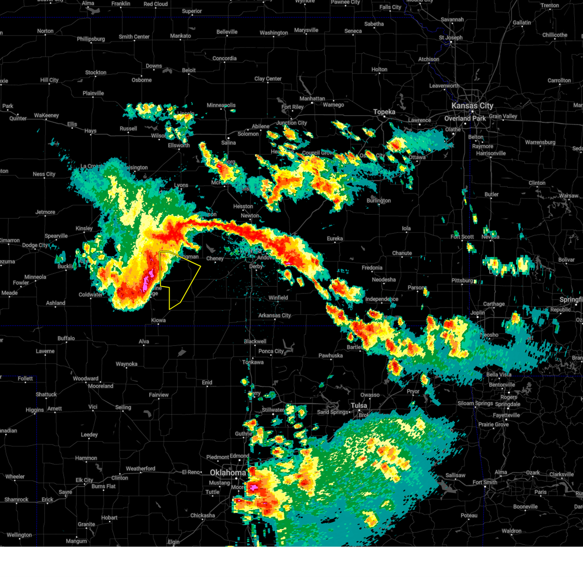
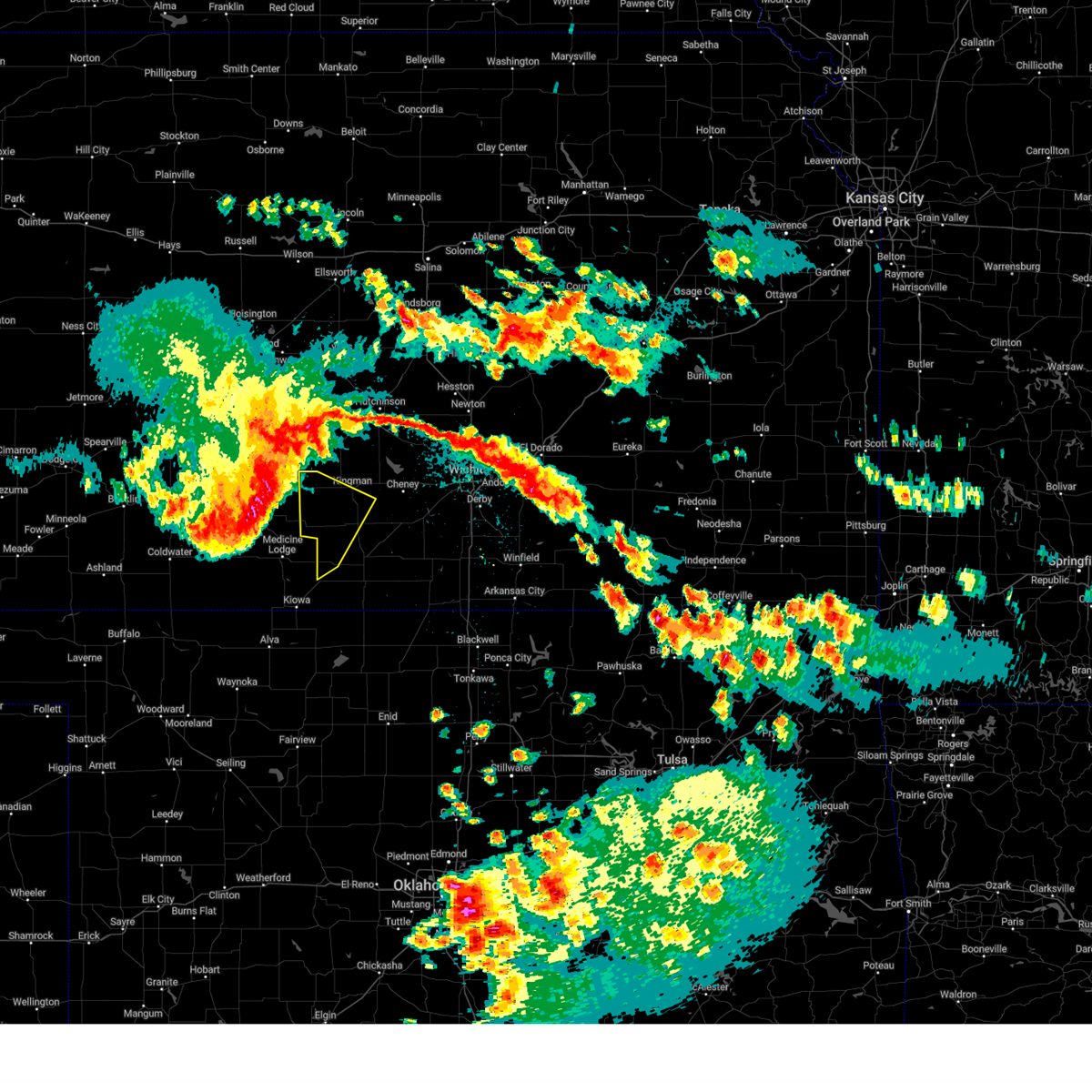
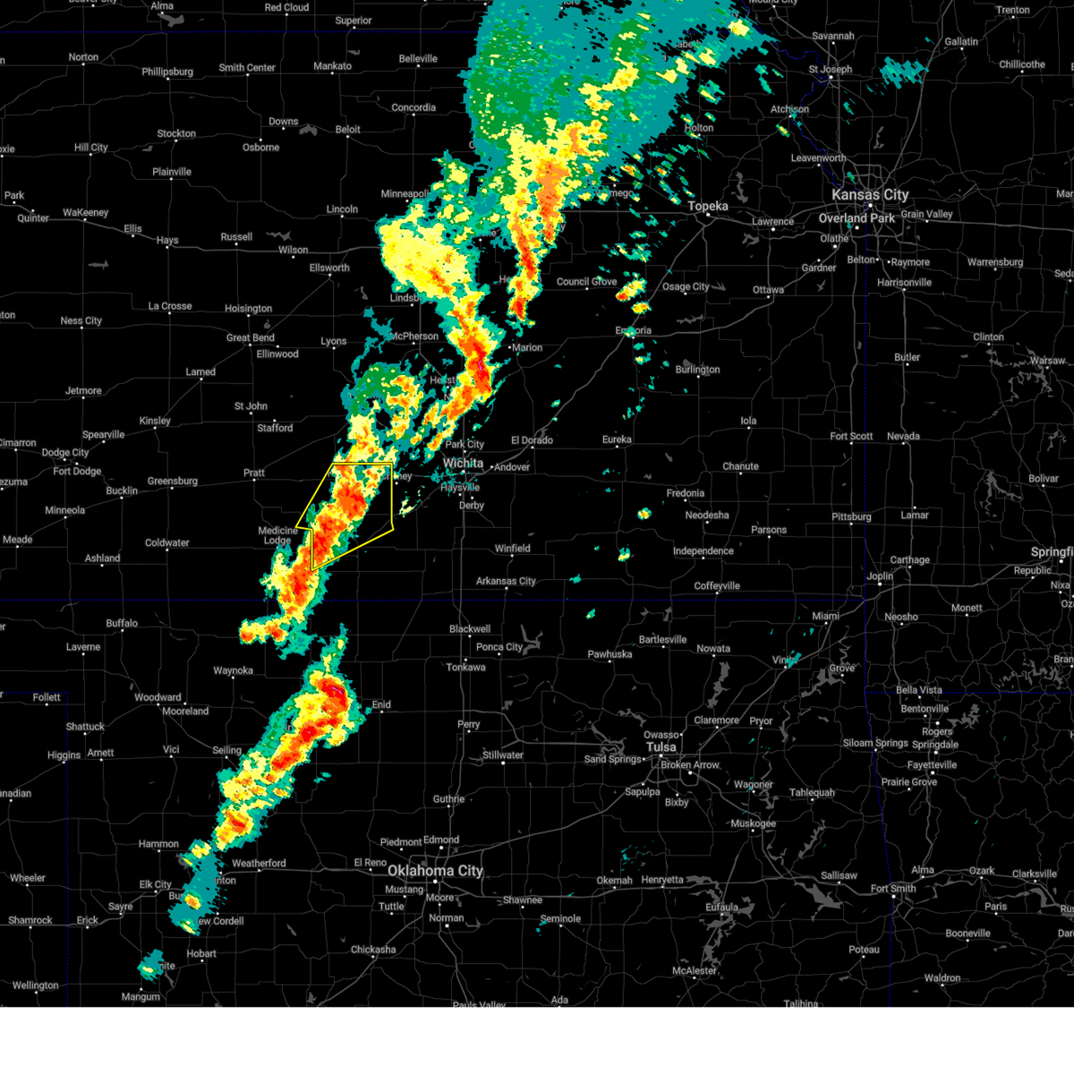
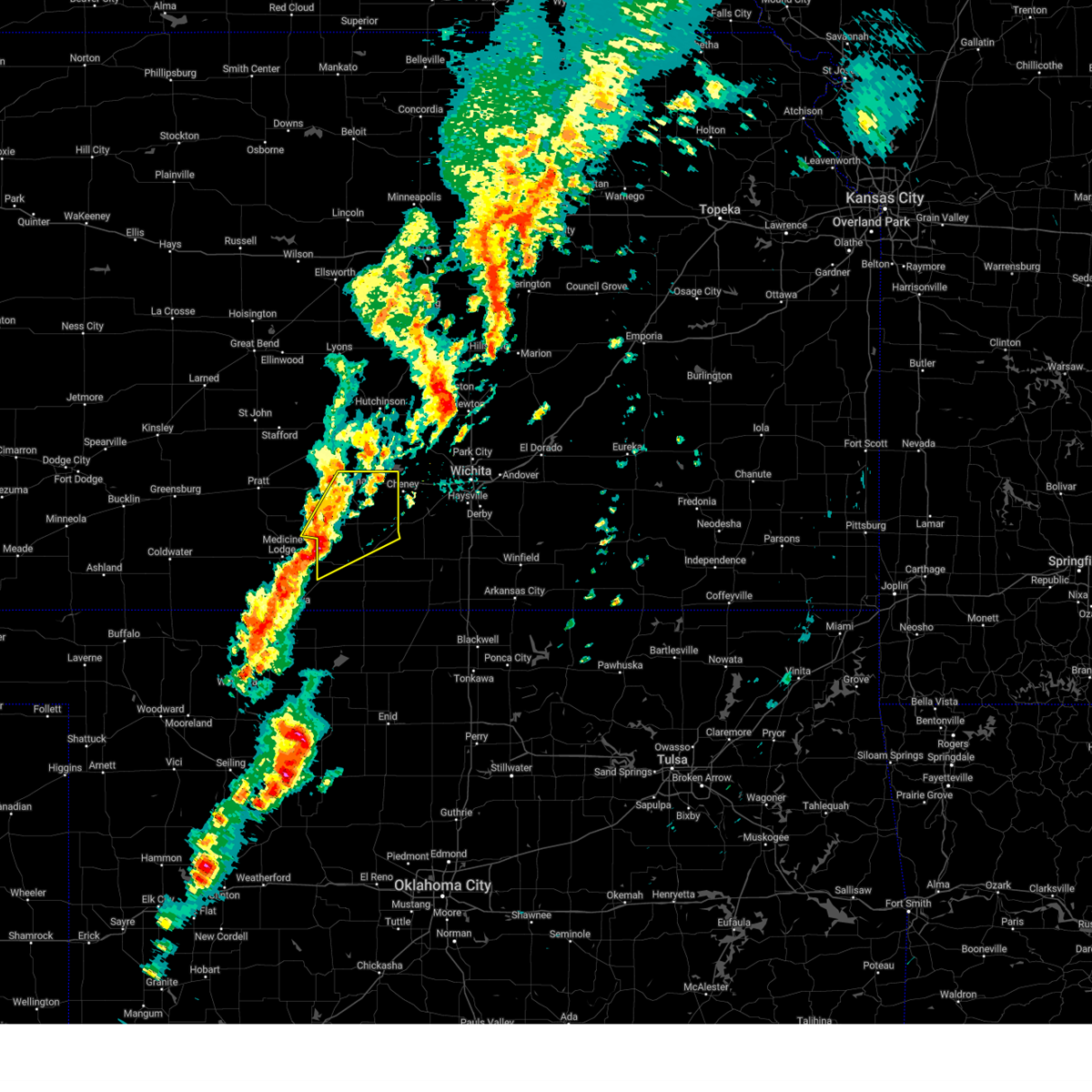
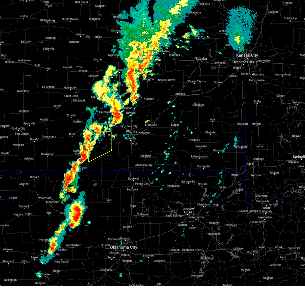
Hail Map for Attica, KS
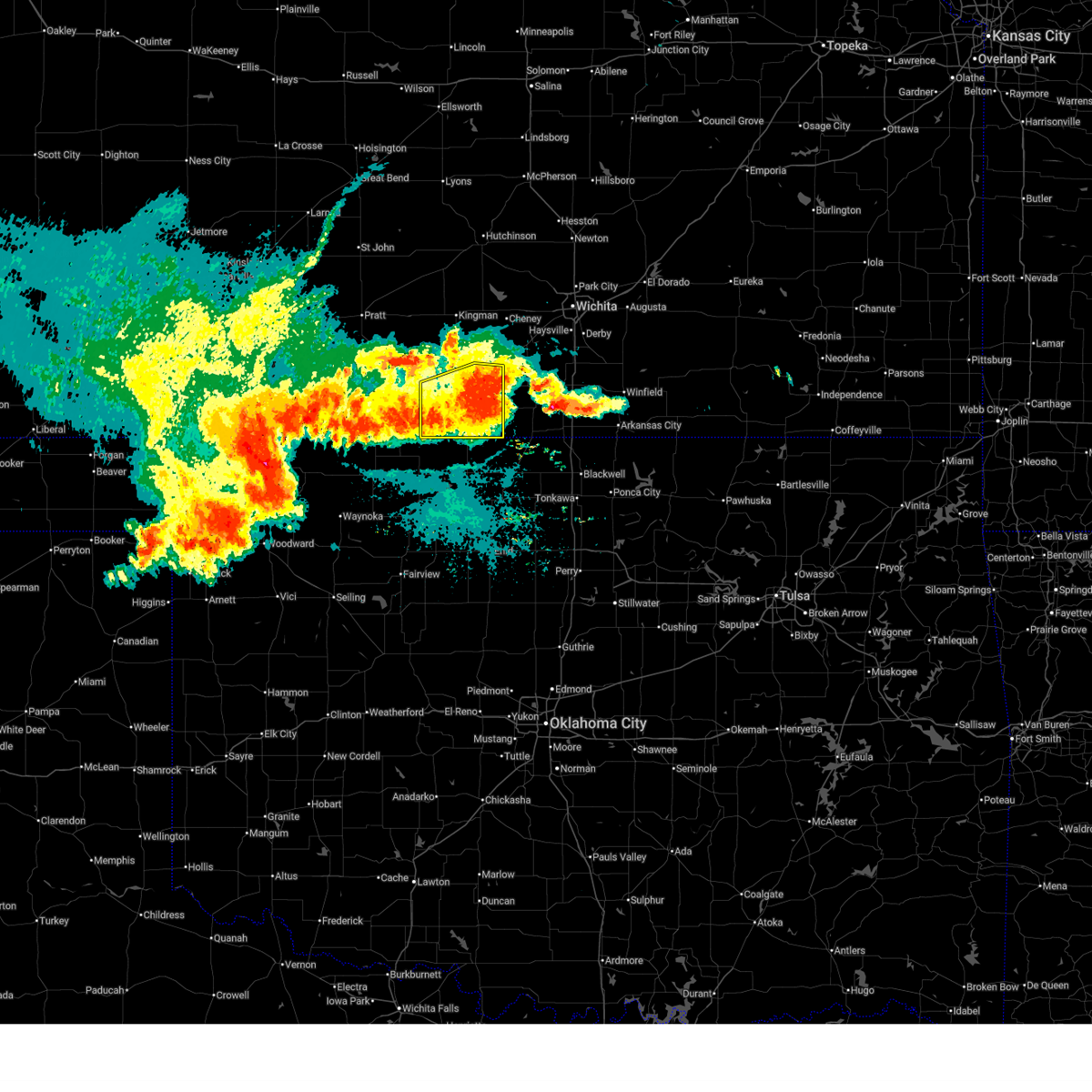
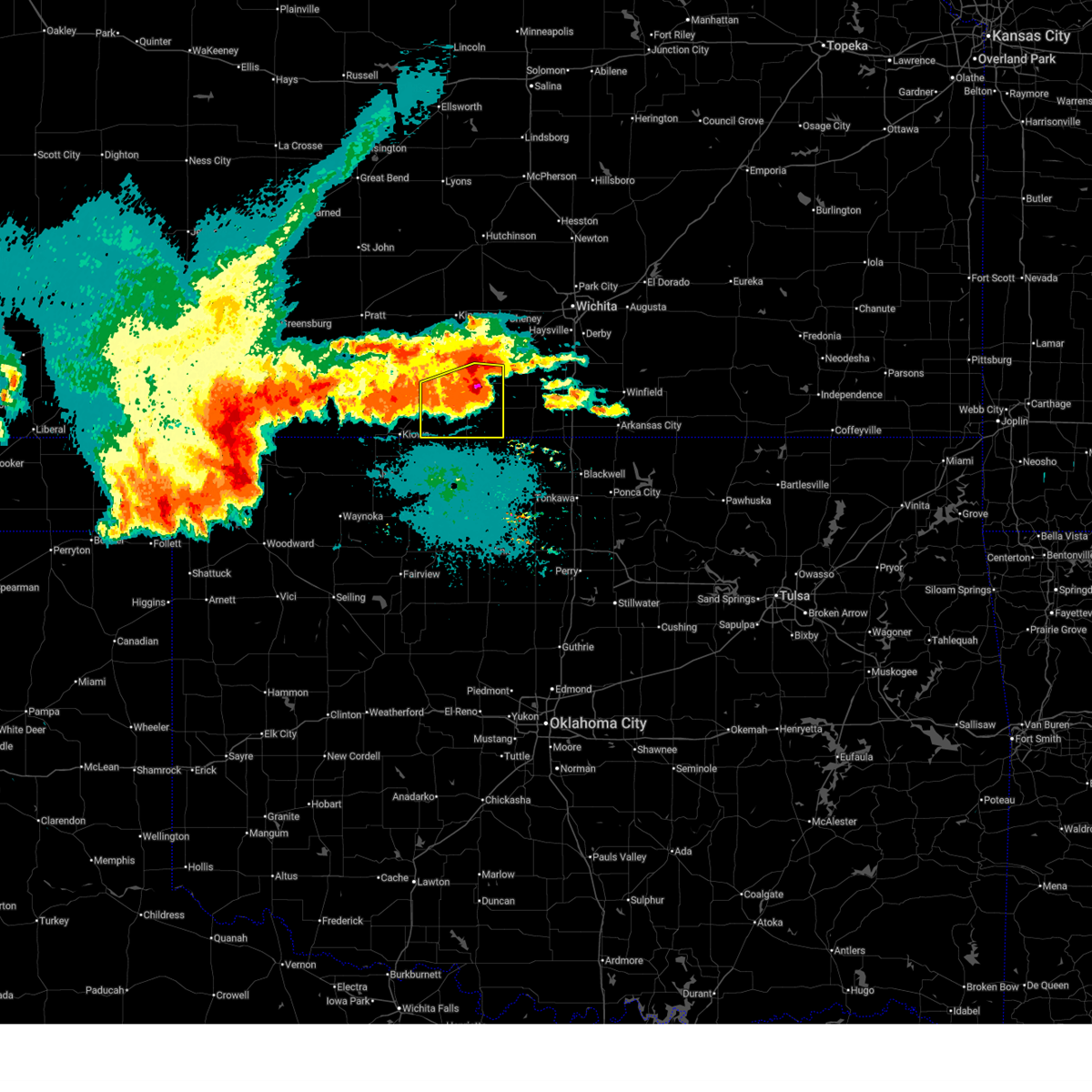
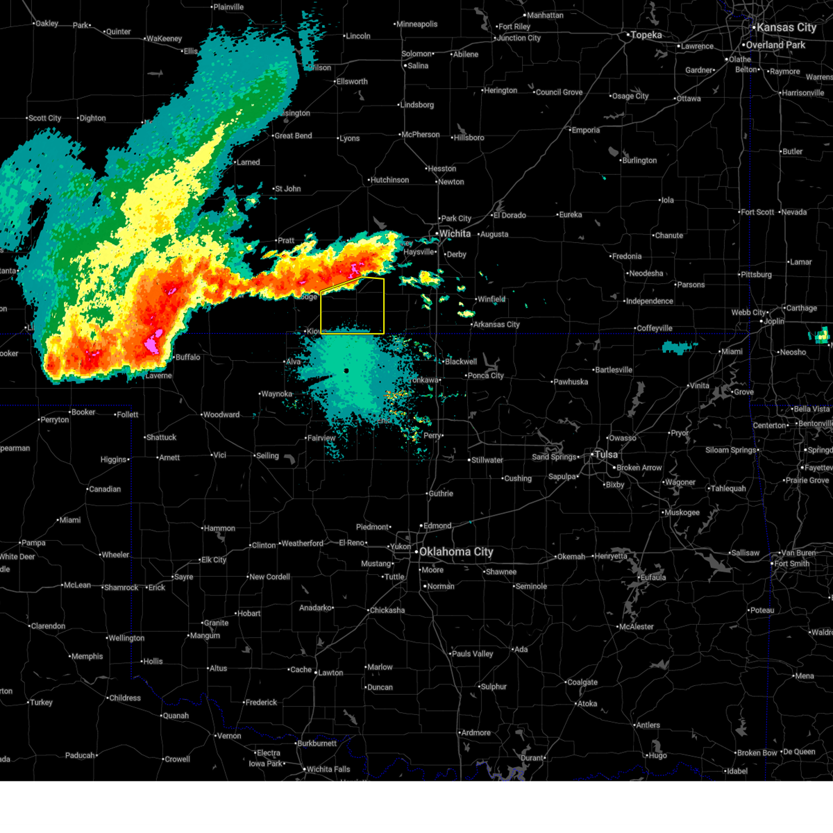
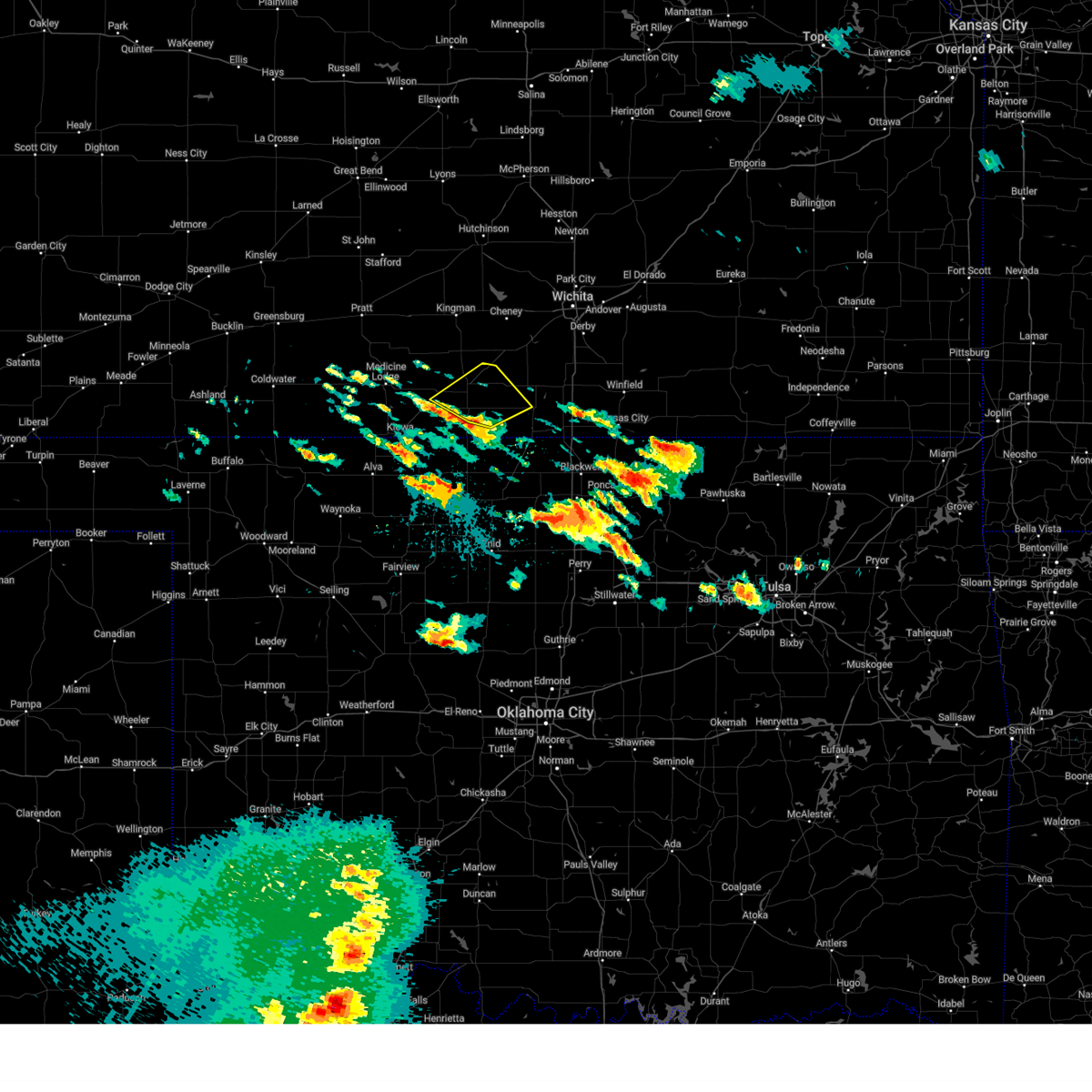
The Attica, KS area has had 7 reports of on-the-ground hail by trained spotters, and has been under severe weather warnings 53 times during the past 12 months. Doppler radar has detected hail at or near Attica, KS on 88 occasions, including 11 occasions during the past year.
| Name: | Attica, KS |
| Where Located: | 57.9 miles WSW of Wichita, KS |
| Map: | Google Map for Attica, KS |
| Population: | 626 |
| Housing Units: | 298 |
| More Info: | Search Google for Attica, KS |
2
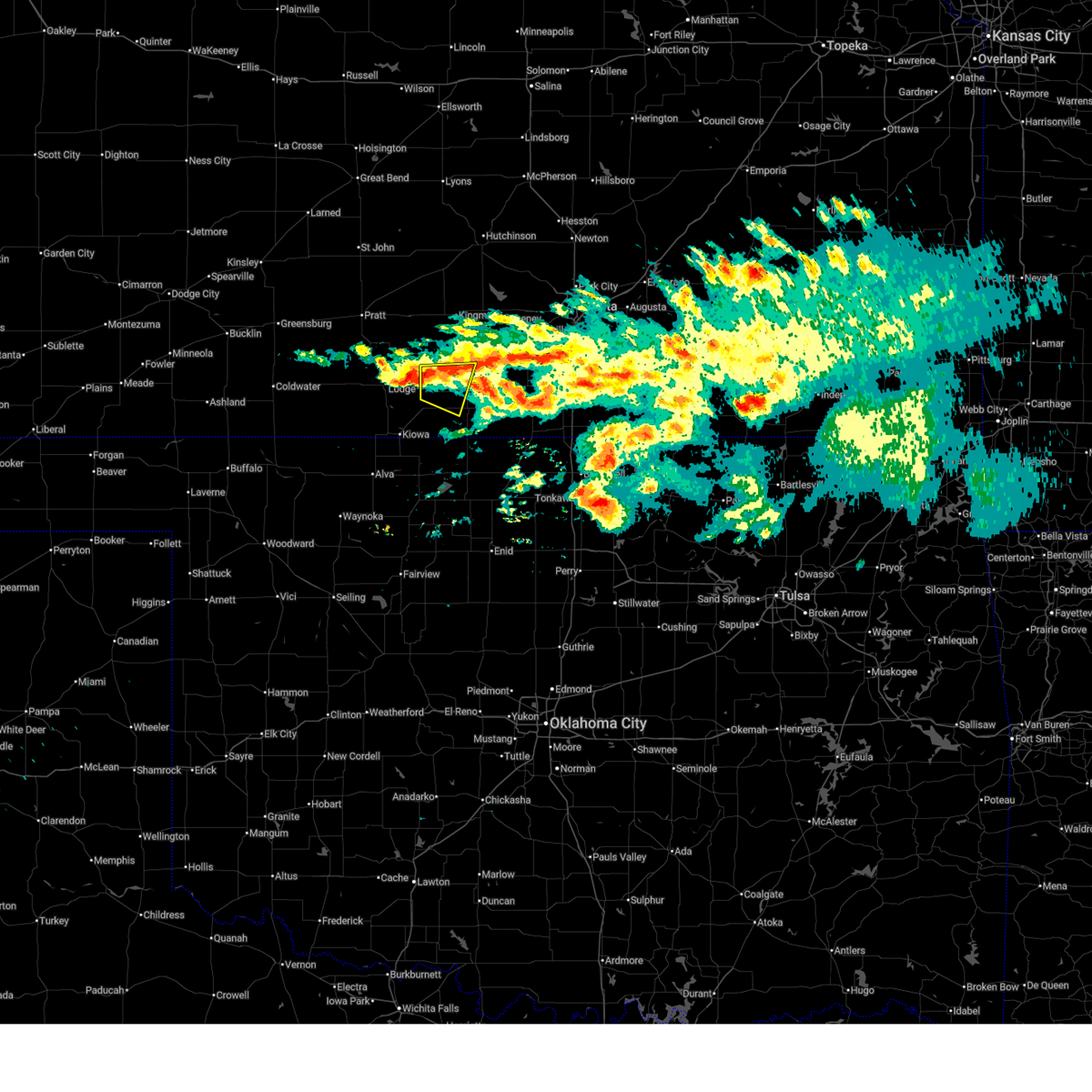
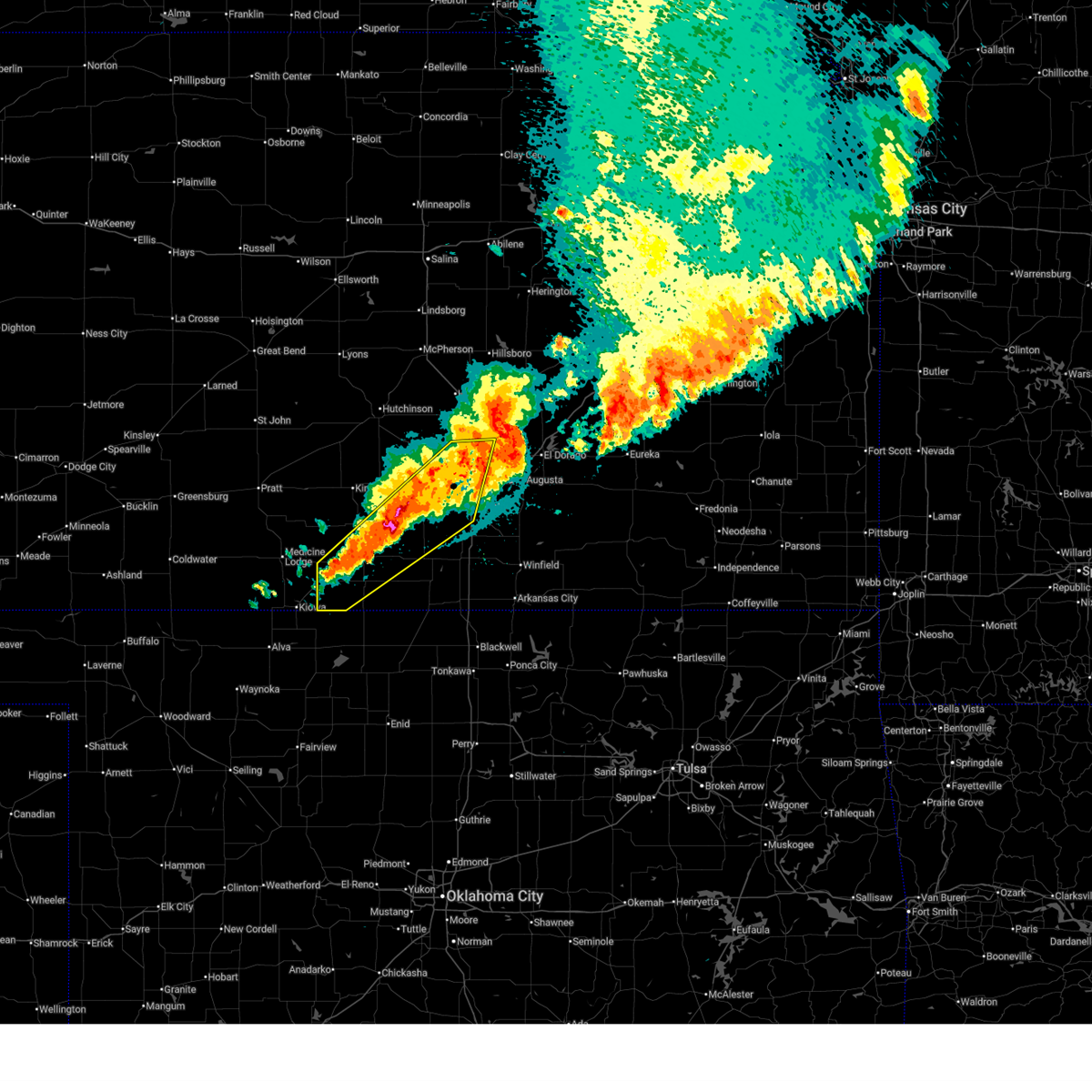
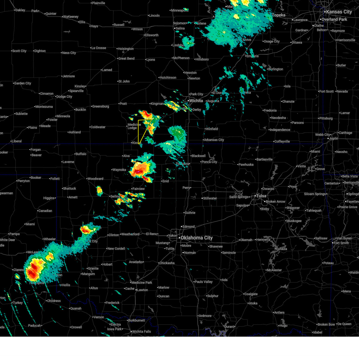
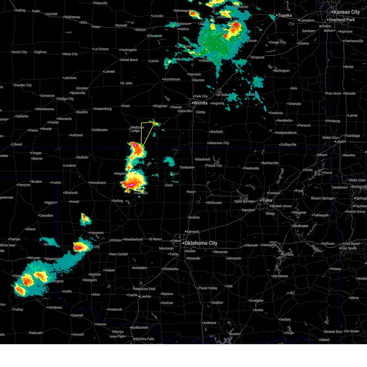
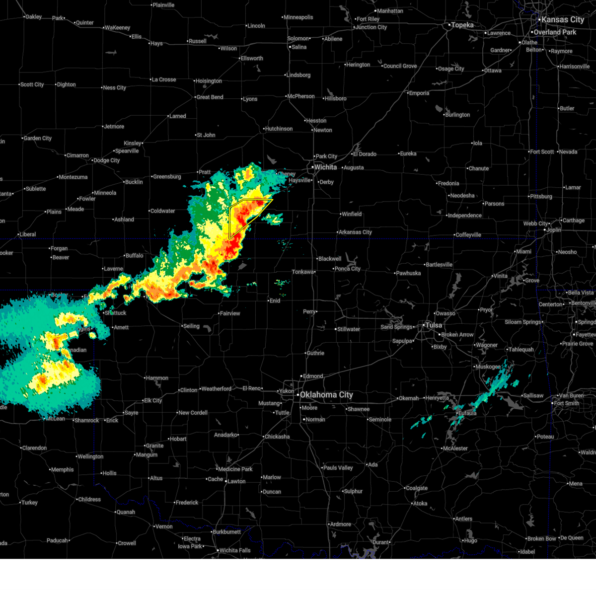
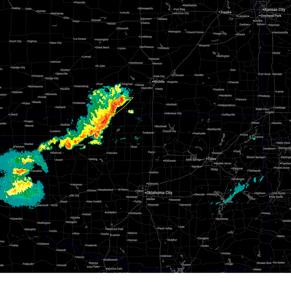
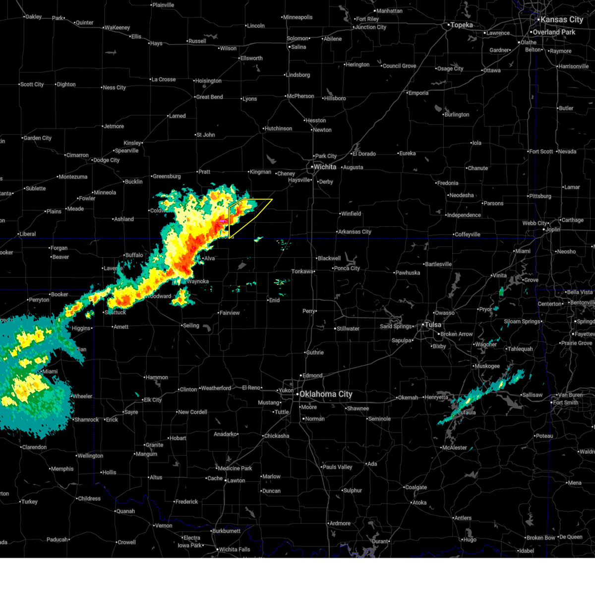
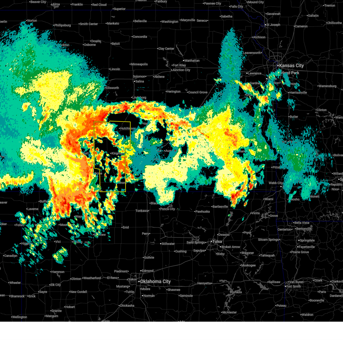
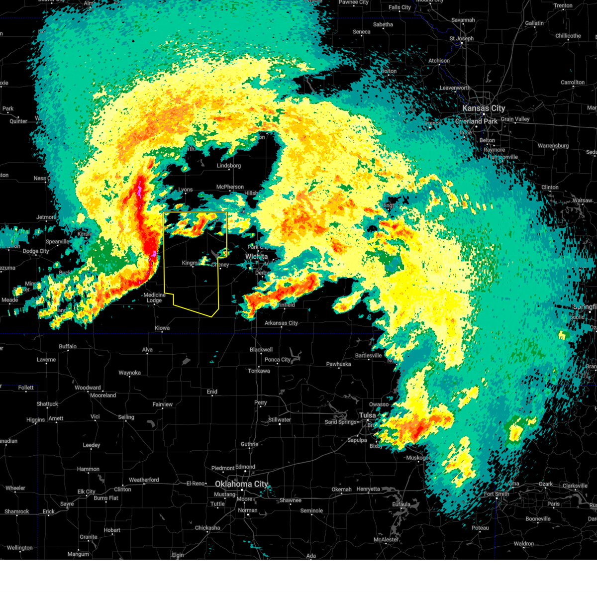
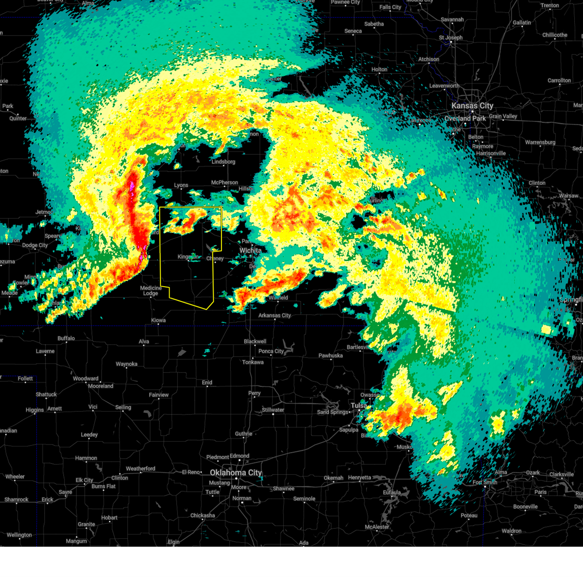
The Top Recent Hail Date for Attica, KS is Monday, September 8, 2025 (8th out of 88)
Hail and Wind Damage Spotted near Attica, KS
| Date / Time | Report Details |
|---|---|
| 6/21/2026 11:22 PM CDT |
 At 1121 pm cdt, a severe thunderstorm was located 7 miles south of argonia, or 11 miles northwest of caldwell, moving east at 45 mph (trained weather spotters reported quarter sized hail and 60 mph winds in harper at 11:15 pm). Hazards include 70 mph wind gusts and quarter size hail. Hail damage to vehicles is expected. expect considerable tree damage. wind damage is also likely to mobile homes, roofs, and outbuildings. Locations impacted include, anthony, harper, attica, bluff city, danville, waldron, freeport, corwin, runnymede, and crystal springs. At 1121 pm cdt, a severe thunderstorm was located 7 miles south of argonia, or 11 miles northwest of caldwell, moving east at 45 mph (trained weather spotters reported quarter sized hail and 60 mph winds in harper at 11:15 pm). Hazards include 70 mph wind gusts and quarter size hail. Hail damage to vehicles is expected. expect considerable tree damage. wind damage is also likely to mobile homes, roofs, and outbuildings. Locations impacted include, anthony, harper, attica, bluff city, danville, waldron, freeport, corwin, runnymede, and crystal springs.
|
| 6/21/2026 11:06 PM CDT |
 At 1105 pm cdt, a severe thunderstorm was located near harper, moving southeast at 25 mph (radar indicated). Hazards include 70 mph wind gusts and ping pong ball size hail. People and animals outdoors will be injured. expect hail damage to roofs, siding, windows, and vehicles. expect considerable tree damage. wind damage is also likely to mobile homes, roofs, and outbuildings. Locations impacted include, anthony, harper, attica, bluff city, danville, waldron, freeport, corwin, runnymede, and crystal springs. At 1105 pm cdt, a severe thunderstorm was located near harper, moving southeast at 25 mph (radar indicated). Hazards include 70 mph wind gusts and ping pong ball size hail. People and animals outdoors will be injured. expect hail damage to roofs, siding, windows, and vehicles. expect considerable tree damage. wind damage is also likely to mobile homes, roofs, and outbuildings. Locations impacted include, anthony, harper, attica, bluff city, danville, waldron, freeport, corwin, runnymede, and crystal springs.
|
| 6/21/2026 10:44 PM CDT |
 At 1044 pm cdt, severe thunderstorms were located along a line extending from norwich to near harper to near sharon, moving southeast at 25 mph (radar indicated). Hazards include 70 mph wind gusts and quarter size hail. Hail damage to vehicles is expected. expect considerable tree damage. wind damage is also likely to mobile homes, roofs, and outbuildings. Locations impacted include, anthony, harper, attica, bluff city, danville, waldron, freeport, corwin, runnymede, and crystal springs. At 1044 pm cdt, severe thunderstorms were located along a line extending from norwich to near harper to near sharon, moving southeast at 25 mph (radar indicated). Hazards include 70 mph wind gusts and quarter size hail. Hail damage to vehicles is expected. expect considerable tree damage. wind damage is also likely to mobile homes, roofs, and outbuildings. Locations impacted include, anthony, harper, attica, bluff city, danville, waldron, freeport, corwin, runnymede, and crystal springs.
|
| 6/21/2026 10:36 PM CDT |
 Svrict the national weather service in wichita has issued a * severe thunderstorm warning for, harper county in south central kansas, * until 1145 pm cdt. * at 1036 pm cdt, severe thunderstorms were located along a line extending from near norwich to 5 miles northwest of harper to 5 miles north of sharon, moving southeast at 25 mph (radar indicated). Hazards include 60 mph wind gusts and quarter size hail. Hail damage to vehicles is expected. Expect wind damage to roofs, siding, and trees. Svrict the national weather service in wichita has issued a * severe thunderstorm warning for, harper county in south central kansas, * until 1145 pm cdt. * at 1036 pm cdt, severe thunderstorms were located along a line extending from near norwich to 5 miles northwest of harper to 5 miles north of sharon, moving southeast at 25 mph (radar indicated). Hazards include 60 mph wind gusts and quarter size hail. Hail damage to vehicles is expected. Expect wind damage to roofs, siding, and trees.
|
| 6/21/2026 1:42 AM CDT |
 Svrict the national weather service in wichita has issued a * severe thunderstorm warning for, harper county in south central kansas, southern kingman county in south central kansas, southwestern sumner county in south central kansas, * until 245 am cdt. * at 142 am cdt, a severe thunderstorm was located near attica, moving east at 40 mph (radar indicated). Hazards include 60 mph wind gusts and penny size hail. expect damage to roofs, siding, and trees Svrict the national weather service in wichita has issued a * severe thunderstorm warning for, harper county in south central kansas, southern kingman county in south central kansas, southwestern sumner county in south central kansas, * until 245 am cdt. * at 142 am cdt, a severe thunderstorm was located near attica, moving east at 40 mph (radar indicated). Hazards include 60 mph wind gusts and penny size hail. expect damage to roofs, siding, and trees
|
| 6/21/2026 1:26 AM CDT |
 At 125 am cdt, severe thunderstorms were located along a line extending from 6 miles southwest of moundridge to 5 miles north of benton to near andover to 5 miles west of belle plaine to 8 miles east of anthony, moving southeast at 55 mph (trained weather spotters. several reports of 60 to 70 mph wind gusts were reported around wichita). Hazards include 70 mph wind gusts. Expect considerable tree damage. damage is likely to mobile homes, roofs, and outbuildings. locations impacted include, wichita, derby, newton, andover, haysville, wellington, park city, valley center, bel aire, mulvane, goddard, rose hill, hesston, maize, kingman, clearwater, anthony, cheney, halstead, and north newton. this includes the following highways, interstate 135 between mile markers 0 and 42. Interstate 35 between mile markers 18 and 54. At 125 am cdt, severe thunderstorms were located along a line extending from 6 miles southwest of moundridge to 5 miles north of benton to near andover to 5 miles west of belle plaine to 8 miles east of anthony, moving southeast at 55 mph (trained weather spotters. several reports of 60 to 70 mph wind gusts were reported around wichita). Hazards include 70 mph wind gusts. Expect considerable tree damage. damage is likely to mobile homes, roofs, and outbuildings. locations impacted include, wichita, derby, newton, andover, haysville, wellington, park city, valley center, bel aire, mulvane, goddard, rose hill, hesston, maize, kingman, clearwater, anthony, cheney, halstead, and north newton. this includes the following highways, interstate 135 between mile markers 0 and 42. Interstate 35 between mile markers 18 and 54.
|
| 6/21/2026 12:55 AM CDT |
 At 1254 am cdt, severe thunderstorms were located along a line extending from near buhler to near mount hope to 5 miles northwest of viola to near harper, moving east at 45 mph (trained weather spotters reported 60 mph winds near cheney reservoir and 65 mph 2 miles northwest of andale). Hazards include 70 mph wind gusts. Expect considerable tree damage. damage is likely to mobile homes, roofs, and outbuildings. locations impacted include, wichita, hutchinson, derby, newton, andover, haysville, wellington, park city, valley center, bel aire, mulvane, goddard, rose hill, hesston, maize, kingman, clearwater, south hutchinson, anthony, and cheney. this includes the following highways, interstate 135 between mile markers 0 and 42. Interstate 35 between mile markers 18 and 54. At 1254 am cdt, severe thunderstorms were located along a line extending from near buhler to near mount hope to 5 miles northwest of viola to near harper, moving east at 45 mph (trained weather spotters reported 60 mph winds near cheney reservoir and 65 mph 2 miles northwest of andale). Hazards include 70 mph wind gusts. Expect considerable tree damage. damage is likely to mobile homes, roofs, and outbuildings. locations impacted include, wichita, hutchinson, derby, newton, andover, haysville, wellington, park city, valley center, bel aire, mulvane, goddard, rose hill, hesston, maize, kingman, clearwater, south hutchinson, anthony, and cheney. this includes the following highways, interstate 135 between mile markers 0 and 42. Interstate 35 between mile markers 18 and 54.
|
| 6/21/2026 12:32 AM CDT |
 Svrict the national weather service in wichita has issued a * severe thunderstorm warning for, reno county in south central kansas, sedgwick county in south central kansas, harvey county in south central kansas, harper county in south central kansas, kingman county in south central kansas, sumner county in south central kansas, * until 145 am cdt. * at 1232 am cdt, severe thunderstorms were located along a line extending from near nickerson to 6 miles west of haven to 9 miles east of kingman to 7 miles southeast of nashville, moving east at 45 mph (trained weather spotters reported 60 mph winds in kingman at 12:26 am). Hazards include 70 mph wind gusts. Expect considerable tree damage. Damage is likely to mobile homes, roofs, and outbuildings. Svrict the national weather service in wichita has issued a * severe thunderstorm warning for, reno county in south central kansas, sedgwick county in south central kansas, harvey county in south central kansas, harper county in south central kansas, kingman county in south central kansas, sumner county in south central kansas, * until 145 am cdt. * at 1232 am cdt, severe thunderstorms were located along a line extending from near nickerson to 6 miles west of haven to 9 miles east of kingman to 7 miles southeast of nashville, moving east at 45 mph (trained weather spotters reported 60 mph winds in kingman at 12:26 am). Hazards include 70 mph wind gusts. Expect considerable tree damage. Damage is likely to mobile homes, roofs, and outbuildings.
|
| 6/18/2026 2:57 PM CDT |
 The storm which prompted the warning has moved out of the area. therefore, the warning will be allowed to expire. however, hail is still possible with this thunderstorm. remember, a severe thunderstorm warning still remains in effect for southeast harper county till 345 pm. The storm which prompted the warning has moved out of the area. therefore, the warning will be allowed to expire. however, hail is still possible with this thunderstorm. remember, a severe thunderstorm warning still remains in effect for southeast harper county till 345 pm.
|
| 6/18/2026 2:39 PM CDT |
 At 239 pm cdt, a severe thunderstorm was located over attica, moving southeast at 30 mph (radar indicated). Hazards include half dollar size hail. Damage to vehicles is expected. Locations impacted include, harper, attica, and crystal springs. At 239 pm cdt, a severe thunderstorm was located over attica, moving southeast at 30 mph (radar indicated). Hazards include half dollar size hail. Damage to vehicles is expected. Locations impacted include, harper, attica, and crystal springs.
|
| 6/18/2026 2:20 PM CDT |
 At 220 pm cdt, a severe thunderstorm was located near attica, moving east at 35 mph (radar indicated). Hazards include ping pong ball size hail. People and animals outdoors will be injured. expect damage to roofs, siding, windows, and vehicles. Locations impacted include, harper, attica, and crystal springs. At 220 pm cdt, a severe thunderstorm was located near attica, moving east at 35 mph (radar indicated). Hazards include ping pong ball size hail. People and animals outdoors will be injured. expect damage to roofs, siding, windows, and vehicles. Locations impacted include, harper, attica, and crystal springs.
|
| 6/18/2026 2:08 PM CDT |
 Svrict the national weather service in wichita has issued a * severe thunderstorm warning for, northwestern harper county in south central kansas, * until 300 pm cdt. * at 208 pm cdt, a severe thunderstorm was located near sharon, moving east to southeast at 30 mph (radar indicated). Hazards include quarter size hail. damage to vehicles is expected Svrict the national weather service in wichita has issued a * severe thunderstorm warning for, northwestern harper county in south central kansas, * until 300 pm cdt. * at 208 pm cdt, a severe thunderstorm was located near sharon, moving east to southeast at 30 mph (radar indicated). Hazards include quarter size hail. damage to vehicles is expected
|
| 6/13/2026 9:54 PM CDT |
 The storms which prompted the warning have moved out of the area. therefore, the warning will be allowed to expire. however, small hail, gusty winds and heavy rain are still possible with these thunderstorms. a severe thunderstorm watch remains in effect until midnight cdt for south central kansas. The storms which prompted the warning have moved out of the area. therefore, the warning will be allowed to expire. however, small hail, gusty winds and heavy rain are still possible with these thunderstorms. a severe thunderstorm watch remains in effect until midnight cdt for south central kansas.
|
| 6/13/2026 9:20 PM CDT |
 the severe thunderstorm warning has been cancelled and is no longer in effect the severe thunderstorm warning has been cancelled and is no longer in effect
|
| 6/13/2026 9:20 PM CDT |
 At 919 pm cdt, severe thunderstorms were located along a line extending from 5 miles east of douglass to near geuda springs to near braman to manchester, moving southeast at 55 mph (radar indicated. this storm has a history of producing 60 to 75 mph winds). Hazards include 70 mph wind gusts and nickel size hail. Expect considerable tree damage. damage is likely to mobile homes, roofs, and outbuildings. locations impacted include, arkansas city, winfield, andover, wellington, rose hill, anthony, douglass, belle plaine, harper, caldwell, oxford, udall, attica, burden, argonia, south haven, dexter, atlanta, geuda springs, and latham. This includes interstate 35 between mile markers 1 and 29. At 919 pm cdt, severe thunderstorms were located along a line extending from 5 miles east of douglass to near geuda springs to near braman to manchester, moving southeast at 55 mph (radar indicated. this storm has a history of producing 60 to 75 mph winds). Hazards include 70 mph wind gusts and nickel size hail. Expect considerable tree damage. damage is likely to mobile homes, roofs, and outbuildings. locations impacted include, arkansas city, winfield, andover, wellington, rose hill, anthony, douglass, belle plaine, harper, caldwell, oxford, udall, attica, burden, argonia, south haven, dexter, atlanta, geuda springs, and latham. This includes interstate 35 between mile markers 1 and 29.
|
| 6/13/2026 9:06 PM CDT |
 Svrict the national weather service in wichita has issued a * severe thunderstorm warning for, cowley county in south central kansas, southeastern sedgwick county in south central kansas, southern butler county in south central kansas, harper county in south central kansas, sumner county in south central kansas, * until 1000 pm cdt. * at 905 pm cdt, severe thunderstorms were located along a line extending from rose hill to 6 miles southeast of wellington to 6 miles northeast of hazelton, moving southeast at 40 mph (radar indicated). Hazards include 70 mph wind gusts and penny size hail. Expect considerable tree damage. Damage is likely to mobile homes, roofs, and outbuildings. Svrict the national weather service in wichita has issued a * severe thunderstorm warning for, cowley county in south central kansas, southeastern sedgwick county in south central kansas, southern butler county in south central kansas, harper county in south central kansas, sumner county in south central kansas, * until 1000 pm cdt. * at 905 pm cdt, severe thunderstorms were located along a line extending from rose hill to 6 miles southeast of wellington to 6 miles northeast of hazelton, moving southeast at 40 mph (radar indicated). Hazards include 70 mph wind gusts and penny size hail. Expect considerable tree damage. Damage is likely to mobile homes, roofs, and outbuildings.
|
| 6/13/2026 8:48 PM CDT |
 At 848 pm cdt, severe thunderstorms were located along a line extending from clearwater to 7 miles east of conway springs to 7 miles west of argonia to near attica, moving southeast at 40 mph (radar indicated). Hazards include 70 mph wind gusts and quarter size hail. Hail damage to vehicles is expected. expect considerable tree damage. wind damage is also likely to mobile homes, roofs, and outbuildings. locations impacted include, wellington, anthony, belle plaine, harper, conway springs, oxford, attica, argonia, mayfield, milan, danville, freeport, corwin, riverdale, runnymede, crystal springs, and wellington airport. This includes interstate 35 between mile markers 15 and 32. At 848 pm cdt, severe thunderstorms were located along a line extending from clearwater to 7 miles east of conway springs to 7 miles west of argonia to near attica, moving southeast at 40 mph (radar indicated). Hazards include 70 mph wind gusts and quarter size hail. Hail damage to vehicles is expected. expect considerable tree damage. wind damage is also likely to mobile homes, roofs, and outbuildings. locations impacted include, wellington, anthony, belle plaine, harper, conway springs, oxford, attica, argonia, mayfield, milan, danville, freeport, corwin, riverdale, runnymede, crystal springs, and wellington airport. This includes interstate 35 between mile markers 15 and 32.
|
| 6/13/2026 8:26 PM CDT |
 Svrict the national weather service in wichita has issued a * severe thunderstorm warning for, harper county in south central kansas, sumner county in south central kansas, * until 915 pm cdt. * at 826 pm cdt, severe thunderstorms were located along a line extending from 5 miles southeast of cheney to near norwich to 6 miles northeast of harper, moving southeast at 45 mph (radar indicated). Hazards include 70 mph wind gusts and penny size hail. Expect considerable tree damage. Damage is likely to mobile homes, roofs, and outbuildings. Svrict the national weather service in wichita has issued a * severe thunderstorm warning for, harper county in south central kansas, sumner county in south central kansas, * until 915 pm cdt. * at 826 pm cdt, severe thunderstorms were located along a line extending from 5 miles southeast of cheney to near norwich to 6 miles northeast of harper, moving southeast at 45 mph (radar indicated). Hazards include 70 mph wind gusts and penny size hail. Expect considerable tree damage. Damage is likely to mobile homes, roofs, and outbuildings.
|
| 6/2/2026 12:56 AM CDT |
 At 1255 am cdt, severe thunderstorms were located along a line extending from near turon to near kingman to 7 miles northeast of harper to manchester, moving east at 35 mph (radar indicated). Hazards include 70 mph wind gusts. Expect considerable tree damage. damage is likely to mobile homes, roofs, and outbuildings. Locations impacted include, goddard, kingman, anthony, cheney, harper, conway springs, haven, caldwell, garden plain, mount hope, pretty prairie, attica, andale, argonia, norwich, arlington, turon, sylvia, viola, and murdock. At 1255 am cdt, severe thunderstorms were located along a line extending from near turon to near kingman to 7 miles northeast of harper to manchester, moving east at 35 mph (radar indicated). Hazards include 70 mph wind gusts. Expect considerable tree damage. damage is likely to mobile homes, roofs, and outbuildings. Locations impacted include, goddard, kingman, anthony, cheney, harper, conway springs, haven, caldwell, garden plain, mount hope, pretty prairie, attica, andale, argonia, norwich, arlington, turon, sylvia, viola, and murdock.
|
| 6/2/2026 12:38 AM CDT |
 Svrict the national weather service in wichita has issued a * severe thunderstorm warning for, southern reno county in south central kansas, western sedgwick county in south central kansas, harper county in south central kansas, kingman county in south central kansas, western sumner county in south central kansas, * until 145 am cdt. * at 1237 am cdt, severe thunderstorms were located along a line extending from 5 miles south of stafford to 9 miles northwest of kingman to near manchester, moving east at 35 mph (radar indicated). Hazards include 70 mph wind gusts. Expect considerable tree damage. Damage is likely to mobile homes, roofs, and outbuildings. Svrict the national weather service in wichita has issued a * severe thunderstorm warning for, southern reno county in south central kansas, western sedgwick county in south central kansas, harper county in south central kansas, kingman county in south central kansas, western sumner county in south central kansas, * until 145 am cdt. * at 1237 am cdt, severe thunderstorms were located along a line extending from 5 miles south of stafford to 9 miles northwest of kingman to near manchester, moving east at 35 mph (radar indicated). Hazards include 70 mph wind gusts. Expect considerable tree damage. Damage is likely to mobile homes, roofs, and outbuildings.
|
| 6/2/2026 12:29 AM CDT |
 At 1229 am cdt, severe thunderstorms were located along a line extending from near stafford to near turon to 8 miles northeast of amorita, moving east at 35 mph (radar indicated). Hazards include 70 mph wind gusts. Expect considerable tree damage. damage is likely to mobile homes, roofs, and outbuildings. Locations impacted include, kingman, anthony, harper, pretty prairie, attica, arlington, cunningham, turon, partridge, sylvia, plevna, abbyville, nashville, willowdale, zenda, spivey, langdon, cleveland, penalosa, and waldron. At 1229 am cdt, severe thunderstorms were located along a line extending from near stafford to near turon to 8 miles northeast of amorita, moving east at 35 mph (radar indicated). Hazards include 70 mph wind gusts. Expect considerable tree damage. damage is likely to mobile homes, roofs, and outbuildings. Locations impacted include, kingman, anthony, harper, pretty prairie, attica, arlington, cunningham, turon, partridge, sylvia, plevna, abbyville, nashville, willowdale, zenda, spivey, langdon, cleveland, penalosa, and waldron.
|
| 6/2/2026 12:09 AM CDT |
 At 1208 am cdt, severe thunderstorms were located along a line extending from near dillwyn to near neola to kiowa, moving east at 30 mph (weather stations). Hazards include 60 mph wind gusts. Expect damage to roofs, siding, and trees. Locations impacted include, kingman, anthony, harper, nickerson, pretty prairie, attica, arlington, cunningham, turon, partridge, sylvia, plevna, abbyville, nashville, willowdale, zenda, spivey, cleveland, langdon, and penalosa. At 1208 am cdt, severe thunderstorms were located along a line extending from near dillwyn to near neola to kiowa, moving east at 30 mph (weather stations). Hazards include 60 mph wind gusts. Expect damage to roofs, siding, and trees. Locations impacted include, kingman, anthony, harper, nickerson, pretty prairie, attica, arlington, cunningham, turon, partridge, sylvia, plevna, abbyville, nashville, willowdale, zenda, spivey, cleveland, langdon, and penalosa.
|
| 6/1/2026 11:52 PM CDT |
 Svrict the national weather service in wichita has issued a * severe thunderstorm warning for, western reno county in south central kansas, harper county in south central kansas, kingman county in south central kansas, * until 1245 am cdt. * at 1152 pm cdt, severe thunderstorms were located along a line extending from 7 miles southwest of stafford to near hardtner, moving east at 30 mph (measured from weather stations). Hazards include 60 mph wind gusts. expect damage to roofs, siding, and trees Svrict the national weather service in wichita has issued a * severe thunderstorm warning for, western reno county in south central kansas, harper county in south central kansas, kingman county in south central kansas, * until 1245 am cdt. * at 1152 pm cdt, severe thunderstorms were located along a line extending from 7 miles southwest of stafford to near hardtner, moving east at 30 mph (measured from weather stations). Hazards include 60 mph wind gusts. expect damage to roofs, siding, and trees
|
| 5/30/2026 4:39 PM CDT |
 Svrict the national weather service in wichita has issued a * severe thunderstorm warning for, southern reno county in south central kansas, western sedgwick county in south central kansas, harper county in south central kansas, kingman county in south central kansas, western sumner county in south central kansas, * until 530 pm cdt. * at 439 pm cdt, a cluster of severe thunderstorms was located 7 miles southwest of kingman, moving north at 30 mph. this warning replaces the previous severe thunderstorm warning (radar indicated). Hazards include 60 mph wind gusts and quarter size hail. Hail damage to vehicles is expected. Expect wind damage to roofs, siding, and trees. Svrict the national weather service in wichita has issued a * severe thunderstorm warning for, southern reno county in south central kansas, western sedgwick county in south central kansas, harper county in south central kansas, kingman county in south central kansas, western sumner county in south central kansas, * until 530 pm cdt. * at 439 pm cdt, a cluster of severe thunderstorms was located 7 miles southwest of kingman, moving north at 30 mph. this warning replaces the previous severe thunderstorm warning (radar indicated). Hazards include 60 mph wind gusts and quarter size hail. Hail damage to vehicles is expected. Expect wind damage to roofs, siding, and trees.
|
| 5/30/2026 4:32 PM CDT |
 At 432 pm cdt, a severe thunderstorm was located 11 miles southwest of kingman, moving northeast at 35 mph (radar indicated). Hazards include 60 mph wind gusts and quarter size hail. Hail damage to vehicles is expected. expect wind damage to roofs, siding, and trees. Locations impacted include, attica, cunningham, nashville, willowdale, zenda, spivey, cleveland, rago, and crystal springs. At 432 pm cdt, a severe thunderstorm was located 11 miles southwest of kingman, moving northeast at 35 mph (radar indicated). Hazards include 60 mph wind gusts and quarter size hail. Hail damage to vehicles is expected. expect wind damage to roofs, siding, and trees. Locations impacted include, attica, cunningham, nashville, willowdale, zenda, spivey, cleveland, rago, and crystal springs.
|
| 5/30/2026 4:15 PM CDT |
 At 415 pm cdt, a severe thunderstorm was located 7 miles southeast of nashville, or 10 miles north of attica, moving north at 35 mph (radar indicated). Hazards include 60 mph wind gusts and quarter size hail. Hail damage to vehicles is expected. expect wind damage to roofs, siding, and trees. Locations impacted include, attica, cunningham, nashville, willowdale, zenda, spivey, cleveland, corwin, rago, and crystal springs. At 415 pm cdt, a severe thunderstorm was located 7 miles southeast of nashville, or 10 miles north of attica, moving north at 35 mph (radar indicated). Hazards include 60 mph wind gusts and quarter size hail. Hail damage to vehicles is expected. expect wind damage to roofs, siding, and trees. Locations impacted include, attica, cunningham, nashville, willowdale, zenda, spivey, cleveland, corwin, rago, and crystal springs.
|
| 5/30/2026 4:00 PM CDT |
 Svrict the national weather service in wichita has issued a * severe thunderstorm warning for, western harper county in south central kansas, kingman county in south central kansas, * until 445 pm cdt. * at 359 pm cdt, a severe thunderstorm was located near sharon, moving northeast at 40 mph (radar indicated). Hazards include 60 mph wind gusts and quarter size hail. Hail damage to vehicles is expected. Expect wind damage to roofs, siding, and trees. Svrict the national weather service in wichita has issued a * severe thunderstorm warning for, western harper county in south central kansas, kingman county in south central kansas, * until 445 pm cdt. * at 359 pm cdt, a severe thunderstorm was located near sharon, moving northeast at 40 mph (radar indicated). Hazards include 60 mph wind gusts and quarter size hail. Hail damage to vehicles is expected. Expect wind damage to roofs, siding, and trees.
|
| 5/29/2026 7:04 PM CDT |
 At 704 pm cdt, a severe thunderstorm was located near harper, moving northeast at 40 mph (radar indicated). Hazards include 60 mph wind gusts and quarter size hail. Hail damage to vehicles is expected. expect wind damage to roofs, siding, and trees. Locations impacted include, anthony, harper, attica, norwich, nashville, zenda, spivey, cleveland, danville, freeport, corwin, rago, runnymede, and crystal springs. At 704 pm cdt, a severe thunderstorm was located near harper, moving northeast at 40 mph (radar indicated). Hazards include 60 mph wind gusts and quarter size hail. Hail damage to vehicles is expected. expect wind damage to roofs, siding, and trees. Locations impacted include, anthony, harper, attica, norwich, nashville, zenda, spivey, cleveland, danville, freeport, corwin, rago, runnymede, and crystal springs.
|
| 5/29/2026 6:39 PM CDT |
 Svrict the national weather service in wichita has issued a * severe thunderstorm warning for, harper county in south central kansas, southern kingman county in south central kansas, western sumner county in south central kansas, * until 730 pm cdt. * at 638 pm cdt, severe thunderstorms were located along a line extending from near sharon to near anthony to near manchester, moving northeast at 40 mph. this warning replaces the previous severe thunderstorm warning for southwest harper county (radar indicated). Hazards include 60 mph wind gusts and quarter size hail. Hail damage to vehicles is expected. Expect wind damage to roofs, siding, and trees. Svrict the national weather service in wichita has issued a * severe thunderstorm warning for, harper county in south central kansas, southern kingman county in south central kansas, western sumner county in south central kansas, * until 730 pm cdt. * at 638 pm cdt, severe thunderstorms were located along a line extending from near sharon to near anthony to near manchester, moving northeast at 40 mph. this warning replaces the previous severe thunderstorm warning for southwest harper county (radar indicated). Hazards include 60 mph wind gusts and quarter size hail. Hail damage to vehicles is expected. Expect wind damage to roofs, siding, and trees.
|
| 5/18/2026 9:41 PM CDT |
 Svrict the national weather service in wichita has issued a * severe thunderstorm warning for, sedgwick county in south central kansas, harper county in south central kansas, southeastern kingman county in south central kansas, northwestern sumner county in south central kansas, * until 1045 pm cdt. * at 941 pm cdt, severe thunderstorms were located along a line extending from near downtown wichita to near attica, moving east at 40 mph (trained weather spotters. at 938 pm, quarter size hail was reported in attica). Hazards include 60 mph wind gusts and half dollar size hail. Hail damage to vehicles is expected. Expect wind damage to roofs, siding, and trees. Svrict the national weather service in wichita has issued a * severe thunderstorm warning for, sedgwick county in south central kansas, harper county in south central kansas, southeastern kingman county in south central kansas, northwestern sumner county in south central kansas, * until 1045 pm cdt. * at 941 pm cdt, severe thunderstorms were located along a line extending from near downtown wichita to near attica, moving east at 40 mph (trained weather spotters. at 938 pm, quarter size hail was reported in attica). Hazards include 60 mph wind gusts and half dollar size hail. Hail damage to vehicles is expected. Expect wind damage to roofs, siding, and trees.
|
| 4/17/2026 2:12 PM CDT |
 Svrict the national weather service in wichita has issued a * severe thunderstorm warning for, central harper county in south central kansas, * until 300 pm cdt. * at 211 pm cdt, a severe thunderstorm was located near anthony, moving northeast at 35 mph (radar indicated). Hazards include 60 mph wind gusts and half dollar size hail. Hail damage to vehicles is expected. Expect wind damage to roofs, siding, and trees. Svrict the national weather service in wichita has issued a * severe thunderstorm warning for, central harper county in south central kansas, * until 300 pm cdt. * at 211 pm cdt, a severe thunderstorm was located near anthony, moving northeast at 35 mph (radar indicated). Hazards include 60 mph wind gusts and half dollar size hail. Hail damage to vehicles is expected. Expect wind damage to roofs, siding, and trees.
|
| 3/10/2026 6:56 PM CDT |
 At 656 pm cdt, a severe thunderstorm was located 8 miles northwest of attica, moving northeast at 40 mph (trained weather spotters. at 645 pm cdt, ping pong ball size hail was reported in sharon). Hazards include ping pong ball size hail and 60 mph wind gusts. People and animals outdoors will be injured. expect hail damage to roofs, siding, windows, and vehicles. expect wind damage to roofs, siding, and trees. Locations impacted include, willowdale, zenda, spivey, rago, runnymede, and crystal springs. At 656 pm cdt, a severe thunderstorm was located 8 miles northwest of attica, moving northeast at 40 mph (trained weather spotters. at 645 pm cdt, ping pong ball size hail was reported in sharon). Hazards include ping pong ball size hail and 60 mph wind gusts. People and animals outdoors will be injured. expect hail damage to roofs, siding, windows, and vehicles. expect wind damage to roofs, siding, and trees. Locations impacted include, willowdale, zenda, spivey, rago, runnymede, and crystal springs.
|
| 3/10/2026 6:42 PM CDT |
 Svrict the national weather service in wichita has issued a * severe thunderstorm warning for, northern harper county in south central kansas, southern kingman county in south central kansas, * until 745 pm cdt. * at 641 pm cdt, a severe thunderstorm was located over sharon, moving northeast at 35 mph (radar indicated). Hazards include ping pong ball size hail and 60 mph wind gusts. People and animals outdoors will be injured. expect hail damage to roofs, siding, windows, and vehicles. Expect wind damage to roofs, siding, and trees. Svrict the national weather service in wichita has issued a * severe thunderstorm warning for, northern harper county in south central kansas, southern kingman county in south central kansas, * until 745 pm cdt. * at 641 pm cdt, a severe thunderstorm was located over sharon, moving northeast at 35 mph (radar indicated). Hazards include ping pong ball size hail and 60 mph wind gusts. People and animals outdoors will be injured. expect hail damage to roofs, siding, windows, and vehicles. Expect wind damage to roofs, siding, and trees.
|
| 3/5/2026 9:06 PM CST |
 The storm which prompted the warning has weakened below severe limits, and no longer poses an immediate threat to life or property. therefore, the warning will be allowed to expire. a severe thunderstorm watch remains in effect until 400 am cst for south central kansas. The storm which prompted the warning has weakened below severe limits, and no longer poses an immediate threat to life or property. therefore, the warning will be allowed to expire. a severe thunderstorm watch remains in effect until 400 am cst for south central kansas.
|
| 3/5/2026 8:36 PM CST |
 Svrict the national weather service in wichita has issued a * severe thunderstorm warning for, western harper county in south central kansas, * until 915 pm cst. * at 835 pm cst, a severe thunderstorm was located over hazelton, moving northeast at 55 mph (radar indicated). Hazards include half dollar size hail. damage to vehicles is expected Svrict the national weather service in wichita has issued a * severe thunderstorm warning for, western harper county in south central kansas, * until 915 pm cst. * at 835 pm cst, a severe thunderstorm was located over hazelton, moving northeast at 55 mph (radar indicated). Hazards include half dollar size hail. damage to vehicles is expected
|
| 3/4/2026 2:31 AM CST |
 the severe thunderstorm warning has been cancelled and is no longer in effect the severe thunderstorm warning has been cancelled and is no longer in effect
|
| 3/4/2026 2:17 AM CST |
 At 217 am cst, a severe thunderstorm was located near harper, moving northeast at 20 mph (radar indicated). Hazards include quarter size hail. Damage to vehicles is expected. Locations impacted include, harper, attica, corwin, runnymede, and crystal springs. At 217 am cst, a severe thunderstorm was located near harper, moving northeast at 20 mph (radar indicated). Hazards include quarter size hail. Damage to vehicles is expected. Locations impacted include, harper, attica, corwin, runnymede, and crystal springs.
|
| 3/4/2026 2:04 AM CST |
 Svrict the national weather service in wichita has issued a * severe thunderstorm warning for, northwestern harper county in south central kansas, * until 245 am cst. * at 204 am cst, a severe thunderstorm was located near attica, moving northeast at 20 mph (radar indicated). Hazards include quarter size hail. damage to vehicles is expected Svrict the national weather service in wichita has issued a * severe thunderstorm warning for, northwestern harper county in south central kansas, * until 245 am cst. * at 204 am cst, a severe thunderstorm was located near attica, moving northeast at 20 mph (radar indicated). Hazards include quarter size hail. damage to vehicles is expected
|
| 9/23/2025 1:46 AM CDT | At 146 am cdt, severe thunderstorms were located along a line extending from 5 miles north of attica to near anthony to 7 miles southwest of wakita, moving northeast at 55 mph (radar indicated). Hazards include 70 mph wind gusts and penny size hail. Expect considerable tree damage. damage is likely to mobile homes, roofs, and outbuildings. Locations impacted include, kingman, anthony, harper, attica, norwich, cunningham, nashville, murdock, waterloo, willowdale, zenda, spivey, bluff city, cleveland, danville, penalosa, waldron, freeport, mt vernon, and rago. |
| 9/23/2025 1:34 AM CDT | At 133 am cdt, severe thunderstorms were located along a line extending from 6 miles south of cunningham to 5 miles west of anthony to jet, moving northeast at 40 mph (radar indicated). Hazards include 70 mph wind gusts and penny size hail. Expect considerable tree damage. damage is likely to mobile homes, roofs, and outbuildings. Locations impacted include, kingman, anthony, harper, attica, norwich, cunningham, nashville, murdock, waterloo, willowdale, zenda, spivey, bluff city, cleveland, danville, penalosa, waldron, freeport, mt vernon, and corwin. |
| 9/23/2025 1:09 AM CDT | Svrict the national weather service in wichita has issued a * severe thunderstorm warning for, harper county in south central kansas, kingman county in south central kansas, * until 200 am cdt. * at 106 am cdt, severe thunderstorms were located along a line extending from 6 miles southwest of sawyer to near kiowa to near carmen, moving northeast at 40 mph (medicine lodge airport reported a 61 mph wind gust at 1:07 am cdt). Hazards include 60 mph wind gusts and penny size hail. expect damage to roofs, siding, and trees |
| 9/8/2025 5:48 PM CDT | the severe thunderstorm warning has been cancelled and is no longer in effect |
| 9/8/2025 5:39 PM CDT | Svrict the national weather service in wichita has issued a * severe thunderstorm warning for, southwestern harper county in south central kansas, * until 700 pm cdt. * at 539 pm cdt, a severe thunderstorm was located near attica, moving southeast at 15 mph (radar indicated). Hazards include ping pong ball size hail and 60 mph wind gusts. People and animals outdoors will be injured. expect hail damage to roofs, siding, windows, and vehicles. Expect wind damage to roofs, siding, and trees. |
| 9/8/2025 5:23 PM CDT | At 522 pm cdt, a severe thunderstorm was located 6 miles north of sharon, moving southeast at 15 mph (radar indicated). Hazards include 60 mph wind gusts and quarter size hail. Hail damage to vehicles is expected. expect wind damage to roofs, siding, and trees. Locations impacted include, attica and crystal springs. |
| 9/8/2025 5:23 PM CDT | the severe thunderstorm warning has been cancelled and is no longer in effect |
| 9/8/2025 5:08 PM CDT | At 508 pm cdt, a severe thunderstorm was located near nashville, or 8 miles north of sharon, moving southeast at 15 mph (radar indicated). Hazards include ping pong ball size hail and 60 mph wind gusts. People and animals outdoors will be injured. expect hail damage to roofs, siding, windows, and vehicles. expect wind damage to roofs, siding, and trees. Locations impacted include, attica, nashville, and crystal springs. |
| 9/8/2025 4:54 PM CDT | Svrict the national weather service in wichita has issued a * severe thunderstorm warning for, northwestern harper county in south central kansas, southwestern kingman county in south central kansas, * until 600 pm cdt. * at 453 pm cdt, a severe thunderstorm was located over nashville, or 6 miles southeast of isabel, moving southeast at 15 mph (radar indicated). Hazards include 60 mph wind gusts and quarter size hail. Hail damage to vehicles is expected. Expect wind damage to roofs, siding, and trees. |
| 9/1/2025 6:17 PM CDT |
 At 617 pm cdt, a severe thunderstorm was located near attica, moving south at 20 mph (radar indicated). Hazards include golf ball size hail and 60 mph wind gusts. People and animals outdoors will be injured. expect hail damage to roofs, siding, windows, and vehicles. expect wind damage to roofs, siding, and trees. Locations impacted include, anthony, attica, waldron, and corwin. At 617 pm cdt, a severe thunderstorm was located near attica, moving south at 20 mph (radar indicated). Hazards include golf ball size hail and 60 mph wind gusts. People and animals outdoors will be injured. expect hail damage to roofs, siding, windows, and vehicles. expect wind damage to roofs, siding, and trees. Locations impacted include, anthony, attica, waldron, and corwin.
|
| 9/1/2025 6:12 PM CDT | Tennis Ball sized hail reported 0.2 miles NE of Attica, KS, hailstones range from quarter size to tennis ball size. |
| 9/1/2025 6:08 PM CDT | Estimating 60 mph winds with power line flashe in harper county KS, 0.2 miles NE of Attica, KS |
| 9/1/2025 6:08 PM CDT | Half Dollar sized hail reported 0.2 miles NE of Attica, KS |
| 9/1/2025 5:58 PM CDT |
 At 558 pm cdt, a severe thunderstorm was located near attica, moving south at 15 mph (radar indicated). Hazards include golf ball size hail and 60 mph wind gusts. People and animals outdoors will be injured. expect hail damage to roofs, siding, windows, and vehicles. expect wind damage to roofs, siding, and trees. Locations impacted include, anthony, harper, attica, bluff city, waldron, corwin, and crystal springs. At 558 pm cdt, a severe thunderstorm was located near attica, moving south at 15 mph (radar indicated). Hazards include golf ball size hail and 60 mph wind gusts. People and animals outdoors will be injured. expect hail damage to roofs, siding, windows, and vehicles. expect wind damage to roofs, siding, and trees. Locations impacted include, anthony, harper, attica, bluff city, waldron, corwin, and crystal springs.
|
| 9/1/2025 5:51 PM CDT |
 Svrict the national weather service in wichita has issued a * severe thunderstorm warning for, harper county in south central kansas, * until 645 pm cdt. * at 551 pm cdt, a severe thunderstorm was located near attica, moving south at 15 to 25 mph (radar indicated). Hazards include 60 mph wind gusts and half dollar size hail. Hail damage to vehicles is expected. Expect wind damage to roofs, siding, and trees. Svrict the national weather service in wichita has issued a * severe thunderstorm warning for, harper county in south central kansas, * until 645 pm cdt. * at 551 pm cdt, a severe thunderstorm was located near attica, moving south at 15 to 25 mph (radar indicated). Hazards include 60 mph wind gusts and half dollar size hail. Hail damage to vehicles is expected. Expect wind damage to roofs, siding, and trees.
|
| 8/11/2025 3:29 AM CDT |
 The storms which prompted the warning have moved out of the area. therefore, the warning will be allowed to expire. a severe thunderstorm watch remains in effect until 600 am cdt for south central kansas. The storms which prompted the warning have moved out of the area. therefore, the warning will be allowed to expire. a severe thunderstorm watch remains in effect until 600 am cdt for south central kansas.
|
| 8/11/2025 3:01 AM CDT |
 At 301 am cdt, severe thunderstorms were located along a line extending from 6 miles south of sterling to kingman to 7 miles northwest of manchester, moving east at 45 mph (radar indicated). Hazards include 60 mph wind gusts. Expect damage to roofs, siding, and trees. Locations impacted include, hutchinson, kingman, south hutchinson, anthony, harper, buhler, haven, nickerson, pretty prairie, attica, norwich, arlington, cunningham, turon, partridge, sylvia, plevna, abbyville, nashville, and yoder. At 301 am cdt, severe thunderstorms were located along a line extending from 6 miles south of sterling to kingman to 7 miles northwest of manchester, moving east at 45 mph (radar indicated). Hazards include 60 mph wind gusts. Expect damage to roofs, siding, and trees. Locations impacted include, hutchinson, kingman, south hutchinson, anthony, harper, buhler, haven, nickerson, pretty prairie, attica, norwich, arlington, cunningham, turon, partridge, sylvia, plevna, abbyville, nashville, and yoder.
|
| 8/11/2025 2:24 AM CDT |
 Svrict the national weather service in wichita has issued a * severe thunderstorm warning for, reno county in south central kansas, harper county in south central kansas, kingman county in south central kansas, * until 330 am cdt. * at 224 am cdt, severe thunderstorms were located along a line extending from iuka to near isabel to 7 miles northwest of kiowa, moving east at 45 mph (radar indicated). Hazards include 60 mph wind gusts and penny size hail. expect damage to roofs, siding, and trees Svrict the national weather service in wichita has issued a * severe thunderstorm warning for, reno county in south central kansas, harper county in south central kansas, kingman county in south central kansas, * until 330 am cdt. * at 224 am cdt, severe thunderstorms were located along a line extending from iuka to near isabel to 7 miles northwest of kiowa, moving east at 45 mph (radar indicated). Hazards include 60 mph wind gusts and penny size hail. expect damage to roofs, siding, and trees
|
| 6/17/2025 5:59 PM CDT |
 Svrict the national weather service in wichita has issued a * severe thunderstorm warning for, northern harper county in south central kansas, southern kingman county in south central kansas, * until 700 pm cdt. * at 559 pm cdt, a severe thunderstorm was located 8 miles north of attica, moving east at 25 mph (radar indicated). Hazards include 60 mph wind gusts and quarter size hail. Hail damage to vehicles is expected. Expect wind damage to roofs, siding, and trees. Svrict the national weather service in wichita has issued a * severe thunderstorm warning for, northern harper county in south central kansas, southern kingman county in south central kansas, * until 700 pm cdt. * at 559 pm cdt, a severe thunderstorm was located 8 miles north of attica, moving east at 25 mph (radar indicated). Hazards include 60 mph wind gusts and quarter size hail. Hail damage to vehicles is expected. Expect wind damage to roofs, siding, and trees.
|
| 6/17/2025 4:20 PM CDT |
 At 420 pm cdt, a severe thunderstorm was located near harper, moving northeast at 20 mph (radar indicated). Hazards include golf ball size hail and 60 mph wind gusts. People and animals outdoors will be injured. expect hail damage to roofs, siding, windows, and vehicles. expect wind damage to roofs, siding, and trees. Locations impacted include, harper, attica, norwich, danville, freeport, runnymede, and crystal springs. At 420 pm cdt, a severe thunderstorm was located near harper, moving northeast at 20 mph (radar indicated). Hazards include golf ball size hail and 60 mph wind gusts. People and animals outdoors will be injured. expect hail damage to roofs, siding, windows, and vehicles. expect wind damage to roofs, siding, and trees. Locations impacted include, harper, attica, norwich, danville, freeport, runnymede, and crystal springs.
|
| 6/17/2025 4:04 PM CDT |
 Svrict the national weather service in wichita has issued a * severe thunderstorm warning for, northern harper county in south central kansas, southeastern kingman county in south central kansas, * until 500 pm cdt. * at 404 pm cdt, a severe thunderstorm was located near attica, moving east at 35 mph (radar indicated). Hazards include ping pong ball size hail and 60 mph wind gusts. People and animals outdoors will be injured. expect hail damage to roofs, siding, windows, and vehicles. Expect wind damage to roofs, siding, and trees. Svrict the national weather service in wichita has issued a * severe thunderstorm warning for, northern harper county in south central kansas, southeastern kingman county in south central kansas, * until 500 pm cdt. * at 404 pm cdt, a severe thunderstorm was located near attica, moving east at 35 mph (radar indicated). Hazards include ping pong ball size hail and 60 mph wind gusts. People and animals outdoors will be injured. expect hail damage to roofs, siding, windows, and vehicles. Expect wind damage to roofs, siding, and trees.
|
| 6/17/2025 5:04 AM CDT |
 Svrict the national weather service in wichita has issued a * severe thunderstorm warning for, harper county in south central kansas, southwestern sumner county in south central kansas, * until 530 am cdt. * at 504 am cdt, a severe thunderstorm was located 6 miles southwest of argonia, or 10 miles northeast of anthony, moving southeast at 45 mph (radar indicated). Hazards include 60 mph wind gusts. expect damage to roofs, siding, and trees Svrict the national weather service in wichita has issued a * severe thunderstorm warning for, harper county in south central kansas, southwestern sumner county in south central kansas, * until 530 am cdt. * at 504 am cdt, a severe thunderstorm was located 6 miles southwest of argonia, or 10 miles northeast of anthony, moving southeast at 45 mph (radar indicated). Hazards include 60 mph wind gusts. expect damage to roofs, siding, and trees
|
| 6/17/2025 3:34 AM CDT |
 Svrict the national weather service in wichita has issued a * severe thunderstorm warning for, southern mcpherson county in central kansas, southeastern reno county in south central kansas, sedgwick county in south central kansas, harvey county in south central kansas, harper county in south central kansas, kingman county in south central kansas, southwestern marion county in central kansas, northern sumner county in south central kansas, * until 430 am cdt. * at 333 am cdt, severe thunderstorms were located along a line extending from 6 miles north of mcpherson to 7 miles northeast of pretty prairie to 6 miles east of cunningham, moving southeast at 45 mph (trained weather spotters). Hazards include 70 mph wind gusts. Expect considerable tree damage. Damage is likely to mobile homes, roofs, and outbuildings. Svrict the national weather service in wichita has issued a * severe thunderstorm warning for, southern mcpherson county in central kansas, southeastern reno county in south central kansas, sedgwick county in south central kansas, harvey county in south central kansas, harper county in south central kansas, kingman county in south central kansas, southwestern marion county in central kansas, northern sumner county in south central kansas, * until 430 am cdt. * at 333 am cdt, severe thunderstorms were located along a line extending from 6 miles north of mcpherson to 7 miles northeast of pretty prairie to 6 miles east of cunningham, moving southeast at 45 mph (trained weather spotters). Hazards include 70 mph wind gusts. Expect considerable tree damage. Damage is likely to mobile homes, roofs, and outbuildings.
|
| 6/7/2025 1:11 AM CDT |
 Svrict the national weather service in wichita has issued a * severe thunderstorm warning for, harper county in south central kansas, * until 145 am cdt. * at 111 am cdt, severe thunderstorms were located along a line extending from near nashville to 3 miles west of hardtner, moving east at 55 mph (radar indicated). Hazards include 70 mph wind gusts. Expect considerable tree damage. Damage is likely to mobile homes, roofs, and outbuildings. Svrict the national weather service in wichita has issued a * severe thunderstorm warning for, harper county in south central kansas, * until 145 am cdt. * at 111 am cdt, severe thunderstorms were located along a line extending from near nashville to 3 miles west of hardtner, moving east at 55 mph (radar indicated). Hazards include 70 mph wind gusts. Expect considerable tree damage. Damage is likely to mobile homes, roofs, and outbuildings.
|
| 6/2/2025 9:29 PM CDT |
 Svrict the national weather service in wichita has issued a * severe thunderstorm warning for, southwestern sedgwick county in south central kansas, harper county in south central kansas, southern kingman county in south central kansas, western sumner county in south central kansas, * until 1000 pm cdt. * at 929 pm cdt, severe thunderstorms were located along a line extending from 8 miles northwest of norwich to 5 miles southeast of harper to 5 miles northeast of nash, moving east at 50 mph (radar indicated). Hazards include 60 mph wind gusts and nickel size hail. expect damage to roofs, siding, and trees Svrict the national weather service in wichita has issued a * severe thunderstorm warning for, southwestern sedgwick county in south central kansas, harper county in south central kansas, southern kingman county in south central kansas, western sumner county in south central kansas, * until 1000 pm cdt. * at 929 pm cdt, severe thunderstorms were located along a line extending from 8 miles northwest of norwich to 5 miles southeast of harper to 5 miles northeast of nash, moving east at 50 mph (radar indicated). Hazards include 60 mph wind gusts and nickel size hail. expect damage to roofs, siding, and trees
|
| 6/2/2025 9:10 PM CDT |
 At 910 pm cdt, severe thunderstorms were located along a line extending from sharon to 3 miles south of hazelton to near ingersoll, moving east at 50 mph (radar indicated). Hazards include 60 mph wind gusts and quarter size hail. Hail damage to vehicles is expected. expect wind damage to roofs, siding, and trees. Locations impacted include, anthony, harper, and attica. At 910 pm cdt, severe thunderstorms were located along a line extending from sharon to 3 miles south of hazelton to near ingersoll, moving east at 50 mph (radar indicated). Hazards include 60 mph wind gusts and quarter size hail. Hail damage to vehicles is expected. expect wind damage to roofs, siding, and trees. Locations impacted include, anthony, harper, and attica.
|
| 6/2/2025 9:04 PM CDT |
 Svrict the national weather service in wichita has issued a * severe thunderstorm warning for, harper county in south central kansas, * until 930 pm cdt. * at 904 pm cdt, severe thunderstorms were located along a line extending from 3 miles southwest of sharon to near kiowa to 4 miles southwest of ingersoll, moving east at 50 mph (radar indicated). Hazards include 60 mph wind gusts and nickel size hail. expect damage to roofs, siding, and trees Svrict the national weather service in wichita has issued a * severe thunderstorm warning for, harper county in south central kansas, * until 930 pm cdt. * at 904 pm cdt, severe thunderstorms were located along a line extending from 3 miles southwest of sharon to near kiowa to 4 miles southwest of ingersoll, moving east at 50 mph (radar indicated). Hazards include 60 mph wind gusts and nickel size hail. expect damage to roofs, siding, and trees
|
| 5/25/2025 7:03 AM CDT |
 At 703 am cdt, severe thunderstorms were located along a line extending from near nickerson to near pretty prairie to 12 miles north of harper to near attica, moving east at 50 mph (radar indicated). Hazards include 60 mph wind gusts. Expect damage to roofs, siding, and trees. Locations impacted include, hutchinson, kingman, south hutchinson, harper, buhler, haven, nickerson, pretty prairie, attica, norwich, arlington, partridge, plevna, abbyville, yoder, murdock, waterloo, willowdale, zenda, and willowbrook. At 703 am cdt, severe thunderstorms were located along a line extending from near nickerson to near pretty prairie to 12 miles north of harper to near attica, moving east at 50 mph (radar indicated). Hazards include 60 mph wind gusts. Expect damage to roofs, siding, and trees. Locations impacted include, hutchinson, kingman, south hutchinson, harper, buhler, haven, nickerson, pretty prairie, attica, norwich, arlington, partridge, plevna, abbyville, yoder, murdock, waterloo, willowdale, zenda, and willowbrook.
|
| 5/25/2025 6:40 AM CDT |
 At 640 am cdt, severe thunderstorms were located along a line extending from plevna to 6 miles southwest of arlington to 9 miles southeast of cunningham to 5 miles southwest of nashville, moving east at 50 mph (radar indicated). Hazards include 60 mph wind gusts and penny size hail. Expect damage to roofs, siding, and trees. Locations impacted include, hutchinson, kingman, south hutchinson, harper, buhler, haven, nickerson, pretty prairie, attica, norwich, arlington, cunningham, turon, partridge, sylvia, plevna, abbyville, nashville, yoder, and murdock. At 640 am cdt, severe thunderstorms were located along a line extending from plevna to 6 miles southwest of arlington to 9 miles southeast of cunningham to 5 miles southwest of nashville, moving east at 50 mph (radar indicated). Hazards include 60 mph wind gusts and penny size hail. Expect damage to roofs, siding, and trees. Locations impacted include, hutchinson, kingman, south hutchinson, harper, buhler, haven, nickerson, pretty prairie, attica, norwich, arlington, cunningham, turon, partridge, sylvia, plevna, abbyville, nashville, yoder, and murdock.
|
| 5/25/2025 6:25 AM CDT |
 At 624 am cdt, severe thunderstorms were located along a line extending from 7 miles southeast of hudson to near neola to near cairo to near sawyer, moving east at 50 mph (a 62 mph wind gust was measured at the pratt county landfill at 615 am). Hazards include 60 mph wind gusts and penny size hail. Expect damage to roofs, siding, and trees. Locations impacted include, hutchinson, kingman, south hutchinson, harper, buhler, haven, nickerson, pretty prairie, attica, norwich, arlington, cunningham, turon, partridge, sylvia, plevna, abbyville, nashville, yoder, and murdock. At 624 am cdt, severe thunderstorms were located along a line extending from 7 miles southeast of hudson to near neola to near cairo to near sawyer, moving east at 50 mph (a 62 mph wind gust was measured at the pratt county landfill at 615 am). Hazards include 60 mph wind gusts and penny size hail. Expect damage to roofs, siding, and trees. Locations impacted include, hutchinson, kingman, south hutchinson, harper, buhler, haven, nickerson, pretty prairie, attica, norwich, arlington, cunningham, turon, partridge, sylvia, plevna, abbyville, nashville, yoder, and murdock.
|
| 5/25/2025 6:14 AM CDT |
 Svrict the national weather service in wichita has issued a * severe thunderstorm warning for, reno county in south central kansas, northern harper county in south central kansas, kingman county in south central kansas, * until 730 am cdt. * at 614 am cdt, severe thunderstorms were located along a line extending from hudson to near stafford to near pratt to near coats, moving east at 50 mph (radar indicated). Hazards include 60 mph wind gusts and penny size hail. expect damage to roofs, siding, and trees Svrict the national weather service in wichita has issued a * severe thunderstorm warning for, reno county in south central kansas, northern harper county in south central kansas, kingman county in south central kansas, * until 730 am cdt. * at 614 am cdt, severe thunderstorms were located along a line extending from hudson to near stafford to near pratt to near coats, moving east at 50 mph (radar indicated). Hazards include 60 mph wind gusts and penny size hail. expect damage to roofs, siding, and trees
|
| 5/25/2025 12:09 AM CDT |
 At 1209 am cdt, a severe thunderstorm was located near anthony, moving northeast at 25 mph (radar indicated). Hazards include ping pong ball size hail. People and animals outdoors will be injured. expect damage to roofs, siding, windows, and vehicles. Locations impacted include, anthony, harper, argonia, bluff city, danville, freeport, and runnymede. At 1209 am cdt, a severe thunderstorm was located near anthony, moving northeast at 25 mph (radar indicated). Hazards include ping pong ball size hail. People and animals outdoors will be injured. expect damage to roofs, siding, windows, and vehicles. Locations impacted include, anthony, harper, argonia, bluff city, danville, freeport, and runnymede.
|
| 5/24/2025 11:53 PM CDT |
 Svrict the national weather service in wichita has issued a * severe thunderstorm warning for, harper county in south central kansas, southwestern sumner county in south central kansas, * until 1245 am cdt. * at 1152 pm cdt, a severe thunderstorm was located near anthony, moving northeast at 30 mph (radar indicated). Hazards include quarter size hail. damage to vehicles is expected Svrict the national weather service in wichita has issued a * severe thunderstorm warning for, harper county in south central kansas, southwestern sumner county in south central kansas, * until 1245 am cdt. * at 1152 pm cdt, a severe thunderstorm was located near anthony, moving northeast at 30 mph (radar indicated). Hazards include quarter size hail. damage to vehicles is expected
|
| 5/24/2025 3:13 AM CDT |
 The storms which prompted the warning have moved out of the area. therefore, the warning will be allowed to expire. a severe thunderstorm watch remains in effect until 600 am cdt for south central kansas. remember, a severe thunderstorm warning still remains in effect for southern kingman and harper counties until 345 am. The storms which prompted the warning have moved out of the area. therefore, the warning will be allowed to expire. a severe thunderstorm watch remains in effect until 600 am cdt for south central kansas. remember, a severe thunderstorm warning still remains in effect for southern kingman and harper counties until 345 am.
|
| 5/24/2025 2:44 AM CDT |
 At 244 am cdt, severe thunderstorms were located along a line extending from 7 miles west of kingman to near sharon to 6 miles north of hardtner, moving southeast at 45 mph (radar indicated). Hazards include 60 mph wind gusts and penny size hail. Expect damage to roofs, siding, and trees. Locations impacted include, kingman, attica, cunningham, nashville, willowdale, zenda, spivey, cleveland, penalosa, and rago. At 244 am cdt, severe thunderstorms were located along a line extending from 7 miles west of kingman to near sharon to 6 miles north of hardtner, moving southeast at 45 mph (radar indicated). Hazards include 60 mph wind gusts and penny size hail. Expect damage to roofs, siding, and trees. Locations impacted include, kingman, attica, cunningham, nashville, willowdale, zenda, spivey, cleveland, penalosa, and rago.
|
| 5/24/2025 2:30 AM CDT |
 At 230 am cdt, severe thunderstorms were located along a line extending from 5 miles north of cunningham to near isabel to 9 miles south of lake city, moving southeast at 40 mph (radar indicated). Hazards include 60 mph wind gusts and penny size hail. Expect damage to roofs, siding, and trees. Locations impacted include, kingman, attica, cunningham, nashville, willowdale, zenda, spivey, cleveland, penalosa, and rago. At 230 am cdt, severe thunderstorms were located along a line extending from 5 miles north of cunningham to near isabel to 9 miles south of lake city, moving southeast at 40 mph (radar indicated). Hazards include 60 mph wind gusts and penny size hail. Expect damage to roofs, siding, and trees. Locations impacted include, kingman, attica, cunningham, nashville, willowdale, zenda, spivey, cleveland, penalosa, and rago.
|
| 5/24/2025 2:16 AM CDT |
 Svrict the national weather service in wichita has issued a * severe thunderstorm warning for, northwestern harper county in south central kansas, western kingman county in south central kansas, * until 315 am cdt. * at 216 am cdt, severe thunderstorms were located along a line extending from preston to near sawyer to 8 miles southwest of sun city, moving southeast at 35 mph (radar indicated). Hazards include 60 mph wind gusts and penny size hail. expect damage to roofs, siding, and trees Svrict the national weather service in wichita has issued a * severe thunderstorm warning for, northwestern harper county in south central kansas, western kingman county in south central kansas, * until 315 am cdt. * at 216 am cdt, severe thunderstorms were located along a line extending from preston to near sawyer to 8 miles southwest of sun city, moving southeast at 35 mph (radar indicated). Hazards include 60 mph wind gusts and penny size hail. expect damage to roofs, siding, and trees
|
| 10/30/2024 4:09 PM CDT |
 the severe thunderstorm warning has been cancelled and is no longer in effect the severe thunderstorm warning has been cancelled and is no longer in effect
|
| 10/30/2024 3:47 PM CDT |
 At 347 pm cdt, severe thunderstorms were located along a line extending from 8 miles east of nashville to 7 miles north of attica, moving northeast at 55 mph (radar indicated). Hazards include 60 mph wind gusts and nickel size hail. Expect damage to roofs, siding, and trees. Locations impacted include, kingman, harper, attica, norwich, nashville, murdock, waterloo, willowdale, zenda, spivey, cleveland, mt vernon, kingman airport, rago, runnymede, crystal springs, cheney state park, and cheney lake. At 347 pm cdt, severe thunderstorms were located along a line extending from 8 miles east of nashville to 7 miles north of attica, moving northeast at 55 mph (radar indicated). Hazards include 60 mph wind gusts and nickel size hail. Expect damage to roofs, siding, and trees. Locations impacted include, kingman, harper, attica, norwich, nashville, murdock, waterloo, willowdale, zenda, spivey, cleveland, mt vernon, kingman airport, rago, runnymede, crystal springs, cheney state park, and cheney lake.
|
| 10/30/2024 3:35 PM CDT |
 Svrict the national weather service in wichita has issued a * severe thunderstorm warning for, northern harper county in south central kansas, kingman county in south central kansas, * until 430 pm cdt. * at 334 pm cdt, severe thunderstorms were located along a line extending from 5 miles south of nashville to sharon, moving northeast at 55 mph (radar indicated). Hazards include 60 mph wind gusts and nickel size hail. expect damage to roofs, siding, and trees Svrict the national weather service in wichita has issued a * severe thunderstorm warning for, northern harper county in south central kansas, kingman county in south central kansas, * until 430 pm cdt. * at 334 pm cdt, severe thunderstorms were located along a line extending from 5 miles south of nashville to sharon, moving northeast at 55 mph (radar indicated). Hazards include 60 mph wind gusts and nickel size hail. expect damage to roofs, siding, and trees
|
| 7/2/2024 4:28 PM CDT |
 Svrict the national weather service in wichita has issued a * severe thunderstorm warning for, harper county in south central kansas, southern kingman county in south central kansas, * until 515 pm cdt. * at 428 pm cdt, a severe thunderstorm was located near attica, moving northeast at 45 mph (radar indicated). Hazards include 60 mph wind gusts. expect damage to roofs, siding, and trees Svrict the national weather service in wichita has issued a * severe thunderstorm warning for, harper county in south central kansas, southern kingman county in south central kansas, * until 515 pm cdt. * at 428 pm cdt, a severe thunderstorm was located near attica, moving northeast at 45 mph (radar indicated). Hazards include 60 mph wind gusts. expect damage to roofs, siding, and trees
|
| 6/27/2024 11:50 PM CDT |
 the severe thunderstorm warning has been cancelled and is no longer in effect the severe thunderstorm warning has been cancelled and is no longer in effect
|
| 6/27/2024 11:40 PM CDT |
 At 1140 pm cdt, a severe thunderstorm was located 6 miles southwest of norwich, or 9 miles northeast of harper, moving east at 40 mph (radar indicated). Hazards include 60 mph wind gusts. Expect damage to roofs, siding, and trees. Locations impacted include, harper, attica, norwich, nashville, murdock, willowdale, zenda, spivey, cleveland, danville, rago, runnymede, and crystal springs. At 1140 pm cdt, a severe thunderstorm was located 6 miles southwest of norwich, or 9 miles northeast of harper, moving east at 40 mph (radar indicated). Hazards include 60 mph wind gusts. Expect damage to roofs, siding, and trees. Locations impacted include, harper, attica, norwich, nashville, murdock, willowdale, zenda, spivey, cleveland, danville, rago, runnymede, and crystal springs.
|
| 6/27/2024 11:25 PM CDT |
 At 1125 pm cdt, a severe thunderstorm was located 10 miles northwest of harper, moving east at 45 mph (radar indicated). Hazards include 60 mph wind gusts. Expect damage to roofs, siding, and trees. Locations impacted include, kingman, harper, attica, norwich, cunningham, nashville, murdock, waterloo, willowdale, zenda, spivey, cleveland, danville, mt vernon, kingman airport, rago, runnymede, crystal springs, and cheney state park. At 1125 pm cdt, a severe thunderstorm was located 10 miles northwest of harper, moving east at 45 mph (radar indicated). Hazards include 60 mph wind gusts. Expect damage to roofs, siding, and trees. Locations impacted include, kingman, harper, attica, norwich, cunningham, nashville, murdock, waterloo, willowdale, zenda, spivey, cleveland, danville, mt vernon, kingman airport, rago, runnymede, crystal springs, and cheney state park.
|
| 6/27/2024 10:57 PM CDT |
 Svrict the national weather service in wichita has issued a * severe thunderstorm warning for, northern harper county in south central kansas, kingman county in south central kansas, * until 1215 am cdt. * at 1057 pm cdt, a severe thunderstorm was located over nashville, or near isabel, moving east at 45 mph (radar indicated). Hazards include 60 mph wind gusts and penny size hail. expect damage to roofs, siding, and trees Svrict the national weather service in wichita has issued a * severe thunderstorm warning for, northern harper county in south central kansas, kingman county in south central kansas, * until 1215 am cdt. * at 1057 pm cdt, a severe thunderstorm was located over nashville, or near isabel, moving east at 45 mph (radar indicated). Hazards include 60 mph wind gusts and penny size hail. expect damage to roofs, siding, and trees
|
| 6/13/2024 9:29 PM CDT |
 the severe thunderstorm warning has been cancelled and is no longer in effect the severe thunderstorm warning has been cancelled and is no longer in effect
|
| 6/13/2024 9:22 PM CDT |
 At 920 pm cdt, severe thunderstorms were located along a line extending from near cheney to near harper to kiowa, moving southeast at 30 mph (radar indicated). Hazards include 60 mph wind gusts. Expect damage to roofs, siding, and trees. Locations impacted include, kingman, anthony, harper, attica, murdock, waterloo, zenda, spivey, cleveland, waldron, mt vernon, kingman airport, corwin, rago, runnymede, crystal springs, and cheney state park. At 920 pm cdt, severe thunderstorms were located along a line extending from near cheney to near harper to kiowa, moving southeast at 30 mph (radar indicated). Hazards include 60 mph wind gusts. Expect damage to roofs, siding, and trees. Locations impacted include, kingman, anthony, harper, attica, murdock, waterloo, zenda, spivey, cleveland, waldron, mt vernon, kingman airport, corwin, rago, runnymede, crystal springs, and cheney state park.
|
| 6/13/2024 9:04 PM CDT |
 At 904 pm cdt, severe thunderstorms were located along a line extending from 9 miles west of cheney to 8 miles north of attica to 8 miles northeast of hardtner, moving southeast at 30 mph (radar indicated). Hazards include 70 mph wind gusts. Expect considerable tree damage. damage is likely to mobile homes, roofs, and outbuildings. Locations impacted include, kingman, anthony, harper, attica, nashville, murdock, waterloo, willowdale, zenda, spivey, cleveland, waldron, mt vernon, kingman airport, corwin, rago, runnymede, crystal springs, and cheney state park. At 904 pm cdt, severe thunderstorms were located along a line extending from 9 miles west of cheney to 8 miles north of attica to 8 miles northeast of hardtner, moving southeast at 30 mph (radar indicated). Hazards include 70 mph wind gusts. Expect considerable tree damage. damage is likely to mobile homes, roofs, and outbuildings. Locations impacted include, kingman, anthony, harper, attica, nashville, murdock, waterloo, willowdale, zenda, spivey, cleveland, waldron, mt vernon, kingman airport, corwin, rago, runnymede, crystal springs, and cheney state park.
|
| 6/13/2024 8:48 PM CDT |
 At 847 pm cdt, severe thunderstorms were located along a line extending from near pretty prairie to 7 miles east of nashville to 7 miles southwest of medicine lodge, moving southeast at 30 mph (trained weather spotters). Hazards include 70 mph wind gusts. Expect considerable tree damage. damage is likely to mobile homes, roofs, and outbuildings. Locations impacted include, kingman, anthony, harper, attica, cunningham, nashville, murdock, waterloo, willowdale, zenda, spivey, cleveland, penalosa, waldron, mt vernon, kingman airport, corwin, rago, runnymede, and crystal springs. At 847 pm cdt, severe thunderstorms were located along a line extending from near pretty prairie to 7 miles east of nashville to 7 miles southwest of medicine lodge, moving southeast at 30 mph (trained weather spotters). Hazards include 70 mph wind gusts. Expect considerable tree damage. damage is likely to mobile homes, roofs, and outbuildings. Locations impacted include, kingman, anthony, harper, attica, cunningham, nashville, murdock, waterloo, willowdale, zenda, spivey, cleveland, penalosa, waldron, mt vernon, kingman airport, corwin, rago, runnymede, and crystal springs.
|
| 6/13/2024 8:38 PM CDT |
 Svrict the national weather service in wichita has issued a * severe thunderstorm warning for, harper county in south central kansas, kingman county in south central kansas, * until 945 pm cdt. * at 838 pm cdt, severe thunderstorms were located along a line extending from near pretty prairie to 5 miles northeast of nashville to 7 miles southeast of lake city, moving southeast at 35 mph (public). Hazards include 60 mph wind gusts. expect damage to roofs, siding, and trees Svrict the national weather service in wichita has issued a * severe thunderstorm warning for, harper county in south central kansas, kingman county in south central kansas, * until 945 pm cdt. * at 838 pm cdt, severe thunderstorms were located along a line extending from near pretty prairie to 5 miles northeast of nashville to 7 miles southeast of lake city, moving southeast at 35 mph (public). Hazards include 60 mph wind gusts. expect damage to roofs, siding, and trees
|
| 6/9/2024 1:30 AM CDT |
 At 130 am cdt, severe thunderstorms were located along a line extending from 7 miles northeast of hudson to 5 miles north of cunningham to near sharon, moving east at 35 mph (radar indicated). Hazards include 60 mph wind gusts. Expect damage to roofs, siding, and trees. Locations impacted include, hutchinson, lyons, kingman, south hutchinson, sterling, anthony, harper, nickerson, pretty prairie, attica, little river, norwich, chase, arlington, cunningham, turon, bushton, geneseo, partridge, and sylvia. At 130 am cdt, severe thunderstorms were located along a line extending from 7 miles northeast of hudson to 5 miles north of cunningham to near sharon, moving east at 35 mph (radar indicated). Hazards include 60 mph wind gusts. Expect damage to roofs, siding, and trees. Locations impacted include, hutchinson, lyons, kingman, south hutchinson, sterling, anthony, harper, nickerson, pretty prairie, attica, little river, norwich, chase, arlington, cunningham, turon, bushton, geneseo, partridge, and sylvia.
|
| 6/9/2024 1:08 AM CDT |
 Svrict the national weather service in wichita has issued a * severe thunderstorm warning for, reno county in south central kansas, harper county in south central kansas, rice county in central kansas, kingman county in south central kansas, * until 215 am cdt. * at 108 am cdt, severe thunderstorms were located along a line extending from 5 miles east of great bend to preston to 6 miles northwest of medicine lodge, moving east at 45 mph (radar indicated). Hazards include 60 mph wind gusts and quarter size hail. Hail damage to vehicles is expected. Expect wind damage to roofs, siding, and trees. Svrict the national weather service in wichita has issued a * severe thunderstorm warning for, reno county in south central kansas, harper county in south central kansas, rice county in central kansas, kingman county in south central kansas, * until 215 am cdt. * at 108 am cdt, severe thunderstorms were located along a line extending from 5 miles east of great bend to preston to 6 miles northwest of medicine lodge, moving east at 45 mph (radar indicated). Hazards include 60 mph wind gusts and quarter size hail. Hail damage to vehicles is expected. Expect wind damage to roofs, siding, and trees.
|
| 6/3/2024 6:46 AM CDT |
 the severe thunderstorm warning has been cancelled and is no longer in effect the severe thunderstorm warning has been cancelled and is no longer in effect
|
| 6/3/2024 6:20 AM CDT |
 At 620 am cdt, severe thunderstorms were located along a line extending from 7 miles south of nashville to near sharon to near kiowa, moving east at 40 mph (radar indicated). Hazards include 60 to 70 mph wind gusts. Expect considerable tree damage. damage is likely to mobile homes, roofs, and outbuildings. Locations impacted include, anthony, harper, attica, bluff city, danville, waldron, freeport, corwin, runnymede, and crystal springs. At 620 am cdt, severe thunderstorms were located along a line extending from 7 miles south of nashville to near sharon to near kiowa, moving east at 40 mph (radar indicated). Hazards include 60 to 70 mph wind gusts. Expect considerable tree damage. damage is likely to mobile homes, roofs, and outbuildings. Locations impacted include, anthony, harper, attica, bluff city, danville, waldron, freeport, corwin, runnymede, and crystal springs.
|
| 6/3/2024 6:01 AM CDT |
 Svrict the national weather service in wichita has issued a * severe thunderstorm warning for, harper county in south central kansas, * until 715 am cdt. * at 600 am cdt, severe thunderstorms were located along a line extending from 8 miles southwest of isabel to 5 miles south of medicine lodge to 6 miles west of hardtner, moving east at 45 mph (radar indicated). Hazards include 60 to 70 mph wind gusts. Expect considerable tree damage. Damage is likely to mobile homes, roofs, and outbuildings. Svrict the national weather service in wichita has issued a * severe thunderstorm warning for, harper county in south central kansas, * until 715 am cdt. * at 600 am cdt, severe thunderstorms were located along a line extending from 8 miles southwest of isabel to 5 miles south of medicine lodge to 6 miles west of hardtner, moving east at 45 mph (radar indicated). Hazards include 60 to 70 mph wind gusts. Expect considerable tree damage. Damage is likely to mobile homes, roofs, and outbuildings.
|
| 5/25/2024 8:01 PM CDT |
 The tornado threat has diminished and the tornado warning has been cancelled. however, large hail and damaging winds remain likely and a severe thunderstorm warning remains in effect for eastern harper county. a tornado watch remains in effect until 1100 pm cdt for south central kansas. The tornado threat has diminished and the tornado warning has been cancelled. however, large hail and damaging winds remain likely and a severe thunderstorm warning remains in effect for eastern harper county. a tornado watch remains in effect until 1100 pm cdt for south central kansas.
|
| 5/25/2024 7:46 PM CDT |
 At 745 pm cdt, a severe thunderstorm capable of producing a tornado was located near anthony, moving east at 30 mph (radar indicated rotation). Hazards include tornado and two inch hail. Flying debris will be dangerous to those caught without shelter. mobile homes will be damaged or destroyed. damage to roofs, windows, and vehicles will occur. tree damage is likely. this dangerous storm will be near, anthony around 750 pm cdt. a brief tornado was observed around 730 pm 10 miles southwest of anthony. Other locations impacted by this tornadic thunderstorm include danville, freeport, bluff city, and crystal springs. At 745 pm cdt, a severe thunderstorm capable of producing a tornado was located near anthony, moving east at 30 mph (radar indicated rotation). Hazards include tornado and two inch hail. Flying debris will be dangerous to those caught without shelter. mobile homes will be damaged or destroyed. damage to roofs, windows, and vehicles will occur. tree damage is likely. this dangerous storm will be near, anthony around 750 pm cdt. a brief tornado was observed around 730 pm 10 miles southwest of anthony. Other locations impacted by this tornadic thunderstorm include danville, freeport, bluff city, and crystal springs.
|
| 5/25/2024 7:35 PM CDT |
 At 734 pm cdt, a severe thunderstorm capable of producing a tornado was located 9 miles south of attica or 5 miles east of corwin, moving east-northeast at 40 mph (radar indicated rotation). Hazards include tornado and two inch hail. Flying debris will be dangerous to those caught without shelter. mobile homes will be damaged or destroyed. damage to roofs, windows, and vehicles will occur. tree damage is likely. this dangerous storm will be near, anthony around 740 pm cdt. Other locations impacted by this tornadic thunderstorm include danville, corwin, freeport, bluff city, and crystal springs. At 734 pm cdt, a severe thunderstorm capable of producing a tornado was located 9 miles south of attica or 5 miles east of corwin, moving east-northeast at 40 mph (radar indicated rotation). Hazards include tornado and two inch hail. Flying debris will be dangerous to those caught without shelter. mobile homes will be damaged or destroyed. damage to roofs, windows, and vehicles will occur. tree damage is likely. this dangerous storm will be near, anthony around 740 pm cdt. Other locations impacted by this tornadic thunderstorm include danville, corwin, freeport, bluff city, and crystal springs.
|
| 5/25/2024 7:32 PM CDT | Hen Egg sized hail reported 6.6 miles NNE of Attica, KS |
| 5/25/2024 7:26 PM CDT |
 At 725 pm cdt, a severe thunderstorm capable of producing a tornado was located near corwin, moving east at 35 mph (radar indicated rotation). Hazards include tornado and golf ball size hail. Flying debris will be dangerous to those caught without shelter. mobile homes will be damaged or destroyed. damage to roofs, windows, and vehicles will occur. tree damage is likely. this dangerous storm will be near, anthony around 750 pm cdt. Other locations impacted by this tornadic thunderstorm include danville, corwin, freeport, bluff city, and crystal springs. At 725 pm cdt, a severe thunderstorm capable of producing a tornado was located near corwin, moving east at 35 mph (radar indicated rotation). Hazards include tornado and golf ball size hail. Flying debris will be dangerous to those caught without shelter. mobile homes will be damaged or destroyed. damage to roofs, windows, and vehicles will occur. tree damage is likely. this dangerous storm will be near, anthony around 750 pm cdt. Other locations impacted by this tornadic thunderstorm include danville, corwin, freeport, bluff city, and crystal springs.
|
| 5/25/2024 7:15 PM CDT |
 Torict the national weather service in wichita has issued a * tornado warning for, harper county in south central kansas, * until 800 pm cdt. * at 715 pm cdt, a severe thunderstorm capable of producing a tornado was located near hazelton, moving east-northeast at 40 mph (radar indicated rotation). Hazards include tornado and golf ball size hail. Flying debris will be dangerous to those caught without shelter. mobile homes will be damaged or destroyed. damage to roofs, windows, and vehicles will occur. tree damage is likely. this dangerous storm will be near, anthony around 735 pm cdt. Other locations impacted by this tornadic thunderstorm include danville, corwin, freeport, bluff city, and crystal springs. Torict the national weather service in wichita has issued a * tornado warning for, harper county in south central kansas, * until 800 pm cdt. * at 715 pm cdt, a severe thunderstorm capable of producing a tornado was located near hazelton, moving east-northeast at 40 mph (radar indicated rotation). Hazards include tornado and golf ball size hail. Flying debris will be dangerous to those caught without shelter. mobile homes will be damaged or destroyed. damage to roofs, windows, and vehicles will occur. tree damage is likely. this dangerous storm will be near, anthony around 735 pm cdt. Other locations impacted by this tornadic thunderstorm include danville, corwin, freeport, bluff city, and crystal springs.
|
| 5/25/2024 7:06 PM CDT |
 At 705 pm cdt, a severe thunderstorm was located just northwest of hazelton, moving east-northeast at 40 mph (radar indicated). Hazards include golf ball size hail and 70 mph wind gusts. People and animals outdoors will be injured. expect hail damage to roofs, siding, windows, and vehicles. expect considerable tree damage. wind damage is also likely to mobile homes, roofs, and outbuildings. Locations impacted include, anthony, harper, attica, waldron, corwin, and crystal springs. At 705 pm cdt, a severe thunderstorm was located just northwest of hazelton, moving east-northeast at 40 mph (radar indicated). Hazards include golf ball size hail and 70 mph wind gusts. People and animals outdoors will be injured. expect hail damage to roofs, siding, windows, and vehicles. expect considerable tree damage. wind damage is also likely to mobile homes, roofs, and outbuildings. Locations impacted include, anthony, harper, attica, waldron, corwin, and crystal springs.
|
| 5/25/2024 6:49 PM CDT |
 Svrict the national weather service in wichita has issued a * severe thunderstorm warning for, harper county in south central kansas, * until 745 pm cdt. * at 648 pm cdt, a severe thunderstorm was located 6 miles north of hardtner, moving east-northeast at 45 mph (radar indicated). Hazards include golf ball size hail and 70 mph wind gusts. People and animals outdoors will be injured. expect hail damage to roofs, siding, windows, and vehicles. expect considerable tree damage. Wind damage is also likely to mobile homes, roofs, and outbuildings. Svrict the national weather service in wichita has issued a * severe thunderstorm warning for, harper county in south central kansas, * until 745 pm cdt. * at 648 pm cdt, a severe thunderstorm was located 6 miles north of hardtner, moving east-northeast at 45 mph (radar indicated). Hazards include golf ball size hail and 70 mph wind gusts. People and animals outdoors will be injured. expect hail damage to roofs, siding, windows, and vehicles. expect considerable tree damage. Wind damage is also likely to mobile homes, roofs, and outbuildings.
|
| 5/15/2024 10:53 PM CDT |
 The storms which prompted the warning have moved out of the warned area. therefore, the warning will be allowed to expire. a severe thunderstorm watch remains in effect until 100 am cdt for south central kansas. The storms which prompted the warning have moved out of the warned area. therefore, the warning will be allowed to expire. a severe thunderstorm watch remains in effect until 100 am cdt for south central kansas.
|
| 5/15/2024 10:33 PM CDT |
 At 1033 pm cdt, severe thunderstorms were located along a line extending from cunningham to 7 miles southwest of kingman to 7 miles north of harper, moving northeast at 50 mph (radar indicated). Hazards include 60 mph wind gusts and penny size hail. Expect damage to roofs, siding, and trees. Locations impacted include, kingman, attica, cunningham, nashville, murdock, willowdale, zenda, spivey, cleveland, rago, kingman airport, and crystal springs. At 1033 pm cdt, severe thunderstorms were located along a line extending from cunningham to 7 miles southwest of kingman to 7 miles north of harper, moving northeast at 50 mph (radar indicated). Hazards include 60 mph wind gusts and penny size hail. Expect damage to roofs, siding, and trees. Locations impacted include, kingman, attica, cunningham, nashville, murdock, willowdale, zenda, spivey, cleveland, rago, kingman airport, and crystal springs.
|
| 5/15/2024 10:14 PM CDT |
 Svrict the national weather service in wichita has issued a * severe thunderstorm warning for, northwestern harper county in south central kansas, kingman county in south central kansas, * until 1100 pm cdt. * at 1014 pm cdt, severe thunderstorms were located along a line extending from near sawyer to near nashville to 6 miles northwest of attica, moving northeast at 50 mph (radar indicated). Hazards include 60 mph wind gusts and penny size hail. expect damage to roofs, siding, and trees Svrict the national weather service in wichita has issued a * severe thunderstorm warning for, northwestern harper county in south central kansas, kingman county in south central kansas, * until 1100 pm cdt. * at 1014 pm cdt, severe thunderstorms were located along a line extending from near sawyer to near nashville to 6 miles northwest of attica, moving northeast at 50 mph (radar indicated). Hazards include 60 mph wind gusts and penny size hail. expect damage to roofs, siding, and trees
|
| 8/12/2023 4:21 PM CDT |
 The severe thunderstorm warning for central harper county will expire at 430 pm cdt, the storm which prompted the warning has weakened below severe limits. therefore, the warning will be allowed to expire. however gusty winds and heavy rain are still possible with this thunderstorm. The severe thunderstorm warning for central harper county will expire at 430 pm cdt, the storm which prompted the warning has weakened below severe limits. therefore, the warning will be allowed to expire. however gusty winds and heavy rain are still possible with this thunderstorm.
|
| 8/12/2023 4:13 PM CDT |
 At 412 pm cdt, a severe thunderstorm was located near anthony, moving northeast at 25 mph (radar indicated). Hazards include 60 mph wind gusts and nickel size hail. Expect damage to roofs, siding, and trees. locations impacted include, anthony, harper, attica, danville, corwin, runnymede, and crystal springs. hail threat, radar indicated max hail size, 0. 88 in wind threat, radar indicated max wind gust, 60 mph. At 412 pm cdt, a severe thunderstorm was located near anthony, moving northeast at 25 mph (radar indicated). Hazards include 60 mph wind gusts and nickel size hail. Expect damage to roofs, siding, and trees. locations impacted include, anthony, harper, attica, danville, corwin, runnymede, and crystal springs. hail threat, radar indicated max hail size, 0. 88 in wind threat, radar indicated max wind gust, 60 mph.
|
| 8/12/2023 3:58 PM CDT |
 At 358 pm cdt, a severe thunderstorm was located 5 miles southeast of attica, moving northeast at 25 mph (radar indicated). Hazards include 60 mph wind gusts and quarter size hail. Hail damage to vehicles is expected. expect wind damage to roofs, siding, and trees. locations impacted include, anthony, harper, attica, danville, corwin, runnymede, and crystal springs. hail threat, radar indicated max hail size, 1. 00 in wind threat, radar indicated max wind gust, 60 mph. At 358 pm cdt, a severe thunderstorm was located 5 miles southeast of attica, moving northeast at 25 mph (radar indicated). Hazards include 60 mph wind gusts and quarter size hail. Hail damage to vehicles is expected. expect wind damage to roofs, siding, and trees. locations impacted include, anthony, harper, attica, danville, corwin, runnymede, and crystal springs. hail threat, radar indicated max hail size, 1. 00 in wind threat, radar indicated max wind gust, 60 mph.
|
| 8/12/2023 3:43 PM CDT |
 At 342 pm cdt, a severe thunderstorm was located 7 miles south of attica, moving northeast at 25 mph (radar indicated). Hazards include 60 mph wind gusts and quarter size hail. Hail damage to vehicles is expected. Expect wind damage to roofs, siding, and trees. At 342 pm cdt, a severe thunderstorm was located 7 miles south of attica, moving northeast at 25 mph (radar indicated). Hazards include 60 mph wind gusts and quarter size hail. Hail damage to vehicles is expected. Expect wind damage to roofs, siding, and trees.
|
| 8/6/2023 12:38 AM CDT |
 At 1238 am cdt, severe thunderstorms were located scattered along a line extending from 6 miles south of nashville to 8 miles northeast of wakita, moving southeast at 35 mph (radar indicated). Hazards include 60 mph wind gusts and quarter size hail. Hail damage to vehicles is expected. Expect wind damage to roofs, siding, and trees. At 1238 am cdt, severe thunderstorms were located scattered along a line extending from 6 miles south of nashville to 8 miles northeast of wakita, moving southeast at 35 mph (radar indicated). Hazards include 60 mph wind gusts and quarter size hail. Hail damage to vehicles is expected. Expect wind damage to roofs, siding, and trees.
|
| 8/5/2023 4:50 AM CDT |
 At 449 am cdt, severe thunderstorms were located along a line extending from 5 miles northeast of cunningham to 6 miles east of hazelton, moving east at 40 mph (radar indicated). Hazards include 60 mph wind gusts. Expect damage to roofs, siding, and trees. locations impacted include, kingman, anthony, harper, attica, norwich, cunningham, nashville, murdock, waterloo, willowdale, zenda, spivey, bluff city, cleveland, danville, penalosa, waldron, freeport, mt vernon and corwin. hail threat, radar indicated max hail size, <. 75 in wind threat, radar indicated max wind gust, 60 mph. At 449 am cdt, severe thunderstorms were located along a line extending from 5 miles northeast of cunningham to 6 miles east of hazelton, moving east at 40 mph (radar indicated). Hazards include 60 mph wind gusts. Expect damage to roofs, siding, and trees. locations impacted include, kingman, anthony, harper, attica, norwich, cunningham, nashville, murdock, waterloo, willowdale, zenda, spivey, bluff city, cleveland, danville, penalosa, waldron, freeport, mt vernon and corwin. hail threat, radar indicated max hail size, <. 75 in wind threat, radar indicated max wind gust, 60 mph.
|
| 8/5/2023 4:25 AM CDT |
 At 424 am cdt, severe thunderstorms were located along a line extending from 5 miles west of cairo to near hardtner, moving east at 35 mph (radar indicated). Hazards include 60 mph wind gusts. expect damage to roofs, siding, and trees At 424 am cdt, severe thunderstorms were located along a line extending from 5 miles west of cairo to near hardtner, moving east at 35 mph (radar indicated). Hazards include 60 mph wind gusts. expect damage to roofs, siding, and trees
|
| 7/17/2023 5:26 PM CDT |
 At 525 pm cdt, a severe thunderstorm was located over attica, moving southeast at 35 mph (radar indicated). Hazards include 60 mph wind gusts and quarter size hail. Hail damage to vehicles is expected. Expect wind damage to roofs, siding, and trees. At 525 pm cdt, a severe thunderstorm was located over attica, moving southeast at 35 mph (radar indicated). Hazards include 60 mph wind gusts and quarter size hail. Hail damage to vehicles is expected. Expect wind damage to roofs, siding, and trees.
|
| 7/14/2023 5:40 PM CDT |
 The severe thunderstorm warning for elk, cowley, harper, sumner, northwestern chautauqua and southeastern greenwood counties will expire at 545 pm cdt, the storms which prompted the warning have weakened below severe limits, and have exited the warned area. therefore, the warning will be allowed to expire. however gusty winds and heavy rain are still possible with these thunderstorms. a severe thunderstorm watch remains in effect until 700 pm cdt for south central and southeastern kansas. The severe thunderstorm warning for elk, cowley, harper, sumner, northwestern chautauqua and southeastern greenwood counties will expire at 545 pm cdt, the storms which prompted the warning have weakened below severe limits, and have exited the warned area. therefore, the warning will be allowed to expire. however gusty winds and heavy rain are still possible with these thunderstorms. a severe thunderstorm watch remains in effect until 700 pm cdt for south central and southeastern kansas.
|
| 7/14/2023 5:28 PM CDT |
 At 528 pm cdt, severe thunderstorms were located along a line extending from 8 miles north of longton to 5 miles east of arkansas city to near amorita, moving south at 30 mph (radar indicated). Hazards include 60 mph wind gusts. Expect damage to roofs, siding, and trees. locations impacted include, arkansas city, winfield, wellington, anthony, belle plaine, harper, caldwell, oxford, udall, howard, attica, burden, argonia, moline, south haven, longton, dexter, severy, grenola and atlanta. hail threat, radar indicated max hail size, <. 75 in wind threat, radar indicated max wind gust, 60 mph. At 528 pm cdt, severe thunderstorms were located along a line extending from 8 miles north of longton to 5 miles east of arkansas city to near amorita, moving south at 30 mph (radar indicated). Hazards include 60 mph wind gusts. Expect damage to roofs, siding, and trees. locations impacted include, arkansas city, winfield, wellington, anthony, belle plaine, harper, caldwell, oxford, udall, howard, attica, burden, argonia, moline, south haven, longton, dexter, severy, grenola and atlanta. hail threat, radar indicated max hail size, <. 75 in wind threat, radar indicated max wind gust, 60 mph.
|
| 7/14/2023 5:12 PM CDT |
 At 512 pm cdt, severe thunderstorms were located along a line extending from near fall river to near winfield to 6 miles north of amorita, moving south at 30 mph (radar indicated). Hazards include 60 mph wind gusts. Expect damage to roofs, siding, and trees. locations impacted include, arkansas city, winfield, wellington, anthony, belle plaine, harper, caldwell, oxford, udall, howard, attica, burden, argonia, moline, south haven, longton, dexter, severy, grenola and atlanta. hail threat, radar indicated max hail size, <. 75 in wind threat, radar indicated max wind gust, 60 mph. At 512 pm cdt, severe thunderstorms were located along a line extending from near fall river to near winfield to 6 miles north of amorita, moving south at 30 mph (radar indicated). Hazards include 60 mph wind gusts. Expect damage to roofs, siding, and trees. locations impacted include, arkansas city, winfield, wellington, anthony, belle plaine, harper, caldwell, oxford, udall, howard, attica, burden, argonia, moline, south haven, longton, dexter, severy, grenola and atlanta. hail threat, radar indicated max hail size, <. 75 in wind threat, radar indicated max wind gust, 60 mph.
|
| 7/14/2023 4:52 PM CDT |
 At 452 pm cdt, severe thunderstorms were located along a line extending from 8 miles northeast of severy to 5 miles north of winfield to 6 miles east of hazelton, moving southeast at 70 mph (radar indicated). Hazards include 60 mph wind gusts. Expect damage to roofs, siding, and trees. locations impacted include, arkansas city, winfield, wellington, anthony, belle plaine, harper, caldwell, oxford, udall, howard, attica, burden, argonia, moline, south haven, longton, dexter, severy, grenola and atlanta. hail threat, radar indicated max hail size, <. 75 in wind threat, radar indicated max wind gust, 60 mph. At 452 pm cdt, severe thunderstorms were located along a line extending from 8 miles northeast of severy to 5 miles north of winfield to 6 miles east of hazelton, moving southeast at 70 mph (radar indicated). Hazards include 60 mph wind gusts. Expect damage to roofs, siding, and trees. locations impacted include, arkansas city, winfield, wellington, anthony, belle plaine, harper, caldwell, oxford, udall, howard, attica, burden, argonia, moline, south haven, longton, dexter, severy, grenola and atlanta. hail threat, radar indicated max hail size, <. 75 in wind threat, radar indicated max wind gust, 60 mph.
|
| 7/14/2023 4:38 PM CDT |
 At 438 pm cdt, severe thunderstorms were located along a line extending from near eureka to near belle plaine to 5 miles east of sharon, moving south at 30 mph (radar indicated). Hazards include 60 mph wind gusts. expect damage to roofs, siding, and trees At 438 pm cdt, severe thunderstorms were located along a line extending from near eureka to near belle plaine to 5 miles east of sharon, moving south at 30 mph (radar indicated). Hazards include 60 mph wind gusts. expect damage to roofs, siding, and trees
|
| 6/27/2023 10:54 PM CDT |
 At 1053 pm cdt, a severe thunderstorm was located over anthony, moving east at 45 mph (radar indicated). Hazards include 60 mph wind gusts and penny size hail. expect damage to roofs, siding, and trees At 1053 pm cdt, a severe thunderstorm was located over anthony, moving east at 45 mph (radar indicated). Hazards include 60 mph wind gusts and penny size hail. expect damage to roofs, siding, and trees
|
| 6/27/2023 10:21 PM CDT |
 At 1021 pm cdt, a severe thunderstorm was located over hazelton, moving east at 45 mph (radar indicated). Hazards include 60 mph wind gusts and quarter size hail. Hail damage to vehicles is expected. expect wind damage to roofs, siding, and trees. locations impacted include, anthony, harper, attica, bluff city, danville, waldron, freeport, corwin, runnymede and crystal springs. hail threat, radar indicated max hail size, 1. 00 in wind threat, radar indicated max wind gust, 60 mph. At 1021 pm cdt, a severe thunderstorm was located over hazelton, moving east at 45 mph (radar indicated). Hazards include 60 mph wind gusts and quarter size hail. Hail damage to vehicles is expected. expect wind damage to roofs, siding, and trees. locations impacted include, anthony, harper, attica, bluff city, danville, waldron, freeport, corwin, runnymede and crystal springs. hail threat, radar indicated max hail size, 1. 00 in wind threat, radar indicated max wind gust, 60 mph.
|
| 6/27/2023 10:08 PM CDT |
 At 1007 pm cdt, a severe thunderstorm was located over hardtner, moving east at 45 mph (radar indicated). Hazards include 60 mph wind gusts and nickel size hail. expect damage to roofs, siding, and trees At 1007 pm cdt, a severe thunderstorm was located over hardtner, moving east at 45 mph (radar indicated). Hazards include 60 mph wind gusts and nickel size hail. expect damage to roofs, siding, and trees
|
| 6/21/2023 7:51 AM CDT |
 The severe thunderstorm warning for southwestern reno, northern harper and kingman counties will expire at 800 am cdt, the storms which prompted the warning have weakened below severe limits, and no longer pose an immediate threat to life or property. therefore, the warning will be allowed to expire. however gusty winds up to 40 mph are still possible with these thunderstorms. a severe thunderstorm watch remains in effect until 1100 am cdt for south central kansas. The severe thunderstorm warning for southwestern reno, northern harper and kingman counties will expire at 800 am cdt, the storms which prompted the warning have weakened below severe limits, and no longer pose an immediate threat to life or property. therefore, the warning will be allowed to expire. however gusty winds up to 40 mph are still possible with these thunderstorms. a severe thunderstorm watch remains in effect until 1100 am cdt for south central kansas.
|
| 6/21/2023 7:11 AM CDT |
 At 711 am cdt, severe thunderstorms were located along a line extending from near kingman to 15 miles northwest of harper to 5 miles southeast of nashville, moving southeast at 45 mph (radar indicated). Hazards include 60 to 70 mph wind gusts. Expect considerable tree damage. damage is likely to mobile homes, roofs, and outbuildings. locations impacted include, kingman, anthony, harper, attica, norwich, cunningham, turon, nashville, murdock, willowdale, zenda, spivey, cleveland, danville, penalosa, freeport, kingman airport, rago, runnymede and crystal springs. thunderstorm damage threat, considerable hail threat, radar indicated max hail size, <. 75 in wind threat, radar indicated max wind gust, 70 mph. At 711 am cdt, severe thunderstorms were located along a line extending from near kingman to 15 miles northwest of harper to 5 miles southeast of nashville, moving southeast at 45 mph (radar indicated). Hazards include 60 to 70 mph wind gusts. Expect considerable tree damage. damage is likely to mobile homes, roofs, and outbuildings. locations impacted include, kingman, anthony, harper, attica, norwich, cunningham, turon, nashville, murdock, willowdale, zenda, spivey, cleveland, danville, penalosa, freeport, kingman airport, rago, runnymede and crystal springs. thunderstorm damage threat, considerable hail threat, radar indicated max hail size, <. 75 in wind threat, radar indicated max wind gust, 70 mph.
|
| 6/21/2023 6:55 AM CDT |
 At 653 am cdt, severe thunderstorms were located along a line extending from 9 miles east of turon to 6 miles southeast of cunningham to isabel, moving southeast at 40 mph (trained weather spotter reported 70 mph winds at penalosa). Hazards include 70 mph wind gusts. Expect considerable tree damage. damage is likely to mobile homes, roofs, and outbuildings. locations impacted include, kingman, anthony, harper, attica, norwich, cunningham, turon, nashville, murdock, willowdale, zenda, spivey, cleveland, danville, penalosa, freeport, kingman airport, rago, runnymede and crystal springs. thunderstorm damage threat, considerable hail threat, radar indicated max hail size, <. 75 in wind threat, radar indicated max wind gust, 70 mph. At 653 am cdt, severe thunderstorms were located along a line extending from 9 miles east of turon to 6 miles southeast of cunningham to isabel, moving southeast at 40 mph (trained weather spotter reported 70 mph winds at penalosa). Hazards include 70 mph wind gusts. Expect considerable tree damage. damage is likely to mobile homes, roofs, and outbuildings. locations impacted include, kingman, anthony, harper, attica, norwich, cunningham, turon, nashville, murdock, willowdale, zenda, spivey, cleveland, danville, penalosa, freeport, kingman airport, rago, runnymede and crystal springs. thunderstorm damage threat, considerable hail threat, radar indicated max hail size, <. 75 in wind threat, radar indicated max wind gust, 70 mph.
|
| 6/21/2023 6:41 AM CDT |
 At 641 am cdt, severe thunderstorms were located along a line extending from near turon to near cunningham to near isabel, moving southeast at 40 mph (radar indicated). Hazards include 60 mph wind gusts. expect damage to roofs, siding, and trees At 641 am cdt, severe thunderstorms were located along a line extending from near turon to near cunningham to near isabel, moving southeast at 40 mph (radar indicated). Hazards include 60 mph wind gusts. expect damage to roofs, siding, and trees
|
| 6/17/2023 9:53 PM CDT |
 At 953 pm cdt, a severe thunderstorm was located near anthony, moving east at 35 mph (radar indicated). Hazards include 70 mph wind gusts and ping pong ball size hail. People and animals outdoors will be injured. expect hail damage to roofs, siding, windows, and vehicles. expect considerable tree damage. wind damage is also likely to mobile homes, roofs, and outbuildings. locations impacted include, wellington, anthony, harper, conway springs, caldwell, attica, argonia, norwich, south haven, mayfield, zenda, milan, spivey, hunnewell, bluff city, danville, waldron, freeport, corwin and rago. thunderstorm damage threat, considerable hail threat, radar indicated max hail size, 1. 50 in wind threat, radar indicated max wind gust, 70 mph. At 953 pm cdt, a severe thunderstorm was located near anthony, moving east at 35 mph (radar indicated). Hazards include 70 mph wind gusts and ping pong ball size hail. People and animals outdoors will be injured. expect hail damage to roofs, siding, windows, and vehicles. expect considerable tree damage. wind damage is also likely to mobile homes, roofs, and outbuildings. locations impacted include, wellington, anthony, harper, conway springs, caldwell, attica, argonia, norwich, south haven, mayfield, zenda, milan, spivey, hunnewell, bluff city, danville, waldron, freeport, corwin and rago. thunderstorm damage threat, considerable hail threat, radar indicated max hail size, 1. 50 in wind threat, radar indicated max wind gust, 70 mph.
|
| 6/17/2023 9:29 PM CDT |
 At 929 pm cdt, a severe thunderstorm was located 7 miles north of amorita, or 7 miles southeast of hazelton, moving east at 30 mph (radar indicated). Hazards include 70 mph wind gusts and ping pong ball size hail. People and animals outdoors will be injured. expect hail damage to roofs, siding, windows, and vehicles. expect considerable tree damage. Wind damage is also likely to mobile homes, roofs, and outbuildings. At 929 pm cdt, a severe thunderstorm was located 7 miles north of amorita, or 7 miles southeast of hazelton, moving east at 30 mph (radar indicated). Hazards include 70 mph wind gusts and ping pong ball size hail. People and animals outdoors will be injured. expect hail damage to roofs, siding, windows, and vehicles. expect considerable tree damage. Wind damage is also likely to mobile homes, roofs, and outbuildings.
|
| 6/1/2023 5:47 PM CDT |
 At 547 pm cdt, a severe thunderstorm was located near hazelton, moving north at 30 mph (radar indicated). Hazards include 60 mph wind gusts and quarter size hail. Hail damage to vehicles is expected. expect wind damage to roofs, siding, and trees. locations impacted include, attica and corwin. hail threat, radar indicated max hail size, 1. 00 in wind threat, radar indicated max wind gust, 60 mph. At 547 pm cdt, a severe thunderstorm was located near hazelton, moving north at 30 mph (radar indicated). Hazards include 60 mph wind gusts and quarter size hail. Hail damage to vehicles is expected. expect wind damage to roofs, siding, and trees. locations impacted include, attica and corwin. hail threat, radar indicated max hail size, 1. 00 in wind threat, radar indicated max wind gust, 60 mph.
|
| 6/1/2023 5:34 PM CDT |
 At 533 pm cdt, a severe thunderstorm was located near amorita, or 8 miles southeast of hazelton, moving north at 25 mph (radar indicated). Hazards include 60 mph wind gusts and quarter size hail. Hail damage to vehicles is expected. Expect wind damage to roofs, siding, and trees. At 533 pm cdt, a severe thunderstorm was located near amorita, or 8 miles southeast of hazelton, moving north at 25 mph (radar indicated). Hazards include 60 mph wind gusts and quarter size hail. Hail damage to vehicles is expected. Expect wind damage to roofs, siding, and trees.
|
| 2/26/2023 8:30 PM CST |
 At 829 pm cst, a severe thunderstorm was located near hazelton, moving east at 40 mph (radar indicated). Hazards include 70 mph wind gusts. Expect considerable tree damage. Damage is likely to mobile homes, roofs, and outbuildings. At 829 pm cst, a severe thunderstorm was located near hazelton, moving east at 40 mph (radar indicated). Hazards include 70 mph wind gusts. Expect considerable tree damage. Damage is likely to mobile homes, roofs, and outbuildings.
|
| 5/17/2022 2:50 AM CDT |
 At 250 am cdt, a severe thunderstorm was located near amorita, or 13 miles southeast of hazelton, moving northeast at 25 mph (radar indicated). Hazards include quarter size hail. damage to vehicles is expected At 250 am cdt, a severe thunderstorm was located near amorita, or 13 miles southeast of hazelton, moving northeast at 25 mph (radar indicated). Hazards include quarter size hail. damage to vehicles is expected
|
| 5/14/2022 9:46 PM CDT |
 At 946 pm cdt, a severe thunderstorm was located 6 miles southwest of attica, moving southeast at 25 mph (radar indicated). Hazards include 60 mph wind gusts and quarter size hail. Hail damage to vehicles is expected. expect wind damage to roofs, siding, and trees. locations impacted include, attica, waldron, corwin and crystal springs. hail threat, radar indicated max hail size, 1. 00 in wind threat, radar indicated max wind gust, 60 mph. At 946 pm cdt, a severe thunderstorm was located 6 miles southwest of attica, moving southeast at 25 mph (radar indicated). Hazards include 60 mph wind gusts and quarter size hail. Hail damage to vehicles is expected. expect wind damage to roofs, siding, and trees. locations impacted include, attica, waldron, corwin and crystal springs. hail threat, radar indicated max hail size, 1. 00 in wind threat, radar indicated max wind gust, 60 mph.
|
| 5/14/2022 9:28 PM CDT |
 At 927 pm cdt, a severe thunderstorm was located near sharon, moving southeast at 25 mph (radar indicated). Hazards include 60 mph wind gusts and quarter size hail. Hail damage to vehicles is expected. expect wind damage to roofs, siding, and trees. locations impacted include, attica, waldron, corwin and crystal springs. hail threat, radar indicated max hail size, 1. 00 in wind threat, radar indicated max wind gust, 60 mph. At 927 pm cdt, a severe thunderstorm was located near sharon, moving southeast at 25 mph (radar indicated). Hazards include 60 mph wind gusts and quarter size hail. Hail damage to vehicles is expected. expect wind damage to roofs, siding, and trees. locations impacted include, attica, waldron, corwin and crystal springs. hail threat, radar indicated max hail size, 1. 00 in wind threat, radar indicated max wind gust, 60 mph.
|
| 5/14/2022 9:10 PM CDT |
 At 909 pm cdt, a severe thunderstorm was located over medicine lodge, moving southeast at 35 mph (radar indicated). Hazards include 60 mph wind gusts and quarter size hail. Hail damage to vehicles is expected. expect wind damage to roofs, siding, and trees. locations impacted include, attica, nashville, zenda, waldron, corwin and crystal springs. hail threat, radar indicated max hail size, 1. 00 in wind threat, radar indicated max wind gust, 60 mph. At 909 pm cdt, a severe thunderstorm was located over medicine lodge, moving southeast at 35 mph (radar indicated). Hazards include 60 mph wind gusts and quarter size hail. Hail damage to vehicles is expected. expect wind damage to roofs, siding, and trees. locations impacted include, attica, nashville, zenda, waldron, corwin and crystal springs. hail threat, radar indicated max hail size, 1. 00 in wind threat, radar indicated max wind gust, 60 mph.
|
| 5/14/2022 8:52 PM CDT |
 At 851 pm cdt, a severe thunderstorm was located over sawyer, moving southeast at 25 mph (radar indicated). Hazards include 60 mph wind gusts and quarter size hail. Hail damage to vehicles is expected. Expect wind damage to roofs, siding, and trees. At 851 pm cdt, a severe thunderstorm was located over sawyer, moving southeast at 25 mph (radar indicated). Hazards include 60 mph wind gusts and quarter size hail. Hail damage to vehicles is expected. Expect wind damage to roofs, siding, and trees.
|
| 4/12/2022 10:55 PM CDT |
 At 1054 pm cdt, severe thunderstorms were located along a line extending from 9 miles northeast of nashville to near hazelton, moving east at 10 mph (radar indicated). Hazards include 60 mph wind gusts and quarter size hail. Hail damage to vehicles is expected. expect wind damage to roofs, siding, and trees. locations impacted include, attica, willowdale, zenda, spivey, corwin and crystal springs. hail threat, radar indicated max hail size, 1. 00 in wind threat, radar indicated max wind gust, 60 mph. At 1054 pm cdt, severe thunderstorms were located along a line extending from 9 miles northeast of nashville to near hazelton, moving east at 10 mph (radar indicated). Hazards include 60 mph wind gusts and quarter size hail. Hail damage to vehicles is expected. expect wind damage to roofs, siding, and trees. locations impacted include, attica, willowdale, zenda, spivey, corwin and crystal springs. hail threat, radar indicated max hail size, 1. 00 in wind threat, radar indicated max wind gust, 60 mph.
|
| 4/12/2022 10:39 PM CDT |
 At 1039 pm cdt, severe thunderstorms were located along a line extending from 8 miles northeast of nashville to 5 miles northwest of hazelton, moving east at 10 mph (radar indicated). Hazards include 60 mph wind gusts and quarter size hail. Hail damage to vehicles is expected. Expect wind damage to roofs, siding, and trees. At 1039 pm cdt, severe thunderstorms were located along a line extending from 8 miles northeast of nashville to 5 miles northwest of hazelton, moving east at 10 mph (radar indicated). Hazards include 60 mph wind gusts and quarter size hail. Hail damage to vehicles is expected. Expect wind damage to roofs, siding, and trees.
|
| 3/29/2022 8:43 PM CDT |
 At 843 pm cdt, a severe thunderstorm was located 6 miles west of anthony, moving northeast at 60 mph (radar indicated). Hazards include 60 mph wind gusts and nickel size hail. Expect damage to roofs, siding, and trees. locations impacted include, anthony, harper, attica, norwich, murdock, spivey, danville, freeport, corwin, rago, runnymede and crystal springs. hail threat, radar indicated max hail size, 0. 88 in wind threat, radar indicated max wind gust, 60 mph. At 843 pm cdt, a severe thunderstorm was located 6 miles west of anthony, moving northeast at 60 mph (radar indicated). Hazards include 60 mph wind gusts and nickel size hail. Expect damage to roofs, siding, and trees. locations impacted include, anthony, harper, attica, norwich, murdock, spivey, danville, freeport, corwin, rago, runnymede and crystal springs. hail threat, radar indicated max hail size, 0. 88 in wind threat, radar indicated max wind gust, 60 mph.
|
| 3/29/2022 8:07 PM CDT |
 At 807 pm cdt, a severe thunderstorm was located near sharon, moving northeast at 35 mph (radar indicated). Hazards include 60 mph wind gusts and nickel size hail. expect damage to roofs, siding, and trees At 807 pm cdt, a severe thunderstorm was located near sharon, moving northeast at 35 mph (radar indicated). Hazards include 60 mph wind gusts and nickel size hail. expect damage to roofs, siding, and trees
|
| 3/29/2022 6:46 PM CDT |
 At 645 pm cdt, a severe thunderstorm was located 6 miles northeast of hazelton, moving northeast at 50 mph (radar indicated). Hazards include 60 mph wind gusts and penny size hail. expect damage to roofs, siding, and trees At 645 pm cdt, a severe thunderstorm was located 6 miles northeast of hazelton, moving northeast at 50 mph (radar indicated). Hazards include 60 mph wind gusts and penny size hail. expect damage to roofs, siding, and trees
|
| 11/24/2020 5:28 PM CST |
 The severe thunderstorm warning for harper and eastern kingman counties will expire at 530 pm cst, the storms which prompted the warning will be moving out of the area by around 530 pm. therefore, the warning will be allowed to expire. however gusty winds are still possible with these thunderstorms. The severe thunderstorm warning for harper and eastern kingman counties will expire at 530 pm cst, the storms which prompted the warning will be moving out of the area by around 530 pm. therefore, the warning will be allowed to expire. however gusty winds are still possible with these thunderstorms.
|
| 11/24/2020 5:17 PM CST |
 At 517 pm cst, severe thunderstorms were located along a line extending from 11 miles south of kingman to near harper to 5 miles northeast of manchester, moving east at 50 mph (radar indicated). Hazards include 60 mph wind gusts and nickel size hail. Expect damage to roofs, siding, and trees. Locations impacted include, kingman, anthony, harper, attica, norwich, murdock, waterloo, spivey, bluff city, cleveland, danville, freeport, mt vernon, kingman airport, rago, runnymede, crystal springs and cheney state park. At 517 pm cst, severe thunderstorms were located along a line extending from 11 miles south of kingman to near harper to 5 miles northeast of manchester, moving east at 50 mph (radar indicated). Hazards include 60 mph wind gusts and nickel size hail. Expect damage to roofs, siding, and trees. Locations impacted include, kingman, anthony, harper, attica, norwich, murdock, waterloo, spivey, bluff city, cleveland, danville, freeport, mt vernon, kingman airport, rago, runnymede, crystal springs and cheney state park.
|
| 11/24/2020 5:12 PM CST |
 At 511 pm cst, severe thunderstorms were located along a line extending from 10 miles southeast of cunningham to near harper to manchester, moving east at 50 mph (radar indicated). Hazards include 60 mph wind gusts and nickel size hail. Expect damage to roofs, siding, and trees. Locations impacted include, kingman, anthony, harper, attica, norwich, cunningham, murdock, waterloo, willowdale, zenda, spivey, bluff city, cleveland, danville, waldron, freeport, mt vernon, kingman airport, rago and runnymede. At 511 pm cst, severe thunderstorms were located along a line extending from 10 miles southeast of cunningham to near harper to manchester, moving east at 50 mph (radar indicated). Hazards include 60 mph wind gusts and nickel size hail. Expect damage to roofs, siding, and trees. Locations impacted include, kingman, anthony, harper, attica, norwich, cunningham, murdock, waterloo, willowdale, zenda, spivey, bluff city, cleveland, danville, waldron, freeport, mt vernon, kingman airport, rago and runnymede.
|
| 11/24/2020 5:04 PM CST |
 At 503 pm cst, severe thunderstorms were located along a line extending from 6 miles northeast of nashville to near attica to 6 miles northwest of manchester, moving east at 50 mph (radar indicated). Hazards include 60 mph wind gusts and nickel size hail. Expect damage to roofs, siding, and trees. Locations impacted include, kingman, anthony, harper, attica, norwich, cunningham, nashville, murdock, waterloo, willowdale, zenda, spivey, bluff city, cleveland, danville, waldron, freeport, mt vernon, kingman airport and corwin. At 503 pm cst, severe thunderstorms were located along a line extending from 6 miles northeast of nashville to near attica to 6 miles northwest of manchester, moving east at 50 mph (radar indicated). Hazards include 60 mph wind gusts and nickel size hail. Expect damage to roofs, siding, and trees. Locations impacted include, kingman, anthony, harper, attica, norwich, cunningham, nashville, murdock, waterloo, willowdale, zenda, spivey, bluff city, cleveland, danville, waldron, freeport, mt vernon, kingman airport and corwin.
|
| 11/24/2020 4:48 PM CST |
 At 447 pm cst, severe thunderstorms were located along a line extending from 6 miles northwest of nashville to 6 miles southeast of hazelton, moving east at 50 mph (radar indicated). Hazards include 60 mph wind gusts and nickel size hail. expect damage to roofs, siding, and trees At 447 pm cst, severe thunderstorms were located along a line extending from 6 miles northwest of nashville to 6 miles southeast of hazelton, moving east at 50 mph (radar indicated). Hazards include 60 mph wind gusts and nickel size hail. expect damage to roofs, siding, and trees
|
| 8/10/2020 4:47 PM CDT |
 At 447 pm cdt, a severe thunderstorm was located 8 miles east of hazelton, moving northeast at 15 mph (radar indicated). Hazards include 60 mph wind gusts and penny size hail. Expect damage to roofs, siding, and trees. Locations impacted include, anthony, harper, attica, danville, waldron, corwin and crystal springs. At 447 pm cdt, a severe thunderstorm was located 8 miles east of hazelton, moving northeast at 15 mph (radar indicated). Hazards include 60 mph wind gusts and penny size hail. Expect damage to roofs, siding, and trees. Locations impacted include, anthony, harper, attica, danville, waldron, corwin and crystal springs.
|
| 8/10/2020 4:26 PM CDT |
 At 426 pm cdt, a severe thunderstorm was located over hazelton, moving northeast at 15 mph (radar indicated). Hazards include ping pong ball size hail and 60 mph wind gusts. People and animals outdoors will be injured. expect hail damage to roofs, siding, windows, and vehicles. Expect wind damage to roofs, siding, and trees. At 426 pm cdt, a severe thunderstorm was located over hazelton, moving northeast at 15 mph (radar indicated). Hazards include ping pong ball size hail and 60 mph wind gusts. People and animals outdoors will be injured. expect hail damage to roofs, siding, windows, and vehicles. Expect wind damage to roofs, siding, and trees.
|
| 7/13/2020 2:09 AM CDT |
 At 208 am cdt, severe thunderstorms were located along a line extending from 6 miles west of kingman to near harper to 5 miles northeast of manchester, moving east at 40 mph (radar indicated). Hazards include 60 mph wind gusts. Expect damage to roofs, siding, and trees. Locations impacted include, kingman, anthony, harper, attica, norwich, cunningham, nashville, murdock, waterloo, willowdale, zenda, spivey, bluff city, cleveland, danville, penalosa, waldron, freeport, kingman airport and corwin. At 208 am cdt, severe thunderstorms were located along a line extending from 6 miles west of kingman to near harper to 5 miles northeast of manchester, moving east at 40 mph (radar indicated). Hazards include 60 mph wind gusts. Expect damage to roofs, siding, and trees. Locations impacted include, kingman, anthony, harper, attica, norwich, cunningham, nashville, murdock, waterloo, willowdale, zenda, spivey, bluff city, cleveland, danville, penalosa, waldron, freeport, kingman airport and corwin.
|
| 7/13/2020 1:56 AM CDT |
 At 156 am cdt, severe thunderstorms were located along a line extending from 5 miles north of cunningham to 8 miles north of attica to 6 miles northeast of amorita, moving east at 40 mph (radar indicated). Hazards include 60 mph wind gusts and penny size hail. Expect damage to roofs, siding, and trees. Locations impacted include, kingman, anthony, harper, attica, norwich, cunningham, nashville, murdock, waterloo, willowdale, zenda, spivey, bluff city, cleveland, danville, penalosa, waldron, freeport, kingman airport and corwin. At 156 am cdt, severe thunderstorms were located along a line extending from 5 miles north of cunningham to 8 miles north of attica to 6 miles northeast of amorita, moving east at 40 mph (radar indicated). Hazards include 60 mph wind gusts and penny size hail. Expect damage to roofs, siding, and trees. Locations impacted include, kingman, anthony, harper, attica, norwich, cunningham, nashville, murdock, waterloo, willowdale, zenda, spivey, bluff city, cleveland, danville, penalosa, waldron, freeport, kingman airport and corwin.
|
| 7/13/2020 1:42 AM CDT |
 At 142 am cdt, severe thunderstorms were located along a line extending from near preston to 5 miles southeast of nashville to 5 miles southeast of hazelton, moving east at 40 mph (radar indicated). Hazards include 60 mph wind gusts and penny size hail. expect damage to roofs, siding, and trees At 142 am cdt, severe thunderstorms were located along a line extending from near preston to 5 miles southeast of nashville to 5 miles southeast of hazelton, moving east at 40 mph (radar indicated). Hazards include 60 mph wind gusts and penny size hail. expect damage to roofs, siding, and trees
|
| 6/21/2020 7:38 PM CDT |
 At 738 pm cdt, severe thunderstorms were located along a line extending from near kingman to near nashville, moving east at 30 mph. these are very dangerous storms (trained weather spotters). Hazards include 80 mph wind gusts and penny size hail. Flying debris will be dangerous to those caught without shelter. mobile homes will be heavily damaged. expect considerable damage to roofs, windows, and vehicles. extensive tree damage and power outages are likely. Locations impacted include, anthony, harper, attica, norwich, nashville, murdock, willowdale, zenda, spivey, bluff city, cleveland, danville, waldron, freeport, corwin, rago, runnymede and crystal springs. At 738 pm cdt, severe thunderstorms were located along a line extending from near kingman to near nashville, moving east at 30 mph. these are very dangerous storms (trained weather spotters). Hazards include 80 mph wind gusts and penny size hail. Flying debris will be dangerous to those caught without shelter. mobile homes will be heavily damaged. expect considerable damage to roofs, windows, and vehicles. extensive tree damage and power outages are likely. Locations impacted include, anthony, harper, attica, norwich, nashville, murdock, willowdale, zenda, spivey, bluff city, cleveland, danville, waldron, freeport, corwin, rago, runnymede and crystal springs.
|
| 6/21/2020 7:17 PM CDT |
 At 716 pm cdt, severe thunderstorms were located along a line extending from near cunningham to near lake city, moving east at 40 mph (radar indicated). Hazards include 70 mph wind gusts and penny size hail. Expect considerable tree damage. Damage is likely to mobile homes, roofs, and outbuildings. At 716 pm cdt, severe thunderstorms were located along a line extending from near cunningham to near lake city, moving east at 40 mph (radar indicated). Hazards include 70 mph wind gusts and penny size hail. Expect considerable tree damage. Damage is likely to mobile homes, roofs, and outbuildings.
|
| 6/21/2020 3:06 AM CDT |
 The severe thunderstorm warning for harper and southern sumner counties will expire at 315 am cdt, the storms which prompted the warning have moved out of the area. therefore, the warning will be allowed to expire. however gusty winds are still possible with these thunderstorms. The severe thunderstorm warning for harper and southern sumner counties will expire at 315 am cdt, the storms which prompted the warning have moved out of the area. therefore, the warning will be allowed to expire. however gusty winds are still possible with these thunderstorms.
|
| 6/21/2020 2:25 AM CDT |
 At 225 am cdt, severe thunderstorms were located along a line extending from near harper to 5 miles southeast of anthony to 7 miles west of manchester, moving southeast at 40 mph (radar indicated). Hazards include 60 mph wind gusts and penny size hail. Expect damage to roofs, siding, and trees. Locations impacted include, anthony, harper, caldwell, attica, argonia, south haven, mayfield, milan, hunnewell, bluff city, danville, waldron, freeport, perth, corwin, runnymede and crystal springs. At 225 am cdt, severe thunderstorms were located along a line extending from near harper to 5 miles southeast of anthony to 7 miles west of manchester, moving southeast at 40 mph (radar indicated). Hazards include 60 mph wind gusts and penny size hail. Expect damage to roofs, siding, and trees. Locations impacted include, anthony, harper, caldwell, attica, argonia, south haven, mayfield, milan, hunnewell, bluff city, danville, waldron, freeport, perth, corwin, runnymede and crystal springs.
|
| 6/21/2020 2:11 AM CDT |
 At 210 am cdt, severe thunderstorms were located along a line extending from near harper to near anthony to 6 miles north of amorita, moving southeast at 40 mph (radar indicated). Hazards include 60 mph wind gusts and penny size hail. expect damage to roofs, siding, and trees At 210 am cdt, severe thunderstorms were located along a line extending from near harper to near anthony to 6 miles north of amorita, moving southeast at 40 mph (radar indicated). Hazards include 60 mph wind gusts and penny size hail. expect damage to roofs, siding, and trees
|
| 5/3/2020 6:18 AM CDT |
 At 618 am cdt, a severe thunderstorm was located 7 miles northwest of harper, moving east at 30 mph (radar indicated). Hazards include quarter size hail. damage to vehicles is expected At 618 am cdt, a severe thunderstorm was located 7 miles northwest of harper, moving east at 30 mph (radar indicated). Hazards include quarter size hail. damage to vehicles is expected
|
| 9/25/2019 9:45 PM CDT |
 At 944 pm cdt, severe thunderstorms were located along a line extending from 5 miles southeast of nashville to 10 miles west of norwich to 5 miles northwest of conway springs to near belle plaine to udall to 5 miles east of winfield to near cedar vale, moving southeast at 15 mph (radar indicated). Hazards include 60 mph wind gusts and quarter size hail. Hail damage to vehicles is expected. Expect wind damage to roofs, siding, and trees. At 944 pm cdt, severe thunderstorms were located along a line extending from 5 miles southeast of nashville to 10 miles west of norwich to 5 miles northwest of conway springs to near belle plaine to udall to 5 miles east of winfield to near cedar vale, moving southeast at 15 mph (radar indicated). Hazards include 60 mph wind gusts and quarter size hail. Hail damage to vehicles is expected. Expect wind damage to roofs, siding, and trees.
|
| 9/24/2019 7:46 PM CDT |
 At 745 pm cdt, a severe thunderstorm was located over nashville, or 8 miles southeast of isabel, moving east at 20 mph (radar indicated). Hazards include golf ball size hail and 60 mph wind gusts. People and animals outdoors will be injured. expect hail damage to roofs, siding, windows, and vehicles. Expect wind damage to roofs, siding, and trees. At 745 pm cdt, a severe thunderstorm was located over nashville, or 8 miles southeast of isabel, moving east at 20 mph (radar indicated). Hazards include golf ball size hail and 60 mph wind gusts. People and animals outdoors will be injured. expect hail damage to roofs, siding, windows, and vehicles. Expect wind damage to roofs, siding, and trees.
|
| 7/6/2019 12:12 AM CDT |
 The severe thunderstorm warning for northwestern harper and western kingman counties will expire at 1215 am cdt, the thunderstorms that prompted the warning have moved out of the area. therefore, the warning will be allowed to expire. however, gusty 40 to 50 mph winds are still possible from these thunderstorms. The severe thunderstorm warning for northwestern harper and western kingman counties will expire at 1215 am cdt, the thunderstorms that prompted the warning have moved out of the area. therefore, the warning will be allowed to expire. however, gusty 40 to 50 mph winds are still possible from these thunderstorms.
|
| 7/5/2019 11:45 PM CDT |
 At 1142 pm cdt, severe thunderstorms were located along a line extending from 5 miles southwest of kingman to 12 miles north of attica to 5 miles southwest of nashville, moving south at 25 mph (radar indicated). Hazards include 60 mph wind gusts. Expect damage to roofs, siding, and trees. Locations impacted include, attica, cunningham, nashville, willowdale, zenda, spivey and penalosa. At 1142 pm cdt, severe thunderstorms were located along a line extending from 5 miles southwest of kingman to 12 miles north of attica to 5 miles southwest of nashville, moving south at 25 mph (radar indicated). Hazards include 60 mph wind gusts. Expect damage to roofs, siding, and trees. Locations impacted include, attica, cunningham, nashville, willowdale, zenda, spivey and penalosa.
|
| 7/5/2019 11:26 PM CDT |
 At 1125 pm cdt, severe thunderstorms were located along a line extending from 7 miles northwest of kingman to 7 miles northeast of nashville to isabel, moving south at 25 mph (radar indicated). Hazards include 60 mph wind gusts. expect damage to roofs, siding, and trees At 1125 pm cdt, severe thunderstorms were located along a line extending from 7 miles northwest of kingman to 7 miles northeast of nashville to isabel, moving south at 25 mph (radar indicated). Hazards include 60 mph wind gusts. expect damage to roofs, siding, and trees
|
| 6/23/2019 3:58 AM CDT |
 The severe thunderstorm warning for northern harper and southern kingman counties will expire at 400 am cdt, the storm which prompted the warning has weakened below severe limits, and no longer poses an immediate threat to life or property. therefore, the warning will be allowed to expire. however gusty winds and heavy rain are still possible with this thunderstorm. a severe thunderstorm watch remains in effect until 1000 am cdt for south central kansas. remember, a tornado warning still remains in effect for northeast harper county. The severe thunderstorm warning for northern harper and southern kingman counties will expire at 400 am cdt, the storm which prompted the warning has weakened below severe limits, and no longer poses an immediate threat to life or property. therefore, the warning will be allowed to expire. however gusty winds and heavy rain are still possible with this thunderstorm. a severe thunderstorm watch remains in effect until 1000 am cdt for south central kansas. remember, a tornado warning still remains in effect for northeast harper county.
|
| 6/23/2019 3:17 AM CDT |
 At 317 am cdt, a severe thunderstorm capable of producing a tornado was located near attica, moving northeast at 25 mph (radar indicated rotation). Hazards include tornado and quarter size hail. Flying debris will be dangerous to those caught without shelter. mobile homes will be damaged or destroyed. damage to roofs, windows, and vehicles will occur. Tree damage is likely. At 317 am cdt, a severe thunderstorm capable of producing a tornado was located near attica, moving northeast at 25 mph (radar indicated rotation). Hazards include tornado and quarter size hail. Flying debris will be dangerous to those caught without shelter. mobile homes will be damaged or destroyed. damage to roofs, windows, and vehicles will occur. Tree damage is likely.
|
| 6/23/2019 3:02 AM CDT |
 At 301 am cdt, a severe thunderstorm was located near sharon, moving northeast at 30 mph (radar indicated). Hazards include 60 mph wind gusts and quarter size hail. Hail damage to vehicles is expected. Expect wind damage to roofs, siding, and trees. At 301 am cdt, a severe thunderstorm was located near sharon, moving northeast at 30 mph (radar indicated). Hazards include 60 mph wind gusts and quarter size hail. Hail damage to vehicles is expected. Expect wind damage to roofs, siding, and trees.
|
| 6/22/2019 5:25 PM CDT |
 At 525 pm cdt, severe thunderstorms were located along a line extending from near anthony to near harper to 8 miles west of norwich, moving northeast at 35 mph (trained weather spotters). Hazards include golf ball size hail and 60 mph wind gusts. People and animals outdoors will be injured. expect hail damage to roofs, siding, windows, and vehicles. expect wind damage to roofs, siding, and trees. Locations impacted include, anthony, harper, attica, norwich, spivey, danville, freeport, rago, runnymede and crystal springs. At 525 pm cdt, severe thunderstorms were located along a line extending from near anthony to near harper to 8 miles west of norwich, moving northeast at 35 mph (trained weather spotters). Hazards include golf ball size hail and 60 mph wind gusts. People and animals outdoors will be injured. expect hail damage to roofs, siding, windows, and vehicles. expect wind damage to roofs, siding, and trees. Locations impacted include, anthony, harper, attica, norwich, spivey, danville, freeport, rago, runnymede and crystal springs.
|
| 6/22/2019 5:12 PM CDT |
 At 511 pm cdt, severe thunderstorms were located along a line extending from 5 miles west of anthony to 5 miles east of attica to 5 miles north of harper, moving north at 30 mph (radar indicated). Hazards include golf ball size hail and 60 mph wind gusts. People and animals outdoors will be injured. expect hail damage to roofs, siding, windows, and vehicles. expect wind damage to roofs, siding, and trees. Locations impacted include, anthony, harper, attica, norwich, zenda, spivey, danville, freeport, rago, runnymede and crystal springs. At 511 pm cdt, severe thunderstorms were located along a line extending from 5 miles west of anthony to 5 miles east of attica to 5 miles north of harper, moving north at 30 mph (radar indicated). Hazards include golf ball size hail and 60 mph wind gusts. People and animals outdoors will be injured. expect hail damage to roofs, siding, windows, and vehicles. expect wind damage to roofs, siding, and trees. Locations impacted include, anthony, harper, attica, norwich, zenda, spivey, danville, freeport, rago, runnymede and crystal springs.
|
| 6/22/2019 4:55 PM CDT |
 At 455 pm cdt, a severe thunderstorm was located 6 miles west of anthony, moving northeast at 35 mph (radar indicated). Hazards include golf ball size hail and 60 mph wind gusts. People and animals outdoors will be injured. expect hail damage to roofs, siding, windows, and vehicles. Expect wind damage to roofs, siding, and trees. At 455 pm cdt, a severe thunderstorm was located 6 miles west of anthony, moving northeast at 35 mph (radar indicated). Hazards include golf ball size hail and 60 mph wind gusts. People and animals outdoors will be injured. expect hail damage to roofs, siding, windows, and vehicles. Expect wind damage to roofs, siding, and trees.
|
| 6/15/2019 12:41 AM CDT |
 The severe thunderstorm warning for eastern reno, harper and eastern kingman counties will expire at 1245 am cdt, the storms which prompted the warning have moved out of the area. therefore, the warning will be allowed to expire. however gusty winds and heavy rain are still possible with these thunderstorms. a severe thunderstorm watch remains in effect until 500 am cdt for south central kansas. The severe thunderstorm warning for eastern reno, harper and eastern kingman counties will expire at 1245 am cdt, the storms which prompted the warning have moved out of the area. therefore, the warning will be allowed to expire. however gusty winds and heavy rain are still possible with these thunderstorms. a severe thunderstorm watch remains in effect until 500 am cdt for south central kansas.
|
| 6/15/2019 12:24 AM CDT |
 At 1224 am cdt, severe thunderstorms were located along a line extending from near haven to 5 miles northeast of norwich to 8 miles southeast of anthony, moving east at 60 mph (radar indicated). Hazards include 70 mph wind gusts and penny size hail. Expect considerable tree damage. damage is likely to mobile homes, roofs, and outbuildings. Locations impacted include, hutchinson, kingman, south hutchinson, anthony, harper, buhler, haven, pretty prairie, attica, norwich, partridge, yoder, murdock, waterloo, willowbrook, spivey, bluff city, cleveland, danville and waldron. At 1224 am cdt, severe thunderstorms were located along a line extending from near haven to 5 miles northeast of norwich to 8 miles southeast of anthony, moving east at 60 mph (radar indicated). Hazards include 70 mph wind gusts and penny size hail. Expect considerable tree damage. damage is likely to mobile homes, roofs, and outbuildings. Locations impacted include, hutchinson, kingman, south hutchinson, anthony, harper, buhler, haven, pretty prairie, attica, norwich, partridge, yoder, murdock, waterloo, willowbrook, spivey, bluff city, cleveland, danville and waldron.
|
| 6/14/2019 11:38 PM CDT |
 At 1138 pm cdt, severe thunderstorms were located along a line extending from near stafford to near isabel to 7 miles northeast of aetna, moving east at 55 mph (radar indicated). Hazards include 70 mph wind gusts and quarter size hail. Hail damage to vehicles is expected. expect considerable tree damage. Wind damage is also likely to mobile homes, roofs, and outbuildings. At 1138 pm cdt, severe thunderstorms were located along a line extending from near stafford to near isabel to 7 miles northeast of aetna, moving east at 55 mph (radar indicated). Hazards include 70 mph wind gusts and quarter size hail. Hail damage to vehicles is expected. expect considerable tree damage. Wind damage is also likely to mobile homes, roofs, and outbuildings.
|
| 5/26/2019 11:51 PM CDT |
 At 1150 pm cdt, severe thunderstorms were located along a line extending from hopewell to 11 miles south of aetna, moving east at 60 mph (radar indicated). Hazards include 70 mph wind gusts and quarter size hail. Hail damage to vehicles is expected. expect considerable tree damage. Wind damage is also likely to mobile homes, roofs, and outbuildings. At 1150 pm cdt, severe thunderstorms were located along a line extending from hopewell to 11 miles south of aetna, moving east at 60 mph (radar indicated). Hazards include 70 mph wind gusts and quarter size hail. Hail damage to vehicles is expected. expect considerable tree damage. Wind damage is also likely to mobile homes, roofs, and outbuildings.
|
| 5/25/2019 7:44 PM CDT |
 At 743 pm cdt, severe thunderstorms were located along a line extending from 11 miles northwest of harper to near attica to 5 miles west of anthony to 6 miles west of manchester, moving northeast at 45 mph (radar indicated). Hazards include 70 mph wind gusts and penny size hail. Expect tree damage. damage is likely to mobile homes, roofs, and outbuildings. Locations impacted include, anthony, harper, attica, bluff city, danville, waldron, freeport, corwin, runnymede and crystal springs. At 743 pm cdt, severe thunderstorms were located along a line extending from 11 miles northwest of harper to near attica to 5 miles west of anthony to 6 miles west of manchester, moving northeast at 45 mph (radar indicated). Hazards include 70 mph wind gusts and penny size hail. Expect tree damage. damage is likely to mobile homes, roofs, and outbuildings. Locations impacted include, anthony, harper, attica, bluff city, danville, waldron, freeport, corwin, runnymede and crystal springs.
|
| 5/25/2019 7:26 PM CDT |
 At 726 pm cdt, a severe thunderstorm was located near hazelton, moving northeast at 40 mph (radar indicated). Hazards include 60 mph wind gusts and penny size hail. Expect damage to roofs, siding, and trees. Locations impacted include, anthony, harper, attica, bluff city, danville, waldron, freeport, corwin, runnymede and crystal springs. At 726 pm cdt, a severe thunderstorm was located near hazelton, moving northeast at 40 mph (radar indicated). Hazards include 60 mph wind gusts and penny size hail. Expect damage to roofs, siding, and trees. Locations impacted include, anthony, harper, attica, bluff city, danville, waldron, freeport, corwin, runnymede and crystal springs.
|
| 5/25/2019 7:11 PM CDT |
 At 711 pm cdt, a severe thunderstorm was located near kiowa, moving northeast at 30 mph (radar indicated). Hazards include 60 mph wind gusts and penny size hail. expect damage to roofs, siding, and trees At 711 pm cdt, a severe thunderstorm was located near kiowa, moving northeast at 30 mph (radar indicated). Hazards include 60 mph wind gusts and penny size hail. expect damage to roofs, siding, and trees
|
| 5/18/2019 8:53 PM CDT |
 At 844 pm cdt, severe thunderstorms were located along a line extending from near kingman to 7 miles northeast of hazelton, moving east at 25 mph (radar indicated). Hazards include 60 mph wind gusts and quarter size hail. Hail damage to vehicles is expected. expect wind damage to roofs, siding, and trees. Locations impacted include, kingman, anthony, harper, attica, norwich, murdock, waterloo, willowdale, zenda, spivey, bluff city, cleveland, danville, penalosa, freeport, mt vernon, kingman airport, corwin, rago and runnymede. At 844 pm cdt, severe thunderstorms were located along a line extending from near kingman to 7 miles northeast of hazelton, moving east at 25 mph (radar indicated). Hazards include 60 mph wind gusts and quarter size hail. Hail damage to vehicles is expected. expect wind damage to roofs, siding, and trees. Locations impacted include, kingman, anthony, harper, attica, norwich, murdock, waterloo, willowdale, zenda, spivey, bluff city, cleveland, danville, penalosa, freeport, mt vernon, kingman airport, corwin, rago and runnymede.
|
| 5/18/2019 8:44 PM CDT |
 At 844 pm cdt, severe thunderstorms were located along a line extending from near kingman to 7 miles northeast of hazelton, moving east at 25 mph (radar indicated). Hazards include 60 mph wind gusts and quarter size hail. Hail damage to vehicles is expected. expect wind damage to roofs, siding, and trees. Locations impacted include, kingman, anthony, harper, attica, norwich, murdock, waterloo, willowdale, zenda, spivey, bluff city, cleveland, danville, penalosa, freeport, mt vernon, kingman airport, corwin, rago and runnymede. At 844 pm cdt, severe thunderstorms were located along a line extending from near kingman to 7 miles northeast of hazelton, moving east at 25 mph (radar indicated). Hazards include 60 mph wind gusts and quarter size hail. Hail damage to vehicles is expected. expect wind damage to roofs, siding, and trees. Locations impacted include, kingman, anthony, harper, attica, norwich, murdock, waterloo, willowdale, zenda, spivey, bluff city, cleveland, danville, penalosa, freeport, mt vernon, kingman airport, corwin, rago and runnymede.
|
| 5/18/2019 8:27 PM CDT |
 At 827 pm cdt, severe thunderstorms were located along a line extending from 8 miles east of cunningham to 5 miles south of sharon, moving east at 25 mph (radar indicated). Hazards include 70 mph wind gusts and half dollar size hail. Hail damage to vehicles is expected. expect considerable tree damage. Wind damage is also likely to mobile homes, roofs, and outbuildings. At 827 pm cdt, severe thunderstorms were located along a line extending from 8 miles east of cunningham to 5 miles south of sharon, moving east at 25 mph (radar indicated). Hazards include 70 mph wind gusts and half dollar size hail. Hail damage to vehicles is expected. expect considerable tree damage. Wind damage is also likely to mobile homes, roofs, and outbuildings.
|
| 6/30/2018 6:01 PM CDT |
 At 559 pm cdt, severe thunderstorms were located along a line extending from 5 miles south of attica to 7 miles southeast of argonia to near braman, moving north at 45 mph (radar indicated). Hazards include 70 mph wind gusts and penny size hail. Expect considerable tree damage. damage is likely to mobile homes, roofs, and outbuildings. Locations impacted include, wellington, anthony, harper, conway springs, caldwell, attica, argonia, south haven, mayfield, milan, hunnewell, bluff city, danville, freeport, perth, corwin, runnymede, crystal springs and wellington airport. At 559 pm cdt, severe thunderstorms were located along a line extending from 5 miles south of attica to 7 miles southeast of argonia to near braman, moving north at 45 mph (radar indicated). Hazards include 70 mph wind gusts and penny size hail. Expect considerable tree damage. damage is likely to mobile homes, roofs, and outbuildings. Locations impacted include, wellington, anthony, harper, conway springs, caldwell, attica, argonia, south haven, mayfield, milan, hunnewell, bluff city, danville, freeport, perth, corwin, runnymede, crystal springs and wellington airport.
|
| 6/30/2018 5:52 PM CDT |
 At 552 pm cdt, severe thunderstorms were located along a line extending from 6 miles southwest of attica to 8 miles northwest of caldwell to 5 miles east of renfrow, moving northeast at 45 mph (radar indicated). Hazards include 60 mph wind gusts and penny size hail. Expect damage to roofs, siding, and trees. Locations impacted include, wellington, anthony, harper, conway springs, caldwell, attica, argonia, south haven, mayfield, milan, hunnewell, bluff city, danville, freeport, perth, corwin, runnymede, crystal springs and wellington airport. At 552 pm cdt, severe thunderstorms were located along a line extending from 6 miles southwest of attica to 8 miles northwest of caldwell to 5 miles east of renfrow, moving northeast at 45 mph (radar indicated). Hazards include 60 mph wind gusts and penny size hail. Expect damage to roofs, siding, and trees. Locations impacted include, wellington, anthony, harper, conway springs, caldwell, attica, argonia, south haven, mayfield, milan, hunnewell, bluff city, danville, freeport, perth, corwin, runnymede, crystal springs and wellington airport.
|
| 6/30/2018 5:42 PM CDT |
 The national weather service in wichita has issued a * severe thunderstorm warning for. harper county in south central kansas. southeastern kingman county in south central kansas. sumner county in south central kansas. Until 645 pm cdt. The national weather service in wichita has issued a * severe thunderstorm warning for. harper county in south central kansas. southeastern kingman county in south central kansas. sumner county in south central kansas. Until 645 pm cdt.
|
| 6/24/2018 2:14 AM CDT |
 At 214 am cdt, severe thunderstorms were located along a line extending from 6 miles northwest of harper to near manchester, moving east at 30 mph (radar indicated). Hazards include 60 mph wind gusts. Expect damage to roofs, siding, and trees. Locations impacted include, anthony, harper, attica, bluff city, waldron, freeport, corwin and crystal springs. At 214 am cdt, severe thunderstorms were located along a line extending from 6 miles northwest of harper to near manchester, moving east at 30 mph (radar indicated). Hazards include 60 mph wind gusts. Expect damage to roofs, siding, and trees. Locations impacted include, anthony, harper, attica, bluff city, waldron, freeport, corwin and crystal springs.
|
| 6/24/2018 1:37 AM CDT |
 At 136 am cdt, severe thunderstorms were located along a line extending from 6 miles southeast of nashville to near kiowa, moving southeast at 35 mph (radar indicated). Hazards include 60 mph wind gusts. expect damage to roofs, siding, and trees At 136 am cdt, severe thunderstorms were located along a line extending from 6 miles southeast of nashville to near kiowa, moving southeast at 35 mph (radar indicated). Hazards include 60 mph wind gusts. expect damage to roofs, siding, and trees
|
| 6/22/2018 9:23 PM CDT |
 The severe thunderstorm warning for harper county will expire at 930 pm cdt, the storms which prompted the warning have moved out of the area. therefore, the warning will be allowed to expire. however gusty winds are still possible with these thunderstorms. a severe thunderstorm watch remains in effect until 100 am cdt for south central kansas. The severe thunderstorm warning for harper county will expire at 930 pm cdt, the storms which prompted the warning have moved out of the area. therefore, the warning will be allowed to expire. however gusty winds are still possible with these thunderstorms. a severe thunderstorm watch remains in effect until 100 am cdt for south central kansas.
|
| 6/22/2018 9:14 PM CDT |
 At 913 pm cdt, severe thunderstorms were located along a line extending from near norwich to near anthony to 6 miles east of byron, moving east at 45 mph (radar indicated). Hazards include 60 mph wind gusts. Expect damage to roofs, siding, and trees. Locations impacted include, anthony, harper, attica, bluff city, danville, waldron, freeport, corwin, runnymede and crystal springs. At 913 pm cdt, severe thunderstorms were located along a line extending from near norwich to near anthony to 6 miles east of byron, moving east at 45 mph (radar indicated). Hazards include 60 mph wind gusts. Expect damage to roofs, siding, and trees. Locations impacted include, anthony, harper, attica, bluff city, danville, waldron, freeport, corwin, runnymede and crystal springs.
|
| 6/22/2018 8:47 PM CDT |
 At 846 pm cdt, severe thunderstorms were located along a line extending from 11 miles southwest of kingman to near sharon to near kiowa, moving east at 55 mph (radar indicated). Hazards include 60 mph wind gusts. Expect damage to roofs, siding, and trees. Locations impacted include, anthony, harper, attica, norwich, nashville, willowdale, zenda, spivey, bluff city, danville, waldron, freeport, corwin, rago, runnymede and crystal springs. At 846 pm cdt, severe thunderstorms were located along a line extending from 11 miles southwest of kingman to near sharon to near kiowa, moving east at 55 mph (radar indicated). Hazards include 60 mph wind gusts. Expect damage to roofs, siding, and trees. Locations impacted include, anthony, harper, attica, norwich, nashville, willowdale, zenda, spivey, bluff city, danville, waldron, freeport, corwin, rago, runnymede and crystal springs.
|
| 6/22/2018 8:33 PM CDT |
 At 833 pm cdt, severe thunderstorms were located along a line extending from cunningham to medicine lodge to 6 miles northwest of hardtner, moving east at 50 mph (radar indicated). Hazards include 60 mph wind gusts. Expect damage to roofs, siding, and trees. Locations impacted include, anthony, harper, attica, norwich, nashville, willowdale, zenda, spivey, bluff city, danville, waldron, freeport, corwin, rago, runnymede and crystal springs. At 833 pm cdt, severe thunderstorms were located along a line extending from cunningham to medicine lodge to 6 miles northwest of hardtner, moving east at 50 mph (radar indicated). Hazards include 60 mph wind gusts. Expect damage to roofs, siding, and trees. Locations impacted include, anthony, harper, attica, norwich, nashville, willowdale, zenda, spivey, bluff city, danville, waldron, freeport, corwin, rago, runnymede and crystal springs.
|
| 6/22/2018 8:21 PM CDT |
 At 820 pm cdt, severe thunderstorms were located along a line extending from 5 miles southwest of cairo to 5 miles southeast of lake city to aetna, moving east at 55 mph (radar indicated). Hazards include 70 mph wind gusts. Expect considerable tree damage. Damage is likely to mobile homes, roofs, and outbuildings. At 820 pm cdt, severe thunderstorms were located along a line extending from 5 miles southwest of cairo to 5 miles southeast of lake city to aetna, moving east at 55 mph (radar indicated). Hazards include 70 mph wind gusts. Expect considerable tree damage. Damage is likely to mobile homes, roofs, and outbuildings.
|
| 5/31/2018 1:10 AM CDT |
 The severe thunderstorm warning for harper, southeastern kingman and southwestern sumner counties will expire at 115 am cdt, the storm which prompted the warning has moved out of the area. therefore the warning will be allowed to expire. a severe thunderstorm watch remains in effect until 500 am cdt for south central kansas. The severe thunderstorm warning for harper, southeastern kingman and southwestern sumner counties will expire at 115 am cdt, the storm which prompted the warning has moved out of the area. therefore the warning will be allowed to expire. a severe thunderstorm watch remains in effect until 500 am cdt for south central kansas.
|
| 5/31/2018 12:53 AM CDT |
 At 1253 am cdt, a severe thunderstorm was located over argonia, or 12 miles southwest of conway springs, moving east at 40 mph. this is a very dangerous storm (radar indicated). Hazards include 80 mph wind gusts and nickel size hail. Flying debris will be dangerous to those caught without shelter. mobile homes will be heavily damaged. expect considerable damage to roofs, windows, and vehicles. extensive tree damage and power outages are likely. Locations impacted include, anthony, harper, attica, norwich, spivey, bluff city, danville, waldron, freeport, rago, runnymede and crystal springs. At 1253 am cdt, a severe thunderstorm was located over argonia, or 12 miles southwest of conway springs, moving east at 40 mph. this is a very dangerous storm (radar indicated). Hazards include 80 mph wind gusts and nickel size hail. Flying debris will be dangerous to those caught without shelter. mobile homes will be heavily damaged. expect considerable damage to roofs, windows, and vehicles. extensive tree damage and power outages are likely. Locations impacted include, anthony, harper, attica, norwich, spivey, bluff city, danville, waldron, freeport, rago, runnymede and crystal springs.
|
| 5/31/2018 12:38 AM CDT |
 At 1237 am cdt, a severe thunderstorm was located near argonia, or 11 miles east of anthony, moving east at 60 mph. this is a very dangerous storm (radar indicated). Hazards include 80 mph wind gusts and nickel size hail. Flying debris will be dangerous to those caught without shelter. mobile homes will be heavily damaged. expect considerable damage to roofs, windows, and vehicles. extensive tree damage and power outages are likely. Locations impacted include, anthony, harper, attica, norwich, nashville, willowdale, zenda, spivey, bluff city, danville, waldron, freeport, corwin, rago, runnymede and crystal springs. At 1237 am cdt, a severe thunderstorm was located near argonia, or 11 miles east of anthony, moving east at 60 mph. this is a very dangerous storm (radar indicated). Hazards include 80 mph wind gusts and nickel size hail. Flying debris will be dangerous to those caught without shelter. mobile homes will be heavily damaged. expect considerable damage to roofs, windows, and vehicles. extensive tree damage and power outages are likely. Locations impacted include, anthony, harper, attica, norwich, nashville, willowdale, zenda, spivey, bluff city, danville, waldron, freeport, corwin, rago, runnymede and crystal springs.
|
| 5/31/2018 12:24 AM CDT |
 At 1224 am cdt, a severe thunderstorm was located 7 miles southwest of attica, moving east at 35 mph (radar indicated). Hazards include 60 to 70 mph wind gusts and nickel size hail. Expect considerable tree damage. damage is likely to mobile homes, roofs, and outbuildings. Locations impacted include, anthony, harper, attica, norwich, nashville, willowdale, zenda, spivey, bluff city, danville, waldron, freeport, corwin, rago, runnymede and crystal springs. At 1224 am cdt, a severe thunderstorm was located 7 miles southwest of attica, moving east at 35 mph (radar indicated). Hazards include 60 to 70 mph wind gusts and nickel size hail. Expect considerable tree damage. damage is likely to mobile homes, roofs, and outbuildings. Locations impacted include, anthony, harper, attica, norwich, nashville, willowdale, zenda, spivey, bluff city, danville, waldron, freeport, corwin, rago, runnymede and crystal springs.
|
| 5/31/2018 12:08 AM CDT |
 At 1207 am cdt, severe thunderstorms were located along a line extending from near nashville to near helena, moving east at 50 mph. these are very dangerous storms (radar indicated). Hazards include 80 mph wind gusts and nickel size hail. Flying debris will be dangerous to those caught without shelter. mobile homes will be heavily damaged. expect considerable damage to roofs, windows, and vehicles. Extensive tree damage and power outages are likely. At 1207 am cdt, severe thunderstorms were located along a line extending from near nashville to near helena, moving east at 50 mph. these are very dangerous storms (radar indicated). Hazards include 80 mph wind gusts and nickel size hail. Flying debris will be dangerous to those caught without shelter. mobile homes will be heavily damaged. expect considerable damage to roofs, windows, and vehicles. Extensive tree damage and power outages are likely.
|
| 5/18/2018 10:36 PM CDT |
 The severe thunderstorm warning for reno, harper, rice and kingman counties will expire at 1045 pm cdt, the storms which prompted the warning have weakened below severe limits, and no longer pose an immediate threat to life or property. therefore the warning will be allowed to expire. however gusty winds of 40 to 50 mph are still possible with these thunderstorms. a severe thunderstorm watch remains in effect until 200 am cdt for south central and central kansas. The severe thunderstorm warning for reno, harper, rice and kingman counties will expire at 1045 pm cdt, the storms which prompted the warning have weakened below severe limits, and no longer pose an immediate threat to life or property. therefore the warning will be allowed to expire. however gusty winds of 40 to 50 mph are still possible with these thunderstorms. a severe thunderstorm watch remains in effect until 200 am cdt for south central and central kansas.
|
| 5/18/2018 10:09 PM CDT |
 At 1009 pm cdt, severe thunderstorms were located along a line extending from near alden to near anthony, moving east at 30 mph (radar indicated). Hazards include 60 to 70 mph wind gusts and penny size hail. Expect considerable tree damage. damage is likely to mobile homes, roofs, and outbuildings. Locations impacted include, hutchinson, lyons, kingman, south hutchinson, sterling, anthony, harper, nickerson, pretty prairie, attica, little river, norwich, chase, arlington, cunningham, turon, partridge, sylvia, alden and plevna. At 1009 pm cdt, severe thunderstorms were located along a line extending from near alden to near anthony, moving east at 30 mph (radar indicated). Hazards include 60 to 70 mph wind gusts and penny size hail. Expect considerable tree damage. damage is likely to mobile homes, roofs, and outbuildings. Locations impacted include, hutchinson, lyons, kingman, south hutchinson, sterling, anthony, harper, nickerson, pretty prairie, attica, little river, norwich, chase, arlington, cunningham, turon, partridge, sylvia, alden and plevna.
|
| 5/18/2018 9:48 PM CDT |
 At 947 pm cdt, severe thunderstorms were located along a line extending from 7 miles northeast of hudson to 9 miles east of hazelton, moving east at 30 mph (radar indicated). Hazards include 60 to 70 mph wind gusts and penny size hail. Expect considerable tree damage. damage is likely to mobile homes, roofs, and outbuildings. Locations impacted include, hutchinson, lyons, kingman, south hutchinson, sterling, anthony, harper, nickerson, pretty prairie, attica, little river, norwich, chase, arlington, cunningham, turon, partridge, sylvia, alden and plevna. At 947 pm cdt, severe thunderstorms were located along a line extending from 7 miles northeast of hudson to 9 miles east of hazelton, moving east at 30 mph (radar indicated). Hazards include 60 to 70 mph wind gusts and penny size hail. Expect considerable tree damage. damage is likely to mobile homes, roofs, and outbuildings. Locations impacted include, hutchinson, lyons, kingman, south hutchinson, sterling, anthony, harper, nickerson, pretty prairie, attica, little river, norwich, chase, arlington, cunningham, turon, partridge, sylvia, alden and plevna.
|
| 5/18/2018 9:18 PM CDT |
 At 918 pm cdt, severe thunderstorms were located along a line extending from near seward to kiowa, moving east at 30 mph (radar indicated). Hazards include 60 to 70 mph wind gusts and penny size hail. Expect considerable tree damage. Damage is likely to mobile homes, roofs, and outbuildings. At 918 pm cdt, severe thunderstorms were located along a line extending from near seward to kiowa, moving east at 30 mph (radar indicated). Hazards include 60 to 70 mph wind gusts and penny size hail. Expect considerable tree damage. Damage is likely to mobile homes, roofs, and outbuildings.
|
| 5/15/2018 12:36 AM CDT |
 At 1235 am cdt, a severe thunderstorm was located near attica, moving southeast at 40 mph (on inch hail has been reported by law enforcement in attica). Hazards include 60 mph wind gusts and quarter size hail. Hail damage to vehicles is expected. expect wind damage to roofs, siding, and trees. Locations impacted include, anthony, harper, attica, bluff city, danville, freeport, runnymede and crystal springs. At 1235 am cdt, a severe thunderstorm was located near attica, moving southeast at 40 mph (on inch hail has been reported by law enforcement in attica). Hazards include 60 mph wind gusts and quarter size hail. Hail damage to vehicles is expected. expect wind damage to roofs, siding, and trees. Locations impacted include, anthony, harper, attica, bluff city, danville, freeport, runnymede and crystal springs.
|
| 5/15/2018 12:33 AM CDT | Quarter sized hail reported 0.2 miles NE of Attica, KS |
| 5/15/2018 12:22 AM CDT |
 At 1222 am cdt, a severe thunderstorm was located near attica, moving southeast at 40 mph (radar indicated). Hazards include 60 mph wind gusts and half dollar size hail. Hail damage to vehicles is expected. Expect wind damage to roofs, siding, and trees. At 1222 am cdt, a severe thunderstorm was located near attica, moving southeast at 40 mph (radar indicated). Hazards include 60 mph wind gusts and half dollar size hail. Hail damage to vehicles is expected. Expect wind damage to roofs, siding, and trees.
|
| 8/16/2017 4:58 PM CDT |
 At 458 pm cdt, a severe thunderstorm was located near hazelton, moving east at 30 mph (radar indicated). Hazards include two inch hail and 60 mph wind gusts. People and animals outdoors will be injured. expect hail damage to roofs, siding, windows, and vehicles. Expect wind damage to roofs, siding, and trees. At 458 pm cdt, a severe thunderstorm was located near hazelton, moving east at 30 mph (radar indicated). Hazards include two inch hail and 60 mph wind gusts. People and animals outdoors will be injured. expect hail damage to roofs, siding, windows, and vehicles. Expect wind damage to roofs, siding, and trees.
|
| 8/9/2017 7:01 PM CDT |
 At 701 pm cdt, a severe thunderstorm was located near harper, moving southeast at 25 mph (radar indicated). Hazards include 60 mph wind gusts and quarter size hail. Hail damage to vehicles is expected. expect wind damage to roofs, siding, and trees. Locations impacted include, anthony, harper, attica and crystal springs. At 701 pm cdt, a severe thunderstorm was located near harper, moving southeast at 25 mph (radar indicated). Hazards include 60 mph wind gusts and quarter size hail. Hail damage to vehicles is expected. expect wind damage to roofs, siding, and trees. Locations impacted include, anthony, harper, attica and crystal springs.
|
| 8/9/2017 6:37 PM CDT |
 At 637 pm cdt, a severe thunderstorm was located 7 miles northeast of attica, moving southeast at 30 mph (radar indicated). Hazards include 60 mph wind gusts and quarter size hail. Hail damage to vehicles is expected. Expect wind damage to roofs, siding, and trees. At 637 pm cdt, a severe thunderstorm was located 7 miles northeast of attica, moving southeast at 30 mph (radar indicated). Hazards include 60 mph wind gusts and quarter size hail. Hail damage to vehicles is expected. Expect wind damage to roofs, siding, and trees.
|
| 6/29/2017 8:38 PM CDT |
 The severe thunderstorm warning for southwestern harper county will expire at 145 am cdt, the storm which prompted the warning has moved out of the area. therefore the warning will be allowed to expire. a severe thunderstorm watch remains in effect until 500 am cdt for south central kansas. The severe thunderstorm warning for southwestern harper county will expire at 145 am cdt, the storm which prompted the warning has moved out of the area. therefore the warning will be allowed to expire. a severe thunderstorm watch remains in effect until 500 am cdt for south central kansas.
|
| 6/29/2017 8:05 PM CDT |
 At 105 am cdt, a severe thunderstorm was located near hazelton, moving east at 45 mph (radar indicated). Hazards include 60 mph wind gusts and penny size hail. expect damage to roofs, siding, and trees At 105 am cdt, a severe thunderstorm was located near hazelton, moving east at 45 mph (radar indicated). Hazards include 60 mph wind gusts and penny size hail. expect damage to roofs, siding, and trees
|
| 6/15/2017 8:12 PM CDT |
 At 810 pm cdt, severe thunderstorms were located along a line extending from latham to near belle plaine to near norwich, moving southeast at 35 mph (trained weather spotters). Hazards include 70 mph wind gusts and quarter size hail. Hail damage to vehicles is expected. expect considerable tree damage. wind damage is also likely to mobile homes, roofs, and outbuildings. Locations impacted include, arkansas city, winfield, wellington, anthony, belle plaine, harper, conway springs, caldwell, oxford, udall, attica, burden, argonia, south haven, dexter, geuda springs, mayfield, cambridge, milan and hunnewell. At 810 pm cdt, severe thunderstorms were located along a line extending from latham to near belle plaine to near norwich, moving southeast at 35 mph (trained weather spotters). Hazards include 70 mph wind gusts and quarter size hail. Hail damage to vehicles is expected. expect considerable tree damage. wind damage is also likely to mobile homes, roofs, and outbuildings. Locations impacted include, arkansas city, winfield, wellington, anthony, belle plaine, harper, conway springs, caldwell, oxford, udall, attica, burden, argonia, south haven, dexter, geuda springs, mayfield, cambridge, milan and hunnewell.
|
| 6/15/2017 8:03 PM CDT |
 At 802 pm cdt, severe thunderstorms were located along a line extending from near latham to near belle plaine to near norwich, moving southeast at 35 mph (radar indicated). Hazards include 70 mph wind gusts and quarter size hail. Hail damage to vehicles is expected. expect considerable tree damage. wind damage is also likely to mobile homes, roofs, and outbuildings. This warning replaces the severe thunderstorm warning for harper county. At 802 pm cdt, severe thunderstorms were located along a line extending from near latham to near belle plaine to near norwich, moving southeast at 35 mph (radar indicated). Hazards include 70 mph wind gusts and quarter size hail. Hail damage to vehicles is expected. expect considerable tree damage. wind damage is also likely to mobile homes, roofs, and outbuildings. This warning replaces the severe thunderstorm warning for harper county.
|
| 6/15/2017 7:51 PM CDT |
 At 749 pm cdt, a severe thunderstorm was located near harper, moving northeast at 40 mph. this is a very dangerous storm (trained weather spotters). Hazards include 80 mph wind gusts and golf ball size hail. Flying debris will be dangerous to those caught without shelter. mobile homes will be heavily damaged. expect considerable damage to roofs, windows, and vehicles. extensive tree damage and power outages are likely. Locations impacted include, anthony, harper, attica, norwich, nashville, zenda, spivey, bluff city, danville, waldron, freeport, corwin, rago, runnymede and crystal springs. At 749 pm cdt, a severe thunderstorm was located near harper, moving northeast at 40 mph. this is a very dangerous storm (trained weather spotters). Hazards include 80 mph wind gusts and golf ball size hail. Flying debris will be dangerous to those caught without shelter. mobile homes will be heavily damaged. expect considerable damage to roofs, windows, and vehicles. extensive tree damage and power outages are likely. Locations impacted include, anthony, harper, attica, norwich, nashville, zenda, spivey, bluff city, danville, waldron, freeport, corwin, rago, runnymede and crystal springs.
|
| 6/15/2017 7:25 PM CDT |
 At 724 pm cdt, a severe thunderstorm was located near hazelton, moving northeast at 40 mph (radar indicated). Hazards include golf ball size hail and 70 mph wind gusts. People and animals outdoors will be injured. expect hail damage to roofs, siding, windows, and vehicles. expect considerable tree damage. wind damage is also likely to mobile homes, roofs, and outbuildings. Locations impacted include, anthony, harper, attica, norwich, nashville, zenda, spivey, bluff city, danville, waldron, freeport, corwin, rago, runnymede and crystal springs. At 724 pm cdt, a severe thunderstorm was located near hazelton, moving northeast at 40 mph (radar indicated). Hazards include golf ball size hail and 70 mph wind gusts. People and animals outdoors will be injured. expect hail damage to roofs, siding, windows, and vehicles. expect considerable tree damage. wind damage is also likely to mobile homes, roofs, and outbuildings. Locations impacted include, anthony, harper, attica, norwich, nashville, zenda, spivey, bluff city, danville, waldron, freeport, corwin, rago, runnymede and crystal springs.
|
| 6/15/2017 7:07 PM CDT |
 At 707 pm cdt, a severe thunderstorm was located near hazelton, moving east at 40 mph (radar indicated). Hazards include golf ball size hail and 70 mph wind gusts. People and animals outdoors will be injured. expect hail damage to roofs, siding, windows, and vehicles. expect considerable tree damage. Wind damage is also likely to mobile homes, roofs, and outbuildings. At 707 pm cdt, a severe thunderstorm was located near hazelton, moving east at 40 mph (radar indicated). Hazards include golf ball size hail and 70 mph wind gusts. People and animals outdoors will be injured. expect hail damage to roofs, siding, windows, and vehicles. expect considerable tree damage. Wind damage is also likely to mobile homes, roofs, and outbuildings.
|
| 5/11/2017 3:25 PM CDT |
 At 325 pm cdt, a severe thunderstorm was located near norwich, or 11 miles northeast of harper, moving east at 20 mph (radar indicated). Hazards include quarter size hail. Damage to vehicles is expected. Locations impacted include, anthony, harper, attica, norwich, murdock, spivey, danville, freeport, rago, runnymede and crystal springs. At 325 pm cdt, a severe thunderstorm was located near norwich, or 11 miles northeast of harper, moving east at 20 mph (radar indicated). Hazards include quarter size hail. Damage to vehicles is expected. Locations impacted include, anthony, harper, attica, norwich, murdock, spivey, danville, freeport, rago, runnymede and crystal springs.
|
| 5/11/2017 3:05 PM CDT |
 At 303 pm cdt, a severe thunderstorm was located 11 miles north of harper moving northeast at 15 mph (radar indicated). Hazards include ping pong ball size hail and 60 mph wind gusts. People and animals outdoors will be injured. expect hail damage to roofs, siding, windows, and vehicles. expect wind damage to roofs, siding, and trees. Locations impacted include, anthony, harper, attica, norwich, murdock, spivey, danville, freeport, rago, runnymede and crystal springs. At 303 pm cdt, a severe thunderstorm was located 11 miles north of harper moving northeast at 15 mph (radar indicated). Hazards include ping pong ball size hail and 60 mph wind gusts. People and animals outdoors will be injured. expect hail damage to roofs, siding, windows, and vehicles. expect wind damage to roofs, siding, and trees. Locations impacted include, anthony, harper, attica, norwich, murdock, spivey, danville, freeport, rago, runnymede and crystal springs.
|
| 5/11/2017 2:43 PM CDT |
 At 242 pm cdt, a severe thunderstorm was located near harper, moving northeast at 25 mph (radar indicated). Hazards include ping pong ball size hail and 60 mph wind gusts. People and animals outdoors will be injured. expect hail damage to roofs, siding, windows, and vehicles. Expect wind damage to roofs, siding, and trees. At 242 pm cdt, a severe thunderstorm was located near harper, moving northeast at 25 mph (radar indicated). Hazards include ping pong ball size hail and 60 mph wind gusts. People and animals outdoors will be injured. expect hail damage to roofs, siding, windows, and vehicles. Expect wind damage to roofs, siding, and trees.
|
| 3/26/2017 6:56 PM CDT |
 The severe thunderstorm warning for central harper county will expire at 700 pm cdt, the storm which prompted the warning has weakened below severe limits, and no longer pose an immediate threat to life or property. therefore, the warning will be allowed to expire. a severe thunderstorm watch remains in effect until 1100 pm cdt for south central kansas. The severe thunderstorm warning for central harper county will expire at 700 pm cdt, the storm which prompted the warning has weakened below severe limits, and no longer pose an immediate threat to life or property. therefore, the warning will be allowed to expire. a severe thunderstorm watch remains in effect until 1100 pm cdt for south central kansas.
|
| 3/26/2017 6:53 PM CDT |
 At 653 pm cdt, a severe thunderstorm was located 8 miles southeast of hazelton, moving northeast at 20 mph (radar indicated). Hazards include 60 mph wind gusts and half dollar size hail. Hail damage to vehicles is expected. expect wind damage to roofs, siding, and trees. Locations impacted include, anthony, waldron and corwin. At 653 pm cdt, a severe thunderstorm was located 8 miles southeast of hazelton, moving northeast at 20 mph (radar indicated). Hazards include 60 mph wind gusts and half dollar size hail. Hail damage to vehicles is expected. expect wind damage to roofs, siding, and trees. Locations impacted include, anthony, waldron and corwin.
|
| 3/26/2017 6:40 PM CDT |
 At 640 pm cdt, a severe thunderstorm was located 6 miles southeast of hazelton, moving northeast at 20 mph (radar indicated). Hazards include ping pong ball size hail and 60 mph wind gusts. People and animals outdoors will be injured. expect hail damage to roofs, siding, windows, and vehicles. Expect wind damage to roofs, siding, and trees. At 640 pm cdt, a severe thunderstorm was located 6 miles southeast of hazelton, moving northeast at 20 mph (radar indicated). Hazards include ping pong ball size hail and 60 mph wind gusts. People and animals outdoors will be injured. expect hail damage to roofs, siding, windows, and vehicles. Expect wind damage to roofs, siding, and trees.
|
| 3/26/2017 6:32 PM CDT |
 At 631 pm cdt, a severe thunderstorm was located near anthony, moving east at 25 mph (radar indicated). Hazards include 60 mph wind gusts and quarter size hail. Hail damage to vehicles is expected. expect wind damage to roofs, siding, and trees. Locations impacted include, anthony, harper, attica, danville, freeport, runnymede and crystal springs. At 631 pm cdt, a severe thunderstorm was located near anthony, moving east at 25 mph (radar indicated). Hazards include 60 mph wind gusts and quarter size hail. Hail damage to vehicles is expected. expect wind damage to roofs, siding, and trees. Locations impacted include, anthony, harper, attica, danville, freeport, runnymede and crystal springs.
|
| 3/26/2017 6:20 PM CDT |
 At 619 pm cdt, a severe thunderstorm was located 6 miles northwest of anthony, moving northeast at 25 mph (radar indicated). Hazards include 60 mph wind gusts and quarter size hail. Hail damage to vehicles is expected. Expect wind damage to roofs, siding, and trees. At 619 pm cdt, a severe thunderstorm was located 6 miles northwest of anthony, moving northeast at 25 mph (radar indicated). Hazards include 60 mph wind gusts and quarter size hail. Hail damage to vehicles is expected. Expect wind damage to roofs, siding, and trees.
|
| 10/6/2016 5:35 PM CDT |
 At 534 pm cdt, a severe thunderstorm was located 6 miles southeast of attica, moving northeast at 45 mph (radar indicated). Hazards include 60 mph wind gusts and quarter size hail. Hail damage to vehicles is expected. expect wind damage to roofs, siding, and trees. locations impacted include, anthony, harper, attica, bluff city, danville, waldron, freeport, crystal springs, runnymede and corwin. A tornado watch remains in effect until 900 pm cdt for south central kansas. At 534 pm cdt, a severe thunderstorm was located 6 miles southeast of attica, moving northeast at 45 mph (radar indicated). Hazards include 60 mph wind gusts and quarter size hail. Hail damage to vehicles is expected. expect wind damage to roofs, siding, and trees. locations impacted include, anthony, harper, attica, bluff city, danville, waldron, freeport, crystal springs, runnymede and corwin. A tornado watch remains in effect until 900 pm cdt for south central kansas.
|
| 10/6/2016 5:15 PM CDT |
 At 515 pm cdt, a severe thunderstorm was located near hazelton, moving northeast at 45 mph (radar indicated). Hazards include 60 mph wind gusts and half dollar size hail. Hail damage to vehicles is expected. Expect wind damage to roofs, siding, and trees. At 515 pm cdt, a severe thunderstorm was located near hazelton, moving northeast at 45 mph (radar indicated). Hazards include 60 mph wind gusts and half dollar size hail. Hail damage to vehicles is expected. Expect wind damage to roofs, siding, and trees.
|
| 9/8/2016 6:25 PM CDT |
 At 624 pm cdt, a severe thunderstorm was located 9 miles north of harper, moving northeast at 20 mph (trained weather spotters have reported quarter sized hail in zenda). Hazards include 60 mph wind gusts and quarter size hail. Hail damage to vehicles is expected. Expect wind damage to roofs, siding, and trees. At 624 pm cdt, a severe thunderstorm was located 9 miles north of harper, moving northeast at 20 mph (trained weather spotters have reported quarter sized hail in zenda). Hazards include 60 mph wind gusts and quarter size hail. Hail damage to vehicles is expected. Expect wind damage to roofs, siding, and trees.
|
| 7/28/2016 9:25 PM CDT |
 The severe thunderstorm warning for southwestern butler, harper, western cowley, southeastern kingman and sumner counties will expire at 930 pm cdt, the storms which prompted the warning have weakened below severe limits, and no longer pose an immediate threat to life or property. therefore the warning will be allowed to expire. however gusty winds are still possible with these thunderstorms. a severe thunderstorm watch remains in effect until 1100 pm cdt for south central kansas. The severe thunderstorm warning for southwestern butler, harper, western cowley, southeastern kingman and sumner counties will expire at 930 pm cdt, the storms which prompted the warning have weakened below severe limits, and no longer pose an immediate threat to life or property. therefore the warning will be allowed to expire. however gusty winds are still possible with these thunderstorms. a severe thunderstorm watch remains in effect until 1100 pm cdt for south central kansas.
|
| 7/28/2016 9:07 PM CDT |
 At 907 pm cdt, severe thunderstorms were located along a line extending from 7 miles southwest of atlanta to geuda springs to anthony, moving southeast at 50 mph (radar indicated). Hazards include 60 mph wind gusts and nickel size hail. Expect damage to roofs. siding. and trees. Locations impacted include, arkansas city, winfield, wellington, mulvane, anthony, douglass, belle plaine, harper, conway springs, caldwell, oxford, udall, attica, argonia, south haven, geuda springs, rock, mayfield, milan and hunnewell. At 907 pm cdt, severe thunderstorms were located along a line extending from 7 miles southwest of atlanta to geuda springs to anthony, moving southeast at 50 mph (radar indicated). Hazards include 60 mph wind gusts and nickel size hail. Expect damage to roofs. siding. and trees. Locations impacted include, arkansas city, winfield, wellington, mulvane, anthony, douglass, belle plaine, harper, conway springs, caldwell, oxford, udall, attica, argonia, south haven, geuda springs, rock, mayfield, milan and hunnewell.
|
| 7/28/2016 8:42 PM CDT |
 At 841 pm cdt, severe thunderstorms were located along a line extending from near andover to near belle plaine to 6 miles north of attica, moving southeast at 55 mph. these are very dangerous storms (radar indicated). Hazards include 80 mph wind gusts and ping pong ball size hail. Flying debris will be dangerous to those caught without shelter. mobile homes will be heavily damaged. expect considerable damage to roofs, windows, and vehicles. Extensive tree damage and power outages are likely. At 841 pm cdt, severe thunderstorms were located along a line extending from near andover to near belle plaine to 6 miles north of attica, moving southeast at 55 mph. these are very dangerous storms (radar indicated). Hazards include 80 mph wind gusts and ping pong ball size hail. Flying debris will be dangerous to those caught without shelter. mobile homes will be heavily damaged. expect considerable damage to roofs, windows, and vehicles. Extensive tree damage and power outages are likely.
|
| 6/28/2016 4:34 PM CDT |
 At 434 pm cdt, a severe thunderstorm was located near sharon, moving southwest at 10 mph (radar indicated). Hazards include 60 mph wind gusts and quarter size hail. Hail damage to vehicles is expected. expect wind damage to roofs, siding, and trees. Locations impacted include, attica and corwin. At 434 pm cdt, a severe thunderstorm was located near sharon, moving southwest at 10 mph (radar indicated). Hazards include 60 mph wind gusts and quarter size hail. Hail damage to vehicles is expected. expect wind damage to roofs, siding, and trees. Locations impacted include, attica and corwin.
|
| 6/28/2016 4:20 PM CDT |
 At 419 pm cdt, a severe thunderstorm was located near attica, moving southwest at 10 mph (radar indicated). Hazards include 60 mph wind gusts and half dollar size hail. Hail damage to vehicles is expected. expect wind damage to roofs, siding, and trees. Locations impacted include, attica and corwin. At 419 pm cdt, a severe thunderstorm was located near attica, moving southwest at 10 mph (radar indicated). Hazards include 60 mph wind gusts and half dollar size hail. Hail damage to vehicles is expected. expect wind damage to roofs, siding, and trees. Locations impacted include, attica and corwin.
|
| 6/28/2016 4:00 PM CDT |
 At 359 pm cdt, a severe thunderstorm was located near attica, moving southwest at 10 mph (radar indicated). Hazards include 60 mph wind gusts and half dollar size hail. Hail damage to vehicles is expected. Expect wind damage to roofs, siding, and trees. At 359 pm cdt, a severe thunderstorm was located near attica, moving southwest at 10 mph (radar indicated). Hazards include 60 mph wind gusts and half dollar size hail. Hail damage to vehicles is expected. Expect wind damage to roofs, siding, and trees.
|
| 6/26/2016 5:27 PM CDT |
 At 526 pm cdt, a severe thunderstorm was located 8 miles northwest of attica, moving east at 20 mph (radar indicated). Hazards include 60 mph wind gusts and quarter size hail. Hail damage to vehicles is expected. expect wind damage to roofs, siding, and trees. Locations impacted include, attica and crystal springs. At 526 pm cdt, a severe thunderstorm was located 8 miles northwest of attica, moving east at 20 mph (radar indicated). Hazards include 60 mph wind gusts and quarter size hail. Hail damage to vehicles is expected. expect wind damage to roofs, siding, and trees. Locations impacted include, attica and crystal springs.
|
| 6/26/2016 5:12 PM CDT |
 At 512 pm cdt, a severe thunderstorm was located 6 miles north of sharon, moving east at 10 mph (radar indicated). Hazards include 60 mph wind gusts and quarter size hail. Hail damage to vehicles is expected. Expect wind damage to roofs, siding, and trees. At 512 pm cdt, a severe thunderstorm was located 6 miles north of sharon, moving east at 10 mph (radar indicated). Hazards include 60 mph wind gusts and quarter size hail. Hail damage to vehicles is expected. Expect wind damage to roofs, siding, and trees.
|
| 5/24/2016 7:19 PM CDT | A severe thunderstorm warning remains in effect until 745 pm cdt for northwestern harper county. at 718 pm cdt. a severe thunderstorm was located near attica. moving northeast at 30 mph. hazard. 60 mph wind gusts and half dollar size hail. source. Radar indicated. |
| 5/9/2016 4:43 PM CDT |
 At 443 pm cdt, a severe thunderstorm was located 6 miles east of harper, moving east at 35 mph (radar indicated). Hazards include 70 mph wind gusts and half dollar size hail. Hail damage to vehicles is expected. expect considerable tree damage. wind damage is also likely to mobile homes, roofs, and outbuildings. Locations impacted include, anthony, harper, attica, rago, spivey, danville, runnymede and crystal springs. At 443 pm cdt, a severe thunderstorm was located 6 miles east of harper, moving east at 35 mph (radar indicated). Hazards include 70 mph wind gusts and half dollar size hail. Hail damage to vehicles is expected. expect considerable tree damage. wind damage is also likely to mobile homes, roofs, and outbuildings. Locations impacted include, anthony, harper, attica, rago, spivey, danville, runnymede and crystal springs.
|
| 5/9/2016 4:28 PM CDT |
 At 428 pm cdt, a severe thunderstorm was located near attica, moving northeast at 35 mph (radar indicated). Hazards include 70 mph wind gusts and ping pong ball size hail. People and animals outdoors will be injured. expect hail damage to roofs, siding, windows, and vehicles. expect considerable tree damage. Wind damage is also likely to mobile homes, roofs, and outbuildings. At 428 pm cdt, a severe thunderstorm was located near attica, moving northeast at 35 mph (radar indicated). Hazards include 70 mph wind gusts and ping pong ball size hail. People and animals outdoors will be injured. expect hail damage to roofs, siding, windows, and vehicles. expect considerable tree damage. Wind damage is also likely to mobile homes, roofs, and outbuildings.
|
| 5/9/2016 4:26 PM CDT | Also dime size hail and some tree damag in harper county KS, 0.2 miles NE of Attica, KS |
| 5/9/2016 4:01 PM CDT |
 At 400 pm cdt, a severe thunderstorm was located 6 miles north of attica, moving northeast at 25 mph (radar indicated). Hazards include two inch hail and 60 mph wind gusts. People and animals outdoors will be injured. expect hail damage to roofs, siding, windows, and vehicles. expect wind damage to roofs, siding, and trees. Locations impacted include, attica, nashville, willowdale, zenda, spivey and crystal springs. At 400 pm cdt, a severe thunderstorm was located 6 miles north of attica, moving northeast at 25 mph (radar indicated). Hazards include two inch hail and 60 mph wind gusts. People and animals outdoors will be injured. expect hail damage to roofs, siding, windows, and vehicles. expect wind damage to roofs, siding, and trees. Locations impacted include, attica, nashville, willowdale, zenda, spivey and crystal springs.
|
| 5/9/2016 3:49 PM CDT | Quarter sized hail reported 4.8 miles SE of Attica, KS |
| 5/9/2016 3:44 PM CDT |
 At 343 pm cdt, a severe thunderstorm was located 6 miles northwest of attica, moving northeast at 25 mph (radar indicated). Hazards include two inch hail and 60 mph wind gusts. People and animals outdoors will be injured. expect hail damage to roofs, siding, windows, and vehicles. Expect wind damage to roofs, siding, and trees. At 343 pm cdt, a severe thunderstorm was located 6 miles northwest of attica, moving northeast at 25 mph (radar indicated). Hazards include two inch hail and 60 mph wind gusts. People and animals outdoors will be injured. expect hail damage to roofs, siding, windows, and vehicles. Expect wind damage to roofs, siding, and trees.
|
| 5/9/2016 3:34 PM CDT |
 At 334 pm cdt, a severe thunderstorm was located 7 miles northwest of attica, moving northeast at 30 mph (trained weather spotters). Hazards include golf ball size hail and 60 mph wind gusts. People and animals outdoors will be injured. expect hail damage to roofs, siding, windows, and vehicles. expect wind damage to roofs, siding, and trees. This severe thunderstorm will remain over mainly rural areas of northwestern harper and western kingman counties, including the following locations: willowdale, spivey, zenda, crystal springs and penalosa. At 334 pm cdt, a severe thunderstorm was located 7 miles northwest of attica, moving northeast at 30 mph (trained weather spotters). Hazards include golf ball size hail and 60 mph wind gusts. People and animals outdoors will be injured. expect hail damage to roofs, siding, windows, and vehicles. expect wind damage to roofs, siding, and trees. This severe thunderstorm will remain over mainly rural areas of northwestern harper and western kingman counties, including the following locations: willowdale, spivey, zenda, crystal springs and penalosa.
|
| 5/9/2016 3:16 PM CDT |
 At 315 pm cdt, a severe thunderstorm was located 8 miles west of attica, moving northeast at 25 mph (trained weather spotters). Hazards include golf ball size hail and 60 mph wind gusts. People and animals outdoors will be injured. expect hail damage to roofs, siding, windows, and vehicles. expect wind damage to roofs, siding, and trees. Locations impacted include, attica, cunningham, nashville, willowdale, zenda, spivey, penalosa and crystal springs. At 315 pm cdt, a severe thunderstorm was located 8 miles west of attica, moving northeast at 25 mph (trained weather spotters). Hazards include golf ball size hail and 60 mph wind gusts. People and animals outdoors will be injured. expect hail damage to roofs, siding, windows, and vehicles. expect wind damage to roofs, siding, and trees. Locations impacted include, attica, cunningham, nashville, willowdale, zenda, spivey, penalosa and crystal springs.
|
| 5/9/2016 3:00 PM CDT |
 At 259 pm cdt, a severe thunderstorm was located 12 miles west of attica, moving northeast at 25 mph (radar indicated). Hazards include golf ball size hail and 60 mph wind gusts. People and animals outdoors will be injured. expect hail damage to roofs, siding, windows, and vehicles. Expect wind damage to roofs, siding, and trees. At 259 pm cdt, a severe thunderstorm was located 12 miles west of attica, moving northeast at 25 mph (radar indicated). Hazards include golf ball size hail and 60 mph wind gusts. People and animals outdoors will be injured. expect hail damage to roofs, siding, windows, and vehicles. Expect wind damage to roofs, siding, and trees.
|
| 5/9/2016 2:50 PM CDT |
 At 249 pm cdt, a severe thunderstorm was located over nashville, or 17 miles northwest of attica, moving northeast at 30 mph (radar indicated). Hazards include ping pong ball size hail. People and animals outdoors will be injured. expect damage to roofs, siding, windows, and vehicles. Locations impacted include, attica, cunningham, nashville, willowdale, zenda, spivey, penalosa and crystal springs. At 249 pm cdt, a severe thunderstorm was located over nashville, or 17 miles northwest of attica, moving northeast at 30 mph (radar indicated). Hazards include ping pong ball size hail. People and animals outdoors will be injured. expect damage to roofs, siding, windows, and vehicles. Locations impacted include, attica, cunningham, nashville, willowdale, zenda, spivey, penalosa and crystal springs.
|
| 5/9/2016 2:37 PM CDT |
 At 235 pm cdt, a severe thunderstorm was located 7 miles southwest of nashville, or 17 miles northwest of attica, moving northeast at 30 mph (radar indicated). Hazards include ping pong ball size hail and 60 mph wind gusts. People and animals outdoors will be injured. expect hail damage to roofs, siding, windows, and vehicles. Expect wind damage to roofs, siding, and trees. At 235 pm cdt, a severe thunderstorm was located 7 miles southwest of nashville, or 17 miles northwest of attica, moving northeast at 30 mph (radar indicated). Hazards include ping pong ball size hail and 60 mph wind gusts. People and animals outdoors will be injured. expect hail damage to roofs, siding, windows, and vehicles. Expect wind damage to roofs, siding, and trees.
|
| 4/26/2016 7:46 PM CDT |
 At 745 pm cdt, a severe thunderstorm was located 6 miles southeast of attica, moving northeast at 25 mph (radar indicated). Hazards include 60 mph wind gusts and quarter size hail. Hail damage to vehicles is expected. expect wind damage to roofs, siding, and trees. locations impacted include, anthony, harper, attica, danville, waldron, runnymede, corwin and crystal springs. A tornado watch remains in effect until 900 pm cdt for south central kansas. At 745 pm cdt, a severe thunderstorm was located 6 miles southeast of attica, moving northeast at 25 mph (radar indicated). Hazards include 60 mph wind gusts and quarter size hail. Hail damage to vehicles is expected. expect wind damage to roofs, siding, and trees. locations impacted include, anthony, harper, attica, danville, waldron, runnymede, corwin and crystal springs. A tornado watch remains in effect until 900 pm cdt for south central kansas.
|
| 4/26/2016 7:17 PM CDT |
 At 717 pm cdt, a severe thunderstorm was located 12 miles southwest of attica, moving northeast at 45 mph (radar indicated). Hazards include 60 mph wind gusts and quarter size hail. Hail damage to vehicles is expected. Expect wind damage to roofs, siding, and trees. At 717 pm cdt, a severe thunderstorm was located 12 miles southwest of attica, moving northeast at 45 mph (radar indicated). Hazards include 60 mph wind gusts and quarter size hail. Hail damage to vehicles is expected. Expect wind damage to roofs, siding, and trees.
|
| 11/17/2015 1:25 AM CST |
 The severe thunderstorm warning for harper and western sumner counties will expire at 130 am cst, the storm which prompted the warning has weakened below severe limits, and no longer pose an immediate threat to life or property. therefore the warning will be allowed to expire. however gusty winds are still possible with this thunderstorm. a tornado watch remains in effect until 300 am cst for south central kansas. The severe thunderstorm warning for harper and western sumner counties will expire at 130 am cst, the storm which prompted the warning has weakened below severe limits, and no longer pose an immediate threat to life or property. therefore the warning will be allowed to expire. however gusty winds are still possible with this thunderstorm. a tornado watch remains in effect until 300 am cst for south central kansas.
|
| 11/17/2015 1:02 AM CST |
 At 102 am cst, a severe thunderstorm was located near harper, moving north at 60 mph (radar indicated). Hazards include 60 mph wind gusts and penny size hail. Expect damage to roofs. siding and trees. locations impacted include, anthony, harper, attica, argonia, milan, bluff city, danville, waldron, freeport, runnymede, corwin and crystal springs. A tornado watch remains in effect until 300 am cst for south central kansas. At 102 am cst, a severe thunderstorm was located near harper, moving north at 60 mph (radar indicated). Hazards include 60 mph wind gusts and penny size hail. Expect damage to roofs. siding and trees. locations impacted include, anthony, harper, attica, argonia, milan, bluff city, danville, waldron, freeport, runnymede, corwin and crystal springs. A tornado watch remains in effect until 300 am cst for south central kansas.
|
| 11/17/2015 12:43 AM CST |
 At 1242 am cst, a severe thunderstorm was located 15 miles southwest of anthony, moving north at 60 mph (radar indicated). Hazards include 60 mph wind gusts and penny size hail. Expect damage to roofs. Siding and trees. At 1242 am cst, a severe thunderstorm was located 15 miles southwest of anthony, moving north at 60 mph (radar indicated). Hazards include 60 mph wind gusts and penny size hail. Expect damage to roofs. Siding and trees.
|
| 7/16/2015 9:43 PM CDT | Storm damage reported in harper county KS, 4.3 miles W of Attica, KS |
| 5/6/2015 6:57 PM CDT | At 657 pm cdt, severe thunderstorms were located along a line extending from 6 miles east of hazelton to anthony, moving northeast at 35 mph (radar indicated). Hazards include quarter size hail. Damage to vehicles is expected. locations impacted include, anthony, harper, attica, danville, waldron and crystal springs. a tornado watch remains in effect until 900 pm cdt for south central kansas. 1. 00in. |
| 5/6/2015 6:47 PM CDT | At 647 pm cdt, a severe thunderstorm was located 7 miles northwest of manchester, or 8 miles southwest of anthony, moving northeast at 30 mph (radar indicated). Hazards include 60 mph wind gusts and half dollar size hail. Hail damage to vehicles is expected. expect wind damage to roofs, siding and trees. locations impacted include, anthony, harper, attica, danville, waldron and crystal springs. a tornado watch remains in effect until 900 pm cdt for south central kansas. Possible. |
| 5/6/2015 6:24 PM CDT | At 624 pm cdt, a severe thunderstorm was located 6 miles northeast of amorita, or 11 miles southeast of hazelton, moving north at 40 mph (radar indicated). Hazards include 60 mph wind gusts and half dollar size hail. Hail damage to vehicles is expected. Expect wind damage to roofs, siding and trees. |
| 4/18/2015 5:42 PM CDT | The severe thunderstorm warning for western harper county will expire at 545 pm cdt, the storm which prompted the warning has weakened below severe limits, and no longer pose an immediate threat to life or property. therefore the warning will be allowed to expire. however small. |
| 4/18/2015 5:28 PM CDT | At 528 pm cdt, a severe thunderstorm was located 7 miles southwest of attica, moving northeast at 25 mph (radar indicated). Hazards include 60 mph wind gusts and half dollar size hail. Hail damage to vehicles is expected. expect wind damage to roofs, siding and trees. locations impacted include, anthony, attica and corwin. 1. 25in. |
| 4/18/2015 5:15 PM CDT | At 514 pm cdt, a severe thunderstorm was located over hazelton, moving northeast at 30 mph (radar indicated). Hazards include ping pong ball size hail and 60 mph wind gusts. People and animals outdoors will be injured. expect hail damage to roofs, siding, windows and vehicles. Expect wind damage to roofs, siding and trees. |
| 4/12/2015 8:57 PM CDT | The national weather service in wichita has issued a * severe thunderstorm warning for. harper county in south central kansas. southeastern kingman county in south central kansas. until 1000 pm cdt * at 857 pm cdt. Severe thunderstorms were located along a line. |
| 6/12/2014 12:01 AM CDT | Storm damage reported in harper county KS, 0.2 miles NE of Attica, KS |
| 5/19/2012 6:52 PM CDT | Ping Pong Ball sized hail reported 1.5 miles ENE of Attica, KS |
| 5/19/2012 6:49 PM CDT | Half Dollar sized hail reported 1.5 miles ENE of Attica, KS, correction. location is wnw not wsw. |
| 1/1/0001 12:00 AM | Observer estimated at least 60 mph gust that blew small limbs off of his tree in harper county KS, 4.3 miles W of Attica, KS |
| 1/1/0001 12:00 AM | Small limbs reported to be blown from tree in harper county KS, 4.3 miles W of Attica, KS |
| 1/1/0001 12:00 AM | Observer estimated at least 60 mph wind gust. noted small limbs blown off of tree in harper county KS, 4.3 miles W of Attica, KS |
| 1/1/0001 12:00 AM | Some tree limbs were downe in harper county KS, 0.2 miles NE of Attica, KS |
| 1/1/0001 12:00 AM | Some tree limbs were downe in harper county KS, 0.7 miles SW of Attica, KS |
| 1/1/0001 12:00 AM | Spotter estimated 85 mph wind gust in attic in harper county KS, 0.2 miles NE of Attica, KS |
Hail Maps for Attica, KS
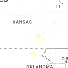
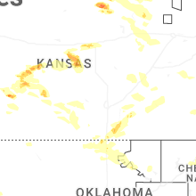
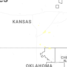
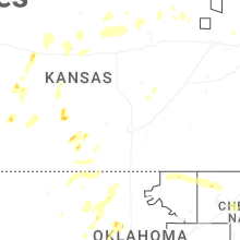


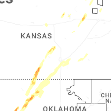
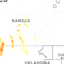


Connect with Interactive Hail Maps