

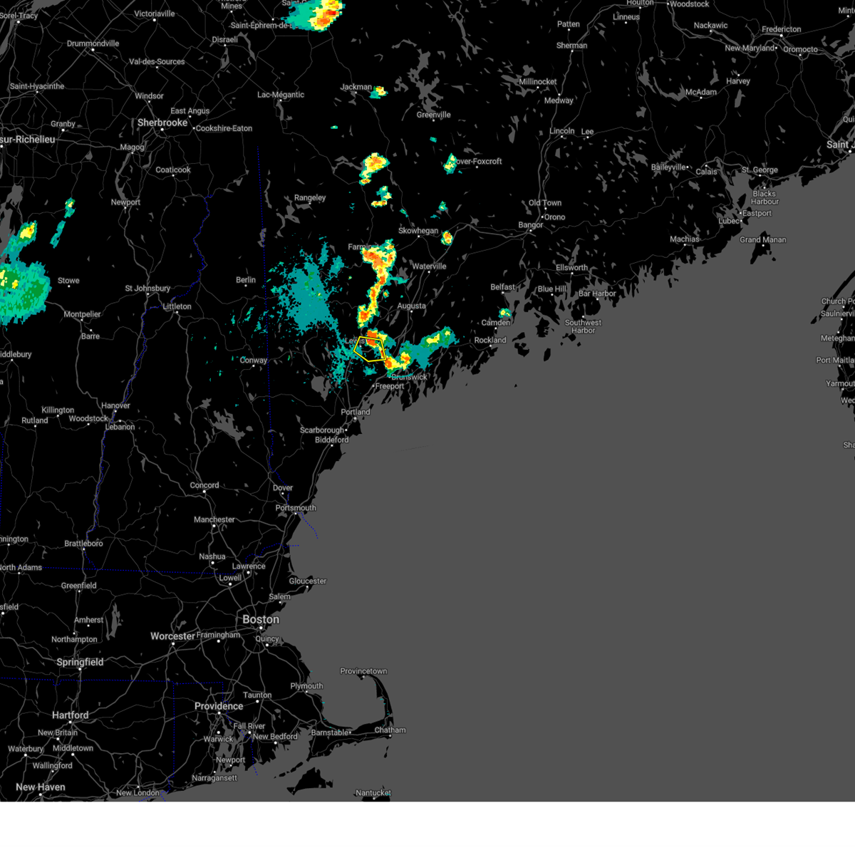
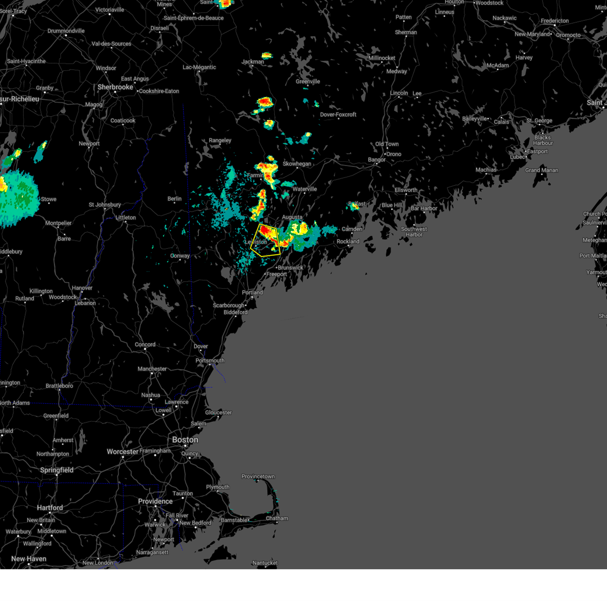
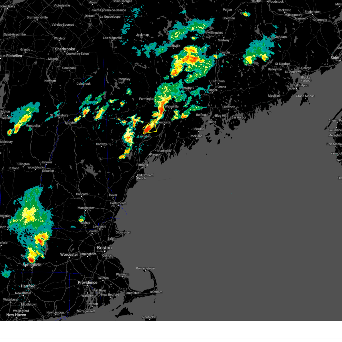
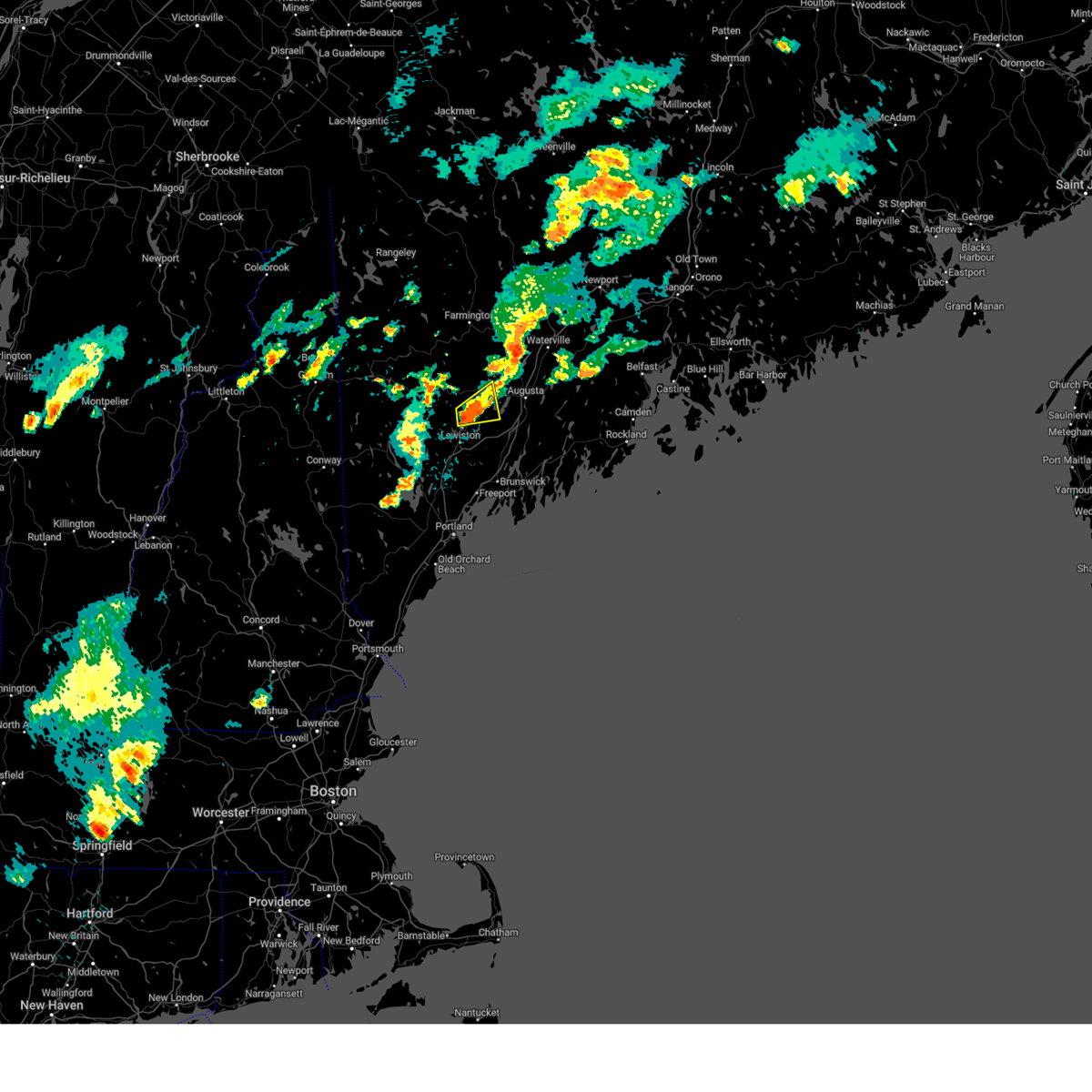
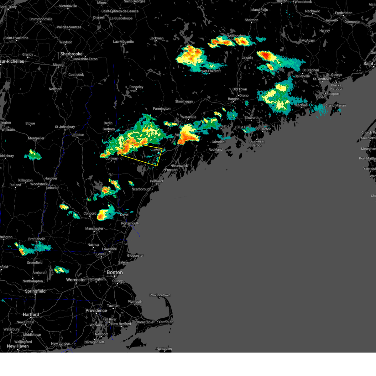
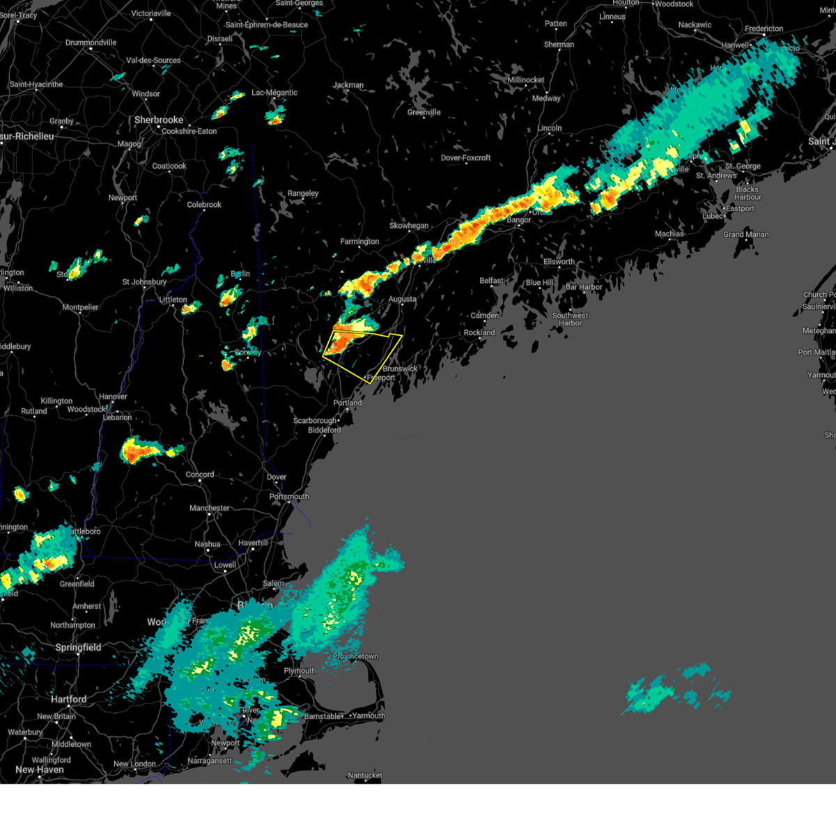
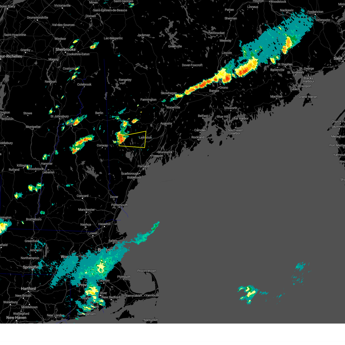
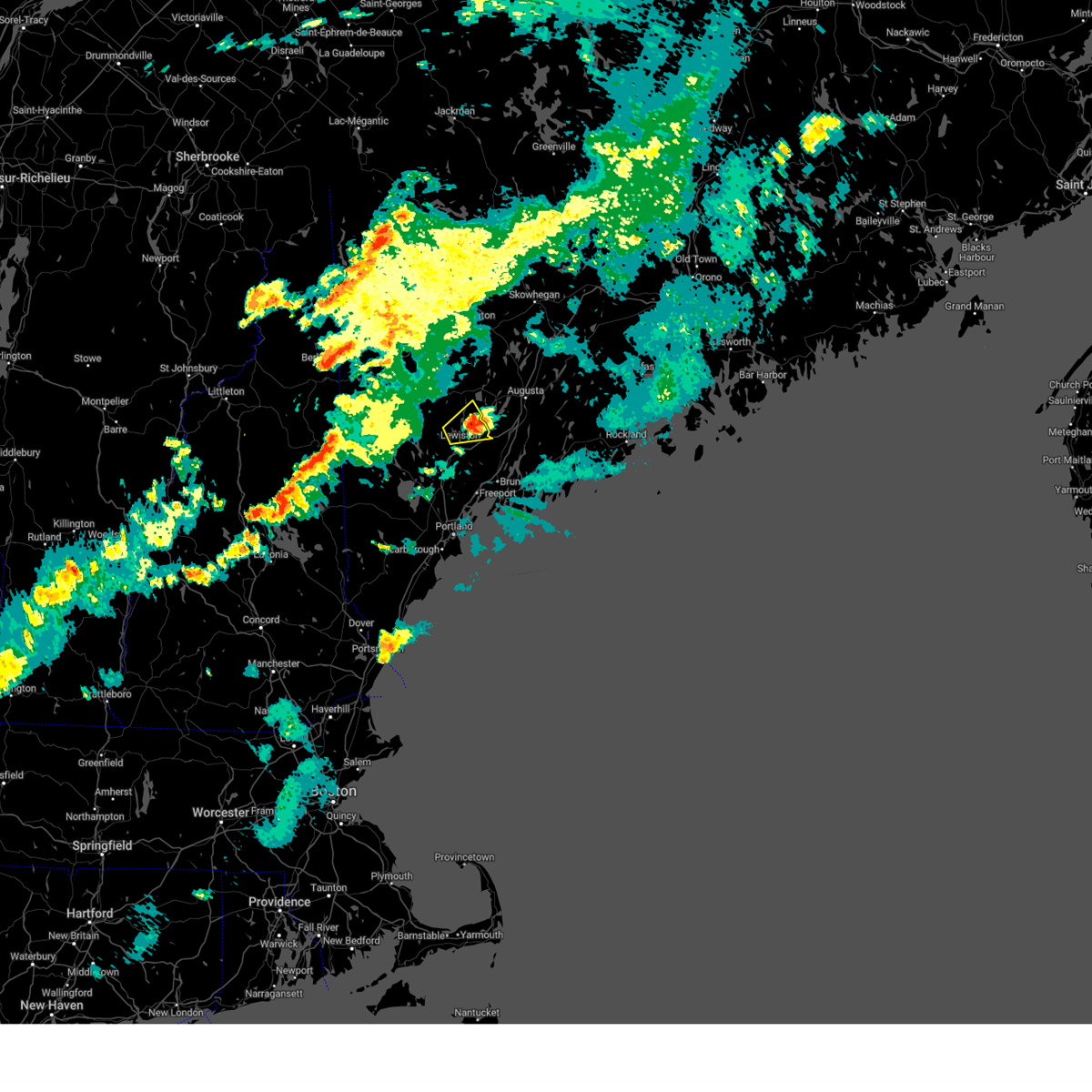
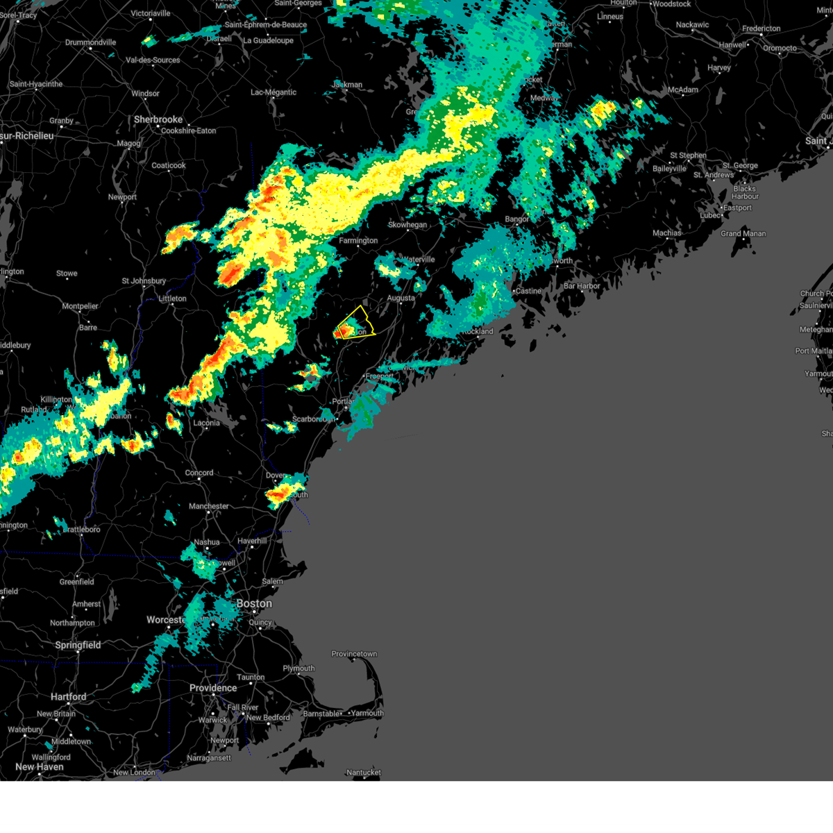
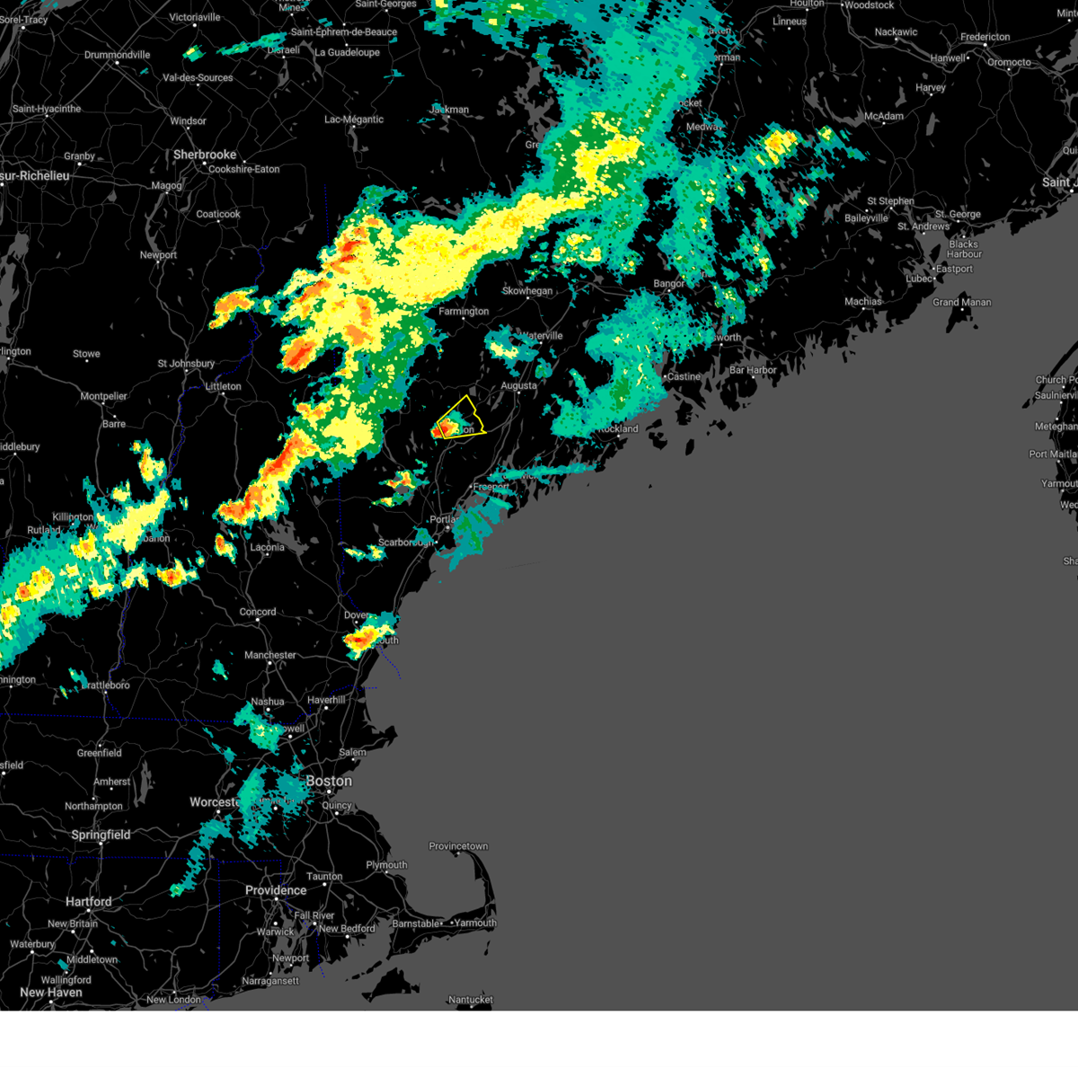
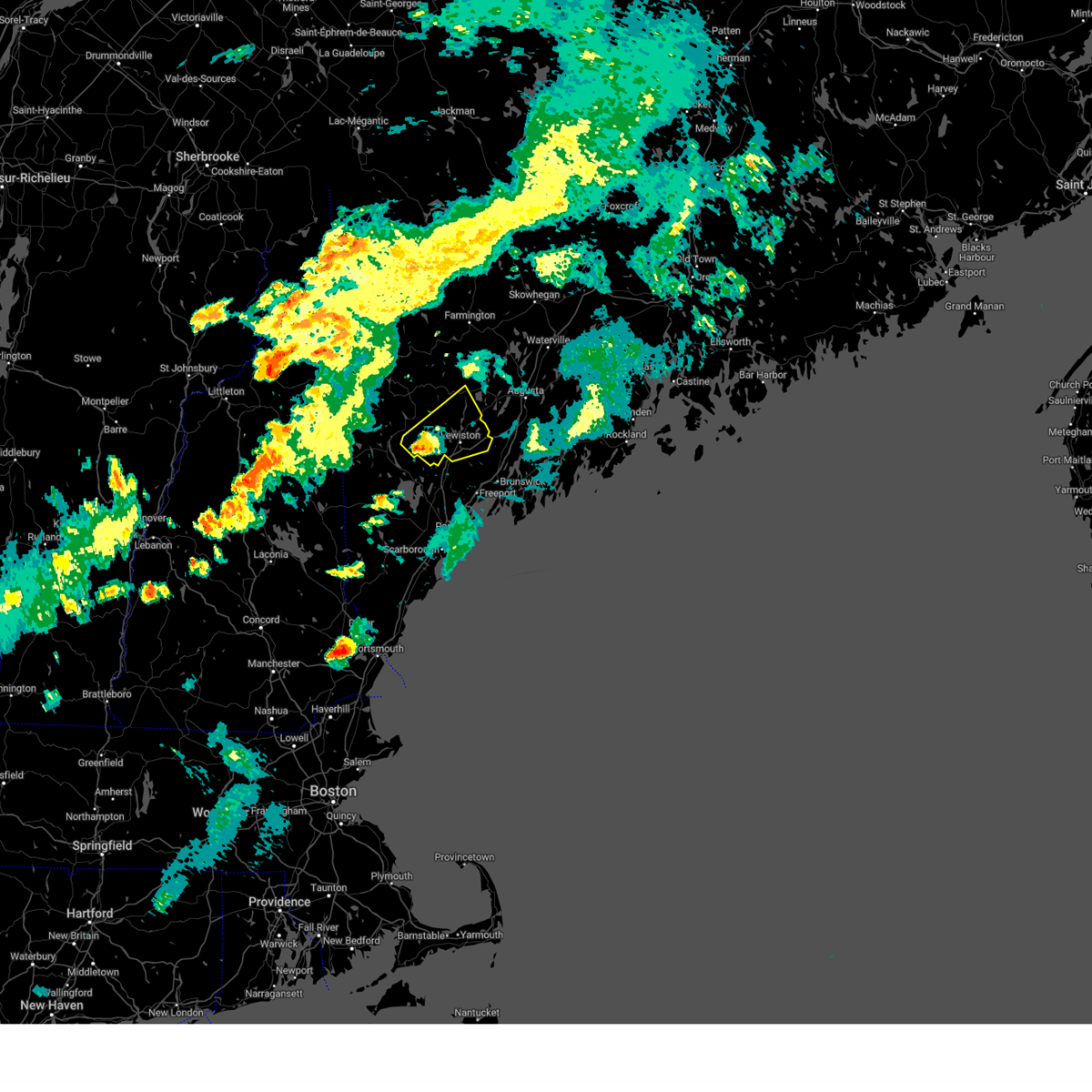
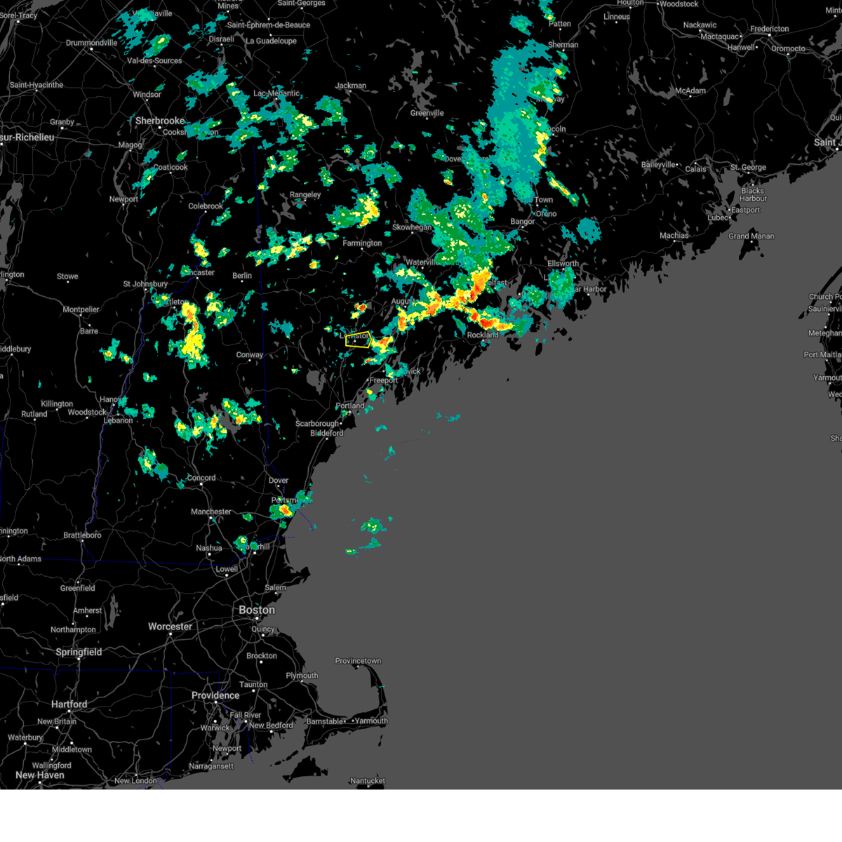
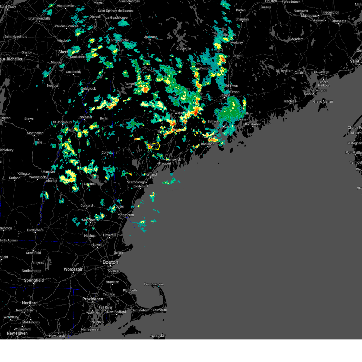
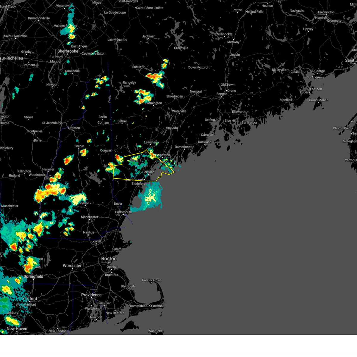
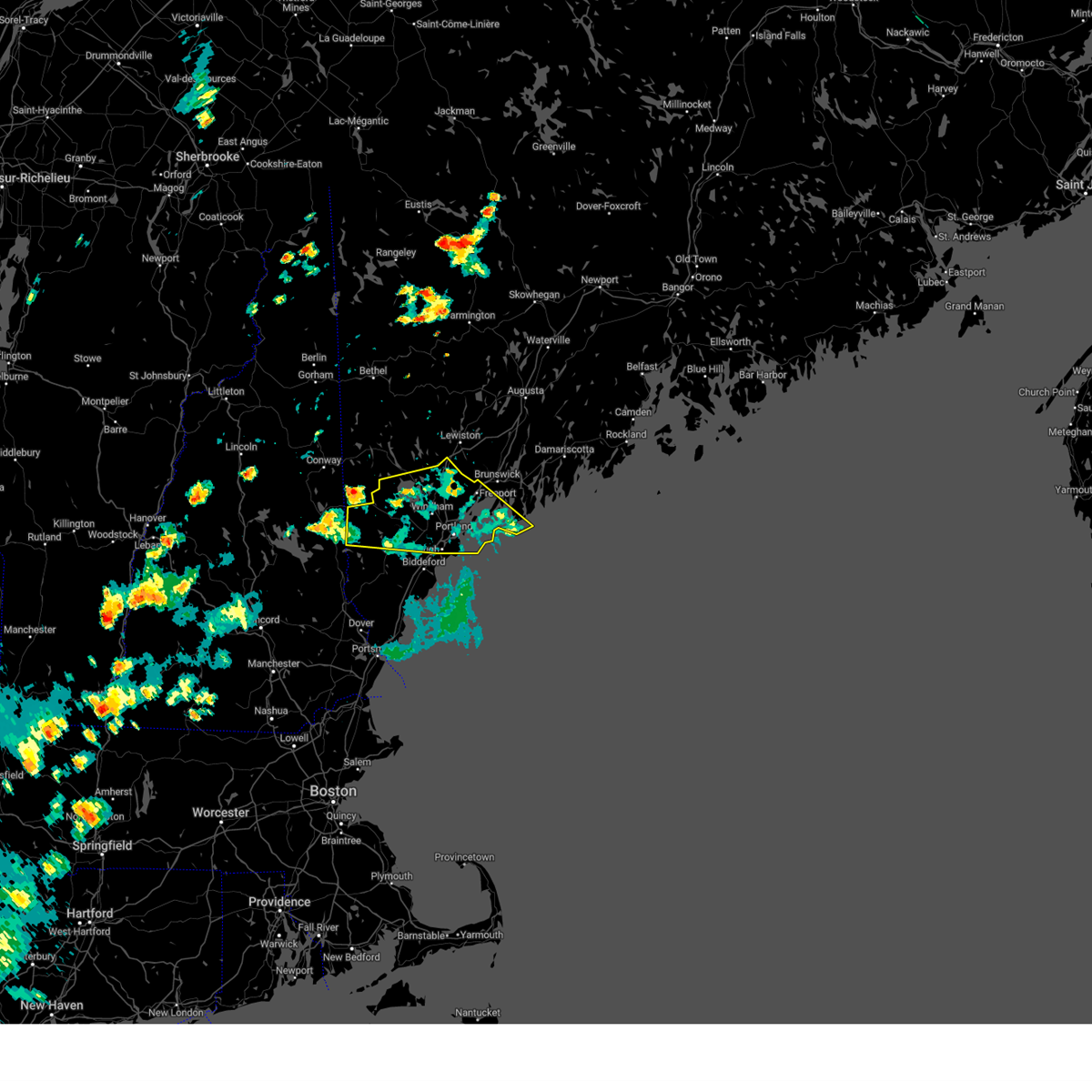
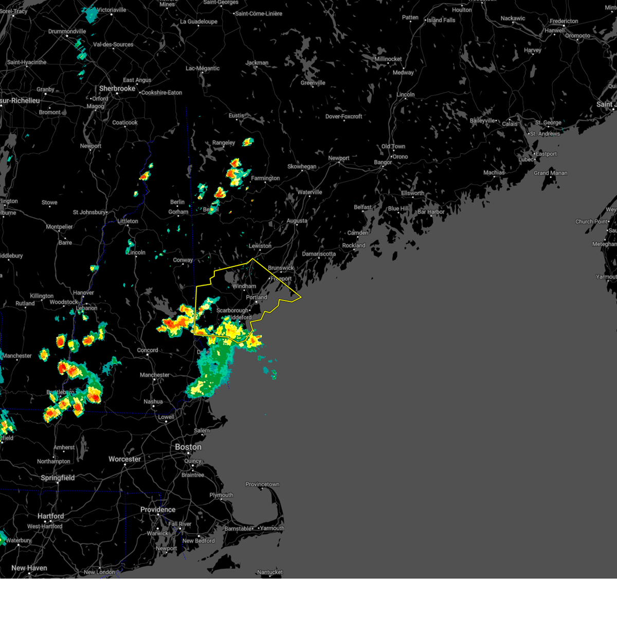
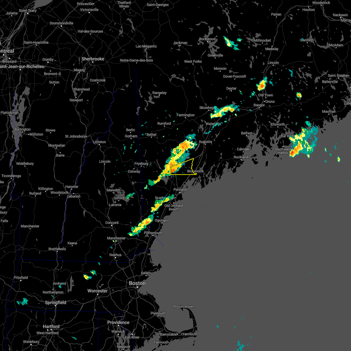
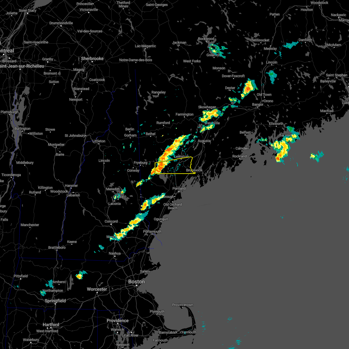
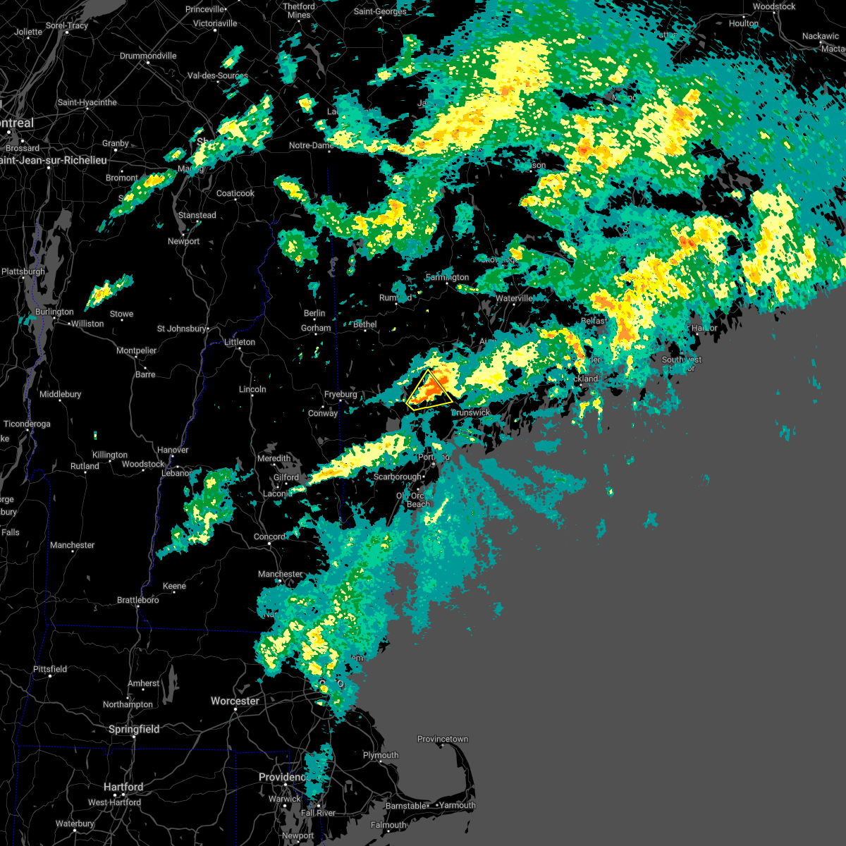
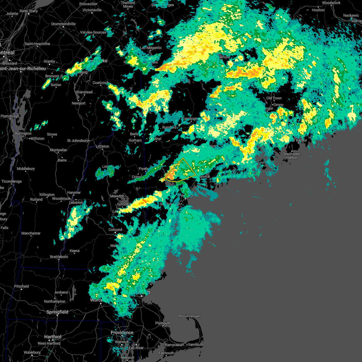
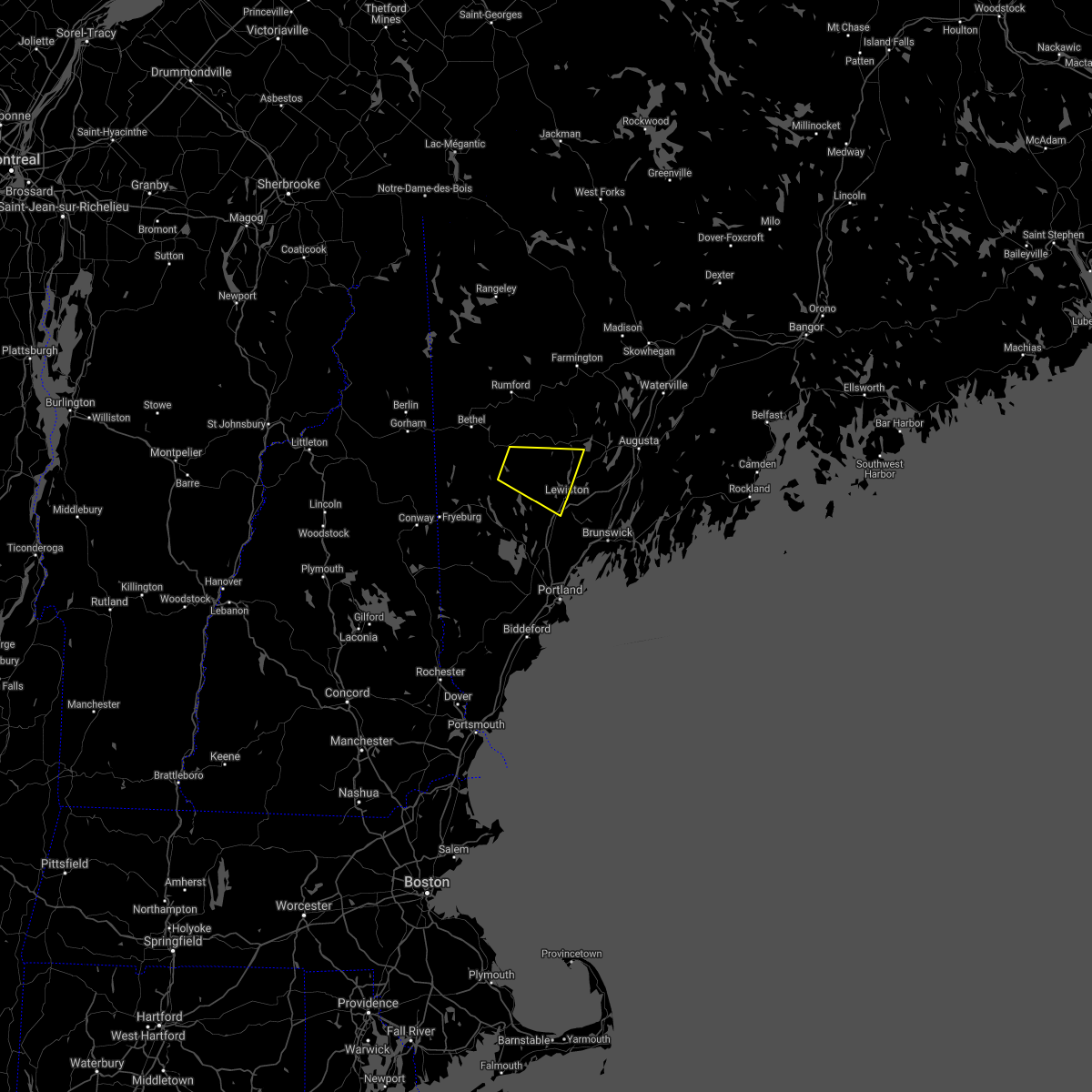
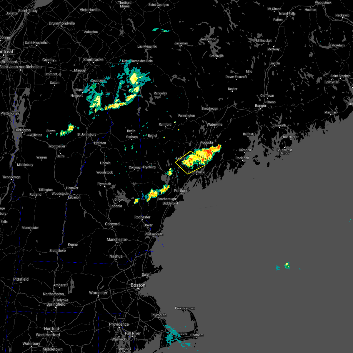
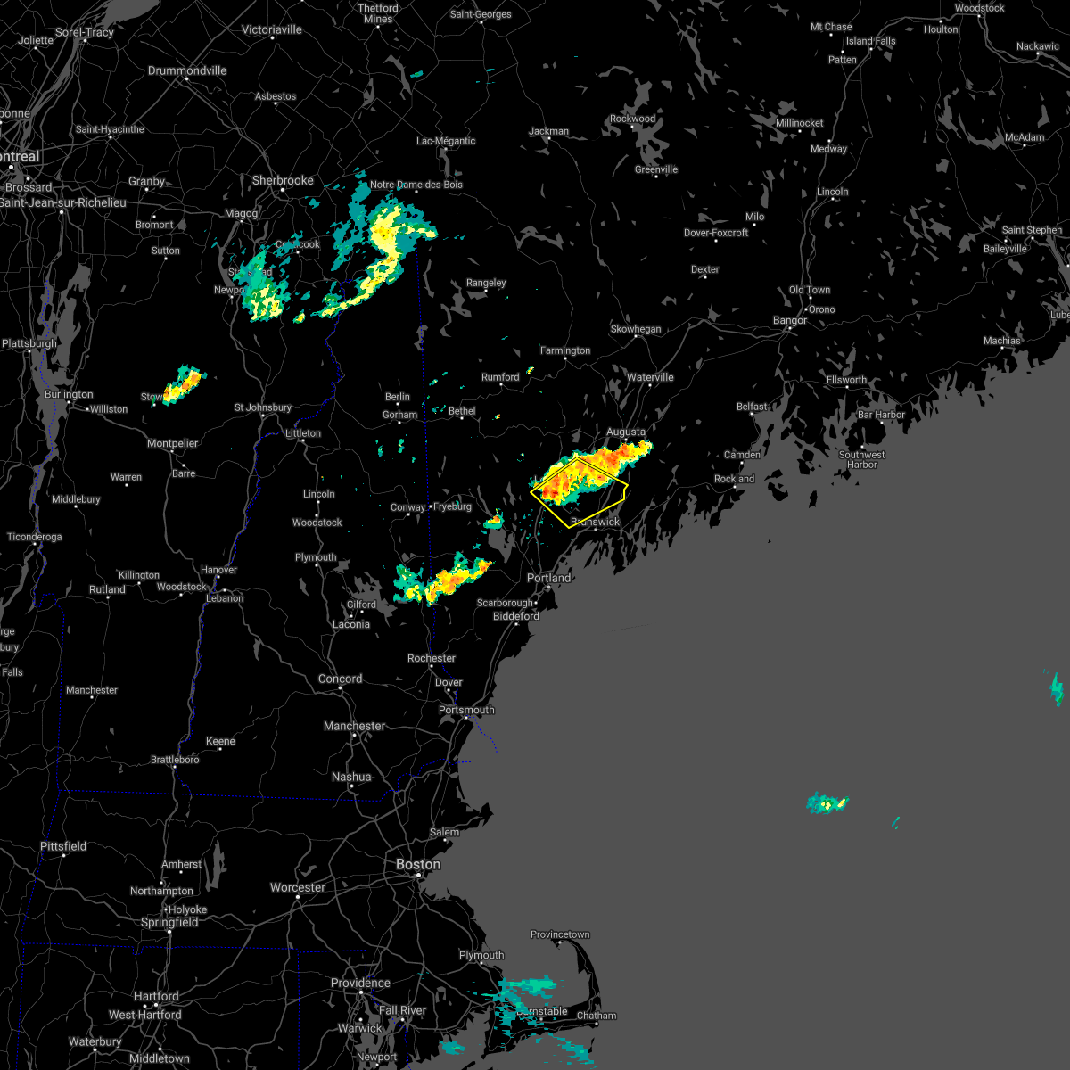
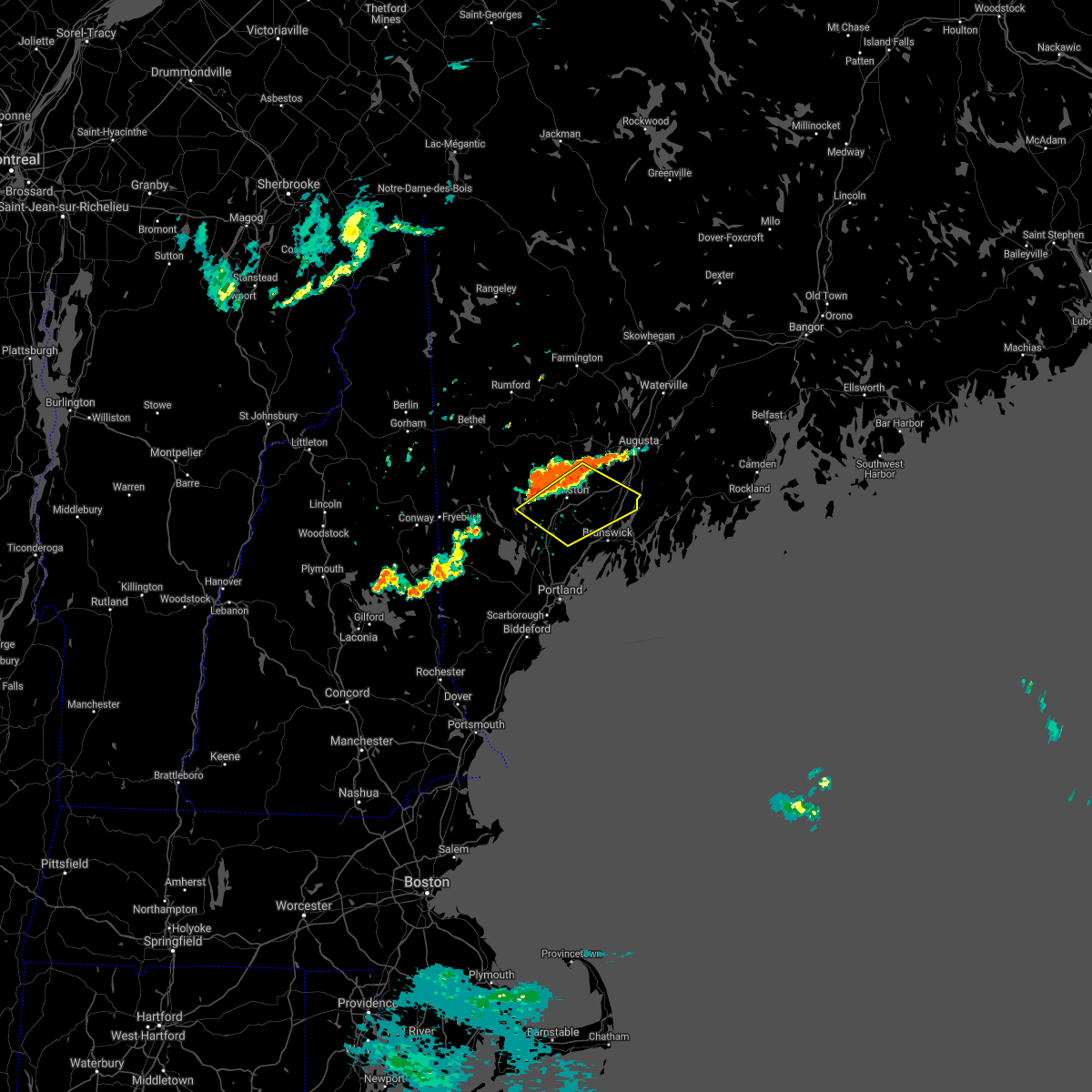
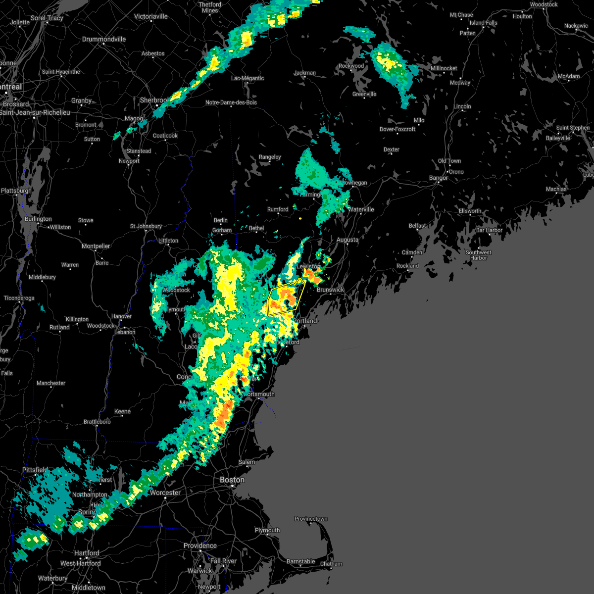
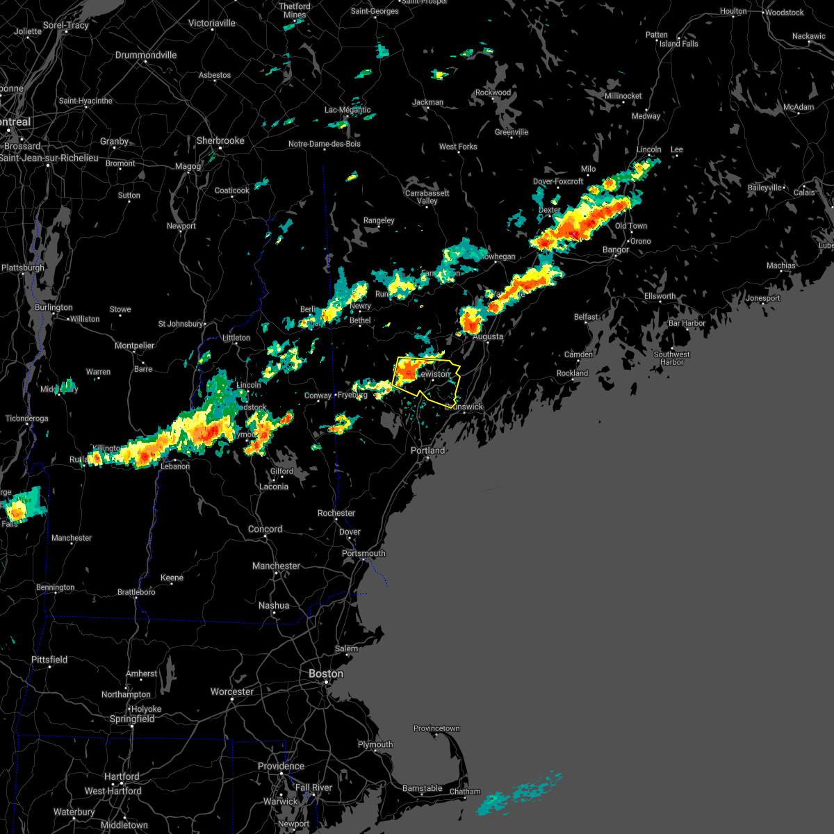
Hail Map for Auburn, ME
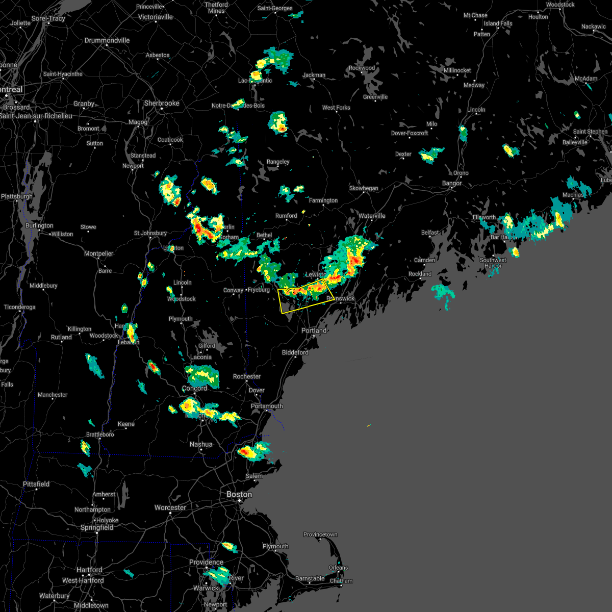
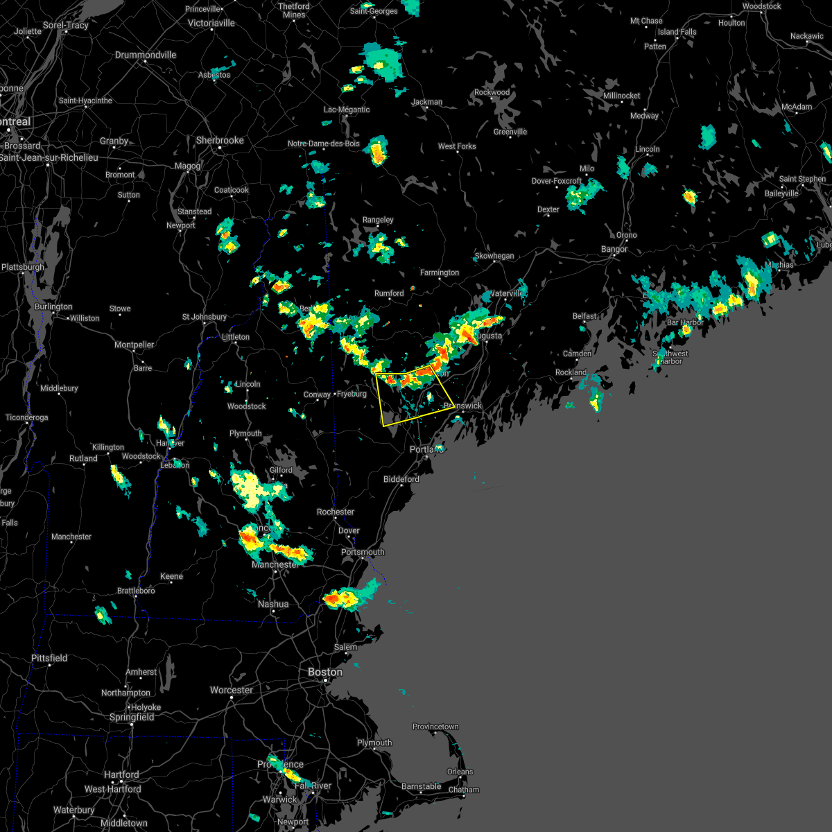
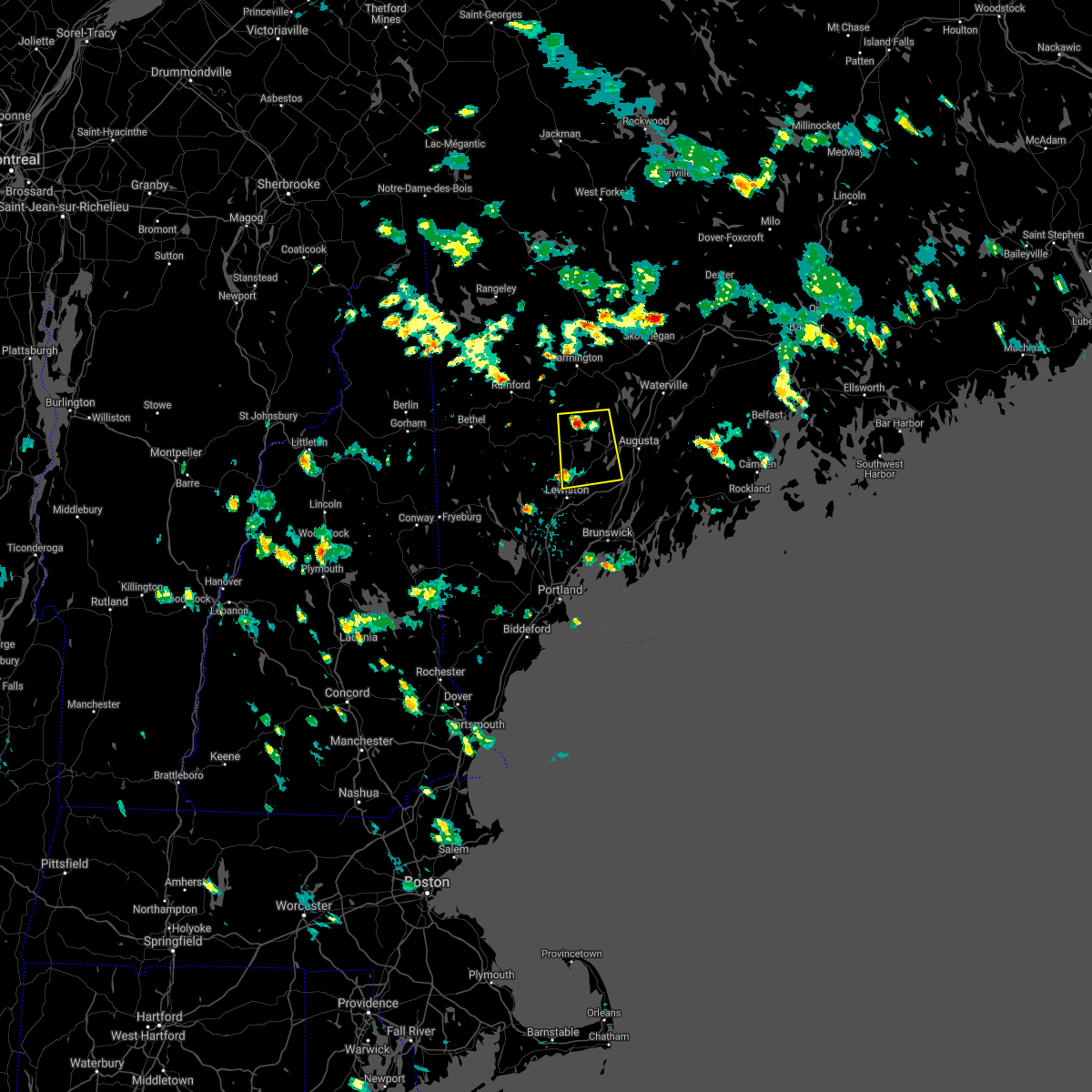
The Auburn, ME area has had 2 reports of on-the-ground hail by trained spotters, and has been under severe weather warnings 17 times during the past 12 months. Doppler radar has detected hail at or near Auburn, ME on 20 occasions, including 1 occasion during the past year.
| Name: | Auburn, ME |
| Where Located: | 30.7 miles N of Portland, ME |
| Map: | Google Map for Auburn, ME |
| Population: | 23055 |
| Housing Units: | 11016 |
| More Info: | Search Google for Auburn, ME |
0
The Top Recent Hail Date for Auburn, ME is Wednesday, August 14, 2024 (20th out of 20)

Hail and Wind Damage Spotted near Auburn, ME
| Date / Time | Report Details |
|---|---|
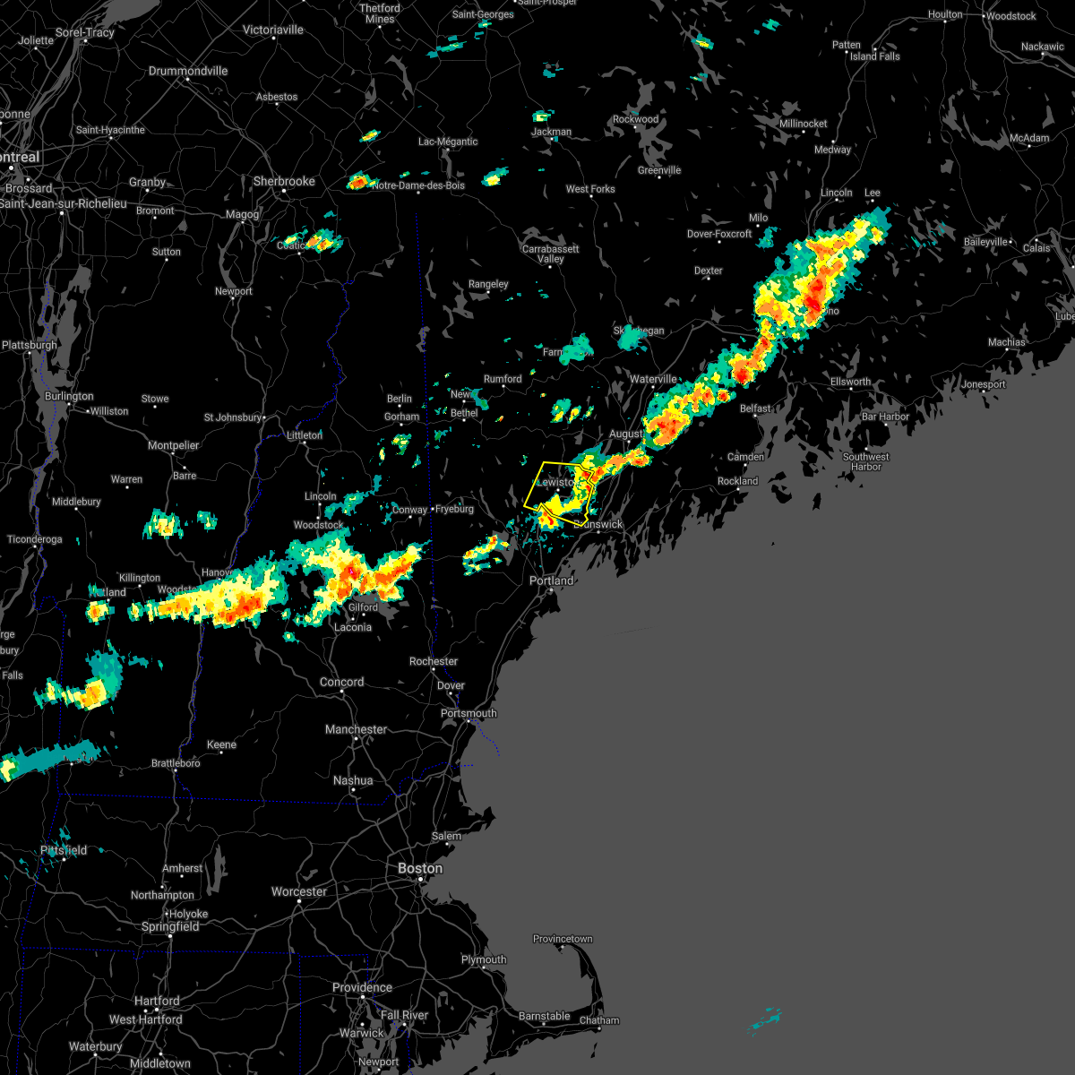
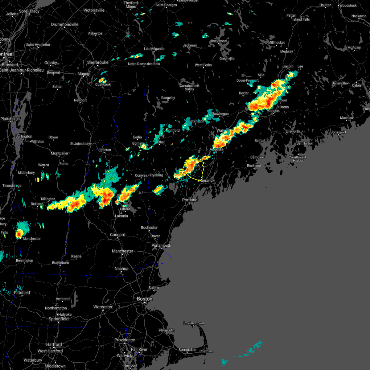
| 7/3/2025 1:27 PM EDT |
 The storms which prompted the warning have moved out of the area. therefore, the warning will be allowed to expire. a severe thunderstorm watch remains in effect until 600 pm edt for south central, western and southwestern maine. The storms which prompted the warning have moved out of the area. therefore, the warning will be allowed to expire. a severe thunderstorm watch remains in effect until 600 pm edt for south central, western and southwestern maine.
|
| 7/3/2025 1:08 PM EDT |
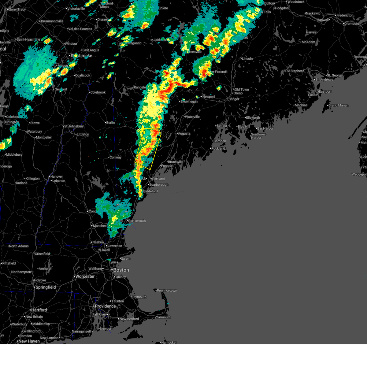
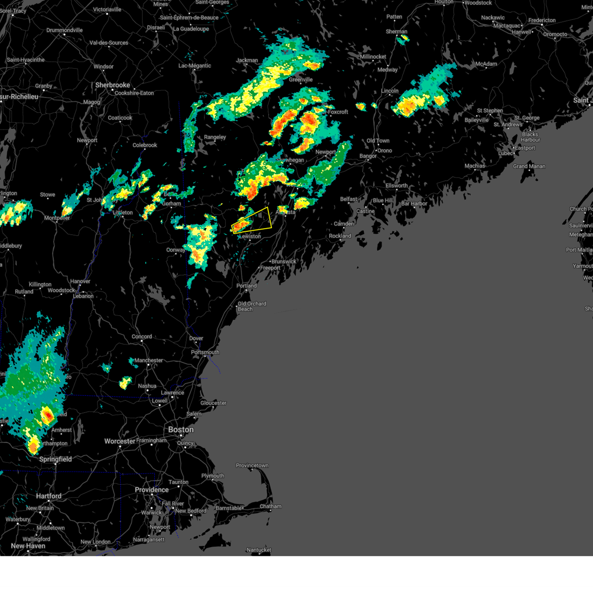
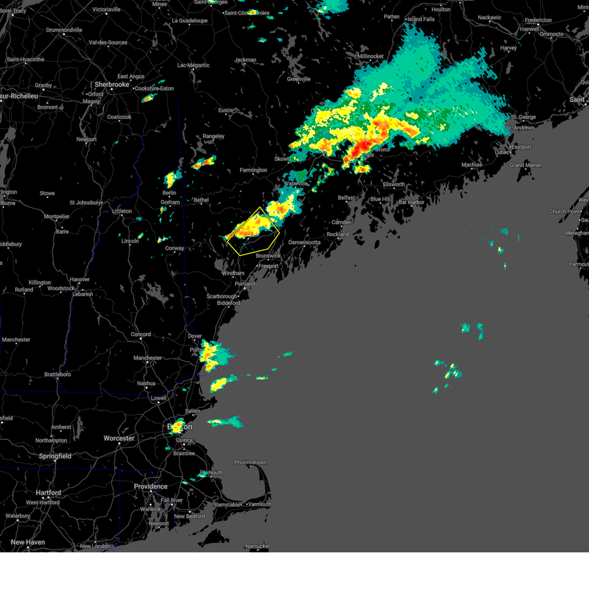
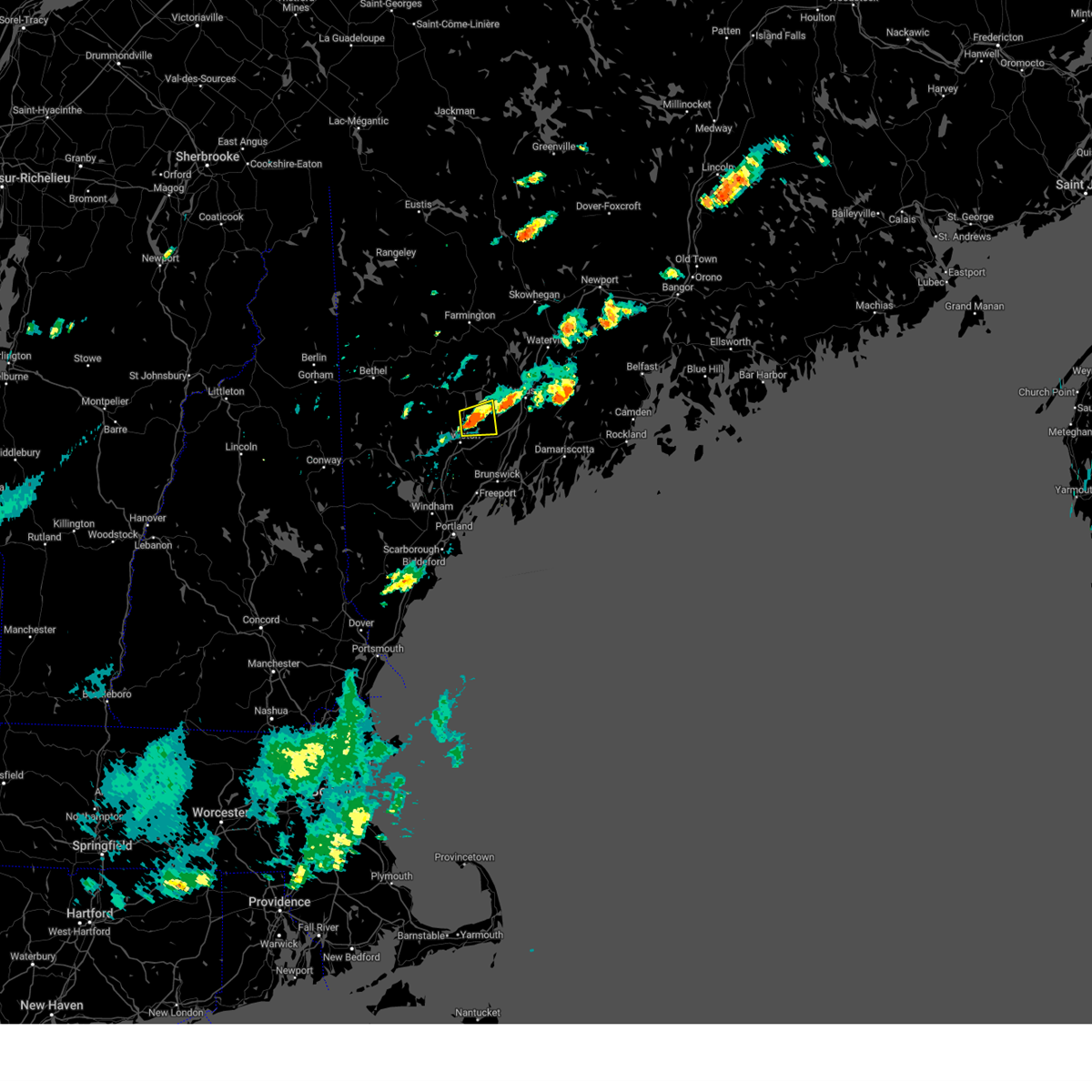
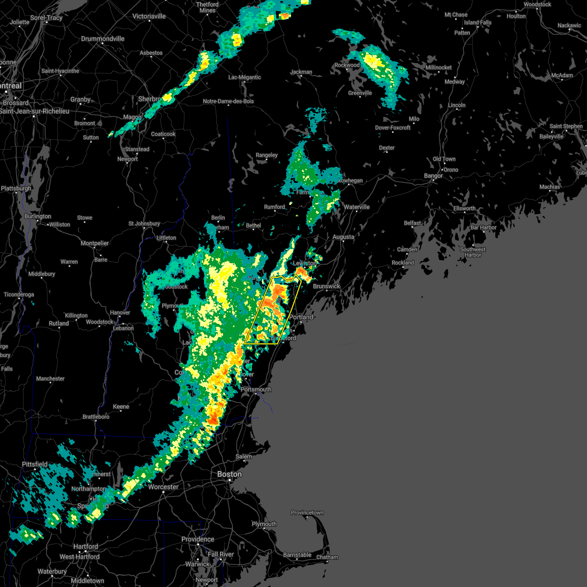
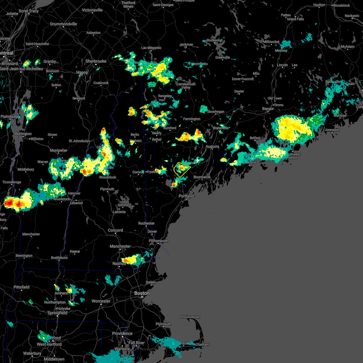
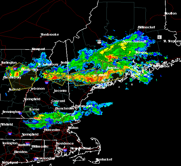
 At 107 pm edt, severe thunderstorms were located along a line extending from 6 miles west of turner to near raymond, moving east at 25 mph (radar indicated). Hazards include 60 mph wind gusts and penny size hail. Expect damage to roofs, siding, and trees. locations impacted include, raymond, buckfield, new gloucester, hebron, poland, oxford, gray, leeds, auburn, turner, mechanic falls, minot, hartford, casco, greene, lewiston, otisfield, paris, sumner, and naples. this also includes, streaked mountain and singepole ridge. This includes interstate 95 between mile markers 58 and 80. At 107 pm edt, severe thunderstorms were located along a line extending from 6 miles west of turner to near raymond, moving east at 25 mph (radar indicated). Hazards include 60 mph wind gusts and penny size hail. Expect damage to roofs, siding, and trees. locations impacted include, raymond, buckfield, new gloucester, hebron, poland, oxford, gray, leeds, auburn, turner, mechanic falls, minot, hartford, casco, greene, lewiston, otisfield, paris, sumner, and naples. this also includes, streaked mountain and singepole ridge. This includes interstate 95 between mile markers 58 and 80.
|
| 7/3/2025 12:31 PM EDT |
 Svrgyx the national weather service in gray maine has issued a * severe thunderstorm warning for, southeastern oxford county in western maine, central androscoggin county in southwestern maine, northwestern cumberland county in southwestern maine, * until 130 pm edt. * at 1231 pm edt, severe thunderstorms were located along a line extending from 8 miles southeast of bethel to near bridgton, moving east at 25 mph (radar indicated). Hazards include 60 mph wind gusts and nickel size hail. expect damage to roofs, siding, and trees Svrgyx the national weather service in gray maine has issued a * severe thunderstorm warning for, southeastern oxford county in western maine, central androscoggin county in southwestern maine, northwestern cumberland county in southwestern maine, * until 130 pm edt. * at 1231 pm edt, severe thunderstorms were located along a line extending from 8 miles southeast of bethel to near bridgton, moving east at 25 mph (radar indicated). Hazards include 60 mph wind gusts and nickel size hail. expect damage to roofs, siding, and trees
|
| 8/14/2024 9:24 PM EDT |
 The storm which prompted the warning has weakened below severe limits, and no longer poses an immediate threat to life or property. therefore, the warning will be allowed to expire. however, heavy rain is still possible with this thunderstorm. The storm which prompted the warning has weakened below severe limits, and no longer poses an immediate threat to life or property. therefore, the warning will be allowed to expire. however, heavy rain is still possible with this thunderstorm.
|
| 8/14/2024 9:13 PM EDT |
 the severe thunderstorm warning has been cancelled and is no longer in effect the severe thunderstorm warning has been cancelled and is no longer in effect
|
| 8/14/2024 9:13 PM EDT |
 At 912 pm edt, a severe thunderstorm was located over lewiston, moving south at 20 mph (radar indicated). Hazards include 60 mph wind gusts and quarter size hail. Hail damage to vehicles is expected. expect wind damage to roofs, siding, and trees. locations impacted include, lewiston, auburn, lisbon, greene, bowdoin, sabattus, and wales. This includes interstate 95 between mile markers 78 and 89. At 912 pm edt, a severe thunderstorm was located over lewiston, moving south at 20 mph (radar indicated). Hazards include 60 mph wind gusts and quarter size hail. Hail damage to vehicles is expected. expect wind damage to roofs, siding, and trees. locations impacted include, lewiston, auburn, lisbon, greene, bowdoin, sabattus, and wales. This includes interstate 95 between mile markers 78 and 89.
|
| 8/14/2024 8:46 PM EDT |
 Svrgyx the national weather service in gray maine has issued a * severe thunderstorm warning for, southwestern kennebec county in south central maine, southeastern androscoggin county in southwestern maine, northwestern sagadahoc county in south central maine, * until 930 pm edt. * at 846 pm edt, a severe thunderstorm was located near turner, moving south at 20 mph (radar indicated). Hazards include 60 mph wind gusts and quarter size hail. Hail damage to vehicles is expected. Expect wind damage to roofs, siding, and trees. Svrgyx the national weather service in gray maine has issued a * severe thunderstorm warning for, southwestern kennebec county in south central maine, southeastern androscoggin county in southwestern maine, northwestern sagadahoc county in south central maine, * until 930 pm edt. * at 846 pm edt, a severe thunderstorm was located near turner, moving south at 20 mph (radar indicated). Hazards include 60 mph wind gusts and quarter size hail. Hail damage to vehicles is expected. Expect wind damage to roofs, siding, and trees.
|
| 7/17/2024 5:41 PM EDT | The storm which prompted the warning has moved out of the area. therefore, the warning will be allowed to expire. remember, a severe thunderstorm warning still remains in effect for southwestern kennebec county. |
| 7/17/2024 5:35 PM EDT | Trees and wires dow in androscoggin county ME, 9.5 miles SSW of Auburn, ME |
| 7/17/2024 5:32 PM EDT |
 the severe thunderstorm warning has been cancelled and is no longer in effect the severe thunderstorm warning has been cancelled and is no longer in effect
|
| 7/17/2024 5:32 PM EDT |
 At 532 pm edt, a severe thunderstorm was located near winthrop, or 9 miles east of turner, moving east at 25 mph (radar indicated). Hazards include 60 mph wind gusts and quarter size hail. Hail damage to vehicles is expected. expect wind damage to roofs, siding, and trees. Locations impacted include, turner, winthrop, greene, leeds, wayne, monmouth, readfield, and wales. At 532 pm edt, a severe thunderstorm was located near winthrop, or 9 miles east of turner, moving east at 25 mph (radar indicated). Hazards include 60 mph wind gusts and quarter size hail. Hail damage to vehicles is expected. expect wind damage to roofs, siding, and trees. Locations impacted include, turner, winthrop, greene, leeds, wayne, monmouth, readfield, and wales.
|
| 7/17/2024 5:31 PM EDT |
 Svrgyx the national weather service in gray maine has issued a * severe thunderstorm warning for, southwestern kennebec county in south central maine, east central androscoggin county in southwestern maine, * until 615 pm edt. * at 531 pm edt, a severe thunderstorm was located near turner, moving east at 15 mph (radar indicated). Hazards include 60 mph wind gusts and quarter size hail. Hail damage to vehicles is expected. Expect wind damage to roofs, siding, and trees. Svrgyx the national weather service in gray maine has issued a * severe thunderstorm warning for, southwestern kennebec county in south central maine, east central androscoggin county in southwestern maine, * until 615 pm edt. * at 531 pm edt, a severe thunderstorm was located near turner, moving east at 15 mph (radar indicated). Hazards include 60 mph wind gusts and quarter size hail. Hail damage to vehicles is expected. Expect wind damage to roofs, siding, and trees.
|
| 7/17/2024 5:15 PM EDT | At 514 pm edt, a severe thunderstorm was located over turner, moving east at 25 mph (radar indicated). Hazards include 60 mph wind gusts and quarter size hail. Hail damage to vehicles is expected. expect wind damage to roofs, siding, and trees. Locations impacted include, auburn, turner, winthrop, greene, leeds, buckfield, hebron, wayne, monmouth, minot, readfield, and wales. |
| 7/17/2024 4:58 PM EDT |
 Svrgyx the national weather service in gray maine has issued a * severe thunderstorm warning for, southwestern kennebec county in south central maine, east central oxford county in western maine, central androscoggin county in southwestern maine, * until 545 pm edt. * at 458 pm edt, a severe thunderstorm was located near turner, moving east at 25 mph (radar indicated). Hazards include 60 mph wind gusts and quarter size hail. Hail damage to vehicles is expected. Expect wind damage to roofs, siding, and trees. Svrgyx the national weather service in gray maine has issued a * severe thunderstorm warning for, southwestern kennebec county in south central maine, east central oxford county in western maine, central androscoggin county in southwestern maine, * until 545 pm edt. * at 458 pm edt, a severe thunderstorm was located near turner, moving east at 25 mph (radar indicated). Hazards include 60 mph wind gusts and quarter size hail. Hail damage to vehicles is expected. Expect wind damage to roofs, siding, and trees.
|
| 7/9/2024 6:12 PM EDT |
 The storm which prompted the warning has moved out of the area. therefore, the warning will be allowed to expire. remember, a severe thunderstorm warning still remains in effect for cumberland county. The storm which prompted the warning has moved out of the area. therefore, the warning will be allowed to expire. remember, a severe thunderstorm warning still remains in effect for cumberland county.
|
| 7/9/2024 6:10 PM EDT |
 Svrgyx the national weather service in gray maine has issued a * severe thunderstorm warning for, southeastern androscoggin county in southwestern maine, southwestern lincoln county in south central maine, northeastern cumberland county in southwestern maine, sagadahoc county in south central maine, * until 700 pm edt. * at 610 pm edt, a severe thunderstorm was located near lewiston, moving east at 40 mph (radar indicated). Hazards include 60 mph wind gusts and quarter size hail. Hail damage to vehicles is expected. Expect wind damage to roofs, siding, and trees. Svrgyx the national weather service in gray maine has issued a * severe thunderstorm warning for, southeastern androscoggin county in southwestern maine, southwestern lincoln county in south central maine, northeastern cumberland county in southwestern maine, sagadahoc county in south central maine, * until 700 pm edt. * at 610 pm edt, a severe thunderstorm was located near lewiston, moving east at 40 mph (radar indicated). Hazards include 60 mph wind gusts and quarter size hail. Hail damage to vehicles is expected. Expect wind damage to roofs, siding, and trees.
|
| 7/9/2024 5:45 PM EDT |
 At 545 pm edt, a severe thunderstorm was located near mechanic falls, moving east at 45 mph (radar indicated). Hazards include 60 mph wind gusts and quarter size hail. Hail damage to vehicles is expected. expect wind damage to roofs, siding, and trees. locations impacted include, lewiston, auburn, bridgton, mechanic falls, naples, gray, waterford, raymond, greene, casco, harrison, hebron, denmark, new gloucester, otisfield, poland, minot, oxford, norway, and sweden. this also includes, long lake. This includes interstate 95 between mile markers 67 and 80. At 545 pm edt, a severe thunderstorm was located near mechanic falls, moving east at 45 mph (radar indicated). Hazards include 60 mph wind gusts and quarter size hail. Hail damage to vehicles is expected. expect wind damage to roofs, siding, and trees. locations impacted include, lewiston, auburn, bridgton, mechanic falls, naples, gray, waterford, raymond, greene, casco, harrison, hebron, denmark, new gloucester, otisfield, poland, minot, oxford, norway, and sweden. this also includes, long lake. This includes interstate 95 between mile markers 67 and 80.
|
| 7/9/2024 5:26 PM EDT |
 Svrgyx the national weather service in gray maine has issued a * severe thunderstorm warning for, southern oxford county in western maine, southwestern androscoggin county in southwestern maine, northwestern cumberland county in southwestern maine, * until 615 pm edt. * at 526 pm edt, a severe thunderstorm was located near waterford, or near bridgton, moving east at 45 mph (radar indicated). Hazards include 60 mph wind gusts and quarter size hail. Hail damage to vehicles is expected. Expect wind damage to roofs, siding, and trees. Svrgyx the national weather service in gray maine has issued a * severe thunderstorm warning for, southern oxford county in western maine, southwestern androscoggin county in southwestern maine, northwestern cumberland county in southwestern maine, * until 615 pm edt. * at 526 pm edt, a severe thunderstorm was located near waterford, or near bridgton, moving east at 45 mph (radar indicated). Hazards include 60 mph wind gusts and quarter size hail. Hail damage to vehicles is expected. Expect wind damage to roofs, siding, and trees.
|
| 6/30/2024 4:21 PM EDT | Tree down on wires... on fir in androscoggin county ME, 4.7 miles NNE of Auburn, ME |
| 6/30/2024 4:21 PM EDT | Large tree in road along foch s in androscoggin county ME, 2 miles NE of Auburn, ME |
| 6/30/2024 4:20 PM EDT |
 Svrgyx the national weather service in gray maine has issued a * severe thunderstorm warning for, southern androscoggin county in southwestern maine, northeastern cumberland county in southwestern maine, northwestern sagadahoc county in south central maine, * until 500 pm edt. * at 419 pm edt, a severe thunderstorm was located near auburn, moving east at 35 mph (radar indicated). Hazards include 60 mph wind gusts and quarter size hail. Hail damage to vehicles is expected. Expect wind damage to roofs, siding, and trees. Svrgyx the national weather service in gray maine has issued a * severe thunderstorm warning for, southern androscoggin county in southwestern maine, northeastern cumberland county in southwestern maine, northwestern sagadahoc county in south central maine, * until 500 pm edt. * at 419 pm edt, a severe thunderstorm was located near auburn, moving east at 35 mph (radar indicated). Hazards include 60 mph wind gusts and quarter size hail. Hail damage to vehicles is expected. Expect wind damage to roofs, siding, and trees.
|
| 6/30/2024 4:14 PM EDT | Trees and wires down along torrey r in androscoggin county ME, 5.5 miles NE of Auburn, ME |
| 6/30/2024 4:14 PM EDT | Large branch down on road. only 1 lane open. time estimated by rada in androscoggin county ME, 1 miles NNW of Auburn, ME |
| 6/30/2024 4:13 PM EDT | An estimate of 15 to 20 trees down or damaged on golf cours in androscoggin county ME, 5.9 miles NE of Auburn, ME |
| 6/30/2024 3:45 PM EDT |
 Svrgyx the national weather service in gray maine has issued a * severe thunderstorm warning for, southeastern oxford county in western maine, southwestern androscoggin county in southwestern maine, northwestern cumberland county in southwestern maine, * until 430 pm edt. * at 344 pm edt, a severe thunderstorm was located near bridgton, moving east at 45 mph (radar indicated). Hazards include 60 mph wind gusts and half dollar size hail. Hail damage to vehicles is expected. Expect wind damage to roofs, siding, and trees. Svrgyx the national weather service in gray maine has issued a * severe thunderstorm warning for, southeastern oxford county in western maine, southwestern androscoggin county in southwestern maine, northwestern cumberland county in southwestern maine, * until 430 pm edt. * at 344 pm edt, a severe thunderstorm was located near bridgton, moving east at 45 mph (radar indicated). Hazards include 60 mph wind gusts and half dollar size hail. Hail damage to vehicles is expected. Expect wind damage to roofs, siding, and trees.
|
| 6/23/2024 7:36 PM EDT | Ne511 reported a tree down reducing me 124 to one lane. time estimated by rada in oxford county ME, 9 miles SE of Auburn, ME |
| 6/23/2024 7:06 PM EDT |
 The storm which prompted the warning has moved out of the area. therefore, the warning will be allowed to expire. a tornado watch remains in effect until 800 pm edt for southwestern maine. The storm which prompted the warning has moved out of the area. therefore, the warning will be allowed to expire. a tornado watch remains in effect until 800 pm edt for southwestern maine.
|
| 6/23/2024 6:47 PM EDT |
 At 646 pm edt, a severe thunderstorm was located near auburn, moving northeast at 45 mph (radar indicated). Hazards include 60 mph wind gusts and quarter size hail. Hail damage to vehicles is expected. expect wind damage to roofs, siding, and trees. locations impacted include, lewiston, auburn, turner, greene, leeds, wales, minot, and sabattus. This includes interstate 95 between mile markers 88 and 90. At 646 pm edt, a severe thunderstorm was located near auburn, moving northeast at 45 mph (radar indicated). Hazards include 60 mph wind gusts and quarter size hail. Hail damage to vehicles is expected. expect wind damage to roofs, siding, and trees. locations impacted include, lewiston, auburn, turner, greene, leeds, wales, minot, and sabattus. This includes interstate 95 between mile markers 88 and 90.
|
| 6/23/2024 6:47 PM EDT |
 the severe thunderstorm warning has been cancelled and is no longer in effect the severe thunderstorm warning has been cancelled and is no longer in effect
|
| 6/23/2024 6:31 PM EDT |
 Svrgyx the national weather service in gray maine has issued a * severe thunderstorm warning for, southeastern oxford county in western maine, androscoggin county in southwestern maine, * until 715 pm edt. * at 631 pm edt, a severe thunderstorm was located over mechanic falls, moving northeast at 45 mph (radar indicated). Hazards include 60 mph wind gusts and quarter size hail. Hail damage to vehicles is expected. Expect wind damage to roofs, siding, and trees. Svrgyx the national weather service in gray maine has issued a * severe thunderstorm warning for, southeastern oxford county in western maine, androscoggin county in southwestern maine, * until 715 pm edt. * at 631 pm edt, a severe thunderstorm was located over mechanic falls, moving northeast at 45 mph (radar indicated). Hazards include 60 mph wind gusts and quarter size hail. Hail damage to vehicles is expected. Expect wind damage to roofs, siding, and trees.
|
| 6/12/2024 4:00 PM EDT | Two spotters reported a large spruce tree down on a house... with some large branches on wires as well. one spotter lost power. time estimated by rada in androscoggin county ME, 2.8 miles NE of Auburn, ME |
| 6/8/2024 2:15 PM EDT |
 the severe thunderstorm warning has been cancelled and is no longer in effect the severe thunderstorm warning has been cancelled and is no longer in effect
|
| 6/8/2024 1:42 PM EDT |
 Svrgyx the national weather service in gray maine has issued a * severe thunderstorm warning for, east central androscoggin county in southwestern maine, * until 230 pm edt. * at 142 pm edt, a severe thunderstorm was located over auburn, moving east at 15 mph (radar indicated). Hazards include 60 mph wind gusts and quarter size hail. Hail damage to vehicles is expected. Expect wind damage to roofs, siding, and trees. Svrgyx the national weather service in gray maine has issued a * severe thunderstorm warning for, east central androscoggin county in southwestern maine, * until 230 pm edt. * at 142 pm edt, a severe thunderstorm was located over auburn, moving east at 15 mph (radar indicated). Hazards include 60 mph wind gusts and quarter size hail. Hail damage to vehicles is expected. Expect wind damage to roofs, siding, and trees.
|
| 9/8/2023 5:21 PM EDT |
 The severe thunderstorm warning for northern york, cumberland and southern sagadahoc counties will expire at 530 pm edt, the storms which prompted the warning have weakened below severe limits, and no longer pose an immediate threat to life or property. therefore, the warning will be allowed to expire. however, gusty winds are still possible with these thunderstorms. a severe thunderstorm watch remains in effect until 1100 pm edt for western, south central and southwestern maine. The severe thunderstorm warning for northern york, cumberland and southern sagadahoc counties will expire at 530 pm edt, the storms which prompted the warning have weakened below severe limits, and no longer pose an immediate threat to life or property. therefore, the warning will be allowed to expire. however, gusty winds are still possible with these thunderstorms. a severe thunderstorm watch remains in effect until 1100 pm edt for western, south central and southwestern maine.
|
| 9/8/2023 5:08 PM EDT |
 At 508 pm edt, severe thunderstorms were located along a line extending from near standish to near cumberland to 11 miles southeast of yarmouth, moving northeast at 50 mph (radar indicated). Hazards include 60 mph wind gusts and quarter size hail. Hail damage to vehicles is expected. expect wind damage to roofs, siding, and trees. locations impacted include, portland, south portland, brunswick, westbrook, naples, cumberland, saco, gorham, falmouth, cape elizabeth, buxton, freeport, gray, hollis, hiram, cornish, scarborough, raymond, standish, and waterboro. this also includes, sebago lake and douglas mountain. peaks island, long island, cushing island, cousins island, and bailey island. this includes the following highways, interstate 295 between mile markers 1 and 25. interstate 95 between mile markers 40 and 73. hail threat, radar indicated max hail size, 1. 00 in wind threat, radar indicated max wind gust, 60 mph. At 508 pm edt, severe thunderstorms were located along a line extending from near standish to near cumberland to 11 miles southeast of yarmouth, moving northeast at 50 mph (radar indicated). Hazards include 60 mph wind gusts and quarter size hail. Hail damage to vehicles is expected. expect wind damage to roofs, siding, and trees. locations impacted include, portland, south portland, brunswick, westbrook, naples, cumberland, saco, gorham, falmouth, cape elizabeth, buxton, freeport, gray, hollis, hiram, cornish, scarborough, raymond, standish, and waterboro. this also includes, sebago lake and douglas mountain. peaks island, long island, cushing island, cousins island, and bailey island. this includes the following highways, interstate 295 between mile markers 1 and 25. interstate 95 between mile markers 40 and 73. hail threat, radar indicated max hail size, 1. 00 in wind threat, radar indicated max wind gust, 60 mph.
|
| 9/8/2023 4:26 PM EDT |
 At 425 pm edt, severe thunderstorms were located along a line extending from near lebanon to kennebunk to 10 miles southeast of kennebunkport, moving north at 40 mph (radar indicated). Hazards include 60 mph wind gusts and quarter size hail. Hail damage to vehicles is expected. Expect wind damage to roofs, siding, and trees. At 425 pm edt, severe thunderstorms were located along a line extending from near lebanon to kennebunk to 10 miles southeast of kennebunkport, moving north at 40 mph (radar indicated). Hazards include 60 mph wind gusts and quarter size hail. Hail damage to vehicles is expected. Expect wind damage to roofs, siding, and trees.
|
| 8/13/2023 5:45 PM EDT |
 At 544 pm edt, severe thunderstorms were located along a line extending from near litchfield to 7 miles east of lewiston to auburn, moving east at 30 mph (radar indicated). Hazards include 60 mph wind gusts and quarter size hail. Hail damage to vehicles is expected. expect wind damage to roofs, siding, and trees. locations impacted include, lewiston, auburn, mechanic falls, topsham, litchfield, winthrop, lisbon, greene, durham, bowdoin, bowdoinham, leeds, new gloucester, wales, monmouth, sabattus, poland, richmond, minot, and west gardiner. this includes the following highways, interstate 295 near mile marker 47. interstate 95 between mile markers 69 and 99. hail threat, radar indicated max hail size, 1. 00 in wind threat, radar indicated max wind gust, 60 mph. At 544 pm edt, severe thunderstorms were located along a line extending from near litchfield to 7 miles east of lewiston to auburn, moving east at 30 mph (radar indicated). Hazards include 60 mph wind gusts and quarter size hail. Hail damage to vehicles is expected. expect wind damage to roofs, siding, and trees. locations impacted include, lewiston, auburn, mechanic falls, topsham, litchfield, winthrop, lisbon, greene, durham, bowdoin, bowdoinham, leeds, new gloucester, wales, monmouth, sabattus, poland, richmond, minot, and west gardiner. this includes the following highways, interstate 295 near mile marker 47. interstate 95 between mile markers 69 and 99. hail threat, radar indicated max hail size, 1. 00 in wind threat, radar indicated max wind gust, 60 mph.
|
| 8/13/2023 5:34 PM EDT | Delayed report: several trees and wires down on and near garfield road in minot. time estimated by rada in androscoggin county ME, 3.2 miles E of Auburn, ME |
| 8/13/2023 5:27 PM EDT |
 At 527 pm edt, a severe thunderstorm was located over mechanic falls, moving east at 25 mph (radar indicated). Hazards include 60 mph wind gusts and quarter size hail. Hail damage to vehicles is expected. Expect wind damage to roofs, siding, and trees. At 527 pm edt, a severe thunderstorm was located over mechanic falls, moving east at 25 mph (radar indicated). Hazards include 60 mph wind gusts and quarter size hail. Hail damage to vehicles is expected. Expect wind damage to roofs, siding, and trees.
|
| 7/25/2023 7:49 PM EDT |
 At 748 pm edt, a severe thunderstorm was located near mechanic falls, moving west at 5 mph (radar indicated). Hazards include 60 mph wind gusts and penny size hail. Expect damage to roofs, siding, and trees. locations impacted include, auburn, mechanic falls, turner, hebron, minot, oxford and paris. hail threat, radar indicated max hail size, 0. 75 in wind threat, radar indicated max wind gust, 60 mph. At 748 pm edt, a severe thunderstorm was located near mechanic falls, moving west at 5 mph (radar indicated). Hazards include 60 mph wind gusts and penny size hail. Expect damage to roofs, siding, and trees. locations impacted include, auburn, mechanic falls, turner, hebron, minot, oxford and paris. hail threat, radar indicated max hail size, 0. 75 in wind threat, radar indicated max wind gust, 60 mph.
|
| 7/25/2023 7:15 PM EDT | Power lines down across west hardscrabble rd. road close in androscoggin county ME, 4 miles NE of Auburn, ME |
| 7/25/2023 7:13 PM EDT |
 At 712 pm edt, a severe thunderstorm was located near mechanic falls, moving west at 5 mph (radar indicated). Hazards include 60 mph wind gusts and penny size hail. expect damage to roofs, siding, and trees At 712 pm edt, a severe thunderstorm was located near mechanic falls, moving west at 5 mph (radar indicated). Hazards include 60 mph wind gusts and penny size hail. expect damage to roofs, siding, and trees
|
| 7/25/2023 6:21 PM EDT | Multiple trees and powerlines down on bolster st. time estimated by rada in androscoggin county ME, 1.7 miles NNW of Auburn, ME |
| 7/25/2023 6:18 PM EDT |
 At 618 pm edt, severe thunderstorms were located along a line extending from near lewiston to near mechanic falls, moving east at 10 mph (radar indicated). Hazards include 60 mph wind gusts and quarter size hail. Hail damage to vehicles is expected. Expect wind damage to roofs, siding, and trees. At 618 pm edt, severe thunderstorms were located along a line extending from near lewiston to near mechanic falls, moving east at 10 mph (radar indicated). Hazards include 60 mph wind gusts and quarter size hail. Hail damage to vehicles is expected. Expect wind damage to roofs, siding, and trees.
|
| 7/25/2023 5:26 PM EDT |
 At 526 pm edt, a severe thunderstorm was located 7 miles southeast of turner, moving east at 10 mph (radar indicated). Hazards include 60 mph wind gusts and quarter size hail. Hail damage to vehicles is expected. Expect wind damage to roofs, siding, and trees. At 526 pm edt, a severe thunderstorm was located 7 miles southeast of turner, moving east at 10 mph (radar indicated). Hazards include 60 mph wind gusts and quarter size hail. Hail damage to vehicles is expected. Expect wind damage to roofs, siding, and trees.
|
| 11/30/2022 7:36 PM EST |
 At 735 pm est, a severe thunderstorm was located near raymond, or near naples, moving northeast at 50 mph (radar indicated). Hazards include 60 mph wind gusts. Expect damage to roofs, siding, and trees. locations impacted include, portland, lewiston, south portland, brunswick, westbrook, bridgton, mechanic falls, alfred, naples, topsham, turner, cumberland, gorham, falmouth, buxton, freeport, gray, hollis, hiram and cornish. this includes the following highways, interstate 295 between mile markers 4 and 29. Interstate 95 between mile markers 45 and 88. At 735 pm est, a severe thunderstorm was located near raymond, or near naples, moving northeast at 50 mph (radar indicated). Hazards include 60 mph wind gusts. Expect damage to roofs, siding, and trees. locations impacted include, portland, lewiston, south portland, brunswick, westbrook, bridgton, mechanic falls, alfred, naples, topsham, turner, cumberland, gorham, falmouth, buxton, freeport, gray, hollis, hiram and cornish. this includes the following highways, interstate 295 between mile markers 4 and 29. Interstate 95 between mile markers 45 and 88.
|
| 11/30/2022 7:07 PM EST |
 At 706 pm est, a line of severe storms was located near effingham, or 7 miles east of ossipee, moving northeast at 50 mph (radar indicated). Hazards include 60 mph wind gusts. expect damage to roofs, siding, and trees At 706 pm est, a line of severe storms was located near effingham, or 7 miles east of ossipee, moving northeast at 50 mph (radar indicated). Hazards include 60 mph wind gusts. expect damage to roofs, siding, and trees
|
| 9/4/2022 6:23 PM EDT |
 At 623 pm edt, a severe thunderstorm was located 7 miles west of mechanic falls, moving southeast at 15 mph (radar indicated). Hazards include 60 mph wind gusts and quarter size hail. Hail damage to vehicles is expected. Expect wind damage to roofs, siding, and trees. At 623 pm edt, a severe thunderstorm was located 7 miles west of mechanic falls, moving southeast at 15 mph (radar indicated). Hazards include 60 mph wind gusts and quarter size hail. Hail damage to vehicles is expected. Expect wind damage to roofs, siding, and trees.
|
| 8/4/2022 10:00 PM EDT |
 At 959 pm edt, severe thunderstorms were located along a line extending from near canton to 7 miles north of mechanic falls, moving northeast at 60 mph (radar indicated). Hazards include 60 mph wind gusts and quarter size hail. Hail damage to vehicles is expected. expect wind damage to roofs, siding, and trees. locations impacted include, lewiston, mechanic falls, turner, jay, livermore falls, canton, waterford, greene, harrison, leeds, livermore, buckfield, hebron, hartford, fayette, greenwood, west paris, otisfield, sumner and oxford. hail threat, radar indicated max hail size, 1. 00 in wind threat, radar indicated max wind gust, 60 mph. At 959 pm edt, severe thunderstorms were located along a line extending from near canton to 7 miles north of mechanic falls, moving northeast at 60 mph (radar indicated). Hazards include 60 mph wind gusts and quarter size hail. Hail damage to vehicles is expected. expect wind damage to roofs, siding, and trees. locations impacted include, lewiston, mechanic falls, turner, jay, livermore falls, canton, waterford, greene, harrison, leeds, livermore, buckfield, hebron, hartford, fayette, greenwood, west paris, otisfield, sumner and oxford. hail threat, radar indicated max hail size, 1. 00 in wind threat, radar indicated max wind gust, 60 mph.
|
| 8/4/2022 9:34 PM EDT |
 At 933 pm edt, severe thunderstorms were located along a line extending from 8 miles northeast of waterford to near cornish, moving northeast at 30 mph (radar indicated). Hazards include 60 mph wind gusts and quarter size hail. Hail damage to vehicles is expected. Expect wind damage to roofs, siding, and trees. At 933 pm edt, severe thunderstorms were located along a line extending from 8 miles northeast of waterford to near cornish, moving northeast at 30 mph (radar indicated). Hazards include 60 mph wind gusts and quarter size hail. Hail damage to vehicles is expected. Expect wind damage to roofs, siding, and trees.
|
| 7/25/2022 5:41 PM EDT |
 At 539 pm edt, a severe thunderstorm was located near gray, or 10 miles south of mechanic falls, moving east at 40 mph (radar indicated). Hazards include 60 mph wind gusts and quarter size hail. Hail damage to vehicles is expected. expect wind damage to roofs, siding, and trees. locations impacted include, lewiston, brunswick, topsham, freeport, gray, raymond, lisbon, durham, bowdoin, new gloucester, pownal, sabattus and poland. this includes the following highways, interstate 295 between mile markers 26 and 29. interstate 95 between mile markers 65 and 79, and between mile markers 81 and 85. hail threat, radar indicated max hail size, 1. 00 in wind threat, radar indicated max wind gust, 60 mph. At 539 pm edt, a severe thunderstorm was located near gray, or 10 miles south of mechanic falls, moving east at 40 mph (radar indicated). Hazards include 60 mph wind gusts and quarter size hail. Hail damage to vehicles is expected. expect wind damage to roofs, siding, and trees. locations impacted include, lewiston, brunswick, topsham, freeport, gray, raymond, lisbon, durham, bowdoin, new gloucester, pownal, sabattus and poland. this includes the following highways, interstate 295 between mile markers 26 and 29. interstate 95 between mile markers 65 and 79, and between mile markers 81 and 85. hail threat, radar indicated max hail size, 1. 00 in wind threat, radar indicated max wind gust, 60 mph.
|
| 7/25/2022 5:19 PM EDT |
 At 518 pm edt, a severe thunderstorm was located over naples, moving east at 40 mph (radar indicated). Hazards include 60 mph wind gusts and quarter size hail. Hail damage to vehicles is expected. Expect wind damage to roofs, siding, and trees. At 518 pm edt, a severe thunderstorm was located over naples, moving east at 40 mph (radar indicated). Hazards include 60 mph wind gusts and quarter size hail. Hail damage to vehicles is expected. Expect wind damage to roofs, siding, and trees.
|
| 7/21/2022 5:24 PM EDT |
 The severe thunderstorm warning for south central kennebec, southeastern oxford, southern androscoggin, southwestern lincoln, central cumberland and sagadahoc counties will expire at 530 pm edt, the storm which prompted the warning has weakened below severe limits, and has exited the warned area. therefore, the warning will be allowed to expire. however small hail and gusty winds are still possible with this thunderstorm. a severe thunderstorm watch remains in effect until 800 pm edt for south central, western and southwestern maine. remember, a severe thunderstorm warning still remains in effect for cumberland and southern androscoggin counties. The severe thunderstorm warning for south central kennebec, southeastern oxford, southern androscoggin, southwestern lincoln, central cumberland and sagadahoc counties will expire at 530 pm edt, the storm which prompted the warning has weakened below severe limits, and has exited the warned area. therefore, the warning will be allowed to expire. however small hail and gusty winds are still possible with this thunderstorm. a severe thunderstorm watch remains in effect until 800 pm edt for south central, western and southwestern maine. remember, a severe thunderstorm warning still remains in effect for cumberland and southern androscoggin counties.
|
| 7/21/2022 4:42 PM EDT |
 At 441 pm edt, a severe thunderstorm was located over gray, or 14 miles east of naples, moving northeast at 50 mph (radar indicated). Hazards include 60 mph wind gusts and quarter size hail. Hail damage to vehicles is expected. Expect wind damage to roofs, siding, and trees. At 441 pm edt, a severe thunderstorm was located over gray, or 14 miles east of naples, moving northeast at 50 mph (radar indicated). Hazards include 60 mph wind gusts and quarter size hail. Hail damage to vehicles is expected. Expect wind damage to roofs, siding, and trees.
|
| 7/19/2022 1:21 AM EDT |
 At 121 am edt, a severe thunderstorm was located 7 miles northeast of raymond, or 7 miles south of mechanic falls, moving northeast at 25 mph (radar indicated). Hazards include 60 mph wind gusts and nickel size hail. Expect damage to roofs, siding, and trees. locations impacted include, lewiston, mechanic falls, raymond, lisbon, durham, casco, poland, minot and new gloucester. This includes interstate 95 between mile markers 70 and 80. At 121 am edt, a severe thunderstorm was located 7 miles northeast of raymond, or 7 miles south of mechanic falls, moving northeast at 25 mph (radar indicated). Hazards include 60 mph wind gusts and nickel size hail. Expect damage to roofs, siding, and trees. locations impacted include, lewiston, mechanic falls, raymond, lisbon, durham, casco, poland, minot and new gloucester. This includes interstate 95 between mile markers 70 and 80.
|
| 7/19/2022 1:07 AM EDT |
 At 107 am edt, a severe thunderstorm was located near raymond, or near naples, moving northeast at 45 mph (radar indicated). Hazards include 60 mph wind gusts and nickel size hail. expect damage to roofs, siding, and trees At 107 am edt, a severe thunderstorm was located near raymond, or near naples, moving northeast at 45 mph (radar indicated). Hazards include 60 mph wind gusts and nickel size hail. expect damage to roofs, siding, and trees
|
| 9/15/2021 5:15 PM EDT | Multiple trees down reported across the lewiston/auburn area. time estimated based on rada in androscoggin county ME, 0.4 miles WNW of Auburn, ME |
| 9/15/2021 5:14 PM EDT |
 At 514 pm edt, severe thunderstorms were located along a line extending from 6 miles south of livermore falls to near lewiston to near gray to 6 miles northeast of standish, moving east at 45 mph (radar indicated). Hazards include 60 mph wind gusts and nickel size hail. expect damage to roofs, siding, and trees At 514 pm edt, severe thunderstorms were located along a line extending from 6 miles south of livermore falls to near lewiston to near gray to 6 miles northeast of standish, moving east at 45 mph (radar indicated). Hazards include 60 mph wind gusts and nickel size hail. expect damage to roofs, siding, and trees
|
| 8/26/2021 4:46 PM EDT |
 At 445 pm edt, a severe thunderstorm was located southwest of turner, moving east at 15 mph (radar indicated). Hazards include 60 mph wind gusts and penny size hail. Expect damage to roofs, siding, and trees. locations impacted include, lewiston, mechanic falls, turner, greene, leeds, buckfield, hebron, minot, oxford and paris. hail threat, radar indicated max hail size, 0. 75 in wind threat, radar indicated max wind gust, 60 mph. At 445 pm edt, a severe thunderstorm was located southwest of turner, moving east at 15 mph (radar indicated). Hazards include 60 mph wind gusts and penny size hail. Expect damage to roofs, siding, and trees. locations impacted include, lewiston, mechanic falls, turner, greene, leeds, buckfield, hebron, minot, oxford and paris. hail threat, radar indicated max hail size, 0. 75 in wind threat, radar indicated max wind gust, 60 mph.
|
| 8/26/2021 4:22 PM EDT |
 At 421 pm edt, a severe thunderstorm was located near south paris, moving east at 15 mph (radar indicated). Hazards include 60 mph wind gusts and quarter size hail. Hail damage to vehicles is expected. Expect wind damage to roofs, siding, and trees. At 421 pm edt, a severe thunderstorm was located near south paris, moving east at 15 mph (radar indicated). Hazards include 60 mph wind gusts and quarter size hail. Hail damage to vehicles is expected. Expect wind damage to roofs, siding, and trees.
|
| 7/23/2021 5:20 PM EDT |
 At 520 pm edt, severe thunderstorms were located along a line extending from near lewiston to near naples, moving south at 20 mph (radar indicated). Hazards include 60 mph wind gusts and quarter size hail. Hail damage to vehicles is expected. expect wind damage to roofs, siding, and trees. locations impacted include, lewiston, brunswick, naples, gray, raymond, standish, lisbon, durham, casco, frye island, new gloucester, pownal, poland, sebago and windham. this also includes, sebago lake. This includes interstate 95 between mile markers 64 and 82. At 520 pm edt, severe thunderstorms were located along a line extending from near lewiston to near naples, moving south at 20 mph (radar indicated). Hazards include 60 mph wind gusts and quarter size hail. Hail damage to vehicles is expected. expect wind damage to roofs, siding, and trees. locations impacted include, lewiston, brunswick, naples, gray, raymond, standish, lisbon, durham, casco, frye island, new gloucester, pownal, poland, sebago and windham. this also includes, sebago lake. This includes interstate 95 between mile markers 64 and 82.
|
| 7/23/2021 4:57 PM EDT |
 At 456 pm edt, severe thunderstorms were located along a line extending from near mechanic falls to 7 miles east of bridgton, moving south at 20 mph (radar indicated). Hazards include 60 mph wind gusts and quarter size hail. Hail damage to vehicles is expected. Expect wind damage to roofs, siding, and trees. At 456 pm edt, severe thunderstorms were located along a line extending from near mechanic falls to 7 miles east of bridgton, moving south at 20 mph (radar indicated). Hazards include 60 mph wind gusts and quarter size hail. Hail damage to vehicles is expected. Expect wind damage to roofs, siding, and trees.
|
| 7/23/2021 3:19 PM EDT |
 At 319 pm edt, a severe thunderstorm was located 7 miles southeast of livermore falls, or 12 miles northeast of turner, moving south at 15 mph (radar indicated). Hazards include 60 mph wind gusts and quarter size hail. Hail damage to vehicles is expected. Expect wind damage to roofs, siding, and trees. At 319 pm edt, a severe thunderstorm was located 7 miles southeast of livermore falls, or 12 miles northeast of turner, moving south at 15 mph (radar indicated). Hazards include 60 mph wind gusts and quarter size hail. Hail damage to vehicles is expected. Expect wind damage to roofs, siding, and trees.
|
| 7/6/2021 9:07 PM EDT |
 The severe thunderstorm warning for southwestern kennebec, southeastern androscoggin, northeastern cumberland and northwestern sagadahoc counties will expire at 915 pm edt, the storms which prompted the warning have weakened below severe limits, and no longer pose an immediate threat to life or property. therefore, the warning will be allowed to expire. however gusty winds greater than 40mph are still possible with these thunderstorms. The severe thunderstorm warning for southwestern kennebec, southeastern androscoggin, northeastern cumberland and northwestern sagadahoc counties will expire at 915 pm edt, the storms which prompted the warning have weakened below severe limits, and no longer pose an immediate threat to life or property. therefore, the warning will be allowed to expire. however gusty winds greater than 40mph are still possible with these thunderstorms.
|
| 7/6/2021 8:58 PM EDT |
 At 857 pm edt, severe thunderstorms were located along a line extending from litchfield to 6 miles north of gray, moving southeast at 25 mph (radar indicated). Hazards include 60 mph wind gusts. Expect damage to roofs, siding, and trees. locations impacted include, lewiston, brunswick, topsham, litchfield, lisbon, greene, durham, bowdoin, bowdoinham, leeds, wales, sabattus, minot, richmond, poland and monmouth. this includes the following highways, interstate 295 between mile markers 36 and 46. Interstate 95 between mile markers 74 and 96. At 857 pm edt, severe thunderstorms were located along a line extending from litchfield to 6 miles north of gray, moving southeast at 25 mph (radar indicated). Hazards include 60 mph wind gusts. Expect damage to roofs, siding, and trees. locations impacted include, lewiston, brunswick, topsham, litchfield, lisbon, greene, durham, bowdoin, bowdoinham, leeds, wales, sabattus, minot, richmond, poland and monmouth. this includes the following highways, interstate 295 between mile markers 36 and 46. Interstate 95 between mile markers 74 and 96.
|
| 7/6/2021 8:34 PM EDT |
 At 832 pm edt, severe thunderstorms were located along a line extending from 7 miles northeast of lewiston to 6 miles southwest of mechanic falls, moving southeast at 25 mph (radar indicated). Hazards include 60 mph wind gusts and penny size hail. expect damage to roofs, siding, and trees At 832 pm edt, severe thunderstorms were located along a line extending from 7 miles northeast of lewiston to 6 miles southwest of mechanic falls, moving southeast at 25 mph (radar indicated). Hazards include 60 mph wind gusts and penny size hail. expect damage to roofs, siding, and trees
|
| 5/26/2021 7:18 PM EDT |
 At 718 pm edt, a severe thunderstorm was located over gray, or 12 miles east of naples, moving east at 35 mph (radar indicated). Hazards include 60 mph wind gusts. Expect damage to roofs, siding, and trees. locations impacted include, naples, gorham, gray, raymond, standish, casco, limington, frye island, windham, new gloucester, sebago, baldwin and poland. this also includes, sebago lake. This includes interstate 95 between mile markers 61 and 74. At 718 pm edt, a severe thunderstorm was located over gray, or 12 miles east of naples, moving east at 35 mph (radar indicated). Hazards include 60 mph wind gusts. Expect damage to roofs, siding, and trees. locations impacted include, naples, gorham, gray, raymond, standish, casco, limington, frye island, windham, new gloucester, sebago, baldwin and poland. this also includes, sebago lake. This includes interstate 95 between mile markers 61 and 74.
|
| 5/26/2021 7:12 PM EDT |
 At 711 pm edt, severe thunderstorms were located along a line extending from near raymond to near waterboro, moving east at 40 mph (radar indicated). Hazards include 60 mph wind gusts. Expect damage to roofs, siding, and trees. locations impacted include, biddeford, alfred, naples, sanford, saco, gorham, falmouth, buxton, gray, hollis, raymond, standish, waterboro, scarborough, lyman, arundel, casco, limington, limerick and acton. this also includes, sebago lake. This includes interstate 95 between mile markers 60 and 73. At 711 pm edt, severe thunderstorms were located along a line extending from near raymond to near waterboro, moving east at 40 mph (radar indicated). Hazards include 60 mph wind gusts. Expect damage to roofs, siding, and trees. locations impacted include, biddeford, alfred, naples, sanford, saco, gorham, falmouth, buxton, gray, hollis, raymond, standish, waterboro, scarborough, lyman, arundel, casco, limington, limerick and acton. this also includes, sebago lake. This includes interstate 95 between mile markers 60 and 73.
|
| 5/26/2021 6:30 PM EDT |
 At 629 pm edt, severe thunderstorms were located along a line extending from 8 miles south of fryeburg to near alton, moving east at 50 mph. these storms will move into southern maine shortly along with damaging winds. damging winds have been reported with this line of storms (radar indicated). Hazards include 60 mph wind gusts. expect damage to roofs, siding, and trees At 629 pm edt, severe thunderstorms were located along a line extending from 8 miles south of fryeburg to near alton, moving east at 50 mph. these storms will move into southern maine shortly along with damaging winds. damging winds have been reported with this line of storms (radar indicated). Hazards include 60 mph wind gusts. expect damage to roofs, siding, and trees
|
| 3/26/2021 5:22 PM EDT |
 At 522 pm edt, a severe thunderstorm was located near lewiston, moving east at 55 mph (radar indicated). Hazards include 60 mph wind gusts and penny size hail. expect damage to roofs, siding, and trees At 522 pm edt, a severe thunderstorm was located near lewiston, moving east at 55 mph (radar indicated). Hazards include 60 mph wind gusts and penny size hail. expect damage to roofs, siding, and trees
|
| 10/10/2020 8:57 PM EDT |
 The severe thunderstorm warning for southeastern oxford, southern androscoggin and northwestern cumberland counties will expire at 900 pm edt, the storms which prompted the warning have weakened below severe limits, and no longer pose an immediate threat to life or property. therefore, the warning will be allowed to expire. however gusty winds and heavy rain are still possible with these thunderstorms. The severe thunderstorm warning for southeastern oxford, southern androscoggin and northwestern cumberland counties will expire at 900 pm edt, the storms which prompted the warning have weakened below severe limits, and no longer pose an immediate threat to life or property. therefore, the warning will be allowed to expire. however gusty winds and heavy rain are still possible with these thunderstorms.
|
| 10/10/2020 8:54 PM EDT |
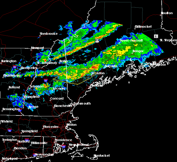 At 854 pm edt, severe thunderstorms were located along a line extending from near mechanic falls to naples, moving east at 55 mph (radar indicated). Hazards include 60 mph wind gusts. Expect damage to roofs, siding, and trees. locations impacted include, lewiston, bridgton, mechanic falls, turner, naples, gray, raymond, lisbon, greene, casco, harrison, leeds, buckfield, hebron, new gloucester, wales, sabattus, poland, minot and oxford. This includes interstate 95 between mile markers 66 and 89. At 854 pm edt, severe thunderstorms were located along a line extending from near mechanic falls to naples, moving east at 55 mph (radar indicated). Hazards include 60 mph wind gusts. Expect damage to roofs, siding, and trees. locations impacted include, lewiston, bridgton, mechanic falls, turner, naples, gray, raymond, lisbon, greene, casco, harrison, leeds, buckfield, hebron, new gloucester, wales, sabattus, poland, minot and oxford. This includes interstate 95 between mile markers 66 and 89.
|
| 10/10/2020 8:21 PM EDT |
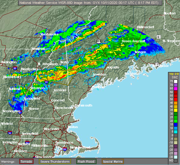 At 820 pm edt, severe thunderstorms were located along a line extending from near waterford to 7 miles northwest of tamworth, moving east at 50 mph (radar indicated). Hazards include 60 mph wind gusts and quarter size hail. Hail damage to vehicles is expected. Expect wind damage to roofs, siding, and trees. At 820 pm edt, severe thunderstorms were located along a line extending from near waterford to 7 miles northwest of tamworth, moving east at 50 mph (radar indicated). Hazards include 60 mph wind gusts and quarter size hail. Hail damage to vehicles is expected. Expect wind damage to roofs, siding, and trees.
|
| 8/25/2020 3:23 PM EDT |
 The severe thunderstorm warning for southern androscoggin county will expire at 330 pm edt, the storm which prompted the warning has moved out of the area. therefore, the warning will be allowed to expire. however gusty winds and heavy rain are still possible with this thunderstorm. a severe thunderstorm watch remains in effect until 1000 pm edt for south central and southwestern maine. The severe thunderstorm warning for southern androscoggin county will expire at 330 pm edt, the storm which prompted the warning has moved out of the area. therefore, the warning will be allowed to expire. however gusty winds and heavy rain are still possible with this thunderstorm. a severe thunderstorm watch remains in effect until 1000 pm edt for south central and southwestern maine.
|
| 8/25/2020 3:08 PM EDT |
 At 308 pm edt, a severe thunderstorm was located near lewiston, moving east at 55 mph (radar indicated). Hazards include 60 mph wind gusts and quarter size hail. Hail damage to vehicles is expected. expect wind damage to roofs, siding, and trees. locations impacted include, lewiston, mechanic falls, turner, topsham, lisbon, greene, durham, bowdoin, wales, poland, minot and sabattus. This includes interstate 95 between mile markers 74 and 90. At 308 pm edt, a severe thunderstorm was located near lewiston, moving east at 55 mph (radar indicated). Hazards include 60 mph wind gusts and quarter size hail. Hail damage to vehicles is expected. expect wind damage to roofs, siding, and trees. locations impacted include, lewiston, mechanic falls, turner, topsham, lisbon, greene, durham, bowdoin, wales, poland, minot and sabattus. This includes interstate 95 between mile markers 74 and 90.
|
| 8/25/2020 2:55 PM EDT |
 At 254 pm edt, a severe thunderstorm was located over mechanic falls, moving east at 50 mph (radar indicated). Hazards include 60 mph wind gusts and quarter size hail. Hail damage to vehicles is expected. Expect wind damage to roofs, siding, and trees. At 254 pm edt, a severe thunderstorm was located over mechanic falls, moving east at 50 mph (radar indicated). Hazards include 60 mph wind gusts and quarter size hail. Hail damage to vehicles is expected. Expect wind damage to roofs, siding, and trees.
|
| 8/24/2020 5:27 PM EDT |
 The severe thunderstorm warning for southeastern androscoggin and northeastern cumberland counties will expire at 530 pm edt, the storm which prompted the warning has weakened below severe limits, and has exited the warned area. therefore, the warning will be allowed to expire. however gusty winds are still possible with this thunderstorm. The severe thunderstorm warning for southeastern androscoggin and northeastern cumberland counties will expire at 530 pm edt, the storm which prompted the warning has weakened below severe limits, and has exited the warned area. therefore, the warning will be allowed to expire. however gusty winds are still possible with this thunderstorm.
|
| 8/24/2020 5:11 PM EDT |
 At 510 pm edt, a severe thunderstorm was located near gray, or 10 miles south of lewiston, moving southeast at 15 mph (radar indicated). Hazards include 60 mph wind gusts and quarter size hail. Hail damage to vehicles is expected. expect wind damage to roofs, siding, and trees. locations impacted include, lewiston, gray, lisbon, durham, pownal, new gloucester and north yarmouth. This includes interstate 95 between mile markers 67 and 72. At 510 pm edt, a severe thunderstorm was located near gray, or 10 miles south of lewiston, moving southeast at 15 mph (radar indicated). Hazards include 60 mph wind gusts and quarter size hail. Hail damage to vehicles is expected. expect wind damage to roofs, siding, and trees. locations impacted include, lewiston, gray, lisbon, durham, pownal, new gloucester and north yarmouth. This includes interstate 95 between mile markers 67 and 72.
|
| 8/24/2020 4:51 PM EDT |
 At 451 pm edt, a severe thunderstorm was located 7 miles north of gray, or 8 miles south of mechanic falls, moving southeast at 15 mph (radar indicated). Hazards include 60 mph wind gusts and quarter size hail. Hail damage to vehicles is expected. Expect wind damage to roofs, siding, and trees. At 451 pm edt, a severe thunderstorm was located 7 miles north of gray, or 8 miles south of mechanic falls, moving southeast at 15 mph (radar indicated). Hazards include 60 mph wind gusts and quarter size hail. Hail damage to vehicles is expected. Expect wind damage to roofs, siding, and trees.
|
| 8/24/2020 4:37 PM EDT |
 At 436 pm edt, a severe thunderstorm was located near mechanic falls, moving southeast at 15 mph (radar indicated). Hazards include 60 mph wind gusts and quarter size hail. Hail damage to vehicles is expected. expect wind damage to roofs, siding, and trees. locations impacted include, lewiston, mechanic falls, gray, raymond, poland, minot and new gloucester. This includes interstate 95 between mile markers 71 and 80. At 436 pm edt, a severe thunderstorm was located near mechanic falls, moving southeast at 15 mph (radar indicated). Hazards include 60 mph wind gusts and quarter size hail. Hail damage to vehicles is expected. expect wind damage to roofs, siding, and trees. locations impacted include, lewiston, mechanic falls, gray, raymond, poland, minot and new gloucester. This includes interstate 95 between mile markers 71 and 80.
|
| 8/24/2020 4:21 PM EDT |
 At 420 pm edt, a severe thunderstorm was located 7 miles west of mechanic falls, moving southeast at 15 mph (radar indicated). Hazards include 60 mph wind gusts and quarter size hail. Hail damage to vehicles is expected. Expect wind damage to roofs, siding, and trees. At 420 pm edt, a severe thunderstorm was located 7 miles west of mechanic falls, moving southeast at 15 mph (radar indicated). Hazards include 60 mph wind gusts and quarter size hail. Hail damage to vehicles is expected. Expect wind damage to roofs, siding, and trees.
|
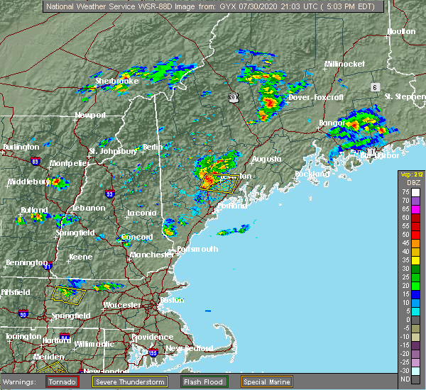
| 7/30/2020 5:39 PM EDT |
 The severe thunderstorm warning for southeastern androscoggin, east central cumberland and west central sagadahoc counties will expire at 545 pm edt, the storm which prompted the warning has weakened below severe limits, and no longer poses an immediate threat to life or property. therefore, the warning will be allowed to expire. however heavy rain is still possible with this thunderstorm. The severe thunderstorm warning for southeastern androscoggin, east central cumberland and west central sagadahoc counties will expire at 545 pm edt, the storm which prompted the warning has weakened below severe limits, and no longer poses an immediate threat to life or property. therefore, the warning will be allowed to expire. however heavy rain is still possible with this thunderstorm.
|
| 7/30/2020 5:24 PM EDT |
 At 524 pm edt, a severe thunderstorm was located near gray, or 12 miles south of lewiston, moving east at 20 mph (radar indicated). Hazards include 60 mph wind gusts and quarter size hail. Hail damage to vehicles is expected. Expect wind damage to roofs, siding, and trees. At 524 pm edt, a severe thunderstorm was located near gray, or 12 miles south of lewiston, moving east at 20 mph (radar indicated). Hazards include 60 mph wind gusts and quarter size hail. Hail damage to vehicles is expected. Expect wind damage to roofs, siding, and trees.
|
| 7/30/2020 5:22 PM EDT |
 At 522 pm edt, a severe thunderstorm was located 8 miles northeast of gray, or 8 miles south of lewiston, moving east at 20 mph (radar indicated). Hazards include 60 mph wind gusts and nickel size hail. Expect damage to roofs, siding, and trees. locations impacted include, lewiston, brunswick, topsham, lisbon, durham, bowdoin and new gloucester. this includes the following highways, interstate 295 near mile marker 30. Interstate 95 between mile markers 76 and 77. At 522 pm edt, a severe thunderstorm was located 8 miles northeast of gray, or 8 miles south of lewiston, moving east at 20 mph (radar indicated). Hazards include 60 mph wind gusts and nickel size hail. Expect damage to roofs, siding, and trees. locations impacted include, lewiston, brunswick, topsham, lisbon, durham, bowdoin and new gloucester. this includes the following highways, interstate 295 near mile marker 30. Interstate 95 between mile markers 76 and 77.
|
| 7/30/2020 5:06 PM EDT | Trees down across the road. reported at beech road auburn m in androscoggin county ME, 2.3 miles NE of Auburn, ME |
| 7/30/2020 5:05 PM EDT | Large tree split in half landing on a parked car. reported at turner street auburn m in androscoggin county ME, 1.2 miles SSW of Auburn, ME |
| 7/30/2020 4:56 PM EDT |
 At 456 pm edt, a severe thunderstorm was located near mechanic falls, moving east at 40 mph (radar indicated). Hazards include 60 mph wind gusts and nickel size hail. expect damage to roofs, siding, and trees At 456 pm edt, a severe thunderstorm was located near mechanic falls, moving east at 40 mph (radar indicated). Hazards include 60 mph wind gusts and nickel size hail. expect damage to roofs, siding, and trees
|
| 7/8/2020 6:06 PM EDT |
 At 606 pm edt, severe thunderstorms were located along a line extending from near topsham to near raymond, moving southeast at 35 mph (radar indicated). Hazards include 60 mph wind gusts and quarter size hail. Hail damage to vehicles is expected. expect wind damage to roofs, siding, and trees. locations impacted include, lewiston, brunswick, bridgton, fryeburg, mechanic falls, naples, topsham, freeport, gray, litchfield, hiram, raymond, waterford, standish, lisbon, greene, durham, casco, bowdoin and harrison. this also includes, sebago lake, pleasant mountain, long lake, and douglas mountain. this includes the following highways, interstate 295 between mile markers 25 and 29. Interstate 95 between mile markers 62 and 90. At 606 pm edt, severe thunderstorms were located along a line extending from near topsham to near raymond, moving southeast at 35 mph (radar indicated). Hazards include 60 mph wind gusts and quarter size hail. Hail damage to vehicles is expected. expect wind damage to roofs, siding, and trees. locations impacted include, lewiston, brunswick, bridgton, fryeburg, mechanic falls, naples, topsham, freeport, gray, litchfield, hiram, raymond, waterford, standish, lisbon, greene, durham, casco, bowdoin and harrison. this also includes, sebago lake, pleasant mountain, long lake, and douglas mountain. this includes the following highways, interstate 295 between mile markers 25 and 29. Interstate 95 between mile markers 62 and 90.
|
| 7/8/2020 5:24 PM EDT |
 At 523 pm edt, severe thunderstorms were located along a line extending from near turner to near waterford, moving southeast at 40 mph. additional severe thunderstorms were also occurring (radar indicated). Hazards include 60 mph wind gusts and quarter size hail. Hail damage to vehicles is expected. Expect wind damage to roofs, siding, and trees. At 523 pm edt, severe thunderstorms were located along a line extending from near turner to near waterford, moving southeast at 40 mph. additional severe thunderstorms were also occurring (radar indicated). Hazards include 60 mph wind gusts and quarter size hail. Hail damage to vehicles is expected. Expect wind damage to roofs, siding, and trees.
|
| 7/8/2020 3:54 PM EDT |
 At 354 pm edt, a severe thunderstorm was located near gray, or 12 miles west of topsham, moving east at 20 mph (radar indicated). Hazards include 60 mph wind gusts and penny size hail. Expect damage to roofs, siding, and trees. locations impacted include, cumberland, gray, durham, pownal, new gloucester and north yarmouth. This includes interstate 95 between mile markers 61 and 66. At 354 pm edt, a severe thunderstorm was located near gray, or 12 miles west of topsham, moving east at 20 mph (radar indicated). Hazards include 60 mph wind gusts and penny size hail. Expect damage to roofs, siding, and trees. locations impacted include, cumberland, gray, durham, pownal, new gloucester and north yarmouth. This includes interstate 95 between mile markers 61 and 66.
|
| 7/8/2020 3:26 PM EDT |
 At 326 pm edt, a severe thunderstorm was located near raymond, or 7 miles east of naples, moving southeast at 15 mph (radar indicated). Hazards include 60 mph wind gusts and quarter size hail. Hail damage to vehicles is expected. expect wind damage to roofs, siding, and trees. Locations impacted include, gray, raymond, casco, poland and new gloucester. At 326 pm edt, a severe thunderstorm was located near raymond, or 7 miles east of naples, moving southeast at 15 mph (radar indicated). Hazards include 60 mph wind gusts and quarter size hail. Hail damage to vehicles is expected. expect wind damage to roofs, siding, and trees. Locations impacted include, gray, raymond, casco, poland and new gloucester.
|
| 7/8/2020 3:25 PM EDT |
 At 325 pm edt, a severe thunderstorm was located near raymond, or 9 miles east of naples, moving southeast at 20 mph (radar indicated). Hazards include 60 mph wind gusts and quarter size hail. Hail damage to vehicles is expected. Expect wind damage to roofs, siding, and trees. At 325 pm edt, a severe thunderstorm was located near raymond, or 9 miles east of naples, moving southeast at 20 mph (radar indicated). Hazards include 60 mph wind gusts and quarter size hail. Hail damage to vehicles is expected. Expect wind damage to roofs, siding, and trees.
|
| 7/8/2020 3:04 PM EDT |
 At 304 pm edt, a severe thunderstorm was located near naples, moving southeast at 15 mph (radar indicated). Hazards include 60 mph wind gusts and quarter size hail. Hail damage to vehicles is expected. expect wind damage to roofs, siding, and trees. Locations impacted include, mechanic falls, naples, gray, raymond, casco, harrison, poland, minot, oxford, otisfield and new gloucester. At 304 pm edt, a severe thunderstorm was located near naples, moving southeast at 15 mph (radar indicated). Hazards include 60 mph wind gusts and quarter size hail. Hail damage to vehicles is expected. expect wind damage to roofs, siding, and trees. Locations impacted include, mechanic falls, naples, gray, raymond, casco, harrison, poland, minot, oxford, otisfield and new gloucester.
|
| 7/8/2020 2:53 PM EDT |
 At 252 pm edt, a severe thunderstorm was located near bridgton, moving southeast at 20 mph (radar indicated). Hazards include 60 mph wind gusts and quarter size hail. Hail damage to vehicles is expected. Expect wind damage to roofs, siding, and trees. At 252 pm edt, a severe thunderstorm was located near bridgton, moving southeast at 20 mph (radar indicated). Hazards include 60 mph wind gusts and quarter size hail. Hail damage to vehicles is expected. Expect wind damage to roofs, siding, and trees.
|
| 6/6/2020 1:15 PM EDT |
 At 115 pm edt, severe thunderstorms were located along a line extending from 7 miles northwest of topsham to near freeport, moving east at 35 mph (radar indicated). Hazards include 60 mph wind gusts and quarter size hail. Hail damage to vehicles is expected. Expect wind damage to roofs, siding, and trees. At 115 pm edt, severe thunderstorms were located along a line extending from 7 miles northwest of topsham to near freeport, moving east at 35 mph (radar indicated). Hazards include 60 mph wind gusts and quarter size hail. Hail damage to vehicles is expected. Expect wind damage to roofs, siding, and trees.
|
| 6/6/2020 1:09 PM EDT |
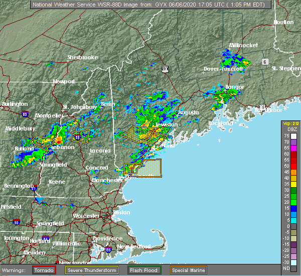 The severe thunderstorm warning for south central oxford, southwestern androscoggin and northwestern cumberland counties will expire at 115 pm edt, the storms which prompted the warning have moved out of the area. therefore, the warning will be allowed to expire. however heavy rain is still possible with these thunderstorms. a severe thunderstorm watch remains in effect until 800 pm edt for western and southwestern maine. The severe thunderstorm warning for south central oxford, southwestern androscoggin and northwestern cumberland counties will expire at 115 pm edt, the storms which prompted the warning have moved out of the area. therefore, the warning will be allowed to expire. however heavy rain is still possible with these thunderstorms. a severe thunderstorm watch remains in effect until 800 pm edt for western and southwestern maine.
|
| 6/6/2020 12:58 PM EDT |
 At 1258 pm edt, severe thunderstorms were located along a line extending from 6 miles southwest of lewiston to near gray to near raymond, moving southeast at 35 mph (radar indicated). Hazards include 60 mph wind gusts and penny size hail. expect damage to roofs, siding, and trees At 1258 pm edt, severe thunderstorms were located along a line extending from 6 miles southwest of lewiston to near gray to near raymond, moving southeast at 35 mph (radar indicated). Hazards include 60 mph wind gusts and penny size hail. expect damage to roofs, siding, and trees
|
| 6/6/2020 12:55 PM EDT | Trees and wires down. reported at cobbs bridge road new glocuste in cumberland county ME, 8.7 miles N of Auburn, ME |
| 6/6/2020 12:55 PM EDT | Trees and wires down on tobey roa in cumberland county ME, 8.2 miles NNE of Auburn, ME |
| 6/6/2020 12:50 PM EDT | Trees and wires down. reported at querry road new glocuste in cumberland county ME, 10.9 miles NE of Auburn, ME |
| 6/6/2020 12:34 PM EDT |
 At 1233 pm edt, severe thunderstorms were located along a line extending from near mechanic falls to naples to near hiram, moving east at 30 mph (radar indicated). Hazards include 60 mph wind gusts and quarter size hail. Hail damage to vehicles is expected. Expect wind damage to roofs, siding, and trees. At 1233 pm edt, severe thunderstorms were located along a line extending from near mechanic falls to naples to near hiram, moving east at 30 mph (radar indicated). Hazards include 60 mph wind gusts and quarter size hail. Hail damage to vehicles is expected. Expect wind damage to roofs, siding, and trees.
|
| 8/19/2019 3:48 PM EDT | Branches on road near hallow hill and hwy 219 in oxford county ME, 15.8 miles S of Auburn, ME |
| 7/6/2019 4:35 PM EDT |
 At 435 pm edt, a severe thunderstorm was located 7 miles southeast of gardiner, moving east at 25 mph (radar indicated). Hazards include 60 mph wind gusts. Expect damage to roofs, siding, and trees. locations impacted include, lewiston, augusta, gardiner, damariscotta, wiscasset, china, litchfield, farmingdale, bristol, hallowell, woolwich, lisbon, bowdoin, bowdoinham, chelsea, jefferson, dresden, edgecomb, alna and windsor. this includes the following highways, interstate 295 between mile markers 37 and 51. Interstate 95 between mile markers 78 and 105. At 435 pm edt, a severe thunderstorm was located 7 miles southeast of gardiner, moving east at 25 mph (radar indicated). Hazards include 60 mph wind gusts. Expect damage to roofs, siding, and trees. locations impacted include, lewiston, augusta, gardiner, damariscotta, wiscasset, china, litchfield, farmingdale, bristol, hallowell, woolwich, lisbon, bowdoin, bowdoinham, chelsea, jefferson, dresden, edgecomb, alna and windsor. this includes the following highways, interstate 295 between mile markers 37 and 51. Interstate 95 between mile markers 78 and 105.
|
| 7/6/2019 4:21 PM EDT |
 At 420 pm edt, a severe thunderstorm was located over gardiner, moving east at 25 mph (radar indicated). Hazards include 60 mph wind gusts. Expect damage to roofs, siding, and trees. locations impacted include, lewiston, augusta, gardiner, damariscotta, wiscasset, china, litchfield, farmingdale, bristol, manchester, hallowell, winthrop, woolwich, lisbon, greene, bowdoin, bowdoinham, chelsea, jefferson and leeds. this includes the following highways, interstate 295 between mile markers 37 and 51. Interstate 95 between mile markers 78 and 110. At 420 pm edt, a severe thunderstorm was located over gardiner, moving east at 25 mph (radar indicated). Hazards include 60 mph wind gusts. Expect damage to roofs, siding, and trees. locations impacted include, lewiston, augusta, gardiner, damariscotta, wiscasset, china, litchfield, farmingdale, bristol, manchester, hallowell, winthrop, woolwich, lisbon, greene, bowdoin, bowdoinham, chelsea, jefferson and leeds. this includes the following highways, interstate 295 between mile markers 37 and 51. Interstate 95 between mile markers 78 and 110.
|
| 7/6/2019 4:03 PM EDT |
 At 343 pm edt, a severe thunderstorm was located near turner, moving east at 30 mph (radar indicated). Hazards include 60 mph wind gusts and penny size hail. Expect damage to roofs, siding, and trees. locations impacted include, lewiston, mechanic falls, turner, lisbon, greene, durham, leeds, livermore, buckfield, hebron, hartford, wales, sabattus, poland, minot, oxford, otisfield, paris, wayne and sumner. this also includes, crocker hill, streaked mountain, and singepole ridge. This includes interstate 95 between mile markers 74 and 86. At 343 pm edt, a severe thunderstorm was located near turner, moving east at 30 mph (radar indicated). Hazards include 60 mph wind gusts and penny size hail. Expect damage to roofs, siding, and trees. locations impacted include, lewiston, mechanic falls, turner, lisbon, greene, durham, leeds, livermore, buckfield, hebron, hartford, wales, sabattus, poland, minot, oxford, otisfield, paris, wayne and sumner. this also includes, crocker hill, streaked mountain, and singepole ridge. This includes interstate 95 between mile markers 74 and 86.
|
| 7/6/2019 3:49 PM EDT |
 At 348 pm edt, a severe thunderstorm was located near winthrop, or 10 miles east of turner, moving east at 25 mph (radar indicated). Hazards include 60 mph wind gusts. expect damage to roofs, siding, and trees At 348 pm edt, a severe thunderstorm was located near winthrop, or 10 miles east of turner, moving east at 25 mph (radar indicated). Hazards include 60 mph wind gusts. expect damage to roofs, siding, and trees
|
| 7/6/2019 3:44 PM EDT |
 At 343 pm edt, a severe thunderstorm was located near turner, moving east at 30 mph (radar indicated). Hazards include 60 mph wind gusts and penny size hail. Expect damage to roofs, siding, and trees. locations impacted include, lewiston, mechanic falls, turner, lisbon, greene, durham, leeds, livermore, buckfield, hebron, hartford, wales, sabattus, poland, minot, oxford, otisfield, paris, wayne and sumner. this also includes, crocker hill, streaked mountain, and singepole ridge. This includes interstate 95 between mile markers 74 and 86. At 343 pm edt, a severe thunderstorm was located near turner, moving east at 30 mph (radar indicated). Hazards include 60 mph wind gusts and penny size hail. Expect damage to roofs, siding, and trees. locations impacted include, lewiston, mechanic falls, turner, lisbon, greene, durham, leeds, livermore, buckfield, hebron, hartford, wales, sabattus, poland, minot, oxford, otisfield, paris, wayne and sumner. this also includes, crocker hill, streaked mountain, and singepole ridge. This includes interstate 95 between mile markers 74 and 86.
|
| 7/6/2019 3:19 PM EDT |
 At 318 pm edt, a severe thunderstorm was located 9 miles northwest of mechanic falls, moving east at 30 mph (radar indicated). Hazards include 60 mph wind gusts. expect damage to roofs, siding, and trees At 318 pm edt, a severe thunderstorm was located 9 miles northwest of mechanic falls, moving east at 30 mph (radar indicated). Hazards include 60 mph wind gusts. expect damage to roofs, siding, and trees
|
| 9/3/2018 7:34 PM EDT |
 At 734 pm edt, a severe thunderstorm was located near litchfield, or 9 miles north of topsham, moving east at 35 mph (radar indicated). Hazards include 60 mph wind gusts. Expect damage to roofs, siding, and trees. locations impacted include, lewiston, brunswick, bath, gardiner, topsham, litchfield, farmingdale, lisbon, greene, durham, bowdoin, bowdoinham, chelsea, dresden, wales, monmouth, sabattus, pittston, west gardiner and richmond. this includes the following highways, interstate 295 between mile markers 28 and 51. Interstate 95 between mile markers 78 and 105. At 734 pm edt, a severe thunderstorm was located near litchfield, or 9 miles north of topsham, moving east at 35 mph (radar indicated). Hazards include 60 mph wind gusts. Expect damage to roofs, siding, and trees. locations impacted include, lewiston, brunswick, bath, gardiner, topsham, litchfield, farmingdale, lisbon, greene, durham, bowdoin, bowdoinham, chelsea, dresden, wales, monmouth, sabattus, pittston, west gardiner and richmond. this includes the following highways, interstate 295 between mile markers 28 and 51. Interstate 95 between mile markers 78 and 105.
|
| 9/3/2018 7:03 PM EDT |
 At 702 pm edt, a severe thunderstorm was located 5 miles west of lewiston, moving east at 35 mph. this storm will impact the lewiston and auburn metro (radar indicated). Hazards include 60 mph wind gusts. expect damage to roofs, siding, and trees At 702 pm edt, a severe thunderstorm was located 5 miles west of lewiston, moving east at 35 mph. this storm will impact the lewiston and auburn metro (radar indicated). Hazards include 60 mph wind gusts. expect damage to roofs, siding, and trees
|
| 9/3/2018 6:46 PM EDT |
 At 646 pm edt, a severe thunderstorm was located near south paris, moving east at 40 mph (trained weather spotters). Hazards include 60 mph wind gusts and penny size hail. Expect damage to roofs, siding, and trees. locations impacted include, lewiston, bridgton, mechanic falls, turner, waterford, greene, harrison, leeds, livermore, buckfield, hebron, hartford, greenwood, west paris, otisfield, norway, poland, minot, oxford and paris. this also includes, crocker hill, streaked mountain, and singepole ridge. This includes interstate 95 between mile markers 73 and 81. At 646 pm edt, a severe thunderstorm was located near south paris, moving east at 40 mph (trained weather spotters). Hazards include 60 mph wind gusts and penny size hail. Expect damage to roofs, siding, and trees. locations impacted include, lewiston, bridgton, mechanic falls, turner, waterford, greene, harrison, leeds, livermore, buckfield, hebron, hartford, greenwood, west paris, otisfield, norway, poland, minot, oxford and paris. this also includes, crocker hill, streaked mountain, and singepole ridge. This includes interstate 95 between mile markers 73 and 81.
|
| 9/3/2018 6:21 PM EDT |
 At 621 pm edt, a severe thunderstorm was located 7 miles south of bethel, moving east at 40 mph (radar indicated). Hazards include 60 mph wind gusts and penny size hail. expect damage to roofs, siding, and trees At 621 pm edt, a severe thunderstorm was located 7 miles south of bethel, moving east at 40 mph (radar indicated). Hazards include 60 mph wind gusts and penny size hail. expect damage to roofs, siding, and trees
|
| 8/17/2018 10:41 PM EDT |
 At 1041 pm edt, a severe thunderstorm was located 7 miles northeast of lewiston, moving northeast at 35 mph (radar indicated). Hazards include 60 mph wind gusts. expect damage to roofs, siding, and trees At 1041 pm edt, a severe thunderstorm was located 7 miles northeast of lewiston, moving northeast at 35 mph (radar indicated). Hazards include 60 mph wind gusts. expect damage to roofs, siding, and trees
|
| 8/7/2018 5:37 PM EDT |
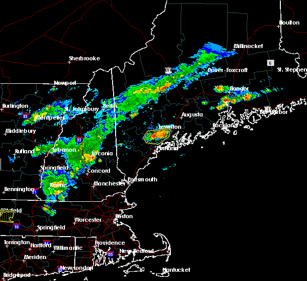 At 536 pm edt, severe thunderstorms were located along a line extending from 6 miles southeast of lewiston to near gray to near standish, moving east at 20 mph (radar indicated). Hazards include 60 mph wind gusts. Expect damage to roofs, siding, and trees. locations impacted include, lewiston, brunswick, topsham, cumberland, freeport, gray, yarmouth, raymond, lisbon, durham, bowdoin, new gloucester, pownal, north yarmouth, poland and sabattus. this includes the following highways, interstate 295 between mile markers 22 and 28. Interstate 95 between mile markers 61 and 87. At 536 pm edt, severe thunderstorms were located along a line extending from 6 miles southeast of lewiston to near gray to near standish, moving east at 20 mph (radar indicated). Hazards include 60 mph wind gusts. Expect damage to roofs, siding, and trees. locations impacted include, lewiston, brunswick, topsham, cumberland, freeport, gray, yarmouth, raymond, lisbon, durham, bowdoin, new gloucester, pownal, north yarmouth, poland and sabattus. this includes the following highways, interstate 295 between mile markers 22 and 28. Interstate 95 between mile markers 61 and 87.
|
| 8/7/2018 5:23 PM EDT |
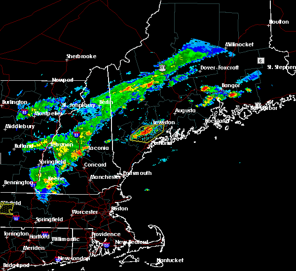 At 522 pm edt, severe thunderstorms were located along a line extending from near lewiston to near gray to near standish, moving east at 20 mph (radar indicated). Hazards include 60 mph wind gusts. Expect damage to roofs, siding, and trees. locations impacted include, lewiston, brunswick, topsham, cumberland, gorham, falmouth, freeport, gray, raymond, yarmouth, standish, lisbon, durham, casco, bowdoin, frye island, windham, new gloucester, pownal and poland. this also includes, sebago lake. this includes the following highways, interstate 295 between mile markers 22 and 27. Interstate 95 between mile markers 55 and 87. At 522 pm edt, severe thunderstorms were located along a line extending from near lewiston to near gray to near standish, moving east at 20 mph (radar indicated). Hazards include 60 mph wind gusts. Expect damage to roofs, siding, and trees. locations impacted include, lewiston, brunswick, topsham, cumberland, gorham, falmouth, freeport, gray, raymond, yarmouth, standish, lisbon, durham, casco, bowdoin, frye island, windham, new gloucester, pownal and poland. this also includes, sebago lake. this includes the following highways, interstate 295 between mile markers 22 and 27. Interstate 95 between mile markers 55 and 87.
|
| 8/7/2018 5:20 PM EDT | Tree down on power line in cumberland county ME, 9.7 miles NNE of Auburn, ME |
| 8/7/2018 5:20 PM EDT | Tree down on power lines. time estimated from rada in cumberland county ME, 10.9 miles NNE of Auburn, ME |
| 8/7/2018 5:01 PM EDT |
 The national weather service in gray maine has issued a * severe thunderstorm warning for. north central york county in southwestern maine. southern androscoggin county in southwestern maine. central cumberland county in southwestern maine. Northwestern sagadahoc county in south central maine. The national weather service in gray maine has issued a * severe thunderstorm warning for. north central york county in southwestern maine. southern androscoggin county in southwestern maine. central cumberland county in southwestern maine. Northwestern sagadahoc county in south central maine.
|
| 7/27/2018 5:36 PM EDT |
 At 536 pm edt, severe thunderstorms were located along a line extending from near turner to near mechanic falls, moving east at 20 mph (radar indicated). Hazards include 60 mph wind gusts and quarter size hail. Hail damage to vehicles is expected. expect wind damage to roofs, siding, and trees. locations impacted include, lewiston, mechanic falls, topsham, lisbon, greene, durham, bowdoin, wales, minot, sabattus, poland and new gloucester. This includes interstate 95 between mile markers 74 and 90. At 536 pm edt, severe thunderstorms were located along a line extending from near turner to near mechanic falls, moving east at 20 mph (radar indicated). Hazards include 60 mph wind gusts and quarter size hail. Hail damage to vehicles is expected. expect wind damage to roofs, siding, and trees. locations impacted include, lewiston, mechanic falls, topsham, lisbon, greene, durham, bowdoin, wales, minot, sabattus, poland and new gloucester. This includes interstate 95 between mile markers 74 and 90.
|
| 7/27/2018 5:34 PM EDT |
 At 533 pm edt, severe thunderstorms were located along a line extending from 7 miles southeast of livermore falls to near turner, moving east at 15 mph (radar indicated). Hazards include 60 mph wind gusts and quarter size hail. Hail damage to vehicles is expected. expect wind damage to roofs, siding, and trees. Locations impacted include, augusta, turner, oakland, litchfield, belgrade, livermore falls, farmingdale, manchester, hallowell, winthrop, greene, leeds, livermore, fayette, wales, monmouth, wayne, readfield, mount vernon and sidney. At 533 pm edt, severe thunderstorms were located along a line extending from 7 miles southeast of livermore falls to near turner, moving east at 15 mph (radar indicated). Hazards include 60 mph wind gusts and quarter size hail. Hail damage to vehicles is expected. expect wind damage to roofs, siding, and trees. Locations impacted include, augusta, turner, oakland, litchfield, belgrade, livermore falls, farmingdale, manchester, hallowell, winthrop, greene, leeds, livermore, fayette, wales, monmouth, wayne, readfield, mount vernon and sidney.
|
| 7/27/2018 5:30 PM EDT | Multiple trees and wires dow in androscoggin county ME, 10.3 miles SSE of Auburn, ME |
| 7/27/2018 5:18 PM EDT |
 At 518 pm edt, a severe thunderstorm was located over raymond, or 8 miles southeast of naples, moving northeast at 20 mph (radar indicated). Hazards include 60 mph wind gusts and quarter size hail. Hail damage to vehicles is expected. expect wind damage to roofs, siding, and trees. locations impacted include, gray, raymond, standish, durham, casco, frye island, new gloucester, pownal, windham, baldwin, poland, north yarmouth and sebago. this also includes, sebago lake. This includes interstate 95 between mile markers 62 and 73. At 518 pm edt, a severe thunderstorm was located over raymond, or 8 miles southeast of naples, moving northeast at 20 mph (radar indicated). Hazards include 60 mph wind gusts and quarter size hail. Hail damage to vehicles is expected. expect wind damage to roofs, siding, and trees. locations impacted include, gray, raymond, standish, durham, casco, frye island, new gloucester, pownal, windham, baldwin, poland, north yarmouth and sebago. this also includes, sebago lake. This includes interstate 95 between mile markers 62 and 73.
|
| 7/27/2018 5:09 PM EDT |
 At 509 pm edt, severe thunderstorms were located along a line extending from near mechanic falls to 6 miles northeast of naples, moving east at 20 mph (radar indicated). Hazards include 60 mph wind gusts and quarter size hail. Hail damage to vehicles is expected. Expect wind damage to roofs, siding, and trees. At 509 pm edt, severe thunderstorms were located along a line extending from near mechanic falls to 6 miles northeast of naples, moving east at 20 mph (radar indicated). Hazards include 60 mph wind gusts and quarter size hail. Hail damage to vehicles is expected. Expect wind damage to roofs, siding, and trees.
|
| 7/27/2018 4:46 PM EDT |
 At 446 pm edt, severe thunderstorms were located along a line extending from near canton to 6 miles north of mechanic falls, moving east at 15 mph (radar indicated). Hazards include 60 mph wind gusts and quarter size hail. Hail damage to vehicles is expected. Expect wind damage to roofs, siding, and trees. At 446 pm edt, severe thunderstorms were located along a line extending from near canton to 6 miles north of mechanic falls, moving east at 15 mph (radar indicated). Hazards include 60 mph wind gusts and quarter size hail. Hail damage to vehicles is expected. Expect wind damage to roofs, siding, and trees.
|
| 7/27/2018 4:42 PM EDT |
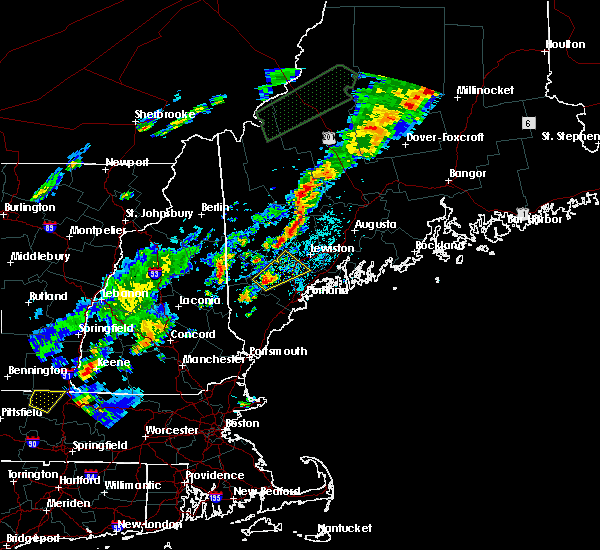 At 441 pm edt, a severe thunderstorm was located 7 miles north of standish, or 9 miles south of naples, moving northeast at 25 mph (radar indicated). Hazards include 60 mph wind gusts and quarter size hail. Hail damage to vehicles is expected. Expect wind damage to roofs, siding, and trees. At 441 pm edt, a severe thunderstorm was located 7 miles north of standish, or 9 miles south of naples, moving northeast at 25 mph (radar indicated). Hazards include 60 mph wind gusts and quarter size hail. Hail damage to vehicles is expected. Expect wind damage to roofs, siding, and trees.
|
| 7/1/2018 3:02 AM EDT |
 At 301 am edt, severe thunderstorms were located along a line extending from near jay to 6 miles south of rumford, moving south at 35 mph (radar indicated). Hazards include 60 mph wind gusts and penny size hail. expect damage to roofs, siding, and trees At 301 am edt, severe thunderstorms were located along a line extending from near jay to 6 miles south of rumford, moving south at 35 mph (radar indicated). Hazards include 60 mph wind gusts and penny size hail. expect damage to roofs, siding, and trees
|
| 9/5/2017 6:45 PM EDT | Pleasant pond rd... trees down in androscoggin county ME, 14.3 miles S of Auburn, ME |
| 9/5/2017 6:14 PM EDT |
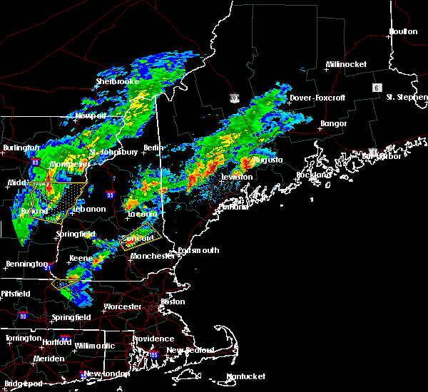 At 613 pm edt, a severe thunderstorm was located over turner, moving northeast at 45 mph (radar indicated). Hazards include 60 mph wind gusts and nickel size hail. expect damage to trees, and power lines At 613 pm edt, a severe thunderstorm was located over turner, moving northeast at 45 mph (radar indicated). Hazards include 60 mph wind gusts and nickel size hail. expect damage to trees, and power lines
|
| 9/5/2017 5:57 PM EDT |
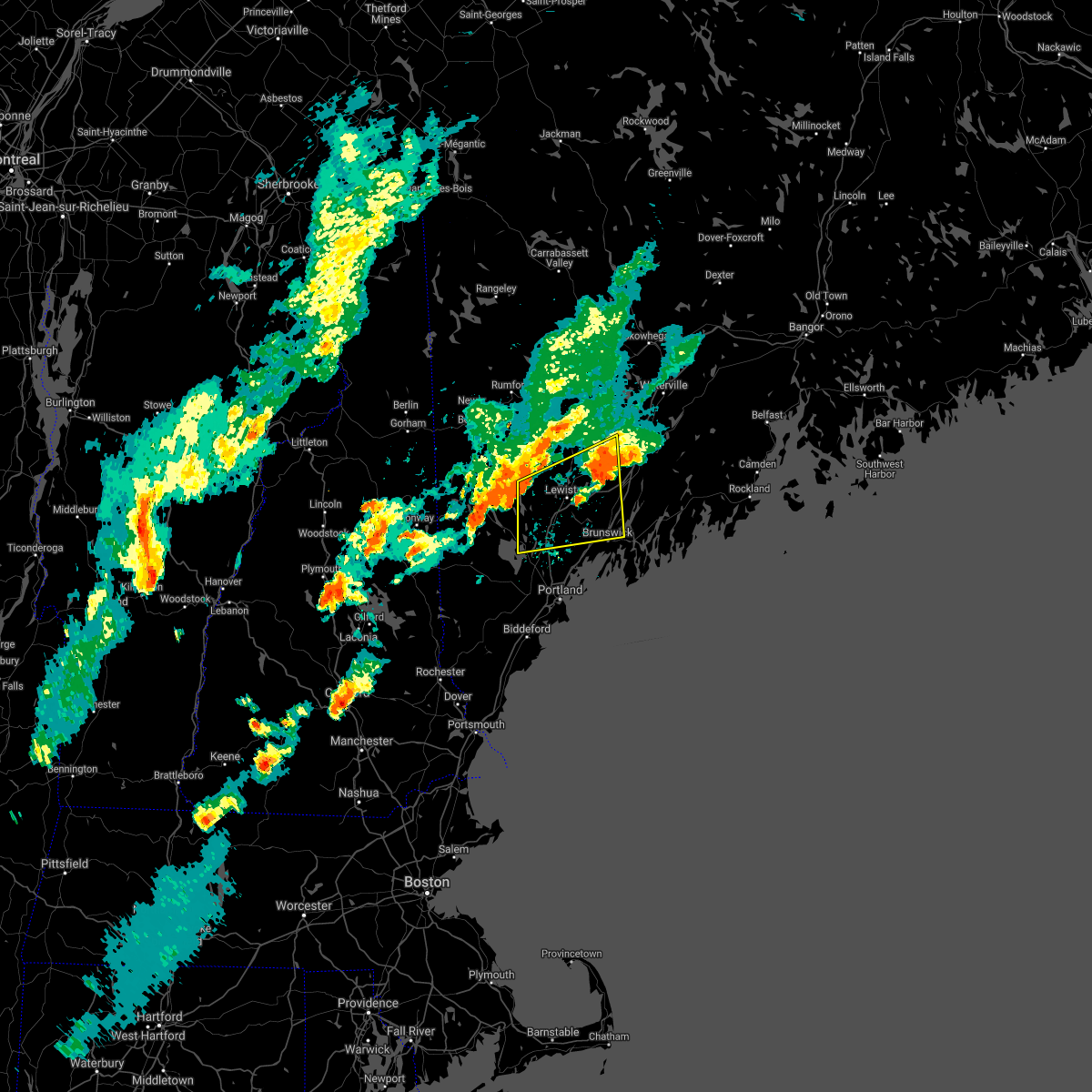 The severe thunderstorm warning for southwestern kennebec, southeastern oxford, androscoggin, central cumberland and northwestern sagadahoc counties will expire at 600 pm edt, the storm which prompted the warning has weakened below severe limits, and has exited the warned area. therefore, the warning will be allowed to expire. however heavy rain is still possible with this thunderstorm. The severe thunderstorm warning for southwestern kennebec, southeastern oxford, androscoggin, central cumberland and northwestern sagadahoc counties will expire at 600 pm edt, the storm which prompted the warning has weakened below severe limits, and has exited the warned area. therefore, the warning will be allowed to expire. however heavy rain is still possible with this thunderstorm.
|
| 9/5/2017 5:26 PM EDT |
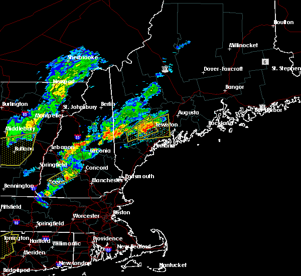 At 525 pm edt, a severe thunderstorm was located near lewiston, moving northeast at 30 mph (radar indicated). Hazards include 60 mph wind gusts and quarter size hail. Minor hail damage to vehicles is possible. expect wind damage to roofs, siding, and trees. locations impacted include, lewiston, brunswick, mechanic falls, topsham, turner, freeport, gray, litchfield, manchester, raymond, winthrop, lisbon, greene, durham, casco, bowdoin, bowdoinham, leeds, hebron and new gloucester. this includes the following highways, interstate 295 between mile markers 28 and 40. Interstate 95 between mile markers 63 and 97. At 525 pm edt, a severe thunderstorm was located near lewiston, moving northeast at 30 mph (radar indicated). Hazards include 60 mph wind gusts and quarter size hail. Minor hail damage to vehicles is possible. expect wind damage to roofs, siding, and trees. locations impacted include, lewiston, brunswick, mechanic falls, topsham, turner, freeport, gray, litchfield, manchester, raymond, winthrop, lisbon, greene, durham, casco, bowdoin, bowdoinham, leeds, hebron and new gloucester. this includes the following highways, interstate 295 between mile markers 28 and 40. Interstate 95 between mile markers 63 and 97.
|
| 9/5/2017 5:17 PM EDT |
 At 516 pm edt, a severe thunderstorm was located 7 miles north of gray, or 8 miles south of mechanic falls, moving northeast at 25 mph (radar indicated). Hazards include 60 mph wind gusts and quarter size hail. Minor hail damage to vehicles is possible. Expect wind damage to roofs, siding, and trees. At 516 pm edt, a severe thunderstorm was located 7 miles north of gray, or 8 miles south of mechanic falls, moving northeast at 25 mph (radar indicated). Hazards include 60 mph wind gusts and quarter size hail. Minor hail damage to vehicles is possible. Expect wind damage to roofs, siding, and trees.
|
| 9/5/2017 5:07 PM EDT |
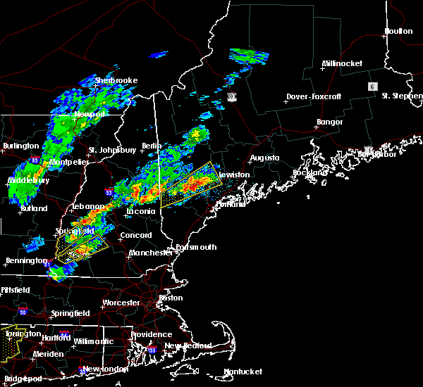 At 505 pm edt, a severe thunderstorm was located near mechanic falls, moving northeast at 40 mph (radar indicated). Hazards include 60 mph wind gusts and quarter size hail. Minor hail damage to vehicles is possible. expect wind damage to roofs, siding, and trees. locations impacted include, lewiston, bridgton, mechanic falls, turner, naples, gray, raymond, lisbon, greene, durham, casco, harrison, buckfield, hebron, hartford, denmark, sebago, poland, minot and oxford. this also includes, long lake and douglas mountain. This includes interstate 95 between mile markers 69 and 83. At 505 pm edt, a severe thunderstorm was located near mechanic falls, moving northeast at 40 mph (radar indicated). Hazards include 60 mph wind gusts and quarter size hail. Minor hail damage to vehicles is possible. expect wind damage to roofs, siding, and trees. locations impacted include, lewiston, bridgton, mechanic falls, turner, naples, gray, raymond, lisbon, greene, durham, casco, harrison, buckfield, hebron, hartford, denmark, sebago, poland, minot and oxford. this also includes, long lake and douglas mountain. This includes interstate 95 between mile markers 69 and 83.
|
| 9/5/2017 4:36 PM EDT |
 At 435 pm edt, a severe thunderstorm was located over hiram, or 9 miles southwest of naples, moving northeast at 40 mph (radar indicated). Hazards include 60 mph wind gusts and quarter size hail. Minor hail damage to vehicles is possible. Expect wind damage to roofs, siding, and trees. At 435 pm edt, a severe thunderstorm was located over hiram, or 9 miles southwest of naples, moving northeast at 40 mph (radar indicated). Hazards include 60 mph wind gusts and quarter size hail. Minor hail damage to vehicles is possible. Expect wind damage to roofs, siding, and trees.
|
| 7/8/2017 4:43 PM EDT |
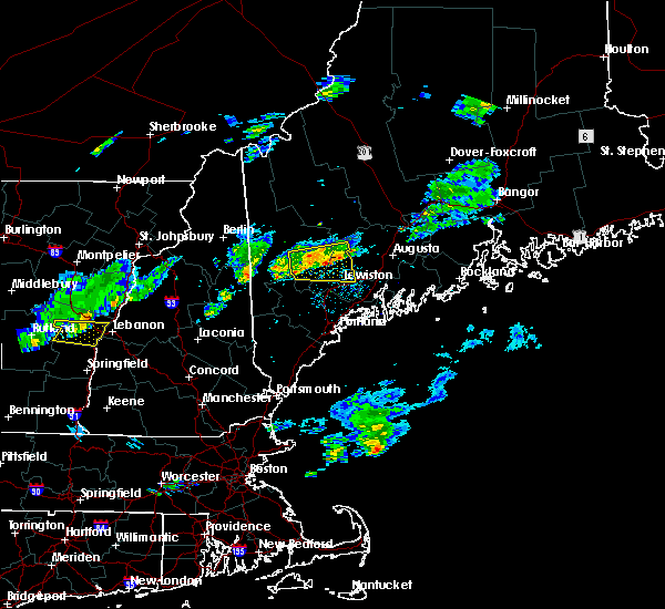 At 442 pm edt, a severe thunderstorm was located near turner, moving east at 30 mph (radar indicated). Hazards include 60 mph wind gusts and quarter size hail. Minor hail damage to vehicles is possible. expect wind damage to roofs, siding, and trees. locations impacted include, lewiston, mechanic falls, turner, livermore falls, canton, greene, leeds, livermore, buckfield, hebron, hartford, greenwood, west paris, wales, otisfield, sabattus, norway, sumner, oxford and paris. this also includes, crocker hill, streaked mountain, and singepole ridge. This includes interstate 95 between mile markers 87 and 88. At 442 pm edt, a severe thunderstorm was located near turner, moving east at 30 mph (radar indicated). Hazards include 60 mph wind gusts and quarter size hail. Minor hail damage to vehicles is possible. expect wind damage to roofs, siding, and trees. locations impacted include, lewiston, mechanic falls, turner, livermore falls, canton, greene, leeds, livermore, buckfield, hebron, hartford, greenwood, west paris, wales, otisfield, sabattus, norway, sumner, oxford and paris. this also includes, crocker hill, streaked mountain, and singepole ridge. This includes interstate 95 between mile markers 87 and 88.
|
| 7/8/2017 4:18 PM EDT |
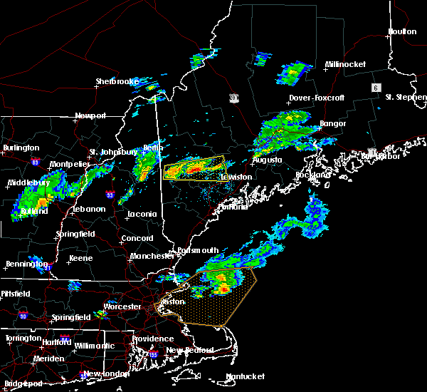 At 418 pm edt, a severe thunderstorm was located 7 miles northeast of waterford, or 12 miles northwest of mechanic falls, moving east at 30 mph (radar indicated). Hazards include 60 mph wind gusts and quarter size hail. Minor hail damage to vehicles is possible. Expect wind damage to roofs, siding, and trees. At 418 pm edt, a severe thunderstorm was located 7 miles northeast of waterford, or 12 miles northwest of mechanic falls, moving east at 30 mph (radar indicated). Hazards include 60 mph wind gusts and quarter size hail. Minor hail damage to vehicles is possible. Expect wind damage to roofs, siding, and trees.
|
| 7/1/2017 6:54 PM EDT |
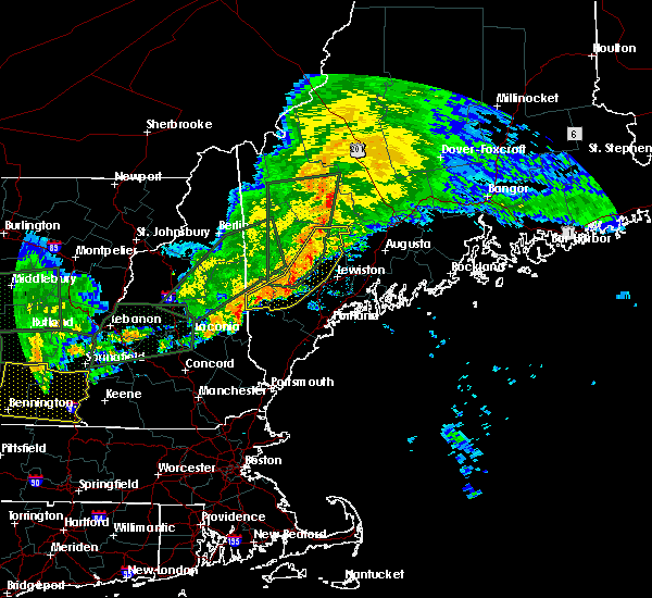 At 654 pm edt, severe thunderstorms were located along a line extending from jay to near mechanic falls to hiram, moving east at 40 mph (radar indicated). Hazards include 60 mph wind gusts and quarter size hail. Minor hail damage to vehicles is possible. expect wind damage to roofs, siding, and trees. locations impacted include, lewiston, bridgton, mechanic falls, naples, turner, jay, livermore falls, dixfield, hiram, canton, raymond, standish, greene, casco, harrison, leeds, livermore, buckfield, brownfield and hebron. This also includes, sebago lake, burnt meadow mountains, long lake, crocker hill, and streaked mountain. At 654 pm edt, severe thunderstorms were located along a line extending from jay to near mechanic falls to hiram, moving east at 40 mph (radar indicated). Hazards include 60 mph wind gusts and quarter size hail. Minor hail damage to vehicles is possible. expect wind damage to roofs, siding, and trees. locations impacted include, lewiston, bridgton, mechanic falls, naples, turner, jay, livermore falls, dixfield, hiram, canton, raymond, standish, greene, casco, harrison, leeds, livermore, buckfield, brownfield and hebron. This also includes, sebago lake, burnt meadow mountains, long lake, crocker hill, and streaked mountain.
|
| 7/1/2017 6:32 PM EDT |
 At 631 pm edt, severe thunderstorms were located along a line extending from near dixfield to near waterford to 7 miles north of effingham, moving east at 40 mph (radar indicated). Hazards include 60 mph wind gusts and quarter size hail. Minor hail damage to vehicles is possible. Expect wind damage to roofs, siding, and trees. At 631 pm edt, severe thunderstorms were located along a line extending from near dixfield to near waterford to 7 miles north of effingham, moving east at 40 mph (radar indicated). Hazards include 60 mph wind gusts and quarter size hail. Minor hail damage to vehicles is possible. Expect wind damage to roofs, siding, and trees.
|
| 6/19/2017 5:03 PM EDT |
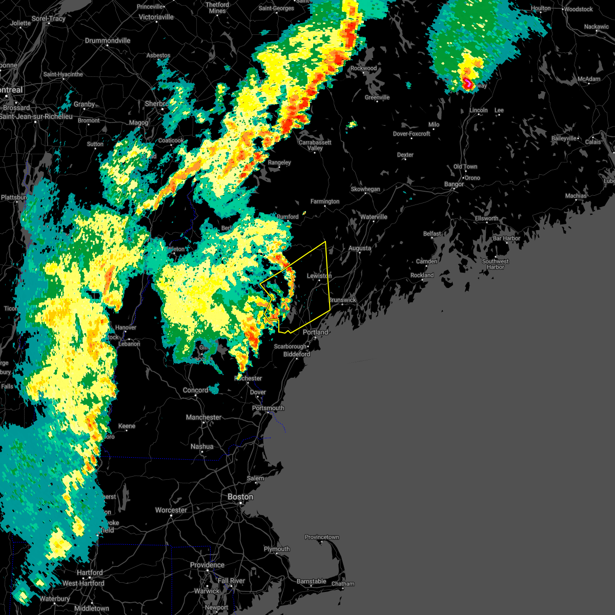 At 503 pm edt, a severe thunderstorm was located near naples, moving northeast at 55 mph (radar indicated). Hazards include 60 mph wind gusts. expect damage to trees, and power lines At 503 pm edt, a severe thunderstorm was located near naples, moving northeast at 55 mph (radar indicated). Hazards include 60 mph wind gusts. expect damage to trees, and power lines
|
| 6/1/2017 1:21 PM EDT |
 At 121 pm edt, a severe thunderstorm was located near litchfield, or 7 miles east of lewiston, moving east at 25 mph (radar indicated). Hazards include pea to a large as quarter size hail. Minor damage to vehicles is possible. locations impacted include, lewiston, gardiner, turner, topsham, litchfield, farmingdale, manchester, lisbon, greene, bowdoin, bowdoinham, leeds, wales, monmouth, sabattus, west gardiner, minot and richmond. this includes the following highways, interstate 295 between mile markers 34 and 45, and between mile markers 48 and 51. Interstate 95 between mile markers 80 and 106. At 121 pm edt, a severe thunderstorm was located near litchfield, or 7 miles east of lewiston, moving east at 25 mph (radar indicated). Hazards include pea to a large as quarter size hail. Minor damage to vehicles is possible. locations impacted include, lewiston, gardiner, turner, topsham, litchfield, farmingdale, manchester, lisbon, greene, bowdoin, bowdoinham, leeds, wales, monmouth, sabattus, west gardiner, minot and richmond. this includes the following highways, interstate 295 between mile markers 34 and 45, and between mile markers 48 and 51. Interstate 95 between mile markers 80 and 106.
|
| 6/1/2017 1:04 PM EDT |
 At 103 pm edt, a severe thunderstorm was located near lewiston, moving east at 25 mph (radar indicated). Hazards include 60 mph wind gusts and quarter size hail. Minor hail damage to vehicles is possible. expect wind damage to roofs, siding, and trees. locations impacted include, lewiston, gardiner, turner, topsham, litchfield, farmingdale, manchester, lisbon, greene, bowdoin, bowdoinham, leeds, wales, monmouth, sabattus, west gardiner, minot and richmond. this includes the following highways, interstate 295 between mile markers 34 and 45, and between mile markers 48 and 51. Interstate 95 between mile markers 80 and 106. At 103 pm edt, a severe thunderstorm was located near lewiston, moving east at 25 mph (radar indicated). Hazards include 60 mph wind gusts and quarter size hail. Minor hail damage to vehicles is possible. expect wind damage to roofs, siding, and trees. locations impacted include, lewiston, gardiner, turner, topsham, litchfield, farmingdale, manchester, lisbon, greene, bowdoin, bowdoinham, leeds, wales, monmouth, sabattus, west gardiner, minot and richmond. this includes the following highways, interstate 295 between mile markers 34 and 45, and between mile markers 48 and 51. Interstate 95 between mile markers 80 and 106.
|
| 6/1/2017 12:50 PM EDT |
 At 1248 pm edt, a severe thunderstorm was located near lewiston, moving east at 30 mph (radar indicated). Hazards include 60 mph wind gusts and quarter size hail. Minor hail damage to vehicles is possible. Expect wind damage to roofs, siding, and trees. At 1248 pm edt, a severe thunderstorm was located near lewiston, moving east at 30 mph (radar indicated). Hazards include 60 mph wind gusts and quarter size hail. Minor hail damage to vehicles is possible. Expect wind damage to roofs, siding, and trees.
|
| 9/11/2016 10:52 AM EDT |
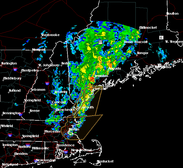 At 1052 am edt, a severe thunderstorm was located over lewiston, moving northeast at 50 mph (radar indicated). Hazards include 60 mph wind gusts and quarter size hail. Hail damage to vehicles is expected. Expect wind damage to roofs, siding, and trees. At 1052 am edt, a severe thunderstorm was located over lewiston, moving northeast at 50 mph (radar indicated). Hazards include 60 mph wind gusts and quarter size hail. Hail damage to vehicles is expected. Expect wind damage to roofs, siding, and trees.
|
| 8/12/2016 2:37 PM EDT |
 At 236 pm edt, severe thunderstorms were located along a line extending from near lewiston to 9 miles northwest of freeport to near gray, moving southeast at 40 mph (radar indicated). Hazards include 60 mph wind gusts. Expect damage to roofs. siding. And trees. At 236 pm edt, severe thunderstorms were located along a line extending from near lewiston to 9 miles northwest of freeport to near gray, moving southeast at 40 mph (radar indicated). Hazards include 60 mph wind gusts. Expect damage to roofs. siding. And trees.
|
| 8/12/2016 2:26 PM EDT |
 At 225 pm edt, a severe thunderstorm was located 7 miles south of mechanic falls, moving southeast at 35 mph (radar indicated). Hazards include 60 mph wind gusts and penny size hail. Expect damage to roofs. siding. and trees. Locations impacted include, lewiston, cumberland, gray, raymond, lisbon, durham, casco, minot, new gloucester, pownal, poland, north yarmouth and windham. At 225 pm edt, a severe thunderstorm was located 7 miles south of mechanic falls, moving southeast at 35 mph (radar indicated). Hazards include 60 mph wind gusts and penny size hail. Expect damage to roofs. siding. and trees. Locations impacted include, lewiston, cumberland, gray, raymond, lisbon, durham, casco, minot, new gloucester, pownal, poland, north yarmouth and windham.
|
| 8/12/2016 2:20 PM EDT | Trees down around town in androscoggin county ME, 4.2 miles ENE of Auburn, ME |
| 8/12/2016 2:15 PM EDT |
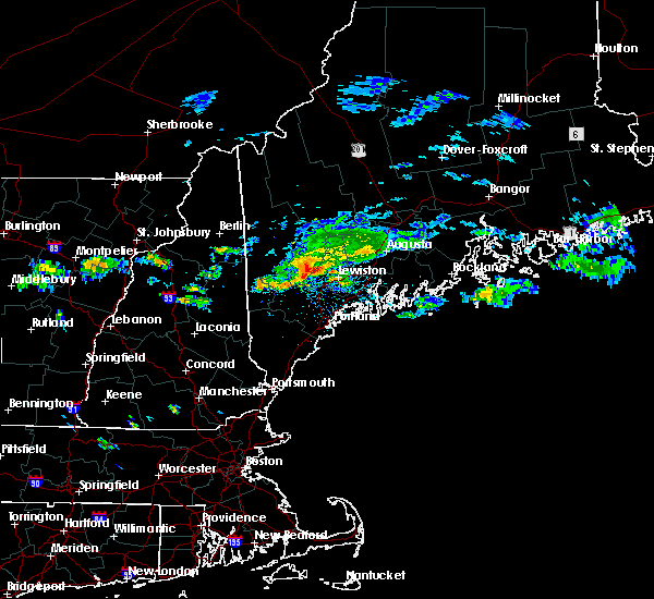 At 214 pm edt, a severe thunderstorm was located near mechanic falls, moving southeast at 35 mph (radar indicated). Hazards include 60 mph wind gusts and penny size hail. Expect damage to roofs. siding. And trees. At 214 pm edt, a severe thunderstorm was located near mechanic falls, moving southeast at 35 mph (radar indicated). Hazards include 60 mph wind gusts and penny size hail. Expect damage to roofs. siding. And trees.
|
| 7/23/2016 3:41 PM EDT |
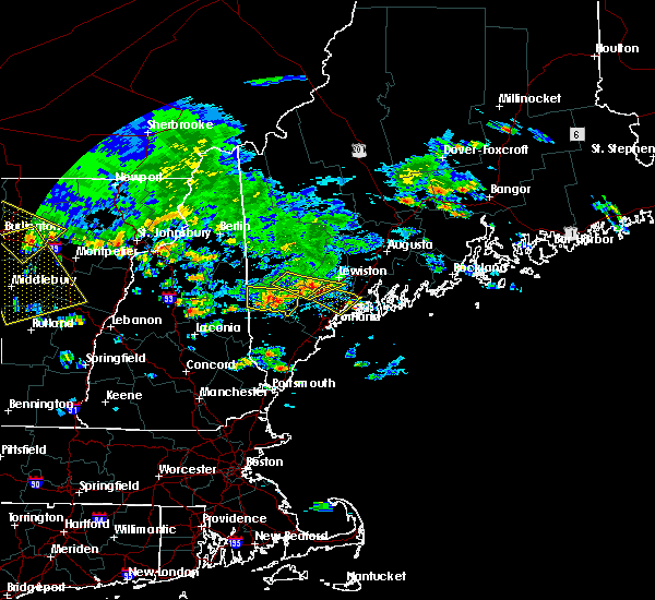 At 340 pm edt, a severe thunderstorm was located near gray, or 11 miles south of mechanic falls, moving southeast at 20 mph (radar indicated). Hazards include 60 mph wind gusts and quarter size hail. Hail damage to vehicles is expected. Expect wind damage to roofs, siding, and trees. At 340 pm edt, a severe thunderstorm was located near gray, or 11 miles south of mechanic falls, moving southeast at 20 mph (radar indicated). Hazards include 60 mph wind gusts and quarter size hail. Hail damage to vehicles is expected. Expect wind damage to roofs, siding, and trees.
|
| 7/23/2016 3:23 PM EDT |
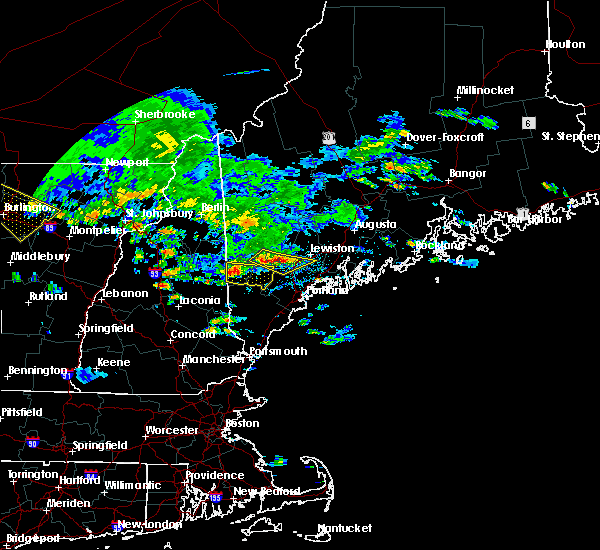 At 323 pm edt, a severe thunderstorm was located near naples, moving east at 25 mph (radar indicated). Hazards include 60 mph wind gusts and quarter size hail. Hail damage to vehicles is expected. expect wind damage to roofs, siding, and trees. Locations impacted include, lewiston, bridgton, mechanic falls, naples, gray, raymond, lisbon, durham, casco, harrison, new gloucester, poland, otisfield and oxford. At 323 pm edt, a severe thunderstorm was located near naples, moving east at 25 mph (radar indicated). Hazards include 60 mph wind gusts and quarter size hail. Hail damage to vehicles is expected. expect wind damage to roofs, siding, and trees. Locations impacted include, lewiston, bridgton, mechanic falls, naples, gray, raymond, lisbon, durham, casco, harrison, new gloucester, poland, otisfield and oxford.
|
| 7/23/2016 3:10 PM EDT |
 At 310 pm edt, severe thunderstorms were located along a line extending from near bridgton to 6 miles north of naples, moving southeast at 20 mph (radar indicated). Hazards include 60 mph wind gusts and quarter size hail. Hail damage to vehicles is expected. Expect wind damage to roofs, siding, and trees. At 310 pm edt, severe thunderstorms were located along a line extending from near bridgton to 6 miles north of naples, moving southeast at 20 mph (radar indicated). Hazards include 60 mph wind gusts and quarter size hail. Hail damage to vehicles is expected. Expect wind damage to roofs, siding, and trees.
|
| 7/14/2016 8:21 PM EDT |
 At 821 pm edt, a severe thunderstorm was located 8 miles northeast of bridgton, moving east at 10 mph (radar indicated). Hazards include 60 mph wind gusts and penny size hail. Expect damage to roofs. siding. and trees. Locations impacted include, mechanic falls, hebron, oxford, poland, minot and otisfield. At 821 pm edt, a severe thunderstorm was located 8 miles northeast of bridgton, moving east at 10 mph (radar indicated). Hazards include 60 mph wind gusts and penny size hail. Expect damage to roofs. siding. and trees. Locations impacted include, mechanic falls, hebron, oxford, poland, minot and otisfield.
|
| 7/14/2016 8:05 PM EDT |
 At 805 pm edt, a severe thunderstorm was located near bridgton, moving east at 20 mph (radar indicated). Hazards include 60 mph wind gusts and penny size hail. Expect damage to roofs. siding. And trees. At 805 pm edt, a severe thunderstorm was located near bridgton, moving east at 20 mph (radar indicated). Hazards include 60 mph wind gusts and penny size hail. Expect damage to roofs. siding. And trees.
|
| 4/1/2016 4:30 PM EDT |
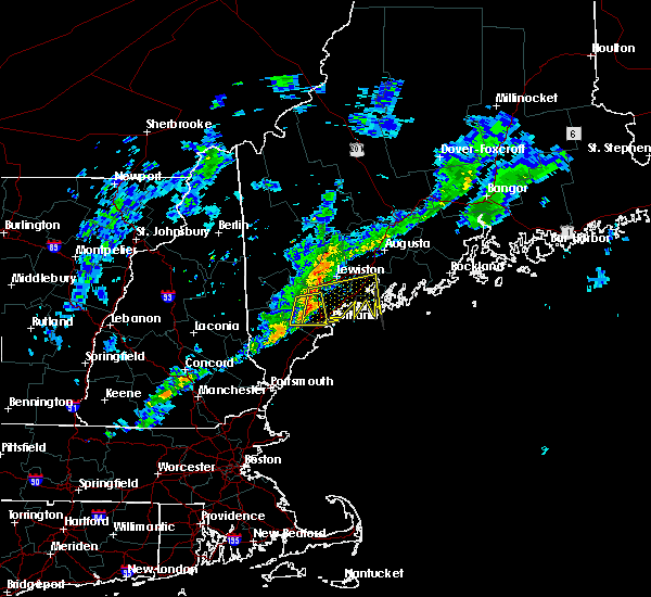 At 430 pm edt, doppler radar indicated a line of severe thunderstorms capable of producing damaging winds in excess of 60 mph. these storms were located along a line extending from near gray to westbrook, and moving east at 55 mph. At 430 pm edt, doppler radar indicated a line of severe thunderstorms capable of producing damaging winds in excess of 60 mph. these storms were located along a line extending from near gray to westbrook, and moving east at 55 mph.
|
| 3/17/2016 3:45 PM EDT |
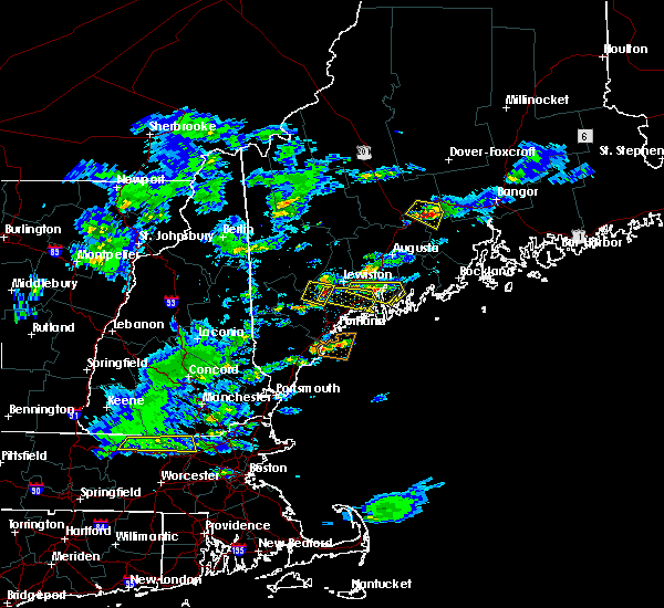 At 344 pm edt, doppler radar indicated a severe thunderstorm capable of producing half dollar size hail and damaging winds in excess of 60 mph. this storm was located 7 miles north of gray, or 8 miles south of mechanic falls, and moving east at 25 mph. At 344 pm edt, doppler radar indicated a severe thunderstorm capable of producing half dollar size hail and damaging winds in excess of 60 mph. this storm was located 7 miles north of gray, or 8 miles south of mechanic falls, and moving east at 25 mph.
|
| 3/17/2016 3:32 PM EDT |
 At 331 pm edt, trained weather spotters reported a severe thunderstorm producing quarter size hail. damaging winds in excess of 60 mph were also possible. this storm was located near raymond, or 8 miles south of mechanic falls, moving east at 30 mph. locations impacted include, mechanic falls, gray, raymond, casco, poland, new gloucester and oxford. At 331 pm edt, trained weather spotters reported a severe thunderstorm producing quarter size hail. damaging winds in excess of 60 mph were also possible. this storm was located near raymond, or 8 miles south of mechanic falls, moving east at 30 mph. locations impacted include, mechanic falls, gray, raymond, casco, poland, new gloucester and oxford.
|
| 3/17/2016 3:28 PM EDT |
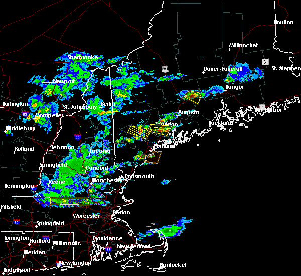 At 327 pm edt, trained weather spotters reported a severe thunderstorm producing hail in excess of half dollars. damaging winds in excess of 60 mph were also possible. this storm was located near litchfield, or 8 miles north of topsham, moving east at 20 mph. locations impacted include, lewiston, topsham, litchfield, lisbon, greene, durham, bowdoin, bowdoinham, sabattus, richmond and wales. At 327 pm edt, trained weather spotters reported a severe thunderstorm producing hail in excess of half dollars. damaging winds in excess of 60 mph were also possible. this storm was located near litchfield, or 8 miles north of topsham, moving east at 20 mph. locations impacted include, lewiston, topsham, litchfield, lisbon, greene, durham, bowdoin, bowdoinham, sabattus, richmond and wales.
|
| 3/17/2016 3:09 PM EDT |
 At 308 pm edt, doppler radar indicated a severe thunderstorm capable of producing quarter size hail and damaging winds in excess of 60 mph. this storm was located near naples, and moving east at 30 mph. At 308 pm edt, doppler radar indicated a severe thunderstorm capable of producing quarter size hail and damaging winds in excess of 60 mph. this storm was located near naples, and moving east at 30 mph.
|
| 3/17/2016 3:04 PM EDT |
 At 304 pm edt, doppler radar indicated a severe thunderstorm capable of producing quarter size hail and damaging winds in excess of 60 mph. this storm was located over lewiston, and moving east at 20 mph. At 304 pm edt, doppler radar indicated a severe thunderstorm capable of producing quarter size hail and damaging winds in excess of 60 mph. this storm was located over lewiston, and moving east at 20 mph.
|
| 3/17/2016 2:53 PM EDT |
 At 253 pm edt, doppler radar indicated a severe thunderstorm capable of producing quarter size hail. this storm was located over lewiston, moving east at 15 mph. locations impacted include, lewiston, minot, poland and new gloucester. At 253 pm edt, doppler radar indicated a severe thunderstorm capable of producing quarter size hail. this storm was located over lewiston, moving east at 15 mph. locations impacted include, lewiston, minot, poland and new gloucester.
|
| 3/17/2016 2:31 PM EDT |
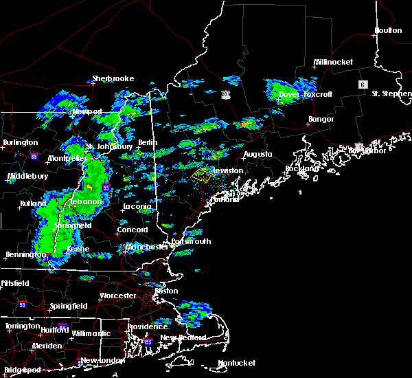 The national weather service in gray maine has issued a * severe thunderstorm warning for. southwestern androscoggin county in southwestern maine. until 300 pm edt * at 230 pm edt. doppler radar indicated a severe thunderstorm capable of producing quarter size hail. Winds gusts around 50 mph. The national weather service in gray maine has issued a * severe thunderstorm warning for. southwestern androscoggin county in southwestern maine. until 300 pm edt * at 230 pm edt. doppler radar indicated a severe thunderstorm capable of producing quarter size hail. Winds gusts around 50 mph.
|
| 2/25/2016 3:20 AM EST |
 At 318 am est, doppler radar indicated a line of severe thunderstorms capable of producing damaging winds in excess of 60 mph. these storms were located along a line extending from 7 miles east of fryeburg to near newmarket to lowell, racing quickly to the east. At 318 am est, doppler radar indicated a line of severe thunderstorms capable of producing damaging winds in excess of 60 mph. these storms were located along a line extending from 7 miles east of fryeburg to near newmarket to lowell, racing quickly to the east.
|
| 8/12/2015 7:54 PM EDT |
 At 754 pm edt, doppler radar indicated a severe thunderstorm capable of producing quarter size hail and damaging winds in excess of 60 mph. this storm was located over lewiston, and moving east at 20 mph. At 754 pm edt, doppler radar indicated a severe thunderstorm capable of producing quarter size hail and damaging winds in excess of 60 mph. this storm was located over lewiston, and moving east at 20 mph.
|
| 8/12/2015 7:40 PM EDT |
 At 739 pm edt, doppler radar indicated a severe thunderstorm capable of producing damaging winds in excess of 60 mph. this storm was located near mechanic falls and poland, moving east at 25 mph. penny size hail may also accompany the damaging winds. locations impacted include, lewiston, mechanic falls, gray, raymond, durham, casco, minot, pownal, poland, new gloucester and north yarmouth. At 739 pm edt, doppler radar indicated a severe thunderstorm capable of producing damaging winds in excess of 60 mph. this storm was located near mechanic falls and poland, moving east at 25 mph. penny size hail may also accompany the damaging winds. locations impacted include, lewiston, mechanic falls, gray, raymond, durham, casco, minot, pownal, poland, new gloucester and north yarmouth.
|
| 8/12/2015 7:35 PM EDT | Tree down across empire road in poland in androscoggin county ME, 5.5 miles ENE of Auburn, ME |
| 8/12/2015 7:22 PM EDT |
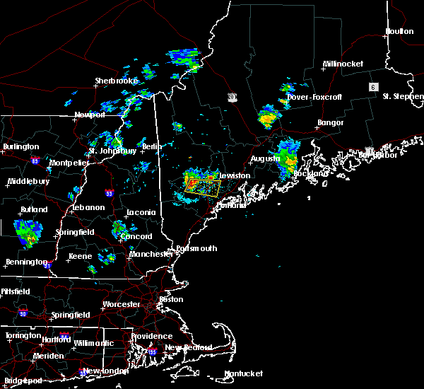 At 721 pm edt, doppler radar indicated a severe thunderstorm capable of producing quarter size hail and damaging winds in excess of 60 mph. this storm was located near naples, and moving east at 20 mph. At 721 pm edt, doppler radar indicated a severe thunderstorm capable of producing quarter size hail and damaging winds in excess of 60 mph. this storm was located near naples, and moving east at 20 mph.
|
| 8/3/2015 7:40 PM EDT |
 At 740 pm edt, doppler radar indicated a line of severe thunderstorms capable of producing damaging winds in excess of 60 mph. these storms were located along a line extending from near phillips to rumford to 6 miles west of mechanic falls, and moving northeast at 55 mph. At 740 pm edt, doppler radar indicated a line of severe thunderstorms capable of producing damaging winds in excess of 60 mph. these storms were located along a line extending from near phillips to rumford to 6 miles west of mechanic falls, and moving northeast at 55 mph.
|
| 8/1/2015 3:13 PM EDT |
 At 313 pm edt, doppler radar indicated a line of severe thunderstorms capable of producing damaging winds in excess of 60 mph. these storms were located along a line extending from near belgrade to near winthrop to auburn, and moving east at 25 mph. At 313 pm edt, doppler radar indicated a line of severe thunderstorms capable of producing damaging winds in excess of 60 mph. these storms were located along a line extending from near belgrade to near winthrop to auburn, and moving east at 25 mph.
|
| 7/28/2015 4:11 PM EDT |
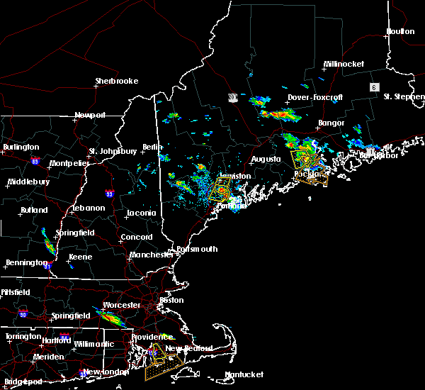 At 329 pm edt, doppler radar indicated a severe thunderstorm capable of producing quarter size hail and damaging winds in excess of 60 mph. this storm was located near lewiston, and moving south at 20 mph. At 329 pm edt, doppler radar indicated a severe thunderstorm capable of producing quarter size hail and damaging winds in excess of 60 mph. this storm was located near lewiston, and moving south at 20 mph.
|
| 7/28/2015 3:48 PM EDT |
 At 348 pm edt, doppler radar indicated a severe thunderstorm capable of producing quarter size hail and damaging winds in excess of 60 mph. this storm was located 7 miles north of freeport, or 7 miles west of topsham, and moving south at 15 mph. At 348 pm edt, doppler radar indicated a severe thunderstorm capable of producing quarter size hail and damaging winds in excess of 60 mph. this storm was located 7 miles north of freeport, or 7 miles west of topsham, and moving south at 15 mph.
|
| 7/28/2015 3:29 PM EDT |
 At 329 pm edt, doppler radar indicated a severe thunderstorm capable of producing quarter size hail and damaging winds in excess of 60 mph. this storm was located near lewiston, and moving south at 20 mph. At 329 pm edt, doppler radar indicated a severe thunderstorm capable of producing quarter size hail and damaging winds in excess of 60 mph. this storm was located near lewiston, and moving south at 20 mph.
|
| 7/28/2015 2:18 PM EDT |
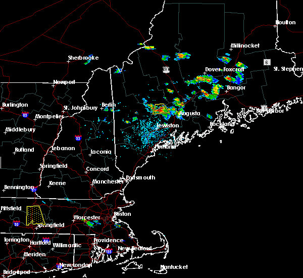 At 218 pm edt, doppler radar indicated a severe thunderstorm capable of producing quarter size hail and damaging winds in excess of 60 mph. this storm was located near livermore falls, or 11 miles northeast of turner, and moving south at 25 mph. At 218 pm edt, doppler radar indicated a severe thunderstorm capable of producing quarter size hail and damaging winds in excess of 60 mph. this storm was located near livermore falls, or 11 miles northeast of turner, and moving south at 25 mph.
|
| 5/28/2015 2:42 PM EDT | At 241 pm edt, doppler radar indicated a severe thunderstorm capable of producing damaging winds in excess of 60 mph. this storm was located near gray, or 11 miles south of lewiston, moving east at 35 mph. penny size hail may also accompany the damaging winds. locations impacted include, southern lewiston, brunswick, topsham, cumberland, freeport, gray, litchfield, yarmouth, raymond, lisbon, harpswell, durham, bowdoin, north yarmouth, bradbury mountain state park, pownal, wolfes neck woods state park, new gloucester, sabattus and windham. |
| 5/28/2015 2:26 PM EDT | At 225 pm edt, doppler radar indicated a severe thunderstorm capable of producing penny size hail and damaging winds in excess of 60 mph. this storm was located over raymond, or 10 miles southeast of naples, and moving east at 35 mph. |
| 8/6/2014 5:40 PM EDT | Tree and wires down across bald hill road in cumberland county ME, 8.3 miles NNE of Auburn, ME |
| 8/5/2014 4:20 PM EDT | Trees down on empire r in androscoggin county ME, 7.1 miles ENE of Auburn, ME |
| 10/7/2013 8:10 PM EDT | Trees on wires on maine st near range pond and also at two separate locations on range hill road in androscoggin county ME, 8.8 miles NE of Auburn, ME |
| 7/4/2013 5:40 PM EDT | Trees down on wilson pond roa in androscoggin county ME, 10.9 miles S of Auburn, ME |
| 6/25/2013 5:21 PM EDT | Trees down on empire road in auburn maine in androscoggin county ME, 0.4 miles WNW of Auburn, ME |
| 6/25/2013 5:13 PM EDT | Tree down on power line and on fire in androscoggin county ME, 0.4 miles WNW of Auburn, ME |
| 6/25/2013 5:00 PM EDT | Tree down on power line and on fire... time estimated in androscoggin county ME, 0.4 miles WNW of Auburn, ME |
| 6/22/2012 3:30 PM EDT | Limbs down all over the road. route 26 and carpenter road. colbath road. 2 inches of rain in 40 minute in androscoggin county ME, 9.2 miles NE of Auburn, ME |
| 6/22/2012 3:07 PM EDT | Wires down on preus point road... new gloucester in cumberland county ME, 10.1 miles NNE of Auburn, ME |
| 6/22/2012 3:00 PM EDT | Trees and large branches across lower road in androscoggin county ME, 4.4 miles ENE of Auburn, ME |
| 1/1/0001 12:00 AM | Trees down on powerlines on brighton hill rd in androscoggin county ME, 4.2 miles ENE of Auburn, ME |
| 1/1/0001 12:00 AM | Quarter sized hail reported 12.9 miles N of Auburn, ME, time and location estimated |
| 1/1/0001 12:00 AM | Several limbs over six inches in diameter broken off tree in androscoggin county ME, 0.4 miles WNW of Auburn, ME |
| 1/1/0001 12:00 AM | Trees down garfield rd in androscoggin county ME, 0.4 miles WNW of Auburn, ME |
| 1/1/0001 12:00 AM | Quarter sized hail reported 0.4 miles WNW of Auburn, ME |
| 1/1/0001 12:00 AM | Trees and wires down on sandy beach rd in androscoggin county ME, 0.4 miles WNW of Auburn, ME |
| 1/1/0001 12:00 AM | Wind brought down large limb in androscoggin county ME, 0.5 miles SSE of Auburn, ME |
| 1/1/0001 12:00 AM | Tree on pwr line in androscoggin county ME, 4.2 miles ENE of Auburn, ME |
Hail Maps for Auburn, ME


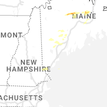


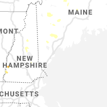
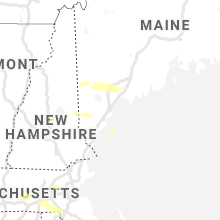


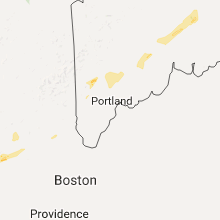

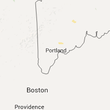


Connect with Interactive Hail Maps