

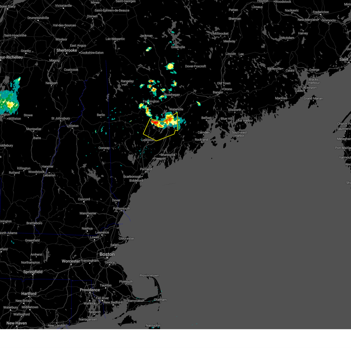
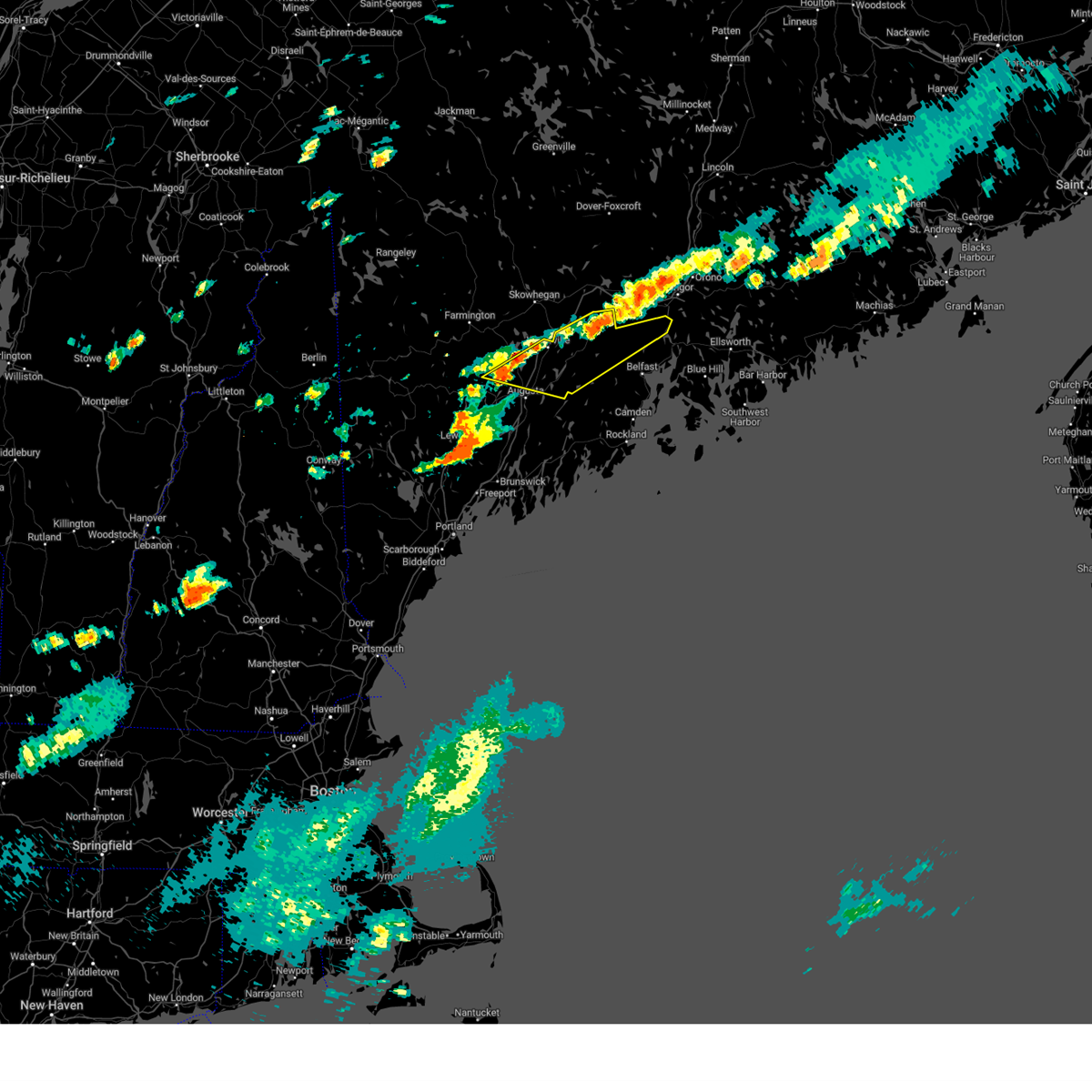
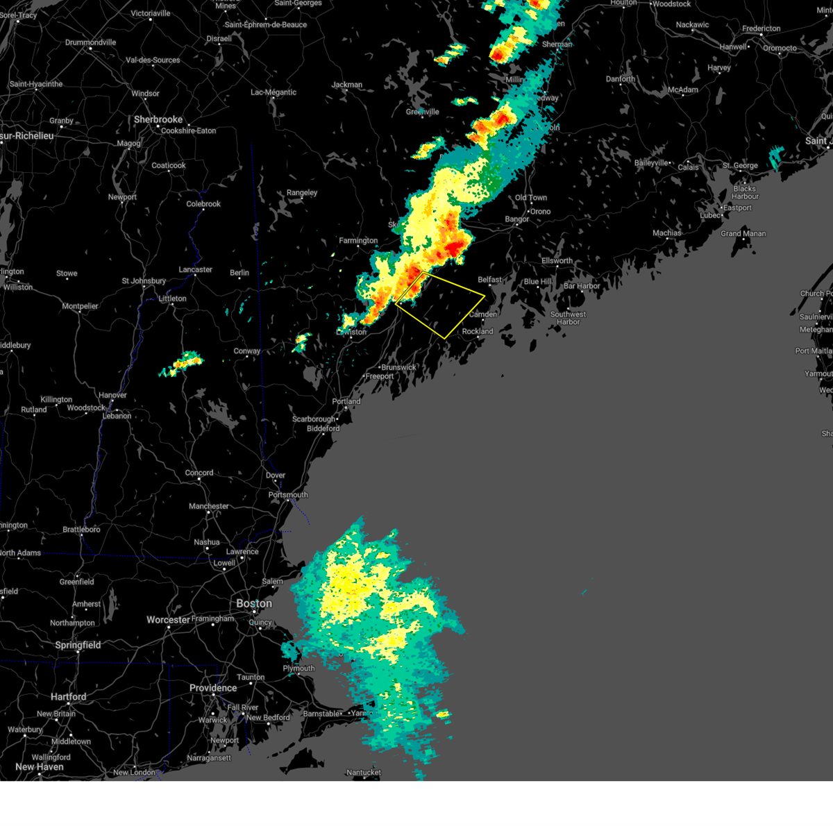
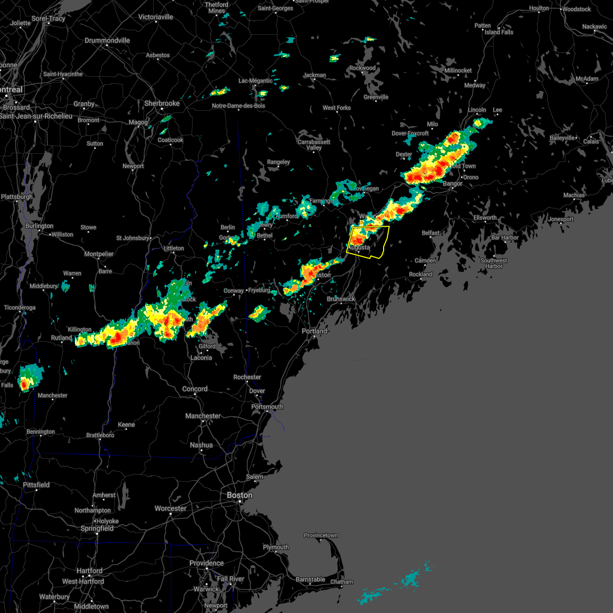
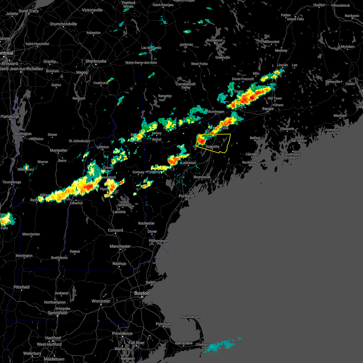
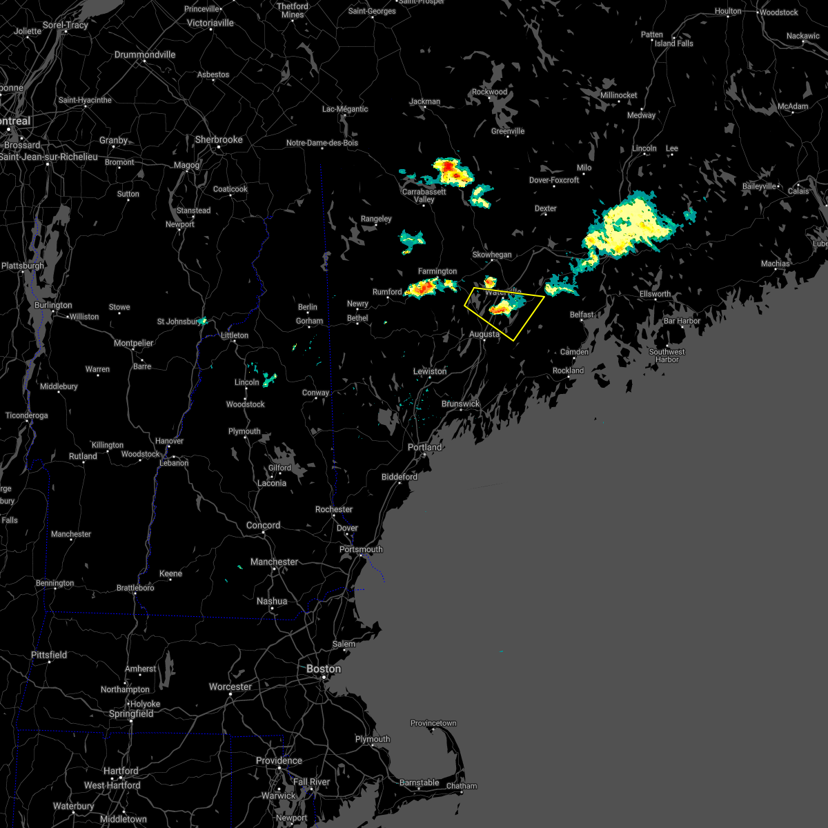
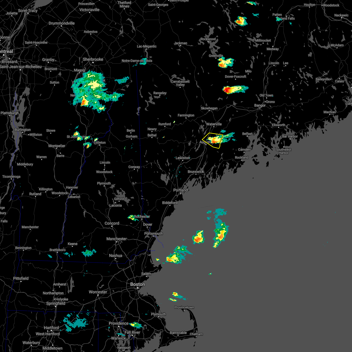
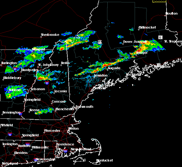
Hail Map for Augusta, ME
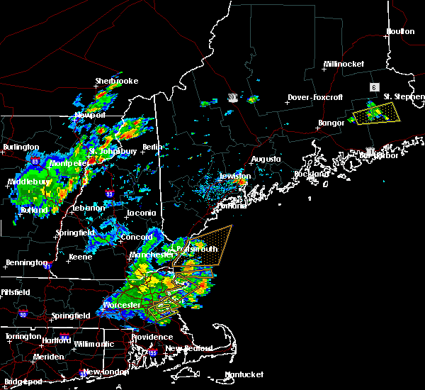
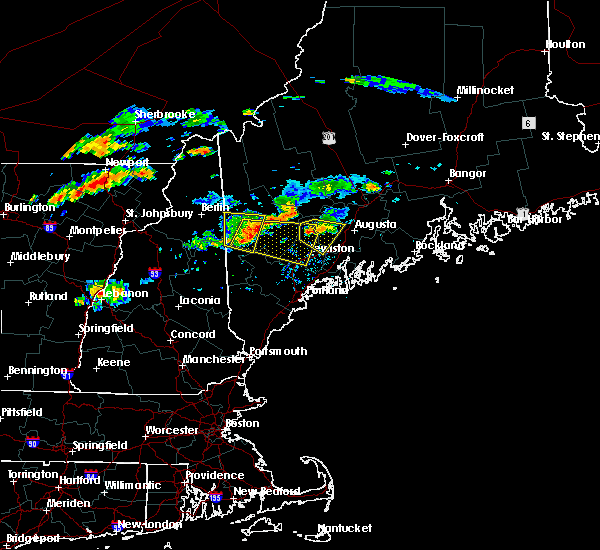
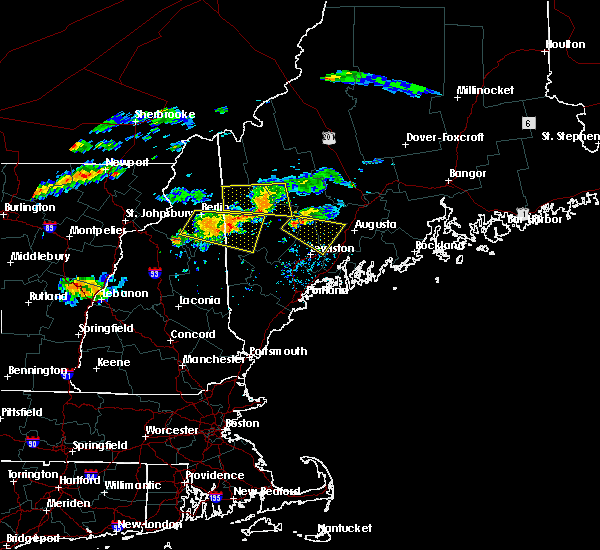
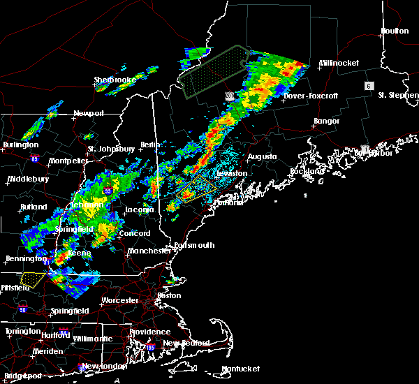
The Augusta, ME area has had 5 reports of on-the-ground hail by trained spotters, and has been under severe weather warnings 1 time during the past 12 months. Doppler radar has detected hail at or near Augusta, ME on 22 occasions.
| Name: | Augusta, ME |
| Where Located: | 52.3 miles NNE of Portland, ME |
| Map: | Google Map for Augusta, ME |
| Population: | 19136 |
| Housing Units: | 9756 |
| More Info: | Search Google for Augusta, ME |
2
The Top Recent Hail Date for Augusta, ME is Thursday, May 23, 2024 (4th out of 22)

Hail and Wind Damage Spotted near Augusta, ME
| Date / Time | Report Details |
|---|---|
| 8/14/2024 8:05 PM EDT |
 Svrgyx the national weather service in gray maine has issued a * severe thunderstorm warning for, southwestern kennebec county in south central maine, northeastern androscoggin county in southwestern maine, * until 845 pm edt. * at 805 pm edt, severe thunderstorms were located along a line extending from livermore falls to winthrop to 7 miles south of waterville, moving southwest at 15 mph (radar indicated). Hazards include 60 mph wind gusts and quarter size hail. Hail damage to vehicles is expected. Expect wind damage to roofs, siding, and trees. Svrgyx the national weather service in gray maine has issued a * severe thunderstorm warning for, southwestern kennebec county in south central maine, northeastern androscoggin county in southwestern maine, * until 845 pm edt. * at 805 pm edt, severe thunderstorms were located along a line extending from livermore falls to winthrop to 7 miles south of waterville, moving southwest at 15 mph (radar indicated). Hazards include 60 mph wind gusts and quarter size hail. Hail damage to vehicles is expected. Expect wind damage to roofs, siding, and trees.
|
| 7/9/2024 5:56 PM EDT |
 The storm which prompted the warning has weakened below severe limits, and no longer poses an immediate threat to life or property. therefore, the warning will be allowed to expire. The storm which prompted the warning has weakened below severe limits, and no longer poses an immediate threat to life or property. therefore, the warning will be allowed to expire.
|
| 7/9/2024 5:30 PM EDT |
 At 530 pm edt, a severe thunderstorm was located near augusta, moving east at 30 mph (radar indicated). Hazards include 60 mph wind gusts and quarter size hail. Hail damage to vehicles is expected. expect wind damage to roofs, siding, and trees. locations impacted include, augusta, gardiner, china, farmingdale, hallowell, palermo, chelsea, jefferson, windsor, hibberts gore, randolph, somerville, whitefield, washington, vassalboro, west gardiner, pittston, and sidney. This includes interstate 95 between mile markers 103 and 107, and between mile markers 113 and 116. At 530 pm edt, a severe thunderstorm was located near augusta, moving east at 30 mph (radar indicated). Hazards include 60 mph wind gusts and quarter size hail. Hail damage to vehicles is expected. expect wind damage to roofs, siding, and trees. locations impacted include, augusta, gardiner, china, farmingdale, hallowell, palermo, chelsea, jefferson, windsor, hibberts gore, randolph, somerville, whitefield, washington, vassalboro, west gardiner, pittston, and sidney. This includes interstate 95 between mile markers 103 and 107, and between mile markers 113 and 116.
|
| 7/9/2024 5:18 PM EDT | Large branches with lines dow in kennebec county ME, 1.2 miles NNW of Augusta, ME |
| 7/9/2024 5:10 PM EDT |
 Svrgyx the national weather service in gray maine has issued a * severe thunderstorm warning for, southeastern kennebec county in south central maine, northwestern knox county in south central maine, west central waldo county in south central maine, north central lincoln county in south central maine, * until 600 pm edt. * at 510 pm edt, a severe thunderstorm was located over manchester, or near augusta, moving east at 30 mph (radar indicated). Hazards include 60 mph wind gusts and quarter size hail. Hail damage to vehicles is expected. Expect wind damage to roofs, siding, and trees. Svrgyx the national weather service in gray maine has issued a * severe thunderstorm warning for, southeastern kennebec county in south central maine, northwestern knox county in south central maine, west central waldo county in south central maine, north central lincoln county in south central maine, * until 600 pm edt. * at 510 pm edt, a severe thunderstorm was located over manchester, or near augusta, moving east at 30 mph (radar indicated). Hazards include 60 mph wind gusts and quarter size hail. Hail damage to vehicles is expected. Expect wind damage to roofs, siding, and trees.
|
| 6/30/2024 4:31 PM EDT |
 Svrgyx the national weather service in gray maine has issued a * severe thunderstorm warning for, central kennebec county in south central maine, northern waldo county in south central maine, * until 515 pm edt. * at 431 pm edt, severe thunderstorms were located along a line extending from 6 miles north of thorndike to near belgrade, moving east at 40 mph (radar indicated). Hazards include 60 mph wind gusts and nickel size hail. expect damage to roofs, siding, and trees Svrgyx the national weather service in gray maine has issued a * severe thunderstorm warning for, central kennebec county in south central maine, northern waldo county in south central maine, * until 515 pm edt. * at 431 pm edt, severe thunderstorms were located along a line extending from 6 miles north of thorndike to near belgrade, moving east at 40 mph (radar indicated). Hazards include 60 mph wind gusts and nickel size hail. expect damage to roofs, siding, and trees
|
| 6/23/2024 7:38 PM EDT |
 The storm which prompted the warning has weakened below severe limits, and has exited the warned area. therefore, the warning will be allowed to expire. a tornado watch remains in effect until 800 pm edt for southwestern maine. The storm which prompted the warning has weakened below severe limits, and has exited the warned area. therefore, the warning will be allowed to expire. a tornado watch remains in effect until 800 pm edt for southwestern maine.
|
| 6/23/2024 6:57 PM EDT |
 Svrgyx the national weather service in gray maine has issued a * severe thunderstorm warning for, southern kennebec county in south central maine, * until 745 pm edt. * at 656 pm edt, a severe thunderstorm was located near litchfield, or 9 miles northeast of lewiston, moving northeast at 45 mph (radar indicated). Hazards include 60 mph wind gusts and quarter size hail. Hail damage to vehicles is expected. Expect wind damage to roofs, siding, and trees. Svrgyx the national weather service in gray maine has issued a * severe thunderstorm warning for, southern kennebec county in south central maine, * until 745 pm edt. * at 656 pm edt, a severe thunderstorm was located near litchfield, or 9 miles northeast of lewiston, moving northeast at 45 mph (radar indicated). Hazards include 60 mph wind gusts and quarter size hail. Hail damage to vehicles is expected. Expect wind damage to roofs, siding, and trees.
|
| 5/23/2024 3:12 PM EDT |
 The storm which prompted the warning has weakened below severe limits, and no longer poses an immediate threat to life or property. therefore, the warning will be allowed to expire. however, gusty winds are still possible with this thunderstorm. a severe thunderstorm watch remains in effect until 700 pm edt for south central maine. The storm which prompted the warning has weakened below severe limits, and no longer poses an immediate threat to life or property. therefore, the warning will be allowed to expire. however, gusty winds are still possible with this thunderstorm. a severe thunderstorm watch remains in effect until 700 pm edt for south central maine.
|
| 5/23/2024 2:48 PM EDT |
 the severe thunderstorm warning has been cancelled and is no longer in effect the severe thunderstorm warning has been cancelled and is no longer in effect
|
| 5/23/2024 2:48 PM EDT |
 At 248 pm edt, a severe thunderstorm was located near farmingdale, or near gardiner, moving east at 20 mph (radar indicated). Hazards include 60 mph wind gusts and quarter size hail. Hail damage to vehicles is expected. expect wind damage to roofs, siding, and trees. locations impacted include, augusta, gardiner, litchfield, farmingdale, manchester, hallowell, winthrop, chelsea, west gardiner, randolph, pittston, and monmouth. this includes the following highways, interstate 295 between mile markers 49 and 51. Interstate 95 between mile markers 96 and 110. At 248 pm edt, a severe thunderstorm was located near farmingdale, or near gardiner, moving east at 20 mph (radar indicated). Hazards include 60 mph wind gusts and quarter size hail. Hail damage to vehicles is expected. expect wind damage to roofs, siding, and trees. locations impacted include, augusta, gardiner, litchfield, farmingdale, manchester, hallowell, winthrop, chelsea, west gardiner, randolph, pittston, and monmouth. this includes the following highways, interstate 295 between mile markers 49 and 51. Interstate 95 between mile markers 96 and 110.
|
| 5/23/2024 2:38 PM EDT |
 Svrgyx the national weather service in gray maine has issued a * severe thunderstorm warning for, southeastern kennebec county in south central maine, northwestern knox county in south central maine, southwestern waldo county in south central maine, northeastern lincoln county in south central maine, * until 330 pm edt. * at 238 pm edt, a severe thunderstorm was located near china, or 9 miles east of augusta, moving east at 30 mph (radar indicated). Hazards include 60 mph wind gusts and quarter size hail. Hail damage to vehicles is expected. Expect wind damage to roofs, siding, and trees. Svrgyx the national weather service in gray maine has issued a * severe thunderstorm warning for, southeastern kennebec county in south central maine, northwestern knox county in south central maine, southwestern waldo county in south central maine, northeastern lincoln county in south central maine, * until 330 pm edt. * at 238 pm edt, a severe thunderstorm was located near china, or 9 miles east of augusta, moving east at 30 mph (radar indicated). Hazards include 60 mph wind gusts and quarter size hail. Hail damage to vehicles is expected. Expect wind damage to roofs, siding, and trees.
|
| 5/23/2024 2:25 PM EDT |
 Svrgyx the national weather service in gray maine has issued a * severe thunderstorm warning for, southwestern kennebec county in south central maine, east central androscoggin county in southwestern maine, * until 315 pm edt. * at 224 pm edt, a severe thunderstorm was located near turner, moving east at 20 mph (radar indicated). Hazards include 60 mph wind gusts and quarter size hail. Hail damage to vehicles is expected. Expect wind damage to roofs, siding, and trees. Svrgyx the national weather service in gray maine has issued a * severe thunderstorm warning for, southwestern kennebec county in south central maine, east central androscoggin county in southwestern maine, * until 315 pm edt. * at 224 pm edt, a severe thunderstorm was located near turner, moving east at 20 mph (radar indicated). Hazards include 60 mph wind gusts and quarter size hail. Hail damage to vehicles is expected. Expect wind damage to roofs, siding, and trees.
|
| 12/18/2023 10:23 AM EST | Tree down in road... road reduced to one lan in kennebec county ME, 3.9 miles W of Augusta, ME |
| 8/13/2023 5:13 PM EDT |
 At 513 pm edt, a severe thunderstorm was located over manchester, or near augusta, moving east at 25 mph (radar indicated). Hazards include 60 mph wind gusts and quarter size hail. Hail damage to vehicles is expected. expect wind damage to roofs, siding, and trees. locations impacted include, augusta, waterville, gardiner, turner, oakland, litchfield, belgrade, farmingdale, manchester, hallowell, winthrop, greene, chelsea, leeds, dresden, fayette, pittston, randolph, monmouth, and sidney. this includes the following highways, interstate 295 between mile markers 48 and 51. interstate 95 between mile markers 98 and 127. hail threat, radar indicated max hail size, 1. 00 in wind threat, radar indicated max wind gust, 60 mph. At 513 pm edt, a severe thunderstorm was located over manchester, or near augusta, moving east at 25 mph (radar indicated). Hazards include 60 mph wind gusts and quarter size hail. Hail damage to vehicles is expected. expect wind damage to roofs, siding, and trees. locations impacted include, augusta, waterville, gardiner, turner, oakland, litchfield, belgrade, farmingdale, manchester, hallowell, winthrop, greene, chelsea, leeds, dresden, fayette, pittston, randolph, monmouth, and sidney. this includes the following highways, interstate 295 between mile markers 48 and 51. interstate 95 between mile markers 98 and 127. hail threat, radar indicated max hail size, 1. 00 in wind threat, radar indicated max wind gust, 60 mph.
|
| 8/13/2023 4:52 PM EDT |
 At 452 pm edt, a severe thunderstorm was located near winthrop, or 11 miles northeast of turner, moving east at 20 mph (radar indicated). Hazards include 60 mph wind gusts and quarter size hail. Hail damage to vehicles is expected. expect wind damage to roofs, siding, and trees. locations impacted include, augusta, waterville, gardiner, turner, oakland, litchfield, belgrade, livermore falls, farmingdale, manchester, hallowell, winthrop, greene, chelsea, leeds, livermore, dresden, fayette, pittston, and mount vernon. this includes the following highways, interstate 295 between mile markers 48 and 51. interstate 95 between mile markers 98 and 126. hail threat, radar indicated max hail size, 1. 00 in wind threat, radar indicated max wind gust, 60 mph. At 452 pm edt, a severe thunderstorm was located near winthrop, or 11 miles northeast of turner, moving east at 20 mph (radar indicated). Hazards include 60 mph wind gusts and quarter size hail. Hail damage to vehicles is expected. expect wind damage to roofs, siding, and trees. locations impacted include, augusta, waterville, gardiner, turner, oakland, litchfield, belgrade, livermore falls, farmingdale, manchester, hallowell, winthrop, greene, chelsea, leeds, livermore, dresden, fayette, pittston, and mount vernon. this includes the following highways, interstate 295 between mile markers 48 and 51. interstate 95 between mile markers 98 and 126. hail threat, radar indicated max hail size, 1. 00 in wind threat, radar indicated max wind gust, 60 mph.
|
| 8/13/2023 4:36 PM EDT |
 At 435 pm edt, a severe thunderstorm was located near livermore falls, or 9 miles northeast of turner, moving east at 25 mph (radar indicated). Hazards include 60 mph wind gusts and quarter size hail. Hail damage to vehicles is expected. Expect wind damage to roofs, siding, and trees. At 435 pm edt, a severe thunderstorm was located near livermore falls, or 9 miles northeast of turner, moving east at 25 mph (radar indicated). Hazards include 60 mph wind gusts and quarter size hail. Hail damage to vehicles is expected. Expect wind damage to roofs, siding, and trees.
|
| 8/13/2023 3:11 PM EDT |
 The severe thunderstorm warning for central kennebec county will expire at 315 pm edt, the storm which prompted the warning has weakened below severe limits, and no longer poses an immediate threat to life or property. therefore, the warning will be allowed to expire. however, small hail and gusty winds are still possible with this thunderstorm. a severe thunderstorm watch remains in effect until 900 pm edt for south central and southwestern maine. The severe thunderstorm warning for central kennebec county will expire at 315 pm edt, the storm which prompted the warning has weakened below severe limits, and no longer poses an immediate threat to life or property. therefore, the warning will be allowed to expire. however, small hail and gusty winds are still possible with this thunderstorm. a severe thunderstorm watch remains in effect until 900 pm edt for south central and southwestern maine.
|
| 8/13/2023 2:46 PM EDT |
 At 246 pm edt, a severe thunderstorm was located over winthrop, or 10 miles west of augusta, moving northeast at 20 mph (radar indicated). Hazards include 60 mph wind gusts and half dollar size hail. Hail damage to vehicles is expected. expect wind damage to roofs, siding, and trees. locations impacted include, augusta, oakland, china, belgrade, farmingdale, manchester, hallowell, winthrop, chelsea, sidney, vassalboro, readfield, wayne, mount vernon, and windsor. this includes interstate 95 between mile markers 106 and 122. hail threat, radar indicated max hail size, 1. 25 in wind threat, radar indicated max wind gust, 60 mph. At 246 pm edt, a severe thunderstorm was located over winthrop, or 10 miles west of augusta, moving northeast at 20 mph (radar indicated). Hazards include 60 mph wind gusts and half dollar size hail. Hail damage to vehicles is expected. expect wind damage to roofs, siding, and trees. locations impacted include, augusta, oakland, china, belgrade, farmingdale, manchester, hallowell, winthrop, chelsea, sidney, vassalboro, readfield, wayne, mount vernon, and windsor. this includes interstate 95 between mile markers 106 and 122. hail threat, radar indicated max hail size, 1. 25 in wind threat, radar indicated max wind gust, 60 mph.
|
| 8/13/2023 2:28 PM EDT |
 At 228 pm edt, a severe thunderstorm was located near litchfield, or 9 miles northeast of lewiston, moving northeast at 25 mph (radar indicated). Hazards include 60 mph wind gusts and quarter size hail. Hail damage to vehicles is expected. Expect wind damage to roofs, siding, and trees. At 228 pm edt, a severe thunderstorm was located near litchfield, or 9 miles northeast of lewiston, moving northeast at 25 mph (radar indicated). Hazards include 60 mph wind gusts and quarter size hail. Hail damage to vehicles is expected. Expect wind damage to roofs, siding, and trees.
|
| 7/14/2022 3:54 PM EDT |
 The severe thunderstorm warning for kennebec county will expire at 400 pm edt, the storm which prompted the warning has weakened below severe limits, and no longer poses an immediate threat to life or property. therefore, the warning will be allowed to expire. however small hail and gusty winds are still possible with this thunderstorm. The severe thunderstorm warning for kennebec county will expire at 400 pm edt, the storm which prompted the warning has weakened below severe limits, and no longer poses an immediate threat to life or property. therefore, the warning will be allowed to expire. however small hail and gusty winds are still possible with this thunderstorm.
|
| 7/14/2022 3:30 PM EDT | Tree... pole and wire down on car. reported by oakland pd. time estimated by rada in kennebec county ME, 9.5 miles SSW of Augusta, ME |
| 7/14/2022 3:26 PM EDT | Reported by oakland pd. trees and wires down. times estimated by rada in kennebec county ME, 8.5 miles S of Augusta, ME |
| 7/14/2022 3:26 PM EDT |
 At 326 pm edt, a severe thunderstorm was located over belgrade, or 8 miles southwest of oakland, moving east at 25 mph (radar indicated). Hazards include 60 mph wind gusts and quarter size hail. Hail damage to vehicles is expected. expect wind damage to roofs, siding, and trees. locations impacted include, augusta, waterville, fairfield, gardiner, oakland, china, clinton, belgrade, farmingdale, manchester, hallowell, palermo, winthrop, benton, chelsea, albion, fayette, windsor, pittston and rome. this includes interstate 95 between mile markers 105 and 131. hail threat, radar indicated max hail size, 1. 00 in wind threat, radar indicated max wind gust, 60 mph. At 326 pm edt, a severe thunderstorm was located over belgrade, or 8 miles southwest of oakland, moving east at 25 mph (radar indicated). Hazards include 60 mph wind gusts and quarter size hail. Hail damage to vehicles is expected. expect wind damage to roofs, siding, and trees. locations impacted include, augusta, waterville, fairfield, gardiner, oakland, china, clinton, belgrade, farmingdale, manchester, hallowell, palermo, winthrop, benton, chelsea, albion, fayette, windsor, pittston and rome. this includes interstate 95 between mile markers 105 and 131. hail threat, radar indicated max hail size, 1. 00 in wind threat, radar indicated max wind gust, 60 mph.
|
| 7/14/2022 3:07 PM EDT |
 At 307 pm edt, a severe thunderstorm was located 8 miles west of belgrade, or 14 miles northwest of augusta, moving east at 30 mph (radar indicated). Hazards include 60 mph wind gusts and quarter size hail. Hail damage to vehicles is expected. Expect wind damage to roofs, siding, and trees. At 307 pm edt, a severe thunderstorm was located 8 miles west of belgrade, or 14 miles northwest of augusta, moving east at 30 mph (radar indicated). Hazards include 60 mph wind gusts and quarter size hail. Hail damage to vehicles is expected. Expect wind damage to roofs, siding, and trees.
|
| 6/17/2022 1:26 PM EDT |
 The severe thunderstorm warning for southeastern kennebec, northwestern knox, southwestern waldo and northeastern lincoln counties will expire at 130 pm edt, the storm which prompted the warning has weakened below severe limits, and no longer poses an immediate threat to life or property. therefore, the warning will be allowed to expire. however heavy rain is still possible with this thunderstorm. The severe thunderstorm warning for southeastern kennebec, northwestern knox, southwestern waldo and northeastern lincoln counties will expire at 130 pm edt, the storm which prompted the warning has weakened below severe limits, and no longer poses an immediate threat to life or property. therefore, the warning will be allowed to expire. however heavy rain is still possible with this thunderstorm.
|
| 6/17/2022 1:07 PM EDT |
 At 106 pm edt, a severe thunderstorm was located near farmingdale, or near gardiner, moving east at 45 mph (radar indicated). Hazards include 60 mph wind gusts and quarter size hail. Hail damage to vehicles is expected. Expect wind damage to roofs, siding, and trees. At 106 pm edt, a severe thunderstorm was located near farmingdale, or near gardiner, moving east at 45 mph (radar indicated). Hazards include 60 mph wind gusts and quarter size hail. Hail damage to vehicles is expected. Expect wind damage to roofs, siding, and trees.
|
| 9/15/2021 5:41 PM EDT | Trees down... time estimated by rada in kennebec county ME, 6.9 miles NNW of Augusta, ME |
| 9/15/2021 5:14 PM EDT |
 At 514 pm edt, severe thunderstorms were located along a line extending from 6 miles south of livermore falls to near lewiston to near gray to 6 miles northeast of standish, moving east at 45 mph (radar indicated). Hazards include 60 mph wind gusts and nickel size hail. expect damage to roofs, siding, and trees At 514 pm edt, severe thunderstorms were located along a line extending from 6 miles south of livermore falls to near lewiston to near gray to 6 miles northeast of standish, moving east at 45 mph (radar indicated). Hazards include 60 mph wind gusts and nickel size hail. expect damage to roofs, siding, and trees
|
| 9/6/2021 4:53 PM EDT |
 At 453 pm edt, severe thunderstorms were located along a line extending from near gardiner to 6 miles northeast of topsham to near brunswick, moving east at 30 mph (radar indicated). Hazards include 60 mph wind gusts. Expect damage to roofs, siding, and trees. locations impacted include, brunswick, augusta, bath, gardiner, wiscasset, farmingdale, manchester, hallowell, georgetown, woolwich, harpswell, boothbay, bowdoinham, chelsea, dresden, edgecomb, alna, arowsic, whitefield and pittston. hail threat, radar indicated max hail size, <. 75 in wind threat, radar indicated max wind gust, 60 mph. At 453 pm edt, severe thunderstorms were located along a line extending from near gardiner to 6 miles northeast of topsham to near brunswick, moving east at 30 mph (radar indicated). Hazards include 60 mph wind gusts. Expect damage to roofs, siding, and trees. locations impacted include, brunswick, augusta, bath, gardiner, wiscasset, farmingdale, manchester, hallowell, georgetown, woolwich, harpswell, boothbay, bowdoinham, chelsea, dresden, edgecomb, alna, arowsic, whitefield and pittston. hail threat, radar indicated max hail size, <. 75 in wind threat, radar indicated max wind gust, 60 mph.
|
| 9/6/2021 4:33 PM EDT |
 At 433 pm edt, severe thunderstorms were located along a line extending from 6 miles southwest of winthrop to 6 miles northwest of topsham to freeport, moving east at 30 mph (radar indicated). Hazards include 60 mph wind gusts and nickel size hail. expect damage to roofs, siding, and trees At 433 pm edt, severe thunderstorms were located along a line extending from 6 miles southwest of winthrop to 6 miles northwest of topsham to freeport, moving east at 30 mph (radar indicated). Hazards include 60 mph wind gusts and nickel size hail. expect damage to roofs, siding, and trees
|
| 7/21/2021 4:36 PM EDT |
 At 435 pm edt, a severe thunderstorm was located over manchester, or near augusta, moving east at 15 mph (radar indicated). Hazards include 60 mph wind gusts and quarter size hail. Hail damage to vehicles is expected. expect wind damage to roofs, siding, and trees. locations impacted include, augusta, gardiner, china, litchfield, belgrade, farmingdale, manchester, hallowell, winthrop, chelsea, monmouth, pittston, west gardiner, sidney, wales, readfield, windsor, vassalboro, richmond and mount vernon. this includes the following highways, interstate 295 between mile markers 49 and 51. Interstate 95 between mile markers 96 and 117. At 435 pm edt, a severe thunderstorm was located over manchester, or near augusta, moving east at 15 mph (radar indicated). Hazards include 60 mph wind gusts and quarter size hail. Hail damage to vehicles is expected. expect wind damage to roofs, siding, and trees. locations impacted include, augusta, gardiner, china, litchfield, belgrade, farmingdale, manchester, hallowell, winthrop, chelsea, monmouth, pittston, west gardiner, sidney, wales, readfield, windsor, vassalboro, richmond and mount vernon. this includes the following highways, interstate 295 between mile markers 49 and 51. Interstate 95 between mile markers 96 and 117.
|
| 7/21/2021 4:18 PM EDT |
 At 418 pm edt, a severe thunderstorm was located near manchester, or 7 miles west of augusta, moving east at 20 mph (radar indicated). Hazards include 60 mph wind gusts and quarter size hail. Hail damage to vehicles is expected. Expect wind damage to roofs, siding, and trees. At 418 pm edt, a severe thunderstorm was located near manchester, or 7 miles west of augusta, moving east at 20 mph (radar indicated). Hazards include 60 mph wind gusts and quarter size hail. Hail damage to vehicles is expected. Expect wind damage to roofs, siding, and trees.
|
| 6/30/2021 3:30 PM EDT | Multiple reports of trees down. time estimated based on rada in kennebec county ME, 8.1 miles SSE of Augusta, ME |
| 6/19/2021 3:32 PM EDT |
 At 331 pm edt, severe thunderstorms were located along a line extending from near pittsfield to near hallowell, moving east at 40 mph (radar indicated). Hazards include 60 mph wind gusts and quarter size hail. Hail damage to vehicles is expected. expect wind damage to roofs, siding, and trees. locations impacted include, augusta, waterville, fairfield, pittsfield, thorndike, oakland, china, clinton, belgrade, farmingdale, manchester, hallowell, liberty, palermo, unity, winthrop, knox, benton, chelsea and jefferson. This includes interstate 95 between mile markers 105 and 157. At 331 pm edt, severe thunderstorms were located along a line extending from near pittsfield to near hallowell, moving east at 40 mph (radar indicated). Hazards include 60 mph wind gusts and quarter size hail. Hail damage to vehicles is expected. expect wind damage to roofs, siding, and trees. locations impacted include, augusta, waterville, fairfield, pittsfield, thorndike, oakland, china, clinton, belgrade, farmingdale, manchester, hallowell, liberty, palermo, unity, winthrop, knox, benton, chelsea and jefferson. This includes interstate 95 between mile markers 105 and 157.
|
| 6/19/2021 3:13 PM EDT |
 At 313 pm edt, severe thunderstorms were located along a line extending from 6 miles northeast of skowhegan to winthrop, moving east at 45 mph (radar indicated). Hazards include 60 mph wind gusts and quarter size hail. Hail damage to vehicles is expected. Expect wind damage to roofs, siding, and trees. At 313 pm edt, severe thunderstorms were located along a line extending from 6 miles northeast of skowhegan to winthrop, moving east at 45 mph (radar indicated). Hazards include 60 mph wind gusts and quarter size hail. Hail damage to vehicles is expected. Expect wind damage to roofs, siding, and trees.
|
| 10/10/2020 8:10 PM EDT |
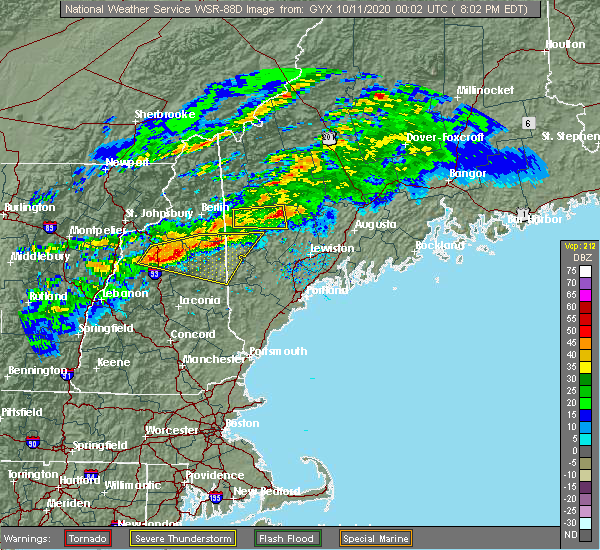 At 810 pm edt, a severe thunderstorm was located near canton, or 10 miles southeast of rumford, moving east at 50 mph (radar indicated). Hazards include 60 mph wind gusts and quarter size hail. Hail damage to vehicles is expected. Expect wind damage to roofs, siding, and trees. At 810 pm edt, a severe thunderstorm was located near canton, or 10 miles southeast of rumford, moving east at 50 mph (radar indicated). Hazards include 60 mph wind gusts and quarter size hail. Hail damage to vehicles is expected. Expect wind damage to roofs, siding, and trees.
|
| 8/25/2020 3:05 PM EDT | Tree and wires down reported on prescott r in kennebec county ME, 3.5 miles ESE of Augusta, ME |
| 8/25/2020 3:05 PM EDT |
 At 305 pm edt, a severe thunderstorm was located just north of augusta, moving east at 40 mph (radar indicated). Hazards include 60 mph wind gusts and penny size hail. Expect damage to roofs, siding, and trees. locations impacted include, augusta, china, belgrade, manchester, hallowell, winthrop, chelsea, albion, windsor, sidney, vassalboro, winslow and readfield. This includes interstate 95 between mile markers 108 and 124. At 305 pm edt, a severe thunderstorm was located just north of augusta, moving east at 40 mph (radar indicated). Hazards include 60 mph wind gusts and penny size hail. Expect damage to roofs, siding, and trees. locations impacted include, augusta, china, belgrade, manchester, hallowell, winthrop, chelsea, albion, windsor, sidney, vassalboro, winslow and readfield. This includes interstate 95 between mile markers 108 and 124.
|
| 8/25/2020 3:00 PM EDT | Multiple trees down along rt 13 in kennebec county ME, 6.2 miles SE of Augusta, ME |
| 8/25/2020 2:48 PM EDT |
 At 247 pm edt, a severe thunderstorm was located near belgrade, or 10 miles northwest of augusta, moving east at 40 mph (radar indicated). Hazards include 60 mph wind gusts and quarter size hail. Hail damage to vehicles is expected. Expect wind damage to roofs, siding, and trees. At 247 pm edt, a severe thunderstorm was located near belgrade, or 10 miles northwest of augusta, moving east at 40 mph (radar indicated). Hazards include 60 mph wind gusts and quarter size hail. Hail damage to vehicles is expected. Expect wind damage to roofs, siding, and trees.
|
| 8/24/2020 4:00 PM EDT | Quarter sized hail reported 10.8 miles NW of Augusta, ME |
| 8/24/2020 3:40 PM EDT |
 At 339 pm edt, a severe thunderstorm was located over hallowell, or over augusta, moving southeast at 10 mph (radar indicated). Hazards include 60 mph wind gusts and penny size hail. Expect damage to roofs, siding, and trees. Locations impacted include, augusta, chelsea, somerville, windsor, whitefield and pittston. At 339 pm edt, a severe thunderstorm was located over hallowell, or over augusta, moving southeast at 10 mph (radar indicated). Hazards include 60 mph wind gusts and penny size hail. Expect damage to roofs, siding, and trees. Locations impacted include, augusta, chelsea, somerville, windsor, whitefield and pittston.
|
| 8/24/2020 3:31 PM EDT |
 At 331 pm edt, a severe thunderstorm was located over hallowell, or over augusta, moving southeast at 10 mph (radar indicated). Hazards include 60 mph wind gusts and penny size hail. Expect damage to roofs, siding, and trees. locations impacted include, augusta, farmingdale, hallowell, chelsea, windsor, somerville, pittston and whitefield. This includes interstate 95 between mile markers 107 and 109. At 331 pm edt, a severe thunderstorm was located over hallowell, or over augusta, moving southeast at 10 mph (radar indicated). Hazards include 60 mph wind gusts and penny size hail. Expect damage to roofs, siding, and trees. locations impacted include, augusta, farmingdale, hallowell, chelsea, windsor, somerville, pittston and whitefield. This includes interstate 95 between mile markers 107 and 109.
|
| 8/24/2020 3:14 PM EDT |
 At 314 pm edt, a severe thunderstorm was located over manchester, or over augusta, moving southeast at 10 mph (radar indicated). Hazards include 60 mph wind gusts and quarter size hail. Hail damage to vehicles is expected. Expect wind damage to roofs, siding, and trees. At 314 pm edt, a severe thunderstorm was located over manchester, or over augusta, moving southeast at 10 mph (radar indicated). Hazards include 60 mph wind gusts and quarter size hail. Hail damage to vehicles is expected. Expect wind damage to roofs, siding, and trees.
|
| 8/24/2020 2:41 PM EDT |
 At 241 pm edt, a severe thunderstorm was located near belgrade, or 12 miles northwest of augusta, moving east at 20 mph (radar indicated). Hazards include 60 mph wind gusts and quarter size hail. Hail damage to vehicles is expected. expect wind damage to roofs, siding, and trees. Locations impacted include, augusta, oakland, belgrade, manchester, fayette, mount vernon, readfield, sidney and rome. At 241 pm edt, a severe thunderstorm was located near belgrade, or 12 miles northwest of augusta, moving east at 20 mph (radar indicated). Hazards include 60 mph wind gusts and quarter size hail. Hail damage to vehicles is expected. expect wind damage to roofs, siding, and trees. Locations impacted include, augusta, oakland, belgrade, manchester, fayette, mount vernon, readfield, sidney and rome.
|
| 8/24/2020 2:04 PM EDT |
 At 204 pm edt, a severe thunderstorm was located over jay, or 12 miles south of farmington, moving east at 20 mph (radar indicated). Hazards include golf ball size hail and 60 mph wind gusts. People and animals outdoors will be injured. expect hail damage to roofs, siding, windows, and vehicles. Expect wind damage to roofs, siding, and trees. At 204 pm edt, a severe thunderstorm was located over jay, or 12 miles south of farmington, moving east at 20 mph (radar indicated). Hazards include golf ball size hail and 60 mph wind gusts. People and animals outdoors will be injured. expect hail damage to roofs, siding, windows, and vehicles. Expect wind damage to roofs, siding, and trees.
|
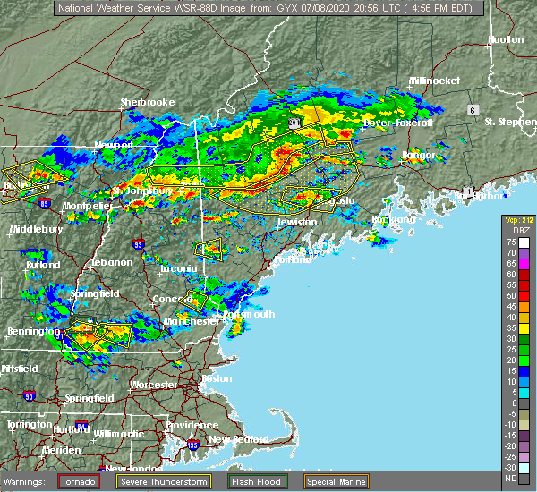
| 7/8/2020 6:08 PM EDT |
 At 607 pm edt, severe thunderstorms were located along a line extending from 12 miles north of damariscotta to near woolwich, moving southeast at 45 mph (radar indicated). Hazards include 60 mph wind gusts and quarter size hail. Hail damage to vehicles is expected. expect wind damage to roofs, siding, and trees. locations impacted include, brunswick, augusta, bath, rockland, gardiner, damariscotta, lincolnville, topsham, wiscasset, china, litchfield, farmingdale, bristol, liberty, bremen, woolwich, thomaston, palermo, rockport and bowdoin. this includes the following highways, interstate 295 between mile markers 31 and 51. Interstate 95 between mile markers 91 and 105. At 607 pm edt, severe thunderstorms were located along a line extending from 12 miles north of damariscotta to near woolwich, moving southeast at 45 mph (radar indicated). Hazards include 60 mph wind gusts and quarter size hail. Hail damage to vehicles is expected. expect wind damage to roofs, siding, and trees. locations impacted include, brunswick, augusta, bath, rockland, gardiner, damariscotta, lincolnville, topsham, wiscasset, china, litchfield, farmingdale, bristol, liberty, bremen, woolwich, thomaston, palermo, rockport and bowdoin. this includes the following highways, interstate 295 between mile markers 31 and 51. Interstate 95 between mile markers 91 and 105.
|
| 7/8/2020 5:45 PM EDT | Trees and wires down in town. reported by sheriffs office. time estimated from rada in kennebec county ME, 6.9 miles NNW of Augusta, ME |
| 7/8/2020 5:39 PM EDT |
 At 539 pm edt, severe thunderstorms were located along a line extending from near oakland to near belgrade to near turner, moving southeast at 45 mph (radar indicated). Hazards include 60 mph wind gusts and quarter size hail. Hail damage to vehicles is expected. Expect wind damage to roofs, siding, and trees. At 539 pm edt, severe thunderstorms were located along a line extending from near oakland to near belgrade to near turner, moving southeast at 45 mph (radar indicated). Hazards include 60 mph wind gusts and quarter size hail. Hail damage to vehicles is expected. Expect wind damage to roofs, siding, and trees.
|
| 7/8/2020 5:27 PM EDT |
 At 527 pm edt, severe thunderstorms were located along a line extending from 16 miles northeast of pittsfield to near skowhegan to 10 miles west of oakland to near belgrade to near winthrop to near turner to 10 miles southwest of canton, moving east at 40 mph (radar indicated). Hazards include 60 mph wind gusts and quarter size hail. Hail damage to vehicles is expected. expect wind damage to roofs, siding, and trees. locations impacted include, augusta, waterville, farmington, fairfield, oakland, skowhegan, pittsfield, turner, madison, china, clinton, belgrade, livermore falls, manchester, hallowell, bingham, norridgewock, winthrop, unity and benton. This includes interstate 95 between mile markers 110 and 155. At 527 pm edt, severe thunderstorms were located along a line extending from 16 miles northeast of pittsfield to near skowhegan to 10 miles west of oakland to near belgrade to near winthrop to near turner to 10 miles southwest of canton, moving east at 40 mph (radar indicated). Hazards include 60 mph wind gusts and quarter size hail. Hail damage to vehicles is expected. expect wind damage to roofs, siding, and trees. locations impacted include, augusta, waterville, farmington, fairfield, oakland, skowhegan, pittsfield, turner, madison, china, clinton, belgrade, livermore falls, manchester, hallowell, bingham, norridgewock, winthrop, unity and benton. This includes interstate 95 between mile markers 110 and 155.
|
| 7/8/2020 4:59 PM EDT |
 A severe thunderstorm warning remains in effect until 530 pm edt for central kennebec county. at 458 pm edt, a severe thunderstorm was located near belgrade, or 10 miles northwest of augusta, moving east at 25 mph. hazard. 60 mph wind gusts and quarter size hail. source. Radar indicated. A severe thunderstorm warning remains in effect until 530 pm edt for central kennebec county. at 458 pm edt, a severe thunderstorm was located near belgrade, or 10 miles northwest of augusta, moving east at 25 mph. hazard. 60 mph wind gusts and quarter size hail. source. Radar indicated.
|
| 7/8/2020 4:54 PM EDT |
 At 454 pm edt, severe thunderstorms were located along a line extending from 10 miles east of bingham to 7 miles east of kingfield to 8 miles west of madison to near farmington to near wilton to dixfield to 6 miles southeast of andover, moving east at 55 mph (radar indicated). Hazards include 60 mph wind gusts and quarter size hail. Hail damage to vehicles is expected. Expect wind damage to roofs, siding, and trees. At 454 pm edt, severe thunderstorms were located along a line extending from 10 miles east of bingham to 7 miles east of kingfield to 8 miles west of madison to near farmington to near wilton to dixfield to 6 miles southeast of andover, moving east at 55 mph (radar indicated). Hazards include 60 mph wind gusts and quarter size hail. Hail damage to vehicles is expected. Expect wind damage to roofs, siding, and trees.
|
| 7/8/2020 4:39 PM EDT |
 At 439 pm edt, a severe thunderstorm was located 8 miles west of belgrade, or 14 miles west of oakland, moving east at 30 mph (radar indicated). Hazards include 60 mph wind gusts and quarter size hail. Hail damage to vehicles is expected. Expect wind damage to roofs, siding, and trees. At 439 pm edt, a severe thunderstorm was located 8 miles west of belgrade, or 14 miles west of oakland, moving east at 30 mph (radar indicated). Hazards include 60 mph wind gusts and quarter size hail. Hail damage to vehicles is expected. Expect wind damage to roofs, siding, and trees.
|
| 7/2/2020 6:54 PM EDT |
 At 654 pm edt, a severe thunderstorm was located near farmingdale, or near gardiner, moving southeast at 30 mph (radar indicated). Hazards include 60 mph wind gusts and penny size hail. Expect damage to roofs, siding, and trees. locations impacted include, augusta, gardiner, wiscasset, china, litchfield, farmingdale, manchester, hallowell, liberty, palermo, winthrop, bowdoinham, chelsea, jefferson, dresden, appleton, alna, windsor, whitefield and washington. this includes the following highways, interstate 295 between mile markers 44 and 51. Interstate 95 between mile markers 96 and 109. At 654 pm edt, a severe thunderstorm was located near farmingdale, or near gardiner, moving southeast at 30 mph (radar indicated). Hazards include 60 mph wind gusts and penny size hail. Expect damage to roofs, siding, and trees. locations impacted include, augusta, gardiner, wiscasset, china, litchfield, farmingdale, manchester, hallowell, liberty, palermo, winthrop, bowdoinham, chelsea, jefferson, dresden, appleton, alna, windsor, whitefield and washington. this includes the following highways, interstate 295 between mile markers 44 and 51. Interstate 95 between mile markers 96 and 109.
|
| 7/2/2020 6:35 PM EDT |
 At 635 pm edt, a severe thunderstorm was located near augusta, moving southeast at 30 mph (radar indicated). Hazards include 60 mph wind gusts and penny size hail. expect damage to roofs, siding, and trees At 635 pm edt, a severe thunderstorm was located near augusta, moving southeast at 30 mph (radar indicated). Hazards include 60 mph wind gusts and penny size hail. expect damage to roofs, siding, and trees
|
| 7/2/2020 6:08 PM EDT |
 At 607 pm edt, a severe thunderstorm was located near china, or near waterville, moving southeast at 30 mph (radar indicated). Hazards include 60 mph wind gusts and quarter size hail. Hail damage to vehicles is expected. expect wind damage to roofs, siding, and trees. locations impacted include, augusta, waterville, fairfield, oakland, thorndike, china, clinton, belgrade, manchester, liberty, palermo, unity, knox, benton, chelsea, albion, burnham, brooks, freedom and morrill. This includes interstate 95 between mile markers 112 and 131, and between mile markers 134 and 140. At 607 pm edt, a severe thunderstorm was located near china, or near waterville, moving southeast at 30 mph (radar indicated). Hazards include 60 mph wind gusts and quarter size hail. Hail damage to vehicles is expected. expect wind damage to roofs, siding, and trees. locations impacted include, augusta, waterville, fairfield, oakland, thorndike, china, clinton, belgrade, manchester, liberty, palermo, unity, knox, benton, chelsea, albion, burnham, brooks, freedom and morrill. This includes interstate 95 between mile markers 112 and 131, and between mile markers 134 and 140.
|
| 7/2/2020 5:50 PM EDT |
 At 549 pm edt, a severe thunderstorm was located near fairfield, moving southeast at 30 mph (radar indicated). Hazards include 60 mph wind gusts and quarter size hail. Hail damage to vehicles is expected. Expect wind damage to roofs, siding, and trees. At 549 pm edt, a severe thunderstorm was located near fairfield, moving southeast at 30 mph (radar indicated). Hazards include 60 mph wind gusts and quarter size hail. Hail damage to vehicles is expected. Expect wind damage to roofs, siding, and trees.
|
| 8/19/2019 4:58 PM EDT |
 At 437 pm edt, a severe thunderstorm was located near manchester, or 7 miles northwest of augusta, moving east at 25 mph (radar indicated). Hazards include 60 mph wind gusts and quarter size hail. Hail damage to vehicles is expected. expect wind damage to roofs, siding, and trees. locations impacted include, augusta, waterville, gardiner, belgrade, livermore falls, farmingdale, manchester, hallowell, winthrop, chelsea, leeds, fayette, sidney, wayne, vassalboro, readfield, pittston, west gardiner, monmouth and winslow. This includes interstate 95 between mile markers 104 and 123. At 437 pm edt, a severe thunderstorm was located near manchester, or 7 miles northwest of augusta, moving east at 25 mph (radar indicated). Hazards include 60 mph wind gusts and quarter size hail. Hail damage to vehicles is expected. expect wind damage to roofs, siding, and trees. locations impacted include, augusta, waterville, gardiner, belgrade, livermore falls, farmingdale, manchester, hallowell, winthrop, chelsea, leeds, fayette, sidney, wayne, vassalboro, readfield, pittston, west gardiner, monmouth and winslow. This includes interstate 95 between mile markers 104 and 123.
|
| 8/19/2019 4:55 PM EDT |
 The national weather service in gray maine has issued a * severe thunderstorm warning for. southeastern kennebec county in south central maine. knox county in south central maine. southern waldo county in south central maine. Northeastern lincoln county in south central maine. The national weather service in gray maine has issued a * severe thunderstorm warning for. southeastern kennebec county in south central maine. knox county in south central maine. southern waldo county in south central maine. Northeastern lincoln county in south central maine.
|
| 8/19/2019 4:46 PM EDT |
 At 437 pm edt, a severe thunderstorm was located near manchester, or 7 miles northwest of augusta, moving east at 25 mph (radar indicated). Hazards include 60 mph wind gusts and quarter size hail. Hail damage to vehicles is expected. expect wind damage to roofs, siding, and trees. locations impacted include, augusta, waterville, gardiner, belgrade, livermore falls, farmingdale, manchester, hallowell, winthrop, chelsea, leeds, fayette, sidney, wayne, vassalboro, readfield, pittston, west gardiner, monmouth and winslow. This includes interstate 95 between mile markers 104 and 123. At 437 pm edt, a severe thunderstorm was located near manchester, or 7 miles northwest of augusta, moving east at 25 mph (radar indicated). Hazards include 60 mph wind gusts and quarter size hail. Hail damage to vehicles is expected. expect wind damage to roofs, siding, and trees. locations impacted include, augusta, waterville, gardiner, belgrade, livermore falls, farmingdale, manchester, hallowell, winthrop, chelsea, leeds, fayette, sidney, wayne, vassalboro, readfield, pittston, west gardiner, monmouth and winslow. This includes interstate 95 between mile markers 104 and 123.
|
| 8/19/2019 4:37 PM EDT |
 A severe thunderstorm warning remains in effect until 515 pm edt for central kennebec county. at 437 pm edt, a severe thunderstorm was located near manchester, or 7 miles northwest of augusta, moving east at 25 mph. hazard. 60 mph wind gusts and quarter size hail. source. Radar indicated. A severe thunderstorm warning remains in effect until 515 pm edt for central kennebec county. at 437 pm edt, a severe thunderstorm was located near manchester, or 7 miles northwest of augusta, moving east at 25 mph. hazard. 60 mph wind gusts and quarter size hail. source. Radar indicated.
|
| 8/19/2019 4:28 PM EDT |
 The severe thunderstorm warning for southwestern kennebec, eastern oxford and northeastern androscoggin counties will expire at 430 pm edt, the storm which prompted the warning has moved out of the area. therefore, the warning will be allowed to expire. The severe thunderstorm warning for southwestern kennebec, eastern oxford and northeastern androscoggin counties will expire at 430 pm edt, the storm which prompted the warning has moved out of the area. therefore, the warning will be allowed to expire.
|
| 8/19/2019 4:26 PM EDT |
 The national weather service in gray maine has issued a * severe thunderstorm warning for. central kennebec county in south central maine. northeastern androscoggin county in southwestern maine. until 515 pm edt. At 426 pm edt, a severe thunderstorm was located near winthrop, or. The national weather service in gray maine has issued a * severe thunderstorm warning for. central kennebec county in south central maine. northeastern androscoggin county in southwestern maine. until 515 pm edt. At 426 pm edt, a severe thunderstorm was located near winthrop, or.
|
| 8/19/2019 4:13 PM EDT |
 At 413 pm edt, a severe thunderstorm was located 7 miles northeast of turner, moving east at 20 mph (radar indicated). Hazards include 60 mph wind gusts and quarter size hail. Hail damage to vehicles is expected. expect wind damage to roofs, siding, and trees. locations impacted include, augusta, turner, belgrade, livermore falls, farmingdale, manchester, hallowell, winthrop, chelsea, leeds, livermore, fayette, wayne, readfield, mount vernon, monmouth, west gardiner and sidney. This includes interstate 95 between mile markers 106 and 112. At 413 pm edt, a severe thunderstorm was located 7 miles northeast of turner, moving east at 20 mph (radar indicated). Hazards include 60 mph wind gusts and quarter size hail. Hail damage to vehicles is expected. expect wind damage to roofs, siding, and trees. locations impacted include, augusta, turner, belgrade, livermore falls, farmingdale, manchester, hallowell, winthrop, chelsea, leeds, livermore, fayette, wayne, readfield, mount vernon, monmouth, west gardiner and sidney. This includes interstate 95 between mile markers 106 and 112.
|
| 8/19/2019 3:48 PM EDT |
 The national weather service in gray maine has issued a * severe thunderstorm warning for. southwestern kennebec county in south central maine. southeastern oxford county in western maine. northeastern androscoggin county in southwestern maine. Until 430 pm edt. The national weather service in gray maine has issued a * severe thunderstorm warning for. southwestern kennebec county in south central maine. southeastern oxford county in western maine. northeastern androscoggin county in southwestern maine. Until 430 pm edt.
|
| 7/31/2019 4:41 PM EDT |
 At 441 pm edt, a severe thunderstorm was located 7 miles southeast of litchfield, or 9 miles northwest of wiscasset, moving east at 25 mph (radar indicated). Hazards include 60 mph wind gusts and quarter size hail. Hail damage to vehicles is expected. Expect wind damage to roofs, siding, and trees. At 441 pm edt, a severe thunderstorm was located 7 miles southeast of litchfield, or 9 miles northwest of wiscasset, moving east at 25 mph (radar indicated). Hazards include 60 mph wind gusts and quarter size hail. Hail damage to vehicles is expected. Expect wind damage to roofs, siding, and trees.
|
| 7/28/2019 4:15 PM EDT |
 At 414 pm edt, a severe thunderstorm was located over belgrade, or 9 miles northwest of augusta, moving east at 15 mph. belgrade and sidney are in the path of this storm (radar indicated). Hazards include 60 mph wind gusts and quarter size hail. Hail damage to vehicles is expected. expect wind damage to roofs, siding, and trees. locations impacted include, augusta, waterville, oakland, belgrade, manchester, vassalboro, sidney, winslow, readfield, mount vernon and rome. This includes interstate 95 between mile markers 114 and 127. At 414 pm edt, a severe thunderstorm was located over belgrade, or 9 miles northwest of augusta, moving east at 15 mph. belgrade and sidney are in the path of this storm (radar indicated). Hazards include 60 mph wind gusts and quarter size hail. Hail damage to vehicles is expected. expect wind damage to roofs, siding, and trees. locations impacted include, augusta, waterville, oakland, belgrade, manchester, vassalboro, sidney, winslow, readfield, mount vernon and rome. This includes interstate 95 between mile markers 114 and 127.
|
| 7/28/2019 3:56 PM EDT |
 At 356 pm edt, a severe thunderstorm was located west of belgrade, or 13 miles southwest of oakland, moving east at 20 mph (radar indicated). Hazards include 60 mph wind gusts and quarter size hail. Hail damage to vehicles is expected. Expect wind damage to roofs, siding, and trees. At 356 pm edt, a severe thunderstorm was located west of belgrade, or 13 miles southwest of oakland, moving east at 20 mph (radar indicated). Hazards include 60 mph wind gusts and quarter size hail. Hail damage to vehicles is expected. Expect wind damage to roofs, siding, and trees.
|
| 7/6/2019 4:35 PM EDT |
 At 435 pm edt, a severe thunderstorm was located 7 miles southeast of gardiner, moving east at 25 mph (radar indicated). Hazards include 60 mph wind gusts. Expect damage to roofs, siding, and trees. locations impacted include, lewiston, augusta, gardiner, damariscotta, wiscasset, china, litchfield, farmingdale, bristol, hallowell, woolwich, lisbon, bowdoin, bowdoinham, chelsea, jefferson, dresden, edgecomb, alna and windsor. this includes the following highways, interstate 295 between mile markers 37 and 51. Interstate 95 between mile markers 78 and 105. At 435 pm edt, a severe thunderstorm was located 7 miles southeast of gardiner, moving east at 25 mph (radar indicated). Hazards include 60 mph wind gusts. Expect damage to roofs, siding, and trees. locations impacted include, lewiston, augusta, gardiner, damariscotta, wiscasset, china, litchfield, farmingdale, bristol, hallowell, woolwich, lisbon, bowdoin, bowdoinham, chelsea, jefferson, dresden, edgecomb, alna and windsor. this includes the following highways, interstate 295 between mile markers 37 and 51. Interstate 95 between mile markers 78 and 105.
|
| 7/6/2019 4:21 PM EDT |
 At 420 pm edt, a severe thunderstorm was located over gardiner, moving east at 25 mph (radar indicated). Hazards include 60 mph wind gusts. Expect damage to roofs, siding, and trees. locations impacted include, lewiston, augusta, gardiner, damariscotta, wiscasset, china, litchfield, farmingdale, bristol, manchester, hallowell, winthrop, woolwich, lisbon, greene, bowdoin, bowdoinham, chelsea, jefferson and leeds. this includes the following highways, interstate 295 between mile markers 37 and 51. Interstate 95 between mile markers 78 and 110. At 420 pm edt, a severe thunderstorm was located over gardiner, moving east at 25 mph (radar indicated). Hazards include 60 mph wind gusts. Expect damage to roofs, siding, and trees. locations impacted include, lewiston, augusta, gardiner, damariscotta, wiscasset, china, litchfield, farmingdale, bristol, manchester, hallowell, winthrop, woolwich, lisbon, greene, bowdoin, bowdoinham, chelsea, jefferson and leeds. this includes the following highways, interstate 295 between mile markers 37 and 51. Interstate 95 between mile markers 78 and 110.
|
| 7/6/2019 3:49 PM EDT |
 At 348 pm edt, a severe thunderstorm was located near winthrop, or 10 miles east of turner, moving east at 25 mph (radar indicated). Hazards include 60 mph wind gusts. expect damage to roofs, siding, and trees At 348 pm edt, a severe thunderstorm was located near winthrop, or 10 miles east of turner, moving east at 25 mph (radar indicated). Hazards include 60 mph wind gusts. expect damage to roofs, siding, and trees
|
| 9/3/2018 6:25 PM EDT |
 At 624 pm edt, a severe thunderstorm was located near turner, moving southeast at 25 mph (radar indicated). Hazards include 60 mph wind gusts. Expect damage to roofs, siding, and trees. locations impacted include, turner, litchfield, belgrade, livermore falls, manchester, winthrop, greene, leeds, livermore, fayette, wales, monmouth, wayne, readfield, sabattus, sidney, mount vernon and west gardiner. This includes interstate 95 between mile markers 88 and 90. At 624 pm edt, a severe thunderstorm was located near turner, moving southeast at 25 mph (radar indicated). Hazards include 60 mph wind gusts. Expect damage to roofs, siding, and trees. locations impacted include, turner, litchfield, belgrade, livermore falls, manchester, winthrop, greene, leeds, livermore, fayette, wales, monmouth, wayne, readfield, sabattus, sidney, mount vernon and west gardiner. This includes interstate 95 between mile markers 88 and 90.
|
| 9/3/2018 6:04 PM EDT |
 At 604 pm edt, a severe thunderstorm was located near canton, or 9 miles north of turner, moving southeast at 25 mph (radar indicated). Hazards include 60 mph wind gusts and nickel size hail. expect damage to roofs, siding, and trees At 604 pm edt, a severe thunderstorm was located near canton, or 9 miles north of turner, moving southeast at 25 mph (radar indicated). Hazards include 60 mph wind gusts and nickel size hail. expect damage to roofs, siding, and trees
|
| 8/17/2018 11:35 PM EDT |
 The severe thunderstorm warning for central kennebec county will expire at 1145 pm edt, the storm which prompted the warning has moved out of the area. therefore, the warning will be allowed to expire. however gusty winds are still possible with this thunderstorm. The severe thunderstorm warning for central kennebec county will expire at 1145 pm edt, the storm which prompted the warning has moved out of the area. therefore, the warning will be allowed to expire. however gusty winds are still possible with this thunderstorm.
|
| 8/17/2018 11:22 PM EDT |
 At 1122 pm edt, a severe thunderstorm was located near augusta, moving northeast at 35 mph (radar indicated). Hazards include 60 mph wind gusts. Expect damage to roofs, siding, and trees. locations impacted include, augusta, gardiner, china, farmingdale, hallowell, chelsea, vassalboro, sidney, windsor, pittston and winslow. This includes interstate 95 between mile markers 105 and 107, and between mile markers 113 and 123. At 1122 pm edt, a severe thunderstorm was located near augusta, moving northeast at 35 mph (radar indicated). Hazards include 60 mph wind gusts. Expect damage to roofs, siding, and trees. locations impacted include, augusta, gardiner, china, farmingdale, hallowell, chelsea, vassalboro, sidney, windsor, pittston and winslow. This includes interstate 95 between mile markers 105 and 107, and between mile markers 113 and 123.
|
| 8/17/2018 11:09 PM EDT |
 At 1108 pm edt, a severe thunderstorm was located over hallowell, or over augusta, moving northeast at 35 mph (radar indicated). Hazards include 60 mph wind gusts. Expect damage to roofs, siding, and trees. locations impacted include, augusta, waterville, gardiner, oakland, china, litchfield, belgrade, farmingdale, manchester, hallowell, winthrop, chelsea, sidney, pittston, winslow, vassalboro, readfield, west gardiner, windsor and monmouth. this includes the following highways, interstate 295 between mile markers 49 and 51. Interstate 95 between mile markers 93 and 127. At 1108 pm edt, a severe thunderstorm was located over hallowell, or over augusta, moving northeast at 35 mph (radar indicated). Hazards include 60 mph wind gusts. Expect damage to roofs, siding, and trees. locations impacted include, augusta, waterville, gardiner, oakland, china, litchfield, belgrade, farmingdale, manchester, hallowell, winthrop, chelsea, sidney, pittston, winslow, vassalboro, readfield, west gardiner, windsor and monmouth. this includes the following highways, interstate 295 between mile markers 49 and 51. Interstate 95 between mile markers 93 and 127.
|
| 8/17/2018 11:05 PM EDT |
 At 1104 pm edt, a severe thunderstorm was located near hallowell, or near gardiner, moving northeast at 35 mph (radar indicated). Hazards include 60 mph wind gusts. Expect damage to roofs, siding, and trees. locations impacted include, augusta, waterville, gardiner, oakland, topsham, wiscasset, china, litchfield, belgrade, farmingdale, manchester, hallowell, winthrop, woolwich, bowdoin, bowdoinham, chelsea, jefferson, dresden and alna. this includes the following highways, interstate 295 between mile markers 33 and 51. Interstate 95 between mile markers 91 and 127. At 1104 pm edt, a severe thunderstorm was located near hallowell, or near gardiner, moving northeast at 35 mph (radar indicated). Hazards include 60 mph wind gusts. Expect damage to roofs, siding, and trees. locations impacted include, augusta, waterville, gardiner, oakland, topsham, wiscasset, china, litchfield, belgrade, farmingdale, manchester, hallowell, winthrop, woolwich, bowdoin, bowdoinham, chelsea, jefferson, dresden and alna. this includes the following highways, interstate 295 between mile markers 33 and 51. Interstate 95 between mile markers 91 and 127.
|
| 8/17/2018 10:41 PM EDT |
 At 1041 pm edt, a severe thunderstorm was located 7 miles northeast of lewiston, moving northeast at 35 mph (radar indicated). Hazards include 60 mph wind gusts. expect damage to roofs, siding, and trees At 1041 pm edt, a severe thunderstorm was located 7 miles northeast of lewiston, moving northeast at 35 mph (radar indicated). Hazards include 60 mph wind gusts. expect damage to roofs, siding, and trees
|
| 8/7/2018 3:28 PM EDT |
 At 327 pm edt, a severe thunderstorm was located 8 miles west of belgrade, or 14 miles northwest of augusta, moving east at 25 mph (radar indicated). Hazards include 60 mph wind gusts and half dollar size hail. Hail damage to vehicles is expected. expect wind damage to roofs, siding, and trees. locations impacted include, augusta, oakland, turner, jay, belgrade, livermore falls, manchester, hallowell, winthrop, leeds, livermore, chesterville, fayette, wayne, rome, mount vernon, readfield, vienna, sidney and smithfield. This includes interstate 95 between mile markers 109 and 116. At 327 pm edt, a severe thunderstorm was located 8 miles west of belgrade, or 14 miles northwest of augusta, moving east at 25 mph (radar indicated). Hazards include 60 mph wind gusts and half dollar size hail. Hail damage to vehicles is expected. expect wind damage to roofs, siding, and trees. locations impacted include, augusta, oakland, turner, jay, belgrade, livermore falls, manchester, hallowell, winthrop, leeds, livermore, chesterville, fayette, wayne, rome, mount vernon, readfield, vienna, sidney and smithfield. This includes interstate 95 between mile markers 109 and 116.
|
| 8/7/2018 3:15 PM EDT |
 At 315 pm edt, a severe thunderstorm was located near livermore falls, or 14 miles northeast of turner, moving east at 25 mph (radar indicated). Hazards include 60 mph wind gusts and half dollar size hail. Hail damage to vehicles is expected. expect wind damage to roofs, siding, and trees. locations impacted include, augusta, oakland, turner, jay, belgrade, livermore falls, manchester, hallowell, canton, winthrop, leeds, livermore, chesterville, hartford, fayette, wayne, rome, mount vernon, readfield and vienna. This includes interstate 95 between mile markers 109 and 116. At 315 pm edt, a severe thunderstorm was located near livermore falls, or 14 miles northeast of turner, moving east at 25 mph (radar indicated). Hazards include 60 mph wind gusts and half dollar size hail. Hail damage to vehicles is expected. expect wind damage to roofs, siding, and trees. locations impacted include, augusta, oakland, turner, jay, belgrade, livermore falls, manchester, hallowell, canton, winthrop, leeds, livermore, chesterville, hartford, fayette, wayne, rome, mount vernon, readfield and vienna. This includes interstate 95 between mile markers 109 and 116.
|
| 8/7/2018 3:01 PM EDT |
 The national weather service in gray maine has issued a * severe thunderstorm warning for. northwestern kennebec county in south central maine. eastern oxford county in western maine. northeastern androscoggin county in southwestern maine. Southeastern franklin county in western maine. The national weather service in gray maine has issued a * severe thunderstorm warning for. northwestern kennebec county in south central maine. eastern oxford county in western maine. northeastern androscoggin county in southwestern maine. Southeastern franklin county in western maine.
|
| 7/27/2018 5:34 PM EDT |
 At 533 pm edt, severe thunderstorms were located along a line extending from 7 miles southeast of livermore falls to near turner, moving east at 15 mph (radar indicated). Hazards include 60 mph wind gusts and quarter size hail. Hail damage to vehicles is expected. expect wind damage to roofs, siding, and trees. Locations impacted include, augusta, turner, oakland, litchfield, belgrade, livermore falls, farmingdale, manchester, hallowell, winthrop, greene, leeds, livermore, fayette, wales, monmouth, wayne, readfield, mount vernon and sidney. At 533 pm edt, severe thunderstorms were located along a line extending from 7 miles southeast of livermore falls to near turner, moving east at 15 mph (radar indicated). Hazards include 60 mph wind gusts and quarter size hail. Hail damage to vehicles is expected. expect wind damage to roofs, siding, and trees. Locations impacted include, augusta, turner, oakland, litchfield, belgrade, livermore falls, farmingdale, manchester, hallowell, winthrop, greene, leeds, livermore, fayette, wales, monmouth, wayne, readfield, mount vernon and sidney.
|
| 7/27/2018 4:46 PM EDT |
 At 446 pm edt, severe thunderstorms were located along a line extending from near canton to 6 miles north of mechanic falls, moving east at 15 mph (radar indicated). Hazards include 60 mph wind gusts and quarter size hail. Hail damage to vehicles is expected. Expect wind damage to roofs, siding, and trees. At 446 pm edt, severe thunderstorms were located along a line extending from near canton to 6 miles north of mechanic falls, moving east at 15 mph (radar indicated). Hazards include 60 mph wind gusts and quarter size hail. Hail damage to vehicles is expected. Expect wind damage to roofs, siding, and trees.
|
| 9/5/2017 7:04 PM EDT |
 At 703 pm edt, a severe thunderstorm was located near belgrade, or near oakland, moving northeast at 35 mph. a second strong thunderstorm was near china and albion (radar indicated). Hazards include 60 mph wind gusts and nickel size hail. Expect damage to trees, and power lines. locations impacted include, augusta, waterville, fairfield, oakland, pittsfield, china, clinton, belgrade, manchester, hallowell, liberty, palermo, winthrop, unity, benton, albion, burnham, freedom, winslow and sidney. This includes interstate 95 between mile markers 109 and 143. At 703 pm edt, a severe thunderstorm was located near belgrade, or near oakland, moving northeast at 35 mph. a second strong thunderstorm was near china and albion (radar indicated). Hazards include 60 mph wind gusts and nickel size hail. Expect damage to trees, and power lines. locations impacted include, augusta, waterville, fairfield, oakland, pittsfield, china, clinton, belgrade, manchester, hallowell, liberty, palermo, winthrop, unity, benton, albion, burnham, freedom, winslow and sidney. This includes interstate 95 between mile markers 109 and 143.
|
| 9/5/2017 6:43 PM EDT |
 At 643 pm edt, a severe thunderstorm was located near winthrop, or 10 miles northwest of augusta, moving northeast at 35 mph (radar indicated). Hazards include 60 mph wind gusts and nickel size hail. expect damage to trees, and power lines At 643 pm edt, a severe thunderstorm was located near winthrop, or 10 miles northwest of augusta, moving northeast at 35 mph (radar indicated). Hazards include 60 mph wind gusts and nickel size hail. expect damage to trees, and power lines
|
| 8/10/2017 4:57 PM EDT |
 The severe thunderstorm warning for northeastern kennebec, west central waldo and southern somerset counties will expire at 500 pm edt, the storm which prompted the warning has weakened below severe limits, and no longer pose an immediate threat to life or property. therefore the warning will be allowed to expire. The severe thunderstorm warning for northeastern kennebec, west central waldo and southern somerset counties will expire at 500 pm edt, the storm which prompted the warning has weakened below severe limits, and no longer pose an immediate threat to life or property. therefore the warning will be allowed to expire.
|
| 8/10/2017 4:17 PM EDT |
 At 417 pm edt, a severe thunderstorm was located near oakland, moving east at 25 mph (radar indicated). Hazards include 60 mph wind gusts and quarter size hail. Minor hail damage to vehicles is possible. Expect wind damage to roofs, siding, and trees. At 417 pm edt, a severe thunderstorm was located near oakland, moving east at 25 mph (radar indicated). Hazards include 60 mph wind gusts and quarter size hail. Minor hail damage to vehicles is possible. Expect wind damage to roofs, siding, and trees.
|
| 7/20/2017 6:26 PM EDT |
 The severe thunderstorm warning for east central kennebec county will expire at 630 pm edt. the storm which prompted the warning has weakened below severe limits, and no longer pose an immediate threat to life or property. therefore the warning will be allowed to expire. However gusty winds are still possible with this thunderstorm. The severe thunderstorm warning for east central kennebec county will expire at 630 pm edt. the storm which prompted the warning has weakened below severe limits, and no longer pose an immediate threat to life or property. therefore the warning will be allowed to expire. However gusty winds are still possible with this thunderstorm.
|
| 7/20/2017 6:00 PM EDT |
 At 600 pm edt, a severe thunderstorm was located near palermo, or 13 miles east of augusta, moving east at 25 mph (radar indicated). Hazards include 60 mph wind gusts and penny size hail. Expect damage to trees, and power lines. locations impacted include, augusta, china, manchester, sidney, vassalboro and windsor. This includes interstate 95 between mile markers 113 and 121. At 600 pm edt, a severe thunderstorm was located near palermo, or 13 miles east of augusta, moving east at 25 mph (radar indicated). Hazards include 60 mph wind gusts and penny size hail. Expect damage to trees, and power lines. locations impacted include, augusta, china, manchester, sidney, vassalboro and windsor. This includes interstate 95 between mile markers 113 and 121.
|
| 7/20/2017 5:40 PM EDT | Trees down on route 27 in belgrade in kennebec county ME, 7.4 miles SSE of Augusta, ME |
| 7/20/2017 5:38 PM EDT |
 At 538 pm edt, a severe thunderstorm was located 8 miles northeast of augusta, moving east at 25 mph (radar indicated). Hazards include 60 mph wind gusts and penny size hail. Expect damage to trees, and power lines. locations impacted include, augusta, waterville, oakland, china, belgrade, manchester, albion, vassalboro, windsor, sidney, winslow and mount vernon. This includes interstate 95 between mile markers 113 and 124. At 538 pm edt, a severe thunderstorm was located 8 miles northeast of augusta, moving east at 25 mph (radar indicated). Hazards include 60 mph wind gusts and penny size hail. Expect damage to trees, and power lines. locations impacted include, augusta, waterville, oakland, china, belgrade, manchester, albion, vassalboro, windsor, sidney, winslow and mount vernon. This includes interstate 95 between mile markers 113 and 124.
|
| 7/20/2017 5:23 PM EDT |
 At 523 pm edt, a severe thunderstorm was located near belgrade, or 8 miles north of augusta, moving southeast at 25 mph (radar indicated). Hazards include 60 mph wind gusts and penny size hail. expect damage to trees, and power lines At 523 pm edt, a severe thunderstorm was located near belgrade, or 8 miles north of augusta, moving southeast at 25 mph (radar indicated). Hazards include 60 mph wind gusts and penny size hail. expect damage to trees, and power lines
|
| 7/8/2017 2:59 PM EDT |
 At 258 pm edt, a severe thunderstorm was located near augusta, moving east at 40 mph (radar indicated). Hazards include 60 mph wind gusts and quarter size hail. Minor hail damage to vehicles is possible. Expect wind damage to roofs, siding, and trees. At 258 pm edt, a severe thunderstorm was located near augusta, moving east at 40 mph (radar indicated). Hazards include 60 mph wind gusts and quarter size hail. Minor hail damage to vehicles is possible. Expect wind damage to roofs, siding, and trees.
|
| 7/28/2016 4:40 PM EDT |
 The severe thunderstorm warning for southwestern waldo and east central kennebec counties will expire at 445 pm edt, the storm which prompted the warning has weakened below severe limits, and no longer pose an immediate threat to life or property. therefore, the warning will be allowed to expire. however gusty winds are still possible with this thunderstorm. The severe thunderstorm warning for southwestern waldo and east central kennebec counties will expire at 445 pm edt, the storm which prompted the warning has weakened below severe limits, and no longer pose an immediate threat to life or property. therefore, the warning will be allowed to expire. however gusty winds are still possible with this thunderstorm.
|
| 7/28/2016 4:15 PM EDT | Tree on wires and telephone poles down on west river road. time estimated from radar. delayed repor in kennebec county ME, 8.3 miles SSW of Augusta, ME |
| 7/28/2016 4:12 PM EDT |
 At 411 pm edt, a severe thunderstorm was located over china, or 9 miles southeast of waterville, moving east at 15 mph (radar indicated). Hazards include 60 mph wind gusts and penny size hail. Expect damage to roofs. siding. and trees. Locations impacted include, augusta, waterville, thorndike, china, belgrade, manchester, liberty, palermo, unity, knox, albion, freedom, vassalboro, sidney, windsor, winslow, montville, somerville and readfield. At 411 pm edt, a severe thunderstorm was located over china, or 9 miles southeast of waterville, moving east at 15 mph (radar indicated). Hazards include 60 mph wind gusts and penny size hail. Expect damage to roofs. siding. and trees. Locations impacted include, augusta, waterville, thorndike, china, belgrade, manchester, liberty, palermo, unity, knox, albion, freedom, vassalboro, sidney, windsor, winslow, montville, somerville and readfield.
|
| 7/28/2016 3:59 PM EDT |
 At 359 pm edt, a severe thunderstorm was located over china, or near waterville, moving east at 15 mph (radar indicated). Hazards include 60 mph wind gusts and nickel size hail. Expect damage to roofs. siding. and trees. Locations impacted include, augusta, waterville, oakland, thorndike, china, belgrade, manchester, liberty, palermo, unity, knox, benton, albion, freedom, vassalboro, sidney, winslow, windsor, montville and readfield. At 359 pm edt, a severe thunderstorm was located over china, or near waterville, moving east at 15 mph (radar indicated). Hazards include 60 mph wind gusts and nickel size hail. Expect damage to roofs. siding. and trees. Locations impacted include, augusta, waterville, oakland, thorndike, china, belgrade, manchester, liberty, palermo, unity, knox, benton, albion, freedom, vassalboro, sidney, winslow, windsor, montville and readfield.
|
| 7/28/2016 3:55 PM EDT | 2 trees down on west road in kennebec county ME, 11.5 miles SSE of Augusta, ME |
| 7/28/2016 3:49 PM EDT | Tree down on power lines oakland roa in kennebec county ME, 8.1 miles SSE of Augusta, ME |
| 7/28/2016 3:45 PM EDT | Tree down in middle of dunn roa in kennebec county ME, 8.1 miles SSE of Augusta, ME |
| 7/28/2016 3:44 PM EDT |
 At 344 pm edt, a severe thunderstorm was located near waterville, moving east at 15 mph (radar indicated). Hazards include 60 mph wind gusts and nickel size hail. Expect damage to roofs. siding. And trees. At 344 pm edt, a severe thunderstorm was located near waterville, moving east at 15 mph (radar indicated). Hazards include 60 mph wind gusts and nickel size hail. Expect damage to roofs. siding. And trees.
|
| 6/7/2016 5:48 PM EDT |
 At 548 pm edt, a severe thunderstorm was located over belgrade, or 8 miles north of augusta, moving east at 35 mph (radar indicated). Hazards include 60 mph wind gusts and quarter size hail. Hail damage to vehicles is expected. expect wind damage to roofs, siding, and trees. Locations impacted include, augusta, waterville, oakland, belgrade, manchester, sidney, vassalboro, mount vernon and readfield. At 548 pm edt, a severe thunderstorm was located over belgrade, or 8 miles north of augusta, moving east at 35 mph (radar indicated). Hazards include 60 mph wind gusts and quarter size hail. Hail damage to vehicles is expected. expect wind damage to roofs, siding, and trees. Locations impacted include, augusta, waterville, oakland, belgrade, manchester, sidney, vassalboro, mount vernon and readfield.
|
| 6/7/2016 5:36 PM EDT |
 At 536 pm edt, a severe thunderstorm was located near belgrade, or 10 miles northwest of augusta, moving east at 30 mph (radar indicated). Hazards include 60 mph wind gusts and quarter size hail. Hail damage to vehicles is expected. expect wind damage to roofs, siding, and trees. Locations impacted include, augusta, waterville, oakland, belgrade, manchester, winthrop, fayette, mount vernon, vassalboro, sidney, rome, readfield, vienna, windsor and smithfield. At 536 pm edt, a severe thunderstorm was located near belgrade, or 10 miles northwest of augusta, moving east at 30 mph (radar indicated). Hazards include 60 mph wind gusts and quarter size hail. Hail damage to vehicles is expected. expect wind damage to roofs, siding, and trees. Locations impacted include, augusta, waterville, oakland, belgrade, manchester, winthrop, fayette, mount vernon, vassalboro, sidney, rome, readfield, vienna, windsor and smithfield.
|
| 6/7/2016 5:25 PM EDT |
 At 525 pm edt, a severe thunderstorm was located 7 miles northwest of winthrop, or 14 miles northwest of augusta, moving east at 35 mph (radar indicated). Hazards include 60 mph wind gusts and quarter size hail. Hail damage to vehicles is expected. expect wind damage to roofs, siding, and trees. Locations impacted include, augusta, waterville, oakland, belgrade, livermore falls, manchester, winthrop, fayette, wayne, mount vernon, vassalboro, sidney, rome, readfield, vienna, windsor and smithfield. At 525 pm edt, a severe thunderstorm was located 7 miles northwest of winthrop, or 14 miles northwest of augusta, moving east at 35 mph (radar indicated). Hazards include 60 mph wind gusts and quarter size hail. Hail damage to vehicles is expected. expect wind damage to roofs, siding, and trees. Locations impacted include, augusta, waterville, oakland, belgrade, livermore falls, manchester, winthrop, fayette, wayne, mount vernon, vassalboro, sidney, rome, readfield, vienna, windsor and smithfield.
|
| 6/7/2016 5:12 PM EDT |
 At 512 pm edt, a severe thunderstorm was located 7 miles south of livermore falls, or 9 miles northeast of turner, moving east at 30 mph (radar indicated). Hazards include 60 mph wind gusts and quarter size hail. Hail damage to vehicles is expected. Expect wind damage to roofs, siding, and trees. At 512 pm edt, a severe thunderstorm was located 7 miles south of livermore falls, or 9 miles northeast of turner, moving east at 30 mph (radar indicated). Hazards include 60 mph wind gusts and quarter size hail. Hail damage to vehicles is expected. Expect wind damage to roofs, siding, and trees.
|
| 3/17/2016 2:57 PM EDT |
 At 257 pm edt, doppler radar indicated a severe thunderstorm capable of producing quarter size hail and damaging winds in excess of 60 mph. this storm was located near turner, and moving east at 20 mph. At 257 pm edt, doppler radar indicated a severe thunderstorm capable of producing quarter size hail and damaging winds in excess of 60 mph. this storm was located near turner, and moving east at 20 mph.
|
| 8/12/2015 9:15 PM EDT |
 At 913 pm edt, doppler radar indicated a severe thunderstorm capable of producing damaging winds in excess of 60 mph. this storm was located 11 miles east of farmingdale, or 11 miles east of gardiner, moving northeast at 30 mph. penny size hail may also accompany the damaging winds. locations impacted include, augusta, gardiner, damariscotta, wiscasset, china, farmingdale, bremen, chelsea, jefferson, dresden, alna, somerville, pittston, nobleboro, waldoboro, windsor, whitefield, newcastle, hibberts gore and west gardiner. At 913 pm edt, doppler radar indicated a severe thunderstorm capable of producing damaging winds in excess of 60 mph. this storm was located 11 miles east of farmingdale, or 11 miles east of gardiner, moving northeast at 30 mph. penny size hail may also accompany the damaging winds. locations impacted include, augusta, gardiner, damariscotta, wiscasset, china, farmingdale, bremen, chelsea, jefferson, dresden, alna, somerville, pittston, nobleboro, waldoboro, windsor, whitefield, newcastle, hibberts gore and west gardiner.
|
| 8/12/2015 8:55 PM EDT |
 At 854 pm edt, doppler radar indicated a severe thunderstorm capable of producing quarter size hail and damaging winds in excess of 60 mph. this storm was located near gardiner, and moving northeast at 30 mph. At 854 pm edt, doppler radar indicated a severe thunderstorm capable of producing quarter size hail and damaging winds in excess of 60 mph. this storm was located near gardiner, and moving northeast at 30 mph.
|
| 8/4/2015 5:26 PM EDT |
 The severe thunderstorm warning for southeastern somerset, northeastern kennebec and northern waldo counties will expire at 530 pm edt, the storms which prompted the warning have weakened below severe limits, and no longer poses an immediate threat to life or property. therefore the warning will be allowed to expire. The severe thunderstorm warning for southeastern somerset, northeastern kennebec and northern waldo counties will expire at 530 pm edt, the storms which prompted the warning have weakened below severe limits, and no longer poses an immediate threat to life or property. therefore the warning will be allowed to expire.
|
| 8/4/2015 5:00 PM EDT |
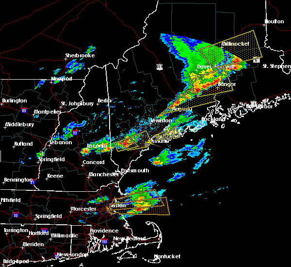 At 459 pm edt, doppler radar indicated a line of severe thunderstorms capable of producing quarter size hail and damaging winds in excess of 60 mph. these storms were located along a line extending from near pittsfield to augusta, moving east at 25 mph. locations impacted include, northern augusta, southeastern waterville, thorndike, pittsfield, searsport, china, clinton, manchester, liberty, palermo, winterport, prospect, unity, winthrop, stockton springs, knox, benton, albion, burnham and frankfort. At 459 pm edt, doppler radar indicated a line of severe thunderstorms capable of producing quarter size hail and damaging winds in excess of 60 mph. these storms were located along a line extending from near pittsfield to augusta, moving east at 25 mph. locations impacted include, northern augusta, southeastern waterville, thorndike, pittsfield, searsport, china, clinton, manchester, liberty, palermo, winterport, prospect, unity, winthrop, stockton springs, knox, benton, albion, burnham and frankfort.
|
| 8/4/2015 4:30 PM EDT |
 At 429 pm edt, doppler radar indicated a line of severe thunderstorms capable of producing half dollar size hail and damaging winds in excess of 60 mph. these storms were located along a line extending from 6 miles east of skowhegan to near winthrop, and moving northeast at 30 mph. At 429 pm edt, doppler radar indicated a line of severe thunderstorms capable of producing half dollar size hail and damaging winds in excess of 60 mph. these storms were located along a line extending from 6 miles east of skowhegan to near winthrop, and moving northeast at 30 mph.
|
| 8/1/2015 3:55 PM EDT |
 At 354 pm edt, doppler radar indicated a severe thunderstorm capable of producing quarter size hail and damaging winds in excess of 60 mph. this storm was located near palermo, or 14 miles east of augusta, moving east at 40 mph. locations impacted include, augusta, rockland, belfast, gardiner, camden, lincolnville, searsport, thorndike, china, farmingdale, hallowell, liberty, camden hills state park, rockport, islesboro, damariscotta lake state park, winterport, warren island state park, palermo and stockton springs. At 354 pm edt, doppler radar indicated a severe thunderstorm capable of producing quarter size hail and damaging winds in excess of 60 mph. this storm was located near palermo, or 14 miles east of augusta, moving east at 40 mph. locations impacted include, augusta, rockland, belfast, gardiner, camden, lincolnville, searsport, thorndike, china, farmingdale, hallowell, liberty, camden hills state park, rockport, islesboro, damariscotta lake state park, winterport, warren island state park, palermo and stockton springs.
|
| 8/1/2015 3:51 PM EDT |
 At 351 pm edt, doppler radar indicated a severe thunderstorm capable of producing quarter size hail and damaging winds in excess of 60 mph. this storm was located near palermo, or 12 miles east of augusta, and moving east at 40 mph. At 351 pm edt, doppler radar indicated a severe thunderstorm capable of producing quarter size hail and damaging winds in excess of 60 mph. this storm was located near palermo, or 12 miles east of augusta, and moving east at 40 mph.
|
| 8/1/2015 3:48 PM EDT |
 At 348 pm edt, doppler radar indicated a line of severe thunderstorms capable of producing quarter size hail and damaging winds in excess of 60 mph. these storms were located along a line extending from 6 miles southeast of oakland to augusta to near litchfield, moving east at 25 mph. locations impacted include, augusta, waterville, gardiner, thorndike, oakland, china, farmingdale, manchester, hallowell, palermo, unity, benton, chelsea, jefferson, albion, freedom, somerville, pittston, sidney and vassalboro. At 348 pm edt, doppler radar indicated a line of severe thunderstorms capable of producing quarter size hail and damaging winds in excess of 60 mph. these storms were located along a line extending from 6 miles southeast of oakland to augusta to near litchfield, moving east at 25 mph. locations impacted include, augusta, waterville, gardiner, thorndike, oakland, china, farmingdale, manchester, hallowell, palermo, unity, benton, chelsea, jefferson, albion, freedom, somerville, pittston, sidney and vassalboro.
|
| 8/1/2015 3:34 PM EDT |
 At 334 pm edt, doppler radar indicated a line of severe thunderstorms capable of producing quarter size hail and damaging winds in excess of 60 mph. these storms were located along a line extending from near belgrade to near manchester to 6 miles northeast of lewiston, moving east at 25 mph. locations impacted include, augusta, southern waterville, gardiner, thorndike, oakland, china, litchfield, belgrade, farmingdale, manchester, hallowell, palermo, winthrop, unity, greene, bowdoin, benton, chelsea, jefferson and leeds. At 334 pm edt, doppler radar indicated a line of severe thunderstorms capable of producing quarter size hail and damaging winds in excess of 60 mph. these storms were located along a line extending from near belgrade to near manchester to 6 miles northeast of lewiston, moving east at 25 mph. locations impacted include, augusta, southern waterville, gardiner, thorndike, oakland, china, litchfield, belgrade, farmingdale, manchester, hallowell, palermo, winthrop, unity, greene, bowdoin, benton, chelsea, jefferson and leeds.
|
| 8/1/2015 3:30 PM EDT | Augusta country club had trees down and tables blown over in kennebec county ME, 3.8 miles ENE of Augusta, ME |
| 8/1/2015 3:13 PM EDT |
 At 313 pm edt, doppler radar indicated a line of severe thunderstorms capable of producing damaging winds in excess of 60 mph. these storms were located along a line extending from near belgrade to near winthrop to auburn, and moving east at 25 mph. At 313 pm edt, doppler radar indicated a line of severe thunderstorms capable of producing damaging winds in excess of 60 mph. these storms were located along a line extending from near belgrade to near winthrop to auburn, and moving east at 25 mph.
|
| 5/28/2015 4:37 PM EDT | At 437 pm edt, doppler radar indicated a line of severe thunderstorms capable of producing damaging winds in excess of 60 mph. these storms were located along a line extending from 12 miles east of bingham to 9 miles north of skowhegan to norridgewock to 8 miles east of livermore falls, and moving east at 30 mph. |
| 5/28/2015 4:37 PM EDT | At 437 pm edt, doppler radar indicated a line of severe thunderstorms capable of producing damaging winds in excess of 60 mph. these storms were located along a line extending from 12 miles east of bingham to 9 miles north of skowhegan to norridgewock to 8 miles east of livermore falls, and moving east at 30 mph. |
| 5/28/2015 1:05 PM EDT | At 105 pm edt, doppler radar indicated a severe thunderstorm capable of producing quarter size hail and damaging winds in excess of 60 mph. this storm was located near norridgewock, or 8 miles northwest of oakland, moving east at 45 mph. locations impacted include, northeastern augusta, waterville, southeastern farmington, fairfield, oakland, skowhegan, northeastern jay, china, clinton, belgrade, manchester, norridgewock, wilton, chesterville, fayette, mount vernon, mercer, smithfield, winslow and new sharon. |
| 5/28/2015 12:49 PM EDT | At 1249 pm edt, doppler radar indicated a severe thunderstorm capable of producing quarter size hail and damaging winds in excess of 60 mph. this storm was located 7 miles east of wilton, or 7 miles southeast of farmington, moving east at 45 mph. locations impacted include, northern augusta, waterville, southeastern farmington, fairfield, oakland, skowhegan, jay, china, clinton, belgrade, livermore falls, manchester, dixfield, canton, wilton, norridgewock, livermore, chesterville, fayette and mount vernon. |
| 5/28/2015 12:31 PM EDT | At 1231 pm edt, doppler radar indicated a severe thunderstorm capable of producing penny size hail and damaging winds in excess of 60 mph. this storm was located near canton, or 10 miles east of rumford, and moving east at 45 mph. |
| 7/20/2013 4:50 PM EDT | Trees down in kennebec county ME, 5.8 miles SSW of Augusta, ME |
| 1/1/0001 12:00 AM | Half Dollar sized hail reported 1.9 miles NNW of Augusta, ME, half dollar size hail |
| 1/1/0001 12:00 AM | Quarter sized hail reported 10.5 miles W of Augusta, ME |
| 1/1/0001 12:00 AM | Half Dollar sized hail reported 8.1 miles SSE of Augusta, ME |
| 1/1/0001 12:00 AM | Half Dollar sized hail reported 8.1 miles SSE of Augusta, ME |
| 1/1/0001 12:00 AM | Trees down on rt 135 west of belgrade in kennebec county ME, 8.1 miles SSE of Augusta, ME |
Hail Maps for Augusta, ME


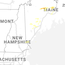


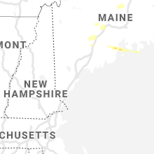


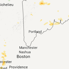

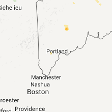


Connect with Interactive Hail Maps