

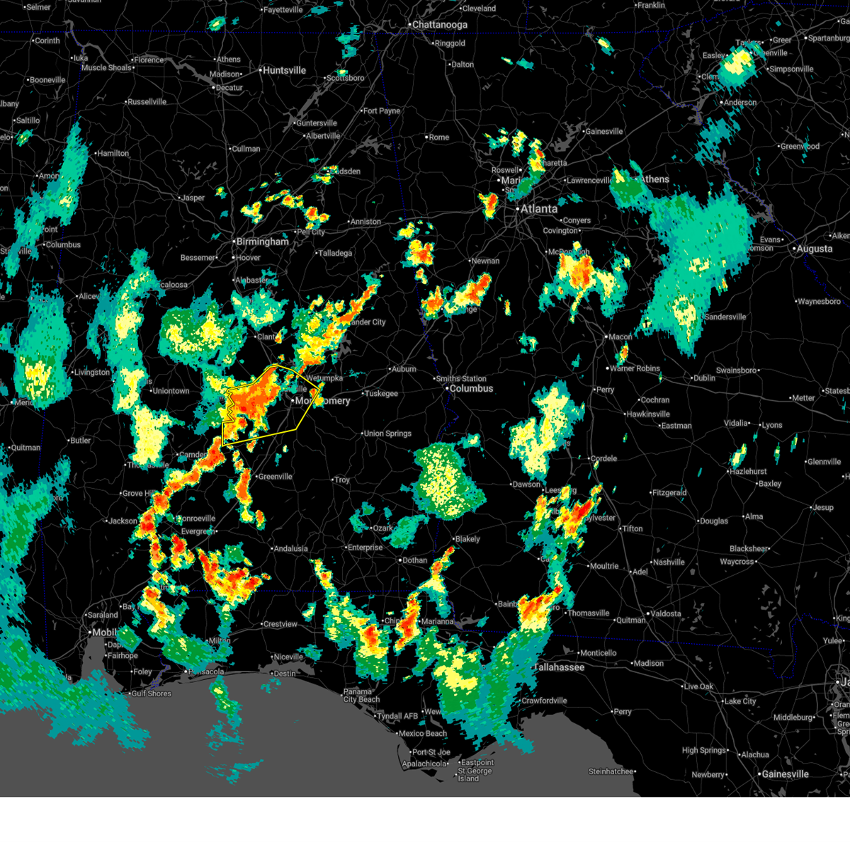
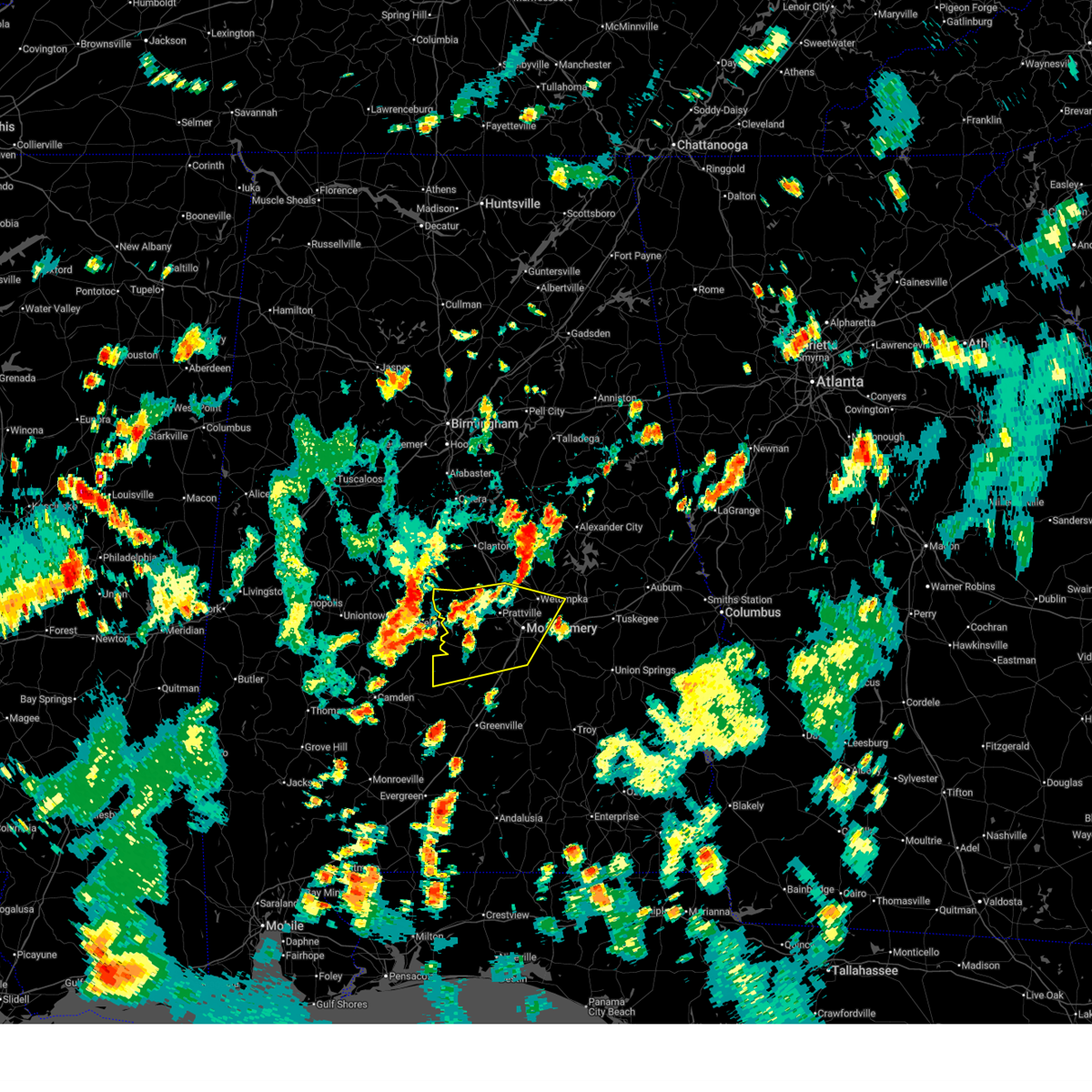
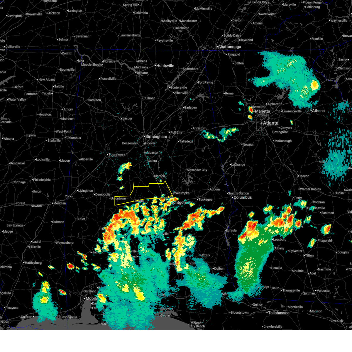
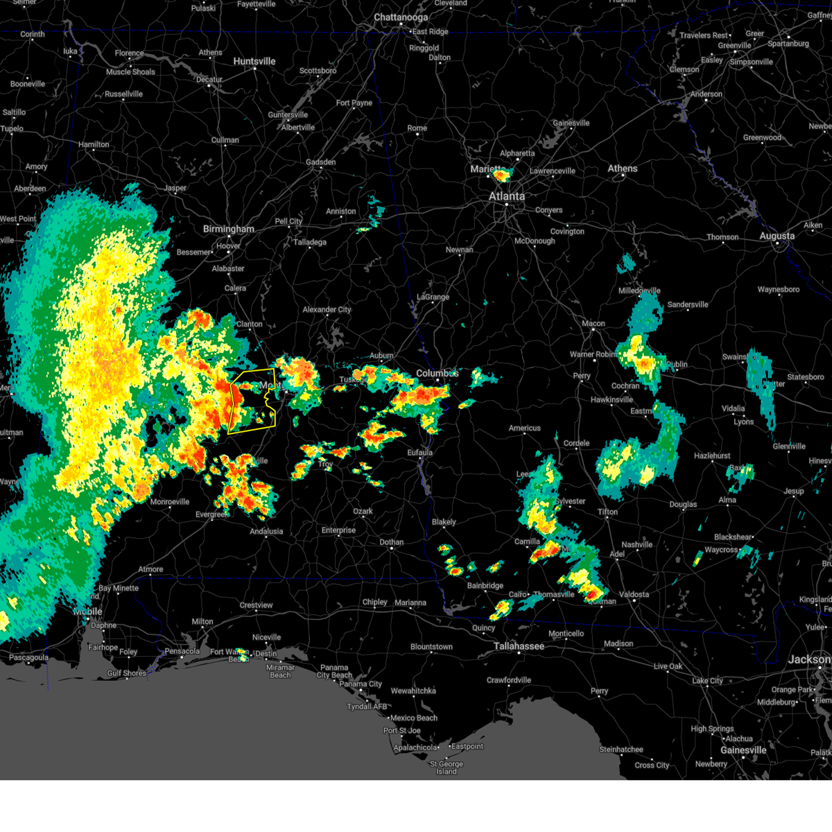
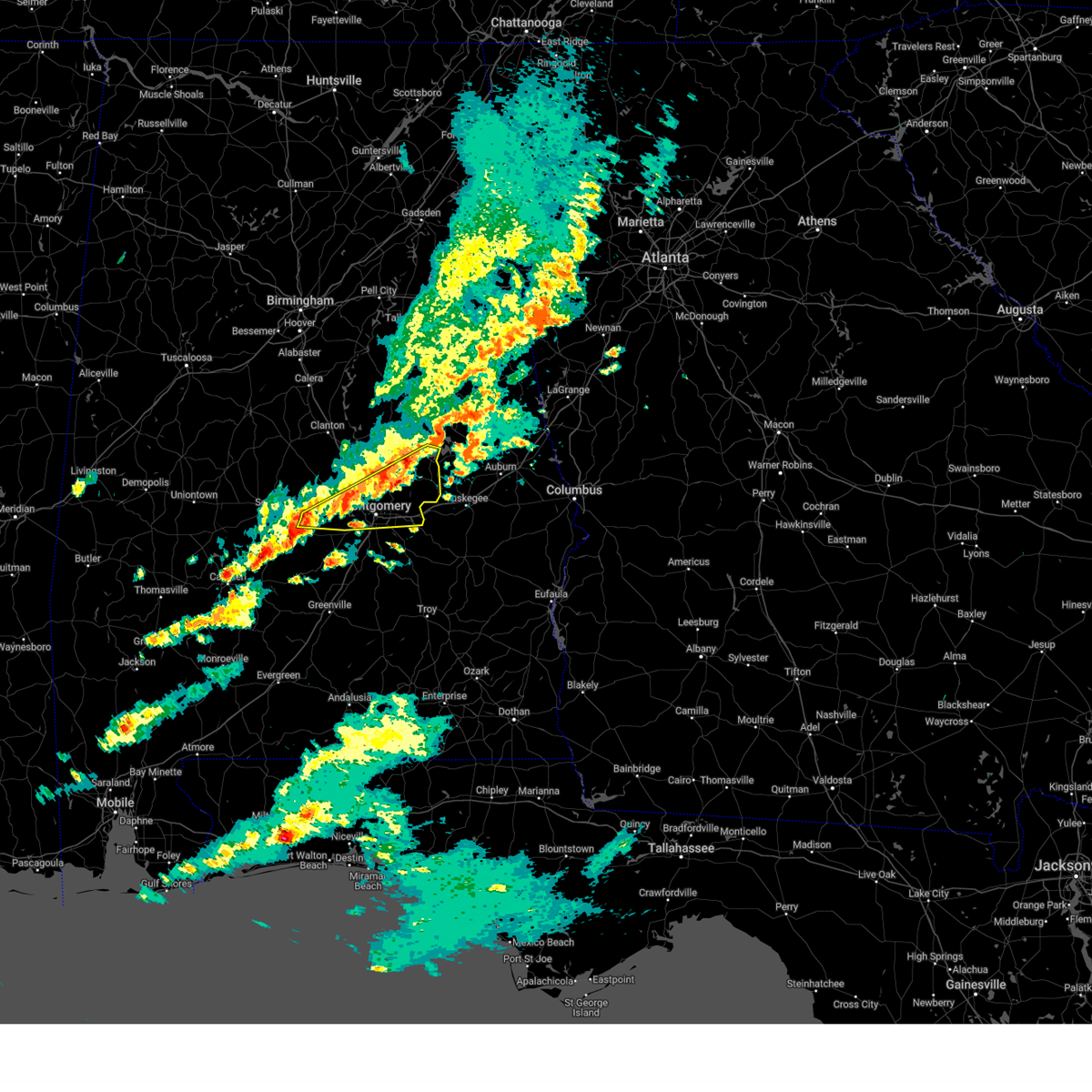
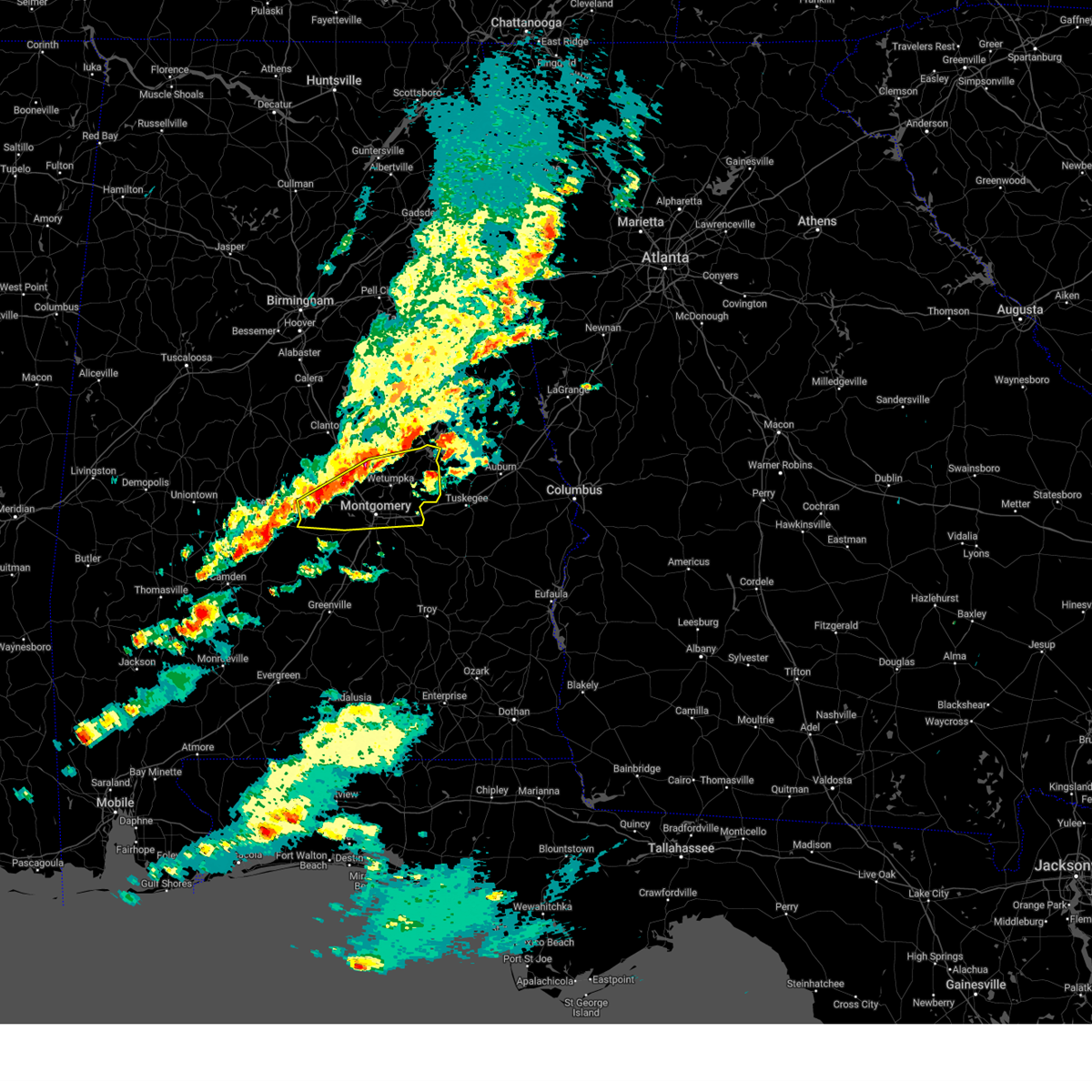
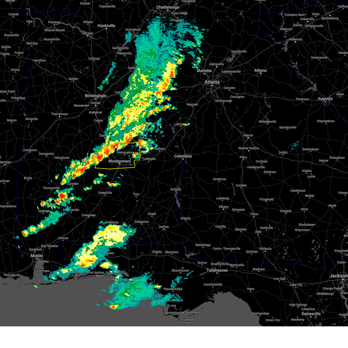
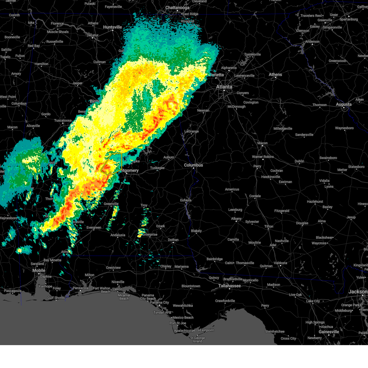
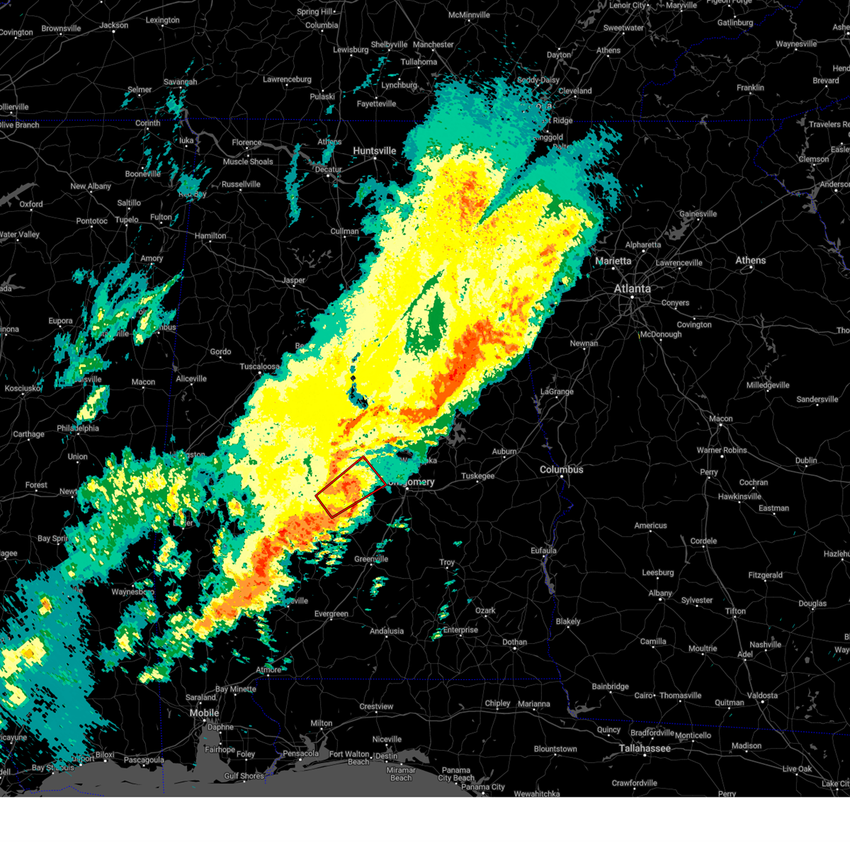
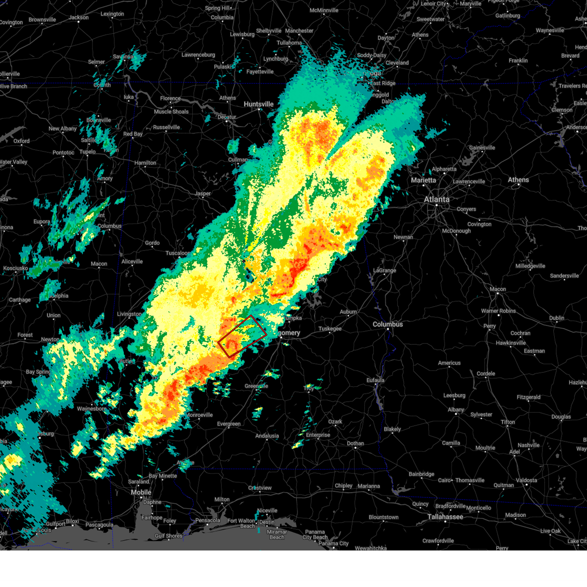
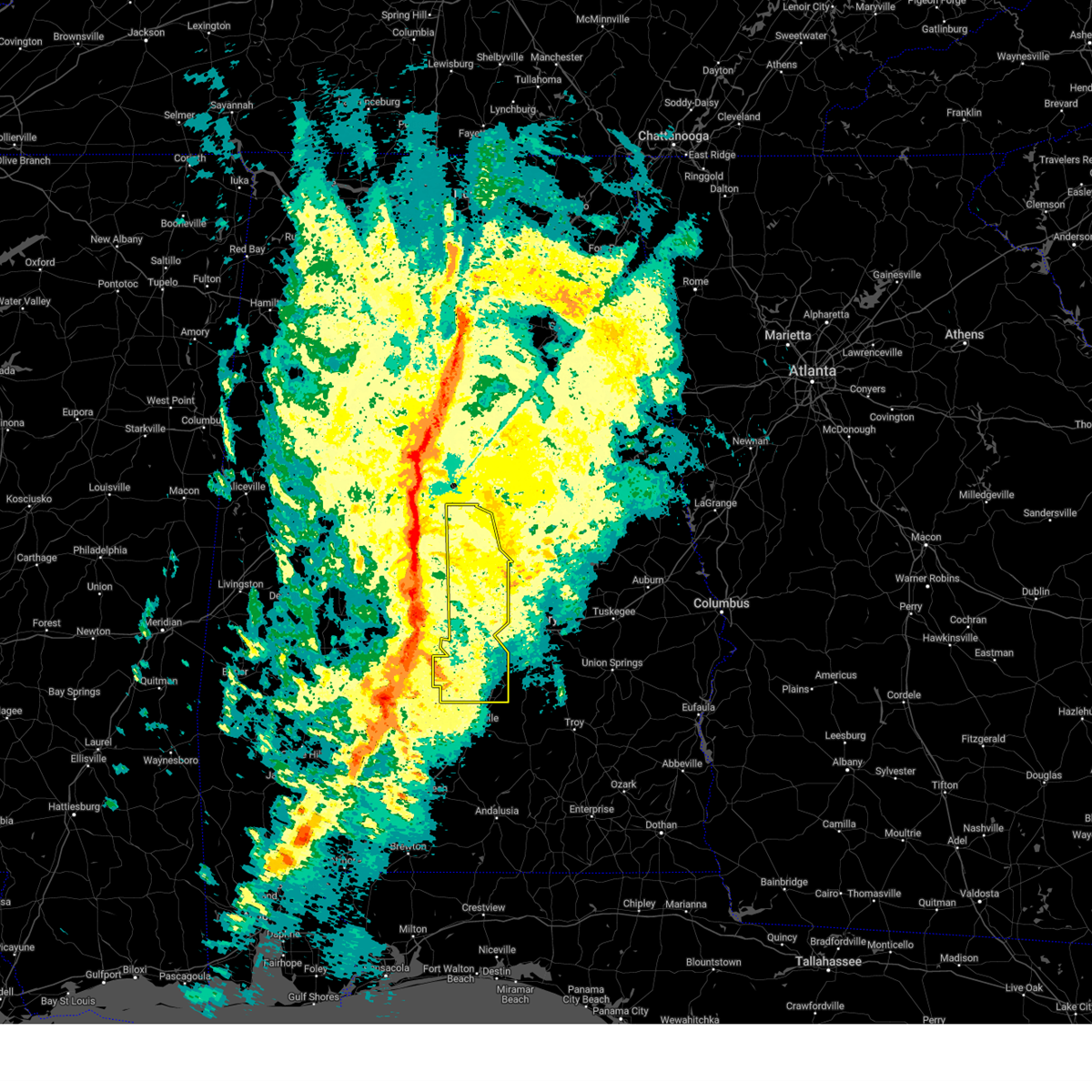
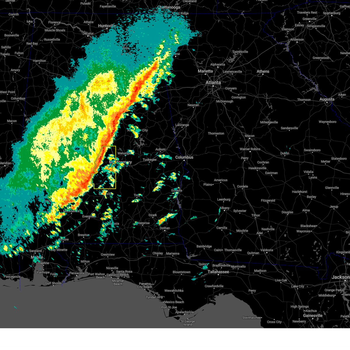
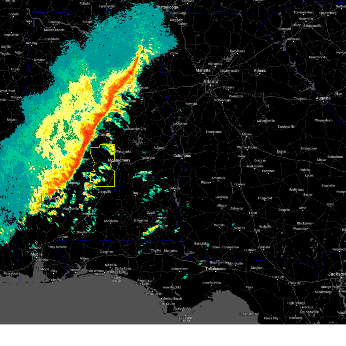
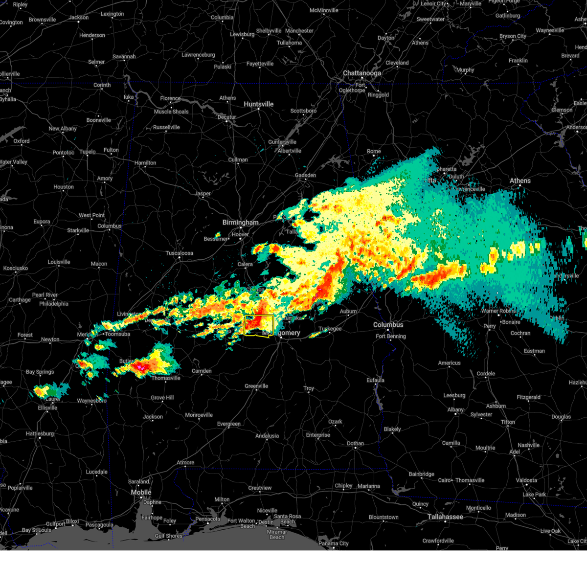
Hail Map for Autaugaville, AL
The Autaugaville, AL area has had 2 reports of on-the-ground hail by trained spotters, and has been under severe weather warnings 18 times during the past 12 months. Doppler radar has detected hail at or near Autaugaville, AL on 54 occasions, including 5 occasions during the past year.
| Name: | Autaugaville, AL |
| Where Located: | 48 miles NE of Camden, AL |
| Map: | Google Map for Autaugaville, AL |
| Population: | 870 |
| Housing Units: | 412 |
| More Info: | Search Google for Autaugaville, AL |
1
The Top Recent Hail Date for Autaugaville, AL is Sunday, August 18, 2024 (15th out of 54)

Hail and Wind Damage Spotted near Autaugaville, AL
| Date / Time | Report Details |
|---|---|
| 7/1/2025 5:34 PM CDT |
 At 533 pm cdt, severe thunderstorms were located along a line extending from deatsville to near autauga county airport to white hall to 8 miles southeast of belknap, moving southeast at 20 mph (radar indicated). Hazards include 60 mph wind gusts. Expect damage to roofs, siding, and trees. Locations impacted include, montgomery, prattville, millbrook, wetumpka, mosses, hayneville, elmore, coosada, deatsville, autaugaville, white hall, gordonville, lowndesboro, benton, hyundai motors of alabama, auburn university in montgomery, autauga county airport, woodcrest, snowdoun, and lagoon park. At 533 pm cdt, severe thunderstorms were located along a line extending from deatsville to near autauga county airport to white hall to 8 miles southeast of belknap, moving southeast at 20 mph (radar indicated). Hazards include 60 mph wind gusts. Expect damage to roofs, siding, and trees. Locations impacted include, montgomery, prattville, millbrook, wetumpka, mosses, hayneville, elmore, coosada, deatsville, autaugaville, white hall, gordonville, lowndesboro, benton, hyundai motors of alabama, auburn university in montgomery, autauga county airport, woodcrest, snowdoun, and lagoon park.
|
| 7/1/2025 5:24 PM CDT | At 523 pm cdt, severe thunderstorms were located along a line extending from near deatsville to near autaugaville to near mulberry to near tyler, moving southeast at 20 mph (radar indicated). Hazards include 60 mph wind gusts. Expect damage to roofs, siding, and trees. Locations impacted include, montgomery, prattville, millbrook, wetumpka, mosses, hayneville, elmore, coosada, deatsville, autaugaville, white hall, gordonville, lowndesboro, benton, hyundai motors of alabama, auburn university in montgomery, autauga county airport, woodcrest, snowdoun, and lagoon park. |
| 7/1/2025 5:18 PM CDT | At 517 pm cdt, severe thunderstorms were located along a line extending from near deatsville to autaugaville to near gardner island to near dallas lake, moving southeast at 20 mph (radar indicated). Hazards include 60 mph wind gusts. Expect damage to roofs, siding, and trees. Locations impacted include, montgomery, prattville, millbrook, wetumpka, mosses, hayneville, elmore, coosada, deatsville, autaugaville, white hall, gordonville, lowndesboro, benton, hyundai motors of alabama, auburn university in montgomery, autauga county airport, woodcrest, snowdoun, and lagoon park. |
| 7/1/2025 5:06 PM CDT |
 Svrbmx the national weather service in birmingham has issued a * severe thunderstorm warning for, autauga county in central alabama, southwestern elmore county in east central alabama, lowndes county in south central alabama, northwestern montgomery county in south central alabama, * until 615 pm cdt. * at 505 pm cdt, severe thunderstorms were located along a line extending from near deatsville to near mulberry to near paul m grist state park, moving southeast at 35 mph (radar indicated). Hazards include 60 mph wind gusts. expect damage to roofs, siding, and trees Svrbmx the national weather service in birmingham has issued a * severe thunderstorm warning for, autauga county in central alabama, southwestern elmore county in east central alabama, lowndes county in south central alabama, northwestern montgomery county in south central alabama, * until 615 pm cdt. * at 505 pm cdt, severe thunderstorms were located along a line extending from near deatsville to near mulberry to near paul m grist state park, moving southeast at 35 mph (radar indicated). Hazards include 60 mph wind gusts. expect damage to roofs, siding, and trees
|
| 6/25/2025 10:00 PM CDT |
 Svrbmx the national weather service in birmingham has issued a * severe thunderstorm warning for, autauga county in central alabama, southwestern elmore county in east central alabama, central dallas county in south central alabama, * until 1045 pm cdt. * at 959 pm cdt, severe thunderstorms were located along a line extending from bob woodruff lake to mulberry to near orrville, moving northwest at 25 mph (radar indicated). Hazards include 60 mph wind gusts. expect damage to roofs, siding, and trees Svrbmx the national weather service in birmingham has issued a * severe thunderstorm warning for, autauga county in central alabama, southwestern elmore county in east central alabama, central dallas county in south central alabama, * until 1045 pm cdt. * at 959 pm cdt, severe thunderstorms were located along a line extending from bob woodruff lake to mulberry to near orrville, moving northwest at 25 mph (radar indicated). Hazards include 60 mph wind gusts. expect damage to roofs, siding, and trees
|
| 5/26/2025 6:26 PM CDT |
 Svrbmx the national weather service in birmingham has issued a * severe thunderstorm warning for, southeastern autauga county in central alabama, central lowndes county in south central alabama, * until 715 pm cdt. * at 625 pm cdt, severe thunderstorms were located along a line extending from near mulberry to near white hall to near gordonville, moving northeast at 40 mph (radar indicated). Hazards include 60 mph wind gusts and quarter size hail. Hail damage to vehicles is expected. Expect wind damage to roofs, siding, and trees. Svrbmx the national weather service in birmingham has issued a * severe thunderstorm warning for, southeastern autauga county in central alabama, central lowndes county in south central alabama, * until 715 pm cdt. * at 625 pm cdt, severe thunderstorms were located along a line extending from near mulberry to near white hall to near gordonville, moving northeast at 40 mph (radar indicated). Hazards include 60 mph wind gusts and quarter size hail. Hail damage to vehicles is expected. Expect wind damage to roofs, siding, and trees.
|
| 5/3/2025 6:14 PM CDT |
 At 614 pm cdt, severe thunderstorms were located along a line extending from eclectic to bob woodruff lake to near lowndesboro, moving east at 30 mph (radar indicated). Hazards include 60 mph wind gusts and quarter size hail. Hail damage to vehicles is expected. expect wind damage to roofs, siding, and trees. locations impacted include, santuck, auburn university in montgomery, millbrook, robert f. Henry lock and dam, central, tallassee, autauga county airport, woodcrest, wallsboro, waugh, dexter, lagoon park, yates reservoir, hunter, alabama state university, montgomery, jordan dam, ware, speigner, and tallapoosa water plant. At 614 pm cdt, severe thunderstorms were located along a line extending from eclectic to bob woodruff lake to near lowndesboro, moving east at 30 mph (radar indicated). Hazards include 60 mph wind gusts and quarter size hail. Hail damage to vehicles is expected. expect wind damage to roofs, siding, and trees. locations impacted include, santuck, auburn university in montgomery, millbrook, robert f. Henry lock and dam, central, tallassee, autauga county airport, woodcrest, wallsboro, waugh, dexter, lagoon park, yates reservoir, hunter, alabama state university, montgomery, jordan dam, ware, speigner, and tallapoosa water plant.
|
| 5/3/2025 6:00 PM CDT |
 At 600 pm cdt, severe thunderstorms were located along a line extending from near dexter to near prattville to near benton, moving east at 30 mph (radar indicated). Hazards include 60 mph wind gusts and quarter size hail. Hail damage to vehicles is expected. expect wind damage to roofs, siding, and trees. locations impacted include, santuck, auburn university in montgomery, millbrook, robert f. Henry lock and dam, central, tallassee, autauga county airport, woodcrest, wallsboro, ten cedar estates, waugh, dexter, lagoon park, yates reservoir, mulberry, hunter, alabama state university, montgomery, jordan dam, and jordan lake. At 600 pm cdt, severe thunderstorms were located along a line extending from near dexter to near prattville to near benton, moving east at 30 mph (radar indicated). Hazards include 60 mph wind gusts and quarter size hail. Hail damage to vehicles is expected. expect wind damage to roofs, siding, and trees. locations impacted include, santuck, auburn university in montgomery, millbrook, robert f. Henry lock and dam, central, tallassee, autauga county airport, woodcrest, wallsboro, ten cedar estates, waugh, dexter, lagoon park, yates reservoir, mulberry, hunter, alabama state university, montgomery, jordan dam, and jordan lake.
|
| 5/3/2025 5:49 PM CDT |
 Svrbmx the national weather service in birmingham has issued a * severe thunderstorm warning for, autauga county in central alabama, elmore county in east central alabama, northern lowndes county in south central alabama, northern montgomery county in south central alabama, * until 645 pm cdt. * at 549 pm cdt, severe thunderstorms were located along a line extending from near marbury to selmont-west selmont, moving east at 35 mph (radar indicated). Hazards include 60 mph wind gusts and quarter size hail. Hail damage to vehicles is expected. Expect wind damage to roofs, siding, and trees. Svrbmx the national weather service in birmingham has issued a * severe thunderstorm warning for, autauga county in central alabama, elmore county in east central alabama, northern lowndes county in south central alabama, northern montgomery county in south central alabama, * until 645 pm cdt. * at 549 pm cdt, severe thunderstorms were located along a line extending from near marbury to selmont-west selmont, moving east at 35 mph (radar indicated). Hazards include 60 mph wind gusts and quarter size hail. Hail damage to vehicles is expected. Expect wind damage to roofs, siding, and trees.
|
| 4/6/2025 10:40 AM CDT |
 Svrbmx the national weather service in birmingham has issued a * severe thunderstorm warning for, autauga county in central alabama, * until 1130 am cdt. * at 1040 am cdt, a severe thunderstorm was located over autaugaville, or 14 miles west of prattville, moving northeast at 35 mph (radar indicated). Hazards include 60 mph wind gusts. expect damage to roofs, siding, and trees Svrbmx the national weather service in birmingham has issued a * severe thunderstorm warning for, autauga county in central alabama, * until 1130 am cdt. * at 1040 am cdt, a severe thunderstorm was located over autaugaville, or 14 miles west of prattville, moving northeast at 35 mph (radar indicated). Hazards include 60 mph wind gusts. expect damage to roofs, siding, and trees
|
| 4/6/2025 10:26 AM CDT |
 the tornado warning has been cancelled and is no longer in effect the tornado warning has been cancelled and is no longer in effect
|
| 4/6/2025 10:12 AM CDT |
 Torbmx the national weather service in birmingham has issued a * tornado warning for, central autauga county in central alabama, northwestern lowndes county in south central alabama, southeastern dallas county in south central alabama, * until 1045 am cdt. * at 1012 am cdt, a severe thunderstorm capable of producing a tornado was located near tyler, or 7 miles southeast of selmont-west selmont, moving northeast at 60 mph (radar indicated rotation). Hazards include tornado. Flying debris will be dangerous to those caught without shelter. mobile homes will be damaged or destroyed. damage to roofs, windows, and vehicles will occur. Tree damage is likely. Torbmx the national weather service in birmingham has issued a * tornado warning for, central autauga county in central alabama, northwestern lowndes county in south central alabama, southeastern dallas county in south central alabama, * until 1045 am cdt. * at 1012 am cdt, a severe thunderstorm capable of producing a tornado was located near tyler, or 7 miles southeast of selmont-west selmont, moving northeast at 60 mph (radar indicated rotation). Hazards include tornado. Flying debris will be dangerous to those caught without shelter. mobile homes will be damaged or destroyed. damage to roofs, windows, and vehicles will occur. Tree damage is likely.
|
| 3/4/2025 9:02 PM CST |
 Svrbmx the national weather service in birmingham has issued a * severe thunderstorm warning for, autauga county in central alabama, chilton county in central alabama, lowndes county in south central alabama, * until 1000 pm cst. * at 902 pm cst, severe thunderstorms were located along a line extending from near brierfield ironworks park to 7 miles south of belknap, moving east at 35 mph (radar indicated). Hazards include 60 mph wind gusts. expect damage to roofs, siding, and trees Svrbmx the national weather service in birmingham has issued a * severe thunderstorm warning for, autauga county in central alabama, chilton county in central alabama, lowndes county in south central alabama, * until 1000 pm cst. * at 902 pm cst, severe thunderstorms were located along a line extending from near brierfield ironworks park to 7 miles south of belknap, moving east at 35 mph (radar indicated). Hazards include 60 mph wind gusts. expect damage to roofs, siding, and trees
|
| 2/16/2025 2:02 AM CST |
 At 201 am cst, severe thunderstorms were located along a line extending from near welona to 7 miles southwest of gordonville, moving east at 65 mph (radar indicated). Hazards include 70 mph wind gusts. Expect considerable tree damage. damage is likely to mobile homes, roofs, and outbuildings. Locations impacted include, prattville, millbrook, fort deposit, mosses, hayneville, deatsville, autaugaville, white hall, gordonville, billingsley, lowndesboro, benton, booth, vida junction, beechwood, autauga county airport, mulberry, marbury, lowndes county airport, and logan. At 201 am cst, severe thunderstorms were located along a line extending from near welona to 7 miles southwest of gordonville, moving east at 65 mph (radar indicated). Hazards include 70 mph wind gusts. Expect considerable tree damage. damage is likely to mobile homes, roofs, and outbuildings. Locations impacted include, prattville, millbrook, fort deposit, mosses, hayneville, deatsville, autaugaville, white hall, gordonville, billingsley, lowndesboro, benton, booth, vida junction, beechwood, autauga county airport, mulberry, marbury, lowndes county airport, and logan.
|
| 2/16/2025 1:29 AM CST |
 Svrbmx the national weather service in birmingham has issued a * severe thunderstorm warning for, autauga county in central alabama, lowndes county in south central alabama, * until 245 am cst. * at 129 am cst, severe thunderstorms were located along a line extending from near lawley to 6 miles west of dannelly reservoir, moving east at 65 mph (radar indicated). Hazards include 70 mph wind gusts. Expect considerable tree damage. Damage is likely to mobile homes, roofs, and outbuildings. Svrbmx the national weather service in birmingham has issued a * severe thunderstorm warning for, autauga county in central alabama, lowndes county in south central alabama, * until 245 am cst. * at 129 am cst, severe thunderstorms were located along a line extending from near lawley to 6 miles west of dannelly reservoir, moving east at 65 mph (radar indicated). Hazards include 70 mph wind gusts. Expect considerable tree damage. Damage is likely to mobile homes, roofs, and outbuildings.
|
| 8/18/2024 5:43 PM CDT |
 the severe thunderstorm warning has been cancelled and is no longer in effect the severe thunderstorm warning has been cancelled and is no longer in effect
|
| 8/18/2024 5:43 PM CDT |
 At 543 pm cdt, severe thunderstorms were located along a line extending from near plecher to duffys bend, moving southeast at 20 mph (radar indicated). Hazards include 60 mph wind gusts and quarter size hail. Hail damage to vehicles is expected. expect wind damage to roofs, siding, and trees. Locations impacted include, selma, demopolis, valley grande, marion, greensboro, uniontown, selmont-west selmont, autaugaville, orrville, newbern, faunsdale, dayton, bogue chitto, vaiden, parnell, mulberry, paul m grist state park, memorial stadium, burnsville, and potter station. At 543 pm cdt, severe thunderstorms were located along a line extending from near plecher to duffys bend, moving southeast at 20 mph (radar indicated). Hazards include 60 mph wind gusts and quarter size hail. Hail damage to vehicles is expected. expect wind damage to roofs, siding, and trees. Locations impacted include, selma, demopolis, valley grande, marion, greensboro, uniontown, selmont-west selmont, autaugaville, orrville, newbern, faunsdale, dayton, bogue chitto, vaiden, parnell, mulberry, paul m grist state park, memorial stadium, burnsville, and potter station.
|
| 8/18/2024 5:22 PM CDT | Svrbmx the national weather service in birmingham has issued a * severe thunderstorm warning for, autauga county in central alabama, southwestern chilton county in central alabama, northeastern marengo county in southwestern alabama, perry county in central alabama, southeastern greene county in west central alabama, hale county in west central alabama, central dallas county in south central alabama, * until 630 pm cdt. * at 522 pm cdt, severe thunderstorms were located along a line extending from near maplesville to walden quarters, moving southeast at 20 mph (radar indicated). Hazards include 60 mph wind gusts and quarter size hail. Hail damage to vehicles is expected. Expect wind damage to roofs, siding, and trees. |
| 5/9/2024 9:32 PM CDT |
 At 932 pm cdt, severe thunderstorms were located along a line extending from near wind creek state park to near dexter to near booth, moving southeast at 45 mph (radar indicated). Hazards include 70 mph wind gusts. Expect considerable tree damage. damage is likely to mobile homes, roofs, and outbuildings. Locations impacted include, montgomery, prattville, alexander city, millbrook, wetumpka, tallassee, dadeville, camp hill, elmore, coosada, deatsville, eclectic, autaugaville, jacksons' gap, martin dam, hyundai motors of alabama, auburn university in montgomery, autauga county airport, woodcrest, and waugh. At 932 pm cdt, severe thunderstorms were located along a line extending from near wind creek state park to near dexter to near booth, moving southeast at 45 mph (radar indicated). Hazards include 70 mph wind gusts. Expect considerable tree damage. damage is likely to mobile homes, roofs, and outbuildings. Locations impacted include, montgomery, prattville, alexander city, millbrook, wetumpka, tallassee, dadeville, camp hill, elmore, coosada, deatsville, eclectic, autaugaville, jacksons' gap, martin dam, hyundai motors of alabama, auburn university in montgomery, autauga county airport, woodcrest, and waugh.
|
| 5/9/2024 9:17 PM CDT |
 Svrbmx the national weather service in birmingham has issued a * severe thunderstorm warning for, southeastern autauga county in central alabama, elmore county in east central alabama, central tallapoosa county in east central alabama, northern montgomery county in south central alabama, * until 1030 pm cdt. * at 916 pm cdt, severe thunderstorms were located along a line extending from near crewsville to titus to near parnell, moving southeast at 40 mph (radar indicated). Hazards include 60 mph wind gusts. expect damage to roofs, siding, and trees Svrbmx the national weather service in birmingham has issued a * severe thunderstorm warning for, southeastern autauga county in central alabama, elmore county in east central alabama, central tallapoosa county in east central alabama, northern montgomery county in south central alabama, * until 1030 pm cdt. * at 916 pm cdt, severe thunderstorms were located along a line extending from near crewsville to titus to near parnell, moving southeast at 40 mph (radar indicated). Hazards include 60 mph wind gusts. expect damage to roofs, siding, and trees
|
| 8/3/2023 5:17 PM CDT |
 At 517 pm cdt, severe thunderstorms were located along a line extending from near mulberry to millbrook to near equality, moving southeast at 30 mph (radar indicated). Hazards include 60 mph wind gusts. Expect damage to roofs, siding, and trees. locations impacted include, prattville, millbrook, wetumpka, tallassee, elmore, coosada, deatsville, eclectic, autaugaville, booth, vida junction, santuck, autauga county airport, emerald mountain, ten cedar estates, dexter, mulberry, weoka mills, jordan lake and blue ridge. hail threat, radar indicated max hail size, <. 75 in wind threat, radar indicated max wind gust, 60 mph. At 517 pm cdt, severe thunderstorms were located along a line extending from near mulberry to millbrook to near equality, moving southeast at 30 mph (radar indicated). Hazards include 60 mph wind gusts. Expect damage to roofs, siding, and trees. locations impacted include, prattville, millbrook, wetumpka, tallassee, elmore, coosada, deatsville, eclectic, autaugaville, booth, vida junction, santuck, autauga county airport, emerald mountain, ten cedar estates, dexter, mulberry, weoka mills, jordan lake and blue ridge. hail threat, radar indicated max hail size, <. 75 in wind threat, radar indicated max wind gust, 60 mph.
|
| 8/3/2023 5:02 PM CDT |
 At 502 pm cdt, severe thunderstorms were located along a line extending from near paul m grist state park to near deatsville to near pentonville, moving southeast at 40 mph (radar indicated). Hazards include 60 mph wind gusts. Expect damage to roofs, siding, and trees. locations impacted include, prattville, millbrook, wetumpka, tallassee, elmore, coosada, deatsville, eclectic, autaugaville, billingsley, booth, vida junction, martin dam, santuck, autauga county airport, titus, emerald mountain, welona, ten cedar estates and dexter. hail threat, radar indicated max hail size, <. 75 in wind threat, radar indicated max wind gust, 60 mph. At 502 pm cdt, severe thunderstorms were located along a line extending from near paul m grist state park to near deatsville to near pentonville, moving southeast at 40 mph (radar indicated). Hazards include 60 mph wind gusts. Expect damage to roofs, siding, and trees. locations impacted include, prattville, millbrook, wetumpka, tallassee, elmore, coosada, deatsville, eclectic, autaugaville, billingsley, booth, vida junction, martin dam, santuck, autauga county airport, titus, emerald mountain, welona, ten cedar estates and dexter. hail threat, radar indicated max hail size, <. 75 in wind threat, radar indicated max wind gust, 60 mph.
|
| 8/3/2023 4:40 PM CDT |
 At 440 pm cdt, severe thunderstorms were located along a line extending from 8 miles west of parnell to 6 miles southwest of verbena to near moriah, moving southeast at 40 mph (radar indicated). Hazards include 60 mph wind gusts. expect damage to roofs, siding, and trees At 440 pm cdt, severe thunderstorms were located along a line extending from 8 miles west of parnell to 6 miles southwest of verbena to near moriah, moving southeast at 40 mph (radar indicated). Hazards include 60 mph wind gusts. expect damage to roofs, siding, and trees
|
| 6/15/2023 5:32 AM CDT |
 At 531 am cdt, a severe thunderstorm was located over deatsville, or near millbrook, moving east at 55 mph (radar indicated). Hazards include 60 mph wind gusts and quarter size hail. Hail damage to vehicles is expected. Expect wind damage to roofs, siding, and trees. At 531 am cdt, a severe thunderstorm was located over deatsville, or near millbrook, moving east at 55 mph (radar indicated). Hazards include 60 mph wind gusts and quarter size hail. Hail damage to vehicles is expected. Expect wind damage to roofs, siding, and trees.
|
| 6/14/2023 3:46 PM CDT |
 At 346 pm cdt, a severe thunderstorm was located over mosses, moving southeast at 50 mph (radar indicated). Hazards include 70 mph wind gusts and quarter size hail. Hail damage to vehicles is expected. expect considerable tree damage. wind damage is also likely to mobile homes, roofs, and outbuildings. locations impacted include, fort deposit, mosses, hayneville, autaugaville, white hall, gordonville, lowndesboro, benton, beechwood, tyler, logan, calhoun, manack, robert f. henry lock and dam, letohatchee, mount willing and collirene. thunderstorm damage threat, considerable hail threat, radar indicated max hail size, 1. 00 in wind threat, radar indicated max wind gust, 70 mph. At 346 pm cdt, a severe thunderstorm was located over mosses, moving southeast at 50 mph (radar indicated). Hazards include 70 mph wind gusts and quarter size hail. Hail damage to vehicles is expected. expect considerable tree damage. wind damage is also likely to mobile homes, roofs, and outbuildings. locations impacted include, fort deposit, mosses, hayneville, autaugaville, white hall, gordonville, lowndesboro, benton, beechwood, tyler, logan, calhoun, manack, robert f. henry lock and dam, letohatchee, mount willing and collirene. thunderstorm damage threat, considerable hail threat, radar indicated max hail size, 1. 00 in wind threat, radar indicated max wind gust, 70 mph.
|
| 6/14/2023 3:31 PM CDT |
 At 331 pm cdt, a severe thunderstorm was located over tyler, or 7 miles east of selmont-west selmont, moving east at 45 mph (radar indicated). Hazards include 70 mph wind gusts and quarter size hail. Hail damage to vehicles is expected. expect considerable tree damage. Wind damage is also likely to mobile homes, roofs, and outbuildings. At 331 pm cdt, a severe thunderstorm was located over tyler, or 7 miles east of selmont-west selmont, moving east at 45 mph (radar indicated). Hazards include 70 mph wind gusts and quarter size hail. Hail damage to vehicles is expected. expect considerable tree damage. Wind damage is also likely to mobile homes, roofs, and outbuildings.
|
| 3/26/2023 9:35 PM CDT |
 At 933 pm cdt, severe thunderstorms were located along a line extending from near vida junction to beechwood, moving east at 55 mph (radar indicated). Hazards include 60 mph wind gusts. Expect damage to roofs, siding, and trees. locations impacted include, prattville, millbrook, fort deposit, mosses, hayneville, autaugaville, white hall, gordonville, lowndesboro, booth, beechwood, autauga county airport, calhoun, manack, letohatchee, mount willing and clover hill. hail threat, radar indicated max hail size, <. 75 in wind threat, radar indicated max wind gust, 60 mph. At 933 pm cdt, severe thunderstorms were located along a line extending from near vida junction to beechwood, moving east at 55 mph (radar indicated). Hazards include 60 mph wind gusts. Expect damage to roofs, siding, and trees. locations impacted include, prattville, millbrook, fort deposit, mosses, hayneville, autaugaville, white hall, gordonville, lowndesboro, booth, beechwood, autauga county airport, calhoun, manack, letohatchee, mount willing and clover hill. hail threat, radar indicated max hail size, <. 75 in wind threat, radar indicated max wind gust, 60 mph.
|
| 3/26/2023 9:28 PM CDT | Corrects previous tstm wnd dmg report from 3 wnw autaugaville. corrects previous tstm wnd dmg report from 3 wnw autaugaville. a tree was blown down and was blocking the in autauga county AL, 3.7 miles ESE of Autaugaville, AL |
| 3/26/2023 9:15 PM CDT |
 At 915 pm cdt, severe thunderstorms were located along a line extending from near burnsville to 10 miles southeast of belknap, moving east at 55 mph (radar indicated). Hazards include 60 mph wind gusts. expect damage to roofs, siding, and trees At 915 pm cdt, severe thunderstorms were located along a line extending from near burnsville to 10 miles southeast of belknap, moving east at 55 mph (radar indicated). Hazards include 60 mph wind gusts. expect damage to roofs, siding, and trees
|
| 3/26/2023 7:29 AM CDT |
 At 729 am cdt, a severe thunderstorm was located near booth, or 11 miles west of prattville, moving east at 40 mph (radar indicated). Hazards include 60 mph wind gusts and quarter size hail. Hail damage to vehicles is expected. expect wind damage to roofs, siding, and trees. locations impacted include, prattville, millbrook, deatsville, autaugaville, booth, vida junction and autauga county airport. hail threat, radar indicated max hail size, 1. 00 in wind threat, radar indicated max wind gust, 60 mph. At 729 am cdt, a severe thunderstorm was located near booth, or 11 miles west of prattville, moving east at 40 mph (radar indicated). Hazards include 60 mph wind gusts and quarter size hail. Hail damage to vehicles is expected. expect wind damage to roofs, siding, and trees. locations impacted include, prattville, millbrook, deatsville, autaugaville, booth, vida junction and autauga county airport. hail threat, radar indicated max hail size, 1. 00 in wind threat, radar indicated max wind gust, 60 mph.
|
| 3/26/2023 7:23 AM CDT |
 At 723 am cdt, a severe thunderstorm was located near vida junction, or 15 miles west of prattville, moving east at 40 mph (radar indicated). Hazards include 60 mph wind gusts and quarter size hail. Hail damage to vehicles is expected. expect wind damage to roofs, siding, and trees. locations impacted include, prattville, millbrook, deatsville, autaugaville, booth, mulberry, vida junction, autauga county airport and dawson mill. hail threat, radar indicated max hail size, 1. 00 in wind threat, radar indicated max wind gust, 60 mph. At 723 am cdt, a severe thunderstorm was located near vida junction, or 15 miles west of prattville, moving east at 40 mph (radar indicated). Hazards include 60 mph wind gusts and quarter size hail. Hail damage to vehicles is expected. expect wind damage to roofs, siding, and trees. locations impacted include, prattville, millbrook, deatsville, autaugaville, booth, mulberry, vida junction, autauga county airport and dawson mill. hail threat, radar indicated max hail size, 1. 00 in wind threat, radar indicated max wind gust, 60 mph.
|
| 3/26/2023 7:09 AM CDT | At 709 am cdt, a severe thunderstorm was located over burnsville, or near valley grande, moving east at 40 mph (radar indicated). Hazards include 60 mph wind gusts and quarter size hail. Hail damage to vehicles is expected. expect wind damage to roofs, siding, and trees. locations impacted include, prattville, millbrook, deatsville, autaugaville, booth, mulberry, vida junction, gardner island, burnsville, autauga county airport, valley creek junction and dawson mill. hail threat, radar indicated max hail size, 1. 00 in wind threat, radar indicated max wind gust, 60 mph. |
| 1/12/2023 1:46 PM CST |
 At 146 pm cst, severe thunderstorms were located along a line extending from near wedowee to near camp hill to near emerald mountain, moving east at 85 mph (radar indicated). Hazards include 70 mph wind gusts and penny size hail. Expect considerable tree damage. damage is likely to mobile homes, roofs, and outbuildings. locations impacted include, prattville, millbrook, wetumpka, tallassee, elmore, coosada, deatsville, eclectic, autaugaville, booth, martin dam, santuck, autauga county airport, emerald mountain, ten cedar estates, dexter, jordan lake, blue ridge, kowaliga bridge and southern lake martin. thunderstorm damage threat, considerable hail threat, radar indicated max hail size, 0. 75 in wind threat, radar indicated max wind gust, 70 mph. At 146 pm cst, severe thunderstorms were located along a line extending from near wedowee to near camp hill to near emerald mountain, moving east at 85 mph (radar indicated). Hazards include 70 mph wind gusts and penny size hail. Expect considerable tree damage. damage is likely to mobile homes, roofs, and outbuildings. locations impacted include, prattville, millbrook, wetumpka, tallassee, elmore, coosada, deatsville, eclectic, autaugaville, booth, martin dam, santuck, autauga county airport, emerald mountain, ten cedar estates, dexter, jordan lake, blue ridge, kowaliga bridge and southern lake martin. thunderstorm damage threat, considerable hail threat, radar indicated max hail size, 0. 75 in wind threat, radar indicated max wind gust, 70 mph.
|
| 1/12/2023 1:35 PM CST |
 At 134 pm cst, severe thunderstorms were located along a line extending from 6 miles southeast of lineville to southern lake martin to near boylston, moving east at 85 mph (radar indicated). Hazards include 70 mph wind gusts and penny size hail. Expect considerable tree damage. damage is likely to mobile homes, roofs, and outbuildings. locations impacted include, prattville, millbrook, wetumpka, tallassee, goodwater, kellyton, equality, elmore, coosada, deatsville, eclectic, autaugaville, booth, martin dam, bradford, santuck, cottage grove, autauga county airport, titus and emerald mountain. thunderstorm damage threat, considerable hail threat, radar indicated max hail size, 0. 75 in wind threat, radar indicated max wind gust, 70 mph. At 134 pm cst, severe thunderstorms were located along a line extending from 6 miles southeast of lineville to southern lake martin to near boylston, moving east at 85 mph (radar indicated). Hazards include 70 mph wind gusts and penny size hail. Expect considerable tree damage. damage is likely to mobile homes, roofs, and outbuildings. locations impacted include, prattville, millbrook, wetumpka, tallassee, goodwater, kellyton, equality, elmore, coosada, deatsville, eclectic, autaugaville, booth, martin dam, bradford, santuck, cottage grove, autauga county airport, titus and emerald mountain. thunderstorm damage threat, considerable hail threat, radar indicated max hail size, 0. 75 in wind threat, radar indicated max wind gust, 70 mph.
|
| 1/12/2023 1:09 PM CST |
 At 109 pm cst, severe thunderstorms were located along a line extending from stewartville to near deatsville to near benton, moving east at 85 mph (radar indicated). Hazards include 70 mph wind gusts and penny size hail. Expect considerable tree damage. Damage is likely to mobile homes, roofs, and outbuildings. At 109 pm cst, severe thunderstorms were located along a line extending from stewartville to near deatsville to near benton, moving east at 85 mph (radar indicated). Hazards include 70 mph wind gusts and penny size hail. Expect considerable tree damage. Damage is likely to mobile homes, roofs, and outbuildings.
|
| 1/12/2023 12:20 PM CST |
 At 1220 pm cst, a confirmed large and extremely dangerous tornado was located over selma, moving northeast at 55 mph. this is a particularly dangerous situation. take cover now! (radar confirmed tornado). Hazards include damaging tornado. You are in a life-threatening situation. flying debris may be deadly to those caught without shelter. mobile homes will be destroyed. considerable damage to homes, businesses, and vehicles is likely and complete destruction is possible. Locations impacted include, prattville, valley grande, deatsville, autaugaville, billingsley, booth, mulberry, marbury, vida junction, gardner island, burnsville, new prospect, barrett creek and dawson mill. At 1220 pm cst, a confirmed large and extremely dangerous tornado was located over selma, moving northeast at 55 mph. this is a particularly dangerous situation. take cover now! (radar confirmed tornado). Hazards include damaging tornado. You are in a life-threatening situation. flying debris may be deadly to those caught without shelter. mobile homes will be destroyed. considerable damage to homes, businesses, and vehicles is likely and complete destruction is possible. Locations impacted include, prattville, valley grande, deatsville, autaugaville, billingsley, booth, mulberry, marbury, vida junction, gardner island, burnsville, new prospect, barrett creek and dawson mill.
|
| 1/12/2023 12:18 PM CST |
 At 1218 pm cst, a tornado producing storm was located over dallas county horse arena, or over selma, moving northeast at 55 mph (radar confirmed tornado). Hazards include damaging tornado. Flying debris will be dangerous to those caught without shelter. mobile homes will be damaged or destroyed. damage to roofs, windows, and vehicles will occur. Tree damage is likely. At 1218 pm cst, a tornado producing storm was located over dallas county horse arena, or over selma, moving northeast at 55 mph (radar confirmed tornado). Hazards include damaging tornado. Flying debris will be dangerous to those caught without shelter. mobile homes will be damaged or destroyed. damage to roofs, windows, and vehicles will occur. Tree damage is likely.
|
| 11/30/2022 2:53 AM CST |
 At 252 am cst, a severe thunderstorm capable of producing a tornado was located near autaugaville, or 9 miles west of prattville, moving east at 50 mph (radar indicated rotation). Hazards include tornado. Flying debris will be dangerous to those caught without shelter. mobile homes will be damaged or destroyed. damage to roofs, windows, and vehicles will occur. tree damage is likely. Locations impacted include, prattville, millbrook, autaugaville, booth and autauga county airport. At 252 am cst, a severe thunderstorm capable of producing a tornado was located near autaugaville, or 9 miles west of prattville, moving east at 50 mph (radar indicated rotation). Hazards include tornado. Flying debris will be dangerous to those caught without shelter. mobile homes will be damaged or destroyed. damage to roofs, windows, and vehicles will occur. tree damage is likely. Locations impacted include, prattville, millbrook, autaugaville, booth and autauga county airport.
|
| 11/30/2022 2:42 AM CST |
 At 242 am cst, a severe thunderstorm capable of producing a tornado was located near mulberry, or 14 miles east of selmont-west selmont, moving east at 45 mph (radar indicated rotation). Hazards include tornado. Flying debris will be dangerous to those caught without shelter. mobile homes will be damaged or destroyed. damage to roofs, windows, and vehicles will occur. tree damage is likely. locations impacted include, prattville, millbrook, autaugaville, white hall, benton, booth, autauga county airport and robert f. Henry lock and dam. At 242 am cst, a severe thunderstorm capable of producing a tornado was located near mulberry, or 14 miles east of selmont-west selmont, moving east at 45 mph (radar indicated rotation). Hazards include tornado. Flying debris will be dangerous to those caught without shelter. mobile homes will be damaged or destroyed. damage to roofs, windows, and vehicles will occur. tree damage is likely. locations impacted include, prattville, millbrook, autaugaville, white hall, benton, booth, autauga county airport and robert f. Henry lock and dam.
|
| 11/30/2022 2:28 AM CST |
 At 228 am cst, a severe thunderstorm capable of producing a tornado was located near tyler, or near selmont-west selmont, moving east at 45 mph (radar indicated rotation). Hazards include tornado. Flying debris will be dangerous to those caught without shelter. mobile homes will be damaged or destroyed. damage to roofs, windows, and vehicles will occur. Tree damage is likely. At 228 am cst, a severe thunderstorm capable of producing a tornado was located near tyler, or near selmont-west selmont, moving east at 45 mph (radar indicated rotation). Hazards include tornado. Flying debris will be dangerous to those caught without shelter. mobile homes will be damaged or destroyed. damage to roofs, windows, and vehicles will occur. Tree damage is likely.
|
| 7/21/2022 8:25 PM CDT |
 At 825 pm cdt, severe thunderstorms were located along a line extending from hunter to orrville to near york, moving south at 25 mph (radar indicated). Hazards include 60 mph wind gusts and quarter size hail. Hail damage to vehicles is expected. expect wind damage to roofs, siding, and trees. locations impacted include, prattville, selma, demopolis, livingston, york, linden, uniontown, cuba, selmont-west selmont, jefferson, autaugaville, thomaston, sweet water, orrville, myrtlewood, faunsdale, dayton, bogue chitto, nanafalia and tyler. hail threat, radar indicated max hail size, 1. 00 in wind threat, radar indicated max wind gust, 60 mph. At 825 pm cdt, severe thunderstorms were located along a line extending from hunter to orrville to near york, moving south at 25 mph (radar indicated). Hazards include 60 mph wind gusts and quarter size hail. Hail damage to vehicles is expected. expect wind damage to roofs, siding, and trees. locations impacted include, prattville, selma, demopolis, livingston, york, linden, uniontown, cuba, selmont-west selmont, jefferson, autaugaville, thomaston, sweet water, orrville, myrtlewood, faunsdale, dayton, bogue chitto, nanafalia and tyler. hail threat, radar indicated max hail size, 1. 00 in wind threat, radar indicated max wind gust, 60 mph.
|
| 7/21/2022 8:24 PM CDT |
 At 824 pm cdt, severe thunderstorms were located along a line extending from near hunter to near orrville to york, moving east at 45 mph (radar indicated). Hazards include 60 mph wind gusts and quarter size hail. Hail damage to vehicles is expected. expect wind damage to roofs, siding, and trees. locations impacted include, prattville, selma, demopolis, livingston, york, linden, uniontown, cuba, selmont-west selmont, jefferson, autaugaville, thomaston, sweet water, orrville, myrtlewood, faunsdale, dayton, bogue chitto, nanafalia and tyler. hail threat, radar indicated max hail size, 1. 00 in wind threat, radar indicated max wind gust, 60 mph. At 824 pm cdt, severe thunderstorms were located along a line extending from near hunter to near orrville to york, moving east at 45 mph (radar indicated). Hazards include 60 mph wind gusts and quarter size hail. Hail damage to vehicles is expected. expect wind damage to roofs, siding, and trees. locations impacted include, prattville, selma, demopolis, livingston, york, linden, uniontown, cuba, selmont-west selmont, jefferson, autaugaville, thomaston, sweet water, orrville, myrtlewood, faunsdale, dayton, bogue chitto, nanafalia and tyler. hail threat, radar indicated max hail size, 1. 00 in wind threat, radar indicated max wind gust, 60 mph.
|
| 7/21/2022 8:05 PM CDT |
 At 805 pm cdt, severe thunderstorms were located along a line extending from near autauga county airport to near dayton to near cuba, moving south at 25 mph (radar indicated). Hazards include 60 mph wind gusts and quarter size hail. Hail damage to vehicles is expected. expect wind damage to roofs, siding, and trees. locations impacted include, prattville, selma, millbrook, demopolis, livingston, york, linden, uniontown, cuba, selmont-west selmont, jefferson, autaugaville, thomaston, sweet water, orrville, myrtlewood, faunsdale, dayton, bogue chitto and nanafalia. hail threat, radar indicated max hail size, 1. 00 in wind threat, radar indicated max wind gust, 60 mph. At 805 pm cdt, severe thunderstorms were located along a line extending from near autauga county airport to near dayton to near cuba, moving south at 25 mph (radar indicated). Hazards include 60 mph wind gusts and quarter size hail. Hail damage to vehicles is expected. expect wind damage to roofs, siding, and trees. locations impacted include, prattville, selma, millbrook, demopolis, livingston, york, linden, uniontown, cuba, selmont-west selmont, jefferson, autaugaville, thomaston, sweet water, orrville, myrtlewood, faunsdale, dayton, bogue chitto and nanafalia. hail threat, radar indicated max hail size, 1. 00 in wind threat, radar indicated max wind gust, 60 mph.
|
| 7/21/2022 7:51 PM CDT |
 At 750 pm cdt, severe thunderstorms were located along a line extending from near autauga county airport to near dayton to near boyd, moving south at 35 mph (radar indicated). Hazards include 60 mph wind gusts and quarter size hail. Hail damage to vehicles is expected. Expect wind damage to roofs, siding, and trees. At 750 pm cdt, severe thunderstorms were located along a line extending from near autauga county airport to near dayton to near boyd, moving south at 35 mph (radar indicated). Hazards include 60 mph wind gusts and quarter size hail. Hail damage to vehicles is expected. Expect wind damage to roofs, siding, and trees.
|
| 7/21/2022 7:39 PM CDT |
 At 739 pm cdt, severe thunderstorms were located along a line extending from near still waters resort to emerald mountain to near paul m grist state park to central mills, moving south at 20 mph (radar indicated). Hazards include 60 mph wind gusts and penny size hail. Expect damage to roofs, siding, and trees. locations impacted include, prattville, selma, millbrook, wetumpka, tallassee, valley grande, selmont-west selmont, elmore, coosada, deatsville, eclectic, autaugaville, orrville, billingsley, martin dam, bogue chitto, santuck, tyler, autauga county airport and dannelly reservoir. hail threat, radar indicated max hail size, 0. 75 in wind threat, radar indicated max wind gust, 60 mph. At 739 pm cdt, severe thunderstorms were located along a line extending from near still waters resort to emerald mountain to near paul m grist state park to central mills, moving south at 20 mph (radar indicated). Hazards include 60 mph wind gusts and penny size hail. Expect damage to roofs, siding, and trees. locations impacted include, prattville, selma, millbrook, wetumpka, tallassee, valley grande, selmont-west selmont, elmore, coosada, deatsville, eclectic, autaugaville, orrville, billingsley, martin dam, bogue chitto, santuck, tyler, autauga county airport and dannelly reservoir. hail threat, radar indicated max hail size, 0. 75 in wind threat, radar indicated max wind gust, 60 mph.
|
| 7/21/2022 7:34 PM CDT |
 At 733 pm cdt, severe thunderstorms were located along a line extending from near still waters resort to near blue ridge to valley grande to near uniontown, moving south at 45 mph (radar indicated). Hazards include 60 mph wind gusts and penny size hail. Expect damage to roofs, siding, and trees. locations impacted include, prattville, selma, millbrook, wetumpka, tallassee, valley grande, selmont-west selmont, elmore, coosada, deatsville, eclectic, autaugaville, orrville, billingsley, martin dam, bogue chitto, santuck, vaiden, tyler and autauga county airport. hail threat, radar indicated max hail size, 0. 75 in wind threat, radar indicated max wind gust, 60 mph. At 733 pm cdt, severe thunderstorms were located along a line extending from near still waters resort to near blue ridge to valley grande to near uniontown, moving south at 45 mph (radar indicated). Hazards include 60 mph wind gusts and penny size hail. Expect damage to roofs, siding, and trees. locations impacted include, prattville, selma, millbrook, wetumpka, tallassee, valley grande, selmont-west selmont, elmore, coosada, deatsville, eclectic, autaugaville, orrville, billingsley, martin dam, bogue chitto, santuck, vaiden, tyler and autauga county airport. hail threat, radar indicated max hail size, 0. 75 in wind threat, radar indicated max wind gust, 60 mph.
|
| 7/21/2022 7:07 PM CDT |
 At 707 pm cdt, severe thunderstorms were located along a line extending from hillabee creek to speed to 6 miles south of talladega national forest to near uniontown, moving south at 30 mph (radar indicated). Hazards include 60 mph wind gusts and penny size hail. Expect damage to roofs, siding, and trees. locations impacted include, prattville, selma, alexander city, millbrook, wetumpka, tallassee, valley grande, selmont-west selmont, elmore, coosada, deatsville, eclectic, autaugaville, jacksons` gap, orrville, billingsley, martin dam, bogue chitto, santuck and vaiden. hail threat, radar indicated max hail size, 0. 75 in wind threat, radar indicated max wind gust, 60 mph. At 707 pm cdt, severe thunderstorms were located along a line extending from hillabee creek to speed to 6 miles south of talladega national forest to near uniontown, moving south at 30 mph (radar indicated). Hazards include 60 mph wind gusts and penny size hail. Expect damage to roofs, siding, and trees. locations impacted include, prattville, selma, alexander city, millbrook, wetumpka, tallassee, valley grande, selmont-west selmont, elmore, coosada, deatsville, eclectic, autaugaville, jacksons` gap, orrville, billingsley, martin dam, bogue chitto, santuck and vaiden. hail threat, radar indicated max hail size, 0. 75 in wind threat, radar indicated max wind gust, 60 mph.
|
| 7/21/2022 6:53 PM CDT |
 At 652 pm cdt, severe thunderstorms were located along a line extending from 8 miles west of goldville to near pentonville to near talladega national forest to near newbern, moving south at 45 mph (radar indicated). Hazards include 60 mph wind gusts and penny size hail. expect damage to roofs, siding, and trees At 652 pm cdt, severe thunderstorms were located along a line extending from 8 miles west of goldville to near pentonville to near talladega national forest to near newbern, moving south at 45 mph (radar indicated). Hazards include 60 mph wind gusts and penny size hail. expect damage to roofs, siding, and trees
|
| 7/21/2022 6:52 PM CDT |
 At 652 pm cdt, severe thunderstorms were located along a line extending from 8 miles west of goldville to near pentonville to near talladega national forest to near newbern, moving south at 45 mph (radar indicated). Hazards include 60 mph wind gusts and penny size hail. expect damage to roofs, siding, and trees At 652 pm cdt, severe thunderstorms were located along a line extending from 8 miles west of goldville to near pentonville to near talladega national forest to near newbern, moving south at 45 mph (radar indicated). Hazards include 60 mph wind gusts and penny size hail. expect damage to roofs, siding, and trees
|
| 6/15/2022 10:21 PM CDT |
 The severe thunderstorm warning for central autauga and lowndes counties will expire at 1030 pm cdt, the storms which prompted the warning have weakened below severe limits, and no longer pose an immediate threat to life or property. therefore, the warning will be allowed to expire. a severe thunderstorm watch remains in effect until 200 am cdt for central and south central alabama. to report severe weather, contact your nearest law enforcement agency. they will relay your report to the national weather service birmingham. The severe thunderstorm warning for central autauga and lowndes counties will expire at 1030 pm cdt, the storms which prompted the warning have weakened below severe limits, and no longer pose an immediate threat to life or property. therefore, the warning will be allowed to expire. a severe thunderstorm watch remains in effect until 200 am cdt for central and south central alabama. to report severe weather, contact your nearest law enforcement agency. they will relay your report to the national weather service birmingham.
|
| 6/15/2022 10:07 PM CDT |
 At 1007 pm cdt, severe thunderstorms were located along a line extending from near billingsley to near white hall to near highland home, moving west at 25 mph (radar indicated). Hazards include 60 mph wind gusts. Expect damage to roofs, siding, and trees. locations impacted include, fort deposit, mosses, hayneville, autaugaville, white hall, gordonville, billingsley, lowndesboro, booth, lowndes county airport, vida junction, beechwood, logan, calhoun, letohatchee and new prospect. hail threat, radar indicated max hail size, <. 75 in wind threat, radar indicated max wind gust, 60 mph. At 1007 pm cdt, severe thunderstorms were located along a line extending from near billingsley to near white hall to near highland home, moving west at 25 mph (radar indicated). Hazards include 60 mph wind gusts. Expect damage to roofs, siding, and trees. locations impacted include, fort deposit, mosses, hayneville, autaugaville, white hall, gordonville, billingsley, lowndesboro, booth, lowndes county airport, vida junction, beechwood, logan, calhoun, letohatchee and new prospect. hail threat, radar indicated max hail size, <. 75 in wind threat, radar indicated max wind gust, 60 mph.
|
| 6/15/2022 9:48 PM CDT |
 At 947 pm cdt, severe thunderstorms were located along a line extending from near marbury to 6 miles northeast of lowndesboro to near kent, moving west at 35 mph (radar indicated). Hazards include 60 mph wind gusts. wind gusts to 51 mph have been measured with this line of storms with reports of downed trees. Expect damage to roofs, siding, and trees. locations impacted include, southwestern montgomery, prattville, troy, millbrook, fort deposit, mosses, hayneville, deatsville, autaugaville, white hall, gordonville, billingsley, lowndesboro, booth, vida junction, beechwood, dublin, autauga county airport, woodcrest and maxwell air force base. hail threat, radar indicated max hail size, <. 75 in wind threat, radar indicated max wind gust, 60 mph. At 947 pm cdt, severe thunderstorms were located along a line extending from near marbury to 6 miles northeast of lowndesboro to near kent, moving west at 35 mph (radar indicated). Hazards include 60 mph wind gusts. wind gusts to 51 mph have been measured with this line of storms with reports of downed trees. Expect damage to roofs, siding, and trees. locations impacted include, southwestern montgomery, prattville, troy, millbrook, fort deposit, mosses, hayneville, deatsville, autaugaville, white hall, gordonville, billingsley, lowndesboro, booth, vida junction, beechwood, dublin, autauga county airport, woodcrest and maxwell air force base. hail threat, radar indicated max hail size, <. 75 in wind threat, radar indicated max wind gust, 60 mph.
|
| 6/15/2022 9:19 PM CDT |
 At 918 pm cdt, severe thunderstorms were located along a line extending from near speed to pike road to near linwood, moving west at 25 mph (emergency management). Hazards include 60 mph wind gusts. trees have been knoced down with this line of storms. expect damage to roofs, siding, and trees At 918 pm cdt, severe thunderstorms were located along a line extending from near speed to pike road to near linwood, moving west at 25 mph (emergency management). Hazards include 60 mph wind gusts. trees have been knoced down with this line of storms. expect damage to roofs, siding, and trees
|
| 4/13/2022 11:21 PM CDT |
 At 1121 pm cdt, severe thunderstorms were located along a line extending from near lay lake to higgins ferry park to beechwood, moving east at 50 mph (radar indicated). Hazards include 60 mph wind gusts. Expect damage to roofs, siding, and trees. locations impacted include, prattville, millbrook, calera, clanton, fort deposit, mosses, hayneville, deatsville, autaugaville, white hall, gordonville, lowndesboro, booth, vida junction, beechwood, gap of the mountain, autauga county airport, verbena, marbury and lowndes county airport. hail threat, radar indicated max hail size, <. 75 in wind threat, radar indicated max wind gust, 60 mph. At 1121 pm cdt, severe thunderstorms were located along a line extending from near lay lake to higgins ferry park to beechwood, moving east at 50 mph (radar indicated). Hazards include 60 mph wind gusts. Expect damage to roofs, siding, and trees. locations impacted include, prattville, millbrook, calera, clanton, fort deposit, mosses, hayneville, deatsville, autaugaville, white hall, gordonville, lowndesboro, booth, vida junction, beechwood, gap of the mountain, autauga county airport, verbena, marbury and lowndes county airport. hail threat, radar indicated max hail size, <. 75 in wind threat, radar indicated max wind gust, 60 mph.
|
| 4/13/2022 11:05 PM CDT |
 At 1105 pm cdt, severe thunderstorms were located along a line extending from near calera to clanton to 9 miles southeast of belknap, moving east at 50 mph (radar indicated). Hazards include 70 mph wind gusts. Expect considerable tree damage. damage is likely to mobile homes, roofs, and outbuildings. Locations impacted include, prattville, millbrook, calera, clanton, jemison, fort deposit, mosses, hayneville, thorsby, deatsville, autaugaville, white hall, gordonville, billingsley, lowndesboro, benton, gap of the mountain, autauga county airport, verbena and mulberry. At 1105 pm cdt, severe thunderstorms were located along a line extending from near calera to clanton to 9 miles southeast of belknap, moving east at 50 mph (radar indicated). Hazards include 70 mph wind gusts. Expect considerable tree damage. damage is likely to mobile homes, roofs, and outbuildings. Locations impacted include, prattville, millbrook, calera, clanton, jemison, fort deposit, mosses, hayneville, thorsby, deatsville, autaugaville, white hall, gordonville, billingsley, lowndesboro, benton, gap of the mountain, autauga county airport, verbena and mulberry.
|
| 4/13/2022 10:34 PM CDT |
 At 1034 pm cdt, severe thunderstorms were located along a line extending from near centreville to 6 miles north of camden, moving east at 50 mph (radar indicated). Hazards include 60 mph wind gusts. expect damage to roofs, siding, and trees At 1034 pm cdt, severe thunderstorms were located along a line extending from near centreville to 6 miles north of camden, moving east at 50 mph (radar indicated). Hazards include 60 mph wind gusts. expect damage to roofs, siding, and trees
|
| 3/31/2022 12:32 AM CDT |
 At 1232 am cdt, a severe squall line capable of producing both tornadoes and extensive straight line wind damage was located along a line extending from booth to near millbrook to montgomery, moving northeast at 50 mph (radar indicated rotation). Hazards include tornado. Flying debris will be dangerous to those caught without shelter. mobile homes will be damaged or destroyed. damage to roofs, windows, and vehicles will occur. tree damage is likely. Locations impacted include, northwestern montgomery, prattville, millbrook, wetumpka, elmore, coosada, deatsville, eclectic, autaugaville, booth, montgomery zoo, boylston, santuck, bob woodruff lake, autauga county airport, titus, emerald mountain, maxwell air force base, welona and ten cedar estates. At 1232 am cdt, a severe squall line capable of producing both tornadoes and extensive straight line wind damage was located along a line extending from booth to near millbrook to montgomery, moving northeast at 50 mph (radar indicated rotation). Hazards include tornado. Flying debris will be dangerous to those caught without shelter. mobile homes will be damaged or destroyed. damage to roofs, windows, and vehicles will occur. tree damage is likely. Locations impacted include, northwestern montgomery, prattville, millbrook, wetumpka, elmore, coosada, deatsville, eclectic, autaugaville, booth, montgomery zoo, boylston, santuck, bob woodruff lake, autauga county airport, titus, emerald mountain, maxwell air force base, welona and ten cedar estates.
|
| 3/31/2022 12:17 AM CDT |
 At 1217 am cdt, tornado producing storms were located along a line extending from near autaugaville to dannelly field to near pintlala, moving northeast at 60 mph (radar confirmed tornado). Hazards include damaging tornado. Flying debris will be dangerous to those caught without shelter. mobile homes will be damaged or destroyed. damage to roofs, windows, and vehicles will occur. tree damage is likely. Locations impacted include, montgomery, prattville, millbrook, wetumpka, tallassee, elmore, coosada, deatsville, eclectic, autaugaville, white hall, hyundai motors of alabama, santuck, auburn university in montgomery, autauga county airport, titus, woodcrest, ten cedar estates, dexter and lagoon park. At 1217 am cdt, tornado producing storms were located along a line extending from near autaugaville to dannelly field to near pintlala, moving northeast at 60 mph (radar confirmed tornado). Hazards include damaging tornado. Flying debris will be dangerous to those caught without shelter. mobile homes will be damaged or destroyed. damage to roofs, windows, and vehicles will occur. tree damage is likely. Locations impacted include, montgomery, prattville, millbrook, wetumpka, tallassee, elmore, coosada, deatsville, eclectic, autaugaville, white hall, hyundai motors of alabama, santuck, auburn university in montgomery, autauga county airport, titus, woodcrest, ten cedar estates, dexter and lagoon park.
|
| 3/31/2022 12:16 AM CDT |
 At 1215 am cdt, severe thunderstorms capable of producing both tornadoes and extensive straight line wind damage were located along a line extending from near autaugaville to dannelly field to near pintlala, moving northeast at 60 mph (radar indicated rotation). Hazards include tornado. Flying debris will be dangerous to those caught without shelter. mobile homes will be damaged or destroyed. damage to roofs, windows, and vehicles will occur. Tree damage is likely. At 1215 am cdt, severe thunderstorms capable of producing both tornadoes and extensive straight line wind damage were located along a line extending from near autaugaville to dannelly field to near pintlala, moving northeast at 60 mph (radar indicated rotation). Hazards include tornado. Flying debris will be dangerous to those caught without shelter. mobile homes will be damaged or destroyed. damage to roofs, windows, and vehicles will occur. Tree damage is likely.
|
| 3/18/2022 7:52 AM CDT |
 At 752 am cdt, severe thunderstorms were located along a line extending from near lay lake dam to near white hall, moving east at 60 mph (radar indicated). Hazards include 60 mph wind gusts and penny size hail. expect damage to roofs, siding, and trees At 752 am cdt, severe thunderstorms were located along a line extending from near lay lake dam to near white hall, moving east at 60 mph (radar indicated). Hazards include 60 mph wind gusts and penny size hail. expect damage to roofs, siding, and trees
|
| 2/3/2022 4:07 PM CST |
 At 406 pm cst, a severe thunderstorm capable of producing a tornado was located near benton, or 12 miles east of selmont-west selmont, moving northeast at 45 mph (radar indicated rotation). Hazards include tornado. Flying debris will be dangerous to those caught without shelter. mobile homes will be damaged or destroyed. damage to roofs, windows, and vehicles will occur. tree damage is likely. locations impacted include, prattville, deatsville, autaugaville, white hall, benton, booth, mulberry, marbury, vida junction, robert f. Henry lock and dam and new prospect. At 406 pm cst, a severe thunderstorm capable of producing a tornado was located near benton, or 12 miles east of selmont-west selmont, moving northeast at 45 mph (radar indicated rotation). Hazards include tornado. Flying debris will be dangerous to those caught without shelter. mobile homes will be damaged or destroyed. damage to roofs, windows, and vehicles will occur. tree damage is likely. locations impacted include, prattville, deatsville, autaugaville, white hall, benton, booth, mulberry, marbury, vida junction, robert f. Henry lock and dam and new prospect.
|
| 2/3/2022 3:51 PM CST |
 At 350 pm cst, a severe thunderstorm capable of producing a tornado was located near tyler, or 7 miles southeast of selmont-west selmont, moving northeast at 40 mph (radar indicated rotation). Hazards include tornado. Flying debris will be dangerous to those caught without shelter. mobile homes will be damaged or destroyed. damage to roofs, windows, and vehicles will occur. Tree damage is likely. At 350 pm cst, a severe thunderstorm capable of producing a tornado was located near tyler, or 7 miles southeast of selmont-west selmont, moving northeast at 40 mph (radar indicated rotation). Hazards include tornado. Flying debris will be dangerous to those caught without shelter. mobile homes will be damaged or destroyed. damage to roofs, windows, and vehicles will occur. Tree damage is likely.
|
| 6/12/2021 3:05 PM CDT |
 The severe thunderstorm warning for western autauga and northeastern dallas counties will expire at 315 pm cdt, the storm which prompted the warning has weakened below severe limits, and has exited the warned area. therefore, the warning will be allowed to expire. The severe thunderstorm warning for western autauga and northeastern dallas counties will expire at 315 pm cdt, the storm which prompted the warning has weakened below severe limits, and has exited the warned area. therefore, the warning will be allowed to expire.
|
| 6/12/2021 2:31 PM CDT |
 At 230 pm cdt, a severe thunderstorm was located near burnsville, or 7 miles east of valley grande, moving southeast at 25 mph (radar indicated). Hazards include 60 mph wind gusts. expect damage to roofs, siding, and trees At 230 pm cdt, a severe thunderstorm was located near burnsville, or 7 miles east of valley grande, moving southeast at 25 mph (radar indicated). Hazards include 60 mph wind gusts. expect damage to roofs, siding, and trees
|
| 5/4/2021 6:23 PM CDT |
 At 623 pm cdt, severe thunderstorms were located along a line extending from near deatsville to 6 miles northeast of hayneville to 9 miles west of lowndes county airport, moving east at 60 mph (radar indicated). Hazards include 60 mph wind gusts. this line of storms has a history of producing high winds and wind damage. Expect damage to roofs, siding, and trees. locations impacted include, prattville, fort deposit, mosses, hayneville, autaugaville, white hall, gordonville, lowndesboro, benton, booth, beechwood, autauga county airport, marbury, lowndes county airport, logan, calhoun, robert f. Henry lock and dam, clover hill, farmersville and manack. At 623 pm cdt, severe thunderstorms were located along a line extending from near deatsville to 6 miles northeast of hayneville to 9 miles west of lowndes county airport, moving east at 60 mph (radar indicated). Hazards include 60 mph wind gusts. this line of storms has a history of producing high winds and wind damage. Expect damage to roofs, siding, and trees. locations impacted include, prattville, fort deposit, mosses, hayneville, autaugaville, white hall, gordonville, lowndesboro, benton, booth, beechwood, autauga county airport, marbury, lowndes county airport, logan, calhoun, robert f. Henry lock and dam, clover hill, farmersville and manack.
|
| 5/4/2021 6:15 PM CDT | Trees dow in autauga county AL, 7.8 miles ESE of Autaugaville, AL |
| 5/4/2021 6:15 PM CDT |
 At 615 pm cdt, severe thunderstorms were located along a line extending from near welona to 8 miles west of lowndes county airport, moving east at 50 mph (radar indicated). Hazards include 60 mph wind gusts. Expect damage to roofs, siding, and trees. locations impacted include, prattville, fort deposit, mosses, hayneville, autaugaville, white hall, gordonville, billingsley, lowndesboro, benton, booth, vida junction, beechwood, autauga county airport, mulberry, marbury, lowndes county airport, logan, calhoun and robert f. Henry lock and dam. At 615 pm cdt, severe thunderstorms were located along a line extending from near welona to 8 miles west of lowndes county airport, moving east at 50 mph (radar indicated). Hazards include 60 mph wind gusts. Expect damage to roofs, siding, and trees. locations impacted include, prattville, fort deposit, mosses, hayneville, autaugaville, white hall, gordonville, billingsley, lowndesboro, benton, booth, vida junction, beechwood, autauga county airport, mulberry, marbury, lowndes county airport, logan, calhoun and robert f. Henry lock and dam.
|
| 5/4/2021 5:49 PM CDT |
 At 549 pm cdt, severe thunderstorms were located along a line extending from lay lake to 8 miles southwest of belknap, moving east at 50 mph (radar indicated). Hazards include 60 mph wind gusts. Expect damage to roofs, siding, and trees. Locations impacted include, prattville, millbrook, calera, clanton, jemison, fort deposit, mosses, hayneville, thorsby, deatsville, autaugaville, white hall, maplesville, gordonville, billingsley, lowndesboro, benton, gap of the mountain, autauga county airport and verbena. At 549 pm cdt, severe thunderstorms were located along a line extending from lay lake to 8 miles southwest of belknap, moving east at 50 mph (radar indicated). Hazards include 60 mph wind gusts. Expect damage to roofs, siding, and trees. Locations impacted include, prattville, millbrook, calera, clanton, jemison, fort deposit, mosses, hayneville, thorsby, deatsville, autaugaville, white hall, maplesville, gordonville, billingsley, lowndesboro, benton, gap of the mountain, autauga county airport and verbena.
|
| 5/4/2021 5:29 PM CDT |
 At 528 pm cdt, severe thunderstorms were located along a line extending from brierfield ironworks park to 6 miles west of dannelly reservoir, moving east at 60 mph (radar indicated). Hazards include 60 mph wind gusts. this line of storms has a history of producing wind damage. expect damage to roofs, siding, and trees At 528 pm cdt, severe thunderstorms were located along a line extending from brierfield ironworks park to 6 miles west of dannelly reservoir, moving east at 60 mph (radar indicated). Hazards include 60 mph wind gusts. this line of storms has a history of producing wind damage. expect damage to roofs, siding, and trees
|
| 3/17/2021 10:07 PM CDT |
 At 1007 pm cdt, severe thunderstorms were located along a line extending from 7 miles northeast of jemison to near booth to near lowndes county airport, moving east at 50 mph (radar indicated). Hazards include 60 mph wind gusts. Expect damage to roofs, siding, and trees. Locations impacted include, montgomery, prattville, millbrook, clanton, wetumpka, tallassee, jemison, goodwater, fort deposit, mosses, hayneville, rockford, kellyton, weogufka, equality, meadville, stewartville, pike road, thorsby and elmore. At 1007 pm cdt, severe thunderstorms were located along a line extending from 7 miles northeast of jemison to near booth to near lowndes county airport, moving east at 50 mph (radar indicated). Hazards include 60 mph wind gusts. Expect damage to roofs, siding, and trees. Locations impacted include, montgomery, prattville, millbrook, clanton, wetumpka, tallassee, jemison, goodwater, fort deposit, mosses, hayneville, rockford, kellyton, weogufka, equality, meadville, stewartville, pike road, thorsby and elmore.
|
| 3/17/2021 9:51 PM CDT |
 At 951 pm cdt, severe thunderstorms were located along a line extending from near ashby to near vida junction to 9 miles northwest of greenville, moving east at 50 mph (radar indicated). Hazards include 60 mph wind gusts. expect damage to roofs, siding, and trees At 951 pm cdt, severe thunderstorms were located along a line extending from near ashby to near vida junction to 9 miles northwest of greenville, moving east at 50 mph (radar indicated). Hazards include 60 mph wind gusts. expect damage to roofs, siding, and trees
|
| 3/17/2021 8:15 PM CDT |
 At 814 pm cdt, a severe thunderstorm was located over mulberry, or 11 miles east of valley grande, moving northeast at 35 mph (radar indicated). Hazards include 60 mph wind gusts and half dollar size hail. Hail damage to vehicles is expected. Expect wind damage to roofs, siding, and trees. At 814 pm cdt, a severe thunderstorm was located over mulberry, or 11 miles east of valley grande, moving northeast at 35 mph (radar indicated). Hazards include 60 mph wind gusts and half dollar size hail. Hail damage to vehicles is expected. Expect wind damage to roofs, siding, and trees.
|
| 3/17/2021 12:47 PM CDT |
 At 1246 pm cdt, a confirmed tornado was located over burnsville, or near valley grande, moving northeast at 30 mph (radar confirmed tornado). Hazards include damaging tornado. Flying debris will be dangerous to those caught without shelter. mobile homes will be damaged or destroyed. damage to roofs, windows, and vehicles will occur. tree damage is likely. Locations impacted include, autaugaville, billingsley, booth, mulberry, vida junction and dawson mill. At 1246 pm cdt, a confirmed tornado was located over burnsville, or near valley grande, moving northeast at 30 mph (radar confirmed tornado). Hazards include damaging tornado. Flying debris will be dangerous to those caught without shelter. mobile homes will be damaged or destroyed. damage to roofs, windows, and vehicles will occur. tree damage is likely. Locations impacted include, autaugaville, billingsley, booth, mulberry, vida junction and dawson mill.
|
| 3/17/2021 12:41 PM CDT |
 At 1241 pm cdt, a severe thunderstorm capable of producing a tornado was located over burnsville, or near valley grande, moving northeast at 30 mph (radar indicated rotation). Hazards include tornado. Flying debris will be dangerous to those caught without shelter. mobile homes will be damaged or destroyed. damage to roofs, windows, and vehicles will occur. Tree damage is likely. At 1241 pm cdt, a severe thunderstorm capable of producing a tornado was located over burnsville, or near valley grande, moving northeast at 30 mph (radar indicated rotation). Hazards include tornado. Flying debris will be dangerous to those caught without shelter. mobile homes will be damaged or destroyed. damage to roofs, windows, and vehicles will occur. Tree damage is likely.
|
| 7/12/2020 3:49 PM CDT |
 At 349 pm cdt, severe thunderstorms were located along a line extending from near benton to near milstead, moving southeast at 35 mph (radar indicated). Hazards include 60 mph wind gusts. expect damage to roofs, siding, and trees At 349 pm cdt, severe thunderstorms were located along a line extending from near benton to near milstead, moving southeast at 35 mph (radar indicated). Hazards include 60 mph wind gusts. expect damage to roofs, siding, and trees
|
| 4/12/2020 10:53 PM CDT |
 At 1053 pm cdt, severe thunderstorms were located along a line extending from near marbury to near autauga county airport, moving east at 35 mph (radar indicated). Hazards include 60 mph wind gusts. expect damage to roofs, siding, and trees At 1053 pm cdt, severe thunderstorms were located along a line extending from near marbury to near autauga county airport, moving east at 35 mph (radar indicated). Hazards include 60 mph wind gusts. expect damage to roofs, siding, and trees
|
| 1/11/2020 2:16 PM CST |
 At 216 pm cst, severe thunderstorms were located along a line extending from near bentleyville to lowndes county airport, moving east at 50 mph (radar indicated). Hazards include 60 mph wind gusts. Expect damage to roofs, siding, and trees. Locations impacted include, prattville, fort deposit, mosses, hayneville, autaugaville, gordonville, lowndesboro, booth, marbury, lowndes county airport, beechwood, autauga county airport, logan, davenport, calhoun, manack, letohatchee, new prospect, mount willing and clover hill. At 216 pm cst, severe thunderstorms were located along a line extending from near bentleyville to lowndes county airport, moving east at 50 mph (radar indicated). Hazards include 60 mph wind gusts. Expect damage to roofs, siding, and trees. Locations impacted include, prattville, fort deposit, mosses, hayneville, autaugaville, gordonville, lowndesboro, booth, marbury, lowndes county airport, beechwood, autauga county airport, logan, davenport, calhoun, manack, letohatchee, new prospect, mount willing and clover hill.
|
| 1/11/2020 2:03 PM CST |
 At 203 pm cst, severe thunderstorms were located along a line extending from near strickland crossroads to 10 miles northwest of greenville, moving northeast at 55 mph (radar indicated). Hazards include 60 mph wind gusts. Expect damage to roofs, siding, and trees. Locations impacted include, prattville, millbrook, clanton, fort deposit, mosses, hayneville, deatsville, autaugaville, white hall, gordonville, billingsley, lowndesboro, booth, vida junction, beechwood, autauga county airport, davenport, verbena, marbury and lowndes county airport. At 203 pm cst, severe thunderstorms were located along a line extending from near strickland crossroads to 10 miles northwest of greenville, moving northeast at 55 mph (radar indicated). Hazards include 60 mph wind gusts. Expect damage to roofs, siding, and trees. Locations impacted include, prattville, millbrook, clanton, fort deposit, mosses, hayneville, deatsville, autaugaville, white hall, gordonville, billingsley, lowndesboro, booth, vida junction, beechwood, autauga county airport, davenport, verbena, marbury and lowndes county airport.
|
| 1/11/2020 1:55 PM CST |
 At 155 pm cst, severe thunderstorms were located along a line extending from lay lake dam to 6 miles east of pine apple, moving northeast at 50 mph (radar indicated). Hazards include 60 mph wind gusts. Expect damage to roofs, siding, and trees. Locations impacted include, prattville, millbrook, clanton, fort deposit, mosses, hayneville, deatsville, autaugaville, white hall, gordonville, billingsley, lowndesboro, benton, booth, vida junction, beechwood, autauga county airport, davenport, verbena and mulberry. At 155 pm cst, severe thunderstorms were located along a line extending from lay lake dam to 6 miles east of pine apple, moving northeast at 50 mph (radar indicated). Hazards include 60 mph wind gusts. Expect damage to roofs, siding, and trees. Locations impacted include, prattville, millbrook, clanton, fort deposit, mosses, hayneville, deatsville, autaugaville, white hall, gordonville, billingsley, lowndesboro, benton, booth, vida junction, beechwood, autauga county airport, davenport, verbena and mulberry.
|
| 1/11/2020 1:41 PM CST |
 At 141 pm cst, severe thunderstorms were located along a line extending from near gap of the mountain to near pine apple, moving northeast at 55 mph (radar indicated). Hazards include 60 mph wind gusts. Expect damage to roofs, siding, and trees. Locations impacted include, prattville, millbrook, clanton, fort deposit, mosses, hayneville, deatsville, autaugaville, white hall, gordonville, billingsley, lowndesboro, benton, booth, vida junction, beechwood, autauga county airport, davenport, verbena and mulberry. At 141 pm cst, severe thunderstorms were located along a line extending from near gap of the mountain to near pine apple, moving northeast at 55 mph (radar indicated). Hazards include 60 mph wind gusts. Expect damage to roofs, siding, and trees. Locations impacted include, prattville, millbrook, clanton, fort deposit, mosses, hayneville, deatsville, autaugaville, white hall, gordonville, billingsley, lowndesboro, benton, booth, vida junction, beechwood, autauga county airport, davenport, verbena and mulberry.
|
| 1/11/2020 1:27 PM CST |
 At 126 pm cst, severe thunderstorms were located along a line extending from chilton county motor sports park to beatrice, moving northeast at 55 mph (radar indicated). Hazards include 60 mph wind gusts. expect damage to roofs, siding, and trees At 126 pm cst, severe thunderstorms were located along a line extending from chilton county motor sports park to beatrice, moving northeast at 55 mph (radar indicated). Hazards include 60 mph wind gusts. expect damage to roofs, siding, and trees
|
| 3/25/2019 5:47 PM CDT |
 At 546 pm cdt, a severe thunderstorm was located near valley grande, moving southeast at 45 mph (radar indicated). Hazards include 60 mph wind gusts and penny size hail. expect damage to roofs, siding, and trees At 546 pm cdt, a severe thunderstorm was located near valley grande, moving southeast at 45 mph (radar indicated). Hazards include 60 mph wind gusts and penny size hail. expect damage to roofs, siding, and trees
|
| 3/3/2019 1:27 PM CST | Trees down along cr 45 nw of autaugavill in autauga county AL, 4.4 miles SE of Autaugaville, AL |
| 3/3/2019 1:22 PM CST |
 At 122 pm cst, a severe thunderstorm capable of producing a tornado was located near vida junction, or 14 miles west of prattville, moving northeast at 60 mph (radar indicated rotation). Hazards include tornado. Flying debris will be dangerous to those caught without shelter. mobile homes will be damaged or destroyed. damage to roofs, windows, and vehicles will occur. tree damage is likely. Locations impacted include, prattville, millbrook, deatsville, autaugaville, white hall, booth, vida junction and autauga county airport. At 122 pm cst, a severe thunderstorm capable of producing a tornado was located near vida junction, or 14 miles west of prattville, moving northeast at 60 mph (radar indicated rotation). Hazards include tornado. Flying debris will be dangerous to those caught without shelter. mobile homes will be damaged or destroyed. damage to roofs, windows, and vehicles will occur. tree damage is likely. Locations impacted include, prattville, millbrook, deatsville, autaugaville, white hall, booth, vida junction and autauga county airport.
|
| 3/3/2019 1:12 PM CST |
 At 111 pm cst, a severe thunderstorm capable of producing a tornado was located over mulberry, or 12 miles southeast of valley grande, moving east at 50 mph (radar indicated rotation). Hazards include tornado. Flying debris will be dangerous to those caught without shelter. mobile homes will be damaged or destroyed. damage to roofs, windows, and vehicles will occur. tree damage is likely. locations impacted include, prattville, millbrook, deatsville, autaugaville, white hall, booth, mulberry, vida junction, autauga county airport and robert f. Henry lock and dam. At 111 pm cst, a severe thunderstorm capable of producing a tornado was located over mulberry, or 12 miles southeast of valley grande, moving east at 50 mph (radar indicated rotation). Hazards include tornado. Flying debris will be dangerous to those caught without shelter. mobile homes will be damaged or destroyed. damage to roofs, windows, and vehicles will occur. tree damage is likely. locations impacted include, prattville, millbrook, deatsville, autaugaville, white hall, booth, mulberry, vida junction, autauga county airport and robert f. Henry lock and dam.
|
| 3/3/2019 1:05 PM CST |
 At 105 pm cst, a severe thunderstorm capable of producing a tornado was located over gardner island, or 7 miles east of selmont-west selmont, moving east at 50 mph (radar indicated rotation). Hazards include tornado. Flying debris will be dangerous to those caught without shelter. mobile homes will be damaged or destroyed. damage to roofs, windows, and vehicles will occur. Tree damage is likely. At 105 pm cst, a severe thunderstorm capable of producing a tornado was located over gardner island, or 7 miles east of selmont-west selmont, moving east at 50 mph (radar indicated rotation). Hazards include tornado. Flying debris will be dangerous to those caught without shelter. mobile homes will be damaged or destroyed. damage to roofs, windows, and vehicles will occur. Tree damage is likely.
|
| 1/19/2019 2:13 PM CST |
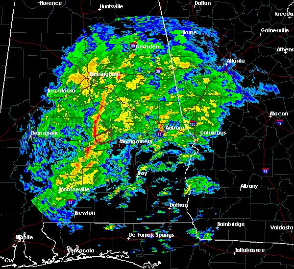 At 213 pm cst, a confirmed tornado was located near booth, or 11 miles west of prattville, moving northeast at 55 mph (radar confirmed tornado). Hazards include damaging tornado. Flying debris will be dangerous to those caught without shelter. mobile homes will be damaged or destroyed. damage to roofs, windows, and vehicles will occur. tree damage is likely. Locations impacted include, prattville, millbrook, deatsville, autaugaville, booth and autauga county airport. At 213 pm cst, a confirmed tornado was located near booth, or 11 miles west of prattville, moving northeast at 55 mph (radar confirmed tornado). Hazards include damaging tornado. Flying debris will be dangerous to those caught without shelter. mobile homes will be damaged or destroyed. damage to roofs, windows, and vehicles will occur. tree damage is likely. Locations impacted include, prattville, millbrook, deatsville, autaugaville, booth and autauga county airport.
|
| 1/19/2019 2:09 PM CST |
 At 208 pm cst, a severe thunderstorm capable of producing a tornado was located near autaugaville, or 14 miles west of prattville, moving northeast at 50 mph (radar indicated rotation). Hazards include tornado. Flying debris will be dangerous to those caught without shelter. mobile homes will be damaged or destroyed. damage to roofs, windows, and vehicles will occur. tree damage is likely. Locations impacted include, prattville, millbrook, deatsville, autaugaville, booth and autauga county airport. At 208 pm cst, a severe thunderstorm capable of producing a tornado was located near autaugaville, or 14 miles west of prattville, moving northeast at 50 mph (radar indicated rotation). Hazards include tornado. Flying debris will be dangerous to those caught without shelter. mobile homes will be damaged or destroyed. damage to roofs, windows, and vehicles will occur. tree damage is likely. Locations impacted include, prattville, millbrook, deatsville, autaugaville, booth and autauga county airport.
|
| 1/19/2019 2:00 PM CST |
 At 200 pm cst, a confirmed tornado was located over mulberry, or 15 miles southeast of valley grande, moving northeast at 55 mph (radar confirmed tornado). Hazards include damaging tornado. Flying debris will be dangerous to those caught without shelter. mobile homes will be damaged or destroyed. damage to roofs, windows, and vehicles will occur. tree damage is likely. locations impacted include, prattville, millbrook, deatsville, autaugaville, benton, booth, mulberry, autauga county airport and robert f. Henry lock and dam. At 200 pm cst, a confirmed tornado was located over mulberry, or 15 miles southeast of valley grande, moving northeast at 55 mph (radar confirmed tornado). Hazards include damaging tornado. Flying debris will be dangerous to those caught without shelter. mobile homes will be damaged or destroyed. damage to roofs, windows, and vehicles will occur. tree damage is likely. locations impacted include, prattville, millbrook, deatsville, autaugaville, benton, booth, mulberry, autauga county airport and robert f. Henry lock and dam.
|
| 1/19/2019 1:56 PM CST |
 At 156 pm cst, a confirmed tornado was located near gardner island, or 11 miles east of selmont-west selmont, moving northeast at 55 mph (radar confirmed tornado). Hazards include damaging tornado. Flying debris will be dangerous to those caught without shelter. mobile homes will be damaged or destroyed. damage to roofs, windows, and vehicles will occur. tree damage is likely. locations impacted include, prattville, millbrook, deatsville, autaugaville, white hall, benton, booth, mulberry, gardner island, autauga county airport and robert f. Henry lock and dam. At 156 pm cst, a confirmed tornado was located near gardner island, or 11 miles east of selmont-west selmont, moving northeast at 55 mph (radar confirmed tornado). Hazards include damaging tornado. Flying debris will be dangerous to those caught without shelter. mobile homes will be damaged or destroyed. damage to roofs, windows, and vehicles will occur. tree damage is likely. locations impacted include, prattville, millbrook, deatsville, autaugaville, white hall, benton, booth, mulberry, gardner island, autauga county airport and robert f. Henry lock and dam.
|
| 1/19/2019 1:46 PM CST |
 At 146 pm cst, a severe thunderstorm capable of producing a tornado was located over tyler, or near selmont-west selmont, moving northeast at 55 mph (radar indicated rotation). Hazards include tornado. Flying debris will be dangerous to those caught without shelter. mobile homes will be damaged or destroyed. damage to roofs, windows, and vehicles will occur. Tree damage is likely. At 146 pm cst, a severe thunderstorm capable of producing a tornado was located over tyler, or near selmont-west selmont, moving northeast at 55 mph (radar indicated rotation). Hazards include tornado. Flying debris will be dangerous to those caught without shelter. mobile homes will be damaged or destroyed. damage to roofs, windows, and vehicles will occur. Tree damage is likely.
|
| 6/28/2018 4:48 PM CDT |
 At 447 pm cdt, severe thunderstorms were located along a line extending from near moundville to burnsville to near pintlala, moving south at 40 mph (radar indicated). Hazards include 60 mph wind gusts and penny size hail. Expect damage to roofs, siding, and trees. Locations impacted include, southwestern montgomery, selma, valley grande, marion, mosses, hayneville, selmont-west selmont, autaugaville, white hall, lowndesboro, benton, hyundai motors of alabama, gardner island, tyler, heiberger, davenport, pintlala, mulberry, paul m grist state park and hope hull. At 447 pm cdt, severe thunderstorms were located along a line extending from near moundville to burnsville to near pintlala, moving south at 40 mph (radar indicated). Hazards include 60 mph wind gusts and penny size hail. Expect damage to roofs, siding, and trees. Locations impacted include, southwestern montgomery, selma, valley grande, marion, mosses, hayneville, selmont-west selmont, autaugaville, white hall, lowndesboro, benton, hyundai motors of alabama, gardner island, tyler, heiberger, davenport, pintlala, mulberry, paul m grist state park and hope hull.
|
| 6/28/2018 4:27 PM CDT |
 At 427 pm cdt, severe thunderstorms were located along a line extending from tuscaloosa regional airport to near parnell to montgomery, moving south at 40 mph (radar indicated). Hazards include 60 mph wind gusts and penny size hail. expect damage to roofs, siding, and trees At 427 pm cdt, severe thunderstorms were located along a line extending from tuscaloosa regional airport to near parnell to montgomery, moving south at 40 mph (radar indicated). Hazards include 60 mph wind gusts and penny size hail. expect damage to roofs, siding, and trees
|
| 6/28/2018 4:02 PM CDT |
 At 402 pm cdt, severe thunderstorms were located along a line extending from near low gap to brent to near lawley, moving southwest at 45 mph (radar indicated). Hazards include 60 to 70 mph wind gusts. Expect considerable tree damage. Damage is likely to mobile homes, roofs, and outbuildings. At 402 pm cdt, severe thunderstorms were located along a line extending from near low gap to brent to near lawley, moving southwest at 45 mph (radar indicated). Hazards include 60 to 70 mph wind gusts. Expect considerable tree damage. Damage is likely to mobile homes, roofs, and outbuildings.
|
| 10/7/2017 7:39 PM CDT |
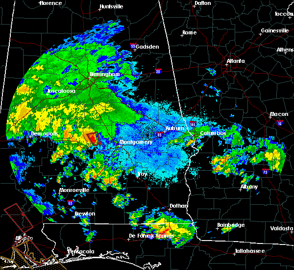 At 739 pm cdt, a severe thunderstorm capable of producing a tornado was located over autaugaville, or 13 miles west of prattville, moving north at 35 mph (radar indicated rotation). Hazards include tornado. Flying debris will be dangerous to those caught without shelter. mobile homes will be damaged or destroyed. damage to roofs, windows, and vehicles will occur. tree damage is likely. Locations impacted include, autaugaville, mulberry and vida junction. At 739 pm cdt, a severe thunderstorm capable of producing a tornado was located over autaugaville, or 13 miles west of prattville, moving north at 35 mph (radar indicated rotation). Hazards include tornado. Flying debris will be dangerous to those caught without shelter. mobile homes will be damaged or destroyed. damage to roofs, windows, and vehicles will occur. tree damage is likely. Locations impacted include, autaugaville, mulberry and vida junction.
|
| 10/7/2017 7:36 PM CDT | Trees and power lines down along hwy 14 west of autaugaville. not known if there is any structural damage at this time. possible tornado. time estimated from rada in autauga county AL, 2.4 miles ESE of Autaugaville, AL |
| 10/7/2017 7:31 PM CDT | Trees and power lines down blocking portions of cr 17 and riverview rd. possible tornado. time estimated from rada in autauga county AL, 2.2 miles NNE of Autaugaville, AL |
| 10/7/2017 7:23 PM CDT |
 At 722 pm cdt, a severe thunderstorm capable of producing a tornado was located near lowndesboro, or 11 miles north of hayneville, moving north at 35 mph (radar indicated rotation). Hazards include tornado. Flying debris will be dangerous to those caught without shelter. mobile homes will be damaged or destroyed. damage to roofs, windows, and vehicles will occur. Tree damage is likely. At 722 pm cdt, a severe thunderstorm capable of producing a tornado was located near lowndesboro, or 11 miles north of hayneville, moving north at 35 mph (radar indicated rotation). Hazards include tornado. Flying debris will be dangerous to those caught without shelter. mobile homes will be damaged or destroyed. damage to roofs, windows, and vehicles will occur. Tree damage is likely.
|
| 3/10/2017 4:18 AM CST |
 At 417 am cst, severe thunderstorms were located along a line extending from near tallapoosa city to prattville to near mulberry, moving south at 50 mph (radar indicated). Hazards include 60 mph wind gusts. Expect damage to roofs, siding, and trees. Locations impacted include, prattville, millbrook, wetumpka, tallassee, elmore, coosada, deatsville, eclectic, autaugaville, booth, vida junction, santuck, autauga county airport, emerald mountain, dexter, mulberry, blue ridge, jordan lake, wetumpka municipal airport and wallsboro. At 417 am cst, severe thunderstorms were located along a line extending from near tallapoosa city to prattville to near mulberry, moving south at 50 mph (radar indicated). Hazards include 60 mph wind gusts. Expect damage to roofs, siding, and trees. Locations impacted include, prattville, millbrook, wetumpka, tallassee, elmore, coosada, deatsville, eclectic, autaugaville, booth, vida junction, santuck, autauga county airport, emerald mountain, dexter, mulberry, blue ridge, jordan lake, wetumpka municipal airport and wallsboro.
|
| 3/10/2017 4:02 AM CST |
 At 402 am cst, severe thunderstorms were located along a line extending from near kowaliga bridge to near deatsville to near parnell, moving south at 50 mph (radar indicated). Hazards include 60 mph wind gusts. expect damage to roofs, siding, and trees At 402 am cst, severe thunderstorms were located along a line extending from near kowaliga bridge to near deatsville to near parnell, moving south at 50 mph (radar indicated). Hazards include 60 mph wind gusts. expect damage to roofs, siding, and trees
|
| 1/22/2017 11:57 AM CST |
 At 1156 am cst, severe thunderstorms were located along a line extending from near parnell to mulberry to near tyler to 12 miles south of gordonville to 7 miles northwest of i65 and al 106, moving northeast at 60 mph (radar indicated). Hazards include 60 mph wind gusts and quarter size hail. Hail damage to vehicles is expected. Expect wind damage to roofs, siding, and trees. At 1156 am cst, severe thunderstorms were located along a line extending from near parnell to mulberry to near tyler to 12 miles south of gordonville to 7 miles northwest of i65 and al 106, moving northeast at 60 mph (radar indicated). Hazards include 60 mph wind gusts and quarter size hail. Hail damage to vehicles is expected. Expect wind damage to roofs, siding, and trees.
|
| 1/21/2017 7:26 AM CST |
 At 726 am cst, a severe thunderstorm capable of producing a tornado was located over autauga county airport, or near prattville, moving northeast at 45 mph (radar indicated rotation). Hazards include tornado. Flying debris will be dangerous to those caught without shelter. mobile homes will be damaged or destroyed. damage to roofs, windows, and vehicles will occur. tree damage is likely. Locations impacted include, prattville, millbrook, deatsville, autaugaville, booth and autauga county airport. At 726 am cst, a severe thunderstorm capable of producing a tornado was located over autauga county airport, or near prattville, moving northeast at 45 mph (radar indicated rotation). Hazards include tornado. Flying debris will be dangerous to those caught without shelter. mobile homes will be damaged or destroyed. damage to roofs, windows, and vehicles will occur. tree damage is likely. Locations impacted include, prattville, millbrook, deatsville, autaugaville, booth and autauga county airport.
|
| 1/21/2017 7:18 AM CST |
 At 717 am cst, a severe thunderstorm capable of producing a tornado was located near autaugaville, or 10 miles southwest of prattville, moving northeast at 60 mph (radar indicated rotation). Hazards include tornado. Flying debris will be dangerous to those caught without shelter. mobile homes will be damaged or destroyed. damage to roofs, windows, and vehicles will occur. tree damage is likely. Locations impacted include, prattville, millbrook, deatsville, autaugaville, booth and autauga county airport. At 717 am cst, a severe thunderstorm capable of producing a tornado was located near autaugaville, or 10 miles southwest of prattville, moving northeast at 60 mph (radar indicated rotation). Hazards include tornado. Flying debris will be dangerous to those caught without shelter. mobile homes will be damaged or destroyed. damage to roofs, windows, and vehicles will occur. tree damage is likely. Locations impacted include, prattville, millbrook, deatsville, autaugaville, booth and autauga county airport.
|
| 1/21/2017 7:10 AM CST |
 At 710 am cst, a severe thunderstorm capable of producing a tornado was located over white hall, or 11 miles north of mosses, moving northeast at 50 mph (radar indicated rotation). Hazards include tornado. Flying debris will be dangerous to those caught without shelter. mobile homes will be damaged or destroyed. damage to roofs, windows, and vehicles will occur. tree damage is likely. locations impacted include, prattville, millbrook, deatsville, autaugaville, white hall, autauga county airport, booth and robert f. Henry lock and dam. At 710 am cst, a severe thunderstorm capable of producing a tornado was located over white hall, or 11 miles north of mosses, moving northeast at 50 mph (radar indicated rotation). Hazards include tornado. Flying debris will be dangerous to those caught without shelter. mobile homes will be damaged or destroyed. damage to roofs, windows, and vehicles will occur. tree damage is likely. locations impacted include, prattville, millbrook, deatsville, autaugaville, white hall, autauga county airport, booth and robert f. Henry lock and dam.
|
| 1/21/2017 7:02 AM CST |
 At 701 am cst, a severe thunderstorm capable of producing a tornado was located over benton, or 11 miles northwest of mosses, moving northeast at 60 mph (radar indicated rotation). Hazards include tornado. Flying debris will be dangerous to those caught without shelter. mobile homes will be damaged or destroyed. damage to roofs, windows, and vehicles will occur. Tree damage is likely. At 701 am cst, a severe thunderstorm capable of producing a tornado was located over benton, or 11 miles northwest of mosses, moving northeast at 60 mph (radar indicated rotation). Hazards include tornado. Flying debris will be dangerous to those caught without shelter. mobile homes will be damaged or destroyed. damage to roofs, windows, and vehicles will occur. Tree damage is likely.
|
| 7/9/2016 1:52 PM CDT |
 At 152 pm cdt, a severe thunderstorm was located near vida junction, or 15 miles east of valley grande, moving southeast at 10 mph (radar indicated). Hazards include 60 mph wind gusts and quarter size hail. Hail damage to vehicles is expected. expect wind damage to roofs, siding, and trees. Locations impacted include, autaugaville, vida junction, mulberry and dawson mill. At 152 pm cdt, a severe thunderstorm was located near vida junction, or 15 miles east of valley grande, moving southeast at 10 mph (radar indicated). Hazards include 60 mph wind gusts and quarter size hail. Hail damage to vehicles is expected. expect wind damage to roofs, siding, and trees. Locations impacted include, autaugaville, vida junction, mulberry and dawson mill.
|
| 7/9/2016 1:33 PM CDT |
 At 133 pm cdt, a severe thunderstorm was located near vida junction, or 12 miles east of valley grande, moving southeast at 10 mph (radar indicated). Hazards include 60 mph wind gusts and quarter size hail. Hail damage to vehicles is expected. Expect wind damage to roofs, siding, and trees. At 133 pm cdt, a severe thunderstorm was located near vida junction, or 12 miles east of valley grande, moving southeast at 10 mph (radar indicated). Hazards include 60 mph wind gusts and quarter size hail. Hail damage to vehicles is expected. Expect wind damage to roofs, siding, and trees.
|
| 7/6/2016 3:06 PM CDT |
 The severe thunderstorm warning for northern lowndes and southeastern autauga counties will expire at 315 pm cdt, the storm which prompted the warning has weakened below severe limits, and no longer pose an immediate threat to life or property. therefore the warning will be allowed to expire. however gusty winds are still possible with this thunderstorm. to report severe weather, contact your nearest law enforcement agency. they will relay your report to the national weather service birmingham. The severe thunderstorm warning for northern lowndes and southeastern autauga counties will expire at 315 pm cdt, the storm which prompted the warning has weakened below severe limits, and no longer pose an immediate threat to life or property. therefore the warning will be allowed to expire. however gusty winds are still possible with this thunderstorm. to report severe weather, contact your nearest law enforcement agency. they will relay your report to the national weather service birmingham.
|
| 7/6/2016 2:57 PM CDT |
 At 256 pm cdt, a severe thunderstorm was located near lowndesboro, or 9 miles north of mosses, moving northeast at 20 mph (radar indicated). Hazards include 60 mph wind gusts. Expect damage to roofs. siding. and trees. Locations impacted include, prattville, millbrook, mosses, autaugaville, white hall, gordonville, lowndesboro, autauga county airport and manack. At 256 pm cdt, a severe thunderstorm was located near lowndesboro, or 9 miles north of mosses, moving northeast at 20 mph (radar indicated). Hazards include 60 mph wind gusts. Expect damage to roofs. siding. and trees. Locations impacted include, prattville, millbrook, mosses, autaugaville, white hall, gordonville, lowndesboro, autauga county airport and manack.
|
| 7/6/2016 2:35 PM CDT |
 At 235 pm cdt, a severe thunderstorm was located near white hall, or near mosses, moving northeast at 20 mph (radar indicated). Hazards include 60 mph wind gusts and quarter size hail. Hail damage to vehicles is expected. Expect wind damage to roofs, siding, and trees. At 235 pm cdt, a severe thunderstorm was located near white hall, or near mosses, moving northeast at 20 mph (radar indicated). Hazards include 60 mph wind gusts and quarter size hail. Hail damage to vehicles is expected. Expect wind damage to roofs, siding, and trees.
|
| 6/17/2016 4:59 PM CDT |
 At 458 pm cdt, severe thunderstorms were located along a line extending from near deatsville to benton to near sweet water, moving southeast at 30 mph (radar indicated). Hazards include 60 mph wind gusts. Expect damage to roofs. siding. and trees. Locations impacted include, prattville, millbrook, deatsville, autaugaville, thomaston, sweet water, orrville, benton, dixons mill, wayne, central mills, putnam, dallas lake, nanafalia, magnolia, old cahaba park, surginer, autauga county airport, vineland and dannelly reservoir. At 458 pm cdt, severe thunderstorms were located along a line extending from near deatsville to benton to near sweet water, moving southeast at 30 mph (radar indicated). Hazards include 60 mph wind gusts. Expect damage to roofs. siding. and trees. Locations impacted include, prattville, millbrook, deatsville, autaugaville, thomaston, sweet water, orrville, benton, dixons mill, wayne, central mills, putnam, dallas lake, nanafalia, magnolia, old cahaba park, surginer, autauga county airport, vineland and dannelly reservoir.
|
| 6/17/2016 4:45 PM CDT |
 At 445 pm cdt, severe thunderstorms were located along a line extending from near marbury to near tyler to myrtlewood, moving south at 40 mph (radar indicated). Hazards include 60 mph wind gusts. Expect damage to roofs. siding. and trees. Locations impacted include, prattville, selma, millbrook, linden, selmont-west selmont, deatsville, autaugaville, thomaston, sweet water, orrville, myrtlewood, dayton, benton, bogue chitto, memorial stadium, vida junction, marbury, dallas county horse arena, dallas lake and magnolia. At 445 pm cdt, severe thunderstorms were located along a line extending from near marbury to near tyler to myrtlewood, moving south at 40 mph (radar indicated). Hazards include 60 mph wind gusts. Expect damage to roofs. siding. and trees. Locations impacted include, prattville, selma, millbrook, linden, selmont-west selmont, deatsville, autaugaville, thomaston, sweet water, orrville, myrtlewood, dayton, benton, bogue chitto, memorial stadium, vida junction, marbury, dallas county horse arena, dallas lake and magnolia.
|
| 6/17/2016 4:28 PM CDT |
 At 428 pm cdt, severe thunderstorms were located along a line extending from near higgins ferry park to selma to 7 miles south of coatopa, moving southeast at 45 mph (radar indicated). Hazards include 60 mph wind gusts. Expect damage to roofs. siding. and trees. Locations impacted include, prattville, selma, millbrook, demopolis, valley grande, linden, uniontown, selmont-west selmont, jefferson, deatsville, autaugaville, thomaston, sweet water, orrville, billingsley, myrtlewood, faunsdale, dayton, benton and bogue chitto. At 428 pm cdt, severe thunderstorms were located along a line extending from near higgins ferry park to selma to 7 miles south of coatopa, moving southeast at 45 mph (radar indicated). Hazards include 60 mph wind gusts. Expect damage to roofs. siding. and trees. Locations impacted include, prattville, selma, millbrook, demopolis, valley grande, linden, uniontown, selmont-west selmont, jefferson, deatsville, autaugaville, thomaston, sweet water, orrville, billingsley, myrtlewood, faunsdale, dayton, benton and bogue chitto.
|
| 6/17/2016 4:09 PM CDT |
 At 409 pm cdt, severe thunderstorms were located along a line extending from near calera to near marion to near tishabee, moving south at 25 mph (radar indicated). Hazards include 60 mph wind gusts. Expect damage to roofs. siding. And trees. At 409 pm cdt, severe thunderstorms were located along a line extending from near calera to near marion to near tishabee, moving south at 25 mph (radar indicated). Hazards include 60 mph wind gusts. Expect damage to roofs. siding. And trees.
|
| 3/1/2016 7:39 PM CST |
 At 739 pm cst, severe thunderstorms were located along a line extending from near white hall to near booth to near elmore, moving east at 50 mph (radar indicated). Hazards include 60 mph wind gusts and quarter size hail. Hail damage to vehicles is expected. expect wind damage to roofs, siding and trees. locations impacted include, prattville, millbrook, mosses, hayneville, deatsville, autaugaville, white hall, gordonville, billingsley, lowndesboro, benton, vida junction, autauga county airport, booth, mulberry, robert f. henry lock and dam, manack, collirene and dawson mill. This includes interstate 65 mile marker 158 and near mile marker 186. At 739 pm cst, severe thunderstorms were located along a line extending from near white hall to near booth to near elmore, moving east at 50 mph (radar indicated). Hazards include 60 mph wind gusts and quarter size hail. Hail damage to vehicles is expected. expect wind damage to roofs, siding and trees. locations impacted include, prattville, millbrook, mosses, hayneville, deatsville, autaugaville, white hall, gordonville, billingsley, lowndesboro, benton, vida junction, autauga county airport, booth, mulberry, robert f. henry lock and dam, manack, collirene and dawson mill. This includes interstate 65 mile marker 158 and near mile marker 186.
|
| 3/1/2016 7:19 PM CST |
 At 719 pm cst, severe thunderstorms were located along a line extending from near belknap to near gardner island to near booth, moving east at 50 mph (radar indicated). Hazards include 60 mph wind gusts and quarter size hail. Hail damage to vehicles is expected. expect wind damage to roofs, siding and trees. locations impacted include, prattville, selma, millbrook, mosses, hayneville, selmont-west selmont, deatsville, autaugaville, white hall, gordonville, billingsley, lowndesboro, benton, memorial stadium, burnsville, vida junction, dallas county horse arena, dallas lake, old cahaba park and autauga county airport. This includes interstate 65 mile marker 158 and near mile marker 186. At 719 pm cst, severe thunderstorms were located along a line extending from near belknap to near gardner island to near booth, moving east at 50 mph (radar indicated). Hazards include 60 mph wind gusts and quarter size hail. Hail damage to vehicles is expected. expect wind damage to roofs, siding and trees. locations impacted include, prattville, selma, millbrook, mosses, hayneville, selmont-west selmont, deatsville, autaugaville, white hall, gordonville, billingsley, lowndesboro, benton, memorial stadium, burnsville, vida junction, dallas county horse arena, dallas lake, old cahaba park and autauga county airport. This includes interstate 65 mile marker 158 and near mile marker 186.
|
| 3/1/2016 7:02 PM CST |
 At 701 pm cst, severe thunderstorms were located along a line extending from five points to near burnsville, moving east at 50 mph (radar indicated). Hazards include 60 mph wind gusts and quarter size hail. Hail damage to vehicles is expected. Expect wind damage to roofs, siding and trees. At 701 pm cst, severe thunderstorms were located along a line extending from five points to near burnsville, moving east at 50 mph (radar indicated). Hazards include 60 mph wind gusts and quarter size hail. Hail damage to vehicles is expected. Expect wind damage to roofs, siding and trees.
|
| 2/23/2016 9:10 PM CST |
 At 910 pm cst, severe thunderstorms were located along a line extending from near plecher to near vida junction to near white hall, moving northeast at 50 mph (radar indicated). Hazards include 60 mph wind gusts. Expect damage to roofs. siding and trees. locations impacted include, prattville, autaugaville, billingsley, vida junction, autauga county airport, booth, marbury, new prospect and dawson mill. this includes interstate 65 between mile markers 186 and 193. A tornado watch remains in effect until midnight cst for southeastern alabama. At 910 pm cst, severe thunderstorms were located along a line extending from near plecher to near vida junction to near white hall, moving northeast at 50 mph (radar indicated). Hazards include 60 mph wind gusts. Expect damage to roofs. siding and trees. locations impacted include, prattville, autaugaville, billingsley, vida junction, autauga county airport, booth, marbury, new prospect and dawson mill. this includes interstate 65 between mile markers 186 and 193. A tornado watch remains in effect until midnight cst for southeastern alabama.
|
| 2/23/2016 8:59 PM CST |
 At 859 pm cst, severe thunderstorms were located along a line extending from near billingsley to near mulberry to near benton, moving northeast at 55 mph (radar indicated). Hazards include 60 mph wind gusts. Expect damage to roofs. siding and trees. locations impacted include, prattville, autaugaville, white hall, billingsley, lowndesboro, benton, vida junction, autauga county airport, booth, marbury, mulberry, robert f. henry lock and dam, manack, new prospect and dawson mill. this includes interstate 65 between mile markers 186 and 193. A tornado watch remains in effect until midnight cst for southeastern alabama. At 859 pm cst, severe thunderstorms were located along a line extending from near billingsley to near mulberry to near benton, moving northeast at 55 mph (radar indicated). Hazards include 60 mph wind gusts. Expect damage to roofs. siding and trees. locations impacted include, prattville, autaugaville, white hall, billingsley, lowndesboro, benton, vida junction, autauga county airport, booth, marbury, mulberry, robert f. henry lock and dam, manack, new prospect and dawson mill. this includes interstate 65 between mile markers 186 and 193. A tornado watch remains in effect until midnight cst for southeastern alabama.
|
| 2/23/2016 8:45 PM CST |
 At 845 pm cst, severe thunderstorms were located along a line extending from burnsville to 6 miles east of belknap, moving northeast at 50 mph (radar indicated). Hazards include 60 mph wind gusts. Expect damage to roofs. Siding and trees. At 845 pm cst, severe thunderstorms were located along a line extending from burnsville to 6 miles east of belknap, moving northeast at 50 mph (radar indicated). Hazards include 60 mph wind gusts. Expect damage to roofs. Siding and trees.
|
| 8/8/2015 5:28 PM CDT |
 At 528 pm cdt, a severe thunderstorm was located over benton, or 12 miles northwest of mosses, moving south at 20 mph (radar indicated). Hazards include 60 mph wind gusts and quarter size hail. Hail damage to vehicles is expected. expect wind damage to roofs, siding and trees. locations impacted include, mosses, autaugaville, white hall, benton, tyler and robert f. Henry lock and dam. At 528 pm cdt, a severe thunderstorm was located over benton, or 12 miles northwest of mosses, moving south at 20 mph (radar indicated). Hazards include 60 mph wind gusts and quarter size hail. Hail damage to vehicles is expected. expect wind damage to roofs, siding and trees. locations impacted include, mosses, autaugaville, white hall, benton, tyler and robert f. Henry lock and dam.
|
| 8/8/2015 5:14 PM CDT |
 At 514 pm cdt, a severe thunderstorm was located near gardner island, or 11 miles east of selmont-west selmont, moving south at 15 mph (radar indicated). Hazards include 60 mph wind gusts and quarter size hail. Hail damage to vehicles is expected. Expect wind damage to roofs, siding and trees. At 514 pm cdt, a severe thunderstorm was located near gardner island, or 11 miles east of selmont-west selmont, moving south at 15 mph (radar indicated). Hazards include 60 mph wind gusts and quarter size hail. Hail damage to vehicles is expected. Expect wind damage to roofs, siding and trees.
|
| 7/15/2015 6:08 PM CDT |
 The severe thunderstorm warning for central autauga county will expire at 615 pm cdt, the storms which prompted the warning have weakened below severe limits, and exited the warned area. therefore the warning will be allowed to expire. The severe thunderstorm warning for central autauga county will expire at 615 pm cdt, the storms which prompted the warning have weakened below severe limits, and exited the warned area. therefore the warning will be allowed to expire.
|
| 7/15/2015 5:56 PM CDT |
 At 556 pm cdt, severe thunderstorms were located along a line extending from near autauga county airport to 7 miles south of booth to near autaugaville to gardner island, moving south at 30 mph (radar indicated). Hazards include 60 mph wind gusts and penny size hail. Expect damage to roofs. siding and trees. locations impacted include, prattville, autaugaville, benton, autauga county airport, booth, mulberry and robert f. Henry lock and dam. At 556 pm cdt, severe thunderstorms were located along a line extending from near autauga county airport to 7 miles south of booth to near autaugaville to gardner island, moving south at 30 mph (radar indicated). Hazards include 60 mph wind gusts and penny size hail. Expect damage to roofs. siding and trees. locations impacted include, prattville, autaugaville, benton, autauga county airport, booth, mulberry and robert f. Henry lock and dam.
|
| 7/15/2015 5:39 PM CDT |
 At 538 pm cdt, severe thunderstorms were located along a line extending from 6 miles east of vida junction to near booth to mulberry to near burnsville, moving south at 45 mph (radar indicated). Hazards include 60 mph wind gusts and penny size hail. Expect damage to roofs. siding and trees. locations impacted include, prattville, autaugaville, billingsley, benton, vida junction, autauga county airport, booth, mulberry, new prospect, dawson mill and robert f. Henry lock and dam. At 538 pm cdt, severe thunderstorms were located along a line extending from 6 miles east of vida junction to near booth to mulberry to near burnsville, moving south at 45 mph (radar indicated). Hazards include 60 mph wind gusts and penny size hail. Expect damage to roofs. siding and trees. locations impacted include, prattville, autaugaville, billingsley, benton, vida junction, autauga county airport, booth, mulberry, new prospect, dawson mill and robert f. Henry lock and dam.
|
| 7/15/2015 5:14 PM CDT |
 At 513 pm cdt, severe thunderstorms were located along a line extending from near pooles crossroads to near plecher to near parnell, moving south at 40 mph (radar indicated). Hazards include 60 mph wind gusts and penny size hail. Expect damage to roofs. Siding and trees. At 513 pm cdt, severe thunderstorms were located along a line extending from near pooles crossroads to near plecher to near parnell, moving south at 40 mph (radar indicated). Hazards include 60 mph wind gusts and penny size hail. Expect damage to roofs. Siding and trees.
|
| 7/14/2015 9:50 PM CDT |
 At 950 pm cdt, severe thunderstorms were located along a line extending from near kowaliga bridge to millbrook to near gardner island, and are nearly stationary (radar indicated). Hazards include 60 mph wind gusts. Expect damage to roofs. siding and trees. Locations impacted include, prattville, millbrook, wetumpka, tallassee, elmore, coosada, autaugaville, benton, emerald mountain, blue ridge, autauga county airport, booth, mulberry, ware, tallapoosa water plant, yates dam, wetumpka municipal airport and yates reservoir. At 950 pm cdt, severe thunderstorms were located along a line extending from near kowaliga bridge to millbrook to near gardner island, and are nearly stationary (radar indicated). Hazards include 60 mph wind gusts. Expect damage to roofs. siding and trees. Locations impacted include, prattville, millbrook, wetumpka, tallassee, elmore, coosada, autaugaville, benton, emerald mountain, blue ridge, autauga county airport, booth, mulberry, ware, tallapoosa water plant, yates dam, wetumpka municipal airport and yates reservoir.
|
| 7/14/2015 9:36 PM CDT |
 At 936 pm cdt, severe thunderstorms were located along a line extending from near kowaliga bridge to millbrook to near gardner island, moving south at 40 mph (radar indicated). Hazards include 60 mph wind gusts. Expect damage to roofs. siding and trees. Locations impacted include, prattville, millbrook, wetumpka, tallassee, elmore, coosada, deatsville, eclectic, autaugaville, billingsley, benton, emerald mountain, kowaliga bridge, western lake martin, jordan lake, vida junction, ten cedar estates, marbury, weoka mills and titus. At 936 pm cdt, severe thunderstorms were located along a line extending from near kowaliga bridge to millbrook to near gardner island, moving south at 40 mph (radar indicated). Hazards include 60 mph wind gusts. Expect damage to roofs. siding and trees. Locations impacted include, prattville, millbrook, wetumpka, tallassee, elmore, coosada, deatsville, eclectic, autaugaville, billingsley, benton, emerald mountain, kowaliga bridge, western lake martin, jordan lake, vida junction, ten cedar estates, marbury, weoka mills and titus.
|
| 7/14/2015 9:15 PM CDT |
 At 915 pm cdt, severe thunderstorms were located along a line extending from near kellyton to marbury to near parnell, moving southeast at 45 mph (radar indicated). Hazards include 60 mph wind gusts. Expect damage to roofs. Siding and trees. At 915 pm cdt, severe thunderstorms were located along a line extending from near kellyton to marbury to near parnell, moving southeast at 45 mph (radar indicated). Hazards include 60 mph wind gusts. Expect damage to roofs. Siding and trees.
|
| 6/24/2015 9:42 PM CDT |
 At 940 pm cdt, severe thunderstorms were located along a line extending from near autaugaville to near fort deposit, moving west at 35 mph. Hazards include 60 mph wind gusts. Expect damage to roofs. siding and trees. locations impacted include, fort deposit, mosses, hayneville, autaugaville, white hall, gordonville, lowndesboro, benton, logan, lowndes county airport, beechwood, mulberry, calhoun, letohatchee, fostoria, robert f. Henry lock and dam, manack, collirene, mount willing and clover hill. At 940 pm cdt, severe thunderstorms were located along a line extending from near autaugaville to near fort deposit, moving west at 35 mph. Hazards include 60 mph wind gusts. Expect damage to roofs. siding and trees. locations impacted include, fort deposit, mosses, hayneville, autaugaville, white hall, gordonville, lowndesboro, benton, logan, lowndes county airport, beechwood, mulberry, calhoun, letohatchee, fostoria, robert f. Henry lock and dam, manack, collirene, mount willing and clover hill.
|
| 6/24/2015 9:13 PM CDT |
 At 912 pm cdt, severe thunderstorms were located along a line extending from hunter to near davenport, moving west at 35 mph (radar indicated). Hazards include 60 mph wind gusts and quarter size hail. Hail damage to vehicles is expected. Expect wind damage to roofs, siding and trees. At 912 pm cdt, severe thunderstorms were located along a line extending from hunter to near davenport, moving west at 35 mph (radar indicated). Hazards include 60 mph wind gusts and quarter size hail. Hail damage to vehicles is expected. Expect wind damage to roofs, siding and trees.
|
| 4/10/2015 3:45 PM CDT | A severe thunderstorm warning remains in effect until 400 pm cdt for northeastern lowndes and southeastern autauga counties. at 345 pm cdt. a severe thunderstorm was located near autaugaville. or 10 miles southwest of prattville. moving east at 30 mph. hazard. 60 mph wind gusts and quarter size hail. |
| 4/10/2015 3:33 PM CDT | A severe thunderstorm warning remains in effect until 400 pm cdt for northern lowndes and southeastern autauga counties. at 333 pm cdt. a severe thunderstorm was located near autaugaville. or 14 miles north of mosses. moving east at 30 mph. hazard. 60 mph wind gusts and quarter size hail. source. Radar indicated. |
| 4/10/2015 3:11 PM CDT | The national weather service in birmingham has issued a * severe thunderstorm warning for. northern lowndes county in south central alabama. southern autauga county in central alabama. until 400 pm cdt * at 310 pm cdt. A severe thunderstorm was located over gardner. |
| 7/23/2013 3:10 PM CDT | Several trees were blown down along highway 14 and county road 45 west of autaugavill in autauga county AL, 4.2 miles ESE of Autaugaville, AL |
| 7/9/2012 6:30 PM CDT | A tree fell on a trailer near autaugaville. people may have been briefly trapped inside. winds estimated at 40 to 45 mp in autauga county AL, 0.5 miles E of Autaugaville, AL |
| 7/5/2012 8:32 PM CDT | Large tree down blocking the road in the statesville are in autauga county AL, 9.7 miles ESE of Autaugaville, AL |
| 5/6/2012 10:28 AM CDT | Quarter sized hail reported 0.5 miles E of Autaugaville, AL, quarter size hail just west of autaugaville along highway 14. |
| 1/1/0001 12:00 AM | Quarter sized hail reported 6.2 miles SE of Autaugaville, AL, quarter size hail reported along county road 33. |
| 1/1/0001 12:00 AM | Along county ro in autauga county AL, 1.5 miles SSE of Autaugaville, AL |
| 1/1/0001 12:00 AM | At a home on county ro in autauga county AL, 4.9 miles S of Autaugaville, AL |
| 1/1/0001 12:00 AM | 25 trees down at cr9 and al14 in autauga county AL, 7.8 miles ESE of Autaugaville, AL |
| 1/1/0001 12:00 AM | Trees down at hwy 82 and cr 40 in independence. possible tornad in autauga county AL, 6.5 miles SSE of Autaugaville, AL |
| 1/1/0001 12:00 AM | Trees down on county road 21 south near swift cree in autauga county AL, 0.5 miles E of Autaugaville, AL |
Hail Maps for Autaugaville, AL
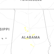

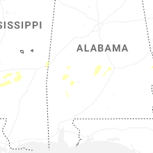
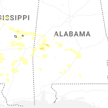


Connect with Interactive Hail Maps