

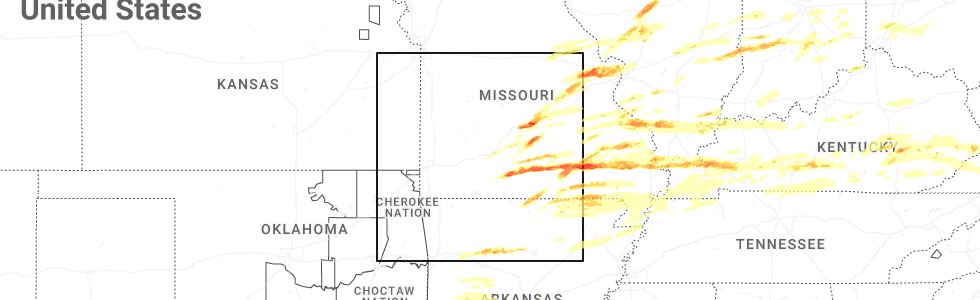
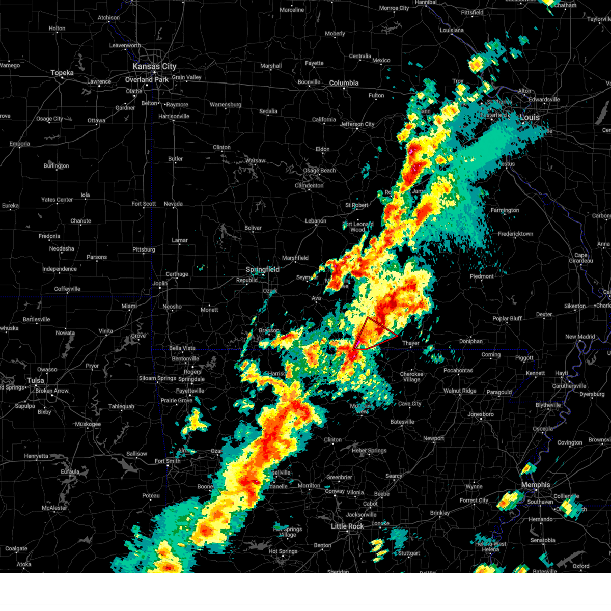
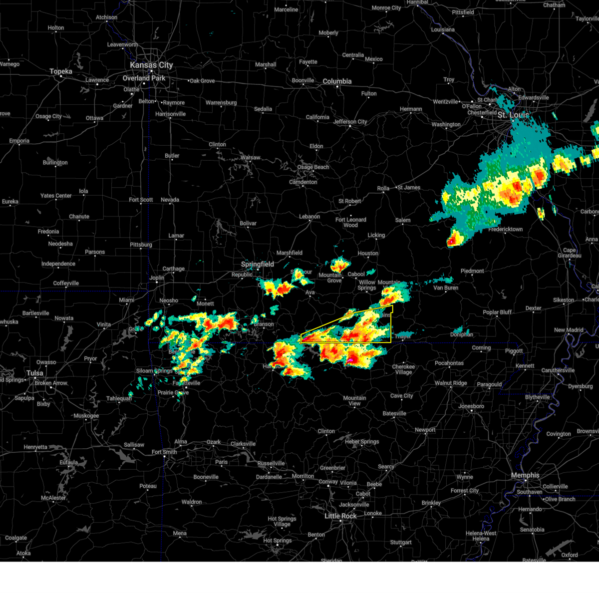
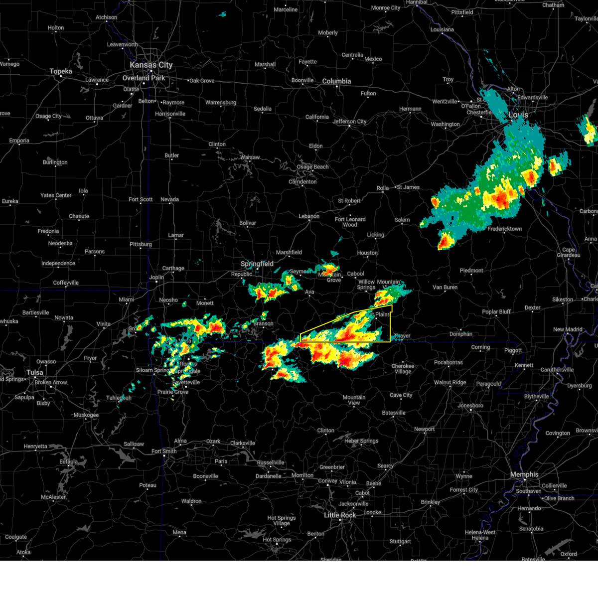
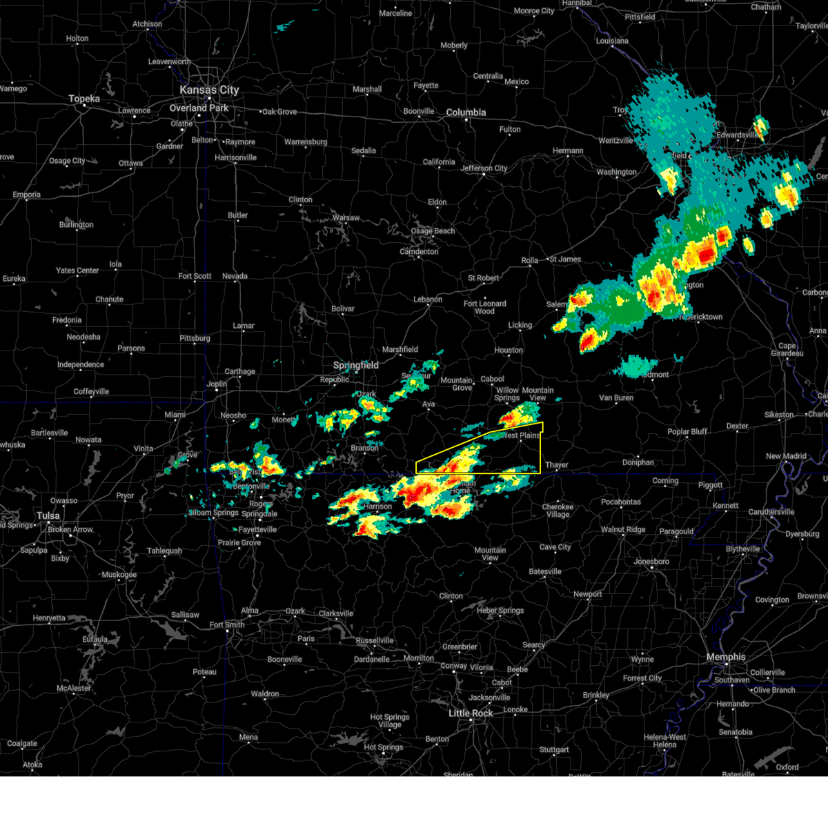
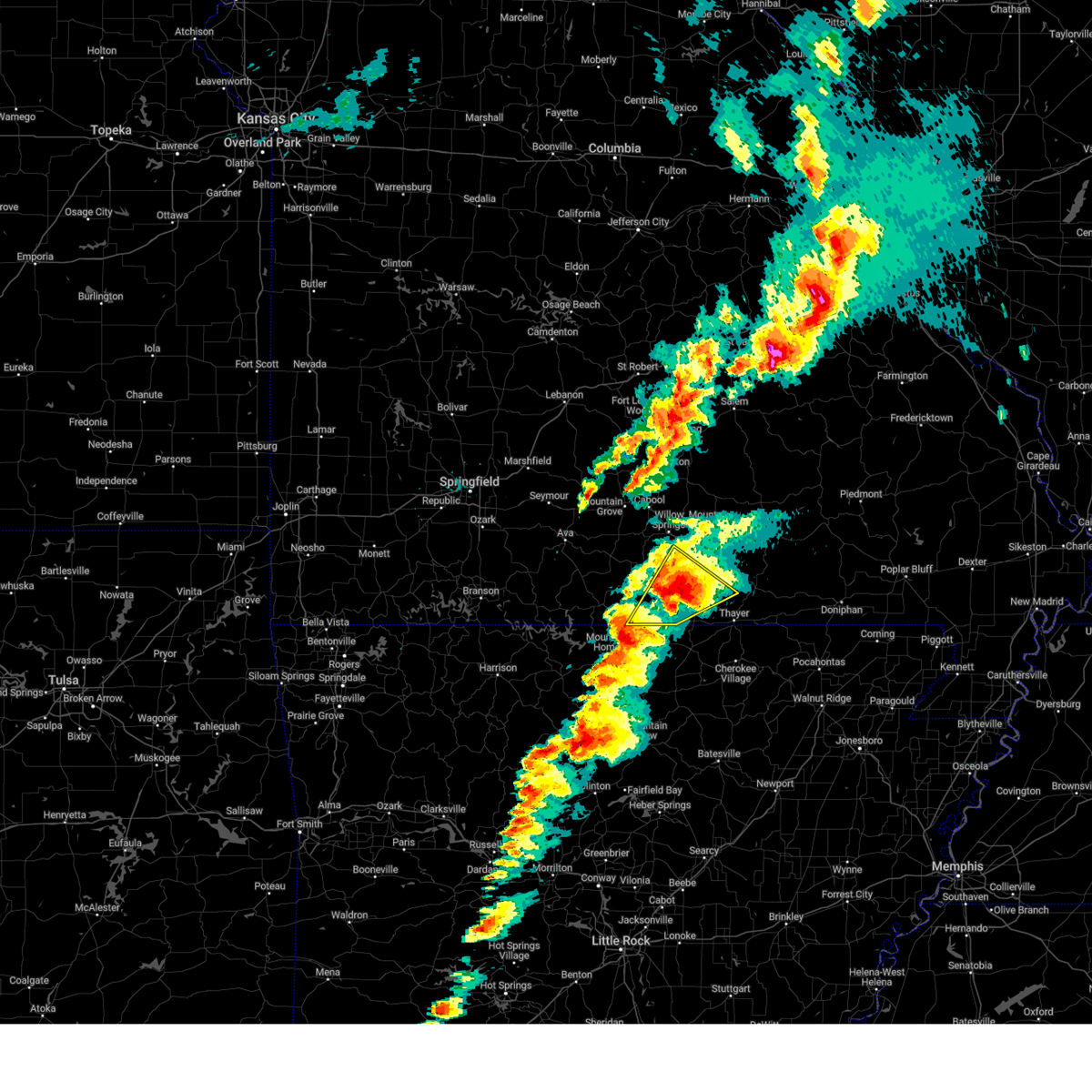
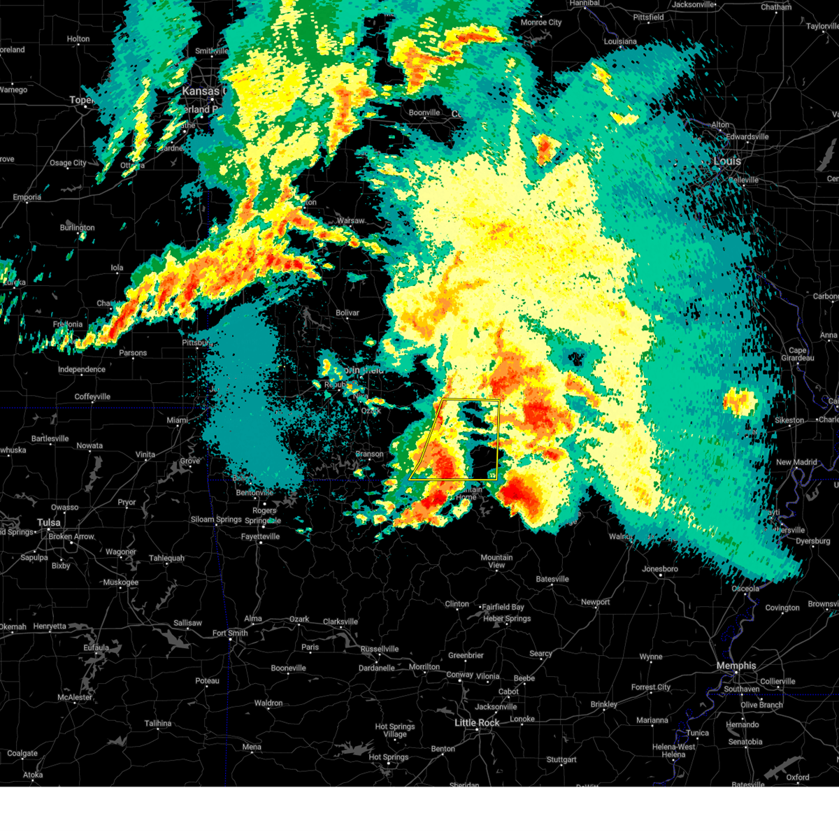
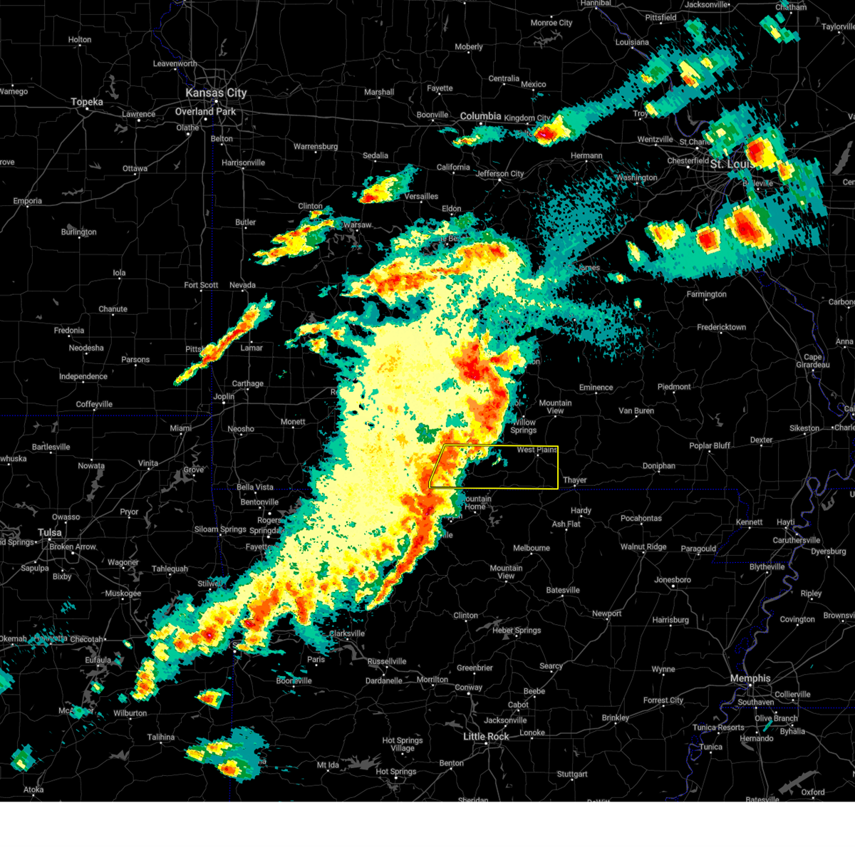
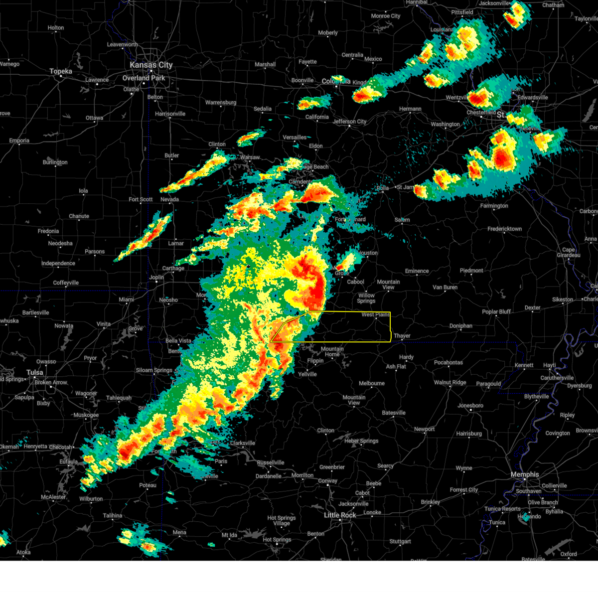
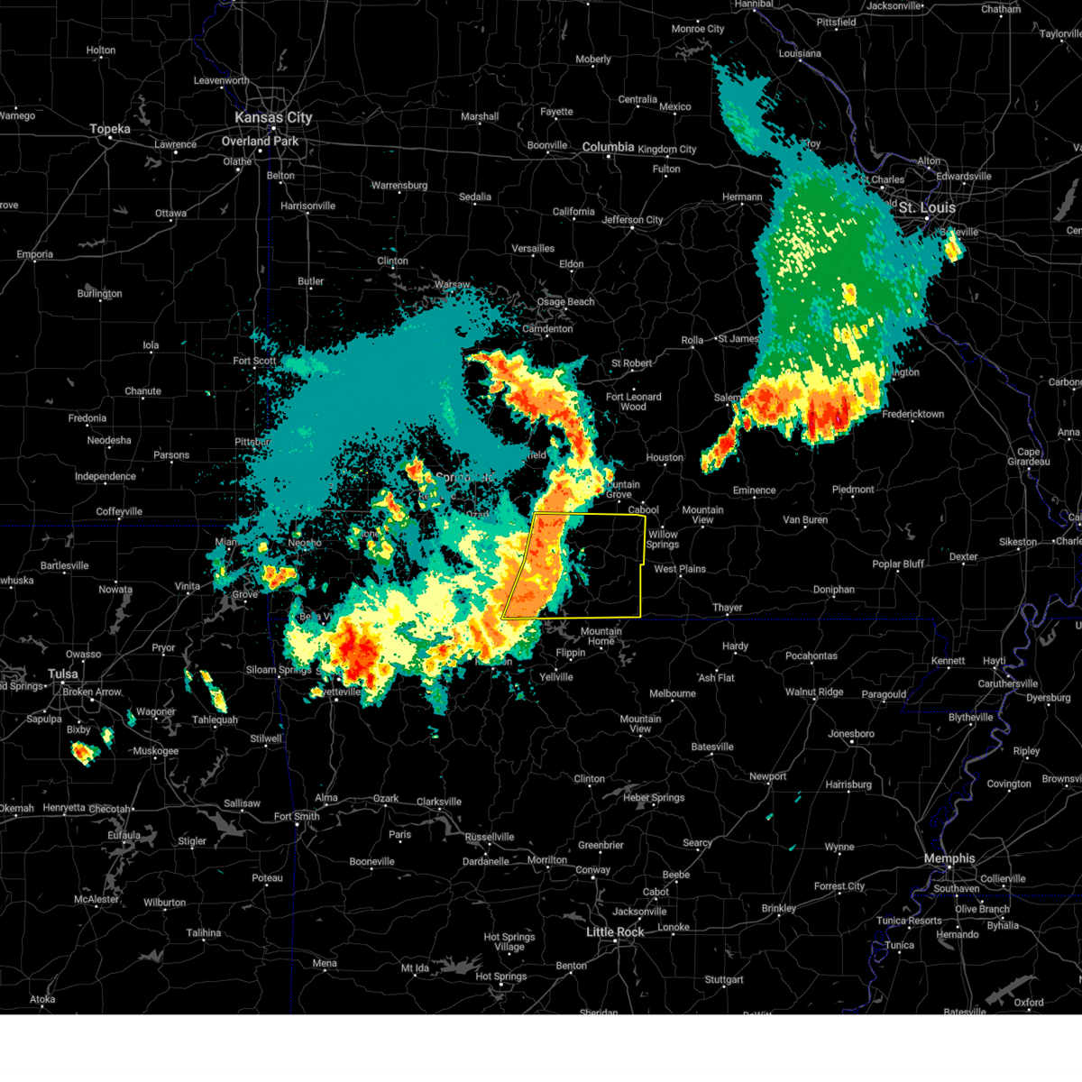
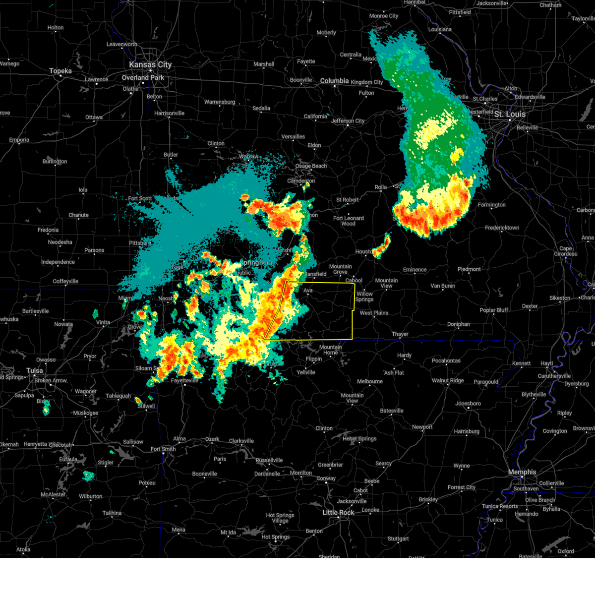
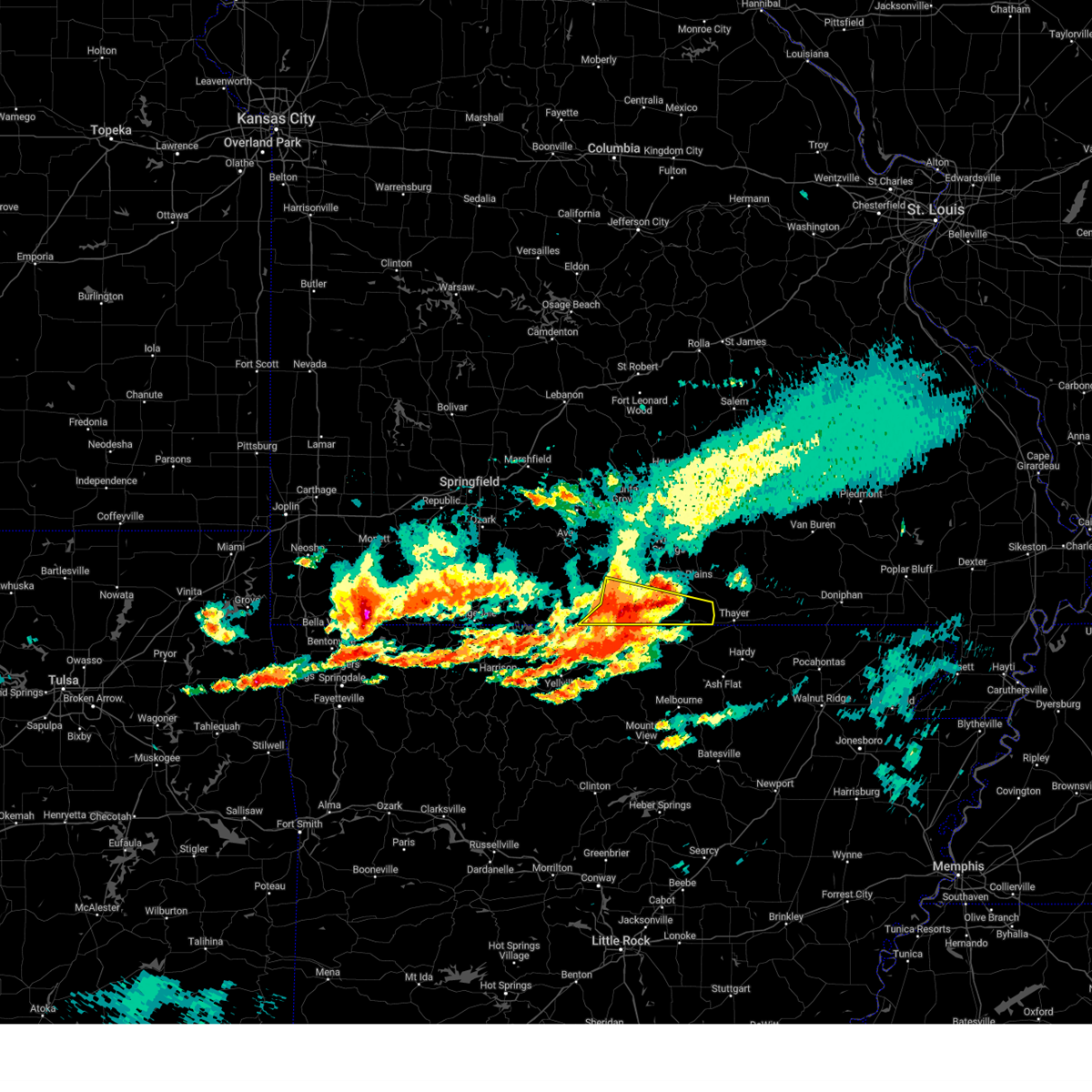
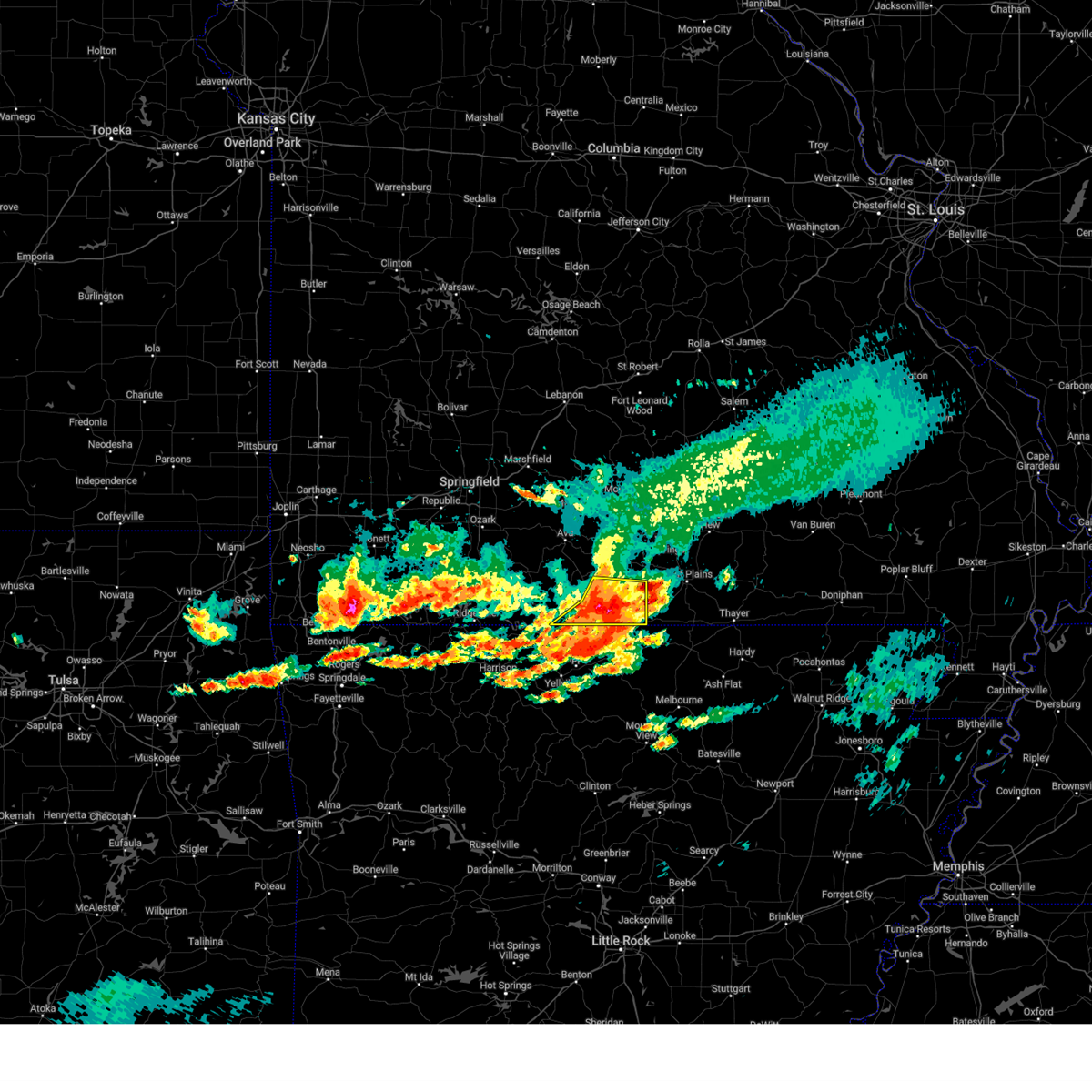
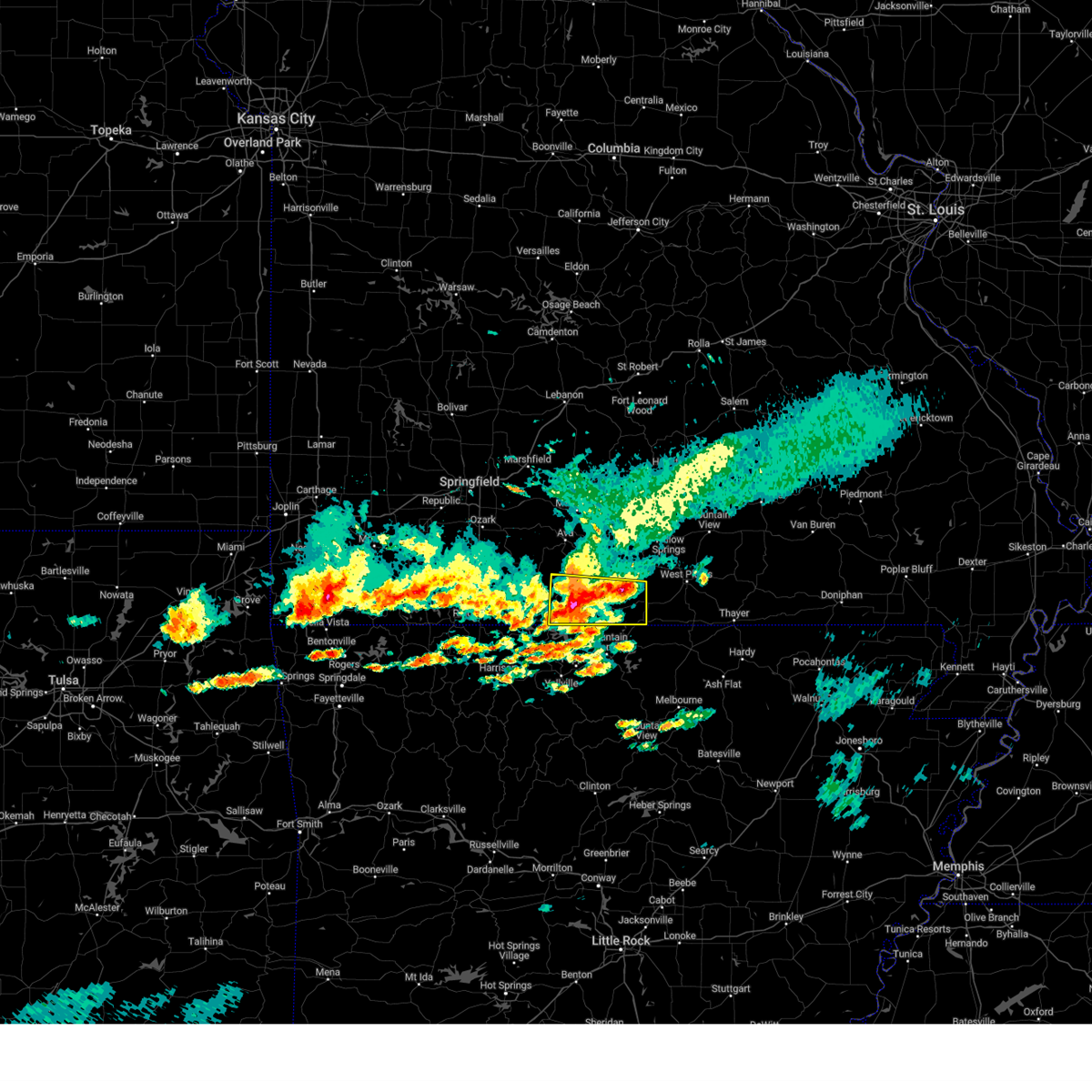
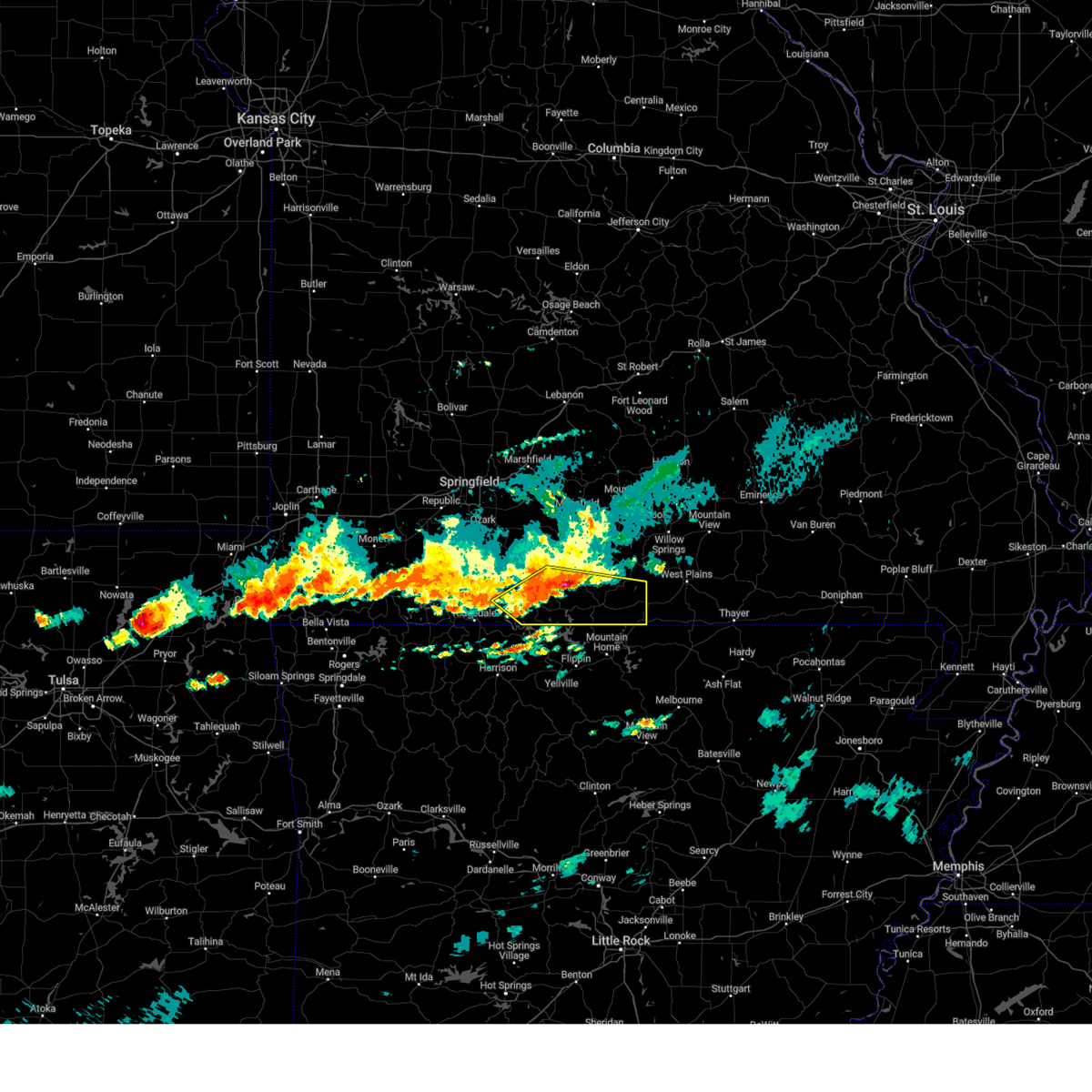
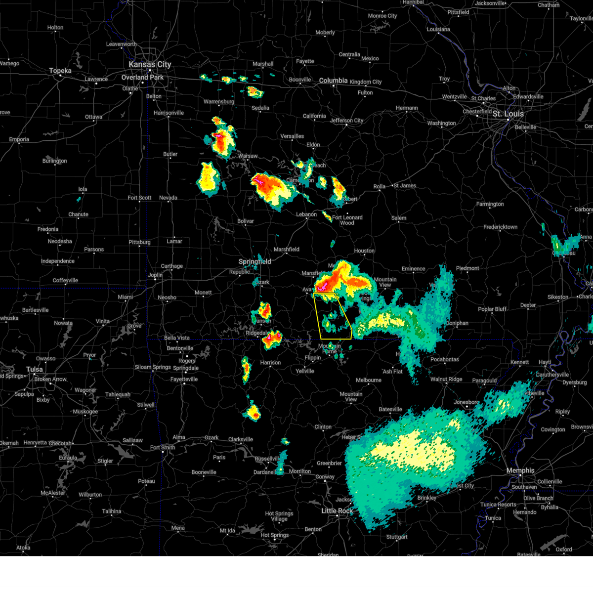
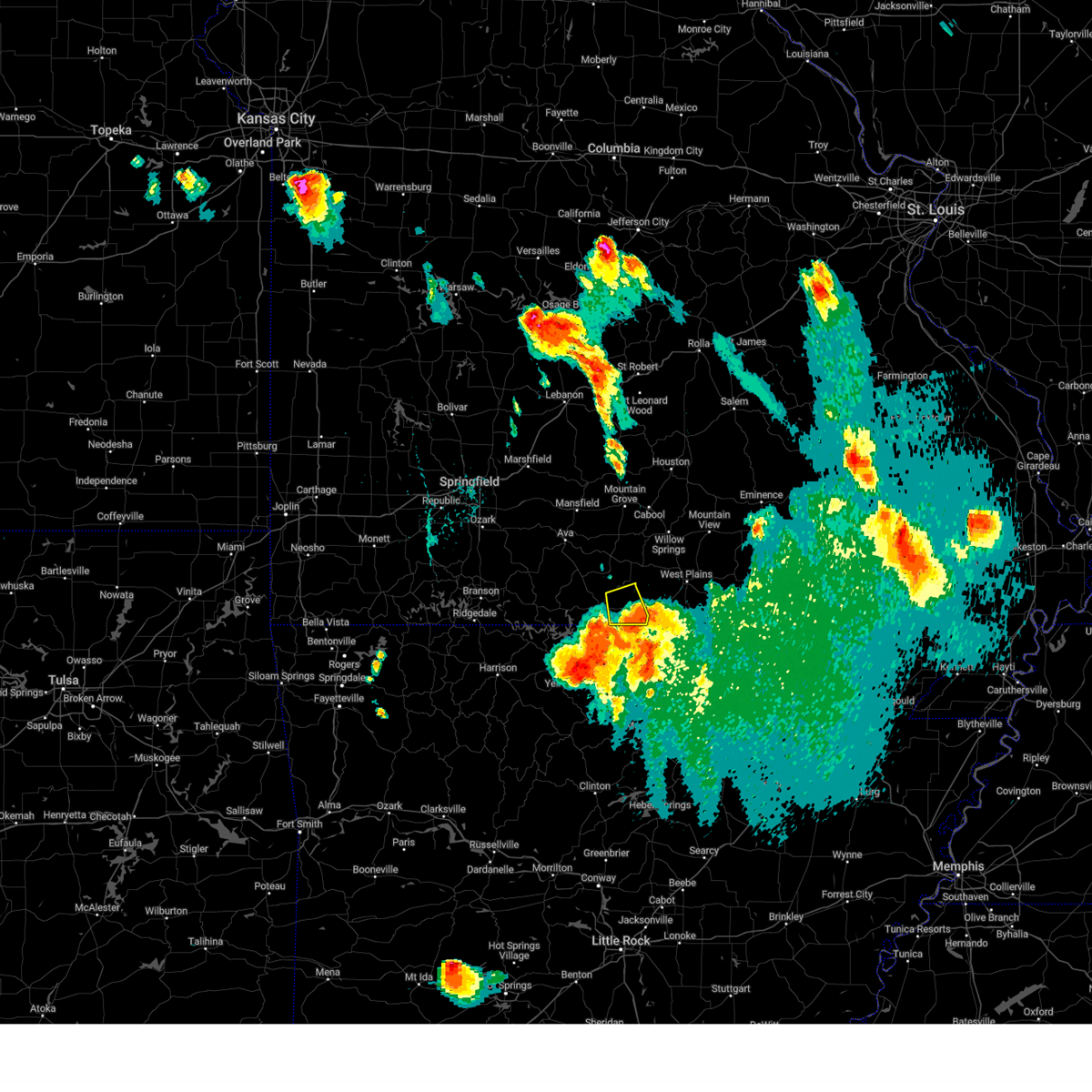
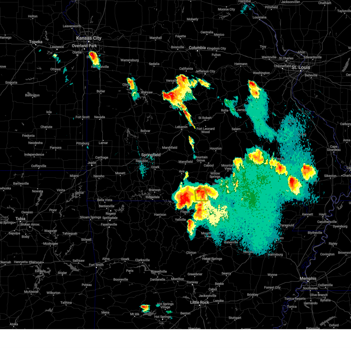
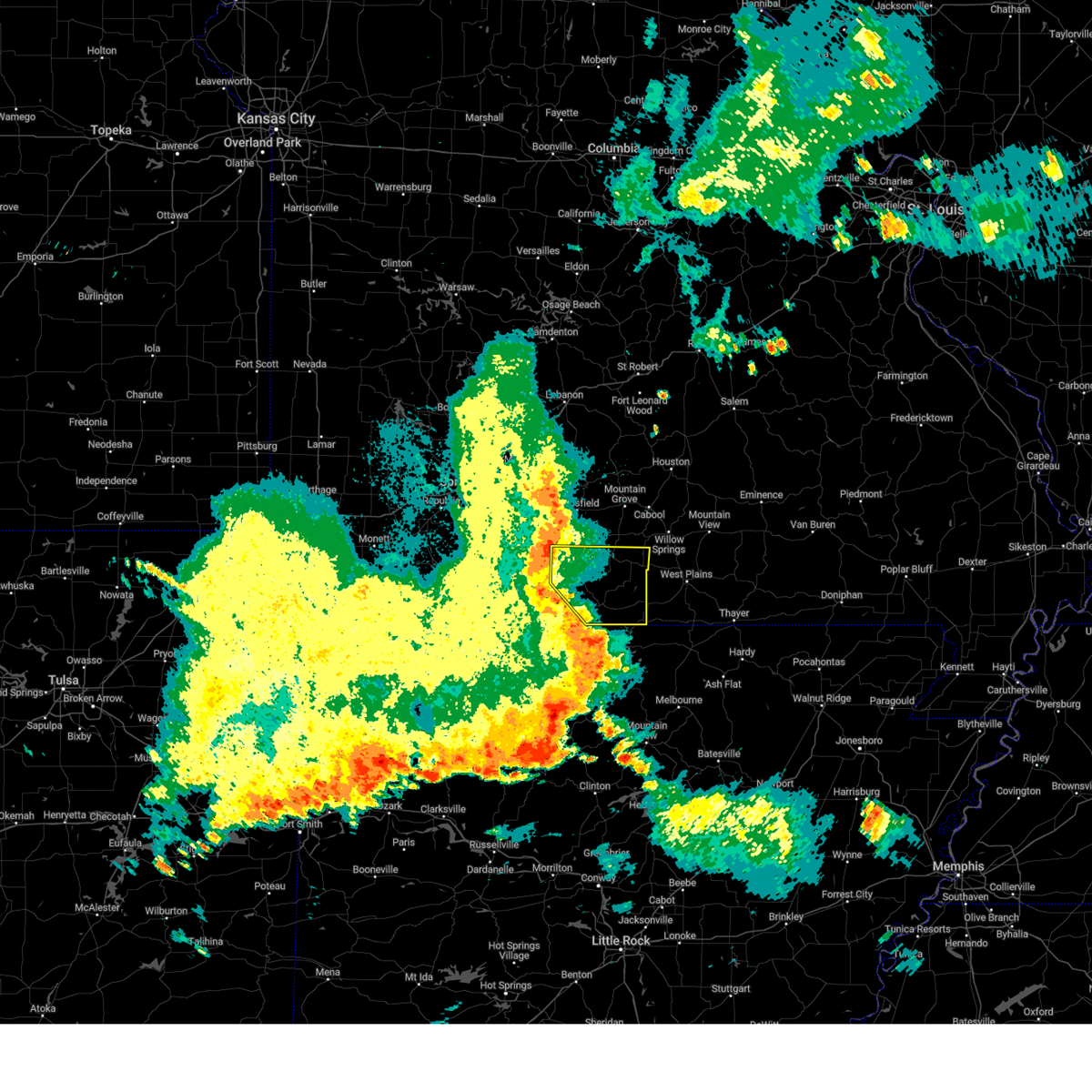
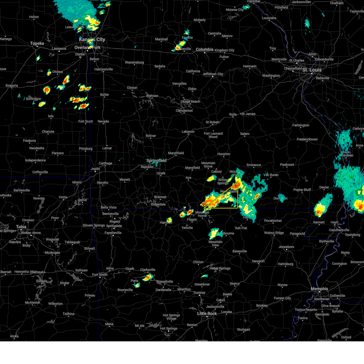
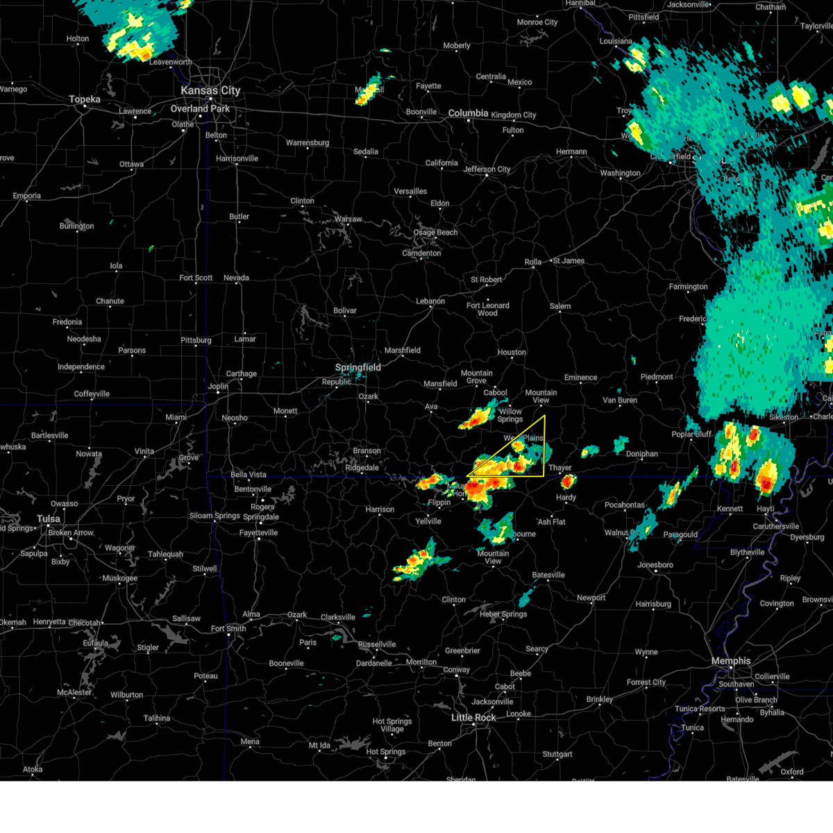
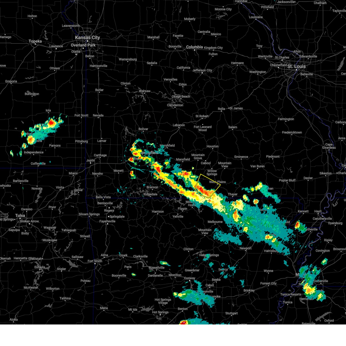
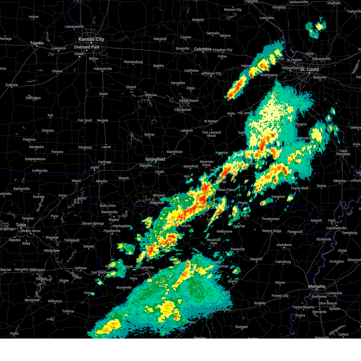
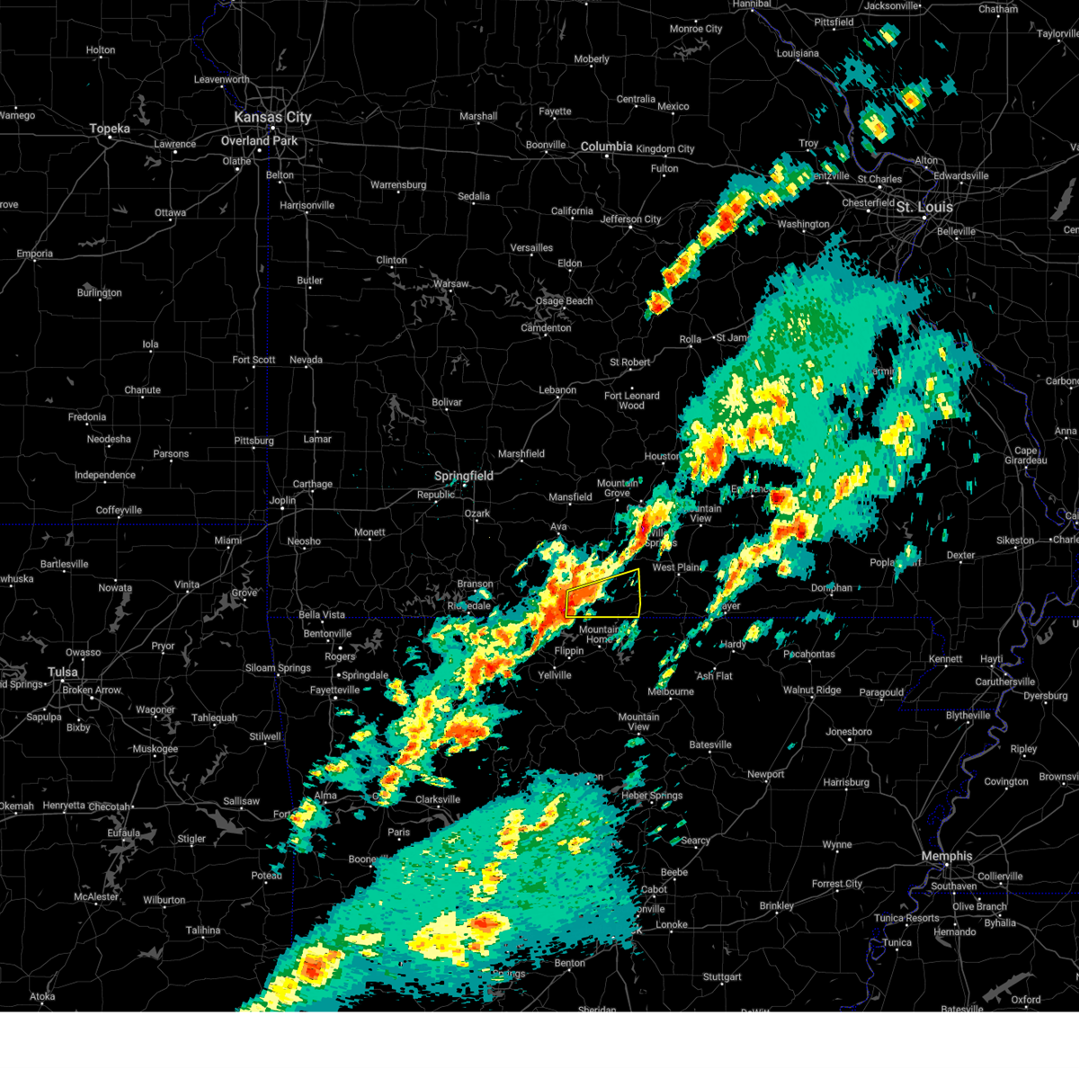
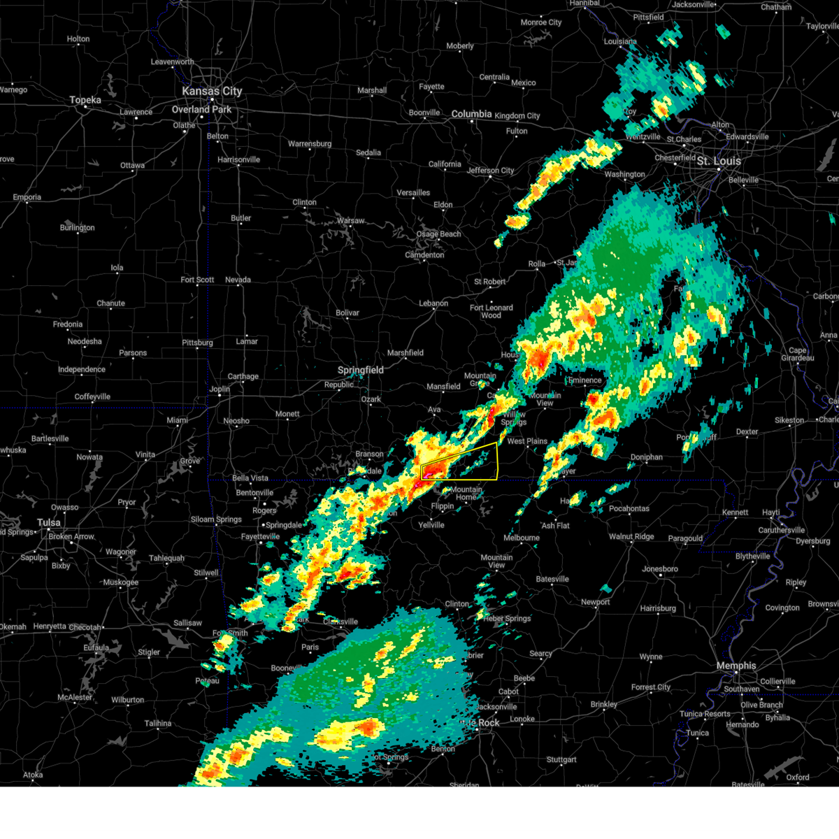
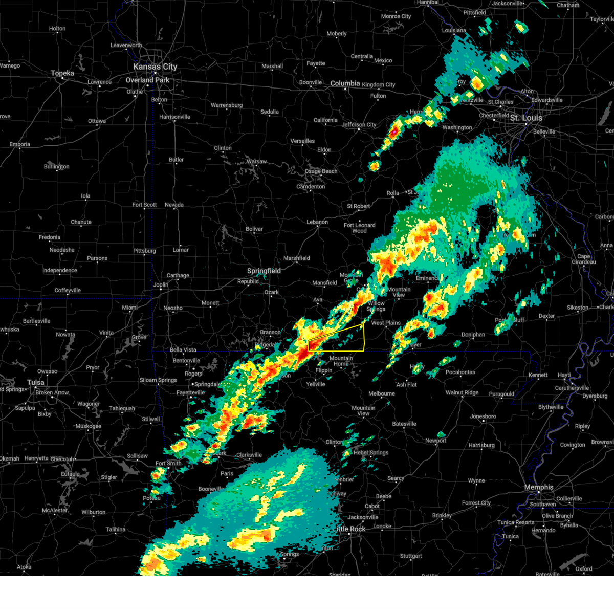
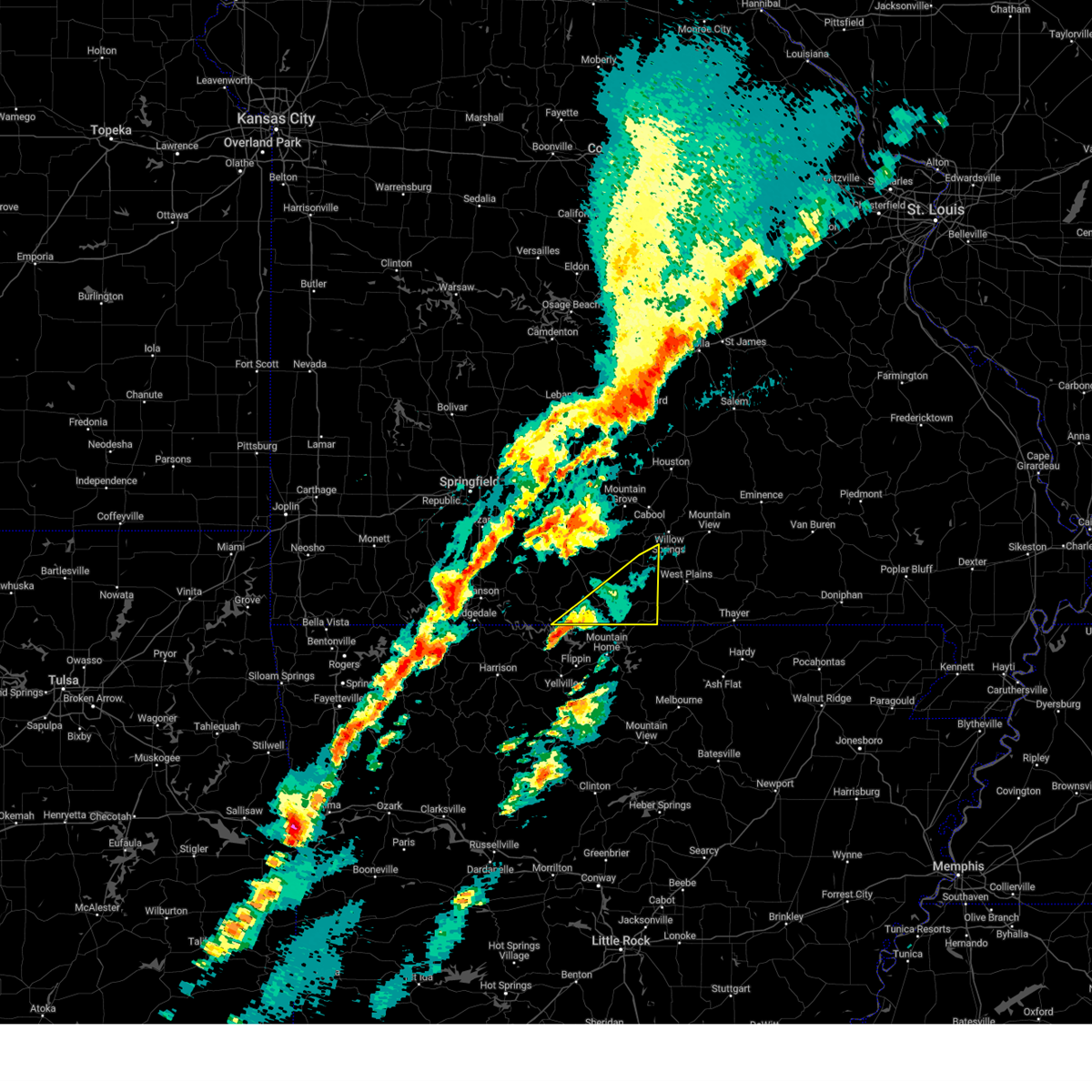
Hail Map for Bakersfield, MO
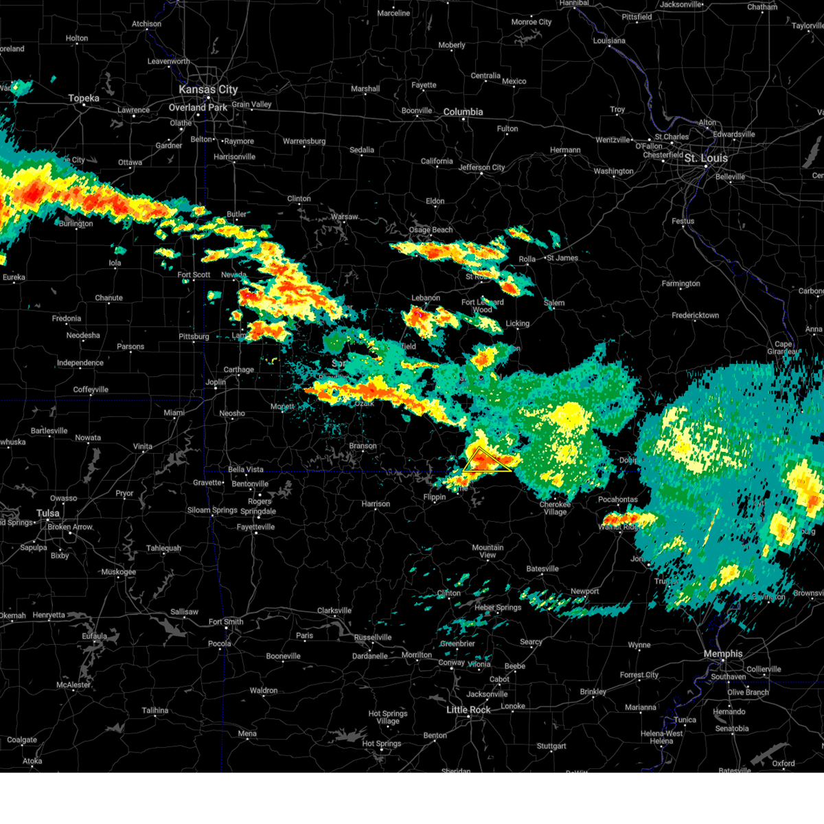
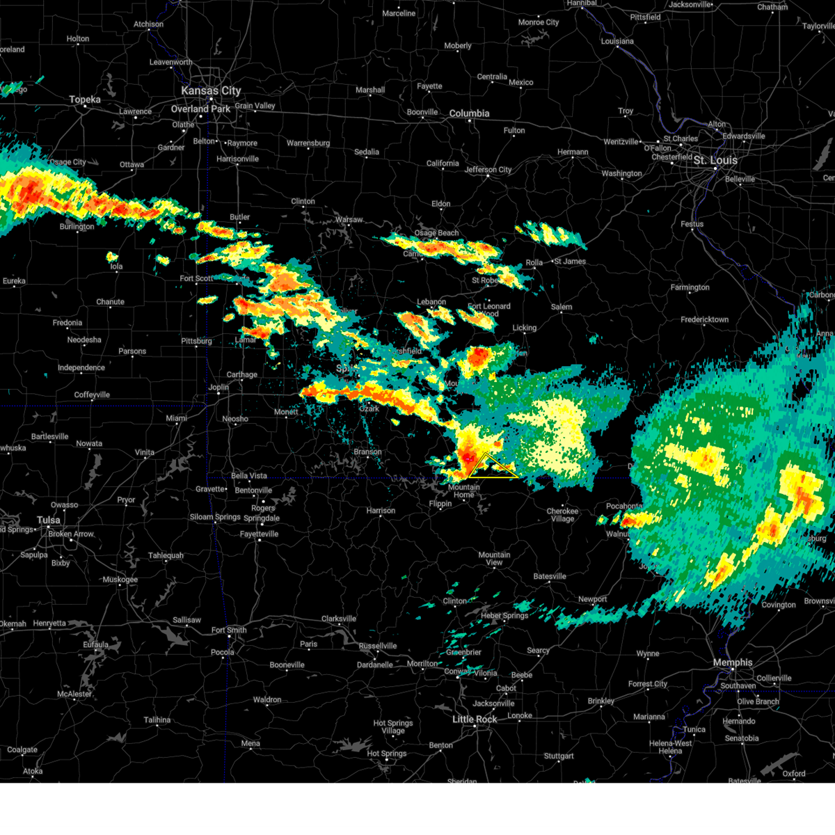
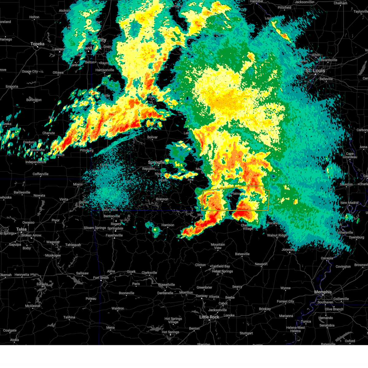
The Bakersfield, MO area has had 14 reports of on-the-ground hail by trained spotters, and has been under severe weather warnings 27 times during the past 12 months. Doppler radar has detected hail at or near Bakersfield, MO on 61 occasions, including 7 occasions during the past year.
| Name: | Bakersfield, MO |
| Where Located: | 79.1 miles SE of Springfield, MO |
| Map: | Google Map for Bakersfield, MO |
| Population: | 246 |
| Housing Units: | 139 |
| More Info: | Search Google for Bakersfield, MO |
5
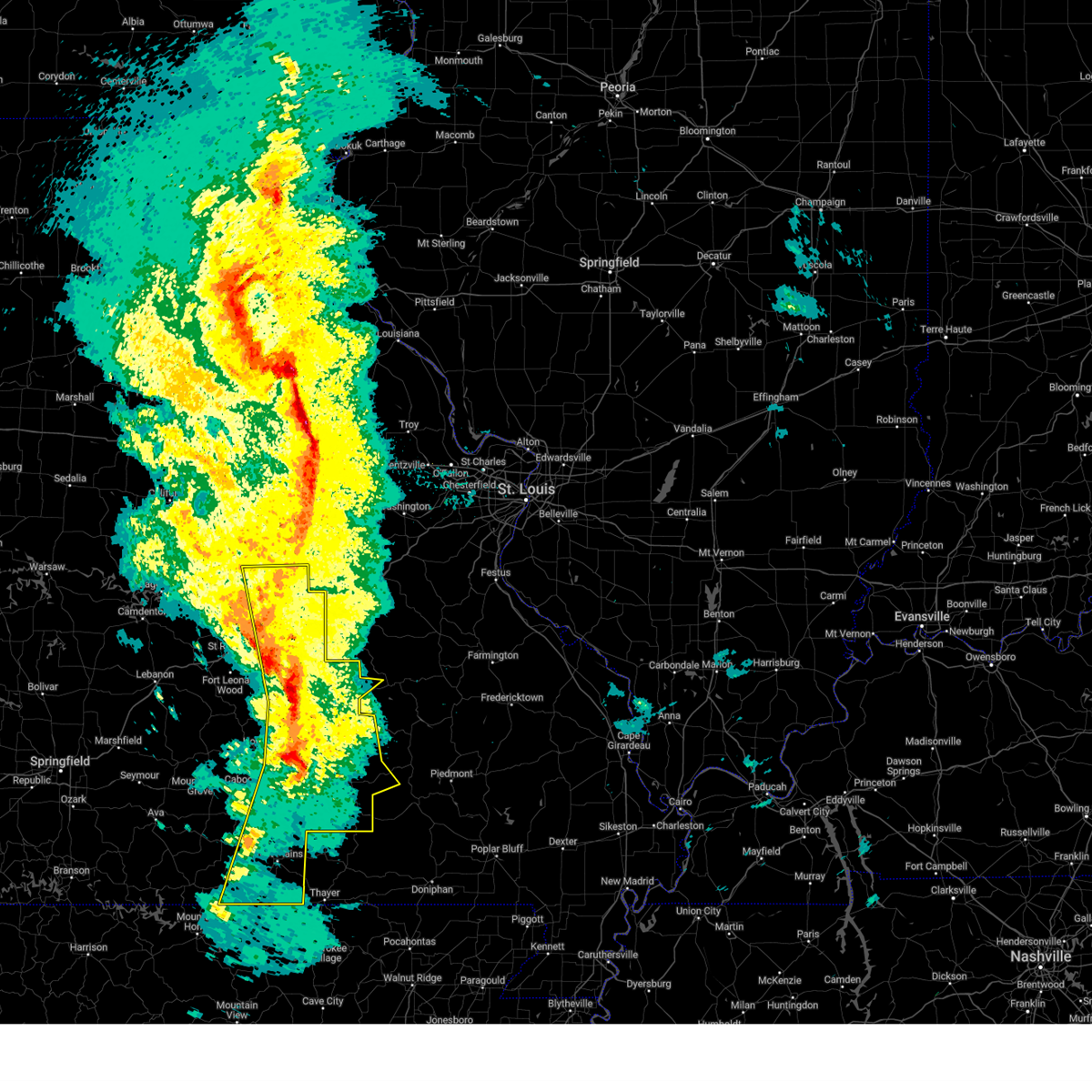
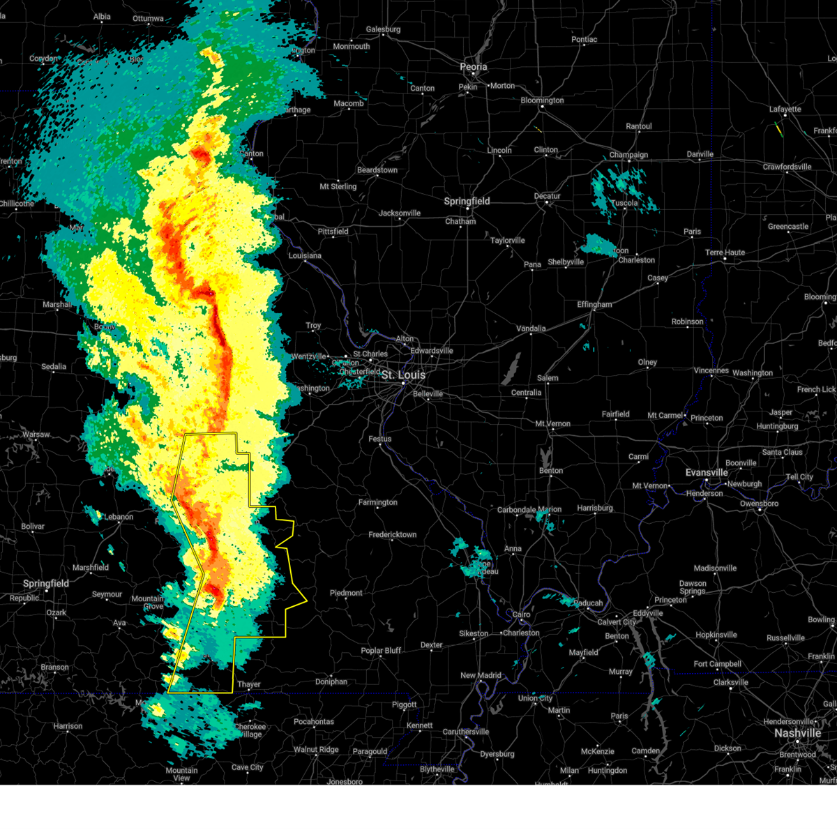
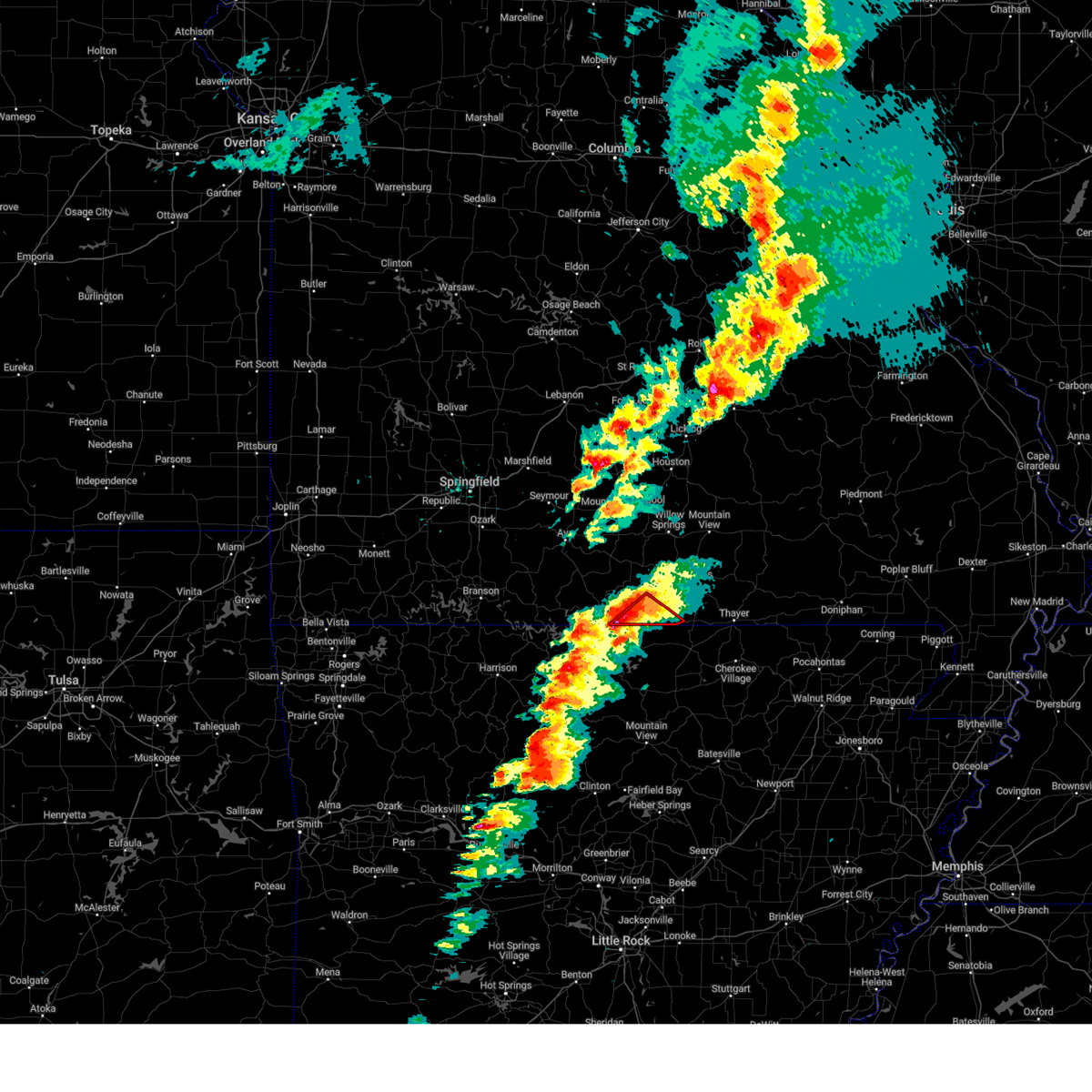
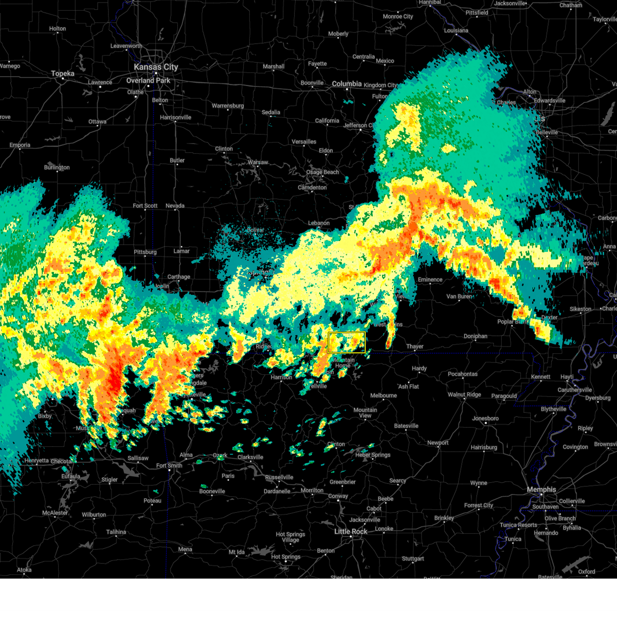
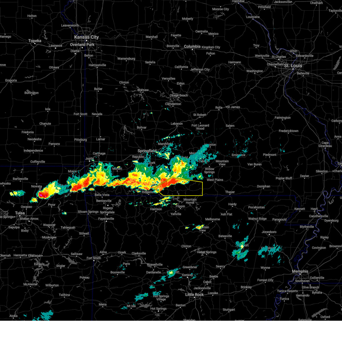
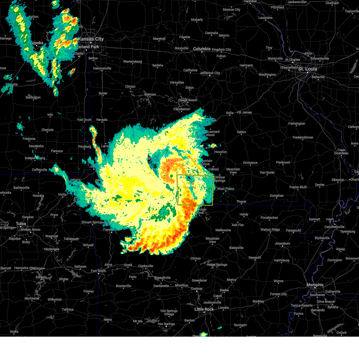
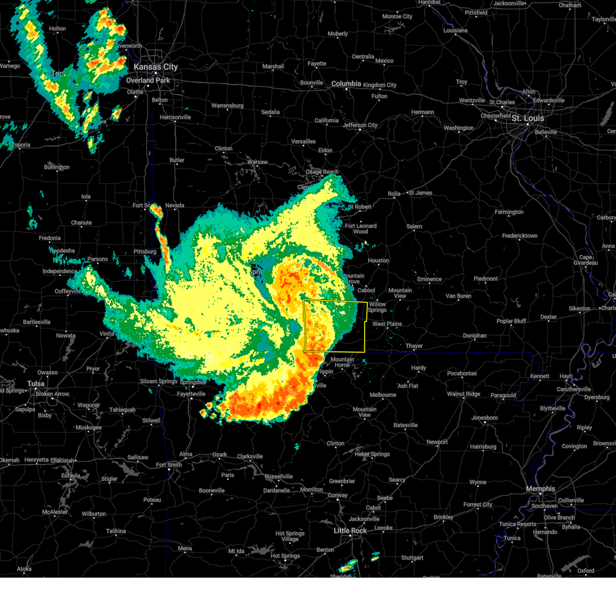
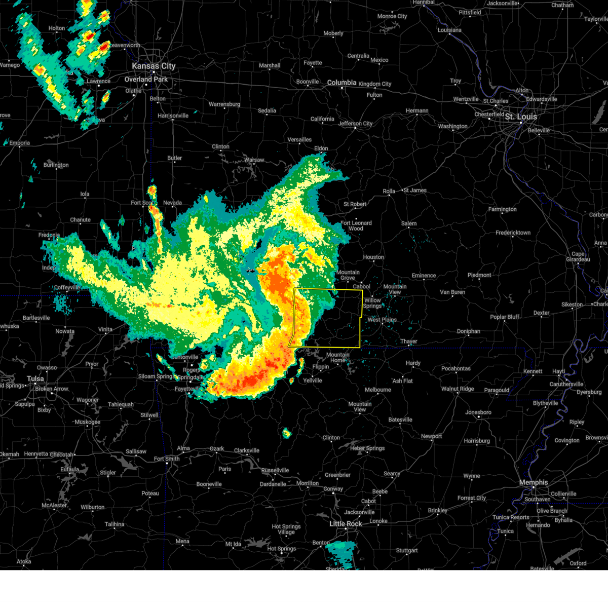
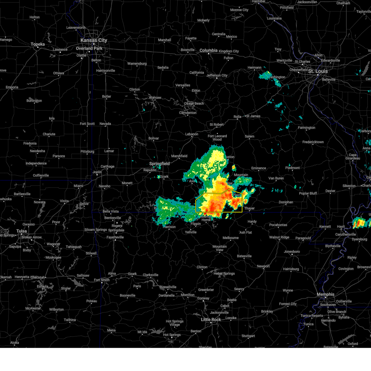
The Top Recent Hail Date for Bakersfield, MO is Friday, May 16, 2025 (1st out of 61)
Hail and Wind Damage Spotted near Bakersfield, MO
| Date / Time | Report Details |
|---|---|
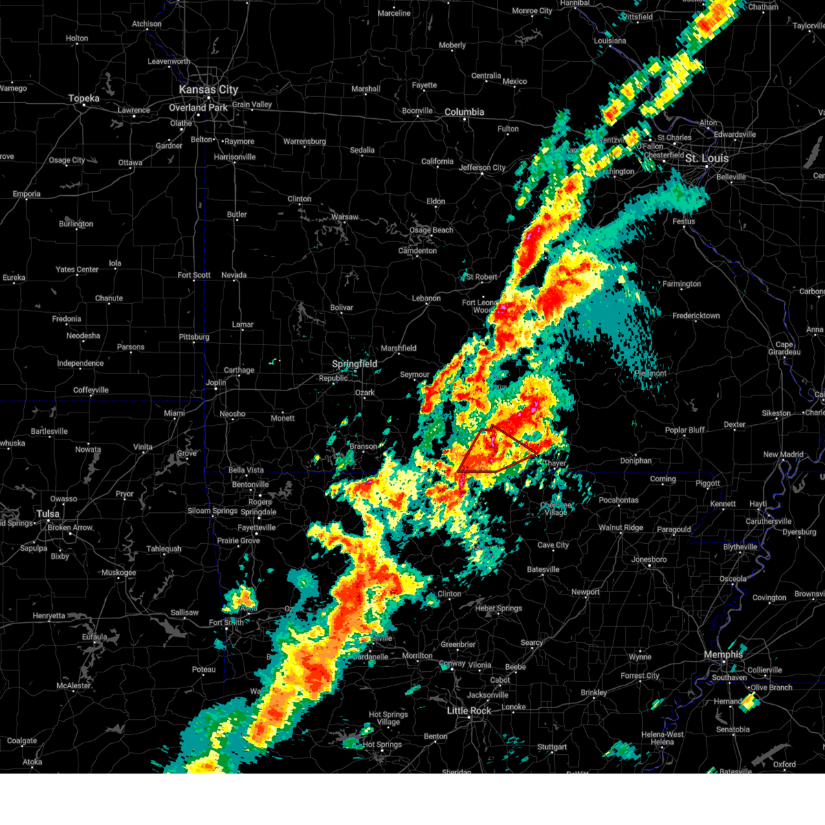
| 5/19/2025 9:27 PM CDT | Svrsgf the national weather service in springfield has issued a * severe thunderstorm warning for, ozark county in southwestern missouri, wright county in southwestern missouri, eastern douglas county in southwestern missouri, howell county in south central missouri, texas county in south central missouri, * until 1015 pm cdt. * at 926 pm cdt, severe thunderstorms were located along a line extending from 14 miles west of houston to 15 miles south of mountain grove to 6 miles south of gainesville, moving east at 55 mph (radar indicated). Hazards include 60 mph wind gusts. expect damage to roofs, siding, and trees |
| 5/19/2025 9:12 PM CDT | At 911 pm cdt, severe thunderstorms were located along a line extending from mansfield to 12 miles southeast of ava to near price place, moving east at 65 mph (radar indicated). Hazards include 60 mph wind gusts. Expect damage to roofs, siding, and trees. Locations impacted include, bull shoals lake, norfork lake, bryant creek state park, mountain grove, ava, seymour, mansfield, gainesville, dawson, norwood, hartville, bakersfield, theodosia, pontiac, wasola, sundown, brixey, willhoit, brushyknob, and tecumseh. |
| 5/19/2025 9:12 PM CDT | the severe thunderstorm warning has been cancelled and is no longer in effect |
| 5/19/2025 8:48 PM CDT | Svrsgf the national weather service in springfield has issued a * severe thunderstorm warning for, ozark county in southwestern missouri, southern webster county in southwestern missouri, southern wright county in southwestern missouri, douglas county in southwestern missouri, eastern taney county in southwestern missouri, eastern christian county in southwestern missouri, * until 930 pm cdt. * at 847 pm cdt, severe thunderstorms were located along a line extending from near fordland to 11 miles southwest of ava to near diamond city, moving east at 60 mph (radar indicated). Hazards include 60 mph wind gusts. expect damage to roofs, siding, and trees |
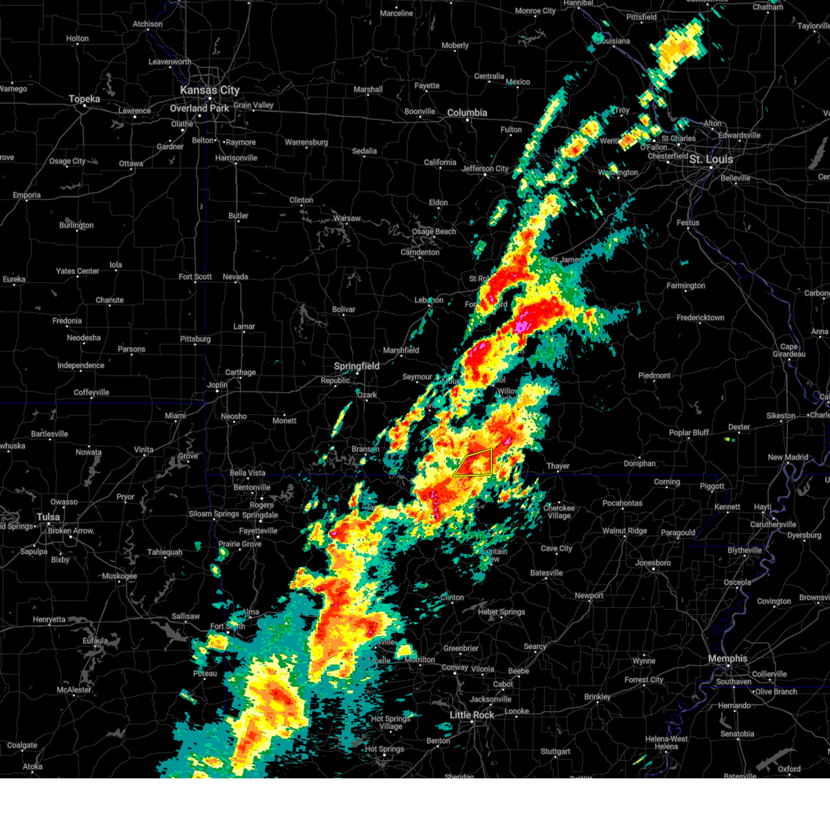
| 5/16/2025 2:29 PM CDT | The storm which prompted the warning has moved out of the area. therefore, the warning will be allowed to expire. a tornado watch remains in effect until 700 pm cdt for south central and southwestern missouri. |
| 5/16/2025 2:02 PM CDT |
 At 202 pm cdt, a severe thunderstorm was located over bakersfield, or 17 miles northeast of mountain home, moving northeast at 45 mph (radar indicated). Hazards include golf ball size hail and 60 mph wind gusts. People and animals outdoors will be injured. expect hail damage to roofs, siding, windows, and vehicles. expect wind damage to roofs, siding, and trees. Locations impacted include, west plains, norfork lake, bakersfield, south fork, brandsville, ott, lanton, siloam springs, moody, pottersville, caulfield, and udall. At 202 pm cdt, a severe thunderstorm was located over bakersfield, or 17 miles northeast of mountain home, moving northeast at 45 mph (radar indicated). Hazards include golf ball size hail and 60 mph wind gusts. People and animals outdoors will be injured. expect hail damage to roofs, siding, windows, and vehicles. expect wind damage to roofs, siding, and trees. Locations impacted include, west plains, norfork lake, bakersfield, south fork, brandsville, ott, lanton, siloam springs, moody, pottersville, caulfield, and udall.
|
| 5/16/2025 1:52 PM CDT |
 Svrsgf the national weather service in springfield has issued a * severe thunderstorm warning for, eastern ozark county in southwestern missouri, southern howell county in south central missouri, * until 230 pm cdt. * at 151 pm cdt, a severe thunderstorm was located near gamaliel landing, or 8 miles northeast of mountain home, moving northeast at 45 mph (radar indicated). Hazards include ping pong ball size hail and 60 mph wind gusts. People and animals outdoors will be injured. expect hail damage to roofs, siding, windows, and vehicles. Expect wind damage to roofs, siding, and trees. Svrsgf the national weather service in springfield has issued a * severe thunderstorm warning for, eastern ozark county in southwestern missouri, southern howell county in south central missouri, * until 230 pm cdt. * at 151 pm cdt, a severe thunderstorm was located near gamaliel landing, or 8 miles northeast of mountain home, moving northeast at 45 mph (radar indicated). Hazards include ping pong ball size hail and 60 mph wind gusts. People and animals outdoors will be injured. expect hail damage to roofs, siding, windows, and vehicles. Expect wind damage to roofs, siding, and trees.
|
| 4/20/2025 6:01 PM CDT |
 At 600 pm cdt, severe thunderstorms were located along a line extending from near doolittle to 9 miles southwest of salem to 12 miles west of west plains, moving east at 60 mph (public). Hazards include 70 mph wind gusts and nickel size hail. Expect considerable tree damage. damage is likely to mobile homes, roofs, and outbuildings. locations impacted include, lanton, jadwin, beulah, ozark national scenic riverways, caulfield, bakersfield, gladden, anutt, bangert, echo bluff state park, edgar springs, west plains, eminence, akers, pine crest, summersville, rosati, montier, turtle, and pomona. This includes interstate 44 between mile markers 171 and 200. At 600 pm cdt, severe thunderstorms were located along a line extending from near doolittle to 9 miles southwest of salem to 12 miles west of west plains, moving east at 60 mph (public). Hazards include 70 mph wind gusts and nickel size hail. Expect considerable tree damage. damage is likely to mobile homes, roofs, and outbuildings. locations impacted include, lanton, jadwin, beulah, ozark national scenic riverways, caulfield, bakersfield, gladden, anutt, bangert, echo bluff state park, edgar springs, west plains, eminence, akers, pine crest, summersville, rosati, montier, turtle, and pomona. This includes interstate 44 between mile markers 171 and 200.
|
| 4/20/2025 6:01 PM CDT |
 the severe thunderstorm warning has been cancelled and is no longer in effect the severe thunderstorm warning has been cancelled and is no longer in effect
|
| 4/20/2025 5:53 PM CDT |
 the severe thunderstorm warning has been cancelled and is no longer in effect the severe thunderstorm warning has been cancelled and is no longer in effect
|
| 4/20/2025 5:53 PM CDT |
 At 552 pm cdt, severe thunderstorms were located along a line extending from near doolittle to near raymondville to west plains, moving northeast at 60 mph (public). Hazards include 70 mph wind gusts and nickel size hail. Expect considerable tree damage. damage is likely to mobile homes, roofs, and outbuildings. Locations impacted include, lanton, huggins, tecumseh, pottersville, caulfield, bakersfield, udall, success, eunice, brandsville, hardenville, yukon, roby, clear springs, licking, solo, plato, west plains, pine crest, and simmons. At 552 pm cdt, severe thunderstorms were located along a line extending from near doolittle to near raymondville to west plains, moving northeast at 60 mph (public). Hazards include 70 mph wind gusts and nickel size hail. Expect considerable tree damage. damage is likely to mobile homes, roofs, and outbuildings. Locations impacted include, lanton, huggins, tecumseh, pottersville, caulfield, bakersfield, udall, success, eunice, brandsville, hardenville, yukon, roby, clear springs, licking, solo, plato, west plains, pine crest, and simmons.
|
| 4/20/2025 5:48 PM CDT |
 Svrsgf the national weather service in springfield has issued a * severe thunderstorm warning for, maries county in central missouri, southeastern ozark county in southwestern missouri, shannon county in south central missouri, dent county in south central missouri, howell county in south central missouri, eastern pulaski county in central missouri, eastern texas county in south central missouri, phelps county in east central missouri, * until 645 pm cdt. * at 546 pm cdt, severe thunderstorms were located along a line extending from near st. robert to near raymondville to near bakersfield, moving northeast at 65 mph (radar indicated). Hazards include 70 mph wind gusts and nickel size hail. Expect considerable tree damage. Damage is likely to mobile homes, roofs, and outbuildings. Svrsgf the national weather service in springfield has issued a * severe thunderstorm warning for, maries county in central missouri, southeastern ozark county in southwestern missouri, shannon county in south central missouri, dent county in south central missouri, howell county in south central missouri, eastern pulaski county in central missouri, eastern texas county in south central missouri, phelps county in east central missouri, * until 645 pm cdt. * at 546 pm cdt, severe thunderstorms were located along a line extending from near st. robert to near raymondville to near bakersfield, moving northeast at 65 mph (radar indicated). Hazards include 70 mph wind gusts and nickel size hail. Expect considerable tree damage. Damage is likely to mobile homes, roofs, and outbuildings.
|
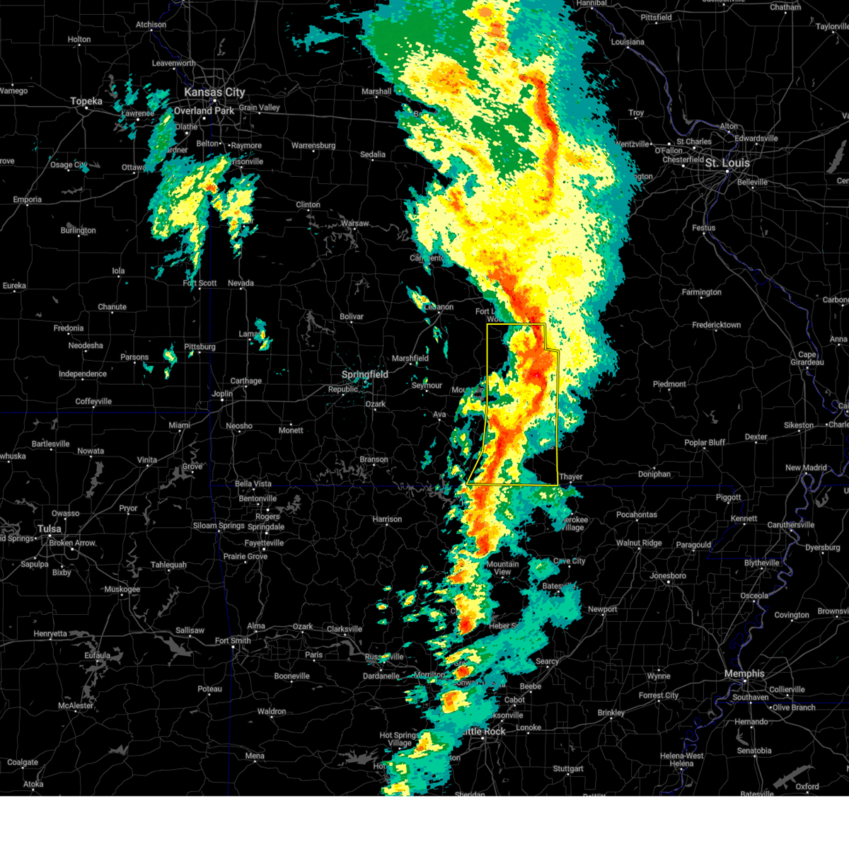
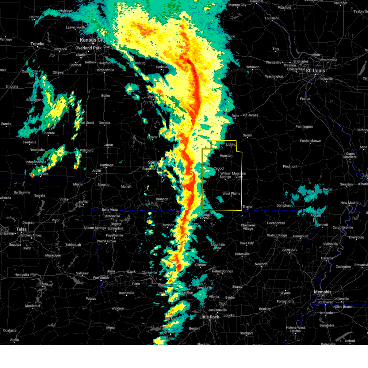
| 4/20/2025 5:23 PM CDT | At 522 pm cdt, severe thunderstorms were located along a line extending from near fort leonard wood to 12 miles south of cabool to near gamaliel landing, moving northeast at 60 mph (trained weather spotter reports a measured 80 mph wind gust around 510 pm cdt). Hazards include 70 mph wind gusts and nickel size hail. Expect considerable tree damage. damage is likely to mobile homes, roofs, and outbuildings. Locations impacted include, lanton, manes, brixey, caulfield, bakersfield, success, hardenville, vanzant, plato, west plains, bryant creek state park, pine crest, simmons, zanoni, summersville, pomona, arroll, gentryville, cabool, and siloam springs. |
| 4/20/2025 4:57 PM CDT |
 Svrsgf the national weather service in springfield has issued a * severe thunderstorm warning for, eastern ozark county in southwestern missouri, eastern wright county in southwestern missouri, eastern douglas county in southwestern missouri, howell county in south central missouri, texas county in south central missouri, southwestern oregon county in south central missouri, * until 600 pm cdt. * at 456 pm cdt, severe thunderstorms were located along a line extending from 9 miles southeast of lebanon to 10 miles southeast of ava to bull shoals state park, moving northeast at 60 mph (trained spotter report of downed trees in ava at 445 pm cdt). Hazards include 70 mph wind gusts and nickel size hail. Expect considerable tree damage. Damage is likely to mobile homes, roofs, and outbuildings. Svrsgf the national weather service in springfield has issued a * severe thunderstorm warning for, eastern ozark county in southwestern missouri, eastern wright county in southwestern missouri, eastern douglas county in southwestern missouri, howell county in south central missouri, texas county in south central missouri, southwestern oregon county in south central missouri, * until 600 pm cdt. * at 456 pm cdt, severe thunderstorms were located along a line extending from 9 miles southeast of lebanon to 10 miles southeast of ava to bull shoals state park, moving northeast at 60 mph (trained spotter report of downed trees in ava at 445 pm cdt). Hazards include 70 mph wind gusts and nickel size hail. Expect considerable tree damage. Damage is likely to mobile homes, roofs, and outbuildings.
|
| 4/2/2025 3:01 PM CDT | Quarter sized hail reported 5 miles SSW of Bakersfield, MO, quarter size hail yy 1mile off 101 reported by caulfield fire. |
| 4/2/2025 2:58 PM CDT |
 At 258 pm cdt, a severe thunderstorm capable of producing a tornado was located near bakersfield, or 17 miles southwest of west plains, moving northeast at 55 mph (radar indicated rotation). Hazards include tornado and ping pong ball size hail. Flying debris will be dangerous to those caught without shelter. mobile homes will be damaged or destroyed. damage to roofs, windows, and vehicles will occur. tree damage is likely. Locations impacted include, south fork, pottersville, moody, caulfield, bakersfield, and west plains. At 258 pm cdt, a severe thunderstorm capable of producing a tornado was located near bakersfield, or 17 miles southwest of west plains, moving northeast at 55 mph (radar indicated rotation). Hazards include tornado and ping pong ball size hail. Flying debris will be dangerous to those caught without shelter. mobile homes will be damaged or destroyed. damage to roofs, windows, and vehicles will occur. tree damage is likely. Locations impacted include, south fork, pottersville, moody, caulfield, bakersfield, and west plains.
|
| 4/2/2025 2:40 PM CDT |
 Torsgf the national weather service in springfield has issued a * tornado warning for, eastern ozark county in southwestern missouri, southern howell county in south central missouri, * until 330 pm cdt. * at 240 pm cdt, a severe thunderstorm capable of producing a tornado was located over fawn park, or near mountain home, moving northeast at 45 mph (radar indicated rotation). Hazards include tornado and quarter size hail. Flying debris will be dangerous to those caught without shelter. mobile homes will be damaged or destroyed. damage to roofs, windows, and vehicles will occur. Tree damage is likely. Torsgf the national weather service in springfield has issued a * tornado warning for, eastern ozark county in southwestern missouri, southern howell county in south central missouri, * until 330 pm cdt. * at 240 pm cdt, a severe thunderstorm capable of producing a tornado was located over fawn park, or near mountain home, moving northeast at 45 mph (radar indicated rotation). Hazards include tornado and quarter size hail. Flying debris will be dangerous to those caught without shelter. mobile homes will be damaged or destroyed. damage to roofs, windows, and vehicles will occur. Tree damage is likely.
|
| 4/2/2025 2:18 PM CDT |
 At 218 pm cdt, a severe thunderstorm was located 7 miles southeast of gainesville, or 15 miles north of mountain home, moving northeast at 35 mph (radar indicated). Hazards include 60 mph wind gusts and half dollar size hail. Hail damage to vehicles is expected. expect wind damage to roofs, siding, and trees. Locations impacted include, hardenville, bakersfield, udall, tecumseh, and norfork lake. At 218 pm cdt, a severe thunderstorm was located 7 miles southeast of gainesville, or 15 miles north of mountain home, moving northeast at 35 mph (radar indicated). Hazards include 60 mph wind gusts and half dollar size hail. Hail damage to vehicles is expected. expect wind damage to roofs, siding, and trees. Locations impacted include, hardenville, bakersfield, udall, tecumseh, and norfork lake.
|
| 4/2/2025 1:48 PM CDT |
 Svrsgf the national weather service in springfield has issued a * severe thunderstorm warning for, eastern ozark county in southwestern missouri, * until 230 pm cdt. * at 148 pm cdt, a severe thunderstorm was located over bull shoals, moving northeast at 50 mph (radar indicated). Hazards include golf ball size hail and 60 mph wind gusts. People and animals outdoors will be injured. expect hail damage to roofs, siding, windows, and vehicles. Expect wind damage to roofs, siding, and trees. Svrsgf the national weather service in springfield has issued a * severe thunderstorm warning for, eastern ozark county in southwestern missouri, * until 230 pm cdt. * at 148 pm cdt, a severe thunderstorm was located over bull shoals, moving northeast at 50 mph (radar indicated). Hazards include golf ball size hail and 60 mph wind gusts. People and animals outdoors will be injured. expect hail damage to roofs, siding, windows, and vehicles. Expect wind damage to roofs, siding, and trees.
|
| 3/30/2025 4:51 PM CDT | Golf Ball sized hail reported 6.6 miles NE of Bakersfield, MO |
| 3/30/2025 3:41 PM CDT | Half Dollar sized hail reported 7.9 miles NNE of Bakersfield, MO |
| 3/30/2025 3:21 PM CDT |
 At 320 pm cdt, a severe thunderstorm was located near price place, or 13 miles northwest of bull shoals, moving northeast at 45 mph (radar indicated). Hazards include two inch hail and 60 mph wind gusts. People and animals outdoors will be injured. expect hail damage to roofs, siding, windows, and vehicles. expect wind damage to roofs, siding, and trees. Locations impacted include, lanton, theodosia, south fork, pontiac, sundown, tecumseh, pottersville, caulfield, bakersfield, udall, brandsville, hardenville, siloam springs, gainesville, moody, sycamore, west plains, isabella, zanoni, and bull shoals lake. At 320 pm cdt, a severe thunderstorm was located near price place, or 13 miles northwest of bull shoals, moving northeast at 45 mph (radar indicated). Hazards include two inch hail and 60 mph wind gusts. People and animals outdoors will be injured. expect hail damage to roofs, siding, windows, and vehicles. expect wind damage to roofs, siding, and trees. Locations impacted include, lanton, theodosia, south fork, pontiac, sundown, tecumseh, pottersville, caulfield, bakersfield, udall, brandsville, hardenville, siloam springs, gainesville, moody, sycamore, west plains, isabella, zanoni, and bull shoals lake.
|
| 3/30/2025 3:15 PM CDT |
 At 315 pm cdt, a severe thunderstorm was located near ozark isle, or 11 miles northwest of bull shoals, moving northeast at 45 mph (radar indicated). Hazards include ping pong ball size hail and 60 mph wind gusts. People and animals outdoors will be injured. expect hail damage to roofs, siding, windows, and vehicles. expect wind damage to roofs, siding, and trees. Locations impacted include, lanton, theodosia, south fork, pontiac, sundown, tecumseh, pottersville, caulfield, bakersfield, udall, brandsville, hardenville, siloam springs, gainesville, moody, sycamore, west plains, isabella, zanoni, and bull shoals lake. At 315 pm cdt, a severe thunderstorm was located near ozark isle, or 11 miles northwest of bull shoals, moving northeast at 45 mph (radar indicated). Hazards include ping pong ball size hail and 60 mph wind gusts. People and animals outdoors will be injured. expect hail damage to roofs, siding, windows, and vehicles. expect wind damage to roofs, siding, and trees. Locations impacted include, lanton, theodosia, south fork, pontiac, sundown, tecumseh, pottersville, caulfield, bakersfield, udall, brandsville, hardenville, siloam springs, gainesville, moody, sycamore, west plains, isabella, zanoni, and bull shoals lake.
|
| 3/30/2025 3:02 PM CDT |
 Svrsgf the national weather service in springfield has issued a * severe thunderstorm warning for, ozark county in southwestern missouri, southern howell county in south central missouri, * until 400 pm cdt. * at 302 pm cdt, a severe thunderstorm was located 7 miles northwest of gamaliel landing, or 12 miles north of mountain home, moving northeast at 45 mph (radar indicated). Hazards include 60 mph wind gusts and quarter size hail. Hail damage to vehicles is expected. Expect wind damage to roofs, siding, and trees. Svrsgf the national weather service in springfield has issued a * severe thunderstorm warning for, ozark county in southwestern missouri, southern howell county in south central missouri, * until 400 pm cdt. * at 302 pm cdt, a severe thunderstorm was located 7 miles northwest of gamaliel landing, or 12 miles north of mountain home, moving northeast at 45 mph (radar indicated). Hazards include 60 mph wind gusts and quarter size hail. Hail damage to vehicles is expected. Expect wind damage to roofs, siding, and trees.
|
| 3/14/2025 9:16 PM CDT | House damage. possible to in howell county MO, 5.7 miles WSW of Bakersfield, MO |
| 3/14/2025 9:06 PM CDT |
 the severe thunderstorm warning has been cancelled and is no longer in effect the severe thunderstorm warning has been cancelled and is no longer in effect
|
| 3/14/2025 9:06 PM CDT |
 At 906 pm cdt, a severe thunderstorm was located over ott, or 18 miles northwest of salem in fulton county, moving northeast at 60 mph (radar indicated). Hazards include golf ball size hail and 70 mph wind gusts. People and animals outdoors will be injured. expect hail damage to roofs, siding, windows, and vehicles. expect considerable tree damage. wind damage is also likely to mobile homes, roofs, and outbuildings. Locations impacted include, brandsville, rover, south fork, moody, pomona, west plains, pottersville, caulfield, and bakersfield. At 906 pm cdt, a severe thunderstorm was located over ott, or 18 miles northwest of salem in fulton county, moving northeast at 60 mph (radar indicated). Hazards include golf ball size hail and 70 mph wind gusts. People and animals outdoors will be injured. expect hail damage to roofs, siding, windows, and vehicles. expect considerable tree damage. wind damage is also likely to mobile homes, roofs, and outbuildings. Locations impacted include, brandsville, rover, south fork, moody, pomona, west plains, pottersville, caulfield, and bakersfield.
|
| 3/14/2025 8:45 PM CDT | Corrects previous time of tstm wnd dmg report from 4 wnw moody. house damage. possible to in howell county MO, 5.7 miles WSW of Bakersfield, MO |
| 3/14/2025 8:44 PM CDT | Torsgf the national weather service in springfield has issued a * tornado warning for, southeastern ozark county in southwestern missouri, southeastern howell county in south central missouri, northwestern oregon county in south central missouri, * until 930 pm cdt. * at 843 pm cdt, a confirmed large and extremely dangerous tornado was located over bakersfield, or 19 miles northwest of salem in fulton county, moving northeast at 50 mph. this is a particularly dangerous situation. take cover now! (weather spotters confirmed tornado. at 840 pm a tornado was reported near bakersfield). Hazards include damaging tornado. You are in a life-threatening situation. flying debris may be deadly to those caught without shelter. mobile homes will be destroyed. Considerable damage to homes, businesses, and vehicles is likely and complete destruction is possible. |
| 3/14/2025 8:40 PM CDT |
 At 840 pm cdt, a confirmed large and extremely dangerous tornado was located over bakersfield, or 16 miles northeast of mountain home, moving northeast at 45 mph. this is a particularly dangerous situation. take cover now! (radar confirmed tornado). Hazards include damaging tornado. You are in a life-threatening situation. flying debris may be deadly to those caught without shelter. mobile homes will be destroyed. considerable damage to homes, businesses, and vehicles is likely and complete destruction is possible. Locations impacted include, moody, caulfield, bakersfield, udall, and norfork lake. At 840 pm cdt, a confirmed large and extremely dangerous tornado was located over bakersfield, or 16 miles northeast of mountain home, moving northeast at 45 mph. this is a particularly dangerous situation. take cover now! (radar confirmed tornado). Hazards include damaging tornado. You are in a life-threatening situation. flying debris may be deadly to those caught without shelter. mobile homes will be destroyed. considerable damage to homes, businesses, and vehicles is likely and complete destruction is possible. Locations impacted include, moody, caulfield, bakersfield, udall, and norfork lake.
|
| 3/14/2025 8:27 PM CDT | Torsgf the national weather service in springfield has issued a * tornado warning for, southeastern ozark county in southwestern missouri, southwestern howell county in south central missouri, * until 900 pm cdt. * at 826 pm cdt, a severe thunderstorm capable of producing a tornado was located over fawn park, or near mountain home, moving northeast at 40 mph (radar indicated rotation). Hazards include tornado and golf ball size hail. Flying debris will be dangerous to those caught without shelter. mobile homes will be damaged or destroyed. damage to roofs, windows, and vehicles will occur. Tree damage is likely. |
| 3/14/2025 8:12 PM CDT | Svrsgf the national weather service in springfield has issued a * severe thunderstorm warning for, eastern ozark county in southwestern missouri, southeastern douglas county in southwestern missouri, howell county in south central missouri, west central oregon county in south central missouri, * until 915 pm cdt. * at 812 pm cdt, a severe thunderstorm was located over arkawana, or near mountain home, moving northeast at 50 mph (radar indicated). Hazards include ping pong ball size hail and 60 mph wind gusts. People and animals outdoors will be injured. expect hail damage to roofs, siding, windows, and vehicles. Expect wind damage to roofs, siding, and trees. |
| 6/9/2024 1:05 AM CDT |
 The storm which prompted the warning has moved out of the area. therefore, the warning will be allowed to expire. a severe thunderstorm watch remains in effect until 300 am cdt for south central and southwestern missouri. The storm which prompted the warning has moved out of the area. therefore, the warning will be allowed to expire. a severe thunderstorm watch remains in effect until 300 am cdt for south central and southwestern missouri.
|
| 6/9/2024 12:44 AM CDT |
 Svrsgf the national weather service in springfield has issued a * severe thunderstorm warning for, southeastern ozark county in southwestern missouri, southwestern howell county in south central missouri, * until 115 am cdt. * at 1243 am cdt, a severe thunderstorm was located near bakersfield, or 16 miles northeast of mountain home, moving southeast at 60 mph (radar indicated). Hazards include 60 mph wind gusts and quarter size hail. Hail damage to vehicles is expected. Expect wind damage to roofs, siding, and trees. Svrsgf the national weather service in springfield has issued a * severe thunderstorm warning for, southeastern ozark county in southwestern missouri, southwestern howell county in south central missouri, * until 115 am cdt. * at 1243 am cdt, a severe thunderstorm was located near bakersfield, or 16 miles northeast of mountain home, moving southeast at 60 mph (radar indicated). Hazards include 60 mph wind gusts and quarter size hail. Hail damage to vehicles is expected. Expect wind damage to roofs, siding, and trees.
|
| 5/26/2024 5:23 AM CDT |
 At 522 am cdt, severe thunderstorms were located along a line extending from 13 miles west of west plains to near sturkie to near diamond bay, moving east at 70 mph (radar indicated). Hazards include 60 mph wind gusts and quarter size hail. Hail damage to vehicles is expected. expect wind damage to roofs, siding, and trees. Locations impacted include, west plains, norfork lake, grand gulf state park, bryant creek state park, thayer, alton, gainesville, bakersfield, south fork, koshkonong, brandsville, thomasville, lanton, myrtle, brixey, tecumseh, pottersville, caulfield, udall, and hardenville. At 522 am cdt, severe thunderstorms were located along a line extending from 13 miles west of west plains to near sturkie to near diamond bay, moving east at 70 mph (radar indicated). Hazards include 60 mph wind gusts and quarter size hail. Hail damage to vehicles is expected. expect wind damage to roofs, siding, and trees. Locations impacted include, west plains, norfork lake, grand gulf state park, bryant creek state park, thayer, alton, gainesville, bakersfield, south fork, koshkonong, brandsville, thomasville, lanton, myrtle, brixey, tecumseh, pottersville, caulfield, udall, and hardenville.
|
| 5/26/2024 5:09 AM CDT |
 Svrsgf the national weather service in springfield has issued a * severe thunderstorm warning for, eastern ozark county in southwestern missouri, southeastern douglas county in southwestern missouri, howell county in south central missouri, oregon county in south central missouri, * until 615 am cdt. * at 508 am cdt, severe thunderstorms were located along a line extending from 11 miles northeast of gainesville to bakersfield to near colfax, moving east at 70 mph (radar indicated). Hazards include 70 mph wind gusts and half dollar size hail. Hail damage to vehicles is expected. expect considerable tree damage. Wind damage is also likely to mobile homes, roofs, and outbuildings. Svrsgf the national weather service in springfield has issued a * severe thunderstorm warning for, eastern ozark county in southwestern missouri, southeastern douglas county in southwestern missouri, howell county in south central missouri, oregon county in south central missouri, * until 615 am cdt. * at 508 am cdt, severe thunderstorms were located along a line extending from 11 miles northeast of gainesville to bakersfield to near colfax, moving east at 70 mph (radar indicated). Hazards include 70 mph wind gusts and half dollar size hail. Hail damage to vehicles is expected. expect considerable tree damage. Wind damage is also likely to mobile homes, roofs, and outbuildings.
|
| 5/26/2024 5:00 AM CDT |
 the severe thunderstorm warning has been cancelled and is no longer in effect the severe thunderstorm warning has been cancelled and is no longer in effect
|
| 5/26/2024 5:00 AM CDT |
 At 459 am cdt, severe thunderstorms were located along a line extending from 7 miles south of mansfield to near gainesville to lakeway, moving east at 60 mph (radar indicated). Hazards include 70 mph wind gusts and half dollar size hail. Hail damage to vehicles is expected. expect considerable tree damage. wind damage is also likely to mobile homes, roofs, and outbuildings. Locations impacted include, bull shoals lake, norfork lake, bryant creek state park, gainesville, bakersfield, theodosia, pontiac, wasola, sundown, brixey, willhoit, brushyknob, tecumseh, udall, hardenville, thornfield, vanzant, squires, zanoni, and noble. At 459 am cdt, severe thunderstorms were located along a line extending from 7 miles south of mansfield to near gainesville to lakeway, moving east at 60 mph (radar indicated). Hazards include 70 mph wind gusts and half dollar size hail. Hail damage to vehicles is expected. expect considerable tree damage. wind damage is also likely to mobile homes, roofs, and outbuildings. Locations impacted include, bull shoals lake, norfork lake, bryant creek state park, gainesville, bakersfield, theodosia, pontiac, wasola, sundown, brixey, willhoit, brushyknob, tecumseh, udall, hardenville, thornfield, vanzant, squires, zanoni, and noble.
|
| 5/26/2024 4:45 AM CDT |
 At 445 am cdt, severe thunderstorms were located along a line extending from 6 miles northwest of ava to 11 miles northwest of price place to near willis, moving east at 60 mph (radar indicated). Hazards include golf ball size hail and 70 mph wind gusts. People and animals outdoors will be injured. expect hail damage to roofs, siding, windows, and vehicles. expect considerable tree damage. wind damage is also likely to mobile homes, roofs, and outbuildings. Locations impacted include, lake taneycomo, bull shoals lake, norfork lake, bryant creek state park, ava, kissee mills, gainesville, taneyville, bakersfield, theodosia, pontiac, wasola, sundown, brixey, willhoit, brushyknob, tecumseh, elkhead, udall, and hardenville. At 445 am cdt, severe thunderstorms were located along a line extending from 6 miles northwest of ava to 11 miles northwest of price place to near willis, moving east at 60 mph (radar indicated). Hazards include golf ball size hail and 70 mph wind gusts. People and animals outdoors will be injured. expect hail damage to roofs, siding, windows, and vehicles. expect considerable tree damage. wind damage is also likely to mobile homes, roofs, and outbuildings. Locations impacted include, lake taneycomo, bull shoals lake, norfork lake, bryant creek state park, ava, kissee mills, gainesville, taneyville, bakersfield, theodosia, pontiac, wasola, sundown, brixey, willhoit, brushyknob, tecumseh, elkhead, udall, and hardenville.
|
| 5/26/2024 4:26 AM CDT |
 Svrsgf the national weather service in springfield has issued a * severe thunderstorm warning for, ozark county in southwestern missouri, douglas county in southwestern missouri, taney county in southwestern missouri, eastern christian county in southwestern missouri, * until 515 am cdt. * at 425 am cdt, severe thunderstorms were located along a line extending from sparta to 6 miles southeast of forsyth to 6 miles northeast of carrollton, moving east at 60 mph (radar indicated). Hazards include golf ball size hail and 70 mph wind gusts. People and animals outdoors will be injured. expect hail damage to roofs, siding, windows, and vehicles. expect considerable tree damage. Wind damage is also likely to mobile homes, roofs, and outbuildings. Svrsgf the national weather service in springfield has issued a * severe thunderstorm warning for, ozark county in southwestern missouri, douglas county in southwestern missouri, taney county in southwestern missouri, eastern christian county in southwestern missouri, * until 515 am cdt. * at 425 am cdt, severe thunderstorms were located along a line extending from sparta to 6 miles southeast of forsyth to 6 miles northeast of carrollton, moving east at 60 mph (radar indicated). Hazards include golf ball size hail and 70 mph wind gusts. People and animals outdoors will be injured. expect hail damage to roofs, siding, windows, and vehicles. expect considerable tree damage. Wind damage is also likely to mobile homes, roofs, and outbuildings.
|
| 3/14/2024 5:26 PM CDT |
 Svrsgf the national weather service in springfield has issued a * severe thunderstorm warning for, southeastern ozark county in southwestern missouri, southern howell county in south central missouri, oregon county in south central missouri, * until 630 pm cdt. * at 525 pm cdt, severe thunderstorms were located along a line extending from 6 miles northeast of west plains to 12 miles north of sturkie to ott, moving east at 50 mph (public. quarter size hail was reported near mountain home, arkansas). Hazards include 60 mph wind gusts and quarter size hail. Hail damage to vehicles is expected. Expect wind damage to roofs, siding, and trees. Svrsgf the national weather service in springfield has issued a * severe thunderstorm warning for, southeastern ozark county in southwestern missouri, southern howell county in south central missouri, oregon county in south central missouri, * until 630 pm cdt. * at 525 pm cdt, severe thunderstorms were located along a line extending from 6 miles northeast of west plains to 12 miles north of sturkie to ott, moving east at 50 mph (public. quarter size hail was reported near mountain home, arkansas). Hazards include 60 mph wind gusts and quarter size hail. Hail damage to vehicles is expected. Expect wind damage to roofs, siding, and trees.
|
| 3/14/2024 5:14 PM CDT |
 At 514 pm cdt, severe thunderstorms were located along a line extending from 12 miles southwest of mountain view to near west plains to bakersfield, moving east at 50 mph (radar indicated). Hazards include 60 mph wind gusts and half dollar size hail. Hail damage to vehicles is expected. expect wind damage to roofs, siding, and trees. Locations impacted include, west plains, gainesville, bakersfield, south fork, brandsville, lanton, tecumseh, pottersville, caulfield, udall, hardenville, siloam springs, moody, sycamore, dora, and zanoni. At 514 pm cdt, severe thunderstorms were located along a line extending from 12 miles southwest of mountain view to near west plains to bakersfield, moving east at 50 mph (radar indicated). Hazards include 60 mph wind gusts and half dollar size hail. Hail damage to vehicles is expected. expect wind damage to roofs, siding, and trees. Locations impacted include, west plains, gainesville, bakersfield, south fork, brandsville, lanton, tecumseh, pottersville, caulfield, udall, hardenville, siloam springs, moody, sycamore, dora, and zanoni.
|
| 3/14/2024 4:50 PM CDT |
 At 450 pm cdt, severe thunderstorms were located along a line extending from 15 miles southwest of willow springs to 11 miles northwest of bakersfield to 6 miles east of price place, moving east at 50 mph (radar indicated). Hazards include 60 mph wind gusts and half dollar size hail. Hail damage to vehicles is expected. expect wind damage to roofs, siding, and trees. Locations impacted include, west plains, bull shoals lake, gainesville, bakersfield, theodosia, south fork, pontiac, brandsville, wasola, sundown, lanton, brixey, willhoit, tecumseh, pottersville, caulfield, udall, hardenville, thornfield, and zanoni. At 450 pm cdt, severe thunderstorms were located along a line extending from 15 miles southwest of willow springs to 11 miles northwest of bakersfield to 6 miles east of price place, moving east at 50 mph (radar indicated). Hazards include 60 mph wind gusts and half dollar size hail. Hail damage to vehicles is expected. expect wind damage to roofs, siding, and trees. Locations impacted include, west plains, bull shoals lake, gainesville, bakersfield, theodosia, south fork, pontiac, brandsville, wasola, sundown, lanton, brixey, willhoit, tecumseh, pottersville, caulfield, udall, hardenville, thornfield, and zanoni.
|
| 3/14/2024 4:50 PM CDT |
 the severe thunderstorm warning has been cancelled and is no longer in effect the severe thunderstorm warning has been cancelled and is no longer in effect
|
| 3/14/2024 4:25 PM CDT |
 Svrsgf the national weather service in springfield has issued a * severe thunderstorm warning for, ozark county in southwestern missouri, southeastern taney county in southwestern missouri, southern howell county in south central missouri, * until 530 pm cdt. * at 425 pm cdt, severe thunderstorms were located along a line extending from 15 miles southeast of ava to 9 miles west of gainesville to near diamond city, moving east at 50 mph (radar indicated). Hazards include 60 mph wind gusts and half dollar size hail. Hail damage to vehicles is expected. Expect wind damage to roofs, siding, and trees. Svrsgf the national weather service in springfield has issued a * severe thunderstorm warning for, ozark county in southwestern missouri, southeastern taney county in southwestern missouri, southern howell county in south central missouri, * until 530 pm cdt. * at 425 pm cdt, severe thunderstorms were located along a line extending from 15 miles southeast of ava to 9 miles west of gainesville to near diamond city, moving east at 50 mph (radar indicated). Hazards include 60 mph wind gusts and half dollar size hail. Hail damage to vehicles is expected. Expect wind damage to roofs, siding, and trees.
|
| 9/6/2023 12:29 AM CDT |
 At 1229 am cdt, severe thunderstorms were located along a line extending from 6 miles southeast of norwood to 15 miles northwest of bakersfield to 7 miles south of gainesville, moving east at 50 mph (radar indicated). Hazards include 60 mph wind gusts. expect damage to roofs, siding, and trees At 1229 am cdt, severe thunderstorms were located along a line extending from 6 miles southeast of norwood to 15 miles northwest of bakersfield to 7 miles south of gainesville, moving east at 50 mph (radar indicated). Hazards include 60 mph wind gusts. expect damage to roofs, siding, and trees
|
| 9/6/2023 12:10 AM CDT |
 At 1210 am cdt, severe thunderstorms were located along a line extending from near mansfield to 13 miles south of ava to 6 miles northeast of diamond city, moving east at 45 mph (trained weather spotters). Hazards include 60 mph wind gusts. Expect damage to roofs, siding, and trees. locations impacted include, bull shoals lake, bryant creek state park, ava, gainesville, bakersfield, theodosia, pontiac, wasola, sundown, brixey, willhoit, brushyknob, tecumseh, udall, hardenville, protem, thornfield, rome, vanzant and squires. hail threat, radar indicated max hail size, <. 75 in wind threat, radar indicated max wind gust, 60 mph. At 1210 am cdt, severe thunderstorms were located along a line extending from near mansfield to 13 miles south of ava to 6 miles northeast of diamond city, moving east at 45 mph (trained weather spotters). Hazards include 60 mph wind gusts. Expect damage to roofs, siding, and trees. locations impacted include, bull shoals lake, bryant creek state park, ava, gainesville, bakersfield, theodosia, pontiac, wasola, sundown, brixey, willhoit, brushyknob, tecumseh, udall, hardenville, protem, thornfield, rome, vanzant and squires. hail threat, radar indicated max hail size, <. 75 in wind threat, radar indicated max wind gust, 60 mph.
|
| 9/5/2023 11:46 PM CDT |
 At 1146 pm cdt, severe thunderstorms were located along a line extending from near diggins to 7 miles northeast of taneyville to 7 miles southeast of hollister, moving east at 45 mph (radar indicated). Hazards include 60 mph wind gusts. expect damage to roofs, siding, and trees At 1146 pm cdt, severe thunderstorms were located along a line extending from near diggins to 7 miles northeast of taneyville to 7 miles southeast of hollister, moving east at 45 mph (radar indicated). Hazards include 60 mph wind gusts. expect damage to roofs, siding, and trees
|
| 8/14/2023 1:09 AM CDT |
 The severe thunderstorm warning for southeastern ozark county will expire at 115 am cdt, the storms which prompted the warning have weakened below severe limits, and no longer pose an immediate threat to life or property. therefore, the warning will be allowed to expire. a severe thunderstorm watch remains in effect until 200 am cdt for south central and southwestern missouri. The severe thunderstorm warning for southeastern ozark county will expire at 115 am cdt, the storms which prompted the warning have weakened below severe limits, and no longer pose an immediate threat to life or property. therefore, the warning will be allowed to expire. a severe thunderstorm watch remains in effect until 200 am cdt for south central and southwestern missouri.
|
| 8/14/2023 12:45 AM CDT |
 At 1245 am cdt, severe thunderstorms were located along a line extending from near gainesville to 6 miles north of arkawana, moving east at 40 mph (radar indicated). Hazards include 60 mph wind gusts. Expect damage to roofs, siding, and trees. locations impacted include, norfork lake, gainesville, bakersfield, hardenville, willhoit, tecumseh, zanoni and udall. hail threat, radar indicated max hail size, <. 75 in wind threat, radar indicated max wind gust, 60 mph. At 1245 am cdt, severe thunderstorms were located along a line extending from near gainesville to 6 miles north of arkawana, moving east at 40 mph (radar indicated). Hazards include 60 mph wind gusts. Expect damage to roofs, siding, and trees. locations impacted include, norfork lake, gainesville, bakersfield, hardenville, willhoit, tecumseh, zanoni and udall. hail threat, radar indicated max hail size, <. 75 in wind threat, radar indicated max wind gust, 60 mph.
|
| 8/14/2023 12:25 AM CDT |
 At 1225 am cdt, a severe thunderstorm was located 11 miles northeast of diamond city, or 18 miles northwest of bull shoals, moving east at 35 mph. this replaces the severe thunderstorm warnings expiring at 1230 am cdt (radar indicated). Hazards include 60 mph wind gusts. expect damage to roofs, siding, and trees At 1225 am cdt, a severe thunderstorm was located 11 miles northeast of diamond city, or 18 miles northwest of bull shoals, moving east at 35 mph. this replaces the severe thunderstorm warnings expiring at 1230 am cdt (radar indicated). Hazards include 60 mph wind gusts. expect damage to roofs, siding, and trees
|
| 8/14/2023 12:18 AM CDT |
 At 1218 am cdt, a severe thunderstorm was located near gainesville, or 18 miles north of mountain home, moving east at 35 mph (radar indicated). Hazards include 60 mph wind gusts and penny size hail. Expect damage to roofs, siding, and trees. locations impacted include, bull shoals lake, norfork lake, gainesville, bakersfield, theodosia, pontiac, sundown, price place, brixey, noble, willhoit, tecumseh, udall, hardenville, thornfield, sycamore, dora, rockbridge, long run and isabella. hail threat, radar indicated max hail size, 0. 75 in wind threat, radar indicated max wind gust, 60 mph. At 1218 am cdt, a severe thunderstorm was located near gainesville, or 18 miles north of mountain home, moving east at 35 mph (radar indicated). Hazards include 60 mph wind gusts and penny size hail. Expect damage to roofs, siding, and trees. locations impacted include, bull shoals lake, norfork lake, gainesville, bakersfield, theodosia, pontiac, sundown, price place, brixey, noble, willhoit, tecumseh, udall, hardenville, thornfield, sycamore, dora, rockbridge, long run and isabella. hail threat, radar indicated max hail size, 0. 75 in wind threat, radar indicated max wind gust, 60 mph.
|
| 8/13/2023 11:44 PM CDT |
 At 1144 pm cdt, a severe thunderstorm was located 13 miles northwest of price place, or 20 miles south of ava, moving east at 35 mph (radar indicated). Hazards include ping pong ball size hail and 60 mph wind gusts. People and animals outdoors will be injured. expect hail damage to roofs, siding, windows, and vehicles. Expect wind damage to roofs, siding, and trees. At 1144 pm cdt, a severe thunderstorm was located 13 miles northwest of price place, or 20 miles south of ava, moving east at 35 mph (radar indicated). Hazards include ping pong ball size hail and 60 mph wind gusts. People and animals outdoors will be injured. expect hail damage to roofs, siding, windows, and vehicles. Expect wind damage to roofs, siding, and trees.
|
| 8/9/2023 7:59 PM CDT | Tree fell on car as it was being driven. no injuries to driver. many other trees down in the are in ozark county MO, 0.5 miles NNW of Bakersfield, MO |
| 8/9/2023 7:58 PM CDT |
 At 758 pm cdt, severe thunderstorms were located along a line extending from 18 miles northwest of bakersfield to near gainesville to near price place, moving east at 45 mph (radar indicated). Hazards include 60 mph wind gusts and quarter size hail. Hail damage to vehicles is expected. Expect wind damage to roofs, siding, and trees. At 758 pm cdt, severe thunderstorms were located along a line extending from 18 miles northwest of bakersfield to near gainesville to near price place, moving east at 45 mph (radar indicated). Hazards include 60 mph wind gusts and quarter size hail. Hail damage to vehicles is expected. Expect wind damage to roofs, siding, and trees.
|
| 8/9/2023 7:50 PM CDT |
 At 749 pm cdt, a severe thunderstorm was located near fawn park, or 7 miles northeast of mountain home, moving southeast at 45 mph (trained weather spotters). Hazards include 70 mph wind gusts and quarter size hail. Hail damage to vehicles is expected. expect considerable tree damage. wind damage is also likely to mobile homes, roofs, and outbuildings. locations impacted include, bull shoals lake, norfork lake, gainesville, bakersfield, pontiac, sundown, willhoit, tecumseh, udall, hardenville, sycamore, isabella and zanoni. thunderstorm damage threat, considerable hail threat, radar indicated max hail size, 1. 00 in wind threat, observed max wind gust, 70 mph. At 749 pm cdt, a severe thunderstorm was located near fawn park, or 7 miles northeast of mountain home, moving southeast at 45 mph (trained weather spotters). Hazards include 70 mph wind gusts and quarter size hail. Hail damage to vehicles is expected. expect considerable tree damage. wind damage is also likely to mobile homes, roofs, and outbuildings. locations impacted include, bull shoals lake, norfork lake, gainesville, bakersfield, pontiac, sundown, willhoit, tecumseh, udall, hardenville, sycamore, isabella and zanoni. thunderstorm damage threat, considerable hail threat, radar indicated max hail size, 1. 00 in wind threat, observed max wind gust, 70 mph.
|
| 8/9/2023 7:35 PM CDT |
 At 734 pm cdt, a severe thunderstorm was located near price place, or 9 miles northeast of bull shoals, moving southeast at 45 mph (trained weather spotters). Hazards include 70 mph wind gusts and ping pong ball size hail. People and animals outdoors will be injured. expect hail damage to roofs, siding, windows, and vehicles. expect considerable tree damage. wind damage is also likely to mobile homes, roofs, and outbuildings. locations impacted include, bull shoals lake, norfork lake, gainesville, bakersfield, theodosia, pontiac, sundown, noble, willhoit, tecumseh, udall, hardenville, thornfield, sycamore, long run, isabella and zanoni. thunderstorm damage threat, considerable hail threat, radar indicated max hail size, 1. 50 in wind threat, observed max wind gust, 70 mph. At 734 pm cdt, a severe thunderstorm was located near price place, or 9 miles northeast of bull shoals, moving southeast at 45 mph (trained weather spotters). Hazards include 70 mph wind gusts and ping pong ball size hail. People and animals outdoors will be injured. expect hail damage to roofs, siding, windows, and vehicles. expect considerable tree damage. wind damage is also likely to mobile homes, roofs, and outbuildings. locations impacted include, bull shoals lake, norfork lake, gainesville, bakersfield, theodosia, pontiac, sundown, noble, willhoit, tecumseh, udall, hardenville, thornfield, sycamore, long run, isabella and zanoni. thunderstorm damage threat, considerable hail threat, radar indicated max hail size, 1. 50 in wind threat, observed max wind gust, 70 mph.
|
| 8/9/2023 7:21 PM CDT |
 At 721 pm cdt, a severe thunderstorm was located near price place, or 13 miles north of bull shoals, moving southeast at 45 mph (trained weather spotters). Hazards include 70 mph wind gusts and quarter size hail. Hail damage to vehicles is expected. expect considerable tree damage. wind damage is also likely to mobile homes, roofs, and outbuildings. locations impacted include, bull shoals lake, norfork lake, gainesville, bakersfield, theodosia, pontiac, sundown, brixey, noble, willhoit, tecumseh, udall, hardenville, protem, thornfield, rueter, sycamore, long run, isabella and zanoni. thunderstorm damage threat, considerable hail threat, radar indicated max hail size, 1. 00 in wind threat, observed max wind gust, 70 mph. At 721 pm cdt, a severe thunderstorm was located near price place, or 13 miles north of bull shoals, moving southeast at 45 mph (trained weather spotters). Hazards include 70 mph wind gusts and quarter size hail. Hail damage to vehicles is expected. expect considerable tree damage. wind damage is also likely to mobile homes, roofs, and outbuildings. locations impacted include, bull shoals lake, norfork lake, gainesville, bakersfield, theodosia, pontiac, sundown, brixey, noble, willhoit, tecumseh, udall, hardenville, protem, thornfield, rueter, sycamore, long run, isabella and zanoni. thunderstorm damage threat, considerable hail threat, radar indicated max hail size, 1. 00 in wind threat, observed max wind gust, 70 mph.
|
| 8/9/2023 7:15 PM CDT |
 At 714 pm cdt, a severe thunderstorm was located 11 miles northwest of price place, or 18 miles northwest of bull shoals, moving southeast at 45 mph (trained weather spotters. this storm has a history of producing damaging wind gusts). Hazards include 60 mph wind gusts and quarter size hail. Hail damage to vehicles is expected. expect wind damage to roofs, siding, and trees. locations impacted include, lake taneycomo, bull shoals lake, norfork lake, gainesville, bakersfield, theodosia, pontiac, sundown, brixey, noble, willhoit, tecumseh, udall, hardenville, protem, thornfield, rueter, sycamore, long run and isabella. hail threat, radar indicated max hail size, 1. 00 in wind threat, observed max wind gust, 60 mph. At 714 pm cdt, a severe thunderstorm was located 11 miles northwest of price place, or 18 miles northwest of bull shoals, moving southeast at 45 mph (trained weather spotters. this storm has a history of producing damaging wind gusts). Hazards include 60 mph wind gusts and quarter size hail. Hail damage to vehicles is expected. expect wind damage to roofs, siding, and trees. locations impacted include, lake taneycomo, bull shoals lake, norfork lake, gainesville, bakersfield, theodosia, pontiac, sundown, brixey, noble, willhoit, tecumseh, udall, hardenville, protem, thornfield, rueter, sycamore, long run and isabella. hail threat, radar indicated max hail size, 1. 00 in wind threat, observed max wind gust, 60 mph.
|
| 8/9/2023 7:11 PM CDT |
 At 710 pm cdt, a severe thunderstorm was located 12 miles northeast of diamond city, or 17 miles east of forsyth, moving southeast at 45 mph (radar indicated). Hazards include 60 mph wind gusts and quarter size hail. Hail damage to vehicles is expected. Expect wind damage to roofs, siding, and trees. At 710 pm cdt, a severe thunderstorm was located 12 miles northeast of diamond city, or 17 miles east of forsyth, moving southeast at 45 mph (radar indicated). Hazards include 60 mph wind gusts and quarter size hail. Hail damage to vehicles is expected. Expect wind damage to roofs, siding, and trees.
|
| 7/31/2023 1:05 AM CDT |
 The severe thunderstorm warning for ozark, douglas and eastern taney counties will expire at 115 am cdt, the storms which prompted the warning have moved out of the area. therefore, the warning will be allowed to expire. to report severe weather, contact your nearest law enforcement agency. they will relay your report to the national weather service springfield. The severe thunderstorm warning for ozark, douglas and eastern taney counties will expire at 115 am cdt, the storms which prompted the warning have moved out of the area. therefore, the warning will be allowed to expire. to report severe weather, contact your nearest law enforcement agency. they will relay your report to the national weather service springfield.
|
| 7/31/2023 12:44 AM CDT |
 At 1244 am cdt, severe thunderstorms were located along a line extending from near ava to near gainesville to near lakeway, moving east at 40 mph (radar indicated). Hazards include 60 mph wind gusts. Expect damage to roofs, siding, and trees. locations impacted include, bull shoals lake, norfork lake, bryant creek state park, ava, gainesville, bakersfield, theodosia, pontiac, wasola, sundown, brixey, willhoit, brushyknob, tecumseh, udall, hardenville, thornfield, rome, vanzant and squires. hail threat, radar indicated max hail size, <. 75 in wind threat, radar indicated max wind gust, 60 mph. At 1244 am cdt, severe thunderstorms were located along a line extending from near ava to near gainesville to near lakeway, moving east at 40 mph (radar indicated). Hazards include 60 mph wind gusts. Expect damage to roofs, siding, and trees. locations impacted include, bull shoals lake, norfork lake, bryant creek state park, ava, gainesville, bakersfield, theodosia, pontiac, wasola, sundown, brixey, willhoit, brushyknob, tecumseh, udall, hardenville, thornfield, rome, vanzant and squires. hail threat, radar indicated max hail size, <. 75 in wind threat, radar indicated max wind gust, 60 mph.
|
| 7/31/2023 12:20 AM CDT |
 At 1219 am cdt, severe thunderstorms were located along a line extending from 11 miles southwest of seymour to near ava to 13 miles northwest of price place to willis, moving east at 45 mph (emergency management. multiple weather stations reporting 60 to 70 mph winds with tree damage). Hazards include 70 mph wind gusts. Expect considerable tree damage. Damage is likely to mobile homes, roofs, and outbuildings. At 1219 am cdt, severe thunderstorms were located along a line extending from 11 miles southwest of seymour to near ava to 13 miles northwest of price place to willis, moving east at 45 mph (emergency management. multiple weather stations reporting 60 to 70 mph winds with tree damage). Hazards include 70 mph wind gusts. Expect considerable tree damage. Damage is likely to mobile homes, roofs, and outbuildings.
|
| 7/29/2023 8:27 PM CDT | Trees down on 142 east of yy in howell count in howell county MO, 3.6 miles W of Bakersfield, MO |
| 7/29/2023 8:26 PM CDT |
 At 826 pm cdt, a severe thunderstorm was located near west plains, moving southeast at 30 mph (emergency management). Hazards include 60 mph wind gusts and nickel size hail. Expect damage to roofs, siding, and trees. locations impacted include, west plains, norfork lake, gainesville, bakersfield, south fork, brandsville, lanton, brixey, willhoit, tecumseh, pottersville, caulfield, udall, hardenville, moody, sycamore, dora, rockbridge and zanoni. hail threat, radar indicated max hail size, 0. 88 in wind threat, observed max wind gust, 60 mph. At 826 pm cdt, a severe thunderstorm was located near west plains, moving southeast at 30 mph (emergency management). Hazards include 60 mph wind gusts and nickel size hail. Expect damage to roofs, siding, and trees. locations impacted include, west plains, norfork lake, gainesville, bakersfield, south fork, brandsville, lanton, brixey, willhoit, tecumseh, pottersville, caulfield, udall, hardenville, moody, sycamore, dora, rockbridge and zanoni. hail threat, radar indicated max hail size, 0. 88 in wind threat, observed max wind gust, 60 mph.
|
| 7/29/2023 8:15 PM CDT | Per bakersfield fire department. several trees down on o hwy... highway 101 and smokey roa in ozark county MO, 4 miles ESE of Bakersfield, MO |
| 7/29/2023 8:15 PM CDT | Trees and powerlines were blown dow in baxter county AR, 6.2 miles NE of Bakersfield, MO |
| 7/29/2023 8:15 PM CDT | Report of tree across road at cloud 9 ranch on 16 in ozark county MO, 6.5 miles S of Bakersfield, MO |
| 7/29/2023 8:02 PM CDT |
 At 802 pm cdt, a severe thunderstorm was located 15 miles southwest of willow springs, moving southeast at 30 mph (radar indicated). Hazards include 60 mph wind gusts and nickel size hail. expect damage to roofs, siding, and trees At 802 pm cdt, a severe thunderstorm was located 15 miles southwest of willow springs, moving southeast at 30 mph (radar indicated). Hazards include 60 mph wind gusts and nickel size hail. expect damage to roofs, siding, and trees
|
| 7/29/2023 7:44 PM CDT |
 At 743 pm cdt, a severe thunderstorm was located 10 miles northwest of gainesville, or 17 miles south of ava, moving southeast at 40 mph (emergency management). Hazards include 60 mph wind gusts and quarter size hail. Hail damage to vehicles is expected. expect wind damage to roofs, siding, and trees. locations impacted include, bull shoals lake, norfork lake, bryant creek state park, gainesville, bakersfield, theodosia, pontiac, wasola, sundown, brixey, willhoit, tecumseh, udall, hardenville, thornfield, rome, squires, zanoni, noble and brownbranch. hail threat, radar indicated max hail size, 1. 00 in wind threat, observed max wind gust, 60 mph. At 743 pm cdt, a severe thunderstorm was located 10 miles northwest of gainesville, or 17 miles south of ava, moving southeast at 40 mph (emergency management). Hazards include 60 mph wind gusts and quarter size hail. Hail damage to vehicles is expected. expect wind damage to roofs, siding, and trees. locations impacted include, bull shoals lake, norfork lake, bryant creek state park, gainesville, bakersfield, theodosia, pontiac, wasola, sundown, brixey, willhoit, tecumseh, udall, hardenville, thornfield, rome, squires, zanoni, noble and brownbranch. hail threat, radar indicated max hail size, 1. 00 in wind threat, observed max wind gust, 60 mph.
|
| 7/29/2023 7:29 PM CDT |
 At 729 pm cdt, a severe thunderstorm was located 11 miles south of ava, moving southeast at 40 mph (radar indicated). Hazards include 60 mph wind gusts and quarter size hail. Hail damage to vehicles is expected. Expect wind damage to roofs, siding, and trees. At 729 pm cdt, a severe thunderstorm was located 11 miles south of ava, moving southeast at 40 mph (radar indicated). Hazards include 60 mph wind gusts and quarter size hail. Hail damage to vehicles is expected. Expect wind damage to roofs, siding, and trees.
|
| 7/17/2023 8:14 PM CDT |
 At 814 pm cdt, a severe thunderstorm was located 13 miles north of gainesville, or 19 miles southeast of ava, moving southeast at 40 mph (radar indicated). Hazards include 60 mph wind gusts and quarter size hail. Hail damage to vehicles is expected. expect wind damage to roofs, siding, and trees. locations impacted include, norfork lake, bryant creek state park, bakersfield, brixey, sycamore, tecumseh, rockbridge, zanoni, udall and gentryville. hail threat, radar indicated max hail size, 1. 00 in wind threat, radar indicated max wind gust, 60 mph. At 814 pm cdt, a severe thunderstorm was located 13 miles north of gainesville, or 19 miles southeast of ava, moving southeast at 40 mph (radar indicated). Hazards include 60 mph wind gusts and quarter size hail. Hail damage to vehicles is expected. expect wind damage to roofs, siding, and trees. locations impacted include, norfork lake, bryant creek state park, bakersfield, brixey, sycamore, tecumseh, rockbridge, zanoni, udall and gentryville. hail threat, radar indicated max hail size, 1. 00 in wind threat, radar indicated max wind gust, 60 mph.
|
| 7/17/2023 7:55 PM CDT |
 At 754 pm cdt, a severe thunderstorm was located 9 miles east of ava, moving south at 50 mph (radar indicated). Hazards include ping pong ball size hail and 60 mph wind gusts. People and animals outdoors will be injured. expect hail damage to roofs, siding, windows, and vehicles. Expect wind damage to roofs, siding, and trees. At 754 pm cdt, a severe thunderstorm was located 9 miles east of ava, moving south at 50 mph (radar indicated). Hazards include ping pong ball size hail and 60 mph wind gusts. People and animals outdoors will be injured. expect hail damage to roofs, siding, windows, and vehicles. Expect wind damage to roofs, siding, and trees.
|
| 7/17/2023 5:58 PM CDT |
 The severe thunderstorm warning for southeastern ozark county will expire at 600 pm cdt, the storm which prompted the warning has moved out of the area. therefore, the warning will be allowed to expire. a severe thunderstorm watch remains in effect until 900 pm cdt for south central and southwestern missouri. The severe thunderstorm warning for southeastern ozark county will expire at 600 pm cdt, the storm which prompted the warning has moved out of the area. therefore, the warning will be allowed to expire. a severe thunderstorm watch remains in effect until 900 pm cdt for south central and southwestern missouri.
|
| 7/17/2023 5:34 PM CDT |
 At 533 pm cdt, a severe thunderstorm was located 9 miles northwest of bakersfield, or 21 miles north of mountain home, moving southeast at 20 mph (radar indicated). Hazards include 60 mph wind gusts and quarter size hail. Hail damage to vehicles is expected. expect wind damage to roofs, siding, and trees. locations impacted include, norfork lake, bakersfield, hardenville, udall and tecumseh. hail threat, radar indicated max hail size, 1. 00 in wind threat, radar indicated max wind gust, 60 mph. At 533 pm cdt, a severe thunderstorm was located 9 miles northwest of bakersfield, or 21 miles north of mountain home, moving southeast at 20 mph (radar indicated). Hazards include 60 mph wind gusts and quarter size hail. Hail damage to vehicles is expected. expect wind damage to roofs, siding, and trees. locations impacted include, norfork lake, bakersfield, hardenville, udall and tecumseh. hail threat, radar indicated max hail size, 1. 00 in wind threat, radar indicated max wind gust, 60 mph.
|
| 7/17/2023 5:18 PM CDT |
 At 518 pm cdt, a severe thunderstorm was located 8 miles northeast of gainesville, or 23 miles north of mountain home, moving south at 45 mph (radar indicated). Hazards include 60 mph wind gusts and quarter size hail. Hail damage to vehicles is expected. Expect wind damage to roofs, siding, and trees. At 518 pm cdt, a severe thunderstorm was located 8 miles northeast of gainesville, or 23 miles north of mountain home, moving south at 45 mph (radar indicated). Hazards include 60 mph wind gusts and quarter size hail. Hail damage to vehicles is expected. Expect wind damage to roofs, siding, and trees.
|
| 7/14/2023 9:39 PM CDT |
 At 939 pm cdt, severe thunderstorms were located along a line extending from near ava to 17 miles east of taneyville to 6 miles east of price place, moving east at 25 mph (radar indicated). Hazards include 60 mph wind gusts. expect damage to roofs, siding, and trees At 939 pm cdt, severe thunderstorms were located along a line extending from near ava to 17 miles east of taneyville to 6 miles east of price place, moving east at 25 mph (radar indicated). Hazards include 60 mph wind gusts. expect damage to roofs, siding, and trees
|
| 7/1/2023 6:09 PM CDT |
 The severe thunderstorm warning for southeastern ozark and southern howell counties will expire at 615 pm cdt, the storm which prompted the warning has weakened below severe limits, and no longer poses an immediate threat to life or property. therefore, the warning will be allowed to expire. however gusty winds and heavy rain are still possible with this thunderstorm. a severe thunderstorm watch remains in effect until 900 pm cdt for south central and southwestern missouri. to report severe weather, contact your nearest law enforcement agency. they will relay your report to the national weather service springfield. remember, a severe thunderstorm warning still remains in effect for portions of south central missouri until 9 pm this evening. The severe thunderstorm warning for southeastern ozark and southern howell counties will expire at 615 pm cdt, the storm which prompted the warning has weakened below severe limits, and no longer poses an immediate threat to life or property. therefore, the warning will be allowed to expire. however gusty winds and heavy rain are still possible with this thunderstorm. a severe thunderstorm watch remains in effect until 900 pm cdt for south central and southwestern missouri. to report severe weather, contact your nearest law enforcement agency. they will relay your report to the national weather service springfield. remember, a severe thunderstorm warning still remains in effect for portions of south central missouri until 9 pm this evening.
|
| 7/1/2023 5:14 PM CDT |
 At 513 pm cdt, a severe thunderstorm was located near gamaliel landing, or 10 miles northeast of mountain home, moving northeast at 45 mph (radar indicated). Hazards include 60 mph wind gusts and quarter size hail. Hail damage to vehicles is expected. Expect wind damage to roofs, siding, and trees. At 513 pm cdt, a severe thunderstorm was located near gamaliel landing, or 10 miles northeast of mountain home, moving northeast at 45 mph (radar indicated). Hazards include 60 mph wind gusts and quarter size hail. Hail damage to vehicles is expected. Expect wind damage to roofs, siding, and trees.
|
| 6/18/2023 4:25 AM CDT |
 The severe thunderstorm warning for ozark, webster, wright and douglas counties will expire at 430 am cdt, the storms which prompted the warning have weakened below severe limits, and no longer pose an immediate threat to life or property. therefore, the warning will be allowed to expire. however gusty winds are still possible with these thunderstorms. a severe thunderstorm watch remains in effect until 600 am cdt for southwestern missouri. to report severe weather, contact your nearest law enforcement agency. they will relay your report to the national weather service springfield. The severe thunderstorm warning for ozark, webster, wright and douglas counties will expire at 430 am cdt, the storms which prompted the warning have weakened below severe limits, and no longer pose an immediate threat to life or property. therefore, the warning will be allowed to expire. however gusty winds are still possible with these thunderstorms. a severe thunderstorm watch remains in effect until 600 am cdt for southwestern missouri. to report severe weather, contact your nearest law enforcement agency. they will relay your report to the national weather service springfield.
|
| 6/18/2023 3:52 AM CDT |
 At 350 am cdt, severe thunderstorms were located along a line extending from near strafford to near ava to near gainesville, moving northeast at 65 mph (radar indicated). Hazards include 60 mph wind gusts. Expect damage to roofs, siding, and trees. these severe storms will be near, marshfield and diggins around 405 am cdt. norwood and niangua around 410 am cdt. mountain grove around 420 am cdt. other locations impacted by these severe thunderstorms include norfork lake, bryant creek state park, dawson, duncan, wasola, elkland, manes, brixey, willhoit and brushyknob. this includes interstate 44 between mile markers 91 and 109. hail threat, radar indicated max hail size, <. 75 in wind threat, radar indicated max wind gust, 60 mph. At 350 am cdt, severe thunderstorms were located along a line extending from near strafford to near ava to near gainesville, moving northeast at 65 mph (radar indicated). Hazards include 60 mph wind gusts. Expect damage to roofs, siding, and trees. these severe storms will be near, marshfield and diggins around 405 am cdt. norwood and niangua around 410 am cdt. mountain grove around 420 am cdt. other locations impacted by these severe thunderstorms include norfork lake, bryant creek state park, dawson, duncan, wasola, elkland, manes, brixey, willhoit and brushyknob. this includes interstate 44 between mile markers 91 and 109. hail threat, radar indicated max hail size, <. 75 in wind threat, radar indicated max wind gust, 60 mph.
|
| 6/18/2023 3:27 AM CDT |
 At 323 am cdt, severe thunderstorms were located along a line extending from near republic to 8 miles northwest of taneyville to 8 miles west of price place, moving northeast at 65 mph (radar indicated). Hazards include 60 mph wind gusts. Expect damage to roofs, siding, and trees. severe thunderstorms will be near, gainesville around 340 am cdt. ava around 345 am cdt. mansfield around 355 am cdt. marshfield, norwood and niangua around 400 am cdt. mountain grove around 410 am cdt. other locations impacted by these severe thunderstorms include bull shoals lake, norfork lake, bryant creek state park, fremont hills, dawson, duncan, theodosia, pontiac, wasola and sundown. this includes interstate 44 between mile markers 91 and 109. hail threat, radar indicated max hail size, <. 75 in wind threat, radar indicated max wind gust, 60 mph. At 323 am cdt, severe thunderstorms were located along a line extending from near republic to 8 miles northwest of taneyville to 8 miles west of price place, moving northeast at 65 mph (radar indicated). Hazards include 60 mph wind gusts. Expect damage to roofs, siding, and trees. severe thunderstorms will be near, gainesville around 340 am cdt. ava around 345 am cdt. mansfield around 355 am cdt. marshfield, norwood and niangua around 400 am cdt. mountain grove around 410 am cdt. other locations impacted by these severe thunderstorms include bull shoals lake, norfork lake, bryant creek state park, fremont hills, dawson, duncan, theodosia, pontiac, wasola and sundown. this includes interstate 44 between mile markers 91 and 109. hail threat, radar indicated max hail size, <. 75 in wind threat, radar indicated max wind gust, 60 mph.
|
| 6/16/2023 3:25 PM CDT |
 At 325 pm cdt, a severe thunderstorm was located 8 miles north of bakersfield, or 18 miles west of west plains, moving northeast at 5 mph (radar indicated). Hazards include 60 mph wind gusts and quarter size hail. Hail damage to vehicles is expected. Expect wind damage to roofs, siding, and trees. At 325 pm cdt, a severe thunderstorm was located 8 miles north of bakersfield, or 18 miles west of west plains, moving northeast at 5 mph (radar indicated). Hazards include 60 mph wind gusts and quarter size hail. Hail damage to vehicles is expected. Expect wind damage to roofs, siding, and trees.
|
| 4/20/2023 5:22 PM CDT |
 At 522 pm cdt, a severe thunderstorm was located near gainesville, or 18 miles north of mountain home, moving east at 35 mph (radar indicated). Hazards include 60 mph wind gusts and half dollar size hail. Hail damage to vehicles is expected. expect wind damage to roofs, siding, and trees. this severe storm will be near, bakersfield around 540 pm cdt. other locations impacted by this severe thunderstorm include norfork lake, hardenville, sycamore, zanoni, udall and tecumseh. hail threat, radar indicated max hail size, 1. 25 in wind threat, radar indicated max wind gust, 60 mph. At 522 pm cdt, a severe thunderstorm was located near gainesville, or 18 miles north of mountain home, moving east at 35 mph (radar indicated). Hazards include 60 mph wind gusts and half dollar size hail. Hail damage to vehicles is expected. expect wind damage to roofs, siding, and trees. this severe storm will be near, bakersfield around 540 pm cdt. other locations impacted by this severe thunderstorm include norfork lake, hardenville, sycamore, zanoni, udall and tecumseh. hail threat, radar indicated max hail size, 1. 25 in wind threat, radar indicated max wind gust, 60 mph.
|
| 4/20/2023 5:04 PM CDT |
 At 504 pm cdt, a severe thunderstorm was located near gainesville, or 13 miles north of bull shoals, moving east at 35 mph (trained weather spotters. this storm produced golf ball size hail just south of protem). Hazards include golf ball size hail and 60 mph wind gusts. People and animals outdoors will be injured. expect hail damage to roofs, siding, windows, and vehicles. expect wind damage to roofs, siding, and trees. this severe storm will be near, gainesville around 515 pm cdt. bakersfield around 540 pm cdt. other locations impacted by this severe thunderstorm include bull shoals lake, norfork lake, pontiac, hardenville, sycamore, tecumseh, zanoni and udall. thunderstorm damage threat, considerable hail threat, observed max hail size, 1. 75 in wind threat, radar indicated max wind gust, 60 mph. At 504 pm cdt, a severe thunderstorm was located near gainesville, or 13 miles north of bull shoals, moving east at 35 mph (trained weather spotters. this storm produced golf ball size hail just south of protem). Hazards include golf ball size hail and 60 mph wind gusts. People and animals outdoors will be injured. expect hail damage to roofs, siding, windows, and vehicles. expect wind damage to roofs, siding, and trees. this severe storm will be near, gainesville around 515 pm cdt. bakersfield around 540 pm cdt. other locations impacted by this severe thunderstorm include bull shoals lake, norfork lake, pontiac, hardenville, sycamore, tecumseh, zanoni and udall. thunderstorm damage threat, considerable hail threat, observed max hail size, 1. 75 in wind threat, radar indicated max wind gust, 60 mph.
|
| 4/20/2023 4:47 PM CDT |
 At 446 pm cdt, a severe thunderstorm was located near price place, or 12 miles northwest of bull shoals, moving east at 35 mph (trained weather spotters. this storm produced golf ball size hail just south of protem). Hazards include two inch hail and 60 mph wind gusts. People and animals outdoors will be injured. expect hail damage to roofs, siding, windows, and vehicles. expect wind damage to roofs, siding, and trees. this severe storm will be near, gainesville around 515 pm cdt. bakersfield around 540 pm cdt. other locations impacted by this severe thunderstorm include bull shoals lake, norfork lake, theodosia, pontiac, sundown, hardenville, sycamore, tecumseh, isabella and zanoni. thunderstorm damage threat, considerable hail threat, observed max hail size, 2. 00 in wind threat, radar indicated max wind gust, 60 mph. At 446 pm cdt, a severe thunderstorm was located near price place, or 12 miles northwest of bull shoals, moving east at 35 mph (trained weather spotters. this storm produced golf ball size hail just south of protem). Hazards include two inch hail and 60 mph wind gusts. People and animals outdoors will be injured. expect hail damage to roofs, siding, windows, and vehicles. expect wind damage to roofs, siding, and trees. this severe storm will be near, gainesville around 515 pm cdt. bakersfield around 540 pm cdt. other locations impacted by this severe thunderstorm include bull shoals lake, norfork lake, theodosia, pontiac, sundown, hardenville, sycamore, tecumseh, isabella and zanoni. thunderstorm damage threat, considerable hail threat, observed max hail size, 2. 00 in wind threat, radar indicated max wind gust, 60 mph.
|
| 4/20/2023 4:40 PM CDT |
 At 440 pm cdt, a severe thunderstorm was located 7 miles northwest of ozark isle, or 13 miles northwest of bull shoals, moving east at 35 mph (radar indicated). Hazards include two inch hail and 60 mph wind gusts. People and animals outdoors will be injured. expect hail damage to roofs, siding, windows, and vehicles. Expect wind damage to roofs, siding, and trees. At 440 pm cdt, a severe thunderstorm was located 7 miles northwest of ozark isle, or 13 miles northwest of bull shoals, moving east at 35 mph (radar indicated). Hazards include two inch hail and 60 mph wind gusts. People and animals outdoors will be injured. expect hail damage to roofs, siding, windows, and vehicles. Expect wind damage to roofs, siding, and trees.
|
| 4/5/2023 6:53 AM CDT |
 At 652 am cdt, a severe thunderstorm was located over ozark isle, or near bull shoals, moving northeast at 55 mph (radar indicated). Hazards include 60 mph wind gusts and quarter size hail. Hail damage to vehicles is expected. Expect wind damage to roofs, siding, and trees. At 652 am cdt, a severe thunderstorm was located over ozark isle, or near bull shoals, moving northeast at 55 mph (radar indicated). Hazards include 60 mph wind gusts and quarter size hail. Hail damage to vehicles is expected. Expect wind damage to roofs, siding, and trees.
|
| 11/4/2022 9:49 PM CDT |
 At 948 pm cdt, severe thunderstorms were located along a line extending from near gamaliel landing to rodney to near culp, moving northeast at 60 mph (radar indicated). Hazards include 60 mph wind gusts. expect damage to roofs, siding, and trees At 948 pm cdt, severe thunderstorms were located along a line extending from near gamaliel landing to rodney to near culp, moving northeast at 60 mph (radar indicated). Hazards include 60 mph wind gusts. expect damage to roofs, siding, and trees
|
| 11/4/2022 9:23 PM CDT |
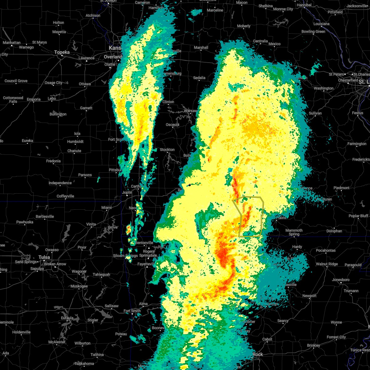 The severe thunderstorm warning for eastern ozark and eastern douglas counties will expire at 930 pm cdt, the storms which prompted the warning have weakened below severe limits, and no longer pose an immediate threat to life or property. therefore, the warning will be allowed to expire. however gusty winds are still possible with these thunderstorms. a severe thunderstorm watch remains in effect until 100 am cdt for south central and southwestern missouri. The severe thunderstorm warning for eastern ozark and eastern douglas counties will expire at 930 pm cdt, the storms which prompted the warning have weakened below severe limits, and no longer pose an immediate threat to life or property. therefore, the warning will be allowed to expire. however gusty winds are still possible with these thunderstorms. a severe thunderstorm watch remains in effect until 100 am cdt for south central and southwestern missouri.
|
| 11/4/2022 9:15 PM CDT |
 At 915 pm cdt, severe thunderstorms were located along a line extending from near mansfield to 17 miles south of norwood to 9 miles northeast of gainesville to near price place, moving northeast at 50 mph (radar indicated). Hazards include 60 mph wind gusts. Expect damage to roofs, siding, and trees. locations impacted include, norfork lake, bryant creek state park, gainesville, bakersfield, brixey, brushyknob, tecumseh, udall, gentryville, hardenville, sycamore, vanzant, dora, rockbridge, drury and zanoni. hail threat, radar indicated max hail size, <. 75 in wind threat, radar indicated max wind gust, 60 mph. At 915 pm cdt, severe thunderstorms were located along a line extending from near mansfield to 17 miles south of norwood to 9 miles northeast of gainesville to near price place, moving northeast at 50 mph (radar indicated). Hazards include 60 mph wind gusts. Expect damage to roofs, siding, and trees. locations impacted include, norfork lake, bryant creek state park, gainesville, bakersfield, brixey, brushyknob, tecumseh, udall, gentryville, hardenville, sycamore, vanzant, dora, rockbridge, drury and zanoni. hail threat, radar indicated max hail size, <. 75 in wind threat, radar indicated max wind gust, 60 mph.
|
| 11/4/2022 9:06 PM CDT |
 At 906 pm cdt, severe thunderstorms were located along a line extending from near mansfield to 16 miles southeast of ava to near gainesville to near ozark isle, moving northeast at 40 mph (radar indicated). Hazards include 60 mph wind gusts. Expect damage to roofs, siding, and trees. Locations impacted include, bull shoals lake, norfork lake, bryant creek state park, ava, gainesville, bakersfield, theodosia, pontiac, sundown, brixey, willhoit, brushyknob, tecumseh, udall, hardenville, vanzant, zanoni, gentryville, sycamore and dora. At 906 pm cdt, severe thunderstorms were located along a line extending from near mansfield to 16 miles southeast of ava to near gainesville to near ozark isle, moving northeast at 40 mph (radar indicated). Hazards include 60 mph wind gusts. Expect damage to roofs, siding, and trees. Locations impacted include, bull shoals lake, norfork lake, bryant creek state park, ava, gainesville, bakersfield, theodosia, pontiac, sundown, brixey, willhoit, brushyknob, tecumseh, udall, hardenville, vanzant, zanoni, gentryville, sycamore and dora.
|
| 11/4/2022 8:49 PM CDT |
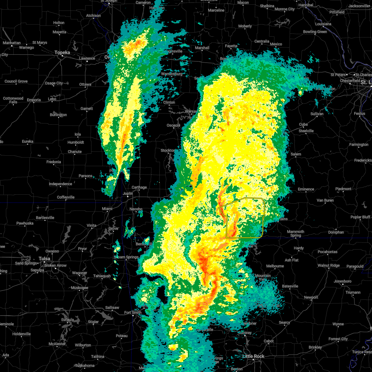 At 848 pm cdt, severe thunderstorms were located along a line extending from 6 miles northwest of ava to 21 miles south of mansfield to 7 miles west of gainesville to near lakeway, moving northeast at 55 mph (radar indicated). Hazards include 60 mph wind gusts. Expect damage to roofs, siding, and trees. Locations impacted include, bull shoals lake, norfork lake, bryant creek state park, ava, gainesville, bakersfield, theodosia, pontiac, wasola, sundown, brixey, willhoit, brushyknob, tecumseh, udall, hardenville, thornfield, rome, vanzant and squires. At 848 pm cdt, severe thunderstorms were located along a line extending from 6 miles northwest of ava to 21 miles south of mansfield to 7 miles west of gainesville to near lakeway, moving northeast at 55 mph (radar indicated). Hazards include 60 mph wind gusts. Expect damage to roofs, siding, and trees. Locations impacted include, bull shoals lake, norfork lake, bryant creek state park, ava, gainesville, bakersfield, theodosia, pontiac, wasola, sundown, brixey, willhoit, brushyknob, tecumseh, udall, hardenville, thornfield, rome, vanzant and squires.
|
| 11/4/2022 8:23 PM CDT |
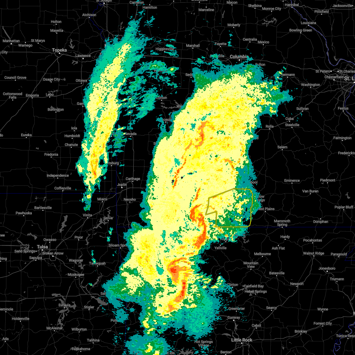 At 823 pm cdt, severe thunderstorms were located along a line extending from near taneyville to 9 miles north of diamond city to lead hill to near valley springs, moving northeast at 55 mph (radar indicated). Hazards include 60 mph wind gusts. expect damage to roofs, siding, and trees At 823 pm cdt, severe thunderstorms were located along a line extending from near taneyville to 9 miles north of diamond city to lead hill to near valley springs, moving northeast at 55 mph (radar indicated). Hazards include 60 mph wind gusts. expect damage to roofs, siding, and trees
|
| 4/15/2022 8:15 PM CDT |
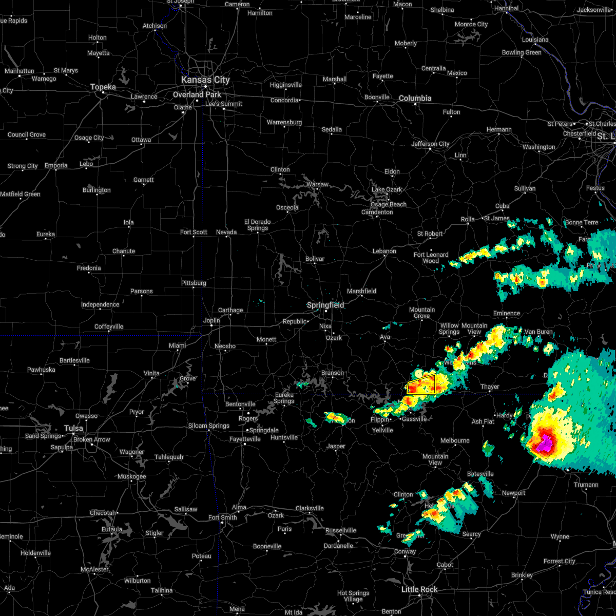 At 815 pm cdt, a severe thunderstorm was located near gainesville, or 15 miles north of mountain home, moving east at 45 mph (radar indicated). Hazards include 60 mph wind gusts and quarter size hail. Hail damage to vehicles is expected. expect wind damage to roofs, siding, and trees. locations impacted include, norfork lake, gainesville, bakersfield, hardenville, udall, tecumseh, hail threat, radar indicated max hail size, 1. 00 in wind threat, radar indicated max wind gust, 60 mph. At 815 pm cdt, a severe thunderstorm was located near gainesville, or 15 miles north of mountain home, moving east at 45 mph (radar indicated). Hazards include 60 mph wind gusts and quarter size hail. Hail damage to vehicles is expected. expect wind damage to roofs, siding, and trees. locations impacted include, norfork lake, gainesville, bakersfield, hardenville, udall, tecumseh, hail threat, radar indicated max hail size, 1. 00 in wind threat, radar indicated max wind gust, 60 mph.
|
| 4/15/2022 8:03 PM CDT |
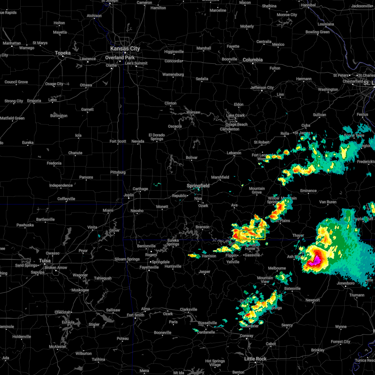 At 803 pm cdt, a severe thunderstorm was located near price place, or 12 miles north of bull shoals, moving east at 35 mph (radar indicated). Hazards include 60 mph wind gusts and quarter size hail. Hail damage to vehicles is expected. expect wind damage to roofs, siding, and trees. locations impacted include, norfork lake, gainesville, bakersfield, hardenville, udall, tecumseh, hail threat, radar indicated max hail size, 1. 00 in wind threat, radar indicated max wind gust, 60 mph. At 803 pm cdt, a severe thunderstorm was located near price place, or 12 miles north of bull shoals, moving east at 35 mph (radar indicated). Hazards include 60 mph wind gusts and quarter size hail. Hail damage to vehicles is expected. expect wind damage to roofs, siding, and trees. locations impacted include, norfork lake, gainesville, bakersfield, hardenville, udall, tecumseh, hail threat, radar indicated max hail size, 1. 00 in wind threat, radar indicated max wind gust, 60 mph.
|
| 4/15/2022 7:43 PM CDT |
 At 743 pm cdt, a severe thunderstorm was located 7 miles northwest of price place, or 13 miles northwest of bull shoals, moving east at 45 mph (radar indicated). Hazards include 60 mph wind gusts and quarter size hail. Hail damage to vehicles is expected. Expect wind damage to roofs, siding, and trees. At 743 pm cdt, a severe thunderstorm was located 7 miles northwest of price place, or 13 miles northwest of bull shoals, moving east at 45 mph (radar indicated). Hazards include 60 mph wind gusts and quarter size hail. Hail damage to vehicles is expected. Expect wind damage to roofs, siding, and trees.
|
| 4/15/2022 6:51 PM CDT |
 At 651 pm cdt, a severe thunderstorm was located over ott, or 16 miles northwest of salem in fulton county, moving east at 55 mph (radar indicated). Hazards include 60 mph wind gusts and half dollar size hail. Hail damage to vehicles is expected. expect wind damage to roofs, siding, and trees. locations impacted include, bakersfield, south fork, brandsville, lanton, moody, caulfield, hail threat, radar indicated max hail size, 1. 25 in wind threat, radar indicated max wind gust, 60 mph. At 651 pm cdt, a severe thunderstorm was located over ott, or 16 miles northwest of salem in fulton county, moving east at 55 mph (radar indicated). Hazards include 60 mph wind gusts and half dollar size hail. Hail damage to vehicles is expected. expect wind damage to roofs, siding, and trees. locations impacted include, bakersfield, south fork, brandsville, lanton, moody, caulfield, hail threat, radar indicated max hail size, 1. 25 in wind threat, radar indicated max wind gust, 60 mph.
|
| 4/15/2022 6:45 PM CDT | Quarter sized hail reported 2.4 miles S of Bakersfield, MO, quarter size hail on highway 101 between caufield and bakersfield. |
| 4/15/2022 6:39 PM CDT |
 At 639 pm cdt, a severe thunderstorm was located 7 miles west of bakersfield, or 14 miles northeast of mountain home, moving east at 55 mph (radar indicated). Hazards include 60 mph wind gusts and half dollar size hail. Hail damage to vehicles is expected. expect wind damage to roofs, siding, and trees. locations impacted include, norfork lake, bakersfield, south fork, brandsville, lanton, hardenville, moody, tecumseh, caulfield, zanoni, udall, hail threat, radar indicated max hail size, 1. 25 in wind threat, radar indicated max wind gust, 60 mph. At 639 pm cdt, a severe thunderstorm was located 7 miles west of bakersfield, or 14 miles northeast of mountain home, moving east at 55 mph (radar indicated). Hazards include 60 mph wind gusts and half dollar size hail. Hail damage to vehicles is expected. expect wind damage to roofs, siding, and trees. locations impacted include, norfork lake, bakersfield, south fork, brandsville, lanton, hardenville, moody, tecumseh, caulfield, zanoni, udall, hail threat, radar indicated max hail size, 1. 25 in wind threat, radar indicated max wind gust, 60 mph.
|
| 4/15/2022 6:28 PM CDT |
 At 628 pm cdt, a severe thunderstorm was located near gainesville, or 12 miles northeast of bull shoals, moving east at 55 mph (radar indicated). Hazards include 60 mph wind gusts and quarter size hail. Hail damage to vehicles is expected. Expect wind damage to roofs, siding, and trees. At 628 pm cdt, a severe thunderstorm was located near gainesville, or 12 miles northeast of bull shoals, moving east at 55 mph (radar indicated). Hazards include 60 mph wind gusts and quarter size hail. Hail damage to vehicles is expected. Expect wind damage to roofs, siding, and trees.
|
| 4/13/2022 11:28 AM CDT |
 At 1128 am cdt, severe thunderstorms were located along a line extending from near mountain view to near ott, moving northeast at 60 mph (radar indicated). Hazards include 60 mph wind gusts. expect damage to roofs, siding, and trees At 1128 am cdt, severe thunderstorms were located along a line extending from near mountain view to near ott, moving northeast at 60 mph (radar indicated). Hazards include 60 mph wind gusts. expect damage to roofs, siding, and trees
|
| 3/30/2022 9:31 AM CDT |
 At 930 am cdt, a severe thunderstorm was located over gainesville, or 18 miles north of mountain home, moving northeast at 50 mph. another severe thunderstorm is located near bull shoals and may move into the warned area (radar indicated). Hazards include 60 mph wind gusts. Expect damage to roofs, siding, and trees. Locations impacted include, bull shoals lake, norfork lake, gainesville, bakersfield, theodosia, pontiac, sundown, brixey, noble, willhoit, tecumseh, udall, hardenville, sycamore, dora, rockbridge, isabella, zanoni,. At 930 am cdt, a severe thunderstorm was located over gainesville, or 18 miles north of mountain home, moving northeast at 50 mph. another severe thunderstorm is located near bull shoals and may move into the warned area (radar indicated). Hazards include 60 mph wind gusts. Expect damage to roofs, siding, and trees. Locations impacted include, bull shoals lake, norfork lake, gainesville, bakersfield, theodosia, pontiac, sundown, brixey, noble, willhoit, tecumseh, udall, hardenville, sycamore, dora, rockbridge, isabella, zanoni,.
|
| 3/30/2022 9:15 AM CDT |
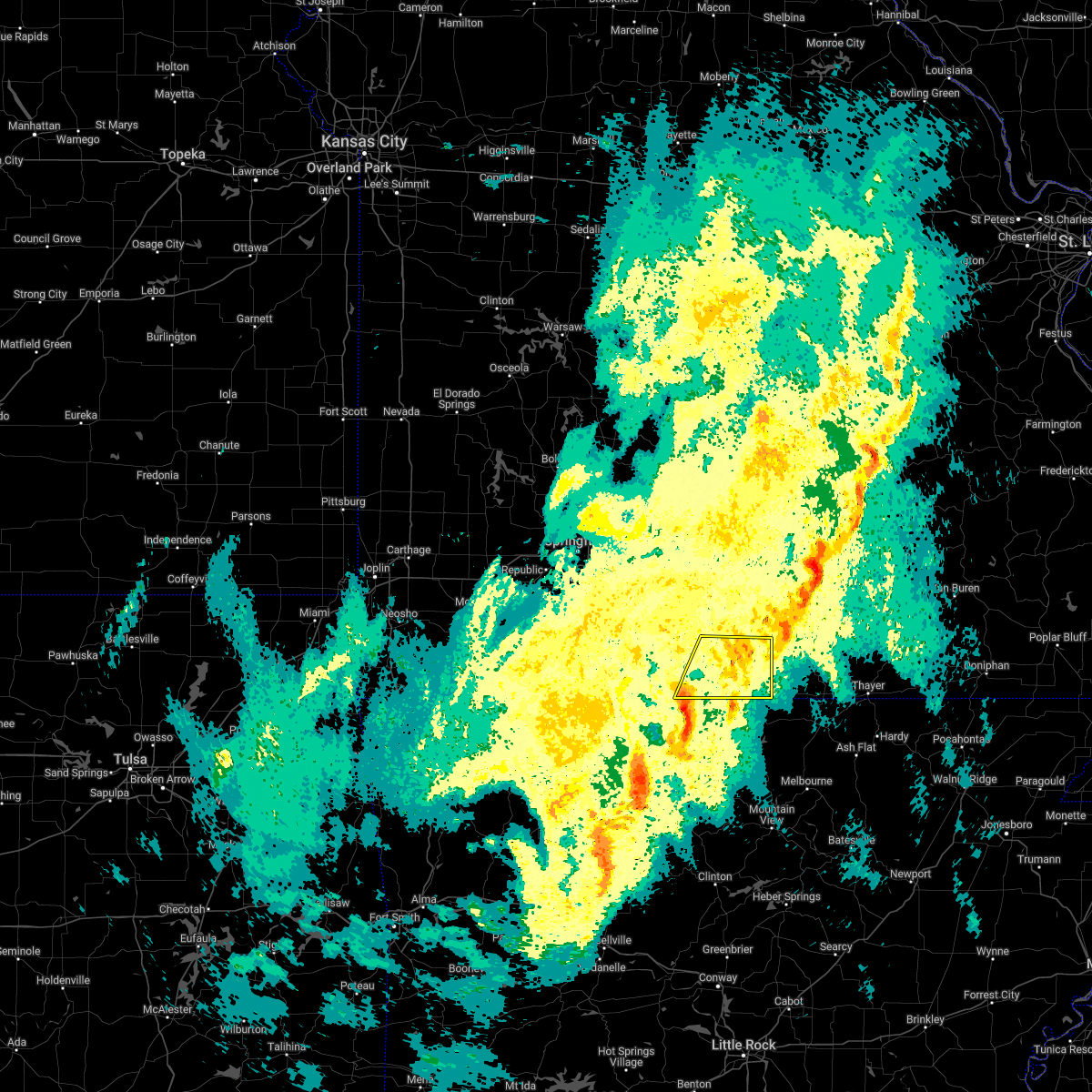 At 914 am cdt, a severe thunderstorm was located near price place, or near bull shoals, moving northeast at 50 mph (radar indicated). Hazards include 60 mph wind gusts. expect damage to roofs, siding, and trees At 914 am cdt, a severe thunderstorm was located near price place, or near bull shoals, moving northeast at 50 mph (radar indicated). Hazards include 60 mph wind gusts. expect damage to roofs, siding, and trees
|
| 3/18/2022 7:10 AM CDT |
 The severe thunderstorm warning for eastern ozark, eastern douglas and western texas counties will expire at 715 am cdt, the storms which prompted the warning have weakened below severe limits, and no longer pose an immediate threat to life or property. therefore, the warning will be allowed to expire. however small hail and gusty winds are still possible with these thunderstorms. The severe thunderstorm warning for eastern ozark, eastern douglas and western texas counties will expire at 715 am cdt, the storms which prompted the warning have weakened below severe limits, and no longer pose an immediate threat to life or property. therefore, the warning will be allowed to expire. however small hail and gusty winds are still possible with these thunderstorms.
|
| 3/18/2022 7:03 AM CDT |
 At 702 am cdt, severe thunderstorms were located along a line extending from 14 miles southwest of fort leonard wood to 13 miles northwest of cabool to 6 miles south of mountain grove to near gainesville, moving northeast at 25 mph (radar indicated). Hazards include 60 mph wind gusts and nickel size hail. Expect damage to roofs, siding, and trees. locations impacted include, mountain grove, cabool, gainesville, bakersfield, huggins, plato, tecumseh, bucyrus, udall, success, hardenville, roby, sycamore, vanzant, dora, drury, zanoni, bendavis, hail threat, radar indicated max hail size, 0. 88 in wind threat, radar indicated max wind gust, 60 mph. At 702 am cdt, severe thunderstorms were located along a line extending from 14 miles southwest of fort leonard wood to 13 miles northwest of cabool to 6 miles south of mountain grove to near gainesville, moving northeast at 25 mph (radar indicated). Hazards include 60 mph wind gusts and nickel size hail. Expect damage to roofs, siding, and trees. locations impacted include, mountain grove, cabool, gainesville, bakersfield, huggins, plato, tecumseh, bucyrus, udall, success, hardenville, roby, sycamore, vanzant, dora, drury, zanoni, bendavis, hail threat, radar indicated max hail size, 0. 88 in wind threat, radar indicated max wind gust, 60 mph.
|
| 3/18/2022 6:29 AM CDT |
 At 628 am cdt, severe thunderstorms were located along a line extending from 14 miles east of niangua to near hartville to 8 miles east of ava to near price place, moving northeast at 25 mph (radar indicated). Hazards include 60 mph wind gusts and nickel size hail. expect damage to roofs, siding, and trees At 628 am cdt, severe thunderstorms were located along a line extending from 14 miles east of niangua to near hartville to 8 miles east of ava to near price place, moving northeast at 25 mph (radar indicated). Hazards include 60 mph wind gusts and nickel size hail. expect damage to roofs, siding, and trees
|
| 3/6/2022 10:23 PM CST |
 The tornado warning for southeastern ozark county will expire at 1030 pm cst, the storm which prompted the warning has weakened below severe limits, and has exited the warned area. therefore, the warning will be allowed to expire. a tornado watch remains in effect until 200 am cst for south central and southwestern missouri. The tornado warning for southeastern ozark county will expire at 1030 pm cst, the storm which prompted the warning has weakened below severe limits, and has exited the warned area. therefore, the warning will be allowed to expire. a tornado watch remains in effect until 200 am cst for south central and southwestern missouri.
|
| 3/6/2022 10:07 PM CST |
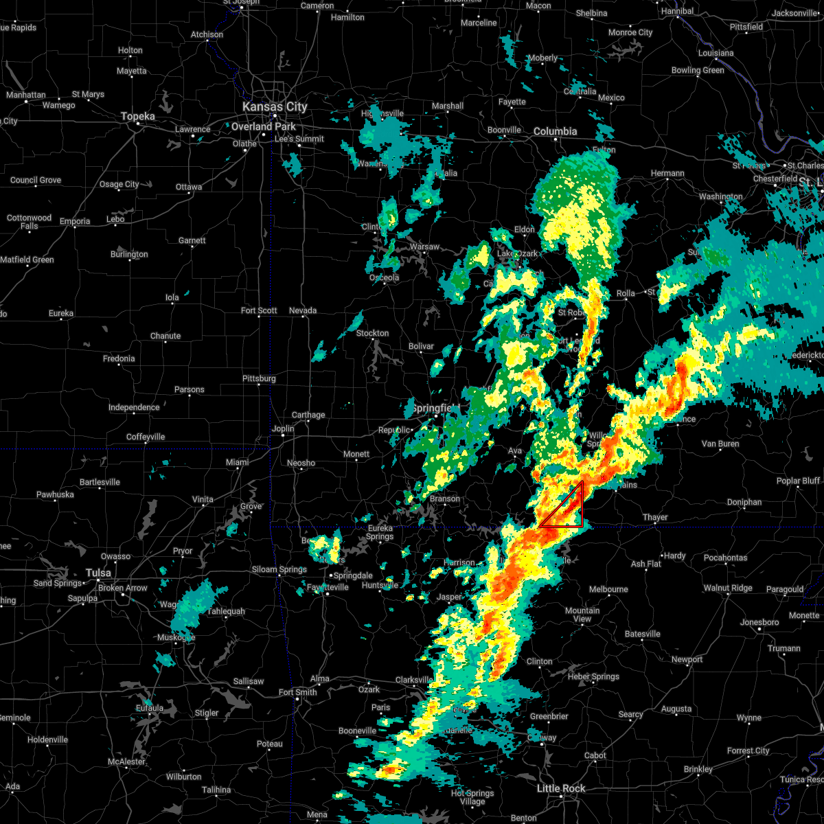 At 1006 pm cst, a severe thunderstorm capable of producing a tornado was located near fawn park, or 10 miles north of mountain home, moving northeast at 50 mph (radar indicated rotation). Hazards include tornado. Flying debris will be dangerous to those caught without shelter. mobile homes will be damaged or destroyed. damage to roofs, windows, and vehicles will occur. tree damage is likely. Locations impacted include, norfork lake, bakersfield, udall, tecumseh,. At 1006 pm cst, a severe thunderstorm capable of producing a tornado was located near fawn park, or 10 miles north of mountain home, moving northeast at 50 mph (radar indicated rotation). Hazards include tornado. Flying debris will be dangerous to those caught without shelter. mobile homes will be damaged or destroyed. damage to roofs, windows, and vehicles will occur. tree damage is likely. Locations impacted include, norfork lake, bakersfield, udall, tecumseh,.
|
| 3/6/2022 9:50 PM CST |
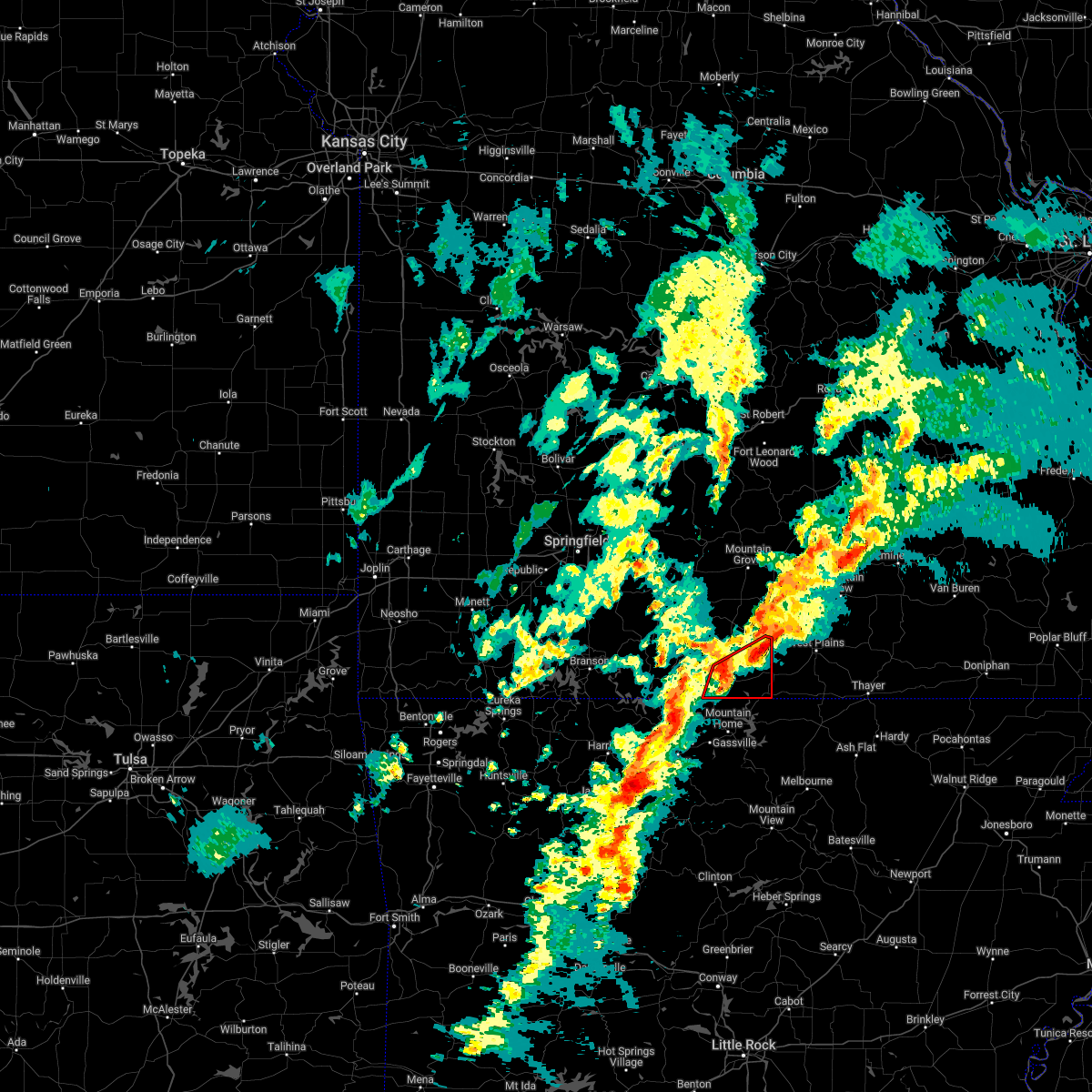 At 950 pm cst, a severe thunderstorm capable of producing a tornado was located near gainesville, or 17 miles north of mountain home, moving northeast at 40 mph (radar indicated rotation). Hazards include tornado. Flying debris will be dangerous to those caught without shelter. mobile homes will be damaged or destroyed. damage to roofs, windows, and vehicles will occur. Tree damage is likely. At 950 pm cst, a severe thunderstorm capable of producing a tornado was located near gainesville, or 17 miles north of mountain home, moving northeast at 40 mph (radar indicated rotation). Hazards include tornado. Flying debris will be dangerous to those caught without shelter. mobile homes will be damaged or destroyed. damage to roofs, windows, and vehicles will occur. Tree damage is likely.
|
| 3/6/2022 9:33 PM CST |
 At 933 pm cst, severe thunderstorms were located along a line extending from 11 miles west of willow springs to 17 miles northeast of gainesville to near price place, moving east at 60 mph (radar indicated). Hazards include 60 mph wind gusts and penny size hail. expect damage to roofs, siding, and trees At 933 pm cst, severe thunderstorms were located along a line extending from 11 miles west of willow springs to 17 miles northeast of gainesville to near price place, moving east at 60 mph (radar indicated). Hazards include 60 mph wind gusts and penny size hail. expect damage to roofs, siding, and trees
|
| 3/6/2022 9:28 PM CST |
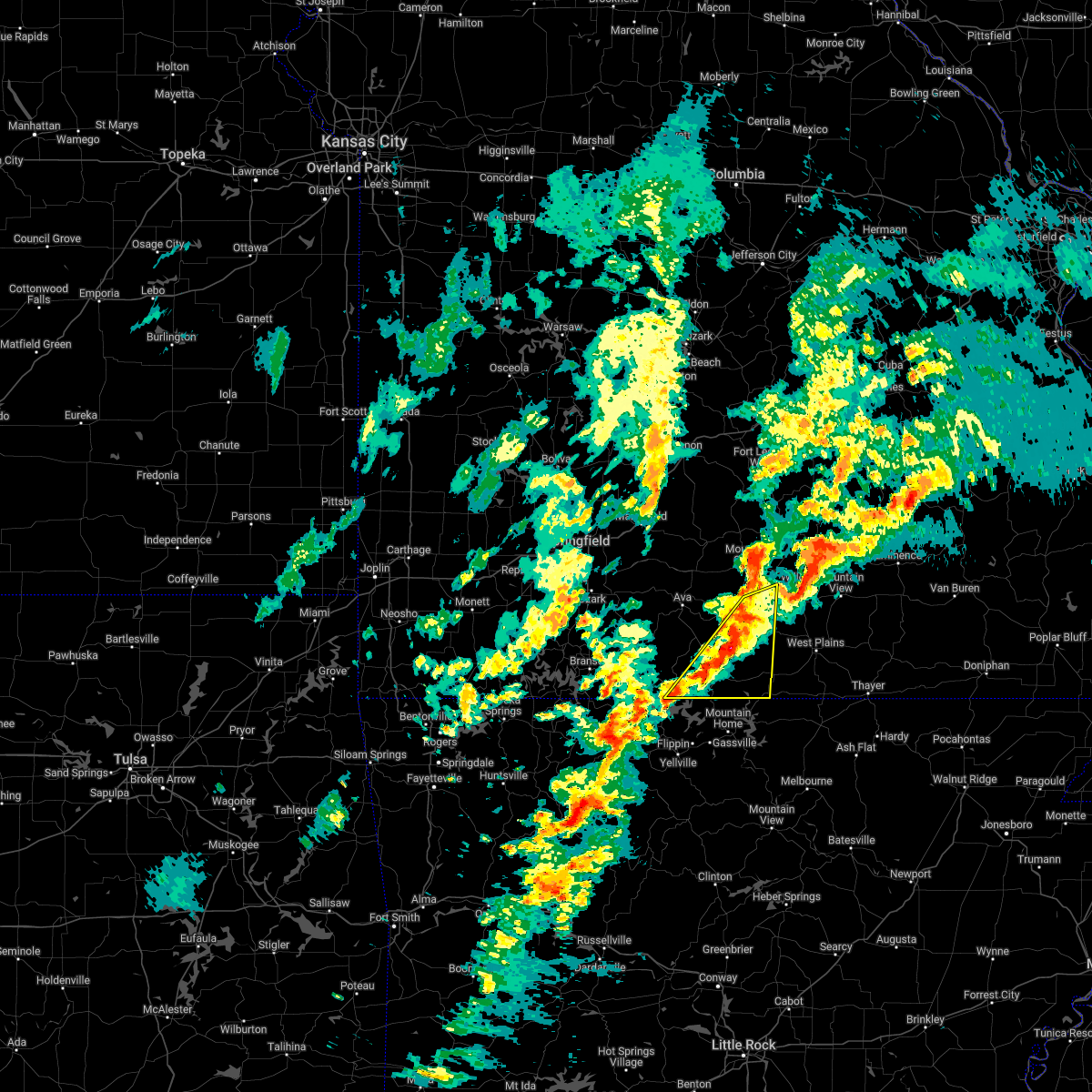 At 927 pm cst, severe thunderstorms were located along a line extending from 21 miles north of bakersfield to near gainesville to near ozark isle, moving east at 50 mph (radar indicated). Hazards include 60 mph wind gusts and penny size hail. Expect damage to roofs, siding, and trees. Locations impacted include, bull shoals lake, norfork lake, gainesville, bakersfield, theodosia, pontiac, sundown, brixey, willhoit, tecumseh, udall, gentryville, hardenville, sycamore, vanzant, dora, rockbridge, isabella, drury, zanoni,. At 927 pm cst, severe thunderstorms were located along a line extending from 21 miles north of bakersfield to near gainesville to near ozark isle, moving east at 50 mph (radar indicated). Hazards include 60 mph wind gusts and penny size hail. Expect damage to roofs, siding, and trees. Locations impacted include, bull shoals lake, norfork lake, gainesville, bakersfield, theodosia, pontiac, sundown, brixey, willhoit, tecumseh, udall, gentryville, hardenville, sycamore, vanzant, dora, rockbridge, isabella, drury, zanoni,.
|
| 3/6/2022 9:04 PM CST |
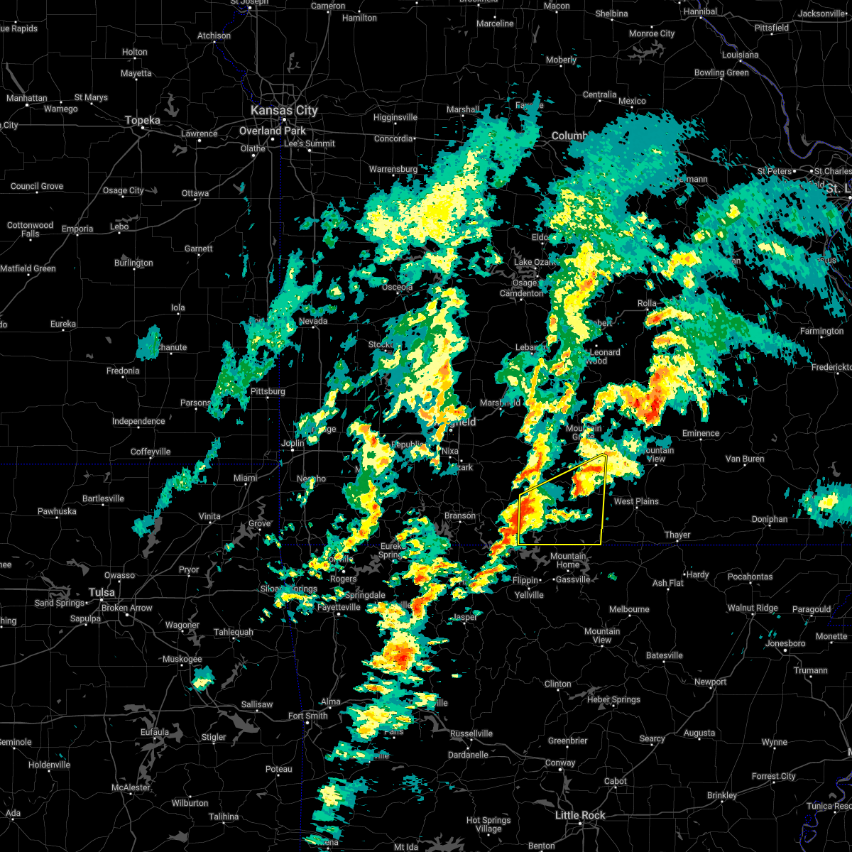 At 903 pm cst, severe thunderstorms were located along a line extending from 14 miles south of ava to 11 miles northwest of price place to 8 miles northeast of diamond city, moving east at 45 mph (radar indicated). Hazards include 60 mph wind gusts and penny size hail. expect damage to roofs, siding, and trees At 903 pm cst, severe thunderstorms were located along a line extending from 14 miles south of ava to 11 miles northwest of price place to 8 miles northeast of diamond city, moving east at 45 mph (radar indicated). Hazards include 60 mph wind gusts and penny size hail. expect damage to roofs, siding, and trees
|
| 10/24/2021 10:11 PM CDT |
 The severe thunderstorm warning for eastern ozark, southwestern shannon, howell and western oregon counties will expire at 1015 pm cdt, the storms which prompted the warning have weakened below severe limits, and no longer pose an immediate threat to life or property. therefore, the warning will be allowed to expire. however small hail and gusty winds are still possible with these thunderstorms. a tornado watch remains in effect until 1100 pm cdt for south central and southwestern missouri, and southwestern missouri. The severe thunderstorm warning for eastern ozark, southwestern shannon, howell and western oregon counties will expire at 1015 pm cdt, the storms which prompted the warning have weakened below severe limits, and no longer pose an immediate threat to life or property. therefore, the warning will be allowed to expire. however small hail and gusty winds are still possible with these thunderstorms. a tornado watch remains in effect until 1100 pm cdt for south central and southwestern missouri, and southwestern missouri.
|
| 10/24/2021 9:18 PM CDT |
 At 917 pm cdt, severe thunderstorms were located along a line extending from near willow springs to near price place, moving east at 40 mph (radar indicated). Hazards include 60 mph wind gusts. expect damage to roofs, siding, and trees At 917 pm cdt, severe thunderstorms were located along a line extending from near willow springs to near price place, moving east at 40 mph (radar indicated). Hazards include 60 mph wind gusts. expect damage to roofs, siding, and trees
|
| 10/24/2021 9:06 PM CDT |
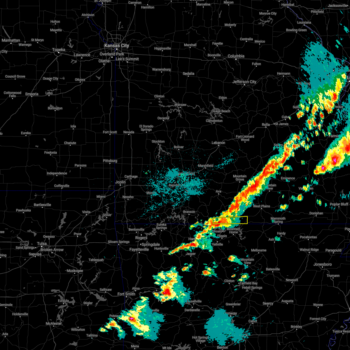 At 906 pm cdt, a severe thunderstorm was located over price place, or 10 miles north of bull shoals, moving east at 40 mph (radar indicated). Hazards include 60 mph wind gusts and quarter size hail. Hail damage to vehicles is expected. expect wind damage to roofs, siding, and trees. Locations impacted include, bull shoals lake, norfork lake, gainesville, bakersfield, theodosia, pontiac, sundown, hardenville, tecumseh, isabella, udall,. At 906 pm cdt, a severe thunderstorm was located over price place, or 10 miles north of bull shoals, moving east at 40 mph (radar indicated). Hazards include 60 mph wind gusts and quarter size hail. Hail damage to vehicles is expected. expect wind damage to roofs, siding, and trees. Locations impacted include, bull shoals lake, norfork lake, gainesville, bakersfield, theodosia, pontiac, sundown, hardenville, tecumseh, isabella, udall,.
|
| 10/24/2021 8:50 PM CDT |
 At 850 pm cdt, a severe thunderstorm was located near diamond city, or 16 miles northwest of bull shoals, moving east at 45 mph (radar indicated). Hazards include 60 mph wind gusts and half dollar size hail. Hail damage to vehicles is expected. Expect wind damage to roofs, siding, and trees. At 850 pm cdt, a severe thunderstorm was located near diamond city, or 16 miles northwest of bull shoals, moving east at 45 mph (radar indicated). Hazards include 60 mph wind gusts and half dollar size hail. Hail damage to vehicles is expected. Expect wind damage to roofs, siding, and trees.
|
| 7/31/2021 9:36 PM CDT |
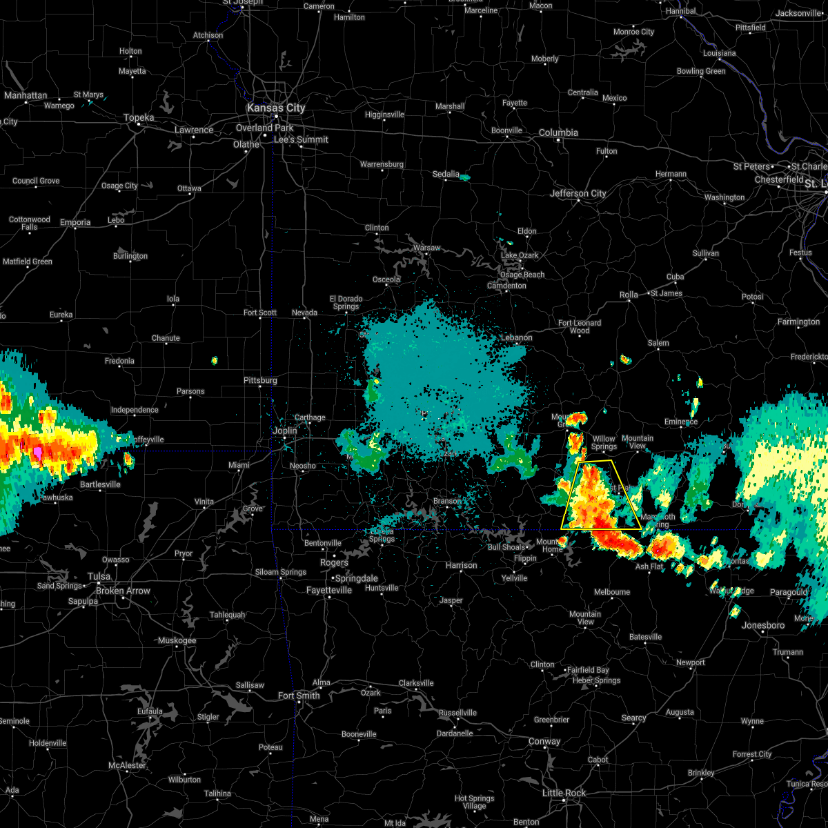 At 935 pm cdt, severe thunderstorms were located along a line extending from 8 miles west of thayer to near arkawana, moving southeast at 30 mph (trained weather spotters. tree down over road across highway 95 southbound one mile from the highway 5 intersection). Hazards include 60 mph wind gusts and penny size hail. Expect damage to roofs, siding, and trees. Locations impacted include, west plains, norfork lake, pomona, bakersfield, south fork, lanton, siloam springs, moody, dora, pottersville, caulfield, udall,. At 935 pm cdt, severe thunderstorms were located along a line extending from 8 miles west of thayer to near arkawana, moving southeast at 30 mph (trained weather spotters. tree down over road across highway 95 southbound one mile from the highway 5 intersection). Hazards include 60 mph wind gusts and penny size hail. Expect damage to roofs, siding, and trees. Locations impacted include, west plains, norfork lake, pomona, bakersfield, south fork, lanton, siloam springs, moody, dora, pottersville, caulfield, udall,.
|
| 7/31/2021 9:05 PM CDT |
 At 905 pm cdt, severe thunderstorms were located along a line extending from near west plains to 9 miles north of price place, moving southeast at 30 mph (radar indicated). Hazards include 60 mph wind gusts and penny size hail. expect damage to roofs, siding, and trees At 905 pm cdt, severe thunderstorms were located along a line extending from near west plains to 9 miles north of price place, moving southeast at 30 mph (radar indicated). Hazards include 60 mph wind gusts and penny size hail. expect damage to roofs, siding, and trees
|
| 6/11/2021 9:19 PM CDT | 2 trees down on hwy o between udall and bakersfield near county road 551. one completely blocking. time based on rada in ozark county MO, 5.1 miles ESE of Bakersfield, MO |
| 4/28/2021 10:21 AM CDT |
 At 1021 am cdt, severe thunderstorms were located along a line extending from 6 miles south of seymour to 9 miles south of ava to 12 miles northwest of price place to 8 miles northwest of ozark isle, moving northeast at 45 mph (radar indicated). Hazards include 60 mph wind gusts and penny size hail. expect damage to roofs, siding, and trees At 1021 am cdt, severe thunderstorms were located along a line extending from 6 miles south of seymour to 9 miles south of ava to 12 miles northwest of price place to 8 miles northwest of ozark isle, moving northeast at 45 mph (radar indicated). Hazards include 60 mph wind gusts and penny size hail. expect damage to roofs, siding, and trees
|
| 4/9/2021 3:41 PM CDT |
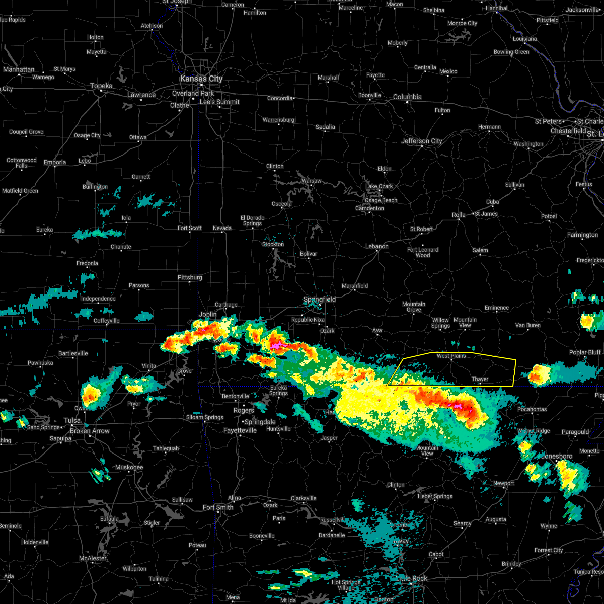 At 340 pm cdt, severe thunderstorms were located along a line extending from gamaliel landing to near salem in fulton county to ballard, moving north at 35 mph (radar indicated). Hazards include 60 mph wind gusts and half dollar size hail. Hail damage to vehicles is expected. Expect wind damage to roofs, siding, and trees. At 340 pm cdt, severe thunderstorms were located along a line extending from gamaliel landing to near salem in fulton county to ballard, moving north at 35 mph (radar indicated). Hazards include 60 mph wind gusts and half dollar size hail. Hail damage to vehicles is expected. Expect wind damage to roofs, siding, and trees.
|
| 7/1/2020 12:00 PM CDT |
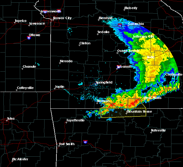 At 1200 pm cdt, severe thunderstorms were located along a line extending from 7 miles northeast of diamond city to near bakersfield to near west plains, moving southeast at 30 mph (radar indicated). Hazards include 60 mph wind gusts and quarter size hail. Hail damage to vehicles is expected. Expect wind damage to roofs, siding, and trees. At 1200 pm cdt, severe thunderstorms were located along a line extending from 7 miles northeast of diamond city to near bakersfield to near west plains, moving southeast at 30 mph (radar indicated). Hazards include 60 mph wind gusts and quarter size hail. Hail damage to vehicles is expected. Expect wind damage to roofs, siding, and trees.
|
| 7/1/2020 11:51 AM CDT |
 At 1151 am cdt, a severe thunderstorm was located near bakersfield, or 19 miles southwest of west plains, moving southeast at 50 mph (radar indicated). Hazards include 60 mph wind gusts and quarter size hail. Hail damage to vehicles is expected. expect wind damage to roofs, siding, and trees. Locations impacted include, norfork lake, bakersfield, south fork, moody, sycamore, tecumseh, dora, pottersville, caulfield, udall,. At 1151 am cdt, a severe thunderstorm was located near bakersfield, or 19 miles southwest of west plains, moving southeast at 50 mph (radar indicated). Hazards include 60 mph wind gusts and quarter size hail. Hail damage to vehicles is expected. expect wind damage to roofs, siding, and trees. Locations impacted include, norfork lake, bakersfield, south fork, moody, sycamore, tecumseh, dora, pottersville, caulfield, udall,.
|
| 7/1/2020 11:42 AM CDT |
 At 1142 am cdt, a severe thunderstorm was located 11 miles northwest of bakersfield, or 21 miles west of west plains, moving southeast at 45 mph (radar indicated). Hazards include 60 mph wind gusts and quarter size hail. Hail damage to vehicles is expected. expect wind damage to roofs, siding, and trees. Locations impacted include, norfork lake, gainesville, bakersfield, south fork, brixey, tecumseh, pottersville, caulfield, udall, hardenville, moody, sycamore, dora, zanoni,. At 1142 am cdt, a severe thunderstorm was located 11 miles northwest of bakersfield, or 21 miles west of west plains, moving southeast at 45 mph (radar indicated). Hazards include 60 mph wind gusts and quarter size hail. Hail damage to vehicles is expected. expect wind damage to roofs, siding, and trees. Locations impacted include, norfork lake, gainesville, bakersfield, south fork, brixey, tecumseh, pottersville, caulfield, udall, hardenville, moody, sycamore, dora, zanoni,.
|
| 7/1/2020 11:20 AM CDT |
 At 1120 am cdt, a severe thunderstorm was located 16 miles north of gainesville, or 20 miles southeast of ava, moving southeast at 40 mph (radar indicated). Hazards include 60 mph wind gusts and quarter size hail. Hail damage to vehicles is expected. Expect wind damage to roofs, siding, and trees. At 1120 am cdt, a severe thunderstorm was located 16 miles north of gainesville, or 20 miles southeast of ava, moving southeast at 40 mph (radar indicated). Hazards include 60 mph wind gusts and quarter size hail. Hail damage to vehicles is expected. Expect wind damage to roofs, siding, and trees.
|
| 6/3/2020 3:06 PM CDT |
 At 306 pm cdt, a severe thunderstorm was located 11 miles northeast of gainesville, or 22 miles west of west plains, moving east at 25 mph (radar indicated). Hazards include 60 mph wind gusts and quarter size hail. Hail damage to vehicles is expected. Expect wind damage to roofs, siding, and trees. At 306 pm cdt, a severe thunderstorm was located 11 miles northeast of gainesville, or 22 miles west of west plains, moving east at 25 mph (radar indicated). Hazards include 60 mph wind gusts and quarter size hail. Hail damage to vehicles is expected. Expect wind damage to roofs, siding, and trees.
|
| 5/22/2020 12:20 PM CDT |
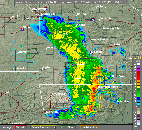 The severe thunderstorm warning for ozark county will expire at 1230 pm cdt, the storm which prompted the warning has weakened below severe limits, and no longer poses an immediate threat to life or property. therefore, the warning will be allowed to expire. however small hail and gusty winds are still possible with this thunderstorm. The severe thunderstorm warning for ozark county will expire at 1230 pm cdt, the storm which prompted the warning has weakened below severe limits, and no longer poses an immediate threat to life or property. therefore, the warning will be allowed to expire. however small hail and gusty winds are still possible with this thunderstorm.
|
| 5/22/2020 12:07 PM CDT |
 At 1207 pm cdt, a severe thunderstorm was located near price place, or 13 miles north of bull shoals, moving east at 50 mph (radar indicated). Hazards include 60 mph wind gusts and quarter size hail. Hail damage to vehicles is expected. Expect wind damage to roofs, siding, and trees. At 1207 pm cdt, a severe thunderstorm was located near price place, or 13 miles north of bull shoals, moving east at 50 mph (radar indicated). Hazards include 60 mph wind gusts and quarter size hail. Hail damage to vehicles is expected. Expect wind damage to roofs, siding, and trees.
|
| 5/3/2020 12:13 PM CDT |
 The severe thunderstorm warning for southern ozark county will expire at 1215 pm cdt, the storm which prompted the warning has moved out of the area. therefore, the warning will be allowed to expire. a severe thunderstorm watch remains in effect until 400 pm cdt for south central and southwestern missouri. The severe thunderstorm warning for southern ozark county will expire at 1215 pm cdt, the storm which prompted the warning has moved out of the area. therefore, the warning will be allowed to expire. a severe thunderstorm watch remains in effect until 400 pm cdt for south central and southwestern missouri.
|
| 5/3/2020 12:03 PM CDT |
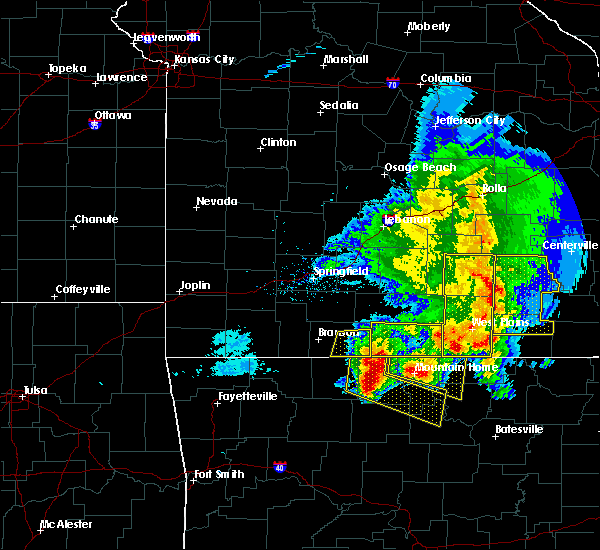 At 1202 pm cdt, a severe thunderstorm was located near price place, or 11 miles north of bull shoals, moving east at 45 mph (radar indicated). Hazards include 60 mph wind gusts and quarter size hail. Hail damage to vehicles is expected. expect wind damage to roofs, siding, and trees. Locations impacted include, bull shoals lake, norfork lake, gainesville, bakersfield, theodosia, pontiac, sundown, hardenville, tecumseh, isabella, udall,. At 1202 pm cdt, a severe thunderstorm was located near price place, or 11 miles north of bull shoals, moving east at 45 mph (radar indicated). Hazards include 60 mph wind gusts and quarter size hail. Hail damage to vehicles is expected. expect wind damage to roofs, siding, and trees. Locations impacted include, bull shoals lake, norfork lake, gainesville, bakersfield, theodosia, pontiac, sundown, hardenville, tecumseh, isabella, udall,.
|
| 5/3/2020 11:53 AM CDT | Golf Ball sized hail reported 6.7 miles SSW of Bakersfield, MO |
| 5/3/2020 11:45 AM CDT | Half Dollar sized hail reported 4.2 miles SSW of Bakersfield, MO |
| 5/3/2020 11:30 AM CDT |
 At 1130 am cdt, a severe thunderstorm was located near gainesville, or 20 miles north of mountain home and near thornfield, moving east at 45 mph (radar indicated). Hazards include 60 mph wind gusts and quarter size hail. Hail damage to vehicles is expected. Expect wind damage to roofs, siding, and trees. At 1130 am cdt, a severe thunderstorm was located near gainesville, or 20 miles north of mountain home and near thornfield, moving east at 45 mph (radar indicated). Hazards include 60 mph wind gusts and quarter size hail. Hail damage to vehicles is expected. Expect wind damage to roofs, siding, and trees.
|
| 4/28/2020 8:34 PM CDT |
 At 833 pm cdt, severe thunderstorms were located along a line extending from 12 miles northeast of hartville to 8 miles west of willow springs to 13 miles north of bakersfield to near gainesville, moving east at 55 mph (trained weather spotters). Hazards include 70 mph wind gusts. 65 mph wind gust was reported in mountain grove. Expect considerable tree damage. damage is likely to mobile homes, roofs, and outbuildings. Locations impacted include, west plains, bull shoals lake, mountain grove, licking, mountain view, willow springs, cabool, houston, gainesville, pomona, summersville, raymondville, bakersfield, theodosia, south fork, pontiac, brandsville, huggins, sundown, lanton,. At 833 pm cdt, severe thunderstorms were located along a line extending from 12 miles northeast of hartville to 8 miles west of willow springs to 13 miles north of bakersfield to near gainesville, moving east at 55 mph (trained weather spotters). Hazards include 70 mph wind gusts. 65 mph wind gust was reported in mountain grove. Expect considerable tree damage. damage is likely to mobile homes, roofs, and outbuildings. Locations impacted include, west plains, bull shoals lake, mountain grove, licking, mountain view, willow springs, cabool, houston, gainesville, pomona, summersville, raymondville, bakersfield, theodosia, south fork, pontiac, brandsville, huggins, sundown, lanton,.
|
| 4/28/2020 8:08 PM CDT |
 At 808 pm cdt, severe thunderstorms were located along a line extending from 7 miles north of hartville to near norwood to 13 miles north of gainesville to 8 miles north of price place, moving east at 50 mph (radar indicated). Hazards include 70 mph wind gusts. Expect considerable tree damage. Damage is likely to mobile homes, roofs, and outbuildings. At 808 pm cdt, severe thunderstorms were located along a line extending from 7 miles north of hartville to near norwood to 13 miles north of gainesville to 8 miles north of price place, moving east at 50 mph (radar indicated). Hazards include 70 mph wind gusts. Expect considerable tree damage. Damage is likely to mobile homes, roofs, and outbuildings.
|
| 3/19/2020 7:52 PM CDT |
 At 751 pm cdt, a severe thunderstorm was located over gamaliel landing, or 9 miles northeast of mountain home, moving northeast at 50 mph (radar indicated). Hazards include 60 mph wind gusts and penny size hail. expect damage to roofs, siding, and trees At 751 pm cdt, a severe thunderstorm was located over gamaliel landing, or 9 miles northeast of mountain home, moving northeast at 50 mph (radar indicated). Hazards include 60 mph wind gusts and penny size hail. expect damage to roofs, siding, and trees
|
| 3/2/2020 6:18 PM CST |
 At 617 pm cst, a severe thunderstorms from sycamore to 3 miles south of udall, moving east at 30 mph (radar indicated). Hazards include 60 mph wind gusts and quarter size hail. Hail damage to vehicles is expected. expect wind damage to roofs, siding, and trees. Locations impacted include, norfork lake, bakersfield, dora, sycamore, udall, tecumseh,. At 617 pm cst, a severe thunderstorms from sycamore to 3 miles south of udall, moving east at 30 mph (radar indicated). Hazards include 60 mph wind gusts and quarter size hail. Hail damage to vehicles is expected. expect wind damage to roofs, siding, and trees. Locations impacted include, norfork lake, bakersfield, dora, sycamore, udall, tecumseh,.
|
| 3/2/2020 6:07 PM CST |
 At 607 pm cst, a severe thunderstorm was located near bakersfield, or 19 miles northeast of mountain home, moving northeast at 25 mph (radar indicated). Hazards include 60 mph wind gusts and half dollar size hail. Hail damage to vehicles is expected. expect wind damage to roofs, siding, and trees. Locations impacted include, norfork lake, gainesville, bakersfield, hardenville, sycamore, tecumseh, dora, zanoni, udall,. At 607 pm cst, a severe thunderstorm was located near bakersfield, or 19 miles northeast of mountain home, moving northeast at 25 mph (radar indicated). Hazards include 60 mph wind gusts and half dollar size hail. Hail damage to vehicles is expected. expect wind damage to roofs, siding, and trees. Locations impacted include, norfork lake, gainesville, bakersfield, hardenville, sycamore, tecumseh, dora, zanoni, udall,.
|
| 3/2/2020 6:05 PM CST | Ping Pong Ball sized hail reported 0.5 miles NNW of Bakersfield, MO, 1.5 inch hail in bakersfield. |
| 3/2/2020 5:53 PM CST |
 At 553 pm cst, a severe thunderstorm was located 8 miles southeast of gainesville, or 14 miles north of mountain home, moving east at 25 mph (radar indicated). Hazards include 60 mph wind gusts and half dollar size hail. Hail damage to vehicles is expected. expect wind damage to roofs, siding, and trees. Locations impacted include, norfork lake, gainesville, bakersfield, pontiac, hardenville, sycamore, tecumseh, dora, zanoni, udall,. At 553 pm cst, a severe thunderstorm was located 8 miles southeast of gainesville, or 14 miles north of mountain home, moving east at 25 mph (radar indicated). Hazards include 60 mph wind gusts and half dollar size hail. Hail damage to vehicles is expected. expect wind damage to roofs, siding, and trees. Locations impacted include, norfork lake, gainesville, bakersfield, pontiac, hardenville, sycamore, tecumseh, dora, zanoni, udall,.
|
| 3/2/2020 5:39 PM CST |
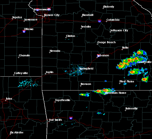 At 537 pm cst, two developing severe thunderstorms were located from pontiac to 7 miles south of gainesville, moving northeast at 25 mph (radar indicated). Hazards include 60 mph wind gusts and quarter size hail. Hail damage to vehicles is expected. Expect wind damage to roofs, siding, and trees. At 537 pm cst, two developing severe thunderstorms were located from pontiac to 7 miles south of gainesville, moving northeast at 25 mph (radar indicated). Hazards include 60 mph wind gusts and quarter size hail. Hail damage to vehicles is expected. Expect wind damage to roofs, siding, and trees.
|
| 1/10/2020 10:56 PM CST |
 The severe thunderstorm warning for southeastern ozark and southern howell counties will expire at 1100 pm cst, the storms which prompted the warning have moved out of the area. therefore, the warning will be allowed to expire. however heavy rain is still possible with these thunderstorms. a tornado watch remains in effect until 200 am cst for south central missouri. The severe thunderstorm warning for southeastern ozark and southern howell counties will expire at 1100 pm cst, the storms which prompted the warning have moved out of the area. therefore, the warning will be allowed to expire. however heavy rain is still possible with these thunderstorms. a tornado watch remains in effect until 200 am cst for south central missouri.
|
| 1/10/2020 10:17 PM CST |
 At 1017 pm cst, a severe thunderstorm capable of producing a tornado was located near gamaliel landing, or 14 miles northeast of mountain home, moving northeast at 55 mph (radar indicated rotation). Hazards include tornado and quarter size hail. Flying debris will be dangerous to those caught without shelter. mobile homes will be damaged or destroyed. damage to roofs, windows, and vehicles will occur. Tree damage is likely. At 1017 pm cst, a severe thunderstorm capable of producing a tornado was located near gamaliel landing, or 14 miles northeast of mountain home, moving northeast at 55 mph (radar indicated rotation). Hazards include tornado and quarter size hail. Flying debris will be dangerous to those caught without shelter. mobile homes will be damaged or destroyed. damage to roofs, windows, and vehicles will occur. Tree damage is likely.
|
| 1/10/2020 10:15 PM CST |
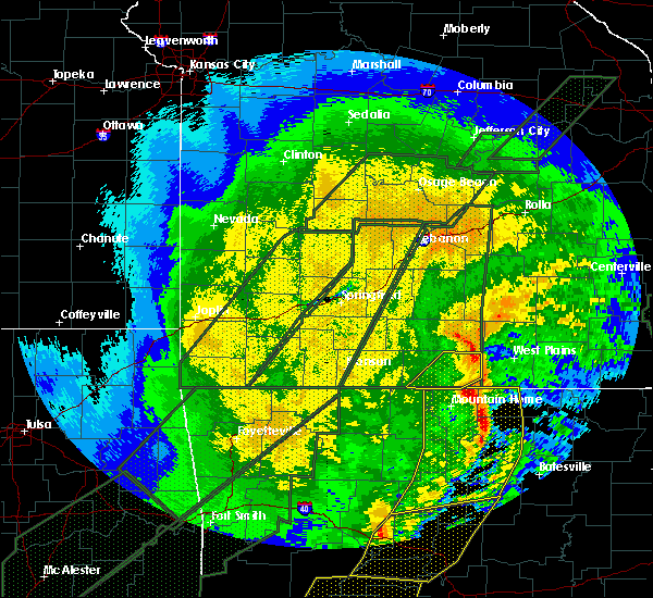 At 1015 pm cst, severe thunderstorms were located along a line extending from near bakersfield to near rodney to gorby, moving northeast at 75 mph (radar indicated). Hazards include 60 mph wind gusts and quarter size hail. Hail damage to vehicles is expected. Expect wind damage to roofs, siding, and trees. At 1015 pm cst, severe thunderstorms were located along a line extending from near bakersfield to near rodney to gorby, moving northeast at 75 mph (radar indicated). Hazards include 60 mph wind gusts and quarter size hail. Hail damage to vehicles is expected. Expect wind damage to roofs, siding, and trees.
|
| 8/27/2019 12:53 AM CDT |
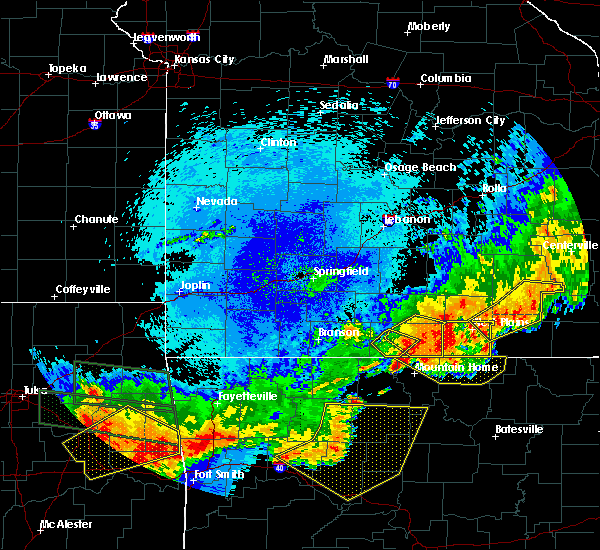 The severe thunderstorm warning for eastern ozark county will expire at 100 am cdt, the storms which prompted the warning have moved out of the area. therefore, the warning will be allowed to expire. a severe thunderstorm watch remains in effect until 600 am cdt for south central and southwestern missouri. The severe thunderstorm warning for eastern ozark county will expire at 100 am cdt, the storms which prompted the warning have moved out of the area. therefore, the warning will be allowed to expire. a severe thunderstorm watch remains in effect until 600 am cdt for south central and southwestern missouri.
|
| 8/27/2019 12:51 AM CDT | Severe thunderstorm wind gusts downed trees along highway 101 near the ozark and howell county lin in ozark county MO, 3.7 miles S of Bakersfield, MO |
| 8/27/2019 12:44 AM CDT |
 At 1244 am cdt, severe thunderstorms were located along a line extending from 15 miles west of west plains to 13 miles north of ott to near bakersfield to 7 miles southeast of gainesville, moving east at 45 mph (radar indicated). Hazards include 70 mph wind gusts and quarter size hail. Hail damage to vehicles is expected. expect considerable tree damage. wind damage is also likely to mobile homes, roofs, and outbuildings. Locations impacted include, norfork lake, bakersfield, hardenville, sycamore, tecumseh, dora, udall,. At 1244 am cdt, severe thunderstorms were located along a line extending from 15 miles west of west plains to 13 miles north of ott to near bakersfield to 7 miles southeast of gainesville, moving east at 45 mph (radar indicated). Hazards include 70 mph wind gusts and quarter size hail. Hail damage to vehicles is expected. expect considerable tree damage. wind damage is also likely to mobile homes, roofs, and outbuildings. Locations impacted include, norfork lake, bakersfield, hardenville, sycamore, tecumseh, dora, udall,.
|
| 8/27/2019 12:27 AM CDT |
 A severe thunderstorm warning remains in effect until 100 am cdt for ozark and southeastern douglas counties. at 1227 am cdt, severe thunderstorms were located along a line extending from 20 miles south of norwood to 18 miles northwest of bakersfield to near gainesville, moving east at 45 mph. hazard. 70 mph wind gusts and quarter size hail. A severe thunderstorm warning remains in effect until 100 am cdt for ozark and southeastern douglas counties. at 1227 am cdt, severe thunderstorms were located along a line extending from 20 miles south of norwood to 18 miles northwest of bakersfield to near gainesville, moving east at 45 mph. hazard. 70 mph wind gusts and quarter size hail.
|
| 8/27/2019 12:19 AM CDT |
 At 1219 am cdt, severe thunderstorms were located along a line extending from 16 miles southeast of ava to 8 miles northwest of gainesville, moving east at 45 mph (radar indicated). Hazards include 70 mph wind gusts. Expect considerable tree damage. Damage is likely to mobile homes, roofs, and outbuildings. At 1219 am cdt, severe thunderstorms were located along a line extending from 16 miles southeast of ava to 8 miles northwest of gainesville, moving east at 45 mph (radar indicated). Hazards include 70 mph wind gusts. Expect considerable tree damage. Damage is likely to mobile homes, roofs, and outbuildings.
|
| 7/5/2019 5:38 PM CDT |
 At 537 pm cdt, a severe thunderstorm was located 7 miles north of gainesville, or 19 miles southeast of ava, moving east at 15 mph (radar indicated). Hazards include 60 mph wind gusts and quarter size hail. Hail damage to vehicles is expected. expect wind damage to roofs, siding, and trees. Locations impacted include, bull shoals lake, norfork lake, gainesville, bakersfield, theodosia, pontiac, wasola, sundown, brixey, noble, willhoit, tecumseh, udall, hardenville, sycamore, dora, rockbridge, isabella, zanoni,. At 537 pm cdt, a severe thunderstorm was located 7 miles north of gainesville, or 19 miles southeast of ava, moving east at 15 mph (radar indicated). Hazards include 60 mph wind gusts and quarter size hail. Hail damage to vehicles is expected. expect wind damage to roofs, siding, and trees. Locations impacted include, bull shoals lake, norfork lake, gainesville, bakersfield, theodosia, pontiac, wasola, sundown, brixey, noble, willhoit, tecumseh, udall, hardenville, sycamore, dora, rockbridge, isabella, zanoni,.
|
| 7/5/2019 5:16 PM CDT |
 At 516 pm cdt, a severe thunderstorm was located 11 miles northwest of gainesville, or 15 miles south of ava, moving east at 15 mph (radar indicated). Hazards include 60 mph wind gusts and quarter size hail. Hail damage to vehicles is expected. Expect wind damage to roofs, siding, and trees. At 516 pm cdt, a severe thunderstorm was located 11 miles northwest of gainesville, or 15 miles south of ava, moving east at 15 mph (radar indicated). Hazards include 60 mph wind gusts and quarter size hail. Hail damage to vehicles is expected. Expect wind damage to roofs, siding, and trees.
|
| 6/4/2019 2:55 PM CDT | Quarter sized hail reported 6.9 miles SSW of Bakersfield, MO, public report of hail up to the size of quarters in caulfield. |
| 5/21/2019 3:28 PM CDT |
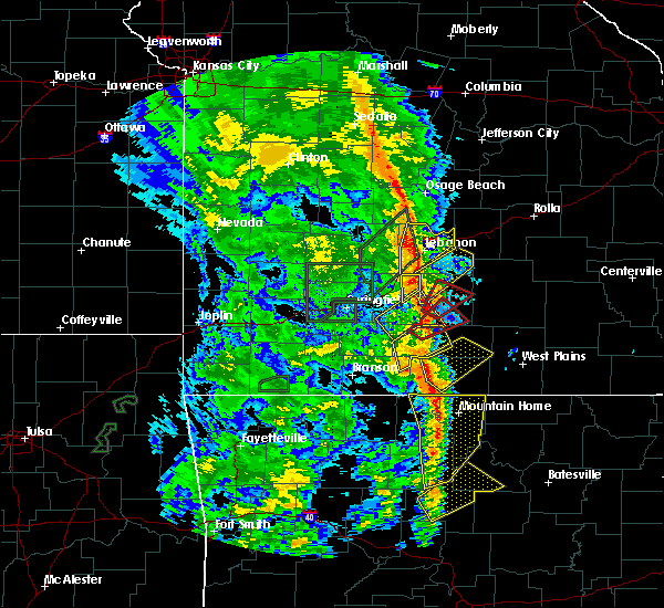 At 328 pm cdt, severe thunderstorms were located along a line extending from near gainesville to near ozark regional airport, moving northeast at 50 mph (radar indicated). Hazards include 60 mph wind gusts and quarter size hail. Hail damage to vehicles is expected. Expect wind damage to roofs, siding, and trees. At 328 pm cdt, severe thunderstorms were located along a line extending from near gainesville to near ozark regional airport, moving northeast at 50 mph (radar indicated). Hazards include 60 mph wind gusts and quarter size hail. Hail damage to vehicles is expected. Expect wind damage to roofs, siding, and trees.
|
| 5/18/2019 5:04 PM CDT |
 At 503 pm cdt, severe thunderstorms were located along a line extending from 18 miles northeast of hartville to near ott, moving east at 30 mph (trained weather spotters. these storms have a history of producing damaging winds in the ava and lebanon areas). Hazards include 60 mph wind gusts. Expect damage to roofs, siding, and trees. Locations impacted include, southwestern fort leonard wood, west plains, mountain grove, willow springs, cabool, houston, dawson, pomona, bakersfield, south fork, brandsville, huggins, plato, competition, manes, pottersville, lynchburg, caulfield, falcon, udall, this includes interstate 44 between mile markers 144 and 152. At 503 pm cdt, severe thunderstorms were located along a line extending from 18 miles northeast of hartville to near ott, moving east at 30 mph (trained weather spotters. these storms have a history of producing damaging winds in the ava and lebanon areas). Hazards include 60 mph wind gusts. Expect damage to roofs, siding, and trees. Locations impacted include, southwestern fort leonard wood, west plains, mountain grove, willow springs, cabool, houston, dawson, pomona, bakersfield, south fork, brandsville, huggins, plato, competition, manes, pottersville, lynchburg, caulfield, falcon, udall, this includes interstate 44 between mile markers 144 and 152.
|
| 5/18/2019 4:52 PM CDT |
 At 449 pm cdt, severe thunderstorms were located along a line extending from 16 miles north of hartville to near bakersfield, moving east at 45 mph (radar indicated). Hazards include 60 mph wind gusts. an area of rotation and possible tornado potential exists near mountain grove moving into texas county. Expect damage to roofs, siding, and trees. Locations impacted include, southwestern fort leonard wood, west plains, mountain grove, willow springs, cabool, houston, dawson, norwood, hartville, pomona, bakersfield, south fork, brandsville, huggins, plato, twin bridges, competition, manes, tecumseh, pottersville, this includes interstate 44 between mile markers 133 and 152. At 449 pm cdt, severe thunderstorms were located along a line extending from 16 miles north of hartville to near bakersfield, moving east at 45 mph (radar indicated). Hazards include 60 mph wind gusts. an area of rotation and possible tornado potential exists near mountain grove moving into texas county. Expect damage to roofs, siding, and trees. Locations impacted include, southwestern fort leonard wood, west plains, mountain grove, willow springs, cabool, houston, dawson, norwood, hartville, pomona, bakersfield, south fork, brandsville, huggins, plato, twin bridges, competition, manes, tecumseh, pottersville, this includes interstate 44 between mile markers 133 and 152.
|
| 5/18/2019 4:25 PM CDT |
 At 425 pm cdt, severe thunderstorms were located along a line extending from near conway to near gainesville, moving east at 30 mph (radar indicated). Hazards include 60 mph wind gusts. expect damage to roofs, siding, and trees At 425 pm cdt, severe thunderstorms were located along a line extending from near conway to near gainesville, moving east at 30 mph (radar indicated). Hazards include 60 mph wind gusts. expect damage to roofs, siding, and trees
|
| 12/1/2018 1:40 AM CST |
 At 139 am cst, severe thunderstorms were located along a line extending from 11 miles east of conway to near norwood to 14 miles west of west plains, moving northeast at 65 mph (trained weather spotters. these storms have a long history of producing wind damage to trees and structures across southern missouri). Hazards include 70 mph wind gusts. Expect considerable tree damage. damage is likely to mobile homes, roofs, and outbuildings. Locations impacted include, bakersfield, vanzant, dora, a tornado watch remains in effect until 500 am cst for south central and southwestern missouri. At 139 am cst, severe thunderstorms were located along a line extending from 11 miles east of conway to near norwood to 14 miles west of west plains, moving northeast at 65 mph (trained weather spotters. these storms have a long history of producing wind damage to trees and structures across southern missouri). Hazards include 70 mph wind gusts. Expect considerable tree damage. damage is likely to mobile homes, roofs, and outbuildings. Locations impacted include, bakersfield, vanzant, dora, a tornado watch remains in effect until 500 am cst for south central and southwestern missouri.
|
| 12/1/2018 1:07 AM CST |
 At 106 am cst, severe thunderstorms were located along a line extending from near strafford to 10 miles southeast of sparta to near price place, moving northeast at 60 mph (trained weather spotters. these storms have a history of producing wind damage in the branson area). Hazards include 70 mph wind gusts and penny size hail. Expect considerable tree damage. damage is likely to mobile homes, roofs, and outbuildings. Locations impacted include, bull shoals lake, norfork lake, ava, gainesville, bakersfield, theodosia, pontiac, wasola, sundown, brixey, willhoit, brushyknob, tecumseh, udall, hardenville, thornfield, rome, vanzant, squires, zanoni, a tornado watch remains in effect until 500 am cst for south central and southwestern missouri. At 106 am cst, severe thunderstorms were located along a line extending from near strafford to 10 miles southeast of sparta to near price place, moving northeast at 60 mph (trained weather spotters. these storms have a history of producing wind damage in the branson area). Hazards include 70 mph wind gusts and penny size hail. Expect considerable tree damage. damage is likely to mobile homes, roofs, and outbuildings. Locations impacted include, bull shoals lake, norfork lake, ava, gainesville, bakersfield, theodosia, pontiac, wasola, sundown, brixey, willhoit, brushyknob, tecumseh, udall, hardenville, thornfield, rome, vanzant, squires, zanoni, a tornado watch remains in effect until 500 am cst for south central and southwestern missouri.
|
| 12/1/2018 12:56 AM CST |
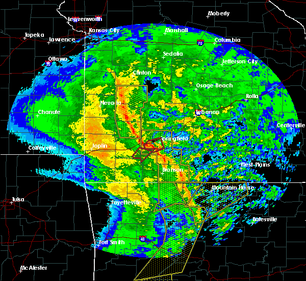 At 1256 am cst, severe thunderstorms were located along a line extending from near battlefield to 7 miles north of taneyville to 8 miles northeast of diamond city, moving northeast at 60 mph (radar indicated). Hazards include 60 mph wind gusts and penny size hail. expect damage to roofs, siding, and trees At 1256 am cst, severe thunderstorms were located along a line extending from near battlefield to 7 miles north of taneyville to 8 miles northeast of diamond city, moving northeast at 60 mph (radar indicated). Hazards include 60 mph wind gusts and penny size hail. expect damage to roofs, siding, and trees
|
| 7/19/2018 8:14 PM CDT |
 At 814 pm cdt, severe thunderstorms were located along a line extending from 10 miles southwest of willow springs to 6 miles northwest of gamaliel landing, moving east at 45 mph (radar indicated). Hazards include 60 mph wind gusts. expect damage to roofs, siding, and trees At 814 pm cdt, severe thunderstorms were located along a line extending from 10 miles southwest of willow springs to 6 miles northwest of gamaliel landing, moving east at 45 mph (radar indicated). Hazards include 60 mph wind gusts. expect damage to roofs, siding, and trees
|
| 7/19/2018 8:01 PM CDT |
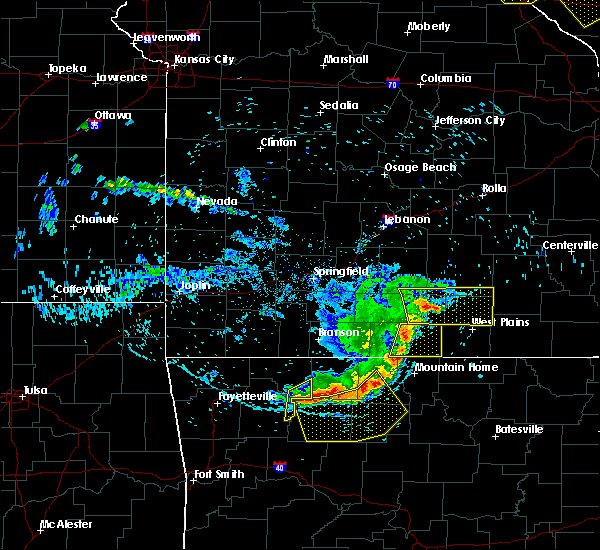 At 800 pm cdt, severe thunderstorms were located along a line extending from 11 miles north of gainesville to near price place, moving east at 40 mph (radar indicated). Hazards include 60 mph wind gusts. Expect damage to roofs, siding, and trees. Locations impacted include, norfork lake, gainesville, bakersfield, hardenville, brixey, sycamore, willhoit, tecumseh, dora, rockbridge, zanoni, udall,. At 800 pm cdt, severe thunderstorms were located along a line extending from 11 miles north of gainesville to near price place, moving east at 40 mph (radar indicated). Hazards include 60 mph wind gusts. Expect damage to roofs, siding, and trees. Locations impacted include, norfork lake, gainesville, bakersfield, hardenville, brixey, sycamore, willhoit, tecumseh, dora, rockbridge, zanoni, udall,.
|
| 7/19/2018 7:10 PM CDT |
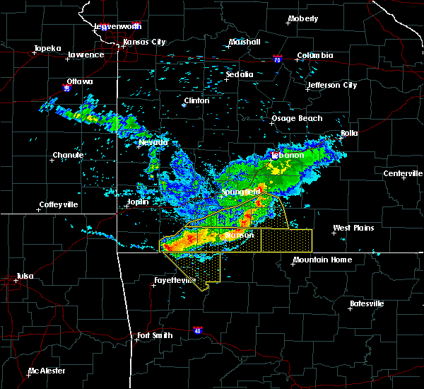 At 710 pm cdt, severe thunderstorms were located along a line extending from near mansfield to 6 miles southeast of taneyville, moving southeast at 45 mph (radar indicated). Hazards include 60 mph wind gusts. expect damage to roofs, siding, and trees At 710 pm cdt, severe thunderstorms were located along a line extending from near mansfield to 6 miles southeast of taneyville, moving southeast at 45 mph (radar indicated). Hazards include 60 mph wind gusts. expect damage to roofs, siding, and trees
|
| 6/26/2018 6:58 PM CDT |
 At 658 pm cdt, severe thunderstorms were located along a line extending from 9 miles southeast of salem to birch tree to near bakersfield, moving east at 55 mph (radar indicated). Hazards include 60 mph wind gusts and nickel size hail. Expect damage to roofs, siding, and trees. Locations impacted include, west plains, current river state park, grand gulf state park, montauk state park, mountain view, thayer, willow springs, winona, alton, birch tree, eminence, pomona, summersville, bunker, bakersfield, south fork, koshkonong, brandsville, montier, thomasville,. At 658 pm cdt, severe thunderstorms were located along a line extending from 9 miles southeast of salem to birch tree to near bakersfield, moving east at 55 mph (radar indicated). Hazards include 60 mph wind gusts and nickel size hail. Expect damage to roofs, siding, and trees. Locations impacted include, west plains, current river state park, grand gulf state park, montauk state park, mountain view, thayer, willow springs, winona, alton, birch tree, eminence, pomona, summersville, bunker, bakersfield, south fork, koshkonong, brandsville, montier, thomasville,.
|
| 6/26/2018 6:45 PM CDT |
 At 645 pm cdt, severe thunderstorms were located along a line extending from near licking to near mountain view to 7 miles north of fawn park, moving east at 40 mph (radar indicated). Hazards include 60 mph wind gusts and nickel size hail. Expect damage to roofs, siding, and trees. Locations impacted include, west plains, norfork lake, current river state park, grand gulf state park, montauk state park, mountain view, thayer, willow springs, winona, alton, birch tree, eminence, pomona, summersville, bunker, raymondville, bakersfield, south fork, koshkonong, brandsville,. At 645 pm cdt, severe thunderstorms were located along a line extending from near licking to near mountain view to 7 miles north of fawn park, moving east at 40 mph (radar indicated). Hazards include 60 mph wind gusts and nickel size hail. Expect damage to roofs, siding, and trees. Locations impacted include, west plains, norfork lake, current river state park, grand gulf state park, montauk state park, mountain view, thayer, willow springs, winona, alton, birch tree, eminence, pomona, summersville, bunker, raymondville, bakersfield, south fork, koshkonong, brandsville,.
|
| 6/26/2018 6:29 PM CDT |
 At 629 pm cdt, severe thunderstorms were located along a line extending from 9 miles northwest of licking to near willow springs to near price place, moving east at 40 mph (radar indicated). Hazards include 60 mph wind gusts and nickel size hail. expect damage to roofs, siding, and trees At 629 pm cdt, severe thunderstorms were located along a line extending from 9 miles northwest of licking to near willow springs to near price place, moving east at 40 mph (radar indicated). Hazards include 60 mph wind gusts and nickel size hail. expect damage to roofs, siding, and trees
|
| 6/25/2018 10:31 PM CDT |
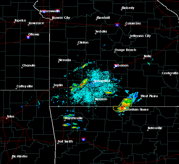 At 1030 pm cdt, a severe thunderstorm was located 7 miles southeast of gainesville, or 15 miles north of mountain home, moving northeast at 35 mph (radar indicated). Hazards include 60 mph wind gusts and quarter size hail. Hail damage to vehicles is expected. expect wind damage to roofs, siding, and trees. Locations impacted include, norfork lake, gainesville, bakersfield, hardenville, sycamore, tecumseh, zanoni, udall,. At 1030 pm cdt, a severe thunderstorm was located 7 miles southeast of gainesville, or 15 miles north of mountain home, moving northeast at 35 mph (radar indicated). Hazards include 60 mph wind gusts and quarter size hail. Hail damage to vehicles is expected. expect wind damage to roofs, siding, and trees. Locations impacted include, norfork lake, gainesville, bakersfield, hardenville, sycamore, tecumseh, zanoni, udall,.
|
| 6/25/2018 10:02 PM CDT |
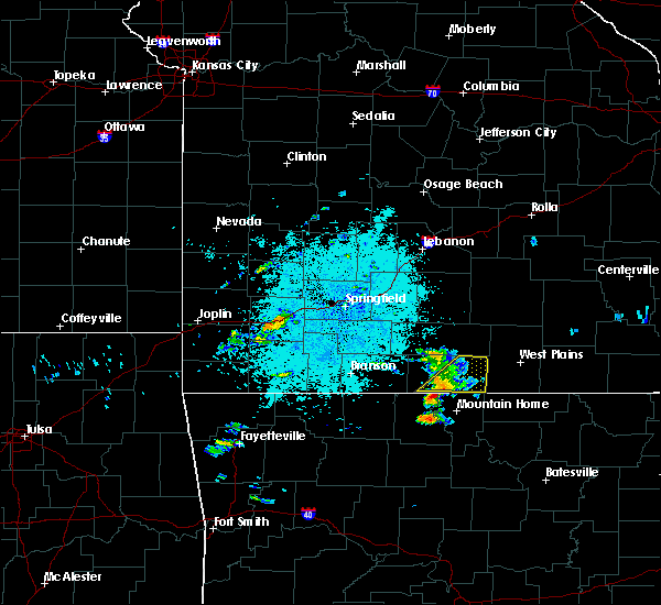 At 1002 pm cdt, a severe thunderstorm was located near gainesville, or 14 miles northeast of bull shoals, moving northeast at 50 mph (radar indicated). Hazards include 60 mph wind gusts and quarter size hail. Hail damage to vehicles is expected. Expect wind damage to roofs, siding, and trees. At 1002 pm cdt, a severe thunderstorm was located near gainesville, or 14 miles northeast of bull shoals, moving northeast at 50 mph (radar indicated). Hazards include 60 mph wind gusts and quarter size hail. Hail damage to vehicles is expected. Expect wind damage to roofs, siding, and trees.
|
| 5/31/2018 10:12 PM CDT |
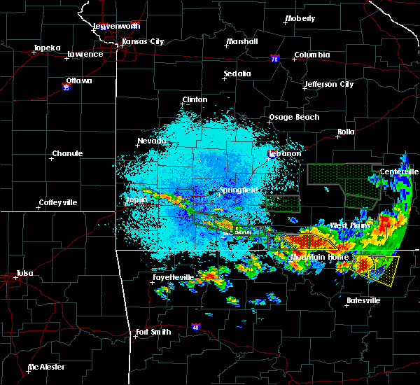 At 1012 pm cdt, a severe thunderstorm was located 8 miles northwest of bakersfield, or 21 miles west of west plains, moving southeast at 20 mph (radar indicated). Hazards include 60 mph wind gusts and quarter size hail. Hail damage to vehicles is expected. Expect wind damage to roofs, siding, and trees. At 1012 pm cdt, a severe thunderstorm was located 8 miles northwest of bakersfield, or 21 miles west of west plains, moving southeast at 20 mph (radar indicated). Hazards include 60 mph wind gusts and quarter size hail. Hail damage to vehicles is expected. Expect wind damage to roofs, siding, and trees.
|
| 5/31/2018 9:55 PM CDT |
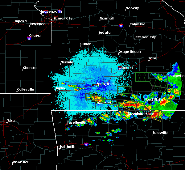 At 955 pm cdt, a severe thunderstorm was located 7 miles north of bakersfield, or 18 miles west of west plains, moving east at 20 mph (radar indicated). Hazards include 60 mph wind gusts and quarter size hail. Hail damage to vehicles is expected. expect wind damage to roofs, siding, and trees. Locations impacted include, norfork lake, gainesville, bakersfield, south fork, lanton, hardenville, moody, tecumseh, caulfield, zanoni, udall,. At 955 pm cdt, a severe thunderstorm was located 7 miles north of bakersfield, or 18 miles west of west plains, moving east at 20 mph (radar indicated). Hazards include 60 mph wind gusts and quarter size hail. Hail damage to vehicles is expected. expect wind damage to roofs, siding, and trees. Locations impacted include, norfork lake, gainesville, bakersfield, south fork, lanton, hardenville, moody, tecumseh, caulfield, zanoni, udall,.
|
| 5/31/2018 9:22 PM CDT |
 At 922 pm cdt, a severe thunderstorm was located near gainesville, or 24 miles southeast of ava, moving east at 30 mph (radar indicated). Hazards include 60 mph wind gusts and quarter size hail. Hail damage to vehicles is expected. Expect wind damage to roofs, siding, and trees. At 922 pm cdt, a severe thunderstorm was located near gainesville, or 24 miles southeast of ava, moving east at 30 mph (radar indicated). Hazards include 60 mph wind gusts and quarter size hail. Hail damage to vehicles is expected. Expect wind damage to roofs, siding, and trees.
|
| 5/31/2018 9:09 PM CDT |
 The severe thunderstorm warning for southeastern ozark and southern howell counties will expire at 915 pm cdt, the storm which prompted the warning has moved out of the area. therefore the warning will be allowed to expire. however small hail and gusty winds are still possible with this thunderstorm. a severe thunderstorm watch remains in effect until 200 am cdt for south central and southwestern missouri. to report severe weather, contact your nearest law enforcement agency. they will relay your report to the national weather service springfield. The severe thunderstorm warning for southeastern ozark and southern howell counties will expire at 915 pm cdt, the storm which prompted the warning has moved out of the area. therefore the warning will be allowed to expire. however small hail and gusty winds are still possible with this thunderstorm. a severe thunderstorm watch remains in effect until 200 am cdt for south central and southwestern missouri. to report severe weather, contact your nearest law enforcement agency. they will relay your report to the national weather service springfield.
|
| 5/31/2018 8:43 PM CDT |
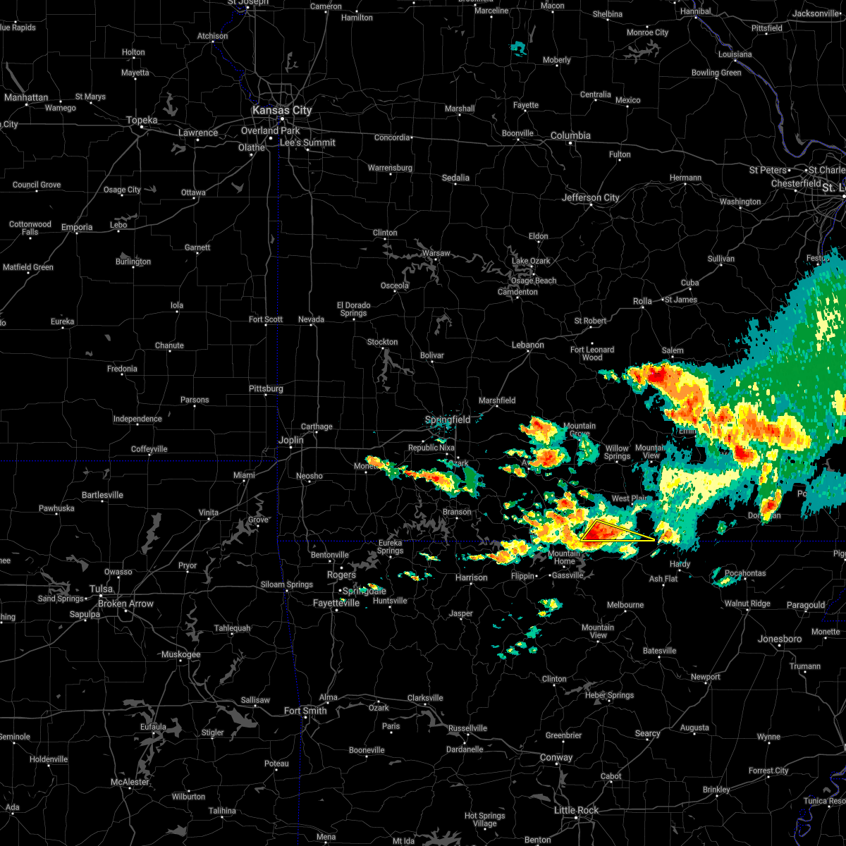 At 842 pm cdt, a severe thunderstorm was located over bakersfield, or 17 miles northeast of mountain home, moving east at 25 mph (radar indicated). Hazards include 60 mph wind gusts and half dollar size hail. Hail damage to vehicles is expected. Expect wind damage to roofs, siding, and trees. At 842 pm cdt, a severe thunderstorm was located over bakersfield, or 17 miles northeast of mountain home, moving east at 25 mph (radar indicated). Hazards include 60 mph wind gusts and half dollar size hail. Hail damage to vehicles is expected. Expect wind damage to roofs, siding, and trees.
|
| 5/31/2018 8:33 PM CDT |
 At 833 pm cdt, a severe thunderstorm was located near bakersfield, or 17 miles northeast of mountain home, moving east at 25 mph (radar indicated). Hazards include 60 mph wind gusts and quarter size hail. Hail damage to vehicles is expected. expect wind damage to roofs, siding, and trees. Locations impacted include, norfork lake, gainesville, bakersfield, hardenville, udall, tecumseh,. At 833 pm cdt, a severe thunderstorm was located near bakersfield, or 17 miles northeast of mountain home, moving east at 25 mph (radar indicated). Hazards include 60 mph wind gusts and quarter size hail. Hail damage to vehicles is expected. expect wind damage to roofs, siding, and trees. Locations impacted include, norfork lake, gainesville, bakersfield, hardenville, udall, tecumseh,.
|
| 5/31/2018 8:01 PM CDT |
 At 800 pm cdt, a severe thunderstorm was located over gainesville, or 18 miles northeast of bull shoals, moving east at 30 mph (radar indicated). Hazards include 60 mph wind gusts and quarter size hail. Hail damage to vehicles is expected. Expect wind damage to roofs, siding, and trees. At 800 pm cdt, a severe thunderstorm was located over gainesville, or 18 miles northeast of bull shoals, moving east at 30 mph (radar indicated). Hazards include 60 mph wind gusts and quarter size hail. Hail damage to vehicles is expected. Expect wind damage to roofs, siding, and trees.
|
| 5/25/2018 7:09 PM CDT |
 At 709 pm cdt, severe thunderstorms were located along a line extending from 19 miles northwest of bakersfield to 6 miles northeast of gainesville to near price place, moving east at 25 mph (emergency management). Hazards include 60 mph wind gusts and penny size hail. this storm has a history of producing wind damage. Expect damage to roofs, siding, and trees. Locations impacted include, norfork lake, gainesville, bakersfield, pontiac, brixey, willhoit, tecumseh, udall, hardenville, sycamore, dora, rockbridge, zanoni,. At 709 pm cdt, severe thunderstorms were located along a line extending from 19 miles northwest of bakersfield to 6 miles northeast of gainesville to near price place, moving east at 25 mph (emergency management). Hazards include 60 mph wind gusts and penny size hail. this storm has a history of producing wind damage. Expect damage to roofs, siding, and trees. Locations impacted include, norfork lake, gainesville, bakersfield, pontiac, brixey, willhoit, tecumseh, udall, hardenville, sycamore, dora, rockbridge, zanoni,.
|
| 5/25/2018 6:28 PM CDT |
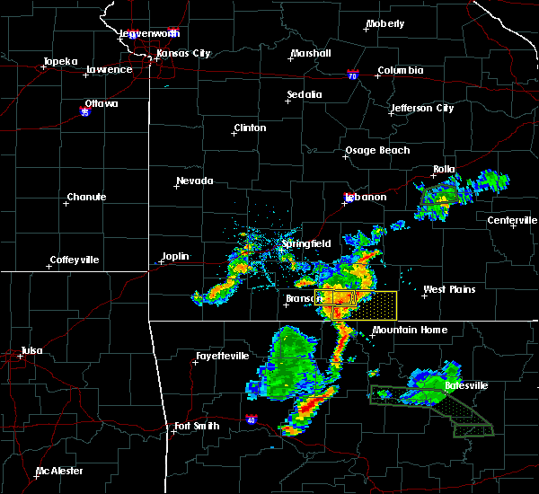 The national weather service in springfield has issued a * severe thunderstorm warning for. ozark county in southwestern missouri. Until 730 pm cdt * at 628 pm cdt, severe thunderstorms were located along a line extending from 13 miles southeast of ava to 10 miles west of. The national weather service in springfield has issued a * severe thunderstorm warning for. ozark county in southwestern missouri. Until 730 pm cdt * at 628 pm cdt, severe thunderstorms were located along a line extending from 13 miles southeast of ava to 10 miles west of.
|
| 5/3/2018 3:12 AM CDT |
 At 311 am cdt, severe thunderstorms were located along a line extending from 6 miles south of mountain grove to 12 miles northeast of gainesville to 7 miles north of arkawana, moving east at 40 mph (radar indicated). Hazards include 60 mph wind gusts and penny size hail. expect damage to roofs, siding, and trees At 311 am cdt, severe thunderstorms were located along a line extending from 6 miles south of mountain grove to 12 miles northeast of gainesville to 7 miles north of arkawana, moving east at 40 mph (radar indicated). Hazards include 60 mph wind gusts and penny size hail. expect damage to roofs, siding, and trees
|
| 4/13/2018 9:05 PM CDT |
 At 904 pm cdt, severe thunderstorms were located along a line extending from 8 miles west of summersville to near mountain view to 9 miles northeast of bakersfield, moving northeast at 40 mph (radar indicated). Hazards include 60 mph wind gusts and nickel size hail. Expect damage to roofs, siding, and trees. Locations impacted include, west plains, norfork lake, mountain view, willow springs, pomona, bakersfield, south fork, brandsville, peace valley, lanton, tecumseh, pottersville, caulfield, udall, siloam springs, white church, moody, a tornado watch remains in effect until 100 am cdt for south central and southwestern missouri. At 904 pm cdt, severe thunderstorms were located along a line extending from 8 miles west of summersville to near mountain view to 9 miles northeast of bakersfield, moving northeast at 40 mph (radar indicated). Hazards include 60 mph wind gusts and nickel size hail. Expect damage to roofs, siding, and trees. Locations impacted include, west plains, norfork lake, mountain view, willow springs, pomona, bakersfield, south fork, brandsville, peace valley, lanton, tecumseh, pottersville, caulfield, udall, siloam springs, white church, moody, a tornado watch remains in effect until 100 am cdt for south central and southwestern missouri.
|
| 4/13/2018 8:49 PM CDT |
 At 848 pm cdt, a severe thunderstorm capable of producing a tornado was located over gamaliel landing, or 10 miles northeast of mountain home, moving northeast at 30 mph (radar indicated rotation). Hazards include tornado. Flying debris will be dangerous to those caught without shelter. mobile homes will be damaged or destroyed. damage to roofs, windows, and vehicles will occur. Tree damage is likely. At 848 pm cdt, a severe thunderstorm capable of producing a tornado was located over gamaliel landing, or 10 miles northeast of mountain home, moving northeast at 30 mph (radar indicated rotation). Hazards include tornado. Flying debris will be dangerous to those caught without shelter. mobile homes will be damaged or destroyed. damage to roofs, windows, and vehicles will occur. Tree damage is likely.
|
| 4/13/2018 8:36 PM CDT |
 At 834 pm cdt, severe thunderstorms were located along a line extending from near cabool to 12 miles southwest of willow springs to 7 miles west of bakersfield, moving northeast at 40 mph. additional severe thunderstorms south of the missouri and arkansas state line will also move into the area (radar indicated). Hazards include 60 mph wind gusts and nickel size hail. expect damage to roofs, siding, and trees At 834 pm cdt, severe thunderstorms were located along a line extending from near cabool to 12 miles southwest of willow springs to 7 miles west of bakersfield, moving northeast at 40 mph. additional severe thunderstorms south of the missouri and arkansas state line will also move into the area (radar indicated). Hazards include 60 mph wind gusts and nickel size hail. expect damage to roofs, siding, and trees
|
| 4/3/2018 2:53 PM CDT | Golf Ball sized hail reported 9.2 miles S of Bakersfield, MO, cloud 9 ranch. |
| 2/24/2018 2:46 PM CST |
 At 245 pm cst, severe thunderstorms were located along a line extending from 6 miles northwest of gamaliel landing to near rodney, moving northeast at 50 mph (radar indicated). Hazards include 60 mph wind gusts. expect damage to roofs, siding, and trees At 245 pm cst, severe thunderstorms were located along a line extending from 6 miles northwest of gamaliel landing to near rodney, moving northeast at 50 mph (radar indicated). Hazards include 60 mph wind gusts. expect damage to roofs, siding, and trees
|
| 1/21/2018 11:35 PM CST |
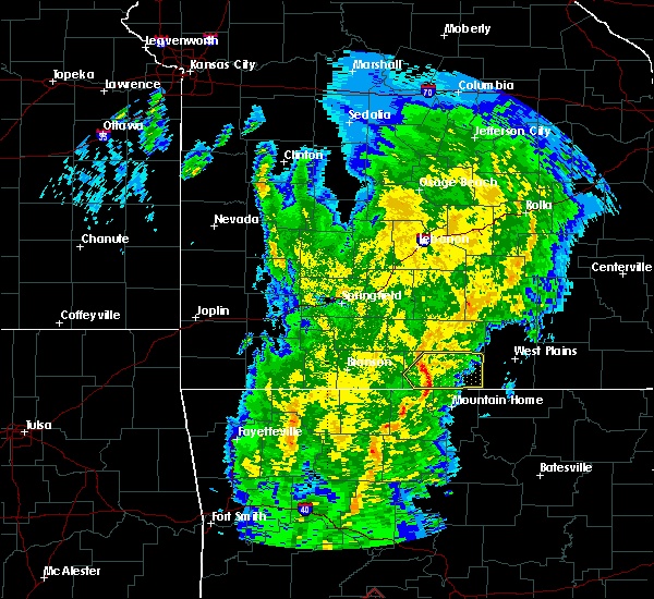 At 1135 pm cst, severe thunderstorms were located along a line extending from 17 miles north of ozark isle to near gainesville to near price place, moving northeast at 55 mph (radar indicated). Hazards include 60 mph wind gusts. Expect damage to roofs, siding, and trees. Locations impacted include, gainesville, bakersfield, pontiac, wasola, sundown, brixey, noble, willhoit, tecumseh, udall, hardenville, thornfield, sycamore, dora, rockbridge, isabella, zanoni,. At 1135 pm cst, severe thunderstorms were located along a line extending from 17 miles north of ozark isle to near gainesville to near price place, moving northeast at 55 mph (radar indicated). Hazards include 60 mph wind gusts. Expect damage to roofs, siding, and trees. Locations impacted include, gainesville, bakersfield, pontiac, wasola, sundown, brixey, noble, willhoit, tecumseh, udall, hardenville, thornfield, sycamore, dora, rockbridge, isabella, zanoni,.
|
| 1/21/2018 11:25 PM CST |
 At 1125 pm cst, severe thunderstorms were located along a line extending from 11 miles north of ozark isle to near price place to near bull shoals, moving northeast at 60 mph (radar indicated). Hazards include 60 mph wind gusts. expect damage to roofs, siding, and trees At 1125 pm cst, severe thunderstorms were located along a line extending from 11 miles north of ozark isle to near price place to near bull shoals, moving northeast at 60 mph (radar indicated). Hazards include 60 mph wind gusts. expect damage to roofs, siding, and trees
|
| 10/22/2017 2:59 AM CDT |
 At 259 am cdt, severe thunderstorms were located along a line extending from 14 miles northeast of gainesville to 6 miles northwest of gamaliel landing, moving east at 30 mph (radar indicated). Hazards include 60 mph wind gusts. Expect damage to roofs, siding, and trees. Locations impacted include, norfork lake, gainesville, bakersfield, hardenville, brixey, sycamore, tecumseh, dora, rockbridge, zanoni, udall, willhoit,. At 259 am cdt, severe thunderstorms were located along a line extending from 14 miles northeast of gainesville to 6 miles northwest of gamaliel landing, moving east at 30 mph (radar indicated). Hazards include 60 mph wind gusts. Expect damage to roofs, siding, and trees. Locations impacted include, norfork lake, gainesville, bakersfield, hardenville, brixey, sycamore, tecumseh, dora, rockbridge, zanoni, udall, willhoit,.
|
| 10/22/2017 2:23 AM CDT |
 At 223 am cdt, severe thunderstorms were located along a line extending from 10 miles south of ava to price place, moving east at 25 mph (radar indicated). Hazards include 60 mph wind gusts. expect damage to roofs, siding, and trees At 223 am cdt, severe thunderstorms were located along a line extending from 10 miles south of ava to price place, moving east at 25 mph (radar indicated). Hazards include 60 mph wind gusts. expect damage to roofs, siding, and trees
|
| 6/23/2017 2:12 PM CDT |
 At 212 pm cdt, severe thunderstorms were located along a line extending from near west plains to near fawn park, moving southeast at 35 mph (radar indicated). Hazards include 60 mph wind gusts. Expect damage to roofs, siding, and trees. Locations impacted include, west plains, willow springs, pomona, bakersfield, south fork, brandsville, lanton, tecumseh, pottersville, caulfield, udall, hardenville, siloam springs, moody,. At 212 pm cdt, severe thunderstorms were located along a line extending from near west plains to near fawn park, moving southeast at 35 mph (radar indicated). Hazards include 60 mph wind gusts. Expect damage to roofs, siding, and trees. Locations impacted include, west plains, willow springs, pomona, bakersfield, south fork, brandsville, lanton, tecumseh, pottersville, caulfield, udall, hardenville, siloam springs, moody,.
|
| 6/23/2017 1:52 PM CDT |
 At 151 pm cdt, severe thunderstorms were located along a line extending from 8 miles south of mountain grove to 6 miles west of price place, moving southeast at 30 mph (radar indicated). Hazards include 60 mph wind gusts. Expect damage to roofs, siding, and trees. Locations impacted include, west plains, bull shoals lake, willow springs, gainesville, pomona, bakersfield, theodosia, south fork, pontiac, brandsville, wasola, sundown, lanton, brixey, willhoit, tecumseh, pottersville, caulfield, udall, hardenville,. At 151 pm cdt, severe thunderstorms were located along a line extending from 8 miles south of mountain grove to 6 miles west of price place, moving southeast at 30 mph (radar indicated). Hazards include 60 mph wind gusts. Expect damage to roofs, siding, and trees. Locations impacted include, west plains, bull shoals lake, willow springs, gainesville, pomona, bakersfield, theodosia, south fork, pontiac, brandsville, wasola, sundown, lanton, brixey, willhoit, tecumseh, pottersville, caulfield, udall, hardenville,.
|
| 6/23/2017 1:30 PM CDT |
 At 129 pm cdt, severe thunderstorms were located along a line extending from 8 miles south of norwood to near omaha, moving southeast at 40 mph (radar indicated). Hazards include 60 mph wind gusts. expect damage to roofs, siding, and trees At 129 pm cdt, severe thunderstorms were located along a line extending from 8 miles south of norwood to near omaha, moving southeast at 40 mph (radar indicated). Hazards include 60 mph wind gusts. expect damage to roofs, siding, and trees
|
| 5/27/2017 8:08 PM CDT |
 At 807 pm cdt, severe thunderstorms were located along a line extending from 10 miles west of summersville to near west plains to near gainesville, moving east at 40 mph (radar indicated). Hazards include 60 mph wind gusts and quarter size hail. Hail damage to vehicles is expected. expect wind damage to roofs, siding, and trees. Locations impacted include, west plains, bull shoals lake, norfork lake, mountain view, willow springs, gainesville, pomona, summersville, bakersfield, south fork, pontiac, sundown, brixey, willhoit, tecumseh, pottersville, caulfield, udall, hardenville, clear springs, a tornado watch remains in effect until 200 am cdt for south central and southwestern missouri. At 807 pm cdt, severe thunderstorms were located along a line extending from 10 miles west of summersville to near west plains to near gainesville, moving east at 40 mph (radar indicated). Hazards include 60 mph wind gusts and quarter size hail. Hail damage to vehicles is expected. expect wind damage to roofs, siding, and trees. Locations impacted include, west plains, bull shoals lake, norfork lake, mountain view, willow springs, gainesville, pomona, summersville, bakersfield, south fork, pontiac, sundown, brixey, willhoit, tecumseh, pottersville, caulfield, udall, hardenville, clear springs, a tornado watch remains in effect until 200 am cdt for south central and southwestern missouri.
|
| 5/27/2017 7:30 PM CDT |
 At 729 pm cdt, severe thunderstorms were located along a line extending from 10 miles north of cabool to 17 miles south of norwood to 14 miles east of taneyville, moving east at 30 mph (radar indicated). Hazards include 60 mph wind gusts and quarter size hail. Hail damage to vehicles is expected. Expect wind damage to roofs, siding, and trees. At 729 pm cdt, severe thunderstorms were located along a line extending from 10 miles north of cabool to 17 miles south of norwood to 14 miles east of taneyville, moving east at 30 mph (radar indicated). Hazards include 60 mph wind gusts and quarter size hail. Hail damage to vehicles is expected. Expect wind damage to roofs, siding, and trees.
|
| 5/27/2017 3:03 AM CDT |
 At 303 am cdt, severe thunderstorms were located along a line extending from 12 miles northwest of ott to 6 miles west of bakersfield, moving east at 30 mph (radar indicated). Hazards include 60 mph wind gusts and half dollar size hail. Hail damage to vehicles is expected. expect wind damage to roofs, siding, and trees. Locations impacted include, west plains, norfork lake, bakersfield, south fork, brandsville, lanton, tecumseh, pottersville, caulfield, udall, moody, sycamore, zanoni,. At 303 am cdt, severe thunderstorms were located along a line extending from 12 miles northwest of ott to 6 miles west of bakersfield, moving east at 30 mph (radar indicated). Hazards include 60 mph wind gusts and half dollar size hail. Hail damage to vehicles is expected. expect wind damage to roofs, siding, and trees. Locations impacted include, west plains, norfork lake, bakersfield, south fork, brandsville, lanton, tecumseh, pottersville, caulfield, udall, moody, sycamore, zanoni,.
|
| 5/27/2017 2:41 AM CDT |
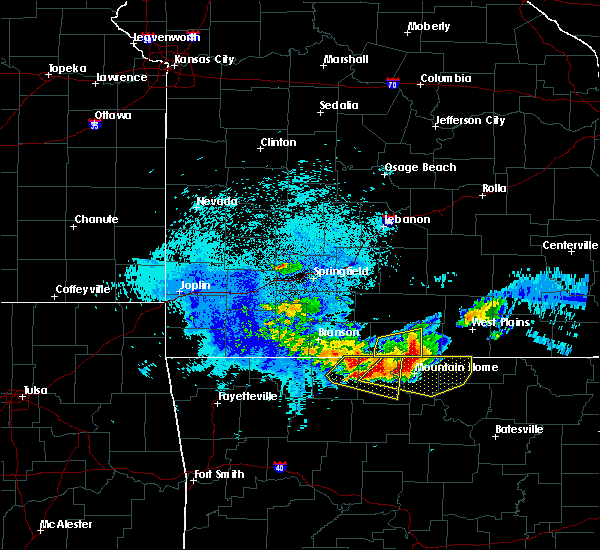 At 240 am cdt, severe thunderstorms were located along a line extending from near gainesville to 8 miles north of fawn park, moving east at 45 mph (radar indicated). Hazards include 60 mph wind gusts and quarter size hail. Hail damage to vehicles is expected. Expect wind damage to roofs, siding, and trees. At 240 am cdt, severe thunderstorms were located along a line extending from near gainesville to 8 miles north of fawn park, moving east at 45 mph (radar indicated). Hazards include 60 mph wind gusts and quarter size hail. Hail damage to vehicles is expected. Expect wind damage to roofs, siding, and trees.
|
| 5/19/2017 3:08 AM CDT |
 The tornado warning for eastern ozark, eastern douglas, northeastern wright, howell and southwestern texas counties will expire at 315 am cdt, the storms which prompted the warning have moved out of the area. therefore the warning will be allowed to expire. however heavy rain is still possible with these thunderstorms. a tornado watch remains in effect until 600 am cdt for south central and southwestern missouri. The tornado warning for eastern ozark, eastern douglas, northeastern wright, howell and southwestern texas counties will expire at 315 am cdt, the storms which prompted the warning have moved out of the area. therefore the warning will be allowed to expire. however heavy rain is still possible with these thunderstorms. a tornado watch remains in effect until 600 am cdt for south central and southwestern missouri.
|
| 5/19/2017 2:28 AM CDT |
 At 228 am cdt, severe thunderstorms capable of producing both tornadoes and extensive straight line wind damage were located along a line extending from diggins to 6 miles northeast of ava to 11 miles north of gainesville to 7 miles northwest of gamaliel landing, moving northeast at 45 mph (radar indicated rotation). Hazards include tornado. Flying debris will be dangerous to those caught without shelter. mobile homes will be damaged or destroyed. damage to roofs, windows, and vehicles will occur. Tree damage is likely. At 228 am cdt, severe thunderstorms capable of producing both tornadoes and extensive straight line wind damage were located along a line extending from diggins to 6 miles northeast of ava to 11 miles north of gainesville to 7 miles northwest of gamaliel landing, moving northeast at 45 mph (radar indicated rotation). Hazards include tornado. Flying debris will be dangerous to those caught without shelter. mobile homes will be damaged or destroyed. damage to roofs, windows, and vehicles will occur. Tree damage is likely.
|
| 5/19/2017 1:47 AM CDT |
 At 147 am cdt, severe thunderstorms were located along a line extending from 6 miles southwest of fair grove to highlandville to near diamond city, moving northeast at 45 mph (radar indicated). Hazards include 60 mph wind gusts and penny size hail. expect damage to roofs, siding, and trees At 147 am cdt, severe thunderstorms were located along a line extending from 6 miles southwest of fair grove to highlandville to near diamond city, moving northeast at 45 mph (radar indicated). Hazards include 60 mph wind gusts and penny size hail. expect damage to roofs, siding, and trees
|
| 4/26/2017 9:35 AM CDT | Trees down across roa in ozark county MO, 8.6 miles S of Bakersfield, MO |
| 4/26/2017 9:35 AM CDT |
 At 935 am cdt, a severe thunderstorm was located over bakersfield, or 19 miles northeast of mountain home, moving northeast at 45 mph (radar indicated). Hazards include 60 mph wind gusts and quarter size hail. Hail damage to vehicles is expected. Expect wind damage to roofs, siding, and trees. At 935 am cdt, a severe thunderstorm was located over bakersfield, or 19 miles northeast of mountain home, moving northeast at 45 mph (radar indicated). Hazards include 60 mph wind gusts and quarter size hail. Hail damage to vehicles is expected. Expect wind damage to roofs, siding, and trees.
|
| 4/26/2017 9:30 AM CDT | Wind damage reported in vidett in fulton county AR, 6.8 miles NNW of Bakersfield, MO |
| 4/26/2017 9:24 AM CDT | Quarter sized hail reported 7.1 miles NE of Bakersfield, MO |
| 3/29/2017 9:22 PM CDT |
 The severe thunderstorm warning for eastern ozark county will expire at 930 pm cdt, the storm which prompted the warning has weakened below severe limits, and have exited the warned area. therefore, the warning will be allowed to expire. a tornado watch remains in effect until 1100 pm cdt for south central and southwestern missouri. The severe thunderstorm warning for eastern ozark county will expire at 930 pm cdt, the storm which prompted the warning has weakened below severe limits, and have exited the warned area. therefore, the warning will be allowed to expire. a tornado watch remains in effect until 1100 pm cdt for south central and southwestern missouri.
|
| 3/29/2017 8:40 PM CDT |
 At 839 pm cdt, a severe thunderstorm was located near arkawana, or 11 miles northeast of bull shoals, moving northeast at 45 mph (radar indicated). Hazards include 60 mph wind gusts and quarter size hail. Hail damage to vehicles is expected. Expect wind damage to roofs, siding, and trees. At 839 pm cdt, a severe thunderstorm was located near arkawana, or 11 miles northeast of bull shoals, moving northeast at 45 mph (radar indicated). Hazards include 60 mph wind gusts and quarter size hail. Hail damage to vehicles is expected. Expect wind damage to roofs, siding, and trees.
|
| 3/7/2017 1:24 AM CST |
 The severe thunderstorm warning for ozark, eastern douglas and howell counties will expire at 130 am cst, the storms which prompted the warning have weakened below severe limits, and no longer pose an immediate threat to life or property. therefore, the warning will be allowed to expire. a tornado watch remains in effect until 300 am cst for south central and southwestern missouri. The severe thunderstorm warning for ozark, eastern douglas and howell counties will expire at 130 am cst, the storms which prompted the warning have weakened below severe limits, and no longer pose an immediate threat to life or property. therefore, the warning will be allowed to expire. a tornado watch remains in effect until 300 am cst for south central and southwestern missouri.
|
| 3/7/2017 1:05 AM CST |
 At 105 am cst, severe thunderstorms were located along a line extending from near mountain view to near gamaliel landing, moving east at 40 mph (radar indicated). Hazards include 60 mph wind gusts and nickel size hail. Expect damage to roofs, siding, and trees. Locations impacted include, west plains, bull shoals lake, mountain view, willow springs, gainesville, pomona, bakersfield, theodosia, south fork, pontiac, brandsville, wasola, sundown, lanton, brixey, willhoit, tecumseh, pottersville, caulfield, udall, a tornado watch remains in effect until 300 am cst for south central and southwestern missouri. At 105 am cst, severe thunderstorms were located along a line extending from near mountain view to near gamaliel landing, moving east at 40 mph (radar indicated). Hazards include 60 mph wind gusts and nickel size hail. Expect damage to roofs, siding, and trees. Locations impacted include, west plains, bull shoals lake, mountain view, willow springs, gainesville, pomona, bakersfield, theodosia, south fork, pontiac, brandsville, wasola, sundown, lanton, brixey, willhoit, tecumseh, pottersville, caulfield, udall, a tornado watch remains in effect until 300 am cst for south central and southwestern missouri.
|
| 3/7/2017 12:34 AM CST |
 At 1234 am cst, severe thunderstorms were located along a line extending from near cabool to price place, moving east at 40 mph (radar indicated). Hazards include 60 mph wind gusts and nickel size hail. expect damage to roofs, siding, and trees At 1234 am cst, severe thunderstorms were located along a line extending from near cabool to price place, moving east at 40 mph (radar indicated). Hazards include 60 mph wind gusts and nickel size hail. expect damage to roofs, siding, and trees
|
| 3/6/2017 11:53 PM CST |
 The severe thunderstorm warning for ozark county will expire at midnight cst, the severe thunderstorm warning has been replaced with a tornado warning for eastern ozark county. a tornado watch remains in effect until 300 am cst for south central and southwestern missouri. The severe thunderstorm warning for ozark county will expire at midnight cst, the severe thunderstorm warning has been replaced with a tornado warning for eastern ozark county. a tornado watch remains in effect until 300 am cst for south central and southwestern missouri.
|
| 3/6/2017 11:43 PM CST |
 At 1143 pm cst, a severe thunderstorm capable of producing a tornado was located over gainesville, or 16 miles northeast of bull shoals, moving northeast at 70 mph (radar indicated rotation). Hazards include tornado and quarter size hail. Flying debris will be dangerous to those caught without shelter. mobile homes will be damaged or destroyed. damage to roofs, windows, and vehicles will occur. Tree damage is likely. At 1143 pm cst, a severe thunderstorm capable of producing a tornado was located over gainesville, or 16 miles northeast of bull shoals, moving northeast at 70 mph (radar indicated rotation). Hazards include tornado and quarter size hail. Flying debris will be dangerous to those caught without shelter. mobile homes will be damaged or destroyed. damage to roofs, windows, and vehicles will occur. Tree damage is likely.
|
| 3/6/2017 11:36 PM CST |
 At 1135 pm cst, a severe thunderstorm was located near price place, or 14 miles north of bull shoals, moving northeast at 45 mph (radar indicated). Hazards include 60 mph wind gusts and quarter size hail. Hail damage to vehicles is expected. expect wind damage to roofs, siding, and trees. Locations impacted include, bull shoals lake, norfork lake, gainesville, bakersfield, theodosia, pontiac, sundown, brixey, willhoit, tecumseh, udall, hardenville, sycamore, dora, rockbridge, isabella, zanoni, a tornado watch remains in effect until 300 am cst for south central and southwestern missouri. At 1135 pm cst, a severe thunderstorm was located near price place, or 14 miles north of bull shoals, moving northeast at 45 mph (radar indicated). Hazards include 60 mph wind gusts and quarter size hail. Hail damage to vehicles is expected. expect wind damage to roofs, siding, and trees. Locations impacted include, bull shoals lake, norfork lake, gainesville, bakersfield, theodosia, pontiac, sundown, brixey, willhoit, tecumseh, udall, hardenville, sycamore, dora, rockbridge, isabella, zanoni, a tornado watch remains in effect until 300 am cst for south central and southwestern missouri.
|
| 3/6/2017 11:25 PM CST |
 At 1125 pm cst, a severe thunderstorm was located near price place, or 10 miles northwest of bull shoals, moving northeast at 45 mph (radar indicated). Hazards include 60 mph wind gusts and quarter size hail. Hail damage to vehicles is expected. expect wind damage to roofs, siding, and trees. Locations impacted include, bull shoals lake, norfork lake, gainesville, bakersfield, theodosia, pontiac, sundown, brixey, noble, willhoit, tecumseh, udall, hardenville, sycamore, dora, rockbridge, isabella, zanoni, a tornado watch remains in effect until 300 am cst for south central and southwestern missouri. At 1125 pm cst, a severe thunderstorm was located near price place, or 10 miles northwest of bull shoals, moving northeast at 45 mph (radar indicated). Hazards include 60 mph wind gusts and quarter size hail. Hail damage to vehicles is expected. expect wind damage to roofs, siding, and trees. Locations impacted include, bull shoals lake, norfork lake, gainesville, bakersfield, theodosia, pontiac, sundown, brixey, noble, willhoit, tecumseh, udall, hardenville, sycamore, dora, rockbridge, isabella, zanoni, a tornado watch remains in effect until 300 am cst for south central and southwestern missouri.
|
| 3/6/2017 11:13 PM CST |
 At 1113 pm cst, a severe thunderstorm was located near lead hill, or 12 miles west of bull shoals, moving northeast at 45 mph (radar indicated). Hazards include 60 mph wind gusts and quarter size hail. Hail damage to vehicles is expected. Expect wind damage to roofs, siding, and trees. At 1113 pm cst, a severe thunderstorm was located near lead hill, or 12 miles west of bull shoals, moving northeast at 45 mph (radar indicated). Hazards include 60 mph wind gusts and quarter size hail. Hail damage to vehicles is expected. Expect wind damage to roofs, siding, and trees.
|
| 7/29/2016 2:35 PM CDT | Severe thunderstorm wind gusts downed tree limbs on highway y in howell county MO, 3 miles SW of Bakersfield, MO |
| 7/29/2016 2:30 PM CDT | Limbs down. phone line wires into two homes dow in ozark county MO, 0.5 miles NNW of Bakersfield, MO |
| 7/29/2016 2:28 PM CDT |
 At 228 pm cdt, severe thunderstorms were located along a line extending from 11 miles northwest of ott to near bakersfield, moving east at 20 mph (radar indicated). Hazards include 60 mph wind gusts. Expect damage to roofs. siding. And trees. At 228 pm cdt, severe thunderstorms were located along a line extending from 11 miles northwest of ott to near bakersfield, moving east at 20 mph (radar indicated). Hazards include 60 mph wind gusts. Expect damage to roofs. siding. And trees.
|
| 7/6/2016 10:26 AM CDT |
 At 1026 am cdt, severe thunderstorms were located along a line extending from 8 miles northeast of west plains to 6 miles northeast of bakersfield to salesville, moving east at 55 mph (radar indicated). Hazards include 60 mph wind gusts and nickel size hail. Expect damage to roofs. siding. And trees. At 1026 am cdt, severe thunderstorms were located along a line extending from 8 miles northeast of west plains to 6 miles northeast of bakersfield to salesville, moving east at 55 mph (radar indicated). Hazards include 60 mph wind gusts and nickel size hail. Expect damage to roofs. siding. And trees.
|
| 6/15/2016 2:55 PM CDT |
 The severe thunderstorm warning for ozark county will expire at 300 pm cdt, the storm which prompted the warning has weakened below severe limits, and no longer pose an immediate threat to life or property. therefore the warning will be allowed to expire. however gusty winds are still possible with this thunderstorm. The severe thunderstorm warning for ozark county will expire at 300 pm cdt, the storm which prompted the warning has weakened below severe limits, and no longer pose an immediate threat to life or property. therefore the warning will be allowed to expire. however gusty winds are still possible with this thunderstorm.
|
| 6/15/2016 2:37 PM CDT |
 At 236 pm cdt, a severe thunderstorm was located near price place, or 14 miles north of bull shoals, moving southeast at 20 mph (radar indicated). Hazards include 60 mph wind gusts and penny size hail. Expect damage to roofs. siding. and trees. Locations impacted include, bull shoals lake, norfork lake, gainesville, bakersfield, theodosia, pontiac, sundown, willhoit, isabella, zanoni, udall, tecumseh, sycamore, long run, thornfield, hardenville,. At 236 pm cdt, a severe thunderstorm was located near price place, or 14 miles north of bull shoals, moving southeast at 20 mph (radar indicated). Hazards include 60 mph wind gusts and penny size hail. Expect damage to roofs. siding. and trees. Locations impacted include, bull shoals lake, norfork lake, gainesville, bakersfield, theodosia, pontiac, sundown, willhoit, isabella, zanoni, udall, tecumseh, sycamore, long run, thornfield, hardenville,.
|
| 6/15/2016 2:18 PM CDT |
 At 217 pm cdt, a severe thunderstorm was located 10 miles north of price place, or 18 miles north of bull shoals, moving east at 25 mph (radar indicated). Hazards include 60 mph wind gusts and penny size hail. Expect damage to roofs. siding. And trees. At 217 pm cdt, a severe thunderstorm was located 10 miles north of price place, or 18 miles north of bull shoals, moving east at 25 mph (radar indicated). Hazards include 60 mph wind gusts and penny size hail. Expect damage to roofs. siding. And trees.
|
| 12/23/2015 6:24 AM CST |
 The severe thunderstorm warning for howell, southwestern texas, eastern douglas and eastern ozark counties will expire at 630 am cst, the storms which prompted the warning have weakened below severe limits, and no longer pose an immediate threat to life or property. therefore the warning will be allowed to expire. however gusty winds are still possible with these thunderstorms. The severe thunderstorm warning for howell, southwestern texas, eastern douglas and eastern ozark counties will expire at 630 am cst, the storms which prompted the warning have weakened below severe limits, and no longer pose an immediate threat to life or property. therefore the warning will be allowed to expire. however gusty winds are still possible with these thunderstorms.
|
| 12/23/2015 6:08 AM CST |
 At 607 am cst, severe thunderstorms were located along a line extending from 8 miles north of cabool to 18 miles northeast of gainesville to near bakersfield, moving northeast at 65 mph (radar indicated). Hazards include 60 mph wind gusts. Expect damage to roofs. siding and trees. Locations impacted include, west plains, willow springs, cabool, houston, pomona, bakersfield, south fork, moody, siloam springs, dora, zanoni, udall, tecumseh, simmons, elk creek, pottersville, sycamore, caulfield, solo,. At 607 am cst, severe thunderstorms were located along a line extending from 8 miles north of cabool to 18 miles northeast of gainesville to near bakersfield, moving northeast at 65 mph (radar indicated). Hazards include 60 mph wind gusts. Expect damage to roofs. siding and trees. Locations impacted include, west plains, willow springs, cabool, houston, pomona, bakersfield, south fork, moody, siloam springs, dora, zanoni, udall, tecumseh, simmons, elk creek, pottersville, sycamore, caulfield, solo,.
|
| 12/23/2015 5:46 AM CST |
 At 546 am cst, severe thunderstorms were located along a line extending from near norwood to 6 miles west of gainesville to arkawana, moving northeast at 60 mph (radar indicated). Hazards include 60 mph wind gusts. Expect damage to roofs. Siding and trees. At 546 am cst, severe thunderstorms were located along a line extending from near norwood to 6 miles west of gainesville to arkawana, moving northeast at 60 mph (radar indicated). Hazards include 60 mph wind gusts. Expect damage to roofs. Siding and trees.
|
| 7/24/2015 8:47 PM CDT |
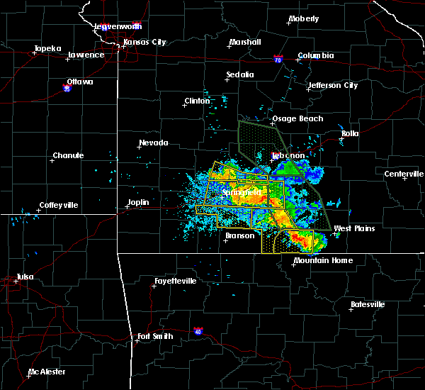 At 845 pm cdt, severe thunderstorms were located along a line extending from 9 miles north of gainesville to bakersfield, and moving southwest at 15 mph (radar indicated). Hazards include 60 mph wind gusts. Expect damage to roofs. siding and trees. locations impacted include, bakersfield, brixey, dora, gainesville, hardenville, isabella, pontiac, rockbridge, sycamore, tecumseh, udall, willhoit and zanoni. this warning also includes bull shoals lake. A severe thunderstorm watch remains in effect until midnight cdt saturday morning for southwest missouri. At 845 pm cdt, severe thunderstorms were located along a line extending from 9 miles north of gainesville to bakersfield, and moving southwest at 15 mph (radar indicated). Hazards include 60 mph wind gusts. Expect damage to roofs. siding and trees. locations impacted include, bakersfield, brixey, dora, gainesville, hardenville, isabella, pontiac, rockbridge, sycamore, tecumseh, udall, willhoit and zanoni. this warning also includes bull shoals lake. A severe thunderstorm watch remains in effect until midnight cdt saturday morning for southwest missouri.
|
| 7/24/2015 8:27 PM CDT |
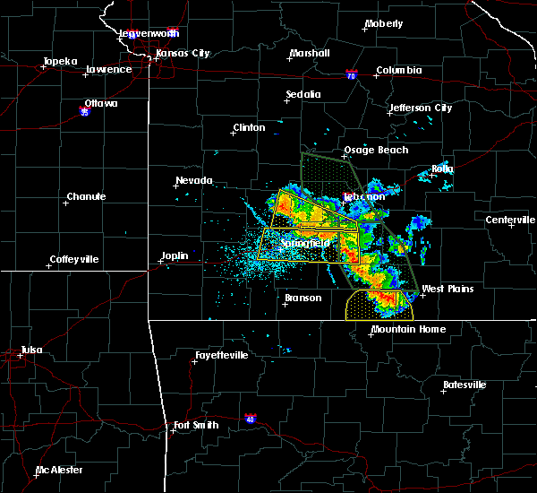 At 826 pm cdt, severe thunderstorms were located along a line extending from 13 miles north of gainesville to 8 miles north of bakersfield, and moving south at 35 mph (radar indicated). Hazards include 60 mph wind gusts. Expect damage to roofs. Siding and trees. At 826 pm cdt, severe thunderstorms were located along a line extending from 13 miles north of gainesville to 8 miles north of bakersfield, and moving south at 35 mph (radar indicated). Hazards include 60 mph wind gusts. Expect damage to roofs. Siding and trees.
|
| 7/20/2015 8:06 PM CDT |
 At 802 pm cdt, severe thunderstorms were located along a line extending from 19 miles east of alton to 13 miles southwest of bakersfield, and moving southeast at 25 mph (law enforcement. a tree was reported down near thomasville at 740 pm). Hazards include 60 mph wind gusts. Expect damage to roofs. siding and trees. locations impacted include, alton, bakersfield, brandsville, caulfield, couch, greer, koshkonong, lanton, moody, myrtle, rover, south fork, thayer, thomasville and wilderness. This warning also includes grand gulf state park. At 802 pm cdt, severe thunderstorms were located along a line extending from 19 miles east of alton to 13 miles southwest of bakersfield, and moving southeast at 25 mph (law enforcement. a tree was reported down near thomasville at 740 pm). Hazards include 60 mph wind gusts. Expect damage to roofs. siding and trees. locations impacted include, alton, bakersfield, brandsville, caulfield, couch, greer, koshkonong, lanton, moody, myrtle, rover, south fork, thayer, thomasville and wilderness. This warning also includes grand gulf state park.
|
| 7/20/2015 7:38 PM CDT |
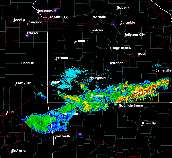 At 737 pm cdt, severe thunderstorms were located along a line extending from 18 miles northeast of alton to 11 miles west of bakersfield, and moving southeast at 25 mph (radar indicated). Hazards include 60 mph wind gusts. Expect damage to roofs. Siding and trees. At 737 pm cdt, severe thunderstorms were located along a line extending from 18 miles northeast of alton to 11 miles west of bakersfield, and moving southeast at 25 mph (radar indicated). Hazards include 60 mph wind gusts. Expect damage to roofs. Siding and trees.
|
| 7/9/2015 3:37 PM CDT |
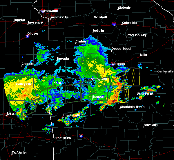 At 334 pm cdt, severe thunderstorms were located along a line extending from 14 miles north of gainesville to 7 miles north of gainesville to gainesville to 10 miles southwest of gainesville, and moving east at 35 mph (radar indicated). Hazards include 60 mph wind gusts. Expect damage to roofs. Siding and trees. At 334 pm cdt, severe thunderstorms were located along a line extending from 14 miles north of gainesville to 7 miles north of gainesville to gainesville to 10 miles southwest of gainesville, and moving east at 35 mph (radar indicated). Hazards include 60 mph wind gusts. Expect damage to roofs. Siding and trees.
|
| 6/26/2015 12:37 PM CDT |
 The severe thunderstorm warning for ozark county will expire at 1245 pm cdt, the line of storms which prompted the warning has weakened below severe limits, and no longer poses an immediate threat to life or property. however, heavy rain is still possible with these thunderstorms. a severe thunderstorm watch remains in effect until 800 pm cdt friday evening for south central missouri. The severe thunderstorm warning for ozark county will expire at 1245 pm cdt, the line of storms which prompted the warning has weakened below severe limits, and no longer poses an immediate threat to life or property. however, heavy rain is still possible with these thunderstorms. a severe thunderstorm watch remains in effect until 800 pm cdt friday evening for south central missouri.
|
| 6/26/2015 12:10 PM CDT |
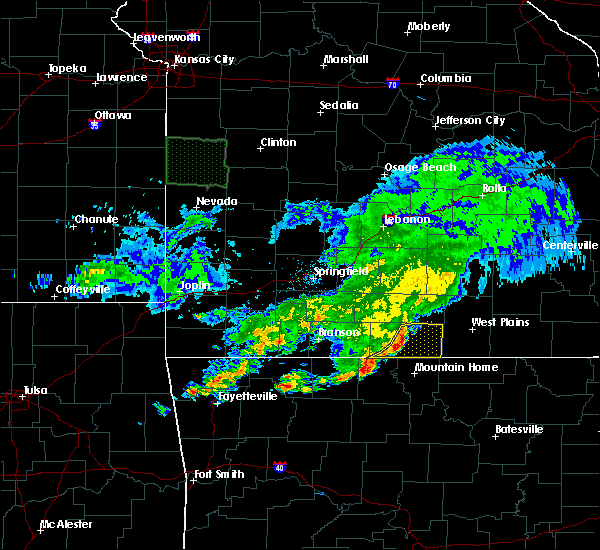 At 1208 pm cdt, severe thunderstorms were located along a line extending from brixey to pontiac, and moving east at 35 mph (radar indicated). Hazards include 60 mph wind gusts. Expect damage to roofs. siding and trees. locations impacted include, bakersfield, brixey, dora, gainesville, hardenville, isabella, pontiac, rockbridge, sundown, sycamore, tecumseh, udall, willhoit and zanoni. This warning also includes bull shoals lake. At 1208 pm cdt, severe thunderstorms were located along a line extending from brixey to pontiac, and moving east at 35 mph (radar indicated). Hazards include 60 mph wind gusts. Expect damage to roofs. siding and trees. locations impacted include, bakersfield, brixey, dora, gainesville, hardenville, isabella, pontiac, rockbridge, sundown, sycamore, tecumseh, udall, willhoit and zanoni. This warning also includes bull shoals lake.
|
| 6/26/2015 11:51 AM CDT |
 At 1149 am cdt, severe thunderstorms were located along a line extending from thornfield to theodosia, and moving east at 35 mph (radar indicated). Hazards include 60 mph wind gusts. Expect damage to roofs. Siding and trees. At 1149 am cdt, severe thunderstorms were located along a line extending from thornfield to theodosia, and moving east at 35 mph (radar indicated). Hazards include 60 mph wind gusts. Expect damage to roofs. Siding and trees.
|
| 5/24/2015 5:43 PM CDT | At 540 pm cdt, severe thunderstorms were located along a line extending from 25 miles west of gainesville to 17 miles south of gainesville, and moving northeast at 65 mph (radar indicated). Hazards include 60 mph wind gusts. Expect damage to roofs. siding and trees. severe thunderstorms will be near, brownbranch, bradleyville, thornfield and gainesville around 550 pm cdt. rome, goodhope, willhoit and udall around 555 pm cdt. zanoni, wasola, sycamore and rockbridge around 600 pm cdt. ava, dogwood, dora and south fork around 605 pm cdt. pottersville, gentryville, drury and brushyknob around 610 pm cdt. this warning also includes bull shoals lake. A tornado watch remains in effect until 800 pm cdt sunday evening for southern missouri. |
| 5/10/2015 1:56 PM CDT | The severe thunderstorm warning for ozark county will expire at 200 pm cdt, the line of storms which prompted the warning has weakened below severe limits, and no longer poses an immediate threat to life or property. however, gusty winds and heavy rain are still possible with these thunderstorms. a tornado watch remains in effect until 700 pm cdt sunday evening for southern missouri. |
| 5/10/2015 1:43 PM CDT | At 141 pm cdt, severe thunderstorms were located along a line extending from 13 miles north of gainesville to 9 miles south of gainesville, and moving east at 45 mph (radar indicated). Hazards include 60 mph wind gusts and penny size hail. Expect damage to roofs. siding and trees. locations impacted include, bakersfield, brixey, dora, gainesville, hardenville, isabella, noble, pontiac, rockbridge, sycamore, tecumseh, udall, wasola, willhoit and zanoni. this warning also includes bull shoals lake. a tornado watch remains in effect until 700 pm cdt sunday evening for southern missouri. 0. 75in. |
| 5/10/2015 1:34 PM CDT | At 130 pm cdt, severe thunderstorms were located along a line extending from 16 miles northwest of gainesville to 11 miles southwest of gainesville, and moving east at 45 mph (radar indicated). Hazards include 60 mph wind gusts and penny size hail. Expect damage to roofs. siding and trees. locations impacted include, bakersfield, brixey, dora, gainesville, hardenville, isabella, long run, noble, pontiac, rockbridge, sundown, sycamore, tecumseh, theodosia, thornfield, udall, wasola, willhoit and zanoni. this warning also includes bull shoals lake. a tornado watch remains in effect until 700 pm cdt sunday evening for southern missouri. 0. 75in. |
| 5/10/2015 1:07 PM CDT | At 103 pm cdt, severe thunderstorms were located along a line extending from eastern taney county into eastern boone county arkansas, and moving east at 45 mph (radar indicated). Hazards include 60 mph wind gusts and penny size hail. Expect damage to roofs. siding and trees. locations impacted include, bakersfield and gainesville. this warning also includes bull shoals lake. 0. 75in. |
| 5/10/2015 12:56 PM CDT | At 1253 pm cdt, severe thunderstorms were located along a line extending from 35 miles west of gainesville to 37 miles southwest of gainesville to 43 miles southwest of gainesville, and moving east at 45 mph (radar indicated). Hazards include 60 mph wind gusts and penny size hail. Expect damage to roofs. Siding and trees. |
| 4/3/2015 5:45 AM CDT | The national weather service in springfield has issued a * severe thunderstorm warning for. southern howell county in south central missouri. southeastern ozark county in southwest missouri. until 615 am cdt * at 545 am cdt. A severe thunderstorm was located near. |
| 4/3/2015 5:43 AM CDT | The national weather service in little rock has issued a * severe thunderstorm warning for. northern baxter county in north central arkansas. fulton county in north central arkansas. northeastern izard county in north central arkansas. Until 630 am cdt. |
| 4/3/2015 5:31 AM CDT | A severe thunderstorm warning remains in effect for southeastern taney and southeastern ozark counties until 545 am cdt. at 528 am cdt. a severe thunderstorm was located near gainesville. and moving east at 45 mph. hazard. 60 mph wind gusts and quarter size hail. source. Radar indicated. |
| 4/3/2015 5:17 AM CDT | A severe thunderstorm warning remains in effect for southeastern taney and ozark counties until 545 am cdt. at 515 am cdt. a severe thunderstorm was located 6 miles northwest of gainesville. and moving east at 45 mph. hazard. 60 mph wind gusts and quarter size hail. source. Radar indicated. |
| 4/3/2015 5:02 AM CDT | The national weather service in springfield has issued a * severe thunderstorm warning for. south central douglas county in southwest missouri. ozark county in southwest missouri. eastern taney county in southwest missouri. Until 545 am cdt. |
| 4/3/2015 1:41 AM CDT | The tornado warning for eastern ozark county will expire at 145 am cdt. the storm which prompted the warning has moved out of the warned area. A tornado watch remains in effect until 300 am cdt friday morning for south central missouri. |
| 4/3/2015 1:17 AM CDT | A tornado warning remains in effect for east central ozark county until 145 am cdt. at 116 am cdt. a severe thunderstorm capable of producing a tornado was located over east central ozark county. and moving east at 35 mph. hazard. Tornado. |
| 4/3/2015 1:05 AM CDT | The national weather service in springfield has issued a * tornado warning for. ozark county in southwest missouri. until 145 am cdt * at 102 am cdt. a severe thunderstorm capable of producing a tornado was located 5 miles north of gainesville. And moving east. |
| 3/25/2015 8:01 PM CDT | The national weather service in springfield has issued a * severe thunderstorm warning for. ozark county in southwest missouri. until 900 pm cdt * at 800 pm cdt. a severe thunderstorm was located near gainesville. And moving east at 45 mph. |
| 3/25/2015 6:50 PM CST | Quarter sized hail reported 7.5 miles ENE of Bakersfield, MO |
| 3/25/2015 7:45 PM CDT | A severe thunderstorm warning remains in effect for ozark county until 800 pm cdt. at 743 pm cdt. a severe thunderstorm was located 7 miles southeast of gainesville. and moving east at 30 mph. several other severe thunderstorms were located across ozark county. hazard. Golf ball size hail and 60 mph wind gusts. |
| 3/25/2015 7:21 PM CDT | A severe thunderstorm warning remains in effect for ozark county until 800 pm cdt. at 719 pm cdt. a severe thunderstorm was located 11 miles southwest of gainesville. and moving east at 50 mph. hazard. golf ball size hail and 60 mph wind gusts. source. Radar indicated. |
| 3/25/2015 7:14 PM CDT | A severe thunderstorm warning remains in effect for ozark county until 800 pm cdt. at 711 pm cdt. a severe thunderstorm was located 14 miles west of gainesville. and moving east at 50 mph. hazard. ping pong ball size hail and 60 mph wind gusts. source. Radar indicated. |
| 3/25/2015 6:56 PM CDT | The national weather service in springfield has issued a * severe thunderstorm warning for. ozark county in southwest missouri. until 800 pm cdt * at 654 pm cdt. a severe thunderstorm was located 24 miles west of gainesville. And moving east at 45 mph. |
| 3/24/2015 7:20 PM CDT | A severe thunderstorm warning remains in effect for southern ozark county until 800 pm cdt. at 718 pm cdt. a severe thunderstorm was located 12 miles southwest of gainesville. and moving east at 45 mph. hazard. quarter size hail. source. Radar indicated. |
| 3/24/2015 6:54 PM CDT | The national weather service in springfield has issued a * severe thunderstorm warning for. southern douglas county in southwest missouri. ozark county in southwest missouri. southeastern taney county in southwest missouri. Until 800 pm cdt. |
| 9/17/2014 1:39 PM CDT | A tree was blown down onto a county road...and a number of large limbs were blown dow in baxter county AR, 7.1 miles NE of Bakersfield, MO |
| 6/5/2014 11:19 AM CDT | Post office estimated 60 mph winds in ozark county MO, 0.5 miles NNW of Bakersfield, MO |
| 4/27/2014 4:35 PM CDT | Quarter sized hail reported 0.5 miles NNW of Bakersfield, MO |
| 7/23/2013 3:25 PM CDT | Quarter sized hail reported 0.5 miles NNW of Bakersfield, MO |
| 5/20/2013 10:55 PM CDT | Power lines and trees down at highway yy and highway 142 in howell county MO, 3 miles W of Bakersfield, MO |
| 1/1/0001 12:00 AM | Quarter sized hail reported 6.3 miles SSW of Bakersfield, MO |
Hail Maps for Bakersfield, MO


Connect with Interactive Hail Maps