

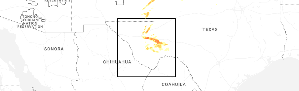
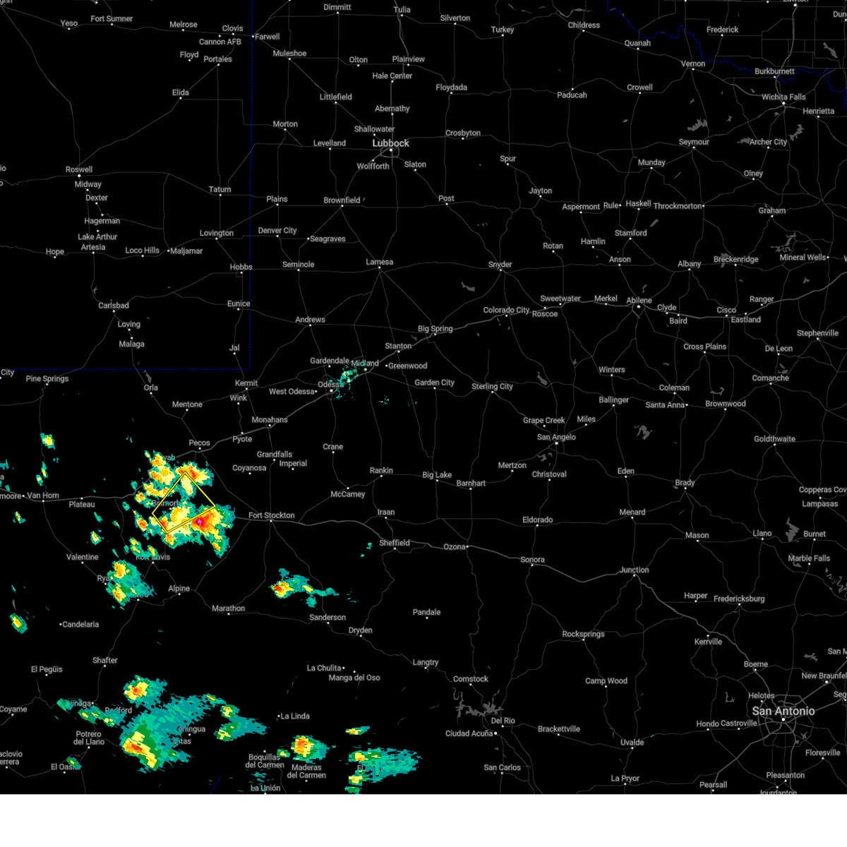
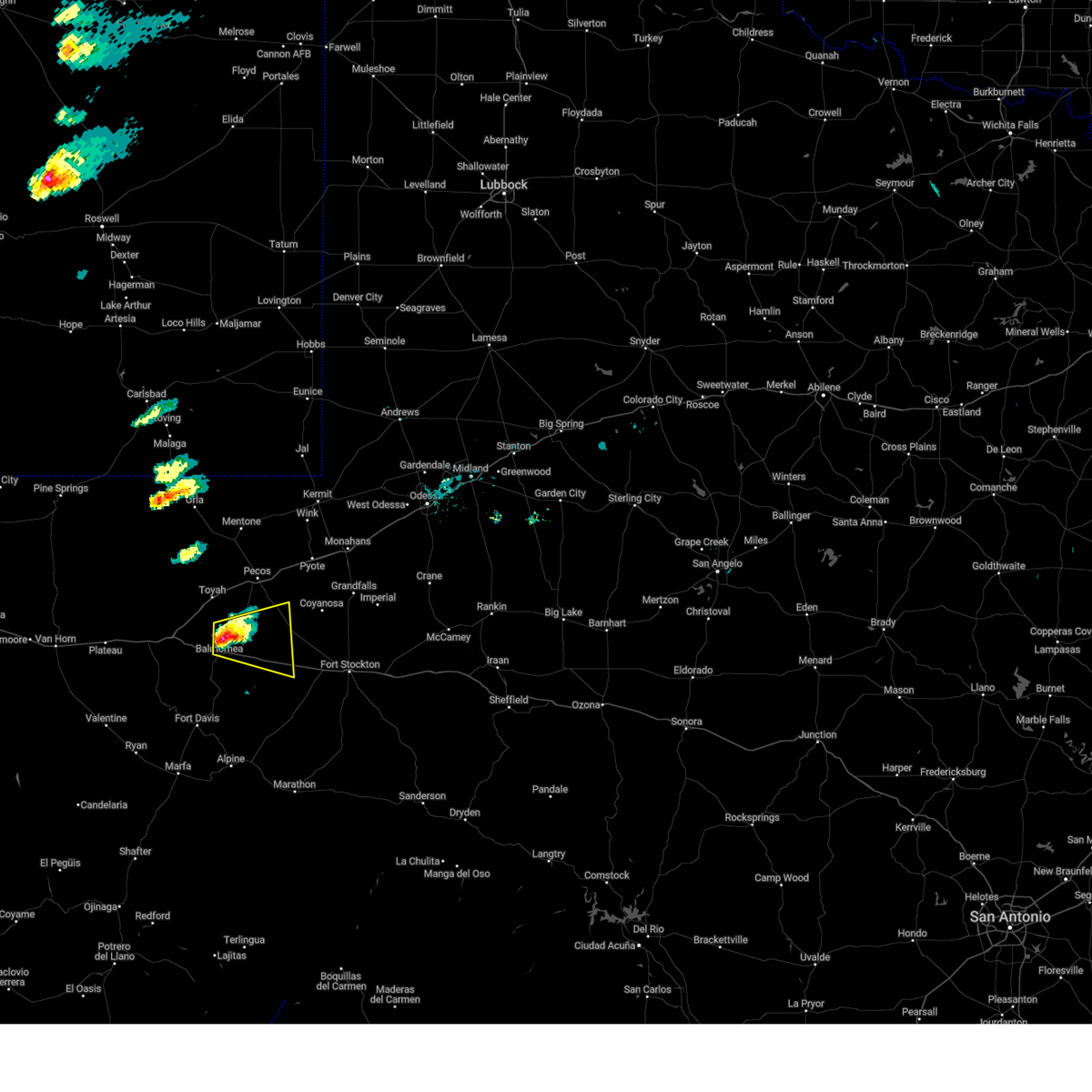
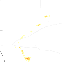
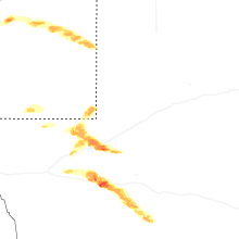
Hail Map for Balmorhea, TX
The Balmorhea, TX area has had 15 reports of on-the-ground hail by trained spotters, and has been under severe weather warnings 8 times during the past 12 months. Doppler radar has detected hail at or near Balmorhea, TX on 46 occasions, including 6 occasions during the past year.
| Name: | Balmorhea, TX |
| Where Located: | 43.4 miles N of Alpine, TX |
| Map: | Google Map for Balmorhea, TX |
| Population: | 479 |
| Housing Units: | 215 |
| More Info: | Search Google for Balmorhea, TX |
5
The Top Recent Hail Date for Balmorhea, TX is Thursday, June 5, 2025 (2nd out of 46)
Hail and Wind Damage Spotted near Balmorhea, TX
| Date / Time | Report Details |
|---|---|
| 6/30/2025 3:44 PM CDT |
 Svrmaf the national weather service in midland has issued a * severe thunderstorm warning for, southwestern reeves county in southwestern texas, * until 415 pm cdt. * at 344 pm cdt, a severe thunderstorm was located over balmorhea, or 20 miles south of toyah, moving west at 20 mph (radar indicated). Hazards include 60 mph wind gusts and quarter size hail. Hail damage to vehicles is expected. Expect wind damage to roofs, siding, and trees. Svrmaf the national weather service in midland has issued a * severe thunderstorm warning for, southwestern reeves county in southwestern texas, * until 415 pm cdt. * at 344 pm cdt, a severe thunderstorm was located over balmorhea, or 20 miles south of toyah, moving west at 20 mph (radar indicated). Hazards include 60 mph wind gusts and quarter size hail. Hail damage to vehicles is expected. Expect wind damage to roofs, siding, and trees.
|
| 6/5/2025 2:20 PM CDT |
 At 220 pm cdt, a severe thunderstorm was located over saragosa, or 23 miles south of toyah, moving east at 30 mph (radar indicated). Hazards include golf ball size hail and 60 mph wind gusts. People and animals outdoors will be injured. expect hail damage to roofs, siding, windows, and vehicles. expect wind damage to roofs, siding, and trees. locations impacted include, pecos, balmorhea, barstow, balmorhea lake, balmorhea state park, saragosa, verhalen, toyah lake, b f goodrich testing track, pecos municipal airport, toyahvale, and firestone test track. this includes the following highways, interstate 10 between mile markers 201 and 246. Interstate 20 between mile markers 8 and 12, and between mile markers 40 and 53. At 220 pm cdt, a severe thunderstorm was located over saragosa, or 23 miles south of toyah, moving east at 30 mph (radar indicated). Hazards include golf ball size hail and 60 mph wind gusts. People and animals outdoors will be injured. expect hail damage to roofs, siding, windows, and vehicles. expect wind damage to roofs, siding, and trees. locations impacted include, pecos, balmorhea, barstow, balmorhea lake, balmorhea state park, saragosa, verhalen, toyah lake, b f goodrich testing track, pecos municipal airport, toyahvale, and firestone test track. this includes the following highways, interstate 10 between mile markers 201 and 246. Interstate 20 between mile markers 8 and 12, and between mile markers 40 and 53.
|
| 6/5/2025 2:11 PM CDT |
 Svrmaf the national weather service in midland has issued a * severe thunderstorm warning for, northwestern pecos county in southwestern texas, southern reeves county in southwestern texas, west central ward county in western texas, * until 245 pm cdt. * at 211 pm cdt, a severe thunderstorm was located over balmorhea, or 23 miles south of toyah, moving northeast at 30 mph (radar indicated). Hazards include 60 mph wind gusts and half dollar size hail. Hail damage to vehicles is expected. Expect wind damage to roofs, siding, and trees. Svrmaf the national weather service in midland has issued a * severe thunderstorm warning for, northwestern pecos county in southwestern texas, southern reeves county in southwestern texas, west central ward county in western texas, * until 245 pm cdt. * at 211 pm cdt, a severe thunderstorm was located over balmorhea, or 23 miles south of toyah, moving northeast at 30 mph (radar indicated). Hazards include 60 mph wind gusts and half dollar size hail. Hail damage to vehicles is expected. Expect wind damage to roofs, siding, and trees.
|
| 5/23/2025 4:06 PM CDT |
 The storm which prompted the warning has weakened below severe limits, and no longer poses an immediate threat to life or property. therefore, the warning will be allowed to expire. however, gusty winds are still possible with this thunderstorm. The storm which prompted the warning has weakened below severe limits, and no longer poses an immediate threat to life or property. therefore, the warning will be allowed to expire. however, gusty winds are still possible with this thunderstorm.
|
| 5/23/2025 3:57 PM CDT |
 At 357 pm cdt, a severe thunderstorm was located over balmorhea lake, or 25 miles south of toyah, moving northeast at 10 mph (radar indicated). Hazards include 60 mph wind gusts and quarter size hail. Hail damage to vehicles is expected. expect wind damage to roofs, siding, and trees. locations impacted include, balmorhea, balmorhea lake, balmorhea state park, saragosa, verhalen, and toyahvale. This includes interstate 10 between mile markers 201 and 224. At 357 pm cdt, a severe thunderstorm was located over balmorhea lake, or 25 miles south of toyah, moving northeast at 10 mph (radar indicated). Hazards include 60 mph wind gusts and quarter size hail. Hail damage to vehicles is expected. expect wind damage to roofs, siding, and trees. locations impacted include, balmorhea, balmorhea lake, balmorhea state park, saragosa, verhalen, and toyahvale. This includes interstate 10 between mile markers 201 and 224.
|
| 5/23/2025 3:28 PM CDT |
 Svrmaf the national weather service in midland has issued a * severe thunderstorm warning for, south central reeves county in southwestern texas, northeastern jeff davis county in southwestern texas, * until 415 pm cdt. * at 327 pm cdt, a severe thunderstorm was located over balmorhea state park, or 24 miles north of fort davis, moving northeast at 15 mph (radar indicated). Hazards include 60 mph wind gusts and quarter size hail. Hail damage to vehicles is expected. Expect wind damage to roofs, siding, and trees. Svrmaf the national weather service in midland has issued a * severe thunderstorm warning for, south central reeves county in southwestern texas, northeastern jeff davis county in southwestern texas, * until 415 pm cdt. * at 327 pm cdt, a severe thunderstorm was located over balmorhea state park, or 24 miles north of fort davis, moving northeast at 15 mph (radar indicated). Hazards include 60 mph wind gusts and quarter size hail. Hail damage to vehicles is expected. Expect wind damage to roofs, siding, and trees.
|
| 4/26/2025 4:56 PM CDT |
 At 456 pm cdt, a severe thunderstorm was located near saragosa, or 18 miles southeast of toyah, moving east at 20 mph (radar indicated). Hazards include golf ball size hail and 60 mph wind gusts. People and animals outdoors will be injured. expect hail damage to roofs, siding, windows, and vehicles. expect wind damage to roofs, siding, and trees. locations impacted include, balmorhea, saragosa, and verhalen. This includes interstate 10 between mile markers 205 and 236. At 456 pm cdt, a severe thunderstorm was located near saragosa, or 18 miles southeast of toyah, moving east at 20 mph (radar indicated). Hazards include golf ball size hail and 60 mph wind gusts. People and animals outdoors will be injured. expect hail damage to roofs, siding, windows, and vehicles. expect wind damage to roofs, siding, and trees. locations impacted include, balmorhea, saragosa, and verhalen. This includes interstate 10 between mile markers 205 and 236.
|
| 4/26/2025 4:49 PM CDT |
 Svrmaf the national weather service in midland has issued a * severe thunderstorm warning for, west central pecos county in southwestern texas, south central reeves county in southwestern texas, * until 545 pm cdt. * at 449 pm cdt, a severe thunderstorm was located near saragosa, or 16 miles south of toyah, moving east at 20 mph (radar indicated). Hazards include 60 mph wind gusts and half dollar size hail. Hail damage to vehicles is expected. Expect wind damage to roofs, siding, and trees. Svrmaf the national weather service in midland has issued a * severe thunderstorm warning for, west central pecos county in southwestern texas, south central reeves county in southwestern texas, * until 545 pm cdt. * at 449 pm cdt, a severe thunderstorm was located near saragosa, or 16 miles south of toyah, moving east at 20 mph (radar indicated). Hazards include 60 mph wind gusts and half dollar size hail. Hail damage to vehicles is expected. Expect wind damage to roofs, siding, and trees.
|
| 6/1/2024 3:57 PM CDT |
 Svrmaf the national weather service in midland has issued a * severe thunderstorm warning for, south central reeves county in southwestern texas, * until 430 pm cdt. * at 357 pm cdt, a severe thunderstorm was located over balmorhea lake, or 24 miles south of toyah, moving northeast at 30 mph (radar indicated). Hazards include 60 mph wind gusts and half dollar size hail. Hail damage to vehicles is expected. Expect wind damage to roofs, siding, and trees. Svrmaf the national weather service in midland has issued a * severe thunderstorm warning for, south central reeves county in southwestern texas, * until 430 pm cdt. * at 357 pm cdt, a severe thunderstorm was located over balmorhea lake, or 24 miles south of toyah, moving northeast at 30 mph (radar indicated). Hazards include 60 mph wind gusts and half dollar size hail. Hail damage to vehicles is expected. Expect wind damage to roofs, siding, and trees.
|
| 5/4/2024 2:56 PM CDT |
 Svrmaf the national weather service in midland has issued a * severe thunderstorm warning for, northwestern pecos county in southwestern texas, south central reeves county in southwestern texas, * until 345 pm cdt. * at 255 pm cdt, a severe thunderstorm was located over saragosa, or 21 miles south of toyah, moving east at 25 mph (radar indicated). Hazards include ping pong ball size hail and 60 mph wind gusts. People and animals outdoors will be injured. expect hail damage to roofs, siding, windows, and vehicles. Expect wind damage to roofs, siding, and trees. Svrmaf the national weather service in midland has issued a * severe thunderstorm warning for, northwestern pecos county in southwestern texas, south central reeves county in southwestern texas, * until 345 pm cdt. * at 255 pm cdt, a severe thunderstorm was located over saragosa, or 21 miles south of toyah, moving east at 25 mph (radar indicated). Hazards include ping pong ball size hail and 60 mph wind gusts. People and animals outdoors will be injured. expect hail damage to roofs, siding, windows, and vehicles. Expect wind damage to roofs, siding, and trees.
|
| 5/4/2024 2:43 PM CDT | Ping Pong Ball sized hail reported 2 miles NNE of Balmorhea, TX, some hail may be slightly larger. lots of small hail. |
| 6/7/2023 5:37 PM CDT |
 At 537 pm cdt, a severe thunderstorm was located near saragosa, or 24 miles southeast of toyah, moving east at 20 mph (trained weather spotters report two inch hail). Hazards include two inch hail and 70 mph wind gusts. People and animals outdoors will be injured. expect hail damage to roofs, siding, windows, and vehicles. expect considerable tree damage. wind damage is also likely to mobile homes, roofs, and outbuildings. locations impacted include, balmorhea, balmorhea lake, saragosa and verhalen. this includes interstate 10 between mile markers 208 and 222. thunderstorm damage threat, considerable hail threat, observed max hail size, 2. 00 in wind threat, radar indicated max wind gust, 70 mph. At 537 pm cdt, a severe thunderstorm was located near saragosa, or 24 miles southeast of toyah, moving east at 20 mph (trained weather spotters report two inch hail). Hazards include two inch hail and 70 mph wind gusts. People and animals outdoors will be injured. expect hail damage to roofs, siding, windows, and vehicles. expect considerable tree damage. wind damage is also likely to mobile homes, roofs, and outbuildings. locations impacted include, balmorhea, balmorhea lake, saragosa and verhalen. this includes interstate 10 between mile markers 208 and 222. thunderstorm damage threat, considerable hail threat, observed max hail size, 2. 00 in wind threat, radar indicated max wind gust, 70 mph.
|
| 6/7/2023 5:35 PM CDT | Hen Egg sized hail reported 0.4 miles NNW of Balmorhea, TX, 2 inch diameter hail observed on the south side of balmorhea. |
| 6/7/2023 5:24 PM CDT | Ping Pong Ball sized hail reported 1.7 miles S of Balmorhea, TX, ping pong ball sized hail observed along i-10 near balmorhea. |
| 6/7/2023 5:21 PM CDT |
 At 521 pm cdt, a severe thunderstorm was located over saragosa, or 22 miles south of toyah, moving east at 25 mph (radar indicated). Hazards include ping pong ball size hail and 60 mph wind gusts. People and animals outdoors will be injured. expect hail damage to roofs, siding, windows, and vehicles. expect wind damage to roofs, siding, and trees. locations impacted include, balmorhea, balmorhea lake, saragosa, balmorhea state park and toyahvale. this includes interstate 10 between mile markers 201 and 222. hail threat, radar indicated max hail size, 1. 50 in wind threat, radar indicated max wind gust, 60 mph. At 521 pm cdt, a severe thunderstorm was located over saragosa, or 22 miles south of toyah, moving east at 25 mph (radar indicated). Hazards include ping pong ball size hail and 60 mph wind gusts. People and animals outdoors will be injured. expect hail damage to roofs, siding, windows, and vehicles. expect wind damage to roofs, siding, and trees. locations impacted include, balmorhea, balmorhea lake, saragosa, balmorhea state park and toyahvale. this includes interstate 10 between mile markers 201 and 222. hail threat, radar indicated max hail size, 1. 50 in wind threat, radar indicated max wind gust, 60 mph.
|
| 6/7/2023 4:56 PM CDT |
 At 455 pm cdt, a severe thunderstorm was located 9 miles northwest of balmorhea state park, or 19 miles south of toyah, moving east at 20 mph (radar indicated). Hazards include 60 mph wind gusts and half dollar size hail. Hail damage to vehicles is expected. Expect wind damage to roofs, siding, and trees. At 455 pm cdt, a severe thunderstorm was located 9 miles northwest of balmorhea state park, or 19 miles south of toyah, moving east at 20 mph (radar indicated). Hazards include 60 mph wind gusts and half dollar size hail. Hail damage to vehicles is expected. Expect wind damage to roofs, siding, and trees.
|
| 5/26/2023 6:56 PM CDT | Half Dollar sized hail reported 0.4 miles NNW of Balmorhea, TX |
| 5/26/2023 6:56 PM CDT |
 At 656 pm cdt, a severe thunderstorm was located over balmorhea, or 20 miles south of toyah, moving northeast at 30 mph (radar indicated). Hazards include golf ball size hail and 60 mph wind gusts. People and animals outdoors will be injured. expect hail damage to roofs, siding, windows, and vehicles. expect wind damage to roofs, siding, and trees. locations impacted include, balmorhea, balmorhea lake, saragosa, balmorhea state park, verhalen and toyahvale. this includes interstate 10 between mile markers 195 and 217. thunderstorm damage threat, considerable hail threat, radar indicated max hail size, 1. 75 in wind threat, radar indicated max wind gust, 60 mph. At 656 pm cdt, a severe thunderstorm was located over balmorhea, or 20 miles south of toyah, moving northeast at 30 mph (radar indicated). Hazards include golf ball size hail and 60 mph wind gusts. People and animals outdoors will be injured. expect hail damage to roofs, siding, windows, and vehicles. expect wind damage to roofs, siding, and trees. locations impacted include, balmorhea, balmorhea lake, saragosa, balmorhea state park, verhalen and toyahvale. this includes interstate 10 between mile markers 195 and 217. thunderstorm damage threat, considerable hail threat, radar indicated max hail size, 1. 75 in wind threat, radar indicated max wind gust, 60 mph.
|
| 5/26/2023 6:51 PM CDT |
 At 650 pm cdt, a severe thunderstorm was located near balmorhea, or 21 miles south of toyah, moving northeast at 30 mph (radar indicated). Hazards include 60 mph wind gusts and half dollar size hail. Hail damage to vehicles is expected. expect wind damage to roofs, siding, and trees. locations impacted include, balmorhea, balmorhea lake, saragosa, balmorhea state park, verhalen and toyahvale. this includes interstate 10 between mile markers 196 and 217. hail threat, radar indicated max hail size, 1. 25 in wind threat, radar indicated max wind gust, 60 mph. At 650 pm cdt, a severe thunderstorm was located near balmorhea, or 21 miles south of toyah, moving northeast at 30 mph (radar indicated). Hazards include 60 mph wind gusts and half dollar size hail. Hail damage to vehicles is expected. expect wind damage to roofs, siding, and trees. locations impacted include, balmorhea, balmorhea lake, saragosa, balmorhea state park, verhalen and toyahvale. this includes interstate 10 between mile markers 196 and 217. hail threat, radar indicated max hail size, 1. 25 in wind threat, radar indicated max wind gust, 60 mph.
|
| 5/26/2023 6:39 PM CDT |
 At 637 pm cdt, a severe thunderstorm was located near balmorhea state park, or 21 miles southeast of kent, moving northeast at 30 mph (radar indicated). Hazards include 60 mph wind gusts and quarter size hail. Hail damage to vehicles is expected. Expect wind damage to roofs, siding, and trees. At 637 pm cdt, a severe thunderstorm was located near balmorhea state park, or 21 miles southeast of kent, moving northeast at 30 mph (radar indicated). Hazards include 60 mph wind gusts and quarter size hail. Hail damage to vehicles is expected. Expect wind damage to roofs, siding, and trees.
|
| 5/3/2023 5:42 PM CDT | Quarter sized hail reported 13.1 miles SW of Balmorhea, TX |
| 6/3/2022 7:59 PM CDT |
 At 759 pm cdt, a severe thunderstorm was located 8 miles southwest of toyah, moving east at 25 mph (radar indicated). Hazards include 60 mph wind gusts and quarter size hail. Hail damage to vehicles is expected. expect wind damage to roofs, siding, and trees. locations impacted include, balmorhea and saragosa. this includes the following highways, interstate 10 between mile markers 187 and 210. interstate 20 between mile markers 0 and 16. hail threat, radar indicated max hail size, 1. 00 in wind threat, radar indicated max wind gust, 60 mph. At 759 pm cdt, a severe thunderstorm was located 8 miles southwest of toyah, moving east at 25 mph (radar indicated). Hazards include 60 mph wind gusts and quarter size hail. Hail damage to vehicles is expected. expect wind damage to roofs, siding, and trees. locations impacted include, balmorhea and saragosa. this includes the following highways, interstate 10 between mile markers 187 and 210. interstate 20 between mile markers 0 and 16. hail threat, radar indicated max hail size, 1. 00 in wind threat, radar indicated max wind gust, 60 mph.
|
| 6/3/2022 7:48 PM CDT |
 At 748 pm cdt, a severe thunderstorm was located 15 miles west of toyah, moving southeast at 5 mph (radar indicated). Hazards include ping pong ball size hail and 60 mph wind gusts. People and animals outdoors will be injured. expect hail damage to roofs, siding, windows, and vehicles. expect wind damage to roofs, siding, and trees. locations impacted include, balmorhea and saragosa. this includes the following highways, interstate 10 between mile markers 181 and 210. interstate 20 between mile markers 0 and 16. hail threat, radar indicated max hail size, 1. 50 in wind threat, radar indicated max wind gust, 60 mph. At 748 pm cdt, a severe thunderstorm was located 15 miles west of toyah, moving southeast at 5 mph (radar indicated). Hazards include ping pong ball size hail and 60 mph wind gusts. People and animals outdoors will be injured. expect hail damage to roofs, siding, windows, and vehicles. expect wind damage to roofs, siding, and trees. locations impacted include, balmorhea and saragosa. this includes the following highways, interstate 10 between mile markers 181 and 210. interstate 20 between mile markers 0 and 16. hail threat, radar indicated max hail size, 1. 50 in wind threat, radar indicated max wind gust, 60 mph.
|
| 6/3/2022 7:34 PM CDT |
 At 734 pm cdt, a severe thunderstorm was located 14 miles southwest of toyah, moving southeast at 20 mph (radar indicated). Hazards include golf ball size hail and 60 mph wind gusts. People and animals outdoors will be injured. expect hail damage to roofs, siding, windows, and vehicles. expect wind damage to roofs, siding, and trees. locations impacted include, balmorhea and saragosa. this includes the following highways, interstate 10 between mile markers 179 and 210. interstate 20 between mile markers 0 and 16. thunderstorm damage threat, considerable hail threat, radar indicated max hail size, 1. 75 in wind threat, radar indicated max wind gust, 60 mph. At 734 pm cdt, a severe thunderstorm was located 14 miles southwest of toyah, moving southeast at 20 mph (radar indicated). Hazards include golf ball size hail and 60 mph wind gusts. People and animals outdoors will be injured. expect hail damage to roofs, siding, windows, and vehicles. expect wind damage to roofs, siding, and trees. locations impacted include, balmorhea and saragosa. this includes the following highways, interstate 10 between mile markers 179 and 210. interstate 20 between mile markers 0 and 16. thunderstorm damage threat, considerable hail threat, radar indicated max hail size, 1. 75 in wind threat, radar indicated max wind gust, 60 mph.
|
| 6/3/2022 7:29 PM CDT |
 At 729 pm cdt, a severe thunderstorm was located 15 miles southwest of toyah, moving southeast at 20 mph (radar indicated). Hazards include 60 mph wind gusts and quarter size hail. Hail damage to vehicles is expected. Expect wind damage to roofs, siding, and trees. At 729 pm cdt, a severe thunderstorm was located 15 miles southwest of toyah, moving southeast at 20 mph (radar indicated). Hazards include 60 mph wind gusts and quarter size hail. Hail damage to vehicles is expected. Expect wind damage to roofs, siding, and trees.
|
| 5/23/2022 7:12 PM CDT |
 At 712 pm cdt, a severe thunderstorm was located over saragosa, or 22 miles south of toyah, moving east at 5 mph (radar indicated). Hazards include 60 mph wind gusts and quarter size hail. Hail damage to vehicles is expected. expect wind damage to roofs, siding, and trees. locations impacted include, balmorhea, balmorhea lake, balmorhea state park, saragosa, verhalen and toyahvale. this includes interstate 10 between mile markers 203 and 226. hail threat, radar indicated max hail size, 1. 00 in wind threat, radar indicated max wind gust, 60 mph. At 712 pm cdt, a severe thunderstorm was located over saragosa, or 22 miles south of toyah, moving east at 5 mph (radar indicated). Hazards include 60 mph wind gusts and quarter size hail. Hail damage to vehicles is expected. expect wind damage to roofs, siding, and trees. locations impacted include, balmorhea, balmorhea lake, balmorhea state park, saragosa, verhalen and toyahvale. this includes interstate 10 between mile markers 203 and 226. hail threat, radar indicated max hail size, 1. 00 in wind threat, radar indicated max wind gust, 60 mph.
|
| 5/23/2022 6:58 PM CDT |
 At 657 pm cdt, a severe thunderstorm was located over balmorhea, or 21 miles south of toyah, moving east at 5 mph (radar indicated). Hazards include ping pong ball size hail and 60 mph wind gusts. People and animals outdoors will be injured. expect hail damage to roofs, siding, windows, and vehicles. expect wind damage to roofs, siding, and trees. locations impacted include, balmorhea, balmorhea lake, balmorhea state park, saragosa, verhalen and toyahvale. this includes interstate 10 between mile markers 203 and 226. hail threat, radar indicated max hail size, 1. 50 in wind threat, radar indicated max wind gust, 60 mph. At 657 pm cdt, a severe thunderstorm was located over balmorhea, or 21 miles south of toyah, moving east at 5 mph (radar indicated). Hazards include ping pong ball size hail and 60 mph wind gusts. People and animals outdoors will be injured. expect hail damage to roofs, siding, windows, and vehicles. expect wind damage to roofs, siding, and trees. locations impacted include, balmorhea, balmorhea lake, balmorhea state park, saragosa, verhalen and toyahvale. this includes interstate 10 between mile markers 203 and 226. hail threat, radar indicated max hail size, 1. 50 in wind threat, radar indicated max wind gust, 60 mph.
|
| 5/23/2022 6:49 PM CDT |
 At 649 pm cdt, a severe thunderstorm was located over balmorhea, or 20 miles south of toyah, moving east at 5 mph (radar indicated). Hazards include 60 mph wind gusts and quarter size hail. Hail damage to vehicles is expected. Expect wind damage to roofs, siding, and trees. At 649 pm cdt, a severe thunderstorm was located over balmorhea, or 20 miles south of toyah, moving east at 5 mph (radar indicated). Hazards include 60 mph wind gusts and quarter size hail. Hail damage to vehicles is expected. Expect wind damage to roofs, siding, and trees.
|
| 5/29/2021 1:50 AM CDT |
 At 149 am cdt, a severe thunderstorm was located over balmorhea lake, or 26 miles northeast of fort davis, moving south at 35 mph (radar indicated). Hazards include two inch hail and 60 mph wind gusts. People and animals outdoors will be injured. expect hail damage to roofs, siding, windows, and vehicles. expect wind damage to roofs, siding, and trees. locations impacted include, balmorhea, balmorhea lake, balmorhea state park, saragosa, black mountain, verhalen, star mountain, toyahvale and buffalo trail scout camp. This includes interstate 10 between mile markers 194 and 223. At 149 am cdt, a severe thunderstorm was located over balmorhea lake, or 26 miles northeast of fort davis, moving south at 35 mph (radar indicated). Hazards include two inch hail and 60 mph wind gusts. People and animals outdoors will be injured. expect hail damage to roofs, siding, windows, and vehicles. expect wind damage to roofs, siding, and trees. locations impacted include, balmorhea, balmorhea lake, balmorhea state park, saragosa, black mountain, verhalen, star mountain, toyahvale and buffalo trail scout camp. This includes interstate 10 between mile markers 194 and 223.
|
| 5/29/2021 1:39 AM CDT |
 At 139 am cdt, a severe thunderstorm was located over balmorhea, or 21 miles south of toyah, moving south at 35 mph (radar indicated). Hazards include ping pong ball size hail and 60 mph wind gusts. People and animals outdoors will be injured. expect hail damage to roofs, siding, windows, and vehicles. expect wind damage to roofs, siding, and trees. locations impacted include, balmorhea, balmorhea lake, balmorhea state park, saragosa, black mountain, verhalen, star mountain, toyahvale and buffalo trail scout camp. this includes the following highways, interstate 10 between mile markers 192 and 223. Interstate 20 between mile markers 6 and 15. At 139 am cdt, a severe thunderstorm was located over balmorhea, or 21 miles south of toyah, moving south at 35 mph (radar indicated). Hazards include ping pong ball size hail and 60 mph wind gusts. People and animals outdoors will be injured. expect hail damage to roofs, siding, windows, and vehicles. expect wind damage to roofs, siding, and trees. locations impacted include, balmorhea, balmorhea lake, balmorhea state park, saragosa, black mountain, verhalen, star mountain, toyahvale and buffalo trail scout camp. this includes the following highways, interstate 10 between mile markers 192 and 223. Interstate 20 between mile markers 6 and 15.
|
| 5/29/2021 1:23 AM CDT |
 At 123 am cdt, a severe thunderstorm was located 11 miles south of toyah, moving south at 35 mph (radar indicated). Hazards include 60 mph wind gusts and half dollar size hail. Hail damage to vehicles is expected. Expect wind damage to roofs, siding, and trees. At 123 am cdt, a severe thunderstorm was located 11 miles south of toyah, moving south at 35 mph (radar indicated). Hazards include 60 mph wind gusts and half dollar size hail. Hail damage to vehicles is expected. Expect wind damage to roofs, siding, and trees.
|
| 5/28/2021 6:59 PM CDT | Quarter sized hail reported 5.8 miles WSW of Balmorhea, TX |
| 5/28/2021 6:56 PM CDT |
 At 655 pm cdt, a severe thunderstorm was located over saragosa, or 21 miles south of toyah, moving southeast at 25 mph (radar indicated). Hazards include 60 mph wind gusts and quarter size hail. Hail damage to vehicles is expected. expect wind damage to roofs, siding, and trees. locations impacted include, balmorhea, balmorhea lake, saragosa and verhalen. This includes interstate 10 between mile markers 202 and 225. At 655 pm cdt, a severe thunderstorm was located over saragosa, or 21 miles south of toyah, moving southeast at 25 mph (radar indicated). Hazards include 60 mph wind gusts and quarter size hail. Hail damage to vehicles is expected. expect wind damage to roofs, siding, and trees. locations impacted include, balmorhea, balmorhea lake, saragosa and verhalen. This includes interstate 10 between mile markers 202 and 225.
|
| 5/28/2021 6:35 PM CDT |
 At 635 pm cdt, a severe thunderstorm was located 8 miles north of balmorhea, or 14 miles south of toyah, moving southeast at 20 mph (radar indicated). Hazards include 60 mph wind gusts and quarter size hail. Hail damage to vehicles is expected. Expect wind damage to roofs, siding, and trees. At 635 pm cdt, a severe thunderstorm was located 8 miles north of balmorhea, or 14 miles south of toyah, moving southeast at 20 mph (radar indicated). Hazards include 60 mph wind gusts and quarter size hail. Hail damage to vehicles is expected. Expect wind damage to roofs, siding, and trees.
|
| 7/6/2019 4:46 PM CDT |
 At 446 pm cdt, a severe thunderstorm was located over saragosa, or 22 miles south of toyah, moving northwest at 35 mph (radar indicated). Hazards include 60 mph wind gusts and half dollar size hail. Hail damage to vehicles is expected. Expect wind damage to roofs, siding, and trees. At 446 pm cdt, a severe thunderstorm was located over saragosa, or 22 miles south of toyah, moving northwest at 35 mph (radar indicated). Hazards include 60 mph wind gusts and half dollar size hail. Hail damage to vehicles is expected. Expect wind damage to roofs, siding, and trees.
|
| 6/18/2019 3:17 PM CDT |
 At 316 pm cdt, a severe thunderstorm was located near saragosa, or 18 miles south of toyah, moving northeast at 15 mph (radar indicated). Hazards include two inch hail and 60 mph wind gusts. People and animals outdoors will be injured. expect hail damage to roofs, siding, windows, and vehicles. expect wind damage to roofs, siding, and trees. locations impacted include, pecos, balmorhea, balmorhea lake, saragosa, verhalen, toyah lake and pecos municipal airport. this includes the following highways, interstate 10 between mile markers 203 and 221. Interstate 20 between mile markers 36 and 42. At 316 pm cdt, a severe thunderstorm was located near saragosa, or 18 miles south of toyah, moving northeast at 15 mph (radar indicated). Hazards include two inch hail and 60 mph wind gusts. People and animals outdoors will be injured. expect hail damage to roofs, siding, windows, and vehicles. expect wind damage to roofs, siding, and trees. locations impacted include, pecos, balmorhea, balmorhea lake, saragosa, verhalen, toyah lake and pecos municipal airport. this includes the following highways, interstate 10 between mile markers 203 and 221. Interstate 20 between mile markers 36 and 42.
|
| 6/18/2019 3:13 PM CDT |
 At 313 pm cdt, a severe thunderstorm was located near saragosa, or 18 miles south of toyah, moving northeast at 20 mph (radar indicated). Hazards include 60 mph wind gusts and half dollar size hail. Hail damage to vehicles is expected. Expect wind damage to roofs, siding, and trees. At 313 pm cdt, a severe thunderstorm was located near saragosa, or 18 miles south of toyah, moving northeast at 20 mph (radar indicated). Hazards include 60 mph wind gusts and half dollar size hail. Hail damage to vehicles is expected. Expect wind damage to roofs, siding, and trees.
|
| 6/18/2019 2:42 PM CDT |
 At 241 pm cdt, a severe thunderstorm was located 8 miles southwest of balmorhea state park, or 17 miles north of fort davis, moving east at 10 mph (radar indicated). Hazards include golf ball size hail and 60 mph wind gusts. People and animals outdoors will be injured. expect hail damage to roofs, siding, windows, and vehicles. expect wind damage to roofs, siding, and trees. locations impacted include, balmorhea, balmorhea lake, balmorhea state park, buffalo trail scout camp, toyahvale and star mountain. This includes interstate 10 between mile markers 198 and 206. At 241 pm cdt, a severe thunderstorm was located 8 miles southwest of balmorhea state park, or 17 miles north of fort davis, moving east at 10 mph (radar indicated). Hazards include golf ball size hail and 60 mph wind gusts. People and animals outdoors will be injured. expect hail damage to roofs, siding, windows, and vehicles. expect wind damage to roofs, siding, and trees. locations impacted include, balmorhea, balmorhea lake, balmorhea state park, buffalo trail scout camp, toyahvale and star mountain. This includes interstate 10 between mile markers 198 and 206.
|
| 6/18/2019 2:18 PM CDT |
 At 218 pm cdt, a severe thunderstorm was located 10 miles southwest of balmorhea state park, or 18 miles north of fort davis, moving northeast at 5 mph (radar indicated). Hazards include 60 mph wind gusts and half dollar size hail. Hail damage to vehicles is expected. Expect wind damage to roofs, siding, and trees. At 218 pm cdt, a severe thunderstorm was located 10 miles southwest of balmorhea state park, or 18 miles north of fort davis, moving northeast at 5 mph (radar indicated). Hazards include 60 mph wind gusts and half dollar size hail. Hail damage to vehicles is expected. Expect wind damage to roofs, siding, and trees.
|
| 6/5/2019 6:40 PM CDT |
 At 640 pm cdt, a severe thunderstorm was located 7 miles northwest of balmorhea, or 16 miles south of toyah, moving northeast at 20 mph (radar indicated). Hazards include 60 mph wind gusts and quarter size hail. Hail damage to vehicles is expected. Expect wind damage to roofs, siding, and trees. At 640 pm cdt, a severe thunderstorm was located 7 miles northwest of balmorhea, or 16 miles south of toyah, moving northeast at 20 mph (radar indicated). Hazards include 60 mph wind gusts and quarter size hail. Hail damage to vehicles is expected. Expect wind damage to roofs, siding, and trees.
|
| 6/4/2019 6:21 PM CDT |
 At 621 pm cdt, a severe thunderstorm was located 8 miles southwest of balmorhea state park, or 19 miles north of fort davis, moving east at 5 mph (radar indicated). Hazards include 60 mph wind gusts and half dollar size hail. Hail damage to vehicles is expected. expect wind damage to roofs, siding, and trees. locations impacted include, balmorhea, balmorhea state park, buffalo trail scout camp and toyahvale. This includes interstate 10 between mile markers 197 and 206. At 621 pm cdt, a severe thunderstorm was located 8 miles southwest of balmorhea state park, or 19 miles north of fort davis, moving east at 5 mph (radar indicated). Hazards include 60 mph wind gusts and half dollar size hail. Hail damage to vehicles is expected. expect wind damage to roofs, siding, and trees. locations impacted include, balmorhea, balmorhea state park, buffalo trail scout camp and toyahvale. This includes interstate 10 between mile markers 197 and 206.
|
| 6/4/2019 5:59 PM CDT |
 At 559 pm cdt, a severe thunderstorm was located 10 miles west of balmorhea state park, or 20 miles southeast of kent, moving northeast at 5 mph (radar indicated). Hazards include 60 mph wind gusts and quarter size hail. Hail damage to vehicles is expected. Expect wind damage to roofs, siding, and trees. At 559 pm cdt, a severe thunderstorm was located 10 miles west of balmorhea state park, or 20 miles southeast of kent, moving northeast at 5 mph (radar indicated). Hazards include 60 mph wind gusts and quarter size hail. Hail damage to vehicles is expected. Expect wind damage to roofs, siding, and trees.
|
| 5/31/2019 8:28 PM CDT |
 At 827 pm cdt, a severe thunderstorm was located 9 miles south of toyah, moving northeast at 30 mph (radar indicated). Hazards include golf ball size hail and 60 mph wind gusts. People and animals outdoors will be injured. expect hail damage to roofs, siding, windows, and vehicles. expect wind damage to roofs, siding, and trees. locations impacted include, balmorhea. this includes the following highways, interstate 10 between mile markers 196 and 209. Interstate 20 between mile markers 10 and 20. At 827 pm cdt, a severe thunderstorm was located 9 miles south of toyah, moving northeast at 30 mph (radar indicated). Hazards include golf ball size hail and 60 mph wind gusts. People and animals outdoors will be injured. expect hail damage to roofs, siding, windows, and vehicles. expect wind damage to roofs, siding, and trees. locations impacted include, balmorhea. this includes the following highways, interstate 10 between mile markers 196 and 209. Interstate 20 between mile markers 10 and 20.
|
| 5/31/2019 8:00 PM CDT |
 At 800 pm cdt, a severe thunderstorm was located 7 miles northwest of balmorhea state park, or 20 miles east of kent, moving north at 25 mph (radar indicated). Hazards include golf ball size hail and 60 mph wind gusts. People and animals outdoors will be injured. expect hail damage to roofs, siding, windows, and vehicles. expect wind damage to roofs, siding, and trees. locations impacted include, balmorhea, balmorhea state park and toyahvale. this includes the following highways, interstate 10 between mile markers 191 and 209. Interstate 20 between mile markers 7 and 20. At 800 pm cdt, a severe thunderstorm was located 7 miles northwest of balmorhea state park, or 20 miles east of kent, moving north at 25 mph (radar indicated). Hazards include golf ball size hail and 60 mph wind gusts. People and animals outdoors will be injured. expect hail damage to roofs, siding, windows, and vehicles. expect wind damage to roofs, siding, and trees. locations impacted include, balmorhea, balmorhea state park and toyahvale. this includes the following highways, interstate 10 between mile markers 191 and 209. Interstate 20 between mile markers 7 and 20.
|
| 5/31/2019 7:41 PM CDT |
 At 741 pm cdt, a severe thunderstorm was located 9 miles west of balmorhea state park, or 21 miles southeast of kent, moving north at 20 mph (radar indicated). Hazards include golf ball size hail and 60 mph wind gusts. People and animals outdoors will be injured. expect hail damage to roofs, siding, windows, and vehicles. Expect wind damage to roofs, siding, and trees. At 741 pm cdt, a severe thunderstorm was located 9 miles west of balmorhea state park, or 21 miles southeast of kent, moving north at 20 mph (radar indicated). Hazards include golf ball size hail and 60 mph wind gusts. People and animals outdoors will be injured. expect hail damage to roofs, siding, windows, and vehicles. Expect wind damage to roofs, siding, and trees.
|
| 4/23/2019 8:37 PM CDT |
 At 832 pm cdt, law enforcement reported golf ball size hail in the town of toyah. at 832 cdt radar indicated a severe thunderstorm over toyah, moving east at 40 mph (law enforcement). Hazards include golf ball size hail. People and animals outdoors will be injured. expect damage to roofs, siding, windows, and vehicles. locations impacted include, pecos, toyah, verhalen, toyah lake, toyahvale and pecos municipal airport. this includes the following highways, interstate 10 between mile markers 179 and 223. Interstate 20 between mile markers 0 and 43. At 832 pm cdt, law enforcement reported golf ball size hail in the town of toyah. at 832 cdt radar indicated a severe thunderstorm over toyah, moving east at 40 mph (law enforcement). Hazards include golf ball size hail. People and animals outdoors will be injured. expect damage to roofs, siding, windows, and vehicles. locations impacted include, pecos, toyah, verhalen, toyah lake, toyahvale and pecos municipal airport. this includes the following highways, interstate 10 between mile markers 179 and 223. Interstate 20 between mile markers 0 and 43.
|
| 4/23/2019 8:31 PM CDT |
 At 829 pm cdt, a severe thunderstorm was located near toyah, moving east at 40 mph (radar indicated). Hazards include golf ball size hail and 60 mph wind gusts. People and animals outdoors will be injured. expect hail damage to roofs, siding, windows, and vehicles. expect wind damage to roofs, siding, and trees. locations impacted include, pecos, toyah, verhalen, toyah lake, toyahvale and pecos municipal airport. this includes the following highways, interstate 10 between mile markers 179 and 223. Interstate 20 between mile markers 0 and 43. At 829 pm cdt, a severe thunderstorm was located near toyah, moving east at 40 mph (radar indicated). Hazards include golf ball size hail and 60 mph wind gusts. People and animals outdoors will be injured. expect hail damage to roofs, siding, windows, and vehicles. expect wind damage to roofs, siding, and trees. locations impacted include, pecos, toyah, verhalen, toyah lake, toyahvale and pecos municipal airport. this includes the following highways, interstate 10 between mile markers 179 and 223. Interstate 20 between mile markers 0 and 43.
|
| 4/23/2019 7:57 PM CDT |
 At 757 pm cdt, a severe thunderstorm was located 16 miles west of toyah, moving northeast at 55 mph (radar indicated). Hazards include golf ball size hail and 60 mph wind gusts. People and animals outdoors will be injured. expect hail damage to roofs, siding, windows, and vehicles. Expect wind damage to roofs, siding, and trees. At 757 pm cdt, a severe thunderstorm was located 16 miles west of toyah, moving northeast at 55 mph (radar indicated). Hazards include golf ball size hail and 60 mph wind gusts. People and animals outdoors will be injured. expect hail damage to roofs, siding, windows, and vehicles. Expect wind damage to roofs, siding, and trees.
|
| 10/8/2018 9:48 PM CDT | Quarter sized hail reported 12.1 miles W of Balmorhea, TX, located along 1-10 at mm243 |
| 5/23/2018 4:20 PM CDT |
 At 358 pm cdt, a severe thunderstorm was located near balmorhea lake, or 24 miles northeast of fort davis, moving east at 10 mph (radar indicated). Hazards include 70 mph wind gusts and ping pong ball size hail. People and animals outdoors will be injured. expect hail damage to roofs, siding, windows, and vehicles. expect considerable tree damage. Wind damage is also likely to mobile homes, roofs, and outbuildings. At 358 pm cdt, a severe thunderstorm was located near balmorhea lake, or 24 miles northeast of fort davis, moving east at 10 mph (radar indicated). Hazards include 70 mph wind gusts and ping pong ball size hail. People and animals outdoors will be injured. expect hail damage to roofs, siding, windows, and vehicles. expect considerable tree damage. Wind damage is also likely to mobile homes, roofs, and outbuildings.
|
| 5/23/2018 3:58 PM CDT |
 At 358 pm cdt, a severe thunderstorm was located near balmorhea lake, or 24 miles northeast of fort davis, moving east at 10 mph (radar indicated). Hazards include 70 mph wind gusts and ping pong ball size hail. People and animals outdoors will be injured. expect hail damage to roofs, siding, windows, and vehicles. expect considerable tree damage. Wind damage is also likely to mobile homes, roofs, and outbuildings. At 358 pm cdt, a severe thunderstorm was located near balmorhea lake, or 24 miles northeast of fort davis, moving east at 10 mph (radar indicated). Hazards include 70 mph wind gusts and ping pong ball size hail. People and animals outdoors will be injured. expect hail damage to roofs, siding, windows, and vehicles. expect considerable tree damage. Wind damage is also likely to mobile homes, roofs, and outbuildings.
|
| 5/23/2018 3:19 PM CDT |
 At 319 pm cdt, a severe thunderstorm was located near balmorhea state park, or 20 miles north of fort davis, moving east at 10 mph (radar indicated). Hazards include 70 mph wind gusts and ping pong ball size hail. People and animals outdoors will be injured. expect hail damage to roofs, siding, windows, and vehicles. expect considerable tree damage. wind damage is also likely to mobile homes, roofs, and outbuildings. locations impacted include, balmorhea, balmorhea lake, balmorhea state park, buffalo trail scout camp, toyahvale and star mountain. This includes interstate 10 between mile markers 214 and 222. At 319 pm cdt, a severe thunderstorm was located near balmorhea state park, or 20 miles north of fort davis, moving east at 10 mph (radar indicated). Hazards include 70 mph wind gusts and ping pong ball size hail. People and animals outdoors will be injured. expect hail damage to roofs, siding, windows, and vehicles. expect considerable tree damage. wind damage is also likely to mobile homes, roofs, and outbuildings. locations impacted include, balmorhea, balmorhea lake, balmorhea state park, buffalo trail scout camp, toyahvale and star mountain. This includes interstate 10 between mile markers 214 and 222.
|
| 5/23/2018 2:59 PM CDT |
 At 258 pm cdt, a severe thunderstorm was located near balmorhea state park, or 19 miles north of fort davis, moving east at 10 mph (radar indicated). Hazards include 70 mph wind gusts and ping pong ball size hail. People and animals outdoors will be injured. expect hail damage to roofs, siding, windows, and vehicles. expect considerable tree damage. Wind damage is also likely to mobile homes, roofs, and outbuildings. At 258 pm cdt, a severe thunderstorm was located near balmorhea state park, or 19 miles north of fort davis, moving east at 10 mph (radar indicated). Hazards include 70 mph wind gusts and ping pong ball size hail. People and animals outdoors will be injured. expect hail damage to roofs, siding, windows, and vehicles. expect considerable tree damage. Wind damage is also likely to mobile homes, roofs, and outbuildings.
|
| 5/22/2018 6:32 PM CDT |
 At 631 pm cdt, a severe thunderstorm was located near balmorhea state park, or 21 miles northeast of fort davis, moving southeast at 10 mph (radar indicated). Hazards include golf ball size hail and 60 mph wind gusts. People and animals outdoors will be injured. expect hail damage to roofs, siding, windows, and vehicles. expect wind damage to roofs, siding, and trees. locations impacted include, balmorhea, balmorhea lake, saragosa, balmorhea state park and toyahvale. This includes interstate 10 between mile markers 209 and 219. At 631 pm cdt, a severe thunderstorm was located near balmorhea state park, or 21 miles northeast of fort davis, moving southeast at 10 mph (radar indicated). Hazards include golf ball size hail and 60 mph wind gusts. People and animals outdoors will be injured. expect hail damage to roofs, siding, windows, and vehicles. expect wind damage to roofs, siding, and trees. locations impacted include, balmorhea, balmorhea lake, saragosa, balmorhea state park and toyahvale. This includes interstate 10 between mile markers 209 and 219.
|
| 5/22/2018 6:03 PM CDT |
 At 603 pm cdt, a severe thunderstorm was located near balmorhea state park, or 22 miles north of fort davis, moving east at 10 mph (radar indicated). Hazards include golf ball size hail and 60 mph wind gusts. People and animals outdoors will be injured. expect hail damage to roofs, siding, windows, and vehicles. Expect wind damage to roofs, siding, and trees. At 603 pm cdt, a severe thunderstorm was located near balmorhea state park, or 22 miles north of fort davis, moving east at 10 mph (radar indicated). Hazards include golf ball size hail and 60 mph wind gusts. People and animals outdoors will be injured. expect hail damage to roofs, siding, windows, and vehicles. Expect wind damage to roofs, siding, and trees.
|
| 4/12/2017 6:58 PM CDT |
 At 658 pm cdt, a severe thunderstorm was located 7 miles north of mcdonald observatory, or 14 miles northwest of fort davis, moving northeast at 35 mph (radar indicated). Hazards include 60 mph wind gusts and quarter size hail. Hail damage to vehicles is expected. Expect wind damage to roofs, siding, and trees. At 658 pm cdt, a severe thunderstorm was located 7 miles north of mcdonald observatory, or 14 miles northwest of fort davis, moving northeast at 35 mph (radar indicated). Hazards include 60 mph wind gusts and quarter size hail. Hail damage to vehicles is expected. Expect wind damage to roofs, siding, and trees.
|
| 4/12/2017 5:45 PM CDT | Golf Ball sized hail reported 14.1 miles SSW of Balmorhea, TX |
| 4/12/2017 5:18 PM CDT |
 At 517 pm cdt, a severe thunderstorm was located near saragosa, or 16 miles southeast of toyah, moving east at 35 mph (radar indicated). Hazards include 60 mph wind gusts and half dollar size hail. Hail damage to vehicles is expected. Expect wind damage to roofs, siding, and trees. At 517 pm cdt, a severe thunderstorm was located near saragosa, or 16 miles southeast of toyah, moving east at 35 mph (radar indicated). Hazards include 60 mph wind gusts and half dollar size hail. Hail damage to vehicles is expected. Expect wind damage to roofs, siding, and trees.
|
| 4/12/2017 4:48 PM CDT |
 At 447 pm cdt, a severe thunderstorm was located 9 miles northwest of toyahvale, or 18 miles east of kent, moving east at 20 mph (radar indicated). Hazards include 60 mph wind gusts and quarter size hail. Hail damage to vehicles is expected. Expect wind damage to roofs, siding, and trees. At 447 pm cdt, a severe thunderstorm was located 9 miles northwest of toyahvale, or 18 miles east of kent, moving east at 20 mph (radar indicated). Hazards include 60 mph wind gusts and quarter size hail. Hail damage to vehicles is expected. Expect wind damage to roofs, siding, and trees.
|
| 4/12/2017 3:50 PM CDT | Quarter sized hail reported 15.1 miles W of Balmorhea, TX, severe hail reported after storm had passed. report of hail covering 25 percent of road... melted. road passable. hail roughly 2ft deep in a few locations. |
| 4/12/2017 3:10 PM CDT | Golf Ball sized hail reported 14.3 miles WNW of Balmorhea, TX, golf ball size hail covering i-10 at mile marker 221. |
| 4/12/2017 2:51 PM CDT |
 At 251 pm cdt, a severe thunderstorm was located 8 miles south of toyah, moving northeast at 15 mph (radar indicated). Hazards include 70 mph wind gusts and ping pong ball size hail. People and animals outdoors will be injured. expect hail damage to roofs, siding, windows, and vehicles. expect considerable tree damage. wind damage is also likely to mobile homes, roofs, and outbuildings. locations impacted include, balmorhea, verhalen, balmorhea lake, saragosa, balmorhea state park and toyahvale. this includes the following highways, interstate 10 between mile markers 195 and 223. Interstate 20 between mile markers 7 and 17. At 251 pm cdt, a severe thunderstorm was located 8 miles south of toyah, moving northeast at 15 mph (radar indicated). Hazards include 70 mph wind gusts and ping pong ball size hail. People and animals outdoors will be injured. expect hail damage to roofs, siding, windows, and vehicles. expect considerable tree damage. wind damage is also likely to mobile homes, roofs, and outbuildings. locations impacted include, balmorhea, verhalen, balmorhea lake, saragosa, balmorhea state park and toyahvale. this includes the following highways, interstate 10 between mile markers 195 and 223. Interstate 20 between mile markers 7 and 17.
|
| 4/12/2017 2:30 PM CDT |
 At 229 pm cdt, a severe thunderstorm was located 12 miles northwest of balmorhea, or 13 miles south of toyah, moving east at 15 mph (radar indicated). Hazards include 70 mph wind gusts and ping pong ball size hail. People and animals outdoors will be injured. expect hail damage to roofs, siding, windows, and vehicles. expect considerable tree damage. Wind damage is also likely to mobile homes, roofs, and outbuildings. At 229 pm cdt, a severe thunderstorm was located 12 miles northwest of balmorhea, or 13 miles south of toyah, moving east at 15 mph (radar indicated). Hazards include 70 mph wind gusts and ping pong ball size hail. People and animals outdoors will be injured. expect hail damage to roofs, siding, windows, and vehicles. expect considerable tree damage. Wind damage is also likely to mobile homes, roofs, and outbuildings.
|
| 4/12/2017 2:08 PM CDT |
 At 207 pm cdt, a severe thunderstorm was located 12 miles northwest of balmorhea, or 16 miles southwest of toyah, moving east at 15 mph (radar indicated). Hazards include 60 mph wind gusts and half dollar size hail. Hail damage to vehicles is expected. expect wind damage to roofs, siding, and trees. locations impacted include, toyah, balmorhea, balmorhea lake, saragosa, toyahvale and balmorhea state park. this includes the following highways, interstate 10 between mile markers 185 and 220. Interstate 20 between mile markers 0 and 24. At 207 pm cdt, a severe thunderstorm was located 12 miles northwest of balmorhea, or 16 miles southwest of toyah, moving east at 15 mph (radar indicated). Hazards include 60 mph wind gusts and half dollar size hail. Hail damage to vehicles is expected. expect wind damage to roofs, siding, and trees. locations impacted include, toyah, balmorhea, balmorhea lake, saragosa, toyahvale and balmorhea state park. this includes the following highways, interstate 10 between mile markers 185 and 220. Interstate 20 between mile markers 0 and 24.
|
| 4/12/2017 1:42 PM CDT |
 At 142 pm cdt, a severe thunderstorm was located 11 miles east of kent, moving northeast at 15 mph (radar indicated). Hazards include 60 mph wind gusts and half dollar size hail. Hail damage to vehicles is expected. Expect wind damage to roofs, siding, and trees. At 142 pm cdt, a severe thunderstorm was located 11 miles east of kent, moving northeast at 15 mph (radar indicated). Hazards include 60 mph wind gusts and half dollar size hail. Hail damage to vehicles is expected. Expect wind damage to roofs, siding, and trees.
|
| 9/17/2016 5:45 PM CDT |
 At 544 pm cdt, a severe thunderstorm was located near toyahvale, or 20 miles north of fort davis, moving southeast at 10 mph (radar indicated). Hazards include 60 mph wind gusts and quarter size hail. Hail damage to vehicles is expected. expect wind damage to roofs, siding, and trees. locations impacted include, balmorhea, balmorhea lake, toyahvale, balmorhea state park and saragosa. This includes interstate 10 between mile markers 195 and 217. At 544 pm cdt, a severe thunderstorm was located near toyahvale, or 20 miles north of fort davis, moving southeast at 10 mph (radar indicated). Hazards include 60 mph wind gusts and quarter size hail. Hail damage to vehicles is expected. expect wind damage to roofs, siding, and trees. locations impacted include, balmorhea, balmorhea lake, toyahvale, balmorhea state park and saragosa. This includes interstate 10 between mile markers 195 and 217.
|
| 9/17/2016 5:11 PM CDT |
 At 511 pm cdt, a severe thunderstorm was located near toyahvale, or 21 miles east of kent, moving east at 20 mph (radar indicated). Hazards include 60 mph wind gusts and quarter size hail. Hail damage to vehicles is expected. Expect wind damage to roofs, siding, and trees. At 511 pm cdt, a severe thunderstorm was located near toyahvale, or 21 miles east of kent, moving east at 20 mph (radar indicated). Hazards include 60 mph wind gusts and quarter size hail. Hail damage to vehicles is expected. Expect wind damage to roofs, siding, and trees.
|
| 10/7/2015 9:04 PM CDT |
 At 903 pm cdt, a severe thunderstorm was located 12 miles northwest of toyahvale, or 33 miles north of fort davis, moving north at 40 mph. Hazards include 60 mph wind gusts and nickel size hail. Expect damage to roofs. siding and trees. locations impacted include, balmorhea, toyah, toyahvale, verhalen, balmorhea state park and balmorhea lake. this includes the following highways, interstate 10 between mile markers 185 and 209. Interstate 20 between mile markers 0 and 23. At 903 pm cdt, a severe thunderstorm was located 12 miles northwest of toyahvale, or 33 miles north of fort davis, moving north at 40 mph. Hazards include 60 mph wind gusts and nickel size hail. Expect damage to roofs. siding and trees. locations impacted include, balmorhea, toyah, toyahvale, verhalen, balmorhea state park and balmorhea lake. this includes the following highways, interstate 10 between mile markers 185 and 209. Interstate 20 between mile markers 0 and 23.
|
| 10/7/2015 8:38 PM CDT |
 At 837 pm cdt, a severe thunderstorm was located 8 miles northwest of davis mountains state park, or 10 miles northwest of fort davis, moving north at 45 mph. at 836 pm cdt, golfball size hail was been reported at the mcdonald observatory (observed by public). Hazards include golf ball size hail and 60 mph wind gusts. People and animals outdoors will be injured. expect hail damage to roofs, siding, windows and vehicles. Expect wind damage to roofs, siding and trees. At 837 pm cdt, a severe thunderstorm was located 8 miles northwest of davis mountains state park, or 10 miles northwest of fort davis, moving north at 45 mph. at 836 pm cdt, golfball size hail was been reported at the mcdonald observatory (observed by public). Hazards include golf ball size hail and 60 mph wind gusts. People and animals outdoors will be injured. expect hail damage to roofs, siding, windows and vehicles. Expect wind damage to roofs, siding and trees.
|
| 10/7/2015 4:39 PM CDT |
 At 438 pm cdt, a severe thunderstorm was located over saragosa, or 28 miles southwest of pecos, moving east at 35 mph (radar indicated). Hazards include 60 mph wind gusts and quarter size hail. Hail damage to vehicles is expected. expect wind damage to roofs, siding and trees. locations impacted include, balmorhea, toyahvale, verhalen, saragosa, balmorhea lake and balmorhea state park. this includes the following highways, interstate 10 between mile markers 189 and 223. Interstate 20 between mile markers 6 and 20. At 438 pm cdt, a severe thunderstorm was located over saragosa, or 28 miles southwest of pecos, moving east at 35 mph (radar indicated). Hazards include 60 mph wind gusts and quarter size hail. Hail damage to vehicles is expected. expect wind damage to roofs, siding and trees. locations impacted include, balmorhea, toyahvale, verhalen, saragosa, balmorhea lake and balmorhea state park. this includes the following highways, interstate 10 between mile markers 189 and 223. Interstate 20 between mile markers 6 and 20.
|
| 10/7/2015 4:11 PM CDT |
 At 410 pm cdt, a severe thunderstorm was located 9 miles west of toyahvale, or 27 miles north of fort davis, moving northeast at 25 mph (radar indicated). Hazards include 60 mph wind gusts and quarter size hail. Hail damage to vehicles is expected. Expect wind damage to roofs, siding and trees. At 410 pm cdt, a severe thunderstorm was located 9 miles west of toyahvale, or 27 miles north of fort davis, moving northeast at 25 mph (radar indicated). Hazards include 60 mph wind gusts and quarter size hail. Hail damage to vehicles is expected. Expect wind damage to roofs, siding and trees.
|
| 5/28/2015 1:53 PM CDT | At 149 pm cdt, a severe thunderstorm was located 5 miles southwest of toyah lake, and moving northeast at 20 mph (radar indicated). Hazards include 60 mph wind gusts and quarter size hail. Hail damage to vehicles is expected. expect wind damage to roofs, siding and trees. Locations impacted include, toyah lake. |
| 5/28/2015 1:22 PM CDT | At 119 pm cdt, a severe thunderstorm was located 7 miles northwest of balmorhea, and moving northeast at 30 mph (radar indicated). Hazards include 60 mph wind gusts and quarter size hail. Hail damage to vehicles is expected. Expect wind damage to roofs, siding and trees. |
| 5/4/2015 4:49 PM CDT | At 446 pm cdt, a severe thunderstorm capable of producing a tornado was located near saragosa, and moving east at 20 mph (radar indicated rotation. golfball was reported 1 mile north of saragosa at 446 pm). Hazards include tornado and tennis ball size hail. Flying debris will be dangerous to those caught without shelter. mobile homes will be damaged or destroyed. damage to roofs, windows and vehicles will occur. tree damage is likely. this dangerous storm will affect mainly rural areas of south central reeves county, including the saragosa area, the intersection of i-10 and highway 17. Radar indicated. |
| 5/4/2015 4:47 PM CDT | Golf Ball sized hail reported 6.2 miles SW of Balmorhea, TX, golfball size hail ongoing |
| 5/4/2015 4:25 PM CDT | At 420 pm cdt, a severe thunderstorm capable of producing a tornado was located near balmorhea, and moving east at 20 mph (radar indicated rotation). Hazards include tornado and tennis ball size hail. Flying debris will be dangerous to those caught without shelter. mobile homes will be damaged or destroyed. damage to roofs, windows and vehicles will occur. tree damage is likely. this dangerous storm will be near, balmorhea, intersate 10 near balmorhea and saragosa between now and 440 pm cdt. Radar indicated. |
| 5/4/2015 4:23 PM CDT | At 416 pm cdt, a severe thunderstorm capable of producing a tornado was located near balmorhea, and moving east at 25 mph (radar indicated rotation). Hazards include tornado and tennis ball size hail. Flying debris will be dangerous to those caught without shelter. mobile homes will be damaged or destroyed. damage to roofs, windows and vehicles will occur. tree damage is likely. this dangerous storm will affect mainly rural areas of south central reeves county, balmorhea and interstate 10 near balmorhea. Radar indicated. |
| 5/4/2015 4:09 PM CDT | At 405 pm cdt, a severe thunderstorm capable of producing a tornado was located 7 miles northwest of balmorhea or 10 west of saragosa, and moving east at 25 mph (radar indicated rotation). Hazards include tornado and tennis ball size hail. Flying debris will be dangerous to those caught without shelter. mobile homes will be damaged or destroyed. damage to roofs, windows and vehicles will occur. tree damage is likely. this dangerous storm will be near, balmorhea around 420 pm cdt. Radar indicated. |
| 5/4/2015 4:08 PM CDT | Golf Ball sized hail reported 9.9 miles E of Balmorhea, TX |
| 5/4/2015 3:54 PM CDT | At 349 pm cdt, a severe thunderstorm capable of producing a tornado was located 11 miles west of balmorhea, and moving east at 15 mph (radar indicated rotation). Hazards include tornado and tennis ball size hail. Flying debris will be dangerous to those caught without shelter. mobile homes will be damaged or destroyed. damage to roofs, windows and vehicles will occur. tree damage is likely. this dangerous storm will be near, toyahvale around 435 pm cdt. balmorhea around 445 pm cdt. other locations in the warning include balmorhea state park. Radar indicated. |
| 5/4/2015 3:43 PM CDT | At 340 pm cdt, a severe thunderstorm was located 12 miles northwest of toyahvale, and moving east at 15 mph (radar indicated). Hazards include tennis ball size hail and 70 mph wind gusts. People and animals outdoors will be injured. expect hail damage to roofs, siding, windows and vehicles. expect considerable tree damage. wind damage is also likely to mobile homes, roofs and outbuildings. locations impacted may include, toyahvale, balmorhea, saragosa, verhalen, star mountain, balmorhea state park and balmorhea lake. 2. 50in. |
| 5/4/2015 3:37 PM CDT | At 335 pm cdt, a severe thunderstorm was located 13 miles east of kent, and moving east at 15 mph (public reported golfball hail 7 miles southeast of kent at 325 pm). Hazards include golf ball size hail and 60 mph wind gusts. People and animals outdoors will be injured. expect hail damage to roofs, siding, windows and vehicles. expect wind damage to roofs, siding and trees. the severe thunderstorm will affect mainly rural areas of northeastern jeff davis and southern reeves counties. 1. 75in. |
| 5/4/2015 3:28 PM CDT | At 322 pm cdt, a severe thunderstorm was located 13 miles east of kent, and moving east at 15 mph (public reported golfball hail in far north jeff davis 7 miles southeast of kent county). Hazards include golf ball size hail and 60 mph wind gusts. People and animals outdoors will be injured. expect hail damage to roofs, siding, windows and vehicles. expect wind damage to roofs, siding and trees. the severe thunderstorm will be near, toyahvale around 410 pm cdt. balmorhea around 415 pm cdt. 1. 75in. |
| 5/4/2015 3:14 PM CDT | At 308 pm cdt, a severe thunderstorm was located 9 miles southeast of kent, and moving east at 15 mph (radar indicated). Hazards include 60 mph wind gusts and quarter size hail. Hail damage to vehicles is expected. expect wind damage to roofs, siding and trees. the severe thunderstorm will be near, toyahvale around 410 pm cdt. balmorhea around 415 pm cdt. 1. 00in. |
| 6/25/2014 3:30 PM CDT | Large tree down at el paso street and state highway 17. tree blocking highway 1 in reeves county TX, 0.4 miles NNW of Balmorhea, TX |
| 4/19/2014 6:35 PM CDT | Report of damage to trees and sheds. also reports power outag in reeves county TX, 0.4 miles NNW of Balmorhea, TX |
| 4/11/2012 3:28 PM CDT | Quarter sized hail reported 0.4 miles NNW of Balmorhea, TX, quarter hail was reported to be an inch deep and lasted for 10 minutes. |
| 4/11/2012 3:15 PM CDT | Quarter sized hail reported 3.8 miles W of Balmorhea, TX, quarter hail lasted for about 30 minutes. |
| 4/11/2012 3:13 PM CDT | Quarter sized hail reported 0.4 miles NNW of Balmorhea, TX |
| 1/1/0001 12:00 AM | 20 to 30 power poles were knocked down or damaged along sh17 in reeves county TX, 16.1 miles WSW of Balmorhea, TX |
Hail Maps for Balmorhea, TX


Connect with Interactive Hail Maps