

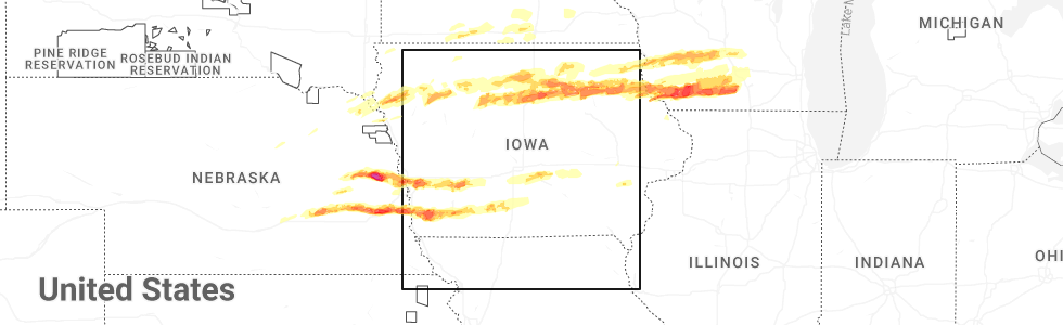
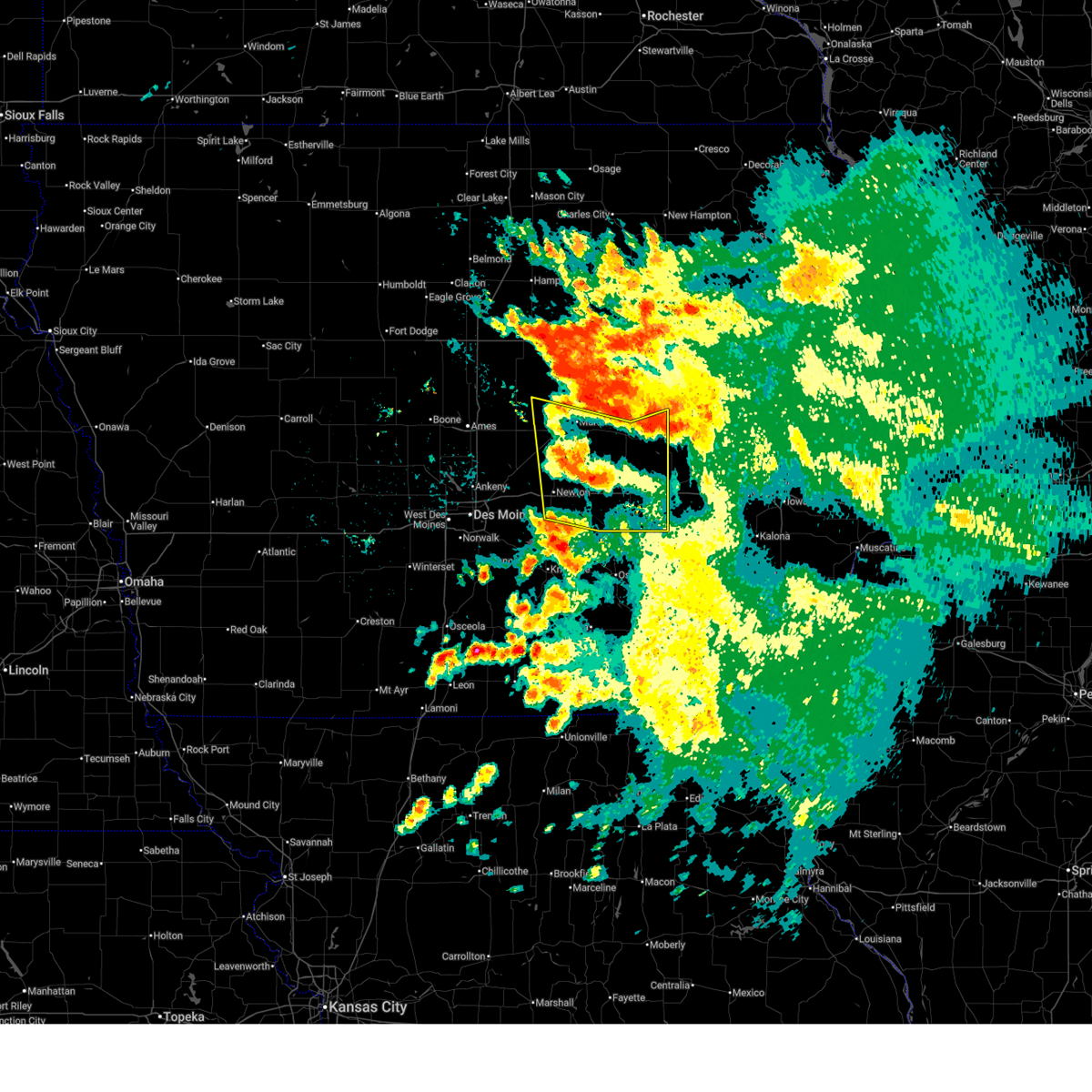
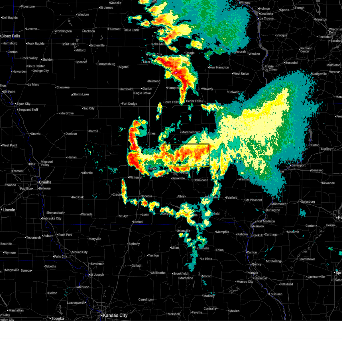
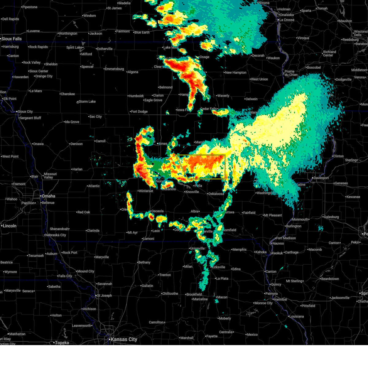
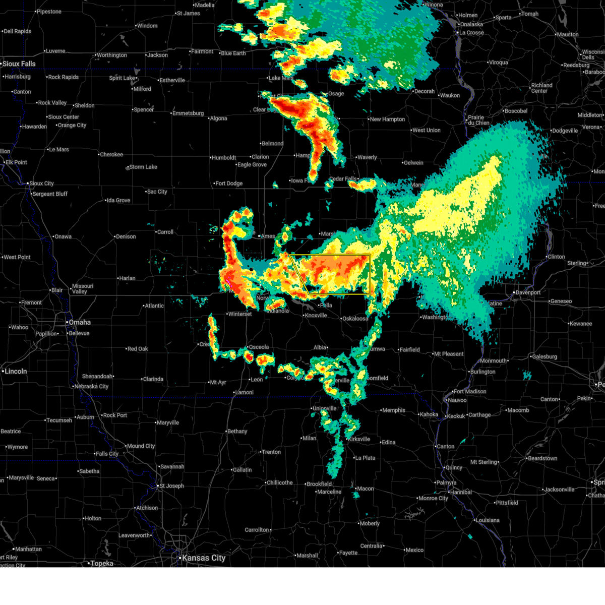
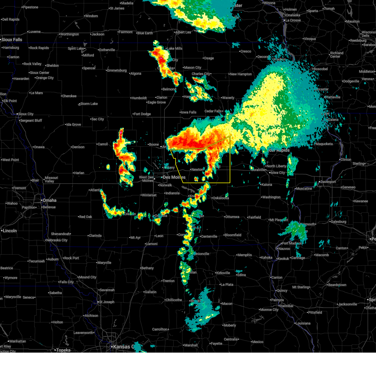
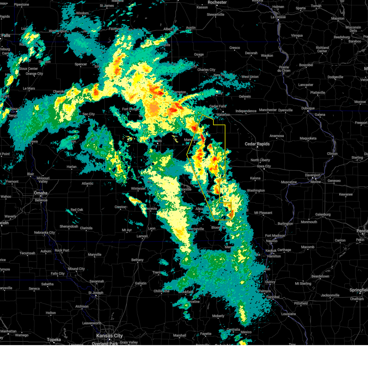
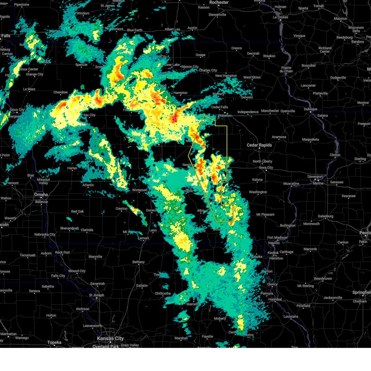
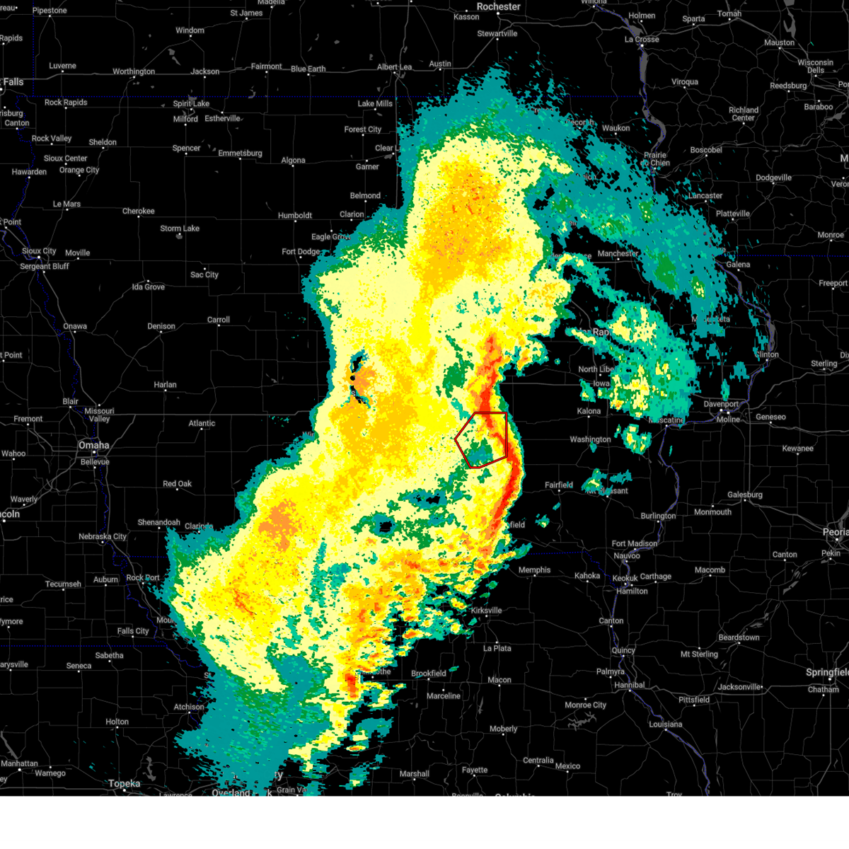
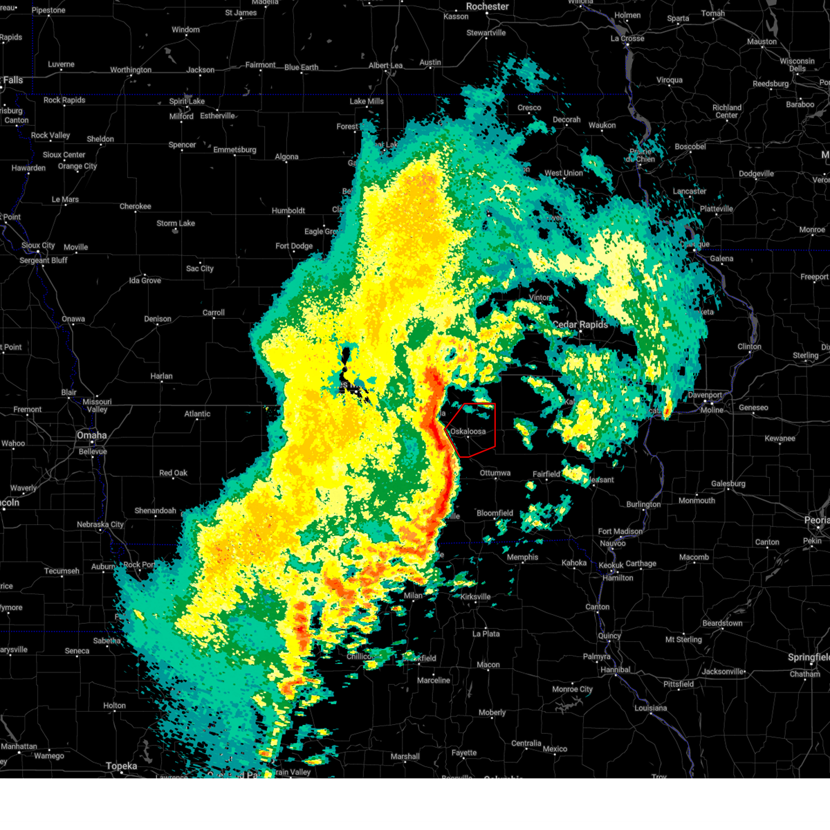
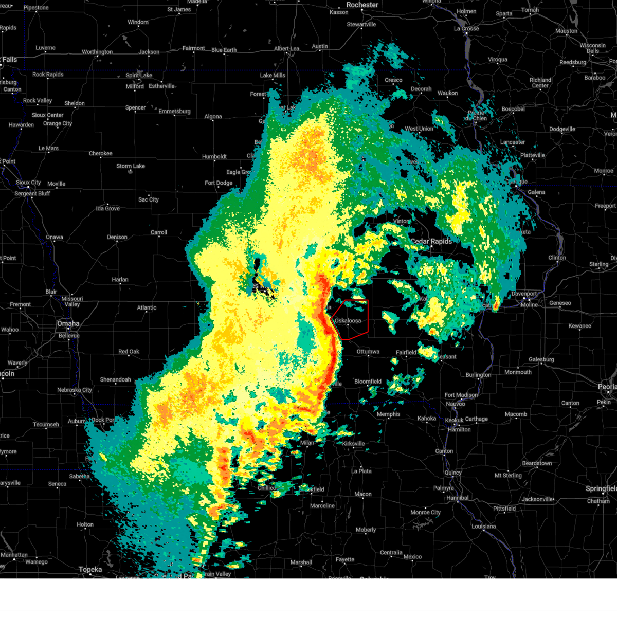
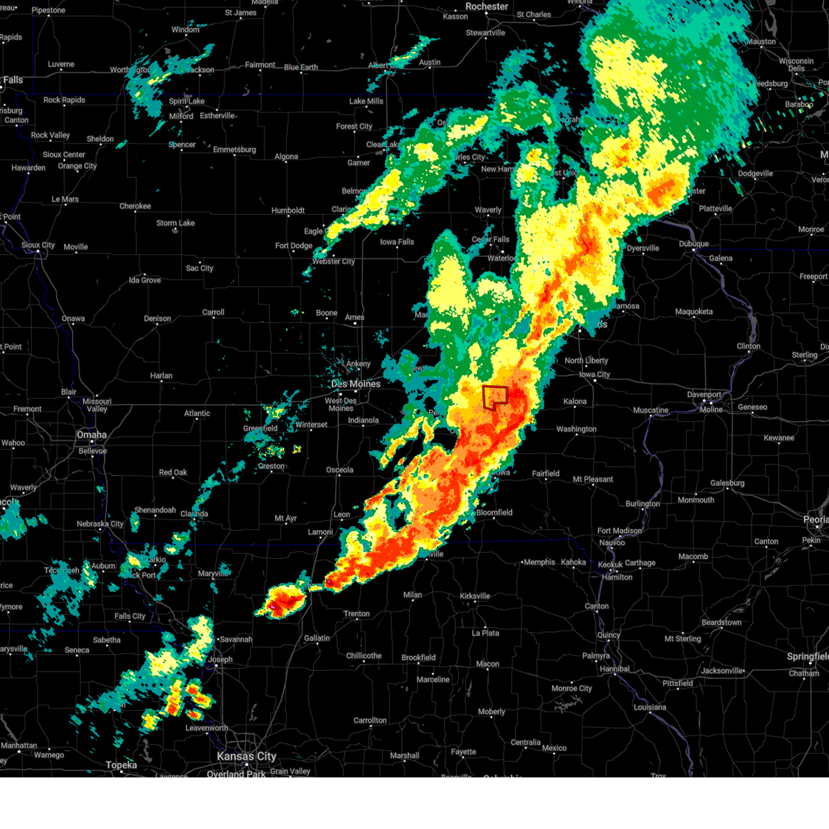
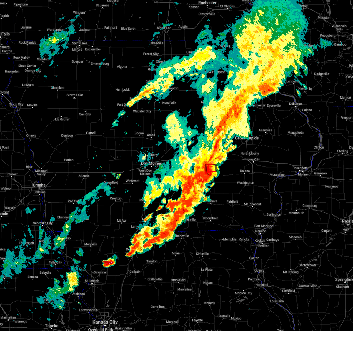
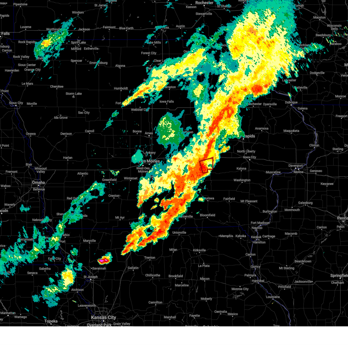
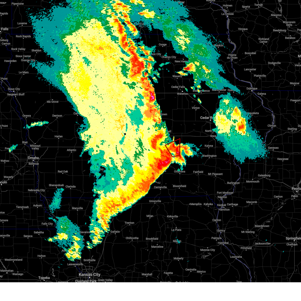
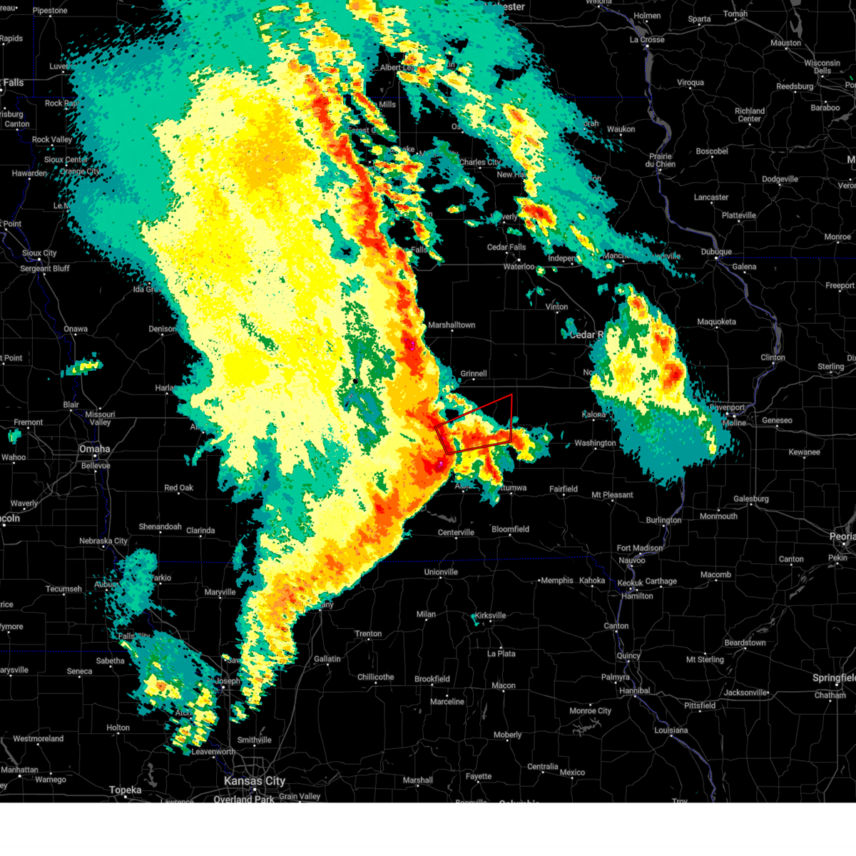
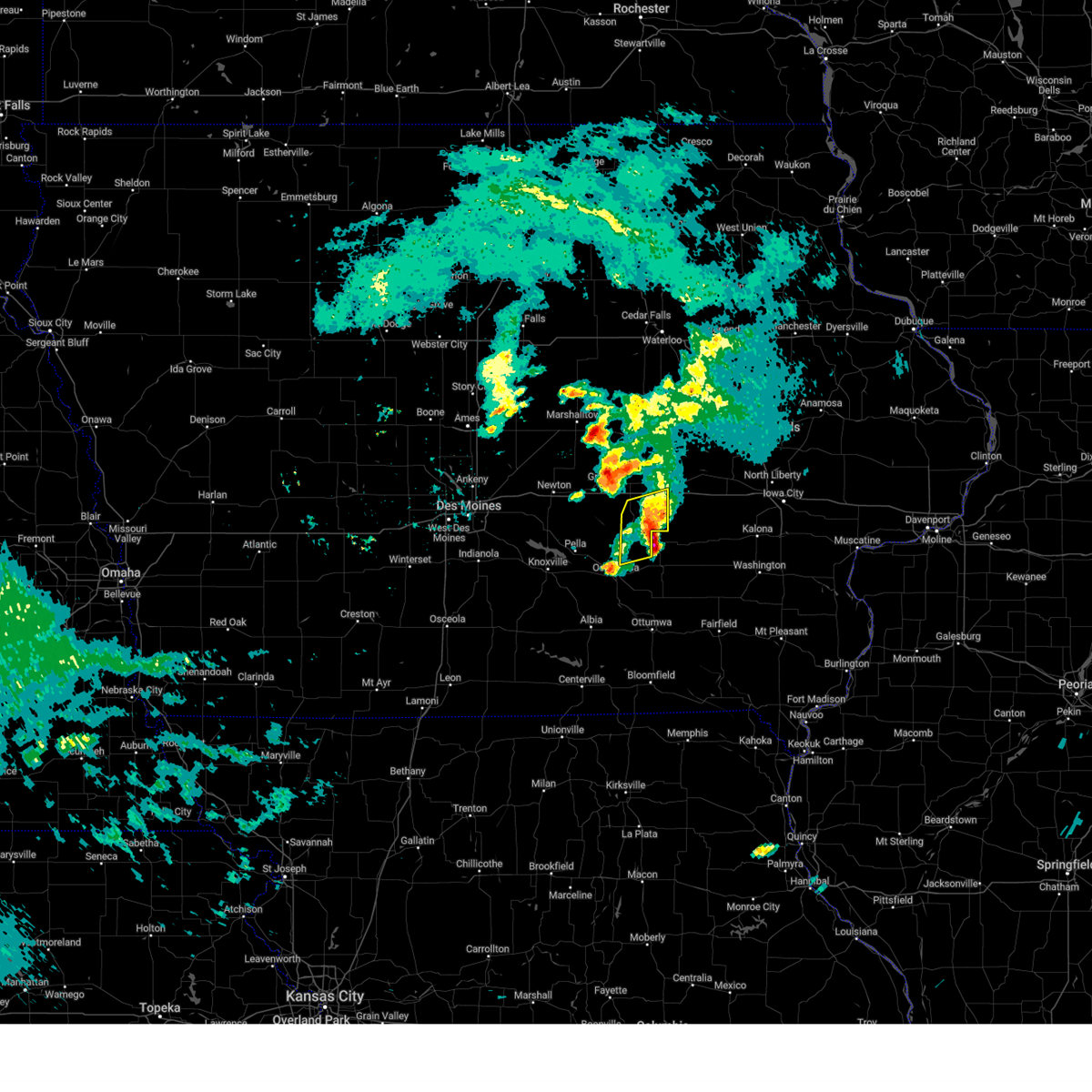
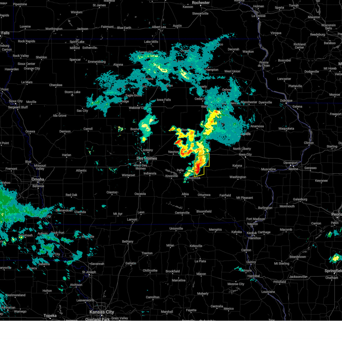
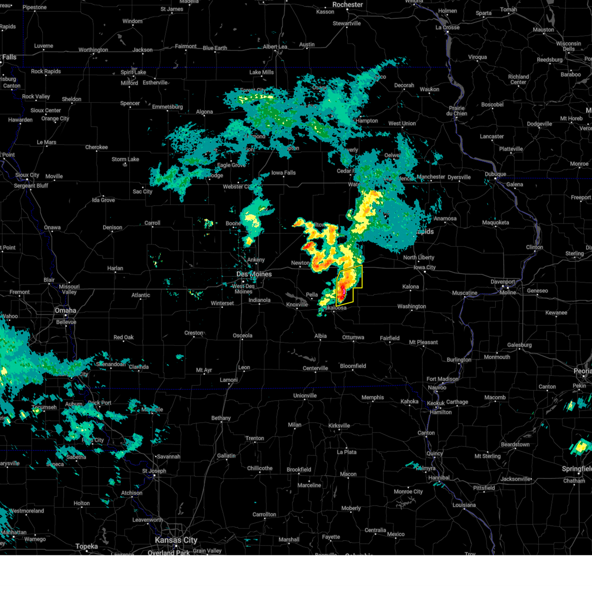
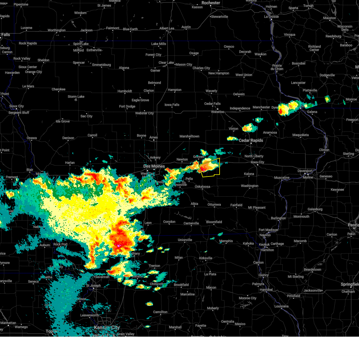
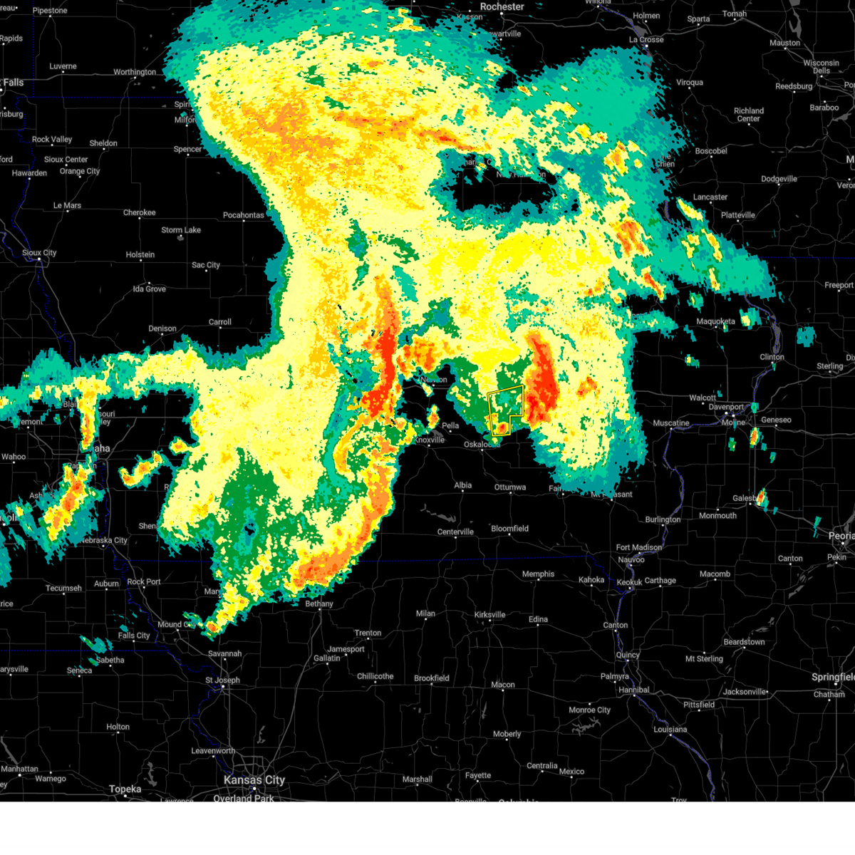
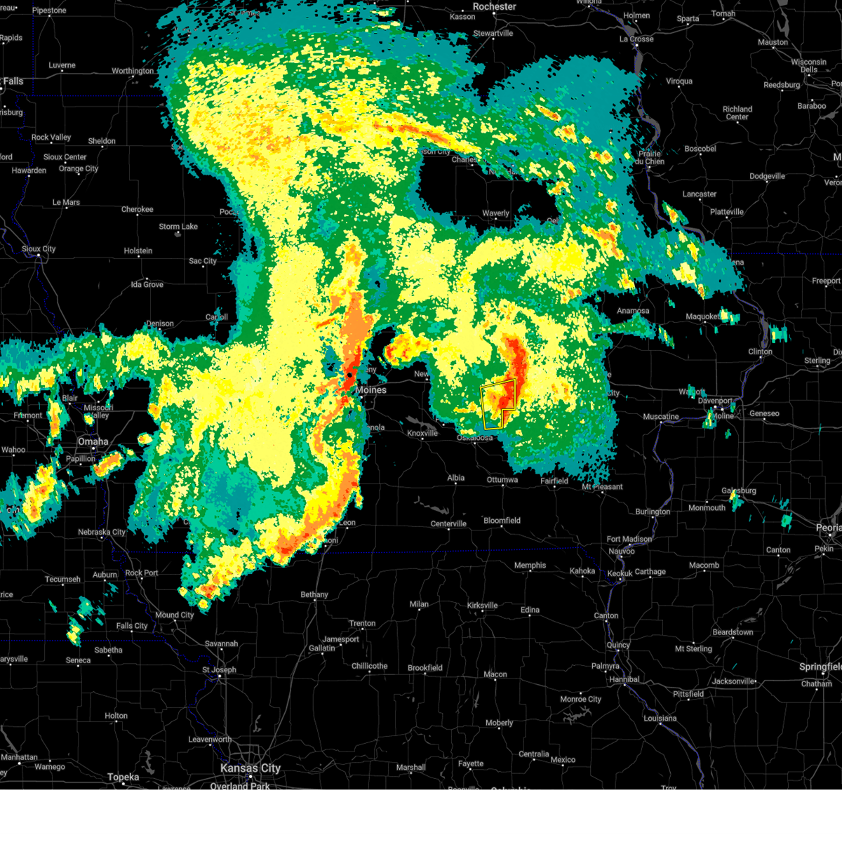
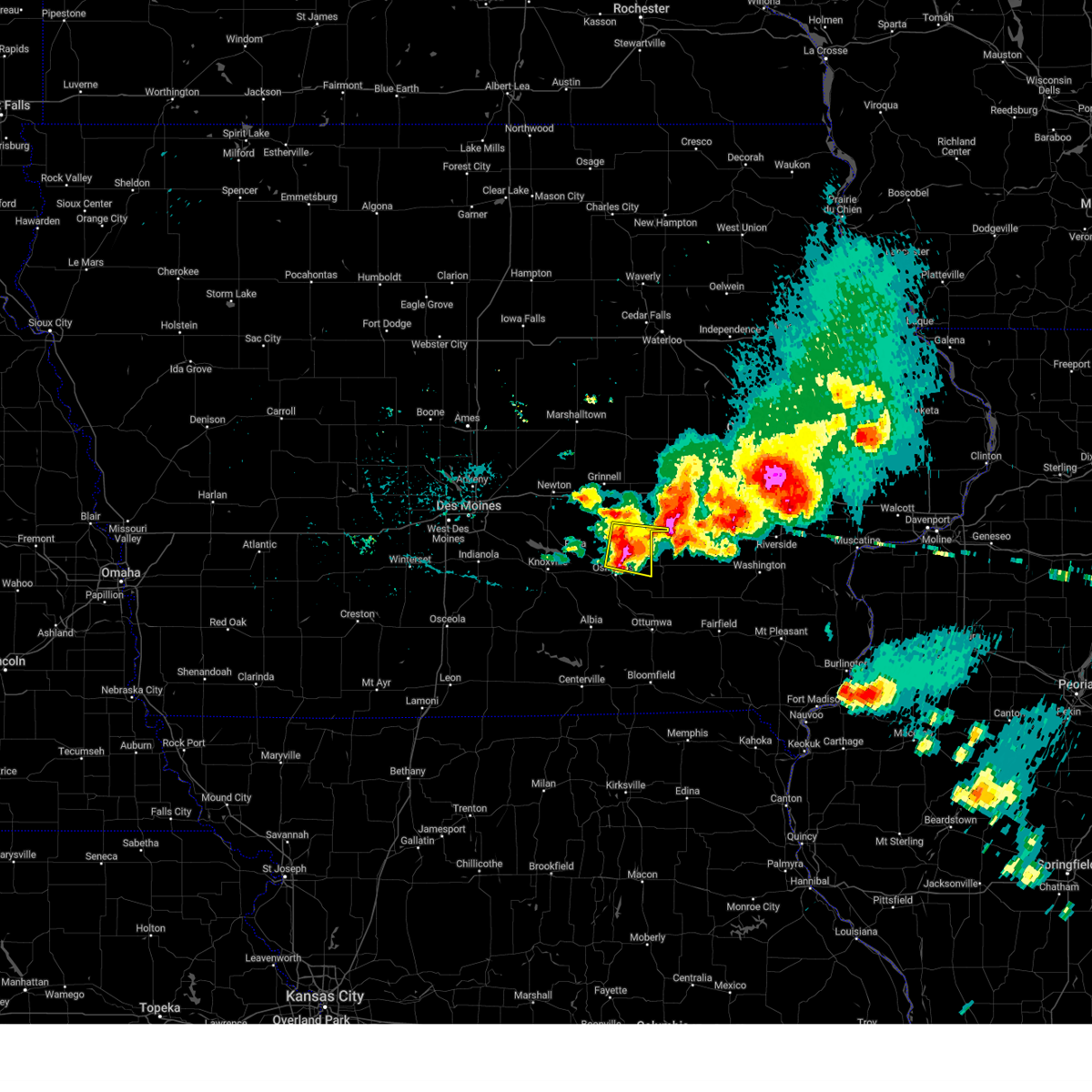
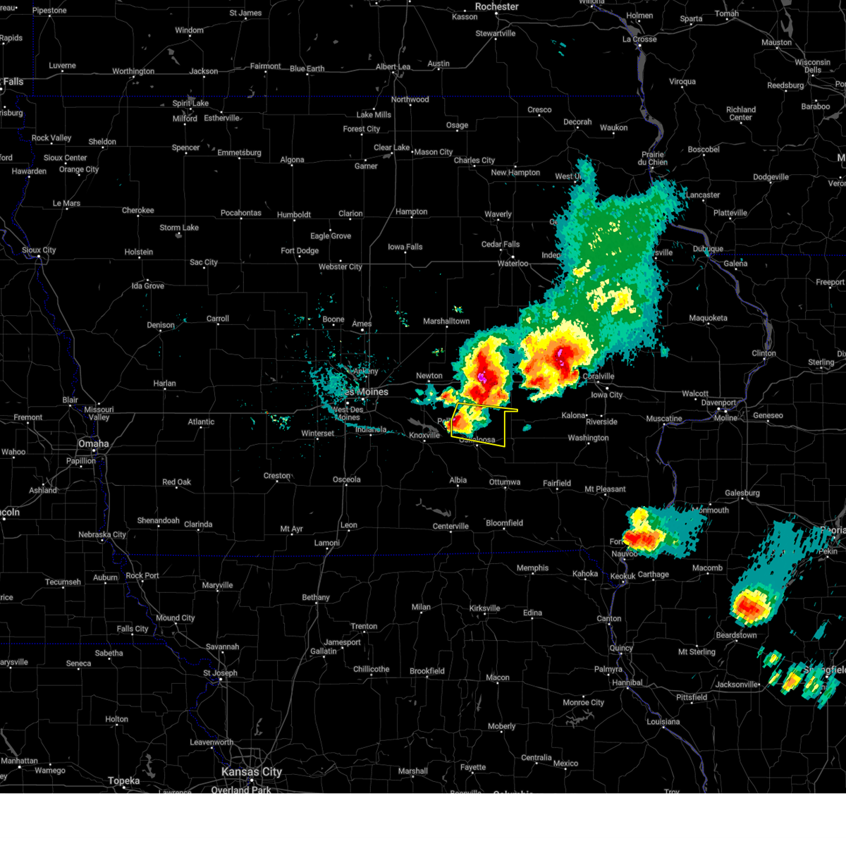
Hail Map for Barnes City, IA
The Barnes City, IA area has had 2 reports of on-the-ground hail by trained spotters, and has been under severe weather warnings 20 times during the past 12 months. Doppler radar has detected hail at or near Barnes City, IA on 49 occasions, including 3 occasions during the past year.
| Name: | Barnes City, IA |
| Where Located: | 52.5 miles SW of Cedar Rapids, IA |
| Map: | Google Map for Barnes City, IA |
| Population: | 176 |
| Housing Units: | 99 |
| More Info: | Search Google for Barnes City, IA |
1
The Top Recent Hail Date for Barnes City, IA is Thursday, April 17, 2025 (5th out of 49)
Hail and Wind Damage Spotted near Barnes City, IA
| Date / Time | Report Details |
|---|---|
| 6/20/2025 9:51 AM CDT |
 The storms which prompted the warning have weakened below severe limits, and no longer pose an immediate threat to life or property. therefore, the warning will be allowed to expire. however, gusty winds are still possible with these thunderstorms. The storms which prompted the warning have weakened below severe limits, and no longer pose an immediate threat to life or property. therefore, the warning will be allowed to expire. however, gusty winds are still possible with these thunderstorms.
|
| 6/20/2025 9:40 AM CDT |
 At 940 am cdt, severe thunderstorms were located along a line extending from near koszta to brooklyn to 6 miles east of baxter, moving south at 30 mph (radar indicated). Hazards include 60 mph wind gusts. Expect damage to roofs, siding, and trees. locations impacted include, grinnell, montezuma, brooklyn, victor, gilman, holiday lake, malcom, deep river, chelsea, barnes city, searsboro, ferguson, hartwick, guernsey, and grinnell regional airport. This includes interstate 80 between mile markers 179 and 204. At 940 am cdt, severe thunderstorms were located along a line extending from near koszta to brooklyn to 6 miles east of baxter, moving south at 30 mph (radar indicated). Hazards include 60 mph wind gusts. Expect damage to roofs, siding, and trees. locations impacted include, grinnell, montezuma, brooklyn, victor, gilman, holiday lake, malcom, deep river, chelsea, barnes city, searsboro, ferguson, hartwick, guernsey, and grinnell regional airport. This includes interstate 80 between mile markers 179 and 204.
|
| 6/20/2025 9:22 AM CDT |
 At 922 am cdt, severe thunderstorms were located along a line extending from koszta to near brooklyn to 5 miles east of baxter, moving southeast at 40 mph (radar indicated). Hazards include 60 mph wind gusts. Expect damage to roofs, siding, and trees. locations impacted include, newton, grinnell, montezuma, brooklyn, baxter, iowa speedway, rock creek lake, victor, melbourne, sully, kellogg, gilman, holiday lake, lynnville, malcom, deep river, chelsea, laurel, barnes city, and haverhill. This includes interstate 80 between mile markers 162 and 204. At 922 am cdt, severe thunderstorms were located along a line extending from koszta to near brooklyn to 5 miles east of baxter, moving southeast at 40 mph (radar indicated). Hazards include 60 mph wind gusts. Expect damage to roofs, siding, and trees. locations impacted include, newton, grinnell, montezuma, brooklyn, baxter, iowa speedway, rock creek lake, victor, melbourne, sully, kellogg, gilman, holiday lake, lynnville, malcom, deep river, chelsea, laurel, barnes city, and haverhill. This includes interstate 80 between mile markers 162 and 204.
|
| 6/20/2025 8:58 AM CDT |
 Svrdmx the national weather service in des moines has issued a * severe thunderstorm warning for, poweshiek county in central iowa, marshall county in central iowa, southern tama county in central iowa, eastern jasper county in central iowa, * until 1000 am cdt. * at 857 am cdt, severe thunderstorms were located along a line extending from near elberon to toledo municipal airport to near state center, moving south at 35 mph (radar indicated). Hazards include 60 mph wind gusts. at 851 am, marshalltown airport reported a wind gust to 58 mph. expect damage to roofs, siding, and trees Svrdmx the national weather service in des moines has issued a * severe thunderstorm warning for, poweshiek county in central iowa, marshall county in central iowa, southern tama county in central iowa, eastern jasper county in central iowa, * until 1000 am cdt. * at 857 am cdt, severe thunderstorms were located along a line extending from near elberon to toledo municipal airport to near state center, moving south at 35 mph (radar indicated). Hazards include 60 mph wind gusts. at 851 am, marshalltown airport reported a wind gust to 58 mph. expect damage to roofs, siding, and trees
|
| 6/20/2025 6:51 AM CDT |
 The storms which prompted the warning have weakened below severe limits, and no longer pose an immediate threat to life or property. therefore, the warning will be allowed to expire. however, gusty winds are still possible with these thunderstorms. The storms which prompted the warning have weakened below severe limits, and no longer pose an immediate threat to life or property. therefore, the warning will be allowed to expire. however, gusty winds are still possible with these thunderstorms.
|
| 6/20/2025 6:42 AM CDT |
 the severe thunderstorm warning has been cancelled and is no longer in effect the severe thunderstorm warning has been cancelled and is no longer in effect
|
| 6/20/2025 6:42 AM CDT |
 At 641 am cdt, severe thunderstorms were located along a line extending from near koszta to near malcom to near lambs grove, moving southeast at 35 mph (radar indicated). Hazards include 60 mph wind gusts and penny size hail. Expect damage to roofs, siding, and trees. locations impacted include, newton, grinnell, montezuma, brooklyn, baxter, rock creek lake, iowa speedway, victor, sully, kellogg, holiday lake, lynnville, malcom, deep river, barnes city, lambs grove, oakland acres, reasnor, searsboro, and hartwick. This includes interstate 80 between mile markers 161 and 204. At 641 am cdt, severe thunderstorms were located along a line extending from near koszta to near malcom to near lambs grove, moving southeast at 35 mph (radar indicated). Hazards include 60 mph wind gusts and penny size hail. Expect damage to roofs, siding, and trees. locations impacted include, newton, grinnell, montezuma, brooklyn, baxter, rock creek lake, iowa speedway, victor, sully, kellogg, holiday lake, lynnville, malcom, deep river, barnes city, lambs grove, oakland acres, reasnor, searsboro, and hartwick. This includes interstate 80 between mile markers 161 and 204.
|
| 6/20/2025 6:03 AM CDT |
 Svrdmx the national weather service in des moines has issued a * severe thunderstorm warning for, poweshiek county in central iowa, southeastern story county in central iowa, southern marshall county in central iowa, southern tama county in central iowa, jasper county in central iowa, * until 700 am cdt. * at 602 am cdt, severe thunderstorms were located along a line extending from near clutier to near montour to near maxwell, moving southeast at 35 mph (radar indicated). Hazards include 60 mph wind gusts and penny size hail. expect damage to roofs, siding, and trees Svrdmx the national weather service in des moines has issued a * severe thunderstorm warning for, poweshiek county in central iowa, southeastern story county in central iowa, southern marshall county in central iowa, southern tama county in central iowa, jasper county in central iowa, * until 700 am cdt. * at 602 am cdt, severe thunderstorms were located along a line extending from near clutier to near montour to near maxwell, moving southeast at 35 mph (radar indicated). Hazards include 60 mph wind gusts and penny size hail. expect damage to roofs, siding, and trees
|
| 3/14/2025 6:58 PM CDT |
 At 657 pm cdt, severe thunderstorms were located along a line extending from near marshalltown to 4 miles southeast of malcom to near agency, moving north at 60 mph (trained weather spotters. at 644pm, a 71 mph gust reported at the ottumwa airport). Hazards include 70 mph wind gusts. Expect considerable tree damage. damage is likely to mobile homes, roofs, and outbuildings. locations impacted include, ferguson, morrison, tf clark state park, ottumwa industrial airport, green mountain, grinnell, oskaloosa municipal airport, garwin, chelsea, lincoln, union grove state park, meskwaki casino, kellogg, traer, gladbrook, laurel, malcom, elberon, montour, and haverhill. This includes interstate 80 between mile markers 171 and 204. At 657 pm cdt, severe thunderstorms were located along a line extending from near marshalltown to 4 miles southeast of malcom to near agency, moving north at 60 mph (trained weather spotters. at 644pm, a 71 mph gust reported at the ottumwa airport). Hazards include 70 mph wind gusts. Expect considerable tree damage. damage is likely to mobile homes, roofs, and outbuildings. locations impacted include, ferguson, morrison, tf clark state park, ottumwa industrial airport, green mountain, grinnell, oskaloosa municipal airport, garwin, chelsea, lincoln, union grove state park, meskwaki casino, kellogg, traer, gladbrook, laurel, malcom, elberon, montour, and haverhill. This includes interstate 80 between mile markers 171 and 204.
|
| 3/14/2025 6:46 PM CDT |
 Svrdmx the national weather service in des moines has issued a * severe thunderstorm warning for, poweshiek county in central iowa, eastern marshall county in central iowa, wapello county in southeastern iowa, tama county in central iowa, mahaska county in south central iowa, southeastern grundy county in central iowa, eastern jasper county in central iowa, * until 745 pm cdt. * at 645 pm cdt, severe thunderstorms were located along a line extending from laurel to near barnes city to 4 miles northeast of ottumwa, moving north at 60 mph (trained weather spotters. a peak gust of 67 mph was reported in oskaloosa). Hazards include 70 mph wind gusts. Expect considerable tree damage. Damage is likely to mobile homes, roofs, and outbuildings. Svrdmx the national weather service in des moines has issued a * severe thunderstorm warning for, poweshiek county in central iowa, eastern marshall county in central iowa, wapello county in southeastern iowa, tama county in central iowa, mahaska county in south central iowa, southeastern grundy county in central iowa, eastern jasper county in central iowa, * until 745 pm cdt. * at 645 pm cdt, severe thunderstorms were located along a line extending from laurel to near barnes city to 4 miles northeast of ottumwa, moving north at 60 mph (trained weather spotters. a peak gust of 67 mph was reported in oskaloosa). Hazards include 70 mph wind gusts. Expect considerable tree damage. Damage is likely to mobile homes, roofs, and outbuildings.
|
| 10/30/2024 8:28 PM CDT |
 The storm which prompted the warning has weakened below severe limits, and no longer appears capable of producing a tornado. therefore, the warning will be allowed to expire. however, gusty winds and heavy rain are still possible with this thunderstorm. The storm which prompted the warning has weakened below severe limits, and no longer appears capable of producing a tornado. therefore, the warning will be allowed to expire. however, gusty winds and heavy rain are still possible with this thunderstorm.
|
| 10/30/2024 8:09 PM CDT |
 the tornado warning has been cancelled and is no longer in effect the tornado warning has been cancelled and is no longer in effect
|
| 10/30/2024 8:09 PM CDT |
 At 807 pm cdt, a severe squall line capable of producing both tornadoes and straight line wind damage was located over oskaloosa, moving northeast at 55 mph (radar indicated rotation). Hazards include tornado. Flying debris will be dangerous to those caught without shelter. mobile homes will be damaged or destroyed. damage to roofs, windows, and vehicles will occur. tree damage is likely. Locations impacted include, oskaloosa, new sharon, eddyville, beacon, university park, barnes city, rose hill, leighton, keomah village, lake keomah state park, and oskaloosa municipal airport. At 807 pm cdt, a severe squall line capable of producing both tornadoes and straight line wind damage was located over oskaloosa, moving northeast at 55 mph (radar indicated rotation). Hazards include tornado. Flying debris will be dangerous to those caught without shelter. mobile homes will be damaged or destroyed. damage to roofs, windows, and vehicles will occur. tree damage is likely. Locations impacted include, oskaloosa, new sharon, eddyville, beacon, university park, barnes city, rose hill, leighton, keomah village, lake keomah state park, and oskaloosa municipal airport.
|
| 10/30/2024 7:55 PM CDT |
 Tordmx the national weather service in des moines has issued a * tornado warning for, south central poweshiek county in central iowa, southeastern marion county in south central iowa, northwestern wapello county in southeastern iowa, mahaska county in south central iowa, * until 830 pm cdt. * at 755 pm cdt, severe thunderstorms capable of producing both tornadoes and extensive straight line wind damage were located over bussey, or 11 miles southwest of oskaloosa, moving northeast at 50 mph (radar indicated rotation). Hazards include tornado. Flying debris will be dangerous to those caught without shelter. mobile homes will be damaged or destroyed. damage to roofs, windows, and vehicles will occur. Tree damage is likely. Tordmx the national weather service in des moines has issued a * tornado warning for, south central poweshiek county in central iowa, southeastern marion county in south central iowa, northwestern wapello county in southeastern iowa, mahaska county in south central iowa, * until 830 pm cdt. * at 755 pm cdt, severe thunderstorms capable of producing both tornadoes and extensive straight line wind damage were located over bussey, or 11 miles southwest of oskaloosa, moving northeast at 50 mph (radar indicated rotation). Hazards include tornado. Flying debris will be dangerous to those caught without shelter. mobile homes will be damaged or destroyed. damage to roofs, windows, and vehicles will occur. Tree damage is likely.
|
| 7/30/2024 10:12 AM CDT |
 Svrdmx the national weather service in des moines has issued a * severe thunderstorm warning for, monroe county in south central iowa, southeastern lucas county in south central iowa, southern poweshiek county in central iowa, southeastern marion county in south central iowa, davis county in southeastern iowa, wapello county in southeastern iowa, northeastern wayne county in south central iowa, mahaska county in south central iowa, appanoose county in south central iowa, * until 1130 am cdt. * at 1012 am cdt, severe thunderstorms were located along a line extending from near reasnor to 4 miles east of knoxville to 5 miles north of lucas, moving southeast at 60 mph (radar indicated). Hazards include 60 mph wind gusts and quarter size hail. Hail damage to vehicles is expected. Expect wind damage to roofs, siding, and trees. Svrdmx the national weather service in des moines has issued a * severe thunderstorm warning for, monroe county in south central iowa, southeastern lucas county in south central iowa, southern poweshiek county in central iowa, southeastern marion county in south central iowa, davis county in southeastern iowa, wapello county in southeastern iowa, northeastern wayne county in south central iowa, mahaska county in south central iowa, appanoose county in south central iowa, * until 1130 am cdt. * at 1012 am cdt, severe thunderstorms were located along a line extending from near reasnor to 4 miles east of knoxville to 5 miles north of lucas, moving southeast at 60 mph (radar indicated). Hazards include 60 mph wind gusts and quarter size hail. Hail damage to vehicles is expected. Expect wind damage to roofs, siding, and trees.
|
| 7/15/2024 7:03 PM CDT | the severe thunderstorm warning has been cancelled and is no longer in effect |
| 7/15/2024 7:03 PM CDT | At 703 pm cdt, severe thunderstorms were located along a line extending from north english to near martinsburg to near albia, moving southeast at 60 mph (radar indicated). Hazards include 60 mph wind gusts and quarter size hail. Hail damage to vehicles is expected. expect wind damage to roofs, siding, and trees. Locations impacted include, ottumwa, oskaloosa, eddyville, ottumwa industrial airport, fremont, agency, beacon, university park, barnes city, rose hill, kirkville, chillicothe, keomah village, lake keomah state park, and oskaloosa municipal airport. |
| 7/15/2024 6:55 PM CDT | the severe thunderstorm warning has been cancelled and is no longer in effect |
| 7/15/2024 6:55 PM CDT | At 655 pm cdt, severe thunderstorms were located along a line extending from millersburg to near delta to lovilia, moving southeast at 40 mph (radar indicated). Hazards include 70 mph wind gusts and quarter size hail. Hail damage to vehicles is expected. expect considerable tree damage. wind damage is also likely to mobile homes, roofs, and outbuildings. Locations impacted include, ottumwa, oskaloosa, pella, montezuma, new sharon, eddyville, ottumwa industrial airport, fremont, agency, beacon, university park, bussey, deep river, harvey, barnes city, rose hill, kirkville, leighton, chillicothe, and keomah village. |
| 7/15/2024 6:24 PM CDT |
 Svrdmx the national weather service in des moines has issued a * severe thunderstorm warning for, northeastern monroe county in south central iowa, southern poweshiek county in central iowa, northeastern marion county in south central iowa, wapello county in southeastern iowa, mahaska county in south central iowa, southeastern jasper county in central iowa, * until 730 pm cdt. * at 624 pm cdt, severe thunderstorms were located along a line extending from near brooklyn to 4 miles west of new sharon to near knoxville municipal airport, moving southeast at 65 mph (public). Hazards include 70 mph wind gusts and quarter size hail. Hail damage to vehicles is expected. expect considerable tree damage. Wind damage is also likely to mobile homes, roofs, and outbuildings. Svrdmx the national weather service in des moines has issued a * severe thunderstorm warning for, northeastern monroe county in south central iowa, southern poweshiek county in central iowa, northeastern marion county in south central iowa, wapello county in southeastern iowa, mahaska county in south central iowa, southeastern jasper county in central iowa, * until 730 pm cdt. * at 624 pm cdt, severe thunderstorms were located along a line extending from near brooklyn to 4 miles west of new sharon to near knoxville municipal airport, moving southeast at 65 mph (public). Hazards include 70 mph wind gusts and quarter size hail. Hail damage to vehicles is expected. expect considerable tree damage. Wind damage is also likely to mobile homes, roofs, and outbuildings.
|
| 7/2/2024 5:15 PM CDT |
 the tornado warning has been cancelled and is no longer in effect the tornado warning has been cancelled and is no longer in effect
|
| 7/2/2024 4:59 PM CDT |
 At 459 pm cdt, a severe squall line capable of producing both tornadoes and extensive straight line wind damage was located near deep river, or 11 miles east of montezuma, moving east at 40 mph (radar indicated rotation). Hazards include tornado. Flying debris will be dangerous to those caught without shelter. mobile homes will be damaged or destroyed. damage to roofs, windows, and vehicles will occur. tree damage is likely. This tornadic thunderstorm will remain over mainly rural areas of southeastern poweshiek and northeastern mahaska counties, including the following locations, barnes city and deep river. At 459 pm cdt, a severe squall line capable of producing both tornadoes and extensive straight line wind damage was located near deep river, or 11 miles east of montezuma, moving east at 40 mph (radar indicated rotation). Hazards include tornado. Flying debris will be dangerous to those caught without shelter. mobile homes will be damaged or destroyed. damage to roofs, windows, and vehicles will occur. tree damage is likely. This tornadic thunderstorm will remain over mainly rural areas of southeastern poweshiek and northeastern mahaska counties, including the following locations, barnes city and deep river.
|
| 7/2/2024 4:48 PM CDT |
 Tordmx the national weather service in des moines has issued a * tornado warning for, southeastern poweshiek county in central iowa, northeastern mahaska county in south central iowa, * until 530 pm cdt. * at 448 pm cdt, a severe thunderstorm capable of producing a tornado was located over barnes city, or 6 miles southeast of montezuma, moving east at 40 mph (radar indicated rotation). Hazards include tornado. Flying debris will be dangerous to those caught without shelter. mobile homes will be damaged or destroyed. damage to roofs, windows, and vehicles will occur. tree damage is likely. this dangerous storm will be near, deep river around 455 pm cdt. Other locations impacted by this tornadic thunderstorm include guernsey, barnes city, and deep river. Tordmx the national weather service in des moines has issued a * tornado warning for, southeastern poweshiek county in central iowa, northeastern mahaska county in south central iowa, * until 530 pm cdt. * at 448 pm cdt, a severe thunderstorm capable of producing a tornado was located over barnes city, or 6 miles southeast of montezuma, moving east at 40 mph (radar indicated rotation). Hazards include tornado. Flying debris will be dangerous to those caught without shelter. mobile homes will be damaged or destroyed. damage to roofs, windows, and vehicles will occur. tree damage is likely. this dangerous storm will be near, deep river around 455 pm cdt. Other locations impacted by this tornadic thunderstorm include guernsey, barnes city, and deep river.
|
| 7/2/2024 4:15 PM CDT |
 Svrdmx the national weather service in des moines has issued a * severe thunderstorm warning for, southwestern poweshiek county in central iowa, eastern marion county in south central iowa, mahaska county in south central iowa, southeastern jasper county in central iowa, * until 515 pm cdt. * at 414 pm cdt, a severe thunderstorm was located over pella, moving east at 30 mph (radar indicated). Hazards include quarter size hail. damage to vehicles is expected Svrdmx the national weather service in des moines has issued a * severe thunderstorm warning for, southwestern poweshiek county in central iowa, eastern marion county in south central iowa, mahaska county in south central iowa, southeastern jasper county in central iowa, * until 515 pm cdt. * at 414 pm cdt, a severe thunderstorm was located over pella, moving east at 30 mph (radar indicated). Hazards include quarter size hail. damage to vehicles is expected
|
| 5/24/2024 6:27 AM CDT |
 The storms which prompted the warning have moved out of the area. therefore, the warning will be allowed to expire. however, gusty winds are still possible with these thunderstorms. a severe thunderstorm watch remains in effect until 1000 am cdt for south central, central and southeastern iowa. The storms which prompted the warning have moved out of the area. therefore, the warning will be allowed to expire. however, gusty winds are still possible with these thunderstorms. a severe thunderstorm watch remains in effect until 1000 am cdt for south central, central and southeastern iowa.
|
| 5/24/2024 6:22 AM CDT |
 the severe thunderstorm warning has been cancelled and is no longer in effect the severe thunderstorm warning has been cancelled and is no longer in effect
|
| 5/24/2024 6:22 AM CDT |
 At 622 am cdt, severe thunderstorms were located along a line extending from near guernsey to 4 miles north of keswick to keokuk county expo to near hedrick, moving east at 45 mph (radar indicated). Hazards include 60 mph wind gusts and penny size hail. Expect damage to roofs, siding, and trees. locations impacted include, ottumwa, brooklyn, ottumwa industrial airport, eldon, victor, fremont, agency, holiday lake, deep river, barnes city, rose hill, kirkville, chillicothe, hartwick, guernsey, and oskaloosa municipal airport. This includes interstate 80 between mile markers 195 and 204. At 622 am cdt, severe thunderstorms were located along a line extending from near guernsey to 4 miles north of keswick to keokuk county expo to near hedrick, moving east at 45 mph (radar indicated). Hazards include 60 mph wind gusts and penny size hail. Expect damage to roofs, siding, and trees. locations impacted include, ottumwa, brooklyn, ottumwa industrial airport, eldon, victor, fremont, agency, holiday lake, deep river, barnes city, rose hill, kirkville, chillicothe, hartwick, guernsey, and oskaloosa municipal airport. This includes interstate 80 between mile markers 195 and 204.
|
| 5/24/2024 6:12 AM CDT |
 the severe thunderstorm warning has been cancelled and is no longer in effect the severe thunderstorm warning has been cancelled and is no longer in effect
|
| 5/24/2024 6:12 AM CDT |
 At 612 am cdt, severe thunderstorms were located along a line extending from 4 miles west of deep river to near thornburg to delta to ottumwa industrial airport, moving east at 45 mph (public). Hazards include 70 mph wind gusts and quarter size hail. Hail damage to vehicles is expected. expect considerable tree damage. wind damage is also likely to mobile homes, roofs, and outbuildings. locations impacted include, ottumwa, oskaloosa, grinnell, albia, montezuma, brooklyn, new sharon, eddyville, ottumwa industrial airport, eldon, victor, fremont, agency, beacon, university park, holiday lake, blakesburg, malcom, deep river, and barnes city. This includes interstate 80 between mile markers 182 and 204. At 612 am cdt, severe thunderstorms were located along a line extending from 4 miles west of deep river to near thornburg to delta to ottumwa industrial airport, moving east at 45 mph (public). Hazards include 70 mph wind gusts and quarter size hail. Hail damage to vehicles is expected. expect considerable tree damage. wind damage is also likely to mobile homes, roofs, and outbuildings. locations impacted include, ottumwa, oskaloosa, grinnell, albia, montezuma, brooklyn, new sharon, eddyville, ottumwa industrial airport, eldon, victor, fremont, agency, beacon, university park, holiday lake, blakesburg, malcom, deep river, and barnes city. This includes interstate 80 between mile markers 182 and 204.
|
| 5/24/2024 6:08 AM CDT |
 At 607 am cdt, a severe thunderstorm capable of producing a tornado was located near deep river, or near montezuma, moving northeast at 45 mph (radar indicated rotation). Hazards include tornado. Flying debris will be dangerous to those caught without shelter. mobile homes will be damaged or destroyed. damage to roofs, windows, and vehicles will occur. tree damage is likely. This tornadic thunderstorm will remain over mainly rural areas of southeastern poweshiek county, including the following locations, barnes city. At 607 am cdt, a severe thunderstorm capable of producing a tornado was located near deep river, or near montezuma, moving northeast at 45 mph (radar indicated rotation). Hazards include tornado. Flying debris will be dangerous to those caught without shelter. mobile homes will be damaged or destroyed. damage to roofs, windows, and vehicles will occur. tree damage is likely. This tornadic thunderstorm will remain over mainly rural areas of southeastern poweshiek county, including the following locations, barnes city.
|
| 5/24/2024 6:08 AM CDT |
 the tornado warning has been cancelled and is no longer in effect the tornado warning has been cancelled and is no longer in effect
|
| 5/24/2024 6:01 AM CDT |
 At 601 am cdt, severe thunderstorms were located along a line extending from near montezuma to near barnes city to rose hill to near eddyville, moving east at 45 mph (public). Hazards include 70 mph wind gusts and quarter size hail. Hail damage to vehicles is expected. expect considerable tree damage. wind damage is also likely to mobile homes, roofs, and outbuildings. locations impacted include, ottumwa, newton, oskaloosa, pella, grinnell, albia, montezuma, brooklyn, new sharon, eddyville, ottumwa industrial airport, iowa speedway, rock creek lake, eldon, victor, sully, fremont, agency, kellogg, and lovilia. This includes interstate 80 between mile markers 167 and 204. At 601 am cdt, severe thunderstorms were located along a line extending from near montezuma to near barnes city to rose hill to near eddyville, moving east at 45 mph (public). Hazards include 70 mph wind gusts and quarter size hail. Hail damage to vehicles is expected. expect considerable tree damage. wind damage is also likely to mobile homes, roofs, and outbuildings. locations impacted include, ottumwa, newton, oskaloosa, pella, grinnell, albia, montezuma, brooklyn, new sharon, eddyville, ottumwa industrial airport, iowa speedway, rock creek lake, eldon, victor, sully, fremont, agency, kellogg, and lovilia. This includes interstate 80 between mile markers 167 and 204.
|
| 5/24/2024 5:52 AM CDT |
 the tornado warning has been cancelled and is no longer in effect the tornado warning has been cancelled and is no longer in effect
|
| 5/24/2024 5:52 AM CDT |
 At 551 am cdt, a severe thunderstorm capable of producing a tornado was located over new sharon, or 8 miles southwest of montezuma, moving northeast at 45 mph (radar indicated rotation). Hazards include tornado. Flying debris will be dangerous to those caught without shelter. mobile homes will be damaged or destroyed. damage to roofs, windows, and vehicles will occur. tree damage is likely. this dangerous storm will be near, montezuma around 555 am cdt. barnes city around 600 am cdt. Other locations impacted by this tornadic thunderstorm include barnes city. At 551 am cdt, a severe thunderstorm capable of producing a tornado was located over new sharon, or 8 miles southwest of montezuma, moving northeast at 45 mph (radar indicated rotation). Hazards include tornado. Flying debris will be dangerous to those caught without shelter. mobile homes will be damaged or destroyed. damage to roofs, windows, and vehicles will occur. tree damage is likely. this dangerous storm will be near, montezuma around 555 am cdt. barnes city around 600 am cdt. Other locations impacted by this tornadic thunderstorm include barnes city.
|
| 5/24/2024 5:32 AM CDT |
 Tordmx the national weather service in des moines has issued a * tornado warning for, southern poweshiek county in central iowa, northeastern marion county in south central iowa, northern mahaska county in south central iowa, southeastern jasper county in central iowa, * until 615 am cdt. * at 532 am cdt, a severe thunderstorm capable of producing a tornado was located over pella, moving northeast at 45 mph (radar indicated rotation). Hazards include tornado. Flying debris will be dangerous to those caught without shelter. mobile homes will be damaged or destroyed. damage to roofs, windows, and vehicles will occur. tree damage is likely. this dangerous storm will be near, pella around 535 am cdt. new sharon around 545 am cdt. montezuma around 555 am cdt. barnes city around 600 am cdt. Other locations impacted by this tornadic thunderstorm include harvey, barnes city, pella municipal airport, and leighton. Tordmx the national weather service in des moines has issued a * tornado warning for, southern poweshiek county in central iowa, northeastern marion county in south central iowa, northern mahaska county in south central iowa, southeastern jasper county in central iowa, * until 615 am cdt. * at 532 am cdt, a severe thunderstorm capable of producing a tornado was located over pella, moving northeast at 45 mph (radar indicated rotation). Hazards include tornado. Flying debris will be dangerous to those caught without shelter. mobile homes will be damaged or destroyed. damage to roofs, windows, and vehicles will occur. tree damage is likely. this dangerous storm will be near, pella around 535 am cdt. new sharon around 545 am cdt. montezuma around 555 am cdt. barnes city around 600 am cdt. Other locations impacted by this tornadic thunderstorm include harvey, barnes city, pella municipal airport, and leighton.
|
| 5/24/2024 5:31 AM CDT |
 Svrdmx the national weather service in des moines has issued a * severe thunderstorm warning for, eastern lucas county in south central iowa, poweshiek county in central iowa, monroe county in south central iowa, marion county in south central iowa, wapello county in southeastern iowa, mahaska county in south central iowa, southern jasper county in central iowa, * until 630 am cdt. * at 530 am cdt, severe thunderstorms were located along a line extending from near reasnor to pella to near bussey to 5 miles north of melrose, moving east at 45 mph (radar indicated). Hazards include 70 mph wind gusts and quarter size hail. Hail damage to vehicles is expected. expect considerable tree damage. Wind damage is also likely to mobile homes, roofs, and outbuildings. Svrdmx the national weather service in des moines has issued a * severe thunderstorm warning for, eastern lucas county in south central iowa, poweshiek county in central iowa, monroe county in south central iowa, marion county in south central iowa, wapello county in southeastern iowa, mahaska county in south central iowa, southern jasper county in central iowa, * until 630 am cdt. * at 530 am cdt, severe thunderstorms were located along a line extending from near reasnor to pella to near bussey to 5 miles north of melrose, moving east at 45 mph (radar indicated). Hazards include 70 mph wind gusts and quarter size hail. Hail damage to vehicles is expected. expect considerable tree damage. Wind damage is also likely to mobile homes, roofs, and outbuildings.
|
| 5/21/2024 5:34 PM CDT |
 the severe thunderstorm warning has been cancelled and is no longer in effect the severe thunderstorm warning has been cancelled and is no longer in effect
|
| 5/21/2024 5:34 PM CDT |
 At 534 pm cdt, a severe thunderstorm was located near harvey, or 5 miles east of knoxville, moving northeast at 60 mph (radar indicated). Hazards include 60 mph wind gusts and half dollar size hail. Hail damage to vehicles is expected. expect wind damage to roofs, siding, and trees. locations impacted include, pella, knoxville, montezuma, new sharon, knoxville raceway, lake red rock, sully, lynnville, malcom, harvey, barnes city, searsboro, pella municipal airport, knoxville municipal airport, and elk rock state park. This includes interstate 80 between mile markers 185 and 193. At 534 pm cdt, a severe thunderstorm was located near harvey, or 5 miles east of knoxville, moving northeast at 60 mph (radar indicated). Hazards include 60 mph wind gusts and half dollar size hail. Hail damage to vehicles is expected. expect wind damage to roofs, siding, and trees. locations impacted include, pella, knoxville, montezuma, new sharon, knoxville raceway, lake red rock, sully, lynnville, malcom, harvey, barnes city, searsboro, pella municipal airport, knoxville municipal airport, and elk rock state park. This includes interstate 80 between mile markers 185 and 193.
|
| 5/21/2024 5:17 PM CDT |
 Svrdmx the national weather service in des moines has issued a * severe thunderstorm warning for, northeastern lucas county in south central iowa, southern poweshiek county in central iowa, marion county in south central iowa, northern mahaska county in south central iowa, southeastern jasper county in central iowa, southeastern warren county in south central iowa, * until 615 pm cdt. * at 516 pm cdt, a severe thunderstorm was located near melcher-dallas, or 10 miles north of chariton, moving northeast at 55 mph (radar indicated). Hazards include ping pong ball size hail and 60 mph wind gusts. People and animals outdoors will be injured. expect hail damage to roofs, siding, windows, and vehicles. Expect wind damage to roofs, siding, and trees. Svrdmx the national weather service in des moines has issued a * severe thunderstorm warning for, northeastern lucas county in south central iowa, southern poweshiek county in central iowa, marion county in south central iowa, northern mahaska county in south central iowa, southeastern jasper county in central iowa, southeastern warren county in south central iowa, * until 615 pm cdt. * at 516 pm cdt, a severe thunderstorm was located near melcher-dallas, or 10 miles north of chariton, moving northeast at 55 mph (radar indicated). Hazards include ping pong ball size hail and 60 mph wind gusts. People and animals outdoors will be injured. expect hail damage to roofs, siding, windows, and vehicles. Expect wind damage to roofs, siding, and trees.
|
| 5/21/2024 6:45 AM CDT |
 At 644 am cdt, severe thunderstorms were located along a line extending from 4 miles north of mount auburn to near luzerne to near barnes city, moving east at 20 mph (radar indicated). Hazards include quarter size hail. Damage to vehicles is expected. locations impacted include, montezuma, brooklyn, dysart, victor, holiday lake, malcom, deep river, chelsea, elberon, barnes city, searsboro, hartwick, and guernsey. This includes interstate 80 between mile markers 189 and 204. At 644 am cdt, severe thunderstorms were located along a line extending from 4 miles north of mount auburn to near luzerne to near barnes city, moving east at 20 mph (radar indicated). Hazards include quarter size hail. Damage to vehicles is expected. locations impacted include, montezuma, brooklyn, dysart, victor, holiday lake, malcom, deep river, chelsea, elberon, barnes city, searsboro, hartwick, and guernsey. This includes interstate 80 between mile markers 189 and 204.
|
| 5/21/2024 6:18 AM CDT |
 Svrdmx the national weather service in des moines has issued a * severe thunderstorm warning for, poweshiek county in central iowa, tama county in central iowa, * until 700 am cdt. * at 618 am cdt, severe thunderstorms were located along a line extending from 4 miles west of la porte city to belle plaine to near new sharon, moving east at 20 mph (radar indicated). Hazards include 60 mph wind gusts and quarter size hail. Hail damage to vehicles is expected. Expect wind damage to roofs, siding, and trees. Svrdmx the national weather service in des moines has issued a * severe thunderstorm warning for, poweshiek county in central iowa, tama county in central iowa, * until 700 am cdt. * at 618 am cdt, severe thunderstorms were located along a line extending from 4 miles west of la porte city to belle plaine to near new sharon, moving east at 20 mph (radar indicated). Hazards include 60 mph wind gusts and quarter size hail. Hail damage to vehicles is expected. Expect wind damage to roofs, siding, and trees.
|
| 5/19/2024 5:11 PM CDT |
 The storm which prompted the warning is moving out of the area. therefore, the warning will be allowed to expire. however, gusty winds are still possible with this thunderstorm. to report severe weather, contact your nearest law enforcement agency. they will relay your report to the national weather service des moines. The storm which prompted the warning is moving out of the area. therefore, the warning will be allowed to expire. however, gusty winds are still possible with this thunderstorm. to report severe weather, contact your nearest law enforcement agency. they will relay your report to the national weather service des moines.
|
| 5/19/2024 4:57 PM CDT |
 At 457 pm cdt, a severe thunderstorm was located over deep river, or 7 miles east of montezuma, moving east at 30 mph (radar indicated). Hazards include 60 mph wind gusts and nickel size hail. Expect damage to roofs, siding, and trees. locations impacted include, montezuma, deep river, barnes city, and guernsey. This includes interstate 80 between mile markers 198 and 204. At 457 pm cdt, a severe thunderstorm was located over deep river, or 7 miles east of montezuma, moving east at 30 mph (radar indicated). Hazards include 60 mph wind gusts and nickel size hail. Expect damage to roofs, siding, and trees. locations impacted include, montezuma, deep river, barnes city, and guernsey. This includes interstate 80 between mile markers 198 and 204.
|
| 5/19/2024 4:57 PM CDT |
 the severe thunderstorm warning has been cancelled and is no longer in effect the severe thunderstorm warning has been cancelled and is no longer in effect
|
| 5/19/2024 4:41 PM CDT |
 At 440 pm cdt, a severe thunderstorm was located near barnes city, or near montezuma, moving east at 30 mph (radar indicated). Hazards include 60 mph wind gusts and nickel size hail. Expect damage to roofs, siding, and trees. locations impacted include, grinnell, montezuma, brooklyn, new sharon, victor, malcom, deep river, barnes city, leighton, searsboro, hartwick, and guernsey. This includes interstate 80 between mile markers 180 and 204. At 440 pm cdt, a severe thunderstorm was located near barnes city, or near montezuma, moving east at 30 mph (radar indicated). Hazards include 60 mph wind gusts and nickel size hail. Expect damage to roofs, siding, and trees. locations impacted include, grinnell, montezuma, brooklyn, new sharon, victor, malcom, deep river, barnes city, leighton, searsboro, hartwick, and guernsey. This includes interstate 80 between mile markers 180 and 204.
|
| 5/19/2024 4:41 PM CDT |
 the severe thunderstorm warning has been cancelled and is no longer in effect the severe thunderstorm warning has been cancelled and is no longer in effect
|
| 5/19/2024 4:14 PM CDT |
 Svrdmx the national weather service in des moines has issued a * severe thunderstorm warning for, poweshiek county in central iowa, northeastern marion county in south central iowa, northern mahaska county in south central iowa, southeastern jasper county in central iowa, * until 515 pm cdt. * at 413 pm cdt, a severe thunderstorm was located 6 miles northeast of pella, moving east at 30 mph (radar indicated). Hazards include 60 mph wind gusts and quarter size hail. pella municipal airport reported a wind gust of 61 mph at 4:11 pm cdt. Hail damage to vehicles is expected. Expect wind damage to roofs, siding, and trees. Svrdmx the national weather service in des moines has issued a * severe thunderstorm warning for, poweshiek county in central iowa, northeastern marion county in south central iowa, northern mahaska county in south central iowa, southeastern jasper county in central iowa, * until 515 pm cdt. * at 413 pm cdt, a severe thunderstorm was located 6 miles northeast of pella, moving east at 30 mph (radar indicated). Hazards include 60 mph wind gusts and quarter size hail. pella municipal airport reported a wind gust of 61 mph at 4:11 pm cdt. Hail damage to vehicles is expected. Expect wind damage to roofs, siding, and trees.
|
| 5/7/2024 3:10 AM CDT |
 The storms which prompted the warning have moved out of the area. therefore, the warning will be allowed to expire. The storms which prompted the warning have moved out of the area. therefore, the warning will be allowed to expire.
|
| 5/7/2024 2:58 AM CDT |
 At 258 am cdt, severe thunderstorms were located along a line extending from traer to lake sugema campground, moving east at 40 mph (radar indicated). Hazards include 60 mph wind gusts and penny size hail. Expect damage to roofs, siding, and trees. locations impacted include, toledo, montezuma, tama, traer, brooklyn, dysart, meskwaki casino, gladbrook, victor, garwin, holiday lake, malcom, deep river, chelsea, clutier, elberon, barnes city, hartwick, guernsey, and vining. This includes interstate 80 between mile markers 192 and 204. At 258 am cdt, severe thunderstorms were located along a line extending from traer to lake sugema campground, moving east at 40 mph (radar indicated). Hazards include 60 mph wind gusts and penny size hail. Expect damage to roofs, siding, and trees. locations impacted include, toledo, montezuma, tama, traer, brooklyn, dysart, meskwaki casino, gladbrook, victor, garwin, holiday lake, malcom, deep river, chelsea, clutier, elberon, barnes city, hartwick, guernsey, and vining. This includes interstate 80 between mile markers 192 and 204.
|
| 5/7/2024 2:58 AM CDT |
 the severe thunderstorm warning has been cancelled and is no longer in effect the severe thunderstorm warning has been cancelled and is no longer in effect
|
| 5/7/2024 2:26 AM CDT |
 Svrdmx the national weather service in des moines has issued a * severe thunderstorm warning for, poweshiek county in central iowa, northeastern monroe county in south central iowa, eastern marshall county in central iowa, davis county in southeastern iowa, wapello county in southeastern iowa, tama county in central iowa, mahaska county in south central iowa, south central grundy county in central iowa, eastern jasper county in central iowa, * until 315 am cdt. * at 225 am cdt, severe thunderstorms were located along a line extending from near marshalltown municipal airport to 5 miles south of bloomfield municipal airport, moving east at 40 mph (radar indicated). Hazards include 60 mph wind gusts and penny size hail. expect damage to roofs, siding, and trees Svrdmx the national weather service in des moines has issued a * severe thunderstorm warning for, poweshiek county in central iowa, northeastern monroe county in south central iowa, eastern marshall county in central iowa, davis county in southeastern iowa, wapello county in southeastern iowa, tama county in central iowa, mahaska county in south central iowa, south central grundy county in central iowa, eastern jasper county in central iowa, * until 315 am cdt. * at 225 am cdt, severe thunderstorms were located along a line extending from near marshalltown municipal airport to 5 miles south of bloomfield municipal airport, moving east at 40 mph (radar indicated). Hazards include 60 mph wind gusts and penny size hail. expect damage to roofs, siding, and trees
|
| 5/7/2024 1:46 AM CDT |
 the severe thunderstorm warning has been cancelled and is no longer in effect the severe thunderstorm warning has been cancelled and is no longer in effect
|
| 5/7/2024 1:46 AM CDT |
 At 145 am cdt, severe thunderstorms were located along a line extending from near monroe to lovilia to centerville municipal airport, moving east at 50 mph (radar indicated). Hazards include 60 mph wind gusts and penny size hail. Expect damage to roofs, siding, and trees. locations impacted include, ottumwa, newton, oskaloosa, pella, grinnell, knoxville, centerville, albia, bloomfield, montezuma, colfax, monroe, pleasantville, prairie city, new sharon, melcher-dallas, eddyville, ottumwa industrial airport, lake sundown, and rathbun lake. This includes interstate 80 between mile markers 159 and 192. At 145 am cdt, severe thunderstorms were located along a line extending from near monroe to lovilia to centerville municipal airport, moving east at 50 mph (radar indicated). Hazards include 60 mph wind gusts and penny size hail. Expect damage to roofs, siding, and trees. locations impacted include, ottumwa, newton, oskaloosa, pella, grinnell, knoxville, centerville, albia, bloomfield, montezuma, colfax, monroe, pleasantville, prairie city, new sharon, melcher-dallas, eddyville, ottumwa industrial airport, lake sundown, and rathbun lake. This includes interstate 80 between mile markers 159 and 192.
|
| 5/7/2024 1:26 AM CDT |
 Svrdmx the national weather service in des moines has issued a * severe thunderstorm warning for, lucas county in south central iowa, western poweshiek county in central iowa, monroe county in south central iowa, southeastern polk county in central iowa, davis county in southeastern iowa, marion county in south central iowa, wapello county in southeastern iowa, wayne county in south central iowa, mahaska county in south central iowa, appanoose county in south central iowa, jasper county in central iowa, eastern warren county in south central iowa, * until 230 am cdt. * at 126 am cdt, severe thunderstorms were located along a line extending from near runnells to 5 miles northeast of russell to 5 miles south of seymour, moving east at 50 mph (radar indicated). Hazards include 60 mph wind gusts and penny size hail. expect damage to roofs, siding, and trees Svrdmx the national weather service in des moines has issued a * severe thunderstorm warning for, lucas county in south central iowa, western poweshiek county in central iowa, monroe county in south central iowa, southeastern polk county in central iowa, davis county in southeastern iowa, marion county in south central iowa, wapello county in southeastern iowa, wayne county in south central iowa, mahaska county in south central iowa, appanoose county in south central iowa, jasper county in central iowa, eastern warren county in south central iowa, * until 230 am cdt. * at 126 am cdt, severe thunderstorms were located along a line extending from near runnells to 5 miles northeast of russell to 5 miles south of seymour, moving east at 50 mph (radar indicated). Hazards include 60 mph wind gusts and penny size hail. expect damage to roofs, siding, and trees
|
| 4/27/2024 6:53 PM CDT |
 At 653 pm cdt, severe thunderstorms were located along a line extending from near victor to near south english to 4 miles northwest of lebanon, moving northeast at 60 mph (radar indicated). Hazards include 60 mph wind gusts and quarter size hail. Hail damage to vehicles is expected. expect wind damage to roofs, siding, and trees. Locations impacted include, ottumwa, oskaloosa, bloomfield, eddyville, ottumwa industrial airport, eldon, fremont, agency, university park, pulaski, drakesville, barnes city, rose hill, kirkville, floris, chillicothe, keomah village, lake wapello state park, lake keomah state park, and oskaloosa municipal airport. At 653 pm cdt, severe thunderstorms were located along a line extending from near victor to near south english to 4 miles northwest of lebanon, moving northeast at 60 mph (radar indicated). Hazards include 60 mph wind gusts and quarter size hail. Hail damage to vehicles is expected. expect wind damage to roofs, siding, and trees. Locations impacted include, ottumwa, oskaloosa, bloomfield, eddyville, ottumwa industrial airport, eldon, fremont, agency, university park, pulaski, drakesville, barnes city, rose hill, kirkville, floris, chillicothe, keomah village, lake wapello state park, lake keomah state park, and oskaloosa municipal airport.
|
| 4/27/2024 6:53 PM CDT |
 the severe thunderstorm warning has been cancelled and is no longer in effect the severe thunderstorm warning has been cancelled and is no longer in effect
|
| 4/27/2024 6:26 PM CDT |
 Svrdmx the national weather service in des moines has issued a * severe thunderstorm warning for, southeastern poweshiek county in central iowa, davis county in southeastern iowa, wapello county in southeastern iowa, mahaska county in south central iowa, * until 715 pm cdt. * at 626 pm cdt, severe thunderstorms were located along a line extending from near new sharon to near lake keomah state park to 4 miles north of glenwood, moving northeast at 60 mph (radar indicated). Hazards include 60 mph wind gusts and quarter size hail. Hail damage to vehicles is expected. Expect wind damage to roofs, siding, and trees. Svrdmx the national weather service in des moines has issued a * severe thunderstorm warning for, southeastern poweshiek county in central iowa, davis county in southeastern iowa, wapello county in southeastern iowa, mahaska county in south central iowa, * until 715 pm cdt. * at 626 pm cdt, severe thunderstorms were located along a line extending from near new sharon to near lake keomah state park to 4 miles north of glenwood, moving northeast at 60 mph (radar indicated). Hazards include 60 mph wind gusts and quarter size hail. Hail damage to vehicles is expected. Expect wind damage to roofs, siding, and trees.
|
| 4/27/2024 4:24 PM CDT |
 Svrdmx the national weather service in des moines has issued a * severe thunderstorm warning for, southern poweshiek county in central iowa, northeastern mahaska county in south central iowa, * until 515 pm cdt. * at 424 pm cdt, a severe thunderstorm was located near searsboro, or 7 miles southwest of montezuma, moving east at 25 mph (radar indicated). Hazards include 60 mph wind gusts and half dollar size hail. Hail damage to vehicles is expected. Expect wind damage to roofs, siding, and trees. Svrdmx the national weather service in des moines has issued a * severe thunderstorm warning for, southern poweshiek county in central iowa, northeastern mahaska county in south central iowa, * until 515 pm cdt. * at 424 pm cdt, a severe thunderstorm was located near searsboro, or 7 miles southwest of montezuma, moving east at 25 mph (radar indicated). Hazards include 60 mph wind gusts and half dollar size hail. Hail damage to vehicles is expected. Expect wind damage to roofs, siding, and trees.
|
| 7/13/2023 9:27 PM CDT |
 The severe thunderstorm warning for western poweshiek county will expire at 930 pm cdt, the storm which prompted the warning has weakened below severe limits, and no longer poses an immediate threat to life or property. therefore, the warning will be allowed to expire. The severe thunderstorm warning for western poweshiek county will expire at 930 pm cdt, the storm which prompted the warning has weakened below severe limits, and no longer poses an immediate threat to life or property. therefore, the warning will be allowed to expire.
|
| 7/13/2023 9:16 PM CDT |
 At 915 pm cdt, a severe thunderstorm was located near grinnell regional airport, or near grinnell, moving southeast at 30 mph (radar indicated). Hazards include quarter size hail. Damage to vehicles is expected. locations impacted include, searsboro and montezuma. this includes interstate 80 between mile markers 181 and 194. hail threat, radar indicated max hail size, 1. 00 in wind threat, radar indicated max wind gust, <50 mph. At 915 pm cdt, a severe thunderstorm was located near grinnell regional airport, or near grinnell, moving southeast at 30 mph (radar indicated). Hazards include quarter size hail. Damage to vehicles is expected. locations impacted include, searsboro and montezuma. this includes interstate 80 between mile markers 181 and 194. hail threat, radar indicated max hail size, 1. 00 in wind threat, radar indicated max wind gust, <50 mph.
|
| 7/13/2023 8:50 PM CDT |
 At 850 pm cdt, a severe thunderstorm was located over gilman, or 7 miles north of grinnell, moving southeast at 35 mph (radar indicated). Hazards include ping pong ball size hail. People and animals outdoors will be injured. expect damage to roofs, siding, windows, and vehicles. this severe storm will be near, rock creek lake and rock creek state park around 855 pm cdt. grinnell and oakland acres around 900 pm cdt. other locations in the path of this severe thunderstorm include grinnell regional airport, malcom, searsboro, montezuma and barnes city. this includes interstate 80 between mile markers 174 and 204. hail threat, radar indicated max hail size, 1. 50 in wind threat, radar indicated max wind gust, <50 mph. At 850 pm cdt, a severe thunderstorm was located over gilman, or 7 miles north of grinnell, moving southeast at 35 mph (radar indicated). Hazards include ping pong ball size hail. People and animals outdoors will be injured. expect damage to roofs, siding, windows, and vehicles. this severe storm will be near, rock creek lake and rock creek state park around 855 pm cdt. grinnell and oakland acres around 900 pm cdt. other locations in the path of this severe thunderstorm include grinnell regional airport, malcom, searsboro, montezuma and barnes city. this includes interstate 80 between mile markers 174 and 204. hail threat, radar indicated max hail size, 1. 50 in wind threat, radar indicated max wind gust, <50 mph.
|
| 7/13/2023 8:41 PM CDT |
 At 840 pm cdt, a severe thunderstorm was located over ferguson, or 9 miles southeast of marshalltown, moving southeast at 35 mph (trained weather spotters). Hazards include quarter size hail. Damage to vehicles is expected. this severe thunderstorm will be near, gilman around 845 pm cdt. rock creek lake and rock creek state park around 855 pm cdt. grinnell and oakland acres around 900 pm cdt. other locations in the path of this severe thunderstorm include grinnell regional airport, malcom, searsboro, montezuma and barnes city. this includes interstate 80 between mile markers 172 and 204. hail threat, observed max hail size, 1. 00 in wind threat, radar indicated max wind gust, <50 mph. At 840 pm cdt, a severe thunderstorm was located over ferguson, or 9 miles southeast of marshalltown, moving southeast at 35 mph (trained weather spotters). Hazards include quarter size hail. Damage to vehicles is expected. this severe thunderstorm will be near, gilman around 845 pm cdt. rock creek lake and rock creek state park around 855 pm cdt. grinnell and oakland acres around 900 pm cdt. other locations in the path of this severe thunderstorm include grinnell regional airport, malcom, searsboro, montezuma and barnes city. this includes interstate 80 between mile markers 172 and 204. hail threat, observed max hail size, 1. 00 in wind threat, radar indicated max wind gust, <50 mph.
|
| 7/12/2023 8:20 AM CDT |
 The severe thunderstorm warning for southeastern poweshiek and northeastern mahaska counties will expire at 830 am cdt, the storm which prompted the warning has moved out of the area. therefore, the warning will be allowed to expire. a severe thunderstorm watch remains in effect until 1100 am cdt for south central and central iowa. The severe thunderstorm warning for southeastern poweshiek and northeastern mahaska counties will expire at 830 am cdt, the storm which prompted the warning has moved out of the area. therefore, the warning will be allowed to expire. a severe thunderstorm watch remains in effect until 1100 am cdt for south central and central iowa.
|
| 7/12/2023 8:03 AM CDT |
 At 802 am cdt, a severe thunderstorm was located over deep river, or 10 miles east of montezuma, moving east at 55 mph (radar indicated). Hazards include 60 mph wind gusts. Expect damage to roofs, siding, and trees. this severe thunderstorm will remain over mainly rural areas of southeastern poweshiek and northeastern mahaska counties, including the following locations, guernsey, barnes city and deep river. this includes interstate 80 between mile markers 202 and 204. hail threat, radar indicated max hail size, <. 75 in wind threat, radar indicated max wind gust, 60 mph. At 802 am cdt, a severe thunderstorm was located over deep river, or 10 miles east of montezuma, moving east at 55 mph (radar indicated). Hazards include 60 mph wind gusts. Expect damage to roofs, siding, and trees. this severe thunderstorm will remain over mainly rural areas of southeastern poweshiek and northeastern mahaska counties, including the following locations, guernsey, barnes city and deep river. this includes interstate 80 between mile markers 202 and 204. hail threat, radar indicated max hail size, <. 75 in wind threat, radar indicated max wind gust, 60 mph.
|
| 7/12/2023 7:47 AM CDT |
 At 747 am cdt, a severe thunderstorm was located near barnes city, or 5 miles south of montezuma, moving east at 60 mph (radar indicated). Hazards include 60 mph wind gusts. Expect damage to roofs, siding, and trees. this severe thunderstorm will be near, barnes city around 750 am cdt. deep river around 755 am cdt. guernsey around 800 am cdt. this includes interstate 80 between mile markers 202 and 204. hail threat, radar indicated max hail size, <. 75 in wind threat, radar indicated max wind gust, 60 mph. At 747 am cdt, a severe thunderstorm was located near barnes city, or 5 miles south of montezuma, moving east at 60 mph (radar indicated). Hazards include 60 mph wind gusts. Expect damage to roofs, siding, and trees. this severe thunderstorm will be near, barnes city around 750 am cdt. deep river around 755 am cdt. guernsey around 800 am cdt. this includes interstate 80 between mile markers 202 and 204. hail threat, radar indicated max hail size, <. 75 in wind threat, radar indicated max wind gust, 60 mph.
|
| 5/7/2023 5:26 PM CDT |
 At 526 pm cdt, a severe thunderstorm was located over coal creek, or 12 miles south of montezuma, moving east at 30 mph (trained weather spotters). Hazards include 60 mph wind gusts and half dollar size hail. Hail damage to vehicles is expected. expect wind damage to roofs, siding, and trees. this severe thunderstorm will remain over mainly rural areas of southeastern poweshiek and northeastern mahaska counties, including the following locations, barnes city and rose hill. hail threat, observed max hail size, 1. 25 in wind threat, radar indicated max wind gust, 60 mph. At 526 pm cdt, a severe thunderstorm was located over coal creek, or 12 miles south of montezuma, moving east at 30 mph (trained weather spotters). Hazards include 60 mph wind gusts and half dollar size hail. Hail damage to vehicles is expected. expect wind damage to roofs, siding, and trees. this severe thunderstorm will remain over mainly rural areas of southeastern poweshiek and northeastern mahaska counties, including the following locations, barnes city and rose hill. hail threat, observed max hail size, 1. 25 in wind threat, radar indicated max wind gust, 60 mph.
|
| 5/7/2023 5:01 PM CDT |
 At 501 pm cdt, a severe thunderstorm was located near new sharon, or 9 miles north of oskaloosa, moving east at 30 mph (radar indicated). Hazards include 60 mph wind gusts and half dollar size hail. Hail damage to vehicles is expected. expect wind damage to roofs, siding, and trees. this severe thunderstorm will be near, barnes city around 520 pm cdt. other locations in the path of this severe thunderstorm include rose hill. hail threat, radar indicated max hail size, 1. 25 in wind threat, radar indicated max wind gust, 60 mph. At 501 pm cdt, a severe thunderstorm was located near new sharon, or 9 miles north of oskaloosa, moving east at 30 mph (radar indicated). Hazards include 60 mph wind gusts and half dollar size hail. Hail damage to vehicles is expected. expect wind damage to roofs, siding, and trees. this severe thunderstorm will be near, barnes city around 520 pm cdt. other locations in the path of this severe thunderstorm include rose hill. hail threat, radar indicated max hail size, 1. 25 in wind threat, radar indicated max wind gust, 60 mph.
|
| 5/7/2023 4:46 PM CDT |
 At 445 pm cdt, a severe thunderstorm was located over oakland acres, or 6 miles west of grinnell, moving east at 40 mph. this is a destructive storm for poweshiek county (trained weather spotters). Hazards include baseball size hail and 60 mph wind gusts. People and animals outdoors will be severely injured. expect shattered windows, extensive damage to roofs, siding, and vehicles. this severe thunderstorm will be near, grinnell and grinnell regional airport around 455 pm cdt. searsboro around 500 pm cdt. other locations in the path of this severe thunderstorm include montezuma, malcom, brooklyn, deep river, guernsey, victor and victor. this includes interstate 80 between mile markers 181 and 204. thunderstorm damage threat, destructive hail threat, observed max hail size, 2. 75 in wind threat, radar indicated max wind gust, 60 mph. At 445 pm cdt, a severe thunderstorm was located over oakland acres, or 6 miles west of grinnell, moving east at 40 mph. this is a destructive storm for poweshiek county (trained weather spotters). Hazards include baseball size hail and 60 mph wind gusts. People and animals outdoors will be severely injured. expect shattered windows, extensive damage to roofs, siding, and vehicles. this severe thunderstorm will be near, grinnell and grinnell regional airport around 455 pm cdt. searsboro around 500 pm cdt. other locations in the path of this severe thunderstorm include montezuma, malcom, brooklyn, deep river, guernsey, victor and victor. this includes interstate 80 between mile markers 181 and 204. thunderstorm damage threat, destructive hail threat, observed max hail size, 2. 75 in wind threat, radar indicated max wind gust, 60 mph.
|
| 4/20/2023 12:29 AM CDT |
 At 1227 am cdt, severe thunderstorms were located along a line extending from 6 miles west of la porte city to near belle plaine to 4 miles southeast of deep river, moving northeast at 30 mph (radar indicated). Hazards include 60 mph wind gusts and quarter size hail. Hail damage to vehicles is expected. expect wind damage to roofs, siding, and trees. locations impacted include, montezuma, tama, traer, brooklyn, dysart, victor, holiday lake, malcom, deep river, chelsea, clutier, elberon, barnes city, searsboro, hartwick, guernsey, vining, tf clark state park and toledo municipal airport. this includes interstate 80 between mile markers 185 and 204. hail threat, radar indicated max hail size, 1. 00 in wind threat, radar indicated max wind gust, 60 mph. At 1227 am cdt, severe thunderstorms were located along a line extending from 6 miles west of la porte city to near belle plaine to 4 miles southeast of deep river, moving northeast at 30 mph (radar indicated). Hazards include 60 mph wind gusts and quarter size hail. Hail damage to vehicles is expected. expect wind damage to roofs, siding, and trees. locations impacted include, montezuma, tama, traer, brooklyn, dysart, victor, holiday lake, malcom, deep river, chelsea, clutier, elberon, barnes city, searsboro, hartwick, guernsey, vining, tf clark state park and toledo municipal airport. this includes interstate 80 between mile markers 185 and 204. hail threat, radar indicated max hail size, 1. 00 in wind threat, radar indicated max wind gust, 60 mph.
|
| 4/20/2023 12:06 AM CDT |
 At 1204 am cdt, severe thunderstorms were located along a line extending from near lincoln to 4 miles northwest of holiday lake to lake keomah state park, moving east at 30 mph (radar indicated). Hazards include 60 mph wind gusts and quarter size hail. Hail damage to vehicles is expected. expect wind damage to roofs, siding, and trees. locations impacted include, holiday lake, traer, chelsea, hartwick, vining, tf clark state park and elberon. this includes interstate 80 between mile markers 178 and 204. hail threat, radar indicated max hail size, 1. 00 in wind threat, radar indicated max wind gust, 60 mph. At 1204 am cdt, severe thunderstorms were located along a line extending from near lincoln to 4 miles northwest of holiday lake to lake keomah state park, moving east at 30 mph (radar indicated). Hazards include 60 mph wind gusts and quarter size hail. Hail damage to vehicles is expected. expect wind damage to roofs, siding, and trees. locations impacted include, holiday lake, traer, chelsea, hartwick, vining, tf clark state park and elberon. this includes interstate 80 between mile markers 178 and 204. hail threat, radar indicated max hail size, 1. 00 in wind threat, radar indicated max wind gust, 60 mph.
|
| 4/19/2023 11:41 PM CDT |
 At 1140 pm cdt, severe thunderstorms were located along a line extending from beaman to 4 miles northwest of grinnell to 5 miles southwest of beacon, moving northeast at 30 mph (radar indicated). Hazards include 60 mph wind gusts and quarter size hail. Hail damage to vehicles is expected. expect wind damage to roofs, siding, and trees. severe thunderstorms will be near, grinnell, gilman and union grove state park around 1145 pm cdt. gladbrook around 1150 pm cdt. other locations in the path of these severe thunderstorms include keomah village, lake keomah state park, oskaloosa municipal airport, toledo, tama, fremont, holiday lake, toledo municipal airport, rose hill, chelsea, vining and elberon. this includes interstate 80 between mile markers 169 and 204. hail threat, radar indicated max hail size, 1. 00 in wind threat, radar indicated max wind gust, 60 mph. At 1140 pm cdt, severe thunderstorms were located along a line extending from beaman to 4 miles northwest of grinnell to 5 miles southwest of beacon, moving northeast at 30 mph (radar indicated). Hazards include 60 mph wind gusts and quarter size hail. Hail damage to vehicles is expected. expect wind damage to roofs, siding, and trees. severe thunderstorms will be near, grinnell, gilman and union grove state park around 1145 pm cdt. gladbrook around 1150 pm cdt. other locations in the path of these severe thunderstorms include keomah village, lake keomah state park, oskaloosa municipal airport, toledo, tama, fremont, holiday lake, toledo municipal airport, rose hill, chelsea, vining and elberon. this includes interstate 80 between mile markers 169 and 204. hail threat, radar indicated max hail size, 1. 00 in wind threat, radar indicated max wind gust, 60 mph.
|
| 12/15/2021 7:37 PM CST |
 At 736 pm cst, severe thunderstorms were located along a line extending from near ladora to near lancaster, moving east at 65 mph (radar indicated). Hazards include 70 mph wind gusts. Expect considerable tree damage. damage is likely to mobile homes, roofs, and outbuildings. Locations impacted include, ottumwa, oskaloosa, grinnell, centerville, albia, bloomfield, montezuma, brooklyn, new sharon, eddyville, ottumwa industrial airport, lake sundown, rathbun lake, eldon, victor, fremont, moravia, agency, moulton and beacon. At 736 pm cst, severe thunderstorms were located along a line extending from near ladora to near lancaster, moving east at 65 mph (radar indicated). Hazards include 70 mph wind gusts. Expect considerable tree damage. damage is likely to mobile homes, roofs, and outbuildings. Locations impacted include, ottumwa, oskaloosa, grinnell, centerville, albia, bloomfield, montezuma, brooklyn, new sharon, eddyville, ottumwa industrial airport, lake sundown, rathbun lake, eldon, victor, fremont, moravia, agency, moulton and beacon.
|
| 12/15/2021 7:09 PM CST |
 At 708 pm cst, severe thunderstorms were located along a line extending from near grinnell to 11 miles west of unionville, moving east at 65 mph (radar indicated). Hazards include 70 mph wind gusts. Expect considerable tree damage. Damage is likely to mobile homes, roofs, and outbuildings. At 708 pm cst, severe thunderstorms were located along a line extending from near grinnell to 11 miles west of unionville, moving east at 65 mph (radar indicated). Hazards include 70 mph wind gusts. Expect considerable tree damage. Damage is likely to mobile homes, roofs, and outbuildings.
|
| 8/26/2021 9:41 PM CDT |
 The severe thunderstorm warning for southern poweshiek and northeastern mahaska counties will expire at 945 pm cdt, the storm which prompted the warning has moved out of the area. therefore, the warning will be allowed to expire. however gusty winds and heavy rain are still possible with this thunderstorm. The severe thunderstorm warning for southern poweshiek and northeastern mahaska counties will expire at 945 pm cdt, the storm which prompted the warning has moved out of the area. therefore, the warning will be allowed to expire. however gusty winds and heavy rain are still possible with this thunderstorm.
|
| 8/26/2021 9:22 PM CDT |
 At 921 pm cdt, a severe thunderstorm was located 7 miles northwest of keswick, or 9 miles southeast of montezuma, moving southeast at 20 mph (a personal weather station in montezuma reported a 63 mph gust around 858 pm cdt). Hazards include 60 mph wind gusts and nickel size hail. Expect damage to roofs, siding, and trees. locations impacted include, montezuma, new sharon, deep river, barnes city, rose hill, searsboro and guernsey. hail threat, radar indicated max hail size, 0. 88 in wind threat, observed max wind gust, 60 mph. At 921 pm cdt, a severe thunderstorm was located 7 miles northwest of keswick, or 9 miles southeast of montezuma, moving southeast at 20 mph (a personal weather station in montezuma reported a 63 mph gust around 858 pm cdt). Hazards include 60 mph wind gusts and nickel size hail. Expect damage to roofs, siding, and trees. locations impacted include, montezuma, new sharon, deep river, barnes city, rose hill, searsboro and guernsey. hail threat, radar indicated max hail size, 0. 88 in wind threat, observed max wind gust, 60 mph.
|
| 8/26/2021 9:05 PM CDT |
 At 904 pm cdt, a severe thunderstorm was located near montezuma, moving southeast at 30 mph (personal weather station near montezuma recorded at 63 mph gust). Hazards include 60 mph wind gusts and nickel size hail. Expect damage to roofs, siding, and trees. locations impacted include, montezuma, brooklyn, new sharon, malcom, deep river, barnes city, rose hill, searsboro and guernsey. hail threat, radar indicated max hail size, 0. 88 in wind threat, observed max wind gust, 60 mph. At 904 pm cdt, a severe thunderstorm was located near montezuma, moving southeast at 30 mph (personal weather station near montezuma recorded at 63 mph gust). Hazards include 60 mph wind gusts and nickel size hail. Expect damage to roofs, siding, and trees. locations impacted include, montezuma, brooklyn, new sharon, malcom, deep river, barnes city, rose hill, searsboro and guernsey. hail threat, radar indicated max hail size, 0. 88 in wind threat, observed max wind gust, 60 mph.
|
| 8/26/2021 8:47 PM CDT |
 At 846 pm cdt, a severe thunderstorm was located over montezuma, moving southeast at 20 mph (radar indicated). Hazards include 60 mph wind gusts and nickel size hail. Expect damage to roofs, siding, and trees. this severe thunderstorm will remain over mainly rural areas of poweshiek and northeastern mahaska counties, including the following locations, guernsey, searsboro, malcom, barnes city, deep river and rose hill. this includes interstate 80 between mile markers 185 and 204. hail threat, radar indicated max hail size, 0. 88 in wind threat, radar indicated max wind gust, 60 mph. At 846 pm cdt, a severe thunderstorm was located over montezuma, moving southeast at 20 mph (radar indicated). Hazards include 60 mph wind gusts and nickel size hail. Expect damage to roofs, siding, and trees. this severe thunderstorm will remain over mainly rural areas of poweshiek and northeastern mahaska counties, including the following locations, guernsey, searsboro, malcom, barnes city, deep river and rose hill. this includes interstate 80 between mile markers 185 and 204. hail threat, radar indicated max hail size, 0. 88 in wind threat, radar indicated max wind gust, 60 mph.
|
| 8/10/2020 12:28 PM CDT |
 At 1227 pm cdt, severe thunderstorms were located along a line extending from 7 miles south of reinbeck to near brooklyn to 6 miles northeast of eddyville, moving east at 70 mph (trained spotters). Hazards include 60 mph wind gusts still possible as these storms depart. expect damage to roofs, siding, and trees At 1227 pm cdt, severe thunderstorms were located along a line extending from 7 miles south of reinbeck to near brooklyn to 6 miles northeast of eddyville, moving east at 70 mph (trained spotters). Hazards include 60 mph wind gusts still possible as these storms depart. expect damage to roofs, siding, and trees
|
| 8/10/2020 12:04 PM CDT |
 At 1203 pm cdt, severe thunderstorms were located along a line extending from near traer to near victor to 6 miles west of delta, moving east at 60 mph. these are very dangerous storms (trained weather spotters reporting widespread wind damage). Hazards include 90 mph wind gusts and quarter size hail. some areas may have winds in excess of 100 mph!. You are in a life-threatening situation. flying debris may be deadly to those caught without shelter. mobile homes will be heavily damaged or destroyed. homes and businesses will have substantial roof and window damage. expect extensive tree damage and power outages. locations impacted include, marshalltown, oskaloosa, pella, grinnell, toledo, montezuma, tama, traer, brooklyn, dysart, new sharon, conrad, meskwaki casino, rock creek lake, gladbrook, le grand, victor, sully, garwin and gilman. This includes interstate 80 between mile markers 175 and 204. At 1203 pm cdt, severe thunderstorms were located along a line extending from near traer to near victor to 6 miles west of delta, moving east at 60 mph. these are very dangerous storms (trained weather spotters reporting widespread wind damage). Hazards include 90 mph wind gusts and quarter size hail. some areas may have winds in excess of 100 mph!. You are in a life-threatening situation. flying debris may be deadly to those caught without shelter. mobile homes will be heavily damaged or destroyed. homes and businesses will have substantial roof and window damage. expect extensive tree damage and power outages. locations impacted include, marshalltown, oskaloosa, pella, grinnell, toledo, montezuma, tama, traer, brooklyn, dysart, new sharon, conrad, meskwaki casino, rock creek lake, gladbrook, le grand, victor, sully, garwin and gilman. This includes interstate 80 between mile markers 175 and 204.
|
| 8/10/2020 11:52 AM CDT |
 At 1152 am cdt, severe thunderstorms were located along a line extending from 8 miles east of conrad to near brooklyn to near oskaloosa, moving east at 60 mph. these are very dangerous storms (trained spotters). Hazards include 90 mph wind gusts and quarter size hail. You are in a life-threatening situation. flying debris may be deadly to those caught without shelter. mobile homes will be heavily damaged or destroyed. homes and businesses will have substantial roof and window damage. Expect extensive tree damage and power outages. At 1152 am cdt, severe thunderstorms were located along a line extending from 8 miles east of conrad to near brooklyn to near oskaloosa, moving east at 60 mph. these are very dangerous storms (trained spotters). Hazards include 90 mph wind gusts and quarter size hail. You are in a life-threatening situation. flying debris may be deadly to those caught without shelter. mobile homes will be heavily damaged or destroyed. homes and businesses will have substantial roof and window damage. Expect extensive tree damage and power outages.
|
| 8/10/2020 11:44 AM CDT |
 At 1143 am cdt, severe thunderstorms were located along a line extending from 9 miles southwest of reinbeck to near brooklyn to 6 miles northwest of oskaloosa, moving east at 70 mph. these are very dangerous storms (radar indicated). Hazards include 80 mph wind gusts and quarter size hail. Flying debris will be dangerous to those caught without shelter. mobile homes will be heavily damaged. expect considerable damage to roofs, windows, and vehicles. extensive tree damage and power outages are likely. locations impacted include, marshalltown, newton, oskaloosa, pella, grinnell, toledo, montezuma, tama, colfax, monroe, traer, prairie city, state center, brooklyn, dysart, new sharon, baxter, iowa speedway, meskwaki casino and rock creek lake. This includes interstate 80 between mile markers 154 and 204. At 1143 am cdt, severe thunderstorms were located along a line extending from 9 miles southwest of reinbeck to near brooklyn to 6 miles northwest of oskaloosa, moving east at 70 mph. these are very dangerous storms (radar indicated). Hazards include 80 mph wind gusts and quarter size hail. Flying debris will be dangerous to those caught without shelter. mobile homes will be heavily damaged. expect considerable damage to roofs, windows, and vehicles. extensive tree damage and power outages are likely. locations impacted include, marshalltown, newton, oskaloosa, pella, grinnell, toledo, montezuma, tama, colfax, monroe, traer, prairie city, state center, brooklyn, dysart, new sharon, baxter, iowa speedway, meskwaki casino and rock creek lake. This includes interstate 80 between mile markers 154 and 204.
|
| 8/10/2020 11:33 AM CDT |
 At 1133 am cdt, severe thunderstorms were located along a line extending from conrad to near grinnell to pella, moving east at 70 mph. these are very dangerous storms (radar indicated). Hazards include 80 mph wind gusts and quarter size hail. Flying debris will be dangerous to those caught without shelter. mobile homes will be heavily damaged. expect considerable damage to roofs, windows, and vehicles. extensive tree damage and power outages are likely. locations impacted include, marshalltown, newton, altoona, oskaloosa, pella, grinnell, pleasant hill, nevada, toledo, montezuma, carlisle, bondurant, story city, tama, mitchellville, colfax, monroe, traer, prairie city and state center. This includes interstate 80 between mile markers 142 and 204. At 1133 am cdt, severe thunderstorms were located along a line extending from conrad to near grinnell to pella, moving east at 70 mph. these are very dangerous storms (radar indicated). Hazards include 80 mph wind gusts and quarter size hail. Flying debris will be dangerous to those caught without shelter. mobile homes will be heavily damaged. expect considerable damage to roofs, windows, and vehicles. extensive tree damage and power outages are likely. locations impacted include, marshalltown, newton, altoona, oskaloosa, pella, grinnell, pleasant hill, nevada, toledo, montezuma, carlisle, bondurant, story city, tama, mitchellville, colfax, monroe, traer, prairie city and state center. This includes interstate 80 between mile markers 142 and 204.
|
| 8/10/2020 11:19 AM CDT |
 At 1118 am cdt, severe thunderstorms were located along a line extending from 12 miles southwest of eldora to near newton to pleasantville, moving east at 70 mph. these are very dangerous storms (radar indicated). Hazards include 80 mph wind gusts and quarter size hail. Flying debris will be dangerous to those caught without shelter. mobile homes will be heavily damaged. expect considerable damage to roofs, windows, and vehicles. Extensive tree damage and power outages are likely. At 1118 am cdt, severe thunderstorms were located along a line extending from 12 miles southwest of eldora to near newton to pleasantville, moving east at 70 mph. these are very dangerous storms (radar indicated). Hazards include 80 mph wind gusts and quarter size hail. Flying debris will be dangerous to those caught without shelter. mobile homes will be heavily damaged. expect considerable damage to roofs, windows, and vehicles. Extensive tree damage and power outages are likely.
|
| 7/11/2020 6:43 PM CDT |
 At 642 pm cdt, a severe thunderstorm was located 9 miles south of grinnell, moving southeast at 45 mph (trained weather spotters reported quarter sized hail just east of newton as the storm passed through). Hazards include 60 mph wind gusts and quarter size hail. Hail damage to vehicles is expected. expect wind damage to roofs, siding, and trees. locations impacted include, grinnell, montezuma, new sharon, lynnville, deep river, barnes city, rose hill and searsboro. This includes interstate 80 between mile markers 182 and 185. At 642 pm cdt, a severe thunderstorm was located 9 miles south of grinnell, moving southeast at 45 mph (trained weather spotters reported quarter sized hail just east of newton as the storm passed through). Hazards include 60 mph wind gusts and quarter size hail. Hail damage to vehicles is expected. expect wind damage to roofs, siding, and trees. locations impacted include, grinnell, montezuma, new sharon, lynnville, deep river, barnes city, rose hill and searsboro. This includes interstate 80 between mile markers 182 and 185.
|
| 7/11/2020 6:30 PM CDT |
 At 629 pm cdt, a severe thunderstorm was located near rock creek lake, or 7 miles east of newton, moving southeast at 45 mph (trained weather spotters have reported a history of severe hail with this storm). Hazards include 60 mph wind gusts and quarter size hail. Hail damage to vehicles is expected. Expect wind damage to roofs, siding, and trees. At 629 pm cdt, a severe thunderstorm was located near rock creek lake, or 7 miles east of newton, moving southeast at 45 mph (trained weather spotters have reported a history of severe hail with this storm). Hazards include 60 mph wind gusts and quarter size hail. Hail damage to vehicles is expected. Expect wind damage to roofs, siding, and trees.
|
| 9/18/2019 4:43 PM CDT |
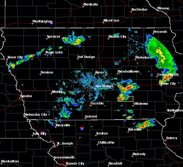 At 443 pm cdt, a severe thunderstorm was located over montezuma, moving east at 30 mph (radar indicated). Hazards include quarter size hail. damage to vehicles is expected At 443 pm cdt, a severe thunderstorm was located over montezuma, moving east at 30 mph (radar indicated). Hazards include quarter size hail. damage to vehicles is expected
|
| 8/20/2019 6:36 AM CDT |
 At 636 am cdt, the leading edge of severe thunderstorms was located along a line extending from near keswick to 7 miles southwest of delta to near albia to 9 miles south of chariton, moving east at 65 mph (radar indicated). Hazards include 60 mph wind gusts. Expect damage to roofs, siding, and trees. locations impacted include, oskaloosa, pella, grinnell, knoxville, osceola, chariton, albia, montezuma, brooklyn, new sharon, melcher-dallas, eddyville, knoxville raceway, rock creek lake, lakeside casino, lake red rock, victor, sully, murray and fremont. this includes the following highways, interstate 35 between mile markers 30 and 42. Interstate 80 between mile markers 172 and 204. At 636 am cdt, the leading edge of severe thunderstorms was located along a line extending from near keswick to 7 miles southwest of delta to near albia to 9 miles south of chariton, moving east at 65 mph (radar indicated). Hazards include 60 mph wind gusts. Expect damage to roofs, siding, and trees. locations impacted include, oskaloosa, pella, grinnell, knoxville, osceola, chariton, albia, montezuma, brooklyn, new sharon, melcher-dallas, eddyville, knoxville raceway, rock creek lake, lakeside casino, lake red rock, victor, sully, murray and fremont. this includes the following highways, interstate 35 between mile markers 30 and 42. Interstate 80 between mile markers 172 and 204.
|
| 8/20/2019 5:55 AM CDT |
 The national weather service in des moines has issued a * severe thunderstorm warning for. monroe county in south central iowa. poweshiek county in central iowa. lucas county in south central iowa. Marion county in south central iowa. The national weather service in des moines has issued a * severe thunderstorm warning for. monroe county in south central iowa. poweshiek county in central iowa. lucas county in south central iowa. Marion county in south central iowa.
|
| 8/18/2019 4:10 AM CDT |
 The severe thunderstorm warning for central mahaska county will expire at 415 am cdt, the storm which prompted the warning has weakened below severe limits, and no longer poses an immediate threat to life or property. therefore, the warning will be allowed to expire. however another round of storms looks to bring gusty winds and heavy rain this morning. The severe thunderstorm warning for central mahaska county will expire at 415 am cdt, the storm which prompted the warning has weakened below severe limits, and no longer poses an immediate threat to life or property. therefore, the warning will be allowed to expire. however another round of storms looks to bring gusty winds and heavy rain this morning.
|
| 8/18/2019 3:51 AM CDT |
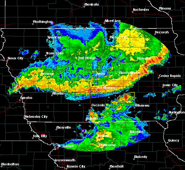 A severe thunderstorm warning remains in effect until 415 am cdt for central mahaska county. at 351 am cdt, a severe thunderstorm was located near oskaloosa, moving east at 55 mph. hazard. 60 mph wind gusts and half dollar size hail. source. Radar indicated. A severe thunderstorm warning remains in effect until 415 am cdt for central mahaska county. at 351 am cdt, a severe thunderstorm was located near oskaloosa, moving east at 55 mph. hazard. 60 mph wind gusts and half dollar size hail. source. Radar indicated.
|
| 8/18/2019 3:36 AM CDT |
 At 336 am cdt, a severe thunderstorm was located 9 miles south of pella, moving east at 40 mph (radar indicated). Hazards include 60 mph wind gusts and quarter size hail. Hail damage to vehicles is expected. Expect wind damage to roofs, siding, and trees. At 336 am cdt, a severe thunderstorm was located 9 miles south of pella, moving east at 40 mph (radar indicated). Hazards include 60 mph wind gusts and quarter size hail. Hail damage to vehicles is expected. Expect wind damage to roofs, siding, and trees.
|
| 7/20/2019 7:12 PM CDT |
 At 712 pm cdt, severe thunderstorms were located along a line extending from near victor to near eddyville, moving east at 45 mph (radar indicated). Hazards include 60 mph wind gusts and quarter size hail. Hail damage to vehicles is expected. expect wind damage to roofs, siding, and trees. Locations impacted include, oskaloosa, eddyville, fremont, university park, barnes city, rose hill, keomah village, lake keomah state park and oskaloosa municipal airport. At 712 pm cdt, severe thunderstorms were located along a line extending from near victor to near eddyville, moving east at 45 mph (radar indicated). Hazards include 60 mph wind gusts and quarter size hail. Hail damage to vehicles is expected. expect wind damage to roofs, siding, and trees. Locations impacted include, oskaloosa, eddyville, fremont, university park, barnes city, rose hill, keomah village, lake keomah state park and oskaloosa municipal airport.
|
| 7/20/2019 6:48 PM CDT |
 At 648 pm cdt, severe thunderstorms were located along a line extending from 6 miles east of grinnell to 9 miles west of eddyville, moving east at 65 mph (radar indicated). Hazards include 60 mph wind gusts and quarter size hail. Hail damage to vehicles is expected. Expect wind damage to roofs, siding, and trees. At 648 pm cdt, severe thunderstorms were located along a line extending from 6 miles east of grinnell to 9 miles west of eddyville, moving east at 65 mph (radar indicated). Hazards include 60 mph wind gusts and quarter size hail. Hail damage to vehicles is expected. Expect wind damage to roofs, siding, and trees.
|
| 6/15/2019 6:24 PM CDT |
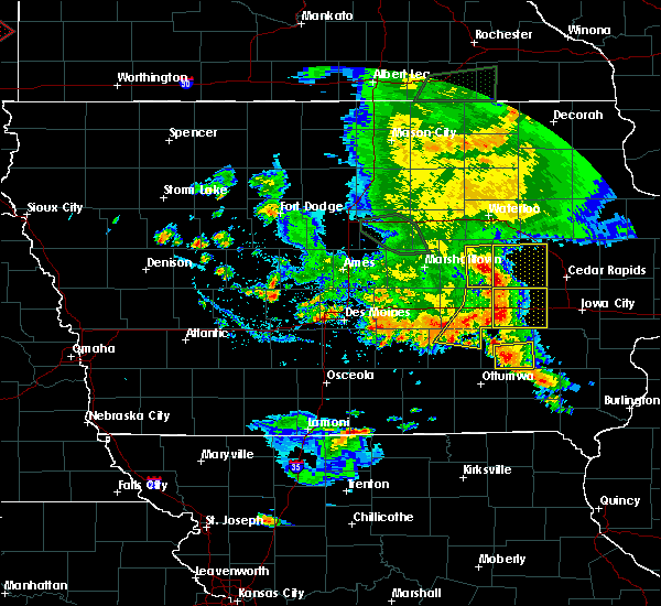 At 624 pm cdt, severe thunderstorms were located along a line extending from near belle plaine to 6 miles southeast of montezuma to near oskaloosa, moving east at 35 mph (radar indicated). Hazards include 60 mph wind gusts and penny size hail. Expect damage to roofs, siding, and trees. locations impacted include, montezuma, brooklyn, new sharon, victor, holiday lake, malcom, deep river, barnes city, hartwick and guernsey. This includes interstate 80 between mile markers 190 and 204. At 624 pm cdt, severe thunderstorms were located along a line extending from near belle plaine to 6 miles southeast of montezuma to near oskaloosa, moving east at 35 mph (radar indicated). Hazards include 60 mph wind gusts and penny size hail. Expect damage to roofs, siding, and trees. locations impacted include, montezuma, brooklyn, new sharon, victor, holiday lake, malcom, deep river, barnes city, hartwick and guernsey. This includes interstate 80 between mile markers 190 and 204.
|
| 6/15/2019 6:20 PM CDT |
 At 619 pm cdt, severe thunderstorms were located along a line extending from near belle plaine to near montezuma to 6 miles northwest of oskaloosa, moving east at 35 mph (radar indicated). Hazards include 60 mph wind gusts and penny size hail. Expect damage to roofs, siding, and trees. locations impacted include, pella, grinnell, montezuma, brooklyn, new sharon, victor, sully, holiday lake, lynnville, malcom, deep river, barnes city, searsboro, hartwick, guernsey and grinnell regional airport. This includes interstate 80 between mile markers 181 and 204. At 619 pm cdt, severe thunderstorms were located along a line extending from near belle plaine to near montezuma to 6 miles northwest of oskaloosa, moving east at 35 mph (radar indicated). Hazards include 60 mph wind gusts and penny size hail. Expect damage to roofs, siding, and trees. locations impacted include, pella, grinnell, montezuma, brooklyn, new sharon, victor, sully, holiday lake, lynnville, malcom, deep river, barnes city, searsboro, hartwick, guernsey and grinnell regional airport. This includes interstate 80 between mile markers 181 and 204.
|
| 6/15/2019 6:06 PM CDT |
 At 606 pm cdt, severe thunderstorms were located along a line extending from 7 miles west of belle plaine to near montezuma to near pella, moving east at 50 mph (radar indicated). Hazards include 60 mph wind gusts and penny size hail. Expect damage to roofs, siding, and trees. locations impacted include, newton, pella, grinnell, montezuma, monroe, brooklyn, new sharon, iowa speedway, rock creek lake, victor, sully, kellogg, gilman, holiday lake, lynnville, malcom, deep river, barnes city, oakland acres and reasnor. This includes interstate 80 between mile markers 165 and 204. At 606 pm cdt, severe thunderstorms were located along a line extending from 7 miles west of belle plaine to near montezuma to near pella, moving east at 50 mph (radar indicated). Hazards include 60 mph wind gusts and penny size hail. Expect damage to roofs, siding, and trees. locations impacted include, newton, pella, grinnell, montezuma, monroe, brooklyn, new sharon, iowa speedway, rock creek lake, victor, sully, kellogg, gilman, holiday lake, lynnville, malcom, deep river, barnes city, oakland acres and reasnor. This includes interstate 80 between mile markers 165 and 204.
|
| 6/15/2019 5:49 PM CDT |
 The national weather service in des moines has issued a * severe thunderstorm warning for. poweshiek county in central iowa. southeastern marshall county in central iowa. northeastern marion county in south central iowa. Southern tama county in central iowa. The national weather service in des moines has issued a * severe thunderstorm warning for. poweshiek county in central iowa. southeastern marshall county in central iowa. northeastern marion county in south central iowa. Southern tama county in central iowa.
|
| 5/16/2019 9:26 PM CDT |
 At 925 pm cdt, severe thunderstorms were located along a line extending from 6 miles east of montezuma to near new sharon to monroe, moving southeast at 5 mph (radar indicated). Hazards include 60 mph wind gusts. Expect damage to roofs, siding, and trees. Locations impacted include, montezuma, monroe, sully, lynnville, deep river, barnes city, reasnor and searsboro. At 925 pm cdt, severe thunderstorms were located along a line extending from 6 miles east of montezuma to near new sharon to monroe, moving southeast at 5 mph (radar indicated). Hazards include 60 mph wind gusts. Expect damage to roofs, siding, and trees. Locations impacted include, montezuma, monroe, sully, lynnville, deep river, barnes city, reasnor and searsboro.
|
| 5/16/2019 9:14 PM CDT |
 At 913 pm cdt, severe thunderstorms were located along a line extending from near montezuma to 6 miles northwest of new sharon to monroe, moving southeast at 15 mph (radar indicated). Hazards include 60 mph wind gusts and quarter size hail. Hail damage to vehicles is expected. expect wind damage to roofs, siding, and trees. Locations impacted include, montezuma, monroe, sully, lynnville, deep river, barnes city, reasnor, searsboro and guernsey. At 913 pm cdt, severe thunderstorms were located along a line extending from near montezuma to 6 miles northwest of new sharon to monroe, moving southeast at 15 mph (radar indicated). Hazards include 60 mph wind gusts and quarter size hail. Hail damage to vehicles is expected. expect wind damage to roofs, siding, and trees. Locations impacted include, montezuma, monroe, sully, lynnville, deep river, barnes city, reasnor, searsboro and guernsey.
|
| 5/16/2019 8:58 PM CDT |
 The national weather service in des moines has issued a * severe thunderstorm warning for. southern poweshiek county in central iowa. southeastern jasper county in central iowa. until 945 pm cdt. At 858 pm cdt, severe thunderstorms were located along a line. The national weather service in des moines has issued a * severe thunderstorm warning for. southern poweshiek county in central iowa. southeastern jasper county in central iowa. until 945 pm cdt. At 858 pm cdt, severe thunderstorms were located along a line.
|
| 5/16/2019 8:23 PM CDT |
 At 823 pm cdt, a severe thunderstorm was located near brooklyn, or 7 miles northeast of montezuma, moving east at 20 mph (radar indicated). Hazards include quarter size hail. damage to vehicles is expected At 823 pm cdt, a severe thunderstorm was located near brooklyn, or 7 miles northeast of montezuma, moving east at 20 mph (radar indicated). Hazards include quarter size hail. damage to vehicles is expected
|
| 9/3/2018 7:07 PM CDT |
 At 706 pm cdt, a severe thunderstorm capable of producing a tornado was located near montezuma, moving east at 20 mph (radar indicated rotation). Hazards include tornado. Flying debris will be dangerous to those caught without shelter. mobile homes will be damaged or destroyed. damage to roofs, windows, and vehicles will occur. tree damage is likely. Locations impacted include, montezuma, deep river, barnes city and guernsey. At 706 pm cdt, a severe thunderstorm capable of producing a tornado was located near montezuma, moving east at 20 mph (radar indicated rotation). Hazards include tornado. Flying debris will be dangerous to those caught without shelter. mobile homes will be damaged or destroyed. damage to roofs, windows, and vehicles will occur. tree damage is likely. Locations impacted include, montezuma, deep river, barnes city and guernsey.
|
| 9/3/2018 6:58 PM CDT |
 At 657 pm cdt, a severe thunderstorm capable of producing a tornado was located over montezuma, moving east at 20 mph (radar indicated rotation). Hazards include tornado. Flying debris will be dangerous to those caught without shelter. mobile homes will be damaged or destroyed. damage to roofs, windows, and vehicles will occur. tree damage is likely. This tornadic thunderstorm will remain over mainly rural areas of southeastern poweshiek county, including the following locations, deep river, guernsey and barnes city. At 657 pm cdt, a severe thunderstorm capable of producing a tornado was located over montezuma, moving east at 20 mph (radar indicated rotation). Hazards include tornado. Flying debris will be dangerous to those caught without shelter. mobile homes will be damaged or destroyed. damage to roofs, windows, and vehicles will occur. tree damage is likely. This tornadic thunderstorm will remain over mainly rural areas of southeastern poweshiek county, including the following locations, deep river, guernsey and barnes city.
|
| 8/28/2018 5:03 PM CDT |
 At 503 pm cdt, a severe thunderstorm was located over new sharon, or 11 miles north of oskaloosa, moving east at 40 mph (radar indicated). Hazards include 60 mph wind gusts and penny size hail. expect damage to roofs, siding, and trees At 503 pm cdt, a severe thunderstorm was located over new sharon, or 11 miles north of oskaloosa, moving east at 40 mph (radar indicated). Hazards include 60 mph wind gusts and penny size hail. expect damage to roofs, siding, and trees
|
| 7/13/2018 5:56 PM CDT |
 The severe thunderstorm warning for southeastern poweshiek and northeastern mahaska counties will expire at 600 pm cdt, the storm which prompted the warning has weakened below severe limits, and has exited the warned area. therefore, the warning will be allowed to expire. The severe thunderstorm warning for southeastern poweshiek and northeastern mahaska counties will expire at 600 pm cdt, the storm which prompted the warning has weakened below severe limits, and has exited the warned area. therefore, the warning will be allowed to expire.
|
| 7/13/2018 5:32 PM CDT |
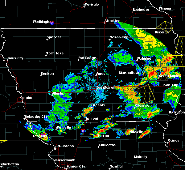 At 532 pm cdt, a severe thunderstorm was located near new sharon, or near montezuma, moving east at 10 mph (radar indicated). Hazards include 60 mph wind gusts and penny size hail. Expect damage to roofs, siding, and trees. Locations impacted include, montezuma, new sharon, deep river, barnes city and guernsey. At 532 pm cdt, a severe thunderstorm was located near new sharon, or near montezuma, moving east at 10 mph (radar indicated). Hazards include 60 mph wind gusts and penny size hail. Expect damage to roofs, siding, and trees. Locations impacted include, montezuma, new sharon, deep river, barnes city and guernsey.
|
| 7/13/2018 5:14 PM CDT |
 At 513 pm cdt, a severe thunderstorm was located over new sharon, or 8 miles southwest of montezuma, moving east at 25 mph (radar indicated). Hazards include 60 mph wind gusts and penny size hail. Expect damage to roofs, siding, and trees. Locations impacted include, montezuma, new sharon, deep river, barnes city and guernsey. At 513 pm cdt, a severe thunderstorm was located over new sharon, or 8 miles southwest of montezuma, moving east at 25 mph (radar indicated). Hazards include 60 mph wind gusts and penny size hail. Expect damage to roofs, siding, and trees. Locations impacted include, montezuma, new sharon, deep river, barnes city and guernsey.
|
| 7/13/2018 4:58 PM CDT |
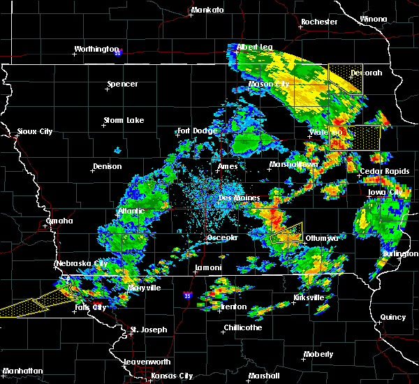 At 458 pm cdt, a severe thunderstorm was located near new sharon, or 8 miles east of pella, moving northeast at 20 mph (radar indicated). Hazards include 60 mph wind gusts. expect damage to roofs, siding, and trees At 458 pm cdt, a severe thunderstorm was located near new sharon, or 8 miles east of pella, moving northeast at 20 mph (radar indicated). Hazards include 60 mph wind gusts. expect damage to roofs, siding, and trees
|
| 6/28/2018 1:49 PM CDT |
 At 148 pm cdt, severe thunderstorms were located along a line extending from near hayesville to near batavia to near downing, moving east at 45 mph (trained weather spotters. at 138 pm...quarter sized hail and 70 mph winds were reported in ottumwa). Hazards include 70 mph wind gusts and quarter size hail. Hail damage to vehicles is expected. expect considerable tree damage. wind damage is also likely to mobile homes, roofs, and outbuildings. Locations impacted include, ottumwa, oskaloosa, bloomfield, eddyville, ottumwa industrial airport, eldon, fremont, agency, university park, blakesburg, pulaski, drakesville, barnes city, rose hill, kirkville, floris, chillicothe, keomah village, oskaloosa municipal airport and lake wapello state park. At 148 pm cdt, severe thunderstorms were located along a line extending from near hayesville to near batavia to near downing, moving east at 45 mph (trained weather spotters. at 138 pm...quarter sized hail and 70 mph winds were reported in ottumwa). Hazards include 70 mph wind gusts and quarter size hail. Hail damage to vehicles is expected. expect considerable tree damage. wind damage is also likely to mobile homes, roofs, and outbuildings. Locations impacted include, ottumwa, oskaloosa, bloomfield, eddyville, ottumwa industrial airport, eldon, fremont, agency, university park, blakesburg, pulaski, drakesville, barnes city, rose hill, kirkville, floris, chillicothe, keomah village, oskaloosa municipal airport and lake wapello state park.
|
| 6/28/2018 1:40 PM CDT |
 At 140 pm cdt, severe thunderstorms were located along a line extending from delta to batavia to 8 miles north of downing, moving east at 50 mph. these are very dangerous storms (radar indicated). Hazards include 80 mph wind gusts and penny size hail. Flying debris will be dangerous to those caught without shelter. mobile homes will be heavily damaged. expect considerable damage to roofs, windows, and vehicles. extensive tree damage and power outages are likely. Locations impacted include, ottumwa, oskaloosa, bloomfield, eddyville, ottumwa industrial airport, eldon, fremont, agency, university park, blakesburg, pulaski, drakesville, barnes city, rose hill, kirkville, floris, chillicothe, keomah village, oskaloosa municipal airport and lake wapello state park. At 140 pm cdt, severe thunderstorms were located along a line extending from delta to batavia to 8 miles north of downing, moving east at 50 mph. these are very dangerous storms (radar indicated). Hazards include 80 mph wind gusts and penny size hail. Flying debris will be dangerous to those caught without shelter. mobile homes will be heavily damaged. expect considerable damage to roofs, windows, and vehicles. extensive tree damage and power outages are likely. Locations impacted include, ottumwa, oskaloosa, bloomfield, eddyville, ottumwa industrial airport, eldon, fremont, agency, university park, blakesburg, pulaski, drakesville, barnes city, rose hill, kirkville, floris, chillicothe, keomah village, oskaloosa municipal airport and lake wapello state park.
|
| 6/28/2018 1:21 PM CDT |
 At 120 pm cdt, severe thunderstorms were located along a line extending from near oskaloosa to near ottumwa to 9 miles south of lake sundown, moving east at 50 mph. these are very dangerous storms (trained weather spotters. numerous reports of tree damage and outbuilding damage have occurred with these storms). Hazards include 80 mph wind gusts and penny size hail. Flying debris will be dangerous to those caught without shelter. mobile homes will be heavily damaged. expect considerable damage to roofs, windows, and vehicles. extensive tree damage and power outages are likely. Locations impacted include, ottumwa, oskaloosa, bloomfield, eddyville, ottumwa industrial airport, eldon, fremont, agency, university park, blakesburg, pulaski, drakesville, barnes city, rose hill, kirkville, floris, chillicothe, keomah village, oskaloosa municipal airport and lake wapello state park. At 120 pm cdt, severe thunderstorms were located along a line extending from near oskaloosa to near ottumwa to 9 miles south of lake sundown, moving east at 50 mph. these are very dangerous storms (trained weather spotters. numerous reports of tree damage and outbuilding damage have occurred with these storms). Hazards include 80 mph wind gusts and penny size hail. Flying debris will be dangerous to those caught without shelter. mobile homes will be heavily damaged. expect considerable damage to roofs, windows, and vehicles. extensive tree damage and power outages are likely. Locations impacted include, ottumwa, oskaloosa, bloomfield, eddyville, ottumwa industrial airport, eldon, fremont, agency, university park, blakesburg, pulaski, drakesville, barnes city, rose hill, kirkville, floris, chillicothe, keomah village, oskaloosa municipal airport and lake wapello state park.
|
| 6/28/2018 1:06 PM CDT |
 At 106 pm cdt, severe thunderstorms were located along a line extending from near pella to near albia to near centerville, moving east at 50 mph. these are very dangerous storms (trained weather spotters. these storms have a history of widespread wind damage). Hazards include 80 mph wind gusts and penny size hail. Flying debris will be dangerous to those caught without shelter. mobile homes will be heavily damaged. expect considerable damage to roofs, windows, and vehicles. Extensive tree damage and power outages are likely. At 106 pm cdt, severe thunderstorms were located along a line extending from near pella to near albia to near centerville, moving east at 50 mph. these are very dangerous storms (trained weather spotters. these storms have a history of widespread wind damage). Hazards include 80 mph wind gusts and penny size hail. Flying debris will be dangerous to those caught without shelter. mobile homes will be heavily damaged. expect considerable damage to roofs, windows, and vehicles. Extensive tree damage and power outages are likely.
|
| 6/6/2018 7:41 PM CDT |
 The severe thunderstorm warning for southern poweshiek, northeastern marion, mahaska and southeastern jasper counties will expire at 745 pm cdt, the storm which prompted the warning has moved out of the area. therefore, the warning will be allowed to expire. however small hail, gusty winds and heavy rain are still possible with this thunderstorm. a severe thunderstorm warning continues for southern marion and mahaska counties until 815 pm cdt. a severe thunderstorm watch remains in effect until 1000 pm cdt for central and south central iowa. The severe thunderstorm warning for southern poweshiek, northeastern marion, mahaska and southeastern jasper counties will expire at 745 pm cdt, the storm which prompted the warning has moved out of the area. therefore, the warning will be allowed to expire. however small hail, gusty winds and heavy rain are still possible with this thunderstorm. a severe thunderstorm warning continues for southern marion and mahaska counties until 815 pm cdt. a severe thunderstorm watch remains in effect until 1000 pm cdt for central and south central iowa.
|
| 6/6/2018 7:07 PM CDT |
 At 706 pm cdt, a severe thunderstorm was located over new sharon, or 10 miles southwest of montezuma, moving south at 15 mph (trained weather spotters reported 62 mph winds at pella at 701 pm cdt this evening). Hazards include 60 mph wind gusts and nickel size hail. Expect damage to roofs, siding, and trees. locations impacted include, newton, oskaloosa, pella, grinnell, knoxville, montezuma, monroe, new sharon, iowa speedway, knoxville raceway, lake red rock, sully, beacon, university park, lynnville, deep river, harvey, barnes city, lambs grove and rose hill. This includes interstate 80 between mile markers 162 and 204. At 706 pm cdt, a severe thunderstorm was located over new sharon, or 10 miles southwest of montezuma, moving south at 15 mph (trained weather spotters reported 62 mph winds at pella at 701 pm cdt this evening). Hazards include 60 mph wind gusts and nickel size hail. Expect damage to roofs, siding, and trees. locations impacted include, newton, oskaloosa, pella, grinnell, knoxville, montezuma, monroe, new sharon, iowa speedway, knoxville raceway, lake red rock, sully, beacon, university park, lynnville, deep river, harvey, barnes city, lambs grove and rose hill. This includes interstate 80 between mile markers 162 and 204.
|
| 6/6/2018 6:43 PM CDT |
 At 643 pm cdt, a severe thunderstorm was located near new sharon, or 7 miles west of montezuma, moving south at 15 mph (radar indicated). Hazards include 60 mph wind gusts and nickel size hail. expect damage to roofs, siding, and trees At 643 pm cdt, a severe thunderstorm was located near new sharon, or 7 miles west of montezuma, moving south at 15 mph (radar indicated). Hazards include 60 mph wind gusts and nickel size hail. expect damage to roofs, siding, and trees
|
| 6/6/2018 6:26 PM CDT |
 At 626 pm cdt, a severe thunderstorm was located near grinnell, moving south at 35 mph (radar indicated). Hazards include 60 mph wind gusts and quarter size hail. Hail damage to vehicles is expected. expect wind damage to roofs, siding, and trees. locations impacted include, newton, grinnell, montezuma, brooklyn, iowa speedway, rock creek lake, victor, sully, kellogg, gilman, holiday lake, lynnville, malcom, deep river, barnes city, oakland acres, reasnor, searsboro, hartwick and guernsey. This includes interstate 80 between mile markers 165 and 204. At 626 pm cdt, a severe thunderstorm was located near grinnell, moving south at 35 mph (radar indicated). Hazards include 60 mph wind gusts and quarter size hail. Hail damage to vehicles is expected. expect wind damage to roofs, siding, and trees. locations impacted include, newton, grinnell, montezuma, brooklyn, iowa speedway, rock creek lake, victor, sully, kellogg, gilman, holiday lake, lynnville, malcom, deep river, barnes city, oakland acres, reasnor, searsboro, hartwick and guernsey. This includes interstate 80 between mile markers 165 and 204.
|
| 6/6/2018 6:08 PM CDT |
 At 608 pm cdt, a severe thunderstorm was located near grinnell, moving south at 35 mph (radar indicated). Hazards include 60 mph wind gusts and quarter size hail. Hail damage to vehicles is expected. Expect wind damage to roofs, siding, and trees. At 608 pm cdt, a severe thunderstorm was located near grinnell, moving south at 35 mph (radar indicated). Hazards include 60 mph wind gusts and quarter size hail. Hail damage to vehicles is expected. Expect wind damage to roofs, siding, and trees.
|
| 5/26/2018 3:53 PM CDT |
 At 353 pm cdt, a severe thunderstorm was located near new sharon, or 9 miles south of montezuma, moving east at 10 mph (radar indicated). Hazards include 60 mph wind gusts and nickel size hail. expect damage to roofs, siding, and trees At 353 pm cdt, a severe thunderstorm was located near new sharon, or 9 miles south of montezuma, moving east at 10 mph (radar indicated). Hazards include 60 mph wind gusts and nickel size hail. expect damage to roofs, siding, and trees
|
| 9/21/2017 5:27 AM CDT |
 The severe thunderstorm warning for eastern poweshiek county will expire at 530 am cdt, the storm which prompted the warning has weakened below severe limits, and no longer poses an immediate threat to life or property. therefore the warning will be allowed to expire. The severe thunderstorm warning for eastern poweshiek county will expire at 530 am cdt, the storm which prompted the warning has weakened below severe limits, and no longer poses an immediate threat to life or property. therefore the warning will be allowed to expire.
|
| 9/21/2017 5:12 AM CDT |
 At 512 am cdt, a severe thunderstorm was located over montezuma, moving northeast at 25 mph (radar indicated). Hazards include quarter size hail. Damage to vehicles is expected. locations impacted include, montezuma, brooklyn, malcom, deep river, barnes city and guernsey. This includes interstate 80 between mile markers 190 and 201. At 512 am cdt, a severe thunderstorm was located over montezuma, moving northeast at 25 mph (radar indicated). Hazards include quarter size hail. Damage to vehicles is expected. locations impacted include, montezuma, brooklyn, malcom, deep river, barnes city and guernsey. This includes interstate 80 between mile markers 190 and 201.
|
| 9/21/2017 4:46 AM CDT |
 At 446 am cdt, a severe thunderstorm was located over new sharon, or 8 miles southwest of montezuma, moving northeast at 25 mph (radar indicated). Hazards include two inch hail and 60 mph wind gusts. People and animals outdoors will be injured. expect hail damage to roofs, siding, windows, and vehicles. expect wind damage to roofs, siding, and trees. locations impacted include, montezuma, brooklyn, new sharon, malcom, deep river, barnes city, searsboro and guernsey. This includes interstate 80 between mile markers 185 and 201. At 446 am cdt, a severe thunderstorm was located over new sharon, or 8 miles southwest of montezuma, moving northeast at 25 mph (radar indicated). Hazards include two inch hail and 60 mph wind gusts. People and animals outdoors will be injured. expect hail damage to roofs, siding, windows, and vehicles. expect wind damage to roofs, siding, and trees. locations impacted include, montezuma, brooklyn, new sharon, malcom, deep river, barnes city, searsboro and guernsey. This includes interstate 80 between mile markers 185 and 201.
|
| 9/21/2017 4:38 AM CDT |
 At 437 am cdt, a severe thunderstorm was located over new sharon, or 10 miles north of oskaloosa, moving northeast at 25 mph (radar indicated). Hazards include ping pong ball size hail and 60 mph wind gusts. People and animals outdoors will be injured. expect hail damage to roofs, siding, windows, and vehicles. Expect wind damage to roofs, siding, and trees. At 437 am cdt, a severe thunderstorm was located over new sharon, or 10 miles north of oskaloosa, moving northeast at 25 mph (radar indicated). Hazards include ping pong ball size hail and 60 mph wind gusts. People and animals outdoors will be injured. expect hail damage to roofs, siding, windows, and vehicles. Expect wind damage to roofs, siding, and trees.
|
| 7/20/2017 11:53 PM CDT |
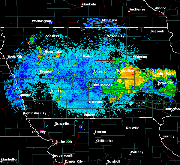 The severe thunderstorm warning for eastern poweshiek county will expire at midnight cdt, the storms which prompted the warning have moved out of the area. therefore the warning will be allowed to expire. to report severe weather, contact your nearest law enforcement agency. they will relay your report to the national weather service des moines. The severe thunderstorm warning for eastern poweshiek county will expire at midnight cdt, the storms which prompted the warning have moved out of the area. therefore the warning will be allowed to expire. to report severe weather, contact your nearest law enforcement agency. they will relay your report to the national weather service des moines.
|
| 7/20/2017 11:45 PM CDT |
 At 1145 pm cdt, severe thunderstorms were located along a line extending from near ladora to near millersburg, moving east at 50 mph (radar indicated). Hazards include 60 mph wind gusts. Expect damage to roofs, siding, and trees. locations impacted include, montezuma, brooklyn, victor, holiday lake, malcom, deep river, barnes city, hartwick and guernsey. This includes interstate 80 between mile markers 189 and 204. At 1145 pm cdt, severe thunderstorms were located along a line extending from near ladora to near millersburg, moving east at 50 mph (radar indicated). Hazards include 60 mph wind gusts. Expect damage to roofs, siding, and trees. locations impacted include, montezuma, brooklyn, victor, holiday lake, malcom, deep river, barnes city, hartwick and guernsey. This includes interstate 80 between mile markers 189 and 204.
|
| 7/20/2017 11:29 PM CDT |
 At 1127 pm cdt, severe thunderstorms were located along a line extending from 6 miles northwest of brooklyn to near montezuma, moving east at 40 mph (measured wind gust of 58 mph in grinnell at 1120 pm cdt). Hazards include 60 mph wind gusts. expect damage to roofs, siding, and trees At 1127 pm cdt, severe thunderstorms were located along a line extending from 6 miles northwest of brooklyn to near montezuma, moving east at 40 mph (measured wind gust of 58 mph in grinnell at 1120 pm cdt). Hazards include 60 mph wind gusts. expect damage to roofs, siding, and trees
|
| 5/27/2017 3:55 PM CDT |
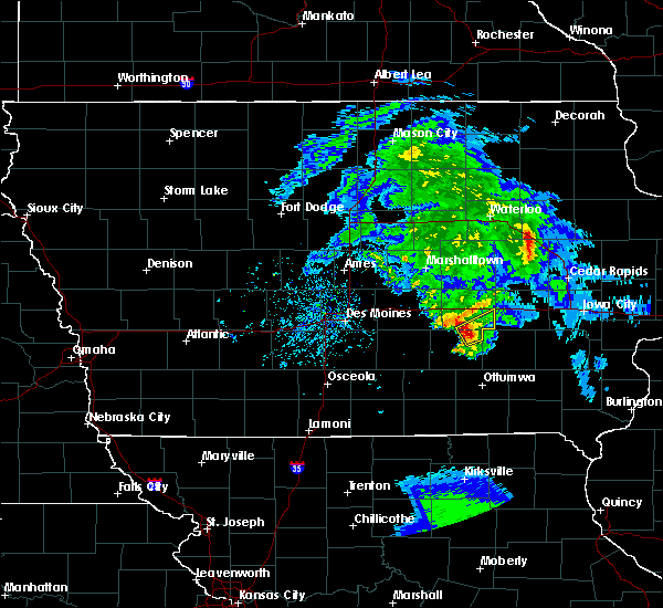 At 355 pm cdt, a severe thunderstorm was located near montezuma, moving northeast at 25 mph (radar indicated). Hazards include 60 mph wind gusts and quarter size hail. Hail damage to vehicles is expected. Expect wind damage to roofs, siding, and trees. At 355 pm cdt, a severe thunderstorm was located near montezuma, moving northeast at 25 mph (radar indicated). Hazards include 60 mph wind gusts and quarter size hail. Hail damage to vehicles is expected. Expect wind damage to roofs, siding, and trees.
|
| 5/17/2017 5:26 PM CDT |
 The severe thunderstorm warning for poweshiek, monroe, wapello, eastern marion, mahaska, northern appanoose and eastern jasper counties will expire at 530 pm cdt, the storms which prompted the warning have moved out of the area. therefore the warning will be allowed to expire. additional storms are possible through 7 pm. a tornado watch remains in effect until 700 pm cdt for south central, central and southeastern iowa. The severe thunderstorm warning for poweshiek, monroe, wapello, eastern marion, mahaska, northern appanoose and eastern jasper counties will expire at 530 pm cdt, the storms which prompted the warning have moved out of the area. therefore the warning will be allowed to expire. additional storms are possible through 7 pm. a tornado watch remains in effect until 700 pm cdt for south central, central and southeastern iowa.
|
| 5/17/2017 5:01 PM CDT |
 At 500 pm cdt, severe thunderstorms were located along a line extending from near newton to new sharon to near hedrick, moving northeast at 55 mph (trained weather spotters. at 451 pm...65 mph winds were reported by a department of transportation weather station). Hazards include 60 mph wind gusts and nickel size hail. Expect damage to roofs, siding, and trees. locations impacted include, ottumwa, newton, oskaloosa, pella, grinnell, knoxville, albia, montezuma, monroe, brooklyn, new sharon, eddyville, ottumwa industrial airport, iowa speedway, knoxville raceway, rock creek lake, lake red rock, sully, fremont and moravia. this includes interstate 80 between mile markers 165 and 200. A tornado watch remains in effect until 700 pm cdt for south central, central and southeastern iowa. At 500 pm cdt, severe thunderstorms were located along a line extending from near newton to new sharon to near hedrick, moving northeast at 55 mph (trained weather spotters. at 451 pm...65 mph winds were reported by a department of transportation weather station). Hazards include 60 mph wind gusts and nickel size hail. Expect damage to roofs, siding, and trees. locations impacted include, ottumwa, newton, oskaloosa, pella, grinnell, knoxville, albia, montezuma, monroe, brooklyn, new sharon, eddyville, ottumwa industrial airport, iowa speedway, knoxville raceway, rock creek lake, lake red rock, sully, fremont and moravia. this includes interstate 80 between mile markers 165 and 200. A tornado watch remains in effect until 700 pm cdt for south central, central and southeastern iowa.
|
| 5/17/2017 4:43 PM CDT |
 At 442 pm cdt, severe thunderstorms were located along a line extending from 6 miles north of monroe to 8 miles southeast of pella to near ottumwa, moving northeast at 65 mph (radar indicated). Hazards include 60 mph wind gusts and nickel size hail. Expect damage to roofs, siding, and trees. locations impacted include, ottumwa, newton, oskaloosa, pella, grinnell, knoxville, albia, montezuma, monroe, brooklyn, new sharon, eddyville, ottumwa industrial airport, iowa speedway, knoxville raceway, rock creek lake, lake red rock, sully, fremont and moravia. this includes interstate 80 between mile markers 165 and 200. A tornado watch remains in effect until 700 pm cdt for south central, central and southeastern iowa. At 442 pm cdt, severe thunderstorms were located along a line extending from 6 miles north of monroe to 8 miles southeast of pella to near ottumwa, moving northeast at 65 mph (radar indicated). Hazards include 60 mph wind gusts and nickel size hail. Expect damage to roofs, siding, and trees. locations impacted include, ottumwa, newton, oskaloosa, pella, grinnell, knoxville, albia, montezuma, monroe, brooklyn, new sharon, eddyville, ottumwa industrial airport, iowa speedway, knoxville raceway, rock creek lake, lake red rock, sully, fremont and moravia. this includes interstate 80 between mile markers 165 and 200. A tornado watch remains in effect until 700 pm cdt for south central, central and southeastern iowa.
|
| 5/17/2017 4:27 PM CDT |
 At 427 pm cdt, severe thunderstorms were located along a line extending from near carlisle to near knoxville to near lake sundown, moving northeast at 65 mph (radar indicated). Hazards include 60 mph wind gusts and nickel size hail. expect damage to roofs, siding, and trees At 427 pm cdt, severe thunderstorms were located along a line extending from near carlisle to near knoxville to near lake sundown, moving northeast at 65 mph (radar indicated). Hazards include 60 mph wind gusts and nickel size hail. expect damage to roofs, siding, and trees
|
| 4/15/2017 11:22 PM CDT |
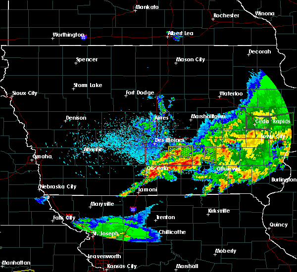 The severe thunderstorm warning for eastern mahaska county will expire at 1130 pm cdt, the storm which prompted the warning has moved out of the area. therefore the warning will be allowed to expire. a severe thunderstorm watch remains in effect until midnight cdt for south central and central iowa. The severe thunderstorm warning for eastern mahaska county will expire at 1130 pm cdt, the storm which prompted the warning has moved out of the area. therefore the warning will be allowed to expire. a severe thunderstorm watch remains in effect until midnight cdt for south central and central iowa.
|
| 4/15/2017 11:16 PM CDT |
 At 1115 pm cdt, a severe thunderstorm was located over what cheer, or 10 miles west of sigourney, moving east at 45 mph (radar indicated). Hazards include 60 mph wind gusts and quarter size hail. Hail damage to vehicles is expected. expect wind damage to roofs, siding, and trees. Locations impacted include, oskaloosa, fremont, university park, barnes city, rose hill, keomah village, lake keomah state park and oskaloosa municipal airport. At 1115 pm cdt, a severe thunderstorm was located over what cheer, or 10 miles west of sigourney, moving east at 45 mph (radar indicated). Hazards include 60 mph wind gusts and quarter size hail. Hail damage to vehicles is expected. expect wind damage to roofs, siding, and trees. Locations impacted include, oskaloosa, fremont, university park, barnes city, rose hill, keomah village, lake keomah state park and oskaloosa municipal airport.
|
| 4/15/2017 11:06 PM CDT |
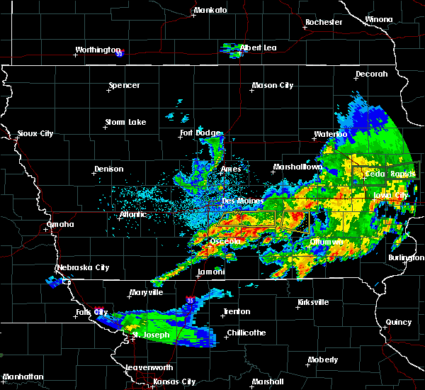 At 1105 pm cdt, a severe thunderstorm was located 7 miles southeast of new sharon, or 8 miles northeast of oskaloosa, moving east at 50 mph (radar indicated). Hazards include 60 mph wind gusts and quarter size hail. Hail damage to vehicles is expected. expect wind damage to roofs, siding, and trees. Locations impacted include, oskaloosa, new sharon, fremont, beacon, university park, barnes city, rose hill, keomah village, lake keomah state park and oskaloosa municipal airport. At 1105 pm cdt, a severe thunderstorm was located 7 miles southeast of new sharon, or 8 miles northeast of oskaloosa, moving east at 50 mph (radar indicated). Hazards include 60 mph wind gusts and quarter size hail. Hail damage to vehicles is expected. expect wind damage to roofs, siding, and trees. Locations impacted include, oskaloosa, new sharon, fremont, beacon, university park, barnes city, rose hill, keomah village, lake keomah state park and oskaloosa municipal airport.
|
| 4/15/2017 10:55 PM CDT |
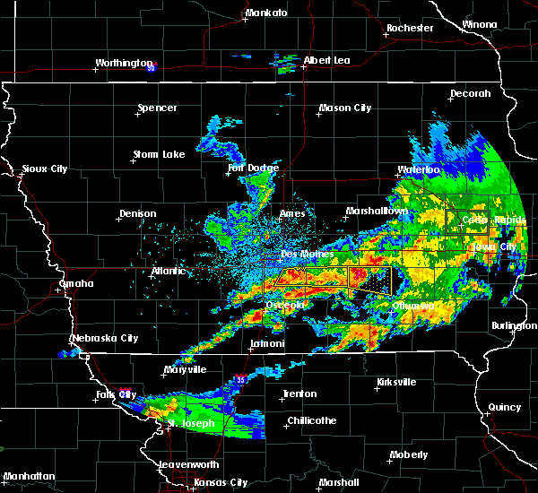 At 1054 pm cdt, a severe thunderstorm was located near new sharon, or 9 miles east of pella, moving east at 50 mph (radar indicated). Hazards include golf ball size hail and 60 mph wind gusts. People and animals outdoors will be injured. expect hail damage to roofs, siding, windows, and vehicles. expect wind damage to roofs, siding, and trees. Locations impacted include, oskaloosa, new sharon, fremont, beacon, university park, barnes city, rose hill, leighton, keomah village, lake keomah state park and oskaloosa municipal airport. At 1054 pm cdt, a severe thunderstorm was located near new sharon, or 9 miles east of pella, moving east at 50 mph (radar indicated). Hazards include golf ball size hail and 60 mph wind gusts. People and animals outdoors will be injured. expect hail damage to roofs, siding, windows, and vehicles. expect wind damage to roofs, siding, and trees. Locations impacted include, oskaloosa, new sharon, fremont, beacon, university park, barnes city, rose hill, leighton, keomah village, lake keomah state park and oskaloosa municipal airport.
|
| 4/15/2017 10:43 PM CDT |
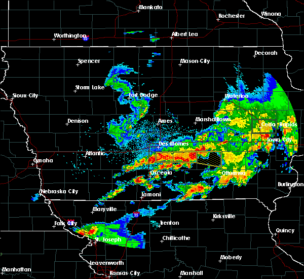 At 1043 pm cdt, a severe thunderstorm was located over pella, moving east at 50 mph (radar indicated). Hazards include 60 mph wind gusts and quarter size hail. Hail damage to vehicles is expected. Expect wind damage to roofs, siding, and trees. At 1043 pm cdt, a severe thunderstorm was located over pella, moving east at 50 mph (radar indicated). Hazards include 60 mph wind gusts and quarter size hail. Hail damage to vehicles is expected. Expect wind damage to roofs, siding, and trees.
|
| 4/15/2017 8:09 PM CDT |
 At 809 pm cdt, a severe thunderstorm was located near new sharon, or near montezuma, moving northeast at 40 mph (radar indicated). Hazards include half dollar size hail. damage to vehicles is expected At 809 pm cdt, a severe thunderstorm was located near new sharon, or near montezuma, moving northeast at 40 mph (radar indicated). Hazards include half dollar size hail. damage to vehicles is expected
|
| 4/10/2017 1:02 AM CDT |
 At 101 am cdt, a severe thunderstorm was located near new sharon, or 7 miles south of montezuma, moving northeast at 55 mph (radar indicated). Hazards include quarter size hail. Damage to vehicles is expected. locations impacted include, montezuma, brooklyn, new sharon, victor, deep river, barnes city, searsboro, hartwick and guernsey. This includes interstate 80 between mile markers 193 and 204. At 101 am cdt, a severe thunderstorm was located near new sharon, or 7 miles south of montezuma, moving northeast at 55 mph (radar indicated). Hazards include quarter size hail. Damage to vehicles is expected. locations impacted include, montezuma, brooklyn, new sharon, victor, deep river, barnes city, searsboro, hartwick and guernsey. This includes interstate 80 between mile markers 193 and 204.
|
| 4/10/2017 12:50 AM CDT |
 At 1250 am cdt, a severe thunderstorm was located 7 miles southwest of new sharon, or 7 miles east of pella, moving northeast at 55 mph (radar indicated). Hazards include quarter size hail. Damage to vehicles is expected. locations impacted include, oskaloosa, montezuma, brooklyn, new sharon, victor, deep river, barnes city, leighton, searsboro, hartwick and guernsey. This includes interstate 80 between mile markers 193 and 204. At 1250 am cdt, a severe thunderstorm was located 7 miles southwest of new sharon, or 7 miles east of pella, moving northeast at 55 mph (radar indicated). Hazards include quarter size hail. Damage to vehicles is expected. locations impacted include, oskaloosa, montezuma, brooklyn, new sharon, victor, deep river, barnes city, leighton, searsboro, hartwick and guernsey. This includes interstate 80 between mile markers 193 and 204.
|
| 4/10/2017 12:43 AM CDT |
 At 1243 am cdt, a severe thunderstorm was located near pella, moving northeast at 55 mph (radar indicated). Hazards include quarter size hail. damage to vehicles is expected At 1243 am cdt, a severe thunderstorm was located near pella, moving northeast at 55 mph (radar indicated). Hazards include quarter size hail. damage to vehicles is expected
|
| 3/6/2017 8:32 PM CST |
 At 832 pm cst, severe thunderstorms were located along a line extending from 6 miles northwest of keswick to near eddyville, moving east at 45 mph (trained weather spotters. these storms have a history of producing strong winds in excess of 60 mph). Hazards include 60 mph wind gusts and quarter size hail. Hail damage to vehicles is expected. expect wind damage to roofs, siding, and trees. locations impacted include, oskaloosa, new sharon, eddyville, fremont, beacon, university park, bussey, barnes city, rose hill, leighton, hamilton, keomah village, lake keomah state park and oskaloosa municipal airport. A tornado watch remains in effect until 1000 pm cst for south central, central and southeastern iowa. At 832 pm cst, severe thunderstorms were located along a line extending from 6 miles northwest of keswick to near eddyville, moving east at 45 mph (trained weather spotters. these storms have a history of producing strong winds in excess of 60 mph). Hazards include 60 mph wind gusts and quarter size hail. Hail damage to vehicles is expected. expect wind damage to roofs, siding, and trees. locations impacted include, oskaloosa, new sharon, eddyville, fremont, beacon, university park, bussey, barnes city, rose hill, leighton, hamilton, keomah village, lake keomah state park and oskaloosa municipal airport. A tornado watch remains in effect until 1000 pm cst for south central, central and southeastern iowa.
|
| 3/6/2017 8:15 PM CST |
 At 814 pm cst, severe thunderstorms were located along a line extending from la porte city to 6 miles west of montezuma, moving east at 45 mph (emergency management. these storms have a history of producing strong winds in excess of 60 mph). Hazards include 60 mph wind gusts and quarter size hail. Hail damage to vehicles is expected. expect wind damage to roofs, siding, and trees. locations impacted include, grinnell, toledo, montezuma, tama, traer, brooklyn, dysart, meskwaki casino, victor, sully, holiday lake, lynnville, malcom, deep river, chelsea, clutier, elberon, barnes city, oakland acres and searsboro. this includes interstate 80 between mile markers 177 and 204. A tornado watch remains in effect until 1000 pm cst for central and northeastern iowa. At 814 pm cst, severe thunderstorms were located along a line extending from la porte city to 6 miles west of montezuma, moving east at 45 mph (emergency management. these storms have a history of producing strong winds in excess of 60 mph). Hazards include 60 mph wind gusts and quarter size hail. Hail damage to vehicles is expected. expect wind damage to roofs, siding, and trees. locations impacted include, grinnell, toledo, montezuma, tama, traer, brooklyn, dysart, meskwaki casino, victor, sully, holiday lake, lynnville, malcom, deep river, chelsea, clutier, elberon, barnes city, oakland acres and searsboro. this includes interstate 80 between mile markers 177 and 204. A tornado watch remains in effect until 1000 pm cst for central and northeastern iowa.
|
| 3/6/2017 7:51 PM CST |
 At 751 pm cst, severe thunderstorms were located along a line extending from 6 miles north of pella to 8 miles southeast of melcher-dallas, moving east at 45 mph (trained weather spotters). Hazards include 60 mph wind gusts and quarter size hail. Hail damage to vehicles is expected. Expect wind damage to roofs, siding, and trees. At 751 pm cst, severe thunderstorms were located along a line extending from 6 miles north of pella to 8 miles southeast of melcher-dallas, moving east at 45 mph (trained weather spotters). Hazards include 60 mph wind gusts and quarter size hail. Hail damage to vehicles is expected. Expect wind damage to roofs, siding, and trees.
|
| 3/6/2017 7:40 PM CST |
 At 740 pm cst, severe thunderstorms were located along a line extending from near reinbeck to monroe, moving east at 45 mph (emergency management. 65 mph winds have been reported with these storms in state center). Hazards include 60 mph wind gusts and quarter size hail. Hail damage to vehicles is expected. Expect wind damage to roofs, siding, and trees. At 740 pm cst, severe thunderstorms were located along a line extending from near reinbeck to monroe, moving east at 45 mph (emergency management. 65 mph winds have been reported with these storms in state center). Hazards include 60 mph wind gusts and quarter size hail. Hail damage to vehicles is expected. Expect wind damage to roofs, siding, and trees.
|
| 8/24/2016 7:26 PM CDT |
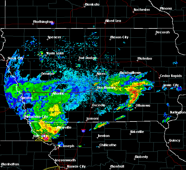 The severe thunderstorm warning for northeastern mahaska and southeastern poweshiek counties will expire at 730 pm cdt, the storm which prompted the warning has moved out of the area. therefore the warning will be allowed to expire. however heavy rain is still possible with this thunderstorm. to report severe weather, contact your nearest law enforcement agency. they will relay your report to the national weather service des moines. The severe thunderstorm warning for northeastern mahaska and southeastern poweshiek counties will expire at 730 pm cdt, the storm which prompted the warning has moved out of the area. therefore the warning will be allowed to expire. however heavy rain is still possible with this thunderstorm. to report severe weather, contact your nearest law enforcement agency. they will relay your report to the national weather service des moines.
|
| 8/24/2016 7:22 PM CDT |
 At 722 pm cdt, a severe thunderstorm was located near what cheer, or 11 miles southeast of montezuma, moving east at 35 mph (radar indicated). Hazards include 60 mph wind gusts and nickel size hail. Expect damage to roofs. siding. and trees. Locations impacted include, deep river and barnes city. At 722 pm cdt, a severe thunderstorm was located near what cheer, or 11 miles southeast of montezuma, moving east at 35 mph (radar indicated). Hazards include 60 mph wind gusts and nickel size hail. Expect damage to roofs. siding. and trees. Locations impacted include, deep river and barnes city.
|
| 8/24/2016 7:12 PM CDT |
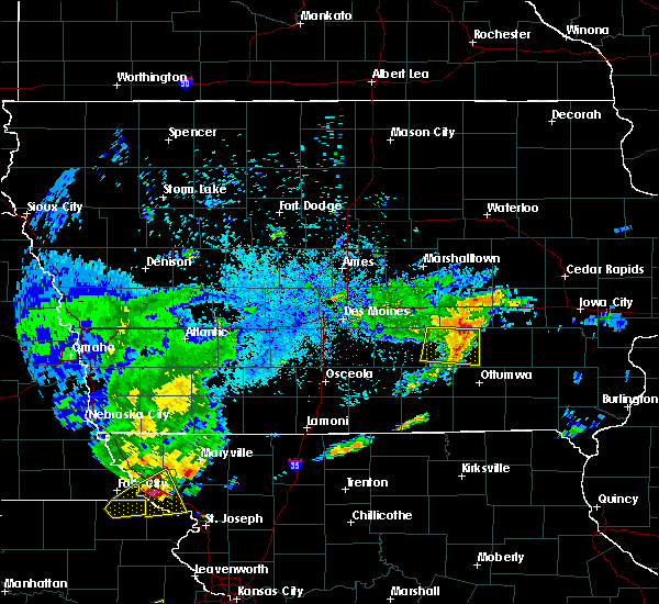 At 711 pm cdt, a severe thunderstorm was located 7 miles northwest of what cheer, or 8 miles south of montezuma, moving east at 55 mph (radar indicated). Hazards include 60 mph wind gusts and nickel size hail. Expect damage to roofs. siding. And trees. At 711 pm cdt, a severe thunderstorm was located 7 miles northwest of what cheer, or 8 miles south of montezuma, moving east at 55 mph (radar indicated). Hazards include 60 mph wind gusts and nickel size hail. Expect damage to roofs. siding. And trees.
|
| 8/4/2016 8:41 PM CDT |
 The severe thunderstorm warning for poweshiek and southeastern jasper counties will expire at 845 pm cdt, the storms which prompted the warning have weakened below severe limits, and no longer pose an immediate threat to life or property. therefore the warning will be allowed to expire. however heavy rain is still possible with these thunderstorms. a severe thunderstorm watch remains in effect until midnight cdt for central iowa. The severe thunderstorm warning for poweshiek and southeastern jasper counties will expire at 845 pm cdt, the storms which prompted the warning have weakened below severe limits, and no longer pose an immediate threat to life or property. therefore the warning will be allowed to expire. however heavy rain is still possible with these thunderstorms. a severe thunderstorm watch remains in effect until midnight cdt for central iowa.
|
| 8/4/2016 8:19 PM CDT |
 At 819 pm cdt, severe thunderstorms were located along a line extending from near norway to near montezuma, moving east at 30 mph (radar indicated). Hazards include 60 mph wind gusts. Expect damage to roofs. siding. and trees. Locations impacted include, grinnell, montezuma, brooklyn, victor, sully, lynnville, malcom, deep river, barnes city, searsboro, hartwick, guernsey and grinnell regional airport. At 819 pm cdt, severe thunderstorms were located along a line extending from near norway to near montezuma, moving east at 30 mph (radar indicated). Hazards include 60 mph wind gusts. Expect damage to roofs. siding. and trees. Locations impacted include, grinnell, montezuma, brooklyn, victor, sully, lynnville, malcom, deep river, barnes city, searsboro, hartwick, guernsey and grinnell regional airport.
|
| 8/4/2016 7:41 PM CDT |
 At 741 pm cdt, severe thunderstorms were located along a line extending from near keystone to near grinnell, moving southeast at 30 mph (trained weather spotters). Hazards include 60 mph wind gusts. Expect damage to roofs. siding. And trees. At 741 pm cdt, severe thunderstorms were located along a line extending from near keystone to near grinnell, moving southeast at 30 mph (trained weather spotters). Hazards include 60 mph wind gusts. Expect damage to roofs. siding. And trees.
|
| 11/11/2015 5:06 PM CST | Limbs and wires down. machine shed blown ove in mahaska county IA, 0.2 miles SW of Barnes City, IA |
| 11/11/2015 4:56 PM CST | The tornado warning for northeastern mahaska and southeastern poweshiek counties will expire at 500 pm cst. the storm which prompted the warning has moved out of the area. therefore the warning will be allowed to expire. A tornado watch remains in effect until 600 pm cst for south central iowa. |
| 11/11/2015 4:23 PM CST |
 At 423 pm cst, a severe thunderstorm capable of producing a tornado was located 5 miles east of new sharon, or 8 miles south of montezuma, moving northeast at 50 mph (radar indicated rotation). Hazards include tornado. Flying debris will be dangerous to those caught without shelter. mobile homes will be damaged or destroyed. damage to roofs, windows and vehicles will occur. tree damage is likely. this dangerous storm will be near, montezuma around 430 pm cst. victor around 450 pm cst. other locations impacted by this tornadic thunderstorm include barnes city, guernsey, victor and deep river. This includes interstate 80 between mile markers 200 and 204. At 423 pm cst, a severe thunderstorm capable of producing a tornado was located 5 miles east of new sharon, or 8 miles south of montezuma, moving northeast at 50 mph (radar indicated rotation). Hazards include tornado. Flying debris will be dangerous to those caught without shelter. mobile homes will be damaged or destroyed. damage to roofs, windows and vehicles will occur. tree damage is likely. this dangerous storm will be near, montezuma around 430 pm cst. victor around 450 pm cst. other locations impacted by this tornadic thunderstorm include barnes city, guernsey, victor and deep river. This includes interstate 80 between mile markers 200 and 204.
|
| 11/11/2015 4:03 PM CST |
 At 403 pm cst, severe thunderstorms were located along a line extending from near state center to 7 miles southeast of iowa speedway to 3 miles east of pella, moving northeast at 55 mph (radar indicated). Hazards include 60 mph wind gusts. Expect damage to roofs. Siding and trees. At 403 pm cst, severe thunderstorms were located along a line extending from near state center to 7 miles southeast of iowa speedway to 3 miles east of pella, moving northeast at 55 mph (radar indicated). Hazards include 60 mph wind gusts. Expect damage to roofs. Siding and trees.
|
| 11/11/2015 3:47 PM CST |
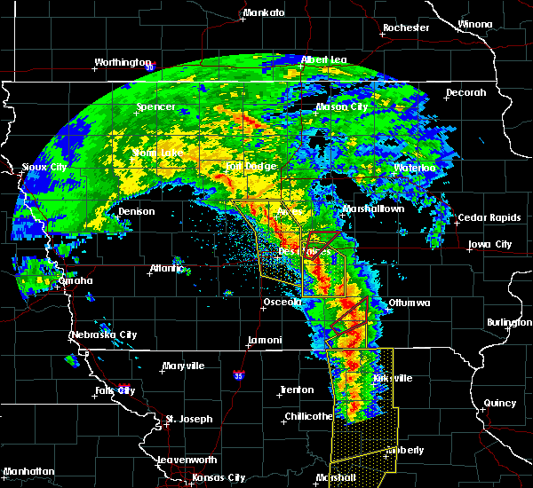 At 346 pm cst, a severe thunderstorm was located near albia, moving northeast at 55 mph (radar indicated). Hazards include 60 mph wind gusts. Expect damage to roofs. Siding and trees. At 346 pm cst, a severe thunderstorm was located near albia, moving northeast at 55 mph (radar indicated). Hazards include 60 mph wind gusts. Expect damage to roofs. Siding and trees.
|
| 8/2/2015 6:58 PM CDT |
 At 658 pm cdt, a severe thunderstorm was located 4 miles northeast of oskaloosa, moving southeast at 35 mph (radar indicated). Hazards include 60 mph wind gusts and quarter size hail. Hail damage to vehicles is expected. Expect wind damage to roofs, siding and trees. At 658 pm cdt, a severe thunderstorm was located 4 miles northeast of oskaloosa, moving southeast at 35 mph (radar indicated). Hazards include 60 mph wind gusts and quarter size hail. Hail damage to vehicles is expected. Expect wind damage to roofs, siding and trees.
|
| 6/20/2015 5:24 PM CDT |
 The severe thunderstorm warning for northeastern marion, northern mahaska, southeastern jasper and southern poweshiek counties will expire at 530 pm cdt, the severe thunderstorm which prompted the warning has weakened. therefore the warning will be allowed to expire. however heavy rain is still possible with this thunderstorm. a tornado watch remains in effect until 1100 pm cdt for south central iowa. remember, a severe thunderstorm warning still remains in effect for southeastern mahaska and marion counties. The severe thunderstorm warning for northeastern marion, northern mahaska, southeastern jasper and southern poweshiek counties will expire at 530 pm cdt, the severe thunderstorm which prompted the warning has weakened. therefore the warning will be allowed to expire. however heavy rain is still possible with this thunderstorm. a tornado watch remains in effect until 1100 pm cdt for south central iowa. remember, a severe thunderstorm warning still remains in effect for southeastern mahaska and marion counties.
|
| 1/1/0001 12:00 AM | Golf Ball sized hail reported 0.2 miles SW of Barnes City, IA, trained spotter reported golf ball hail in barnes city. |
| 1/1/0001 12:00 AM | Quarter sized hail reported 3.3 miles N of Barnes City, IA, quarter size hail nearly covering ground... |
Hail Maps for Barnes City, IA


Connect with Interactive Hail Maps