

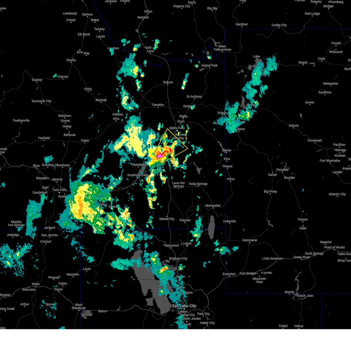
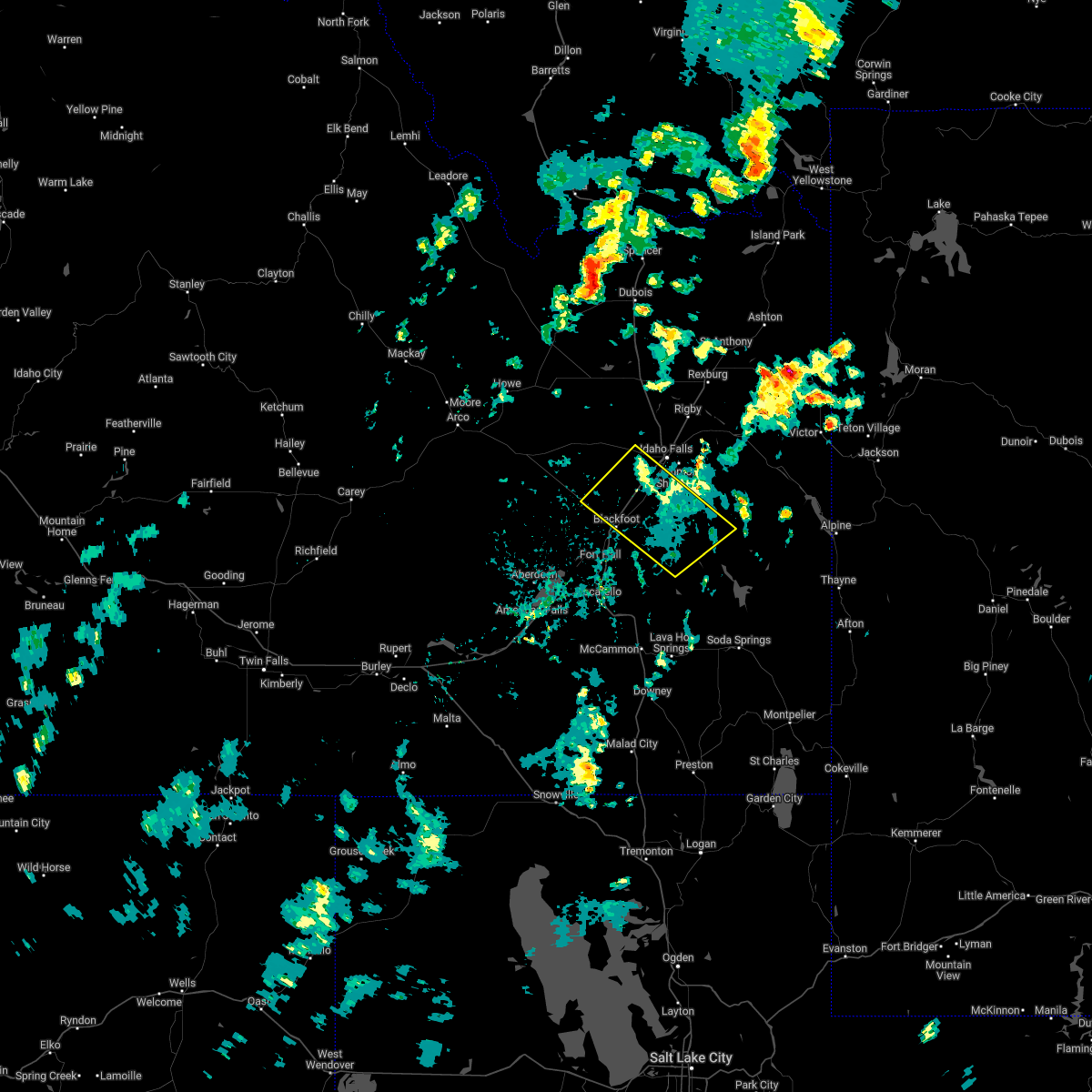
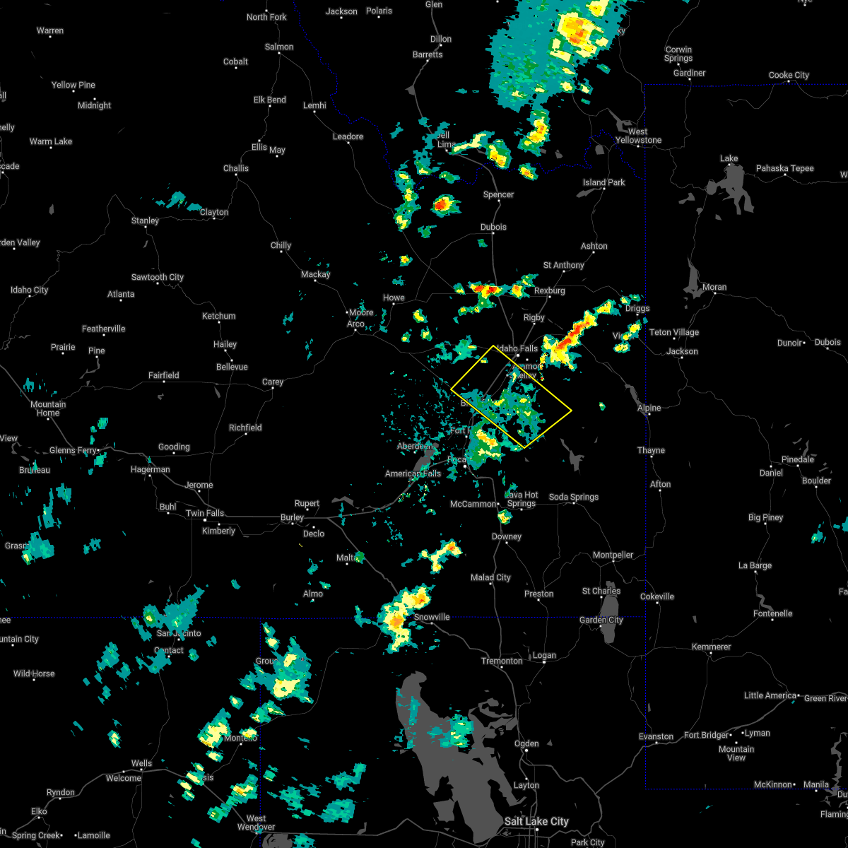
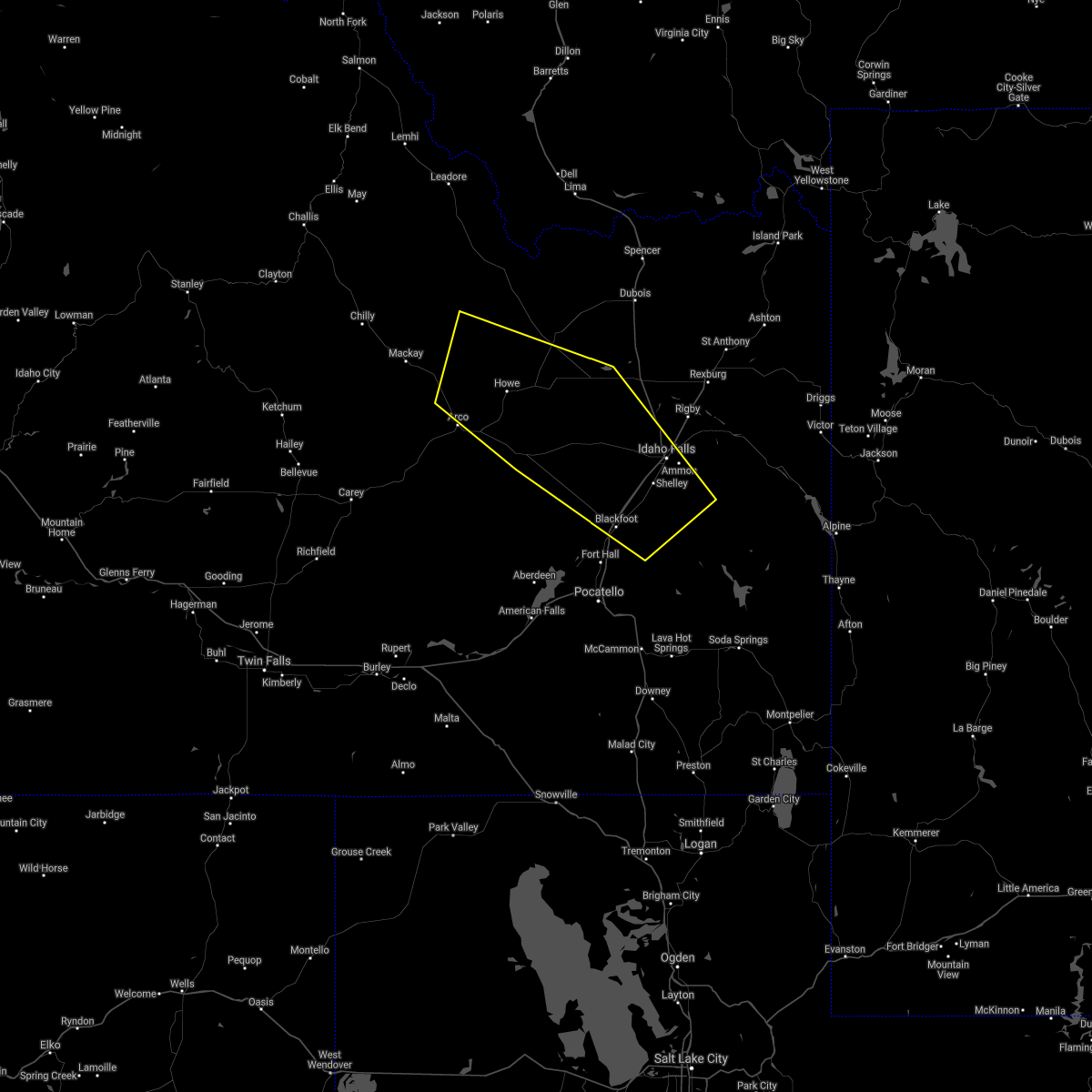
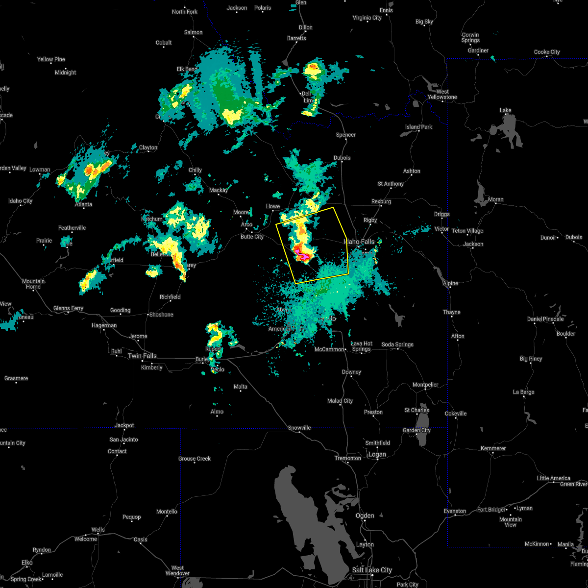
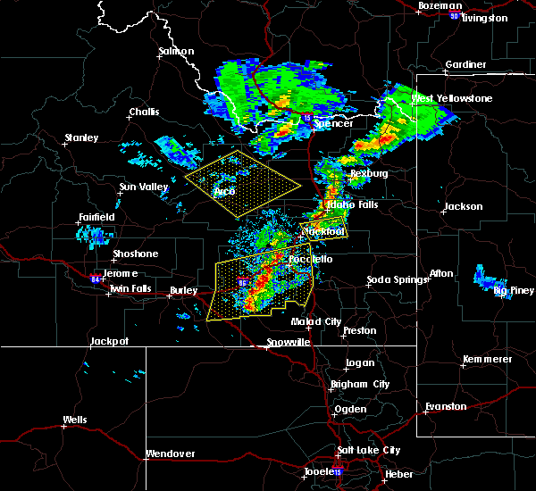
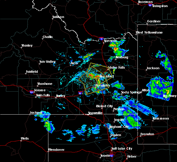
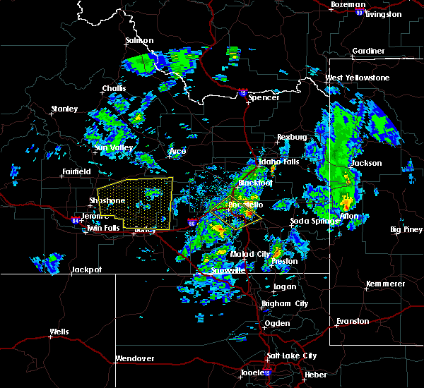
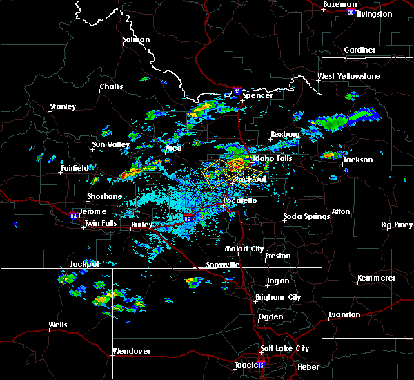
Hail Map for Basalt, ID
The Basalt, ID area has had 0 reports of on-the-ground hail by trained spotters, and has been under severe weather warnings 12 times during the past 12 months. Doppler radar has detected hail at or near Basalt, ID on 12 occasions, including 1 occasion during the past year.
| Name: | Basalt, ID |
| Where Located: | 13.8 miles SSW of Idaho Falls, ID |
| Map: | Google Map for Basalt, ID |
| Population: | 394 |
| Housing Units: | 142 |
| More Info: | Search Google for Basalt, ID |
0
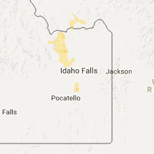
The Top Recent Hail Date for Basalt, ID is Monday, September 16, 2024 (7th out of 12)

Hail and Wind Damage Spotted near Basalt, ID
| Date / Time | Report Details |
|---|---|
| 7/15/2025 7:12 PM MDT |
 The storms which prompted the warning have weakened below severe limits, and have exited the warned area. therefore, the warning will be allowed to expire. however, gusty winds are still possible with these thunderstorms. The storms which prompted the warning have weakened below severe limits, and have exited the warned area. therefore, the warning will be allowed to expire. however, gusty winds are still possible with these thunderstorms.
|
| 7/15/2025 6:25 PM MDT |
 Svrpih the national weather service in pocatello has issued a * severe thunderstorm warning for, southeastern blaine county in central idaho, northwestern caribou county in southeastern idaho, northern bannock county in southeastern idaho, southeastern butte county in southeastern idaho, central power county in southeastern idaho, central bonneville county in southeastern idaho, bingham county in southeastern idaho, * until 715 pm mdt. * at 625 pm mdt, severe thunderstorms were located along a line extending from 8 miles west of aberdeen to fort hall mount putnam, moving northeast at 35 mph (radar indicated). Hazards include 70 mph wind gusts. Expect considerable tree damage. Damage is likely to mobile homes, roofs, and outbuildings. Svrpih the national weather service in pocatello has issued a * severe thunderstorm warning for, southeastern blaine county in central idaho, northwestern caribou county in southeastern idaho, northern bannock county in southeastern idaho, southeastern butte county in southeastern idaho, central power county in southeastern idaho, central bonneville county in southeastern idaho, bingham county in southeastern idaho, * until 715 pm mdt. * at 625 pm mdt, severe thunderstorms were located along a line extending from 8 miles west of aberdeen to fort hall mount putnam, moving northeast at 35 mph (radar indicated). Hazards include 70 mph wind gusts. Expect considerable tree damage. Damage is likely to mobile homes, roofs, and outbuildings.
|
| 5/11/2025 1:14 PM MDT |
 The storm which prompted the warning has weakened below severe limits, and no longer poses an immediate threat to life or property. therefore, the warning will be allowed to expire. however, gusty winds and heavy rain are still possible with these thunderstorms. a severe thunderstorm watch remains in effect until 800 pm mdt for southeastern idaho. The storm which prompted the warning has weakened below severe limits, and no longer poses an immediate threat to life or property. therefore, the warning will be allowed to expire. however, gusty winds and heavy rain are still possible with these thunderstorms. a severe thunderstorm watch remains in effect until 800 pm mdt for southeastern idaho.
|
| 5/11/2025 1:04 PM MDT |
 At 102 pm mdt, a line of severe thunderstorms was located from near springfield to roy moving northeast at 35 mph (trained weather spotters. a gust to 59 mph was reported at connor summit). Hazards include 60 mph wind gusts. Expect damage to roofs, siding, and trees. Locations impacted include, sterling, aberdeen, rose, rockland, mink creek pass, hawkins reservoir, mccammon, american falls, basalt, arbon, shelley, inkom, fort hall bannock creek lodge, pingree, american falls reservoir, pocatello airport, fort hall putnam lodge, fort hall buffalo lodge, pauline, and pocatello. At 102 pm mdt, a line of severe thunderstorms was located from near springfield to roy moving northeast at 35 mph (trained weather spotters. a gust to 59 mph was reported at connor summit). Hazards include 60 mph wind gusts. Expect damage to roofs, siding, and trees. Locations impacted include, sterling, aberdeen, rose, rockland, mink creek pass, hawkins reservoir, mccammon, american falls, basalt, arbon, shelley, inkom, fort hall bannock creek lodge, pingree, american falls reservoir, pocatello airport, fort hall putnam lodge, fort hall buffalo lodge, pauline, and pocatello.
|
| 5/11/2025 12:51 PM MDT |
 At 1249 pm mdt, a line of severe thunderstorms extended from aberdeen to near sweetzer summit, moving northeast at 35 mph (radar indicated and mesonet observations. this storm has a history of producing gusts to near 60 mph). Hazards include 60 mph wind gusts and penny size hail. Expect damage to roofs, siding, and trees. Locations impacted include, sterling, aberdeen, rose, rockland, mink creek pass, sweetzer summit, hawkins reservoir, mccammon, arimo, american falls, basalt, arbon, sublett reservoir, shelley, malad pass, inkom, fort hall bannock creek lodge, pingree, american falls reservoir, and pocatello airport. At 1249 pm mdt, a line of severe thunderstorms extended from aberdeen to near sweetzer summit, moving northeast at 35 mph (radar indicated and mesonet observations. this storm has a history of producing gusts to near 60 mph). Hazards include 60 mph wind gusts and penny size hail. Expect damage to roofs, siding, and trees. Locations impacted include, sterling, aberdeen, rose, rockland, mink creek pass, sweetzer summit, hawkins reservoir, mccammon, arimo, american falls, basalt, arbon, sublett reservoir, shelley, malad pass, inkom, fort hall bannock creek lodge, pingree, american falls reservoir, and pocatello airport.
|
| 5/11/2025 12:51 PM MDT |
 the severe thunderstorm warning has been cancelled and is no longer in effect the severe thunderstorm warning has been cancelled and is no longer in effect
|
| 5/11/2025 12:27 PM MDT |
 Svrpih the national weather service in pocatello has issued a * severe thunderstorm warning for, northwestern caribou county in southeastern idaho, central oneida county in southeastern idaho, bannock county in southeastern idaho, power county in southeastern idaho, central bonneville county in southeastern idaho, central bingham county in southeastern idaho, southeastern cassia county in southeastern idaho, * until 115 pm mdt. * at 1225 pm mdt, a line of severe thunderstorms extended from near city of rocks to near aberdeen, moving northeast at 45 mph (radar indicated and mesonet observations. a gust to 59 mph was reported at connor summit). Hazards include 60 mph wind gusts. expect damage to roofs, siding, and trees Svrpih the national weather service in pocatello has issued a * severe thunderstorm warning for, northwestern caribou county in southeastern idaho, central oneida county in southeastern idaho, bannock county in southeastern idaho, power county in southeastern idaho, central bonneville county in southeastern idaho, central bingham county in southeastern idaho, southeastern cassia county in southeastern idaho, * until 115 pm mdt. * at 1225 pm mdt, a line of severe thunderstorms extended from near city of rocks to near aberdeen, moving northeast at 45 mph (radar indicated and mesonet observations. a gust to 59 mph was reported at connor summit). Hazards include 60 mph wind gusts. expect damage to roofs, siding, and trees
|
| 9/15/2024 10:46 PM MDT |
 the severe thunderstorm warning has been cancelled and is no longer in effect the severe thunderstorm warning has been cancelled and is no longer in effect
|
| 9/15/2024 10:30 PM MDT |
 At 1030 pm mdt, a severe thunderstorm was located near fort hall lincoln creek lodge, or near blackfoot, moving northeast at 20 mph (radar indicated). Hazards include 60 mph wind gusts. Expect damage to roofs, siding, and trees. Locations impacted include, blackfoot, goshen, shelley, firth, rose, fort hall lincoln creek lodge, groveland, basalt, and wapello. At 1030 pm mdt, a severe thunderstorm was located near fort hall lincoln creek lodge, or near blackfoot, moving northeast at 20 mph (radar indicated). Hazards include 60 mph wind gusts. Expect damage to roofs, siding, and trees. Locations impacted include, blackfoot, goshen, shelley, firth, rose, fort hall lincoln creek lodge, groveland, basalt, and wapello.
|
| 9/15/2024 10:10 PM MDT |
 Svrpih the national weather service in pocatello has issued a * severe thunderstorm warning for, central bingham county in southeastern idaho, * until 1100 pm mdt. * at 1010 pm mdt, a severe thunderstorm was located over blackfoot, moving northeast at 30 mph (radar indicated). Hazards include 60 mph wind gusts. expect damage to roofs, siding, and trees Svrpih the national weather service in pocatello has issued a * severe thunderstorm warning for, central bingham county in southeastern idaho, * until 1100 pm mdt. * at 1010 pm mdt, a severe thunderstorm was located over blackfoot, moving northeast at 30 mph (radar indicated). Hazards include 60 mph wind gusts. expect damage to roofs, siding, and trees
|
| 8/15/2024 5:13 PM MDT |
 The storms which prompted the warning have weakened below severe limits, and no longer pose an immediate threat to life or property. therefore, the warning will be allowed to expire. however, small hail and gusty winds are still possible with these thunderstorms. The storms which prompted the warning have weakened below severe limits, and no longer pose an immediate threat to life or property. therefore, the warning will be allowed to expire. however, small hail and gusty winds are still possible with these thunderstorms.
|
| 8/15/2024 4:25 PM MDT |
 Svrpih the national weather service in pocatello has issued a * severe thunderstorm warning for, southeastern blaine county in central idaho, northwestern caribou county in southeastern idaho, north central oneida county in southeastern idaho, bannock county in southeastern idaho, southeastern butte county in southeastern idaho, power county in southeastern idaho, west central bonneville county in southeastern idaho, bingham county in southeastern idaho, northeastern cassia county in southeastern idaho, * until 515 pm mdt. * at 423 pm mdt, severe thunderstorms were located along a line extending from 6 miles northwest of springfield to near fort hall mount putnam, moving northeast at 45 mph (radar indicated). Hazards include 60 mph wind gusts and penny size hail. expect damage to roofs, siding, and trees Svrpih the national weather service in pocatello has issued a * severe thunderstorm warning for, southeastern blaine county in central idaho, northwestern caribou county in southeastern idaho, north central oneida county in southeastern idaho, bannock county in southeastern idaho, southeastern butte county in southeastern idaho, power county in southeastern idaho, west central bonneville county in southeastern idaho, bingham county in southeastern idaho, northeastern cassia county in southeastern idaho, * until 515 pm mdt. * at 423 pm mdt, severe thunderstorms were located along a line extending from 6 miles northwest of springfield to near fort hall mount putnam, moving northeast at 45 mph (radar indicated). Hazards include 60 mph wind gusts and penny size hail. expect damage to roofs, siding, and trees
|
| 5/13/2024 6:05 PM MDT |
 Svrpih the national weather service in pocatello has issued a * severe thunderstorm warning for, western caribou county in southeastern idaho, eastern oneida county in southeastern idaho, bannock county in southeastern idaho, central bonneville county in southeastern idaho, franklin county in southeastern idaho, southeastern bingham county in southeastern idaho, * until 715 pm mdt. * at 604 pm mdt, severe thunderstorms were located along a line extending from rockford to near portneuf gap to 12 miles southwest of pleasantview, moving east at 35 mph (radar indicated). Hazards include 60 mph wind gusts. expect damage to roofs, siding, and trees Svrpih the national weather service in pocatello has issued a * severe thunderstorm warning for, western caribou county in southeastern idaho, eastern oneida county in southeastern idaho, bannock county in southeastern idaho, central bonneville county in southeastern idaho, franklin county in southeastern idaho, southeastern bingham county in southeastern idaho, * until 715 pm mdt. * at 604 pm mdt, severe thunderstorms were located along a line extending from rockford to near portneuf gap to 12 miles southwest of pleasantview, moving east at 35 mph (radar indicated). Hazards include 60 mph wind gusts. expect damage to roofs, siding, and trees
|
| 9/3/2023 1:42 PM MDT |
 At 141 pm mdt, a severe thunderstorm was located near goshen, moving northeast at 30 mph (radar indicated). Hazards include 60 mph wind gusts and half dollar size hail. Hail damage to vehicles is expected. expect wind damage to roofs, siding, and trees. locations impacted include, idaho falls, ririe reservoir, goshen, ammon, shelley, iona, ucon, ririe, archer, basalt, and heise. hail threat, radar indicated max hail size, 1. 25 in wind threat, radar indicated max wind gust, 60 mph. At 141 pm mdt, a severe thunderstorm was located near goshen, moving northeast at 30 mph (radar indicated). Hazards include 60 mph wind gusts and half dollar size hail. Hail damage to vehicles is expected. expect wind damage to roofs, siding, and trees. locations impacted include, idaho falls, ririe reservoir, goshen, ammon, shelley, iona, ucon, ririe, archer, basalt, and heise. hail threat, radar indicated max hail size, 1. 25 in wind threat, radar indicated max wind gust, 60 mph.
|
| 9/3/2023 1:25 PM MDT |
 At 124 pm mdt, a severe thunderstorm was located near goshen, moving northeast at 30 mph (radar indicated). Hazards include 60 mph wind gusts and half dollar size hail. Hail damage to vehicles is expected. Expect wind damage to roofs, siding, and trees. At 124 pm mdt, a severe thunderstorm was located near goshen, moving northeast at 30 mph (radar indicated). Hazards include 60 mph wind gusts and half dollar size hail. Hail damage to vehicles is expected. Expect wind damage to roofs, siding, and trees.
|
| 7/23/2023 6:43 PM MDT |
 At 642 pm mdt, strong outflow winds from thunderstorms were located along a line extending from near taber to 10 miles south of goshen, moving north at 40 mph (radar indicated). Hazards include 60 mph wind gusts. expect damage to roofs, siding, and trees At 642 pm mdt, strong outflow winds from thunderstorms were located along a line extending from near taber to 10 miles south of goshen, moving north at 40 mph (radar indicated). Hazards include 60 mph wind gusts. expect damage to roofs, siding, and trees
|
| 5/24/2023 4:07 PM MDT |
 The severe thunderstorm warning for northwestern caribou, north central bannock, western bonneville and central bingham counties will expire at 415 pm mdt, the storm which prompted the warning has weakened below severe limits, and no longer poses an immediate threat to life or property. therefore, the warning will be allowed to expire. however small hail and gusty winds are still possible with this thunderstorm. The severe thunderstorm warning for northwestern caribou, north central bannock, western bonneville and central bingham counties will expire at 415 pm mdt, the storm which prompted the warning has weakened below severe limits, and no longer poses an immediate threat to life or property. therefore, the warning will be allowed to expire. however small hail and gusty winds are still possible with this thunderstorm.
|
| 5/24/2023 3:33 PM MDT |
 At 332 pm mdt, a severe thunderstorm was located near fort hall lincoln creek lodge, or 10 miles southeast of blackfoot, moving north at 30 mph (radar indicated). Hazards include 60 mph wind gusts and quarter size hail. Hail damage to vehicles is expected. Expect wind damage to roofs, siding, and trees. At 332 pm mdt, a severe thunderstorm was located near fort hall lincoln creek lodge, or 10 miles southeast of blackfoot, moving north at 30 mph (radar indicated). Hazards include 60 mph wind gusts and quarter size hail. Hail damage to vehicles is expected. Expect wind damage to roofs, siding, and trees.
|
| 5/23/2023 5:44 PM MDT |
 At 544 pm mdt, a severe thunderstorm was located over blackfoot, moving northeast at 30 mph (radar indicated). Hazards include 60 mph wind gusts and quarter size hail. Hail damage to vehicles is expected. Expect wind damage to roofs, siding, and trees. At 544 pm mdt, a severe thunderstorm was located over blackfoot, moving northeast at 30 mph (radar indicated). Hazards include 60 mph wind gusts and quarter size hail. Hail damage to vehicles is expected. Expect wind damage to roofs, siding, and trees.
|
| 8/21/2022 6:50 PM MDT |
 The severe thunderstorm warning for west central bonneville and central bingham counties will expire at 700 pm mdt, the storm which prompted the warning has weakened below severe limits, and no longer poses an immediate threat to life or property. therefore, the warning will be allowed to expire. however gusty winds and heavy rain are still possible with this thunderstorm. The severe thunderstorm warning for west central bonneville and central bingham counties will expire at 700 pm mdt, the storm which prompted the warning has weakened below severe limits, and no longer poses an immediate threat to life or property. therefore, the warning will be allowed to expire. however gusty winds and heavy rain are still possible with this thunderstorm.
|
| 8/21/2022 6:22 PM MDT |
 At 620 pm mdt, a severe thunderstorm was located 7 miles north of rose, or 11 miles north of blackfoot, and is nearly stationary (radar indicated). Hazards include 60 mph wind gusts and quarter size hail. Hail damage to vehicles is expected. expect wind damage to roofs, siding, and trees. locations impacted include, shelley, firth, rose, basalt, wapello, and interstate 15 north of rose. hail threat, radar indicated max hail size, 1. 00 in wind threat, radar indicated max wind gust, 60 mph. At 620 pm mdt, a severe thunderstorm was located 7 miles north of rose, or 11 miles north of blackfoot, and is nearly stationary (radar indicated). Hazards include 60 mph wind gusts and quarter size hail. Hail damage to vehicles is expected. expect wind damage to roofs, siding, and trees. locations impacted include, shelley, firth, rose, basalt, wapello, and interstate 15 north of rose. hail threat, radar indicated max hail size, 1. 00 in wind threat, radar indicated max wind gust, 60 mph.
|
| 8/21/2022 5:59 PM MDT |
 At 558 pm mdt, a severe thunderstorm was located 8 miles north of rose, or 12 miles north of blackfoot, and is nearly stationary (radar indicated). Hazards include 60 mph wind gusts and quarter size hail. Hail damage to vehicles is expected. Expect wind damage to roofs, siding, and trees. At 558 pm mdt, a severe thunderstorm was located 8 miles north of rose, or 12 miles north of blackfoot, and is nearly stationary (radar indicated). Hazards include 60 mph wind gusts and quarter size hail. Hail damage to vehicles is expected. Expect wind damage to roofs, siding, and trees.
|
| 7/13/2022 5:25 PM MDT |
 The severe thunderstorm warning for northwestern caribou, northern bannock, northwestern bonneville and central bingham counties will expire at 530 pm mdt, the severe thunderstorm which prompted the warning has moved out of the warned area. therefore, the warning will be allowed to expire. The severe thunderstorm warning for northwestern caribou, northern bannock, northwestern bonneville and central bingham counties will expire at 530 pm mdt, the severe thunderstorm which prompted the warning has moved out of the warned area. therefore, the warning will be allowed to expire.
|
| 7/13/2022 5:02 PM MDT |
 At 501 pm mdt, a severe thunderstorm was located over firth, or 7 miles west of goshen, moving northeast at 30 mph (radar indicated). Hazards include 60 mph wind gusts. Expect damage to roofs, siding, and trees. locations impacted include, blackfoot, goshen, shelley, firth, rose, fort hall lincoln creek lodge, groveland, basalt, trail creek campground and wapello. hail threat, radar indicated max hail size, <. 75 in wind threat, radar indicated max wind gust, 60 mph. At 501 pm mdt, a severe thunderstorm was located over firth, or 7 miles west of goshen, moving northeast at 30 mph (radar indicated). Hazards include 60 mph wind gusts. Expect damage to roofs, siding, and trees. locations impacted include, blackfoot, goshen, shelley, firth, rose, fort hall lincoln creek lodge, groveland, basalt, trail creek campground and wapello. hail threat, radar indicated max hail size, <. 75 in wind threat, radar indicated max wind gust, 60 mph.
|
| 7/13/2022 4:45 PM MDT |
 At 444 pm mdt, a severe thunderstorm was located over rose, or near blackfoot, moving northeast at 35 mph (radar indicated). Hazards include 60 mph wind gusts. expect damage to roofs, siding, and trees At 444 pm mdt, a severe thunderstorm was located over rose, or near blackfoot, moving northeast at 35 mph (radar indicated). Hazards include 60 mph wind gusts. expect damage to roofs, siding, and trees
|
| 7/2/2022 5:19 PM MDT |
 At 519 pm mdt, severe thunderstorms were located along a line extending from 7 miles southeast of southeast inl to 7 miles west of shelley to near fort hall lincoln creek lodge, moving northeast at 30 mph (radar indicated). Hazards include 60 mph wind gusts and penny size hail. Expect damage to roofs, siding, and trees. locations impacted include, idaho falls, blackfoot, rigby, ririe reservoir, lorenzo, goshen, ammon, shelley, iona, ucon, menan, ririe, roberts, firth, lewisville, atomic city, rose, fort hall eagle lodge, fort hall lincoln creek lodge and taber. hail threat, radar indicated max hail size, 0. 75 in wind threat, radar indicated max wind gust, 60 mph. At 519 pm mdt, severe thunderstorms were located along a line extending from 7 miles southeast of southeast inl to 7 miles west of shelley to near fort hall lincoln creek lodge, moving northeast at 30 mph (radar indicated). Hazards include 60 mph wind gusts and penny size hail. Expect damage to roofs, siding, and trees. locations impacted include, idaho falls, blackfoot, rigby, ririe reservoir, lorenzo, goshen, ammon, shelley, iona, ucon, menan, ririe, roberts, firth, lewisville, atomic city, rose, fort hall eagle lodge, fort hall lincoln creek lodge and taber. hail threat, radar indicated max hail size, 0. 75 in wind threat, radar indicated max wind gust, 60 mph.
|
| 7/2/2022 4:54 PM MDT |
 At 453 pm mdt, severe thunderstorms were located along a line extending from near atomic city to 6 miles north of moreland to fort hall eagle lodge, moving northeast at 30 mph (radar indicated). Hazards include 60 mph wind gusts and penny size hail. expect damage to roofs, siding, and trees At 453 pm mdt, severe thunderstorms were located along a line extending from near atomic city to 6 miles north of moreland to fort hall eagle lodge, moving northeast at 30 mph (radar indicated). Hazards include 60 mph wind gusts and penny size hail. expect damage to roofs, siding, and trees
|
| 5/2/2022 6:18 PM MDT |
 At 617 pm mdt, severe thunderstorms were located along a line extending from 7 miles southwest of northwest inl to near rockford to near fort hall bannock peak, moving northeast at 40 mph (radar indicated). Hazards include 60 mph wind gusts. Expect damage to roofs, siding, and trees. locations impacted include, idaho falls, pocatello, blackfoot, american falls, arco, american falls reservoir, terreton, goshen, chubbuck, shelley, aberdeen, roberts, firth, mud lake, atomic city, rose, southeast inl, southwest inl, fort hall bannock creek lodge and pingree. hail threat, radar indicated max hail size, <. 75 in wind threat, radar indicated max wind gust, 60 mph. At 617 pm mdt, severe thunderstorms were located along a line extending from 7 miles southwest of northwest inl to near rockford to near fort hall bannock peak, moving northeast at 40 mph (radar indicated). Hazards include 60 mph wind gusts. Expect damage to roofs, siding, and trees. locations impacted include, idaho falls, pocatello, blackfoot, american falls, arco, american falls reservoir, terreton, goshen, chubbuck, shelley, aberdeen, roberts, firth, mud lake, atomic city, rose, southeast inl, southwest inl, fort hall bannock creek lodge and pingree. hail threat, radar indicated max hail size, <. 75 in wind threat, radar indicated max wind gust, 60 mph.
|
| 5/2/2022 5:59 PM MDT |
 At 559 pm mdt, severe thunderstorms were located along a line extending from 12 miles southwest of northwest inl to near pingree to near fort hall bannock peak, moving east at 40 mph (radar indicated). Hazards include 70 mph wind gusts and penny size hail. Expect considerable tree damage. Damage is likely to mobile homes, roofs, and outbuildings. At 559 pm mdt, severe thunderstorms were located along a line extending from 12 miles southwest of northwest inl to near pingree to near fort hall bannock peak, moving east at 40 mph (radar indicated). Hazards include 70 mph wind gusts and penny size hail. Expect considerable tree damage. Damage is likely to mobile homes, roofs, and outbuildings.
|
| 8/5/2021 6:56 PM MDT |
 At 653 pm mdt, severe thunderstorms were located along a line extending from 7 miles northeast of darlington to near southeast idaho national laboratory to 6 miles southeast of fort hall lincoln creek lodge, moving northeast at 40 mph (surface weather stations). Hazards include 55 to 65 mph wind gusts. multiple wind gusts of 55 to 65 mph have been recorded from arco across the idaho national laboratory. Expect damage to roofs, siding, and trees. Locations impacted include, idaho falls, blackfoot, terreton, goshen, ammon, shelley, firth, mud lake, atomic city, rose, southeast inl, southwest inl, fort hall lincoln creek lodge, central inl, taber, northwest inl, moreland, bone, groveland and basalt. At 653 pm mdt, severe thunderstorms were located along a line extending from 7 miles northeast of darlington to near southeast idaho national laboratory to 6 miles southeast of fort hall lincoln creek lodge, moving northeast at 40 mph (surface weather stations). Hazards include 55 to 65 mph wind gusts. multiple wind gusts of 55 to 65 mph have been recorded from arco across the idaho national laboratory. Expect damage to roofs, siding, and trees. Locations impacted include, idaho falls, blackfoot, terreton, goshen, ammon, shelley, firth, mud lake, atomic city, rose, southeast inl, southwest inl, fort hall lincoln creek lodge, central inl, taber, northwest inl, moreland, bone, groveland and basalt.
|
| 8/5/2021 6:38 PM MDT |
 At 637 pm mdt, severe thunderstorms were located along a line extending from near darlington to near southeast inl to fort hall putnam lodge, moving northeast at 30 mph (radar indicated). Hazards include 60 mph wind gusts. multiple wind gusts of 55 to 65 mph have been recorded along this line. expect damage to roofs, siding, and trees At 637 pm mdt, severe thunderstorms were located along a line extending from near darlington to near southeast inl to fort hall putnam lodge, moving northeast at 30 mph (radar indicated). Hazards include 60 mph wind gusts. multiple wind gusts of 55 to 65 mph have been recorded along this line. expect damage to roofs, siding, and trees
|
| 6/29/2021 8:03 PM MDT |
 At 800 pm mdt, a severe thunderstorm was located over ozone, moving west-southwest at 20 mph toward the idaho falls country club and shelley (radar indicated). Hazards include 60 mph wind gusts and quarter size hail. Hail damage to vehicles is expected. expect wind damage to roofs, siding, and trees. Locations impacted include, ozone, rural properties south of ammon and idaho falls, goshen, shelley. At 800 pm mdt, a severe thunderstorm was located over ozone, moving west-southwest at 20 mph toward the idaho falls country club and shelley (radar indicated). Hazards include 60 mph wind gusts and quarter size hail. Hail damage to vehicles is expected. expect wind damage to roofs, siding, and trees. Locations impacted include, ozone, rural properties south of ammon and idaho falls, goshen, shelley.
|
| 6/29/2021 7:43 PM MDT |
 At 742 pm mdt, a severe thunderstorm was located 7 miles southwest of ririe reservoir, moving west at 20 mph (radar indicated). Hazards include 60 mph wind gusts and quarter size hail. Hail damage to vehicles is possible. Expect wind damage to roofs, siding, and trees. At 742 pm mdt, a severe thunderstorm was located 7 miles southwest of ririe reservoir, moving west at 20 mph (radar indicated). Hazards include 60 mph wind gusts and quarter size hail. Hail damage to vehicles is possible. Expect wind damage to roofs, siding, and trees.
|
| 9/19/2020 5:43 PM MDT |
 At 542 pm mdt, severe thunderstorms were located along a line extending from near blackfoot to near ririe reservoir, moving southeast at 20 mph (radar indicated). Hazards include 60 mph wind gusts and quarter size hail. Hail damage to vehicles is expected. Expect wind damage to roofs, siding, and trees. At 542 pm mdt, severe thunderstorms were located along a line extending from near blackfoot to near ririe reservoir, moving southeast at 20 mph (radar indicated). Hazards include 60 mph wind gusts and quarter size hail. Hail damage to vehicles is expected. Expect wind damage to roofs, siding, and trees.
|
| 9/19/2020 5:21 PM MDT |
 At 503 pm mdt, severe thunderstorms were located along a line extending from hamer to near rose, moving northeast at 20 mph (radar indicated). Hazards include 70 mph wind gusts and quarter size hail. Hail damage to vehicles is expected. expect considerable tree damage. Wind damage is also likely to mobile homes, roofs, and outbuildings. At 503 pm mdt, severe thunderstorms were located along a line extending from hamer to near rose, moving northeast at 20 mph (radar indicated). Hazards include 70 mph wind gusts and quarter size hail. Hail damage to vehicles is expected. expect considerable tree damage. Wind damage is also likely to mobile homes, roofs, and outbuildings.
|
| 9/19/2020 5:04 PM MDT |
 At 503 pm mdt, severe thunderstorms were located along a line extending from hamer to near rose, moving northeast at 20 mph (radar indicated). Hazards include 70 mph wind gusts and quarter size hail. Hail damage to vehicles is expected. expect considerable tree damage. Wind damage is also likely to mobile homes, roofs, and outbuildings. At 503 pm mdt, severe thunderstorms were located along a line extending from hamer to near rose, moving northeast at 20 mph (radar indicated). Hazards include 70 mph wind gusts and quarter size hail. Hail damage to vehicles is expected. expect considerable tree damage. Wind damage is also likely to mobile homes, roofs, and outbuildings.
|
| 8/26/2020 9:02 PM MDT |
 At 900 pm mdt, a severe thunderstorm was located near taber, or 17 miles northwest of blackfoot, moving east at 35 mph (radar indicated and confirmed by surface observations. the inl puzzle mesonet site recorded a wind gust to 67 mph at 845 pm mdt). Hazards include 60 mph wind gusts and quarter size hail. Hail damage to vehicles is expected. expect wind damage to roofs, siding, and trees. Locations impacted include, firth, atomic city, rose, taber, southeast inl, basalt, kettle butte and east butte. At 900 pm mdt, a severe thunderstorm was located near taber, or 17 miles northwest of blackfoot, moving east at 35 mph (radar indicated and confirmed by surface observations. the inl puzzle mesonet site recorded a wind gust to 67 mph at 845 pm mdt). Hazards include 60 mph wind gusts and quarter size hail. Hail damage to vehicles is expected. expect wind damage to roofs, siding, and trees. Locations impacted include, firth, atomic city, rose, taber, southeast inl, basalt, kettle butte and east butte.
|
| 8/26/2020 8:43 PM MDT |
 At 842 pm mdt, a severe thunderstorm was located near atomic city, or 25 miles northwest of blackfoot, moving east at 45 mph (radar indicated). Hazards include 60 mph wind gusts and quarter size hail. Hail damage to vehicles is expected. Expect wind damage to roofs, siding, and trees. At 842 pm mdt, a severe thunderstorm was located near atomic city, or 25 miles northwest of blackfoot, moving east at 45 mph (radar indicated). Hazards include 60 mph wind gusts and quarter size hail. Hail damage to vehicles is expected. Expect wind damage to roofs, siding, and trees.
|
| 8/25/2020 5:54 PM MDT |
 At 552 pm mdt, severe thunderstorms were located along a line extending from 7 miles west of hamer to 12 miles northwest of shelley to near rose, moving east at 50 mph (mesonet observations and radar indicated. these storms have a history of producing wind gusts up to 70 mph!). Hazards include 60 to 70 mph wind gusts. Expect considerable tree damage. Damage is likely to mobile homes, roofs, and outbuildings. At 552 pm mdt, severe thunderstorms were located along a line extending from 7 miles west of hamer to 12 miles northwest of shelley to near rose, moving east at 50 mph (mesonet observations and radar indicated. these storms have a history of producing wind gusts up to 70 mph!). Hazards include 60 to 70 mph wind gusts. Expect considerable tree damage. Damage is likely to mobile homes, roofs, and outbuildings.
|
| 8/25/2020 5:44 PM MDT |
 At 543 pm mdt, severe thunderstorms are located along a line extending from near monteview to 14 miles southeast of southeast inl to near rockford, moving east at 35 mph (mesonet observations. these storms have a history of producing winds up to 70 mph!). Hazards include 70 mph wind gusts. Expect considerable tree damage. damage is likely to mobile homes, roofs, and outbuildings. Locations impacted include, idaho falls, blackfoot, terreton, goshen, shelley, roberts, firth, mud lake, hamer, atomic city, rose, inl complex, taber, moreland, groveland, basalt, east butte and sage junction. At 543 pm mdt, severe thunderstorms are located along a line extending from near monteview to 14 miles southeast of southeast inl to near rockford, moving east at 35 mph (mesonet observations. these storms have a history of producing winds up to 70 mph!). Hazards include 70 mph wind gusts. Expect considerable tree damage. damage is likely to mobile homes, roofs, and outbuildings. Locations impacted include, idaho falls, blackfoot, terreton, goshen, shelley, roberts, firth, mud lake, hamer, atomic city, rose, inl complex, taber, moreland, groveland, basalt, east butte and sage junction.
|
| 8/25/2020 5:33 PM MDT |
 At 532 pm mdt, severe thunderstorms were located along a line extending from near northwest inl to 10 miles southeast of southeast inl to near pingree, moving east at 50 mph (mesonet observations. these storms have a history of producing wind gusts up to 70 mph!). Hazards include 70 mph wind gusts. Expect considerable tree damage. damage is likely to mobile homes, roofs, and outbuildings. Locations impacted include, idaho falls, blackfoot, terreton, goshen, shelley, roberts, firth, mud lake, hamer, atomic city, rose, southeast inl, southwest inl, fort hall lincoln creek lodge, central inl, taber, northwest inl, moreland, rockford and groveland. At 532 pm mdt, severe thunderstorms were located along a line extending from near northwest inl to 10 miles southeast of southeast inl to near pingree, moving east at 50 mph (mesonet observations. these storms have a history of producing wind gusts up to 70 mph!). Hazards include 70 mph wind gusts. Expect considerable tree damage. damage is likely to mobile homes, roofs, and outbuildings. Locations impacted include, idaho falls, blackfoot, terreton, goshen, shelley, roberts, firth, mud lake, hamer, atomic city, rose, southeast inl, southwest inl, fort hall lincoln creek lodge, central inl, taber, northwest inl, moreland, rockford and groveland.
|
| 8/25/2020 5:22 PM MDT |
 At 521 pm mdt, severe thunderstorms were located along a line extending from near northwest inl to 6 miles east of atomic city to 6 miles west of springfield, moving east at 45 mph (mesonet observations and radar. these storms have a history of producing winds near 60 mph). Hazards include 60 mph wind gusts. Expect damage to roofs, siding, and trees. Locations impacted include, idaho falls, blackfoot, arco, terreton, goshen, shelley, roberts, firth, mud lake, hamer, atomic city, rose, inl complex, pingree, fort hall eagle lodge, fort hall lincoln creek lodge, and taber. At 521 pm mdt, severe thunderstorms were located along a line extending from near northwest inl to 6 miles east of atomic city to 6 miles west of springfield, moving east at 45 mph (mesonet observations and radar. these storms have a history of producing winds near 60 mph). Hazards include 60 mph wind gusts. Expect damage to roofs, siding, and trees. Locations impacted include, idaho falls, blackfoot, arco, terreton, goshen, shelley, roberts, firth, mud lake, hamer, atomic city, rose, inl complex, pingree, fort hall eagle lodge, fort hall lincoln creek lodge, and taber.
|
| 8/25/2020 5:09 PM MDT |
 At 508 pm mdt, severe thunderstorms were located along a line extending from 10 miles west of northwest inl to near atomic city to 14 miles northwest of aberdeen, moving east at 45 mph (radar indicated). Hazards include 60 mph wind gusts. expect damage to roofs, siding, and trees At 508 pm mdt, severe thunderstorms were located along a line extending from 10 miles west of northwest inl to near atomic city to 14 miles northwest of aberdeen, moving east at 45 mph (radar indicated). Hazards include 60 mph wind gusts. expect damage to roofs, siding, and trees
|
| 4/30/2020 6:35 PM MDT |
 The severe thunderstorm warning for western bonneville and east central bingham counties will expire at 645 pm mdt, the storm which prompted the warning has weakened below severe limits, and has exited the warned area. therefore, the warning will be allowed to expire. however small hail and gusty winds are still possible with this thunderstorm. The severe thunderstorm warning for western bonneville and east central bingham counties will expire at 645 pm mdt, the storm which prompted the warning has weakened below severe limits, and has exited the warned area. therefore, the warning will be allowed to expire. however small hail and gusty winds are still possible with this thunderstorm.
|
| 4/30/2020 6:24 PM MDT |
 At 624 pm mdt, a severe thunderstorm was located over goshen, moving east at 50 mph (radar indicated). Hazards include 60 mph wind gusts and nickel size hail. Expect damage to roofs, siding, and trees. Locations impacted include, goshen, shelley, firth, fort hall lincoln creek lodge, basalt and wapello. At 624 pm mdt, a severe thunderstorm was located over goshen, moving east at 50 mph (radar indicated). Hazards include 60 mph wind gusts and nickel size hail. Expect damage to roofs, siding, and trees. Locations impacted include, goshen, shelley, firth, fort hall lincoln creek lodge, basalt and wapello.
|
| 4/30/2020 5:55 PM MDT |
 At 554 pm mdt, a severe thunderstorm was located over rockford, or 11 miles west of blackfoot, moving east at 50 mph (radar indicated). Hazards include 60 mph wind gusts. expect damage to roofs, siding, and trees At 554 pm mdt, a severe thunderstorm was located over rockford, or 11 miles west of blackfoot, moving east at 50 mph (radar indicated). Hazards include 60 mph wind gusts. expect damage to roofs, siding, and trees
|
| 6/6/2019 8:27 PM MDT |
 The severe thunderstorm warning for southwestern jefferson, northwestern bonneville and northeastern bingham counties will expire at 830 pm mdt, the storms which prompted the warning have moved out of the area. therefore, the warning will be allowed to expire. a severe thunderstorm watch remains in effect until 1100 pm mdt for southeastern idaho. remember, a new severe thunderstorm warning has been issued to replace it as storms move off to the northeast. The severe thunderstorm warning for southwestern jefferson, northwestern bonneville and northeastern bingham counties will expire at 830 pm mdt, the storms which prompted the warning have moved out of the area. therefore, the warning will be allowed to expire. a severe thunderstorm watch remains in effect until 1100 pm mdt for southeastern idaho. remember, a new severe thunderstorm warning has been issued to replace it as storms move off to the northeast.
|
| 6/6/2019 8:12 PM MDT |
 At 812 pm mdt, severe thunderstorms were located along a line extending from 8 miles east of southeast inl to near idaho falls to near goshen, moving northeast at 50 mph (radar indicated). Hazards include 60 mph wind gusts. hail up to dime size. Expect damage to roofs, siding, and trees. Locations impacted include, idaho falls, goshen, shelley, firth, basalt, osgood, kettle butte and wapello. At 812 pm mdt, severe thunderstorms were located along a line extending from 8 miles east of southeast inl to near idaho falls to near goshen, moving northeast at 50 mph (radar indicated). Hazards include 60 mph wind gusts. hail up to dime size. Expect damage to roofs, siding, and trees. Locations impacted include, idaho falls, goshen, shelley, firth, basalt, osgood, kettle butte and wapello.
|
| 6/6/2019 7:53 PM MDT |
 At 752 pm mdt, severe thunderstorms were located along a line extending from taber to near rose to fort hall putnam lodge, moving northeast at 35 mph (winds were radar indicated. dime size hail was reported in moreland). Hazards include 60 mph wind gusts. hail up to dime size. expect damage to roofs, siding, and trees At 752 pm mdt, severe thunderstorms were located along a line extending from taber to near rose to fort hall putnam lodge, moving northeast at 35 mph (winds were radar indicated. dime size hail was reported in moreland). Hazards include 60 mph wind gusts. hail up to dime size. expect damage to roofs, siding, and trees
|
| 6/6/2019 7:48 PM MDT |
 At 747 pm mdt, severe thunderstorms were located along a line extending from near taber to near fort hall eagle lodge to near portneuf gap, moving northeast at 40 mph (radar indicated). Hazards include 60 mph wind gusts. Expect damage to roofs, siding, and trees. Locations impacted include, pocatello, blackfoot, american falls reservoir, chubbuck, aberdeen, firth, rose, fort hall bannock creek lodge, pingree, pocatello airport, fort hall putnam lodge, fort hall buffalo lodge, fort hall eagle lodge, fort hall lincoln creek lodge, taber, portneuf gap, fort hall townsite, springfield, rockford and moreland. At 747 pm mdt, severe thunderstorms were located along a line extending from near taber to near fort hall eagle lodge to near portneuf gap, moving northeast at 40 mph (radar indicated). Hazards include 60 mph wind gusts. Expect damage to roofs, siding, and trees. Locations impacted include, pocatello, blackfoot, american falls reservoir, chubbuck, aberdeen, firth, rose, fort hall bannock creek lodge, pingree, pocatello airport, fort hall putnam lodge, fort hall buffalo lodge, fort hall eagle lodge, fort hall lincoln creek lodge, taber, portneuf gap, fort hall townsite, springfield, rockford and moreland.
|
| 6/6/2019 7:40 PM MDT |
 At 738 pm mdt, severe thunderstorms were located along a line extending from 10 miles southwest of taber to near fort hall buffalo lodge to 6 miles west of portneuf gap, moving northeast at 30 mph (radar indicated. winds of 52 mph were reported at the pocatello regional airport). Hazards include 60 mph wind gusts. Expect damage to roofs, siding, and trees. Locations impacted include, pocatello, blackfoot, american falls reservoir, chubbuck, aberdeen, firth, rose, fort hall bannock creek lodge, pingree, pocatello airport, fort hall putnam lodge, fort hall buffalo lodge, fort hall eagle lodge, fort hall lincoln creek lodge, taber, portneuf gap, fort hall townsite, springfield, rockford and moreland. At 738 pm mdt, severe thunderstorms were located along a line extending from 10 miles southwest of taber to near fort hall buffalo lodge to 6 miles west of portneuf gap, moving northeast at 30 mph (radar indicated. winds of 52 mph were reported at the pocatello regional airport). Hazards include 60 mph wind gusts. Expect damage to roofs, siding, and trees. Locations impacted include, pocatello, blackfoot, american falls reservoir, chubbuck, aberdeen, firth, rose, fort hall bannock creek lodge, pingree, pocatello airport, fort hall putnam lodge, fort hall buffalo lodge, fort hall eagle lodge, fort hall lincoln creek lodge, taber, portneuf gap, fort hall townsite, springfield, rockford and moreland.
|
| 6/6/2019 7:22 PM MDT |
 At 721 pm mdt, severe thunderstorms were located along a line extending from 11 miles northwest of aberdeen to american falls reservoir to near fort hall bannock peak, moving northeast at 45 mph (radar indicated). Hazards include 60 mph wind gusts. expect damage to roofs, siding, and trees At 721 pm mdt, severe thunderstorms were located along a line extending from 11 miles northwest of aberdeen to american falls reservoir to near fort hall bannock peak, moving northeast at 45 mph (radar indicated). Hazards include 60 mph wind gusts. expect damage to roofs, siding, and trees
|
| 6/6/2019 4:40 PM MDT |
 The severe thunderstorm warning for north central bannock and central bingham counties will expire at 445 pm mdt, the storm which prompted the warning has weakened below severe limits, and no longer poses an immediate threat to life or property. therefore, the warning will be allowed to expire. a severe thunderstorm watch remains in effect until 1100 pm mdt for southeastern idaho. The severe thunderstorm warning for north central bannock and central bingham counties will expire at 445 pm mdt, the storm which prompted the warning has weakened below severe limits, and no longer poses an immediate threat to life or property. therefore, the warning will be allowed to expire. a severe thunderstorm watch remains in effect until 1100 pm mdt for southeastern idaho.
|
| 6/6/2019 4:11 PM MDT |
 At 411 pm mdt, a severe thunderstorm was located near fort hall putnam lodge or 8 miles south of blackfoot, moving northeast at 25 mph (radar indicated). Hazards include 60 mph wind gusts and penny size hail. Expect damage to roofs, siding, and trees. Locations impacted include, blackfoot, goshen, shelley, firth, rose, fort hall eagle lodge, fort hall lincoln creek lodge, fort hall townsite, fort hall putnam lodge, groveland, basalt, trail creek campground and wapello. At 411 pm mdt, a severe thunderstorm was located near fort hall putnam lodge or 8 miles south of blackfoot, moving northeast at 25 mph (radar indicated). Hazards include 60 mph wind gusts and penny size hail. Expect damage to roofs, siding, and trees. Locations impacted include, blackfoot, goshen, shelley, firth, rose, fort hall eagle lodge, fort hall lincoln creek lodge, fort hall townsite, fort hall putnam lodge, groveland, basalt, trail creek campground and wapello.
|
| 6/6/2019 3:53 PM MDT |
 At 353 pm mdt, a severe thunderstorm was located over fort hall townsite or 10 miles north of pocatello, moving northeast at 25 mph (radar indicated). Hazards include 60 mph wind gusts and penny size hail. expect damage to roofs, siding, and trees At 353 pm mdt, a severe thunderstorm was located over fort hall townsite or 10 miles north of pocatello, moving northeast at 25 mph (radar indicated). Hazards include 60 mph wind gusts and penny size hail. expect damage to roofs, siding, and trees
|
| 8/22/2018 4:41 PM MDT |
 At 440 pm mdt, a severe thunderstorm was located near rose, moving east-northeast at 20 mph (radar indicated). Hazards include 60 mph wind gusts and quarter size hail. Hail damage to vehicles is expected. Expect wind damage to roofs, siding, and trees. At 440 pm mdt, a severe thunderstorm was located near rose, moving east-northeast at 20 mph (radar indicated). Hazards include 60 mph wind gusts and quarter size hail. Hail damage to vehicles is expected. Expect wind damage to roofs, siding, and trees.
|
| 8/22/2018 4:20 PM MDT |
 At 418 pm mdt, a severe thunderstorm was located near moreland or 7 miles northwest of blackfoot, moving east-northeast at 25 mph. another potentially severe storm is located just southeast of tabor (radar indicated). Hazards include 60 mph wind gusts and quarter size hail. Hail damage to vehicles is expected. expect wind damage to roofs, siding, and trees. Locations impacted include, goshen, shelley, firth, rose, moreland, groveland, basalt and wapello. At 418 pm mdt, a severe thunderstorm was located near moreland or 7 miles northwest of blackfoot, moving east-northeast at 25 mph. another potentially severe storm is located just southeast of tabor (radar indicated). Hazards include 60 mph wind gusts and quarter size hail. Hail damage to vehicles is expected. expect wind damage to roofs, siding, and trees. Locations impacted include, goshen, shelley, firth, rose, moreland, groveland, basalt and wapello.
|
| 8/22/2018 4:07 PM MDT |
 At 407 pm mdt, a severe thunderstorm was located near moreland or 10 miles northwest of blackfoot, moving east-northeast at 25 mph (radar indicated). Hazards include 60 mph wind gusts and quarter size hail. Hail damage to vehicles is expected. Expect wind damage to roofs, siding, and trees. At 407 pm mdt, a severe thunderstorm was located near moreland or 10 miles northwest of blackfoot, moving east-northeast at 25 mph (radar indicated). Hazards include 60 mph wind gusts and quarter size hail. Hail damage to vehicles is expected. Expect wind damage to roofs, siding, and trees.
|
| 5/27/2018 1:00 PM MDT |
 At 1259 pm mdt, a severe thunderstorm was located 14 miles south of bone or 16 miles northeast of chesterfield reservoir, moving northwest at 35 mph. other storms moving in from the southeast have the potential for producing hail, including to around quarter size (radar indicated). Hazards include quarter size hail. damage to vehicles is expected At 1259 pm mdt, a severe thunderstorm was located 14 miles south of bone or 16 miles northeast of chesterfield reservoir, moving northwest at 35 mph. other storms moving in from the southeast have the potential for producing hail, including to around quarter size (radar indicated). Hazards include quarter size hail. damage to vehicles is expected
|
| 6/12/2017 10:40 AM MDT |
 At 1040 am mdt, a severe thunderstorm was located near goshen, moving north at 30 mph (radar indicated). Hazards include quarter size hail. damage to vehicles is expected At 1040 am mdt, a severe thunderstorm was located near goshen, moving north at 30 mph (radar indicated). Hazards include quarter size hail. damage to vehicles is expected
|
| 10/30/2016 9:41 PM MDT |
 The severe thunderstorm warning for northwestern bonneville, south central fremont, southeastern bingham, western madison, southeastern jefferson, north central bannock and northwestern caribou counties will expire at 945 pm mdt, the storms which prompted the warning have weakened below severe limits and exited the warned area. therefore the warning will be allowed to expire. The severe thunderstorm warning for northwestern bonneville, south central fremont, southeastern bingham, western madison, southeastern jefferson, north central bannock and northwestern caribou counties will expire at 945 pm mdt, the storms which prompted the warning have weakened below severe limits and exited the warned area. therefore the warning will be allowed to expire.
|
| 10/30/2016 9:20 PM MDT |
 At 919 pm mdt, doppler radar indicated severe thunderstorms capable of producing damaging winds in excess of 60 mph. these storms were located along a line extending from lorenzo to 11 miles southwest of bone, moving northeast at 35 mph. locations impacted include, idaho falls, rexburg, rigby, ririe reservoir, goshen, lorenzo, ammon, shelley, iona, sugar city, ucon, menan, teton, ririe, roberts, firth, lewisville, parker, egin and fort hall lincoln creek lodge. At 919 pm mdt, doppler radar indicated severe thunderstorms capable of producing damaging winds in excess of 60 mph. these storms were located along a line extending from lorenzo to 11 miles southwest of bone, moving northeast at 35 mph. locations impacted include, idaho falls, rexburg, rigby, ririe reservoir, goshen, lorenzo, ammon, shelley, iona, sugar city, ucon, menan, teton, ririe, roberts, firth, lewisville, parker, egin and fort hall lincoln creek lodge.
|
| 10/30/2016 8:58 PM MDT |
 At 858 pm mdt, doppler radar indicated a line of severe thunderstorms capable of producing damaging winds in excess of 60 mph. these storms were located along a line extending from 8 miles south of roberts to near fort hall putnam lodge, and moving northeast at 25 mph. At 858 pm mdt, doppler radar indicated a line of severe thunderstorms capable of producing damaging winds in excess of 60 mph. these storms were located along a line extending from 8 miles south of roberts to near fort hall putnam lodge, and moving northeast at 25 mph.
|
| 10/30/2016 8:35 PM MDT |
 At 835 pm mdt, doppler radar indicated severe thunderstorms capable of producing damaging winds in excess of 60 mph. these storms were located along a line extending from 6 miles southeast of southeast inl to 6 miles north of pocatello airport, moving northeast at 40 mph. locations impacted include, idaho falls, pocatello, blackfoot, american falls, american falls reservoir, neeley, chubbuck, shelley, aberdeen, roberts, firth, atomic city, fort hall buffalo lodge, springfield, fort hall lincoln creek lodge, taber, rockford, pingree, fort hall putnam lodge and rose. At 835 pm mdt, doppler radar indicated severe thunderstorms capable of producing damaging winds in excess of 60 mph. these storms were located along a line extending from 6 miles southeast of southeast inl to 6 miles north of pocatello airport, moving northeast at 40 mph. locations impacted include, idaho falls, pocatello, blackfoot, american falls, american falls reservoir, neeley, chubbuck, shelley, aberdeen, roberts, firth, atomic city, fort hall buffalo lodge, springfield, fort hall lincoln creek lodge, taber, rockford, pingree, fort hall putnam lodge and rose.
|
| 10/30/2016 8:12 PM MDT |
 At 812 pm mdt, doppler radar indicated a line of severe thunderstorms capable of producing damaging winds in excess of 60 mph. these storms were located along a line extending from near atomic city to near aberdeen, and moving northeast at 40 mph. At 812 pm mdt, doppler radar indicated a line of severe thunderstorms capable of producing damaging winds in excess of 60 mph. these storms were located along a line extending from near atomic city to near aberdeen, and moving northeast at 40 mph.
|
| 7/10/2016 4:11 PM MDT |
 The severe thunderstorm warning for northwestern caribou, southeastern bingham, north central bannock and south central bonneville counties will expire at 415 pm mdt, the storm which prompted the warning has moved out of the area. therefore the warning will be allowed to expire. however gusty winds are still possible with this thunderstorm. The severe thunderstorm warning for northwestern caribou, southeastern bingham, north central bannock and south central bonneville counties will expire at 415 pm mdt, the storm which prompted the warning has moved out of the area. therefore the warning will be allowed to expire. however gusty winds are still possible with this thunderstorm.
|
| 7/10/2016 3:59 PM MDT |
 At 358 pm mdt, doppler radar indicated a severe thunderstorm capable of producing damaging winds in excess of 60 mph. this storm was located near chesterfield, or near chesterfield reservoir, moving east at 35 mph. this storm has a history of producing wind gusts over 50 mph. locations impacted include, blackfoot, goshen, blackfoot reservoir, chesterfield reservoir, firth, chesterfield, fort hall lincoln creek lodge, fort hall mount putnam, fort hall putnam lodge, fort hall eagle lodge, basalt, cutthroat trout campground, trail creek campground and wapello. At 358 pm mdt, doppler radar indicated a severe thunderstorm capable of producing damaging winds in excess of 60 mph. this storm was located near chesterfield, or near chesterfield reservoir, moving east at 35 mph. this storm has a history of producing wind gusts over 50 mph. locations impacted include, blackfoot, goshen, blackfoot reservoir, chesterfield reservoir, firth, chesterfield, fort hall lincoln creek lodge, fort hall mount putnam, fort hall putnam lodge, fort hall eagle lodge, basalt, cutthroat trout campground, trail creek campground and wapello.
|
| 7/10/2016 3:34 PM MDT |
 At 334 pm mdt, doppler radar indicated a severe thunderstorm capable of producing damaging winds in excess of 60 mph. this storm was located over fort hall mount putnam, or 8 miles west of chesterfield reservoir, and moving east at 35 mph. At 334 pm mdt, doppler radar indicated a severe thunderstorm capable of producing damaging winds in excess of 60 mph. this storm was located over fort hall mount putnam, or 8 miles west of chesterfield reservoir, and moving east at 35 mph.
|
| 6/9/2016 3:03 AM MDT | The severe thunderstorm warning for east central bingham and north central bonneville counties has expired. the storm which prompted the warning has moved out of the area. Therefore the warning has been allowed to expire. |
| 6/9/2016 2:40 AM MDT |
 At 239 am mdt, doppler radar indicated a severe thunderstorm capable of producing damaging winds in excess of 60 mph. this storm was located near ammon, or 9 miles southwest of ririe reservoir, moving northeast at 45 mph. in addition, at 220 am 55 mph winds were reported near blackfoot. locations impacted include, idaho falls, goshen, ririe reservoir, ammon, shelley, iona, ucon, firth, bone and basalt. At 239 am mdt, doppler radar indicated a severe thunderstorm capable of producing damaging winds in excess of 60 mph. this storm was located near ammon, or 9 miles southwest of ririe reservoir, moving northeast at 45 mph. in addition, at 220 am 55 mph winds were reported near blackfoot. locations impacted include, idaho falls, goshen, ririe reservoir, ammon, shelley, iona, ucon, firth, bone and basalt.
|
| 6/9/2016 2:19 AM MDT |
 At 218 am mdt, doppler radar indicated a severe thunderstorm capable of producing damaging winds in excess of 60 mph. this storm was located over goshen, and moving northeast at 45 mph. At 218 am mdt, doppler radar indicated a severe thunderstorm capable of producing damaging winds in excess of 60 mph. this storm was located over goshen, and moving northeast at 45 mph.
|
| 8/14/2015 10:25 PM MDT |
 The severe thunderstorm warning for central bingham, north central bannock, northwestern caribou and west central bonneville counties will expire at 1030 pm mdt, the storms which prompted the warning have weakened below severe limits, and no longer poses an immediate threat to life or property. therefore the warning will be allowed to expire. however gusty winds and locally heavy rain are still possible with these thunderstorms. The severe thunderstorm warning for central bingham, north central bannock, northwestern caribou and west central bonneville counties will expire at 1030 pm mdt, the storms which prompted the warning have weakened below severe limits, and no longer poses an immediate threat to life or property. therefore the warning will be allowed to expire. however gusty winds and locally heavy rain are still possible with these thunderstorms.
|
| 8/14/2015 10:17 PM MDT |
 At 1016 pm mdt, doppler radar indicated a line of dying thunderstorms capable of producing damaging winds in excess of 60 mph. these storms were located along a line extending from near moreland to near fort hall lincoln creek lodge to fort hall mount putnam, moving northeast at 40 mph. locations impacted include, blackfoot, goshen, shelley, firth, fort hall buffalo lodge, fort hall lincoln creek lodge, fort hall townsite, fort hall mount putnam, bone, rockford, moreland, pingree, fort hall putnam lodge, rose, fort hall eagle lodge, groveland, basalt, trail creek campground and wapello. At 1016 pm mdt, doppler radar indicated a line of dying thunderstorms capable of producing damaging winds in excess of 60 mph. these storms were located along a line extending from near moreland to near fort hall lincoln creek lodge to fort hall mount putnam, moving northeast at 40 mph. locations impacted include, blackfoot, goshen, shelley, firth, fort hall buffalo lodge, fort hall lincoln creek lodge, fort hall townsite, fort hall mount putnam, bone, rockford, moreland, pingree, fort hall putnam lodge, rose, fort hall eagle lodge, groveland, basalt, trail creek campground and wapello.
|
| 8/14/2015 10:02 PM MDT |
 At 1001 pm mdt, doppler radar indicated a line of dying thunderstorms capable of producing damaging winds in excess of 60 mph. these storms were located along a line extending from rockford to fort hall eagle lodge to near portneuf gap, moving northeast at 40 mph. locations impacted include, southern idaho falls, pocatello, blackfoot, american falls reservoir, goshen, chubbuck, shelley, firth, fort hall buffalo lodge, springfield, fort hall lincoln creek lodge, rockford, pingree, fort hall putnam lodge, rose, pocatello airport, fort hall townsite, fort hall mount putnam, bone and moreland. At 1001 pm mdt, doppler radar indicated a line of dying thunderstorms capable of producing damaging winds in excess of 60 mph. these storms were located along a line extending from rockford to fort hall eagle lodge to near portneuf gap, moving northeast at 40 mph. locations impacted include, southern idaho falls, pocatello, blackfoot, american falls reservoir, goshen, chubbuck, shelley, firth, fort hall buffalo lodge, springfield, fort hall lincoln creek lodge, rockford, pingree, fort hall putnam lodge, rose, pocatello airport, fort hall townsite, fort hall mount putnam, bone and moreland.
|
| 8/14/2015 9:48 PM MDT |
 At 947 pm mdt, doppler radar indicated a line of dying thunderstorms capable of producing damaging winds in excess of 60 mph. these storms were located along a line extending from near springfield to near fort hall buffalo lodge to near pocatello, and moving northeast at 45 mph. 57 mph winds were just reported at the pocatello airport. At 947 pm mdt, doppler radar indicated a line of dying thunderstorms capable of producing damaging winds in excess of 60 mph. these storms were located along a line extending from near springfield to near fort hall buffalo lodge to near pocatello, and moving northeast at 45 mph. 57 mph winds were just reported at the pocatello airport.
|
| 8/5/2015 3:12 PM MDT |
 At 310 pm mdt, doppler radar indicated a line of severe thunderstorms capable of producing damaging winds in excess of 60 mph. these storms were located along a line extending from near menan to 11 miles northeast of bone to 15 miles northwest of blackfoot reservoir, moving northeast at 55 mph. in addition, 70 to 73 mph winds were reported on top of kettle butte. winds on the valley floor have been reported up to 65 mph recently. locations impacted include, idaho falls, rexburg, rigby, swan valley, ririe reservoir, wayan, goshen, lorenzo, northern palisades reservoir, northern blackfoot reservoir, ammon, shelley, iona, sugar city, ucon, menan, ririe, roberts, firth and lewisville. At 310 pm mdt, doppler radar indicated a line of severe thunderstorms capable of producing damaging winds in excess of 60 mph. these storms were located along a line extending from near menan to 11 miles northeast of bone to 15 miles northwest of blackfoot reservoir, moving northeast at 55 mph. in addition, 70 to 73 mph winds were reported on top of kettle butte. winds on the valley floor have been reported up to 65 mph recently. locations impacted include, idaho falls, rexburg, rigby, swan valley, ririe reservoir, wayan, goshen, lorenzo, northern palisades reservoir, northern blackfoot reservoir, ammon, shelley, iona, sugar city, ucon, menan, ririe, roberts, firth and lewisville.
|
| 8/5/2015 2:55 PM MDT |
 At 254 pm mdt, doppler radar indicated a line of severe thunderstorms capable of producing damaging winds in excess of 60 mph. these storms were located along a line extending from 9 miles southwest of roberts to bone to 9 miles north of chesterfield reservoir, moving northeast at 55 mph. locations impacted include, idaho falls, rexburg, blackfoot, rigby, swan valley, terreton, goshen, lorenzo, ririe reservoir, wayan, northern palisades reservoir, northern blackfoot reservoir, ammon, shelley, iona, sugar city, ucon, menan, ririe and roberts. At 254 pm mdt, doppler radar indicated a line of severe thunderstorms capable of producing damaging winds in excess of 60 mph. these storms were located along a line extending from 9 miles southwest of roberts to bone to 9 miles north of chesterfield reservoir, moving northeast at 55 mph. locations impacted include, idaho falls, rexburg, blackfoot, rigby, swan valley, terreton, goshen, lorenzo, ririe reservoir, wayan, northern palisades reservoir, northern blackfoot reservoir, ammon, shelley, iona, sugar city, ucon, menan, ririe and roberts.
|
| 8/5/2015 2:42 PM MDT |
 At 240 pm mdt, doppler radar and area observations indicated a line of severe thunderstorms capable of producing damaging winds in excess of 60 mph. these storms were located along a line extending from 8 miles east of southeast inl to near goshen to near fort hall mount putnam, and moving east at 55 mph. At 240 pm mdt, doppler radar and area observations indicated a line of severe thunderstorms capable of producing damaging winds in excess of 60 mph. these storms were located along a line extending from 8 miles east of southeast inl to near goshen to near fort hall mount putnam, and moving east at 55 mph.
|
| 8/5/2015 2:26 PM MDT |
 At 225 pm mdt, doppler radar indicated a line of severe thunderstorms capable of producing damaging winds in excess of 60 mph. these storms were located along a line extending from 6 miles south of southeast inl to near rose to near fort hall townsite, moving northeast at 55 mph. in addition, at 310pm, 64 mph winds were reported at the taber inl site. . locations impacted include, idaho falls, western pocatello, blackfoot, american falls reservoir, goshen, chubbuck, ammon, shelley, aberdeen, firth, atomic city, fort hall buffalo lodge, springfield, fort hall lincoln creek lodge, taber, rockford, pingree, fort hall putnam lodge, rose and pocatello airport. At 225 pm mdt, doppler radar indicated a line of severe thunderstorms capable of producing damaging winds in excess of 60 mph. these storms were located along a line extending from 6 miles south of southeast inl to near rose to near fort hall townsite, moving northeast at 55 mph. in addition, at 310pm, 64 mph winds were reported at the taber inl site. . locations impacted include, idaho falls, western pocatello, blackfoot, american falls reservoir, goshen, chubbuck, ammon, shelley, aberdeen, firth, atomic city, fort hall buffalo lodge, springfield, fort hall lincoln creek lodge, taber, rockford, pingree, fort hall putnam lodge, rose and pocatello airport.
|
| 8/5/2015 2:18 PM MDT |
 At 216 pm mdt, doppler radar indicated a line of severe thunderstorms capable of producing damaging winds in excess up to 70 mph. these storms were located along a line extending from near atomic city to near moreland to near pocatello airport, moving northeast at 55 mph. in addition, at 3pm, 63 mph winds were reported on top of big southern butte. winds across the valley floor are ranging 45 to 55mph. locations impacted include, idaho falls, western pocatello, blackfoot, american falls reservoir, goshen, chubbuck, ammon, shelley, aberdeen, firth, atomic city, fort hall buffalo lodge, springfield, fort hall lincoln creek lodge, taber, rockford, pingree, fort hall putnam lodge, rose and pocatello airport. At 216 pm mdt, doppler radar indicated a line of severe thunderstorms capable of producing damaging winds in excess up to 70 mph. these storms were located along a line extending from near atomic city to near moreland to near pocatello airport, moving northeast at 55 mph. in addition, at 3pm, 63 mph winds were reported on top of big southern butte. winds across the valley floor are ranging 45 to 55mph. locations impacted include, idaho falls, western pocatello, blackfoot, american falls reservoir, goshen, chubbuck, ammon, shelley, aberdeen, firth, atomic city, fort hall buffalo lodge, springfield, fort hall lincoln creek lodge, taber, rockford, pingree, fort hall putnam lodge, rose and pocatello airport.
|
| 8/5/2015 1:57 PM MDT |
 At 156 pm mdt, doppler radar indicated a line of severe thunderstorms capable of producing winds in excess of 70 mph. these storms were located along a line extending from 8 miles south of southwest inl to near springfield to near american falls, and moving east at 55 mph. At 156 pm mdt, doppler radar indicated a line of severe thunderstorms capable of producing winds in excess of 70 mph. these storms were located along a line extending from 8 miles south of southwest inl to near springfield to near american falls, and moving east at 55 mph.
|
| 6/30/2015 3:41 PM MDT |
 At 340 pm mdt, doppler radar indicated a severe thunderstorm capable of producing large damaging hail up to golf ball size and damaging winds in excess of 60 mph. this storm was located 7 miles northwest of firth, or 11 miles west of goshen, and moving southeast at 25 mph. At 340 pm mdt, doppler radar indicated a severe thunderstorm capable of producing large damaging hail up to golf ball size and damaging winds in excess of 60 mph. this storm was located 7 miles northwest of firth, or 11 miles west of goshen, and moving southeast at 25 mph.
|
| 6/1/2015 4:20 PM MDT | At 420 pm mdt, doppler radar indicated a line of severe thunderstorms capable of producing half dollar size hail and damaging winds in excess of 60 mph. these storms were located along a line extending from near moreland to near rose to near fort hall lincoln creek lodge, moving north at 50 mph. locations impacted include, idaho falls, blackfoot, goshen, ammon, shelley, iona, firth, fort hall lincoln creek lodge, rose, groveland, basalt, wapello and osgood. |
| 6/1/2015 4:10 PM MDT | At 409 pm mdt, doppler radar indicated a line of severe thunderstorms capable of producing half dollar size hail and damaging winds in excess of 60 mph. these storms were located along a line extending from near moreland to near rose to near fort hall lincoln creek lodge, and moving northeast at 40 mph. |
| 5/30/2015 5:36 PM MDT | At 535 pm mdt, doppler radar indicated a line of severe thunderstorms capable of producing damaging winds in excess of 60 mph. these storms were located along a line extending from near rose to near fort hall putnam lodge, moving east at 40 mph. these storms downed a tree in aberdeen and produced 55 mph winds in fort hall. locations impacted include, blackfoot, goshen, firth, fort hall lincoln creek lodge, rose, fort hall putnam lodge, groveland, basalt, cutthroat trout campground, trail creek campground and wapello. |
| 5/30/2015 5:20 PM MDT | At 520 pm mdt, doppler radar indicated a line of severe thunderstorms capable of producing damaging winds in excess of 60 mph. these storms were located along a line extending from near moreland to near fort hall buffalo lodge, and moving east at 40 mph. |
| 5/27/2015 3:24 PM MDT | At 323 pm mdt, doppler radar indicated a severe thunderstorm capable of producing quarter size hail and damaging winds in excess of 60 mph. this storm was located over rockford, or 10 miles west of blackfoot, and moving northeast at 25 mph. |
| 5/27/2015 2:41 PM MDT | The severe thunderstorm warning for central bingham and northwestern bonneville counties will expire at 245 pm mdt, the storms which prompted the warning have weakened below severe limits, and no longer poses an immediate threat to life or property. therefore the warning will be allowed to expire. |
| 5/27/2015 2:41 PM MDT | The severe thunderstorm warning for central bingham and northwestern bonneville counties will expire at 245 pm mdt, the storms which prompted the warning have weakened below severe limits, and no longer poses an immediate threat to life or property. therefore the warning will be allowed to expire. |
| 5/27/2015 2:26 PM MDT | At 225 pm mdt, doppler radar indicated a line of severe thunderstorms capable of producing quarter size hail and damaging winds in excess of 60 mph. these storms were located along a line extending from 11 miles northeast of taber to near moreland to near rockford, moving east at 25 mph. locations impacted include, firth, rose, moreland and basalt. |
| 5/27/2015 2:03 PM MDT | At 203 pm mdt, doppler radar indicated a severe thunderstorm capable of producing quarter size hail and damaging winds in excess of 60 mph. this storm was located over taber, or 14 miles northwest of blackfoot, and moving east at 35 mph. |
Hail Maps for Basalt, ID


Connect with Interactive Hail Maps