

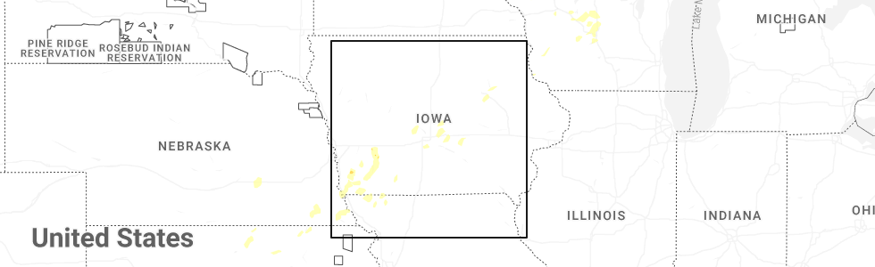
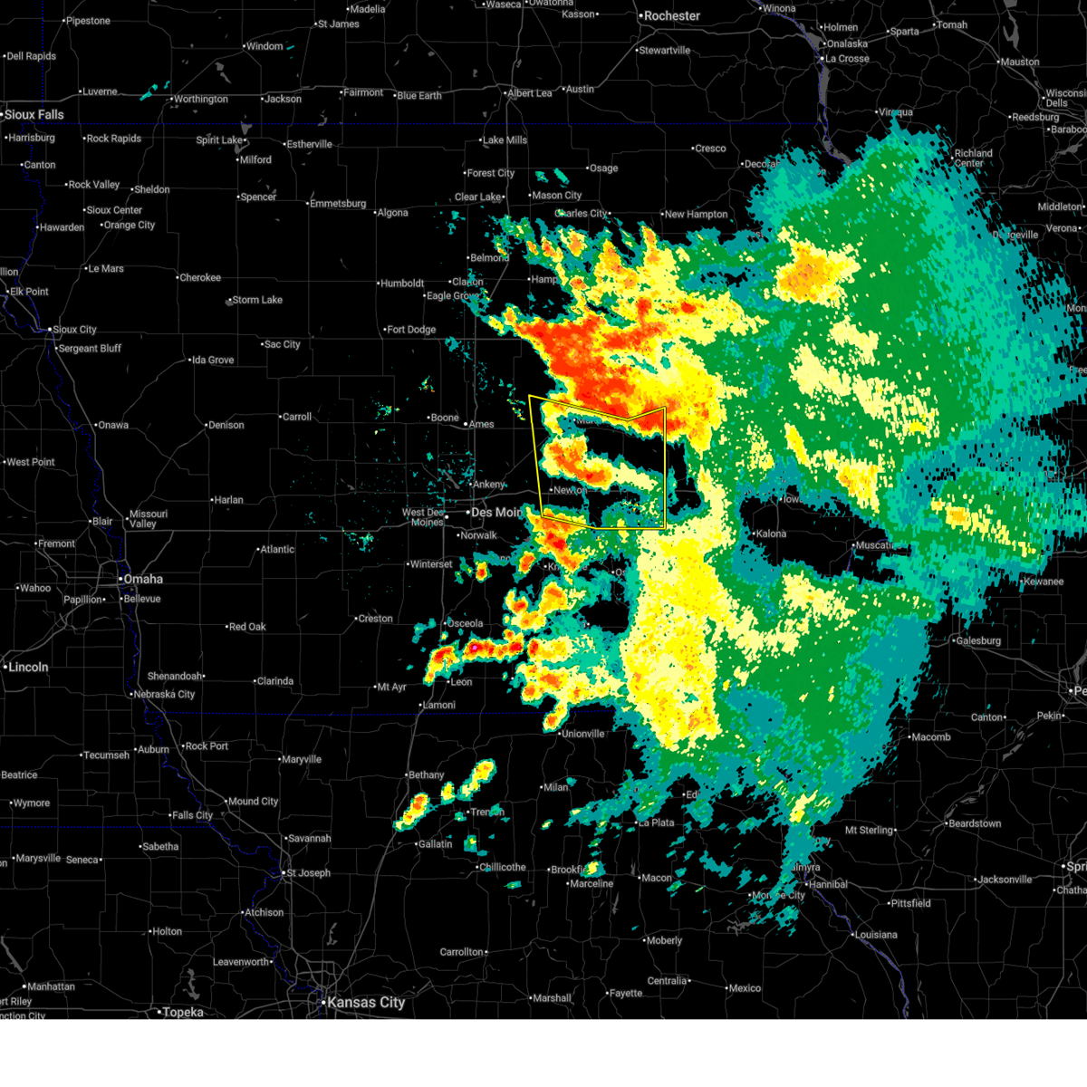
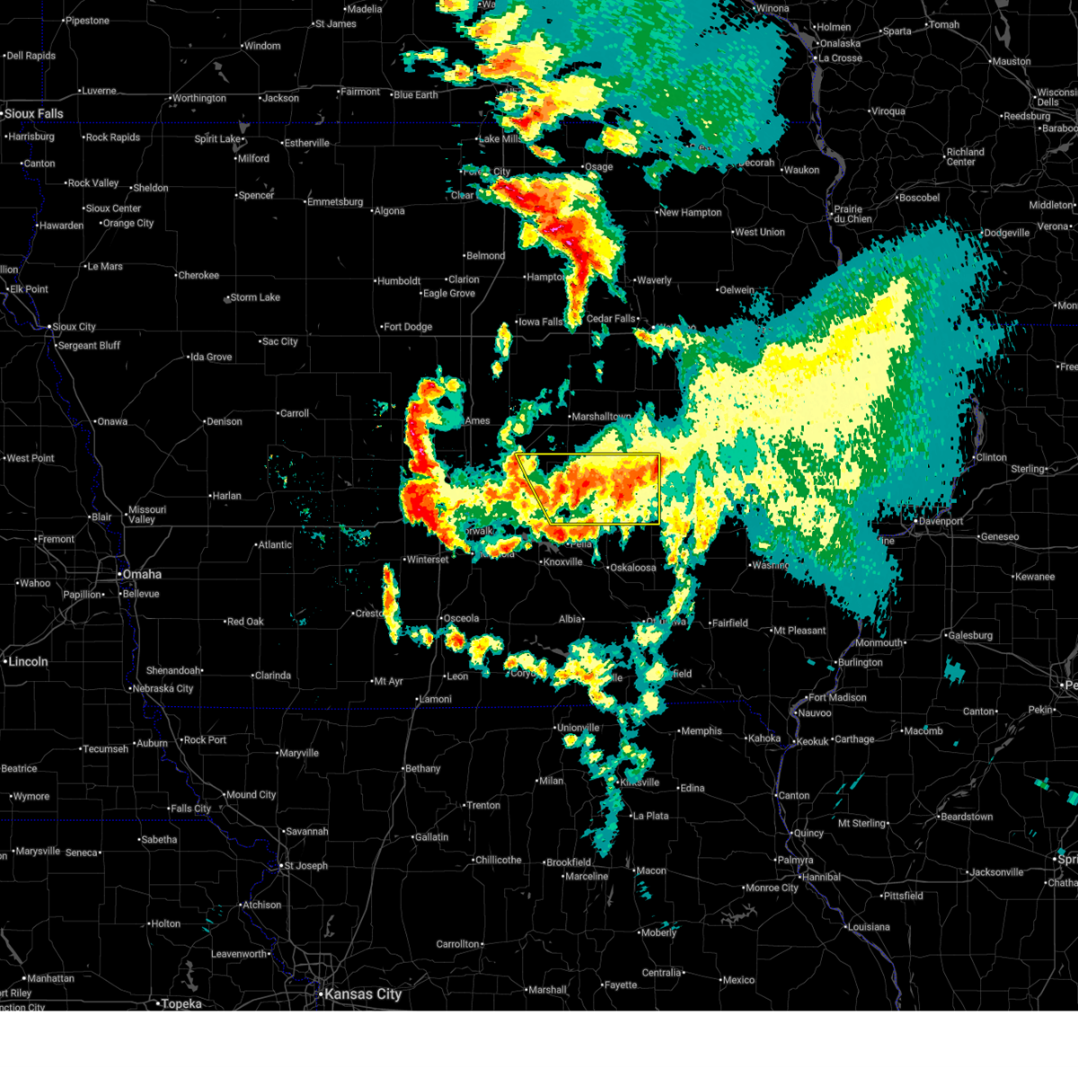
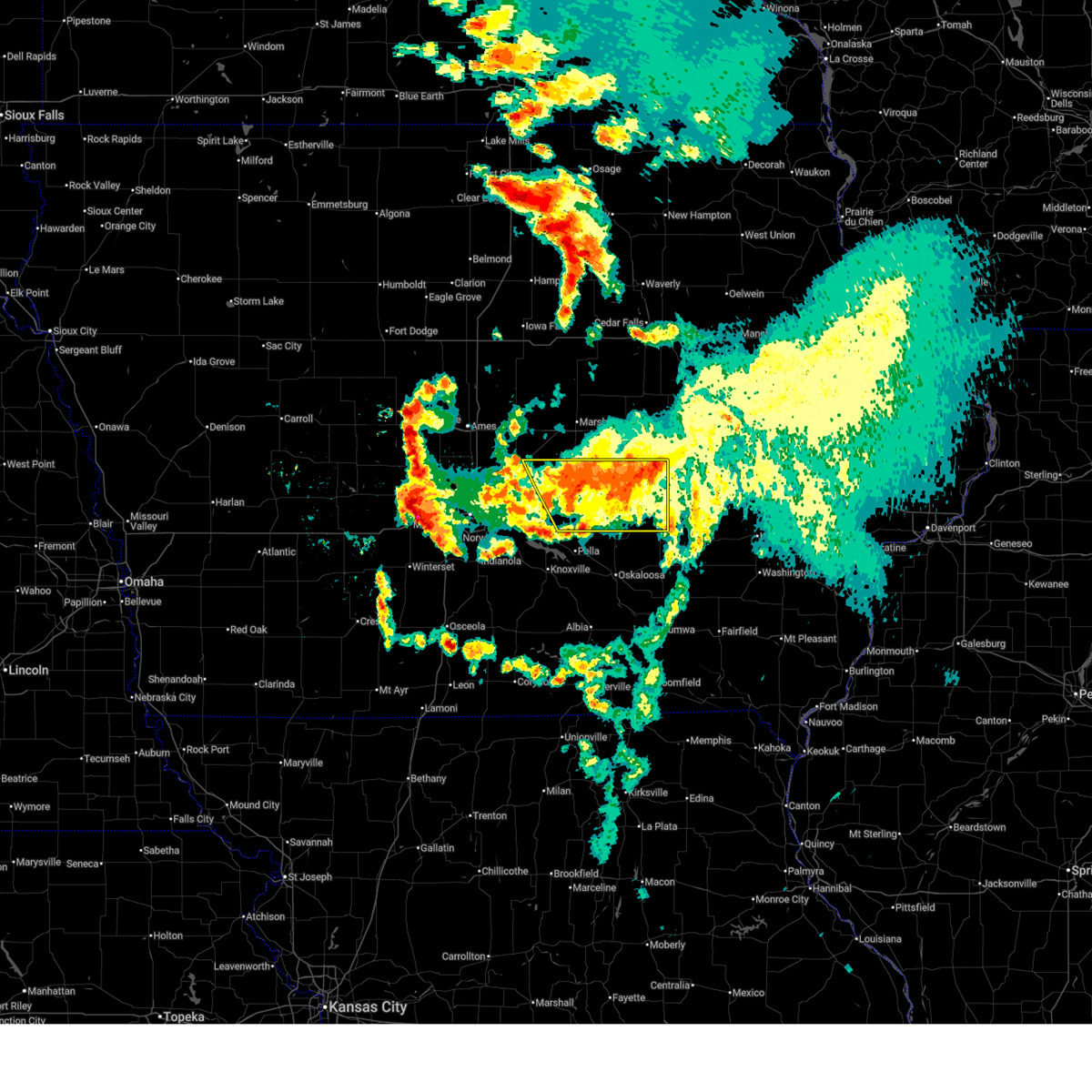
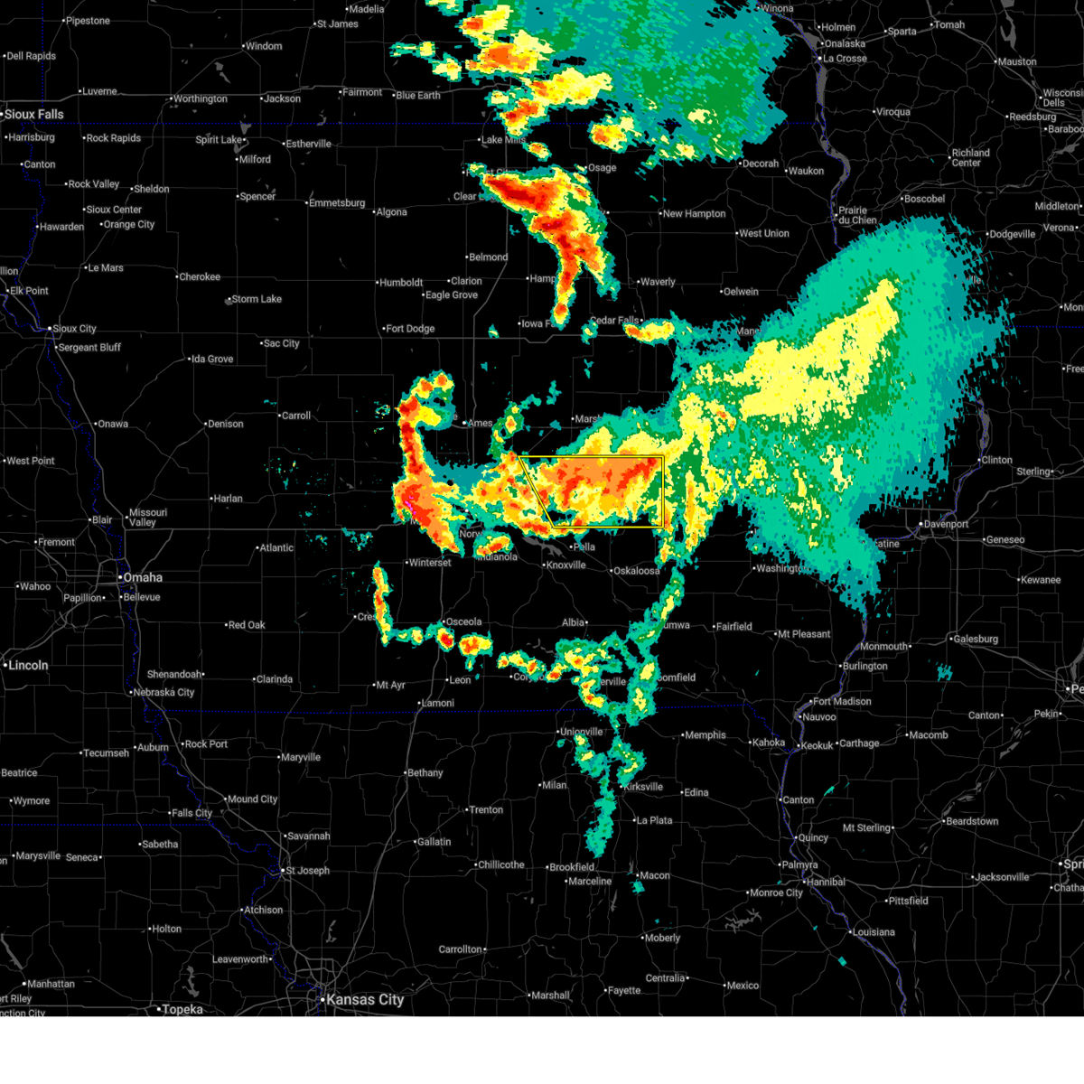
Hail Map for Baxter, IA
The Baxter, IA area has had 11 reports of on-the-ground hail by trained spotters, and has been under severe weather warnings 31 times during the past 12 months. Doppler radar has detected hail at or near Baxter, IA on 53 occasions, including 7 occasions during the past year.
| Name: | Baxter, IA |
| Where Located: | 28.9 miles NE of Des Moines, IA |
| Map: | Google Map for Baxter, IA |
| Population: | 1101 |
| Housing Units: | 446 |
| More Info: | Search Google for Baxter, IA |
0
The Top Recent Hail Date for Baxter, IA is Monday, June 23, 2025 (50th out of 53)
Hail and Wind Damage Spotted near Baxter, IA
| Date / Time | Report Details |
|---|---|
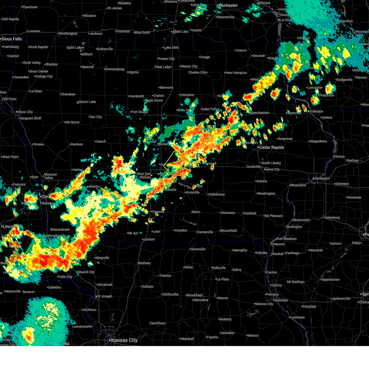
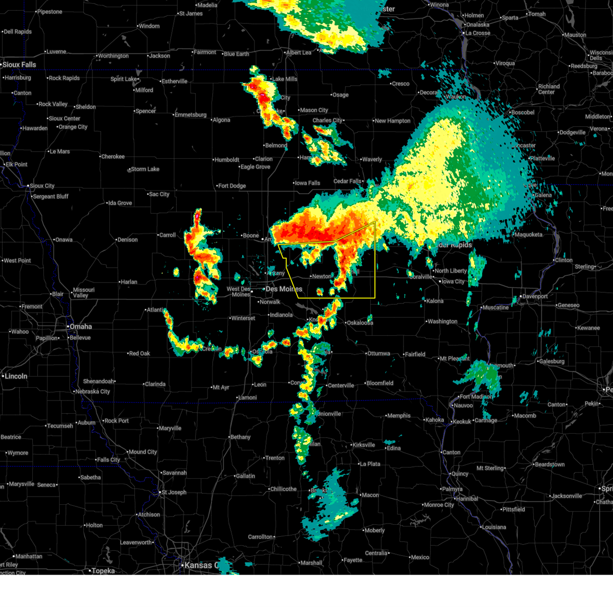
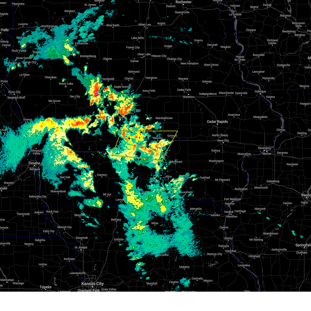
| 6/26/2025 5:45 PM CDT | The storms which prompted the warning have moved out of the area. therefore, the warning will be allowed to expire. a severe thunderstorm watch remains in effect until 900 pm cdt for central iowa. remember, a severe thunderstorm warning still remains in effect for portions of tama, marshall, poweshiek, grundy, and black hawk counties. |
| 6/26/2025 5:22 PM CDT | At 521 pm cdt, severe thunderstorms were located along a line extending from 4 miles southwest of marshalltown to laurel to 5 miles northwest of rock creek state park, moving northeast at 55 mph (radar indicated). Hazards include 60 mph wind gusts. Expect damage to roofs, siding, and trees. locations impacted include, marshalltown, newton, toledo, tama, baxter, meskwaki casino, rock creek lake, iowa speedway, gladbrook, le grand, melbourne, kellogg, garwin, gilman, rhodes, montour, laurel, haverhill, lambs grove, and ferguson. This includes interstate 80 between mile markers 162 and 168. |
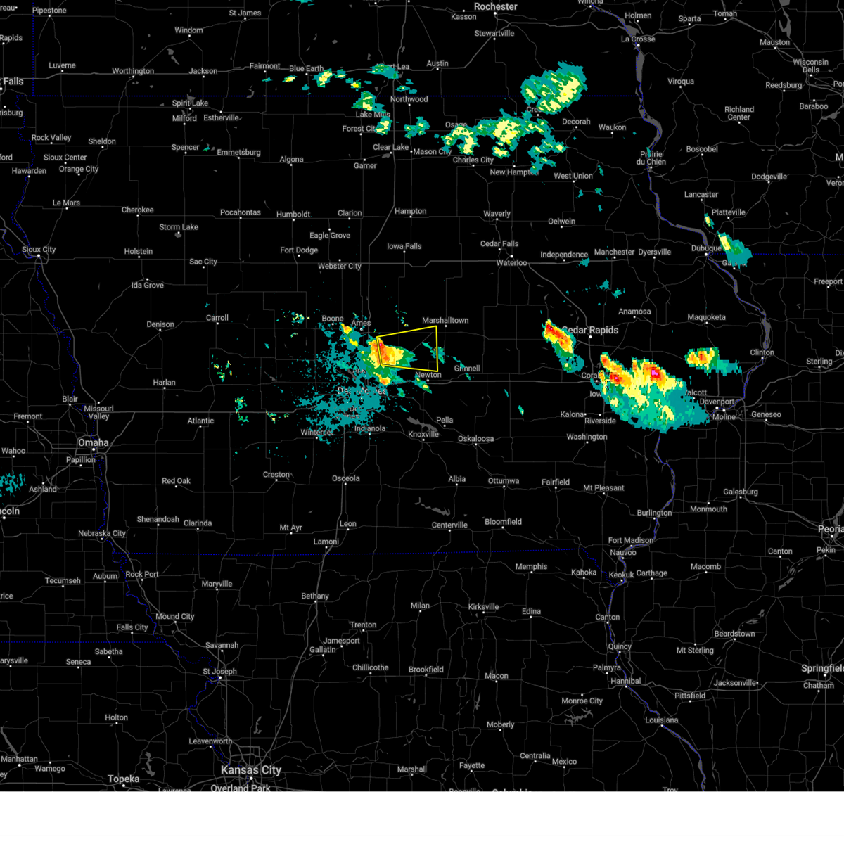
| 6/26/2025 5:01 PM CDT | Svrdmx the national weather service in des moines has issued a * severe thunderstorm warning for, northwestern poweshiek county in central iowa, southern marshall county in central iowa, southwestern tama county in central iowa, northwestern jasper county in central iowa, * until 545 pm cdt. * at 501 pm cdt, severe thunderstorms were located along a line extending from near mingo to near colfax to prairie city krohn airport, moving northeast at 55 mph (radar indicated). Hazards include 60 mph wind gusts. expect damage to roofs, siding, and trees |
| 6/23/2025 6:13 PM CDT |
 The storm which prompted the warning has weakened below severe limits, and no longer poses an immediate threat to life or property. therefore, the warning will be allowed to expire. however, gusty winds are still possible with this thunderstorm. a severe thunderstorm watch remains in effect until 1000 pm cdt for central iowa. The storm which prompted the warning has weakened below severe limits, and no longer poses an immediate threat to life or property. therefore, the warning will be allowed to expire. however, gusty winds are still possible with this thunderstorm. a severe thunderstorm watch remains in effect until 1000 pm cdt for central iowa.
|
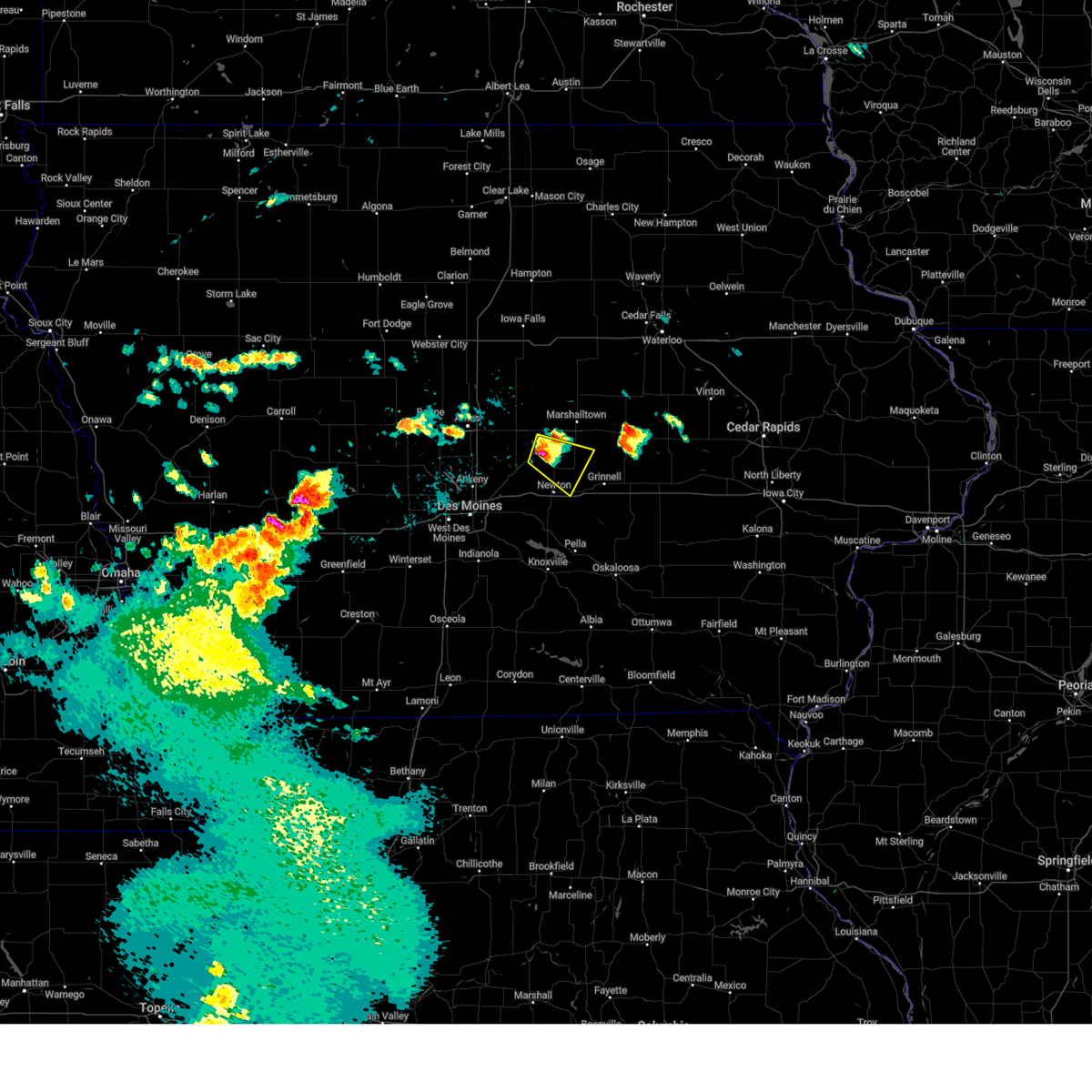
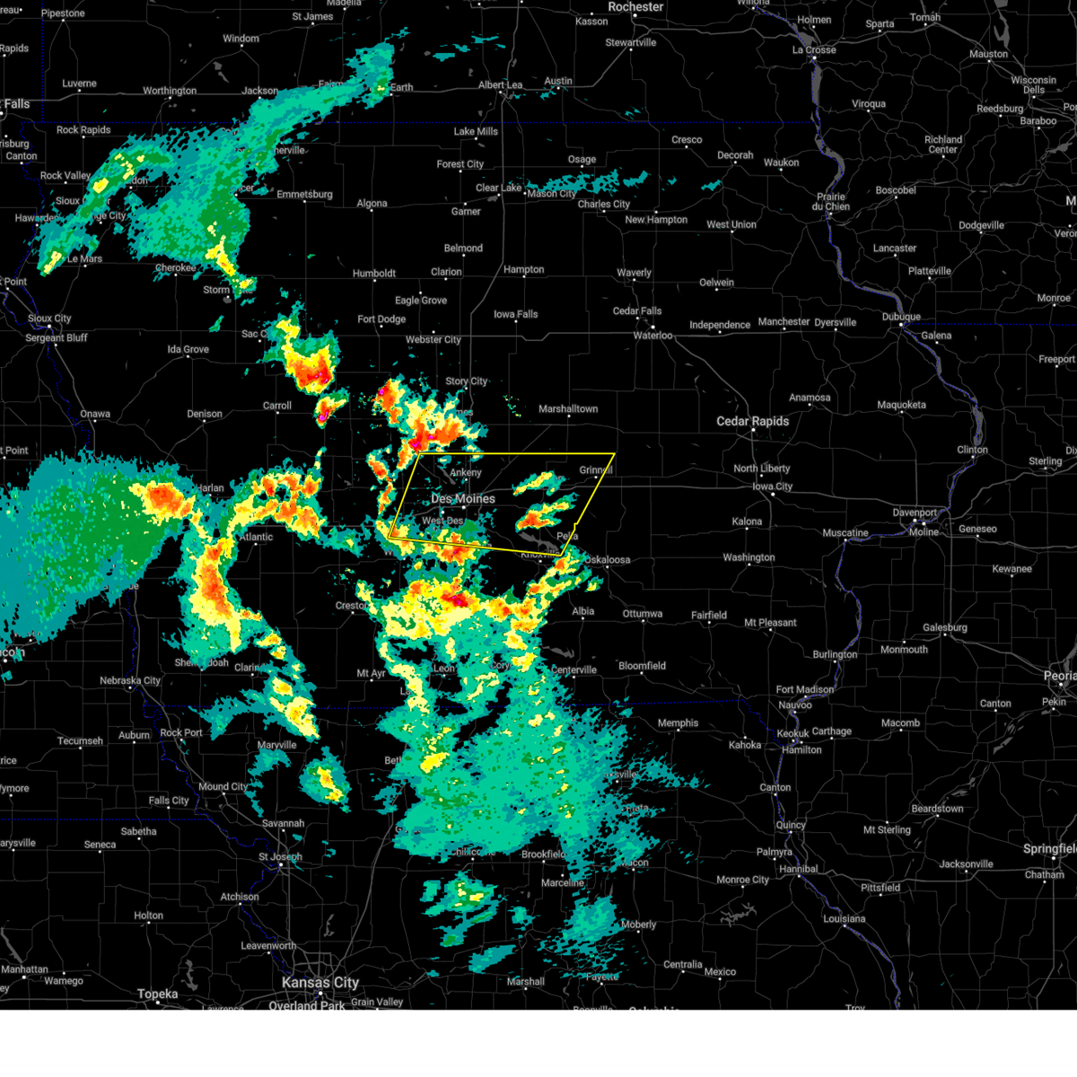
| 6/23/2025 5:53 PM CDT |
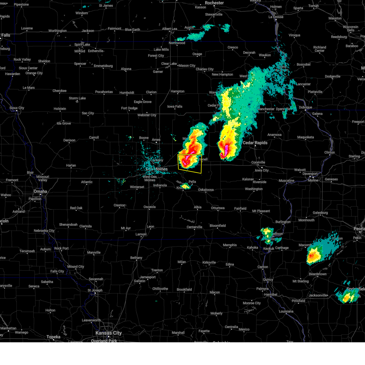
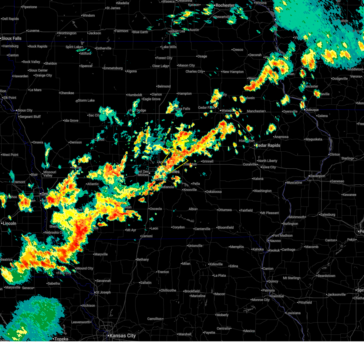 At 552 pm cdt, a severe thunderstorm was located over mitchellville, or 5 miles northeast of altoona, moving northeast at 35 mph (radar indicated). Hazards include 60 mph wind gusts and nickel size hail. Expect damage to roofs, siding, and trees. locations impacted include, newton, altoona, bondurant, mitchellville, colfax, baxter, collins, mingo, and valeria. This includes interstate 80 between mile markers 144 and 161. At 552 pm cdt, a severe thunderstorm was located over mitchellville, or 5 miles northeast of altoona, moving northeast at 35 mph (radar indicated). Hazards include 60 mph wind gusts and nickel size hail. Expect damage to roofs, siding, and trees. locations impacted include, newton, altoona, bondurant, mitchellville, colfax, baxter, collins, mingo, and valeria. This includes interstate 80 between mile markers 144 and 161.
|
| 6/23/2025 5:31 PM CDT | Svrdmx the national weather service in des moines has issued a * severe thunderstorm warning for, southeastern polk county in central iowa, southeastern story county in central iowa, northwestern jasper county in central iowa, * until 615 pm cdt. * at 531 pm cdt, a severe thunderstorm was located over iowa state fairgrounds, or over des moines, moving northeast at 35 mph (radar indicated). Hazards include 60 mph wind gusts and quarter size hail. Hail damage to vehicles is expected. Expect wind damage to roofs, siding, and trees. |
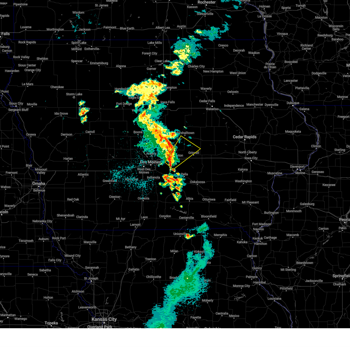
| 6/20/2025 9:22 AM CDT |
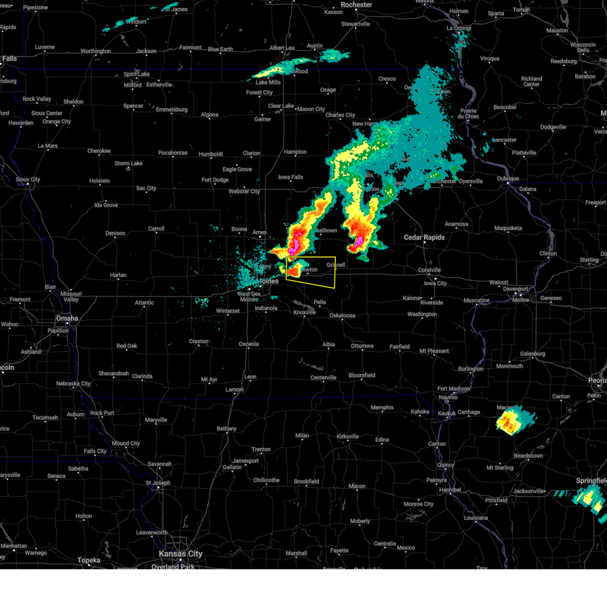
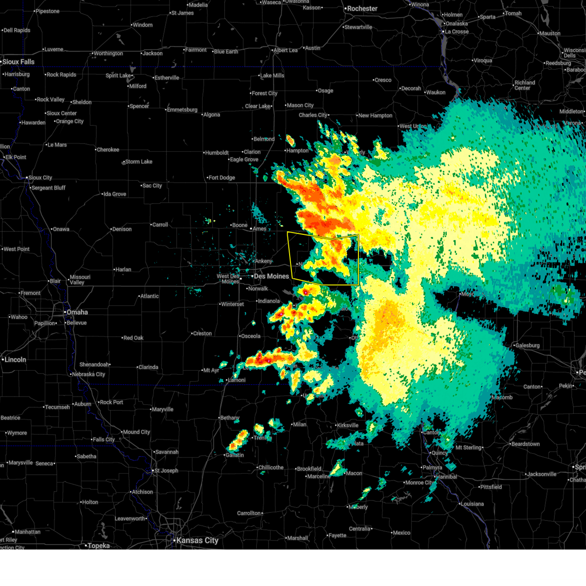 At 922 am cdt, severe thunderstorms were located along a line extending from koszta to near brooklyn to 5 miles east of baxter, moving southeast at 40 mph (radar indicated). Hazards include 60 mph wind gusts. Expect damage to roofs, siding, and trees. locations impacted include, newton, grinnell, montezuma, brooklyn, baxter, iowa speedway, rock creek lake, victor, melbourne, sully, kellogg, gilman, holiday lake, lynnville, malcom, deep river, chelsea, laurel, barnes city, and haverhill. This includes interstate 80 between mile markers 162 and 204. At 922 am cdt, severe thunderstorms were located along a line extending from koszta to near brooklyn to 5 miles east of baxter, moving southeast at 40 mph (radar indicated). Hazards include 60 mph wind gusts. Expect damage to roofs, siding, and trees. locations impacted include, newton, grinnell, montezuma, brooklyn, baxter, iowa speedway, rock creek lake, victor, melbourne, sully, kellogg, gilman, holiday lake, lynnville, malcom, deep river, chelsea, laurel, barnes city, and haverhill. This includes interstate 80 between mile markers 162 and 204.
|
| 6/20/2025 8:58 AM CDT |
 Svrdmx the national weather service in des moines has issued a * severe thunderstorm warning for, poweshiek county in central iowa, marshall county in central iowa, southern tama county in central iowa, eastern jasper county in central iowa, * until 1000 am cdt. * at 857 am cdt, severe thunderstorms were located along a line extending from near elberon to toledo municipal airport to near state center, moving south at 35 mph (radar indicated). Hazards include 60 mph wind gusts. at 851 am, marshalltown airport reported a wind gust to 58 mph. expect damage to roofs, siding, and trees Svrdmx the national weather service in des moines has issued a * severe thunderstorm warning for, poweshiek county in central iowa, marshall county in central iowa, southern tama county in central iowa, eastern jasper county in central iowa, * until 1000 am cdt. * at 857 am cdt, severe thunderstorms were located along a line extending from near elberon to toledo municipal airport to near state center, moving south at 35 mph (radar indicated). Hazards include 60 mph wind gusts. at 851 am, marshalltown airport reported a wind gust to 58 mph. expect damage to roofs, siding, and trees
|
| 6/20/2025 6:51 AM CDT |
 The storms which prompted the warning have weakened below severe limits, and no longer pose an immediate threat to life or property. therefore, the warning will be allowed to expire. however, gusty winds are still possible with these thunderstorms. The storms which prompted the warning have weakened below severe limits, and no longer pose an immediate threat to life or property. therefore, the warning will be allowed to expire. however, gusty winds are still possible with these thunderstorms.
|
| 6/20/2025 6:42 AM CDT |
 the severe thunderstorm warning has been cancelled and is no longer in effect the severe thunderstorm warning has been cancelled and is no longer in effect
|
| 6/20/2025 6:42 AM CDT |
 At 641 am cdt, severe thunderstorms were located along a line extending from near koszta to near malcom to near lambs grove, moving southeast at 35 mph (radar indicated). Hazards include 60 mph wind gusts and penny size hail. Expect damage to roofs, siding, and trees. locations impacted include, newton, grinnell, montezuma, brooklyn, baxter, rock creek lake, iowa speedway, victor, sully, kellogg, holiday lake, lynnville, malcom, deep river, barnes city, lambs grove, oakland acres, reasnor, searsboro, and hartwick. This includes interstate 80 between mile markers 161 and 204. At 641 am cdt, severe thunderstorms were located along a line extending from near koszta to near malcom to near lambs grove, moving southeast at 35 mph (radar indicated). Hazards include 60 mph wind gusts and penny size hail. Expect damage to roofs, siding, and trees. locations impacted include, newton, grinnell, montezuma, brooklyn, baxter, rock creek lake, iowa speedway, victor, sully, kellogg, holiday lake, lynnville, malcom, deep river, barnes city, lambs grove, oakland acres, reasnor, searsboro, and hartwick. This includes interstate 80 between mile markers 161 and 204.
|
| 6/20/2025 6:03 AM CDT |
 Svrdmx the national weather service in des moines has issued a * severe thunderstorm warning for, poweshiek county in central iowa, southeastern story county in central iowa, southern marshall county in central iowa, southern tama county in central iowa, jasper county in central iowa, * until 700 am cdt. * at 602 am cdt, severe thunderstorms were located along a line extending from near clutier to near montour to near maxwell, moving southeast at 35 mph (radar indicated). Hazards include 60 mph wind gusts and penny size hail. expect damage to roofs, siding, and trees Svrdmx the national weather service in des moines has issued a * severe thunderstorm warning for, poweshiek county in central iowa, southeastern story county in central iowa, southern marshall county in central iowa, southern tama county in central iowa, jasper county in central iowa, * until 700 am cdt. * at 602 am cdt, severe thunderstorms were located along a line extending from near clutier to near montour to near maxwell, moving southeast at 35 mph (radar indicated). Hazards include 60 mph wind gusts and penny size hail. expect damage to roofs, siding, and trees
|
| 4/23/2025 6:22 PM CDT |
 Svrdmx the national weather service in des moines has issued a * severe thunderstorm warning for, southern marshall county in central iowa, northeastern jasper county in central iowa, * until 700 pm cdt. * at 621 pm cdt, a severe thunderstorm was located near melbourne, or 13 miles north of newton, moving east-southeast at 15 mph (radar indicated). Hazards include 60 mph wind gusts and half dollar size hail. Hail damage to vehicles is expected. expect wind damage to roofs, siding, and trees. this severe thunderstorm will be near, haverhill and laurel around 625 pm cdt. Other locations in the path of this severe thunderstorm include newton. Svrdmx the national weather service in des moines has issued a * severe thunderstorm warning for, southern marshall county in central iowa, northeastern jasper county in central iowa, * until 700 pm cdt. * at 621 pm cdt, a severe thunderstorm was located near melbourne, or 13 miles north of newton, moving east-southeast at 15 mph (radar indicated). Hazards include 60 mph wind gusts and half dollar size hail. Hail damage to vehicles is expected. expect wind damage to roofs, siding, and trees. this severe thunderstorm will be near, haverhill and laurel around 625 pm cdt. Other locations in the path of this severe thunderstorm include newton.
|
| 3/30/2025 12:30 AM CDT |
 Svrdmx the national weather service in des moines has issued a * severe thunderstorm warning for, northwestern poweshiek county in central iowa, southeastern marshall county in central iowa, southwestern tama county in central iowa, central jasper county in central iowa, * until 115 am cdt. * at 1230 am cdt, a severe thunderstorm was located over prairie city krohn airport, or 7 miles southwest of newton, moving northeast at 50 mph (radar indicated). Hazards include 60 mph wind gusts and quarter size hail. Hail damage to vehicles is expected. Expect wind damage to roofs, siding, and trees. Svrdmx the national weather service in des moines has issued a * severe thunderstorm warning for, northwestern poweshiek county in central iowa, southeastern marshall county in central iowa, southwestern tama county in central iowa, central jasper county in central iowa, * until 115 am cdt. * at 1230 am cdt, a severe thunderstorm was located over prairie city krohn airport, or 7 miles southwest of newton, moving northeast at 50 mph (radar indicated). Hazards include 60 mph wind gusts and quarter size hail. Hail damage to vehicles is expected. Expect wind damage to roofs, siding, and trees.
|
| 3/14/2025 6:15 PM CDT |
 The storms which prompted the warning have moved out of the area. therefore, the warning will be allowed to expire. however, gusty winds are still possible with these thunderstorms. a severe thunderstorm watch remains in effect until 1000 pm cdt for central and south central iowa. The storms which prompted the warning have moved out of the area. therefore, the warning will be allowed to expire. however, gusty winds are still possible with these thunderstorms. a severe thunderstorm watch remains in effect until 1000 pm cdt for central and south central iowa.
|
| 3/14/2025 5:52 PM CDT |
 At 552 pm cdt, severe thunderstorms were located along a line extending from dallas center to near sully, moving north at 55 mph (radar indicated). Hazards include 70 mph wind gusts and quarter size hail. Hail damage to vehicles is expected. expect considerable tree damage. wind damage is also likely to mobile homes, roofs, and outbuildings. locations impacted include, pella municipal airport, carlisle, urbandale, johnston, grinnell, walnut woods state park, west des moines, elkhart, polk city, adventureland amusement park, swan, prairie city, pleasantville, runnells, colfax, iowa speedway, waukee, kellogg, windsor heights, and baxter. this includes the following highways, interstate 35 between mile markers 61 and 72, and between mile markers 87 and 101. interstate 80 between mile markers 106 and 182. Interstate 235 between mile markers 1 and 14. At 552 pm cdt, severe thunderstorms were located along a line extending from dallas center to near sully, moving north at 55 mph (radar indicated). Hazards include 70 mph wind gusts and quarter size hail. Hail damage to vehicles is expected. expect considerable tree damage. wind damage is also likely to mobile homes, roofs, and outbuildings. locations impacted include, pella municipal airport, carlisle, urbandale, johnston, grinnell, walnut woods state park, west des moines, elkhart, polk city, adventureland amusement park, swan, prairie city, pleasantville, runnells, colfax, iowa speedway, waukee, kellogg, windsor heights, and baxter. this includes the following highways, interstate 35 between mile markers 61 and 72, and between mile markers 87 and 101. interstate 80 between mile markers 106 and 182. Interstate 235 between mile markers 1 and 14.
|
| 3/14/2025 5:32 PM CDT |
 Svrdmx the national weather service in des moines has issued a * severe thunderstorm warning for, northwestern poweshiek county in central iowa, polk county in central iowa, northeastern madison county in south central iowa, northern marion county in south central iowa, jasper county in central iowa, eastern dallas county in central iowa, northern warren county in south central iowa, * until 615 pm cdt. * at 532 pm cdt, severe thunderstorms were located along a line extending from near earlham to near knoxville, moving north at 55 mph (radar indicated). Hazards include 60 mph wind gusts and quarter size hail. Hail damage to vehicles is expected. Expect wind damage to roofs, siding, and trees. Svrdmx the national weather service in des moines has issued a * severe thunderstorm warning for, northwestern poweshiek county in central iowa, polk county in central iowa, northeastern madison county in south central iowa, northern marion county in south central iowa, jasper county in central iowa, eastern dallas county in central iowa, northern warren county in south central iowa, * until 615 pm cdt. * at 532 pm cdt, severe thunderstorms were located along a line extending from near earlham to near knoxville, moving north at 55 mph (radar indicated). Hazards include 60 mph wind gusts and quarter size hail. Hail damage to vehicles is expected. Expect wind damage to roofs, siding, and trees.
|
| 7/31/2024 8:50 PM CDT |
 the severe thunderstorm warning has been cancelled and is no longer in effect the severe thunderstorm warning has been cancelled and is no longer in effect
|
| 7/31/2024 8:50 PM CDT |
 At 850 pm cdt, severe thunderstorms were located along a line extending from iowa state center to near valeria to 4 miles east of pleasantville, moving northeast at 40 mph (radar indicated). Hazards include 60 mph wind gusts. Expect damage to roofs, siding, and trees. locations impacted include, des moines, ames, west des moines, ankeny, urbandale, johnston, clive, newton, indianola, altoona, waukee, boone, pella, norwalk, pleasant hill, grimes, knoxville, nevada, windsor heights, and carlisle. this includes the following highways, interstate 35 between mile markers 68 and 72, and between mile markers 87 and 125. interstate 80 between mile markers 121 and 173. Interstate 235 between mile markers 1 and 14. At 850 pm cdt, severe thunderstorms were located along a line extending from iowa state center to near valeria to 4 miles east of pleasantville, moving northeast at 40 mph (radar indicated). Hazards include 60 mph wind gusts. Expect damage to roofs, siding, and trees. locations impacted include, des moines, ames, west des moines, ankeny, urbandale, johnston, clive, newton, indianola, altoona, waukee, boone, pella, norwalk, pleasant hill, grimes, knoxville, nevada, windsor heights, and carlisle. this includes the following highways, interstate 35 between mile markers 68 and 72, and between mile markers 87 and 125. interstate 80 between mile markers 121 and 173. Interstate 235 between mile markers 1 and 14.
|
| 7/31/2024 8:27 PM CDT |
 Svrdmx the national weather service in des moines has issued a * severe thunderstorm warning for, polk county in central iowa, story county in central iowa, southwestern hardin county in central iowa, southwestern marshall county in central iowa, northeastern madison county in south central iowa, marion county in south central iowa, jasper county in central iowa, southern boone county in central iowa, dallas county in central iowa, warren county in south central iowa, * until 915 pm cdt. * at 825 pm cdt, severe thunderstorms were located along a line extending from 4 miles north of woodward to near margo frankel woods state park to milo, moving northeast at 40 mph (radar indicated). Hazards include 65 mph wind gusts. the des moines airport gusted to 66 mph. expect damage to roofs, siding, and trees Svrdmx the national weather service in des moines has issued a * severe thunderstorm warning for, polk county in central iowa, story county in central iowa, southwestern hardin county in central iowa, southwestern marshall county in central iowa, northeastern madison county in south central iowa, marion county in south central iowa, jasper county in central iowa, southern boone county in central iowa, dallas county in central iowa, warren county in south central iowa, * until 915 pm cdt. * at 825 pm cdt, severe thunderstorms were located along a line extending from 4 miles north of woodward to near margo frankel woods state park to milo, moving northeast at 40 mph (radar indicated). Hazards include 65 mph wind gusts. the des moines airport gusted to 66 mph. expect damage to roofs, siding, and trees
|
| 7/30/2024 9:44 AM CDT |
 Svrdmx the national weather service in des moines has issued a * severe thunderstorm warning for, northern lucas county in south central iowa, western poweshiek county in central iowa, eastern polk county in central iowa, east central madison county in south central iowa, marion county in south central iowa, northwestern mahaska county in south central iowa, jasper county in central iowa, northeastern clarke county in south central iowa, warren county in south central iowa, * until 1045 am cdt. * at 943 am cdt, severe thunderstorms were located along a line extending from near maxwell to near pleasant hill to patterson, moving southeast at 45 mph (radar indicated). Hazards include 60 mph wind gusts and penny size hail. expect damage to roofs, siding, and trees Svrdmx the national weather service in des moines has issued a * severe thunderstorm warning for, northern lucas county in south central iowa, western poweshiek county in central iowa, eastern polk county in central iowa, east central madison county in south central iowa, marion county in south central iowa, northwestern mahaska county in south central iowa, jasper county in central iowa, northeastern clarke county in south central iowa, warren county in south central iowa, * until 1045 am cdt. * at 943 am cdt, severe thunderstorms were located along a line extending from near maxwell to near pleasant hill to patterson, moving southeast at 45 mph (radar indicated). Hazards include 60 mph wind gusts and penny size hail. expect damage to roofs, siding, and trees
|
| 7/30/2024 2:53 AM CDT | At 252 am cdt, severe thunderstorms were located along a line extending from 4 miles south of roland to 4 miles northwest of maxwell to 5 miles east of elkhart to near altoona to 4 miles southeast of southridge mall, moving southeast at 50 mph (automated systems. at 247 am, a measured wind gust of 59 mph was reported at the des moines international airport). Hazards include 60 mph wind gusts. Expect damage to roofs, siding, and trees. these severe storms will be near, nevada, carlisle, bondurant, mitchellville, colfax, prairie city, maxwell and colo around 255 am cdt. Other locations in the path of these severe thunderstorms include swan, sandyville, prairie city krohn airport, monroe, pleasantville, baxter and rhodes. |
| 7/30/2024 2:38 AM CDT | At 238 am cdt, severe thunderstorms were located along a line extending from 4 miles northwest of gilbert to ames municipal airport to near alleman to ankeny regional airport to walnut woods state park, moving southeast at 50 mph (radar indicated). Hazards include 60 mph wind gusts. Expect damage to roofs, siding, and trees. Locations impacted include, des moines, ames, altoona, norwalk, pleasant hill, nevada, carlisle, bondurant, indianola, hartford, runnells, collins, mingo, valeria, colfax, prairie city, colo, ackworth, swan, sandyville, prairie city krohn airport, pleasantville, baxter, rhodes and monroe. |
| 7/30/2024 2:38 AM CDT | the severe thunderstorm warning has been cancelled and is no longer in effect |
| 7/30/2024 2:23 AM CDT | Svrdmx the national weather service in des moines has issued a * severe thunderstorm warning for, polk county in central iowa, story county in central iowa, eastern greene county in west central iowa, southwestern marshall county in central iowa, southeastern webster county in central iowa, northwestern marion county in south central iowa, western jasper county in central iowa, boone county in central iowa, dallas county in central iowa, northern warren county in south central iowa, * until 315 am cdt. * at 222 am cdt, severe thunderstorms were located along a line extending from 4 miles southeast of stratford to near boone municipal airport to 4 miles northeast of madrid to near saylorville lake to near waukee, moving southeast at 50 mph (radar indicated). Hazards include 60 mph wind gusts. Expect damage to roofs, siding, and trees. severe thunderstorms will be near, des moines, ames, west des moines, ankeny, urbandale, johnston, clive and norwalk around 230 am cdt. altoona, pleasant hill, nevada, bondurant, southridge mall, adventureland amusement park, iowa state fairgrounds and prairie meadows around 235 am cdt. carlisle and roland around 240 am cdt. Other locations in the path of these severe thunderstorms include indianola, mitchellville, maxwell, spring hill, valeria, colfax, colo, hartford, runnells, collins, mingo, ackworth, prairie city, swan, sandyville, prairie city krohn airport, pleasantville, baxter, rhodes and monroe. |
| 7/15/2024 6:19 PM CDT | At 619 pm cdt, severe thunderstorms were located along a line extending from near chelsea to near sully to near sandyville, moving southeast at 45 mph (radar indicated). Hazards include 70 mph wind gusts and quarter size hail. Hail damage to vehicles is expected. expect considerable tree damage. wind damage is also likely to mobile homes, roofs, and outbuildings. locations impacted include, des moines, ankeny, marshalltown, newton, altoona, pella, grinnell, pleasant hill, knoxville, montezuma, carlisle, bondurant, saylorville, mitchellville, colfax, monroe, pleasantville, prairie city, brooklyn, and baxter. this includes the following highways, interstate 35 between mile markers 87 and 90. interstate 80 between mile markers 135 and 201. Interstate 235 between mile markers 11 and 14. |
| 7/15/2024 6:00 PM CDT | Svrdmx the national weather service in des moines has issued a * severe thunderstorm warning for, poweshiek county in central iowa, southeastern polk county in central iowa, southern marshall county in central iowa, marion county in south central iowa, southern tama county in central iowa, northwestern mahaska county in south central iowa, jasper county in central iowa, northeastern warren county in south central iowa, * until 700 pm cdt. * at 600 pm cdt, a severe thunderstorm was located near lambs grove, or 6 miles northwest of newton, moving southeast at 30 mph (radar indicated). Hazards include 70 mph wind gusts and quarter size hail. Hail damage to vehicles is expected. expect considerable tree damage. Wind damage is also likely to mobile homes, roofs, and outbuildings. |
| 7/15/2024 5:29 PM CDT |
 Svrdmx the national weather service in des moines has issued a * severe thunderstorm warning for, polk county in central iowa, southeastern story county in central iowa, southwestern marshall county in central iowa, northwestern marion county in south central iowa, jasper county in central iowa, east central dallas county in central iowa, northern warren county in south central iowa, * until 600 pm cdt. * at 529 pm cdt, severe thunderstorms were located along a line extending from haverhill to 5 miles east of elkhart to urbandale, moving southeast at 45 mph (radar indicated). Hazards include 60 mph wind gusts and quarter size hail. Hail damage to vehicles is expected. Expect wind damage to roofs, siding, and trees. Svrdmx the national weather service in des moines has issued a * severe thunderstorm warning for, polk county in central iowa, southeastern story county in central iowa, southwestern marshall county in central iowa, northwestern marion county in south central iowa, jasper county in central iowa, east central dallas county in central iowa, northern warren county in south central iowa, * until 600 pm cdt. * at 529 pm cdt, severe thunderstorms were located along a line extending from haverhill to 5 miles east of elkhart to urbandale, moving southeast at 45 mph (radar indicated). Hazards include 60 mph wind gusts and quarter size hail. Hail damage to vehicles is expected. Expect wind damage to roofs, siding, and trees.
|
| 7/15/2024 5:15 PM CDT |
 At 514 pm cdt, a severe thunderstorm was located over cambridge, or 8 miles south of nevada, moving southeast at 45 mph (radar indicated). Hazards include 60 mph wind gusts and quarter size hail. Hail damage to vehicles is expected. expect wind damage to roofs, siding, and trees. locations impacted include, ames, marshalltown, boone, nevada, story city, polk city, huxley, madrid, slater, state center, roland, baxter, gilbert, iowa state center, big creek lake, boone speedway, saylorville lake, maxwell, colo, and melbourne. This includes interstate 35 between mile markers 97 and 126. At 514 pm cdt, a severe thunderstorm was located over cambridge, or 8 miles south of nevada, moving southeast at 45 mph (radar indicated). Hazards include 60 mph wind gusts and quarter size hail. Hail damage to vehicles is expected. expect wind damage to roofs, siding, and trees. locations impacted include, ames, marshalltown, boone, nevada, story city, polk city, huxley, madrid, slater, state center, roland, baxter, gilbert, iowa state center, big creek lake, boone speedway, saylorville lake, maxwell, colo, and melbourne. This includes interstate 35 between mile markers 97 and 126.
|
| 7/15/2024 5:01 PM CDT |
 Svrdmx the national weather service in des moines has issued a * severe thunderstorm warning for, northern polk county in central iowa, story county in central iowa, western marshall county in central iowa, northern jasper county in central iowa, eastern boone county in central iowa, * until 530 pm cdt. * at 501 pm cdt, a severe thunderstorm was located over iowa state center, or over ames, moving southeast at 45 mph (radar indicated). Hazards include 60 mph wind gusts and quarter size hail. Hail damage to vehicles is expected. Expect wind damage to roofs, siding, and trees. Svrdmx the national weather service in des moines has issued a * severe thunderstorm warning for, northern polk county in central iowa, story county in central iowa, western marshall county in central iowa, northern jasper county in central iowa, eastern boone county in central iowa, * until 530 pm cdt. * at 501 pm cdt, a severe thunderstorm was located over iowa state center, or over ames, moving southeast at 45 mph (radar indicated). Hazards include 60 mph wind gusts and quarter size hail. Hail damage to vehicles is expected. Expect wind damage to roofs, siding, and trees.
|
| 7/7/2024 11:14 PM CDT |
 Svrdmx the national weather service in des moines has issued a * severe thunderstorm warning for, southeastern marshall county in central iowa, northern jasper county in central iowa, * until 1145 pm cdt. * at 1114 pm cdt, a severe thunderstorm was located near lambs grove, or 5 miles northwest of newton, moving northeast at 40 mph (radar indicated). Hazards include 60 mph wind gusts. expect damage to roofs, siding, and trees Svrdmx the national weather service in des moines has issued a * severe thunderstorm warning for, southeastern marshall county in central iowa, northern jasper county in central iowa, * until 1145 pm cdt. * at 1114 pm cdt, a severe thunderstorm was located near lambs grove, or 5 miles northwest of newton, moving northeast at 40 mph (radar indicated). Hazards include 60 mph wind gusts. expect damage to roofs, siding, and trees
|
| 5/24/2024 5:41 AM CDT |
 At 541 am cdt, severe thunderstorms were located along a line extending from near coulter to 4 miles northeast of clemons to 5 miles east of baxter, moving east at 45 mph (public). Hazards include 60 mph wind gusts and penny size hail. Expect damage to roofs, siding, and trees. locations impacted include, marshalltown, newton, grinnell, iowa falls, hampton, eldora, grundy center, toledo, allison, tama, belmond, colfax, parkersburg, reinbeck, ackley, state center, sheffield, aplington, conrad, and baxter. this includes the following highways, interstate 35 between mile markers 147 and 178. Interstate 80 between mile markers 151 and 168. At 541 am cdt, severe thunderstorms were located along a line extending from near coulter to 4 miles northeast of clemons to 5 miles east of baxter, moving east at 45 mph (public). Hazards include 60 mph wind gusts and penny size hail. Expect damage to roofs, siding, and trees. locations impacted include, marshalltown, newton, grinnell, iowa falls, hampton, eldora, grundy center, toledo, allison, tama, belmond, colfax, parkersburg, reinbeck, ackley, state center, sheffield, aplington, conrad, and baxter. this includes the following highways, interstate 35 between mile markers 147 and 178. Interstate 80 between mile markers 151 and 168.
|
| 5/24/2024 5:38 AM CDT |
 the tornado warning has been cancelled and is no longer in effect the tornado warning has been cancelled and is no longer in effect
|
| 5/24/2024 5:28 AM CDT |
 the tornado warning has been cancelled and is no longer in effect the tornado warning has been cancelled and is no longer in effect
|
| 5/24/2024 5:28 AM CDT |
 At 528 am cdt, a severe thunderstorm capable of producing a tornado was located near baxter, or 14 miles northwest of newton, moving northeast at 45 mph (radar indicated rotation). Hazards include tornado. Flying debris will be dangerous to those caught without shelter. mobile homes will be damaged or destroyed. damage to roofs, windows, and vehicles will occur. tree damage is likely. this dangerous storm will be near, melbourne and rhodes around 535 am cdt. haverhill around 540 am cdt. other locations impacted by this tornadic thunderstorm include collins, rhodes, mingo, laurel, lambs grove, valeria, haverhill, melbourne, and rock creek state park. This includes interstate 80 between mile markers 151 and 163. At 528 am cdt, a severe thunderstorm capable of producing a tornado was located near baxter, or 14 miles northwest of newton, moving northeast at 45 mph (radar indicated rotation). Hazards include tornado. Flying debris will be dangerous to those caught without shelter. mobile homes will be damaged or destroyed. damage to roofs, windows, and vehicles will occur. tree damage is likely. this dangerous storm will be near, melbourne and rhodes around 535 am cdt. haverhill around 540 am cdt. other locations impacted by this tornadic thunderstorm include collins, rhodes, mingo, laurel, lambs grove, valeria, haverhill, melbourne, and rock creek state park. This includes interstate 80 between mile markers 151 and 163.
|
| 5/24/2024 5:18 AM CDT |
 Svrdmx the national weather service in des moines has issued a * severe thunderstorm warning for, northwestern poweshiek county in central iowa, eastern polk county in central iowa, story county in central iowa, marshall county in central iowa, hardin county in central iowa, western tama county in central iowa, wright county in north central iowa, franklin county in north central iowa, grundy county in central iowa, western butler county in north central iowa, northern jasper county in central iowa, hamilton county in central iowa, * until 615 am cdt. * at 517 am cdt, severe thunderstorms were located along a line extending from 4 miles northwest of big wall lake to near mccallsburg to near mingo, moving east at 45 mph (radar indicated). Hazards include 60 mph wind gusts and quarter size hail. Hail damage to vehicles is expected. Expect wind damage to roofs, siding, and trees. Svrdmx the national weather service in des moines has issued a * severe thunderstorm warning for, northwestern poweshiek county in central iowa, eastern polk county in central iowa, story county in central iowa, marshall county in central iowa, hardin county in central iowa, western tama county in central iowa, wright county in north central iowa, franklin county in north central iowa, grundy county in central iowa, western butler county in north central iowa, northern jasper county in central iowa, hamilton county in central iowa, * until 615 am cdt. * at 517 am cdt, severe thunderstorms were located along a line extending from 4 miles northwest of big wall lake to near mccallsburg to near mingo, moving east at 45 mph (radar indicated). Hazards include 60 mph wind gusts and quarter size hail. Hail damage to vehicles is expected. Expect wind damage to roofs, siding, and trees.
|
| 5/24/2024 5:15 AM CDT |
 Tordmx the national weather service in des moines has issued a * tornado warning for, northeastern polk county in central iowa, southeastern story county in central iowa, southwestern marshall county in central iowa, northern jasper county in central iowa, * until 600 am cdt. * at 514 am cdt, a severe thunderstorm capable of producing a tornado was located near valeria, or 10 miles northeast of altoona, moving northeast at 45 mph (radar indicated rotation). Hazards include tornado. Flying debris will be dangerous to those caught without shelter. mobile homes will be damaged or destroyed. damage to roofs, windows, and vehicles will occur. tree damage is likely. this dangerous storm will be near, mingo around 520 am cdt. baxter around 525 am cdt. rhodes around 530 am cdt. melbourne around 535 am cdt. haverhill around 540 am cdt. other locations impacted by this tornadic thunderstorm include collins, rhodes, mingo, laurel, lambs grove, valeria, haverhill, melbourne, maxwell, and rock creek state park. This includes interstate 80 between mile markers 146 and 163. Tordmx the national weather service in des moines has issued a * tornado warning for, northeastern polk county in central iowa, southeastern story county in central iowa, southwestern marshall county in central iowa, northern jasper county in central iowa, * until 600 am cdt. * at 514 am cdt, a severe thunderstorm capable of producing a tornado was located near valeria, or 10 miles northeast of altoona, moving northeast at 45 mph (radar indicated rotation). Hazards include tornado. Flying debris will be dangerous to those caught without shelter. mobile homes will be damaged or destroyed. damage to roofs, windows, and vehicles will occur. tree damage is likely. this dangerous storm will be near, mingo around 520 am cdt. baxter around 525 am cdt. rhodes around 530 am cdt. melbourne around 535 am cdt. haverhill around 540 am cdt. other locations impacted by this tornadic thunderstorm include collins, rhodes, mingo, laurel, lambs grove, valeria, haverhill, melbourne, maxwell, and rock creek state park. This includes interstate 80 between mile markers 146 and 163.
|
| 5/21/2024 5:20 PM CDT |
 At 520 pm cdt, severe thunderstorms were located along a line extending from near aplington to near kellogg, moving northeast at 65 mph (trained weather spotters). Hazards include 70 mph wind gusts and quarter size hail. Hail damage to vehicles is expected. expect considerable tree damage. wind damage is also likely to mobile homes, roofs, and outbuildings. locations impacted include, marshalltown, newton, grundy center, mitchellville, colfax, monroe, pleasantville, prairie city, state center, conrad, baxter, iowa speedway, rock creek lake, lake red rock, le grand, melbourne, sully, milo, hartford, and kellogg. This includes interstate 80 between mile markers 150 and 180. At 520 pm cdt, severe thunderstorms were located along a line extending from near aplington to near kellogg, moving northeast at 65 mph (trained weather spotters). Hazards include 70 mph wind gusts and quarter size hail. Hail damage to vehicles is expected. expect considerable tree damage. wind damage is also likely to mobile homes, roofs, and outbuildings. locations impacted include, marshalltown, newton, grundy center, mitchellville, colfax, monroe, pleasantville, prairie city, state center, conrad, baxter, iowa speedway, rock creek lake, lake red rock, le grand, melbourne, sully, milo, hartford, and kellogg. This includes interstate 80 between mile markers 150 and 180.
|
| 5/21/2024 5:12 PM CDT |
 At 511 pm cdt, severe thunderstorms were located along a line extending from near steamboat rock to reasnor, moving northeast at 65 mph (trained weather spotters). Hazards include 70 mph wind gusts and quarter size hail. Hail damage to vehicles is expected. expect considerable tree damage. wind damage is also likely to mobile homes, roofs, and outbuildings. locations impacted include, marshalltown, newton, altoona, pleasant hill, nevada, grundy center, carlisle, bondurant, mitchellville, colfax, monroe, pleasantville, prairie city, state center, conrad, baxter, adventureland amusement park, iowa speedway, prairie meadows, and rock creek lake. This includes interstate 80 between mile markers 141 and 180. At 511 pm cdt, severe thunderstorms were located along a line extending from near steamboat rock to reasnor, moving northeast at 65 mph (trained weather spotters). Hazards include 70 mph wind gusts and quarter size hail. Hail damage to vehicles is expected. expect considerable tree damage. wind damage is also likely to mobile homes, roofs, and outbuildings. locations impacted include, marshalltown, newton, altoona, pleasant hill, nevada, grundy center, carlisle, bondurant, mitchellville, colfax, monroe, pleasantville, prairie city, state center, conrad, baxter, adventureland amusement park, iowa speedway, prairie meadows, and rock creek lake. This includes interstate 80 between mile markers 141 and 180.
|
| 5/21/2024 5:03 PM CDT |
 Tordmx the national weather service in des moines has issued a * tornado warning for, southeastern marshall county in central iowa, northern jasper county in central iowa, * until 530 pm cdt. * at 503 pm cdt, a severe thunderstorm capable of producing a tornado was located near colfax, or 8 miles west of newton, moving northeast at 60 mph (radar indicated rotation). Hazards include tornado. Flying debris will be dangerous to those caught without shelter. mobile homes will be damaged or destroyed. damage to roofs, windows, and vehicles will occur. tree damage is likely. this dangerous storm will be near, baxter around 510 pm cdt. laurel and haverhill around 520 pm cdt. ferguson around 525 pm cdt. other locations impacted by this tornadic thunderstorm include lambs grove, gilman, haverhill, ferguson, prairie city krohn airport, and laurel. This includes interstate 80 between mile markers 154 and 164. Tordmx the national weather service in des moines has issued a * tornado warning for, southeastern marshall county in central iowa, northern jasper county in central iowa, * until 530 pm cdt. * at 503 pm cdt, a severe thunderstorm capable of producing a tornado was located near colfax, or 8 miles west of newton, moving northeast at 60 mph (radar indicated rotation). Hazards include tornado. Flying debris will be dangerous to those caught without shelter. mobile homes will be damaged or destroyed. damage to roofs, windows, and vehicles will occur. tree damage is likely. this dangerous storm will be near, baxter around 510 pm cdt. laurel and haverhill around 520 pm cdt. ferguson around 525 pm cdt. other locations impacted by this tornadic thunderstorm include lambs grove, gilman, haverhill, ferguson, prairie city krohn airport, and laurel. This includes interstate 80 between mile markers 154 and 164.
|
| 5/21/2024 4:43 PM CDT |
 Svrdmx the national weather service in des moines has issued a * severe thunderstorm warning for, eastern polk county in central iowa, eastern story county in central iowa, marshall county in central iowa, southeastern hardin county in central iowa, northwestern marion county in south central iowa, southwestern grundy county in central iowa, jasper county in central iowa, eastern warren county in south central iowa, * until 530 pm cdt. * at 443 pm cdt, severe thunderstorms were located along a line extending from near roland to milo, moving northeast at 65 mph (radar indicated). Hazards include 60 mph wind gusts and quarter size hail. Hail damage to vehicles is expected. Expect wind damage to roofs, siding, and trees. Svrdmx the national weather service in des moines has issued a * severe thunderstorm warning for, eastern polk county in central iowa, eastern story county in central iowa, marshall county in central iowa, southeastern hardin county in central iowa, northwestern marion county in south central iowa, southwestern grundy county in central iowa, jasper county in central iowa, eastern warren county in south central iowa, * until 530 pm cdt. * at 443 pm cdt, severe thunderstorms were located along a line extending from near roland to milo, moving northeast at 65 mph (radar indicated). Hazards include 60 mph wind gusts and quarter size hail. Hail damage to vehicles is expected. Expect wind damage to roofs, siding, and trees.
|
| 5/21/2024 9:57 AM CDT |
 the severe thunderstorm warning has been cancelled and is no longer in effect the severe thunderstorm warning has been cancelled and is no longer in effect
|
| 5/21/2024 9:57 AM CDT |
 At 956 am cdt, severe thunderstorms were located along a line extending from rhodes to newton to near lake red rock, moving northeast at 45 mph (radar indicated). Hazards include 60 mph wind gusts and quarter size hail. Hail damage to vehicles is expected. expect wind damage to roofs, siding, and trees. locations impacted include, marshalltown, newton, grinnell, colfax, monroe, prairie city, state center, baxter, iowa speedway, rock creek lake, colo, melbourne, sully, kellogg, gilman, albion, collins, lynnville, rhodes, and mingo. This includes interstate 80 between mile markers 153 and 185. At 956 am cdt, severe thunderstorms were located along a line extending from rhodes to newton to near lake red rock, moving northeast at 45 mph (radar indicated). Hazards include 60 mph wind gusts and quarter size hail. Hail damage to vehicles is expected. expect wind damage to roofs, siding, and trees. locations impacted include, marshalltown, newton, grinnell, colfax, monroe, prairie city, state center, baxter, iowa speedway, rock creek lake, colo, melbourne, sully, kellogg, gilman, albion, collins, lynnville, rhodes, and mingo. This includes interstate 80 between mile markers 153 and 185.
|
| 5/21/2024 9:43 AM CDT |
 At 943 am cdt, severe thunderstorms were located along a line extending from collins to near prairie city krohn airport to near knoxville raceway, moving northeast at 45 mph (radar indicated). Hazards include 60 mph wind gusts and quarter size hail. Hail damage to vehicles is expected. expect wind damage to roofs, siding, and trees. locations impacted include, marshalltown, newton, altoona, pella, grinnell, bondurant, huxley, mitchellville, colfax, monroe, pleasantville, prairie city, state center, new sharon, baxter, iowa speedway, rock creek lake, lake red rock, maxwell, and colo. this includes the following highways, interstate 35 between mile markers 99 and 103. Interstate 80 between mile markers 143 and 185. At 943 am cdt, severe thunderstorms were located along a line extending from collins to near prairie city krohn airport to near knoxville raceway, moving northeast at 45 mph (radar indicated). Hazards include 60 mph wind gusts and quarter size hail. Hail damage to vehicles is expected. expect wind damage to roofs, siding, and trees. locations impacted include, marshalltown, newton, altoona, pella, grinnell, bondurant, huxley, mitchellville, colfax, monroe, pleasantville, prairie city, state center, new sharon, baxter, iowa speedway, rock creek lake, lake red rock, maxwell, and colo. this includes the following highways, interstate 35 between mile markers 99 and 103. Interstate 80 between mile markers 143 and 185.
|
| 5/21/2024 9:26 AM CDT |
 Svrdmx the national weather service in des moines has issued a * severe thunderstorm warning for, western poweshiek county in central iowa, polk county in central iowa, southeastern story county in central iowa, marshall county in central iowa, marion county in south central iowa, northwestern mahaska county in south central iowa, jasper county in central iowa, eastern warren county in south central iowa, * until 1030 am cdt. * at 925 am cdt, severe thunderstorms were located along a line extending from elkhart to 4 miles east of pleasant hill to near milo, moving northeast at 45 mph (radar indicated). Hazards include 60 mph wind gusts and quarter size hail. Hail damage to vehicles is expected. Expect wind damage to roofs, siding, and trees. Svrdmx the national weather service in des moines has issued a * severe thunderstorm warning for, western poweshiek county in central iowa, polk county in central iowa, southeastern story county in central iowa, marshall county in central iowa, marion county in south central iowa, northwestern mahaska county in south central iowa, jasper county in central iowa, eastern warren county in south central iowa, * until 1030 am cdt. * at 925 am cdt, severe thunderstorms were located along a line extending from elkhart to 4 miles east of pleasant hill to near milo, moving northeast at 45 mph (radar indicated). Hazards include 60 mph wind gusts and quarter size hail. Hail damage to vehicles is expected. Expect wind damage to roofs, siding, and trees.
|
| 7/28/2023 9:02 PM CDT |
 At 901 pm cdt, severe thunderstorms were located along a line extending from koszta to near malcom to lambs grove, moving southeast at 25 mph (radar indicated). Hazards include 60 mph wind gusts and quarter size hail. Hail damage to vehicles is expected. expect wind damage to roofs, siding, and trees. locations impacted include, holiday lake, malcom, brooklyn, kellogg, victor, victor, sully, guernsey, lynnville and searsboro. this includes interstate 80 between mile markers 152 and 204. hail threat, radar indicated max hail size, 1. 00 in wind threat, radar indicated max wind gust, 60 mph. At 901 pm cdt, severe thunderstorms were located along a line extending from koszta to near malcom to lambs grove, moving southeast at 25 mph (radar indicated). Hazards include 60 mph wind gusts and quarter size hail. Hail damage to vehicles is expected. expect wind damage to roofs, siding, and trees. locations impacted include, holiday lake, malcom, brooklyn, kellogg, victor, victor, sully, guernsey, lynnville and searsboro. this includes interstate 80 between mile markers 152 and 204. hail threat, radar indicated max hail size, 1. 00 in wind threat, radar indicated max wind gust, 60 mph.
|
| 7/28/2023 8:24 PM CDT |
 At 823 pm cdt, severe thunderstorms were located along a line extending from near vining to gilman to near mingo, moving southeast at 25 mph (radar indicated). Hazards include 60 mph wind gusts and quarter size hail. Hail damage to vehicles is expected. expect wind damage to roofs, siding, and trees. severe thunderstorms will be near, gilman, chelsea, elberon and vining around 830 pm cdt. rock creek lake and rock creek state park around 835 pm cdt. other locations in the path of these severe thunderstorms include grinnell, hartwick, prairie city krohn airport, grinnell regional airport, newton, lambs grove, iowa speedway, malcom, newton municipal airport, kellogg, brooklyn and reasnor. this includes interstate 80 between mile markers 152 and 204. hail threat, radar indicated max hail size, 1. 00 in wind threat, radar indicated max wind gust, 60 mph. At 823 pm cdt, severe thunderstorms were located along a line extending from near vining to gilman to near mingo, moving southeast at 25 mph (radar indicated). Hazards include 60 mph wind gusts and quarter size hail. Hail damage to vehicles is expected. expect wind damage to roofs, siding, and trees. severe thunderstorms will be near, gilman, chelsea, elberon and vining around 830 pm cdt. rock creek lake and rock creek state park around 835 pm cdt. other locations in the path of these severe thunderstorms include grinnell, hartwick, prairie city krohn airport, grinnell regional airport, newton, lambs grove, iowa speedway, malcom, newton municipal airport, kellogg, brooklyn and reasnor. this includes interstate 80 between mile markers 152 and 204. hail threat, radar indicated max hail size, 1. 00 in wind threat, radar indicated max wind gust, 60 mph.
|
| 7/12/2023 8:18 AM CDT |
 At 818 am cdt, a severe thunderstorm was located over mingo, or 12 miles northeast of altoona, moving east at 60 mph (radar indicated). Hazards include 60 mph wind gusts and penny size hail. Expect damage to roofs, siding, and trees. this severe thunderstorm will be near, newton, baxter and lambs grove around 830 am cdt. other locations in the path of this severe thunderstorm include kellogg, laurel, rock creek lake, oakland acres, rock creek state park, grinnell, gilman, grinnell regional airport and malcom. this includes interstate 80 between mile markers 145 and 191. hail threat, radar indicated max hail size, 0. 75 in wind threat, radar indicated max wind gust, 60 mph. At 818 am cdt, a severe thunderstorm was located over mingo, or 12 miles northeast of altoona, moving east at 60 mph (radar indicated). Hazards include 60 mph wind gusts and penny size hail. Expect damage to roofs, siding, and trees. this severe thunderstorm will be near, newton, baxter and lambs grove around 830 am cdt. other locations in the path of this severe thunderstorm include kellogg, laurel, rock creek lake, oakland acres, rock creek state park, grinnell, gilman, grinnell regional airport and malcom. this includes interstate 80 between mile markers 145 and 191. hail threat, radar indicated max hail size, 0. 75 in wind threat, radar indicated max wind gust, 60 mph.
|
| 7/12/2023 1:38 AM CDT |
 The severe thunderstorm warning for southwestern marshall and north central jasper counties will expire at 145 am cdt, the storm which prompted the warning has weakened below severe limits, and no longer poses an immediate threat to life or property. therefore, the warning will be allowed to expire. however small hail is still possible with this thunderstorm. The severe thunderstorm warning for southwestern marshall and north central jasper counties will expire at 145 am cdt, the storm which prompted the warning has weakened below severe limits, and no longer poses an immediate threat to life or property. therefore, the warning will be allowed to expire. however small hail is still possible with this thunderstorm.
|
| 7/12/2023 1:31 AM CDT |
 At 130 am cdt, a severe thunderstorm was located over melbourne, or 11 miles southwest of marshalltown, moving east at 25 mph (radar indicated). Hazards include quarter size hail. Damage to vehicles is expected. locations impacted include, baxter, melbourne and rhodes. hail threat, radar indicated max hail size, 1. 00 in wind threat, radar indicated max wind gust, <50 mph. At 130 am cdt, a severe thunderstorm was located over melbourne, or 11 miles southwest of marshalltown, moving east at 25 mph (radar indicated). Hazards include quarter size hail. Damage to vehicles is expected. locations impacted include, baxter, melbourne and rhodes. hail threat, radar indicated max hail size, 1. 00 in wind threat, radar indicated max wind gust, <50 mph.
|
| 7/12/2023 1:13 AM CDT |
 At 113 am cdt, a severe thunderstorm was located over rhodes, or 14 miles southeast of nevada, moving east at 25 mph (radar indicated). Hazards include quarter size hail. Damage to vehicles is expected. locations impacted include, baxter, melbourne, collins and rhodes. hail threat, radar indicated max hail size, 1. 00 in wind threat, radar indicated max wind gust, <50 mph. At 113 am cdt, a severe thunderstorm was located over rhodes, or 14 miles southeast of nevada, moving east at 25 mph (radar indicated). Hazards include quarter size hail. Damage to vehicles is expected. locations impacted include, baxter, melbourne, collins and rhodes. hail threat, radar indicated max hail size, 1. 00 in wind threat, radar indicated max wind gust, <50 mph.
|
| 7/12/2023 1:00 AM CDT |
 At 1259 am cdt, a severe thunderstorm was located over collins, or 10 miles southeast of nevada, moving east at 25 mph (radar indicated). Hazards include 60 mph wind gusts and quarter size hail. Hail damage to vehicles is expected. Expect wind damage to roofs, siding, and trees. At 1259 am cdt, a severe thunderstorm was located over collins, or 10 miles southeast of nevada, moving east at 25 mph (radar indicated). Hazards include 60 mph wind gusts and quarter size hail. Hail damage to vehicles is expected. Expect wind damage to roofs, siding, and trees.
|
| 5/7/2023 4:19 PM CDT |
 At 419 pm cdt, a severe thunderstorm was located over kellogg, or 8 miles east of newton, moving east at 35 mph (trained weather spotters). Hazards include ping pong ball size hail and 60 mph wind gusts. People and animals outdoors will be injured. expect hail damage to roofs, siding, windows, and vehicles. expect wind damage to roofs, siding, and trees. locations impacted include, grinnell regional airport and grinnell. this includes interstate 80 between mile markers 158 and 181. hail threat, observed max hail size, 1. 50 in wind threat, radar indicated max wind gust, 60 mph. At 419 pm cdt, a severe thunderstorm was located over kellogg, or 8 miles east of newton, moving east at 35 mph (trained weather spotters). Hazards include ping pong ball size hail and 60 mph wind gusts. People and animals outdoors will be injured. expect hail damage to roofs, siding, windows, and vehicles. expect wind damage to roofs, siding, and trees. locations impacted include, grinnell regional airport and grinnell. this includes interstate 80 between mile markers 158 and 181. hail threat, observed max hail size, 1. 50 in wind threat, radar indicated max wind gust, 60 mph.
|
| 5/7/2023 4:15 PM CDT |
 At 415 pm cdt, severe thunderstorms were located along a line extending from marshalltown municipal airport to lambs grove, moving east at 30 mph (trained weather spotters). Hazards include ping pong ball size hail and 60 mph wind gusts. People and animals outdoors will be injured. expect hail damage to roofs, siding, windows, and vehicles. Expect wind damage to roofs, siding, and trees. At 415 pm cdt, severe thunderstorms were located along a line extending from marshalltown municipal airport to lambs grove, moving east at 30 mph (trained weather spotters). Hazards include ping pong ball size hail and 60 mph wind gusts. People and animals outdoors will be injured. expect hail damage to roofs, siding, windows, and vehicles. Expect wind damage to roofs, siding, and trees.
|
| 5/7/2023 4:00 PM CDT | Golf Ball sized hail reported 0.4 miles SSW of Baxter, IA, golf-ball sized hail and strong winds. |
| 5/7/2023 4:00 PM CDT | Baseball sized hail reported 0.5 miles SE of Baxter, IA, delayed report. image submitted via social media. |
| 5/7/2023 3:51 PM CDT |
 At 351 pm cdt, a severe thunderstorm was located over colfax, or 9 miles west of newton, moving east at 35 mph (trained weather spotters). Hazards include ping pong ball size hail and 60 mph wind gusts. People and animals outdoors will be injured. expect hail damage to roofs, siding, windows, and vehicles. expect wind damage to roofs, siding, and trees. this severe thunderstorm will be near, newton and lambs grove around 405 pm cdt. iowa speedway and newton municipal airport around 410 pm cdt. other locations in the path of this severe thunderstorm include kellogg, rock creek lake, oakland acres, rock creek state park, grinnell and grinnell regional airport. this includes interstate 80 between mile markers 152 and 181. hail threat, observed max hail size, 1. 50 in wind threat, radar indicated max wind gust, 60 mph. At 351 pm cdt, a severe thunderstorm was located over colfax, or 9 miles west of newton, moving east at 35 mph (trained weather spotters). Hazards include ping pong ball size hail and 60 mph wind gusts. People and animals outdoors will be injured. expect hail damage to roofs, siding, windows, and vehicles. expect wind damage to roofs, siding, and trees. this severe thunderstorm will be near, newton and lambs grove around 405 pm cdt. iowa speedway and newton municipal airport around 410 pm cdt. other locations in the path of this severe thunderstorm include kellogg, rock creek lake, oakland acres, rock creek state park, grinnell and grinnell regional airport. this includes interstate 80 between mile markers 152 and 181. hail threat, observed max hail size, 1. 50 in wind threat, radar indicated max wind gust, 60 mph.
|
| 4/19/2023 11:14 PM CDT |
 At 1113 pm cdt, severe thunderstorms were located along a line extending from near bondurant to prairie city to near knoxville raceway, moving east at 50 mph (trained weather spotters. at 1112 pm trained weather spotters reported quarter sized hail near ankeny). Hazards include 60 mph wind gusts and quarter size hail. Hail damage to vehicles is expected. expect wind damage to roofs, siding, and trees. these severe storms will be near, elk rock state park around 1120 pm cdt. monroe around 1125 pm cdt. other locations in the path of these severe thunderstorms include baxter, reasnor, newton, lambs grove, iowa speedway, newton municipal airport and kellogg. this includes the following highways, interstate 35 between mile markers 87 and 96. interstate 80 between mile markers 132 and 175. interstate 235 between mile markers 10 and 14. hail threat, observed max hail size, 1. 00 in wind threat, observed max wind gust, 60 mph. At 1113 pm cdt, severe thunderstorms were located along a line extending from near bondurant to prairie city to near knoxville raceway, moving east at 50 mph (trained weather spotters. at 1112 pm trained weather spotters reported quarter sized hail near ankeny). Hazards include 60 mph wind gusts and quarter size hail. Hail damage to vehicles is expected. expect wind damage to roofs, siding, and trees. these severe storms will be near, elk rock state park around 1120 pm cdt. monroe around 1125 pm cdt. other locations in the path of these severe thunderstorms include baxter, reasnor, newton, lambs grove, iowa speedway, newton municipal airport and kellogg. this includes the following highways, interstate 35 between mile markers 87 and 96. interstate 80 between mile markers 132 and 175. interstate 235 between mile markers 10 and 14. hail threat, observed max hail size, 1. 00 in wind threat, observed max wind gust, 60 mph.
|
| 4/19/2023 11:08 PM CDT |
 At 1107 pm cdt, severe thunderstorms were located along a line extending from near adventureland amusement park to 4 miles north of runnells to 4 miles north of melcher-dallas, moving northeast at 50 mph (radar indicated. at 1056 pm 62 mph wind gust was reported at the des moines airport. ). Hazards include 60 mph wind gusts and quarter size hail. Hail damage to vehicles is expected. expect wind damage to roofs, siding, and trees. severe thunderstorms will be near, bondurant around 1110 pm cdt. mitchellville, prairie city, elkhart, valeria and prairie city krohn airport around 1115 pm cdt. colfax, lake red rock, mingo and elk rock state park around 1120 pm cdt. newton, monroe, iowa speedway, maxwell, lambs grove and newton municipal airport around 1125 pm cdt. other locations in the path of these severe thunderstorms include baxter, collins, reasnor and kellogg. this includes the following highways, interstate 35 between mile markers 87 and 96. interstate 80 between mile markers 132 and 175. interstate 235 between mile markers 10 and 14. hail threat, radar indicated max hail size, 1. 00 in wind threat, observed max wind gust, 60 mph. At 1107 pm cdt, severe thunderstorms were located along a line extending from near adventureland amusement park to 4 miles north of runnells to 4 miles north of melcher-dallas, moving northeast at 50 mph (radar indicated. at 1056 pm 62 mph wind gust was reported at the des moines airport. ). Hazards include 60 mph wind gusts and quarter size hail. Hail damage to vehicles is expected. expect wind damage to roofs, siding, and trees. severe thunderstorms will be near, bondurant around 1110 pm cdt. mitchellville, prairie city, elkhart, valeria and prairie city krohn airport around 1115 pm cdt. colfax, lake red rock, mingo and elk rock state park around 1120 pm cdt. newton, monroe, iowa speedway, maxwell, lambs grove and newton municipal airport around 1125 pm cdt. other locations in the path of these severe thunderstorms include baxter, collins, reasnor and kellogg. this includes the following highways, interstate 35 between mile markers 87 and 96. interstate 80 between mile markers 132 and 175. interstate 235 between mile markers 10 and 14. hail threat, radar indicated max hail size, 1. 00 in wind threat, observed max wind gust, 60 mph.
|
| 4/19/2023 11:03 PM CDT |
 At 1101 pm cdt, severe thunderstorms were located along a line extending from state center to 4 miles northeast of baxter to 4 miles north of lambs grove, moving east at 30 mph (radar indicated). Hazards include 60 mph wind gusts and quarter size hail. Hail damage to vehicles is expected. expect wind damage to roofs, siding, and trees. locations impacted include, laurel, haverhill and marshalltown. hail threat, radar indicated max hail size, 1. 00 in wind threat, radar indicated max wind gust, 60 mph. At 1101 pm cdt, severe thunderstorms were located along a line extending from state center to 4 miles northeast of baxter to 4 miles north of lambs grove, moving east at 30 mph (radar indicated). Hazards include 60 mph wind gusts and quarter size hail. Hail damage to vehicles is expected. expect wind damage to roofs, siding, and trees. locations impacted include, laurel, haverhill and marshalltown. hail threat, radar indicated max hail size, 1. 00 in wind threat, radar indicated max wind gust, 60 mph.
|
| 4/19/2023 10:29 PM CDT |
 At 1029 pm cdt, severe thunderstorms were located along a line extending from maxwell to 5 miles northwest of mingo to near mitchellville, moving northeast at 35 mph (radar indicated). Hazards include 60 mph wind gusts and quarter size hail. Hail damage to vehicles is expected. expect wind damage to roofs, siding, and trees. severe thunderstorms will be near, mingo and valeria around 1040 pm cdt. collins around 1045 pm cdt. other locations in the path of these severe thunderstorms include baxter, state center, rhodes, melbourne, laurel and haverhill. this includes interstate 80 between mile markers 146 and 148. hail threat, radar indicated max hail size, 1. 00 in wind threat, radar indicated max wind gust, 60 mph. At 1029 pm cdt, severe thunderstorms were located along a line extending from maxwell to 5 miles northwest of mingo to near mitchellville, moving northeast at 35 mph (radar indicated). Hazards include 60 mph wind gusts and quarter size hail. Hail damage to vehicles is expected. expect wind damage to roofs, siding, and trees. severe thunderstorms will be near, mingo and valeria around 1040 pm cdt. collins around 1045 pm cdt. other locations in the path of these severe thunderstorms include baxter, state center, rhodes, melbourne, laurel and haverhill. this includes interstate 80 between mile markers 146 and 148. hail threat, radar indicated max hail size, 1. 00 in wind threat, radar indicated max wind gust, 60 mph.
|
| 4/4/2023 8:56 PM CDT |
 At 856 pm cdt, a severe thunderstorm was located near baxter, or 11 miles north of newton, moving northeast at 45 mph (trained weather spotters). Hazards include golf ball size hail and 60 mph wind gusts. People and animals outdoors will be injured. expect hail damage to roofs, siding, windows, and vehicles. expect wind damage to roofs, siding, and trees. this severe thunderstorm will be near, laurel around 905 pm cdt. haverhill around 910 pm cdt. ferguson around 915 pm cdt. other locations in the path of this severe thunderstorm include marshalltown, le grand, meskwaki casino, montour, green mountain, garwin, union grove state park and gladbrook. thunderstorm damage threat, considerable hail threat, observed max hail size, 1. 75 in wind threat, radar indicated max wind gust, 60 mph. At 856 pm cdt, a severe thunderstorm was located near baxter, or 11 miles north of newton, moving northeast at 45 mph (trained weather spotters). Hazards include golf ball size hail and 60 mph wind gusts. People and animals outdoors will be injured. expect hail damage to roofs, siding, windows, and vehicles. expect wind damage to roofs, siding, and trees. this severe thunderstorm will be near, laurel around 905 pm cdt. haverhill around 910 pm cdt. ferguson around 915 pm cdt. other locations in the path of this severe thunderstorm include marshalltown, le grand, meskwaki casino, montour, green mountain, garwin, union grove state park and gladbrook. thunderstorm damage threat, considerable hail threat, observed max hail size, 1. 75 in wind threat, radar indicated max wind gust, 60 mph.
|
| 4/4/2023 8:54 PM CDT | Quarter sized hail reported 0.4 miles SSW of Baxter, IA |
| 4/4/2023 8:54 PM CDT | Golf Ball sized hail reported 0.4 miles NW of Baxter, IA, reported via social media. |
| 4/4/2023 8:45 PM CDT |
 At 844 pm cdt, a severe thunderstorm was located over baxter, or 9 miles northwest of newton, moving northeast at 50 mph (radar indicated). Hazards include golf ball size hail and 60 mph wind gusts. People and animals outdoors will be injured. expect hail damage to roofs, siding, windows, and vehicles. expect wind damage to roofs, siding, and trees. locations impacted include, newton, colfax, prairie city, baxter, melbourne, rhodes, mingo, lambs grove and prairie city krohn airport. this includes interstate 80 between mile markers 153 and 165. thunderstorm damage threat, considerable hail threat, radar indicated max hail size, 1. 75 in wind threat, radar indicated max wind gust, 60 mph. At 844 pm cdt, a severe thunderstorm was located over baxter, or 9 miles northwest of newton, moving northeast at 50 mph (radar indicated). Hazards include golf ball size hail and 60 mph wind gusts. People and animals outdoors will be injured. expect hail damage to roofs, siding, windows, and vehicles. expect wind damage to roofs, siding, and trees. locations impacted include, newton, colfax, prairie city, baxter, melbourne, rhodes, mingo, lambs grove and prairie city krohn airport. this includes interstate 80 between mile markers 153 and 165. thunderstorm damage threat, considerable hail threat, radar indicated max hail size, 1. 75 in wind threat, radar indicated max wind gust, 60 mph.
|
| 4/4/2023 8:32 PM CDT |
 At 831 pm cdt, a severe thunderstorm was located over valeria, or 10 miles northeast of altoona, moving northeast at 50 mph (radar indicated). Hazards include 60 mph wind gusts and quarter size hail. Hail damage to vehicles is expected. expect wind damage to roofs, siding, and trees. locations impacted include, baxter, rhodes and melbourne. this includes interstate 80 between mile markers 144 and 166. hail threat, radar indicated max hail size, 1. 00 in wind threat, radar indicated max wind gust, 60 mph. At 831 pm cdt, a severe thunderstorm was located over valeria, or 10 miles northeast of altoona, moving northeast at 50 mph (radar indicated). Hazards include 60 mph wind gusts and quarter size hail. Hail damage to vehicles is expected. expect wind damage to roofs, siding, and trees. locations impacted include, baxter, rhodes and melbourne. this includes interstate 80 between mile markers 144 and 166. hail threat, radar indicated max hail size, 1. 00 in wind threat, radar indicated max wind gust, 60 mph.
|
| 4/4/2023 8:13 PM CDT |
 At 813 pm cdt, a severe thunderstorm was located over iowa state fairgrounds, or over pleasant hill, moving northeast at 50 mph (trained weather spotters). Hazards include 60 mph wind gusts and quarter size hail. Hail damage to vehicles is expected. expect wind damage to roofs, siding, and trees. this severe thunderstorm will be near, bondurant around 820 pm cdt. mitchellville around 825 pm cdt. colfax and valeria around 830 pm cdt. other locations in the path of this severe thunderstorm include mingo, baxter, rhodes and melbourne. this includes the following highways, interstate 35 between mile markers 87 and 101. interstate 80 between mile markers 133 and 165. interstate 235 between mile markers 8 and 14. hail threat, radar indicated max hail size, 1. 00 in wind threat, radar indicated max wind gust, 60 mph. At 813 pm cdt, a severe thunderstorm was located over iowa state fairgrounds, or over pleasant hill, moving northeast at 50 mph (trained weather spotters). Hazards include 60 mph wind gusts and quarter size hail. Hail damage to vehicles is expected. expect wind damage to roofs, siding, and trees. this severe thunderstorm will be near, bondurant around 820 pm cdt. mitchellville around 825 pm cdt. colfax and valeria around 830 pm cdt. other locations in the path of this severe thunderstorm include mingo, baxter, rhodes and melbourne. this includes the following highways, interstate 35 between mile markers 87 and 101. interstate 80 between mile markers 133 and 165. interstate 235 between mile markers 8 and 14. hail threat, radar indicated max hail size, 1. 00 in wind threat, radar indicated max wind gust, 60 mph.
|
| 4/4/2023 6:54 PM CDT |
 At 654 pm cdt, a severe thunderstorm was located near mingo, or 8 miles west of newton, moving northeast at 60 mph (radar indicated). Hazards include ping pong ball size hail and 60 mph wind gusts. People and animals outdoors will be injured. expect hail damage to roofs, siding, windows, and vehicles. expect wind damage to roofs, siding, and trees. this severe thunderstorm will be near, newton around 700 pm cdt. laurel around 710 pm cdt. other locations in the path of this severe thunderstorm include haverhill, ferguson, gilman, le grand, montour, toledo, tama and meskwaki casino. this includes interstate 80 between mile markers 148 and 163. hail threat, radar indicated max hail size, 1. 50 in wind threat, radar indicated max wind gust, 60 mph. At 654 pm cdt, a severe thunderstorm was located near mingo, or 8 miles west of newton, moving northeast at 60 mph (radar indicated). Hazards include ping pong ball size hail and 60 mph wind gusts. People and animals outdoors will be injured. expect hail damage to roofs, siding, windows, and vehicles. expect wind damage to roofs, siding, and trees. this severe thunderstorm will be near, newton around 700 pm cdt. laurel around 710 pm cdt. other locations in the path of this severe thunderstorm include haverhill, ferguson, gilman, le grand, montour, toledo, tama and meskwaki casino. this includes interstate 80 between mile markers 148 and 163. hail threat, radar indicated max hail size, 1. 50 in wind threat, radar indicated max wind gust, 60 mph.
|
| 8/7/2022 7:12 PM CDT |
 At 712 pm cdt, a severe thunderstorm was located over baxter, or 9 miles northwest of newton, moving east at 20 mph (radar indicated). Hazards include 60 mph wind gusts and penny size hail. expect damage to roofs, siding, and trees At 712 pm cdt, a severe thunderstorm was located over baxter, or 9 miles northwest of newton, moving east at 20 mph (radar indicated). Hazards include 60 mph wind gusts and penny size hail. expect damage to roofs, siding, and trees
|
| 4/23/2022 8:04 PM CDT |
 At 804 pm cdt, severe thunderstorms were located along a line extending from 8 miles northwest of baxter to near prairie city to near pleasantville, moving northeast at 60 mph (broadcast media). Hazards include 60 mph wind gusts. Expect damage to roofs, siding, and trees. Locations impacted include, newton, pella, colfax, monroe, pleasantville, prairie city, baxter, lake red rock, rock creek lake, iowa speedway, melbourne, kellogg, collins, rhodes, mingo, laurel, haverhill, lambs grove, reasnor and prairie city krohn airport. At 804 pm cdt, severe thunderstorms were located along a line extending from 8 miles northwest of baxter to near prairie city to near pleasantville, moving northeast at 60 mph (broadcast media). Hazards include 60 mph wind gusts. Expect damage to roofs, siding, and trees. Locations impacted include, newton, pella, colfax, monroe, pleasantville, prairie city, baxter, lake red rock, rock creek lake, iowa speedway, melbourne, kellogg, collins, rhodes, mingo, laurel, haverhill, lambs grove, reasnor and prairie city krohn airport.
|
| 4/23/2022 7:46 PM CDT |
 At 745 pm cdt, severe thunderstorms were located along a line extending from near ankeny to near carlisle to 11 miles south of indianola, moving northeast at 60 mph (broadcast media). Hazards include 60 mph wind gusts. expect damage to roofs, siding, and trees At 745 pm cdt, severe thunderstorms were located along a line extending from near ankeny to near carlisle to 11 miles south of indianola, moving northeast at 60 mph (broadcast media). Hazards include 60 mph wind gusts. expect damage to roofs, siding, and trees
|
| 4/23/2022 6:31 PM CDT |
 At 631 pm cdt, severe thunderstorms were located along a line extending from near iowa state center to near huxley to des moines int`l airport, moving northeast at 60 mph (law enforcement). Hazards include 70 mph wind gusts and nickel size hail. Expect considerable tree damage. Damage is likely to mobile homes, roofs, and outbuildings. At 631 pm cdt, severe thunderstorms were located along a line extending from near iowa state center to near huxley to des moines int`l airport, moving northeast at 60 mph (law enforcement). Hazards include 70 mph wind gusts and nickel size hail. Expect considerable tree damage. Damage is likely to mobile homes, roofs, and outbuildings.
|
| 3/5/2022 6:21 PM CST |
 At 620 pm cst, a severe thunderstorm was located near baxter, or 8 miles northwest of newton, moving northeast at 40 mph (radar indicated). Hazards include ping pong ball size hail and 60 mph wind gusts. People and animals outdoors will be injured. expect hail damage to roofs, siding, windows, and vehicles. expect wind damage to roofs, siding, and trees. this severe storm will be near, newton and baxter around 625 pm cst. hail threat, radar indicated max hail size, 1. 50 in wind threat, radar indicated max wind gust, 60 mph. At 620 pm cst, a severe thunderstorm was located near baxter, or 8 miles northwest of newton, moving northeast at 40 mph (radar indicated). Hazards include ping pong ball size hail and 60 mph wind gusts. People and animals outdoors will be injured. expect hail damage to roofs, siding, windows, and vehicles. expect wind damage to roofs, siding, and trees. this severe storm will be near, newton and baxter around 625 pm cst. hail threat, radar indicated max hail size, 1. 50 in wind threat, radar indicated max wind gust, 60 mph.
|
| 3/5/2022 6:09 PM CST |
 At 608 pm cst, a severe thunderstorm was located over mitchellville, or 8 miles east of altoona, moving northeast at 40 mph (radar indicated). Hazards include ping pong ball size hail and 60 mph wind gusts. People and animals outdoors will be injured. expect hail damage to roofs, siding, windows, and vehicles. expect wind damage to roofs, siding, and trees. locations impacted include, newton and baxter. hail threat, radar indicated max hail size, 1. 50 in wind threat, radar indicated max wind gust, 60 mph. At 608 pm cst, a severe thunderstorm was located over mitchellville, or 8 miles east of altoona, moving northeast at 40 mph (radar indicated). Hazards include ping pong ball size hail and 60 mph wind gusts. People and animals outdoors will be injured. expect hail damage to roofs, siding, windows, and vehicles. expect wind damage to roofs, siding, and trees. locations impacted include, newton and baxter. hail threat, radar indicated max hail size, 1. 50 in wind threat, radar indicated max wind gust, 60 mph.
|
| 3/5/2022 5:53 PM CST |
 At 552 pm cst, a severe thunderstorm was located over adventureland amusement park, or over altoona, moving northeast at 45 mph (radar indicated). Hazards include ping pong ball size hail and 60 mph wind gusts. People and animals outdoors will be injured. expect hail damage to roofs, siding, windows, and vehicles. expect wind damage to roofs, siding, and trees. this severe thunderstorm will be near, mitchellville around 605 pm cst. other locations in the path of this severe thunderstorm include colfax, newton and baxter. this includes the following highways, interstate 35 between mile markers 87 and 93. interstate 80 between mile markers 131 and 166. interstate 235 between mile markers 4 and 14. hail threat, radar indicated max hail size, 1. 50 in wind threat, radar indicated max wind gust, 60 mph. At 552 pm cst, a severe thunderstorm was located over adventureland amusement park, or over altoona, moving northeast at 45 mph (radar indicated). Hazards include ping pong ball size hail and 60 mph wind gusts. People and animals outdoors will be injured. expect hail damage to roofs, siding, windows, and vehicles. expect wind damage to roofs, siding, and trees. this severe thunderstorm will be near, mitchellville around 605 pm cst. other locations in the path of this severe thunderstorm include colfax, newton and baxter. this includes the following highways, interstate 35 between mile markers 87 and 93. interstate 80 between mile markers 131 and 166. interstate 235 between mile markers 4 and 14. hail threat, radar indicated max hail size, 1. 50 in wind threat, radar indicated max wind gust, 60 mph.
|
| 3/5/2022 2:00 PM CST |
 At 159 pm cst, a severe thunderstorm was located over baxter, or 12 miles north of newton, moving northeast at 60 mph (radar indicated). Hazards include 60 mph wind gusts and quarter size hail. Hail damage to vehicles is expected. Expect wind damage to roofs, siding, and trees. At 159 pm cst, a severe thunderstorm was located over baxter, or 12 miles north of newton, moving northeast at 60 mph (radar indicated). Hazards include 60 mph wind gusts and quarter size hail. Hail damage to vehicles is expected. Expect wind damage to roofs, siding, and trees.
|
| 12/15/2021 7:10 PM CST |
 At 710 pm cst, severe thunderstorms were located along a line extending from near tama to near oskaloosa, moving east at 75 mph (radar indicated). Hazards include 70 mph wind gusts. Expect considerable tree damage. damage is likely to mobile homes, roofs, and outbuildings. locations impacted include, newton, pella, grinnell, knoxville, monroe, melcher-dallas, baxter, iowa speedway, knoxville raceway, lake red rock, rock creek lake, sully, kellogg, lovilia, bussey, lynnville, harvey, lambs grove, leighton and oakland acres. thunderstorm damage threat, considerable hail threat, radar indicated max hail size, <. 75 in wind threat, radar indicated max wind gust, 70 mph. At 710 pm cst, severe thunderstorms were located along a line extending from near tama to near oskaloosa, moving east at 75 mph (radar indicated). Hazards include 70 mph wind gusts. Expect considerable tree damage. damage is likely to mobile homes, roofs, and outbuildings. locations impacted include, newton, pella, grinnell, knoxville, monroe, melcher-dallas, baxter, iowa speedway, knoxville raceway, lake red rock, rock creek lake, sully, kellogg, lovilia, bussey, lynnville, harvey, lambs grove, leighton and oakland acres. thunderstorm damage threat, considerable hail threat, radar indicated max hail size, <. 75 in wind threat, radar indicated max wind gust, 70 mph.
|
| 12/15/2021 6:24 PM CST |
 At 623 pm cst, severe thunderstorms were located along a line extending from slater to near new virginia, moving east at 75 mph (radar indicated). Hazards include 70 mph wind gusts. Expect considerable tree damage. damage is likely to mobile homes, roofs, and outbuildings. severe thunderstorms will be near, melcher-dallas around 640 pm cst. other locations in the path of these severe thunderstorms include baxter and rock creek lake. this includes the following highways, interstate 35 between mile markers 39 and 72, and between mile markers 87 and 101. interstate 80 between mile markers 118 and 189. interstate 235 between mile markers 1 and 14. thunderstorm damage threat, considerable hail threat, radar indicated max hail size, <. 75 in wind threat, radar indicated max wind gust, 70 mph. At 623 pm cst, severe thunderstorms were located along a line extending from slater to near new virginia, moving east at 75 mph (radar indicated). Hazards include 70 mph wind gusts. Expect considerable tree damage. damage is likely to mobile homes, roofs, and outbuildings. severe thunderstorms will be near, melcher-dallas around 640 pm cst. other locations in the path of these severe thunderstorms include baxter and rock creek lake. this includes the following highways, interstate 35 between mile markers 39 and 72, and between mile markers 87 and 101. interstate 80 between mile markers 118 and 189. interstate 235 between mile markers 1 and 14. thunderstorm damage threat, considerable hail threat, radar indicated max hail size, <. 75 in wind threat, radar indicated max wind gust, 70 mph.
|
| 8/31/2021 12:19 AM CDT |
 At 1219 am cdt, severe thunderstorms were located along a line extending from 6 miles northeast of baxter to near indianola, moving southeast at 35 mph (radar indicated). Hazards include 60 mph wind gusts and quarter size hail. Hail damage to vehicles is expected. expect wind damage to roofs, siding, and trees. locations impacted include, rock creek lake. hail threat, radar indicated max hail size, 1. 00 in wind threat, radar indicated max wind gust, 60 mph. At 1219 am cdt, severe thunderstorms were located along a line extending from 6 miles northeast of baxter to near indianola, moving southeast at 35 mph (radar indicated). Hazards include 60 mph wind gusts and quarter size hail. Hail damage to vehicles is expected. expect wind damage to roofs, siding, and trees. locations impacted include, rock creek lake. hail threat, radar indicated max hail size, 1. 00 in wind threat, radar indicated max wind gust, 60 mph.
|
| 8/30/2021 11:54 PM CDT |
 At 1153 pm cdt, severe thunderstorms were located along a line extending from near state center to near norwalk, moving southeast at 50 mph (radar indicated). Hazards include 60 mph wind gusts and quarter size hail. Hail damage to vehicles is expected. expect wind damage to roofs, siding, and trees. severe thunderstorms will be near, baxter around 1200 am cdt. indianola around 1205 am cdt. other locations in the path of these severe thunderstorms include rock creek lake. this includes the following highways, interstate 35 between mile markers 59 and 69, and between mile markers 87 and 89. interstate 80 between mile markers 135 and 177. interstate 235 between mile markers 4 and 14. hail threat, radar indicated max hail size, 1. 00 in wind threat, radar indicated max wind gust, 60 mph. At 1153 pm cdt, severe thunderstorms were located along a line extending from near state center to near norwalk, moving southeast at 50 mph (radar indicated). Hazards include 60 mph wind gusts and quarter size hail. Hail damage to vehicles is expected. expect wind damage to roofs, siding, and trees. severe thunderstorms will be near, baxter around 1200 am cdt. indianola around 1205 am cdt. other locations in the path of these severe thunderstorms include rock creek lake. this includes the following highways, interstate 35 between mile markers 59 and 69, and between mile markers 87 and 89. interstate 80 between mile markers 135 and 177. interstate 235 between mile markers 4 and 14. hail threat, radar indicated max hail size, 1. 00 in wind threat, radar indicated max wind gust, 60 mph.
|
| 7/14/2021 9:08 PM CDT |
 At 908 pm cdt, severe thunderstorms were located along a line extending from near mitchellville to rock creek lake, moving east at 35 mph (radar indicated). Hazards include 60 mph wind gusts and penny size hail. Expect damage to roofs, siding, and trees. locations impacted include, ankeny, newton, altoona, bondurant, huxley, saylorville, mitchellville, colfax, baxter, rock creek lake, adventureland amusement park, prairie meadows, maxwell, melbourne, cambridge, elkhart, kellogg, gilman, collins and alleman. this includes the following highways, interstate 35 between mile markers 88 and 104. Interstate 80 between mile markers 141 and 163. At 908 pm cdt, severe thunderstorms were located along a line extending from near mitchellville to rock creek lake, moving east at 35 mph (radar indicated). Hazards include 60 mph wind gusts and penny size hail. Expect damage to roofs, siding, and trees. locations impacted include, ankeny, newton, altoona, bondurant, huxley, saylorville, mitchellville, colfax, baxter, rock creek lake, adventureland amusement park, prairie meadows, maxwell, melbourne, cambridge, elkhart, kellogg, gilman, collins and alleman. this includes the following highways, interstate 35 between mile markers 88 and 104. Interstate 80 between mile markers 141 and 163.
|
| 7/14/2021 8:53 PM CDT |
 At 853 pm cdt, severe thunderstorms were located along a line extending from near bondurant to near rock creek lake, moving east at 30 mph (radar indicated). Hazards include 60 mph wind gusts and penny size hail. Expect damage to roofs, siding, and trees. locations impacted include, ankeny, marshalltown, newton, altoona, bondurant, huxley, saylorville, mitchellville, colfax, baxter, rock creek lake, adventureland amusement park, prairie meadows, le grand, maxwell, melbourne, cambridge, elkhart, kellogg and gilman. this includes the following highways, interstate 35 between mile markers 88 and 106. Interstate 80 between mile markers 141 and 163. At 853 pm cdt, severe thunderstorms were located along a line extending from near bondurant to near rock creek lake, moving east at 30 mph (radar indicated). Hazards include 60 mph wind gusts and penny size hail. Expect damage to roofs, siding, and trees. locations impacted include, ankeny, marshalltown, newton, altoona, bondurant, huxley, saylorville, mitchellville, colfax, baxter, rock creek lake, adventureland amusement park, prairie meadows, le grand, maxwell, melbourne, cambridge, elkhart, kellogg and gilman. this includes the following highways, interstate 35 between mile markers 88 and 106. Interstate 80 between mile markers 141 and 163.
|
| 7/14/2021 8:42 PM CDT |
 At 841 pm cdt, severe thunderstorms were located along a line extending from 10 miles south of nevada to 6 miles south of marshalltown, moving east at 40 mph (radar indicated). Hazards include 60 mph wind gusts and penny size hail. expect damage to roofs, siding, and trees At 841 pm cdt, severe thunderstorms were located along a line extending from 10 miles south of nevada to 6 miles south of marshalltown, moving east at 40 mph (radar indicated). Hazards include 60 mph wind gusts and penny size hail. expect damage to roofs, siding, and trees
|
| 7/14/2021 7:23 PM CDT |
 At 722 pm cdt, a severe thunderstorm was located near huxley, or 8 miles south of nevada, moving northeast at 30 mph (radar indicated). Hazards include 60 mph wind gusts and quarter size hail. Hail damage to vehicles is expected. Expect wind damage to roofs, siding, and trees. At 722 pm cdt, a severe thunderstorm was located near huxley, or 8 miles south of nevada, moving northeast at 30 mph (radar indicated). Hazards include 60 mph wind gusts and quarter size hail. Hail damage to vehicles is expected. Expect wind damage to roofs, siding, and trees.
|
| 6/20/2021 5:02 PM CDT |
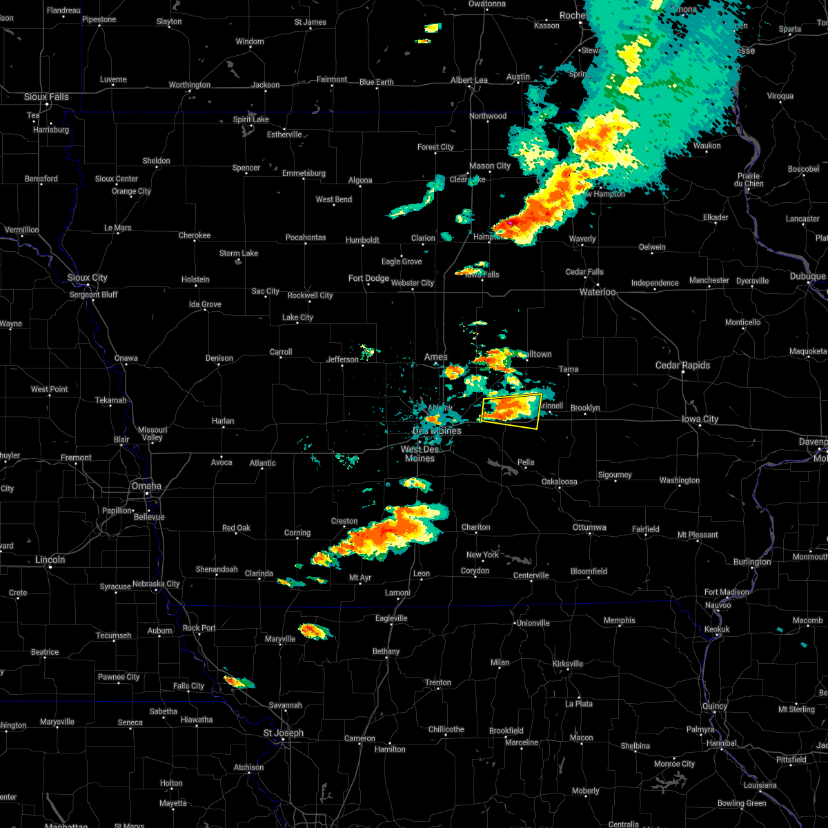 At 502 pm cdt, a severe thunderstorm was located near newton, moving east at 30 mph (radar indicated). Hazards include 60 mph wind gusts and quarter size hail. Hail damage to vehicles is expected. expect wind damage to roofs, siding, and trees. this severe storm will be near, newton around 505 pm cdt. other locations in the path of this severe thunderstorm include iowa speedway and rock creek lake. This includes interstate 80 between mile markers 155 and 177. At 502 pm cdt, a severe thunderstorm was located near newton, moving east at 30 mph (radar indicated). Hazards include 60 mph wind gusts and quarter size hail. Hail damage to vehicles is expected. expect wind damage to roofs, siding, and trees. this severe storm will be near, newton around 505 pm cdt. other locations in the path of this severe thunderstorm include iowa speedway and rock creek lake. This includes interstate 80 between mile markers 155 and 177.
|
| 6/20/2021 4:47 PM CDT |
 At 447 pm cdt, a severe thunderstorm was located near colfax, or 10 miles west of newton, moving east at 30 mph (radar indicated). Hazards include 60 mph wind gusts and quarter size hail. Hail damage to vehicles is expected. expect wind damage to roofs, siding, and trees. this severe thunderstorm will be near, baxter around 455 pm cdt. newton around 505 pm cdt. other locations in the path of this severe thunderstorm include iowa speedway and rock creek lake. This includes interstate 80 between mile markers 155 and 177. At 447 pm cdt, a severe thunderstorm was located near colfax, or 10 miles west of newton, moving east at 30 mph (radar indicated). Hazards include 60 mph wind gusts and quarter size hail. Hail damage to vehicles is expected. expect wind damage to roofs, siding, and trees. this severe thunderstorm will be near, baxter around 455 pm cdt. newton around 505 pm cdt. other locations in the path of this severe thunderstorm include iowa speedway and rock creek lake. This includes interstate 80 between mile markers 155 and 177.
|
| 8/10/2020 11:44 AM CDT |
 At 1143 am cdt, severe thunderstorms were located along a line extending from 9 miles southwest of reinbeck to near brooklyn to 6 miles northwest of oskaloosa, moving east at 70 mph. these are very dangerous storms (radar indicated). Hazards include 80 mph wind gusts and quarter size hail. Flying debris will be dangerous to those caught without shelter. mobile homes will be heavily damaged. expect considerable damage to roofs, windows, and vehicles. extensive tree damage and power outages are likely. locations impacted include, marshalltown, newton, oskaloosa, pella, grinnell, toledo, montezuma, tama, colfax, monroe, traer, prairie city, state center, brooklyn, dysart, new sharon, baxter, iowa speedway, meskwaki casino and rock creek lake. This includes interstate 80 between mile markers 154 and 204. At 1143 am cdt, severe thunderstorms were located along a line extending from 9 miles southwest of reinbeck to near brooklyn to 6 miles northwest of oskaloosa, moving east at 70 mph. these are very dangerous storms (radar indicated). Hazards include 80 mph wind gusts and quarter size hail. Flying debris will be dangerous to those caught without shelter. mobile homes will be heavily damaged. expect considerable damage to roofs, windows, and vehicles. extensive tree damage and power outages are likely. locations impacted include, marshalltown, newton, oskaloosa, pella, grinnell, toledo, montezuma, tama, colfax, monroe, traer, prairie city, state center, brooklyn, dysart, new sharon, baxter, iowa speedway, meskwaki casino and rock creek lake. This includes interstate 80 between mile markers 154 and 204.
|
| 8/10/2020 11:33 AM CDT |
 At 1133 am cdt, severe thunderstorms were located along a line extending from conrad to near grinnell to pella, moving east at 70 mph. these are very dangerous storms (radar indicated). Hazards include 80 mph wind gusts and quarter size hail. Flying debris will be dangerous to those caught without shelter. mobile homes will be heavily damaged. expect considerable damage to roofs, windows, and vehicles. extensive tree damage and power outages are likely. locations impacted include, marshalltown, newton, altoona, oskaloosa, pella, grinnell, pleasant hill, nevada, toledo, montezuma, carlisle, bondurant, story city, tama, mitchellville, colfax, monroe, traer, prairie city and state center. This includes interstate 80 between mile markers 142 and 204. At 1133 am cdt, severe thunderstorms were located along a line extending from conrad to near grinnell to pella, moving east at 70 mph. these are very dangerous storms (radar indicated). Hazards include 80 mph wind gusts and quarter size hail. Flying debris will be dangerous to those caught without shelter. mobile homes will be heavily damaged. expect considerable damage to roofs, windows, and vehicles. extensive tree damage and power outages are likely. locations impacted include, marshalltown, newton, altoona, oskaloosa, pella, grinnell, pleasant hill, nevada, toledo, montezuma, carlisle, bondurant, story city, tama, mitchellville, colfax, monroe, traer, prairie city and state center. This includes interstate 80 between mile markers 142 and 204.
|
| 8/10/2020 11:19 AM CDT |
 At 1118 am cdt, severe thunderstorms were located along a line extending from 12 miles southwest of eldora to near newton to pleasantville, moving east at 70 mph. these are very dangerous storms (radar indicated). Hazards include 80 mph wind gusts and quarter size hail. Flying debris will be dangerous to those caught without shelter. mobile homes will be heavily damaged. expect considerable damage to roofs, windows, and vehicles. Extensive tree damage and power outages are likely. At 1118 am cdt, severe thunderstorms were located along a line extending from 12 miles southwest of eldora to near newton to pleasantville, moving east at 70 mph. these are very dangerous storms (radar indicated). Hazards include 80 mph wind gusts and quarter size hail. Flying debris will be dangerous to those caught without shelter. mobile homes will be heavily damaged. expect considerable damage to roofs, windows, and vehicles. Extensive tree damage and power outages are likely.
|
| 8/10/2020 11:07 AM CDT |
 At 1106 am cdt, severe thunderstorms were located along a line extending from near roland to mitchellville to near carlisle, moving east at 60 mph. these are very dangerous storms (law enforcement). Hazards include 80 mph wind gusts and quarter size hail. Flying debris will be dangerous to those caught without shelter. mobile homes will be heavily damaged. expect considerable damage to roofs, windows, and vehicles. extensive tree damage and power outages are likely. locations impacted include, des moines, ames, west des moines, ankeny, urbandale, johnston, clive, newton, altoona, pella, norwalk, pleasant hill, grimes, nevada, windsor heights, carlisle, bondurant, story city, polk city and huxley. this includes the following highways, interstate 35 between mile markers 67 and 72, and between mile markers 87 and 126. interstate 80 between mile markers 122 and 174. Interstate 235 between mile markers 1 and 14. At 1106 am cdt, severe thunderstorms were located along a line extending from near roland to mitchellville to near carlisle, moving east at 60 mph. these are very dangerous storms (law enforcement). Hazards include 80 mph wind gusts and quarter size hail. Flying debris will be dangerous to those caught without shelter. mobile homes will be heavily damaged. expect considerable damage to roofs, windows, and vehicles. extensive tree damage and power outages are likely. locations impacted include, des moines, ames, west des moines, ankeny, urbandale, johnston, clive, newton, altoona, pella, norwalk, pleasant hill, grimes, nevada, windsor heights, carlisle, bondurant, story city, polk city and huxley. this includes the following highways, interstate 35 between mile markers 67 and 72, and between mile markers 87 and 126. interstate 80 between mile markers 122 and 174. Interstate 235 between mile markers 1 and 14.
|
| 8/10/2020 10:46 AM CDT |
 At 1045 am cdt, severe thunderstorms were located along a line extending from 8 miles north of boone to saylorville lake to 6 miles southeast of van meter, moving east at 70 mph. these are very dangerous storms (radar indicated). Hazards include 80 mph wind gusts and quarter size hail. Flying debris will be dangerous to those caught without shelter. mobile homes will be heavily damaged. expect considerable damage to roofs, windows, and vehicles. extensive tree damage and power outages are likely. locations impacted include, des moines, ames, west des moines, ankeny, urbandale, johnston, clive, newton, altoona, pella, norwalk, pleasant hill, grimes, nevada, windsor heights, carlisle, bondurant, story city, polk city and huxley. this includes the following highways, interstate 35 between mile markers 67 and 72, and between mile markers 87 and 126. interstate 80 between mile markers 122 and 174. Interstate 235 between mile markers 1 and 14. At 1045 am cdt, severe thunderstorms were located along a line extending from 8 miles north of boone to saylorville lake to 6 miles southeast of van meter, moving east at 70 mph. these are very dangerous storms (radar indicated). Hazards include 80 mph wind gusts and quarter size hail. Flying debris will be dangerous to those caught without shelter. mobile homes will be heavily damaged. expect considerable damage to roofs, windows, and vehicles. extensive tree damage and power outages are likely. locations impacted include, des moines, ames, west des moines, ankeny, urbandale, johnston, clive, newton, altoona, pella, norwalk, pleasant hill, grimes, nevada, windsor heights, carlisle, bondurant, story city, polk city and huxley. this includes the following highways, interstate 35 between mile markers 67 and 72, and between mile markers 87 and 126. interstate 80 between mile markers 122 and 174. Interstate 235 between mile markers 1 and 14.
|
| 8/10/2020 10:39 AM CDT |
 At 1039 am cdt, severe thunderstorms were located along a line extending from 10 miles northwest of boone to near granger to near van meter, moving east at 70 mph (radar indicated). Hazards include 70 mph wind gusts and quarter size hail. Hail damage to vehicles is expected. expect considerable tree damage. Wind damage is also likely to mobile homes, roofs, and outbuildings. At 1039 am cdt, severe thunderstorms were located along a line extending from 10 miles northwest of boone to near granger to near van meter, moving east at 70 mph (radar indicated). Hazards include 70 mph wind gusts and quarter size hail. Hail damage to vehicles is expected. expect considerable tree damage. Wind damage is also likely to mobile homes, roofs, and outbuildings.
|
| 7/11/2020 6:11 PM CDT | Quarter sized hail reported 0.4 miles SSW of Baxter, IA, fire dept. reports quarter size hail in baxter... ia. |
| 7/11/2020 6:03 PM CDT |
 At 603 pm cdt, a severe thunderstorm was located near baxter, or 15 miles southeast of nevada, moving southeast at 55 mph (trained weather spotters have reported up to inch and a half hail with the storm so far). Hazards include two inch hail and 60 mph wind gusts. People and animals outdoors will be injured. expect hail damage to roofs, siding, windows, and vehicles. Expect wind damage to roofs, siding, and trees. At 603 pm cdt, a severe thunderstorm was located near baxter, or 15 miles southeast of nevada, moving southeast at 55 mph (trained weather spotters have reported up to inch and a half hail with the storm so far). Hazards include two inch hail and 60 mph wind gusts. People and animals outdoors will be injured. expect hail damage to roofs, siding, windows, and vehicles. Expect wind damage to roofs, siding, and trees.
|
| 7/11/2020 5:58 PM CDT |
 At 557 pm cdt, a severe thunderstorm was located near state center, or 11 miles southwest of marshalltown, moving southeast at 35 mph (trained weather spotters have reported at least quarter sized hail with the storm in the southwest portion of the warning). Hazards include two inch hail and 60 mph wind gusts. People and animals outdoors will be injured. expect hail damage to roofs, siding, windows, and vehicles. expect wind damage to roofs, siding, and trees. Locations impacted include, state center, baxter, colo, melbourne, rhodes and haverhill. At 557 pm cdt, a severe thunderstorm was located near state center, or 11 miles southwest of marshalltown, moving southeast at 35 mph (trained weather spotters have reported at least quarter sized hail with the storm in the southwest portion of the warning). Hazards include two inch hail and 60 mph wind gusts. People and animals outdoors will be injured. expect hail damage to roofs, siding, windows, and vehicles. expect wind damage to roofs, siding, and trees. Locations impacted include, state center, baxter, colo, melbourne, rhodes and haverhill.
|
| 7/11/2020 5:44 PM CDT |
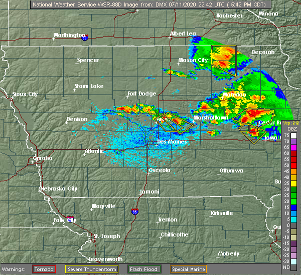 At 543 pm cdt, a severe thunderstorm was located near state center, or 12 miles east of nevada, moving southeast at 35 mph (trained weather spotters have reported a history of quarter to golf ball sized hail with this storm). Hazards include ping pong ball size hail and 60 mph wind gusts. People and animals outdoors will be injured. expect hail damage to roofs, siding, windows, and vehicles. expect wind damage to roofs, siding, and trees. Locations impacted include, state center, baxter, colo, melbourne, rhodes and haverhill. At 543 pm cdt, a severe thunderstorm was located near state center, or 12 miles east of nevada, moving southeast at 35 mph (trained weather spotters have reported a history of quarter to golf ball sized hail with this storm). Hazards include ping pong ball size hail and 60 mph wind gusts. People and animals outdoors will be injured. expect hail damage to roofs, siding, windows, and vehicles. expect wind damage to roofs, siding, and trees. Locations impacted include, state center, baxter, colo, melbourne, rhodes and haverhill.
|
| 7/11/2020 5:29 PM CDT |
 At 528 pm cdt, a severe thunderstorm was located 7 miles southeast of roland, or 8 miles northeast of nevada, moving southeast at 35 mph (trained weather spotters have reported quarter to golf ball sized hail). Hazards include ping pong ball size hail and 60 mph wind gusts. People and animals outdoors will be injured. expect hail damage to roofs, siding, windows, and vehicles. Expect wind damage to roofs, siding, and trees. At 528 pm cdt, a severe thunderstorm was located 7 miles southeast of roland, or 8 miles northeast of nevada, moving southeast at 35 mph (trained weather spotters have reported quarter to golf ball sized hail). Hazards include ping pong ball size hail and 60 mph wind gusts. People and animals outdoors will be injured. expect hail damage to roofs, siding, windows, and vehicles. Expect wind damage to roofs, siding, and trees.
|
| 6/22/2020 1:18 AM CDT |
 At 118 am cdt, a severe thunderstorm was located over mitchellville, or 7 miles east of altoona, moving east at 30 mph (radar indicated). Hazards include 60 mph wind gusts and nickel size hail. expect damage to roofs, siding, and trees At 118 am cdt, a severe thunderstorm was located over mitchellville, or 7 miles east of altoona, moving east at 30 mph (radar indicated). Hazards include 60 mph wind gusts and nickel size hail. expect damage to roofs, siding, and trees
|
| 5/25/2020 5:42 PM CDT |
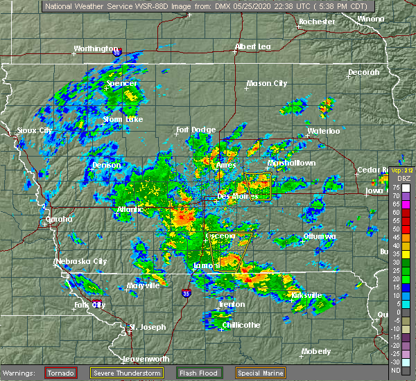 At 542 pm cdt, a severe thunderstorm was located 7 miles east of baxter, or 8 miles north of newton, moving north at 25 mph (radar indicated). Hazards include 60 mph wind gusts and penny size hail. Expect damage to roofs, siding, and trees. Locations impacted include, baxter, melbourne, rhodes, laurel, haverhill and ferguson. At 542 pm cdt, a severe thunderstorm was located 7 miles east of baxter, or 8 miles north of newton, moving north at 25 mph (radar indicated). Hazards include 60 mph wind gusts and penny size hail. Expect damage to roofs, siding, and trees. Locations impacted include, baxter, melbourne, rhodes, laurel, haverhill and ferguson.
|
| 5/25/2020 5:24 PM CDT |
 At 523 pm cdt, a severe thunderstorm was located over iowa speedway, or over newton, moving north at 30 mph (radar indicated). Hazards include 60 mph wind gusts and penny size hail. expect damage to roofs, siding, and trees At 523 pm cdt, a severe thunderstorm was located over iowa speedway, or over newton, moving north at 30 mph (radar indicated). Hazards include 60 mph wind gusts and penny size hail. expect damage to roofs, siding, and trees
|
| 3/28/2020 4:10 PM CDT |
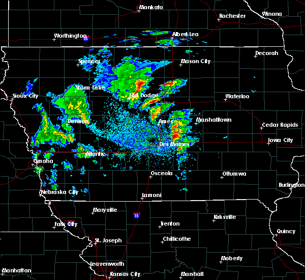 At 409 pm cdt, a severe thunderstorm capable of producing a tornado was located near colfax, or 11 miles northeast of altoona, moving northeast at 50 mph (weather spotters reported a wall cloud near or just northeast of mitchellville cloud). Hazards include tornado. Flying debris will be dangerous to those caught without shelter. mobile homes will be damaged or destroyed. damage to roofs, windows, and vehicles will occur. tree damage is likely. this dangerous storm will be near, baxter around 420 pm cdt. Other locations impacted by this tornadic thunderstorm include valeria, rhodes, mingo and melbourne. At 409 pm cdt, a severe thunderstorm capable of producing a tornado was located near colfax, or 11 miles northeast of altoona, moving northeast at 50 mph (weather spotters reported a wall cloud near or just northeast of mitchellville cloud). Hazards include tornado. Flying debris will be dangerous to those caught without shelter. mobile homes will be damaged or destroyed. damage to roofs, windows, and vehicles will occur. tree damage is likely. this dangerous storm will be near, baxter around 420 pm cdt. Other locations impacted by this tornadic thunderstorm include valeria, rhodes, mingo and melbourne.
|
| 10/1/2019 5:44 PM CDT |
 At 544 pm cdt, a severe thunderstorm was located over prairie city, or 10 miles east of altoona, moving northeast at 30 mph (radar indicated). Hazards include ping pong ball size hail and 60 mph wind gusts. People and animals outdoors will be injured. expect hail damage to roofs, siding, windows, and vehicles. Expect wind damage to roofs, siding, and trees. At 544 pm cdt, a severe thunderstorm was located over prairie city, or 10 miles east of altoona, moving northeast at 30 mph (radar indicated). Hazards include ping pong ball size hail and 60 mph wind gusts. People and animals outdoors will be injured. expect hail damage to roofs, siding, windows, and vehicles. Expect wind damage to roofs, siding, and trees.
|
| 9/22/2019 1:25 AM CDT |
 The severe thunderstorm warning for western jasper county will expire at 130 am cdt, the severe thunderstorm which prompted the warning has weakened. therefore, the warning will be allowed to expire. however gusty winds are still possible with these thunderstorms. The severe thunderstorm warning for western jasper county will expire at 130 am cdt, the severe thunderstorm which prompted the warning has weakened. therefore, the warning will be allowed to expire. however gusty winds are still possible with these thunderstorms.
|
| 9/22/2019 1:16 AM CDT |
 At 115 am cdt, a severe thunderstorm was located near newton, moving east at 35 mph (radar indicated). Hazards include 60 mph wind gusts and nickel size hail. Expect damage to roofs, siding, and trees. locations impacted include, newton, colfax, prairie city, baxter, iowa speedway, mingo, lambs grove, reasnor, valeria, prairie city krohn airport and newton municipal airport. This includes interstate 80 between mile markers 152 and 171. At 115 am cdt, a severe thunderstorm was located near newton, moving east at 35 mph (radar indicated). Hazards include 60 mph wind gusts and nickel size hail. Expect damage to roofs, siding, and trees. locations impacted include, newton, colfax, prairie city, baxter, iowa speedway, mingo, lambs grove, reasnor, valeria, prairie city krohn airport and newton municipal airport. This includes interstate 80 between mile markers 152 and 171.
|
| 9/22/2019 1:06 AM CDT |
 At 105 am cdt, a severe thunderstorm was located over colfax, or 10 miles west of newton, moving east at 35 mph (radar indicated). Hazards include 60 mph wind gusts and nickel size hail. Expect damage to roofs, siding, and trees. locations impacted include, newton, bondurant, mitchellville, colfax, monroe, prairie city, baxter, iowa speedway, rock creek lake, sully, kellogg, mingo, lambs grove, reasnor, valeria, prairie city krohn airport, newton municipal airport and rock creek state park. This includes interstate 80 between mile markers 147 and 176. At 105 am cdt, a severe thunderstorm was located over colfax, or 10 miles west of newton, moving east at 35 mph (radar indicated). Hazards include 60 mph wind gusts and nickel size hail. Expect damage to roofs, siding, and trees. locations impacted include, newton, bondurant, mitchellville, colfax, monroe, prairie city, baxter, iowa speedway, rock creek lake, sully, kellogg, mingo, lambs grove, reasnor, valeria, prairie city krohn airport, newton municipal airport and rock creek state park. This includes interstate 80 between mile markers 147 and 176.
|
| 9/22/2019 12:51 AM CDT |
 At 1251 am cdt, a severe thunderstorm was located near pleasant hill, moving northeast at 50 mph (radar indicated). Hazards include 60 mph wind gusts and quarter size hail. Hail damage to vehicles is expected. Expect wind damage to roofs, siding, and trees. At 1251 am cdt, a severe thunderstorm was located near pleasant hill, moving northeast at 50 mph (radar indicated). Hazards include 60 mph wind gusts and quarter size hail. Hail damage to vehicles is expected. Expect wind damage to roofs, siding, and trees.
|
| 8/20/2019 5:48 AM CDT |
 At 548 am cdt, a severe thunderstorm was located near mitchellville, or 7 miles northeast of altoona, moving east at 35 mph (radar indicated). Hazards include 60 mph wind gusts and penny size hail. expect damage to roofs, siding, and trees At 548 am cdt, a severe thunderstorm was located near mitchellville, or 7 miles northeast of altoona, moving east at 35 mph (radar indicated). Hazards include 60 mph wind gusts and penny size hail. expect damage to roofs, siding, and trees
|
| 7/20/2019 5:29 PM CDT |
 At 529 pm cdt, severe thunderstorms were located along a line extending from baxter to near indianola, moving east at 55 mph (radar indicated). Hazards include 60 mph wind gusts and quarter size hail. Hail damage to vehicles is expected. Expect wind damage to roofs, siding, and trees. At 529 pm cdt, severe thunderstorms were located along a line extending from baxter to near indianola, moving east at 55 mph (radar indicated). Hazards include 60 mph wind gusts and quarter size hail. Hail damage to vehicles is expected. Expect wind damage to roofs, siding, and trees.
|
| 7/20/2019 5:08 PM CDT |
 At 508 pm cdt, a severe thunderstorm was located near saylorville lake, or near ankeny, moving southeast at 45 mph (radar indicated). Hazards include 60 mph wind gusts and quarter size hail. Hail damage to vehicles is expected. expect wind damage to roofs, siding, and trees. locations impacted include, des moines, west des moines, ankeny, urbandale, johnston, clive, altoona, norwalk, pleasant hill, grimes, windsor heights, carlisle, bondurant, polk city, huxley, saylorville, mitchellville, slater, baxter and southridge mall. this includes the following highways, interstate 35 near mile marker 72, and between mile markers 87 and 105. interstate 80 between mile markers 123 and 151. Interstate 235 between mile markers 1 and 14. At 508 pm cdt, a severe thunderstorm was located near saylorville lake, or near ankeny, moving southeast at 45 mph (radar indicated). Hazards include 60 mph wind gusts and quarter size hail. Hail damage to vehicles is expected. expect wind damage to roofs, siding, and trees. locations impacted include, des moines, west des moines, ankeny, urbandale, johnston, clive, altoona, norwalk, pleasant hill, grimes, windsor heights, carlisle, bondurant, polk city, huxley, saylorville, mitchellville, slater, baxter and southridge mall. this includes the following highways, interstate 35 near mile marker 72, and between mile markers 87 and 105. interstate 80 between mile markers 123 and 151. Interstate 235 between mile markers 1 and 14.
|
| 7/20/2019 4:59 PM CDT |
 At 459 pm cdt, a severe thunderstorm was located over granger, or near grimes, moving southeast at 45 mph (radar indicated). Hazards include 60 mph wind gusts and penny size hail. expect damage to roofs, siding, and trees At 459 pm cdt, a severe thunderstorm was located over granger, or near grimes, moving southeast at 45 mph (radar indicated). Hazards include 60 mph wind gusts and penny size hail. expect damage to roofs, siding, and trees
|
| 6/15/2019 5:34 PM CDT |
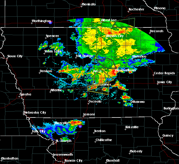 At 534 pm cdt, severe thunderstorms were located along a line extending from 10 miles southeast of state center to near baxter to near mitchellville, moving east at 45 mph (radar indicated). Hazards include 60 mph wind gusts and penny size hail. Expect damage to roofs, siding, and trees. locations impacted include, altoona, bondurant, baxter, maxwell, colo, melbourne, collins, rhodes, mingo and valeria. This includes interstate 80 near mile marker 141. At 534 pm cdt, severe thunderstorms were located along a line extending from 10 miles southeast of state center to near baxter to near mitchellville, moving east at 45 mph (radar indicated). Hazards include 60 mph wind gusts and penny size hail. Expect damage to roofs, siding, and trees. locations impacted include, altoona, bondurant, baxter, maxwell, colo, melbourne, collins, rhodes, mingo and valeria. This includes interstate 80 near mile marker 141.
|
| 6/15/2019 5:14 PM CDT |
 At 513 pm cdt, severe thunderstorms were located along a line extending from near state center to 10 miles northeast of bondurant to near saylorville, moving southeast at 35 mph (radar indicated). Hazards include 60 mph wind gusts and penny size hail. Expect damage to roofs, siding, and trees. locations impacted include, des moines, ankeny, altoona, pleasant hill, nevada, bondurant, huxley, saylorville, mitchellville, colfax, baxter, adventureland amusement park, iowa events center, prairie meadows, iowa state fairgrounds, principal park, maxwell, colo, melbourne and cambridge. this includes the following highways, interstate 35 between mile markers 87 and 108. interstate 80 between mile markers 136 and 152. Interstate 235 between mile markers 9 and 14. At 513 pm cdt, severe thunderstorms were located along a line extending from near state center to 10 miles northeast of bondurant to near saylorville, moving southeast at 35 mph (radar indicated). Hazards include 60 mph wind gusts and penny size hail. Expect damage to roofs, siding, and trees. locations impacted include, des moines, ankeny, altoona, pleasant hill, nevada, bondurant, huxley, saylorville, mitchellville, colfax, baxter, adventureland amusement park, iowa events center, prairie meadows, iowa state fairgrounds, principal park, maxwell, colo, melbourne and cambridge. this includes the following highways, interstate 35 between mile markers 87 and 108. interstate 80 between mile markers 136 and 152. Interstate 235 between mile markers 9 and 14.
|
| 6/15/2019 5:09 PM CDT |
 At 509 pm cdt, severe thunderstorms were located along a line extending from near state center to 10 miles north of bondurant to saylorville, moving southeast at 45 mph (radar indicated. this storm has a history of producing wind gusts over 60 mph). Hazards include 60 mph wind gusts and penny size hail. Expect damage to roofs, siding, and trees. locations impacted include, des moines, ames, ankeny, johnston, altoona, pleasant hill, nevada, bondurant, polk city, huxley, saylorville, madrid, mitchellville, colfax, slater, baxter, saylorville lake, adventureland amusement park, iowa events center and big creek lake. this includes the following highways, interstate 35 between mile markers 87 and 114. interstate 80 between mile markers 132 and 152. Interstate 235 between mile markers 7 and 14. At 509 pm cdt, severe thunderstorms were located along a line extending from near state center to 10 miles north of bondurant to saylorville, moving southeast at 45 mph (radar indicated. this storm has a history of producing wind gusts over 60 mph). Hazards include 60 mph wind gusts and penny size hail. Expect damage to roofs, siding, and trees. locations impacted include, des moines, ames, ankeny, johnston, altoona, pleasant hill, nevada, bondurant, polk city, huxley, saylorville, madrid, mitchellville, colfax, slater, baxter, saylorville lake, adventureland amusement park, iowa events center and big creek lake. this includes the following highways, interstate 35 between mile markers 87 and 114. interstate 80 between mile markers 132 and 152. Interstate 235 between mile markers 7 and 14.
|
| 6/15/2019 4:51 PM CDT |
 At 450 pm cdt, a severe thunderstorm was located near huxley, or near ames, moving southeast at 35 mph (trained weather spotters. the ames airport recently gusted to 65 mph). Hazards include 60 mph wind gusts and penny size hail. expect damage to roofs, siding, and trees At 450 pm cdt, a severe thunderstorm was located near huxley, or near ames, moving southeast at 35 mph (trained weather spotters. the ames airport recently gusted to 65 mph). Hazards include 60 mph wind gusts and penny size hail. expect damage to roofs, siding, and trees
|
| 5/27/2019 6:49 AM CDT |
 At 649 am cdt, severe thunderstorms were located along a line extending from johnston to 8 miles west of melcher-dallas, moving northeast at 80 mph (radar indicated). Hazards include 60 mph wind gusts. expect damage to roofs, siding, and trees At 649 am cdt, severe thunderstorms were located along a line extending from johnston to 8 miles west of melcher-dallas, moving northeast at 80 mph (radar indicated). Hazards include 60 mph wind gusts. expect damage to roofs, siding, and trees
|
| 5/24/2019 7:19 AM CDT |
 At 719 am cdt, severe thunderstorms were located along a line extending from baxter to monroe, moving east at 55 mph (radar indicated). Hazards include 60 mph wind gusts. Expect damage to roofs, siding, and trees. locations impacted include, newton, colfax, monroe, prairie city, baxter, rock creek lake, iowa speedway, sully, kellogg, lynnville, laurel, lambs grove, reasnor, prairie city krohn airport, rock creek state park and newton municipal airport. This includes interstate 80 between mile markers 156 and 177. At 719 am cdt, severe thunderstorms were located along a line extending from baxter to monroe, moving east at 55 mph (radar indicated). Hazards include 60 mph wind gusts. Expect damage to roofs, siding, and trees. locations impacted include, newton, colfax, monroe, prairie city, baxter, rock creek lake, iowa speedway, sully, kellogg, lynnville, laurel, lambs grove, reasnor, prairie city krohn airport, rock creek state park and newton municipal airport. This includes interstate 80 between mile markers 156 and 177.
|
| 5/24/2019 7:07 AM CDT |
 At 707 am cdt, severe thunderstorms were located along a line extending from near bondurant to 6 miles northwest of pleasantville, moving east at 45 mph (radar indicated). Hazards include 60 mph wind gusts. expect damage to roofs, siding, and trees At 707 am cdt, severe thunderstorms were located along a line extending from near bondurant to 6 miles northwest of pleasantville, moving east at 45 mph (radar indicated). Hazards include 60 mph wind gusts. expect damage to roofs, siding, and trees
|
| 8/1/2018 8:16 PM CDT |
 At 816 pm cdt, a severe thunderstorm was located near huxley, or near ames, moving southeast at 25 mph (radar indicated). Hazards include 60 mph wind gusts and quarter size hail. Hail damage to vehicles is expected. Expect wind damage to roofs, siding, and trees. At 816 pm cdt, a severe thunderstorm was located near huxley, or near ames, moving southeast at 25 mph (radar indicated). Hazards include 60 mph wind gusts and quarter size hail. Hail damage to vehicles is expected. Expect wind damage to roofs, siding, and trees.
|
| 6/30/2018 10:42 PM CDT |
 The severe thunderstorm warning for northern marion, northwestern mahaska and jasper counties will expire at 1045 pm cdt, the storms which prompted the warning have weakened below severe limits, and no longer pose an immediate threat to life or property. therefore, the warning will be allowed to expire. however gusty winds and heavy rain are still possible with these thunderstorms. The severe thunderstorm warning for northern marion, northwestern mahaska and jasper counties will expire at 1045 pm cdt, the storms which prompted the warning have weakened below severe limits, and no longer pose an immediate threat to life or property. therefore, the warning will be allowed to expire. however gusty winds and heavy rain are still possible with these thunderstorms.
|
| 6/30/2018 10:14 PM CDT |
 At 1014 pm cdt, severe thunderstorms were located along a line extending from near baxter to near iowa speedway to pleasantville, moving east at 30 mph (radar indicated). Hazards include 60 mph wind gusts. Expect damage to roofs, siding, and trees. locations impacted include, newton, pella, knoxville, colfax, monroe, pleasantville, prairie city, baxter, iowa speedway, knoxville raceway, lake red rock, rock creek lake, sully, kellogg, lynnville, mingo, lambs grove, oakland acres, reasnor and swan. This includes interstate 80 between mile markers 150 and 179. At 1014 pm cdt, severe thunderstorms were located along a line extending from near baxter to near iowa speedway to pleasantville, moving east at 30 mph (radar indicated). Hazards include 60 mph wind gusts. Expect damage to roofs, siding, and trees. locations impacted include, newton, pella, knoxville, colfax, monroe, pleasantville, prairie city, baxter, iowa speedway, knoxville raceway, lake red rock, rock creek lake, sully, kellogg, lynnville, mingo, lambs grove, oakland acres, reasnor and swan. This includes interstate 80 between mile markers 150 and 179.
|
| 6/30/2018 9:58 PM CDT |
 At 958 pm cdt, severe thunderstorms were located along a line extending from 6 miles north of mitchellville to near prairie city to 6 miles west of pleasantville, moving east at 30 mph (radar indicated). Hazards include 60 mph wind gusts. expect damage to roofs, siding, and trees At 958 pm cdt, severe thunderstorms were located along a line extending from 6 miles north of mitchellville to near prairie city to 6 miles west of pleasantville, moving east at 30 mph (radar indicated). Hazards include 60 mph wind gusts. expect damage to roofs, siding, and trees
|
| 5/3/2018 8:07 PM CDT |
 At 806 pm cdt, severe thunderstorms were located along a line extending from near state center to near baxter to near newton, moving northeast at 30 mph (radar indicated). Hazards include 60 mph wind gusts. Expect damage to roofs, siding, and trees. locations impacted include, marshalltown, newton, baxter, rock creek lake, le grand, melbourne, gilman, rhodes, laurel, haverhill, lambs grove, ferguson and rock creek state park. This includes interstate 80 between mile markers 158 and 163. At 806 pm cdt, severe thunderstorms were located along a line extending from near state center to near baxter to near newton, moving northeast at 30 mph (radar indicated). Hazards include 60 mph wind gusts. Expect damage to roofs, siding, and trees. locations impacted include, marshalltown, newton, baxter, rock creek lake, le grand, melbourne, gilman, rhodes, laurel, haverhill, lambs grove, ferguson and rock creek state park. This includes interstate 80 between mile markers 158 and 163.
|
| 5/3/2018 7:50 PM CDT |
 At 750 pm cdt, severe thunderstorms were located along a line extending from 12 miles southwest of state center to 6 miles southwest of baxter to prairie city, moving east at 35 mph (radar indicated). Hazards include 60 mph wind gusts. expect damage to roofs, siding, and trees At 750 pm cdt, severe thunderstorms were located along a line extending from 12 miles southwest of state center to 6 miles southwest of baxter to prairie city, moving east at 35 mph (radar indicated). Hazards include 60 mph wind gusts. expect damage to roofs, siding, and trees
|
| 7/20/2017 10:50 PM CDT |
 At 1049 pm cdt, severe thunderstorms were located along a line extending from 9 miles southeast of eldora to near conrad to 6 miles southeast of marshalltown, moving northeast at 40 mph (radar indicated). Hazards include 60 mph wind gusts. Expect damage to roofs, siding, and trees. locations impacted include, marshalltown, state center, conrad, baxter, le grand, melbourne, gilman, albion, union, rhodes, liscomb, laurel, new providence, beaman, haverhill, whitten, clemons, ferguson, green mountain and st. Anthony. At 1049 pm cdt, severe thunderstorms were located along a line extending from 9 miles southeast of eldora to near conrad to 6 miles southeast of marshalltown, moving northeast at 40 mph (radar indicated). Hazards include 60 mph wind gusts. Expect damage to roofs, siding, and trees. locations impacted include, marshalltown, state center, conrad, baxter, le grand, melbourne, gilman, albion, union, rhodes, liscomb, laurel, new providence, beaman, haverhill, whitten, clemons, ferguson, green mountain and st. Anthony.
|
| 7/20/2017 10:28 PM CDT |
 At 1028 pm cdt, severe thunderstorms were located along a line extending from 11 miles south of eldora to near state center to near baxter, moving northeast at 35 mph (radar indicated). Hazards include 60 mph wind gusts. Expect damage to roofs, siding, and trees. locations impacted include, marshalltown, nevada, eldora, state center, conrad, baxter, le grand, maxwell, colo, melbourne, wellsburg, zearing, gilman, albion, collins, union, mccallsburg, rhodes, mingo and liscomb. This includes interstate 35 between mile markers 119 and 120. At 1028 pm cdt, severe thunderstorms were located along a line extending from 11 miles south of eldora to near state center to near baxter, moving northeast at 35 mph (radar indicated). Hazards include 60 mph wind gusts. Expect damage to roofs, siding, and trees. locations impacted include, marshalltown, nevada, eldora, state center, conrad, baxter, le grand, maxwell, colo, melbourne, wellsburg, zearing, gilman, albion, collins, union, mccallsburg, rhodes, mingo and liscomb. This includes interstate 35 between mile markers 119 and 120.
|
| 7/20/2017 10:04 PM CDT |
 At 1003 pm cdt, severe thunderstorms were located along a line extending from 6 miles southeast of roland to 7 miles southeast of nevada to 7 miles north of mitchellville, moving northeast at 40 mph (radar indicated. these storms have a history of producing 60 mph winds and tree damage). Hazards include 60 mph wind gusts. expect damage to roofs, siding, and trees At 1003 pm cdt, severe thunderstorms were located along a line extending from 6 miles southeast of roland to 7 miles southeast of nevada to 7 miles north of mitchellville, moving northeast at 40 mph (radar indicated. these storms have a history of producing 60 mph winds and tree damage). Hazards include 60 mph wind gusts. expect damage to roofs, siding, and trees
|
| 6/29/2017 4:42 PM CDT |
 At 941 pm cdt, severe thunderstorms were located along a line extending from 8 miles northwest of meskwaki casino to near baxter, moving southeast at 50 mph (radar indicated). Hazards include 60 mph wind gusts. expect damage to roofs, siding, and trees At 941 pm cdt, severe thunderstorms were located along a line extending from 8 miles northwest of meskwaki casino to near baxter, moving southeast at 50 mph (radar indicated). Hazards include 60 mph wind gusts. expect damage to roofs, siding, and trees
|
| 6/28/2017 12:52 PM CDT |
 At 552 pm cdt, a severe thunderstorm was located 7 miles southwest of marshalltown, moving east at 35 mph (radar indicated). Hazards include 60 mph wind gusts and quarter size hail. Hail damage to vehicles is expected. Expect wind damage to roofs, siding, and trees. At 552 pm cdt, a severe thunderstorm was located 7 miles southwest of marshalltown, moving east at 35 mph (radar indicated). Hazards include 60 mph wind gusts and quarter size hail. Hail damage to vehicles is expected. Expect wind damage to roofs, siding, and trees.
|
| 6/28/2017 12:39 PM CDT |
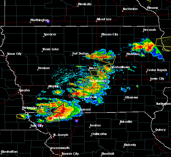 At 539 pm cdt, a severe thunderstorm was located near state center, or 13 miles southwest of marshalltown, moving east at 35 mph (radar indicated). Hazards include golf ball size hail and 60 mph wind gusts. People and animals outdoors will be injured. expect hail damage to roofs, siding, windows, and vehicles. expect wind damage to roofs, siding, and trees. locations impacted include, state center, baxter, colo, melbourne, collins and rhodes. A tornado watch remains in effect until 1000 pm cdt for central iowa. At 539 pm cdt, a severe thunderstorm was located near state center, or 13 miles southwest of marshalltown, moving east at 35 mph (radar indicated). Hazards include golf ball size hail and 60 mph wind gusts. People and animals outdoors will be injured. expect hail damage to roofs, siding, windows, and vehicles. expect wind damage to roofs, siding, and trees. locations impacted include, state center, baxter, colo, melbourne, collins and rhodes. A tornado watch remains in effect until 1000 pm cdt for central iowa.
|
| 6/28/2017 12:24 PM CDT |
 At 524 pm cdt, a severe thunderstorm was located over pleasant hill, moving east at 30 mph (radar indicated). Hazards include 60 mph wind gusts and half dollar size hail. Hail damage to vehicles is expected. Expect wind damage to roofs, siding, and trees. At 524 pm cdt, a severe thunderstorm was located over pleasant hill, moving east at 30 mph (radar indicated). Hazards include 60 mph wind gusts and half dollar size hail. Hail damage to vehicles is expected. Expect wind damage to roofs, siding, and trees.
|
| 6/28/2017 12:11 PM CDT |
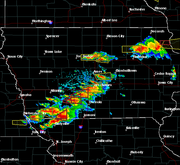 At 511 pm cdt, a severe thunderstorm was located 7 miles southeast of nevada, moving east at 35 mph (radar indicated). Hazards include golf ball size hail and 60 mph wind gusts. People and animals outdoors will be injured. expect hail damage to roofs, siding, windows, and vehicles. Expect wind damage to roofs, siding, and trees. At 511 pm cdt, a severe thunderstorm was located 7 miles southeast of nevada, moving east at 35 mph (radar indicated). Hazards include golf ball size hail and 60 mph wind gusts. People and animals outdoors will be injured. expect hail damage to roofs, siding, windows, and vehicles. Expect wind damage to roofs, siding, and trees.
|
| 5/17/2017 5:06 PM CDT |
 At 505 pm cdt, severe thunderstorms were located along a line extending from near webster city to 9 miles southwest of eldora to 10 miles northwest of rock creek lake, moving northeast at 60 mph (trained weather spotters. numerous reports of 60 to 70 mph winds have been reported with these storms with trees and powerlines down). Hazards include 70 mph wind gusts. Expect considerable tree damage. damage is likely to mobile homes, roofs, and outbuildings. locations impacted include, marshalltown, newton, webster city, nevada, iowa falls, eldora, grundy center, toledo, story city, tama, traer, reinbeck, ackley, state center, dysart, roland, jewell junction, dike, conrad and baxter. this includes the following highways, interstate 35 between mile markers 118 and 150. interstate 80 between mile markers 164 and 165. A tornado watch remains in effect until 700 pm cdt for central, north central and northeastern iowa. At 505 pm cdt, severe thunderstorms were located along a line extending from near webster city to 9 miles southwest of eldora to 10 miles northwest of rock creek lake, moving northeast at 60 mph (trained weather spotters. numerous reports of 60 to 70 mph winds have been reported with these storms with trees and powerlines down). Hazards include 70 mph wind gusts. Expect considerable tree damage. damage is likely to mobile homes, roofs, and outbuildings. locations impacted include, marshalltown, newton, webster city, nevada, iowa falls, eldora, grundy center, toledo, story city, tama, traer, reinbeck, ackley, state center, dysart, roland, jewell junction, dike, conrad and baxter. this includes the following highways, interstate 35 between mile markers 118 and 150. interstate 80 between mile markers 164 and 165. A tornado watch remains in effect until 700 pm cdt for central, north central and northeastern iowa.
|
| 5/17/2017 4:53 PM CDT |
 At 452 pm cdt, severe thunderstorms were located along a line extending from 15 miles north of boone to 6 miles east of roland to newton, moving northeast at 60 mph (trained weather spotters. numerous reports of 60 to 70 mph winds with trees and powerlines downed). Hazards include 70 mph wind gusts. Expect considerable tree damage. Damage is likely to mobile homes, roofs, and outbuildings. At 452 pm cdt, severe thunderstorms were located along a line extending from 15 miles north of boone to 6 miles east of roland to newton, moving northeast at 60 mph (trained weather spotters. numerous reports of 60 to 70 mph winds with trees and powerlines downed). Hazards include 70 mph wind gusts. Expect considerable tree damage. Damage is likely to mobile homes, roofs, and outbuildings.
|
| 5/17/2017 4:40 PM CDT |
 At 440 pm cdt, severe thunderstorms were located along a line extending from 10 miles northwest of boone to near nevada to near colfax, moving northeast at 70 mph (trained weather spotters. these storms have a history of producing wind gusts from 60 to 70 mph with numerous trees down and minor structural damage). Hazards include 70 mph wind gusts. Expect considerable tree damage. damage is likely to mobile homes, roofs, and outbuildings. locations impacted include, ames, ankeny, newton, altoona, boone, nevada, jefferson, bondurant, story city, huxley, madrid, mitchellville, colfax, ogden, prairie city, slater, state center, roland, baxter and gilbert. this includes the following highways, interstate 35 between mile markers 91 and 126. interstate 80 between mile markers 141 and 164. A tornado watch remains in effect until 700 pm cdt for central and west central iowa. At 440 pm cdt, severe thunderstorms were located along a line extending from 10 miles northwest of boone to near nevada to near colfax, moving northeast at 70 mph (trained weather spotters. these storms have a history of producing wind gusts from 60 to 70 mph with numerous trees down and minor structural damage). Hazards include 70 mph wind gusts. Expect considerable tree damage. damage is likely to mobile homes, roofs, and outbuildings. locations impacted include, ames, ankeny, newton, altoona, boone, nevada, jefferson, bondurant, story city, huxley, madrid, mitchellville, colfax, ogden, prairie city, slater, state center, roland, baxter and gilbert. this includes the following highways, interstate 35 between mile markers 91 and 126. interstate 80 between mile markers 141 and 164. A tornado watch remains in effect until 700 pm cdt for central and west central iowa.
|
| 5/17/2017 4:17 PM CDT |
 At 415 pm cdt, severe thunderstorms were located along a line extending from 7 miles south of jefferson to near grimes to near carlisle, moving north at 60 mph (trained weather spotters. at 410 pm...65 to 70 mph winds were reported in west des moines). Hazards include 70 mph wind gusts. Expect considerable tree damage. Damage is likely to mobile homes, roofs, and outbuildings. At 415 pm cdt, severe thunderstorms were located along a line extending from 7 miles south of jefferson to near grimes to near carlisle, moving north at 60 mph (trained weather spotters. at 410 pm...65 to 70 mph winds were reported in west des moines). Hazards include 70 mph wind gusts. Expect considerable tree damage. Damage is likely to mobile homes, roofs, and outbuildings.
|
| 3/6/2017 7:53 PM CST |
 The severe thunderstorm warning for eastern polk, marshall and jasper counties will expire at 800 pm cst, the storms which prompted the warning have moved out of the area. therefore the warning will be allowed to expire. however gusty winds are still possible with these thunderstorms. a tornado watch remains in effect until 1000 pm cst for central iowa. remember, a severe thunderstorm warning still remains in effect for portions of marshall and jasper counties until 845 pm. The severe thunderstorm warning for eastern polk, marshall and jasper counties will expire at 800 pm cst, the storms which prompted the warning have moved out of the area. therefore the warning will be allowed to expire. however gusty winds are still possible with these thunderstorms. a tornado watch remains in effect until 1000 pm cst for central iowa. remember, a severe thunderstorm warning still remains in effect for portions of marshall and jasper counties until 845 pm.
|
| 3/6/2017 7:37 PM CST |
 At 736 pm cst, severe thunderstorms were located along a line extending from conrad to near prairie city, moving east at 40 mph (emergency management reported approximately 65 mph winds in state center). Hazards include 60 mph wind gusts and quarter size hail. Hail damage to vehicles is expected. expect wind damage to roofs, siding, and trees. locations impacted include, marshalltown, newton, colfax, monroe, prairie city, state center, baxter, iowa speedway, rock creek lake, le grand, melbourne, sully, kellogg, gilman, runnells, albion, lynnville, rhodes, liscomb and laurel. this includes interstate 80 between mile markers 153 and 180. A tornado watch remains in effect until 1000 pm cst for central iowa. At 736 pm cst, severe thunderstorms were located along a line extending from conrad to near prairie city, moving east at 40 mph (emergency management reported approximately 65 mph winds in state center). Hazards include 60 mph wind gusts and quarter size hail. Hail damage to vehicles is expected. expect wind damage to roofs, siding, and trees. locations impacted include, marshalltown, newton, colfax, monroe, prairie city, state center, baxter, iowa speedway, rock creek lake, le grand, melbourne, sully, kellogg, gilman, runnells, albion, lynnville, rhodes, liscomb and laurel. this includes interstate 80 between mile markers 153 and 180. A tornado watch remains in effect until 1000 pm cst for central iowa.
|
| 3/6/2017 7:07 PM CST |
 At 706 pm cst, severe thunderstorms were located along a line extending from 13 miles southwest of eldora to southridge mall, moving east at 40 mph (radar indicated). Hazards include 60 mph wind gusts and quarter size hail. Hail damage to vehicles is expected. Expect wind damage to roofs, siding, and trees. At 706 pm cst, severe thunderstorms were located along a line extending from 13 miles southwest of eldora to southridge mall, moving east at 40 mph (radar indicated). Hazards include 60 mph wind gusts and quarter size hail. Hail damage to vehicles is expected. Expect wind damage to roofs, siding, and trees.
|
| 8/11/2016 10:03 PM CDT |
 At 1002 pm cdt, severe thunderstorms were located along a line extending from near baxter to near prairie city to near monroe, moving east at 35 mph (radar indicated). Hazards include 60 mph wind gusts. Expect damage to roofs. siding. and trees. Locations impacted include, newton, colfax, monroe, prairie city, baxter, iowa speedway, mingo, lambs grove, reasnor, swan, valeria, prairie city krohn airport and newton municipal airport. At 1002 pm cdt, severe thunderstorms were located along a line extending from near baxter to near prairie city to near monroe, moving east at 35 mph (radar indicated). Hazards include 60 mph wind gusts. Expect damage to roofs. siding. and trees. Locations impacted include, newton, colfax, monroe, prairie city, baxter, iowa speedway, mingo, lambs grove, reasnor, swan, valeria, prairie city krohn airport and newton municipal airport.
|
| 8/11/2016 9:52 PM CDT |
 At 951 pm cdt, severe thunderstorms were located along a line extending from 6 miles southeast of roland to 10 miles west of baxter to near prairie city, moving east at 30 mph (radar indicated). Hazards include 60 mph wind gusts. Expect damage to roofs. siding. and trees. Locations impacted include, des moines, ankeny, newton, altoona, pleasant hill, nevada, carlisle, bondurant, mitchellville, colfax, monroe, prairie city, state center, baxter, adventureland amusement park, iowa state fairgrounds, prairie meadows, iowa speedway, maxwell and colo. At 951 pm cdt, severe thunderstorms were located along a line extending from 6 miles southeast of roland to 10 miles west of baxter to near prairie city, moving east at 30 mph (radar indicated). Hazards include 60 mph wind gusts. Expect damage to roofs. siding. and trees. Locations impacted include, des moines, ankeny, newton, altoona, pleasant hill, nevada, carlisle, bondurant, mitchellville, colfax, monroe, prairie city, state center, baxter, adventureland amusement park, iowa state fairgrounds, prairie meadows, iowa speedway, maxwell and colo.
|
| 8/11/2016 9:27 PM CDT |
 At 926 pm cdt, severe thunderstorms were located along a line extending from ames to near ankeny to near carlisle, moving east at 30 mph (radar indicated. these storms have a history of producing 60 mph wind gusts). Hazards include 60 mph wind gusts. Expect damage to roofs. siding. And trees. At 926 pm cdt, severe thunderstorms were located along a line extending from ames to near ankeny to near carlisle, moving east at 30 mph (radar indicated. these storms have a history of producing 60 mph wind gusts). Hazards include 60 mph wind gusts. Expect damage to roofs. siding. And trees.
|
| 8/4/2016 7:23 PM CDT |
 At 722 pm cdt, severe thunderstorms were located along a line extending from near dysart to 7 miles south of meskwaki casino to near baxter, moving southeast at 40 mph (trained weather spotters). Hazards include 70 mph wind gusts. Expect considerable tree damage. damage is likely to mobile homes, roofs, and outbuildings. Locations impacted include, marshalltown, newton, grinnell, toledo, tama, traer, baxter, meskwaki casino, iowa speedway, rock creek lake, gladbrook, le grand, melbourne, kellogg, garwin, gilman, mingo, chelsea, montour and laurel. At 722 pm cdt, severe thunderstorms were located along a line extending from near dysart to 7 miles south of meskwaki casino to near baxter, moving southeast at 40 mph (trained weather spotters). Hazards include 70 mph wind gusts. Expect considerable tree damage. damage is likely to mobile homes, roofs, and outbuildings. Locations impacted include, marshalltown, newton, grinnell, toledo, tama, traer, baxter, meskwaki casino, iowa speedway, rock creek lake, gladbrook, le grand, melbourne, kellogg, garwin, gilman, mingo, chelsea, montour and laurel.
|
| 8/4/2016 6:52 PM CDT |
 At 652 pm cdt, severe thunderstorms were located along a line extending from near conrad to 10 miles west of baxter, moving southeast at 30 mph (radar indicated). Hazards include 60 mph wind gusts. Expect damage to roofs. siding. And trees. At 652 pm cdt, severe thunderstorms were located along a line extending from near conrad to 10 miles west of baxter, moving southeast at 30 mph (radar indicated). Hazards include 60 mph wind gusts. Expect damage to roofs. siding. And trees.
|
| 5/26/2016 3:43 AM CDT |
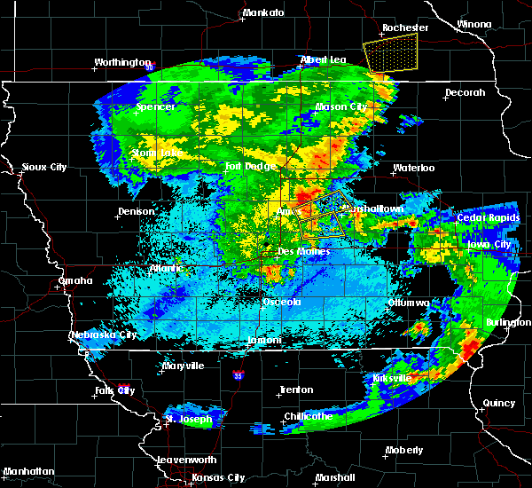 At 343 am cdt, a severe thunderstorm was located 5 miles north of baxter, or 14 miles north of newton, moving east at 45 mph (radar indicated). Hazards include 70 mph wind gusts and penny size hail. Expect considerable tree damage. damage is likely to mobile homes, roofs, and outbuildings. Locations impacted include, state center, baxter, melbourne, collins, rhodes, laurel and haverhill. At 343 am cdt, a severe thunderstorm was located 5 miles north of baxter, or 14 miles north of newton, moving east at 45 mph (radar indicated). Hazards include 70 mph wind gusts and penny size hail. Expect considerable tree damage. damage is likely to mobile homes, roofs, and outbuildings. Locations impacted include, state center, baxter, melbourne, collins, rhodes, laurel and haverhill.
|
| 5/26/2016 3:33 AM CDT |
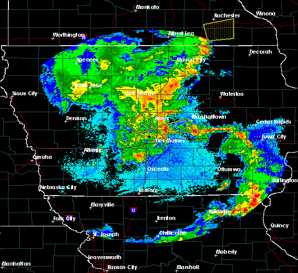 At 333 am cdt, a severe thunderstorm was located 7 miles west of baxter, or 13 miles southeast of nevada, moving east at 45 mph (radar indicated). Hazards include 70 mph wind gusts and penny size hail. Expect considerable tree damage. damage is likely to mobile homes, roofs, and outbuildings. Locations impacted include, state center, baxter, maxwell, melbourne, collins, rhodes, laurel and haverhill. At 333 am cdt, a severe thunderstorm was located 7 miles west of baxter, or 13 miles southeast of nevada, moving east at 45 mph (radar indicated). Hazards include 70 mph wind gusts and penny size hail. Expect considerable tree damage. damage is likely to mobile homes, roofs, and outbuildings. Locations impacted include, state center, baxter, maxwell, melbourne, collins, rhodes, laurel and haverhill.
|
| 5/26/2016 3:21 AM CDT |
 At 321 am cdt, a severe thunderstorm was located 8 miles southeast of huxley, or 10 miles northeast of ankeny, moving east at 45 mph (radar indicated). Hazards include 60 mph wind gusts and penny size hail. Expect damage to roofs. siding. And trees. At 321 am cdt, a severe thunderstorm was located 8 miles southeast of huxley, or 10 miles northeast of ankeny, moving east at 45 mph (radar indicated). Hazards include 60 mph wind gusts and penny size hail. Expect damage to roofs. siding. And trees.
|
| 3/30/2016 8:16 PM CDT |
 At 816 pm cdt, a severe thunderstorm was located 4 miles northeast of bondurant, or 8 miles northeast of altoona, moving east at 30 mph (radar indicated). Hazards include 60 mph wind gusts and quarter size hail. Hail damage to vehicles is expected. expect wind damage to roofs, siding, and trees. this severe storm will be near, colfax around 830 pm cdt. baxter around 845 pm cdt. other locations impacted by this severe thunderstorm include mingo and valeria. This includes interstate 80 between mile markers 155 and 158. At 816 pm cdt, a severe thunderstorm was located 4 miles northeast of bondurant, or 8 miles northeast of altoona, moving east at 30 mph (radar indicated). Hazards include 60 mph wind gusts and quarter size hail. Hail damage to vehicles is expected. expect wind damage to roofs, siding, and trees. this severe storm will be near, colfax around 830 pm cdt. baxter around 845 pm cdt. other locations impacted by this severe thunderstorm include mingo and valeria. This includes interstate 80 between mile markers 155 and 158.
|
| 3/30/2016 8:00 PM CDT |
 At 800 pm cdt, a severe thunderstorm was located near ankeny, moving east at 35 mph (trained weather spotters). Hazards include 60 mph wind gusts and quarter size hail. Hail damage to vehicles is expected. expect wind damage to roofs, siding, and trees. this severe thunderstorm will be near, altoona, prairie meadows and adventureland amusement park around 805 pm cdt. bondurant around 810 pm cdt. mitchellville around 820 pm cdt. colfax around 830 pm cdt. other locations impacted by this severe thunderstorm include weh-weh-neh-kee state park, margo frankel woods state park, prairie city krohn airport, mingo, ankeny regional airport, valeria, elkhart and alleman. this includes the following highways, interstate 35 between mile markers 87 and 98. interstate 80 between mile markers 134 and 160. Interstate 235 between mile markers 13 and 14. At 800 pm cdt, a severe thunderstorm was located near ankeny, moving east at 35 mph (trained weather spotters). Hazards include 60 mph wind gusts and quarter size hail. Hail damage to vehicles is expected. expect wind damage to roofs, siding, and trees. this severe thunderstorm will be near, altoona, prairie meadows and adventureland amusement park around 805 pm cdt. bondurant around 810 pm cdt. mitchellville around 820 pm cdt. colfax around 830 pm cdt. other locations impacted by this severe thunderstorm include weh-weh-neh-kee state park, margo frankel woods state park, prairie city krohn airport, mingo, ankeny regional airport, valeria, elkhart and alleman. this includes the following highways, interstate 35 between mile markers 87 and 98. interstate 80 between mile markers 134 and 160. Interstate 235 between mile markers 13 and 14.
|
| 11/11/2015 4:19 PM CST |
 At 419 pm cst, severe thunderstorms were located along a line extending from 4 miles southwest of big wall lake to 11 miles east of roland to 8 miles south of marshalltown, moving northeast at 45 mph (radar indicated). Hazards include 60 mph wind gusts. Expect damage to roofs. siding and trees. locations impacted include, newton, webster city, iowa falls, state center, roland, jewell junction, baxter, colo, hubbard, melbourne, alden, kellogg, zearing, radcliffe, ellsworth, williams, mccallsburg, rhodes, new providence and blairsburg. this includes the following highways, interstate 35 between mile markers 132 and 150. interstate 80 between mile markers 168 and 174. A tornado watch remains in effect until 600 pm cst for central iowa. At 419 pm cst, severe thunderstorms were located along a line extending from 4 miles southwest of big wall lake to 11 miles east of roland to 8 miles south of marshalltown, moving northeast at 45 mph (radar indicated). Hazards include 60 mph wind gusts. Expect damage to roofs. siding and trees. locations impacted include, newton, webster city, iowa falls, state center, roland, jewell junction, baxter, colo, hubbard, melbourne, alden, kellogg, zearing, radcliffe, ellsworth, williams, mccallsburg, rhodes, new providence and blairsburg. this includes the following highways, interstate 35 between mile markers 132 and 150. interstate 80 between mile markers 168 and 174. A tornado watch remains in effect until 600 pm cst for central iowa.
|
| 11/11/2015 3:52 PM CST |
 At 351 pm cst, severe thunderstorms were located along a line extending from 9 miles south of webster city to 5 miles south of nevada to 5 miles west of newton, moving northeast at 60 mph (radar indicated). Hazards include 60 mph wind gusts. Expect damage to roofs. Siding and trees. At 351 pm cst, severe thunderstorms were located along a line extending from 9 miles south of webster city to 5 miles south of nevada to 5 miles west of newton, moving northeast at 60 mph (radar indicated). Hazards include 60 mph wind gusts. Expect damage to roofs. Siding and trees.
|
| 11/11/2015 3:44 PM CST |
 At 344 pm cst, a severe thunderstorm capable of producing a tornado was located over prairie city, or 11 miles southwest of newton, moving northeast at 50 mph (radar indicated rotation). Hazards include tornado. Flying debris will be dangerous to those caught without shelter. mobile homes will be damaged or destroyed. damage to roofs, windows and vehicles will occur. tree damage is likely. this dangerous storm will be near, newton around 355 pm cst. baxter around 400 pm cst. other locations impacted by this tornadic thunderstorm include prairie city krohn airport. This includes interstate 80 between mile markers 153 and 162. At 344 pm cst, a severe thunderstorm capable of producing a tornado was located over prairie city, or 11 miles southwest of newton, moving northeast at 50 mph (radar indicated rotation). Hazards include tornado. Flying debris will be dangerous to those caught without shelter. mobile homes will be damaged or destroyed. damage to roofs, windows and vehicles will occur. tree damage is likely. this dangerous storm will be near, newton around 355 pm cst. baxter around 400 pm cst. other locations impacted by this tornadic thunderstorm include prairie city krohn airport. This includes interstate 80 between mile markers 153 and 162.
|
| 9/19/2013 4:39 PM CDT | Quarter sized hail reported 0.4 miles SSW of Baxter, IA, 60 mph wind gust. |
| 1/1/0001 12:00 AM | Storm damage reported in jasper county IA, 0.4 miles SSW of Baxter, IA |
| 1/1/0001 12:00 AM | Tennis Ball sized hail reported 2.9 miles SW of Baxter, IA |
| 1/1/0001 12:00 AM | Hen Egg sized hail reported 2.5 miles SW of Baxter, IA, largest stone measured 2.25 inches in diameter |
| 1/1/0001 12:00 AM | Half Dollar sized hail reported 2.5 miles SW of Baxter, IA |
| 1/1/0001 12:00 AM | Quarter sized hail reported 0.4 miles SSW of Baxter, IA, an amateur radio operator reports up to quarter sized hail falling in baxter. |
| 1/1/0001 12:00 AM | Quarter sized hail reported 0.4 miles SSW of Baxter, IA |
Hail Maps for Baxter, IA

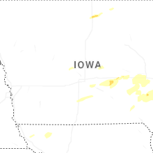


Connect with Interactive Hail Maps