

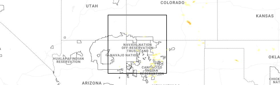
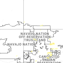
Hail Map for Bayfield, CO
The Bayfield, CO area has had 7 reports of on-the-ground hail by trained spotters, and has been under severe weather warnings 3 times during the past 12 months. Doppler radar has detected hail at or near Bayfield, CO on 6 occasions, including 1 occasion during the past year.
| Name: | Bayfield, CO |
| Where Located: | 48.4 miles NE of Farmington, NM |
| Map: | Google Map for Bayfield, CO |
| Population: | 2333 |
| Housing Units: | 966 |
| More Info: | Search Google for Bayfield, CO |
5
The Top Recent Hail Date for Bayfield, CO is Friday, June 26, 2026 (2nd out of 6)
Hail and Wind Damage Spotted near Bayfield, CO
| Date / Time | Report Details |
|---|---|
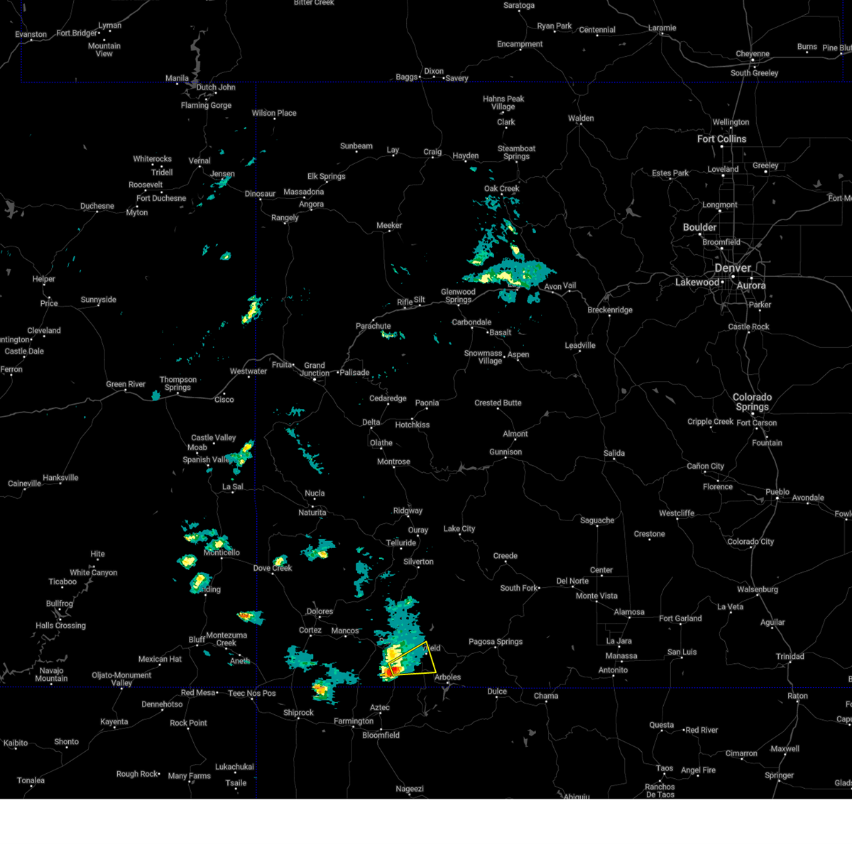
| 9/11/2025 4:21 PM MDT | The storm which prompted the warning has weakened below severe limits, and no longer poses an immediate threat to life or property. therefore, the warning will be allowed to expire. however, small hail and heavy rain are still possible with this thunderstorm. |
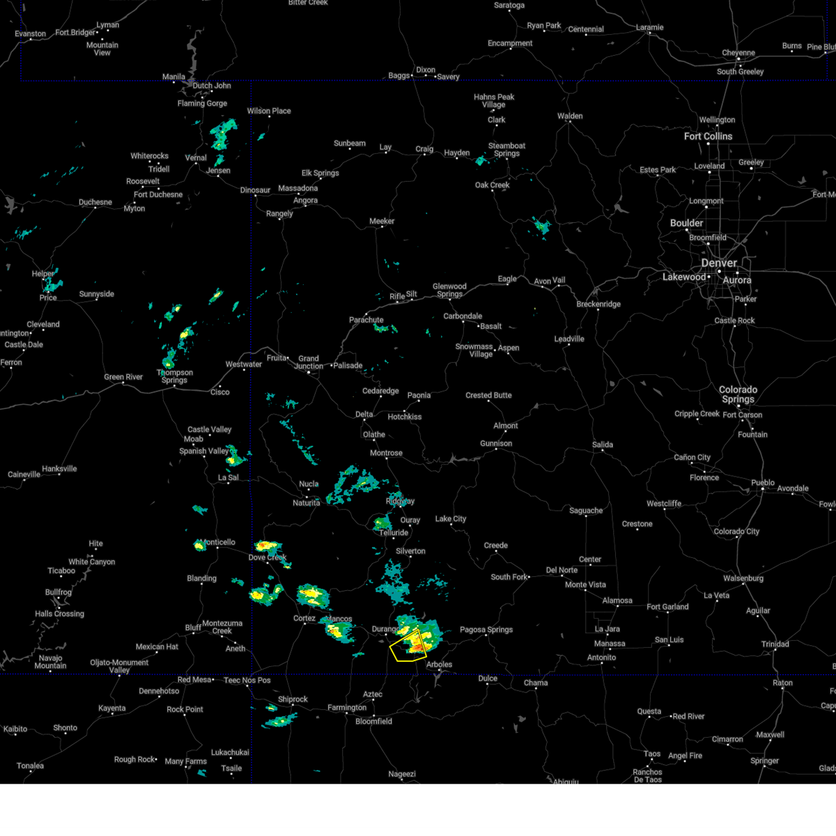
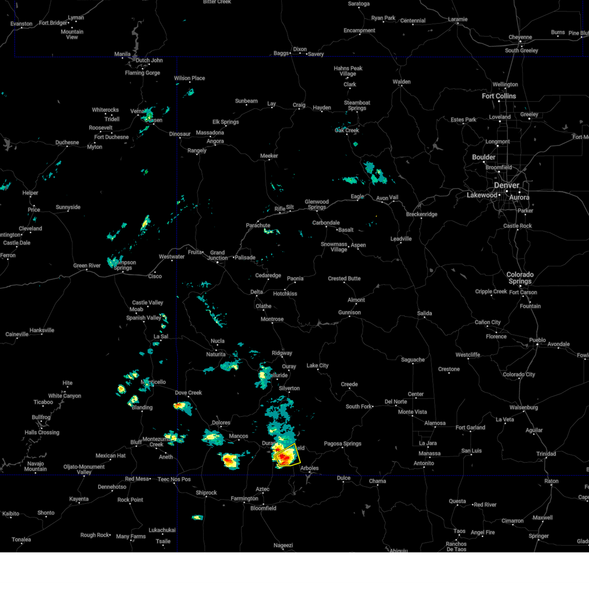
| 9/11/2025 3:58 PM MDT | At 357 pm mdt, a severe thunderstorm was located 7 miles west of bayfield, or 8 miles east of durango, moving northeast at 30 mph (radar indicated. local storm spotters also reported quarter sized hail near the airport turnoff along highway 550). Hazards include 60 mph wind gusts and quarter size hail. Hail damage to vehicles is expected. expect wind damage to roofs, siding, and trees. Locations impacted include, durango, bayfield, vallecito, and falfa. |
| 9/11/2025 3:48 PM MDT | Svrgjt the national weather service in grand junction has issued a * severe thunderstorm warning for, southeastern la plata county in southwestern colorado, * until 430 pm mdt. * at 347 pm mdt, a severe thunderstorm was located near durango, moving northeast at 30 mph (radar indicated). Hazards include 60 mph wind gusts and quarter size hail. Hail damage to vehicles is expected. Expect wind damage to roofs, siding, and trees. |
| 9/16/2024 7:30 PM MDT |
 The storm which prompted the warning has weakened below severe limits, and no longer poses an immediate threat to life or property. therefore, the warning has been allowed to expire. The storm which prompted the warning has weakened below severe limits, and no longer poses an immediate threat to life or property. therefore, the warning has been allowed to expire.
|
| 9/16/2024 7:13 PM MDT |
 At 712 pm mdt, a severe thunderstorm was located near ignacio, or 11 miles southeast of durango, moving northeast at 30 mph (radar indicated). Hazards include 60 mph wind gusts and quarter size hail. Hail damage to vehicles is expected. expect wind damage to roofs, siding, and trees. Locations impacted include, bayfield, ignacio, falfa, and oxford. At 712 pm mdt, a severe thunderstorm was located near ignacio, or 11 miles southeast of durango, moving northeast at 30 mph (radar indicated). Hazards include 60 mph wind gusts and quarter size hail. Hail damage to vehicles is expected. expect wind damage to roofs, siding, and trees. Locations impacted include, bayfield, ignacio, falfa, and oxford.
|
| 9/16/2024 7:02 PM MDT |
 Svrgjt the national weather service in grand junction has issued a * severe thunderstorm warning for, southeastern la plata county in southwestern colorado, * until 730 pm mdt. * at 702 pm mdt, a severe thunderstorm was located 8 miles west of ignacio, or 10 miles southeast of durango, moving northeast at 30 mph (radar indicated). Hazards include quarter size hail. damage to vehicles is expected Svrgjt the national weather service in grand junction has issued a * severe thunderstorm warning for, southeastern la plata county in southwestern colorado, * until 730 pm mdt. * at 702 pm mdt, a severe thunderstorm was located 8 miles west of ignacio, or 10 miles southeast of durango, moving northeast at 30 mph (radar indicated). Hazards include quarter size hail. damage to vehicles is expected
|
| 6/19/2022 3:44 PM MDT |
 At 343 pm mdt, a severe thunderstorm was located near ignacio, or 15 miles southeast of durango, moving east at 25 mph (radar indicated). Hazards include quarter size hail. Damage to vehicles is expected. locations impacted include, bayfield, ignacio, falfa and oxford. this includes the following highways, u. s. highway 160 in colorado between mile markers 92 and 111. colorado 151 between mile markers 1 and 5. colorado 172 between mile markers 8 and 21. hail threat, radar indicated max hail size, 1. 00 in wind threat, radar indicated max wind gust, <50 mph. At 343 pm mdt, a severe thunderstorm was located near ignacio, or 15 miles southeast of durango, moving east at 25 mph (radar indicated). Hazards include quarter size hail. Damage to vehicles is expected. locations impacted include, bayfield, ignacio, falfa and oxford. this includes the following highways, u. s. highway 160 in colorado between mile markers 92 and 111. colorado 151 between mile markers 1 and 5. colorado 172 between mile markers 8 and 21. hail threat, radar indicated max hail size, 1. 00 in wind threat, radar indicated max wind gust, <50 mph.
|
| 6/19/2022 3:23 PM MDT |
 At 323 pm mdt, a severe thunderstorm was located 8 miles west of ignacio, or 10 miles southeast of durango, moving east at 25 mph (radar indicated). Hazards include 60 mph wind gusts and quarter size hail. Hail damage to vehicles is expected. Expect wind damage to roofs, siding, and trees. At 323 pm mdt, a severe thunderstorm was located 8 miles west of ignacio, or 10 miles southeast of durango, moving east at 25 mph (radar indicated). Hazards include 60 mph wind gusts and quarter size hail. Hail damage to vehicles is expected. Expect wind damage to roofs, siding, and trees.
|
| 10/19/2015 8:51 PM MDT |
 The severe thunderstorm warning for southeastern la plata and western archuleta counties will expire at 900 pm mdt, the storm which prompted the warning has weakened below severe limits, and no longer poses an immediate threat to life or property. therefore the warning will be allowed to expire. The severe thunderstorm warning for southeastern la plata and western archuleta counties will expire at 900 pm mdt, the storm which prompted the warning has weakened below severe limits, and no longer poses an immediate threat to life or property. therefore the warning will be allowed to expire.
|
| 10/19/2015 8:19 PM MDT |
 At 817 pm mdt, doppler radar indicated a severe thunderstorm capable of producing quarter size hail. this storm was located over southwestern colorado, 11 miles east of ignacio, or 20 miles northeast of navajo dam, moving north at 25 mph. locations impacted include, bayfield, ignacio, lonetree, allison, tiffany, arboles and chimney rock. At 817 pm mdt, doppler radar indicated a severe thunderstorm capable of producing quarter size hail. this storm was located over southwestern colorado, 11 miles east of ignacio, or 20 miles northeast of navajo dam, moving north at 25 mph. locations impacted include, bayfield, ignacio, lonetree, allison, tiffany, arboles and chimney rock.
|
| 10/19/2015 8:03 PM MDT |
 At 802 pm mdt, doppler radar indicated a severe thunderstorm capable of producing quarter size hail. this storm was located 11 miles northeast of navajo lake state park, or 14 miles northeast of navajo dam, and moving north at 25 mph. At 802 pm mdt, doppler radar indicated a severe thunderstorm capable of producing quarter size hail. this storm was located 11 miles northeast of navajo lake state park, or 14 miles northeast of navajo dam, and moving north at 25 mph.
|
| 10/19/2015 4:58 PM MDT | The severe thunderstorm warning for southeastern la plata and northwestern archuleta counties will expire at 500 pm mdt, the storm which prompted the warning has weakened below severe limits and exited the warned area. therefore the warning will be allowed to expire. |
| 10/19/2015 4:35 PM MDT |
 At 434 pm mdt, doppler radar indicated a severe thunderstorm capable of producing quarter size hail. this storm was located 16 miles west of pagosa springs, or 30 miles east of durango, moving northeast at 30 mph. locations impacted include, bayfield, ignacio and oxford. At 434 pm mdt, doppler radar indicated a severe thunderstorm capable of producing quarter size hail. this storm was located 16 miles west of pagosa springs, or 30 miles east of durango, moving northeast at 30 mph. locations impacted include, bayfield, ignacio and oxford.
|
| 10/19/2015 4:13 PM MDT |
 At 411 pm mdt, doppler radar indicated a severe thunderstorm capable of producing quarter size hail. this storm was located near bayfield, or 20 miles east of durango, and moving northeast at 30 mph. this storm produce 1 inch diameter hail when it moved through south durango at about 330 pm mdt. At 411 pm mdt, doppler radar indicated a severe thunderstorm capable of producing quarter size hail. this storm was located near bayfield, or 20 miles east of durango, and moving northeast at 30 mph. this storm produce 1 inch diameter hail when it moved through south durango at about 330 pm mdt.
|
| 9/23/2015 6:36 PM MDT | Half Dollar sized hail reported 10.1 miles S of Bayfield, CO |
| 9/22/2013 3:10 PM MDT | Half Dollar sized hail reported 5.9 miles W of Bayfield, CO |
| 9/22/2013 2:53 PM MDT | Quarter sized hail reported 0.6 miles SW of Bayfield, CO, very heavy rain with up to quarter size hail |
| 9/22/2013 2:50 PM MDT | Ping Pong Ball sized hail reported 0.4 miles WNW of Bayfield, CO, ping pong ball size hail. time estimated based on radar. standing water of 4 inches in backyard and 6 inches in the front yard. |
| 9/18/2013 6:17 PM MDT | Quarter sized hail reported 7.4 miles S of Bayfield, CO, cocorahs spotter reported 1 inch hail and ground covered by an inch of hail. |
| 9/18/2013 6:10 PM MDT | Quarter sized hail reported 6.8 miles S of Bayfield, CO |
| 9/18/2013 6:00 PM MDT | Half Dollar sized hail reported 7.4 miles S of Bayfield, CO, hail depth between durango and vallecito averaged 3 inches deep... up to 12 inches deep. |
Hail Maps for Bayfield, CO


Connect with Interactive Hail Maps