

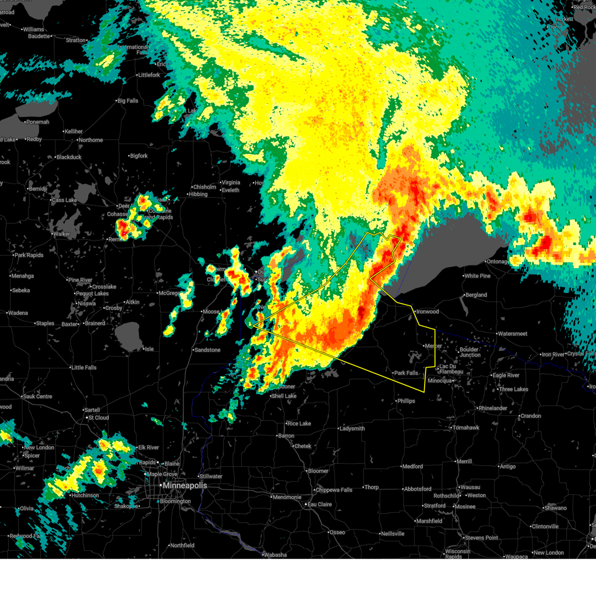
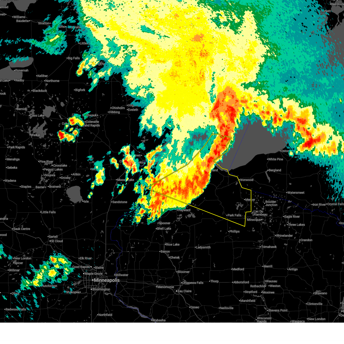
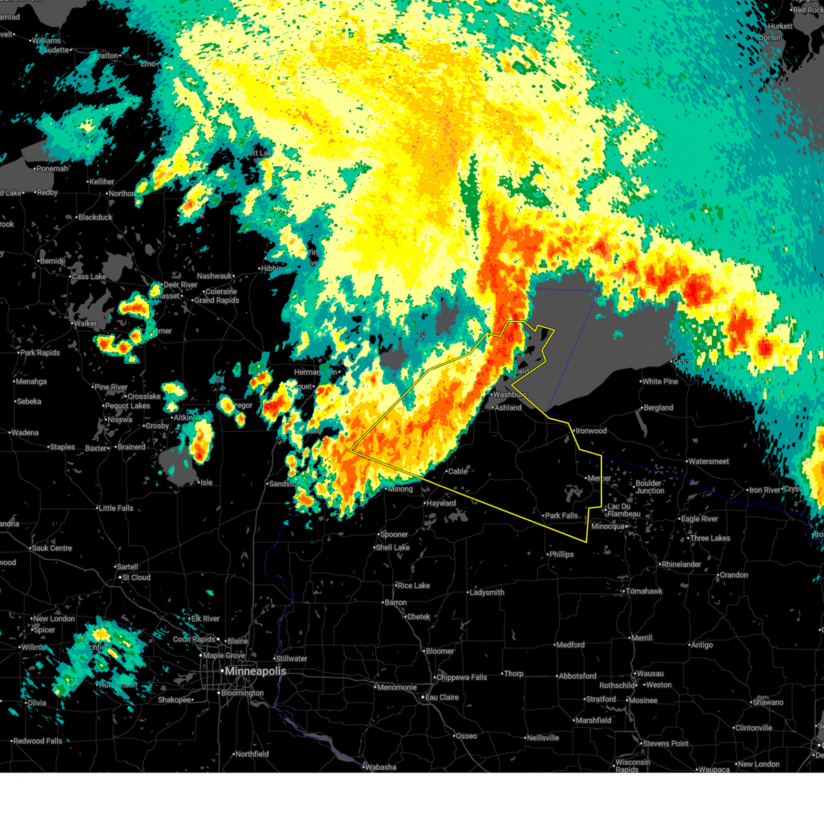
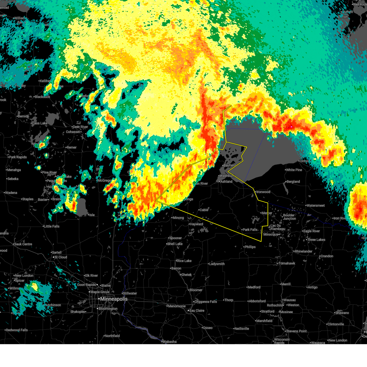
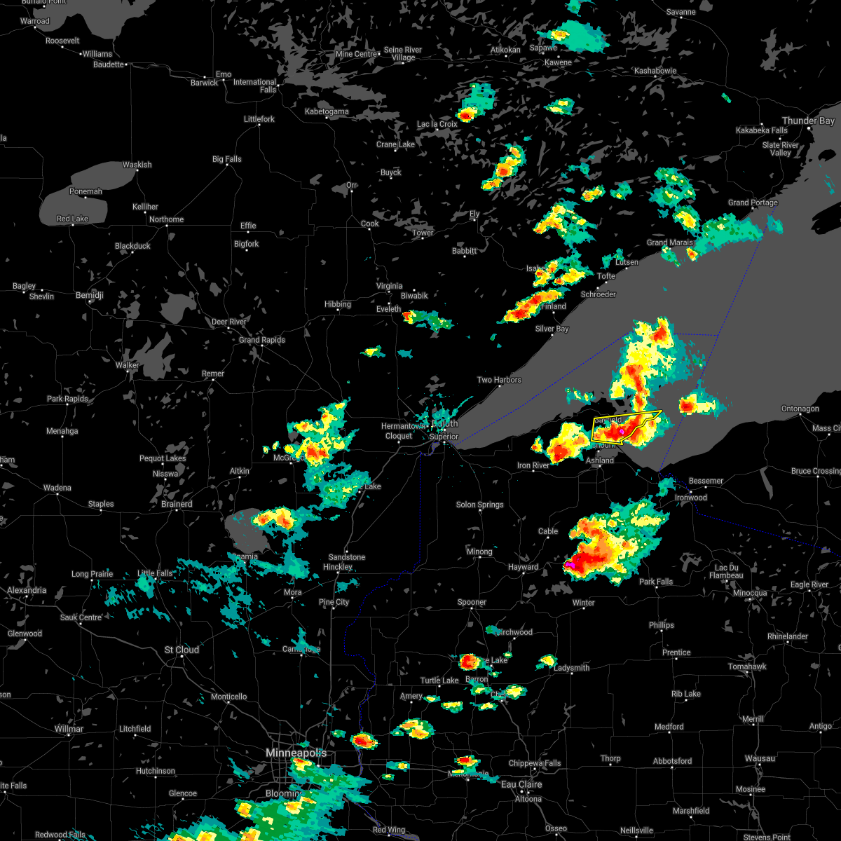
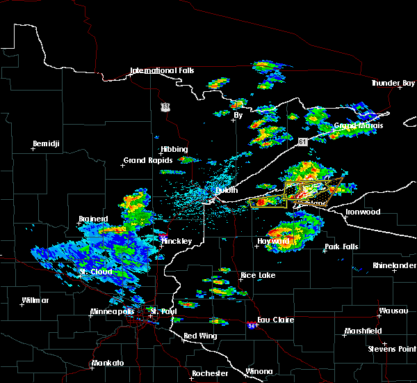
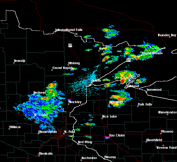
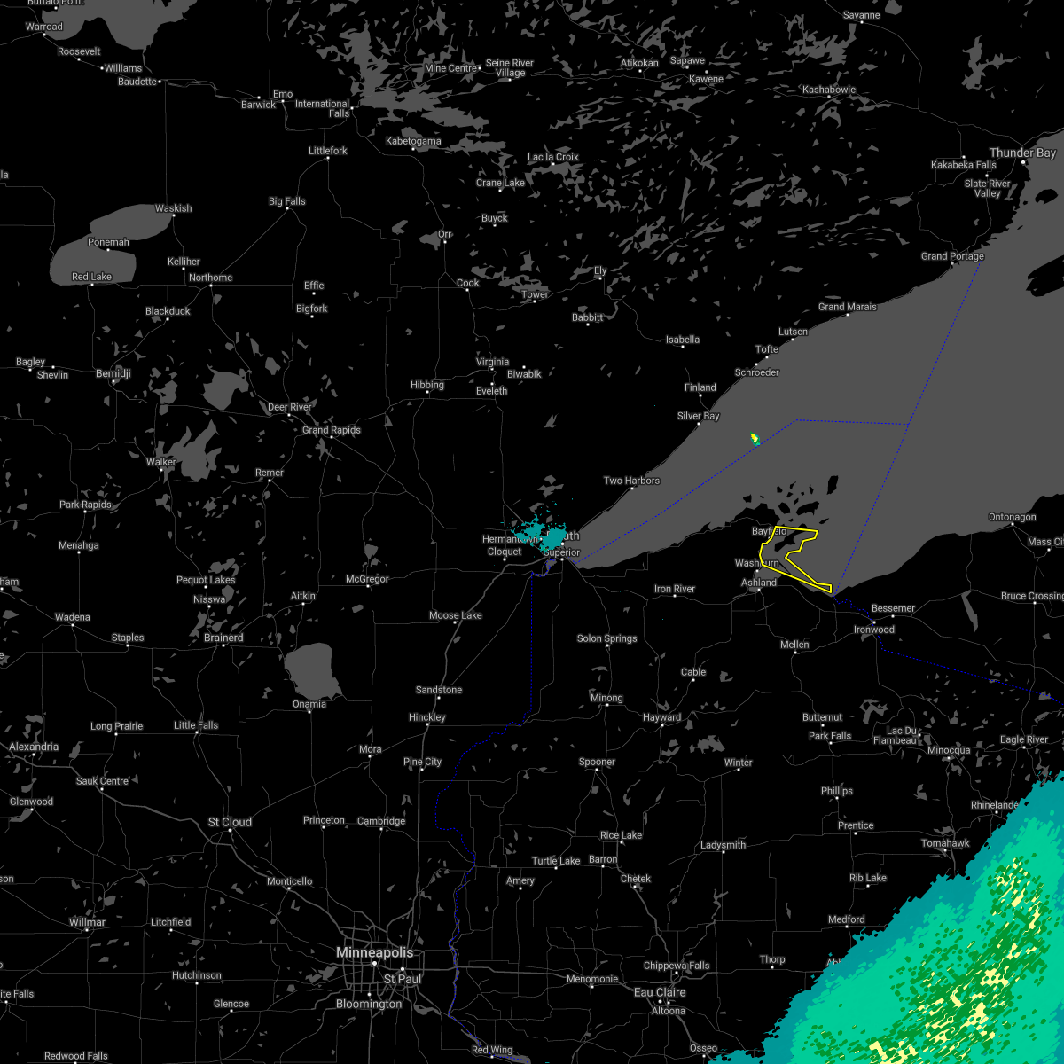
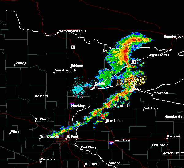
Hail Map for Bayfield, WI
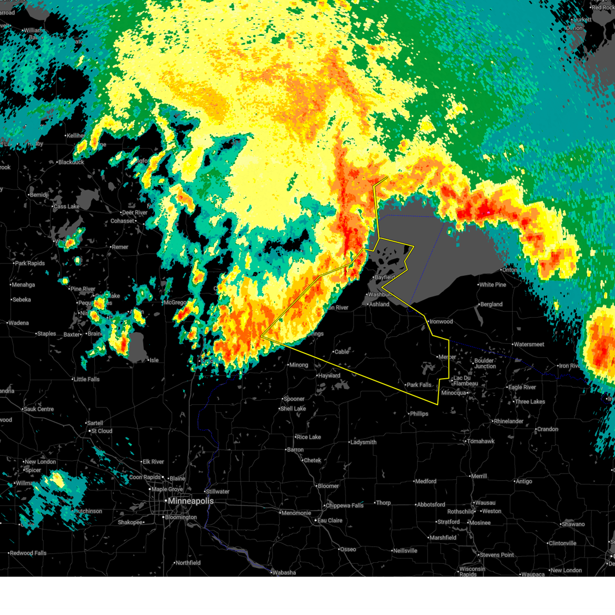
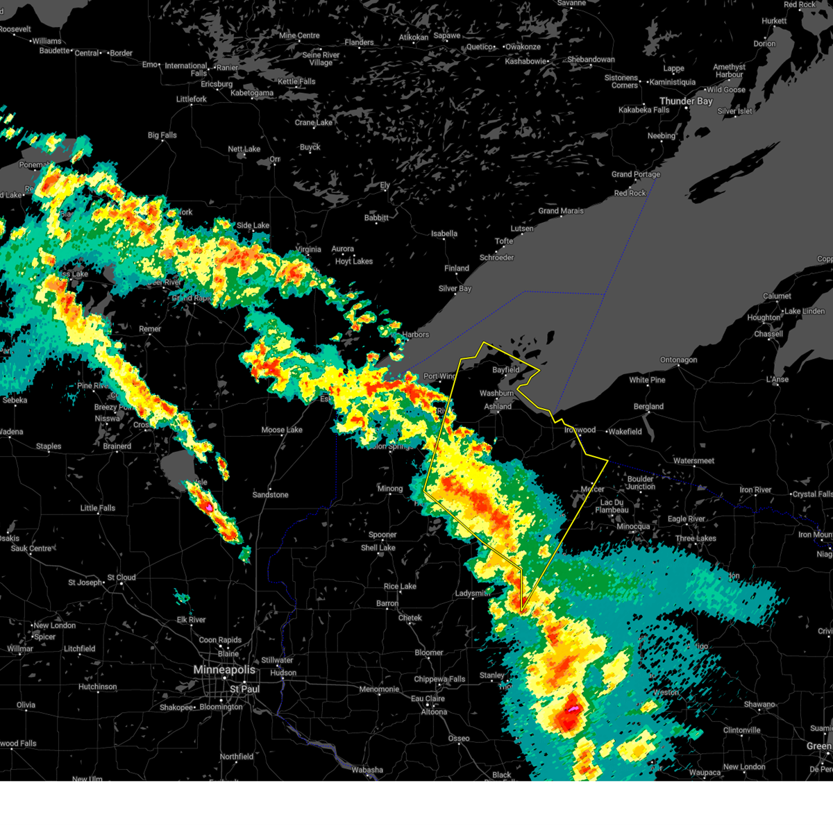
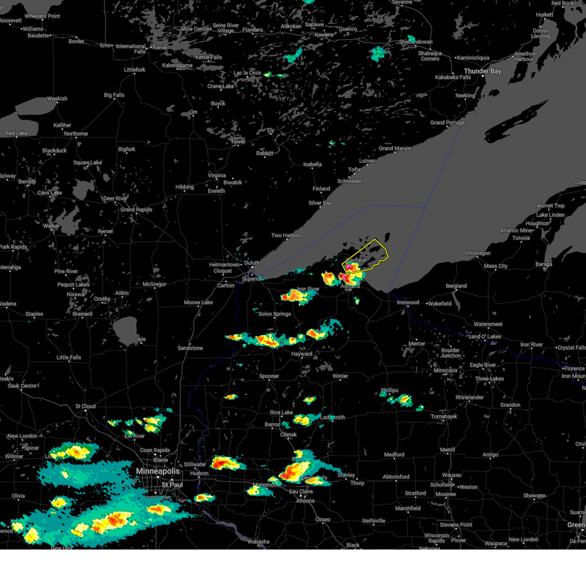
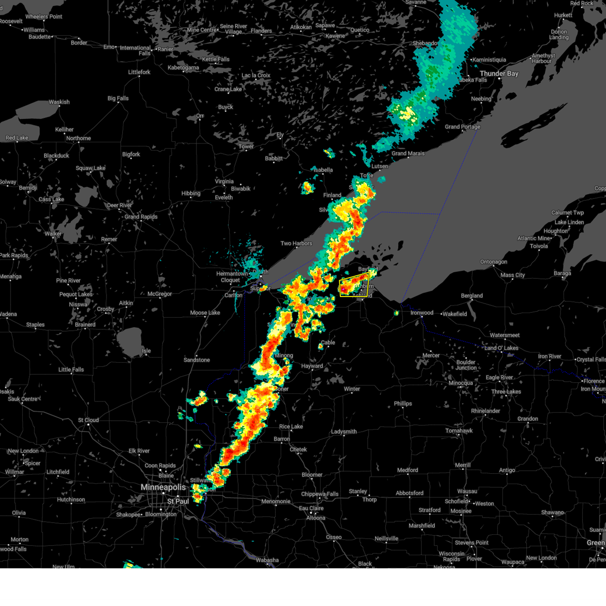
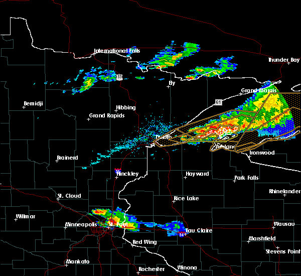
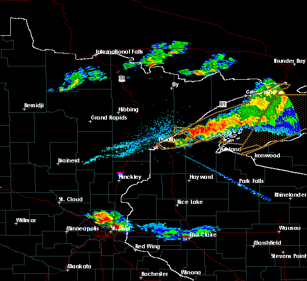
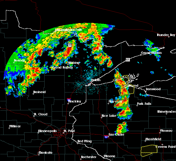
The Bayfield, WI area has had 4 reports of on-the-ground hail by trained spotters, and has been under severe weather warnings 12 times during the past 12 months. Doppler radar has detected hail at or near Bayfield, WI on 16 occasions.
| Name: | Bayfield, WI |
| Where Located: | 60.9 miles E of Duluth, MN |
| Map: | Google Map for Bayfield, WI |
| Population: | 487 |
| Housing Units: | 482 |
| More Info: | Search Google for Bayfield, WI |
3
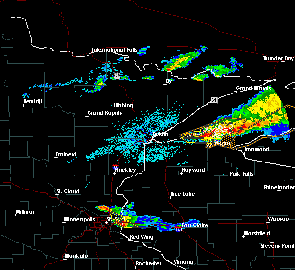
The Top Recent Hail Date for Bayfield, WI is Friday, July 14, 2023 (6th out of 16)

Hail and Wind Damage Spotted near Bayfield, WI
| Date / Time | Report Details |
|---|---|
| 6/21/2025 4:17 AM CDT |
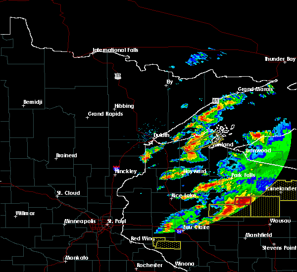
 At 417 am cdt, severe thunderstorms were located along a line extending from 22 miles southeast of grand marais to 18 miles east of big bay state park to near namekagon, moving east at 65 mph (radar indicated). Hazards include 60 mph wind gusts. Expect damage to roofs, siding, and trees. Locations impacted include, park falls, turtle flambeau flowage, ashland, washburn, hurley, mercer, sanborn, iron river, lake nebagamon, fifield, cable, barnes, mellen, barksdale, brule, solon springs, bayfield, drummond, marengo, and butternut. At 417 am cdt, severe thunderstorms were located along a line extending from 22 miles southeast of grand marais to 18 miles east of big bay state park to near namekagon, moving east at 65 mph (radar indicated). Hazards include 60 mph wind gusts. Expect damage to roofs, siding, and trees. Locations impacted include, park falls, turtle flambeau flowage, ashland, washburn, hurley, mercer, sanborn, iron river, lake nebagamon, fifield, cable, barnes, mellen, barksdale, brule, solon springs, bayfield, drummond, marengo, and butternut.
|
| 6/21/2025 4:16 AM CDT |
 At 416 am cdt, severe thunderstorms were located along a line extending from 25 miles south of grand marais to 14 miles east of big bay state park to 7 miles northeast of round lake, moving east at 65 mph (radar indicated). Hazards include 60 mph wind gusts. Expect damage to roofs, siding, and trees. these severe storms will be near, mellen, saxon, gurney, copper falls state park, and clam lake around 420 am cdt. hurley and upson around 430 am cdt. gile and glidden around 435 am cdt. butternut around 440 am cdt. turtle flambeau flowage around 450 am cdt. mercer around 455 am cdt. Other locations impacted by these severe thunderstorms include ironwood island, bad river reservation, basswood island, pike lake, saxon harbor, stockton island, gile flowage, cedar, pence, and cat island. At 416 am cdt, severe thunderstorms were located along a line extending from 25 miles south of grand marais to 14 miles east of big bay state park to 7 miles northeast of round lake, moving east at 65 mph (radar indicated). Hazards include 60 mph wind gusts. Expect damage to roofs, siding, and trees. these severe storms will be near, mellen, saxon, gurney, copper falls state park, and clam lake around 420 am cdt. hurley and upson around 430 am cdt. gile and glidden around 435 am cdt. butternut around 440 am cdt. turtle flambeau flowage around 450 am cdt. mercer around 455 am cdt. Other locations impacted by these severe thunderstorms include ironwood island, bad river reservation, basswood island, pike lake, saxon harbor, stockton island, gile flowage, cedar, pence, and cat island.
|
| 6/21/2025 4:04 AM CDT |
 At 404 am cdt, severe thunderstorms were located along a line extending from 17 miles south of grand marais to 7 miles east of big bay state park to near cable, moving east at 65 mph (radar indicated). Hazards include 60 mph wind gusts. Expect damage to roofs, siding, and trees. Locations impacted include, marengo, namekagon lake, odanah, namekagon, mellen, gurney, copper falls state park, clam lake, saxon, upson, hurley, gile, glidden, turtle flambeau flowage and mercer. At 404 am cdt, severe thunderstorms were located along a line extending from 17 miles south of grand marais to 7 miles east of big bay state park to near cable, moving east at 65 mph (radar indicated). Hazards include 60 mph wind gusts. Expect damage to roofs, siding, and trees. Locations impacted include, marengo, namekagon lake, odanah, namekagon, mellen, gurney, copper falls state park, clam lake, saxon, upson, hurley, gile, glidden, turtle flambeau flowage and mercer.
|
| 6/21/2025 4:02 AM CDT |
 At 402 am cdt, severe thunderstorms were located along a line extending from 15 miles southeast of cascade river state park to near madeline island to near seeley, moving east at 65 mph (radar indicated). Hazards include 60 mph wind gusts. Expect damage to roofs, siding, and trees. these severe storms will be near, ashland, sanborn, cable, namekagon lake, seeley, odanah, and madeline island around 405 am cdt. marengo and namekagon around 410 am cdt. mellen, saxon, gurney, copper falls state park, and clam lake around 420 am cdt. upson around 430 am cdt. hurley, gile, and glidden around 435 am cdt. turtle flambeau flowage around 450 am cdt. mercer around 455 am cdt. Other locations impacted by these severe thunderstorms include ironwood island, gile flowage, cedar, pence, bennett, high bridge, north twin island, blueberry, meyers beach, and apostle islands national lake shore. At 402 am cdt, severe thunderstorms were located along a line extending from 15 miles southeast of cascade river state park to near madeline island to near seeley, moving east at 65 mph (radar indicated). Hazards include 60 mph wind gusts. Expect damage to roofs, siding, and trees. these severe storms will be near, ashland, sanborn, cable, namekagon lake, seeley, odanah, and madeline island around 405 am cdt. marengo and namekagon around 410 am cdt. mellen, saxon, gurney, copper falls state park, and clam lake around 420 am cdt. upson around 430 am cdt. hurley, gile, and glidden around 435 am cdt. turtle flambeau flowage around 450 am cdt. mercer around 455 am cdt. Other locations impacted by these severe thunderstorms include ironwood island, gile flowage, cedar, pence, bennett, high bridge, north twin island, blueberry, meyers beach, and apostle islands national lake shore.
|
| 6/21/2025 3:45 AM CDT | Wisconsin mesonet site reported a 78 mph wind gus in bayfield county WI, 9.4 miles ESE of Bayfield, WI |
| 6/21/2025 3:42 AM CDT |
 Svrdlh the national weather service in duluth mn has issued a * severe thunderstorm warning for, bayfield county in northwestern wisconsin, southeastern douglas county in northwestern wisconsin, iron county in northwestern wisconsin, ashland county in northwestern wisconsin, northern price county in north central wisconsin, northeastern sawyer county in northwestern wisconsin, * until 445 am cdt. * at 341 am cdt, severe thunderstorms were located along a line extending from near temperance river state park to near cornucopia to near gordon, moving east at 65 mph (radar indicated). Hazards include 60 mph wind gusts. Expect damage to roofs, siding, and trees. severe thunderstorms will be near, iron river, barnes, bayfield, gordon, sand bay, sand island, devils island, and york island around 345 am cdt. washburn, la pointe, oak island, red cliff, ino, town of delta, and madeline island around 350 am cdt. ashland, barksdale, drummond, benoit, and big bay state park around 355 am cdt. Other locations in the path of these severe thunderstorms include sanborn, cable, odanah, marengo, namekagon lake, namekagon, mellen, saxon, gurney, copper falls state park, hurley and upson. Svrdlh the national weather service in duluth mn has issued a * severe thunderstorm warning for, bayfield county in northwestern wisconsin, southeastern douglas county in northwestern wisconsin, iron county in northwestern wisconsin, ashland county in northwestern wisconsin, northern price county in north central wisconsin, northeastern sawyer county in northwestern wisconsin, * until 445 am cdt. * at 341 am cdt, severe thunderstorms were located along a line extending from near temperance river state park to near cornucopia to near gordon, moving east at 65 mph (radar indicated). Hazards include 60 mph wind gusts. Expect damage to roofs, siding, and trees. severe thunderstorms will be near, iron river, barnes, bayfield, gordon, sand bay, sand island, devils island, and york island around 345 am cdt. washburn, la pointe, oak island, red cliff, ino, town of delta, and madeline island around 350 am cdt. ashland, barksdale, drummond, benoit, and big bay state park around 355 am cdt. Other locations in the path of these severe thunderstorms include sanborn, cable, odanah, marengo, namekagon lake, namekagon, mellen, saxon, gurney, copper falls state park, hurley and upson.
|
| 6/21/2025 3:41 AM CDT |
 Svrdlh the national weather service in duluth mn has issued a * severe thunderstorm warning for, bayfield county in northwestern wisconsin, southeastern douglas county in northwestern wisconsin, iron county in northwestern wisconsin, ashland county in northwestern wisconsin, northern price county in north central wisconsin, northeastern sawyer county in northwestern wisconsin, * until 445 am cdt. * at 341 am cdt, severe thunderstorms were located along a line extending from near temperance river state park to near cornucopia to near gordon, moving east at 65 mph (radar indicated). Hazards include 60 mph wind gusts. Expect damage to roofs, siding, and trees. severe thunderstorms will be near, iron river, barnes, bayfield, gordon, sand bay, sand island, devils island, and york island around 345 am cdt. washburn, la pointe, oak island, red cliff, ino, town of delta, and madeline island around 350 am cdt. ashland, barksdale, drummond, benoit, and big bay state park around 355 am cdt. Other locations in the path of these severe thunderstorms include sanborn, cable, odanah, marengo, namekagon lake, namekagon, mellen, saxon, gurney, copper falls state park, hurley and upson. Svrdlh the national weather service in duluth mn has issued a * severe thunderstorm warning for, bayfield county in northwestern wisconsin, southeastern douglas county in northwestern wisconsin, iron county in northwestern wisconsin, ashland county in northwestern wisconsin, northern price county in north central wisconsin, northeastern sawyer county in northwestern wisconsin, * until 445 am cdt. * at 341 am cdt, severe thunderstorms were located along a line extending from near temperance river state park to near cornucopia to near gordon, moving east at 65 mph (radar indicated). Hazards include 60 mph wind gusts. Expect damage to roofs, siding, and trees. severe thunderstorms will be near, iron river, barnes, bayfield, gordon, sand bay, sand island, devils island, and york island around 345 am cdt. washburn, la pointe, oak island, red cliff, ino, town of delta, and madeline island around 350 am cdt. ashland, barksdale, drummond, benoit, and big bay state park around 355 am cdt. Other locations in the path of these severe thunderstorms include sanborn, cable, odanah, marengo, namekagon lake, namekagon, mellen, saxon, gurney, copper falls state park, hurley and upson.
|
| 5/15/2025 6:10 PM CDT | The storms which prompted the warning have weakened below severe limits, and no longer pose an immediate threat to life or property. therefore, the warning will be allowed to expire. a tornado watch remains in effect until 800 pm cdt for north central and northwestern wisconsin. |
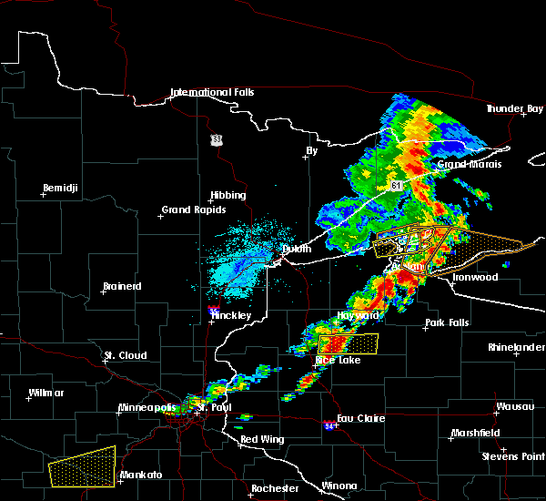
| 5/15/2025 5:54 PM CDT | At 554 pm cdt, severe thunderstorms were located along a line extending from near iron river to 8 miles south of sanborn to 9 miles southwest of glidden, moving northeast at 70 mph (radar indicated). Hazards include 70 mph wind gusts and nickel size hail. Expect considerable tree damage. damage is likely to mobile homes, roofs, and outbuildings. Locations impacted include, park falls, turtle flambeau flowage, ashland, washburn, hurley, phillips, mercer, sanborn, fifield, cable, mellen, barksdale, bayfield, drummond, marengo, butternut, saxon, la pointe, gurney, and big bay state park. |
| 5/15/2025 5:44 PM CDT | At 543 pm cdt, severe thunderstorms were located along a line extending from near barnes to near namekagon to 9 miles northeast of winter, moving north at 55 mph (radar indicated). Hazards include 70 mph wind gusts and nickel size hail. Expect considerable tree damage. damage is likely to mobile homes, roofs, and outbuildings. Locations impacted include, park falls, turtle flambeau flowage, chippewa flowage east, chippewa flowage west, ashland, washburn, hurley, phillips, mercer, sanborn, round lake, fifield, cable, mellen, barksdale, bayfield, drummond, marengo, butternut, and saxon. |
| 5/15/2025 5:44 PM CDT |
 the severe thunderstorm warning has been cancelled and is no longer in effect the severe thunderstorm warning has been cancelled and is no longer in effect
|
| 5/15/2025 5:28 PM CDT |
 At 528 pm cdt, severe thunderstorms were located along a line extending from 9 miles south of barnes to 6 miles northeast of winter to 8 miles north of hawkins, moving northeast at 70 mph (radar indicated). Hazards include 70 mph wind gusts and nickel size hail. Expect considerable tree damage. damage is likely to mobile homes, roofs, and outbuildings. Locations impacted include, cable, barnes, drummond, namekagon lake, namekagon, clam lake, park falls, fifield, butternut, town of delta, glidden, sanborn, mellen, marengo, benoit, ino, ashland, copper falls state park, turtle flambeau flowage, washburn, barksdale, upson, saxon, gurney, odanah, hurley, bayfield, la pointe, gile, madeline island, red cliff, sand bay, sand island, big bay state park and apostle island sea caves. At 528 pm cdt, severe thunderstorms were located along a line extending from 9 miles south of barnes to 6 miles northeast of winter to 8 miles north of hawkins, moving northeast at 70 mph (radar indicated). Hazards include 70 mph wind gusts and nickel size hail. Expect considerable tree damage. damage is likely to mobile homes, roofs, and outbuildings. Locations impacted include, cable, barnes, drummond, namekagon lake, namekagon, clam lake, park falls, fifield, butternut, town of delta, glidden, sanborn, mellen, marengo, benoit, ino, ashland, copper falls state park, turtle flambeau flowage, washburn, barksdale, upson, saxon, gurney, odanah, hurley, bayfield, la pointe, gile, madeline island, red cliff, sand bay, sand island, big bay state park and apostle island sea caves.
|
| 5/15/2025 5:08 PM CDT | Svrdlh the national weather service in duluth mn has issued a * severe thunderstorm warning for, bayfield county in northwestern wisconsin, southeastern douglas county in northwestern wisconsin, iron county in northwestern wisconsin, northern washburn county in northwestern wisconsin, ashland county in northwestern wisconsin, northwestern price county in north central wisconsin, sawyer county in northwestern wisconsin, * until 615 pm cdt. * at 508 pm cdt, severe thunderstorms were located along a line extending from 7 miles southeast of wascott to near winter to near hawkins, moving northeast at 70 mph (radar indicated). Hazards include 70 mph wind gusts and nickel size hail. Expect considerable tree damage. damage is likely to mobile homes, roofs, and outbuildings. severe thunderstorms will be near, chippewa flowage east, round lake, cable, and seeley around 515 pm cdt. namekagon lake around 520 pm cdt. drummond, namekagon, and clam lake around 525 pm cdt. Other locations in the path of these severe thunderstorms include park falls, town of delta, fifield, butternut, benoit, ino, glidden, sanborn, mellen, marengo, copper falls state park, turtle flambeau flowage, ashland, barksdale, washburn, gurney, upson and odanah. |
| 9/5/2023 6:10 PM CDT | Corrects previous non-tstm wnd gst report from 13 ne sand bay. mesonet station disw3 devils island. marine thunderstorm wind gust from peak gust measuremen in ashland county WI, 19 miles SSW of Bayfield, WI |
| 8/16/2023 7:43 PM CDT |
 At 743 pm cdt, severe thunderstorms were located along a line extending from 6 miles east of madeline island, to near odanah, to benoit, moving east at 60 mph (radar indicated). Hazards include 60 mph wind gusts. Expect damage to roofs, siding, and trees. Locations impacted include, ashland, gurney and saxon. At 743 pm cdt, severe thunderstorms were located along a line extending from 6 miles east of madeline island, to near odanah, to benoit, moving east at 60 mph (radar indicated). Hazards include 60 mph wind gusts. Expect damage to roofs, siding, and trees. Locations impacted include, ashland, gurney and saxon.
|
| 8/16/2023 7:42 PM CDT | Numerous trees 8 to 12 inches in diameter down and powerline down. time estimated from rada in ashland county WI, 4.8 miles WNW of Bayfield, WI |
| 8/16/2023 7:25 PM CDT |
 At 725 pm cdt, severe thunderstorms were located along a line extending from near washburn, to near benoit, to near town of delta, moving east at 70 mph (radar indicated). Hazards include 60 mph wind gusts. Expect damage to roofs, siding, and trees. severe thunderstorms will be near, washburn, barksdale, bayfield, la pointe and red cliff around 730 pm cdt. ashland around 735 pm cdt. odanah around 740 pm cdt. sanborn and marengo around 745 pm cdt. Other locations in the path of these severe thunderstorms include gurney, saxon and hurley. At 725 pm cdt, severe thunderstorms were located along a line extending from near washburn, to near benoit, to near town of delta, moving east at 70 mph (radar indicated). Hazards include 60 mph wind gusts. Expect damage to roofs, siding, and trees. severe thunderstorms will be near, washburn, barksdale, bayfield, la pointe and red cliff around 730 pm cdt. ashland around 735 pm cdt. odanah around 740 pm cdt. sanborn and marengo around 745 pm cdt. Other locations in the path of these severe thunderstorms include gurney, saxon and hurley.
|
| 8/16/2023 7:15 PM CDT |
 At 715 pm cdt, a severe thunderstorm was located near ino, moving east at 50 mph (radar indicated). Hazards include 60 mph wind gusts. Expect damage to roofs, siding, and trees. Locations impacted include, benoit, washburn, barksdale, ashland and odanah. At 715 pm cdt, a severe thunderstorm was located near ino, moving east at 50 mph (radar indicated). Hazards include 60 mph wind gusts. Expect damage to roofs, siding, and trees. Locations impacted include, benoit, washburn, barksdale, ashland and odanah.
|
| 8/16/2023 7:01 PM CDT |
 At 701 pm cdt, a severe thunderstorm was located near iron river, or 31 miles east of superior, moving east at 55 mph (radar indicated). Hazards include 60 mph wind gusts. Expect damage to roofs, siding, and trees. this severe storm will be near, iron river around 705 pm cdt. town of delta around 710 pm cdt. Other locations in the path of this severe thunderstorm include ino, benoit, barksdale, ashland and odanah. At 701 pm cdt, a severe thunderstorm was located near iron river, or 31 miles east of superior, moving east at 55 mph (radar indicated). Hazards include 60 mph wind gusts. Expect damage to roofs, siding, and trees. this severe storm will be near, iron river around 705 pm cdt. town of delta around 710 pm cdt. Other locations in the path of this severe thunderstorm include ino, benoit, barksdale, ashland and odanah.
|
| 8/16/2023 6:52 PM CDT |
 At 652 pm cdt, a severe thunderstorm was located near maple, or 23 miles southeast of superior, moving east at 55 mph (radar indicated). Hazards include 60 mph wind gusts. Expect damage to roofs, siding, and trees. this severe thunderstorm will be near, brule and oulu around 700 pm cdt. iron river around 705 pm cdt. Other locations in the path of this severe thunderstorm include ino, town of delta, benoit, ashland and barksdale. At 652 pm cdt, a severe thunderstorm was located near maple, or 23 miles southeast of superior, moving east at 55 mph (radar indicated). Hazards include 60 mph wind gusts. Expect damage to roofs, siding, and trees. this severe thunderstorm will be near, brule and oulu around 700 pm cdt. iron river around 705 pm cdt. Other locations in the path of this severe thunderstorm include ino, town of delta, benoit, ashland and barksdale.
|
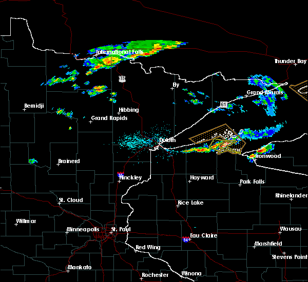
| 7/14/2023 4:25 PM CDT |
 At 424 pm cdt, a severe thunderstorm was located over bayfield, moving northeast at 25 mph (radar indicated). Hazards include 60 mph wind gusts and quarter size hail. Hail damage to vehicles is expected. expect wind damage to roofs, siding, and trees. this severe thunderstorm will be near, bayfield around 430 pm cdt. la pointe around 435 pm cdt. red cliff around 440 pm cdt. other locations in the path of this severe thunderstorm include madeline island. hail threat, radar indicated max hail size, 1. 00 in wind threat, radar indicated max wind gust, 60 mph. At 424 pm cdt, a severe thunderstorm was located over bayfield, moving northeast at 25 mph (radar indicated). Hazards include 60 mph wind gusts and quarter size hail. Hail damage to vehicles is expected. expect wind damage to roofs, siding, and trees. this severe thunderstorm will be near, bayfield around 430 pm cdt. la pointe around 435 pm cdt. red cliff around 440 pm cdt. other locations in the path of this severe thunderstorm include madeline island. hail threat, radar indicated max hail size, 1. 00 in wind threat, radar indicated max wind gust, 60 mph.
|
| 7/3/2023 4:20 PM CDT | Report of a power pole down that caught fire due to strong thunderstorm winds between bayfield and red cliff. time estimated by rada in bayfield county WI, 0.7 miles SSW of Bayfield, WI |
| 7/3/2023 4:12 PM CDT |
 At 412 pm cdt, a severe thunderstorm was located 8 miles northwest of barksdale, moving east at 10 mph (radar indicated). Hazards include 60 mph wind gusts and quarter size hail. Hail damage to vehicles is expected. Expect wind damage to roofs, siding, and trees. At 412 pm cdt, a severe thunderstorm was located 8 miles northwest of barksdale, moving east at 10 mph (radar indicated). Hazards include 60 mph wind gusts and quarter size hail. Hail damage to vehicles is expected. Expect wind damage to roofs, siding, and trees.
|
| 5/18/2022 5:23 PM CDT |
 At 523 pm cdt, severe thunderstorms were located along a line extending from 6 miles southeast of cornucopia, to near barksdale, to benoit, moving east at 50 mph (radar indicated). Hazards include 70 mph wind gusts. Expect considerable tree damage. damage is likely to mobile homes, roofs, and outbuildings. severe thunderstorms will be near, ashland and washburn around 530 pm cdt. sanborn, bayfield, la pointe and red cliff around 535 pm cdt. marengo and odanah around 540 pm cdt. gurney around 555 pm cdt. saxon and upson around 600 pm cdt. Other locations impacted by these severe thunderstorms include big bay state park, kimball, bad river reservation, gile flowage, cedar, franks field, pence, high bridge, mason and iron belt. At 523 pm cdt, severe thunderstorms were located along a line extending from 6 miles southeast of cornucopia, to near barksdale, to benoit, moving east at 50 mph (radar indicated). Hazards include 70 mph wind gusts. Expect considerable tree damage. damage is likely to mobile homes, roofs, and outbuildings. severe thunderstorms will be near, ashland and washburn around 530 pm cdt. sanborn, bayfield, la pointe and red cliff around 535 pm cdt. marengo and odanah around 540 pm cdt. gurney around 555 pm cdt. saxon and upson around 600 pm cdt. Other locations impacted by these severe thunderstorms include big bay state park, kimball, bad river reservation, gile flowage, cedar, franks field, pence, high bridge, mason and iron belt.
|
| 9/20/2021 6:04 PM CDT |
 At 603 pm cdt, a severe thunderstorm capable of producing a tornado was located over barksdale, or 4 miles south of washburn, moving northeast at 50 mph (radar indicated rotation). Hazards include tornado. Flying debris will be dangerous to those caught without shelter. mobile homes will be damaged or destroyed. damage to roofs, windows, and vehicles will occur. tree damage is likely. Locations impacted include, la pointe, odanah and madeline island. At 603 pm cdt, a severe thunderstorm capable of producing a tornado was located over barksdale, or 4 miles south of washburn, moving northeast at 50 mph (radar indicated rotation). Hazards include tornado. Flying debris will be dangerous to those caught without shelter. mobile homes will be damaged or destroyed. damage to roofs, windows, and vehicles will occur. tree damage is likely. Locations impacted include, la pointe, odanah and madeline island.
|
| 9/20/2021 5:52 PM CDT |
 At 551 pm cdt, a severe thunderstorm capable of producing a tornado was located near ino, moving northeast at 50 mph (radar indicated rotation). Hazards include tornado. Flying debris will be dangerous to those caught without shelter. mobile homes will be damaged or destroyed. damage to roofs, windows, and vehicles will occur. tree damage is likely. this dangerous storm will be near, barksdale around 600 pm cdt. ashland around 605 pm cdt. washburn around 610 pm cdt. Other locations in the path of this tornadic thunderstorm include bayfield, la pointe and odanah. At 551 pm cdt, a severe thunderstorm capable of producing a tornado was located near ino, moving northeast at 50 mph (radar indicated rotation). Hazards include tornado. Flying debris will be dangerous to those caught without shelter. mobile homes will be damaged or destroyed. damage to roofs, windows, and vehicles will occur. tree damage is likely. this dangerous storm will be near, barksdale around 600 pm cdt. ashland around 605 pm cdt. washburn around 610 pm cdt. Other locations in the path of this tornadic thunderstorm include bayfield, la pointe and odanah.
|
| 6/24/2021 3:10 AM CDT |
 The severe thunderstorm warning for northeastern bayfield and northwestern ashland counties will expire at 315 am cdt, the storm which prompted the warning has moved out of the area. therefore, the warning will be allowed to expire. The severe thunderstorm warning for northeastern bayfield and northwestern ashland counties will expire at 315 am cdt, the storm which prompted the warning has moved out of the area. therefore, the warning will be allowed to expire.
|
| 6/24/2021 2:53 AM CDT |
 At 253 am cdt, a severe thunderstorm was located over madeline island, or 35 miles northwest of ironwood, moving east at 40 mph (radar indicated). Hazards include 60 mph wind gusts and half dollar size hail. Hail damage to vehicles is expected. expect wind damage to roofs, siding, and trees. This severe thunderstorm will remain over mainly rural areas of northeastern bayfield and northwestern ashland counties, including the following locations, big bay state park, red cliff reservation, apostle islands national lake shore and bad river reservation. At 253 am cdt, a severe thunderstorm was located over madeline island, or 35 miles northwest of ironwood, moving east at 40 mph (radar indicated). Hazards include 60 mph wind gusts and half dollar size hail. Hail damage to vehicles is expected. expect wind damage to roofs, siding, and trees. This severe thunderstorm will remain over mainly rural areas of northeastern bayfield and northwestern ashland counties, including the following locations, big bay state park, red cliff reservation, apostle islands national lake shore and bad river reservation.
|
| 6/24/2021 2:43 AM CDT |
 At 242 am cdt, a severe thunderstorm was located near bayfield, moving east at 40 mph (radar indicated). Hazards include 60 mph wind gusts and half dollar size hail. Hail damage to vehicles is expected. expect wind damage to roofs, siding, and trees. this severe thunderstorm will be near, la pointe around 250 am cdt. Madeline island around 300 am cdt. At 242 am cdt, a severe thunderstorm was located near bayfield, moving east at 40 mph (radar indicated). Hazards include 60 mph wind gusts and half dollar size hail. Hail damage to vehicles is expected. expect wind damage to roofs, siding, and trees. this severe thunderstorm will be near, la pointe around 250 am cdt. Madeline island around 300 am cdt.
|
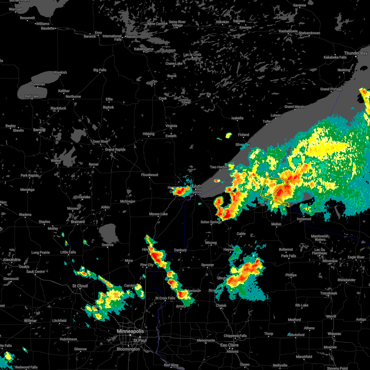
| 7/18/2020 9:50 PM CDT |
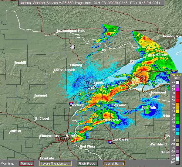 At 949 pm cdt, severe thunderstorms were located along a line extending from 29 miles northwest of silver city, to 10 miles east of madeline island, moving east at 55 mph (radar indicated). Hazards include 70 mph wind gusts and ping pong ball size hail. People and animals outdoors will be injured. expect hail damage to roofs, siding, windows, and vehicles. expect considerable tree damage. wind damage is also likely to mobile homes, roofs, and outbuildings. Locations impacted include, bayfield, la pointe, madeline island, sand bay, red cliff, big bay state park, stockton island, apostle islands national lake shore, red cliff reservation, and outer island. At 949 pm cdt, severe thunderstorms were located along a line extending from 29 miles northwest of silver city, to 10 miles east of madeline island, moving east at 55 mph (radar indicated). Hazards include 70 mph wind gusts and ping pong ball size hail. People and animals outdoors will be injured. expect hail damage to roofs, siding, windows, and vehicles. expect considerable tree damage. wind damage is also likely to mobile homes, roofs, and outbuildings. Locations impacted include, bayfield, la pointe, madeline island, sand bay, red cliff, big bay state park, stockton island, apostle islands national lake shore, red cliff reservation, and outer island.
|
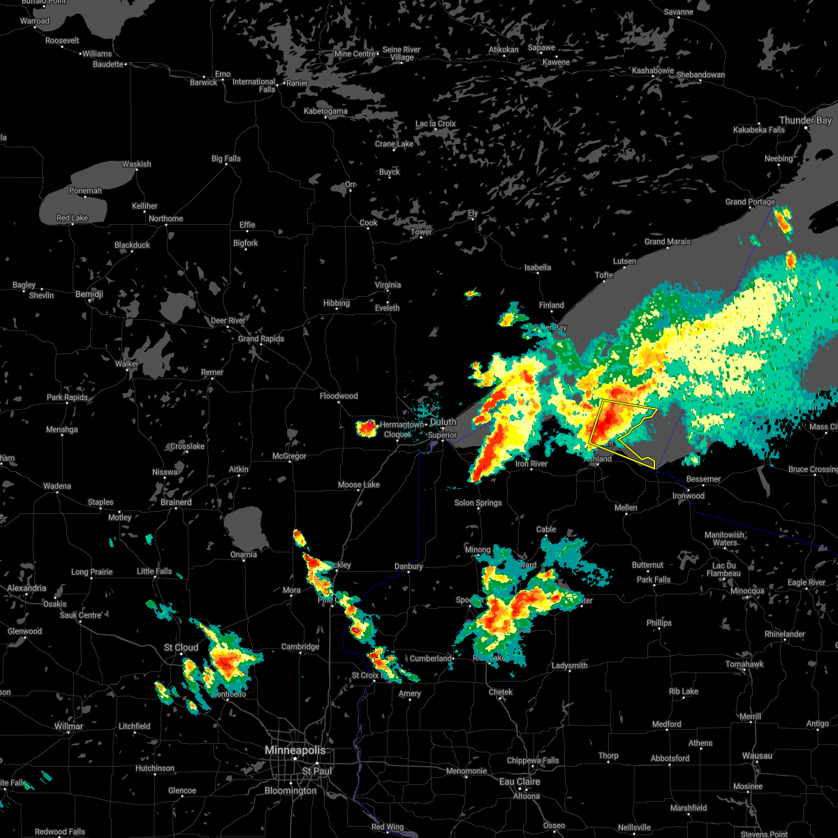
| 7/18/2020 9:29 PM CDT |
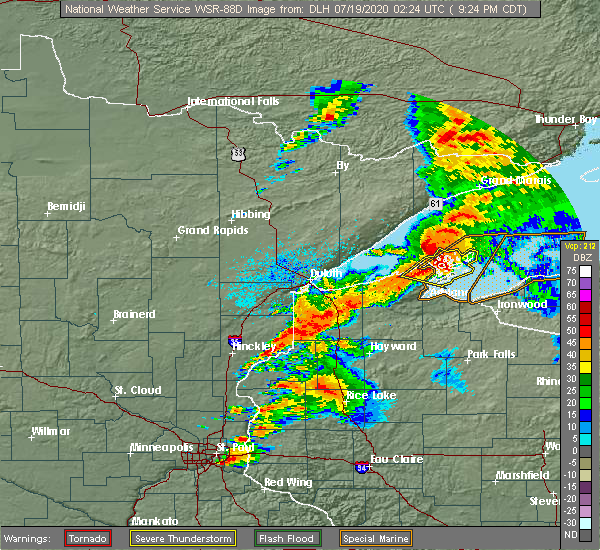 At 929 pm cdt, severe thunderstorms were located along a line extending from 20 miles northeast of madeline island, to bayfield, moving east at 55 mph (radar indicated). Hazards include 70 mph wind gusts and ping pong ball size hail. People and animals outdoors will be injured. expect hail damage to roofs, siding, windows, and vehicles. expect considerable tree damage. Wind damage is also likely to mobile homes, roofs, and outbuildings. At 929 pm cdt, severe thunderstorms were located along a line extending from 20 miles northeast of madeline island, to bayfield, moving east at 55 mph (radar indicated). Hazards include 70 mph wind gusts and ping pong ball size hail. People and animals outdoors will be injured. expect hail damage to roofs, siding, windows, and vehicles. expect considerable tree damage. Wind damage is also likely to mobile homes, roofs, and outbuildings.
|
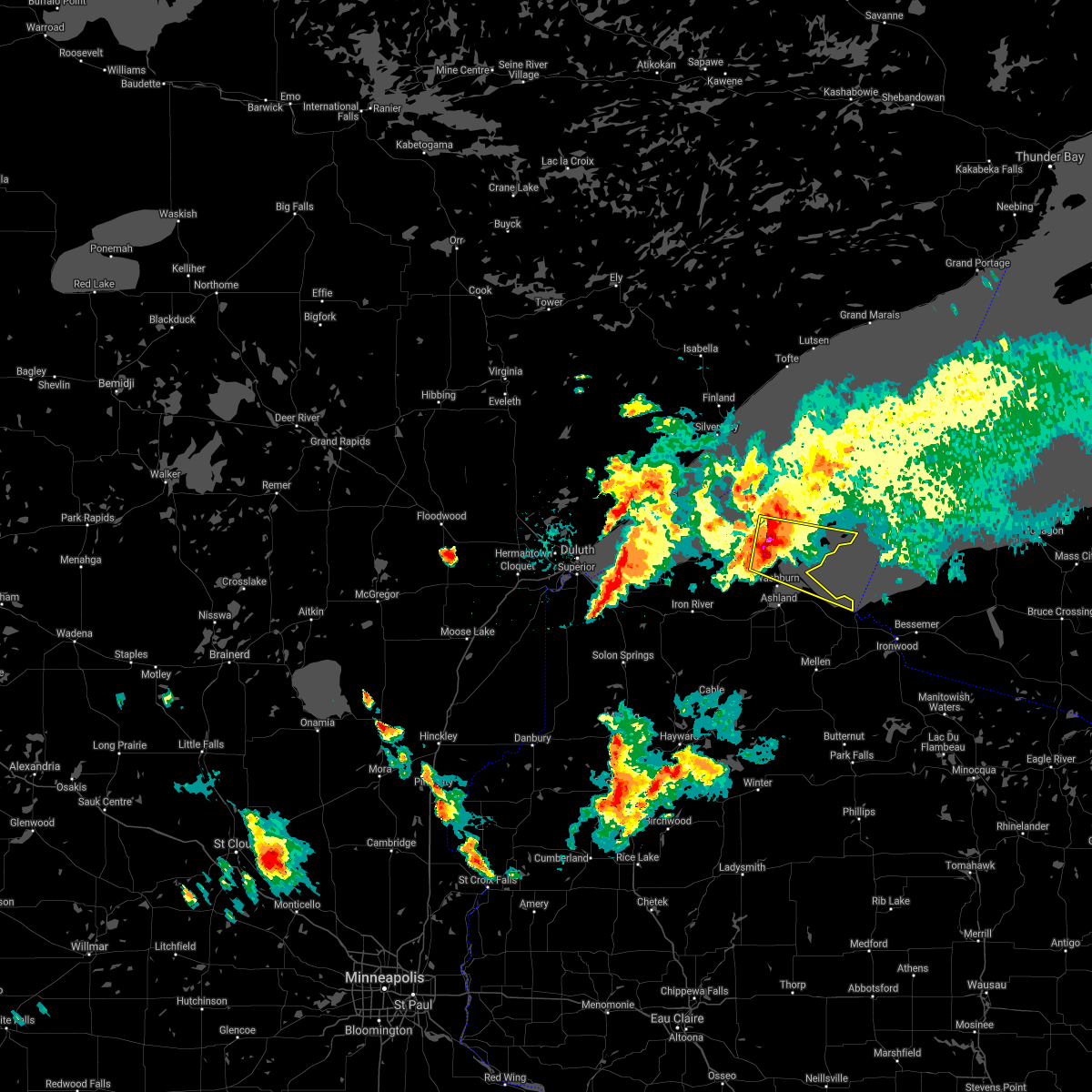
| 7/18/2020 9:19 PM CDT |
 At 919 pm cdt, severe thunderstorms were located along a line extending from 13 miles northeast of sand bay, to 7 miles northwest of washburn, moving east at 50 mph (radar indicated). Hazards include 70 mph wind gusts and half dollar size hail. Hail damage to vehicles is expected. expect considerable tree damage. wind damage is also likely to mobile homes, roofs, and outbuildings. these severe storms will be near, red cliff around 935 pm cdt. Other locations impacted by these severe thunderstorms include big bay state park, stockton island, apostle islands national lake shore, red cliff reservation, outer island and bad river reservation. At 919 pm cdt, severe thunderstorms were located along a line extending from 13 miles northeast of sand bay, to 7 miles northwest of washburn, moving east at 50 mph (radar indicated). Hazards include 70 mph wind gusts and half dollar size hail. Hail damage to vehicles is expected. expect considerable tree damage. wind damage is also likely to mobile homes, roofs, and outbuildings. these severe storms will be near, red cliff around 935 pm cdt. Other locations impacted by these severe thunderstorms include big bay state park, stockton island, apostle islands national lake shore, red cliff reservation, outer island and bad river reservation.
|
| 7/18/2020 9:07 PM CDT |
 At 906 pm cdt, severe thunderstorms were located along a line extending from 8 miles north of sand island, to near herbster, moving east at 50 mph (radar indicated). Hazards include 60 mph wind gusts and half dollar size hail. Hail damage to vehicles is expected. expect wind damage to roofs, siding, and trees. severe thunderstorms will be near, cornucopia around 915 pm cdt. barksdale around 925 pm cdt. ashland, washburn, bayfield and la pointe around 930 pm cdt. Other locations impacted by these severe thunderstorms include big bay state park, stockton island, apostle islands national lake shore, red cliff reservation, outer island and bad river reservation. At 906 pm cdt, severe thunderstorms were located along a line extending from 8 miles north of sand island, to near herbster, moving east at 50 mph (radar indicated). Hazards include 60 mph wind gusts and half dollar size hail. Hail damage to vehicles is expected. expect wind damage to roofs, siding, and trees. severe thunderstorms will be near, cornucopia around 915 pm cdt. barksdale around 925 pm cdt. ashland, washburn, bayfield and la pointe around 930 pm cdt. Other locations impacted by these severe thunderstorms include big bay state park, stockton island, apostle islands national lake shore, red cliff reservation, outer island and bad river reservation.
|
| 7/8/2020 10:06 PM CDT |
 At 1005 pm cdt, severe thunderstorms were located along a line extending from near port wing, to near barnes, to near minong, moving east at 50 mph (radar indicated). Hazards include 70 mph wind gusts and nickel size hail. Expect considerable tree damage. Damage is likely to mobile homes, roofs, and outbuildings. At 1005 pm cdt, severe thunderstorms were located along a line extending from near port wing, to near barnes, to near minong, moving east at 50 mph (radar indicated). Hazards include 70 mph wind gusts and nickel size hail. Expect considerable tree damage. Damage is likely to mobile homes, roofs, and outbuildings.
|
| 6/21/2020 3:28 PM CDT |
 The severe thunderstorm warning for northeastern bayfield and northwestern ashland counties will expire at 330 pm cdt, the storm which prompted the warning has moved out of the area. therefore, the warning will be allowed to expire. The severe thunderstorm warning for northeastern bayfield and northwestern ashland counties will expire at 330 pm cdt, the storm which prompted the warning has moved out of the area. therefore, the warning will be allowed to expire.
|
| 6/21/2020 3:25 PM CDT | Quarter sized hail reported 3.9 miles NNW of Bayfield, WI, report from mping: quarter (1.00 in.) time of report adjusted based on radar. |
| 6/21/2020 3:11 PM CDT |
 At 310 pm cdt, a severe thunderstorm was located over la pointe, or 39 miles northwest of ironwood, moving east at 25 mph (radar indicated). Hazards include 60 mph wind gusts and half dollar size hail. Hail damage to vehicles is expected. expect wind damage to roofs, siding, and trees. Locations impacted include, bayfield, la pointe, madeline island, red cliff, big bay state park, red cliff reservation, and apostle islands national lake shore. At 310 pm cdt, a severe thunderstorm was located over la pointe, or 39 miles northwest of ironwood, moving east at 25 mph (radar indicated). Hazards include 60 mph wind gusts and half dollar size hail. Hail damage to vehicles is expected. expect wind damage to roofs, siding, and trees. Locations impacted include, bayfield, la pointe, madeline island, red cliff, big bay state park, red cliff reservation, and apostle islands national lake shore.
|
| 6/21/2020 2:54 PM CDT |
 At 253 pm cdt, a severe thunderstorm was located near bayfield, moving east at 55 mph (radar indicated). Hazards include quarter size hail. damage to vehicles is expected At 253 pm cdt, a severe thunderstorm was located near bayfield, moving east at 55 mph (radar indicated). Hazards include quarter size hail. damage to vehicles is expected
|
| 7/26/2019 10:05 PM CDT |
 At 1005 pm cdt, a severe thunderstorm was located near la pointe, or 34 miles northwest of ironwood, moving east at 25 mph (radar indicated). Hazards include 60 mph wind gusts and quarter size hail. Hail damage to vehicles is expected. expect wind damage to roofs, siding, and trees. Locations impacted include, washburn, bayfield, la pointe, madeline island, red cliff, big bay state park, red cliff reservation, apostle islands national lake shore, and bad river reservation. At 1005 pm cdt, a severe thunderstorm was located near la pointe, or 34 miles northwest of ironwood, moving east at 25 mph (radar indicated). Hazards include 60 mph wind gusts and quarter size hail. Hail damage to vehicles is expected. expect wind damage to roofs, siding, and trees. Locations impacted include, washburn, bayfield, la pointe, madeline island, red cliff, big bay state park, red cliff reservation, apostle islands national lake shore, and bad river reservation.
|
| 7/26/2019 9:52 PM CDT |
 At 952 pm cdt, a severe thunderstorm was located near washburn, moving east at 30 mph (radar indicated). Hazards include 60 mph wind gusts and half dollar size hail. Hail damage to vehicles is expected. expect wind damage to roofs, siding, and trees. Locations impacted include, ashland, washburn, barksdale, bayfield, la pointe, madeline island, odanah, red cliff, big bay state park, bad river reservation, stockton island, franks field, new odanah, apostle islands national lake shore, and red cliff reservation. At 952 pm cdt, a severe thunderstorm was located near washburn, moving east at 30 mph (radar indicated). Hazards include 60 mph wind gusts and half dollar size hail. Hail damage to vehicles is expected. expect wind damage to roofs, siding, and trees. Locations impacted include, ashland, washburn, barksdale, bayfield, la pointe, madeline island, odanah, red cliff, big bay state park, bad river reservation, stockton island, franks field, new odanah, apostle islands national lake shore, and red cliff reservation.
|
| 7/26/2019 9:44 PM CDT |
 At 944 pm cdt, a severe thunderstorm was located near washburn, moving east at 25 mph (radar indicated). Hazards include ping pong ball size hail and 60 mph wind gusts. People and animals outdoors will be injured. expect hail damage to roofs, siding, windows, and vehicles. expect wind damage to roofs, siding, and trees. Locations impacted include, ashland, washburn, barksdale, bayfield, marengo, la pointe, madeline island, odanah, red cliff, big bay state park, bad river reservation, stockton island, franks field, high bridge, new odanah, apostle islands national lake shore, outer island, and red cliff reservation. At 944 pm cdt, a severe thunderstorm was located near washburn, moving east at 25 mph (radar indicated). Hazards include ping pong ball size hail and 60 mph wind gusts. People and animals outdoors will be injured. expect hail damage to roofs, siding, windows, and vehicles. expect wind damage to roofs, siding, and trees. Locations impacted include, ashland, washburn, barksdale, bayfield, marengo, la pointe, madeline island, odanah, red cliff, big bay state park, bad river reservation, stockton island, franks field, high bridge, new odanah, apostle islands national lake shore, outer island, and red cliff reservation.
|
| 7/26/2019 9:32 PM CDT |
 At 931 pm cdt, a severe thunderstorm was located 7 miles southeast of cornucopia, moving east at 30 mph (radar indicated). Hazards include 60 mph wind gusts and quarter size hail. Hail damage to vehicles is expected. Expect wind damage to roofs, siding, and trees. At 931 pm cdt, a severe thunderstorm was located 7 miles southeast of cornucopia, moving east at 30 mph (radar indicated). Hazards include 60 mph wind gusts and quarter size hail. Hail damage to vehicles is expected. Expect wind damage to roofs, siding, and trees.
|
| 7/26/2019 9:21 PM CDT |
 At 920 pm cdt, severe thunderstorms were located along a line extending from 15 miles northeast of red cliff, to near bayfield, moving east at 40 mph (at 841 pm cdt a gust of 59 mph was reported at devils island. radar indicated hail up to quarter size). Hazards include 70 mph wind gusts and quarter size hail. Hail damage to vehicles is expected. expect considerable tree damage. wind damage is also likely to mobile homes, roofs, and outbuildings. Locations impacted include, bayfield, port wing, la pointe, sand island, cornucopia, madeline island, bayfield peninsula sea caves, herbster, sand bay, red cliff, big bay state park, stockton island, apostle islands national lake shore, red cliff reservation, and outer island. At 920 pm cdt, severe thunderstorms were located along a line extending from 15 miles northeast of red cliff, to near bayfield, moving east at 40 mph (at 841 pm cdt a gust of 59 mph was reported at devils island. radar indicated hail up to quarter size). Hazards include 70 mph wind gusts and quarter size hail. Hail damage to vehicles is expected. expect considerable tree damage. wind damage is also likely to mobile homes, roofs, and outbuildings. Locations impacted include, bayfield, port wing, la pointe, sand island, cornucopia, madeline island, bayfield peninsula sea caves, herbster, sand bay, red cliff, big bay state park, stockton island, apostle islands national lake shore, red cliff reservation, and outer island.
|
| 7/26/2019 8:55 PM CDT |
 At 854 pm cdt, severe thunderstorms were located along a line extending from 6 miles north of sand island, to cornucopia, moving east at 45 mph (radar indicated). Hazards include 70 mph wind gusts and quarter size hail. Hail damage to vehicles is expected. expect considerable tree damage. wind damage is also likely to mobile homes, roofs, and outbuildings. Locations impacted include, bayfield, port wing, la pointe, sand island, cornucopia, madeline island, bayfield peninsula sea caves, herbster, sand bay, red cliff, big bay state park, stockton island, apostle islands national lake shore, red cliff reservation, and outer island. At 854 pm cdt, severe thunderstorms were located along a line extending from 6 miles north of sand island, to cornucopia, moving east at 45 mph (radar indicated). Hazards include 70 mph wind gusts and quarter size hail. Hail damage to vehicles is expected. expect considerable tree damage. wind damage is also likely to mobile homes, roofs, and outbuildings. Locations impacted include, bayfield, port wing, la pointe, sand island, cornucopia, madeline island, bayfield peninsula sea caves, herbster, sand bay, red cliff, big bay state park, stockton island, apostle islands national lake shore, red cliff reservation, and outer island.
|
| 7/26/2019 8:41 PM CDT | Peak gust from station disw3 - devils island... w in ashland county WI, 19 miles SSW of Bayfield, WI |
| 7/26/2019 8:36 PM CDT |
 At 835 pm cdt, severe thunderstorms were located along a line extending from 11 miles southeast of beaver bay, to near herbster, moving east at 40 mph (radar indicated). Hazards include 60 mph wind gusts and quarter size hail. Hail damage to vehicles is expected. Expect wind damage to roofs, siding, and trees. At 835 pm cdt, severe thunderstorms were located along a line extending from 11 miles southeast of beaver bay, to near herbster, moving east at 40 mph (radar indicated). Hazards include 60 mph wind gusts and quarter size hail. Hail damage to vehicles is expected. Expect wind damage to roofs, siding, and trees.
|
| 9/15/2018 3:40 AM CDT |
 The severe thunderstorm warning for bayfield, east central douglas and northwestern ashland counties will expire at 345 am cdt, the storms which prompted the warning have weakened below severe limits, and no longer pose an immediate threat to life or property. therefore, the warning will be allowed to expire. however gusty winds are still possible with these thunderstorms. The severe thunderstorm warning for bayfield, east central douglas and northwestern ashland counties will expire at 345 am cdt, the storms which prompted the warning have weakened below severe limits, and no longer pose an immediate threat to life or property. therefore, the warning will be allowed to expire. however gusty winds are still possible with these thunderstorms.
|
| 9/15/2018 3:29 AM CDT |
 At 329 am cdt, severe thunderstorms were located along a line extending from 6 miles southeast of cornucopia, to near ino, moving east at 45 mph (radar indicated). Hazards include 70 mph wind gusts and nickel size hail. Expect considerable tree damage. damage is likely to mobile homes, roofs, and outbuildings. Locations impacted include, ashland, washburn, sanborn, iron river, barksdale, brule, bayfield, marengo, la pointe, sand island, madeline island, ino, herbster, cornucopia, benoit, bayfield peninsula sea caves, odanah, sand bay, red cliff, and mason. At 329 am cdt, severe thunderstorms were located along a line extending from 6 miles southeast of cornucopia, to near ino, moving east at 45 mph (radar indicated). Hazards include 70 mph wind gusts and nickel size hail. Expect considerable tree damage. damage is likely to mobile homes, roofs, and outbuildings. Locations impacted include, ashland, washburn, sanborn, iron river, barksdale, brule, bayfield, marengo, la pointe, sand island, madeline island, ino, herbster, cornucopia, benoit, bayfield peninsula sea caves, odanah, sand bay, red cliff, and mason.
|
| 9/15/2018 3:01 AM CDT |
 At 300 am cdt, severe thunderstorms were located along a line extending from near port wing, to brule, moving east at 45 mph (radar indicated). Hazards include 70 mph wind gusts and nickel size hail. Expect considerable tree damage. Damage is likely to mobile homes, roofs, and outbuildings. At 300 am cdt, severe thunderstorms were located along a line extending from near port wing, to brule, moving east at 45 mph (radar indicated). Hazards include 70 mph wind gusts and nickel size hail. Expect considerable tree damage. Damage is likely to mobile homes, roofs, and outbuildings.
|
| 8/31/2018 11:22 PM CDT |
 At 1122 pm cdt, a severe thunderstorm was located 9 miles south of cornucopia, moving east at 50 mph (radar indicated). Hazards include 60 mph wind gusts and penny size hail. Expect damage to roofs, siding, and trees. this severe thunderstorm will be near, barksdale around 1130 pm cdt. washburn around 1135 pm cdt. ashland, bayfield, la pointe and red cliff around 1140 pm cdt. odanah and madeline island around 1145 pm cdt. Other locations impacted by this severe thunderstorm include big bay state park, new odanah, stockton island, apostle islands national lake shore, red cliff reservation, and bad river reservation. At 1122 pm cdt, a severe thunderstorm was located 9 miles south of cornucopia, moving east at 50 mph (radar indicated). Hazards include 60 mph wind gusts and penny size hail. Expect damage to roofs, siding, and trees. this severe thunderstorm will be near, barksdale around 1130 pm cdt. washburn around 1135 pm cdt. ashland, bayfield, la pointe and red cliff around 1140 pm cdt. odanah and madeline island around 1145 pm cdt. Other locations impacted by this severe thunderstorm include big bay state park, new odanah, stockton island, apostle islands national lake shore, red cliff reservation, and bad river reservation.
|
| 6/16/2018 10:24 PM CDT | Quarter sized hail reported 3.9 miles NNW of Bayfield, WI, reported via mping. |
| 6/15/2018 4:10 AM CDT |
 At 348 am cdt, a severe thunderstorm was located 9 miles north of ino, moving northeast at 30 mph (radar indicated). Hazards include 60 mph wind gusts and half dollar size hail. Hail damage to vehicles is expected. Expect wind damage to roofs, siding, and trees. At 348 am cdt, a severe thunderstorm was located 9 miles north of ino, moving northeast at 30 mph (radar indicated). Hazards include 60 mph wind gusts and half dollar size hail. Hail damage to vehicles is expected. Expect wind damage to roofs, siding, and trees.
|
| 6/15/2018 3:49 AM CDT |
 At 348 am cdt, a severe thunderstorm was located 9 miles north of ino, moving northeast at 30 mph (radar indicated). Hazards include 60 mph wind gusts and half dollar size hail. Hail damage to vehicles is expected. Expect wind damage to roofs, siding, and trees. At 348 am cdt, a severe thunderstorm was located 9 miles north of ino, moving northeast at 30 mph (radar indicated). Hazards include 60 mph wind gusts and half dollar size hail. Hail damage to vehicles is expected. Expect wind damage to roofs, siding, and trees.
|
| 5/16/2017 7:46 PM CDT |
 At 745 pm cdt, a severe thunderstorm was located 8 miles north of ino, or 39 miles south of split rock lighthouse, moving northeast at 60 mph (radar indicated). Hazards include 60 mph wind gusts and quarter size hail. Hail damage to vehicles is expected. expect wind damage to roofs, siding, and trees. locations impacted include, washburn, bayfield, la pointe, madeline island, red cliff, big bay state park, and apostle islands national lake shore. A tornado watch remains in effect until 1000 pm cdt for northwestern wisconsin. At 745 pm cdt, a severe thunderstorm was located 8 miles north of ino, or 39 miles south of split rock lighthouse, moving northeast at 60 mph (radar indicated). Hazards include 60 mph wind gusts and quarter size hail. Hail damage to vehicles is expected. expect wind damage to roofs, siding, and trees. locations impacted include, washburn, bayfield, la pointe, madeline island, red cliff, big bay state park, and apostle islands national lake shore. A tornado watch remains in effect until 1000 pm cdt for northwestern wisconsin.
|
| 5/16/2017 7:35 PM CDT |
 At 734 pm cdt, a severe thunderstorm was located over iron river, or 37 miles east of superior, moving northeast at 60 mph (radar indicated). Hazards include ping pong ball size hail and 60 mph wind gusts. People and animals outdoors will be injured. expect hail damage to roofs, siding, windows, and vehicles. Expect wind damage to roofs, siding, and trees. At 734 pm cdt, a severe thunderstorm was located over iron river, or 37 miles east of superior, moving northeast at 60 mph (radar indicated). Hazards include ping pong ball size hail and 60 mph wind gusts. People and animals outdoors will be injured. expect hail damage to roofs, siding, windows, and vehicles. Expect wind damage to roofs, siding, and trees.
|
| 7/21/2016 4:51 AM CDT |
 At 450 am cdt, severe thunderstorms were located along a line extending from 6 miles east of madeline island, to 6 miles west of mellen, moving east at 50 mph. these are very dangerous storms (the ashland airport reported measured winds of 75 mph with extensive damage in the ashland area). Hazards include 80 mph wind gusts and quarter size hail. Flying debris will be dangerous to those caught without shelter. mobile homes will be heavily damaged. expect considerable damage to roofs, windows, and vehicles. extensive tree damage and power outages are likely. These severe thunderstorms will remain over mainly rural areas of northwestern ashland and central bayfield counties, including the following locations: birch hill, high bridge, new odanah, grand view, apostle islands national lake shore, big bay state park, copper falls state park, moquah, mason and franks field. At 450 am cdt, severe thunderstorms were located along a line extending from 6 miles east of madeline island, to 6 miles west of mellen, moving east at 50 mph. these are very dangerous storms (the ashland airport reported measured winds of 75 mph with extensive damage in the ashland area). Hazards include 80 mph wind gusts and quarter size hail. Flying debris will be dangerous to those caught without shelter. mobile homes will be heavily damaged. expect considerable damage to roofs, windows, and vehicles. extensive tree damage and power outages are likely. These severe thunderstorms will remain over mainly rural areas of northwestern ashland and central bayfield counties, including the following locations: birch hill, high bridge, new odanah, grand view, apostle islands national lake shore, big bay state park, copper falls state park, moquah, mason and franks field.
|
| 7/21/2016 4:37 AM CDT |
 At 436 am cdt, severe thunderstorms were located along a line extending from red cliff, to 6 miles north of namekagon, moving east at 50 mph. these are very dangerous storms (weather observations in ashland reported measured winds of 75 mph in the city of ashland). Hazards include 80 mph wind gusts and quarter size hail. Flying debris will be dangerous to those caught without shelter. mobile homes will be heavily damaged. expect considerable damage to roofs, windows, and vehicles. extensive tree damage and power outages are likely. these severe storms will be near, la pointe, red cliff and raspberry island around 440 am cdt. marengo and madeline island around 445 am cdt. mellen around 455 am cdt. Other locations impacted by these severe thunderstorms include birch hill, high bridge, new odanah, grand view, apostle islands national lake shore, big bay state park, copper falls state park, moquah, mason and franks field. At 436 am cdt, severe thunderstorms were located along a line extending from red cliff, to 6 miles north of namekagon, moving east at 50 mph. these are very dangerous storms (weather observations in ashland reported measured winds of 75 mph in the city of ashland). Hazards include 80 mph wind gusts and quarter size hail. Flying debris will be dangerous to those caught without shelter. mobile homes will be heavily damaged. expect considerable damage to roofs, windows, and vehicles. extensive tree damage and power outages are likely. these severe storms will be near, la pointe, red cliff and raspberry island around 440 am cdt. marengo and madeline island around 445 am cdt. mellen around 455 am cdt. Other locations impacted by these severe thunderstorms include birch hill, high bridge, new odanah, grand view, apostle islands national lake shore, big bay state park, copper falls state park, moquah, mason and franks field.
|
| 7/21/2016 4:22 AM CDT |
 At 421 am cdt, severe thunderstorms were located along a line extending from near cornucopia, to drummond, moving east at 50 mph (radar indicated). Hazards include 70 mph wind gusts and quarter size hail. Hail damage to vehicles is expected. expect considerable tree damage. wind damage is also likely to mobile homes, roofs, and outbuildings. these severe storms will be near, sand island around 425 am cdt. sand bay around 430 am cdt. bayfield, la pointe, red cliff and raspberry island around 435 am cdt. sanborn around 440 am cdt. marengo and madeline island around 445 am cdt. mellen around 455 am cdt. Other locations impacted by these severe thunderstorms include birch hill, high bridge, new odanah, grand view, apostle islands national lake shore, big bay state park, copper falls state park, moquah, mason and franks field. At 421 am cdt, severe thunderstorms were located along a line extending from near cornucopia, to drummond, moving east at 50 mph (radar indicated). Hazards include 70 mph wind gusts and quarter size hail. Hail damage to vehicles is expected. expect considerable tree damage. wind damage is also likely to mobile homes, roofs, and outbuildings. these severe storms will be near, sand island around 425 am cdt. sand bay around 430 am cdt. bayfield, la pointe, red cliff and raspberry island around 435 am cdt. sanborn around 440 am cdt. marengo and madeline island around 445 am cdt. mellen around 455 am cdt. Other locations impacted by these severe thunderstorms include birch hill, high bridge, new odanah, grand view, apostle islands national lake shore, big bay state park, copper falls state park, moquah, mason and franks field.
|
| 7/21/2016 4:14 AM CDT |
 At 413 am cdt, severe thunderstorms were located along a line extending from cornucopia, to near drummond, moving east at 55 mph (radar indicated). Hazards include 70 mph wind gusts and quarter size hail. Hail damage to vehicles is expected. expect considerable tree damage. wind damage is also likely to mobile homes, roofs, and outbuildings. these severe storms will be near, cornucopia around 420 am cdt. sand bay and sand island around 425 am cdt. bayfield, la pointe, red cliff and raspberry island around 430 am cdt. sanborn around 435 am cdt. marengo and madeline island around 440 am cdt. mellen around 450 am cdt. Other locations impacted by these severe thunderstorms include birch hill, high bridge, new odanah, grand view, apostle islands national lake shore, big bay state park, copper falls state park, moquah, mason and franks field. At 413 am cdt, severe thunderstorms were located along a line extending from cornucopia, to near drummond, moving east at 55 mph (radar indicated). Hazards include 70 mph wind gusts and quarter size hail. Hail damage to vehicles is expected. expect considerable tree damage. wind damage is also likely to mobile homes, roofs, and outbuildings. these severe storms will be near, cornucopia around 420 am cdt. sand bay and sand island around 425 am cdt. bayfield, la pointe, red cliff and raspberry island around 430 am cdt. sanborn around 435 am cdt. marengo and madeline island around 440 am cdt. mellen around 450 am cdt. Other locations impacted by these severe thunderstorms include birch hill, high bridge, new odanah, grand view, apostle islands national lake shore, big bay state park, copper falls state park, moquah, mason and franks field.
|
| 7/21/2016 4:05 AM CDT |
 At 404 am cdt, severe thunderstorms were located along a line extending from port wing, to near barnes, moving east at 50 mph (radar indicated). Hazards include 70 mph wind gusts and quarter size hail. Hail damage to vehicles is expected. expect considerable tree damage. wind damage is also likely to mobile homes, roofs, and outbuildings. severe thunderstorms will be near, herbster around 410 am cdt. drummond and cornucopia around 420 am cdt. washburn, barksdale and bayfield around 435 am cdt. ashland, sanborn, la pointe and red cliff around 440 am cdt. marengo and odanah around 445 am cdt. mellen around 455 am cdt. Other locations impacted by these severe thunderstorms include birch hill, high bridge, new odanah, grand view, apostle islands national lake shore, big bay state park, copper falls state park, moquah, mason and franks field. At 404 am cdt, severe thunderstorms were located along a line extending from port wing, to near barnes, moving east at 50 mph (radar indicated). Hazards include 70 mph wind gusts and quarter size hail. Hail damage to vehicles is expected. expect considerable tree damage. wind damage is also likely to mobile homes, roofs, and outbuildings. severe thunderstorms will be near, herbster around 410 am cdt. drummond and cornucopia around 420 am cdt. washburn, barksdale and bayfield around 435 am cdt. ashland, sanborn, la pointe and red cliff around 440 am cdt. marengo and odanah around 445 am cdt. mellen around 455 am cdt. Other locations impacted by these severe thunderstorms include birch hill, high bridge, new odanah, grand view, apostle islands national lake shore, big bay state park, copper falls state park, moquah, mason and franks field.
|
| 7/17/2016 4:27 PM CDT |
 The severe thunderstorm warning for northwestern ashland county will expire at 430 pm cdt, the storm which prompted the warning has weakened to just below severe limits and was exiting the warned area. therefore the warning will be allowed to expire. however gusty winds to 45 mph are still possible with this thunderstorm. The severe thunderstorm warning for northwestern ashland county will expire at 430 pm cdt, the storm which prompted the warning has weakened to just below severe limits and was exiting the warned area. therefore the warning will be allowed to expire. however gusty winds to 45 mph are still possible with this thunderstorm.
|
| 7/17/2016 4:11 PM CDT |
 At 411 pm cdt, a severe thunderstorm was located over la pointe, or 36 miles northwest of ironwood, moving east at 50 mph (radar indicated). Hazards include 60 mph wind gusts and quarter size hail. Hail damage to vehicles is expected. Expect wind damage to roofs, siding, and trees. At 411 pm cdt, a severe thunderstorm was located over la pointe, or 36 miles northwest of ironwood, moving east at 50 mph (radar indicated). Hazards include 60 mph wind gusts and quarter size hail. Hail damage to vehicles is expected. Expect wind damage to roofs, siding, and trees.
|
| 7/17/2016 4:02 PM CDT |
 At 402 pm cdt, a severe thunderstorm was located near bayfield, or 36 miles southeast of split rock lighthouse state park, moving southeast at 45 mph (radar indicated). Hazards include 70 mph wind gusts and quarter size hail. Hail damage to vehicles is expected. expect considerable tree damage. wind damage is also likely to mobile homes, roofs, and outbuildings. this severe storm will be near, washburn, bayfield and la pointe around 410 pm cdt. ashland around 415 pm cdt. Other locations impacted by this severe thunderstorm include big bay state park and apostle islands national lake shore. At 402 pm cdt, a severe thunderstorm was located near bayfield, or 36 miles southeast of split rock lighthouse state park, moving southeast at 45 mph (radar indicated). Hazards include 70 mph wind gusts and quarter size hail. Hail damage to vehicles is expected. expect considerable tree damage. wind damage is also likely to mobile homes, roofs, and outbuildings. this severe storm will be near, washburn, bayfield and la pointe around 410 pm cdt. ashland around 415 pm cdt. Other locations impacted by this severe thunderstorm include big bay state park and apostle islands national lake shore.
|
| 7/17/2016 3:51 PM CDT |
 At 351 pm cdt, a severe thunderstorm was located over cornucopia, or 29 miles southeast of split rock lighthouse state park, moving southeast at 35 mph (radar indicated). Hazards include 60 mph wind gusts. Expect damage to roofs. siding. and trees. this severe thunderstorm will be near, ashland, washburn, barksdale, bayfield and la pointe around 415 pm cdt. Other locations impacted by this severe thunderstorm include big bay state park and apostle islands national lake shore. At 351 pm cdt, a severe thunderstorm was located over cornucopia, or 29 miles southeast of split rock lighthouse state park, moving southeast at 35 mph (radar indicated). Hazards include 60 mph wind gusts. Expect damage to roofs. siding. and trees. this severe thunderstorm will be near, ashland, washburn, barksdale, bayfield and la pointe around 415 pm cdt. Other locations impacted by this severe thunderstorm include big bay state park and apostle islands national lake shore.
|
| 7/11/2016 7:08 PM CDT |
 At 708 pm cdt, severe thunderstorms were located along a line extending from near raspberry island, to 6 miles south of odanah, moving northeast at 40 mph (radar indicated). Hazards include 60 mph wind gusts and quarter size hail. Hail damage to vehicles is expected. expect wind damage to roofs, siding, and trees. these severe storms will be near, saxon around 720 pm cdt. Other locations impacted by these severe thunderstorms include birch hill, high bridge, new odanah, apostle islands national lake shore, cedar, big bay state park, franks field and copper falls state park. At 708 pm cdt, severe thunderstorms were located along a line extending from near raspberry island, to 6 miles south of odanah, moving northeast at 40 mph (radar indicated). Hazards include 60 mph wind gusts and quarter size hail. Hail damage to vehicles is expected. expect wind damage to roofs, siding, and trees. these severe storms will be near, saxon around 720 pm cdt. Other locations impacted by these severe thunderstorms include birch hill, high bridge, new odanah, apostle islands national lake shore, cedar, big bay state park, franks field and copper falls state park.
|
| 7/11/2016 6:43 PM CDT |
 At 643 pm cdt, severe thunderstorms were located along a line extending from 6 miles west of bayfield, to 6 miles southwest of sanborn, moving northeast at 45 mph (radar indicated). Hazards include 60 mph wind gusts and quarter size hail. Hail damage to vehicles is expected. expect wind damage to roofs, siding, and trees. severe thunderstorms will be near, washburn, bayfield and la pointe around 650 pm cdt. red cliff around 655 pm cdt. madeline island around 705 pm cdt. gurney and odanah around 710 pm cdt. saxon around 715 pm cdt. Other locations impacted by these severe thunderstorms include birch hill, high bridge, new odanah, apostle islands national lake shore, cedar, big bay state park, franks field and copper falls state park. At 643 pm cdt, severe thunderstorms were located along a line extending from 6 miles west of bayfield, to 6 miles southwest of sanborn, moving northeast at 45 mph (radar indicated). Hazards include 60 mph wind gusts and quarter size hail. Hail damage to vehicles is expected. expect wind damage to roofs, siding, and trees. severe thunderstorms will be near, washburn, bayfield and la pointe around 650 pm cdt. red cliff around 655 pm cdt. madeline island around 705 pm cdt. gurney and odanah around 710 pm cdt. saxon around 715 pm cdt. Other locations impacted by these severe thunderstorms include birch hill, high bridge, new odanah, apostle islands national lake shore, cedar, big bay state park, franks field and copper falls state park.
|
| 7/11/2016 6:23 PM CDT |
 At 623 pm cdt, severe thunderstorms were located along a line extending from 6 miles southeast of herbster, to near namekagon lake, moving east at 30 mph (radar indicated). Hazards include 60 mph wind gusts and quarter size hail. Hail damage to vehicles is expected. expect wind damage to roofs, siding, and trees. these severe storms will be near, cornucopia around 635 pm cdt. washburn, bayfield, la pointe, clam lake and red cliff around 645 pm cdt. Other locations impacted by these severe thunderstorms include day lake, totagatic lake, high bridge, middle eau claire lake, upper eau claire lake, grand view, waino, moquah, mason and apostle islands national lake shore. At 623 pm cdt, severe thunderstorms were located along a line extending from 6 miles southeast of herbster, to near namekagon lake, moving east at 30 mph (radar indicated). Hazards include 60 mph wind gusts and quarter size hail. Hail damage to vehicles is expected. expect wind damage to roofs, siding, and trees. these severe storms will be near, cornucopia around 635 pm cdt. washburn, bayfield, la pointe, clam lake and red cliff around 645 pm cdt. Other locations impacted by these severe thunderstorms include day lake, totagatic lake, high bridge, middle eau claire lake, upper eau claire lake, grand view, waino, moquah, mason and apostle islands national lake shore.
|
| 7/11/2016 5:57 PM CDT |
 At 556 pm cdt, severe thunderstorms were located along a line extending from near port wing, to 6 miles west of cable, moving east at 45 mph (radar indicated). Hazards include 70 mph wind gusts and quarter size hail. Hail damage to vehicles is expected. expect considerable tree damage. wind damage is also likely to mobile homes, roofs, and outbuildings. severe thunderstorms will be near, port wing around 600 pm cdt. cable around 605 pm cdt. drummond and herbster around 610 pm cdt. namekagon lake, namekagon and cornucopia around 620 pm cdt. clam lake around 630 pm cdt. washburn around 635 pm cdt. bayfield, la pointe and red cliff around 640 pm cdt. madeline island around 645 pm cdt. Other locations impacted by these severe thunderstorms include middle eau claire lake, high bridge, totagatic lake, waino, mason, day lake, cloverland, upper eau claire lake, grand view and blueberry. At 556 pm cdt, severe thunderstorms were located along a line extending from near port wing, to 6 miles west of cable, moving east at 45 mph (radar indicated). Hazards include 70 mph wind gusts and quarter size hail. Hail damage to vehicles is expected. expect considerable tree damage. wind damage is also likely to mobile homes, roofs, and outbuildings. severe thunderstorms will be near, port wing around 600 pm cdt. cable around 605 pm cdt. drummond and herbster around 610 pm cdt. namekagon lake, namekagon and cornucopia around 620 pm cdt. clam lake around 630 pm cdt. washburn around 635 pm cdt. bayfield, la pointe and red cliff around 640 pm cdt. madeline island around 645 pm cdt. Other locations impacted by these severe thunderstorms include middle eau claire lake, high bridge, totagatic lake, waino, mason, day lake, cloverland, upper eau claire lake, grand view and blueberry.
|
| 6/25/2016 7:01 PM CDT |
 At 701 pm cdt, severe thunderstorms were located along a line extending from near madeline island to near clam lake, moving east at 40 mph (radar indicated). Hazards include 60 mph wind gusts. Expect damage to roofs. siding. and trees. Locations impacted include, ashland, washburn, sanborn, mellen, barksdale, bayfield, marengo, la pointe, sand bay, red cliff, benoit, namekagon lake, namekagon, raspberry island, odanah, madeline island, clam lake, morse, mason and day lake. At 701 pm cdt, severe thunderstorms were located along a line extending from near madeline island to near clam lake, moving east at 40 mph (radar indicated). Hazards include 60 mph wind gusts. Expect damage to roofs. siding. and trees. Locations impacted include, ashland, washburn, sanborn, mellen, barksdale, bayfield, marengo, la pointe, sand bay, red cliff, benoit, namekagon lake, namekagon, raspberry island, odanah, madeline island, clam lake, morse, mason and day lake.
|
| 6/25/2016 6:47 PM CDT |
 At 646 pm cdt, severe thunderstorms were located along a line extending from red cliff to near namekagon lake, moving east at 40 mph (radar indicated). Hazards include 60 mph wind gusts. Expect damage to roofs. siding. and trees. Locations impacted include, ashland, washburn, sanborn, iron river, cable, mellen, barksdale, bayfield, drummond, marengo, la pointe, cornucopia, sand bay, red cliff, benoit, namekagon lake, namekagon, raspberry island, ino and odanah. At 646 pm cdt, severe thunderstorms were located along a line extending from red cliff to near namekagon lake, moving east at 40 mph (radar indicated). Hazards include 60 mph wind gusts. Expect damage to roofs. siding. and trees. Locations impacted include, ashland, washburn, sanborn, iron river, cable, mellen, barksdale, bayfield, drummond, marengo, la pointe, cornucopia, sand bay, red cliff, benoit, namekagon lake, namekagon, raspberry island, ino and odanah.
|
| 6/25/2016 6:22 PM CDT |
 At 622 pm cdt, severe thunderstorms were located along a line extending from near cornucopia to near seeley, moving east at 40 mph (radar indicated). Hazards include 60 mph wind gusts. Expect damage to roofs. siding. And trees. At 622 pm cdt, severe thunderstorms were located along a line extending from near cornucopia to near seeley, moving east at 40 mph (radar indicated). Hazards include 60 mph wind gusts. Expect damage to roofs. siding. And trees.
|
| 6/10/2016 2:41 PM CDT |
 The severe thunderstorm warning for the apostle islands section of ashland and northeastern bayfield counties will expire at 245 pm cdt, the storm which prompted the warning has moved out over lake superior, and the warning will be allowed to expire. however gusty winds and heavy rain are still possible with this thunderstorm. The severe thunderstorm warning for the apostle islands section of ashland and northeastern bayfield counties will expire at 245 pm cdt, the storm which prompted the warning has moved out over lake superior, and the warning will be allowed to expire. however gusty winds and heavy rain are still possible with this thunderstorm.
|
| 6/10/2016 2:16 PM CDT |
 At 215 pm cdt, a severe thunderstorm was located near sand bay, or10 miles northwest of bayfield, moving east at 50 mph (radar indicated). Hazards include 60 mph wind gusts and penny size hail. Expect damage to roofs. siding. and trees. Locations impacted include, bayfield, sand bay, red cliff, madeline island, raspberry island and apostle islands national lake shore. At 215 pm cdt, a severe thunderstorm was located near sand bay, or10 miles northwest of bayfield, moving east at 50 mph (radar indicated). Hazards include 60 mph wind gusts and penny size hail. Expect damage to roofs. siding. and trees. Locations impacted include, bayfield, sand bay, red cliff, madeline island, raspberry island and apostle islands national lake shore.
|
| 6/10/2016 2:00 PM CDT |
 At 200 pm cdt, a severe thunderstorm was located over cornucopia, moving east at 50 mph (radar indicated). Hazards include 60 mph wind gusts and penny size hail. Expect damage to roofs. siding. And trees. At 200 pm cdt, a severe thunderstorm was located over cornucopia, moving east at 50 mph (radar indicated). Hazards include 60 mph wind gusts and penny size hail. Expect damage to roofs. siding. And trees.
|
| 6/29/2014 12:45 PM CDT | Quarter sized hail reported 3.6 miles SSW of Bayfield, WI, photo on facebook. |
| 1/1/0001 12:00 AM | Quarter sized hail reported 3.6 miles SSW of Bayfield, WI, time estimated from radar |
Hail Maps for Bayfield, WI


Connect with Interactive Hail Maps