

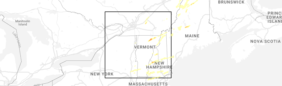
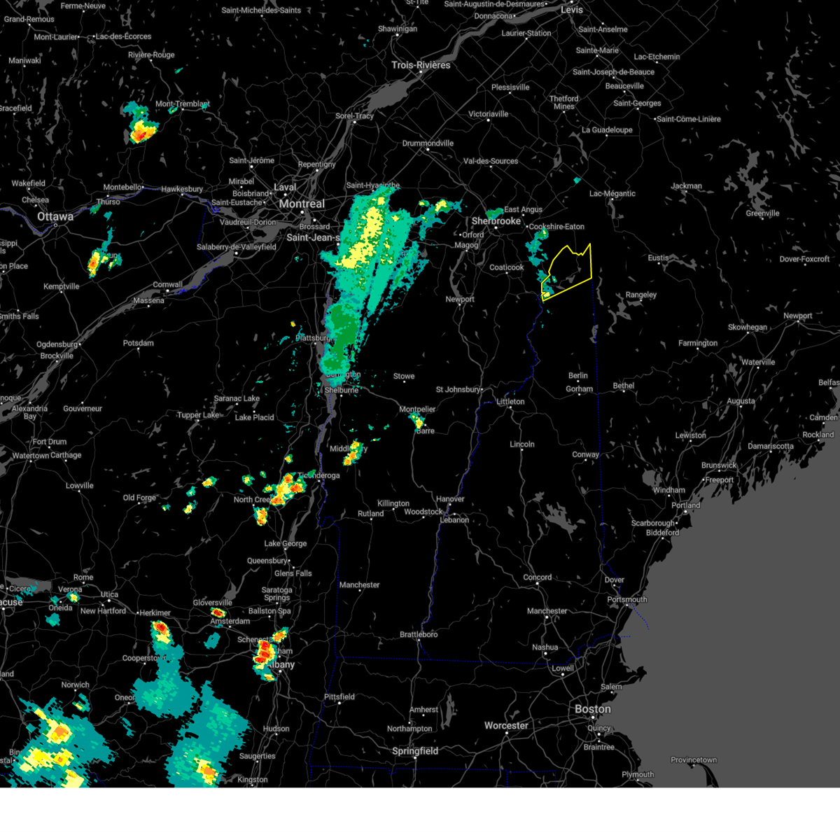
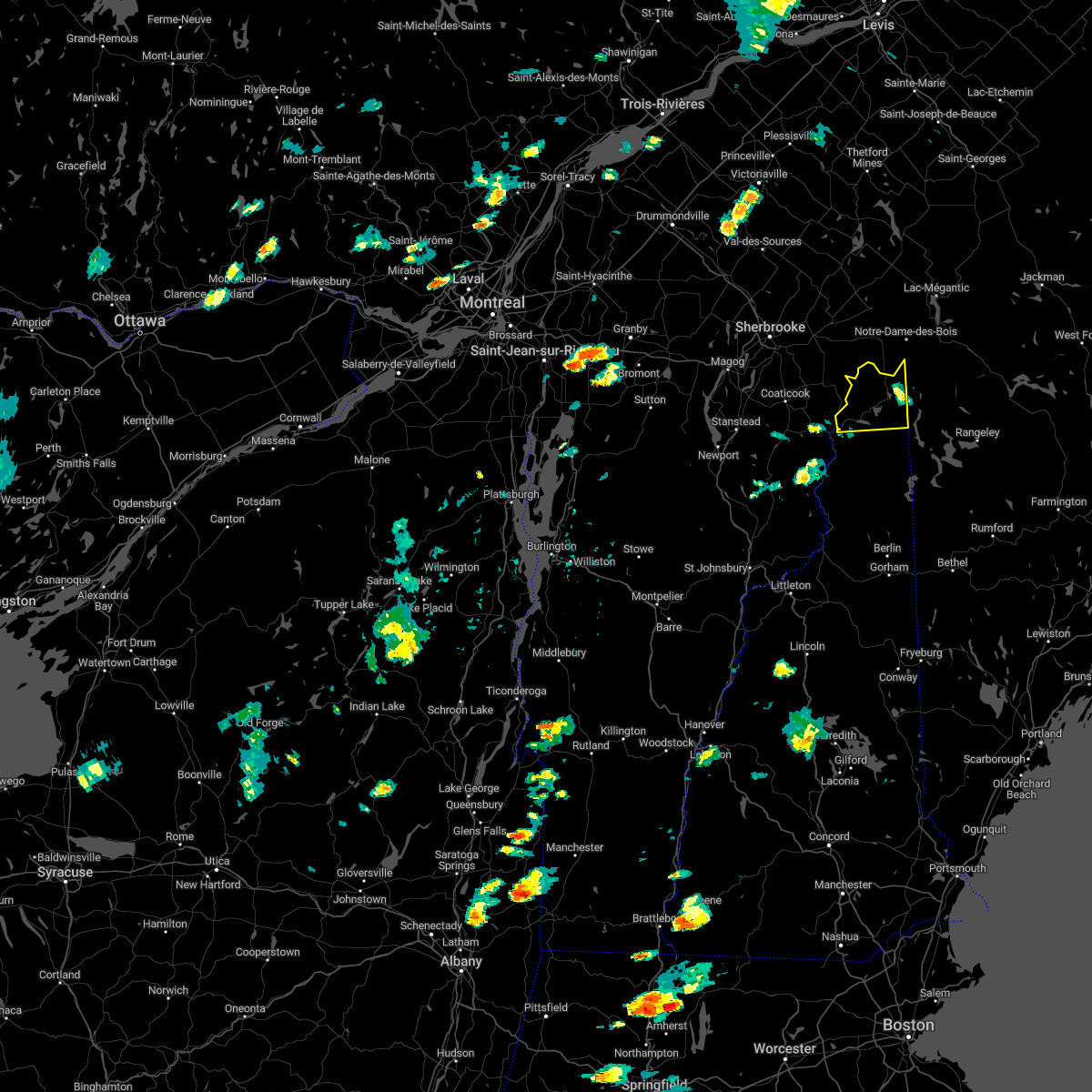
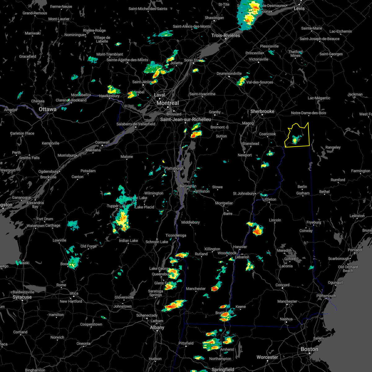
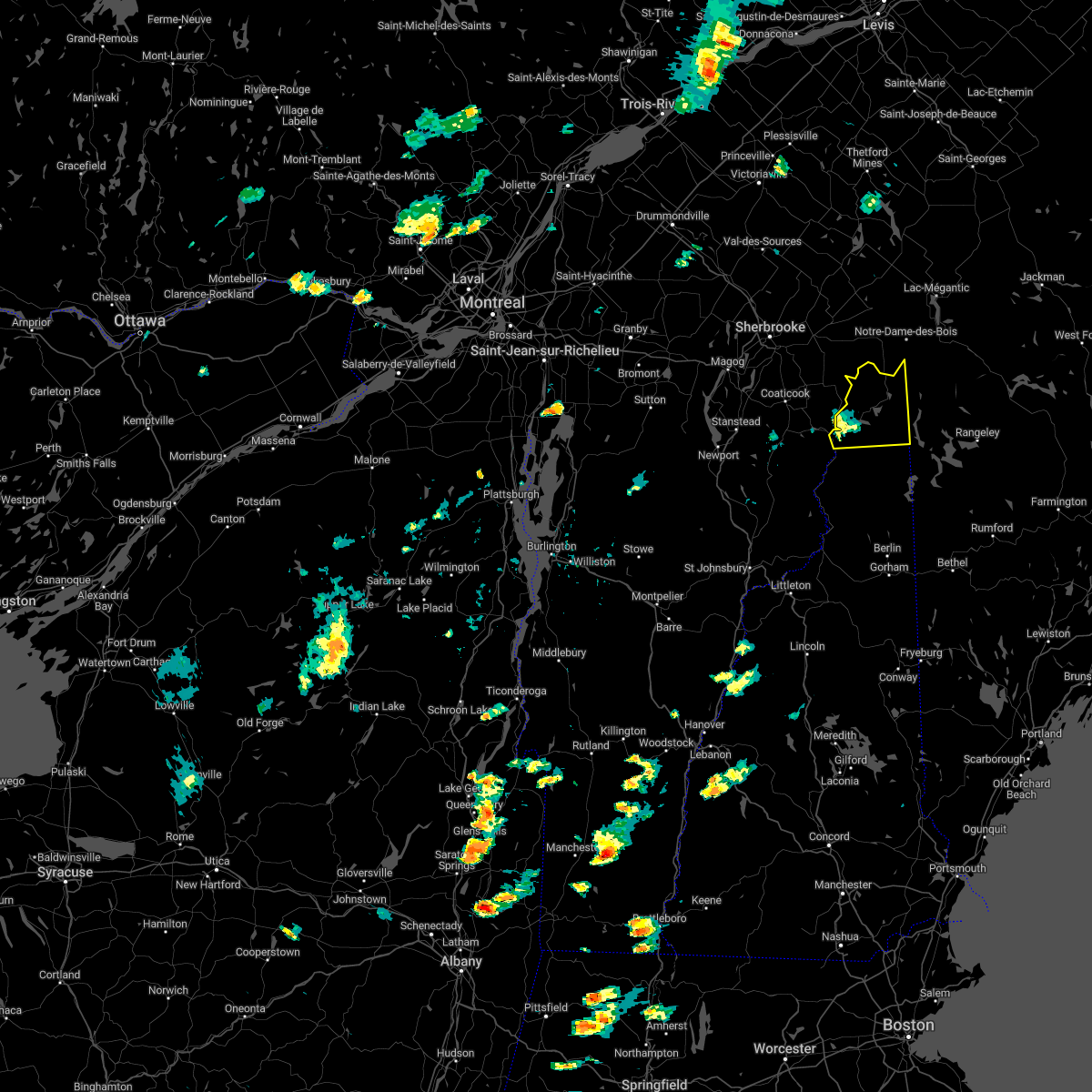
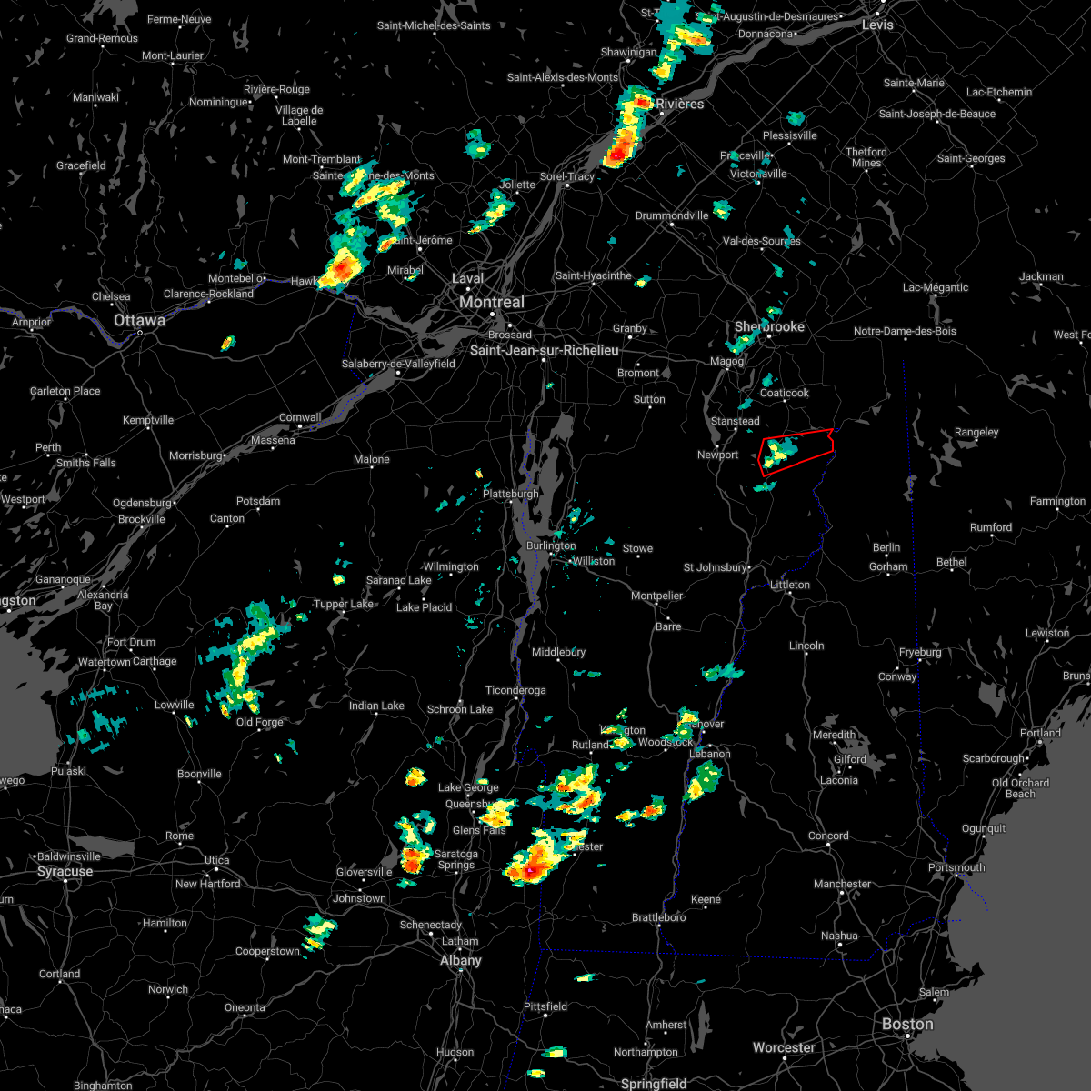
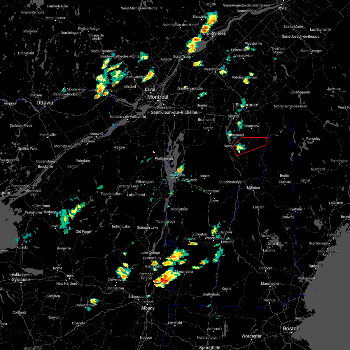
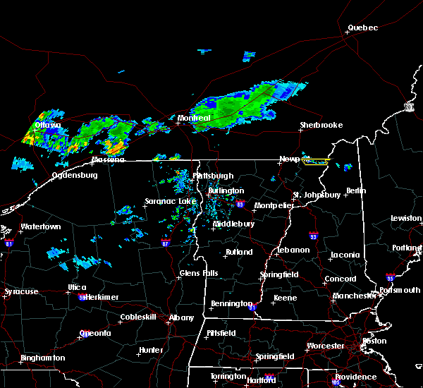
Hail Map for Beecher Falls, NH
The Beecher Falls, NH area has had 6 reports of on-the-ground hail by trained spotters, and has been under severe weather warnings 0 times during the past 12 months. Doppler radar has detected hail at or near Beecher Falls, NH on 6 occasions.
| Name: | Beecher Falls, NH |
| Where Located: | 92.2 miles ENE of Burlington, VT |
| Map: | Google Map for Beecher Falls, NH |
| Population: | 177 |
| Housing Units: | 97 |
| More Info: | Search Google for Beecher Falls, NH |
5
The Top Recent Hail Date for Beecher Falls, NH is Thursday, July 21, 2022 (1st out of 6)
Hail and Wind Damage Spotted near Beecher Falls, NH
| Date / Time | Report Details |
|---|---|
| 9/7/2023 5:35 PM EDT | Quarter sized hail reported 1.9 miles WSW of Beecher Falls, NH, social media photos of 1 inch hail in clarksville area on old canaan rd. hail lasted for 6-7 minutes. time estimated by radar. |
| 9/7/2023 5:35 PM EDT | Trees down on forest lane in pittsburg. time estimated by rada in coos county NH, 5.9 miles SW of Beecher Falls, NH |
| 9/7/2023 5:35 PM EDT | Quarter sized hail reported 5.9 miles SW of Beecher Falls, NH, hailstones 0.75 to 1.00 inch observed. |
| 9/7/2023 5:31 PM EDT |
 At 531 pm edt, a severe thunderstorm was located near pittsburg, or 14 miles north of colebrook, moving northeast at 30 mph (radar indicated). Hazards include 60 mph wind gusts and quarter size hail. Hail damage to vehicles is expected. Expect wind damage to roofs, siding, and trees. At 531 pm edt, a severe thunderstorm was located near pittsburg, or 14 miles north of colebrook, moving northeast at 30 mph (radar indicated). Hazards include 60 mph wind gusts and quarter size hail. Hail damage to vehicles is expected. Expect wind damage to roofs, siding, and trees.
|
| 8/8/2022 7:12 PM EDT | Corrects previous tstm wnd dmg report from 10 ne clarksville. reported by weather spotter... delayed report. media reports on scattered area of storm damage north of pi in coos county NH, 17 miles WSW of Beecher Falls, NH |
| 8/8/2022 6:28 PM EDT |
 At 628 pm edt, a severe thunderstorm was located near colebrook, moving northeast at 30 mph (radar indicated). Hazards include 60 mph wind gusts. expect damage to roofs, siding, and trees At 628 pm edt, a severe thunderstorm was located near colebrook, moving northeast at 30 mph (radar indicated). Hazards include 60 mph wind gusts. expect damage to roofs, siding, and trees
|
| 8/7/2022 7:08 PM EDT | Large tree down on idlewild road. home weather station clocked wind gust to 63mph. time estimated by rada in coos county NH, 18.2 miles WSW of Beecher Falls, NH |
| 8/7/2022 7:04 PM EDT | Wind gusts ripped down branches on west shore of second connecticut lake. time estimated by rada in coos county NH, 18.7 miles WSW of Beecher Falls, NH |
| 7/23/2022 7:55 PM EDT |
 At 755 pm edt, a severe thunderstorm was located near pittsburg, or 12 miles northeast of colebrook, moving east at 25 mph (radar indicated). Hazards include 60 mph wind gusts and quarter size hail. Hail damage to vehicles is expected. expect wind damage to roofs, siding, and trees. locations impacted include, colebrook, pittsburg, dixville, clarksville, stewartstown, wentworth location and parkertown. hail threat, radar indicated max hail size, 1. 00 in wind threat, radar indicated max wind gust, 60 mph. At 755 pm edt, a severe thunderstorm was located near pittsburg, or 12 miles northeast of colebrook, moving east at 25 mph (radar indicated). Hazards include 60 mph wind gusts and quarter size hail. Hail damage to vehicles is expected. expect wind damage to roofs, siding, and trees. locations impacted include, colebrook, pittsburg, dixville, clarksville, stewartstown, wentworth location and parkertown. hail threat, radar indicated max hail size, 1. 00 in wind threat, radar indicated max wind gust, 60 mph.
|
| 7/23/2022 7:43 PM EDT |
 The severe thunderstorm warning for northeastern essex county will expire at 745 pm edt, the storm which prompted the warning has moved out of the area. therefore, the warning will be allowed to expire. The severe thunderstorm warning for northeastern essex county will expire at 745 pm edt, the storm which prompted the warning has moved out of the area. therefore, the warning will be allowed to expire.
|
| 7/23/2022 7:23 PM EDT |
 At 723 pm edt, a severe thunderstorm was located over canaan, moving east at 30 mph (radar indicated). Hazards include 60 mph wind gusts and quarter size hail. Minor hail damage to vehicles is possible. expect wind damage to trees and powerlines. locations impacted include, canaan, averill, norton, averys gore, lemington, lewis and beecher falls. hail threat, radar indicated max hail size, 1. 00 in wind threat, radar indicated max wind gust, 60 mph. At 723 pm edt, a severe thunderstorm was located over canaan, moving east at 30 mph (radar indicated). Hazards include 60 mph wind gusts and quarter size hail. Minor hail damage to vehicles is possible. expect wind damage to trees and powerlines. locations impacted include, canaan, averill, norton, averys gore, lemington, lewis and beecher falls. hail threat, radar indicated max hail size, 1. 00 in wind threat, radar indicated max wind gust, 60 mph.
|
| 7/23/2022 7:18 PM EDT |
 At 717 pm edt, a severe thunderstorm was located 7 miles northwest of colebrook, moving east at 25 mph (radar indicated). Hazards include 60 mph wind gusts and quarter size hail. Hail damage to vehicles is expected. Expect wind damage to roofs, siding, and trees. At 717 pm edt, a severe thunderstorm was located 7 miles northwest of colebrook, moving east at 25 mph (radar indicated). Hazards include 60 mph wind gusts and quarter size hail. Hail damage to vehicles is expected. Expect wind damage to roofs, siding, and trees.
|
| 7/23/2022 6:57 PM EDT |
 At 657 pm edt, a severe thunderstorm was located near norton, moving east at 30 mph (radar indicated). Hazards include 60 mph wind gusts and quarter size hail. Minor hail damage to vehicles is possible. Expect wind damage to trees and powerlines. At 657 pm edt, a severe thunderstorm was located near norton, moving east at 30 mph (radar indicated). Hazards include 60 mph wind gusts and quarter size hail. Minor hail damage to vehicles is possible. Expect wind damage to trees and powerlines.
|
| 7/21/2022 5:46 PM EDT |
 At 546 pm edt, a severe thunderstorm was located over lewis, moving east at 40 mph (radar indicated). Hazards include 60 mph wind gusts and quarter size hail. Minor hail damage to vehicles is possible. Expect wind damage to trees and powerlines. At 546 pm edt, a severe thunderstorm was located over lewis, moving east at 40 mph (radar indicated). Hazards include 60 mph wind gusts and quarter size hail. Minor hail damage to vehicles is possible. Expect wind damage to trees and powerlines.
|
| 7/21/2022 3:38 PM EDT |
 The severe thunderstorm warning for northern coos county will expire at 345 pm edt, the storm which prompted the warning has moved out of the area. therefore, the warning will be allowed to expire. however gusty winds are still possible with this thunderstorm. a severe thunderstorm watch remains in effect until 800 pm edt for western maine, and northern new hampshire. The severe thunderstorm warning for northern coos county will expire at 345 pm edt, the storm which prompted the warning has moved out of the area. therefore, the warning will be allowed to expire. however gusty winds are still possible with this thunderstorm. a severe thunderstorm watch remains in effect until 800 pm edt for western maine, and northern new hampshire.
|
| 7/21/2022 3:24 PM EDT | Ping Pong Ball sized hail reported 3.6 miles W of Beecher Falls, NH, 1.5 inchers; hail fell for 5 mins south of clarksville. damage to a shed. strong winds blew down branches. approximately 2:10pm. |
| 7/21/2022 3:19 PM EDT |
 At 319 pm edt, a severe thunderstorm was located near dixville, or 11 miles east of colebrook, moving northeast at 40 mph (radar indicated). Hazards include 60 mph wind gusts and half dollar size hail. Hail damage to vehicles is expected. expect wind damage to roofs, siding, and trees. locations impacted include, colebrook, errol, dixville, pittsburg, stratford, columbia, clarksville, wentworth location and stewartstown. hail threat, radar indicated max hail size, 1. 25 in wind threat, radar indicated max wind gust, 60 mph. At 319 pm edt, a severe thunderstorm was located near dixville, or 11 miles east of colebrook, moving northeast at 40 mph (radar indicated). Hazards include 60 mph wind gusts and half dollar size hail. Hail damage to vehicles is expected. expect wind damage to roofs, siding, and trees. locations impacted include, colebrook, errol, dixville, pittsburg, stratford, columbia, clarksville, wentworth location and stewartstown. hail threat, radar indicated max hail size, 1. 25 in wind threat, radar indicated max wind gust, 60 mph.
|
| 7/21/2022 3:03 PM EDT |
 At 303 pm edt, a severe thunderstorm was located 7 miles south of colebrook, moving northeast at 45 mph (radar indicated). Hazards include 60 mph wind gusts and half dollar size hail. Hail damage to vehicles is expected. expect wind damage to roofs, siding, and trees. locations impacted include, colebrook, errol, stratford, dixville, pittsburg, columbia, dummer, clarksville, wentworth location and stewartstown. hail threat, radar indicated max hail size, 1. 25 in wind threat, radar indicated max wind gust, 60 mph. At 303 pm edt, a severe thunderstorm was located 7 miles south of colebrook, moving northeast at 45 mph (radar indicated). Hazards include 60 mph wind gusts and half dollar size hail. Hail damage to vehicles is expected. expect wind damage to roofs, siding, and trees. locations impacted include, colebrook, errol, stratford, dixville, pittsburg, columbia, dummer, clarksville, wentworth location and stewartstown. hail threat, radar indicated max hail size, 1. 25 in wind threat, radar indicated max wind gust, 60 mph.
|
| 7/21/2022 2:49 PM EDT |
 At 249 pm edt, a severe thunderstorm was located over maidstone state park, moving northeast at 45 mph (radar indicated). Hazards include 60 mph wind gusts and quarter size hail. Minor hail damage to vehicles is possible. expect wind damage to trees and powerlines. locations impacted include, canaan, brunswick, bloomfield, granby, maidstone, lemington, maidstone state park, averill, ferdinand, guildhall, lewis, beecher falls and brunswick springs. hail threat, radar indicated max hail size, 1. 00 in wind threat, radar indicated max wind gust, 60 mph. At 249 pm edt, a severe thunderstorm was located over maidstone state park, moving northeast at 45 mph (radar indicated). Hazards include 60 mph wind gusts and quarter size hail. Minor hail damage to vehicles is possible. expect wind damage to trees and powerlines. locations impacted include, canaan, brunswick, bloomfield, granby, maidstone, lemington, maidstone state park, averill, ferdinand, guildhall, lewis, beecher falls and brunswick springs. hail threat, radar indicated max hail size, 1. 00 in wind threat, radar indicated max wind gust, 60 mph.
|
| 7/21/2022 2:49 PM EDT |
 At 248 pm edt, a severe thunderstorm was located over stratford, or 10 miles north of lancaster, moving northeast at 50 mph (radar indicated). Hazards include 60 mph wind gusts and quarter size hail. Hail damage to vehicles is expected. expect wind damage to roofs, siding, and trees. locations impacted include, lancaster, colebrook, errol, stratford, dixville, pittsburg, columbia, dummer, clarksville, northumberland, stark, wentworth location and stewartstown. hail threat, radar indicated max hail size, 1. 00 in wind threat, radar indicated max wind gust, 60 mph. At 248 pm edt, a severe thunderstorm was located over stratford, or 10 miles north of lancaster, moving northeast at 50 mph (radar indicated). Hazards include 60 mph wind gusts and quarter size hail. Hail damage to vehicles is expected. expect wind damage to roofs, siding, and trees. locations impacted include, lancaster, colebrook, errol, stratford, dixville, pittsburg, columbia, dummer, clarksville, northumberland, stark, wentworth location and stewartstown. hail threat, radar indicated max hail size, 1. 00 in wind threat, radar indicated max wind gust, 60 mph.
|
| 7/21/2022 2:41 PM EDT |
 The severe thunderstorm warning for northeastern coos county will expire at 245 pm edt, the storm which prompted the warning has weakened below severe limits, and has exited the warned area. therefore, the warning will be allowed to expire. however small hail and gusty winds are still possible with this thunderstorm. a severe thunderstorm watch remains in effect until 800 pm edt for western maine, and northern new hampshire. The severe thunderstorm warning for northeastern coos county will expire at 245 pm edt, the storm which prompted the warning has weakened below severe limits, and has exited the warned area. therefore, the warning will be allowed to expire. however small hail and gusty winds are still possible with this thunderstorm. a severe thunderstorm watch remains in effect until 800 pm edt for western maine, and northern new hampshire.
|
| 7/21/2022 2:38 PM EDT |
 At 238 pm edt, a severe thunderstorm was located near lancaster, moving northeast at 40 mph (radar indicated). Hazards include 60 mph wind gusts and quarter size hail. Hail damage to vehicles is expected. Expect wind damage to roofs, siding, and trees. At 238 pm edt, a severe thunderstorm was located near lancaster, moving northeast at 40 mph (radar indicated). Hazards include 60 mph wind gusts and quarter size hail. Hail damage to vehicles is expected. Expect wind damage to roofs, siding, and trees.
|
| 7/21/2022 2:31 PM EDT |
 At 231 pm edt, a severe thunderstorm was located near victory, moving northeast at 50 mph (radar indicated). Hazards include 60 mph wind gusts and quarter size hail. Minor hail damage to vehicles is possible. Expect wind damage to trees and powerlines. At 231 pm edt, a severe thunderstorm was located near victory, moving northeast at 50 mph (radar indicated). Hazards include 60 mph wind gusts and quarter size hail. Minor hail damage to vehicles is possible. Expect wind damage to trees and powerlines.
|
| 7/21/2022 2:22 PM EDT |
 At 222 pm edt, a severe thunderstorm was located near pittsburg, or 17 miles northeast of colebrook, moving northeast at 35 mph (radar indicated). Hazards include 60 mph wind gusts and quarter size hail. Hail damage to vehicles is expected. expect wind damage to roofs, siding, and trees. Locations impacted include, pittsburg, clarksville, parmachenee and bowmantown. At 222 pm edt, a severe thunderstorm was located near pittsburg, or 17 miles northeast of colebrook, moving northeast at 35 mph (radar indicated). Hazards include 60 mph wind gusts and quarter size hail. Hail damage to vehicles is expected. expect wind damage to roofs, siding, and trees. Locations impacted include, pittsburg, clarksville, parmachenee and bowmantown.
|
| 7/21/2022 2:15 PM EDT | Numerous trees down on west rd east of us hwy 3 split. photos on social medi in coos county NH, 1.2 miles WNW of Beecher Falls, NH |
| 7/21/2022 2:12 PM EDT | Quarter sized hail reported 4.7 miles SW of Beecher Falls, NH, corrected previous report for time. one inch hail reported in pittsburg... nh. picture posted on social media. |
| 7/21/2022 2:06 PM EDT |
 At 206 pm edt, a severe thunderstorm was located near pittsburg, or 9 miles north of colebrook, moving northeast at 20 mph (radar indicated). Hazards include 60 mph wind gusts and quarter size hail. Hail damage to vehicles is expected. expect wind damage to roofs, siding, and trees. Locations impacted include, colebrook, pittsburg, dixville, clarksville, stewartstown, parmachenee, lynchtown, parkertown, lincoln plantation, bowmantown and wentworth location. At 206 pm edt, a severe thunderstorm was located near pittsburg, or 9 miles north of colebrook, moving northeast at 20 mph (radar indicated). Hazards include 60 mph wind gusts and quarter size hail. Hail damage to vehicles is expected. expect wind damage to roofs, siding, and trees. Locations impacted include, colebrook, pittsburg, dixville, clarksville, stewartstown, parmachenee, lynchtown, parkertown, lincoln plantation, bowmantown and wentworth location.
|
| 7/21/2022 1:40 PM EDT |
 At 140 pm edt, a severe thunderstorm was located near lemington, moving east at 35 mph (radar indicated). Hazards include 60 mph wind gusts and nickel size hail. Expect damage to trees and powerlines. Locations impacted include, canaan, averill, lewis, norton, lemington, averys gore, bloomfield and beecher falls. At 140 pm edt, a severe thunderstorm was located near lemington, moving east at 35 mph (radar indicated). Hazards include 60 mph wind gusts and nickel size hail. Expect damage to trees and powerlines. Locations impacted include, canaan, averill, lewis, norton, lemington, averys gore, bloomfield and beecher falls.
|
| 7/21/2022 1:38 PM EDT |
 At 137 pm edt, a severe thunderstorm was located 10 miles northwest of colebrook, moving northeast at 35 mph (radar indicated). Hazards include 60 mph wind gusts and quarter size hail. Hail damage to vehicles is expected. Expect wind damage to roofs, siding, and trees. At 137 pm edt, a severe thunderstorm was located 10 miles northwest of colebrook, moving northeast at 35 mph (radar indicated). Hazards include 60 mph wind gusts and quarter size hail. Hail damage to vehicles is expected. Expect wind damage to roofs, siding, and trees.
|
| 7/21/2022 1:27 PM EDT |
 At 126 pm edt, a severe thunderstorm was located over lewis, moving east at 35 mph (radar indicated). Hazards include 60 mph wind gusts and nickel size hail. expect damage to trees and powerlines At 126 pm edt, a severe thunderstorm was located over lewis, moving east at 35 mph (radar indicated). Hazards include 60 mph wind gusts and nickel size hail. expect damage to trees and powerlines
|
| 7/21/2022 1:24 PM EDT |
 At 124 pm edt, a severe thunderstorm capable of producing a tornado was located over norton, moving northeast at 35 mph (radar indicated rotation). Hazards include tornado and ping pong ball size hail. Flying debris will be dangerous to those caught without shelter. mobile homes will be damaged or destroyed. damage to roofs, windows, and vehicles will occur. tree damage is likely. this dangerous storm will be near, averill around 140 pm edt. Canaan around 150 pm edt. At 124 pm edt, a severe thunderstorm capable of producing a tornado was located over norton, moving northeast at 35 mph (radar indicated rotation). Hazards include tornado and ping pong ball size hail. Flying debris will be dangerous to those caught without shelter. mobile homes will be damaged or destroyed. damage to roofs, windows, and vehicles will occur. tree damage is likely. this dangerous storm will be near, averill around 140 pm edt. Canaan around 150 pm edt.
|
| 7/21/2022 1:12 PM EDT | Quarter sized hail reported 5.9 miles WSW of Beecher Falls, NH, severe hail of 1 inch reported in pittsburgh with picture evidence. |
| 7/21/2022 1:11 PM EDT |
 At 111 pm edt, a severe thunderstorm capable of producing a tornado was located over morgan, moving northeast at 40 mph (radar indicated rotation). Hazards include tornado and ping pong ball size hail. Flying debris will be dangerous to those caught without shelter. mobile homes will be damaged or destroyed. damage to roofs, windows, and vehicles will occur. tree damage is likely. this dangerous storm will be near, warners grant and warren gore around 115 pm edt. averys gore around 125 pm edt. lewis around 130 pm edt. norton and averill around 135 pm edt. lemington around 140 pm edt. canaan around 145 pm edt. Other locations impacted by this tornadic thunderstorm include east brownington, west charleston, morgan center and east charleston. At 111 pm edt, a severe thunderstorm capable of producing a tornado was located over morgan, moving northeast at 40 mph (radar indicated rotation). Hazards include tornado and ping pong ball size hail. Flying debris will be dangerous to those caught without shelter. mobile homes will be damaged or destroyed. damage to roofs, windows, and vehicles will occur. tree damage is likely. this dangerous storm will be near, warners grant and warren gore around 115 pm edt. averys gore around 125 pm edt. lewis around 130 pm edt. norton and averill around 135 pm edt. lemington around 140 pm edt. canaan around 145 pm edt. Other locations impacted by this tornadic thunderstorm include east brownington, west charleston, morgan center and east charleston.
|
| 7/21/2022 12:58 PM EDT |
 At 1258 pm edt, a severe thunderstorm capable of producing a tornado was located over brownington village, moving northeast at 35 mph (radar indicated rotation). Hazards include tornado and ping pong ball size hail. Flying debris will be dangerous to those caught without shelter. mobile homes will be damaged or destroyed. damage to roofs, windows, and vehicles will occur. tree damage is likely. this dangerous storm will be near, derby center around 105 pm edt. derby center village around 110 pm edt. derby, derby line village and charleston around 115 pm edt. morgan, warners grant, warren gore and brighton around 120 pm edt. holland around 125 pm edt. averys gore and norton around 130 pm edt. Other locations impacted by this tornadic thunderstorm include east brownington, south bay in orleans county, west charleston, morgan center, derby line, brownington center, crystal lake state park, evansville and east charleston. At 1258 pm edt, a severe thunderstorm capable of producing a tornado was located over brownington village, moving northeast at 35 mph (radar indicated rotation). Hazards include tornado and ping pong ball size hail. Flying debris will be dangerous to those caught without shelter. mobile homes will be damaged or destroyed. damage to roofs, windows, and vehicles will occur. tree damage is likely. this dangerous storm will be near, derby center around 105 pm edt. derby center village around 110 pm edt. derby, derby line village and charleston around 115 pm edt. morgan, warners grant, warren gore and brighton around 120 pm edt. holland around 125 pm edt. averys gore and norton around 130 pm edt. Other locations impacted by this tornadic thunderstorm include east brownington, south bay in orleans county, west charleston, morgan center, derby line, brownington center, crystal lake state park, evansville and east charleston.
|
| 5/21/2022 7:15 PM EDT | Trees and wires eown in multiple locations along rt in coos county NH, 11.1 miles WSW of Beecher Falls, NH |
| 5/21/2022 7:15 PM EDT | Trees and wires down on rt 14 in coos county NH, 5.5 miles WSW of Beecher Falls, NH |
| 5/21/2022 7:01 PM EDT |
 At 700 pm edt, severe thunderstorms were located along a line extending from 19 miles northwest of coburn gore to 9 miles north of pittsburg to 19 miles west of stratford, moving east at 40 mph (radar indicated). Hazards include 70 mph wind gusts and half dollar size hail. Hail damage to vehicles is expected. expect considerable tree damage. wind damage is also likely to mobile homes, roofs, and outbuildings. locations impacted include, colebrook, eustis, coburn gore, rangeley, errol, pittsburg, dixville, stratford, grafton, columbia, dallas plantation, dummer, clarksville, upper cupsuptic, tim pond, davis, lynchtown, alder stream, upton and chain of ponds. thunderstorm damage threat, considerable hail threat, radar indicated max hail size, 1. 25 in wind threat, radar indicated max wind gust, 70 mph. At 700 pm edt, severe thunderstorms were located along a line extending from 19 miles northwest of coburn gore to 9 miles north of pittsburg to 19 miles west of stratford, moving east at 40 mph (radar indicated). Hazards include 70 mph wind gusts and half dollar size hail. Hail damage to vehicles is expected. expect considerable tree damage. wind damage is also likely to mobile homes, roofs, and outbuildings. locations impacted include, colebrook, eustis, coburn gore, rangeley, errol, pittsburg, dixville, stratford, grafton, columbia, dallas plantation, dummer, clarksville, upper cupsuptic, tim pond, davis, lynchtown, alder stream, upton and chain of ponds. thunderstorm damage threat, considerable hail threat, radar indicated max hail size, 1. 25 in wind threat, radar indicated max wind gust, 70 mph.
|
| 5/21/2022 6:46 PM EDT |
 At 645 pm edt, severe thunderstorms were located along a line extending from 24 miles northwest of coburn gore to 12 miles northwest of pittsburg to 25 miles west of stratford, moving east at 40 mph (radar indicated). Hazards include 70 mph wind gusts and quarter size hail. Hail damage to vehicles is expected. expect considerable tree damage. Wind damage is also likely to mobile homes, roofs, and outbuildings. At 645 pm edt, severe thunderstorms were located along a line extending from 24 miles northwest of coburn gore to 12 miles northwest of pittsburg to 25 miles west of stratford, moving east at 40 mph (radar indicated). Hazards include 70 mph wind gusts and quarter size hail. Hail damage to vehicles is expected. expect considerable tree damage. Wind damage is also likely to mobile homes, roofs, and outbuildings.
|
| 5/21/2022 6:42 PM EDT |
 At 641 pm edt, a severe thunderstorm was located over island pond, moving east at 40 mph (radar indicated). Hazards include 60 mph wind gusts and quarter size hail. Minor hail damage to vehicles is possible. Expect wind damage to trees and powerlines. At 641 pm edt, a severe thunderstorm was located over island pond, moving east at 40 mph (radar indicated). Hazards include 60 mph wind gusts and quarter size hail. Minor hail damage to vehicles is possible. Expect wind damage to trees and powerlines.
|
| 6/21/2021 6:13 PM EDT |
 At 612 pm edt, a severe thunderstorm was located near colebrook, moving northeast at 20 mph (radar indicated). Hazards include 60 mph wind gusts and quarter size hail. Hail damage to vehicles is expected. expect wind damage to roofs, siding, and trees. locations impacted include, colebrook, pittsburg, dixville, stratford, columbia, clarksville and stewartstown. This also includes, dixville notch state park and coleman state park. At 612 pm edt, a severe thunderstorm was located near colebrook, moving northeast at 20 mph (radar indicated). Hazards include 60 mph wind gusts and quarter size hail. Hail damage to vehicles is expected. expect wind damage to roofs, siding, and trees. locations impacted include, colebrook, pittsburg, dixville, stratford, columbia, clarksville and stewartstown. This also includes, dixville notch state park and coleman state park.
|
| 6/21/2021 5:47 PM EDT |
 At 547 pm edt, a severe thunderstorm was located 10 miles southwest of colebrook, moving northeast at 30 mph (radar indicated). Hazards include 60 mph wind gusts and quarter size hail. Hail damage to vehicles is expected. Expect wind damage to roofs, siding, and trees. At 547 pm edt, a severe thunderstorm was located 10 miles southwest of colebrook, moving northeast at 30 mph (radar indicated). Hazards include 60 mph wind gusts and quarter size hail. Hail damage to vehicles is expected. Expect wind damage to roofs, siding, and trees.
|
| 10/10/2020 5:58 PM EDT |
 The severe thunderstorm warning for northeastern caledonia, northeastern orleans and essex counties will expire at 600 pm edt, the storm which prompted the warning has weakened below severe limits, and has exited the warned area. therefore, the warning will be allowed to expire. a severe thunderstorm watch remains in effect until 900 pm edt for northeastern vermont. The severe thunderstorm warning for northeastern caledonia, northeastern orleans and essex counties will expire at 600 pm edt, the storm which prompted the warning has weakened below severe limits, and has exited the warned area. therefore, the warning will be allowed to expire. a severe thunderstorm watch remains in effect until 900 pm edt for northeastern vermont.
|
| 10/10/2020 5:50 PM EDT |
 At 549 pm edt, a severe thunderstorm was located over lewis, moving east at 70 mph (radar indicated). Hazards include 60 mph wind gusts and quarter size hail. Minor hail damage to vehicles is possible. expect wind damage to trees and powerlines. Locations impacted include, island pond, canaan, charleston, west burke village, westmore, east haven, morgan, ferdinand, warren gore, averys gore, brunswick, brighton, bloomfield, sutton, norton, averill, maidstone, warners grant, lewis and newark. At 549 pm edt, a severe thunderstorm was located over lewis, moving east at 70 mph (radar indicated). Hazards include 60 mph wind gusts and quarter size hail. Minor hail damage to vehicles is possible. expect wind damage to trees and powerlines. Locations impacted include, island pond, canaan, charleston, west burke village, westmore, east haven, morgan, ferdinand, warren gore, averys gore, brunswick, brighton, bloomfield, sutton, norton, averill, maidstone, warners grant, lewis and newark.
|
| 10/10/2020 5:36 PM EDT |
 At 536 pm edt, a severe thunderstorm was located over westmore, moving east at 70 mph (radar indicated). Hazards include 60 mph wind gusts and quarter size hail. Minor hail damage to vehicles is possible. Expect wind damage to trees and powerlines. At 536 pm edt, a severe thunderstorm was located over westmore, moving east at 70 mph (radar indicated). Hazards include 60 mph wind gusts and quarter size hail. Minor hail damage to vehicles is possible. Expect wind damage to trees and powerlines.
|
| 10/10/2020 4:35 PM EDT |
 The severe thunderstorm warning for northwestern oxford and northeastern coos counties will expire at 445 pm edt, the storms which prompted the warning have weakened below severe limits, and no longer pose an immediate threat to life or property. therefore, the warning will be allowed to expire. however gusty winds are still possible with these thunderstorms. The severe thunderstorm warning for northwestern oxford and northeastern coos counties will expire at 445 pm edt, the storms which prompted the warning have weakened below severe limits, and no longer pose an immediate threat to life or property. therefore, the warning will be allowed to expire. however gusty winds are still possible with these thunderstorms.
|
| 10/10/2020 4:06 PM EDT |
 At 406 pm edt, severe thunderstorms were located along a line extending from 18 miles northwest of pittsburg to 6 miles north of colebrook to 13 miles northwest of stratford, moving east at 60 mph (radar indicated). Hazards include 60 mph wind gusts. expect damage to roofs, siding, and trees At 406 pm edt, severe thunderstorms were located along a line extending from 18 miles northwest of pittsburg to 6 miles north of colebrook to 13 miles northwest of stratford, moving east at 60 mph (radar indicated). Hazards include 60 mph wind gusts. expect damage to roofs, siding, and trees
|
| 10/10/2020 4:05 PM EDT |
 At 404 pm edt, a severe thunderstorm was located over lemington, moving east at 55 mph (radar indicated). Hazards include 60 mph wind gusts. expect damage to trees and powerlines At 404 pm edt, a severe thunderstorm was located over lemington, moving east at 55 mph (radar indicated). Hazards include 60 mph wind gusts. expect damage to trees and powerlines
|
| 7/8/2020 4:17 PM EDT |
 At 416 pm edt, severe thunderstorms were located along a line extending from averys gore to morgan to orleans village, moving south at 30 mph (radar indicated). Hazards include 60 mph wind gusts and quarter size hail. Minor hail damage to vehicles is possible. expect wind damage to trees and powerlines. Locations impacted include, island pond, canaan, charleston, morgan, ferdinand, warren gore, averys gore, brunswick, brighton, bloomfield, averill, warners grant, lewis, newark, newark hollow, lemington, westmore, norton, east haven and holland. At 416 pm edt, severe thunderstorms were located along a line extending from averys gore to morgan to orleans village, moving south at 30 mph (radar indicated). Hazards include 60 mph wind gusts and quarter size hail. Minor hail damage to vehicles is possible. expect wind damage to trees and powerlines. Locations impacted include, island pond, canaan, charleston, morgan, ferdinand, warren gore, averys gore, brunswick, brighton, bloomfield, averill, warners grant, lewis, newark, newark hollow, lemington, westmore, norton, east haven and holland.
|
| 7/8/2020 3:59 PM EDT |
 At 358 pm edt, severe thunderstorms were located along a line extending from 21 miles northeast of bingham to near eustis to 9 miles northeast of errol to near colebrook to 24 miles west of pittsburg, moving south at 30 mph (radar indicated). Hazards include 60 mph wind gusts and quarter size hail. Hail damage to vehicles is expected. expect wind damage to roofs, siding, and trees. locations impacted include, colebrook, eustis, rangeley, kingfield, bingham, andover, carrabassett valley, errol, dixville, phillips, stratford, weld, athens, embden, harmony, columbia, avon, dallas plantation, dummer and clarksville. This also includes, umbagog lake state park, saddleback mountain, sugarloaf mountain, crocker mountain, and the bigelows. At 358 pm edt, severe thunderstorms were located along a line extending from 21 miles northeast of bingham to near eustis to 9 miles northeast of errol to near colebrook to 24 miles west of pittsburg, moving south at 30 mph (radar indicated). Hazards include 60 mph wind gusts and quarter size hail. Hail damage to vehicles is expected. expect wind damage to roofs, siding, and trees. locations impacted include, colebrook, eustis, rangeley, kingfield, bingham, andover, carrabassett valley, errol, dixville, phillips, stratford, weld, athens, embden, harmony, columbia, avon, dallas plantation, dummer and clarksville. This also includes, umbagog lake state park, saddleback mountain, sugarloaf mountain, crocker mountain, and the bigelows.
|
| 7/8/2020 3:48 PM EDT |
 At 348 pm edt, severe thunderstorms were located along a line extending from near norton to near derby line to newport center, moving south at 30 mph (radar indicated). Hazards include 60 mph wind gusts and quarter size hail. Minor hail damage to vehicles is possible. Expect wind damage to trees and powerlines. At 348 pm edt, severe thunderstorms were located along a line extending from near norton to near derby line to newport center, moving south at 30 mph (radar indicated). Hazards include 60 mph wind gusts and quarter size hail. Minor hail damage to vehicles is possible. Expect wind damage to trees and powerlines.
|
| 7/8/2020 3:30 PM EDT | Trees and wires down on mercier rd. time estimated from rada in coos county NH, 10.7 miles WSW of Beecher Falls, NH |
| 7/8/2020 3:26 PM EDT |
 At 326 pm edt, severe thunderstorms were located along a line extending from 27 miles north of bingham to 19 miles northeast of dixville to near pittsburg to 26 miles northwest of colebrook, moving south at 35 mph (radar indicated). Hazards include 60 mph wind gusts and quarter size hail. Hail damage to vehicles is expected. Expect wind damage to roofs, siding, and trees. At 326 pm edt, severe thunderstorms were located along a line extending from 27 miles north of bingham to 19 miles northeast of dixville to near pittsburg to 26 miles northwest of colebrook, moving south at 35 mph (radar indicated). Hazards include 60 mph wind gusts and quarter size hail. Hail damage to vehicles is expected. Expect wind damage to roofs, siding, and trees.
|
| 5/29/2020 8:47 PM EDT |
 At 846 pm edt, severe thunderstorms were located along a line extending from 18 miles north of colebrook to near pittsburg to 7 miles west of stratford, moving northeast at 40 mph (radar indicated). Hazards include 60 mph wind gusts and penny size hail. Expect damage to roofs, siding, and trees. locations impacted include, colebrook, errol, pittsburg, stratford, dixville, columbia, dummer, clarksville, stewartstown, northumberland, stark and wentworth location. This also includes, first connecticut lake, dixville notch state park, coleman state park, lake francis state park, and percy peaks. At 846 pm edt, severe thunderstorms were located along a line extending from 18 miles north of colebrook to near pittsburg to 7 miles west of stratford, moving northeast at 40 mph (radar indicated). Hazards include 60 mph wind gusts and penny size hail. Expect damage to roofs, siding, and trees. locations impacted include, colebrook, errol, pittsburg, stratford, dixville, columbia, dummer, clarksville, stewartstown, northumberland, stark and wentworth location. This also includes, first connecticut lake, dixville notch state park, coleman state park, lake francis state park, and percy peaks.
|
| 5/29/2020 8:21 PM EDT |
 At 820 pm edt, severe thunderstorms were located along a line extending from 20 miles west of pittsburg to 10 miles west of colebrook to 19 miles northwest of littleton, moving northeast at 40 mph (radar indicated). Hazards include 60 mph wind gusts and quarter size hail. Hail damage to vehicles is expected. Expect wind damage to roofs, siding, and trees. At 820 pm edt, severe thunderstorms were located along a line extending from 20 miles west of pittsburg to 10 miles west of colebrook to 19 miles northwest of littleton, moving northeast at 40 mph (radar indicated). Hazards include 60 mph wind gusts and quarter size hail. Hail damage to vehicles is expected. Expect wind damage to roofs, siding, and trees.
|
| 6/29/2019 6:38 PM EDT |
 At 637 pm edt, severe thunderstorms were located along a line extending from 27 miles north of dixville to near pittsburg to 11 miles northwest of colebrook, moving southeast at 45 mph (radar indicated). Hazards include 60 mph wind gusts and quarter size hail. Hail damage to vehicles is expected. Expect wind damage to roofs, siding, and trees. At 637 pm edt, severe thunderstorms were located along a line extending from 27 miles north of dixville to near pittsburg to 11 miles northwest of colebrook, moving southeast at 45 mph (radar indicated). Hazards include 60 mph wind gusts and quarter size hail. Hail damage to vehicles is expected. Expect wind damage to roofs, siding, and trees.
|
| 8/29/2018 6:13 PM EDT |
 The severe thunderstorm warning for northeastern caledonia, east central orleans and essex counties will expire at 615 pm edt, the storm which prompted the warning has weakened below severe limits, and no longer poses an immediate threat to life or property. therefore, the warning will be allowed to expire. however gusty winds and heavy rain are still possible with this thunderstorm. a severe thunderstorm watch remains in effect until 1100 pm edt for northeastern vermont. The severe thunderstorm warning for northeastern caledonia, east central orleans and essex counties will expire at 615 pm edt, the storm which prompted the warning has weakened below severe limits, and no longer poses an immediate threat to life or property. therefore, the warning will be allowed to expire. however gusty winds and heavy rain are still possible with this thunderstorm. a severe thunderstorm watch remains in effect until 1100 pm edt for northeastern vermont.
|
| 8/29/2018 5:45 PM EDT |
 At 544 pm edt, a severe thunderstorm was located near newark, moving east at 35 mph (radar indicated). Hazards include 60 mph wind gusts. Expect damage to trees and powerlines. Locations impacted include, island pond, lyndon, canaan, west burke village, guildhall, westmore, east haven, ferdinand, granby, averys gore, victory, brunswick, burke, brighton, bloomfield, sutton, averill, maidstone, lewis and newark. At 544 pm edt, a severe thunderstorm was located near newark, moving east at 35 mph (radar indicated). Hazards include 60 mph wind gusts. Expect damage to trees and powerlines. Locations impacted include, island pond, lyndon, canaan, west burke village, guildhall, westmore, east haven, ferdinand, granby, averys gore, victory, brunswick, burke, brighton, bloomfield, sutton, averill, maidstone, lewis and newark.
|
| 8/29/2018 5:20 PM EDT | Tree down on a wire on macneil roa in coos county NH, 5.9 miles WSW of Beecher Falls, NH |
| 8/29/2018 5:15 PM EDT |
 At 515 pm edt, severe thunderstorms were located along a line extending from 13 miles northeast of pittsburg to near colebrook, moving east at 30 mph (radar indicated). Hazards include 60 mph wind gusts and quarter size hail. Hail damage to vehicles is expected. Expect wind damage to roofs, siding, and trees. At 515 pm edt, severe thunderstorms were located along a line extending from 13 miles northeast of pittsburg to near colebrook, moving east at 30 mph (radar indicated). Hazards include 60 mph wind gusts and quarter size hail. Hail damage to vehicles is expected. Expect wind damage to roofs, siding, and trees.
|
| 8/29/2018 5:14 PM EDT |
 At 513 pm edt, a severe thunderstorm was located over east craftsbury, moving east at 35 mph (radar indicated). Hazards include 60 mph wind gusts and penny size hail. expect damage to trees and powerlines At 513 pm edt, a severe thunderstorm was located over east craftsbury, moving east at 35 mph (radar indicated). Hazards include 60 mph wind gusts and penny size hail. expect damage to trees and powerlines
|
| 8/6/2018 8:34 PM EDT |
 At 834 pm edt, a severe thunderstorm was located near averill, moving east at 35 mph (radar indicated). Hazards include 60 mph wind gusts. Expect damage to trees and powerlines. Locations impacted include, canaan, norton, averill, averys gore, lemington and beecher falls. At 834 pm edt, a severe thunderstorm was located near averill, moving east at 35 mph (radar indicated). Hazards include 60 mph wind gusts. Expect damage to trees and powerlines. Locations impacted include, canaan, norton, averill, averys gore, lemington and beecher falls.
|
| 8/6/2018 8:16 PM EDT |
 At 816 pm edt, a severe thunderstorm was located near norton, moving east at 25 mph (radar indicated). Hazards include 60 mph wind gusts. expect damage to trees and powerlines At 816 pm edt, a severe thunderstorm was located near norton, moving east at 25 mph (radar indicated). Hazards include 60 mph wind gusts. expect damage to trees and powerlines
|
| 5/4/2018 8:41 PM EDT |
 A severe thunderstorm warning remains in effect until 900 pm edt for central caledonia. essex and northern washington counties. at 840 pm edt, severe thunderstorms were located along a line extending from near canaan to granby to east cabot, moving east at 40 mph. hazard. 60 mph wind gusts and quarter size hail. A severe thunderstorm warning remains in effect until 900 pm edt for central caledonia. essex and northern washington counties. at 840 pm edt, severe thunderstorms were located along a line extending from near canaan to granby to east cabot, moving east at 40 mph. hazard. 60 mph wind gusts and quarter size hail.
|
| 5/4/2018 8:37 PM EDT |
 At 837 pm edt, severe thunderstorms were located along a line extending from coburn gore to 16 miles east of pittsburg to near lancaster to 6 miles west of littleton, moving east at 35 mph (radar indicated). Hazards include 60 mph wind gusts and penny size hail. Expect damage to roofs, siding, and trees. locations impacted include, berlin, littleton, lancaster, bethlehem, colebrook, franconia, errol, pittsburg, dixville, stratford, carroll, lisbon, jefferson, dalton, columbia, dummer, clarksville, whitefield, northumberland and monroe. this also includes, umbagog lake state park, first connecticut lake, kilkenny ridge trail, pontook reservoir, and dixville notch state park. This includes interstate 93 between mile markers 112 and 131. At 837 pm edt, severe thunderstorms were located along a line extending from coburn gore to 16 miles east of pittsburg to near lancaster to 6 miles west of littleton, moving east at 35 mph (radar indicated). Hazards include 60 mph wind gusts and penny size hail. Expect damage to roofs, siding, and trees. locations impacted include, berlin, littleton, lancaster, bethlehem, colebrook, franconia, errol, pittsburg, dixville, stratford, carroll, lisbon, jefferson, dalton, columbia, dummer, clarksville, whitefield, northumberland and monroe. this also includes, umbagog lake state park, first connecticut lake, kilkenny ridge trail, pontook reservoir, and dixville notch state park. This includes interstate 93 between mile markers 112 and 131.
|
| 5/4/2018 8:12 PM EDT |
 At 811 pm edt, severe thunderstorms were located along a line extending from 14 miles west of coburn gore to near pittsburg to 17 miles west of lancaster to 20 miles west of littleton, moving east at 50 mph (radar indicated). Hazards include 60 mph wind gusts and nickel size hail. expect damage to roofs, siding, and trees At 811 pm edt, severe thunderstorms were located along a line extending from 14 miles west of coburn gore to near pittsburg to 17 miles west of lancaster to 20 miles west of littleton, moving east at 50 mph (radar indicated). Hazards include 60 mph wind gusts and nickel size hail. expect damage to roofs, siding, and trees
|
| 5/4/2018 8:05 PM EDT |
 The national weather service in burlington has issued a * severe thunderstorm warning for. caledonia county in northeastern vermont. northeastern orleans county in northeastern vermont. essex county in northeastern vermont. Northern washington county in central vermont. The national weather service in burlington has issued a * severe thunderstorm warning for. caledonia county in northeastern vermont. northeastern orleans county in northeastern vermont. essex county in northeastern vermont. Northern washington county in central vermont.
|
| 8/12/2017 7:38 PM EDT |
 At 737 pm edt, severe thunderstorms were located along a line extending from near norton to brighton to near south walden, moving east at 15 mph (radar indicated). Hazards include 60 mph wind gusts and quarter size hail. Minor hail damage to vehicles is possible. expect wind damage to trees and powerlines. locations impacted include, st. Johnsbury, island pond, lyndon, orleans, charleston, glover, albany, brunswick, burke, greensboro bend, averill, newark, brownington village, canaan, west burke village, morgan, ferdinand, gilman, granby and woodbury. At 737 pm edt, severe thunderstorms were located along a line extending from near norton to brighton to near south walden, moving east at 15 mph (radar indicated). Hazards include 60 mph wind gusts and quarter size hail. Minor hail damage to vehicles is possible. expect wind damage to trees and powerlines. locations impacted include, st. Johnsbury, island pond, lyndon, orleans, charleston, glover, albany, brunswick, burke, greensboro bend, averill, newark, brownington village, canaan, west burke village, morgan, ferdinand, gilman, granby and woodbury.
|
| 8/12/2017 7:00 PM EDT |
 At 700 pm edt, severe thunderstorms were located along a line extending from cove island to near elmore state park, moving east at 40 mph (radar indicated). Hazards include 60 mph wind gusts and quarter size hail. Minor hail damage to vehicles is possible. Expect wind damage to trees and powerlines. At 700 pm edt, severe thunderstorms were located along a line extending from cove island to near elmore state park, moving east at 40 mph (radar indicated). Hazards include 60 mph wind gusts and quarter size hail. Minor hail damage to vehicles is possible. Expect wind damage to trees and powerlines.
|
| 7/22/2016 11:36 PM EDT |
 At 1134 pm edt, severe thunderstorms were located along a line extending from north troy to mount worcester, moving east at 35 mph (radar indicated). Hazards include 60 mph wind gusts and quarter size hail. Hail damage to vehicles is expected. expect wind damage to roofs, siding, and trees. Locations impacted include, island pond, stowe, hardwick, richford, danville, morrisville, berkshire, wolcott, troy, johnson, eden, bakersfield, concord, craftsbury, montgomery, irasburg, glover, coventry, sutton and canaan. At 1134 pm edt, severe thunderstorms were located along a line extending from north troy to mount worcester, moving east at 35 mph (radar indicated). Hazards include 60 mph wind gusts and quarter size hail. Hail damage to vehicles is expected. expect wind damage to roofs, siding, and trees. Locations impacted include, island pond, stowe, hardwick, richford, danville, morrisville, berkshire, wolcott, troy, johnson, eden, bakersfield, concord, craftsbury, montgomery, irasburg, glover, coventry, sutton and canaan.
|
| 7/22/2016 10:43 PM EDT |
 At 1041 pm edt, severe thunderstorms were located along a line extending from alburg vermont to burlington vermont, moving east at 35 to 40 mph. other strong to severe thunderstorms were located over northeast vermont moving east at 35 mph (radar indicated). Hazards include 60 mph wind gusts and quarter size hail. Hail damage to vehicles is expected. Expect wind damage to roofs, siding, and trees. At 1041 pm edt, severe thunderstorms were located along a line extending from alburg vermont to burlington vermont, moving east at 35 to 40 mph. other strong to severe thunderstorms were located over northeast vermont moving east at 35 mph (radar indicated). Hazards include 60 mph wind gusts and quarter size hail. Hail damage to vehicles is expected. Expect wind damage to roofs, siding, and trees.
|
| 7/18/2016 1:02 PM EDT |
 At 102 pm edt, a severe thunderstorm was located over colebrook, moving east at 60 mph (radar indicated). Hazards include 60 mph wind gusts and quarter size hail. Hail damage to vehicles is expected. Expect wind damage to roofs, siding, and trees. At 102 pm edt, a severe thunderstorm was located over colebrook, moving east at 60 mph (radar indicated). Hazards include 60 mph wind gusts and quarter size hail. Hail damage to vehicles is expected. Expect wind damage to roofs, siding, and trees.
|
| 7/18/2016 12:43 PM EDT |
 At 1243 pm edt, a severe thunderstorm was located near pittsburg, or 12 miles northeast of colebrook, moving east at 55 mph (radar indicated). Hazards include 60 mph wind gusts and quarter size hail. Hail damage to vehicles is expected. expect wind damage to roofs, siding, and trees. Locations impacted include, colebrook, eustis, rangeley, carrabassett valley, pittsburg, dixville, phillips, dallas plantation, clarksville, lang, redington, upper cupsuptic, adamstown, coplin plantation, stetsontown, lincoln plantation, parkertown, davis, oxbow and tim pond. At 1243 pm edt, a severe thunderstorm was located near pittsburg, or 12 miles northeast of colebrook, moving east at 55 mph (radar indicated). Hazards include 60 mph wind gusts and quarter size hail. Hail damage to vehicles is expected. expect wind damage to roofs, siding, and trees. Locations impacted include, colebrook, eustis, rangeley, carrabassett valley, pittsburg, dixville, phillips, dallas plantation, clarksville, lang, redington, upper cupsuptic, adamstown, coplin plantation, stetsontown, lincoln plantation, parkertown, davis, oxbow and tim pond.
|
| 7/18/2016 12:39 PM EDT | Trees down on route 3 in pittsbur in coos county NH, 5.9 miles WSW of Beecher Falls, NH |
| 7/18/2016 12:38 PM EDT | Quarter sized hail reported 9 miles W of Beecher Falls, NH |
| 7/18/2016 12:30 PM EDT |
 At 1230 pm edt, severe thunderstorms were located along a line extending from 11 miles south of coburn gore to 6 miles west of pittsburg, moving east at 55 mph (radar indicated). Hazards include 60 mph wind gusts and quarter size hail. Hail damage to vehicles is expected. expect wind damage to roofs, siding, and trees. Locations impacted include, colebrook, eustis, rangeley, carrabassett valley, pittsburg, dixville, phillips, columbia, dallas plantation, clarksville, lang, redington, upper cupsuptic, adamstown, coplin plantation, stetsontown, alder stream, lincoln plantation, parkertown and jim pond. At 1230 pm edt, severe thunderstorms were located along a line extending from 11 miles south of coburn gore to 6 miles west of pittsburg, moving east at 55 mph (radar indicated). Hazards include 60 mph wind gusts and quarter size hail. Hail damage to vehicles is expected. expect wind damage to roofs, siding, and trees. Locations impacted include, colebrook, eustis, rangeley, carrabassett valley, pittsburg, dixville, phillips, columbia, dallas plantation, clarksville, lang, redington, upper cupsuptic, adamstown, coplin plantation, stetsontown, alder stream, lincoln plantation, parkertown and jim pond.
|
| 7/18/2016 12:22 PM EDT |
 At 1222 pm edt, a severe thunderstorm was located over newport center, moving east at 45 mph (radar indicated). Hazards include 60 mph wind gusts and quarter size hail. Hail damage to vehicles is expected. expect wind damage to roofs, siding, and trees. locations impacted include, colebrook, island pond, troy, irasburg, coventry, canaan, orleans, morgan, barton, holland, derby center, westfield, jay, westmore, bloomfield, maidstone, norton, averill, newport center and jay in franklin county. At 1222 pm edt, a severe thunderstorm was located over newport center, moving east at 45 mph (radar indicated). Hazards include 60 mph wind gusts and quarter size hail. Hail damage to vehicles is expected. expect wind damage to roofs, siding, and trees. locations impacted include, colebrook, island pond, troy, irasburg, coventry, canaan, orleans, morgan, barton, holland, derby center, westfield, jay, westmore, bloomfield, maidstone, norton, averill, newport center and jay in franklin county.
|
| 7/18/2016 12:16 PM EDT |
 At 1216 pm edt, severe thunderstorms were located along a line extending from 14 miles northeast of pittsburg to 14 miles north of island pond, moving east at 55 mph (radar indicated). Hazards include 60 mph wind gusts and quarter size hail. Hail damage to vehicles is expected. Expect wind damage to roofs, siding, and trees. At 1216 pm edt, severe thunderstorms were located along a line extending from 14 miles northeast of pittsburg to 14 miles north of island pond, moving east at 55 mph (radar indicated). Hazards include 60 mph wind gusts and quarter size hail. Hail damage to vehicles is expected. Expect wind damage to roofs, siding, and trees.
|
| 7/18/2016 11:42 AM EDT |
 At 1141 am edt, a severe thunderstorm was located near north troy, moving east at 35 mph (radar indicated). Hazards include 60 mph wind gusts and quarter size hail. Hail damage to vehicles is expected. Expect wind damage to roofs, siding, and trees. At 1141 am edt, a severe thunderstorm was located near north troy, moving east at 35 mph (radar indicated). Hazards include 60 mph wind gusts and quarter size hail. Hail damage to vehicles is expected. Expect wind damage to roofs, siding, and trees.
|
| 7/14/2016 4:46 PM EDT |
 At 445 pm edt, severe thunderstorms were located along a line extending from island pond to groton, moving east at 35 to 40 mph (radar indicated). Hazards include 60 mph wind gusts. Expect damage to roofs. siding. And trees. At 445 pm edt, severe thunderstorms were located along a line extending from island pond to groton, moving east at 35 to 40 mph (radar indicated). Hazards include 60 mph wind gusts. Expect damage to roofs. siding. And trees.
|
| 7/19/2015 9:11 PM EDT |
 At 911 pm edt, doppler radar indicated a severe thunderstorm capable of producing quarter size hail and damaging winds in excess of 60 mph. this storm was located 7 miles northwest of maidstone, or 13 miles southwest of colebrook, and moving northeast at 35 mph. At 911 pm edt, doppler radar indicated a severe thunderstorm capable of producing quarter size hail and damaging winds in excess of 60 mph. this storm was located 7 miles northwest of maidstone, or 13 miles southwest of colebrook, and moving northeast at 35 mph.
|
| 6/23/2015 5:57 PM EDT |
 At 557 pm edt, doppler radar indicated a line of severe thunderstorms capable of producing quarter size hail and damaging winds in excess of 60 mph. these storms were located along a line extending from near colebrook to near east haven, and moving east at 35 mph. * severe thunderstorms will be near, colebrook around 605 pm edt. coleman state park and dixville around 620 pm edt. errol around 645 pm edt. other locations impacted by these severe thunderstorms include dixville notch state park, mollidgewock state park, milan, groveton, columbia, wentworth location, clarksville, dummer, stark and stewartstown. At 557 pm edt, doppler radar indicated a line of severe thunderstorms capable of producing quarter size hail and damaging winds in excess of 60 mph. these storms were located along a line extending from near colebrook to near east haven, and moving east at 35 mph. * severe thunderstorms will be near, colebrook around 605 pm edt. coleman state park and dixville around 620 pm edt. errol around 645 pm edt. other locations impacted by these severe thunderstorms include dixville notch state park, mollidgewock state park, milan, groveton, columbia, wentworth location, clarksville, dummer, stark and stewartstown.
|
| 5/28/2015 1:56 PM EDT | At 155 pm edt, doppler radar indicated a severe thunderstorm capable of producing quarter size hail and damaging winds in excess of 60 mph. this storm was located near averill, moving east at 45 mph. locations impacted include, canaan, averill and stewartstown. |
| 5/28/2015 1:24 PM EDT | At 123 pm edt, doppler radar indicated a severe thunderstorm capable of producing quarter size hail and damaging winds in excess of 60 mph. this storm was located over derby center, and moving northeast at 25 mph. * locations to be impacted include, canaan, morgan, holland, derby center, averill, west charleston, east charleston, morgan center, cove island, black island, beecher falls, bell island, stewartstown, horseneck island and derby bay. |
| 5/19/2015 5:22 PM EDT | The severe thunderstorm warning for northeastern essex county will expire at 530 pm edt, the storm which prompted the warning has moved out of the area. therefore the warning will be allowed to expire. |
| 5/19/2015 5:05 PM EDT | At 504 pm edt, doppler radar indicated a severe thunderstorm capable of producing quarter size hail and damaging winds in excess of 60 mph. this storm was located near colebrook, and moving east at 30 mph. |
| 5/19/2015 4:52 PM EDT | At 451 pm edt, doppler radar indicated a severe thunderstorm capable of producing quarter size hail and damaging winds in excess of 60 mph. this storm was located over averill, moving east at 40 mph. in addition, at 444 pm 1 inch sized hail was reported in holland vermont. locations impacted include, canaan, averill, stewartstown, beecher falls and stewartstown. |
| 5/19/2015 4:35 PM EDT | At 434 pm edt, doppler radar indicated a severe thunderstorm capable of producing quarter size hail and damaging winds in excess of 60 mph. this storm was located over holland, and moving east at 30 mph. * locations to be impacted include, canaan, holland, averill, stewartstown, stewartstown, beecher falls and morgan center. |
| 7/3/2014 8:43 PM EDT | Trees down blocking rt 145 in coos county NH, 5.9 miles WSW of Beecher Falls, NH |
| 7/19/2013 8:30 PM EDT | Trees down in coos county NH, 5.9 miles WSW of Beecher Falls, NH |
| 1/1/0001 12:00 AM | Large brances down near route 3 in pittsburg in coos county NH, 5.9 miles WSW of Beecher Falls, NH |
| 1/1/0001 12:00 AM | Multiple trees down in pittsburg in coos county NH, 5.9 miles WSW of Beecher Falls, NH |
Hail Maps for Beecher Falls, NH


Connect with Interactive Hail Maps