

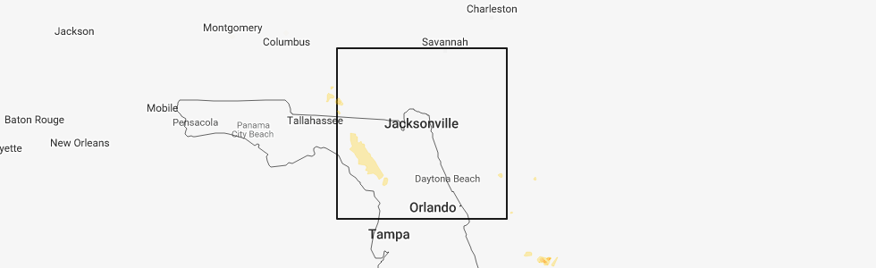
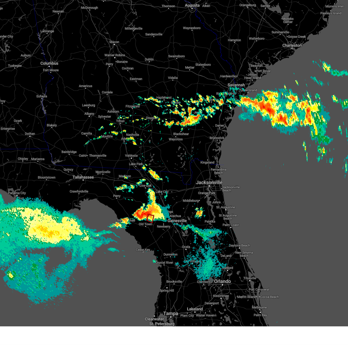
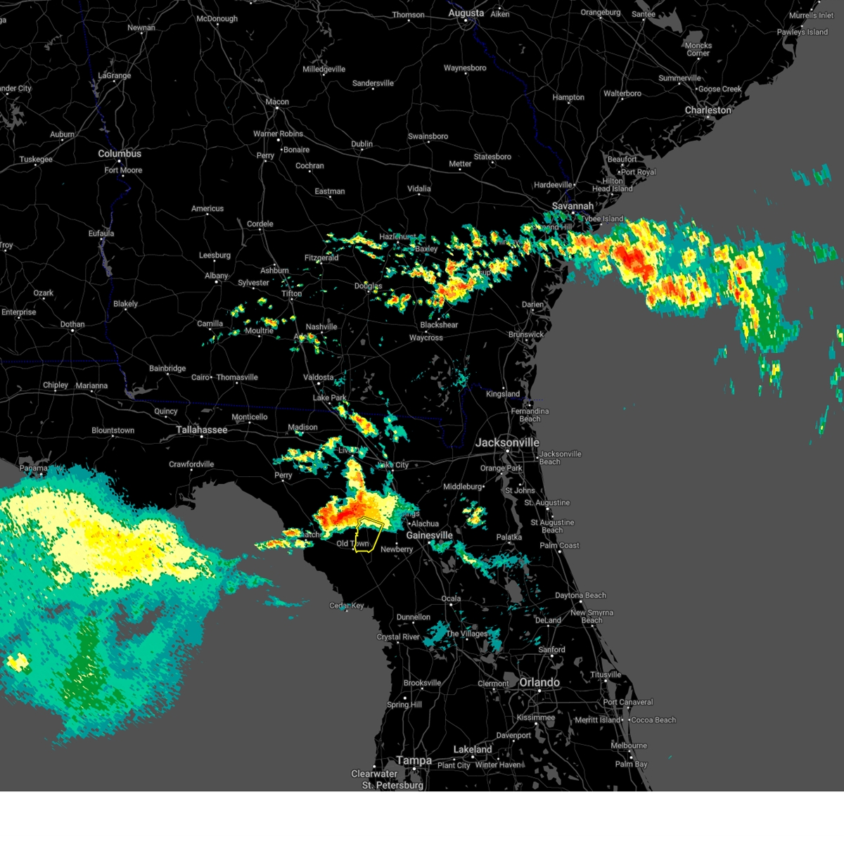
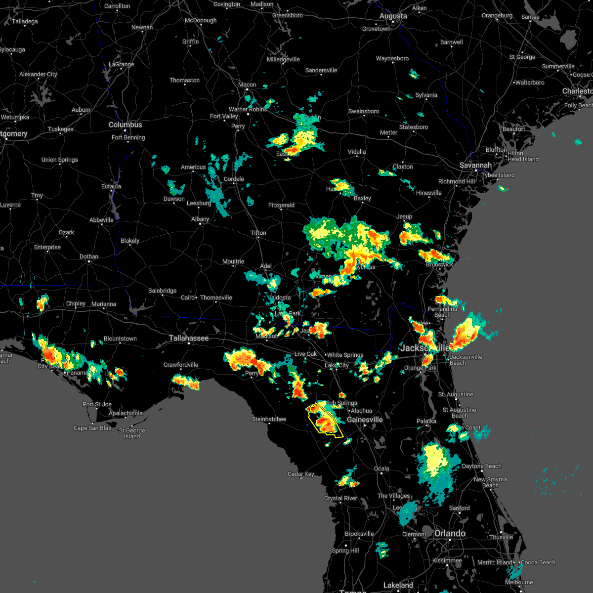
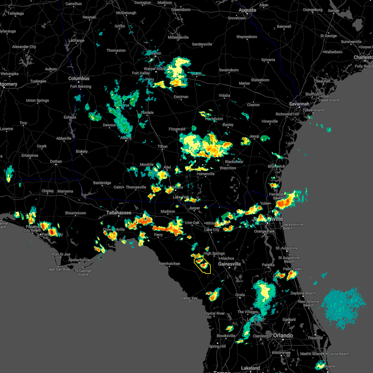
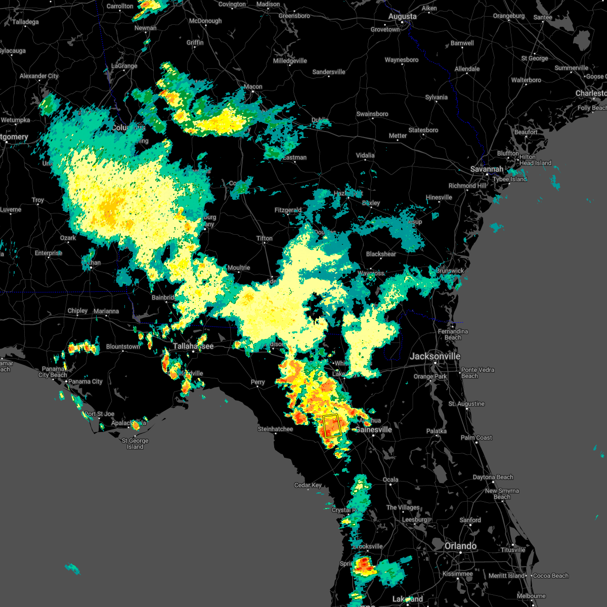
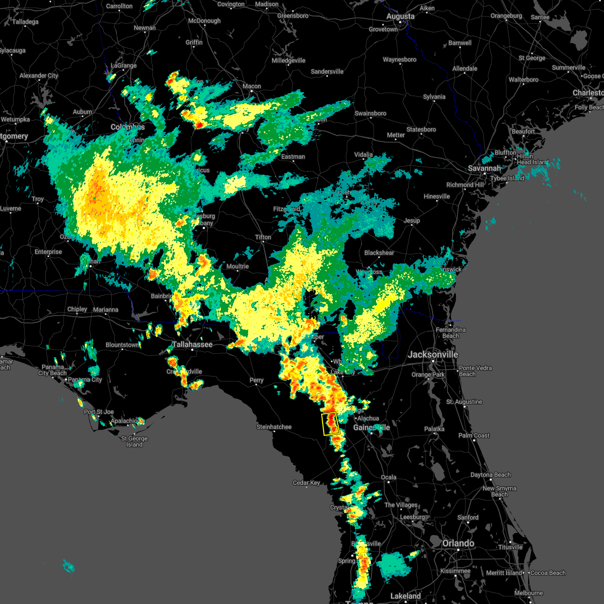
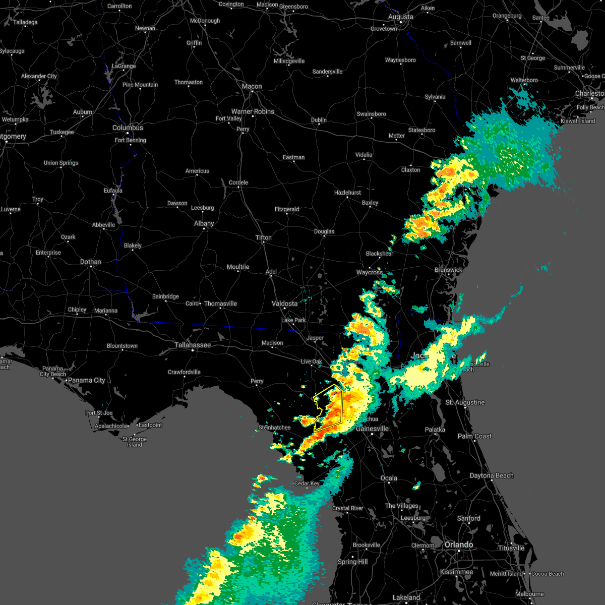
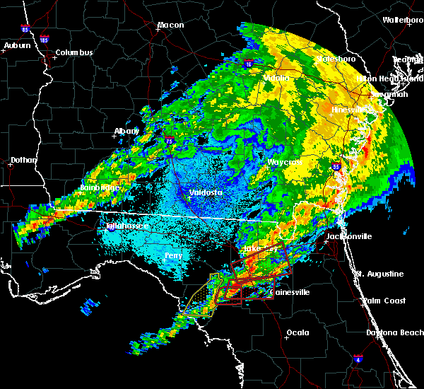
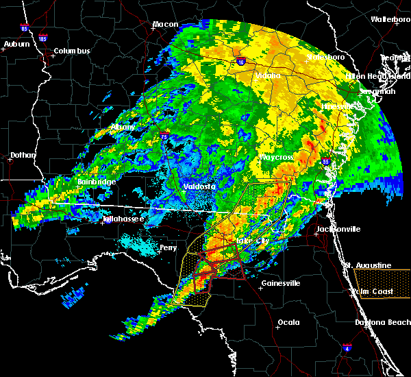
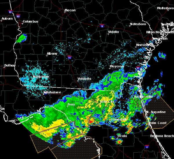
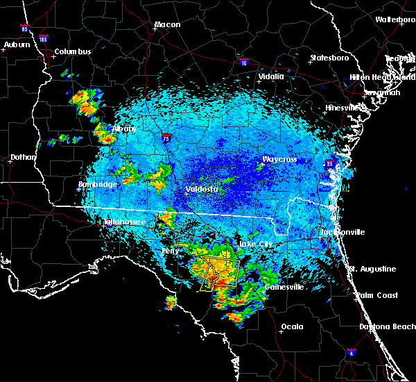
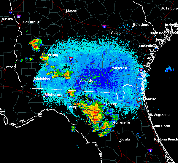
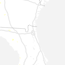
Hail Map for Bell, FL
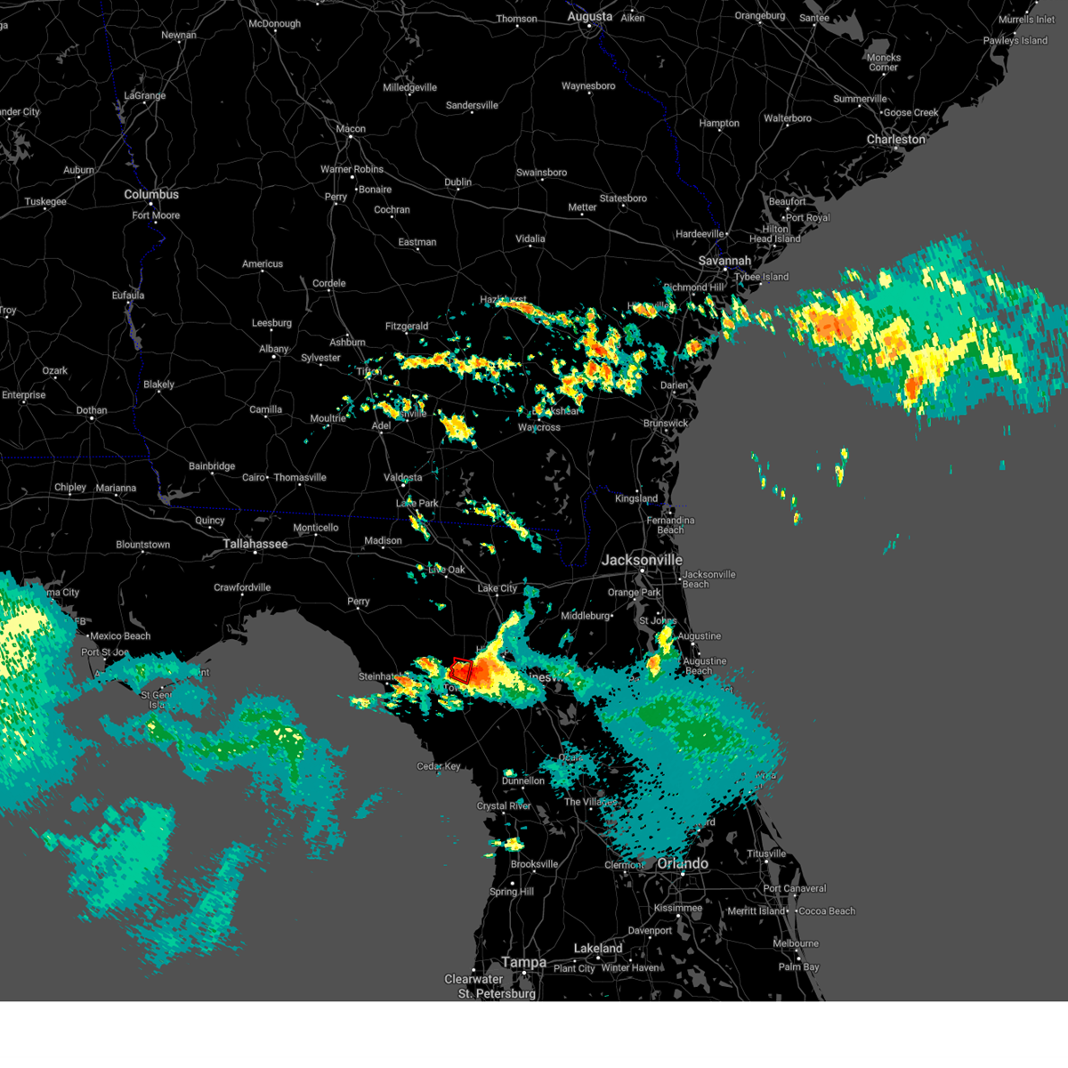
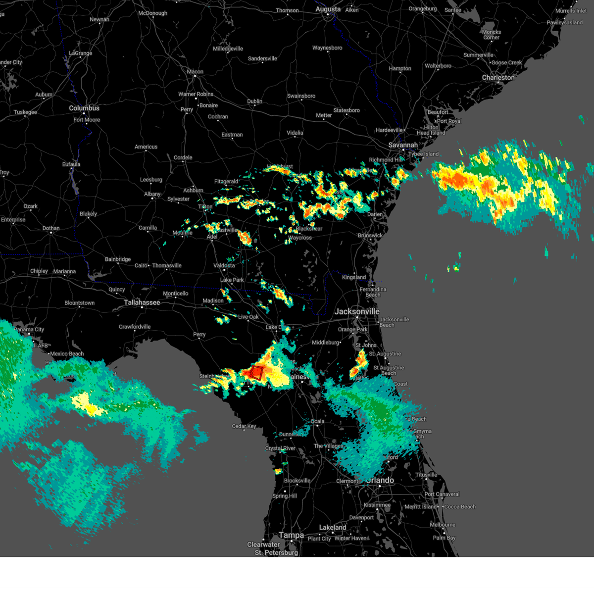
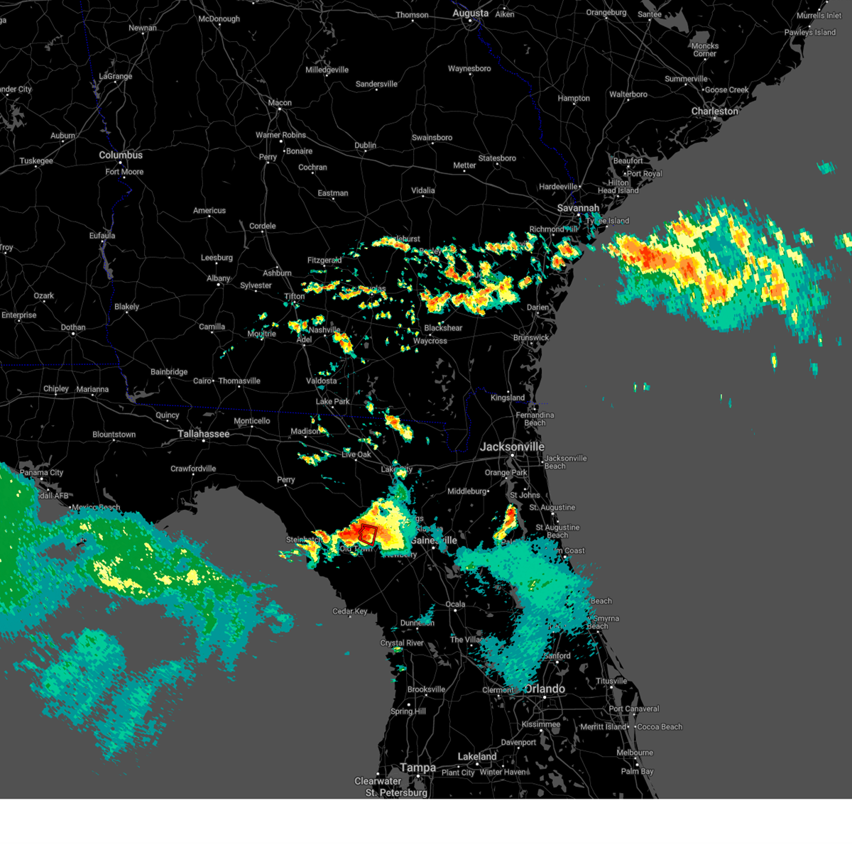
The Bell, FL area has had 1 report of on-the-ground hail by trained spotters, and has been under severe weather warnings 0 times during the past 12 months. Doppler radar has detected hail at or near Bell, FL on 39 occasions.
| Name: | Bell, FL |
| Where Located: | 82.4 miles WSW of Jacksonville, FL |
| Map: | Google Map for Bell, FL |
| Population: | 456 |
| Housing Units: | 202 |
| More Info: | Search Google for Bell, FL |
5
The Top Recent Hail Date for Bell, FL is Tuesday, March 26, 2019 (1st out of 39)
Hail and Wind Damage Spotted near Bell, FL
| Date / Time | Report Details |
|---|---|
| 5/10/2024 8:18 AM EDT |
 Svrjax the national weather service in jacksonville has issued a * severe thunderstorm warning for, gilchrist county in northern florida, western alachua county in northern florida, baker county in northeastern florida, union county in northern florida, southeastern suwannee county in northern florida, columbia county in northern florida, eastern hamilton county in northern florida, southeastern echols county in southeastern georgia, southern ware county in southeastern georgia, southeastern clinch county in southeastern georgia, central charlton county in southeastern georgia, * until 900 am edt. * at 818 am edt, severe thunderstorms were located along a line extending from 6 miles south of homerville to near white springs to near cross city, moving east at 60 mph (radar indicated). Hazards include 70 mph wind gusts and quarter size hail. Hail damage to vehicles is expected. expect considerable tree damage. Wind damage is also likely to mobile homes, roofs, and outbuildings. Svrjax the national weather service in jacksonville has issued a * severe thunderstorm warning for, gilchrist county in northern florida, western alachua county in northern florida, baker county in northeastern florida, union county in northern florida, southeastern suwannee county in northern florida, columbia county in northern florida, eastern hamilton county in northern florida, southeastern echols county in southeastern georgia, southern ware county in southeastern georgia, southeastern clinch county in southeastern georgia, central charlton county in southeastern georgia, * until 900 am edt. * at 818 am edt, severe thunderstorms were located along a line extending from 6 miles south of homerville to near white springs to near cross city, moving east at 60 mph (radar indicated). Hazards include 70 mph wind gusts and quarter size hail. Hail damage to vehicles is expected. expect considerable tree damage. Wind damage is also likely to mobile homes, roofs, and outbuildings.
|
| 5/10/2024 8:00 AM EDT |
 At 800 am edt, severe thunderstorms were located along a line extending from moody air force base to 7 miles southwest of dowling park to near steinhatchee, moving east at 45 mph (radar indicated). Hazards include 70 mph wind gusts and quarter size hail. possible tornadoes. Hail damage to vehicles is expected. expect considerable tree damage. wind damage is also likely to mobile homes, roofs, and outbuildings. Locations impacted include, lake city, live oak, jasper, homerville, trenton, jennings, white springs, bell, fargo, and statenville. At 800 am edt, severe thunderstorms were located along a line extending from moody air force base to 7 miles southwest of dowling park to near steinhatchee, moving east at 45 mph (radar indicated). Hazards include 70 mph wind gusts and quarter size hail. possible tornadoes. Hail damage to vehicles is expected. expect considerable tree damage. wind damage is also likely to mobile homes, roofs, and outbuildings. Locations impacted include, lake city, live oak, jasper, homerville, trenton, jennings, white springs, bell, fargo, and statenville.
|
| 5/10/2024 7:50 AM EDT |
 Svrjax the national weather service in jacksonville has issued a * severe thunderstorm warning for, gilchrist county in northern florida, suwannee county in northern florida, western columbia county in northern florida, hamilton county in northern florida, echols county in southeastern georgia, west central ware county in southeastern georgia, clinch county in southeastern georgia, * until 830 am edt. * at 750 am edt, severe thunderstorms were located along a line extending from near hahira to 7 miles west of dowling park to 18 miles northwest of steinhatchee, moving east at 55 mph (radar indicated). Hazards include 70 mph wind gusts and quarter size hail. Hail damage to vehicles is expected. expect considerable tree damage. Wind damage is also likely to mobile homes, roofs, and outbuildings. Svrjax the national weather service in jacksonville has issued a * severe thunderstorm warning for, gilchrist county in northern florida, suwannee county in northern florida, western columbia county in northern florida, hamilton county in northern florida, echols county in southeastern georgia, west central ware county in southeastern georgia, clinch county in southeastern georgia, * until 830 am edt. * at 750 am edt, severe thunderstorms were located along a line extending from near hahira to 7 miles west of dowling park to 18 miles northwest of steinhatchee, moving east at 55 mph (radar indicated). Hazards include 70 mph wind gusts and quarter size hail. Hail damage to vehicles is expected. expect considerable tree damage. Wind damage is also likely to mobile homes, roofs, and outbuildings.
|
| 4/3/2024 10:47 AM EDT |
 At 1047 am edt, severe thunderstorms were located along a line extending from near sanderson to near high springs, moving east at 50 mph (radar indicated). Hazards include 60 mph wind gusts and penny size hail. Expect damage to roofs, siding, and trees. locations impacted include, lake butler, bell, raiford, worthington spring, alachua, macclenny, high springs, glen st. Mary, worthington springs, and palestine community. At 1047 am edt, severe thunderstorms were located along a line extending from near sanderson to near high springs, moving east at 50 mph (radar indicated). Hazards include 60 mph wind gusts and penny size hail. Expect damage to roofs, siding, and trees. locations impacted include, lake butler, bell, raiford, worthington spring, alachua, macclenny, high springs, glen st. Mary, worthington springs, and palestine community.
|
| 4/3/2024 10:31 AM EDT |
 the severe thunderstorm warning has been cancelled and is no longer in effect the severe thunderstorm warning has been cancelled and is no longer in effect
|
| 4/3/2024 10:31 AM EDT |
 At 1030 am edt, severe thunderstorms were located along a line extending from near watertown to near bell, moving east at 40 mph (radar indicated). Hazards include 60 mph wind gusts and penny size hail. Expect damage to roofs, siding, and trees. Locations impacted include, lake city, lake butler, bell, raiford, worthington spring, columbia, alachua, macclenny, high springs, and fort white. At 1030 am edt, severe thunderstorms were located along a line extending from near watertown to near bell, moving east at 40 mph (radar indicated). Hazards include 60 mph wind gusts and penny size hail. Expect damage to roofs, siding, and trees. Locations impacted include, lake city, lake butler, bell, raiford, worthington spring, columbia, alachua, macclenny, high springs, and fort white.
|
| 4/3/2024 10:12 AM EDT |
 Svrjax the national weather service in jacksonville has issued a * severe thunderstorm warning for, central gilchrist county in northern florida, central bradford county in northern florida, northwestern alachua county in northern florida, southern baker county in northeastern florida, union county in northern florida, southeastern suwannee county in northern florida, southern columbia county in northern florida, * until 1115 am edt. * at 1012 am edt, severe thunderstorms were located along a line extending from near wellborn to 6 miles north of bell, moving east at 35 mph (radar indicated). Hazards include 60 mph wind gusts and penny size hail. expect damage to roofs, siding, and trees Svrjax the national weather service in jacksonville has issued a * severe thunderstorm warning for, central gilchrist county in northern florida, central bradford county in northern florida, northwestern alachua county in northern florida, southern baker county in northeastern florida, union county in northern florida, southeastern suwannee county in northern florida, southern columbia county in northern florida, * until 1115 am edt. * at 1012 am edt, severe thunderstorms were located along a line extending from near wellborn to 6 miles north of bell, moving east at 35 mph (radar indicated). Hazards include 60 mph wind gusts and penny size hail. expect damage to roofs, siding, and trees
|
| 3/27/2024 8:57 AM EDT |
 At 857 am edt, severe thunderstorms were located along a line extending from 6 miles southwest of ichetucknee spring to near chiefland, moving northeast at 40 mph (radar indicated). Hazards include 60 mph wind gusts and penny size hail. Expect damage to roofs, siding, and trees. Locations impacted include, trenton, bell, high springs, and newberry. At 857 am edt, severe thunderstorms were located along a line extending from 6 miles southwest of ichetucknee spring to near chiefland, moving northeast at 40 mph (radar indicated). Hazards include 60 mph wind gusts and penny size hail. Expect damage to roofs, siding, and trees. Locations impacted include, trenton, bell, high springs, and newberry.
|
| 3/27/2024 8:38 AM EDT |
 Svrjax the national weather service in jacksonville has issued a * severe thunderstorm warning for, gilchrist county in northern florida, northwestern alachua county in northern florida, south central columbia county in northern florida, * until 930 am edt. * at 838 am edt, severe thunderstorms were located along a line extending from 10 miles northwest of bell to 21 miles southwest of fowlers bluff, moving east at 40 mph (radar indicated). Hazards include 60 mph wind gusts and penny size hail. expect damage to roofs, siding, and trees Svrjax the national weather service in jacksonville has issued a * severe thunderstorm warning for, gilchrist county in northern florida, northwestern alachua county in northern florida, south central columbia county in northern florida, * until 930 am edt. * at 838 am edt, severe thunderstorms were located along a line extending from 10 miles northwest of bell to 21 miles southwest of fowlers bluff, moving east at 40 mph (radar indicated). Hazards include 60 mph wind gusts and penny size hail. expect damage to roofs, siding, and trees
|
| 1/9/2024 2:24 PM EST |
 The severe thunderstorm warning for gilchrist and west central alachua counties will expire at 230 pm est, the storms which prompted the warning have weakened below severe limits, and no longer pose an immediate threat to life or property. therefore, the warning will be allowed to expire. however, gusty winds are still possible with these thunderstorms. a tornado watch remains in effect until 300 pm est for northern florida. a tornado watch also remains in effect until 600 pm est for northern florida. The severe thunderstorm warning for gilchrist and west central alachua counties will expire at 230 pm est, the storms which prompted the warning have weakened below severe limits, and no longer pose an immediate threat to life or property. therefore, the warning will be allowed to expire. however, gusty winds are still possible with these thunderstorms. a tornado watch remains in effect until 300 pm est for northern florida. a tornado watch also remains in effect until 600 pm est for northern florida.
|
| 1/9/2024 1:39 PM EST |
 At 139 pm est, severe thunderstorms were located along a line extending from 7 miles south of obrien to 6 miles southwest of fowlers bluff, moving east at 30 mph (radar indicated). Hazards include 60 mph wind gusts. expect damage to roofs, siding, and trees At 139 pm est, severe thunderstorms were located along a line extending from 7 miles south of obrien to 6 miles southwest of fowlers bluff, moving east at 30 mph (radar indicated). Hazards include 60 mph wind gusts. expect damage to roofs, siding, and trees
|
| 6/16/2023 6:42 AM EDT |
 The tornado warning for west central gilchrist county will expire at 645 am edt, the storm which prompted the warning has weakened below severe limits, and has exited the warned area. therefore, the warning will be allowed to expire. however gusty winds and heavy rain are still possible with this thunderstorm. The tornado warning for west central gilchrist county will expire at 645 am edt, the storm which prompted the warning has weakened below severe limits, and has exited the warned area. therefore, the warning will be allowed to expire. however gusty winds and heavy rain are still possible with this thunderstorm.
|
| 6/16/2023 6:32 AM EDT |
 At 632 am edt, a severe thunderstorm capable of producing a tornado was located over bell, moving east at 20 mph (radar indicated rotation). Hazards include tornado. Flying debris will be dangerous to those caught without shelter. mobile homes will be damaged or destroyed. damage to roofs, windows, and vehicles will occur. tree damage is likely. This dangerous storm will be near, bell around 635 am edt. At 632 am edt, a severe thunderstorm capable of producing a tornado was located over bell, moving east at 20 mph (radar indicated rotation). Hazards include tornado. Flying debris will be dangerous to those caught without shelter. mobile homes will be damaged or destroyed. damage to roofs, windows, and vehicles will occur. tree damage is likely. This dangerous storm will be near, bell around 635 am edt.
|
| 6/16/2023 6:24 AM EDT |
 At 624 am edt, a severe thunderstorm capable of producing a tornado was located just west of bell, moving east at 25 mph (radar indicated rotation). Hazards include tornado. Flying debris will be dangerous to those caught without shelter. mobile homes will be damaged or destroyed. damage to roofs, windows, and vehicles will occur. tree damage is likely. This dangerous storm will be near, bell around 630 am edt. At 624 am edt, a severe thunderstorm capable of producing a tornado was located just west of bell, moving east at 25 mph (radar indicated rotation). Hazards include tornado. Flying debris will be dangerous to those caught without shelter. mobile homes will be damaged or destroyed. damage to roofs, windows, and vehicles will occur. tree damage is likely. This dangerous storm will be near, bell around 630 am edt.
|
| 6/16/2023 6:09 AM EDT |
 At 608 am edt, a severe thunderstorm capable of producing a tornado was located 8 miles west of bell, moving east at 25 mph (radar indicated rotation). Hazards include tornado. Flying debris will be dangerous to those caught without shelter. mobile homes will be damaged or destroyed. damage to roofs, windows, and vehicles will occur. tree damage is likely. This dangerous storm will be near, bell around 630 am edt. At 608 am edt, a severe thunderstorm capable of producing a tornado was located 8 miles west of bell, moving east at 25 mph (radar indicated rotation). Hazards include tornado. Flying debris will be dangerous to those caught without shelter. mobile homes will be damaged or destroyed. damage to roofs, windows, and vehicles will occur. tree damage is likely. This dangerous storm will be near, bell around 630 am edt.
|
| 6/16/2023 6:00 AM EDT |
 At 559 am edt, a severe thunderstorm was located 11 miles north of cross city, moving southeast at 30 mph (radar indicated). Hazards include 60 mph wind gusts. possible tornado. expect damage to roofs, siding, and trees At 559 am edt, a severe thunderstorm was located 11 miles north of cross city, moving southeast at 30 mph (radar indicated). Hazards include 60 mph wind gusts. possible tornado. expect damage to roofs, siding, and trees
|
| 6/14/2023 11:02 PM EDT |
 At 1102 pm edt, severe thunderstorms were located along a line extending from 6 miles northwest of olustee to near providence to 7 miles east of bell, moving southeast at 45 mph (radar indicated). Hazards include 60 mph wind gusts. Expect damage to roofs, siding, and trees. locations impacted include, bell, ichetucknee spring, columbia, fort white, branford and hildreth. hail threat, radar indicated max hail size, <. 75 in wind threat, radar indicated max wind gust, 60 mph. At 1102 pm edt, severe thunderstorms were located along a line extending from 6 miles northwest of olustee to near providence to 7 miles east of bell, moving southeast at 45 mph (radar indicated). Hazards include 60 mph wind gusts. Expect damage to roofs, siding, and trees. locations impacted include, bell, ichetucknee spring, columbia, fort white, branford and hildreth. hail threat, radar indicated max hail size, <. 75 in wind threat, radar indicated max wind gust, 60 mph.
|
| 6/14/2023 10:50 PM EDT | Gilchrist county 911/dispatch reports trees and powerlines downed by strong winds scattered across northwestern portions of the county. time of damage based on radar da in gilchrist county FL, 0.3 miles S of Bell, FL |
| 6/14/2023 10:41 PM EDT |
 At 1041 pm edt, severe thunderstorms were located along a line extending from near belmont to 6 miles southeast of wellborn to 6 miles south of obrien, moving southeast at 45 mph (radar indicated). Hazards include 60 mph wind gusts. Expect damage to roofs, siding, and trees. locations impacted include, lake city, white springs, bell, ichetucknee spring, columbia, fort white, winfield, suwannee valley, belmont and mcalpin. hail threat, radar indicated max hail size, <. 75 in wind threat, radar indicated max wind gust, 60 mph. At 1041 pm edt, severe thunderstorms were located along a line extending from near belmont to 6 miles southeast of wellborn to 6 miles south of obrien, moving southeast at 45 mph (radar indicated). Hazards include 60 mph wind gusts. Expect damage to roofs, siding, and trees. locations impacted include, lake city, white springs, bell, ichetucknee spring, columbia, fort white, winfield, suwannee valley, belmont and mcalpin. hail threat, radar indicated max hail size, <. 75 in wind threat, radar indicated max wind gust, 60 mph.
|
| 6/14/2023 10:26 PM EDT |
 At 1026 pm edt, severe thunderstorms were located along a line extending from near belmont to near mcalpin to near mayo, moving southeast at 40 mph (radar indicated). Hazards include 60 mph wind gusts. expect damage to roofs, siding, and trees At 1026 pm edt, severe thunderstorms were located along a line extending from near belmont to near mcalpin to near mayo, moving southeast at 40 mph (radar indicated). Hazards include 60 mph wind gusts. expect damage to roofs, siding, and trees
|
| 8/17/2022 5:28 PM EDT |
 At 528 pm edt, severe thunderstorms were located along a line extending from near bell to 6 miles east of trenton, and are nearly stationary (radar indicated). Hazards include 60 mph wind gusts. expect damage to roofs, siding, and trees At 528 pm edt, severe thunderstorms were located along a line extending from near bell to 6 miles east of trenton, and are nearly stationary (radar indicated). Hazards include 60 mph wind gusts. expect damage to roofs, siding, and trees
|
| 8/17/2022 5:18 PM EDT | Report of trees and power lines down due to thunderstorm wind in gilchrist county FL, 3.1 miles S of Bell, FL |
| 8/17/2022 4:53 PM EDT |
 At 453 pm edt, severe thunderstorms were located along a line extending from near bell to near trenton, moving southeast at 15 mph (radar indicated). Hazards include 60 mph wind gusts. expect damage to roofs, siding, and trees At 453 pm edt, severe thunderstorms were located along a line extending from near bell to near trenton, moving southeast at 15 mph (radar indicated). Hazards include 60 mph wind gusts. expect damage to roofs, siding, and trees
|
| 6/29/2022 8:25 PM EDT |
 The severe thunderstorm warning for central gilchrist county will expire at 830 pm edt, the storm which prompted the warning has weakened below severe limits, and no longer poses an immediate threat to life or property. therefore, the warning will be allowed to expire. however gusty winds and heavy rain are still possible with this thunderstorm. The severe thunderstorm warning for central gilchrist county will expire at 830 pm edt, the storm which prompted the warning has weakened below severe limits, and no longer poses an immediate threat to life or property. therefore, the warning will be allowed to expire. however gusty winds and heavy rain are still possible with this thunderstorm.
|
| 6/29/2022 7:55 PM EDT |
 At 755 pm edt, a severe thunderstorm was located near bell, moving south at 15 mph (radar indicated). Hazards include 60 mph wind gusts. expect damage to roofs, siding, and trees At 755 pm edt, a severe thunderstorm was located near bell, moving south at 15 mph (radar indicated). Hazards include 60 mph wind gusts. expect damage to roofs, siding, and trees
|
| 6/24/2022 4:28 PM EDT |
 The severe thunderstorm warning for gilchrist, western alachua and southwestern columbia counties will expire at 430 pm edt, the storm which prompted the warning has weakened below severe limits, and no longer poses an immediate threat to life or property. therefore, the warning will be allowed to expire. however gusty winds and heavy rain are still possible with this thunderstorm. to report severe weather, contact your nearest law enforcement agency. they will relay your report to the national weather service jacksonville. The severe thunderstorm warning for gilchrist, western alachua and southwestern columbia counties will expire at 430 pm edt, the storm which prompted the warning has weakened below severe limits, and no longer poses an immediate threat to life or property. therefore, the warning will be allowed to expire. however gusty winds and heavy rain are still possible with this thunderstorm. to report severe weather, contact your nearest law enforcement agency. they will relay your report to the national weather service jacksonville.
|
| 6/24/2022 4:11 PM EDT |
 At 410 pm edt, a severe thunderstorm was located 8 miles southwest of alachua, or 14 miles west of gainesville, moving south at 25 mph (radar indicated). Hazards include 60 mph wind gusts and penny size hail. Expect damage to roofs, siding, and trees. locations impacted include, gainesville, trenton, bell, alachua, high springs, archer, fort white, university of florida and newberry. hail threat, radar indicated max hail size, 0. 75 in wind threat, radar indicated max wind gust, 60 mph. At 410 pm edt, a severe thunderstorm was located 8 miles southwest of alachua, or 14 miles west of gainesville, moving south at 25 mph (radar indicated). Hazards include 60 mph wind gusts and penny size hail. Expect damage to roofs, siding, and trees. locations impacted include, gainesville, trenton, bell, alachua, high springs, archer, fort white, university of florida and newberry. hail threat, radar indicated max hail size, 0. 75 in wind threat, radar indicated max wind gust, 60 mph.
|
| 6/24/2022 4:03 PM EDT |
 At 402 pm edt, a severe thunderstorm was located near high springs, or 13 miles northeast of trenton, moving southwest at 30 mph (radar indicated). Hazards include 60 mph wind gusts and penny size hail. expect damage to roofs, siding, and trees At 402 pm edt, a severe thunderstorm was located near high springs, or 13 miles northeast of trenton, moving southwest at 30 mph (radar indicated). Hazards include 60 mph wind gusts and penny size hail. expect damage to roofs, siding, and trees
|
| 3/18/2021 2:26 PM EDT |
 The severe thunderstorm warning for central gilchrist, southwestern columbia and southeastern suwannee counties will expire at 230 pm edt, the storm which prompted the warning has weakened below severe limits, and no longer poses an immediate threat to life or property. therefore, the warning will be allowed to expire. however heavy rain is still possible with this thunderstorm. a tornado watch remains in effect until 600 pm edt for northern florida. The severe thunderstorm warning for central gilchrist, southwestern columbia and southeastern suwannee counties will expire at 230 pm edt, the storm which prompted the warning has weakened below severe limits, and no longer poses an immediate threat to life or property. therefore, the warning will be allowed to expire. however heavy rain is still possible with this thunderstorm. a tornado watch remains in effect until 600 pm edt for northern florida.
|
| 3/18/2021 2:12 PM EDT |
 At 212 pm edt, a severe thunderstorm was located 8 miles north of bell, moving northeast at 45 mph (radar indicated). Hazards include 60 mph wind gusts. Expect damage to roofs, siding, and trees. Locations impacted include, bell, ichetucknee spring, columbia, fort white, branford and hildreth. At 212 pm edt, a severe thunderstorm was located 8 miles north of bell, moving northeast at 45 mph (radar indicated). Hazards include 60 mph wind gusts. Expect damage to roofs, siding, and trees. Locations impacted include, bell, ichetucknee spring, columbia, fort white, branford and hildreth.
|
| 3/18/2021 1:55 PM EDT |
 At 155 pm edt, a severe thunderstorm was located 10 miles north of cross city, moving northeast at 55 mph (radar indicated). Hazards include 60 mph wind gusts. Expect damage to roofs, siding, and trees. Locations impacted include, bell, ichetucknee spring, columbia, fort white, obrien, mcalpin, branford and hildreth. At 155 pm edt, a severe thunderstorm was located 10 miles north of cross city, moving northeast at 55 mph (radar indicated). Hazards include 60 mph wind gusts. Expect damage to roofs, siding, and trees. Locations impacted include, bell, ichetucknee spring, columbia, fort white, obrien, mcalpin, branford and hildreth.
|
| 3/18/2021 1:41 PM EDT |
 At 141 pm edt, a severe thunderstorm was located 8 miles northwest of cross city, moving northeast at 50 mph (radar indicated). Hazards include 60 mph wind gusts. expect damage to roofs, siding, and trees At 141 pm edt, a severe thunderstorm was located 8 miles northwest of cross city, moving northeast at 50 mph (radar indicated). Hazards include 60 mph wind gusts. expect damage to roofs, siding, and trees
|
| 2/6/2021 5:08 PM EST |
 At 508 pm est, a severe thunderstorm was located near high springs, or 11 miles southwest of worthington spring, moving northeast at 55 mph (radar indicated). Hazards include quarter size hail. Damage to vehicles is expected. Locations impacted include, starke, trenton, lake butler, bell, raiford, worthington spring, alachua, high springs, worthington springs and groves. At 508 pm est, a severe thunderstorm was located near high springs, or 11 miles southwest of worthington spring, moving northeast at 55 mph (radar indicated). Hazards include quarter size hail. Damage to vehicles is expected. Locations impacted include, starke, trenton, lake butler, bell, raiford, worthington spring, alachua, high springs, worthington springs and groves.
|
| 2/6/2021 4:59 PM EST |
 At 459 pm est, a severe thunderstorm was located near high springs, or 13 miles east of bell, moving northeast at 55 mph (radar indicated). Hazards include 60 mph wind gusts and quarter size hail. Hail damage to vehicles is expected. Expect wind damage to roofs, siding, and trees. At 459 pm est, a severe thunderstorm was located near high springs, or 13 miles east of bell, moving northeast at 55 mph (radar indicated). Hazards include 60 mph wind gusts and quarter size hail. Hail damage to vehicles is expected. Expect wind damage to roofs, siding, and trees.
|
| 12/24/2020 5:30 PM EST | Numerous trees reported down just south of highway 232. time estimated by rada in gilchrist county FL, 3.8 miles N of Bell, FL |
| 7/21/2020 5:00 PM EDT | Tree on powerline... sparked a fir in dixie county FL, 6.7 miles ESE of Bell, FL |
| 4/24/2020 2:56 AM EDT |
 The severe thunderstorm warning for gilchrist county will expire at 300 am edt, the storm which prompted the warning has weakened below severe limits, and no longer poses an immediate threat to life or property. therefore, the warning will be allowed to expire. however gusty winds and heavy rain are still possible with this thunderstorm. a tornado watch remains in effect until 1100 am edt for northern florida. The severe thunderstorm warning for gilchrist county will expire at 300 am edt, the storm which prompted the warning has weakened below severe limits, and no longer poses an immediate threat to life or property. therefore, the warning will be allowed to expire. however gusty winds and heavy rain are still possible with this thunderstorm. a tornado watch remains in effect until 1100 am edt for northern florida.
|
| 4/24/2020 2:36 AM EDT |
 At 235 am edt, a severe thunderstorm was located near trenton, moving east at 40 mph (radar indicated). Hazards include 60 mph wind gusts. expect damage to roofs, siding, and trees At 235 am edt, a severe thunderstorm was located near trenton, moving east at 40 mph (radar indicated). Hazards include 60 mph wind gusts. expect damage to roofs, siding, and trees
|
| 4/23/2020 9:41 PM EDT |
 The tornado warning for gilchrist county will expire at 945 pm edt, the storm which prompted the warning is moving out of the warned area. however, a new warning has been issued for the same storm. a tornado watch remains in effect until midnight edt for northern florida. remember, a tornado warning still remains in effect for gilchrist, southern columbia, and alachua counties. The tornado warning for gilchrist county will expire at 945 pm edt, the storm which prompted the warning is moving out of the warned area. however, a new warning has been issued for the same storm. a tornado watch remains in effect until midnight edt for northern florida. remember, a tornado warning still remains in effect for gilchrist, southern columbia, and alachua counties.
|
| 4/23/2020 9:25 PM EDT |
 At 925 pm edt, a severe thunderstorm capable of producing a tornado was located over bell, moving east at 35 mph (radar indicated rotation). Hazards include tornado. Flying debris will be dangerous to those caught without shelter. mobile homes will be damaged or destroyed. damage to roofs, windows, and vehicles will occur. tree damage is likely. This tornadic thunderstorm will remain over mainly rural areas of gilchrist county. At 925 pm edt, a severe thunderstorm capable of producing a tornado was located over bell, moving east at 35 mph (radar indicated rotation). Hazards include tornado. Flying debris will be dangerous to those caught without shelter. mobile homes will be damaged or destroyed. damage to roofs, windows, and vehicles will occur. tree damage is likely. This tornadic thunderstorm will remain over mainly rural areas of gilchrist county.
|
| 4/23/2020 9:07 PM EDT |
 At 906 pm edt, a severe thunderstorm capable of producing a tornado was located 7 miles northeast of cross city, moving east at 30 mph (radar indicated rotation). Hazards include tornado. Flying debris will be dangerous to those caught without shelter. mobile homes will be damaged or destroyed. damage to roofs, windows, and vehicles will occur. tree damage is likely. this dangerous storm will be near, bell around 925 pm edt. Trenton around 935 pm edt. At 906 pm edt, a severe thunderstorm capable of producing a tornado was located 7 miles northeast of cross city, moving east at 30 mph (radar indicated rotation). Hazards include tornado. Flying debris will be dangerous to those caught without shelter. mobile homes will be damaged or destroyed. damage to roofs, windows, and vehicles will occur. tree damage is likely. this dangerous storm will be near, bell around 925 pm edt. Trenton around 935 pm edt.
|
| 2/6/2020 9:32 PM EST | Gilchrist county 911/dispatch reports trees and powerlines down county-wid in gilchrist county FL, 3.1 miles W of Bell, FL |
| 2/6/2020 9:07 PM EST |
 A severe thunderstorm warning remains in effect until 930 pm est for northern gilchrist. northwestern alachua. western baker. western union. columbia and southeastern suwannee counties. At 906 pm est, severe thunderstorms were located along a line extending from 6 miles south of fargo to near bell, moving east at 40 mph. A severe thunderstorm warning remains in effect until 930 pm est for northern gilchrist. northwestern alachua. western baker. western union. columbia and southeastern suwannee counties. At 906 pm est, severe thunderstorms were located along a line extending from 6 miles south of fargo to near bell, moving east at 40 mph.
|
| 2/6/2020 8:55 PM EST |
 At 855 pm est, a severe thunderstorm was located 7 miles northwest of trenton, moving east at 35 mph (radar indicated). Hazards include 60 mph wind gusts. expect damage to roofs, siding, and trees At 855 pm est, a severe thunderstorm was located 7 miles northwest of trenton, moving east at 35 mph (radar indicated). Hazards include 60 mph wind gusts. expect damage to roofs, siding, and trees
|
| 2/6/2020 8:41 PM EST |
 At 841 pm est, severe thunderstorms were located along a line extending from 8 miles southwest of needmore to 10 miles south of obrien, moving east at 40 mph (radar indicated). Hazards include 60 mph wind gusts. expect damage to roofs, siding, and trees At 841 pm est, severe thunderstorms were located along a line extending from 8 miles southwest of needmore to 10 miles south of obrien, moving east at 40 mph (radar indicated). Hazards include 60 mph wind gusts. expect damage to roofs, siding, and trees
|
| 7/21/2019 2:53 PM EDT | Quarter sized hail reported 7.5 miles NE of Bell, FL, hart springs park employee reported hail up to a quarter in size |
| 7/21/2019 2:53 PM EDT | Multiple tree knocked down and also hail reported... size unknown at this tim in gilchrist county FL, 8 miles NE of Bell, FL |
| 4/19/2019 11:00 AM EDT |
 At 1100 am edt, severe thunderstorms were located along a line extending from 8 miles west of stephen foster state park to 7 miles north of bronson, moving northeast at 55 mph (radar indicated). Hazards include 70 mph wind gusts. Expect considerable tree damage. Damage is likely to mobile homes, roofs, and outbuildings. At 1100 am edt, severe thunderstorms were located along a line extending from 8 miles west of stephen foster state park to 7 miles north of bronson, moving northeast at 55 mph (radar indicated). Hazards include 70 mph wind gusts. Expect considerable tree damage. Damage is likely to mobile homes, roofs, and outbuildings.
|
| 4/19/2019 10:54 AM EDT |
 At 1053 am edt, severe thunderstorms were located along a line extending from near needmore to near high springs, moving northeast at 55 mph (radar indicated). Hazards include 70 mph wind gusts. Expect considerable tree damage. damage is likely to mobile homes, roofs, and outbuildings. Locations impacted include, lake city, trenton, white springs, bell, ichetucknee spring, columbia, fort white, five points, watertown and lulu. At 1053 am edt, severe thunderstorms were located along a line extending from near needmore to near high springs, moving northeast at 55 mph (radar indicated). Hazards include 70 mph wind gusts. Expect considerable tree damage. damage is likely to mobile homes, roofs, and outbuildings. Locations impacted include, lake city, trenton, white springs, bell, ichetucknee spring, columbia, fort white, five points, watertown and lulu.
|
| 4/19/2019 10:48 AM EDT |
 At 1048 am edt, severe thunderstorms were located along a line extending from near belmont to 8 miles east of trenton, moving northeast at 55 mph (radar indicated). Hazards include 70 mph wind gusts. Expect considerable tree damage. damage is likely to mobile homes, roofs, and outbuildings. Locations impacted include, lake city, trenton, white springs, bell, ichetucknee spring, columbia, fort white, winfield, suwannee valley and wellborn. At 1048 am edt, severe thunderstorms were located along a line extending from near belmont to 8 miles east of trenton, moving northeast at 55 mph (radar indicated). Hazards include 70 mph wind gusts. Expect considerable tree damage. damage is likely to mobile homes, roofs, and outbuildings. Locations impacted include, lake city, trenton, white springs, bell, ichetucknee spring, columbia, fort white, winfield, suwannee valley and wellborn.
|
| 4/19/2019 10:30 AM EDT | Gilchrist county 911/dispatch reports downed trees and powerlines county-wid in gilchrist county FL, 0.3 miles S of Bell, FL |
| 4/19/2019 10:19 AM EDT |
 At 1019 am edt, severe thunderstorms were located along a line extending from near live oak to 6 miles east of fowlers bluff, moving northeast at 55 mph (radar indicated). Hazards include 60 mph wind gusts. expect damage to roofs, siding, and trees At 1019 am edt, severe thunderstorms were located along a line extending from near live oak to 6 miles east of fowlers bluff, moving northeast at 55 mph (radar indicated). Hazards include 60 mph wind gusts. expect damage to roofs, siding, and trees
|
| 12/3/2018 7:24 AM EST |
 At 724 am est, severe thunderstorms were located along a line extending from near luraville to 6 miles southeast of obrien to 8 miles east of bell, moving northeast at 50 mph (radar indicated). Hazards include 60 mph wind gusts. expect damage to roofs, siding, and trees At 724 am est, severe thunderstorms were located along a line extending from near luraville to 6 miles southeast of obrien to 8 miles east of bell, moving northeast at 50 mph (radar indicated). Hazards include 60 mph wind gusts. expect damage to roofs, siding, and trees
|
| 8/16/2018 4:45 PM EDT |
 At 445 pm edt, severe thunderstorms were located along a line extending from 6 miles east of mayo to near bell, and are nearly stationary (radar indicated). Hazards include 60 mph wind gusts. expect damage to roofs, siding, and trees At 445 pm edt, severe thunderstorms were located along a line extending from 6 miles east of mayo to near bell, and are nearly stationary (radar indicated). Hazards include 60 mph wind gusts. expect damage to roofs, siding, and trees
|
| 7/22/2018 8:08 PM EDT | Three trees down north of fletcher... f in dixie county FL, 7.2 miles E of Bell, FL |
| 7/21/2018 3:47 PM EDT |
 At 346 pm edt, a severe thunderstorm was located near trenton, moving southeast at 40 mph (radar indicated). Hazards include 60 mph wind gusts. expect damage to roofs, siding, and trees At 346 pm edt, a severe thunderstorm was located near trenton, moving southeast at 40 mph (radar indicated). Hazards include 60 mph wind gusts. expect damage to roofs, siding, and trees
|
| 7/21/2018 3:18 PM EDT |
 At 318 pm edt, severe thunderstorms were located along a line extending from 13 miles northwest of bell to near alachua, moving southeast at 40 mph (radar indicated). Hazards include 60 mph wind gusts. Expect damage to roofs, siding, and trees. Locations impacted include, trenton, bell, high springs and newberry. At 318 pm edt, severe thunderstorms were located along a line extending from 13 miles northwest of bell to near alachua, moving southeast at 40 mph (radar indicated). Hazards include 60 mph wind gusts. Expect damage to roofs, siding, and trees. Locations impacted include, trenton, bell, high springs and newberry.
|
| 7/21/2018 2:38 PM EDT |
 At 237 pm edt, severe thunderstorms were located along a line extending from near luraville to near columbia, moving south at 30 mph (radar indicated). Hazards include 60 mph wind gusts. expect damage to roofs, siding, and trees At 237 pm edt, severe thunderstorms were located along a line extending from near luraville to near columbia, moving south at 30 mph (radar indicated). Hazards include 60 mph wind gusts. expect damage to roofs, siding, and trees
|
| 4/7/2018 4:32 PM EDT | 911 call center reported tree down near southwest 50th street and highway 129 northwest of trenton. time estimated from rada in gilchrist county FL, 5.9 miles N of Bell, FL |
| 3/20/2018 3:11 PM EDT |
 The severe thunderstorm warning for gilchrist, northern alachua, bradford, southern baker, union and southern columbia counties will expire at 315 pm edt, the storms which prompted the warning have weakened below severe limits, and have exited the warned area. therefore the warning will be allowed to expire. however small hail, gusty winds and heavy rain are still possible with these thunderstorms. a tornado watch remains in effect until 700 pm edt for northern and northeastern florida. The severe thunderstorm warning for gilchrist, northern alachua, bradford, southern baker, union and southern columbia counties will expire at 315 pm edt, the storms which prompted the warning have weakened below severe limits, and have exited the warned area. therefore the warning will be allowed to expire. however small hail, gusty winds and heavy rain are still possible with these thunderstorms. a tornado watch remains in effect until 700 pm edt for northern and northeastern florida.
|
| 3/20/2018 2:44 PM EDT |
 At 243 pm edt, severe thunderstorms were located along a line extending from 6 miles southeast of columbia to 9 miles northeast of trenton, moving northeast at 55 mph (radar indicated). Hazards include ping pong ball size hail and 60 mph wind gusts. People and animals outdoors will be injured. expect hail damage to roofs, siding, windows, and vehicles. expect wind damage to roofs, siding, and trees. locations impacted include, gainesville, starke, trenton, lake butler, bell, raiford, worthington spring, ichetucknee spring, columbia and alachua. A tornado watch remains in effect until 700 pm edt for northern and northeastern florida. At 243 pm edt, severe thunderstorms were located along a line extending from 6 miles southeast of columbia to 9 miles northeast of trenton, moving northeast at 55 mph (radar indicated). Hazards include ping pong ball size hail and 60 mph wind gusts. People and animals outdoors will be injured. expect hail damage to roofs, siding, windows, and vehicles. expect wind damage to roofs, siding, and trees. locations impacted include, gainesville, starke, trenton, lake butler, bell, raiford, worthington spring, ichetucknee spring, columbia and alachua. A tornado watch remains in effect until 700 pm edt for northern and northeastern florida.
|
| 3/20/2018 2:23 PM EDT |
 At 223 pm edt, severe thunderstorms were located along a line extending from 8 miles north of bell to near manattee road, moving northeast at 55 mph (radar indicated). Hazards include ping pong ball size hail and 60 mph wind gusts. People and animals outdoors will be injured. expect hail damage to roofs, siding, windows, and vehicles. Expect wind damage to roofs, siding, and trees. At 223 pm edt, severe thunderstorms were located along a line extending from 8 miles north of bell to near manattee road, moving northeast at 55 mph (radar indicated). Hazards include ping pong ball size hail and 60 mph wind gusts. People and animals outdoors will be injured. expect hail damage to roofs, siding, windows, and vehicles. Expect wind damage to roofs, siding, and trees.
|
| 2/7/2017 9:19 PM EST |
 At 918 pm est, a severe thunderstorm was located near columbia, or near lake city, moving east at 45 mph (radar indicated). Hazards include 60 mph wind gusts and quarter size hail. Hail damage to vehicles is expected. Expect wind damage to roofs, siding, and trees. At 918 pm est, a severe thunderstorm was located near columbia, or near lake city, moving east at 45 mph (radar indicated). Hazards include 60 mph wind gusts and quarter size hail. Hail damage to vehicles is expected. Expect wind damage to roofs, siding, and trees.
|
| 1/22/2017 6:01 PM EST |
 At 601 pm est, severe thunderstorms were located along a line extending from 8 miles northwest of taylor to lulu, moving east at 90 mph (radar indicated). Hazards include 60 mph wind gusts and quarter size hail. Hail damage to vehicles is expected. expect wind damage to roofs, siding, and trees. locations impacted include, lake city, trenton, worthington spring, ichetucknee spring, columbia, alachua, high springs, fort white, worthington springs and groves. A tornado watch remains in effect until 800 pm est for northeastern and northern florida. At 601 pm est, severe thunderstorms were located along a line extending from 8 miles northwest of taylor to lulu, moving east at 90 mph (radar indicated). Hazards include 60 mph wind gusts and quarter size hail. Hail damage to vehicles is expected. expect wind damage to roofs, siding, and trees. locations impacted include, lake city, trenton, worthington spring, ichetucknee spring, columbia, alachua, high springs, fort white, worthington springs and groves. A tornado watch remains in effect until 800 pm est for northeastern and northern florida.
|
| 1/22/2017 5:28 PM EST |
 At 528 pm est, severe thunderstorms were located along a line extending from near obrien to near manattee road, moving northeast at 90 mph (radar indicated). Hazards include 60 mph wind gusts and quarter size hail. Hail damage to vehicles is expected. Expect wind damage to roofs, siding, and trees. At 528 pm est, severe thunderstorms were located along a line extending from near obrien to near manattee road, moving northeast at 90 mph (radar indicated). Hazards include 60 mph wind gusts and quarter size hail. Hail damage to vehicles is expected. Expect wind damage to roofs, siding, and trees.
|
| 2/24/2016 6:37 AM EST |
 The severe thunderstorm warning for gilchrist, southwestern columbia and northwestern alachua counties will expire at 645 am est, the storm which prompted the warning has weakened below severe limits. therefore the warning will be allowed to expire. however gusty winds of 45 to 55 mph are still possible. a tornado watch remains in effect until 1000 am est for northern florida. The severe thunderstorm warning for gilchrist, southwestern columbia and northwestern alachua counties will expire at 645 am est, the storm which prompted the warning has weakened below severe limits. therefore the warning will be allowed to expire. however gusty winds of 45 to 55 mph are still possible. a tornado watch remains in effect until 1000 am est for northern florida.
|
| 2/24/2016 6:18 AM EST |
 At 617 am est, a severe thunderstorm was located 7 miles northeast of bell, moving northeast at 50 mph (radar indicated). Hazards include 60 mph wind gusts. Expect damage to roofs. siding and trees. locations impacted include, gainesville, trenton, bell, ichetucknee spring, columbia, alachua, high springs, fort white, worthington springs, newberry, fanning springs, la crosse and guaranto springs. A tornado watch remains in effect until 1000 am est for northern florida. At 617 am est, a severe thunderstorm was located 7 miles northeast of bell, moving northeast at 50 mph (radar indicated). Hazards include 60 mph wind gusts. Expect damage to roofs. siding and trees. locations impacted include, gainesville, trenton, bell, ichetucknee spring, columbia, alachua, high springs, fort white, worthington springs, newberry, fanning springs, la crosse and guaranto springs. A tornado watch remains in effect until 1000 am est for northern florida.
|
| 2/24/2016 5:54 AM EST |
 At 554 am est, a severe thunderstorm was located 7 miles east of cross city, moving northeast at 60 mph (radar indicated). Hazards include 60 mph wind gusts. Expect damage to roofs. Siding and trees. At 554 am est, a severe thunderstorm was located 7 miles east of cross city, moving northeast at 60 mph (radar indicated). Hazards include 60 mph wind gusts. Expect damage to roofs. Siding and trees.
|
| 8/23/2015 12:21 AM EDT |
 The severe thunderstorm warning for southeastern suwannee, northern gilchrist and southwestern columbia counties will expire at 1230 am edt, the storms which prompted the warning have weakened below severe limits, and no longer poses an immediate threat to life or property. therefore the warning will be allowed to expire. however gusty winds and heavy rain are still possible with these thunderstorms. The severe thunderstorm warning for southeastern suwannee, northern gilchrist and southwestern columbia counties will expire at 1230 am edt, the storms which prompted the warning have weakened below severe limits, and no longer poses an immediate threat to life or property. therefore the warning will be allowed to expire. however gusty winds and heavy rain are still possible with these thunderstorms.
|
| 8/23/2015 12:12 AM EDT |
 At 1212 am edt, doppler radar indicated a line of severe thunderstorms capable of producing damaging winds in excess of 60 mph. these storms were located along a line extending from near mayo to near columbia, moving south at 25 mph. locations impacted include, bell, ichetucknee spring, fort white, obrien, branford and hildreth. At 1212 am edt, doppler radar indicated a line of severe thunderstorms capable of producing damaging winds in excess of 60 mph. these storms were located along a line extending from near mayo to near columbia, moving south at 25 mph. locations impacted include, bell, ichetucknee spring, fort white, obrien, branford and hildreth.
|
| 8/23/2015 12:05 AM EDT |
 At 1205 am edt, doppler radar indicated a line of severe thunderstorms capable of producing damaging winds in excess of 60 mph. these storms were located along a line extending from near luraville to near columbia, moving south at 15 mph. locations impacted include, lake city, bell, ichetucknee spring, columbia, fort white, obrien, mcalpin, branford and hildreth. At 1205 am edt, doppler radar indicated a line of severe thunderstorms capable of producing damaging winds in excess of 60 mph. these storms were located along a line extending from near luraville to near columbia, moving south at 15 mph. locations impacted include, lake city, bell, ichetucknee spring, columbia, fort white, obrien, mcalpin, branford and hildreth.
|
| 8/22/2015 11:53 PM EDT |
 At 1153 pm edt, doppler radar indicated a line of severe thunderstorms capable of producing damaging winds in excess of 60 mph. these storms were located along a line extending from 6 miles east of dowling park to winfield. these storms were nearly stationary. locations impacted include, lake city, bell, ichetucknee spring, columbia, fort white, wellborn, obrien, luraville, dowling park, five points, watertown, mcalpin, branford and hildreth. At 1153 pm edt, doppler radar indicated a line of severe thunderstorms capable of producing damaging winds in excess of 60 mph. these storms were located along a line extending from 6 miles east of dowling park to winfield. these storms were nearly stationary. locations impacted include, lake city, bell, ichetucknee spring, columbia, fort white, wellborn, obrien, luraville, dowling park, five points, watertown, mcalpin, branford and hildreth.
|
| 8/22/2015 11:27 PM EDT |
 At 1127 pm edt, doppler radar indicated a line of severe thunderstorms capable of producing damaging winds in excess of 60 mph. these storms were located along a line extending from 7 miles east of dowling park to winfield, and moving south at 10 mph. At 1127 pm edt, doppler radar indicated a line of severe thunderstorms capable of producing damaging winds in excess of 60 mph. these storms were located along a line extending from 7 miles east of dowling park to winfield, and moving south at 10 mph.
|
| 8/7/2015 6:54 PM EDT |
 At 653 pm edt, doppler radar indicated a line of severe thunderstorms capable of producing damaging winds in excess of 60 mph. these storms were located along a line extending from near orange heights to 6 miles northwest of andrews, moving southeast at 35 mph. locations impacted include, gainesville, trenton, bell, alachua, high springs, archer, cross creek, university of florida, gainesville airport, newnans lake, rochelle, newberry, fanning springs, micanopy, la crosse, fletcher springs and guaranto springs. At 653 pm edt, doppler radar indicated a line of severe thunderstorms capable of producing damaging winds in excess of 60 mph. these storms were located along a line extending from near orange heights to 6 miles northwest of andrews, moving southeast at 35 mph. locations impacted include, gainesville, trenton, bell, alachua, high springs, archer, cross creek, university of florida, gainesville airport, newnans lake, rochelle, newberry, fanning springs, micanopy, la crosse, fletcher springs and guaranto springs.
|
| 8/7/2015 6:08 PM EDT |
 At 608 pm edt, doppler radar indicated a line of severe thunderstorms capable of producing damaging winds in excess of 60 mph. these storms were located along a line extending from upland pines to 11 miles northeast of steinhatchee, and moving southeast at 35 mph. At 608 pm edt, doppler radar indicated a line of severe thunderstorms capable of producing damaging winds in excess of 60 mph. these storms were located along a line extending from upland pines to 11 miles northeast of steinhatchee, and moving southeast at 35 mph.
|
| 5/26/2015 4:22 PM EDT | A few trees were reported down in the eastern part of dixie count in dixie county FL, 7.2 miles E of Bell, FL |
| 5/15/2014 8:40 AM EDT | 911 call center reported one tree down on county road 341 just south of county road 340 near bel in gilchrist county FL, 3.8 miles SE of Bell, FL |
| 1/1/0001 12:00 AM | Trees were blown down along highway 129 in bell. the time of the event was based on rada in gilchrist county FL, 0.3 miles S of Bell, FL |
Hail Maps for Bell, FL


Connect with Interactive Hail Maps