

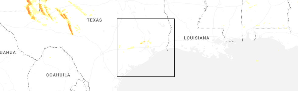
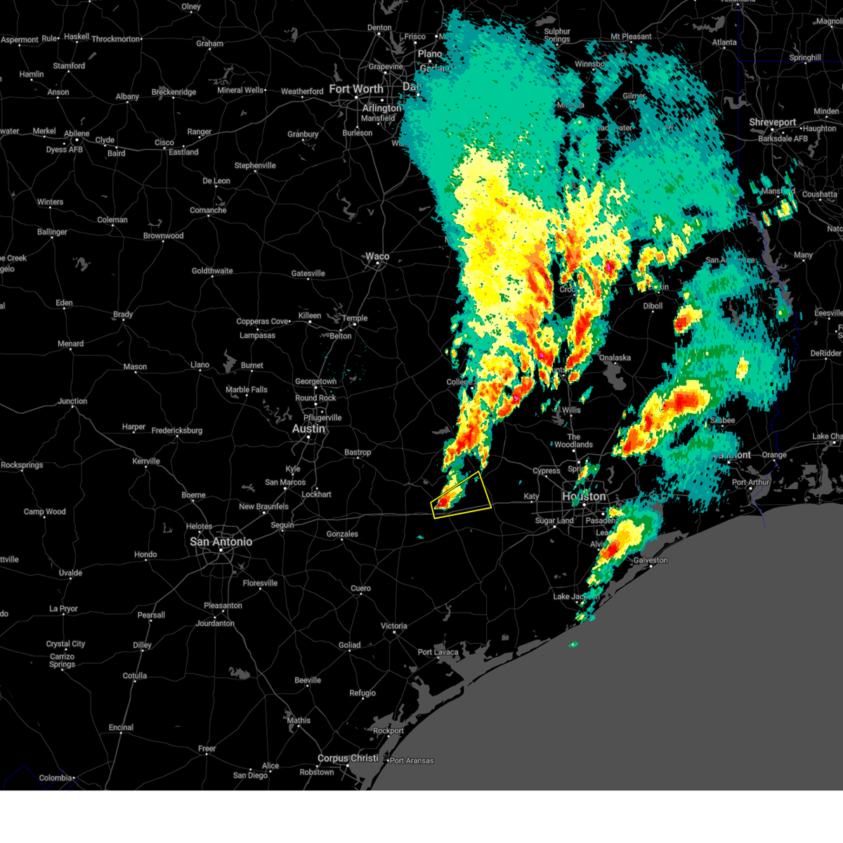
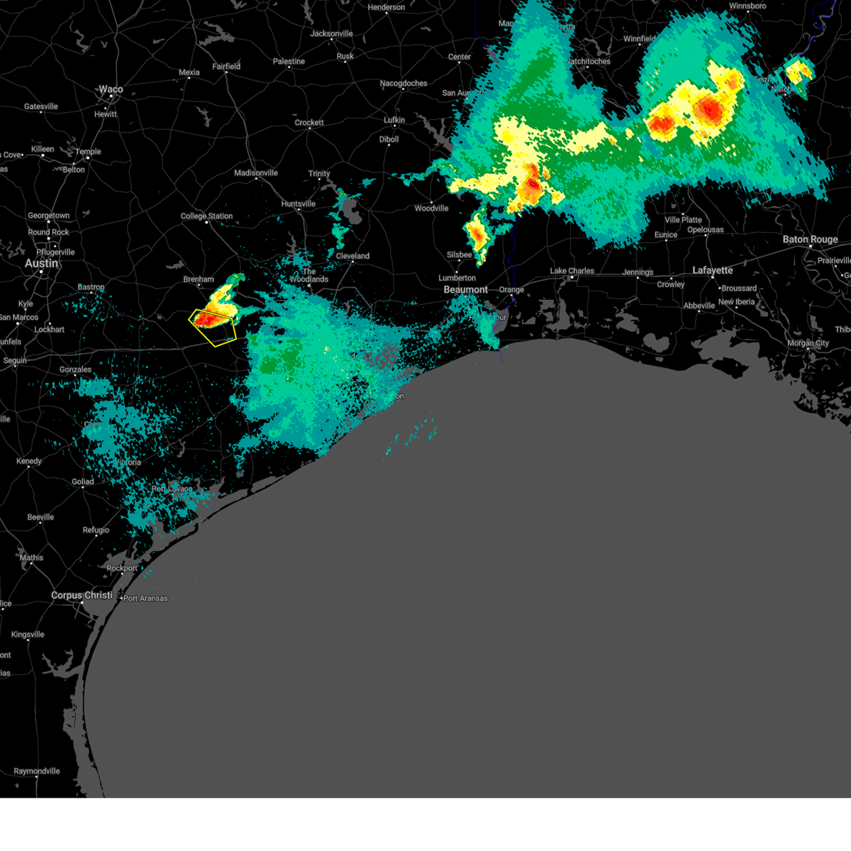
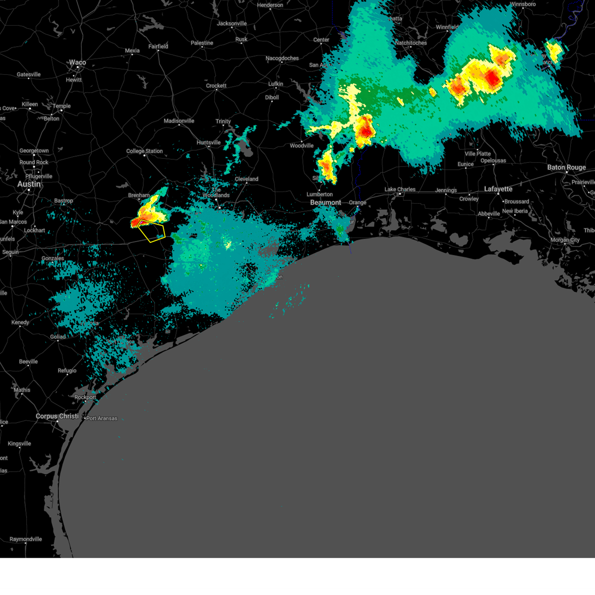
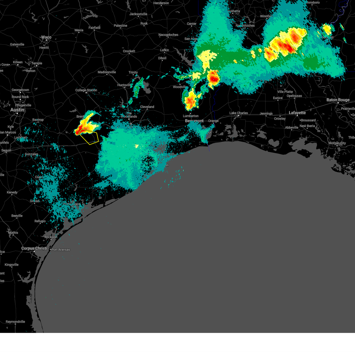
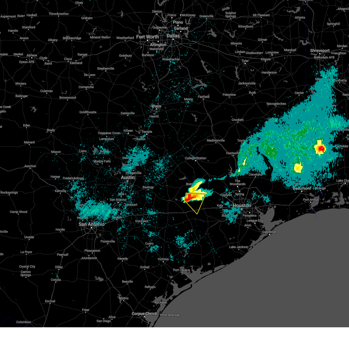
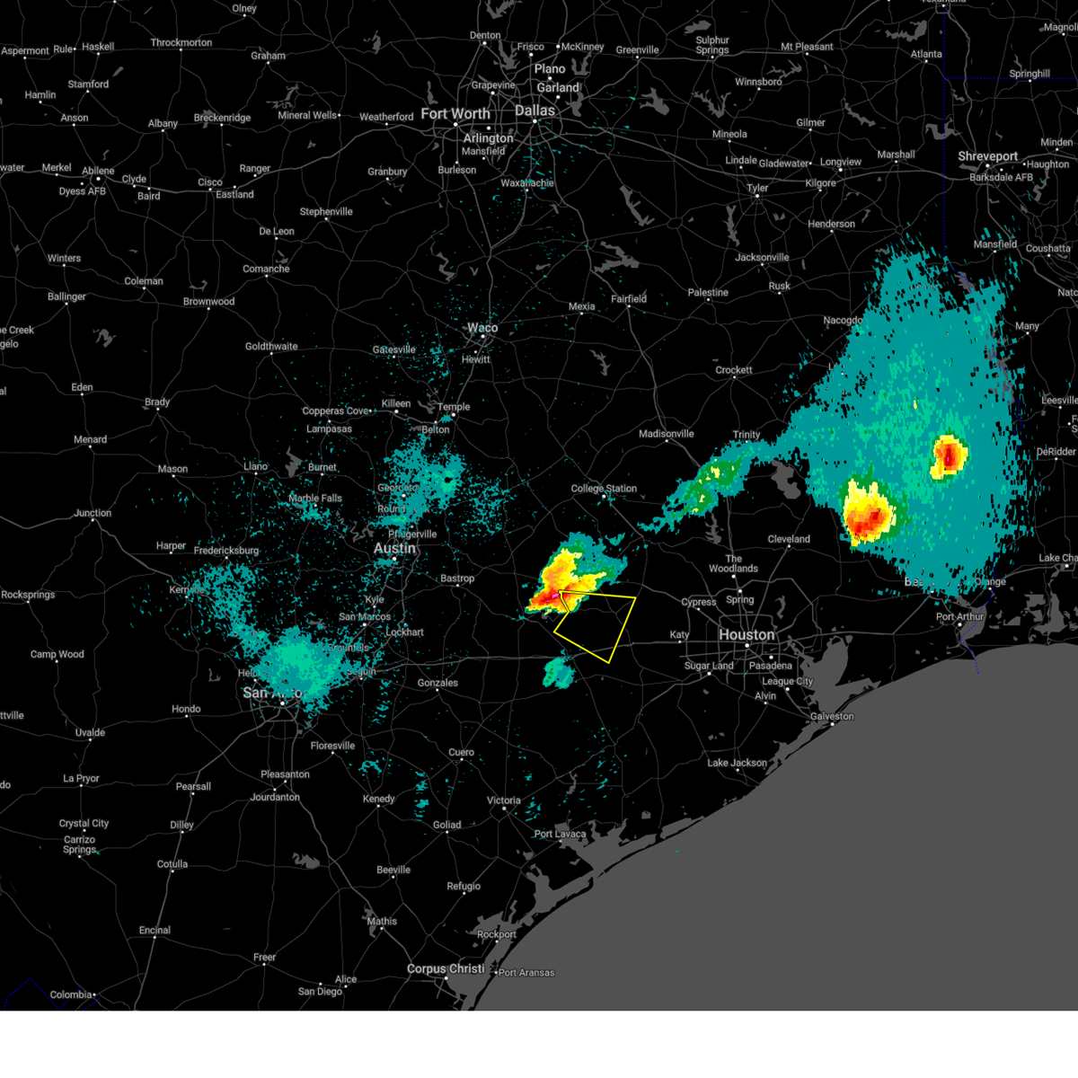
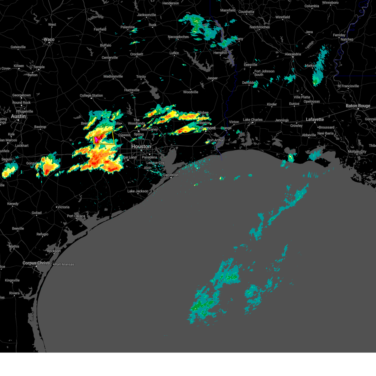
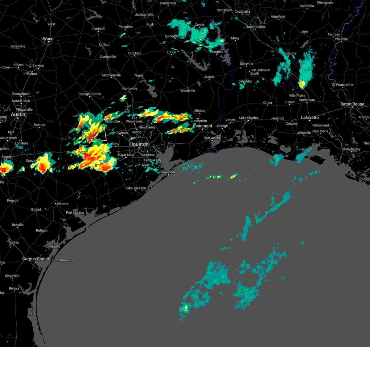
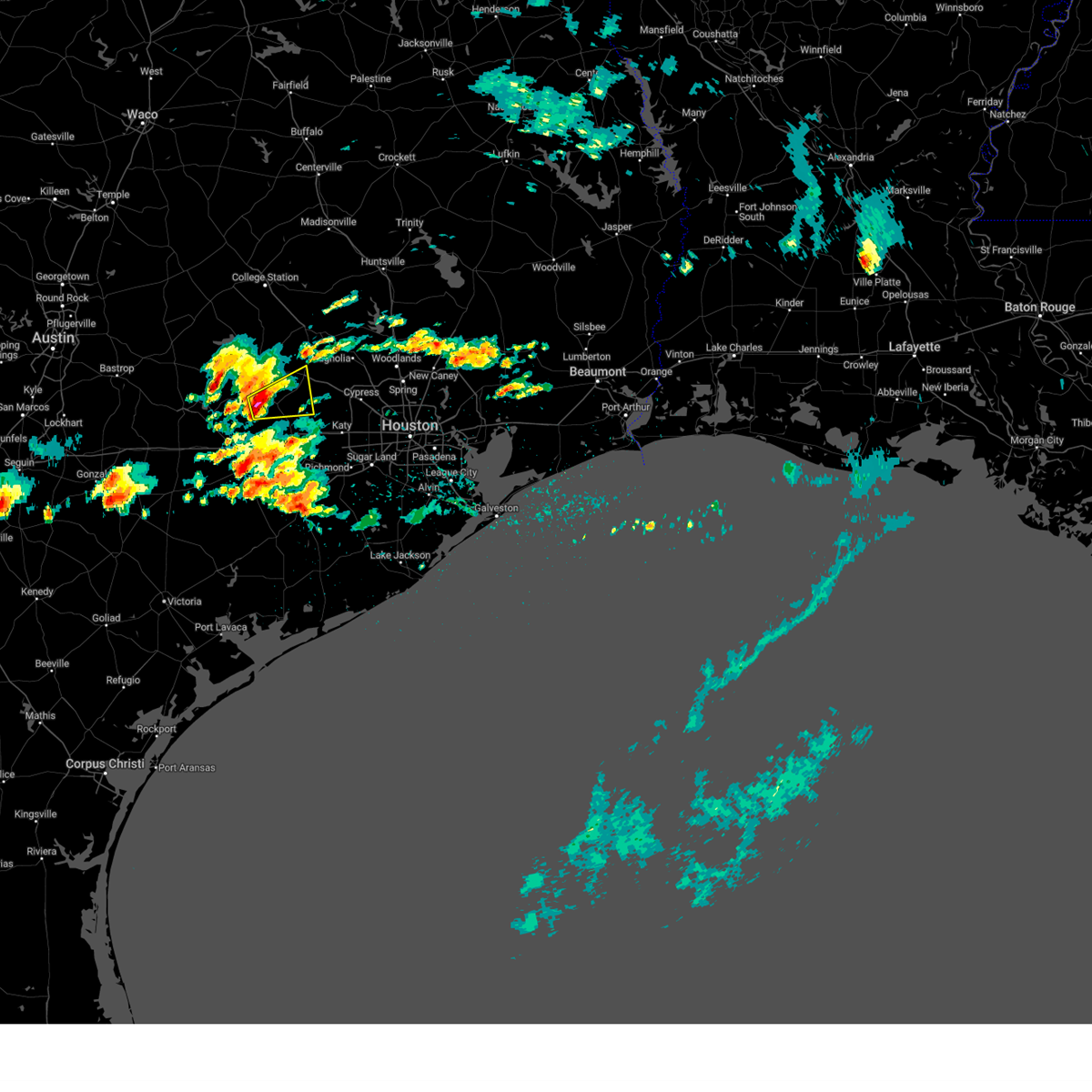
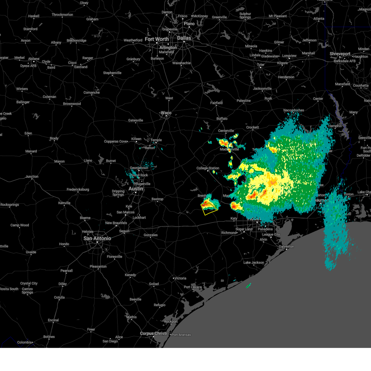
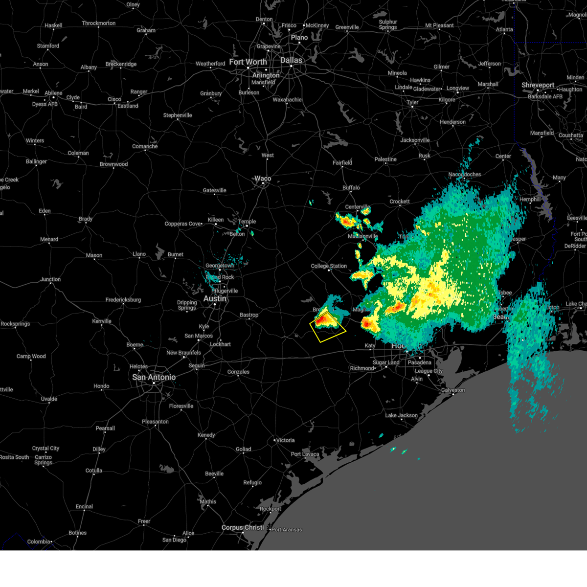
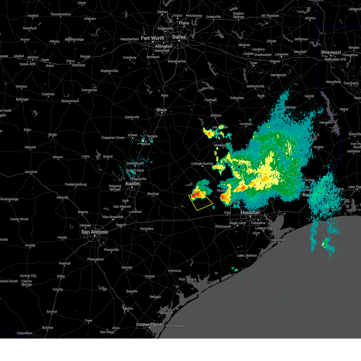
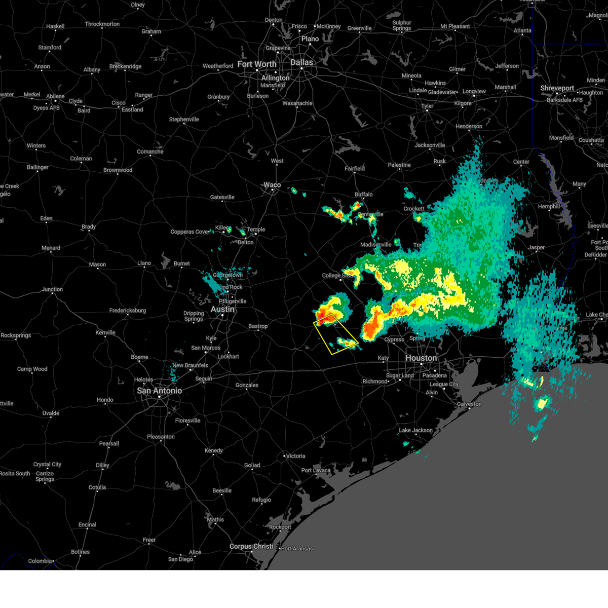
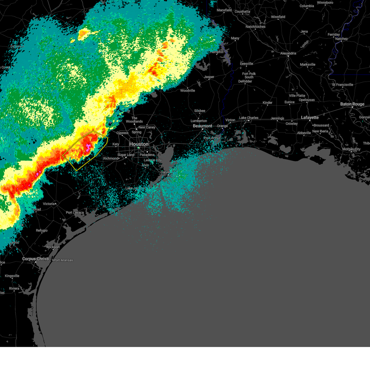
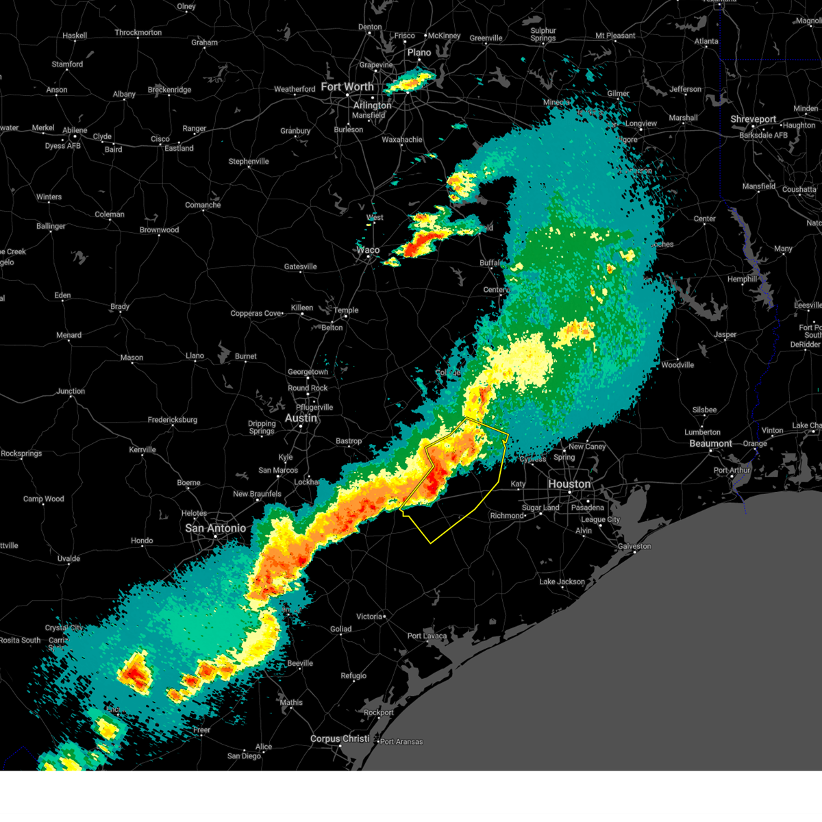
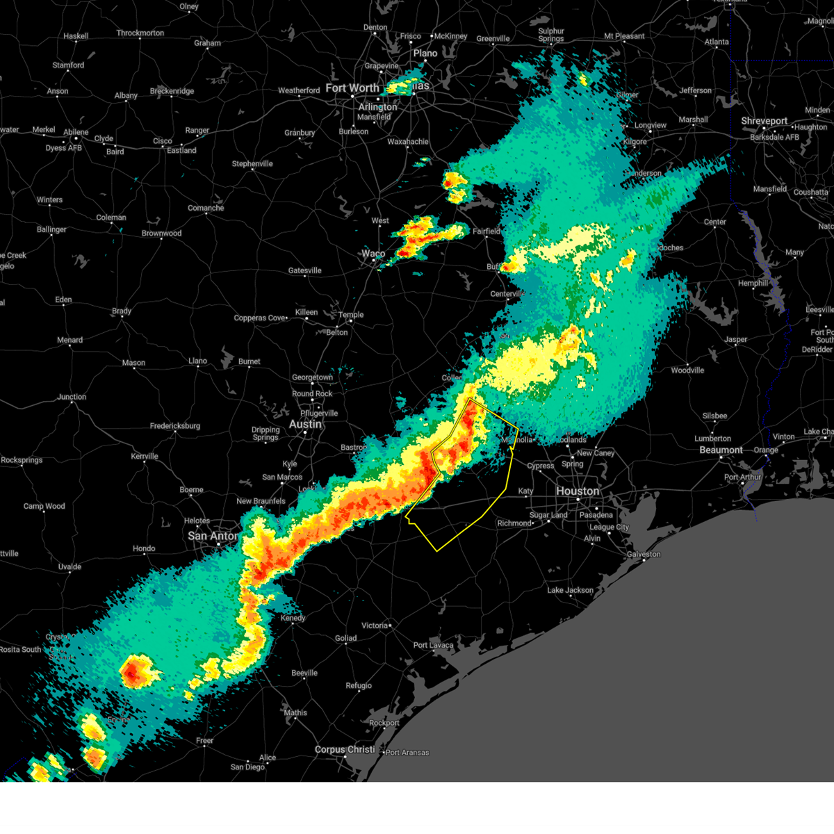
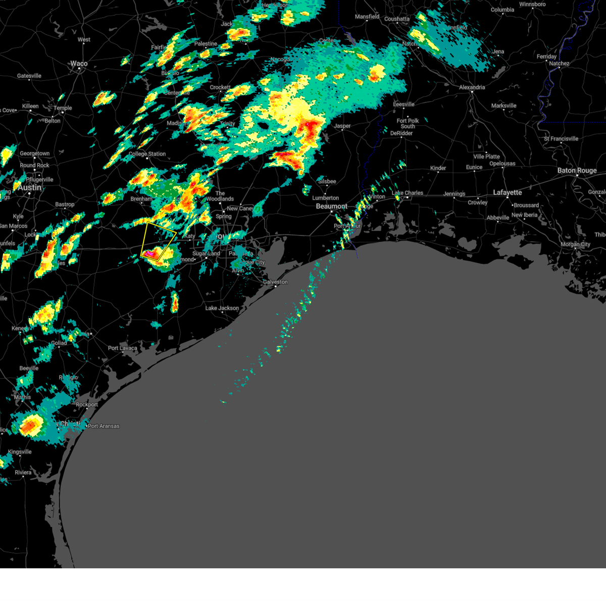
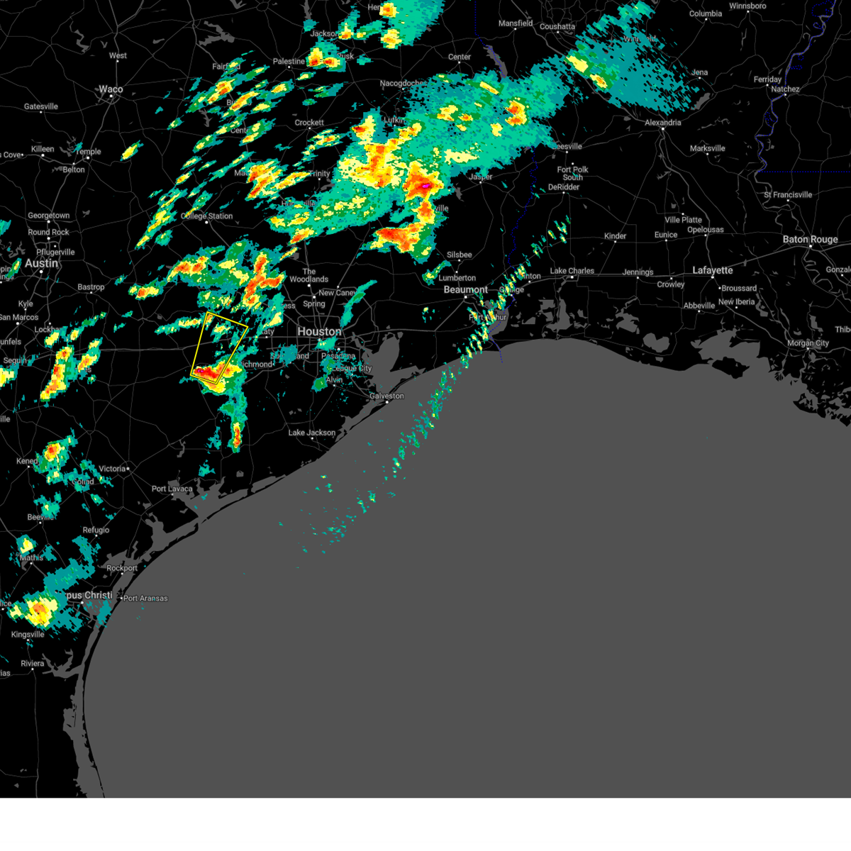
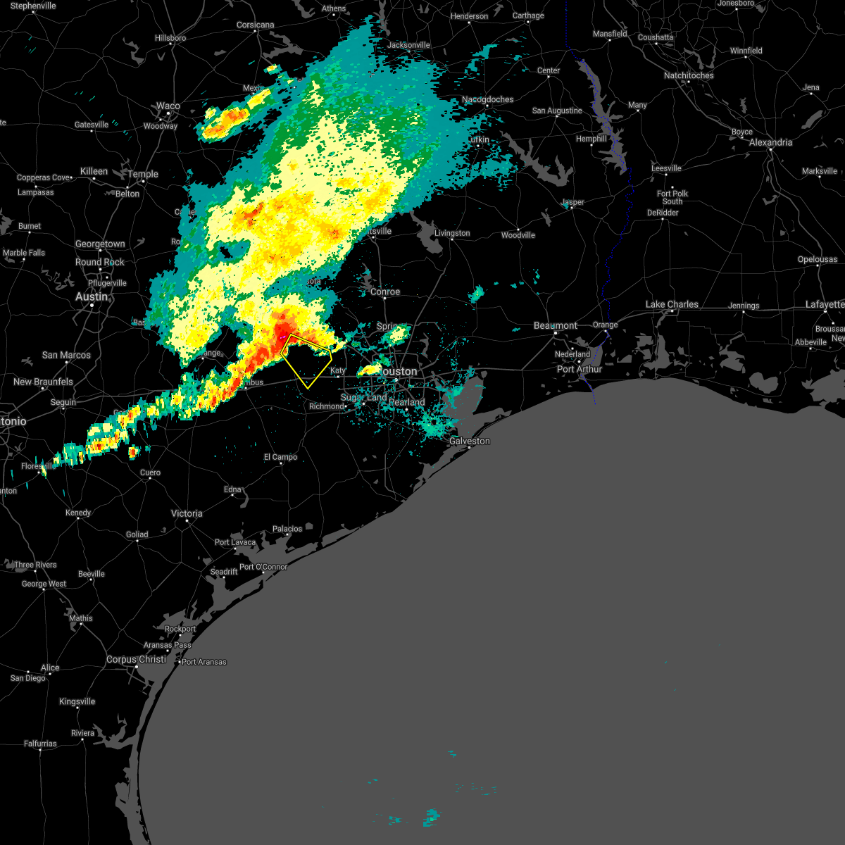
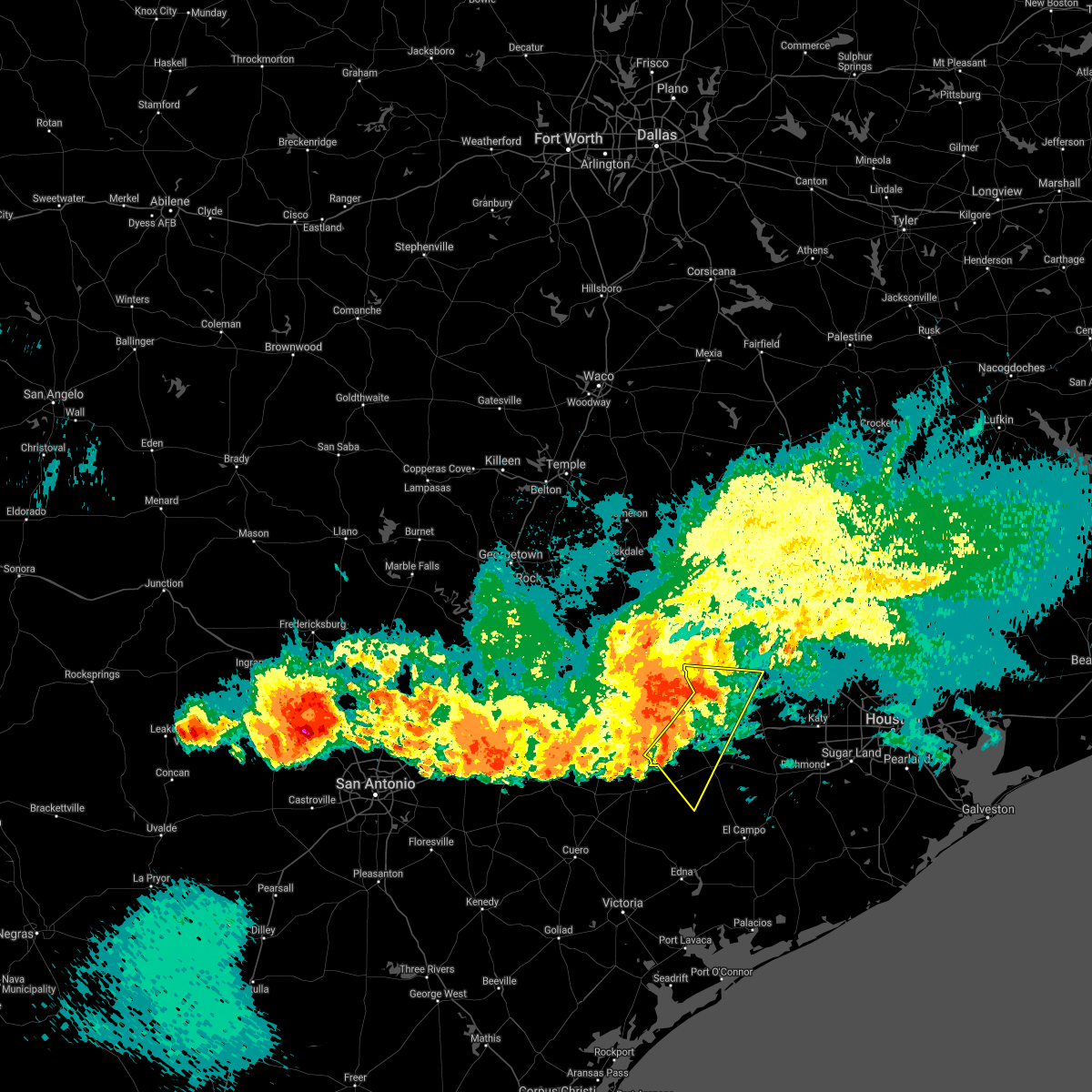
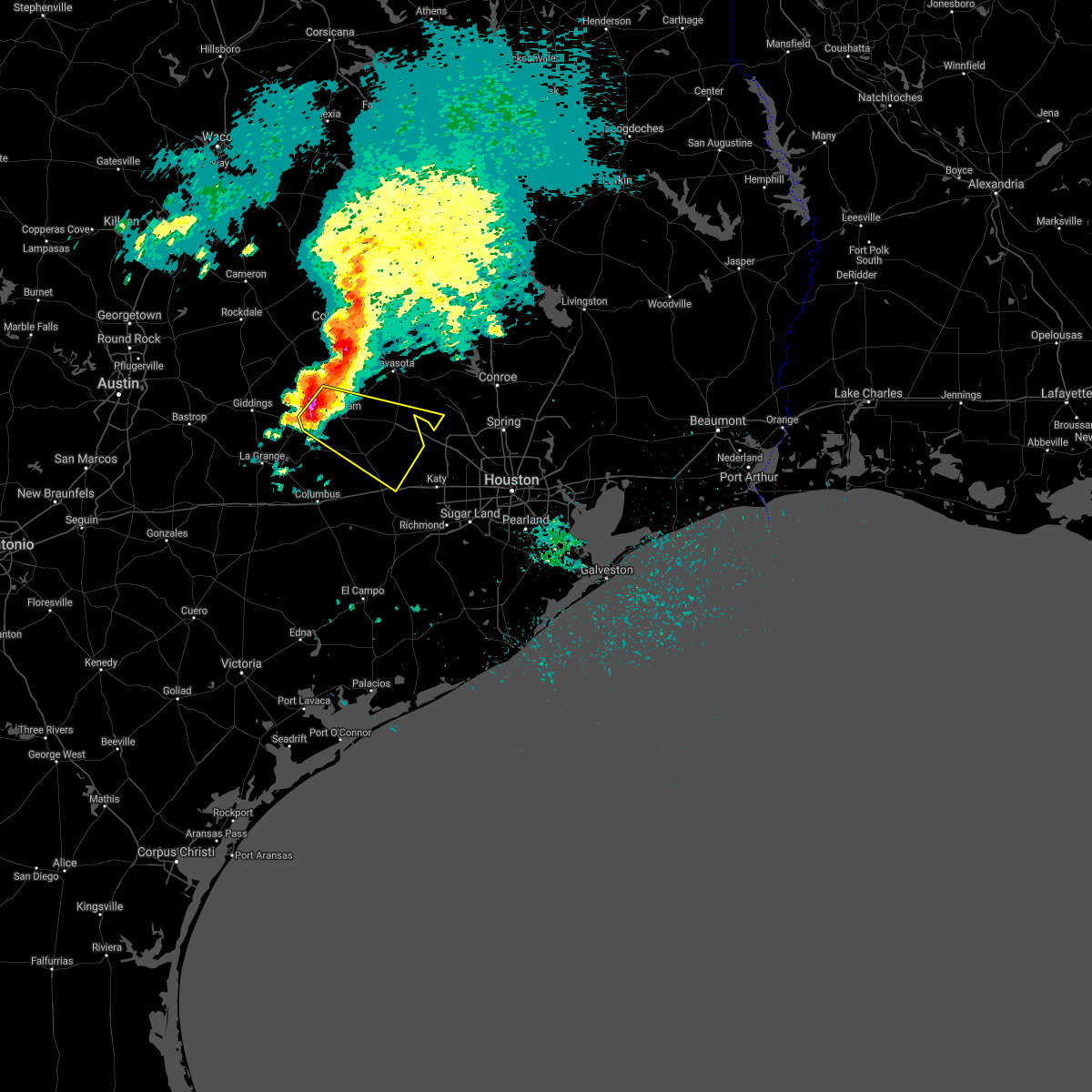
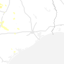
Hail Map for Bellville, TX
The Bellville, TX area has had 8 reports of on-the-ground hail by trained spotters, and has been under severe weather warnings 4 times during the past 12 months. Doppler radar has detected hail at or near Bellville, TX on 33 occasions, including 1 occasion during the past year.
| Name: | Bellville, TX |
| Where Located: | 54.9 miles WNW of Houston, TX |
| Map: | Google Map for Bellville, TX |
| Population: | 4097 |
| Housing Units: | 1818 |
| More Info: | Search Google for Bellville, TX |
0
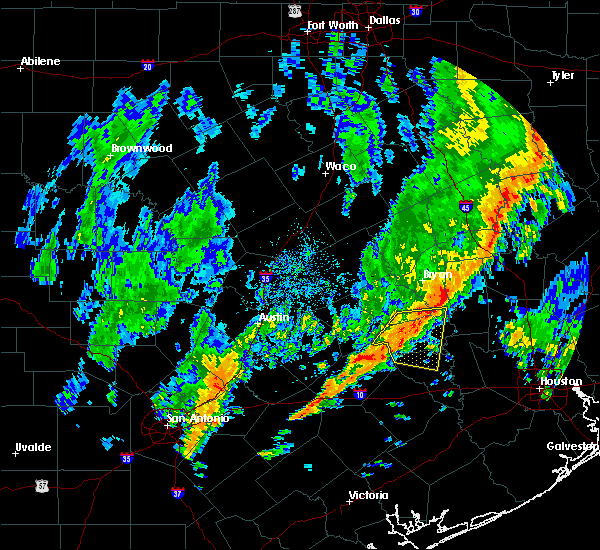
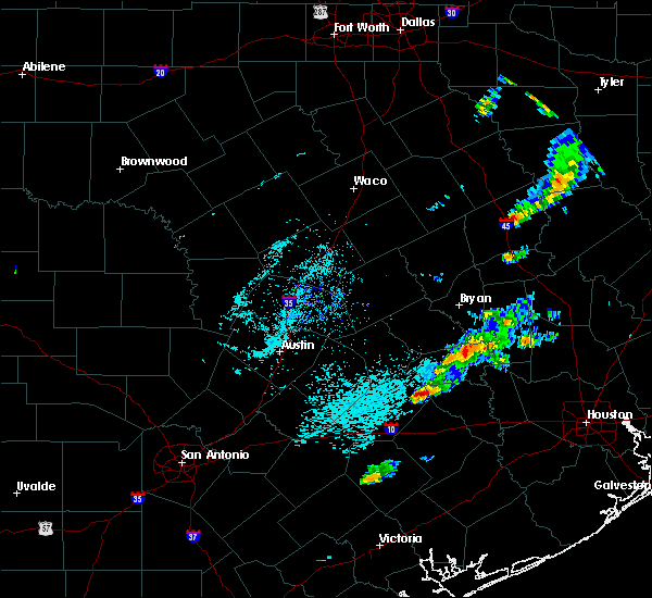
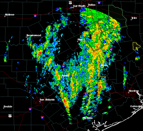
The Top Recent Hail Date for Bellville, TX is Monday, June 9, 2025 (19th out of 33)
Hail and Wind Damage Spotted near Bellville, TX
| Date / Time | Report Details |
|---|---|
| 5/5/2025 3:47 PM CDT |
 Svrhgx the national weather service in league city has issued a * severe thunderstorm warning for, northwestern austin county in southeastern texas, southeastern washington county in southeastern texas, northwestern waller county in southeastern texas, * until 430 pm cdt. * at 347 pm cdt, a severe thunderstorm was located near brenham, moving southeast at 30 mph (radar indicated). Hazards include 60 mph wind gusts and quarter size hail. Hail damage to vehicles is expected. Expect wind damage to roofs, siding, and trees. Svrhgx the national weather service in league city has issued a * severe thunderstorm warning for, northwestern austin county in southeastern texas, southeastern washington county in southeastern texas, northwestern waller county in southeastern texas, * until 430 pm cdt. * at 347 pm cdt, a severe thunderstorm was located near brenham, moving southeast at 30 mph (radar indicated). Hazards include 60 mph wind gusts and quarter size hail. Hail damage to vehicles is expected. Expect wind damage to roofs, siding, and trees.
|
| 12/28/2024 1:52 PM CST |
 The storm which prompted the warning has weakened below severe limits, and has exited the warned area. therefore, the warning will be allowed to expire. The storm which prompted the warning has weakened below severe limits, and has exited the warned area. therefore, the warning will be allowed to expire.
|
| 12/28/2024 1:36 PM CST | Quarter sized hail reported 8.4 miles NNE of Bellville, TX, hail up to quarter size near cat spring. |
| 12/28/2024 1:36 PM CST |
 At 136 pm cst, a severe thunderstorm was located 11 miles southeast of industry, or 12 miles southwest of bellville, moving northeast at 35 mph. this storm has produced nickel sized hail (radar indicated). Hazards include quarter size hail. Damage to vehicles is expected. Locations impacted include, sealy, bellville, and cat spring. At 136 pm cst, a severe thunderstorm was located 11 miles southeast of industry, or 12 miles southwest of bellville, moving northeast at 35 mph. this storm has produced nickel sized hail (radar indicated). Hazards include quarter size hail. Damage to vehicles is expected. Locations impacted include, sealy, bellville, and cat spring.
|
| 12/28/2024 1:19 PM CST |
 Svrhgx the national weather service in league city has issued a * severe thunderstorm warning for, northeastern colorado county in southeastern texas, central austin county in southeastern texas, * until 200 pm cst. * at 119 pm cst, a severe thunderstorm was located near columbus, moving east at 35 mph (radar indicated). Hazards include 60 mph wind gusts and quarter size hail. Hail damage to vehicles is expected. Expect wind damage to roofs, siding, and trees. Svrhgx the national weather service in league city has issued a * severe thunderstorm warning for, northeastern colorado county in southeastern texas, central austin county in southeastern texas, * until 200 pm cst. * at 119 pm cst, a severe thunderstorm was located near columbus, moving east at 35 mph (radar indicated). Hazards include 60 mph wind gusts and quarter size hail. Hail damage to vehicles is expected. Expect wind damage to roofs, siding, and trees.
|
| 5/31/2024 6:14 AM CDT |
 At 613 am cdt, severe thunderstorms were located along a line extending from 7 miles northeast of huntsville to 7 miles southeast of columbus, moving southeast at 40 mph (radar indicated). Hazards include 60 mph wind gusts and penny size hail. Expect damage to roofs, siding, and trees. Locations impacted include, huntsville, brenham, tomball, navasota, crockett, sealy, hempstead, prairie view, bellville, columbus, pinehurst, austonio, washington, shelby, hockley, trinity, waller, grapeland, magnolia, and new waverly. At 613 am cdt, severe thunderstorms were located along a line extending from 7 miles northeast of huntsville to 7 miles southeast of columbus, moving southeast at 40 mph (radar indicated). Hazards include 60 mph wind gusts and penny size hail. Expect damage to roofs, siding, and trees. Locations impacted include, huntsville, brenham, tomball, navasota, crockett, sealy, hempstead, prairie view, bellville, columbus, pinehurst, austonio, washington, shelby, hockley, trinity, waller, grapeland, magnolia, and new waverly.
|
| 5/31/2024 5:58 AM CDT |
 Svrhgx the national weather service in league city has issued a * severe thunderstorm warning for, southwestern trinity county in southeastern texas, northeastern colorado county in southeastern texas, austin county in southeastern texas, grimes county in southeastern texas, southeastern brazos county in southeastern texas, washington county in southeastern texas, western montgomery county in southeastern texas, houston county in southeastern texas, eastern madison county in southeastern texas, waller county in southeastern texas, walker county in southeastern texas, northwestern harris county in southeastern texas, * until 645 am cdt. * at 557 am cdt, severe thunderstorms were located along a line extending from 7 miles west of riverside to 6 miles north of columbus, moving southeast at around 40 mph (radar indicated). Hazards include 60 mph wind gusts and penny size hail. expect damage to roofs, siding, and trees Svrhgx the national weather service in league city has issued a * severe thunderstorm warning for, southwestern trinity county in southeastern texas, northeastern colorado county in southeastern texas, austin county in southeastern texas, grimes county in southeastern texas, southeastern brazos county in southeastern texas, washington county in southeastern texas, western montgomery county in southeastern texas, houston county in southeastern texas, eastern madison county in southeastern texas, waller county in southeastern texas, walker county in southeastern texas, northwestern harris county in southeastern texas, * until 645 am cdt. * at 557 am cdt, severe thunderstorms were located along a line extending from 7 miles west of riverside to 6 miles north of columbus, moving southeast at around 40 mph (radar indicated). Hazards include 60 mph wind gusts and penny size hail. expect damage to roofs, siding, and trees
|
| 5/16/2024 5:30 PM CDT | Trees down... metal roofs blown of in austin county TX, 2.1 miles SW of Bellville, TX |
| 5/16/2024 5:17 PM CDT |
 Svrhgx the national weather service in league city has issued a * severe thunderstorm warning for, northeastern colorado county in southeastern texas, austin county in southeastern texas, southeastern washington county in southeastern texas, northwestern fort bend county in southeastern texas, waller county in southeastern texas, northwestern harris county in southeastern texas, * until 600 pm cdt. * at 516 pm cdt, severe thunderstorms were located along a line extending from brenham to near industry to near fayetteville, moving east at 50 mph (radar indicated). Hazards include 70 mph wind gusts. Expect considerable tree damage. Damage is likely to mobile homes, roofs, and outbuildings. Svrhgx the national weather service in league city has issued a * severe thunderstorm warning for, northeastern colorado county in southeastern texas, austin county in southeastern texas, southeastern washington county in southeastern texas, northwestern fort bend county in southeastern texas, waller county in southeastern texas, northwestern harris county in southeastern texas, * until 600 pm cdt. * at 516 pm cdt, severe thunderstorms were located along a line extending from brenham to near industry to near fayetteville, moving east at 50 mph (radar indicated). Hazards include 70 mph wind gusts. Expect considerable tree damage. Damage is likely to mobile homes, roofs, and outbuildings.
|
| 5/9/2024 11:32 PM CDT |
 the severe thunderstorm warning has been cancelled and is no longer in effect the severe thunderstorm warning has been cancelled and is no longer in effect
|
| 5/9/2024 11:32 PM CDT |
 the severe thunderstorm warning has been cancelled and is no longer in effect the severe thunderstorm warning has been cancelled and is no longer in effect
|
| 5/9/2024 11:26 PM CDT |
 Svrhgx the national weather service in league city has issued a * severe thunderstorm warning for, northeastern colorado county in southeastern texas, central austin county in southeastern texas, southwestern waller county in southeastern texas, * until midnight cdt. * at 1126 pm cdt, a severe thunderstorm was located near bellville, moving southeast at 30 mph (radar indicated). Hazards include 60 mph wind gusts and quarter size hail. Hail damage to vehicles is expected. Expect wind damage to roofs, siding, and trees. Svrhgx the national weather service in league city has issued a * severe thunderstorm warning for, northeastern colorado county in southeastern texas, central austin county in southeastern texas, southwestern waller county in southeastern texas, * until midnight cdt. * at 1126 pm cdt, a severe thunderstorm was located near bellville, moving southeast at 30 mph (radar indicated). Hazards include 60 mph wind gusts and quarter size hail. Hail damage to vehicles is expected. Expect wind damage to roofs, siding, and trees.
|
| 5/9/2024 11:16 PM CDT |
 Svrhgx the national weather service in league city has issued a * severe thunderstorm warning for, northeastern colorado county in southeastern texas, central austin county in southeastern texas, southwestern waller county in southeastern texas, * until 1145 pm cdt. * at 1116 pm cdt, a severe thunderstorm was located 8 miles southwest of bellville, moving southeast at 20 mph (radar indicated). Hazards include 60 mph wind gusts and quarter size hail. Hail damage to vehicles is expected. Expect wind damage to roofs, siding, and trees. Svrhgx the national weather service in league city has issued a * severe thunderstorm warning for, northeastern colorado county in southeastern texas, central austin county in southeastern texas, southwestern waller county in southeastern texas, * until 1145 pm cdt. * at 1116 pm cdt, a severe thunderstorm was located 8 miles southwest of bellville, moving southeast at 20 mph (radar indicated). Hazards include 60 mph wind gusts and quarter size hail. Hail damage to vehicles is expected. Expect wind damage to roofs, siding, and trees.
|
| 5/9/2024 11:09 PM CDT |
 At 1109 pm cdt, a severe thunderstorm was located near bellville, moving southeast at 25 mph (radar indicated). Hazards include 60 mph wind gusts and quarter size hail. Hail damage to vehicles is expected. expect wind damage to roofs, siding, and trees. Locations impacted include, bellville, industry, new ulm, and cat spring. At 1109 pm cdt, a severe thunderstorm was located near bellville, moving southeast at 25 mph (radar indicated). Hazards include 60 mph wind gusts and quarter size hail. Hail damage to vehicles is expected. expect wind damage to roofs, siding, and trees. Locations impacted include, bellville, industry, new ulm, and cat spring.
|
| 5/9/2024 11:09 PM CDT |
 the severe thunderstorm warning has been cancelled and is no longer in effect the severe thunderstorm warning has been cancelled and is no longer in effect
|
| 5/9/2024 10:42 PM CDT |
 Svrhgx the national weather service in league city has issued a * severe thunderstorm warning for, northeastern colorado county in southeastern texas, northern austin county in southeastern texas, south central washington county in southeastern texas, * until 1115 pm cdt. * at 1041 pm cdt, a severe thunderstorm was located over shelby, or 14 miles southwest of brenham, moving southeast at 35 mph (emergency management in lee county reported golf ball size hail). Hazards include golf ball size hail and 60 mph wind gusts. People and animals outdoors will be injured. expect hail damage to roofs, siding, windows, and vehicles. Expect wind damage to roofs, siding, and trees. Svrhgx the national weather service in league city has issued a * severe thunderstorm warning for, northeastern colorado county in southeastern texas, northern austin county in southeastern texas, south central washington county in southeastern texas, * until 1115 pm cdt. * at 1041 pm cdt, a severe thunderstorm was located over shelby, or 14 miles southwest of brenham, moving southeast at 35 mph (emergency management in lee county reported golf ball size hail). Hazards include golf ball size hail and 60 mph wind gusts. People and animals outdoors will be injured. expect hail damage to roofs, siding, windows, and vehicles. Expect wind damage to roofs, siding, and trees.
|
| 3/15/2024 3:19 PM CDT |
 Svrhgx the national weather service in league city has issued a * severe thunderstorm warning for, northeastern austin county in southeastern texas, central waller county in southeastern texas, northwestern harris county in southeastern texas, * until 345 pm cdt. * at 318 pm cdt, a severe thunderstorm was located near bellville, moving east at 25 mph (public). Hazards include two inch hail and 60 mph wind gusts. People and animals outdoors will be injured. expect hail damage to roofs, siding, windows, and vehicles. Expect wind damage to roofs, siding, and trees. Svrhgx the national weather service in league city has issued a * severe thunderstorm warning for, northeastern austin county in southeastern texas, central waller county in southeastern texas, northwestern harris county in southeastern texas, * until 345 pm cdt. * at 318 pm cdt, a severe thunderstorm was located near bellville, moving east at 25 mph (public). Hazards include two inch hail and 60 mph wind gusts. People and animals outdoors will be injured. expect hail damage to roofs, siding, windows, and vehicles. Expect wind damage to roofs, siding, and trees.
|
| 3/15/2024 3:17 PM CDT | Golf Ball sized hail reported 0.3 miles S of Bellville, TX, golf ball sized hail in bellville. |
| 3/15/2024 3:17 PM CDT | Tennis Ball sized hail reported 1.3 miles ESE of Bellville, TX, tennis ball sized hail was reported. |
| 3/15/2024 3:17 PM CDT | Baseball sized hail reported 0.3 miles S of Bellville, TX, baseball sized hail in bellville. |
| 3/15/2024 3:15 PM CDT | Corrects previous tstm wnd dmg report from 3 wsw bellville. tree down and barn heavily damaged near the intersection of mill creek road and kuykendall roa in austin county TX, 2.6 miles ENE of Bellville, TX |
| 3/15/2024 3:08 PM CDT |
 At 307 pm cdt, a severe thunderstorm was located over bellville, moving east at 25 mph (radar indicated). Hazards include ping pong ball size hail and 60 mph wind gusts. People and animals outdoors will be injured. expect hail damage to roofs, siding, windows, and vehicles. expect wind damage to roofs, siding, and trees. Locations impacted include, hempstead, bellville, pine island, and monaville. At 307 pm cdt, a severe thunderstorm was located over bellville, moving east at 25 mph (radar indicated). Hazards include ping pong ball size hail and 60 mph wind gusts. People and animals outdoors will be injured. expect hail damage to roofs, siding, windows, and vehicles. expect wind damage to roofs, siding, and trees. Locations impacted include, hempstead, bellville, pine island, and monaville.
|
| 3/15/2024 2:55 PM CDT |
 Svrhgx the national weather service in league city has issued a * severe thunderstorm warning for, northeastern austin county in southeastern texas, southeastern washington county in southeastern texas, northwestern waller county in southeastern texas, * until 330 pm cdt. * at 255 pm cdt, a severe thunderstorm was located near bellville, moving east at 25 mph (radar indicated). Hazards include 60 mph wind gusts and quarter size hail. Hail damage to vehicles is expected. Expect wind damage to roofs, siding, and trees. Svrhgx the national weather service in league city has issued a * severe thunderstorm warning for, northeastern austin county in southeastern texas, southeastern washington county in southeastern texas, northwestern waller county in southeastern texas, * until 330 pm cdt. * at 255 pm cdt, a severe thunderstorm was located near bellville, moving east at 25 mph (radar indicated). Hazards include 60 mph wind gusts and quarter size hail. Hail damage to vehicles is expected. Expect wind damage to roofs, siding, and trees.
|
| 2/2/2024 11:45 PM CST |
 At 1145 pm cst, severe thunderstorms were located along a line extending from 7 miles south of fayetteville to near columbus to 12 miles southwest of eagle lake to near speaks, moving northeast at 50 mph (radar indicated). Hazards include 60 mph wind gusts. expect damage to roofs, siding, and trees At 1145 pm cst, severe thunderstorms were located along a line extending from 7 miles south of fayetteville to near columbus to 12 miles southwest of eagle lake to near speaks, moving northeast at 50 mph (radar indicated). Hazards include 60 mph wind gusts. expect damage to roofs, siding, and trees
|
| 6/21/2023 8:52 PM CDT |
 At 851 pm cdt, severe thunderstorms were located along a line extending from near kingwood to simonton, moving southeast at 50 mph. wind gusts of 60 to 70 mph are possible with these storms (radar indicated). Hazards include 70 mph wind gusts and nickel size hail. Expect considerable tree damage. damage is likely to mobile homes, roofs, and outbuildings. locations impacted include, bellaire, humble, katy, tomball, jersey village, sealy, hempstead, prairie view, brookshire, hunters creek village, bunker hill village, piney point village, pinehurst, downtown houston, greenway / upper kirby area, kingwood, spring branch north, the woodlands, greater greenspoint and spring. thunderstorm damage threat, considerable hail threat, radar indicated max hail size, 0. 88 in wind threat, radar indicated max wind gust, 70 mph. At 851 pm cdt, severe thunderstorms were located along a line extending from near kingwood to simonton, moving southeast at 50 mph. wind gusts of 60 to 70 mph are possible with these storms (radar indicated). Hazards include 70 mph wind gusts and nickel size hail. Expect considerable tree damage. damage is likely to mobile homes, roofs, and outbuildings. locations impacted include, bellaire, humble, katy, tomball, jersey village, sealy, hempstead, prairie view, brookshire, hunters creek village, bunker hill village, piney point village, pinehurst, downtown houston, greenway / upper kirby area, kingwood, spring branch north, the woodlands, greater greenspoint and spring. thunderstorm damage threat, considerable hail threat, radar indicated max hail size, 0. 88 in wind threat, radar indicated max wind gust, 70 mph.
|
| 6/21/2023 8:35 PM CDT |
 At 834 pm cdt, severe thunderstorms were located along a line extending from near splendora to san felipe, moving southeast at 55 mph (radar indicated). Hazards include 60 mph wind gusts and nickel size hail. expect damage to roofs, siding, and trees At 834 pm cdt, severe thunderstorms were located along a line extending from near splendora to san felipe, moving southeast at 55 mph (radar indicated). Hazards include 60 mph wind gusts and nickel size hail. expect damage to roofs, siding, and trees
|
| 6/11/2023 12:08 AM CDT |
 At 1207 am cdt, a severe thunderstorm was located near bellville, moving southeast at 40 mph (radar indicated). Hazards include 60 mph wind gusts and nickel size hail. Expect damage to roofs, siding, and trees. locations impacted include, bellville. hail threat, radar indicated max hail size, 0. 88 in wind threat, radar indicated max wind gust, 60 mph. At 1207 am cdt, a severe thunderstorm was located near bellville, moving southeast at 40 mph (radar indicated). Hazards include 60 mph wind gusts and nickel size hail. Expect damage to roofs, siding, and trees. locations impacted include, bellville. hail threat, radar indicated max hail size, 0. 88 in wind threat, radar indicated max wind gust, 60 mph.
|
| 6/10/2023 11:59 PM CDT |
 At 1159 pm cdt, a severe thunderstorm was located near bellville, moving southeast at 40 mph (radar indicated). Hazards include 60 mph wind gusts and quarter size hail. Hail damage to vehicles is expected. expect wind damage to roofs, siding, and trees. locations impacted include, brenham, bellville and industry. hail threat, radar indicated max hail size, 1. 00 in wind threat, radar indicated max wind gust, 60 mph. At 1159 pm cdt, a severe thunderstorm was located near bellville, moving southeast at 40 mph (radar indicated). Hazards include 60 mph wind gusts and quarter size hail. Hail damage to vehicles is expected. expect wind damage to roofs, siding, and trees. locations impacted include, brenham, bellville and industry. hail threat, radar indicated max hail size, 1. 00 in wind threat, radar indicated max wind gust, 60 mph.
|
| 6/10/2023 11:53 PM CDT |
 At 1152 pm cdt, a severe thunderstorm was located 7 miles northeast of industry, or 8 miles south of brenham, moving southeast at 40 mph (trained weather spotters). Hazards include golf ball size hail and 70 mph wind gusts. People and animals outdoors will be injured. expect hail damage to roofs, siding, windows, and vehicles. expect considerable tree damage. wind damage is also likely to mobile homes, roofs, and outbuildings. locations impacted include, brenham, bellville and industry. thunderstorm damage threat, considerable hail threat, radar indicated max hail size, 1. 75 in wind threat, radar indicated max wind gust, 70 mph. At 1152 pm cdt, a severe thunderstorm was located 7 miles northeast of industry, or 8 miles south of brenham, moving southeast at 40 mph (trained weather spotters). Hazards include golf ball size hail and 70 mph wind gusts. People and animals outdoors will be injured. expect hail damage to roofs, siding, windows, and vehicles. expect considerable tree damage. wind damage is also likely to mobile homes, roofs, and outbuildings. locations impacted include, brenham, bellville and industry. thunderstorm damage threat, considerable hail threat, radar indicated max hail size, 1. 75 in wind threat, radar indicated max wind gust, 70 mph.
|
| 6/10/2023 11:34 PM CDT |
 At 1134 pm cdt, a severe thunderstorm was located near burton, or near brenham, moving southeast at 40 mph (trained weather spotters). Hazards include two inch hail and 70 mph wind gusts. People and animals outdoors will be injured. expect hail damage to roofs, siding, windows, and vehicles. expect considerable tree damage. Wind damage is also likely to mobile homes, roofs, and outbuildings. At 1134 pm cdt, a severe thunderstorm was located near burton, or near brenham, moving southeast at 40 mph (trained weather spotters). Hazards include two inch hail and 70 mph wind gusts. People and animals outdoors will be injured. expect hail damage to roofs, siding, windows, and vehicles. expect considerable tree damage. Wind damage is also likely to mobile homes, roofs, and outbuildings.
|
| 4/28/2023 8:00 PM CDT |
 At 759 pm cdt, severe thunderstorms were located along a line extending from 8 miles southeast of washington to 9 miles north of san felipe to 6 miles southwest of sealy to 6 miles southeast of sublime, moving southeast at 35 mph (radar indicated). Hazards include 60 mph wind gusts and quarter size hail. Hail damage to vehicles is expected. expect wind damage to roofs, siding, and trees. Locations impacted include, sealy, bellville, columbus, eagle lake, weimar, san felipe, monaville, new ulm, cat spring, sheridan, altair, frelsburg and rock island. At 759 pm cdt, severe thunderstorms were located along a line extending from 8 miles southeast of washington to 9 miles north of san felipe to 6 miles southwest of sealy to 6 miles southeast of sublime, moving southeast at 35 mph (radar indicated). Hazards include 60 mph wind gusts and quarter size hail. Hail damage to vehicles is expected. expect wind damage to roofs, siding, and trees. Locations impacted include, sealy, bellville, columbus, eagle lake, weimar, san felipe, monaville, new ulm, cat spring, sheridan, altair, frelsburg and rock island.
|
| 4/28/2023 7:47 PM CDT |
 At 746 pm cdt, severe thunderstorms were located along a line extending from near washington to 7 miles northeast of bellville to 11 miles west of sealy to sublime, moving southeast at 35 mph (radar indicated). Hazards include 60 mph wind gusts and quarter size hail. Hail damage to vehicles is expected. expect wind damage to roofs, siding, and trees. Locations impacted include, sealy, hempstead, prairie view, bellville, columbus, eagle lake, weimar, pine island, san felipe, industry, monaville, new ulm, cat spring, sheridan, altair, frelsburg and rock island. At 746 pm cdt, severe thunderstorms were located along a line extending from near washington to 7 miles northeast of bellville to 11 miles west of sealy to sublime, moving southeast at 35 mph (radar indicated). Hazards include 60 mph wind gusts and quarter size hail. Hail damage to vehicles is expected. expect wind damage to roofs, siding, and trees. Locations impacted include, sealy, hempstead, prairie view, bellville, columbus, eagle lake, weimar, pine island, san felipe, industry, monaville, new ulm, cat spring, sheridan, altair, frelsburg and rock island.
|
| 4/28/2023 7:37 PM CDT |
 At 737 pm cdt, severe thunderstorms were located along a line extending from near washington to 7 miles northeast of bellville to 11 miles southeast of industry to near sublime, moving east at 30 mph (radar indicated). Hazards include 60 mph wind gusts and quarter size hail. Hail damage to vehicles is expected. expect wind damage to roofs, siding, and trees. locations impacted include, brenham, sealy, hempstead, prairie view, bellville, columbus, eagle lake, shelby, weimar, pine island, san felipe, industry, monaville, new ulm, cat spring, sheridan, altair, frelsburg and rock island. hail threat, radar indicated max hail size, 1. 00 in wind threat, radar indicated max wind gust, 60 mph. At 737 pm cdt, severe thunderstorms were located along a line extending from near washington to 7 miles northeast of bellville to 11 miles southeast of industry to near sublime, moving east at 30 mph (radar indicated). Hazards include 60 mph wind gusts and quarter size hail. Hail damage to vehicles is expected. expect wind damage to roofs, siding, and trees. locations impacted include, brenham, sealy, hempstead, prairie view, bellville, columbus, eagle lake, shelby, weimar, pine island, san felipe, industry, monaville, new ulm, cat spring, sheridan, altair, frelsburg and rock island. hail threat, radar indicated max hail size, 1. 00 in wind threat, radar indicated max wind gust, 60 mph.
|
| 4/28/2023 7:25 PM CDT |
 At 724 pm cdt, severe thunderstorms were located along a line extending from near millican to 8 miles southeast of brenham to near industry to near schulenburg, moving southeast at 35 mph (radar indicated). Hazards include 60 mph wind gusts and quarter size hail. Hail damage to vehicles is expected. Expect wind damage to roofs, siding, and trees. At 724 pm cdt, severe thunderstorms were located along a line extending from near millican to 8 miles southeast of brenham to near industry to near schulenburg, moving southeast at 35 mph (radar indicated). Hazards include 60 mph wind gusts and quarter size hail. Hail damage to vehicles is expected. Expect wind damage to roofs, siding, and trees.
|
| 4/5/2023 9:37 PM CDT |
 The severe thunderstorm warning for northeastern colorado, northern wharton, southeastern austin and southwestern waller counties will expire at 945 pm cdt, the storm which prompted the warning has weakened below severe limits, and no longer poses an immediate threat to life or property. therefore, the warning will be allowed to expire. however small hail is still possible with this thunderstorm. The severe thunderstorm warning for northeastern colorado, northern wharton, southeastern austin and southwestern waller counties will expire at 945 pm cdt, the storm which prompted the warning has weakened below severe limits, and no longer poses an immediate threat to life or property. therefore, the warning will be allowed to expire. however small hail is still possible with this thunderstorm.
|
| 4/5/2023 9:18 PM CDT |
 At 918 pm cdt, a severe thunderstorm was located 8 miles southwest of sealy, moving northeast at 50 mph (radar indicated). Hazards include quarter size hail. Damage to vehicles is expected. locations impacted include, sealy, bellville, san felipe and cat spring. hail threat, radar indicated max hail size, 1. 00 in wind threat, radar indicated max wind gust, <50 mph. At 918 pm cdt, a severe thunderstorm was located 8 miles southwest of sealy, moving northeast at 50 mph (radar indicated). Hazards include quarter size hail. Damage to vehicles is expected. locations impacted include, sealy, bellville, san felipe and cat spring. hail threat, radar indicated max hail size, 1. 00 in wind threat, radar indicated max wind gust, <50 mph.
|
| 4/5/2023 9:08 PM CDT |
 At 907 pm cdt, a severe thunderstorm was located over eagle lake, moving northeast at 50 mph (radar indicated). Hazards include quarter size hail. damage to vehicles is expected At 907 pm cdt, a severe thunderstorm was located over eagle lake, moving northeast at 50 mph (radar indicated). Hazards include quarter size hail. damage to vehicles is expected
|
| 1/24/2023 11:31 AM CST |
 At 1129 am cst, a severe thunderstorm capable of producing a tornado was located 7 miles north of eagle lake, moving northeast at 45 mph. storm spotters reported a tornado as crossed over highway 102 as it passed west of eagle lake (radar indicated rotation). Hazards include tornado. Flying debris will be dangerous to those caught without shelter. mobile homes will be damaged or destroyed. damage to roofs, windows, and vehicles will occur. tree damage is likely. this dangerous storm will be near, sealy around 1145 am cst. san felipe around 1150 am cst. Other locations impacted by this tornadic thunderstorm include cat spring. At 1129 am cst, a severe thunderstorm capable of producing a tornado was located 7 miles north of eagle lake, moving northeast at 45 mph. storm spotters reported a tornado as crossed over highway 102 as it passed west of eagle lake (radar indicated rotation). Hazards include tornado. Flying debris will be dangerous to those caught without shelter. mobile homes will be damaged or destroyed. damage to roofs, windows, and vehicles will occur. tree damage is likely. this dangerous storm will be near, sealy around 1145 am cst. san felipe around 1150 am cst. Other locations impacted by this tornadic thunderstorm include cat spring.
|
| 1/24/2023 11:22 AM CST |
 At 1122 am cst, a severe thunderstorm capable of producing a tornado was located near eagle lake, moving northeast at 45 mph (radar indicated rotation). Hazards include tornado. Flying debris will be dangerous to those caught without shelter. mobile homes will be damaged or destroyed. damage to roofs, windows, and vehicles will occur. tree damage is likely. this dangerous storm will be near, sealy around 1145 am cst. san felipe around 1150 am cst. Other locations impacted by this tornadic thunderstorm include cat spring. At 1122 am cst, a severe thunderstorm capable of producing a tornado was located near eagle lake, moving northeast at 45 mph (radar indicated rotation). Hazards include tornado. Flying debris will be dangerous to those caught without shelter. mobile homes will be damaged or destroyed. damage to roofs, windows, and vehicles will occur. tree damage is likely. this dangerous storm will be near, sealy around 1145 am cst. san felipe around 1150 am cst. Other locations impacted by this tornadic thunderstorm include cat spring.
|
| 5/25/2022 1:29 AM CDT |
 At 127 am cdt, severe thunderstorms were located along a line extending from 10 miles southwest of centerville to near bedias to near navasota to 9 miles north of bellville to sublime, moving southeast at 50 mph (radar indicated). Hazards include 60 mph wind gusts. expect damage to roofs, siding, and trees At 127 am cdt, severe thunderstorms were located along a line extending from 10 miles southwest of centerville to near bedias to near navasota to 9 miles north of bellville to sublime, moving southeast at 50 mph (radar indicated). Hazards include 60 mph wind gusts. expect damage to roofs, siding, and trees
|
| 5/25/2022 12:43 AM CDT |
 At 1242 am cdt, severe thunderstorms were located along a line extending from 7 miles southeast of hearne to 9 miles northeast of caldwell to 6 miles north of lake somerville state park & trailway to 6 miles northwest of round top to near cistern, moving east at 45 mph (radar indicated). Hazards include 70 mph wind gusts and penny size hail. Expect considerable tree damage. Damage is likely to mobile homes, roofs, and outbuildings. At 1242 am cdt, severe thunderstorms were located along a line extending from 7 miles southeast of hearne to 9 miles northeast of caldwell to 6 miles north of lake somerville state park & trailway to 6 miles northwest of round top to near cistern, moving east at 45 mph (radar indicated). Hazards include 70 mph wind gusts and penny size hail. Expect considerable tree damage. Damage is likely to mobile homes, roofs, and outbuildings.
|
| 3/22/2022 5:28 AM CDT |
 At 527 am cdt, severe thunderstorms were located along a line extending from 7 miles east of brenham to near sealy to near pierce, moving northeast at 45 mph (radar indicated). Hazards include 60 mph wind gusts. expect damage to roofs, siding, and trees At 527 am cdt, severe thunderstorms were located along a line extending from 7 miles east of brenham to near sealy to near pierce, moving northeast at 45 mph (radar indicated). Hazards include 60 mph wind gusts. expect damage to roofs, siding, and trees
|
| 3/22/2022 5:04 AM CDT |
 At 503 am cdt, severe thunderstorms were located along a line extending from 9 miles south of industry to near eagle lake to 12 miles east of speaks, moving northeast at 65 mph (radar indicated). Hazards include 60 mph wind gusts. expect damage to roofs, siding, and trees At 503 am cdt, severe thunderstorms were located along a line extending from 9 miles south of industry to near eagle lake to 12 miles east of speaks, moving northeast at 65 mph (radar indicated). Hazards include 60 mph wind gusts. expect damage to roofs, siding, and trees
|
| 6/5/2021 9:11 PM CDT |
 At 911 pm cdt, a severe thunderstorm capable of producing a tornado was located 9 miles southwest of bellville, moving northeast at 15 mph (radar indicated rotation). Hazards include tornado. Flying debris will be dangerous to those caught without shelter. mobile homes will be damaged or destroyed. damage to roofs, windows, and vehicles will occur. tree damage is likely. this dangerous storm will be near, bellville around 945 pm cdt. Other locations impacted by this tornadic thunderstorm include cat spring. At 911 pm cdt, a severe thunderstorm capable of producing a tornado was located 9 miles southwest of bellville, moving northeast at 15 mph (radar indicated rotation). Hazards include tornado. Flying debris will be dangerous to those caught without shelter. mobile homes will be damaged or destroyed. damage to roofs, windows, and vehicles will occur. tree damage is likely. this dangerous storm will be near, bellville around 945 pm cdt. Other locations impacted by this tornadic thunderstorm include cat spring.
|
| 6/3/2021 12:10 AM CDT |
 At 1210 am cdt, a severe thunderstorm was located near bellville, moving southeast at 30 mph (radar indicated). Hazards include quarter size hail. damage to vehicles is expected At 1210 am cdt, a severe thunderstorm was located near bellville, moving southeast at 30 mph (radar indicated). Hazards include quarter size hail. damage to vehicles is expected
|
| 5/28/2021 9:19 PM CDT |
 At 919 pm cdt, severe thunderstorms were located along a line extending from 7 miles east of industry to columbus to 13 miles east of sublime to near hallettsville, moving southeast at 25 mph (radar indicated). Hazards include 60 mph wind gusts. Expect damage to roofs, siding, and trees. Locations impacted include, bellville, columbus, shelby, weimar, industry, sheridan, altair, frelsburg, new ulm, rock island and cat spring. At 919 pm cdt, severe thunderstorms were located along a line extending from 7 miles east of industry to columbus to 13 miles east of sublime to near hallettsville, moving southeast at 25 mph (radar indicated). Hazards include 60 mph wind gusts. Expect damage to roofs, siding, and trees. Locations impacted include, bellville, columbus, shelby, weimar, industry, sheridan, altair, frelsburg, new ulm, rock island and cat spring.
|
| 5/28/2021 9:02 PM CDT |
 At 900 pm cdt, a severe thunderstorm was located 8 miles south of fayetteville, or 8 miles northwest of columbus, moving east at 15 mph (radar indicated). Hazards include 60 mph wind gusts. this storm has a history of tornado warnings. expect damage to roofs, siding, and trees At 900 pm cdt, a severe thunderstorm was located 8 miles south of fayetteville, or 8 miles northwest of columbus, moving east at 15 mph (radar indicated). Hazards include 60 mph wind gusts. this storm has a history of tornado warnings. expect damage to roofs, siding, and trees
|
| 5/18/2021 9:27 PM CDT |
 The severe thunderstorm warning for eastern colorado, northern wharton, southeastern austin, northwestern fort bend and southwestern waller counties will expire at 930 pm cdt, the storms which prompted the warning have moved out of the area. therefore, the warning will be allowed to expire. however gusty winds and heavy rain are still possible with these thunderstorms. a tornado watch remains in effect until 200 am cdt for southeastern texas. remember, a severe thunderstorm warning still remains in effect for portions waller and fort bend counties!. The severe thunderstorm warning for eastern colorado, northern wharton, southeastern austin, northwestern fort bend and southwestern waller counties will expire at 930 pm cdt, the storms which prompted the warning have moved out of the area. therefore, the warning will be allowed to expire. however gusty winds and heavy rain are still possible with these thunderstorms. a tornado watch remains in effect until 200 am cdt for southeastern texas. remember, a severe thunderstorm warning still remains in effect for portions waller and fort bend counties!.
|
| 5/18/2021 8:41 PM CDT |
 The national weather service in league city has issued a * severe thunderstorm warning for. eastern colorado county in southeastern texas. northern wharton county in southeastern texas. southeastern austin county in southeastern texas. Northwestern fort bend county in southeastern texas. The national weather service in league city has issued a * severe thunderstorm warning for. eastern colorado county in southeastern texas. northern wharton county in southeastern texas. southeastern austin county in southeastern texas. Northwestern fort bend county in southeastern texas.
|
| 4/15/2021 6:01 PM CDT |
 The national weather service in league city has issued a * severe thunderstorm warning for. northern austin county in southeastern texas. washington county in southeastern texas. southwestern montgomery county in southeastern texas. Waller county in southeastern texas. The national weather service in league city has issued a * severe thunderstorm warning for. northern austin county in southeastern texas. washington county in southeastern texas. southwestern montgomery county in southeastern texas. Waller county in southeastern texas.
|
| 8/2/2020 4:50 PM CDT |
 The severe thunderstorm warning for northeastern austin and southwestern waller counties will expire at 500 pm cdt, the storm which prompted the warning has weakened below severe limits, and has exited the warned area. therefore, the warning will be allowed to expire. The severe thunderstorm warning for northeastern austin and southwestern waller counties will expire at 500 pm cdt, the storm which prompted the warning has weakened below severe limits, and has exited the warned area. therefore, the warning will be allowed to expire.
|
| 8/2/2020 4:26 PM CDT |
 At 426 pm cdt, a severe thunderstorm was located near bellville, moving southeast at 20 mph (radar indicated). Hazards include 60 mph wind gusts and penny size hail. expect damage to roofs, siding, and trees At 426 pm cdt, a severe thunderstorm was located near bellville, moving southeast at 20 mph (radar indicated). Hazards include 60 mph wind gusts and penny size hail. expect damage to roofs, siding, and trees
|
| 8/2/2020 4:05 PM CDT |
 At 405 pm cdt, a severe thunderstorm was located 7 miles northwest of sealy, moving east at 25 mph (radar indicated). Hazards include 60 mph wind gusts and quarter size hail. Hail damage to vehicles is expected. Expect wind damage to roofs, siding, and trees. At 405 pm cdt, a severe thunderstorm was located 7 miles northwest of sealy, moving east at 25 mph (radar indicated). Hazards include 60 mph wind gusts and quarter size hail. Hail damage to vehicles is expected. Expect wind damage to roofs, siding, and trees.
|
| 5/24/2020 5:21 PM CDT |
 The severe thunderstorm warning for northwestern austin, southeastern washington and northwestern waller counties will expire at 530 pm cdt, the storm which prompted the warning has weakened below severe limits, and no longer poses an immediate threat to life or property. therefore, the warning will be allowed to expire. however heavy rain is still possible with this thunderstorm. The severe thunderstorm warning for northwestern austin, southeastern washington and northwestern waller counties will expire at 530 pm cdt, the storm which prompted the warning has weakened below severe limits, and no longer poses an immediate threat to life or property. therefore, the warning will be allowed to expire. however heavy rain is still possible with this thunderstorm.
|
| 5/24/2020 4:57 PM CDT |
 At 457 pm cdt, a severe thunderstorm was located near bellville, moving northeast at 20 mph (radar indicated). Hazards include 60 mph wind gusts and quarter size hail. Hail damage to vehicles is expected. Expect wind damage to roofs, siding, and trees. At 457 pm cdt, a severe thunderstorm was located near bellville, moving northeast at 20 mph (radar indicated). Hazards include 60 mph wind gusts and quarter size hail. Hail damage to vehicles is expected. Expect wind damage to roofs, siding, and trees.
|
| 4/18/2020 5:40 PM CDT | Golf Ball sized hail reported 1.7 miles N of Bellville, TX |
| 6/6/2019 5:45 PM CDT |
 At 542 pm cdt, a severe thunderstorm was located 8 miles northeast of eagle lake, moving east at 45 mph. law enforcement has reported trees down near columbus (radar indicated). Hazards include 60 mph wind gusts and quarter size hail. this storm has had a history of producing damaging winds. Hail damage to vehicles is expected. Expect wind damage to roofs, siding, and trees. At 542 pm cdt, a severe thunderstorm was located 8 miles northeast of eagle lake, moving east at 45 mph. law enforcement has reported trees down near columbus (radar indicated). Hazards include 60 mph wind gusts and quarter size hail. this storm has had a history of producing damaging winds. Hail damage to vehicles is expected. Expect wind damage to roofs, siding, and trees.
|
| 6/6/2019 5:31 PM CDT |
 At 507 pm cdt, a severe thunderstorm was located over fayetteville, or 11 miles east of la grange, moving east at 25 mph (radar indicated). Hazards include 60 mph wind gusts and quarter size hail. this storm has a history of producing heavy rain, large hail, and damaging winds. Hail damage to vehicles is expected. Expect wind damage to roofs, siding, and trees. At 507 pm cdt, a severe thunderstorm was located over fayetteville, or 11 miles east of la grange, moving east at 25 mph (radar indicated). Hazards include 60 mph wind gusts and quarter size hail. this storm has a history of producing heavy rain, large hail, and damaging winds. Hail damage to vehicles is expected. Expect wind damage to roofs, siding, and trees.
|
| 6/6/2019 5:08 PM CDT |
 At 507 pm cdt, a severe thunderstorm was located over fayetteville, or 11 miles east of la grange, moving east at 25 mph (radar indicated). Hazards include 60 mph wind gusts and quarter size hail. this storm has a history of producing heavy rain, large hail, and damaging winds. Hail damage to vehicles is expected. Expect wind damage to roofs, siding, and trees. At 507 pm cdt, a severe thunderstorm was located over fayetteville, or 11 miles east of la grange, moving east at 25 mph (radar indicated). Hazards include 60 mph wind gusts and quarter size hail. this storm has a history of producing heavy rain, large hail, and damaging winds. Hail damage to vehicles is expected. Expect wind damage to roofs, siding, and trees.
|
| 5/9/2019 7:44 PM CDT |
 At 742 pm cdt, a severe thunderstorm was located over prairie view, moving east at 20 mph. a second severe thunderstorms was located near bellville, also moving east. this second storm produced 1.25 inch hail northwest of bellville (radar indicated). Hazards include ping pong ball size hail. People and animals outdoors will be injured. Expect damage to roofs, siding, windows, and vehicles. At 742 pm cdt, a severe thunderstorm was located over prairie view, moving east at 20 mph. a second severe thunderstorms was located near bellville, also moving east. this second storm produced 1.25 inch hail northwest of bellville (radar indicated). Hazards include ping pong ball size hail. People and animals outdoors will be injured. Expect damage to roofs, siding, windows, and vehicles.
|
| 5/9/2019 7:35 PM CDT |
 At 734 pm cdt, a severe thunderstorm was located over pine island, or near hempstead, moving east at 10 mph. a second severe thunderstorm was located 5 miles north of bellville (radar indicated). Hazards include half dollar size hail. Damage to vehicles is expected. Locations impacted include, hempstead, prairie view, bellville, hockley, waller, pine island and monaville. At 734 pm cdt, a severe thunderstorm was located over pine island, or near hempstead, moving east at 10 mph. a second severe thunderstorm was located 5 miles north of bellville (radar indicated). Hazards include half dollar size hail. Damage to vehicles is expected. Locations impacted include, hempstead, prairie view, bellville, hockley, waller, pine island and monaville.
|
| 5/9/2019 7:26 PM CDT | Half Dollar sized hail reported 5.4 miles SE of Bellville, TX, report from mping |
| 5/9/2019 7:09 PM CDT |
 At 707 pm cdt, a severe thunderstorm was located near hempstead, moving east at 20 mph. a second severe thunderstorm was located 5 miles northwest of bellville, also moving east at 20 mph (radar indicated). Hazards include half dollar size hail. damage to vehicles is expected At 707 pm cdt, a severe thunderstorm was located near hempstead, moving east at 20 mph. a second severe thunderstorm was located 5 miles northwest of bellville, also moving east at 20 mph (radar indicated). Hazards include half dollar size hail. damage to vehicles is expected
|
| 5/3/2019 12:34 PM CDT |
 At 1233 pm cdt, a severe thunderstorm was located near bellville, moving east at 10 mph (radar indicated). Hazards include 60 mph wind gusts and quarter size hail. Hail damage to vehicles is expected. Expect wind damage to roofs, siding, and trees. At 1233 pm cdt, a severe thunderstorm was located near bellville, moving east at 10 mph (radar indicated). Hazards include 60 mph wind gusts and quarter size hail. Hail damage to vehicles is expected. Expect wind damage to roofs, siding, and trees.
|
| 4/7/2019 11:45 AM CDT |
 At 1144 am cdt, severe thunderstorms were located along a line extending from near brookshire to 6 miles southwest of brazos bend state park, moving northeast at 50 mph. in excess of 70 mph winds approaching southern fort bend county (radar indicated). Hazards include 60 mph wind gusts. Expect damage to roofs, siding, and trees. Locations impacted include, sugar land, southwestern missouri city, rosenberg, lake jackson, angleton, stafford, eastern bay city, katy, freeport, richmond, clute, wharton, sealy, prairie view, brookshire, west columbia, sweeny, surfside beach, mission bend and town west. At 1144 am cdt, severe thunderstorms were located along a line extending from near brookshire to 6 miles southwest of brazos bend state park, moving northeast at 50 mph. in excess of 70 mph winds approaching southern fort bend county (radar indicated). Hazards include 60 mph wind gusts. Expect damage to roofs, siding, and trees. Locations impacted include, sugar land, southwestern missouri city, rosenberg, lake jackson, angleton, stafford, eastern bay city, katy, freeport, richmond, clute, wharton, sealy, prairie view, brookshire, west columbia, sweeny, surfside beach, mission bend and town west.
|
| 4/7/2019 11:23 AM CDT |
 At 1122 am cdt, severe thunderstorms were located along a line extending from near east bernard to near van vleck, moving northeast at 50 mph (radar indicated). Hazards include 60 mph wind gusts. expect damage to roofs, siding, and trees At 1122 am cdt, severe thunderstorms were located along a line extending from near east bernard to near van vleck, moving northeast at 50 mph (radar indicated). Hazards include 60 mph wind gusts. expect damage to roofs, siding, and trees
|
| 1/19/2019 1:10 AM CST |
 At 109 am cst, a severe thunderstorm was located 7 miles north of columbus, moving east at 55 mph (radar indicated). Hazards include quarter size hail. damage to vehicles is expected At 109 am cst, a severe thunderstorm was located 7 miles north of columbus, moving east at 55 mph (radar indicated). Hazards include quarter size hail. damage to vehicles is expected
|
| 10/31/2018 6:24 PM CDT |
 At 624 pm cdt, a severe thunderstorm was located 8 miles east of brenham, moving east at 30 mph (radar indicated). Hazards include 60 mph wind gusts. Expect damage to roofs, siding, and trees. locations impacted include, brenham, bellville, shelby, industry and independence. A tornado watch remains in effect until 1000 pm cdt for southeastern texas. At 624 pm cdt, a severe thunderstorm was located 8 miles east of brenham, moving east at 30 mph (radar indicated). Hazards include 60 mph wind gusts. Expect damage to roofs, siding, and trees. locations impacted include, brenham, bellville, shelby, industry and independence. A tornado watch remains in effect until 1000 pm cdt for southeastern texas.
|
| 10/31/2018 6:04 PM CDT |
 At 603 pm cdt, a severe thunderstorm was located over brenham, moving east at 30 mph (radar indicated). Hazards include 60 mph wind gusts. expect damage to roofs, siding, and trees At 603 pm cdt, a severe thunderstorm was located over brenham, moving east at 30 mph (radar indicated). Hazards include 60 mph wind gusts. expect damage to roofs, siding, and trees
|
| 5/22/2018 4:26 PM CDT |
 At 400 pm cdt, a severe thunderstorm was located near bellville, moving northwest at 25 mph (radar indicated). Hazards include 60 mph wind gusts and quarter size hail. Hail damage to vehicles is expected. Expect wind damage to roofs, siding, and trees. At 400 pm cdt, a severe thunderstorm was located near bellville, moving northwest at 25 mph (radar indicated). Hazards include 60 mph wind gusts and quarter size hail. Hail damage to vehicles is expected. Expect wind damage to roofs, siding, and trees.
|
| 5/22/2018 4:19 PM CDT | Power lines down in austin county TX, 7.6 miles WNW of Bellville, TX |
| 5/22/2018 4:01 PM CDT |
 At 400 pm cdt, a severe thunderstorm was located near bellville, moving northwest at 25 mph (radar indicated). Hazards include 60 mph wind gusts and quarter size hail. Hail damage to vehicles is expected. Expect wind damage to roofs, siding, and trees. At 400 pm cdt, a severe thunderstorm was located near bellville, moving northwest at 25 mph (radar indicated). Hazards include 60 mph wind gusts and quarter size hail. Hail damage to vehicles is expected. Expect wind damage to roofs, siding, and trees.
|
| 8/27/2017 2:57 PM CDT |
 At 257 pm cdt, a severe thunderstorm capable of producing a tornado was located over pattison, or near brookshire, moving northwest at 20 mph (radar indicated rotation). Hazards include tornado. Flying debris will be dangerous to those caught without shelter. mobile homes will be damaged or destroyed. damage to roofs, windows, and vehicles will occur. Tree damage is likely. At 257 pm cdt, a severe thunderstorm capable of producing a tornado was located over pattison, or near brookshire, moving northwest at 20 mph (radar indicated rotation). Hazards include tornado. Flying debris will be dangerous to those caught without shelter. mobile homes will be damaged or destroyed. damage to roofs, windows, and vehicles will occur. Tree damage is likely.
|
| 5/23/2017 7:03 PM CDT |
 At 701 pm cdt, a severe thunderstorm was located near sealy, moving southeast at 65 mph. large tree reported down in frelsburg on fm 109 (radar indicated). Hazards include 60 mph wind gusts and quarter size hail. Hail damage to vehicles is expected. expect wind damage to roofs, siding, and trees. Locations impacted include, northwestern rosenberg, katy, sealy, brookshire, bellville, eagle lake, southwestern addicks park ten, east bernard, wallis, fulshear, simonton, san felipe, pattison, orchard, cinco ranch, weston lakes, egypt, cat spring and hungerford. At 701 pm cdt, a severe thunderstorm was located near sealy, moving southeast at 65 mph. large tree reported down in frelsburg on fm 109 (radar indicated). Hazards include 60 mph wind gusts and quarter size hail. Hail damage to vehicles is expected. expect wind damage to roofs, siding, and trees. Locations impacted include, northwestern rosenberg, katy, sealy, brookshire, bellville, eagle lake, southwestern addicks park ten, east bernard, wallis, fulshear, simonton, san felipe, pattison, orchard, cinco ranch, weston lakes, egypt, cat spring and hungerford.
|
| 5/23/2017 6:55 PM CDT |
 At 654 pm cdt, a severe thunderstorm was located 7 miles west of sealy, moving southeast at 60 mph (radar indicated). Hazards include 60 mph wind gusts and quarter size hail. Hail damage to vehicles is expected. Expect wind damage to roofs, siding, and trees. At 654 pm cdt, a severe thunderstorm was located 7 miles west of sealy, moving southeast at 60 mph (radar indicated). Hazards include 60 mph wind gusts and quarter size hail. Hail damage to vehicles is expected. Expect wind damage to roofs, siding, and trees.
|
| 5/23/2017 6:37 PM CDT |
 At 637 pm cdt, a severe thunderstorm was located over industry, or 14 miles west of bellville, moving southeast at 55 mph (radar indicated). Hazards include 60 mph wind gusts and quarter size hail. Hail damage to vehicles is expected. expect wind damage to roofs, siding, and trees. Locations impacted include, sealy, bellville, shelby, san felipe, industry and cat spring. At 637 pm cdt, a severe thunderstorm was located over industry, or 14 miles west of bellville, moving southeast at 55 mph (radar indicated). Hazards include 60 mph wind gusts and quarter size hail. Hail damage to vehicles is expected. expect wind damage to roofs, siding, and trees. Locations impacted include, sealy, bellville, shelby, san felipe, industry and cat spring.
|
| 5/23/2017 6:28 PM CDT |
 At 628 pm cdt, a severe thunderstorm was located over shelby, or 16 miles northeast of la grange, moving southeast at 55 mph (radar indicated). Hazards include 60 mph wind gusts and quarter size hail. Hail damage to vehicles is expected. Expect wind damage to roofs, siding, and trees. At 628 pm cdt, a severe thunderstorm was located over shelby, or 16 miles northeast of la grange, moving southeast at 55 mph (radar indicated). Hazards include 60 mph wind gusts and quarter size hail. Hail damage to vehicles is expected. Expect wind damage to roofs, siding, and trees.
|
| 3/24/2017 7:02 PM CDT |
 At 702 pm cdt, a severe thunderstorm was located near shelby, or 16 miles east of la grange, moving northeast at 35 mph (radar indicated). Hazards include 60 mph wind gusts and quarter size hail. Hail damage to vehicles is expected. Expect wind damage to roofs, siding, and trees. At 702 pm cdt, a severe thunderstorm was located near shelby, or 16 miles east of la grange, moving northeast at 35 mph (radar indicated). Hazards include 60 mph wind gusts and quarter size hail. Hail damage to vehicles is expected. Expect wind damage to roofs, siding, and trees.
|
| 2/20/2017 5:09 AM CST |
 At 509 am cst, severe thunderstorms were located along a line extending from 10 miles east of columbus to 7 miles east of eagle lake to 6 miles northwest of wharton, moving northeast at 45 mph (radar indicated). Hazards include 60 mph wind gusts. expect damage to roofs, siding, and trees At 509 am cst, severe thunderstorms were located along a line extending from 10 miles east of columbus to 7 miles east of eagle lake to 6 miles northwest of wharton, moving northeast at 45 mph (radar indicated). Hazards include 60 mph wind gusts. expect damage to roofs, siding, and trees
|
| 2/20/2017 4:47 AM CST |
 At 446 am cst, severe thunderstorms were located along a line extending from near columbus to 7 miles southwest of eagle lake to 9 miles northwest of el campo, moving northeast at 50 mph (radar indicated). Hazards include 60 mph wind gusts. expect damage to roofs, siding, and trees At 446 am cst, severe thunderstorms were located along a line extending from near columbus to 7 miles southwest of eagle lake to 9 miles northwest of el campo, moving northeast at 50 mph (radar indicated). Hazards include 60 mph wind gusts. expect damage to roofs, siding, and trees
|
| 2/14/2017 6:42 AM CST |
 At 642 am cst, severe thunderstorms were located along a line extending from 8 miles east of lake somerville dam to 13 miles east of sublime, moving east at 30 to 35 mph (radar indicated). Hazards include 60 mph wind gusts. expect damage to roofs, siding, and trees At 642 am cst, severe thunderstorms were located along a line extending from 8 miles east of lake somerville dam to 13 miles east of sublime, moving east at 30 to 35 mph (radar indicated). Hazards include 60 mph wind gusts. expect damage to roofs, siding, and trees
|
| 5/27/2016 3:55 AM CDT |
 At 355 am cdt, severe thunderstorms were located along a line extending from near navasota to prairie view to sealy, moving east at 40 mph (radar indicated). Hazards include 70 mph wind gusts and quarter size hail. Hail damage to vehicles is expected. expect considerable tree damage. wind damage is also likely to mobile homes, roofs, and outbuildings. Locations impacted include, katy, navasota, sealy, hempstead, prairie view, brookshire, bellville, pinehurst, washington, hockley, waller, magnolia, pine island, san felipe, stagecoach, pattison, todd mission, dobbin, monaville and cat spring. At 355 am cdt, severe thunderstorms were located along a line extending from near navasota to prairie view to sealy, moving east at 40 mph (radar indicated). Hazards include 70 mph wind gusts and quarter size hail. Hail damage to vehicles is expected. expect considerable tree damage. wind damage is also likely to mobile homes, roofs, and outbuildings. Locations impacted include, katy, navasota, sealy, hempstead, prairie view, brookshire, bellville, pinehurst, washington, hockley, waller, magnolia, pine island, san felipe, stagecoach, pattison, todd mission, dobbin, monaville and cat spring.
|
| 5/27/2016 3:34 AM CDT |
 At 333 am cdt, severe thunderstorms were located along a line extending from near washington to 7 miles west of hempstead to 12 miles northeast of columbus, moving east at 40 mph. the storm has intensified recently (radar indicated). Hazards include 70 mph wind gusts and quarter size hail. Hail damage to vehicles is expected. expect considerable tree damage. wind damage is also likely to mobile homes, roofs, and outbuildings. Locations impacted include, brenham, katy, navasota, sealy, hempstead, prairie view, brookshire, bellville, pinehurst, washington, hockley, waller, magnolia, pine island, san felipe, stagecoach, pattison, todd mission, dobbin and monaville. At 333 am cdt, severe thunderstorms were located along a line extending from near washington to 7 miles west of hempstead to 12 miles northeast of columbus, moving east at 40 mph. the storm has intensified recently (radar indicated). Hazards include 70 mph wind gusts and quarter size hail. Hail damage to vehicles is expected. expect considerable tree damage. wind damage is also likely to mobile homes, roofs, and outbuildings. Locations impacted include, brenham, katy, navasota, sealy, hempstead, prairie view, brookshire, bellville, pinehurst, washington, hockley, waller, magnolia, pine island, san felipe, stagecoach, pattison, todd mission, dobbin and monaville.
|
| 5/27/2016 3:28 AM CDT |
 At 328 am cdt, severe thunderstorms were located along a line extending from 8 miles west of washington to 9 miles southeast of brenham to 9 miles northeast of columbus, moving east at 40 mph (radar indicated). Hazards include 60 mph wind gusts and nickel size hail. Expect damage to roofs. siding. And trees. At 328 am cdt, severe thunderstorms were located along a line extending from 8 miles west of washington to 9 miles southeast of brenham to 9 miles northeast of columbus, moving east at 40 mph (radar indicated). Hazards include 60 mph wind gusts and nickel size hail. Expect damage to roofs. siding. And trees.
|
| 4/30/2016 7:00 AM CDT |
 At 657 am cdt, severe thunderstorms were located along a line extending from 11 miles northwest of bedias to 6 miles southwest of pine island, moving east at 30 mph (college station asos reported a 56 mph wind gust at 653 am). Hazards include 60 mph wind gusts. Expect damage to roofs. siding. and trees. trees are more susceptible of toppling due to recently more saturated ground. Locations impacted include, college station, bryan, brenham, navasota, sealy, hempstead, prairie view, brookshire, bellville, columbus, washington, waller, weimar, pine island, san felipe, snook, pattison, bedias, kurten and industry. At 657 am cdt, severe thunderstorms were located along a line extending from 11 miles northwest of bedias to 6 miles southwest of pine island, moving east at 30 mph (college station asos reported a 56 mph wind gust at 653 am). Hazards include 60 mph wind gusts. Expect damage to roofs. siding. and trees. trees are more susceptible of toppling due to recently more saturated ground. Locations impacted include, college station, bryan, brenham, navasota, sealy, hempstead, prairie view, brookshire, bellville, columbus, washington, waller, weimar, pine island, san felipe, snook, pattison, bedias, kurten and industry.
|
| 4/30/2016 6:33 AM CDT |
 At 632 am cdt, severe thunderstorms were located along a line extending from near kurten to near bellville, moving east at 35 mph (radar indicated). Hazards include 60 mph wind gusts. Expect damage to roofs. siding. and trees. Toppled trees. At 632 am cdt, severe thunderstorms were located along a line extending from near kurten to near bellville, moving east at 35 mph (radar indicated). Hazards include 60 mph wind gusts. Expect damage to roofs. siding. and trees. Toppled trees.
|
| 4/30/2016 6:23 AM CDT |
 At 622 am cdt, severe thunderstorms were located along a line extending from snook to industry to 7 miles northeast of sublime, moving east at 40 mph (radar indicated). Hazards include 60 mph wind gusts and quarter size hail. Downed trees. trees can topple at winds speeds under 60 mph due to saturated grounds. possible home damage from both hail and wind. Locations impacted include, college station, bryan, brenham, navasota, sealy, hempstead, prairie view, caldwell, bellville, columbus, eagle lake, washington, weimar, somerville, wallis, pine island, san felipe, snook, pattison and kurten. At 622 am cdt, severe thunderstorms were located along a line extending from snook to industry to 7 miles northeast of sublime, moving east at 40 mph (radar indicated). Hazards include 60 mph wind gusts and quarter size hail. Downed trees. trees can topple at winds speeds under 60 mph due to saturated grounds. possible home damage from both hail and wind. Locations impacted include, college station, bryan, brenham, navasota, sealy, hempstead, prairie view, caldwell, bellville, columbus, eagle lake, washington, weimar, somerville, wallis, pine island, san felipe, snook, pattison and kurten.
|
| 4/30/2016 5:51 AM CDT |
 At 548 am cdt, severe thunderstorms were located along a line extending from 7 miles east of tanglewood to near la grange to near moulton, moving east at 45 mph (radar indicated). Hazards include 60 mph wind gusts and quarter size hail. Expect possible wind damage to homes and downed trees. trees will topple more easily due to the saturated grounds. Hail damage to vehicles may occur. At 548 am cdt, severe thunderstorms were located along a line extending from 7 miles east of tanglewood to near la grange to near moulton, moving east at 45 mph (radar indicated). Hazards include 60 mph wind gusts and quarter size hail. Expect possible wind damage to homes and downed trees. trees will topple more easily due to the saturated grounds. Hail damage to vehicles may occur.
|
| 4/13/2016 12:46 AM CDT |
 At 1245 am cdt, severe thunderstorms were located along a line extending from near fayetteville to 10 miles south of industry to 7 miles east of columbus to 6 miles northwest of eagle lake to 17 miles east of sublime, moving east at 45 mph (radar indicated). Hazards include 60 mph wind gusts and penny size hail. Expect damage to roofs. siding. and trees. Locations impacted include, northwestern rosenberg, sealy, brookshire, bellville, columbus, eagle lake, east bernard, wallis, fulshear, simonton, san felipe, pattison, orchard, weston lakes, frelsburg, altair, cat spring, rock island, garwood and new ulm. At 1245 am cdt, severe thunderstorms were located along a line extending from near fayetteville to 10 miles south of industry to 7 miles east of columbus to 6 miles northwest of eagle lake to 17 miles east of sublime, moving east at 45 mph (radar indicated). Hazards include 60 mph wind gusts and penny size hail. Expect damage to roofs. siding. and trees. Locations impacted include, northwestern rosenberg, sealy, brookshire, bellville, columbus, eagle lake, east bernard, wallis, fulshear, simonton, san felipe, pattison, orchard, weston lakes, frelsburg, altair, cat spring, rock island, garwood and new ulm.
|
| 4/13/2016 12:25 AM CDT |
 At 1224 am cdt, severe thunderstorms were located along a line extending from near fayetteville to 9 miles northeast of weimar to columbus to 8 miles east of sublime, moving east at 45 mph (radar indicated). Hazards include 60 mph wind gusts and quarter size hail. Hail damage to vehicles is expected. Expect wind damage to roofs, siding, and trees. At 1224 am cdt, severe thunderstorms were located along a line extending from near fayetteville to 9 miles northeast of weimar to columbus to 8 miles east of sublime, moving east at 45 mph (radar indicated). Hazards include 60 mph wind gusts and quarter size hail. Hail damage to vehicles is expected. Expect wind damage to roofs, siding, and trees.
|
| 12/27/2015 10:23 AM CST |
 At 1022 am cst, a severe thunderstorm was located near brenham, moving north at 75 mph (radar indicated). Hazards include 60 mph wind gusts. Expect damage to roofs. siding and trees. locations impacted include, brenham and independence. A tornado watch remains in effect until 400 pm cst for southeastern texas. At 1022 am cst, a severe thunderstorm was located near brenham, moving north at 75 mph (radar indicated). Hazards include 60 mph wind gusts. Expect damage to roofs. siding and trees. locations impacted include, brenham and independence. A tornado watch remains in effect until 400 pm cst for southeastern texas.
|
| 12/27/2015 10:07 AM CST |
 At 1007 am cst, a severe thunderstorm was located 7 miles west of bellville, moving north at 50 mph (radar indicated). Hazards include 60 mph wind gusts. Expect damage to roofs. Siding and trees. At 1007 am cst, a severe thunderstorm was located 7 miles west of bellville, moving north at 50 mph (radar indicated). Hazards include 60 mph wind gusts. Expect damage to roofs. Siding and trees.
|
| 5/27/2015 8:15 AM CDT | Trees down in austin county TX, 0.3 miles S of Bellville, TX |
| 5/27/2015 7:55 AM CDT | At 754 am cdt, doppler radar indicated a severe thunderstorm capable of producing quarter size hail and damaging winds in excess of 60 mph. this storm was located 8 miles southwest of bellville, and moving east at 20 mph. |
| 5/25/2015 9:09 PM CDT | At 908 pm cdt, doppler radar indicated a line of severe thunderstorms capable of producing quarter size hail and damaging winds in excess of 60 mph. these storms were located along a line extending from near industry to 11 miles southwest of eagle lake, and moving east at 50 mph. |
| 5/25/2015 7:58 PM CDT | At 757 pm cdt, doppler radar indicated a severe thunderstorm capable of producing damaging winds in excess of 60 mph. this storm was located 7 miles southwest of pine island, or 8 miles south of hempstead, and moving east at 45 mph. |
| 5/25/2015 7:11 PM CDT | At 711 pm cdt, doppler radar indicated a severe thunderstorm capable of producing quarter size hail and damaging winds in excess of 60 mph. this storm was located near industry, or 10 miles southwest of brenham, and moving east at 25 mph. |
| 5/24/2015 5:39 AM CDT | At 535 am cdt, doppler radar indicated a line of severe thunderstorms capable of producing damaging winds in excess of 60 mph. these storms were located along a line extending from near bellville to near san felipe to kendleton to 7 miles west of sargent to 25 miles southeast of matagorda, moving east northeast at 20 mph. the segment of the line between bellville to simonton to wallis appears to be bowing out which signals potentially damaging winds as the line pushes through austin, waller, northern fort bend and western harris counties. locations impacted include, sugar land, missouri city, rosenberg, lake jackson, angleton, stafford, eastern bay city, katy, freeport, richmond, clute, sealy, hempstead, prairie view, brookshire, bellville, west columbia, sweeny, surfside beach and town west. |
| 5/24/2015 5:16 AM CDT | At 516 am cdt, doppler radar indicated a line of severe thunderstorms capable of producing damaging winds in excess of 60 mph. these storms were located along a line extending from near bellville to near sealy to near kendleton to 11 miles west of sargent to 23 miles southeast of matagorda, and moving northeast at 20 mph. |
| 5/24/2015 4:20 AM CDT | At 419 am cdt, doppler radar indicated a line of severe thunderstorms capable of producing damaging winds in excess of 60 mph. these storms were located along a line extending from near weimar to 7 miles west of eagle lake to 13 miles northwest of wharton to 8 miles southwest of el campo to 17 miles east of port oconnor, and moving east northeast at 40 mph. |
| 5/18/2015 8:28 AM CDT | The tornado warning for northeastern austin and central waller counties will expire at 830 am cdt, the storm which prompted the warning has weakened below severe limits, and no longer appears to be capable of producing a tornado. therefore the warning will be allowed to expire. a funnel cloud was reported with this storm when it passed chappel hill. the storm will continued to be monitored for reintensification. |
| 5/18/2015 7:55 AM CDT | At 755 am cdt, doppler radar indicated a severe thunderstorm capable of producing a tornado. this dangerous storm was located near bellville, and moving east at 45 mph. |
| 4/27/2015 3:52 AM CDT | At 352 am cdt, doppler radar indicated a line of severe thunderstorms capable of producing damaging winds in excess of 60 mph. these storms were located along a line extending from near snook to 9 miles east of brenham to 7 miles east of columbus, and moving east at 55 mph. they have a history of producing wind damage. |
| 4/27/2015 3:38 AM CDT | At 336 am cdt, doppler radar indicated a line of severe thunderstorms capable of producing damaging winds in excess of 60 mph. these storms were located along a line extending from 13 miles northwest of snook to 6 miles southeast of caldwell to near burton to near industry to 6 miles west of columbus, moving east at 45 mph. storm spotters measured a 48 mph gust at lake somervile at 331 am. locations impacted include, college station, bryan, brenham, navasota, sealy, hempstead, bellville, columbus, eagle lake, washington, weimar, somerville, snook, kurten, industry, burton, wixon valley, millican, kyle field and lake somerville dam. a tornado watch remains in effect until 900 am cdt for southeastern texas. |
| 4/27/2015 3:21 AM CDT | At 319 am cdt, doppler radar indicated a line of severe thunderstorms capable of producing damaging winds in excess of 60 mph. these storms were located along a line extending from 15 miles east of rockdale to 6 miles south of caldwell to near burton to near fayetteville to weimar, and moving east at 45 mph. these storms have a history of downing trees as they moved through areas just west of the region. |
| 4/25/2015 6:42 AM CDT | At 641 am cdt, doppler radar indicated a severe thunderstorm capable of producing damaging winds in excess of 60 mph. this storm was located near san felipe, or near sealy, and moving east at 55 mph. |
| 4/19/2015 7:11 PM CDT | The severe thunderstorm warning for northeastern colorado, central austin and southwestern waller counties will expire at 715 pm cdt, the storm which prompted the warning has weakened below severe limits, and no longer poses an immediate threat to life or property. therefore the warning will be allowed to expire. however up to nickle size hail is still possible with this thunderstorm. |
| 4/19/2015 6:47 PM CDT | At 645 pm cdt, doppler radar indicated a severe thunderstorm capable of producing quarter size hail. this storm was located 9 miles southeast of industry, or 11 miles southwest of bellville, and moving east at 25 mph. |
| 4/19/2015 6:27 PM CDT | At 626 pm cdt, doppler radar indicated a severe thunderstorm capable of producing quarter size hail. this storm was located 7 miles east of fayetteville, or 11 miles north of columbus, and moving east at 40 mph. |
| 4/16/2015 8:57 PM CDT | At 855 pm cdt, doppler radar indicated a line of severe thunderstorms capable of producing quarter size hail and damaging winds in excess of 60 mph. the line was centered 8 miles southwest of sealy, and moving east at 30 mph. |
| 4/16/2015 8:47 PM CDT | At 845 pm cdt, doppler radar indicated a line of severe thunderstorms capable of producing quarter size hail and damaging winds in excess of 60 mph. this line was located from near eagle lake to cat spring, moving east at 25 mph. golfball size hail was reported in altair. locations impacted include, sealy, bellville, eagle lake, cat spring, garwood and altair. a tornado watch remains in effect until midnight cdt for southeastern texas. |
| 4/16/2015 8:22 PM CDT | At 821 pm cdt, doppler radar indicated a cluster of strong to severe thunderstorms capable of producing quarter size hail and damaging winds in excess of 60 mph. the strongest storm was located 12 miles southwest of eagle lake, and moving east at 25 mph. |
| 5/10/2013 8:40 AM CDT | Quarter sized hail reported 3 miles E of Bellville, TX, nickel to quarter sized hail just west of bellville. |
| 3/20/2013 1:50 AM CDT | Golf Ball sized hail reported 0.3 miles S of Bellville, TX, golf ball size hail reported at county sherriffs office. |
| 8/10/2012 6:20 PM CDT | Trees down on line stree in austin county TX, 0.7 miles WNW of Bellville, TX |
| 1/1/0001 12:00 AM | Tree down blocking road in bellville near highway 3 in austin county TX, 0.3 miles S of Bellville, TX |
| 1/1/0001 12:00 AM | Power lines downed in austin county TX, 0.3 miles S of Bellville, TX |
Hail Maps for Bellville, TX


Connect with Interactive Hail Maps