

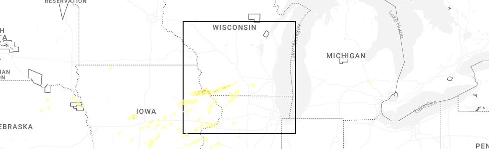
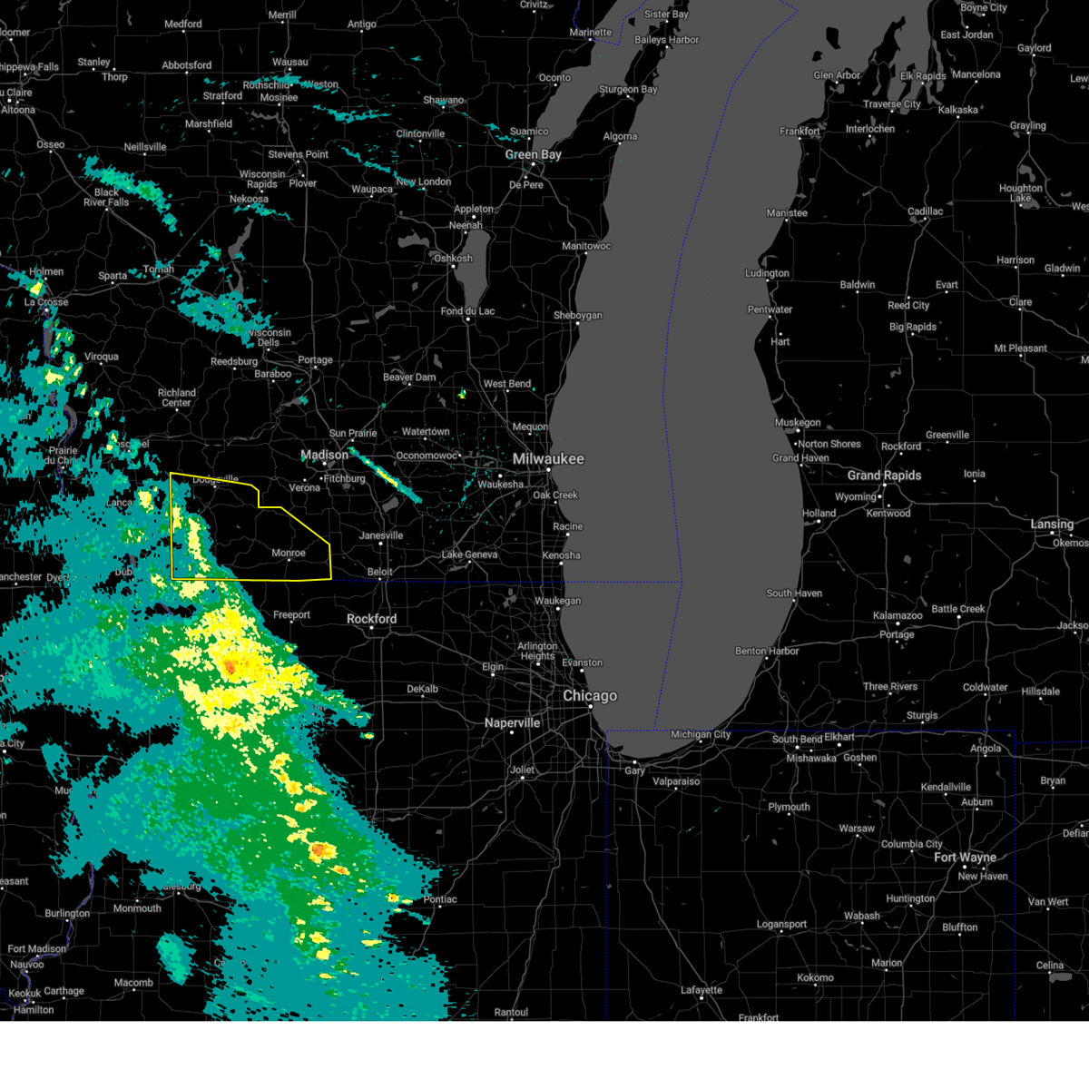
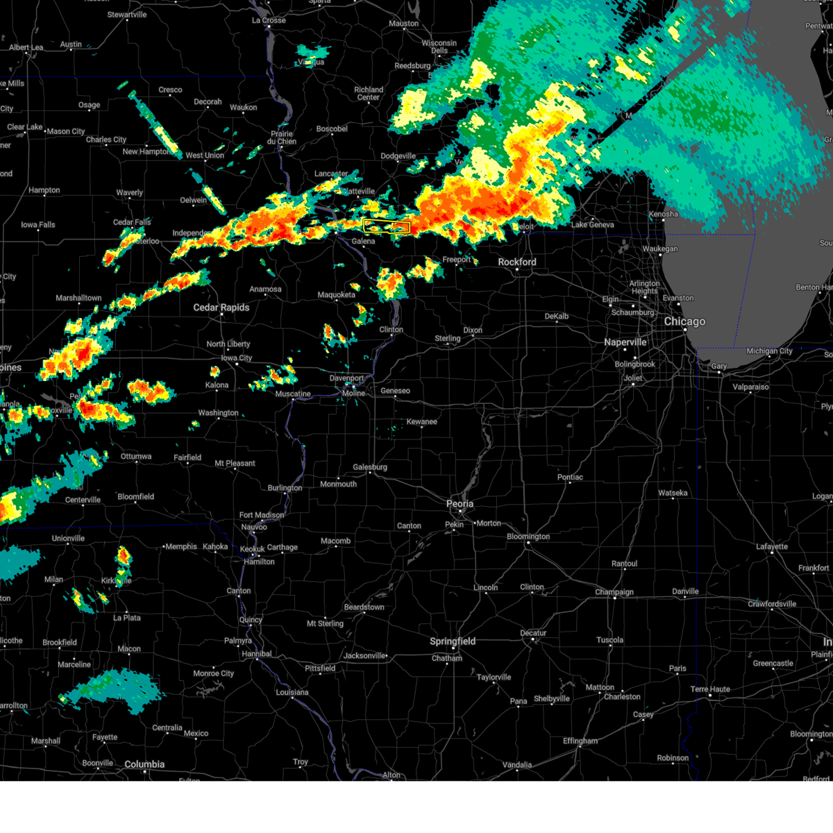
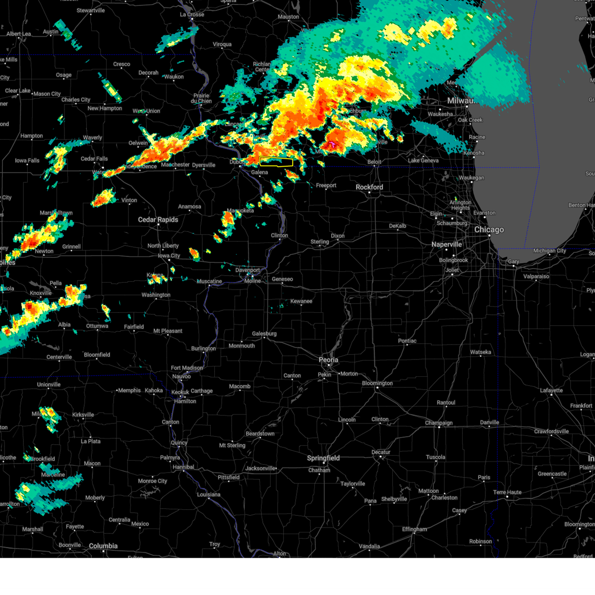
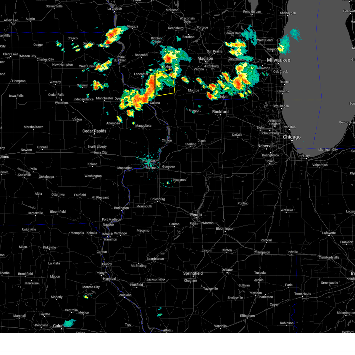
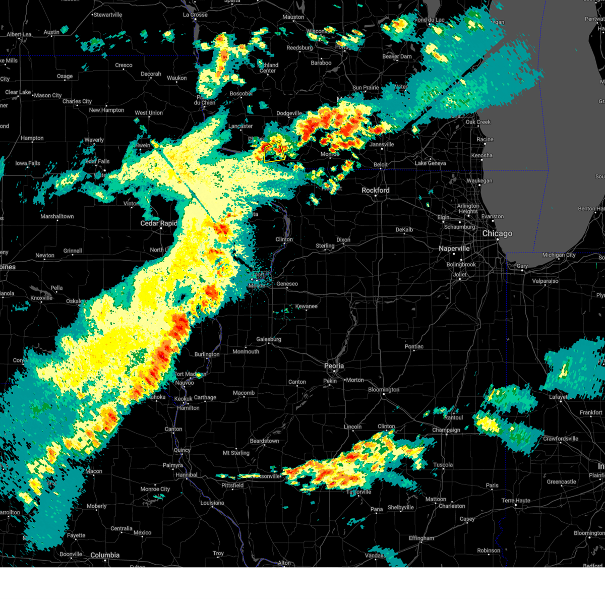
Hail Map for Benton, WI
The Benton, WI area has had 1 report of on-the-ground hail by trained spotters, and has been under severe weather warnings 11 times during the past 12 months. Doppler radar has detected hail at or near Benton, WI on 45 occasions, including 1 occasion during the past year.
| Name: | Benton, WI |
| Where Located: | 61.4 miles SW of Madison, WI |
| Map: | Google Map for Benton, WI |
| Population: | 973 |
| Housing Units: | 426 |
| More Info: | Search Google for Benton, WI |
0
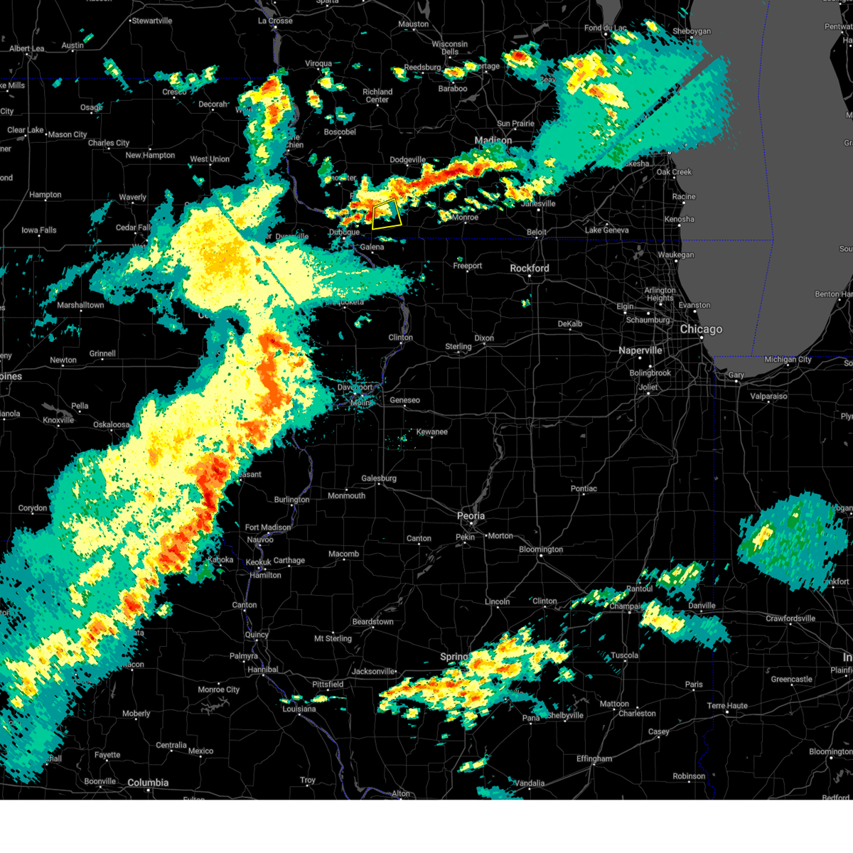
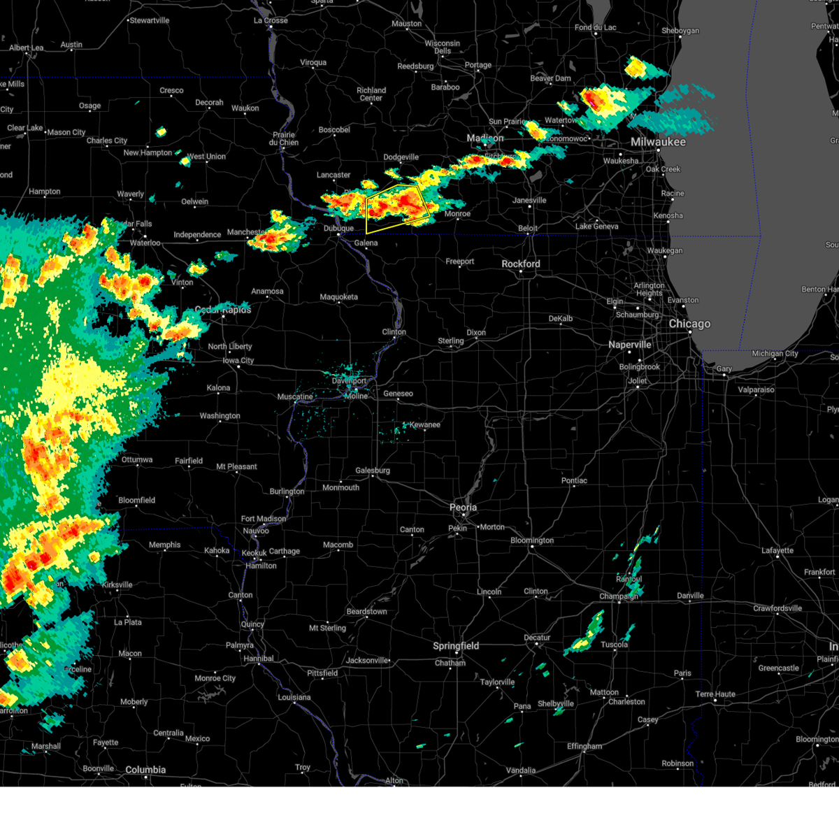
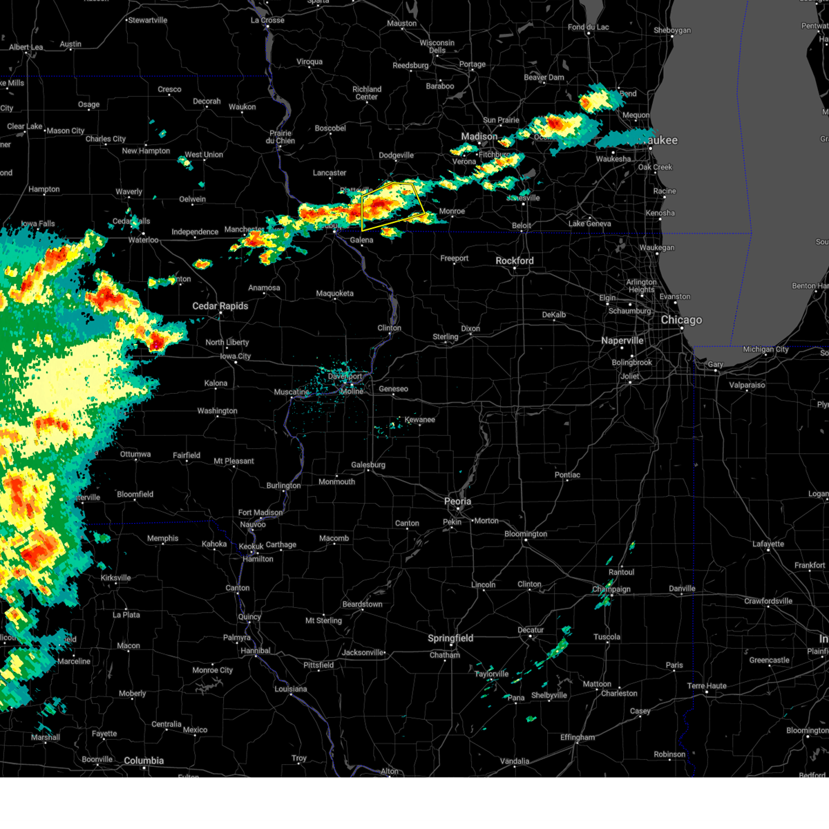
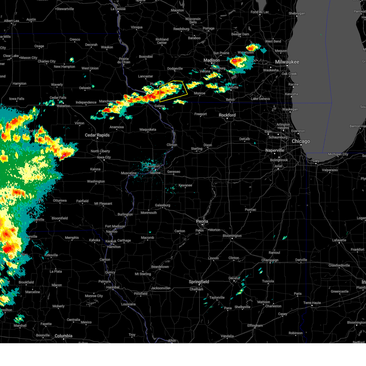
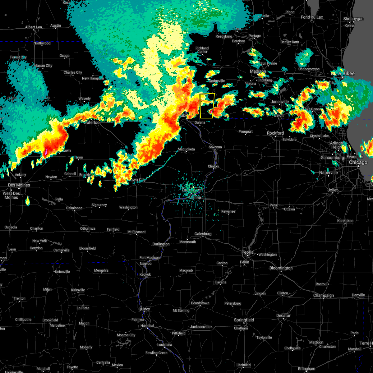
The Top Recent Hail Date for Benton, WI is Friday, July 11, 2025 (44th out of 45)
Hail and Wind Damage Spotted near Benton, WI
| Date / Time | Report Details |
|---|---|
| 7/11/2025 5:12 PM CDT |
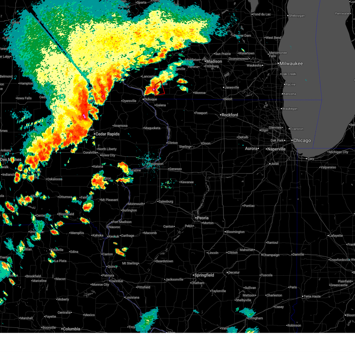
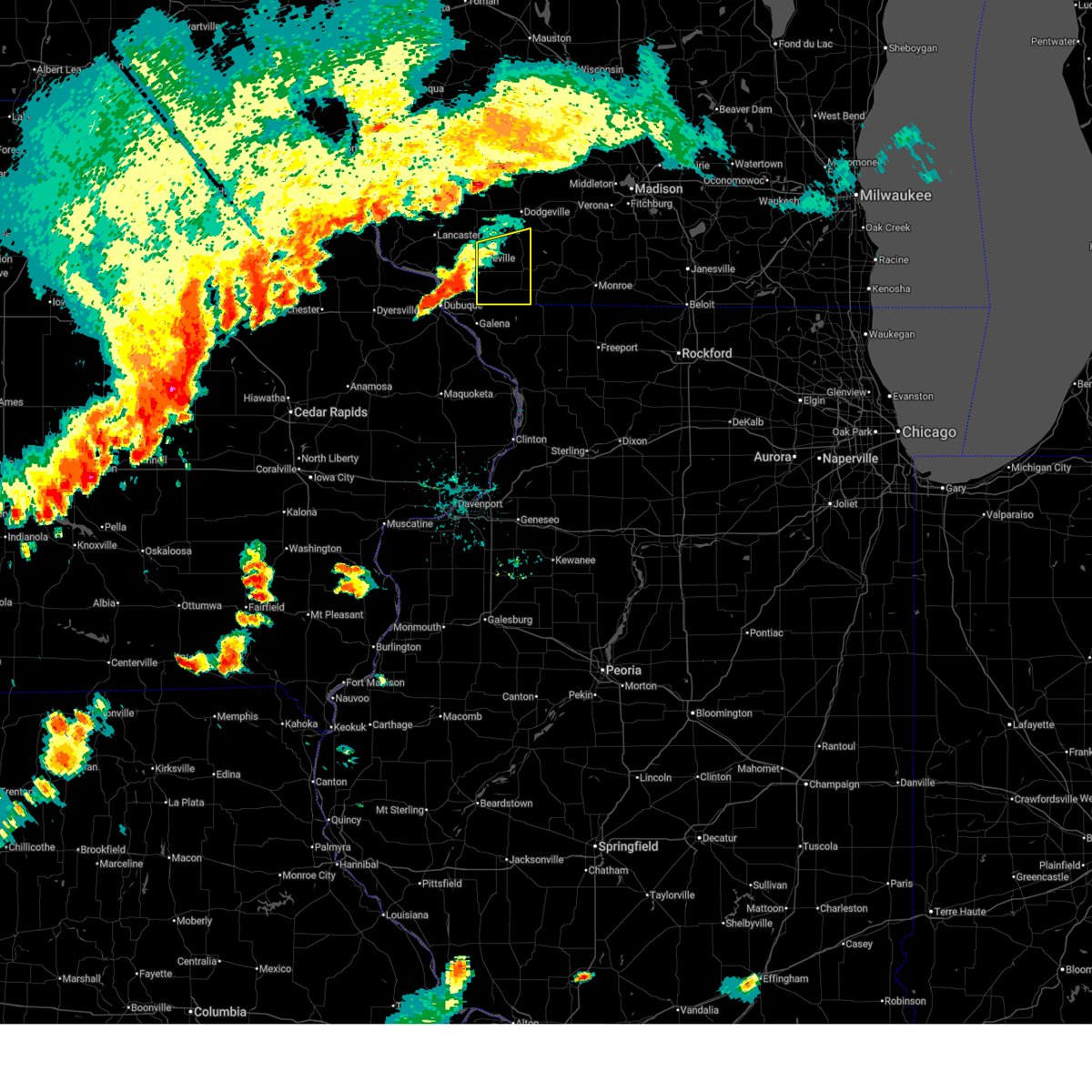
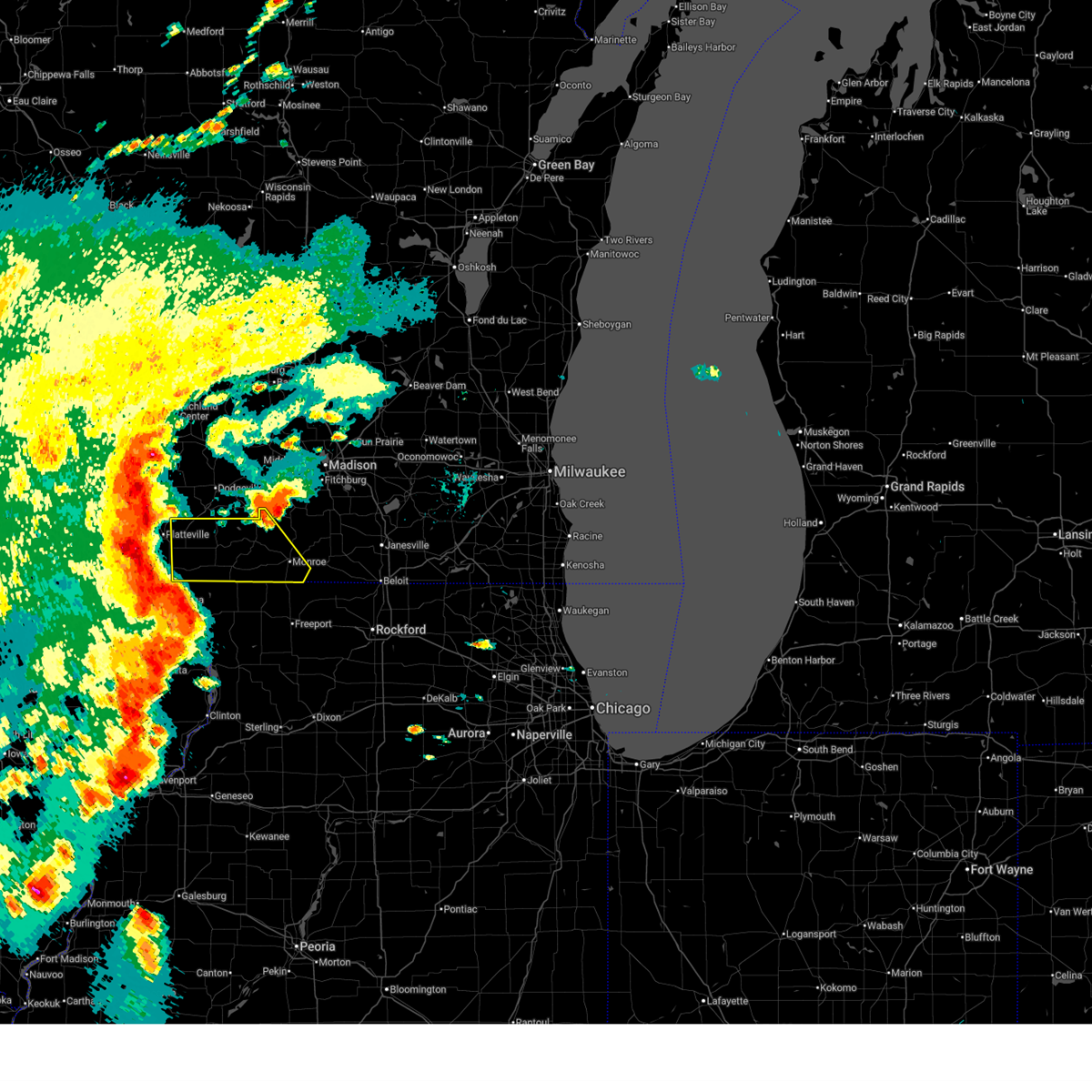 At 511 pm cdt, severe thunderstorms were located along a line extending from near platteville to schapville to spragueville, moving east at 65 mph (radar indicated. automated observations in potosi and lancaster reported winds of 65 and 70 mph). Hazards include 70 mph wind gusts and quarter size hail. Hail damage to vehicles is expected. expect considerable tree damage. wind damage is also likely to mobile homes, roofs, and outbuildings. Locations impacted include, monroe, darlington, shullsburg, belmont, benton, argyle, blanchardville, apple river, wiota, new diggings, south wayne, elk grove, fayette, lamont, browntown, gratiot, platte mounds, calamine, lead mine, and jordan center. At 511 pm cdt, severe thunderstorms were located along a line extending from near platteville to schapville to spragueville, moving east at 65 mph (radar indicated. automated observations in potosi and lancaster reported winds of 65 and 70 mph). Hazards include 70 mph wind gusts and quarter size hail. Hail damage to vehicles is expected. expect considerable tree damage. wind damage is also likely to mobile homes, roofs, and outbuildings. Locations impacted include, monroe, darlington, shullsburg, belmont, benton, argyle, blanchardville, apple river, wiota, new diggings, south wayne, elk grove, fayette, lamont, browntown, gratiot, platte mounds, calamine, lead mine, and jordan center.
|
| 7/11/2025 5:03 PM CDT |
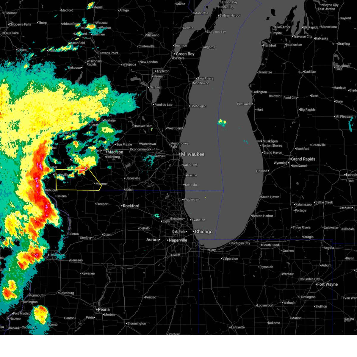 Svrmkx the national weather service in milwaukee/sullivan has issued a * severe thunderstorm warning for, lafayette county in south central wisconsin, western green county in south central wisconsin, * until 545 pm cdt. * at 503 pm cdt, severe thunderstorms were located along a line extending from near dickeyville to near elizabeth to near spragueville, moving east at 65 mph (radar indicated). Hazards include 70 mph wind gusts and quarter size hail. Hail damage to vehicles is expected. expect considerable tree damage. Wind damage is also likely to mobile homes, roofs, and outbuildings. Svrmkx the national weather service in milwaukee/sullivan has issued a * severe thunderstorm warning for, lafayette county in south central wisconsin, western green county in south central wisconsin, * until 545 pm cdt. * at 503 pm cdt, severe thunderstorms were located along a line extending from near dickeyville to near elizabeth to near spragueville, moving east at 65 mph (radar indicated). Hazards include 70 mph wind gusts and quarter size hail. Hail damage to vehicles is expected. expect considerable tree damage. Wind damage is also likely to mobile homes, roofs, and outbuildings.
|
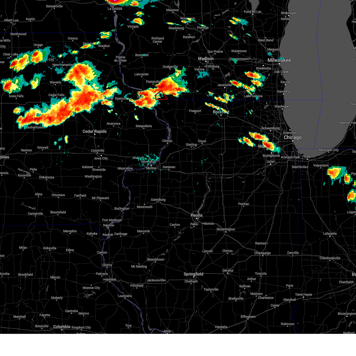
| 7/11/2025 3:48 PM CDT |
 At 348 pm cdt, a severe thunderstorm capable of producing a tornado was located near cuba city, or near platteville, moving northeast at 15 mph (radar indicated rotation). Hazards include tornado and ping pong ball size hail. Flying debris will be dangerous to those caught without shelter. mobile homes will be damaged or destroyed. damage to roofs, windows, and vehicles will occur. tree damage is likely. Locations impacted include, belmont, benton, and elk grove. At 348 pm cdt, a severe thunderstorm capable of producing a tornado was located near cuba city, or near platteville, moving northeast at 15 mph (radar indicated rotation). Hazards include tornado and ping pong ball size hail. Flying debris will be dangerous to those caught without shelter. mobile homes will be damaged or destroyed. damage to roofs, windows, and vehicles will occur. tree damage is likely. Locations impacted include, belmont, benton, and elk grove.
|
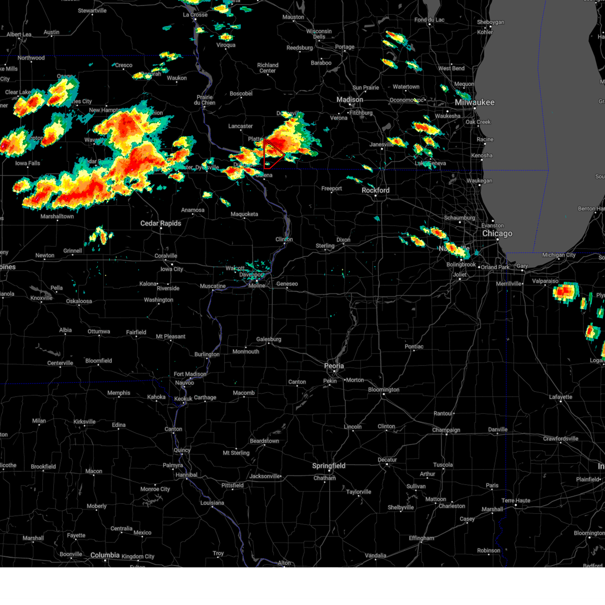
| 7/11/2025 3:29 PM CDT |
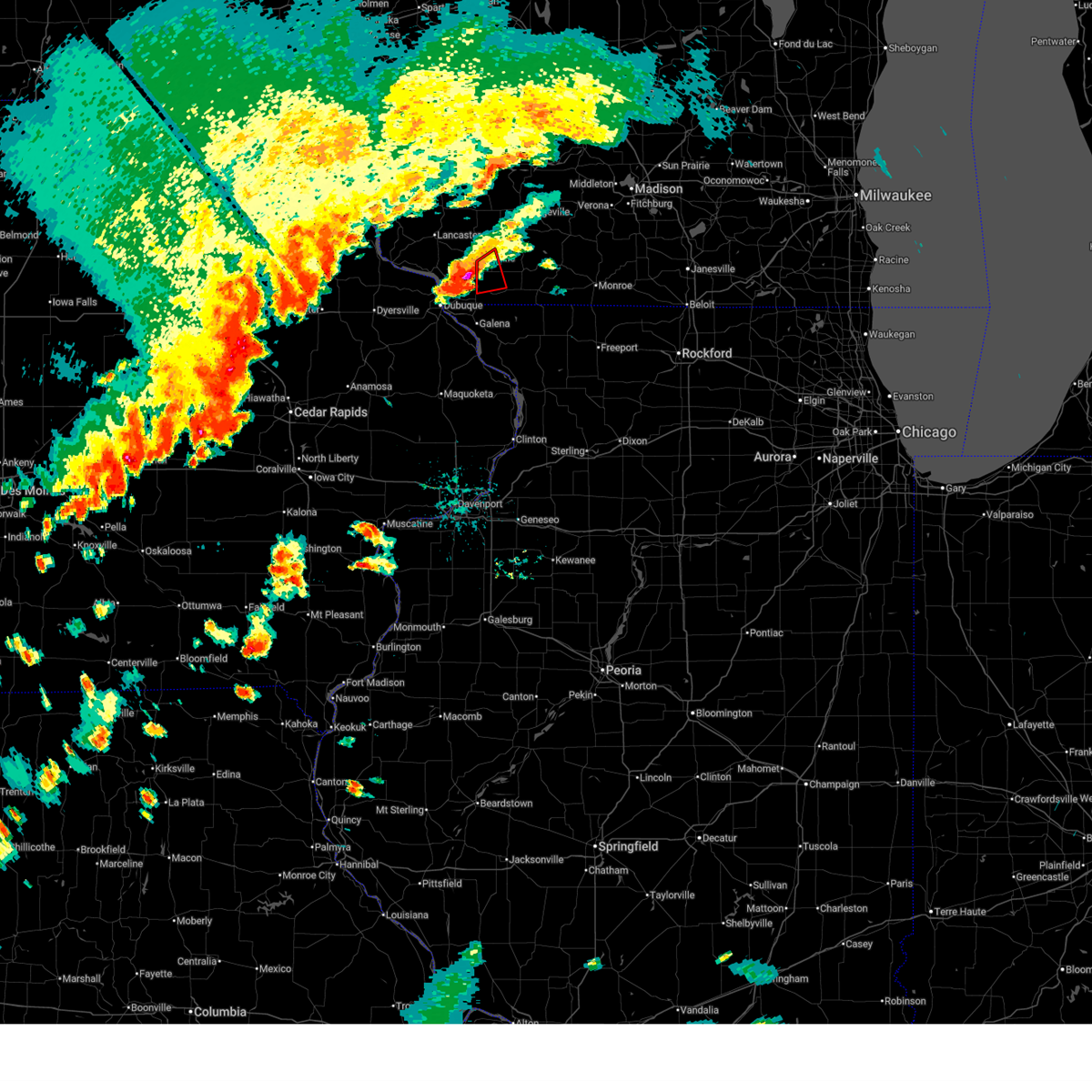 Tormkx the national weather service in milwaukee/sullivan has issued a * tornado warning for, northwestern lafayette county in south central wisconsin, * until 415 pm cdt. * at 329 pm cdt, a severe thunderstorm capable of producing a tornado was located near cuba city, or 8 miles south of platteville, moving northeast at 15 mph (radar indicated rotation). Hazards include tornado and quarter size hail. Flying debris will be dangerous to those caught without shelter. mobile homes will be damaged or destroyed. damage to roofs, windows, and vehicles will occur. Tree damage is likely. Tormkx the national weather service in milwaukee/sullivan has issued a * tornado warning for, northwestern lafayette county in south central wisconsin, * until 415 pm cdt. * at 329 pm cdt, a severe thunderstorm capable of producing a tornado was located near cuba city, or 8 miles south of platteville, moving northeast at 15 mph (radar indicated rotation). Hazards include tornado and quarter size hail. Flying debris will be dangerous to those caught without shelter. mobile homes will be damaged or destroyed. damage to roofs, windows, and vehicles will occur. Tree damage is likely.
|
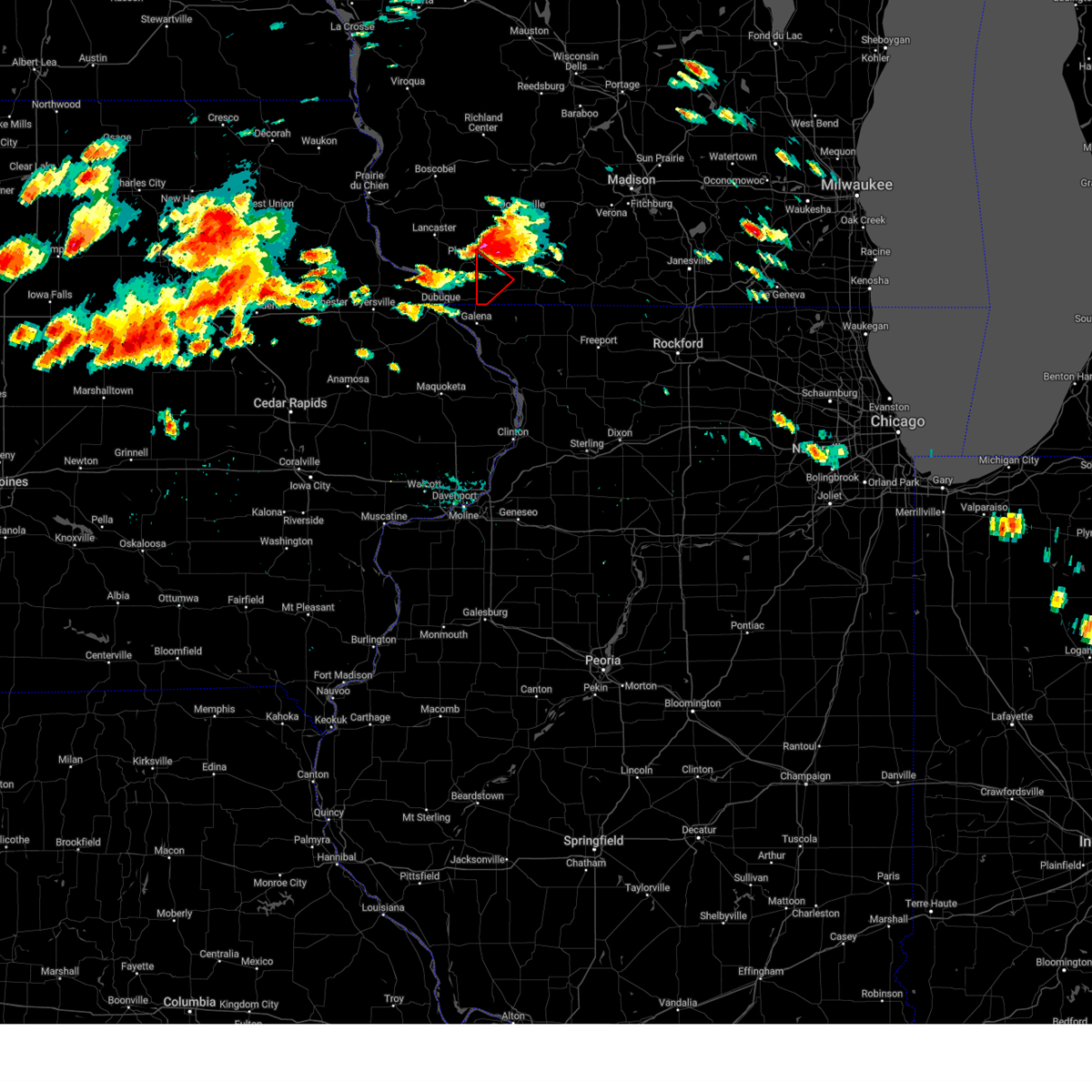
| 7/11/2025 3:11 PM CDT |
 Svrmkx the national weather service in milwaukee/sullivan has issued a * severe thunderstorm warning for, western lafayette county in south central wisconsin, south central iowa county in south central wisconsin, * until 400 pm cdt. * at 311 pm cdt, a severe thunderstorm was located near cuba city, or 8 miles south of platteville, moving northeast at 20 mph (radar indicated). Hazards include 60 mph wind gusts and quarter size hail. Hail damage to vehicles is expected. Expect wind damage to roofs, siding, and trees. Svrmkx the national weather service in milwaukee/sullivan has issued a * severe thunderstorm warning for, western lafayette county in south central wisconsin, south central iowa county in south central wisconsin, * until 400 pm cdt. * at 311 pm cdt, a severe thunderstorm was located near cuba city, or 8 miles south of platteville, moving northeast at 20 mph (radar indicated). Hazards include 60 mph wind gusts and quarter size hail. Hail damage to vehicles is expected. Expect wind damage to roofs, siding, and trees.
|
| 6/26/2025 8:21 PM CDT |
 Svrmkx the national weather service in milwaukee/sullivan has issued a * severe thunderstorm warning for, lafayette county in south central wisconsin, southern iowa county in south central wisconsin, * until 915 pm cdt. * at 820 pm cdt, severe thunderstorms were located along a line extending from 9 miles southeast of fennimore to platteville to near menominee, moving east at 35 mph (radar indicated). Hazards include 60 mph wind gusts and nickel size hail. expect damage to roofs, siding, and trees Svrmkx the national weather service in milwaukee/sullivan has issued a * severe thunderstorm warning for, lafayette county in south central wisconsin, southern iowa county in south central wisconsin, * until 915 pm cdt. * at 820 pm cdt, severe thunderstorms were located along a line extending from 9 miles southeast of fennimore to platteville to near menominee, moving east at 35 mph (radar indicated). Hazards include 60 mph wind gusts and nickel size hail. expect damage to roofs, siding, and trees
|
| 4/18/2025 6:15 AM CDT |
 Svrmkx the national weather service in milwaukee/sullivan has issued a * severe thunderstorm warning for, lafayette county in south central wisconsin, green county in south central wisconsin, iowa county in south central wisconsin, western columbia county in south central wisconsin, dane county in south central wisconsin, sauk county in south central wisconsin, * until 700 am cdt. * at 614 am cdt, severe thunderstorms were located along a line extending from 11 miles southwest of reedsburg to near mazomanie to near blanchardville to near darlington, moving northeast at 70 mph (radar indicated). Hazards include two inch hail and 60 mph wind gusts. People and animals outdoors will be injured. expect hail damage to roofs, siding, windows, and vehicles. Expect wind damage to roofs, siding, and trees. Svrmkx the national weather service in milwaukee/sullivan has issued a * severe thunderstorm warning for, lafayette county in south central wisconsin, green county in south central wisconsin, iowa county in south central wisconsin, western columbia county in south central wisconsin, dane county in south central wisconsin, sauk county in south central wisconsin, * until 700 am cdt. * at 614 am cdt, severe thunderstorms were located along a line extending from 11 miles southwest of reedsburg to near mazomanie to near blanchardville to near darlington, moving northeast at 70 mph (radar indicated). Hazards include two inch hail and 60 mph wind gusts. People and animals outdoors will be injured. expect hail damage to roofs, siding, windows, and vehicles. Expect wind damage to roofs, siding, and trees.
|
| 3/14/2025 11:13 PM CDT | The storms which prompted the warning have weakened below severe limits. therefore, the warning will be allowed to expire. a severe thunderstorm watch remains in effect until 400 am cdt for south central wisconsin. remember, a severe thunderstorm warning still remains in effect for green county. |
| 3/14/2025 10:38 PM CDT | Svrmkx the national weather service in milwaukee/sullivan has issued a * severe thunderstorm warning for, lafayette county in south central wisconsin, green county in south central wisconsin, southern iowa county in south central wisconsin, * until 1115 pm cdt. * at 1037 pm cdt, severe thunderstorms were located along a line extending from 11 miles east of fennimore to near darlington to near winslow, moving northeast at 25 mph (radar indicated). Hazards include 60 mph wind gusts. these storms have a history of producing 50 to 60 mph winds. expect damage to roofs, siding, and trees |
| 3/14/2025 10:27 PM CDT |
 At 1026 pm cdt, severe thunderstorms were located along a line extending from 10 miles east of fennimore to darlington to near lena, moving northeast at 50 mph (trained weather spotters 5 miles north-northwest of platteville measured 59 mph wind gusts). Hazards include 60 mph wind gusts. Expect damage to roofs, siding, and trees. Locations impacted include, calamine, lamont, belmont, darlington, brodhead, rewey, juda, fayette, wiota, yellowstone lake st park, linden, waldwick, new diggings, argyle, albany, gratiot, platte mounds, lead mine, monroe, and benton. At 1026 pm cdt, severe thunderstorms were located along a line extending from 10 miles east of fennimore to darlington to near lena, moving northeast at 50 mph (trained weather spotters 5 miles north-northwest of platteville measured 59 mph wind gusts). Hazards include 60 mph wind gusts. Expect damage to roofs, siding, and trees. Locations impacted include, calamine, lamont, belmont, darlington, brodhead, rewey, juda, fayette, wiota, yellowstone lake st park, linden, waldwick, new diggings, argyle, albany, gratiot, platte mounds, lead mine, monroe, and benton.
|
| 3/14/2025 10:13 PM CDT | Wind gusts in the mid to upper 60s measured on home weather statio in lafayette county WI, 0.3 miles E of Benton, WI |
| 3/14/2025 10:04 PM CDT | Svrmkx the national weather service in milwaukee/sullivan has issued a * severe thunderstorm warning for, lafayette county in south central wisconsin, green county in south central wisconsin, southern iowa county in south central wisconsin, * until 1045 pm cdt. * at 1003 pm cdt, severe thunderstorms were located along a line extending from peosta to near galena to mount carroll, moving northeast at 65 mph (radar indicated. these storms have a history of producing 50 to 60 mph). Hazards include 60 mph wind gusts. expect damage to roofs, siding, and trees |
| 7/15/2024 6:40 PM CDT | At 639 pm cdt, severe thunderstorms were located along a line extending from near cuba city to near council hill to bellevue, moving east at 45 mph. these are destructive storms for shullsburg, darlington, gratiot, benton (emergency management reports 72 mile per hour winds in hazel green). Hazards include 80 mph wind gusts and quarter size hail. Flying debris will be dangerous to those caught without shelter. mobile homes will be heavily damaged. expect considerable damage to roofs, windows, and vehicles. extensive tree damage and power outages are likely. Locations impacted include, darlington, shullsburg, belmont, benton, argyle, wiota, new diggings, south wayne, elk grove, lamont, gratiot, calamine, lead mine, and woodford. |
| 7/15/2024 6:28 PM CDT | Tormkx the national weather service in milwaukee/sullivan has issued a * tornado warning for, western lafayette county in south central wisconsin, * until 700 pm cdt. * at 628 pm cdt, severe thunderstorms capable of producing both tornadoes and extensive straight line wind damage were located over cuba city, or 10 miles south of platteville, moving east at 30 mph (radar indicated rotation). Hazards include tornado. Flying debris will be dangerous to those caught without shelter. mobile homes will be damaged or destroyed. damage to roofs, windows, and vehicles will occur. Tree damage is likely. |
| 7/15/2024 6:24 PM CDT | At 623 pm cdt, severe thunderstorms were located along a line extending from near dickeyville to menominee to la motte, moving east at 45 mph. these are destructive storms for cuba city, benton, shullsburg, darlington, and gratiot (radar indicated). Hazards include 80 mph wind gusts. Flying debris will be dangerous to those caught without shelter. mobile homes will be heavily damaged. expect considerable damage to roofs, windows, and vehicles. extensive tree damage and power outages are likely. Locations impacted include, darlington, shullsburg, belmont, benton, argyle, wiota, new diggings, south wayne, elk grove, lamont, gratiot, calamine, lead mine, and woodford. |
| 7/15/2024 6:11 PM CDT | Svrmkx the national weather service in milwaukee/sullivan has issued a * severe thunderstorm warning for, lafayette county in south central wisconsin, * until 730 pm cdt. * at 610 pm cdt, severe thunderstorms were located along a line extending from 6 miles northeast of sherrill to dubuque to near bernard, moving east at 45 mph. these are destructive storms for cuba city, belmont, benton, shullsburg, darlington, and gratiot (radar indicated). Hazards include 80 mph wind gusts. Flying debris will be dangerous to those caught without shelter. mobile homes will be heavily damaged. expect considerable damage to roofs, windows, and vehicles. Extensive tree damage and power outages are likely. |
| 7/15/2024 5:49 PM CDT |
 Svrmkx the national weather service in milwaukee/sullivan has issued a * severe thunderstorm warning for, lafayette county in south central wisconsin, * until 630 pm cdt. * at 549 pm cdt, a severe thunderstorm was located near belmont, or 7 miles southeast of platteville, moving east at 40 mph (radar indicated). Hazards include quarter size hail. damage to vehicles is expected Svrmkx the national weather service in milwaukee/sullivan has issued a * severe thunderstorm warning for, lafayette county in south central wisconsin, * until 630 pm cdt. * at 549 pm cdt, a severe thunderstorm was located near belmont, or 7 miles southeast of platteville, moving east at 40 mph (radar indicated). Hazards include quarter size hail. damage to vehicles is expected
|
| 6/22/2024 8:22 PM CDT |
 Svrmkx the national weather service in milwaukee/sullivan has issued a * severe thunderstorm warning for, southern lafayette county in south central wisconsin, * until 915 pm cdt. * at 822 pm cdt, a severe thunderstorm was located near hazel green, or 8 miles northwest of galena, moving east at 35 mph (radar indicated). Hazards include 60 mph wind gusts and nickel size hail. expect damage to roofs, siding, and trees Svrmkx the national weather service in milwaukee/sullivan has issued a * severe thunderstorm warning for, southern lafayette county in south central wisconsin, * until 915 pm cdt. * at 822 pm cdt, a severe thunderstorm was located near hazel green, or 8 miles northwest of galena, moving east at 35 mph (radar indicated). Hazards include 60 mph wind gusts and nickel size hail. expect damage to roofs, siding, and trees
|
| 6/22/2024 7:45 PM CDT |
 the severe thunderstorm warning has been cancelled and is no longer in effect the severe thunderstorm warning has been cancelled and is no longer in effect
|
| 6/22/2024 7:08 PM CDT |
 Svrmkx the national weather service in milwaukee/sullivan has issued a * severe thunderstorm warning for, southwestern lafayette county in south central wisconsin, * until 800 pm cdt. * at 707 pm cdt, a severe thunderstorm was located over hazel green, or 8 miles north of galena, moving east at 45 mph (radar indicated). Hazards include 60 mph wind gusts and quarter size hail. Hail damage to vehicles is expected. Expect wind damage to roofs, siding, and trees. Svrmkx the national weather service in milwaukee/sullivan has issued a * severe thunderstorm warning for, southwestern lafayette county in south central wisconsin, * until 800 pm cdt. * at 707 pm cdt, a severe thunderstorm was located over hazel green, or 8 miles north of galena, moving east at 45 mph (radar indicated). Hazards include 60 mph wind gusts and quarter size hail. Hail damage to vehicles is expected. Expect wind damage to roofs, siding, and trees.
|
| 6/12/2024 4:30 PM CDT |
 At 430 pm cdt, severe thunderstorms were located along a line extending from 8 miles east of richland center to near sageville, moving east at 45 mph (trained weather spotters. trees and power lines have been reported down in boscobel and lancaster, along with a measured 64 mph wind gust at the boscobel airport). Hazards include 60 mph wind gusts and penny size hail. Expect damage to roofs, siding, and trees. Locations impacted include, dodgeville, mineral point, darlington, spring green, shullsburg, belmont, benton, argyle, blanchardville, barneveld, wiota, blue mounds, highland, arena, plain, ridgeway, avoca, orion, linden, and new diggings. At 430 pm cdt, severe thunderstorms were located along a line extending from 8 miles east of richland center to near sageville, moving east at 45 mph (trained weather spotters. trees and power lines have been reported down in boscobel and lancaster, along with a measured 64 mph wind gust at the boscobel airport). Hazards include 60 mph wind gusts and penny size hail. Expect damage to roofs, siding, and trees. Locations impacted include, dodgeville, mineral point, darlington, spring green, shullsburg, belmont, benton, argyle, blanchardville, barneveld, wiota, blue mounds, highland, arena, plain, ridgeway, avoca, orion, linden, and new diggings.
|
| 6/12/2024 4:11 PM CDT |
 Svrmkx the national weather service in milwaukee/sullivan has issued a * severe thunderstorm warning for, lafayette county in south central wisconsin, iowa county in south central wisconsin, southwestern sauk county in south central wisconsin, * until 515 pm cdt. * at 410 pm cdt, severe thunderstorms were located along a line extending from near richland center to rickardsville, moving east at 45 mph (trained weather spotters. there have been numerous reports of tree and power line damage across southwestern wisconsin with the storms). Hazards include 60 mph wind gusts and penny size hail. expect damage to roofs, siding, and trees Svrmkx the national weather service in milwaukee/sullivan has issued a * severe thunderstorm warning for, lafayette county in south central wisconsin, iowa county in south central wisconsin, southwestern sauk county in south central wisconsin, * until 515 pm cdt. * at 410 pm cdt, severe thunderstorms were located along a line extending from near richland center to rickardsville, moving east at 45 mph (trained weather spotters. there have been numerous reports of tree and power line damage across southwestern wisconsin with the storms). Hazards include 60 mph wind gusts and penny size hail. expect damage to roofs, siding, and trees
|
| 6/3/2024 3:49 PM CDT |
 Svrmkx the national weather service in milwaukee/sullivan has issued a * severe thunderstorm warning for, western lafayette county in south central wisconsin, southwestern iowa county in south central wisconsin, * until 445 pm cdt. * at 349 pm cdt, a severe thunderstorm was located near platteville, moving east at 25 mph (radar indicated). Hazards include 60 mph wind gusts and penny size hail. expect damage to roofs, siding, and trees Svrmkx the national weather service in milwaukee/sullivan has issued a * severe thunderstorm warning for, western lafayette county in south central wisconsin, southwestern iowa county in south central wisconsin, * until 445 pm cdt. * at 349 pm cdt, a severe thunderstorm was located near platteville, moving east at 25 mph (radar indicated). Hazards include 60 mph wind gusts and penny size hail. expect damage to roofs, siding, and trees
|
| 5/24/2024 8:47 AM CDT |
 At 846 am cdt, severe thunderstorms were located along a line extending from near belmont to near darlington to near scales mound, moving east at 40 mph (radar indicated). Hazards include 60 mph wind gusts. Expect damage to roofs, siding, and trees. Locations impacted include, darlington, shullsburg, belmont, benton, argyle, blanchardville, wiota, new diggings, south wayne, elk grove, fayette, lamont, gratiot, calamine, lead mine, yellowstone lake st park, and woodford. At 846 am cdt, severe thunderstorms were located along a line extending from near belmont to near darlington to near scales mound, moving east at 40 mph (radar indicated). Hazards include 60 mph wind gusts. Expect damage to roofs, siding, and trees. Locations impacted include, darlington, shullsburg, belmont, benton, argyle, blanchardville, wiota, new diggings, south wayne, elk grove, fayette, lamont, gratiot, calamine, lead mine, yellowstone lake st park, and woodford.
|
| 5/24/2024 8:28 AM CDT |
 At 828 am cdt, a severe thunderstorm was located near cuba city, or 7 miles southeast of platteville, moving east at 45 mph (radar indicated). Hazards include 60 mph wind gusts. Expect damage to roofs, siding, and trees. Locations impacted include, darlington, shullsburg, belmont, benton, argyle, blanchardville, wiota, new diggings, south wayne, elk grove, fayette, lamont, gratiot, platte mounds, calamine, lead mine, yellowstone lake st park, and woodford. At 828 am cdt, a severe thunderstorm was located near cuba city, or 7 miles southeast of platteville, moving east at 45 mph (radar indicated). Hazards include 60 mph wind gusts. Expect damage to roofs, siding, and trees. Locations impacted include, darlington, shullsburg, belmont, benton, argyle, blanchardville, wiota, new diggings, south wayne, elk grove, fayette, lamont, gratiot, platte mounds, calamine, lead mine, yellowstone lake st park, and woodford.
|
| 5/24/2024 8:13 AM CDT |
 Svrmkx the national weather service in milwaukee/sullivan has issued a * severe thunderstorm warning for, lafayette county in south central wisconsin, * until 915 am cdt. * at 812 am cdt, a severe thunderstorm was located over east dubuque, or near dubuque, moving northeast at 45 mph (radar indicated). Hazards include 60 mph wind gusts. expect damage to roofs, siding, and trees Svrmkx the national weather service in milwaukee/sullivan has issued a * severe thunderstorm warning for, lafayette county in south central wisconsin, * until 915 am cdt. * at 812 am cdt, a severe thunderstorm was located over east dubuque, or near dubuque, moving northeast at 45 mph (radar indicated). Hazards include 60 mph wind gusts. expect damage to roofs, siding, and trees
|
| 5/21/2024 8:44 PM CDT |
 Svrmkx the national weather service in milwaukee/sullivan has issued a * severe thunderstorm warning for, lafayette county in south central wisconsin, green county in south central wisconsin, iowa county in south central wisconsin, southwestern dane county in south central wisconsin, * until 930 pm cdt. * at 843 pm cdt, severe thunderstorms were located along a line extending from near cuba city to near monroe, moving northeast at 55 mph (radar indicated). Hazards include 60 mph wind gusts. expect damage to roofs, siding, and trees Svrmkx the national weather service in milwaukee/sullivan has issued a * severe thunderstorm warning for, lafayette county in south central wisconsin, green county in south central wisconsin, iowa county in south central wisconsin, southwestern dane county in south central wisconsin, * until 930 pm cdt. * at 843 pm cdt, severe thunderstorms were located along a line extending from near cuba city to near monroe, moving northeast at 55 mph (radar indicated). Hazards include 60 mph wind gusts. expect damage to roofs, siding, and trees
|
| 5/21/2024 6:52 PM CDT |
 At 652 pm cdt, a severe thunderstorm was located near darlington, moving northeast at 55 mph (radar indicated). Hazards include 70 mph wind gusts and quarter size hail. Hail damage to vehicles is expected. expect considerable tree damage. wind damage is also likely to mobile homes, roofs, and outbuildings. Locations impacted include, dodgeville, mineral point, darlington, shullsburg, belmont, benton, argyle, blanchardville, barneveld, wiota, arena, ridgeway, linden, new diggings, south wayne, waldwick, elk grove, fayette, lamont, and rewey. At 652 pm cdt, a severe thunderstorm was located near darlington, moving northeast at 55 mph (radar indicated). Hazards include 70 mph wind gusts and quarter size hail. Hail damage to vehicles is expected. expect considerable tree damage. wind damage is also likely to mobile homes, roofs, and outbuildings. Locations impacted include, dodgeville, mineral point, darlington, shullsburg, belmont, benton, argyle, blanchardville, barneveld, wiota, arena, ridgeway, linden, new diggings, south wayne, waldwick, elk grove, fayette, lamont, and rewey.
|
| 5/21/2024 6:47 PM CDT |
 Svrmkx the national weather service in milwaukee/sullivan has issued a * severe thunderstorm warning for, lafayette county in south central wisconsin, southern iowa county in south central wisconsin, * until 745 pm cdt. * at 647 pm cdt, a severe thunderstorm was located near darlington, moving northeast at 55 mph (radar indicated). Hazards include 60 mph wind gusts and quarter size hail. Hail damage to vehicles is expected. Expect wind damage to roofs, siding, and trees. Svrmkx the national weather service in milwaukee/sullivan has issued a * severe thunderstorm warning for, lafayette county in south central wisconsin, southern iowa county in south central wisconsin, * until 745 pm cdt. * at 647 pm cdt, a severe thunderstorm was located near darlington, moving northeast at 55 mph (radar indicated). Hazards include 60 mph wind gusts and quarter size hail. Hail damage to vehicles is expected. Expect wind damage to roofs, siding, and trees.
|
| 5/21/2024 3:57 PM CDT |
 Svrmkx the national weather service in milwaukee/sullivan has issued a * severe thunderstorm warning for, lafayette county in south central wisconsin, southern iowa county in south central wisconsin, * until 500 pm cdt. * at 356 pm cdt, a severe thunderstorm was located over dickeyville, or 9 miles northeast of dubuque, moving northeast at 35 mph (radar indicated). Hazards include golf ball size hail and 60 mph wind gusts. People and animals outdoors will be injured. expect hail damage to roofs, siding, windows, and vehicles. Expect wind damage to roofs, siding, and trees. Svrmkx the national weather service in milwaukee/sullivan has issued a * severe thunderstorm warning for, lafayette county in south central wisconsin, southern iowa county in south central wisconsin, * until 500 pm cdt. * at 356 pm cdt, a severe thunderstorm was located over dickeyville, or 9 miles northeast of dubuque, moving northeast at 35 mph (radar indicated). Hazards include golf ball size hail and 60 mph wind gusts. People and animals outdoors will be injured. expect hail damage to roofs, siding, windows, and vehicles. Expect wind damage to roofs, siding, and trees.
|
| 4/27/2024 8:35 PM CDT |
 the severe thunderstorm warning has been cancelled and is no longer in effect the severe thunderstorm warning has been cancelled and is no longer in effect
|
| 4/27/2024 8:14 PM CDT |
 Svrmkx the national weather service in milwaukee/sullivan has issued a * severe thunderstorm warning for, northwestern lafayette county in south central wisconsin, * until 900 pm cdt. * at 813 pm cdt, a severe thunderstorm was located over cuba city, or 8 miles south of platteville, moving east at 20 mph (radar indicated). Hazards include quarter size hail. damage to vehicles is expected Svrmkx the national weather service in milwaukee/sullivan has issued a * severe thunderstorm warning for, northwestern lafayette county in south central wisconsin, * until 900 pm cdt. * at 813 pm cdt, a severe thunderstorm was located over cuba city, or 8 miles south of platteville, moving east at 20 mph (radar indicated). Hazards include quarter size hail. damage to vehicles is expected
|
| 4/27/2024 5:54 PM CDT |
 The storm which prompted the warning has weakened below severe limits, and no longer poses an immediate threat to life or property. therefore, the warning will be allowed to expire. however, dime to nickel size hail and heavy rain are still possible with this thunderstorm. The storm which prompted the warning has weakened below severe limits, and no longer poses an immediate threat to life or property. therefore, the warning will be allowed to expire. however, dime to nickel size hail and heavy rain are still possible with this thunderstorm.
|
| 4/27/2024 5:33 PM CDT |
 At 533 pm cdt, a severe thunderstorm was located over cuba city, or 8 miles south of platteville, moving east at 25 mph (radar indicated). Hazards include 60 mph wind gusts and quarter size hail. Hail damage to vehicles is expected. expect wind damage to roofs, siding, and trees. Locations impacted include, darlington, shullsburg, belmont, benton, wiota, new diggings, elk grove, fayette, lamont, yellowstone lake st park, calamine, and lead mine. At 533 pm cdt, a severe thunderstorm was located over cuba city, or 8 miles south of platteville, moving east at 25 mph (radar indicated). Hazards include 60 mph wind gusts and quarter size hail. Hail damage to vehicles is expected. expect wind damage to roofs, siding, and trees. Locations impacted include, darlington, shullsburg, belmont, benton, wiota, new diggings, elk grove, fayette, lamont, yellowstone lake st park, calamine, and lead mine.
|
| 4/27/2024 5:17 PM CDT |
 Svrmkx the national weather service in milwaukee/sullivan has issued a * severe thunderstorm warning for, lafayette county in south central wisconsin, * until 600 pm cdt. * at 516 pm cdt, a severe thunderstorm was located near dickeyville, or 7 miles northeast of dubuque, moving east at 25 mph (radar indicated). Hazards include 60 mph wind gusts and quarter size hail. Hail damage to vehicles is expected. Expect wind damage to roofs, siding, and trees. Svrmkx the national weather service in milwaukee/sullivan has issued a * severe thunderstorm warning for, lafayette county in south central wisconsin, * until 600 pm cdt. * at 516 pm cdt, a severe thunderstorm was located near dickeyville, or 7 miles northeast of dubuque, moving east at 25 mph (radar indicated). Hazards include 60 mph wind gusts and quarter size hail. Hail damage to vehicles is expected. Expect wind damage to roofs, siding, and trees.
|
| 4/16/2024 5:54 PM CDT |
 The storm which prompted the warning has weakened below severe limits, and no longer poses an immediate threat to life or property. therefore, the warning will be allowed to expire. a tornado watch remains in effect until 1000 pm cdt for south central wisconsin. The storm which prompted the warning has weakened below severe limits, and no longer poses an immediate threat to life or property. therefore, the warning will be allowed to expire. a tornado watch remains in effect until 1000 pm cdt for south central wisconsin.
|
| 4/16/2024 5:40 PM CDT |
 At 539 pm cdt, a severe thunderstorm was located over dodgeville, moving north at 55 mph. an additional line of thunderstorms is approaching western lafayette county and will also have the potential of producing 60 mph wind gusts (radar indicated). Hazards include 60 mph wind gusts and quarter size hail. Hail damage to vehicles is expected. expect wind damage to roofs, siding, and trees. Locations impacted include, dodgeville, mineral point, darlington, shullsburg, belmont, benton, barneveld, highland, arena, ridgeway, centerville, avoca, orion, linden, new diggings, waldwick, elk grove, cobb, fayette, and clyde. At 539 pm cdt, a severe thunderstorm was located over dodgeville, moving north at 55 mph. an additional line of thunderstorms is approaching western lafayette county and will also have the potential of producing 60 mph wind gusts (radar indicated). Hazards include 60 mph wind gusts and quarter size hail. Hail damage to vehicles is expected. expect wind damage to roofs, siding, and trees. Locations impacted include, dodgeville, mineral point, darlington, shullsburg, belmont, benton, barneveld, highland, arena, ridgeway, centerville, avoca, orion, linden, new diggings, waldwick, elk grove, cobb, fayette, and clyde.
|
| 4/16/2024 5:23 PM CDT |
 At 523 pm cdt, a severe thunderstorm was located near darlington, moving north at 70 mph (radar indicated). Hazards include 60 mph wind gusts and quarter size hail. Hail damage to vehicles is expected. expect wind damage to roofs, siding, and trees. Locations impacted include, dodgeville, mineral point, darlington, shullsburg, belmont, benton, barneveld, highland, arena, ridgeway, centerville, avoca, orion, linden, new diggings, waldwick, elk grove, cobb, fayette, and clyde. At 523 pm cdt, a severe thunderstorm was located near darlington, moving north at 70 mph (radar indicated). Hazards include 60 mph wind gusts and quarter size hail. Hail damage to vehicles is expected. expect wind damage to roofs, siding, and trees. Locations impacted include, dodgeville, mineral point, darlington, shullsburg, belmont, benton, barneveld, highland, arena, ridgeway, centerville, avoca, orion, linden, new diggings, waldwick, elk grove, cobb, fayette, and clyde.
|
| 4/16/2024 5:12 PM CDT |
 Svrmkx the national weather service in milwaukee/sullivan has issued a * severe thunderstorm warning for, lafayette county in south central wisconsin, iowa county in south central wisconsin, * until 600 pm cdt. * at 511 pm cdt, a severe thunderstorm was located over scales mound, or 11 miles east of galena, moving north at 55 mph (radar indicated). Hazards include 60 mph wind gusts and quarter size hail. Hail damage to vehicles is expected. Expect wind damage to roofs, siding, and trees. Svrmkx the national weather service in milwaukee/sullivan has issued a * severe thunderstorm warning for, lafayette county in south central wisconsin, iowa county in south central wisconsin, * until 600 pm cdt. * at 511 pm cdt, a severe thunderstorm was located over scales mound, or 11 miles east of galena, moving north at 55 mph (radar indicated). Hazards include 60 mph wind gusts and quarter size hail. Hail damage to vehicles is expected. Expect wind damage to roofs, siding, and trees.
|
| 2/8/2024 4:14 PM CST |
 At 413 pm cst, a severe thunderstorm was located near galena, moving northeast at 50 mph (radar indicated). Hazards include quarter size hail. damage to vehicles is expected At 413 pm cst, a severe thunderstorm was located near galena, moving northeast at 50 mph (radar indicated). Hazards include quarter size hail. damage to vehicles is expected
|
| 7/28/2023 8:24 PM CDT |
 The severe thunderstorm warning for lafayette county will expire at 830 pm cdt, the storm which prompted the warning has moved out of the area. therefore, the warning will be allowed to expire. however, heavy rain is still possible with this thunderstorm. a severe thunderstorm watch remains in effect until midnight cdt for south central wisconsin. The severe thunderstorm warning for lafayette county will expire at 830 pm cdt, the storm which prompted the warning has moved out of the area. therefore, the warning will be allowed to expire. however, heavy rain is still possible with this thunderstorm. a severe thunderstorm watch remains in effect until midnight cdt for south central wisconsin.
|
| 7/28/2023 8:03 PM CDT |
 At 802 pm cdt, a severe thunderstorm was located over apple river, or 10 miles south of darlington, moving southeast at 20 mph (radar indicated). Hazards include 60 mph wind gusts and quarter size hail. Hail damage to vehicles is expected. expect wind damage to roofs, siding, and trees. locations impacted include, darlington, shullsburg, benton, wiota, new diggings, south wayne, gratiot, and lead mine. hail threat, radar indicated max hail size, 1. 00 in wind threat, radar indicated max wind gust, 60 mph. At 802 pm cdt, a severe thunderstorm was located over apple river, or 10 miles south of darlington, moving southeast at 20 mph (radar indicated). Hazards include 60 mph wind gusts and quarter size hail. Hail damage to vehicles is expected. expect wind damage to roofs, siding, and trees. locations impacted include, darlington, shullsburg, benton, wiota, new diggings, south wayne, gratiot, and lead mine. hail threat, radar indicated max hail size, 1. 00 in wind threat, radar indicated max wind gust, 60 mph.
|
| 7/28/2023 7:41 PM CDT |
 At 740 pm cdt, a severe thunderstorm capable of producing a tornado was located over benton, or 9 miles northeast of galena, moving southeast at 25 mph (radar indicated rotation). Hazards include tornado and hail up to two inches in diameter. Flying debris will be dangerous to those caught without shelter. mobile homes will be damaged or destroyed. damage to roofs, windows, and vehicles will occur. Tree damage is likely. At 740 pm cdt, a severe thunderstorm capable of producing a tornado was located over benton, or 9 miles northeast of galena, moving southeast at 25 mph (radar indicated rotation). Hazards include tornado and hail up to two inches in diameter. Flying debris will be dangerous to those caught without shelter. mobile homes will be damaged or destroyed. damage to roofs, windows, and vehicles will occur. Tree damage is likely.
|
| 7/28/2023 7:39 PM CDT |
 At 738 pm cdt, a severe thunderstorm was located near shullsburg, or near darlington, moving southeast at 30 mph (radar indicated). Hazards include two inch hail and 60 mph wind gusts. People and animals outdoors will be injured. expect hail damage to roofs, siding, windows, and vehicles. Expect wind damage to roofs, siding, and trees. At 738 pm cdt, a severe thunderstorm was located near shullsburg, or near darlington, moving southeast at 30 mph (radar indicated). Hazards include two inch hail and 60 mph wind gusts. People and animals outdoors will be injured. expect hail damage to roofs, siding, windows, and vehicles. Expect wind damage to roofs, siding, and trees.
|
| 7/28/2023 7:23 PM CDT |
 At 722 pm cdt, a severe thunderstorm capable of producing a tornado was located near belmont, or near platteville, moving southeast at 25 mph (radar indicated rotation). Hazards include tornado and two inch hail. Flying debris will be dangerous to those caught without shelter. mobile homes will be damaged or destroyed. damage to roofs, windows, and vehicles will occur. tree damage is likely. Locations impacted include, benton, new diggings, elk grove, and lead mine. At 722 pm cdt, a severe thunderstorm capable of producing a tornado was located near belmont, or near platteville, moving southeast at 25 mph (radar indicated rotation). Hazards include tornado and two inch hail. Flying debris will be dangerous to those caught without shelter. mobile homes will be damaged or destroyed. damage to roofs, windows, and vehicles will occur. tree damage is likely. Locations impacted include, benton, new diggings, elk grove, and lead mine.
|
| 7/28/2023 7:10 PM CDT |
 At 710 pm cdt, a severe thunderstorm capable of producing a tornado was located over platteville, moving southeast at 25 mph (radar indicated rotation). Hazards include tornado and hail up to two inches in diameter. Flying debris will be dangerous to those caught without shelter. mobile homes will be damaged or destroyed. damage to roofs, windows, and vehicles will occur. Tree damage is likely. At 710 pm cdt, a severe thunderstorm capable of producing a tornado was located over platteville, moving southeast at 25 mph (radar indicated rotation). Hazards include tornado and hail up to two inches in diameter. Flying debris will be dangerous to those caught without shelter. mobile homes will be damaged or destroyed. damage to roofs, windows, and vehicles will occur. Tree damage is likely.
|
| 7/26/2023 10:16 AM CDT |
 At 1016 am cdt, severe thunderstorms were located along a line extending from 7 miles east of dodgeville to 6 miles south of mineral point to benton, moving east at 50 mph (radar indicated). Hazards include 60 mph wind gusts and quarter size hail. Hail damage to vehicles is expected. Expect wind damage to roofs, siding, and trees. At 1016 am cdt, severe thunderstorms were located along a line extending from 7 miles east of dodgeville to 6 miles south of mineral point to benton, moving east at 50 mph (radar indicated). Hazards include 60 mph wind gusts and quarter size hail. Hail damage to vehicles is expected. Expect wind damage to roofs, siding, and trees.
|
| 4/19/2023 12:05 PM CDT | Quarter sized hail reported 0.2 miles W of Benton, WI, quarter size hail in many parts of lafayette county... especially in the benton... shullsburg and darlington areas. time estimated from radar for first reports in bento |
| 4/19/2023 11:54 AM CDT |
 At 1154 am cdt, a severe thunderstorm was located near galena, moving northeast at 40 mph (radar indicated). Hazards include half dollar size hail. damage to vehicles is expected At 1154 am cdt, a severe thunderstorm was located near galena, moving northeast at 40 mph (radar indicated). Hazards include half dollar size hail. damage to vehicles is expected
|
| 4/5/2023 4:52 AM CDT |
 At 452 am cdt, a severe thunderstorm was located near darlington, moving northeast at 55 mph (radar indicated). Hazards include 60 mph wind gusts and half dollar size hail. Hail damage to vehicles is expected. expect wind damage to roofs, siding, and trees. locations impacted include, darlington, shullsburg, belmont, benton, wiota, new diggings, south wayne, elk grove, fayette, lamont, gratiot, calamine, lead mine, and yellowstone lake st park. hail threat, radar indicated max hail size, 1. 25 in wind threat, radar indicated max wind gust, 60 mph. At 452 am cdt, a severe thunderstorm was located near darlington, moving northeast at 55 mph (radar indicated). Hazards include 60 mph wind gusts and half dollar size hail. Hail damage to vehicles is expected. expect wind damage to roofs, siding, and trees. locations impacted include, darlington, shullsburg, belmont, benton, wiota, new diggings, south wayne, elk grove, fayette, lamont, gratiot, calamine, lead mine, and yellowstone lake st park. hail threat, radar indicated max hail size, 1. 25 in wind threat, radar indicated max wind gust, 60 mph.
|
| 4/5/2023 4:38 AM CDT |
 At 438 am cdt, a severe thunderstorm was located over benton, or 12 miles north of galena, moving northeast at 50 mph (radar indicated). Hazards include quarter size hail. damage to vehicles is expected At 438 am cdt, a severe thunderstorm was located over benton, or 12 miles north of galena, moving northeast at 50 mph (radar indicated). Hazards include quarter size hail. damage to vehicles is expected
|
| 11/5/2022 9:30 AM CDT |
 At 929 am cdt, severe thunderstorms were located along a line extending from council hill to near elizabeth to near hanover, moving northeast at 55 mph (radar indicated). Hazards include 60 mph wind gusts. expect damage to roofs, siding, and trees At 929 am cdt, severe thunderstorms were located along a line extending from council hill to near elizabeth to near hanover, moving northeast at 55 mph (radar indicated). Hazards include 60 mph wind gusts. expect damage to roofs, siding, and trees
|
| 7/4/2022 2:16 PM CDT |
 At 216 pm cdt, severe thunderstorms were located along a line extending from near new glarus to shullsburg, moving southeast at 35 mph (radar indicated). Hazards include 60 mph wind gusts. Expect damage to roofs, siding, and trees. locations impacted include, monroe, brodhead, darlington, new glarus, shullsburg, monticello, albany, benton, argyle, blanchardville, apple river, wiota, new diggings, south wayne, waldwick, fayette, lamont, hollandale, browntown and gratiot. hail threat, radar indicated max hail size, <. 75 in wind threat, radar indicated max wind gust, 60 mph. At 216 pm cdt, severe thunderstorms were located along a line extending from near new glarus to shullsburg, moving southeast at 35 mph (radar indicated). Hazards include 60 mph wind gusts. Expect damage to roofs, siding, and trees. locations impacted include, monroe, brodhead, darlington, new glarus, shullsburg, monticello, albany, benton, argyle, blanchardville, apple river, wiota, new diggings, south wayne, waldwick, fayette, lamont, hollandale, browntown and gratiot. hail threat, radar indicated max hail size, <. 75 in wind threat, radar indicated max wind gust, 60 mph.
|
| 7/4/2022 1:58 PM CDT |
 At 157 pm cdt, severe thunderstorms were located along a line extending from near mount horeb to near cuba city, moving southeast at 35 mph (radar indicated). Hazards include 60 mph wind gusts. expect damage to roofs, siding, and trees At 157 pm cdt, severe thunderstorms were located along a line extending from near mount horeb to near cuba city, moving southeast at 35 mph (radar indicated). Hazards include 60 mph wind gusts. expect damage to roofs, siding, and trees
|
| 6/21/2022 7:09 PM CDT |
 At 708 pm cdt, severe thunderstorms were located along a line extending from near blanchardville to scales mound, moving east at 25 mph (radar indicated). Hazards include 60 mph wind gusts and quarter size hail. Hail damage to vehicles is expected. expect wind damage to roofs, siding, and trees. locations impacted include, darlington, shullsburg, benton, argyle, blanchardville, wiota, new diggings, south wayne, fayette, lamont, gratiot, lead mine, yellowstone lake st park and woodford. hail threat, radar indicated max hail size, 1. 00 in wind threat, radar indicated max wind gust, 60 mph. At 708 pm cdt, severe thunderstorms were located along a line extending from near blanchardville to scales mound, moving east at 25 mph (radar indicated). Hazards include 60 mph wind gusts and quarter size hail. Hail damage to vehicles is expected. expect wind damage to roofs, siding, and trees. locations impacted include, darlington, shullsburg, benton, argyle, blanchardville, wiota, new diggings, south wayne, fayette, lamont, gratiot, lead mine, yellowstone lake st park and woodford. hail threat, radar indicated max hail size, 1. 00 in wind threat, radar indicated max wind gust, 60 mph.
|
| 6/21/2022 6:49 PM CDT |
 At 648 pm cdt, severe thunderstorms were located along a line extending from 7 miles northeast of darlington to near council hill, moving east at 25 mph (radar indicated). Hazards include 60 mph wind gusts and quarter size hail. Hail damage to vehicles is expected. Expect wind damage to roofs, siding, and trees. At 648 pm cdt, severe thunderstorms were located along a line extending from 7 miles northeast of darlington to near council hill, moving east at 25 mph (radar indicated). Hazards include 60 mph wind gusts and quarter size hail. Hail damage to vehicles is expected. Expect wind damage to roofs, siding, and trees.
|
| 8/24/2021 4:39 PM CDT |
 At 438 pm cdt, severe thunderstorms were located along a line extending from near mineral point to scales mound, moving east at 30 mph (law enforcement. there have been multiple reports of 60 mph winds with these storms over the last 30 minutes). Hazards include 60 mph wind gusts and quarter size hail. Hail damage to vehicles is expected. Expect wind damage to roofs, siding, and trees. At 438 pm cdt, severe thunderstorms were located along a line extending from near mineral point to scales mound, moving east at 30 mph (law enforcement. there have been multiple reports of 60 mph winds with these storms over the last 30 minutes). Hazards include 60 mph wind gusts and quarter size hail. Hail damage to vehicles is expected. Expect wind damage to roofs, siding, and trees.
|
| 8/24/2021 4:29 PM CDT |
 At 428 pm cdt, severe thunderstorms were located along a line extending from 6 miles northeast of platteville to near hazel green, and are nearly stationary (law enforcement. fire department in hazel green reports gusts to 60 mph). Hazards include 60 mph wind gusts and quarter size hail. Hail damage to vehicles is expected. expect wind damage to roofs, siding, and trees. locations impacted include, shullsburg, belmont, benton, new diggings, elk grove, platte mounds and lead mine. hail threat, radar indicated max hail size, 1. 00 in wind threat, radar indicated max wind gust, 60 mph. At 428 pm cdt, severe thunderstorms were located along a line extending from 6 miles northeast of platteville to near hazel green, and are nearly stationary (law enforcement. fire department in hazel green reports gusts to 60 mph). Hazards include 60 mph wind gusts and quarter size hail. Hail damage to vehicles is expected. expect wind damage to roofs, siding, and trees. locations impacted include, shullsburg, belmont, benton, new diggings, elk grove, platte mounds and lead mine. hail threat, radar indicated max hail size, 1. 00 in wind threat, radar indicated max wind gust, 60 mph.
|
| 8/24/2021 4:18 PM CDT |
 At 417 pm cdt, severe thunderstorms were located along a line extending from 6 miles northeast of platteville to near hazel green, moving east at 20 mph (emergency management. emergency management reported a 60 mph gust in dickeyville). Hazards include 60 mph wind gusts and quarter size hail. Hail damage to vehicles is expected. Expect wind damage to roofs, siding, and trees. At 417 pm cdt, severe thunderstorms were located along a line extending from 6 miles northeast of platteville to near hazel green, moving east at 20 mph (emergency management. emergency management reported a 60 mph gust in dickeyville). Hazards include 60 mph wind gusts and quarter size hail. Hail damage to vehicles is expected. Expect wind damage to roofs, siding, and trees.
|
| 8/10/2021 4:38 PM CDT |
 At 438 pm cdt, severe thunderstorms were located along a line extending from near platteville to near galena, moving east at 35 mph (weather observing equipment in platteville reported a 70 mph wind gust). Hazards include 70 mph wind gusts and penny size hail. Expect considerable tree damage. damage is likely to mobile homes, roofs, and outbuildings. locations impacted include, darlington, shullsburg, benton, argyle, blanchardville, wiota, new diggings, south wayne, waldwick, fayette, lamont, hollandale, gratiot, calamine, lead mine, yellowstone lake st park and woodford. thunderstorm damage threat, considerable hail threat, radar indicated max hail size, 0. 75 in wind threat, observed max wind gust, 70 mph. At 438 pm cdt, severe thunderstorms were located along a line extending from near platteville to near galena, moving east at 35 mph (weather observing equipment in platteville reported a 70 mph wind gust). Hazards include 70 mph wind gusts and penny size hail. Expect considerable tree damage. damage is likely to mobile homes, roofs, and outbuildings. locations impacted include, darlington, shullsburg, benton, argyle, blanchardville, wiota, new diggings, south wayne, waldwick, fayette, lamont, hollandale, gratiot, calamine, lead mine, yellowstone lake st park and woodford. thunderstorm damage threat, considerable hail threat, radar indicated max hail size, 0. 75 in wind threat, observed max wind gust, 70 mph.
|
| 8/10/2021 4:36 PM CDT |
 At 435 pm cdt, severe thunderstorms were located along a line extending from 8 miles east of mauston to near sauk city to near shullsburg, moving east at 40 mph (weather equipment in platteville reported a 70 mph wind gust). Hazards include 70 mph wind gusts and quarter size hail. Hail damage to vehicles is expected. expect considerable tree damage. wind damage is also likely to mobile homes, roofs, and outbuildings. locations impacted include, baraboo, reedsburg, dodgeville, prairie du sac, sauk city, wisconsin dells, mineral point, lake delton, mazomanie, spring green, west baraboo, black earth, belmont, benton, barneveld, highland, arena, plain, bluffview and north freedom. thunderstorm damage threat, considerable hail threat, radar indicated max hail size, 1. 00 in wind threat, observed max wind gust, 70 mph. At 435 pm cdt, severe thunderstorms were located along a line extending from 8 miles east of mauston to near sauk city to near shullsburg, moving east at 40 mph (weather equipment in platteville reported a 70 mph wind gust). Hazards include 70 mph wind gusts and quarter size hail. Hail damage to vehicles is expected. expect considerable tree damage. wind damage is also likely to mobile homes, roofs, and outbuildings. locations impacted include, baraboo, reedsburg, dodgeville, prairie du sac, sauk city, wisconsin dells, mineral point, lake delton, mazomanie, spring green, west baraboo, black earth, belmont, benton, barneveld, highland, arena, plain, bluffview and north freedom. thunderstorm damage threat, considerable hail threat, radar indicated max hail size, 1. 00 in wind threat, observed max wind gust, 70 mph.
|
| 8/10/2021 4:25 PM CDT |
 At 425 pm cdt, severe thunderstorms were located along a line extending from near platteville to near menominee, moving east at 35 mph (radar indicated). Hazards include 60 mph wind gusts and penny size hail. expect damage to roofs, siding, and trees At 425 pm cdt, severe thunderstorms were located along a line extending from near platteville to near menominee, moving east at 35 mph (radar indicated). Hazards include 60 mph wind gusts and penny size hail. expect damage to roofs, siding, and trees
|
| 8/10/2021 4:22 PM CDT |
 At 421 pm cdt, severe thunderstorms were located along a line extending from near mauston to near spring green to near cuba city, moving northeast at 45 mph (radar indicated). Hazards include 60 mph wind gusts and quarter size hail. Hail damage to vehicles is possible. expect wind damage to roofs, siding, and trees. locations impacted include, baraboo, reedsburg, dodgeville, prairie du sac, sauk city, wisconsin dells, mineral point, lake delton, mazomanie, spring green, west baraboo, black earth, belmont, benton, barneveld, highland, arena, plain, bluffview and north freedom. hail threat, radar indicated max hail size, 1. 00 in wind threat, radar indicated max wind gust, 60 mph. At 421 pm cdt, severe thunderstorms were located along a line extending from near mauston to near spring green to near cuba city, moving northeast at 45 mph (radar indicated). Hazards include 60 mph wind gusts and quarter size hail. Hail damage to vehicles is possible. expect wind damage to roofs, siding, and trees. locations impacted include, baraboo, reedsburg, dodgeville, prairie du sac, sauk city, wisconsin dells, mineral point, lake delton, mazomanie, spring green, west baraboo, black earth, belmont, benton, barneveld, highland, arena, plain, bluffview and north freedom. hail threat, radar indicated max hail size, 1. 00 in wind threat, radar indicated max wind gust, 60 mph.
|
| 8/10/2021 4:02 PM CDT |
 At 401 pm cdt, severe thunderstorms were located along a line extending from hillsboro to 6 miles north of belmont, moving northeast at 40 mph (radar indicated). Hazards include 60 mph wind gusts and quarter size hail. Hail damage to vehicles is expected. Expect wind damage to roofs, siding, and trees. At 401 pm cdt, severe thunderstorms were located along a line extending from hillsboro to 6 miles north of belmont, moving northeast at 40 mph (radar indicated). Hazards include 60 mph wind gusts and quarter size hail. Hail damage to vehicles is expected. Expect wind damage to roofs, siding, and trees.
|
| 7/29/2021 1:07 AM CDT |
 At 106 am cdt, severe thunderstorms were located along a line extending from oregon to near new glarus to 8 miles southeast of fennimore, moving southeast at 50 mph (radar indicated). Hazards include 60 mph wind gusts. expect damage to roofs, siding, and trees At 106 am cdt, severe thunderstorms were located along a line extending from oregon to near new glarus to 8 miles southeast of fennimore, moving southeast at 50 mph (radar indicated). Hazards include 60 mph wind gusts. expect damage to roofs, siding, and trees
|
| 7/28/2021 2:44 AM CDT |
 At 243 am cdt, a severe thunderstorm was located near shullsburg, or near darlington, moving east at 30 mph (radar indicated). Hazards include 60 mph wind gusts and quarter size hail. Hail damage to vehicles is expected. expect wind damage to roofs, siding, and trees. Locations impacted include, darlington, shullsburg, belmont, benton, argyle, wiota, new diggings, south wayne, elk grove, lamont, gratiot, lead mine and woodford. At 243 am cdt, a severe thunderstorm was located near shullsburg, or near darlington, moving east at 30 mph (radar indicated). Hazards include 60 mph wind gusts and quarter size hail. Hail damage to vehicles is expected. expect wind damage to roofs, siding, and trees. Locations impacted include, darlington, shullsburg, belmont, benton, argyle, wiota, new diggings, south wayne, elk grove, lamont, gratiot, lead mine and woodford.
|
| 7/28/2021 2:28 AM CDT |
 At 228 am cdt, a severe thunderstorm was located near shullsburg, or 10 miles southwest of darlington, moving east at 30 mph (radar indicated). Hazards include 60 mph wind gusts and quarter size hail. Hail damage to vehicles is expected. Expect wind damage to roofs, siding, and trees. At 228 am cdt, a severe thunderstorm was located near shullsburg, or 10 miles southwest of darlington, moving east at 30 mph (radar indicated). Hazards include 60 mph wind gusts and quarter size hail. Hail damage to vehicles is expected. Expect wind damage to roofs, siding, and trees.
|
| 7/14/2021 12:50 PM CDT |
 At 1250 pm cdt, severe thunderstorms were located along a line extending from 6 miles southeast of belmont to near scales mound, moving east at 45 mph (radar indicated). Hazards include 60 mph wind gusts and penny size hail. expect damage to roofs, siding, and trees At 1250 pm cdt, severe thunderstorms were located along a line extending from 6 miles southeast of belmont to near scales mound, moving east at 45 mph (radar indicated). Hazards include 60 mph wind gusts and penny size hail. expect damage to roofs, siding, and trees
|
| 8/10/2020 1:21 PM CDT |
 At 121 pm cdt, severe thunderstorms were located along a line extending from near dodgeville to near scales mound, moving east at 45 mph (trained weather spotters. these storms have a history of producing wind damage in platteville and grant county). Hazards include 60 mph wind gusts and quarter size hail. Hail damage to vehicles is expected. expect wind damage to roofs, siding, and trees. Locations impacted include, dodgeville, mineral point, darlington, shullsburg, belmont, benton, argyle, blanchardville, barneveld, wiota, highland, ridgeway, linden, new diggings, south wayne, waldwick, elk grove, cobb, fayette and clyde. At 121 pm cdt, severe thunderstorms were located along a line extending from near dodgeville to near scales mound, moving east at 45 mph (trained weather spotters. these storms have a history of producing wind damage in platteville and grant county). Hazards include 60 mph wind gusts and quarter size hail. Hail damage to vehicles is expected. expect wind damage to roofs, siding, and trees. Locations impacted include, dodgeville, mineral point, darlington, shullsburg, belmont, benton, argyle, blanchardville, barneveld, wiota, highland, ridgeway, linden, new diggings, south wayne, waldwick, elk grove, cobb, fayette and clyde.
|
| 8/10/2020 1:12 PM CDT |
 At 111 pm cdt, severe thunderstorms were located along a line extending from near dodgeville to near council hill, moving east at 45 mph (trained weather spotters. a tree was reported down on a house in platteville. these storms also have a history of widespread 55 to 65 mph wind gusts across grant county). Hazards include 60 mph wind gusts and quarter size hail. Hail damage to vehicles is expected. expect wind damage to roofs, siding, and trees. Locations impacted include, dodgeville, mineral point, darlington, shullsburg, belmont, benton, argyle, blanchardville, barneveld, wiota, highland, ridgeway, linden, new diggings, south wayne, waldwick, elk grove, cobb, fayette and clyde. At 111 pm cdt, severe thunderstorms were located along a line extending from near dodgeville to near council hill, moving east at 45 mph (trained weather spotters. a tree was reported down on a house in platteville. these storms also have a history of widespread 55 to 65 mph wind gusts across grant county). Hazards include 60 mph wind gusts and quarter size hail. Hail damage to vehicles is expected. expect wind damage to roofs, siding, and trees. Locations impacted include, dodgeville, mineral point, darlington, shullsburg, belmont, benton, argyle, blanchardville, barneveld, wiota, highland, ridgeway, linden, new diggings, south wayne, waldwick, elk grove, cobb, fayette and clyde.
|
| 8/10/2020 12:56 PM CDT |
 At 1255 pm cdt, severe thunderstorms were located along a line extending from 9 miles south of muscoda to dickeyville, moving east at 40 mph (radar indicated. there have been several reports of 60 to 65 mph winds across grant county with these storms). Hazards include 60 mph wind gusts and half dollar size hail. Hail damage to vehicles is expected. expect wind damage to roofs, siding, and trees. Locations impacted include, dodgeville, mineral point, darlington, shullsburg, belmont, benton, argyle, blanchardville, barneveld, wiota, highland, ridgeway, linden, new diggings, south wayne, waldwick, elk grove, cobb, fayette and clyde. At 1255 pm cdt, severe thunderstorms were located along a line extending from 9 miles south of muscoda to dickeyville, moving east at 40 mph (radar indicated. there have been several reports of 60 to 65 mph winds across grant county with these storms). Hazards include 60 mph wind gusts and half dollar size hail. Hail damage to vehicles is expected. expect wind damage to roofs, siding, and trees. Locations impacted include, dodgeville, mineral point, darlington, shullsburg, belmont, benton, argyle, blanchardville, barneveld, wiota, highland, ridgeway, linden, new diggings, south wayne, waldwick, elk grove, cobb, fayette and clyde.
|
| 8/10/2020 12:34 PM CDT |
 At 1233 pm cdt, severe thunderstorms were located along a line extending from near boscobel to balltown, moving east at 45 mph (trained weather spotters. a 63 mph wind gust was measured in patch grove in grant county). Hazards include 60 mph wind gusts and penny size hail. expect damage to roofs, siding, and trees At 1233 pm cdt, severe thunderstorms were located along a line extending from near boscobel to balltown, moving east at 45 mph (trained weather spotters. a 63 mph wind gust was measured in patch grove in grant county). Hazards include 60 mph wind gusts and penny size hail. expect damage to roofs, siding, and trees
|
| 7/11/2020 8:10 PM CDT |
 The severe thunderstorm warning for southern lafayette county will expire at 815 pm cdt, the severe thunderstorm which prompted the warning has weakened. therefore, the warning will be allowed to expire. however gusty winds up to 50 mph are still possible with this thunderstorm. The severe thunderstorm warning for southern lafayette county will expire at 815 pm cdt, the severe thunderstorm which prompted the warning has weakened. therefore, the warning will be allowed to expire. however gusty winds up to 50 mph are still possible with this thunderstorm.
|
| 7/11/2020 8:03 PM CDT |
 At 802 pm cdt, a severe thunderstorm was located over apple river, or 11 miles south of darlington, moving east at 45 mph (radar indicated). Hazards include 60 mph wind gusts. Expect damage to roofs, siding, and trees. Locations impacted include, shullsburg, benton, apple river, new diggings, south wayne, gratiot and lead mine. At 802 pm cdt, a severe thunderstorm was located over apple river, or 11 miles south of darlington, moving east at 45 mph (radar indicated). Hazards include 60 mph wind gusts. Expect damage to roofs, siding, and trees. Locations impacted include, shullsburg, benton, apple river, new diggings, south wayne, gratiot and lead mine.
|
| 7/11/2020 7:55 PM CDT |
 At 755 pm cdt, a severe thunderstorm was located near shullsburg, or 11 miles southwest of darlington, moving east at 45 mph (radar indicated). Hazards include 60 mph wind gusts. Expect damage to roofs, siding, and trees. Locations impacted include, darlington, shullsburg, benton, apple river, wiota, new diggings, south wayne, elk grove, gratiot, lead mine and woodford. At 755 pm cdt, a severe thunderstorm was located near shullsburg, or 11 miles southwest of darlington, moving east at 45 mph (radar indicated). Hazards include 60 mph wind gusts. Expect damage to roofs, siding, and trees. Locations impacted include, darlington, shullsburg, benton, apple river, wiota, new diggings, south wayne, elk grove, gratiot, lead mine and woodford.
|
| 7/11/2020 7:47 PM CDT |
 At 746 pm cdt, a severe thunderstorm was located over hazel green, or 8 miles north of galena, moving east at 35 mph (radar indicated). Hazards include 60 mph wind gusts and quarter size hail. Hail damage to vehicles is expected. expect wind damage to roofs, siding, and trees. Locations impacted include, darlington, shullsburg, belmont, benton, apple river, wiota, new diggings, south wayne, elk grove, gratiot, lead mine and woodford. At 746 pm cdt, a severe thunderstorm was located over hazel green, or 8 miles north of galena, moving east at 35 mph (radar indicated). Hazards include 60 mph wind gusts and quarter size hail. Hail damage to vehicles is expected. expect wind damage to roofs, siding, and trees. Locations impacted include, darlington, shullsburg, belmont, benton, apple river, wiota, new diggings, south wayne, elk grove, gratiot, lead mine and woodford.
|
| 7/11/2020 7:35 PM CDT |
 At 734 pm cdt, a severe thunderstorm was located near menominee, or 8 miles northeast of dubuque, moving east at 30 mph (radar indicated). Hazards include 60 mph wind gusts and quarter size hail. Hail damage to vehicles is expected. Expect wind damage to roofs, siding, and trees. At 734 pm cdt, a severe thunderstorm was located near menominee, or 8 miles northeast of dubuque, moving east at 30 mph (radar indicated). Hazards include 60 mph wind gusts and quarter size hail. Hail damage to vehicles is expected. Expect wind damage to roofs, siding, and trees.
|
| 4/7/2020 5:15 PM CDT |
 At 515 pm cdt, severe thunderstorms were located along a line extending from near darlington to near shullsburg, moving east at 45 mph (radar indicated). Hazards include ping pong ball size hail and 60 mph wind gusts. People and animals outdoors will be injured. expect hail damage to roofs, siding, windows, and vehicles. expect wind damage to roofs, siding, and trees. Locations impacted include, darlington, shullsburg, benton, argyle, blanchardville, somers, wiota, new diggings, south wayne, lamont, gratiot, lead mine, yellowstone lake st park and woodford. At 515 pm cdt, severe thunderstorms were located along a line extending from near darlington to near shullsburg, moving east at 45 mph (radar indicated). Hazards include ping pong ball size hail and 60 mph wind gusts. People and animals outdoors will be injured. expect hail damage to roofs, siding, windows, and vehicles. expect wind damage to roofs, siding, and trees. Locations impacted include, darlington, shullsburg, benton, argyle, blanchardville, somers, wiota, new diggings, south wayne, lamont, gratiot, lead mine, yellowstone lake st park and woodford.
|
| 4/7/2020 5:06 PM CDT |
 At 506 pm cdt, severe thunderstorms were located along a line extending from belmont to near shullsburg, moving east at 55 mph (radar indicated). Hazards include 60 mph wind gusts and quarter size hail. Hail damage to vehicles is expected. Expect wind damage to roofs, siding, and trees. At 506 pm cdt, severe thunderstorms were located along a line extending from belmont to near shullsburg, moving east at 55 mph (radar indicated). Hazards include 60 mph wind gusts and quarter size hail. Hail damage to vehicles is expected. Expect wind damage to roofs, siding, and trees.
|
| 9/12/2019 7:55 PM CDT |
 At 736 pm cdt, a severe thunderstorm was located over hazel green, or near galena, moving northeast at 50 mph (radar indicated). Hazards include 60 mph wind gusts. expect damage to roofs, siding, and trees At 736 pm cdt, a severe thunderstorm was located over hazel green, or near galena, moving northeast at 50 mph (radar indicated). Hazards include 60 mph wind gusts. expect damage to roofs, siding, and trees
|
| 9/12/2019 7:36 PM CDT |
 At 736 pm cdt, a severe thunderstorm was located over hazel green, or near galena, moving northeast at 50 mph (radar indicated). Hazards include 60 mph wind gusts. expect damage to roofs, siding, and trees At 736 pm cdt, a severe thunderstorm was located over hazel green, or near galena, moving northeast at 50 mph (radar indicated). Hazards include 60 mph wind gusts. expect damage to roofs, siding, and trees
|
| 9/3/2019 5:13 AM CDT |
 At 513 am cdt, a severe thunderstorm was located over shullsburg, or 8 miles southwest of darlington, moving east at 65 mph (radar indicated). Hazards include 60 mph wind gusts and quarter size hail. Hail damage to vehicles is expected. Expect wind damage to roofs, siding, and trees. At 513 am cdt, a severe thunderstorm was located over shullsburg, or 8 miles southwest of darlington, moving east at 65 mph (radar indicated). Hazards include 60 mph wind gusts and quarter size hail. Hail damage to vehicles is expected. Expect wind damage to roofs, siding, and trees.
|
| 8/5/2019 10:27 PM CDT |
 At 1026 pm cdt, a severe thunderstorm was located over darlington, moving southeast at 35 mph (radar indicated. in addition, at 957 pm cdt...the platteville airport reported a wind gust to 54 mph). Hazards include 60 mph wind gusts. Expect damage to roofs, siding, and trees. Locations impacted include, darlington, shullsburg, belmont, benton, argyle, blanchardville, somers, wiota, new diggings, south wayne, lamont, gratiot, platte mounds, lead mine, yellowstone lake st park, leslie and woodford. At 1026 pm cdt, a severe thunderstorm was located over darlington, moving southeast at 35 mph (radar indicated. in addition, at 957 pm cdt...the platteville airport reported a wind gust to 54 mph). Hazards include 60 mph wind gusts. Expect damage to roofs, siding, and trees. Locations impacted include, darlington, shullsburg, belmont, benton, argyle, blanchardville, somers, wiota, new diggings, south wayne, lamont, gratiot, platte mounds, lead mine, yellowstone lake st park, leslie and woodford.
|
| 8/5/2019 10:16 PM CDT |
 At 1015 pm cdt, a severe thunderstorm was located near mineral point, moving east at 35 mph (radar indicated. at 1000 pm cdt the platteville airport reported a wind gust of 54 mph). Hazards include 60 mph wind gusts and quarter size hail. Hail damage to vehicles is expected. expect wind damage to roofs, siding, and trees. Locations impacted include, dodgeville, mineral point, darlington, shullsburg, belmont, benton, argyle, blanchardville, somers, wiota, linden, new diggings, south wayne, cobb, lamont, rewey, hollandale, gratiot, yellowstone lake st park and platte mounds. At 1015 pm cdt, a severe thunderstorm was located near mineral point, moving east at 35 mph (radar indicated. at 1000 pm cdt the platteville airport reported a wind gust of 54 mph). Hazards include 60 mph wind gusts and quarter size hail. Hail damage to vehicles is expected. expect wind damage to roofs, siding, and trees. Locations impacted include, dodgeville, mineral point, darlington, shullsburg, belmont, benton, argyle, blanchardville, somers, wiota, linden, new diggings, south wayne, cobb, lamont, rewey, hollandale, gratiot, yellowstone lake st park and platte mounds.
|
| 8/5/2019 10:03 PM CDT |
 At 1002 pm cdt, a severe thunderstorm was located near belmont, or 7 miles southwest of mineral point, moving east at 40 mph (radar indicated. at 1000 pm cdt the platteville airport reported a wind gust of 54 mph). Hazards include 60 mph wind gusts and quarter size hail. Hail damage to vehicles is expected. Expect wind damage to roofs, siding, and trees. At 1002 pm cdt, a severe thunderstorm was located near belmont, or 7 miles southwest of mineral point, moving east at 40 mph (radar indicated. at 1000 pm cdt the platteville airport reported a wind gust of 54 mph). Hazards include 60 mph wind gusts and quarter size hail. Hail damage to vehicles is expected. Expect wind damage to roofs, siding, and trees.
|
| 7/20/2019 2:03 PM CDT |
 At 202 pm cdt, severe thunderstorms were located along a line extending from near lake delton to near shullsburg, moving east at 65 mph (trained weather spotters. a wind gust to 60 mph was reported in the dodgeville area at 2 pm). Hazards include 60 mph wind gusts. Expect damage to roofs, siding, and trees. Locations impacted include, dodgeville, prairie du sac, sauk city, mineral point, darlington, spring green, shullsburg, belmont, benton, argyle, blanchardville, somers, barneveld, wiota, highland, arena, plain, ridgeway, avoca and orion. At 202 pm cdt, severe thunderstorms were located along a line extending from near lake delton to near shullsburg, moving east at 65 mph (trained weather spotters. a wind gust to 60 mph was reported in the dodgeville area at 2 pm). Hazards include 60 mph wind gusts. Expect damage to roofs, siding, and trees. Locations impacted include, dodgeville, prairie du sac, sauk city, mineral point, darlington, spring green, shullsburg, belmont, benton, argyle, blanchardville, somers, barneveld, wiota, highland, arena, plain, ridgeway, avoca and orion.
|
| 7/20/2019 1:51 PM CDT |
 At 150 pm cdt, severe thunderstorms were located along a line extending from reedsburg to near cuba city, moving east at 40 mph (trained weather spotters. numerous 50 to 60 mph wind reports have been received with this line. a 55 mph wind gust was measured within the last 5 minutes at the lone rock airport). Hazards include 60 mph wind gusts. Expect damage to roofs, siding, and trees. locations impacted include, baraboo, reedsburg, dodgeville, prairie du sac, sauk city, wisconsin dells, mineral point, darlington, lake delton, spring green, west baraboo, shullsburg, belmont, benton, argyle, blanchardville, somers, barneveld, wiota and highland. People attending the baraboo big top parade and circus celebration should seek safe shelter immediately!. At 150 pm cdt, severe thunderstorms were located along a line extending from reedsburg to near cuba city, moving east at 40 mph (trained weather spotters. numerous 50 to 60 mph wind reports have been received with this line. a 55 mph wind gust was measured within the last 5 minutes at the lone rock airport). Hazards include 60 mph wind gusts. Expect damage to roofs, siding, and trees. locations impacted include, baraboo, reedsburg, dodgeville, prairie du sac, sauk city, wisconsin dells, mineral point, darlington, lake delton, spring green, west baraboo, shullsburg, belmont, benton, argyle, blanchardville, somers, barneveld, wiota and highland. People attending the baraboo big top parade and circus celebration should seek safe shelter immediately!.
|
| 7/20/2019 1:31 PM CDT |
 At 131 pm cdt, severe thunderstorms were located along a line extending from 7 miles south of hillsboro to sherrill, moving east at 65 mph (trained weather spotters. tree damage was reported across portions of far southwestern wisconsin with this line. a 60 mph wind gust was also measured). Hazards include 60 mph wind gusts. expect damage to roofs, siding, and trees At 131 pm cdt, severe thunderstorms were located along a line extending from 7 miles south of hillsboro to sherrill, moving east at 65 mph (trained weather spotters. tree damage was reported across portions of far southwestern wisconsin with this line. a 60 mph wind gust was also measured). Hazards include 60 mph wind gusts. expect damage to roofs, siding, and trees
|
| 6/30/2019 6:06 PM CDT |
 At 605 pm cdt, a severe thunderstorm was located over shullsburg, or 10 miles southwest of darlington, moving southeast at 25 mph (law enforcement. there were reports of trees down near belmont). Hazards include 60 mph wind gusts. Expect damage to roofs, siding, and trees. Locations impacted include, shullsburg, benton, new diggings and lead mine. At 605 pm cdt, a severe thunderstorm was located over shullsburg, or 10 miles southwest of darlington, moving southeast at 25 mph (law enforcement. there were reports of trees down near belmont). Hazards include 60 mph wind gusts. Expect damage to roofs, siding, and trees. Locations impacted include, shullsburg, benton, new diggings and lead mine.
|
| 6/30/2019 5:57 PM CDT |
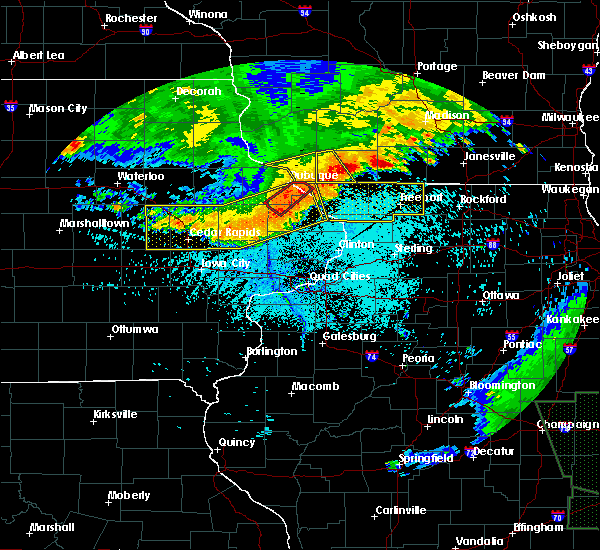 At 556 pm cdt, a severe thunderstorm was located over council hill, or 8 miles northeast of galena, moving southeast at 25 mph (law enforcement. there were reports of tree damage northwest of belmont and a 75 mph wind gust was reported in platteville). Hazards include 70 mph wind gusts and penny size hail. Expect considerable tree damage. damage is likely to mobile homes, roofs, and outbuildings. Locations impacted include, shullsburg, belmont, benton, new diggings, platte mounds, lead mine and leslie. At 556 pm cdt, a severe thunderstorm was located over council hill, or 8 miles northeast of galena, moving southeast at 25 mph (law enforcement. there were reports of tree damage northwest of belmont and a 75 mph wind gust was reported in platteville). Hazards include 70 mph wind gusts and penny size hail. Expect considerable tree damage. damage is likely to mobile homes, roofs, and outbuildings. Locations impacted include, shullsburg, belmont, benton, new diggings, platte mounds, lead mine and leslie.
|
| 6/30/2019 5:54 PM CDT | Trees dow in lafayette county WI, 3 miles NW of Benton, WI |
| 6/30/2019 5:45 PM CDT |
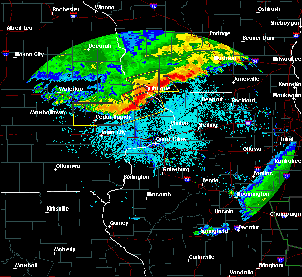 At 543 pm cdt, a severe thunderstorm was located over benton, or 11 miles southeast of platteville, moving southeast at 30 mph (law enforcement. at 5:35 pm, a wind gust of 75 mph was reported at the platteville airport). Hazards include 70 mph wind gusts and quarter size hail. Hail damage to vehicles is possible. expect considerable tree damage. wind damage is also likely to mobile homes, roofs, and outbuildings. Locations impacted include, shullsburg, belmont, benton, new diggings, platte mounds, lead mine and leslie. At 543 pm cdt, a severe thunderstorm was located over benton, or 11 miles southeast of platteville, moving southeast at 30 mph (law enforcement. at 5:35 pm, a wind gust of 75 mph was reported at the platteville airport). Hazards include 70 mph wind gusts and quarter size hail. Hail damage to vehicles is possible. expect considerable tree damage. wind damage is also likely to mobile homes, roofs, and outbuildings. Locations impacted include, shullsburg, belmont, benton, new diggings, platte mounds, lead mine and leslie.
|
| 6/30/2019 5:36 PM CDT |
 At 535 pm cdt, a severe thunderstorm was located near platteville, moving southeast at 25 mph (law enforcement. there was a report of tree damage in northwest lafayette county). Hazards include 60 mph wind gusts and quarter size hail. Hail damage to vehicles is expected. expect wind damage to roofs, siding, and trees. Locations impacted include, shullsburg, belmont, benton, new diggings, platte mounds, lead mine and leslie. At 535 pm cdt, a severe thunderstorm was located near platteville, moving southeast at 25 mph (law enforcement. there was a report of tree damage in northwest lafayette county). Hazards include 60 mph wind gusts and quarter size hail. Hail damage to vehicles is expected. expect wind damage to roofs, siding, and trees. Locations impacted include, shullsburg, belmont, benton, new diggings, platte mounds, lead mine and leslie.
|
| 6/30/2019 5:27 PM CDT |
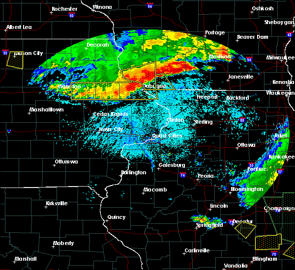 At 527 pm cdt, a severe thunderstorm was located over platteville, moving southeast at 25 mph (radar indicated). Hazards include 60 mph wind gusts. expect damage to roofs, siding, and trees At 527 pm cdt, a severe thunderstorm was located over platteville, moving southeast at 25 mph (radar indicated). Hazards include 60 mph wind gusts. expect damage to roofs, siding, and trees
|
| 9/2/2018 4:46 PM CDT |
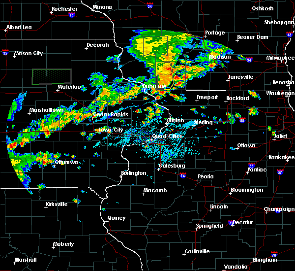 At 446 pm cdt, severe thunderstorms were located along a line extending from near dodgeville to near darlington to council hill, moving east at 35 mph (law enforcement reported trees down in the benton area). Hazards include 60 mph wind gusts. Expect damage to roofs, siding, and trees. locations impacted include, dodgeville, mineral point, darlington, shullsburg, belmont, benton, highland, linden, new diggings, cobb, rewey, lead mine, governor dodge st park, edmund, blackhawk lake rec area, london and leslie. People attending county fair at the iowa county fair grounds should seek safe shelter immediately!. At 446 pm cdt, severe thunderstorms were located along a line extending from near dodgeville to near darlington to council hill, moving east at 35 mph (law enforcement reported trees down in the benton area). Hazards include 60 mph wind gusts. Expect damage to roofs, siding, and trees. locations impacted include, dodgeville, mineral point, darlington, shullsburg, belmont, benton, highland, linden, new diggings, cobb, rewey, lead mine, governor dodge st park, edmund, blackhawk lake rec area, london and leslie. People attending county fair at the iowa county fair grounds should seek safe shelter immediately!.
|
| 9/2/2018 4:41 PM CDT | Several trees down in bento in lafayette county WI, 0.2 miles W of Benton, WI |
| 9/2/2018 4:38 PM CDT |
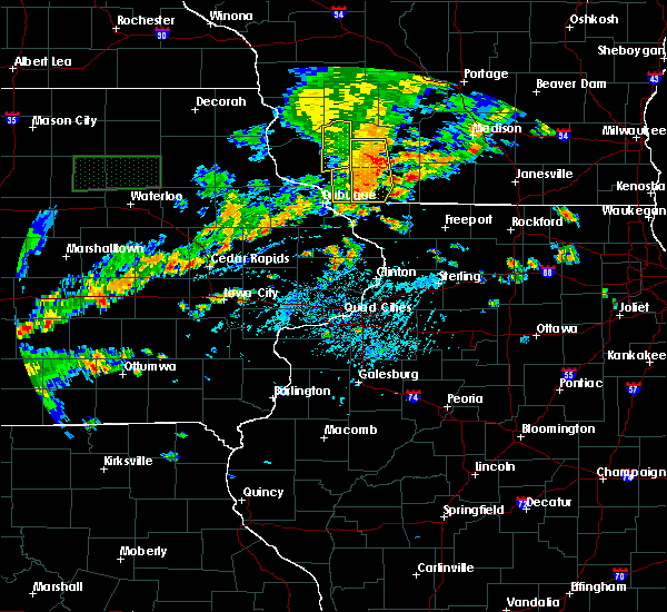 At 437 pm cdt, severe thunderstorms were located along a line extending from 6 miles northwest of dodgeville to near belmont to near hazel green, moving east at 40 mph (law enforcement report of downed trees and powerlines). Hazards include 60 mph wind gusts. Expect damage to roofs, siding, and trees. locations impacted include, dodgeville, mineral point, darlington, shullsburg, belmont, benton, highland, linden, new diggings, cobb, rewey, platte mounds, lead mine, governor dodge st park, edmund, blackhawk lake rec area, london and leslie. People attending county fair at the iowa county fair grounds should seek safe shelter immediately!. At 437 pm cdt, severe thunderstorms were located along a line extending from 6 miles northwest of dodgeville to near belmont to near hazel green, moving east at 40 mph (law enforcement report of downed trees and powerlines). Hazards include 60 mph wind gusts. Expect damage to roofs, siding, and trees. locations impacted include, dodgeville, mineral point, darlington, shullsburg, belmont, benton, highland, linden, new diggings, cobb, rewey, platte mounds, lead mine, governor dodge st park, edmund, blackhawk lake rec area, london and leslie. People attending county fair at the iowa county fair grounds should seek safe shelter immediately!.
|
| 9/2/2018 4:28 PM CDT |
 At 427 pm cdt, severe thunderstorms were located along a line extending from 10 miles southeast of muscoda to near belmont to hazel green, moving east at 40 mph (radar indicated). Hazards include 60 mph wind gusts. Expect damage to roofs, siding, and trees. locations impacted include, dodgeville, mineral point, darlington, shullsburg, belmont, benton, highland, linden, new diggings, cobb, rewey, platte mounds, lead mine, governor dodge st park, edmund, blackhawk lake rec area, london and leslie. People attending the county fair at the iowa county fair grounds should seek safe shelter immediately!. At 427 pm cdt, severe thunderstorms were located along a line extending from 10 miles southeast of muscoda to near belmont to hazel green, moving east at 40 mph (radar indicated). Hazards include 60 mph wind gusts. Expect damage to roofs, siding, and trees. locations impacted include, dodgeville, mineral point, darlington, shullsburg, belmont, benton, highland, linden, new diggings, cobb, rewey, platte mounds, lead mine, governor dodge st park, edmund, blackhawk lake rec area, london and leslie. People attending the county fair at the iowa county fair grounds should seek safe shelter immediately!.
|
| 9/2/2018 4:20 PM CDT |
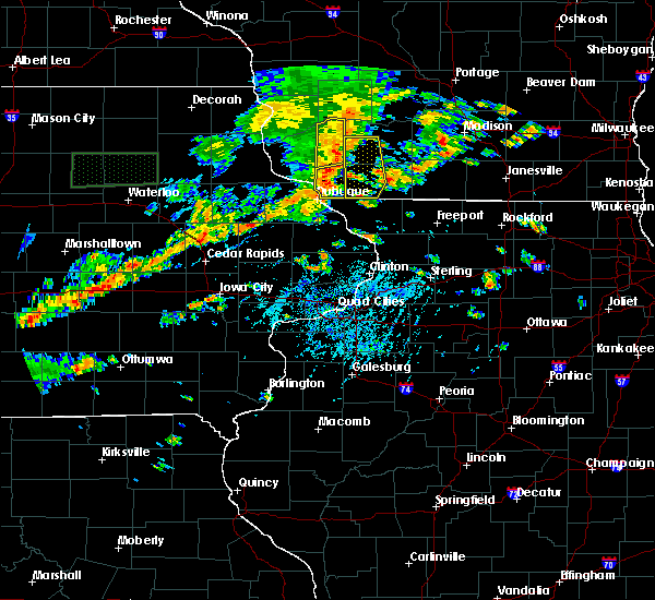 At 420 pm cdt, severe thunderstorms were located along a line extending from 7 miles northeast of fennimore to near platteville to east dubuque, moving east at 30 mph (radar indicated). Hazards include 60 mph wind gusts. expect damage to roofs, siding, and trees At 420 pm cdt, severe thunderstorms were located along a line extending from 7 miles northeast of fennimore to near platteville to east dubuque, moving east at 30 mph (radar indicated). Hazards include 60 mph wind gusts. expect damage to roofs, siding, and trees
|
| 8/5/2018 6:48 PM CDT |
 At 648 pm cdt, a severe thunderstorm was located near darlington, moving east at 45 mph (radar indicated). Hazards include 60 mph wind gusts and quarter size hail. Hail damage to vehicles is expected. expect wind damage to roofs, siding, and trees. Locations impacted include, monroe, darlington, shullsburg, benton, argyle, apple river, somers, wiota, new diggings, south wayne, lamont, browntown, gratiot, lead mine, jordan center and woodford. At 648 pm cdt, a severe thunderstorm was located near darlington, moving east at 45 mph (radar indicated). Hazards include 60 mph wind gusts and quarter size hail. Hail damage to vehicles is expected. expect wind damage to roofs, siding, and trees. Locations impacted include, monroe, darlington, shullsburg, benton, argyle, apple river, somers, wiota, new diggings, south wayne, lamont, browntown, gratiot, lead mine, jordan center and woodford.
|
| 8/5/2018 6:39 PM CDT |
 At 638 pm cdt, a severe thunderstorm was located over shullsburg, or 7 miles southwest of darlington, moving east at 55 mph (radar indicated). Hazards include 60 mph wind gusts and quarter size hail. Hail damage to vehicles is expected. Expect wind damage to roofs, siding, and trees. At 638 pm cdt, a severe thunderstorm was located over shullsburg, or 7 miles southwest of darlington, moving east at 55 mph (radar indicated). Hazards include 60 mph wind gusts and quarter size hail. Hail damage to vehicles is expected. Expect wind damage to roofs, siding, and trees.
|
| 7/13/2018 6:58 PM CDT |
 At 657 pm cdt, severe thunderstorms were located along a line extending from cuba city to shullsburg to near apple river to nora, moving northeast at 35 mph (radar indicated). Hazards include 60 mph wind gusts and quarter size hail. Hail damage to vehicles is expected. expect wind damage to roofs, siding, and trees. locations impacted include, darlington, shullsburg, belmont, benton, argyle, blanchardville, somers, wiota, new diggings, south wayne, lamont, gratiot, yellowstone lake st park, platte mounds, lead mine, leslie and woodford. People attending the lafayette county fair should seek safe shelter immediately!. At 657 pm cdt, severe thunderstorms were located along a line extending from cuba city to shullsburg to near apple river to nora, moving northeast at 35 mph (radar indicated). Hazards include 60 mph wind gusts and quarter size hail. Hail damage to vehicles is expected. expect wind damage to roofs, siding, and trees. locations impacted include, darlington, shullsburg, belmont, benton, argyle, blanchardville, somers, wiota, new diggings, south wayne, lamont, gratiot, yellowstone lake st park, platte mounds, lead mine, leslie and woodford. People attending the lafayette county fair should seek safe shelter immediately!.
|
| 7/13/2018 6:39 PM CDT |
 The national weather service in milwaukee/sullivan has issued a * severe thunderstorm warning for. lafayette county in south central wisconsin. until 745 pm cdt. At 639 pm cdt, severe thunderstorms were located along a line extending from platteville to near massbach, moving northeast at 40. The national weather service in milwaukee/sullivan has issued a * severe thunderstorm warning for. lafayette county in south central wisconsin. until 745 pm cdt. At 639 pm cdt, severe thunderstorms were located along a line extending from platteville to near massbach, moving northeast at 40.
|
| 7/19/2017 6:32 PM CDT |
 At 631 pm cdt, a severe thunderstorm was located 8 miles northeast of bloomington, or 13 miles northwest of lancaster, moving east at 55 mph. this storm has a history of producing widespread wind damage. seek shelter now!!! this is a very dangerous storm (radar indicated). Hazards include 80 mph wind gusts. Flying debris will be dangerous to those caught without shelter. mobile homes will be heavily damaged. expect considerable damage to roofs, windows, and vehicles. Extensive tree damage and power outages are likely. At 631 pm cdt, a severe thunderstorm was located 8 miles northeast of bloomington, or 13 miles northwest of lancaster, moving east at 55 mph. this storm has a history of producing widespread wind damage. seek shelter now!!! this is a very dangerous storm (radar indicated). Hazards include 80 mph wind gusts. Flying debris will be dangerous to those caught without shelter. mobile homes will be heavily damaged. expect considerable damage to roofs, windows, and vehicles. Extensive tree damage and power outages are likely.
|
| 6/28/2017 1:23 PM CDT |
 At 621 pm cdt, severe thunderstorms were located along a line extending from 6 miles southwest of mazomanie to 6 miles northwest of blanchardville to near darlington, moving east at 60 mph. power poles were reported snapped in southwest iowa county (radar indicated). Hazards include 70 mph wind gusts and quarter size hail. Hail damage to vehicles is expected. expect considerable tree damage. wind damage is also likely to mobile homes, roofs, and outbuildings. locations impacted include, dodgeville, mineral point, darlington, shullsburg, belmont, benton, argyle, blanchardville, somers, barneveld, wiota, highland, arena, ridgeway, avoca, orion, linden, new diggings, south wayne and cobb. People attending the land`s end concert series in dodgeville should seek safe shelter immediately! a tornado watch remains in effect until 1000 pm cdt for south central wisconsin. At 621 pm cdt, severe thunderstorms were located along a line extending from 6 miles southwest of mazomanie to 6 miles northwest of blanchardville to near darlington, moving east at 60 mph. power poles were reported snapped in southwest iowa county (radar indicated). Hazards include 70 mph wind gusts and quarter size hail. Hail damage to vehicles is expected. expect considerable tree damage. wind damage is also likely to mobile homes, roofs, and outbuildings. locations impacted include, dodgeville, mineral point, darlington, shullsburg, belmont, benton, argyle, blanchardville, somers, barneveld, wiota, highland, arena, ridgeway, avoca, orion, linden, new diggings, south wayne and cobb. People attending the land`s end concert series in dodgeville should seek safe shelter immediately! a tornado watch remains in effect until 1000 pm cdt for south central wisconsin.
|
| 6/28/2017 1:08 PM CDT |
 At 605 pm cdt, severe thunderstorms were located along a line extending from 8 miles southwest of spring green to near mineral point to near belmont, moving east at 60 mph. other storms were located ahead of the main line. these are very dangerous storms (radar indicated). Hazards include 80 mph wind gusts and quarter size hail. Flying debris will be dangerous to those caught without shelter. mobile homes will be heavily damaged. expect considerable damage to roofs, windows, and vehicles. extensive tree damage and power outages are likely. locations impacted include, dodgeville, mineral point, darlington, shullsburg, belmont, benton, argyle, blanchardville, somers, barneveld, wiota, highland, arena, ridgeway, avoca, orion, linden, new diggings, south wayne and cobb. People attending the land`s end concert series in dodgeville should seek safe shelter immediately! a tornado watch remains in effect until 1000 pm cdt for south central wisconsin. At 605 pm cdt, severe thunderstorms were located along a line extending from 8 miles southwest of spring green to near mineral point to near belmont, moving east at 60 mph. other storms were located ahead of the main line. these are very dangerous storms (radar indicated). Hazards include 80 mph wind gusts and quarter size hail. Flying debris will be dangerous to those caught without shelter. mobile homes will be heavily damaged. expect considerable damage to roofs, windows, and vehicles. extensive tree damage and power outages are likely. locations impacted include, dodgeville, mineral point, darlington, shullsburg, belmont, benton, argyle, blanchardville, somers, barneveld, wiota, highland, arena, ridgeway, avoca, orion, linden, new diggings, south wayne and cobb. People attending the land`s end concert series in dodgeville should seek safe shelter immediately! a tornado watch remains in effect until 1000 pm cdt for south central wisconsin.
|
| 6/28/2017 12:58 PM CDT |
 At 558 pm cdt, severe thunderstorms were located along a line extending from near muscoda to 10 miles north of platteville to near dickeyville, moving east at 60 mph (radar indicated). Hazards include 70 mph wind gusts and quarter size hail. Hail damage to vehicles is expected. expect considerable tree damage. wind damage is also likely to mobile homes, roofs, and outbuildings. locations impacted include, dodgeville, mineral point, darlington, shullsburg, belmont, benton, argyle, blanchardville, somers, barneveld, wiota, highland, arena, ridgeway, avoca, orion, linden, new diggings, south wayne and cobb. People attending the land`s end concert series in dodgeville should seek safe shelter immediately! a tornado watch remains in effect until 1000 pm cdt for south central wisconsin. At 558 pm cdt, severe thunderstorms were located along a line extending from near muscoda to 10 miles north of platteville to near dickeyville, moving east at 60 mph (radar indicated). Hazards include 70 mph wind gusts and quarter size hail. Hail damage to vehicles is expected. expect considerable tree damage. wind damage is also likely to mobile homes, roofs, and outbuildings. locations impacted include, dodgeville, mineral point, darlington, shullsburg, belmont, benton, argyle, blanchardville, somers, barneveld, wiota, highland, arena, ridgeway, avoca, orion, linden, new diggings, south wayne and cobb. People attending the land`s end concert series in dodgeville should seek safe shelter immediately! a tornado watch remains in effect until 1000 pm cdt for south central wisconsin.
|
| 6/28/2017 12:43 PM CDT |
 At 543 pm cdt, severe thunderstorms were located along a line extending from near boscobel to 6 miles northeast of balltown, moving east at 40 mph (radar indicated). Hazards include 70 mph wind gusts and quarter size hail. Hail damage to vehicles is expected. expect considerable tree damage. Wind damage is also likely to mobile homes, roofs, and outbuildings. At 543 pm cdt, severe thunderstorms were located along a line extending from near boscobel to 6 miles northeast of balltown, moving east at 40 mph (radar indicated). Hazards include 70 mph wind gusts and quarter size hail. Hail damage to vehicles is expected. expect considerable tree damage. Wind damage is also likely to mobile homes, roofs, and outbuildings.
|
| 6/16/2017 10:58 PM CDT |
 At 1057 pm cdt, a severe thunderstorm was located near darlington, moving east at 30 mph (radar indicated). Hazards include 60 mph wind gusts and quarter size hail. Hail damage to vehicles is expected. expect wind damage to roofs, siding, and trees. Locations impacted include, mineral point, darlington, shullsburg, belmont, benton, blanchardville, new diggings, lamont, gratiot, platte mounds, lead mine, yellowstone lake st park and leslie. At 1057 pm cdt, a severe thunderstorm was located near darlington, moving east at 30 mph (radar indicated). Hazards include 60 mph wind gusts and quarter size hail. Hail damage to vehicles is expected. expect wind damage to roofs, siding, and trees. Locations impacted include, mineral point, darlington, shullsburg, belmont, benton, blanchardville, new diggings, lamont, gratiot, platte mounds, lead mine, yellowstone lake st park and leslie.
|
| 6/16/2017 10:38 PM CDT |
 At 1038 pm cdt, a severe thunderstorm was located near belmont, or near platteville, moving east at 30 mph (radar indicated). Hazards include 60 mph wind gusts and quarter size hail. Hail damage to vehicles is expected. expect wind damage to roofs, siding, and trees. Locations impacted include, mineral point, darlington, shullsburg, belmont, benton, blanchardville, new diggings, lamont, rewey, gratiot, yellowstone lake st park, platte mounds, lead mine and leslie. At 1038 pm cdt, a severe thunderstorm was located near belmont, or near platteville, moving east at 30 mph (radar indicated). Hazards include 60 mph wind gusts and quarter size hail. Hail damage to vehicles is expected. expect wind damage to roofs, siding, and trees. Locations impacted include, mineral point, darlington, shullsburg, belmont, benton, blanchardville, new diggings, lamont, rewey, gratiot, yellowstone lake st park, platte mounds, lead mine and leslie.
|
| 6/16/2017 10:32 PM CDT |
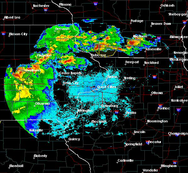 At 1032 pm cdt, a severe thunderstorm was located near platteville, moving east at 30 mph (radar indicated). Hazards include 60 mph wind gusts and quarter size hail. Hail damage to vehicles is expected. Expect wind damage to roofs, siding, and trees. At 1032 pm cdt, a severe thunderstorm was located near platteville, moving east at 30 mph (radar indicated). Hazards include 60 mph wind gusts and quarter size hail. Hail damage to vehicles is expected. Expect wind damage to roofs, siding, and trees.
|
| 6/14/2017 1:37 PM CDT |
 At 137 pm cdt, severe thunderstorms were located along a line extending from near cuba city to near warren, moving northeast at 40 mph (radar indicated). Hazards include 60 mph wind gusts and quarter size hail. Hail damage to vehicles is expected. Expect wind damage to roofs, siding, and trees. At 137 pm cdt, severe thunderstorms were located along a line extending from near cuba city to near warren, moving northeast at 40 mph (radar indicated). Hazards include 60 mph wind gusts and quarter size hail. Hail damage to vehicles is expected. Expect wind damage to roofs, siding, and trees.
|
| 5/17/2017 8:16 PM CDT |
 At 815 pm cdt, severe thunderstorms were located along a line extending from near cashton to near wonewoc to 11 miles south of reedsburg to 8 miles southwest of mazomanie to 6 miles southeast of darlington, moving northeast at 55 mph (law enforcement. tree damage was reported in belmont at 753 pm). Hazards include 60 mph wind gusts and quarter size hail. Hail damage to vehicles is expected. expect wind damage to roofs, siding, and trees. locations impacted include, western madison, middleton, baraboo, monroe, verona, reedsburg, mount horeb, dodgeville, prairie du sac, sauk city, wisconsin dells, mineral point, darlington, lake wisconsin, cross plains, lodi, lake delton, belleville, new glarus and mazomanie. A tornado watch remains in effect until 1100 pm cdt for south central wisconsin. At 815 pm cdt, severe thunderstorms were located along a line extending from near cashton to near wonewoc to 11 miles south of reedsburg to 8 miles southwest of mazomanie to 6 miles southeast of darlington, moving northeast at 55 mph (law enforcement. tree damage was reported in belmont at 753 pm). Hazards include 60 mph wind gusts and quarter size hail. Hail damage to vehicles is expected. expect wind damage to roofs, siding, and trees. locations impacted include, western madison, middleton, baraboo, monroe, verona, reedsburg, mount horeb, dodgeville, prairie du sac, sauk city, wisconsin dells, mineral point, darlington, lake wisconsin, cross plains, lodi, lake delton, belleville, new glarus and mazomanie. A tornado watch remains in effect until 1100 pm cdt for south central wisconsin.
|
| 5/17/2017 8:07 PM CDT |
 At 806 pm cdt, severe thunderstorms were located along a line extending from westby to 10 miles south of hillsboro to 10 miles east of richland center to near dodgeville to near apple river, moving northeast at 55 mph (law enforcement reporting trees down in lafayette county). Hazards include 60 mph wind gusts and quarter size hail. Hail damage to vehicles is expected. expect wind damage to roofs, siding, and trees. locations impacted include, western madison, middleton, baraboo, monroe, verona, reedsburg, mount horeb, dodgeville, prairie du sac, sauk city, wisconsin dells, mineral point, darlington, lake wisconsin, cross plains, lodi, lake delton, belleville, new glarus and mazomanie. A tornado watch remains in effect until 1100 pm cdt for south central wisconsin. At 806 pm cdt, severe thunderstorms were located along a line extending from westby to 10 miles south of hillsboro to 10 miles east of richland center to near dodgeville to near apple river, moving northeast at 55 mph (law enforcement reporting trees down in lafayette county). Hazards include 60 mph wind gusts and quarter size hail. Hail damage to vehicles is expected. expect wind damage to roofs, siding, and trees. locations impacted include, western madison, middleton, baraboo, monroe, verona, reedsburg, mount horeb, dodgeville, prairie du sac, sauk city, wisconsin dells, mineral point, darlington, lake wisconsin, cross plains, lodi, lake delton, belleville, new glarus and mazomanie. A tornado watch remains in effect until 1100 pm cdt for south central wisconsin.
|
| 5/17/2017 7:54 PM CDT |
 At 752 pm cdt, severe thunderstorms were located along a line extending from 8 miles west of viroqua to near muscoda to council hill, moving northeast at 65 mph (radar indicated). Hazards include 60 mph wind gusts and quarter size hail. Hail damage to vehicles is expected. Expect wind damage to roofs, siding, and trees. At 752 pm cdt, severe thunderstorms were located along a line extending from 8 miles west of viroqua to near muscoda to council hill, moving northeast at 65 mph (radar indicated). Hazards include 60 mph wind gusts and quarter size hail. Hail damage to vehicles is expected. Expect wind damage to roofs, siding, and trees.
|
| 5/17/2017 7:43 PM CDT |
 At 743 pm cdt, severe thunderstorms were located along a line extending from 7 miles southwest of muscoda to belmont to bellevue, moving east at 55 mph (radar indicated). Hazards include 70 mph wind gusts and quarter size hail. Hail damage to vehicles is expected. expect considerable tree damage. wind damage is also likely to mobile homes, roofs, and outbuildings. locations impacted include, dodgeville, mineral point, darlington, shullsburg, belmont, benton, argyle, blanchardville, somers, wiota, highland, ridgeway, avoca, orion, linden, new diggings, south wayne, cobb, lamont and rewey. A tornado watch remains in effect until 1100 pm cdt for south central wisconsin. At 743 pm cdt, severe thunderstorms were located along a line extending from 7 miles southwest of muscoda to belmont to bellevue, moving east at 55 mph (radar indicated). Hazards include 70 mph wind gusts and quarter size hail. Hail damage to vehicles is expected. expect considerable tree damage. wind damage is also likely to mobile homes, roofs, and outbuildings. locations impacted include, dodgeville, mineral point, darlington, shullsburg, belmont, benton, argyle, blanchardville, somers, wiota, highland, ridgeway, avoca, orion, linden, new diggings, south wayne, cobb, lamont and rewey. A tornado watch remains in effect until 1100 pm cdt for south central wisconsin.
|
| 5/17/2017 7:27 PM CDT |
 At 726 pm cdt, severe thunderstorms were located along a line extending from 9 miles southwest of boscobel to near dickeyville to near zwingle, moving east at 60 mph (radar indicated). Hazards include 70 mph wind gusts and quarter size hail. Hail damage to vehicles is expected. expect considerable tree damage. Wind damage is also likely to mobile homes, roofs, and outbuildings. At 726 pm cdt, severe thunderstorms were located along a line extending from 9 miles southwest of boscobel to near dickeyville to near zwingle, moving east at 60 mph (radar indicated). Hazards include 70 mph wind gusts and quarter size hail. Hail damage to vehicles is expected. expect considerable tree damage. Wind damage is also likely to mobile homes, roofs, and outbuildings.
|
| 5/15/2017 8:44 PM CDT |
 At 843 pm cdt, severe thunderstorms were located along a line extending from near dodgeville to near mineral point, moving east at 45 mph (trained weather spotters. at 841 pm, 64 mph winds were reported in darlington). Hazards include 70 mph wind gusts. Expect considerable tree damage. damage is likely to mobile homes, roofs, and outbuildings. Locations impacted include, dodgeville, mineral point, darlington, shullsburg, belmont, benton, argyle, blanchardville, somers, barneveld, wiota, highland, ridgeway, linden, new diggings, south wayne, cobb, lamont, rewey and hollandale. At 843 pm cdt, severe thunderstorms were located along a line extending from near dodgeville to near mineral point, moving east at 45 mph (trained weather spotters. at 841 pm, 64 mph winds were reported in darlington). Hazards include 70 mph wind gusts. Expect considerable tree damage. damage is likely to mobile homes, roofs, and outbuildings. Locations impacted include, dodgeville, mineral point, darlington, shullsburg, belmont, benton, argyle, blanchardville, somers, barneveld, wiota, highland, ridgeway, linden, new diggings, south wayne, cobb, lamont, rewey and hollandale.
|
| 5/15/2017 8:23 PM CDT |
 At 822 pm cdt, severe thunderstorms were located along a line extending from 10 miles east of fennimore to near platteville, moving east at 45 mph (law enforcement. 820pm, 68 mph winds where reported in cuba city). Hazards include 70 mph wind gusts. Expect considerable tree damage. damage is likely to mobile homes, roofs, and outbuildings. Locations impacted include, dodgeville, mineral point, darlington, shullsburg, belmont, benton, argyle, blanchardville, somers, barneveld, wiota, highland, ridgeway, linden, new diggings, south wayne, cobb, lamont, rewey and hollandale. At 822 pm cdt, severe thunderstorms were located along a line extending from 10 miles east of fennimore to near platteville, moving east at 45 mph (law enforcement. 820pm, 68 mph winds where reported in cuba city). Hazards include 70 mph wind gusts. Expect considerable tree damage. damage is likely to mobile homes, roofs, and outbuildings. Locations impacted include, dodgeville, mineral point, darlington, shullsburg, belmont, benton, argyle, blanchardville, somers, barneveld, wiota, highland, ridgeway, linden, new diggings, south wayne, cobb, lamont, rewey and hollandale.
|
| 5/15/2017 8:09 PM CDT |
 At 807 pm cdt, severe thunderstorms were located along a line extending from near fennimore to 6 miles south of lancaster, moving east at 50 mph (law enforcement. widespread wind damage was reported across northeast iowa with these storms). Hazards include 70 mph wind gusts and quarter size hail. Hail damage to vehicles is expected. expect considerable tree damage. wind damage is also likely to mobile homes, roofs, and outbuildings. Locations impacted include, dodgeville, mineral point, darlington, shullsburg, belmont, benton, argyle, blanchardville, somers, barneveld, wiota, highland, ridgeway, linden, new diggings, south wayne, cobb, lamont, rewey and hollandale. At 807 pm cdt, severe thunderstorms were located along a line extending from near fennimore to 6 miles south of lancaster, moving east at 50 mph (law enforcement. widespread wind damage was reported across northeast iowa with these storms). Hazards include 70 mph wind gusts and quarter size hail. Hail damage to vehicles is expected. expect considerable tree damage. wind damage is also likely to mobile homes, roofs, and outbuildings. Locations impacted include, dodgeville, mineral point, darlington, shullsburg, belmont, benton, argyle, blanchardville, somers, barneveld, wiota, highland, ridgeway, linden, new diggings, south wayne, cobb, lamont, rewey and hollandale.
|
| 5/15/2017 7:57 PM CDT |
 At 756 pm cdt, severe thunderstorms were located along a line extending from 7 miles west of boscobel to rickardsville, moving east at 60 mph. these storms have a history of producing wind damage. seek shelter now! (radar indicated). Hazards include 70 mph wind gusts and half dollar size hail. Hail damage to vehicles is expected. expect considerable tree damage. Wind damage is also likely to mobile homes, roofs, and outbuildings. At 756 pm cdt, severe thunderstorms were located along a line extending from 7 miles west of boscobel to rickardsville, moving east at 60 mph. these storms have a history of producing wind damage. seek shelter now! (radar indicated). Hazards include 70 mph wind gusts and half dollar size hail. Hail damage to vehicles is expected. expect considerable tree damage. Wind damage is also likely to mobile homes, roofs, and outbuildings.
|
| 3/6/2017 10:37 PM CST |
 At 1036 pm cst, severe thunderstorms were located along a line extending from 6 miles north of darlington to woodbine, moving northeast at 60 mph. at 1030 pm a roof was reported on the roadway near county highway g in northern lafayette county. this is a dangerous storm. seek shelter now!!! (public reported). Hazards include 70 mph wind gusts and penny size hail. Expect considerable tree damage. damage is likely to mobile homes, roofs, and outbuildings. Locations impacted include, darlington, shullsburg, belmont, benton, argyle, blanchardville, somers, wiota, new diggings, south wayne, lamont, gratiot, yellowstone lake st park, platte mounds, lead mine, leslie and woodford. At 1036 pm cst, severe thunderstorms were located along a line extending from 6 miles north of darlington to woodbine, moving northeast at 60 mph. at 1030 pm a roof was reported on the roadway near county highway g in northern lafayette county. this is a dangerous storm. seek shelter now!!! (public reported). Hazards include 70 mph wind gusts and penny size hail. Expect considerable tree damage. damage is likely to mobile homes, roofs, and outbuildings. Locations impacted include, darlington, shullsburg, belmont, benton, argyle, blanchardville, somers, wiota, new diggings, south wayne, lamont, gratiot, yellowstone lake st park, platte mounds, lead mine, leslie and woodford.
|
| 3/6/2017 10:09 PM CST |
 At 1008 pm cst, severe thunderstorms were located along a line extending from near menominee to near hurstville, moving northeast at 60 mph. at 959 pm, a 56 mph wind gust was reported at the dubuque airport from these storms (radar indicated). Hazards include 60 mph wind gusts and penny size hail. Expect damage to roofs, siding, and trees. Locations impacted include, darlington, shullsburg, belmont, benton, argyle, blanchardville, somers, wiota, new diggings, south wayne, lamont, gratiot, yellowstone lake st park, platte mounds, lead mine, leslie and woodford. At 1008 pm cst, severe thunderstorms were located along a line extending from near menominee to near hurstville, moving northeast at 60 mph. at 959 pm, a 56 mph wind gust was reported at the dubuque airport from these storms (radar indicated). Hazards include 60 mph wind gusts and penny size hail. Expect damage to roofs, siding, and trees. Locations impacted include, darlington, shullsburg, belmont, benton, argyle, blanchardville, somers, wiota, new diggings, south wayne, lamont, gratiot, yellowstone lake st park, platte mounds, lead mine, leslie and woodford.
|
| 3/6/2017 10:00 PM CST |
 At 1000 pm cst, severe thunderstorms were located along a line extending from east dubuque to near nashville, moving northeast at 60 mph (radar indicated). Hazards include 60 mph wind gusts and penny size hail. expect damage to roofs, siding, and trees At 1000 pm cst, severe thunderstorms were located along a line extending from east dubuque to near nashville, moving northeast at 60 mph (radar indicated). Hazards include 60 mph wind gusts and penny size hail. expect damage to roofs, siding, and trees
|
| 8/4/2016 8:30 PM CDT |
 At 828 pm cdt, severe thunderstorms were located along a line extending from near darlington to near scales mound, moving east at 50 mph (trained weather spotters). Hazards include 60 mph wind gusts. Expect damage to roofs. siding. and trees. Locations impacted include, darlington, shullsburg, belmont, benton, argyle, somers, wiota, new diggings, south wayne, lamont, gratiot, woodford, platte mounds, lead mine and leslie. At 828 pm cdt, severe thunderstorms were located along a line extending from near darlington to near scales mound, moving east at 50 mph (trained weather spotters). Hazards include 60 mph wind gusts. Expect damage to roofs. siding. and trees. Locations impacted include, darlington, shullsburg, belmont, benton, argyle, somers, wiota, new diggings, south wayne, lamont, gratiot, woodford, platte mounds, lead mine and leslie.
|
| 8/4/2016 8:09 PM CDT |
 At 807 pm cdt, severe thunderstorms were located along a line extending from near belmont to near hazel green, moving east at 50 mph (trained weather spotters). Hazards include 60 mph wind gusts. at 745 pm...wind damage was reported in potosi. Expect damage to roofs. siding. and trees. Locations impacted include, mineral point, darlington, shullsburg, belmont, benton, argyle, blanchardville, somers, wiota, linden, new diggings, south wayne, cobb, lamont, rewey, gratiot, woodford, london, yellowstone lake st park and platte mounds. At 807 pm cdt, severe thunderstorms were located along a line extending from near belmont to near hazel green, moving east at 50 mph (trained weather spotters). Hazards include 60 mph wind gusts. at 745 pm...wind damage was reported in potosi. Expect damage to roofs. siding. and trees. Locations impacted include, mineral point, darlington, shullsburg, belmont, benton, argyle, blanchardville, somers, wiota, linden, new diggings, south wayne, cobb, lamont, rewey, gratiot, woodford, london, yellowstone lake st park and platte mounds.
|
| 8/4/2016 7:49 PM CDT |
 At 748 pm cdt, severe thunderstorms were located along a line extending from 7 miles northwest of platteville to near east dubuque, moving east at 50 mph (trained weather spotters. at 745 pm...wind damage was reported in potosi). Hazards include 60 mph wind gusts. Expect damage to roofs. siding. And trees. At 748 pm cdt, severe thunderstorms were located along a line extending from 7 miles northwest of platteville to near east dubuque, moving east at 50 mph (trained weather spotters. at 745 pm...wind damage was reported in potosi). Hazards include 60 mph wind gusts. Expect damage to roofs. siding. And trees.
|
| 7/23/2016 5:48 PM CDT |
 At 547 pm cdt, a severe thunderstorm was located over council hill, or 7 miles northeast of galena, moving east at 30 mph (radar indicated). Hazards include 70 mph wind gusts. Expect considerable tree damage. damage is likely to mobile homes, roofs, and outbuildings. Locations impacted include, shullsburg, benton, new diggings, gratiot and lead mine. At 547 pm cdt, a severe thunderstorm was located over council hill, or 7 miles northeast of galena, moving east at 30 mph (radar indicated). Hazards include 70 mph wind gusts. Expect considerable tree damage. damage is likely to mobile homes, roofs, and outbuildings. Locations impacted include, shullsburg, benton, new diggings, gratiot and lead mine.
|
| 7/23/2016 5:34 PM CDT |
 At 533 pm cdt, a severe thunderstorm was located over menominee, or near galena, moving east at 30 mph (radar indicated). Hazards include 70 mph wind gusts. Expect considerable tree damage. damage is likely to mobile homes, roofs, and outbuildings. Locations impacted include, shullsburg, benton, new diggings, gratiot and lead mine. At 533 pm cdt, a severe thunderstorm was located over menominee, or near galena, moving east at 30 mph (radar indicated). Hazards include 70 mph wind gusts. Expect considerable tree damage. damage is likely to mobile homes, roofs, and outbuildings. Locations impacted include, shullsburg, benton, new diggings, gratiot and lead mine.
|
| 7/23/2016 5:19 PM CDT |
 At 518 pm cdt, a severe thunderstorm was located over east dubuque, or near dubuque, moving east at 30 mph (radar indicated). Hazards include 70 mph wind gusts. Expect considerable tree damage. Damage is likely to mobile homes, roofs, and outbuildings. At 518 pm cdt, a severe thunderstorm was located over east dubuque, or near dubuque, moving east at 30 mph (radar indicated). Hazards include 70 mph wind gusts. Expect considerable tree damage. Damage is likely to mobile homes, roofs, and outbuildings.
|
| 7/21/2016 8:23 PM CDT |
 The severe thunderstorm warning for southern iowa, southwestern dane, lafayette and western green counties will expire at 830 pm cdt, the severe thunderstorm which prompted the warning has weakened. therefore the warning will be allowed to expire. however gusty winds and heavy rain are still possible with this thunderstorm. a severe thunderstorm watch remains in effect until 900 pm cdt for south central wisconsin. The severe thunderstorm warning for southern iowa, southwestern dane, lafayette and western green counties will expire at 830 pm cdt, the severe thunderstorm which prompted the warning has weakened. therefore the warning will be allowed to expire. however gusty winds and heavy rain are still possible with this thunderstorm. a severe thunderstorm watch remains in effect until 900 pm cdt for south central wisconsin.
|
| 7/21/2016 8:15 PM CDT |
 At 813 pm cdt, a severe thunderstorm was located over northern lafayette county, moving south at 50 mph (radar indicated). Hazards include 60 mph wind gusts. Expect damage to roofs. siding. and trees. Locations impacted include, monroe, mineral point, darlington, new glarus, shullsburg, belmont, benton, argyle, blanchardville, apple river, somers, wiota, new diggings, south wayne, lamont, rewey, hollandale, browntown, gratiot and jordan center. At 813 pm cdt, a severe thunderstorm was located over northern lafayette county, moving south at 50 mph (radar indicated). Hazards include 60 mph wind gusts. Expect damage to roofs. siding. and trees. Locations impacted include, monroe, mineral point, darlington, new glarus, shullsburg, belmont, benton, argyle, blanchardville, apple river, somers, wiota, new diggings, south wayne, lamont, rewey, hollandale, browntown, gratiot and jordan center.
|
| 7/21/2016 7:51 PM CDT |
 At 751 pm cdt, a severe thunderstorm was located near mineral point, moving south at 50 mph (radar indicated). Hazards include 60 mph wind gusts. Expect damage to roofs. siding. And trees. At 751 pm cdt, a severe thunderstorm was located near mineral point, moving south at 50 mph (radar indicated). Hazards include 60 mph wind gusts. Expect damage to roofs. siding. And trees.
|
| 5/28/2016 4:25 PM CDT |
 At 423 pm cdt, a severe thunderstorm was located near belmont, or near platteville, moving northeast at 40 mph (radar indicated. at 415 pm the automated observation at platteville in grant county reported a wind gust to 46 mph). Hazards include 60 mph wind gusts and nickel size hail. Expect damage to roofs. siding. and trees. Locations impacted include, dodgeville, mineral point, darlington, belmont, benton, blanchardville, linden, new diggings, cobb, rewey, hollandale, edmund, blackhawk lake rec area, yellowstone lake st park, platte mounds, london, lead mine, governor dodge st park and leslie. At 423 pm cdt, a severe thunderstorm was located near belmont, or near platteville, moving northeast at 40 mph (radar indicated. at 415 pm the automated observation at platteville in grant county reported a wind gust to 46 mph). Hazards include 60 mph wind gusts and nickel size hail. Expect damage to roofs. siding. and trees. Locations impacted include, dodgeville, mineral point, darlington, belmont, benton, blanchardville, linden, new diggings, cobb, rewey, hollandale, edmund, blackhawk lake rec area, yellowstone lake st park, platte mounds, london, lead mine, governor dodge st park and leslie.
|
| 5/28/2016 4:13 PM CDT |
 At 413 pm cdt, a severe thunderstorm was located over platteville, moving northeast at 40 mph (radar indicated). Hazards include 60 mph wind gusts and nickel size hail. Expect damage to roofs. siding. And trees. At 413 pm cdt, a severe thunderstorm was located over platteville, moving northeast at 40 mph (radar indicated). Hazards include 60 mph wind gusts and nickel size hail. Expect damage to roofs. siding. And trees.
|
| 3/15/2016 8:08 PM CDT |
 At 806 pm cdt, a severe thunderstorm was located over shullsburg, or 8 miles southwest of darlington, moving northeast at 30 mph. this storm appears to have weakened, but quarter size hail is still possible (radar indicated). Hazards include quarter size hail. Damage to vehicles is expected. Locations impacted include, darlington, shullsburg, belmont, benton, wiota, new diggings, lamont, gratiot, platte mounds, leslie and lead mine. At 806 pm cdt, a severe thunderstorm was located over shullsburg, or 8 miles southwest of darlington, moving northeast at 30 mph. this storm appears to have weakened, but quarter size hail is still possible (radar indicated). Hazards include quarter size hail. Damage to vehicles is expected. Locations impacted include, darlington, shullsburg, belmont, benton, wiota, new diggings, lamont, gratiot, platte mounds, leslie and lead mine.
|
| 3/15/2016 7:49 PM CDT |
 At 748 pm cdt, a severe thunderstorm was located over scales mound, or near galena, moving northeast at 30 mph (radar indicated). Hazards include quarter size hail. damage to vehicles is expected At 748 pm cdt, a severe thunderstorm was located over scales mound, or near galena, moving northeast at 30 mph (radar indicated). Hazards include quarter size hail. damage to vehicles is expected
|
| 11/11/2015 6:51 PM CST |
 At 650 pm cst, a severe thunderstorm was located near cuba city, or near platteville, moving northeast at 40 mph. at 638 pm cst, law enforcement reported power lines down in kieler (law enforcement). Hazards include 60 mph wind gusts. Expect damage to roofs. siding and trees. Locations impacted include, darlington, shullsburg, belmont, benton, wiota, new diggings, lamont, gratiot, yellowstone lake st park, platte mounds, leslie and lead mine. At 650 pm cst, a severe thunderstorm was located near cuba city, or near platteville, moving northeast at 40 mph. at 638 pm cst, law enforcement reported power lines down in kieler (law enforcement). Hazards include 60 mph wind gusts. Expect damage to roofs. siding and trees. Locations impacted include, darlington, shullsburg, belmont, benton, wiota, new diggings, lamont, gratiot, yellowstone lake st park, platte mounds, leslie and lead mine.
|
| 11/11/2015 6:43 PM CST |
 At 641 pm cst, a severe thunderstorm was located near dickeyville, or 9 miles south of platteville, moving northeast at 50 mph. at 630 pm cst, a trained weather spotter reported a wind gust of 65 mph near dubuque (radar indicated). Hazards include 60 mph wind gusts. Expect damage to roofs. siding and trees. Locations impacted include, darlington, shullsburg, belmont, benton, wiota, new diggings, lamont, gratiot, yellowstone lake st park, platte mounds, leslie and lead mine. At 641 pm cst, a severe thunderstorm was located near dickeyville, or 9 miles south of platteville, moving northeast at 50 mph. at 630 pm cst, a trained weather spotter reported a wind gust of 65 mph near dubuque (radar indicated). Hazards include 60 mph wind gusts. Expect damage to roofs. siding and trees. Locations impacted include, darlington, shullsburg, belmont, benton, wiota, new diggings, lamont, gratiot, yellowstone lake st park, platte mounds, leslie and lead mine.
|
| 11/11/2015 6:29 PM CST |
 At 628 pm cst, a severe thunderstorm was located over dubuque, moving northeast at 50 mph (radar indicated). Hazards include 60 mph wind gusts. Expect damage to roofs. Siding and trees. At 628 pm cst, a severe thunderstorm was located over dubuque, moving northeast at 50 mph (radar indicated). Hazards include 60 mph wind gusts. Expect damage to roofs. Siding and trees.
|
| 7/13/2015 5:28 AM CDT | The severe thunderstorm warning for walworth, lafayette, rock and green counties will expire at 530 am cdt, the storms which prompted the warning have moved out of the area. therefore the warning will be allowed to expire. a severe thunderstorm watch remains in effect until 1000 am cdt for southeastern wisconsin. |
| 7/13/2015 5:24 AM CDT |
 At 524 am cdt, severe thunderstorms were located along a line extending from fox river valley gardens to near fairhaven, moving southeast at 70 mph. these storms have a history of producing widespread wind damage. this is a dangerous situation, take cover now! (law enforcement). Hazards include 70 mph wind gusts. Expect considerable tree damage. damage is likely to mobile homes, roofs and outbuildings. Locations impacted include, janesville, beloit, whitewater, monroe, elkhorn, lake geneva, milton, evansville, east troy, brodhead, williams bay, darlington, delavan lake, walworth, clinton, fontana-on-geneva lake, darien, orfordville, shullsburg and monticello. At 524 am cdt, severe thunderstorms were located along a line extending from fox river valley gardens to near fairhaven, moving southeast at 70 mph. these storms have a history of producing widespread wind damage. this is a dangerous situation, take cover now! (law enforcement). Hazards include 70 mph wind gusts. Expect considerable tree damage. damage is likely to mobile homes, roofs and outbuildings. Locations impacted include, janesville, beloit, whitewater, monroe, elkhorn, lake geneva, milton, evansville, east troy, brodhead, williams bay, darlington, delavan lake, walworth, clinton, fontana-on-geneva lake, darien, orfordville, shullsburg and monticello.
|
| 7/13/2015 4:58 AM CDT |
 At 457 am cdt, severe thunderstorms were located along a line extending from near como to woodbine, moving southeast at 70 mph. there have been multiple reports of trees down with these storms (law enforcement). Hazards include 60 mph wind gusts. Expect damage to roofs. siding and trees. Locations impacted include, janesville, beloit, whitewater, monroe, elkhorn, lake geneva, milton, evansville, east troy, brodhead, williams bay, darlington, delavan lake, walworth, clinton, fontana-on-geneva lake, darien, orfordville, shullsburg and monticello. At 457 am cdt, severe thunderstorms were located along a line extending from near como to woodbine, moving southeast at 70 mph. there have been multiple reports of trees down with these storms (law enforcement). Hazards include 60 mph wind gusts. Expect damage to roofs. siding and trees. Locations impacted include, janesville, beloit, whitewater, monroe, elkhorn, lake geneva, milton, evansville, east troy, brodhead, williams bay, darlington, delavan lake, walworth, clinton, fontana-on-geneva lake, darien, orfordville, shullsburg and monticello.
|
| 7/13/2015 4:45 AM CDT |
 At 444 am cdt, severe thunderstorms were located along a line extending from near palmyra to near scales mound, moving southeast at 70 mph (law enforcement). Hazards include 60 mph wind gusts. Expect damage to roofs. Siding and trees. At 444 am cdt, severe thunderstorms were located along a line extending from near palmyra to near scales mound, moving southeast at 70 mph (law enforcement). Hazards include 60 mph wind gusts. Expect damage to roofs. Siding and trees.
|
| 6/22/2015 9:56 AM CDT |
 At 954 am cdt, severe thunderstorms were located along a line extending from 9 miles southwest of westfield to near waunakee to 6 miles east of monroe to near pearl city, moving east at 60 mph. reports of widespread trees and power lines down in iowa and lafayette counties have been reported (radar indicated). Hazards include 70 mph wind gusts and quarter size hail. Hail damage to vehicles is expected. expect considerable tree damage. wind damage is also likely to mobile homes, roofs and outbuildings. widespread trees and power lines down in iowa and lafayette counites have been reported. these severe storms will be near, waunakee, windsor, brodhead, deforest, maple bluff and albany around 1000 am cdt. Other locations impacted by these severe thunderstorms include east bristol, mount vernon, pine bluff, magnolia, merrimac, somers, plain, paoli, arena and leland. At 954 am cdt, severe thunderstorms were located along a line extending from 9 miles southwest of westfield to near waunakee to 6 miles east of monroe to near pearl city, moving east at 60 mph. reports of widespread trees and power lines down in iowa and lafayette counties have been reported (radar indicated). Hazards include 70 mph wind gusts and quarter size hail. Hail damage to vehicles is expected. expect considerable tree damage. wind damage is also likely to mobile homes, roofs and outbuildings. widespread trees and power lines down in iowa and lafayette counites have been reported. these severe storms will be near, waunakee, windsor, brodhead, deforest, maple bluff and albany around 1000 am cdt. Other locations impacted by these severe thunderstorms include east bristol, mount vernon, pine bluff, magnolia, merrimac, somers, plain, paoli, arena and leland.
|
| 6/22/2015 9:47 AM CDT |
 At 945 am cdt, severe thunderstorms were located along a line extending from 6 miles north of wisconsin dells to mazomanie to near winslow to near massbach, moving east at 50 mph. the mineral point airport reported winds of 51 miles per hour at 941 am cdt (radar indicated). Hazards include 70 mph wind gusts and quarter size hail. Hail damage to vehicles is expected. expect considerable tree damage. wind damage is also likely to mobile homes, roofs and outbuildings. these severe storms will be near, cross plains around 955 am cdt. madison, middleton, waunakee and shorewood hills around 1000 am cdt. Other locations impacted by these severe thunderstorms include east bristol, mount vernon, pine bluff, magnolia, merrimac, somers, plain, paoli, arena and leland. At 945 am cdt, severe thunderstorms were located along a line extending from 6 miles north of wisconsin dells to mazomanie to near winslow to near massbach, moving east at 50 mph. the mineral point airport reported winds of 51 miles per hour at 941 am cdt (radar indicated). Hazards include 70 mph wind gusts and quarter size hail. Hail damage to vehicles is expected. expect considerable tree damage. wind damage is also likely to mobile homes, roofs and outbuildings. these severe storms will be near, cross plains around 955 am cdt. madison, middleton, waunakee and shorewood hills around 1000 am cdt. Other locations impacted by these severe thunderstorms include east bristol, mount vernon, pine bluff, magnolia, merrimac, somers, plain, paoli, arena and leland.
|
| 6/22/2015 9:38 AM CDT |
 At 937 am cdt, severe thunderstorms were located along a line extending from 9 miles southeast of mauston to near mazomanie to 7 miles southwest of argyle to near hanover, moving east at 50 mph (radar indicated). Hazards include 70 mph wind gusts and quarter size hail. Hail damage to vehicles is expected. expect considerable tree damage. wind damage is also likely to mobile homes, roofs and outbuildings. these severe storms will be near, argyle around 940 am cdt. wisconsin dells, mazomanie and black earth around 945 am cdt. lake delton around 950 am cdt. monroe and cross plains around 955 am cdt. madison, fitchburg, middleton, verona, portage and shorewood hills around 1000 am cdt. Other locations impacted by these severe thunderstorms include east bristol, mount vernon, pine bluff, magnolia, merrimac, somers, plain, paoli, arena and leland. At 937 am cdt, severe thunderstorms were located along a line extending from 9 miles southeast of mauston to near mazomanie to 7 miles southwest of argyle to near hanover, moving east at 50 mph (radar indicated). Hazards include 70 mph wind gusts and quarter size hail. Hail damage to vehicles is expected. expect considerable tree damage. wind damage is also likely to mobile homes, roofs and outbuildings. these severe storms will be near, argyle around 940 am cdt. wisconsin dells, mazomanie and black earth around 945 am cdt. lake delton around 950 am cdt. monroe and cross plains around 955 am cdt. madison, fitchburg, middleton, verona, portage and shorewood hills around 1000 am cdt. Other locations impacted by these severe thunderstorms include east bristol, mount vernon, pine bluff, magnolia, merrimac, somers, plain, paoli, arena and leland.
|
| 6/22/2015 9:24 AM CDT |
 At 923 am cdt, severe thunderstorms were located along a line extending from near mauston to near spring green to near belmont to springbrook, moving east at 50 mph (radar indicated). Hazards include 70 mph wind gusts and quarter size hail. Hail damage to vehicles is expected. expect considerable tree damage. wind damage is also likely to mobile homes, roofs and outbuildings. these severe storms will be near, darlington around 930 am cdt. wisconsin dells, mazomanie and black earth around 940 am cdt. lake delton and argyle around 945 am cdt. cross plains around 950 am cdt. waunakee and verona around 955 am cdt. madison, fitchburg, middleton, monroe, portage, monona, shorewood hills and maple bluff around 1000 am cdt. Other locations impacted by these severe thunderstorms include east bristol, mount vernon, pine bluff, magnolia, merrimac, somers, plain, paoli, arena and leland. At 923 am cdt, severe thunderstorms were located along a line extending from near mauston to near spring green to near belmont to springbrook, moving east at 50 mph (radar indicated). Hazards include 70 mph wind gusts and quarter size hail. Hail damage to vehicles is expected. expect considerable tree damage. wind damage is also likely to mobile homes, roofs and outbuildings. these severe storms will be near, darlington around 930 am cdt. wisconsin dells, mazomanie and black earth around 940 am cdt. lake delton and argyle around 945 am cdt. cross plains around 950 am cdt. waunakee and verona around 955 am cdt. madison, fitchburg, middleton, monroe, portage, monona, shorewood hills and maple bluff around 1000 am cdt. Other locations impacted by these severe thunderstorms include east bristol, mount vernon, pine bluff, magnolia, merrimac, somers, plain, paoli, arena and leland.
|
| 6/22/2015 9:00 AM CDT |
 At 900 am cdt, severe thunderstorms were located along a line extending from near hillsboro to near cascade, moving east at 70 mph (radar indicated). Hazards include 60 mph wind gusts and quarter size hail. Hail damage to vehicles is expected. expect wind damage to roofs, siding and trees. severe thunderstorms will be near, wisconsin dells around 920 am cdt. lake delton around 925 am cdt. Other locations impacted by these severe thunderstorms include east bristol, mount vernon, pine bluff, magnolia, merrimac, somers, plain, paoli, arena and leland. At 900 am cdt, severe thunderstorms were located along a line extending from near hillsboro to near cascade, moving east at 70 mph (radar indicated). Hazards include 60 mph wind gusts and quarter size hail. Hail damage to vehicles is expected. expect wind damage to roofs, siding and trees. severe thunderstorms will be near, wisconsin dells around 920 am cdt. lake delton around 925 am cdt. Other locations impacted by these severe thunderstorms include east bristol, mount vernon, pine bluff, magnolia, merrimac, somers, plain, paoli, arena and leland.
|
| 6/16/2014 11:00 PM CDT | Power lines and trees down in the western and central parts of lafayette count in lafayette county WI, 2.1 miles S of Benton, WI |
| 9/4/2012 9:10 PM CDT | Tree down in new diggings township. time estimate in lafayette county WI, 3 miles NW of Benton, WI |
Hail Maps for Benton, WI
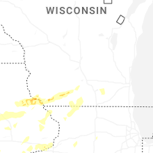


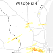


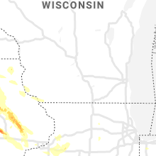


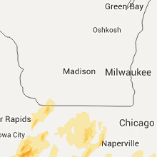


Connect with Interactive Hail Maps