

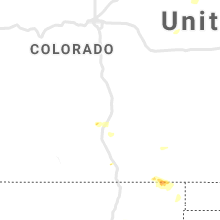
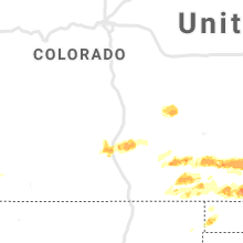
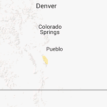
Hail Map for Beulah Valley, CO
The Beulah Valley, CO area has had 11 reports of on-the-ground hail by trained spotters, and has been under severe weather warnings 8 times during the past 12 months. Doppler radar has detected hail at or near Beulah Valley, CO on 60 occasions, including 5 occasions during the past year.
| Name: | Beulah Valley, CO |
| Where Located: | 24.4 miles SW of Pueblo, CO |
| Map: | Google Map for Beulah Valley, CO |
| Population: | 556 |
| Housing Units: | 433 |
| More Info: | Search Google for Beulah Valley, CO |
1
The Top Recent Hail Date for Beulah Valley, CO is Tuesday, June 17, 2025 (17th out of 60)
Hail and Wind Damage Spotted near Beulah Valley, CO
| Date / Time | Report Details |
|---|---|
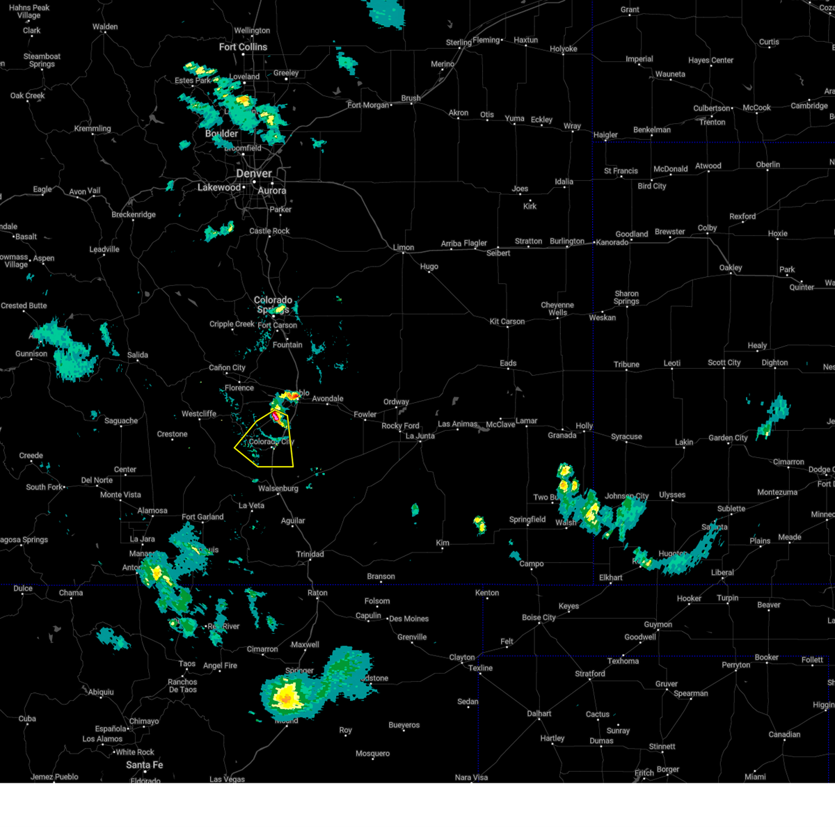
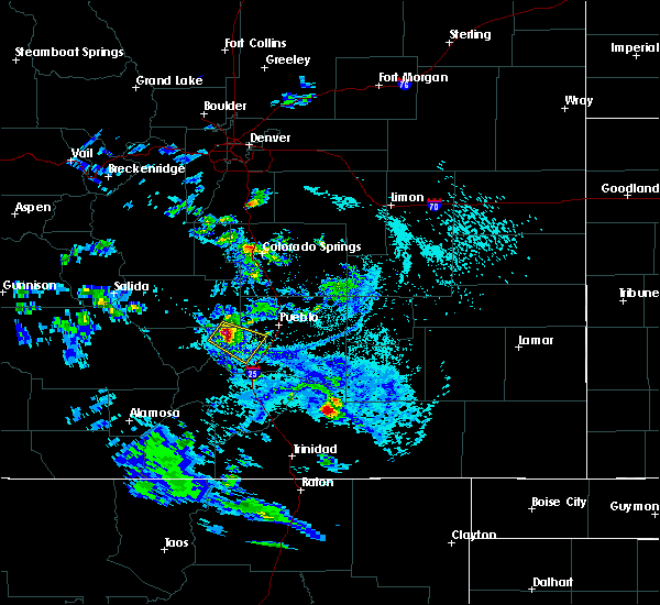
| 6/17/2025 2:12 PM MDT |
 At 212 pm mdt, a severe thunderstorm was located 16 miles south of pueblo reservoir, or 17 miles southwest of pueblo, moving southeast at 25 mph (radar indicated). Hazards include 60 mph wind gusts and half dollar size hail. Hail damage to vehicles is expected. expect wind damage to roofs, siding, and trees. Locations impacted include, beulah and colorado city. At 212 pm mdt, a severe thunderstorm was located 16 miles south of pueblo reservoir, or 17 miles southwest of pueblo, moving southeast at 25 mph (radar indicated). Hazards include 60 mph wind gusts and half dollar size hail. Hail damage to vehicles is expected. expect wind damage to roofs, siding, and trees. Locations impacted include, beulah and colorado city.
|
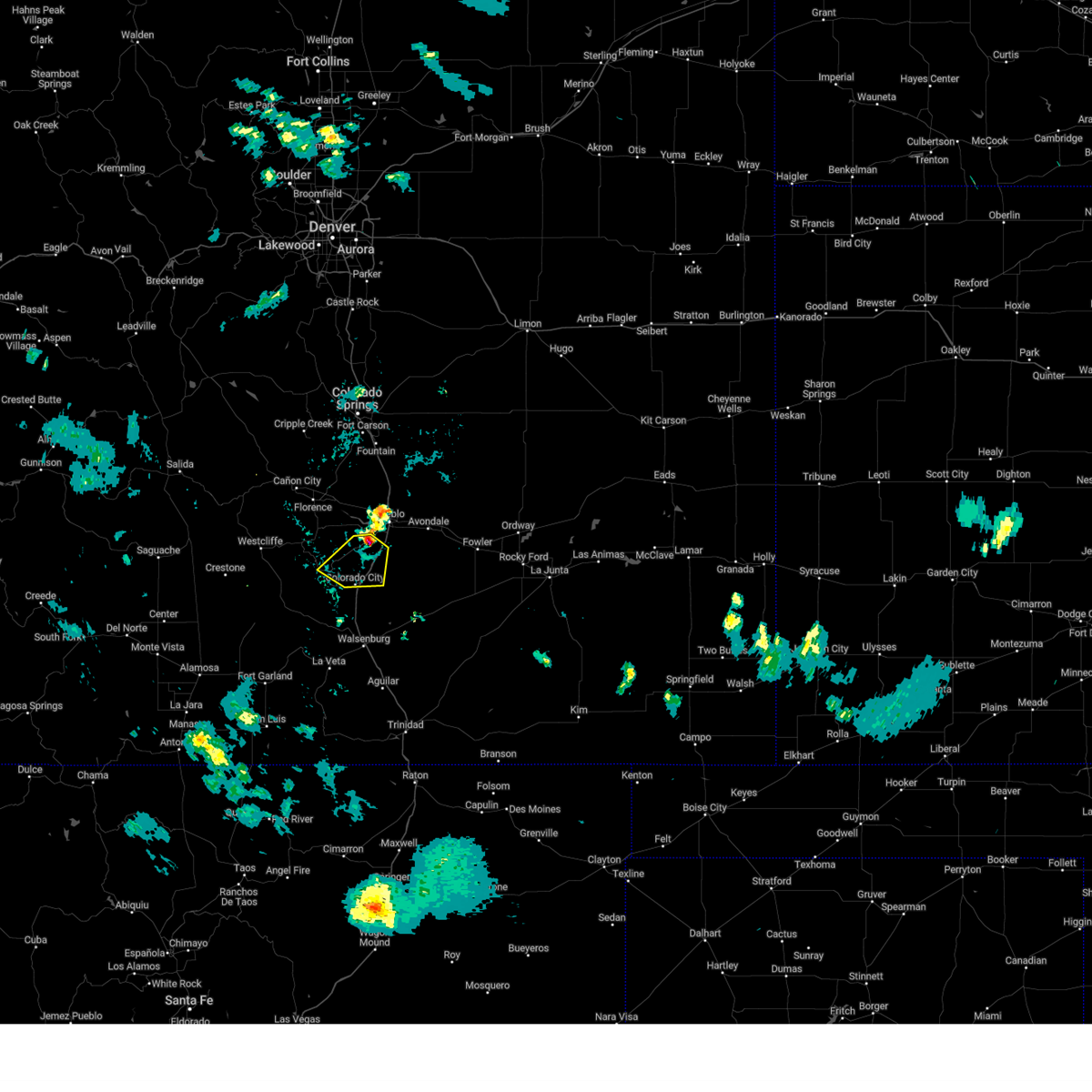
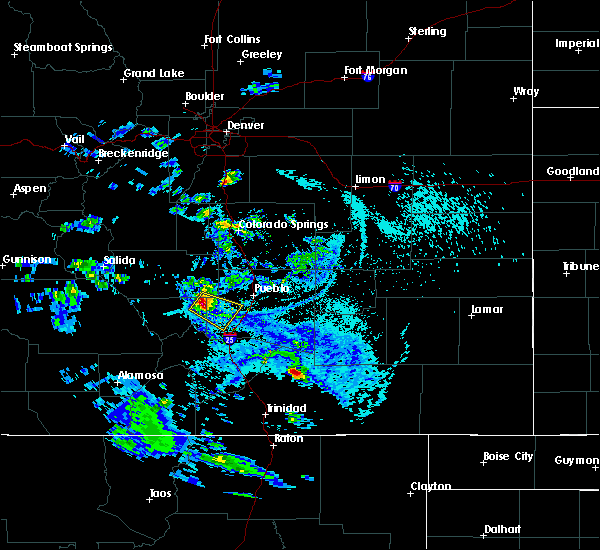
| 6/17/2025 1:55 PM MDT |
 Svrpub the national weather service in pueblo has issued a * severe thunderstorm warning for, southeastern custer county in southeastern colorado, southwestern pueblo county in southeastern colorado, * until 245 pm mdt. * at 155 pm mdt, a severe thunderstorm was located 13 miles south of pueblo reservoir, or 17 miles southwest of pueblo, moving east at 25 mph (radar indicated). Hazards include 60 mph wind gusts and half dollar size hail. Hail damage to vehicles is expected. Expect wind damage to roofs, siding, and trees. Svrpub the national weather service in pueblo has issued a * severe thunderstorm warning for, southeastern custer county in southeastern colorado, southwestern pueblo county in southeastern colorado, * until 245 pm mdt. * at 155 pm mdt, a severe thunderstorm was located 13 miles south of pueblo reservoir, or 17 miles southwest of pueblo, moving east at 25 mph (radar indicated). Hazards include 60 mph wind gusts and half dollar size hail. Hail damage to vehicles is expected. Expect wind damage to roofs, siding, and trees.
|
| 7/13/2024 8:17 PM MDT |
 the severe thunderstorm warning has been cancelled and is no longer in effect the severe thunderstorm warning has been cancelled and is no longer in effect
|
| 7/13/2024 7:55 PM MDT |
 Svrpub the national weather service in pueblo has issued a * severe thunderstorm warning for, north central huerfano county in southeastern colorado, eastern custer county in southeastern colorado, southwestern pueblo county in southeastern colorado, * until 830 pm mdt. * at 754 pm mdt, severe thunderstorm and severe thunderstorm winds were located along a line extending from 17 miles southwest of salt creek to 12 miles northeast of greenhorn mountain to 17 miles southwest of pueblo reservoir, moving south at 25 mph (radar indicated). Hazards include 60 mph wind gusts and penny size hail. expect damage to roofs, siding, and trees Svrpub the national weather service in pueblo has issued a * severe thunderstorm warning for, north central huerfano county in southeastern colorado, eastern custer county in southeastern colorado, southwestern pueblo county in southeastern colorado, * until 830 pm mdt. * at 754 pm mdt, severe thunderstorm and severe thunderstorm winds were located along a line extending from 17 miles southwest of salt creek to 12 miles northeast of greenhorn mountain to 17 miles southwest of pueblo reservoir, moving south at 25 mph (radar indicated). Hazards include 60 mph wind gusts and penny size hail. expect damage to roofs, siding, and trees
|
| 7/13/2024 7:35 PM MDT |
 Svrpub the national weather service in pueblo has issued a * severe thunderstorm warning for, east central custer county in southeastern colorado, west central pueblo county in southeastern colorado, * until 800 pm mdt. * at 735 pm mdt, a severe thunderstorm and severe thunderstorm winds were located along a line extending from 10 miles southwest of salt creek to 10 miles southwest of pueblo reservoir, moving southwest at 25 mph (radar indicated). Hazards include 60 mph wind gusts and penny size hail. expect damage to roofs, siding, and trees Svrpub the national weather service in pueblo has issued a * severe thunderstorm warning for, east central custer county in southeastern colorado, west central pueblo county in southeastern colorado, * until 800 pm mdt. * at 735 pm mdt, a severe thunderstorm and severe thunderstorm winds were located along a line extending from 10 miles southwest of salt creek to 10 miles southwest of pueblo reservoir, moving southwest at 25 mph (radar indicated). Hazards include 60 mph wind gusts and penny size hail. expect damage to roofs, siding, and trees
|
| 7/7/2024 8:32 PM MDT |
 the severe thunderstorm warning has been cancelled and is no longer in effect the severe thunderstorm warning has been cancelled and is no longer in effect
|
| 7/7/2024 8:14 PM MDT |
 At 814 pm mdt, a severe thunderstorm was located 12 miles southwest of pueblo reservoir, or 18 miles southwest of pueblo, moving southeast at 20 mph (radar indicated). Hazards include 60 mph wind gusts and quarter size hail. Hail damage to vehicles is expected. expect wind damage to roofs, siding, and trees. Locations impacted include, beulah and colorado city. At 814 pm mdt, a severe thunderstorm was located 12 miles southwest of pueblo reservoir, or 18 miles southwest of pueblo, moving southeast at 20 mph (radar indicated). Hazards include 60 mph wind gusts and quarter size hail. Hail damage to vehicles is expected. expect wind damage to roofs, siding, and trees. Locations impacted include, beulah and colorado city.
|
| 7/7/2024 8:00 PM MDT |
 Svrpub the national weather service in pueblo has issued a * severe thunderstorm warning for, southeastern fremont county in central colorado, east central custer county in southeastern colorado, west central pueblo county in southeastern colorado, * until 845 pm mdt. * at 800 pm mdt, a severe thunderstorm was located 13 miles southwest of pueblo reservoir, or 20 miles west of pueblo, moving southeast at 20 mph (radar indicated). Hazards include 60 mph wind gusts and half dollar size hail. Hail damage to vehicles is expected. Expect wind damage to roofs, siding, and trees. Svrpub the national weather service in pueblo has issued a * severe thunderstorm warning for, southeastern fremont county in central colorado, east central custer county in southeastern colorado, west central pueblo county in southeastern colorado, * until 845 pm mdt. * at 800 pm mdt, a severe thunderstorm was located 13 miles southwest of pueblo reservoir, or 20 miles west of pueblo, moving southeast at 20 mph (radar indicated). Hazards include 60 mph wind gusts and half dollar size hail. Hail damage to vehicles is expected. Expect wind damage to roofs, siding, and trees.
|
| 7/29/2023 8:22 PM MDT |
 The severe thunderstorm warning for north central huerfano, southeastern fremont, northeastern custer and western pueblo counties will expire at 830 pm mdt, the storm which prompted the warning has weakened below severe limits, and no longer poses an immediate threat to life or property. therefore, the warning will be allowed to expire. however gusty winds and heavy rain are still possible with this thunderstorm. The severe thunderstorm warning for north central huerfano, southeastern fremont, northeastern custer and western pueblo counties will expire at 830 pm mdt, the storm which prompted the warning has weakened below severe limits, and no longer poses an immediate threat to life or property. therefore, the warning will be allowed to expire. however gusty winds and heavy rain are still possible with this thunderstorm.
|
| 7/29/2023 8:00 PM MDT |
 At 800 pm mdt, a severe thunderstorm was located near pueblo reservoir, or 12 miles west of pueblo, moving southeast at 15 mph (radar indicated). Hazards include 60 mph wind gusts and quarter size hail. Hail damage to vehicles is expected. expect wind damage to roofs, siding, and trees. Locations impacted include, pueblo, pueblo airport, pueblo reservoir, salt creek, blende, pueblo west, penrose, beulah and colorado city. At 800 pm mdt, a severe thunderstorm was located near pueblo reservoir, or 12 miles west of pueblo, moving southeast at 15 mph (radar indicated). Hazards include 60 mph wind gusts and quarter size hail. Hail damage to vehicles is expected. expect wind damage to roofs, siding, and trees. Locations impacted include, pueblo, pueblo airport, pueblo reservoir, salt creek, blende, pueblo west, penrose, beulah and colorado city.
|
| 7/29/2023 7:47 PM MDT |
 At 746 pm mdt, a severe thunderstorm was located 8 miles northwest of pueblo reservoir, or 15 miles west of pueblo, moving southeast at 15 mph (radar indicated). Hazards include 60 mph wind gusts and quarter size hail. Hail damage to vehicles is expected. Expect wind damage to roofs, siding, and trees. At 746 pm mdt, a severe thunderstorm was located 8 miles northwest of pueblo reservoir, or 15 miles west of pueblo, moving southeast at 15 mph (radar indicated). Hazards include 60 mph wind gusts and quarter size hail. Hail damage to vehicles is expected. Expect wind damage to roofs, siding, and trees.
|
| 6/12/2023 7:35 AM MDT | Quarter sized hail reported 0.3 miles SW of Beulah Valley, CO, cocorahs report. |
| 5/26/2023 2:46 PM MDT |
 At 245 pm mdt, a severe thunderstorm was located 7 miles south of florence, or 10 miles north of junkins burn scar, moving east at 10 mph (radar indicated). Hazards include 60 mph wind gusts and quarter size hail. Hail damage to vehicles is expected. expect wind damage to roofs, siding, and trees. this severe thunderstorm will remain over mainly rural areas of southeastern fremont, northeastern custer and west central pueblo counties, including the following locations, wetmore. hail threat, radar indicated max hail size, 1. 00 in wind threat, radar indicated max wind gust, 60 mph. At 245 pm mdt, a severe thunderstorm was located 7 miles south of florence, or 10 miles north of junkins burn scar, moving east at 10 mph (radar indicated). Hazards include 60 mph wind gusts and quarter size hail. Hail damage to vehicles is expected. expect wind damage to roofs, siding, and trees. this severe thunderstorm will remain over mainly rural areas of southeastern fremont, northeastern custer and west central pueblo counties, including the following locations, wetmore. hail threat, radar indicated max hail size, 1. 00 in wind threat, radar indicated max wind gust, 60 mph.
|
| 6/7/2022 3:19 PM MDT |
 At 319 pm mdt, a severe thunderstorm was located 11 miles east of junkins burn scar, moving east at 15 mph (radar indicated). Hazards include 60 mph wind gusts and quarter size hail. Hail damage to vehicles is expected. Expect wind damage to roofs, siding, and trees. At 319 pm mdt, a severe thunderstorm was located 11 miles east of junkins burn scar, moving east at 15 mph (radar indicated). Hazards include 60 mph wind gusts and quarter size hail. Hail damage to vehicles is expected. Expect wind damage to roofs, siding, and trees.
|
| 6/3/2022 3:52 PM MDT |
 At 351 pm mdt, severe thunderstorms were continuing to develop along a line extending from pueblo to 17 miles southwest of fowler, moving northeast at 20 mph (radar indicated). Hazards include 60 mph wind gusts and quarter size hail. Hail damage to vehicles is expected. expect wind damage to roofs, siding, and trees. locations impacted include, pueblo, boone, salt creek, blende, avondale, pueblo depot, greenhorn mountain, rye, beulah, san isabel and colorado city. hail threat, radar indicated max hail size, 1. 00 in wind threat, radar indicated max wind gust, 60 mph. At 351 pm mdt, severe thunderstorms were continuing to develop along a line extending from pueblo to 17 miles southwest of fowler, moving northeast at 20 mph (radar indicated). Hazards include 60 mph wind gusts and quarter size hail. Hail damage to vehicles is expected. expect wind damage to roofs, siding, and trees. locations impacted include, pueblo, boone, salt creek, blende, avondale, pueblo depot, greenhorn mountain, rye, beulah, san isabel and colorado city. hail threat, radar indicated max hail size, 1. 00 in wind threat, radar indicated max wind gust, 60 mph.
|
| 6/3/2022 3:12 PM MDT |
 At 311 pm mdt, a cluster of developing severe thunderstorms was located over southern pueblo county and east central custer county, moving northeast at 30 mph (radar indicated). Hazards include 60 mph wind gusts and quarter size hail. Hail damage to vehicles is expected. Expect wind damage to roofs, siding, and trees. At 311 pm mdt, a cluster of developing severe thunderstorms was located over southern pueblo county and east central custer county, moving northeast at 30 mph (radar indicated). Hazards include 60 mph wind gusts and quarter size hail. Hail damage to vehicles is expected. Expect wind damage to roofs, siding, and trees.
|
| 5/15/2021 5:40 PM MDT |
 At 540 pm mdt, a severe thunderstorm was located 11 miles east of junkins burn scar, moving east at 15 mph (radar indicated). Hazards include 60 mph wind gusts and quarter size hail. Hail damage to vehicles is expected. expect wind damage to roofs, siding, and trees. Locations impacted include, western pueblo, pueblo reservoir, pueblo west and beulah. At 540 pm mdt, a severe thunderstorm was located 11 miles east of junkins burn scar, moving east at 15 mph (radar indicated). Hazards include 60 mph wind gusts and quarter size hail. Hail damage to vehicles is expected. expect wind damage to roofs, siding, and trees. Locations impacted include, western pueblo, pueblo reservoir, pueblo west and beulah.
|
| 5/15/2021 5:27 PM MDT |
 At 526 pm mdt, a severe thunderstorm was located near junkins burn scar, moving east at 10 mph (radar indicated). Hazards include 60 mph wind gusts and quarter size hail. Hail damage to vehicles is expected. Expect wind damage to roofs, siding, and trees. At 526 pm mdt, a severe thunderstorm was located near junkins burn scar, moving east at 10 mph (radar indicated). Hazards include 60 mph wind gusts and quarter size hail. Hail damage to vehicles is expected. Expect wind damage to roofs, siding, and trees.
|
| 8/29/2020 1:45 PM MDT |
 At 145 pm mdt, a severe thunderstorm was located 9 miles north of greenhorn mountain, or 11 miles southeast of junkins burn scar, moving east at 10 mph (radar indicated). Hazards include 60 mph wind gusts and quarter size hail. Hail damage to vehicles is expected. Expect wind damage to roofs, siding, and trees. At 145 pm mdt, a severe thunderstorm was located 9 miles north of greenhorn mountain, or 11 miles southeast of junkins burn scar, moving east at 10 mph (radar indicated). Hazards include 60 mph wind gusts and quarter size hail. Hail damage to vehicles is expected. Expect wind damage to roofs, siding, and trees.
|
| 8/5/2020 7:34 PM MDT |
 At 734 pm mdt, a severe thunderstorm was located 11 miles east of junkins burn scar, moving southeast at 25 mph (radar indicated). Hazards include two inch hail and 60 mph wind gusts. People and animals outdoors will be injured. expect hail damage to roofs, siding, windows, and vehicles. expect wind damage to roofs, siding, and trees. Locations impacted include, beulah and colorado city. At 734 pm mdt, a severe thunderstorm was located 11 miles east of junkins burn scar, moving southeast at 25 mph (radar indicated). Hazards include two inch hail and 60 mph wind gusts. People and animals outdoors will be injured. expect hail damage to roofs, siding, windows, and vehicles. expect wind damage to roofs, siding, and trees. Locations impacted include, beulah and colorado city.
|
| 8/5/2020 7:30 PM MDT | Quarter sized hail reported 7.3 miles SSW of Beulah Valley, CO |
| 8/5/2020 7:27 PM MDT |
 At 727 pm mdt, a severe thunderstorm was located 9 miles east of junkins burn scar, moving southeast at 25 mph (radar indicated). Hazards include golf ball size hail and 60 mph wind gusts. People and animals outdoors will be injured. expect hail damage to roofs, siding, windows, and vehicles. expect wind damage to roofs, siding, and trees. Locations impacted include, eastern junkins burn scar, beulah and colorado city. At 727 pm mdt, a severe thunderstorm was located 9 miles east of junkins burn scar, moving southeast at 25 mph (radar indicated). Hazards include golf ball size hail and 60 mph wind gusts. People and animals outdoors will be injured. expect hail damage to roofs, siding, windows, and vehicles. expect wind damage to roofs, siding, and trees. Locations impacted include, eastern junkins burn scar, beulah and colorado city.
|
| 8/5/2020 7:20 PM MDT |
 At 720 pm mdt, a severe thunderstorm was located 7 miles northeast of junkins burn scar, moving southeast at 30 mph (radar indicated). Hazards include 60 mph wind gusts and quarter size hail. Hail damage to vehicles is expected. Expect wind damage to roofs, siding, and trees. At 720 pm mdt, a severe thunderstorm was located 7 miles northeast of junkins burn scar, moving southeast at 30 mph (radar indicated). Hazards include 60 mph wind gusts and quarter size hail. Hail damage to vehicles is expected. Expect wind damage to roofs, siding, and trees.
|
| 8/4/2020 11:19 PM MDT |
 At 1118 pm mdt, a severe thunderstorm was located 13 miles southeast of junkins burn scar, or 3 miles east of beulah, moving southeast at 20 mph (radar indicated). Hazards include ping pong ball size hail and 60 mph wind gusts. People and animals outdoors will be injured. expect hail damage to roofs, siding, windows, and vehicles. Expect wind damage to roofs, siding, and trees. At 1118 pm mdt, a severe thunderstorm was located 13 miles southeast of junkins burn scar, or 3 miles east of beulah, moving southeast at 20 mph (radar indicated). Hazards include ping pong ball size hail and 60 mph wind gusts. People and animals outdoors will be injured. expect hail damage to roofs, siding, windows, and vehicles. Expect wind damage to roofs, siding, and trees.
|
| 7/30/2020 8:17 PM MDT |
 At 817 pm mdt, a severe thunderstorm was located 11 miles north of walsenburg, or 24 miles northeast of spring burn scar north of highway 160, moving southeast at 65 mph (radar indicated). Hazards include 60 mph wind gusts and quarter size hail. Expect damage to roofs, siding, and trees. Hail damage to vehicles is expected. At 817 pm mdt, a severe thunderstorm was located 11 miles north of walsenburg, or 24 miles northeast of spring burn scar north of highway 160, moving southeast at 65 mph (radar indicated). Hazards include 60 mph wind gusts and quarter size hail. Expect damage to roofs, siding, and trees. Hail damage to vehicles is expected.
|
| 7/30/2020 8:08 PM MDT |
 At 808 pm mdt, a severe thunderstorm was located 17 miles east of greenhorn mountain, or 22 miles south of pueblo, moving southeast at 65 mph (radar indicated). Hazards include 60 mph wind gusts and quarter size hail. Expect damage to roofs, siding, and trees. Hail damage to vehicles is expected. At 808 pm mdt, a severe thunderstorm was located 17 miles east of greenhorn mountain, or 22 miles south of pueblo, moving southeast at 65 mph (radar indicated). Hazards include 60 mph wind gusts and quarter size hail. Expect damage to roofs, siding, and trees. Hail damage to vehicles is expected.
|
| 5/22/2020 12:12 AM MDT |
 The severe thunderstorm warning for west central pueblo county will expire at 1215 am mdt, the storm which prompted the warning has weakened below severe limits, and no longer poses an immediate threat to life or property. therefore, the warning will be allowed to expire. The severe thunderstorm warning for west central pueblo county will expire at 1215 am mdt, the storm which prompted the warning has weakened below severe limits, and no longer poses an immediate threat to life or property. therefore, the warning will be allowed to expire.
|
| 5/21/2020 11:51 PM MDT |
 At 1151 pm mdt, a severe thunderstorm was located 7 miles east of junkins burn scar, moving east at 5 mph (radar indicated). Hazards include quarter size hail. Damage to vehicles is expected. Locations impacted include, eastern junkins burn scar and beulah. At 1151 pm mdt, a severe thunderstorm was located 7 miles east of junkins burn scar, moving east at 5 mph (radar indicated). Hazards include quarter size hail. Damage to vehicles is expected. Locations impacted include, eastern junkins burn scar and beulah.
|
| 5/21/2020 11:40 PM MDT |
 At 1139 pm mdt, a severe thunderstorm was located just east of the junkins burn scar, moving east at 5 mph (radar indicated). Hazards include quarter size hail. damage to vehicles is expected At 1139 pm mdt, a severe thunderstorm was located just east of the junkins burn scar, moving east at 5 mph (radar indicated). Hazards include quarter size hail. damage to vehicles is expected
|
| 7/22/2019 6:07 PM MDT |
 At 607 pm mdt, a severe thunderstorm capable of producing a tornado was located near junkins burn scar, moving southeast at 15 mph (radar indicated rotation). Hazards include tornado and quarter size hail. Flying debris will be dangerous to those caught without shelter. mobile homes will be damaged or destroyed. damage to roofs, windows, and vehicles will occur. tree damage is likely. Locations impacted include, beulah. At 607 pm mdt, a severe thunderstorm capable of producing a tornado was located near junkins burn scar, moving southeast at 15 mph (radar indicated rotation). Hazards include tornado and quarter size hail. Flying debris will be dangerous to those caught without shelter. mobile homes will be damaged or destroyed. damage to roofs, windows, and vehicles will occur. tree damage is likely. Locations impacted include, beulah.
|
| 7/22/2019 6:05 PM MDT |
 At 605 pm mdt, a severe thunderstorm was located near junkins burn scar, moving southeast at 15 mph (radar indicated). Hazards include 60 mph wind gusts and quarter size hail. Hail damage to vehicles is expected. expect wind damage to roofs, siding, and trees. Locations impacted include, southeastern junkins burn scar and beulah. At 605 pm mdt, a severe thunderstorm was located near junkins burn scar, moving southeast at 15 mph (radar indicated). Hazards include 60 mph wind gusts and quarter size hail. Hail damage to vehicles is expected. expect wind damage to roofs, siding, and trees. Locations impacted include, southeastern junkins burn scar and beulah.
|
| 7/22/2019 5:56 PM MDT |
 At 555 pm mdt, a severe thunderstorm capable of producing a tornado was located near junkins burn scar, moving southeast at 15 mph (radar indicated rotation). Hazards include tornado and half dollar size hail. Flying debris will be dangerous to those caught without shelter. mobile homes will be damaged or destroyed. damage to roofs, windows, and vehicles will occur. tree damage is likely. This tornadic thunderstorm will remain over mainly rural areas of east central custer and southwestern pueblo counties, including the following locations, beulah. At 555 pm mdt, a severe thunderstorm capable of producing a tornado was located near junkins burn scar, moving southeast at 15 mph (radar indicated rotation). Hazards include tornado and half dollar size hail. Flying debris will be dangerous to those caught without shelter. mobile homes will be damaged or destroyed. damage to roofs, windows, and vehicles will occur. tree damage is likely. This tornadic thunderstorm will remain over mainly rural areas of east central custer and southwestern pueblo counties, including the following locations, beulah.
|
| 7/22/2019 5:41 PM MDT |
 The national weather service in pueblo has issued a * severe thunderstorm warning for. east central custer county in southeastern colorado. west central pueblo county in southeastern colorado. until 615 pm mdt. At 541 pm mdt, a severe thunderstorm was located over junkins burn. The national weather service in pueblo has issued a * severe thunderstorm warning for. east central custer county in southeastern colorado. west central pueblo county in southeastern colorado. until 615 pm mdt. At 541 pm mdt, a severe thunderstorm was located over junkins burn.
|
| 7/21/2019 9:26 PM MDT |
 At 924 pm mdt, a severe thunderstorm was located over pueblo reservoir, or near pueblo, moving southeast at 25 mph. numerous other strong to severe thunderstorms are expected to develop across most of puelbl county through 10 pm. very intense rain is likely with these storms (radar indicated). Hazards include 60 mph wind gusts and quarter size hail. very intense rainfall is also likely. Hail damage to vehicles is expected. Expect wind damage to roofs, siding, and trees. At 924 pm mdt, a severe thunderstorm was located over pueblo reservoir, or near pueblo, moving southeast at 25 mph. numerous other strong to severe thunderstorms are expected to develop across most of puelbl county through 10 pm. very intense rain is likely with these storms (radar indicated). Hazards include 60 mph wind gusts and quarter size hail. very intense rainfall is also likely. Hail damage to vehicles is expected. Expect wind damage to roofs, siding, and trees.
|
| 7/21/2019 9:10 PM MDT |
 At 910 pm mdt, a severe thunderstorm was located 9 miles southeast of junkins burn scar, moving northwest at 25 mph (radar indicated). Hazards include 60 mph wind gusts and quarter size hail. Hail damage to vehicles is expected. Expect wind damage to roofs, siding, and trees. At 910 pm mdt, a severe thunderstorm was located 9 miles southeast of junkins burn scar, moving northwest at 25 mph (radar indicated). Hazards include 60 mph wind gusts and quarter size hail. Hail damage to vehicles is expected. Expect wind damage to roofs, siding, and trees.
|
| 7/21/2019 9:02 PM MDT |
 At 901 pm mdt, a severe thunderstorm was located 8 miles east of junkins burn scar, moving northwest at 20 mph (radar indicated). Hazards include 60 mph wind gusts and quarter size hail. Hail damage to vehicles is expected. expect wind damage to roofs, siding, and trees. Locations impacted include, san isabel and colorado city. At 901 pm mdt, a severe thunderstorm was located 8 miles east of junkins burn scar, moving northwest at 20 mph (radar indicated). Hazards include 60 mph wind gusts and quarter size hail. Hail damage to vehicles is expected. expect wind damage to roofs, siding, and trees. Locations impacted include, san isabel and colorado city.
|
| 7/21/2019 8:33 PM MDT |
 At 833 pm mdt, a severe thunderstorm was located 10 miles northeast of greenhorn mountain, or 17 miles southeast of junkins burn scar, moving northwest at 20 mph (radar indicated). Hazards include 60 mph wind gusts and quarter size hail. Hail damage to vehicles is expected. Expect wind damage to roofs, siding, and trees. At 833 pm mdt, a severe thunderstorm was located 10 miles northeast of greenhorn mountain, or 17 miles southeast of junkins burn scar, moving northwest at 20 mph (radar indicated). Hazards include 60 mph wind gusts and quarter size hail. Hail damage to vehicles is expected. Expect wind damage to roofs, siding, and trees.
|
| 7/27/2018 3:29 PM MDT |
 At 329 pm mdt, a severe thunderstorm was located 7 miles north of greenhorn mountain, or 28 miles southwest of pueblo, moving southeast at 20 mph (radar indicated). Hazards include 60 mph wind gusts and quarter size hail. Hail damage to vehicles is expected. Expect wind damage to roofs, siding, and trees. At 329 pm mdt, a severe thunderstorm was located 7 miles north of greenhorn mountain, or 28 miles southwest of pueblo, moving southeast at 20 mph (radar indicated). Hazards include 60 mph wind gusts and quarter size hail. Hail damage to vehicles is expected. Expect wind damage to roofs, siding, and trees.
|
| 7/27/2018 3:16 PM MDT |
 At 315 pm mdt, a severe thunderstorm was located 15 miles north of greenhorn mountain, or 25 miles southwest of pueblo, moving southeast at 30 mph. the storm has a history of 1 inch hail (radar indicated). Hazards include 60 mph wind gusts and quarter size hail. Hail damage to vehicles is expected. expect wind damage to roofs, siding, and trees. Locations impacted include, beulah, san isabel and wetmore. At 315 pm mdt, a severe thunderstorm was located 15 miles north of greenhorn mountain, or 25 miles southwest of pueblo, moving southeast at 30 mph. the storm has a history of 1 inch hail (radar indicated). Hazards include 60 mph wind gusts and quarter size hail. Hail damage to vehicles is expected. expect wind damage to roofs, siding, and trees. Locations impacted include, beulah, san isabel and wetmore.
|
| 7/27/2018 3:03 PM MDT |
 At 302 pm mdt, a severe thunderstorm was located 15 miles south of florence, or 28 miles west of pueblo, moving southeast at 35 mph (radar indicated). Hazards include 60 mph wind gusts and quarter size hail. Hail damage to vehicles is expected. Expect wind damage to roofs, siding, and trees. At 302 pm mdt, a severe thunderstorm was located 15 miles south of florence, or 28 miles west of pueblo, moving southeast at 35 mph (radar indicated). Hazards include 60 mph wind gusts and quarter size hail. Hail damage to vehicles is expected. Expect wind damage to roofs, siding, and trees.
|
| 7/23/2018 7:01 PM MDT |
 At 701 pm mdt, a severe thunderstorm was located 11 miles southwest of pueblo reservoir, or 17 miles west of pueblo, moving southeast at 30 mph (radar indicated). Hazards include golf ball size hail and 70 mph wind gusts. People and animals outdoors will be injured. expect hail damage to roofs, siding, windows, and vehicles. expect considerable tree damage. wind damage is also likely to mobile homes, roofs, and outbuildings. Locations impacted include, pueblo reservoir, pueblo west, penrose, san isabel and beulah. At 701 pm mdt, a severe thunderstorm was located 11 miles southwest of pueblo reservoir, or 17 miles west of pueblo, moving southeast at 30 mph (radar indicated). Hazards include golf ball size hail and 70 mph wind gusts. People and animals outdoors will be injured. expect hail damage to roofs, siding, windows, and vehicles. expect considerable tree damage. wind damage is also likely to mobile homes, roofs, and outbuildings. Locations impacted include, pueblo reservoir, pueblo west, penrose, san isabel and beulah.
|
| 7/23/2018 6:47 PM MDT |
 At 647 pm mdt, a severe thunderstorm was located 9 miles south of florence, or 26 miles west of pueblo, moving southeast at 25 mph (radar indicated). Hazards include golf ball size hail and 70 mph wind gusts. People and animals outdoors will be injured. expect hail damage to roofs, siding, windows, and vehicles. expect considerable tree damage. wind damage is also likely to mobile homes, roofs, and outbuildings. Locations impacted include, florence, pueblo reservoir, penrose, pueblo west, beulah, wetmore and san isabel. At 647 pm mdt, a severe thunderstorm was located 9 miles south of florence, or 26 miles west of pueblo, moving southeast at 25 mph (radar indicated). Hazards include golf ball size hail and 70 mph wind gusts. People and animals outdoors will be injured. expect hail damage to roofs, siding, windows, and vehicles. expect considerable tree damage. wind damage is also likely to mobile homes, roofs, and outbuildings. Locations impacted include, florence, pueblo reservoir, penrose, pueblo west, beulah, wetmore and san isabel.
|
| 7/23/2018 6:30 PM MDT |
 At 630 pm mdt, a severe thunderstorm was located near florence, or 31 miles west of pueblo, moving southeast at 25 mph (radar indicated). Hazards include golf ball size hail and 70 mph wind gusts. People and animals outdoors will be injured. expect hail damage to roofs, siding, windows, and vehicles. expect considerable tree damage. Wind damage is also likely to mobile homes, roofs, and outbuildings. At 630 pm mdt, a severe thunderstorm was located near florence, or 31 miles west of pueblo, moving southeast at 25 mph (radar indicated). Hazards include golf ball size hail and 70 mph wind gusts. People and animals outdoors will be injured. expect hail damage to roofs, siding, windows, and vehicles. expect considerable tree damage. Wind damage is also likely to mobile homes, roofs, and outbuildings.
|
| 5/19/2018 3:14 PM MDT |
 At 313 pm mdt, a severe thunderstorm was located 17 miles east of crestone peak, or 39 miles west of pueblo, moving northeast at 25 mph. spotter reported one inch hail south of rosita at 310 pm (trained weather spotters). Hazards include quarter size hail. damage to vehicles is expected At 313 pm mdt, a severe thunderstorm was located 17 miles east of crestone peak, or 39 miles west of pueblo, moving northeast at 25 mph. spotter reported one inch hail south of rosita at 310 pm (trained weather spotters). Hazards include quarter size hail. damage to vehicles is expected
|
| 8/8/2017 3:22 PM MDT |
 At 321 pm mdt, a severe thunderstorm was located near pueblo reservoir, or 7 miles southwest of pueblo, moving southeast at 30 mph (radar indicated). Hazards include 60 mph wind gusts and quarter size hail. Hail damage to vehicles is possible. wind damage to roofs, siding, and trees is possible. Locations impacted include, pueblo west, pueblo reservoir, beulah and possibly parts of pueblo. At 321 pm mdt, a severe thunderstorm was located near pueblo reservoir, or 7 miles southwest of pueblo, moving southeast at 30 mph (radar indicated). Hazards include 60 mph wind gusts and quarter size hail. Hail damage to vehicles is possible. wind damage to roofs, siding, and trees is possible. Locations impacted include, pueblo west, pueblo reservoir, beulah and possibly parts of pueblo.
|
| 8/8/2017 3:03 PM MDT |
 At 301 pm mdt, a severe thunderstorm was located near pueblo reservoir, or 12 miles west of pueblo, moving southeast at 30 mph (radar indicated). Hazards include 60 mph wind gusts and quarter size hail. Hail damage to vehicles is possible. wind damage to roofs, siding, and trees is possible. Locations impacted include, penrose, pueblo west, pueblo reservoir, wetmore, beulah and possibly parts of pueblo. At 301 pm mdt, a severe thunderstorm was located near pueblo reservoir, or 12 miles west of pueblo, moving southeast at 30 mph (radar indicated). Hazards include 60 mph wind gusts and quarter size hail. Hail damage to vehicles is possible. wind damage to roofs, siding, and trees is possible. Locations impacted include, penrose, pueblo west, pueblo reservoir, wetmore, beulah and possibly parts of pueblo.
|
| 8/8/2017 2:48 PM MDT |
 At 247 pm mdt, a severe thunderstorm was located 7 miles south of penrose, or 20 miles west of pueblo, moving southeast at 25 mph (radar indicated). Hazards include 60 mph wind gusts and quarter size hail. Hail damage to vehicles is possible. wind damage to roofs, siding, and trees is possible. Locations impacted include, southwestern pueblo, florence, pueblo reservoir, penrose, pueblo west, beulah and wetmore. At 247 pm mdt, a severe thunderstorm was located 7 miles south of penrose, or 20 miles west of pueblo, moving southeast at 25 mph (radar indicated). Hazards include 60 mph wind gusts and quarter size hail. Hail damage to vehicles is possible. wind damage to roofs, siding, and trees is possible. Locations impacted include, southwestern pueblo, florence, pueblo reservoir, penrose, pueblo west, beulah and wetmore.
|
| 8/8/2017 2:33 PM MDT |
 At 232 pm mdt, a severe thunderstorm was located over florence, or 28 miles west of pueblo, moving southeast at 25 mph (radar indicated). Hazards include 60 mph wind gusts and quarter size hail. Hail damage to vehicles is expected. Expect wind damage to roofs, siding, and trees. At 232 pm mdt, a severe thunderstorm was located over florence, or 28 miles west of pueblo, moving southeast at 25 mph (radar indicated). Hazards include 60 mph wind gusts and quarter size hail. Hail damage to vehicles is expected. Expect wind damage to roofs, siding, and trees.
|
| 8/4/2017 4:15 PM MDT |
 At 415 pm mdt, a severe thunderstorm was located 15 miles southwest of pueblo reservoir, or 21 miles southwest of pueblo, moving southeast at 20 mph (radar indicated). Hazards include half dollar size hail. Damage to vehicles is expected. Locations impacted include, beulah and colorado city. At 415 pm mdt, a severe thunderstorm was located 15 miles southwest of pueblo reservoir, or 21 miles southwest of pueblo, moving southeast at 20 mph (radar indicated). Hazards include half dollar size hail. Damage to vehicles is expected. Locations impacted include, beulah and colorado city.
|
| 8/4/2017 4:14 PM MDT | Quarter sized hail reported 7.3 miles SSW of Beulah Valley, CO |
| 8/4/2017 4:05 PM MDT |
 At 404 pm mdt, a severe thunderstorm was located 15 miles south of florence, or 23 miles west of pueblo, moving southeast at 20 mph (trained weather spotters). Hazards include half dollar size hail. Damage to vehicles is expected. locations impacted include, beulah, wetmore and colorado city. A spotter just southwest of wetmore reported half dollar size hail. At 404 pm mdt, a severe thunderstorm was located 15 miles south of florence, or 23 miles west of pueblo, moving southeast at 20 mph (trained weather spotters). Hazards include half dollar size hail. Damage to vehicles is expected. locations impacted include, beulah, wetmore and colorado city. A spotter just southwest of wetmore reported half dollar size hail.
|
| 8/4/2017 3:58 PM MDT |
 At 357 pm mdt, a severe thunderstorm was located 13 miles south of florence, or 24 miles west of pueblo, moving southeast at 20 mph (radar indicated). Hazards include quarter size hail. damage to vehicles is expected At 357 pm mdt, a severe thunderstorm was located 13 miles south of florence, or 24 miles west of pueblo, moving southeast at 20 mph (radar indicated). Hazards include quarter size hail. damage to vehicles is expected
|
| 8/4/2017 3:55 PM MDT | Half Dollar sized hail reported 11.4 miles SSE of Beulah Valley, CO |
| 7/16/2017 6:33 PM MDT |
 At 632 pm mdt, a severe thunderstorm was located 11 miles north of greenhorn mountain, or 23 miles southwest of pueblo, moving southeast at 15 mph (trained weather spotters). Hazards include quarter size hail. Damage to vehicles is expected. Locations impacted include, beulah and colorado city. At 632 pm mdt, a severe thunderstorm was located 11 miles north of greenhorn mountain, or 23 miles southwest of pueblo, moving southeast at 15 mph (trained weather spotters). Hazards include quarter size hail. Damage to vehicles is expected. Locations impacted include, beulah and colorado city.
|
| 7/16/2017 6:23 PM MDT |
 The national weather service in pueblo has issued a * severe thunderstorm warning for. northeastern huerfano county in southeastern colorado. east central custer county in southeastern colorado. southwestern pueblo county in southeastern colorado. Until 700 pm mdt. The national weather service in pueblo has issued a * severe thunderstorm warning for. northeastern huerfano county in southeastern colorado. east central custer county in southeastern colorado. southwestern pueblo county in southeastern colorado. Until 700 pm mdt.
|
| 7/16/2017 6:20 PM MDT | Quarter sized hail reported 0.9 miles SSE of Beulah Valley, CO |
| 6/7/2017 4:28 PM MDT |
 At 427 pm mdt, a severe thunderstorm was located 11 miles southwest of pueblo reservoir, or 17 miles southwest of pueblo, moving east at 30 mph (radar indicated). Hazards include 60 mph wind gusts and quarter size hail. Hail damage to vehicles is expected. expect wind damage to roofs, siding, and trees. Locations impacted include, pueblo reservoir and pueblo west. At 427 pm mdt, a severe thunderstorm was located 11 miles southwest of pueblo reservoir, or 17 miles southwest of pueblo, moving east at 30 mph (radar indicated). Hazards include 60 mph wind gusts and quarter size hail. Hail damage to vehicles is expected. expect wind damage to roofs, siding, and trees. Locations impacted include, pueblo reservoir and pueblo west.
|
| 6/7/2017 4:18 PM MDT |
 At 418 pm mdt, a severe thunderstorm was located 12 miles southwest of pueblo reservoir, or 19 miles west of pueblo, moving southeast at 20 mph (radar indicated). Hazards include 60 mph wind gusts and half dollar size hail. Hail damage to vehicles is expected. expect wind damage to roofs, siding, and trees. Locations impacted include, pueblo reservoir, pueblo west, beulah and wetmore. At 418 pm mdt, a severe thunderstorm was located 12 miles southwest of pueblo reservoir, or 19 miles west of pueblo, moving southeast at 20 mph (radar indicated). Hazards include 60 mph wind gusts and half dollar size hail. Hail damage to vehicles is expected. expect wind damage to roofs, siding, and trees. Locations impacted include, pueblo reservoir, pueblo west, beulah and wetmore.
|
| 6/7/2017 4:08 PM MDT |
 At 407 pm mdt, a severe thunderstorm was located 13 miles southeast of florence, or 21 miles west of pueblo, moving east at 40 mph (radar indicated). Hazards include 60 mph wind gusts and quarter size hail. Hail damage to vehicles is expected. Expect wind damage to roofs, siding, and trees. At 407 pm mdt, a severe thunderstorm was located 13 miles southeast of florence, or 21 miles west of pueblo, moving east at 40 mph (radar indicated). Hazards include 60 mph wind gusts and quarter size hail. Hail damage to vehicles is expected. Expect wind damage to roofs, siding, and trees.
|
| 6/7/2017 3:50 PM MDT |
 At 350 pm mdt, a severe thunderstorm was located 15 miles south of florence, or 28 miles west of pueblo, and is nearly stationary (radar indicated). Hazards include 60 mph wind gusts and quarter size hail. Hail damage to vehicles is expected. expect wind damage to roofs, siding, and trees. Locations impacted include, beulah. At 350 pm mdt, a severe thunderstorm was located 15 miles south of florence, or 28 miles west of pueblo, and is nearly stationary (radar indicated). Hazards include 60 mph wind gusts and quarter size hail. Hail damage to vehicles is expected. expect wind damage to roofs, siding, and trees. Locations impacted include, beulah.
|
| 6/7/2017 3:38 PM MDT |
 At 337 pm mdt, a severe thunderstorm was located 18 miles south of florence, or 34 miles west of pueblo, moving east at 30 mph (radar indicated). Hazards include 60 mph wind gusts and quarter size hail. Hail damage to vehicles is expected. Expect wind damage to roofs, siding, and trees. At 337 pm mdt, a severe thunderstorm was located 18 miles south of florence, or 34 miles west of pueblo, moving east at 30 mph (radar indicated). Hazards include 60 mph wind gusts and quarter size hail. Hail damage to vehicles is expected. Expect wind damage to roofs, siding, and trees.
|
| 5/10/2017 4:45 PM MDT |
 At 444 pm mdt, a severe thunderstorm was located 8 miles southwest of pueblo reservoir, or 13 miles southwest of pueblo, moving southwest at 5 mph (radar indicated). Hazards include 60 mph wind gusts and quarter size hail. Hail damage to vehicles is expected. expect wind damage to roofs, siding, and trees. Locations impacted include, beulah. At 444 pm mdt, a severe thunderstorm was located 8 miles southwest of pueblo reservoir, or 13 miles southwest of pueblo, moving southwest at 5 mph (radar indicated). Hazards include 60 mph wind gusts and quarter size hail. Hail damage to vehicles is expected. expect wind damage to roofs, siding, and trees. Locations impacted include, beulah.
|
| 5/10/2017 4:34 PM MDT |
 At 433 pm mdt, a severe thunderstorm was located 8 miles southwest of pueblo reservoir, or 13 miles southwest of pueblo, moving west at 15 mph (radar indicated). Hazards include ping pong ball size hail and 60 mph wind gusts. People and animals outdoors will be injured. expect hail damage to roofs, siding, windows, and vehicles. expect wind damage to roofs, siding, and trees. Locations impacted include, beulah. At 433 pm mdt, a severe thunderstorm was located 8 miles southwest of pueblo reservoir, or 13 miles southwest of pueblo, moving west at 15 mph (radar indicated). Hazards include ping pong ball size hail and 60 mph wind gusts. People and animals outdoors will be injured. expect hail damage to roofs, siding, windows, and vehicles. expect wind damage to roofs, siding, and trees. Locations impacted include, beulah.
|
| 5/10/2017 4:26 PM MDT |
 At 426 pm mdt, a severe thunderstorm was located near pueblo reservoir, or 11 miles southwest of pueblo, moving southwest at 15 mph (radar indicated). Hazards include two inch hail and 60 mph wind gusts. People and animals outdoors will be injured. expect hail damage to roofs, siding, windows, and vehicles. expect wind damage to roofs, siding, and trees. Locations impacted include, pueblo west and beulah. At 426 pm mdt, a severe thunderstorm was located near pueblo reservoir, or 11 miles southwest of pueblo, moving southwest at 15 mph (radar indicated). Hazards include two inch hail and 60 mph wind gusts. People and animals outdoors will be injured. expect hail damage to roofs, siding, windows, and vehicles. expect wind damage to roofs, siding, and trees. Locations impacted include, pueblo west and beulah.
|
| 5/10/2017 4:12 PM MDT |
 At 411 pm mdt, a severe thunderstorm was located 11 miles southwest of pueblo reservoir, or 17 miles southwest of pueblo, moving northwest at 10 mph (radar indicated). Hazards include 60 mph wind gusts and quarter size hail. Hail damage to vehicles is expected. Expect wind damage to roofs, siding, and trees. At 411 pm mdt, a severe thunderstorm was located 11 miles southwest of pueblo reservoir, or 17 miles southwest of pueblo, moving northwest at 10 mph (radar indicated). Hazards include 60 mph wind gusts and quarter size hail. Hail damage to vehicles is expected. Expect wind damage to roofs, siding, and trees.
|
| 5/10/2017 4:06 PM MDT |
 At 406 pm mdt, severe thunderstorms were located along a line extending from near pueblo reservoir to 18 miles southeast of florence to 11 miles north of greenhorn mountain, moving northwest at 15 mph (radar indicated). Hazards include 60 mph wind gusts and quarter size hail. Hail damage to vehicles is expected. expect wind damage to roofs, siding, and trees. Locations impacted include, southwestern pueblo, pueblo reservoir, pueblo west, penrose, beulah, wetmore and san isabel. At 406 pm mdt, severe thunderstorms were located along a line extending from near pueblo reservoir to 18 miles southeast of florence to 11 miles north of greenhorn mountain, moving northwest at 15 mph (radar indicated). Hazards include 60 mph wind gusts and quarter size hail. Hail damage to vehicles is expected. expect wind damage to roofs, siding, and trees. Locations impacted include, southwestern pueblo, pueblo reservoir, pueblo west, penrose, beulah, wetmore and san isabel.
|
| 5/10/2017 3:49 PM MDT | Quarter sized hail reported 2.6 miles N of Beulah Valley, CO, nickle to quarter sized hail. |
| 5/10/2017 3:30 PM MDT |
 At 329 pm mdt, severe thunderstorms were located along a line extending from near pueblo reservoir to 18 miles southwest of pueblo west to 9 miles north of greenhorn mountain, moving northwest at 5 mph (radar indicated). Hazards include 60 mph wind gusts and quarter size hail. Hail damage to vehicles is expected. expect wind damage to roofs, siding, and trees. Locations impacted include, southwestern pueblo, pueblo reservoir, pueblo west, penrose, rye, beulah, wetmore, san isabel and colorado city. At 329 pm mdt, severe thunderstorms were located along a line extending from near pueblo reservoir to 18 miles southwest of pueblo west to 9 miles north of greenhorn mountain, moving northwest at 5 mph (radar indicated). Hazards include 60 mph wind gusts and quarter size hail. Hail damage to vehicles is expected. expect wind damage to roofs, siding, and trees. Locations impacted include, southwestern pueblo, pueblo reservoir, pueblo west, penrose, rye, beulah, wetmore, san isabel and colorado city.
|
| 5/10/2017 3:15 PM MDT |
 At 314 pm mdt, severe thunderstorms were located along a line extending from 6 miles south of pueblo reservoir to 20 miles southwest of pueblo to 7 miles northeast of greenhorn mountain, moving northwest at 20 mph (radar indicated). Hazards include 60 mph wind gusts and quarter size hail. Hail damage to vehicles is expected. Expect wind damage to roofs, siding, and trees. At 314 pm mdt, severe thunderstorms were located along a line extending from 6 miles south of pueblo reservoir to 20 miles southwest of pueblo to 7 miles northeast of greenhorn mountain, moving northwest at 20 mph (radar indicated). Hazards include 60 mph wind gusts and quarter size hail. Hail damage to vehicles is expected. Expect wind damage to roofs, siding, and trees.
|
| 5/8/2017 4:20 PM MDT |
 At 420 pm mdt, severe thunderstorms were located along a line extending from near pueblo west to near pueblo reservoir, moving north at 20 mph (radar indicated). Hazards include golf ball size hail and 70 mph wind gusts. People and animals outdoors will be injured. expect hail damage to roofs, siding, windows, and vehicles. expect considerable tree damage. wind damage is also likely to mobile homes, roofs, and outbuildings. Locations impacted include, western pueblo, pueblo west, pueblo reservoir, pinon, penrose and beulah. At 420 pm mdt, severe thunderstorms were located along a line extending from near pueblo west to near pueblo reservoir, moving north at 20 mph (radar indicated). Hazards include golf ball size hail and 70 mph wind gusts. People and animals outdoors will be injured. expect hail damage to roofs, siding, windows, and vehicles. expect considerable tree damage. wind damage is also likely to mobile homes, roofs, and outbuildings. Locations impacted include, western pueblo, pueblo west, pueblo reservoir, pinon, penrose and beulah.
|
| 5/8/2017 3:54 PM MDT |
 At 353 pm mdt, severe thunderstorms were located along a line extending from 6 miles west of pueblo reservoir to 19 miles southwest of pueblo west to 12 miles northeast of greenhorn mountain, moving northwest at 15 mph (radar indicated). Hazards include golf ball size hail and 70 mph wind gusts. People and animals outdoors will be injured. expect hail damage to roofs, siding, windows, and vehicles. expect considerable tree damage. Wind damage is also likely to mobile homes, roofs, and outbuildings. At 353 pm mdt, severe thunderstorms were located along a line extending from 6 miles west of pueblo reservoir to 19 miles southwest of pueblo west to 12 miles northeast of greenhorn mountain, moving northwest at 15 mph (radar indicated). Hazards include golf ball size hail and 70 mph wind gusts. People and animals outdoors will be injured. expect hail damage to roofs, siding, windows, and vehicles. expect considerable tree damage. Wind damage is also likely to mobile homes, roofs, and outbuildings.
|
| 5/8/2017 3:49 PM MDT |
 At 348 pm mdt, severe thunderstorms were located along a line extending from 6 miles west of pueblo reservoir to 19 miles southwest of pueblo west to 12 miles northeast of greenhorn mountain, moving north at 10 mph (radar indicated). Hazards include golf ball size hail and 70 mph wind gusts. People and animals outdoors will be injured. expect hail damage to roofs, siding, windows, and vehicles. expect considerable tree damage. wind damage is also likely to mobile homes, roofs, and outbuildings. Locations impacted include, western pueblo, pueblo reservoir, pueblo west, pinon, penrose, beulah, san isabel and colorado city. At 348 pm mdt, severe thunderstorms were located along a line extending from 6 miles west of pueblo reservoir to 19 miles southwest of pueblo west to 12 miles northeast of greenhorn mountain, moving north at 10 mph (radar indicated). Hazards include golf ball size hail and 70 mph wind gusts. People and animals outdoors will be injured. expect hail damage to roofs, siding, windows, and vehicles. expect considerable tree damage. wind damage is also likely to mobile homes, roofs, and outbuildings. Locations impacted include, western pueblo, pueblo reservoir, pueblo west, pinon, penrose, beulah, san isabel and colorado city.
|
| 5/8/2017 3:41 PM MDT |
 At 340 pm mdt, severe thunderstorms were located along a line extending from 6 miles west of pueblo reservoir to 11 miles northeast of greenhorn mountain, moving north at 20 mph (radar indicated). Hazards include golf ball size hail and 70 mph wind gusts. People and animals outdoors will be injured. expect hail damage to roofs, siding, windows, and vehicles. expect considerable tree damage. wind damage is also likely to mobile homes, roofs, and outbuildings. Locations impacted include, western pueblo, pueblo reservoir, pueblo west, pinon, penrose, beulah, san isabel and colorado city. At 340 pm mdt, severe thunderstorms were located along a line extending from 6 miles west of pueblo reservoir to 11 miles northeast of greenhorn mountain, moving north at 20 mph (radar indicated). Hazards include golf ball size hail and 70 mph wind gusts. People and animals outdoors will be injured. expect hail damage to roofs, siding, windows, and vehicles. expect considerable tree damage. wind damage is also likely to mobile homes, roofs, and outbuildings. Locations impacted include, western pueblo, pueblo reservoir, pueblo west, pinon, penrose, beulah, san isabel and colorado city.
|
| 5/8/2017 3:22 PM MDT |
 At 321 pm mdt, severe thunderstorms were located along a line extending from 8 miles southwest of pueblo reservoir to 10 miles east of greenhorn mountain, moving northwest at 15 mph (radar indicated). Hazards include golf ball size hail and 70 mph wind gusts. People and animals outdoors will be injured. expect hail damage to roofs, siding, windows, and vehicles. expect considerable tree damage. Wind damage is also likely to mobile homes, roofs, and outbuildings. At 321 pm mdt, severe thunderstorms were located along a line extending from 8 miles southwest of pueblo reservoir to 10 miles east of greenhorn mountain, moving northwest at 15 mph (radar indicated). Hazards include golf ball size hail and 70 mph wind gusts. People and animals outdoors will be injured. expect hail damage to roofs, siding, windows, and vehicles. expect considerable tree damage. Wind damage is also likely to mobile homes, roofs, and outbuildings.
|
| 5/8/2017 3:06 PM MDT |
 At 306 pm mdt, a severe thunderstorm was located 9 miles southwest of pueblo reservoir, or 15 miles southwest of pueblo, moving northeast at 35 mph (public). Hazards include golf ball size hail and 60 mph wind gusts. People and animals outdoors will be injured. expect hail damage to roofs, siding, windows, and vehicles. expect wind damage to roofs, siding, and trees. This severe thunderstorm will remain over mainly rural areas of west central pueblo county. At 306 pm mdt, a severe thunderstorm was located 9 miles southwest of pueblo reservoir, or 15 miles southwest of pueblo, moving northeast at 35 mph (public). Hazards include golf ball size hail and 60 mph wind gusts. People and animals outdoors will be injured. expect hail damage to roofs, siding, windows, and vehicles. expect wind damage to roofs, siding, and trees. This severe thunderstorm will remain over mainly rural areas of west central pueblo county.
|
| 5/8/2017 3:00 PM MDT | Golf Ball sized hail reported 3.3 miles WSW of Beulah Valley, CO |
| 5/8/2017 3:00 PM MDT | Quarter sized hail reported 0.3 miles SW of Beulah Valley, CO |
| 5/8/2017 2:47 PM MDT |
 At 247 pm mdt, a severe thunderstorm was located 12 miles north of greenhorn mountain, or 23 miles southwest of pueblo, moving northeast at 30 mph (radar indicated). Hazards include golf ball size hail and 60 mph wind gusts. People and animals outdoors will be injured. expect hail damage to roofs, siding, windows, and vehicles. Expect wind damage to roofs, siding, and trees. At 247 pm mdt, a severe thunderstorm was located 12 miles north of greenhorn mountain, or 23 miles southwest of pueblo, moving northeast at 30 mph (radar indicated). Hazards include golf ball size hail and 60 mph wind gusts. People and animals outdoors will be injured. expect hail damage to roofs, siding, windows, and vehicles. Expect wind damage to roofs, siding, and trees.
|
| 7/30/2016 3:03 PM MDT |
 At 302 pm mdt, a severe thunderstorm was located 11 miles west of pueblo reservoir, or 18 miles west of pueblo, moving southeast at 10 mph (radar indicated). Hazards include ping pong ball size hail and 60 mph wind gusts. People and animals outdoors will be injured. expect hail damage to roofs, siding, windows, and vehicles. expect wind damage to roofs, siding, and trees. Locations impacted include, southwestern pueblo, pueblo reservoir, penrose, pueblo west and wetmore. At 302 pm mdt, a severe thunderstorm was located 11 miles west of pueblo reservoir, or 18 miles west of pueblo, moving southeast at 10 mph (radar indicated). Hazards include ping pong ball size hail and 60 mph wind gusts. People and animals outdoors will be injured. expect hail damage to roofs, siding, windows, and vehicles. expect wind damage to roofs, siding, and trees. Locations impacted include, southwestern pueblo, pueblo reservoir, penrose, pueblo west and wetmore.
|
| 7/30/2016 2:52 PM MDT |
 At 252 pm mdt, a severe thunderstorm was located 11 miles southeast of florence, or 20 miles west of pueblo, moving southeast at 10 mph (radar indicated). Hazards include 60 mph wind gusts and quarter size hail. Hail damage to vehicles is expected. Expect wind damage to roofs, siding, and trees. At 252 pm mdt, a severe thunderstorm was located 11 miles southeast of florence, or 20 miles west of pueblo, moving southeast at 10 mph (radar indicated). Hazards include 60 mph wind gusts and quarter size hail. Hail damage to vehicles is expected. Expect wind damage to roofs, siding, and trees.
|
| 6/18/2015 5:47 PM MDT | At 547 pm mdt, a severe thunderstorm was located near florence, or 31 miles west of pueblo, moving northeast at 15 mph (radar indicated). Hazards include 60 mph wind gusts and quarter size hail. Hail damage to vehicles is expected. expect wind damage to roofs, siding and trees. Locations impacted include, florence, royal gorge, canon city, penrose, wetmore and beulah. |
| 6/18/2015 5:35 PM MDT | At 534 pm mdt, a severe thunderstorm was located near florence, or 33 miles west of pueblo, moving northeast at 15 mph. another severe storm was noted near beulah, and it was moving northeast at 15 mph (radar indicated). Hazards include 60 mph wind gusts and quarter size hail. Hail damage to vehicles is expected. expect wind damage to roofs, siding and trees. Locations impacted include, florence, royal gorge, canon city, penrose, wetmore and beulah. |
| 6/18/2015 5:24 PM MDT | At 524 pm mdt, a severe thunderstorm was located 8 miles southwest of florence, or 34 miles west of pueblo, moving northeast at 15 mph (radar indicated). Hazards include 60 mph wind gusts and quarter size hail. Hail damage to vehicles is expected. Expect wind damage to roofs, siding and trees. |
| 6/11/2015 6:24 PM MDT |
 At 623 pm mdt, a severe thunderstorm was located 13 miles southwest of pueblo reservoir, or 19 miles southwest of pueblo, moving northeast at 10 mph (radar indicated). Hazards include 60 mph wind gusts and quarter size hail. Hail damage to vehicles is expected. Expect wind damage to roofs, siding and trees. At 623 pm mdt, a severe thunderstorm was located 13 miles southwest of pueblo reservoir, or 19 miles southwest of pueblo, moving northeast at 10 mph (radar indicated). Hazards include 60 mph wind gusts and quarter size hail. Hail damage to vehicles is expected. Expect wind damage to roofs, siding and trees.
|
| 5/29/2015 4:20 PM MDT | At 419 pm mdt, a severe thunderstorm was located 13 miles northeast of greenhorn mountain, or 20 miles southwest of pueblo, moving southeast at 25 mph (radar indicated). Hazards include quarter size hail. Damage to vehicles is expected. Locations impacted include, colorado city. |
| 5/29/2015 4:06 PM MDT | At 406 pm mdt, a severe thunderstorm was located 13 miles northeast of greenhorn mountain, or 21 miles southwest of pueblo, moving southeast at 25 mph (radar indicated). Hazards include quarter size hail. damage to vehicles is expected |
| 5/29/2015 3:52 PM MDT | Quarter sized hail reported 0.9 miles SSW of Beulah Valley, CO |
| 5/25/2015 4:59 PM MDT | At 457 pm mdt, a severe thunderstorm was located 15 miles northeast of greenhorn mountain, or 19 miles southwest of pueblo, moving southeast at 20 mph (radar indicated). Hazards include 60 mph wind gusts and quarter size hail. Hail damage to vehicles is expected. expect wind damage to roofs, siding and trees. locations impacted include, open country of southwestern pueblo county. Colorado city. |
| 5/25/2015 4:46 PM MDT | At 445 pm mdt, a severe thunderstorm was located 13 miles southwest of pueblo reservoir, or 19 miles southwest of pueblo, moving southeast at 15 mph (radar indicated). Hazards include 60 mph wind gusts and half dollar size hail. Hail damage to vehicles is expected. expect wind damage to roofs, siding and trees. Locations impacted include, colorado city, san isabel and beulah. |
| 5/25/2015 4:45 PM MDT | Quarter sized hail reported 4.7 miles SW of Beulah Valley, CO |
| 5/25/2015 4:34 PM MDT | At 433 pm mdt, a severe thunderstorm was located 13 miles southwest of pueblo reservoir, or 20 miles southwest of pueblo, moving southeast at 15 mph (radar indicated). Hazards include 60 mph wind gusts and quarter size hail. Hail damage to vehicles is expected. Expect wind damage to roofs, siding and trees. |
| 1/1/0001 12:00 AM | Quarter sized hail reported 6.3 miles W of Beulah Valley, CO |
Hail Maps for Beulah Valley, CO


Connect with Interactive Hail Maps