

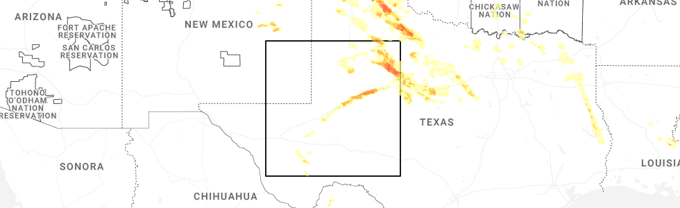
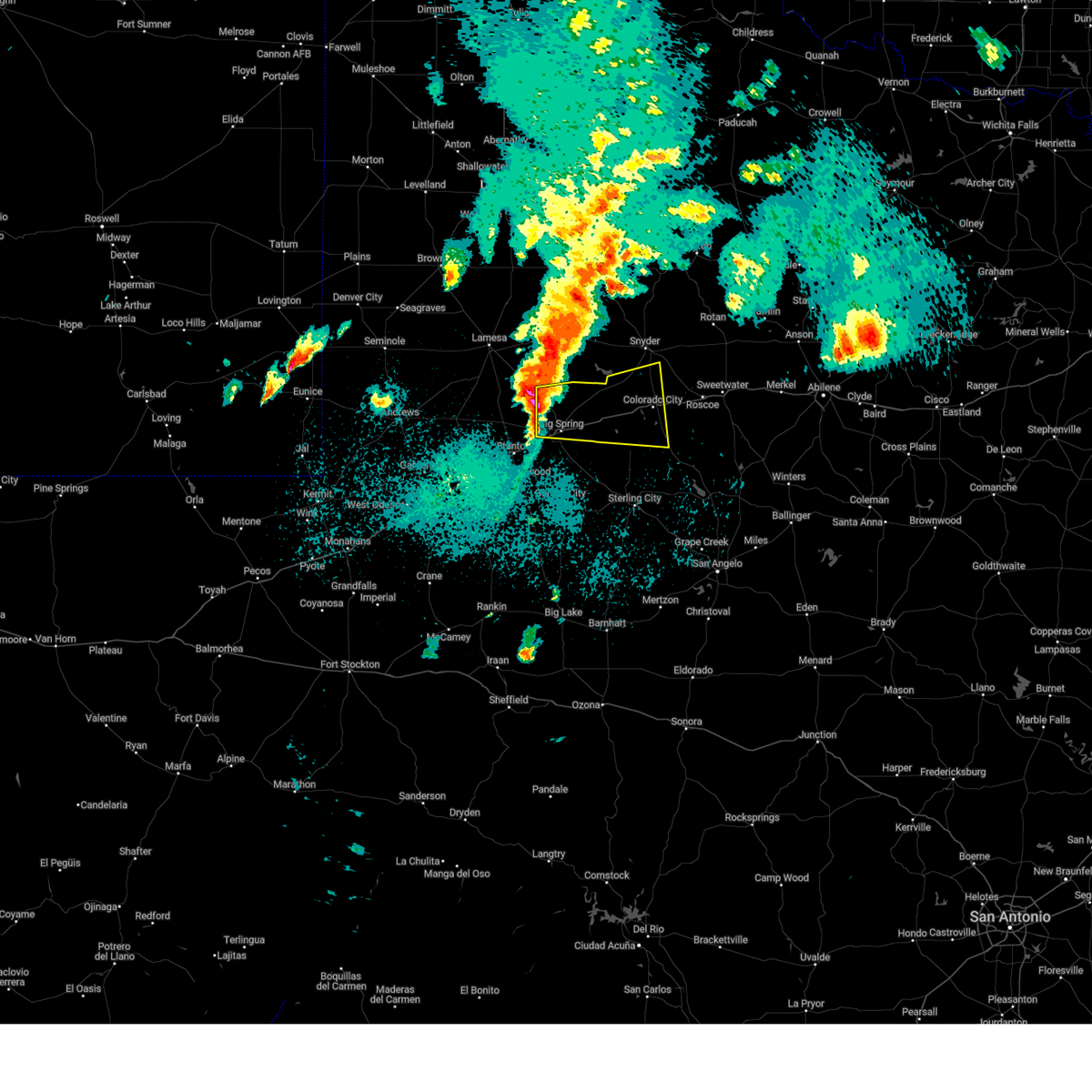
Hail Map for Big Spring, TX
The Big Spring, TX area has had 76 reports of on-the-ground hail by trained spotters, and has been under severe weather warnings 59 times during the past 12 months. Doppler radar has detected hail at or near Big Spring, TX on 101 occasions, including 7 occasions during the past year.
| Name: | Big Spring, TX |
| Where Located: | 59.5 miles ENE of Odessa, TX |
| Map: | Google Map for Big Spring, TX |
| Population: | 27282 |
| Housing Units: | 9640 |
| More Info: | Search Google for Big Spring, TX |
4
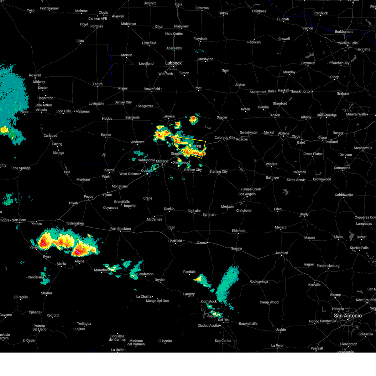
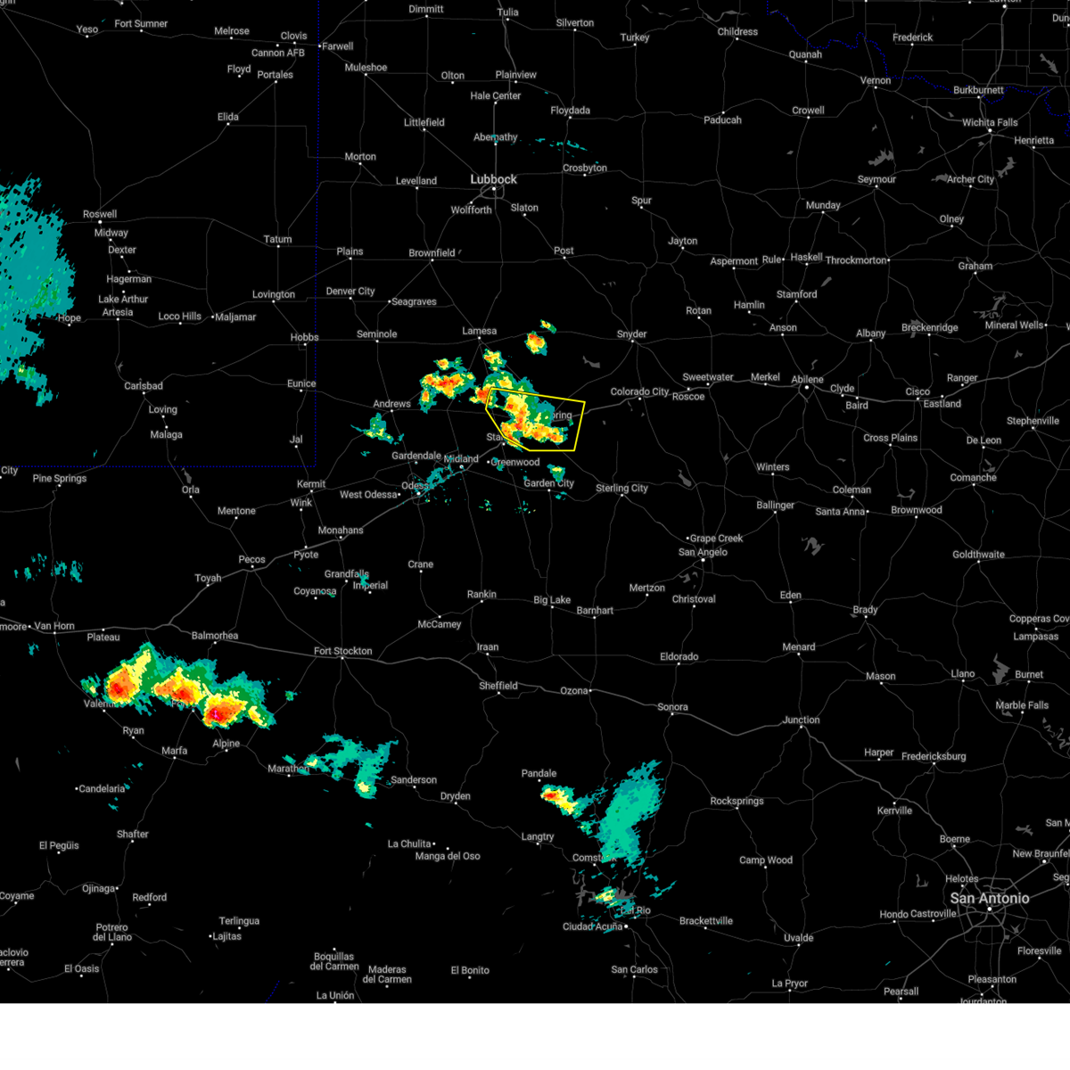
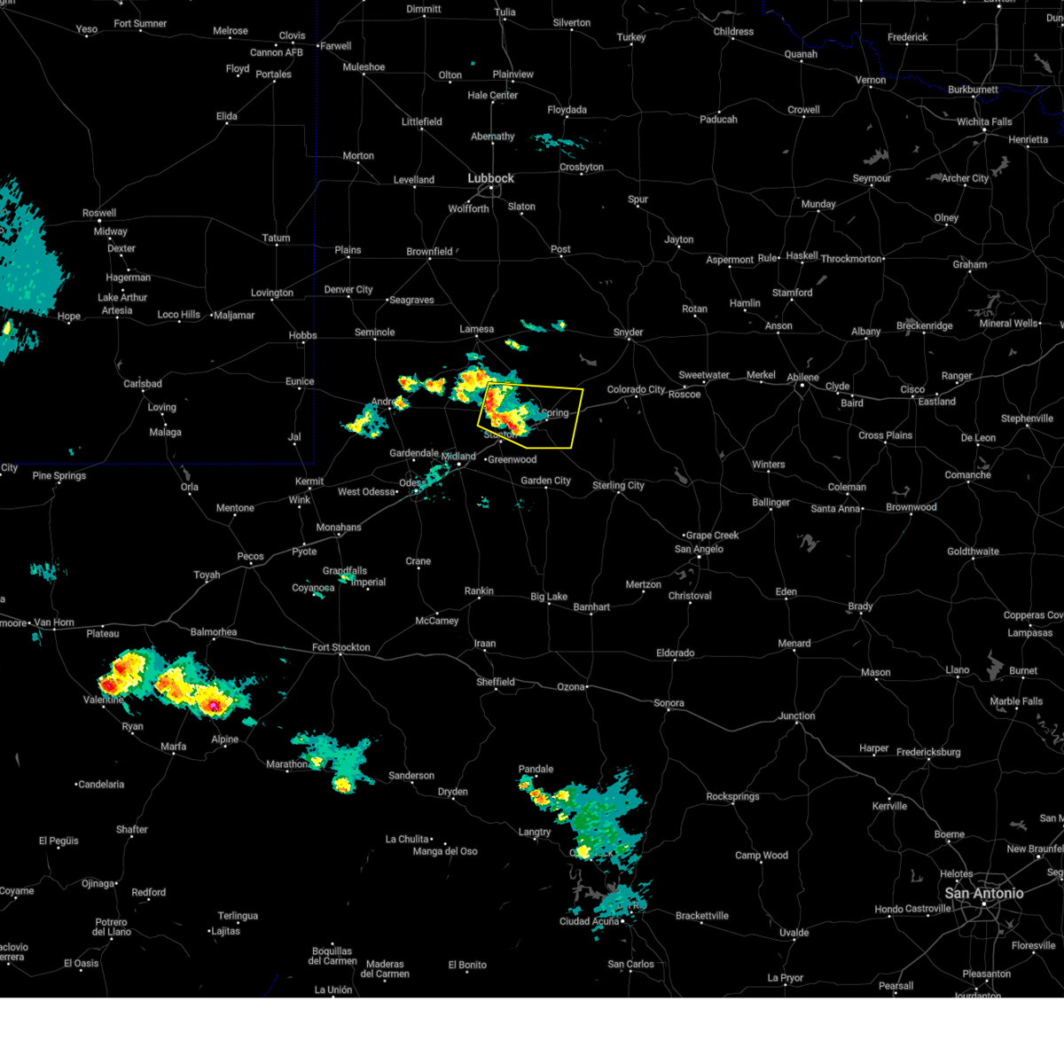
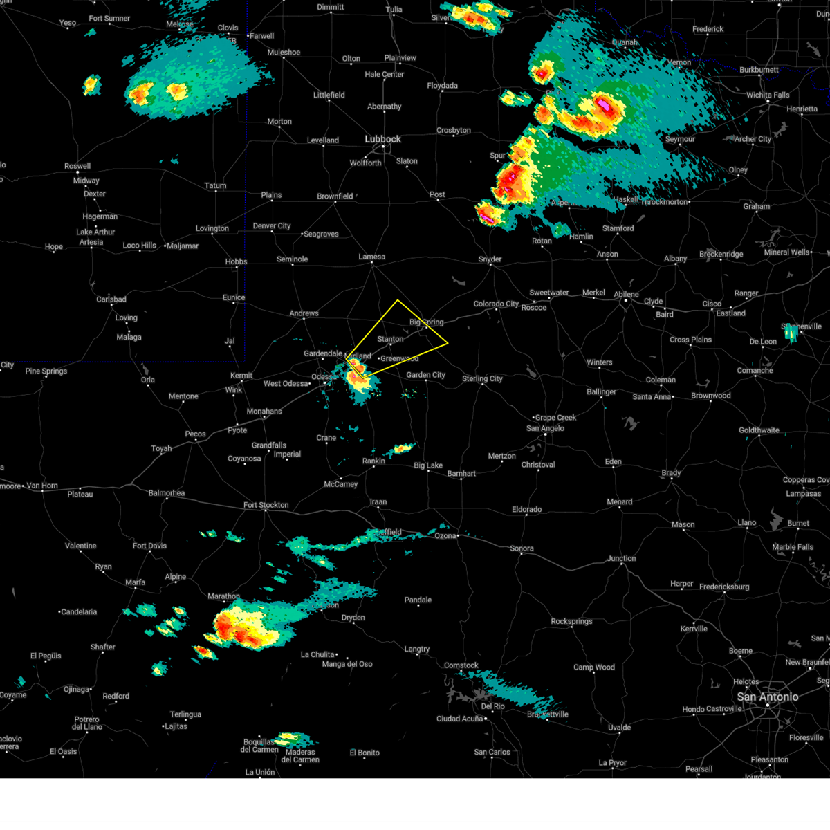
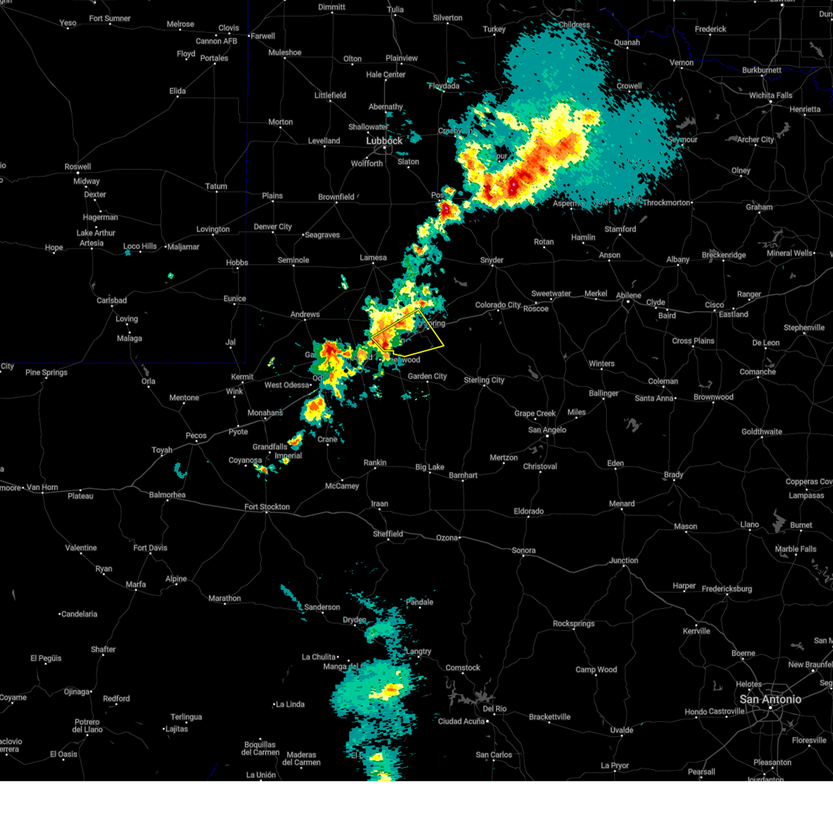
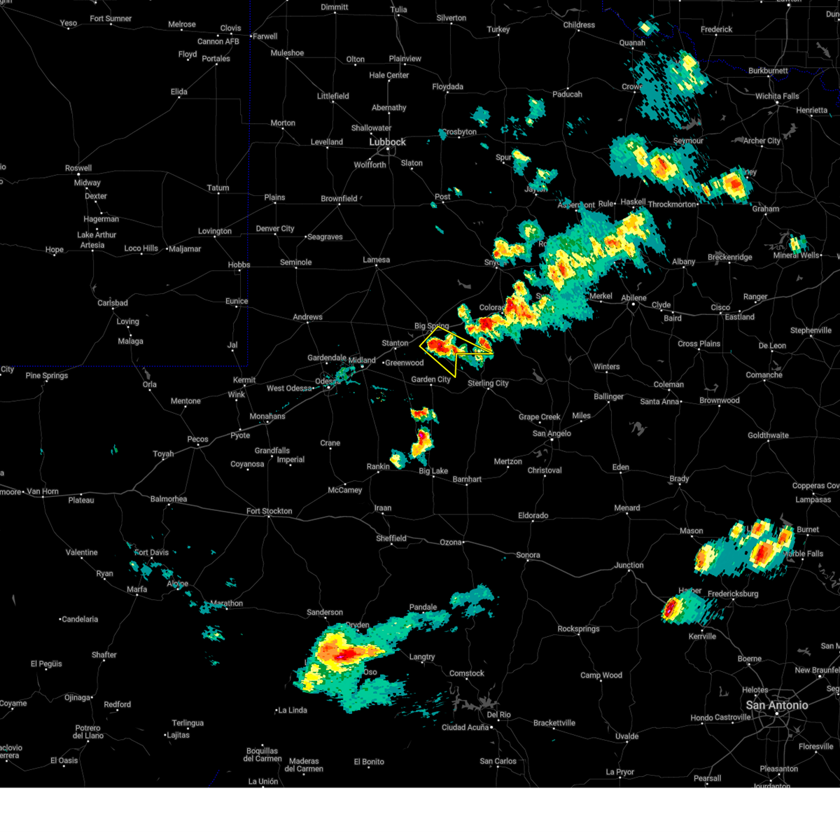
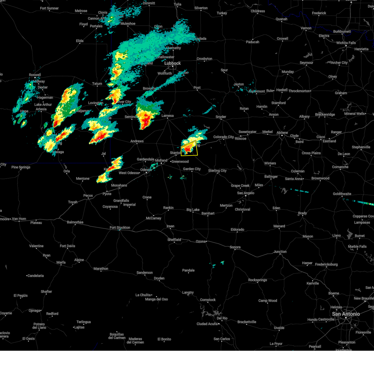
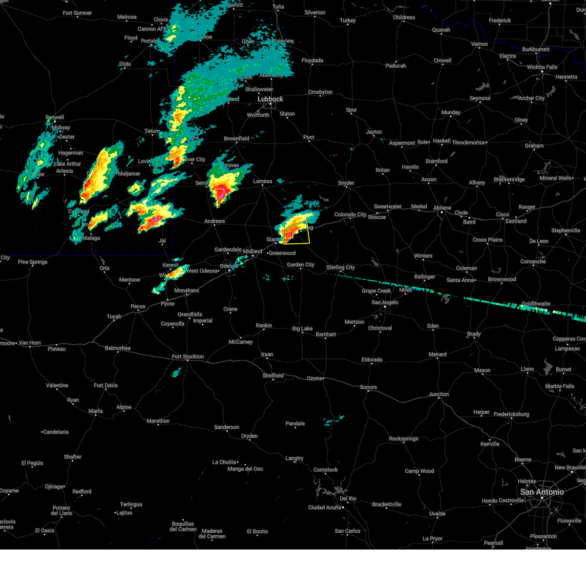
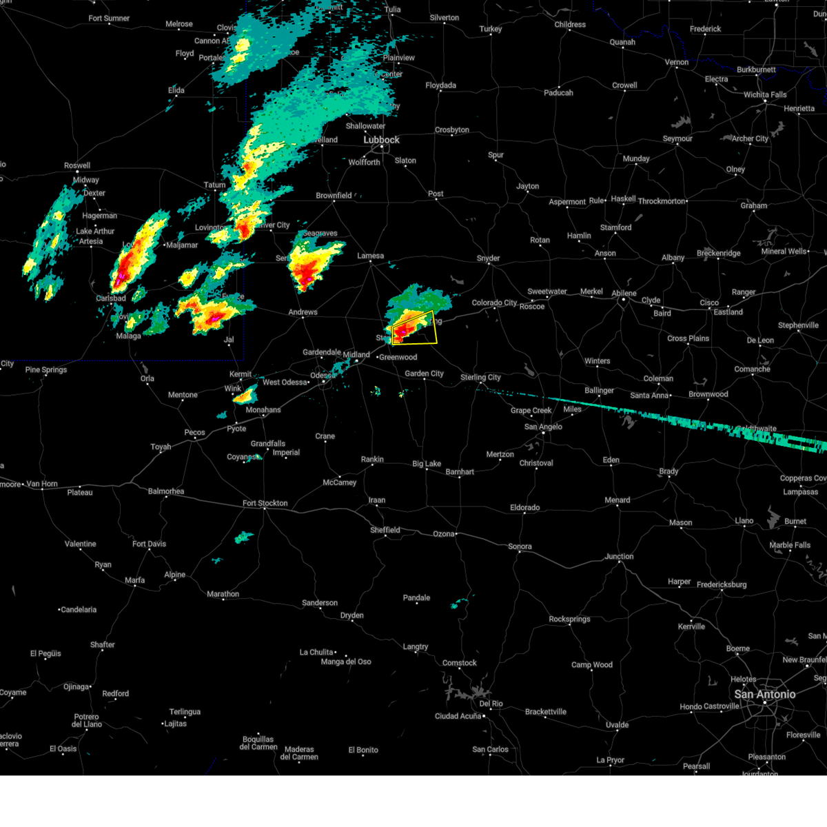
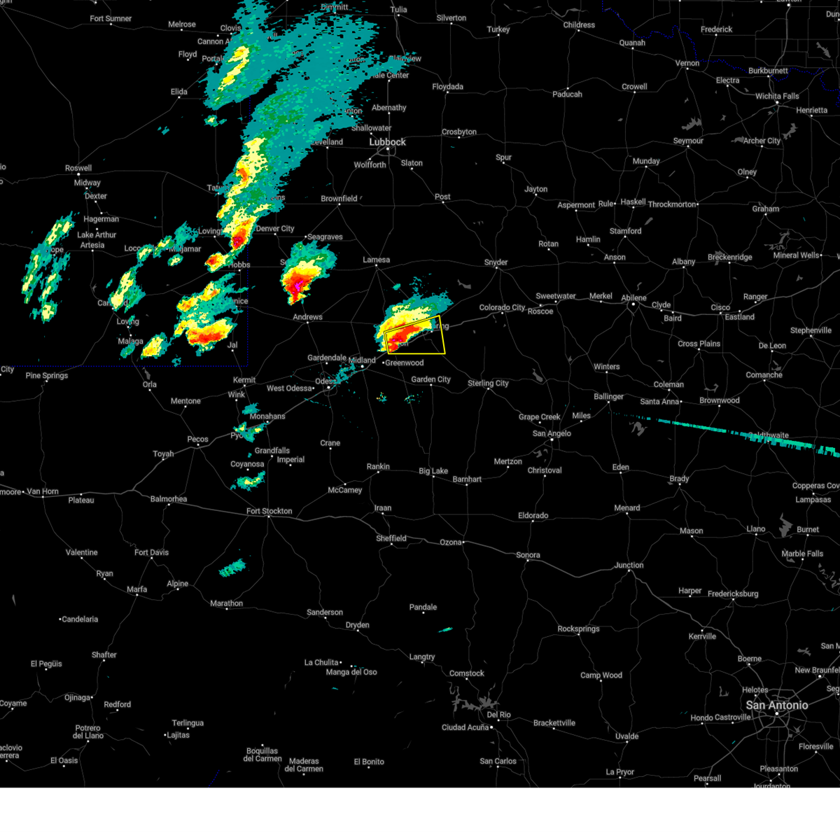
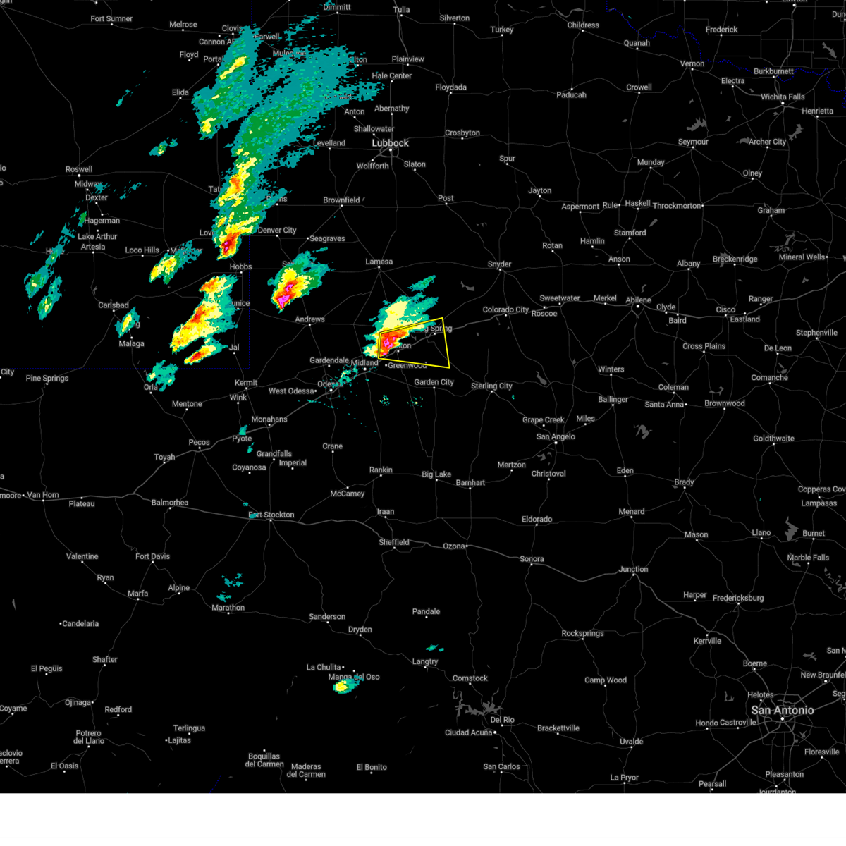
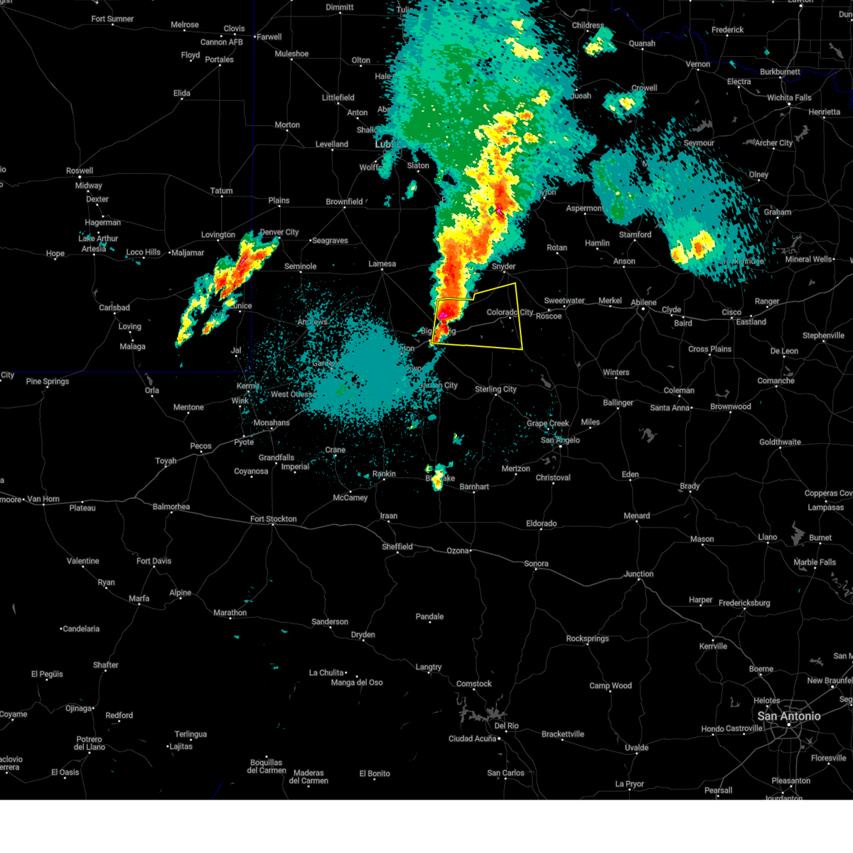
The Top Recent Hail Date for Big Spring, TX is Sunday, June 8, 2025 (4th out of 101)
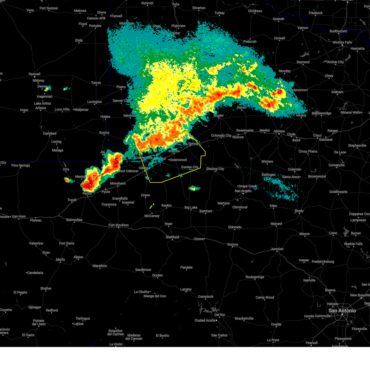
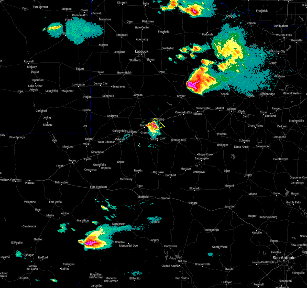
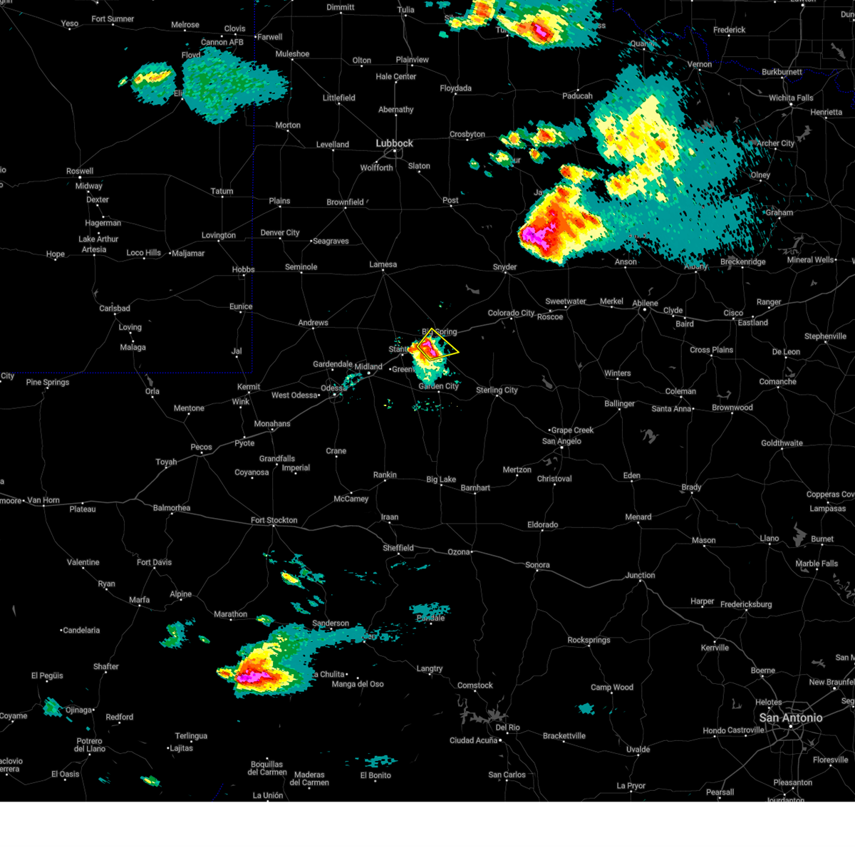
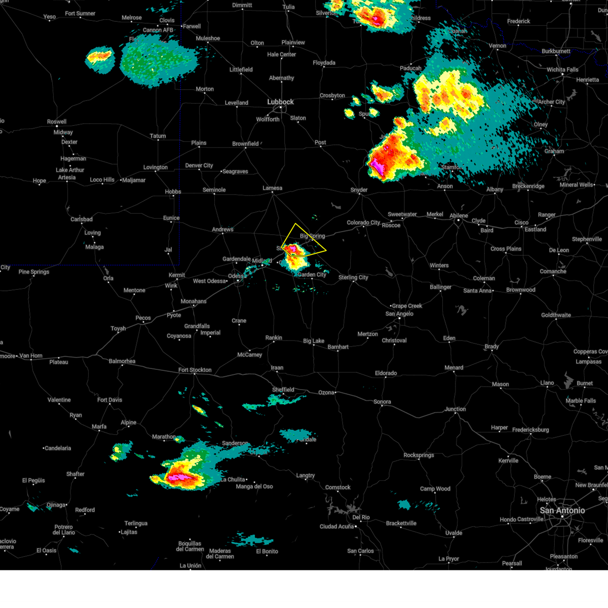
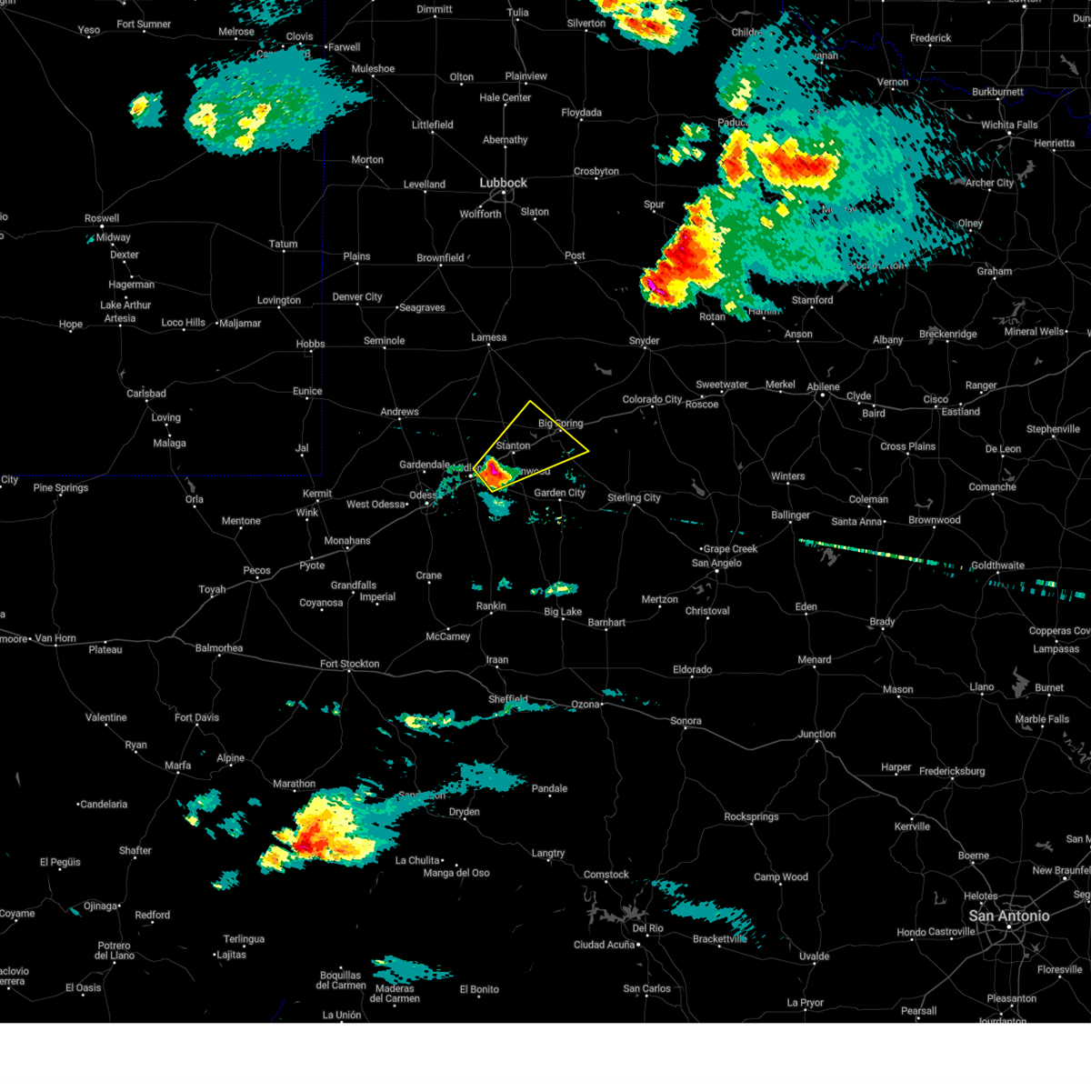
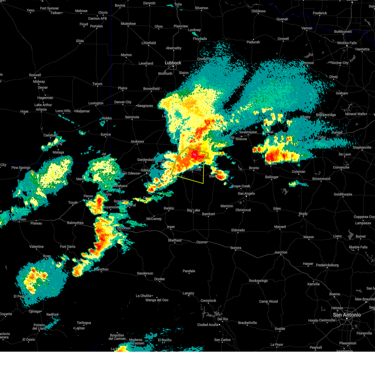
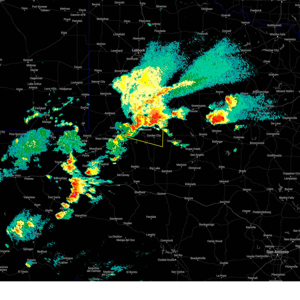
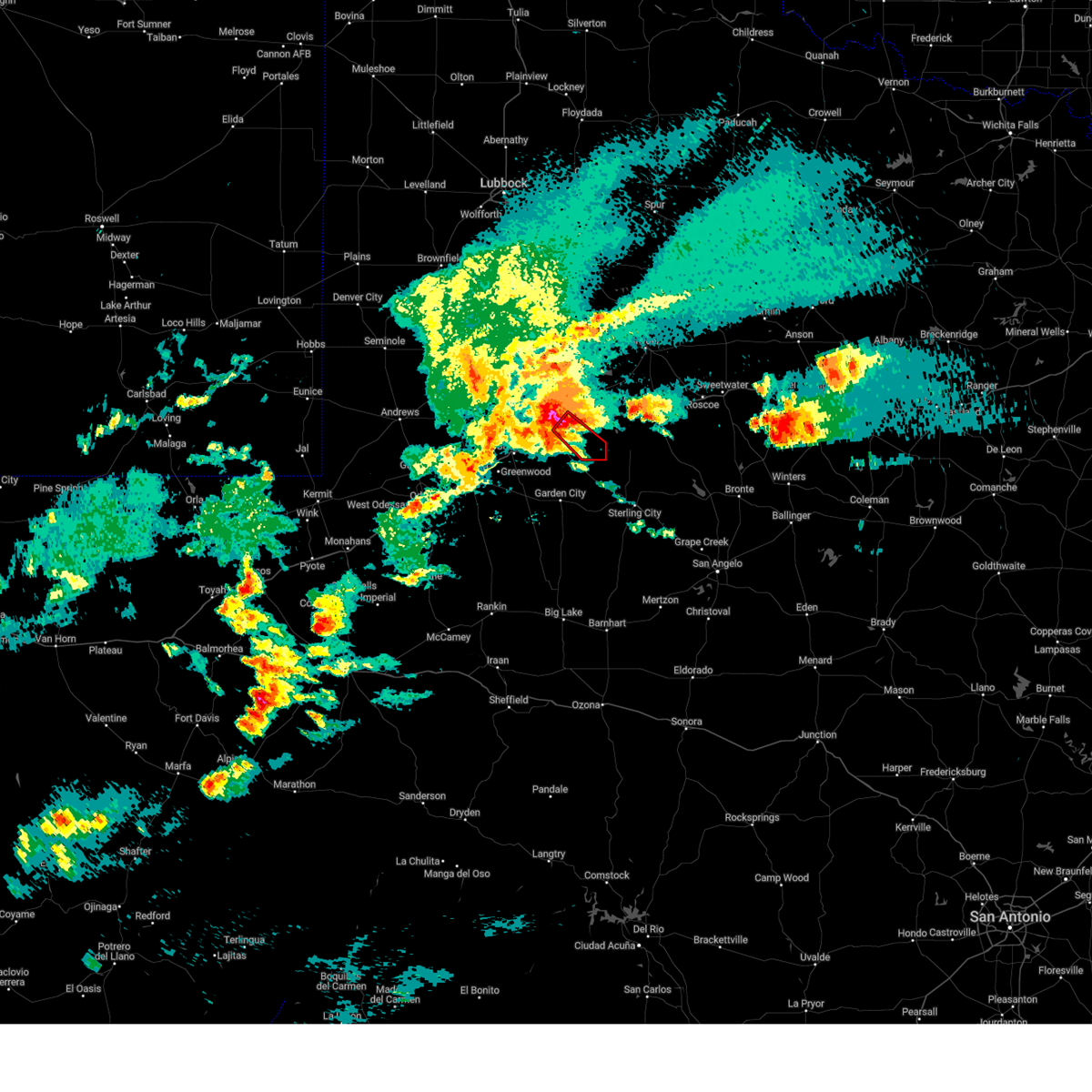
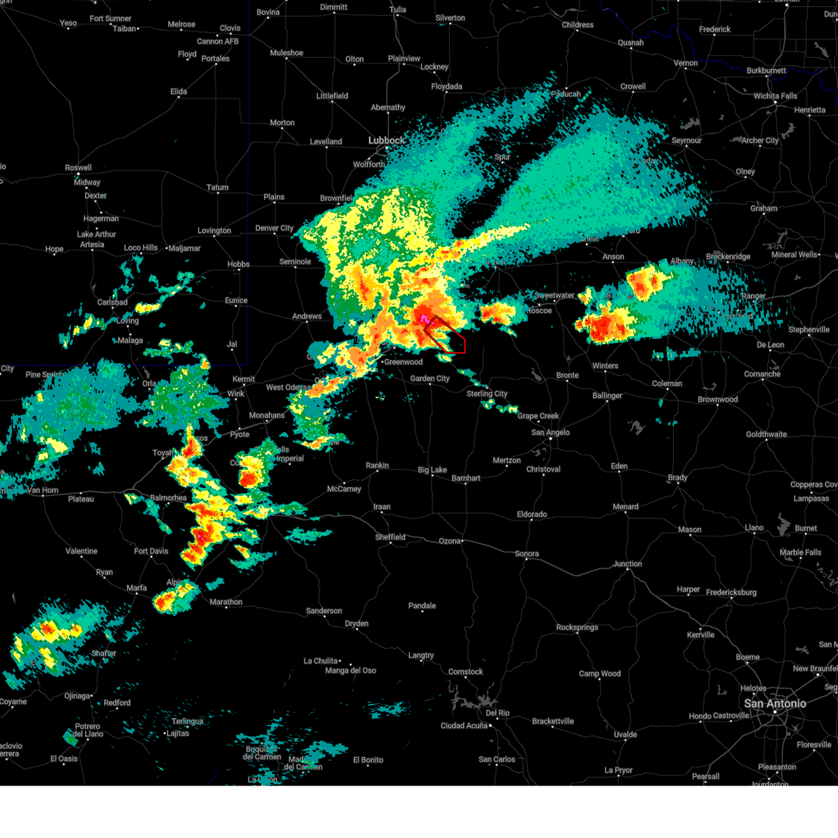
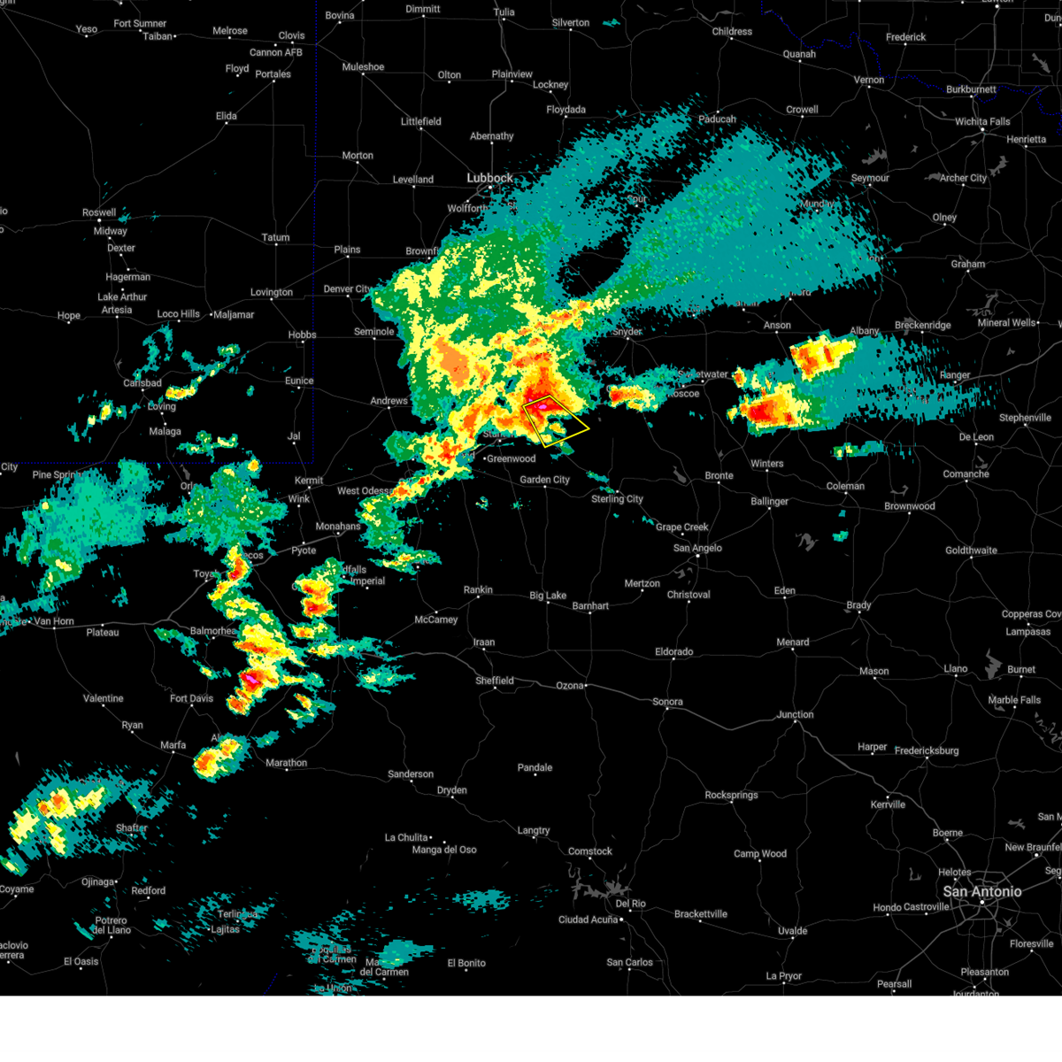
Hail and Wind Damage Spotted near Big Spring, TX
| Date / Time | Report Details |
|---|---|
| 6/10/2025 1:44 PM CDT |
 At 143 pm cdt, a severe thunderstorm was located near big spring, moving east at 35 mph (radar indicated). Hazards include 60 mph wind gusts and quarter size hail. Hail damage to vehicles is expected. expect wind damage to roofs, siding, and trees. locations impacted include, big spring, coahoma, forsan, sand springs, big spring country club, big spring mcmahon-wrinkle airpark, knott, and elbow. This includes interstate 20 between mile markers 168 and 191. At 143 pm cdt, a severe thunderstorm was located near big spring, moving east at 35 mph (radar indicated). Hazards include 60 mph wind gusts and quarter size hail. Hail damage to vehicles is expected. expect wind damage to roofs, siding, and trees. locations impacted include, big spring, coahoma, forsan, sand springs, big spring country club, big spring mcmahon-wrinkle airpark, knott, and elbow. This includes interstate 20 between mile markers 168 and 191.
|
| 6/10/2025 1:30 PM CDT |
 At 130 pm cdt, a severe thunderstorm was located 7 miles north of lomax, or 10 miles west of big spring, moving east at 25 mph (radar indicated). Hazards include 60 mph wind gusts and quarter size hail. Hail damage to vehicles is expected. expect wind damage to roofs, siding, and trees. locations impacted include, big spring, coahoma, forsan, sand springs, lomax, lenorah, big spring country club, big spring mcmahon-wrinkle airpark, knott, and elbow. This includes interstate 20 between mile markers 161 and 191. At 130 pm cdt, a severe thunderstorm was located 7 miles north of lomax, or 10 miles west of big spring, moving east at 25 mph (radar indicated). Hazards include 60 mph wind gusts and quarter size hail. Hail damage to vehicles is expected. expect wind damage to roofs, siding, and trees. locations impacted include, big spring, coahoma, forsan, sand springs, lomax, lenorah, big spring country club, big spring mcmahon-wrinkle airpark, knott, and elbow. This includes interstate 20 between mile markers 161 and 191.
|
| 6/10/2025 1:14 PM CDT |
 Svrmaf the national weather service in midland has issued a * severe thunderstorm warning for, eastern martin county in western texas, howard county in western texas, * until 200 pm cdt. * at 114 pm cdt, a severe thunderstorm was located 8 miles north of lomax, or 12 miles west of big spring, moving east at 35 mph (radar indicated). Hazards include 60 mph wind gusts and quarter size hail. Hail damage to vehicles is expected. Expect wind damage to roofs, siding, and trees. Svrmaf the national weather service in midland has issued a * severe thunderstorm warning for, eastern martin county in western texas, howard county in western texas, * until 200 pm cdt. * at 114 pm cdt, a severe thunderstorm was located 8 miles north of lomax, or 12 miles west of big spring, moving east at 35 mph (radar indicated). Hazards include 60 mph wind gusts and quarter size hail. Hail damage to vehicles is expected. Expect wind damage to roofs, siding, and trees.
|
| 6/10/2025 3:20 AM CDT |
 The storms which prompted the warning have weakened below severe limits, and no longer pose an immediate threat to life or property. therefore, the warning will be allowed to expire. The storms which prompted the warning have weakened below severe limits, and no longer pose an immediate threat to life or property. therefore, the warning will be allowed to expire.
|
| 6/10/2025 3:02 AM CDT |
 the severe thunderstorm warning has been cancelled and is no longer in effect the severe thunderstorm warning has been cancelled and is no longer in effect
|
| 6/10/2025 3:02 AM CDT |
 At 301 am cdt, severe thunderstorms were located along a line extending from 10 miles southeast of coahoma to 20 miles southeast of midland international air and space port, moving east at 50 mph (multiple automated weather stations are reporting wind gusts of 50 to 60 mph). Hazards include 60 mph wind gusts. Expect damage to roofs, siding, and trees. locations impacted include, midland, odessa, big spring, greenwood, garden city, stanton, coahoma, forsan, sand springs, lomax, midland international air and space port, cotton flat, warfield, midland airpark, skywest airport, big spring country club, courtney, big spring mcmahon-wrinkle airpark, stanton municipal aiport, and elbow. This includes interstate 20 between mile markers 119 and 187. At 301 am cdt, severe thunderstorms were located along a line extending from 10 miles southeast of coahoma to 20 miles southeast of midland international air and space port, moving east at 50 mph (multiple automated weather stations are reporting wind gusts of 50 to 60 mph). Hazards include 60 mph wind gusts. Expect damage to roofs, siding, and trees. locations impacted include, midland, odessa, big spring, greenwood, garden city, stanton, coahoma, forsan, sand springs, lomax, midland international air and space port, cotton flat, warfield, midland airpark, skywest airport, big spring country club, courtney, big spring mcmahon-wrinkle airpark, stanton municipal aiport, and elbow. This includes interstate 20 between mile markers 119 and 187.
|
| 6/10/2025 2:39 AM CDT |
 At 238 am cdt, severe thunderstorms were located along a line extending from near sand springs to 6 miles northwest of midland international air and space port, moving southeast at 45 mph (midland international airport measured a gust of 60 mph). Hazards include 60 mph wind gusts and penny size hail. Expect damage to roofs, siding, and trees. locations impacted include, midland, odessa, big spring, greenwood, garden city, stanton, coahoma, forsan, sand springs, lomax, lenorah, midland international air and space port, cotton flat, midland airpark, big spring mcmahon-wrinkle airpark, knott, stanton municipal aiport, elbow, tarzan, and warfield. This includes interstate 20 between mile markers 118 and 188. At 238 am cdt, severe thunderstorms were located along a line extending from near sand springs to 6 miles northwest of midland international air and space port, moving southeast at 45 mph (midland international airport measured a gust of 60 mph). Hazards include 60 mph wind gusts and penny size hail. Expect damage to roofs, siding, and trees. locations impacted include, midland, odessa, big spring, greenwood, garden city, stanton, coahoma, forsan, sand springs, lomax, lenorah, midland international air and space port, cotton flat, midland airpark, big spring mcmahon-wrinkle airpark, knott, stanton municipal aiport, elbow, tarzan, and warfield. This includes interstate 20 between mile markers 118 and 188.
|
| 6/10/2025 2:25 AM CDT |
 Svrmaf the national weather service in midland has issued a * severe thunderstorm warning for, glasscock county in western texas, northeastern ector county in western texas, southeastern andrews county in western texas, midland county in western texas, southern martin county in western texas, howard county in western texas, * until 330 am cdt. * at 225 am cdt, severe thunderstorms were located along a line extending from 6 miles southwest of luther to 15 miles northwest of midland international air and space port, moving southeast at 40 mph (national weather service employee reported 60 mph winds in gardendale). Hazards include 60 mph wind gusts and penny size hail. expect damage to roofs, siding, and trees Svrmaf the national weather service in midland has issued a * severe thunderstorm warning for, glasscock county in western texas, northeastern ector county in western texas, southeastern andrews county in western texas, midland county in western texas, southern martin county in western texas, howard county in western texas, * until 330 am cdt. * at 225 am cdt, severe thunderstorms were located along a line extending from 6 miles southwest of luther to 15 miles northwest of midland international air and space port, moving southeast at 40 mph (national weather service employee reported 60 mph winds in gardendale). Hazards include 60 mph wind gusts and penny size hail. expect damage to roofs, siding, and trees
|
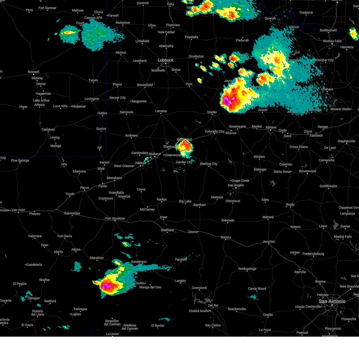
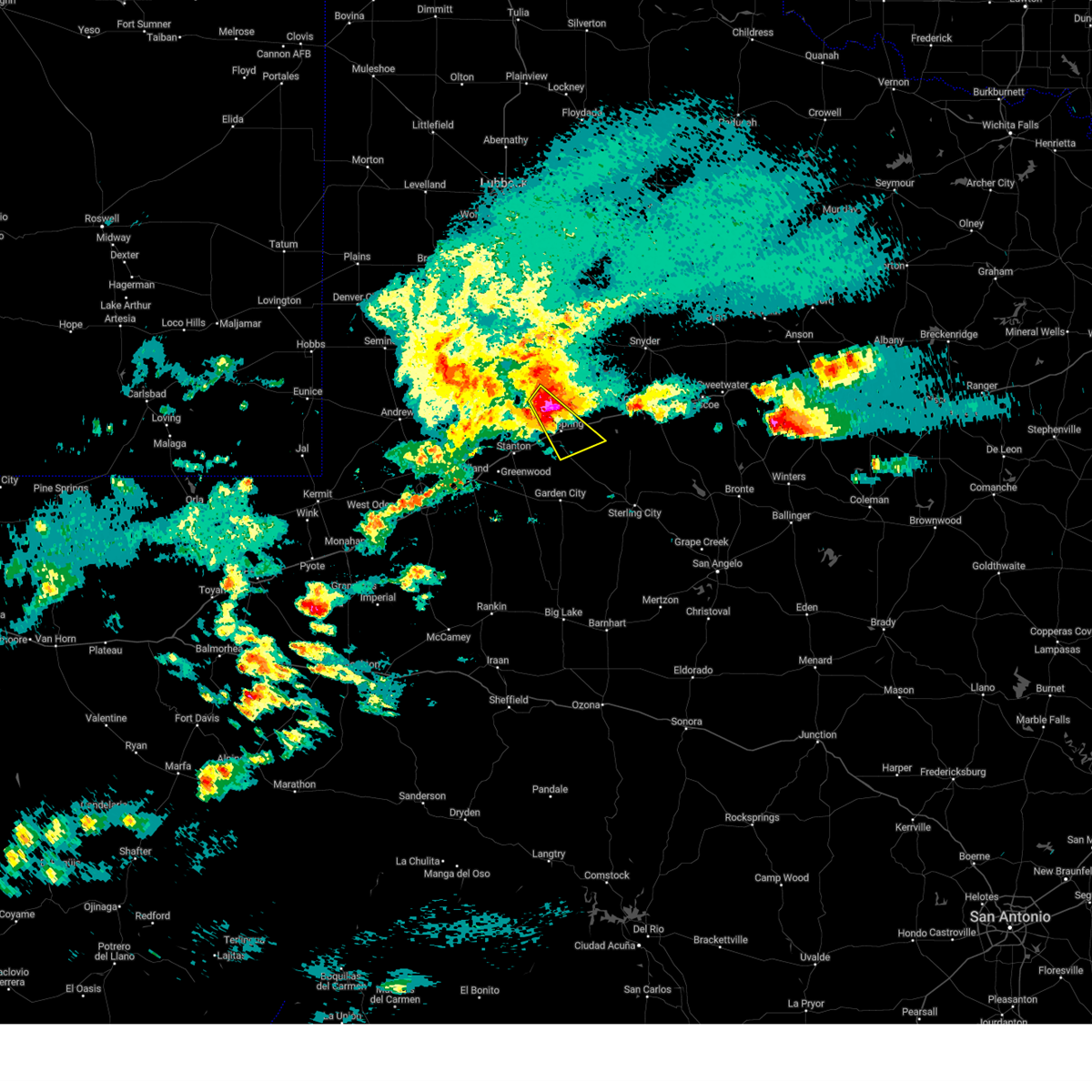
| 6/9/2025 6:55 PM CDT | Ping Pong Ball sized hail reported 13 miles NNW of Big Spring, TX |
| 6/8/2025 8:02 PM CDT |
 the severe thunderstorm warning has been cancelled and is no longer in effect the severe thunderstorm warning has been cancelled and is no longer in effect
|
| 6/8/2025 8:01 PM CDT | Storm damage reported in howard county TX, 6.5 miles WSW of Big Spring, TX |
| 6/8/2025 7:57 PM CDT |
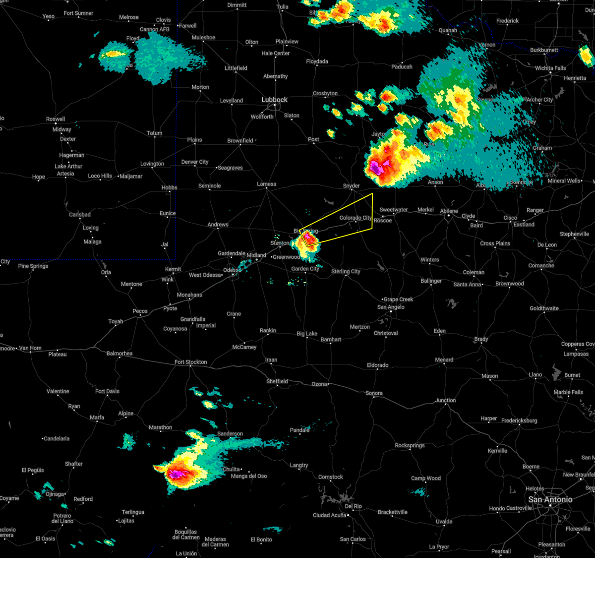 At 756 pm cdt, a severe thunderstorm was located near sand springs, or near big spring, moving northeast at 50 mph (public reports of golf ball size hail in big spring). Hazards include two inch hail and 70 mph wind gusts. People and animals outdoors will be injured. expect hail damage to roofs, siding, windows, and vehicles. expect considerable tree damage. wind damage is also likely to mobile homes, roofs, and outbuildings. locations impacted include, big spring, colorado city, coahoma, loraine, sand springs, colorado city airport, lake colorado city, lake colorado city state park, inadale, champion creek reservoir, westbrook, hermleigh, cuthbert, buford, big spring country club, dunn, and big spring mcmahon-wrinkle airpark. This includes interstate 20 between mile markers 175 and 228. At 756 pm cdt, a severe thunderstorm was located near sand springs, or near big spring, moving northeast at 50 mph (public reports of golf ball size hail in big spring). Hazards include two inch hail and 70 mph wind gusts. People and animals outdoors will be injured. expect hail damage to roofs, siding, windows, and vehicles. expect considerable tree damage. wind damage is also likely to mobile homes, roofs, and outbuildings. locations impacted include, big spring, colorado city, coahoma, loraine, sand springs, colorado city airport, lake colorado city, lake colorado city state park, inadale, champion creek reservoir, westbrook, hermleigh, cuthbert, buford, big spring country club, dunn, and big spring mcmahon-wrinkle airpark. This includes interstate 20 between mile markers 175 and 228.
|
| 6/8/2025 7:53 PM CDT | Golf Ball sized hail reported 1.9 miles SW of Big Spring, TX, described as having fallen near mm179 on i-20. |
| 6/8/2025 7:50 PM CDT | Golf Ball sized hail reported 1.6 miles SSE of Big Spring, TX, time estimated from radar. |
| 6/8/2025 7:50 PM CDT | Multiple reports that most west facing windows are broken at hotel settles in big spring due to damaging wind-driven hai in howard county TX, 1 miles SE of Big Spring, TX |
| 6/8/2025 7:50 PM CDT | Numerous reports of wind-driven hail damage across big spring. west facing windows and walls of homes are damaged. car windows are broken. multiple power poles were sna in howard county TX, 1 miles SE of Big Spring, TX |
| 6/8/2025 7:50 PM CDT |
 Svrmaf the national weather service in midland has issued a * severe thunderstorm warning for, northern mitchell county in western texas, southeastern scurry county in western texas, central howard county in western texas, * until 845 pm cdt. * at 750 pm cdt, a severe thunderstorm was located near big spring, moving northeast at 45 mph (radar indicated). Hazards include two inch hail and 70 mph wind gusts. People and animals outdoors will be injured. expect hail damage to roofs, siding, windows, and vehicles. expect considerable tree damage. Wind damage is also likely to mobile homes, roofs, and outbuildings. Svrmaf the national weather service in midland has issued a * severe thunderstorm warning for, northern mitchell county in western texas, southeastern scurry county in western texas, central howard county in western texas, * until 845 pm cdt. * at 750 pm cdt, a severe thunderstorm was located near big spring, moving northeast at 45 mph (radar indicated). Hazards include two inch hail and 70 mph wind gusts. People and animals outdoors will be injured. expect hail damage to roofs, siding, windows, and vehicles. expect considerable tree damage. Wind damage is also likely to mobile homes, roofs, and outbuildings.
|
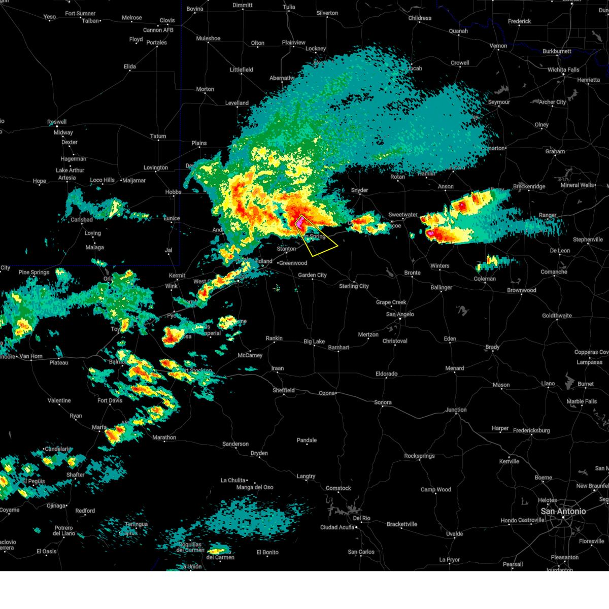
| 6/8/2025 7:44 PM CDT |
 the severe thunderstorm warning has been cancelled and is no longer in effect the severe thunderstorm warning has been cancelled and is no longer in effect
|
| 6/8/2025 7:44 PM CDT |
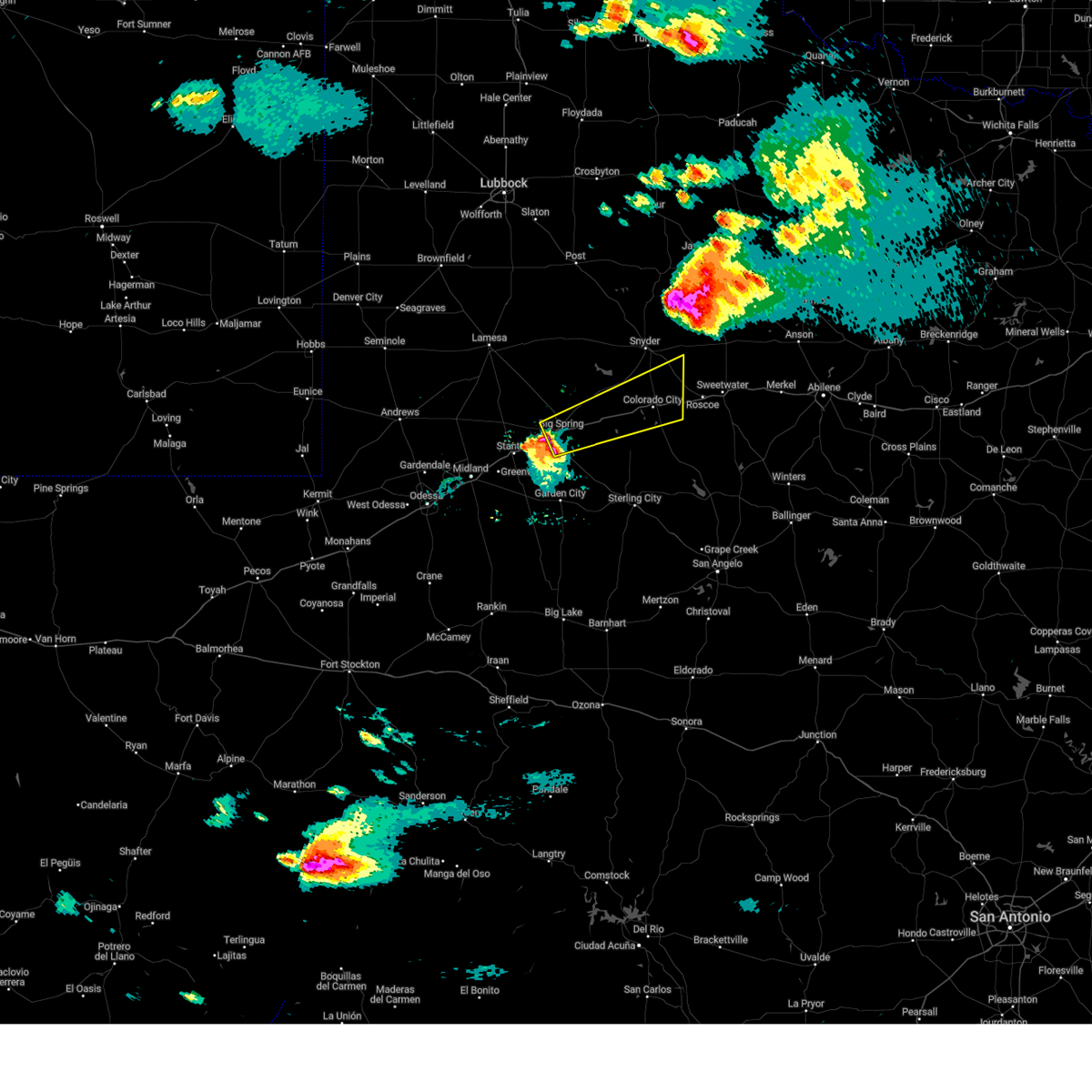
 At 744 pm cdt, a severe thunderstorm was located near big spring, moving northeast at 45 mph (radar indicated). Hazards include tennis ball size hail and 70 mph wind gusts. People and animals outdoors will be injured. expect hail damage to roofs, siding, windows, and vehicles. expect considerable tree damage. wind damage is also likely to mobile homes, roofs, and outbuildings. locations impacted include, big spring, big spring country club, elbow, and big spring mcmahon-wrinkle airpark. This includes interstate 20 between mile markers 167 and 178. At 744 pm cdt, a severe thunderstorm was located near big spring, moving northeast at 45 mph (radar indicated). Hazards include tennis ball size hail and 70 mph wind gusts. People and animals outdoors will be injured. expect hail damage to roofs, siding, windows, and vehicles. expect considerable tree damage. wind damage is also likely to mobile homes, roofs, and outbuildings. locations impacted include, big spring, big spring country club, elbow, and big spring mcmahon-wrinkle airpark. This includes interstate 20 between mile markers 167 and 178.
|
| 6/8/2025 7:36 PM CDT |
 At 736 pm cdt, a severe thunderstorm was located near lomax, or 13 miles southwest of big spring, moving northeast at 50 mph (radar indicated). Hazards include two inch hail and 70 mph wind gusts. People and animals outdoors will be injured. expect hail damage to roofs, siding, windows, and vehicles. expect considerable tree damage. wind damage is also likely to mobile homes, roofs, and outbuildings. locations impacted include, big spring, stanton, lomax, big spring country club, big spring mcmahon-wrinkle airpark, stanton municipal aiport, and elbow. This includes interstate 20 between mile markers 157 and 178. At 736 pm cdt, a severe thunderstorm was located near lomax, or 13 miles southwest of big spring, moving northeast at 50 mph (radar indicated). Hazards include two inch hail and 70 mph wind gusts. People and animals outdoors will be injured. expect hail damage to roofs, siding, windows, and vehicles. expect considerable tree damage. wind damage is also likely to mobile homes, roofs, and outbuildings. locations impacted include, big spring, stanton, lomax, big spring country club, big spring mcmahon-wrinkle airpark, stanton municipal aiport, and elbow. This includes interstate 20 between mile markers 157 and 178.
|
| 6/8/2025 7:36 PM CDT |
 the severe thunderstorm warning has been cancelled and is no longer in effect the severe thunderstorm warning has been cancelled and is no longer in effect
|
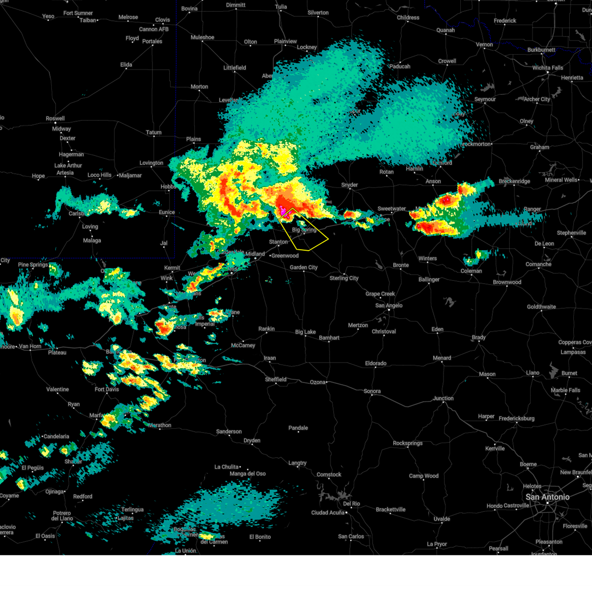
| 6/8/2025 7:19 PM CDT |
 At 719 pm cdt, a severe thunderstorm was located over greenwood, moving northeast at 45 mph (public). Hazards include two inch hail and 70 mph wind gusts. People and animals outdoors will be injured. expect hail damage to roofs, siding, windows, and vehicles. expect considerable tree damage. wind damage is also likely to mobile homes, roofs, and outbuildings. locations impacted include, midland, big spring, greenwood, stanton, forsan, lomax, big spring country club, courtney, big spring mcmahon-wrinkle airpark, stanton municipal aiport, and elbow. This includes interstate 20 between mile markers 141 and 178. At 719 pm cdt, a severe thunderstorm was located over greenwood, moving northeast at 45 mph (public). Hazards include two inch hail and 70 mph wind gusts. People and animals outdoors will be injured. expect hail damage to roofs, siding, windows, and vehicles. expect considerable tree damage. wind damage is also likely to mobile homes, roofs, and outbuildings. locations impacted include, midland, big spring, greenwood, stanton, forsan, lomax, big spring country club, courtney, big spring mcmahon-wrinkle airpark, stanton municipal aiport, and elbow. This includes interstate 20 between mile markers 141 and 178.
|
| 6/8/2025 7:10 PM CDT |
 Svrmaf the national weather service in midland has issued a * severe thunderstorm warning for, northwestern glasscock county in western texas, northeastern midland county in western texas, southeastern martin county in western texas, southwestern howard county in western texas, * until 815 pm cdt. * at 710 pm cdt, a severe thunderstorm was located near midland, moving northeast at 45 mph (public). Hazards include golf ball size hail and 70 mph wind gusts. People and animals outdoors will be injured. expect hail damage to roofs, siding, windows, and vehicles. expect considerable tree damage. Wind damage is also likely to mobile homes, roofs, and outbuildings. Svrmaf the national weather service in midland has issued a * severe thunderstorm warning for, northwestern glasscock county in western texas, northeastern midland county in western texas, southeastern martin county in western texas, southwestern howard county in western texas, * until 815 pm cdt. * at 710 pm cdt, a severe thunderstorm was located near midland, moving northeast at 45 mph (public). Hazards include golf ball size hail and 70 mph wind gusts. People and animals outdoors will be injured. expect hail damage to roofs, siding, windows, and vehicles. expect considerable tree damage. Wind damage is also likely to mobile homes, roofs, and outbuildings.
|
| 6/3/2025 12:10 AM CDT |
 the severe thunderstorm warning has been cancelled and is no longer in effect the severe thunderstorm warning has been cancelled and is no longer in effect
|
| 6/3/2025 12:03 AM CDT |
 At 1203 am cdt, a severe thunderstorm was located near lomax, or 13 miles northwest of garden city, moving northeast at 40 mph (radar indicated). Hazards include 60 mph wind gusts and quarter size hail. Hail damage to vehicles is expected. expect wind damage to roofs, siding, and trees. locations impacted include, big spring, garden city, coahoma, forsan, sand springs, lomax, big spring country club, big spring mcmahon-wrinkle airpark, and elbow. This includes interstate 20 between mile markers 165 and 196. At 1203 am cdt, a severe thunderstorm was located near lomax, or 13 miles northwest of garden city, moving northeast at 40 mph (radar indicated). Hazards include 60 mph wind gusts and quarter size hail. Hail damage to vehicles is expected. expect wind damage to roofs, siding, and trees. locations impacted include, big spring, garden city, coahoma, forsan, sand springs, lomax, big spring country club, big spring mcmahon-wrinkle airpark, and elbow. This includes interstate 20 between mile markers 165 and 196.
|
| 6/3/2025 12:03 AM CDT |
 the severe thunderstorm warning has been cancelled and is no longer in effect the severe thunderstorm warning has been cancelled and is no longer in effect
|
| 6/2/2025 11:42 PM CDT |
 Svrmaf the national weather service in midland has issued a * severe thunderstorm warning for, glasscock county in western texas, southeastern midland county in western texas, southern howard county in western texas, * until 1245 am cdt. * at 1142 pm cdt, a severe thunderstorm was located 9 miles southeast of greenwood, moving northeast at 40 mph (radar indicated). Hazards include 60 mph wind gusts and half dollar size hail. Hail damage to vehicles is expected. Expect wind damage to roofs, siding, and trees. Svrmaf the national weather service in midland has issued a * severe thunderstorm warning for, glasscock county in western texas, southeastern midland county in western texas, southern howard county in western texas, * until 1245 am cdt. * at 1142 pm cdt, a severe thunderstorm was located 9 miles southeast of greenwood, moving northeast at 40 mph (radar indicated). Hazards include 60 mph wind gusts and half dollar size hail. Hail damage to vehicles is expected. Expect wind damage to roofs, siding, and trees.
|
| 5/29/2025 8:31 PM CDT |
 At 830 pm cdt, severe thunderstorms were located along a line extending from near lomax to 14 miles west of garden city, moving southeast at 30 mph (lomax measured a wind gust of 66 mph). Hazards include 70 mph wind gusts and quarter size hail. Hail damage to vehicles is expected. expect considerable tree damage. wind damage is also likely to mobile homes, roofs, and outbuildings. locations impacted include, big spring, garden city, forsan, lomax, big spring country club, big spring mcmahon-wrinkle airpark, elbow, and spraberry. This includes interstate 20 between mile markers 161 and 175. At 830 pm cdt, severe thunderstorms were located along a line extending from near lomax to 14 miles west of garden city, moving southeast at 30 mph (lomax measured a wind gust of 66 mph). Hazards include 70 mph wind gusts and quarter size hail. Hail damage to vehicles is expected. expect considerable tree damage. wind damage is also likely to mobile homes, roofs, and outbuildings. locations impacted include, big spring, garden city, forsan, lomax, big spring country club, big spring mcmahon-wrinkle airpark, elbow, and spraberry. This includes interstate 20 between mile markers 161 and 175.
|
| 5/29/2025 8:09 PM CDT |
 Svrmaf the national weather service in midland has issued a * severe thunderstorm warning for, glasscock county in western texas, northern midland county in western texas, southeastern martin county in western texas, southern howard county in western texas, * until 915 pm cdt. * at 809 pm cdt, severe thunderstorms were located along a line extending from 7 miles north of stanton to 7 miles south of greenwood, moving southeast at 30 mph (radar indicated). Hazards include 60 mph wind gusts and quarter size hail. Hail damage to vehicles is expected. Expect wind damage to roofs, siding, and trees. Svrmaf the national weather service in midland has issued a * severe thunderstorm warning for, glasscock county in western texas, northern midland county in western texas, southeastern martin county in western texas, southern howard county in western texas, * until 915 pm cdt. * at 809 pm cdt, severe thunderstorms were located along a line extending from 7 miles north of stanton to 7 miles south of greenwood, moving southeast at 30 mph (radar indicated). Hazards include 60 mph wind gusts and quarter size hail. Hail damage to vehicles is expected. Expect wind damage to roofs, siding, and trees.
|
| 5/29/2025 8:06 PM CDT |
 the tornado warning has been cancelled and is no longer in effect the tornado warning has been cancelled and is no longer in effect
|
| 5/29/2025 7:58 PM CDT |
 Tormaf the national weather service in midland has issued a * tornado warning for, southeastern howard county in western texas, * until 830 pm cdt. * at 758 pm cdt, a severe thunderstorm capable of producing a tornado was located over big spring, moving southeast at 25 mph (weather spotters reported funnel cloud). Hazards include tornado and hail up to two inches in diameter. Flying debris will be dangerous to those caught without shelter. mobile homes will be damaged or destroyed. damage to roofs, windows, and vehicles will occur. tree damage is likely. this dangerous storm will be near, forsan and sand springs around 805 pm cdt. other locations impacted by this tornadic thunderstorm include big spring country club. This includes interstate 20 between mile markers 176 and 187. Tormaf the national weather service in midland has issued a * tornado warning for, southeastern howard county in western texas, * until 830 pm cdt. * at 758 pm cdt, a severe thunderstorm capable of producing a tornado was located over big spring, moving southeast at 25 mph (weather spotters reported funnel cloud). Hazards include tornado and hail up to two inches in diameter. Flying debris will be dangerous to those caught without shelter. mobile homes will be damaged or destroyed. damage to roofs, windows, and vehicles will occur. tree damage is likely. this dangerous storm will be near, forsan and sand springs around 805 pm cdt. other locations impacted by this tornadic thunderstorm include big spring country club. This includes interstate 20 between mile markers 176 and 187.
|
| 5/29/2025 7:53 PM CDT |
 At 753 pm cdt, a severe thunderstorm was located over big spring, moving southeast at 20 mph (radar indicated). Hazards include two inch hail and 70 mph wind gusts. People and animals outdoors will be injured. expect hail damage to roofs, siding, windows, and vehicles. expect considerable tree damage. wind damage is also likely to mobile homes, roofs, and outbuildings. locations impacted include, big spring, coahoma, sand springs, big spring country club, elbow, and big spring mcmahon-wrinkle airpark. This includes interstate 20 between mile markers 173 and 188. At 753 pm cdt, a severe thunderstorm was located over big spring, moving southeast at 20 mph (radar indicated). Hazards include two inch hail and 70 mph wind gusts. People and animals outdoors will be injured. expect hail damage to roofs, siding, windows, and vehicles. expect considerable tree damage. wind damage is also likely to mobile homes, roofs, and outbuildings. locations impacted include, big spring, coahoma, sand springs, big spring country club, elbow, and big spring mcmahon-wrinkle airpark. This includes interstate 20 between mile markers 173 and 188.
|
| 5/29/2025 7:41 PM CDT |
 At 741 pm cdt, a severe thunderstorm was located near big spring, moving southeast at 20 mph (trained weather spotters reported downed power lines near knott). Hazards include two inch hail and 70 mph wind gusts. People and animals outdoors will be injured. expect hail damage to roofs, siding, windows, and vehicles. expect considerable tree damage. wind damage is also likely to mobile homes, roofs, and outbuildings. locations impacted include, big spring, coahoma, sand springs, big spring country club, big spring mcmahon-wrinkle airpark, knott, and elbow. This includes interstate 20 between mile markers 172 and 188. At 741 pm cdt, a severe thunderstorm was located near big spring, moving southeast at 20 mph (trained weather spotters reported downed power lines near knott). Hazards include two inch hail and 70 mph wind gusts. People and animals outdoors will be injured. expect hail damage to roofs, siding, windows, and vehicles. expect considerable tree damage. wind damage is also likely to mobile homes, roofs, and outbuildings. locations impacted include, big spring, coahoma, sand springs, big spring country club, big spring mcmahon-wrinkle airpark, knott, and elbow. This includes interstate 20 between mile markers 172 and 188.
|
| 5/29/2025 7:34 PM CDT |
 the severe thunderstorm warning has been cancelled and is no longer in effect the severe thunderstorm warning has been cancelled and is no longer in effect
|
| 5/29/2025 7:34 PM CDT |
 At 734 pm cdt, a severe thunderstorm was located 8 miles northwest of big spring, moving southeast at 30 mph (radar indicated). Hazards include two inch hail and 70 mph wind gusts. People and animals outdoors will be injured. expect hail damage to roofs, siding, windows, and vehicles. expect considerable tree damage. wind damage is also likely to mobile homes, roofs, and outbuildings. locations impacted include, big spring, coahoma, sand springs, big spring country club, big spring mcmahon-wrinkle airpark, knott, and elbow. This includes interstate 20 between mile markers 172 and 188. At 734 pm cdt, a severe thunderstorm was located 8 miles northwest of big spring, moving southeast at 30 mph (radar indicated). Hazards include two inch hail and 70 mph wind gusts. People and animals outdoors will be injured. expect hail damage to roofs, siding, windows, and vehicles. expect considerable tree damage. wind damage is also likely to mobile homes, roofs, and outbuildings. locations impacted include, big spring, coahoma, sand springs, big spring country club, big spring mcmahon-wrinkle airpark, knott, and elbow. This includes interstate 20 between mile markers 172 and 188.
|
| 5/29/2025 7:21 PM CDT |
 Svrmaf the national weather service in midland has issued a * severe thunderstorm warning for, east central martin county in western texas, central howard county in western texas, * until 815 pm cdt. * at 721 pm cdt, a severe thunderstorm was located 8 miles southeast of ackerly, moving southeast at 20 mph (radar indicated). Hazards include two inch hail and 70 mph wind gusts. People and animals outdoors will be injured. expect hail damage to roofs, siding, windows, and vehicles. expect considerable tree damage. Wind damage is also likely to mobile homes, roofs, and outbuildings. Svrmaf the national weather service in midland has issued a * severe thunderstorm warning for, east central martin county in western texas, central howard county in western texas, * until 815 pm cdt. * at 721 pm cdt, a severe thunderstorm was located 8 miles southeast of ackerly, moving southeast at 20 mph (radar indicated). Hazards include two inch hail and 70 mph wind gusts. People and animals outdoors will be injured. expect hail damage to roofs, siding, windows, and vehicles. expect considerable tree damage. Wind damage is also likely to mobile homes, roofs, and outbuildings.
|
| 5/25/2025 8:20 PM CDT | The storm which prompted the warning has weakened below severe limits, and no longer poses an immediate threat to life or property. therefore, the warning will be allowed to expire. however, gusty winds are still possible with this thunderstorm. |
| 5/25/2025 8:08 PM CDT | At 807 pm cdt, a severe thunderstorm was located near big spring, moving north at 20 mph (radar indicated). Hazards include 60 mph wind gusts and quarter size hail. Hail damage to vehicles is expected. expect wind damage to roofs, siding, and trees. locations impacted include, big spring, coahoma, sand springs, and luther. This includes interstate 20 between mile markers 178 and 188. |
| 5/25/2025 7:52 PM CDT | At 752 pm cdt, a severe thunderstorm was located over coahoma, or 12 miles east of big spring, moving north at 15 mph (radar indicated). Hazards include 60 mph wind gusts and quarter size hail. Hail damage to vehicles is expected. expect wind damage to roofs, siding, and trees. locations impacted include, big spring, coahoma, sand springs, and big spring country club. This includes interstate 20 between mile markers 179 and 195. |
| 5/25/2025 7:52 PM CDT | the severe thunderstorm warning has been cancelled and is no longer in effect |
| 5/25/2025 7:51 PM CDT | Svrmaf the national weather service in midland has issued a * severe thunderstorm warning for, south central borden county in western texas, central howard county in western texas, * until 830 pm cdt. * at 751 pm cdt, a severe thunderstorm was located over big spring, moving north at 20 mph (radar indicated). Hazards include 60 mph wind gusts and quarter size hail. Hail damage to vehicles is expected. Expect wind damage to roofs, siding, and trees. |
| 5/25/2025 7:15 PM CDT | Quarter sized hail reported 4.9 miles NNW of Big Spring, TX |
| 5/25/2025 6:54 PM CDT |
 Svrmaf the national weather service in midland has issued a * severe thunderstorm warning for, northeastern glasscock county in western texas, west central mitchell county in western texas, eastern howard county in western texas, * until 800 pm cdt. * at 654 pm cdt, a severe thunderstorm was located over forsan, or 12 miles southeast of big spring, moving north at 15 mph (radar indicated). Hazards include 60 mph wind gusts and half dollar size hail. Hail damage to vehicles is expected. Expect wind damage to roofs, siding, and trees. Svrmaf the national weather service in midland has issued a * severe thunderstorm warning for, northeastern glasscock county in western texas, west central mitchell county in western texas, eastern howard county in western texas, * until 800 pm cdt. * at 654 pm cdt, a severe thunderstorm was located over forsan, or 12 miles southeast of big spring, moving north at 15 mph (radar indicated). Hazards include 60 mph wind gusts and half dollar size hail. Hail damage to vehicles is expected. Expect wind damage to roofs, siding, and trees.
|
| 5/25/2025 6:36 PM CDT |
 At 635 pm cdt, a severe thunderstorm was located over big spring, moving north at 35 mph (radar indicated). Hazards include ping pong ball size hail and 60 mph wind gusts. People and animals outdoors will be injured. expect hail damage to roofs, siding, windows, and vehicles. expect wind damage to roofs, siding, and trees. locations impacted include, big spring, luther, big spring country club, and big spring mcmahon-wrinkle airpark. This includes interstate 20 between mile markers 173 and 184. At 635 pm cdt, a severe thunderstorm was located over big spring, moving north at 35 mph (radar indicated). Hazards include ping pong ball size hail and 60 mph wind gusts. People and animals outdoors will be injured. expect hail damage to roofs, siding, windows, and vehicles. expect wind damage to roofs, siding, and trees. locations impacted include, big spring, luther, big spring country club, and big spring mcmahon-wrinkle airpark. This includes interstate 20 between mile markers 173 and 184.
|
| 5/25/2025 6:36 PM CDT |
 At 636 pm cdt, a severe thunderstorm was located 8 miles southwest of forsan, or 9 miles north of garden city, moving north at 15 mph (radar indicated). Hazards include ping pong ball size hail and 60 mph wind gusts. People and animals outdoors will be injured. expect hail damage to roofs, siding, windows, and vehicles. expect wind damage to roofs, siding, and trees. Locations impacted include, big spring, forsan, and big spring country club. At 636 pm cdt, a severe thunderstorm was located 8 miles southwest of forsan, or 9 miles north of garden city, moving north at 15 mph (radar indicated). Hazards include ping pong ball size hail and 60 mph wind gusts. People and animals outdoors will be injured. expect hail damage to roofs, siding, windows, and vehicles. expect wind damage to roofs, siding, and trees. Locations impacted include, big spring, forsan, and big spring country club.
|
| 5/25/2025 6:18 PM CDT |
 At 618 pm cdt, a severe thunderstorm was located over big spring, moving north at 25 mph (public). Hazards include golf ball size hail and 70 mph wind gusts. People and animals outdoors will be injured. expect hail damage to roofs, siding, windows, and vehicles. expect considerable tree damage. wind damage is also likely to mobile homes, roofs, and outbuildings. locations impacted include, big spring, luther, big spring country club, and big spring mcmahon-wrinkle airpark. This includes interstate 20 between mile markers 173 and 184. At 618 pm cdt, a severe thunderstorm was located over big spring, moving north at 25 mph (public). Hazards include golf ball size hail and 70 mph wind gusts. People and animals outdoors will be injured. expect hail damage to roofs, siding, windows, and vehicles. expect considerable tree damage. wind damage is also likely to mobile homes, roofs, and outbuildings. locations impacted include, big spring, luther, big spring country club, and big spring mcmahon-wrinkle airpark. This includes interstate 20 between mile markers 173 and 184.
|
| 5/25/2025 6:17 PM CDT | Ping Pong Ball sized hail reported 1.9 miles ENE of Big Spring, TX |
| 5/25/2025 6:14 PM CDT |
 At 614 pm cdt, a severe thunderstorm was located near garden city, moving north at 15 mph (radar indicated). Hazards include ping pong ball size hail and 60 mph wind gusts. People and animals outdoors will be injured. expect hail damage to roofs, siding, windows, and vehicles. expect wind damage to roofs, siding, and trees. Locations impacted include, big spring, garden city, forsan, and big spring country club. At 614 pm cdt, a severe thunderstorm was located near garden city, moving north at 15 mph (radar indicated). Hazards include ping pong ball size hail and 60 mph wind gusts. People and animals outdoors will be injured. expect hail damage to roofs, siding, windows, and vehicles. expect wind damage to roofs, siding, and trees. Locations impacted include, big spring, garden city, forsan, and big spring country club.
|
| 5/25/2025 6:13 PM CDT | Golf Ball sized hail reported 4.4 miles NE of Big Spring, TX |
| 5/25/2025 6:10 PM CDT | At 610 pm cdt, a severe thunderstorm was located over big spring, moving north at 35 mph (radar indicated). Hazards include golf ball size hail and 70 mph wind gusts. People and animals outdoors will be injured. expect hail damage to roofs, siding, windows, and vehicles. expect considerable tree damage. wind damage is also likely to mobile homes, roofs, and outbuildings. locations impacted include, big spring, sand springs, luther, j b thomas reservoir, big spring country club, vincent, and big spring mcmahon-wrinkle airpark. This includes interstate 20 between mile markers 172 and 186. |
| 5/25/2025 6:06 PM CDT | Svrmaf the national weather service in midland has issued a * severe thunderstorm warning for, southeastern borden county in western texas, central howard county in western texas, * until 700 pm cdt. * at 606 pm cdt, a severe thunderstorm was located near big spring, moving north at 30 mph (radar indicated). Hazards include 60 mph wind gusts and quarter size hail. Hail damage to vehicles is expected. Expect wind damage to roofs, siding, and trees. |
| 5/25/2025 6:03 PM CDT | Svrmaf the national weather service in midland has issued a * severe thunderstorm warning for, northeastern glasscock county in western texas, southeastern howard county in western texas, * until 700 pm cdt. * at 603 pm cdt, a severe thunderstorm was located near garden city, moving northeast at 15 mph (radar indicated). Hazards include 60 mph wind gusts and quarter size hail. Hail damage to vehicles is expected. Expect wind damage to roofs, siding, and trees. |
| 5/24/2025 10:05 PM CDT |
 The storm which prompted the warning has weakened below severe limits, and no longer poses an immediate threat to life or property. therefore, the warning will be allowed to expire. however, small hail and gusty winds are still possible with this thunderstorm. The storm which prompted the warning has weakened below severe limits, and no longer poses an immediate threat to life or property. therefore, the warning will be allowed to expire. however, small hail and gusty winds are still possible with this thunderstorm.
|
| 5/24/2025 10:02 PM CDT |
 the severe thunderstorm warning has been cancelled and is no longer in effect the severe thunderstorm warning has been cancelled and is no longer in effect
|
| 5/24/2025 10:02 PM CDT |
 At 1001 pm cdt, a severe thunderstorm was located near big spring, moving northeast at 20 mph (radar indicated). Hazards include 60 mph wind gusts and quarter size hail. Hail damage to vehicles is expected. expect wind damage to roofs, siding, and trees. locations impacted include, big spring, big spring country club, elbow, and big spring mcmahon-wrinkle airpark. This includes interstate 20 between mile markers 170 and 180. At 1001 pm cdt, a severe thunderstorm was located near big spring, moving northeast at 20 mph (radar indicated). Hazards include 60 mph wind gusts and quarter size hail. Hail damage to vehicles is expected. expect wind damage to roofs, siding, and trees. locations impacted include, big spring, big spring country club, elbow, and big spring mcmahon-wrinkle airpark. This includes interstate 20 between mile markers 170 and 180.
|
| 5/24/2025 9:43 PM CDT |
 the severe thunderstorm warning has been cancelled and is no longer in effect the severe thunderstorm warning has been cancelled and is no longer in effect
|
| 5/24/2025 9:43 PM CDT |
 At 943 pm cdt, a severe thunderstorm was located near lomax, or 12 miles west of big spring, moving east at 25 mph (radar indicated). Hazards include 60 mph wind gusts and quarter size hail. Hail damage to vehicles is expected. expect wind damage to roofs, siding, and trees. locations impacted include, big spring, stanton, lomax, big spring country club, big spring mcmahon-wrinkle airpark, elbow, and stanton municipal aiport. This includes interstate 20 between mile markers 157 and 180. At 943 pm cdt, a severe thunderstorm was located near lomax, or 12 miles west of big spring, moving east at 25 mph (radar indicated). Hazards include 60 mph wind gusts and quarter size hail. Hail damage to vehicles is expected. expect wind damage to roofs, siding, and trees. locations impacted include, big spring, stanton, lomax, big spring country club, big spring mcmahon-wrinkle airpark, elbow, and stanton municipal aiport. This includes interstate 20 between mile markers 157 and 180.
|
| 5/24/2025 9:24 PM CDT |
 Svrmaf the national weather service in midland has issued a * severe thunderstorm warning for, northwestern glasscock county in western texas, southeastern martin county in western texas, southwestern howard county in western texas, * until 1015 pm cdt. * at 924 pm cdt, a severe thunderstorm was located over stanton, or 10 miles northeast of greenwood, moving northeast at 20 mph (radar indicated). Hazards include 60 mph wind gusts and quarter size hail. Hail damage to vehicles is expected. Expect wind damage to roofs, siding, and trees. Svrmaf the national weather service in midland has issued a * severe thunderstorm warning for, northwestern glasscock county in western texas, southeastern martin county in western texas, southwestern howard county in western texas, * until 1015 pm cdt. * at 924 pm cdt, a severe thunderstorm was located over stanton, or 10 miles northeast of greenwood, moving northeast at 20 mph (radar indicated). Hazards include 60 mph wind gusts and quarter size hail. Hail damage to vehicles is expected. Expect wind damage to roofs, siding, and trees.
|
| 5/22/2025 6:45 PM CDT |
 Svrmaf the national weather service in midland has issued a * severe thunderstorm warning for, northeastern glasscock county in western texas, southwestern mitchell county in western texas, southeastern howard county in western texas, * until 730 pm cdt. * at 644 pm cdt, a severe thunderstorm was located over forsan, or 11 miles southeast of big spring, moving southeast at 25 mph (radar indicated). Hazards include 60 mph wind gusts and quarter size hail. Hail damage to vehicles is expected. Expect wind damage to roofs, siding, and trees. Svrmaf the national weather service in midland has issued a * severe thunderstorm warning for, northeastern glasscock county in western texas, southwestern mitchell county in western texas, southeastern howard county in western texas, * until 730 pm cdt. * at 644 pm cdt, a severe thunderstorm was located over forsan, or 11 miles southeast of big spring, moving southeast at 25 mph (radar indicated). Hazards include 60 mph wind gusts and quarter size hail. Hail damage to vehicles is expected. Expect wind damage to roofs, siding, and trees.
|
| 5/22/2025 6:30 PM CDT | Awos station kbpg big sprin in howard county TX, 3.2 miles ENE of Big Spring, TX |
| 5/5/2025 7:44 PM CDT |
 The storm which prompted the warning has weakened below severe limits, and no longer poses an immediate threat to life or property. therefore, the warning will be allowed to expire. The storm which prompted the warning has weakened below severe limits, and no longer poses an immediate threat to life or property. therefore, the warning will be allowed to expire.
|
| 5/5/2025 7:30 PM CDT |
 At 730 pm cdt, a severe thunderstorm was located near lomax, or 8 miles southwest of big spring, moving east at 20 mph (radar indicated). Hazards include 60 mph wind gusts and quarter size hail. Hail damage to vehicles is expected. expect wind damage to roofs, siding, and trees. locations impacted include, big spring, big spring country club, elbow, and big spring mcmahon-wrinkle airpark. This includes interstate 20 between mile markers 164 and 183. At 730 pm cdt, a severe thunderstorm was located near lomax, or 8 miles southwest of big spring, moving east at 20 mph (radar indicated). Hazards include 60 mph wind gusts and quarter size hail. Hail damage to vehicles is expected. expect wind damage to roofs, siding, and trees. locations impacted include, big spring, big spring country club, elbow, and big spring mcmahon-wrinkle airpark. This includes interstate 20 between mile markers 164 and 183.
|
| 5/5/2025 7:30 PM CDT |
 the severe thunderstorm warning has been cancelled and is no longer in effect the severe thunderstorm warning has been cancelled and is no longer in effect
|
| 5/5/2025 7:21 PM CDT |
 At 721 pm cdt, a severe thunderstorm was located near lomax, or 11 miles southwest of big spring, moving east at 20 mph (radar indicated). Hazards include 60 mph wind gusts and quarter size hail. Hail damage to vehicles is expected. expect wind damage to roofs, siding, and trees. locations impacted include, big spring, big spring country club, elbow, and big spring mcmahon-wrinkle airpark. This includes interstate 20 between mile markers 159 and 183. At 721 pm cdt, a severe thunderstorm was located near lomax, or 11 miles southwest of big spring, moving east at 20 mph (radar indicated). Hazards include 60 mph wind gusts and quarter size hail. Hail damage to vehicles is expected. expect wind damage to roofs, siding, and trees. locations impacted include, big spring, big spring country club, elbow, and big spring mcmahon-wrinkle airpark. This includes interstate 20 between mile markers 159 and 183.
|
| 5/5/2025 7:03 PM CDT |
 the severe thunderstorm warning has been cancelled and is no longer in effect the severe thunderstorm warning has been cancelled and is no longer in effect
|
| 5/5/2025 7:03 PM CDT |
 At 703 pm cdt, a severe thunderstorm was located over stanton, or 12 miles northeast of greenwood, moving east at 20 mph (public). Hazards include golf ball size hail and 60 mph wind gusts. People and animals outdoors will be injured. expect hail damage to roofs, siding, windows, and vehicles. expect wind damage to roofs, siding, and trees. locations impacted include, big spring, stanton, forsan, lomax, big spring country club, big spring mcmahon-wrinkle airpark, stanton municipal aiport, and elbow. This includes interstate 20 between mile markers 153 and 183. At 703 pm cdt, a severe thunderstorm was located over stanton, or 12 miles northeast of greenwood, moving east at 20 mph (public). Hazards include golf ball size hail and 60 mph wind gusts. People and animals outdoors will be injured. expect hail damage to roofs, siding, windows, and vehicles. expect wind damage to roofs, siding, and trees. locations impacted include, big spring, stanton, forsan, lomax, big spring country club, big spring mcmahon-wrinkle airpark, stanton municipal aiport, and elbow. This includes interstate 20 between mile markers 153 and 183.
|
| 5/5/2025 6:50 PM CDT |
 Svrmaf the national weather service in midland has issued a * severe thunderstorm warning for, northern glasscock county in western texas, northeastern midland county in western texas, southeastern martin county in western texas, southwestern howard county in western texas, * until 745 pm cdt. * at 650 pm cdt, a severe thunderstorm was located near stanton, or 9 miles north of greenwood, moving east at 20 mph (radar indicated). Hazards include 60 mph wind gusts and half dollar size hail. Hail damage to vehicles is expected. Expect wind damage to roofs, siding, and trees. Svrmaf the national weather service in midland has issued a * severe thunderstorm warning for, northern glasscock county in western texas, northeastern midland county in western texas, southeastern martin county in western texas, southwestern howard county in western texas, * until 745 pm cdt. * at 650 pm cdt, a severe thunderstorm was located near stanton, or 9 miles north of greenwood, moving east at 20 mph (radar indicated). Hazards include 60 mph wind gusts and half dollar size hail. Hail damage to vehicles is expected. Expect wind damage to roofs, siding, and trees.
|
| 4/30/2025 2:36 AM CDT |
 At 236 am cdt, a severe thunderstorm was located near sand springs, or 9 miles northeast of big spring, moving east at 30 mph (radar indicated). Hazards include ping pong ball size hail and 60 mph wind gusts. People and animals outdoors will be injured. expect hail damage to roofs, siding, windows, and vehicles. expect wind damage to roofs, siding, and trees. locations impacted include, big spring, colorado city, coahoma, sand springs, colorado city airport, lake colorado city, lake colorado city state park, champion creek reservoir, luther, westbrook, vincent, cuthbert, buford, big spring country club, dunn, big spring mcmahon-wrinkle airpark, and ira. This includes interstate 20 between mile markers 175 and 221. At 236 am cdt, a severe thunderstorm was located near sand springs, or 9 miles northeast of big spring, moving east at 30 mph (radar indicated). Hazards include ping pong ball size hail and 60 mph wind gusts. People and animals outdoors will be injured. expect hail damage to roofs, siding, windows, and vehicles. expect wind damage to roofs, siding, and trees. locations impacted include, big spring, colorado city, coahoma, sand springs, colorado city airport, lake colorado city, lake colorado city state park, champion creek reservoir, luther, westbrook, vincent, cuthbert, buford, big spring country club, dunn, big spring mcmahon-wrinkle airpark, and ira. This includes interstate 20 between mile markers 175 and 221.
|
| 4/30/2025 2:21 AM CDT | Quarter sized hail reported 13.7 miles SSE of Big Spring, TX, report from mping: quarter (1.00 in.). |
| 4/30/2025 2:16 AM CDT |
 Svrmaf the national weather service in midland has issued a * severe thunderstorm warning for, mitchell county in western texas, southwestern scurry county in western texas, howard county in western texas, * until 315 am cdt. * at 215 am cdt, a severe thunderstorm was located 7 miles northwest of big spring, moving east at 40 mph (radar indicated). Hazards include ping pong ball size hail and 60 mph wind gusts. People and animals outdoors will be injured. expect hail damage to roofs, siding, windows, and vehicles. Expect wind damage to roofs, siding, and trees. Svrmaf the national weather service in midland has issued a * severe thunderstorm warning for, mitchell county in western texas, southwestern scurry county in western texas, howard county in western texas, * until 315 am cdt. * at 215 am cdt, a severe thunderstorm was located 7 miles northwest of big spring, moving east at 40 mph (radar indicated). Hazards include ping pong ball size hail and 60 mph wind gusts. People and animals outdoors will be injured. expect hail damage to roofs, siding, windows, and vehicles. Expect wind damage to roofs, siding, and trees.
|
| 4/29/2025 11:06 PM CDT | Golf Ball sized hail reported 15.9 miles NNW of Big Spring, TX, report of golf ball sized hail off of us hwy 87. |
| 6/1/2024 12:59 AM CDT |
 the severe thunderstorm warning has been cancelled and is no longer in effect the severe thunderstorm warning has been cancelled and is no longer in effect
|
| 6/1/2024 12:59 AM CDT |
 At 1258 am cdt, severe thunderstorms were located along a line extending from near luther to 8 miles east of andrews, moving east at 30 mph (tarzan mesonet reported a 61 mph wind gust at 1245 am cdt). Hazards include 60 mph wind gusts and penny size hail. Expect damage to roofs, siding, and trees. locations impacted include, big spring, ackerly, stanton, lomax, lenorah, tarzan, sparenberg, patricia, courtney, tenmile, big spring mcmahon-wrinkle airpark, knott, vealmoor, elbow, stanton municipal aiport, and klondike. This includes interstate 20 between mile markers 151 and 177. At 1258 am cdt, severe thunderstorms were located along a line extending from near luther to 8 miles east of andrews, moving east at 30 mph (tarzan mesonet reported a 61 mph wind gust at 1245 am cdt). Hazards include 60 mph wind gusts and penny size hail. Expect damage to roofs, siding, and trees. locations impacted include, big spring, ackerly, stanton, lomax, lenorah, tarzan, sparenberg, patricia, courtney, tenmile, big spring mcmahon-wrinkle airpark, knott, vealmoor, elbow, stanton municipal aiport, and klondike. This includes interstate 20 between mile markers 151 and 177.
|
| 6/1/2024 12:23 AM CDT |
 Svrmaf the national weather service in midland has issued a * severe thunderstorm warning for, eastern andrews county in western texas, southeastern gaines county in western texas, southwestern borden county in western texas, martin county in western texas, western howard county in western texas, southern dawson county in western texas, * until 130 am cdt. * at 1223 am cdt, severe thunderstorms were located along a line extending from 10 miles southwest of gail to 13 miles north of andrews, moving south at 30 mph (radar indicated). Hazards include 60 mph wind gusts and penny size hail. expect damage to roofs, siding, and trees Svrmaf the national weather service in midland has issued a * severe thunderstorm warning for, eastern andrews county in western texas, southeastern gaines county in western texas, southwestern borden county in western texas, martin county in western texas, western howard county in western texas, southern dawson county in western texas, * until 130 am cdt. * at 1223 am cdt, severe thunderstorms were located along a line extending from 10 miles southwest of gail to 13 miles north of andrews, moving south at 30 mph (radar indicated). Hazards include 60 mph wind gusts and penny size hail. expect damage to roofs, siding, and trees
|
| 5/16/2024 7:30 PM CDT |
 At 730 pm cdt, a severe thunderstorm was located near greenwood, moving east at 15 mph (radar indicated). Hazards include 60 mph wind gusts and nickel size hail. Expect damage to roofs, siding, and trees. locations impacted include, big spring, coahoma, forsan, sand springs, lomax, big spring country club, vincent, big spring mcmahon-wrinkle airpark, and elbow. This includes interstate 20 between mile markers 161 and 197. At 730 pm cdt, a severe thunderstorm was located near greenwood, moving east at 15 mph (radar indicated). Hazards include 60 mph wind gusts and nickel size hail. Expect damage to roofs, siding, and trees. locations impacted include, big spring, coahoma, forsan, sand springs, lomax, big spring country club, vincent, big spring mcmahon-wrinkle airpark, and elbow. This includes interstate 20 between mile markers 161 and 197.
|
| 5/16/2024 7:30 PM CDT |
 the severe thunderstorm warning has been cancelled and is no longer in effect the severe thunderstorm warning has been cancelled and is no longer in effect
|
| 5/16/2024 7:25 PM CDT | Tree limbs dow in howard county TX, 7.9 miles NNW of Big Spring, TX |
| 5/16/2024 6:45 PM CDT |
 Svrmaf the national weather service in midland has issued a * severe thunderstorm warning for, northern glasscock county in western texas, northern midland county in western texas, southern martin county in western texas, howard county in western texas, * until 745 pm cdt. * at 644 pm cdt, a severe thunderstorm was located over midland, moving east at 15 mph (kmaf asos measured several wind gusts near 70 mph). Hazards include 70 mph wind gusts and nickel size hail. Expect considerable tree damage. Damage is likely to mobile homes, roofs, and outbuildings. Svrmaf the national weather service in midland has issued a * severe thunderstorm warning for, northern glasscock county in western texas, northern midland county in western texas, southern martin county in western texas, howard county in western texas, * until 745 pm cdt. * at 644 pm cdt, a severe thunderstorm was located over midland, moving east at 15 mph (kmaf asos measured several wind gusts near 70 mph). Hazards include 70 mph wind gusts and nickel size hail. Expect considerable tree damage. Damage is likely to mobile homes, roofs, and outbuildings.
|
| 4/30/2024 5:48 PM CDT |
 At 548 pm cdt, a severe thunderstorm was located 9 miles southwest of forsan, or 10 miles north of garden city, moving northeast at 30 mph (radar indicated). Hazards include ping pong ball size hail and 60 mph wind gusts. People and animals outdoors will be injured. expect hail damage to roofs, siding, windows, and vehicles. expect wind damage to roofs, siding, and trees. locations impacted include, big spring, coahoma, forsan, sand springs, and big spring country club. This includes interstate 20 between mile markers 180 and 196. At 548 pm cdt, a severe thunderstorm was located 9 miles southwest of forsan, or 10 miles north of garden city, moving northeast at 30 mph (radar indicated). Hazards include ping pong ball size hail and 60 mph wind gusts. People and animals outdoors will be injured. expect hail damage to roofs, siding, windows, and vehicles. expect wind damage to roofs, siding, and trees. locations impacted include, big spring, coahoma, forsan, sand springs, and big spring country club. This includes interstate 20 between mile markers 180 and 196.
|
| 4/30/2024 5:33 PM CDT |
 Svrmaf the national weather service in midland has issued a * severe thunderstorm warning for, northeastern glasscock county in western texas, southeastern howard county in western texas, * until 630 pm cdt. * at 533 pm cdt, a severe thunderstorm was located 7 miles northwest of garden city, moving northeast at 30 mph (radar indicated). Hazards include ping pong ball size hail and 60 mph wind gusts. People and animals outdoors will be injured. expect hail damage to roofs, siding, windows, and vehicles. Expect wind damage to roofs, siding, and trees. Svrmaf the national weather service in midland has issued a * severe thunderstorm warning for, northeastern glasscock county in western texas, southeastern howard county in western texas, * until 630 pm cdt. * at 533 pm cdt, a severe thunderstorm was located 7 miles northwest of garden city, moving northeast at 30 mph (radar indicated). Hazards include ping pong ball size hail and 60 mph wind gusts. People and animals outdoors will be injured. expect hail damage to roofs, siding, windows, and vehicles. Expect wind damage to roofs, siding, and trees.
|
| 4/27/2024 9:35 PM CDT |
 At 935 pm cdt, a severe thunderstorm was located near sand springs, or near big spring, moving northeast at 20 mph (radar indicated). Hazards include 60 mph wind gusts and quarter size hail. Hail damage to vehicles is expected. expect wind damage to roofs, siding, and trees. locations impacted include, big spring, coahoma, forsan, sand springs, big spring country club, and elbow. This includes interstate 20 between mile markers 183 and 198. At 935 pm cdt, a severe thunderstorm was located near sand springs, or near big spring, moving northeast at 20 mph (radar indicated). Hazards include 60 mph wind gusts and quarter size hail. Hail damage to vehicles is expected. expect wind damage to roofs, siding, and trees. locations impacted include, big spring, coahoma, forsan, sand springs, big spring country club, and elbow. This includes interstate 20 between mile markers 183 and 198.
|
| 4/27/2024 9:24 PM CDT | Quarter sized hail reported 8.3 miles NNW of Big Spring, TX, report from mping: quarter (1.00 in.). |
| 4/27/2024 9:11 PM CDT | Quarter sized hail reported 1.8 miles WNW of Big Spring, TX, report from mping: quarter (1.00 in.). |
| 4/27/2024 9:10 PM CDT |
 Svrmaf the national weather service in midland has issued a * severe thunderstorm warning for, southwestern mitchell county in western texas, southern howard county in western texas, * until 1000 pm cdt. * at 910 pm cdt, a severe thunderstorm was located near big spring, moving northeast at 20 mph (radar indicated). Hazards include 60 mph wind gusts and quarter size hail. Hail damage to vehicles is expected. Expect wind damage to roofs, siding, and trees. Svrmaf the national weather service in midland has issued a * severe thunderstorm warning for, southwestern mitchell county in western texas, southern howard county in western texas, * until 1000 pm cdt. * at 910 pm cdt, a severe thunderstorm was located near big spring, moving northeast at 20 mph (radar indicated). Hazards include 60 mph wind gusts and quarter size hail. Hail damage to vehicles is expected. Expect wind damage to roofs, siding, and trees.
|
| 12/23/2023 6:22 PM CST |
 At 621 pm cst, a severe thunderstorm was located near greenwood, moving northeast at 40 mph (radar indicated). Hazards include 60 mph wind gusts and quarter size hail. Hail damage to vehicles is expected. expect wind damage to roofs, siding, and trees. locations impacted include, greenwood, stanton, lomax, elbow, and spraberry. this includes interstate 20 between mile markers 149 and 172. hail threat, radar indicated max hail size, 1. 00 in wind threat, radar indicated max wind gust, 60 mph. At 621 pm cst, a severe thunderstorm was located near greenwood, moving northeast at 40 mph (radar indicated). Hazards include 60 mph wind gusts and quarter size hail. Hail damage to vehicles is expected. expect wind damage to roofs, siding, and trees. locations impacted include, greenwood, stanton, lomax, elbow, and spraberry. this includes interstate 20 between mile markers 149 and 172. hail threat, radar indicated max hail size, 1. 00 in wind threat, radar indicated max wind gust, 60 mph.
|
| 12/23/2023 6:01 PM CST |
 At 600 pm cst, a severe thunderstorm was located 9 miles southwest of greenwood, moving northeast at 40 mph (radar indicated). Hazards include 60 mph wind gusts and quarter size hail. Hail damage to vehicles is expected. Expect wind damage to roofs, siding, and trees. At 600 pm cst, a severe thunderstorm was located 9 miles southwest of greenwood, moving northeast at 40 mph (radar indicated). Hazards include 60 mph wind gusts and quarter size hail. Hail damage to vehicles is expected. Expect wind damage to roofs, siding, and trees.
|
| 10/3/2023 5:56 PM CDT |
 At 555 pm cdt, a severe thunderstorm was located near big spring, moving east at 20 mph (radar indicated). Hazards include 60 mph wind gusts and half dollar size hail. Hail damage to vehicles is expected. Expect wind damage to roofs, siding, and trees. At 555 pm cdt, a severe thunderstorm was located near big spring, moving east at 20 mph (radar indicated). Hazards include 60 mph wind gusts and half dollar size hail. Hail damage to vehicles is expected. Expect wind damage to roofs, siding, and trees.
|
| 10/3/2023 5:35 PM CDT | Awos station kbpg big sprin in howard county TX, 3.2 miles ENE of Big Spring, TX |
| 10/3/2023 5:16 PM CDT |
 At 516 pm cdt, a severe thunderstorm was located near lomax, or 9 miles west of big spring, moving northeast at 20 mph (radar indicated). Hazards include 60 mph wind gusts and half dollar size hail. Hail damage to vehicles is expected. expect wind damage to roofs, siding, and trees. locations impacted include, big spring, coahoma, sand springs, lomax, luther, big spring country club, big spring mcmahon-wrinkle airpark, and elbow. this includes interstate 20 between mile markers 164 and 188. hail threat, radar indicated max hail size, 1. 25 in wind threat, radar indicated max wind gust, 60 mph. At 516 pm cdt, a severe thunderstorm was located near lomax, or 9 miles west of big spring, moving northeast at 20 mph (radar indicated). Hazards include 60 mph wind gusts and half dollar size hail. Hail damage to vehicles is expected. expect wind damage to roofs, siding, and trees. locations impacted include, big spring, coahoma, sand springs, lomax, luther, big spring country club, big spring mcmahon-wrinkle airpark, and elbow. this includes interstate 20 between mile markers 164 and 188. hail threat, radar indicated max hail size, 1. 25 in wind threat, radar indicated max wind gust, 60 mph.
|
| 10/3/2023 4:55 PM CDT |
 At 455 pm cdt, a severe thunderstorm was located over stanton, or 11 miles northeast of greenwood, moving northeast at 15 mph (radar indicated). Hazards include 60 mph wind gusts and half dollar size hail. Hail damage to vehicles is expected. Expect wind damage to roofs, siding, and trees. At 455 pm cdt, a severe thunderstorm was located over stanton, or 11 miles northeast of greenwood, moving northeast at 15 mph (radar indicated). Hazards include 60 mph wind gusts and half dollar size hail. Hail damage to vehicles is expected. Expect wind damage to roofs, siding, and trees.
|
| 9/16/2023 5:26 AM CDT |
 At 525 am cdt, severe thunderstorms were located along a line extending from 8 miles southwest of lake colorado city state park to 12 miles southeast of greenwood, moving southeast at 55 mph (lomax mesonet reported a wind gust of 74 mph at 512 am cdt). Hazards include 70 mph wind gusts and penny size hail. Expect considerable tree damage. Damage is likely to mobile homes, roofs, and outbuildings. At 525 am cdt, severe thunderstorms were located along a line extending from 8 miles southwest of lake colorado city state park to 12 miles southeast of greenwood, moving southeast at 55 mph (lomax mesonet reported a wind gust of 74 mph at 512 am cdt). Hazards include 70 mph wind gusts and penny size hail. Expect considerable tree damage. Damage is likely to mobile homes, roofs, and outbuildings.
|
| 9/16/2023 5:12 AM CDT | Mesonet station 77 1sse lomax lomax/howard count in howard county TX, 13.4 miles NE of Big Spring, TX |
| 9/11/2023 8:49 PM CDT | Mesonet station 77 1sse lomax lomax/howard count in howard county TX, 13.4 miles NE of Big Spring, TX |
| 7/16/2023 4:13 AM CDT |
 At 412 am cdt, severe outflow winds are pusing through portions of scurry, mitchell, and howard counties counties, moving southeast at 40 mph (snyder mesonet measured 60 mph wind gust). Hazards include 60 mph wind gusts. Expect damage to roofs, siding, and trees. locations impacted include, big spring, snyder, colorado city, coahoma, loraine, forsan, sand springs, lake colorado city, lake colorado city state park, inadale, colorado city airport, j b thomas reservoir, champion creek reservoir, westbrook, cuthbert, dunn, big spring mcmahon-wrinkle airpark, elbow, vincent and hermleigh. this includes interstate 20 between mile markers 174 and 228. hail threat, radar indicated max hail size, <. 75 in wind threat, observed max wind gust, 60 mph. At 412 am cdt, severe outflow winds are pusing through portions of scurry, mitchell, and howard counties counties, moving southeast at 40 mph (snyder mesonet measured 60 mph wind gust). Hazards include 60 mph wind gusts. Expect damage to roofs, siding, and trees. locations impacted include, big spring, snyder, colorado city, coahoma, loraine, forsan, sand springs, lake colorado city, lake colorado city state park, inadale, colorado city airport, j b thomas reservoir, champion creek reservoir, westbrook, cuthbert, dunn, big spring mcmahon-wrinkle airpark, elbow, vincent and hermleigh. this includes interstate 20 between mile markers 174 and 228. hail threat, radar indicated max hail size, <. 75 in wind threat, observed max wind gust, 60 mph.
|
| 7/16/2023 3:28 AM CDT |
 At 327 am cdt, severe outflow located near gail, snyder, and big spring moving southeast at 40 mph (fluvanna mesonet measured 61 mpg gust). Hazards include 60 mph wind gusts. expect damage to roofs, siding, and trees At 327 am cdt, severe outflow located near gail, snyder, and big spring moving southeast at 40 mph (fluvanna mesonet measured 61 mpg gust). Hazards include 60 mph wind gusts. expect damage to roofs, siding, and trees
|
| 6/7/2023 10:42 PM CDT | Mesonet station 77 1sse lomax lomax/howard count in howard county TX, 13.4 miles NE of Big Spring, TX |
| 6/7/2023 10:20 PM CDT |
 At 1020 pm cdt, a severe thunderstorm was located near greenwood, moving east at 35 mph (radar indicated). Hazards include 70 mph wind gusts and quarter size hail. Hail damage to vehicles is expected. expect considerable tree damage. wind damage is also likely to mobile homes, roofs, and outbuildings. locations impacted include, midland, big spring, greenwood, stanton, lomax, lenorah, tarzan, courtney, big spring mcmahon-wrinkle airpark, stanton municipal aiport, elbow and spraberry. this includes interstate 20 between mile markers 139 and 179. thunderstorm damage threat, considerable hail threat, radar indicated max hail size, 1. 00 in wind threat, radar indicated max wind gust, 70 mph. At 1020 pm cdt, a severe thunderstorm was located near greenwood, moving east at 35 mph (radar indicated). Hazards include 70 mph wind gusts and quarter size hail. Hail damage to vehicles is expected. expect considerable tree damage. wind damage is also likely to mobile homes, roofs, and outbuildings. locations impacted include, midland, big spring, greenwood, stanton, lomax, lenorah, tarzan, courtney, big spring mcmahon-wrinkle airpark, stanton municipal aiport, elbow and spraberry. this includes interstate 20 between mile markers 139 and 179. thunderstorm damage threat, considerable hail threat, radar indicated max hail size, 1. 00 in wind threat, radar indicated max wind gust, 70 mph.
|
| 6/7/2023 10:05 PM CDT |
 At 1004 pm cdt, a severe thunderstorm was located 7 miles north of midland, moving east at 35 mph. this is a destructive storm for midland, greenwood, tarzan, lenorah, and surrounding areas (tarzan mesonet reported a wind gust of 68 mph). Hazards include 80 mph wind gusts and quarter size hail. Flying debris will be dangerous to those caught without shelter. mobile homes will be heavily damaged. expect considerable damage to roofs, windows, and vehicles. extensive tree damage and power outages are likely. locations impacted include, midland, odessa, big spring, greenwood, stanton, lomax, lenorah, midland international air and space port, tarzan, cotton flat, warfield, midland airpark, skywest airport, courtney, big spring mcmahon-wrinkle airpark, stanton municipal aiport, elbow and spraberry. this includes interstate 20 between mile markers 124 and 179. thunderstorm damage threat, destructive hail threat, radar indicated max hail size, 1. 00 in wind threat, observed max wind gust, 80 mph. At 1004 pm cdt, a severe thunderstorm was located 7 miles north of midland, moving east at 35 mph. this is a destructive storm for midland, greenwood, tarzan, lenorah, and surrounding areas (tarzan mesonet reported a wind gust of 68 mph). Hazards include 80 mph wind gusts and quarter size hail. Flying debris will be dangerous to those caught without shelter. mobile homes will be heavily damaged. expect considerable damage to roofs, windows, and vehicles. extensive tree damage and power outages are likely. locations impacted include, midland, odessa, big spring, greenwood, stanton, lomax, lenorah, midland international air and space port, tarzan, cotton flat, warfield, midland airpark, skywest airport, courtney, big spring mcmahon-wrinkle airpark, stanton municipal aiport, elbow and spraberry. this includes interstate 20 between mile markers 124 and 179. thunderstorm damage threat, destructive hail threat, radar indicated max hail size, 1. 00 in wind threat, observed max wind gust, 80 mph.
|
| 6/7/2023 9:42 PM CDT |
 At 941 pm cdt, a severe thunderstorm was located 15 miles northwest of midland international air and space port, or 16 miles northwest of midland, moving east at 35 mph. this is a destructive storm for gardendale, midland, odessa, and surrounding areas (radar indicated). Hazards include 80 mph wind gusts and quarter size hail. Flying debris will be dangerous to those caught without shelter. mobile homes will be heavily damaged. expect considerable damage to roofs, windows, and vehicles. Extensive tree damage and power outages are likely. At 941 pm cdt, a severe thunderstorm was located 15 miles northwest of midland international air and space port, or 16 miles northwest of midland, moving east at 35 mph. this is a destructive storm for gardendale, midland, odessa, and surrounding areas (radar indicated). Hazards include 80 mph wind gusts and quarter size hail. Flying debris will be dangerous to those caught without shelter. mobile homes will be heavily damaged. expect considerable damage to roofs, windows, and vehicles. Extensive tree damage and power outages are likely.
|
| 6/2/2023 7:21 PM CDT |
 At 721 pm cdt, a severe thunderstorm was located 7 miles south of lomax, or 13 miles northwest of garden city, moving east at 40 mph (radar indicated). Hazards include 60 mph wind gusts and quarter size hail. Hail damage to vehicles is expected. Expect wind damage to roofs, siding, and trees. At 721 pm cdt, a severe thunderstorm was located 7 miles south of lomax, or 13 miles northwest of garden city, moving east at 40 mph (radar indicated). Hazards include 60 mph wind gusts and quarter size hail. Hail damage to vehicles is expected. Expect wind damage to roofs, siding, and trees.
|
| 6/2/2023 6:20 PM CDT |
 At 620 pm cdt, severe thunderstorms were located along a line extending from 9 miles south of gail to 7 miles north of luther to near big spring to 8 miles north of lomax, moving east at 30 mph (radar indicated). Hazards include 60 mph wind gusts and quarter size hail. Hail damage to vehicles is expected. expect wind damage to roofs, siding, and trees. locations impacted include, big spring, coahoma, sand springs, lenorah, luther, j b thomas reservoir, big spring country club, vincent, big spring mcmahon-wrinkle airpark, knott and elbow. This includes interstate 20 between mile markers 165 and 196. At 620 pm cdt, severe thunderstorms were located along a line extending from 9 miles south of gail to 7 miles north of luther to near big spring to 8 miles north of lomax, moving east at 30 mph (radar indicated). Hazards include 60 mph wind gusts and quarter size hail. Hail damage to vehicles is expected. expect wind damage to roofs, siding, and trees. locations impacted include, big spring, coahoma, sand springs, lenorah, luther, j b thomas reservoir, big spring country club, vincent, big spring mcmahon-wrinkle airpark, knott and elbow. This includes interstate 20 between mile markers 165 and 196.
|
| 6/2/2023 5:42 PM CDT |
 At 542 pm cdt, severe thunderstorms were located along a line extending from 12 miles southeast of lamesa municipal airport to near ackerly to 6 miles east of lenorah to 12 miles northwest of stanton, moving east at 30 mph (radar indicated). Hazards include 60 mph wind gusts and quarter size hail. Hail damage to vehicles is expected. Expect wind damage to roofs, siding, and trees. At 542 pm cdt, severe thunderstorms were located along a line extending from 12 miles southeast of lamesa municipal airport to near ackerly to 6 miles east of lenorah to 12 miles northwest of stanton, moving east at 30 mph (radar indicated). Hazards include 60 mph wind gusts and quarter size hail. Hail damage to vehicles is expected. Expect wind damage to roofs, siding, and trees.
|
| 5/26/2023 7:45 PM CDT | Quarter sized hail reported 4.7 miles W of Big Spring, TX |
| 5/23/2023 9:42 PM CDT |
 At 941 pm cdt, a severe thunderstorm was located near forsan, or 8 miles south of big spring, moving east at 20 mph (radar indicated). Hazards include 60 mph wind gusts and quarter size hail. Hail damage to vehicles is expected. Expect wind damage to roofs, siding, and trees. At 941 pm cdt, a severe thunderstorm was located near forsan, or 8 miles south of big spring, moving east at 20 mph (radar indicated). Hazards include 60 mph wind gusts and quarter size hail. Hail damage to vehicles is expected. Expect wind damage to roofs, siding, and trees.
|
| 5/23/2023 9:34 PM CDT |
 At 933 pm cdt, a severe thunderstorm was located near coahoma, or 13 miles east of big spring, moving east at 20 mph (radar indicated). Hazards include golf ball size hail and 60 mph wind gusts. People and animals outdoors will be injured. expect hail damage to roofs, siding, windows, and vehicles. expect wind damage to roofs, siding, and trees. locations impacted include, big spring, forsan, big spring country club, elbow and big spring mcmahon-wrinkle airpark. This includes interstate 20 between mile markers 173 and 174. At 933 pm cdt, a severe thunderstorm was located near coahoma, or 13 miles east of big spring, moving east at 20 mph (radar indicated). Hazards include golf ball size hail and 60 mph wind gusts. People and animals outdoors will be injured. expect hail damage to roofs, siding, windows, and vehicles. expect wind damage to roofs, siding, and trees. locations impacted include, big spring, forsan, big spring country club, elbow and big spring mcmahon-wrinkle airpark. This includes interstate 20 between mile markers 173 and 174.
|
| 5/23/2023 9:25 PM CDT |
 At 924 pm cdt, a severe thunderstorm was located over coahoma, or 10 miles east of big spring, moving east at 20 mph (radar indicated). Hazards include golf ball size hail and 60 mph wind gusts. People and animals outdoors will be injured. expect hail damage to roofs, siding, windows, and vehicles. expect wind damage to roofs, siding, and trees. locations impacted include, big spring, forsan, lomax, big spring country club, elbow and big spring mcmahon-wrinkle airpark. this includes interstate 20 between mile markers 166 and 175. thunderstorm damage threat, considerable hail threat, radar indicated max hail size, 1. 75 in wind threat, radar indicated max wind gust, 60 mph. At 924 pm cdt, a severe thunderstorm was located over coahoma, or 10 miles east of big spring, moving east at 20 mph (radar indicated). Hazards include golf ball size hail and 60 mph wind gusts. People and animals outdoors will be injured. expect hail damage to roofs, siding, windows, and vehicles. expect wind damage to roofs, siding, and trees. locations impacted include, big spring, forsan, lomax, big spring country club, elbow and big spring mcmahon-wrinkle airpark. this includes interstate 20 between mile markers 166 and 175. thunderstorm damage threat, considerable hail threat, radar indicated max hail size, 1. 75 in wind threat, radar indicated max wind gust, 60 mph.
|
| 5/23/2023 9:01 PM CDT |
 At 900 pm cdt, a severe thunderstorm was located near sand springs, or near big spring, moving east at 20 mph (radar indicated). Hazards include 60 mph wind gusts and half dollar size hail. Hail damage to vehicles is expected. expect wind damage to roofs, siding, and trees. locations impacted include, big spring, coahoma, forsan, sand springs, lomax, big spring country club, big spring mcmahon-wrinkle airpark and elbow. this includes interstate 20 between mile markers 161 and 194. hail threat, radar indicated max hail size, 1. 25 in wind threat, radar indicated max wind gust, 60 mph. At 900 pm cdt, a severe thunderstorm was located near sand springs, or near big spring, moving east at 20 mph (radar indicated). Hazards include 60 mph wind gusts and half dollar size hail. Hail damage to vehicles is expected. expect wind damage to roofs, siding, and trees. locations impacted include, big spring, coahoma, forsan, sand springs, lomax, big spring country club, big spring mcmahon-wrinkle airpark and elbow. this includes interstate 20 between mile markers 161 and 194. hail threat, radar indicated max hail size, 1. 25 in wind threat, radar indicated max wind gust, 60 mph.
|
| 5/23/2023 8:50 PM CDT | Ping Pong Ball sized hail reported 1 miles SE of Big Spring, TX, broadcast media relayed a report of approximately ping pong ball size hail in big spring. time estimated by radar. |
| 5/23/2023 8:42 PM CDT |
 At 842 pm cdt, a severe thunderstorm was located near big spring, moving east at 20 mph (radar indicated). Hazards include 60 mph wind gusts and half dollar size hail. Hail damage to vehicles is expected. Expect wind damage to roofs, siding, and trees. At 842 pm cdt, a severe thunderstorm was located near big spring, moving east at 20 mph (radar indicated). Hazards include 60 mph wind gusts and half dollar size hail. Hail damage to vehicles is expected. Expect wind damage to roofs, siding, and trees.
|
| 5/23/2023 7:42 PM CDT |
 At 742 pm cdt, severe thunderstorms were located along a line extending from 8 miles northwest of j b thomas reservoir to near luther, moving east at 30 mph (radar indicated). Hazards include 60 mph wind gusts and quarter size hail. Hail damage to vehicles is expected. Expect wind damage to roofs, siding, and trees. At 742 pm cdt, severe thunderstorms were located along a line extending from 8 miles northwest of j b thomas reservoir to near luther, moving east at 30 mph (radar indicated). Hazards include 60 mph wind gusts and quarter size hail. Hail damage to vehicles is expected. Expect wind damage to roofs, siding, and trees.
|
| 5/18/2023 3:37 PM CDT |
 At 337 pm cdt, a severe thunderstorm was located near sand springs, or near big spring, moving northeast at 15 mph (radar indicated). Hazards include 60 mph wind gusts and quarter size hail. Hail damage to vehicles is expected. expect wind damage to roofs, siding, and trees. locations impacted include, big spring, coahoma and sand springs. this includes interstate 20 between mile markers 177 and 193. hail threat, radar indicated max hail size, 1. 00 in wind threat, radar indicated max wind gust, 60 mph. At 337 pm cdt, a severe thunderstorm was located near sand springs, or near big spring, moving northeast at 15 mph (radar indicated). Hazards include 60 mph wind gusts and quarter size hail. Hail damage to vehicles is expected. expect wind damage to roofs, siding, and trees. locations impacted include, big spring, coahoma and sand springs. this includes interstate 20 between mile markers 177 and 193. hail threat, radar indicated max hail size, 1. 00 in wind threat, radar indicated max wind gust, 60 mph.
|
| 5/18/2023 3:22 PM CDT |
 At 321 pm cdt, a severe thunderstorm was located over big spring, moving northeast at 15 mph (public reported quarter size hail or larger at 310 pm cdt in big spring). Hazards include golf ball size hail and 60 mph wind gusts. People and animals outdoors will be injured. expect hail damage to roofs, siding, windows, and vehicles. expect wind damage to roofs, siding, and trees. locations impacted include, big spring, coahoma and sand springs. this includes interstate 20 between mile markers 176 and 193. thunderstorm damage threat, considerable hail threat, observed max hail size, 1. 75 in wind threat, radar indicated max wind gust, 60 mph. At 321 pm cdt, a severe thunderstorm was located over big spring, moving northeast at 15 mph (public reported quarter size hail or larger at 310 pm cdt in big spring). Hazards include golf ball size hail and 60 mph wind gusts. People and animals outdoors will be injured. expect hail damage to roofs, siding, windows, and vehicles. expect wind damage to roofs, siding, and trees. locations impacted include, big spring, coahoma and sand springs. this includes interstate 20 between mile markers 176 and 193. thunderstorm damage threat, considerable hail threat, observed max hail size, 1. 75 in wind threat, radar indicated max wind gust, 60 mph.
|
| 5/18/2023 3:17 PM CDT | Ping Pong Ball sized hail reported 1 miles SE of Big Spring, TX, received social media photo showing approximately ping pong ball size hail in big spring. time estimated by radar. |
| 5/18/2023 3:14 PM CDT |
 At 314 pm cdt, a severe thunderstorm was located over big spring, moving northeast at 15 mph (public). Hazards include 60 mph wind gusts and quarter size hail. Hail damage to vehicles is expected. Expect wind damage to roofs, siding, and trees. At 314 pm cdt, a severe thunderstorm was located over big spring, moving northeast at 15 mph (public). Hazards include 60 mph wind gusts and quarter size hail. Hail damage to vehicles is expected. Expect wind damage to roofs, siding, and trees.
|
| 5/18/2023 3:10 PM CDT | Quarter sized hail reported 1 miles SE of Big Spring, TX, report from mping: quarter (1.00 in.). |
| 4/9/2023 11:23 PM CDT |
 At 1122 pm cdt, a severe thunderstorm was located near lomax, or 13 miles northeast of greenwood, moving south at 20 mph (radar indicated). Hazards include 60 mph wind gusts and nickel size hail. Expect damage to roofs, siding, and trees. locations impacted include, big spring, stanton, forsan, lomax, big spring country club, big spring mcmahon-wrinkle airpark, stanton municipal aiport and elbow. this includes interstate 20 between mile markers 155 and 181. hail threat, radar indicated max hail size, 0. 88 in wind threat, radar indicated max wind gust, 60 mph. At 1122 pm cdt, a severe thunderstorm was located near lomax, or 13 miles northeast of greenwood, moving south at 20 mph (radar indicated). Hazards include 60 mph wind gusts and nickel size hail. Expect damage to roofs, siding, and trees. locations impacted include, big spring, stanton, forsan, lomax, big spring country club, big spring mcmahon-wrinkle airpark, stanton municipal aiport and elbow. this includes interstate 20 between mile markers 155 and 181. hail threat, radar indicated max hail size, 0. 88 in wind threat, radar indicated max wind gust, 60 mph.
|
| 4/9/2023 10:41 PM CDT |
 At 1040 pm cdt, a severe thunderstorm was located 11 miles east of lenorah, or 13 miles south of ackerly, moving south at 25 mph (radar indicated). Hazards include 60 mph wind gusts and nickel size hail. expect damage to roofs, siding, and trees At 1040 pm cdt, a severe thunderstorm was located 11 miles east of lenorah, or 13 miles south of ackerly, moving south at 25 mph (radar indicated). Hazards include 60 mph wind gusts and nickel size hail. expect damage to roofs, siding, and trees
|
| 4/9/2023 10:15 PM CDT |
 At 1015 pm cdt, a severe thunderstorm was located near ackerly, moving south at 25 mph (radar indicated). Hazards include 60 mph wind gusts and quarter size hail. Hail damage to vehicles is expected. expect wind damage to roofs, siding, and trees. locations impacted include, big spring, ackerly, coahoma, luther, knott and vealmoor. this includes interstate 20 between mile markers 175 and 180. hail threat, radar indicated max hail size, 1. 00 in wind threat, radar indicated max wind gust, 60 mph. At 1015 pm cdt, a severe thunderstorm was located near ackerly, moving south at 25 mph (radar indicated). Hazards include 60 mph wind gusts and quarter size hail. Hail damage to vehicles is expected. expect wind damage to roofs, siding, and trees. locations impacted include, big spring, ackerly, coahoma, luther, knott and vealmoor. this includes interstate 20 between mile markers 175 and 180. hail threat, radar indicated max hail size, 1. 00 in wind threat, radar indicated max wind gust, 60 mph.
|
| 4/9/2023 9:44 PM CDT |
 At 944 pm cdt, a severe thunderstorm was located 10 miles north of ackerly, moving south at 30 mph (radar indicated). Hazards include 60 mph wind gusts and quarter size hail. Hail damage to vehicles is expected. Expect wind damage to roofs, siding, and trees. At 944 pm cdt, a severe thunderstorm was located 10 miles north of ackerly, moving south at 30 mph (radar indicated). Hazards include 60 mph wind gusts and quarter size hail. Hail damage to vehicles is expected. Expect wind damage to roofs, siding, and trees.
|
| 8/29/2022 9:09 PM CDT | Mesonet station 77 1sse lomax lomax/howard count in howard county TX, 13.4 miles NE of Big Spring, TX |
| 8/28/2022 7:20 PM CDT | At 720 pm cdt, severe thunderstorms were located along a line extending from near lenorah to 7 miles northeast of midland to near midland international air and space port, moving east at 10 mph (radar indicated). Hazards include 60 mph wind gusts and quarter size hail. Hail damage to vehicles is expected. expect wind damage to roofs, siding, and trees. locations impacted include, midland, big spring, greenwood, stanton, forsan, lomax, lenorah, midland international air and space port, tarzan, cotton flat, warfield, midland airpark, skywest airport, courtney, big spring mcmahon-wrinkle airpark, elbow, stanton municipal aiport, spraberry and big spring country club. this includes interstate 20 between mile markers 127 and 174. hail threat, radar indicated max hail size, 1. 00 in wind threat, radar indicated max wind gust, 60 mph. |
| 8/28/2022 6:50 PM CDT | At 649 pm cdt, severe thunderstorms were located along a line extending from near lenorah to 7 miles north of midland to 12 miles northwest of midland international air and space port, moving southeast at 30 mph (radar indicated). Hazards include 60 mph wind gusts and quarter size hail. Hail damage to vehicles is expected. Expect wind damage to roofs, siding, and trees. |
| 6/1/2022 8:32 PM CDT | Lomax mesone in howard county TX, 13.4 miles NE of Big Spring, TX |
| 5/23/2022 2:23 PM CDT |
 The severe thunderstorm warning for northwestern glasscock, northeastern midland, southeastern martin and southwestern howard counties will expire at 230 pm cdt, the storm which prompted the warning has weakened below severe limits, and has exited the warned area. therefore, the warning will be allowed to expire. however gusty winds are still possible with this thunderstorm. The severe thunderstorm warning for northwestern glasscock, northeastern midland, southeastern martin and southwestern howard counties will expire at 230 pm cdt, the storm which prompted the warning has weakened below severe limits, and has exited the warned area. therefore, the warning will be allowed to expire. however gusty winds are still possible with this thunderstorm.
|
| 5/23/2022 1:42 PM CDT |
 At 141 pm cdt, a severe thunderstorm was located near stanton, or 9 miles east of greenwood, moving north at 20 mph (radar indicated). Hazards include 60 mph wind gusts and quarter size hail. Hail damage to vehicles is expected. expect wind damage to roofs, siding, and trees. locations impacted include, big spring, stanton, forsan, lomax, big spring country club, big spring mcmahon-wrinkle airpark, knott and elbow. this includes interstate 20 between mile markers 158 and 180. hail threat, radar indicated max hail size, 1. 00 in wind threat, radar indicated max wind gust, 60 mph. At 141 pm cdt, a severe thunderstorm was located near stanton, or 9 miles east of greenwood, moving north at 20 mph (radar indicated). Hazards include 60 mph wind gusts and quarter size hail. Hail damage to vehicles is expected. expect wind damage to roofs, siding, and trees. locations impacted include, big spring, stanton, forsan, lomax, big spring country club, big spring mcmahon-wrinkle airpark, knott and elbow. this includes interstate 20 between mile markers 158 and 180. hail threat, radar indicated max hail size, 1. 00 in wind threat, radar indicated max wind gust, 60 mph.
|
| 5/23/2022 1:25 PM CDT |
 At 124 pm cdt, a severe thunderstorm was located 9 miles southeast of greenwood, moving northeast at 20 mph (radar indicated). Hazards include 60 mph wind gusts and quarter size hail. Hail damage to vehicles is expected. Expect wind damage to roofs, siding, and trees. At 124 pm cdt, a severe thunderstorm was located 9 miles southeast of greenwood, moving northeast at 20 mph (radar indicated). Hazards include 60 mph wind gusts and quarter size hail. Hail damage to vehicles is expected. Expect wind damage to roofs, siding, and trees.
|
| 5/10/2022 8:07 PM CDT | Storm damage reported in howard county TX, 1.9 miles ENE of Big Spring, TX |
| 5/10/2022 8:07 PM CDT |
 At 806 pm cdt, an outflow boundary associated with thunderstorms was located along a line extending from 9 miles northwest of lenorah to near big spring to 11 miles east of forsan, moving northeast at 65 mph (a 61 mph wind gust was reported in big spring). Hazards include 60 mph wind gusts. expect damage to roofs, siding, and trees At 806 pm cdt, an outflow boundary associated with thunderstorms was located along a line extending from 9 miles northwest of lenorah to near big spring to 11 miles east of forsan, moving northeast at 65 mph (a 61 mph wind gust was reported in big spring). Hazards include 60 mph wind gusts. expect damage to roofs, siding, and trees
|
| 5/10/2022 7:54 PM CDT | Mesonet station 1sse loma in howard county TX, 13.4 miles NE of Big Spring, TX |
| 4/24/2022 4:57 AM CDT |
 At 457 am cdt, a severe thunderstorm was located over coahoma, or 12 miles northeast of big spring, moving northeast at 15 mph (radar indicated). Hazards include 60 mph wind gusts and quarter size hail. Hail damage to vehicles is expected. expect wind damage to roofs, siding, and trees. locations impacted include, big spring, coahoma, sand springs and westbrook. this includes interstate 20 between mile markers 180 and 209. hail threat, radar indicated max hail size, 1. 00 in wind threat, radar indicated max wind gust, 60 mph. At 457 am cdt, a severe thunderstorm was located over coahoma, or 12 miles northeast of big spring, moving northeast at 15 mph (radar indicated). Hazards include 60 mph wind gusts and quarter size hail. Hail damage to vehicles is expected. expect wind damage to roofs, siding, and trees. locations impacted include, big spring, coahoma, sand springs and westbrook. this includes interstate 20 between mile markers 180 and 209. hail threat, radar indicated max hail size, 1. 00 in wind threat, radar indicated max wind gust, 60 mph.
|
| 4/24/2022 4:30 AM CDT | Half Dollar sized hail reported 1 miles SE of Big Spring, TX, media relayed photo of quarter to ping pong ball size hail. |
| 4/24/2022 4:23 AM CDT |
 At 423 am cdt, a severe thunderstorm was located over sand springs, or near big spring, moving northeast at 25 mph (radar indicated). Hazards include ping pong ball size hail and 60 mph wind gusts. People and animals outdoors will be injured. expect hail damage to roofs, siding, windows, and vehicles. Expect wind damage to roofs, siding, and trees. At 423 am cdt, a severe thunderstorm was located over sand springs, or near big spring, moving northeast at 25 mph (radar indicated). Hazards include ping pong ball size hail and 60 mph wind gusts. People and animals outdoors will be injured. expect hail damage to roofs, siding, windows, and vehicles. Expect wind damage to roofs, siding, and trees.
|
| 4/24/2022 4:13 AM CDT | Quarter sized hail reported 1.4 miles SW of Big Spring, TX, photo of quarter size hail. |
| 4/24/2022 3:54 AM CDT |
 At 354 am cdt, a severe thunderstorm was located over coahoma, or 8 miles northeast of big spring, moving northeast at 30 mph (radar indicated). Hazards include 60 mph wind gusts and quarter size hail. Hail damage to vehicles is expected. expect wind damage to roofs, siding, and trees. locations impacted include, big spring, colorado city, coahoma, sand springs, lake colorado city, lake colorado city state park, westbrook, big spring country club and cuthbert. this includes interstate 20 between mile markers 176 and 215. hail threat, radar indicated max hail size, 1. 00 in wind threat, radar indicated max wind gust, 60 mph. At 354 am cdt, a severe thunderstorm was located over coahoma, or 8 miles northeast of big spring, moving northeast at 30 mph (radar indicated). Hazards include 60 mph wind gusts and quarter size hail. Hail damage to vehicles is expected. expect wind damage to roofs, siding, and trees. locations impacted include, big spring, colorado city, coahoma, sand springs, lake colorado city, lake colorado city state park, westbrook, big spring country club and cuthbert. this includes interstate 20 between mile markers 176 and 215. hail threat, radar indicated max hail size, 1. 00 in wind threat, radar indicated max wind gust, 60 mph.
|
| 4/24/2022 3:31 AM CDT |
 At 331 am cdt, a severe thunderstorm was located over big spring, moving northeast at 30 mph (radar indicated). Hazards include 60 mph wind gusts and quarter size hail. Hail damage to vehicles is expected. Expect wind damage to roofs, siding, and trees. At 331 am cdt, a severe thunderstorm was located over big spring, moving northeast at 30 mph (radar indicated). Hazards include 60 mph wind gusts and quarter size hail. Hail damage to vehicles is expected. Expect wind damage to roofs, siding, and trees.
|
| 4/24/2022 3:17 AM CDT | Quarter sized hail reported 1 miles SW of Big Spring, TX, report from mping: quarter (1.00 in.). |
| 2/16/2022 10:07 PM CST |
 At 1007 pm cst, severe thunderstorms were located along a line extending from near fluvanna to 10 miles southwest of j b thomas reservoir to 6 miles northeast of lomax, moving east at 50 mph (trained weather spotters). Hazards include 60 mph wind gusts and nickel size hail. Expect damage to roofs, siding, and trees. locations impacted include, big spring, ackerly, gail, stanton, coahoma, forsan, sand springs, fluvanna, lomax, j b thomas reservoir, luther, vincent, knapp, big spring country club, big spring mcmahon-wrinkle airpark, knott, vealmoor and elbow. this includes interstate 20 between mile markers 158 and 195. hail threat, radar indicated max hail size, 0. 88 in wind threat, radar indicated max wind gust, 60 mph. At 1007 pm cst, severe thunderstorms were located along a line extending from near fluvanna to 10 miles southwest of j b thomas reservoir to 6 miles northeast of lomax, moving east at 50 mph (trained weather spotters). Hazards include 60 mph wind gusts and nickel size hail. Expect damage to roofs, siding, and trees. locations impacted include, big spring, ackerly, gail, stanton, coahoma, forsan, sand springs, fluvanna, lomax, j b thomas reservoir, luther, vincent, knapp, big spring country club, big spring mcmahon-wrinkle airpark, knott, vealmoor and elbow. this includes interstate 20 between mile markers 158 and 195. hail threat, radar indicated max hail size, 0. 88 in wind threat, radar indicated max wind gust, 60 mph.
|
| 2/16/2022 9:48 PM CST |
 At 947 pm cst, severe thunderstorms were located along a line extending from 10 miles north of gail to near luther to near stanton, moving east at 45 mph (trained weather spotters). Hazards include 70 mph wind gusts and nickel size hail. Expect considerable tree damage. Damage is likely to mobile homes, roofs, and outbuildings. At 947 pm cst, severe thunderstorms were located along a line extending from 10 miles north of gail to near luther to near stanton, moving east at 45 mph (trained weather spotters). Hazards include 70 mph wind gusts and nickel size hail. Expect considerable tree damage. Damage is likely to mobile homes, roofs, and outbuildings.
|
| 9/30/2021 1:14 PM CDT |
 At 113 pm cdt, severe thunderstorms were located along a line extending from near lomax to coahoma, moving east at 15 mph (radar indicated). Hazards include 60 mph wind gusts and quarter size hail. Hail damage to vehicles is expected. Expect wind damage to roofs, siding, and trees. At 113 pm cdt, severe thunderstorms were located along a line extending from near lomax to coahoma, moving east at 15 mph (radar indicated). Hazards include 60 mph wind gusts and quarter size hail. Hail damage to vehicles is expected. Expect wind damage to roofs, siding, and trees.
|
| 5/29/2021 12:51 AM CDT |
 At 1251 am cdt, severe thunderstorms were located along a line extending from near lake colorado city state park to 11 miles west of silver to 8 miles north of sterling city, moving east at 45 mph (trained weather spotters). Hazards include 60 mph wind gusts and quarter size hail. Hail damage to vehicles is expected. expect wind damage to roofs, siding, and trees. locations impacted include, coahoma, forsan and sand springs. This includes interstate 20 between mile markers 183 and 203. At 1251 am cdt, severe thunderstorms were located along a line extending from near lake colorado city state park to 11 miles west of silver to 8 miles north of sterling city, moving east at 45 mph (trained weather spotters). Hazards include 60 mph wind gusts and quarter size hail. Hail damage to vehicles is expected. expect wind damage to roofs, siding, and trees. locations impacted include, coahoma, forsan and sand springs. This includes interstate 20 between mile markers 183 and 203.
|
| 5/29/2021 12:30 AM CDT |
 At 1230 am cdt, severe thunderstorms were located along a line extending from near coahoma to 9 miles east of forsan to 12 miles east of garden city, moving east at 30 mph (trained weather spotters). Hazards include 70 mph wind gusts and quarter size hail. Hail damage to vehicles is expected. expect considerable tree damage. wind damage is also likely to mobile homes, roofs, and outbuildings. locations impacted include, big spring, coahoma, forsan, sand springs, big spring country club, big spring mcmahon-wrinkle airpark and elbow. This includes interstate 20 between mile markers 173 and 203. At 1230 am cdt, severe thunderstorms were located along a line extending from near coahoma to 9 miles east of forsan to 12 miles east of garden city, moving east at 30 mph (trained weather spotters). Hazards include 70 mph wind gusts and quarter size hail. Hail damage to vehicles is expected. expect considerable tree damage. wind damage is also likely to mobile homes, roofs, and outbuildings. locations impacted include, big spring, coahoma, forsan, sand springs, big spring country club, big spring mcmahon-wrinkle airpark and elbow. This includes interstate 20 between mile markers 173 and 203.
|
| 5/29/2021 12:29 AM CDT |
 At 1229 am cdt, severe thunderstorms were located along a line extending from 8 miles east of coahoma to 16 miles east of forsan to 12 miles northwest of sterling city, moving east at 40 mph (trained weather spotters). Hazards include 70 mph wind gusts and quarter size hail. Hail damage to vehicles is expected. expect considerable tree damage. Wind damage is also likely to mobile homes, roofs, and outbuildings. At 1229 am cdt, severe thunderstorms were located along a line extending from 8 miles east of coahoma to 16 miles east of forsan to 12 miles northwest of sterling city, moving east at 40 mph (trained weather spotters). Hazards include 70 mph wind gusts and quarter size hail. Hail damage to vehicles is expected. expect considerable tree damage. Wind damage is also likely to mobile homes, roofs, and outbuildings.
|
| 5/29/2021 12:07 AM CDT |
 At 1207 am cdt, severe thunderstorms were located along a line extending from big spring to near forsan to near garden city, moving east at 30 mph (trained weather spotters). Hazards include 70 mph wind gusts and quarter size hail. Hail damage to vehicles is expected. expect considerable tree damage. Wind damage is also likely to mobile homes, roofs, and outbuildings. At 1207 am cdt, severe thunderstorms were located along a line extending from big spring to near forsan to near garden city, moving east at 30 mph (trained weather spotters). Hazards include 70 mph wind gusts and quarter size hail. Hail damage to vehicles is expected. expect considerable tree damage. Wind damage is also likely to mobile homes, roofs, and outbuildings.
|
| 5/28/2021 11:55 PM CDT | Storm damage reported in howard county TX, 12.9 miles NE of Big Spring, TX |
| 5/27/2021 5:22 PM CDT |
 At 522 pm cdt, a severe thunderstorm was located near lenorah, or 15 miles north of greenwood, moving northeast at 20 mph (radar indicated). Hazards include golf ball size hail and 60 mph wind gusts. People and animals outdoors will be injured. expect hail damage to roofs, siding, windows, and vehicles. expect wind damage to roofs, siding, and trees. locations impacted include, stanton, lenorah, courtney, big spring mcmahon-wrinkle airpark, knott, stanton municipal aiport and elbow. This includes interstate 20 between mile markers 152 and 174. At 522 pm cdt, a severe thunderstorm was located near lenorah, or 15 miles north of greenwood, moving northeast at 20 mph (radar indicated). Hazards include golf ball size hail and 60 mph wind gusts. People and animals outdoors will be injured. expect hail damage to roofs, siding, windows, and vehicles. expect wind damage to roofs, siding, and trees. locations impacted include, stanton, lenorah, courtney, big spring mcmahon-wrinkle airpark, knott, stanton municipal aiport and elbow. This includes interstate 20 between mile markers 152 and 174.
|
| 5/27/2021 5:01 PM CDT |
 At 501 pm cdt, a severe thunderstorm was located 7 miles northwest of stanton, or 11 miles north of greenwood, moving northeast at 15 mph (radar indicated). Hazards include 60 mph wind gusts and quarter size hail. Hail damage to vehicles is expected. Expect wind damage to roofs, siding, and trees. At 501 pm cdt, a severe thunderstorm was located 7 miles northwest of stanton, or 11 miles north of greenwood, moving northeast at 15 mph (radar indicated). Hazards include 60 mph wind gusts and quarter size hail. Hail damage to vehicles is expected. Expect wind damage to roofs, siding, and trees.
|
| 5/25/2021 7:47 PM CDT |
 At 746 pm cdt, a severe thunderstorm was located near coahoma, or 15 miles northeast of big spring, moving northeast at 25 mph (radar indicated). Hazards include 60 mph wind gusts and half dollar size hail. Hail damage to vehicles is expected. expect wind damage to roofs, siding, and trees. locations impacted include, big spring, colorado city, coahoma, loraine, forsan, sand springs, colorado city airport, lake colorado city, lake colorado city state park, champion creek reservoir, westbrook, vincent, cuthbert, buford, big spring country club, elbow and big spring mcmahon-wrinkle airpark. This includes interstate 20 between mile markers 178 and 228. At 746 pm cdt, a severe thunderstorm was located near coahoma, or 15 miles northeast of big spring, moving northeast at 25 mph (radar indicated). Hazards include 60 mph wind gusts and half dollar size hail. Hail damage to vehicles is expected. expect wind damage to roofs, siding, and trees. locations impacted include, big spring, colorado city, coahoma, loraine, forsan, sand springs, colorado city airport, lake colorado city, lake colorado city state park, champion creek reservoir, westbrook, vincent, cuthbert, buford, big spring country club, elbow and big spring mcmahon-wrinkle airpark. This includes interstate 20 between mile markers 178 and 228.
|
| 5/25/2021 7:38 PM CDT | Power poles broken. 3-inch tree limbs broke in howard county TX, 13.8 miles SSE of Big Spring, TX |
| 5/25/2021 7:16 PM CDT | Social media report of tree damage with one tree uproote in howard county TX, 1.3 miles WNW of Big Spring, TX |
| 5/25/2021 7:14 PM CDT |
 At 714 pm cdt, a severe thunderstorm was located near forsan, or 7 miles southeast of big spring, moving east at 30 mph (radar indicated). Hazards include 60 mph wind gusts and half dollar size hail. Hail damage to vehicles is expected. Expect wind damage to roofs, siding, and trees. At 714 pm cdt, a severe thunderstorm was located near forsan, or 7 miles southeast of big spring, moving east at 30 mph (radar indicated). Hazards include 60 mph wind gusts and half dollar size hail. Hail damage to vehicles is expected. Expect wind damage to roofs, siding, and trees.
|
| 5/25/2021 7:00 PM CDT |
 At 659 pm cdt, a severe thunderstorm was located 9 miles north of garden city, moving east at 35 mph (radar indicated). Hazards include 60 mph wind gusts and half dollar size hail. Hail damage to vehicles is expected. expect wind damage to roofs, siding, and trees. locations impacted include, midland, big spring, greenwood, garden city, stanton, forsan, lomax, big spring country club, big spring mcmahon-wrinkle airpark, stanton municipal aiport, elbow and spraberry. This includes interstate 20 between mile markers 142 and 184. At 659 pm cdt, a severe thunderstorm was located 9 miles north of garden city, moving east at 35 mph (radar indicated). Hazards include 60 mph wind gusts and half dollar size hail. Hail damage to vehicles is expected. expect wind damage to roofs, siding, and trees. locations impacted include, midland, big spring, greenwood, garden city, stanton, forsan, lomax, big spring country club, big spring mcmahon-wrinkle airpark, stanton municipal aiport, elbow and spraberry. This includes interstate 20 between mile markers 142 and 184.
|
| 5/25/2021 6:58 PM CDT | Ping Pong Ball sized hail reported 1 miles SE of Big Spring, TX, social media photo of hail up to ping pong ball size. |
| 5/25/2021 6:52 PM CDT | Thunderstorm wind gust of 58 mph at lomax mesonet in howard county TX, 12.9 miles NE of Big Spring, TX |
| 5/25/2021 6:46 PM CDT | Quarter sized hail reported 1 miles SE of Big Spring, TX, spotter reports quarter size hail. |
| 5/25/2021 6:36 PM CDT |
 At 636 pm cdt, a severe thunderstorm was located 12 miles southeast of greenwood, moving east at 35 mph (radar indicated). Hazards include golf ball size hail and 60 mph wind gusts. People and animals outdoors will be injured. expect hail damage to roofs, siding, windows, and vehicles. expect wind damage to roofs, siding, and trees. locations impacted include, midland, big spring, greenwood, garden city, stanton, forsan, lomax, big spring country club, big spring mcmahon-wrinkle airpark, stanton municipal aiport, elbow and spraberry. This includes interstate 20 between mile markers 141 and 184. At 636 pm cdt, a severe thunderstorm was located 12 miles southeast of greenwood, moving east at 35 mph (radar indicated). Hazards include golf ball size hail and 60 mph wind gusts. People and animals outdoors will be injured. expect hail damage to roofs, siding, windows, and vehicles. expect wind damage to roofs, siding, and trees. locations impacted include, midland, big spring, greenwood, garden city, stanton, forsan, lomax, big spring country club, big spring mcmahon-wrinkle airpark, stanton municipal aiport, elbow and spraberry. This includes interstate 20 between mile markers 141 and 184.
|
| 5/25/2021 6:19 PM CDT |
 At 618 pm cdt, a severe thunderstorm was located 9 miles south of greenwood, moving east at 35 mph (radar indicated). Hazards include two inch hail and 60 mph wind gusts. People and animals outdoors will be injured. expect hail damage to roofs, siding, windows, and vehicles. Expect wind damage to roofs, siding, and trees. At 618 pm cdt, a severe thunderstorm was located 9 miles south of greenwood, moving east at 35 mph (radar indicated). Hazards include two inch hail and 60 mph wind gusts. People and animals outdoors will be injured. expect hail damage to roofs, siding, windows, and vehicles. Expect wind damage to roofs, siding, and trees.
|
| 5/25/2021 6:10 PM CDT | Ping Pong Ball sized hail reported 13.9 miles S of Big Spring, TX |
| 5/18/2021 4:25 AM CDT |
 The severe thunderstorm warning for north central glasscock, southern howard and southeastern martin counties will expire at 430 am cdt, the storm which prompted the warning has weakened below severe limits, and no longer poses an immediate threat to life or property. therefore, the warning will be allowed to expire. however gusty winds are still possible with this thunderstorm. a severe thunderstorm watch remains in effect until 600 am cdt for western texas. The severe thunderstorm warning for north central glasscock, southern howard and southeastern martin counties will expire at 430 am cdt, the storm which prompted the warning has weakened below severe limits, and no longer poses an immediate threat to life or property. therefore, the warning will be allowed to expire. however gusty winds are still possible with this thunderstorm. a severe thunderstorm watch remains in effect until 600 am cdt for western texas.
|
| 5/18/2021 3:44 AM CDT |
 At 344 am cdt, a severe thunderstorm was located over lomax, or 12 miles southwest of big spring, moving northeast at 25 mph. this storm has a history of producing winds in excess of 80 mph near lomax. this is a very dangerous storm (radar indicated). Hazards include 80 mph wind gusts and quarter size hail. Flying debris will be dangerous to those caught without shelter. mobile homes will be heavily damaged. expect considerable damage to roofs, windows, and vehicles. Extensive tree damage and power outages are likely. At 344 am cdt, a severe thunderstorm was located over lomax, or 12 miles southwest of big spring, moving northeast at 25 mph. this storm has a history of producing winds in excess of 80 mph near lomax. this is a very dangerous storm (radar indicated). Hazards include 80 mph wind gusts and quarter size hail. Flying debris will be dangerous to those caught without shelter. mobile homes will be heavily damaged. expect considerable damage to roofs, windows, and vehicles. Extensive tree damage and power outages are likely.
|
| 5/18/2021 3:34 AM CDT | Storm damage reported in howard county TX, 12.9 miles NE of Big Spring, TX |
| 5/17/2021 7:52 PM CDT | At 752 pm cdt, a severe thunderstorm was located near forsan, or 8 miles south of big spring, moving northeast at 35 mph (radar indicated). Hazards include ping pong ball size hail and 60 mph wind gusts. People and animals outdoors will be injured. expect hail damage to roofs, siding, windows, and vehicles. expect wind damage to roofs, siding, and trees. locations impacted include, big spring, gail, coahoma, forsan, sand springs, lomax, luther, j b thomas reservoir, vincent, big spring country club, big spring mcmahon-wrinkle airpark, vealmoor and elbow. This includes interstate 20 between mile markers 165 and 196. |
| 5/17/2021 7:28 PM CDT | At 728 pm cdt, a severe thunderstorm was located near big spring, moving northeast at 20 mph (radar indicated). Hazards include golf ball size hail and 60 mph wind gusts. People and animals outdoors will be injured. expect hail damage to roofs, siding, windows, and vehicles. Expect wind damage to roofs, siding, and trees. |
| 5/17/2021 6:40 PM CDT | At 640 pm cdt, a severe thunderstorm was located near forsan, or 12 miles southeast of big spring, moving east at 20 mph. this is a very dangerous storm (radar indicated). Hazards include three inch hail and 60 mph wind gusts. People and animals outdoors will be severely injured. expect shattered windows, extensive damage to roofs, siding, and vehicles. locations impacted include, big spring, forsan, big spring country club, elbow and big spring mcmahon-wrinkle airpark. This includes interstate 20 between mile markers 174 and 175. |
| 5/17/2021 6:27 PM CDT | At 627 pm cdt, a severe thunderstorm was located over forsan, or 8 miles southeast of big spring, moving east at 20 mph. this is a very dangerous storm (radar indicated). Hazards include three inch hail and 60 mph wind gusts. People and animals outdoors will be severely injured. expect shattered windows, extensive damage to roofs, siding, and vehicles. locations impacted include, big spring, forsan, lomax, big spring country club, elbow and big spring mcmahon-wrinkle airpark. This includes interstate 20 between mile markers 165 and 174. |
| 5/17/2021 6:12 PM CDT | At 612 pm cdt, a severe thunderstorm was located near forsan, or near big spring, moving east at 20 mph. this is a very dangerous storm (radar indicated). Hazards include baseball size hail and 60 mph wind gusts. People and animals outdoors will be severely injured. Expect shattered windows, extensive damage to roofs, siding, and vehicles. |
| 5/17/2021 6:10 PM CDT | Baseball sized hail reported 3.4 miles N of Big Spring, TX |
| 5/17/2021 6:06 PM CDT | Golf Ball sized hail reported 6.9 miles N of Big Spring, TX |
| 5/17/2021 6:05 PM CDT | At 605 pm cdt, a severe thunderstorm was located near forsan, or near big spring, and is nearly stationary (radar indicated). Hazards include ping pong ball size hail and 60 mph wind gusts. People and animals outdoors will be injured. expect hail damage to roofs, siding, windows, and vehicles. expect wind damage to roofs, siding, and trees. locations impacted include, big spring, forsan, lomax, big spring country club, elbow and big spring mcmahon-wrinkle airpark. This includes interstate 20 between mile markers 172 and 183. |
| 5/17/2021 5:51 PM CDT | Golf Ball sized hail reported 15.9 miles SSE of Big Spring, TX, social media photo 5 ne of knott. |
| 5/17/2021 5:18 PM CDT | At 517 pm cdt, a severe thunderstorm was located 9 miles west of big spring, moving northeast at 40 mph. trained spotters reported tennis ball sized hail 8 miles west of lenorah (trained weather spotters). Hazards include tennis ball size hail and 60 mph wind gusts. People and animals outdoors will be injured. expect hail damage to roofs, siding, windows, and vehicles. expect wind damage to roofs, siding, and trees. locations impacted include, big spring, ackerly, stanton, lenorah, luther, tarzan, courtney, big spring mcmahon-wrinkle airpark, knott, vealmoor and stanton municipal aiport. This includes interstate 20 between mile markers 151 and 182. |
| 5/17/2021 5:14 PM CDT | At 514 pm cdt, a severe thunderstorm was located near lomax, or 9 miles southwest of big spring, moving northeast at 20 mph (radar indicated). Hazards include 60 mph wind gusts and quarter size hail. Hail damage to vehicles is expected. Expect wind damage to roofs, siding, and trees. |
| 5/17/2021 5:01 PM CDT | At 501 pm cdt, a severe thunderstorm was located near forsan, or 11 miles southeast of big spring, moving north-northeast at 35 mph (radar indicated). Hazards include two inch hail and 60 mph wind gusts. People and animals outdoors will be injured. expect hail damage to roofs, siding, windows, and vehicles. expect wind damage to roofs, siding, and trees. locations impacted include, big spring, stanton, lomax, big spring country club, elbow and big spring mcmahon-wrinkle airpark. This includes interstate 20 between mile markers 151 and 183. |
| 5/17/2021 4:59 PM CDT | At 459 pm cdt, a severe thunderstorm was located near stanton, or 12 miles northeast of greenwood, moving northeast at 35 mph (radar indicated). Hazards include two inch hail and 60 mph wind gusts. People and animals outdoors will be injured. expect hail damage to roofs, siding, windows, and vehicles. expect wind damage to roofs, siding, and trees. locations impacted include, big spring, ackerly, greenwood, stanton, lenorah, luther, tarzan, courtney, big spring mcmahon-wrinkle airpark, knott, vealmoor and stanton municipal aiport. This includes interstate 20 between mile markers 147 and 182. |
| 5/17/2021 4:43 PM CDT | At 442 pm cdt, a severe thunderstorm was located near greenwood, moving northeast at 40 mph (radar indicated). Hazards include two inch hail and 60 mph wind gusts. People and animals outdoors will be injured. expect hail damage to roofs, siding, windows, and vehicles. Expect wind damage to roofs, siding, and trees. |
| 5/17/2021 4:37 PM CDT | At 428 pm cdt, a severe thunderstorm was located near lomax, or 15 miles northwest of garden city, moving northeast at 35 mph. spotters reporting tennis ball sized hail southwest of stanton. this is a very dangerous storm (trained weather spotters). Hazards include three inch hail and 60 mph wind gusts. People and animals outdoors will be severely injured. expect shattered windows, extensive damage to roofs, siding, and vehicles. locations impacted include, big spring, greenwood, stanton, forsan, lomax, big spring country club, big spring mcmahon-wrinkle airpark and elbow. This includes interstate 20 between mile markers 145 and 183. |
| 5/17/2021 4:29 PM CDT | At 424 pm cdt, a severe thunderstorm was located near lomax, or 14 miles east of greenwood, moving northeast at 30 mph (radar indicated). Hazards include golf ball size hail and 60 mph wind gusts. People and animals outdoors will be injured. expect hail damage to roofs, siding, windows, and vehicles. expect wind damage to roofs, siding, and trees. locations impacted include, big spring, greenwood, stanton, forsan, lomax, big spring country club, big spring mcmahon-wrinkle airpark and elbow. This includes interstate 20 between mile markers 145 and 183. |
| 5/17/2021 4:24 PM CDT | At 424 pm cdt, a severe thunderstorm was located near lomax, or 14 miles east of greenwood, moving northeast at 30 mph (radar indicated). Hazards include golf ball size hail and 60 mph wind gusts. People and animals outdoors will be injured. expect hail damage to roofs, siding, windows, and vehicles. expect wind damage to roofs, siding, and trees. locations impacted include, big spring, greenwood, stanton, forsan, lomax, big spring country club, big spring mcmahon-wrinkle airpark and elbow. This includes interstate 20 between mile markers 145 and 183. |
| 5/17/2021 4:11 PM CDT | At 410 pm cdt, a severe thunderstorm was located 7 miles east of greenwood, moving northeast at 30 mph (radar indicated). Hazards include 60 mph wind gusts and quarter size hail. Hail damage to vehicles is expected. Expect wind damage to roofs, siding, and trees. |
| 5/16/2021 7:54 PM CDT | Quarter sized hail reported 11.6 miles N of Big Spring, TX, social media photos and video of hail up to quarter sized. |
| 4/28/2021 4:50 PM CDT |
 At 450 pm cdt, a severe thunderstorm was located over sand springs, or near big spring, moving east at 30 mph (trained weather spotters). Hazards include 60 mph wind gusts and half dollar size hail. Hail damage to vehicles is expected. expect wind damage to roofs, siding, and trees. locations impacted include, big spring, coahoma, sand springs, westbrook, big spring country club and cuthbert. This includes interstate 20 between mile markers 177 and 207. At 450 pm cdt, a severe thunderstorm was located over sand springs, or near big spring, moving east at 30 mph (trained weather spotters). Hazards include 60 mph wind gusts and half dollar size hail. Hail damage to vehicles is expected. expect wind damage to roofs, siding, and trees. locations impacted include, big spring, coahoma, sand springs, westbrook, big spring country club and cuthbert. This includes interstate 20 between mile markers 177 and 207.
|
| 4/28/2021 4:49 PM CDT | Quarter sized hail reported 1.3 miles WNW of Big Spring, TX |
| 4/28/2021 4:45 PM CDT | Half Dollar sized hail reported 0.6 miles E of Big Spring, TX, lots of quarter to half dollar sized hail |
| 4/28/2021 4:36 PM CDT |
 At 435 pm cdt, a severe thunderstorm was located over big spring, moving east at 35 mph (radar indicated). Hazards include 60 mph wind gusts and quarter size hail. Hail damage to vehicles is expected. Expect wind damage to roofs, siding, and trees. At 435 pm cdt, a severe thunderstorm was located over big spring, moving east at 35 mph (radar indicated). Hazards include 60 mph wind gusts and quarter size hail. Hail damage to vehicles is expected. Expect wind damage to roofs, siding, and trees.
|
| 3/13/2021 5:46 PM CST |
 At 546 pm cst, severe thunderstorms were located along a line extending from near j b thomas reservoir to 11 miles northeast of coahoma to near forsan, moving northeast at 45 mph (trained weather spotters). Hazards include tennis ball size hail and 70 mph wind gusts. People and animals outdoors will be injured. expect hail damage to roofs, siding, windows, and vehicles. expect considerable tree damage. wind damage is also likely to mobile homes, roofs, and outbuildings. locations impacted include, big spring, snyder, colorado city, coahoma, forsan, sand springs, colorado city airport, j b thomas reservoir, lake colorado city, lake colorado city state park, westbrook, vincent, randalls corner, winston field, knapp, cuthbert, buford, big spring country club, dunn and ira. This includes interstate 20 between mile markers 178 and 218. At 546 pm cst, severe thunderstorms were located along a line extending from near j b thomas reservoir to 11 miles northeast of coahoma to near forsan, moving northeast at 45 mph (trained weather spotters). Hazards include tennis ball size hail and 70 mph wind gusts. People and animals outdoors will be injured. expect hail damage to roofs, siding, windows, and vehicles. expect considerable tree damage. wind damage is also likely to mobile homes, roofs, and outbuildings. locations impacted include, big spring, snyder, colorado city, coahoma, forsan, sand springs, colorado city airport, j b thomas reservoir, lake colorado city, lake colorado city state park, westbrook, vincent, randalls corner, winston field, knapp, cuthbert, buford, big spring country club, dunn and ira. This includes interstate 20 between mile markers 178 and 218.
|
| 3/13/2021 5:35 PM CST | Quarter sized hail reported 2.1 miles NNE of Big Spring, TX |
| 3/13/2021 5:35 PM CST | Golf Ball sized hail reported 1.9 miles WSW of Big Spring, TX, official measurement |
| 3/13/2021 5:34 PM CST |
 At 534 pm cst, severe thunderstorms were located along a line extending from near j b thomas reservoir to near coahoma to near forsan, moving northeast at 45 mph (radar indicated). Hazards include golf ball size hail and 70 mph wind gusts. People and animals outdoors will be injured. expect hail damage to roofs, siding, windows, and vehicles. expect considerable tree damage. wind damage is also likely to mobile homes, roofs, and outbuildings. locations impacted include, big spring, snyder, colorado city, coahoma, forsan, sand springs, colorado city airport, j b thomas reservoir, lake colorado city, lake colorado city state park, luther, westbrook, vincent, randalls corner, winston field, knapp, cuthbert, buford, big spring country club and dunn. This includes interstate 20 between mile markers 176 and 218. At 534 pm cst, severe thunderstorms were located along a line extending from near j b thomas reservoir to near coahoma to near forsan, moving northeast at 45 mph (radar indicated). Hazards include golf ball size hail and 70 mph wind gusts. People and animals outdoors will be injured. expect hail damage to roofs, siding, windows, and vehicles. expect considerable tree damage. wind damage is also likely to mobile homes, roofs, and outbuildings. locations impacted include, big spring, snyder, colorado city, coahoma, forsan, sand springs, colorado city airport, j b thomas reservoir, lake colorado city, lake colorado city state park, luther, westbrook, vincent, randalls corner, winston field, knapp, cuthbert, buford, big spring country club and dunn. This includes interstate 20 between mile markers 176 and 218.
|
| 3/13/2021 5:30 PM CST | Ping Pong Ball sized hail reported 1.9 miles WSW of Big Spring, TX, some hail may be larger and will measure for full confirmation when safe. |
| 3/13/2021 5:29 PM CST |
 At 529 pm cst, severe thunderstorms were located along a line extending from 8 miles southwest of j b thomas reservoir to coahoma to 7 miles southwest of forsan, moving northeast at 45 mph (radar indicated). Hazards include 70 mph wind gusts and quarter size hail. Hail damage to vehicles is expected. expect considerable tree damage. Wind damage is also likely to mobile homes, roofs, and outbuildings. At 529 pm cst, severe thunderstorms were located along a line extending from 8 miles southwest of j b thomas reservoir to coahoma to 7 miles southwest of forsan, moving northeast at 45 mph (radar indicated). Hazards include 70 mph wind gusts and quarter size hail. Hail damage to vehicles is expected. expect considerable tree damage. Wind damage is also likely to mobile homes, roofs, and outbuildings.
|
| 3/13/2021 5:04 PM CST |
 At 504 pm cst, severe thunderstorms were located along a line extending from 7 miles northeast of luther to big spring to near garden city to 28 miles southeast of greenwood, moving east at 35 mph (radar indicated). Hazards include 70 mph wind gusts and quarter size hail. Hail damage to vehicles is expected. expect considerable tree damage. wind damage is also likely to mobile homes, roofs, and outbuildings. locations impacted include, big spring, garden city, stanton, coahoma, forsan, sand springs, lomax, luther, big spring country club, big spring mcmahon-wrinkle airpark, knott, vealmoor, saint lawrence, elbow and spraberry. This includes interstate 20 between mile markers 157 and 192. At 504 pm cst, severe thunderstorms were located along a line extending from 7 miles northeast of luther to big spring to near garden city to 28 miles southeast of greenwood, moving east at 35 mph (radar indicated). Hazards include 70 mph wind gusts and quarter size hail. Hail damage to vehicles is expected. expect considerable tree damage. wind damage is also likely to mobile homes, roofs, and outbuildings. locations impacted include, big spring, garden city, stanton, coahoma, forsan, sand springs, lomax, luther, big spring country club, big spring mcmahon-wrinkle airpark, knott, vealmoor, saint lawrence, elbow and spraberry. This includes interstate 20 between mile markers 157 and 192.
|
| 3/13/2021 4:43 PM CST |
 At 442 pm cst, severe thunderstorms were located along a line extending from 8 miles northwest of luther to 6 miles north of lomax to 12 miles southeast of greenwood to 26 miles southwest of garden city, moving east at 35 mph (radar indicated). Hazards include 70 mph wind gusts and quarter size hail. Hail damage to vehicles is expected. expect considerable tree damage. Wind damage is also likely to mobile homes, roofs, and outbuildings. At 442 pm cst, severe thunderstorms were located along a line extending from 8 miles northwest of luther to 6 miles north of lomax to 12 miles southeast of greenwood to 26 miles southwest of garden city, moving east at 35 mph (radar indicated). Hazards include 70 mph wind gusts and quarter size hail. Hail damage to vehicles is expected. expect considerable tree damage. Wind damage is also likely to mobile homes, roofs, and outbuildings.
|
| 6/23/2020 1:33 AM CDT | Storm damage reported in howard county TX, 12.9 miles NE of Big Spring, TX |
| 6/23/2020 12:57 AM CDT |
 At 1256 am cdt, a severe thunderstorm was located near ackerly, moving southeast at 50 mph. this is a very dangerous storm (radar indicated). Hazards include 80 mph wind gusts and penny size hail. Flying debris will be dangerous to those caught without shelter. mobile homes will be heavily damaged. expect considerable damage to roofs, windows, and vehicles. Extensive tree damage and power outages are likely. At 1256 am cdt, a severe thunderstorm was located near ackerly, moving southeast at 50 mph. this is a very dangerous storm (radar indicated). Hazards include 80 mph wind gusts and penny size hail. Flying debris will be dangerous to those caught without shelter. mobile homes will be heavily damaged. expect considerable damage to roofs, windows, and vehicles. Extensive tree damage and power outages are likely.
|
| 6/19/2020 8:01 PM CDT |
 At 800 pm cdt, a severe thunderstorm was located near big spring, moving north at 15 mph (radar indicated). Hazards include 60 mph wind gusts and half dollar size hail. Hail damage to vehicles is expected. Expect wind damage to roofs, siding, and trees. At 800 pm cdt, a severe thunderstorm was located near big spring, moving north at 15 mph (radar indicated). Hazards include 60 mph wind gusts and half dollar size hail. Hail damage to vehicles is expected. Expect wind damage to roofs, siding, and trees.
|
| 6/19/2020 7:32 PM CDT |
 At 731 pm cdt, severe thunderstorms were located along a line extending from 9 miles west of luther to 10 miles east of lenorah to near stanton, moving southeast at 10 mph (radar indicated). Hazards include 70 mph wind gusts and quarter size hail. Hail damage to vehicles is expected. expect considerable tree damage. wind damage is also likely to mobile homes, roofs, and outbuildings. locations impacted include, big spring, lenorah, big spring country club, tarzan, big spring mcmahon-wrinkle airpark, knott, stanton municipal aiport and elbow. This includes interstate 20 between mile markers 161 and 184. At 731 pm cdt, severe thunderstorms were located along a line extending from 9 miles west of luther to 10 miles east of lenorah to near stanton, moving southeast at 10 mph (radar indicated). Hazards include 70 mph wind gusts and quarter size hail. Hail damage to vehicles is expected. expect considerable tree damage. wind damage is also likely to mobile homes, roofs, and outbuildings. locations impacted include, big spring, lenorah, big spring country club, tarzan, big spring mcmahon-wrinkle airpark, knott, stanton municipal aiport and elbow. This includes interstate 20 between mile markers 161 and 184.
|
| 6/19/2020 6:57 PM CDT |
 At 656 pm cdt, severe thunderstorms were located along a line extending from near ackerly to 7 miles east of lenorah to near stanton, moving southeast at 15 mph (radar indicated). Hazards include 70 mph wind gusts and quarter size hail. Hail damage to vehicles is expected. expect considerable tree damage. Wind damage is also likely to mobile homes, roofs, and outbuildings. At 656 pm cdt, severe thunderstorms were located along a line extending from near ackerly to 7 miles east of lenorah to near stanton, moving southeast at 15 mph (radar indicated). Hazards include 70 mph wind gusts and quarter size hail. Hail damage to vehicles is expected. expect considerable tree damage. Wind damage is also likely to mobile homes, roofs, and outbuildings.
|
| 6/18/2020 9:30 PM CDT |
 At 929 pm cdt, severe thunderstorms were located along a line extending from near coahoma to near forsan to near garden city to 16 miles south of lomax, moving east at 20 mph (radar indicated). Hazards include 60 mph wind gusts and quarter size hail. Hail damage to vehicles is expected. Expect wind damage to roofs, siding, and trees. At 929 pm cdt, severe thunderstorms were located along a line extending from near coahoma to near forsan to near garden city to 16 miles south of lomax, moving east at 20 mph (radar indicated). Hazards include 60 mph wind gusts and quarter size hail. Hail damage to vehicles is expected. Expect wind damage to roofs, siding, and trees.
|
| 6/18/2020 9:17 PM CDT |
 At 917 pm cdt, a severe thunderstorm was located over coahoma, or 9 miles east of big spring, moving northeast at 10 mph (radar indicated). Hazards include 60 mph wind gusts and quarter size hail. Hail damage to vehicles is expected. expect wind damage to roofs, siding, and trees. locations impacted include, big spring, coahoma, forsan, sand springs, lomax, big spring country club, big spring mcmahon-wrinkle airpark and elbow. This includes interstate 20 between mile markers 168 and 193. At 917 pm cdt, a severe thunderstorm was located over coahoma, or 9 miles east of big spring, moving northeast at 10 mph (radar indicated). Hazards include 60 mph wind gusts and quarter size hail. Hail damage to vehicles is expected. expect wind damage to roofs, siding, and trees. locations impacted include, big spring, coahoma, forsan, sand springs, lomax, big spring country club, big spring mcmahon-wrinkle airpark and elbow. This includes interstate 20 between mile markers 168 and 193.
|
| 6/18/2020 9:03 PM CDT |
 At 903 pm cdt, a cluster of severe thunderstorms was located near sand springs, or near big spring, moving northeast at 20 mph (radar indicated). Hazards include 60 mph wind gusts and quarter size hail. Hail damage to vehicles is expected. expect wind damage to roofs, siding, and trees. locations impacted include, big spring, stanton, coahoma, forsan, sand springs, lomax, big spring country club, big spring mcmahon-wrinkle airpark and elbow. This includes interstate 20 between mile markers 158 and 193. At 903 pm cdt, a cluster of severe thunderstorms was located near sand springs, or near big spring, moving northeast at 20 mph (radar indicated). Hazards include 60 mph wind gusts and quarter size hail. Hail damage to vehicles is expected. expect wind damage to roofs, siding, and trees. locations impacted include, big spring, stanton, coahoma, forsan, sand springs, lomax, big spring country club, big spring mcmahon-wrinkle airpark and elbow. This includes interstate 20 between mile markers 158 and 193.
|
| 6/18/2020 8:45 PM CDT |
 At 845 pm cdt, a cluster of severe thunderstorms was located over big spring, moving northeast at 10 mph (radar indicated). Hazards include 60 mph wind gusts and quarter size hail. Hail damage to vehicles is expected. Expect wind damage to roofs, siding, and trees. At 845 pm cdt, a cluster of severe thunderstorms was located over big spring, moving northeast at 10 mph (radar indicated). Hazards include 60 mph wind gusts and quarter size hail. Hail damage to vehicles is expected. Expect wind damage to roofs, siding, and trees.
|
| 6/18/2020 8:35 PM CDT | Big spring airport awos in howard county TX, 4.2 miles E of Big Spring, TX |
| 6/18/2020 8:34 PM CDT |
 At 834 pm cdt, a severe thunderstorm was located over lomax, or 14 miles northeast of greenwood, and is nearly stationary (radar indicated). Hazards include 60 mph wind gusts and quarter size hail. Hail damage to vehicles is expected. expect wind damage to roofs, siding, and trees. locations impacted include, big spring, stanton, lomax, big spring country club, elbow and big spring mcmahon-wrinkle airpark. This includes interstate 20 between mile markers 158 and 182. At 834 pm cdt, a severe thunderstorm was located over lomax, or 14 miles northeast of greenwood, and is nearly stationary (radar indicated). Hazards include 60 mph wind gusts and quarter size hail. Hail damage to vehicles is expected. expect wind damage to roofs, siding, and trees. locations impacted include, big spring, stanton, lomax, big spring country club, elbow and big spring mcmahon-wrinkle airpark. This includes interstate 20 between mile markers 158 and 182.
|
| 6/18/2020 8:01 PM CDT |
 At 800 pm cdt, a severe thunderstorm was located over lomax, or 11 miles southwest of big spring, moving north at 20 mph. this is a very dangerous storm (83 mph winds were measured by the west texas mesonet in lomax). Hazards include 80 mph wind gusts and quarter size hail. Flying debris will be dangerous to those caught without shelter. mobile homes will be heavily damaged. expect considerable damage to roofs, windows, and vehicles. extensive tree damage and power outages are likely. locations impacted include, big spring, stanton, lomax, big spring country club, elbow and big spring mcmahon-wrinkle airpark. This includes interstate 20 between mile markers 158 and 182. At 800 pm cdt, a severe thunderstorm was located over lomax, or 11 miles southwest of big spring, moving north at 20 mph. this is a very dangerous storm (83 mph winds were measured by the west texas mesonet in lomax). Hazards include 80 mph wind gusts and quarter size hail. Flying debris will be dangerous to those caught without shelter. mobile homes will be heavily damaged. expect considerable damage to roofs, windows, and vehicles. extensive tree damage and power outages are likely. locations impacted include, big spring, stanton, lomax, big spring country club, elbow and big spring mcmahon-wrinkle airpark. This includes interstate 20 between mile markers 158 and 182.
|
| 6/18/2020 7:56 PM CDT |
 At 755 pm cdt, a severe thunderstorm was located over lomax, or 13 miles southwest of big spring, moving north at 20 mph (radar indicated). Hazards include 60 mph wind gusts and quarter size hail. Hail damage to vehicles is expected. Expect wind damage to roofs, siding, and trees. At 755 pm cdt, a severe thunderstorm was located over lomax, or 13 miles southwest of big spring, moving north at 20 mph (radar indicated). Hazards include 60 mph wind gusts and quarter size hail. Hail damage to vehicles is expected. Expect wind damage to roofs, siding, and trees.
|
| 6/18/2020 7:52 PM CDT | Storm damage reported in howard county TX, 12.9 miles NE of Big Spring, TX |
| 6/18/2020 6:23 PM CDT |
 At 623 pm cdt, a severe thunderstorm was located 9 miles west of big spring, and is nearly stationary (radar indicated). Hazards include 70 mph wind gusts and quarter size hail. Hail damage to vehicles is expected. expect considerable tree damage. wind damage is also likely to mobile homes, roofs, and outbuildings. locations impacted include, big spring, elbow, big spring mcmahon-wrinkle airpark and knott. This includes interstate 20 between mile markers 166 and 180. At 623 pm cdt, a severe thunderstorm was located 9 miles west of big spring, and is nearly stationary (radar indicated). Hazards include 70 mph wind gusts and quarter size hail. Hail damage to vehicles is expected. expect considerable tree damage. wind damage is also likely to mobile homes, roofs, and outbuildings. locations impacted include, big spring, elbow, big spring mcmahon-wrinkle airpark and knott. This includes interstate 20 between mile markers 166 and 180.
|
| 6/18/2020 6:07 PM CDT |
 At 607 pm cdt, a severe thunderstorm was located 8 miles west of big spring, moving northeast at 5 mph (radar indicated). Hazards include 60 mph wind gusts and quarter size hail. Hail damage to vehicles is expected. Expect wind damage to roofs, siding, and trees. At 607 pm cdt, a severe thunderstorm was located 8 miles west of big spring, moving northeast at 5 mph (radar indicated). Hazards include 60 mph wind gusts and quarter size hail. Hail damage to vehicles is expected. Expect wind damage to roofs, siding, and trees.
|
| 5/24/2020 6:42 PM CDT |
 At 639 pm cdt, a severe thunderstorm was located over forsan, or 11 miles southeast of big spring, moving northeast at 10 mph (radar indicated). Hazards include 60 mph wind gusts and quarter size hail. Hail damage to vehicles is expected. expect wind damage to roofs, siding, and trees. locations impacted include, coahoma, forsan, and sand springs. This includes interstate 20 between mile markers 180 and 199. At 639 pm cdt, a severe thunderstorm was located over forsan, or 11 miles southeast of big spring, moving northeast at 10 mph (radar indicated). Hazards include 60 mph wind gusts and quarter size hail. Hail damage to vehicles is expected. expect wind damage to roofs, siding, and trees. locations impacted include, coahoma, forsan, and sand springs. This includes interstate 20 between mile markers 180 and 199.
|
| 5/24/2020 6:22 PM CDT |
 At 622 pm cdt, a severe thunderstorm was located over forsan, or 11 miles southeast of big spring, moving north at 25 mph (radar indicated). Hazards include 60 mph wind gusts and quarter size hail. Hail damage to vehicles is expected. Expect wind damage to roofs, siding, and trees. At 622 pm cdt, a severe thunderstorm was located over forsan, or 11 miles southeast of big spring, moving north at 25 mph (radar indicated). Hazards include 60 mph wind gusts and quarter size hail. Hail damage to vehicles is expected. Expect wind damage to roofs, siding, and trees.
|
| 5/24/2020 5:39 PM CDT |
 At 538 pm cdt, a severe thunderstorm was located 8 miles south of lomax, or 13 miles northwest of garden city, moving northeast at 20 mph (radar indicated). Hazards include 60 mph wind gusts and quarter size hail. Hail damage to vehicles is expected. expect wind damage to roofs, siding, and trees. Locations impacted include, forsan, lomax, and elbow. At 538 pm cdt, a severe thunderstorm was located 8 miles south of lomax, or 13 miles northwest of garden city, moving northeast at 20 mph (radar indicated). Hazards include 60 mph wind gusts and quarter size hail. Hail damage to vehicles is expected. expect wind damage to roofs, siding, and trees. Locations impacted include, forsan, lomax, and elbow.
|
| 5/24/2020 5:19 PM CDT |
 At 518 pm cdt, a severe thunderstorm was located 13 miles southeast of greenwood, moving northeast at 35 mph (radar indicated). Hazards include 60 mph wind gusts and quarter size hail. Hail damage to vehicles is expected. Expect wind damage to roofs, siding, and trees. At 518 pm cdt, a severe thunderstorm was located 13 miles southeast of greenwood, moving northeast at 35 mph (radar indicated). Hazards include 60 mph wind gusts and quarter size hail. Hail damage to vehicles is expected. Expect wind damage to roofs, siding, and trees.
|
| 5/15/2020 6:05 PM CDT |
 At 605 pm cdt, severe thunderstorms were located along a line extending from 10 miles east of coahoma to 7 miles east of forsan, moving southeast at 25 mph (radar indicated). Hazards include 70 mph wind gusts and quarter size hail. Hail damage to vehicles is expected. expect considerable tree damage. wind damage is also likely to mobile homes, roofs, and outbuildings. locations impacted include, big spring, coahoma, forsan, sand springs, big spring country club, elbow and big spring mcmahon-wrinkle airpark. This includes interstate 20 between mile markers 180 and 196. At 605 pm cdt, severe thunderstorms were located along a line extending from 10 miles east of coahoma to 7 miles east of forsan, moving southeast at 25 mph (radar indicated). Hazards include 70 mph wind gusts and quarter size hail. Hail damage to vehicles is expected. expect considerable tree damage. wind damage is also likely to mobile homes, roofs, and outbuildings. locations impacted include, big spring, coahoma, forsan, sand springs, big spring country club, elbow and big spring mcmahon-wrinkle airpark. This includes interstate 20 between mile markers 180 and 196.
|
| 5/15/2020 5:52 PM CDT |
 At 552 pm cdt, severe thunderstorms were located along a line extending from 7 miles northeast of coahoma to near forsan, moving southeast at 30 mph (radar indicated). Hazards include 70 mph wind gusts and quarter size hail. Hail damage to vehicles is expected. expect considerable tree damage. wind damage is also likely to mobile homes, roofs, and outbuildings. locations impacted include, big spring, coahoma, forsan, sand springs, lomax, luther, big spring country club, vincent, big spring mcmahon-wrinkle airpark, knott, elbow and vealmoor. This includes interstate 20 between mile markers 164 and 196. At 552 pm cdt, severe thunderstorms were located along a line extending from 7 miles northeast of coahoma to near forsan, moving southeast at 30 mph (radar indicated). Hazards include 70 mph wind gusts and quarter size hail. Hail damage to vehicles is expected. expect considerable tree damage. wind damage is also likely to mobile homes, roofs, and outbuildings. locations impacted include, big spring, coahoma, forsan, sand springs, lomax, luther, big spring country club, vincent, big spring mcmahon-wrinkle airpark, knott, elbow and vealmoor. This includes interstate 20 between mile markers 164 and 196.
|
| 5/15/2020 5:36 PM CDT |
 At 536 pm cdt, severe thunderstorms were located along a line extending from near luther to near lomax, moving southeast at 25 mph (radar indicated). Hazards include 70 mph wind gusts and quarter size hail. Hail damage to vehicles is expected. expect considerable tree damage. Wind damage is also likely to mobile homes, roofs, and outbuildings. At 536 pm cdt, severe thunderstorms were located along a line extending from near luther to near lomax, moving southeast at 25 mph (radar indicated). Hazards include 70 mph wind gusts and quarter size hail. Hail damage to vehicles is expected. expect considerable tree damage. Wind damage is also likely to mobile homes, roofs, and outbuildings.
|
| 5/15/2020 5:16 PM CDT |
 At 516 pm cdt, a severe thunderstorm was located near stanton, or 15 miles northeast of greenwood, moving north at 20 mph (radar indicated). Hazards include golf ball size hail and 70 mph wind gusts. People and animals outdoors will be injured. expect hail damage to roofs, siding, windows, and vehicles. expect considerable tree damage. wind damage is also likely to mobile homes, roofs, and outbuildings. locations impacted include, midland, ackerly, greenwood, stanton, lomax, lenorah, courtney, knott, vealmoor, stanton municipal aiport and big spring mcmahon-wrinkle airpark. This includes interstate 20 between mile markers 142 and 174. At 516 pm cdt, a severe thunderstorm was located near stanton, or 15 miles northeast of greenwood, moving north at 20 mph (radar indicated). Hazards include golf ball size hail and 70 mph wind gusts. People and animals outdoors will be injured. expect hail damage to roofs, siding, windows, and vehicles. expect considerable tree damage. wind damage is also likely to mobile homes, roofs, and outbuildings. locations impacted include, midland, ackerly, greenwood, stanton, lomax, lenorah, courtney, knott, vealmoor, stanton municipal aiport and big spring mcmahon-wrinkle airpark. This includes interstate 20 between mile markers 142 and 174.
|
| 5/15/2020 4:59 PM CDT | Storm damage reported in howard county TX, 12.9 miles NE of Big Spring, TX |
| 5/15/2020 4:59 PM CDT |
 A severe thunderstorm warning remains in effect until 530 pm cdt for northwestern glasscock. northeastern midland. western howard and martin counties. at 459 pm cdt, a severe thunderstorm was located over stanton, or 10 miles northeast of greenwood, moving north at 15 mph. hazard. Two inch hail and 60 mph wind gusts. A severe thunderstorm warning remains in effect until 530 pm cdt for northwestern glasscock. northeastern midland. western howard and martin counties. at 459 pm cdt, a severe thunderstorm was located over stanton, or 10 miles northeast of greenwood, moving north at 15 mph. hazard. Two inch hail and 60 mph wind gusts.
|
| 5/15/2020 4:39 PM CDT |
 At 439 pm cdt, a severe thunderstorm was located over stanton, or 11 miles northeast of greenwood, moving north at 10 mph (public). Hazards include two inch hail and 60 mph wind gusts. People and animals outdoors will be injured. expect hail damage to roofs, siding, windows, and vehicles. expect wind damage to roofs, siding, and trees. locations impacted include, midland, lamesa, ackerly, greenwood, stanton, lomax, lenorah, lamesa municipal airport, los ybanez, sparenberg, tarzan, patricia, punkin center, arvana, hancock, courtney, tenmile, knott, vealmoor and stanton municipal aiport. This includes interstate 20 between mile markers 142 and 174. At 439 pm cdt, a severe thunderstorm was located over stanton, or 11 miles northeast of greenwood, moving north at 10 mph (public). Hazards include two inch hail and 60 mph wind gusts. People and animals outdoors will be injured. expect hail damage to roofs, siding, windows, and vehicles. expect wind damage to roofs, siding, and trees. locations impacted include, midland, lamesa, ackerly, greenwood, stanton, lomax, lenorah, lamesa municipal airport, los ybanez, sparenberg, tarzan, patricia, punkin center, arvana, hancock, courtney, tenmile, knott, vealmoor and stanton municipal aiport. This includes interstate 20 between mile markers 142 and 174.
|
| 5/15/2020 4:31 PM CDT |
 At 431 pm cdt, a severe thunderstorm was located over stanton, or 10 miles northeast of greenwood, moving north at 20 mph (radar indicated). Hazards include ping pong ball size hail and 60 mph wind gusts. People and animals outdoors will be injured. expect hail damage to roofs, siding, windows, and vehicles. Expect wind damage to roofs, siding, and trees. At 431 pm cdt, a severe thunderstorm was located over stanton, or 10 miles northeast of greenwood, moving north at 20 mph (radar indicated). Hazards include ping pong ball size hail and 60 mph wind gusts. People and animals outdoors will be injured. expect hail damage to roofs, siding, windows, and vehicles. Expect wind damage to roofs, siding, and trees.
|
| 5/15/2020 3:16 PM CDT |
 At 315 pm cdt, a severe thunderstorm was located near lomax, or 7 miles southwest of big spring, moving northeast at 15 mph (radar indicated). Hazards include 60 mph wind gusts and quarter size hail. Hail damage to vehicles is expected. expect wind damage to roofs, siding, and trees. locations impacted include, big spring, lomax, big spring country club, elbow and big spring mcmahon-wrinkle airpark. This includes interstate 20 between mile markers 164 and 180. At 315 pm cdt, a severe thunderstorm was located near lomax, or 7 miles southwest of big spring, moving northeast at 15 mph (radar indicated). Hazards include 60 mph wind gusts and quarter size hail. Hail damage to vehicles is expected. expect wind damage to roofs, siding, and trees. locations impacted include, big spring, lomax, big spring country club, elbow and big spring mcmahon-wrinkle airpark. This includes interstate 20 between mile markers 164 and 180.
|
| 5/15/2020 3:05 PM CDT |
 At 304 pm cdt, a severe thunderstorm was located over lomax, or 11 miles southwest of big spring, moving northeast at 20 mph (radar indicated). Hazards include 60 mph wind gusts and half dollar size hail. Hail damage to vehicles is expected. expect wind damage to roofs, siding, and trees. locations impacted include, big spring, stanton, lomax, big spring country club, elbow and big spring mcmahon-wrinkle airpark. This includes interstate 20 between mile markers 158 and 180. At 304 pm cdt, a severe thunderstorm was located over lomax, or 11 miles southwest of big spring, moving northeast at 20 mph (radar indicated). Hazards include 60 mph wind gusts and half dollar size hail. Hail damage to vehicles is expected. expect wind damage to roofs, siding, and trees. locations impacted include, big spring, stanton, lomax, big spring country club, elbow and big spring mcmahon-wrinkle airpark. This includes interstate 20 between mile markers 158 and 180.
|
| 5/15/2020 2:48 PM CDT |
 At 248 pm cdt, a severe thunderstorm was located near stanton, or near greenwood, moving northeast at 15 mph (radar indicated). Hazards include 60 mph wind gusts and half dollar size hail. Hail damage to vehicles is expected. Expect wind damage to roofs, siding, and trees. At 248 pm cdt, a severe thunderstorm was located near stanton, or near greenwood, moving northeast at 15 mph (radar indicated). Hazards include 60 mph wind gusts and half dollar size hail. Hail damage to vehicles is expected. Expect wind damage to roofs, siding, and trees.
|
| 4/12/2020 1:54 AM CDT |
 At 154 am cdt, severe thunderstorms were located along a line extending from 8 miles west of hobbs to 11 miles southeast of forsan, moving east at 45 mph (radar indicated). Hazards include golf ball size hail and 60 mph wind gusts. People and animals outdoors will be injured. expect hail damage to roofs, siding, windows, and vehicles. expect wind damage to roofs, siding, and trees. locations impacted include, big spring, snyder, colorado city, coahoma, loraine, forsan, sand springs, lake colorado city, lake colorado city state park, inadale, colorado city airport, j b thomas reservoir, champion creek reservoir, westbrook, cuthbert, dunn, elbow, vincent, hermleigh and randalls corner. This includes interstate 20 between mile markers 178 and 228. At 154 am cdt, severe thunderstorms were located along a line extending from 8 miles west of hobbs to 11 miles southeast of forsan, moving east at 45 mph (radar indicated). Hazards include golf ball size hail and 60 mph wind gusts. People and animals outdoors will be injured. expect hail damage to roofs, siding, windows, and vehicles. expect wind damage to roofs, siding, and trees. locations impacted include, big spring, snyder, colorado city, coahoma, loraine, forsan, sand springs, lake colorado city, lake colorado city state park, inadale, colorado city airport, j b thomas reservoir, champion creek reservoir, westbrook, cuthbert, dunn, elbow, vincent, hermleigh and randalls corner. This includes interstate 20 between mile markers 178 and 228.
|
| 4/12/2020 1:35 AM CDT | Golf Ball sized hail reported 1 miles SE of Big Spring, TX, quarter sized hail with some golf ball sized hail at times |
| 4/12/2020 1:34 AM CDT |
 At 134 am cdt, severe thunderstorms were located along a line extending from 9 miles west of snyder to 9 miles southeast of lomax, moving east at 25 mph (radar indicated). Hazards include 60 mph wind gusts and quarter size hail. Hail damage to vehicles is expected. Expect wind damage to roofs, siding, and trees. At 134 am cdt, severe thunderstorms were located along a line extending from 9 miles west of snyder to 9 miles southeast of lomax, moving east at 25 mph (radar indicated). Hazards include 60 mph wind gusts and quarter size hail. Hail damage to vehicles is expected. Expect wind damage to roofs, siding, and trees.
|
| 4/12/2020 12:57 AM CDT |
 At 1257 am cdt, severe thunderstorms were located along a line extending from 7 miles east of gail to near greenwood, moving east at 35 mph (radar indicated). Hazards include 60 mph wind gusts and quarter size hail. Hail damage to vehicles is expected. Expect wind damage to roofs, siding, and trees. At 1257 am cdt, severe thunderstorms were located along a line extending from 7 miles east of gail to near greenwood, moving east at 35 mph (radar indicated). Hazards include 60 mph wind gusts and quarter size hail. Hail damage to vehicles is expected. Expect wind damage to roofs, siding, and trees.
|
| 3/18/2020 5:55 PM CDT | Storm damage reported in howard county TX, 2.7 miles NE of Big Spring, TX |
| 8/13/2019 8:42 PM CDT |
 At 841 pm cdt, a severe thunderstorm was located near big spring, moving north at 10 mph (public). Hazards include 60 mph wind gusts and quarter size hail. local media reported quarter to half dollar sized hail in big spring. Hail damage to vehicles is expected. expect wind damage to roofs, siding, and trees. locations impacted include, big spring, luther, knott, big spring country club, elbow and big spring mcmahon-wrinkle airpark. This includes interstate 20 between mile markers 169 and 183. At 841 pm cdt, a severe thunderstorm was located near big spring, moving north at 10 mph (public). Hazards include 60 mph wind gusts and quarter size hail. local media reported quarter to half dollar sized hail in big spring. Hail damage to vehicles is expected. expect wind damage to roofs, siding, and trees. locations impacted include, big spring, luther, knott, big spring country club, elbow and big spring mcmahon-wrinkle airpark. This includes interstate 20 between mile markers 169 and 183.
|
| 8/13/2019 8:38 PM CDT | Half Dollar sized hail reported 1 miles SE of Big Spring, TX |
| 8/13/2019 8:20 PM CDT |
 At 820 pm cdt, a severe thunderstorm was located near big spring, moving north at 10 mph (radar indicated). Hazards include 60 mph wind gusts and quarter size hail. Hail damage to vehicles is expected. Expect wind damage to roofs, siding, and trees. At 820 pm cdt, a severe thunderstorm was located near big spring, moving north at 10 mph (radar indicated). Hazards include 60 mph wind gusts and quarter size hail. Hail damage to vehicles is expected. Expect wind damage to roofs, siding, and trees.
|
| 6/24/2019 6:00 PM CDT | Quarter sized hail reported 7.6 miles WSW of Big Spring, TX |
| 6/24/2019 5:56 PM CDT |
 At 556 pm cdt, a severe thunderstorm was located over sand springs, or near big spring, moving southeast at 15 mph (public). Hazards include golf ball size hail and 60 mph wind gusts. People and animals outdoors will be injured. expect hail damage to roofs, siding, windows, and vehicles. expect wind damage to roofs, siding, and trees. locations impacted include, big spring, coahoma, sand springs and big spring country club. This includes interstate 20 between mile markers 178 and 193. At 556 pm cdt, a severe thunderstorm was located over sand springs, or near big spring, moving southeast at 15 mph (public). Hazards include golf ball size hail and 60 mph wind gusts. People and animals outdoors will be injured. expect hail damage to roofs, siding, windows, and vehicles. expect wind damage to roofs, siding, and trees. locations impacted include, big spring, coahoma, sand springs and big spring country club. This includes interstate 20 between mile markers 178 and 193.
|
| 6/24/2019 5:54 PM CDT | Quarter sized hail reported 2.9 miles W of Big Spring, TX |
| 6/24/2019 5:46 PM CDT | Golf Ball sized hail reported 2.9 miles SSE of Big Spring, TX |
| 6/24/2019 5:43 PM CDT |
 At 543 pm cdt, a severe thunderstorm was located near big spring, moving east at 15 mph (radar indicated). Hazards include 60 mph wind gusts and half dollar size hail. Hail damage to vehicles is expected. expect wind damage to roofs, siding, and trees. locations impacted include, big spring, coahoma, sand springs, big spring country club and big spring mcmahon-wrinkle airpark. This includes interstate 20 between mile markers 175 and 193. At 543 pm cdt, a severe thunderstorm was located near big spring, moving east at 15 mph (radar indicated). Hazards include 60 mph wind gusts and half dollar size hail. Hail damage to vehicles is expected. expect wind damage to roofs, siding, and trees. locations impacted include, big spring, coahoma, sand springs, big spring country club and big spring mcmahon-wrinkle airpark. This includes interstate 20 between mile markers 175 and 193.
|
| 6/24/2019 5:24 PM CDT |
 At 524 pm cdt, a severe thunderstorm was located near big spring, moving southeast at 15 mph (radar indicated). Hazards include ping pong ball size hail and 60 mph wind gusts. People and animals outdoors will be injured. expect hail damage to roofs, siding, windows, and vehicles. Expect wind damage to roofs, siding, and trees. At 524 pm cdt, a severe thunderstorm was located near big spring, moving southeast at 15 mph (radar indicated). Hazards include ping pong ball size hail and 60 mph wind gusts. People and animals outdoors will be injured. expect hail damage to roofs, siding, windows, and vehicles. Expect wind damage to roofs, siding, and trees.
|
| 6/21/2019 6:56 PM CDT |
 At 655 pm cdt, a severe thunderstorm was located near stanton, moving northeast at 35 mph (radar indicated). Hazards include 60 mph wind gusts and quarter size hail. Hail damage to vehicles is expected. expect wind damage to roofs, siding, and trees. this severe thunderstorm will be near, big spring around 720 pm cdt. luther and sand springs around 735 pm cdt. coahoma around 740 pm cdt. Other locations impacted by this severe thunderstorm include big spring country club, knott, fairview, midway, big spring mcmahon-wrinkle airpark and stanton municipal aiport. At 655 pm cdt, a severe thunderstorm was located near stanton, moving northeast at 35 mph (radar indicated). Hazards include 60 mph wind gusts and quarter size hail. Hail damage to vehicles is expected. expect wind damage to roofs, siding, and trees. this severe thunderstorm will be near, big spring around 720 pm cdt. luther and sand springs around 735 pm cdt. coahoma around 740 pm cdt. Other locations impacted by this severe thunderstorm include big spring country club, knott, fairview, midway, big spring mcmahon-wrinkle airpark and stanton municipal aiport.
|
| 6/18/2019 6:33 PM CDT |
 At 633 pm cdt, a severe thunderstorm was located 9 miles northeast of coahoma, or 17 miles west of colorado city, moving northeast at 30 mph. ping pong ball sized hail reported near the town of sand springs to the west of coahoma around 627 pm cdt (trained weather spotters). Hazards include ping pong ball size hail and 60 mph wind gusts. People and animals outdoors will be injured. expect hail damage to roofs, siding, windows, and vehicles. expect wind damage to roofs, siding, and trees. locations impacted include, big spring, coahoma, sand springs, colorado city airport, luther, westbrook, vincent, cuthbert and buford. This includes interstate 20 between mile markers 181 and 210. At 633 pm cdt, a severe thunderstorm was located 9 miles northeast of coahoma, or 17 miles west of colorado city, moving northeast at 30 mph. ping pong ball sized hail reported near the town of sand springs to the west of coahoma around 627 pm cdt (trained weather spotters). Hazards include ping pong ball size hail and 60 mph wind gusts. People and animals outdoors will be injured. expect hail damage to roofs, siding, windows, and vehicles. expect wind damage to roofs, siding, and trees. locations impacted include, big spring, coahoma, sand springs, colorado city airport, luther, westbrook, vincent, cuthbert and buford. This includes interstate 20 between mile markers 181 and 210.
|
| 6/18/2019 6:27 PM CDT | Ping Pong Ball sized hail reported 7.6 miles WSW of Big Spring, TX, hail less golfball size in the sand springs area along with 60 mph winds. |
| 6/18/2019 6:22 PM CDT |
 At 621 pm cdt, a severe thunderstorm was located near coahoma, or 14 miles east of big spring, moving northeast at 30 mph. quarter size hail reported in the town of coahoma (public). Hazards include 60 mph wind gusts and quarter size hail. Hail damage to vehicles is expected. expect wind damage to roofs, siding, and trees. locations impacted include, big spring, coahoma, forsan, sand springs, colorado city airport, luther, westbrook, vincent, cuthbert, buford, big spring country club, big spring mcmahon-wrinkle airpark and elbow. This includes interstate 20 between mile markers 172 and 210. At 621 pm cdt, a severe thunderstorm was located near coahoma, or 14 miles east of big spring, moving northeast at 30 mph. quarter size hail reported in the town of coahoma (public). Hazards include 60 mph wind gusts and quarter size hail. Hail damage to vehicles is expected. expect wind damage to roofs, siding, and trees. locations impacted include, big spring, coahoma, forsan, sand springs, colorado city airport, luther, westbrook, vincent, cuthbert, buford, big spring country club, big spring mcmahon-wrinkle airpark and elbow. This includes interstate 20 between mile markers 172 and 210.
|
| 6/18/2019 6:00 PM CDT |
 At 559 pm cdt, a severe thunderstorm was located near sand springs, or near big spring, moving northeast at 30 mph. storm has intensified quickly (radar indicated). Hazards include 60 mph wind gusts and quarter size hail. Hail damage to vehicles is expected. Expect wind damage to roofs, siding, and trees. At 559 pm cdt, a severe thunderstorm was located near sand springs, or near big spring, moving northeast at 30 mph. storm has intensified quickly (radar indicated). Hazards include 60 mph wind gusts and quarter size hail. Hail damage to vehicles is expected. Expect wind damage to roofs, siding, and trees.
|
| 6/5/2019 8:39 PM CDT |
 The severe thunderstorm warning for glasscock, mitchell, scurry, northeastern midland, borden, howard and southeastern martin counties will expire at 845 pm cdt, the storms which prompted the warning have moved out of the area. therefore, the warning will be allowed to expire. however small hail, gusty winds and heavy rain are still possible with these thunderstorms. The severe thunderstorm warning for glasscock, mitchell, scurry, northeastern midland, borden, howard and southeastern martin counties will expire at 845 pm cdt, the storms which prompted the warning have moved out of the area. therefore, the warning will be allowed to expire. however small hail, gusty winds and heavy rain are still possible with these thunderstorms.
|
| 6/5/2019 8:30 PM CDT |
 At 829 pm cdt, severe thunderstorms were located along a line extending from 7 miles northwest of snyder to near garden city, moving southeast at 55 mph (radar indicated). Hazards include 70 mph wind gusts and quarter size hail. Hail damage to vehicles is expected. expect considerable tree damage. wind damage is also likely to mobile homes, roofs, and outbuildings. locations impacted include, big spring, snyder, colorado city, garden city, gail, stanton, coahoma, loraine, forsan, sand springs, lomax, lake colorado city, lake colorado city state park, inadale, luther, fluvanna, colorado city airport, j b thomas reservoir, champion creek reservoir and westbrook. This includes interstate 20 between mile markers 158 and 228. At 829 pm cdt, severe thunderstorms were located along a line extending from 7 miles northwest of snyder to near garden city, moving southeast at 55 mph (radar indicated). Hazards include 70 mph wind gusts and quarter size hail. Hail damage to vehicles is expected. expect considerable tree damage. wind damage is also likely to mobile homes, roofs, and outbuildings. locations impacted include, big spring, snyder, colorado city, garden city, gail, stanton, coahoma, loraine, forsan, sand springs, lomax, lake colorado city, lake colorado city state park, inadale, luther, fluvanna, colorado city airport, j b thomas reservoir, champion creek reservoir and westbrook. This includes interstate 20 between mile markers 158 and 228.
|
| 6/5/2019 8:15 PM CDT |
 At 814 pm cdt, severe thunderstorms were located along a line extending from near fluvanna to 8 miles northwest of garden city, moving southeast at 70 mph (radar indicated). Hazards include 70 mph wind gusts and quarter size hail. Hail damage to vehicles is expected. expect considerable tree damage. wind damage is also likely to mobile homes, roofs, and outbuildings. locations impacted include, big spring, snyder, colorado city, ackerly, greenwood, garden city, gail, stanton, coahoma, loraine, forsan, sand springs, lomax, lake colorado city, lake colorado city state park, inadale, luther, fluvanna, colorado city airport and j b thomas reservoir. This includes interstate 20 between mile markers 146 and 228. At 814 pm cdt, severe thunderstorms were located along a line extending from near fluvanna to 8 miles northwest of garden city, moving southeast at 70 mph (radar indicated). Hazards include 70 mph wind gusts and quarter size hail. Hail damage to vehicles is expected. expect considerable tree damage. wind damage is also likely to mobile homes, roofs, and outbuildings. locations impacted include, big spring, snyder, colorado city, ackerly, greenwood, garden city, gail, stanton, coahoma, loraine, forsan, sand springs, lomax, lake colorado city, lake colorado city state park, inadale, luther, fluvanna, colorado city airport and j b thomas reservoir. This includes interstate 20 between mile markers 146 and 228.
|
| 6/5/2019 8:10 PM CDT | Trees down and power lines down in howard county TX, 1 miles SE of Big Spring, TX |
| 6/5/2019 7:47 PM CDT |
 At 747 pm cdt, severe thunderstorms were located along a line extending from 10 miles southeast of grassland to 8 miles west of stanton, moving southeast at 70 mph (radar indicated). Hazards include 60 mph wind gusts and quarter size hail. Hail damage to vehicles is expected. Expect wind damage to roofs, siding, and trees. At 747 pm cdt, severe thunderstorms were located along a line extending from 10 miles southeast of grassland to 8 miles west of stanton, moving southeast at 70 mph (radar indicated). Hazards include 60 mph wind gusts and quarter size hail. Hail damage to vehicles is expected. Expect wind damage to roofs, siding, and trees.
|
| 5/29/2019 8:37 AM CDT |
 At 837 am cdt, a severe thunderstorm was located near luther, or 8 miles north of big spring, moving northeast at 55 mph (radar indicated). Hazards include 60 mph wind gusts and quarter size hail. Hail damage to vehicles is expected. Expect wind damage to roofs, siding, and trees. At 837 am cdt, a severe thunderstorm was located near luther, or 8 miles north of big spring, moving northeast at 55 mph (radar indicated). Hazards include 60 mph wind gusts and quarter size hail. Hail damage to vehicles is expected. Expect wind damage to roofs, siding, and trees.
|
| 5/29/2019 4:01 AM CDT |
 At 401 am cdt, a severe thunderstorm was located near big spring, moving northeast at 40 mph (radar indicated). Hazards include 60 mph wind gusts and quarter size hail. Hail damage to vehicles is expected. expect wind damage to roofs, siding, and trees. locations impacted include, big spring, coahoma, sand springs, luther, big spring country club, vincent, big spring mcmahon-wrinkle airpark, knott, vealmoor and elbow. This includes interstate 20 between mile markers 169 and 205. At 401 am cdt, a severe thunderstorm was located near big spring, moving northeast at 40 mph (radar indicated). Hazards include 60 mph wind gusts and quarter size hail. Hail damage to vehicles is expected. expect wind damage to roofs, siding, and trees. locations impacted include, big spring, coahoma, sand springs, luther, big spring country club, vincent, big spring mcmahon-wrinkle airpark, knott, vealmoor and elbow. This includes interstate 20 between mile markers 169 and 205.
|
| 5/29/2019 3:27 AM CDT |
 At 326 am cdt, a severe thunderstorm was located near stanton, or 13 miles northeast of greenwood, moving northeast at 40 mph (radar indicated). Hazards include 60 mph wind gusts and quarter size hail. Hail damage to vehicles is expected. Expect wind damage to roofs, siding, and trees. At 326 am cdt, a severe thunderstorm was located near stanton, or 13 miles northeast of greenwood, moving northeast at 40 mph (radar indicated). Hazards include 60 mph wind gusts and quarter size hail. Hail damage to vehicles is expected. Expect wind damage to roofs, siding, and trees.
|
| 5/29/2019 3:08 AM CDT |
 At 306 am cdt, a severe thunderstorm was located near big spring, moving northeast at 35 mph. at 2:45am cdt, public reported quarter size hail in stanton (radar indicated). Hazards include 60 mph wind gusts and quarter size hail. Hail damage to vehicles is expected. expect wind damage to roofs, siding, and trees. locations impacted include, midland, big spring, greenwood, stanton, coahoma, sand springs, lomax, luther, vincent, big spring country club, courtney, big spring mcmahon-wrinkle airpark, knott, stanton municipal aiport and elbow. This includes interstate 20 between mile markers 140 and 203. At 306 am cdt, a severe thunderstorm was located near big spring, moving northeast at 35 mph. at 2:45am cdt, public reported quarter size hail in stanton (radar indicated). Hazards include 60 mph wind gusts and quarter size hail. Hail damage to vehicles is expected. expect wind damage to roofs, siding, and trees. locations impacted include, midland, big spring, greenwood, stanton, coahoma, sand springs, lomax, luther, vincent, big spring country club, courtney, big spring mcmahon-wrinkle airpark, knott, stanton municipal aiport and elbow. This includes interstate 20 between mile markers 140 and 203.
|
| 5/29/2019 2:28 AM CDT |
 At 227 am cdt, a severe thunderstorm was located near greenwood, moving northeast at 35 mph (radar indicated). Hazards include 60 mph wind gusts and quarter size hail. Hail damage to vehicles is expected. Expect wind damage to roofs, siding, and trees. At 227 am cdt, a severe thunderstorm was located near greenwood, moving northeast at 35 mph (radar indicated). Hazards include 60 mph wind gusts and quarter size hail. Hail damage to vehicles is expected. Expect wind damage to roofs, siding, and trees.
|
| 5/20/2019 11:14 PM CDT |
 At 1113 pm cdt, severe thunderstorms were located along a line extending from near fluvanna to near j b thomas reservoir to 11 miles northeast of coahoma, moving northeast at 65 mph (automated weather instruments. at 1105 pm cdt, a west texas mesonet site measured a 60 mph wind gust 3 miles west northwest of fluvanna). Hazards include 70 mph wind gusts and ping pong ball size hail. People and animals outdoors will be injured. expect hail damage to roofs, siding, windows, and vehicles. expect considerable tree damage. wind damage is also likely to mobile homes, roofs, and outbuildings. locations impacted include, big spring, snyder, colorado city, gail, coahoma, loraine, forsan, sand springs, lomax, lake colorado city, lake colorado city state park, inadale, luther, fluvanna, colorado city airport, j b thomas reservoir, champion creek reservoir, westbrook, cuthbert and dunn. This includes interstate 20 between mile markers 166 and 228. At 1113 pm cdt, severe thunderstorms were located along a line extending from near fluvanna to near j b thomas reservoir to 11 miles northeast of coahoma, moving northeast at 65 mph (automated weather instruments. at 1105 pm cdt, a west texas mesonet site measured a 60 mph wind gust 3 miles west northwest of fluvanna). Hazards include 70 mph wind gusts and ping pong ball size hail. People and animals outdoors will be injured. expect hail damage to roofs, siding, windows, and vehicles. expect considerable tree damage. wind damage is also likely to mobile homes, roofs, and outbuildings. locations impacted include, big spring, snyder, colorado city, gail, coahoma, loraine, forsan, sand springs, lomax, lake colorado city, lake colorado city state park, inadale, luther, fluvanna, colorado city airport, j b thomas reservoir, champion creek reservoir, westbrook, cuthbert and dunn. This includes interstate 20 between mile markers 166 and 228.
|
| 5/20/2019 10:45 PM CDT |
 At 1045 pm cdt, severe thunderstorms were located along a line extending from 6 miles southwest of gail to near luther to 8 miles west of big spring, moving northeast at 65 mph (radar indicated). Hazards include 70 mph wind gusts and ping pong ball size hail. People and animals outdoors will be injured. expect hail damage to roofs, siding, windows, and vehicles. expect considerable tree damage. Wind damage is also likely to mobile homes, roofs, and outbuildings. At 1045 pm cdt, severe thunderstorms were located along a line extending from 6 miles southwest of gail to near luther to 8 miles west of big spring, moving northeast at 65 mph (radar indicated). Hazards include 70 mph wind gusts and ping pong ball size hail. People and animals outdoors will be injured. expect hail damage to roofs, siding, windows, and vehicles. expect considerable tree damage. Wind damage is also likely to mobile homes, roofs, and outbuildings.
|
| 5/20/2019 10:32 PM CDT |
 At 1032 pm cdt, severe thunderstorms were located along a line extending from near ackerly to 7 miles west of stanton to near midland international air and space port, moving east at 40 mph (trained weather spotters. at 1025 pm cdt, golf ball size hail was reported at grande stadium in midland). Hazards include golf ball size hail and 70 mph wind gusts. People and animals outdoors will be injured. expect hail damage to roofs, siding, windows, and vehicles. expect considerable tree damage. wind damage is also likely to mobile homes, roofs, and outbuildings. locations impacted include, midland, odessa, big spring, ackerly, greenwood, garden city, gail, stanton, sand springs, lomax, lenorah, midland international air and space port, luther, cotton flat, midland airpark, big spring mcmahon-wrinkle airpark, knott, vealmoor, stanton municipal aiport and elbow. This includes interstate 20 between mile markers 114 and 186. At 1032 pm cdt, severe thunderstorms were located along a line extending from near ackerly to 7 miles west of stanton to near midland international air and space port, moving east at 40 mph (trained weather spotters. at 1025 pm cdt, golf ball size hail was reported at grande stadium in midland). Hazards include golf ball size hail and 70 mph wind gusts. People and animals outdoors will be injured. expect hail damage to roofs, siding, windows, and vehicles. expect considerable tree damage. wind damage is also likely to mobile homes, roofs, and outbuildings. locations impacted include, midland, odessa, big spring, ackerly, greenwood, garden city, gail, stanton, sand springs, lomax, lenorah, midland international air and space port, luther, cotton flat, midland airpark, big spring mcmahon-wrinkle airpark, knott, vealmoor, stanton municipal aiport and elbow. This includes interstate 20 between mile markers 114 and 186.
|
| 5/20/2019 10:24 PM CDT |
 At 1023 pm cdt, severe thunderstorms were located along a line extending from near ackerly to 8 miles northeast of midland to 6 miles south of midland international air and space port, moving northeast at 40 mph (trained weather spotters. at 1023 pm cdt, ping pong ball size hail was observed at the national weather service office in midland). Hazards include 70 mph wind gusts and ping pong ball size hail. People and animals outdoors will be injured. expect hail damage to roofs, siding, windows, and vehicles. expect considerable tree damage. wind damage is also likely to mobile homes, roofs, and outbuildings. locations impacted include, midland, odessa, big spring, ackerly, greenwood, garden city, gail, stanton, sand springs, lomax, lenorah, midland international air and space port, luther, cotton flat, midland airpark, big spring mcmahon-wrinkle airpark, knott, vealmoor, stanton municipal aiport and elbow. This includes interstate 20 between mile markers 114 and 186. At 1023 pm cdt, severe thunderstorms were located along a line extending from near ackerly to 8 miles northeast of midland to 6 miles south of midland international air and space port, moving northeast at 40 mph (trained weather spotters. at 1023 pm cdt, ping pong ball size hail was observed at the national weather service office in midland). Hazards include 70 mph wind gusts and ping pong ball size hail. People and animals outdoors will be injured. expect hail damage to roofs, siding, windows, and vehicles. expect considerable tree damage. wind damage is also likely to mobile homes, roofs, and outbuildings. locations impacted include, midland, odessa, big spring, ackerly, greenwood, garden city, gail, stanton, sand springs, lomax, lenorah, midland international air and space port, luther, cotton flat, midland airpark, big spring mcmahon-wrinkle airpark, knott, vealmoor, stanton municipal aiport and elbow. This includes interstate 20 between mile markers 114 and 186.
|
| 5/20/2019 10:13 PM CDT |
 At 1012 pm cdt, severe thunderstorms were located along a line extending from 8 miles west of ackerly to near midland to near odessa, moving northeast at 45 mph (radar indicated). Hazards include 70 mph wind gusts and quarter size hail. Hail damage to vehicles is expected. expect considerable tree damage. Wind damage is also likely to mobile homes, roofs, and outbuildings. At 1012 pm cdt, severe thunderstorms were located along a line extending from 8 miles west of ackerly to near midland to near odessa, moving northeast at 45 mph (radar indicated). Hazards include 70 mph wind gusts and quarter size hail. Hail damage to vehicles is expected. expect considerable tree damage. Wind damage is also likely to mobile homes, roofs, and outbuildings.
|
| 5/20/2019 9:28 PM CDT | Quarter sized hail reported 10.5 miles S of Big Spring, TX |
| 5/20/2019 9:05 PM CDT |
 At 846 pm cdt, a severe thunderstorm was located near coahoma, or 15 miles east of big spring, moving northeast at 50 mph (howard county em reported hail two inches in diameter south of big spring ). Hazards include two inch hail and 60 mph wind gusts. People and animals outdoors will be injured. expect hail damage to roofs, siding, windows, and vehicles. expect wind damage to roofs, siding, and trees. locations impacted include, big spring, colorado city, coahoma, loraine, forsan, sand springs, colorado city airport, lomax, lake colorado city, lake colorado city state park, inadale, champion creek reservoir, westbrook, cuthbert, buford, big spring country club, dunn, big spring mcmahon-wrinkle airpark and elbow. This includes interstate 20 between mile markers 164 and 228. At 846 pm cdt, a severe thunderstorm was located near coahoma, or 15 miles east of big spring, moving northeast at 50 mph (howard county em reported hail two inches in diameter south of big spring ). Hazards include two inch hail and 60 mph wind gusts. People and animals outdoors will be injured. expect hail damage to roofs, siding, windows, and vehicles. expect wind damage to roofs, siding, and trees. locations impacted include, big spring, colorado city, coahoma, loraine, forsan, sand springs, colorado city airport, lomax, lake colorado city, lake colorado city state park, inadale, champion creek reservoir, westbrook, cuthbert, buford, big spring country club, dunn, big spring mcmahon-wrinkle airpark and elbow. This includes interstate 20 between mile markers 164 and 228.
|
| 5/20/2019 8:48 PM CDT |
 At 846 pm cdt, a severe thunderstorm was located near coahoma, or 15 miles east of big spring, moving northeast at 50 mph (howard county em reported hail two inches in diameter south of big spring ). Hazards include two inch hail and 60 mph wind gusts. People and animals outdoors will be injured. expect hail damage to roofs, siding, windows, and vehicles. expect wind damage to roofs, siding, and trees. locations impacted include, big spring, colorado city, coahoma, loraine, forsan, sand springs, colorado city airport, lomax, lake colorado city, lake colorado city state park, inadale, champion creek reservoir, westbrook, cuthbert, buford, big spring country club, dunn, big spring mcmahon-wrinkle airpark and elbow. This includes interstate 20 between mile markers 164 and 228. At 846 pm cdt, a severe thunderstorm was located near coahoma, or 15 miles east of big spring, moving northeast at 50 mph (howard county em reported hail two inches in diameter south of big spring ). Hazards include two inch hail and 60 mph wind gusts. People and animals outdoors will be injured. expect hail damage to roofs, siding, windows, and vehicles. expect wind damage to roofs, siding, and trees. locations impacted include, big spring, colorado city, coahoma, loraine, forsan, sand springs, colorado city airport, lomax, lake colorado city, lake colorado city state park, inadale, champion creek reservoir, westbrook, cuthbert, buford, big spring country club, dunn, big spring mcmahon-wrinkle airpark and elbow. This includes interstate 20 between mile markers 164 and 228.
|
| 5/20/2019 8:42 PM CDT | Hen Egg sized hail reported 2.1 miles NNE of Big Spring, TX, at intersection of wasson rd and ranch rd 33. |
| 5/20/2019 8:40 PM CDT | Quarter sized hail reported 1 miles SE of Big Spring, TX, north part of town and south part of town |
| 5/20/2019 8:14 PM CDT |
 At 813 pm cdt, a severe thunderstorm was located over lomax, or 14 miles southwest of big spring, moving northeast at 50 mph. a second severe thunderstorm was located on the howard-mitchell county line south of interstate 20, also moving northeast at 50 mph (radar indicated). Hazards include two inch hail and 60 mph wind gusts. People and animals outdoors will be injured. expect hail damage to roofs, siding, windows, and vehicles. Expect wind damage to roofs, siding, and trees. At 813 pm cdt, a severe thunderstorm was located over lomax, or 14 miles southwest of big spring, moving northeast at 50 mph. a second severe thunderstorm was located on the howard-mitchell county line south of interstate 20, also moving northeast at 50 mph (radar indicated). Hazards include two inch hail and 60 mph wind gusts. People and animals outdoors will be injured. expect hail damage to roofs, siding, windows, and vehicles. Expect wind damage to roofs, siding, and trees.
|
| 5/20/2019 7:34 PM CDT |
 At 733 pm cdt, a severe thunderstorm was located near coahoma, or 14 miles northeast of big spring, moving northeast at 45 mph (emergency management. at 729 pm cdt, emergency management reported golf ball size hail falling at coahoma high school). Hazards include two inch hail and 60 mph wind gusts. People and animals outdoors will be injured. expect hail damage to roofs, siding, windows, and vehicles. expect wind damage to roofs, siding, and trees. locations impacted include, big spring, snyder, colorado city, coahoma, loraine, forsan, sand springs, lomax, lake colorado city, lake colorado city state park, inadale, luther, colorado city airport, j b thomas reservoir, champion creek reservoir, westbrook, cuthbert, dunn, big spring mcmahon-wrinkle airpark and elbow. This includes interstate 20 between mile markers 164 and 228. At 733 pm cdt, a severe thunderstorm was located near coahoma, or 14 miles northeast of big spring, moving northeast at 45 mph (emergency management. at 729 pm cdt, emergency management reported golf ball size hail falling at coahoma high school). Hazards include two inch hail and 60 mph wind gusts. People and animals outdoors will be injured. expect hail damage to roofs, siding, windows, and vehicles. expect wind damage to roofs, siding, and trees. locations impacted include, big spring, snyder, colorado city, coahoma, loraine, forsan, sand springs, lomax, lake colorado city, lake colorado city state park, inadale, luther, colorado city airport, j b thomas reservoir, champion creek reservoir, westbrook, cuthbert, dunn, big spring mcmahon-wrinkle airpark and elbow. This includes interstate 20 between mile markers 164 and 228.
|
| 5/20/2019 7:30 PM CDT |
 At 729 pm cdt, a severe thunderstorm capable of producing a tornado was located near coahoma, or 13 miles east of big spring, moving northeast at 40 mph (radar indicated rotation). Hazards include tornado and tennis ball size hail. Flying debris will be dangerous to those caught without shelter. mobile homes will be damaged or destroyed. damage to roofs, windows, and vehicles will occur. tree damage is likely. this tornadic thunderstorm will remain over mainly rural areas of west central mitchell and southeastern howard counties. This includes interstate 20 between mile markers 183 and 199. At 729 pm cdt, a severe thunderstorm capable of producing a tornado was located near coahoma, or 13 miles east of big spring, moving northeast at 40 mph (radar indicated rotation). Hazards include tornado and tennis ball size hail. Flying debris will be dangerous to those caught without shelter. mobile homes will be damaged or destroyed. damage to roofs, windows, and vehicles will occur. tree damage is likely. this tornadic thunderstorm will remain over mainly rural areas of west central mitchell and southeastern howard counties. This includes interstate 20 between mile markers 183 and 199.
|
| 5/20/2019 7:24 PM CDT | Golf Ball sized hail reported 6.8 miles WSW of Big Spring, TX, between sand springs and big spring on interstate 20 |
| 5/20/2019 7:13 PM CDT |
 At 712 pm cdt, a severe thunderstorm capable of producing a tornado was located near forsan, or near big spring, moving northeast at 40 mph (radar indicated rotation). Hazards include tornado and hail up to two inches in diameter. Flying debris will be dangerous to those caught without shelter. mobile homes will be damaged or destroyed. damage to roofs, windows, and vehicles will occur. tree damage is likely. this dangerous storm will be near, sand springs around 720 pm cdt. coahoma around 725 pm cdt. other locations impacted by this tornadic thunderstorm include big spring country club. This includes interstate 20 between mile markers 183 and 199. At 712 pm cdt, a severe thunderstorm capable of producing a tornado was located near forsan, or near big spring, moving northeast at 40 mph (radar indicated rotation). Hazards include tornado and hail up to two inches in diameter. Flying debris will be dangerous to those caught without shelter. mobile homes will be damaged or destroyed. damage to roofs, windows, and vehicles will occur. tree damage is likely. this dangerous storm will be near, sand springs around 720 pm cdt. coahoma around 725 pm cdt. other locations impacted by this tornadic thunderstorm include big spring country club. This includes interstate 20 between mile markers 183 and 199.
|
| 5/20/2019 7:12 PM CDT |
 At 712 pm cdt, a severe thunderstorm was located over big spring, moving northeast at 60 mph (radar indicated). Hazards include two inch hail and 60 mph wind gusts. People and animals outdoors will be injured. expect hail damage to roofs, siding, windows, and vehicles. Expect wind damage to roofs, siding, and trees. At 712 pm cdt, a severe thunderstorm was located over big spring, moving northeast at 60 mph (radar indicated). Hazards include two inch hail and 60 mph wind gusts. People and animals outdoors will be injured. expect hail damage to roofs, siding, windows, and vehicles. Expect wind damage to roofs, siding, and trees.
|
| 5/20/2019 7:05 PM CDT |
 At 704 pm cdt, severe thunderstorms were located near lomax and spraberry, moving northeast at 30 mph (radar indicated). Hazards include two inch hail and 60 mph wind gusts. People and animals outdoors will be injured. expect hail damage to roofs, siding, windows, and vehicles. expect wind damage to roofs, siding, and trees. locations impacted include, midland, big spring, greenwood, stanton, lomax, courtney, cotton flat, big spring mcmahon-wrinkle airpark, stanton municipal aiport, elbow, spraberry and skywest airport. This includes interstate 20 between mile markers 140 and 178. At 704 pm cdt, severe thunderstorms were located near lomax and spraberry, moving northeast at 30 mph (radar indicated). Hazards include two inch hail and 60 mph wind gusts. People and animals outdoors will be injured. expect hail damage to roofs, siding, windows, and vehicles. expect wind damage to roofs, siding, and trees. locations impacted include, midland, big spring, greenwood, stanton, lomax, courtney, cotton flat, big spring mcmahon-wrinkle airpark, stanton municipal aiport, elbow, spraberry and skywest airport. This includes interstate 20 between mile markers 140 and 178.
|
| 5/20/2019 7:00 PM CDT |
 At 642 pm cdt, a severe thunderstorm capable of producing a tornado was located 9 miles south of lomax, or 13 miles east of greenwood, moving northeast at 40 mph (radar indicated rotation). Hazards include tornado and golf ball size hail. Flying debris will be dangerous to those caught without shelter. mobile homes will be damaged or destroyed. damage to roofs, windows, and vehicles will occur. tree damage is likely. this dangerous storm will be near, lomax around 650 pm cdt. forsan around 710 pm cdt. other locations impacted by this tornadic thunderstorm include big spring country club, elbow and big spring mcmahon-wrinkle airpark. This includes interstate 20 near mile marker 180. At 642 pm cdt, a severe thunderstorm capable of producing a tornado was located 9 miles south of lomax, or 13 miles east of greenwood, moving northeast at 40 mph (radar indicated rotation). Hazards include tornado and golf ball size hail. Flying debris will be dangerous to those caught without shelter. mobile homes will be damaged or destroyed. damage to roofs, windows, and vehicles will occur. tree damage is likely. this dangerous storm will be near, lomax around 650 pm cdt. forsan around 710 pm cdt. other locations impacted by this tornadic thunderstorm include big spring country club, elbow and big spring mcmahon-wrinkle airpark. This includes interstate 20 near mile marker 180.
|
| 5/20/2019 6:49 PM CDT |
 At 631 pm cdt, a severe thunderstorm was located over greenwood, moving northeast at 30 mph (radar indicated). Hazards include golf ball size hail and 60 mph wind gusts. People and animals outdoors will be injured. expect hail damage to roofs, siding, windows, and vehicles. expect wind damage to roofs, siding, and trees. locations impacted include, midland, big spring, greenwood, stanton, lomax, courtney, cotton flat, big spring mcmahon-wrinkle airpark, stanton municipal aiport, elbow, spraberry and skywest airport. This includes interstate 20 between mile markers 140 and 178. At 631 pm cdt, a severe thunderstorm was located over greenwood, moving northeast at 30 mph (radar indicated). Hazards include golf ball size hail and 60 mph wind gusts. People and animals outdoors will be injured. expect hail damage to roofs, siding, windows, and vehicles. expect wind damage to roofs, siding, and trees. locations impacted include, midland, big spring, greenwood, stanton, lomax, courtney, cotton flat, big spring mcmahon-wrinkle airpark, stanton municipal aiport, elbow, spraberry and skywest airport. This includes interstate 20 between mile markers 140 and 178.
|
| 5/20/2019 6:44 PM CDT |
 At 642 pm cdt, a severe thunderstorm capable of producing a tornado was located 9 miles south of lomax, or 13 miles east of greenwood, moving northeast at 40 mph (radar indicated rotation). Hazards include tornado and golf ball size hail. Flying debris will be dangerous to those caught without shelter. mobile homes will be damaged or destroyed. damage to roofs, windows, and vehicles will occur. tree damage is likely. this dangerous storm will be near, lomax around 650 pm cdt. forsan around 710 pm cdt. other locations impacted by this tornadic thunderstorm include big spring country club, elbow and big spring mcmahon-wrinkle airpark. This includes interstate 20 near mile marker 180. At 642 pm cdt, a severe thunderstorm capable of producing a tornado was located 9 miles south of lomax, or 13 miles east of greenwood, moving northeast at 40 mph (radar indicated rotation). Hazards include tornado and golf ball size hail. Flying debris will be dangerous to those caught without shelter. mobile homes will be damaged or destroyed. damage to roofs, windows, and vehicles will occur. tree damage is likely. this dangerous storm will be near, lomax around 650 pm cdt. forsan around 710 pm cdt. other locations impacted by this tornadic thunderstorm include big spring country club, elbow and big spring mcmahon-wrinkle airpark. This includes interstate 20 near mile marker 180.
|
| 5/20/2019 6:32 PM CDT |
 At 631 pm cdt, a severe thunderstorm was located over greenwood, moving northeast at 30 mph (radar indicated). Hazards include golf ball size hail and 60 mph wind gusts. People and animals outdoors will be injured. expect hail damage to roofs, siding, windows, and vehicles. expect wind damage to roofs, siding, and trees. locations impacted include, midland, big spring, greenwood, stanton, lomax, courtney, cotton flat, big spring mcmahon-wrinkle airpark, stanton municipal aiport, elbow, spraberry and skywest airport. This includes interstate 20 between mile markers 140 and 178. At 631 pm cdt, a severe thunderstorm was located over greenwood, moving northeast at 30 mph (radar indicated). Hazards include golf ball size hail and 60 mph wind gusts. People and animals outdoors will be injured. expect hail damage to roofs, siding, windows, and vehicles. expect wind damage to roofs, siding, and trees. locations impacted include, midland, big spring, greenwood, stanton, lomax, courtney, cotton flat, big spring mcmahon-wrinkle airpark, stanton municipal aiport, elbow, spraberry and skywest airport. This includes interstate 20 between mile markers 140 and 178.
|
| 5/20/2019 6:15 PM CDT |
 At 615 pm cdt, a severe thunderstorm was located 8 miles southeast of midland, moving northeast at 30 mph (radar indicated). Hazards include ping pong ball size hail and 60 mph wind gusts. People and animals outdoors will be injured. expect hail damage to roofs, siding, windows, and vehicles. Expect wind damage to roofs, siding, and trees. At 615 pm cdt, a severe thunderstorm was located 8 miles southeast of midland, moving northeast at 30 mph (radar indicated). Hazards include ping pong ball size hail and 60 mph wind gusts. People and animals outdoors will be injured. expect hail damage to roofs, siding, windows, and vehicles. Expect wind damage to roofs, siding, and trees.
|
| 5/20/2019 5:52 PM CDT |
 At 551 pm cdt, a severe thunderstorm was located near south midland, moving northeast at 25 mph. this storm has a history of producing large hail and a tornado was reported earlier with it (radar indicated). Hazards include half dollar size hail. Damage to vehicles is expected. locations impacted include, midland, odessa, big spring, greenwood, stanton, lomax, midland international air and space port, cotton flat, warfield, midland airpark, skywest airport, courtney, stanton municipal aiport, spraberry, pleasant farms and big spring mcmahon-wrinkle airpark. This includes interstate 20 between mile markers 114 and 177. At 551 pm cdt, a severe thunderstorm was located near south midland, moving northeast at 25 mph. this storm has a history of producing large hail and a tornado was reported earlier with it (radar indicated). Hazards include half dollar size hail. Damage to vehicles is expected. locations impacted include, midland, odessa, big spring, greenwood, stanton, lomax, midland international air and space port, cotton flat, warfield, midland airpark, skywest airport, courtney, stanton municipal aiport, spraberry, pleasant farms and big spring mcmahon-wrinkle airpark. This includes interstate 20 between mile markers 114 and 177.
|
| 5/20/2019 5:23 PM CDT |
 At 522 pm cdt, a severe thunderstorm was located over midland, moving northeast at 40 mph (radar indicated). Hazards include half dollar size hail. damage to vehicles is expected At 522 pm cdt, a severe thunderstorm was located over midland, moving northeast at 40 mph (radar indicated). Hazards include half dollar size hail. damage to vehicles is expected
|
| 5/18/2019 5:41 AM CDT |
 At 540 am cdt, a severe thunderstorm was located near snyder, moving northeast at 45 mph (radar indicated). Hazards include 60 mph wind gusts and quarter size hail. Hail damage to vehicles is expected. expect wind damage to roofs, siding, and trees. locations impacted include, snyder, colorado city, coahoma, forsan, sand springs, colorado city airport, lake colorado city, lake colorado city state park, westbrook, cuthbert, buford, dunn and ira. This includes interstate 20 between mile markers 181 and 217. At 540 am cdt, a severe thunderstorm was located near snyder, moving northeast at 45 mph (radar indicated). Hazards include 60 mph wind gusts and quarter size hail. Hail damage to vehicles is expected. expect wind damage to roofs, siding, and trees. locations impacted include, snyder, colorado city, coahoma, forsan, sand springs, colorado city airport, lake colorado city, lake colorado city state park, westbrook, cuthbert, buford, dunn and ira. This includes interstate 20 between mile markers 181 and 217.
|
| 5/18/2019 4:57 AM CDT |
 The national weather service in midland has issued a * severe thunderstorm warning for. northern glasscock county in western texas. western mitchell county in western texas. scurry county in western texas. Eastern borden county in western texas. The national weather service in midland has issued a * severe thunderstorm warning for. northern glasscock county in western texas. western mitchell county in western texas. scurry county in western texas. Eastern borden county in western texas.
|
| 5/18/2019 4:17 AM CDT |
 At 416 am cdt, a severe thunderstorm was located over ackerly, moving northeast at 30 mph (radar indicated). Hazards include 70 mph wind gusts and half dollar size hail. Hail damage to vehicles is expected. expect considerable tree damage. wind damage is also likely to mobile homes, roofs, and outbuildings. locations impacted include, big spring, ackerly, gail, coahoma, j b thomas reservoir, lenorah, luther, sparenberg, vincent, cuthbert, knott, vealmoor, stanton municipal aiport and big spring mcmahon-wrinkle airpark. This includes interstate 20 between mile markers 170 and 182. At 416 am cdt, a severe thunderstorm was located over ackerly, moving northeast at 30 mph (radar indicated). Hazards include 70 mph wind gusts and half dollar size hail. Hail damage to vehicles is expected. expect considerable tree damage. wind damage is also likely to mobile homes, roofs, and outbuildings. locations impacted include, big spring, ackerly, gail, coahoma, j b thomas reservoir, lenorah, luther, sparenberg, vincent, cuthbert, knott, vealmoor, stanton municipal aiport and big spring mcmahon-wrinkle airpark. This includes interstate 20 between mile markers 170 and 182.
|
| 5/18/2019 3:59 AM CDT |
 At 358 am cdt, a severe thunderstorm was located 7 miles north of lenorah, or 12 miles southwest of ackerly, moving northeast at 25 mph (radar indicated). Hazards include 60 mph wind gusts and half dollar size hail. Hail damage to vehicles is expected. Expect wind damage to roofs, siding, and trees. At 358 am cdt, a severe thunderstorm was located 7 miles north of lenorah, or 12 miles southwest of ackerly, moving northeast at 25 mph (radar indicated). Hazards include 60 mph wind gusts and half dollar size hail. Hail damage to vehicles is expected. Expect wind damage to roofs, siding, and trees.
|
| 4/23/2019 9:44 AM CDT |
 At 921 am cdt, a severe thunderstorm was located near lomax, or 8 miles southwest of big spring, moving northeast at 55 mph (radar indicated). Hazards include 60 mph wind gusts and half dollar size hail. Hail damage to vehicles is expected. Expect wind damage to roofs, siding, and trees. At 921 am cdt, a severe thunderstorm was located near lomax, or 8 miles southwest of big spring, moving northeast at 55 mph (radar indicated). Hazards include 60 mph wind gusts and half dollar size hail. Hail damage to vehicles is expected. Expect wind damage to roofs, siding, and trees.
|
| 4/23/2019 9:21 AM CDT |
 At 921 am cdt, a severe thunderstorm was located near lomax, or 8 miles southwest of big spring, moving northeast at 55 mph (radar indicated). Hazards include 60 mph wind gusts and half dollar size hail. Hail damage to vehicles is expected. Expect wind damage to roofs, siding, and trees. At 921 am cdt, a severe thunderstorm was located near lomax, or 8 miles southwest of big spring, moving northeast at 55 mph (radar indicated). Hazards include 60 mph wind gusts and half dollar size hail. Hail damage to vehicles is expected. Expect wind damage to roofs, siding, and trees.
|
| 3/12/2019 11:37 PM CDT |
 At 1136 pm cdt, severe thunderstorms were located along a line extending from 11 miles northwest of gail to near luther to forsan, moving east at 55 mph (radar indicated). Hazards include 70 mph wind gusts and penny size hail. Expect considerable tree damage. Damage is likely to mobile homes, roofs, and outbuildings. At 1136 pm cdt, severe thunderstorms were located along a line extending from 11 miles northwest of gail to near luther to forsan, moving east at 55 mph (radar indicated). Hazards include 70 mph wind gusts and penny size hail. Expect considerable tree damage. Damage is likely to mobile homes, roofs, and outbuildings.
|
| 3/12/2019 11:25 PM CDT | A professional weather station at 25 feet above the ground reported 64 mph winds in big sprin in howard county TX, 1 miles SE of Big Spring, TX |
| 12/26/2018 2:58 PM CST |
 At 258 pm cst, severe thunderstorms were located along a line extending from 6 miles west of hobbs to 6 miles southwest of robert lee to 12 miles south of mertzon, moving east at 55 mph (radar indicated). Hazards include 70 mph wind gusts. Expect considerable tree damage. damage is likely to mobile homes, roofs, and outbuildings. locations impacted include, big spring, snyder, colorado city, big lake, garden city, gail, coahoma, loraine, forsan, sand springs, lake colorado city, lake colorado city state park, inadale, luther, fluvanna, colorado city airport, j b thomas reservoir, reagan county airport, champion creek reservoir and westbrook. this includes interstate 20 between mile markers 177 and 228. Time, mot, loc 2058z 276deg 109kt 3279 10071 3182 10054 3109 10079. At 258 pm cst, severe thunderstorms were located along a line extending from 6 miles west of hobbs to 6 miles southwest of robert lee to 12 miles south of mertzon, moving east at 55 mph (radar indicated). Hazards include 70 mph wind gusts. Expect considerable tree damage. damage is likely to mobile homes, roofs, and outbuildings. locations impacted include, big spring, snyder, colorado city, big lake, garden city, gail, coahoma, loraine, forsan, sand springs, lake colorado city, lake colorado city state park, inadale, luther, fluvanna, colorado city airport, j b thomas reservoir, reagan county airport, champion creek reservoir and westbrook. this includes interstate 20 between mile markers 177 and 228. Time, mot, loc 2058z 276deg 109kt 3279 10071 3182 10054 3109 10079.
|
| 12/26/2018 2:33 PM CST |
 At 232 pm cst, severe thunderstorms were located along a line extending from 8 miles northwest of gail to 7 miles northeast of garden city to 8 miles west of reagan county airport, moving east at 55 mph. at 215 pm, a 70 mph wind gust was reported in big spring (radar indicated). Hazards include 70 mph wind gusts. Expect considerable tree damage. Damage is likely to mobile homes, roofs, and outbuildings. At 232 pm cst, severe thunderstorms were located along a line extending from 8 miles northwest of gail to 7 miles northeast of garden city to 8 miles west of reagan county airport, moving east at 55 mph. at 215 pm, a 70 mph wind gust was reported in big spring (radar indicated). Hazards include 70 mph wind gusts. Expect considerable tree damage. Damage is likely to mobile homes, roofs, and outbuildings.
|
| 12/26/2018 2:15 PM CST | Measured thunderstorm wind gust at big spring- mcmahon-wrinkle airpor in howard county TX, 3.2 miles ENE of Big Spring, TX |
| 6/10/2018 6:56 PM CDT |
 At 656 pm cdt, a severe thunderstorm was located 7 miles northeast of forsan, or 13 miles southeast of big spring, moving northeast at 35 mph (radar indicated). Hazards include 60 mph wind gusts and quarter size hail. Hail damage to vehicles is expected. expect wind damage to roofs, siding, and trees. locations impacted include, coahoma, forsan, sand springs and big spring country club. This includes interstate 20 between mile markers 184 and 193. At 656 pm cdt, a severe thunderstorm was located 7 miles northeast of forsan, or 13 miles southeast of big spring, moving northeast at 35 mph (radar indicated). Hazards include 60 mph wind gusts and quarter size hail. Hail damage to vehicles is expected. expect wind damage to roofs, siding, and trees. locations impacted include, coahoma, forsan, sand springs and big spring country club. This includes interstate 20 between mile markers 184 and 193.
|
| 6/10/2018 6:35 PM CDT |
 At 635 pm cdt, a severe thunderstorm was located 8 miles southwest of forsan, or 12 miles north of garden city, moving northeast at 20 mph (radar indicated). Hazards include 60 mph wind gusts and quarter size hail. Hail damage to vehicles is expected. Expect wind damage to roofs, siding, and trees. At 635 pm cdt, a severe thunderstorm was located 8 miles southwest of forsan, or 12 miles north of garden city, moving northeast at 20 mph (radar indicated). Hazards include 60 mph wind gusts and quarter size hail. Hail damage to vehicles is expected. Expect wind damage to roofs, siding, and trees.
|
| 5/16/2018 5:45 PM CDT | Baseball sized hail reported 2.7 miles NE of Big Spring, TX, golf ball to baseball size hail fell between 545 and 600 pm cdt in the silver hills area near comanche trail park. |
| 5/15/2018 3:10 PM CDT |
 At 310 pm cdt, a severe thunderstorm was located over coahoma, or 10 miles northeast of big spring, moving southeast at 15 mph (radar indicated). Hazards include 60 mph wind gusts and quarter size hail. Hail damage to vehicles is expected. expect wind damage to roofs, siding, and trees. locations impacted include, big spring, coahoma, sand springs and big spring country club. This includes interstate 20 between mile markers 178 and 197. At 310 pm cdt, a severe thunderstorm was located over coahoma, or 10 miles northeast of big spring, moving southeast at 15 mph (radar indicated). Hazards include 60 mph wind gusts and quarter size hail. Hail damage to vehicles is expected. expect wind damage to roofs, siding, and trees. locations impacted include, big spring, coahoma, sand springs and big spring country club. This includes interstate 20 between mile markers 178 and 197.
|
| 5/15/2018 2:50 PM CDT |
 At 250 pm cdt, a severe thunderstorm was located near luther, or 11 miles northeast of big spring, moving southeast at 15 mph (radar indicated). Hazards include 60 mph wind gusts and quarter size hail. Hail damage to vehicles is expected. Expect wind damage to roofs, siding, and trees. At 250 pm cdt, a severe thunderstorm was located near luther, or 11 miles northeast of big spring, moving southeast at 15 mph (radar indicated). Hazards include 60 mph wind gusts and quarter size hail. Hail damage to vehicles is expected. Expect wind damage to roofs, siding, and trees.
|
| 3/27/2018 9:29 PM CDT |
 At 929 pm cdt, a severe thunderstorm was located 10 miles east of lenorah, or 12 miles south of ackerly, moving northeast at 35 mph (radar indicated). Hazards include ping pong ball size hail and 60 mph wind gusts. People and animals outdoors will be injured. expect hail damage to roofs, siding, windows, and vehicles. expect wind damage to roofs, siding, and trees. Locations impacted include, big spring, brown, knott, fairview and big spring mcmahon-wrinkle airpark. At 929 pm cdt, a severe thunderstorm was located 10 miles east of lenorah, or 12 miles south of ackerly, moving northeast at 35 mph (radar indicated). Hazards include ping pong ball size hail and 60 mph wind gusts. People and animals outdoors will be injured. expect hail damage to roofs, siding, windows, and vehicles. expect wind damage to roofs, siding, and trees. Locations impacted include, big spring, brown, knott, fairview and big spring mcmahon-wrinkle airpark.
|
| 3/27/2018 9:01 PM CDT |
 At 901 pm cdt, a severe thunderstorm was located near lenorah, or 12 miles northwest of stanton, moving northeast at 35 mph (radar indicated). Hazards include ping pong ball size hail and 60 mph wind gusts. People and animals outdoors will be injured. expect hail damage to roofs, siding, windows, and vehicles. Expect wind damage to roofs, siding, and trees. At 901 pm cdt, a severe thunderstorm was located near lenorah, or 12 miles northwest of stanton, moving northeast at 35 mph (radar indicated). Hazards include ping pong ball size hail and 60 mph wind gusts. People and animals outdoors will be injured. expect hail damage to roofs, siding, windows, and vehicles. Expect wind damage to roofs, siding, and trees.
|
| 9/18/2017 9:15 PM CDT |
 At 914 pm cdt, a severe thunderstorm was located near sand springs, or near big spring, moving southeast at 10 mph (radar indicated). Hazards include golf ball size hail and 60 mph wind gusts. People and animals outdoors will be injured. expect hail damage to roofs, siding, windows, and vehicles. Expect wind damage to roofs, siding, and trees. At 914 pm cdt, a severe thunderstorm was located near sand springs, or near big spring, moving southeast at 10 mph (radar indicated). Hazards include golf ball size hail and 60 mph wind gusts. People and animals outdoors will be injured. expect hail damage to roofs, siding, windows, and vehicles. Expect wind damage to roofs, siding, and trees.
|
| 9/18/2017 9:05 PM CDT |
 At 905 pm cdt, a severe thunderstorm was located near big spring, moving southeast at 15 mph (law enforcement). Hazards include golf ball size hail and 60 mph wind gusts. People and animals outdoors will be injured. expect hail damage to roofs, siding, windows, and vehicles. expect wind damage to roofs, siding, and trees. locations impacted include, big spring, coahoma, sand springs, big spring country club and midway. This includes interstate 20 between mile markers 176 and 188. At 905 pm cdt, a severe thunderstorm was located near big spring, moving southeast at 15 mph (law enforcement). Hazards include golf ball size hail and 60 mph wind gusts. People and animals outdoors will be injured. expect hail damage to roofs, siding, windows, and vehicles. expect wind damage to roofs, siding, and trees. locations impacted include, big spring, coahoma, sand springs, big spring country club and midway. This includes interstate 20 between mile markers 176 and 188.
|
| 9/18/2017 8:54 PM CDT |
 At 854 pm cdt, a severe thunderstorm was located near big spring, moving southeast at 15 mph (trained weather spotters). Hazards include quarter size hail. Damage to vehicles is expected. locations impacted include, big spring, coahoma, sand springs, big spring country club and midway. This includes interstate 20 between mile markers 177 and 188. At 854 pm cdt, a severe thunderstorm was located near big spring, moving southeast at 15 mph (trained weather spotters). Hazards include quarter size hail. Damage to vehicles is expected. locations impacted include, big spring, coahoma, sand springs, big spring country club and midway. This includes interstate 20 between mile markers 177 and 188.
|
| 9/18/2017 8:50 PM CDT | Quarter sized hail reported 1 miles SW of Big Spring, TX |
| 9/18/2017 8:50 PM CDT | Golf Ball sized hail reported 5.6 miles S of Big Spring, TX |
| 9/18/2017 8:50 PM CDT | Storm damage reported in howard county TX, 5.6 miles S of Big Spring, TX |
| 9/18/2017 8:48 PM CDT |
 At 848 pm cdt, a severe thunderstorm was located near big spring, moving southeast at 15 mph (radar indicated). Hazards include 60 mph wind gusts and quarter size hail. Hail damage to vehicles is expected. expect wind damage to roofs, siding, and trees. locations impacted include, big spring, coahoma, sand springs, fairview, big spring country club and midway. This includes interstate 20 between mile markers 176 and 189. At 848 pm cdt, a severe thunderstorm was located near big spring, moving southeast at 15 mph (radar indicated). Hazards include 60 mph wind gusts and quarter size hail. Hail damage to vehicles is expected. expect wind damage to roofs, siding, and trees. locations impacted include, big spring, coahoma, sand springs, fairview, big spring country club and midway. This includes interstate 20 between mile markers 176 and 189.
|
| 9/18/2017 8:14 PM CDT |
 At 813 pm cdt, a severe thunderstorm was located 7 miles southwest of luther, or 8 miles northwest of big spring, moving southeast at 15 mph (radar indicated). Hazards include 60 mph wind gusts and quarter size hail. Hail damage to vehicles is expected. Expect wind damage to roofs, siding, and trees. At 813 pm cdt, a severe thunderstorm was located 7 miles southwest of luther, or 8 miles northwest of big spring, moving southeast at 15 mph (radar indicated). Hazards include 60 mph wind gusts and quarter size hail. Hail damage to vehicles is expected. Expect wind damage to roofs, siding, and trees.
|
| 8/16/2017 7:58 PM CDT | Storm damage reported in howard county TX, 12.9 miles NE of Big Spring, TX |
| 7/4/2017 10:38 PM CDT |
 At 1035 pm cdt/935 pm mdt/, doppler radar was tracking a large gust front from near mesquite, patricia, andrews west to eunice. the gust front was moving to the south at 60 mph (radar indicated). Hazards include 60 mph wind gusts. Expect damage to roofs, siding, and trees. locations impacted include, big spring, andrews, lamesa, eunice, stanton, jal, ackerly, gail, los ybanez, flower grove, patricia, hancock, lenorah, eunice airport, jal airport, vealmoor, luther, sparenberg, lamesa municipal airport and frankel city. This includes interstate 20 between mile markers 156 and 158, and between mile markers 160 and 182. At 1035 pm cdt/935 pm mdt/, doppler radar was tracking a large gust front from near mesquite, patricia, andrews west to eunice. the gust front was moving to the south at 60 mph (radar indicated). Hazards include 60 mph wind gusts. Expect damage to roofs, siding, and trees. locations impacted include, big spring, andrews, lamesa, eunice, stanton, jal, ackerly, gail, los ybanez, flower grove, patricia, hancock, lenorah, eunice airport, jal airport, vealmoor, luther, sparenberg, lamesa municipal airport and frankel city. This includes interstate 20 between mile markers 156 and 158, and between mile markers 160 and 182.
|
| 7/4/2017 10:20 PM CDT |
 At 1017 pm cdt/917 pm mdt/, at 1005 pm cdt/905 pm mdt/, doppler radar was tracking a large gust front ahead of a line of strong thunderstorms from near welch to seagraves to denver city. the gust front was moving to the south at 60 mph (radar indicated). Hazards include 60 mph wind gusts. expect damage to roofs, siding, and trees At 1017 pm cdt/917 pm mdt/, at 1005 pm cdt/905 pm mdt/, doppler radar was tracking a large gust front ahead of a line of strong thunderstorms from near welch to seagraves to denver city. the gust front was moving to the south at 60 mph (radar indicated). Hazards include 60 mph wind gusts. expect damage to roofs, siding, and trees
|
| 7/4/2017 5:05 PM CDT | Quarter sized hail reported 0.1 miles SSE of Big Spring, TX |
| 6/23/2017 7:26 PM CDT |
 At 726 pm cdt, a severe thunderstorm was located 9 miles west of big spring, moving east at 15 mph (radar indicated). Hazards include 60 mph wind gusts and quarter size hail. Hail damage to vehicles is expected. expect wind damage to roofs, siding, and trees. locations impacted include, big spring, stanton, ackerly, coahoma, sand springs, flower grove, lomax, lees, south haven, lenorah, elbow, brown, tarzan, fairview, big spring country club, courtney, grady, big spring mcmahon-wrinkle airpark, knott and midway. This includes interstate 20 between mile markers 154 and 192. At 726 pm cdt, a severe thunderstorm was located 9 miles west of big spring, moving east at 15 mph (radar indicated). Hazards include 60 mph wind gusts and quarter size hail. Hail damage to vehicles is expected. expect wind damage to roofs, siding, and trees. locations impacted include, big spring, stanton, ackerly, coahoma, sand springs, flower grove, lomax, lees, south haven, lenorah, elbow, brown, tarzan, fairview, big spring country club, courtney, grady, big spring mcmahon-wrinkle airpark, knott and midway. This includes interstate 20 between mile markers 154 and 192.
|
| 6/23/2017 6:49 PM CDT |
 At 649 pm cdt, a severe thunderstorm was located over lenorah, or 12 miles northwest of stanton, moving southeast at 10 mph (radar indicated). Hazards include 60 mph wind gusts and quarter size hail. Hail damage to vehicles is expected. Expect wind damage to roofs, siding, and trees. At 649 pm cdt, a severe thunderstorm was located over lenorah, or 12 miles northwest of stanton, moving southeast at 10 mph (radar indicated). Hazards include 60 mph wind gusts and quarter size hail. Hail damage to vehicles is expected. Expect wind damage to roofs, siding, and trees.
|
| 6/15/2017 8:40 PM CDT | Quarter sized hail reported 21 miles S of Big Spring, TX |
| 6/15/2017 8:31 PM CDT |
 At 830 pm cdt, a severe thunderstorm was located 7 miles east of forsan, or 14 miles southeast of big spring, moving southeast at 35 mph (trained weather spotters). Hazards include history of two inch hail in sand springs. People and animals outdoors will be injured. expect hail damage to roofs, siding, windows, and vehicles. expect considerable tree damage. wind damage is also likely to mobile homes, roofs, and outbuildings. locations impacted include, big spring, coahoma, forsan, sand springs, south haven, fairview, big spring country club and midway. This includes interstate 20 between mile markers 177 and 204. At 830 pm cdt, a severe thunderstorm was located 7 miles east of forsan, or 14 miles southeast of big spring, moving southeast at 35 mph (trained weather spotters). Hazards include history of two inch hail in sand springs. People and animals outdoors will be injured. expect hail damage to roofs, siding, windows, and vehicles. expect considerable tree damage. wind damage is also likely to mobile homes, roofs, and outbuildings. locations impacted include, big spring, coahoma, forsan, sand springs, south haven, fairview, big spring country club and midway. This includes interstate 20 between mile markers 177 and 204.
|
| 6/15/2017 8:24 PM CDT |
 At 823 pm cdt, a severe thunderstorm was located over sand springs, or 8 miles east of big spring, moving southeast at 25 mph (law enforcement). Hazards include ping pong ball size hail. People and animals outdoors will be injured. expect hail damage to roofs, siding, windows, and vehicles. expect considerable tree damage. wind damage is also likely to mobile homes, roofs, and outbuildings. locations impacted include, big spring, coahoma, forsan, sand springs, south haven, fairview, big spring country club and midway. This includes interstate 20 between mile markers 177 and 204. At 823 pm cdt, a severe thunderstorm was located over sand springs, or 8 miles east of big spring, moving southeast at 25 mph (law enforcement). Hazards include ping pong ball size hail. People and animals outdoors will be injured. expect hail damage to roofs, siding, windows, and vehicles. expect considerable tree damage. wind damage is also likely to mobile homes, roofs, and outbuildings. locations impacted include, big spring, coahoma, forsan, sand springs, south haven, fairview, big spring country club and midway. This includes interstate 20 between mile markers 177 and 204.
|
| 6/15/2017 8:05 PM CDT | Hen Egg sized hail reported 7.6 miles WSW of Big Spring, TX, hail lasted for about 20 minutes. |
| 6/15/2017 8:01 PM CDT |
 At 801 pm cdt, a severe thunderstorm was located near luther, or 9 miles northeast of big spring, moving southeast at 25 mph (radar indicated). Hazards include two inch hail and 70 mph wind gusts. People and animals outdoors will be injured. expect hail damage to roofs, siding, windows, and vehicles. expect considerable tree damage. Wind damage is also likely to mobile homes, roofs, and outbuildings. At 801 pm cdt, a severe thunderstorm was located near luther, or 9 miles northeast of big spring, moving southeast at 25 mph (radar indicated). Hazards include two inch hail and 70 mph wind gusts. People and animals outdoors will be injured. expect hail damage to roofs, siding, windows, and vehicles. expect considerable tree damage. Wind damage is also likely to mobile homes, roofs, and outbuildings.
|
| 6/15/2017 7:45 PM CDT | Ping Pong Ball sized hail reported 10 miles SW of Big Spring, TX, reported along hwy 350 |
| 6/15/2017 7:38 PM CDT |
 At 737 pm cdt, a severe thunderstorm was located near luther, or 13 miles north of big spring, moving southeast at 35 mph (trained spotter). Hazards include half dollar size hail. Hail damage to vehicles is expected. expect wind damage to roofs, siding, and trees. locations impacted include, big spring, coahoma, westbrook, sand springs, south haven, vealmoor, luther, lake colorado city, vincent, fairview, big spring country club, big spring mcmahon-wrinkle airpark, knott and midway. This includes interstate 20 between mile markers 167 and 212. At 737 pm cdt, a severe thunderstorm was located near luther, or 13 miles north of big spring, moving southeast at 35 mph (trained spotter). Hazards include half dollar size hail. Hail damage to vehicles is expected. expect wind damage to roofs, siding, and trees. locations impacted include, big spring, coahoma, westbrook, sand springs, south haven, vealmoor, luther, lake colorado city, vincent, fairview, big spring country club, big spring mcmahon-wrinkle airpark, knott and midway. This includes interstate 20 between mile markers 167 and 212.
|
| 6/15/2017 7:32 PM CDT | Half Dollar sized hail reported 13.9 miles S of Big Spring, TX |
| 6/15/2017 7:20 PM CDT |
 At 718 pm cdt, a severe thunderstorm was located near vealmoor, or 11 miles east of ackerly, moving southeast at 35 mph (law enforcement. five miles south of highway 180 on highway 1054. however, the deputy was not in the strongest part of the thunderstorm). Hazards include quarter size hail. Hail damage to vehicles is expected. expect wind damage to roofs, siding, and trees. locations impacted include, big spring, coahoma, westbrook, sand springs, south haven, vealmoor, luther, lake colorado city, vincent, fairview, big spring country club, big spring mcmahon-wrinkle airpark, knott and midway. This includes interstate 20 between mile markers 167 and 212. At 718 pm cdt, a severe thunderstorm was located near vealmoor, or 11 miles east of ackerly, moving southeast at 35 mph (law enforcement. five miles south of highway 180 on highway 1054. however, the deputy was not in the strongest part of the thunderstorm). Hazards include quarter size hail. Hail damage to vehicles is expected. expect wind damage to roofs, siding, and trees. locations impacted include, big spring, coahoma, westbrook, sand springs, south haven, vealmoor, luther, lake colorado city, vincent, fairview, big spring country club, big spring mcmahon-wrinkle airpark, knott and midway. This includes interstate 20 between mile markers 167 and 212.
|
| 6/15/2017 7:11 PM CDT |
 At 710 pm cdt, a severe thunderstorm was located 7 miles north of vealmoor, or 10 miles northeast of ackerly, moving southeast at 35 mph. this is a very dangerous storm (radar indicated). Hazards include 80 mph wind gusts and tennis ball size hail. Flying debris will be dangerous to those caught without shelter. mobile homes will be heavily damaged. expect considerable damage to roofs, windows, and vehicles. Extensive tree damage and power outages are likely. At 710 pm cdt, a severe thunderstorm was located 7 miles north of vealmoor, or 10 miles northeast of ackerly, moving southeast at 35 mph. this is a very dangerous storm (radar indicated). Hazards include 80 mph wind gusts and tennis ball size hail. Flying debris will be dangerous to those caught without shelter. mobile homes will be heavily damaged. expect considerable damage to roofs, windows, and vehicles. Extensive tree damage and power outages are likely.
|
| 6/14/2017 8:21 PM CDT |
 At 820 pm cdt, a severe thunderstorm was located over luther, or 15 miles north of big spring, moving northeast at 25 mph (radar indicated). Hazards include 70 mph wind gusts and ping pong ball size hail. People and animals outdoors will be injured. expect hail damage to roofs, siding, windows, and vehicles. expect considerable tree damage. wind damage is also likely to mobile homes, roofs, and outbuildings. Locations impacted include, ackerly, sparenberg, flower grove, vealmoor, luther, brown, fairview, tenmile, knott, three leagues, midway, key and klondike. At 820 pm cdt, a severe thunderstorm was located over luther, or 15 miles north of big spring, moving northeast at 25 mph (radar indicated). Hazards include 70 mph wind gusts and ping pong ball size hail. People and animals outdoors will be injured. expect hail damage to roofs, siding, windows, and vehicles. expect considerable tree damage. wind damage is also likely to mobile homes, roofs, and outbuildings. Locations impacted include, ackerly, sparenberg, flower grove, vealmoor, luther, brown, fairview, tenmile, knott, three leagues, midway, key and klondike.
|
| 6/14/2017 8:20 PM CDT | Golf Ball sized hail reported 15 miles SSE of Big Spring, TX, at intersection of route 1584 and 846. |
| 6/14/2017 8:03 PM CDT |
 At 801 pm cdt, severe thunderstorms were located near buford and brown. the storms were moving to the northeast at 25 mph (radar indicated). Hazards include golf ball size hail and 70 mph wind gusts. People and animals outdoors will be injured. expect hail damage to roofs, siding, windows, and vehicles. expect considerable tree damage. Wind damage is also likely to mobile homes, roofs, and outbuildings. At 801 pm cdt, severe thunderstorms were located near buford and brown. the storms were moving to the northeast at 25 mph (radar indicated). Hazards include golf ball size hail and 70 mph wind gusts. People and animals outdoors will be injured. expect hail damage to roofs, siding, windows, and vehicles. expect considerable tree damage. Wind damage is also likely to mobile homes, roofs, and outbuildings.
|
| 5/22/2017 10:13 PM CDT |
 At 1012 pm cdt, a severe thunderstorm was located near saint lawrence, or near garden city, moving southeast at 45 mph (radar indicated). Hazards include 60 mph wind gusts and quarter size hail. Hail damage to vehicles is expected. Expect wind damage to roofs, siding, and trees. At 1012 pm cdt, a severe thunderstorm was located near saint lawrence, or near garden city, moving southeast at 45 mph (radar indicated). Hazards include 60 mph wind gusts and quarter size hail. Hail damage to vehicles is expected. Expect wind damage to roofs, siding, and trees.
|
| 5/22/2017 9:36 PM CDT |
 At 936 pm cdt, a severe thunderstorm was located 11 miles northwest of midland, moving southeast at 15 mph (radar indicated). Hazards include 60 mph wind gusts and nickel size hail. expect damage to roofs, siding, and trees At 936 pm cdt, a severe thunderstorm was located 11 miles northwest of midland, moving southeast at 15 mph (radar indicated). Hazards include 60 mph wind gusts and nickel size hail. expect damage to roofs, siding, and trees
|
| 5/19/2017 4:56 AM CDT |
 The severe thunderstorm warning for northern glasscock, southwestern mitchell, northern midland, howard and southeastern martin counties will expire at 500 am cdt, the storms which prompted the warning have weakened below severe limits, and no longer poses an immediate threat to life or property. therefore the warning will be allowed to expire. a severe thunderstorm watch remains in effect until 900 am cdt for western texas. The severe thunderstorm warning for northern glasscock, southwestern mitchell, northern midland, howard and southeastern martin counties will expire at 500 am cdt, the storms which prompted the warning have weakened below severe limits, and no longer poses an immediate threat to life or property. therefore the warning will be allowed to expire. a severe thunderstorm watch remains in effect until 900 am cdt for western texas.
|
| 5/19/2017 4:34 AM CDT |
 At 433 am cdt, severe thunderstorms were located from just south of midland to south of coahoma, moving northeast at 15 mph (radar indicated). Hazards include 60 mph wind gusts and quarter size hail. Hail damage to vehicles is expected. expect wind damage to roofs, siding, and trees. locations impacted include, midland, big spring, stanton, greenwood, coahoma, forsan, sand springs, lomax, lees, cotton flat, south haven, elbow, spraberry, midland international air and space port, midland airpark, skywest airport, fairview, big spring country club, courtney and big spring mcmahon-wrinkle airpark. This includes interstate 20 between mile markers 129 and 198. At 433 am cdt, severe thunderstorms were located from just south of midland to south of coahoma, moving northeast at 15 mph (radar indicated). Hazards include 60 mph wind gusts and quarter size hail. Hail damage to vehicles is expected. expect wind damage to roofs, siding, and trees. locations impacted include, midland, big spring, stanton, greenwood, coahoma, forsan, sand springs, lomax, lees, cotton flat, south haven, elbow, spraberry, midland international air and space port, midland airpark, skywest airport, fairview, big spring country club, courtney and big spring mcmahon-wrinkle airpark. This includes interstate 20 between mile markers 129 and 198.
|
| 5/19/2017 4:04 AM CDT |
 At 402 am cdt, severe thunderstorms were located from south of midland to southeast of coahoma, moving northeast at 10 mph (radar indicated). Hazards include ping pong ball size hail and 60 mph wind gusts. People and animals outdoors will be injured. expect hail damage to roofs, siding, windows, and vehicles. Expect wind damage to roofs, siding, and trees. At 402 am cdt, severe thunderstorms were located from south of midland to southeast of coahoma, moving northeast at 10 mph (radar indicated). Hazards include ping pong ball size hail and 60 mph wind gusts. People and animals outdoors will be injured. expect hail damage to roofs, siding, windows, and vehicles. Expect wind damage to roofs, siding, and trees.
|
| 5/19/2017 3:35 AM CDT |
 At 333 am cdt, a severe thunderstorms were located from eastern midland county thru western mitchell county, moving northeast at 15 mph (law enforcement). Hazards include quarter size hail. Damage to vehicles is expected. locations impacted include, midland, big spring, stanton, greenwood, coahoma, westbrook, forsan, sand springs, lomax, cotton flat, lenorah, midland international air and space port, luther, elbow, lees, south haven, spraberry, brown, cuthbert and midland airpark. This includes interstate 20 between mile markers 127 and 208. At 333 am cdt, a severe thunderstorms were located from eastern midland county thru western mitchell county, moving northeast at 15 mph (law enforcement). Hazards include quarter size hail. Damage to vehicles is expected. locations impacted include, midland, big spring, stanton, greenwood, coahoma, westbrook, forsan, sand springs, lomax, cotton flat, lenorah, midland international air and space port, luther, elbow, lees, south haven, spraberry, brown, cuthbert and midland airpark. This includes interstate 20 between mile markers 127 and 208.
|
| 5/19/2017 3:07 AM CDT |
 At 307 am cdt, a severe thunderstorm was located near spraberry, or near greenwood, moving northeast at 15 mph (radar indicated). Hazards include 60 mph wind gusts and half dollar size hail. Hail damage to vehicles is expected. Expect wind damage to roofs, siding, and trees. At 307 am cdt, a severe thunderstorm was located near spraberry, or near greenwood, moving northeast at 15 mph (radar indicated). Hazards include 60 mph wind gusts and half dollar size hail. Hail damage to vehicles is expected. Expect wind damage to roofs, siding, and trees.
|
| 5/19/2017 2:49 AM CDT |
 At 249 am cdt, a severe thunderstorm was located near forsan, or 8 miles southeast of big spring, moving east at 10 mph (radar indicated). Hazards include ping pong ball size hail and 60 mph wind gusts. People and animals outdoors will be injured. expect hail damage to roofs, siding, windows, and vehicles. expect wind damage to roofs, siding, and trees. locations impacted include, big spring, coahoma, westbrook, forsan, sand springs, south haven, luther, elbow, vincent, cuthbert, fairview, big spring country club, big spring mcmahon-wrinkle airpark and midway. This includes interstate 20 between mile markers 172 and 208. At 249 am cdt, a severe thunderstorm was located near forsan, or 8 miles southeast of big spring, moving east at 10 mph (radar indicated). Hazards include ping pong ball size hail and 60 mph wind gusts. People and animals outdoors will be injured. expect hail damage to roofs, siding, windows, and vehicles. expect wind damage to roofs, siding, and trees. locations impacted include, big spring, coahoma, westbrook, forsan, sand springs, south haven, luther, elbow, vincent, cuthbert, fairview, big spring country club, big spring mcmahon-wrinkle airpark and midway. This includes interstate 20 between mile markers 172 and 208.
|
| 5/19/2017 2:22 AM CDT |
 At 222 am cdt, a severe thunderstorm was located over south haven, or near big spring, moving northeast at 15 mph (radar indicated). Hazards include ping pong ball size hail and 60 mph wind gusts. People and animals outdoors will be injured. expect hail damage to roofs, siding, windows, and vehicles. Expect wind damage to roofs, siding, and trees. At 222 am cdt, a severe thunderstorm was located over south haven, or near big spring, moving northeast at 15 mph (radar indicated). Hazards include ping pong ball size hail and 60 mph wind gusts. People and animals outdoors will be injured. expect hail damage to roofs, siding, windows, and vehicles. Expect wind damage to roofs, siding, and trees.
|
| 5/16/2017 10:30 PM CDT |
 At 1029 pm cdt, severe thunderstorms were located along a line extending from lake alan henry to near rankin, moving east at 50 mph (trained weather spotters and nws employees). Hazards include golf ball size hail and 60 mph wind gusts. People and animals outdoors will be injured. expect hail damage to roofs, siding, windows, and vehicles. Expect wind damage to roofs, siding, and trees. At 1029 pm cdt, severe thunderstorms were located along a line extending from lake alan henry to near rankin, moving east at 50 mph (trained weather spotters and nws employees). Hazards include golf ball size hail and 60 mph wind gusts. People and animals outdoors will be injured. expect hail damage to roofs, siding, windows, and vehicles. Expect wind damage to roofs, siding, and trees.
|
| 5/16/2017 10:02 PM CDT |
 At 1001 pm cdt, severe thunderstorms were located along a line extending from near j b thomas reservoir to 8 miles southwest of rankin, moving east at 75 mph (trained weather spotters and nws employees). Hazards include golf ball size hail. People and animals outdoors will be injured. expect damage to roofs, siding, windows, and vehicles. locations impacted include, big spring, colorado city, big lake, stanton, mccamey, rankin, greenwood, garden city, china grove, coahoma, valley view, loraine, westbrook, forsan, sand springs, lomax, bigby corner, lake colorado city, lake colorado city state park and inadale. This includes interstate 20 between mile markers 152 and 228. At 1001 pm cdt, severe thunderstorms were located along a line extending from near j b thomas reservoir to 8 miles southwest of rankin, moving east at 75 mph (trained weather spotters and nws employees). Hazards include golf ball size hail. People and animals outdoors will be injured. expect damage to roofs, siding, windows, and vehicles. locations impacted include, big spring, colorado city, big lake, stanton, mccamey, rankin, greenwood, garden city, china grove, coahoma, valley view, loraine, westbrook, forsan, sand springs, lomax, bigby corner, lake colorado city, lake colorado city state park and inadale. This includes interstate 20 between mile markers 152 and 228.
|
| 5/16/2017 9:39 PM CDT |
 At 937 pm cdt, severe thunderstorms were located along a line extending from near ackerly to 7 miles northwest of girvin, moving east at 50 mph (trained weather spotters and nws employees). Hazards include golf ball size hail. People and animals outdoors will be injured. Expect damage to roofs, siding, windows, and vehicles. At 937 pm cdt, severe thunderstorms were located along a line extending from near ackerly to 7 miles northwest of girvin, moving east at 50 mph (trained weather spotters and nws employees). Hazards include golf ball size hail. People and animals outdoors will be injured. Expect damage to roofs, siding, windows, and vehicles.
|
| 3/28/2017 8:12 PM CDT |
 At 811 pm cdt, severe thunderstorms were located along a line extending from near coahoma to 10 miles east of garden city to 12 miles southeast of saint lawrence to near reagan county airport, moving northeast at 40 mph (radar indicated). Hazards include 60 mph wind gusts and quarter size hail. Hail damage to vehicles is expected. expect wind damage to roofs, siding, and trees. locations impacted include, big spring, big lake, garden city, coahoma, forsan, sand springs, lomax, lees, stiles, south haven, texon, bigby corner, reagan county airport, best, saint lawrence, elbow, big spring country club, big spring mcmahon-wrinkle airpark, north reagan fire station and midway. This includes interstate 20 between mile markers 166 and 196. At 811 pm cdt, severe thunderstorms were located along a line extending from near coahoma to 10 miles east of garden city to 12 miles southeast of saint lawrence to near reagan county airport, moving northeast at 40 mph (radar indicated). Hazards include 60 mph wind gusts and quarter size hail. Hail damage to vehicles is expected. expect wind damage to roofs, siding, and trees. locations impacted include, big spring, big lake, garden city, coahoma, forsan, sand springs, lomax, lees, stiles, south haven, texon, bigby corner, reagan county airport, best, saint lawrence, elbow, big spring country club, big spring mcmahon-wrinkle airpark, north reagan fire station and midway. This includes interstate 20 between mile markers 166 and 196.
|
| 3/28/2017 7:47 PM CDT |
 At 746 pm cdt, severe thunderstorms were located along a line extending from south haven to saint lawrence to near stiles to 9 miles southwest of texon, moving northeast at 40 mph (radar indicated). Hazards include 60 mph wind gusts and quarter size hail. Hail damage to vehicles is expected. Expect wind damage to roofs, siding, and trees. At 746 pm cdt, severe thunderstorms were located along a line extending from south haven to saint lawrence to near stiles to 9 miles southwest of texon, moving northeast at 40 mph (radar indicated). Hazards include 60 mph wind gusts and quarter size hail. Hail damage to vehicles is expected. Expect wind damage to roofs, siding, and trees.
|
| 3/28/2017 7:26 PM CDT |
 At 726 pm cdt, a severe thunderstorm was located near lenorah, or 7 miles north of stanton, moving northeast at 55 mph (radar indicated). Hazards include 60 mph wind gusts and quarter size hail. Hail damage to vehicles is expected. expect wind damage to roofs, siding, and trees. locations impacted include, big spring, stanton, greenwood, lenorah, lomax, courtney, stanton municipal aiport and big spring mcmahon-wrinkle airpark. This includes interstate 20 between mile markers 146 and 177. At 726 pm cdt, a severe thunderstorm was located near lenorah, or 7 miles north of stanton, moving northeast at 55 mph (radar indicated). Hazards include 60 mph wind gusts and quarter size hail. Hail damage to vehicles is expected. expect wind damage to roofs, siding, and trees. locations impacted include, big spring, stanton, greenwood, lenorah, lomax, courtney, stanton municipal aiport and big spring mcmahon-wrinkle airpark. This includes interstate 20 between mile markers 146 and 177.
|
| 3/28/2017 7:16 PM CDT |
 At 716 pm cdt, a severe thunderstorm was located near greenwood, moving northeast at 50 mph (radar indicated). Hazards include 60 mph wind gusts and quarter size hail. Hail damage to vehicles is expected. Expect wind damage to roofs, siding, and trees. At 716 pm cdt, a severe thunderstorm was located near greenwood, moving northeast at 50 mph (radar indicated). Hazards include 60 mph wind gusts and quarter size hail. Hail damage to vehicles is expected. Expect wind damage to roofs, siding, and trees.
|
| 3/28/2017 2:56 PM CDT |
 At 255 pm cdt, a severe thunderstorm was located over coahoma, or 10 miles northeast of big spring, moving northeast at 35 mph (radar indicated). Hazards include 60 mph wind gusts and half dollar size hail. Hail damage to vehicles is expected. expect wind damage to roofs, siding, and trees. locations impacted include, big spring, coahoma, westbrook, forsan, sand springs, south haven, elbow, big spring country club, big spring mcmahon-wrinkle airpark and midway. This includes interstate 20 between mile markers 174 and 206. At 255 pm cdt, a severe thunderstorm was located over coahoma, or 10 miles northeast of big spring, moving northeast at 35 mph (radar indicated). Hazards include 60 mph wind gusts and half dollar size hail. Hail damage to vehicles is expected. expect wind damage to roofs, siding, and trees. locations impacted include, big spring, coahoma, westbrook, forsan, sand springs, south haven, elbow, big spring country club, big spring mcmahon-wrinkle airpark and midway. This includes interstate 20 between mile markers 174 and 206.
|
| 3/28/2017 2:31 PM CDT |
 At 231 pm cdt, a severe thunderstorm was located over south haven, or near big spring, moving northeast at 35 mph (radar indicated). Hazards include 60 mph wind gusts and half dollar size hail. Hail damage to vehicles is expected. Expect wind damage to roofs, siding, and trees. At 231 pm cdt, a severe thunderstorm was located over south haven, or near big spring, moving northeast at 35 mph (radar indicated). Hazards include 60 mph wind gusts and half dollar size hail. Hail damage to vehicles is expected. Expect wind damage to roofs, siding, and trees.
|
| 1/1/2017 9:40 PM CST |
 At 938 pm cst, severe thunderstorms were located along a line extending from 12 miles east of o`donnell to vealmoor to lomax, moving east at 50 mph (59 mph gust at the lomax mesonet site in southwestern howard county). Hazards include 60 mph wind gusts and penny size hail. Expect damage to roofs, siding, and trees. locations impacted include, big spring, snyder, gail, coahoma, westbrook, forsan, sand springs, lomax, lake colorado city, lake colorado city state park, vealmoor, luther, elbow, fluvanna, colorado city airport, south haven, j b thomas reservoir, knapp, mesquite and cuthbert. This includes interstate 20 between mile markers 164 and 213. At 938 pm cst, severe thunderstorms were located along a line extending from 12 miles east of o`donnell to vealmoor to lomax, moving east at 50 mph (59 mph gust at the lomax mesonet site in southwestern howard county). Hazards include 60 mph wind gusts and penny size hail. Expect damage to roofs, siding, and trees. locations impacted include, big spring, snyder, gail, coahoma, westbrook, forsan, sand springs, lomax, lake colorado city, lake colorado city state park, vealmoor, luther, elbow, fluvanna, colorado city airport, south haven, j b thomas reservoir, knapp, mesquite and cuthbert. This includes interstate 20 between mile markers 164 and 213.
|
| 1/1/2017 9:30 PM CST | Thunderstorm wind gust reported at lomax mesonet in howard county TX, 12.9 miles NE of Big Spring, TX |
| 1/1/2017 9:24 PM CST |
 At 923 pm cst, severe thunderstorms were located along a line extending from near o`donnell to ackerly to stanton, moving east at 50 mph (radar indicated). Hazards include 60 mph wind gusts and penny size hail. expect damage to roofs, siding, and trees At 923 pm cst, severe thunderstorms were located along a line extending from near o`donnell to ackerly to stanton, moving east at 50 mph (radar indicated). Hazards include 60 mph wind gusts and penny size hail. expect damage to roofs, siding, and trees
|
| 9/17/2016 6:55 PM CDT |
 At 654 pm cdt, a severe thunderstorm was located over big spring, moving northeast at 20 mph (radar indicated). Hazards include golf ball size hail and 60 mph wind gusts. People and animals outdoors will be injured. expect hail damage to roofs, siding, windows, and vehicles. Expect wind damage to roofs, siding, and trees. At 654 pm cdt, a severe thunderstorm was located over big spring, moving northeast at 20 mph (radar indicated). Hazards include golf ball size hail and 60 mph wind gusts. People and animals outdoors will be injured. expect hail damage to roofs, siding, windows, and vehicles. Expect wind damage to roofs, siding, and trees.
|
| 9/17/2016 6:52 PM CDT |
 At 651 pm cdt, a severe thunderstorm was located near forsan, or 8 miles southeast of big spring, moving northeast at 25 mph. at 642 pm cdt, golfball sized hail was reported 5 miles south of big spring (radar indicated). Hazards include golf ball size hail and 70 mph wind gusts. People and animals outdoors will be injured. expect hail damage to roofs, siding, windows, and vehicles. expect considerable tree damage. wind damage is also likely to mobile homes, roofs, and outbuildings. locations impacted include, coahoma, forsan, south haven, sand springs, lees, elbow, midway and big spring country club. This includes interstate 20 between mile markers 184 and 204. At 651 pm cdt, a severe thunderstorm was located near forsan, or 8 miles southeast of big spring, moving northeast at 25 mph. at 642 pm cdt, golfball sized hail was reported 5 miles south of big spring (radar indicated). Hazards include golf ball size hail and 70 mph wind gusts. People and animals outdoors will be injured. expect hail damage to roofs, siding, windows, and vehicles. expect considerable tree damage. wind damage is also likely to mobile homes, roofs, and outbuildings. locations impacted include, coahoma, forsan, south haven, sand springs, lees, elbow, midway and big spring country club. This includes interstate 20 between mile markers 184 and 204.
|
| 9/17/2016 6:42 PM CDT | Golf Ball sized hail reported 4.1 miles N of Big Spring, TX, golf ball hail reported at the intersection of ranch road 33 and highway 87 south of big spring. |
| 9/17/2016 6:30 PM CDT |
 At 629 pm cdt, a severe thunderstorm was located near forsan, or 12 miles south of big spring, moving northeast at 25 mph (radar indicated). Hazards include golf ball size hail and 70 mph wind gusts. People and animals outdoors will be injured. expect hail damage to roofs, siding, windows, and vehicles. expect considerable tree damage. Wind damage is also likely to mobile homes, roofs, and outbuildings. At 629 pm cdt, a severe thunderstorm was located near forsan, or 12 miles south of big spring, moving northeast at 25 mph (radar indicated). Hazards include golf ball size hail and 70 mph wind gusts. People and animals outdoors will be injured. expect hail damage to roofs, siding, windows, and vehicles. expect considerable tree damage. Wind damage is also likely to mobile homes, roofs, and outbuildings.
|
| 9/17/2016 6:23 PM CDT | Half Dollar sized hail reported 11 miles N of Big Spring, TX |
| 7/5/2016 6:05 PM CDT | Downburst measured by west texas mesonet in howard county TX, 12.9 miles NE of Big Spring, TX |
| 7/5/2016 4:54 PM CDT |
 At 453 pm cdt, a severe thunderstorm was located over luther, or 12 miles north of big spring, moving southeast at 10 mph (radar indicated). Hazards include 60 mph wind gusts and quarter size hail. Hail damage to vehicles is expected. expect wind damage to roofs, siding, and trees. Locations impacted include, big spring, fairview and luther. At 453 pm cdt, a severe thunderstorm was located over luther, or 12 miles north of big spring, moving southeast at 10 mph (radar indicated). Hazards include 60 mph wind gusts and quarter size hail. Hail damage to vehicles is expected. expect wind damage to roofs, siding, and trees. Locations impacted include, big spring, fairview and luther.
|
| 7/5/2016 4:29 PM CDT |
 At 428 pm cdt, a severe thunderstorm was located near luther, or 17 miles north of big spring, moving southeast at 10 mph (radar indicated). Hazards include 60 mph wind gusts and quarter size hail. Hail damage to vehicles is expected. Expect wind damage to roofs, siding, and trees. At 428 pm cdt, a severe thunderstorm was located near luther, or 17 miles north of big spring, moving southeast at 10 mph (radar indicated). Hazards include 60 mph wind gusts and quarter size hail. Hail damage to vehicles is expected. Expect wind damage to roofs, siding, and trees.
|
| 6/15/2016 8:49 PM CDT |
 At 848 pm cdt, a severe thunderstorm was located near stanton, moving east at 25 mph (radar indicated). Hazards include 60 mph wind gusts and quarter size hail. Hail damage to vehicles is expected. Expect wind damage to roofs, siding, and trees. At 848 pm cdt, a severe thunderstorm was located near stanton, moving east at 25 mph (radar indicated). Hazards include 60 mph wind gusts and quarter size hail. Hail damage to vehicles is expected. Expect wind damage to roofs, siding, and trees.
|
| 5/30/2016 11:29 PM CDT |
 At 1128 pm cdt, a severe thunderstorm was located near lenorah, or 8 miles northwest of stanton, moving east at 25 mph (radar indicated). Hazards include 60 mph wind gusts and quarter size hail. Hail damage to vehicles is expected. Expect wind damage to roofs, siding, and trees. At 1128 pm cdt, a severe thunderstorm was located near lenorah, or 8 miles northwest of stanton, moving east at 25 mph (radar indicated). Hazards include 60 mph wind gusts and quarter size hail. Hail damage to vehicles is expected. Expect wind damage to roofs, siding, and trees.
|
| 5/30/2016 6:55 PM CDT | Ping Pong Ball sized hail reported 11 miles N of Big Spring, TX |
| 5/30/2016 6:50 PM CDT |
 At 649 pm cdt, a severe thunderstorm was located near sand springs, or 7 miles northeast of big spring, moving northeast at 15 mph (radar indicated). Hazards include 60 mph wind gusts and half dollar size hail. Hail damage to vehicles is expected. expect wind damage to roofs, siding, and trees. locations impacted include, big spring, coahoma, big spring country club, midway in howard county, sand springs and big spring mcmahon-wrinkle airpark. This includes interstate 20 between mile markers 174 and 190. At 649 pm cdt, a severe thunderstorm was located near sand springs, or 7 miles northeast of big spring, moving northeast at 15 mph (radar indicated). Hazards include 60 mph wind gusts and half dollar size hail. Hail damage to vehicles is expected. expect wind damage to roofs, siding, and trees. locations impacted include, big spring, coahoma, big spring country club, midway in howard county, sand springs and big spring mcmahon-wrinkle airpark. This includes interstate 20 between mile markers 174 and 190.
|
| 5/30/2016 6:19 PM CDT |
 At 619 pm cdt, a severe thunderstorm was located over big spring, moving northeast at 20 mph (trained weather spotters). Hazards include ping pong ball size hail and 60 mph wind gusts. People and animals outdoors will be injured. expect hail damage to roofs, siding, windows, and vehicles. Expect wind damage to roofs, siding, and trees. At 619 pm cdt, a severe thunderstorm was located over big spring, moving northeast at 20 mph (trained weather spotters). Hazards include ping pong ball size hail and 60 mph wind gusts. People and animals outdoors will be injured. expect hail damage to roofs, siding, windows, and vehicles. Expect wind damage to roofs, siding, and trees.
|
| 5/30/2016 6:18 PM CDT | Ping Pong Ball sized hail reported 1 miles SE of Big Spring, TX, nickel to ping pong hail. |
| 5/30/2016 5:58 PM CDT |
 At 558 pm cdt, a severe thunderstorm was located near lomax, or 12 miles southwest of big spring, and is nearly stationary (radar indicated). Hazards include 60 mph wind gusts and quarter size hail. Hail damage to vehicles is expected. expect wind damage to roofs, siding, and trees. locations impacted include, big spring, south haven, lomax, big spring country club, lees, elbow, south haven|2 and big spring mcmahon-wrinkle airpark. This includes interstate 20 between mile markers 165 and 175. At 558 pm cdt, a severe thunderstorm was located near lomax, or 12 miles southwest of big spring, and is nearly stationary (radar indicated). Hazards include 60 mph wind gusts and quarter size hail. Hail damage to vehicles is expected. expect wind damage to roofs, siding, and trees. locations impacted include, big spring, south haven, lomax, big spring country club, lees, elbow, south haven|2 and big spring mcmahon-wrinkle airpark. This includes interstate 20 between mile markers 165 and 175.
|
| 5/30/2016 5:34 PM CDT |
 At 534 pm cdt, a severe thunderstorm was located over lomax, or 11 miles east of stanton, moving northeast at 5 mph (radar indicated). Hazards include 60 mph wind gusts and quarter size hail. Hail damage to vehicles is expected. Expect wind damage to roofs, siding, and trees. At 534 pm cdt, a severe thunderstorm was located over lomax, or 11 miles east of stanton, moving northeast at 5 mph (radar indicated). Hazards include 60 mph wind gusts and quarter size hail. Hail damage to vehicles is expected. Expect wind damage to roofs, siding, and trees.
|
| 5/23/2016 6:03 PM CDT | Golf Ball sized hail reported 1.4 miles NNE of Big Spring, TX |
| 5/22/2016 8:08 PM CDT | A severe thunderstorm warning remains in effect until 830 pm cdt for southern howard. southeastern martin and northeastern glasscock counties. at 808 pm cdt. a severe thunderstorm was located near lees. or 12 miles southwest of big spring. and is nearly stationary. This is a very dangerous storm. |
| 5/22/2016 7:38 PM CDT | Golf Ball sized hail reported 9.7 miles NNW of Big Spring, TX |
| 5/22/2016 7:36 PM CDT |
 At 736 pm cdt, a severe thunderstorm was located near lomax, or 9 miles southwest of big spring, and is nearly stationary. this is a very dangerous storm (trained weather spotters). Hazards include 80 mph wind gusts and three inch hail. Flying debris will be dangerous to those caught without shelter. mobile homes will be heavily damaged. expect considerable damage to roofs, windows, and vehicles. Extensive tree damage and power outages are likely. At 736 pm cdt, a severe thunderstorm was located near lomax, or 9 miles southwest of big spring, and is nearly stationary. this is a very dangerous storm (trained weather spotters). Hazards include 80 mph wind gusts and three inch hail. Flying debris will be dangerous to those caught without shelter. mobile homes will be heavily damaged. expect considerable damage to roofs, windows, and vehicles. Extensive tree damage and power outages are likely.
|
| 5/22/2016 7:26 PM CDT | Ping Pong Ball sized hail reported 11 miles N of Big Spring, TX |
| 5/22/2016 7:18 PM CDT | Storm damage reported in howard county TX, 12.9 miles NE of Big Spring, TX |
| 5/22/2016 7:03 PM CDT | A tornado warning remains in effect until 715 pm cdt for southwestern howard and northeastern glasscock counties. at 703 pm cdt. a confirmed large and extremely dangerous tornado was located near elbow. or 7 miles southwest of big spring. and is nearly stationary. This is a particularly dangerous situation. |
| 5/22/2016 7:02 PM CDT | Golf Ball sized hail reported 1 miles SE of Big Spring, TX, 1 mile west of scenic mountain hospital in big spring |
| 5/22/2016 7:01 PM CDT | The national weather service in midland has issued a * severe thunderstorm warning for. howard county in western texas. southeastern martin county in western texas. northern glasscock county in western texas. Until 745 pm cdt. |
| 5/22/2016 6:59 PM CDT | Hen Egg sized hail reported 1.4 miles NNE of Big Spring, TX, intersection of us 87 and todd road south of big spring. |
| 5/22/2016 6:51 PM CDT | Golf Ball sized hail reported 1 miles SE of Big Spring, TX, on warren street. |
| 5/22/2016 6:42 PM CDT | Tea Cup sized hail reported 6.6 miles E of Big Spring, TX |
| 5/22/2016 6:24 PM CDT | Half Dollar sized hail reported 1 miles SE of Big Spring, TX, mm 176 on interstate 20. |
| 5/13/2016 11:42 PM CDT | The severe thunderstorm warning for southern howard and eastern glasscock counties will expire at 1145 pm cdt, the storm which prompted the warning has weakened below severe limits, and no longer pose an immediate threat to life or property. therefore the warning will be allowed to expire. however gusty winds and heavy rain are still possible with this thunderstorm. |
| 5/13/2016 11:25 PM CDT |
 At 1125 pm cdt, a severe thunderstorm was located 8 miles southeast of lees, or 11 miles northeast of garden city, moving south at 25 mph (radar indicated). Hazards include 60 mph wind gusts and quarter size hail. Hail damage to vehicles is expected. expect wind damage to roofs, siding, and trees. locations impacted include, garden city, south haven, lomax, lees, elbow, south haven|2, big spring mcmahon-wrinkle airpark and forsan. This includes interstate 20 between mile markers 166 and 169. At 1125 pm cdt, a severe thunderstorm was located 8 miles southeast of lees, or 11 miles northeast of garden city, moving south at 25 mph (radar indicated). Hazards include 60 mph wind gusts and quarter size hail. Hail damage to vehicles is expected. expect wind damage to roofs, siding, and trees. locations impacted include, garden city, south haven, lomax, lees, elbow, south haven|2, big spring mcmahon-wrinkle airpark and forsan. This includes interstate 20 between mile markers 166 and 169.
|
| 5/13/2016 11:10 PM CDT | Ping Pong Ball sized hail reported 4.4 miles SSW of Big Spring, TX, estimated 70 mph winds caused structural damage. |
| 5/13/2016 10:39 PM CDT |
 At 1039 pm cdt, a severe thunderstorm was located over big spring country club, or near big spring, moving south at 40 mph (radar indicated). Hazards include 60 mph wind gusts and quarter size hail. Hail damage to vehicles is expected. Expect wind damage to roofs, siding, and trees. At 1039 pm cdt, a severe thunderstorm was located over big spring country club, or near big spring, moving south at 40 mph (radar indicated). Hazards include 60 mph wind gusts and quarter size hail. Hail damage to vehicles is expected. Expect wind damage to roofs, siding, and trees.
|
| 5/13/2016 10:32 PM CDT |
 At 1032 pm cdt, a severe thunderstorm was located near midway in howard county, or near big spring, moving south at 30 mph (radar indicated). Hazards include 60 mph wind gusts and quarter size hail. Hail damage to vehicles is expected. expect wind damage to roofs, siding, and trees. locations impacted include, big spring, coahoma, vealmoor, knott, midway in howard county, sand springs, vincent, big spring country club, luther, big spring mcmahon-wrinkle airpark and fairview in mitchell county. This includes interstate 20 between mile markers 170 and 195. At 1032 pm cdt, a severe thunderstorm was located near midway in howard county, or near big spring, moving south at 30 mph (radar indicated). Hazards include 60 mph wind gusts and quarter size hail. Hail damage to vehicles is expected. expect wind damage to roofs, siding, and trees. locations impacted include, big spring, coahoma, vealmoor, knott, midway in howard county, sand springs, vincent, big spring country club, luther, big spring mcmahon-wrinkle airpark and fairview in mitchell county. This includes interstate 20 between mile markers 170 and 195.
|
| 5/13/2016 10:11 PM CDT |
 At 1010 pm cdt, a severe thunderstorm was located over luther, or 14 miles north of big spring, moving southeast at 30 mph (radar indicated). Hazards include 60 mph wind gusts and quarter size hail. Hail damage to vehicles is expected. Expect wind damage to roofs, siding, and trees. At 1010 pm cdt, a severe thunderstorm was located over luther, or 14 miles north of big spring, moving southeast at 30 mph (radar indicated). Hazards include 60 mph wind gusts and quarter size hail. Hail damage to vehicles is expected. Expect wind damage to roofs, siding, and trees.
|
| 5/9/2016 3:57 AM CDT | The severe thunderstorm warning for northeastern howard, southern scurry and northern mitchell counties will expire at 400 am cdt, the storm which prompted the warning has weakened below severe limits, and no longer pose an immediate threat to life or property. therefore the warning will be allowed to expire. however gusty winds are still possible with this thunderstorm. to report severe weather, contact your nearest law enforcement agency. they will relay your report to the national weather service midland. |
| 5/9/2016 3:43 AM CDT | At 343 am cdt, a severe thunderstorm was located near cuthbert, or 14 miles northwest of colorado city, moving northeast at 55 mph (radar indicated). Hazards include 60 mph wind gusts and quarter size hail. Hail damage to vehicles is expected. expect wind damage to roofs, siding, and trees. locations impacted include, big spring, snyder, colorado city, china grove, coahoma, valley view, westbrook, cuthbert, dunn, hermleigh, winston field, colorado city airport, ira, lake j b thomas, midway in howard county, sand springs, inadale, midway in scurry county, vincent and buford. This includes interstate 20 between mile markers 180 and 203, and between mile markers 209 and 213, and near mile marker 216. |
| 5/9/2016 3:21 AM CDT | At 320 am cdt, a severe thunderstorm was located near sand springs, or 8 miles northeast of big spring, moving northeast at 45 mph (radar indicated). Hazards include 60 mph wind gusts and quarter size hail. Hail damage to vehicles is expected. Expect wind damage to roofs, siding, and trees. |
| 4/16/2016 7:58 PM CDT |
 At 758 pm cdt, a severe thunderstorm was located 10 miles southeast of coahoma, or 16 miles east of big spring, moving northeast at 30 mph (radar indicated). Hazards include 60 mph wind gusts and half dollar size hail. Hail damage to vehicles is expected. Expect wind damage to roofs, siding, and trees. At 758 pm cdt, a severe thunderstorm was located 10 miles southeast of coahoma, or 16 miles east of big spring, moving northeast at 30 mph (radar indicated). Hazards include 60 mph wind gusts and half dollar size hail. Hail damage to vehicles is expected. Expect wind damage to roofs, siding, and trees.
|
| 4/16/2016 6:24 PM CDT |
 At 624 pm cdt, a severe thunderstorm was located near luther, or 13 miles north of big spring, moving northeast at 45 mph (public). Hazards include golf ball size hail and 70 mph wind gusts. People and animals outdoors will be injured. expect hail damage to roofs, siding, windows, and vehicles. expect considerable tree damage. wind damage is also likely to mobile homes, roofs, and outbuildings. locations impacted include, big spring, coahoma, midway in howard county, sand springs, vincent, luther, fairview in mitchell county and big spring country club. this includes interstate 20 between mile markers 176 and 196. A tornado watch remains in effect until midnight cdt for western texas. At 624 pm cdt, a severe thunderstorm was located near luther, or 13 miles north of big spring, moving northeast at 45 mph (public). Hazards include golf ball size hail and 70 mph wind gusts. People and animals outdoors will be injured. expect hail damage to roofs, siding, windows, and vehicles. expect considerable tree damage. wind damage is also likely to mobile homes, roofs, and outbuildings. locations impacted include, big spring, coahoma, midway in howard county, sand springs, vincent, luther, fairview in mitchell county and big spring country club. this includes interstate 20 between mile markers 176 and 196. A tornado watch remains in effect until midnight cdt for western texas.
|
| 4/16/2016 6:21 PM CDT | Golf Ball sized hail reported 1 miles SE of Big Spring, TX, report relayed via social media. |
| 4/16/2016 6:12 PM CDT |
 At 611 pm cdt, a severe thunderstorm was located near big spring, moving northeast at 45 mph (trained spotters). Hazards include 70 mph wind gusts and ping pong ball size hail. People and animals outdoors will be injured. expect hail damage to roofs, siding, windows, and vehicles. expect considerable tree damage. wind damage is also likely to mobile homes, roofs, and outbuildings. locations impacted include, big spring, coahoma, south haven|2, fairview in mitchell county, south haven, midway in howard county, sand springs, big spring country club, vincent, luther, elbow, big spring mcmahon-wrinkle airpark and lomax. this includes interstate 20 between mile markers 166 and 196. A tornado watch remains in effect until midnight cdt for western texas. At 611 pm cdt, a severe thunderstorm was located near big spring, moving northeast at 45 mph (trained spotters). Hazards include 70 mph wind gusts and ping pong ball size hail. People and animals outdoors will be injured. expect hail damage to roofs, siding, windows, and vehicles. expect considerable tree damage. wind damage is also likely to mobile homes, roofs, and outbuildings. locations impacted include, big spring, coahoma, south haven|2, fairview in mitchell county, south haven, midway in howard county, sand springs, big spring country club, vincent, luther, elbow, big spring mcmahon-wrinkle airpark and lomax. this includes interstate 20 between mile markers 166 and 196. A tornado watch remains in effect until midnight cdt for western texas.
|
| 4/16/2016 6:10 PM CDT | Storm damage reported in howard county TX, 1 miles SE of Big Spring, TX |
| 4/16/2016 6:10 PM CDT | Quarter sized hail reported 1 miles SE of Big Spring, TX, dime to quarter size hail reported in big spring from 610 to 620 pm cdt. |
| 4/16/2016 6:00 PM CDT | Gasoline pump blown over at chevron in big spring between 600 and 615 pm cdt. report relayed by broadcast media via social medi in howard county TX, 1 miles SE of Big Spring, TX |
| 4/16/2016 5:59 PM CDT |
 At 558 pm cdt, a severe thunderstorm was located over elbow, or near big spring, moving northeast at 45 mph. this is a very dangerous storm (radar indicated). Hazards include 80 mph wind gusts and half dollar size hail. Flying debris will be dangerous to those caught without shelter. mobile homes will be heavily damaged. expect considerable damage to roofs, windows, and vehicles. extensive tree damage and power outages are likely. locations impacted include, big spring, coahoma, lees, south haven|2, fairview in mitchell county, south haven, midway in howard county, sand springs, lomax, vincent, big spring country club, luther, elbow, big spring mcmahon-wrinkle airpark and forsan. this includes interstate 20 between mile markers 166 and 197. A tornado watch remains in effect until midnight cdt for western texas. At 558 pm cdt, a severe thunderstorm was located over elbow, or near big spring, moving northeast at 45 mph. this is a very dangerous storm (radar indicated). Hazards include 80 mph wind gusts and half dollar size hail. Flying debris will be dangerous to those caught without shelter. mobile homes will be heavily damaged. expect considerable damage to roofs, windows, and vehicles. extensive tree damage and power outages are likely. locations impacted include, big spring, coahoma, lees, south haven|2, fairview in mitchell county, south haven, midway in howard county, sand springs, lomax, vincent, big spring country club, luther, elbow, big spring mcmahon-wrinkle airpark and forsan. this includes interstate 20 between mile markers 166 and 197. A tornado watch remains in effect until midnight cdt for western texas.
|
| 4/16/2016 5:55 PM CDT | 2 telephone poles and 3 irrigation pivots knocked down from strong wind in howard county TX, 6.8 miles NE of Big Spring, TX |
| 4/16/2016 5:55 PM CDT |
 At 554 pm cdt, a severe thunderstorm was located near elbow, or 9 miles southwest of big spring, moving northeast at 45 mph (radar indicated). Hazards include 60 mph wind gusts and quarter size hail. Hail damage to vehicles is expected. Expect wind damage to roofs, siding, and trees. At 554 pm cdt, a severe thunderstorm was located near elbow, or 9 miles southwest of big spring, moving northeast at 45 mph (radar indicated). Hazards include 60 mph wind gusts and quarter size hail. Hail damage to vehicles is expected. Expect wind damage to roofs, siding, and trees.
|
| 4/16/2016 5:50 PM CDT | Storm damage reported in howard county TX, 12.9 miles NE of Big Spring, TX |
| 5/30/2015 12:35 AM CDT | At 1234 am cdt, severe thunderstorms were located along a line extending from loraine to 7 miles southwest of lomax to midland airpark to 13 miles southwest of andrews, and moving south at 35 mph (public reported wind gusts to 60 mph in snyder with this line of storms). Hazards include 70 mph wind gusts and quarter size hail. Hail damage to vehicles is expected. expect considerable tree damage. wind damage is also likely to mobile homes, roofs and outbuildings. Locations impacted include, midland, garden city, odessa, west odessa, greenwood, loraine, lees, valley view, champion creek reservoir, gardendale, cotton flat, spraberry, midland international, warfield, north cowden, mission dorado, odessa schelemeyer field, goldsmith, bigby corner and notrees. |
| 5/29/2015 11:58 PM CDT | At 1153 pm cdt, severe thunderstorms were located along a line extending from winston field to lenorah to 12 miles east of andrews county airport to 9 miles northwest of frankel city, and moving south at 50 mph (radar indicated). Hazards include 70 mph wind gusts and quarter size hail. Hail damage to vehicles is expected. expect considerable tree damage. Wind damage is also likely to mobile homes, roofs and outbuildings. |
| 5/25/2015 8:41 AM CDT | At 834 am cdt, a severe thunderstorm was located near lees, and moving east at 15 mph. trained spotters reported wind gusts to 60 mph near snyder airport and four miles northwest of snyder (trained weather spotters). Hazards include 60 mph wind gusts and nickel size hail. Hail damage to vehicles is expected. expect wind damage to roofs, siding and trees. Locations impacted include, colorado city, snyder, midway, midway in howard county, sand springs, coahoma, fluvanna, vincent, westbrook, lake colorado city, champion creek reservoir, cuthbert, colorado city airport, lake j b thomas, buford, ira, knapp, dunn, china grove and valley view. |
| 5/25/2015 8:08 AM CDT | At 806 am cdt, severe thunderstorms was located near lomax, and moving east at 15 mph (radar indicated). Hazards include 60 mph wind gusts and quarter size hail. Hail damage to vehicles is expected. Expect wind damage to roofs, siding and trees. |
| 5/25/2015 7:28 AM CDT | At 724 am cdt, a severe thunderstorm was located near big spring, and moving northeast at 30 mph (radar indicated). Hazards include 60 mph wind gusts and quarter size hail. Hail damage to vehicles is expected. Expect wind damage to roofs, siding and trees. |
| 5/25/2015 7:17 AM CDT | At 714 am cdt, severe thunderstorms were located along a line extending from vealmoor to 8 miles northeast of coahoma, and moving northeast at 30 mph (doppler radar indicated). Hazards include golf ball size hail. Damage to vehicles is expected. Locations impacted include, gail, vincent, cuthbert, lake j b thomas and ira. |
| 5/25/2015 6:53 AM CDT | At 630 am cdt, trained weather spotters reported quarter size hail in big spring. at 650 am cdt, severe thunderstorms were located along a line extending from knott to 6 miles southeast of sand springs, and moving northeast at 30 mph (trained weather spotters). Hazards include quarter size hail. Damage to vehicles is expected. Locations impacted include, gail, knott, midway in howard county, midway, fairview in mitchell county, fairview, sand springs, coahoma, luther, vealmoor, vincent, cuthbert, lake j b thomas and ira. |
| 5/25/2015 6:43 AM CDT | At 641 am cdt, a severe thunderstorm was located near big spring mcmahon-wrinkle airpark, and moving northeast at 40 mph (radar indicated). Hazards include 60 mph wind gusts and quarter size hail. Hail damage to vehicles is expected. Expect wind damage to roofs, siding and trees. |
| 5/25/2015 6:25 AM CDT | At 622 am cdt, a severe thunderstorm was located 5 miles north of lomax, and moving northeast at 30 mph (radar indicated). Hazards include 60 mph wind gusts and quarter size hail. Hail damage to vehicles is expected. expect wind damage to roofs, siding and trees. Locations impacted include, big spring, elbow, south haven, big spring mcmahon-wrinkle airpark, big spring country club, fairview in mitchell county, fairview and knott. |
| 5/25/2015 6:00 AM CDT | At 557 am cdt, a severe thunderstorm was located 7 miles south of stanton, and moving northeast at 30 mph (radar indicated). Hazards include 60 mph wind gusts and quarter size hail. Hail damage to vehicles is expected. Expect wind damage to roofs, siding and trees. |
| 5/8/2015 11:48 PM CDT | At 1143 pm cdt, a severe thunderstorm was located near midway, and moving northeast at 25 mph (radar indicated). Hazards include ping pong ball size hail and 60 mph wind gusts. People and animals outdoors will be injured. expect hail damage to roofs, siding, windows and vehicles. expect wind damage to roofs, siding and trees. locations impacted include, coahoma, vincent. 1. 50in. |
| 5/8/2015 11:37 PM CDT | At 1128 pm cdt, law enforcement reported ping pong ball size hail on the south side of the city of big spring. at 1132 pm cdt doppler radar indicated a severe thunderstorm in big spring, northeast at 25 mph (law enforcement). Hazards include ping pong ball size hail and 60 mph wind gusts. People and animals outdoors will be injured. expect hail damage to roofs, siding, windows and vehicles. expect wind damage to roofs, siding and trees. locations impacted include, midway in howard county, midway, sand springs, luther, coahoma and vincent. 1. 50in. |
| 5/8/2015 11:28 PM CDT | Quarter sized hail reported 1 miles SE of Big Spring, TX, some of the hailstones were slightly larger than a quarter. |
| 5/8/2015 11:28 PM CDT | Ping Pong Ball sized hail reported 1 miles SE of Big Spring, TX, ping pong ball size hail on the south side of big spring |
| 5/8/2015 11:27 PM CDT | At 1123 pm cdt, a severe thunderstorm was located near big spring, and moving northeast at 25 mph (trained weather spotters). Hazards include golf ball size hail. damage to vehicles is expected |
| 5/8/2015 11:23 PM CDT | Quarter sized hail reported 1 miles SE of Big Spring, TX |
| 5/8/2015 11:12 PM CDT | At 1110 pm cdt, a severe thunderstorm was located near big spring mcmahon-wrinkle airpark, and moving northeast at 25 mph (radar indicated). Hazards include tennis ball size hail and 60 mph wind gusts. People and animals outdoors will be injured. expect hail damage to roofs, siding, windows and vehicles. expect wind damage to roofs, siding and trees. locations impacted include, big spring, elbow, big spring mcmahon-wrinkle airpark, south haven, knott, big spring country club, midway in howard county, midway, sand springs, fairview in mitchell county, fairview, coahoma and luther. 2. 50in. |
| 5/8/2015 10:58 PM CDT | At 1052 pm cdt, a severe thunderstorm was located near lomax, and moving northeast at 25 mph (radar indicated). Hazards include tennis ball size hail and 60 mph wind gusts. People and animals outdoors will be injured. expect hail damage to roofs, siding, windows and vehicles. expect wind damage to roofs, siding and trees. locations impacted include, big spring, elbow, big spring mcmahon-wrinkle airpark, south haven, knott, big spring country club, fairview in mitchell county, fairview, midway, midway in howard county, sand springs, coahoma and luther. 2. 50in. |
| 5/8/2015 10:46 PM CDT | At 1043 pm cdt, a severe thunderstorm was located near stanton, and moving northeast at 25 mph (radar indicated). Hazards include golf ball size hail and 60 mph wind gusts. People and animals outdoors will be injured. expect hail damage to roofs, siding, windows and vehicles. Expect wind damage to roofs, siding and trees. |
| 5/8/2015 10:25 PM CDT | At 1019 pm cdt, a severe thunderstorm was located near stanton, and moving northeast at 25 mph (radar indicated). Hazards include tennis ball size hail. People and animals outdoors will be injured. expect damage to roofs, siding, windows and vehicles. locations impacted include, lomax. 2. 50in. |
| 5/8/2015 10:12 PM CDT | At 1007 pm cdt, the public reported tennis ball size hail in the town of greenwood. at 1009 pm cdt doppler radar indicated a severe thunderstorm near greenwood, and moving northeast at 25 mph (public). Hazards include tennis ball size hail and 60 mph wind gusts. People and animals outdoors will be injured. expect hail damage to roofs, siding, windows and vehicles. expect wind damage to roofs, siding and trees. locations impacted include, stanton, stanton municipal aiport and lomax. 2. 50in. |
| 5/8/2015 9:58 PM CDT | At 956 pm cdt, a severe thunderstorm was located near greenwood, and moving northeast at 30 mph (radar indicated). Hazards include golf ball size hail and 60 mph wind gusts. People and animals outdoors will be injured. expect hail damage to roofs, siding, windows and vehicles. Expect wind damage to roofs, siding and trees. |
| 5/8/2015 8:51 PM CDT | The severe thunderstorm warning for northeastern midland, southwestern howard and northwestern glasscock counties will expire at 900 pm cdt/800 pm mdt/, the storm which prompted the warning has weakened below severe limits, and no longer poses an immediate threat to life or property. however, small hail is still possible with this thunderstorm. in addition, strong thunderstorms may redevelop, and a tornado watch remains in effect until midnight. to report severe weather, contact your nearest law enforcement agency. they will relay your report to the national weather service in midland. |
| 5/8/2015 8:41 PM CDT | At 839 pm cdt, a severe thunderstorm was located 5 miles east of spraberry, and moving northeast at 30 mph (radar indicated). Hazards include 60 mph wind gusts and half dollar size hail. Hail damage to vehicles is expected. expect wind damage to roofs, siding and trees. locations impacted include, lomax, lees and elbow. 1. 25in. |
| 5/8/2015 8:20 PM CDT | At 817 pm cdt, a severe thunderstorm was located 6 miles southwest of spraberry, and moving northeast at 30 mph (radar indicated). Hazards include golf ball size hail and 60 mph wind gusts. People and animals outdoors will be injured. expect hail damage to roofs, siding, windows and vehicles. Expect wind damage to roofs, siding and trees. |
| 5/6/2015 7:52 PM CDT | At 748 pm cdt, a severe thunderstorm was located near lomax, and moving northeast at 45 mph. billard ball size hail was reported in stanton at 748 pm (media report). Hazards include billard ball size hail. People and animals outdoors will be injured. expect damage to roofs, siding, windows and vehicles. locations impacted include, big spring, lees, elbow, big spring mcmahon-wrinkle airpark, south haven, big spring country club, midway in howard county, midway, sand springs and coahoma. 2. 50in. |
| 5/6/2015 7:40 PM CDT | At 735 pm cdt, a severe thunderstorm was located 6 miles east of greenwood, and moving northeast at 40 mph. staton is in the path of this storm (radar indicated). Hazards include golf ball size hail and 60 mph wind gusts. People and animals outdoors will be injured. expect hail damage to roofs, siding, windows and vehicles. Expect wind damage to roofs, siding and trees. |
| 6/15/2014 6:55 PM CDT | Golf Ball sized hail reported 24.1 miles N of Big Spring, TX, golf ball-sized hail with significant car damage reported just northwest of garden city. |
| 6/11/2014 5:30 PM CDT | Quarter sized hail reported 11 miles N of Big Spring, TX, spotter reports quarter to slightly larger than quarter size hail in lees. |
| 5/26/2014 7:05 PM CDT | Spotter reports numerous power poles broken and shredded in howard county TX, 1.5 miles S of Big Spring, TX |
| 5/26/2014 7:02 PM CDT | Grapefruit sized hail reported 21.8 miles NNE of Big Spring, TX, glasscock sherrif/s office reported softball sized hail |
| 5/26/2014 4:49 PM CDT | Quarter sized hail reported 10.8 miles SE of Big Spring, TX |
| 6/17/2013 10:00 PM CDT | Storm damage reported in howard county TX, 1 miles SE of Big Spring, TX |
| 6/5/2013 11:00 PM CDT | North side of barn destroyed between 1100-1130 pm cd in howard county TX, 5.1 miles SW of Big Spring, TX |
| 6/5/2013 8:27 PM CDT | Quarter sized hail reported 11 miles N of Big Spring, TX |
| 6/5/2013 8:25 PM CDT | Quarter sized hail reported 8.5 miles NNE of Big Spring, TX, 1.2 inches of rain in 30 minutes measured |
| 5/23/2013 8:30 PM CDT | Tree uprooted in howard county TX, 4.7 miles W of Big Spring, TX |
| 5/23/2013 8:30 PM CDT | Large power poles snapped in howard county TX, 5.1 miles SW of Big Spring, TX |
| 9/25/2012 7:32 PM CDT | Quarter sized hail reported 7.5 miles N of Big Spring, TX, 3 miles southeast of intersection of hwy33 and hwy87 |
| 7/5/2012 6:38 PM CDT | Media relayed report of 60 mph winds for 15 minutes and tree limbs blown dow in howard county TX, 1 miles SE of Big Spring, TX |
| 7/5/2012 6:25 PM CDT | Storm spotter from big spring reported that a barn got flattened by 60 to 80 mph estimated wind in howard county TX, 1 miles SE of Big Spring, TX |
| 5/28/2012 6:04 PM CDT | Golf Ball sized hail reported 18.8 miles SSW of Big Spring, TX, public reported pea to golf ball size hail 5 miles west of snyder. |
| 4/15/2012 1:44 AM CDT | Quarter sized hail reported 1 miles SE of Big Spring, TX |
| 3/19/2012 4:53 AM CDT | Quarter sized hail reported 1 miles SE of Big Spring, TX |
Hail Maps for Big Spring, TX
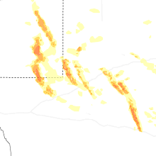

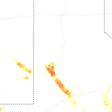
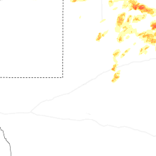
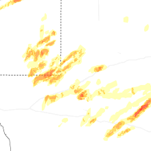

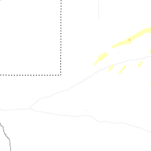


Connect with Interactive Hail Maps