

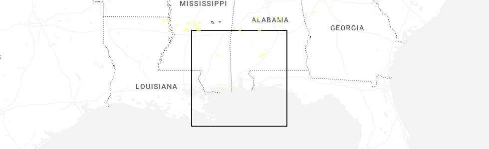
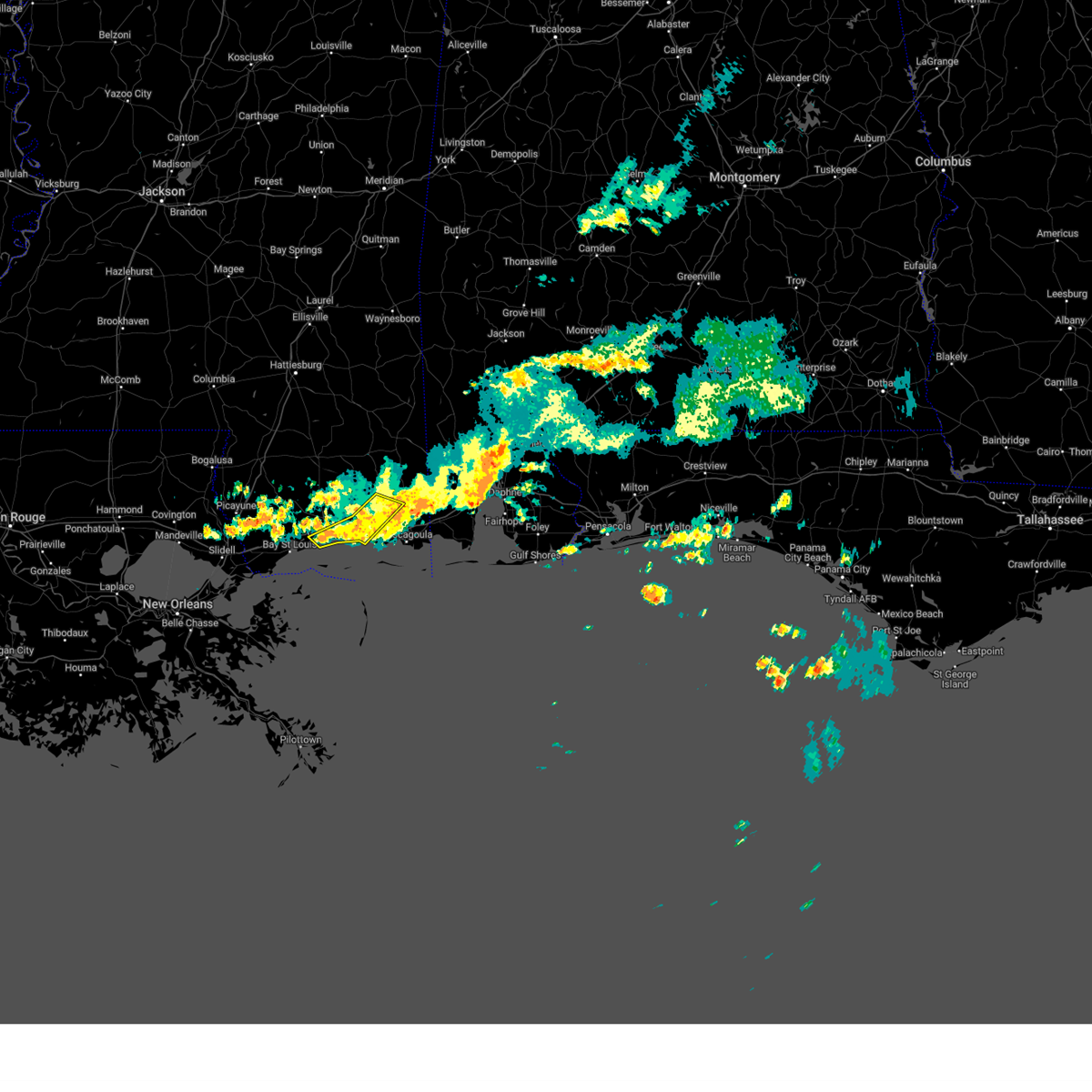
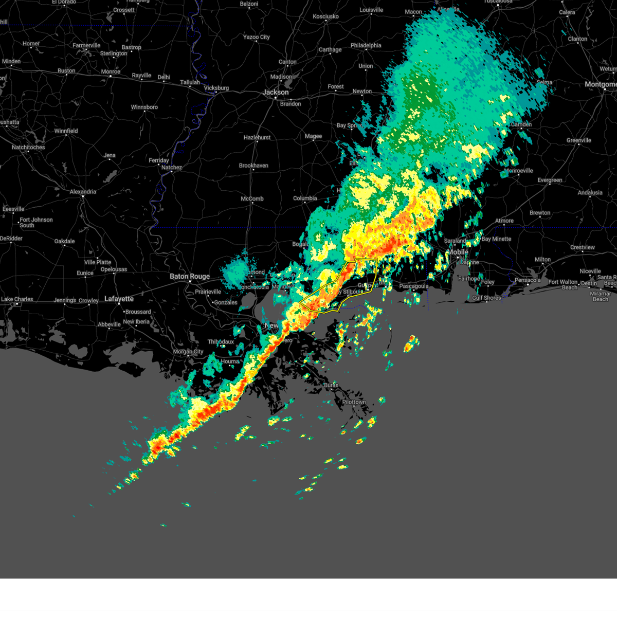
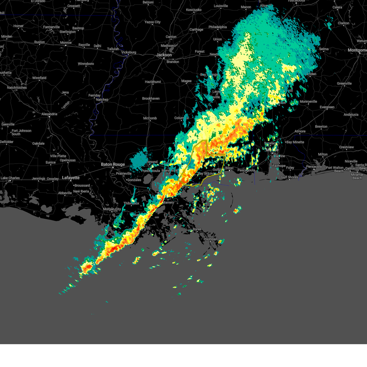
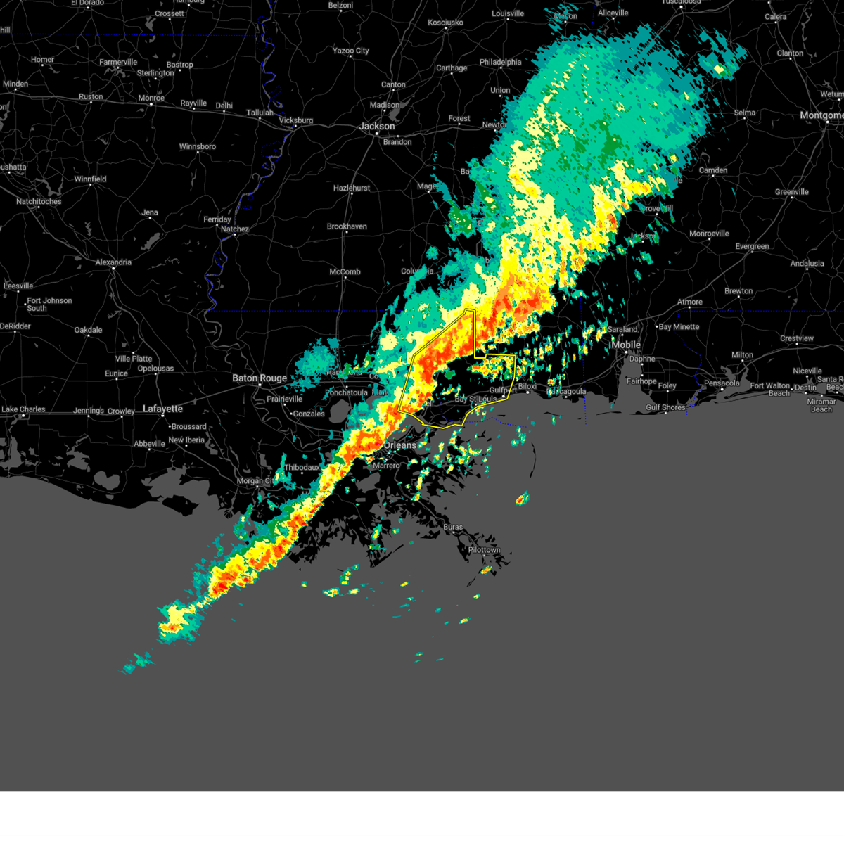
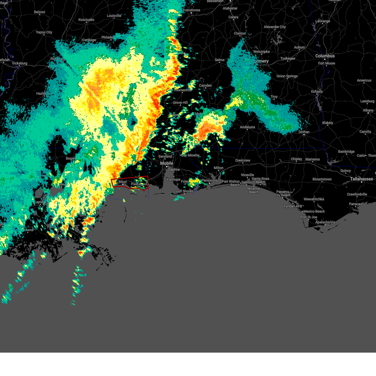
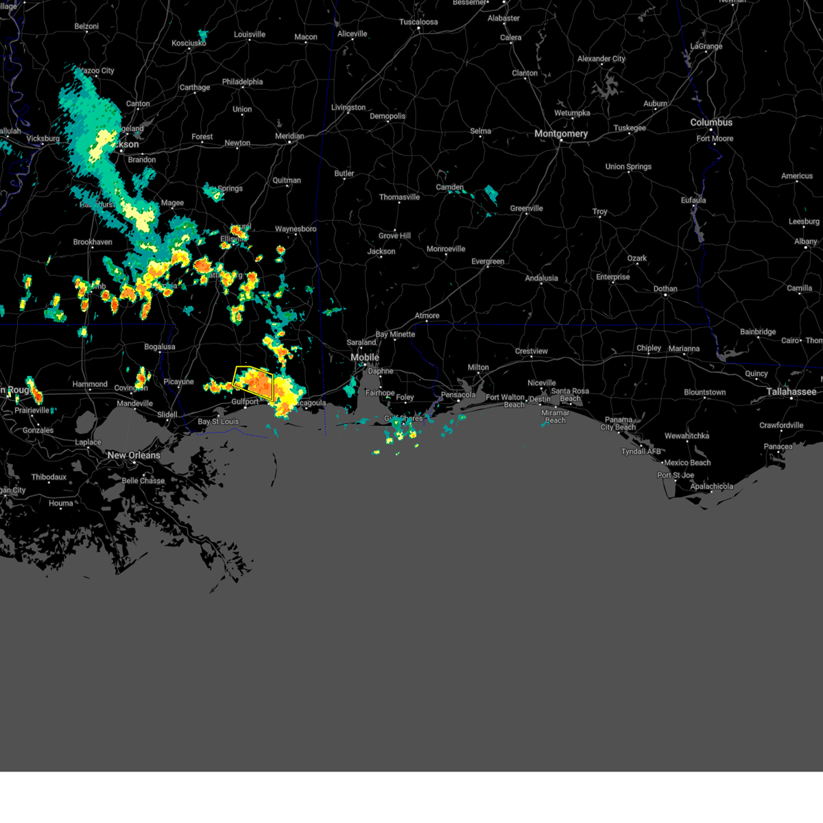
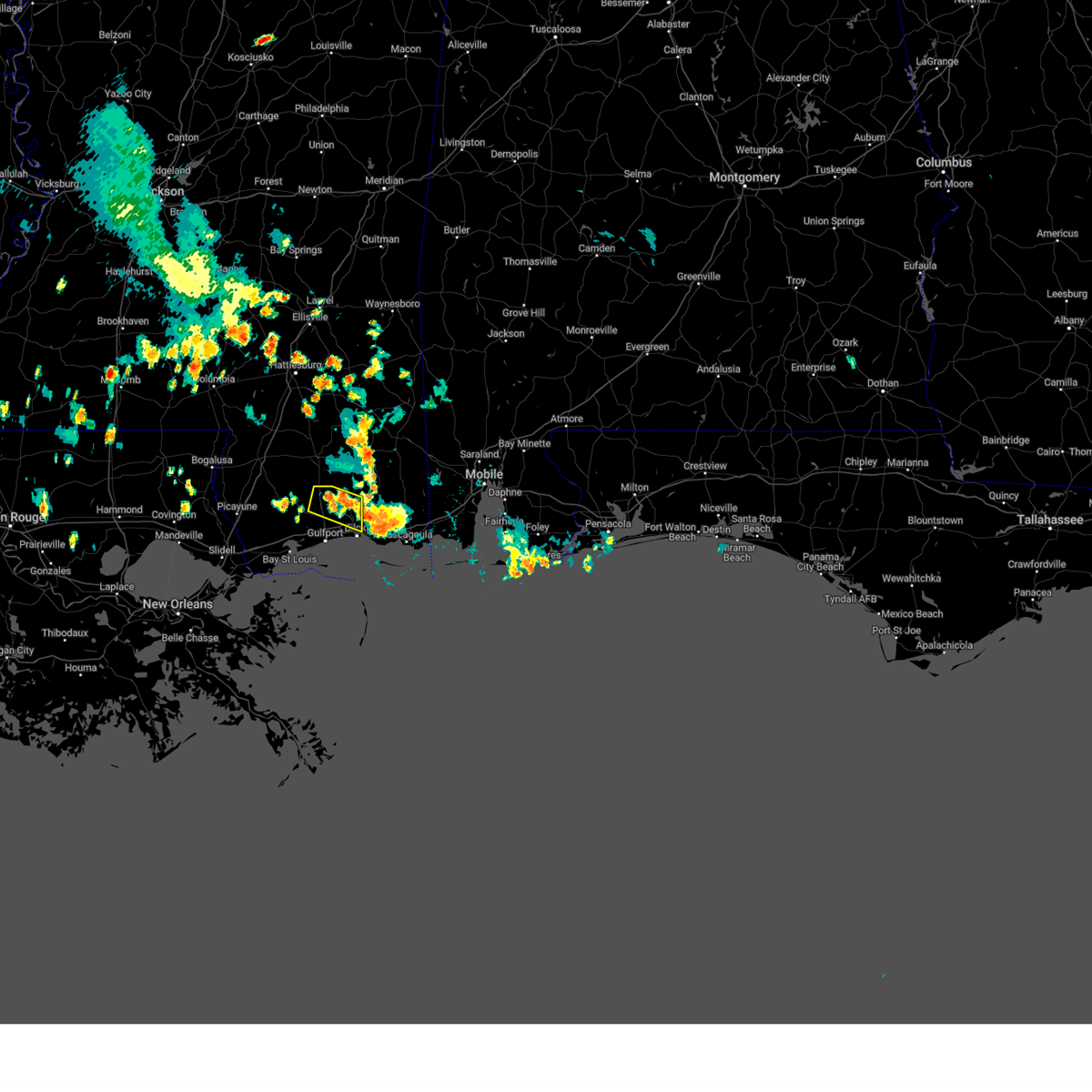
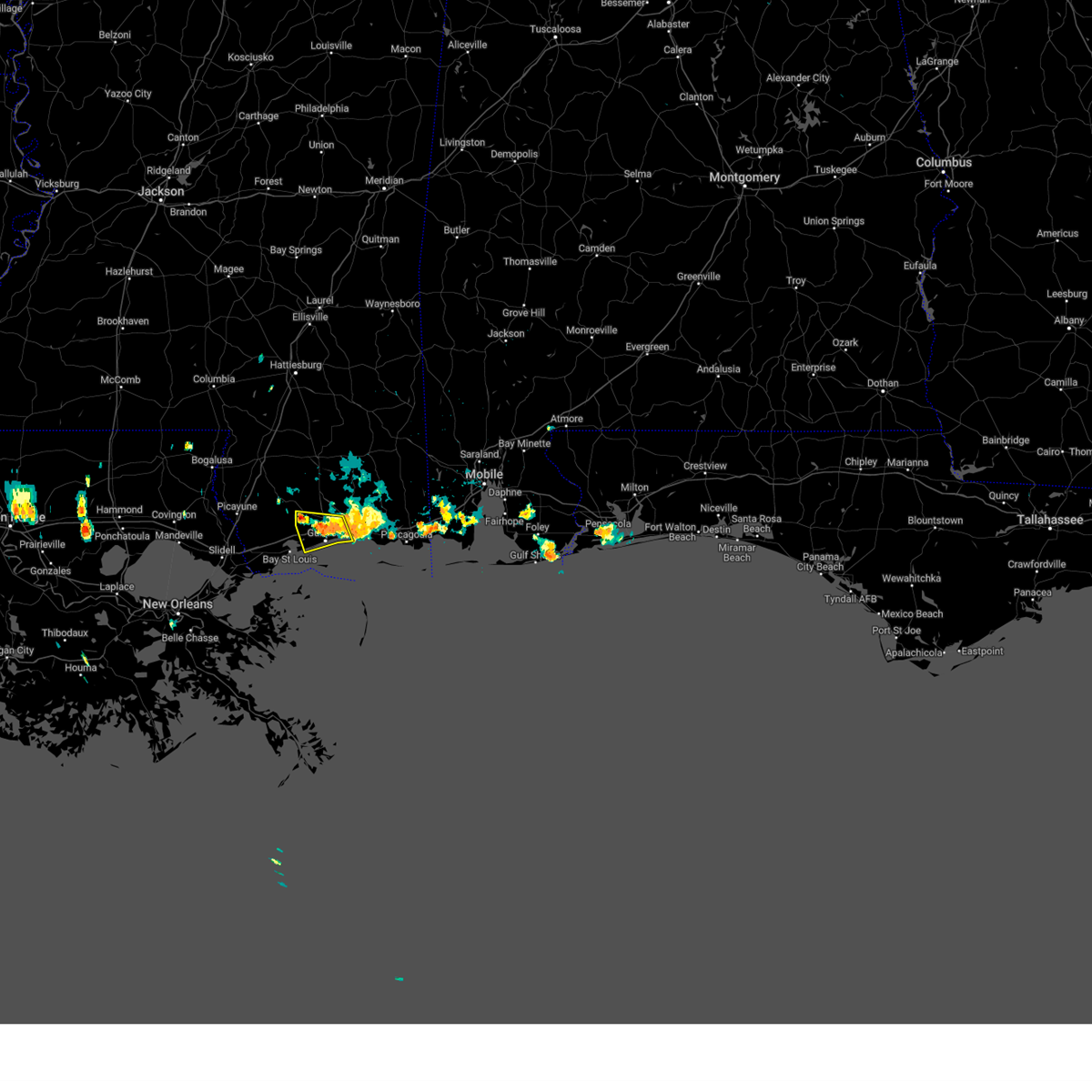
Hail Map for Biloxi, MS
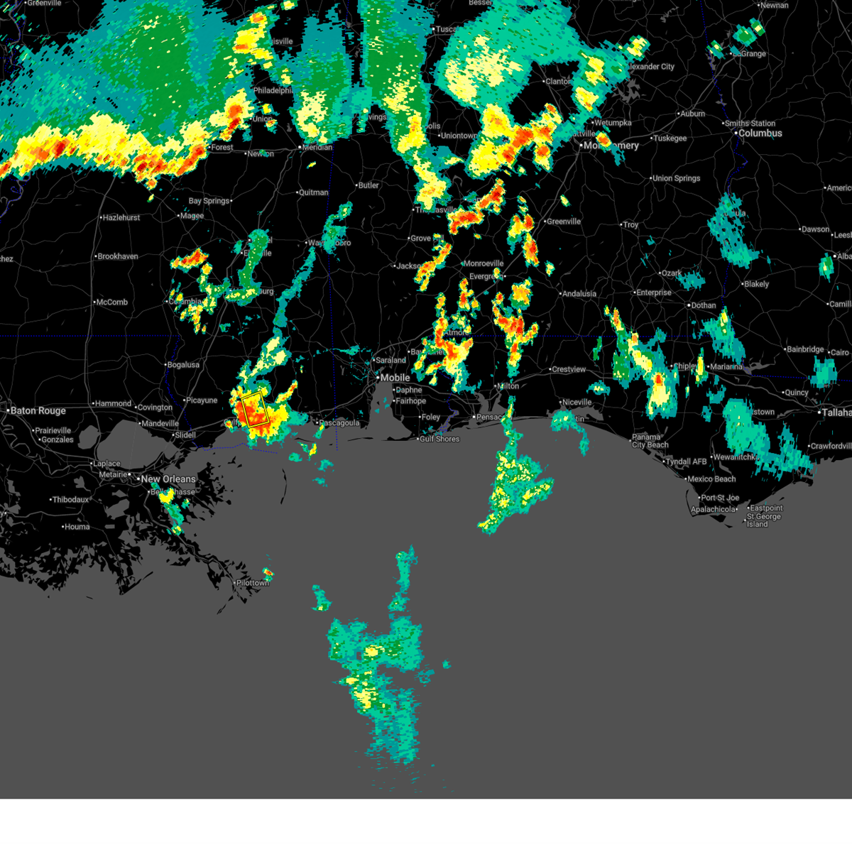
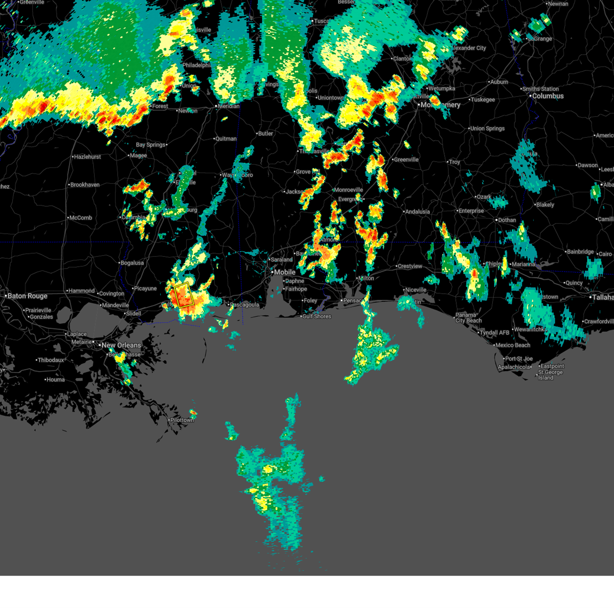
The Biloxi, MS area has had 9 reports of on-the-ground hail by trained spotters, and has been under severe weather warnings 31 times during the past 12 months. Doppler radar has detected hail at or near Biloxi, MS on 58 occasions, including 2 occasions during the past year.
| Name: | Biloxi, MS |
| Where Located: | 56.9 miles WSW of Mobile, AL |
| Map: | Google Map for Biloxi, MS |
| Population: | 44054 |
| Housing Units: | 21278 |
| More Info: | Search Google for Biloxi, MS |
0
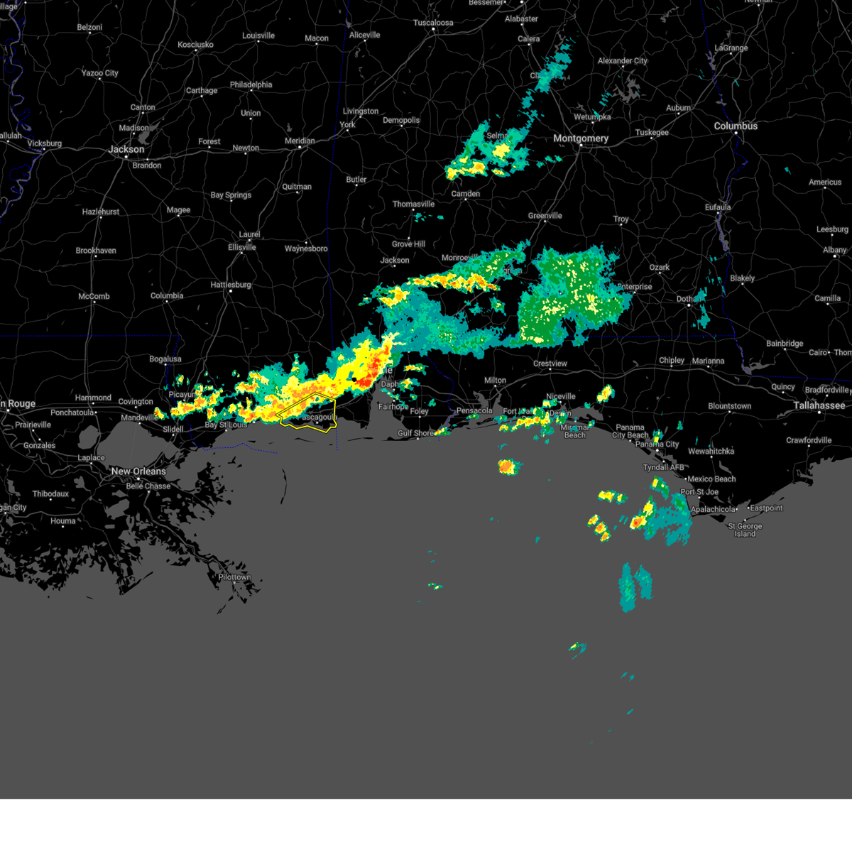
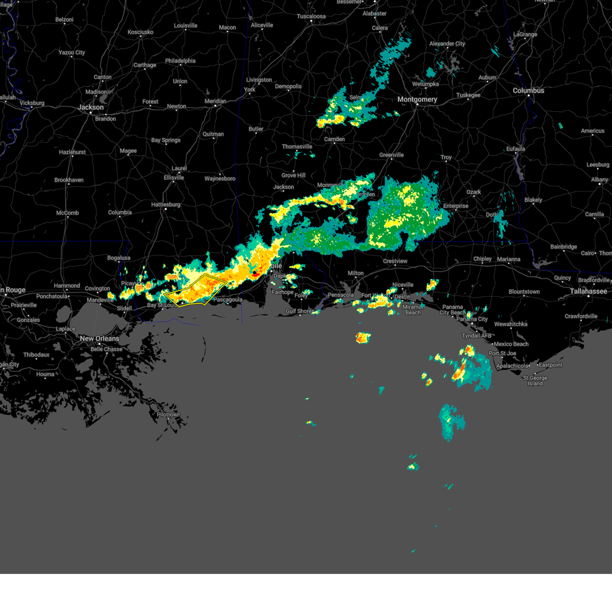
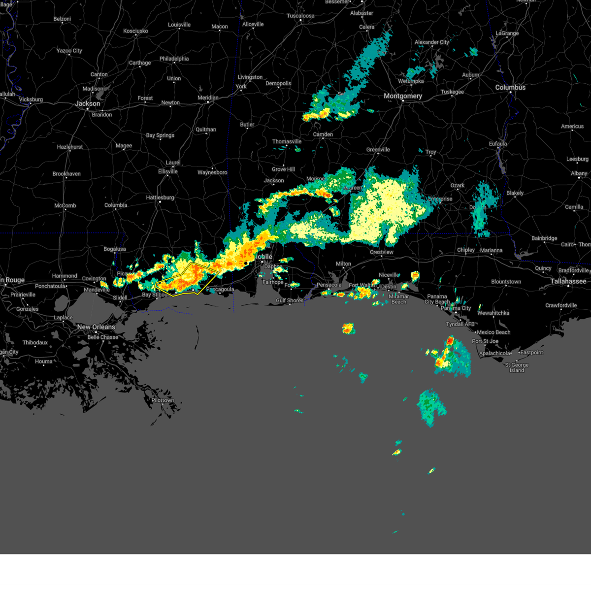
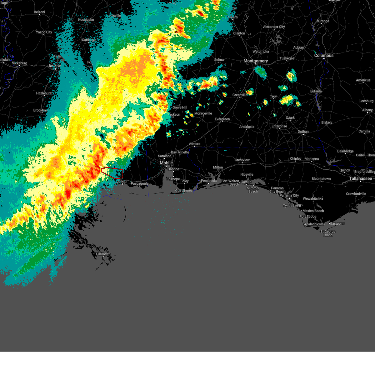
The Top Recent Hail Date for Biloxi, MS is Tuesday, July 1, 2025 (49th out of 58)
Hail and Wind Damage Spotted near Biloxi, MS
| Date / Time | Report Details |
|---|---|
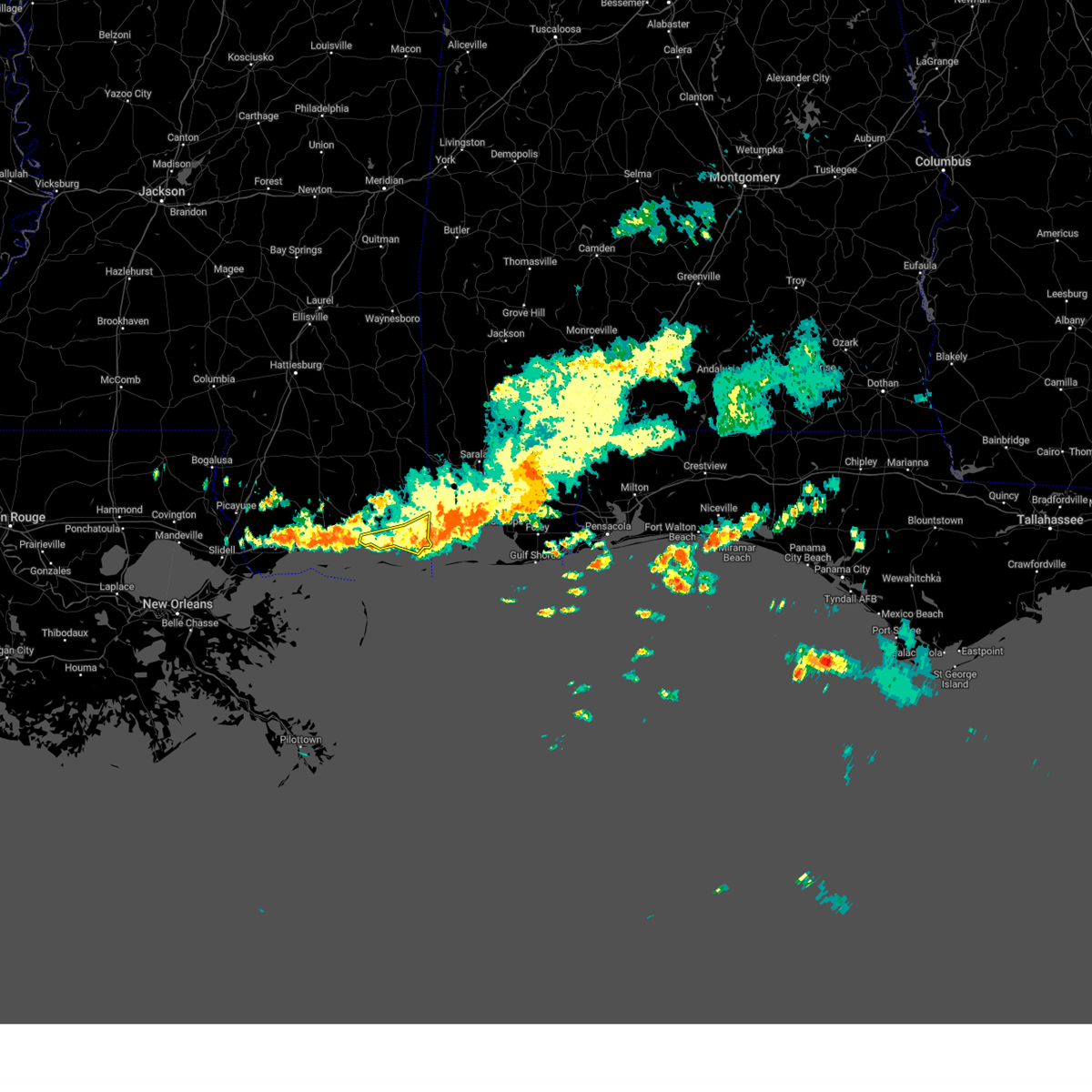
| 7/1/2025 5:16 PM CDT |
 the severe thunderstorm warning has been cancelled and is no longer in effect the severe thunderstorm warning has been cancelled and is no longer in effect
|
| 7/1/2025 5:16 PM CDT |
 At 516 pm cdt, a severe thunderstorm was located over gulfport, moving southeast at 10 mph (radar indicated). Hazards include 70 mph wind gusts and quarter size hail. Hail damage to vehicles is expected. expect considerable tree damage. wind damage is also likely to mobile homes, roofs, and outbuildings. locations impacted include, gulfport, biloxi, long beach, lyman, and gulfport airport. This includes interstate 10 in mississippi between mile markers 30 and 40. At 516 pm cdt, a severe thunderstorm was located over gulfport, moving southeast at 10 mph (radar indicated). Hazards include 70 mph wind gusts and quarter size hail. Hail damage to vehicles is expected. expect considerable tree damage. wind damage is also likely to mobile homes, roofs, and outbuildings. locations impacted include, gulfport, biloxi, long beach, lyman, and gulfport airport. This includes interstate 10 in mississippi between mile markers 30 and 40.
|
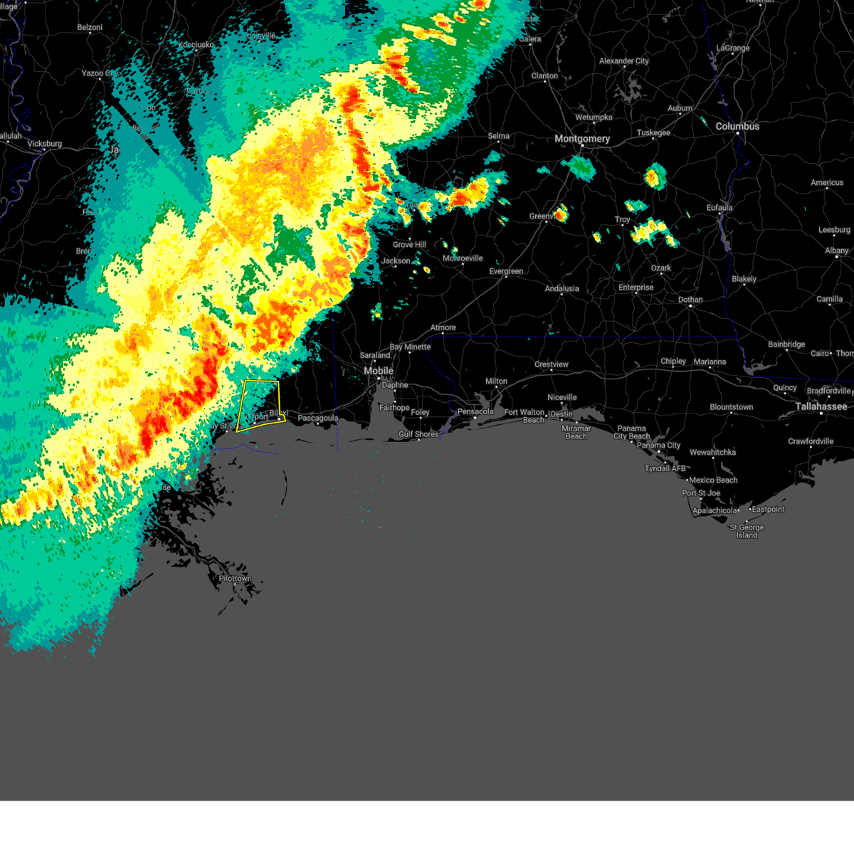
| 7/1/2025 5:03 PM CDT | At 503 pm cdt, a severe thunderstorm was located near gulfport, moving southeast at 10 mph (radar indicated). Hazards include 70 mph wind gusts and quarter size hail. Hail damage to vehicles is expected. expect considerable tree damage. wind damage is also likely to mobile homes, roofs, and outbuildings. locations impacted include, gulfport, biloxi, ocean springs, long beach, st. martin, d'iberville, latimer, gulf hills, lyman, and gulfport airport. this includes the following interstates, interstate 10 in mississippi between mile markers 30 and 51. Interstate 110 in mississippi between mile markers 1 and 4. |
| 7/1/2025 4:52 PM CDT | Svrlix the national weather service in new orleans has issued a * severe thunderstorm warning for, central harrison county in southern mississippi, southwestern jackson county in southern mississippi, * until 530 pm cdt. * at 451 pm cdt, a severe thunderstorm was located near lyman, or near gulfport, moving southeast at 10 mph (radar indicated). Hazards include 60 mph wind gusts and quarter size hail. Hail damage to vehicles is expected. Expect wind damage to roofs, siding, and trees. |
| 7/1/2025 4:40 PM CDT | Large tree branch down near popps ferry roa in harrison county MS, 2.7 miles W of Biloxi, MS |
| 6/9/2025 10:09 PM CDT |
 The storms which prompted the warning have weakened below severe limits, and have exited the warned area. therefore, the warning will be allowed to expire. however, gusty winds and heavy rain are still possible with these thunderstorms. to report severe weather, contact your nearest law enforcement agency. they will relay your report to the national weather service new orleans. The storms which prompted the warning have weakened below severe limits, and have exited the warned area. therefore, the warning will be allowed to expire. however, gusty winds and heavy rain are still possible with these thunderstorms. to report severe weather, contact your nearest law enforcement agency. they will relay your report to the national weather service new orleans.
|
| 6/9/2025 10:04 PM CDT |
 At 1004 pm cdt, severe thunderstorms were located along a line extending from near bayou la batre to 7 miles northwest of petit bois island, moving southeast at 25 mph (radar indicated). Hazards include 60 mph wind gusts. Expect damage to roofs, siding, and trees. locations impacted include, biloxi, ocean springs, moss point, escatawpa, gautier, helena, gulf park estates, and hickory hills. This includes interstate 10 in mississippi between mile markers 60 and 76. At 1004 pm cdt, severe thunderstorms were located along a line extending from near bayou la batre to 7 miles northwest of petit bois island, moving southeast at 25 mph (radar indicated). Hazards include 60 mph wind gusts. Expect damage to roofs, siding, and trees. locations impacted include, biloxi, ocean springs, moss point, escatawpa, gautier, helena, gulf park estates, and hickory hills. This includes interstate 10 in mississippi between mile markers 60 and 76.
|
| 6/9/2025 9:35 PM CDT |
 At 935 pm cdt, severe thunderstorms were located along a line extending from near hickory hills to near biloxi, moving east at 25 mph (radar indicated). Hazards include 60 mph wind gusts. Expect damage to roofs, siding, and trees. locations impacted include, gulfport, biloxi, ocean springs, long beach, st. martin, d'iberville, latimer, gulf hills, vancleave, and gulfport airport. this includes the following interstates, interstate 10 in mississippi between mile markers 33 and 57. Interstate 110 in mississippi between mile markers 1 and 4. At 935 pm cdt, severe thunderstorms were located along a line extending from near hickory hills to near biloxi, moving east at 25 mph (radar indicated). Hazards include 60 mph wind gusts. Expect damage to roofs, siding, and trees. locations impacted include, gulfport, biloxi, ocean springs, long beach, st. martin, d'iberville, latimer, gulf hills, vancleave, and gulfport airport. this includes the following interstates, interstate 10 in mississippi between mile markers 33 and 57. Interstate 110 in mississippi between mile markers 1 and 4.
|
| 6/9/2025 9:28 PM CDT |
 Svrlix the national weather service in new orleans has issued a * severe thunderstorm warning for, southern jackson county in southern mississippi, * until 1015 pm cdt. * at 928 pm cdt, severe thunderstorms were located along a line extending from near helena to near ocean springs, moving southeast at 25 mph (radar indicated). Hazards include 60 mph wind gusts. expect damage to roofs, siding, and trees Svrlix the national weather service in new orleans has issued a * severe thunderstorm warning for, southern jackson county in southern mississippi, * until 1015 pm cdt. * at 928 pm cdt, severe thunderstorms were located along a line extending from near helena to near ocean springs, moving southeast at 25 mph (radar indicated). Hazards include 60 mph wind gusts. expect damage to roofs, siding, and trees
|
| 6/9/2025 9:21 PM CDT |
 At 921 pm cdt, severe thunderstorms were located along a line extending from near vancleave to near gulfport, moving east at 25 mph (radar indicated). Hazards include 60 mph wind gusts. Expect damage to roofs, siding, and trees. locations impacted include, gulfport, biloxi, ocean springs, long beach, st. martin, d'iberville, latimer, gulf hills, vancleave, lyman, and gulfport airport. this includes the following interstates, interstate 10 in mississippi between mile markers 26 and 57. Interstate 110 in mississippi between mile markers 1 and 4. At 921 pm cdt, severe thunderstorms were located along a line extending from near vancleave to near gulfport, moving east at 25 mph (radar indicated). Hazards include 60 mph wind gusts. Expect damage to roofs, siding, and trees. locations impacted include, gulfport, biloxi, ocean springs, long beach, st. martin, d'iberville, latimer, gulf hills, vancleave, lyman, and gulfport airport. this includes the following interstates, interstate 10 in mississippi between mile markers 26 and 57. Interstate 110 in mississippi between mile markers 1 and 4.
|
| 6/9/2025 9:16 PM CDT |
 At 915 pm cdt, severe thunderstorms were located along a line extending from 6 miles west of vancleave to near gulfport, moving east at 40 mph (radar indicated). Hazards include 60 mph wind gusts. Expect damage to roofs, siding, and trees. locations impacted include, gulfport, biloxi, ocean springs, long beach, st. martin, d'iberville, latimer, gulf hills, vancleave, lyman, and gulfport airport. this includes the following interstates, interstate 10 in mississippi between mile markers 22 and 57. Interstate 110 in mississippi between mile markers 1 and 4. At 915 pm cdt, severe thunderstorms were located along a line extending from 6 miles west of vancleave to near gulfport, moving east at 40 mph (radar indicated). Hazards include 60 mph wind gusts. Expect damage to roofs, siding, and trees. locations impacted include, gulfport, biloxi, ocean springs, long beach, st. martin, d'iberville, latimer, gulf hills, vancleave, lyman, and gulfport airport. this includes the following interstates, interstate 10 in mississippi between mile markers 22 and 57. Interstate 110 in mississippi between mile markers 1 and 4.
|
| 6/9/2025 9:16 PM CDT |
 the severe thunderstorm warning has been cancelled and is no longer in effect the severe thunderstorm warning has been cancelled and is no longer in effect
|
| 6/9/2025 9:04 PM CDT |
 At 903 pm cdt, severe thunderstorms were located along a line extending from 8 miles northwest of latimer to near long beach, moving east at 30 mph (radar indicated). Hazards include 60 mph wind gusts and quarter size hail. Hail damage to vehicles is expected. expect wind damage to roofs, siding, and trees. locations impacted include, gulfport, biloxi, ocean springs, long beach, st. martin, d'iberville, saucier, latimer, gulf hills, vancleave, lyman, and gulfport airport. this includes the following interstates, interstate 10 in mississippi between mile markers 21 and 57. Interstate 110 in mississippi between mile markers 1 and 4. At 903 pm cdt, severe thunderstorms were located along a line extending from 8 miles northwest of latimer to near long beach, moving east at 30 mph (radar indicated). Hazards include 60 mph wind gusts and quarter size hail. Hail damage to vehicles is expected. expect wind damage to roofs, siding, and trees. locations impacted include, gulfport, biloxi, ocean springs, long beach, st. martin, d'iberville, saucier, latimer, gulf hills, vancleave, lyman, and gulfport airport. this includes the following interstates, interstate 10 in mississippi between mile markers 21 and 57. Interstate 110 in mississippi between mile markers 1 and 4.
|
| 6/9/2025 9:02 PM CDT |
 At 901 pm cdt, severe thunderstorms were located along a line extending from 8 miles east of saucier to 6 miles northeast of diamondhead, moving east at 25 mph (radar indicated). Hazards include 60 mph wind gusts and quarter size hail. Hail damage to vehicles is expected. expect wind damage to roofs, siding, and trees. locations impacted include, gulfport, biloxi, ocean springs, long beach, st. martin, d'iberville, saucier, latimer, gulf hills, vancleave, lyman, and gulfport airport. this includes the following interstates, interstate 10 in mississippi between mile markers 22 and 57. Interstate 110 in mississippi between mile markers 1 and 4. At 901 pm cdt, severe thunderstorms were located along a line extending from 8 miles east of saucier to 6 miles northeast of diamondhead, moving east at 25 mph (radar indicated). Hazards include 60 mph wind gusts and quarter size hail. Hail damage to vehicles is expected. expect wind damage to roofs, siding, and trees. locations impacted include, gulfport, biloxi, ocean springs, long beach, st. martin, d'iberville, saucier, latimer, gulf hills, vancleave, lyman, and gulfport airport. this includes the following interstates, interstate 10 in mississippi between mile markers 22 and 57. Interstate 110 in mississippi between mile markers 1 and 4.
|
| 6/9/2025 8:54 PM CDT |
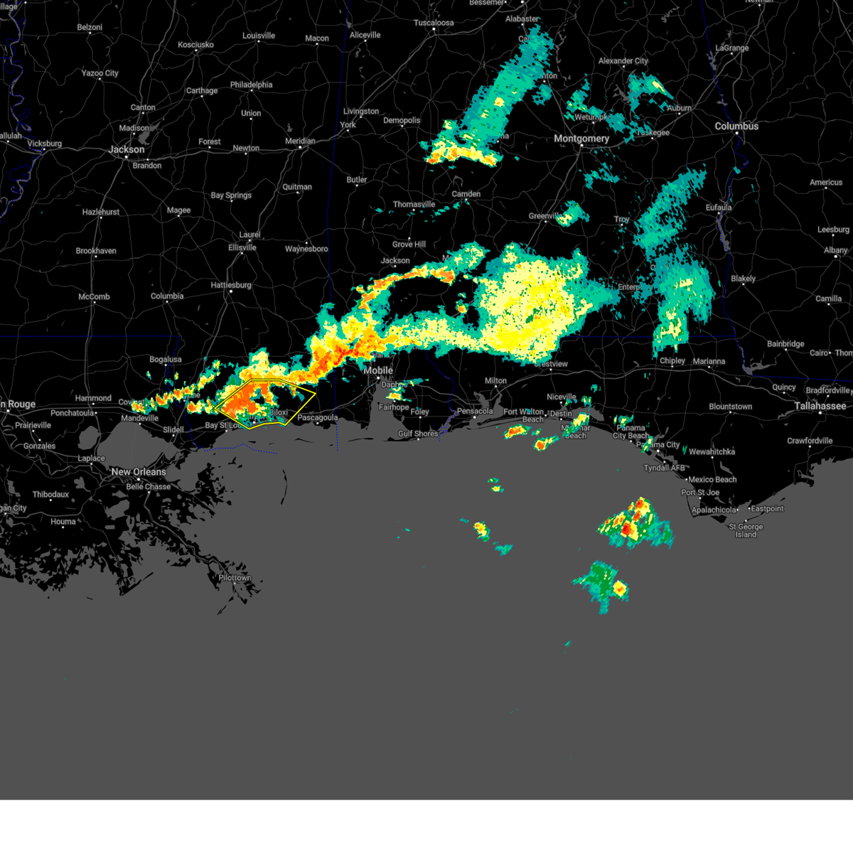 Svrlix the national weather service in new orleans has issued a * severe thunderstorm warning for, harrison county in southern mississippi, east central hancock county in southern mississippi, southwestern jackson county in southern mississippi, * until 945 pm cdt. * at 854 pm cdt, severe thunderstorms were located along a line extending from near saucier to near diamondhead, moving east at 25 mph (radar indicated). Hazards include 60 mph wind gusts. expect damage to roofs, siding, and trees Svrlix the national weather service in new orleans has issued a * severe thunderstorm warning for, harrison county in southern mississippi, east central hancock county in southern mississippi, southwestern jackson county in southern mississippi, * until 945 pm cdt. * at 854 pm cdt, severe thunderstorms were located along a line extending from near saucier to near diamondhead, moving east at 25 mph (radar indicated). Hazards include 60 mph wind gusts. expect damage to roofs, siding, and trees
|
| 3/31/2025 9:08 AM CDT |
 The storm which prompted the warning has weakened below severe limits, and has exited the warned area. therefore, the warning has been allowed to expire. a severe thunderstorm watch remains in effect until 1100 am cdt for southern mississippi. The storm which prompted the warning has weakened below severe limits, and has exited the warned area. therefore, the warning has been allowed to expire. a severe thunderstorm watch remains in effect until 1100 am cdt for southern mississippi.
|
| 3/31/2025 8:32 AM CDT |
 the tornado warning has been cancelled and is no longer in effect the tornado warning has been cancelled and is no longer in effect
|
| 3/31/2025 8:23 AM CDT |
 Torlix the national weather service in new orleans has issued a * tornado warning for, northern harrison county in southern mississippi, * until 900 am cdt. * at 823 am cdt, severe thunderstorms capable of producing both tornadoes and straight line wind damage were located near saucier, or 15 miles south of wiggins, moving east at 45 mph (radar indicated rotation). Hazards include tornado. Flying debris will be dangerous to those caught without shelter. mobile homes will be damaged or destroyed. damage to roofs, windows, and vehicles will occur. tree damage is likely. this dangerous storm will be near, saucier around 830 am cdt. Latimer around 845 am cdt. Torlix the national weather service in new orleans has issued a * tornado warning for, northern harrison county in southern mississippi, * until 900 am cdt. * at 823 am cdt, severe thunderstorms capable of producing both tornadoes and straight line wind damage were located near saucier, or 15 miles south of wiggins, moving east at 45 mph (radar indicated rotation). Hazards include tornado. Flying debris will be dangerous to those caught without shelter. mobile homes will be damaged or destroyed. damage to roofs, windows, and vehicles will occur. tree damage is likely. this dangerous storm will be near, saucier around 830 am cdt. Latimer around 845 am cdt.
|
| 3/31/2025 8:13 AM CDT |
 Svrlix the national weather service in new orleans has issued a * severe thunderstorm warning for, harrison county in southern mississippi, * until 900 am cdt. * at 813 am cdt, a severe thunderstorm was located 10 miles west of saucier, or 14 miles north of diamondhead, moving east at 45 mph (radar indicated). Hazards include 60 mph wind gusts and quarter size hail. Hail damage to vehicles is expected. Expect wind damage to roofs, siding, and trees. Svrlix the national weather service in new orleans has issued a * severe thunderstorm warning for, harrison county in southern mississippi, * until 900 am cdt. * at 813 am cdt, a severe thunderstorm was located 10 miles west of saucier, or 14 miles north of diamondhead, moving east at 45 mph (radar indicated). Hazards include 60 mph wind gusts and quarter size hail. Hail damage to vehicles is expected. Expect wind damage to roofs, siding, and trees.
|
| 3/9/2025 2:45 AM CDT |
 Svrlix the national weather service in new orleans has issued a * severe thunderstorm warning for, southern jackson county in southern mississippi, * until 330 am cdt. * at 145 am cst, a severe thunderstorm was located over ocean springs, moving east at 35 mph (radar indicated). Hazards include 60 mph wind gusts and quarter size hail. Hail damage to vehicles is expected. Expect wind damage to roofs, siding, and trees. Svrlix the national weather service in new orleans has issued a * severe thunderstorm warning for, southern jackson county in southern mississippi, * until 330 am cdt. * at 145 am cst, a severe thunderstorm was located over ocean springs, moving east at 35 mph (radar indicated). Hazards include 60 mph wind gusts and quarter size hail. Hail damage to vehicles is expected. Expect wind damage to roofs, siding, and trees.
|
| 2/16/2025 2:13 AM CST |
 The storms which prompted the warning are moving out of the warned area. therefore, the warning will be allowed to expire. a tornado watch remains in effect until 600 am cst for southern mississippi. The storms which prompted the warning are moving out of the warned area. therefore, the warning will be allowed to expire. a tornado watch remains in effect until 600 am cst for southern mississippi.
|
| 2/16/2025 2:04 AM CST | At 203 am cst, severe thunderstorms were located along a line extending from near lucedale to 8 miles north of latimer to near lyman to near bay st. louis, moving east at 40 mph (radar indicated). Hazards include 60 mph wind gusts. Expect damage to roofs, siding, and trees. locations impacted include, gulfport, biloxi, long beach, saucier, lyman, and gulfport airport. This includes interstate 10 in mississippi between mile markers 19 and 38. |
| 2/16/2025 2:04 AM CST | the severe thunderstorm warning has been cancelled and is no longer in effect |
| 2/16/2025 1:52 AM CST |
 At 152 am cst, severe thunderstorms were located along a line extending from 9 miles southwest of lucedale to 10 miles east of saucier to 7 miles northeast of diamondhead to 6 miles south of pearlington, moving east at 45 mph (radar indicated). Hazards include 60 mph wind gusts. Expect damage to roofs, siding, and trees. locations impacted include, gulfport, biloxi, slidell, long beach, bay st. louis, waveland, diamondhead, kiln, pearlington, lyman, shoreline park, stennis space center, saucier, and gulfport airport. this includes the following interstates, interstate 10 in louisiana between mile markers 259 and 273. interstate 10 in mississippi between mile markers 1 and 38. interstate 12 between mile markers 83 and 84. Interstate 59 in louisiana near mile marker 1. At 152 am cst, severe thunderstorms were located along a line extending from 9 miles southwest of lucedale to 10 miles east of saucier to 7 miles northeast of diamondhead to 6 miles south of pearlington, moving east at 45 mph (radar indicated). Hazards include 60 mph wind gusts. Expect damage to roofs, siding, and trees. locations impacted include, gulfport, biloxi, slidell, long beach, bay st. louis, waveland, diamondhead, kiln, pearlington, lyman, shoreline park, stennis space center, saucier, and gulfport airport. this includes the following interstates, interstate 10 in louisiana between mile markers 259 and 273. interstate 10 in mississippi between mile markers 1 and 38. interstate 12 between mile markers 83 and 84. Interstate 59 in louisiana near mile marker 1.
|
| 2/16/2025 1:52 AM CST |
 the severe thunderstorm warning has been cancelled and is no longer in effect the severe thunderstorm warning has been cancelled and is no longer in effect
|
| 2/16/2025 1:40 AM CST |
 At 139 am cst, severe thunderstorms were located along a line extending from 13 miles east of wiggins to near saucier to 6 miles northwest of kiln to near lake catherine, moving east at 45 mph (radar indicated). Hazards include 60 mph wind gusts. Expect damage to roofs, siding, and trees. locations impacted include, gulfport, biloxi, slidell, long beach, picayune, bay st. louis, waveland, poplarville, diamondhead, pearl river, kiln, pearlington, lyman, shoreline park, stennis space center, saucier, and gulfport airport. this includes the following interstates, interstate 10 in louisiana between mile markers 259 and 273. interstate 10 in mississippi between mile markers 1 and 38. interstate 12 between mile markers 80 and 84. interstate 59 in louisiana between mile markers 1 and 11. Interstate 59 in mississippi between mile markers 1 and 30. At 139 am cst, severe thunderstorms were located along a line extending from 13 miles east of wiggins to near saucier to 6 miles northwest of kiln to near lake catherine, moving east at 45 mph (radar indicated). Hazards include 60 mph wind gusts. Expect damage to roofs, siding, and trees. locations impacted include, gulfport, biloxi, slidell, long beach, picayune, bay st. louis, waveland, poplarville, diamondhead, pearl river, kiln, pearlington, lyman, shoreline park, stennis space center, saucier, and gulfport airport. this includes the following interstates, interstate 10 in louisiana between mile markers 259 and 273. interstate 10 in mississippi between mile markers 1 and 38. interstate 12 between mile markers 80 and 84. interstate 59 in louisiana between mile markers 1 and 11. Interstate 59 in mississippi between mile markers 1 and 30.
|
| 2/16/2025 1:25 AM CST |
 Svrlix the national weather service in new orleans has issued a * severe thunderstorm warning for, northeastern orleans parish in southeastern louisiana, central st. tammany parish in southeastern louisiana, harrison county in southern mississippi, hancock county in southern mississippi, pearl river county in southern mississippi, * until 215 am cst. * at 125 am cst, severe thunderstorms were located along a line extending from 6 miles east of maxie to 10 miles west of mchenry to picayune to near slidell, moving east at 40 mph (radar indicated). Hazards include 60 mph wind gusts. expect damage to roofs, siding, and trees Svrlix the national weather service in new orleans has issued a * severe thunderstorm warning for, northeastern orleans parish in southeastern louisiana, central st. tammany parish in southeastern louisiana, harrison county in southern mississippi, hancock county in southern mississippi, pearl river county in southern mississippi, * until 215 am cst. * at 125 am cst, severe thunderstorms were located along a line extending from 6 miles east of maxie to 10 miles west of mchenry to picayune to near slidell, moving east at 40 mph (radar indicated). Hazards include 60 mph wind gusts. expect damage to roofs, siding, and trees
|
| 12/28/2024 10:28 PM CST | the tornado warning has been cancelled and is no longer in effect |
| 12/28/2024 10:13 PM CST |
 Torlix the national weather service in new orleans has issued a * tornado warning for, southeastern harrison county in southern mississippi, southern jackson county in southern mississippi, * until 1115 pm cst. * at 1012 pm cst, a severe thunderstorm capable of producing a tornado was located near gulfport, moving east at 40 mph (radar indicated rotation). Hazards include tornado. Flying debris will be dangerous to those caught without shelter. mobile homes will be damaged or destroyed. damage to roofs, windows, and vehicles will occur. tree damage is likely. this dangerous storm will be near, biloxi, ocean springs, st. martin, d'iberville, gulf hills, and latimer around 1020 pm cst. gulf park estates around 1030 pm cst. gautier, hickory hills, and vancleave around 1040 pm cst. moss point around 1045 pm cst. escatawpa around 1050 pm cst. helena around 1100 pm cst. other locations impacted by this tornadic thunderstorm include gulfport airport. this includes the following interstates, interstate 10 in mississippi between mile markers 35 and 76. Interstate 110 in mississippi between mile markers 1 and 4. Torlix the national weather service in new orleans has issued a * tornado warning for, southeastern harrison county in southern mississippi, southern jackson county in southern mississippi, * until 1115 pm cst. * at 1012 pm cst, a severe thunderstorm capable of producing a tornado was located near gulfport, moving east at 40 mph (radar indicated rotation). Hazards include tornado. Flying debris will be dangerous to those caught without shelter. mobile homes will be damaged or destroyed. damage to roofs, windows, and vehicles will occur. tree damage is likely. this dangerous storm will be near, biloxi, ocean springs, st. martin, d'iberville, gulf hills, and latimer around 1020 pm cst. gulf park estates around 1030 pm cst. gautier, hickory hills, and vancleave around 1040 pm cst. moss point around 1045 pm cst. escatawpa around 1050 pm cst. helena around 1100 pm cst. other locations impacted by this tornadic thunderstorm include gulfport airport. this includes the following interstates, interstate 10 in mississippi between mile markers 35 and 76. Interstate 110 in mississippi between mile markers 1 and 4.
|
| 8/14/2024 6:10 PM CDT |
 the severe thunderstorm warning has been cancelled and is no longer in effect the severe thunderstorm warning has been cancelled and is no longer in effect
|
| 8/14/2024 5:39 PM CDT |
 Svrlix the national weather service in new orleans has issued a * severe thunderstorm warning for, northeastern harrison county in southern mississippi, west central jackson county in southern mississippi, * until 630 pm cdt. * at 539 pm cdt, severe thunderstorms were located along a line extending from near saucier to 6 miles northwest of latimer, moving south at 5 mph (radar indicated). Hazards include 60 mph wind gusts and nickel size hail. expect damage to roofs, siding, and trees Svrlix the national weather service in new orleans has issued a * severe thunderstorm warning for, northeastern harrison county in southern mississippi, west central jackson county in southern mississippi, * until 630 pm cdt. * at 539 pm cdt, severe thunderstorms were located along a line extending from near saucier to 6 miles northwest of latimer, moving south at 5 mph (radar indicated). Hazards include 60 mph wind gusts and nickel size hail. expect damage to roofs, siding, and trees
|
| 8/13/2024 4:02 PM CDT |
 Svrlix the national weather service in new orleans has issued a * severe thunderstorm warning for, southern harrison county in southern mississippi, * until 445 pm cdt. * at 402 pm cdt, a severe thunderstorm was located over gulfport, moving south at 10 mph (radar and kgpt asos measured peak gust of 61mpph). Hazards include 60 mph wind gusts. expect damage to roofs, siding, and trees Svrlix the national weather service in new orleans has issued a * severe thunderstorm warning for, southern harrison county in southern mississippi, * until 445 pm cdt. * at 402 pm cdt, a severe thunderstorm was located over gulfport, moving south at 10 mph (radar and kgpt asos measured peak gust of 61mpph). Hazards include 60 mph wind gusts. expect damage to roofs, siding, and trees
|
| 6/4/2024 7:13 PM CDT |
 Svrlix the national weather service in new orleans has issued a * severe thunderstorm warning for, harrison county in southern mississippi, jackson county in southern mississippi, * until 800 pm cdt. * at 712 pm cdt, severe thunderstorms were located along a line extending from near mchenry to 7 miles southeast of bay st. louis, moving east at 35 mph (radar indicated). Hazards include 60 mph wind gusts. expect damage to roofs, siding, and trees Svrlix the national weather service in new orleans has issued a * severe thunderstorm warning for, harrison county in southern mississippi, jackson county in southern mississippi, * until 800 pm cdt. * at 712 pm cdt, severe thunderstorms were located along a line extending from near mchenry to 7 miles southeast of bay st. louis, moving east at 35 mph (radar indicated). Hazards include 60 mph wind gusts. expect damage to roofs, siding, and trees
|
| 5/17/2024 1:12 AM CDT |
 At 112 am cdt, severe thunderstorms were located along a line extending from 11 miles north of latimer to 7 miles southwest of gulf park estates, moving east at 40 mph (radar indicated). Hazards include 60 mph wind gusts. Expect damage to roofs, siding, and trees. locations impacted include, biloxi, ocean springs, moss point, st. martin, escatawpa, gautier, d'iberville, latimer, big point, helena, gulf hills, vancleave, gulf park estates, hickory hills, and wade. this includes the following interstates, interstate 10 in mississippi between mile markers 42 and 76. Interstate 110 in mississippi between mile markers 1 and 4. At 112 am cdt, severe thunderstorms were located along a line extending from 11 miles north of latimer to 7 miles southwest of gulf park estates, moving east at 40 mph (radar indicated). Hazards include 60 mph wind gusts. Expect damage to roofs, siding, and trees. locations impacted include, biloxi, ocean springs, moss point, st. martin, escatawpa, gautier, d'iberville, latimer, big point, helena, gulf hills, vancleave, gulf park estates, hickory hills, and wade. this includes the following interstates, interstate 10 in mississippi between mile markers 42 and 76. Interstate 110 in mississippi between mile markers 1 and 4.
|
| 5/17/2024 12:58 AM CDT |
 Svrlix the national weather service in new orleans has issued a * severe thunderstorm warning for, harrison county in southern mississippi, jackson county in southern mississippi, * until 200 am cdt. * at 1257 am cdt, severe thunderstorms were located along a line extending from 7 miles east of saucier to 13 miles south of biloxi, moving east at 40 mph (radar indicated). Hazards include 60 mph wind gusts. expect damage to roofs, siding, and trees Svrlix the national weather service in new orleans has issued a * severe thunderstorm warning for, harrison county in southern mississippi, jackson county in southern mississippi, * until 200 am cdt. * at 1257 am cdt, severe thunderstorms were located along a line extending from 7 miles east of saucier to 13 miles south of biloxi, moving east at 40 mph (radar indicated). Hazards include 60 mph wind gusts. expect damage to roofs, siding, and trees
|
| 5/17/2024 12:54 AM CDT |
 the severe thunderstorm warning has been cancelled and is no longer in effect the severe thunderstorm warning has been cancelled and is no longer in effect
|
| 5/17/2024 12:54 AM CDT |
 At 1254 am cdt, severe thunderstorms were located along a line extending from 9 miles north of latimer to near biloxi, moving east at 50 mph (radar indicated). Hazards include 60 mph wind gusts and penny size hail. Expect damage to roofs, siding, and trees. locations impacted include, gulfport, biloxi, ocean springs, long beach, st. martin, d'iberville, saucier, lyman, latimer, and gulfport airport. this includes the following interstates, interstate 10 in mississippi between mile markers 19 and 47. Interstate 110 in mississippi between mile markers 1 and 4. At 1254 am cdt, severe thunderstorms were located along a line extending from 9 miles north of latimer to near biloxi, moving east at 50 mph (radar indicated). Hazards include 60 mph wind gusts and penny size hail. Expect damage to roofs, siding, and trees. locations impacted include, gulfport, biloxi, ocean springs, long beach, st. martin, d'iberville, saucier, lyman, latimer, and gulfport airport. this includes the following interstates, interstate 10 in mississippi between mile markers 19 and 47. Interstate 110 in mississippi between mile markers 1 and 4.
|
| 5/17/2024 12:37 AM CDT |
 At 1236 am cdt, severe thunderstorms were located along a line extending from near saucier to near long beach, moving east at 50 mph (radar indicated). Hazards include 70 mph wind gusts and penny size hail. Expect considerable tree damage. damage is likely to mobile homes, roofs, and outbuildings. locations impacted include, gulfport, biloxi, ocean springs, long beach, bay st. louis, waveland, diamondhead, st. martin, d'iberville, kiln, lyman, shoreline park, saucier, latimer, and gulfport airport. this includes the following interstates, interstate 10 in mississippi between mile markers 8 and 47. Interstate 110 in mississippi between mile markers 1 and 4. At 1236 am cdt, severe thunderstorms were located along a line extending from near saucier to near long beach, moving east at 50 mph (radar indicated). Hazards include 70 mph wind gusts and penny size hail. Expect considerable tree damage. damage is likely to mobile homes, roofs, and outbuildings. locations impacted include, gulfport, biloxi, ocean springs, long beach, bay st. louis, waveland, diamondhead, st. martin, d'iberville, kiln, lyman, shoreline park, saucier, latimer, and gulfport airport. this includes the following interstates, interstate 10 in mississippi between mile markers 8 and 47. Interstate 110 in mississippi between mile markers 1 and 4.
|
| 5/17/2024 12:37 AM CDT |
 the severe thunderstorm warning has been cancelled and is no longer in effect the severe thunderstorm warning has been cancelled and is no longer in effect
|
| 5/17/2024 12:05 AM CDT |
 Svrlix the national weather service in new orleans has issued a * severe thunderstorm warning for, northeastern orleans parish in southeastern louisiana, southeastern st. tammany parish in southeastern louisiana, harrison county in southern mississippi, hancock county in southern mississippi, southeastern pearl river county in southern mississippi, * until 100 am cdt. * at 1204 am cdt, severe thunderstorms were located along a line extending from near picayune to pearlington, moving east at 50 mph (radar indicated). Hazards include 70 mph wind gusts and penny size hail. Expect considerable tree damage. Damage is likely to mobile homes, roofs, and outbuildings. Svrlix the national weather service in new orleans has issued a * severe thunderstorm warning for, northeastern orleans parish in southeastern louisiana, southeastern st. tammany parish in southeastern louisiana, harrison county in southern mississippi, hancock county in southern mississippi, southeastern pearl river county in southern mississippi, * until 100 am cdt. * at 1204 am cdt, severe thunderstorms were located along a line extending from near picayune to pearlington, moving east at 50 mph (radar indicated). Hazards include 70 mph wind gusts and penny size hail. Expect considerable tree damage. Damage is likely to mobile homes, roofs, and outbuildings.
|
| 5/10/2024 8:57 AM CDT |
 Svrlix the national weather service in new orleans has issued a * severe thunderstorm warning for, east central harrison county in southern mississippi, southern jackson county in southern mississippi, * until 930 am cdt. * at 857 am cdt, a severe thunderstorm was located over st. martin, moving east at 35 mph (radar indicated). Hazards include quarter size hail. damage to vehicles is expected Svrlix the national weather service in new orleans has issued a * severe thunderstorm warning for, east central harrison county in southern mississippi, southern jackson county in southern mississippi, * until 930 am cdt. * at 857 am cdt, a severe thunderstorm was located over st. martin, moving east at 35 mph (radar indicated). Hazards include quarter size hail. damage to vehicles is expected
|
| 4/10/2024 11:06 AM CDT | Report from mping: 1-inch tree limbs broken; shingles blown of in harrison county MS, 1.3 miles SSE of Biloxi, MS |
| 4/10/2024 11:02 AM CDT | Mesonet station xbil bilox in harrison county MS, 1.2 miles NE of Biloxi, MS |
| 4/10/2024 11:02 AM CDT |
 At 1102 am cdt, severe thunderstorms were located along a line extending from 10 miles southwest of mclain to 12 miles east of mchenry to 3 miles north of gulfport to 5 miles east of bay st. louis, moving east at 55 mph (radar indicated). Hazards include 70 mph wind gusts. Expect considerable tree damage. damage is likely to mobile homes, roofs, and outbuildings. locations impacted include, gulfport, biloxi, ocean springs, long beach, bay st. louis, waveland, st. Martin, diamondhead, d'iberville, wade, latimer, lyman, shoreline park, saucier, gulf hills, vancleave, gulf park estates, hickory hills, hurley, and gulfport airport. At 1102 am cdt, severe thunderstorms were located along a line extending from 10 miles southwest of mclain to 12 miles east of mchenry to 3 miles north of gulfport to 5 miles east of bay st. louis, moving east at 55 mph (radar indicated). Hazards include 70 mph wind gusts. Expect considerable tree damage. damage is likely to mobile homes, roofs, and outbuildings. locations impacted include, gulfport, biloxi, ocean springs, long beach, bay st. louis, waveland, st. Martin, diamondhead, d'iberville, wade, latimer, lyman, shoreline park, saucier, gulf hills, vancleave, gulf park estates, hickory hills, hurley, and gulfport airport.
|
| 4/10/2024 11:02 AM CDT |
 the severe thunderstorm warning has been cancelled and is no longer in effect the severe thunderstorm warning has been cancelled and is no longer in effect
|
| 4/10/2024 10:56 AM CDT |
 Torlix the national weather service in new orleans has issued a * tornado warning for, northeastern harrison county in southern mississippi, northwestern jackson county in southern mississippi, * until 1145 am cdt. * at 1056 am cdt, a severe thunderstorm capable of producing a tornado was located 4 miles north of biloxi, moving northeast at 35 mph (radar indicated rotation). Hazards include tornado. Flying debris will be dangerous to those caught without shelter. mobile homes will be damaged or destroyed. damage to roofs, windows, and vehicles will occur. tree damage is likely. This dangerous storm will be near, d'iberville and latimer around 1100 am cdt. Torlix the national weather service in new orleans has issued a * tornado warning for, northeastern harrison county in southern mississippi, northwestern jackson county in southern mississippi, * until 1145 am cdt. * at 1056 am cdt, a severe thunderstorm capable of producing a tornado was located 4 miles north of biloxi, moving northeast at 35 mph (radar indicated rotation). Hazards include tornado. Flying debris will be dangerous to those caught without shelter. mobile homes will be damaged or destroyed. damage to roofs, windows, and vehicles will occur. tree damage is likely. This dangerous storm will be near, d'iberville and latimer around 1100 am cdt.
|
| 4/10/2024 10:53 AM CDT |
 The tornado threat has diminished and the tornado warning has been expired. however, large hail and damaging winds remain likely and a severe thunderstorm warning remains in effect for the area. however, gusty winds are still possible with this thunderstorm. a tornado watch remains in effect until 100 pm cdt for southern mississippi. remember, a severe thunderstorm warning still remains in effect for portions of hancock and harrison counties until 1130 cdt. The tornado threat has diminished and the tornado warning has been expired. however, large hail and damaging winds remain likely and a severe thunderstorm warning remains in effect for the area. however, gusty winds are still possible with this thunderstorm. a tornado watch remains in effect until 100 pm cdt for southern mississippi. remember, a severe thunderstorm warning still remains in effect for portions of hancock and harrison counties until 1130 cdt.
|
| 4/10/2024 10:50 AM CDT | Half Dollar sized hail reported 5.3 miles WNW of Biloxi, MS, half dollar size hail reported in biloxi. |
| 4/10/2024 10:50 AM CDT | Golf Ball sized hail reported 2.1 miles SSE of Biloxi, MS, picture of estimated golf ball sized hail in woolmarket. |
| 4/10/2024 10:48 AM CDT | Half Dollar sized hail reported 3 miles SSE of Biloxi, MS, report from mping: half dollar (1.25 in.). |
| 4/10/2024 10:48 AM CDT |
 the severe thunderstorm warning has been cancelled and is no longer in effect the severe thunderstorm warning has been cancelled and is no longer in effect
|
| 4/10/2024 10:48 AM CDT |
 At 1048 am cdt, severe thunderstorms were located along a line extending from 3 miles east of maxie to near saucier to 6 miles northwest of long beach to 3 miles southwest of waveland, moving east at 55 mph (radar indicated). Hazards include 70 mph wind gusts. Expect considerable tree damage. damage is likely to mobile homes, roofs, and outbuildings. locations impacted include, gulfport, biloxi, ocean springs, long beach, bay st. louis, waveland, st. Martin, diamondhead, d'iberville, wade, latimer, kiln, lyman, shoreline park, saucier, gulf hills, vancleave, gulf park estates, hickory hills, and hurley. At 1048 am cdt, severe thunderstorms were located along a line extending from 3 miles east of maxie to near saucier to 6 miles northwest of long beach to 3 miles southwest of waveland, moving east at 55 mph (radar indicated). Hazards include 70 mph wind gusts. Expect considerable tree damage. damage is likely to mobile homes, roofs, and outbuildings. locations impacted include, gulfport, biloxi, ocean springs, long beach, bay st. louis, waveland, st. Martin, diamondhead, d'iberville, wade, latimer, kiln, lyman, shoreline park, saucier, gulf hills, vancleave, gulf park estates, hickory hills, and hurley.
|
| 4/10/2024 10:41 AM CDT |
 At 1041 am cdt, a severe thunderstorm capable of producing a tornado was located 8 miles northeast of diamondhead, moving east at 65 mph (radar indicated rotation). Hazards include tornado and quarter size hail. Flying debris will be dangerous to those caught without shelter. mobile homes will be damaged or destroyed. damage to roofs, windows, and vehicles will occur. tree damage is likely. this dangerous storm will be near, gulfport and lyman around 1045 am cdt. Other locations impacted by this tornadic thunderstorm include gulfport airport. At 1041 am cdt, a severe thunderstorm capable of producing a tornado was located 8 miles northeast of diamondhead, moving east at 65 mph (radar indicated rotation). Hazards include tornado and quarter size hail. Flying debris will be dangerous to those caught without shelter. mobile homes will be damaged or destroyed. damage to roofs, windows, and vehicles will occur. tree damage is likely. this dangerous storm will be near, gulfport and lyman around 1045 am cdt. Other locations impacted by this tornadic thunderstorm include gulfport airport.
|
| 4/10/2024 10:31 AM CDT |
 Svrlix the national weather service in new orleans has issued a * severe thunderstorm warning for, northeastern orleans parish in southeastern louisiana, southeastern st. tammany parish in southeastern louisiana, harrison county in southern mississippi, hancock county in southern mississippi, western jackson county in southern mississippi, eastern pearl river county in southern mississippi, * until 1130 am cdt. * at 1031 am cdt, severe thunderstorms were located along a line extending from 9 miles southeast of lumberton to 12 miles northeast of kiln to 4 miles northwest of shoreline park to 5 miles southwest of pearlington, moving east at 55 mph (radar indicated). Hazards include 70 mph wind gusts. Expect considerable tree damage. Damage is likely to mobile homes, roofs, and outbuildings. Svrlix the national weather service in new orleans has issued a * severe thunderstorm warning for, northeastern orleans parish in southeastern louisiana, southeastern st. tammany parish in southeastern louisiana, harrison county in southern mississippi, hancock county in southern mississippi, western jackson county in southern mississippi, eastern pearl river county in southern mississippi, * until 1130 am cdt. * at 1031 am cdt, severe thunderstorms were located along a line extending from 9 miles southeast of lumberton to 12 miles northeast of kiln to 4 miles northwest of shoreline park to 5 miles southwest of pearlington, moving east at 55 mph (radar indicated). Hazards include 70 mph wind gusts. Expect considerable tree damage. Damage is likely to mobile homes, roofs, and outbuildings.
|
| 4/10/2024 10:26 AM CDT |
 At 1025 am cdt, a confirmed tornado was located near stennis space center, or 10 miles west of diamondhead, moving northeast at 40 mph (radar confirmed tornado). Hazards include damaging tornado and quarter size hail. Flying debris will be dangerous to those caught without shelter. mobile homes will be damaged or destroyed. damage to roofs, windows, and vehicles will occur. tree damage is likely. this tornado will be near, kiln around 1030 am cdt. diamondhead around 1035 am cdt. lyman around 1055 am cdt. gulfport around 1100 am cdt. Other locations impacted by this tornadic thunderstorm include gulfport airport. At 1025 am cdt, a confirmed tornado was located near stennis space center, or 10 miles west of diamondhead, moving northeast at 40 mph (radar confirmed tornado). Hazards include damaging tornado and quarter size hail. Flying debris will be dangerous to those caught without shelter. mobile homes will be damaged or destroyed. damage to roofs, windows, and vehicles will occur. tree damage is likely. this tornado will be near, kiln around 1030 am cdt. diamondhead around 1035 am cdt. lyman around 1055 am cdt. gulfport around 1100 am cdt. Other locations impacted by this tornadic thunderstorm include gulfport airport.
|
| 4/10/2024 10:26 AM CDT |
 the tornado warning has been cancelled and is no longer in effect the tornado warning has been cancelled and is no longer in effect
|
| 4/10/2024 10:08 AM CDT |
 Torlix the national weather service in new orleans has issued a * tornado warning for, southeastern st. tammany parish in southeastern louisiana, southwestern harrison county in southern mississippi, southern hancock county in southern mississippi, * until 1100 am cdt. * at 1008 am cdt, a severe thunderstorm capable of producing a tornado was located 4 miles east of slidell, moving east at 65 mph (radar indicated rotation). Hazards include tornado and quarter size hail. Flying debris will be dangerous to those caught without shelter. mobile homes will be damaged or destroyed. damage to roofs, windows, and vehicles will occur. tree damage is likely. this dangerous storm will be near, pearlington around 1015 am cdt. diamondhead, shoreline park, and kiln around 1020 am cdt. bay st. louis around 1025 am cdt. long beach around 1035 am cdt. gulfport and lyman around 1040 am cdt. Other locations impacted by this tornadic thunderstorm include gulfport airport. Torlix the national weather service in new orleans has issued a * tornado warning for, southeastern st. tammany parish in southeastern louisiana, southwestern harrison county in southern mississippi, southern hancock county in southern mississippi, * until 1100 am cdt. * at 1008 am cdt, a severe thunderstorm capable of producing a tornado was located 4 miles east of slidell, moving east at 65 mph (radar indicated rotation). Hazards include tornado and quarter size hail. Flying debris will be dangerous to those caught without shelter. mobile homes will be damaged or destroyed. damage to roofs, windows, and vehicles will occur. tree damage is likely. this dangerous storm will be near, pearlington around 1015 am cdt. diamondhead, shoreline park, and kiln around 1020 am cdt. bay st. louis around 1025 am cdt. long beach around 1035 am cdt. gulfport and lyman around 1040 am cdt. Other locations impacted by this tornadic thunderstorm include gulfport airport.
|
| 2/3/2024 9:59 PM CST |
 At 958 pm cst, severe thunderstorms located along a line extending from 14 miles east of perkinston to 23 miles southwest of petit bois island, moving northeast at 30 mph (asos confirmed. at 930pm cst, a 59mph wind gust was reported at kgpt). Hazards include 60 mph wind gusts. Expect damage to roofs, siding, and trees. locations impacted include, biloxi, ocean springs, moss point, st. martin, escatawpa, gautier, d`iberville, wade, latimer, big point, helena, gulf hills, hurley, vancleave, gulf park estates, and hickory hills. this includes interstate 10 in mississippi between mile markers 47 and 76. hail threat, radar indicated max hail size, <. 75 in wind threat, observed max wind gust, 60 mph. At 958 pm cst, severe thunderstorms located along a line extending from 14 miles east of perkinston to 23 miles southwest of petit bois island, moving northeast at 30 mph (asos confirmed. at 930pm cst, a 59mph wind gust was reported at kgpt). Hazards include 60 mph wind gusts. Expect damage to roofs, siding, and trees. locations impacted include, biloxi, ocean springs, moss point, st. martin, escatawpa, gautier, d`iberville, wade, latimer, big point, helena, gulf hills, hurley, vancleave, gulf park estates, and hickory hills. this includes interstate 10 in mississippi between mile markers 47 and 76. hail threat, radar indicated max hail size, <. 75 in wind threat, observed max wind gust, 60 mph.
|
| 2/3/2024 9:41 PM CST |
 At 941 pm cst, severe thunderstorms were located along a line extending from 9 miles east of mchenry to 30 miles southwest of petit bois island, moving northeast at 30 mph (asos confirmed. at 930pm cst, a 59mph wind gust was reported at kgpt). Hazards include 60 mph wind gusts. expect damage to roofs, siding, and trees At 941 pm cst, severe thunderstorms were located along a line extending from 9 miles east of mchenry to 30 miles southwest of petit bois island, moving northeast at 30 mph (asos confirmed. at 930pm cst, a 59mph wind gust was reported at kgpt). Hazards include 60 mph wind gusts. expect damage to roofs, siding, and trees
|
| 1/9/2024 12:29 AM CST |
 At 1229 am cst, a severe thunderstorm capable of producing a tornado was located over biloxi, moving northeast at 80 mph (radar indicated rotation). Hazards include tornado. Flying debris will be dangerous to those caught without shelter. mobile homes will be damaged or destroyed. damage to roofs, windows, and vehicles will occur. tree damage is likely. this dangerous storm will be near, latimer around 1235 am cst. this includes the following interstates, interstate 10 in mississippi between mile markers 36 and 49. Interstate 110 in mississippi between mile markers 1 and 4. At 1229 am cst, a severe thunderstorm capable of producing a tornado was located over biloxi, moving northeast at 80 mph (radar indicated rotation). Hazards include tornado. Flying debris will be dangerous to those caught without shelter. mobile homes will be damaged or destroyed. damage to roofs, windows, and vehicles will occur. tree damage is likely. this dangerous storm will be near, latimer around 1235 am cst. this includes the following interstates, interstate 10 in mississippi between mile markers 36 and 49. Interstate 110 in mississippi between mile markers 1 and 4.
|
| 9/7/2023 3:15 PM CDT | Power lines own near intersection of porter ave and judge sekul av in harrison county MS, 4.8 miles NW of Biloxi, MS |
| 9/7/2023 3:05 PM CDT |
 At 305 pm cdt, a severe thunderstorm was located over gulfport, moving south at 35 mph (radar indicated). Hazards include 60 mph wind gusts. expect damage to roofs, siding, and trees At 305 pm cdt, a severe thunderstorm was located over gulfport, moving south at 35 mph (radar indicated). Hazards include 60 mph wind gusts. expect damage to roofs, siding, and trees
|
| 9/7/2023 3:01 PM CDT | Awos station kbix biloxi keesle in harrison county MS, 3.1 miles WNW of Biloxi, MS |
| 8/27/2023 5:11 PM CDT |
 At 511 pm cdt, severe thunderstorms were located along a line extending from near gulfport to diamondhead, moving south at 5 mph (radar indicated). Hazards include 60 mph wind gusts and half dollar size hail. Hail damage to vehicles is expected. expect wind damage to roofs, siding, and trees. locations impacted include, gulfport, long beach, bay st. louis, waveland, diamondhead, lyman, kiln, shoreline park, and gulfport airport. this includes interstate 10 in mississippi between mile markers 14 and 38. hail threat, radar indicated max hail size, 1. 25 in wind threat, radar indicated max wind gust, 60 mph. At 511 pm cdt, severe thunderstorms were located along a line extending from near gulfport to diamondhead, moving south at 5 mph (radar indicated). Hazards include 60 mph wind gusts and half dollar size hail. Hail damage to vehicles is expected. expect wind damage to roofs, siding, and trees. locations impacted include, gulfport, long beach, bay st. louis, waveland, diamondhead, lyman, kiln, shoreline park, and gulfport airport. this includes interstate 10 in mississippi between mile markers 14 and 38. hail threat, radar indicated max hail size, 1. 25 in wind threat, radar indicated max wind gust, 60 mph.
|
| 8/27/2023 4:52 PM CDT |
 At 452 pm cdt, severe thunderstorms were located along a line extending from near gulfport to near diamondhead, moving south at 5 mph (radar indicated). Hazards include 60 mph wind gusts and quarter size hail. Hail damage to vehicles is expected. Expect wind damage to roofs, siding, and trees. At 452 pm cdt, severe thunderstorms were located along a line extending from near gulfport to near diamondhead, moving south at 5 mph (radar indicated). Hazards include 60 mph wind gusts and quarter size hail. Hail damage to vehicles is expected. Expect wind damage to roofs, siding, and trees.
|
| 8/15/2023 4:37 PM CDT |
 At 437 pm cdt, a severe thunderstorm was located near saucier, or 11 miles northwest of gulfport, moving south at 15 mph (radar indicated). Hazards include 60 mph wind gusts. expect damage to roofs, siding, and trees At 437 pm cdt, a severe thunderstorm was located near saucier, or 11 miles northwest of gulfport, moving south at 15 mph (radar indicated). Hazards include 60 mph wind gusts. expect damage to roofs, siding, and trees
|
| 7/22/2023 6:15 PM CDT |
 At 614 pm cdt, a severe thunderstorm was located near biloxi, moving east at 15 mph (radar indicated). Hazards include 60 mph wind gusts. Expect damage to roofs, siding, and trees. locations impacted include, gulfport, biloxi, ocean springs, st. martin, d`iberville, gulf park estates and gulf hills. this includes the following interstates, interstate 10 in mississippi near mile marker 39. interstate 110 in mississippi between mile markers 1 and 3. hail threat, radar indicated max hail size, <. 75 in wind threat, radar indicated max wind gust, 60 mph. At 614 pm cdt, a severe thunderstorm was located near biloxi, moving east at 15 mph (radar indicated). Hazards include 60 mph wind gusts. Expect damage to roofs, siding, and trees. locations impacted include, gulfport, biloxi, ocean springs, st. martin, d`iberville, gulf park estates and gulf hills. this includes the following interstates, interstate 10 in mississippi near mile marker 39. interstate 110 in mississippi between mile markers 1 and 3. hail threat, radar indicated max hail size, <. 75 in wind threat, radar indicated max wind gust, 60 mph.
|
| 7/22/2023 5:58 PM CDT |
 At 558 pm cdt, a severe thunderstorm was located over gulfport, moving east at 15 mph (radar indicated). Hazards include 60 mph wind gusts and penny size hail. expect damage to roofs, siding, and trees At 558 pm cdt, a severe thunderstorm was located over gulfport, moving east at 15 mph (radar indicated). Hazards include 60 mph wind gusts and penny size hail. expect damage to roofs, siding, and trees
|
| 6/20/2023 1:03 PM CDT |
 At 103 pm cdt, a severe thunderstorm was located over diamondhead, moving southeast at 45 mph (radar indicated). Hazards include 70 mph wind gusts and quarter size hail. Hail damage to vehicles is expected. expect considerable tree damage. Wind damage is also likely to mobile homes, roofs, and outbuildings. At 103 pm cdt, a severe thunderstorm was located over diamondhead, moving southeast at 45 mph (radar indicated). Hazards include 70 mph wind gusts and quarter size hail. Hail damage to vehicles is expected. expect considerable tree damage. Wind damage is also likely to mobile homes, roofs, and outbuildings.
|
| 6/20/2023 12:57 PM CDT |
 At 1256 pm cdt, a severe thunderstorm was located over kiln, or near diamondhead, moving southeast at 45 mph (radar indicated). Hazards include 60 mph wind gusts and quarter size hail. Hail damage to vehicles is expected. Expect wind damage to roofs, siding, and trees. At 1256 pm cdt, a severe thunderstorm was located over kiln, or near diamondhead, moving southeast at 45 mph (radar indicated). Hazards include 60 mph wind gusts and quarter size hail. Hail damage to vehicles is expected. Expect wind damage to roofs, siding, and trees.
|
| 6/20/2023 12:23 PM CDT |
 At 1223 pm cdt, a severe thunderstorm was located 8 miles southwest of lyman, or 8 miles northeast of diamondhead, moving southeast at 25 mph (radar indicated). Hazards include 60 mph wind gusts and quarter size hail. Hail damage to vehicles is expected. Expect wind damage to roofs, siding, and trees. At 1223 pm cdt, a severe thunderstorm was located 8 miles southwest of lyman, or 8 miles northeast of diamondhead, moving southeast at 25 mph (radar indicated). Hazards include 60 mph wind gusts and quarter size hail. Hail damage to vehicles is expected. Expect wind damage to roofs, siding, and trees.
|
| 6/19/2023 6:37 PM CDT |
 At 636 pm cdt, a severe thunderstorm was located over gulfport, and is nearly stationary (radar indicated). Hazards include 60 mph wind gusts and quarter size hail. Hail damage to vehicles is expected. Expect wind damage to roofs, siding, and trees. At 636 pm cdt, a severe thunderstorm was located over gulfport, and is nearly stationary (radar indicated). Hazards include 60 mph wind gusts and quarter size hail. Hail damage to vehicles is expected. Expect wind damage to roofs, siding, and trees.
|
| 6/19/2023 6:00 PM CDT |
 At 600 pm cdt, a severe thunderstorm was located over gulfport, moving southeast at 30 mph (radar indicated). Hazards include 60 mph wind gusts and quarter size hail. Hail damage to vehicles is expected. Expect wind damage to roofs, siding, and trees. At 600 pm cdt, a severe thunderstorm was located over gulfport, moving southeast at 30 mph (radar indicated). Hazards include 60 mph wind gusts and quarter size hail. Hail damage to vehicles is expected. Expect wind damage to roofs, siding, and trees.
|
| 6/19/2023 4:24 PM CDT |
 The severe thunderstorm warning for jackson county will expire at 430 pm cdt, the storms which prompted the warning have weakened below severe limits, and have exited the warned area. therefore, the warning will be allowed to expire. The severe thunderstorm warning for jackson county will expire at 430 pm cdt, the storms which prompted the warning have weakened below severe limits, and have exited the warned area. therefore, the warning will be allowed to expire.
|
| 6/19/2023 3:28 PM CDT |
 At 327 pm cdt, severe thunderstorms were located along a line extending from vancleave to near gautier, moving east at 25 mph (radar indicated). Hazards include 60 mph wind gusts and quarter size hail. Hail damage to vehicles is expected. Expect wind damage to roofs, siding, and trees. At 327 pm cdt, severe thunderstorms were located along a line extending from vancleave to near gautier, moving east at 25 mph (radar indicated). Hazards include 60 mph wind gusts and quarter size hail. Hail damage to vehicles is expected. Expect wind damage to roofs, siding, and trees.
|
| 6/19/2023 7:33 AM CDT |
 At 732 am cdt, a severe thunderstorm was located near mchenry, or 14 miles southeast of wiggins, moving southeast at 20 mph (radar indicated). Hazards include ping pong ball size hail and 60 mph wind gusts. People and animals outdoors will be injured. expect hail damage to roofs, siding, windows, and vehicles. Expect wind damage to roofs, siding, and trees. At 732 am cdt, a severe thunderstorm was located near mchenry, or 14 miles southeast of wiggins, moving southeast at 20 mph (radar indicated). Hazards include ping pong ball size hail and 60 mph wind gusts. People and animals outdoors will be injured. expect hail damage to roofs, siding, windows, and vehicles. Expect wind damage to roofs, siding, and trees.
|
| 6/17/2023 5:13 PM CDT |
 At 512 pm cdt, a severe thunderstorm was located near wade, or 12 miles northwest of escatawpa, moving south at 40 mph (radar indicated). Hazards include 60 mph wind gusts and quarter size hail. Hail damage to vehicles is expected. expect wind damage to roofs, siding, and trees. locations impacted include, biloxi, ocean springs, moss point, st. martin, escatawpa, gautier, wade, latimer, big point, helena, gulf hills, hurley, vancleave, gulf park estates and hickory hills. this includes interstate 10 in mississippi between mile markers 49 and 76. earlier storm produced hail up to the size of golf balls. hail threat, radar indicated max hail size, 1. 00 in wind threat, radar indicated max wind gust, 60 mph. At 512 pm cdt, a severe thunderstorm was located near wade, or 12 miles northwest of escatawpa, moving south at 40 mph (radar indicated). Hazards include 60 mph wind gusts and quarter size hail. Hail damage to vehicles is expected. expect wind damage to roofs, siding, and trees. locations impacted include, biloxi, ocean springs, moss point, st. martin, escatawpa, gautier, wade, latimer, big point, helena, gulf hills, hurley, vancleave, gulf park estates and hickory hills. this includes interstate 10 in mississippi between mile markers 49 and 76. earlier storm produced hail up to the size of golf balls. hail threat, radar indicated max hail size, 1. 00 in wind threat, radar indicated max wind gust, 60 mph.
|
| 6/17/2023 4:58 PM CDT |
 At 456 pm cdt, a severe thunderstorm was located near lucedale, moving south at 35 mph (radar indicated). Hazards include 60 mph wind gusts and half dollar size hail. Hail damage to vehicles is expected. Expect wind damage to roofs, siding, and trees. At 456 pm cdt, a severe thunderstorm was located near lucedale, moving south at 35 mph (radar indicated). Hazards include 60 mph wind gusts and half dollar size hail. Hail damage to vehicles is expected. Expect wind damage to roofs, siding, and trees.
|
| 6/16/2023 9:14 PM CDT |
 At 913 pm cdt, a severe thunderstorm was located 11 miles east of mchenry, or 16 miles southeast of wiggins, moving south at 5 mph (radar indicated). Hazards include 60 mph wind gusts and quarter size hail. Hail damage to vehicles is expected. Expect wind damage to roofs, siding, and trees. At 913 pm cdt, a severe thunderstorm was located 11 miles east of mchenry, or 16 miles southeast of wiggins, moving south at 5 mph (radar indicated). Hazards include 60 mph wind gusts and quarter size hail. Hail damage to vehicles is expected. Expect wind damage to roofs, siding, and trees.
|
| 6/8/2023 3:05 PM CDT |
 At 305 pm cdt, a severe thunderstorm was located over gulfport, and is nearly stationary (radar indicated). Hazards include 60 mph wind gusts and half dollar size hail. Hail damage to vehicles is expected. expect wind damage to roofs, siding, and trees. locations impacted include, gulfport, biloxi, long beach, lyman and gulfport airport. this includes interstate 10 in mississippi between mile markers 28 and 38. hail threat, radar indicated max hail size, 1. 25 in wind threat, radar indicated max wind gust, 60 mph. At 305 pm cdt, a severe thunderstorm was located over gulfport, and is nearly stationary (radar indicated). Hazards include 60 mph wind gusts and half dollar size hail. Hail damage to vehicles is expected. expect wind damage to roofs, siding, and trees. locations impacted include, gulfport, biloxi, long beach, lyman and gulfport airport. this includes interstate 10 in mississippi between mile markers 28 and 38. hail threat, radar indicated max hail size, 1. 25 in wind threat, radar indicated max wind gust, 60 mph.
|
| 6/8/2023 2:52 PM CDT |
 At 252 pm cdt, a severe thunderstorm was located over gulfport, and is nearly stationary (radar indicated). Hazards include 60 mph wind gusts and quarter size hail. Hail damage to vehicles is expected. Expect wind damage to roofs, siding, and trees. At 252 pm cdt, a severe thunderstorm was located over gulfport, and is nearly stationary (radar indicated). Hazards include 60 mph wind gusts and quarter size hail. Hail damage to vehicles is expected. Expect wind damage to roofs, siding, and trees.
|
| 5/6/2023 10:56 AM CDT |
 The severe thunderstorm warning for harrison, northeastern hancock and western jackson counties will expire at 1100 am cdt, the storms which prompted the warning have weakened below severe limits, and have exited the warned area. therefore, the warning will be allowed to expire. however gusty winds are still possible with these thunderstorms. to report severe weather, contact your nearest law enforcement agency. they will relay your report to the national weather service new orleans. The severe thunderstorm warning for harrison, northeastern hancock and western jackson counties will expire at 1100 am cdt, the storms which prompted the warning have weakened below severe limits, and have exited the warned area. therefore, the warning will be allowed to expire. however gusty winds are still possible with these thunderstorms. to report severe weather, contact your nearest law enforcement agency. they will relay your report to the national weather service new orleans.
|
| 5/6/2023 10:13 AM CDT |
 At 1013 am cdt, severe thunderstorms were located along a line extending from 10 miles west of saucier to near bay st. louis, moving east at 35 mph (radar indicated). Hazards include 60 mph wind gusts. expect damage to roofs, siding, and trees At 1013 am cdt, severe thunderstorms were located along a line extending from 10 miles west of saucier to near bay st. louis, moving east at 35 mph (radar indicated). Hazards include 60 mph wind gusts. expect damage to roofs, siding, and trees
|
| 4/15/2023 2:28 PM CDT |
 At 228 pm cdt, severe thunderstorms were located along a line extending from near hurley to gulf park estates, moving east at 55 mph (radar indicated). Hazards include 60 mph wind gusts and penny size hail. Expect damage to roofs, siding, and trees. locations impacted include, biloxi, ocean springs, moss point, st. martin, escatawpa, gautier, d`iberville, wade, big point, helena, gulf hills, hurley, vancleave, gulf park estates, hickory hills and latimer. This includes interstate 10 in mississippi between mile markers 49 and 76. At 228 pm cdt, severe thunderstorms were located along a line extending from near hurley to gulf park estates, moving east at 55 mph (radar indicated). Hazards include 60 mph wind gusts and penny size hail. Expect damage to roofs, siding, and trees. locations impacted include, biloxi, ocean springs, moss point, st. martin, escatawpa, gautier, d`iberville, wade, big point, helena, gulf hills, hurley, vancleave, gulf park estates, hickory hills and latimer. This includes interstate 10 in mississippi between mile markers 49 and 76.
|
| 4/15/2023 2:17 PM CDT | Large tree limb on shed shared via social media. time estimated by rada in harrison county MS, 2.1 miles W of Biloxi, MS |
| 4/15/2023 2:12 PM CDT | 1-inch tree limbs broken and shingles blown of in harrison county MS, 2.9 miles SE of Biloxi, MS |
| 4/15/2023 2:12 PM CDT |
 At 212 pm cdt, severe thunderstorms were located along a line extending from 12 miles north of vancleave to near biloxi, moving east at 55 mph (radar indicated). Hazards include 60 mph wind gusts and penny size hail. expect damage to roofs, siding, and trees At 212 pm cdt, severe thunderstorms were located along a line extending from 12 miles north of vancleave to near biloxi, moving east at 55 mph (radar indicated). Hazards include 60 mph wind gusts and penny size hail. expect damage to roofs, siding, and trees
|
| 4/15/2023 1:55 PM CDT |
 At 155 pm cdt, severe thunderstorms were located along a line extending from 6 miles northwest of long beach to 10 miles southwest of waveland, moving east at 40 mph (radar indicated). Hazards include 60 mph wind gusts. Expect damage to roofs, siding, and trees. locations impacted include, gulfport, biloxi, long beach, bay st. louis, waveland, diamondhead, d`iberville, saucier, lyman, shoreline park, kiln and gulfport airport. this includes interstate 10 in mississippi between mile markers 12 and 46. hail threat, radar indicated max hail size, <. 75 in wind threat, radar indicated max wind gust, 60 mph. At 155 pm cdt, severe thunderstorms were located along a line extending from 6 miles northwest of long beach to 10 miles southwest of waveland, moving east at 40 mph (radar indicated). Hazards include 60 mph wind gusts. Expect damage to roofs, siding, and trees. locations impacted include, gulfport, biloxi, long beach, bay st. louis, waveland, diamondhead, d`iberville, saucier, lyman, shoreline park, kiln and gulfport airport. this includes interstate 10 in mississippi between mile markers 12 and 46. hail threat, radar indicated max hail size, <. 75 in wind threat, radar indicated max wind gust, 60 mph.
|
| 4/15/2023 1:48 PM CDT |
 At 147 pm cdt, severe thunderstorms were located along a line extending from 6 miles northeast of diamondhead to 7 miles southeast of pearlington, moving east at 40 mph (radar indicated). Hazards include 60 mph wind gusts. Expect damage to roofs, siding, and trees. locations impacted include, new orleans, gulfport, biloxi, long beach, bay st. louis, waveland, diamondhead, d`iberville, lake catherine, violet, kiln, pearlington, lyman, shoreline park, saucier and gulfport airport. this includes interstate 10 in mississippi between mile markers 6 and 46. hail threat, radar indicated max hail size, <. 75 in wind threat, radar indicated max wind gust, 60 mph. At 147 pm cdt, severe thunderstorms were located along a line extending from 6 miles northeast of diamondhead to 7 miles southeast of pearlington, moving east at 40 mph (radar indicated). Hazards include 60 mph wind gusts. Expect damage to roofs, siding, and trees. locations impacted include, new orleans, gulfport, biloxi, long beach, bay st. louis, waveland, diamondhead, d`iberville, lake catherine, violet, kiln, pearlington, lyman, shoreline park, saucier and gulfport airport. this includes interstate 10 in mississippi between mile markers 6 and 46. hail threat, radar indicated max hail size, <. 75 in wind threat, radar indicated max wind gust, 60 mph.
|
| 4/15/2023 1:38 PM CDT |
 At 133 pm cdt, severe thunderstorms were located along a line extending from near kiln to near lake catherine, moving east at 40 mph (radar indicated). Hazards include 60 mph wind gusts. expect damage to roofs, siding, and trees At 133 pm cdt, severe thunderstorms were located along a line extending from near kiln to near lake catherine, moving east at 40 mph (radar indicated). Hazards include 60 mph wind gusts. expect damage to roofs, siding, and trees
|
| 3/27/2023 11:55 AM CDT |
 At 1155 am cdt, a severe thunderstorm was located over latimer, or over st. martin, moving east at 30 mph (radar indicated). Hazards include 60 mph wind gusts and quarter size hail. Hail damage to vehicles is expected. expect wind damage to roofs, siding, and trees. locations impacted include, biloxi, ocean springs, moss point, st. martin, gautier, d`iberville, latimer, gulf hills, vancleave, hickory hills and gulf park estates. this includes the following interstates, interstate 10 in mississippi between mile markers 43 and 66. interstate 110 in mississippi between mile markers 1 and 4. hail threat, radar indicated max hail size, 1. 00 in wind threat, radar indicated max wind gust, 60 mph. At 1155 am cdt, a severe thunderstorm was located over latimer, or over st. martin, moving east at 30 mph (radar indicated). Hazards include 60 mph wind gusts and quarter size hail. Hail damage to vehicles is expected. expect wind damage to roofs, siding, and trees. locations impacted include, biloxi, ocean springs, moss point, st. martin, gautier, d`iberville, latimer, gulf hills, vancleave, hickory hills and gulf park estates. this includes the following interstates, interstate 10 in mississippi between mile markers 43 and 66. interstate 110 in mississippi between mile markers 1 and 4. hail threat, radar indicated max hail size, 1. 00 in wind threat, radar indicated max wind gust, 60 mph.
|
| 3/27/2023 11:34 AM CDT |
 At 1133 am cdt, a severe thunderstorm was located near gulfport, moving east at 30 mph (radar indicated). Hazards include 60 mph wind gusts and quarter size hail. Hail damage to vehicles is expected. Expect wind damage to roofs, siding, and trees. At 1133 am cdt, a severe thunderstorm was located near gulfport, moving east at 30 mph (radar indicated). Hazards include 60 mph wind gusts and quarter size hail. Hail damage to vehicles is expected. Expect wind damage to roofs, siding, and trees.
|
| 3/27/2023 9:14 AM CDT |
 At 914 am cdt, a severe thunderstorm was located near latimer, or 7 miles north of st. martin, moving east at 25 mph (radar indicated). Hazards include 60 mph wind gusts and half dollar size hail. Hail damage to vehicles is expected. expect wind damage to roofs, siding, and trees. locations impacted include, biloxi, vancleave and latimer. hail threat, radar indicated max hail size, 1. 25 in wind threat, radar indicated max wind gust, 60 mph. At 914 am cdt, a severe thunderstorm was located near latimer, or 7 miles north of st. martin, moving east at 25 mph (radar indicated). Hazards include 60 mph wind gusts and half dollar size hail. Hail damage to vehicles is expected. expect wind damage to roofs, siding, and trees. locations impacted include, biloxi, vancleave and latimer. hail threat, radar indicated max hail size, 1. 25 in wind threat, radar indicated max wind gust, 60 mph.
|
| 3/27/2023 8:53 AM CDT |
 At 853 am cdt, a severe thunderstorm was located near lyman, or 8 miles north of gulfport, moving east at 25 mph (radar indicated). Hazards include golf ball size hail and 60 mph wind gusts. People and animals outdoors will be injured. expect hail damage to roofs, siding, windows, and vehicles. expect wind damage to roofs, siding, and trees. locations impacted include, gulfport, biloxi, vancleave and latimer. thunderstorm damage threat, considerable hail threat, radar indicated max hail size, 1. 75 in wind threat, radar indicated max wind gust, 60 mph. At 853 am cdt, a severe thunderstorm was located near lyman, or 8 miles north of gulfport, moving east at 25 mph (radar indicated). Hazards include golf ball size hail and 60 mph wind gusts. People and animals outdoors will be injured. expect hail damage to roofs, siding, windows, and vehicles. expect wind damage to roofs, siding, and trees. locations impacted include, gulfport, biloxi, vancleave and latimer. thunderstorm damage threat, considerable hail threat, radar indicated max hail size, 1. 75 in wind threat, radar indicated max wind gust, 60 mph.
|
| 3/27/2023 8:42 AM CDT |
 At 842 am cdt, a severe thunderstorm was located near lyman, or 8 miles north of gulfport, moving east at 25 mph (radar indicated). Hazards include 60 mph wind gusts and quarter size hail. Hail damage to vehicles is expected. Expect wind damage to roofs, siding, and trees. At 842 am cdt, a severe thunderstorm was located near lyman, or 8 miles north of gulfport, moving east at 25 mph (radar indicated). Hazards include 60 mph wind gusts and quarter size hail. Hail damage to vehicles is expected. Expect wind damage to roofs, siding, and trees.
|
| 3/12/2023 9:58 PM CDT |
 At 957 pm cdt, a severe thunderstorm was located near latimer, or 10 miles north of st. martin, moving northeast at 40 mph (radar indicated). Hazards include ping pong ball size hail. People and animals outdoors will be injured. Expect damage to roofs, siding, windows, and vehicles. At 957 pm cdt, a severe thunderstorm was located near latimer, or 10 miles north of st. martin, moving northeast at 40 mph (radar indicated). Hazards include ping pong ball size hail. People and animals outdoors will be injured. Expect damage to roofs, siding, windows, and vehicles.
|
| 3/12/2023 9:43 PM CDT |
 At 943 pm cdt, a severe thunderstorm was located over lyman, or 7 miles north of gulfport, moving east at 55 mph (radar indicated). Hazards include golf ball size hail. People and animals outdoors will be injured. expect damage to roofs, siding, windows, and vehicles. locations impacted include, gulfport, biloxi, d`iberville, latimer, vancleave, lyman and saucier. this includes interstate 10 in mississippi between mile markers 33 and 43. thunderstorm damage threat, considerable hail threat, radar indicated max hail size, 1. 75 in wind threat, radar indicated max wind gust, <50 mph. At 943 pm cdt, a severe thunderstorm was located over lyman, or 7 miles north of gulfport, moving east at 55 mph (radar indicated). Hazards include golf ball size hail. People and animals outdoors will be injured. expect damage to roofs, siding, windows, and vehicles. locations impacted include, gulfport, biloxi, d`iberville, latimer, vancleave, lyman and saucier. this includes interstate 10 in mississippi between mile markers 33 and 43. thunderstorm damage threat, considerable hail threat, radar indicated max hail size, 1. 75 in wind threat, radar indicated max wind gust, <50 mph.
|
| 3/12/2023 9:31 PM CDT |
 At 931 pm cdt, a severe thunderstorm was located near lyman, or 8 miles northwest of gulfport, moving east at 55 mph (radar indicated). Hazards include golf ball size hail. People and animals outdoors will be injured. expect damage to roofs, siding, windows, and vehicles. locations impacted include, gulfport, biloxi, ocean springs, long beach, st. martin, diamondhead, d`iberville, latimer, lyman, gulf hills, vancleave, hickory hills, saucier and gulfport airport. this includes the following interstates, interstate 10 in mississippi between mile markers 16 and 59. interstate 110 in mississippi between mile markers 2 and 4. thunderstorm damage threat, considerable hail threat, radar indicated max hail size, 1. 75 in wind threat, radar indicated max wind gust, <50 mph. At 931 pm cdt, a severe thunderstorm was located near lyman, or 8 miles northwest of gulfport, moving east at 55 mph (radar indicated). Hazards include golf ball size hail. People and animals outdoors will be injured. expect damage to roofs, siding, windows, and vehicles. locations impacted include, gulfport, biloxi, ocean springs, long beach, st. martin, diamondhead, d`iberville, latimer, lyman, gulf hills, vancleave, hickory hills, saucier and gulfport airport. this includes the following interstates, interstate 10 in mississippi between mile markers 16 and 59. interstate 110 in mississippi between mile markers 2 and 4. thunderstorm damage threat, considerable hail threat, radar indicated max hail size, 1. 75 in wind threat, radar indicated max wind gust, <50 mph.
|
| 3/12/2023 9:19 PM CDT |
 At 919 pm cdt, a severe thunderstorm was located near kiln, or near diamondhead, moving east at 55 mph (radar indicated). Hazards include quarter size hail. damage to vehicles is expected At 919 pm cdt, a severe thunderstorm was located near kiln, or near diamondhead, moving east at 55 mph (radar indicated). Hazards include quarter size hail. damage to vehicles is expected
|
| 1/25/2023 12:36 AM CST |
 The severe thunderstorm warning for eastern harrison and southwestern jackson counties will expire at 1245 am cst, the storm which prompted the warning has weakened below severe limits, and no longer poses an immediate threat to life or property. therefore, the warning will be allowed to expire. however gusty winds are still possible with this thunderstorm. a tornado watch remains in effect until 500 am cst for southern mississippi. The severe thunderstorm warning for eastern harrison and southwestern jackson counties will expire at 1245 am cst, the storm which prompted the warning has weakened below severe limits, and no longer poses an immediate threat to life or property. therefore, the warning will be allowed to expire. however gusty winds are still possible with this thunderstorm. a tornado watch remains in effect until 500 am cst for southern mississippi.
|
| 1/25/2023 12:29 AM CST |
 At 1229 am cst, a severe thunderstorm was located near lyman, or near gulfport, moving northeast at 35 mph (radar indicated). Hazards include 60 mph wind gusts and penny size hail. Expect damage to roofs, siding, and trees. locations impacted include, gulfport, biloxi, ocean springs, st. martin, d`iberville, latimer, gulf hills, lyman, gulf park estates and gulfport airport. this includes the following interstates, interstate 10 in mississippi between mile markers 33 and 54. Interstate 110 in mississippi between mile markers 1 and 4. At 1229 am cst, a severe thunderstorm was located near lyman, or near gulfport, moving northeast at 35 mph (radar indicated). Hazards include 60 mph wind gusts and penny size hail. Expect damage to roofs, siding, and trees. locations impacted include, gulfport, biloxi, ocean springs, st. martin, d`iberville, latimer, gulf hills, lyman, gulf park estates and gulfport airport. this includes the following interstates, interstate 10 in mississippi between mile markers 33 and 54. Interstate 110 in mississippi between mile markers 1 and 4.
|
| 1/25/2023 12:11 AM CST |
 At 1211 am cst, a severe thunderstorm was located near diamondhead, moving northeast at 35 mph (radar indicated). Hazards include 60 mph wind gusts and penny size hail. Expect damage to roofs, siding, and trees. locations impacted include, gulfport, biloxi, ocean springs, long beach, st. martin, d`iberville, latimer, gulf hills, lyman, gulf park estates and gulfport airport. this includes the following interstates, interstate 10 in mississippi between mile markers 19 and 54. Interstate 110 in mississippi between mile markers 1 and 4. At 1211 am cst, a severe thunderstorm was located near diamondhead, moving northeast at 35 mph (radar indicated). Hazards include 60 mph wind gusts and penny size hail. Expect damage to roofs, siding, and trees. locations impacted include, gulfport, biloxi, ocean springs, long beach, st. martin, d`iberville, latimer, gulf hills, lyman, gulf park estates and gulfport airport. this includes the following interstates, interstate 10 in mississippi between mile markers 19 and 54. Interstate 110 in mississippi between mile markers 1 and 4.
|
| 1/25/2023 12:06 AM CST |
 At 1206 am cst, a severe thunderstorm was located over diamondhead, moving northeast at 35 mph (radar indicated). Hazards include 60 mph wind gusts and penny size hail. expect damage to roofs, siding, and trees At 1206 am cst, a severe thunderstorm was located over diamondhead, moving northeast at 35 mph (radar indicated). Hazards include 60 mph wind gusts and penny size hail. expect damage to roofs, siding, and trees
|
| 12/30/2022 10:51 AM CST |
 At 1050 am cst, a severe thunderstorm was located near big point, or 11 miles northwest of grand bay, moving east at 45 mph (radar indicated). Hazards include 60 mph wind gusts. Expect damage to roofs, siding, and trees. locations impacted include, biloxi, ocean springs, moss point, escatawpa, st. martin, gautier, wade, big point, helena, gulf hills, hurley, vancleave, gulf park estates and hickory hills. this includes interstate 10 in mississippi between mile markers 51 and 76. hail threat, radar indicated max hail size, <. 75 in wind threat, radar indicated max wind gust, 60 mph. At 1050 am cst, a severe thunderstorm was located near big point, or 11 miles northwest of grand bay, moving east at 45 mph (radar indicated). Hazards include 60 mph wind gusts. Expect damage to roofs, siding, and trees. locations impacted include, biloxi, ocean springs, moss point, escatawpa, st. martin, gautier, wade, big point, helena, gulf hills, hurley, vancleave, gulf park estates and hickory hills. this includes interstate 10 in mississippi between mile markers 51 and 76. hail threat, radar indicated max hail size, <. 75 in wind threat, radar indicated max wind gust, 60 mph.
|
| 12/30/2022 10:26 AM CST |
 At 1025 am cst, a severe thunderstorm was located near wade, or 14 miles northwest of escatawpa, moving east at 45 mph (radar indicated). Hazards include 60 mph wind gusts. Expect damage to roofs, siding, and trees. locations impacted include, biloxi, ocean springs, moss point, st. martin, escatawpa, gautier, d`iberville, wade, latimer, big point, helena, gulf hills, hurley, vancleave, gulf park estates and hickory hills. this includes interstate 10 in mississippi between mile markers 47 and 76. hail threat, radar indicated max hail size, <. 75 in wind threat, radar indicated max wind gust, 60 mph. At 1025 am cst, a severe thunderstorm was located near wade, or 14 miles northwest of escatawpa, moving east at 45 mph (radar indicated). Hazards include 60 mph wind gusts. Expect damage to roofs, siding, and trees. locations impacted include, biloxi, ocean springs, moss point, st. martin, escatawpa, gautier, d`iberville, wade, latimer, big point, helena, gulf hills, hurley, vancleave, gulf park estates and hickory hills. this includes interstate 10 in mississippi between mile markers 47 and 76. hail threat, radar indicated max hail size, <. 75 in wind threat, radar indicated max wind gust, 60 mph.
|
| 12/30/2022 10:08 AM CST |
 At 1007 am cst, a severe thunderstorm was located 12 miles north of latimer, or 16 miles north of st. martin, moving east at 45 mph (radar indicated). Hazards include 60 mph wind gusts. expect damage to roofs, siding, and trees At 1007 am cst, a severe thunderstorm was located 12 miles north of latimer, or 16 miles north of st. martin, moving east at 45 mph (radar indicated). Hazards include 60 mph wind gusts. expect damage to roofs, siding, and trees
|
| 12/14/2022 6:00 PM CST |
 At 600 pm cst, a severe thunderstorm capable of producing a tornado was located over d`iberville, or over st. martin, moving northeast at 45 mph (radar indicated rotation). Hazards include tornado. Flying debris will be dangerous to those caught without shelter. mobile homes will be damaged or destroyed. damage to roofs, windows, and vehicles will occur. tree damage is likely. this dangerous storm will be near, vancleave around 625 pm cst. wade around 635 pm cst. hurley around 640 pm cst. this includes the following interstates, interstate 10 in mississippi between mile markers 41 and 54. Interstate 110 in mississippi between mile markers 3 and 4. At 600 pm cst, a severe thunderstorm capable of producing a tornado was located over d`iberville, or over st. martin, moving northeast at 45 mph (radar indicated rotation). Hazards include tornado. Flying debris will be dangerous to those caught without shelter. mobile homes will be damaged or destroyed. damage to roofs, windows, and vehicles will occur. tree damage is likely. this dangerous storm will be near, vancleave around 625 pm cst. wade around 635 pm cst. hurley around 640 pm cst. this includes the following interstates, interstate 10 in mississippi between mile markers 41 and 54. Interstate 110 in mississippi between mile markers 3 and 4.
|
| 12/14/2022 5:56 PM CST | Reports of heavy tree damage near the va hospita in harrison county MS, 2.4 miles NNW of Biloxi, MS |
| 12/14/2022 5:42 PM CST |
 At 542 pm cst, a severe thunderstorm capable of producing a tornado was located near gulfport, moving northeast at 45 mph (radar indicated rotation). Hazards include tornado. Flying debris will be dangerous to those caught without shelter. mobile homes will be damaged or destroyed. damage to roofs, windows, and vehicles will occur. tree damage is likely. this dangerous storm will be near, gulfport and biloxi around 555 pm cst. d`iberville around 600 pm cst. ocean springs, st. martin and gulf hills around 605 pm cst. latimer around 610 pm cst. vancleave around 625 pm cst. wade and hurley around 630 pm cst. other locations impacted by this tornadic thunderstorm include gulfport airport. this includes the following interstates, interstate 10 in mississippi between mile markers 37 and 54. Interstate 110 in mississippi between mile markers 1 and 4. At 542 pm cst, a severe thunderstorm capable of producing a tornado was located near gulfport, moving northeast at 45 mph (radar indicated rotation). Hazards include tornado. Flying debris will be dangerous to those caught without shelter. mobile homes will be damaged or destroyed. damage to roofs, windows, and vehicles will occur. tree damage is likely. this dangerous storm will be near, gulfport and biloxi around 555 pm cst. d`iberville around 600 pm cst. ocean springs, st. martin and gulf hills around 605 pm cst. latimer around 610 pm cst. vancleave around 625 pm cst. wade and hurley around 630 pm cst. other locations impacted by this tornadic thunderstorm include gulfport airport. this includes the following interstates, interstate 10 in mississippi between mile markers 37 and 54. Interstate 110 in mississippi between mile markers 1 and 4.
|
| 12/14/2022 5:30 PM CST |
 At 530 pm cst, a severe thunderstorm was located near long beach, moving northeast at 40 mph (radar indicated). Hazards include 60 mph wind gusts. Expect damage to roofs, siding, and trees. locations impacted include, gulfport, biloxi, ocean springs, long beach, st. martin, d`iberville, lyman, saucier and gulfport airport. this includes the following interstates, interstate 10 in mississippi between mile markers 19 and 47. Interstate 110 in mississippi between mile markers 1 and 4. At 530 pm cst, a severe thunderstorm was located near long beach, moving northeast at 40 mph (radar indicated). Hazards include 60 mph wind gusts. Expect damage to roofs, siding, and trees. locations impacted include, gulfport, biloxi, ocean springs, long beach, st. martin, d`iberville, lyman, saucier and gulfport airport. this includes the following interstates, interstate 10 in mississippi between mile markers 19 and 47. Interstate 110 in mississippi between mile markers 1 and 4.
|
| 12/14/2022 5:24 PM CST |
 At 523 pm cst, a severe thunderstorm capable of producing a tornado was located 9 miles southeast of bay st. louis, moving northeast at 45 mph (radar indicated rotation). Hazards include tornado. Flying debris will be dangerous to those caught without shelter. mobile homes will be damaged or destroyed. damage to roofs, windows, and vehicles will occur. tree damage is likely. this dangerous storm will be near, long beach around 540 pm cst. gulfport and biloxi around 550 pm cst. d`iberville around 555 pm cst. other locations impacted by this tornadic thunderstorm include gulfport airport. this includes the following interstates, interstate 10 in mississippi between mile markers 26 and 46. Interstate 110 in mississippi between mile markers 1 and 3. At 523 pm cst, a severe thunderstorm capable of producing a tornado was located 9 miles southeast of bay st. louis, moving northeast at 45 mph (radar indicated rotation). Hazards include tornado. Flying debris will be dangerous to those caught without shelter. mobile homes will be damaged or destroyed. damage to roofs, windows, and vehicles will occur. tree damage is likely. this dangerous storm will be near, long beach around 540 pm cst. gulfport and biloxi around 550 pm cst. d`iberville around 555 pm cst. other locations impacted by this tornadic thunderstorm include gulfport airport. this includes the following interstates, interstate 10 in mississippi between mile markers 26 and 46. Interstate 110 in mississippi between mile markers 1 and 3.
|
| 12/14/2022 5:12 PM CST |
 At 511 pm cst, a severe thunderstorm capable of producing a tornado was located over waveland, moving northeast at 40 mph (radar indicated rotation). Hazards include tornado. Flying debris will be dangerous to those caught without shelter. mobile homes will be damaged or destroyed. damage to roofs, windows, and vehicles will occur. tree damage is likely. this dangerous storm will be near, bay st. louis around 515 pm cst. diamondhead around 520 pm cst. long beach around 535 pm cst. lyman around 540 pm cst. gulfport and biloxi around 545 pm cst. d`iberville around 555 pm cst. other locations impacted by this tornadic thunderstorm include gulfport airport. this includes the following interstates, interstate 10 in mississippi between mile markers 16 and 45. Interstate 110 in mississippi between mile markers 1 and 3. At 511 pm cst, a severe thunderstorm capable of producing a tornado was located over waveland, moving northeast at 40 mph (radar indicated rotation). Hazards include tornado. Flying debris will be dangerous to those caught without shelter. mobile homes will be damaged or destroyed. damage to roofs, windows, and vehicles will occur. tree damage is likely. this dangerous storm will be near, bay st. louis around 515 pm cst. diamondhead around 520 pm cst. long beach around 535 pm cst. lyman around 540 pm cst. gulfport and biloxi around 545 pm cst. d`iberville around 555 pm cst. other locations impacted by this tornadic thunderstorm include gulfport airport. this includes the following interstates, interstate 10 in mississippi between mile markers 16 and 45. Interstate 110 in mississippi between mile markers 1 and 3.
|
| 12/14/2022 5:00 PM CST |
 At 500 pm cst, a severe thunderstorm capable of producing a tornado was located 7 miles east of pearlington, or 7 miles southwest of waveland, moving northeast at 40 mph (radar indicated rotation). Hazards include tornado. Flying debris will be dangerous to those caught without shelter. mobile homes will be damaged or destroyed. damage to roofs, windows, and vehicles will occur. tree damage is likely. this dangerous storm will be near, waveland around 510 pm cst. bay st. louis and shoreline park around 515 pm cst. diamondhead around 520 pm cst. long beach around 535 pm cst. lyman around 540 pm cst. gulfport and biloxi around 545 pm cst. other locations impacted by this tornadic thunderstorm include gulfport airport. this includes the following interstates, interstate 10 in mississippi between mile markers 10 and 45. Interstate 110 in mississippi between mile markers 1 and 3. At 500 pm cst, a severe thunderstorm capable of producing a tornado was located 7 miles east of pearlington, or 7 miles southwest of waveland, moving northeast at 40 mph (radar indicated rotation). Hazards include tornado. Flying debris will be dangerous to those caught without shelter. mobile homes will be damaged or destroyed. damage to roofs, windows, and vehicles will occur. tree damage is likely. this dangerous storm will be near, waveland around 510 pm cst. bay st. louis and shoreline park around 515 pm cst. diamondhead around 520 pm cst. long beach around 535 pm cst. lyman around 540 pm cst. gulfport and biloxi around 545 pm cst. other locations impacted by this tornadic thunderstorm include gulfport airport. this includes the following interstates, interstate 10 in mississippi between mile markers 10 and 45. Interstate 110 in mississippi between mile markers 1 and 3.
|
| 12/14/2022 4:57 PM CST |
 At 457 pm cst, a severe thunderstorm was located near pearlington, or 9 miles southwest of waveland, moving northeast at 40 mph (radar indicated). Hazards include 60 mph wind gusts. expect damage to roofs, siding, and trees At 457 pm cst, a severe thunderstorm was located near pearlington, or 9 miles southwest of waveland, moving northeast at 40 mph (radar indicated). Hazards include 60 mph wind gusts. expect damage to roofs, siding, and trees
|
| 11/26/2022 5:29 PM CST |
 At 528 pm cst, a severe thunderstorm was located 7 miles north of latimer, or 11 miles north of st. martin, moving northeast at 40 mph (radar indicated). Hazards include 60 mph wind gusts. Expect damage to roofs, siding, and trees. locations impacted include, biloxi, ocean springs, st. martin, d`iberville, latimer, gulf hills and vancleave. This includes interstate 10 in mississippi between mile markers 48 and 51. At 528 pm cst, a severe thunderstorm was located 7 miles north of latimer, or 11 miles north of st. martin, moving northeast at 40 mph (radar indicated). Hazards include 60 mph wind gusts. Expect damage to roofs, siding, and trees. locations impacted include, biloxi, ocean springs, st. martin, d`iberville, latimer, gulf hills and vancleave. This includes interstate 10 in mississippi between mile markers 48 and 51.
|
| 11/26/2022 5:09 PM CST |
 At 509 pm cst, a severe thunderstorm was located near biloxi, moving northeast at 35 mph (radar indicated). Hazards include 60 mph wind gusts. expect damage to roofs, siding, and trees At 509 pm cst, a severe thunderstorm was located near biloxi, moving northeast at 35 mph (radar indicated). Hazards include 60 mph wind gusts. expect damage to roofs, siding, and trees
|
| 6/18/2022 6:09 PM CDT |
 At 608 pm cdt, a severe thunderstorm was located over ocean springs, moving south at 20 mph (emergency management). Hazards include ping pong to golf ball size hail. People and animals outdoors will be injured. Expect damage to roofs, siding, windows, and vehicles. At 608 pm cdt, a severe thunderstorm was located over ocean springs, moving south at 20 mph (emergency management). Hazards include ping pong to golf ball size hail. People and animals outdoors will be injured. Expect damage to roofs, siding, windows, and vehicles.
|
| 5/26/2022 7:06 AM CDT |
 At 705 am cdt, a severe thunderstorm was located over lyman, or near gulfport, moving northeast at 30 mph (radar indicated). Hazards include 60 mph wind gusts. expect damage to roofs, siding, and trees At 705 am cdt, a severe thunderstorm was located over lyman, or near gulfport, moving northeast at 30 mph (radar indicated). Hazards include 60 mph wind gusts. expect damage to roofs, siding, and trees
|
| 5/15/2022 7:22 PM CDT |
 The severe thunderstorm warning for central harrison county will expire at 730 pm cdt, the storm which prompted the warning has weakened below severe limits, and no longer poses an immediate threat to life or property. therefore, the warning will be allowed to expire. however small hail and heavy rain are still possible with this thunderstorm. to report severe weather, contact your nearest law enforcement agency. they will relay your report to the national weather service new orleans. The severe thunderstorm warning for central harrison county will expire at 730 pm cdt, the storm which prompted the warning has weakened below severe limits, and no longer poses an immediate threat to life or property. therefore, the warning will be allowed to expire. however small hail and heavy rain are still possible with this thunderstorm. to report severe weather, contact your nearest law enforcement agency. they will relay your report to the national weather service new orleans.
|
| 5/15/2022 7:02 PM CDT | Quarter sized hail reported 7.2 miles SSE of Biloxi, MS, nickle to quarter size hail on feller rd. |
| 5/15/2022 6:59 PM CDT |
 At 659 pm cdt, a severe thunderstorm was located near gulfport, moving south at 5 mph (radar indicated). Hazards include 60 mph wind gusts and half dollar size hail. Hail damage to vehicles is expected. expect wind damage to roofs, siding, and trees. locations impacted include, gulfport, biloxi, long beach and lyman. this includes interstate 10 in mississippi between mile markers 30 and 41. hail threat, radar indicated max hail size, 1. 25 in wind threat, radar indicated max wind gust, 60 mph. At 659 pm cdt, a severe thunderstorm was located near gulfport, moving south at 5 mph (radar indicated). Hazards include 60 mph wind gusts and half dollar size hail. Hail damage to vehicles is expected. expect wind damage to roofs, siding, and trees. locations impacted include, gulfport, biloxi, long beach and lyman. this includes interstate 10 in mississippi between mile markers 30 and 41. hail threat, radar indicated max hail size, 1. 25 in wind threat, radar indicated max wind gust, 60 mph.
|
| 5/15/2022 6:32 PM CDT | Quarter sized hail reported 3.8 miles SE of Biloxi, MS, video of nickel to quarter size hail in wool market relayed via social media. |
| 5/15/2022 6:29 PM CDT |
 At 629 pm cdt, a severe thunderstorm was located near biloxi, moving south at 5 mph (radar indicated). Hazards include ping pong ball size hail and 60 mph wind gusts. People and animals outdoors will be injured. expect hail damage to roofs, siding, windows, and vehicles. expect wind damage to roofs, siding, and trees. locations impacted include, gulfport, biloxi, long beach, lyman and gulfport airport. this includes interstate 10 in mississippi between mile markers 31 and 43. hail threat, radar indicated max hail size, 1. 50 in wind threat, radar indicated max wind gust, 60 mph. At 629 pm cdt, a severe thunderstorm was located near biloxi, moving south at 5 mph (radar indicated). Hazards include ping pong ball size hail and 60 mph wind gusts. People and animals outdoors will be injured. expect hail damage to roofs, siding, windows, and vehicles. expect wind damage to roofs, siding, and trees. locations impacted include, gulfport, biloxi, long beach, lyman and gulfport airport. this includes interstate 10 in mississippi between mile markers 31 and 43. hail threat, radar indicated max hail size, 1. 50 in wind threat, radar indicated max wind gust, 60 mph.
|
| 5/15/2022 6:25 PM CDT |
 At 625 pm cdt, a severe thunderstorm was located near biloxi, moving south at 5 mph (radar indicated). Hazards include 60 mph wind gusts and quarter size hail. Hail damage to vehicles is expected. Expect wind damage to roofs, siding, and trees. At 625 pm cdt, a severe thunderstorm was located near biloxi, moving south at 5 mph (radar indicated). Hazards include 60 mph wind gusts and quarter size hail. Hail damage to vehicles is expected. Expect wind damage to roofs, siding, and trees.
|
| 3/30/2022 9:38 PM CDT |
 The severe thunderstorm warning for eastern harrison and west central jackson counties will expire at 945 pm cdt, the storm which prompted the warning has weakened below severe limits, and no longer poses an immediate threat to life or property. therefore, the warning will be allowed to expire. however gusty winds and heavy rain are still possible with this thunderstorm. a tornado watch remains in effect until 400 am cdt for southern mississippi. The severe thunderstorm warning for eastern harrison and west central jackson counties will expire at 945 pm cdt, the storm which prompted the warning has weakened below severe limits, and no longer poses an immediate threat to life or property. therefore, the warning will be allowed to expire. however gusty winds and heavy rain are still possible with this thunderstorm. a tornado watch remains in effect until 400 am cdt for southern mississippi.
|
| 3/30/2022 9:21 PM CDT |
 At 920 pm cdt, a severe thunderstorm was located over gulfport, moving east at 45 mph (radar indicated). Hazards include 60 mph wind gusts and penny size hail. Expect damage to roofs, siding, and trees. locations impacted include, gulfport, biloxi, ocean springs, long beach, st. martin, d`iberville, latimer, gulf hills, lyman and gulfport airport. this includes the following interstates, interstate 10 in mississippi between mile markers 30 and 51. Interstate 110 in mississippi between mile markers 3 and 4. At 920 pm cdt, a severe thunderstorm was located over gulfport, moving east at 45 mph (radar indicated). Hazards include 60 mph wind gusts and penny size hail. Expect damage to roofs, siding, and trees. locations impacted include, gulfport, biloxi, ocean springs, long beach, st. martin, d`iberville, latimer, gulf hills, lyman and gulfport airport. this includes the following interstates, interstate 10 in mississippi between mile markers 30 and 51. Interstate 110 in mississippi between mile markers 3 and 4.
|
| 3/30/2022 9:02 PM CDT |
 At 902 pm cdt, a severe thunderstorm was located near bay st. louis, moving east at 45 mph (radar indicated). Hazards include 60 mph wind gusts and nickel size hail. expect damage to roofs, siding, and trees At 902 pm cdt, a severe thunderstorm was located near bay st. louis, moving east at 45 mph (radar indicated). Hazards include 60 mph wind gusts and nickel size hail. expect damage to roofs, siding, and trees
|
| 8/30/2021 8:02 AM CDT |
 At 802 am cdt, a severe thunderstorm capable of producing a tornado was located near latimer, or near biloxi, moving northeast at 40 mph (radar indicated rotation). Hazards include tornado. Flying debris will be dangerous to those caught without shelter. mobile homes will be damaged or destroyed. damage to roofs, windows, and vehicles will occur. tree damage is likely. this dangerous storm will be near, latimer around 810 am cdt. this includes the following interstates, interstate 10 in mississippi between mile markers 39 and 51. Interstate 110 in mississippi between mile markers 3 and 4. At 802 am cdt, a severe thunderstorm capable of producing a tornado was located near latimer, or near biloxi, moving northeast at 40 mph (radar indicated rotation). Hazards include tornado. Flying debris will be dangerous to those caught without shelter. mobile homes will be damaged or destroyed. damage to roofs, windows, and vehicles will occur. tree damage is likely. this dangerous storm will be near, latimer around 810 am cdt. this includes the following interstates, interstate 10 in mississippi between mile markers 39 and 51. Interstate 110 in mississippi between mile markers 3 and 4.
|
| 8/30/2021 7:37 AM CDT |
 At 736 am cdt, a severe thunderstorm capable of producing a tornado was located near long beach, moving northeast at 40 mph (radar indicated rotation). Hazards include tornado. Flying debris will be dangerous to those caught without shelter. mobile homes will be damaged or destroyed. damage to roofs, windows, and vehicles will occur. tree damage is likely. this dangerous storm will be near, gulfport and biloxi around 755 am cdt. other locations impacted by this tornadic thunderstorm include gulfport airport. This includes interstate 10 in mississippi between mile markers 33 and 44. At 736 am cdt, a severe thunderstorm capable of producing a tornado was located near long beach, moving northeast at 40 mph (radar indicated rotation). Hazards include tornado. Flying debris will be dangerous to those caught without shelter. mobile homes will be damaged or destroyed. damage to roofs, windows, and vehicles will occur. tree damage is likely. this dangerous storm will be near, gulfport and biloxi around 755 am cdt. other locations impacted by this tornadic thunderstorm include gulfport airport. This includes interstate 10 in mississippi between mile markers 33 and 44.
|
| 8/30/2021 2:47 AM CDT |
 At 246 am cdt, a severe thunderstorm capable of producing a tornado was located over biloxi, moving north at 65 mph (radar indicated rotation). Hazards include tornado. Flying debris will be dangerous to those caught without shelter. mobile homes will be damaged or destroyed. damage to roofs, windows, and vehicles will occur. tree damage is likely. this dangerous storm will be near, latimer around 255 am cdt. other locations impacted by this tornadic thunderstorm include gulfport airport. this includes the following interstates, interstate 10 in mississippi between mile markers 36 and 51. Interstate 110 in mississippi between mile markers 1 and 4. At 246 am cdt, a severe thunderstorm capable of producing a tornado was located over biloxi, moving north at 65 mph (radar indicated rotation). Hazards include tornado. Flying debris will be dangerous to those caught without shelter. mobile homes will be damaged or destroyed. damage to roofs, windows, and vehicles will occur. tree damage is likely. this dangerous storm will be near, latimer around 255 am cdt. other locations impacted by this tornadic thunderstorm include gulfport airport. this includes the following interstates, interstate 10 in mississippi between mile markers 36 and 51. Interstate 110 in mississippi between mile markers 1 and 4.
|
| 8/30/2021 12:41 AM CDT |
 At 1241 am cdt, a severe thunderstorm capable of producing a tornado was located near latimer, or 10 miles north of biloxi, moving northwest at 50 mph (radar indicated rotation). Hazards include tornado. Flying debris will be dangerous to those caught without shelter. mobile homes will be damaged or destroyed. damage to roofs, windows, and vehicles will occur. tree damage is likely. this tornadic thunderstorm will remain over mainly rural areas of northeastern harrison and southwestern jackson counties. this includes the following interstates, interstate 10 in mississippi between mile markers 42 and 56. Interstate 110 in mississippi near mile marker 1, and between mile markers 3 and 4. At 1241 am cdt, a severe thunderstorm capable of producing a tornado was located near latimer, or 10 miles north of biloxi, moving northwest at 50 mph (radar indicated rotation). Hazards include tornado. Flying debris will be dangerous to those caught without shelter. mobile homes will be damaged or destroyed. damage to roofs, windows, and vehicles will occur. tree damage is likely. this tornadic thunderstorm will remain over mainly rural areas of northeastern harrison and southwestern jackson counties. this includes the following interstates, interstate 10 in mississippi between mile markers 42 and 56. Interstate 110 in mississippi near mile marker 1, and between mile markers 3 and 4.
|
| 8/29/2021 5:12 PM CDT |
 At 511 pm cdt, a severe thunderstorm capable of producing a tornado was located 8 miles southeast of gulfport, moving northwest at 50 mph (radar indicated rotation). Hazards include tornado. Flying debris will be dangerous to those caught without shelter. mobile homes will be damaged or destroyed. damage to roofs, windows, and vehicles will occur. tree damage is likely. this dangerous storm will be near, gulfport and biloxi around 525 pm cdt. lyman around 530 pm cdt. saucier around 540 pm cdt. other locations impacted by this tornadic thunderstorm include gulfport airport. This includes interstate 10 in mississippi between mile markers 30 and 41. At 511 pm cdt, a severe thunderstorm capable of producing a tornado was located 8 miles southeast of gulfport, moving northwest at 50 mph (radar indicated rotation). Hazards include tornado. Flying debris will be dangerous to those caught without shelter. mobile homes will be damaged or destroyed. damage to roofs, windows, and vehicles will occur. tree damage is likely. this dangerous storm will be near, gulfport and biloxi around 525 pm cdt. lyman around 530 pm cdt. saucier around 540 pm cdt. other locations impacted by this tornadic thunderstorm include gulfport airport. This includes interstate 10 in mississippi between mile markers 30 and 41.
|
| 6/19/2021 12:53 AM CDT |
 At 1252 am cdt, a severe thunderstorm capable of producing a tornado was located near gulfport, moving northwest at 45 mph (radar indicated rotation). Hazards include tornado. Flying debris will be dangerous to those caught without shelter. mobile homes will be damaged or destroyed. damage to roofs, windows, and vehicles will occur. tree damage is likely. this dangerous storm will be near, gulfport around 105 am cdt. lyman around 110 am cdt. other locations impacted by this tornadic thunderstorm include gulfport airport. This includes interstate 10 in mississippi between mile markers 32 and 38. At 1252 am cdt, a severe thunderstorm capable of producing a tornado was located near gulfport, moving northwest at 45 mph (radar indicated rotation). Hazards include tornado. Flying debris will be dangerous to those caught without shelter. mobile homes will be damaged or destroyed. damage to roofs, windows, and vehicles will occur. tree damage is likely. this dangerous storm will be near, gulfport around 105 am cdt. lyman around 110 am cdt. other locations impacted by this tornadic thunderstorm include gulfport airport. This includes interstate 10 in mississippi between mile markers 32 and 38.
|
| 6/18/2021 11:39 PM CDT |
 At 1139 pm cdt, a severe thunderstorm capable of producing a tornado was located over d`iberville, or over biloxi, moving northwest at 40 mph (radar indicated rotation). Hazards include tornado. Flying debris will be dangerous to those caught without shelter. mobile homes will be damaged or destroyed. damage to roofs, windows, and vehicles will occur. tree damage is likely. this dangerous storm will be near, gulfport around 1150 pm cdt. this includes the following interstates, interstate 10 in mississippi between mile markers 40 and 49. Interstate 110 in mississippi between mile markers 3 and 4. At 1139 pm cdt, a severe thunderstorm capable of producing a tornado was located over d`iberville, or over biloxi, moving northwest at 40 mph (radar indicated rotation). Hazards include tornado. Flying debris will be dangerous to those caught without shelter. mobile homes will be damaged or destroyed. damage to roofs, windows, and vehicles will occur. tree damage is likely. this dangerous storm will be near, gulfport around 1150 pm cdt. this includes the following interstates, interstate 10 in mississippi between mile markers 40 and 49. Interstate 110 in mississippi between mile markers 3 and 4.
|
| 6/15/2021 4:25 PM CDT |
 At 425 pm cdt, a severe thunderstorm was located 9 miles northwest of latimer, or 11 miles north of biloxi, moving south at 10 mph (radar indicated). Hazards include 60 mph wind gusts and penny size hail. Expect damage to roofs, siding, and trees. locations impacted include, gulfport, biloxi, long beach, st. martin, d`iberville, saucier, latimer, lyman, gulf hills and gulfport airport. this includes the following interstates, interstate 10 in mississippi between mile markers 24 and 51. Interstate 110 in mississippi between mile markers 3 and 4. At 425 pm cdt, a severe thunderstorm was located 9 miles northwest of latimer, or 11 miles north of biloxi, moving south at 10 mph (radar indicated). Hazards include 60 mph wind gusts and penny size hail. Expect damage to roofs, siding, and trees. locations impacted include, gulfport, biloxi, long beach, st. martin, d`iberville, saucier, latimer, lyman, gulf hills and gulfport airport. this includes the following interstates, interstate 10 in mississippi between mile markers 24 and 51. Interstate 110 in mississippi between mile markers 3 and 4.
|
| 6/15/2021 4:08 PM CDT |
 At 408 pm cdt, a severe thunderstorm was located 10 miles north of latimer, or 14 miles north of biloxi, moving south at 10 mph (radar indicated). Hazards include 60 mph wind gusts and nickel size hail. expect damage to roofs, siding, and trees At 408 pm cdt, a severe thunderstorm was located 10 miles north of latimer, or 14 miles north of biloxi, moving south at 10 mph (radar indicated). Hazards include 60 mph wind gusts and nickel size hail. expect damage to roofs, siding, and trees
|
| 6/13/2021 12:27 AM CDT | The ship island weatherflow mesonet measured a 75 mph wind gust as a thunderstorm passed over the islan in gmz532 county MS, 16 miles N of Biloxi, MS |
| 5/11/2021 10:57 AM CDT |
 At 1056 am cdt, a severe thunderstorm was located near biloxi, moving east at 30 mph (radar indicated). Hazards include 60 mph wind gusts. expect damage to roofs, siding, and trees At 1056 am cdt, a severe thunderstorm was located near biloxi, moving east at 30 mph (radar indicated). Hazards include 60 mph wind gusts. expect damage to roofs, siding, and trees
|
| 4/10/2021 3:55 AM CDT |
 At 355 am cdt, a severe thunderstorm was located over gulfport, moving east at 45 mph (radar indicated). Hazards include 60 mph wind gusts and quarter size hail. Hail damage to vehicles is expected. Expect wind damage to roofs, siding, and trees. At 355 am cdt, a severe thunderstorm was located over gulfport, moving east at 45 mph (radar indicated). Hazards include 60 mph wind gusts and quarter size hail. Hail damage to vehicles is expected. Expect wind damage to roofs, siding, and trees.
|
| 4/10/2021 3:29 AM CDT |
 At 329 am cdt, a severe thunderstorm was located near gulfport, moving east at 45 mph (radar indicated). Hazards include quarter size hail. damage to vehicles is expected At 329 am cdt, a severe thunderstorm was located near gulfport, moving east at 45 mph (radar indicated). Hazards include quarter size hail. damage to vehicles is expected
|
| 4/10/2021 3:26 AM CDT |
 At 326 am cdt, severe thunderstorms were located along a line extending from near saucier to near lyman, moving east at 45 mph (radar indicated). Hazards include 40 mph wind gusts and quarter size hail. Hail damage to vehicles is expected. expect wind damage to roofs, siding, and trees. locations impacted include, gulfport, biloxi, st. Martin, d`iberville, latimer, vancleave, lyman, hickory hills and gulf hills. At 326 am cdt, severe thunderstorms were located along a line extending from near saucier to near lyman, moving east at 45 mph (radar indicated). Hazards include 40 mph wind gusts and quarter size hail. Hail damage to vehicles is expected. expect wind damage to roofs, siding, and trees. locations impacted include, gulfport, biloxi, st. Martin, d`iberville, latimer, vancleave, lyman, hickory hills and gulf hills.
|
| 4/10/2021 3:11 AM CDT |
 At 311 am cdt, severe thunderstorms were located along a line extending from 6 miles west of mchenry to saucier to near lyman, moving northeast at 55 mph (radar indicated). Hazards include 60 mph wind gusts and half dollar size hail. Hail damage to vehicles is expected. Expect wind damage to roofs, siding, and trees. At 311 am cdt, severe thunderstorms were located along a line extending from 6 miles west of mchenry to saucier to near lyman, moving northeast at 55 mph (radar indicated). Hazards include 60 mph wind gusts and half dollar size hail. Hail damage to vehicles is expected. Expect wind damage to roofs, siding, and trees.
|
| 3/17/2021 10:36 PM CDT |
 The severe thunderstorm warning for east central harrison and northwestern jackson counties will expire at 1045 pm cdt, the storm which prompted the warning has weakened below severe limits, and no longer poses an immediate threat to life or property. therefore, the warning will be allowed to expire. a tornado watch remains in effect until 1100 pm cdt for southern and southeastern mississippi. The severe thunderstorm warning for east central harrison and northwestern jackson counties will expire at 1045 pm cdt, the storm which prompted the warning has weakened below severe limits, and no longer poses an immediate threat to life or property. therefore, the warning will be allowed to expire. a tornado watch remains in effect until 1100 pm cdt for southern and southeastern mississippi.
|
| 3/17/2021 10:29 PM CDT |
 At 1029 pm cdt, a severe thunderstorm was located over latimer, or near st. martin, moving northeast at 45 mph (radar indicated). Hazards include 60 mph wind gusts. Expect damage to roofs, siding, and trees. locations impacted include, gulfport, biloxi, ocean springs, st. Martin, escatawpa, d`iberville, latimer, gulf hills, vancleave and hickory hills. At 1029 pm cdt, a severe thunderstorm was located over latimer, or near st. martin, moving northeast at 45 mph (radar indicated). Hazards include 60 mph wind gusts. Expect damage to roofs, siding, and trees. locations impacted include, gulfport, biloxi, ocean springs, st. Martin, escatawpa, d`iberville, latimer, gulf hills, vancleave and hickory hills.
|
| 3/17/2021 10:17 PM CDT |
 At 1017 pm cdt, a severe thunderstorm was located over biloxi, moving northeast at 45 mph (radar indicated). Hazards include 60 mph wind gusts. Expect damage to roofs, siding, and trees. locations impacted include, gulfport, biloxi, ocean springs, long beach, st. Martin, escatawpa, d`iberville, latimer, gulf hills, vancleave, hickory hills and gulfport airport. At 1017 pm cdt, a severe thunderstorm was located over biloxi, moving northeast at 45 mph (radar indicated). Hazards include 60 mph wind gusts. Expect damage to roofs, siding, and trees. locations impacted include, gulfport, biloxi, ocean springs, long beach, st. Martin, escatawpa, d`iberville, latimer, gulf hills, vancleave, hickory hills and gulfport airport.
|
| 3/17/2021 9:54 PM CDT |
 At 954 pm cdt, a severe thunderstorm was located near long beach, moving northeast at 45 mph (radar indicated). Hazards include 60 mph wind gusts. expect damage to roofs, siding, and trees At 954 pm cdt, a severe thunderstorm was located near long beach, moving northeast at 45 mph (radar indicated). Hazards include 60 mph wind gusts. expect damage to roofs, siding, and trees
|
| 12/4/2020 1:32 AM CST |
 At 131 am cst, a severe thunderstorm capable of producing a tornado was located over long beach, moving northeast at 15 mph (radar indicated rotation). Hazards include tornado. Flying debris will be dangerous to those caught without shelter. mobile homes will be damaged or destroyed. damage to roofs, windows, and vehicles will occur. tree damage is likely. this dangerous storm will be near, gulfport and biloxi around 210 am cst. d`iberville around 215 am cst. Other locations impacted by this tornadic thunderstorm include gulfport airport. At 131 am cst, a severe thunderstorm capable of producing a tornado was located over long beach, moving northeast at 15 mph (radar indicated rotation). Hazards include tornado. Flying debris will be dangerous to those caught without shelter. mobile homes will be damaged or destroyed. damage to roofs, windows, and vehicles will occur. tree damage is likely. this dangerous storm will be near, gulfport and biloxi around 210 am cst. d`iberville around 215 am cst. Other locations impacted by this tornadic thunderstorm include gulfport airport.
|
| 8/15/2020 12:57 PM CDT |
 The national weather service in new orleans has issued a * severe thunderstorm warning for. western harrison county in southeastern mississippi. east central hancock county in southern mississippi. until 130 pm cdt. At 1256 pm cdt, a severe thunderstorm was located 8 miles west of. The national weather service in new orleans has issued a * severe thunderstorm warning for. western harrison county in southeastern mississippi. east central hancock county in southern mississippi. until 130 pm cdt. At 1256 pm cdt, a severe thunderstorm was located 8 miles west of.
|
| 7/8/2020 2:23 PM CDT |
 At 222 pm cdt, a severe thunderstorm was located near latimer, or 8 miles north of biloxi, moving southeast at 10 mph (radar indicated). Hazards include 60 mph wind gusts and penny size hail. expect damage to roofs, siding, and trees At 222 pm cdt, a severe thunderstorm was located near latimer, or 8 miles north of biloxi, moving southeast at 10 mph (radar indicated). Hazards include 60 mph wind gusts and penny size hail. expect damage to roofs, siding, and trees
|
| 6/24/2020 12:44 PM CDT | Broadcast media reported several power lines down in the woolmarket area of biloxi near derouen rd and horace rushing. several trees were also reported down with eviden in harrison county MS, 2.2 miles WNW of Biloxi, MS |
| 6/24/2020 12:35 PM CDT | Emergency manager reported power outages and tree daamage near 26245 hwy 15 north of diberville. trees and power lines were also damaged near big john road and 6160 kro in harrison county MS, 3.9 miles SSW of Biloxi, MS |
| 6/7/2020 9:22 AM CDT |
 At 922 am cdt, a severe thunderstorm capable of producing a tornado was located near ocean springs, moving northwest at 30 mph (radar indicated rotation). Hazards include tornado. Flying debris will be dangerous to those caught without shelter. mobile homes will be damaged or destroyed. damage to roofs, windows, and vehicles will occur. tree damage is likely. this dangerous storm will be near, st. martin and gulf hills around 935 am cdt. d`iberville and latimer around 940 am cdt. Biloxi around 945 am cdt. At 922 am cdt, a severe thunderstorm capable of producing a tornado was located near ocean springs, moving northwest at 30 mph (radar indicated rotation). Hazards include tornado. Flying debris will be dangerous to those caught without shelter. mobile homes will be damaged or destroyed. damage to roofs, windows, and vehicles will occur. tree damage is likely. this dangerous storm will be near, st. martin and gulf hills around 935 am cdt. d`iberville and latimer around 940 am cdt. Biloxi around 945 am cdt.
|
| 6/7/2020 8:23 AM CDT |
 At 823 am cdt, a severe thunderstorm capable of producing a tornado was located near biloxi, moving northwest at 25 mph (radar indicated rotation). Hazards include tornado. Flying debris will be dangerous to those caught without shelter. mobile homes will be damaged or destroyed. damage to roofs, windows, and vehicles will occur. tree damage is likely. this dangerous storm will be near, gulfport around 840 am cdt. Other locations impacted by this tornadic thunderstorm include gulfport airport. At 823 am cdt, a severe thunderstorm capable of producing a tornado was located near biloxi, moving northwest at 25 mph (radar indicated rotation). Hazards include tornado. Flying debris will be dangerous to those caught without shelter. mobile homes will be damaged or destroyed. damage to roofs, windows, and vehicles will occur. tree damage is likely. this dangerous storm will be near, gulfport around 840 am cdt. Other locations impacted by this tornadic thunderstorm include gulfport airport.
|
| 4/19/2020 10:54 PM CDT |
 At 1054 pm cdt, a severe thunderstorm was located over long beach, moving southeast at 30 mph (radar indicated). Hazards include 60 mph wind gusts. Expect damage to roofs, siding, and trees. locations impacted include, gulfport, biloxi, long beach, bay st. louis, waveland, diamondhead, st. Martin, d`iberville, shoreline park and gulfport airport. At 1054 pm cdt, a severe thunderstorm was located over long beach, moving southeast at 30 mph (radar indicated). Hazards include 60 mph wind gusts. Expect damage to roofs, siding, and trees. locations impacted include, gulfport, biloxi, long beach, bay st. louis, waveland, diamondhead, st. Martin, d`iberville, shoreline park and gulfport airport.
|
| 4/19/2020 10:41 PM CDT |
 At 1041 pm cdt, a severe thunderstorm was located near long beach, moving east at 40 mph (radar indicated). Hazards include 60 mph wind gusts. expect damage to roofs, siding, and trees At 1041 pm cdt, a severe thunderstorm was located near long beach, moving east at 40 mph (radar indicated). Hazards include 60 mph wind gusts. expect damage to roofs, siding, and trees
|
| 4/12/2020 9:24 PM CDT |
 At 923 pm cdt, a severe thunderstorm was located over saucier, or 12 miles north of gulfport, moving northeast at 70 mph (radar indicated). Hazards include 60 mph wind gusts and quarter size hail. Hail damage to vehicles is expected. expect wind damage to roofs, siding, and trees. Locations impacted include, gulfport, biloxi, saucier and lyman. At 923 pm cdt, a severe thunderstorm was located over saucier, or 12 miles north of gulfport, moving northeast at 70 mph (radar indicated). Hazards include 60 mph wind gusts and quarter size hail. Hail damage to vehicles is expected. expect wind damage to roofs, siding, and trees. Locations impacted include, gulfport, biloxi, saucier and lyman.
|
| 4/12/2020 9:08 PM CDT |
 At 908 pm cdt, a severe thunderstorm was located near kiln, or near diamondhead, moving northeast at 70 mph (radar indicated). Hazards include 60 mph wind gusts and quarter size hail. Hail damage to vehicles is expected. Expect wind damage to roofs, siding, and trees. At 908 pm cdt, a severe thunderstorm was located near kiln, or near diamondhead, moving northeast at 70 mph (radar indicated). Hazards include 60 mph wind gusts and quarter size hail. Hail damage to vehicles is expected. Expect wind damage to roofs, siding, and trees.
|
| 10/25/2019 10:12 AM CDT |
 The tornado warning for central harrison county will expire at 1015 am cdt, the storm which prompted the warning has weakened below severe limits, and no longer appears capable of producing a tornado. therefore, the warning will be allowed to expire. however gusty winds are still possible with this thunderstorm. a tornado watch remains in effect until 400 pm cdt for southeastern mississippi. The tornado warning for central harrison county will expire at 1015 am cdt, the storm which prompted the warning has weakened below severe limits, and no longer appears capable of producing a tornado. therefore, the warning will be allowed to expire. however gusty winds are still possible with this thunderstorm. a tornado watch remains in effect until 400 pm cdt for southeastern mississippi.
|
| 10/25/2019 9:59 AM CDT |
 At 958 am cdt, a severe thunderstorm capable of producing a tornado was located just north of gulfport and interstate 10, moving north at 25 mph (radar indicated rotation). Hazards include tornado. Flying debris will be dangerous to those caught without shelter. mobile homes will be damaged or destroyed. damage to roofs, windows, and vehicles will occur. tree damage is likely. This dangerous storm will be near, east of lyman through 1015 am cdt. At 958 am cdt, a severe thunderstorm capable of producing a tornado was located just north of gulfport and interstate 10, moving north at 25 mph (radar indicated rotation). Hazards include tornado. Flying debris will be dangerous to those caught without shelter. mobile homes will be damaged or destroyed. damage to roofs, windows, and vehicles will occur. tree damage is likely. This dangerous storm will be near, east of lyman through 1015 am cdt.
|
| 10/25/2019 9:39 AM CDT |
 At 939 am cdt, a severe thunderstorm capable of producing a tornado was located over gulfport, moving north at 25 mph (radar indicated rotation). Hazards include tornado. Flying debris will be dangerous to those caught without shelter. mobile homes will be damaged or destroyed. damage to roofs, windows, and vehicles will occur. tree damage is likely. this dangerous storm will be near, lyman around 1005 am cdt. Other locations impacted by this tornadic thunderstorm include gulfport airport. At 939 am cdt, a severe thunderstorm capable of producing a tornado was located over gulfport, moving north at 25 mph (radar indicated rotation). Hazards include tornado. Flying debris will be dangerous to those caught without shelter. mobile homes will be damaged or destroyed. damage to roofs, windows, and vehicles will occur. tree damage is likely. this dangerous storm will be near, lyman around 1005 am cdt. Other locations impacted by this tornadic thunderstorm include gulfport airport.
|
| 6/27/2019 5:10 PM CDT | Quarter sized hail reported 5.7 miles W of Biloxi, MS, quarter size hail was observed. |
| 6/27/2019 5:10 PM CDT | Trees and power lines were blown dow in jackson county MS, 5.7 miles W of Biloxi, MS |
| 6/18/2019 9:54 AM CDT |
 At 953 am cdt, severe thunderstorms were located along a line extending from 12 miles west of lucedale to latimer, moving northeast at 30 mph (radar indicated). Hazards include 60 mph wind gusts. Expect damage to roofs, siding, and trees. locations impacted include, ocean springs, st. Martin, d`iberville, gulf hills and latimer. At 953 am cdt, severe thunderstorms were located along a line extending from 12 miles west of lucedale to latimer, moving northeast at 30 mph (radar indicated). Hazards include 60 mph wind gusts. Expect damage to roofs, siding, and trees. locations impacted include, ocean springs, st. Martin, d`iberville, gulf hills and latimer.
|
| 6/18/2019 9:30 AM CDT |
 At 930 am cdt, severe thunderstorms were located along a line extending from 12 miles east of wiggins to near biloxi, moving northeast at 35 mph (radar indicated). Hazards include 60 mph wind gusts. Expect damage to roofs, siding, and trees. locations impacted include, gulfport, biloxi, ocean springs, st. Martin, d`iberville, latimer, gulf hills, lyman and gulfport airport. At 930 am cdt, severe thunderstorms were located along a line extending from 12 miles east of wiggins to near biloxi, moving northeast at 35 mph (radar indicated). Hazards include 60 mph wind gusts. Expect damage to roofs, siding, and trees. locations impacted include, gulfport, biloxi, ocean springs, st. Martin, d`iberville, latimer, gulf hills, lyman and gulfport airport.
|
| 6/18/2019 9:24 AM CDT |
 At 923 am cdt, severe thunderstorms were located along a line extending from 7 miles east of perkinston to gulfport, moving northeast at 30 mph (radar indicated). Hazards include 60 mph wind gusts. expect damage to roofs, siding, and trees At 923 am cdt, severe thunderstorms were located along a line extending from 7 miles east of perkinston to gulfport, moving northeast at 30 mph (radar indicated). Hazards include 60 mph wind gusts. expect damage to roofs, siding, and trees
|
| 6/7/2019 3:45 PM CDT |
 At 345 pm cdt, a severe thunderstorm was located over lyman, or 10 miles northwest of gulfport, moving east at 30 mph (radar indicated). Hazards include 60 mph wind gusts and nickel size hail. Expect damage to roofs, siding, and trees. locations impacted include, gulfport, biloxi, st. Martin, d`iberville, lyman and saucier. At 345 pm cdt, a severe thunderstorm was located over lyman, or 10 miles northwest of gulfport, moving east at 30 mph (radar indicated). Hazards include 60 mph wind gusts and nickel size hail. Expect damage to roofs, siding, and trees. locations impacted include, gulfport, biloxi, st. Martin, d`iberville, lyman and saucier.
|
| 6/7/2019 3:29 PM CDT |
 The national weather service in new orleans has issued a * severe thunderstorm warning for. harrison county in southeastern mississippi. until 445 pm cdt. At 329 pm cdt, a severe thunderstorm was located 10 miles west of lyman, or 10 miles north of diamondhead, moving east at 25 mph. The national weather service in new orleans has issued a * severe thunderstorm warning for. harrison county in southeastern mississippi. until 445 pm cdt. At 329 pm cdt, a severe thunderstorm was located 10 miles west of lyman, or 10 miles north of diamondhead, moving east at 25 mph.
|
| 5/4/2019 12:55 PM CDT | Video of trailers and tents damaged by winds during a thunderstorm near beach boulevard and porter avenu in harrison county MS, 5.3 miles NW of Biloxi, MS |
| 5/4/2019 12:48 PM CDT |
 At 1248 pm cdt, a severe thunderstorm capable of producing a tornado was located over biloxi, moving northeast at 40 mph (radar indicated rotation). Hazards include tornado. Flying debris will be dangerous to those caught without shelter. mobile homes will be damaged or destroyed. damage to roofs, windows, and vehicles will occur. tree damage is likely. this dangerous storm will be near, ocean springs, st. martin and gulf hills around 100 pm cdt. Latimer around 105 pm cdt. At 1248 pm cdt, a severe thunderstorm capable of producing a tornado was located over biloxi, moving northeast at 40 mph (radar indicated rotation). Hazards include tornado. Flying debris will be dangerous to those caught without shelter. mobile homes will be damaged or destroyed. damage to roofs, windows, and vehicles will occur. tree damage is likely. this dangerous storm will be near, ocean springs, st. martin and gulf hills around 100 pm cdt. Latimer around 105 pm cdt.
|
| 11/1/2018 6:13 AM CDT |
 At 613 am cdt, severe thunderstorms were located along a line extending from 8 miles north of d`iberville to latimer to 8 miles southeast of gulfport, moving northeast at 55 mph (radar indicated). Hazards include 60 mph wind gusts. Expect damage to roofs, siding, and trees. locations impacted include, gulfport, biloxi, ocean springs, st. martin, d`iberville, wade, latimer, gulf hills, vancleave, lyman, hurley, gulf park estates and gulfport airport. A tornado watch remains in effect until 900 am cdt for southern and southeastern mississippi. At 613 am cdt, severe thunderstorms were located along a line extending from 8 miles north of d`iberville to latimer to 8 miles southeast of gulfport, moving northeast at 55 mph (radar indicated). Hazards include 60 mph wind gusts. Expect damage to roofs, siding, and trees. locations impacted include, gulfport, biloxi, ocean springs, st. martin, d`iberville, wade, latimer, gulf hills, vancleave, lyman, hurley, gulf park estates and gulfport airport. A tornado watch remains in effect until 900 am cdt for southern and southeastern mississippi.
|
| 11/1/2018 6:00 AM CDT |
 At 600 am cdt, severe thunderstorms were located along a line extending from near lyman to gulfport to 8 miles southeast of bay st. louis, moving northeast at 55 mph (radar indicated). Hazards include 60 mph wind gusts. expect damage to roofs, siding, and trees At 600 am cdt, severe thunderstorms were located along a line extending from near lyman to gulfport to 8 miles southeast of bay st. louis, moving northeast at 55 mph (radar indicated). Hazards include 60 mph wind gusts. expect damage to roofs, siding, and trees
|
| 11/1/2018 5:45 AM CDT |
 At 545 am cdt, severe thunderstorms were located along a line extending from near saucier to near lyman to 6 miles east of diamondhead, moving east at 40 mph (radar indicated). Hazards include 60 mph wind gusts. expect damage to roofs, siding, and trees At 545 am cdt, severe thunderstorms were located along a line extending from near saucier to near lyman to 6 miles east of diamondhead, moving east at 40 mph (radar indicated). Hazards include 60 mph wind gusts. expect damage to roofs, siding, and trees
|
| 11/1/2018 5:28 AM CDT |
 At 527 am cdt, severe thunderstorms were located along a line extending from 13 miles west of saucier to 6 miles north of diamondhead to near kiln, moving east at 40 mph (radar indicated). Hazards include 60 mph wind gusts. expect damage to roofs, siding, and trees At 527 am cdt, severe thunderstorms were located along a line extending from 13 miles west of saucier to 6 miles north of diamondhead to near kiln, moving east at 40 mph (radar indicated). Hazards include 60 mph wind gusts. expect damage to roofs, siding, and trees
|
| 6/30/2018 5:02 PM CDT |
 At 501 pm cdt, a severe thunderstorm was located near biloxi, moving west at 10 mph (radar indicated). Hazards include 60 mph wind gusts and nickel size hail. expect damage to roofs, siding, and trees At 501 pm cdt, a severe thunderstorm was located near biloxi, moving west at 10 mph (radar indicated). Hazards include 60 mph wind gusts and nickel size hail. expect damage to roofs, siding, and trees
|
| 6/28/2018 8:49 PM CDT |
 At 849 pm cdt, severe thunderstorms were located along a line extending from 13 miles south of mclain to hurley to near bayou la batre to near alabama port, moving southwest at 40 mph (radar indicated). Hazards include 60 mph wind gusts. expect damage to roofs, siding, and trees At 849 pm cdt, severe thunderstorms were located along a line extending from 13 miles south of mclain to hurley to near bayou la batre to near alabama port, moving southwest at 40 mph (radar indicated). Hazards include 60 mph wind gusts. expect damage to roofs, siding, and trees
|
| 4/14/2018 6:19 PM CDT | Damage along lemoyne blvd in st martin. possible tornad in jackson county MS, 6.3 miles W of Biloxi, MS |
| 4/14/2018 2:06 PM CDT |
 At 206 pm cdt, a severe thunderstorm capable of producing a tornado was located near long beach, moving northeast at 30 mph (radar indicated rotation). Hazards include tornado. Flying debris will be dangerous to those caught without shelter. mobile homes will be damaged or destroyed. damage to roofs, windows, and vehicles will occur. tree damage is likely. this dangerous storm will be near, long beach around 215 pm cdt. gulfport and biloxi around 230 pm cdt. Other locations impacted by this tornadic thunderstorm include gulfport airport. At 206 pm cdt, a severe thunderstorm capable of producing a tornado was located near long beach, moving northeast at 30 mph (radar indicated rotation). Hazards include tornado. Flying debris will be dangerous to those caught without shelter. mobile homes will be damaged or destroyed. damage to roofs, windows, and vehicles will occur. tree damage is likely. this dangerous storm will be near, long beach around 215 pm cdt. gulfport and biloxi around 230 pm cdt. Other locations impacted by this tornadic thunderstorm include gulfport airport.
|
| 10/22/2017 9:00 AM CDT |
 At 859 am cdt, a possible waterspout was moving onshore just east of long beach, moving north at 15 mph (radar indicated rotation). Hazards include tornado. Flying debris will be dangerous to those caught without shelter. mobile homes will be damaged or destroyed. damage to roofs, windows, and vehicles will occur. tree damage is likely. this dangerous storm will be near, gulfport, biloxi and lyman around 930 am cdt. Other locations impacted by this tornadic thunderstorm include gulfport airport. At 859 am cdt, a possible waterspout was moving onshore just east of long beach, moving north at 15 mph (radar indicated rotation). Hazards include tornado. Flying debris will be dangerous to those caught without shelter. mobile homes will be damaged or destroyed. damage to roofs, windows, and vehicles will occur. tree damage is likely. this dangerous storm will be near, gulfport, biloxi and lyman around 930 am cdt. Other locations impacted by this tornadic thunderstorm include gulfport airport.
|
| 10/22/2017 8:41 AM CDT |
 At 841 am cdt, a possible waterspout over mississippi sound, moving north at 15 mph (radar indicated rotation). Hazards include tornado. Flying debris will be dangerous to those caught without shelter. mobile homes will be damaged or destroyed. damage to roofs, windows, and vehicles will occur. tree damage is likely. this dangerous storm will be near, long beach around 910 am cdt. gulfport, biloxi and lyman around 930 am cdt. Other locations impacted by this tornadic thunderstorm include gulfport airport. At 841 am cdt, a possible waterspout over mississippi sound, moving north at 15 mph (radar indicated rotation). Hazards include tornado. Flying debris will be dangerous to those caught without shelter. mobile homes will be damaged or destroyed. damage to roofs, windows, and vehicles will occur. tree damage is likely. this dangerous storm will be near, long beach around 910 am cdt. gulfport, biloxi and lyman around 930 am cdt. Other locations impacted by this tornadic thunderstorm include gulfport airport.
|
| 10/22/2017 8:01 AM CDT |
 At 801 am cdt, a severe thunderstorm capable of producing a tornado was located near long beach, moving north at 15 mph (radar indicated rotation). Hazards include tornado. Flying debris will be dangerous to those caught without shelter. mobile homes will be damaged or destroyed. damage to roofs, windows, and vehicles will occur. tree damage is likely. This dangerous storm will be near, lyman around 825 am cdt. At 801 am cdt, a severe thunderstorm capable of producing a tornado was located near long beach, moving north at 15 mph (radar indicated rotation). Hazards include tornado. Flying debris will be dangerous to those caught without shelter. mobile homes will be damaged or destroyed. damage to roofs, windows, and vehicles will occur. tree damage is likely. This dangerous storm will be near, lyman around 825 am cdt.
|
| 10/22/2017 7:54 AM CDT |
 At 754 am cdt, a severe thunderstorm capable of producing a tornado was located near long beach, moving north at 15 mph (radar indicated rotation). Hazards include tornado. Flying debris will be dangerous to those caught without shelter. mobile homes will be damaged or destroyed. damage to roofs, windows, and vehicles will occur. tree damage is likely. this dangerous storm will be near, biloxi and lyman around 820 am cdt. Other locations impacted by this tornadic thunderstorm include gulfport airport. At 754 am cdt, a severe thunderstorm capable of producing a tornado was located near long beach, moving north at 15 mph (radar indicated rotation). Hazards include tornado. Flying debris will be dangerous to those caught without shelter. mobile homes will be damaged or destroyed. damage to roofs, windows, and vehicles will occur. tree damage is likely. this dangerous storm will be near, biloxi and lyman around 820 am cdt. Other locations impacted by this tornadic thunderstorm include gulfport airport.
|
| 8/30/2017 1:56 PM CDT |
 The severe thunderstorm warning for harrison county will expire at 200 pm cdt, the storms which prompted the warning have weakened below severe limits, and no longer pose an immediate threat to life or property. therefore the warning will be allowed to expire. a tornado watch remains in effect until 600 pm cdt for southern mississippi. The severe thunderstorm warning for harrison county will expire at 200 pm cdt, the storms which prompted the warning have weakened below severe limits, and no longer pose an immediate threat to life or property. therefore the warning will be allowed to expire. a tornado watch remains in effect until 600 pm cdt for southern mississippi.
|
| 8/30/2017 1:27 PM CDT |
 At 126 pm cdt, severe thunderstorms were located along a line extending from mchenry to long beach, moving east at 25 mph (radar indicated). Hazards include 60 mph wind gusts. expect damage to roofs, siding, and trees At 126 pm cdt, severe thunderstorms were located along a line extending from mchenry to long beach, moving east at 25 mph (radar indicated). Hazards include 60 mph wind gusts. expect damage to roofs, siding, and trees
|
| 6/29/2017 3:12 PM CDT |
 The tornado warning for southeastern harrison county will expire at 815 pm cdt, the storm which prompted the warning has weakened below severe limits, and no longer appears capable of producing a tornado. therefore the warning will be allowed to expire. however gusty winds and heavy rain are still possible with this thunderstorm. The tornado warning for southeastern harrison county will expire at 815 pm cdt, the storm which prompted the warning has weakened below severe limits, and no longer appears capable of producing a tornado. therefore the warning will be allowed to expire. however gusty winds and heavy rain are still possible with this thunderstorm.
|
| 6/29/2017 3:04 PM CDT |
 At 803 pm cdt, a severe thunderstorm capable of producing a tornado was located over gulfport, moving east at 15 mph (radar indicated rotation). Hazards include tornado. Flying debris will be dangerous to those caught without shelter. mobile homes will be damaged or destroyed. damage to roofs, windows, and vehicles will occur. tree damage is likely. this dangerous storm will be near, biloxi around 810 pm cdt. Other locations impacted by this tornadic thunderstorm include gulfport airport. At 803 pm cdt, a severe thunderstorm capable of producing a tornado was located over gulfport, moving east at 15 mph (radar indicated rotation). Hazards include tornado. Flying debris will be dangerous to those caught without shelter. mobile homes will be damaged or destroyed. damage to roofs, windows, and vehicles will occur. tree damage is likely. this dangerous storm will be near, biloxi around 810 pm cdt. Other locations impacted by this tornadic thunderstorm include gulfport airport.
|
| 6/29/2017 2:47 PM CDT |
 At 747 pm cdt, a severe thunderstorm capable of producing a tornado was located between long beach and gulfport, moving east at 10 mph (radar indicated rotation). Hazards include tornado. Flying debris will be dangerous to those caught without shelter. mobile homes will be damaged or destroyed. damage to roofs, windows, and vehicles will occur. tree damage is likely. this dangerous storm will be near, gulfport and biloxi around 815 pm cdt. Other locations impacted by this tornadic thunderstorm include gulfport airport. At 747 pm cdt, a severe thunderstorm capable of producing a tornado was located between long beach and gulfport, moving east at 10 mph (radar indicated rotation). Hazards include tornado. Flying debris will be dangerous to those caught without shelter. mobile homes will be damaged or destroyed. damage to roofs, windows, and vehicles will occur. tree damage is likely. this dangerous storm will be near, gulfport and biloxi around 815 pm cdt. Other locations impacted by this tornadic thunderstorm include gulfport airport.
|
| 6/28/2017 12:13 PM CDT | Traffic signal knocked down along weterans ave...relayed via social media in harrison county MS, 3.5 miles NW of Biloxi, MS |
| 6/21/2017 3:21 PM CDT |
 At 320 pm cdt, a severe thunderstorm capable of producing a tornado was located near latimer, or 8 miles north of biloxi, moving northwest at 40 mph (radar indicated rotation). Hazards include tornado. Flying debris will be dangerous to those caught without shelter. mobile homes will be damaged or destroyed. damage to roofs, windows, and vehicles will occur. tree damage is likely. This tornadic thunderstorm will remain over mainly rural areas of northeastern harrison county. At 320 pm cdt, a severe thunderstorm capable of producing a tornado was located near latimer, or 8 miles north of biloxi, moving northwest at 40 mph (radar indicated rotation). Hazards include tornado. Flying debris will be dangerous to those caught without shelter. mobile homes will be damaged or destroyed. damage to roofs, windows, and vehicles will occur. tree damage is likely. This tornadic thunderstorm will remain over mainly rural areas of northeastern harrison county.
|
| 6/21/2017 8:42 AM CDT |
 At 841 am cdt, a confirmed tornado was located near lyman, or 9 miles north of gulfport, moving northwest at 30 mph (emergency management confirmed tornado). Hazards include damaging tornado. Flying debris will be dangerous to those caught without shelter. mobile homes will be damaged or destroyed. damage to roofs, windows, and vehicles will occur. tree damage is likely. the tornado will be near, lyman around 850 am cdt. Saucier around 905 am cdt. At 841 am cdt, a confirmed tornado was located near lyman, or 9 miles north of gulfport, moving northwest at 30 mph (emergency management confirmed tornado). Hazards include damaging tornado. Flying debris will be dangerous to those caught without shelter. mobile homes will be damaged or destroyed. damage to roofs, windows, and vehicles will occur. tree damage is likely. the tornado will be near, lyman around 850 am cdt. Saucier around 905 am cdt.
|
| 6/21/2017 8:38 AM CDT |
 At 838 am cdt, a severe thunderstorm capable of producing a tornado was located over saucier, or 14 miles south of wiggins, moving northwest at 35 mph (radar indicated rotation). Hazards include tornado. Flying debris will be dangerous to those caught without shelter. mobile homes will be damaged or destroyed. damage to roofs, windows, and vehicles will occur. tree damage is likely. This tornadic thunderstorm will remain over mainly rural areas of northeastern harrison county. At 838 am cdt, a severe thunderstorm capable of producing a tornado was located over saucier, or 14 miles south of wiggins, moving northwest at 35 mph (radar indicated rotation). Hazards include tornado. Flying debris will be dangerous to those caught without shelter. mobile homes will be damaged or destroyed. damage to roofs, windows, and vehicles will occur. tree damage is likely. This tornadic thunderstorm will remain over mainly rural areas of northeastern harrison county.
|
| 6/21/2017 8:27 AM CDT |
 At 810 am cdt, a severe thunderstorm capable of producing a tornado was located near biloxi, moving northwest at 35 mph (radar indicated rotation). Hazards include tornado. Flying debris will be dangerous to those caught without shelter. mobile homes will be damaged or destroyed. damage to roofs, windows, and vehicles will occur. tree damage is likely. this dangerous storm will be near, lyman around 825 am cdt. saucier around 840 am cdt. Other locations impacted by this tornadic thunderstorm include gulfport airport. At 810 am cdt, a severe thunderstorm capable of producing a tornado was located near biloxi, moving northwest at 35 mph (radar indicated rotation). Hazards include tornado. Flying debris will be dangerous to those caught without shelter. mobile homes will be damaged or destroyed. damage to roofs, windows, and vehicles will occur. tree damage is likely. this dangerous storm will be near, lyman around 825 am cdt. saucier around 840 am cdt. Other locations impacted by this tornadic thunderstorm include gulfport airport.
|
| 6/21/2017 8:11 AM CDT |
 At 810 am cdt, a severe thunderstorm capable of producing a tornado was located near biloxi, moving northwest at 35 mph (radar indicated rotation). Hazards include tornado. Flying debris will be dangerous to those caught without shelter. mobile homes will be damaged or destroyed. damage to roofs, windows, and vehicles will occur. tree damage is likely. this dangerous storm will be near, lyman around 825 am cdt. saucier around 840 am cdt. Other locations impacted by this tornadic thunderstorm include gulfport airport. At 810 am cdt, a severe thunderstorm capable of producing a tornado was located near biloxi, moving northwest at 35 mph (radar indicated rotation). Hazards include tornado. Flying debris will be dangerous to those caught without shelter. mobile homes will be damaged or destroyed. damage to roofs, windows, and vehicles will occur. tree damage is likely. this dangerous storm will be near, lyman around 825 am cdt. saucier around 840 am cdt. Other locations impacted by this tornadic thunderstorm include gulfport airport.
|
| 6/15/2017 6:54 PM CDT |
 The severe thunderstorm warning for southeastern harrison and southwestern jackson counties will expire at 700 pm cdt, the storm which prompted the warning has moved offshore. therefore the warning will be allowed to expire. The severe thunderstorm warning for southeastern harrison and southwestern jackson counties will expire at 700 pm cdt, the storm which prompted the warning has moved offshore. therefore the warning will be allowed to expire.
|
| 6/15/2017 6:45 PM CDT | Ping Pong Ball sized hail reported 2.6 miles NW of Biloxi, MS, ping pong ball sized hail reported near biloxi high. time estimated. report relayed via social media. |
| 6/15/2017 6:36 PM CDT |
 At 635 pm cdt, a severe thunderstorm was located over biloxi, moving south at 15 mph (radar indicated). Hazards include 60 mph wind gusts and quarter size hail. Hail damage to vehicles is expected. Expect wind damage to roofs, siding, and trees. At 635 pm cdt, a severe thunderstorm was located over biloxi, moving south at 15 mph (radar indicated). Hazards include 60 mph wind gusts and quarter size hail. Hail damage to vehicles is expected. Expect wind damage to roofs, siding, and trees.
|
| 4/30/2017 12:29 PM CDT |
 At 1229 pm cdt, a severe thunderstorm capable of producing a tornado was located 7 miles northeast of kiln, or 8 miles north of diamondhead, moving northeast at 30 mph (radar indicated rotation). Hazards include tornado. Flying debris will be dangerous to those caught without shelter. mobile homes will be damaged or destroyed. damage to roofs, windows, and vehicles will occur. tree damage is likely. this dangerous storm will be near, lyman around 1250 pm cdt. Saucier around 100 pm cdt. At 1229 pm cdt, a severe thunderstorm capable of producing a tornado was located 7 miles northeast of kiln, or 8 miles north of diamondhead, moving northeast at 30 mph (radar indicated rotation). Hazards include tornado. Flying debris will be dangerous to those caught without shelter. mobile homes will be damaged or destroyed. damage to roofs, windows, and vehicles will occur. tree damage is likely. this dangerous storm will be near, lyman around 1250 pm cdt. Saucier around 100 pm cdt.
|
| 4/3/2017 7:42 AM CDT |
 At 742 am cdt, a severe thunderstorm was located over hickory hills, or near escatawpa, moving east at 30 mph (radar indicated). Hazards include 60 mph wind gusts. expect damage to roofs, siding, and trees At 742 am cdt, a severe thunderstorm was located over hickory hills, or near escatawpa, moving east at 30 mph (radar indicated). Hazards include 60 mph wind gusts. expect damage to roofs, siding, and trees
|
| 4/3/2017 7:02 AM CDT |
 At 702 am cdt, a severe thunderstorm was located near lyman, or near gulfport, moving east at 40 mph (radar indicated). Hazards include 60 mph wind gusts. expect damage to roofs, siding, and trees At 702 am cdt, a severe thunderstorm was located near lyman, or near gulfport, moving east at 40 mph (radar indicated). Hazards include 60 mph wind gusts. expect damage to roofs, siding, and trees
|
| 4/3/2017 6:15 AM CDT |
 At 614 am cdt, severe thunderstorms were located along a line extending from 7 miles west of saucier to near waveland, moving east at 40 mph (radar indicated). Hazards include 60 mph wind gusts. expect damage to roofs, siding, and trees At 614 am cdt, severe thunderstorms were located along a line extending from 7 miles west of saucier to near waveland, moving east at 40 mph (radar indicated). Hazards include 60 mph wind gusts. expect damage to roofs, siding, and trees
|
| 4/3/2017 5:33 AM CDT |
 At 533 am cdt, severe thunderstorms were located along a line extending from 14 miles west of saucier to near pearlington, moving east at 35 mph (radar indicated). Hazards include 60 mph wind gusts. expect damage to roofs, siding, and trees At 533 am cdt, severe thunderstorms were located along a line extending from 14 miles west of saucier to near pearlington, moving east at 35 mph (radar indicated). Hazards include 60 mph wind gusts. expect damage to roofs, siding, and trees
|
| 2/7/2017 2:58 PM CST |
 At 257 pm cst, a severe thunderstorm was located near lyman, or near long beach, moving east at 55 mph (radar indicated). Hazards include quarter size hail. damage to vehicles is expected At 257 pm cst, a severe thunderstorm was located near lyman, or near long beach, moving east at 55 mph (radar indicated). Hazards include quarter size hail. damage to vehicles is expected
|
| 2/7/2017 1:37 PM CST |
 At 137 pm cst, a severe thunderstorm was located over biloxi, moving east at 60 mph (emergency management). Hazards include half dollar size hail. damage to vehicles is expected At 137 pm cst, a severe thunderstorm was located over biloxi, moving east at 60 mph (emergency management). Hazards include half dollar size hail. damage to vehicles is expected
|
| 12/13/2016 3:40 PM CST |
 At 340 pm cst, a severe thunderstorm capable of producing a tornado was located near lyman, or 11 miles north of long beach, moving east at 30 mph (radar indicated rotation). Hazards include tornado. Flying debris will be dangerous to those caught without shelter. mobile homes will be damaged or destroyed. damage to roofs, windows, and vehicles will occur. tree damage is likely. this dangerous storm will be near, lyman around 345 pm cst. Gulfport and biloxi around 400 pm cst. At 340 pm cst, a severe thunderstorm capable of producing a tornado was located near lyman, or 11 miles north of long beach, moving east at 30 mph (radar indicated rotation). Hazards include tornado. Flying debris will be dangerous to those caught without shelter. mobile homes will be damaged or destroyed. damage to roofs, windows, and vehicles will occur. tree damage is likely. this dangerous storm will be near, lyman around 345 pm cst. Gulfport and biloxi around 400 pm cst.
|
| 12/13/2016 3:32 PM CST |
 At 332 pm cst, a confirmed tornado was located 7 miles west of lyman, or 11 miles northeast of diamondhead, moving east at 30 mph (radar confirmed tornado). Hazards include damaging tornado. Flying debris will be dangerous to those caught without shelter. mobile homes will be damaged or destroyed. damage to roofs, windows, and vehicles will occur. tree damage is likely. this tornado will be near, lyman around 340 pm cst. Gulfport and biloxi around 355 pm cst. At 332 pm cst, a confirmed tornado was located 7 miles west of lyman, or 11 miles northeast of diamondhead, moving east at 30 mph (radar confirmed tornado). Hazards include damaging tornado. Flying debris will be dangerous to those caught without shelter. mobile homes will be damaged or destroyed. damage to roofs, windows, and vehicles will occur. tree damage is likely. this tornado will be near, lyman around 340 pm cst. Gulfport and biloxi around 355 pm cst.
|
| 12/13/2016 3:23 PM CST |
 At 322 pm cst, a severe thunderstorm producing tornado was located 9 miles northeast of kiln, or 9 miles north of diamondhead, moving east at 25 mph (radar confirmed tornado). Hazards include damaging tornado. Flying debris will be dangerous to those caught without shelter. mobile homes will be damaged or destroyed. damage to roofs, windows, and vehicles will occur. tree damage is likely. this tornadic storm will be near, lyman around 345 pm cst. Gulfport and biloxi around 400 pm cst. At 322 pm cst, a severe thunderstorm producing tornado was located 9 miles northeast of kiln, or 9 miles north of diamondhead, moving east at 25 mph (radar confirmed tornado). Hazards include damaging tornado. Flying debris will be dangerous to those caught without shelter. mobile homes will be damaged or destroyed. damage to roofs, windows, and vehicles will occur. tree damage is likely. this tornadic storm will be near, lyman around 345 pm cst. Gulfport and biloxi around 400 pm cst.
|
| 11/30/2016 10:11 AM CST |
 At 1010 am cst, a severe thunderstorm capable of producing a tornado was located over gulfport, moving northeast at 35 mph (radar indicated rotation). Hazards include tornado. Expect damage to mobile homes. roofs. and vehicles. this storm will be near, biloxi around 1025 am cst. d`iberville around 1030 am cst. Other locations impacted by this tornadic thunderstorm include gulfport airport. At 1010 am cst, a severe thunderstorm capable of producing a tornado was located over gulfport, moving northeast at 35 mph (radar indicated rotation). Hazards include tornado. Expect damage to mobile homes. roofs. and vehicles. this storm will be near, biloxi around 1025 am cst. d`iberville around 1030 am cst. Other locations impacted by this tornadic thunderstorm include gulfport airport.
|
| 11/29/2016 1:00 AM CST |
 At 1259 am cst, severe thunderstorms were located along a line extending from biloxi to 14 miles southwest of gulf park estates, moving northeast at 50 mph (radar indicated). Hazards include 60 mph wind gusts. Expect damage to roofs. siding. And trees. At 1259 am cst, severe thunderstorms were located along a line extending from biloxi to 14 miles southwest of gulf park estates, moving northeast at 50 mph (radar indicated). Hazards include 60 mph wind gusts. Expect damage to roofs. siding. And trees.
|
| 6/17/2016 7:25 PM CDT |
 At 724 pm cdt, severe thunderstorms were located along a line extending from 7 miles northwest of latimer to near big point, moving south at 40 mph (radar indicated). Hazards include 60 mph wind gusts. Expect damage to roofs. siding. And trees. At 724 pm cdt, severe thunderstorms were located along a line extending from 7 miles northwest of latimer to near big point, moving south at 40 mph (radar indicated). Hazards include 60 mph wind gusts. Expect damage to roofs. siding. And trees.
|
| 5/20/2016 12:23 AM CDT | 40 foot tree snapped and leaned against another tree behind house in d iberville behind city hall. relayed via social medi in harrison county MS, 2.4 miles WSW of Biloxi, MS |
| 4/28/2016 6:35 AM CDT |
 At 634 am cdt, a severe thunderstorm was located near biloxi, moving east at 15 mph (radar indicated). Hazards include 60 mph wind gusts and quarter size hail. Hail damage to vehicles is expected. Expect wind damage to roofs, siding, and trees. At 634 am cdt, a severe thunderstorm was located near biloxi, moving east at 15 mph (radar indicated). Hazards include 60 mph wind gusts and quarter size hail. Hail damage to vehicles is expected. Expect wind damage to roofs, siding, and trees.
|
| 4/28/2016 6:31 AM CDT |
 At 631 am cdt, a severe thunderstorm was located over st. martin, moving east at 25 mph (radar indicated). Hazards include ping pong ball size hail. People and animals outdoors will be injured. Expect damage to roofs, siding, windows, and vehicles. At 631 am cdt, a severe thunderstorm was located over st. martin, moving east at 25 mph (radar indicated). Hazards include ping pong ball size hail. People and animals outdoors will be injured. Expect damage to roofs, siding, windows, and vehicles.
|
| 4/28/2016 5:55 AM CDT |
 At 554 am cdt, a severe thunderstorm capable of producing a tornado was located near lyman, or near gulfport, moving east at 15 mph (radar indicated rotation). Hazards include tornado and hail up to two inches in diameter. Flying debris will be dangerous to those caught without shelter. mobile homes will be damaged or destroyed. damage to roofs, windows, and vehicles will occur. tree damage is likely. this dangerous storm will be near, biloxi around 610 am cdt. st. martin and d`iberville around 630 am cdt. Other locations impacted by this tornadic thunderstorm include gulfport airport. At 554 am cdt, a severe thunderstorm capable of producing a tornado was located near lyman, or near gulfport, moving east at 15 mph (radar indicated rotation). Hazards include tornado and hail up to two inches in diameter. Flying debris will be dangerous to those caught without shelter. mobile homes will be damaged or destroyed. damage to roofs, windows, and vehicles will occur. tree damage is likely. this dangerous storm will be near, biloxi around 610 am cdt. st. martin and d`iberville around 630 am cdt. Other locations impacted by this tornadic thunderstorm include gulfport airport.
|
| 4/28/2016 5:46 AM CDT |
 At 545 am cdt, a severe thunderstorm capable of producing a tornado was located over lyman, or near gulfport, moving east at 15 mph (radar indicated rotation). Hazards include tornado and two inch hail. Flying debris will be dangerous to those caught without shelter. mobile homes will be damaged or destroyed. damage to roofs, windows, and vehicles will occur. tree damage is likely. this dangerous storm will be near, gulfport and biloxi around 600 am cdt. Other locations impacted by this tornadic thunderstorm include gulfport airport. At 545 am cdt, a severe thunderstorm capable of producing a tornado was located over lyman, or near gulfport, moving east at 15 mph (radar indicated rotation). Hazards include tornado and two inch hail. Flying debris will be dangerous to those caught without shelter. mobile homes will be damaged or destroyed. damage to roofs, windows, and vehicles will occur. tree damage is likely. this dangerous storm will be near, gulfport and biloxi around 600 am cdt. Other locations impacted by this tornadic thunderstorm include gulfport airport.
|
| 4/28/2016 5:35 AM CDT |
 At 535 am cdt, a severe thunderstorm capable of producing a tornado was located over lyman, or 7 miles northwest of gulfport, moving east at 25 mph (radar indicated rotation). Hazards include tornado and golf ball size hail. Flying debris will be dangerous to those caught without shelter. mobile homes will be damaged or destroyed. damage to roofs, windows, and vehicles will occur. tree damage is likely. this dangerous storm will be near, gulfport and biloxi around 550 am cdt. d`iberville around 600 am cdt. Other locations impacted by this tornadic thunderstorm include gulfport airport. At 535 am cdt, a severe thunderstorm capable of producing a tornado was located over lyman, or 7 miles northwest of gulfport, moving east at 25 mph (radar indicated rotation). Hazards include tornado and golf ball size hail. Flying debris will be dangerous to those caught without shelter. mobile homes will be damaged or destroyed. damage to roofs, windows, and vehicles will occur. tree damage is likely. this dangerous storm will be near, gulfport and biloxi around 550 am cdt. d`iberville around 600 am cdt. Other locations impacted by this tornadic thunderstorm include gulfport airport.
|
| 4/28/2016 5:33 AM CDT |
 At 532 am cdt, a severe thunderstorm was located over lyman, or 8 miles northwest of gulfport, moving east at 25 mph (radar indicated). Hazards include golf ball size hail and 60 mph wind gusts. People and animals outdoors will be injured. expect hail damage to roofs, siding, windows, and vehicles. expect wind damage to roofs, siding, and trees. Locations impacted include, gulfport, biloxi, long beach, d`iberville, lyman, saucier and gulfport airport. At 532 am cdt, a severe thunderstorm was located over lyman, or 8 miles northwest of gulfport, moving east at 25 mph (radar indicated). Hazards include golf ball size hail and 60 mph wind gusts. People and animals outdoors will be injured. expect hail damage to roofs, siding, windows, and vehicles. expect wind damage to roofs, siding, and trees. Locations impacted include, gulfport, biloxi, long beach, d`iberville, lyman, saucier and gulfport airport.
|
| 4/28/2016 5:26 AM CDT |
 At 525 am cdt, a severe thunderstorm was located near lyman, or 8 miles north of long beach, moving east at 25 mph (radar indicated). Hazards include 60 mph wind gusts and half dollar size hail. Hail damage to vehicles is expected. Expect wind damage to roofs, siding, and trees. At 525 am cdt, a severe thunderstorm was located near lyman, or 8 miles north of long beach, moving east at 25 mph (radar indicated). Hazards include 60 mph wind gusts and half dollar size hail. Hail damage to vehicles is expected. Expect wind damage to roofs, siding, and trees.
|
| 4/28/2016 5:09 AM CDT |
 At 508 am cdt, a severe thunderstorm was located 7 miles southwest of saucier, or 15 miles northeast of diamondhead, moving east at 20 mph (radar indicated). Hazards include 60 mph wind gusts and quarter size hail. Hail damage to vehicles is expected. expect wind damage to roofs, siding, and trees. Locations impacted include, saucier and lyman. At 508 am cdt, a severe thunderstorm was located 7 miles southwest of saucier, or 15 miles northeast of diamondhead, moving east at 20 mph (radar indicated). Hazards include 60 mph wind gusts and quarter size hail. Hail damage to vehicles is expected. expect wind damage to roofs, siding, and trees. Locations impacted include, saucier and lyman.
|
| 4/28/2016 5:00 AM CDT |
 At 500 am cdt, a severe thunderstorm was located 8 miles west of saucier, or 15 miles northeast of diamondhead, moving east at 25 mph (radar indicated). Hazards include 60 mph wind gusts and quarter size hail. Hail damage to vehicles is expected. expect wind damage to roofs, siding, and trees. Locations impacted include, saucier, lyman and kiln. At 500 am cdt, a severe thunderstorm was located 8 miles west of saucier, or 15 miles northeast of diamondhead, moving east at 25 mph (radar indicated). Hazards include 60 mph wind gusts and quarter size hail. Hail damage to vehicles is expected. expect wind damage to roofs, siding, and trees. Locations impacted include, saucier, lyman and kiln.
|
| 4/28/2016 4:40 AM CDT |
 At 439 am cdt, a severe thunderstorm was located 11 miles north of kiln, or 13 miles north of diamondhead, moving east at 25 mph (radar indicated). Hazards include 60 mph wind gusts and quarter size hail. Hail damage to vehicles is expected. Expect wind damage to roofs, siding, and trees. At 439 am cdt, a severe thunderstorm was located 11 miles north of kiln, or 13 miles north of diamondhead, moving east at 25 mph (radar indicated). Hazards include 60 mph wind gusts and quarter size hail. Hail damage to vehicles is expected. Expect wind damage to roofs, siding, and trees.
|
| 4/1/2016 7:57 AM CDT | Emergency manager reports damage to power poles near the junction of interstates 10 and 110. tree and power line damage also reported directly across county line on big in harrison county MS, 2.4 miles WSW of Biloxi, MS |
| 3/17/2016 4:25 PM CDT |
 At 424 pm cdt, a severe thunderstorm was located 7 miles southwest of saucier, or 15 miles northeast of diamondhead, moving east at 20 mph. emergency management reported marble sized hail at highway 53 and cemetary road area. this storm will likely produce larger hail (emergency management). Hazards include quarter size hail. damage to vehicles is expected At 424 pm cdt, a severe thunderstorm was located 7 miles southwest of saucier, or 15 miles northeast of diamondhead, moving east at 20 mph. emergency management reported marble sized hail at highway 53 and cemetary road area. this storm will likely produce larger hail (emergency management). Hazards include quarter size hail. damage to vehicles is expected
|
| 3/3/2016 7:40 PM CST |
 At 740 pm cst, a severe thunderstorm was located over mchenry, or 10 miles south of wiggins, moving southeast at 45 mph (radar indicated). Hazards include 60 mph wind gusts and quarter size hail. Hail damage to vehicles is expected. Expect wind damage to roofs, siding and trees. At 740 pm cst, a severe thunderstorm was located over mchenry, or 10 miles south of wiggins, moving southeast at 45 mph (radar indicated). Hazards include 60 mph wind gusts and quarter size hail. Hail damage to vehicles is expected. Expect wind damage to roofs, siding and trees.
|
| 2/23/2016 8:18 PM CST |
 At 817 pm cst, doppler radar indicated a severe thunderstorm capable of producing quarter size hail and damaging winds in excess of 60 mph. this storm was located over lyman, or 8 miles north of long beach, moving northeast at 45 mph. locations impacted include, gulfport, biloxi, long beach, saucier, lyman and gulfport airport. a tornado watch remains in effect until 1000 pm cst for southeastern mississippi. At 817 pm cst, doppler radar indicated a severe thunderstorm capable of producing quarter size hail and damaging winds in excess of 60 mph. this storm was located over lyman, or 8 miles north of long beach, moving northeast at 45 mph. locations impacted include, gulfport, biloxi, long beach, saucier, lyman and gulfport airport. a tornado watch remains in effect until 1000 pm cst for southeastern mississippi.
|
| 2/23/2016 7:52 PM CST |
 At 750 pm cst, doppler radar indicated a severe thunderstorm capable of producing quarter size hail and damaging winds in excess of 60 mph. this storm was located over shoreline park, or near waveland, and moving northeast at 45 mph. At 750 pm cst, doppler radar indicated a severe thunderstorm capable of producing quarter size hail and damaging winds in excess of 60 mph. this storm was located over shoreline park, or near waveland, and moving northeast at 45 mph.
|
| 2/23/2016 3:54 PM CST |
 At 354 pm cst, a severe thunderstorm was located over long beach, moving northeast at 70 mph (radar indicated). Hazards include 60 mph wind gusts and quarter size hail. Hail damage to vehicles is expected. Expect wind damage to roofs, siding and trees. At 354 pm cst, a severe thunderstorm was located over long beach, moving northeast at 70 mph (radar indicated). Hazards include 60 mph wind gusts and quarter size hail. Hail damage to vehicles is expected. Expect wind damage to roofs, siding and trees.
|
| 2/15/2016 3:26 PM CST |
 At 326 pm cst, a severe thunderstorm was located 8 miles north of diamondhead, moving east at 50 mph (radar indicated). Hazards include 60 mph wind gusts and quarter size hail. Hail damage to vehicles is expected. Expect wind damage to roofs, siding and trees. At 326 pm cst, a severe thunderstorm was located 8 miles north of diamondhead, moving east at 50 mph (radar indicated). Hazards include 60 mph wind gusts and quarter size hail. Hail damage to vehicles is expected. Expect wind damage to roofs, siding and trees.
|
| 2/15/2016 2:59 PM CST |
 At 259 pm cst, a severe thunderstorm was located 8 miles north of latimer, or 12 miles north of st. martin, moving northeast at 50 mph (radar indicated). Hazards include quarter size hail. Damage to vehicles is expected. locations impacted include, biloxi, wade, latimer and vancleave. A tornado watch remains in effect until 600 pm cst for southeastern mississippi. At 259 pm cst, a severe thunderstorm was located 8 miles north of latimer, or 12 miles north of st. martin, moving northeast at 50 mph (radar indicated). Hazards include quarter size hail. Damage to vehicles is expected. locations impacted include, biloxi, wade, latimer and vancleave. A tornado watch remains in effect until 600 pm cst for southeastern mississippi.
|
| 2/15/2016 2:47 PM CST |
 At 247 pm cst, a severe thunderstorm was located near lyman, or 10 miles north of gulfport, moving northeast at 50 mph (radar indicated). Hazards include quarter size hail. damage to vehicles is expected At 247 pm cst, a severe thunderstorm was located near lyman, or 10 miles north of gulfport, moving northeast at 50 mph (radar indicated). Hazards include quarter size hail. damage to vehicles is expected
|
| 12/28/2015 6:57 AM CST | The tornado warning for central harrison county will expire at 700 am cst, the storm which prompted the warning has moved out of the area. therefore the warning will be allowed to expire. a tornado watch remains in effect until 800 am cst for southeastern mississippi. |
| 12/28/2015 6:47 AM CST |
 At 646 am cst, a severe thunderstorm capable of producing a tornado was located near saucier, or 13 miles north of gulfport, moving north at 50 mph (radar indicated rotation). Hazards include tornado. Flying debris will be dangerous to those caught without shelter. mobile homes will be damaged or destroyed. damage to roofs, windows and vehicles will occur. tree damage is likely. This dangerous storm will be near, saucier around 655 am cst. At 646 am cst, a severe thunderstorm capable of producing a tornado was located near saucier, or 13 miles north of gulfport, moving north at 50 mph (radar indicated rotation). Hazards include tornado. Flying debris will be dangerous to those caught without shelter. mobile homes will be damaged or destroyed. damage to roofs, windows and vehicles will occur. tree damage is likely. This dangerous storm will be near, saucier around 655 am cst.
|
| 12/28/2015 6:36 AM CST |
 At 636 am cst, a severe thunderstorm capable of producing a tornado was located over lyman, or near gulfport, moving north at 50 mph (radar indicated rotation). Hazards include tornado. Flying debris will be dangerous to those caught without shelter. mobile homes will be damaged or destroyed. damage to roofs, windows and vehicles will occur. tree damage is likely. this dangerous storm will be near, saucier around 650 am cst. Other locations impacted by this tornadic thunderstorm include gulfport airport. At 636 am cst, a severe thunderstorm capable of producing a tornado was located over lyman, or near gulfport, moving north at 50 mph (radar indicated rotation). Hazards include tornado. Flying debris will be dangerous to those caught without shelter. mobile homes will be damaged or destroyed. damage to roofs, windows and vehicles will occur. tree damage is likely. this dangerous storm will be near, saucier around 650 am cst. Other locations impacted by this tornadic thunderstorm include gulfport airport.
|
| 12/28/2015 6:31 AM CST |
 At 630 am cst, a severe thunderstorm capable of producing a tornado was located over long beach, moving north at 50 mph (radar indicated rotation). Hazards include tornado. Flying debris will be dangerous to those caught without shelter. mobile homes will be damaged or destroyed. damage to roofs, windows and vehicles will occur. tree damage is likely. this dangerous storm will be near, biloxi and lyman around 640 am cst. saucier around 650 am cst. Other locations impacted by this tornadic thunderstorm include gulfport airport. At 630 am cst, a severe thunderstorm capable of producing a tornado was located over long beach, moving north at 50 mph (radar indicated rotation). Hazards include tornado. Flying debris will be dangerous to those caught without shelter. mobile homes will be damaged or destroyed. damage to roofs, windows and vehicles will occur. tree damage is likely. this dangerous storm will be near, biloxi and lyman around 640 am cst. saucier around 650 am cst. Other locations impacted by this tornadic thunderstorm include gulfport airport.
|
| 9/5/2015 5:11 PM CDT |
 At 511 pm cdt, doppler radar indicated a severe thunderstorm capable of producing damaging winds in excess of 60 mph. this storm was located 7 miles east of saucier, or 14 miles north of biloxi, and moving southwest at 10 mph. At 511 pm cdt, doppler radar indicated a severe thunderstorm capable of producing damaging winds in excess of 60 mph. this storm was located 7 miles east of saucier, or 14 miles north of biloxi, and moving southwest at 10 mph.
|
| 8/8/2015 5:37 PM CDT |
 At 535 pm cdt, doppler radar indicated a severe thunderstorm capable of producing damaging winds. this storm was located over vancleave, or mainly over the northern half of jackson county, moving south at 25 mph. locations impacted include, ocean springs, moss point, st. martin, escatawpa, gautier, d`iberville, gulf hills, big point, helena, wade, latimer, gulf park estates, vancleave, hickory hills and hurley. At 535 pm cdt, doppler radar indicated a severe thunderstorm capable of producing damaging winds. this storm was located over vancleave, or mainly over the northern half of jackson county, moving south at 25 mph. locations impacted include, ocean springs, moss point, st. martin, escatawpa, gautier, d`iberville, gulf hills, big point, helena, wade, latimer, gulf park estates, vancleave, hickory hills and hurley.
|
| 8/8/2015 5:02 PM CDT |
 At 502 pm cdt, doppler radar indicated a severe thunderstorm capable of producing damaging winds in excess of 60 mph. this storm was located 13 miles southwest of lucedale, and moving south at 25 mph. At 502 pm cdt, doppler radar indicated a severe thunderstorm capable of producing damaging winds in excess of 60 mph. this storm was located 13 miles southwest of lucedale, and moving south at 25 mph.
|
| 6/23/2015 2:20 PM CDT |
 At 219 pm cdt, doppler radar indicated a severe thunderstorm capable of producing damaging winds in excess of 60 mph. this storm was located near gulfport. this storm was nearly stationary. At 219 pm cdt, doppler radar indicated a severe thunderstorm capable of producing damaging winds in excess of 60 mph. this storm was located near gulfport. this storm was nearly stationary.
|
| 4/25/2015 2:53 PM CDT | The severe thunderstorm warning for east central harrison and southern jackson counties will expire at 300 pm cdt, the storms which prompted the warning will have moved out of the area by 3 pm cdt. therefore the warning will be allowed to expire. however small hail is still possible with these thunderstorms. |
| 4/25/2015 2:29 PM CDT | At 229 pm cdt, doppler radar indicated a line of severe thunderstorms capable of producing damaging winds in excess of 60 mph. these storms were located along a line extending from near gulfport to near gulf park estates, and moving east at 60 mph. |
| 4/25/2015 2:11 PM CDT | At 210 pm cdt, doppler radar indicated a line of severe thunderstorms capable of producing damaging winds in excess of 60 mph. these storms were located along a line extending from 6 miles northwest of long beach to 12 miles south of gulfport to 25 miles southeast of lake catherine to 12 miles northeast of pointe a la hache, and moving east at 60 mph. |
| 4/25/2015 2:11 PM CDT | At 210 pm cdt, doppler radar indicated a line of severe thunderstorms capable of producing damaging winds in excess of 60 mph. these storms were located along a line extending from 6 miles northwest of long beach to 12 miles south of gulfport to 25 miles southeast of lake catherine to 12 miles northeast of pointe a la hache, and moving east at 60 mph. |
| 8/5/2013 4:30 PM CDT | Power lines reported down in the diberville are in harrison county MS, 2.1 miles W of Biloxi, MS |
| 8/1/2012 5:41 PM CDT | Off duty air force officer from keesler afb reported several trees down along lorraine road near highway 67...some small hail and flooding rainfall. apparent downburs in harrison county MS, 3.3 miles S of Biloxi, MS |
| 4/4/2012 1:28 AM CDT | Quarter sized hail reported 5.2 miles WSW of Biloxi, MS, quarter size hail reported in the camp wilkes area. |
| 4/4/2012 1:28 AM CDT | Quarter sized hail reported 1.5 miles SE of Biloxi, MS, quarter size hail reported in the camp wilkes area. |
| 3/22/2012 5:15 AM CDT | 911 calls reporting damage in the area of highways 67 and 15. possible tornad in harrison county MS, 5.8 miles SSW of Biloxi, MS |
| 3/22/2012 5:05 AM CDT | Damage reported at the hampton inn. possible tornad in harrison county MS, 2.6 miles NW of Biloxi, MS |
| 3/22/2012 12:25 AM CDT | Along john lee road and roberts road...a 30 foot camper was flipped...trees were twisted and toppled...the roof of a shed was blown off...and a fence anchored in cement in harrison county MS, 2.6 miles S of Biloxi, MS |
| 1/1/0001 12:00 AM | Tree down. time estimate in harrison county MS, 2.9 miles SW of Biloxi, MS |
| 1/1/0001 12:00 AM | Possible tornado on cedar lake road north of i-10. trailer park has damage including trailers tipped ove in harrison county MS, 2.6 miles NW of Biloxi, MS |
| 1/1/0001 12:00 AM | Along cedar lake road and popps ferry road in biloxi 22 trailers with wind damage and one trailer destroyed...possible tornad in harrison county MS, 2.1 miles W of Biloxi, MS |
| 1/1/0001 12:00 AM | Along cedar pale road and popps ferry road in biloxi 22 trailers with wind damage and one trailer destroyed...possible tornad in harrison county MS, 2.1 miles W of Biloxi, MS |
| 1/1/0001 12:00 AM | Trees blown down on oaklawn road northwest of biloxi in harrison county MS, 2.4 miles SE of Biloxi, MS |
| 1/1/0001 12:00 AM | Sign of captain alis restaurant blown down and power pole blown down along state route 605 and dedeaux roa in harrison county MS, 2.7 miles E of Biloxi, MS |
| 1/1/0001 12:00 AM | Sign of captian alis restaurant blown down and power pole blown down along state route 605 and dedeaux roa in harrison county MS, 2.7 miles E of Biloxi, MS |
Hail Maps for Biloxi, MS
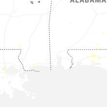


Connect with Interactive Hail Maps