

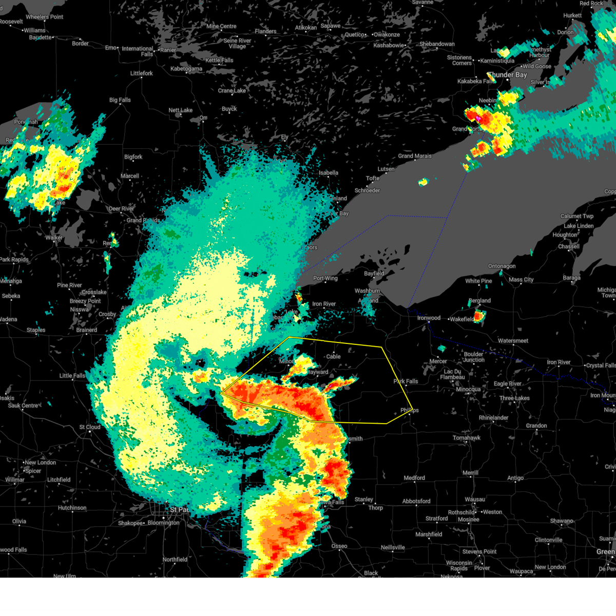
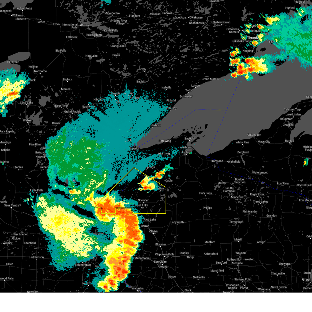
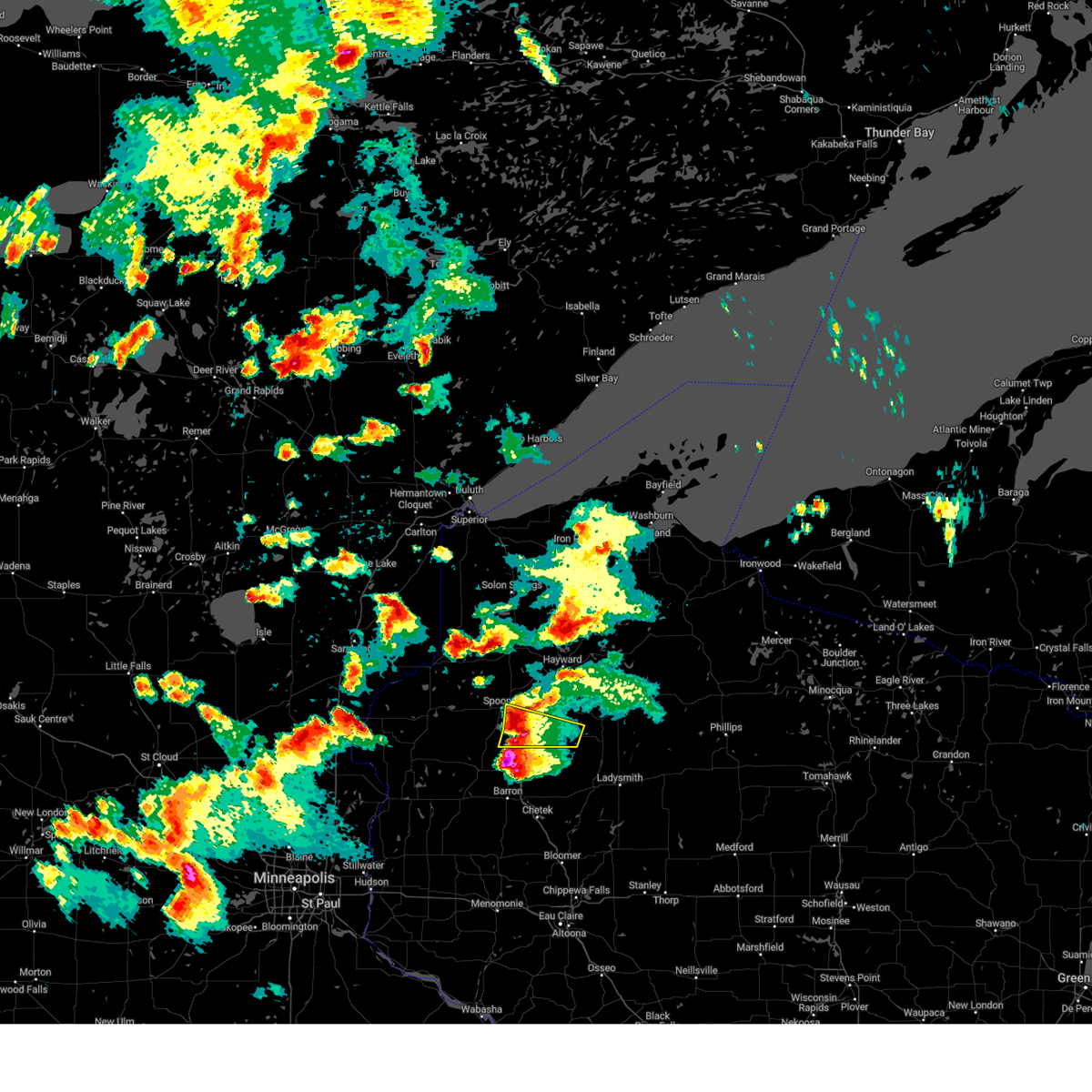
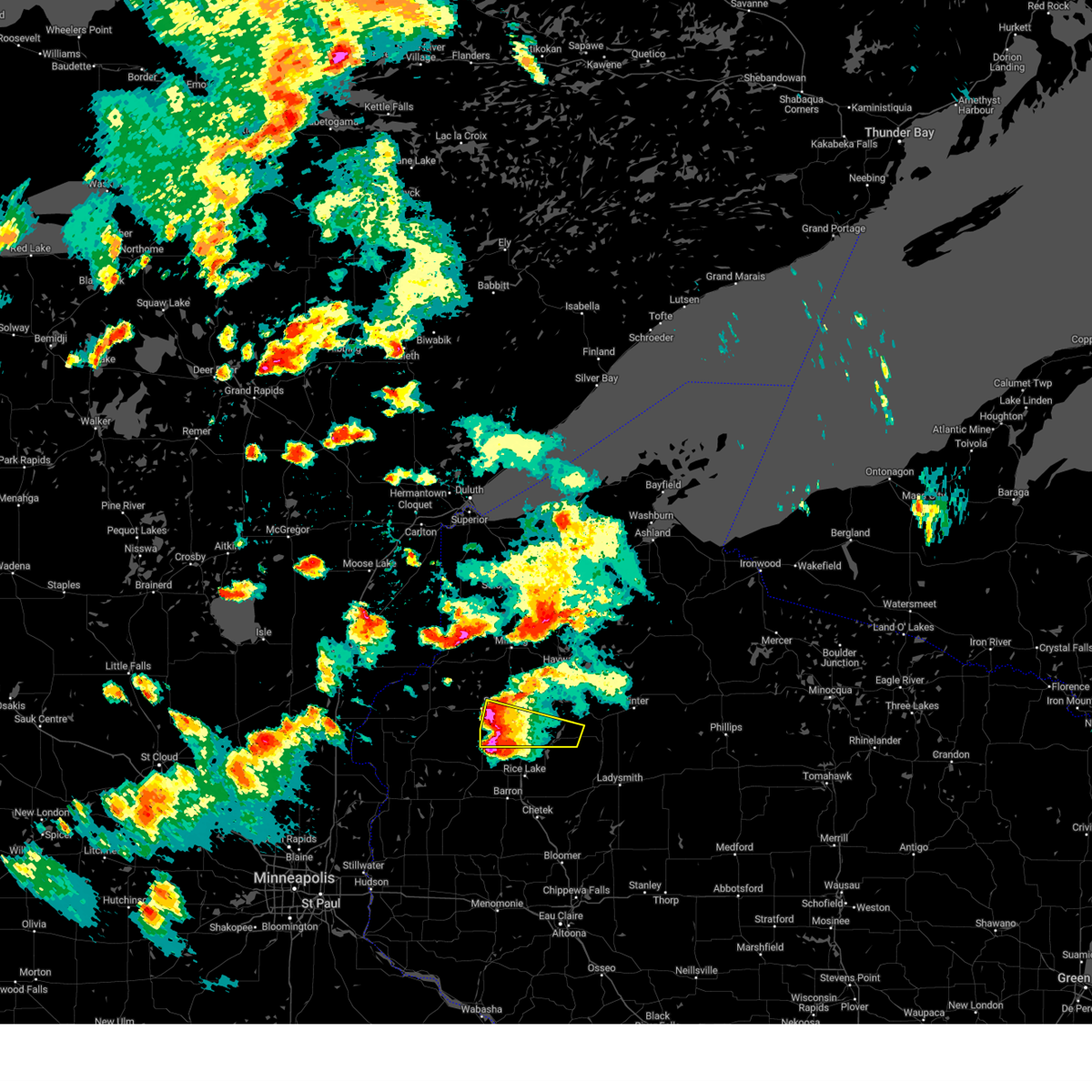
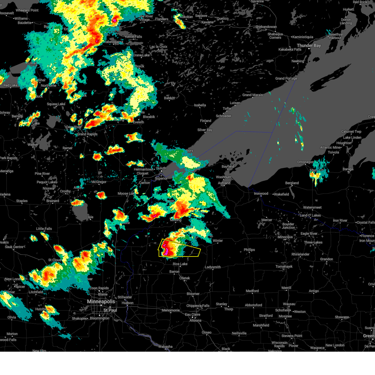
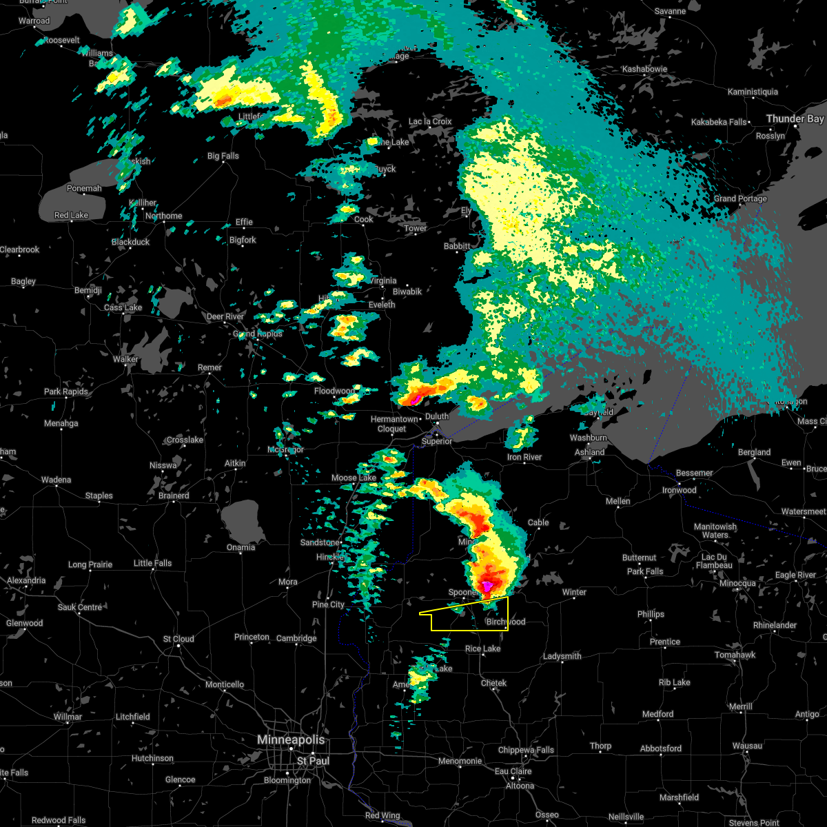
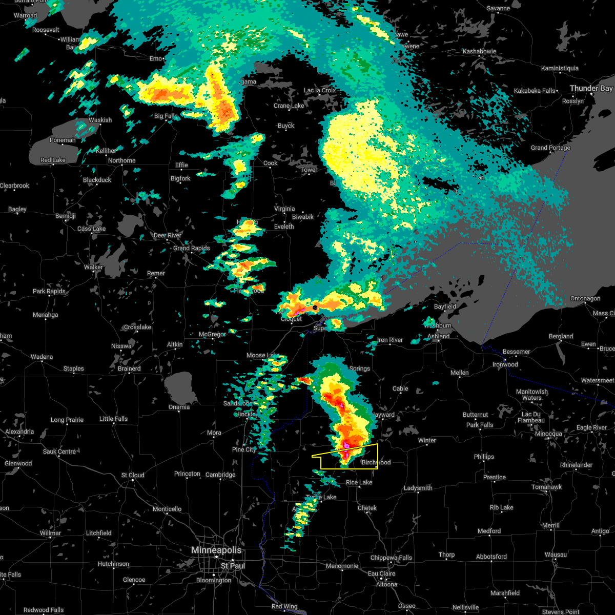
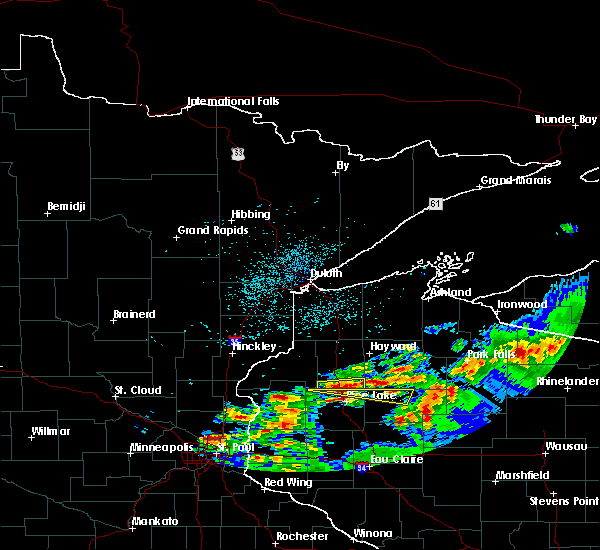
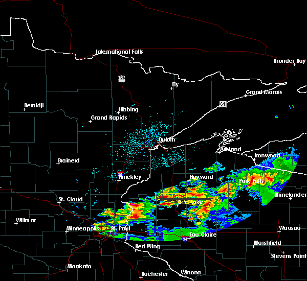
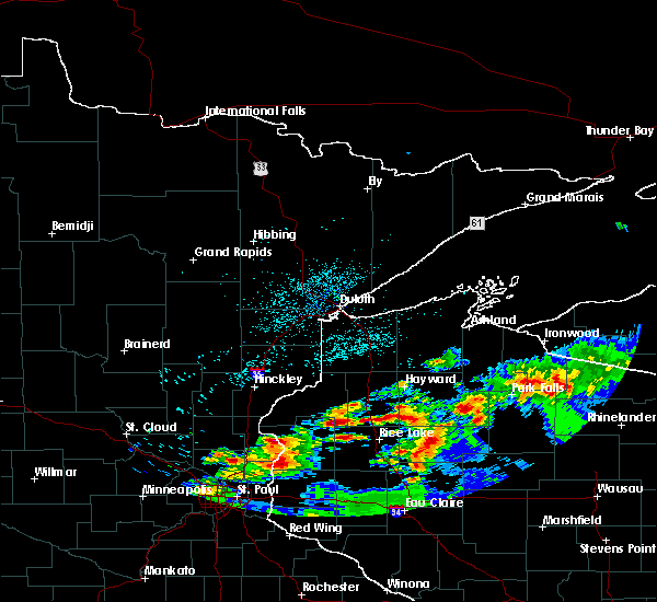
Hail Map for Birchwood, WI
The Birchwood, WI area has had 6 reports of on-the-ground hail by trained spotters, and has been under severe weather warnings 3 times during the past 12 months. Doppler radar has detected hail at or near Birchwood, WI on 41 occasions, including 1 occasion during the past year.
| Name: | Birchwood, WI |
| Where Located: | 82 miles SSE of Duluth, MN |
| Map: | Google Map for Birchwood, WI |
| Population: | 442 |
| Housing Units: | 290 |
| More Info: | Search Google for Birchwood, WI |
0
The Top Recent Hail Date for Birchwood, WI is Monday, August 26, 2024 (18th out of 41)

Hail and Wind Damage Spotted near Birchwood, WI
| Date / Time | Report Details |
|---|---|
| 5/15/2025 4:37 PM CDT |
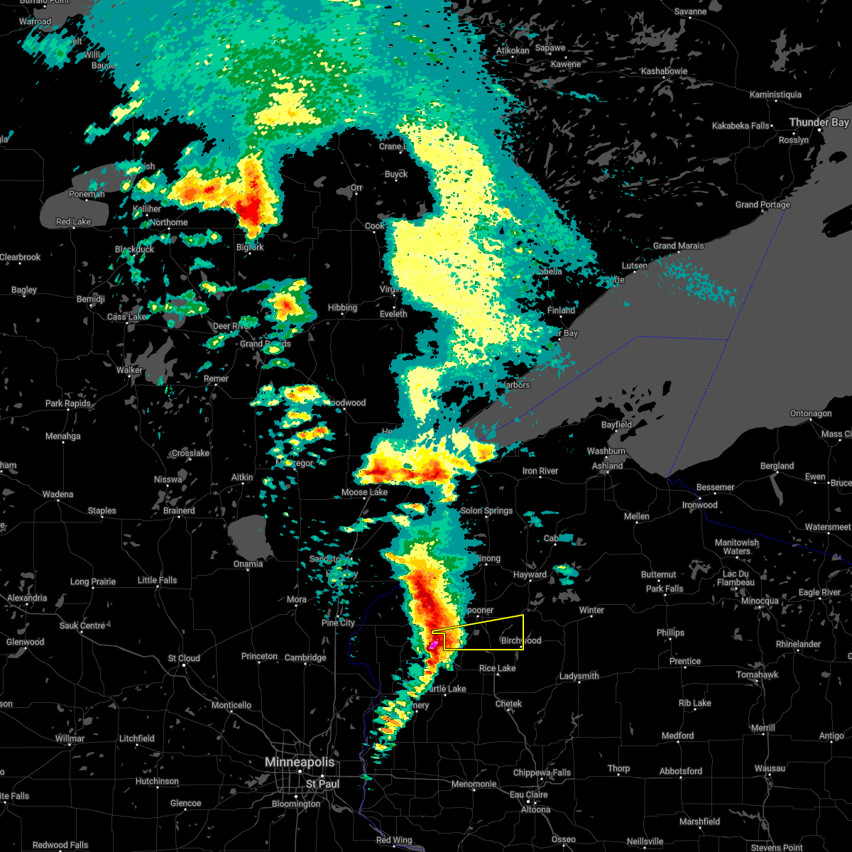
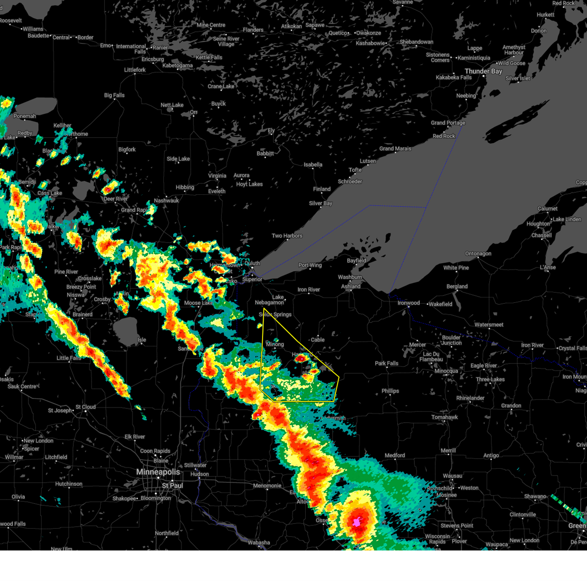 Svrdlh the national weather service in duluth mn has issued a * severe thunderstorm warning for, southeastern douglas county in northwestern wisconsin, washburn county in northwestern wisconsin, southwestern sawyer county in northwestern wisconsin, * until 515 pm cdt. * at 437 pm cdt, severe thunderstorms were located along a line extending from near shell lake to 7 miles northeast of rice lake to 6 miles south of bruce, moving north at 60 mph (radar indicated). Hazards include 70 mph wind gusts and quarter size hail. Hail damage to vehicles is expected. expect considerable tree damage. wind damage is also likely to mobile homes, roofs, and outbuildings. severe thunderstorms will be near, spooner, trego, and birchwood around 445 pm cdt. stone lake and exeland around 450 pm cdt. minong around 455 pm cdt. Other locations in the path of these severe thunderstorms include wascott, radisson, couderay, hayward, chippewa flowage west, gordon, chief lake on chippewa flowage and little round lake. Svrdlh the national weather service in duluth mn has issued a * severe thunderstorm warning for, southeastern douglas county in northwestern wisconsin, washburn county in northwestern wisconsin, southwestern sawyer county in northwestern wisconsin, * until 515 pm cdt. * at 437 pm cdt, severe thunderstorms were located along a line extending from near shell lake to 7 miles northeast of rice lake to 6 miles south of bruce, moving north at 60 mph (radar indicated). Hazards include 70 mph wind gusts and quarter size hail. Hail damage to vehicles is expected. expect considerable tree damage. wind damage is also likely to mobile homes, roofs, and outbuildings. severe thunderstorms will be near, spooner, trego, and birchwood around 445 pm cdt. stone lake and exeland around 450 pm cdt. minong around 455 pm cdt. Other locations in the path of these severe thunderstorms include wascott, radisson, couderay, hayward, chippewa flowage west, gordon, chief lake on chippewa flowage and little round lake.
|
| 8/26/2024 9:28 PM CDT | Several trees reported down and on a local county road on the northwest side of lake chetac. time estimated based on rada in sawyer county WI, 6.2 miles SSW of Birchwood, WI |
| 8/26/2024 9:25 PM CDT |
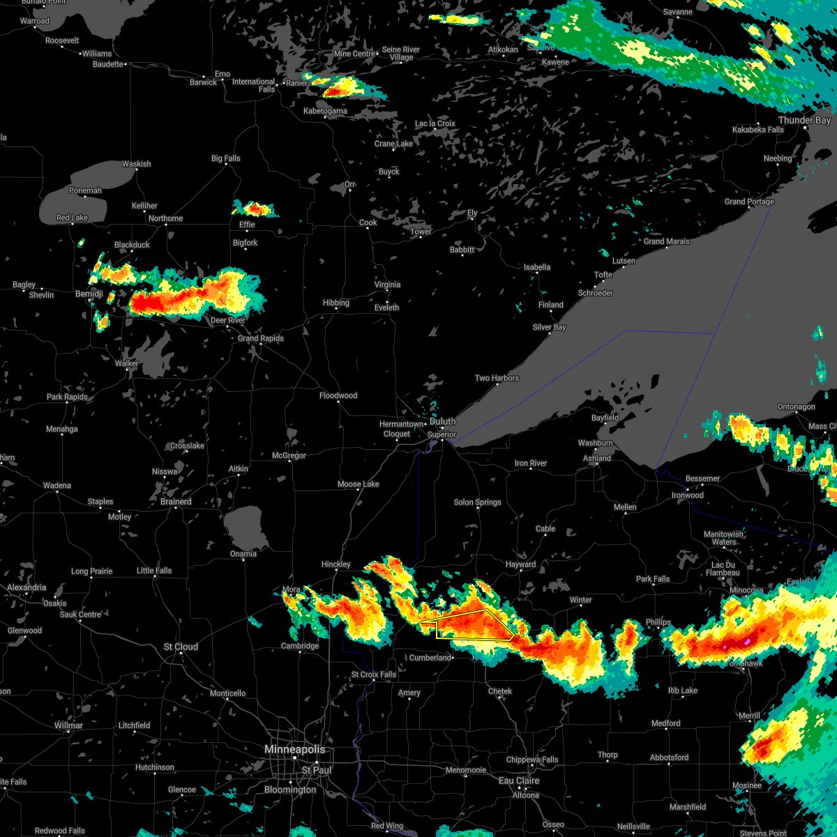
 Svrdlh the national weather service in duluth mn has issued a * severe thunderstorm warning for, southwestern bayfield county in northwestern wisconsin, southeastern douglas county in northwestern wisconsin, washburn county in northwestern wisconsin, southwestern ashland county in northwestern wisconsin, northwestern price county in north central wisconsin, northeastern burnett county in northwestern wisconsin, sawyer county in northwestern wisconsin, * until 1015 pm cdt. * at 924 pm cdt, severe thunderstorms were located along a line extending from near danbury to near stone lake to near bruce, moving northeast at 45 mph (radar indicated). Hazards include 60 mph wind gusts and penny size hail. Expect damage to roofs, siding, and trees. severe thunderstorms will be near, hayward, chippewa flowage west, trego, webb lake wisconsin, radisson, exeland, couderay, little round lake, and danbury around 930 pm cdt. round lake and chief lake on chippewa flowage around 935 pm cdt. chippewa flowage east, minong, and new post around 940 pm cdt. Other locations in the path of these severe thunderstorms include winter, seeley, wascott, cable, gordon, namekagon lake, namekagon and clam lake. Svrdlh the national weather service in duluth mn has issued a * severe thunderstorm warning for, southwestern bayfield county in northwestern wisconsin, southeastern douglas county in northwestern wisconsin, washburn county in northwestern wisconsin, southwestern ashland county in northwestern wisconsin, northwestern price county in north central wisconsin, northeastern burnett county in northwestern wisconsin, sawyer county in northwestern wisconsin, * until 1015 pm cdt. * at 924 pm cdt, severe thunderstorms were located along a line extending from near danbury to near stone lake to near bruce, moving northeast at 45 mph (radar indicated). Hazards include 60 mph wind gusts and penny size hail. Expect damage to roofs, siding, and trees. severe thunderstorms will be near, hayward, chippewa flowage west, trego, webb lake wisconsin, radisson, exeland, couderay, little round lake, and danbury around 930 pm cdt. round lake and chief lake on chippewa flowage around 935 pm cdt. chippewa flowage east, minong, and new post around 940 pm cdt. Other locations in the path of these severe thunderstorms include winter, seeley, wascott, cable, gordon, namekagon lake, namekagon and clam lake.
|
| 8/26/2024 8:41 PM CDT |
 Svrdlh the national weather service in duluth mn has issued a * severe thunderstorm warning for, southeastern pine county in east central minnesota, southwestern douglas county in northwestern wisconsin, washburn county in northwestern wisconsin, burnett county in northwestern wisconsin, western sawyer county in northwestern wisconsin, * until 930 pm cdt. * at 837 pm cdt, severe thunderstorms were located along a line extending from near grantsburg to 8 miles northwest of cumberland to near glenwood city, moving northeast at 55 mph (radar indicated). Hazards include 60 mph wind gusts and quarter size hail. Hail damage to vehicles is expected. expect wind damage to roofs, siding, and trees. severe thunderstorms will be near, siren, webster, hertel, saint croix state park, saint croix band pike lake area, saint croix band bashaw area, saint croix band clam lake area, and saint croix band sand lake area around 845 pm cdt. shell lake and mille lacs band lena lake area around 850 pm cdt. spooner and danbury around 855 pm cdt. Other locations in the path of these severe thunderstorms include webb lake wisconsin, trego, cloverton, minong, stone lake, birchwood, dairyland and hayward. Svrdlh the national weather service in duluth mn has issued a * severe thunderstorm warning for, southeastern pine county in east central minnesota, southwestern douglas county in northwestern wisconsin, washburn county in northwestern wisconsin, burnett county in northwestern wisconsin, western sawyer county in northwestern wisconsin, * until 930 pm cdt. * at 837 pm cdt, severe thunderstorms were located along a line extending from near grantsburg to 8 miles northwest of cumberland to near glenwood city, moving northeast at 55 mph (radar indicated). Hazards include 60 mph wind gusts and quarter size hail. Hail damage to vehicles is expected. expect wind damage to roofs, siding, and trees. severe thunderstorms will be near, siren, webster, hertel, saint croix state park, saint croix band pike lake area, saint croix band bashaw area, saint croix band clam lake area, and saint croix band sand lake area around 845 pm cdt. shell lake and mille lacs band lena lake area around 850 pm cdt. spooner and danbury around 855 pm cdt. Other locations in the path of these severe thunderstorms include webb lake wisconsin, trego, cloverton, minong, stone lake, birchwood, dairyland and hayward.
|
| 7/19/2023 5:58 PM CDT |
 At 558 pm cdt, severe thunderstorms were located along a line extending from 7 miles east of spooner, to 6 miles northwest of birchwood, to near haugen, moving east at 35 mph (trained weather spotters). Hazards include 70 mph wind gusts and quarter size hail. Hail damage to vehicles is expected. expect considerable tree damage. wind damage is also likely to mobile homes, roofs, and outbuildings. Locations impacted include, shell lake, birchwood, edgewater, sarona, little sissabagama lake, angus, and deer lake. At 558 pm cdt, severe thunderstorms were located along a line extending from 7 miles east of spooner, to 6 miles northwest of birchwood, to near haugen, moving east at 35 mph (trained weather spotters). Hazards include 70 mph wind gusts and quarter size hail. Hail damage to vehicles is expected. expect considerable tree damage. wind damage is also likely to mobile homes, roofs, and outbuildings. Locations impacted include, shell lake, birchwood, edgewater, sarona, little sissabagama lake, angus, and deer lake.
|
| 7/19/2023 5:48 PM CDT |
 At 547 pm cdt, severe thunderstorms were located along a line extending from spooner, to near shell lake, to 6 miles west of haugen, moving east at 40 mph (trained weather spotters). Hazards include two inch hail and 70 mph wind gusts. People and animals outdoors will be injured. expect hail damage to roofs, siding, windows, and vehicles. expect considerable tree damage. wind damage is also likely to mobile homes, roofs, and outbuildings. Locations impacted include, spooner, shell lake, birchwood, edgewater, sarona, little sissabagama lake, angus, and deer lake. At 547 pm cdt, severe thunderstorms were located along a line extending from spooner, to near shell lake, to 6 miles west of haugen, moving east at 40 mph (trained weather spotters). Hazards include two inch hail and 70 mph wind gusts. People and animals outdoors will be injured. expect hail damage to roofs, siding, windows, and vehicles. expect considerable tree damage. wind damage is also likely to mobile homes, roofs, and outbuildings. Locations impacted include, spooner, shell lake, birchwood, edgewater, sarona, little sissabagama lake, angus, and deer lake.
|
| 7/19/2023 5:36 PM CDT |
 At 536 pm cdt, a severe thunderstorm was located near shell lake, or 9 miles southwest of spooner, moving east at 40 mph. this storm has a history of producing golf ball size hail. this is a destructive storm for the warned area including shell lake and sarona (trained weather spotters). Hazards include baseball size hail and 70 mph wind gusts. People and animals outdoors will be severely injured. expect shattered windows, extensive damage to roofs, siding, and vehicles. Locations impacted include, spooner, shell lake, birchwood, edgewater, sarona, little sissabagama lake, angus, and deer lake. At 536 pm cdt, a severe thunderstorm was located near shell lake, or 9 miles southwest of spooner, moving east at 40 mph. this storm has a history of producing golf ball size hail. this is a destructive storm for the warned area including shell lake and sarona (trained weather spotters). Hazards include baseball size hail and 70 mph wind gusts. People and animals outdoors will be severely injured. expect shattered windows, extensive damage to roofs, siding, and vehicles. Locations impacted include, spooner, shell lake, birchwood, edgewater, sarona, little sissabagama lake, angus, and deer lake.
|
| 7/19/2023 5:29 PM CDT |
 At 529 pm cdt, a severe thunderstorm was located near shell lake, or 10 miles southwest of spooner, moving east at 50 mph. this is a destructive storm for the warned area (trained weather spotters). Hazards include baseball size hail and 70 mph wind gusts. People and animals outdoors will be severely injured. expect shattered windows, extensive damage to roofs, siding, and vehicles. this severe thunderstorm will be near, shell lake around 540 pm cdt. Other locations in the path of this severe thunderstorm include birchwood. At 529 pm cdt, a severe thunderstorm was located near shell lake, or 10 miles southwest of spooner, moving east at 50 mph. this is a destructive storm for the warned area (trained weather spotters). Hazards include baseball size hail and 70 mph wind gusts. People and animals outdoors will be severely injured. expect shattered windows, extensive damage to roofs, siding, and vehicles. this severe thunderstorm will be near, shell lake around 540 pm cdt. Other locations in the path of this severe thunderstorm include birchwood.
|
| 7/14/2023 6:28 PM CDT | Ping Pong Ball sized hail reported 4.8 miles NNE of Birchwood, WI, photo relayed by media. |
| 8/2/2022 9:37 PM CDT |
 At 937 pm cdt, a severe thunderstorm was located over birchwood, or 15 miles northeast of rice lake, moving southeast at 30 mph (radar indicated). Hazards include 70 mph wind gusts and ping pong ball size hail. People and animals outdoors will be injured. expect hail damage to roofs, siding, windows, and vehicles. expect considerable tree damage. wind damage is also likely to mobile homes, roofs, and outbuildings. Locations impacted include, spooner, shell lake, birchwood, radisson, exeland, couderay, hertel, edgewater, sarona, spooner lake, little sissabagama lake, deer lake, big sand lake, angus, sissabagama lake, and lac courte oreilles reservation. At 937 pm cdt, a severe thunderstorm was located over birchwood, or 15 miles northeast of rice lake, moving southeast at 30 mph (radar indicated). Hazards include 70 mph wind gusts and ping pong ball size hail. People and animals outdoors will be injured. expect hail damage to roofs, siding, windows, and vehicles. expect considerable tree damage. wind damage is also likely to mobile homes, roofs, and outbuildings. Locations impacted include, spooner, shell lake, birchwood, radisson, exeland, couderay, hertel, edgewater, sarona, spooner lake, little sissabagama lake, deer lake, big sand lake, angus, sissabagama lake, and lac courte oreilles reservation.
|
| 8/2/2022 9:25 PM CDT |
 At 925 pm cdt, a severe thunderstorm was located 9 miles east of shell lake, or 10 miles southeast of spooner, moving southeast at 30 mph (radar indicated). Hazards include 70 mph wind gusts and ping pong ball size hail. People and animals outdoors will be injured. expect hail damage to roofs, siding, windows, and vehicles. expect considerable tree damage. wind damage is also likely to mobile homes, roofs, and outbuildings. Locations impacted include, spooner, shell lake, stone lake, birchwood, radisson, exeland, couderay, hertel, edgewater, sarona, ojibwa, northwoods beach, reserve, spooner lake, lac courte oreilles reservation, little sissabagama lake, deer lake, sissabagama lake, lac courte oreilles, and big sand lake. At 925 pm cdt, a severe thunderstorm was located 9 miles east of shell lake, or 10 miles southeast of spooner, moving southeast at 30 mph (radar indicated). Hazards include 70 mph wind gusts and ping pong ball size hail. People and animals outdoors will be injured. expect hail damage to roofs, siding, windows, and vehicles. expect considerable tree damage. wind damage is also likely to mobile homes, roofs, and outbuildings. Locations impacted include, spooner, shell lake, stone lake, birchwood, radisson, exeland, couderay, hertel, edgewater, sarona, ojibwa, northwoods beach, reserve, spooner lake, lac courte oreilles reservation, little sissabagama lake, deer lake, sissabagama lake, lac courte oreilles, and big sand lake.
|
| 8/2/2022 9:11 PM CDT |
 At 911 pm cdt, a severe thunderstorm was located over spooner, moving southeast at 30 mph (radar indicated). Hazards include 70 mph wind gusts and ping pong ball size hail. People and animals outdoors will be injured. expect hail damage to roofs, siding, windows, and vehicles. expect considerable tree damage. wind damage is also likely to mobile homes, roofs, and outbuildings. Locations impacted include, spooner, shell lake, trego, stone lake, birchwood, radisson, exeland, couderay, hertel, edgewater, springbrook, sarona, ojibwa, northwoods beach, reserve, spooner lake, mckenzie lake, little sissabagama lake, deer lake, and birch island lake. At 911 pm cdt, a severe thunderstorm was located over spooner, moving southeast at 30 mph (radar indicated). Hazards include 70 mph wind gusts and ping pong ball size hail. People and animals outdoors will be injured. expect hail damage to roofs, siding, windows, and vehicles. expect considerable tree damage. wind damage is also likely to mobile homes, roofs, and outbuildings. Locations impacted include, spooner, shell lake, trego, stone lake, birchwood, radisson, exeland, couderay, hertel, edgewater, springbrook, sarona, ojibwa, northwoods beach, reserve, spooner lake, mckenzie lake, little sissabagama lake, deer lake, and birch island lake.
|
| 8/2/2022 8:57 PM CDT |
 At 857 pm cdt, a severe thunderstorm was located near spooner, moving southeast at 30 mph (radar indicated). Hazards include 60 mph wind gusts and half dollar size hail. Hail damage to vehicles is expected. expect wind damage to roofs, siding, and trees. Locations impacted include, spooner, shell lake, trego, webster, stone lake, birchwood, webb lake wisconsin, radisson, exeland, couderay, hertel, edgewater, springbrook, sarona, ojibwa, northwoods beach, reserve, spooner lake, mckenzie lake, and little sissabagama lake. At 857 pm cdt, a severe thunderstorm was located near spooner, moving southeast at 30 mph (radar indicated). Hazards include 60 mph wind gusts and half dollar size hail. Hail damage to vehicles is expected. expect wind damage to roofs, siding, and trees. Locations impacted include, spooner, shell lake, trego, webster, stone lake, birchwood, webb lake wisconsin, radisson, exeland, couderay, hertel, edgewater, springbrook, sarona, ojibwa, northwoods beach, reserve, spooner lake, mckenzie lake, and little sissabagama lake.
|
| 8/2/2022 8:45 PM CDT |
 At 844 pm cdt, a severe thunderstorm was located near webb lake wisconsin, or 12 miles northwest of spooner, moving southeast at 30 mph (radar indicated). Hazards include 60 mph wind gusts and half dollar size hail. Hail damage to vehicles is expected. Expect wind damage to roofs, siding, and trees. At 844 pm cdt, a severe thunderstorm was located near webb lake wisconsin, or 12 miles northwest of spooner, moving southeast at 30 mph (radar indicated). Hazards include 60 mph wind gusts and half dollar size hail. Hail damage to vehicles is expected. Expect wind damage to roofs, siding, and trees.
|
| 5/18/2022 6:37 PM CDT |
 At 636 pm cdt, severe thunderstorms were located along a line extending from near fifield, to 13 miles northwest of hawkins, to 7 miles northwest of weyerhaeuser, moving southeast at 45 mph (radar indicated). Hazards include ping pong ball size hail and 60 mph wind gusts. People and animals outdoors will be injured. expect hail damage to roofs, siding, windows, and vehicles. expect wind damage to roofs, siding, and trees. locations impacted include, park falls, chippewa flowage west, chippewa flowage east, phillips, fifield, birchwood, butternut, winter, radisson, exeland, couderay, new post, chief lake on chippewa flowage, clam lake, edgewater, ojibwa, reserve, connors lake, little sissabagama lake, and deer lake. hail threat, radar indicated max hail size, 1. 50 in wind threat, radar indicated max wind gust, 60 mph. At 636 pm cdt, severe thunderstorms were located along a line extending from near fifield, to 13 miles northwest of hawkins, to 7 miles northwest of weyerhaeuser, moving southeast at 45 mph (radar indicated). Hazards include ping pong ball size hail and 60 mph wind gusts. People and animals outdoors will be injured. expect hail damage to roofs, siding, windows, and vehicles. expect wind damage to roofs, siding, and trees. locations impacted include, park falls, chippewa flowage west, chippewa flowage east, phillips, fifield, birchwood, butternut, winter, radisson, exeland, couderay, new post, chief lake on chippewa flowage, clam lake, edgewater, ojibwa, reserve, connors lake, little sissabagama lake, and deer lake. hail threat, radar indicated max hail size, 1. 50 in wind threat, radar indicated max wind gust, 60 mph.
|
| 5/18/2022 6:22 PM CDT |
 At 621 pm cdt, severe thunderstorms were located along a line extending from 7 miles southwest of butternut, to 6 miles southeast of radisson, to near haugen, moving southeast at 45 mph (radar indicated). Hazards include ping pong ball size hail and 60 mph wind gusts. People and animals outdoors will be injured. expect hail damage to roofs, siding, windows, and vehicles. expect wind damage to roofs, siding, and trees. locations impacted include, butternut, park falls, fifield and phillips. hail threat, radar indicated max hail size, 1. 50 in wind threat, radar indicated max wind gust, 60 mph. At 621 pm cdt, severe thunderstorms were located along a line extending from 7 miles southwest of butternut, to 6 miles southeast of radisson, to near haugen, moving southeast at 45 mph (radar indicated). Hazards include ping pong ball size hail and 60 mph wind gusts. People and animals outdoors will be injured. expect hail damage to roofs, siding, windows, and vehicles. expect wind damage to roofs, siding, and trees. locations impacted include, butternut, park falls, fifield and phillips. hail threat, radar indicated max hail size, 1. 50 in wind threat, radar indicated max wind gust, 60 mph.
|
| 5/18/2022 5:54 PM CDT |
 At 554 pm cdt, severe thunderstorms were located along a line extending from near clam lake, to near chief lake on chippewa flowage, to near shell lake, moving southeast at 40 mph (radar indicated). Hazards include ping pong ball size hail and 60 mph wind gusts. People and animals outdoors will be injured. expect hail damage to roofs, siding, windows, and vehicles. expect wind damage to roofs, siding, and trees. severe thunderstorms will be near, chief lake on chippewa flowage and clam lake around 600 pm cdt. couderay and new post around 605 pm cdt. radisson around 610 pm cdt. other locations in the path of these severe thunderstorms include exeland, butternut, park falls, fifield and phillips. hail threat, radar indicated max hail size, 1. 50 in wind threat, radar indicated max wind gust, 60 mph. At 554 pm cdt, severe thunderstorms were located along a line extending from near clam lake, to near chief lake on chippewa flowage, to near shell lake, moving southeast at 40 mph (radar indicated). Hazards include ping pong ball size hail and 60 mph wind gusts. People and animals outdoors will be injured. expect hail damage to roofs, siding, windows, and vehicles. expect wind damage to roofs, siding, and trees. severe thunderstorms will be near, chief lake on chippewa flowage and clam lake around 600 pm cdt. couderay and new post around 605 pm cdt. radisson around 610 pm cdt. other locations in the path of these severe thunderstorms include exeland, butternut, park falls, fifield and phillips. hail threat, radar indicated max hail size, 1. 50 in wind threat, radar indicated max wind gust, 60 mph.
|
| 5/11/2022 10:29 PM CDT |
 At 1029 pm cdt, severe thunderstorms were located along a line extending from near solon springs, to 7 miles west of hayward, to birchwood, moving northeast at 60 mph (radar indicated). Hazards include 60 mph wind gusts and quarter size hail. Hail damage to vehicles is expected. expect wind damage to roofs, siding, and trees. Locations impacted include, spooner, hayward, chippewa flowage west, chippewa flowage east, shell lake, iron river, lake nebagamon, round lake, trego, cable, barnes, wascott, brule, solon springs, minong, stone lake, drummond, birchwood, winter, and gordon. At 1029 pm cdt, severe thunderstorms were located along a line extending from near solon springs, to 7 miles west of hayward, to birchwood, moving northeast at 60 mph (radar indicated). Hazards include 60 mph wind gusts and quarter size hail. Hail damage to vehicles is expected. expect wind damage to roofs, siding, and trees. Locations impacted include, spooner, hayward, chippewa flowage west, chippewa flowage east, shell lake, iron river, lake nebagamon, round lake, trego, cable, barnes, wascott, brule, solon springs, minong, stone lake, drummond, birchwood, winter, and gordon.
|
| 5/11/2022 10:10 PM CDT |
 At 1009 pm cdt, severe thunderstorms were located along a line extending from near webb lake wisconsin, to near spooner, to haugen, moving northeast at 60 mph (radar indicated). Hazards include 60 mph wind gusts and quarter size hail. Hail damage to vehicles is expected. Expect wind damage to roofs, siding, and trees. At 1009 pm cdt, severe thunderstorms were located along a line extending from near webb lake wisconsin, to near spooner, to haugen, moving northeast at 60 mph (radar indicated). Hazards include 60 mph wind gusts and quarter size hail. Hail damage to vehicles is expected. Expect wind damage to roofs, siding, and trees.
|
| 5/9/2022 11:28 AM CDT |
 The severe thunderstorm warning for southern washburn and southeastern burnett counties will expire at 1130 am cdt, the storm which prompted the warning has moved out of the area. therefore, the warning will be allowed to expire. a severe thunderstorm watch remains in effect until 300 pm cdt for northwestern wisconsin. The severe thunderstorm warning for southern washburn and southeastern burnett counties will expire at 1130 am cdt, the storm which prompted the warning has moved out of the area. therefore, the warning will be allowed to expire. a severe thunderstorm watch remains in effect until 300 pm cdt for northwestern wisconsin.
|
| 5/9/2022 11:17 AM CDT |
 At 1117 am cdt, a severe thunderstorm was located near shell lake, or 9 miles southeast of spooner, moving east at 45 mph (radar indicated). Hazards include ping pong ball size hail and 60 mph wind gusts. People and animals outdoors will be injured. expect hail damage to roofs, siding, windows, and vehicles. expect wind damage to roofs, siding, and trees. locations impacted include, birchwood. hail threat, radar indicated max hail size, 1. 50 in wind threat, radar indicated max wind gust, 60 mph. At 1117 am cdt, a severe thunderstorm was located near shell lake, or 9 miles southeast of spooner, moving east at 45 mph (radar indicated). Hazards include ping pong ball size hail and 60 mph wind gusts. People and animals outdoors will be injured. expect hail damage to roofs, siding, windows, and vehicles. expect wind damage to roofs, siding, and trees. locations impacted include, birchwood. hail threat, radar indicated max hail size, 1. 50 in wind threat, radar indicated max wind gust, 60 mph.
|
| 5/9/2022 10:58 AM CDT |
 At 1056 am cdt, a severe thunderstorm was located 9 miles south of hertel, or 15 miles southwest of spooner, moving east at 45 mph (radar indicated). Hazards include ping pong ball size hail and 60 mph wind gusts. People and animals outdoors will be injured. expect hail damage to roofs, siding, windows, and vehicles. expect wind damage to roofs, siding, and trees. this severe thunderstorm will be near, shell lake around 1115 am cdt. other locations in the path of this severe thunderstorm include birchwood. hail threat, radar indicated max hail size, 1. 50 in wind threat, radar indicated max wind gust, 60 mph. At 1056 am cdt, a severe thunderstorm was located 9 miles south of hertel, or 15 miles southwest of spooner, moving east at 45 mph (radar indicated). Hazards include ping pong ball size hail and 60 mph wind gusts. People and animals outdoors will be injured. expect hail damage to roofs, siding, windows, and vehicles. expect wind damage to roofs, siding, and trees. this severe thunderstorm will be near, shell lake around 1115 am cdt. other locations in the path of this severe thunderstorm include birchwood. hail threat, radar indicated max hail size, 1. 50 in wind threat, radar indicated max wind gust, 60 mph.
|
| 7/28/2021 7:59 PM CDT |
 At 758 pm cdt, a severe thunderstorm was located near shell lake, or 12 miles south of spooner, moving southeast at 45 mph (radar indicated). Hazards include 60 mph wind gusts and nickel size hail. Expect damage to roofs, siding, and trees. This severe thunderstorm will remain over mainly rural areas of southern washburn and southeastern burnett counties, including the following locations, sarona, angus and barronett. At 758 pm cdt, a severe thunderstorm was located near shell lake, or 12 miles south of spooner, moving southeast at 45 mph (radar indicated). Hazards include 60 mph wind gusts and nickel size hail. Expect damage to roofs, siding, and trees. This severe thunderstorm will remain over mainly rural areas of southern washburn and southeastern burnett counties, including the following locations, sarona, angus and barronett.
|
| 4/7/2020 8:55 AM CDT |
 The severe thunderstorm warning for southern washburn and southwestern sawyer counties will expire at 900 am cdt, the storm which prompted the warning has weakened below severe limits, and no longer poses an immediate threat to life or property. therefore, the warning will be allowed to expire. however small hail, gusty winds, and heavy rain are still possible with this thunderstorm. The severe thunderstorm warning for southern washburn and southwestern sawyer counties will expire at 900 am cdt, the storm which prompted the warning has weakened below severe limits, and no longer poses an immediate threat to life or property. therefore, the warning will be allowed to expire. however small hail, gusty winds, and heavy rain are still possible with this thunderstorm.
|
| 4/7/2020 8:45 AM CDT |
 At 844 am cdt, a severe thunderstorm was located near stone lake, or 13 miles east of spooner, moving east at 60 mph (radar indicated). Hazards include 60 mph wind gusts and quarter size hail. Hail damage to vehicles is expected. expect wind damage to roofs, siding, and trees. Locations impacted include, spooner, shell lake, stone lake, birchwood, radisson, exeland, couderay, edgewater, sarona, reserve, spooner lake, lac courte oreilles reservation, deer lake, little sissabagama lake, sissabagama lake, angus, and lac courte oreilles. At 844 am cdt, a severe thunderstorm was located near stone lake, or 13 miles east of spooner, moving east at 60 mph (radar indicated). Hazards include 60 mph wind gusts and quarter size hail. Hail damage to vehicles is expected. expect wind damage to roofs, siding, and trees. Locations impacted include, spooner, shell lake, stone lake, birchwood, radisson, exeland, couderay, edgewater, sarona, reserve, spooner lake, lac courte oreilles reservation, deer lake, little sissabagama lake, sissabagama lake, angus, and lac courte oreilles.
|
| 4/7/2020 8:30 AM CDT |
 At 829 am cdt, a severe thunderstorm was located near spooner, moving east at 60 mph (radar indicated). Hazards include 60 mph wind gusts and quarter size hail. Hail damage to vehicles is expected. Expect wind damage to roofs, siding, and trees. At 829 am cdt, a severe thunderstorm was located near spooner, moving east at 60 mph (radar indicated). Hazards include 60 mph wind gusts and quarter size hail. Hail damage to vehicles is expected. Expect wind damage to roofs, siding, and trees.
|
| 7/28/2019 7:07 PM CDT |
 The severe thunderstorm warning for eastern washburn and western sawyer counties will expire at 715 pm cdt, the storms which prompted the warning have weakened below severe limits, and no longer pose an immediate threat to life or property. therefore, the warning will be allowed to expire. however gusty winds are still possible with these thunderstorms. The severe thunderstorm warning for eastern washburn and western sawyer counties will expire at 715 pm cdt, the storms which prompted the warning have weakened below severe limits, and no longer pose an immediate threat to life or property. therefore, the warning will be allowed to expire. however gusty winds are still possible with these thunderstorms.
|
| 7/28/2019 7:00 PM CDT |
 At 659 pm cdt, severe thunderstorms were located along a line extending from 7 miles northeast of trego, to 6 miles southwest of stone lake, moving northeast at 35 mph (radar indicated). Hazards include 60 mph wind gusts. Expect damage to roofs, siding, and trees. Locations impacted include, hayward, chippewa flowage west, chippewa flowage east, round lake, stone lake, birchwood, radisson, exeland, couderay, new post, chief lake on chippewa flowage, little round lake, seeley, edgewater, springbrook, spider lake, ojibwa, reserve, northwoods beach, and deer lake. At 659 pm cdt, severe thunderstorms were located along a line extending from 7 miles northeast of trego, to 6 miles southwest of stone lake, moving northeast at 35 mph (radar indicated). Hazards include 60 mph wind gusts. Expect damage to roofs, siding, and trees. Locations impacted include, hayward, chippewa flowage west, chippewa flowage east, round lake, stone lake, birchwood, radisson, exeland, couderay, new post, chief lake on chippewa flowage, little round lake, seeley, edgewater, springbrook, spider lake, ojibwa, reserve, northwoods beach, and deer lake.
|
| 7/28/2019 6:49 PM CDT |
 At 649 pm cdt, severe thunderstorms were located along a line extending from trego, to 6 miles east of shell lake, moving northeast at 35 mph (radar indicated). Hazards include 60 mph wind gusts. Expect damage to roofs, siding, and trees. Locations impacted include, hayward, chippewa flowage west, chippewa flowage east, round lake, trego, stone lake, birchwood, radisson, exeland, couderay, new post, chief lake on chippewa flowage, little round lake, seeley, edgewater, springbrook, sarona, spider lake, ojibwa, and reserve. At 649 pm cdt, severe thunderstorms were located along a line extending from trego, to 6 miles east of shell lake, moving northeast at 35 mph (radar indicated). Hazards include 60 mph wind gusts. Expect damage to roofs, siding, and trees. Locations impacted include, hayward, chippewa flowage west, chippewa flowage east, round lake, trego, stone lake, birchwood, radisson, exeland, couderay, new post, chief lake on chippewa flowage, little round lake, seeley, edgewater, springbrook, sarona, spider lake, ojibwa, and reserve.
|
| 7/28/2019 6:33 PM CDT |
 At 632 pm cdt, severe thunderstorms were located along a line extending from near spooner, to 6 miles west of haugen, moving northeast at 35 mph (radar indicated). Hazards include 60 mph wind gusts. expect damage to roofs, siding, and trees At 632 pm cdt, severe thunderstorms were located along a line extending from near spooner, to 6 miles west of haugen, moving northeast at 35 mph (radar indicated). Hazards include 60 mph wind gusts. expect damage to roofs, siding, and trees
|
| 5/31/2019 5:00 PM CDT | Quarter sized hail reported 3.9 miles NE of Birchwood, WI, dime to quarter size hail on farm west of red cedar lake. |
| 8/27/2018 7:42 PM CDT |
 At 740 pm cdt, severe thunderstorms were located along a line extending from 7 miles north of drummond, to near birchwood, moving east at 35 mph. trained spotters reported trees down near spooner around 705 pm cdt (trained weather spotters). Hazards include 60 mph wind gusts. Expect damage to roofs, siding, and trees. severe thunderstorms will be near, drummond around 745 pm cdt. ino around 750 pm cdt. exeland and benoit around 800 pm cdt. sanborn around 810 pm cdt. marengo around 820 pm cdt. mellen around 830 pm cdt. Other locations impacted by these severe thunderstorms include connors lake, reserve, northwoods beach, bad river reservation, edgewater, little sissabagama lake, deer lake, spider lake in sawyer county, ojibwa, and sissabagama lake. At 740 pm cdt, severe thunderstorms were located along a line extending from 7 miles north of drummond, to near birchwood, moving east at 35 mph. trained spotters reported trees down near spooner around 705 pm cdt (trained weather spotters). Hazards include 60 mph wind gusts. Expect damage to roofs, siding, and trees. severe thunderstorms will be near, drummond around 745 pm cdt. ino around 750 pm cdt. exeland and benoit around 800 pm cdt. sanborn around 810 pm cdt. marengo around 820 pm cdt. mellen around 830 pm cdt. Other locations impacted by these severe thunderstorms include connors lake, reserve, northwoods beach, bad river reservation, edgewater, little sissabagama lake, deer lake, spider lake in sawyer county, ojibwa, and sissabagama lake.
|
| 8/27/2018 7:21 PM CDT |
 At 721 pm cdt, severe thunderstorms were located along a line extending from near brule, to 6 miles east of minong, to haugen, moving east at 35 mph (radar indicated). Hazards include 60 mph wind gusts. Expect damage to roofs, siding, and trees. these severe storms will be near, brule around 725 pm cdt. hayward and iron river around 735 pm cdt. birchwood around 740 pm cdt. round lake, cable, seeley, ino and little round lake around 745 pm cdt. Other locations impacted by these severe thunderstorms include reserve, spooner lake, northwoods beach, chief lake, lac courte oreilles reservation, edgewater, totagatic lake, middle eau claire lake, little sissabagama lake, and grindstone lake. At 721 pm cdt, severe thunderstorms were located along a line extending from near brule, to 6 miles east of minong, to haugen, moving east at 35 mph (radar indicated). Hazards include 60 mph wind gusts. Expect damage to roofs, siding, and trees. these severe storms will be near, brule around 725 pm cdt. hayward and iron river around 735 pm cdt. birchwood around 740 pm cdt. round lake, cable, seeley, ino and little round lake around 745 pm cdt. Other locations impacted by these severe thunderstorms include reserve, spooner lake, northwoods beach, chief lake, lac courte oreilles reservation, edgewater, totagatic lake, middle eau claire lake, little sissabagama lake, and grindstone lake.
|
| 8/27/2018 7:16 PM CDT |
 At 715 pm cdt, a severe thunderstorm was located near radisson, or 14 miles south of chippewa flowage, moving northeast at 70 mph (radar indicated). Hazards include 60 mph wind gusts. Expect damage to roofs, siding, and trees. Locations impacted include, hayward, chippewa flowage, round lake, stone lake, birchwood, winter, radisson, exeland, couderay, new post, little round lake, seeley, edgewater, spider lake in sawyer county, ojibwa, reserve, northwoods beach, little sissabagama lake, deer lake, and sissabagama lake. At 715 pm cdt, a severe thunderstorm was located near radisson, or 14 miles south of chippewa flowage, moving northeast at 70 mph (radar indicated). Hazards include 60 mph wind gusts. Expect damage to roofs, siding, and trees. Locations impacted include, hayward, chippewa flowage, round lake, stone lake, birchwood, winter, radisson, exeland, couderay, new post, little round lake, seeley, edgewater, spider lake in sawyer county, ojibwa, reserve, northwoods beach, little sissabagama lake, deer lake, and sissabagama lake.
|
| 8/27/2018 7:12 PM CDT |
 At 710 pm cdt, severe thunderstorms were located along a line extending from poplar in douglas county, to minong, to 6 miles west of haugen, moving east at 40 mph (radar indicated). Hazards include 60 mph wind gusts. Expect damage to roofs, siding, and trees. severe thunderstorms will be near, lake nebagamon around 720 pm cdt. brule around 725 pm cdt. hayward and iron river around 735 pm cdt. birchwood and little round lake around 740 pm cdt. round lake, cable, seeley and ino around 745 pm cdt. Other locations impacted by these severe thunderstorms include reserve, spooner lake, northwoods beach, chief lake, lac courte oreilles reservation, edgewater, totagatic lake, middle eau claire lake, little sissabagama lake, and grindstone lake. At 710 pm cdt, severe thunderstorms were located along a line extending from poplar in douglas county, to minong, to 6 miles west of haugen, moving east at 40 mph (radar indicated). Hazards include 60 mph wind gusts. Expect damage to roofs, siding, and trees. severe thunderstorms will be near, lake nebagamon around 720 pm cdt. brule around 725 pm cdt. hayward and iron river around 735 pm cdt. birchwood and little round lake around 740 pm cdt. round lake, cable, seeley and ino around 745 pm cdt. Other locations impacted by these severe thunderstorms include reserve, spooner lake, northwoods beach, chief lake, lac courte oreilles reservation, edgewater, totagatic lake, middle eau claire lake, little sissabagama lake, and grindstone lake.
|
| 8/27/2018 7:03 PM CDT |
 At 703 pm cdt, a severe thunderstorm was located over minong, or 18 miles northwest of hayward, moving east at 45 mph (radar indicated). Hazards include 60 mph wind gusts and torrential rainfall. Expect damage to roofs, siding, and trees. This severe thunderstorm will remain over mainly rural areas of southeastern douglas, washburn and eastern burnett counties, including the following locations: spooner lake, mckenzie lake, minong flowage, springbrook, lampson, sarona, bennett, earl, stanberry and lyman lake. At 703 pm cdt, a severe thunderstorm was located over minong, or 18 miles northwest of hayward, moving east at 45 mph (radar indicated). Hazards include 60 mph wind gusts and torrential rainfall. Expect damage to roofs, siding, and trees. This severe thunderstorm will remain over mainly rural areas of southeastern douglas, washburn and eastern burnett counties, including the following locations: spooner lake, mckenzie lake, minong flowage, springbrook, lampson, sarona, bennett, earl, stanberry and lyman lake.
|
| 8/27/2018 6:58 PM CDT |
 At 657 pm cdt, a severe thunderstorm was located over weyerhaeuser, or 14 miles east of rice lake, moving northeast at 70 mph (radar indicated). Hazards include 60 mph wind gusts and torrential rainfall. Expect damage to roofs, siding, and trees. this severe thunderstorm will be near, exeland around 715 pm cdt. radisson and couderay around 720 pm cdt. winter and chief lake around 725 pm cdt. chippewa flowage around 730 pm cdt. new post around 735 pm cdt. Other locations impacted by this severe thunderstorm include reserve, northwoods beach, chief lake, lac courte oreilles reservation, edgewater, totagatic lake, lost land lake, little sissabagama lake, grindstone lake, and deer lake. At 657 pm cdt, a severe thunderstorm was located over weyerhaeuser, or 14 miles east of rice lake, moving northeast at 70 mph (radar indicated). Hazards include 60 mph wind gusts and torrential rainfall. Expect damage to roofs, siding, and trees. this severe thunderstorm will be near, exeland around 715 pm cdt. radisson and couderay around 720 pm cdt. winter and chief lake around 725 pm cdt. chippewa flowage around 730 pm cdt. new post around 735 pm cdt. Other locations impacted by this severe thunderstorm include reserve, northwoods beach, chief lake, lac courte oreilles reservation, edgewater, totagatic lake, lost land lake, little sissabagama lake, grindstone lake, and deer lake.
|
| 8/27/2018 6:52 PM CDT |
 At 651 pm cdt, a severe thunderstorm was located 7 miles northeast of webb lake wisconsin, or 18 miles north of spooner, moving east at 35 mph (radar indicated). Hazards include 60 mph wind gusts and torrential rainfall. Expect damage to roofs, siding, and trees. this severe storm will be near, wascott, minong and gordon around 710 pm cdt. Other locations impacted by this severe thunderstorm include spooner lake, cozy corner, mckenzie lake, minong flowage, springbrook, moose junction, amnicon lake, birch island lake, lampson, and chaffey. At 651 pm cdt, a severe thunderstorm was located 7 miles northeast of webb lake wisconsin, or 18 miles north of spooner, moving east at 35 mph (radar indicated). Hazards include 60 mph wind gusts and torrential rainfall. Expect damage to roofs, siding, and trees. this severe storm will be near, wascott, minong and gordon around 710 pm cdt. Other locations impacted by this severe thunderstorm include spooner lake, cozy corner, mckenzie lake, minong flowage, springbrook, moose junction, amnicon lake, birch island lake, lampson, and chaffey.
|
| 8/27/2018 6:34 PM CDT |
 At 633 pm cdt, a severe thunderstorm was located near webb lake wisconsin, or 22 miles northwest of spooner, moving east at 45 mph (radar indicated). Hazards include 60 mph wind gusts. Expect damage to roofs, siding, and trees. this severe thunderstorm will be near, minong around 655 pm cdt. wascott and gordon around 700 pm cdt. Other locations impacted by this severe thunderstorm include spooner lake, cozy corner, mckenzie lake, minong flowage, springbrook, moose junction, amnicon lake, oakland, birch island lake, and lampson. At 633 pm cdt, a severe thunderstorm was located near webb lake wisconsin, or 22 miles northwest of spooner, moving east at 45 mph (radar indicated). Hazards include 60 mph wind gusts. Expect damage to roofs, siding, and trees. this severe thunderstorm will be near, minong around 655 pm cdt. wascott and gordon around 700 pm cdt. Other locations impacted by this severe thunderstorm include spooner lake, cozy corner, mckenzie lake, minong flowage, springbrook, moose junction, amnicon lake, oakland, birch island lake, and lampson.
|
| 9/22/2017 7:47 AM CDT |
 At 745 am cdt, a severe thunderstorm was located near stone lake, or 13 miles east of spooner, moving northeast at 20 mph (doppler radar indicated. a trained weather spotter reported ping-pong ball size hail in madge at 742 am). Hazards include golf ball size hail and 60 mph wind gusts. People and animals outdoors will be injured. expect hail damage to roofs, siding, windows, and vehicles. expect wind damage to roofs, siding, and trees. Locations impacted include, stone lake, birchwood, couderay, edgewater, reserve, sissabagama lake, little sissabagama lake, angus, and chief lake. At 745 am cdt, a severe thunderstorm was located near stone lake, or 13 miles east of spooner, moving northeast at 20 mph (doppler radar indicated. a trained weather spotter reported ping-pong ball size hail in madge at 742 am). Hazards include golf ball size hail and 60 mph wind gusts. People and animals outdoors will be injured. expect hail damage to roofs, siding, windows, and vehicles. expect wind damage to roofs, siding, and trees. Locations impacted include, stone lake, birchwood, couderay, edgewater, reserve, sissabagama lake, little sissabagama lake, angus, and chief lake.
|
| 9/22/2017 7:39 AM CDT |
 At 738 am cdt, a severe thunderstorm was located 7 miles northwest of birchwood, or 12 miles southeast of spooner, moving east at 20 mph (a trained weather spotter reported 2 inch hail in sarona with these storms). Hazards include two inch hail and 60 mph wind gusts. People and animals outdoors will be injured. expect hail damage to roofs, siding, windows, and vehicles. expect wind damage to roofs, siding, and trees. Locations impacted include, stone lake, birchwood, couderay, edgewater, reserve, sissabagama lake, little sissabagama lake, angus, and chief lake. At 738 am cdt, a severe thunderstorm was located 7 miles northwest of birchwood, or 12 miles southeast of spooner, moving east at 20 mph (a trained weather spotter reported 2 inch hail in sarona with these storms). Hazards include two inch hail and 60 mph wind gusts. People and animals outdoors will be injured. expect hail damage to roofs, siding, windows, and vehicles. expect wind damage to roofs, siding, and trees. Locations impacted include, stone lake, birchwood, couderay, edgewater, reserve, sissabagama lake, little sissabagama lake, angus, and chief lake.
|
| 9/22/2017 7:25 AM CDT |
 At 725 am cdt, a severe thunderstorm was located 7 miles north of haugen, or 11 miles southeast of spooner, moving east at 25 mph (radar indicated). Hazards include ping pong ball size hail and 60 mph wind gusts. People and animals outdoors will be injured. expect hail damage to roofs, siding, windows, and vehicles. Expect wind damage to roofs, siding, and trees. At 725 am cdt, a severe thunderstorm was located 7 miles north of haugen, or 11 miles southeast of spooner, moving east at 25 mph (radar indicated). Hazards include ping pong ball size hail and 60 mph wind gusts. People and animals outdoors will be injured. expect hail damage to roofs, siding, windows, and vehicles. Expect wind damage to roofs, siding, and trees.
|
| 9/22/2017 7:23 AM CDT |
 At 723 am cdt, a severe thunderstorm was located 7 miles north of haugen, or 10 miles southeast of spooner, moving east at 25 mph (radar indicated). Hazards include ping pong ball size hail and 60 mph wind gusts. People and animals outdoors will be injured. expect hail damage to roofs, siding, windows, and vehicles. expect wind damage to roofs, siding, and trees. Locations impacted include, birchwood, sarona, and angus. At 723 am cdt, a severe thunderstorm was located 7 miles north of haugen, or 10 miles southeast of spooner, moving east at 25 mph (radar indicated). Hazards include ping pong ball size hail and 60 mph wind gusts. People and animals outdoors will be injured. expect hail damage to roofs, siding, windows, and vehicles. expect wind damage to roofs, siding, and trees. Locations impacted include, birchwood, sarona, and angus.
|
| 9/22/2017 7:15 AM CDT |
 At 715 am cdt, a severe thunderstorm was located near shell lake, or 8 miles southeast of spooner, moving east at 25 mph (radar indicated). Hazards include golf ball size hail and 60 mph wind gusts. People and animals outdoors will be injured. expect hail damage to roofs, siding, windows, and vehicles. expect wind damage to roofs, siding, and trees. Locations impacted include, shell lake, stone lake, birchwood, edgewater, sarona, sissabagama lake, little sissabagama lake, and angus. At 715 am cdt, a severe thunderstorm was located near shell lake, or 8 miles southeast of spooner, moving east at 25 mph (radar indicated). Hazards include golf ball size hail and 60 mph wind gusts. People and animals outdoors will be injured. expect hail damage to roofs, siding, windows, and vehicles. expect wind damage to roofs, siding, and trees. Locations impacted include, shell lake, stone lake, birchwood, edgewater, sarona, sissabagama lake, little sissabagama lake, and angus.
|
| 9/22/2017 7:05 AM CDT |
 At 704 am cdt, a severe thunderstorm was located over shell lake, or 7 miles south of spooner, moving east at 30 mph (radar indicated). Hazards include ping pong ball size hail and 60 mph wind gusts. People and animals outdoors will be injured. expect hail damage to roofs, siding, windows, and vehicles. Expect wind damage to roofs, siding, and trees. At 704 am cdt, a severe thunderstorm was located over shell lake, or 7 miles south of spooner, moving east at 30 mph (radar indicated). Hazards include ping pong ball size hail and 60 mph wind gusts. People and animals outdoors will be injured. expect hail damage to roofs, siding, windows, and vehicles. Expect wind damage to roofs, siding, and trees.
|
| 6/11/2017 10:42 AM CDT |
 At 1041 am cdt, severe thunderstorms were located along a line extending from 9 miles northwest of seeley, to exeland, moving northeast at 55 mph (radar indicated). Hazards include 70 mph wind gusts and nickel size hail. Expect considerable tree damage. damage is likely to mobile homes, roofs, and outbuildings. Locations impacted include, hayward, chippewa flowage, round lake, cable, wascott, minong, stone lake, drummond, birchwood, winter, radisson, exeland, couderay, new post, little round lake, chief lake, seeley, namekagon lake, namekagon, and edgewater. At 1041 am cdt, severe thunderstorms were located along a line extending from 9 miles northwest of seeley, to exeland, moving northeast at 55 mph (radar indicated). Hazards include 70 mph wind gusts and nickel size hail. Expect considerable tree damage. damage is likely to mobile homes, roofs, and outbuildings. Locations impacted include, hayward, chippewa flowage, round lake, cable, wascott, minong, stone lake, drummond, birchwood, winter, radisson, exeland, couderay, new post, little round lake, chief lake, seeley, namekagon lake, namekagon, and edgewater.
|
| 6/11/2017 10:31 AM CDT |
 At 1029 am cdt, severe thunderstorms were located along a line extending from near minong, to 7 miles southeast of birchwood, moving east at 55 mph (trained weather spotters reported trees and power lines down across burnett county). Hazards include 70 mph wind gusts and nickel size hail. Expect considerable tree damage. Damage is likely to mobile homes, roofs, and outbuildings. At 1029 am cdt, severe thunderstorms were located along a line extending from near minong, to 7 miles southeast of birchwood, moving east at 55 mph (trained weather spotters reported trees and power lines down across burnett county). Hazards include 70 mph wind gusts and nickel size hail. Expect considerable tree damage. Damage is likely to mobile homes, roofs, and outbuildings.
|
| 6/11/2017 10:15 AM CDT |
 At 1014 am cdt, severe thunderstorms were located along a line extending from near webb lake wisconsin, to near shell lake, moving east at 55 mph (trained weather spotters reported winds up to 70 mph and wind damage across burnett county). Hazards include 70 mph wind gusts and penny size hail. Expect considerable tree damage. damage is likely to mobile homes, roofs, and outbuildings. Locations impacted include, spooner, hayward, chippewa flowage, shell lake, trego, wascott, minong, stone lake, birchwood, webb lake wisconsin, radisson, exeland, couderay, little round lake, chief lake, danbury, hertel, oakland, edgewater, and springbrook. At 1014 am cdt, severe thunderstorms were located along a line extending from near webb lake wisconsin, to near shell lake, moving east at 55 mph (trained weather spotters reported winds up to 70 mph and wind damage across burnett county). Hazards include 70 mph wind gusts and penny size hail. Expect considerable tree damage. damage is likely to mobile homes, roofs, and outbuildings. Locations impacted include, spooner, hayward, chippewa flowage, shell lake, trego, wascott, minong, stone lake, birchwood, webb lake wisconsin, radisson, exeland, couderay, little round lake, chief lake, danbury, hertel, oakland, edgewater, and springbrook.
|
| 6/11/2017 10:03 AM CDT |
 At 1003 am cdt, severe thunderstorms were located along a line extending from near webb lake wisconsin, to 7 miles north of cumberland, moving east at 55 mph (radar indicated). Hazards include 70 mph wind gusts and penny size hail. Expect considerable tree damage. damage is likely to mobile homes, roofs, and outbuildings. Locations impacted include, spooner, hayward, chippewa flowage, shell lake, trego, siren, wascott, webster, minong, stone lake, birchwood, webb lake wisconsin, radisson, exeland, couderay, little round lake, chief lake, danbury, hertel, and oakland. At 1003 am cdt, severe thunderstorms were located along a line extending from near webb lake wisconsin, to 7 miles north of cumberland, moving east at 55 mph (radar indicated). Hazards include 70 mph wind gusts and penny size hail. Expect considerable tree damage. damage is likely to mobile homes, roofs, and outbuildings. Locations impacted include, spooner, hayward, chippewa flowage, shell lake, trego, siren, wascott, webster, minong, stone lake, birchwood, webb lake wisconsin, radisson, exeland, couderay, little round lake, chief lake, danbury, hertel, and oakland.
|
| 6/11/2017 9:51 AM CDT |
 At 951 am cdt, severe thunderstorms were located along a line extending from near danbury, to 10 miles northwest of cumberland, moving east at 55 mph (radar indicated). Hazards include 70 mph wind gusts and penny size hail. Expect considerable tree damage. Damage is likely to mobile homes, roofs, and outbuildings. At 951 am cdt, severe thunderstorms were located along a line extending from near danbury, to 10 miles northwest of cumberland, moving east at 55 mph (radar indicated). Hazards include 70 mph wind gusts and penny size hail. Expect considerable tree damage. Damage is likely to mobile homes, roofs, and outbuildings.
|
| 7/21/2016 5:08 AM CDT |
 At 508 am cdt, severe thunderstorms were located along a line extending from near mellen, to near birchwood, moving east at 55 mph (radar indicated). Hazards include 60 mph wind gusts and nickel size hail. Expect damage to roofs. siding. and trees. These severe thunderstorms will remain over mainly rural areas of sawyer, southwestern ashland, south central bayfield and southeastern washburn counties, including the following locations: reserve, ojibwa, sissabagama lake, northwoods beach, moose lake sawyer county, teal lake, little sissabagama lake, angus, day lake and blaisdell lake. At 508 am cdt, severe thunderstorms were located along a line extending from near mellen, to near birchwood, moving east at 55 mph (radar indicated). Hazards include 60 mph wind gusts and nickel size hail. Expect damage to roofs. siding. and trees. These severe thunderstorms will remain over mainly rural areas of sawyer, southwestern ashland, south central bayfield and southeastern washburn counties, including the following locations: reserve, ojibwa, sissabagama lake, northwoods beach, moose lake sawyer county, teal lake, little sissabagama lake, angus, day lake and blaisdell lake.
|
| 7/21/2016 4:47 AM CDT |
 At 447 am cdt, severe thunderstorms were located along a line extending from near namekagon lake, to near haugen, moving east at 60 mph (radar indicated). Hazards include 70 mph wind gusts and half dollar size hail. Hail damage to vehicles is expected. expect considerable tree damage. wind damage is also likely to mobile homes, roofs, and outbuildings. these severe storms will be near, namekagon lake and namekagon around 450 am cdt. birchwood around 505 am cdt. radisson, exeland and couderay around 515 am cdt. Other locations impacted by these severe thunderstorms include sissabagama lake, moose lake sawyer county, sarona, teal lake, little sissabagama lake, totagatic flowage, spooner lake, day lake, ghost lake and grindstone lake. At 447 am cdt, severe thunderstorms were located along a line extending from near namekagon lake, to near haugen, moving east at 60 mph (radar indicated). Hazards include 70 mph wind gusts and half dollar size hail. Hail damage to vehicles is expected. expect considerable tree damage. wind damage is also likely to mobile homes, roofs, and outbuildings. these severe storms will be near, namekagon lake and namekagon around 450 am cdt. birchwood around 505 am cdt. radisson, exeland and couderay around 515 am cdt. Other locations impacted by these severe thunderstorms include sissabagama lake, moose lake sawyer county, sarona, teal lake, little sissabagama lake, totagatic flowage, spooner lake, day lake, ghost lake and grindstone lake.
|
| 7/21/2016 4:32 AM CDT |
 At 431 am cdt, severe thunderstorms were located along a line extending from 7 miles southeast of barnes, to 10 miles south of hertel, moving east at 55 mph (radar indicated). Hazards include 60 mph wind gusts and half dollar size hail. Hail damage to vehicles is expected. expect wind damage to roofs, siding, and trees. severe thunderstorms will be near, cable around 440 am cdt. shell lake, namekagon lake and namekagon around 450 am cdt. birchwood around 505 am cdt. radisson, exeland and couderay around 515 am cdt. Other locations impacted by these severe thunderstorms include middle eau claire lake, sissabagama lake, moose lake sawyer county, lampson, sarona, teal lake, little sissabagama lake, totagatic flowage, earl and spooner lake. At 431 am cdt, severe thunderstorms were located along a line extending from 7 miles southeast of barnes, to 10 miles south of hertel, moving east at 55 mph (radar indicated). Hazards include 60 mph wind gusts and half dollar size hail. Hail damage to vehicles is expected. expect wind damage to roofs, siding, and trees. severe thunderstorms will be near, cable around 440 am cdt. shell lake, namekagon lake and namekagon around 450 am cdt. birchwood around 505 am cdt. radisson, exeland and couderay around 515 am cdt. Other locations impacted by these severe thunderstorms include middle eau claire lake, sissabagama lake, moose lake sawyer county, lampson, sarona, teal lake, little sissabagama lake, totagatic flowage, earl and spooner lake.
|
| 6/25/2016 7:06 PM CDT |
 At 705 pm cdt, severe thunderstorms were located along a line extending from 8 miles south of namekagon to near birchwood, moving east at 50 mph (radar indicated). Hazards include 60 mph wind gusts. Expect damage to roofs. siding. and trees. Locations impacted include, spooner, hayward, chippewa flowage, shell lake, round lake, trego, stone lake, birchwood, winter, radisson, exeland, couderay, new post, glidden, little round lake, clam lake, seeley, edgewater, springbrook and sarona. At 705 pm cdt, severe thunderstorms were located along a line extending from 8 miles south of namekagon to near birchwood, moving east at 50 mph (radar indicated). Hazards include 60 mph wind gusts. Expect damage to roofs. siding. and trees. Locations impacted include, spooner, hayward, chippewa flowage, shell lake, round lake, trego, stone lake, birchwood, winter, radisson, exeland, couderay, new post, glidden, little round lake, clam lake, seeley, edgewater, springbrook and sarona.
|
| 6/25/2016 6:53 PM CDT |
 At 653 pm cdt, severe thunderstorms were located along a line extending from near seeley to near haugen, moving east at 60 mph (radar indicated). Hazards include 60 mph wind gusts. Expect damage to roofs. siding. and trees. Locations impacted include, spooner, hayward, chippewa flowage, shell lake, round lake, trego, minong, stone lake, birchwood, winter, radisson, exeland, couderay, new post, glidden, little round lake, clam lake, seeley, edgewater and springbrook. At 653 pm cdt, severe thunderstorms were located along a line extending from near seeley to near haugen, moving east at 60 mph (radar indicated). Hazards include 60 mph wind gusts. Expect damage to roofs. siding. and trees. Locations impacted include, spooner, hayward, chippewa flowage, shell lake, round lake, trego, minong, stone lake, birchwood, winter, radisson, exeland, couderay, new post, glidden, little round lake, clam lake, seeley, edgewater and springbrook.
|
| 6/25/2016 6:37 PM CDT |
 At 635 pm cdt, severe thunderstorms were located along a line extending from 7 miles northwest of hayward to 9 miles south of hertel, moving east at 45 mph (radar indicated). Hazards include 60 mph wind gusts and penny size hail. Expect damage to roofs. siding. And trees. At 635 pm cdt, severe thunderstorms were located along a line extending from 7 miles northwest of hayward to 9 miles south of hertel, moving east at 45 mph (radar indicated). Hazards include 60 mph wind gusts and penny size hail. Expect damage to roofs. siding. And trees.
|
| 6/20/2016 12:42 AM CDT |
 The severe thunderstorm warning for southeastern washburn county will expire at 1245 am cdt. the storm which prompted the warning has weakened below severe limits. therefore the warning will be allowed to expire. However gusty winds are still possible with this thunderstorm. The severe thunderstorm warning for southeastern washburn county will expire at 1245 am cdt. the storm which prompted the warning has weakened below severe limits. therefore the warning will be allowed to expire. However gusty winds are still possible with this thunderstorm.
|
| 6/20/2016 12:37 AM CDT |
 At 1237 am cdt, a severe thunderstorm was located near haugen, or 10 miles north of rice lake, moving east at 65 mph (radar indicated). Hazards include 60 mph wind gusts and nickel size hail. Expect damage to roofs. siding. and trees. this severe storm will be near, birchwood around 1245 am cdt. Other locations impacted by this severe thunderstorm include angus and sarona. At 1237 am cdt, a severe thunderstorm was located near haugen, or 10 miles north of rice lake, moving east at 65 mph (radar indicated). Hazards include 60 mph wind gusts and nickel size hail. Expect damage to roofs. siding. and trees. this severe storm will be near, birchwood around 1245 am cdt. Other locations impacted by this severe thunderstorm include angus and sarona.
|
| 6/20/2016 12:33 AM CDT |
 At 1232 am cdt, a severe thunderstorm was located near haugen, or 11 miles south of spooner, moving east at 65 mph (radar indicated). Hazards include 60 mph wind gusts and quarter size hail. Hail damage to vehicles is expected. expect wind damage to roofs, siding, and trees. this severe storm will be near, birchwood around 1245 am cdt. Other locations impacted by this severe thunderstorm include angus and sarona. At 1232 am cdt, a severe thunderstorm was located near haugen, or 11 miles south of spooner, moving east at 65 mph (radar indicated). Hazards include 60 mph wind gusts and quarter size hail. Hail damage to vehicles is expected. expect wind damage to roofs, siding, and trees. this severe storm will be near, birchwood around 1245 am cdt. Other locations impacted by this severe thunderstorm include angus and sarona.
|
| 6/20/2016 12:27 AM CDT |
 At 1227 am cdt, a severe thunderstorm was located 7 miles southwest of shell lake, or 12 miles southwest of spooner, moving east at 60 mph (radar indicated). Hazards include golf ball size hail and 60 mph wind gusts. People and animals outdoors will be injured. expect hail damage to roofs, siding, windows, and vehicles. expect wind damage to roofs, siding, and trees. this severe storm will be near, birchwood around 1245 am cdt. Other locations impacted by this severe thunderstorm include angus and sarona. At 1227 am cdt, a severe thunderstorm was located 7 miles southwest of shell lake, or 12 miles southwest of spooner, moving east at 60 mph (radar indicated). Hazards include golf ball size hail and 60 mph wind gusts. People and animals outdoors will be injured. expect hail damage to roofs, siding, windows, and vehicles. expect wind damage to roofs, siding, and trees. this severe storm will be near, birchwood around 1245 am cdt. Other locations impacted by this severe thunderstorm include angus and sarona.
|
| 6/20/2016 12:20 AM CDT |
 At 1220 am cdt, a severe thunderstorm was located 9 miles south of hertel, or 15 miles southwest of spooner, moving east at 65 mph (radar indicated). Hazards include ping pong ball size hail and 60 mph wind gusts. People and animals outdoors will be injured. expect hail damage to roofs, siding, windows, and vehicles. expect wind damage to roofs, siding, and trees. this severe thunderstorm will be near, shell lake around 1230 am cdt. birchwood around 1245 am cdt. Other locations impacted by this severe thunderstorm include angus and sarona. At 1220 am cdt, a severe thunderstorm was located 9 miles south of hertel, or 15 miles southwest of spooner, moving east at 65 mph (radar indicated). Hazards include ping pong ball size hail and 60 mph wind gusts. People and animals outdoors will be injured. expect hail damage to roofs, siding, windows, and vehicles. expect wind damage to roofs, siding, and trees. this severe thunderstorm will be near, shell lake around 1230 am cdt. birchwood around 1245 am cdt. Other locations impacted by this severe thunderstorm include angus and sarona.
|
| 6/10/2016 2:35 PM CDT |
 At 234 pm cdt, a severe thunderstorm was located near birchwood, or 17 miles northeast of rice lake, moving east at 35 mph (radar indicated). Hazards include 60 mph wind gusts and half dollar size hail. Hail damage to vehicles is expected. Expect wind damage to roofs, siding, and trees. At 234 pm cdt, a severe thunderstorm was located near birchwood, or 17 miles northeast of rice lake, moving east at 35 mph (radar indicated). Hazards include 60 mph wind gusts and half dollar size hail. Hail damage to vehicles is expected. Expect wind damage to roofs, siding, and trees.
|
| 8/2/2015 5:53 AM CDT |
 At 552 am cdt, severe thunderstorms were located along a line extending from near couderay to near birchwood, moving east at 60 mph (radar indicated). Hazards include 60 mph wind gusts and quarter size hail. Hail damage to vehicles is expected. expect wind damage to roofs, siding and trees. Locations impacted include, birchwood, radisson, exeland, couderay, new post, edgewater, ojibwa, reserve, sissabagama lake, little sissabagama lake, angus and cheif lake. At 552 am cdt, severe thunderstorms were located along a line extending from near couderay to near birchwood, moving east at 60 mph (radar indicated). Hazards include 60 mph wind gusts and quarter size hail. Hail damage to vehicles is expected. expect wind damage to roofs, siding and trees. Locations impacted include, birchwood, radisson, exeland, couderay, new post, edgewater, ojibwa, reserve, sissabagama lake, little sissabagama lake, angus and cheif lake.
|
| 8/2/2015 5:39 AM CDT |
 At 539 am cdt, severe thunderstorms were located along a line extending from 10 miles northeast of spooner to 7 miles southwest of shell lake, moving east at 40 mph (radar indicated). Hazards include 60 mph wind gusts and quarter size hail. Hail damage to vehicles is expected. expect wind damage to roofs, siding and trees. Locations impacted include, spooner, shell lake, birchwood, radisson, exeland, couderay, new post, edgewater, springbrook, sarona, ojibwa, reserve, sissabagama lake, little sissabagama lake, earl, angus, spooner lake and cheif lake. At 539 am cdt, severe thunderstorms were located along a line extending from 10 miles northeast of spooner to 7 miles southwest of shell lake, moving east at 40 mph (radar indicated). Hazards include 60 mph wind gusts and quarter size hail. Hail damage to vehicles is expected. expect wind damage to roofs, siding and trees. Locations impacted include, spooner, shell lake, birchwood, radisson, exeland, couderay, new post, edgewater, springbrook, sarona, ojibwa, reserve, sissabagama lake, little sissabagama lake, earl, angus, spooner lake and cheif lake.
|
| 8/2/2015 5:23 AM CDT |
 At 522 am cdt, severe thunderstorms were located along a line extending from 8 miles north of spooner to near hertel, moving southeast at 40 mph (radar indicated). Hazards include 60 mph wind gusts and quarter size hail. Hail damage to vehicles is expected. Expect wind damage to roofs, siding and trees. At 522 am cdt, severe thunderstorms were located along a line extending from 8 miles north of spooner to near hertel, moving southeast at 40 mph (radar indicated). Hazards include 60 mph wind gusts and quarter size hail. Hail damage to vehicles is expected. Expect wind damage to roofs, siding and trees.
|
| 6/22/2015 5:02 PM CDT |
 At 501 pm cdt, a severe thunderstorm was located near sarona, or 15 miles north of rice lake, moving east at 50 mph (radar indicated). Hazards include 60 mph wind gusts and nickel size hail. Expect damage to roofs. siding and trees. Locations impacted include, shell lake, birchwood, sarona, angus and spooner lake. At 501 pm cdt, a severe thunderstorm was located near sarona, or 15 miles north of rice lake, moving east at 50 mph (radar indicated). Hazards include 60 mph wind gusts and nickel size hail. Expect damage to roofs. siding and trees. Locations impacted include, shell lake, birchwood, sarona, angus and spooner lake.
|
| 6/22/2015 4:43 PM CDT |
 At 443 pm cdt, a severe thunderstorm was located near spooner, or 24 miles northwest of rice lake, moving east at 50 mph (radar indicated). Hazards include 60 mph wind gusts and nickel size hail. Expect damage to roofs. Siding and trees. At 443 pm cdt, a severe thunderstorm was located near spooner, or 24 miles northwest of rice lake, moving east at 50 mph (radar indicated). Hazards include 60 mph wind gusts and nickel size hail. Expect damage to roofs. Siding and trees.
|
| 9/3/2014 7:48 PM CDT | Quarter sized hail reported 9.4 miles SW of Birchwood, WI, reported from long lake |
| 1/1/0001 12:00 AM | Golf Ball sized hail reported 0.3 miles NNE of Birchwood, WI |
| 7/19/2011 6:10 PM CDT | Tennis Ball sized hail reported 5.7 miles W of Birchwood, WI |
| 1/1/0001 12:00 AM | Tennis Ball sized hail reported 6.2 miles SSW of Birchwood, WI |
| 1/1/0001 12:00 AM | Possible torndao. 2 homes sustained roof damage with numerous trees down between mikana and bril in barron county WI, 5.4 miles NE of Birchwood, WI |
Hail Maps for Birchwood, WI


Connect with Interactive Hail Maps