

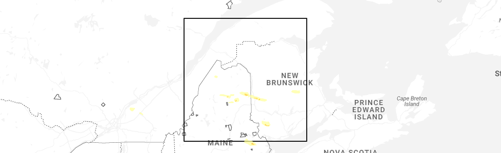
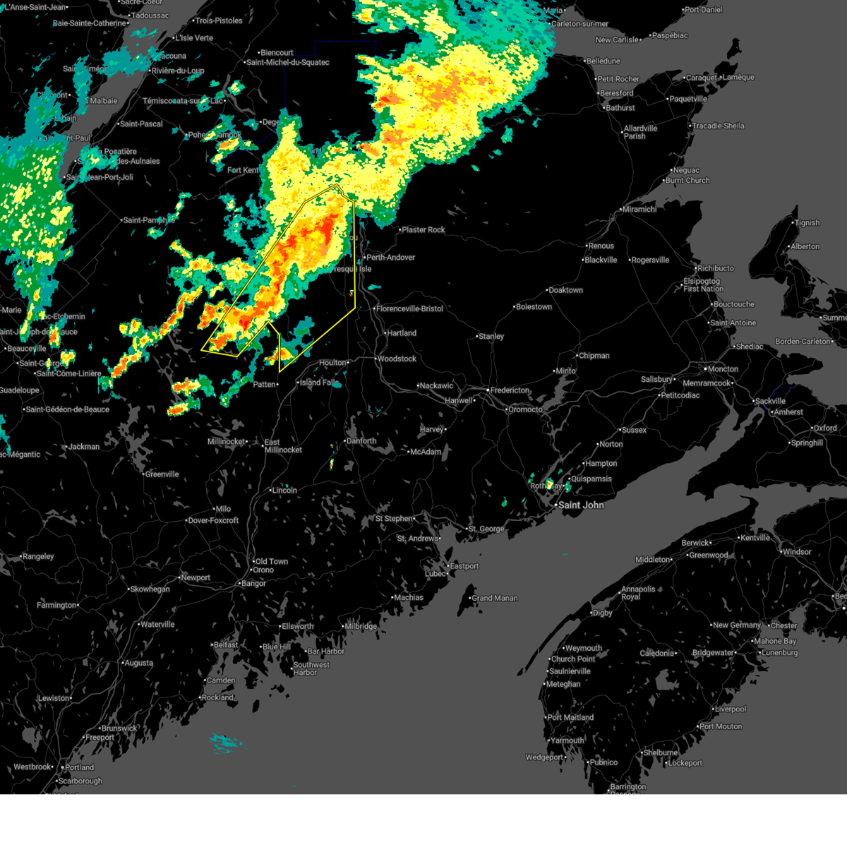
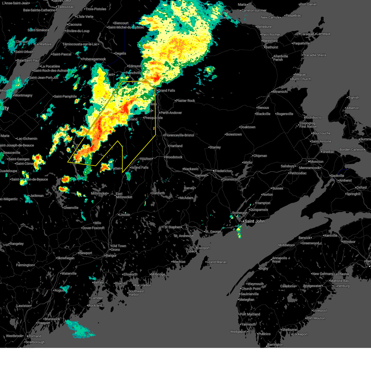
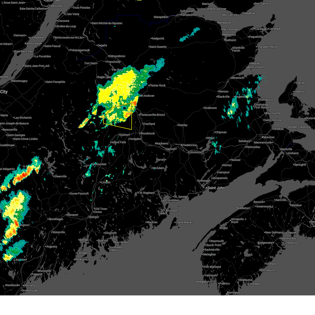
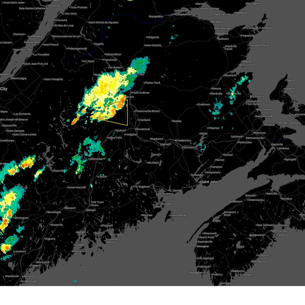
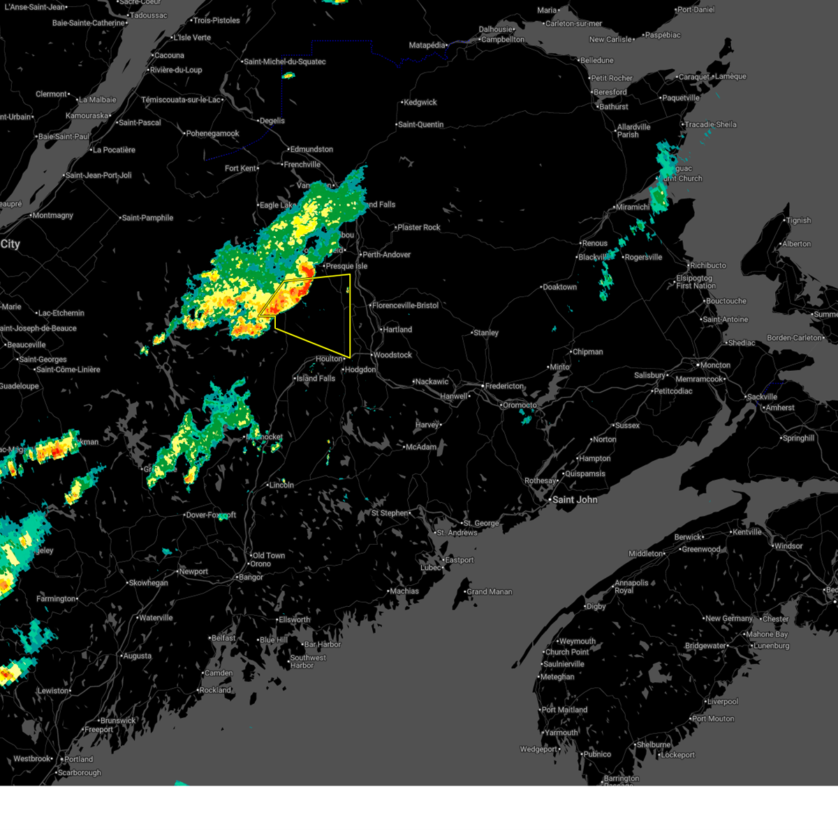
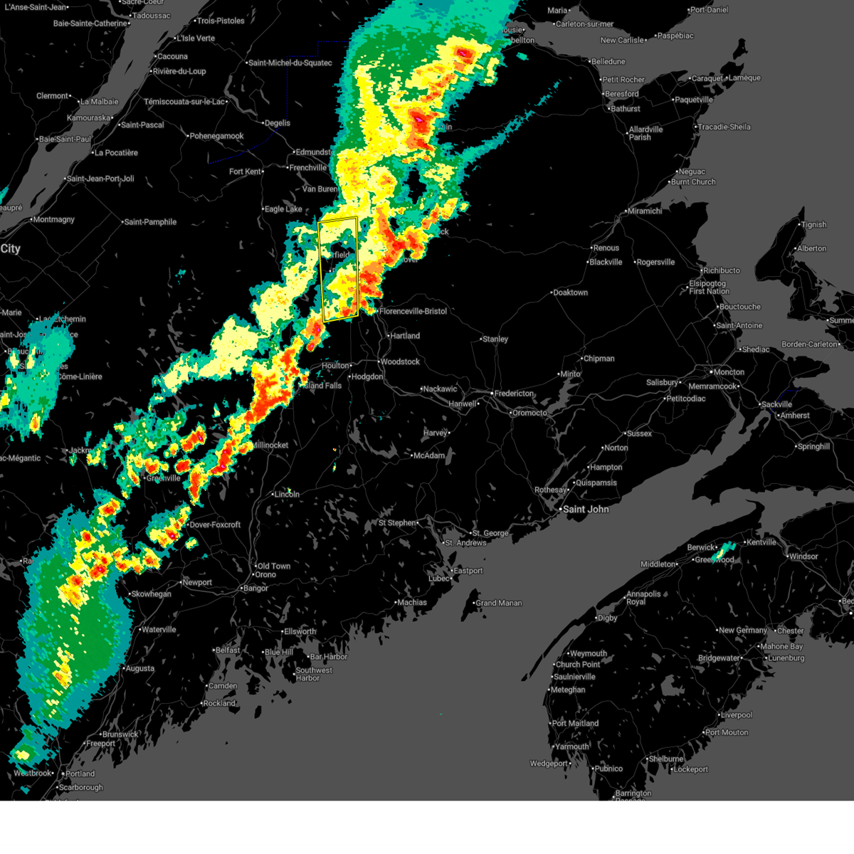
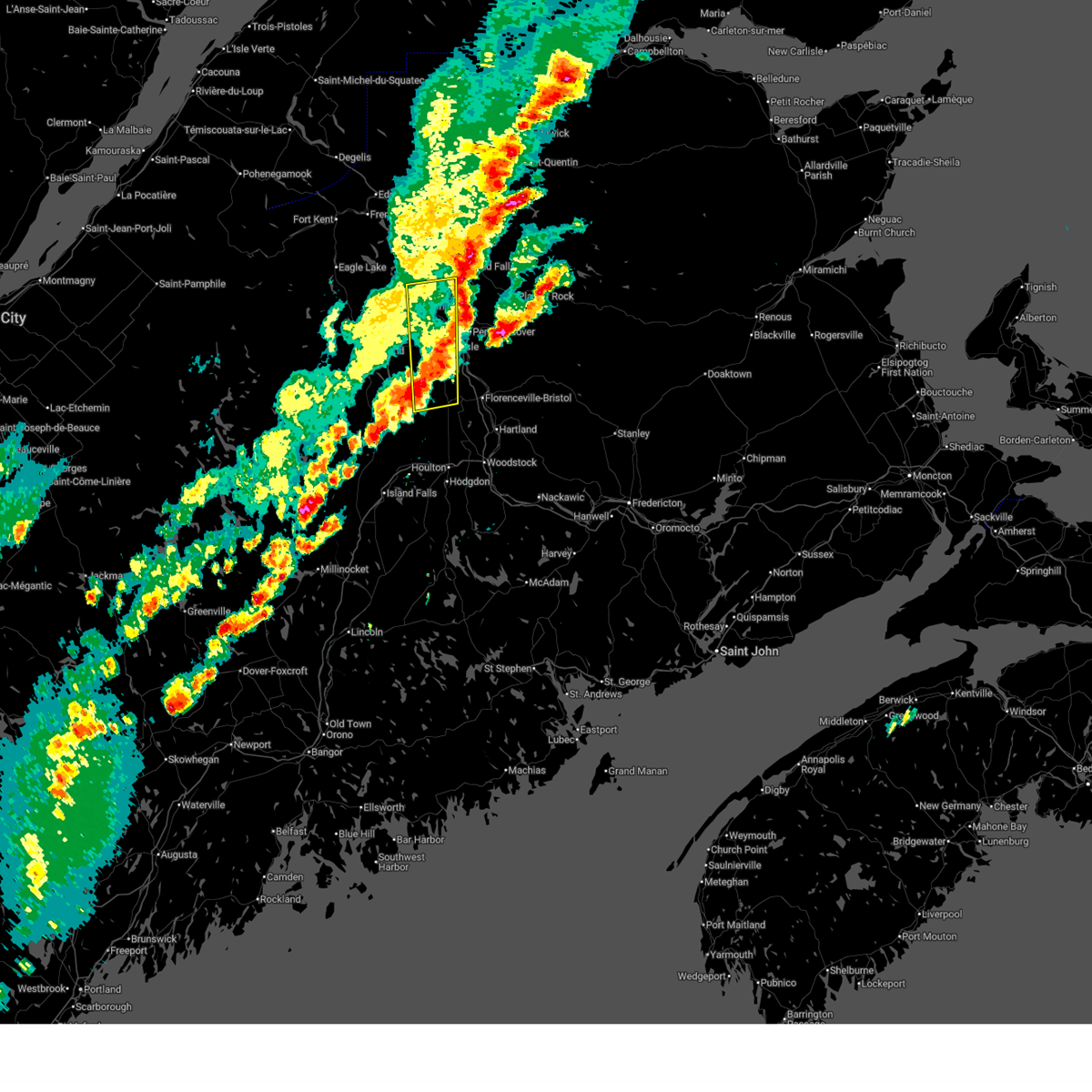
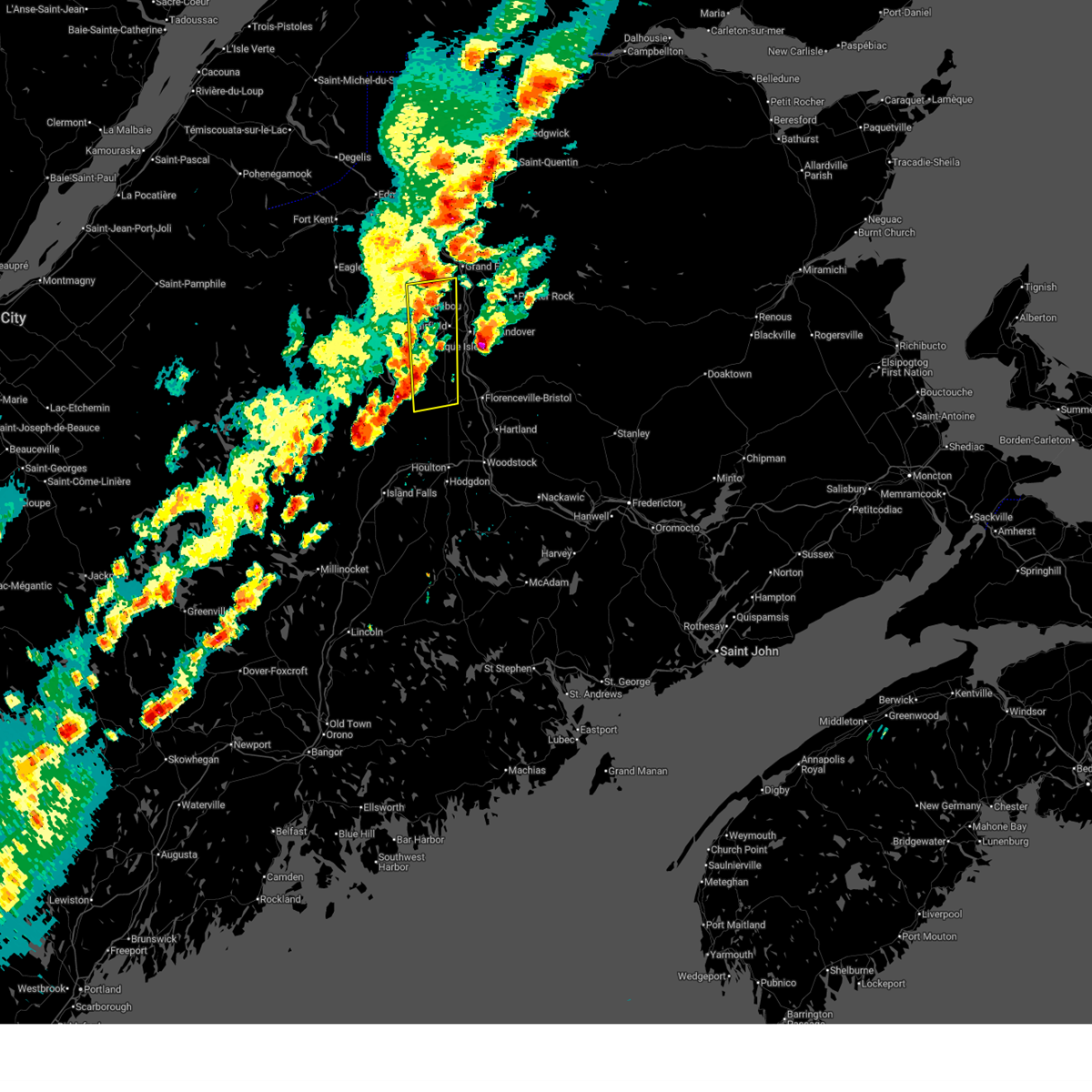
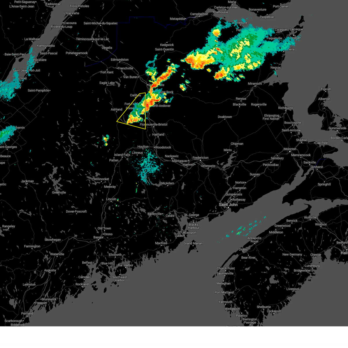
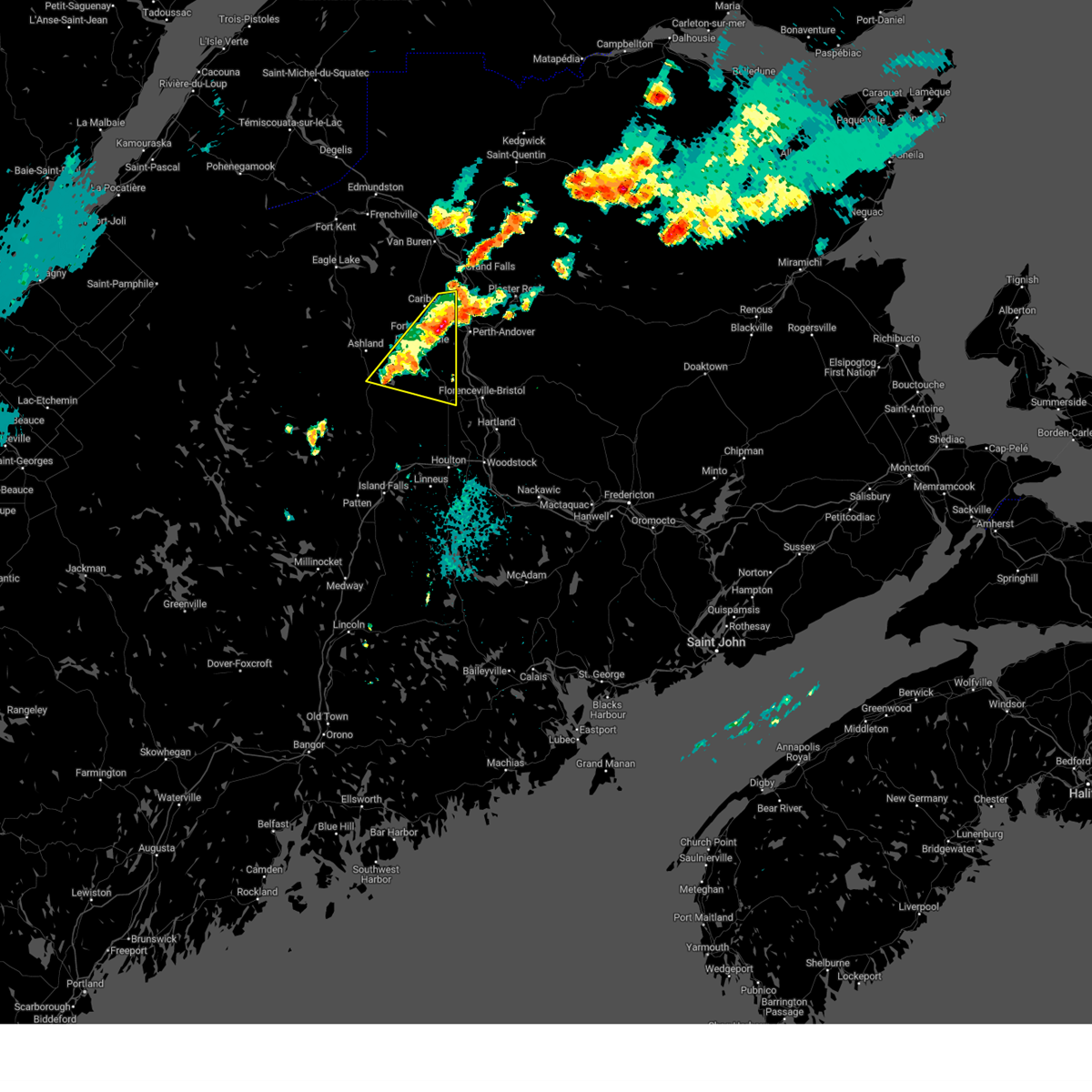
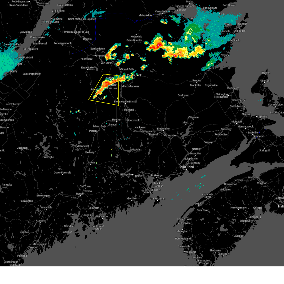
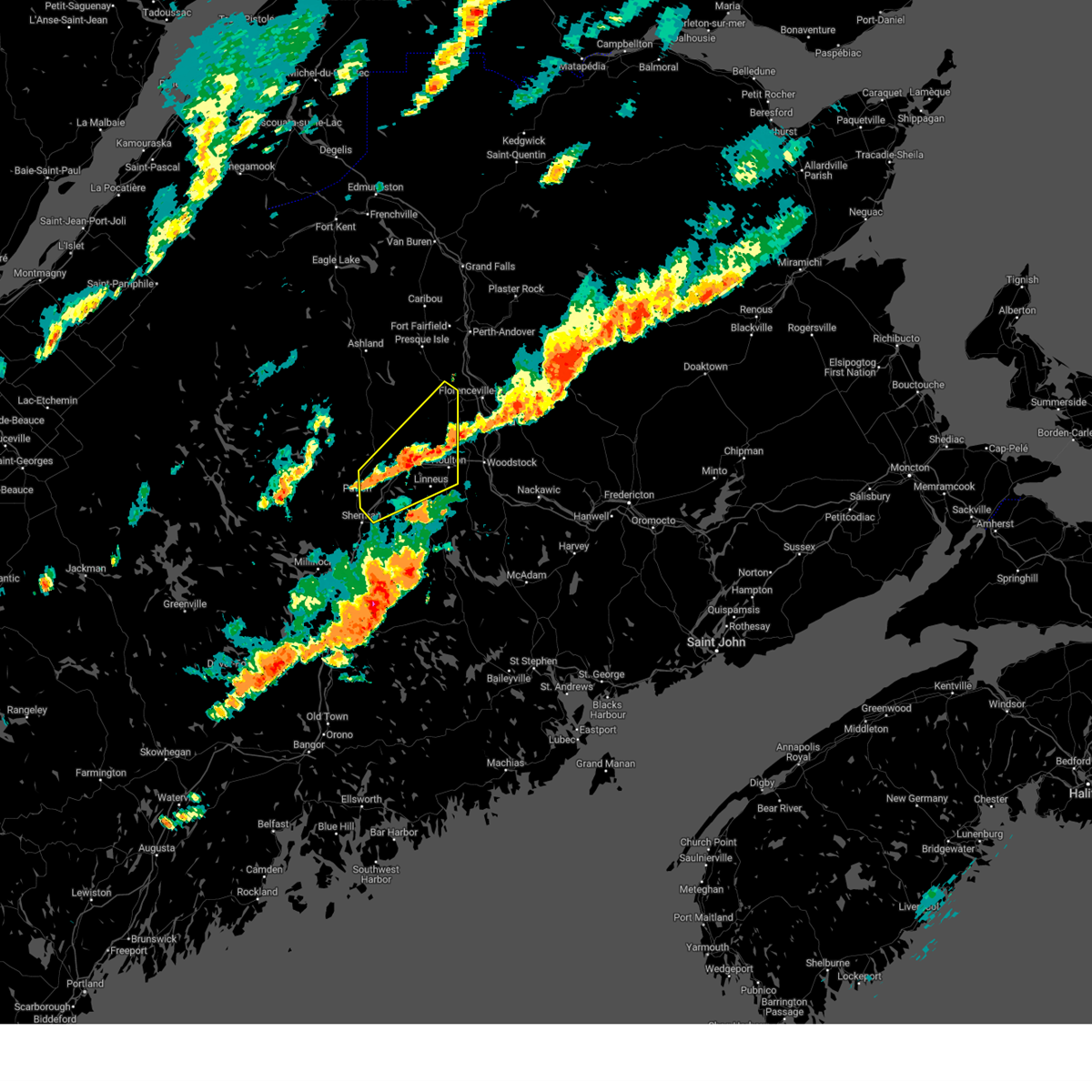
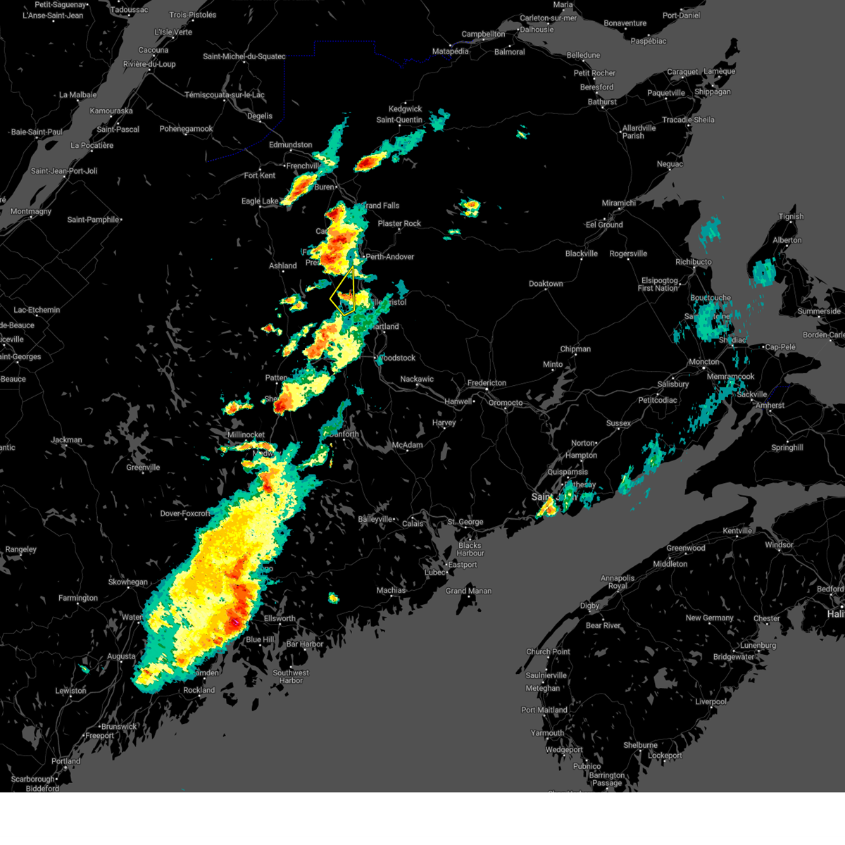
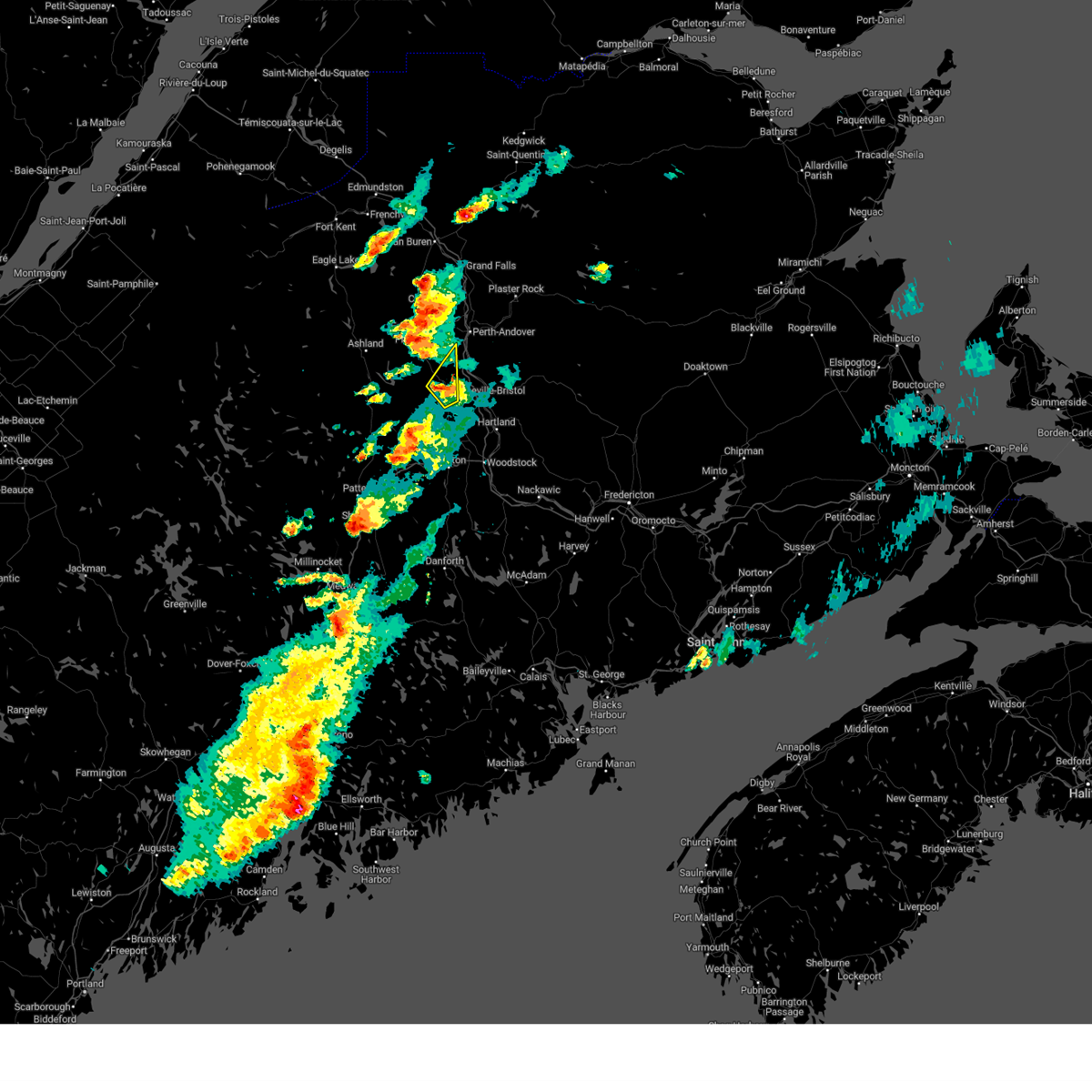
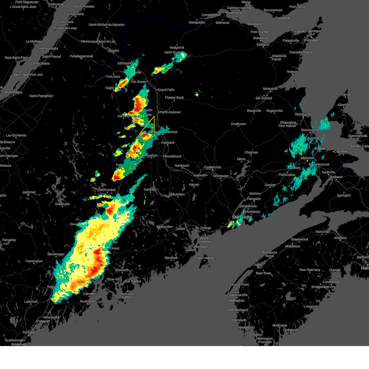
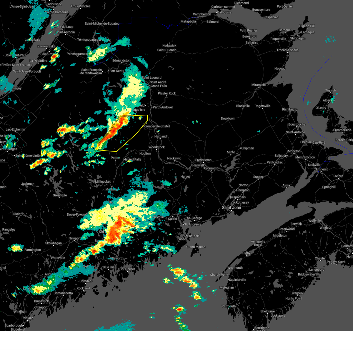
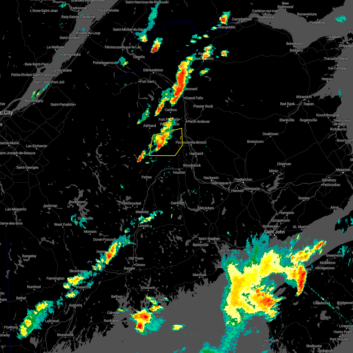
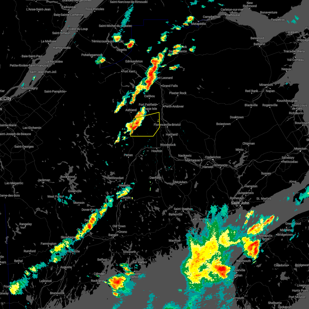
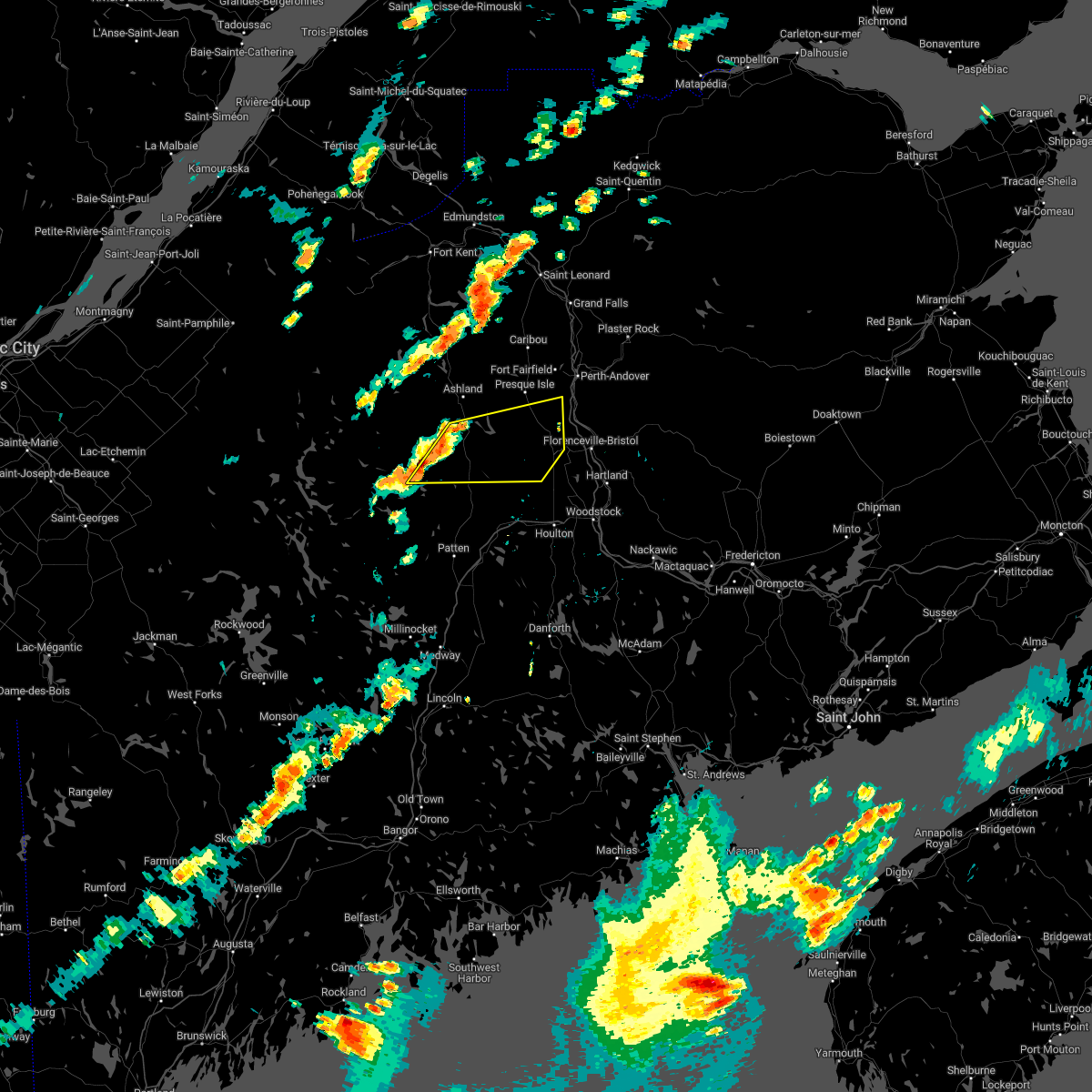
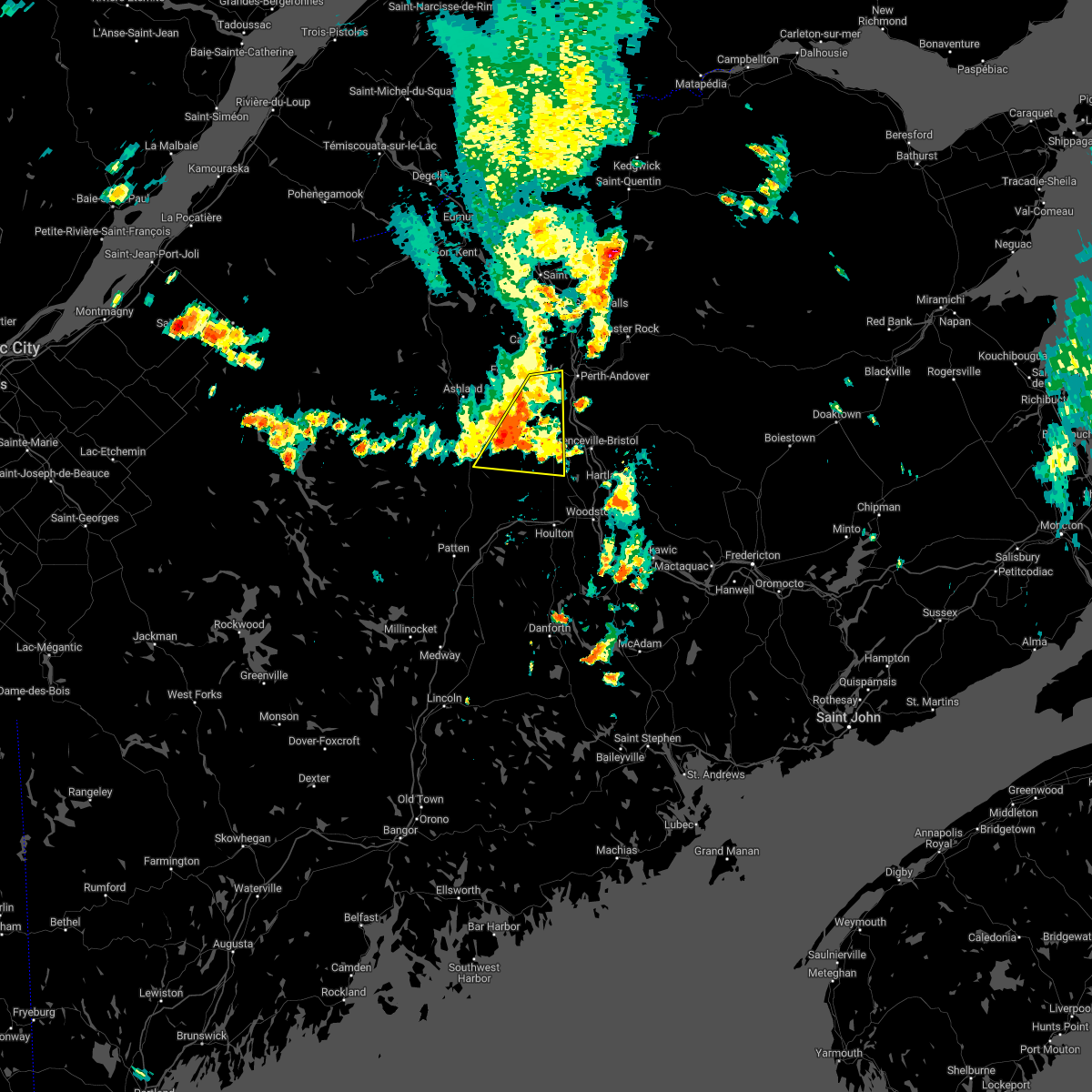
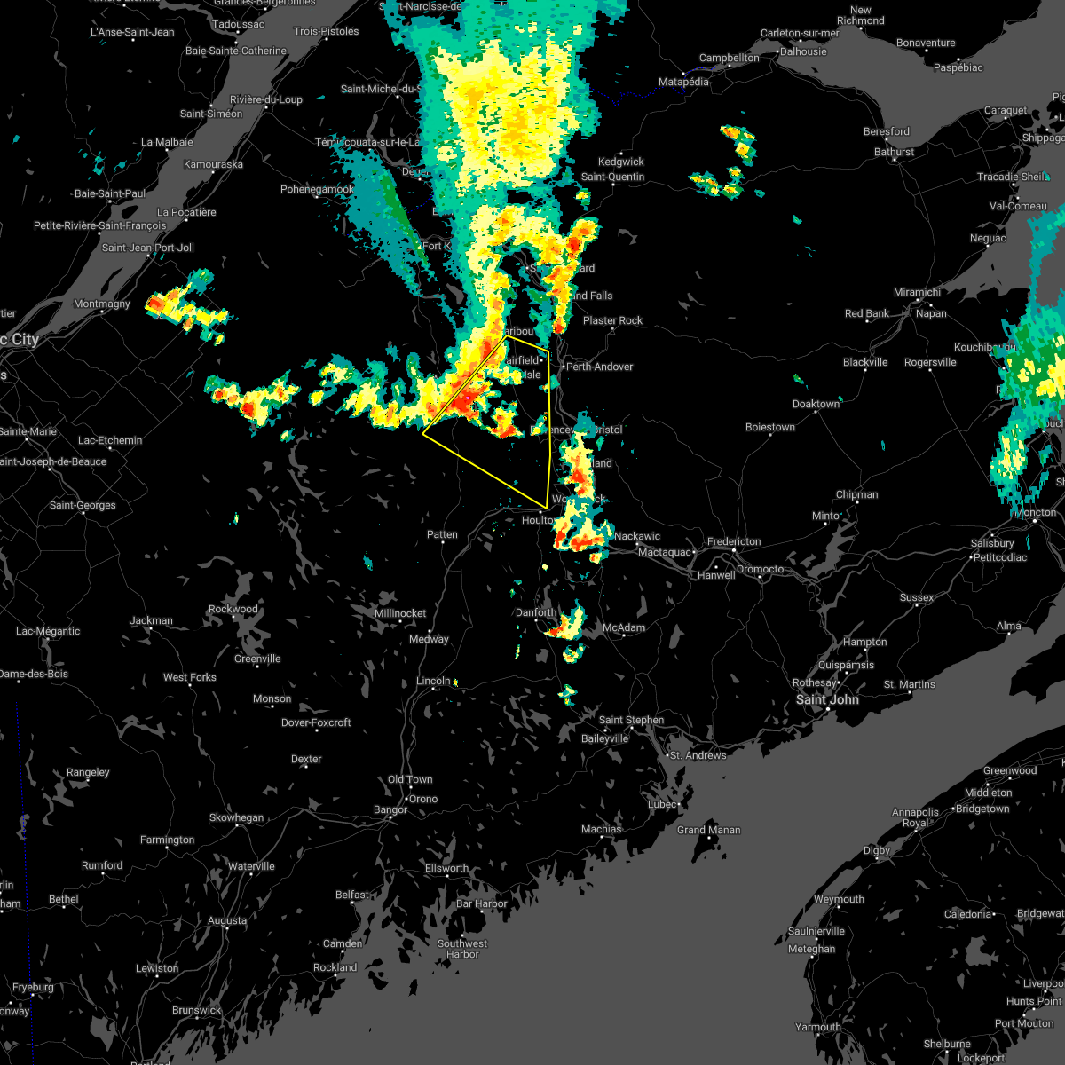
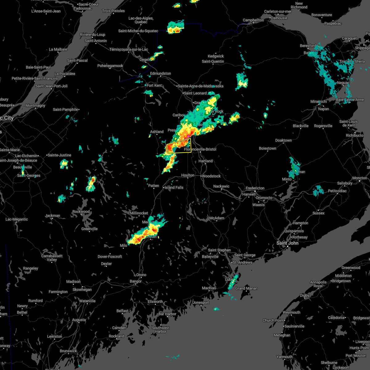
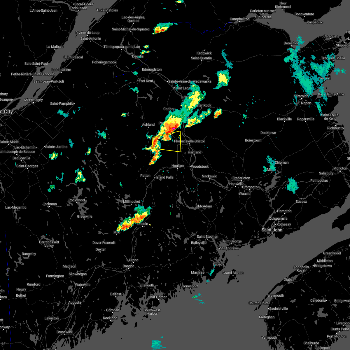
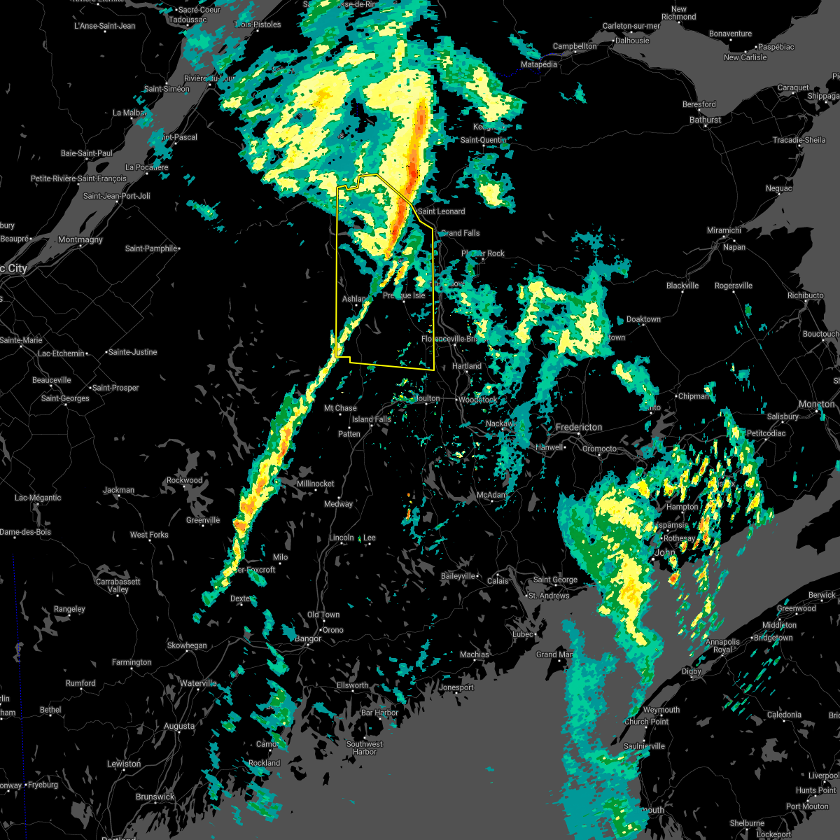
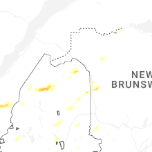
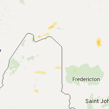
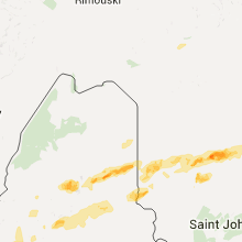
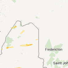
Hail Map for Blaine, ME
The Blaine, ME area has had 0 reports of on-the-ground hail by trained spotters, and has been under severe weather warnings 11 times during the past 12 months. Doppler radar has detected hail at or near Blaine, ME on 16 occasions, including 2 occasions during the past year.
| Name: | Blaine, ME |
| Where Located: | 26.1 miles SSE of Caribou, ME |
| Map: | Google Map for Blaine, ME |
| Population: | 301 |
| Housing Units: | 154 |
| More Info: | Search Google for Blaine, ME |
1
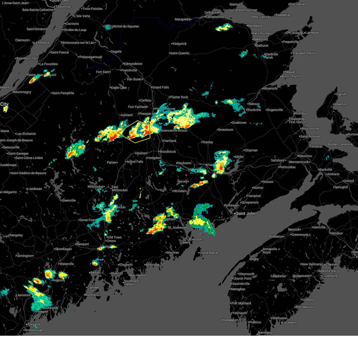
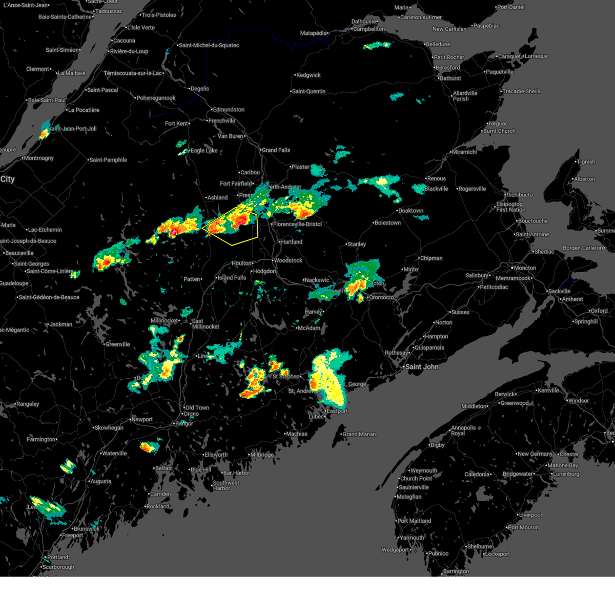
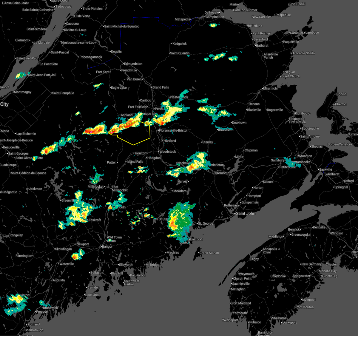
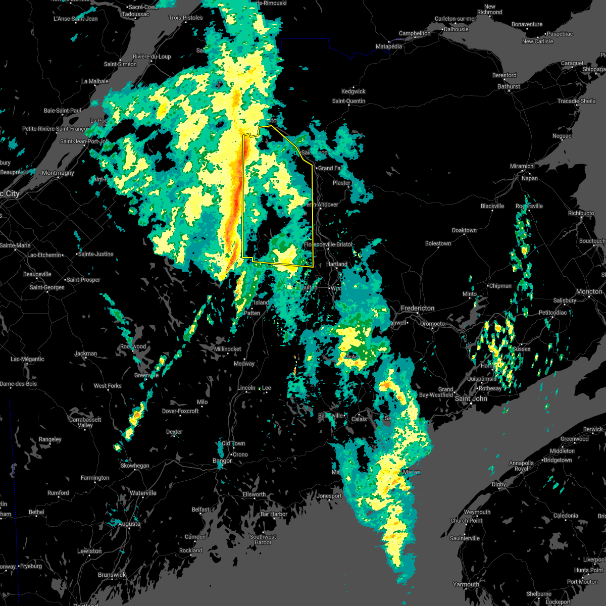
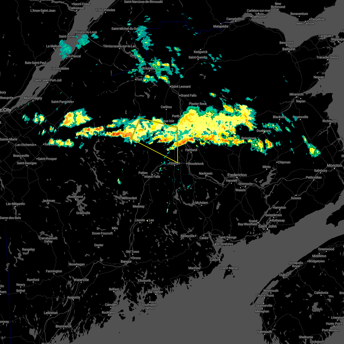
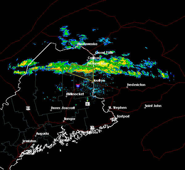
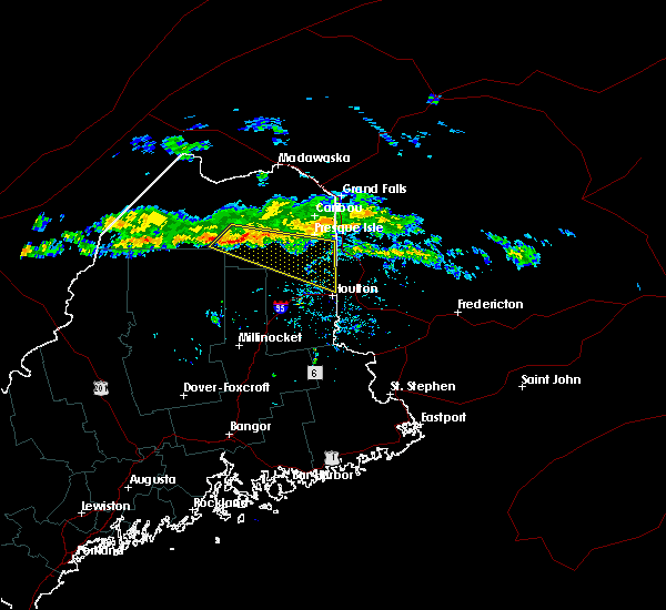
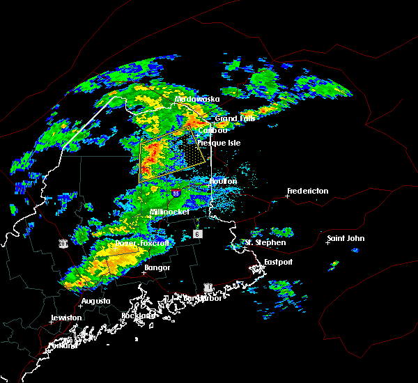
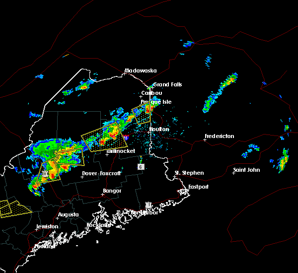
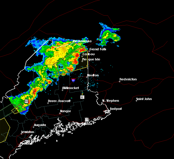
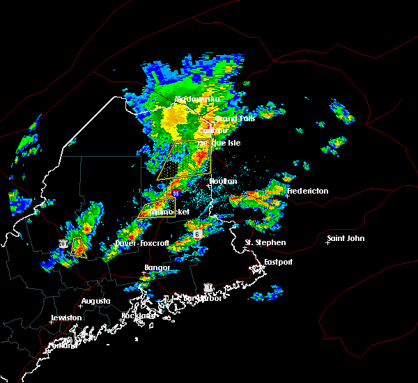
The Top Recent Hail Date for Blaine, ME is Wednesday, July 30, 2025 (7th out of 16)
Hail and Wind Damage Spotted near Blaine, ME
| Date / Time | Report Details |
|---|---|
| 7/30/2025 6:55 PM EDT |
 The storms which prompted the warning have moved out of the area. therefore, the warning will be allowed to expire. however, gusty winds and heavy rain are still possible with these thunderstorms. to report severe weather, contact your nearest law enforcement agency. they will relay your report to the national weather service caribou maine. The storms which prompted the warning have moved out of the area. therefore, the warning will be allowed to expire. however, gusty winds and heavy rain are still possible with these thunderstorms. to report severe weather, contact your nearest law enforcement agency. they will relay your report to the national weather service caribou maine.
|
| 7/30/2025 6:34 PM EDT |
 At 634 pm edt, severe thunderstorms were located along a line extending from near mars hill to 7 miles southeast of oxbow, moving east at 30 mph (radar indicated). Hazards include 60 mph wind gusts and quarter size hail. Minor hail damage to vehicles is possible. expect wind damage to trees and power lines. locations impacted include, mars hill, bridgewater, scopan, dudley township, monticello, blaine, westfield, saint croix, and number nine mountain. This includes us highway 1 between bridgewater and mars hill. At 634 pm edt, severe thunderstorms were located along a line extending from near mars hill to 7 miles southeast of oxbow, moving east at 30 mph (radar indicated). Hazards include 60 mph wind gusts and quarter size hail. Minor hail damage to vehicles is possible. expect wind damage to trees and power lines. locations impacted include, mars hill, bridgewater, scopan, dudley township, monticello, blaine, westfield, saint croix, and number nine mountain. This includes us highway 1 between bridgewater and mars hill.
|
| 7/30/2025 6:16 PM EDT |
 Svrcar the national weather service in caribou maine has issued a * severe thunderstorm warning for, east central aroostook county in northern maine, * until 700 pm edt. * at 615 pm edt, severe thunderstorms were located along a line extending from near mars hill to near oxbow, moving east at 25 mph (radar indicated). Hazards include 60 mph wind gusts and penny size hail. expect damage to trees and power lines Svrcar the national weather service in caribou maine has issued a * severe thunderstorm warning for, east central aroostook county in northern maine, * until 700 pm edt. * at 615 pm edt, severe thunderstorms were located along a line extending from near mars hill to near oxbow, moving east at 25 mph (radar indicated). Hazards include 60 mph wind gusts and penny size hail. expect damage to trees and power lines
|
| 7/17/2025 6:45 PM EDT |
 At 644 pm edt, severe thunderstorms were located along a line extending from caribou to ashland to moosehorn crossing, moving east at 40 mph (radar indicated). Hazards include 60 mph wind gusts. Expect damage to trees and power lines. locations impacted include, presque isle, caribou, fort fairfield, limestone, van buren, portage, mapleton, washburn, mars hill, ashland, easton, woodland, bridgewater, portage lake, masardis, oxbow, loring, moosehorn crossing, scopan, and nashville plantation. this includes the following highways, us highway 1 between bridgewater and van buren. State highway 11 between knowles corner and portage. At 644 pm edt, severe thunderstorms were located along a line extending from caribou to ashland to moosehorn crossing, moving east at 40 mph (radar indicated). Hazards include 60 mph wind gusts. Expect damage to trees and power lines. locations impacted include, presque isle, caribou, fort fairfield, limestone, van buren, portage, mapleton, washburn, mars hill, ashland, easton, woodland, bridgewater, portage lake, masardis, oxbow, loring, moosehorn crossing, scopan, and nashville plantation. this includes the following highways, us highway 1 between bridgewater and van buren. State highway 11 between knowles corner and portage.
|
| 7/17/2025 6:09 PM EDT |
 Svrcar the national weather service in caribou maine has issued a * severe thunderstorm warning for, northeastern piscataquis county in north central maine, eastern aroostook county in northern maine, north central penobscot county in east central maine, * until 715 pm edt. * at 609 pm edt, severe thunderstorms were located along a line extending from 6 miles south of van buren to near chesuncook lake, moving east at 40 mph (radar indicated). Hazards include 60 mph wind gusts. expect damage to trees and power lines Svrcar the national weather service in caribou maine has issued a * severe thunderstorm warning for, northeastern piscataquis county in north central maine, eastern aroostook county in northern maine, north central penobscot county in east central maine, * until 715 pm edt. * at 609 pm edt, severe thunderstorms were located along a line extending from 6 miles south of van buren to near chesuncook lake, moving east at 40 mph (radar indicated). Hazards include 60 mph wind gusts. expect damage to trees and power lines
|
| 7/14/2025 5:35 PM EDT |
 The storms which prompted the warning have weakened below severe limits, and no longer pose an immediate threat to life or property. therefore, the warning will be allowed to expire. The storms which prompted the warning have weakened below severe limits, and no longer pose an immediate threat to life or property. therefore, the warning will be allowed to expire.
|
| 7/14/2025 5:16 PM EDT |
 At 515 pm edt, severe thunderstorms were located along a line extending from near mars hill to 7 miles west of bridgewater to 10 miles northwest of dudley township, moving east at 25 mph (radar indicated). Hazards include 60 mph wind gusts and quarter size hail. Minor hail damage to vehicles is possible. expect wind damage to trees and power lines. locations impacted include, presque isle, mars hill, easton, bridgewater, masardis, scopan, dudley township, littleton, monticello, blaine, westfield, chapman, scopan lake, saint croix, number nine mountain, and webbertown. This includes us highway 1 between littleton and mars hill. At 515 pm edt, severe thunderstorms were located along a line extending from near mars hill to 7 miles west of bridgewater to 10 miles northwest of dudley township, moving east at 25 mph (radar indicated). Hazards include 60 mph wind gusts and quarter size hail. Minor hail damage to vehicles is possible. expect wind damage to trees and power lines. locations impacted include, presque isle, mars hill, easton, bridgewater, masardis, scopan, dudley township, littleton, monticello, blaine, westfield, chapman, scopan lake, saint croix, number nine mountain, and webbertown. This includes us highway 1 between littleton and mars hill.
|
| 7/14/2025 4:46 PM EDT |
 Svrcar the national weather service in caribou maine has issued a * severe thunderstorm warning for, east central aroostook county in northern maine, * until 545 pm edt. * at 446 pm edt, severe thunderstorms were located along a line extending from 10 miles east of masardis to near scopan to 6 miles south of oxbow, moving east at 30 mph (public). Hazards include 60 mph wind gusts and quarter size hail. Minor hail damage to vehicles is possible. Expect wind damage to trees and power lines. Svrcar the national weather service in caribou maine has issued a * severe thunderstorm warning for, east central aroostook county in northern maine, * until 545 pm edt. * at 446 pm edt, severe thunderstorms were located along a line extending from 10 miles east of masardis to near scopan to 6 miles south of oxbow, moving east at 30 mph (public). Hazards include 60 mph wind gusts and quarter size hail. Minor hail damage to vehicles is possible. Expect wind damage to trees and power lines.
|
| 7/3/2025 1:11 PM EDT |
 The storm which prompted the warning has weakened below severe limits, and no longer poses an immediate threat to life or property. therefore, the warning will be allowed to expire. a severe thunderstorm watch remains in effect until 600 pm edt for northern maine. The storm which prompted the warning has weakened below severe limits, and no longer poses an immediate threat to life or property. therefore, the warning will be allowed to expire. a severe thunderstorm watch remains in effect until 600 pm edt for northern maine.
|
| 7/3/2025 12:49 PM EDT |
 At 1248 pm edt, a severe thunderstorm was located near mars hill, or 14 miles southeast of presque isle, moving east at 25 mph (radar indicated). Hazards include 60 mph wind gusts and quarter size hail. Minor hail damage to vehicles is possible. expect wind damage to trees and power lines. locations impacted include, presque isle, caribou, fort fairfield, limestone, mapleton, washburn, mars hill, easton, woodland, bridgewater, loring, blaine, new sweden, westfield, chapman, connor, caswell, and number nine mountain. This includes us highway 1 between bridgewater and caribou. At 1248 pm edt, a severe thunderstorm was located near mars hill, or 14 miles southeast of presque isle, moving east at 25 mph (radar indicated). Hazards include 60 mph wind gusts and quarter size hail. Minor hail damage to vehicles is possible. expect wind damage to trees and power lines. locations impacted include, presque isle, caribou, fort fairfield, limestone, mapleton, washburn, mars hill, easton, woodland, bridgewater, loring, blaine, new sweden, westfield, chapman, connor, caswell, and number nine mountain. This includes us highway 1 between bridgewater and caribou.
|
| 7/3/2025 12:28 PM EDT |
 Svrcar the national weather service in caribou maine has issued a * severe thunderstorm warning for, east central aroostook county in northern maine, * until 115 pm edt. * at 1227 pm edt, a severe thunderstorm was located near mars hill, or 10 miles south of presque isle, moving east at 25 mph (radar indicated). Hazards include 60 mph wind gusts and quarter size hail. Minor hail damage to vehicles is possible. Expect wind damage to trees and power lines. Svrcar the national weather service in caribou maine has issued a * severe thunderstorm warning for, east central aroostook county in northern maine, * until 115 pm edt. * at 1227 pm edt, a severe thunderstorm was located near mars hill, or 10 miles south of presque isle, moving east at 25 mph (radar indicated). Hazards include 60 mph wind gusts and quarter size hail. Minor hail damage to vehicles is possible. Expect wind damage to trees and power lines.
|
| 6/5/2025 6:35 PM EDT | Tree down along east blaine roa in aroostook county ME, 2.8 miles W of Blaine, ME |
| 8/3/2024 9:09 PM EDT |
 The storms which prompted the warning have moved out of the area. therefore, the warning will be allowed to expire. The storms which prompted the warning have moved out of the area. therefore, the warning will be allowed to expire.
|
| 8/3/2024 8:55 PM EDT |
 At 854 pm edt, severe thunderstorms were located along a line extending from 6 miles northeast of fort fairfield to near scopan, moving east at 25 mph (radar indicated). Hazards include 60 mph wind gusts and half dollar size hail. Minor hail damage to vehicles is possible. expect wind damage to trees and power lines. Locations impacted include, presque isle, caribou, fort fairfield, limestone, mapleton, washburn, mars hill, ashland, easton, bridgewater, masardis, scopan, blaine, westfield, chapman, castle hill, scopan mountain, and scopan lake. At 854 pm edt, severe thunderstorms were located along a line extending from 6 miles northeast of fort fairfield to near scopan, moving east at 25 mph (radar indicated). Hazards include 60 mph wind gusts and half dollar size hail. Minor hail damage to vehicles is possible. expect wind damage to trees and power lines. Locations impacted include, presque isle, caribou, fort fairfield, limestone, mapleton, washburn, mars hill, ashland, easton, bridgewater, masardis, scopan, blaine, westfield, chapman, castle hill, scopan mountain, and scopan lake.
|
| 8/3/2024 8:37 PM EDT |
 Svrcar the national weather service in caribou maine has issued a * severe thunderstorm warning for, east central aroostook county in northern maine, * until 915 pm edt. * at 837 pm edt, severe thunderstorms were located along a line extending from near limestone to near masardis, moving east at 25 mph (radar indicated). Hazards include 60 mph wind gusts and quarter size hail. Minor hail damage to vehicles is possible. Expect wind damage to trees and power lines. Svrcar the national weather service in caribou maine has issued a * severe thunderstorm warning for, east central aroostook county in northern maine, * until 915 pm edt. * at 837 pm edt, severe thunderstorms were located along a line extending from near limestone to near masardis, moving east at 25 mph (radar indicated). Hazards include 60 mph wind gusts and quarter size hail. Minor hail damage to vehicles is possible. Expect wind damage to trees and power lines.
|
| 7/5/2024 12:30 PM EDT | Tree down on power line in aroostook county ME, 4.7 miles NNW of Blaine, ME |
| 6/30/2024 2:44 PM EDT |
 Svrcar the national weather service in caribou maine has issued a * severe thunderstorm warning for, southeastern aroostook county in northern maine, * until 330 pm edt. * at 243 pm edt, severe thunderstorms were located along a line extending from 8 miles southeast of bridgewater to near mount chase, moving east at 20 mph (radar indicated). Hazards include 70 mph wind gusts and quarter size hail. Minor hail damage to vehicles is possible. expect considerable tree damage. Wind damage is also likely to mobile homes, roofs, and outbuildings. Svrcar the national weather service in caribou maine has issued a * severe thunderstorm warning for, southeastern aroostook county in northern maine, * until 330 pm edt. * at 243 pm edt, severe thunderstorms were located along a line extending from 8 miles southeast of bridgewater to near mount chase, moving east at 20 mph (radar indicated). Hazards include 70 mph wind gusts and quarter size hail. Minor hail damage to vehicles is possible. expect considerable tree damage. Wind damage is also likely to mobile homes, roofs, and outbuildings.
|
| 6/30/2024 2:43 PM EDT |
 Svrcar the national weather service in caribou maine has issued a * severe thunderstorm warning for, southeastern aroostook county in northern maine, * until 330 pm edt. * at 243 pm edt, severe thunderstorms were located along a line extending from 8 miles southeast of bridgewater to near mount chase, moving east at 20 mph (radar indicated). Hazards include 70 mph wind gusts and quarter size hail. Minor hail damage to vehicles is possible. expect considerable tree damage. Wind damage is also likely to mobile homes, roofs, and outbuildings. Svrcar the national weather service in caribou maine has issued a * severe thunderstorm warning for, southeastern aroostook county in northern maine, * until 330 pm edt. * at 243 pm edt, severe thunderstorms were located along a line extending from 8 miles southeast of bridgewater to near mount chase, moving east at 20 mph (radar indicated). Hazards include 70 mph wind gusts and quarter size hail. Minor hail damage to vehicles is possible. expect considerable tree damage. Wind damage is also likely to mobile homes, roofs, and outbuildings.
|
| 5/23/2024 3:34 PM EDT |
 the severe thunderstorm warning has been cancelled and is no longer in effect the severe thunderstorm warning has been cancelled and is no longer in effect
|
| 5/23/2024 3:28 PM EDT |
 At 328 pm edt, a severe thunderstorm was located near mars hill, or 13 miles south of presque isle, moving northeast at 35 mph (radar indicated). Hazards include 60 mph wind gusts and quarter size hail. Minor hail damage to vehicles is possible. expect wind damage to trees and power lines. Locations impacted include, mars hill, easton, bridgewater, blaine, and westfield. At 328 pm edt, a severe thunderstorm was located near mars hill, or 13 miles south of presque isle, moving northeast at 35 mph (radar indicated). Hazards include 60 mph wind gusts and quarter size hail. Minor hail damage to vehicles is possible. expect wind damage to trees and power lines. Locations impacted include, mars hill, easton, bridgewater, blaine, and westfield.
|
| 5/23/2024 3:18 PM EDT |
 Svrcar the national weather service in caribou maine has issued a * severe thunderstorm warning for, east central aroostook county in northern maine, * until 345 pm edt. * at 318 pm edt, a severe thunderstorm was located 7 miles west of bridgewater, or 17 miles south of presque isle, moving northeast at 35 mph (radar indicated). Hazards include 60 mph wind gusts and quarter size hail. Minor hail damage to vehicles is possible. Expect wind damage to trees and power lines. Svrcar the national weather service in caribou maine has issued a * severe thunderstorm warning for, east central aroostook county in northern maine, * until 345 pm edt. * at 318 pm edt, a severe thunderstorm was located 7 miles west of bridgewater, or 17 miles south of presque isle, moving northeast at 35 mph (radar indicated). Hazards include 60 mph wind gusts and quarter size hail. Minor hail damage to vehicles is possible. Expect wind damage to trees and power lines.
|
| 8/13/2023 5:56 PM EDT |
 At 555 pm edt, severe thunderstorms were located along a line extending from near masardis to near oxbow to 6 miles south of moosehorn crossing, moving east at 20 mph (radar indicated). Hazards include 60 mph wind gusts and quarter size hail. Minor hail damage to vehicles is possible. Expect wind damage to trees and power lines. At 555 pm edt, severe thunderstorms were located along a line extending from near masardis to near oxbow to 6 miles south of moosehorn crossing, moving east at 20 mph (radar indicated). Hazards include 60 mph wind gusts and quarter size hail. Minor hail damage to vehicles is possible. Expect wind damage to trees and power lines.
|
| 7/25/2022 5:11 PM EDT |
 The severe thunderstorm warning for east central aroostook county will expire at 515 pm edt, the storms which prompted the warning have weakened below severe limits, but frequent cloud to ground lightning and heavy downpours are still likely. therefore, the warning will be allowed to expire. however small hail and gusty winds are still possible with these thunderstorms. a severe thunderstorm watch remains in effect until 800 pm edt for northern maine. The severe thunderstorm warning for east central aroostook county will expire at 515 pm edt, the storms which prompted the warning have weakened below severe limits, but frequent cloud to ground lightning and heavy downpours are still likely. therefore, the warning will be allowed to expire. however small hail and gusty winds are still possible with these thunderstorms. a severe thunderstorm watch remains in effect until 800 pm edt for northern maine.
|
| 7/25/2022 5:02 PM EDT |
 At 502 pm edt, severe thunderstorms were located along a line extending from near scopan to 7 miles southeast of masardis, moving east at 40 mph (radar indicated). Hazards include 60 mph wind gusts and quarter size hail. Minor hail damage to vehicles is possible. expect wind damage to trees and power lines. these severe storms will be near, easton around 530 pm edt. mars hill around 540 pm edt. other locations impacted by these severe thunderstorms include saint croix, scopan lake, blaine, westfield, number nine mountain, chapman and monticello. hail threat, radar indicated max hail size, 1. 00 in wind threat, radar indicated max wind gust, 60 mph. At 502 pm edt, severe thunderstorms were located along a line extending from near scopan to 7 miles southeast of masardis, moving east at 40 mph (radar indicated). Hazards include 60 mph wind gusts and quarter size hail. Minor hail damage to vehicles is possible. expect wind damage to trees and power lines. these severe storms will be near, easton around 530 pm edt. mars hill around 540 pm edt. other locations impacted by these severe thunderstorms include saint croix, scopan lake, blaine, westfield, number nine mountain, chapman and monticello. hail threat, radar indicated max hail size, 1. 00 in wind threat, radar indicated max wind gust, 60 mph.
|
| 7/25/2022 4:37 PM EDT |
 At 436 pm edt, severe thunderstorms were located along a line extending from near oxbow to 9 miles east of moosehorn crossing, moving east at 40 mph (radar indicated). Hazards include two inch hail and 70 mph wind gusts. People and animals outdoors will be injured. expect hail damage to roofs, siding, windows, and vehicles. expect considerable tree damage. wind damage is also likely to mobile homes, roofs, and outbuildings. severe thunderstorms will be near, masardis around 445 pm edt. scopan around 510 pm edt. Other locations impacted by these severe thunderstorms include saint croix, scopan lake, blaine, squa pan, westfield, number nine mountain, chapman and monticello. At 436 pm edt, severe thunderstorms were located along a line extending from near oxbow to 9 miles east of moosehorn crossing, moving east at 40 mph (radar indicated). Hazards include two inch hail and 70 mph wind gusts. People and animals outdoors will be injured. expect hail damage to roofs, siding, windows, and vehicles. expect considerable tree damage. wind damage is also likely to mobile homes, roofs, and outbuildings. severe thunderstorms will be near, masardis around 445 pm edt. scopan around 510 pm edt. Other locations impacted by these severe thunderstorms include saint croix, scopan lake, blaine, squa pan, westfield, number nine mountain, chapman and monticello.
|
| 7/19/2022 4:25 PM EDT | At least one large tree down across u.s. 1 in bridgewater closing the roa in aroostook county ME, 4.7 miles NNW of Blaine, ME |
| 7/19/2022 4:18 PM EDT | Numerous trees down on boundary line rd... blocking access to the bridgewater port of entry. time estimate from rada in aroostook county ME, 4.8 miles NW of Blaine, ME |
| 7/19/2022 4:17 PM EDT | Several trees down and other small trees snapped. time estimate based on rada in aroostook county ME, 5.3 miles NNW of Blaine, ME |
| 7/19/2022 4:11 PM EDT |
 At 411 pm edt, severe thunderstorms were located along a line extending from near fort fairfield to near scopan, moving east at 45 mph (radar indicated). Hazards include 60 mph wind gusts. Expect damage to trees and power lines. locations impacted include, presque isle, fort fairfield, mapleton, mars hill, easton, bridgewater, scopan, monticello, blaine, westfield, chapman, number nine mountain and saint croix. hail threat, radar indicated max hail size, <. 75 in wind threat, radar indicated max wind gust, 60 mph. At 411 pm edt, severe thunderstorms were located along a line extending from near fort fairfield to near scopan, moving east at 45 mph (radar indicated). Hazards include 60 mph wind gusts. Expect damage to trees and power lines. locations impacted include, presque isle, fort fairfield, mapleton, mars hill, easton, bridgewater, scopan, monticello, blaine, westfield, chapman, number nine mountain and saint croix. hail threat, radar indicated max hail size, <. 75 in wind threat, radar indicated max wind gust, 60 mph.
|
| 7/19/2022 3:54 PM EDT |
 At 353 pm edt, severe thunderstorms were located along a line extending from near caribou to masardis, moving southeast at 45 mph (radar indicated). Hazards include 60 mph wind gusts. expect damage to trees and power lines At 353 pm edt, severe thunderstorms were located along a line extending from near caribou to masardis, moving southeast at 45 mph (radar indicated). Hazards include 60 mph wind gusts. expect damage to trees and power lines
|
| 6/17/2022 5:03 PM EDT |
 At 503 pm edt, a severe thunderstorm was located near scopan, or 15 miles southwest of presque isle, moving east at 20 mph (radar indicated). Hazards include 60 mph wind gusts and quarter size hail. Minor hail damage to vehicles is possible. expect wind damage to trees and power lines. Locations impacted include, mars hill, easton, bridgewater, scopan, blaine and westfield. At 503 pm edt, a severe thunderstorm was located near scopan, or 15 miles southwest of presque isle, moving east at 20 mph (radar indicated). Hazards include 60 mph wind gusts and quarter size hail. Minor hail damage to vehicles is possible. expect wind damage to trees and power lines. Locations impacted include, mars hill, easton, bridgewater, scopan, blaine and westfield.
|
| 6/17/2022 4:50 PM EDT |
 At 449 pm edt, a severe thunderstorm was located over scopan, or 18 miles southwest of presque isle, moving east at 20 mph (radar indicated). Hazards include 60 mph wind gusts and quarter size hail. Minor hail damage to vehicles is possible. Expect wind damage to trees and power lines. At 449 pm edt, a severe thunderstorm was located over scopan, or 18 miles southwest of presque isle, moving east at 20 mph (radar indicated). Hazards include 60 mph wind gusts and quarter size hail. Minor hail damage to vehicles is possible. Expect wind damage to trees and power lines.
|
| 9/30/2020 12:41 PM EDT |
 The severe thunderstorm warning for northeastern aroostook county will expire at 1245 pm edt, the line of showers which prompted the warning have moved out of the area. therefore, the warning will be allowed to expire. however gusty winds to 40 mph are still possible. The severe thunderstorm warning for northeastern aroostook county will expire at 1245 pm edt, the line of showers which prompted the warning have moved out of the area. therefore, the warning will be allowed to expire. however gusty winds to 40 mph are still possible.
|
| 9/30/2020 12:01 PM EDT |
 At 1159 am edt, intense showers with embedded thunder were located along a line extending from near frenchville to 7 miles southeast of moosehorn crossing, moving east at 50 mph (radar indicated). Hazards include 60 mph wind gusts. expect damage to trees and power lines At 1159 am edt, intense showers with embedded thunder were located along a line extending from near frenchville to 7 miles southeast of moosehorn crossing, moving east at 50 mph (radar indicated). Hazards include 60 mph wind gusts. expect damage to trees and power lines
|
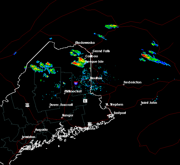
| 7/9/2020 6:43 PM EDT |
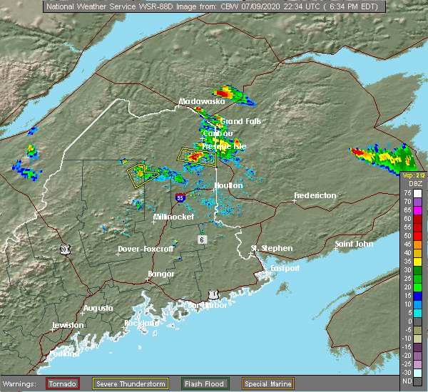 At 643 pm edt, a severe thunderstorm was located near presque isle, moving east at 30 mph (radar indicated). Hazards include 60 mph wind gusts and quarter size hail. Minor hail damage to vehicles is possible. expect wind damage to trees and power lines. Locations impacted include, presque isle, mapleton, mars hill, easton, blaine, westfield and chapman. At 643 pm edt, a severe thunderstorm was located near presque isle, moving east at 30 mph (radar indicated). Hazards include 60 mph wind gusts and quarter size hail. Minor hail damage to vehicles is possible. expect wind damage to trees and power lines. Locations impacted include, presque isle, mapleton, mars hill, easton, blaine, westfield and chapman.
|
| 7/9/2020 6:24 PM EDT |
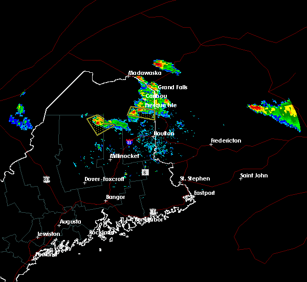 At 624 pm edt, a severe thunderstorm was located near mapleton, or 9 miles west of presque isle, moving east at 30 mph (radar indicated). Hazards include 60 mph wind gusts and quarter size hail. Minor hail damage to vehicles is possible. Expect wind damage to trees and power lines. At 624 pm edt, a severe thunderstorm was located near mapleton, or 9 miles west of presque isle, moving east at 30 mph (radar indicated). Hazards include 60 mph wind gusts and quarter size hail. Minor hail damage to vehicles is possible. Expect wind damage to trees and power lines.
|
| 7/9/2020 12:56 PM EDT |
 The national weather service in caribou maine has issued a * severe thunderstorm warning for. east central aroostook county in northern maine. until 200 pm edt. At 1254 pm edt, severe thunderstorms were located along a line extending from near woodland to 6 miles west of mapleton, moving. The national weather service in caribou maine has issued a * severe thunderstorm warning for. east central aroostook county in northern maine. until 200 pm edt. At 1254 pm edt, severe thunderstorms were located along a line extending from near woodland to 6 miles west of mapleton, moving.
|
| 10/9/2018 11:57 PM EDT |
 The severe thunderstorm warning for east central aroostook county will expire at midnight edt, the storm which prompted the warning has weakened below severe limits, but heavy downpours are still likely. therefore, the warning will be allowed to expire. The severe thunderstorm warning for east central aroostook county will expire at midnight edt, the storm which prompted the warning has weakened below severe limits, but heavy downpours are still likely. therefore, the warning will be allowed to expire.
|
| 10/9/2018 11:37 PM EDT |
 At 1136 pm edt, a severe thunderstorm was located near scopan, or 14 miles southwest of presque isle, moving southeast at 35 mph (radar indicated). Hazards include 60 mph wind gusts. Expect damage to trees and power lines. Locations impacted include, presque isle, houlton, mapleton, mars hill, ashland, easton, bridgewater, portage lake, masardis, oxbow, scopan, nashville plantation, dudley township, littleton, monticello, blaine, westfield, chapman, castle hill and scopan lake. At 1136 pm edt, a severe thunderstorm was located near scopan, or 14 miles southwest of presque isle, moving southeast at 35 mph (radar indicated). Hazards include 60 mph wind gusts. Expect damage to trees and power lines. Locations impacted include, presque isle, houlton, mapleton, mars hill, ashland, easton, bridgewater, portage lake, masardis, oxbow, scopan, nashville plantation, dudley township, littleton, monticello, blaine, westfield, chapman, castle hill and scopan lake.
|
| 10/9/2018 11:01 PM EDT |
 At 1100 pm edt, a severe thunderstorm was located near russel crossing, or 11 miles southwest of portage, moving southeast at 40 mph (radar indicated). Hazards include 60 mph wind gusts. damage to trees and power lines At 1100 pm edt, a severe thunderstorm was located near russel crossing, or 11 miles southwest of portage, moving southeast at 40 mph (radar indicated). Hazards include 60 mph wind gusts. damage to trees and power lines
|
| 8/15/2017 9:13 PM EDT |
 At 912 pm edt, a severe thunderstorm was located over washburn, or 9 miles southwest of caribou, moving northeast at 40 mph (radar indicated). Hazards include 60 mph wind gusts. Expect damage to trees and power lines. locations impacted include, presque isle, caribou, portage, mapleton, washburn, mars hill, ashland, woodland, portage lake, masardis, oxbow, moosehorn crossing, scopan, nashville plantation, blaine, new sweden, westfield, chapman, castle hill and perham. this includes the following highways, us highway 1 blaine and near presque isle. State highway 11 between masardis and portage. At 912 pm edt, a severe thunderstorm was located over washburn, or 9 miles southwest of caribou, moving northeast at 40 mph (radar indicated). Hazards include 60 mph wind gusts. Expect damage to trees and power lines. locations impacted include, presque isle, caribou, portage, mapleton, washburn, mars hill, ashland, woodland, portage lake, masardis, oxbow, moosehorn crossing, scopan, nashville plantation, blaine, new sweden, westfield, chapman, castle hill and perham. this includes the following highways, us highway 1 blaine and near presque isle. State highway 11 between masardis and portage.
|
| 8/15/2017 8:41 PM EDT |
 At 841 pm edt, a severe thunderstorm was located near nashville plantation, or 8 miles southwest of portage, moving northeast at 40 mph (radar indicated). Hazards include 60 mph wind gusts. expect damage to trees and power lines At 841 pm edt, a severe thunderstorm was located near nashville plantation, or 8 miles southwest of portage, moving northeast at 40 mph (radar indicated). Hazards include 60 mph wind gusts. expect damage to trees and power lines
|
| 7/16/2017 2:00 PM EDT |
 At 159 pm edt, a severe thunderstorm was located near bridgewater, moving east at 25 mph (radar indicated). Hazards include 60 mph wind gusts and quarter size hail. Minor hail damage to vehicles is possible. expect wind damage to trees and power lines. locations impacted include, mars hill, bridgewater, monticello, blaine, westfield and number nine mountain. This includes us highway 1 from bridgewater to mars hill. At 159 pm edt, a severe thunderstorm was located near bridgewater, moving east at 25 mph (radar indicated). Hazards include 60 mph wind gusts and quarter size hail. Minor hail damage to vehicles is possible. expect wind damage to trees and power lines. locations impacted include, mars hill, bridgewater, monticello, blaine, westfield and number nine mountain. This includes us highway 1 from bridgewater to mars hill.
|
| 7/16/2017 1:47 PM EDT |
 At 146 pm edt, a severe thunderstorm was located near mars hill, moving east at 35 mph (radar indicated). Hazards include 60 mph wind gusts and quarter size hail. Minor hail damage to vehicles is possible. Expect wind damage to trees and power lines. At 146 pm edt, a severe thunderstorm was located near mars hill, moving east at 35 mph (radar indicated). Hazards include 60 mph wind gusts and quarter size hail. Minor hail damage to vehicles is possible. Expect wind damage to trees and power lines.
|
| 6/1/2017 2:17 PM EDT |
 At 216 pm edt, a severe thunderstorm was located 8 miles southeast of oxbow, or 22 miles north of patten, moving northeast at 55 mph (radar indicated). Hazards include 60 mph wind gusts and quarter size hail. Minor hail damage to vehicles is possible. Expect wind damage to trees and power lines. At 216 pm edt, a severe thunderstorm was located 8 miles southeast of oxbow, or 22 miles north of patten, moving northeast at 55 mph (radar indicated). Hazards include 60 mph wind gusts and quarter size hail. Minor hail damage to vehicles is possible. Expect wind damage to trees and power lines.
|
| 7/22/2016 4:19 PM EDT |
 At 418 pm edt, a severe thunderstorm was located near mars hill, or 13 miles south of fort fairfield, moving east at 25 mph (radar indicated). Hazards include 60 mph wind gusts and quarter size hail. Hail damage to vehicles is expected. expect wind damage to roofs, siding, and trees. Locations impacted include, fort fairfield, mars hill, easton, bridgewater, monticello, blaine and westfield. At 418 pm edt, a severe thunderstorm was located near mars hill, or 13 miles south of fort fairfield, moving east at 25 mph (radar indicated). Hazards include 60 mph wind gusts and quarter size hail. Hail damage to vehicles is expected. expect wind damage to roofs, siding, and trees. Locations impacted include, fort fairfield, mars hill, easton, bridgewater, monticello, blaine and westfield.
|
| 7/22/2016 4:03 PM EDT |
 At 403 pm edt, a severe thunderstorm was located near mars hill, or 9 miles southeast of presque isle, moving east at 35 mph (radar indicated). Hazards include 60 mph wind gusts and quarter size hail. Hail damage to vehicles is expected. expect wind damage to roofs, siding, and trees. Locations impacted include, presque isle, fort fairfield, mapleton, mars hill, ashland, easton, bridgewater, masardis, scopan, monticello, blaine, westfield, chapman, castle hill, scopan mountain, scopan lake and number nine mountain. At 403 pm edt, a severe thunderstorm was located near mars hill, or 9 miles southeast of presque isle, moving east at 35 mph (radar indicated). Hazards include 60 mph wind gusts and quarter size hail. Hail damage to vehicles is expected. expect wind damage to roofs, siding, and trees. Locations impacted include, presque isle, fort fairfield, mapleton, mars hill, ashland, easton, bridgewater, masardis, scopan, monticello, blaine, westfield, chapman, castle hill, scopan mountain, scopan lake and number nine mountain.
|
| 7/22/2016 3:41 PM EDT |
 At 340 pm edt, a severe thunderstorm was located over scopan, or 14 miles southwest of presque isle, moving east at 30 mph (radar indicated). Hazards include 60 mph wind gusts and quarter size hail. Hail damage to vehicles is expected. Expect wind damage to roofs, siding, and trees. At 340 pm edt, a severe thunderstorm was located over scopan, or 14 miles southwest of presque isle, moving east at 30 mph (radar indicated). Hazards include 60 mph wind gusts and quarter size hail. Hail damage to vehicles is expected. Expect wind damage to roofs, siding, and trees.
|
| 5/31/2016 3:37 PM EDT |
 At 336 pm edt, a severe thunderstorm was located near bridgewater, or 16 miles southeast of presque isle, moving east, southeast at 40 mph (radar indicated). Hazards include 70 mph wind gusts and ping pong ball size hail. People and animals outdoors will be injured. expect hail damage to roofs, siding, windows, and vehicles. expect considerable tree damage. wind damage is also likely to mobile homes, roofs, and outbuildings. Locations impacted include, mars hill, bridgewater, monticello, blaine, westfield and number nine mountain. At 336 pm edt, a severe thunderstorm was located near bridgewater, or 16 miles southeast of presque isle, moving east, southeast at 40 mph (radar indicated). Hazards include 70 mph wind gusts and ping pong ball size hail. People and animals outdoors will be injured. expect hail damage to roofs, siding, windows, and vehicles. expect considerable tree damage. wind damage is also likely to mobile homes, roofs, and outbuildings. Locations impacted include, mars hill, bridgewater, monticello, blaine, westfield and number nine mountain.
|
| 5/31/2016 3:13 PM EDT |
 At 312 pm edt, a severe thunderstorm was located near scopan, or 12 miles southwest of presque isle, moving east at 40 mph (radar indicated). Hazards include 60 mph wind gusts. Expect damage to roofs. siding. And trees. At 312 pm edt, a severe thunderstorm was located near scopan, or 12 miles southwest of presque isle, moving east at 40 mph (radar indicated). Hazards include 60 mph wind gusts. Expect damage to roofs. siding. And trees.
|
| 8/4/2015 4:23 PM EDT |
 The severe thunderstorm warning for east central aroostook county will expire at 430 pm edt, the severe thunderstorm which prompted the warning has moved out of the warned area. therefore the warning will be allowed to expire. a severe thunderstorm watch remains in effect until 800 pm edt for northern maine. The severe thunderstorm warning for east central aroostook county will expire at 430 pm edt, the severe thunderstorm which prompted the warning has moved out of the warned area. therefore the warning will be allowed to expire. a severe thunderstorm watch remains in effect until 800 pm edt for northern maine.
|
| 8/4/2015 4:09 PM EDT |
 At 408 pm edt, a severe thunderstorm was located 11 miles southeast of bridgewater and is nearly stationary (radar indicated). Hazards include 60 mph wind gusts and quarter size hail. Hail damage to vehicles is expected. expect wind damage to roofs, siding and trees. Locations impacted include, houlton, mars hill, hodgdon, bridgewater, smyrna, amity, dudley township, cary plantation, littleton, linneus, monticello, oakfield, blaine, westfield, new limerick, ludlow, merrill, cary, saint croix and dudley. At 408 pm edt, a severe thunderstorm was located 11 miles southeast of bridgewater and is nearly stationary (radar indicated). Hazards include 60 mph wind gusts and quarter size hail. Hail damage to vehicles is expected. expect wind damage to roofs, siding and trees. Locations impacted include, houlton, mars hill, hodgdon, bridgewater, smyrna, amity, dudley township, cary plantation, littleton, linneus, monticello, oakfield, blaine, westfield, new limerick, ludlow, merrill, cary, saint croix and dudley.
|
| 8/4/2015 3:41 PM EDT |
 At 340 pm edt, a severe thunderstorm was located 7 miles east of dudley township, or 8 miles northwest of houlton, moving northeast at 35 mph (radar indicated). Hazards include 60 mph wind gusts and quarter size hail. Hail damage to vehicles is expected. Expect wind damage to roofs, siding and trees. At 340 pm edt, a severe thunderstorm was located 7 miles east of dudley township, or 8 miles northwest of houlton, moving northeast at 35 mph (radar indicated). Hazards include 60 mph wind gusts and quarter size hail. Hail damage to vehicles is expected. Expect wind damage to roofs, siding and trees.
|
| 8/4/2015 2:52 PM EDT |
 At 251 pm edt, a severe thunderstorm was located near mars hill, or 13 miles south of fort fairfield, and is nearly stationary (radar indicated). Hazards include 60 mph wind gusts and quarter size hail. Hail damage to vehicles is expected. expect wind damage to roofs, siding and trees. Locations impacted include, presque isle, fort fairfield, mars hill, easton, bridgewater, monticello, blaine, westfield, chapman and number nine mountain. At 251 pm edt, a severe thunderstorm was located near mars hill, or 13 miles south of fort fairfield, and is nearly stationary (radar indicated). Hazards include 60 mph wind gusts and quarter size hail. Hail damage to vehicles is expected. expect wind damage to roofs, siding and trees. Locations impacted include, presque isle, fort fairfield, mars hill, easton, bridgewater, monticello, blaine, westfield, chapman and number nine mountain.
|
| 8/4/2015 2:31 PM EDT |
 At 231 pm edt, a severe thunderstorm was located near mars hill, or 10 miles south of presque isle, moving east at 25 mph (radar indicated). Hazards include 60 mph wind gusts and quarter size hail. Hail damage to vehicles is expected. Expect wind damage to roofs, siding and trees. At 231 pm edt, a severe thunderstorm was located near mars hill, or 10 miles south of presque isle, moving east at 25 mph (radar indicated). Hazards include 60 mph wind gusts and quarter size hail. Hail damage to vehicles is expected. Expect wind damage to roofs, siding and trees.
|
| 8/3/2015 7:17 PM EDT |
 At 714 pm edt, a line of severe thunderstorms extended from near stockholm, to caribou, to presque isle moving northeast at 45 mph (radar indicated). Hazards include 60 mph wind gusts and quarter size hail. Hail damage to vehicles is expected. expect wind damage to roofs, siding and trees. Locations impacted include, presque isle, caribou, fort fairfield, limestone, van buren, portage, mapleton, washburn, mars hill, ashland, easton, woodland, bridgewater, portage lake, masardis, oxbow, madawaska lake, nashville plantation, moosehorn crossing and loring. At 714 pm edt, a line of severe thunderstorms extended from near stockholm, to caribou, to presque isle moving northeast at 45 mph (radar indicated). Hazards include 60 mph wind gusts and quarter size hail. Hail damage to vehicles is expected. expect wind damage to roofs, siding and trees. Locations impacted include, presque isle, caribou, fort fairfield, limestone, van buren, portage, mapleton, washburn, mars hill, ashland, easton, woodland, bridgewater, portage lake, masardis, oxbow, madawaska lake, nashville plantation, moosehorn crossing and loring.
|
| 8/3/2015 6:41 PM EDT |
 At 639 pm edt, a severe thunderstorm was located 9 miles southwest of ashland, or 14 miles south of portage, moving northeast at 45 mph (radar indicated). Hazards include 60 mph wind gusts and quarter size hail. Hail damage to vehicles is expected. Expect wind damage to roofs, siding and trees. At 639 pm edt, a severe thunderstorm was located 9 miles southwest of ashland, or 14 miles south of portage, moving northeast at 45 mph (radar indicated). Hazards include 60 mph wind gusts and quarter size hail. Hail damage to vehicles is expected. Expect wind damage to roofs, siding and trees.
|
| 8/1/2015 1:58 PM EDT |
 At 158 pm edt, a severe thunderstorm was located near mars hill, or 14 miles south of fort fairfield, and is nearly stationary (radar indicated). Hazards include 60 mph wind gusts. Expect damage to roofs. siding and trees. Locations impacted include, presque isle, caribou, fort fairfield, mapleton, washburn, mars hill, ashland, easton, bridgewater, masardis, oxbow, scopan, dudley township, monticello, blaine, westfield, chapman, castle hill, wade and saint croix. At 158 pm edt, a severe thunderstorm was located near mars hill, or 14 miles south of fort fairfield, and is nearly stationary (radar indicated). Hazards include 60 mph wind gusts. Expect damage to roofs. siding and trees. Locations impacted include, presque isle, caribou, fort fairfield, mapleton, washburn, mars hill, ashland, easton, bridgewater, masardis, oxbow, scopan, dudley township, monticello, blaine, westfield, chapman, castle hill, wade and saint croix.
|
| 8/1/2015 1:25 PM EDT |
 At 124 pm edt, a severe thunderstorm was located over scopan, or 15 miles southwest of presque isle, moving east at 30 mph (radar indicated). Hazards include 60 mph wind gusts. Expect damage to roofs. Siding and trees. At 124 pm edt, a severe thunderstorm was located over scopan, or 15 miles southwest of presque isle, moving east at 30 mph (radar indicated). Hazards include 60 mph wind gusts. Expect damage to roofs. Siding and trees.
|
| 5/27/2015 6:19 PM EDT | At 618 pm edt, a severe thunderstorm was located over fort fairfield, moving east at 65 mph (radar indicated). Hazards include 60 mph wind gusts. Expect damage to roofs. Siding and trees. |
| 9/11/2013 4:55 PM EDT | Many trees donw 5 miles south of bridgewater along rte in aroostook county ME, 9.4 miles N of Blaine, ME |
| 1/1/0001 12:00 AM | Poplar tree took down power line on barrett road. time is estimate in aroostook county ME, 0.4 miles SSE of Blaine, ME |
| 1/1/0001 12:00 AM | Lightning strike and wind...tree down over camp site 4 injured. not life threatin in aroostook county ME, 10.1 miles N of Blaine, ME |
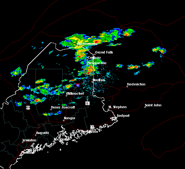
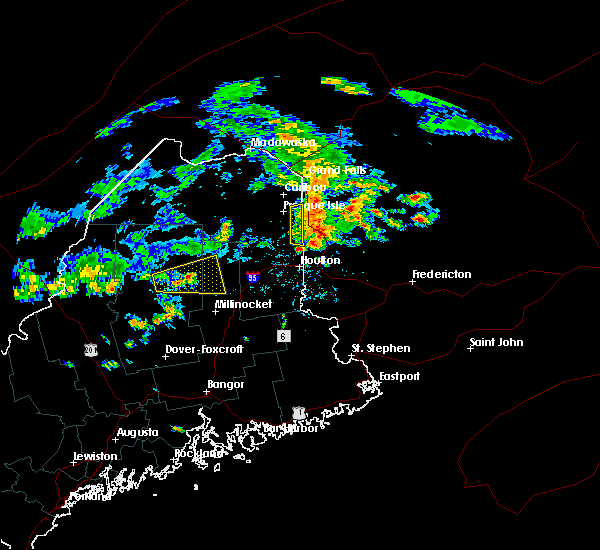
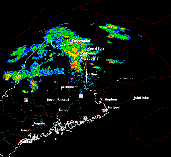
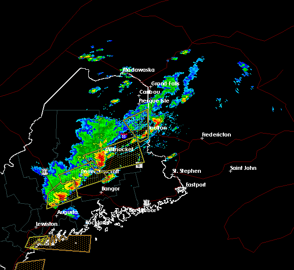
Hail Maps for Blaine, ME


Connect with Interactive Hail Maps