

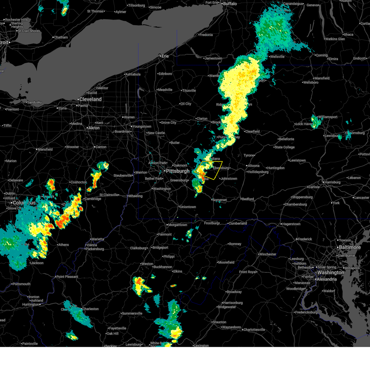
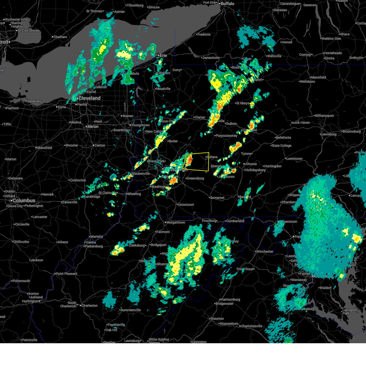
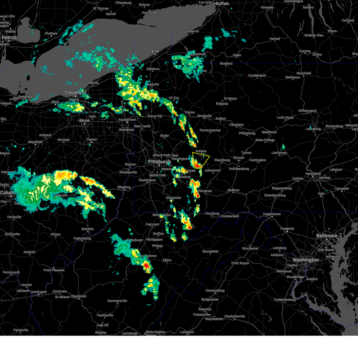
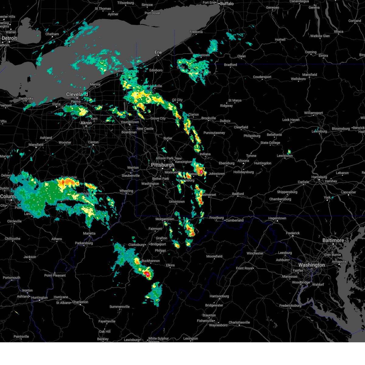
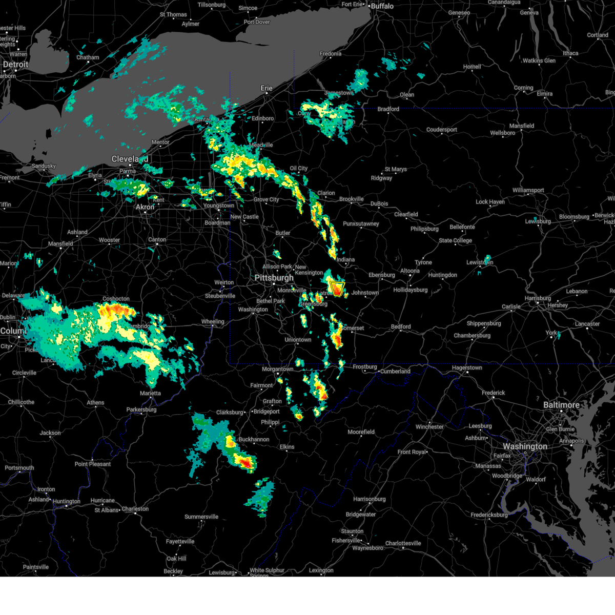
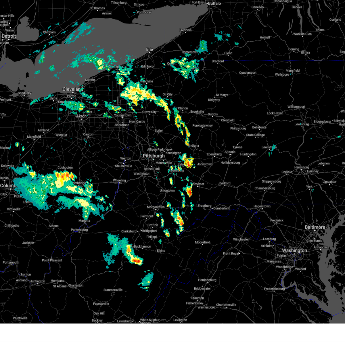
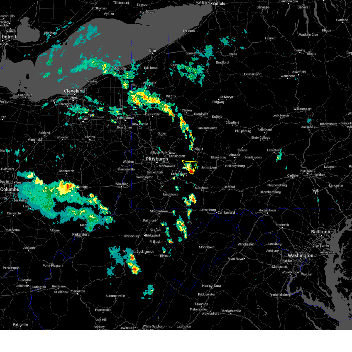
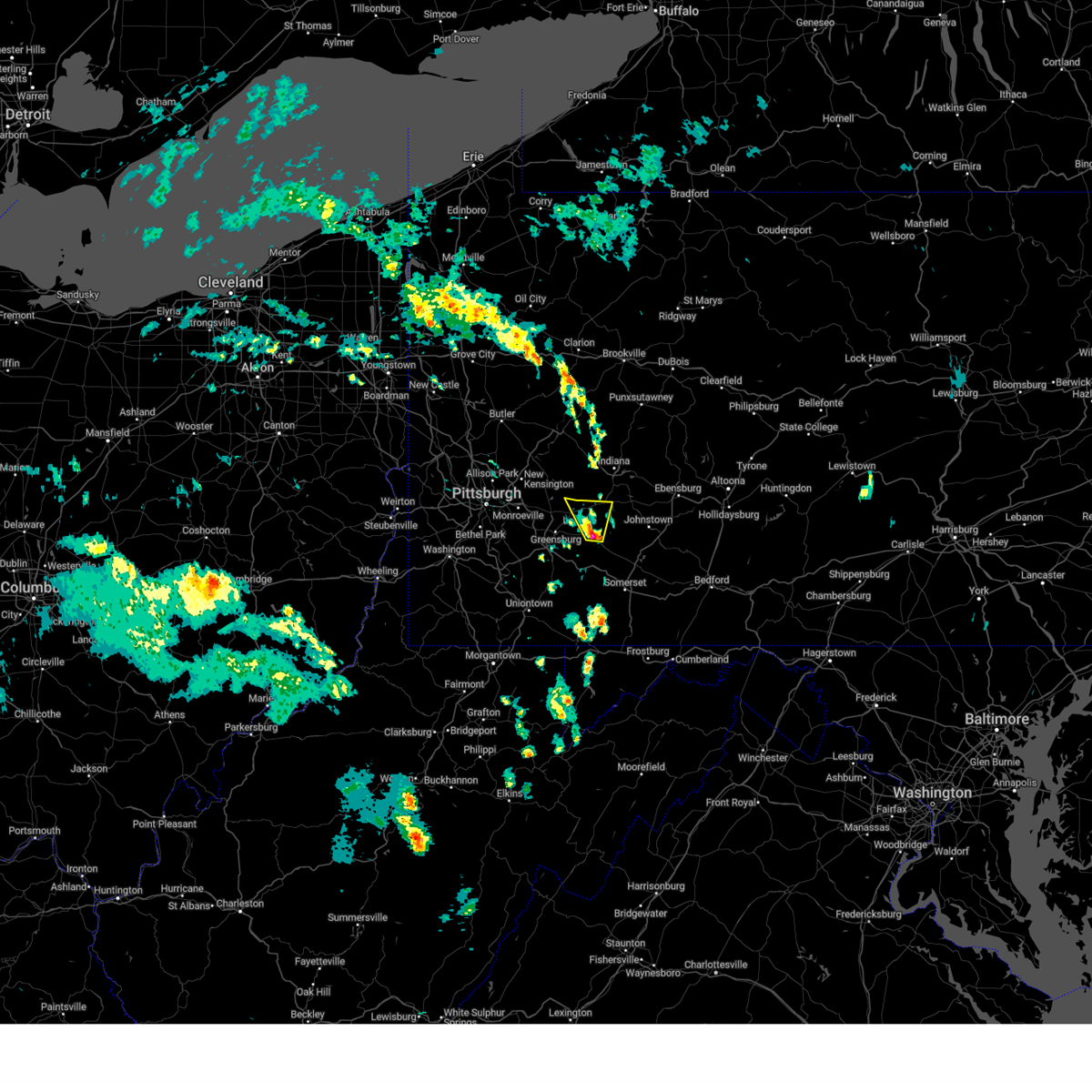
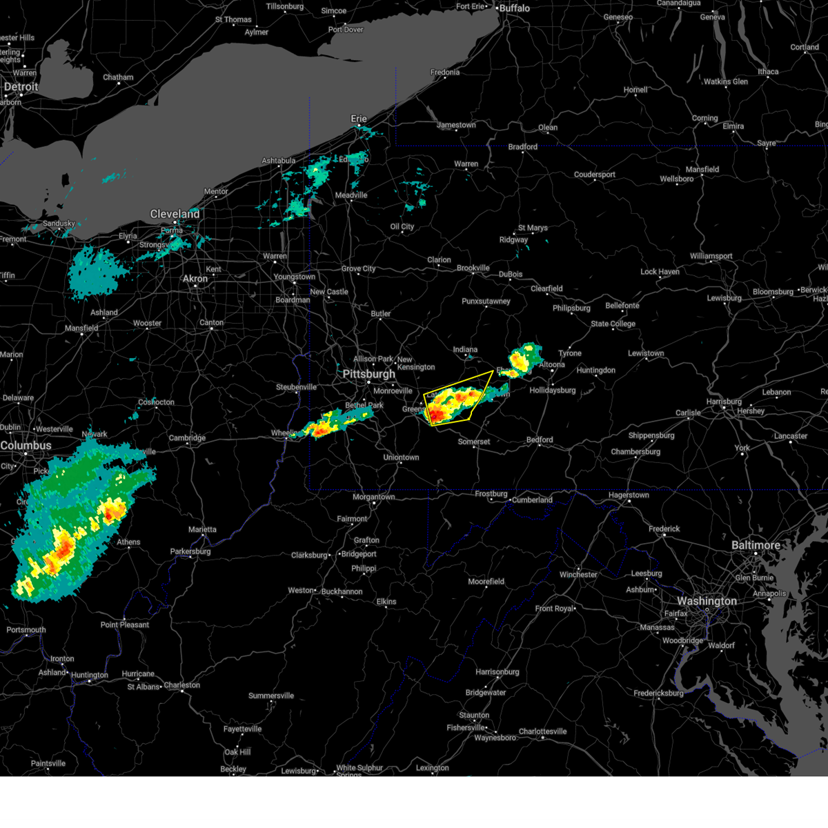
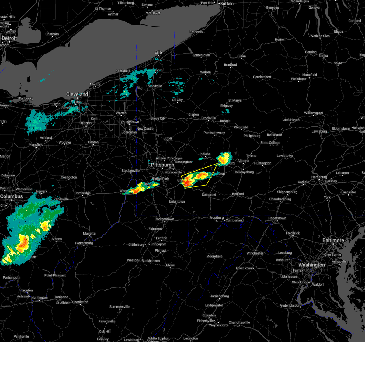
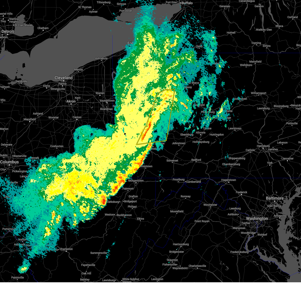
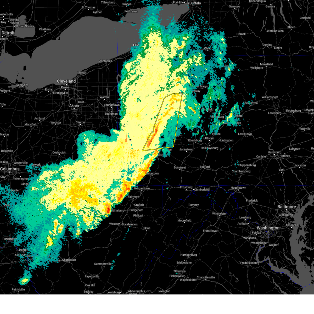
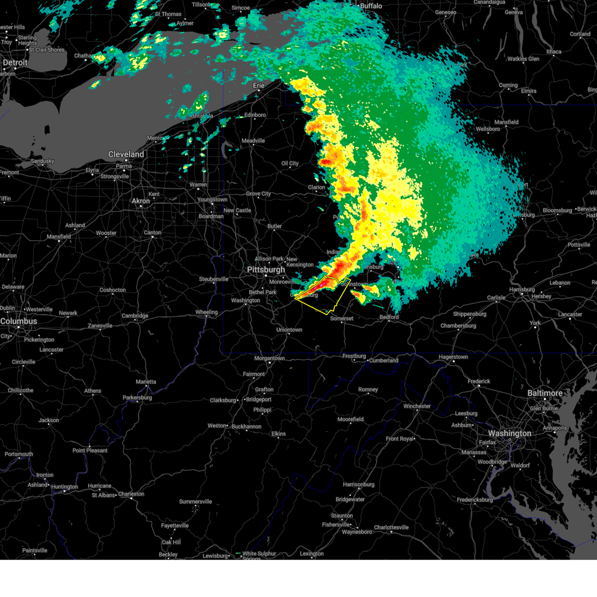
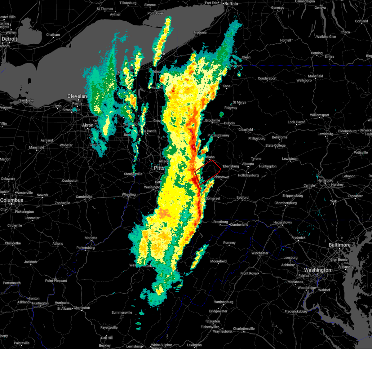
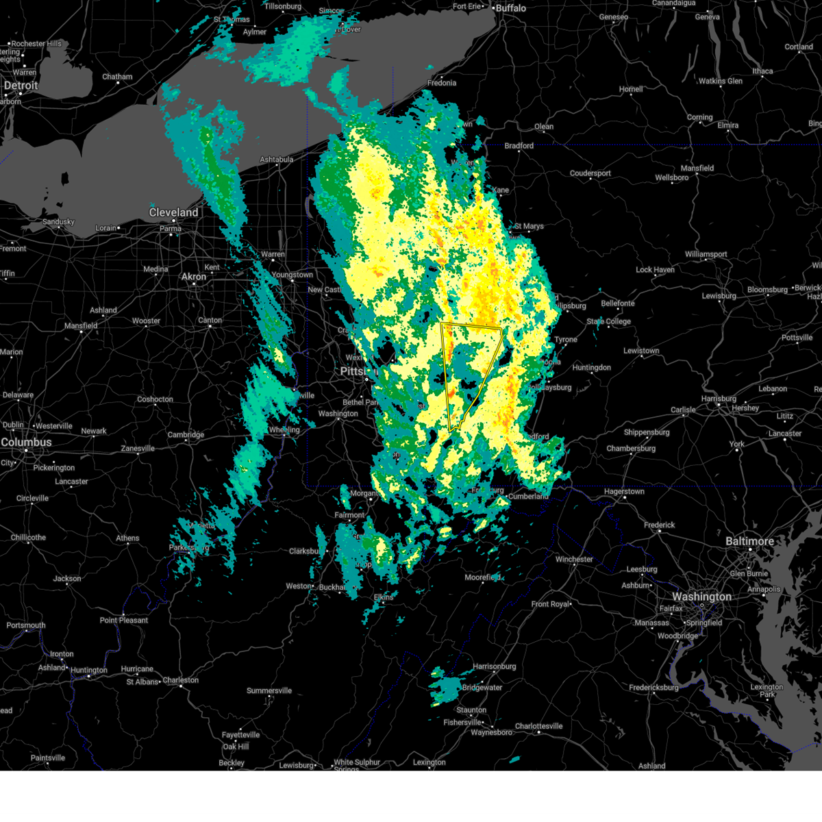
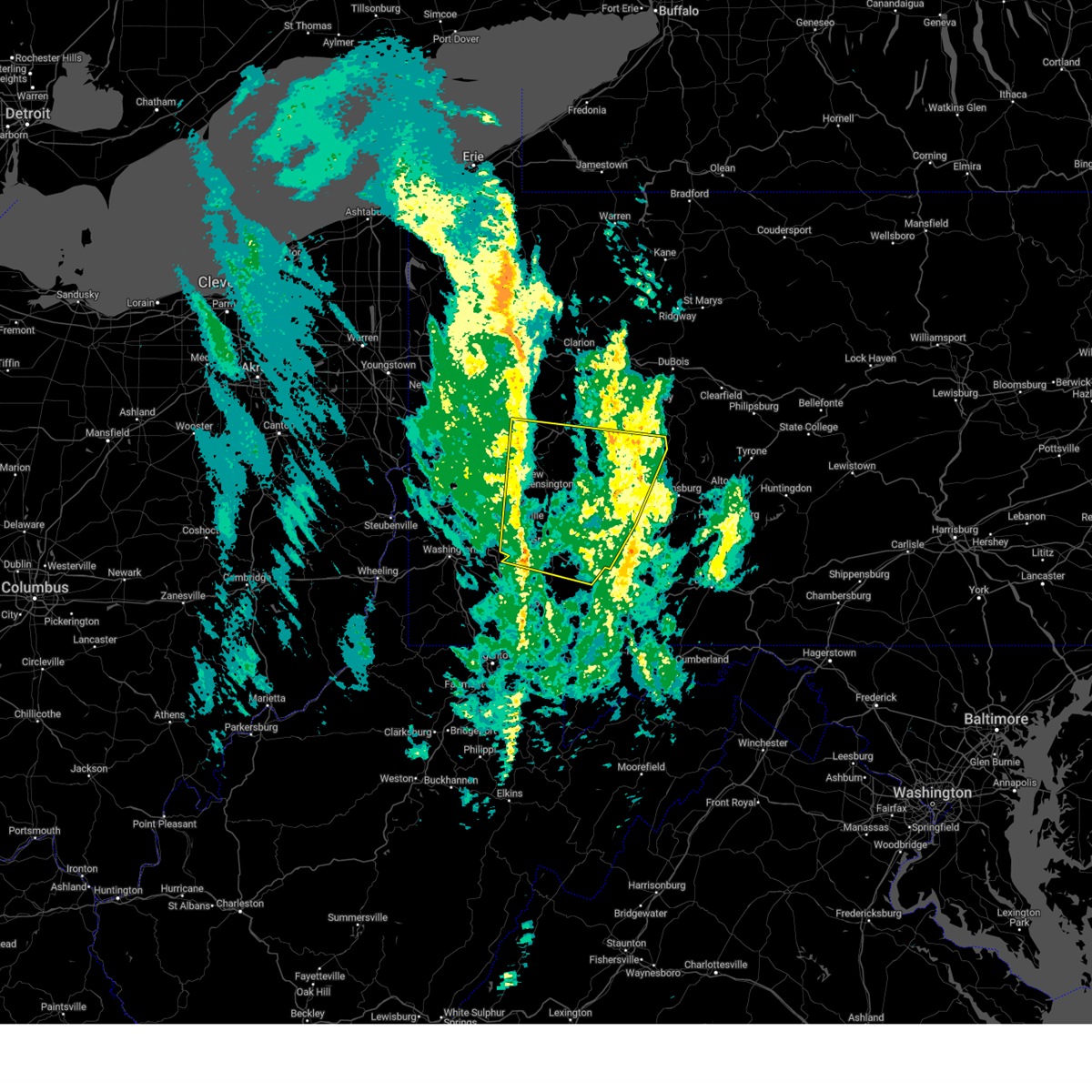
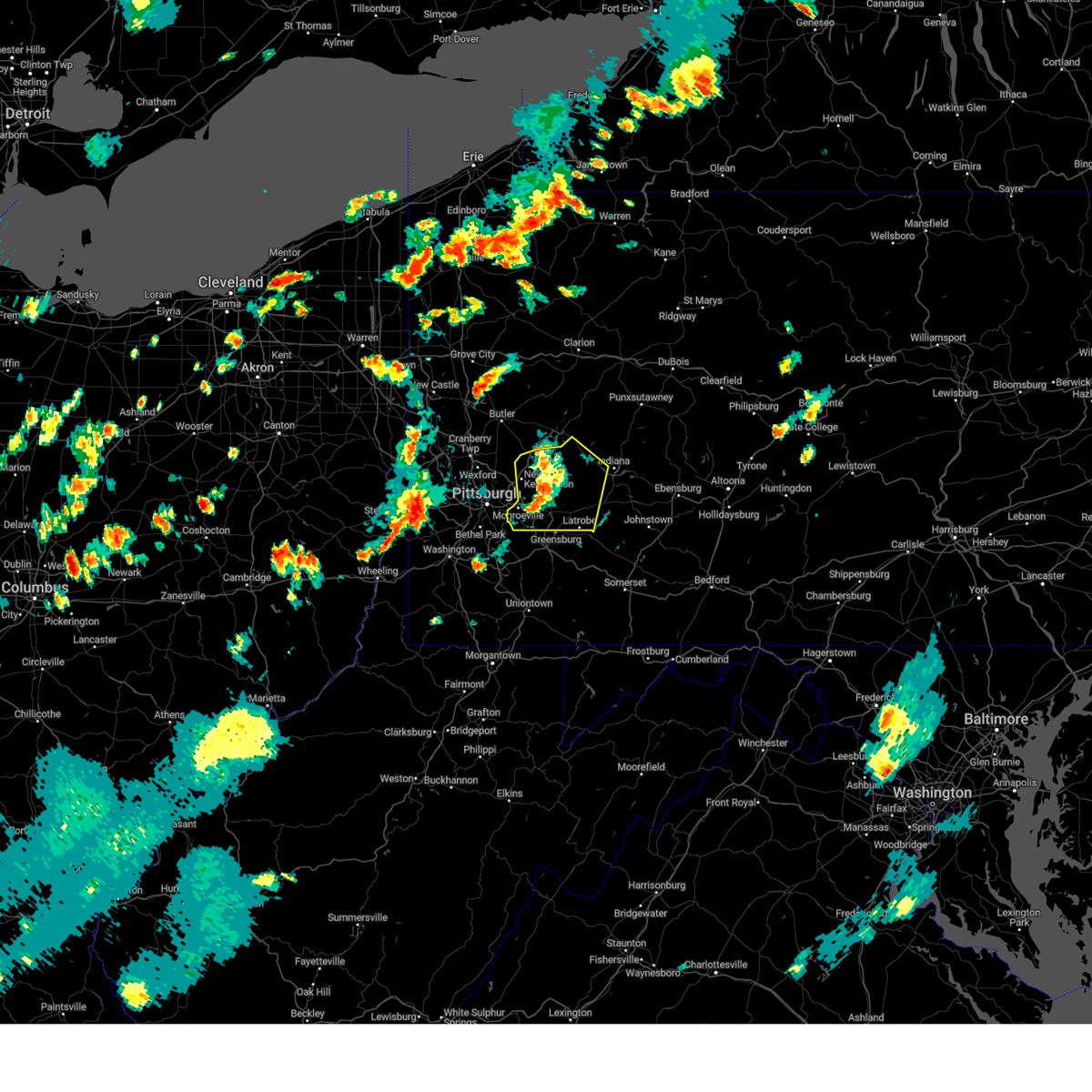
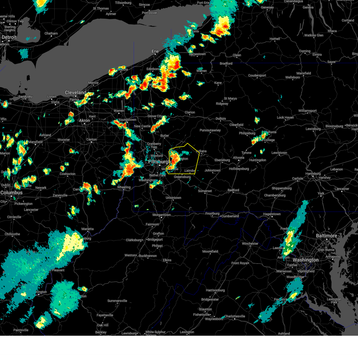
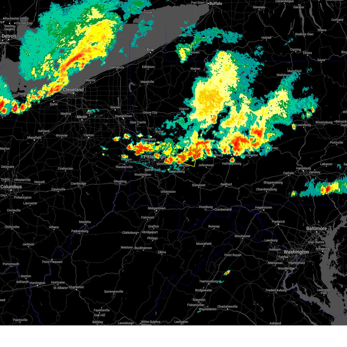
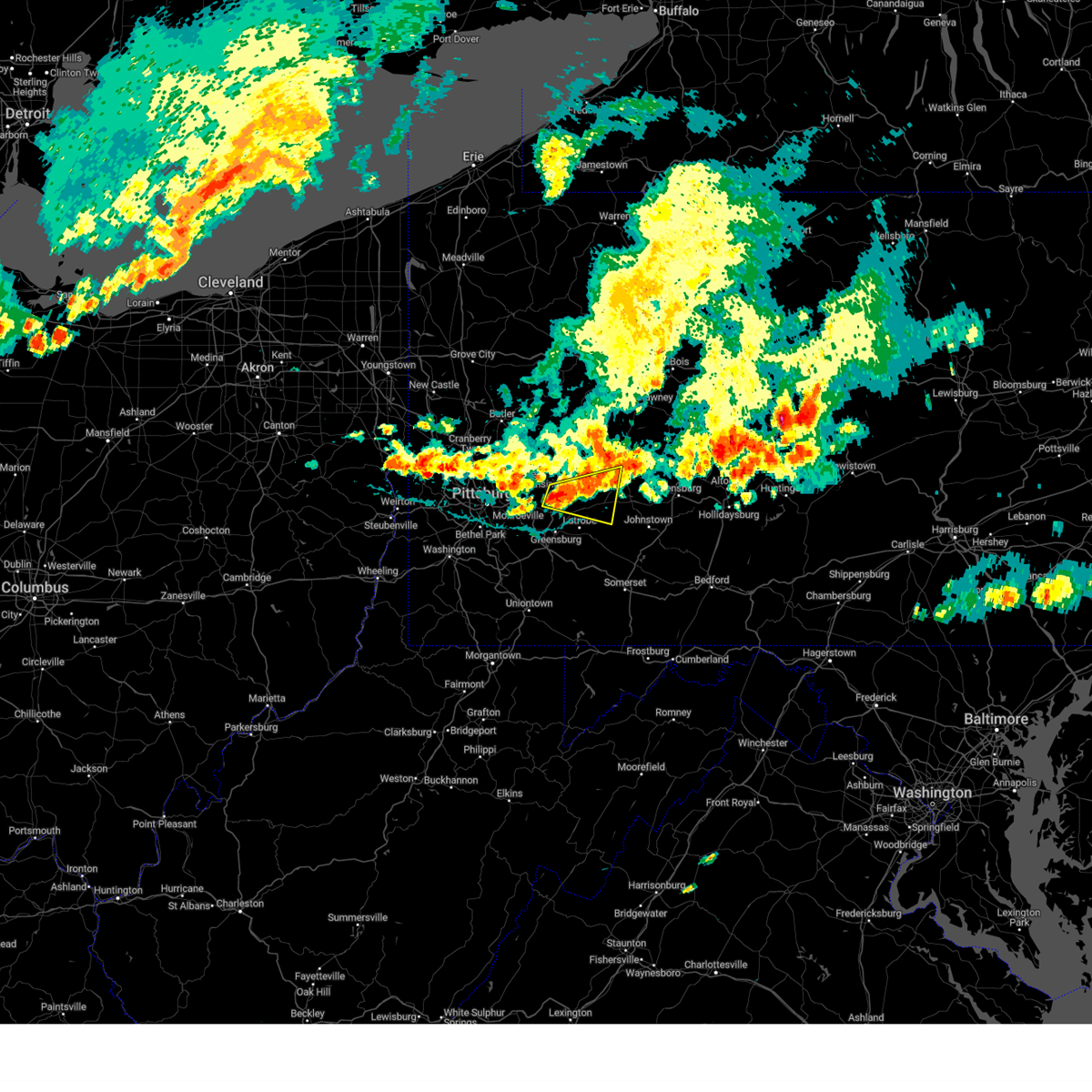
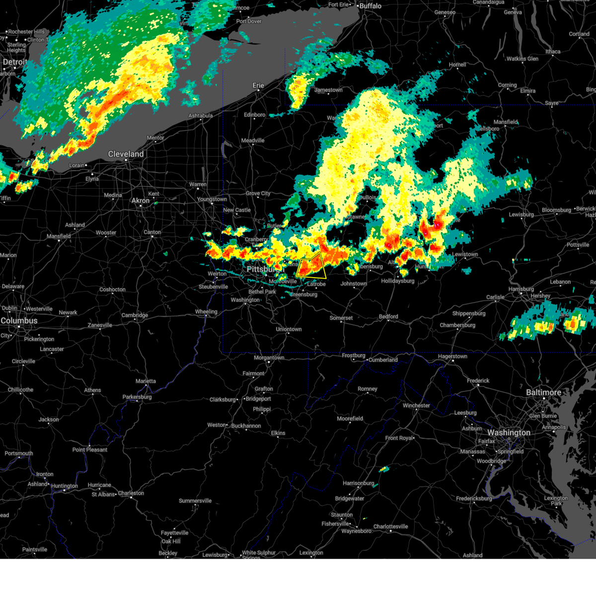
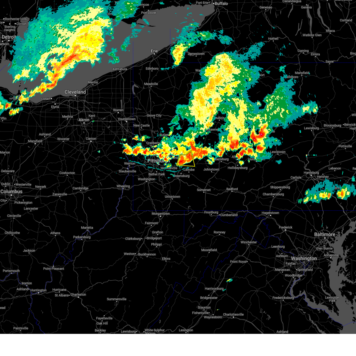
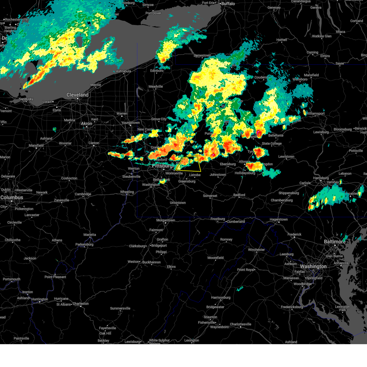
Hail Map for Blairsville, PA
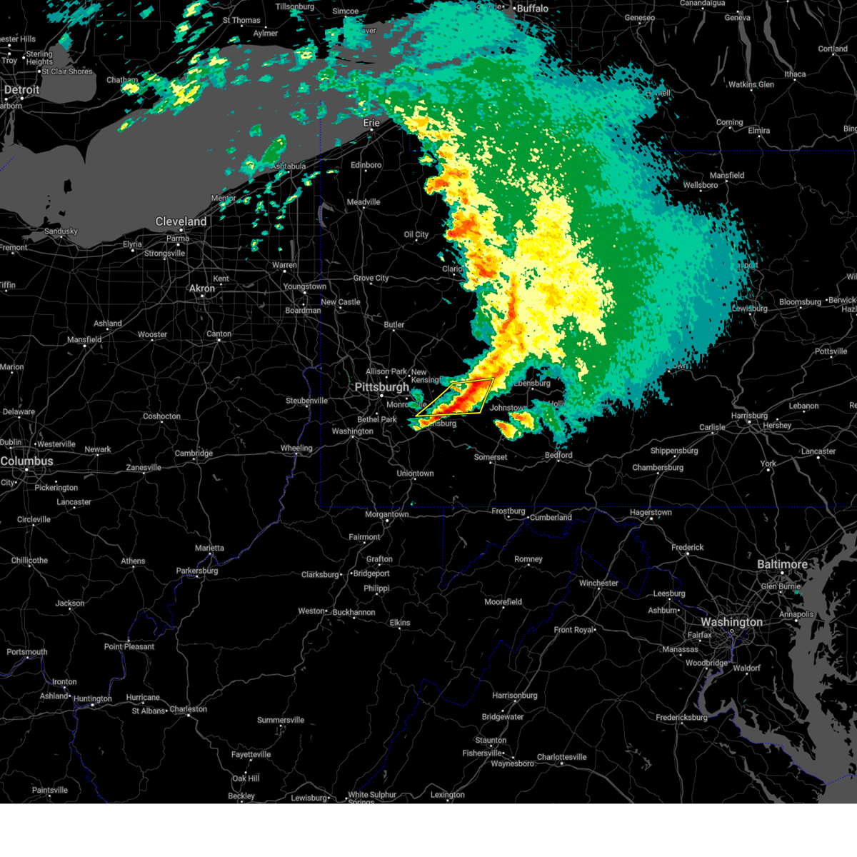
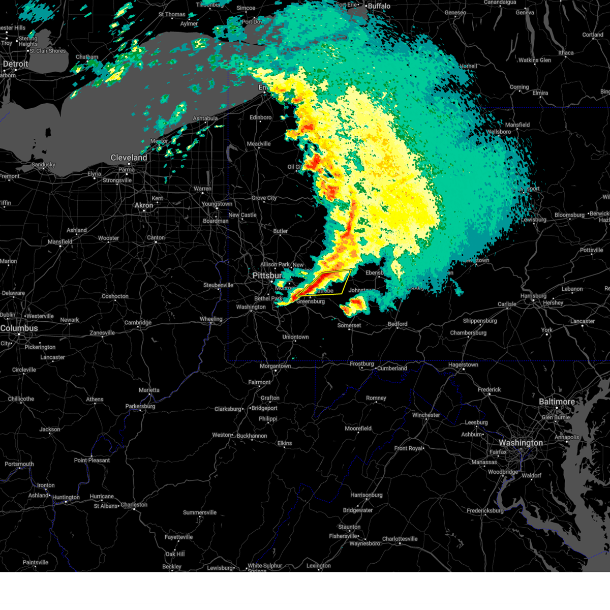
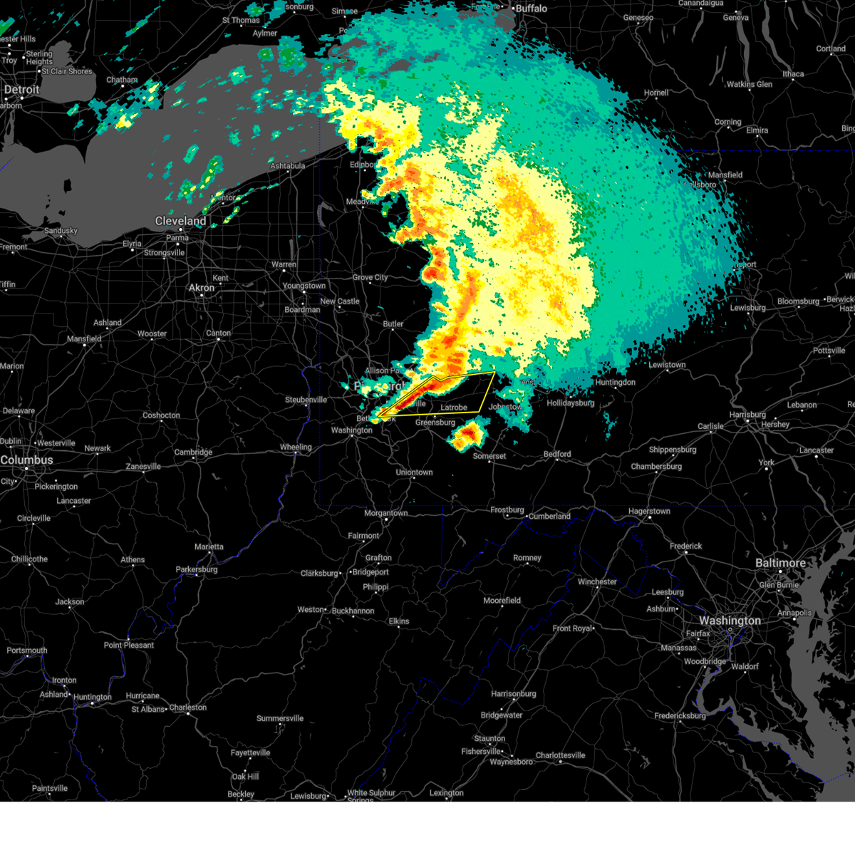
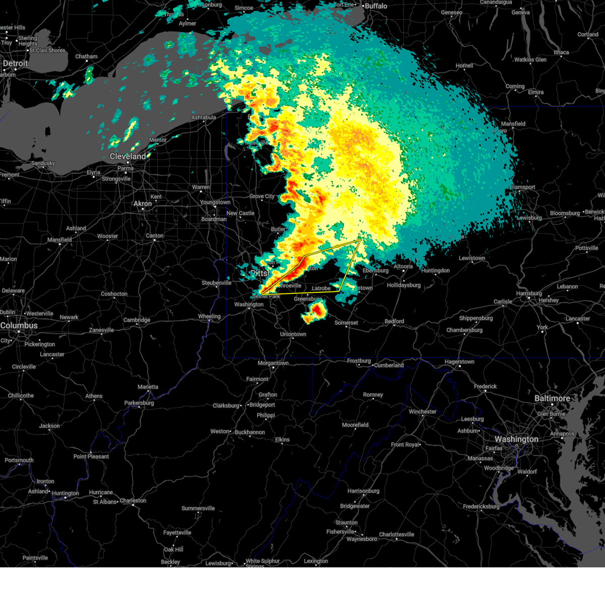
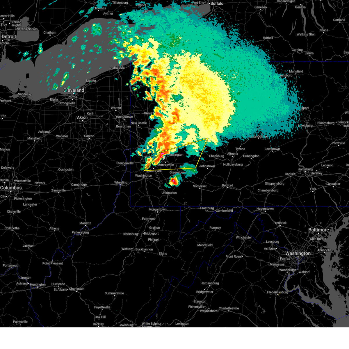
The Blairsville, PA area has had 8 reports of on-the-ground hail by trained spotters, and has been under severe weather warnings 78 times during the past 12 months. Doppler radar has detected hail at or near Blairsville, PA on 16 occasions, including 1 occasion during the past year.
| Name: | Blairsville, PA |
| Where Located: | 38.8 miles E of Pittsburgh, PA |
| Map: | Google Map for Blairsville, PA |
| Population: | 3412 |
| Housing Units: | 1772 |
| More Info: | Search Google for Blairsville, PA |
5
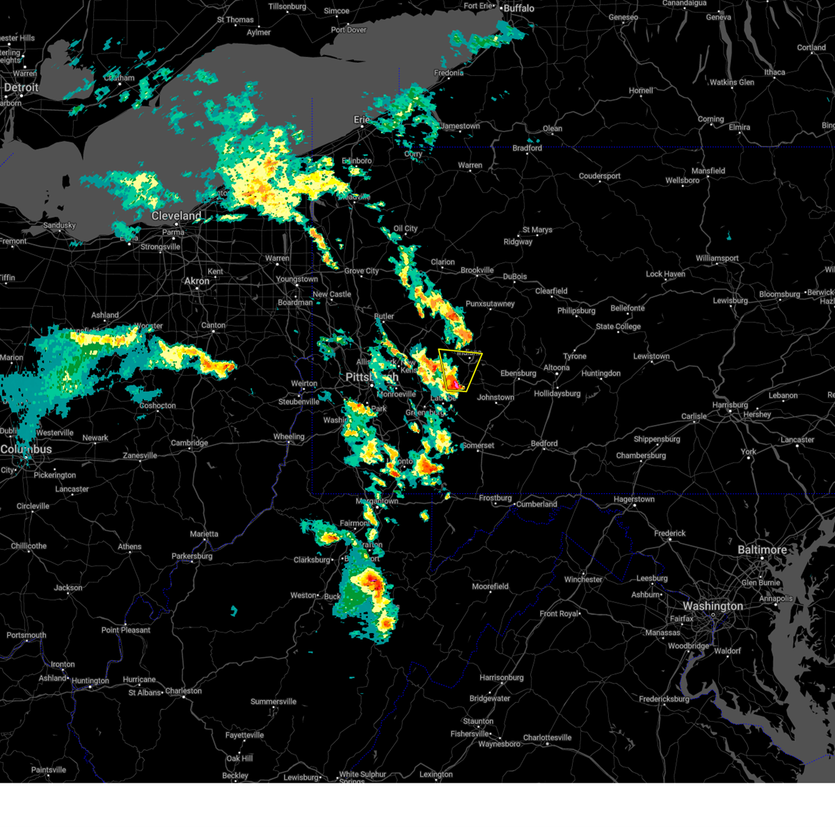
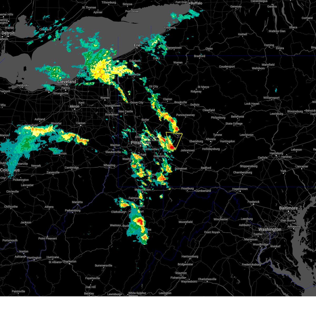
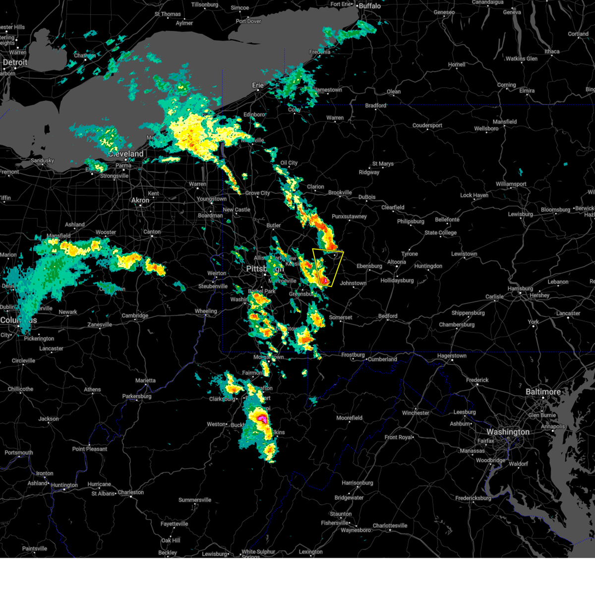
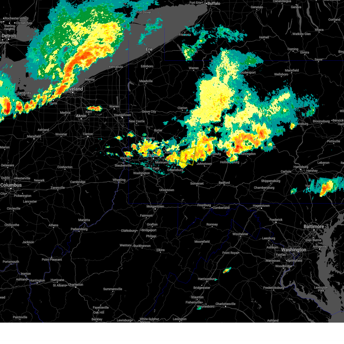
The Top Recent Hail Date for Blairsville, PA is Sunday, May 4, 2025 (2nd out of 16)

Hail and Wind Damage Spotted near Blairsville, PA
| Date / Time | Report Details |
|---|---|
| 6/27/2025 7:52 PM EDT |
 The storm which prompted the warning has weakened below severe limits, and no longer poses an immediate threat to life or property. therefore, the warning will be allowed to expire. however, gusty winds are still possible with this thunderstorm. The storm which prompted the warning has weakened below severe limits, and no longer poses an immediate threat to life or property. therefore, the warning will be allowed to expire. however, gusty winds are still possible with this thunderstorm.
|
| 6/27/2025 7:39 PM EDT |
 At 739 pm edt, a severe thunderstorm was located 6 miles east of black lick, or 7 miles southeast of homer city, moving east at 25 mph (radar indicated). Hazards include 60 mph wind gusts. Expect damage to roofs, siding, and trees. Locations impacted include, homer city, blairsville, black lick, new florence, seward, bolivar, armagh, lucerne mines, jacksonville, brush vly and yellow creek state park. At 739 pm edt, a severe thunderstorm was located 6 miles east of black lick, or 7 miles southeast of homer city, moving east at 25 mph (radar indicated). Hazards include 60 mph wind gusts. Expect damage to roofs, siding, and trees. Locations impacted include, homer city, blairsville, black lick, new florence, seward, bolivar, armagh, lucerne mines, jacksonville, brush vly and yellow creek state park.
|
| 6/27/2025 7:14 PM EDT |
 Svrpbz the national weather service in pittsburgh has issued a * severe thunderstorm warning for, east central westmoreland county in southwestern pennsylvania, southern indiana county in west central pennsylvania, * until 800 pm edt. * at 714 pm edt, a severe thunderstorm was located over blairsville, or 8 miles southwest of homer city, moving east at 25 mph (radar indicated). Hazards include 60 mph wind gusts. expect damage to roofs, siding, and trees Svrpbz the national weather service in pittsburgh has issued a * severe thunderstorm warning for, east central westmoreland county in southwestern pennsylvania, southern indiana county in west central pennsylvania, * until 800 pm edt. * at 714 pm edt, a severe thunderstorm was located over blairsville, or 8 miles southwest of homer city, moving east at 25 mph (radar indicated). Hazards include 60 mph wind gusts. expect damage to roofs, siding, and trees
|
| 6/19/2025 5:50 PM EDT |
 Svrpbz the national weather service in pittsburgh has issued a * severe thunderstorm warning for, southeastern westmoreland county in southwestern pennsylvania, southeastern indiana county in west central pennsylvania, * until 615 pm edt. * at 550 pm edt, severe thunderstorms were located along a line from 7 miles southeast of black lick to 6 miles east of mount pleasant, or along a line from 11 miles south of homer city to 11 miles south of latrobe, moving east at 50 mph (radar indicated). Hazards include 60 mph wind gusts. expect damage to roofs, siding, and trees Svrpbz the national weather service in pittsburgh has issued a * severe thunderstorm warning for, southeastern westmoreland county in southwestern pennsylvania, southeastern indiana county in west central pennsylvania, * until 615 pm edt. * at 550 pm edt, severe thunderstorms were located along a line from 7 miles southeast of black lick to 6 miles east of mount pleasant, or along a line from 11 miles south of homer city to 11 miles south of latrobe, moving east at 50 mph (radar indicated). Hazards include 60 mph wind gusts. expect damage to roofs, siding, and trees
|
| 6/19/2025 5:15 PM EDT |
 At 515 pm edt, a severe thunderstorm was located near apollo, moving east at 40 mph (radar indicated). Hazards include 60 mph wind gusts. Expect damage to roofs, siding, and trees. Locations impacted include, indiana, vandergrift, homer city, apollo, murrysville, blairsville, black lick, north apollo, avonmore, orchard hills, saltsburg, oklahoma, west lebanon, east vandergrift, chevy chase heights, ernest, creekside, shelocta, jacksonville and lucerne mines. At 515 pm edt, a severe thunderstorm was located near apollo, moving east at 40 mph (radar indicated). Hazards include 60 mph wind gusts. Expect damage to roofs, siding, and trees. Locations impacted include, indiana, vandergrift, homer city, apollo, murrysville, blairsville, black lick, north apollo, avonmore, orchard hills, saltsburg, oklahoma, west lebanon, east vandergrift, chevy chase heights, ernest, creekside, shelocta, jacksonville and lucerne mines.
|
| 6/19/2025 5:08 PM EDT | the severe thunderstorm warning has been cancelled and is no longer in effect |
| 6/19/2025 5:08 PM EDT | At 508 pm edt, a severe thunderstorm was located near apollo, moving east at 40 mph (radar indicated). Hazards include 60 mph wind gusts. Expect damage to roofs, siding, and trees. Locations impacted include, indiana, vandergrift, homer city, apollo, murrysville, lower burrell, blairsville, leechburg, black lick, north apollo, west leechburg, avonmore, orchard hills, saltsburg, oklahoma, west lebanon, east vandergrift, north vandergrift, hyde park and chevy chase heights. |
| 6/19/2025 4:59 PM EDT | Svrpbz the national weather service in pittsburgh has issued a * severe thunderstorm warning for, northeastern allegheny county in southwestern pennsylvania, northwestern westmoreland county in southwestern pennsylvania, southern armstrong county in west central pennsylvania, southwestern indiana county in west central pennsylvania, * until 545 pm edt. * at 459 pm edt, a severe thunderstorm was located over plum, or 7 miles northeast of penn hills, moving east at 40 mph (radar indicated). Hazards include 60 mph wind gusts. expect damage to roofs, siding, and trees |
| 6/19/2025 12:14 AM EDT |
 the severe thunderstorm warning has been cancelled and is no longer in effect the severe thunderstorm warning has been cancelled and is no longer in effect
|
| 6/19/2025 12:14 AM EDT |
 At 1214 am edt, severe thunderstorms were located along a line from 9 miles west of marienville to over murrysville, or along a line from 9 miles west of marienville to 6 miles east of monroeville, moving east at 30 mph (law enforcement reported trees and wires down with this line of storms). Hazards include 60 mph wind gusts. Expect damage to roofs, siding, and trees. Locations impacted include, pittsburgh, penn hills, monroeville, indiana, punxsutawney, clarion, vandergrift, kittanning, brookville, marienville, homer city, apollo, knox, rimersburg, plum, murrysville, wilkinsburg, new kensington, lower burrell and harrison township. At 1214 am edt, severe thunderstorms were located along a line from 9 miles west of marienville to over murrysville, or along a line from 9 miles west of marienville to 6 miles east of monroeville, moving east at 30 mph (law enforcement reported trees and wires down with this line of storms). Hazards include 60 mph wind gusts. Expect damage to roofs, siding, and trees. Locations impacted include, pittsburgh, penn hills, monroeville, indiana, punxsutawney, clarion, vandergrift, kittanning, brookville, marienville, homer city, apollo, knox, rimersburg, plum, murrysville, wilkinsburg, new kensington, lower burrell and harrison township.
|
| 6/18/2025 11:57 PM EDT |
 Svrpbz the national weather service in pittsburgh has issued a * severe thunderstorm warning for, forest county in northwestern pennsylvania, eastern venango county in northwestern pennsylvania, northeastern allegheny county in southwestern pennsylvania, northern westmoreland county in southwestern pennsylvania, armstrong county in west central pennsylvania, eastern butler county in west central pennsylvania, clarion county in west central pennsylvania, indiana county in west central pennsylvania, jefferson pa county in west central pennsylvania, * until 115 am edt. * at 1157 pm edt, severe thunderstorms were located along a line from near tionesta to over penn hills, or along a line from 16 miles northeast of oil city to over penn hills, moving east at 30 mph (law enforcement reported trees and wires down with this line of storms). Hazards include 60 mph wind gusts. expect damage to roofs, siding, and trees Svrpbz the national weather service in pittsburgh has issued a * severe thunderstorm warning for, forest county in northwestern pennsylvania, eastern venango county in northwestern pennsylvania, northeastern allegheny county in southwestern pennsylvania, northern westmoreland county in southwestern pennsylvania, armstrong county in west central pennsylvania, eastern butler county in west central pennsylvania, clarion county in west central pennsylvania, indiana county in west central pennsylvania, jefferson pa county in west central pennsylvania, * until 115 am edt. * at 1157 pm edt, severe thunderstorms were located along a line from near tionesta to over penn hills, or along a line from 16 miles northeast of oil city to over penn hills, moving east at 30 mph (law enforcement reported trees and wires down with this line of storms). Hazards include 60 mph wind gusts. expect damage to roofs, siding, and trees
|
| 5/4/2025 8:12 PM EDT |
 At 812 pm edt, a severe thunderstorm was located over blairsville, or 8 miles southwest of homer city, moving north at 25 mph (radar indicated). Hazards include 60 mph wind gusts and half dollar size hail. Hail damage to vehicles is expected. expect wind damage to roofs, siding, and trees. Locations impacted include, indiana, homer city, blairsville, black lick, west lebanon, chevy chase heights, shelocta, jacksonville and lucerne mines. At 812 pm edt, a severe thunderstorm was located over blairsville, or 8 miles southwest of homer city, moving north at 25 mph (radar indicated). Hazards include 60 mph wind gusts and half dollar size hail. Hail damage to vehicles is expected. expect wind damage to roofs, siding, and trees. Locations impacted include, indiana, homer city, blairsville, black lick, west lebanon, chevy chase heights, shelocta, jacksonville and lucerne mines.
|
| 5/4/2025 8:09 PM EDT | Quarter sized hail reported 1.2 miles WSW of Blairsville, PA |
| 5/4/2025 8:07 PM EDT |
 At 807 pm edt, a severe thunderstorm was located over blairsville, or 9 miles southwest of homer city, moving north at 25 mph (radar indicated). Hazards include 60 mph wind gusts and half dollar size hail. Hail damage to vehicles is expected. expect wind damage to roofs, siding, and trees. Locations impacted include, indiana, homer city, blairsville, black lick, west lebanon, chevy chase heights, shelocta, jacksonville and lucerne mines. At 807 pm edt, a severe thunderstorm was located over blairsville, or 9 miles southwest of homer city, moving north at 25 mph (radar indicated). Hazards include 60 mph wind gusts and half dollar size hail. Hail damage to vehicles is expected. expect wind damage to roofs, siding, and trees. Locations impacted include, indiana, homer city, blairsville, black lick, west lebanon, chevy chase heights, shelocta, jacksonville and lucerne mines.
|
| 5/4/2025 7:58 PM EDT |
 Svrpbz the national weather service in pittsburgh has issued a * severe thunderstorm warning for, east central westmoreland county in southwestern pennsylvania, southeastern armstrong county in west central pennsylvania, southwestern indiana county in west central pennsylvania, * until 845 pm edt. * at 758 pm edt, a severe thunderstorm was located near blairsville, or 8 miles northeast of latrobe, moving north at 25 mph (radar indicated). Hazards include 60 mph wind gusts and half dollar size hail. Hail damage to vehicles is expected. Expect wind damage to roofs, siding, and trees. Svrpbz the national weather service in pittsburgh has issued a * severe thunderstorm warning for, east central westmoreland county in southwestern pennsylvania, southeastern armstrong county in west central pennsylvania, southwestern indiana county in west central pennsylvania, * until 845 pm edt. * at 758 pm edt, a severe thunderstorm was located near blairsville, or 8 miles northeast of latrobe, moving north at 25 mph (radar indicated). Hazards include 60 mph wind gusts and half dollar size hail. Hail damage to vehicles is expected. Expect wind damage to roofs, siding, and trees.
|
| 5/4/2025 7:24 PM EDT | Quarter sized hail reported 4.1 miles SW of Blairsville, PA |
| 5/4/2025 7:19 PM EDT | Quarter sized hail reported 2.4 miles WSW of Blairsville, PA |
| 5/4/2025 7:18 PM EDT | Quarter sized hail reported 2.2 miles W of Blairsville, PA |
| 5/4/2025 7:10 PM EDT | Quarter sized hail reported 4.1 miles SW of Blairsville, PA, report from mping: quarter (1.00 in.). |
| 5/4/2025 7:04 PM EDT |
 At 704 pm edt, a severe thunderstorm was located over black lick, or 8 miles south of homer city, moving north at 20 mph (radar indicated). Hazards include ping pong ball size hail and 60 mph wind gusts. People and animals outdoors will be injured. expect hail damage to roofs, siding, windows, and vehicles. expect wind damage to roofs, siding, and trees. Locations impacted include, homer city, blairsville, black lick, bolivar, lucerne mines, jacksonville, brush vly and yellow creek state park. At 704 pm edt, a severe thunderstorm was located over black lick, or 8 miles south of homer city, moving north at 20 mph (radar indicated). Hazards include ping pong ball size hail and 60 mph wind gusts. People and animals outdoors will be injured. expect hail damage to roofs, siding, windows, and vehicles. expect wind damage to roofs, siding, and trees. Locations impacted include, homer city, blairsville, black lick, bolivar, lucerne mines, jacksonville, brush vly and yellow creek state park.
|
| 5/4/2025 6:58 PM EDT |
 The severe thunderstorm warning that was previously in effect has been reissued for westmoreland and indiana counties and is in effect until 730 pm edt. please refer to that bulletin for the latest severe weather information. The severe thunderstorm warning that was previously in effect has been reissued for westmoreland and indiana counties and is in effect until 730 pm edt. please refer to that bulletin for the latest severe weather information.
|
| 5/4/2025 6:57 PM EDT |
 Svrpbz the national weather service in pittsburgh has issued a * severe thunderstorm warning for, northeastern westmoreland county in southwestern pennsylvania, southwestern indiana county in west central pennsylvania, * until 730 pm edt. * at 657 pm edt, a severe thunderstorm was located over blairsville, or 10 miles south of homer city, moving north at 20 mph (radar indicated). Hazards include 60 mph wind gusts and half dollar size hail. Hail damage to vehicles is expected. Expect wind damage to roofs, siding, and trees. Svrpbz the national weather service in pittsburgh has issued a * severe thunderstorm warning for, northeastern westmoreland county in southwestern pennsylvania, southwestern indiana county in west central pennsylvania, * until 730 pm edt. * at 657 pm edt, a severe thunderstorm was located over blairsville, or 10 miles south of homer city, moving north at 20 mph (radar indicated). Hazards include 60 mph wind gusts and half dollar size hail. Hail damage to vehicles is expected. Expect wind damage to roofs, siding, and trees.
|
| 5/4/2025 6:51 PM EDT |
 At 651 pm edt, a severe thunderstorm was located near blairsville, or 8 miles northeast of latrobe, moving north at 20 mph (radar indicated). Hazards include 60 mph wind gusts and quarter size hail. Hail damage to vehicles is expected. expect wind damage to roofs, siding, and trees. Locations impacted include, blairsville and derry. At 651 pm edt, a severe thunderstorm was located near blairsville, or 8 miles northeast of latrobe, moving north at 20 mph (radar indicated). Hazards include 60 mph wind gusts and quarter size hail. Hail damage to vehicles is expected. expect wind damage to roofs, siding, and trees. Locations impacted include, blairsville and derry.
|
| 5/4/2025 6:45 PM EDT |
 At 645 pm edt, a severe thunderstorm was located over derry, or near latrobe, moving north at 10 mph (radar indicated). Hazards include 60 mph wind gusts and quarter size hail. Hail damage to vehicles is expected. expect wind damage to roofs, siding, and trees. Locations impacted include, blairsville and derry. At 645 pm edt, a severe thunderstorm was located over derry, or near latrobe, moving north at 10 mph (radar indicated). Hazards include 60 mph wind gusts and quarter size hail. Hail damage to vehicles is expected. expect wind damage to roofs, siding, and trees. Locations impacted include, blairsville and derry.
|
| 5/4/2025 6:34 PM EDT |
 At 634 pm edt, a severe thunderstorm was located near mcchesneytown-loyalhanna, or near latrobe, moving north at 10 mph (public reported). Hazards include 60 mph wind gusts and quarter size hail. Hail damage to vehicles is expected. expect wind damage to roofs, siding, and trees. Locations impacted include, mcchesneytown-loyalhanna, blairsville, derry and new alexandria. At 634 pm edt, a severe thunderstorm was located near mcchesneytown-loyalhanna, or near latrobe, moving north at 10 mph (public reported). Hazards include 60 mph wind gusts and quarter size hail. Hail damage to vehicles is expected. expect wind damage to roofs, siding, and trees. Locations impacted include, mcchesneytown-loyalhanna, blairsville, derry and new alexandria.
|
| 5/4/2025 6:32 PM EDT |
 At 632 pm edt, a severe thunderstorm was located near derry, or 5 miles southeast of latrobe, moving north at 15 mph (radar indicated). Hazards include 60 mph wind gusts and quarter size hail. Hail damage to vehicles is expected. expect wind damage to roofs, siding, and trees. Locations impacted include, latrobe, mcchesneytown-loyalhanna, blairsville, derry, new alexandria and loyalhanna gorge. At 632 pm edt, a severe thunderstorm was located near derry, or 5 miles southeast of latrobe, moving north at 15 mph (radar indicated). Hazards include 60 mph wind gusts and quarter size hail. Hail damage to vehicles is expected. expect wind damage to roofs, siding, and trees. Locations impacted include, latrobe, mcchesneytown-loyalhanna, blairsville, derry, new alexandria and loyalhanna gorge.
|
| 5/4/2025 6:21 PM EDT |
 Svrpbz the national weather service in pittsburgh has issued a * severe thunderstorm warning for, central westmoreland county in southwestern pennsylvania, southwestern indiana county in west central pennsylvania, * until 700 pm edt. * at 621 pm edt, a severe thunderstorm was located near ligonier, or 7 miles southeast of latrobe, moving north at 15 mph (radar indicated). Hazards include 60 mph wind gusts and quarter size hail. Hail damage to vehicles is expected. Expect wind damage to roofs, siding, and trees. Svrpbz the national weather service in pittsburgh has issued a * severe thunderstorm warning for, central westmoreland county in southwestern pennsylvania, southwestern indiana county in west central pennsylvania, * until 700 pm edt. * at 621 pm edt, a severe thunderstorm was located near ligonier, or 7 miles southeast of latrobe, moving north at 15 mph (radar indicated). Hazards include 60 mph wind gusts and quarter size hail. Hail damage to vehicles is expected. Expect wind damage to roofs, siding, and trees.
|
| 4/29/2025 6:10 PM EDT |
 The storms which prompted the warning have moved out of the area. therefore, the warning will be allowed to expire. however, gusty winds are still possible with these thunderstorms. a severe thunderstorm watch remains in effect until 1000 pm edt for southwestern, northwestern and west central pennsylvania. remember, a severe thunderstorm warning still remains in effect for jefferson and forest counties. The storms which prompted the warning have moved out of the area. therefore, the warning will be allowed to expire. however, gusty winds are still possible with these thunderstorms. a severe thunderstorm watch remains in effect until 1000 pm edt for southwestern, northwestern and west central pennsylvania. remember, a severe thunderstorm warning still remains in effect for jefferson and forest counties.
|
| 4/29/2025 5:52 PM EDT |
 the severe thunderstorm warning has been cancelled and is no longer in effect the severe thunderstorm warning has been cancelled and is no longer in effect
|
| 4/29/2025 5:52 PM EDT |
 At 551 pm edt, severe thunderstorms were located along a line extending from near rimersburg to 9 miles southeast of new bethlehem to near indiana to near blairsville, moving east at 70 mph. these are destructive storms for northern indiana and southern jefferson counties (radar indicated). Hazards include 80 mph wind gusts. Extensive tree damage and widespread power outages. mobile homes will be heavily damaged. expect considerable damage to roofs, windows and vehicles. Locations impacted include, indiana, punxsutawney, clarion, brookville, homer city, rimersburg, blairsville, reynoldsville, derry, brockway, new bethlehem, black lick, clymer, sykesville, falls creek, east brady, sligo, new florence, big run, and dayton. At 551 pm edt, severe thunderstorms were located along a line extending from near rimersburg to 9 miles southeast of new bethlehem to near indiana to near blairsville, moving east at 70 mph. these are destructive storms for northern indiana and southern jefferson counties (radar indicated). Hazards include 80 mph wind gusts. Extensive tree damage and widespread power outages. mobile homes will be heavily damaged. expect considerable damage to roofs, windows and vehicles. Locations impacted include, indiana, punxsutawney, clarion, brookville, homer city, rimersburg, blairsville, reynoldsville, derry, brockway, new bethlehem, black lick, clymer, sykesville, falls creek, east brady, sligo, new florence, big run, and dayton.
|
| 4/29/2025 5:46 PM EDT | Multiple trees were blown dow in indiana county PA, 0.5 miles NE of Blairsville, PA |
| 4/29/2025 5:42 PM EDT | the severe thunderstorm warning has been cancelled and is no longer in effect |
| 4/29/2025 5:42 PM EDT | At 540 pm edt, severe thunderstorms were located along a line extending from 10 miles southwest of knox to near rimersburg to 9 miles east of ford city to 6 miles northeast of delmont, moving northeast at 70 mph. these are destructive storms for armstrong, indiana, and jefferson counties (radar indicated). Hazards include 80 mph wind gusts. Extensive tree damage and widespread power outages. mobile homes will be heavily damaged. expect considerable damage to roofs, windows and vehicles. Locations impacted include, greensburg, indiana, jeannette, latrobe, punxsutawney, clarion, vandergrift, kittanning, brookville, homer city, apollo, rimersburg, murrysville, irwin, mcchesneytown-loyalhanna, blairsville, manor, youngwood, ford city, and reynoldsville. |
| 4/29/2025 5:21 PM EDT | Svrpbz the national weather service in pittsburgh has issued a * severe thunderstorm warning for, east central washington county in southwestern pennsylvania, southeastern lawrence county in western pennsylvania, butler county in west central pennsylvania, indiana county in west central pennsylvania, eastern allegheny county in southwestern pennsylvania, jefferson county in west central pennsylvania, westmoreland county in southwestern pennsylvania, armstrong county in west central pennsylvania, clarion county in west central pennsylvania, south central forest county in northwestern pennsylvania, * until 615 pm edt. * at 520 pm edt, severe thunderstorms were located along a line extending from 7 miles west of shanor-northvue to near meadowood to near new kensington to near clairton, moving northeast at 70 mph. these are destructive storms for butler, armstrong, and westmoreland counties (radar indicated). Hazards include 80 mph wind gusts. Extensive tree damage and widespread power outages. mobile homes will be heavily damaged. Expect considerable damage to roofs, windows and vehicles. |
| 4/19/2025 6:18 PM EDT |
 At 618 pm edt, a severe thunderstorm was located near mcchesneytown-loyalhanna, or 6 miles southeast of latrobe, moving east at 65 mph (radar indicated). Hazards include 60 mph wind gusts and small hail. Expect damage to roofs, siding, and trees. Locations impacted include, latrobe, mcchesneytown-loyalhanna, blairsville, derry, lawson heights, ligonier, new florence, new alexandria, seward, bolivar, youngstown, laurel mountain, armagh, crabtree, loyalhanna gorge and acme. At 618 pm edt, a severe thunderstorm was located near mcchesneytown-loyalhanna, or 6 miles southeast of latrobe, moving east at 65 mph (radar indicated). Hazards include 60 mph wind gusts and small hail. Expect damage to roofs, siding, and trees. Locations impacted include, latrobe, mcchesneytown-loyalhanna, blairsville, derry, lawson heights, ligonier, new florence, new alexandria, seward, bolivar, youngstown, laurel mountain, armagh, crabtree, loyalhanna gorge and acme.
|
| 4/19/2025 6:12 PM EDT |
 Svrpbz the national weather service in pittsburgh has issued a * severe thunderstorm warning for, central westmoreland county in southwestern pennsylvania, southeastern indiana county in west central pennsylvania, * until 700 pm edt. * at 612 pm edt, a severe thunderstorm was located 6 miles southwest of lawson heights, or 7 miles southwest of latrobe, moving east at 65 mph (radar indicated). Hazards include 60 mph wind gusts and small hail. expect damage to roofs, siding, and trees Svrpbz the national weather service in pittsburgh has issued a * severe thunderstorm warning for, central westmoreland county in southwestern pennsylvania, southeastern indiana county in west central pennsylvania, * until 700 pm edt. * at 612 pm edt, a severe thunderstorm was located 6 miles southwest of lawson heights, or 7 miles southwest of latrobe, moving east at 65 mph (radar indicated). Hazards include 60 mph wind gusts and small hail. expect damage to roofs, siding, and trees
|
| 4/3/2025 5:10 AM EDT | The storms which prompted the warning have weakened below severe limits, and no longer pose an immediate threat to life or property. therefore, the warning will be allowed to expire. however, gusty winds are still possible with these thunderstorms. |
| 4/3/2025 5:05 AM EDT |
 the severe thunderstorm warning has been cancelled and is no longer in effect the severe thunderstorm warning has been cancelled and is no longer in effect
|
| 4/3/2025 5:05 AM EDT |
 At 505 am edt, severe thunderstorms were located along a line from 8 miles northeast of clarion to over plum, or along a line from 8 miles northeast of clarion to 6 miles northeast of monroeville, moving northeast at 65 mph (radar indicated). Hazards include 60 mph wind gusts. Expect damage to roofs, siding, and trees. Locations impacted include, monroeville, indiana, vandergrift, kittanning, apollo, murrysville, blairsville, trafford, ford city, delmont, leechburg, new bethlehem, black lick, west kittanning, north apollo, west leechburg, avonmore, orchard hills, export and rural valley. At 505 am edt, severe thunderstorms were located along a line from 8 miles northeast of clarion to over plum, or along a line from 8 miles northeast of clarion to 6 miles northeast of monroeville, moving northeast at 65 mph (radar indicated). Hazards include 60 mph wind gusts. Expect damage to roofs, siding, and trees. Locations impacted include, monroeville, indiana, vandergrift, kittanning, apollo, murrysville, blairsville, trafford, ford city, delmont, leechburg, new bethlehem, black lick, west kittanning, north apollo, west leechburg, avonmore, orchard hills, export and rural valley.
|
| 4/3/2025 4:57 AM EDT |
 the severe thunderstorm warning has been cancelled and is no longer in effect the severe thunderstorm warning has been cancelled and is no longer in effect
|
| 4/3/2025 4:57 AM EDT |
 At 457 am edt, severe thunderstorms were located along a line from over clarion to over churchill, or along a line from over clarion to over penn hills, moving northeast at 65 mph (radar indicated). Hazards include 60 mph wind gusts. Expect damage to roofs, siding, and trees. Locations impacted include, pittsburgh, penn hills, monroeville, mckeesport, clarion, vandergrift, kittanning, brookville, apollo, rimersburg, plum, west mifflin, murrysville, wilkinsburg, new kensington, lower burrell, munhall, harrison township, north versailles and swissvale. At 457 am edt, severe thunderstorms were located along a line from over clarion to over churchill, or along a line from over clarion to over penn hills, moving northeast at 65 mph (radar indicated). Hazards include 60 mph wind gusts. Expect damage to roofs, siding, and trees. Locations impacted include, pittsburgh, penn hills, monroeville, mckeesport, clarion, vandergrift, kittanning, brookville, apollo, rimersburg, plum, west mifflin, murrysville, wilkinsburg, new kensington, lower burrell, munhall, harrison township, north versailles and swissvale.
|
| 4/3/2025 4:47 AM EDT | At 447 am edt, severe thunderstorms were located along a line from 6 miles south of knox to over dormont, or along a line from 6 miles south of knox to over mount lebanon, moving northeast at 65 mph (radar indicated). Hazards include 60 mph wind gusts. Expect damage to roofs, siding, and trees. locations impacted include, pittsburgh, penn hills, mount lebanon, bethel park, monroeville, mckeesport, clarion, vandergrift, kittanning, brookville, apollo, rimersburg, shaler township, plum, west mifflin, north side pittsburgh, baldwin, upper st. Clair, murrysville and hampton township. |
| 4/3/2025 4:47 AM EDT | the severe thunderstorm warning has been cancelled and is no longer in effect |
| 4/3/2025 4:37 AM EDT | Svrpbz the national weather service in pittsburgh has issued a * severe thunderstorm warning for, allegheny county in southwestern pennsylvania, north central washington county in southwestern pennsylvania, northwestern westmoreland county in southwestern pennsylvania, armstrong county in west central pennsylvania, eastern butler county in west central pennsylvania, clarion county in west central pennsylvania, western indiana county in west central pennsylvania, western jefferson pa county in west central pennsylvania, * until 515 am edt. * at 437 am edt, severe thunderstorms were located along a line from 15 miles northeast of shanor-northvue to over cecil-bishop, or along a line from 13 miles west of rimersburg to 6 miles north of canonsburg, moving northeast at 65 mph (radar indicated). Hazards include 60 mph wind gusts. expect damage to roofs, siding, and trees |
| 4/2/2025 3:16 PM EDT |
 Svrpbz the national weather service in pittsburgh has issued a * severe thunderstorm warning for, southeastern westmoreland county in southwestern pennsylvania, * until 345 pm edt. * at 316 pm edt, severe thunderstorms were located along a line from near blairsville to over youngwood, or along a line from 11 miles south of homer city to 7 miles south of greensburg, moving east at 50 mph (radar indicated). Hazards include quarter size hail. damage to vehicles is expected Svrpbz the national weather service in pittsburgh has issued a * severe thunderstorm warning for, southeastern westmoreland county in southwestern pennsylvania, * until 345 pm edt. * at 316 pm edt, severe thunderstorms were located along a line from near blairsville to over youngwood, or along a line from 11 miles south of homer city to 7 miles south of greensburg, moving east at 50 mph (radar indicated). Hazards include quarter size hail. damage to vehicles is expected
|
| 4/2/2025 3:09 PM EDT |
 The storms which prompted the warning have weakened below severe limits, and no longer pose an immediate threat to life or property. therefore, the warning will be allowed to expire. however, small hail is still possible with these thunderstorms. The storms which prompted the warning have weakened below severe limits, and no longer pose an immediate threat to life or property. therefore, the warning will be allowed to expire. however, small hail is still possible with these thunderstorms.
|
| 4/2/2025 3:04 PM EDT |
 At 304 pm edt, severe thunderstorms were located along a line from 6 miles north of blairsville to over greensburg, or along a line from 6 miles west of homer city to over jeannette, moving east at 65 mph (radar indicated). Hazards include quarter size hail. Damage to vehicles is expected. Locations impacted include, greensburg, jeannette, latrobe, homer city, irwin, mcchesneytown-loyalhanna, blairsville, manor, derry, black lick, saltsburg, new alexandria, penn, bolivar, adamsburg, crabtree, grapeville and brush vly. At 304 pm edt, severe thunderstorms were located along a line from 6 miles north of blairsville to over greensburg, or along a line from 6 miles west of homer city to over jeannette, moving east at 65 mph (radar indicated). Hazards include quarter size hail. Damage to vehicles is expected. Locations impacted include, greensburg, jeannette, latrobe, homer city, irwin, mcchesneytown-loyalhanna, blairsville, manor, derry, black lick, saltsburg, new alexandria, penn, bolivar, adamsburg, crabtree, grapeville and brush vly.
|
| 4/2/2025 3:04 PM EDT |
 the severe thunderstorm warning has been cancelled and is no longer in effect the severe thunderstorm warning has been cancelled and is no longer in effect
|
| 4/2/2025 2:51 PM EDT |
 the severe thunderstorm warning has been cancelled and is no longer in effect the severe thunderstorm warning has been cancelled and is no longer in effect
|
| 4/2/2025 2:51 PM EDT |
 At 251 pm edt, severe thunderstorms were located along a line from 7 miles southeast of apollo to over mckeesport, moving east at 65 mph (public reported). Hazards include quarter size hail. Damage to vehicles is expected. Locations impacted include, pittsburgh, monroeville, greensburg, mckeesport, jeannette, latrobe, homer city, plum, west mifflin, murrysville, south park township, jefferson hills, north versailles, pleasant hills, white oak, clairton, wilkins township, duquesne, turtle creek and north braddock. At 251 pm edt, severe thunderstorms were located along a line from 7 miles southeast of apollo to over mckeesport, moving east at 65 mph (public reported). Hazards include quarter size hail. Damage to vehicles is expected. Locations impacted include, pittsburgh, monroeville, greensburg, mckeesport, jeannette, latrobe, homer city, plum, west mifflin, murrysville, south park township, jefferson hills, north versailles, pleasant hills, white oak, clairton, wilkins township, duquesne, turtle creek and north braddock.
|
| 4/2/2025 2:45 PM EDT |
 the severe thunderstorm warning has been cancelled and is no longer in effect the severe thunderstorm warning has been cancelled and is no longer in effect
|
| 4/2/2025 2:45 PM EDT |
 At 245 pm edt, severe thunderstorms were located along a line from over vandergrift to over wilkins township, or along a line from over vandergrift to near monroeville, moving east at 70 mph (radar indicated). Hazards include quarter size hail. Damage to vehicles is expected. locations impacted include, pittsburgh, penn hills, bethel park, monroeville, greensburg, mckeesport, indiana, jeannette, latrobe, vandergrift, homer city, apollo, plum, west mifflin, baldwin, upper st. Clair, murrysville, wilkinsburg, whitehall and south park township. At 245 pm edt, severe thunderstorms were located along a line from over vandergrift to over wilkins township, or along a line from over vandergrift to near monroeville, moving east at 70 mph (radar indicated). Hazards include quarter size hail. Damage to vehicles is expected. locations impacted include, pittsburgh, penn hills, bethel park, monroeville, greensburg, mckeesport, indiana, jeannette, latrobe, vandergrift, homer city, apollo, plum, west mifflin, baldwin, upper st. Clair, murrysville, wilkinsburg, whitehall and south park township.
|
| 4/2/2025 2:33 PM EDT |
 Svrpbz the national weather service in pittsburgh has issued a * severe thunderstorm warning for, eastern allegheny county in southwestern pennsylvania, central washington county in southwestern pennsylvania, central westmoreland county in southwestern pennsylvania, southern armstrong county in west central pennsylvania, central indiana county in west central pennsylvania, * until 315 pm edt. * at 233 pm edt, severe thunderstorms were located along a line from over arnold to over scott township, or along a line from 8 miles north of penn hills to over mount lebanon, moving east at 70 mph (radar indicated). Hazards include half dollar size hail. damage to vehicles is expected Svrpbz the national weather service in pittsburgh has issued a * severe thunderstorm warning for, eastern allegheny county in southwestern pennsylvania, central washington county in southwestern pennsylvania, central westmoreland county in southwestern pennsylvania, southern armstrong county in west central pennsylvania, central indiana county in west central pennsylvania, * until 315 pm edt. * at 233 pm edt, severe thunderstorms were located along a line from over arnold to over scott township, or along a line from 8 miles north of penn hills to over mount lebanon, moving east at 70 mph (radar indicated). Hazards include half dollar size hail. damage to vehicles is expected
|
| 3/16/2025 1:55 PM EDT |
 The storms which prompted the warning have moved out of the area. therefore, the warning will be allowed to expire. however, gusty winds are still possible with lingering showers. a tornado watch remains in effect until 400 pm edt for portions of southwest and west central pennsylvania. The storms which prompted the warning have moved out of the area. therefore, the warning will be allowed to expire. however, gusty winds are still possible with lingering showers. a tornado watch remains in effect until 400 pm edt for portions of southwest and west central pennsylvania.
|
| 3/16/2025 1:42 PM EDT |
 At 142 pm edt, severe thunderstorms were located along a line from 9 miles northeast of indiana to 20 miles southeast of ligonier, or along a line from 9 miles northeast of indiana to 29 miles southeast of latrobe, moving northeast at 60 mph (radar indicated). Hazards include 70 mph wind gusts and small hail. Expect considerable tree damage. damage is likely to mobile homes, roofs, and outbuildings. Locations impacted include, homer city, mcchesneytown-loyalhanna, blairsville, derry, ligonier, black lick, new florence, seward, bolivar, cherry tree, laurel mountain, armagh, lucerne mines, brush vly, yellow creek state park, loyalhanna gorge and laurel mountain state park. At 142 pm edt, severe thunderstorms were located along a line from 9 miles northeast of indiana to 20 miles southeast of ligonier, or along a line from 9 miles northeast of indiana to 29 miles southeast of latrobe, moving northeast at 60 mph (radar indicated). Hazards include 70 mph wind gusts and small hail. Expect considerable tree damage. damage is likely to mobile homes, roofs, and outbuildings. Locations impacted include, homer city, mcchesneytown-loyalhanna, blairsville, derry, ligonier, black lick, new florence, seward, bolivar, cherry tree, laurel mountain, armagh, lucerne mines, brush vly, yellow creek state park, loyalhanna gorge and laurel mountain state park.
|
| 3/16/2025 1:42 PM EDT |
 the severe thunderstorm warning has been cancelled and is no longer in effect the severe thunderstorm warning has been cancelled and is no longer in effect
|
| 3/16/2025 1:30 PM EDT | Large tree trunk snapped and fell on a car. time estimated via rada in indiana county PA, 0.6 miles SE of Blairsville, PA |
| 3/16/2025 1:30 PM EDT | Barn and farm outbuildings destroyed in josephin in indiana county PA, 5.4 miles SW of Blairsville, PA |
| 3/16/2025 1:29 PM EDT | Multiple trees down in saylor par in indiana county PA, 4.9 miles SW of Blairsville, PA |
| 3/16/2025 1:19 PM EDT |
 Torpbz the national weather service in pittsburgh has issued a * tornado warning for, east central westmoreland county in southwestern pennsylvania, southern indiana county in west central pennsylvania, * until 145 pm edt. * at 119 pm edt, a severe thunderstorm capable of producing a tornado was located over derry, or near latrobe, moving northeast at 60 mph (radar indicated rotation). Hazards include tornado and quarter size hail. Flying debris will be dangerous to those caught without shelter. mobile homes will be damaged or destroyed. damage to roofs, windows and vehicles will occur. Tree damage is likely. Torpbz the national weather service in pittsburgh has issued a * tornado warning for, east central westmoreland county in southwestern pennsylvania, southern indiana county in west central pennsylvania, * until 145 pm edt. * at 119 pm edt, a severe thunderstorm capable of producing a tornado was located over derry, or near latrobe, moving northeast at 60 mph (radar indicated rotation). Hazards include tornado and quarter size hail. Flying debris will be dangerous to those caught without shelter. mobile homes will be damaged or destroyed. damage to roofs, windows and vehicles will occur. Tree damage is likely.
|
| 3/16/2025 1:17 PM EDT |
 the severe thunderstorm warning has been cancelled and is no longer in effect the severe thunderstorm warning has been cancelled and is no longer in effect
|
| 3/16/2025 1:17 PM EDT |
 At 117 pm edt, severe thunderstorms were located along a line from 9 miles south of new bethlehem to over mcchesneytown-loyalhanna, or along a line from 9 miles east of kittanning to near latrobe, moving northeast at 75 mph (radar indicated). Hazards include 70 mph wind gusts and quarter size hail. Hail damage to vehicles is expected. expect considerable tree damage. wind damage is also likely to mobile homes, roofs, and outbuildings. Locations impacted include, greensburg, jeannette, latrobe, kingwood, homer city, terra alta, murrysville, mount pleasant, mcchesneytown-loyalhanna, blairsville, youngwood, derry, delmont, lawson heights, new stanton, ligonier, black lick, seven springs, calumet-norvelt and export. At 117 pm edt, severe thunderstorms were located along a line from 9 miles south of new bethlehem to over mcchesneytown-loyalhanna, or along a line from 9 miles east of kittanning to near latrobe, moving northeast at 75 mph (radar indicated). Hazards include 70 mph wind gusts and quarter size hail. Hail damage to vehicles is expected. expect considerable tree damage. wind damage is also likely to mobile homes, roofs, and outbuildings. Locations impacted include, greensburg, jeannette, latrobe, kingwood, homer city, terra alta, murrysville, mount pleasant, mcchesneytown-loyalhanna, blairsville, youngwood, derry, delmont, lawson heights, new stanton, ligonier, black lick, seven springs, calumet-norvelt and export.
|
| 3/16/2025 12:56 PM EDT |
 Svrpbz the national weather service in pittsburgh has issued a * severe thunderstorm warning for, southeastern allegheny county in southwestern pennsylvania, fayette county in southwestern pennsylvania, westmoreland county in southwestern pennsylvania, southern indiana county in west central pennsylvania, northeastern preston county in northeastern west virginia, * until 200 pm edt. * at 1256 pm edt, severe thunderstorms were located along a line from over lower burrell to near connellsville, or along a line from 7 miles west of apollo to near connellsville, moving northeast at 75 mph (radar indicated). Hazards include 70 mph wind gusts and quarter size hail. Hail damage to vehicles is expected. expect considerable tree damage. Wind damage is also likely to mobile homes, roofs, and outbuildings. Svrpbz the national weather service in pittsburgh has issued a * severe thunderstorm warning for, southeastern allegheny county in southwestern pennsylvania, fayette county in southwestern pennsylvania, westmoreland county in southwestern pennsylvania, southern indiana county in west central pennsylvania, northeastern preston county in northeastern west virginia, * until 200 pm edt. * at 1256 pm edt, severe thunderstorms were located along a line from over lower burrell to near connellsville, or along a line from 7 miles west of apollo to near connellsville, moving northeast at 75 mph (radar indicated). Hazards include 70 mph wind gusts and quarter size hail. Hail damage to vehicles is expected. expect considerable tree damage. Wind damage is also likely to mobile homes, roofs, and outbuildings.
|
| 11/20/2024 5:56 PM EST |
 the severe thunderstorm warning has been cancelled and is no longer in effect the severe thunderstorm warning has been cancelled and is no longer in effect
|
| 11/20/2024 5:56 PM EST |
 At 556 pm est, severe thunderstorms were located along a line from 8 miles west of punxsutawney to 8 miles southeast of ligonier, or along a line from 8 miles west of punxsutawney to 17 miles southeast of latrobe, moving east at 40 mph (radar indicated). Hazards include 60 mph wind gusts. Expect damage to roofs, siding, and trees. Locations impacted include, indiana, homer city, blairsville, ligonier, black lick, clymer, rural valley, new florence, chevy chase heights, seward, bolivar, ernest, marion center, cherry tree, creekside, plumville, laurel mountain, shelocta, armagh and atwood. At 556 pm est, severe thunderstorms were located along a line from 8 miles west of punxsutawney to 8 miles southeast of ligonier, or along a line from 8 miles west of punxsutawney to 17 miles southeast of latrobe, moving east at 40 mph (radar indicated). Hazards include 60 mph wind gusts. Expect damage to roofs, siding, and trees. Locations impacted include, indiana, homer city, blairsville, ligonier, black lick, clymer, rural valley, new florence, chevy chase heights, seward, bolivar, ernest, marion center, cherry tree, creekside, plumville, laurel mountain, shelocta, armagh and atwood.
|
| 11/20/2024 5:37 PM EST |
 At 537 pm est, severe thunderstorms were located along a line from 8 miles southwest of new bethlehem to 10 miles south of lawson heights, or along a line from 9 miles northeast of kittanning to 11 miles south of latrobe, moving east at 40 mph (radar indicated). Hazards include 60 mph wind gusts. Expect damage to roofs, siding, and trees. Locations impacted include, indiana, latrobe, kittanning, homer city, mcchesneytown-loyalhanna, blairsville, ford city, derry, lawson heights, ligonier, black lick, west kittanning, seven springs, calumet-norvelt, clymer, avonmore, orchard hills, rural valley, saltsburg and west lebanon. At 537 pm est, severe thunderstorms were located along a line from 8 miles southwest of new bethlehem to 10 miles south of lawson heights, or along a line from 9 miles northeast of kittanning to 11 miles south of latrobe, moving east at 40 mph (radar indicated). Hazards include 60 mph wind gusts. Expect damage to roofs, siding, and trees. Locations impacted include, indiana, latrobe, kittanning, homer city, mcchesneytown-loyalhanna, blairsville, ford city, derry, lawson heights, ligonier, black lick, west kittanning, seven springs, calumet-norvelt, clymer, avonmore, orchard hills, rural valley, saltsburg and west lebanon.
|
| 11/20/2024 5:24 PM EST |
 the severe thunderstorm warning has been cancelled and is no longer in effect the severe thunderstorm warning has been cancelled and is no longer in effect
|
| 11/20/2024 5:24 PM EST |
 At 524 pm est, severe thunderstorms were located along a line from near kittanning to over mount pleasant, or along a line from near kittanning to 9 miles north of connellsville, moving east at 40 mph (radar indicated). Hazards include 60 mph wind gusts. Expect damage to roofs, siding, and trees. Locations impacted include, greensburg, indiana, jeannette, latrobe, vandergrift, kittanning, homer city, apollo, murrysville, lower burrell, harrison township, mount pleasant, scottdale, irwin, mcchesneytown-loyalhanna, blairsville, manor, youngwood, ford city and derry. At 524 pm est, severe thunderstorms were located along a line from near kittanning to over mount pleasant, or along a line from near kittanning to 9 miles north of connellsville, moving east at 40 mph (radar indicated). Hazards include 60 mph wind gusts. Expect damage to roofs, siding, and trees. Locations impacted include, greensburg, indiana, jeannette, latrobe, vandergrift, kittanning, homer city, apollo, murrysville, lower burrell, harrison township, mount pleasant, scottdale, irwin, mcchesneytown-loyalhanna, blairsville, manor, youngwood, ford city and derry.
|
| 11/20/2024 5:10 PM EST |
 Svrpbz the national weather service in pittsburgh has issued a * severe thunderstorm warning for, eastern allegheny county in southwestern pennsylvania, northeastern fayette county in southwestern pennsylvania, westmoreland county in southwestern pennsylvania, southern armstrong county in west central pennsylvania, southeastern butler county in west central pennsylvania, indiana county in west central pennsylvania, * until 615 pm est. * at 510 pm est, severe thunderstorms were located along a line from 10 miles north of sarver to near perryopolis, or along a line from 8 miles east of butler to 10 miles northwest of connellsville, moving east at 40 mph (radar indicated). Hazards include 60 mph wind gusts. expect damage to roofs, siding, and trees Svrpbz the national weather service in pittsburgh has issued a * severe thunderstorm warning for, eastern allegheny county in southwestern pennsylvania, northeastern fayette county in southwestern pennsylvania, westmoreland county in southwestern pennsylvania, southern armstrong county in west central pennsylvania, southeastern butler county in west central pennsylvania, indiana county in west central pennsylvania, * until 615 pm est. * at 510 pm est, severe thunderstorms were located along a line from 10 miles north of sarver to near perryopolis, or along a line from 8 miles east of butler to 10 miles northwest of connellsville, moving east at 40 mph (radar indicated). Hazards include 60 mph wind gusts. expect damage to roofs, siding, and trees
|
| 8/17/2024 4:57 PM EDT |
 The storm which prompted the warning has weakened below severe limits, and no longer poses an immediate threat to life or property. therefore, the warning will be allowed to expire. however, gusty winds and heavy rain are still possible with this thunderstorm. to report severe weather, contact your nearest law enforcement agency. they will send your report to the national weather service office. The storm which prompted the warning has weakened below severe limits, and no longer poses an immediate threat to life or property. therefore, the warning will be allowed to expire. however, gusty winds and heavy rain are still possible with this thunderstorm. to report severe weather, contact your nearest law enforcement agency. they will send your report to the national weather service office.
|
| 8/17/2024 4:44 PM EDT |
 At 444 pm edt, a severe thunderstorm was located 7 miles northeast of delmont, or 7 miles southeast of apollo, moving east at 40 mph (radar indicated). Hazards include 60 mph wind gusts and quarter size hail. Hail damage to vehicles is expected. expect wind damage to roofs, siding, and trees. Locations impacted include, penn hills, monroeville, greensburg, mckeesport, jeannette, latrobe, vandergrift, apollo, plum, west mifflin, murrysville, new kensington, lower burrell, harrison township, north versailles, white oak, forest hills, wilkins township, duquesne and turtle creek. At 444 pm edt, a severe thunderstorm was located 7 miles northeast of delmont, or 7 miles southeast of apollo, moving east at 40 mph (radar indicated). Hazards include 60 mph wind gusts and quarter size hail. Hail damage to vehicles is expected. expect wind damage to roofs, siding, and trees. Locations impacted include, penn hills, monroeville, greensburg, mckeesport, jeannette, latrobe, vandergrift, apollo, plum, west mifflin, murrysville, new kensington, lower burrell, harrison township, north versailles, white oak, forest hills, wilkins township, duquesne and turtle creek.
|
| 8/17/2024 4:29 PM EDT |
 At 429 pm edt, a severe thunderstorm was located over murrysville, or near monroeville, moving east at 40 mph (radar indicated). Hazards include 60 mph wind gusts and quarter size hail. Hail damage to vehicles is expected. expect wind damage to roofs, siding, and trees. Locations impacted include, pittsburgh, penn hills, monroeville, greensburg, mckeesport, jeannette, latrobe, vandergrift, kittanning, apollo, plum, west mifflin, murrysville, wilkinsburg, new kensington, lower burrell, munhall, harrison township, north versailles and swissvale. At 429 pm edt, a severe thunderstorm was located over murrysville, or near monroeville, moving east at 40 mph (radar indicated). Hazards include 60 mph wind gusts and quarter size hail. Hail damage to vehicles is expected. expect wind damage to roofs, siding, and trees. Locations impacted include, pittsburgh, penn hills, monroeville, greensburg, mckeesport, jeannette, latrobe, vandergrift, kittanning, apollo, plum, west mifflin, murrysville, wilkinsburg, new kensington, lower burrell, munhall, harrison township, north versailles and swissvale.
|
| 8/17/2024 4:19 PM EDT |
 Svrpbz the national weather service in pittsburgh has issued a * severe thunderstorm warning for, eastern allegheny county in southwestern pennsylvania, central westmoreland county in southwestern pennsylvania, southern armstrong county in west central pennsylvania, southeastern butler county in west central pennsylvania, southwestern indiana county in west central pennsylvania, * until 500 pm edt. * at 419 pm edt, a severe thunderstorm was located over wilkins township, or over monroeville, moving east at 40 mph (radar indicated). Hazards include 60 mph wind gusts and quarter size hail. Hail damage to vehicles is expected. Expect wind damage to roofs, siding, and trees. Svrpbz the national weather service in pittsburgh has issued a * severe thunderstorm warning for, eastern allegheny county in southwestern pennsylvania, central westmoreland county in southwestern pennsylvania, southern armstrong county in west central pennsylvania, southeastern butler county in west central pennsylvania, southwestern indiana county in west central pennsylvania, * until 500 pm edt. * at 419 pm edt, a severe thunderstorm was located over wilkins township, or over monroeville, moving east at 40 mph (radar indicated). Hazards include 60 mph wind gusts and quarter size hail. Hail damage to vehicles is expected. Expect wind damage to roofs, siding, and trees.
|
| 8/6/2024 8:11 PM EDT |
 At 810 pm edt, severe thunderstorms were located along a line extending from 6 miles east of ligonier to near seven springs to near south connellsville, moving southeast at 45 mph (law enforcement reported trees and wires down across westmoreland county). Hazards include 60 mph wind gusts. Expect damage to trees and power lines, resulting in some power outages. Locations impacted include, latrobe, connellsville, california, mount pleasant, scottdale, mcchesneytown-loyalhanna, blairsville, derry, lawson heights, brownsville, new stanton, south connellsville, perryopolis, ligonier, black lick, seven springs, calumet-norvelt, dunbar, west brownsville, and everson. At 810 pm edt, severe thunderstorms were located along a line extending from 6 miles east of ligonier to near seven springs to near south connellsville, moving southeast at 45 mph (law enforcement reported trees and wires down across westmoreland county). Hazards include 60 mph wind gusts. Expect damage to trees and power lines, resulting in some power outages. Locations impacted include, latrobe, connellsville, california, mount pleasant, scottdale, mcchesneytown-loyalhanna, blairsville, derry, lawson heights, brownsville, new stanton, south connellsville, perryopolis, ligonier, black lick, seven springs, calumet-norvelt, dunbar, west brownsville, and everson.
|
| 8/6/2024 7:57 PM EDT |
 the severe thunderstorm warning has been cancelled and is no longer in effect the severe thunderstorm warning has been cancelled and is no longer in effect
|
| 8/6/2024 7:57 PM EDT |
 At 756 pm edt, severe thunderstorms were located along a line extending from near derry to near mount pleasant to near uniontown, moving southeast at 45 mph (law enforcement reported trees and wires down across westmoreland county). Hazards include 60 mph wind gusts. Expect damage to trees and power lines, resulting in some power outages. Locations impacted include, greensburg, jeannette, latrobe, connellsville, monessen, california, mount pleasant, scottdale, charleroi, mcchesneytown-loyalhanna, blairsville, youngwood, derry, delmont, west newton, lawson heights, brownsville, new stanton, south connellsville, and perryopolis. At 756 pm edt, severe thunderstorms were located along a line extending from near derry to near mount pleasant to near uniontown, moving southeast at 45 mph (law enforcement reported trees and wires down across westmoreland county). Hazards include 60 mph wind gusts. Expect damage to trees and power lines, resulting in some power outages. Locations impacted include, greensburg, jeannette, latrobe, connellsville, monessen, california, mount pleasant, scottdale, charleroi, mcchesneytown-loyalhanna, blairsville, youngwood, derry, delmont, west newton, lawson heights, brownsville, new stanton, south connellsville, and perryopolis.
|
| 8/6/2024 7:42 PM EDT |
 Svrpbz the national weather service in pittsburgh has issued a * severe thunderstorm warning for, southeastern washington county in southwestern pennsylvania, southwestern indiana county in west central pennsylvania, southeastern allegheny county in southwestern pennsylvania, westmoreland county in southwestern pennsylvania, northern fayette county in southwestern pennsylvania, * until 830 pm edt. * at 742 pm edt, severe thunderstorms were located along a line extending from near latrobe to near new stanton to brownsville, moving southeast at 45 mph (radar indicated). Hazards include 60 mph wind gusts. expect damage to trees and power lines, resulting in some power outages Svrpbz the national weather service in pittsburgh has issued a * severe thunderstorm warning for, southeastern washington county in southwestern pennsylvania, southwestern indiana county in west central pennsylvania, southeastern allegheny county in southwestern pennsylvania, westmoreland county in southwestern pennsylvania, northern fayette county in southwestern pennsylvania, * until 830 pm edt. * at 742 pm edt, severe thunderstorms were located along a line extending from near latrobe to near new stanton to brownsville, moving southeast at 45 mph (radar indicated). Hazards include 60 mph wind gusts. expect damage to trees and power lines, resulting in some power outages
|
| 8/6/2024 3:49 PM EDT |
 the severe thunderstorm warning has been cancelled and is no longer in effect the severe thunderstorm warning has been cancelled and is no longer in effect
|
| 8/6/2024 3:42 PM EDT |
 At 342 pm edt, a severe thunderstorm was located 7 miles northeast of delmont, or 8 miles southeast of apollo, moving east at 10 mph (radar indicated). Hazards include 60 mph wind gusts and quarter size hail. Minor hail damage to vehicles is possible. expect wind damage to trees and power lines, resulting in some power outages. Locations impacted include, indiana, homer city, blairsville, black lick, new alexandria, lucerne mines, and jacksonville. At 342 pm edt, a severe thunderstorm was located 7 miles northeast of delmont, or 8 miles southeast of apollo, moving east at 10 mph (radar indicated). Hazards include 60 mph wind gusts and quarter size hail. Minor hail damage to vehicles is possible. expect wind damage to trees and power lines, resulting in some power outages. Locations impacted include, indiana, homer city, blairsville, black lick, new alexandria, lucerne mines, and jacksonville.
|
| 8/6/2024 3:42 PM EDT |
 the severe thunderstorm warning has been cancelled and is no longer in effect the severe thunderstorm warning has been cancelled and is no longer in effect
|
| 8/6/2024 3:29 PM EDT |
 Svrpbz the national weather service in pittsburgh has issued a * severe thunderstorm warning for, southwestern indiana county in west central pennsylvania, central westmoreland county in southwestern pennsylvania, south central armstrong county in west central pennsylvania, * until 415 pm edt. * at 328 pm edt, a severe thunderstorm was located near delmont, or 7 miles south of apollo, moving east at 10 mph (radar indicated). Hazards include 60 mph wind gusts and quarter size hail. Minor hail damage to vehicles is possible. Expect wind damage to trees and power lines, resulting in some power outages. Svrpbz the national weather service in pittsburgh has issued a * severe thunderstorm warning for, southwestern indiana county in west central pennsylvania, central westmoreland county in southwestern pennsylvania, south central armstrong county in west central pennsylvania, * until 415 pm edt. * at 328 pm edt, a severe thunderstorm was located near delmont, or 7 miles south of apollo, moving east at 10 mph (radar indicated). Hazards include 60 mph wind gusts and quarter size hail. Minor hail damage to vehicles is possible. Expect wind damage to trees and power lines, resulting in some power outages.
|
| 8/6/2024 3:24 PM EDT |
 the severe thunderstorm warning has been cancelled and is no longer in effect the severe thunderstorm warning has been cancelled and is no longer in effect
|
| 8/6/2024 3:24 PM EDT |
 At 324 pm edt, a severe thunderstorm was located near apollo, moving east at 10 mph (radar indicated). Hazards include 60 mph wind gusts and nickel size hail. Expect damage to trees and power lines, resulting in some power outages. Locations impacted include, apollo, murrysville, blairsville, north apollo, avonmore, orchard hills, saltsburg, oklahoma, west lebanon, slickville, jacksonville, and north washington. At 324 pm edt, a severe thunderstorm was located near apollo, moving east at 10 mph (radar indicated). Hazards include 60 mph wind gusts and nickel size hail. Expect damage to trees and power lines, resulting in some power outages. Locations impacted include, apollo, murrysville, blairsville, north apollo, avonmore, orchard hills, saltsburg, oklahoma, west lebanon, slickville, jacksonville, and north washington.
|
| 8/6/2024 2:55 PM EDT |
 Svrpbz the national weather service in pittsburgh has issued a * severe thunderstorm warning for, southwestern indiana county in west central pennsylvania, eastern allegheny county in southwestern pennsylvania, northwestern westmoreland county in southwestern pennsylvania, south central armstrong county in west central pennsylvania, * until 330 pm edt. * at 255 pm edt, a severe thunderstorm was located over apollo, moving east at 10 mph (radar indicated). Hazards include 60 mph wind gusts and nickel size hail. expect damage to trees and power lines, resulting in some power outages Svrpbz the national weather service in pittsburgh has issued a * severe thunderstorm warning for, southwestern indiana county in west central pennsylvania, eastern allegheny county in southwestern pennsylvania, northwestern westmoreland county in southwestern pennsylvania, south central armstrong county in west central pennsylvania, * until 330 pm edt. * at 255 pm edt, a severe thunderstorm was located over apollo, moving east at 10 mph (radar indicated). Hazards include 60 mph wind gusts and nickel size hail. expect damage to trees and power lines, resulting in some power outages
|
| 7/15/2024 8:36 PM EDT |
 The storm which prompted the warning has weakened below severe limits, and no longer poses an immediate threat to life or property. therefore, the warning will be allowed to expire. however, gusty winds are still possible with this thunderstorm. The storm which prompted the warning has weakened below severe limits, and no longer poses an immediate threat to life or property. therefore, the warning will be allowed to expire. however, gusty winds are still possible with this thunderstorm.
|
| 7/15/2024 8:26 PM EDT | At 826 pm edt, a severe thunderstorm was located near latrobe, moving east at 40 mph (radar indicated). Hazards include 60 mph wind gusts and nickel size hail. Expect damage to trees and power lines, resulting in some power outages. Locations impacted include, latrobe, mcchesneytown-loyalhanna, blairsville, derry, lawson heights, black lick, new alexandria, bolivar, youngstown, and crabtree. |
| 7/15/2024 8:16 PM EDT |
 Svrpbz the national weather service in pittsburgh has issued a * severe thunderstorm warning for, south central indiana county in west central pennsylvania, central westmoreland county in southwestern pennsylvania, * until 845 pm edt. * at 816 pm edt, a severe thunderstorm was located over greensburg, moving east at 40 mph (radar indicated). Hazards include 60 mph wind gusts and nickel size hail. expect damage to trees and power lines, resulting in some power outages Svrpbz the national weather service in pittsburgh has issued a * severe thunderstorm warning for, south central indiana county in west central pennsylvania, central westmoreland county in southwestern pennsylvania, * until 845 pm edt. * at 816 pm edt, a severe thunderstorm was located over greensburg, moving east at 40 mph (radar indicated). Hazards include 60 mph wind gusts and nickel size hail. expect damage to trees and power lines, resulting in some power outages
|
| 6/26/2024 8:37 PM EDT |
 At 837 pm edt, severe thunderstorms capable of producing both tornadoes and extensive straight line wind damage were located over black lick, or 7 miles south of homer city, moving east at 50 mph (radar indicated rotation). Hazards include tornado. Flying debris will be dangerous to those caught without shelter. mobile homes will be damaged or destroyed. damage to roofs, windows and vehicles will occur. tree damage is likely. Locations impacted include, black lick, new florence, seward, bolivar and armagh. At 837 pm edt, severe thunderstorms capable of producing both tornadoes and extensive straight line wind damage were located over black lick, or 7 miles south of homer city, moving east at 50 mph (radar indicated rotation). Hazards include tornado. Flying debris will be dangerous to those caught without shelter. mobile homes will be damaged or destroyed. damage to roofs, windows and vehicles will occur. tree damage is likely. Locations impacted include, black lick, new florence, seward, bolivar and armagh.
|
| 6/26/2024 8:35 PM EDT |
 At 835 pm edt, severe thunderstorms were located along a line from over black lick to over ligonier, or along a line from 6 miles south of homer city to 6 miles southeast of latrobe, moving east at 50 mph (radar indicated). Hazards include 70 mph wind gusts and possible tornado. Expect considerable tree damage. damage is likely to mobile homes, roofs, and outbuildings. Locations impacted include, latrobe, mcchesneytown-loyalhanna, blairsville, derry, lawson heights, ligonier, black lick, new florence, seward, bolivar, youngstown, armagh, brush vly and loyalhanna gorge. At 835 pm edt, severe thunderstorms were located along a line from over black lick to over ligonier, or along a line from 6 miles south of homer city to 6 miles southeast of latrobe, moving east at 50 mph (radar indicated). Hazards include 70 mph wind gusts and possible tornado. Expect considerable tree damage. damage is likely to mobile homes, roofs, and outbuildings. Locations impacted include, latrobe, mcchesneytown-loyalhanna, blairsville, derry, lawson heights, ligonier, black lick, new florence, seward, bolivar, youngstown, armagh, brush vly and loyalhanna gorge.
|
| 6/26/2024 8:31 PM EDT | Report from mping: 3-inch tree limbs broken; power poles broken. time estimated from rada in westmoreland county PA, 2.6 miles NNE of Blairsville, PA |
| 6/26/2024 8:31 PM EDT | Report from mping: trees uprooted or snapped; roof blown off. time estimated by rada in westmoreland county PA, 4 miles NNE of Blairsville, PA |
| 6/26/2024 8:31 PM EDT | Possible tornado. trees down and debri in indiana county PA, 1.2 miles SSE of Blairsville, PA |
| 6/26/2024 8:31 PM EDT |
 Torpbz the national weather service in pittsburgh has issued a * tornado warning for, east central westmoreland county in southwestern pennsylvania, southeastern indiana county in west central pennsylvania, * until 900 pm edt. * at 831 pm edt, severe thunderstorms capable of producing both tornadoes and extensive straight line wind damage were located over blairsville, or 9 miles southwest of homer city, moving east at 35 mph (radar indicated rotation). Hazards include tornado. Flying debris will be dangerous to those caught without shelter. mobile homes will be damaged or destroyed. damage to roofs, windows and vehicles will occur. Tree damage is likely. Torpbz the national weather service in pittsburgh has issued a * tornado warning for, east central westmoreland county in southwestern pennsylvania, southeastern indiana county in west central pennsylvania, * until 900 pm edt. * at 831 pm edt, severe thunderstorms capable of producing both tornadoes and extensive straight line wind damage were located over blairsville, or 9 miles southwest of homer city, moving east at 35 mph (radar indicated rotation). Hazards include tornado. Flying debris will be dangerous to those caught without shelter. mobile homes will be damaged or destroyed. damage to roofs, windows and vehicles will occur. Tree damage is likely.
|
| 6/26/2024 8:26 PM EDT |
 Svrpbz the national weather service in pittsburgh has issued a * severe thunderstorm warning for, east central westmoreland county in southwestern pennsylvania, southern indiana county in west central pennsylvania, * until 900 pm edt. * at 826 pm edt, severe thunderstorms were located along a line from near blairsville to over lawson heights, or along a line from 10 miles southwest of homer city to near latrobe, moving east at 50 mph (radar indicated). Hazards include 70 mph wind gusts and possible tornado. Expect considerable tree damage. Damage is likely to mobile homes, roofs, and outbuildings. Svrpbz the national weather service in pittsburgh has issued a * severe thunderstorm warning for, east central westmoreland county in southwestern pennsylvania, southern indiana county in west central pennsylvania, * until 900 pm edt. * at 826 pm edt, severe thunderstorms were located along a line from near blairsville to over lawson heights, or along a line from 10 miles southwest of homer city to near latrobe, moving east at 50 mph (radar indicated). Hazards include 70 mph wind gusts and possible tornado. Expect considerable tree damage. Damage is likely to mobile homes, roofs, and outbuildings.
|
| 5/26/2024 9:24 PM EDT |
 The storms which prompted the warning have moved out of the area. therefore, the warning will be allowed to expire. however, gusty winds are still possible with these thunderstorms. a severe thunderstorm watch remains in effect until 1100 pm edt for southwestern and west central pennsylvania. The storms which prompted the warning have moved out of the area. therefore, the warning will be allowed to expire. however, gusty winds are still possible with these thunderstorms. a severe thunderstorm watch remains in effect until 1100 pm edt for southwestern and west central pennsylvania.
|
| 5/26/2024 9:15 PM EDT |
 At 915 pm edt, severe thunderstorms were located along a line extending from 8 miles northwest of indiana to near berlin, moving northeast at 35 mph (radar indicated). Hazards include 60 mph wind gusts. Expect damage to trees and power lines, resulting in some power outages. Locations impacted include, indiana, homer city, blairsville, black lick, new florence, chevy chase heights, seward, bolivar, ernest, elderton, creekside, plumville, shelocta, armagh, atwood, lucerne mines, jacksonville, brush vly, and yellow creek state park. At 915 pm edt, severe thunderstorms were located along a line extending from 8 miles northwest of indiana to near berlin, moving northeast at 35 mph (radar indicated). Hazards include 60 mph wind gusts. Expect damage to trees and power lines, resulting in some power outages. Locations impacted include, indiana, homer city, blairsville, black lick, new florence, chevy chase heights, seward, bolivar, ernest, elderton, creekside, plumville, shelocta, armagh, atwood, lucerne mines, jacksonville, brush vly, and yellow creek state park.
|
| 5/26/2024 9:03 PM EDT |
 At 903 pm edt, severe thunderstorms were located along a line extending from 6 miles east of apollo to near meyersdale, moving northeast at 35 mph (radar indicated). Hazards include 60 mph wind gusts. Expect damage to trees and power lines, resulting in some power outages. Locations impacted include, indiana, homer city, mcchesneytown-loyalhanna, blairsville, derry, ligonier, black lick, avonmore, saltsburg, west lebanon, new florence, chevy chase heights, seward, bolivar, ernest, elderton, creekside, plumville, laurel mountain, and shelocta. At 903 pm edt, severe thunderstorms were located along a line extending from 6 miles east of apollo to near meyersdale, moving northeast at 35 mph (radar indicated). Hazards include 60 mph wind gusts. Expect damage to trees and power lines, resulting in some power outages. Locations impacted include, indiana, homer city, mcchesneytown-loyalhanna, blairsville, derry, ligonier, black lick, avonmore, saltsburg, west lebanon, new florence, chevy chase heights, seward, bolivar, ernest, elderton, creekside, plumville, laurel mountain, and shelocta.
|
| 5/26/2024 8:50 PM EDT |
 At 850 pm edt, severe thunderstorms were located along a line extending from near apollo to near mount davis, moving northeast at 35 mph (radar indicated). Hazards include 60 mph wind gusts. Expect damage to trees and power lines, resulting in some power outages. Locations impacted include, indiana, latrobe, homer city, mcchesneytown-loyalhanna, blairsville, derry, lawson heights, ligonier, black lick, avonmore, saltsburg, west lebanon, new florence, new alexandria, chevy chase heights, seward, bolivar, ernest, elderton, and youngstown. At 850 pm edt, severe thunderstorms were located along a line extending from near apollo to near mount davis, moving northeast at 35 mph (radar indicated). Hazards include 60 mph wind gusts. Expect damage to trees and power lines, resulting in some power outages. Locations impacted include, indiana, latrobe, homer city, mcchesneytown-loyalhanna, blairsville, derry, lawson heights, ligonier, black lick, avonmore, saltsburg, west lebanon, new florence, new alexandria, chevy chase heights, seward, bolivar, ernest, elderton, and youngstown.
|
| 5/26/2024 8:50 PM EDT |
 the severe thunderstorm warning has been cancelled and is no longer in effect the severe thunderstorm warning has been cancelled and is no longer in effect
|
| 5/26/2024 8:42 PM EDT |
 the severe thunderstorm warning has been cancelled and is no longer in effect the severe thunderstorm warning has been cancelled and is no longer in effect
|
| 5/26/2024 8:42 PM EDT |
 At 841 pm edt, severe thunderstorms were located along a line extending from near apollo to near mount davis, moving northeast at 35 mph (radar indicated). Hazards include 60 mph wind gusts. Expect damage to trees and power lines, resulting in some power outages. Locations impacted include, greensburg, indiana, jeannette, latrobe, homer city, murrysville, mcchesneytown-loyalhanna, blairsville, derry, delmont, lawson heights, ligonier, black lick, seven springs, calumet-norvelt, avonmore, export, saltsburg, west lebanon, and new florence. At 841 pm edt, severe thunderstorms were located along a line extending from near apollo to near mount davis, moving northeast at 35 mph (radar indicated). Hazards include 60 mph wind gusts. Expect damage to trees and power lines, resulting in some power outages. Locations impacted include, greensburg, indiana, jeannette, latrobe, homer city, murrysville, mcchesneytown-loyalhanna, blairsville, derry, delmont, lawson heights, ligonier, black lick, seven springs, calumet-norvelt, avonmore, export, saltsburg, west lebanon, and new florence.
|
| 5/26/2024 8:23 PM EDT |
 Svrpbz the national weather service in pittsburgh has issued a * severe thunderstorm warning for, western indiana county in west central pennsylvania, east central allegheny county in southwestern pennsylvania, westmoreland county in southwestern pennsylvania, southeastern armstrong county in west central pennsylvania, eastern fayette county in southwestern pennsylvania, * until 930 pm edt. * at 823 pm edt, severe thunderstorms were located along a line extending from monroeville to near accident, moving northeast at 35 mph (radar indicated). Hazards include 60 mph wind gusts. expect damage to trees and power lines, resulting in some power outages Svrpbz the national weather service in pittsburgh has issued a * severe thunderstorm warning for, western indiana county in west central pennsylvania, east central allegheny county in southwestern pennsylvania, westmoreland county in southwestern pennsylvania, southeastern armstrong county in west central pennsylvania, eastern fayette county in southwestern pennsylvania, * until 930 pm edt. * at 823 pm edt, severe thunderstorms were located along a line extending from monroeville to near accident, moving northeast at 35 mph (radar indicated). Hazards include 60 mph wind gusts. expect damage to trees and power lines, resulting in some power outages
|
| 8/12/2023 7:30 PM EDT |
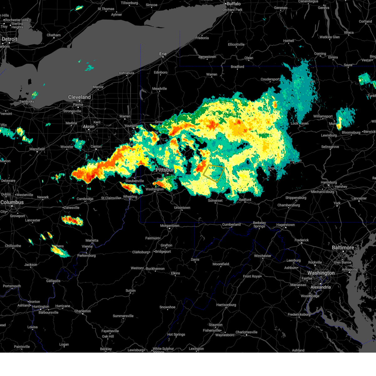 At 730 pm edt, a severe thunderstorm was located over black lick, or near homer city, moving east at 40 mph (radar indicated). Hazards include 60 mph wind gusts and nickel size hail. expect damage to trees and power lines, resulting in some power outages At 730 pm edt, a severe thunderstorm was located over black lick, or near homer city, moving east at 40 mph (radar indicated). Hazards include 60 mph wind gusts and nickel size hail. expect damage to trees and power lines, resulting in some power outages
|
| 8/12/2023 7:14 PM EDT |
 At 714 pm edt, a severe thunderstorm was located near black lick, or near homer city, moving east at 35 mph (radar indicated). Hazards include 60 mph wind gusts and quarter size hail. Minor hail damage to vehicles is possible. expect wind damage to trees and power lines, resulting in some power outages. locations impacted include, indiana, homer city, blairsville, black lick, clymer, saltsburg, west lebanon, new florence, chevy chase heights, bolivar, ernest, creekside, shelocta, lucerne mines, jacksonville, brush vly, and yellow creek state park. hail threat, radar indicated max hail size, 1. 00 in wind threat, radar indicated max wind gust, 60 mph. At 714 pm edt, a severe thunderstorm was located near black lick, or near homer city, moving east at 35 mph (radar indicated). Hazards include 60 mph wind gusts and quarter size hail. Minor hail damage to vehicles is possible. expect wind damage to trees and power lines, resulting in some power outages. locations impacted include, indiana, homer city, blairsville, black lick, clymer, saltsburg, west lebanon, new florence, chevy chase heights, bolivar, ernest, creekside, shelocta, lucerne mines, jacksonville, brush vly, and yellow creek state park. hail threat, radar indicated max hail size, 1. 00 in wind threat, radar indicated max wind gust, 60 mph.
|
| 8/12/2023 6:48 PM EDT |
 At 648 pm edt, a severe thunderstorm was located over apollo, moving east at 35 mph (radar indicated). Hazards include 60 mph wind gusts and quarter size hail. Minor hail damage to vehicles is possible. Expect wind damage to trees and power lines, resulting in some power outages. At 648 pm edt, a severe thunderstorm was located over apollo, moving east at 35 mph (radar indicated). Hazards include 60 mph wind gusts and quarter size hail. Minor hail damage to vehicles is possible. Expect wind damage to trees and power lines, resulting in some power outages.
|
| 7/13/2023 9:17 PM EDT |
 At 917 pm edt, a severe thunderstorm was located 8 miles east of apollo, moving east at 25 mph (radar indicated). Hazards include 60 mph wind gusts. expect damage to trees and power lines, resulting in some power outages At 917 pm edt, a severe thunderstorm was located 8 miles east of apollo, moving east at 25 mph (radar indicated). Hazards include 60 mph wind gusts. expect damage to trees and power lines, resulting in some power outages
|
| 6/25/2023 8:36 PM EDT |
 At 834 pm edt, the leading edge of severe thunderstorms was located along a line extending from 10 miles southwest of punxsutawney to indiana to near black lick, moving east at 20 mph (radar indicated). Hazards include 60 mph wind gusts. Expect damage to trees and power lines, resulting in some power outages. locations impacted include, indiana, homer city, blairsville, black lick, clymer, dayton, chevy chase heights, rossiter, seward, bolivar, ernest, marion center, vintondale, creekside, plumville, shelocta, armagh, atwood, dixonville, and jacksonville. this includes route 119. hail threat, radar indicated max hail size, <. 75 in wind threat, radar indicated max wind gust, 60 mph. At 834 pm edt, the leading edge of severe thunderstorms was located along a line extending from 10 miles southwest of punxsutawney to indiana to near black lick, moving east at 20 mph (radar indicated). Hazards include 60 mph wind gusts. Expect damage to trees and power lines, resulting in some power outages. locations impacted include, indiana, homer city, blairsville, black lick, clymer, dayton, chevy chase heights, rossiter, seward, bolivar, ernest, marion center, vintondale, creekside, plumville, shelocta, armagh, atwood, dixonville, and jacksonville. this includes route 119. hail threat, radar indicated max hail size, <. 75 in wind threat, radar indicated max wind gust, 60 mph.
|
| 6/25/2023 8:21 PM EDT |
 At 820 pm edt, severe thunderstorms were located along a line extending from 12 miles southeast of new bethlehem to 8 miles west of indiana to blairsville, moving east at 20 mph (radar indicated). Hazards include 60 mph wind gusts. expect damage to trees and power lines, resulting in some power outages At 820 pm edt, severe thunderstorms were located along a line extending from 12 miles southeast of new bethlehem to 8 miles west of indiana to blairsville, moving east at 20 mph (radar indicated). Hazards include 60 mph wind gusts. expect damage to trees and power lines, resulting in some power outages
|
| 4/1/2023 3:11 PM EDT |
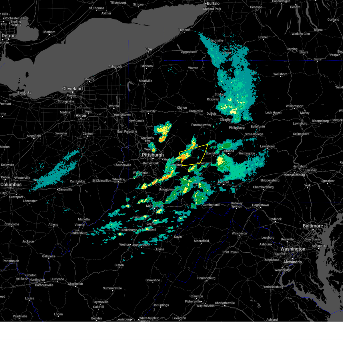 At 310 pm edt, a severe thunderstorm was located over blairsville, or 9 miles northeast of latrobe, moving east at 65 mph (radar indicated). Hazards include 60 mph wind gusts and quarter size hail. Minor hail damage to vehicles is possible. Expect wind damage to trees and power lines, resulting in some power outages. At 310 pm edt, a severe thunderstorm was located over blairsville, or 9 miles northeast of latrobe, moving east at 65 mph (radar indicated). Hazards include 60 mph wind gusts and quarter size hail. Minor hail damage to vehicles is possible. Expect wind damage to trees and power lines, resulting in some power outages.
|
| 11/27/2022 3:24 PM EST |
 At 323 pm est, severe thunderstorms were located along a line extending from near homer city to 8 miles west of westmont to near ligonier, moving northeast at 60 mph (radar indicated). Hazards include 60 mph wind gusts and quarter size hail. Minor hail damage to vehicles is possible. expect wind damage to trees and power lines, resulting in some power outages. locations impacted include, indiana, homer city, blairsville, ligonier, black lick, clymer, new florence, chevy chase heights, seward, bolivar, vintondale, and cherry tree. hail threat, radar indicated max hail size, 1. 00 in wind threat, radar indicated max wind gust, 60 mph. At 323 pm est, severe thunderstorms were located along a line extending from near homer city to 8 miles west of westmont to near ligonier, moving northeast at 60 mph (radar indicated). Hazards include 60 mph wind gusts and quarter size hail. Minor hail damage to vehicles is possible. expect wind damage to trees and power lines, resulting in some power outages. locations impacted include, indiana, homer city, blairsville, ligonier, black lick, clymer, new florence, chevy chase heights, seward, bolivar, vintondale, and cherry tree. hail threat, radar indicated max hail size, 1. 00 in wind threat, radar indicated max wind gust, 60 mph.
|
| 11/27/2022 3:14 PM EST |
 At 313 pm est, severe thunderstorms were located along a line extending from 6 miles northwest of blairsville to near derry to 6 miles north of seven springs, moving northeast at 60 mph (radar indicated). Hazards include 60 mph wind gusts. expect damage to trees and power lines, resulting in some power outages At 313 pm est, severe thunderstorms were located along a line extending from 6 miles northwest of blairsville to near derry to 6 miles north of seven springs, moving northeast at 60 mph (radar indicated). Hazards include 60 mph wind gusts. expect damage to trees and power lines, resulting in some power outages
|
| 11/27/2022 3:02 PM EST |
 At 301 pm est, severe thunderstorms were located along a line extending from 7 miles east of apollo to greensburg, moving northeast at 60 mph (radar indicated). Hazards include 60 mph wind gusts. Expect damage to trees and power lines, resulting in some power outages. locations impacted include, greensburg, indiana, jeannette, homer city, murrysville, blairsville, delmont, black lick, clymer, avonmore, saltsburg, and west lebanon. hail threat, radar indicated max hail size, <. 75 in wind threat, radar indicated max wind gust, 60 mph. At 301 pm est, severe thunderstorms were located along a line extending from 7 miles east of apollo to greensburg, moving northeast at 60 mph (radar indicated). Hazards include 60 mph wind gusts. Expect damage to trees and power lines, resulting in some power outages. locations impacted include, greensburg, indiana, jeannette, homer city, murrysville, blairsville, delmont, black lick, clymer, avonmore, saltsburg, and west lebanon. hail threat, radar indicated max hail size, <. 75 in wind threat, radar indicated max wind gust, 60 mph.
|
| 11/27/2022 2:59 PM EST |
 At 258 pm est, a severe thunderstorm was located near mount pleasant, or 7 miles south of greensburg, moving northeast at 60 mph (radar indicated). Hazards include 60 mph wind gusts and quarter size hail. Minor hail damage to vehicles is possible. expect wind damage to trees and power lines, resulting in some power outages. locations impacted include, greensburg, jeannette, latrobe, mount pleasant, scottdale, mcchesneytown-loyalhanna, blairsville, youngwood, derry, lawson heights, new stanton, and ligonier. hail threat, observed max hail size, 1. 00 in wind threat, radar indicated max wind gust, 60 mph. At 258 pm est, a severe thunderstorm was located near mount pleasant, or 7 miles south of greensburg, moving northeast at 60 mph (radar indicated). Hazards include 60 mph wind gusts and quarter size hail. Minor hail damage to vehicles is possible. expect wind damage to trees and power lines, resulting in some power outages. locations impacted include, greensburg, jeannette, latrobe, mount pleasant, scottdale, mcchesneytown-loyalhanna, blairsville, youngwood, derry, lawson heights, new stanton, and ligonier. hail threat, observed max hail size, 1. 00 in wind threat, radar indicated max wind gust, 60 mph.
|
| 11/27/2022 2:49 PM EST |
 At 248 pm est, a severe thunderstorm was located near perryopolis, or 10 miles northwest of connellsville, moving northeast at 60 mph (radar indicated. spotters also reported golf ball size hail in california pa). Hazards include golf ball size hail and 60 mph wind gusts. People and animals outdoors will be injured. expect hail damage to roofs, siding, windows, and vehicles. expect wind damage to trees and power lines, resulting in some power outages. locations impacted include, greensburg, jeannette, latrobe, mount pleasant, scottdale, mcchesneytown-loyalhanna, blairsville, youngwood, derry, west newton, lawson heights, and new stanton. thunderstorm damage threat, considerable hail threat, observed max hail size, 1. 75 in wind threat, radar indicated max wind gust, 60 mph. At 248 pm est, a severe thunderstorm was located near perryopolis, or 10 miles northwest of connellsville, moving northeast at 60 mph (radar indicated. spotters also reported golf ball size hail in california pa). Hazards include golf ball size hail and 60 mph wind gusts. People and animals outdoors will be injured. expect hail damage to roofs, siding, windows, and vehicles. expect wind damage to trees and power lines, resulting in some power outages. locations impacted include, greensburg, jeannette, latrobe, mount pleasant, scottdale, mcchesneytown-loyalhanna, blairsville, youngwood, derry, west newton, lawson heights, and new stanton. thunderstorm damage threat, considerable hail threat, observed max hail size, 1. 75 in wind threat, radar indicated max wind gust, 60 mph.
|
| 11/27/2022 2:41 PM EST |
 At 240 pm est, severe thunderstorms were located along a line extending from near monroeville to near monongahela, moving northeast at 55 mph (radar indicated). Hazards include 60 mph wind gusts. expect damage to trees and power lines, resulting in some power outages At 240 pm est, severe thunderstorms were located along a line extending from near monroeville to near monongahela, moving northeast at 55 mph (radar indicated). Hazards include 60 mph wind gusts. expect damage to trees and power lines, resulting in some power outages
|
| 11/27/2022 2:35 PM EST |
 At 234 pm est, a severe thunderstorm was located over california, or 15 miles south of gastonville, moving northeast at 60 mph (radar indicated). Hazards include ping pong ball size hail and 60 mph wind gusts. People and animals outdoors will be injured. expect hail damage to roofs, siding, windows, and vehicles. expect wind damage to trees and power lines, resulting in some power outages. locations impacted include, greensburg, jeannette, latrobe, monessen, california, donora, mount pleasant, scottdale, monongahela, charleroi, mcchesneytown-loyalhanna, and blairsville. hail threat, radar indicated max hail size, 1. 50 in wind threat, radar indicated max wind gust, 60 mph. At 234 pm est, a severe thunderstorm was located over california, or 15 miles south of gastonville, moving northeast at 60 mph (radar indicated). Hazards include ping pong ball size hail and 60 mph wind gusts. People and animals outdoors will be injured. expect hail damage to roofs, siding, windows, and vehicles. expect wind damage to trees and power lines, resulting in some power outages. locations impacted include, greensburg, jeannette, latrobe, monessen, california, donora, mount pleasant, scottdale, monongahela, charleroi, mcchesneytown-loyalhanna, and blairsville. hail threat, radar indicated max hail size, 1. 50 in wind threat, radar indicated max wind gust, 60 mph.
|
| 11/27/2022 2:29 PM EST |
 At 228 pm est, a severe thunderstorm was located over fredericktown-millsboro, or 10 miles northeast of waynesburg, moving northeast at 60 mph (radar indicated). Hazards include 60 mph wind gusts and quarter size hail. Minor hail damage to vehicles is possible. Expect wind damage to trees and power lines, resulting in some power outages. At 228 pm est, a severe thunderstorm was located over fredericktown-millsboro, or 10 miles northeast of waynesburg, moving northeast at 60 mph (radar indicated). Hazards include 60 mph wind gusts and quarter size hail. Minor hail damage to vehicles is possible. Expect wind damage to trees and power lines, resulting in some power outages.
|
| 8/4/2022 3:55 PM EDT |
 The severe thunderstorm warning for southwestern indiana, central westmoreland and southeastern armstrong counties will expire at 400 pm edt, the storm which prompted the warning has weakened below severe limits, and no longer poses an immediate threat to life or property. therefore, the warning will be allowed to expire. however gusty winds and heavy rain are still possible with this thunderstorm. The severe thunderstorm warning for southwestern indiana, central westmoreland and southeastern armstrong counties will expire at 400 pm edt, the storm which prompted the warning has weakened below severe limits, and no longer poses an immediate threat to life or property. therefore, the warning will be allowed to expire. however gusty winds and heavy rain are still possible with this thunderstorm.
|
| 8/4/2022 3:32 PM EDT |
 At 331 pm edt, a severe thunderstorm was located 8 miles southeast of apollo, moving east at 20 mph (radar indicated). Hazards include 60 mph wind gusts. Expect damage to trees and power lines, resulting in some power outages. locations impacted include, indiana, vandergrift, homer city, apollo, murrysville, blairsville, derry, delmont, leechburg, black lick, north apollo, and avonmore. hail threat, radar indicated max hail size, <. 75 in wind threat, radar indicated max wind gust, 60 mph. At 331 pm edt, a severe thunderstorm was located 8 miles southeast of apollo, moving east at 20 mph (radar indicated). Hazards include 60 mph wind gusts. Expect damage to trees and power lines, resulting in some power outages. locations impacted include, indiana, vandergrift, homer city, apollo, murrysville, blairsville, derry, delmont, leechburg, black lick, north apollo, and avonmore. hail threat, radar indicated max hail size, <. 75 in wind threat, radar indicated max wind gust, 60 mph.
|
| 8/4/2022 3:18 PM EDT |
 At 318 pm edt, a cluster of severe thunderstorms was located near plum, or near penn hills, and near saltsburg moving east at 15 mph (radar indicated). Hazards include 60 mph wind gusts and quarter size hail. Minor hail damage to vehicles is possible. Expect wind damage to trees and power lines, resulting in some power outages. At 318 pm edt, a cluster of severe thunderstorms was located near plum, or near penn hills, and near saltsburg moving east at 15 mph (radar indicated). Hazards include 60 mph wind gusts and quarter size hail. Minor hail damage to vehicles is possible. Expect wind damage to trees and power lines, resulting in some power outages.
|
| 7/24/2022 8:28 AM EDT |
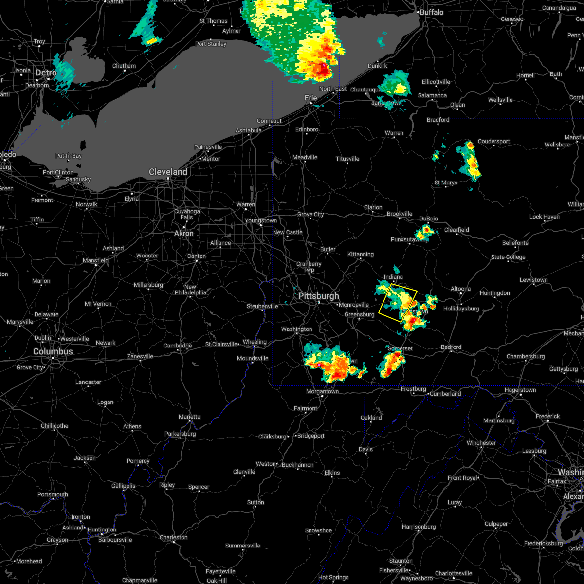 The severe thunderstorm warning for southeastern indiana and east central westmoreland counties will expire at 830 am edt, the storm which prompted the warning has moved out of the area. therefore, the warning will be allowed to expire. The severe thunderstorm warning for southeastern indiana and east central westmoreland counties will expire at 830 am edt, the storm which prompted the warning has moved out of the area. therefore, the warning will be allowed to expire.
|
| 7/24/2022 8:12 AM EDT |
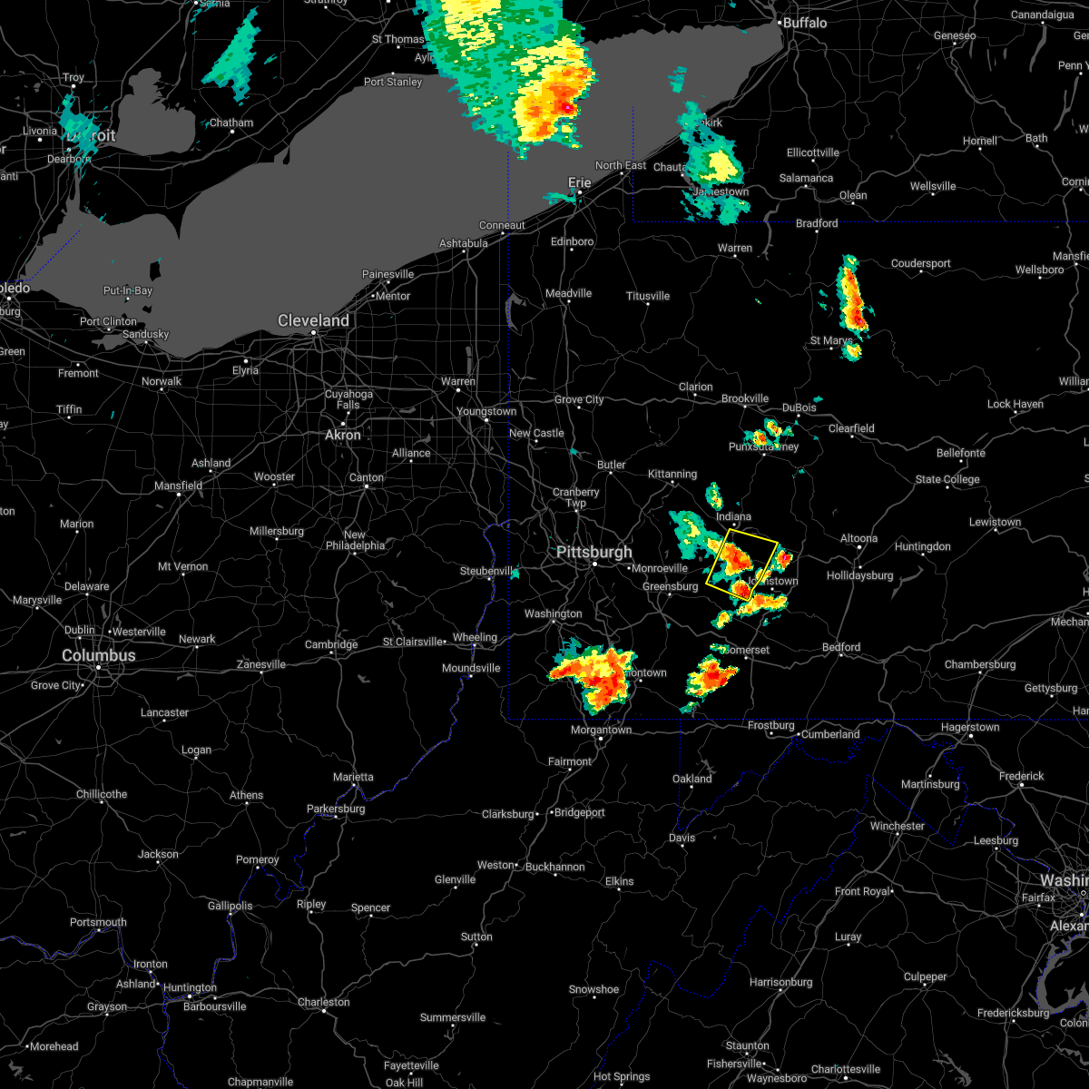 At 812 am edt, a severe thunderstorm was located near black lick, or 8 miles southeast of homer city, moving east at 45 mph (radar indicated). Hazards include 60 mph wind gusts and penny size hail. Expect damage to trees and power lines, resulting in some power outages. locations impacted include, homer city, blairsville, black lick, new florence, seward, bolivar, armagh, lucerne mines, brush vly, and yellow creek state park. hail threat, radar indicated max hail size, 0. 75 in wind threat, radar indicated max wind gust, 60 mph. At 812 am edt, a severe thunderstorm was located near black lick, or 8 miles southeast of homer city, moving east at 45 mph (radar indicated). Hazards include 60 mph wind gusts and penny size hail. Expect damage to trees and power lines, resulting in some power outages. locations impacted include, homer city, blairsville, black lick, new florence, seward, bolivar, armagh, lucerne mines, brush vly, and yellow creek state park. hail threat, radar indicated max hail size, 0. 75 in wind threat, radar indicated max wind gust, 60 mph.
|
| 7/24/2022 7:56 AM EDT |
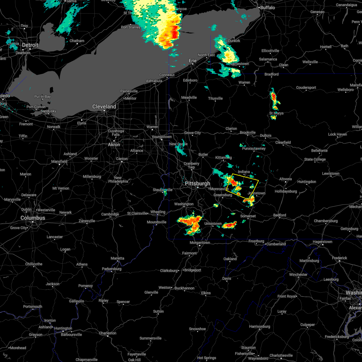 At 756 am edt, a severe thunderstorm was located near blairsville, or 7 miles southwest of homer city, moving east at 40 mph (radar indicated). Hazards include 60 mph wind gusts and penny size hail. Expect damage to trees and power lines, resulting in some power outages. locations impacted include, homer city, blairsville, derry, black lick, west lebanon, new florence, new alexandria, seward, bolivar, armagh, lucerne mines, and jacksonville. hail threat, radar indicated max hail size, 0. 75 in wind threat, radar indicated max wind gust, 60 mph. At 756 am edt, a severe thunderstorm was located near blairsville, or 7 miles southwest of homer city, moving east at 40 mph (radar indicated). Hazards include 60 mph wind gusts and penny size hail. Expect damage to trees and power lines, resulting in some power outages. locations impacted include, homer city, blairsville, derry, black lick, west lebanon, new florence, new alexandria, seward, bolivar, armagh, lucerne mines, and jacksonville. hail threat, radar indicated max hail size, 0. 75 in wind threat, radar indicated max wind gust, 60 mph.
|
| 7/24/2022 7:41 AM EDT |
 At 740 am edt, a severe thunderstorm was located near apollo, moving east at 45 mph (radar indicated). Hazards include 60 mph wind gusts and penny size hail. expect damage to trees and power lines, resulting in some power outages At 740 am edt, a severe thunderstorm was located near apollo, moving east at 45 mph (radar indicated). Hazards include 60 mph wind gusts and penny size hail. expect damage to trees and power lines, resulting in some power outages
|
| 7/23/2022 3:51 PM EDT |
 At 351 pm edt, a severe thunderstorm was located 8 miles west of indiana, moving east at 30 mph (radar indicated). Hazards include 60 mph wind gusts and quarter size hail. Minor hail damage to vehicles is possible. expect wind damage to trees and power lines, resulting in some power outages. locations impacted include, greensburg, indiana, latrobe, vandergrift, kittanning, homer city, apollo, mount pleasant, scottdale, mcchesneytown-loyalhanna, blairsville, and youngwood. hail threat, radar indicated max hail size, 1. 00 in wind threat, radar indicated max wind gust, 60 mph. At 351 pm edt, a severe thunderstorm was located 8 miles west of indiana, moving east at 30 mph (radar indicated). Hazards include 60 mph wind gusts and quarter size hail. Minor hail damage to vehicles is possible. expect wind damage to trees and power lines, resulting in some power outages. locations impacted include, greensburg, indiana, latrobe, vandergrift, kittanning, homer city, apollo, mount pleasant, scottdale, mcchesneytown-loyalhanna, blairsville, and youngwood. hail threat, radar indicated max hail size, 1. 00 in wind threat, radar indicated max wind gust, 60 mph.
|
| 7/23/2022 3:29 PM EDT |
 At 329 pm edt, a severe thunderstorm was located near apollo, moving east at 35 mph (radar indicated). Hazards include 60 mph wind gusts and quarter size hail. Minor hail damage to vehicles is possible. Expect wind damage to trees and power lines, resulting in some power outages. At 329 pm edt, a severe thunderstorm was located near apollo, moving east at 35 mph (radar indicated). Hazards include 60 mph wind gusts and quarter size hail. Minor hail damage to vehicles is possible. Expect wind damage to trees and power lines, resulting in some power outages.
|
| 6/22/2022 6:12 PM EDT |
 The severe thunderstorm warning for southwestern indiana, northwestern westmoreland and southern armstrong counties will expire at 615 pm edt, the storm which prompted the warning has weakened below severe limits, and no longer poses an immediate threat to life or property. therefore, the warning will be allowed to expire. however gusty winds are still possible with this thunderstorm. a severe thunderstorm watch remains in effect until 1000 pm edt for southwestern and west central pennsylvania. The severe thunderstorm warning for southwestern indiana, northwestern westmoreland and southern armstrong counties will expire at 615 pm edt, the storm which prompted the warning has weakened below severe limits, and no longer poses an immediate threat to life or property. therefore, the warning will be allowed to expire. however gusty winds are still possible with this thunderstorm. a severe thunderstorm watch remains in effect until 1000 pm edt for southwestern and west central pennsylvania.
|
| 6/22/2022 5:44 PM EDT |
 At 544 pm edt, a severe thunderstorm was located near ford city, or 7 miles northeast of vandergrift, moving southeast at 20 mph (radar indicated). Hazards include 60 mph wind gusts and quarter size hail. Minor hail damage to vehicles is possible. expect wind damage to trees and power lines, resulting in some power outages. locations impacted include, indiana, vandergrift, homer city, apollo, new kensington, lower burrell, blairsville, derry, leechburg, black lick, north apollo, and west leechburg. hail threat, radar indicated max hail size, 1. 00 in wind threat, radar indicated max wind gust, 60 mph. At 544 pm edt, a severe thunderstorm was located near ford city, or 7 miles northeast of vandergrift, moving southeast at 20 mph (radar indicated). Hazards include 60 mph wind gusts and quarter size hail. Minor hail damage to vehicles is possible. expect wind damage to trees and power lines, resulting in some power outages. locations impacted include, indiana, vandergrift, homer city, apollo, new kensington, lower burrell, blairsville, derry, leechburg, black lick, north apollo, and west leechburg. hail threat, radar indicated max hail size, 1. 00 in wind threat, radar indicated max wind gust, 60 mph.
|
| 6/22/2022 5:27 PM EDT |
 At 527 pm edt, a severe thunderstorm was located over leechburg, or over vandergrift, moving southeast at 20 mph (radar indicated). Hazards include 60 mph wind gusts and quarter size hail. Minor hail damage to vehicles is possible. Expect wind damage to trees and power lines, resulting in some power outages. At 527 pm edt, a severe thunderstorm was located over leechburg, or over vandergrift, moving southeast at 20 mph (radar indicated). Hazards include 60 mph wind gusts and quarter size hail. Minor hail damage to vehicles is possible. Expect wind damage to trees and power lines, resulting in some power outages.
|
| 5/3/2022 7:21 PM EDT |
 The severe thunderstorm warning for southern indiana, southeastern westmoreland and northeastern fayette counties will expire at 730 pm edt, the storm which prompted the warning has weakened below severe limits or has exited the warned area. therefore, the warning will be allowed to expire. however, gusty winds and heavy rain are still possible with additional thunderstorms this evening. a tornado watch remains in effect until 900 pm edt for southwestern pennsylvania. The severe thunderstorm warning for southern indiana, southeastern westmoreland and northeastern fayette counties will expire at 730 pm edt, the storm which prompted the warning has weakened below severe limits or has exited the warned area. therefore, the warning will be allowed to expire. however, gusty winds and heavy rain are still possible with additional thunderstorms this evening. a tornado watch remains in effect until 900 pm edt for southwestern pennsylvania.
|
| 5/3/2022 6:56 PM EDT |
 At 656 pm edt, a severe thunderstorm was located over derry, or near latrobe, moving east at 45 mph (radar indicated). Hazards include 60 mph wind gusts. expect damage to trees and power lines, resulting in some power outages At 656 pm edt, a severe thunderstorm was located over derry, or near latrobe, moving east at 45 mph (radar indicated). Hazards include 60 mph wind gusts. expect damage to trees and power lines, resulting in some power outages
|
| 3/7/2022 4:51 PM EST |
 At 450 pm est, severe thunderstorms were located along a line extending from 7 miles west of homer city to near uniontown, moving east at 55 mph (radar indicated). Hazards include 60 mph wind gusts. Expect damage to trees and power lines, resulting in some power outages. locations impacted include, greensburg, indiana, uniontown, jeannette, latrobe, connellsville, homer city, mount pleasant, scottdale, mcchesneytown-loyalhanna, blairsville, and youngwood. hail threat, radar indicated max hail size, <. 75 in wind threat, radar indicated max wind gust, 60 mph. At 450 pm est, severe thunderstorms were located along a line extending from 7 miles west of homer city to near uniontown, moving east at 55 mph (radar indicated). Hazards include 60 mph wind gusts. Expect damage to trees and power lines, resulting in some power outages. locations impacted include, greensburg, indiana, uniontown, jeannette, latrobe, connellsville, homer city, mount pleasant, scottdale, mcchesneytown-loyalhanna, blairsville, and youngwood. hail threat, radar indicated max hail size, <. 75 in wind threat, radar indicated max wind gust, 60 mph.
|
| 3/7/2022 4:28 PM EST |
 At 428 pm est, severe rated winds were located along a line extending from near leechburg to fredericktown-millsboro, moving east at 55 mph (radar indicated). Hazards include 60 mph wind gusts. expect damage to trees and power lines, resulting in some power outages At 428 pm est, severe rated winds were located along a line extending from near leechburg to fredericktown-millsboro, moving east at 55 mph (radar indicated). Hazards include 60 mph wind gusts. expect damage to trees and power lines, resulting in some power outages
|
| 8/13/2021 8:07 PM EDT |
 The severe thunderstorm warning for southeastern westmoreland county will expire at 815 pm edt, the storm which prompted the warning has moved out of the area. therefore, the warning will be allowed to expire. a severe thunderstorm watch remains in effect until 1100 pm edt for southwestern and west central pennsylvania. remember, a severe thunderstorm warning still remains in effect for western westmoreland county until 0830 pm. The severe thunderstorm warning for southeastern westmoreland county will expire at 815 pm edt, the storm which prompted the warning has moved out of the area. therefore, the warning will be allowed to expire. a severe thunderstorm watch remains in effect until 1100 pm edt for southwestern and west central pennsylvania. remember, a severe thunderstorm warning still remains in effect for western westmoreland county until 0830 pm.
|
| 8/13/2021 8:05 PM EDT |
 At 805 pm edt, a severe thunderstorm was located 9 miles east of apollo, moving northeast at 35 mph (radar indicated). Hazards include 60 mph wind gusts. Expect damage to trees and power lines, resulting in some power outages. locations impacted include, vandergrift, homer city, apollo, mcchesneytown-loyalhanna, blairsville, derry, leechburg, ligonier, black lick, north apollo, west leechburg, and avonmore. hail threat, radar indicated max hail size, <. 75 in wind threat, radar indicated max wind gust, 60 mph. At 805 pm edt, a severe thunderstorm was located 9 miles east of apollo, moving northeast at 35 mph (radar indicated). Hazards include 60 mph wind gusts. Expect damage to trees and power lines, resulting in some power outages. locations impacted include, vandergrift, homer city, apollo, mcchesneytown-loyalhanna, blairsville, derry, leechburg, ligonier, black lick, north apollo, west leechburg, and avonmore. hail threat, radar indicated max hail size, <. 75 in wind threat, radar indicated max wind gust, 60 mph.
|
| 8/13/2021 7:44 PM EDT |
 At 744 pm edt, a severe thunderstorm was located 8 miles southwest of ligonier, or 10 miles south of latrobe, moving northeast at 25 mph (radar indicated). Hazards include 60 mph wind gusts. Expect damage to trees and power lines, resulting in some power outages. locations impacted include, latrobe, mount pleasant, mcchesneytown-loyalhanna, derry, lawson heights, ligonier, calumet-norvelt, youngstown, laurel mountain, donegal, champion, and acme. hail threat, radar indicated max hail size, <. 75 in wind threat, radar indicated max wind gust, 60 mph. At 744 pm edt, a severe thunderstorm was located 8 miles southwest of ligonier, or 10 miles south of latrobe, moving northeast at 25 mph (radar indicated). Hazards include 60 mph wind gusts. Expect damage to trees and power lines, resulting in some power outages. locations impacted include, latrobe, mount pleasant, mcchesneytown-loyalhanna, derry, lawson heights, ligonier, calumet-norvelt, youngstown, laurel mountain, donegal, champion, and acme. hail threat, radar indicated max hail size, <. 75 in wind threat, radar indicated max wind gust, 60 mph.
|
| 8/13/2021 7:37 PM EDT |
 At 737 pm edt, a severe thunderstorm was located over murrysville, or near jeannette, moving northeast at 35 mph (radar indicated). Hazards include 60 mph wind gusts. expect damage to trees and power lines, resulting in some power outages At 737 pm edt, a severe thunderstorm was located over murrysville, or near jeannette, moving northeast at 35 mph (radar indicated). Hazards include 60 mph wind gusts. expect damage to trees and power lines, resulting in some power outages
|
| 8/13/2021 7:29 PM EDT |
 At 729 pm edt, a severe thunderstorm was located near mount pleasant, or 9 miles northeast of connellsville, moving northeast at 25 mph (radar indicated). Hazards include 60 mph wind gusts. expect damage to trees and power lines, resulting in some power outages At 729 pm edt, a severe thunderstorm was located near mount pleasant, or 9 miles northeast of connellsville, moving northeast at 25 mph (radar indicated). Hazards include 60 mph wind gusts. expect damage to trees and power lines, resulting in some power outages
|
| 8/12/2021 7:09 PM EDT |
 At 709 pm edt, severe thunderstorms were located along a line extending from new kensington to baldwin to near wolfdale, moving east at 35 mph (radar indicated). Hazards include 60 mph wind gusts. expect damage to trees and power lines, resulting in some power outages At 709 pm edt, severe thunderstorms were located along a line extending from new kensington to baldwin to near wolfdale, moving east at 35 mph (radar indicated). Hazards include 60 mph wind gusts. expect damage to trees and power lines, resulting in some power outages
|
| 8/11/2021 2:25 PM EDT |
 The severe thunderstorm warning for indiana and east central westmoreland counties will expire at 230 pm edt, the storm which prompted the warning has weakened below severe limits, and has exited the warned area. therefore, the warning will be allowed to expire. The severe thunderstorm warning for indiana and east central westmoreland counties will expire at 230 pm edt, the storm which prompted the warning has weakened below severe limits, and has exited the warned area. therefore, the warning will be allowed to expire.
|
| 8/11/2021 2:15 PM EDT |
 At 215 pm edt, a severe thunderstorm was located over belsano, or near nanty-glo, moving east at 35 mph (emergency management). Hazards include 60 mph wind gusts. Expect damage to trees and power lines, resulting in some power outages. locations impacted include, indiana, homer city, mcchesneytown-loyalhanna, blairsville, derry, black lick, clymer, new florence, chevy chase heights, seward, bolivar, and marion center. hail threat, radar indicated max hail size, <. 75 in wind threat, observed max wind gust, 60 mph. At 215 pm edt, a severe thunderstorm was located over belsano, or near nanty-glo, moving east at 35 mph (emergency management). Hazards include 60 mph wind gusts. Expect damage to trees and power lines, resulting in some power outages. locations impacted include, indiana, homer city, mcchesneytown-loyalhanna, blairsville, derry, black lick, clymer, new florence, chevy chase heights, seward, bolivar, and marion center. hail threat, radar indicated max hail size, <. 75 in wind threat, observed max wind gust, 60 mph.
|
| 8/11/2021 1:55 PM EDT |
 At 154 pm edt, a severe thunderstorm was located near homer city, moving east at 35 mph (emergency management). Hazards include 60 mph wind gusts. Expect damage to trees and power lines, resulting in some power outages. locations impacted include, indiana, latrobe, homer city, mcchesneytown-loyalhanna, blairsville, derry, lawson heights, black lick, clymer, west lebanon, new florence, and new alexandria. hail threat, radar indicated max hail size, <. 75 in wind threat, observed max wind gust, 60 mph. At 154 pm edt, a severe thunderstorm was located near homer city, moving east at 35 mph (emergency management). Hazards include 60 mph wind gusts. Expect damage to trees and power lines, resulting in some power outages. locations impacted include, indiana, latrobe, homer city, mcchesneytown-loyalhanna, blairsville, derry, lawson heights, black lick, clymer, west lebanon, new florence, and new alexandria. hail threat, radar indicated max hail size, <. 75 in wind threat, observed max wind gust, 60 mph.
|
| 8/11/2021 1:41 PM EDT |
 At 141 pm edt, a severe thunderstorm was located near homer city, moving east at 35 mph (radar indicated). Hazards include 60 mph wind gusts. expect damage to trees and power lines, resulting in some power outages At 141 pm edt, a severe thunderstorm was located near homer city, moving east at 35 mph (radar indicated). Hazards include 60 mph wind gusts. expect damage to trees and power lines, resulting in some power outages
|
| 7/28/2021 4:18 PM EDT | Utility lines down along pine ridge road in burell townshi in indiana county PA, 2.7 miles W of Blairsville, PA |
| 7/28/2021 4:15 PM EDT |
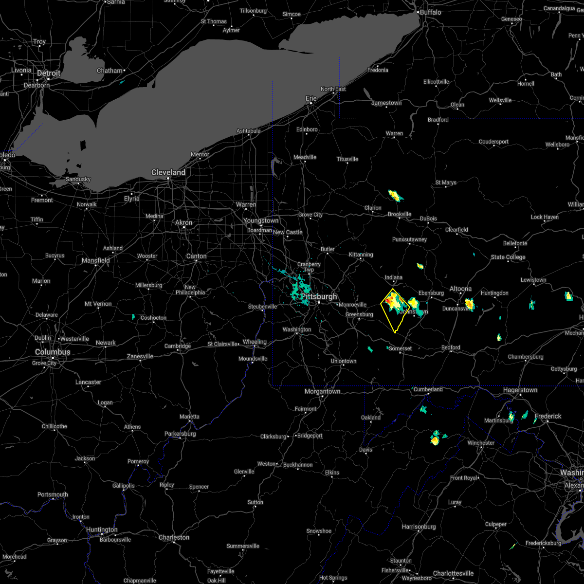 At 415 pm edt, a severe thunderstorm was located 7 miles southeast of black lick, or 9 miles northwest of westmont, moving southeast at 30 mph (radar). Hazards include wind gusts to 60 mph. Expect damage to trees and power lines, resulting in some power outages. Locations impacted include, homer city, blairsville, black lick, new florence, seward, bolivar, armagh, lucerne mines,. At 415 pm edt, a severe thunderstorm was located 7 miles southeast of black lick, or 9 miles northwest of westmont, moving southeast at 30 mph (radar). Hazards include wind gusts to 60 mph. Expect damage to trees and power lines, resulting in some power outages. Locations impacted include, homer city, blairsville, black lick, new florence, seward, bolivar, armagh, lucerne mines,.
|
| 7/28/2021 4:10 PM EDT |
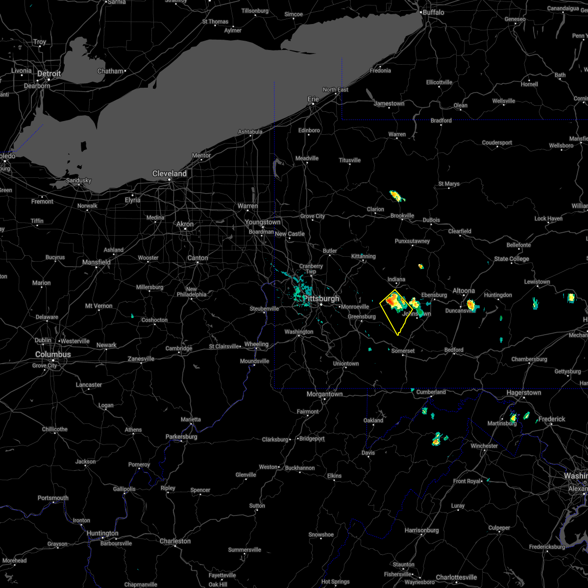 At 409 pm edt, a severe thunderstorm was located near black lick, or 8 miles south of homer city, moving southeast at 30 mph (radar). Hazards include wind gusts to 60 mph. Expect damage to trees and power lines, resulting in some power outages. Locations impacted include, homer city, blairsville, black lick, new florence, seward, bolivar, armagh, lucerne mines,. At 409 pm edt, a severe thunderstorm was located near black lick, or 8 miles south of homer city, moving southeast at 30 mph (radar). Hazards include wind gusts to 60 mph. Expect damage to trees and power lines, resulting in some power outages. Locations impacted include, homer city, blairsville, black lick, new florence, seward, bolivar, armagh, lucerne mines,.
|
| 7/28/2021 4:08 PM EDT | Utility lines down along strong road in black lick townshi in indiana county PA, 5.9 miles S of Blairsville, PA |
| 7/28/2021 4:01 PM EDT |
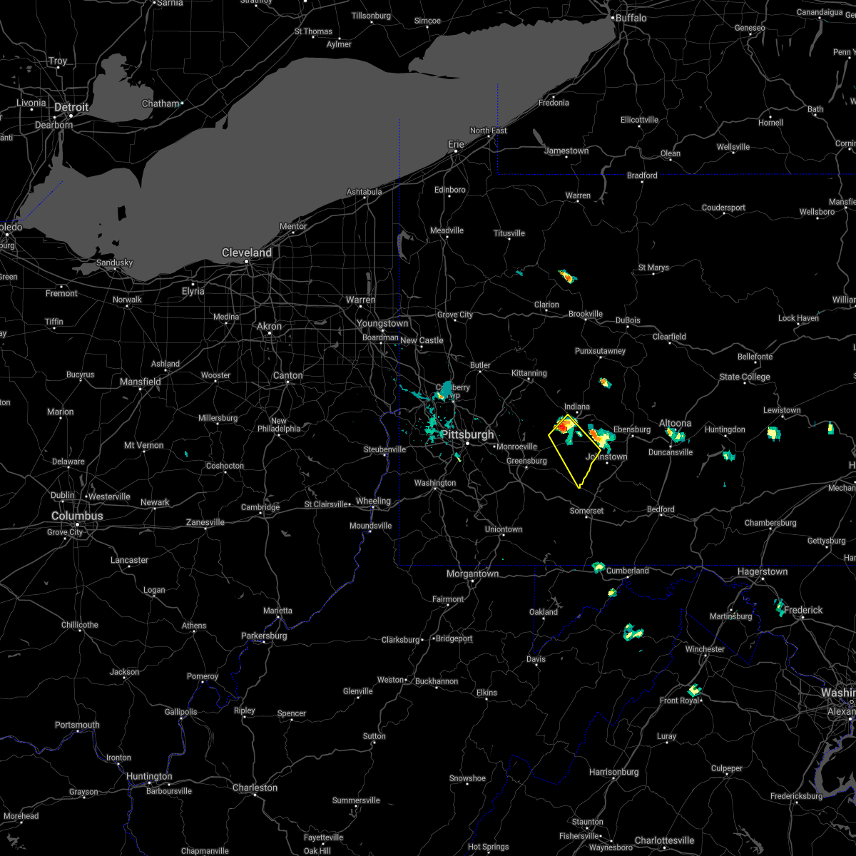 At 401 pm edt, a severe thunderstorm was located over black lick, or near homer city, moving southeast at 30 mph (radar). Hazards include wind gusts to 60 mph and quarter-size hail. Minor hail damage to vehicles is possible. expect wind damage to trees and power lines, resulting in some power outages. Locations impacted include, homer city, blairsville, black lick, new florence, seward, bolivar, armagh, lucerne mines, jacksonville,. At 401 pm edt, a severe thunderstorm was located over black lick, or near homer city, moving southeast at 30 mph (radar). Hazards include wind gusts to 60 mph and quarter-size hail. Minor hail damage to vehicles is possible. expect wind damage to trees and power lines, resulting in some power outages. Locations impacted include, homer city, blairsville, black lick, new florence, seward, bolivar, armagh, lucerne mines, jacksonville,.
|
| 7/28/2021 3:55 PM EDT |
 At 354 pm edt, a severe thunderstorm was located near black lick, or near homer city, moving southeast at 30 mph (radar). Hazards include wind gusts to 60 mph and quarter-size hail. Minor hail damage to vehicles is possible. expect wind damage to trees and power lines, resulting in some power outages. Locations impacted include, homer city, blairsville, black lick, new florence, seward, bolivar, armagh, lucerne mines, jacksonville,. At 354 pm edt, a severe thunderstorm was located near black lick, or near homer city, moving southeast at 30 mph (radar). Hazards include wind gusts to 60 mph and quarter-size hail. Minor hail damage to vehicles is possible. expect wind damage to trees and power lines, resulting in some power outages. Locations impacted include, homer city, blairsville, black lick, new florence, seward, bolivar, armagh, lucerne mines, jacksonville,.
|
| 7/28/2021 3:47 PM EDT |
 At 347 pm edt, a severe thunderstorm was located near homer city, moving southeast at 30 mph (radar). Hazards include wind gusts to 60 mph and quarter-size hail. Minor hail damage to vehicles is possible. Expect wind damage to trees and power lines, resulting in some power outages. At 347 pm edt, a severe thunderstorm was located near homer city, moving southeast at 30 mph (radar). Hazards include wind gusts to 60 mph and quarter-size hail. Minor hail damage to vehicles is possible. Expect wind damage to trees and power lines, resulting in some power outages.
|
| 7/17/2021 2:52 PM EDT |
 At 251 pm edt, a severe thunderstorm was located over mcchesneytown-loyalhanna, or over latrobe, moving east at 35 mph (law enforcement). Hazards include wind gusts to 60 mph. Expect damage to trees and power lines, resulting in some power outages. Locations impacted include, indiana, homer city, blairsville, derry, black lick, clymer, new florence, new alexandria, chevy chase heights, seward, bolivar, armagh,. At 251 pm edt, a severe thunderstorm was located over mcchesneytown-loyalhanna, or over latrobe, moving east at 35 mph (law enforcement). Hazards include wind gusts to 60 mph. Expect damage to trees and power lines, resulting in some power outages. Locations impacted include, indiana, homer city, blairsville, derry, black lick, clymer, new florence, new alexandria, chevy chase heights, seward, bolivar, armagh,.
|
| 7/17/2021 2:42 PM EDT |
 At 241 pm edt, a severe thunderstorm was located near lawson heights, or near latrobe, moving east at 35 mph (law enforcement). Hazards include wind gusts to 60 mph. Expect damage to trees and power lines, resulting in some power outages. Locations impacted include, greensburg, indiana, jeannette, latrobe, homer city, mcchesneytown-loyalhanna, blairsville, derry, delmont, lawson heights, ligonier, black lick,. At 241 pm edt, a severe thunderstorm was located near lawson heights, or near latrobe, moving east at 35 mph (law enforcement). Hazards include wind gusts to 60 mph. Expect damage to trees and power lines, resulting in some power outages. Locations impacted include, greensburg, indiana, jeannette, latrobe, homer city, mcchesneytown-loyalhanna, blairsville, derry, delmont, lawson heights, ligonier, black lick,.
|
| 7/17/2021 2:30 PM EDT |
 At 230 pm edt, a severe thunderstorm was located over greensburg, moving east at 35 mph (radar). Hazards include wind gusts to 60 mph. expect damage to trees and power lines, resulting in some power outages At 230 pm edt, a severe thunderstorm was located over greensburg, moving east at 35 mph (radar). Hazards include wind gusts to 60 mph. expect damage to trees and power lines, resulting in some power outages
|
| 7/13/2021 7:10 PM EDT |
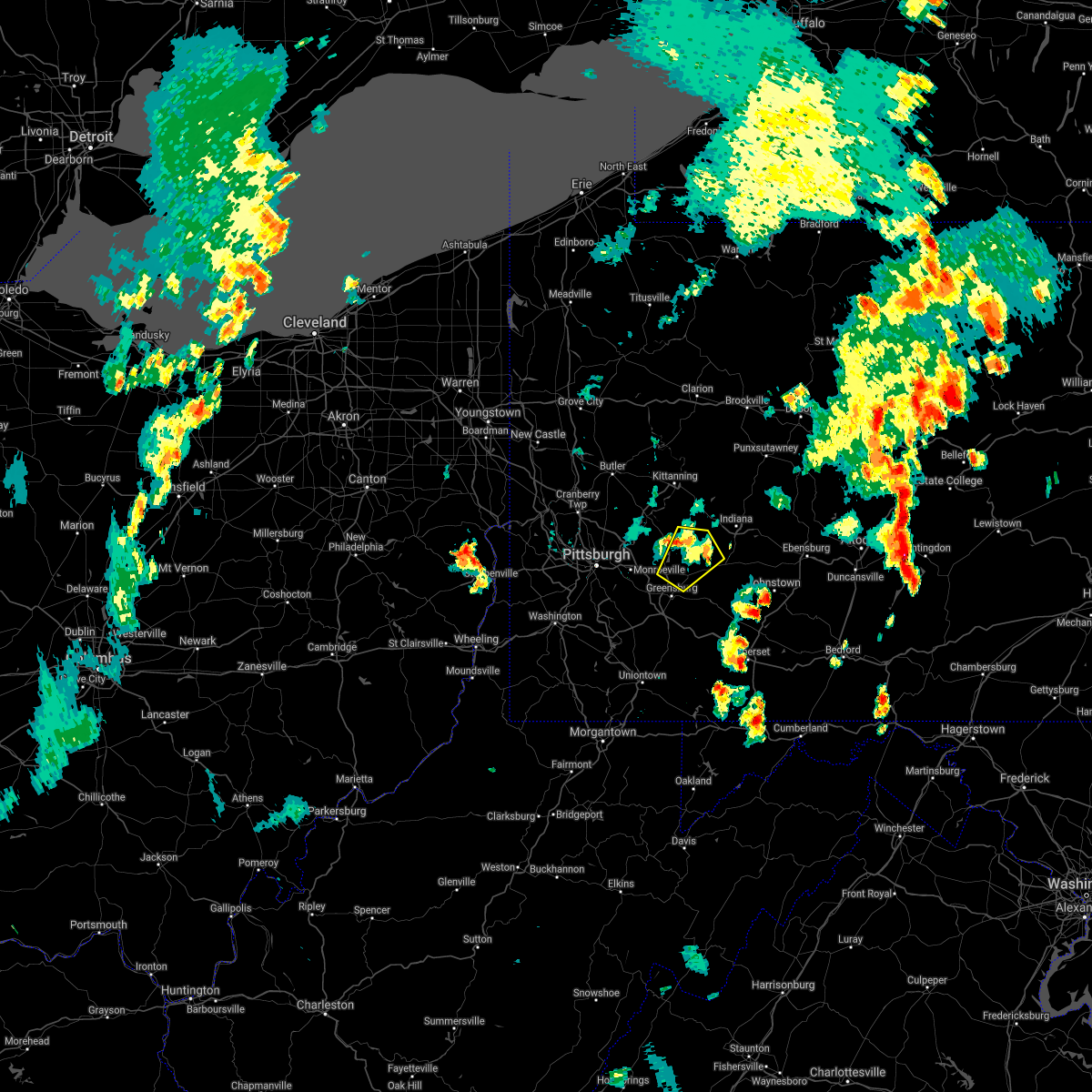 The severe thunderstorm warning for southwestern indiana, central westmoreland and south central armstrong counties will expire at 715 pm edt, the storm which prompted the warning has weakened and the warning will be allowed to expire. The severe thunderstorm warning for southwestern indiana, central westmoreland and south central armstrong counties will expire at 715 pm edt, the storm which prompted the warning has weakened and the warning will be allowed to expire.
|
| 7/13/2021 6:52 PM EDT |
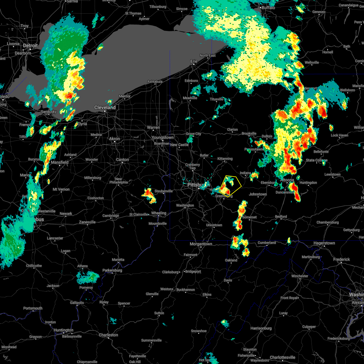 At 652 pm edt, a severe thunderstorm was located near delmont, or 8 miles northwest of latrobe, moving northeast at 35 mph (radar). Hazards include wind gusts to 60 mph and quarter-size hail. Minor hail damage to vehicles is possible. expect wind damage to trees and power lines, resulting in some power outages. Locations impacted include, murrysville, blairsville, delmont, avonmore, export, saltsburg, west lebanon, new alexandria, slickville, crabtree, jacksonville,. At 652 pm edt, a severe thunderstorm was located near delmont, or 8 miles northwest of latrobe, moving northeast at 35 mph (radar). Hazards include wind gusts to 60 mph and quarter-size hail. Minor hail damage to vehicles is possible. expect wind damage to trees and power lines, resulting in some power outages. Locations impacted include, murrysville, blairsville, delmont, avonmore, export, saltsburg, west lebanon, new alexandria, slickville, crabtree, jacksonville,.
|
| 7/13/2021 6:43 PM EDT |
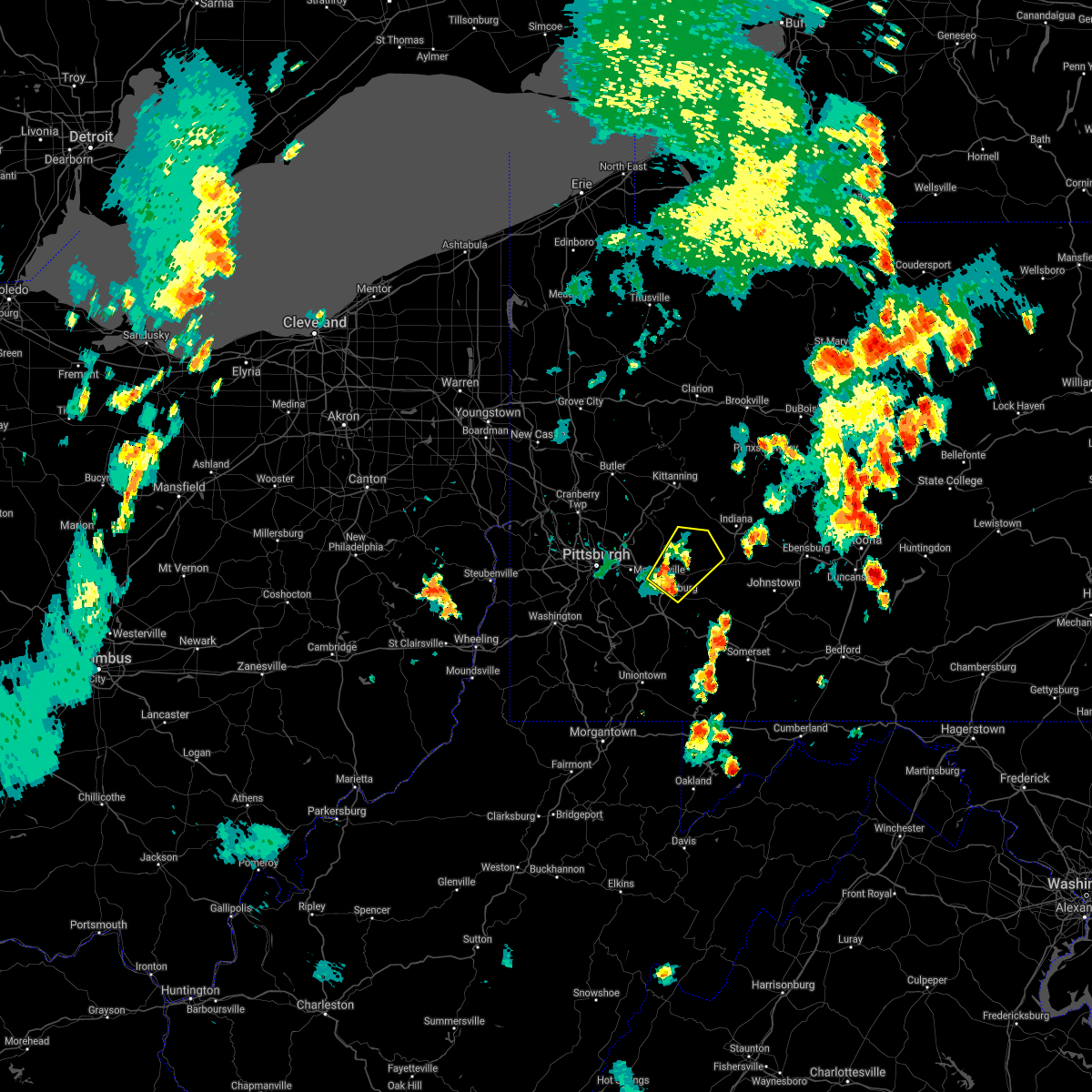 At 643 pm edt, a severe thunderstorm was located over greensburg, moving northeast at 35 mph (radar). Hazards include wind gusts to 60 mph and quarter-size hail. Minor hail damage to vehicles is possible. Expect wind damage to trees and power lines, resulting in some power outages. At 643 pm edt, a severe thunderstorm was located over greensburg, moving northeast at 35 mph (radar). Hazards include wind gusts to 60 mph and quarter-size hail. Minor hail damage to vehicles is possible. Expect wind damage to trees and power lines, resulting in some power outages.
|
| 7/11/2021 5:11 PM EDT |
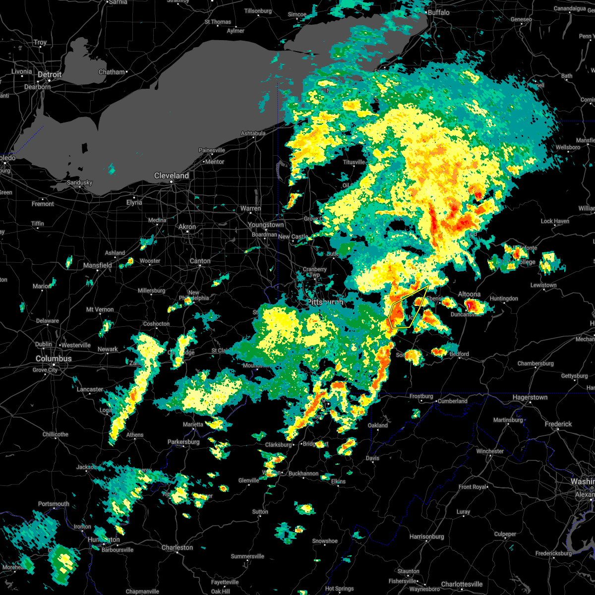 At 510 pm edt, a severe thunderstorm was located near derry, or 9 miles east of latrobe, moving northeast at 45 mph (radar). Hazards include wind gusts to 60 mph. expect damage to trees and power lines, resulting in some power outages At 510 pm edt, a severe thunderstorm was located near derry, or 9 miles east of latrobe, moving northeast at 45 mph (radar). Hazards include wind gusts to 60 mph. expect damage to trees and power lines, resulting in some power outages
|
| 7/7/2021 8:52 PM EDT |
 The severe thunderstorm warning for southwestern indiana and southeastern westmoreland counties will expire at 900 pm edt, the storm which prompted the warning has moved out of the area. therefore, the warning will be allowed to expire. however gusty winds and heavy rain are still possible with this thunderstorm. remember, a severe thunderstorm warning still remains in effect for eastern westmoreland and indiana county until 915pm. The severe thunderstorm warning for southwestern indiana and southeastern westmoreland counties will expire at 900 pm edt, the storm which prompted the warning has moved out of the area. therefore, the warning will be allowed to expire. however gusty winds and heavy rain are still possible with this thunderstorm. remember, a severe thunderstorm warning still remains in effect for eastern westmoreland and indiana county until 915pm.
|
| 7/7/2021 8:36 PM EDT |
 At 836 pm edt, a severe thunderstorm was located over derry, or near latrobe, moving northeast at 35 mph (radar). Hazards include wind gusts to 60 mph. Expect damage to trees and power lines, resulting in some power outages. Locations impacted include, latrobe, homer city, mcchesneytown-loyalhanna, blairsville, derry, lawson heights, ligonier, black lick, new florence, new alexandria, seward, bolivar,. At 836 pm edt, a severe thunderstorm was located over derry, or near latrobe, moving northeast at 35 mph (radar). Hazards include wind gusts to 60 mph. Expect damage to trees and power lines, resulting in some power outages. Locations impacted include, latrobe, homer city, mcchesneytown-loyalhanna, blairsville, derry, lawson heights, ligonier, black lick, new florence, new alexandria, seward, bolivar,.
|
| 7/7/2021 8:24 PM EDT |
 At 824 pm edt, a severe thunderstorm was located over lawson heights, or over latrobe, moving northeast at 35 mph (radar). Hazards include wind gusts to 60 mph. expect damage to trees and power lines, resulting in some power outages At 824 pm edt, a severe thunderstorm was located over lawson heights, or over latrobe, moving northeast at 35 mph (radar). Hazards include wind gusts to 60 mph. expect damage to trees and power lines, resulting in some power outages
|
| 6/30/2021 3:00 PM EDT |
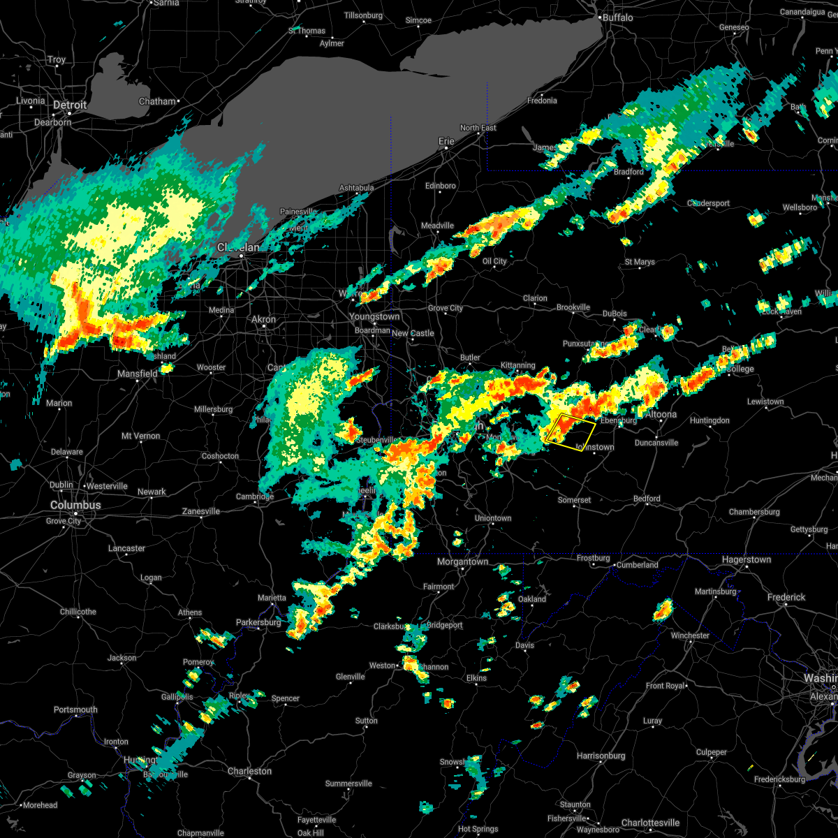 At 259 pm edt, a severe thunderstorm was located near black lick, or near homer city, moving east at 20 mph (radar). Hazards include wind gusts to 60 mph. Expect damage to trees and power lines, resulting in some power outages. Locations impacted include, homer city, blairsville, black lick, new florence, seward, bolivar, vintondale, armagh, lucerne mines, brush vly,. At 259 pm edt, a severe thunderstorm was located near black lick, or near homer city, moving east at 20 mph (radar). Hazards include wind gusts to 60 mph. Expect damage to trees and power lines, resulting in some power outages. Locations impacted include, homer city, blairsville, black lick, new florence, seward, bolivar, vintondale, armagh, lucerne mines, brush vly,.
|
| 6/30/2021 2:45 PM EDT |
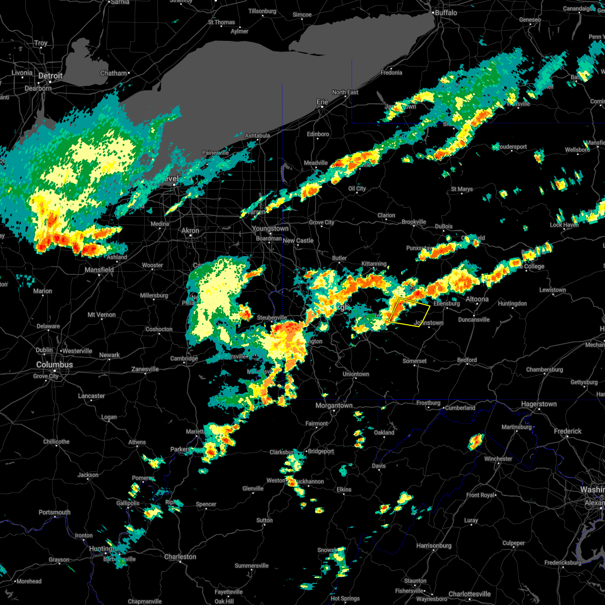 At 245 pm edt, a severe thunderstorm was located over black lick, or near homer city, moving east at 20 mph (radar). Hazards include wind gusts to 60 mph. expect damage to trees and power lines, resulting in some power outages At 245 pm edt, a severe thunderstorm was located over black lick, or near homer city, moving east at 20 mph (radar). Hazards include wind gusts to 60 mph. expect damage to trees and power lines, resulting in some power outages
|
| 6/21/2021 4:38 PM EDT | Trees down on hunter school road in indiana county PA, 7.3 miles S of Blairsville, PA |
| 6/21/2021 4:27 PM EDT |
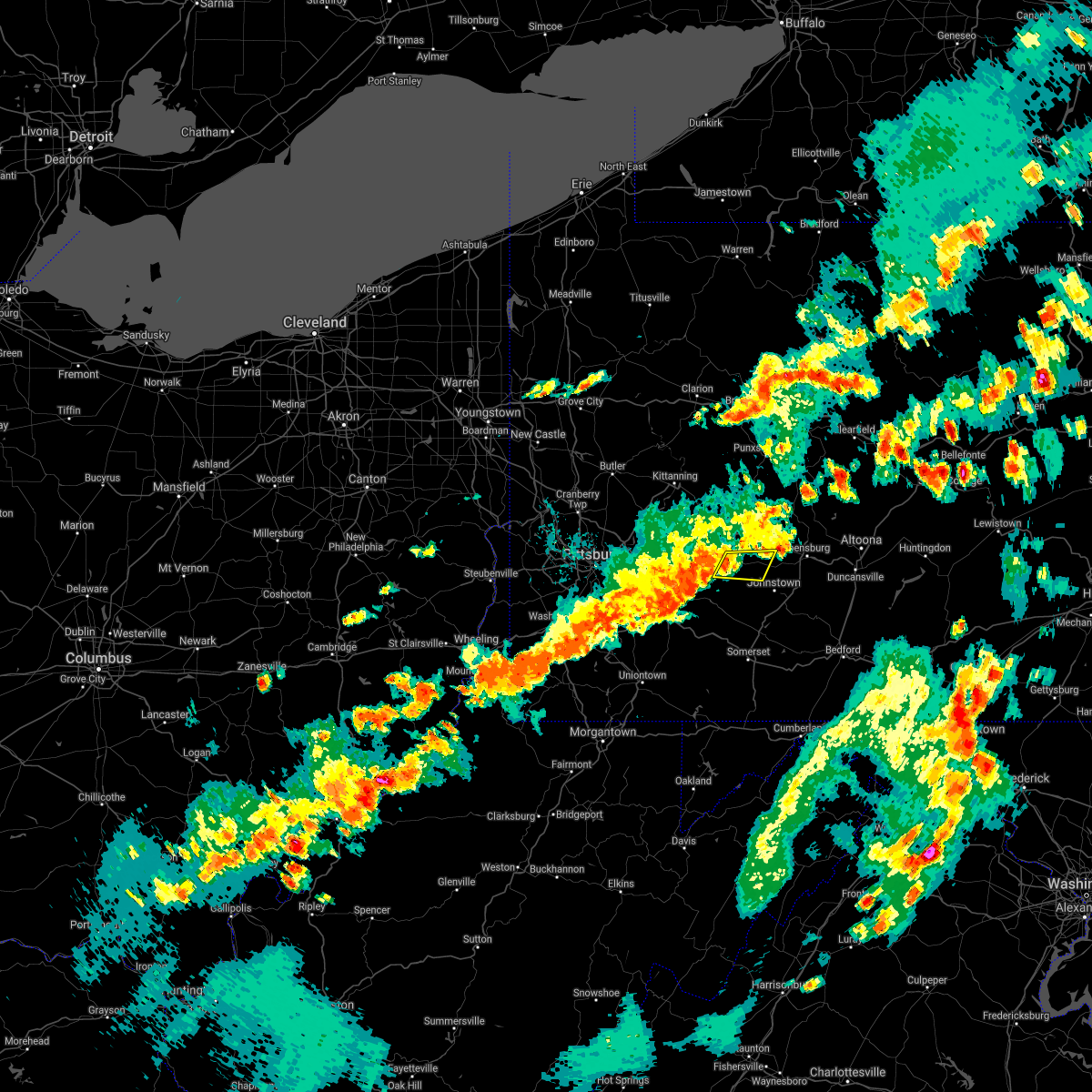 At 427 pm edt, a severe thunderstorm was located over black lick, or near homer city, moving east at 40 mph (radar). Hazards include wind gusts to 60 mph. expect damage to trees and power lines, resulting in some power outages At 427 pm edt, a severe thunderstorm was located over black lick, or near homer city, moving east at 40 mph (radar). Hazards include wind gusts to 60 mph. expect damage to trees and power lines, resulting in some power outages
|
| 6/21/2021 4:09 PM EDT |
 At 409 pm edt, severe thunderstorms were located along a line extending from 8 miles southeast of punxsutawney to near homer city, moving east at 50 mph (radar). Hazards include wind gusts to 60 mph. Expect damage to trees and power lines, resulting in some power outages. Locations impacted include, indiana, homer city, blairsville, black lick, clymer, new florence, chevy chase heights, seward, bolivar, ernest, vintondale, cherry tree,. At 409 pm edt, severe thunderstorms were located along a line extending from 8 miles southeast of punxsutawney to near homer city, moving east at 50 mph (radar). Hazards include wind gusts to 60 mph. Expect damage to trees and power lines, resulting in some power outages. Locations impacted include, indiana, homer city, blairsville, black lick, clymer, new florence, chevy chase heights, seward, bolivar, ernest, vintondale, cherry tree,.
|
| 6/21/2021 3:58 PM EDT | Trees down on hunter school road in indiana county PA, 7.3 miles S of Blairsville, PA |
| 6/21/2021 3:55 PM EDT | Trees down on black lick road in indiana county PA, 5.5 miles SSW of Blairsville, PA |
| 6/21/2021 3:55 PM EDT |
 At 355 pm edt, severe thunderstorms were located along a line extending from 7 miles south of punxsutawney to near blairsville, moving east at 50 mph (radar). Hazards include wind gusts to 60 mph. expect damage to trees and power lines, resulting in some power outages At 355 pm edt, severe thunderstorms were located along a line extending from 7 miles south of punxsutawney to near blairsville, moving east at 50 mph (radar). Hazards include wind gusts to 60 mph. expect damage to trees and power lines, resulting in some power outages
|
| 11/15/2020 3:48 PM EST |
 At 348 pm est, severe thunderstorms were located along a line extending from 11 miles northeast of indiana to near seven springs, moving east at 50 mph (radar). Hazards include wind gusts to 60 mph. Expect damage to trees and power lines, resulting in some power outages. Locations impacted include, indiana, homer city, mcchesneytown-loyalhanna, blairsville, derry, ligonier, black lick, seven springs, clymer, new florence, chevy chase heights, seward, this includes pennsylvania turnpike between mile markers 87 and 99. At 348 pm est, severe thunderstorms were located along a line extending from 11 miles northeast of indiana to near seven springs, moving east at 50 mph (radar). Hazards include wind gusts to 60 mph. Expect damage to trees and power lines, resulting in some power outages. Locations impacted include, indiana, homer city, mcchesneytown-loyalhanna, blairsville, derry, ligonier, black lick, seven springs, clymer, new florence, chevy chase heights, seward, this includes pennsylvania turnpike between mile markers 87 and 99.
|
| 11/15/2020 3:43 PM EST |
 The severe thunderstorm warning for southeastern washington, southwestern indiana, westmoreland, southeastern armstrong and northern fayette counties will expire at 345 pm est, the storms which prompted the warning have moved out of the area. therefore, the warning will be allowed to expire. however gusty winds are still possible with these thunderstorms. a severe thunderstorm watch remains in effect until 600 pm est for southwestern and west central pennsylvania. remember, a severe thunderstorm warning still remains in effect for eastern westmoreland, indiana, and fayette counties until 4 pm est. The severe thunderstorm warning for southeastern washington, southwestern indiana, westmoreland, southeastern armstrong and northern fayette counties will expire at 345 pm est, the storms which prompted the warning have moved out of the area. therefore, the warning will be allowed to expire. however gusty winds are still possible with these thunderstorms. a severe thunderstorm watch remains in effect until 600 pm est for southwestern and west central pennsylvania. remember, a severe thunderstorm warning still remains in effect for eastern westmoreland, indiana, and fayette counties until 4 pm est.
|
| 11/15/2020 3:33 PM EST |
 At 333 pm est, severe thunderstorms were located along a line extending from near indiana to 7 miles east of connellsville, moving east at 50 mph (radar). Hazards include wind gusts to 60 mph. expect damage to trees and power lines, resulting in some power outages At 333 pm est, severe thunderstorms were located along a line extending from near indiana to 7 miles east of connellsville, moving east at 50 mph (radar). Hazards include wind gusts to 60 mph. expect damage to trees and power lines, resulting in some power outages
|
| 11/15/2020 3:23 PM EST |
 At 322 pm est, severe thunderstorms were located along a line extending from 13 miles north of indiana to near ursina, moving east at 65 mph (law enforcement). Hazards include wind gusts to 60 mph. Expect damage to trees and power lines, resulting in some power outages. locations impacted include, greensburg, indiana, jeannette, latrobe, connellsville, vandergrift, apollo, murrysville, mount pleasant, scottdale, mcchesneytown-loyalhanna, blairsville, this includes the following highways, interstate 70 in pennsylvania between mile markers 46 and 57. Pennsylvania turnpike between mile markers 68 and 99. At 322 pm est, severe thunderstorms were located along a line extending from 13 miles north of indiana to near ursina, moving east at 65 mph (law enforcement). Hazards include wind gusts to 60 mph. Expect damage to trees and power lines, resulting in some power outages. locations impacted include, greensburg, indiana, jeannette, latrobe, connellsville, vandergrift, apollo, murrysville, mount pleasant, scottdale, mcchesneytown-loyalhanna, blairsville, this includes the following highways, interstate 70 in pennsylvania between mile markers 46 and 57. Pennsylvania turnpike between mile markers 68 and 99.
|
| 11/15/2020 3:02 PM EST |
 At 302 pm est, severe thunderstorms were located along a line extending from near west kittanning to near uniontown, moving east at 65 mph (radar). Hazards include wind gusts to 70 mph. Trees snapped and uprooted. Power outages can be expected. At 302 pm est, severe thunderstorms were located along a line extending from near west kittanning to near uniontown, moving east at 65 mph (radar). Hazards include wind gusts to 70 mph. Trees snapped and uprooted. Power outages can be expected.
|
| 8/27/2020 6:23 PM EDT |
 At 623 pm edt, severe thunderstorms were located along a line extending from near indiana to near homer city to 8 miles northwest of blairsville to near apollo to 6 miles south of vandergrift to near murrysville to near plum, moving southeast at 45 mph (radar). Hazards include wind gusts to 60 mph. Expect damage to trees and power lines, resulting in some power outages. Locations impacted include, indiana, latrobe, homer city, mcchesneytown-loyalhanna, blairsville, derry, lawson heights, black lick, clymer, saltsburg, new florence, new alexandria,. At 623 pm edt, severe thunderstorms were located along a line extending from near indiana to near homer city to 8 miles northwest of blairsville to near apollo to 6 miles south of vandergrift to near murrysville to near plum, moving southeast at 45 mph (radar). Hazards include wind gusts to 60 mph. Expect damage to trees and power lines, resulting in some power outages. Locations impacted include, indiana, latrobe, homer city, mcchesneytown-loyalhanna, blairsville, derry, lawson heights, black lick, clymer, saltsburg, new florence, new alexandria,.
|
| 8/27/2020 6:01 PM EDT |
 A severe thunderstorm warning remains in effect until 630 pm edt for indiana. southeastern butler. northeastern allegheny. westmoreland and southern armstrong counties. At 601 pm edt, severe thunderstorms were located along a line extending from 10 miles south of new bethlehem to 9 miles southeast of ford city to near vandergrift to near freeport to harrison. A severe thunderstorm warning remains in effect until 630 pm edt for indiana. southeastern butler. northeastern allegheny. westmoreland and southern armstrong counties. At 601 pm edt, severe thunderstorms were located along a line extending from 10 miles south of new bethlehem to 9 miles southeast of ford city to near vandergrift to near freeport to harrison.
|
| 8/27/2020 5:43 PM EDT |
 At 542 pm edt, severe thunderstorms were located along a line extending from 6 miles southeast of rimersburg to near kittanning to 6 miles west of west kittanning to near meadowood to near oak hills to near evans city, moving southeast at 45 mph (radar). Hazards include wind gusts to 60 mph. Expect damage to trees and power lines, resulting in some power outages. locations impacted include, penn hills, monroeville, greensburg, indiana, jeannette, latrobe, vandergrift, kittanning, homer city, apollo, plum, murrysville, this includes the following highways, interstate 70 in pennsylvania near mile marker 57. pennsylvania turnpike between mile markers 40 and 69, and between mile markers 71 and 79. Interstate 376 in pennsylvania between mile markers 82 and 84. At 542 pm edt, severe thunderstorms were located along a line extending from 6 miles southeast of rimersburg to near kittanning to 6 miles west of west kittanning to near meadowood to near oak hills to near evans city, moving southeast at 45 mph (radar). Hazards include wind gusts to 60 mph. Expect damage to trees and power lines, resulting in some power outages. locations impacted include, penn hills, monroeville, greensburg, indiana, jeannette, latrobe, vandergrift, kittanning, homer city, apollo, plum, murrysville, this includes the following highways, interstate 70 in pennsylvania near mile marker 57. pennsylvania turnpike between mile markers 40 and 69, and between mile markers 71 and 79. Interstate 376 in pennsylvania between mile markers 82 and 84.
|
| 8/27/2020 5:26 PM EDT |
 At 525 pm edt, severe thunderstorms were located along a line extending from near rimersburg to 8 miles northwest of kittanning to 7 miles east of butler to shanor-northvue to meridian to 6 miles west of homeacre-lyndora to near zelienople, moving southeast at 45 mph (radar). Hazards include wind gusts to 60 mph. expect damage to trees and power lines, resulting in some power outages At 525 pm edt, severe thunderstorms were located along a line extending from near rimersburg to 8 miles northwest of kittanning to 7 miles east of butler to shanor-northvue to meridian to 6 miles west of homeacre-lyndora to near zelienople, moving southeast at 45 mph (radar). Hazards include wind gusts to 60 mph. expect damage to trees and power lines, resulting in some power outages
|
| 8/25/2020 3:32 PM EDT |
 At 332 pm edt, severe thunderstorms were located along a line extending from portage to near delmont, moving southeast at 50 mph (radar). Hazards include wind gusts to 60 mph and quarter-size hail. Minor hail damage to vehicles is possible. expect wind damage to trees and power lines, resulting in some power outages. Locations impacted include, latrobe, mcchesneytown-loyalhanna, blairsville, derry, lawson heights, ligonier, black lick, seven springs, calumet-norvelt, new florence, new alexandria, seward, this includes pennsylvania turnpike near mile marker 88, and between mile markers 91 and 99. At 332 pm edt, severe thunderstorms were located along a line extending from portage to near delmont, moving southeast at 50 mph (radar). Hazards include wind gusts to 60 mph and quarter-size hail. Minor hail damage to vehicles is possible. expect wind damage to trees and power lines, resulting in some power outages. Locations impacted include, latrobe, mcchesneytown-loyalhanna, blairsville, derry, lawson heights, ligonier, black lick, seven springs, calumet-norvelt, new florence, new alexandria, seward, this includes pennsylvania turnpike near mile marker 88, and between mile markers 91 and 99.
|
| 8/25/2020 3:15 PM EDT |
 At 314 pm edt, severe thunderstorms were located along a line extending from near belsano to near new kensington, moving southeast at 50 mph (radar). Hazards include wind gusts to 60 mph and quarter-size hail. Minor hail damage to vehicles is possible. Expect wind damage to trees and power lines, resulting in some power outages. At 314 pm edt, severe thunderstorms were located along a line extending from near belsano to near new kensington, moving southeast at 50 mph (radar). Hazards include wind gusts to 60 mph and quarter-size hail. Minor hail damage to vehicles is possible. Expect wind damage to trees and power lines, resulting in some power outages.
|
| 8/25/2020 3:05 PM EDT | Tree down on 200 block of garrigan hill rd in westmoreland county PA, 4 miles ENE of Blairsville, PA |
| 8/25/2020 3:03 PM EDT | Tree reported down off deep hollow rd in westmoreland county PA, 2.6 miles E of Blairsville, PA |
| 8/25/2020 2:52 PM EDT | Estimated near 10 trees down at residence with additional trees down in the neighborhood. metal also ripped off shed roofin in indiana county PA, 4 miles SSW of Blairsville, PA |
| 8/25/2020 2:34 PM EDT |
 At 233 pm edt, severe thunderstorms were located along a line extending from near northern cambria to near trafford, moving south at 40 mph (radar). Hazards include wind gusts to 60 mph and quarter-size hail. Minor hail damage to vehicles is possible. Expect wind damage to trees and power lines, resulting in some power outages. At 233 pm edt, severe thunderstorms were located along a line extending from near northern cambria to near trafford, moving south at 40 mph (radar). Hazards include wind gusts to 60 mph and quarter-size hail. Minor hail damage to vehicles is possible. Expect wind damage to trees and power lines, resulting in some power outages.
|
| 8/25/2020 8:39 AM EDT |
 The severe thunderstorm warning for southwestern indiana and central westmoreland counties will expire at 845 am edt, the storm which prompted the warning has moved out of the area. therefore, the warning will be allowed to expire. The severe thunderstorm warning for southwestern indiana and central westmoreland counties will expire at 845 am edt, the storm which prompted the warning has moved out of the area. therefore, the warning will be allowed to expire.
|
| 8/25/2020 8:23 AM EDT |
 At 822 am edt, a severe thunderstorm was located over lawson heights, or near latrobe, moving southeast at 25 mph (radar). Hazards include wind gusts to 60 mph and quarter-size hail. Minor hail damage to vehicles is possible. expect wind damage to trees and power lines, resulting in some power outages. locations impacted include, greensburg, jeannette, latrobe, homer city, murrysville, mcchesneytown-loyalhanna, blairsville, youngwood, derry, delmont, lawson heights, new stanton, this includes the following highways, interstate 70 in pennsylvania between mile markers 56 and 57. Pennsylvania turnpike between mile markers 74 and 81. At 822 am edt, a severe thunderstorm was located over lawson heights, or near latrobe, moving southeast at 25 mph (radar). Hazards include wind gusts to 60 mph and quarter-size hail. Minor hail damage to vehicles is possible. expect wind damage to trees and power lines, resulting in some power outages. locations impacted include, greensburg, jeannette, latrobe, homer city, murrysville, mcchesneytown-loyalhanna, blairsville, youngwood, derry, delmont, lawson heights, new stanton, this includes the following highways, interstate 70 in pennsylvania between mile markers 56 and 57. Pennsylvania turnpike between mile markers 74 and 81.
|
| 8/25/2020 8:10 AM EDT |
 At 810 am edt, a severe thunderstorm was located near greensburg, moving southeast at 25 mph (radar). Hazards include wind gusts to 60 mph and quarter-size hail. Minor hail damage to vehicles is possible. expect wind damage to trees and power lines, resulting in some power outages. locations impacted include, greensburg, jeannette, latrobe, homer city, murrysville, mcchesneytown-loyalhanna, blairsville, youngwood, derry, delmont, lawson heights, new stanton, this includes the following highways, interstate 70 in pennsylvania between mile markers 56 and 57. Pennsylvania turnpike between mile markers 74 and 81. At 810 am edt, a severe thunderstorm was located near greensburg, moving southeast at 25 mph (radar). Hazards include wind gusts to 60 mph and quarter-size hail. Minor hail damage to vehicles is possible. expect wind damage to trees and power lines, resulting in some power outages. locations impacted include, greensburg, jeannette, latrobe, homer city, murrysville, mcchesneytown-loyalhanna, blairsville, youngwood, derry, delmont, lawson heights, new stanton, this includes the following highways, interstate 70 in pennsylvania between mile markers 56 and 57. Pennsylvania turnpike between mile markers 74 and 81.
|
| 8/25/2020 7:55 AM EDT |
 At 754 am edt, a severe thunderstorm was located over delmont, or 8 miles northeast of jeannette, moving southeast at 25 mph (radar). Hazards include wind gusts to 60 mph and quarter-size hail. Minor hail damage to vehicles is possible. Expect wind damage to trees and power lines, resulting in some power outages. At 754 am edt, a severe thunderstorm was located over delmont, or 8 miles northeast of jeannette, moving southeast at 25 mph (radar). Hazards include wind gusts to 60 mph and quarter-size hail. Minor hail damage to vehicles is possible. Expect wind damage to trees and power lines, resulting in some power outages.
|
| 7/10/2020 7:11 PM EDT |
 The severe thunderstorm warning for northeastern beaver, southeastern lawrence, southwestern indiana, butler, northeastern allegheny, westmoreland, armstrong, southwestern clarion and northeastern fayette counties will expire at 715 pm edt, the storms which prompted the warning have weakened below severe limits, and no longer pose an immediate threat to life or property. therefore, the warning will be allowed to expire. however gusty winds and heavy rain are still possible with these thunderstorms. The severe thunderstorm warning for northeastern beaver, southeastern lawrence, southwestern indiana, butler, northeastern allegheny, westmoreland, armstrong, southwestern clarion and northeastern fayette counties will expire at 715 pm edt, the storms which prompted the warning have weakened below severe limits, and no longer pose an immediate threat to life or property. therefore, the warning will be allowed to expire. however gusty winds and heavy rain are still possible with these thunderstorms.
|
| 7/10/2020 7:04 PM EDT |
 At 702 pm edt, severe thunderstorms were located along a line extending from 6 miles north of zelienople to arnold to jeannette to south connellsville, moving east at 30 mph (trained weather spotters). Hazards include wind gusts to 60 mph. Expect damage to trees and power lines, resulting in some power outages. locations impacted include, penn hills, monroeville, greensburg, butler, jeannette, latrobe, connellsville, vandergrift, kittanning, apollo, rimersburg, plum, this includes the following highways, interstate 70 in pennsylvania between mile markers 51 and 57. pennsylvania turnpike between mile markers 41 and 99. interstate 79 in pennsylvania between mile markers 89 and 104. Interstate 376 in pennsylvania between mile markers 83 and 84. At 702 pm edt, severe thunderstorms were located along a line extending from 6 miles north of zelienople to arnold to jeannette to south connellsville, moving east at 30 mph (trained weather spotters). Hazards include wind gusts to 60 mph. Expect damage to trees and power lines, resulting in some power outages. locations impacted include, penn hills, monroeville, greensburg, butler, jeannette, latrobe, connellsville, vandergrift, kittanning, apollo, rimersburg, plum, this includes the following highways, interstate 70 in pennsylvania between mile markers 51 and 57. pennsylvania turnpike between mile markers 41 and 99. interstate 79 in pennsylvania between mile markers 89 and 104. Interstate 376 in pennsylvania between mile markers 83 and 84.
|
| 7/10/2020 6:41 PM EDT |
 At 640 pm edt, severe thunderstorms were located along a line extending from near ellwood city to etna to near white oak to near uniontown, moving east at 20 mph. several trees and power lines have been reported down with this line of thunderstorms (trained weather spotters). Hazards include wind gusts to 60 mph. Expect damage to trees and power lines, resulting in some power outages. locations impacted include, pittsburgh, penn hills, mount lebanon, bethel park, ross township, mccandless township, monroeville, cranberry, greensburg, mckeesport, butler, franklin park, this includes the following highways, interstate 70 in pennsylvania between mile markers 39 and 57. pennsylvania turnpike between mile markers 21 and 99. interstate 79 in pennsylvania between mile markers 70 and 104. Interstate 376 in pennsylvania between mile markers 67 and 84. At 640 pm edt, severe thunderstorms were located along a line extending from near ellwood city to etna to near white oak to near uniontown, moving east at 20 mph. several trees and power lines have been reported down with this line of thunderstorms (trained weather spotters). Hazards include wind gusts to 60 mph. Expect damage to trees and power lines, resulting in some power outages. locations impacted include, pittsburgh, penn hills, mount lebanon, bethel park, ross township, mccandless township, monroeville, cranberry, greensburg, mckeesport, butler, franklin park, this includes the following highways, interstate 70 in pennsylvania between mile markers 39 and 57. pennsylvania turnpike between mile markers 21 and 99. interstate 79 in pennsylvania between mile markers 70 and 104. Interstate 376 in pennsylvania between mile markers 67 and 84.
|
| 7/10/2020 6:30 PM EDT |
 At 629 pm edt, severe thunderstorms were located along a line extending from near ellwood city to millvale to near liberty to near uniontown, moving east at 20 mph (radar). Hazards include wind gusts to 60 mph. expect damage to trees and power lines, resulting in some power outages At 629 pm edt, severe thunderstorms were located along a line extending from near ellwood city to millvale to near liberty to near uniontown, moving east at 20 mph (radar). Hazards include wind gusts to 60 mph. expect damage to trees and power lines, resulting in some power outages
|
| 6/4/2020 5:55 PM EDT |
 The severe thunderstorm warning for eastern washington, indiana, southeastern allegheny, westmoreland, southern armstrong and northeastern fayette counties will expire at 600 pm edt, the storms which prompted the warning have weakened below severe limits, and no longer pose an immediate threat to life or property. therefore, the warning will be allowed to expire. however gusty winds and heavy rain are still possible with these thunderstorms. a severe thunderstorm watch remains in effect until 800 pm edt for southwestern and west central pennsylvania. The severe thunderstorm warning for eastern washington, indiana, southeastern allegheny, westmoreland, southern armstrong and northeastern fayette counties will expire at 600 pm edt, the storms which prompted the warning have weakened below severe limits, and no longer pose an immediate threat to life or property. therefore, the warning will be allowed to expire. however gusty winds and heavy rain are still possible with these thunderstorms. a severe thunderstorm watch remains in effect until 800 pm edt for southwestern and west central pennsylvania.
|
| 6/4/2020 5:48 PM EDT |
 At 547 pm edt, severe thunderstorms were located along a line extending from near leechburg to near delmont to near perryopolis, moving east at 30 mph (radar). Hazards include wind gusts to 60 mph. Expect damage to trees and power lines, resulting in some power outages. locations impacted include, greensburg, indiana, jeannette, latrobe, connellsville, vandergrift, homer city, apollo, murrysville, monessen, donora, mount pleasant, this includes the following highways, interstate 70 in pennsylvania between mile markers 42 and 57. Pennsylvania turnpike between mile markers 62 and 99. At 547 pm edt, severe thunderstorms were located along a line extending from near leechburg to near delmont to near perryopolis, moving east at 30 mph (radar). Hazards include wind gusts to 60 mph. Expect damage to trees and power lines, resulting in some power outages. locations impacted include, greensburg, indiana, jeannette, latrobe, connellsville, vandergrift, homer city, apollo, murrysville, monessen, donora, mount pleasant, this includes the following highways, interstate 70 in pennsylvania between mile markers 42 and 57. Pennsylvania turnpike between mile markers 62 and 99.
|
| 6/4/2020 5:14 PM EDT |
 At 514 pm edt, severe thunderstorms were located along a line extending from near mars to etna to near east washington, moving east at 30 mph (radar). Hazards include wind gusts to 60 mph. Expect damage to trees and power lines, resulting in some power outages. locations impacted include, pittsburgh, penn hills, mount lebanon, bethel park, monroeville, mcmurray, greensburg, mckeesport, indiana, jeannette, latrobe, connellsville, this includes the following highways, interstate 70 in pennsylvania between mile markers 20 and 57. pennsylvania turnpike between mile markers 41 and 99. interstate 79 in pennsylvania between mile markers 29 and 35. Interstate 376 in pennsylvania between mile markers 73 and 84. At 514 pm edt, severe thunderstorms were located along a line extending from near mars to etna to near east washington, moving east at 30 mph (radar). Hazards include wind gusts to 60 mph. Expect damage to trees and power lines, resulting in some power outages. locations impacted include, pittsburgh, penn hills, mount lebanon, bethel park, monroeville, mcmurray, greensburg, mckeesport, indiana, jeannette, latrobe, connellsville, this includes the following highways, interstate 70 in pennsylvania between mile markers 20 and 57. pennsylvania turnpike between mile markers 41 and 99. interstate 79 in pennsylvania between mile markers 29 and 35. Interstate 376 in pennsylvania between mile markers 73 and 84.
|
| 6/4/2020 4:43 PM EDT |
 At 442 pm edt, severe thunderstorms were located along a line extending from near rochester to moon township to 6 miles west of wolfdale, moving east at 30 mph (radar). Hazards include wind gusts to 60 mph. expect damage to trees and power lines, resulting in some power outages At 442 pm edt, severe thunderstorms were located along a line extending from near rochester to moon township to 6 miles west of wolfdale, moving east at 30 mph (radar). Hazards include wind gusts to 60 mph. expect damage to trees and power lines, resulting in some power outages
|
| 4/8/2020 1:40 AM EDT |
 At 140 am edt, severe thunderstorms were located along a line extending from near homer city to near bentleyville, moving southeast at 65 mph (radar). Hazards include wind gusts to 60 mph and quarter-size hail. Minor hail damage to vehicles is possible. expect wind damage to trees and power lines, resulting in some power outages. locations impacted include, greensburg, jeannette, latrobe, homer city, murrysville, jefferson hills, white oak, monessen, clairton, california, donora, monongahela, this includes the following highways, interstate 70 in pennsylvania between mile markers 37 and 57. Pennsylvania turnpike between mile markers 62 and 76. At 140 am edt, severe thunderstorms were located along a line extending from near homer city to near bentleyville, moving southeast at 65 mph (radar). Hazards include wind gusts to 60 mph and quarter-size hail. Minor hail damage to vehicles is possible. expect wind damage to trees and power lines, resulting in some power outages. locations impacted include, greensburg, jeannette, latrobe, homer city, murrysville, jefferson hills, white oak, monessen, clairton, california, donora, monongahela, this includes the following highways, interstate 70 in pennsylvania between mile markers 37 and 57. Pennsylvania turnpike between mile markers 62 and 76.
|
| 4/8/2020 1:39 AM EDT |
 At 138 am edt, severe thunderstorms were located along a line extending from 8 miles northwest of indiana to near gastonville, moving southeast at 50 mph (radar). Hazards include wind gusts to 60 mph and quarter-size hail. Minor hail damage to vehicles is possible. Expect wind damage to trees and power lines, resulting in some power outages. At 138 am edt, severe thunderstorms were located along a line extending from 8 miles northwest of indiana to near gastonville, moving southeast at 50 mph (radar). Hazards include wind gusts to 60 mph and quarter-size hail. Minor hail damage to vehicles is possible. Expect wind damage to trees and power lines, resulting in some power outages.
|
| 4/8/2020 1:22 AM EDT |
 At 122 am edt, severe thunderstorms were located along a line extending from 6 miles south of ford city to near cecil-bishop, moving southeast at 65 mph (radar). Hazards include wind gusts to 70 mph. Trees snapped and uprooted. Power outages can be expected. At 122 am edt, severe thunderstorms were located along a line extending from 6 miles south of ford city to near cecil-bishop, moving southeast at 65 mph (radar). Hazards include wind gusts to 70 mph. Trees snapped and uprooted. Power outages can be expected.
|
| 3/28/2020 5:27 PM EDT |
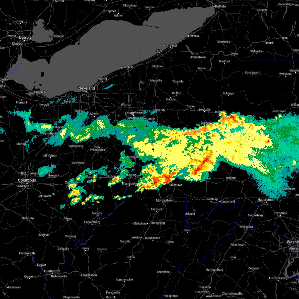 The severe thunderstorm warning for southern indiana and east central westmoreland counties will expire at 530 pm edt, the storm that prompted the warning has moved out of the area. therefore, the warning will be allowed to expire. however gusty winds and heavy rain are still possible with this thunderstorm. a severe thunderstorm watch remains in effect until 800 pm edt for southwestern and west central pennsylvania. The severe thunderstorm warning for southern indiana and east central westmoreland counties will expire at 530 pm edt, the storm that prompted the warning has moved out of the area. therefore, the warning will be allowed to expire. however gusty winds and heavy rain are still possible with this thunderstorm. a severe thunderstorm watch remains in effect until 800 pm edt for southwestern and west central pennsylvania.
|
| 3/28/2020 5:17 PM EDT |
 At 516 pm edt, a severe thunderstorm was located near black lick, or 9 miles south of homer city, moving east at 50 mph (radar). Hazards include wind gusts to 60 mph. Expect damage to trees and power lines, resulting in some power outages. Locations impacted include, homer city, blairsville, black lick, new florence, seward, bolivar, vintondale, armagh, jacksonville,. At 516 pm edt, a severe thunderstorm was located near black lick, or 9 miles south of homer city, moving east at 50 mph (radar). Hazards include wind gusts to 60 mph. Expect damage to trees and power lines, resulting in some power outages. Locations impacted include, homer city, blairsville, black lick, new florence, seward, bolivar, vintondale, armagh, jacksonville,.
|
| 3/28/2020 5:01 PM EDT |
 At 501 pm edt, a severe thunderstorm was located near apollo, moving east at 35 mph (radar). Hazards include wind gusts to 60 mph and quarter-size hail. Minor hail damage to vehicles is possible. expect wind damage to trees and power lines, resulting in some power outages. Locations impacted include, indiana, vandergrift, homer city, apollo, murrysville, blairsville, delmont, black lick, north apollo, avonmore, orchard hills, export,. At 501 pm edt, a severe thunderstorm was located near apollo, moving east at 35 mph (radar). Hazards include wind gusts to 60 mph and quarter-size hail. Minor hail damage to vehicles is possible. expect wind damage to trees and power lines, resulting in some power outages. Locations impacted include, indiana, vandergrift, homer city, apollo, murrysville, blairsville, delmont, black lick, north apollo, avonmore, orchard hills, export,.
|
| 3/28/2020 4:42 PM EDT |
 At 442 pm edt, a severe thunderstorm was located over new kensington, or near penn hills, moving east at 35 mph (radar). Hazards include wind gusts to 60 mph and quarter-size hail. Minor hail damage to vehicles is possible. Expect wind damage to trees and power lines, resulting in some power outages. At 442 pm edt, a severe thunderstorm was located over new kensington, or near penn hills, moving east at 35 mph (radar). Hazards include wind gusts to 60 mph and quarter-size hail. Minor hail damage to vehicles is possible. Expect wind damage to trees and power lines, resulting in some power outages.
|
| 9/28/2019 7:28 PM EDT |
 The severe thunderstorm warning for southwestern indiana and central westmoreland counties will expire at 730 pm edt, the storm that prompted the warning has weakened below severe limits. therefore, the warning will be allowed to expire. however small hail and gusty winds are still possible with this thunderstorm. The severe thunderstorm warning for southwestern indiana and central westmoreland counties will expire at 730 pm edt, the storm that prompted the warning has weakened below severe limits. therefore, the warning will be allowed to expire. however small hail and gusty winds are still possible with this thunderstorm.
|
| 9/28/2019 7:07 PM EDT |
 At 707 pm edt, a severe thunderstorm was located over murrysville, or 7 miles east of monroeville, moving east at 25 mph (radar). Hazards include wind gusts to 60 mph and quarter-size hail. Minor hail damage to vehicles is possible. expect wind damage to trees and power lines, resulting in some power outages. Locations impacted include, monroeville, greensburg, jeannette, latrobe, murrysville, mcchesneytown-loyalhanna, blairsville, manor, trafford, derry, delmont, lawson heights, this includes pennsylvania turnpike between mile markers 59 and 63. At 707 pm edt, a severe thunderstorm was located over murrysville, or 7 miles east of monroeville, moving east at 25 mph (radar). Hazards include wind gusts to 60 mph and quarter-size hail. Minor hail damage to vehicles is possible. expect wind damage to trees and power lines, resulting in some power outages. Locations impacted include, monroeville, greensburg, jeannette, latrobe, murrysville, mcchesneytown-loyalhanna, blairsville, manor, trafford, derry, delmont, lawson heights, this includes pennsylvania turnpike between mile markers 59 and 63.
|
| 9/28/2019 6:52 PM EDT |
 At 651 pm edt, a severe thunderstorm was located over monroeville, moving east at 25 mph (radar). Hazards include wind gusts to 60 mph and quarter-size hail. Minor hail damage to vehicles is possible. Expect wind damage to trees and power lines, resulting in some power outages. At 651 pm edt, a severe thunderstorm was located over monroeville, moving east at 25 mph (radar). Hazards include wind gusts to 60 mph and quarter-size hail. Minor hail damage to vehicles is possible. Expect wind damage to trees and power lines, resulting in some power outages.
|
| 8/18/2019 2:50 PM EDT |
 The national weather service in pittsburgh has issued a * severe thunderstorm warning for. southwestern indiana county in west central pennsylvania. central westmoreland county in southwestern pennsylvania. until 330 pm edt. At 250 pm edt, a severe thunderstorm was located near delmont, or 9. The national weather service in pittsburgh has issued a * severe thunderstorm warning for. southwestern indiana county in west central pennsylvania. central westmoreland county in southwestern pennsylvania. until 330 pm edt. At 250 pm edt, a severe thunderstorm was located near delmont, or 9.
|
| 8/15/2019 3:48 PM EDT |
 A severe thunderstorm warning remains in effect until 430 pm edt for southwestern indiana. southeastern allegheny and central westmoreland counties. at 348 pm edt, a severe thunderstorm was located over manor, or near jeannette, moving east at 30 mph. hazard. Wind gusts to 60 mph and quarter-size hail. A severe thunderstorm warning remains in effect until 430 pm edt for southwestern indiana. southeastern allegheny and central westmoreland counties. at 348 pm edt, a severe thunderstorm was located over manor, or near jeannette, moving east at 30 mph. hazard. Wind gusts to 60 mph and quarter-size hail.
|
| 8/15/2019 3:38 PM EDT |
 At 338 pm edt, a severe thunderstorm was located over trafford, or near monroeville, moving east at 30 mph (radar). Hazards include wind gusts to 60 mph and quarter-size hail. Minor hail damage to vehicles is possible. Expect wind damage to trees and power lines, resulting in some power outages. At 338 pm edt, a severe thunderstorm was located over trafford, or near monroeville, moving east at 30 mph (radar). Hazards include wind gusts to 60 mph and quarter-size hail. Minor hail damage to vehicles is possible. Expect wind damage to trees and power lines, resulting in some power outages.
|
| 5/29/2019 2:53 PM EDT |
 At 252 pm edt, severe thunderstorms were located along a line extending from near northern cambria to near delmont, moving east at 40 mph (radar). Hazards include wind gusts to 60 mph. Expect damage to trees and power lines, resulting in some power outages. Locations impacted include, greensburg, indiana, jeannette, latrobe, punxsutawney, homer city, murrysville, mcchesneytown-loyalhanna, blairsville, derry, delmont, black lick,. At 252 pm edt, severe thunderstorms were located along a line extending from near northern cambria to near delmont, moving east at 40 mph (radar). Hazards include wind gusts to 60 mph. Expect damage to trees and power lines, resulting in some power outages. Locations impacted include, greensburg, indiana, jeannette, latrobe, punxsutawney, homer city, murrysville, mcchesneytown-loyalhanna, blairsville, derry, delmont, black lick,.
|
| 5/29/2019 2:20 PM EDT |
 At 219 pm edt, a severe thunderstorm was located over irwin, or near jeannette, moving east at 25 mph (radar). Hazards include wind gusts to 60 mph and quarter-size hail. Minor hail damage to vehicles is possible. Expect wind damage to trees and power lines, resulting in some power outages. At 219 pm edt, a severe thunderstorm was located over irwin, or near jeannette, moving east at 25 mph (radar). Hazards include wind gusts to 60 mph and quarter-size hail. Minor hail damage to vehicles is possible. Expect wind damage to trees and power lines, resulting in some power outages.
|
| 5/29/2019 2:14 PM EDT |
 The national weather service in pittsburgh has issued a * severe thunderstorm warning for. indiana county in west central pennsylvania. southern jefferson county in west central pennsylvania. central westmoreland county in southwestern pennsylvania. Southeastern armstrong county in west central pennsylvania. The national weather service in pittsburgh has issued a * severe thunderstorm warning for. indiana county in west central pennsylvania. southern jefferson county in west central pennsylvania. central westmoreland county in southwestern pennsylvania. Southeastern armstrong county in west central pennsylvania.
|
| 5/28/2019 10:21 PM EDT |
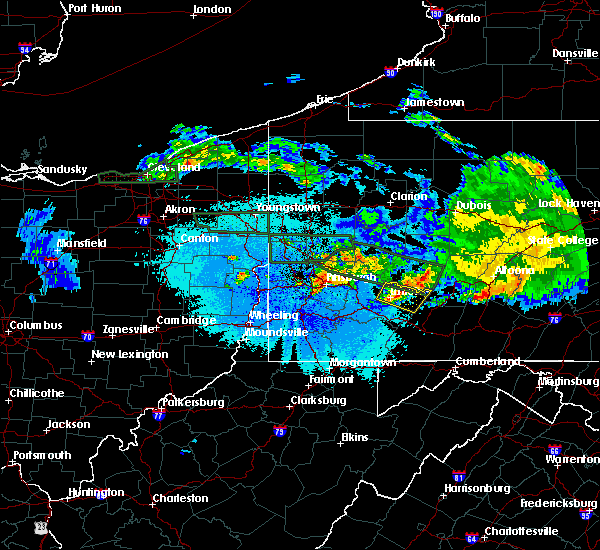 At 1021 pm edt, a severe thunderstorm was located near ligonier, or 11 miles east of latrobe, moving east at 45 mph (radar). Hazards include wind gusts to 60 mph and quarter-size hail. Minor hail damage to vehicles is possible. expect wind damage to trees and power lines, resulting in some power outages. Locations impacted include, mcchesneytown-loyalhanna, blairsville, derry, ligonier, new florence, bolivar, youngstown, laurel mountain, loyalhanna gorge,. At 1021 pm edt, a severe thunderstorm was located near ligonier, or 11 miles east of latrobe, moving east at 45 mph (radar). Hazards include wind gusts to 60 mph and quarter-size hail. Minor hail damage to vehicles is possible. expect wind damage to trees and power lines, resulting in some power outages. Locations impacted include, mcchesneytown-loyalhanna, blairsville, derry, ligonier, new florence, bolivar, youngstown, laurel mountain, loyalhanna gorge,.
|
| 5/28/2019 10:07 PM EDT |
 At 1006 pm edt, a severe thunderstorm was located near latrobe, moving east at 45 mph (radar). Hazards include wind gusts to 60 mph and quarter-size hail. Minor hail damage to vehicles is possible. Expect wind damage to trees and power lines, resulting in some power outages. At 1006 pm edt, a severe thunderstorm was located near latrobe, moving east at 45 mph (radar). Hazards include wind gusts to 60 mph and quarter-size hail. Minor hail damage to vehicles is possible. Expect wind damage to trees and power lines, resulting in some power outages.
|
| 5/28/2019 6:57 PM EDT |
 The severe thunderstorm warning for southern indiana, southeastern butler, northeastern allegheny, northern westmoreland and southern armstrong counties will expire at 700 pm edt, the storm that prompted the warning has weakened below severe limits and no longer poses an immediate threat to life and property. therefore, the warning will be allowed to expire. however small hail and gusty winds are still possible with this thunderstorm. a tornado watch remains in effect until 1000 pm edt for southwestern and west central pennsylvania. The severe thunderstorm warning for southern indiana, southeastern butler, northeastern allegheny, northern westmoreland and southern armstrong counties will expire at 700 pm edt, the storm that prompted the warning has weakened below severe limits and no longer poses an immediate threat to life and property. therefore, the warning will be allowed to expire. however small hail and gusty winds are still possible with this thunderstorm. a tornado watch remains in effect until 1000 pm edt for southwestern and west central pennsylvania.
|
| 5/28/2019 6:48 PM EDT | Quarter sized hail reported 4.1 miles SW of Blairsville, PA |
| 5/28/2019 6:33 PM EDT |
 At 632 pm edt, a severe thunderstorm was located 7 miles northwest of blairsville, or 10 miles west of homer city, moving east at 45 mph. another severe thunderstorm was east of evans city (radar). Hazards include ping pong ball-size hail and wind gusts to 60 mph. People and animals outdoors will be injured. expect hail damage to roofs, siding, windows, and vehicles. expect wind damage to trees and power lines, resulting in some power outages. locations impacted include, penn hills, mccandless township, indiana, vandergrift, homer city, apollo, shaler township, plum, murrysville, hampton township, new kensington, lower burrell, this includes pennsylvania turnpike between mile markers 34 and 52. A tornado watch remains in effect until 1000 pm edt for southwestern and west central pennsylvania. At 632 pm edt, a severe thunderstorm was located 7 miles northwest of blairsville, or 10 miles west of homer city, moving east at 45 mph. another severe thunderstorm was east of evans city (radar). Hazards include ping pong ball-size hail and wind gusts to 60 mph. People and animals outdoors will be injured. expect hail damage to roofs, siding, windows, and vehicles. expect wind damage to trees and power lines, resulting in some power outages. locations impacted include, penn hills, mccandless township, indiana, vandergrift, homer city, apollo, shaler township, plum, murrysville, hampton township, new kensington, lower burrell, this includes pennsylvania turnpike between mile markers 34 and 52. A tornado watch remains in effect until 1000 pm edt for southwestern and west central pennsylvania.
|
| 5/28/2019 6:15 PM EDT |
 At 614 pm edt, a severe thunderstorm was located over apollo, moving east at 45 mph. another severe storm was near curtisville (radar). Hazards include ping-pong ball-size hail and wind gusts to 60 mph. People and animals outdoors will be injured. expect hail damage to roofs, siding, windows, and vehicles. Expect wind damage to trees and power lines, resulting in some power outages. At 614 pm edt, a severe thunderstorm was located over apollo, moving east at 45 mph. another severe storm was near curtisville (radar). Hazards include ping-pong ball-size hail and wind gusts to 60 mph. People and animals outdoors will be injured. expect hail damage to roofs, siding, windows, and vehicles. Expect wind damage to trees and power lines, resulting in some power outages.
|
| 5/25/2019 8:37 PM EDT |
 At 837 pm edt, a severe thunderstorm was located near black lick, or 7 miles south of homer city, moving east at 50 mph (radar). Hazards include wind gusts to 60 mph. expect damage to trees and power lines, resulting in some power outages At 837 pm edt, a severe thunderstorm was located near black lick, or 7 miles south of homer city, moving east at 50 mph (radar). Hazards include wind gusts to 60 mph. expect damage to trees and power lines, resulting in some power outages
|
| 5/25/2019 8:26 PM EDT |
 At 826 pm edt, a severe thunderstorm was located 8 miles west of homer city, moving east at 40 mph (radar). Hazards include wind gusts to 60 mph. Expect damage to trees and power lines, resulting in some power outages. Locations impacted include, indiana, homer city, blairsville, black lick, west lebanon, chevy chase heights, shelocta, lucerne mines, jacksonville,. At 826 pm edt, a severe thunderstorm was located 8 miles west of homer city, moving east at 40 mph (radar). Hazards include wind gusts to 60 mph. Expect damage to trees and power lines, resulting in some power outages. Locations impacted include, indiana, homer city, blairsville, black lick, west lebanon, chevy chase heights, shelocta, lucerne mines, jacksonville,.
|
| 5/25/2019 8:11 PM EDT |
 At 811 pm edt, a severe thunderstorm was located near apollo, moving east at 40 mph (radar). Hazards include wind gusts to 60 mph. expect damage to trees and power lines, resulting in some power outages At 811 pm edt, a severe thunderstorm was located near apollo, moving east at 40 mph (radar). Hazards include wind gusts to 60 mph. expect damage to trees and power lines, resulting in some power outages
|
| 5/23/2019 9:17 PM EDT | Half Dollar sized hail reported 0.3 miles NNW of Blairsville, PA, also reported hail quarter sized |
| 5/23/2019 9:13 PM EDT |
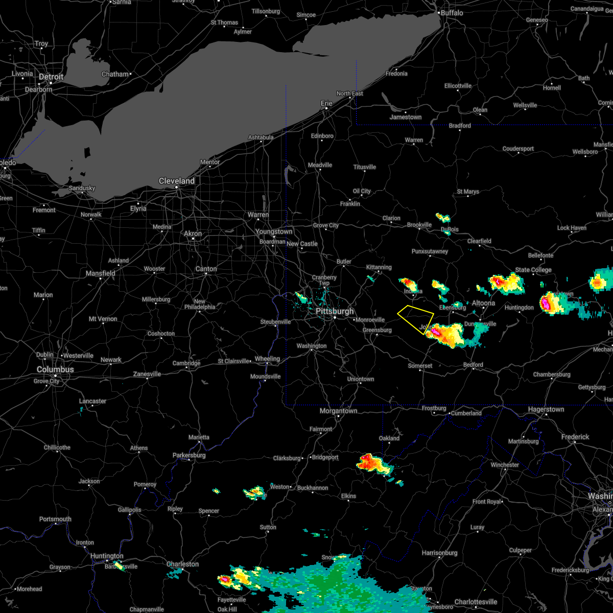 The severe thunderstorm warning for southeastern indiana and east central westmoreland counties will expire at 915 pm edt, the storm that prompted the warning has moved out of the area. therefore, the warning will be allowed to expire. The severe thunderstorm warning for southeastern indiana and east central westmoreland counties will expire at 915 pm edt, the storm that prompted the warning has moved out of the area. therefore, the warning will be allowed to expire.
|
| 5/23/2019 8:54 PM EDT |
 At 853 pm edt, a severe thunderstorm was located near black lick, or 7 miles southeast of homer city, moving southeast at 40 mph. a tornado warning remains in effect for this storm (radar). Hazards include ping pong ball-size hail and wind gusts to 60 mph. People and animals outdoors will be injured. expect hail damage to roofs, siding, windows, and vehicles. expect wind damage to trees and power lines, resulting in some power outages. locations impacted include, blairsville, black lick, new florence, seward, bolivar, armagh, tornadoes can develop unexpectedly from severe thunderstorms. if a tornado is reported, move to a basement or small, central room in a sturdy structure. please report severe weather by calling 412-262-1988, posting to the nws pittsburgh facebook page, or using twitter @nwspittsburgh. At 853 pm edt, a severe thunderstorm was located near black lick, or 7 miles southeast of homer city, moving southeast at 40 mph. a tornado warning remains in effect for this storm (radar). Hazards include ping pong ball-size hail and wind gusts to 60 mph. People and animals outdoors will be injured. expect hail damage to roofs, siding, windows, and vehicles. expect wind damage to trees and power lines, resulting in some power outages. locations impacted include, blairsville, black lick, new florence, seward, bolivar, armagh, tornadoes can develop unexpectedly from severe thunderstorms. if a tornado is reported, move to a basement or small, central room in a sturdy structure. please report severe weather by calling 412-262-1988, posting to the nws pittsburgh facebook page, or using twitter @nwspittsburgh.
|
| 5/23/2019 8:50 PM EDT | Trees down reported across the township in indiana county PA, 4.5 miles WSW of Blairsville, PA |
| 5/23/2019 8:45 PM EDT | Quarter sized hail reported 4.1 miles SW of Blairsville, PA |
| 5/23/2019 8:45 PM EDT |
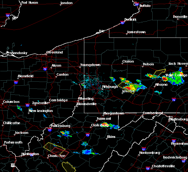 At 845 pm edt, a severe thunderstorm capable of producing a tornado was located over blairsville, or 7 miles southwest of homer city, moving southeast at 45 mph (radar indicated rotation). Hazards include tornado and quarter size hail. Flying debris will be dangerous to those caught without shelter. mobile homes will be damaged or destroyed. damage to roofs, windows, and vehicles will occur. tree damage is likely. this tornadic thunderstorm will remain over mainly rural areas of south central indiana and east central westmoreland counties, including the following locations, bolivar, seward and new florence. Please report severe weather by calling 412-262-1988, posting to the nws pittsburgh facebook page, or using twitter @nwspittsburgh. At 845 pm edt, a severe thunderstorm capable of producing a tornado was located over blairsville, or 7 miles southwest of homer city, moving southeast at 45 mph (radar indicated rotation). Hazards include tornado and quarter size hail. Flying debris will be dangerous to those caught without shelter. mobile homes will be damaged or destroyed. damage to roofs, windows, and vehicles will occur. tree damage is likely. this tornadic thunderstorm will remain over mainly rural areas of south central indiana and east central westmoreland counties, including the following locations, bolivar, seward and new florence. Please report severe weather by calling 412-262-1988, posting to the nws pittsburgh facebook page, or using twitter @nwspittsburgh.
|
| 5/23/2019 8:40 PM EDT | Trees and power lines down at pa-217 and ferguson school rd in indiana county PA, 4.5 miles S of Blairsville, PA |
| 5/23/2019 8:34 PM EDT |
 At 834 pm edt, a severe thunderstorm was located near homer city, moving southeast at 55 mph (radar). Hazards include wind gusts to 60 mph and quarter-size hail. Minor hail damage to vehicles is possible. expect wind damage to trees and power lines, resulting in some power outages. Locations impacted include, indiana, homer city, blairsville, black lick, avonmore, west lebanon, new florence, seward, bolivar, armagh, lucerne mines, jacksonville,. At 834 pm edt, a severe thunderstorm was located near homer city, moving southeast at 55 mph (radar). Hazards include wind gusts to 60 mph and quarter-size hail. Minor hail damage to vehicles is possible. expect wind damage to trees and power lines, resulting in some power outages. Locations impacted include, indiana, homer city, blairsville, black lick, avonmore, west lebanon, new florence, seward, bolivar, armagh, lucerne mines, jacksonville,.
|
| 5/23/2019 8:23 PM EDT |
 At 822 pm edt, a severe thunderstorm was located near vandergrift, moving southeast at 40 mph (radar). Hazards include wind gusts to 60 mph and quarter-size hail. Minor hail damage to vehicles is possible. Expect wind damage to trees and power lines, resulting in some power outages. At 822 pm edt, a severe thunderstorm was located near vandergrift, moving southeast at 40 mph (radar). Hazards include wind gusts to 60 mph and quarter-size hail. Minor hail damage to vehicles is possible. Expect wind damage to trees and power lines, resulting in some power outages.
|
| 9/21/2018 8:36 PM EDT |
 A severe thunderstorm warning remains in effect until 845 pm edt for indiana. eastern allegheny and central westmoreland counties. At 835 pm edt, severe thunderstorms were located along a line extending from 9 miles south of punxsutawney to 6 miles east of indiana to homer city to 6 miles north of latrobe, moving east at 50 mph. A severe thunderstorm warning remains in effect until 845 pm edt for indiana. eastern allegheny and central westmoreland counties. At 835 pm edt, severe thunderstorms were located along a line extending from 9 miles south of punxsutawney to 6 miles east of indiana to homer city to 6 miles north of latrobe, moving east at 50 mph.
|
| 9/21/2018 8:22 PM EDT |
 A severe thunderstorm warning remains in effect until 845 pm edt for indiana. east central allegheny. northern westmoreland and southeastern armstrong counties. At 822 pm edt, severe thunderstorms were located along a line extending from 12 miles southeast of new bethlehem to near indiana to 9 miles east of apollo to near delmont, moving east at 50 mph. A severe thunderstorm warning remains in effect until 845 pm edt for indiana. east central allegheny. northern westmoreland and southeastern armstrong counties. At 822 pm edt, severe thunderstorms were located along a line extending from 12 miles southeast of new bethlehem to near indiana to 9 miles east of apollo to near delmont, moving east at 50 mph.
|
| 9/21/2018 7:58 PM EDT |
 At 757 pm edt, severe thunderstorms were located along a line extending from 7 miles northwest of west kittanning to near ford city to tarentum to etna, moving east at 50 mph (radar). Hazards include wind gusts to 60 mph. expect damage to trees and power lines, resulting in some power outages At 757 pm edt, severe thunderstorms were located along a line extending from 7 miles northwest of west kittanning to near ford city to tarentum to etna, moving east at 50 mph (radar). Hazards include wind gusts to 60 mph. expect damage to trees and power lines, resulting in some power outages
|
| 6/5/2018 5:27 PM EDT |
 The severe thunderstorm warning for southwestern indiana, central westmoreland and southwestern armstrong counties will expire at 530 pm edt, the storm that prompted the warning has weakened; therefore, the warning will be allowed to expire. The severe thunderstorm warning for southwestern indiana, central westmoreland and southwestern armstrong counties will expire at 530 pm edt, the storm that prompted the warning has weakened; therefore, the warning will be allowed to expire.
|
| 6/5/2018 5:14 PM EDT |
 At 513 pm edt, a severe thunderstorm was located 8 miles northeast of delmont, or 9 miles southeast of apollo, moving southeast at 30 mph (radar). Hazards include wind gusts to 60 mph and quarter-size hail. Minor hail damage to vehicles is possible. expect wind damage to trees and power lines, resulting in some power outages. Locations impacted include, latrobe, vandergrift, apollo, murrysville, mcchesneytown-loyalhanna, blairsville, derry, leechburg, black lick, north apollo, west leechburg, avonmore,. At 513 pm edt, a severe thunderstorm was located 8 miles northeast of delmont, or 9 miles southeast of apollo, moving southeast at 30 mph (radar). Hazards include wind gusts to 60 mph and quarter-size hail. Minor hail damage to vehicles is possible. expect wind damage to trees and power lines, resulting in some power outages. Locations impacted include, latrobe, vandergrift, apollo, murrysville, mcchesneytown-loyalhanna, blairsville, derry, leechburg, black lick, north apollo, west leechburg, avonmore,.
|
| 6/5/2018 4:57 PM EDT |
 At 457 pm edt, a severe thunderstorm was located over apollo, moving southeast at 30 mph (radar). Hazards include wind gusts to 60 mph and quarter-size hail. Minor hail damage to vehicles is possible. Expect wind damage to trees and power lines, resulting in some power outages. At 457 pm edt, a severe thunderstorm was located over apollo, moving southeast at 30 mph (radar). Hazards include wind gusts to 60 mph and quarter-size hail. Minor hail damage to vehicles is possible. Expect wind damage to trees and power lines, resulting in some power outages.
|
| 5/12/2018 4:13 PM EDT |
 At 412 pm edt, severe thunderstorms were located along a line extending from near black lick to near derry to latrobe, moving east at 35 mph (public). Hazards include wind gusts to 60 mph and half dollar-size hail. Minor hail damage to vehicles is possible. Expect wind damage to trees and power lines, resulting in some power outages. At 412 pm edt, severe thunderstorms were located along a line extending from near black lick to near derry to latrobe, moving east at 35 mph (public). Hazards include wind gusts to 60 mph and half dollar-size hail. Minor hail damage to vehicles is possible. Expect wind damage to trees and power lines, resulting in some power outages.
|
| 5/12/2018 4:02 PM EDT |
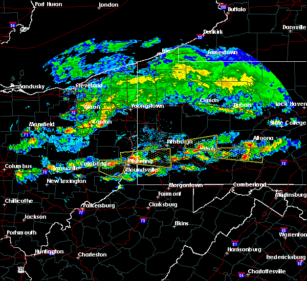 At 402 pm edt, a severe thunderstorm was located near blairsville, or 8 miles north of latrobe, moving east at 45 mph (radar). Hazards include half dollar-size hail. Minor damage to vehicles is possible. Locations impacted include, homer city, blairsville, black lick, saltsburg, new florence, new alexandria, bolivar, crabtree, lucerne mines, brush vly, yellow creek state park,. At 402 pm edt, a severe thunderstorm was located near blairsville, or 8 miles north of latrobe, moving east at 45 mph (radar). Hazards include half dollar-size hail. Minor damage to vehicles is possible. Locations impacted include, homer city, blairsville, black lick, saltsburg, new florence, new alexandria, bolivar, crabtree, lucerne mines, brush vly, yellow creek state park,.
|
| 5/12/2018 3:52 PM EDT |
 At 351 pm edt, a severe thunderstorm was located near delmont, or 9 miles south of apollo, moving east at 45 mph (radar). Hazards include half dollar-size hail. Minor damage to vehicles is possible. Locations impacted include, homer city, murrysville, blairsville, delmont, black lick, avonmore, export, saltsburg, new florence, new alexandria, bolivar, slickville,. At 351 pm edt, a severe thunderstorm was located near delmont, or 9 miles south of apollo, moving east at 45 mph (radar). Hazards include half dollar-size hail. Minor damage to vehicles is possible. Locations impacted include, homer city, murrysville, blairsville, delmont, black lick, avonmore, export, saltsburg, new florence, new alexandria, bolivar, slickville,.
|
| 5/12/2018 3:44 PM EDT |
 At 344 pm edt, a severe thunderstorm was located over murrysville, or 7 miles east of monroeville, moving east at 40 mph (radar). Hazards include wind gusts to 60 mph and half dollar-size hail. Minor hail damage to vehicles is possible. expect wind damage to trees and power lines, resulting in some power outages. Locations impacted include, monroeville, indiana, vandergrift, homer city, apollo, plum, murrysville, lower burrell, blairsville, trafford, delmont, black lick, this includes pennsylvania turnpike between mile markers 57 and 61. At 344 pm edt, a severe thunderstorm was located over murrysville, or 7 miles east of monroeville, moving east at 40 mph (radar). Hazards include wind gusts to 60 mph and half dollar-size hail. Minor hail damage to vehicles is possible. expect wind damage to trees and power lines, resulting in some power outages. Locations impacted include, monroeville, indiana, vandergrift, homer city, apollo, plum, murrysville, lower burrell, blairsville, trafford, delmont, black lick, this includes pennsylvania turnpike between mile markers 57 and 61.
|
| 5/12/2018 3:29 PM EDT |
 At 329 pm edt, a severe thunderstorm was located over penn hills, moving east at 45 mph (radar). Hazards include wind gusts to 60 mph and half dollar-size hail. Minor hail damage to vehicles is possible. Expect wind damage to trees and power lines, resulting in some power outages. At 329 pm edt, a severe thunderstorm was located over penn hills, moving east at 45 mph (radar). Hazards include wind gusts to 60 mph and half dollar-size hail. Minor hail damage to vehicles is possible. Expect wind damage to trees and power lines, resulting in some power outages.
|
| 5/10/2018 3:03 PM EDT |
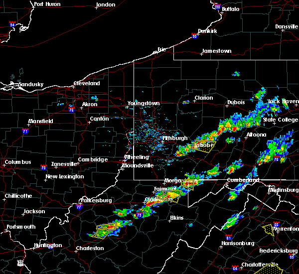 The national weather service in pittsburgh has issued a * severe thunderstorm warning for. south central indiana county in west central pennsylvania. east central westmoreland county in southwestern pennsylvania. until 330 pm edt. At 303 pm edt, a severe thunderstorm was located over derry, or. The national weather service in pittsburgh has issued a * severe thunderstorm warning for. south central indiana county in west central pennsylvania. east central westmoreland county in southwestern pennsylvania. until 330 pm edt. At 303 pm edt, a severe thunderstorm was located over derry, or.
|
| 5/4/2018 6:13 PM EDT |
 At 613 pm edt, severe thunderstorms were located along a line extending from 13 miles southeast of new bethlehem to near oakmont, moving east at 60 mph (radar). Hazards include wind gusts to 60 mph. Expect damage to trees and power lines, resulting in some power outages. locations impacted include, pittsburgh, penn hills, ross township, mccandless township, monroeville, indiana, franklin park, vandergrift, kittanning, homer city, apollo, shaler township, this includes the following highways, pennsylvania turnpike between mile markers 37 and 57. interstate 79 in pennsylvania between mile markers 38 and 41. Parkway north between mile markers 5 and 12. At 613 pm edt, severe thunderstorms were located along a line extending from 13 miles southeast of new bethlehem to near oakmont, moving east at 60 mph (radar). Hazards include wind gusts to 60 mph. Expect damage to trees and power lines, resulting in some power outages. locations impacted include, pittsburgh, penn hills, ross township, mccandless township, monroeville, indiana, franklin park, vandergrift, kittanning, homer city, apollo, shaler township, this includes the following highways, pennsylvania turnpike between mile markers 37 and 57. interstate 79 in pennsylvania between mile markers 38 and 41. Parkway north between mile markers 5 and 12.
|
| 5/4/2018 5:51 PM EDT |
 At 550 pm edt, severe thunderstorms were located along a line extending from near west kittanning to near moon township, moving east at 45 mph (radar). Hazards include wind gusts to 60 mph. expect damage to trees and power lines, resulting in some power outages At 550 pm edt, severe thunderstorms were located along a line extending from near west kittanning to near moon township, moving east at 45 mph (radar). Hazards include wind gusts to 60 mph. expect damage to trees and power lines, resulting in some power outages
|
| 8/22/2017 3:03 PM EDT |
 At 303 pm edt, a severe thunderstorm was located over blairsville, or 8 miles northeast of latrobe, moving east at 35 mph (radar). Hazards include 60 mph wind gusts and quarter-size hail. Minor hail damage to vehicles is possible. expect wind damage to trees and power lines, resulting in some power outages. Locations impacted include, blairsville, black lick, new florence, seward, bolivar, armagh,. At 303 pm edt, a severe thunderstorm was located over blairsville, or 8 miles northeast of latrobe, moving east at 35 mph (radar). Hazards include 60 mph wind gusts and quarter-size hail. Minor hail damage to vehicles is possible. expect wind damage to trees and power lines, resulting in some power outages. Locations impacted include, blairsville, black lick, new florence, seward, bolivar, armagh,.
|
| 8/22/2017 2:48 PM EDT |
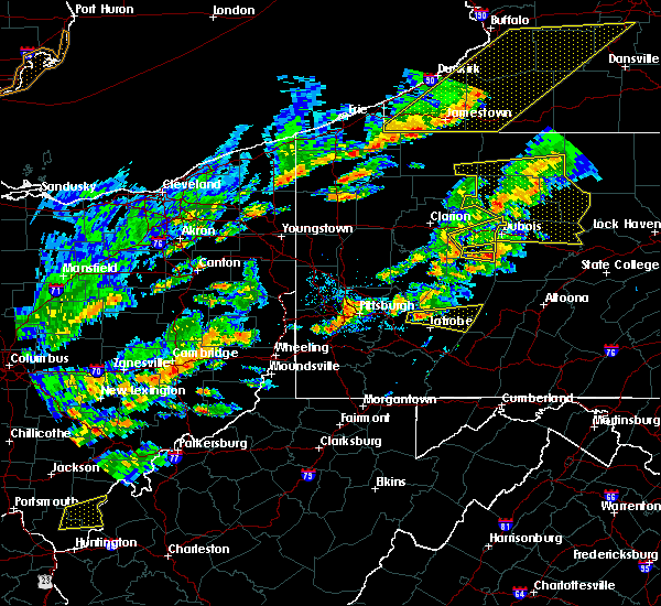 At 247 pm edt, a severe thunderstorm was located near delmont, or 7 miles northwest of latrobe, moving east at 40 mph (radar). Hazards include 60 mph wind gusts and quarter-size hail. Minor hail damage to vehicles is possible. expect wind damage to trees and power lines, resulting in some power outages. Locations impacted include, blairsville, derry, black lick, new florence, new alexandria, seward, bolivar, armagh, crabtree,. At 247 pm edt, a severe thunderstorm was located near delmont, or 7 miles northwest of latrobe, moving east at 40 mph (radar). Hazards include 60 mph wind gusts and quarter-size hail. Minor hail damage to vehicles is possible. expect wind damage to trees and power lines, resulting in some power outages. Locations impacted include, blairsville, derry, black lick, new florence, new alexandria, seward, bolivar, armagh, crabtree,.
|
| 8/22/2017 2:36 PM EDT |
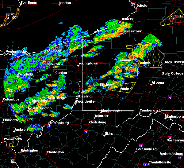 At 236 pm edt, a severe thunderstorm was located over delmont, or near jeannette, moving east at 40 mph (radar). Hazards include 60 mph wind gusts and quarter-size hail. Hail damage to vehicles. Damage to trees and power lines. At 236 pm edt, a severe thunderstorm was located over delmont, or near jeannette, moving east at 40 mph (radar). Hazards include 60 mph wind gusts and quarter-size hail. Hail damage to vehicles. Damage to trees and power lines.
|
| 8/19/2017 5:21 PM EDT |
 At 520 pm edt, a severe thunderstorm was located near ligonier, or 7 miles east of latrobe, moving southeast at 45 mph (law enforcement). Hazards include 60 mph wind gusts. Expect damage to trees and power lines, resulting in some power outages. Locations impacted include, greensburg, latrobe, murrysville, mcchesneytown-loyalhanna, blairsville, derry, delmont, lawson heights, ligonier, avonmore, export, saltsburg,. At 520 pm edt, a severe thunderstorm was located near ligonier, or 7 miles east of latrobe, moving southeast at 45 mph (law enforcement). Hazards include 60 mph wind gusts. Expect damage to trees and power lines, resulting in some power outages. Locations impacted include, greensburg, latrobe, murrysville, mcchesneytown-loyalhanna, blairsville, derry, delmont, lawson heights, ligonier, avonmore, export, saltsburg,.
|
| 8/19/2017 4:46 PM EDT |
 At 446 pm edt, a severe thunderstorm was located near delmont, or 7 miles north of greensburg, moving southeast at 35 mph (radar). Hazards include 60 mph wind gusts and quarter-size hail. Minor hail damage to vehicles is possible. Expect wind damage to trees and power lines, resulting in some power outages. At 446 pm edt, a severe thunderstorm was located near delmont, or 7 miles north of greensburg, moving southeast at 35 mph (radar). Hazards include 60 mph wind gusts and quarter-size hail. Minor hail damage to vehicles is possible. Expect wind damage to trees and power lines, resulting in some power outages.
|
| 6/13/2017 5:26 PM EDT |
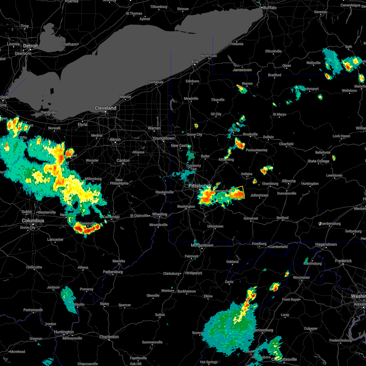 The severe thunderstorm warning for southwestern indiana and central westmoreland counties will expire at 530 pm edt, the storm that prompted the warning has weakened below severe limits and no longer pose an immediate threat to life and property. therefore, the warning will be allowed to expire. The severe thunderstorm warning for southwestern indiana and central westmoreland counties will expire at 530 pm edt, the storm that prompted the warning has weakened below severe limits and no longer pose an immediate threat to life and property. therefore, the warning will be allowed to expire.
|
| 6/13/2017 5:19 PM EDT |
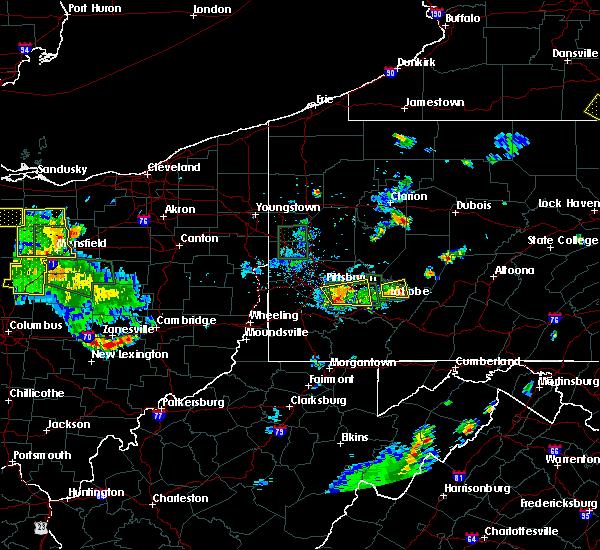 At 518 pm edt, a severe thunderstorm was located near derry, or 7 miles northeast of latrobe, moving east at 20 mph (radar). Hazards include 60 mph wind gusts and quarter-size hail. Minor hail damage to vehicles is possible. expect wind damage to trees and power lines, resulting in some power outages. Locations impacted include, blairsville, derry, new alexandria,. At 518 pm edt, a severe thunderstorm was located near derry, or 7 miles northeast of latrobe, moving east at 20 mph (radar). Hazards include 60 mph wind gusts and quarter-size hail. Minor hail damage to vehicles is possible. expect wind damage to trees and power lines, resulting in some power outages. Locations impacted include, blairsville, derry, new alexandria,.
|
| 6/13/2017 4:42 PM EDT |
 At 441 pm edt, a severe thunderstorm was located near delmont, or 9 miles north of greensburg, moving east at 10 mph (radar). Hazards include 60 mph wind gusts and quarter-size hail. Minor hail damage to vehicles is possible. Expect wind damage to trees and power lines, resulting in some power outages. At 441 pm edt, a severe thunderstorm was located near delmont, or 9 miles north of greensburg, moving east at 10 mph (radar). Hazards include 60 mph wind gusts and quarter-size hail. Minor hail damage to vehicles is possible. Expect wind damage to trees and power lines, resulting in some power outages.
|
| 5/31/2017 4:36 PM EDT |
 At 436 pm edt, severe thunderstorms were located along a line extending from near ford city to near murrysville to gastonville, moving east at 45 mph (radar). Hazards include 60 mph wind gusts. Expect damage to trees and power lines, resulting in some power outages. Locations impacted include, pittsburgh, penn hills, bethel park, monroeville, mcmurray, greensburg, mckeesport, jeannette, canonsburg, vandergrift, kittanning, apollo, this includes pennsylvania turnpike between mile markers 50 and 72. At 436 pm edt, severe thunderstorms were located along a line extending from near ford city to near murrysville to gastonville, moving east at 45 mph (radar). Hazards include 60 mph wind gusts. Expect damage to trees and power lines, resulting in some power outages. Locations impacted include, pittsburgh, penn hills, bethel park, monroeville, mcmurray, greensburg, mckeesport, jeannette, canonsburg, vandergrift, kittanning, apollo, this includes pennsylvania turnpike between mile markers 50 and 72.
|
| 5/31/2017 4:20 PM EDT |
 At 419 pm edt, severe thunderstorms were located along a line extending from near sarver to penn hills to near canonsburg, moving east at 45 mph (radar). Hazards include 60 mph wind gusts. Expect damage to trees and power lines, resulting in some power outages. locations impacted include, pittsburgh, penn hills, mount lebanon, bethel park, monroeville, mcmurray, greensburg, mckeesport, jeannette, canonsburg, vandergrift, kittanning, this includes the following highways, pennsylvania turnpike between mile markers 41 and 72. interstate 79 in pennsylvania between mile markers 22 and 30. Parkway north between mile markers 1 and 3. At 419 pm edt, severe thunderstorms were located along a line extending from near sarver to penn hills to near canonsburg, moving east at 45 mph (radar). Hazards include 60 mph wind gusts. Expect damage to trees and power lines, resulting in some power outages. locations impacted include, pittsburgh, penn hills, mount lebanon, bethel park, monroeville, mcmurray, greensburg, mckeesport, jeannette, canonsburg, vandergrift, kittanning, this includes the following highways, pennsylvania turnpike between mile markers 41 and 72. interstate 79 in pennsylvania between mile markers 22 and 30. Parkway north between mile markers 1 and 3.
|
| 5/31/2017 4:06 PM EDT |
 At 406 pm edt, severe thunderstorms were located along a line extending from near oak hills to millvale to near avella, moving east at 45 mph (radar). Hazards include 60 mph wind gusts. expect damage to trees and power lines, resulting in some power outages At 406 pm edt, severe thunderstorms were located along a line extending from near oak hills to millvale to near avella, moving east at 45 mph (radar). Hazards include 60 mph wind gusts. expect damage to trees and power lines, resulting in some power outages
|
| 5/5/2017 8:07 PM EDT |
 At 806 pm edt, a severe thunderstorm was located over ligonier, or 9 miles southeast of latrobe, moving northeast at 30 mph (radar). Hazards include quarter-size hail. Minor damage to vehicles is possible. Locations impacted include, blairsville, derry, ligonier, new florence, seward, bolivar, laurel mountain, loyalhanna gorge,. At 806 pm edt, a severe thunderstorm was located over ligonier, or 9 miles southeast of latrobe, moving northeast at 30 mph (radar). Hazards include quarter-size hail. Minor damage to vehicles is possible. Locations impacted include, blairsville, derry, ligonier, new florence, seward, bolivar, laurel mountain, loyalhanna gorge,.
|
| 5/5/2017 7:53 PM EDT |
 At 752 pm edt, a severe thunderstorm was located 7 miles north of seven springs, or 13 miles south of latrobe, moving northeast at 25 mph (radar). Hazards include quarter-size hail. minor damage to vehicles is possible At 752 pm edt, a severe thunderstorm was located 7 miles north of seven springs, or 13 miles south of latrobe, moving northeast at 25 mph (radar). Hazards include quarter-size hail. minor damage to vehicles is possible
|
| 5/1/2017 3:58 PM EDT |
 At 358 pm edt, severe thunderstorms were located along a line extending from near brockway to near punxsutawney to near indiana, moving east at 55 mph (trained weather spotters). Hazards include 60 mph wind gusts. Expect damage to trees and power lines, resulting in some power outages. locations impacted include, indiana, punxsutawney, brookville, homer city, blairsville, reynoldsville, brockway, black lick, clymer, sykesville, falls creek, new florence, this includes interstate 80 in pennsylvania between mile markers 81 and 96. A tornado watch remains in effect until 700 pm edt for southwestern and west central pennsylvania. At 358 pm edt, severe thunderstorms were located along a line extending from near brockway to near punxsutawney to near indiana, moving east at 55 mph (trained weather spotters). Hazards include 60 mph wind gusts. Expect damage to trees and power lines, resulting in some power outages. locations impacted include, indiana, punxsutawney, brookville, homer city, blairsville, reynoldsville, brockway, black lick, clymer, sykesville, falls creek, new florence, this includes interstate 80 in pennsylvania between mile markers 81 and 96. A tornado watch remains in effect until 700 pm edt for southwestern and west central pennsylvania.
|
| 5/1/2017 3:54 PM EDT | Large pine tree uprooted. several large braches also down in indiana county PA, 0.3 miles NNW of Blairsville, PA |
| 5/1/2017 3:34 PM EDT |
 At 334 pm edt, severe thunderstorms were located along a line extending from 7 miles west of brookville to 10 miles east of kittanning to 8 miles northeast of delmont, moving east at 55 mph (trained weather spotters). Hazards include 60 mph wind gusts. expect damage to trees and power lines, resulting in some power outages At 334 pm edt, severe thunderstorms were located along a line extending from 7 miles west of brookville to 10 miles east of kittanning to 8 miles northeast of delmont, moving east at 55 mph (trained weather spotters). Hazards include 60 mph wind gusts. expect damage to trees and power lines, resulting in some power outages
|
| 4/16/2017 5:57 PM EDT |
 At 556 pm edt, a severe thunderstorm was located over delmont, or 7 miles northeast of jeannette, moving east at 40 mph (radar). Hazards include 60 mph wind gusts. Expect damage to trees and power lines, resulting in some power outages. Locations impacted include, monroeville, greensburg, jeannette, latrobe, murrysville, mcchesneytown-loyalhanna, blairsville, manor, trafford, derry, delmont, lawson heights, this includes pennsylvania turnpike between mile markers 59 and 64. At 556 pm edt, a severe thunderstorm was located over delmont, or 7 miles northeast of jeannette, moving east at 40 mph (radar). Hazards include 60 mph wind gusts. Expect damage to trees and power lines, resulting in some power outages. Locations impacted include, monroeville, greensburg, jeannette, latrobe, murrysville, mcchesneytown-loyalhanna, blairsville, manor, trafford, derry, delmont, lawson heights, this includes pennsylvania turnpike between mile markers 59 and 64.
|
| 4/16/2017 5:42 PM EDT |
 At 541 pm edt, a severe thunderstorm was located over monroeville, moving east at 40 mph (radar). Hazards include 60 mph wind gusts. expect damage to trees and power lines, resulting in some power outages At 541 pm edt, a severe thunderstorm was located over monroeville, moving east at 40 mph (radar). Hazards include 60 mph wind gusts. expect damage to trees and power lines, resulting in some power outages
|
| 2/12/2017 8:18 PM EST |
 At 817 pm est, severe thunderstorms were located along a line extending from 7 miles northwest of westmont to near waynesburg, moving east at 45 mph (public, law enforcement, and automated weather sensors). Hazards include 60 mph wind gusts. Expect damage to trees and power lines, resulting in some power outages. locations impacted include, greensburg, uniontown, jeannette, latrobe, connellsville, waynesburg, homer city, gastonville, murrysville, jefferson hills, monessen, california, this includes the following highways, interstate 70 in pennsylvania between mile markers 23 and 57. pennsylvania turnpike between mile markers 62 and 100. Interstate 79 in pennsylvania between mile markers 10 and 21, and between mile markers 155 and 166. At 817 pm est, severe thunderstorms were located along a line extending from 7 miles northwest of westmont to near waynesburg, moving east at 45 mph (public, law enforcement, and automated weather sensors). Hazards include 60 mph wind gusts. Expect damage to trees and power lines, resulting in some power outages. locations impacted include, greensburg, uniontown, jeannette, latrobe, connellsville, waynesburg, homer city, gastonville, murrysville, jefferson hills, monessen, california, this includes the following highways, interstate 70 in pennsylvania between mile markers 23 and 57. pennsylvania turnpike between mile markers 62 and 100. Interstate 79 in pennsylvania between mile markers 10 and 21, and between mile markers 155 and 166.
|
| 2/12/2017 7:59 PM EST |
 At 758 pm est, severe thunderstorms were located along a line extending from near blairsville to 7 miles southeast of valley grove, moving east at 45 mph (radar). Hazards include 60 mph wind gusts. expect damage to trees and power lines, resulting in some power outages At 758 pm est, severe thunderstorms were located along a line extending from near blairsville to 7 miles southeast of valley grove, moving east at 45 mph (radar). Hazards include 60 mph wind gusts. expect damage to trees and power lines, resulting in some power outages
|
| 8/16/2016 6:52 PM EDT |
 At 652 pm edt, severe thunderstorms were located along a line extending from 7 miles south of punxsutawney to 9 miles east of indiana to near blairsville, moving east at 45 mph (public. trees and power lines have been reported down in several towns). Hazards include 60 mph wind gusts. Expect damage to trees and power lines. resulting in some power outages. locations impacted include, indiana, latrobe, homer city, mcchesneytown-loyalhanna, blairsville, derry, lawson heights, black lick, clymer, new florence, chevy chase heights, rossiter, seward, bolivar, ernest, marion center, cherry tree, youngstown, creekside and plumville. Please report severe weather by calling 4 1 2, 2 6 2, 1 9 8 8, posting to the nws pittsburgh facebook page, or using twitter @nwspittsburgh. At 652 pm edt, severe thunderstorms were located along a line extending from 7 miles south of punxsutawney to 9 miles east of indiana to near blairsville, moving east at 45 mph (public. trees and power lines have been reported down in several towns). Hazards include 60 mph wind gusts. Expect damage to trees and power lines. resulting in some power outages. locations impacted include, indiana, latrobe, homer city, mcchesneytown-loyalhanna, blairsville, derry, lawson heights, black lick, clymer, new florence, chevy chase heights, rossiter, seward, bolivar, ernest, marion center, cherry tree, youngstown, creekside and plumville. Please report severe weather by calling 4 1 2, 2 6 2, 1 9 8 8, posting to the nws pittsburgh facebook page, or using twitter @nwspittsburgh.
|
| 8/16/2016 6:35 PM EDT |
 At 634 pm edt, severe thunderstorms were located along a line extending from 15 miles north of homer city to near indiana to near latrobe, moving east at 45 mph (public. trees and power lines have been reported down in several towns). Hazards include 60 mph wind gusts. Expect damage to trees and power lines. resulting in some power outages. locations impacted include, greensburg, indiana, jeannette, latrobe, vandergrift, homer city, apollo, murrysville, irwin, mcchesneytown-loyalhanna, blairsville, manor, youngwood, derry, delmont, lawson heights, new stanton, leechburg, black lick and calumet-norvelt. this includes the following highways, interstate 70 in pennsylvania between mile markers 52 and 57. pennsylvania turnpike between mile markers 61 and 79. Please report severe weather by calling 4 1 2, 2 6 2, 1 9 8 8, posting to the nws pittsburgh facebook page, or using twitter @nwspittsburgh. At 634 pm edt, severe thunderstorms were located along a line extending from 15 miles north of homer city to near indiana to near latrobe, moving east at 45 mph (public. trees and power lines have been reported down in several towns). Hazards include 60 mph wind gusts. Expect damage to trees and power lines. resulting in some power outages. locations impacted include, greensburg, indiana, jeannette, latrobe, vandergrift, homer city, apollo, murrysville, irwin, mcchesneytown-loyalhanna, blairsville, manor, youngwood, derry, delmont, lawson heights, new stanton, leechburg, black lick and calumet-norvelt. this includes the following highways, interstate 70 in pennsylvania between mile markers 52 and 57. pennsylvania turnpike between mile markers 61 and 79. Please report severe weather by calling 4 1 2, 2 6 2, 1 9 8 8, posting to the nws pittsburgh facebook page, or using twitter @nwspittsburgh.
|
| 8/16/2016 6:14 PM EDT |
 At 613 pm edt, severe thunderstorms were located along a line extending from near vandergrift to near west newton, moving east at 50 mph (public. downed trees and power lines have been reported in several towns). Hazards include 60 mph wind gusts. Expect damage to trees and power lines. Resulting in some power outages. At 613 pm edt, severe thunderstorms were located along a line extending from near vandergrift to near west newton, moving east at 50 mph (public. downed trees and power lines have been reported in several towns). Hazards include 60 mph wind gusts. Expect damage to trees and power lines. Resulting in some power outages.
|
| 7/24/2016 5:35 PM EDT |
 At 535 pm edt, severe thunderstorms were located along a line extending from near black lick to near blairsville to latrobe to near greensburg, moving east at 35 mph (radar indicated). Hazards include 60 mph wind gusts. Expect damage to trees and power lines. resulting in some power outages. locations impacted include, greensburg, latrobe, mcchesneytown-loyalhanna, blairsville, youngwood, derry, lawson heights, ligonier, black lick, new florence, new alexandria, seward, bolivar, youngstown, laurel mountain, laurel mountain state park and loyalhanna gorge. Please report severe weather by calling 4 1 2, 2 6 2, 1 9 8 8, posting to the nws pittsburgh facebook page, or using twitter @nwspittsburgh. At 535 pm edt, severe thunderstorms were located along a line extending from near black lick to near blairsville to latrobe to near greensburg, moving east at 35 mph (radar indicated). Hazards include 60 mph wind gusts. Expect damage to trees and power lines. resulting in some power outages. locations impacted include, greensburg, latrobe, mcchesneytown-loyalhanna, blairsville, youngwood, derry, lawson heights, ligonier, black lick, new florence, new alexandria, seward, bolivar, youngstown, laurel mountain, laurel mountain state park and loyalhanna gorge. Please report severe weather by calling 4 1 2, 2 6 2, 1 9 8 8, posting to the nws pittsburgh facebook page, or using twitter @nwspittsburgh.
|
| 7/24/2016 5:08 PM EDT |
 At 508 pm edt, severe thunderstorms were located along a line extending from near apollo to near delmont to manor to white oak, moving east at 35 mph (radar indicated). Hazards include 60 mph wind gusts. Expect damage to trees and power lines. Resulting in some power outages. At 508 pm edt, severe thunderstorms were located along a line extending from near apollo to near delmont to manor to white oak, moving east at 35 mph (radar indicated). Hazards include 60 mph wind gusts. Expect damage to trees and power lines. Resulting in some power outages.
|
| 8/3/2015 11:39 PM EDT |
 At 1139 pm edt, a severe thunderstorm was located over blairsville, or 8 miles south of homer city, moving east at 45 mph (radar indicated). Hazards include 60 mph wind gusts and quarter size hail. Hail damage to vehicles is expected. Expect wind damage to trees and some power outages. At 1139 pm edt, a severe thunderstorm was located over blairsville, or 8 miles south of homer city, moving east at 45 mph (radar indicated). Hazards include 60 mph wind gusts and quarter size hail. Hail damage to vehicles is expected. Expect wind damage to trees and some power outages.
|
| 7/7/2015 8:22 PM EDT |
 At 821 pm edt, severe thunderstorms were located along a line extending from vandergrift to near ligonier, moving northeast at 45 mph (radar indicated). Hazards include 60 mph wind gusts. expect damage to trees and some power outages locations impacted include, greensburg, indiana, jeannette, latrobe, vandergrift, homer city, apollo, plum, murrysville, new kensington, lower burrell, harrison township, arnold, tarentum, mcchesneytown-loyalhanna, blairsville, springdale, brackenridge, derry and delmont At 821 pm edt, severe thunderstorms were located along a line extending from vandergrift to near ligonier, moving northeast at 45 mph (radar indicated). Hazards include 60 mph wind gusts. expect damage to trees and some power outages locations impacted include, greensburg, indiana, jeannette, latrobe, vandergrift, homer city, apollo, plum, murrysville, new kensington, lower burrell, harrison township, arnold, tarentum, mcchesneytown-loyalhanna, blairsville, springdale, brackenridge, derry and delmont
|
| 7/7/2015 8:04 PM EDT |
 At 803 pm edt, severe thunderstorms were located along a line extending from near monroeville to near connellsville, moving northeast at 45 mph (radar indicated). Hazards include 60 mph wind gusts. expect damage to trees and some power outages At 803 pm edt, severe thunderstorms were located along a line extending from near monroeville to near connellsville, moving northeast at 45 mph (radar indicated). Hazards include 60 mph wind gusts. expect damage to trees and some power outages
|
| 6/23/2015 3:23 PM EDT |
 At 323 pm edt, a severe thunderstorm was located near derry, or near latrobe, moving east at 40 mph (radar indicated). Hazards include 60 mph wind gusts and quarter size hail. Hail damage to vehicles is expected. expect wind damage to roofs, siding and trees. Locations impacted include, latrobe, mcchesneytown-loyalhanna, blairsville, derry, lawson heights, ligonier, new florence, seward, bolivar, youngstown, laurel mountain and loyalhanna gorge. At 323 pm edt, a severe thunderstorm was located near derry, or near latrobe, moving east at 40 mph (radar indicated). Hazards include 60 mph wind gusts and quarter size hail. Hail damage to vehicles is expected. expect wind damage to roofs, siding and trees. Locations impacted include, latrobe, mcchesneytown-loyalhanna, blairsville, derry, lawson heights, ligonier, new florence, seward, bolivar, youngstown, laurel mountain and loyalhanna gorge.
|
| 6/23/2015 3:11 PM EDT |
 At 311 pm edt, a severe thunderstorm was located near latrobe, moving east at 40 mph (radar indicated). Hazards include 60 mph wind gusts and quarter size hail. Hail damage to vehicles is expected. expect wind damage to roofs, siding and trees. Locations impacted include, greensburg, latrobe, mcchesneytown-loyalhanna, blairsville, derry, lawson heights, ligonier, black lick, new florence, new alexandria, seward, bolivar, youngstown, laurel mountain, crabtree, slickville and loyalhanna gorge. At 311 pm edt, a severe thunderstorm was located near latrobe, moving east at 40 mph (radar indicated). Hazards include 60 mph wind gusts and quarter size hail. Hail damage to vehicles is expected. expect wind damage to roofs, siding and trees. Locations impacted include, greensburg, latrobe, mcchesneytown-loyalhanna, blairsville, derry, lawson heights, ligonier, black lick, new florence, new alexandria, seward, bolivar, youngstown, laurel mountain, crabtree, slickville and loyalhanna gorge.
|
| 6/23/2015 2:55 PM EDT |
 At 255 pm edt, a severe thunderstorm was located near murrysville, or near monroeville, moving east at 40 mph (radar indicated). Hazards include 60 mph wind gusts and quarter size hail. Hail damage to vehicles is expected. Expect wind damage to roofs, siding and trees. At 255 pm edt, a severe thunderstorm was located near murrysville, or near monroeville, moving east at 40 mph (radar indicated). Hazards include 60 mph wind gusts and quarter size hail. Hail damage to vehicles is expected. Expect wind damage to roofs, siding and trees.
|
| 6/23/2015 1:38 PM EDT |
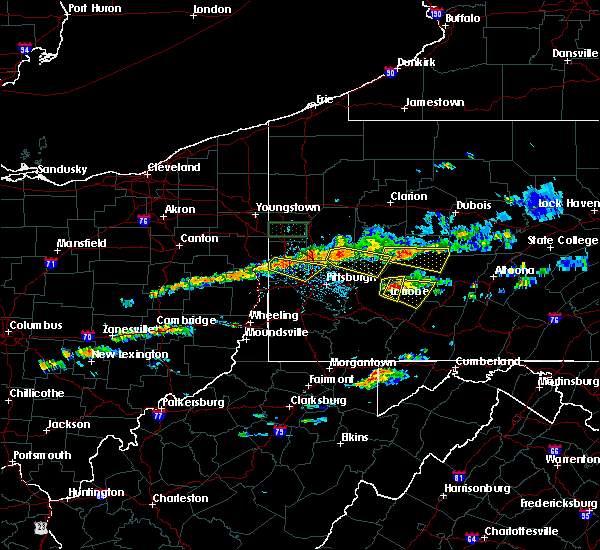 At 138 pm edt, a severe thunderstorm was located 8 miles west of blairsville, or 8 miles north of latrobe, moving east at 25 mph (radar indicated). Hazards include 60 mph wind gusts and quarter size hail. Hail damage to vehicles is expected. expect wind damage to roofs, siding and trees. Locations impacted include, latrobe, mcchesneytown-loyalhanna, blairsville, derry, saltsburg, new alexandria and crabtree. At 138 pm edt, a severe thunderstorm was located 8 miles west of blairsville, or 8 miles north of latrobe, moving east at 25 mph (radar indicated). Hazards include 60 mph wind gusts and quarter size hail. Hail damage to vehicles is expected. expect wind damage to roofs, siding and trees. Locations impacted include, latrobe, mcchesneytown-loyalhanna, blairsville, derry, saltsburg, new alexandria and crabtree.
|
| 6/23/2015 1:35 PM EDT |
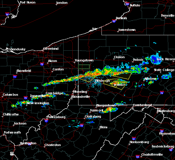 At 134 pm edt, a severe thunderstorm was located near blairsville, or near latrobe, moving east at 35 mph (radar indicated). Hazards include 60 mph wind gusts and quarter size hail. Hail damage to vehicles is expected. Expect wind damage to roofs, siding and trees. At 134 pm edt, a severe thunderstorm was located near blairsville, or near latrobe, moving east at 35 mph (radar indicated). Hazards include 60 mph wind gusts and quarter size hail. Hail damage to vehicles is expected. Expect wind damage to roofs, siding and trees.
|
| 6/23/2015 1:17 PM EDT |
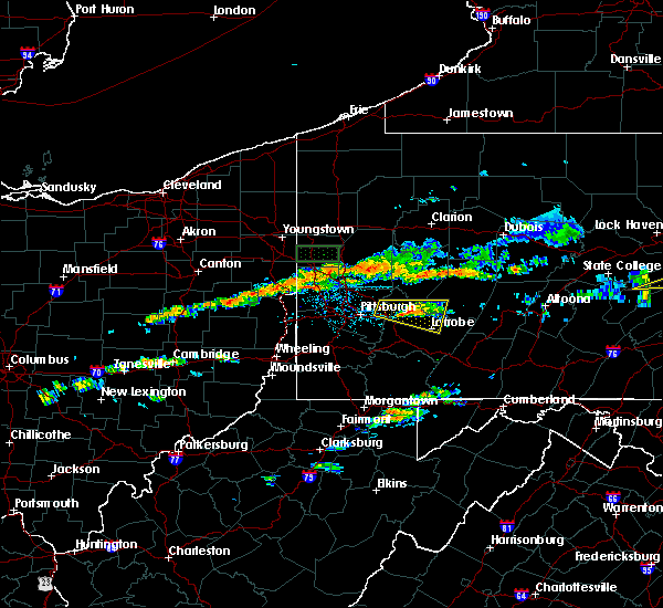 At 116 pm edt, a severe thunderstorm was located over murrysville, or 8 miles south of apollo, moving east at 25 mph (radar indicated). Hazards include 60 mph wind gusts and quarter size hail. Hail damage to vehicles is expected. expect wind damage to trees. Locations impacted include, latrobe, murrysville, mcchesneytown-loyalhanna, blairsville, derry, delmont, avonmore, export, saltsburg, new alexandria, crabtree, slickville, jacksonville and north washington. At 116 pm edt, a severe thunderstorm was located over murrysville, or 8 miles south of apollo, moving east at 25 mph (radar indicated). Hazards include 60 mph wind gusts and quarter size hail. Hail damage to vehicles is expected. expect wind damage to trees. Locations impacted include, latrobe, murrysville, mcchesneytown-loyalhanna, blairsville, derry, delmont, avonmore, export, saltsburg, new alexandria, crabtree, slickville, jacksonville and north washington.
|
| 6/23/2015 12:57 PM EDT |
 At 1257 pm edt, a severe thunderstorm was located over plum, or near monroeville, moving east at 25 mph (radar indicated). Hazards include 60 mph wind gusts and quarter size hail. Hail damage to vehicles is expected. Expect wind damage to trees. At 1257 pm edt, a severe thunderstorm was located over plum, or near monroeville, moving east at 25 mph (radar indicated). Hazards include 60 mph wind gusts and quarter size hail. Hail damage to vehicles is expected. Expect wind damage to trees.
|
| 6/14/2015 8:57 PM EDT | The tornado warning for southwestern indiana and central westmoreland counties will expire at 900 pm edt, the storm which prompted the warning has weakened below severe limits, and no longer appears capable of producing a tornado. therefore the warning will be allowed to expire. however gusty winds are still possible with this thunderstorm. |
| 6/14/2015 8:45 PM EDT |
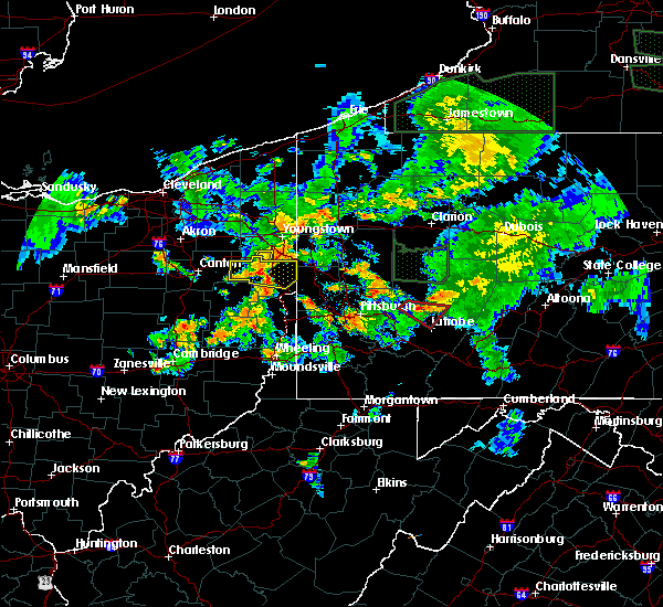 At 845 pm edt, a severe thunderstorm capable of producing a tornado was located 7 miles west of blairsville, or 8 miles north of latrobe, moving southeast at 25 mph (radar indicated rotation). Hazards include tornado. Flying debris will be dangerous to those caught without shelter. mobile homes will be damaged or destroyed. damage to roofs, windows and vehicles will occur. tree damage is likely. this dangerous storm will be near, mcchesneytown-loyalhanna and blairsville around 900 pm edt. Other locations impacted by this tornadic thunderstorm include new alexandria and saltsburg. At 845 pm edt, a severe thunderstorm capable of producing a tornado was located 7 miles west of blairsville, or 8 miles north of latrobe, moving southeast at 25 mph (radar indicated rotation). Hazards include tornado. Flying debris will be dangerous to those caught without shelter. mobile homes will be damaged or destroyed. damage to roofs, windows and vehicles will occur. tree damage is likely. this dangerous storm will be near, mcchesneytown-loyalhanna and blairsville around 900 pm edt. Other locations impacted by this tornadic thunderstorm include new alexandria and saltsburg.
|
| 6/14/2015 8:36 PM EDT |
 At 836 pm edt, a severe thunderstorm capable of producing a tornado was located 7 miles northeast of delmont, or 9 miles southeast of apollo, moving southeast at 25 mph (radar indicated rotation). Hazards include tornado. Flying debris will be dangerous to those caught without shelter. mobile homes will be damaged or destroyed. damage to roofs, windows and vehicles will occur. tree damage is likely. this dangerous storm will be near, latrobe, mcchesneytown-loyalhanna and blairsville around 900 pm edt. Other locations impacted by this tornadic thunderstorm include new alexandria, avonmore, saltsburg and slickville. At 836 pm edt, a severe thunderstorm capable of producing a tornado was located 7 miles northeast of delmont, or 9 miles southeast of apollo, moving southeast at 25 mph (radar indicated rotation). Hazards include tornado. Flying debris will be dangerous to those caught without shelter. mobile homes will be damaged or destroyed. damage to roofs, windows and vehicles will occur. tree damage is likely. this dangerous storm will be near, latrobe, mcchesneytown-loyalhanna and blairsville around 900 pm edt. Other locations impacted by this tornadic thunderstorm include new alexandria, avonmore, saltsburg and slickville.
|
| 6/14/2015 8:24 PM EDT |
 At 824 pm edt, a severe thunderstorm capable of producing a tornado was located near delmont, or near apollo, moving southeast at 25 mph (radar indicated rotation). Hazards include tornado. Flying debris will be dangerous to those caught without shelter. mobile homes will be damaged or destroyed. damage to roofs, windows and vehicles will occur. tree damage is likely. this dangerous storm will be near, latrobe, mcchesneytown-loyalhanna and blairsville around 900 pm edt. Other locations impacted by this tornadic thunderstorm include new alexandria, avonmore, saltsburg, slickville and north washington. At 824 pm edt, a severe thunderstorm capable of producing a tornado was located near delmont, or near apollo, moving southeast at 25 mph (radar indicated rotation). Hazards include tornado. Flying debris will be dangerous to those caught without shelter. mobile homes will be damaged or destroyed. damage to roofs, windows and vehicles will occur. tree damage is likely. this dangerous storm will be near, latrobe, mcchesneytown-loyalhanna and blairsville around 900 pm edt. Other locations impacted by this tornadic thunderstorm include new alexandria, avonmore, saltsburg, slickville and north washington.
|
| 6/14/2015 8:18 PM EDT |
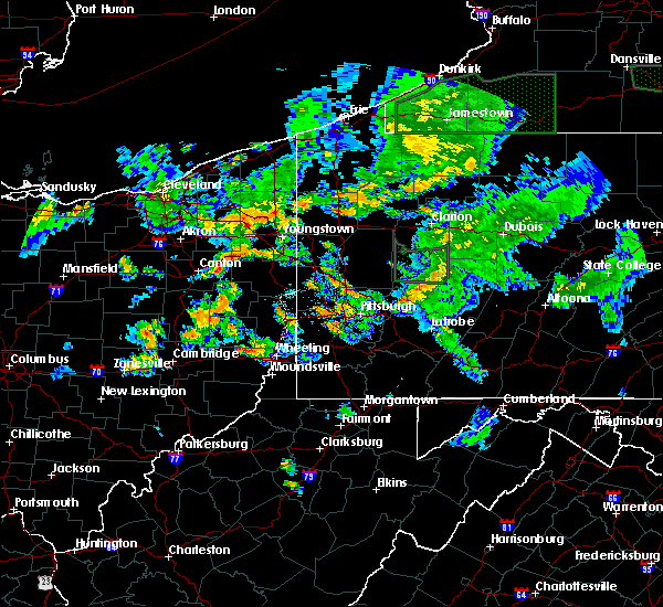 At 818 pm edt, a severe thunderstorm capable of producing a tornado was located near apollo, moving southeast at 25 mph (radar indicated rotation). Hazards include tornado. Flying debris will be dangerous to those caught without shelter. mobile homes will be damaged or destroyed. damage to roofs, windows and vehicles will occur. tree damage is likely. this dangerous storm will be near, latrobe, mcchesneytown-loyalhanna and blairsville around 900 pm edt. Other locations impacted by this tornadic thunderstorm include new alexandria, north washington, avonmore, saltsburg and slickville. At 818 pm edt, a severe thunderstorm capable of producing a tornado was located near apollo, moving southeast at 25 mph (radar indicated rotation). Hazards include tornado. Flying debris will be dangerous to those caught without shelter. mobile homes will be damaged or destroyed. damage to roofs, windows and vehicles will occur. tree damage is likely. this dangerous storm will be near, latrobe, mcchesneytown-loyalhanna and blairsville around 900 pm edt. Other locations impacted by this tornadic thunderstorm include new alexandria, north washington, avonmore, saltsburg and slickville.
|
| 6/12/2015 6:29 PM EDT |
 At 629 pm edt, severe thunderstorms were located along a line extending from 8 miles southeast of new bethlehem to north braddock, moving east at 55 mph (radar indicated). Hazards include 60 mph wind gusts. Expect damage to roofs. siding and trees. Locations impacted include, pittsburgh, penn hills, mount lebanon, ross township, mccandless township, monroeville, greensburg, mckeesport, indiana, jeannette, latrobe, punxsutawney, vandergrift, kittanning, homer city, apollo, shaler township, plum, west mifflin and north side pittsburgh. At 629 pm edt, severe thunderstorms were located along a line extending from 8 miles southeast of new bethlehem to north braddock, moving east at 55 mph (radar indicated). Hazards include 60 mph wind gusts. Expect damage to roofs. siding and trees. Locations impacted include, pittsburgh, penn hills, mount lebanon, ross township, mccandless township, monroeville, greensburg, mckeesport, indiana, jeannette, latrobe, punxsutawney, vandergrift, kittanning, homer city, apollo, shaler township, plum, west mifflin and north side pittsburgh.
|
| 6/12/2015 6:21 PM EDT |
 At 621 pm edt, severe thunderstorms were located along a line extending from near new bethlehem to mount oliver, moving east at 55 mph (radar indicated). Hazards include 60 mph wind gusts. Expect damage to roofs. siding and trees. Locations impacted include, pittsburgh, penn hills, mount lebanon, ross township, mccandless township, monroeville, moon township, greensburg, mckeesport, indiana, franklin park, jeannette, latrobe, punxsutawney, vandergrift, kittanning, homer city, apollo, shaler township and plum. At 621 pm edt, severe thunderstorms were located along a line extending from near new bethlehem to mount oliver, moving east at 55 mph (radar indicated). Hazards include 60 mph wind gusts. Expect damage to roofs. siding and trees. Locations impacted include, pittsburgh, penn hills, mount lebanon, ross township, mccandless township, monroeville, moon township, greensburg, mckeesport, indiana, franklin park, jeannette, latrobe, punxsutawney, vandergrift, kittanning, homer city, apollo, shaler township and plum.
|
| 6/12/2015 6:10 PM EDT |
 At 610 pm edt, severe thunderstorms were located along a line extending from near rimersburg to carnegie, moving east at 45 mph (radar indicated). Hazards include 60 mph wind gusts. Expect damage to roofs. siding and trees. Locations impacted include, pittsburgh, penn hills, mount lebanon, ross township, mccandless township, monroeville, cranberry, moon township, greensburg, mckeesport, indiana, butler, franklin park, jeannette, latrobe, punxsutawney, vandergrift, kittanning, homer city and apollo. At 610 pm edt, severe thunderstorms were located along a line extending from near rimersburg to carnegie, moving east at 45 mph (radar indicated). Hazards include 60 mph wind gusts. Expect damage to roofs. siding and trees. Locations impacted include, pittsburgh, penn hills, mount lebanon, ross township, mccandless township, monroeville, cranberry, moon township, greensburg, mckeesport, indiana, butler, franklin park, jeannette, latrobe, punxsutawney, vandergrift, kittanning, homer city and apollo.
|
| 6/12/2015 5:58 PM EDT |
 At 558 pm edt, severe thunderstorms were located along a line extending from 7 miles southwest of rimersburg to near imperial, moving east at 55 mph (radar indicated). Hazards include 60 mph wind gusts. Expect damage to roofs. Siding and trees. At 558 pm edt, severe thunderstorms were located along a line extending from 7 miles southwest of rimersburg to near imperial, moving east at 55 mph (radar indicated). Hazards include 60 mph wind gusts. Expect damage to roofs. Siding and trees.
|
| 4/9/2015 7:08 PM EDT | A severe thunderstorm warning remains in effect until 715 pm edt for indiana. southern jefferson. northeastern fayette. east central armstrong and southeastern westmoreland counties. at 708 pm edt. severe thunderstorms were located along a line extending from near dora to near clymer to near westmont to 6 miles southwest of donegal. Moving east at 60 mph. |
| 4/9/2015 6:43 PM EDT | The national weather service in pittsburgh has issued a * severe thunderstorm warning for. indiana county in west central pennsylvania. southern jefferson county in west central pennsylvania. northern fayette county in southwestern pennsylvania. Armstrong county in west central pennsylvania. |
| 7/10/2013 7:10 PM EDT | Roof blown off a house in westmoreland county PA, 4.3 miles ENE of Blairsville, PA |
| 6/25/2013 7:42 PM EDT | Multiple trees down blocking road in indiana county PA, 0.3 miles NNW of Blairsville, PA |
| 1/1/0001 12:00 AM | Numerous trees reported down in indiana county PA, 0.3 miles NNW of Blairsville, PA |
| 1/1/0001 12:00 AM | Numerous trees reported down in indiana county PA, 0.3 miles NNW of Blairsville, PA |
Hail Maps for Blairsville, PA


Connect with Interactive Hail Maps