

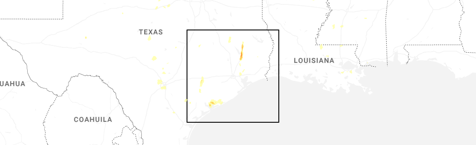
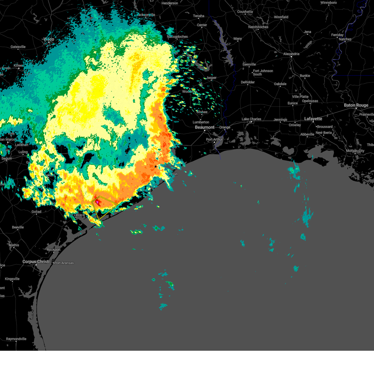
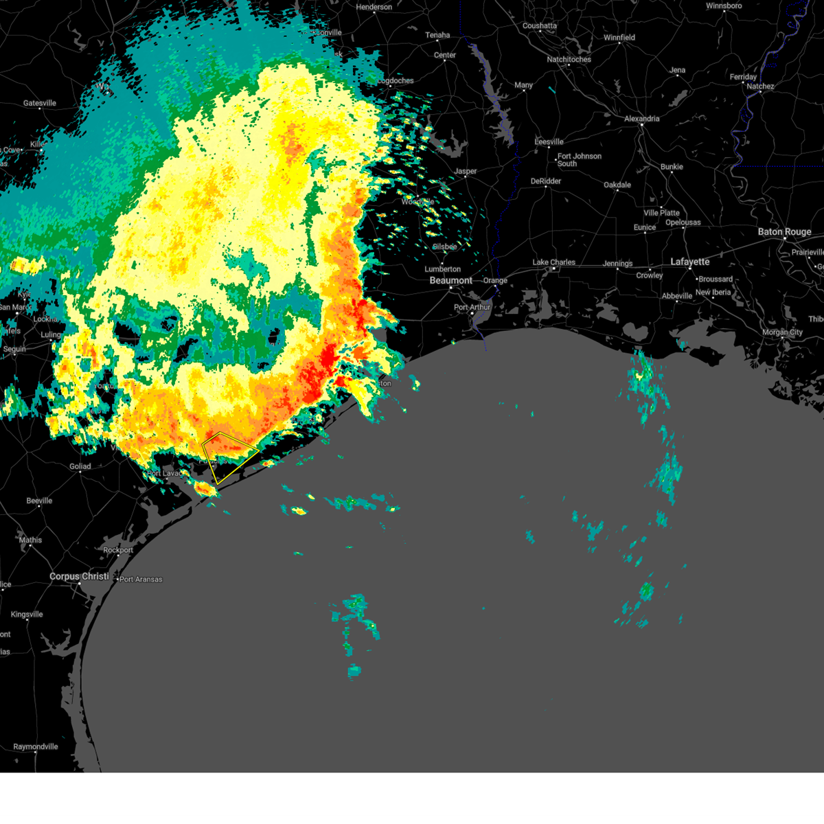
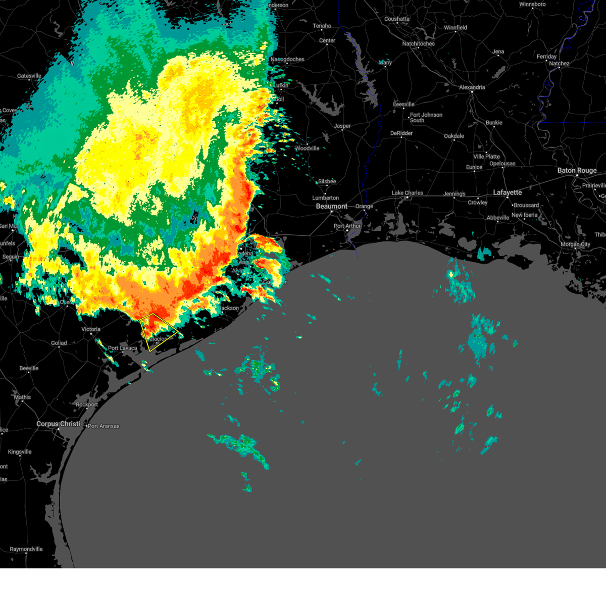
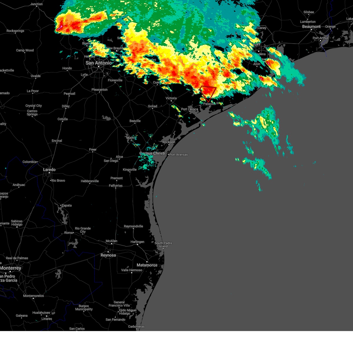
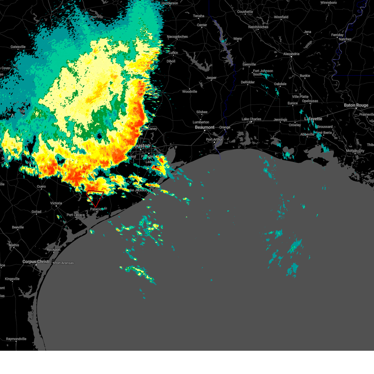
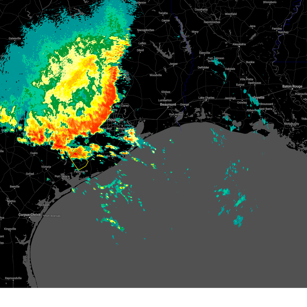
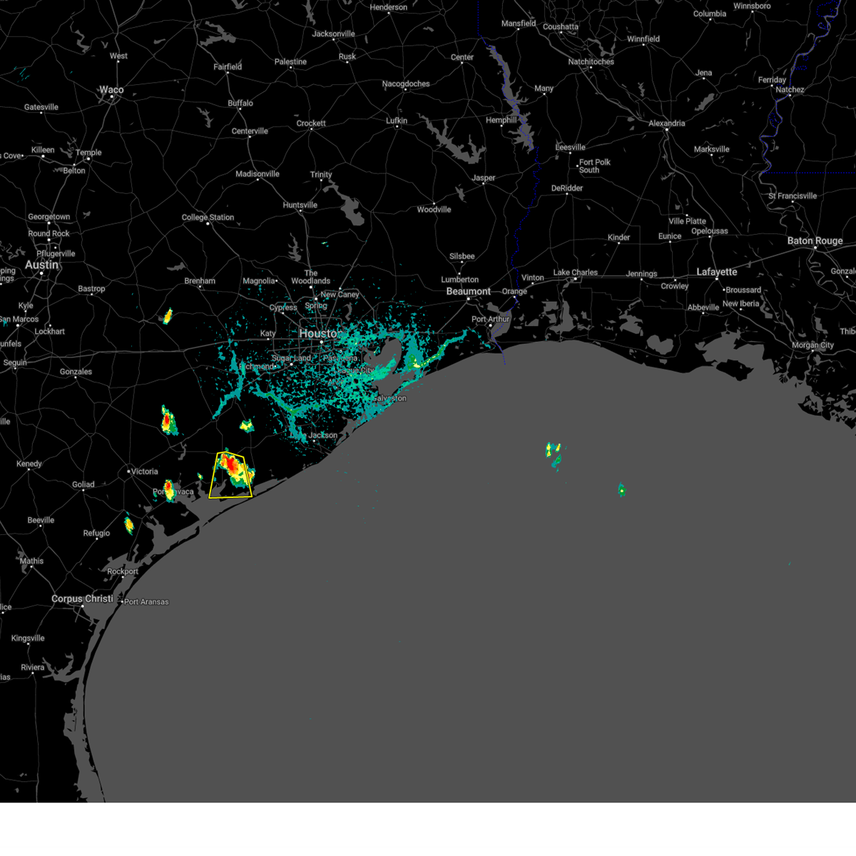
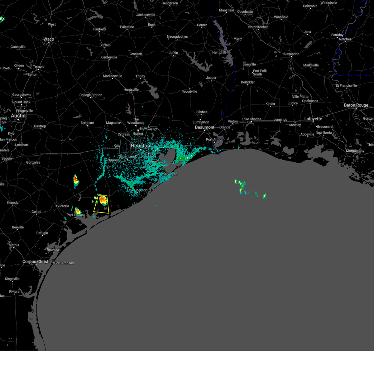
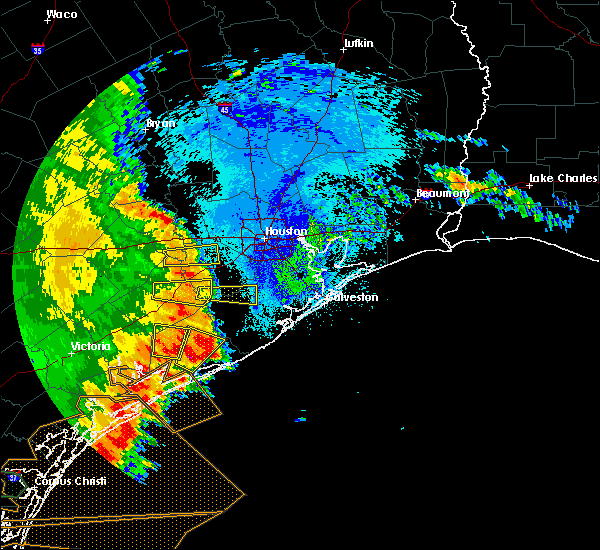
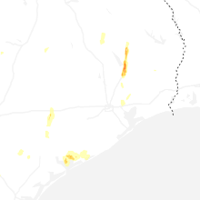
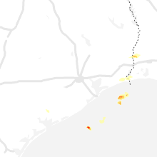
Hail Map for Blessing, TX
The Blessing, TX area has had 3 reports of on-the-ground hail by trained spotters, and has been under severe weather warnings 3 times during the past 12 months. Doppler radar has detected hail at or near Blessing, TX on 30 occasions, including 1 occasion during the past year.
| Name: | Blessing, TX |
| Where Located: | 79.2 miles SW of Houston, TX |
| Map: | Google Map for Blessing, TX |
| Population: | 927 |
| Housing Units: | 376 |
| More Info: | Search Google for Blessing, TX |
0
The Top Recent Hail Date for Blessing, TX is Wednesday, June 11, 2025 (30th out of 30)
Hail and Wind Damage Spotted near Blessing, TX
| Date / Time | Report Details |
|---|---|
| 6/12/2025 3:44 AM CDT |
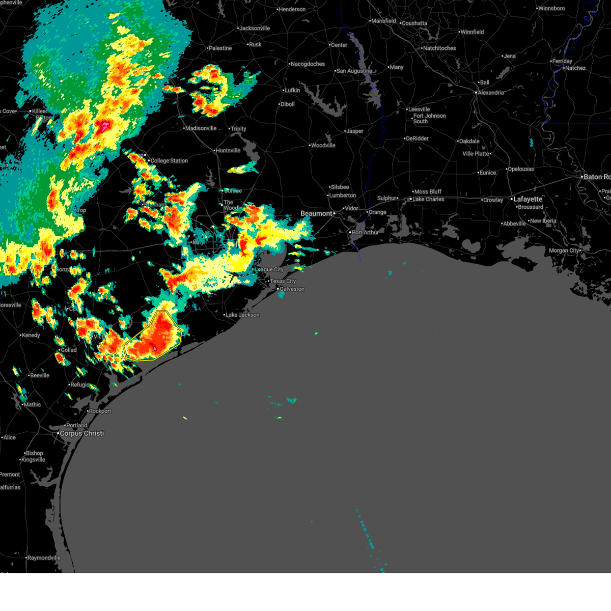 Svrhgx the national weather service in league city has issued a * severe thunderstorm warning for, south central wharton county in southeastern texas, southeastern jackson county in south central texas, northwestern matagorda county in southeastern texas, * until 445 am cdt. * at 344 am cdt, a cluster of training severe thunderstorms was located over palacios, moving northeast at 15 mph (radar indicated). Hazards include 60 mph wind gusts and quarter size hail. Hail damage to vehicles is expected. Expect wind damage to roofs, siding, and trees. Svrhgx the national weather service in league city has issued a * severe thunderstorm warning for, south central wharton county in southeastern texas, southeastern jackson county in south central texas, northwestern matagorda county in southeastern texas, * until 445 am cdt. * at 344 am cdt, a cluster of training severe thunderstorms was located over palacios, moving northeast at 15 mph (radar indicated). Hazards include 60 mph wind gusts and quarter size hail. Hail damage to vehicles is expected. Expect wind damage to roofs, siding, and trees.
|
| 6/12/2025 2:43 AM CDT |
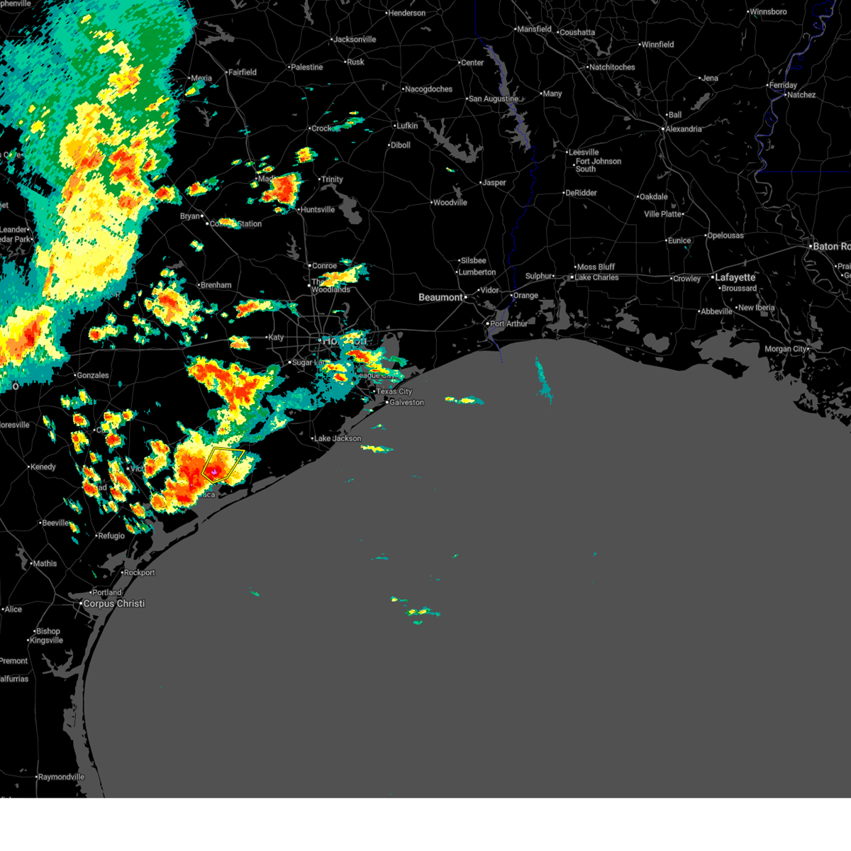 Svrhgx the national weather service in league city has issued a * severe thunderstorm warning for, eastern jackson county in south central texas, west central matagorda county in southeastern texas, * until 330 am cdt. * at 243 am cdt, a severe thunderstorm was located near blessing, or near palacios, moving north at 15 mph (radar indicated). Hazards include 60 mph wind gusts and quarter size hail. Hail damage to vehicles is expected. Expect wind damage to roofs, siding, and trees. Svrhgx the national weather service in league city has issued a * severe thunderstorm warning for, eastern jackson county in south central texas, west central matagorda county in southeastern texas, * until 330 am cdt. * at 243 am cdt, a severe thunderstorm was located near blessing, or near palacios, moving north at 15 mph (radar indicated). Hazards include 60 mph wind gusts and quarter size hail. Hail damage to vehicles is expected. Expect wind damage to roofs, siding, and trees.
|
| 6/12/2025 2:01 AM CDT |
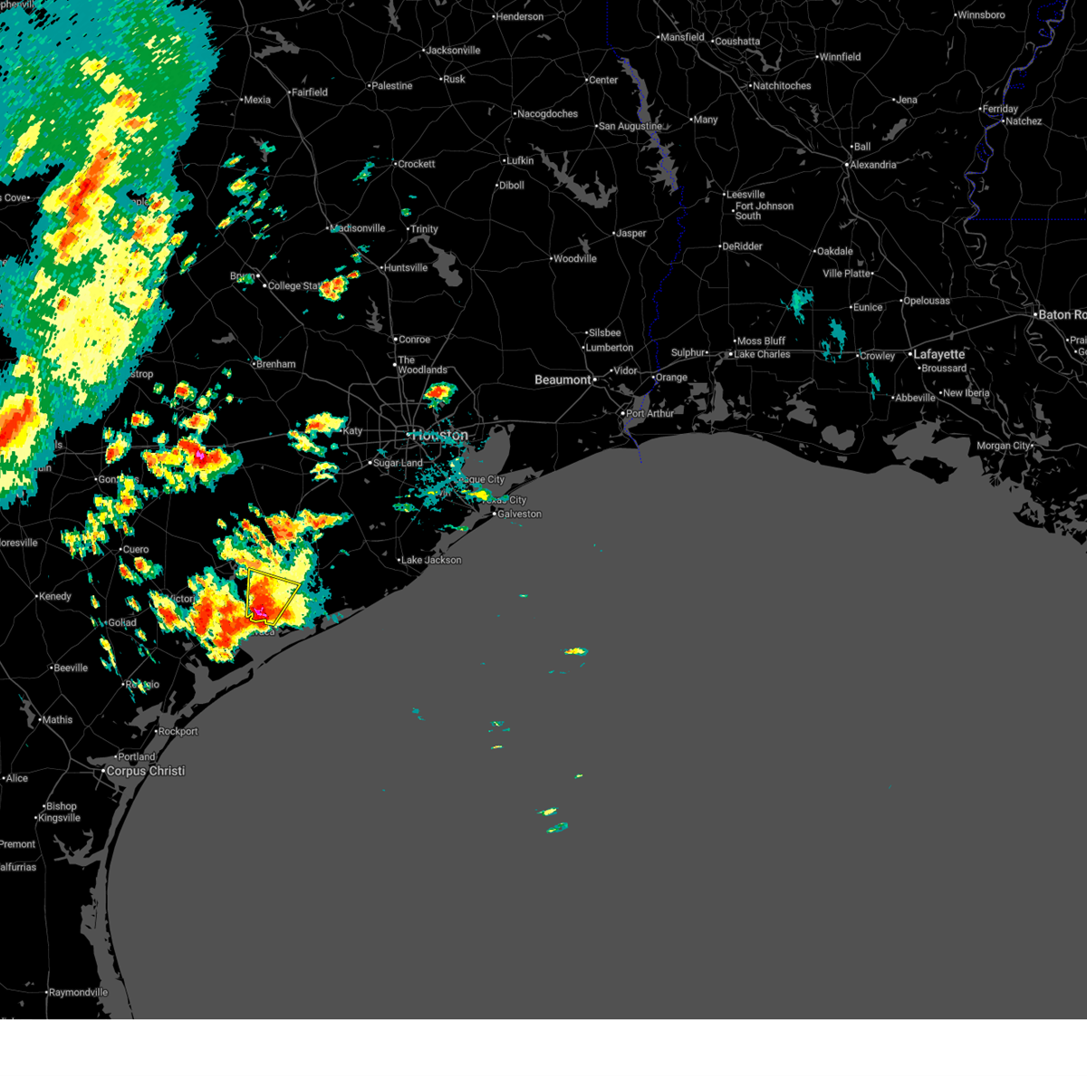 Svrhgx the national weather service in league city has issued a * severe thunderstorm warning for, southeastern jackson county in south central texas, west central matagorda county in southeastern texas, * until 245 am cdt. * at 201 am cdt, a severe thunderstorm was located near palacios, moving north at 15 mph (radar indicated). Hazards include golf ball size hail and 60 mph wind gusts. People and animals outdoors will be injured. expect hail damage to roofs, siding, windows, and vehicles. Expect wind damage to roofs, siding, and trees. Svrhgx the national weather service in league city has issued a * severe thunderstorm warning for, southeastern jackson county in south central texas, west central matagorda county in southeastern texas, * until 245 am cdt. * at 201 am cdt, a severe thunderstorm was located near palacios, moving north at 15 mph (radar indicated). Hazards include golf ball size hail and 60 mph wind gusts. People and animals outdoors will be injured. expect hail damage to roofs, siding, windows, and vehicles. Expect wind damage to roofs, siding, and trees.
|
| 5/31/2024 7:49 AM CDT |
 At 748 am cdt, a severe thunderstorm was located near south texas nuclear plant, moving southeast at 25 mph (radar indicated). Hazards include ping pong ball size hail and 60 mph wind gusts. People and animals outdoors will be injured. expect hail damage to roofs, siding, windows, and vehicles. expect wind damage to roofs, siding, and trees. Locations impacted include, palacios, south texas nuclear plant, blessing, wadsworth, and midfield. At 748 am cdt, a severe thunderstorm was located near south texas nuclear plant, moving southeast at 25 mph (radar indicated). Hazards include ping pong ball size hail and 60 mph wind gusts. People and animals outdoors will be injured. expect hail damage to roofs, siding, windows, and vehicles. expect wind damage to roofs, siding, and trees. Locations impacted include, palacios, south texas nuclear plant, blessing, wadsworth, and midfield.
|
| 5/31/2024 7:42 AM CDT |
 Svrhgx the national weather service in league city has issued a * severe thunderstorm warning for, west central matagorda county in southeastern texas, * until 815 am cdt. * at 742 am cdt, a severe thunderstorm was located near blessing, or near south texas nuclear plant, moving southeast at 25 mph (radar indicated). Hazards include 60 mph wind gusts and nickel size hail. expect damage to roofs, siding, and trees Svrhgx the national weather service in league city has issued a * severe thunderstorm warning for, west central matagorda county in southeastern texas, * until 815 am cdt. * at 742 am cdt, a severe thunderstorm was located near blessing, or near south texas nuclear plant, moving southeast at 25 mph (radar indicated). Hazards include 60 mph wind gusts and nickel size hail. expect damage to roofs, siding, and trees
|
| 5/31/2024 7:30 AM CDT | Golf Ball sized hail reported 0.9 miles ENE of Blessing, TX, corrects the reported time from 7am to 730am. multiple reports of golf ball size hail and possible hail related damage in the blessing area. the golf ball size estimate |
| 5/31/2024 7:30 AM CDT | Corrects previous tstm wnd dmg report time in blessing from 7am to 730am. local law enforcement reports many trees... branches... and power lines have fallen in the ble in matagorda county TX, 0.9 miles ENE of Blessing, TX |
| 5/31/2024 7:30 AM CDT | Time correct from 7am to 730am local law enforcement report numerous trees and powerlines down around elmaton as well as damage to a former school buildin in matagorda county TX, 4.1 miles W of Blessing, TX |
| 5/31/2024 7:17 AM CDT |
 Svrhgx the national weather service in league city has issued a * severe thunderstorm warning for, southern wharton county in southeastern texas, southeastern jackson county in south central texas, west central matagorda county in southeastern texas, * until 745 am cdt. * at 717 am cdt, a severe thunderstorm was located near blessing, or 13 miles north of palacios, moving southeast at 20 mph (radar indicated). Hazards include 60 mph wind gusts and quarter size hail. Hail damage to vehicles is expected. Expect wind damage to roofs, siding, and trees. Svrhgx the national weather service in league city has issued a * severe thunderstorm warning for, southern wharton county in southeastern texas, southeastern jackson county in south central texas, west central matagorda county in southeastern texas, * until 745 am cdt. * at 717 am cdt, a severe thunderstorm was located near blessing, or 13 miles north of palacios, moving southeast at 20 mph (radar indicated). Hazards include 60 mph wind gusts and quarter size hail. Hail damage to vehicles is expected. Expect wind damage to roofs, siding, and trees.
|
| 5/31/2024 7:15 AM CDT | Local law enforcement report numerous trees and powerlines down around elmaton as well as damage to a former school buildin in matagorda county TX, 4.1 miles W of Blessing, TX |
| 5/31/2024 7:07 AM CDT |
 the tornado warning has been cancelled and is no longer in effect the tornado warning has been cancelled and is no longer in effect
|
| 5/31/2024 7:00 AM CDT | Golf Ball sized hail reported 0.9 miles ENE of Blessing, TX, multiple reports of golf ball size hail and possible hail related damage in the blessing area. the golf ball size estimate came from pictures submitted by the public. |
| 5/31/2024 7:00 AM CDT | Local law enforcement reports many trees... branches... and power lines have fallen in the blessing are in matagorda county TX, 0.9 miles ENE of Blessing, TX |
| 5/31/2024 6:53 AM CDT |
 Torhgx the national weather service in league city has issued a * tornado warning for, south central wharton county in southeastern texas, east central jackson county in south central texas, northwestern matagorda county in southeastern texas, * until 730 am cdt. * at 653 am cdt, a severe thunderstorm capable of producing a tornado was located 9 miles east of ganado, or 12 miles southwest of el campo, moving southeast at 15 mph (radar indicated rotation). Hazards include tornado and quarter size hail. Flying debris will be dangerous to those caught without shelter. mobile homes will be damaged or destroyed. damage to roofs, windows, and vehicles will occur. tree damage is likely. This tornadic thunderstorm will remain over mainly rural areas of south central wharton, east central jackson and northwestern matagorda counties, including the following locations, midfield. Torhgx the national weather service in league city has issued a * tornado warning for, south central wharton county in southeastern texas, east central jackson county in south central texas, northwestern matagorda county in southeastern texas, * until 730 am cdt. * at 653 am cdt, a severe thunderstorm capable of producing a tornado was located 9 miles east of ganado, or 12 miles southwest of el campo, moving southeast at 15 mph (radar indicated rotation). Hazards include tornado and quarter size hail. Flying debris will be dangerous to those caught without shelter. mobile homes will be damaged or destroyed. damage to roofs, windows, and vehicles will occur. tree damage is likely. This tornadic thunderstorm will remain over mainly rural areas of south central wharton, east central jackson and northwestern matagorda counties, including the following locations, midfield.
|
| 5/31/2024 6:46 AM CDT |
 Svrhgx the national weather service in league city has issued a * severe thunderstorm warning for, south central wharton county in southeastern texas, east central jackson county in south central texas, northwestern matagorda county in southeastern texas, * until 715 am cdt. * at 645 am cdt, a severe thunderstorm was located 11 miles south of el campo, moving southeast at 15 mph (radar indicated). Hazards include 60 mph wind gusts and nickel size hail. expect damage to roofs, siding, and trees Svrhgx the national weather service in league city has issued a * severe thunderstorm warning for, south central wharton county in southeastern texas, east central jackson county in south central texas, northwestern matagorda county in southeastern texas, * until 715 am cdt. * at 645 am cdt, a severe thunderstorm was located 11 miles south of el campo, moving southeast at 15 mph (radar indicated). Hazards include 60 mph wind gusts and nickel size hail. expect damage to roofs, siding, and trees
|
| 10/5/2023 9:37 AM CDT |
 At 936 am cdt, severe thunderstorms were located along a line extending from near jamaica beach to 11 miles southeast of sargent to schicke point, moving southeast at 35 mph. palacios reported a wind gust of 75 mph at 929 am cdt (radar indicated). Hazards include 70 mph wind gusts. Expect considerable tree damage. Damage is likely to mobile homes, roofs, and outbuildings. At 936 am cdt, severe thunderstorms were located along a line extending from near jamaica beach to 11 miles southeast of sargent to schicke point, moving southeast at 35 mph. palacios reported a wind gust of 75 mph at 929 am cdt (radar indicated). Hazards include 70 mph wind gusts. Expect considerable tree damage. Damage is likely to mobile homes, roofs, and outbuildings.
|
| 10/5/2023 8:39 AM CDT |
 At 839 am cdt, severe thunderstorms were located along a line extending from near wharton to 8 miles south of el campo to near lolita, moving southeast at 40 mph (radar indicated). Hazards include 60 mph wind gusts. Expect damage to roofs, siding, and trees. locations impacted include, el campo, edna, ganado, la ward, pierce, lolita, blessing, markham, cordele, vanderbilt, louise, midfield, lake texana dam, and danevang. hail threat, radar indicated max hail size, <. 75 in wind threat, observed max wind gust, 60 mph. At 839 am cdt, severe thunderstorms were located along a line extending from near wharton to 8 miles south of el campo to near lolita, moving southeast at 40 mph (radar indicated). Hazards include 60 mph wind gusts. Expect damage to roofs, siding, and trees. locations impacted include, el campo, edna, ganado, la ward, pierce, lolita, blessing, markham, cordele, vanderbilt, louise, midfield, lake texana dam, and danevang. hail threat, radar indicated max hail size, <. 75 in wind threat, observed max wind gust, 60 mph.
|
| 10/5/2023 8:21 AM CDT |
 At 820 am cdt, severe thunderstorms were located along a line extending from near pierce to near ganado to near inez, moving east at 40 mph. at 812 am cdt, victoria reported a 61 mph gust with this line of storms (radar indicated). Hazards include 60 mph wind gusts. expect damage to roofs, siding, and trees At 820 am cdt, severe thunderstorms were located along a line extending from near pierce to near ganado to near inez, moving east at 40 mph. at 812 am cdt, victoria reported a 61 mph gust with this line of storms (radar indicated). Hazards include 60 mph wind gusts. expect damage to roofs, siding, and trees
|
| 9/9/2023 4:58 PM CDT |
 At 457 pm cdt, a severe thunderstorm was located near blessing, or near south texas nuclear plant, moving south at 20 mph (radar indicated). Hazards include 60 mph wind gusts and quarter size hail. Hail damage to vehicles is expected. Expect wind damage to roofs, siding, and trees. At 457 pm cdt, a severe thunderstorm was located near blessing, or near south texas nuclear plant, moving south at 20 mph (radar indicated). Hazards include 60 mph wind gusts and quarter size hail. Hail damage to vehicles is expected. Expect wind damage to roofs, siding, and trees.
|
| 9/9/2023 4:44 PM CDT |
 At 444 pm cdt, a severe thunderstorm was located near south texas nuclear plant, moving south at 20 mph (radar indicated). Hazards include 60 mph wind gusts and quarter size hail. Hail damage to vehicles is expected. expect wind damage to roofs, siding, and trees. locations impacted include, palacios, south texas nuclear plant, blessing and markham. hail threat, radar indicated max hail size, 1. 00 in wind threat, radar indicated max wind gust, 60 mph. At 444 pm cdt, a severe thunderstorm was located near south texas nuclear plant, moving south at 20 mph (radar indicated). Hazards include 60 mph wind gusts and quarter size hail. Hail damage to vehicles is expected. expect wind damage to roofs, siding, and trees. locations impacted include, palacios, south texas nuclear plant, blessing and markham. hail threat, radar indicated max hail size, 1. 00 in wind threat, radar indicated max wind gust, 60 mph.
|
| 9/9/2023 4:23 PM CDT |
 At 423 pm cdt, a severe thunderstorm was located near markham, or 8 miles northwest of south texas nuclear plant, moving south at 20 mph (radar indicated). Hazards include 60 mph wind gusts and quarter size hail. Hail damage to vehicles is expected. Expect wind damage to roofs, siding, and trees. At 423 pm cdt, a severe thunderstorm was located near markham, or 8 miles northwest of south texas nuclear plant, moving south at 20 mph (radar indicated). Hazards include 60 mph wind gusts and quarter size hail. Hail damage to vehicles is expected. Expect wind damage to roofs, siding, and trees.
|
| 4/21/2023 3:27 AM CDT |
 At 326 am cdt, severe thunderstorms were located along a line extending from near kendleton to near wharton to 6 miles south of pierce to 9 miles east of ganado, moving east at 45 mph (radar indicated). Hazards include 60 mph wind gusts and penny size hail. expect damage to roofs, siding, and trees At 326 am cdt, severe thunderstorms were located along a line extending from near kendleton to near wharton to 6 miles south of pierce to 9 miles east of ganado, moving east at 45 mph (radar indicated). Hazards include 60 mph wind gusts and penny size hail. expect damage to roofs, siding, and trees
|
| 5/25/2022 2:02 AM CDT |
 At 201 am cdt, severe thunderstorms were located along a line extending from near speaks to near olivia to 21 miles southwest of matagorda island state park, moving east at 30 mph (radar indicated). Hazards include 60 mph wind gusts. expect damage to roofs, siding, and trees At 201 am cdt, severe thunderstorms were located along a line extending from near speaks to near olivia to 21 miles southwest of matagorda island state park, moving east at 30 mph (radar indicated). Hazards include 60 mph wind gusts. expect damage to roofs, siding, and trees
|
| 5/19/2021 3:25 AM CDT |
 At 325 am cdt, severe thunderstorms located near ganado, or near edna, moving east at 50-60 mph (radar indicated). Hazards include 60 mph wind gusts and penny size hail. expect damage to roofs, siding, and trees At 325 am cdt, severe thunderstorms located near ganado, or near edna, moving east at 50-60 mph (radar indicated). Hazards include 60 mph wind gusts and penny size hail. expect damage to roofs, siding, and trees
|
| 5/16/2020 2:44 AM CDT |
 At 244 am cdt, a severe thunderstorm was located over blessing, or 10 miles northwest of south texas nuclear plant, moving north at 25 mph (radar indicated). Hazards include 60 mph wind gusts and quarter size hail. Hail damage to vehicles is expected. Expect wind damage to roofs, siding, and trees. At 244 am cdt, a severe thunderstorm was located over blessing, or 10 miles northwest of south texas nuclear plant, moving north at 25 mph (radar indicated). Hazards include 60 mph wind gusts and quarter size hail. Hail damage to vehicles is expected. Expect wind damage to roofs, siding, and trees.
|
| 6/6/2019 7:16 PM CDT |
 At 714 pm cdt, a cluster of severe thunderstorms was located from wharton down towards ganado, moving east 30 mph (radar indicated). Hazards include 60 mph wind gusts and quarter size hail. Hail damage to vehicles is expected. expect wind damage to roofs, siding, and trees. Locations impacted include, el campo, wharton, ganado, pierce, markham, boling-iago, blessing, cordele, louise, midfield and danevang. At 714 pm cdt, a cluster of severe thunderstorms was located from wharton down towards ganado, moving east 30 mph (radar indicated). Hazards include 60 mph wind gusts and quarter size hail. Hail damage to vehicles is expected. expect wind damage to roofs, siding, and trees. Locations impacted include, el campo, wharton, ganado, pierce, markham, boling-iago, blessing, cordele, louise, midfield and danevang.
|
| 6/6/2019 6:46 PM CDT |
 At 643 pm cdt, a cluster of severe thunderstorms were located from nada down towards cordele, moving east at 35 mph (radar indicated). Hazards include 60 mph wind gusts and quarter size hail. Hail damage to vehicles is expected. Expect wind damage to roofs, siding, and trees. At 643 pm cdt, a cluster of severe thunderstorms were located from nada down towards cordele, moving east at 35 mph (radar indicated). Hazards include 60 mph wind gusts and quarter size hail. Hail damage to vehicles is expected. Expect wind damage to roofs, siding, and trees.
|
| 5/9/2019 11:46 PM CDT |
 At 1146 pm cdt, severe thunderstorms were located along a line extending from near salem to inez to near port lavaca to near seadrift, moving east at 40 mph (radar indicated). Hazards include 60 mph wind gusts. expect damage to roofs, siding, and trees At 1146 pm cdt, severe thunderstorms were located along a line extending from near salem to inez to near port lavaca to near seadrift, moving east at 40 mph (radar indicated). Hazards include 60 mph wind gusts. expect damage to roofs, siding, and trees
|
| 4/7/2019 11:05 AM CDT |
 At 1104 am cdt, a severe thunderstorm was located over markham, or near bay city, moving northeast at 35 mph. this line of thunderstorms produced wind damage earlier this morning near ganado (radar indicated). Hazards include 60 mph wind gusts. expect damage to roofs, siding, and trees At 1104 am cdt, a severe thunderstorm was located over markham, or near bay city, moving northeast at 35 mph. this line of thunderstorms produced wind damage earlier this morning near ganado (radar indicated). Hazards include 60 mph wind gusts. expect damage to roofs, siding, and trees
|
| 3/29/2018 1:52 AM CDT |
 At 151 am cdt, severe thunderstorms were located along a line extending from near boling-iago to near point comfort, moving east at 45 mph (radar indicated). Hazards include 60 mph wind gusts and quarter size hail. Hail damage to vehicles is expected. Expect wind damage to roofs, siding, and trees. At 151 am cdt, severe thunderstorms were located along a line extending from near boling-iago to near point comfort, moving east at 45 mph (radar indicated). Hazards include 60 mph wind gusts and quarter size hail. Hail damage to vehicles is expected. Expect wind damage to roofs, siding, and trees.
|
| 4/2/2017 5:37 PM CDT |
 At 537 pm cdt, a severe thunderstorm was located 8 miles northeast of la ward, or 14 miles east of edna, moving northeast at 35 mph (radar indicated). Hazards include 60 mph wind gusts and quarter size hail. Hail damage to vehicles is expected. Expect wind damage to roofs, siding, and trees. At 537 pm cdt, a severe thunderstorm was located 8 miles northeast of la ward, or 14 miles east of edna, moving northeast at 35 mph (radar indicated). Hazards include 60 mph wind gusts and quarter size hail. Hail damage to vehicles is expected. Expect wind damage to roofs, siding, and trees.
|
| 2/14/2017 7:25 AM CST |
 At 724 am cst, severe thunderstorms were located along a line extending from near wallis to near lolita, moving east at 30 mph (radar indicated). Hazards include 60 mph wind gusts. expect damage to roofs, siding, and trees At 724 am cst, severe thunderstorms were located along a line extending from near wallis to near lolita, moving east at 30 mph (radar indicated). Hazards include 60 mph wind gusts. expect damage to roofs, siding, and trees
|
| 5/27/2016 7:28 PM CDT |
 At 728 pm cdt, a severe thunderstorm was located 8 miles northwest of palacios, moving northeast at 35 mph (radar indicated). Hazards include quarter size hail. damage to vehicles is possible At 728 pm cdt, a severe thunderstorm was located 8 miles northwest of palacios, moving northeast at 35 mph (radar indicated). Hazards include quarter size hail. damage to vehicles is possible
|
| 8/11/2015 7:50 PM CDT |
 At 749 pm cdt, doppler radar indicated a line of severe thunderstorms from wharton to just south of nada, and moving southwest at 25 mph. At 749 pm cdt, doppler radar indicated a line of severe thunderstorms from wharton to just south of nada, and moving southwest at 25 mph.
|
| 5/24/2015 4:20 AM CDT | At 419 am cdt, doppler radar indicated a line of severe thunderstorms capable of producing damaging winds in excess of 60 mph. these storms were located along a line extending from near weimar to 7 miles west of eagle lake to 13 miles northwest of wharton to 8 miles southwest of el campo to 17 miles east of port oconnor, and moving east northeast at 40 mph. |
| 5/24/2015 3:39 AM CDT | At 338 am cdt, doppler radar indicated a line of severe thunderstorms capable of producing damaging winds in excess of 60 mph. these storms were located along a line extending from near speaks to 6 miles north of la ward to near alamo beach, and moving northeast at 45 mph. |
| 4/25/2015 7:39 AM CDT | At 739 am cdt, doppler radar indicated a severe thunderstorm capable of producing quarter size hail. this storm was located over la ward, or 13 miles southeast of edna, and moving northeast at 50 mph. |
| 4/17/2015 6:21 PM CDT | At 620 pm cdt, doppler radar indicated a line of severe thunderstorms capable of producing damaging winds in excess of 60 mph. these storms were located along a line extending from near columbus to near el campo to lolita, and moving northeast at 45 mph. this storm has a history of producing wind damage in jackson county earlier this evening. |
| 4/16/2015 6:06 PM CDT | A tornado warning remains in effect until 615 pm cdt for matagorda county. at 604 pm cdt. doppler radar indicated a severe thunderstorm capable of producing a tornado. this dangerous storm was located 4 miles east of blessing. or 7 miles northwest of south texas nuclear plant. moving east at 25 mph. Large hail is also likely. |
| 4/16/2015 5:51 PM CDT | A tornado warning remains in effect until 615 pm cdt for matagorda county. at 549 pm cdt. doppler radar indicated a severe thunderstorm capable of producing a tornado. this dangerous storm was located over blessing. or 8 miles north of palacios. moving east at 20 mph. Large hail is also likely with this storm. |
| 4/16/2015 5:35 PM CDT | The national weather service in league city has issued a * tornado warning for. jackson county in south central texas. matagorda county in southeastern texas. until 615 pm cdt * at 534 pm cdt. Doppler radar indicated a severe thunderstorm. |
| 4/16/2015 5:04 PM CDT | At 503 pm cdt, doppler radar indicated a severe thunderstorm capable of producing quarter size hail and damaging winds in excess of 60 mph. this storm was located near port alto, or 11 miles northeast of port lavaca, and moving northeast at 20 mph. |
| 1/1/0001 12:00 AM | Golf Ball sized hail reported 0.9 miles ENE of Blessing, TX |
Hail Maps for Blessing, TX


Connect with Interactive Hail Maps