

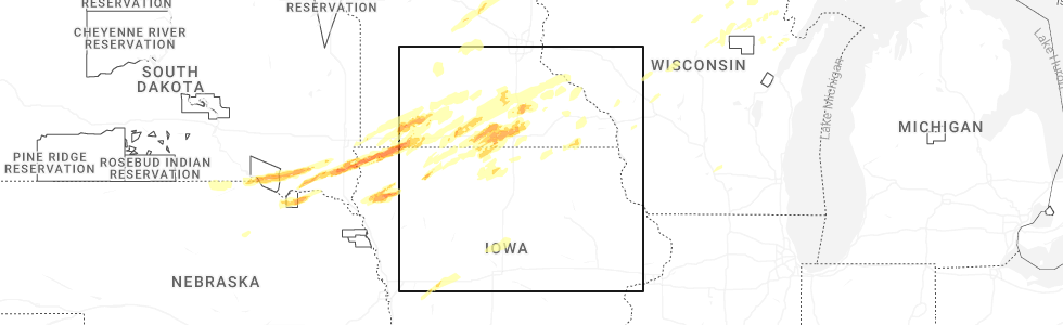
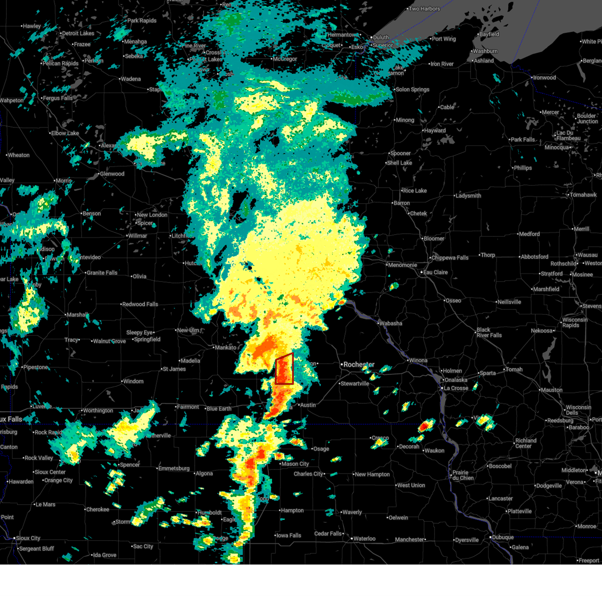
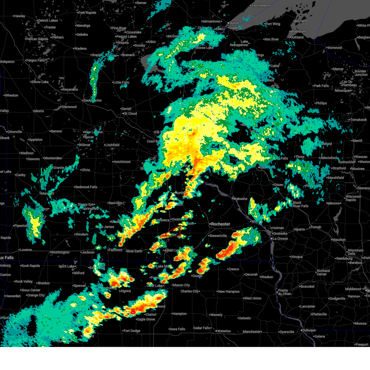
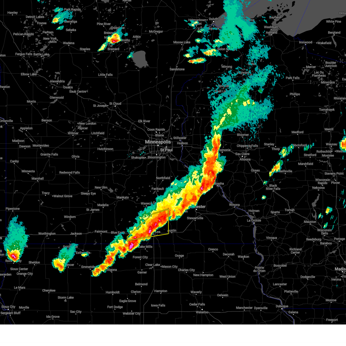
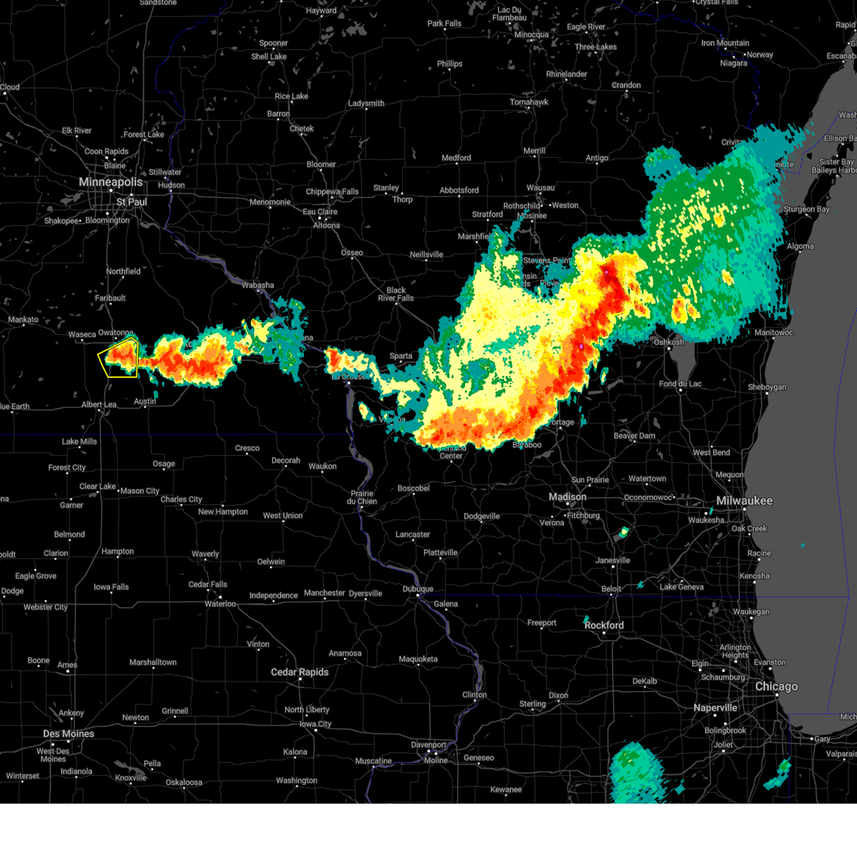
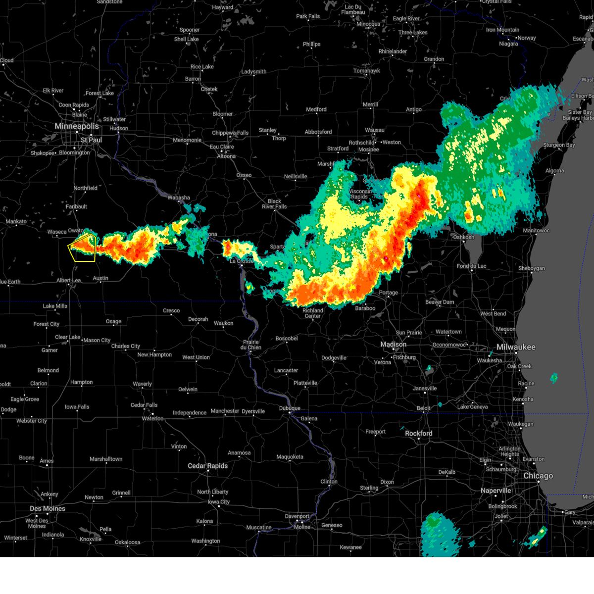
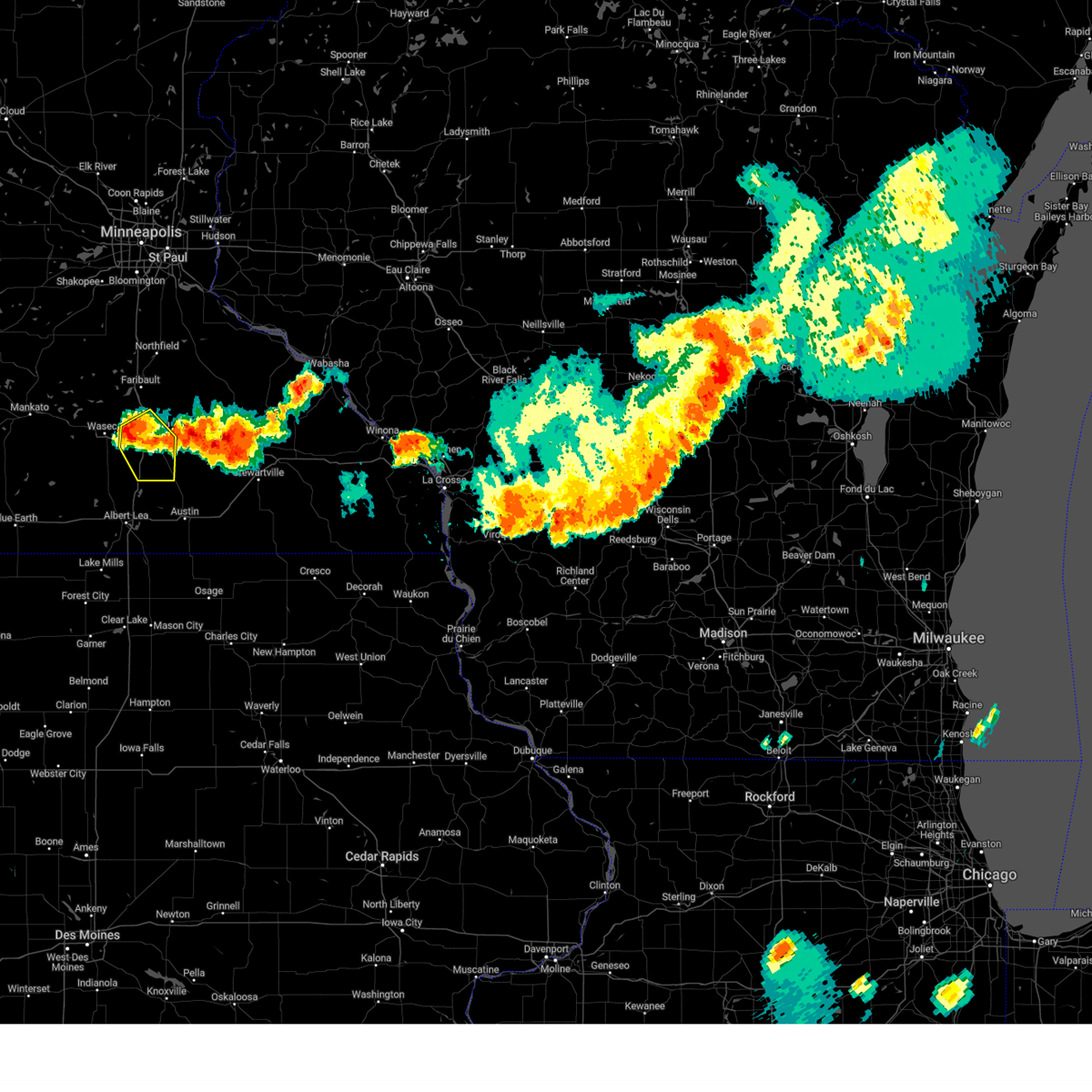
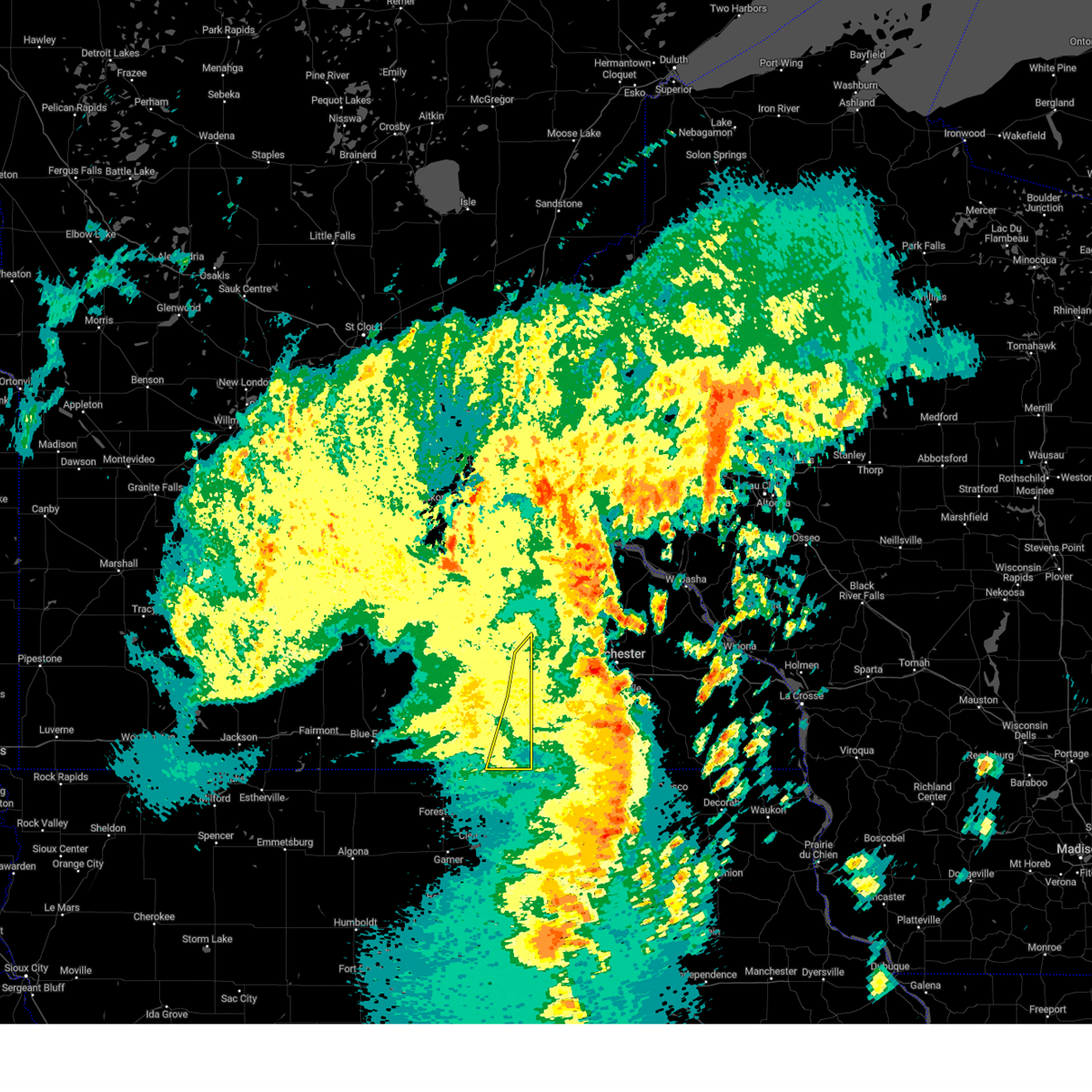
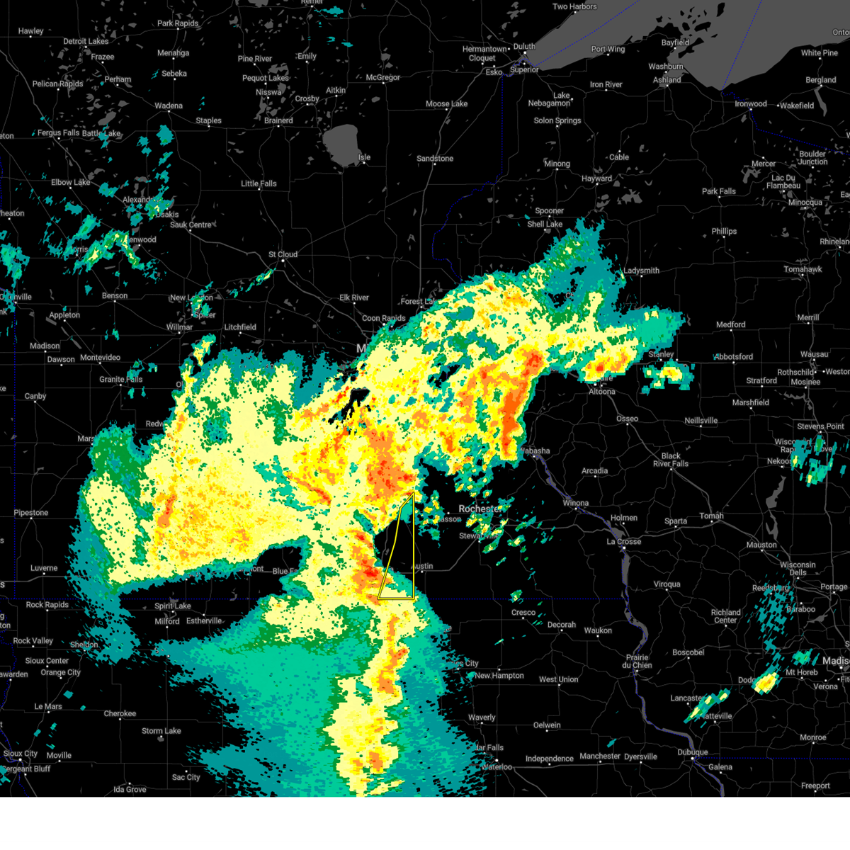
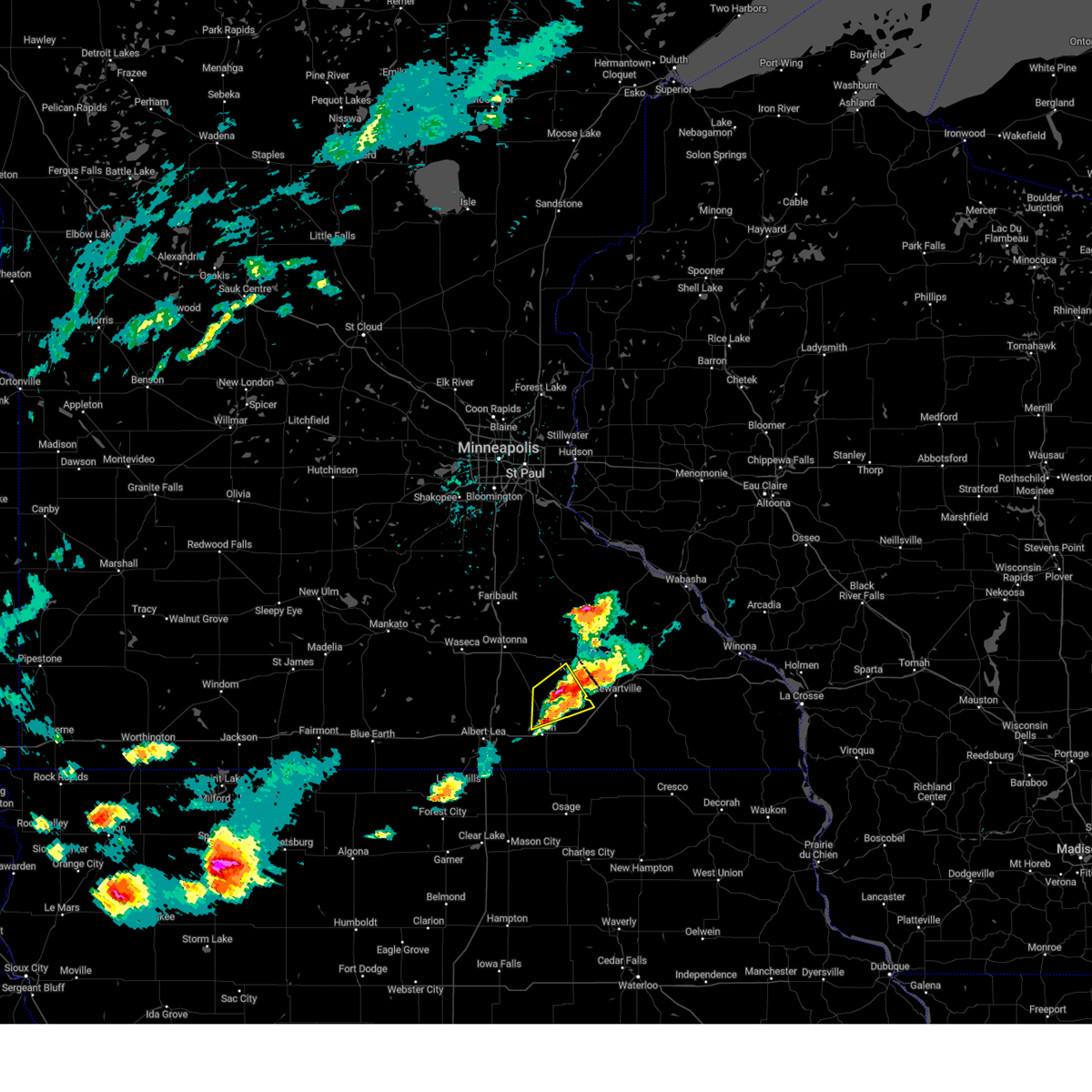
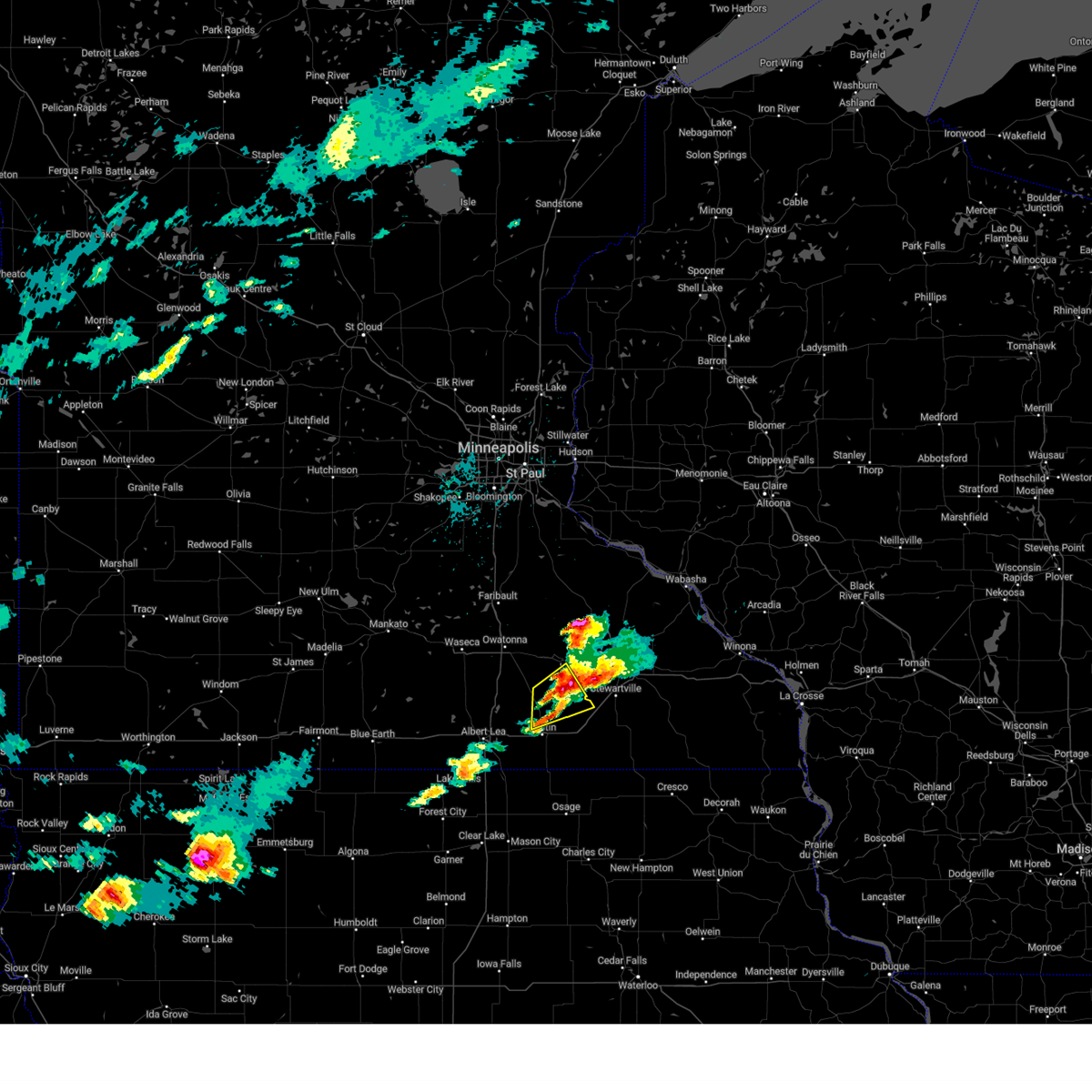
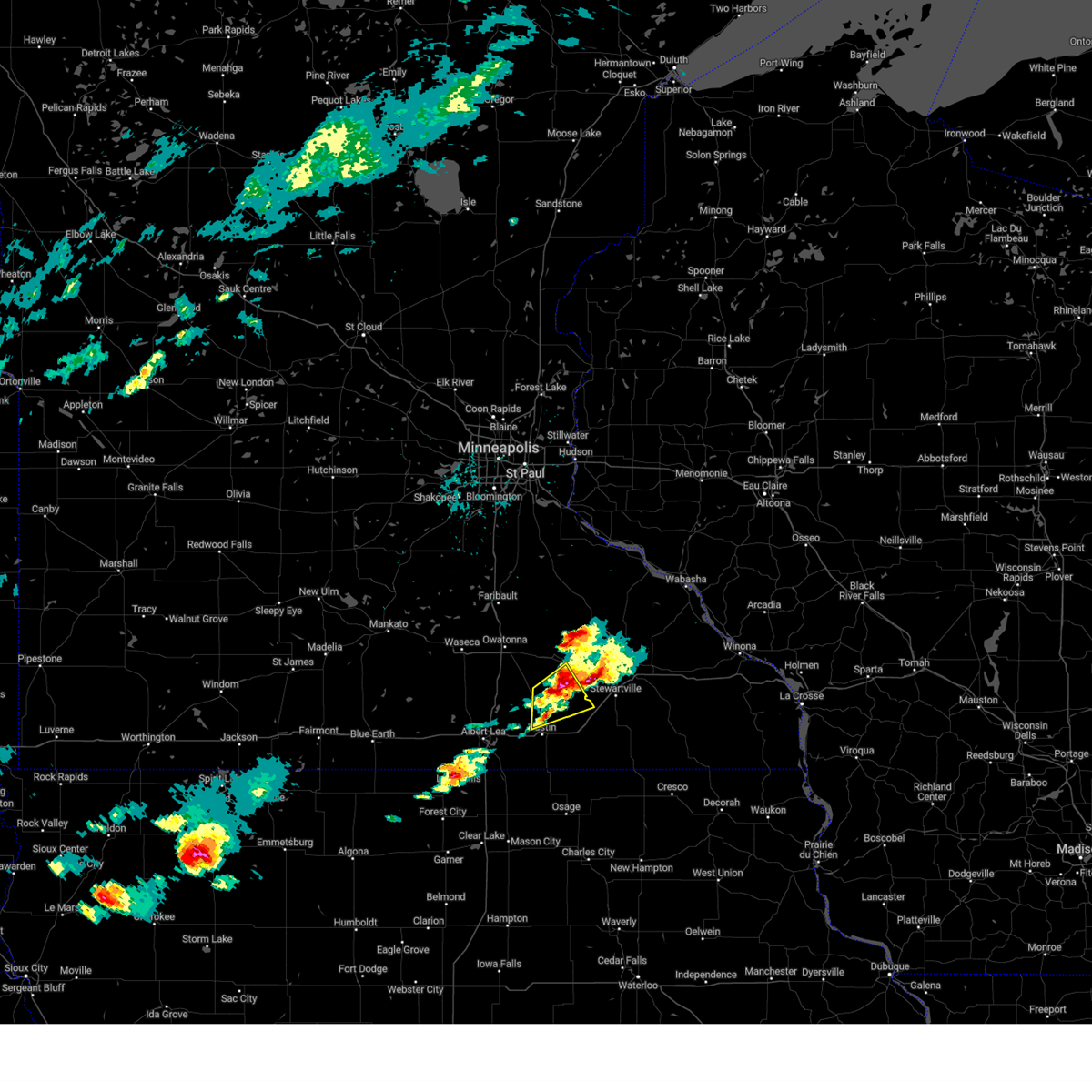
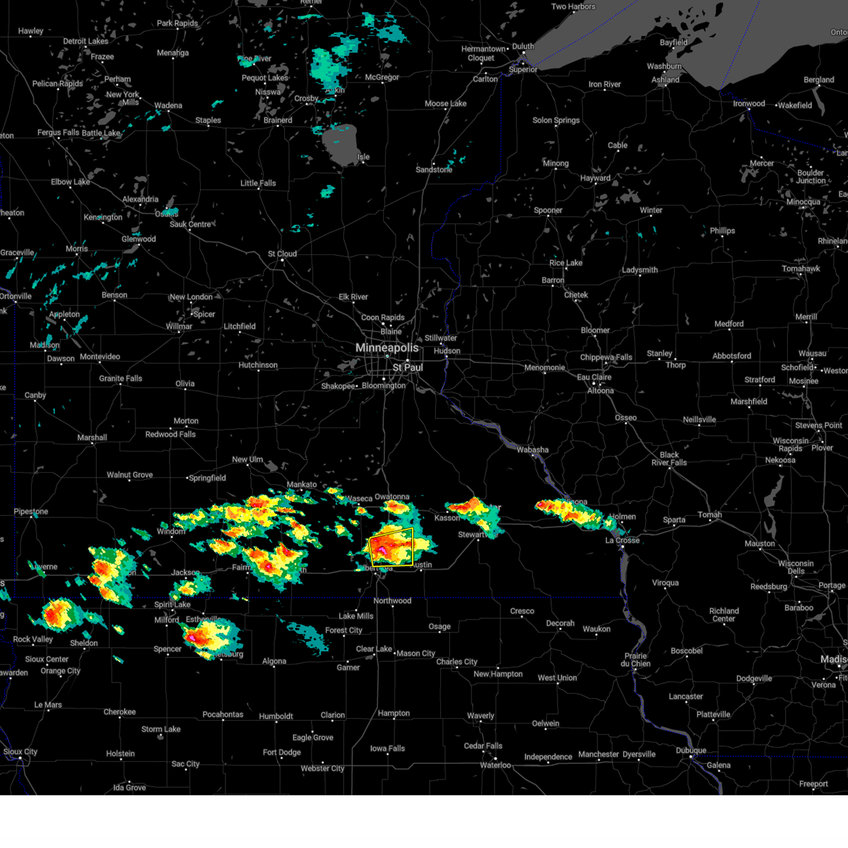
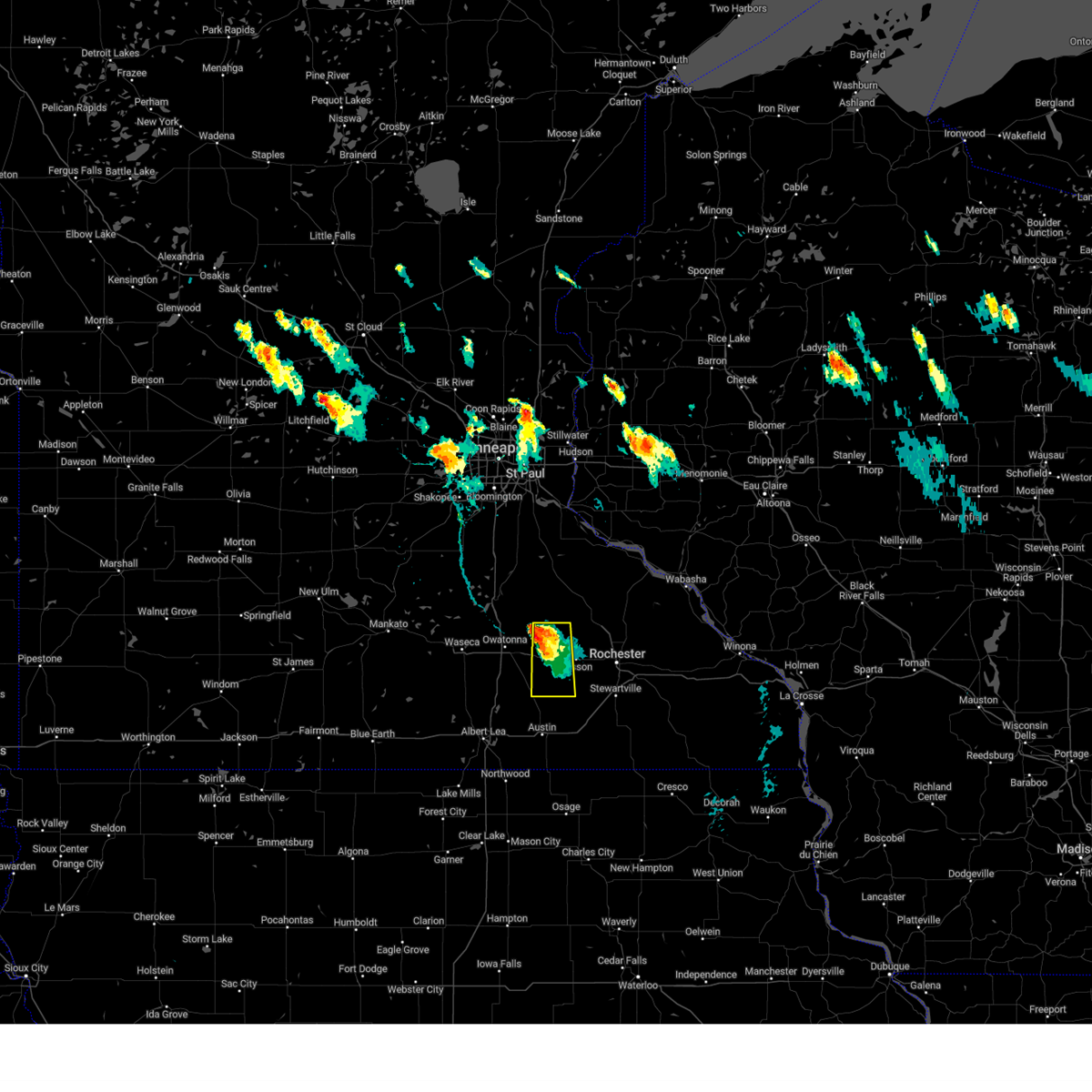
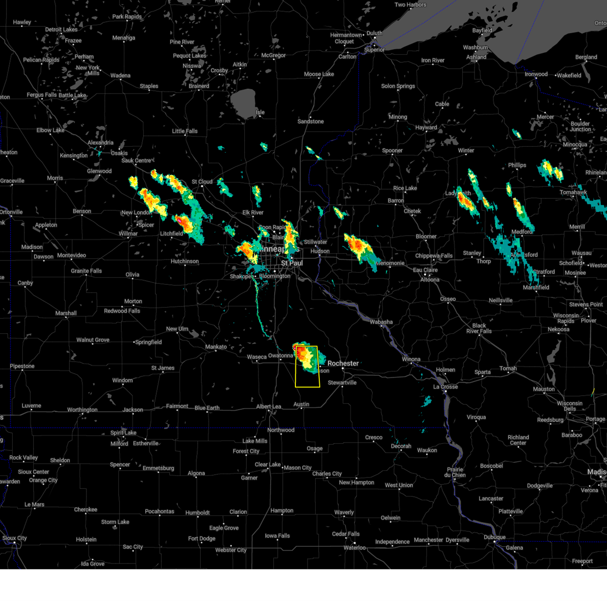
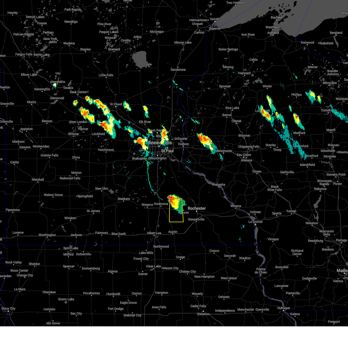
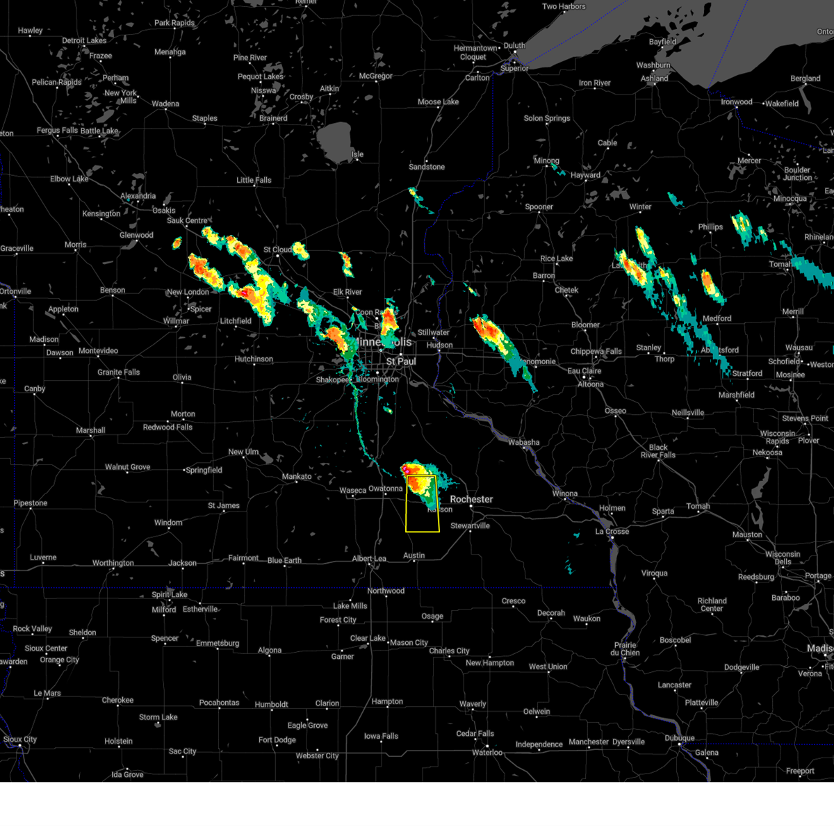
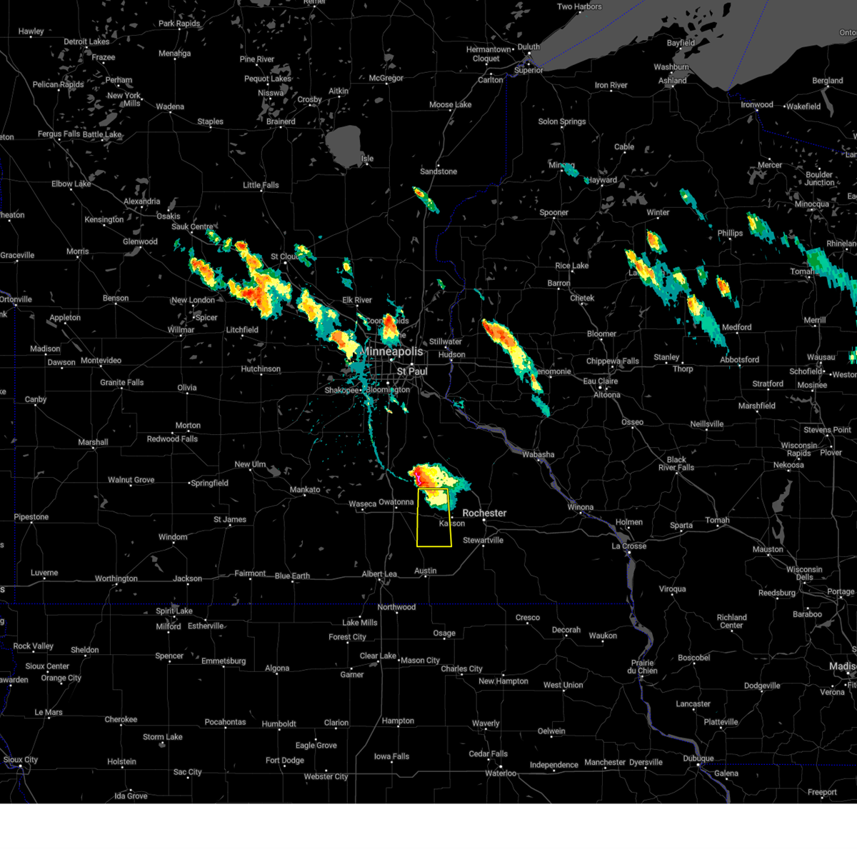
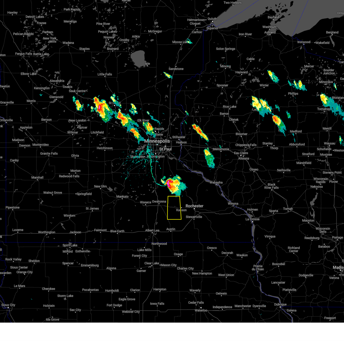
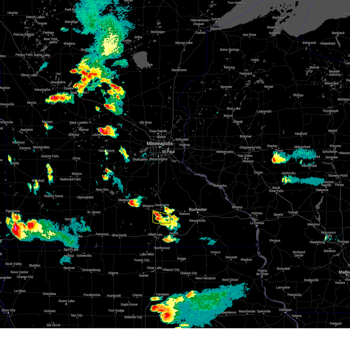
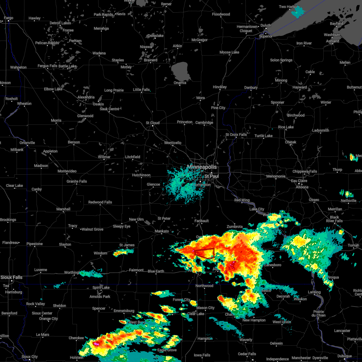
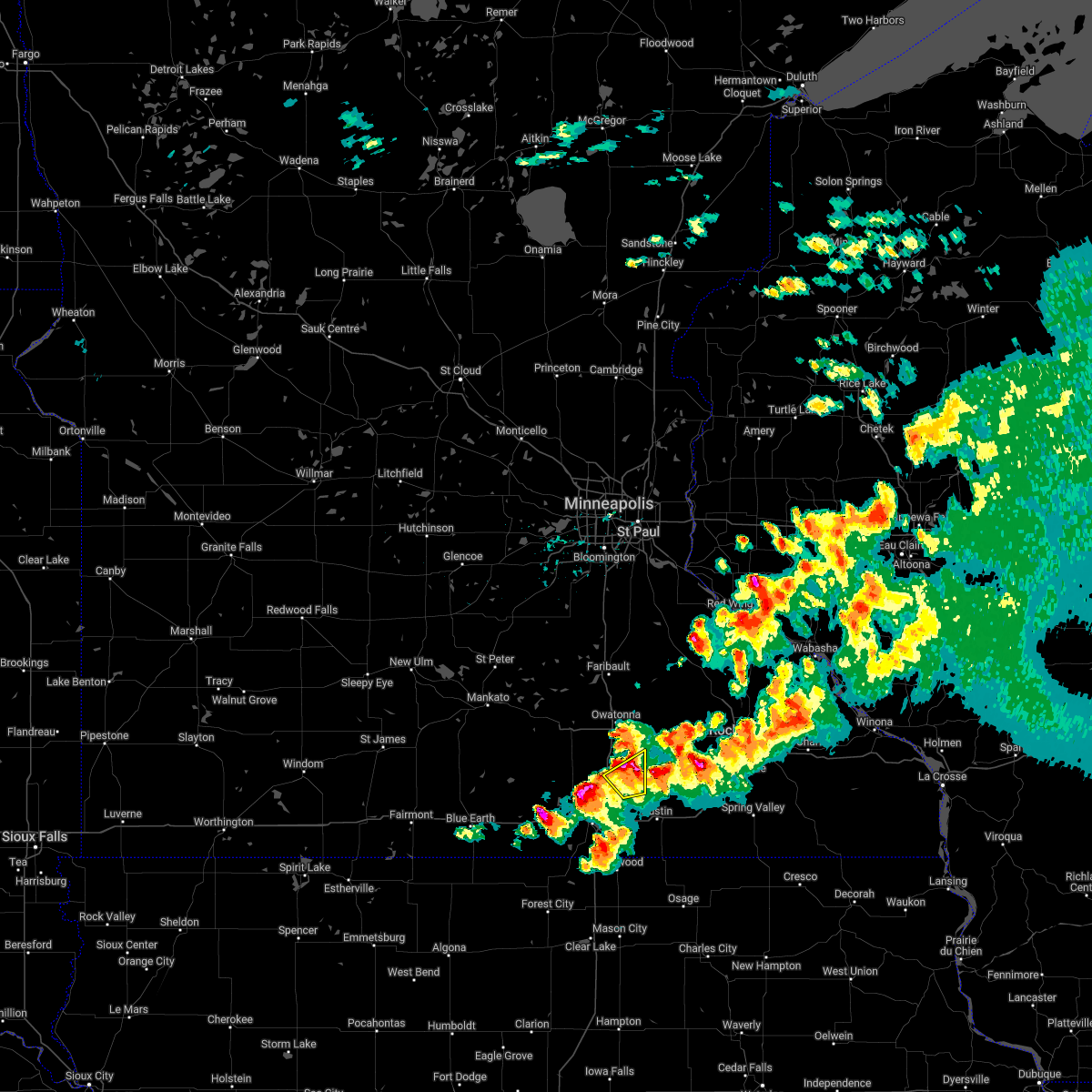
Hail Map for Blooming Prairie, MN
The Blooming Prairie, MN area has had 2 reports of on-the-ground hail by trained spotters, and has been under severe weather warnings 25 times during the past 12 months. Doppler radar has detected hail at or near Blooming Prairie, MN on 54 occasions, including 3 occasions during the past year.
| Name: | Blooming Prairie, MN |
| Where Located: | 50.3 miles N of Mason City, IA |
| Map: | Google Map for Blooming Prairie, MN |
| Population: | 1996 |
| Housing Units: | 864 |
| More Info: | Search Google for Blooming Prairie, MN |
2
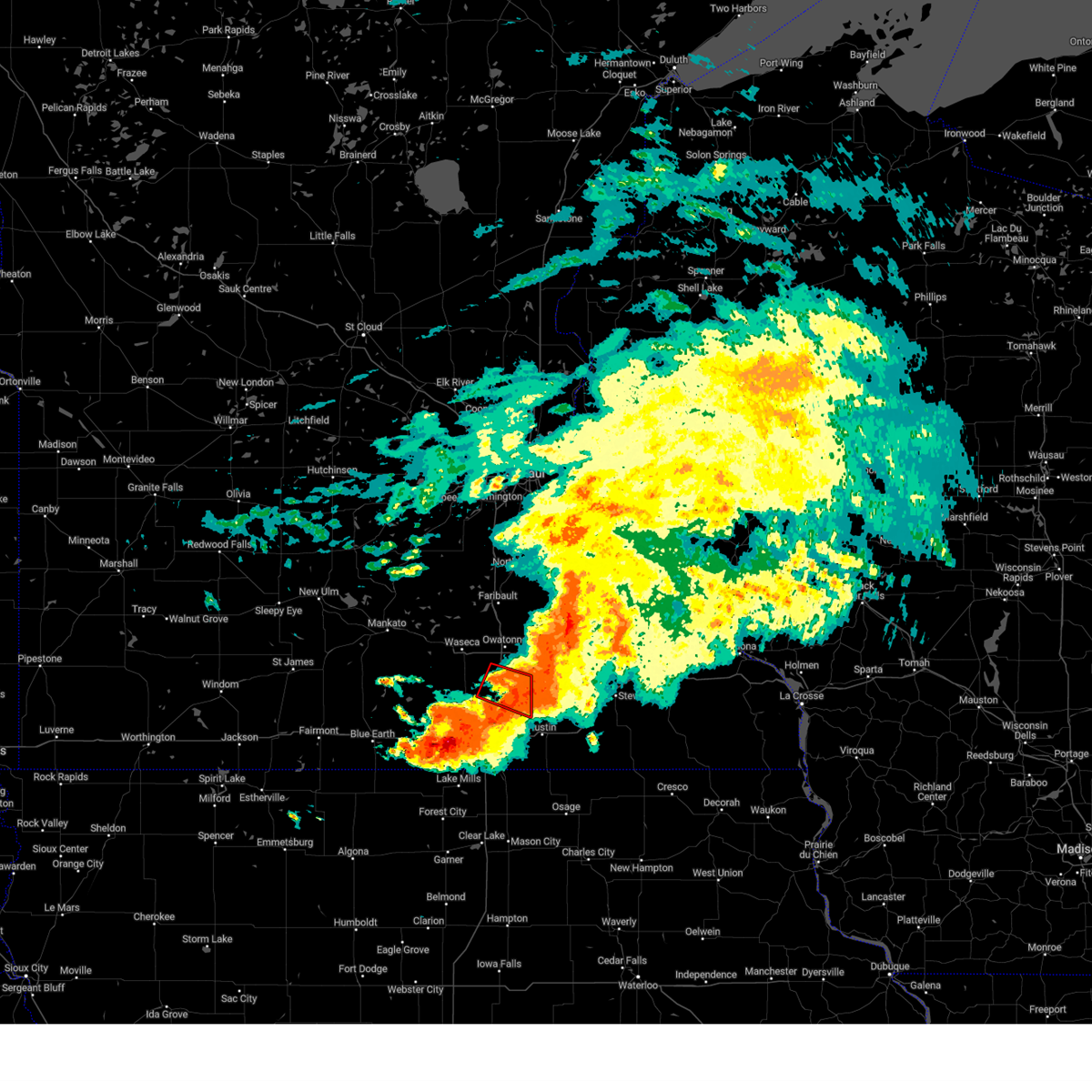
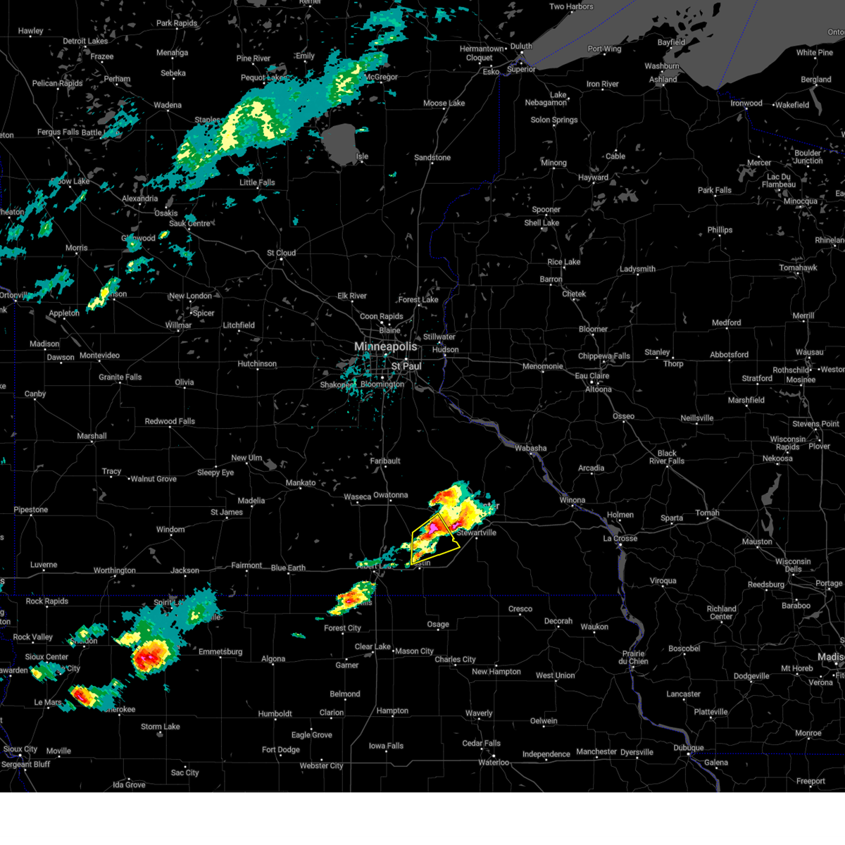
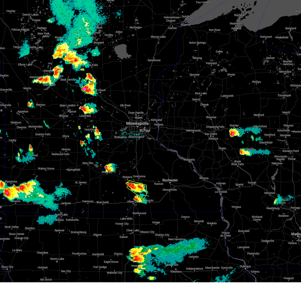
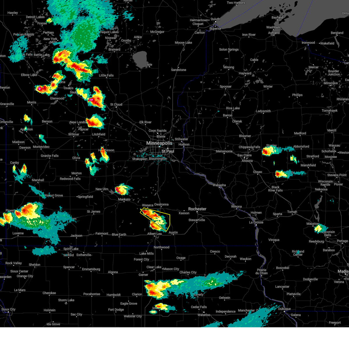
The Top Recent Hail Date for Blooming Prairie, MN is Monday, April 28, 2025 (7th out of 54)
Hail and Wind Damage Spotted near Blooming Prairie, MN
| Date / Time | Report Details |
|---|---|
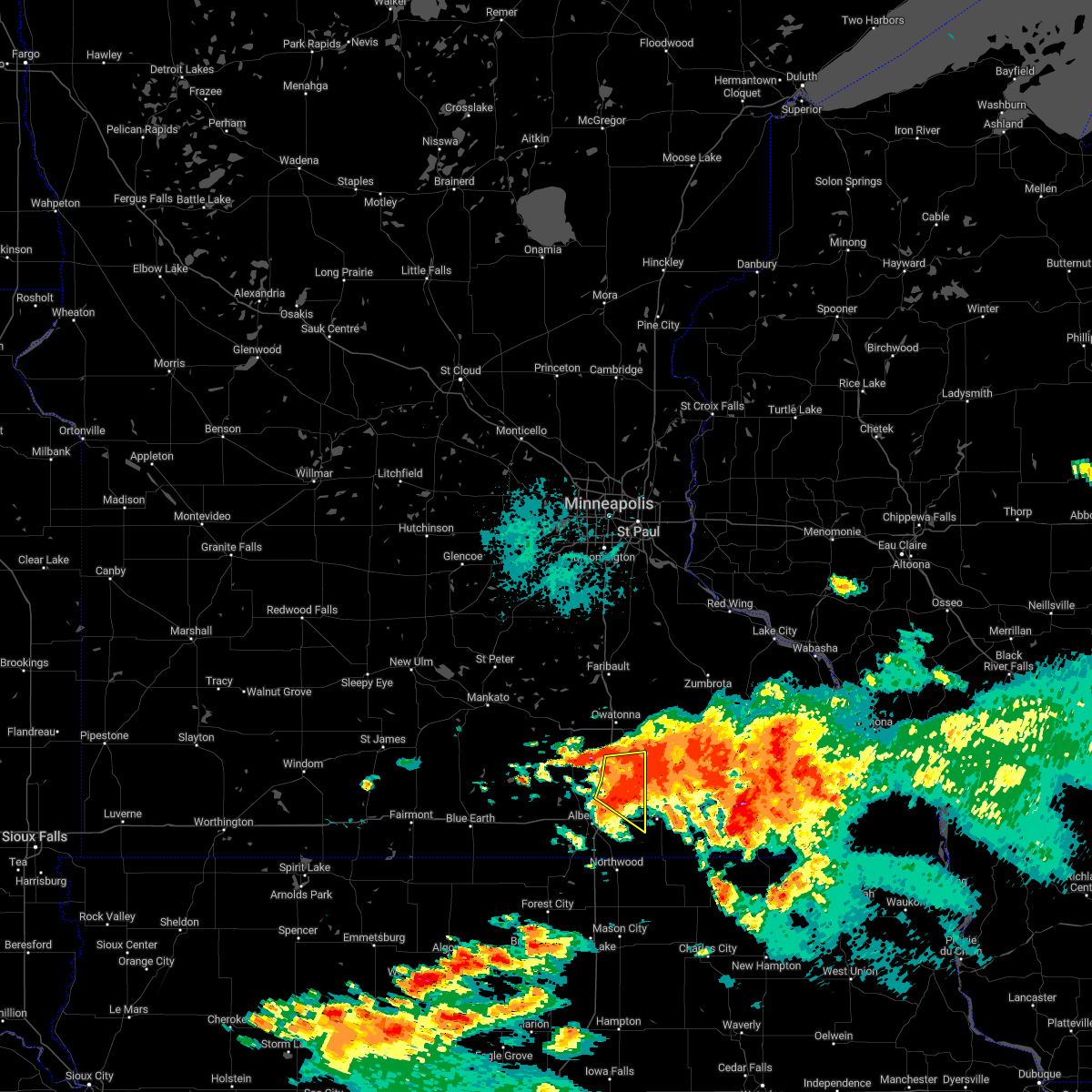
| 6/26/2025 1:54 PM CDT | The storm which prompted the warning has moved out of the county. therefore, the warning will be allowed to expire. a tornado watch remains in effect until 800 pm cdt thursday for a portion of south central minnesota. |
| 6/26/2025 1:53 PM CDT | Svrarx the national weather service in la crosse has issued a * severe thunderstorm warning for, olmsted county in southeastern minnesota, dodge county in southeastern minnesota, * until 245 pm cdt. * at 152 pm cdt, a severe thunderstorm was located near claremont, or 8 miles west of dodge center, moving east at 40 mph (radar indicated). Hazards include 60 mph wind gusts. Expect damage to roofs, siding, and trees. this severe thunderstorm will be near, dodge center around 200 pm cdt. mantorville and kasson around 205 pm cdt. byron around 215 pm cdt. rochester around 225 pm cdt. other locations impacted by this severe thunderstorm include county roads 20 and 5, south troy, potsdam, eden, county roads 3 and 108, highway 57 and 570th street, and county roads 6 and 15. This includes interstate 90 in minnesota between mile markers 207 and 221. |
| 6/26/2025 1:44 PM CDT |
 Tormpx the national weather service in the twin cities has issued a * tornado warning for, southeastern steele county in south central minnesota, * until 200 pm cdt. * at 144 pm cdt, a severe thunderstorm capable of producing a tornado was located 7 miles northwest of blooming prairie, or 10 miles southeast of owatonna, moving northeast at 40 mph (radar indicated rotation). Hazards include tornado. Flying debris will be dangerous to those caught without shelter. mobile homes will be damaged or destroyed. damage to roofs, windows and vehicles will occur. Tree damage is likely. Tormpx the national weather service in the twin cities has issued a * tornado warning for, southeastern steele county in south central minnesota, * until 200 pm cdt. * at 144 pm cdt, a severe thunderstorm capable of producing a tornado was located 7 miles northwest of blooming prairie, or 10 miles southeast of owatonna, moving northeast at 40 mph (radar indicated rotation). Hazards include tornado. Flying debris will be dangerous to those caught without shelter. mobile homes will be damaged or destroyed. damage to roofs, windows and vehicles will occur. Tree damage is likely.
|
| 6/25/2025 5:29 PM CDT | the tornado warning has been cancelled and is no longer in effect |
| 6/25/2025 5:21 PM CDT | At 520 pm cdt, a severe thunderstorm capable of producing a tornado was located over mantorville, moving northeast at 50 mph (radar indicated rotation). Hazards include tornado. Flying debris will be dangerous to those caught without shelter. mobile homes will be damaged or destroyed. damage to roofs, windows, and vehicles will occur. tree damage is likely. this dangerous storm will be near, byron around 525 pm cdt. Other locations impacted by this tornadic thunderstorm include danesville, highway 57 and 570th street, county roads 6 and 15, salem corners, county roads 5 and 6, wasioja, and highway 56 and county 6. |
| 6/25/2025 5:10 PM CDT | Torarx the national weather service in la crosse has issued a * tornado warning for, northwestern olmsted county in southeastern minnesota, central dodge county in southeastern minnesota, * until 545 pm cdt. * at 509 pm cdt, a confirmed tornado was located near dodge center, moving east at 35 mph (law enforcement confirmed tornado). Hazards include damaging tornado. Flying debris will be dangerous to those caught without shelter. mobile homes will be damaged or destroyed. damage to roofs, windows, and vehicles will occur. tree damage is likely. the tornado will be near, dodge center, mantorville, and kasson around 515 pm cdt. byron around 520 pm cdt. Other locations impacted by this tornadic thunderstorm include danesville, highway 57 and 570th street, county roads 6 and 15, salem corners, county roads 5 and 6, wasioja, and highway 56 and county 6. |
| 6/25/2025 5:08 PM CDT | the tornado warning has been cancelled and is no longer in effect |
| 6/25/2025 5:00 PM CDT | At 500 pm cdt, a severe thunderstorm capable of producing a tornado was located near geneva, or 14 miles south of owatonna, moving east at 25 mph (radar indicated rotation). Hazards include tornado. Flying debris will be dangerous to those caught without shelter. mobile homes will be damaged or destroyed. damage to roofs, windows and vehicles will occur. tree damage is likely. Locations impacted include, blooming prairie, steele center and bixby. |
| 6/25/2025 4:56 PM CDT |
 Tormpx the national weather service in the twin cities has issued a * tornado warning for, southeastern steele county in south central minnesota, * until 530 pm cdt. * at 456 pm cdt, a severe thunderstorm capable of producing a tornado was located over ellendale, or 15 miles south of owatonna, moving east at 25 mph (radar indicated rotation). Hazards include tornado. Flying debris will be dangerous to those caught without shelter. mobile homes will be damaged or destroyed. damage to roofs, windows and vehicles will occur. Tree damage is likely. Tormpx the national weather service in the twin cities has issued a * tornado warning for, southeastern steele county in south central minnesota, * until 530 pm cdt. * at 456 pm cdt, a severe thunderstorm capable of producing a tornado was located over ellendale, or 15 miles south of owatonna, moving east at 25 mph (radar indicated rotation). Hazards include tornado. Flying debris will be dangerous to those caught without shelter. mobile homes will be damaged or destroyed. damage to roofs, windows and vehicles will occur. Tree damage is likely.
|
| 4/28/2025 7:27 PM CDT | The storms which prompted the warning have weakened below severe limits, and have exited the warned area. therefore, the warning will be allowed to expire. however, small hail and gusty winds are still possible with these thunderstorms. to report severe weather, contact your nearest law enforcement agency. they will send your report to the national weather service office. a tornado watch remains in effect until 1100 pm cdt for a portion of south central minnesota. |
| 4/28/2025 6:57 PM CDT |
 The severe thunderstorm warning that was previously in effect has been reissued for faribault, steele, and freeborn counties and is in effect until 730 pm cdt. please refer to that bulletin for the latest severe weather information. a tornado watch remains in effect until 1100 pm cdt for a portion of south central minnesota. The severe thunderstorm warning that was previously in effect has been reissued for faribault, steele, and freeborn counties and is in effect until 730 pm cdt. please refer to that bulletin for the latest severe weather information. a tornado watch remains in effect until 1100 pm cdt for a portion of south central minnesota.
|
| 4/28/2025 6:56 PM CDT |
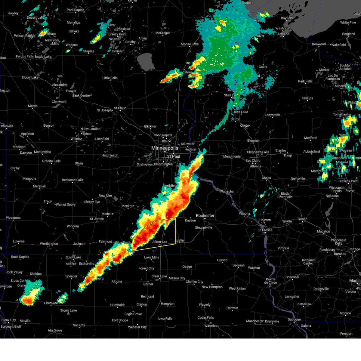
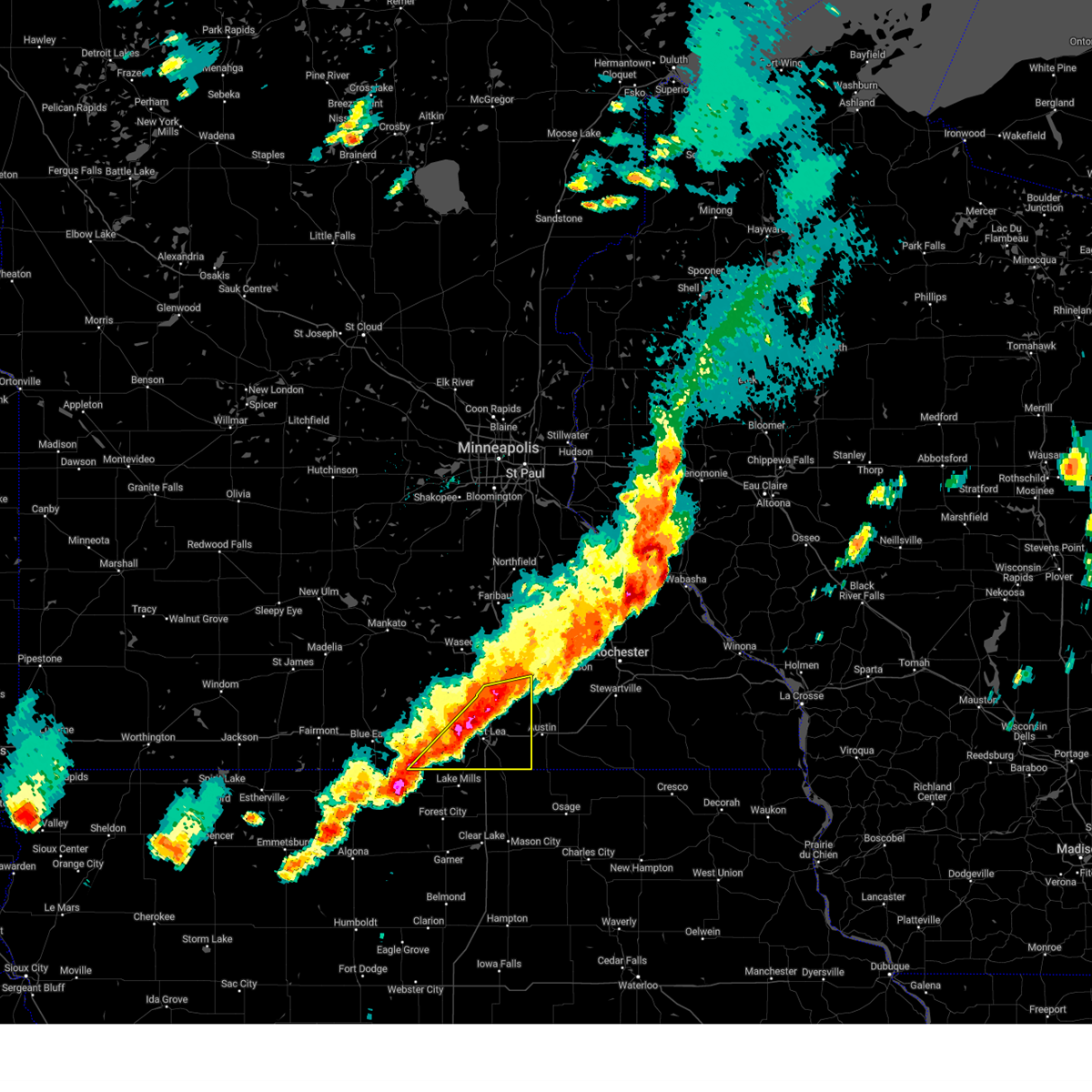 Svrmpx the national weather service in the twin cities has issued a * severe thunderstorm warning for, southeastern faribault county in south central minnesota, freeborn county in south central minnesota, southern steele county in south central minnesota, * until 730 pm cdt. * at 656 pm cdt, severe thunderstorms were located along a line from 6 miles northeast of blooming prairie to near mansfield, or along a line from 16 miles southeast of owatonna to 16 miles southwest of albert lea, moving east at 45 mph (radar indicated). Hazards include 60 mph wind gusts and half dollar size hail. Hail damage to vehicles is expected. Expect wind damage to roofs, siding, and trees. Svrmpx the national weather service in the twin cities has issued a * severe thunderstorm warning for, southeastern faribault county in south central minnesota, freeborn county in south central minnesota, southern steele county in south central minnesota, * until 730 pm cdt. * at 656 pm cdt, severe thunderstorms were located along a line from 6 miles northeast of blooming prairie to near mansfield, or along a line from 16 miles southeast of owatonna to 16 miles southwest of albert lea, moving east at 45 mph (radar indicated). Hazards include 60 mph wind gusts and half dollar size hail. Hail damage to vehicles is expected. Expect wind damage to roofs, siding, and trees.
|
| 4/28/2025 6:43 PM CDT |
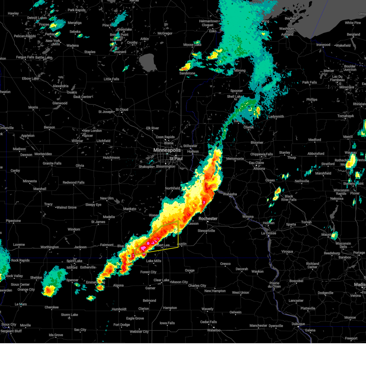 At 643 pm cdt, severe thunderstorms were located along a line from near geneva to over mansfield, or along a line from 16 miles south of owatonna to 14 miles southwest of albert lea, moving east at 40 mph (radar indicated). Hazards include 60 mph wind gusts and half dollar size hail. Hail damage to vehicles is expected. expect wind damage to roofs, siding, and trees. Locations impacted include, albert lea, blooming prairie, clarks grove, ellendale, alden, geneva, bricelyn, hartland, hollandale, freeborn, hayward, conger, walters, manchester, albert lea airport, myre big island state park, steele center, baroda and bixby. At 643 pm cdt, severe thunderstorms were located along a line from near geneva to over mansfield, or along a line from 16 miles south of owatonna to 14 miles southwest of albert lea, moving east at 40 mph (radar indicated). Hazards include 60 mph wind gusts and half dollar size hail. Hail damage to vehicles is expected. expect wind damage to roofs, siding, and trees. Locations impacted include, albert lea, blooming prairie, clarks grove, ellendale, alden, geneva, bricelyn, hartland, hollandale, freeborn, hayward, conger, walters, manchester, albert lea airport, myre big island state park, steele center, baroda and bixby.
|
| 4/28/2025 6:17 PM CDT |
 The severe thunderstorm warning that was previously in effect has been reissued for and is in effect until 700 pm cdt. please refer to those bulletins for the latest severe weather information. a tornado watch remains in effect until 800 pm cdt for a portion of south central minnesota. The severe thunderstorm warning that was previously in effect has been reissued for and is in effect until 700 pm cdt. please refer to those bulletins for the latest severe weather information. a tornado watch remains in effect until 800 pm cdt for a portion of south central minnesota.
|
| 4/28/2025 6:15 PM CDT |
 Svrmpx the national weather service in the twin cities has issued a * severe thunderstorm warning for, eastern faribault county in south central minnesota, freeborn county in south central minnesota, southern steele county in south central minnesota, southeastern waseca county in south central minnesota, * until 700 pm cdt. * at 615 pm cdt, severe thunderstorms were located along a line from 7 miles southwest of owatonna to over bricelyn, or along a line from 7 miles southwest of owatonna to 22 miles west of albert lea, moving east at 50 mph (radar indicated). Hazards include 60 mph wind gusts and half dollar size hail. Hail damage to vehicles is expected. Expect wind damage to roofs, siding, and trees. Svrmpx the national weather service in the twin cities has issued a * severe thunderstorm warning for, eastern faribault county in south central minnesota, freeborn county in south central minnesota, southern steele county in south central minnesota, southeastern waseca county in south central minnesota, * until 700 pm cdt. * at 615 pm cdt, severe thunderstorms were located along a line from 7 miles southwest of owatonna to over bricelyn, or along a line from 7 miles southwest of owatonna to 22 miles west of albert lea, moving east at 50 mph (radar indicated). Hazards include 60 mph wind gusts and half dollar size hail. Hail damage to vehicles is expected. Expect wind damage to roofs, siding, and trees.
|
| 4/28/2025 5:29 PM CDT |
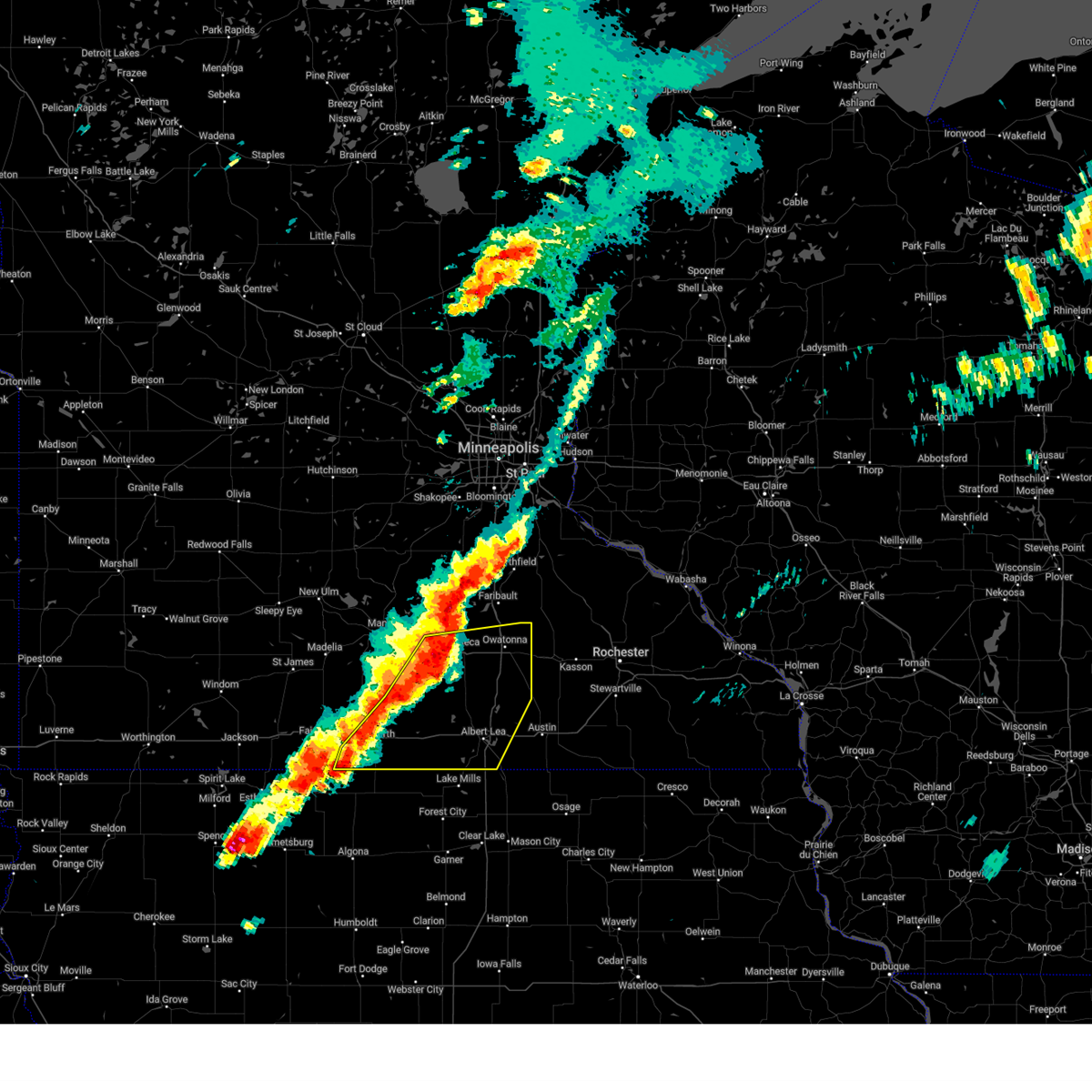 Svrmpx the national weather service in the twin cities has issued a * severe thunderstorm warning for, southeastern blue earth county in south central minnesota, faribault county in south central minnesota, freeborn county in south central minnesota, southeastern martin county in south central minnesota, steele county in south central minnesota, waseca county in south central minnesota, * until 615 pm cdt. * at 529 pm cdt, severe thunderstorms were located along a line from over waseca to near elmore, or along a line from 13 miles west of owatonna to 17 miles southeast of fairmont, moving east at 50 mph (radar indicated). Hazards include 60 mph wind gusts and half dollar size hail. Hail damage to vehicles is expected. Expect wind damage to roofs, siding, and trees. Svrmpx the national weather service in the twin cities has issued a * severe thunderstorm warning for, southeastern blue earth county in south central minnesota, faribault county in south central minnesota, freeborn county in south central minnesota, southeastern martin county in south central minnesota, steele county in south central minnesota, waseca county in south central minnesota, * until 615 pm cdt. * at 529 pm cdt, severe thunderstorms were located along a line from over waseca to near elmore, or along a line from 13 miles west of owatonna to 17 miles southeast of fairmont, moving east at 50 mph (radar indicated). Hazards include 60 mph wind gusts and half dollar size hail. Hail damage to vehicles is expected. Expect wind damage to roofs, siding, and trees.
|
| 8/5/2024 7:49 PM CDT | At 747 pm cdt, severe thunderstorms were located along a line extending from near dodge center to near hayfield to near glenville, moving southeast at 30 mph (radar indicated). Hazards include 60 mph wind gusts and penny size hail. Expect damage to roofs, siding, and trees. these severe storms will be near, austin and brownsdale around 755 pm cdt. rose creek around 805 pm cdt. rochester and lyle around 810 pm cdt. stewartville and grand meadow around 815 pm cdt. adams around 820 pm cdt. other locations impacted by these severe thunderstorms include rock dell, brookside campground, and mayville. People attending the mower county fairgrounds should seek safe shelter immediately! this includes interstate 90 in minnesota between mile markers 175 and 212. |
| 8/5/2024 7:41 PM CDT |
 The storm which prompted the warning has weakened below severe limits, and no longer appears capable of producing a tornado. therefore, the warning will be allowed to expire. however, gusty winds and heavy rain are still possible with this thunderstorm. a tornado watch remains in effect until midnight cdt for south central minnesota. The storm which prompted the warning has weakened below severe limits, and no longer appears capable of producing a tornado. therefore, the warning will be allowed to expire. however, gusty winds and heavy rain are still possible with this thunderstorm. a tornado watch remains in effect until midnight cdt for south central minnesota.
|
| 8/5/2024 7:31 PM CDT |
 Svrarx the national weather service in la crosse has issued a * severe thunderstorm warning for, southwestern olmsted county in southeastern minnesota, mower county in southeastern minnesota, southern dodge county in southeastern minnesota, * until 815 pm cdt. * at 729 pm cdt, severe thunderstorms were located along a line extending from near claremont to near blooming prairie to near twin lakes, moving southeast at 45 mph (radar indicated). Hazards include 60 mph wind gusts and penny size hail. Expect damage to roofs, siding, and trees. severe thunderstorms will be near, austin, dodge center, and hayfield around 735 pm cdt. brownsdale around 740 pm cdt. rochester, stewartville, grand meadow, lyle, and rose creek around 755 pm cdt. adams around 800 pm cdt. other locations impacted by these severe thunderstorms include rock dell, brookside campground, and mayville. People attending the mower county fairgrounds should seek safe shelter immediately! this includes interstate 90 in minnesota between mile markers 175 and 212. Svrarx the national weather service in la crosse has issued a * severe thunderstorm warning for, southwestern olmsted county in southeastern minnesota, mower county in southeastern minnesota, southern dodge county in southeastern minnesota, * until 815 pm cdt. * at 729 pm cdt, severe thunderstorms were located along a line extending from near claremont to near blooming prairie to near twin lakes, moving southeast at 45 mph (radar indicated). Hazards include 60 mph wind gusts and penny size hail. Expect damage to roofs, siding, and trees. severe thunderstorms will be near, austin, dodge center, and hayfield around 735 pm cdt. brownsdale around 740 pm cdt. rochester, stewartville, grand meadow, lyle, and rose creek around 755 pm cdt. adams around 800 pm cdt. other locations impacted by these severe thunderstorms include rock dell, brookside campground, and mayville. People attending the mower county fairgrounds should seek safe shelter immediately! this includes interstate 90 in minnesota between mile markers 175 and 212.
|
| 8/5/2024 7:26 PM CDT |
 At 726 pm cdt, a severe thunderstorm capable of producing a tornado was located near ellendale, or 10 miles south of owatonna, moving east at 30 mph (radar indicated rotation). Hazards include tornado. Flying debris will be dangerous to those caught without shelter. mobile homes will be damaged or destroyed. damage to roofs, windows, and vehicles will occur. tree damage is likely. this dangerous storm will be near, blooming prairie around 735 pm cdt. Other locations impacted by this tornadic thunderstorm include steele center and bixby. At 726 pm cdt, a severe thunderstorm capable of producing a tornado was located near ellendale, or 10 miles south of owatonna, moving east at 30 mph (radar indicated rotation). Hazards include tornado. Flying debris will be dangerous to those caught without shelter. mobile homes will be damaged or destroyed. damage to roofs, windows, and vehicles will occur. tree damage is likely. this dangerous storm will be near, blooming prairie around 735 pm cdt. Other locations impacted by this tornadic thunderstorm include steele center and bixby.
|
| 8/5/2024 7:26 PM CDT |
 the tornado warning has been cancelled and is no longer in effect the tornado warning has been cancelled and is no longer in effect
|
| 8/5/2024 7:09 PM CDT |
 Tormpx the national weather service in the twin cities has issued a * tornado warning for, northeastern freeborn county in south central minnesota, southern steele county in south central minnesota, southeastern waseca county in south central minnesota, * until 745 pm cdt. * at 707 pm cdt, a severe thunderstorm capable of producing a tornado was located 6 miles northeast of new richland, or 12 miles southwest of owatonna, moving east at 30 mph (radar indicated rotation. this storm has a history of producing tornadoes). Hazards include tornado. Flying debris will be dangerous to those caught without shelter. mobile homes will be damaged or destroyed. damage to roofs, windows, and vehicles will occur. tree damage is likely. this dangerous storm will be near, ellendale around 720 pm cdt. Other locations impacted by this tornadic thunderstorm include steele center, lemond, bixby, and hope. Tormpx the national weather service in the twin cities has issued a * tornado warning for, northeastern freeborn county in south central minnesota, southern steele county in south central minnesota, southeastern waseca county in south central minnesota, * until 745 pm cdt. * at 707 pm cdt, a severe thunderstorm capable of producing a tornado was located 6 miles northeast of new richland, or 12 miles southwest of owatonna, moving east at 30 mph (radar indicated rotation. this storm has a history of producing tornadoes). Hazards include tornado. Flying debris will be dangerous to those caught without shelter. mobile homes will be damaged or destroyed. damage to roofs, windows, and vehicles will occur. tree damage is likely. this dangerous storm will be near, ellendale around 720 pm cdt. Other locations impacted by this tornadic thunderstorm include steele center, lemond, bixby, and hope.
|
| 7/13/2024 7:06 PM CDT |
 The storm which prompted the warning has weakened below severe limits, and no longer poses an immediate threat to life or property. therefore, the warning will be allowed to expire. however, small hail is still possible with this thunderstorm. The storm which prompted the warning has weakened below severe limits, and no longer poses an immediate threat to life or property. therefore, the warning will be allowed to expire. however, small hail is still possible with this thunderstorm.
|
| 7/13/2024 6:50 PM CDT |
 At 649 pm cdt, a severe thunderstorm was located 6 miles south of owatonna, moving southeast at 15 mph (radar indicated). Hazards include quarter size hail. Damage to vehicles is expected. Locations impacted include, blooming prairie, ellendale, hope, steele center, bixby, and rice lake state park. At 649 pm cdt, a severe thunderstorm was located 6 miles south of owatonna, moving southeast at 15 mph (radar indicated). Hazards include quarter size hail. Damage to vehicles is expected. Locations impacted include, blooming prairie, ellendale, hope, steele center, bixby, and rice lake state park.
|
| 7/13/2024 6:28 PM CDT |
 Svrmpx the national weather service in the twin cities has issued a * severe thunderstorm warning for, steele county in south central minnesota, * until 715 pm cdt. * at 627 pm cdt, a severe thunderstorm was located near owatonna, moving southeast at 20 mph (radar indicated). Hazards include quarter size hail. damage to vehicles is expected Svrmpx the national weather service in the twin cities has issued a * severe thunderstorm warning for, steele county in south central minnesota, * until 715 pm cdt. * at 627 pm cdt, a severe thunderstorm was located near owatonna, moving southeast at 20 mph (radar indicated). Hazards include quarter size hail. damage to vehicles is expected
|
| 5/21/2024 5:53 PM CDT |
 The storms which prompted the warning have moved out of the area. therefore, the warning will be allowed to expire. however, gusty winds are still possible with these thunderstorms. a tornado watch remains in effect until 900 pm cdt for southeastern minnesota. The storms which prompted the warning have moved out of the area. therefore, the warning will be allowed to expire. however, gusty winds are still possible with these thunderstorms. a tornado watch remains in effect until 900 pm cdt for southeastern minnesota.
|
| 5/21/2024 5:39 PM CDT |
 the severe thunderstorm warning has been cancelled and is no longer in effect the severe thunderstorm warning has been cancelled and is no longer in effect
|
| 5/21/2024 5:25 PM CDT |
 At 525 pm cdt, severe thunderstorms were located along a line extending from near nerstrand to dodge center, moving northeast at 65 mph (radar indicated). Hazards include 70 mph wind gusts and penny size hail. Expect considerable tree damage. damage is likely to mobile homes, roofs, and outbuildings. these severe storms will be near, mantorville and kasson around 530 pm cdt. Other locations impacted by these severe thunderstorms include county roads 20 and 5, oslo, concord, eden, highway 57 and 570th street, county roads 6 and 15, and county roads 5 and 6. At 525 pm cdt, severe thunderstorms were located along a line extending from near nerstrand to dodge center, moving northeast at 65 mph (radar indicated). Hazards include 70 mph wind gusts and penny size hail. Expect considerable tree damage. damage is likely to mobile homes, roofs, and outbuildings. these severe storms will be near, mantorville and kasson around 530 pm cdt. Other locations impacted by these severe thunderstorms include county roads 20 and 5, oslo, concord, eden, highway 57 and 570th street, county roads 6 and 15, and county roads 5 and 6.
|
| 5/21/2024 5:08 PM CDT |
 Svrarx the national weather service in la crosse has issued a * severe thunderstorm warning for, dodge county in southeastern minnesota, * until 600 pm cdt. * at 508 pm cdt, severe thunderstorms were located along a line extending from owatonna to near blooming prairie, moving northeast at 65 mph (radar indicated). Hazards include 70 mph wind gusts and penny size hail. Expect considerable tree damage. damage is likely to mobile homes, roofs, and outbuildings. severe thunderstorms will be near, dodge center and claremont around 515 pm cdt. west concord around 520 pm cdt. mantorville around 525 pm cdt. Other locations impacted by these severe thunderstorms include county roads 20 and 5, oslo, concord, eden, highway 57 and 570th street, county roads 6 and 15, and county roads 5 and 6. Svrarx the national weather service in la crosse has issued a * severe thunderstorm warning for, dodge county in southeastern minnesota, * until 600 pm cdt. * at 508 pm cdt, severe thunderstorms were located along a line extending from owatonna to near blooming prairie, moving northeast at 65 mph (radar indicated). Hazards include 70 mph wind gusts and penny size hail. Expect considerable tree damage. damage is likely to mobile homes, roofs, and outbuildings. severe thunderstorms will be near, dodge center and claremont around 515 pm cdt. west concord around 520 pm cdt. mantorville around 525 pm cdt. Other locations impacted by these severe thunderstorms include county roads 20 and 5, oslo, concord, eden, highway 57 and 570th street, county roads 6 and 15, and county roads 5 and 6.
|
| 5/21/2024 4:53 PM CDT |
 Svrmpx the national weather service in the twin cities has issued a * severe thunderstorm warning for, eastern freeborn county in south central minnesota, southeastern steele county in south central minnesota, * until 600 pm cdt. * at 453 pm cdt, a severe thunderstorm was located over hayward, or 6 miles east of albert lea, moving northeast at 65 mph (radar indicated). Hazards include 60 mph wind gusts. expect damage to roofs, siding, and trees Svrmpx the national weather service in the twin cities has issued a * severe thunderstorm warning for, eastern freeborn county in south central minnesota, southeastern steele county in south central minnesota, * until 600 pm cdt. * at 453 pm cdt, a severe thunderstorm was located over hayward, or 6 miles east of albert lea, moving northeast at 65 mph (radar indicated). Hazards include 60 mph wind gusts. expect damage to roofs, siding, and trees
|
| 5/20/2024 8:17 PM CDT |
 The storm which prompted the warning has weakened below severe limits, and no longer poses an immediate threat to life or property. therefore, the warning has been allowed to expire. a severe thunderstorm watch remains in effect until midnight cdt for southeastern minnesota. The storm which prompted the warning has weakened below severe limits, and no longer poses an immediate threat to life or property. therefore, the warning has been allowed to expire. a severe thunderstorm watch remains in effect until midnight cdt for southeastern minnesota.
|
| 5/20/2024 8:05 PM CDT |
 At 805 pm cdt, a severe thunderstorm was located near hayfield, or 9 miles southeast of dodge center, moving east at 15 mph (radar indicated). Hazards include quarter size hail. damage to vehicles is expected At 805 pm cdt, a severe thunderstorm was located near hayfield, or 9 miles southeast of dodge center, moving east at 15 mph (radar indicated). Hazards include quarter size hail. damage to vehicles is expected
|
| 5/20/2024 7:57 PM CDT |
 At 757 pm cdt, a severe thunderstorm was located near hayfield, or 8 miles southeast of dodge center, moving east at 15 mph (radar indicated). Hazards include quarter size hail. damage to vehicles is expected At 757 pm cdt, a severe thunderstorm was located near hayfield, or 8 miles southeast of dodge center, moving east at 15 mph (radar indicated). Hazards include quarter size hail. damage to vehicles is expected
|
| 5/20/2024 7:44 PM CDT |
 At 743 pm cdt, a severe thunderstorm was located over hayfield, or 9 miles south of dodge center, moving east at 15 mph (law enforcement). Hazards include quarter size hail. damage to vehicles is expected At 743 pm cdt, a severe thunderstorm was located over hayfield, or 9 miles south of dodge center, moving east at 15 mph (law enforcement). Hazards include quarter size hail. damage to vehicles is expected
|
| 5/20/2024 7:37 PM CDT |
 At 735 pm cdt, a severe thunderstorm was located over hayfield, or 9 miles south of dodge center, moving east at 15 mph. law enforcement reported quarter size hail covering the ground 4 miles west of hayfield at 732 pm (law enforcement). Hazards include quarter size hail. Damage to vehicles is expected. This severe storm will be near, hayfield around 740 pm cdt. At 735 pm cdt, a severe thunderstorm was located over hayfield, or 9 miles south of dodge center, moving east at 15 mph. law enforcement reported quarter size hail covering the ground 4 miles west of hayfield at 732 pm (law enforcement). Hazards include quarter size hail. Damage to vehicles is expected. This severe storm will be near, hayfield around 740 pm cdt.
|
| 5/20/2024 7:31 PM CDT |
 Svrarx the national weather service in la crosse has issued a * severe thunderstorm warning for, northwestern mower county in southeastern minnesota, southern dodge county in southeastern minnesota, * until 815 pm cdt. * at 730 pm cdt, a severe thunderstorm was located over hayfield, or 9 miles south of dodge center, moving east at 15 mph (radar indicated). Hazards include quarter size hail. Damage to vehicles is expected. This severe thunderstorm will be near, hayfield around 735 pm cdt. Svrarx the national weather service in la crosse has issued a * severe thunderstorm warning for, northwestern mower county in southeastern minnesota, southern dodge county in southeastern minnesota, * until 815 pm cdt. * at 730 pm cdt, a severe thunderstorm was located over hayfield, or 9 miles south of dodge center, moving east at 15 mph (radar indicated). Hazards include quarter size hail. Damage to vehicles is expected. This severe thunderstorm will be near, hayfield around 735 pm cdt.
|
| 4/30/2024 7:52 PM CDT |
 Svrarx the national weather service in la crosse has issued a * severe thunderstorm warning for, western olmsted county in southeastern minnesota, mower county in southeastern minnesota, dodge county in southeastern minnesota, * until 830 pm cdt. * at 751 pm cdt, severe thunderstorms were located along a line extending from 6 miles northwest of blooming prairie to near brownsdale to lyle, moving northeast at 50 mph (radar indicated). Hazards include 60 mph wind gusts and penny size hail. Expect damage to roofs, siding, and trees. severe thunderstorms will be near, austin, blooming prairie, hayfield, brownsdale, lyle, and rose creek around 755 pm cdt. adams around 800 pm cdt. dodge center around 805 pm cdt. mantorville and kasson around 810 pm cdt. rochester, byron, and grand meadow around 815 pm cdt. stewartville around 820 pm cdt. other locations impacted by these severe thunderstorms include salem corners, rock dell, and brookside campground. This includes interstate 90 in minnesota between mile markers 175 and 213. Svrarx the national weather service in la crosse has issued a * severe thunderstorm warning for, western olmsted county in southeastern minnesota, mower county in southeastern minnesota, dodge county in southeastern minnesota, * until 830 pm cdt. * at 751 pm cdt, severe thunderstorms were located along a line extending from 6 miles northwest of blooming prairie to near brownsdale to lyle, moving northeast at 50 mph (radar indicated). Hazards include 60 mph wind gusts and penny size hail. Expect damage to roofs, siding, and trees. severe thunderstorms will be near, austin, blooming prairie, hayfield, brownsdale, lyle, and rose creek around 755 pm cdt. adams around 800 pm cdt. dodge center around 805 pm cdt. mantorville and kasson around 810 pm cdt. rochester, byron, and grand meadow around 815 pm cdt. stewartville around 820 pm cdt. other locations impacted by these severe thunderstorms include salem corners, rock dell, and brookside campground. This includes interstate 90 in minnesota between mile markers 175 and 213.
|
| 10/24/2023 12:57 AM CDT |
 At 1257 am cdt, a severe thunderstorm was located over blooming prairie, or 13 miles southwest of dodge center, moving east at 45 mph (radar indicated). Hazards include quarter size hail. Damage to vehicles is expected. this severe thunderstorm will be near, hayfield around 100 am cdt. other locations impacted by this severe thunderstorm include oslo, county roads 1 and 15, sargeant, highway 30 and county 3, county roads 6 and 15, county roads 6 and 9, and county roads 3 and 6. hail threat, radar indicated max hail size, 1. 00 in wind threat, radar indicated max wind gust, <50 mph. At 1257 am cdt, a severe thunderstorm was located over blooming prairie, or 13 miles southwest of dodge center, moving east at 45 mph (radar indicated). Hazards include quarter size hail. Damage to vehicles is expected. this severe thunderstorm will be near, hayfield around 100 am cdt. other locations impacted by this severe thunderstorm include oslo, county roads 1 and 15, sargeant, highway 30 and county 3, county roads 6 and 15, county roads 6 and 9, and county roads 3 and 6. hail threat, radar indicated max hail size, 1. 00 in wind threat, radar indicated max wind gust, <50 mph.
|
| 10/24/2023 12:49 AM CDT |
 At 1249 am cdt, a severe thunderstorm was located near geneva, or 15 miles northwest of austin, moving east at 35 mph (radar indicated). Hazards include quarter size hail. Damage to vehicles is expected. locations impacted include, blooming prairie and hollandale. hail threat, radar indicated max hail size, 1. 00 in wind threat, radar indicated max wind gust, <50 mph. At 1249 am cdt, a severe thunderstorm was located near geneva, or 15 miles northwest of austin, moving east at 35 mph (radar indicated). Hazards include quarter size hail. Damage to vehicles is expected. locations impacted include, blooming prairie and hollandale. hail threat, radar indicated max hail size, 1. 00 in wind threat, radar indicated max wind gust, <50 mph.
|
| 10/24/2023 12:33 AM CDT |
 At 1233 am cdt, a severe thunderstorm was located over geneva, or 10 miles north of albert lea, moving east at 35 mph (radar indicated). Hazards include quarter size hail. damage to vehicles is expected At 1233 am cdt, a severe thunderstorm was located over geneva, or 10 miles north of albert lea, moving east at 35 mph (radar indicated). Hazards include quarter size hail. damage to vehicles is expected
|
| 7/24/2023 4:44 PM CDT |
 At 444 pm cdt, a severe thunderstorm was located over claremont, or 8 miles east of owatonna, moving south at 25 mph (radar indicated). Hazards include 60 mph wind gusts and half dollar size hail. Hail damage to vehicles is expected. expect wind damage to roofs, siding, and trees. this severe storm will be near, blooming prairie around 520 pm cdt. other locations impacted by this severe thunderstorm include county roads 20 and 5, concord, eden, county roads 5 and 6, wasioja, highway 56 and county 6 and graves landing field. hail threat, radar indicated max hail size, 1. 25 in wind threat, radar indicated max wind gust, 60 mph. At 444 pm cdt, a severe thunderstorm was located over claremont, or 8 miles east of owatonna, moving south at 25 mph (radar indicated). Hazards include 60 mph wind gusts and half dollar size hail. Hail damage to vehicles is expected. expect wind damage to roofs, siding, and trees. this severe storm will be near, blooming prairie around 520 pm cdt. other locations impacted by this severe thunderstorm include county roads 20 and 5, concord, eden, county roads 5 and 6, wasioja, highway 56 and county 6 and graves landing field. hail threat, radar indicated max hail size, 1. 25 in wind threat, radar indicated max wind gust, 60 mph.
|
| 7/24/2023 4:39 PM CDT |
 At 439 pm cdt, a severe thunderstorm was located near claremont, or 8 miles east of owatonna, moving south at 25 mph (radar indicated). Hazards include ping pong ball size hail and 60 mph wind gusts. People and animals outdoors will be injured. expect hail damage to roofs, siding, windows, and vehicles. expect wind damage to roofs, siding, and trees. this severe storm will be near, claremont around 445 pm cdt. blooming prairie around 520 pm cdt. other locations impacted by this severe thunderstorm include county roads 20 and 5, concord, eden, county roads 5 and 6, wasioja, highway 56 and county 6 and graves landing field. hail threat, radar indicated max hail size, 1. 50 in wind threat, radar indicated max wind gust, 60 mph. At 439 pm cdt, a severe thunderstorm was located near claremont, or 8 miles east of owatonna, moving south at 25 mph (radar indicated). Hazards include ping pong ball size hail and 60 mph wind gusts. People and animals outdoors will be injured. expect hail damage to roofs, siding, windows, and vehicles. expect wind damage to roofs, siding, and trees. this severe storm will be near, claremont around 445 pm cdt. blooming prairie around 520 pm cdt. other locations impacted by this severe thunderstorm include county roads 20 and 5, concord, eden, county roads 5 and 6, wasioja, highway 56 and county 6 and graves landing field. hail threat, radar indicated max hail size, 1. 50 in wind threat, radar indicated max wind gust, 60 mph.
|
| 7/24/2023 4:31 PM CDT |
 At 431 pm cdt, a severe thunderstorm was located 7 miles north of claremont, or 9 miles northeast of owatonna, moving south at 25 mph (radar indicated). Hazards include golf ball size hail and 60 mph wind gusts. People and animals outdoors will be injured. expect hail damage to roofs, siding, windows, and vehicles. expect wind damage to roofs, siding, and trees. this severe storm will be near, claremont around 445 pm cdt. blooming prairie around 520 pm cdt. other locations impacted by this severe thunderstorm include county roads 20 and 5, concord, eden, county roads 5 and 6, wasioja, highway 56 and county 6 and graves landing field. thunderstorm damage threat, considerable hail threat, radar indicated max hail size, 1. 75 in wind threat, radar indicated max wind gust, 60 mph. At 431 pm cdt, a severe thunderstorm was located 7 miles north of claremont, or 9 miles northeast of owatonna, moving south at 25 mph (radar indicated). Hazards include golf ball size hail and 60 mph wind gusts. People and animals outdoors will be injured. expect hail damage to roofs, siding, windows, and vehicles. expect wind damage to roofs, siding, and trees. this severe storm will be near, claremont around 445 pm cdt. blooming prairie around 520 pm cdt. other locations impacted by this severe thunderstorm include county roads 20 and 5, concord, eden, county roads 5 and 6, wasioja, highway 56 and county 6 and graves landing field. thunderstorm damage threat, considerable hail threat, radar indicated max hail size, 1. 75 in wind threat, radar indicated max wind gust, 60 mph.
|
| 7/24/2023 4:26 PM CDT |
 At 425 pm cdt, a severe thunderstorm was located 7 miles southwest of kenyon, or 10 miles northeast of owatonna, moving south at 25 mph (radar indicated). Hazards include two inch hail and 70 mph wind gusts. People and animals outdoors will be injured. expect hail damage to roofs, siding, windows, and vehicles. expect considerable tree damage. wind damage is also likely to mobile homes, roofs, and outbuildings. this severe storm will be near, west concord around 435 pm cdt. claremont around 445 pm cdt. blooming prairie around 520 pm cdt. thunderstorm damage threat, considerable hail threat, radar indicated max hail size, 2. 00 in wind threat, radar indicated max wind gust, 70 mph. At 425 pm cdt, a severe thunderstorm was located 7 miles southwest of kenyon, or 10 miles northeast of owatonna, moving south at 25 mph (radar indicated). Hazards include two inch hail and 70 mph wind gusts. People and animals outdoors will be injured. expect hail damage to roofs, siding, windows, and vehicles. expect considerable tree damage. wind damage is also likely to mobile homes, roofs, and outbuildings. this severe storm will be near, west concord around 435 pm cdt. claremont around 445 pm cdt. blooming prairie around 520 pm cdt. thunderstorm damage threat, considerable hail threat, radar indicated max hail size, 2. 00 in wind threat, radar indicated max wind gust, 70 mph.
|
| 7/24/2023 4:17 PM CDT |
 At 417 pm cdt, a severe thunderstorm was located near kenyon, or 12 miles east of faribault, moving south at 25 mph (radar indicated). Hazards include two inch hail and 70 mph wind gusts. People and animals outdoors will be injured. expect hail damage to roofs, siding, windows, and vehicles. expect considerable tree damage. wind damage is also likely to mobile homes, roofs, and outbuildings. this severe storm will be near, west concord around 435 pm cdt. claremont around 445 pm cdt. blooming prairie around 520 pm cdt. other locations impacted by this severe thunderstorm include county roads 20 and 5, concord, eden, county roads 5 and 6, wasioja, highway 56 and county 6 and graves landing field. thunderstorm damage threat, considerable hail threat, radar indicated max hail size, 2. 00 in wind threat, radar indicated max wind gust, 70 mph. At 417 pm cdt, a severe thunderstorm was located near kenyon, or 12 miles east of faribault, moving south at 25 mph (radar indicated). Hazards include two inch hail and 70 mph wind gusts. People and animals outdoors will be injured. expect hail damage to roofs, siding, windows, and vehicles. expect considerable tree damage. wind damage is also likely to mobile homes, roofs, and outbuildings. this severe storm will be near, west concord around 435 pm cdt. claremont around 445 pm cdt. blooming prairie around 520 pm cdt. other locations impacted by this severe thunderstorm include county roads 20 and 5, concord, eden, county roads 5 and 6, wasioja, highway 56 and county 6 and graves landing field. thunderstorm damage threat, considerable hail threat, radar indicated max hail size, 2. 00 in wind threat, radar indicated max wind gust, 70 mph.
|
| 7/24/2023 4:03 PM CDT |
 At 403 pm cdt, a severe thunderstorm was located over nerstrand, or 10 miles southeast of northfield, moving south at 25 mph (radar indicated). Hazards include two inch hail and 70 mph wind gusts. People and animals outdoors will be injured. expect hail damage to roofs, siding, windows, and vehicles. expect considerable tree damage. wind damage is also likely to mobile homes, roofs, and outbuildings. this severe thunderstorm will be near, west concord around 435 pm cdt. claremont around 450 pm cdt. blooming prairie around 515 pm cdt. other locations impacted by this severe thunderstorm include county roads 20 and 5, concord, eden, county roads 5 and 6, wasioja, highway 56 and county 6 and graves landing field. thunderstorm damage threat, considerable hail threat, radar indicated max hail size, 2. 00 in wind threat, radar indicated max wind gust, 70 mph. At 403 pm cdt, a severe thunderstorm was located over nerstrand, or 10 miles southeast of northfield, moving south at 25 mph (radar indicated). Hazards include two inch hail and 70 mph wind gusts. People and animals outdoors will be injured. expect hail damage to roofs, siding, windows, and vehicles. expect considerable tree damage. wind damage is also likely to mobile homes, roofs, and outbuildings. this severe thunderstorm will be near, west concord around 435 pm cdt. claremont around 450 pm cdt. blooming prairie around 515 pm cdt. other locations impacted by this severe thunderstorm include county roads 20 and 5, concord, eden, county roads 5 and 6, wasioja, highway 56 and county 6 and graves landing field. thunderstorm damage threat, considerable hail threat, radar indicated max hail size, 2. 00 in wind threat, radar indicated max wind gust, 70 mph.
|
| 7/13/2023 7:20 PM CDT |
 At 719 pm cdt, a severe thunderstorm was located over blooming prairie, or 12 miles north of austin, moving southeast at 45 mph (radar indicated). Hazards include 60 mph wind gusts and quarter size hail. Hail damage to vehicles is expected. expect wind damage to roofs, siding, and trees. Locations impacted include, blooming prairie, ellendale, lemond, hope, steele center and bixby. At 719 pm cdt, a severe thunderstorm was located over blooming prairie, or 12 miles north of austin, moving southeast at 45 mph (radar indicated). Hazards include 60 mph wind gusts and quarter size hail. Hail damage to vehicles is expected. expect wind damage to roofs, siding, and trees. Locations impacted include, blooming prairie, ellendale, lemond, hope, steele center and bixby.
|
| 7/13/2023 7:05 PM CDT |
 At 705 pm cdt, a severe thunderstorm was located near ellendale, or 12 miles south of owatonna, moving southeast at 45 mph (radar indicated). Hazards include 60 mph wind gusts and quarter size hail. Hail damage to vehicles is expected. expect wind damage to roofs, siding, and trees. Locations impacted include, blooming prairie. At 705 pm cdt, a severe thunderstorm was located near ellendale, or 12 miles south of owatonna, moving southeast at 45 mph (radar indicated). Hazards include 60 mph wind gusts and quarter size hail. Hail damage to vehicles is expected. expect wind damage to roofs, siding, and trees. Locations impacted include, blooming prairie.
|
| 7/13/2023 6:45 PM CDT |
 At 645 pm cdt, a severe thunderstorm was located near waseca, or 15 miles southwest of owatonna, moving southeast at 40 mph (radar indicated). Hazards include 60 mph wind gusts and half dollar size hail. Hail damage to vehicles is expected. expect wind damage to roofs, siding, and trees. this severe thunderstorm will be near, ellendale around 705 pm cdt. Other locations in the path of this severe thunderstorm include geneva and blooming prairie. At 645 pm cdt, a severe thunderstorm was located near waseca, or 15 miles southwest of owatonna, moving southeast at 40 mph (radar indicated). Hazards include 60 mph wind gusts and half dollar size hail. Hail damage to vehicles is expected. expect wind damage to roofs, siding, and trees. this severe thunderstorm will be near, ellendale around 705 pm cdt. Other locations in the path of this severe thunderstorm include geneva and blooming prairie.
|
| 7/23/2022 10:09 PM CDT |
 At 1009 pm cdt, a severe thunderstorm was located near blooming prairie, or 10 miles northwest of austin, moving southeast at 40 mph (radar indicated). Hazards include 60 mph wind gusts and quarter size hail. Hail damage to vehicles is expected. expect wind damage to roofs, siding, and trees. locations impacted include, blooming prairie, clarks grove, ellendale, geneva, hollandale, steele center and bixby. hail threat, radar indicated max hail size, 1. 00 in wind threat, radar indicated max wind gust, 60 mph. At 1009 pm cdt, a severe thunderstorm was located near blooming prairie, or 10 miles northwest of austin, moving southeast at 40 mph (radar indicated). Hazards include 60 mph wind gusts and quarter size hail. Hail damage to vehicles is expected. expect wind damage to roofs, siding, and trees. locations impacted include, blooming prairie, clarks grove, ellendale, geneva, hollandale, steele center and bixby. hail threat, radar indicated max hail size, 1. 00 in wind threat, radar indicated max wind gust, 60 mph.
|
| 7/23/2022 9:58 PM CDT |
 At 957 pm cdt, a severe thunderstorm was located near geneva, or 15 miles south of owatonna, moving east at 40 mph (radar indicated). Hazards include 60 mph wind gusts and quarter size hail. Hail damage to vehicles is expected. expect wind damage to roofs, siding, and trees. Locations impacted include, blooming prairie, clarks grove, ellendale, geneva, hollandale, steele center and bixby. At 957 pm cdt, a severe thunderstorm was located near geneva, or 15 miles south of owatonna, moving east at 40 mph (radar indicated). Hazards include 60 mph wind gusts and quarter size hail. Hail damage to vehicles is expected. expect wind damage to roofs, siding, and trees. Locations impacted include, blooming prairie, clarks grove, ellendale, geneva, hollandale, steele center and bixby.
|
| 7/23/2022 9:51 PM CDT |
 At 951 pm cdt, a severe thunderstorm capable of producing a tornado was located near ellendale, or 12 miles south of owatonna, moving east at 30 mph (radar indicated rotation). Hazards include tornado. Flying debris will be dangerous to those caught without shelter. mobile homes will be damaged or destroyed. damage to roofs, windows, and vehicles will occur. Tree damage is likely. At 951 pm cdt, a severe thunderstorm capable of producing a tornado was located near ellendale, or 12 miles south of owatonna, moving east at 30 mph (radar indicated rotation). Hazards include tornado. Flying debris will be dangerous to those caught without shelter. mobile homes will be damaged or destroyed. damage to roofs, windows, and vehicles will occur. Tree damage is likely.
|
| 7/23/2022 9:48 PM CDT |
 At 947 pm cdt, a severe thunderstorm was located over ellendale, or 14 miles south of owatonna, moving east at 40 mph (radar indicated). Hazards include 60 mph wind gusts and quarter size hail. Hail damage to vehicles is expected. expect wind damage to roofs, siding, and trees. Locations impacted include, blooming prairie. At 947 pm cdt, a severe thunderstorm was located over ellendale, or 14 miles south of owatonna, moving east at 40 mph (radar indicated). Hazards include 60 mph wind gusts and quarter size hail. Hail damage to vehicles is expected. expect wind damage to roofs, siding, and trees. Locations impacted include, blooming prairie.
|
| 7/23/2022 9:34 PM CDT |
 At 933 pm cdt, a severe thunderstorm was located over new richland, or 16 miles northwest of albert lea, moving southeast at 40 mph (radar indicated). Hazards include 60 mph wind gusts and quarter size hail. Hail damage to vehicles is expected. expect wind damage to roofs, siding, and trees. this severe thunderstorm will be near, ellendale around 945 pm cdt. clarks grove and geneva around 950 pm cdt. other locations in the path of this severe thunderstorm include hollandale. hail threat, radar indicated max hail size, 1. 00 in wind threat, radar indicated max wind gust, 60 mph. At 933 pm cdt, a severe thunderstorm was located over new richland, or 16 miles northwest of albert lea, moving southeast at 40 mph (radar indicated). Hazards include 60 mph wind gusts and quarter size hail. Hail damage to vehicles is expected. expect wind damage to roofs, siding, and trees. this severe thunderstorm will be near, ellendale around 945 pm cdt. clarks grove and geneva around 950 pm cdt. other locations in the path of this severe thunderstorm include hollandale. hail threat, radar indicated max hail size, 1. 00 in wind threat, radar indicated max wind gust, 60 mph.
|
| 7/23/2022 9:26 PM CDT |
 The severe thunderstorm warning for dodge county will expire at 930 pm cdt, the storms that prompted the warning has weakened slightly but still could be producing hail up to penny or nickel sized. gusty winds could also occur. claremont reported 40 mph wind gusts and there was hail near blooming prairie. a severe thunderstorm watch remains in effect until 300 am cdt for southeastern minnesota. The severe thunderstorm warning for dodge county will expire at 930 pm cdt, the storms that prompted the warning has weakened slightly but still could be producing hail up to penny or nickel sized. gusty winds could also occur. claremont reported 40 mph wind gusts and there was hail near blooming prairie. a severe thunderstorm watch remains in effect until 300 am cdt for southeastern minnesota.
|
| 7/23/2022 9:16 PM CDT |
 At 915 pm cdt, severe thunderstorms were located along a line extending from mantorville to near hayfield, moving east at 35 mph (radar indicated). Hazards include 60 mph wind gusts and nickel size hail. Expect damage to roofs, siding, and trees. these severe thunderstorms will remain over mainly rural areas of dodge county, including the following locations, county roads 20 and 5, oslo, eden, county roads 6 and 15, county roads 5 and 6, wasioja and highway 56 and county 6. hail threat, radar indicated max hail size, 0. 88 in wind threat, observed max wind gust, 60 mph. At 915 pm cdt, severe thunderstorms were located along a line extending from mantorville to near hayfield, moving east at 35 mph (radar indicated). Hazards include 60 mph wind gusts and nickel size hail. Expect damage to roofs, siding, and trees. these severe thunderstorms will remain over mainly rural areas of dodge county, including the following locations, county roads 20 and 5, oslo, eden, county roads 6 and 15, county roads 5 and 6, wasioja and highway 56 and county 6. hail threat, radar indicated max hail size, 0. 88 in wind threat, observed max wind gust, 60 mph.
|
| 7/23/2022 9:01 PM CDT |
 At 901 pm cdt, severe thunderstorms were located along a line extending from near west concord to near blooming prairie, moving east at 50 mph (radar indicated). Hazards include 60 mph wind gusts and nickel size hail. Expect damage to roofs, siding, and trees. these severe storms will be near, hayfield around 905 pm cdt. other locations impacted by these severe thunderstorms include county roads 20 and 5, oslo, concord, eden, highway 57 and 570th street, county roads 6 and 15 and county roads 5 and 6. hail threat, radar indicated max hail size, 0. 88 in wind threat, observed max wind gust, 60 mph. At 901 pm cdt, severe thunderstorms were located along a line extending from near west concord to near blooming prairie, moving east at 50 mph (radar indicated). Hazards include 60 mph wind gusts and nickel size hail. Expect damage to roofs, siding, and trees. these severe storms will be near, hayfield around 905 pm cdt. other locations impacted by these severe thunderstorms include county roads 20 and 5, oslo, concord, eden, highway 57 and 570th street, county roads 6 and 15 and county roads 5 and 6. hail threat, radar indicated max hail size, 0. 88 in wind threat, observed max wind gust, 60 mph.
|
| 7/23/2022 8:44 PM CDT |
 At 844 pm cdt, a severe thunderstorm was located near claremont, or near owatonna, moving east at 60 mph (radar indicated). Hazards include 60 mph wind gusts and nickel size hail. Expect damage to roofs, siding, and trees. this severe thunderstorm will be near, claremont around 850 pm cdt. dodge center and west concord around 855 pm cdt. mantorville around 900 pm cdt. kasson around 905 pm cdt. other locations impacted by this severe thunderstorm include county roads 20 and 5, oslo, concord, eden, highway 57 and 570th street, county roads 6 and 15 and county roads 5 and 6. hail threat, radar indicated max hail size, 0. 88 in wind threat, observed max wind gust, 60 mph. At 844 pm cdt, a severe thunderstorm was located near claremont, or near owatonna, moving east at 60 mph (radar indicated). Hazards include 60 mph wind gusts and nickel size hail. Expect damage to roofs, siding, and trees. this severe thunderstorm will be near, claremont around 850 pm cdt. dodge center and west concord around 855 pm cdt. mantorville around 900 pm cdt. kasson around 905 pm cdt. other locations impacted by this severe thunderstorm include county roads 20 and 5, oslo, concord, eden, highway 57 and 570th street, county roads 6 and 15 and county roads 5 and 6. hail threat, radar indicated max hail size, 0. 88 in wind threat, observed max wind gust, 60 mph.
|
| 7/23/2022 1:29 PM CDT |
 At 128 pm cdt, a severe thunderstorm was located near kasson, or near mantorville, moving east at 25 mph (radar indicated). Hazards include 60 mph wind gusts and quarter size hail. Hail damage to vehicles is expected. expect wind damage to roofs, siding, and trees. this severe thunderstorm will remain over mainly rural areas of southern dodge county, including the following locations, oslo, highway 30 and county 3, county roads 6 and 15, county roads 6 and 9, county roads 3 and 6, county roads 5 and 6 and highway 56 and county 6. hail threat, radar indicated max hail size, 1. 00 in wind threat, radar indicated max wind gust, 60 mph. At 128 pm cdt, a severe thunderstorm was located near kasson, or near mantorville, moving east at 25 mph (radar indicated). Hazards include 60 mph wind gusts and quarter size hail. Hail damage to vehicles is expected. expect wind damage to roofs, siding, and trees. this severe thunderstorm will remain over mainly rural areas of southern dodge county, including the following locations, oslo, highway 30 and county 3, county roads 6 and 15, county roads 6 and 9, county roads 3 and 6, county roads 5 and 6 and highway 56 and county 6. hail threat, radar indicated max hail size, 1. 00 in wind threat, radar indicated max wind gust, 60 mph.
|
| 7/23/2022 1:21 PM CDT |
 At 120 pm cdt, severe thunderstorms were located along a line extending from near blooming prairie to near hollandale to near twin lakes, moving southeast at 30 mph (radar indicated). Hazards include 60 mph wind gusts and half dollar size hail. Hail damage to vehicles is expected. expect wind damage to roofs, siding, and trees. these severe storms will be near, hollandale around 125 pm cdt. Other locations in the path of these severe thunderstorms include blooming prairie, glenville and hayward. At 120 pm cdt, severe thunderstorms were located along a line extending from near blooming prairie to near hollandale to near twin lakes, moving southeast at 30 mph (radar indicated). Hazards include 60 mph wind gusts and half dollar size hail. Hail damage to vehicles is expected. expect wind damage to roofs, siding, and trees. these severe storms will be near, hollandale around 125 pm cdt. Other locations in the path of these severe thunderstorms include blooming prairie, glenville and hayward.
|
| 7/23/2022 1:19 PM CDT |
 At 119 pm cdt, severe thunderstorms were located along a line extending from near mantorville to near hayfield, moving southeast at 25 mph (radar indicated). Hazards include 60 mph wind gusts and quarter size hail. Hail damage to vehicles is expected. expect wind damage to roofs, siding, and trees. these severe thunderstorms will remain over mainly rural areas of dodge county, including the following locations, county roads 20 and 5, oslo, concord, eden, highway 57 and 570th street, county roads 6 and 15 and county roads 5 and 6. hail threat, radar indicated max hail size, 1. 00 in wind threat, radar indicated max wind gust, 60 mph. At 119 pm cdt, severe thunderstorms were located along a line extending from near mantorville to near hayfield, moving southeast at 25 mph (radar indicated). Hazards include 60 mph wind gusts and quarter size hail. Hail damage to vehicles is expected. expect wind damage to roofs, siding, and trees. these severe thunderstorms will remain over mainly rural areas of dodge county, including the following locations, county roads 20 and 5, oslo, concord, eden, highway 57 and 570th street, county roads 6 and 15 and county roads 5 and 6. hail threat, radar indicated max hail size, 1. 00 in wind threat, radar indicated max wind gust, 60 mph.
|
| 7/23/2022 1:05 PM CDT |
 At 105 pm cdt, severe thunderstorms were located along a line extending from 5 miles north of ellendale to near clarks grove to near conger, moving southeast at 30 mph (radar indicated). Hazards include 60 mph wind gusts and quarter size hail. Hail damage to vehicles is expected. expect wind damage to roofs, siding, and trees. severe thunderstorms will be near, clarks grove, geneva, emmons and twin lakes around 115 pm cdt. hollandale around 125 pm cdt. other locations in the path of these severe thunderstorms include blooming prairie, glenville, hayward and london. hail threat, radar indicated max hail size, 1. 00 in wind threat, radar indicated max wind gust, 60 mph. At 105 pm cdt, severe thunderstorms were located along a line extending from 5 miles north of ellendale to near clarks grove to near conger, moving southeast at 30 mph (radar indicated). Hazards include 60 mph wind gusts and quarter size hail. Hail damage to vehicles is expected. expect wind damage to roofs, siding, and trees. severe thunderstorms will be near, clarks grove, geneva, emmons and twin lakes around 115 pm cdt. hollandale around 125 pm cdt. other locations in the path of these severe thunderstorms include blooming prairie, glenville, hayward and london. hail threat, radar indicated max hail size, 1. 00 in wind threat, radar indicated max wind gust, 60 mph.
|
| 7/23/2022 12:55 PM CDT |
 At 1254 pm cdt, severe thunderstorms were located along a line extending from west concord to near claremont, moving east at 35 mph (radar indicated). Hazards include 60 mph wind gusts and quarter size hail. Hail damage to vehicles is expected. expect wind damage to roofs, siding, and trees. these severe storms will be near, west concord around 100 pm cdt. hayfield around 105 pm cdt. dodge center around 110 pm cdt. mantorville around 115 pm cdt. kasson around 120 pm cdt. other locations impacted by these severe thunderstorms include county roads 20 and 5, oslo, concord, eden, highway 57 and 570th street, county roads 6 and 15 and county roads 5 and 6. hail threat, radar indicated max hail size, 1. 00 in wind threat, radar indicated max wind gust, 60 mph. At 1254 pm cdt, severe thunderstorms were located along a line extending from west concord to near claremont, moving east at 35 mph (radar indicated). Hazards include 60 mph wind gusts and quarter size hail. Hail damage to vehicles is expected. expect wind damage to roofs, siding, and trees. these severe storms will be near, west concord around 100 pm cdt. hayfield around 105 pm cdt. dodge center around 110 pm cdt. mantorville around 115 pm cdt. kasson around 120 pm cdt. other locations impacted by these severe thunderstorms include county roads 20 and 5, oslo, concord, eden, highway 57 and 570th street, county roads 6 and 15 and county roads 5 and 6. hail threat, radar indicated max hail size, 1. 00 in wind threat, radar indicated max wind gust, 60 mph.
|
| 7/23/2022 12:41 PM CDT |
 At 1241 pm cdt, severe thunderstorms were located along a line extending from 6 miles southwest of kenyon to near blooming prairie, moving east at 30 mph (radar indicated). Hazards include 60 mph wind gusts and quarter size hail. Hail damage to vehicles is expected. expect wind damage to roofs, siding, and trees. these severe storms will be near, west concord and claremont around 1255 pm cdt. dodge center and hayfield around 105 pm cdt. kasson around 115 pm cdt. other locations impacted by these severe thunderstorms include county roads 20 and 5, oslo, concord, eden, highway 57 and 570th street, county roads 6 and 15 and county roads 5 and 6. hail threat, radar indicated max hail size, 1. 00 in wind threat, radar indicated max wind gust, 60 mph. At 1241 pm cdt, severe thunderstorms were located along a line extending from 6 miles southwest of kenyon to near blooming prairie, moving east at 30 mph (radar indicated). Hazards include 60 mph wind gusts and quarter size hail. Hail damage to vehicles is expected. expect wind damage to roofs, siding, and trees. these severe storms will be near, west concord and claremont around 1255 pm cdt. dodge center and hayfield around 105 pm cdt. kasson around 115 pm cdt. other locations impacted by these severe thunderstorms include county roads 20 and 5, oslo, concord, eden, highway 57 and 570th street, county roads 6 and 15 and county roads 5 and 6. hail threat, radar indicated max hail size, 1. 00 in wind threat, radar indicated max wind gust, 60 mph.
|
| 7/23/2022 12:29 PM CDT |
 At 1229 pm cdt, severe thunderstorms were located along a line extending from near medford to 6 miles northeast of ellendale, moving east at 30 mph (radar indicated). Hazards include 60 mph wind gusts and quarter size hail. Hail damage to vehicles is expected. expect wind damage to roofs, siding, and trees. severe thunderstorms will be near, blooming prairie around 1250 pm cdt. west concord around 1255 pm cdt. hayfield around 105 pm cdt. mantorville and kasson around 110 pm cdt. other locations impacted by these severe thunderstorms include county roads 20 and 5, oslo, concord, eden, highway 57 and 570th street, county roads 6 and 15 and county roads 5 and 6. hail threat, radar indicated max hail size, 1. 00 in wind threat, radar indicated max wind gust, 60 mph. At 1229 pm cdt, severe thunderstorms were located along a line extending from near medford to 6 miles northeast of ellendale, moving east at 30 mph (radar indicated). Hazards include 60 mph wind gusts and quarter size hail. Hail damage to vehicles is expected. expect wind damage to roofs, siding, and trees. severe thunderstorms will be near, blooming prairie around 1250 pm cdt. west concord around 1255 pm cdt. hayfield around 105 pm cdt. mantorville and kasson around 110 pm cdt. other locations impacted by these severe thunderstorms include county roads 20 and 5, oslo, concord, eden, highway 57 and 570th street, county roads 6 and 15 and county roads 5 and 6. hail threat, radar indicated max hail size, 1. 00 in wind threat, radar indicated max wind gust, 60 mph.
|
| 5/19/2022 6:19 PM CDT |
 At 619 pm cdt, a severe thunderstorm was located over geneva, or 10 miles north of albert lea, moving northeast at 40 mph (radar indicated). Hazards include 60 mph wind gusts and quarter size hail. Hail damage to vehicles is expected. expect wind damage to roofs, siding, and trees. this severe storm will be near, hollandale around 625 pm cdt. other locations in the path of this severe thunderstorm include blooming prairie. hail threat, radar indicated max hail size, 1. 00 in wind threat, radar indicated max wind gust, 60 mph. At 619 pm cdt, a severe thunderstorm was located over geneva, or 10 miles north of albert lea, moving northeast at 40 mph (radar indicated). Hazards include 60 mph wind gusts and quarter size hail. Hail damage to vehicles is expected. expect wind damage to roofs, siding, and trees. this severe storm will be near, hollandale around 625 pm cdt. other locations in the path of this severe thunderstorm include blooming prairie. hail threat, radar indicated max hail size, 1. 00 in wind threat, radar indicated max wind gust, 60 mph.
|
| 5/19/2022 6:14 PM CDT |
 At 613 pm cdt, a severe thunderstorm was located near blooming prairie, or 14 miles northwest of austin, moving northeast at 45 mph (emergency management reported golf ball size hail in southern steele county). Hazards include golf ball size hail and 60 mph wind gusts. People and animals outdoors will be injured. expect hail damage to roofs, siding, windows, and vehicles. expect wind damage to roofs, siding, and trees. this severe thunderstorm will remain over mainly rural areas of northeastern freeborn and southeastern steele counties, including the following locations, bixby. thunderstorm damage threat, considerable hail threat, observed max hail size, 1. 75 in wind threat, radar indicated max wind gust, 60 mph. At 613 pm cdt, a severe thunderstorm was located near blooming prairie, or 14 miles northwest of austin, moving northeast at 45 mph (emergency management reported golf ball size hail in southern steele county). Hazards include golf ball size hail and 60 mph wind gusts. People and animals outdoors will be injured. expect hail damage to roofs, siding, windows, and vehicles. expect wind damage to roofs, siding, and trees. this severe thunderstorm will remain over mainly rural areas of northeastern freeborn and southeastern steele counties, including the following locations, bixby. thunderstorm damage threat, considerable hail threat, observed max hail size, 1. 75 in wind threat, radar indicated max wind gust, 60 mph.
|
| 5/19/2022 6:11 PM CDT |
 At 611 pm cdt, a severe thunderstorm was located near clarks grove, or 8 miles north of albert lea, moving northeast at 40 mph (radar indicated). Hazards include 60 mph wind gusts and quarter size hail. Hail damage to vehicles is expected. expect wind damage to roofs, siding, and trees. this severe thunderstorm will be near, clarks grove around 615 pm cdt. ellendale, geneva and hollandale around 625 pm cdt. other locations in the path of this severe thunderstorm include blooming prairie. hail threat, radar indicated max hail size, 1. 00 in wind threat, radar indicated max wind gust, 60 mph. At 611 pm cdt, a severe thunderstorm was located near clarks grove, or 8 miles north of albert lea, moving northeast at 40 mph (radar indicated). Hazards include 60 mph wind gusts and quarter size hail. Hail damage to vehicles is expected. expect wind damage to roofs, siding, and trees. this severe thunderstorm will be near, clarks grove around 615 pm cdt. ellendale, geneva and hollandale around 625 pm cdt. other locations in the path of this severe thunderstorm include blooming prairie. hail threat, radar indicated max hail size, 1. 00 in wind threat, radar indicated max wind gust, 60 mph.
|
| 5/19/2022 6:06 PM CDT |
 At 606 pm cdt, a severe thunderstorm was located over geneva, or 13 miles northeast of albert lea, moving northeast at 45 mph (radar indicated). Hazards include 60 mph wind gusts and quarter size hail. Hail damage to vehicles is expected. expect wind damage to roofs, siding, and trees. this severe thunderstorm will be near, blooming prairie around 620 pm cdt. hail threat, radar indicated max hail size, 1. 00 in wind threat, radar indicated max wind gust, 60 mph. At 606 pm cdt, a severe thunderstorm was located over geneva, or 13 miles northeast of albert lea, moving northeast at 45 mph (radar indicated). Hazards include 60 mph wind gusts and quarter size hail. Hail damage to vehicles is expected. expect wind damage to roofs, siding, and trees. this severe thunderstorm will be near, blooming prairie around 620 pm cdt. hail threat, radar indicated max hail size, 1. 00 in wind threat, radar indicated max wind gust, 60 mph.
|
| 5/11/2022 9:22 PM CDT |
 The severe thunderstorm warning for steele and eastern waseca counties will expire at 930 pm cdt, the storm which prompted the warning has moved out of the area. therefore, the warning will be allowed to expire. however heavy rain is still possible with this thunderstorm. a tornado watch remains in effect until midnight cdt for south central minnesota. The severe thunderstorm warning for steele and eastern waseca counties will expire at 930 pm cdt, the storm which prompted the warning has moved out of the area. therefore, the warning will be allowed to expire. however heavy rain is still possible with this thunderstorm. a tornado watch remains in effect until midnight cdt for south central minnesota.
|
| 5/11/2022 9:13 PM CDT |
 At 912 pm cdt, a severe thunderstorm was located over owatonna, moving northeast at 50 mph (radar indicated). Hazards include 60 mph wind gusts. Expect damage to roofs, siding, and trees. locations impacted include, owatonna, waseca, blooming prairie, medford, new richland, ellendale, otisco, lemond, clinton falls, merton, moland and hope. hail threat, radar indicated max hail size, <. 75 in wind threat, radar indicated max wind gust, 60 mph. At 912 pm cdt, a severe thunderstorm was located over owatonna, moving northeast at 50 mph (radar indicated). Hazards include 60 mph wind gusts. Expect damage to roofs, siding, and trees. locations impacted include, owatonna, waseca, blooming prairie, medford, new richland, ellendale, otisco, lemond, clinton falls, merton, moland and hope. hail threat, radar indicated max hail size, <. 75 in wind threat, radar indicated max wind gust, 60 mph.
|
| 5/11/2022 8:46 PM CDT |
 At 846 pm cdt, a severe thunderstorm was located near waseca, or 16 miles west of owatonna, moving east at 45 mph (radar indicated). Hazards include 70 mph wind gusts and quarter size hail. Hail damage to vehicles is expected. expect considerable tree damage. Wind damage is also likely to mobile homes, roofs, and outbuildings. At 846 pm cdt, a severe thunderstorm was located near waseca, or 16 miles west of owatonna, moving east at 45 mph (radar indicated). Hazards include 70 mph wind gusts and quarter size hail. Hail damage to vehicles is expected. expect considerable tree damage. Wind damage is also likely to mobile homes, roofs, and outbuildings.
|
| 5/11/2022 8:43 PM CDT |
 At 842 pm cdt, severe thunderstorms were located along a line extending from near medford to near bricelyn, moving northeast at 45 mph (trained weather spotters. numerous reports of 60 to 70 mph winds were reported along the interstate 35 corridor in the last hour). Hazards include 60 mph wind gusts. Expect damage to roofs, siding, and trees. severe thunderstorms will be near, blooming prairie around 935 pm cdt. hayfield around 950 pm cdt. kasson around 1000 pm cdt. Other locations impacted by these severe thunderstorms include county roads 20 and 5, oslo, concord, eden, highway 57 and 570th street, county roads 6 and 15 and county roads 5 and 6. At 842 pm cdt, severe thunderstorms were located along a line extending from near medford to near bricelyn, moving northeast at 45 mph (trained weather spotters. numerous reports of 60 to 70 mph winds were reported along the interstate 35 corridor in the last hour). Hazards include 60 mph wind gusts. Expect damage to roofs, siding, and trees. severe thunderstorms will be near, blooming prairie around 935 pm cdt. hayfield around 950 pm cdt. kasson around 1000 pm cdt. Other locations impacted by these severe thunderstorms include county roads 20 and 5, oslo, concord, eden, highway 57 and 570th street, county roads 6 and 15 and county roads 5 and 6.
|
| 5/11/2022 8:03 PM CDT |
 At 803 pm cdt, a severe thunderstorm was located near pemberton, or 17 miles southeast of mankato, moving northeast at 60 mph (radar indicated). Hazards include 70 mph wind gusts. Expect considerable tree damage. damage is likely to mobile homes, roofs, and outbuildings. this severe thunderstorm will be near, waseca around 815 pm cdt. Other locations in the path of this severe thunderstorm include owatonna and medford. At 803 pm cdt, a severe thunderstorm was located near pemberton, or 17 miles southeast of mankato, moving northeast at 60 mph (radar indicated). Hazards include 70 mph wind gusts. Expect considerable tree damage. damage is likely to mobile homes, roofs, and outbuildings. this severe thunderstorm will be near, waseca around 815 pm cdt. Other locations in the path of this severe thunderstorm include owatonna and medford.
|
| 4/23/2022 7:53 PM CDT |
 At 752 pm cdt, severe thunderstorms were located along a line extending from near ellendale to near brownsdale, moving northeast at 50 mph (radar indicated). Hazards include 60 mph wind gusts. Expect damage to roofs, siding, and trees. these severe storms will be near, hayfield around 805 pm cdt. claremont around 810 pm cdt. dodge center around 815 pm cdt. west concord around 820 pm cdt. mantorville around 825 pm cdt. other locations impacted by these severe thunderstorms include county roads 20 and 5, oslo, concord, eden, highway 57 and 570th street, county roads 6 and 15 and county roads 5 and 6. hail threat, radar indicated max hail size, <. 75 in wind threat, radar indicated max wind gust, 60 mph. At 752 pm cdt, severe thunderstorms were located along a line extending from near ellendale to near brownsdale, moving northeast at 50 mph (radar indicated). Hazards include 60 mph wind gusts. Expect damage to roofs, siding, and trees. these severe storms will be near, hayfield around 805 pm cdt. claremont around 810 pm cdt. dodge center around 815 pm cdt. west concord around 820 pm cdt. mantorville around 825 pm cdt. other locations impacted by these severe thunderstorms include county roads 20 and 5, oslo, concord, eden, highway 57 and 570th street, county roads 6 and 15 and county roads 5 and 6. hail threat, radar indicated max hail size, <. 75 in wind threat, radar indicated max wind gust, 60 mph.
|
| 4/23/2022 7:46 PM CDT |
 At 746 pm cdt, a severe thunderstorm was located near west concord, or 9 miles northwest of dodge center, moving northeast at 45 mph (radar indicated). Hazards include 60 mph wind gusts. Expect damage to roofs, siding, and trees. this severe storm will be near, west concord around 750 pm cdt. hail threat, radar indicated max hail size, <. 75 in wind threat, radar indicated max wind gust, 60 mph. At 746 pm cdt, a severe thunderstorm was located near west concord, or 9 miles northwest of dodge center, moving northeast at 45 mph (radar indicated). Hazards include 60 mph wind gusts. Expect damage to roofs, siding, and trees. this severe storm will be near, west concord around 750 pm cdt. hail threat, radar indicated max hail size, <. 75 in wind threat, radar indicated max wind gust, 60 mph.
|
| 4/23/2022 7:40 PM CDT |
 At 739 pm cdt, a severe thunderstorm was located near claremont, or 7 miles east of owatonna, moving northeast at 45 mph (radar indicated). Hazards include 60 mph wind gusts. Expect damage to roofs, siding, and trees. this severe thunderstorm will be near, west concord around 750 pm cdt. hail threat, radar indicated max hail size, <. 75 in wind threat, radar indicated max wind gust, 60 mph. At 739 pm cdt, a severe thunderstorm was located near claremont, or 7 miles east of owatonna, moving northeast at 45 mph (radar indicated). Hazards include 60 mph wind gusts. Expect damage to roofs, siding, and trees. this severe thunderstorm will be near, west concord around 750 pm cdt. hail threat, radar indicated max hail size, <. 75 in wind threat, radar indicated max wind gust, 60 mph.
|
| 4/12/2022 10:16 PM CDT |
 At 1016 pm cdt, severe thunderstorms were located along a line extending from near ellendale to albert lea to near twin lakes, moving east at 35 mph (radar indicated). Hazards include 60 mph wind gusts and quarter size hail. Hail damage to vehicles is expected. expect wind damage to roofs, siding, and trees. locations impacted include, albert lea, blooming prairie, clarks grove, ellendale, glenville, geneva, emmons, london, hollandale, hayward, twin lakes and myrtle. hail threat, radar indicated max hail size, 1. 00 in wind threat, radar indicated max wind gust, 60 mph. At 1016 pm cdt, severe thunderstorms were located along a line extending from near ellendale to albert lea to near twin lakes, moving east at 35 mph (radar indicated). Hazards include 60 mph wind gusts and quarter size hail. Hail damage to vehicles is expected. expect wind damage to roofs, siding, and trees. locations impacted include, albert lea, blooming prairie, clarks grove, ellendale, glenville, geneva, emmons, london, hollandale, hayward, twin lakes and myrtle. hail threat, radar indicated max hail size, 1. 00 in wind threat, radar indicated max wind gust, 60 mph.
|
| 4/12/2022 10:00 PM CDT |
 At 959 pm cdt, severe thunderstorms were located along a line extending from near hartland to near mansfield, moving northeast at 40 mph (radar indicated). Hazards include 60 mph wind gusts and quarter size hail. Hail damage to vehicles is expected. expect wind damage to roofs, siding, and trees. locations impacted include, albert lea, blooming prairie, new richland, clarks grove, ellendale, alden, glenville, geneva, emmons, hartland, london and hollandale. hail threat, radar indicated max hail size, 1. 00 in wind threat, radar indicated max wind gust, 60 mph. At 959 pm cdt, severe thunderstorms were located along a line extending from near hartland to near mansfield, moving northeast at 40 mph (radar indicated). Hazards include 60 mph wind gusts and quarter size hail. Hail damage to vehicles is expected. expect wind damage to roofs, siding, and trees. locations impacted include, albert lea, blooming prairie, new richland, clarks grove, ellendale, alden, glenville, geneva, emmons, hartland, london and hollandale. hail threat, radar indicated max hail size, 1. 00 in wind threat, radar indicated max wind gust, 60 mph.
|
| 4/12/2022 9:42 PM CDT |
 At 942 pm cdt, severe thunderstorms were located along a line extending from near freeborn to near bricelyn, moving northeast at 35 mph (radar indicated). Hazards include 60 mph wind gusts and quarter size hail. Hail damage to vehicles is expected. Expect wind damage to roofs, siding, and trees. At 942 pm cdt, severe thunderstorms were located along a line extending from near freeborn to near bricelyn, moving northeast at 35 mph (radar indicated). Hazards include 60 mph wind gusts and quarter size hail. Hail damage to vehicles is expected. Expect wind damage to roofs, siding, and trees.
|
| 8/10/2020 8:59 AM CDT |
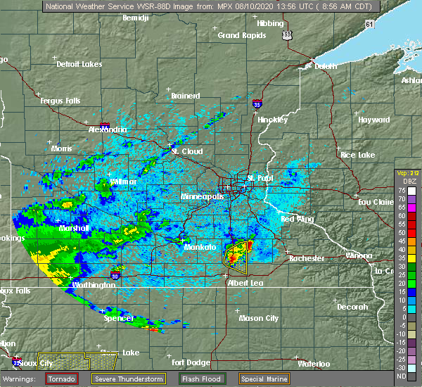 At 858 am cdt, a severe thunderstorm was located near geneva, or 14 miles south of owatonna, moving east at 30 mph (radar indicated). Hazards include quarter size hail. Damage to vehicles is expected. Locations impacted include, blooming prairie, ellendale, geneva, steele center and bixby. At 858 am cdt, a severe thunderstorm was located near geneva, or 14 miles south of owatonna, moving east at 30 mph (radar indicated). Hazards include quarter size hail. Damage to vehicles is expected. Locations impacted include, blooming prairie, ellendale, geneva, steele center and bixby.
|
| 8/10/2020 8:52 AM CDT |
 At 851 am cdt, a severe thunderstorm was located over ellendale, or 13 miles south of owatonna, moving east at 35 mph (radar indicated). Hazards include quarter size hail. Damage to vehicles is expected. Locations impacted include, owatonna, blooming prairie, ellendale, geneva, hollandale, merton, hope, steele center and bixby. At 851 am cdt, a severe thunderstorm was located over ellendale, or 13 miles south of owatonna, moving east at 35 mph (radar indicated). Hazards include quarter size hail. Damage to vehicles is expected. Locations impacted include, owatonna, blooming prairie, ellendale, geneva, hollandale, merton, hope, steele center and bixby.
|
| 8/10/2020 8:36 AM CDT |
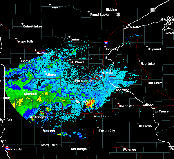 At 836 am cdt, a severe thunderstorm was located over new richland, or 17 miles southwest of owatonna, moving east at 30 mph (radar indicated). Hazards include quarter size hail. damage to vehicles is expected At 836 am cdt, a severe thunderstorm was located over new richland, or 17 miles southwest of owatonna, moving east at 30 mph (radar indicated). Hazards include quarter size hail. damage to vehicles is expected
|
| 8/10/2020 5:18 AM CDT |
 At 518 am cdt, a severe thunderstorm was located near blooming prairie, or 14 miles southeast of owatonna, moving east at 35 mph (trained weather spotters). Hazards include 60 mph wind gusts and quarter size hail. Hail damage to vehicles is expected. expect wind damage to roofs, siding, and trees. Locations impacted include, blooming prairie, ellendale, geneva, hope and steele center. At 518 am cdt, a severe thunderstorm was located near blooming prairie, or 14 miles southeast of owatonna, moving east at 35 mph (trained weather spotters). Hazards include 60 mph wind gusts and quarter size hail. Hail damage to vehicles is expected. expect wind damage to roofs, siding, and trees. Locations impacted include, blooming prairie, ellendale, geneva, hope and steele center.
|
| 8/10/2020 5:08 AM CDT |
 At 507 am cdt, a severe thunderstorm was located near ellendale, or 11 miles south of owatonna, moving east at 35 mph (trained weather spotters). Hazards include 60 mph wind gusts and quarter size hail. Hail damage to vehicles is expected. Expect wind damage to roofs, siding, and trees. At 507 am cdt, a severe thunderstorm was located near ellendale, or 11 miles south of owatonna, moving east at 35 mph (trained weather spotters). Hazards include 60 mph wind gusts and quarter size hail. Hail damage to vehicles is expected. Expect wind damage to roofs, siding, and trees.
|
| 8/8/2020 5:13 PM CDT |
 The severe thunderstorm warning for dodge county will expire at 515 pm cdt, the storm which prompted the warning has weakened below severe limits, and no longer poses an immediate threat to life or property. therefore, the warning will be allowed to expire. however heavy rain and lightning are still possible with this thunderstorm. The severe thunderstorm warning for dodge county will expire at 515 pm cdt, the storm which prompted the warning has weakened below severe limits, and no longer poses an immediate threat to life or property. therefore, the warning will be allowed to expire. however heavy rain and lightning are still possible with this thunderstorm.
|
| 8/8/2020 5:07 PM CDT |
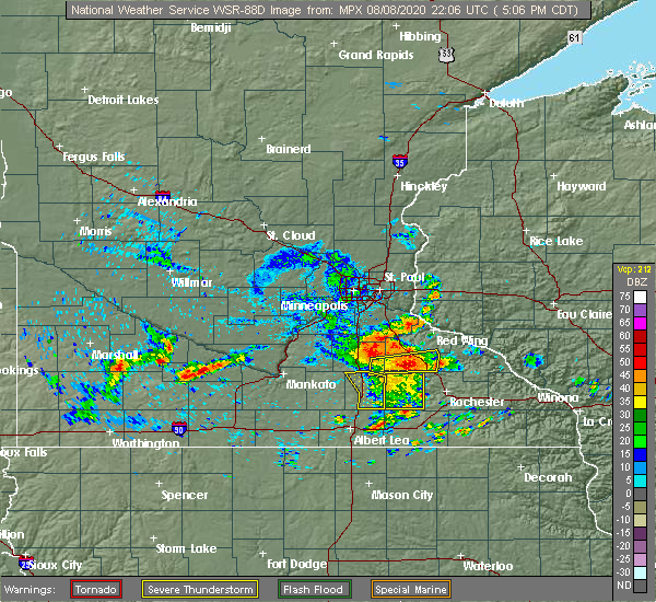 The severe thunderstorm warning for steele county will expire at 515 pm cdt, the storm which prompted the warning has moved out of the area. therefore, the warning will be allowed to expire. to report severe weather, contact your nearest law enforcement agency. they will relay your report to the national weather service the twin cities. The severe thunderstorm warning for steele county will expire at 515 pm cdt, the storm which prompted the warning has moved out of the area. therefore, the warning will be allowed to expire. to report severe weather, contact your nearest law enforcement agency. they will relay your report to the national weather service the twin cities.
|
| 8/8/2020 5:00 PM CDT |
 At 459 pm cdt, a severe thunderstorm was located over mantorville, moving east at 45 mph (radar indicated). Hazards include 60 mph wind gusts and nickel size hail. Expect damage to roofs, siding, and trees. This severe thunderstorm will remain over mainly rural areas of dodge county, including the following locations, oslo, concord, and eden. At 459 pm cdt, a severe thunderstorm was located over mantorville, moving east at 45 mph (radar indicated). Hazards include 60 mph wind gusts and nickel size hail. Expect damage to roofs, siding, and trees. This severe thunderstorm will remain over mainly rural areas of dodge county, including the following locations, oslo, concord, and eden.
|
| 8/8/2020 4:48 PM CDT |
 At 448 pm cdt, a severe thunderstorm was located near blooming prairie, or 12 miles southeast of owatonna, moving east at 30 mph (radar indicated). Hazards include 60 mph wind gusts. Expect damage to roofs, siding, and trees. Locations impacted include, owatonna, blooming prairie, medford, clinton falls, merton, deerfield, steele center, bixby and owatonna airport. At 448 pm cdt, a severe thunderstorm was located near blooming prairie, or 12 miles southeast of owatonna, moving east at 30 mph (radar indicated). Hazards include 60 mph wind gusts. Expect damage to roofs, siding, and trees. Locations impacted include, owatonna, blooming prairie, medford, clinton falls, merton, deerfield, steele center, bixby and owatonna airport.
|
| 8/8/2020 4:35 PM CDT |
 At 434 pm cdt, a severe thunderstorm was located over owatonna, moving east at 40 mph (radar indicated). Hazards include 60 mph wind gusts and nickel size hail. Expect damage to roofs, siding, and trees. this severe thunderstorm will be near, claremont around 450 pm cdt. west concord around 455 pm cdt. dodge center around 500 pm cdt. mantorville and kasson around 505 pm cdt. Other locations impacted by this severe thunderstorm include oslo, concord, and eden. At 434 pm cdt, a severe thunderstorm was located over owatonna, moving east at 40 mph (radar indicated). Hazards include 60 mph wind gusts and nickel size hail. Expect damage to roofs, siding, and trees. this severe thunderstorm will be near, claremont around 450 pm cdt. west concord around 455 pm cdt. dodge center around 500 pm cdt. mantorville and kasson around 505 pm cdt. Other locations impacted by this severe thunderstorm include oslo, concord, and eden.
|
| 8/8/2020 4:28 PM CDT |
 At 427 pm cdt, a severe thunderstorm was located 7 miles southwest of owatonna, moving east at 30 mph (radar indicated). Hazards include 60 mph wind gusts. expect damage to roofs, siding, and trees At 427 pm cdt, a severe thunderstorm was located 7 miles southwest of owatonna, moving east at 30 mph (radar indicated). Hazards include 60 mph wind gusts. expect damage to roofs, siding, and trees
|
| 7/11/2020 4:42 PM CDT |
 At 442 pm cdt, a severe thunderstorm was located near rose creek, or 9 miles southeast of austin, moving southeast at 55 mph (radar indicated). Hazards include 70 mph wind gusts and quarter size hail. Hail damage to vehicles is expected. expect considerable tree damage. wind damage is also likely to mobile homes, roofs, and outbuildings. Locations impacted include, albert lea, blooming prairie, clarks grove, ellendale, alden, glenville, geneva, london, hollandale, hayward, conger and myrtle. At 442 pm cdt, a severe thunderstorm was located near rose creek, or 9 miles southeast of austin, moving southeast at 55 mph (radar indicated). Hazards include 70 mph wind gusts and quarter size hail. Hail damage to vehicles is expected. expect considerable tree damage. wind damage is also likely to mobile homes, roofs, and outbuildings. Locations impacted include, albert lea, blooming prairie, clarks grove, ellendale, alden, glenville, geneva, london, hollandale, hayward, conger and myrtle.
|
| 7/11/2020 4:39 PM CDT |
 At 438 pm cdt, severe thunderstorms were located along a line extending from blooming prairie to near austin to near london, moving east at 45 mph (radar indicated). Hazards include 60 mph wind gusts. Expect damage to roofs, siding, and trees. these severe storms will be near, brownsdale around 445 pm cdt. hayfield, lyle and rose creek around 450 pm cdt. adams around 500 pm cdt. grand meadow around 505 pm cdt. Stewartville and le roy around 515 pm cdt. At 438 pm cdt, severe thunderstorms were located along a line extending from blooming prairie to near austin to near london, moving east at 45 mph (radar indicated). Hazards include 60 mph wind gusts. Expect damage to roofs, siding, and trees. these severe storms will be near, brownsdale around 445 pm cdt. hayfield, lyle and rose creek around 450 pm cdt. adams around 500 pm cdt. grand meadow around 505 pm cdt. Stewartville and le roy around 515 pm cdt.
|
| 7/11/2020 4:31 PM CDT |
 At 430 pm cdt, severe thunderstorms were located along a line extending from 7 miles northeast of ellendale to near hollandale to glenville, moving southeast at 45 mph (radar indicated). Hazards include 60 mph wind gusts. Expect damage to roofs, siding, and trees. these severe storms will be near, austin around 440 pm cdt. hayfield and lyle around 450 pm cdt. rose creek around 455 pm cdt. Adams and brownsdale around 500 pm cdt. At 430 pm cdt, severe thunderstorms were located along a line extending from 7 miles northeast of ellendale to near hollandale to glenville, moving southeast at 45 mph (radar indicated). Hazards include 60 mph wind gusts. Expect damage to roofs, siding, and trees. these severe storms will be near, austin around 440 pm cdt. hayfield and lyle around 450 pm cdt. rose creek around 455 pm cdt. Adams and brownsdale around 500 pm cdt.
|
| 7/11/2020 4:19 PM CDT |
 At 418 pm cdt, severe thunderstorms were located along a line extending from 7 miles southwest of owatonna to near geneva to near albert lea, moving east at 45 mph (radar indicated). Hazards include 60 mph wind gusts. Expect damage to roofs, siding, and trees. severe thunderstorms will be near, austin around 440 pm cdt. brownsdale around 445 pm cdt. hayfield and lyle around 450 pm cdt. rose creek around 455 pm cdt. adams around 500 pm cdt. grand meadow around 505 pm cdt. Stewartville and le roy around 515 pm cdt. At 418 pm cdt, severe thunderstorms were located along a line extending from 7 miles southwest of owatonna to near geneva to near albert lea, moving east at 45 mph (radar indicated). Hazards include 60 mph wind gusts. Expect damage to roofs, siding, and trees. severe thunderstorms will be near, austin around 440 pm cdt. brownsdale around 445 pm cdt. hayfield and lyle around 450 pm cdt. rose creek around 455 pm cdt. adams around 500 pm cdt. grand meadow around 505 pm cdt. Stewartville and le roy around 515 pm cdt.
|
| 7/11/2020 4:05 PM CDT |
 At 404 pm cdt, a severe thunderstorm was located near hartland, or 12 miles north of albert lea, moving southeast at 55 mph (radar indicated). Hazards include 70 mph wind gusts and quarter size hail. Hail damage to vehicles is expected. expect considerable tree damage. Wind damage is also likely to mobile homes, roofs, and outbuildings. At 404 pm cdt, a severe thunderstorm was located near hartland, or 12 miles north of albert lea, moving southeast at 55 mph (radar indicated). Hazards include 70 mph wind gusts and quarter size hail. Hail damage to vehicles is expected. expect considerable tree damage. Wind damage is also likely to mobile homes, roofs, and outbuildings.
|
| 6/2/2020 8:00 PM CDT |
 The severe thunderstorm warning for southwestern olmsted, northern mower, and southern dodge counties will expire at 800 pm cdt, the storm which prompted the warning has moved out of the area. therefore, the warning will be allowed to expire. however gusty winds are still possible. a severe thunderstorm warning still remains in effect for southern mower county until 815 pm. in addition, a severe thunderstorm watch remains in effect until midnight cdt for southeastern minnesota. The severe thunderstorm warning for southwestern olmsted, northern mower, and southern dodge counties will expire at 800 pm cdt, the storm which prompted the warning has moved out of the area. therefore, the warning will be allowed to expire. however gusty winds are still possible. a severe thunderstorm warning still remains in effect for southern mower county until 815 pm. in addition, a severe thunderstorm watch remains in effect until midnight cdt for southeastern minnesota.
|
| 6/2/2020 7:30 PM CDT |
 At 730 pm cdt, a severe thunderstorm was located near grand meadow, or 14 miles east of austin, moving east at 30 mph (trained weather spotters). Hazards include 70 mph wind gusts and ping pong ball size hail. People and animals outdoors will be injured. expect hail damage to roofs, siding, windows, and vehicles. expect considerable tree damage. wind damage is also likely to mobile homes, roofs, and outbuildings. this severe storm will be near, grand meadow around 745 pm cdt. Other locations impacted by this severe thunderstorm include county roads 3 and 108, county roads 6 and 15, rock dell, brookside campground, mayville, rochester airport and graves landing field. At 730 pm cdt, a severe thunderstorm was located near grand meadow, or 14 miles east of austin, moving east at 30 mph (trained weather spotters). Hazards include 70 mph wind gusts and ping pong ball size hail. People and animals outdoors will be injured. expect hail damage to roofs, siding, windows, and vehicles. expect considerable tree damage. wind damage is also likely to mobile homes, roofs, and outbuildings. this severe storm will be near, grand meadow around 745 pm cdt. Other locations impacted by this severe thunderstorm include county roads 3 and 108, county roads 6 and 15, rock dell, brookside campground, mayville, rochester airport and graves landing field.
|
| 6/2/2020 7:03 PM CDT |
 At 702 pm cdt, a severe thunderstorm was located over austin, moving east at 35 mph (trained weather spotters. this storm has a history of producing very large hail and damaging winds). Hazards include tennis ball size hail and 70 mph wind gusts. People and animals outdoors will be injured. expect hail damage to roofs, siding, windows, and vehicles. expect considerable tree damage. wind damage is also likely to mobile homes, roofs, and outbuildings. this severe storm will be near, brownsdale around 710 pm cdt. rose creek around 715 pm cdt. grand meadow around 730 pm cdt. Other locations impacted by this severe thunderstorm include county roads 3 and 108, county roads 6 and 15, salem corners, rock dell, brookside campground, county roads 5 and 6 and mayville. At 702 pm cdt, a severe thunderstorm was located over austin, moving east at 35 mph (trained weather spotters. this storm has a history of producing very large hail and damaging winds). Hazards include tennis ball size hail and 70 mph wind gusts. People and animals outdoors will be injured. expect hail damage to roofs, siding, windows, and vehicles. expect considerable tree damage. wind damage is also likely to mobile homes, roofs, and outbuildings. this severe storm will be near, brownsdale around 710 pm cdt. rose creek around 715 pm cdt. grand meadow around 730 pm cdt. Other locations impacted by this severe thunderstorm include county roads 3 and 108, county roads 6 and 15, salem corners, rock dell, brookside campground, county roads 5 and 6 and mayville.
|
| 6/2/2020 6:57 PM CDT |
 The severe thunderstorm warning for northern freeborn, northeastern faribault and southern steele counties will expire at 700 pm cdt, the storm which prompted the warning has moved out of the area. therefore, the warning will be allowed to expire. however gusty winds and heavy rain are still possible with this thunderstorm. a severe thunderstorm watch remains in effect until midnight cdt for south central minnesota. The severe thunderstorm warning for northern freeborn, northeastern faribault and southern steele counties will expire at 700 pm cdt, the storm which prompted the warning has moved out of the area. therefore, the warning will be allowed to expire. however gusty winds and heavy rain are still possible with this thunderstorm. a severe thunderstorm watch remains in effect until midnight cdt for south central minnesota.
|
| 6/2/2020 6:49 PM CDT |
 At 648 pm cdt, a severe thunderstorm was located near geneva, or 15 miles northwest of austin, moving east at 25 mph (radar indicated). Hazards include ping pong ball size hail and 60 mph wind gusts. People and animals outdoors will be injured. expect hail damage to roofs, siding, windows, and vehicles. expect wind damage to roofs, siding, and trees. Locations impacted include, albert lea, wells, blooming prairie, clarks grove, ellendale, alden, geneva, hartland, hollandale, freeborn, hayward and lemond. At 648 pm cdt, a severe thunderstorm was located near geneva, or 15 miles northwest of austin, moving east at 25 mph (radar indicated). Hazards include ping pong ball size hail and 60 mph wind gusts. People and animals outdoors will be injured. expect hail damage to roofs, siding, windows, and vehicles. expect wind damage to roofs, siding, and trees. Locations impacted include, albert lea, wells, blooming prairie, clarks grove, ellendale, alden, geneva, hartland, hollandale, freeborn, hayward and lemond.
|
| 6/2/2020 6:31 PM CDT |
 At 630 pm cdt, a severe thunderstorm was located near blooming prairie, or 14 miles south of owatonna, moving east at 35 mph (trained weather spotters). Hazards include tennis ball size hail and 70 mph wind gusts. this storm has a history of producing large hail and damaging winds. People and animals outdoors will be injured. expect hail damage to roofs, siding, windows, and vehicles. expect considerable tree damage. wind damage is also likely to mobile homes, roofs, and outbuildings. this severe thunderstorm will be near, blooming prairie around 640 pm cdt. hayfield around 655 pm cdt. rochester and stewartville around 725 pm cdt. Other locations impacted by this severe thunderstorm include county roads 3 and 108, county roads 6 and 15, salem corners, rock dell, brookside campground, county roads 5 and 6 and mayville. At 630 pm cdt, a severe thunderstorm was located near blooming prairie, or 14 miles south of owatonna, moving east at 35 mph (trained weather spotters). Hazards include tennis ball size hail and 70 mph wind gusts. this storm has a history of producing large hail and damaging winds. People and animals outdoors will be injured. expect hail damage to roofs, siding, windows, and vehicles. expect considerable tree damage. wind damage is also likely to mobile homes, roofs, and outbuildings. this severe thunderstorm will be near, blooming prairie around 640 pm cdt. hayfield around 655 pm cdt. rochester and stewartville around 725 pm cdt. Other locations impacted by this severe thunderstorm include county roads 3 and 108, county roads 6 and 15, salem corners, rock dell, brookside campground, county roads 5 and 6 and mayville.
|
| 6/2/2020 6:18 PM CDT |
 At 618 pm cdt, a severe thunderstorm was located near new richland, or 14 miles north of albert lea, moving east at 25 mph (radar indicated). Hazards include tennis ball size hail and 60 mph wind gusts. People and animals outdoors will be injured. expect hail damage to roofs, siding, windows, and vehicles. Expect wind damage to roofs, siding, and trees. At 618 pm cdt, a severe thunderstorm was located near new richland, or 14 miles north of albert lea, moving east at 25 mph (radar indicated). Hazards include tennis ball size hail and 60 mph wind gusts. People and animals outdoors will be injured. expect hail damage to roofs, siding, windows, and vehicles. Expect wind damage to roofs, siding, and trees.
|
| 9/24/2019 7:41 PM CDT |
 The severe thunderstorm warning for northeastern freeborn and southern steele counties will expire at 745 pm cdt, the storm which prompted the warning has weakened below severe limits, and has exited the warned area. therefore, the warning will be allowed to expire. a tornado watch remains in effect until midnight cdt for south central minnesota. to report severe weather, contact your nearest law enforcement agency. they will relay your report to the national weather service the twin cities. The severe thunderstorm warning for northeastern freeborn and southern steele counties will expire at 745 pm cdt, the storm which prompted the warning has weakened below severe limits, and has exited the warned area. therefore, the warning will be allowed to expire. a tornado watch remains in effect until midnight cdt for south central minnesota. to report severe weather, contact your nearest law enforcement agency. they will relay your report to the national weather service the twin cities.
|
| 9/24/2019 7:29 PM CDT |
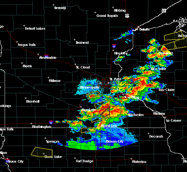 At 729 pm cdt, a severe thunderstorm was located 7 miles southwest of claremont, or 9 miles southeast of owatonna, moving northeast at 60 mph (radar indicated). Hazards include 60 mph wind gusts and quarter size hail. Hail damage to vehicles is expected. expect wind damage to roofs, siding, and trees. This severe thunderstorm will remain over mainly rural areas of northeastern freeborn and southern steele counties, including the following locations, steele center and bixby. At 729 pm cdt, a severe thunderstorm was located 7 miles southwest of claremont, or 9 miles southeast of owatonna, moving northeast at 60 mph (radar indicated). Hazards include 60 mph wind gusts and quarter size hail. Hail damage to vehicles is expected. expect wind damage to roofs, siding, and trees. This severe thunderstorm will remain over mainly rural areas of northeastern freeborn and southern steele counties, including the following locations, steele center and bixby.
|
| 9/24/2019 7:26 PM CDT |
 At 725 pm cdt, a cluster of severe thunderstorms were over most of dodge county minnesota, moving northeast at 50 mph. heavy rain and gusty winds are expected (radar indicated). Hazards include 60 mph wind gusts and penny size hail. Expect damage to roofs, siding, and trees. This severe thunderstorm will remain over mainly rural areas of dodge county, including the following locations, county roads 20 and 5, oslo, concord, eden, highway 57 and 570th street, county roads 6 and 15 and county roads 5 and 6. At 725 pm cdt, a cluster of severe thunderstorms were over most of dodge county minnesota, moving northeast at 50 mph. heavy rain and gusty winds are expected (radar indicated). Hazards include 60 mph wind gusts and penny size hail. Expect damage to roofs, siding, and trees. This severe thunderstorm will remain over mainly rural areas of dodge county, including the following locations, county roads 20 and 5, oslo, concord, eden, highway 57 and 570th street, county roads 6 and 15 and county roads 5 and 6.
|
| 9/24/2019 7:17 PM CDT |
 At 715 pm cdt, a cluster of strong to severe thunderstorms were over central and southern parts of dodge county, moving east at 55 mph (radar indicated). Hazards include 60 mph wind gusts and penny size hail. Expect damage to roofs, siding, and trees. this severe thunderstorm will be near, mantorville and kasson around 725 pm cdt. Other locations impacted by this severe thunderstorm include county roads 20 and 5, oslo, concord, eden, highway 57 and 570th street, county roads 6 and 15 and county roads 5 and 6. At 715 pm cdt, a cluster of strong to severe thunderstorms were over central and southern parts of dodge county, moving east at 55 mph (radar indicated). Hazards include 60 mph wind gusts and penny size hail. Expect damage to roofs, siding, and trees. this severe thunderstorm will be near, mantorville and kasson around 725 pm cdt. Other locations impacted by this severe thunderstorm include county roads 20 and 5, oslo, concord, eden, highway 57 and 570th street, county roads 6 and 15 and county roads 5 and 6.
|
| 9/24/2019 7:06 PM CDT |
 At 706 pm cdt, severe thunderstorms were located along a line extending from near hartland to 8 miles northeast of ellendale, moving northeast at 60 mph (radar indicated). Hazards include 60 mph wind gusts and quarter size hail. Hail damage to vehicles is expected. expect wind damage to roofs, siding, and trees. These severe thunderstorms will remain over mainly rural areas of northern freeborn, southern steele and southeastern waseca counties, including the following locations, steele center, bixby and manchester. At 706 pm cdt, severe thunderstorms were located along a line extending from near hartland to 8 miles northeast of ellendale, moving northeast at 60 mph (radar indicated). Hazards include 60 mph wind gusts and quarter size hail. Hail damage to vehicles is expected. expect wind damage to roofs, siding, and trees. These severe thunderstorms will remain over mainly rural areas of northern freeborn, southern steele and southeastern waseca counties, including the following locations, steele center, bixby and manchester.
|
| 9/24/2019 6:56 PM CDT |
 At 656 pm cdt, severe thunderstorms were located along a line extending from freeborn to near ellendale, moving northeast at 60 mph (radar indicated). Hazards include 60 mph wind gusts and half dollar size hail. Hail damage to vehicles is expected. expect wind damage to roofs, siding, and trees. severe thunderstorms will be near, clarks grove around 705 pm cdt. Ellendale and geneva around 710 pm cdt. At 656 pm cdt, severe thunderstorms were located along a line extending from freeborn to near ellendale, moving northeast at 60 mph (radar indicated). Hazards include 60 mph wind gusts and half dollar size hail. Hail damage to vehicles is expected. expect wind damage to roofs, siding, and trees. severe thunderstorms will be near, clarks grove around 705 pm cdt. Ellendale and geneva around 710 pm cdt.
|
| 9/11/2019 5:16 AM CDT |
 At 515 am cdt, a severe thunderstorm was located near blooming prairie, or 13 miles north of austin, moving northeast at 45 mph (radar indicated). Hazards include 60 mph wind gusts and penny size hail. Expect damage to roofs, siding, and trees. this severe thunderstorm will be near, hayfield around 525 am cdt. dodge center around 535 am cdt. mantorville and kasson around 540 am cdt. Other locations impacted by this severe thunderstorm include county roads 20 and 5, eden, county roads 3 and 108, highway 57 and 570th street, county roads 6 and 15, rock dell and brookside campground. At 515 am cdt, a severe thunderstorm was located near blooming prairie, or 13 miles north of austin, moving northeast at 45 mph (radar indicated). Hazards include 60 mph wind gusts and penny size hail. Expect damage to roofs, siding, and trees. this severe thunderstorm will be near, hayfield around 525 am cdt. dodge center around 535 am cdt. mantorville and kasson around 540 am cdt. Other locations impacted by this severe thunderstorm include county roads 20 and 5, eden, county roads 3 and 108, highway 57 and 570th street, county roads 6 and 15, rock dell and brookside campground.
|
| 8/18/2019 1:52 AM CDT |
 At 111 am cdt, severe thunderstorms were located along a line extending from morristown to geneva to near twin lakes, moving east at 50 mph (radar indicated). Hazards include 60 mph wind gusts. Expect damage to roofs, siding, and trees. severe thunderstorms will be near, austin around 130 am cdt. brownsdale around 135 am cdt. hayfield and lyle around 140 am cdt. west concord around 145 am cdt. rose creek around 150 am cdt. adams around 155 am cdt. Other locations impacted by these severe thunderstorms include county roads 20 and 5, eden, highway 57 and 570th street, county roads 6 and 15, brookside campground, county roads 5 and 6 and mayville. At 111 am cdt, severe thunderstorms were located along a line extending from morristown to geneva to near twin lakes, moving east at 50 mph (radar indicated). Hazards include 60 mph wind gusts. Expect damage to roofs, siding, and trees. severe thunderstorms will be near, austin around 130 am cdt. brownsdale around 135 am cdt. hayfield and lyle around 140 am cdt. west concord around 145 am cdt. rose creek around 150 am cdt. adams around 155 am cdt. Other locations impacted by these severe thunderstorms include county roads 20 and 5, eden, highway 57 and 570th street, county roads 6 and 15, brookside campground, county roads 5 and 6 and mayville.
|
| 8/18/2019 1:36 AM CDT |
 At 111 am cdt, severe thunderstorms were located along a line extending from morristown to geneva to near twin lakes, moving east at 50 mph (radar indicated). Hazards include 60 mph wind gusts. Expect damage to roofs, siding, and trees. severe thunderstorms will be near, austin around 130 am cdt. brownsdale around 135 am cdt. hayfield and lyle around 140 am cdt. west concord around 145 am cdt. rose creek around 150 am cdt. adams around 155 am cdt. Other locations impacted by these severe thunderstorms include county roads 20 and 5, eden, highway 57 and 570th street, county roads 6 and 15, brookside campground, county roads 5 and 6 and mayville. At 111 am cdt, severe thunderstorms were located along a line extending from morristown to geneva to near twin lakes, moving east at 50 mph (radar indicated). Hazards include 60 mph wind gusts. Expect damage to roofs, siding, and trees. severe thunderstorms will be near, austin around 130 am cdt. brownsdale around 135 am cdt. hayfield and lyle around 140 am cdt. west concord around 145 am cdt. rose creek around 150 am cdt. adams around 155 am cdt. Other locations impacted by these severe thunderstorms include county roads 20 and 5, eden, highway 57 and 570th street, county roads 6 and 15, brookside campground, county roads 5 and 6 and mayville.
|
| 8/18/2019 1:24 AM CDT |
 At 124 am cdt, severe thunderstorms were located along a line extending from near medford to near hollandale to near glenville, moving east at 50 mph (radar indicated). Hazards include 60 mph wind gusts. Expect damage to roofs, siding, and trees. these severe storms will be near, austin around 135 am cdt. hayfield and brownsdale around 140 am cdt. west concord and lyle around 145 am cdt. rose creek around 150 am cdt. adams around 200 am cdt. Other locations impacted by these severe thunderstorms include county roads 20 and 5, eden, highway 57 and 570th street, county roads 6 and 15, brookside campground, county roads 5 and 6 and mayville. At 124 am cdt, severe thunderstorms were located along a line extending from near medford to near hollandale to near glenville, moving east at 50 mph (radar indicated). Hazards include 60 mph wind gusts. Expect damage to roofs, siding, and trees. these severe storms will be near, austin around 135 am cdt. hayfield and brownsdale around 140 am cdt. west concord and lyle around 145 am cdt. rose creek around 150 am cdt. adams around 200 am cdt. Other locations impacted by these severe thunderstorms include county roads 20 and 5, eden, highway 57 and 570th street, county roads 6 and 15, brookside campground, county roads 5 and 6 and mayville.
|
| 8/18/2019 1:12 AM CDT |
 The national weather service in la crosse has issued a * severe thunderstorm warning for. mower county in southeastern minnesota. dodge county in southeastern minnesota. until 200 am cdt. At 111 am cdt, severe thunderstorms were located along a line. The national weather service in la crosse has issued a * severe thunderstorm warning for. mower county in southeastern minnesota. dodge county in southeastern minnesota. until 200 am cdt. At 111 am cdt, severe thunderstorms were located along a line.
|
| 8/18/2019 1:05 AM CDT |
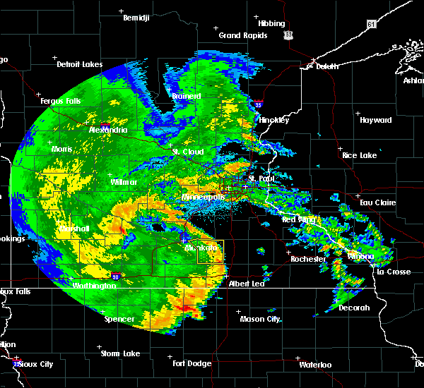 At 105 am cdt, severe thunderstorms were located along a line extending from near morristown to near ellendale to near rice lake, moving east at 50 mph (radar indicated). Hazards include 60 mph wind gusts. expect damage to roofs, siding, and trees At 105 am cdt, severe thunderstorms were located along a line extending from near morristown to near ellendale to near rice lake, moving east at 50 mph (radar indicated). Hazards include 60 mph wind gusts. expect damage to roofs, siding, and trees
|
| 8/13/2019 5:11 PM CDT |
 At 508 pm cdt, a severe thunderstorm was located over brownsdale, or 9 miles northeast of austin, moving southeast at 55 mph (law enforcement reported quarter size hail at 505 pm 6 miles northwest of lansing in far northwest mower county). Hazards include quarter size hail. Damage to vehicles is expected. this severe storm will be near, grand meadow and adams around 520 pm cdt. le roy around 530 pm cdt. Other locations impacted by this severe thunderstorm include brookside campground, mayville, county roads 4 and 8, waltham, renova, i 90 exit 179 and i 90 exit 183. At 508 pm cdt, a severe thunderstorm was located over brownsdale, or 9 miles northeast of austin, moving southeast at 55 mph (law enforcement reported quarter size hail at 505 pm 6 miles northwest of lansing in far northwest mower county). Hazards include quarter size hail. Damage to vehicles is expected. this severe storm will be near, grand meadow and adams around 520 pm cdt. le roy around 530 pm cdt. Other locations impacted by this severe thunderstorm include brookside campground, mayville, county roads 4 and 8, waltham, renova, i 90 exit 179 and i 90 exit 183.
|
| 8/13/2019 5:05 PM CDT | Quarter sized hail reported 3.6 miles NNW of Blooming Prairie, MN |
| 8/13/2019 4:51 PM CDT |
 At 449 pm cdt, a severe thunderstorm was located near brownsdale, or 9 miles north of austin, moving southeast at 40 mph (law enforcement reported nickel size hail near waseca around 4 pm and a brief tornado touchdown near ellensdale around 430 pm). Hazards include quarter size hail. Damage to vehicles is expected. this severe thunderstorm will be near, brownsdale around 455 pm cdt. grand meadow and adams around 515 pm cdt. le roy around 530 pm cdt. Other locations impacted by this severe thunderstorm include brookside campground, mayville, county roads 4 and 8, waltham, renova, i 90 exit 179 and i 90 exit 183. At 449 pm cdt, a severe thunderstorm was located near brownsdale, or 9 miles north of austin, moving southeast at 40 mph (law enforcement reported nickel size hail near waseca around 4 pm and a brief tornado touchdown near ellensdale around 430 pm). Hazards include quarter size hail. Damage to vehicles is expected. this severe thunderstorm will be near, brownsdale around 455 pm cdt. grand meadow and adams around 515 pm cdt. le roy around 530 pm cdt. Other locations impacted by this severe thunderstorm include brookside campground, mayville, county roads 4 and 8, waltham, renova, i 90 exit 179 and i 90 exit 183.
|
| 8/13/2019 4:51 PM CDT |
 At 451 pm cdt, a severe thunderstorm capable of producing a tornado was located near geneva, or 14 miles northwest of austin, moving southeast at 25 mph (weather spotters reported a funnel cloud). Hazards include tornado. Flying debris will be dangerous to those caught without shelter. mobile homes will be damaged or destroyed. damage to roofs, windows, and vehicles will occur. tree damage is likely. This dangerous storm will be near, blooming prairie around 500 pm cdt. At 451 pm cdt, a severe thunderstorm capable of producing a tornado was located near geneva, or 14 miles northwest of austin, moving southeast at 25 mph (weather spotters reported a funnel cloud). Hazards include tornado. Flying debris will be dangerous to those caught without shelter. mobile homes will be damaged or destroyed. damage to roofs, windows, and vehicles will occur. tree damage is likely. This dangerous storm will be near, blooming prairie around 500 pm cdt.
|
| 8/13/2019 4:43 PM CDT |
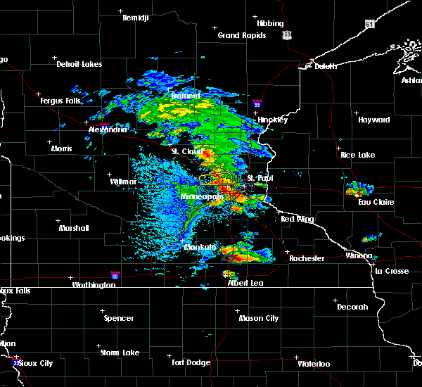 At 443 pm cdt, a severe thunderstorm capable of producing a tornado was located near geneva, or 15 miles south of owatonna, moving southeast at 25 mph (weather spotters reported funnel cloud). Hazards include tornado. Flying debris will be dangerous to those caught without shelter. mobile homes will be damaged or destroyed. damage to roofs, windows, and vehicles will occur. tree damage is likely. this dangerous storm will be near, blooming prairie around 500 pm cdt. This includes interstate 35 near mile marker 26. At 443 pm cdt, a severe thunderstorm capable of producing a tornado was located near geneva, or 15 miles south of owatonna, moving southeast at 25 mph (weather spotters reported funnel cloud). Hazards include tornado. Flying debris will be dangerous to those caught without shelter. mobile homes will be damaged or destroyed. damage to roofs, windows, and vehicles will occur. tree damage is likely. this dangerous storm will be near, blooming prairie around 500 pm cdt. This includes interstate 35 near mile marker 26.
|
| 8/5/2019 4:52 PM CDT |
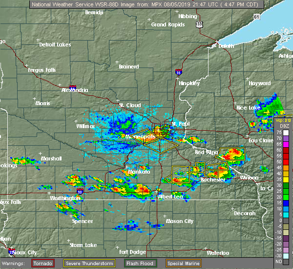 The severe thunderstorm warning for southeastern steele county will expire at 500 pm cdt, the storm which prompted the warning has moved out of the area. therefore, the warning will be allowed to expire. a severe thunderstorm watch remains in effect until 1000 pm cdt for south central minnesota. The severe thunderstorm warning for southeastern steele county will expire at 500 pm cdt, the storm which prompted the warning has moved out of the area. therefore, the warning will be allowed to expire. a severe thunderstorm watch remains in effect until 1000 pm cdt for south central minnesota.
|
| 8/5/2019 4:50 PM CDT |
 At 450 pm cdt, a severe thunderstorm was located near blooming prairie, or 11 miles southwest of dodge center, moving east at 25 mph (radar indicated). Hazards include 60 mph wind gusts and half dollar size hail. Hail damage to vehicles is expected. expect wind damage to roofs, siding, and trees. Locations impacted include, dodge center, mantorville, kasson, blooming prairie, hayfield, wasioja, oslo, highway 57 and 570th street, county roads 6 and 15, county roads 5 and 6, highway 56 and county 6, graves landing field, highway 30 and county 3, county roads 6 and 9, county roads 3 and 6 and danesville. At 450 pm cdt, a severe thunderstorm was located near blooming prairie, or 11 miles southwest of dodge center, moving east at 25 mph (radar indicated). Hazards include 60 mph wind gusts and half dollar size hail. Hail damage to vehicles is expected. expect wind damage to roofs, siding, and trees. Locations impacted include, dodge center, mantorville, kasson, blooming prairie, hayfield, wasioja, oslo, highway 57 and 570th street, county roads 6 and 15, county roads 5 and 6, highway 56 and county 6, graves landing field, highway 30 and county 3, county roads 6 and 9, county roads 3 and 6 and danesville.
|
| 8/5/2019 4:45 PM CDT |
 At 445 pm cdt, a severe thunderstorm was located near blooming prairie, or 11 miles southwest of dodge center, moving east at 25 mph (radar indicated). Hazards include golf ball size hail and 60 mph wind gusts. People and animals outdoors will be injured. expect hail damage to roofs, siding, windows, and vehicles. expect wind damage to roofs, siding, and trees. Locations impacted include, dodge center, mantorville, kasson, blooming prairie, hayfield, west concord, claremont, wasioja, concord, oslo, eden, county roads 20 and 5, highway 57 and 570th street, county roads 6 and 15, county roads 5 and 6, highway 56 and county 6, graves landing field, county roads 1 and 24, berne and highway 30 and county 3. At 445 pm cdt, a severe thunderstorm was located near blooming prairie, or 11 miles southwest of dodge center, moving east at 25 mph (radar indicated). Hazards include golf ball size hail and 60 mph wind gusts. People and animals outdoors will be injured. expect hail damage to roofs, siding, windows, and vehicles. expect wind damage to roofs, siding, and trees. Locations impacted include, dodge center, mantorville, kasson, blooming prairie, hayfield, west concord, claremont, wasioja, concord, oslo, eden, county roads 20 and 5, highway 57 and 570th street, county roads 6 and 15, county roads 5 and 6, highway 56 and county 6, graves landing field, county roads 1 and 24, berne and highway 30 and county 3.
|
| 8/5/2019 4:36 PM CDT |
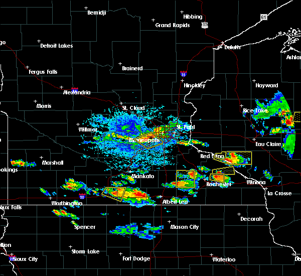 At 436 pm cdt, a severe thunderstorm was located near blooming prairie, or 13 miles southwest of dodge center, moving southeast at 20 mph (radar indicated). Hazards include 60 mph wind gusts and quarter size hail. Hail damage to vehicles is expected. Expect wind damage to roofs, siding, and trees. At 436 pm cdt, a severe thunderstorm was located near blooming prairie, or 13 miles southwest of dodge center, moving southeast at 20 mph (radar indicated). Hazards include 60 mph wind gusts and quarter size hail. Hail damage to vehicles is expected. Expect wind damage to roofs, siding, and trees.
|
| 8/5/2019 4:33 PM CDT |
 At 433 pm cdt, a severe thunderstorm was located near pine island, or near mantorville, moving east at 40 mph (radar indicated). Hazards include 60 mph wind gusts and quarter size hail. Hail damage to vehicles is expected. expect wind damage to roofs, siding, and trees. This severe thunderstorm will remain over mainly rural areas of dodge county, including the following locations, county roads 20 and 5, oslo, concord, eden, highway 57 and 570th street, county roads 6 and 15 and county roads 5 and 6. At 433 pm cdt, a severe thunderstorm was located near pine island, or near mantorville, moving east at 40 mph (radar indicated). Hazards include 60 mph wind gusts and quarter size hail. Hail damage to vehicles is expected. expect wind damage to roofs, siding, and trees. This severe thunderstorm will remain over mainly rural areas of dodge county, including the following locations, county roads 20 and 5, oslo, concord, eden, highway 57 and 570th street, county roads 6 and 15 and county roads 5 and 6.
|
| 8/5/2019 4:25 PM CDT |
 At 424 pm cdt, a severe thunderstorm was located over west concord, or 7 miles northwest of mantorville, moving east at 40 mph (radar indicated). Hazards include ping pong ball size hail and 60 mph wind gusts. People and animals outdoors will be injured. expect hail damage to roofs, siding, windows, and vehicles. expect wind damage to roofs, siding, and trees. this severe thunderstorm will be near, mantorville around 430 pm cdt. kasson around 435 pm cdt. Other locations impacted by this severe thunderstorm include county roads 20 and 5, oslo, concord, eden, highway 57 and 570th street, county roads 6 and 15 and county roads 5 and 6. At 424 pm cdt, a severe thunderstorm was located over west concord, or 7 miles northwest of mantorville, moving east at 40 mph (radar indicated). Hazards include ping pong ball size hail and 60 mph wind gusts. People and animals outdoors will be injured. expect hail damage to roofs, siding, windows, and vehicles. expect wind damage to roofs, siding, and trees. this severe thunderstorm will be near, mantorville around 430 pm cdt. kasson around 435 pm cdt. Other locations impacted by this severe thunderstorm include county roads 20 and 5, oslo, concord, eden, highway 57 and 570th street, county roads 6 and 15 and county roads 5 and 6.
|
| 7/20/2019 11:24 AM CDT |
 At 1122 am cdt, severe thunderstorms were located along a line extending from mazeppa to near lyle, moving east at 75 mph (trained weather spotters. a 58 mph wind gust was reported 2 miles west of dodge center). Hazards include 70 mph wind gusts and penny size hail. Expect considerable tree damage. damage is likely to mobile homes, roofs, and outbuildings. these severe storms will be near, oronoco around 1125 am cdt. le roy and rochester around 1135 am cdt. other locations impacted by these severe thunderstorms include i 90 exit 218, eden, highway 57 and 570th street, county roads 6 and 15, hidden meadows r v park, rock dell and brookside campground. those attending the dodge county fair and summer fest in le roy are in the path of these storms and should prepare for imminent dangerous weather conditions. Seek shelter now!. At 1122 am cdt, severe thunderstorms were located along a line extending from mazeppa to near lyle, moving east at 75 mph (trained weather spotters. a 58 mph wind gust was reported 2 miles west of dodge center). Hazards include 70 mph wind gusts and penny size hail. Expect considerable tree damage. damage is likely to mobile homes, roofs, and outbuildings. these severe storms will be near, oronoco around 1125 am cdt. le roy and rochester around 1135 am cdt. other locations impacted by these severe thunderstorms include i 90 exit 218, eden, highway 57 and 570th street, county roads 6 and 15, hidden meadows r v park, rock dell and brookside campground. those attending the dodge county fair and summer fest in le roy are in the path of these storms and should prepare for imminent dangerous weather conditions. Seek shelter now!.
|
| 7/20/2019 11:10 AM CDT |
 At 1107 am cdt, severe thunderstorms were located along a line extending from near kenyon to near northwood, moving east at 70 mph (trained weather spotters). Hazards include 70 mph wind gusts and penny size hail. Expect considerable tree damage. damage is likely to mobile homes, roofs, and outbuildings. these severe storms will be near, oronoco, adams and rose creek around 1125 am cdt. le roy around 1135 am cdt. other locations impacted by these severe thunderstorms include i 90 exit 218, eden, highway 57 and 570th street, county roads 6 and 15, hidden meadows r v park, rock dell and brookside campground. those attending the dodge county fair and summer fest in leroy are in the path of these storms and should prepare for imminent dangerous weather conditions. Seek shelter now!. At 1107 am cdt, severe thunderstorms were located along a line extending from near kenyon to near northwood, moving east at 70 mph (trained weather spotters). Hazards include 70 mph wind gusts and penny size hail. Expect considerable tree damage. damage is likely to mobile homes, roofs, and outbuildings. these severe storms will be near, oronoco, adams and rose creek around 1125 am cdt. le roy around 1135 am cdt. other locations impacted by these severe thunderstorms include i 90 exit 218, eden, highway 57 and 570th street, county roads 6 and 15, hidden meadows r v park, rock dell and brookside campground. those attending the dodge county fair and summer fest in leroy are in the path of these storms and should prepare for imminent dangerous weather conditions. Seek shelter now!.
|
| 7/20/2019 10:56 AM CDT |
 At 1053 am cdt, severe thunderstorms were located along a line extending from near faribault to emmons, moving east at 70 mph (radar indicated. this storm has a hisotory of producing 60 to 65 mph wind gusts). Hazards include 60 mph wind gusts and penny size hail. Expect damage to roofs, siding, and trees. severe thunderstorms will be near, lyle around 1115 am cdt. rose creek around 1120 am cdt. oronoco and adams around 1125 am cdt. le roy around 1135 am cdt. other locations impacted by these severe thunderstorms include i 90 exit 218, eden, highway 57 and 570th street, county roads 6 and 15, hidden meadows r v park, rock dell and brookside campground. those attending the dodge county fair are in the path of these storms and should prepare for damaging winds. Seek shelter now!. At 1053 am cdt, severe thunderstorms were located along a line extending from near faribault to emmons, moving east at 70 mph (radar indicated. this storm has a hisotory of producing 60 to 65 mph wind gusts). Hazards include 60 mph wind gusts and penny size hail. Expect damage to roofs, siding, and trees. severe thunderstorms will be near, lyle around 1115 am cdt. rose creek around 1120 am cdt. oronoco and adams around 1125 am cdt. le roy around 1135 am cdt. other locations impacted by these severe thunderstorms include i 90 exit 218, eden, highway 57 and 570th street, county roads 6 and 15, hidden meadows r v park, rock dell and brookside campground. those attending the dodge county fair are in the path of these storms and should prepare for damaging winds. Seek shelter now!.
|
| 7/20/2019 10:34 AM CDT |
 At 1033 am cdt, a severe thunderstorm was located near janesville, or 12 miles southeast of mankato, moving east at 55 mph. this storm has a history of producing wind gusts in excess of 60 mph (radar indicated). Hazards include 60 mph wind gusts. expect damage to roofs, siding, and trees At 1033 am cdt, a severe thunderstorm was located near janesville, or 12 miles southeast of mankato, moving east at 55 mph. this storm has a history of producing wind gusts in excess of 60 mph (radar indicated). Hazards include 60 mph wind gusts. expect damage to roofs, siding, and trees
|
| 6/30/2019 2:48 PM CDT |
 At 248 pm cdt, severe thunderstorms were located along a line extending from near blooming prairie to new richland, moving southeast at 25 mph (radar indicated). Hazards include 60 mph wind gusts. Expect damage to roofs, siding, and trees. Locations impacted include, blooming prairie, new richland, ellendale, steele center and bixby. At 248 pm cdt, severe thunderstorms were located along a line extending from near blooming prairie to new richland, moving southeast at 25 mph (radar indicated). Hazards include 60 mph wind gusts. Expect damage to roofs, siding, and trees. Locations impacted include, blooming prairie, new richland, ellendale, steele center and bixby.
|
| 6/30/2019 2:32 PM CDT |
 At 232 pm cdt, a severe thunderstorm was located near new richland, or 15 miles southwest of owatonna, moving southeast at 20 mph (radar indicated). Hazards include 60 mph wind gusts and nickel size hail. Expect damage to roofs, siding, and trees. Locations impacted include, blooming prairie, new richland, ellendale, otisco, lemond, hope, steele center and bixby. At 232 pm cdt, a severe thunderstorm was located near new richland, or 15 miles southwest of owatonna, moving southeast at 20 mph (radar indicated). Hazards include 60 mph wind gusts and nickel size hail. Expect damage to roofs, siding, and trees. Locations impacted include, blooming prairie, new richland, ellendale, otisco, lemond, hope, steele center and bixby.
|
| 6/30/2019 2:18 PM CDT |
 At 217 pm cdt, a severe thunderstorm was located near new richland, or 17 miles southwest of owatonna, moving east at 20 mph (radar indicated). Hazards include 60 mph wind gusts and half dollar size hail. Hail damage to vehicles is expected. Expect wind damage to roofs, siding, and trees. At 217 pm cdt, a severe thunderstorm was located near new richland, or 17 miles southwest of owatonna, moving east at 20 mph (radar indicated). Hazards include 60 mph wind gusts and half dollar size hail. Hail damage to vehicles is expected. Expect wind damage to roofs, siding, and trees.
|
| 6/4/2019 6:07 PM CDT |
 The severe thunderstorm warning for eastern steele and southwestern goodhue counties will expire at 615 pm cdt, the storm which prompted the warning has moved out of the area. therefore, the warning will be allowed to expire. a severe thunderstorm watch remains in effect until 800 pm cdt for south central and southeastern minnesota. to report severe weather, contact your nearest law enforcement agency. they will relay your report to the national weather service the twin cities. The severe thunderstorm warning for eastern steele and southwestern goodhue counties will expire at 615 pm cdt, the storm which prompted the warning has moved out of the area. therefore, the warning will be allowed to expire. a severe thunderstorm watch remains in effect until 800 pm cdt for south central and southeastern minnesota. to report severe weather, contact your nearest law enforcement agency. they will relay your report to the national weather service the twin cities.
|
| 6/4/2019 6:02 PM CDT |
 At 602 pm cdt, a severe thunderstorm was located over west concord, or 9 miles northwest of mantorville, moving southeast at 35 mph (radar indicated). Hazards include 60 mph wind gusts and penny size hail. Expect damage to roofs, siding, and trees. Locations impacted include, pine island, blooming prairie, kenyon, moland and bixby. At 602 pm cdt, a severe thunderstorm was located over west concord, or 9 miles northwest of mantorville, moving southeast at 35 mph (radar indicated). Hazards include 60 mph wind gusts and penny size hail. Expect damage to roofs, siding, and trees. Locations impacted include, pine island, blooming prairie, kenyon, moland and bixby.
|
| 6/4/2019 5:42 PM CDT |
 At 541 pm cdt, a severe thunderstorm was located near kenyon, or 11 miles east of faribault, moving southeast at 35 mph (radar indicated). Hazards include 70 mph wind gusts and penny size hail. Expect considerable tree damage. Damage is likely to mobile homes, roofs, and outbuildings. At 541 pm cdt, a severe thunderstorm was located near kenyon, or 11 miles east of faribault, moving southeast at 35 mph (radar indicated). Hazards include 70 mph wind gusts and penny size hail. Expect considerable tree damage. Damage is likely to mobile homes, roofs, and outbuildings.
|
| 6/4/2019 5:11 PM CDT |
 At 510 pm cdt, a severe thunderstorm was located near nerstrand, or 11 miles east of faribault, moving southeast at 50 mph (trained weather spotters). Hazards include 70 mph wind gusts and penny size hail. Expect considerable tree damage. Damage is likely to mobile homes, roofs, and outbuildings. At 510 pm cdt, a severe thunderstorm was located near nerstrand, or 11 miles east of faribault, moving southeast at 50 mph (trained weather spotters). Hazards include 70 mph wind gusts and penny size hail. Expect considerable tree damage. Damage is likely to mobile homes, roofs, and outbuildings.
|
| 9/20/2018 7:11 PM CDT |
 The severe thunderstorm warning for eastern freeborn, eastern steele and eastern rice counties will expire at 715 pm cdt, the storms which prompted the warning have moved out of the area. therefore, the warning will be allowed to expire. however gusty winds and heavy rain are still possible with these thunderstorms. a tornado watch remains in effect until 1100 pm cdt for south central minnesota. to report severe weather, contact your nearest law enforcement agency. they will relay your report to the national weather service the twin cities. The severe thunderstorm warning for eastern freeborn, eastern steele and eastern rice counties will expire at 715 pm cdt, the storms which prompted the warning have moved out of the area. therefore, the warning will be allowed to expire. however gusty winds and heavy rain are still possible with these thunderstorms. a tornado watch remains in effect until 1100 pm cdt for south central minnesota. to report severe weather, contact your nearest law enforcement agency. they will relay your report to the national weather service the twin cities.
|
| 9/20/2018 7:08 PM CDT |
 At 653 pm cdt, severe thunderstorms were located along a line extending from 6 miles northeast of kenyon to near northwood, moving east at 65 mph (trained weather spotters. spotters and airport wind equipment have recorded 60 to 70 mph winds with this line of storms. brief tornadoes have also been confirmed). Hazards include 70 mph wind gusts. Expect considerable tree damage. damage is likely to mobile homes, roofs, and outbuildings. these severe storms will be near, rose creek around 715 pm cdt. adams around 720 pm cdt. le roy and grand meadow around 730 pm cdt. western rochester around 720 pm. other locations impacted by these severe thunderstorms include high forest, lansing, wasioja, douglas and rock dell. A tornado watch remains in effect until midnight cdt for north central and northeastern iowa, and southeastern minnesota. At 653 pm cdt, severe thunderstorms were located along a line extending from 6 miles northeast of kenyon to near northwood, moving east at 65 mph (trained weather spotters. spotters and airport wind equipment have recorded 60 to 70 mph winds with this line of storms. brief tornadoes have also been confirmed). Hazards include 70 mph wind gusts. Expect considerable tree damage. damage is likely to mobile homes, roofs, and outbuildings. these severe storms will be near, rose creek around 715 pm cdt. adams around 720 pm cdt. le roy and grand meadow around 730 pm cdt. western rochester around 720 pm. other locations impacted by these severe thunderstorms include high forest, lansing, wasioja, douglas and rock dell. A tornado watch remains in effect until midnight cdt for north central and northeastern iowa, and southeastern minnesota.
|
| 9/20/2018 7:00 PM CDT |
 A severe thunderstorm warning remains in effect until 715 pm cdt for eastern freeborn. eastern steele and eastern rice counties. At 700 pm cdt, severe thunderstorms were located along a line extending from vermillion to lake byllesby to nerstrand to near county roads 1 and 24 to near steele center, moving northeast at 75 mph. A severe thunderstorm warning remains in effect until 715 pm cdt for eastern freeborn. eastern steele and eastern rice counties. At 700 pm cdt, severe thunderstorms were located along a line extending from vermillion to lake byllesby to nerstrand to near county roads 1 and 24 to near steele center, moving northeast at 75 mph.
|
| 9/20/2018 6:55 PM CDT |
 At 653 pm cdt, severe thunderstorms were located along a line extending from 6 miles northeast of kenyon to near northwood, moving east at 65 mph (trained weather spotters. spotters and airport wind equipment have recorded 60 to 70 mph winds with this line of storms. brief tornadoes have also been confirmed). Hazards include 70 mph wind gusts. Expect considerable tree damage. damage is likely to mobile homes, roofs, and outbuildings. these severe storms will be near, rose creek around 715 pm cdt. adams around 720 pm cdt. le roy and grand meadow around 730 pm cdt. western rochester around 720 pm. other locations impacted by these severe thunderstorms include high forest, lansing, wasioja, douglas and rock dell. A tornado watch remains in effect until midnight cdt for north central and northeastern iowa, and southeastern minnesota. At 653 pm cdt, severe thunderstorms were located along a line extending from 6 miles northeast of kenyon to near northwood, moving east at 65 mph (trained weather spotters. spotters and airport wind equipment have recorded 60 to 70 mph winds with this line of storms. brief tornadoes have also been confirmed). Hazards include 70 mph wind gusts. Expect considerable tree damage. damage is likely to mobile homes, roofs, and outbuildings. these severe storms will be near, rose creek around 715 pm cdt. adams around 720 pm cdt. le roy and grand meadow around 730 pm cdt. western rochester around 720 pm. other locations impacted by these severe thunderstorms include high forest, lansing, wasioja, douglas and rock dell. A tornado watch remains in effect until midnight cdt for north central and northeastern iowa, and southeastern minnesota.
|
| 9/20/2018 6:52 PM CDT |
 At 651 pm cdt, severe thunderstorms were located along a line extending from near castle rock to near northfield to ruskin to near owatonna to ellendale, moving northeast at 75 mph (law enforcement). Hazards include 70 mph wind gusts. Expect considerable tree damage. damage is likely to mobile homes, roofs, and outbuildings. these severe storms will be near, northfield around 655 pm cdt. nerstrand around 700 pm cdt. other locations impacted by these severe thunderstorms include albert lea airport, lemond, myrtle, bridgewater, owatonna airport, clinton falls, merton, ruskin, faribault airport and manchester. A tornado watch remains in effect until 1100 pm cdt for south central and east central minnesota. At 651 pm cdt, severe thunderstorms were located along a line extending from near castle rock to near northfield to ruskin to near owatonna to ellendale, moving northeast at 75 mph (law enforcement). Hazards include 70 mph wind gusts. Expect considerable tree damage. damage is likely to mobile homes, roofs, and outbuildings. these severe storms will be near, northfield around 655 pm cdt. nerstrand around 700 pm cdt. other locations impacted by these severe thunderstorms include albert lea airport, lemond, myrtle, bridgewater, owatonna airport, clinton falls, merton, ruskin, faribault airport and manchester. A tornado watch remains in effect until 1100 pm cdt for south central and east central minnesota.
|
| 9/20/2018 6:38 PM CDT |
 At 636 pm cdt, severe thunderstorms were located along a line extending from near faribault to lake mills, moving east at 65 mph (trained spotters. the storms have a history of producing 60 to 70 mph winds and brief damaging tornadoes). Hazards include 70 mph wind gusts. Expect considerable tree damage. damage is likely to mobile homes, roofs, and outbuildings. severe thunderstorms will be near, lyle around 705 pm cdt. rose creek around 710 pm cdt. adams around 715 pm cdt. le roy and grand meadow around 725 pm cdt. western side of the city of rochester around 720 pm. other locations impacted by these severe thunderstorms include high forest, lansing, wasioja, douglas and rock dell. A tornado watch remains in effect until midnight cdt for north central and northeastern iowa, and southeastern minnesota. At 636 pm cdt, severe thunderstorms were located along a line extending from near faribault to lake mills, moving east at 65 mph (trained spotters. the storms have a history of producing 60 to 70 mph winds and brief damaging tornadoes). Hazards include 70 mph wind gusts. Expect considerable tree damage. damage is likely to mobile homes, roofs, and outbuildings. severe thunderstorms will be near, lyle around 705 pm cdt. rose creek around 710 pm cdt. adams around 715 pm cdt. le roy and grand meadow around 725 pm cdt. western side of the city of rochester around 720 pm. other locations impacted by these severe thunderstorms include high forest, lansing, wasioja, douglas and rock dell. A tornado watch remains in effect until midnight cdt for north central and northeastern iowa, and southeastern minnesota.
|
| 9/20/2018 6:23 PM CDT |
 At 623 pm cdt, severe thunderstorms were located along a line extending from near lake jefferson to near janesville to near waldorf to near wells to near bricelyn, moving northeast at 75 mph (radar indicated). Hazards include 70 mph wind gusts. Expect considerable tree damage. damage is likely to mobile homes, roofs, and outbuildings. severe thunderstorms will be near, waterville and elysian around 630 pm cdt. waseca, montgomery, new richland, morristown and warsaw around 635 pm cdt. faribault and lonsdale around 640 pm cdt. webster, medford and clarks grove around 645 pm cdt. northfield, dundas, ellendale and geneva around 650 pm cdt. owatonna around 655 pm cdt. nerstrand around 700 pm cdt. A tornado watch remains in effect until 1100 pm cdt for south central and east central minnesota. At 623 pm cdt, severe thunderstorms were located along a line extending from near lake jefferson to near janesville to near waldorf to near wells to near bricelyn, moving northeast at 75 mph (radar indicated). Hazards include 70 mph wind gusts. Expect considerable tree damage. damage is likely to mobile homes, roofs, and outbuildings. severe thunderstorms will be near, waterville and elysian around 630 pm cdt. waseca, montgomery, new richland, morristown and warsaw around 635 pm cdt. faribault and lonsdale around 640 pm cdt. webster, medford and clarks grove around 645 pm cdt. northfield, dundas, ellendale and geneva around 650 pm cdt. owatonna around 655 pm cdt. nerstrand around 700 pm cdt. A tornado watch remains in effect until 1100 pm cdt for south central and east central minnesota.
|
| 8/31/2018 7:54 AM CDT |
 At 754 am cdt, a severe thunderstorm was located near geneva, or 14 miles northeast of albert lea, moving east at 25 mph (trained weather spotters). Hazards include quarter size hail. Damage to vehicles is expected. Locations impacted include, blooming prairie, geneva and hollandale. At 754 am cdt, a severe thunderstorm was located near geneva, or 14 miles northeast of albert lea, moving east at 25 mph (trained weather spotters). Hazards include quarter size hail. Damage to vehicles is expected. Locations impacted include, blooming prairie, geneva and hollandale.
|
| 8/31/2018 7:40 AM CDT |
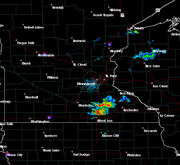 At 739 am cdt, a severe thunderstorm was located over geneva, or 12 miles north of albert lea, moving east at 25 mph (trained weather spotters). Hazards include half dollar size hail. Damage to vehicles is expected. Locations impacted include, blooming prairie, clarks grove, ellendale, geneva, hollandale and bixby. At 739 am cdt, a severe thunderstorm was located over geneva, or 12 miles north of albert lea, moving east at 25 mph (trained weather spotters). Hazards include half dollar size hail. Damage to vehicles is expected. Locations impacted include, blooming prairie, clarks grove, ellendale, geneva, hollandale and bixby.
|
| 8/31/2018 7:24 AM CDT |
 At 724 am cdt, a severe thunderstorm was located near hartland, or 13 miles north of albert lea, moving east at 25 mph (radar indicated). Hazards include ping pong ball size hail. People and animals outdoors will be injured. Expect damage to roofs, siding, windows, and vehicles. At 724 am cdt, a severe thunderstorm was located near hartland, or 13 miles north of albert lea, moving east at 25 mph (radar indicated). Hazards include ping pong ball size hail. People and animals outdoors will be injured. Expect damage to roofs, siding, windows, and vehicles.
|
| 8/27/2018 5:31 PM CDT |
 At 530 pm cdt, severe thunderstorms were located along a line extending from 6 miles south of wanamingo to hayfield to near northwood, moving east at 45 mph (radar indicated). Hazards include 60 mph wind gusts. Expect damage to roofs, siding, and trees. these severe storms will be near, mantorville, dodge center, hayfield and west concord around 535 pm cdt. kasson around 540 pm cdt. oronoco and byron around 545 pm cdt. stewartville around 550 pm cdt. rochester and rose creek around 555 pm cdt. Other locations impacted by these severe thunderstorms include high forest, lansing, wasioja, douglas and rock dell. At 530 pm cdt, severe thunderstorms were located along a line extending from 6 miles south of wanamingo to hayfield to near northwood, moving east at 45 mph (radar indicated). Hazards include 60 mph wind gusts. Expect damage to roofs, siding, and trees. these severe storms will be near, mantorville, dodge center, hayfield and west concord around 535 pm cdt. kasson around 540 pm cdt. oronoco and byron around 545 pm cdt. stewartville around 550 pm cdt. rochester and rose creek around 555 pm cdt. Other locations impacted by these severe thunderstorms include high forest, lansing, wasioja, douglas and rock dell.
|
| 8/27/2018 5:23 PM CDT |
 The severe thunderstorm warning for freeborn and steele counties will expire at 530 pm cdt, the storms which prompted the warning have moved out of the area. therefore, the warning will be allowed to expire. a severe thunderstorm watch remains in effect until 1000 pm cdt for south central minnesota. to report severe weather, contact your nearest law enforcement agency. they will relay your report to the national weather service the twin cities. The severe thunderstorm warning for freeborn and steele counties will expire at 530 pm cdt, the storms which prompted the warning have moved out of the area. therefore, the warning will be allowed to expire. a severe thunderstorm watch remains in effect until 1000 pm cdt for south central minnesota. to report severe weather, contact your nearest law enforcement agency. they will relay your report to the national weather service the twin cities.
|
| 8/27/2018 5:13 PM CDT |
 At 512 pm cdt, severe thunderstorms were located along a line extending from near merton to near steele center to hollandale, moving northeast at 50 mph (radar indicated). Hazards include 60 mph wind gusts. Expect damage to roofs, siding, and trees. These severe thunderstorms will remain over mainly rural areas of freeborn and steele counties, including the following locations, clinton falls, albert lea airport, merton, myrtle, manchester, steele center, bixby, owatonna airport and moland. At 512 pm cdt, severe thunderstorms were located along a line extending from near merton to near steele center to hollandale, moving northeast at 50 mph (radar indicated). Hazards include 60 mph wind gusts. Expect damage to roofs, siding, and trees. These severe thunderstorms will remain over mainly rural areas of freeborn and steele counties, including the following locations, clinton falls, albert lea airport, merton, myrtle, manchester, steele center, bixby, owatonna airport and moland.
|
| 8/27/2018 5:09 PM CDT |
 At 509 pm cdt, severe thunderstorms were located along a line extending from near medford to near hollandale to 6 miles northeast of rice lake, moving east at 35 mph (radar indicated). Hazards include 60 mph wind gusts and penny size hail. Expect damage to roofs, siding, and trees. Locations impacted include, rochester, austin, dodge center, mantorville, kasson, stewartville, byron, hayfield, oronoco, west concord, brownsdale, lyle, claremont, rose creek, high forest, lansing, wasioja, douglas, rock dell and concord. At 509 pm cdt, severe thunderstorms were located along a line extending from near medford to near hollandale to 6 miles northeast of rice lake, moving east at 35 mph (radar indicated). Hazards include 60 mph wind gusts and penny size hail. Expect damage to roofs, siding, and trees. Locations impacted include, rochester, austin, dodge center, mantorville, kasson, stewartville, byron, hayfield, oronoco, west concord, brownsdale, lyle, claremont, rose creek, high forest, lansing, wasioja, douglas, rock dell and concord.
|
| 8/27/2018 5:00 PM CDT |
 At 500 pm cdt, severe thunderstorms were located along a line extending from near lemond to near hope to albert lea airport, moving northeast at 45 mph (radar indicated). Hazards include 60 mph wind gusts. Expect damage to roofs, siding, and trees. these severe storms will be near, owatonna and medford around 510 pm cdt. geneva and hollandale around 515 pm cdt. blooming prairie around 525 pm cdt. Other locations impacted by these severe thunderstorms include clinton falls, albert lea airport, lemond, merton, myrtle, manchester, steele center, bixby, deerfield and owatonna airport. At 500 pm cdt, severe thunderstorms were located along a line extending from near lemond to near hope to albert lea airport, moving northeast at 45 mph (radar indicated). Hazards include 60 mph wind gusts. Expect damage to roofs, siding, and trees. these severe storms will be near, owatonna and medford around 510 pm cdt. geneva and hollandale around 515 pm cdt. blooming prairie around 525 pm cdt. Other locations impacted by these severe thunderstorms include clinton falls, albert lea airport, lemond, merton, myrtle, manchester, steele center, bixby, deerfield and owatonna airport.
|
| 8/27/2018 4:57 PM CDT |
 At 456 pm cdt, severe thunderstorms were located along a line extending from near medford to clarks grove to rice lake, moving east at 35 mph (radar indicated). Hazards include 60 mph wind gusts and penny size hail. expect damage to roofs, siding, and trees At 456 pm cdt, severe thunderstorms were located along a line extending from near medford to clarks grove to rice lake, moving east at 35 mph (radar indicated). Hazards include 60 mph wind gusts and penny size hail. expect damage to roofs, siding, and trees
|
| 8/27/2018 4:52 PM CDT |
 At 452 pm cdt, severe thunderstorms were located along a line extending from near waseca airport to new richland to alden, moving northeast at 50 mph (radar indicated). Hazards include 60 mph wind gusts. Expect damage to roofs, siding, and trees. these severe storms will be near, waseca and new richland around 455 pm cdt. albert lea and ellendale around 505 pm cdt. clarks grove and hayward around 510 pm cdt. owatonna, medford, geneva and hollandale around 515 pm cdt. blooming prairie around 530 pm cdt. Other locations impacted by these severe thunderstorms include waseca airport, albert lea airport, lemond, myrtle, owatonna airport, clinton falls, merton, manchester, steele center and otisco. At 452 pm cdt, severe thunderstorms were located along a line extending from near waseca airport to new richland to alden, moving northeast at 50 mph (radar indicated). Hazards include 60 mph wind gusts. Expect damage to roofs, siding, and trees. these severe storms will be near, waseca and new richland around 455 pm cdt. albert lea and ellendale around 505 pm cdt. clarks grove and hayward around 510 pm cdt. owatonna, medford, geneva and hollandale around 515 pm cdt. blooming prairie around 530 pm cdt. Other locations impacted by these severe thunderstorms include waseca airport, albert lea airport, lemond, myrtle, owatonna airport, clinton falls, merton, manchester, steele center and otisco.
|
| 8/27/2018 4:42 PM CDT |
 At 442 pm cdt, severe thunderstorms were located along a line extending from near otisco to matawan to walters, moving northeast at 50 mph (radar indicated). Hazards include 60 mph wind gusts. Expect damage to roofs, siding, and trees. severe thunderstorms will be near, freeborn around 445 pm cdt. waseca, new richland and hartland around 450 pm cdt. albert lea and ellendale around 500 pm cdt. owatonna, medford, clarks grove and hayward around 510 pm cdt. geneva and hollandale around 515 pm cdt. Blooming prairie around 530 pm cdt. At 442 pm cdt, severe thunderstorms were located along a line extending from near otisco to matawan to walters, moving northeast at 50 mph (radar indicated). Hazards include 60 mph wind gusts. Expect damage to roofs, siding, and trees. severe thunderstorms will be near, freeborn around 445 pm cdt. waseca, new richland and hartland around 450 pm cdt. albert lea and ellendale around 500 pm cdt. owatonna, medford, clarks grove and hayward around 510 pm cdt. geneva and hollandale around 515 pm cdt. Blooming prairie around 530 pm cdt.
|
| 5/29/2018 4:24 PM CDT |
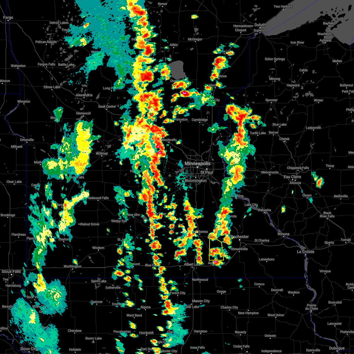 At 424 pm cdt, a severe thunderstorm was located near brownsdale, or near austin, moving north at 25 mph (radar indicated). Hazards include 60 mph wind gusts and quarter size hail. Hail damage to vehicles is expected. expect wind damage to roofs, siding, and trees. This severe thunderstorm will remain over mainly rural areas of northwestern mower and southwestern dodge counties, including the following locations: lansing, mayville, waltham, sargeant and county roads 1 and 15. At 424 pm cdt, a severe thunderstorm was located near brownsdale, or near austin, moving north at 25 mph (radar indicated). Hazards include 60 mph wind gusts and quarter size hail. Hail damage to vehicles is expected. expect wind damage to roofs, siding, and trees. This severe thunderstorm will remain over mainly rural areas of northwestern mower and southwestern dodge counties, including the following locations: lansing, mayville, waltham, sargeant and county roads 1 and 15.
|
| 5/29/2018 4:08 PM CDT |
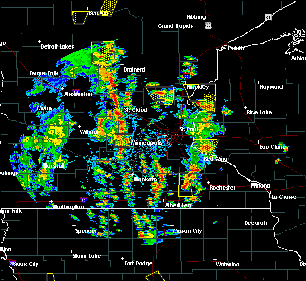 At 408 pm cdt, a severe thunderstorm was located over claremont, or 7 miles west of dodge center, moving north at 35 mph (radar indicated). Hazards include 60 mph wind gusts and quarter size hail. Hail damage to vehicles is expected. expect wind damage to roofs, siding, and trees. this severe storm will be near, west concord around 420 pm cdt. Other locations impacted by this severe thunderstorm include lansing, mayville, eden, waltham and sargeant. At 408 pm cdt, a severe thunderstorm was located over claremont, or 7 miles west of dodge center, moving north at 35 mph (radar indicated). Hazards include 60 mph wind gusts and quarter size hail. Hail damage to vehicles is expected. expect wind damage to roofs, siding, and trees. this severe storm will be near, west concord around 420 pm cdt. Other locations impacted by this severe thunderstorm include lansing, mayville, eden, waltham and sargeant.
|
| 5/29/2018 3:48 PM CDT |
 At 347 pm cdt, a severe thunderstorm was located near hayfield, or 7 miles southwest of dodge center, moving northwest at 20 mph (radar indicated). Hazards include 60 mph wind gusts and half dollar size hail. Hail damage to vehicles is expected. expect wind damage to roofs, siding, and trees. this severe thunderstorm will be near, dodge center around 405 pm cdt. claremont around 415 pm cdt. west concord around 430 pm cdt. Other locations impacted by this severe thunderstorm include lansing, mayville, eden, waltham and sargeant. At 347 pm cdt, a severe thunderstorm was located near hayfield, or 7 miles southwest of dodge center, moving northwest at 20 mph (radar indicated). Hazards include 60 mph wind gusts and half dollar size hail. Hail damage to vehicles is expected. expect wind damage to roofs, siding, and trees. this severe thunderstorm will be near, dodge center around 405 pm cdt. claremont around 415 pm cdt. west concord around 430 pm cdt. Other locations impacted by this severe thunderstorm include lansing, mayville, eden, waltham and sargeant.
|
| 5/29/2018 3:12 PM CDT |
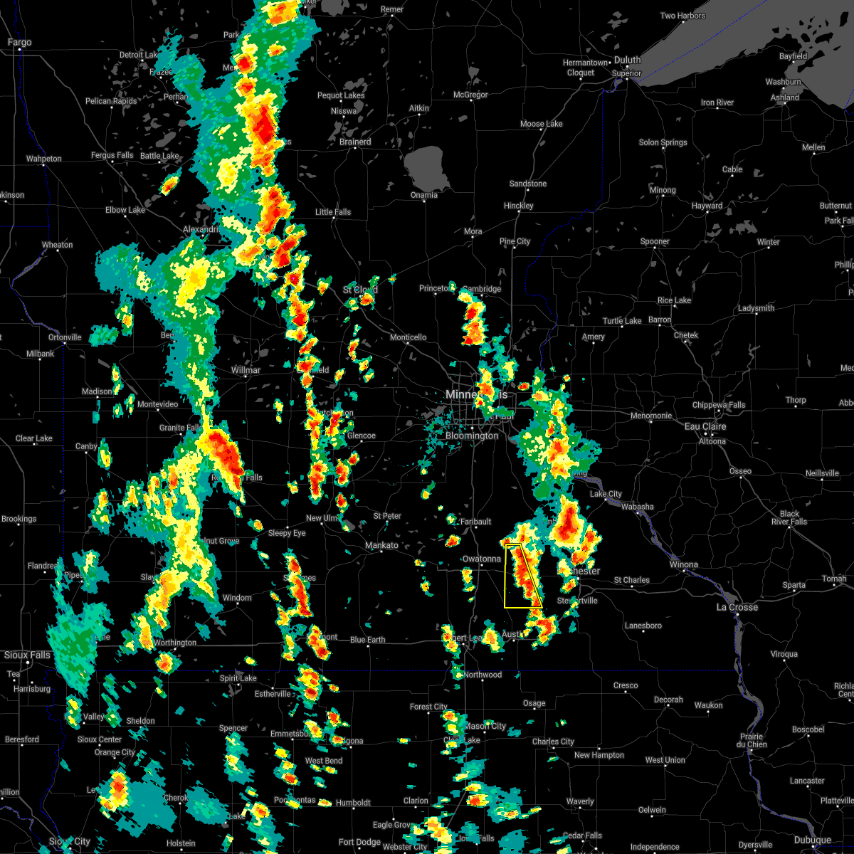 The severe thunderstorm warning for western dodge county will expire at 315 pm cdt, the storms which prompted the warning have weakened below severe limits, and no longer poses an immediate threat to life or property. therefore the warning will be allowed to expire. however, more storms may form and additional warnings may be needed. dime-sized hail is still possible this afternoon with storms. The severe thunderstorm warning for western dodge county will expire at 315 pm cdt, the storms which prompted the warning have weakened below severe limits, and no longer poses an immediate threat to life or property. therefore the warning will be allowed to expire. however, more storms may form and additional warnings may be needed. dime-sized hail is still possible this afternoon with storms.
|
| 5/29/2018 2:51 PM CDT |
 At 249 pm cdt, a severe thunderstorm was located near west concord, or northwest of dodge center, moving north at 20 mph (public. the storms today have had a history of large hail up to 2 inch in diameter). Hazards include ping pong ball size hail and 60 mph wind gusts. People and animals outdoors will be injured. expect hail damage to roofs, siding, windows, and vehicles. expect wind damage to roofs, siding, and trees. this severe storm will be near, west concord around 310 pm cdt. Other locations impacted by this severe thunderstorm include eden, county roads 1 and 24, county roads 20 and 5, highway 30 and county 3 and county roads 3 and 6. At 249 pm cdt, a severe thunderstorm was located near west concord, or northwest of dodge center, moving north at 20 mph (public. the storms today have had a history of large hail up to 2 inch in diameter). Hazards include ping pong ball size hail and 60 mph wind gusts. People and animals outdoors will be injured. expect hail damage to roofs, siding, windows, and vehicles. expect wind damage to roofs, siding, and trees. this severe storm will be near, west concord around 310 pm cdt. Other locations impacted by this severe thunderstorm include eden, county roads 1 and 24, county roads 20 and 5, highway 30 and county 3 and county roads 3 and 6.
|
| 5/29/2018 2:44 PM CDT |
 At 243 pm cdt, a severe thunderstorm was located over dodge center, moving north at 25 mph (public. at 230 pm, quarter sized hail was reported in hayfield in southern dodge county). Hazards include 60 mph wind gusts and quarter size hail. Hail damage to vehicles is expected. expect wind damage to roofs, siding, and trees. this severe storm will be near, claremont around 255 pm cdt. west concord around 305 pm cdt. Other locations impacted by this severe thunderstorm include eden, county roads 1 and 24, county roads 20 and 5, highway 30 and county 3 and county roads 3 and 6. At 243 pm cdt, a severe thunderstorm was located over dodge center, moving north at 25 mph (public. at 230 pm, quarter sized hail was reported in hayfield in southern dodge county). Hazards include 60 mph wind gusts and quarter size hail. Hail damage to vehicles is expected. expect wind damage to roofs, siding, and trees. this severe storm will be near, claremont around 255 pm cdt. west concord around 305 pm cdt. Other locations impacted by this severe thunderstorm include eden, county roads 1 and 24, county roads 20 and 5, highway 30 and county 3 and county roads 3 and 6.
|
| 5/29/2018 2:30 PM CDT |
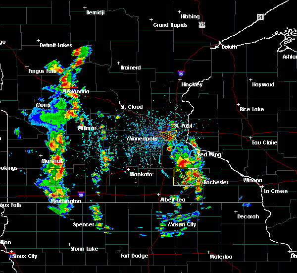 At 230 pm cdt, a severe thunderstorm was located over hayfield, or near dodge center, moving north at 30 mph (radar indicated). Hazards include ping pong ball size hail and 60 mph wind gusts. People and animals outdoors will be injured. expect hail damage to roofs, siding, windows, and vehicles. expect wind damage to roofs, siding, and trees. this severe thunderstorm will be near, dodge center around 245 pm cdt. claremont around 250 pm cdt. west concord around 300 pm cdt. Other locations impacted by this severe thunderstorm include eden, county roads 1 and 24, county roads 20 and 5, highway 30 and county 3 and county roads 3 and 6. At 230 pm cdt, a severe thunderstorm was located over hayfield, or near dodge center, moving north at 30 mph (radar indicated). Hazards include ping pong ball size hail and 60 mph wind gusts. People and animals outdoors will be injured. expect hail damage to roofs, siding, windows, and vehicles. expect wind damage to roofs, siding, and trees. this severe thunderstorm will be near, dodge center around 245 pm cdt. claremont around 250 pm cdt. west concord around 300 pm cdt. Other locations impacted by this severe thunderstorm include eden, county roads 1 and 24, county roads 20 and 5, highway 30 and county 3 and county roads 3 and 6.
|
| 5/28/2018 7:00 PM CDT | Photo of a large tree limb down relayed via twitte in steele county MN, 0.4 miles N of Blooming Prairie, MN |
| 9/4/2017 6:15 PM CDT |
 At 615 pm cdt, severe thunderstorms were located along a line extending from bixby to near geneva to freeborn, moving southeast at 50 mph (radar indicated). Hazards include 60 mph wind gusts. Expect damage to roofs, siding, and trees. these severe storms will be near, blooming prairie around 620 pm cdt. hollandale around 625 pm cdt. Other locations impacted by these severe thunderstorms include manchester, steele center, bixby and matawan. At 615 pm cdt, severe thunderstorms were located along a line extending from bixby to near geneva to freeborn, moving southeast at 50 mph (radar indicated). Hazards include 60 mph wind gusts. Expect damage to roofs, siding, and trees. these severe storms will be near, blooming prairie around 620 pm cdt. hollandale around 625 pm cdt. Other locations impacted by these severe thunderstorms include manchester, steele center, bixby and matawan.
|
| 9/4/2017 6:01 PM CDT |
 At 601 pm cdt, severe thunderstorms were located along a line extending from near merton to near hope to near otisco, moving southeast at 50 mph (radar indicated). Hazards include 60 mph wind gusts. Expect damage to roofs, siding, and trees. these severe storms will be near, ellendale around 610 pm cdt. geneva around 615 pm cdt. blooming prairie, clarks grove and hollandale around 620 pm cdt. Other locations impacted by these severe thunderstorms include clinton falls, lemond, merton, matawan, manchester, steele center, otisco, bixby, owatonna airport and hope. At 601 pm cdt, severe thunderstorms were located along a line extending from near merton to near hope to near otisco, moving southeast at 50 mph (radar indicated). Hazards include 60 mph wind gusts. Expect damage to roofs, siding, and trees. these severe storms will be near, ellendale around 610 pm cdt. geneva around 615 pm cdt. blooming prairie, clarks grove and hollandale around 620 pm cdt. Other locations impacted by these severe thunderstorms include clinton falls, lemond, merton, matawan, manchester, steele center, otisco, bixby, owatonna airport and hope.
|
| 9/4/2017 5:44 PM CDT |
 At 543 pm cdt, severe thunderstorms were located along a line extending from near nerstrand to near faribault to near waseca to near alma city, moving southeast at 50 mph (radar indicated). Hazards include 60 mph wind gusts. Expect damage to roofs, siding, and trees. severe thunderstorms will be near, medford around 550 pm cdt. owatonna around 555 pm cdt. new richland around 605 pm cdt. hartland around 610 pm cdt. clarks grove and ellendale around 615 pm cdt. blooming prairie and geneva around 620 pm cdt. Hollandale around 625 pm cdt. At 543 pm cdt, severe thunderstorms were located along a line extending from near nerstrand to near faribault to near waseca to near alma city, moving southeast at 50 mph (radar indicated). Hazards include 60 mph wind gusts. Expect damage to roofs, siding, and trees. severe thunderstorms will be near, medford around 550 pm cdt. owatonna around 555 pm cdt. new richland around 605 pm cdt. hartland around 610 pm cdt. clarks grove and ellendale around 615 pm cdt. blooming prairie and geneva around 620 pm cdt. Hollandale around 625 pm cdt.
|
| 7/19/2017 4:41 PM CDT |
 The severe thunderstorm warning for freeborn, southeastern faribault and steele counties will expire at 445 pm cdt, the storms which prompted the warning have moved out of the area. therefore the warning will be allowed to expire. a severe thunderstorm watch remains in effect until 600 pm cdt for south central minnesota. remember, a severe thunderstorm warning still remains in effect for southeast freeborn county until 500 pm. The severe thunderstorm warning for freeborn, southeastern faribault and steele counties will expire at 445 pm cdt, the storms which prompted the warning have moved out of the area. therefore the warning will be allowed to expire. a severe thunderstorm watch remains in effect until 600 pm cdt for south central minnesota. remember, a severe thunderstorm warning still remains in effect for southeast freeborn county until 500 pm.
|
| 7/19/2017 4:34 PM CDT |
 At 433 pm cdt, severe thunderstorms were located along a line extending from near west concord to near brownsdale to near northwood, moving east at 50 mph (trained weather spotters have reported 60 to 65 mph winds with this line of storms). Hazards include 70 mph wind gusts. Expect considerable tree damage. damage is likely to mobile homes, roofs, and outbuildings. these severe storms will be near, mantorville, dodge center, brownsdale and kasson around 440 pm cdt. pine island around 445 pm cdt. byron around 450 pm cdt. oronoco and lyle around 455 pm cdt. rochester, grand meadow and stewartville around 500 pm cdt. other locations impacted by these severe thunderstorms include high forest, lansing, wasioja, douglas and rock dell. People attending the dodge county free fair should seek safe shelter immediately!. At 433 pm cdt, severe thunderstorms were located along a line extending from near west concord to near brownsdale to near northwood, moving east at 50 mph (trained weather spotters have reported 60 to 65 mph winds with this line of storms). Hazards include 70 mph wind gusts. Expect considerable tree damage. damage is likely to mobile homes, roofs, and outbuildings. these severe storms will be near, mantorville, dodge center, brownsdale and kasson around 440 pm cdt. pine island around 445 pm cdt. byron around 450 pm cdt. oronoco and lyle around 455 pm cdt. rochester, grand meadow and stewartville around 500 pm cdt. other locations impacted by these severe thunderstorms include high forest, lansing, wasioja, douglas and rock dell. People attending the dodge county free fair should seek safe shelter immediately!.
|
| 7/19/2017 4:32 PM CDT |
 At 430 pm cdt, severe thunderstorms were located along a line extending from west concord to near blooming prairie to near northwood, moving east at 50 mph (trained weather spotters reported 60-65 mph winds west of dodge county). Hazards include 70 mph wind gusts. Expect considerable tree damage. damage is likely to mobile homes, roofs, and outbuildings. these severe storms will be near, dodge center, austin, west concord and ramsey around 435 pm cdt. mantorville, brownsdale and kasson around 440 pm cdt. byron and pine island around 445 pm cdt. oronoco around 450 pm cdt. rochester, grand meadow and lyle around 455 pm cdt. le roy around 515 pm cdt. other locations impacted by these severe thunderstorms include high forest, lansing, wasioja, douglas and rock dell. People attending the dodge county free fair should seek safe shelter immediately!. At 430 pm cdt, severe thunderstorms were located along a line extending from west concord to near blooming prairie to near northwood, moving east at 50 mph (trained weather spotters reported 60-65 mph winds west of dodge county). Hazards include 70 mph wind gusts. Expect considerable tree damage. damage is likely to mobile homes, roofs, and outbuildings. these severe storms will be near, dodge center, austin, west concord and ramsey around 435 pm cdt. mantorville, brownsdale and kasson around 440 pm cdt. byron and pine island around 445 pm cdt. oronoco around 450 pm cdt. rochester, grand meadow and lyle around 455 pm cdt. le roy around 515 pm cdt. other locations impacted by these severe thunderstorms include high forest, lansing, wasioja, douglas and rock dell. People attending the dodge county free fair should seek safe shelter immediately!.
|
| 7/19/2017 4:27 PM CDT |
 At 427 pm cdt, severe thunderstorms were located along a line extending from near kenyon to near claremont to hayward to near emmons, moving east at 55 mph (radar indicated). Hazards include 60 mph wind gusts and penny size hail. Expect damage to roofs, siding, and trees. these severe storms will be near, london around 445 pm cdt. Other locations impacted by these severe thunderstorms include albert lea airport, lemond, myrtle, owatonna airport, clinton falls, kiester, merton, walters, manchester and steele center. At 427 pm cdt, severe thunderstorms were located along a line extending from near kenyon to near claremont to hayward to near emmons, moving east at 55 mph (radar indicated). Hazards include 60 mph wind gusts and penny size hail. Expect damage to roofs, siding, and trees. these severe storms will be near, london around 445 pm cdt. Other locations impacted by these severe thunderstorms include albert lea airport, lemond, myrtle, owatonna airport, clinton falls, kiester, merton, walters, manchester and steele center.
|
| 7/19/2017 4:15 PM CDT |
 At 412 pm cdt, severe thunderstorms were located along a line extending from near medford to near geneva to near mansfield, moving east at 60 mph (trained weather spotters. wind gusts of 60 to 65 mph and downed trees have been reported near interstate 35 with these storms). Hazards include 70 mph wind gusts. Expect considerable tree damage. damage is likely to mobile homes, roofs, and outbuildings. severe thunderstorms will be near, claremont around 425 pm cdt. austin, dodge center around 430 pm cdt. mantorville and hayfield around 435 pm cdt. byron and pine island around 440 pm cdt. oronoco around 445 pm cdt. rochester around 450 pm cdt. People attending the dodge county free fair should seek safe shelter immediately!. At 412 pm cdt, severe thunderstorms were located along a line extending from near medford to near geneva to near mansfield, moving east at 60 mph (trained weather spotters. wind gusts of 60 to 65 mph and downed trees have been reported near interstate 35 with these storms). Hazards include 70 mph wind gusts. Expect considerable tree damage. damage is likely to mobile homes, roofs, and outbuildings. severe thunderstorms will be near, claremont around 425 pm cdt. austin, dodge center around 430 pm cdt. mantorville and hayfield around 435 pm cdt. byron and pine island around 440 pm cdt. oronoco around 445 pm cdt. rochester around 450 pm cdt. People attending the dodge county free fair should seek safe shelter immediately!.
|
| 7/19/2017 4:06 PM CDT |
 At 405 pm cdt, severe thunderstorms were located along a line extending from warsaw to near lemond to alden to near bricelyn, moving east at 55 mph (radar indicated). Hazards include 60 mph wind gusts and penny size hail. Expect damage to roofs, siding, and trees. severe thunderstorms will be near, owatonna, albert lea and medford around 415 pm cdt. clarks grove around 420 pm cdt. emmons, hollandale, hayward and twin lakes around 425 pm cdt. glenville around 435 pm cdt. London around 445 pm cdt. At 405 pm cdt, severe thunderstorms were located along a line extending from warsaw to near lemond to alden to near bricelyn, moving east at 55 mph (radar indicated). Hazards include 60 mph wind gusts and penny size hail. Expect damage to roofs, siding, and trees. severe thunderstorms will be near, owatonna, albert lea and medford around 415 pm cdt. clarks grove around 420 pm cdt. emmons, hollandale, hayward and twin lakes around 425 pm cdt. glenville around 435 pm cdt. London around 445 pm cdt.
|
| 7/9/2017 9:51 PM CDT |
 At 950 pm cdt, severe thunderstorms were located along a line extending from near janesville to nerstrand, moving southeast at 35 mph (public). Hazards include golf ball size hail and 70 mph wind gusts. People and animals outdoors will be injured. expect hail damage to roofs, siding, windows, and vehicles. expect considerable tree damage. wind damage is also likely to mobile homes, roofs, and outbuildings. severe thunderstorms will be near, waldorf around 1010 pm cdt. new richland around 1020 pm cdt. other locations impacted by these severe thunderstorms include waseca airport, alma city, lemond, mankato airport, owatonna airport, clinton falls, merton, steele center, otisco and bixby. this includes the following highways, interstate 35 between mile markers 26 and 49. u. s. highway 14 between mile markers 135 and 182. A tornado watch remains in effect until 100 am cdt for south central minnesota. At 950 pm cdt, severe thunderstorms were located along a line extending from near janesville to nerstrand, moving southeast at 35 mph (public). Hazards include golf ball size hail and 70 mph wind gusts. People and animals outdoors will be injured. expect hail damage to roofs, siding, windows, and vehicles. expect considerable tree damage. wind damage is also likely to mobile homes, roofs, and outbuildings. severe thunderstorms will be near, waldorf around 1010 pm cdt. new richland around 1020 pm cdt. other locations impacted by these severe thunderstorms include waseca airport, alma city, lemond, mankato airport, owatonna airport, clinton falls, merton, steele center, otisco and bixby. this includes the following highways, interstate 35 between mile markers 26 and 49. u. s. highway 14 between mile markers 135 and 182. A tornado watch remains in effect until 100 am cdt for south central minnesota.
|
| 6/30/2017 6:20 PM CDT |
 The severe thunderstorm warning for northeastern freeborn and southeastern steele counties will expire at 630 pm cdt, the storm which prompted the warning has moved out of the area. therefore the warning will be allowed to expire. to report severe weather, contact your nearest law enforcement agency. they will relay your report to the national weather service the twin cities. The severe thunderstorm warning for northeastern freeborn and southeastern steele counties will expire at 630 pm cdt, the storm which prompted the warning has moved out of the area. therefore the warning will be allowed to expire. to report severe weather, contact your nearest law enforcement agency. they will relay your report to the national weather service the twin cities.
|
| 6/30/2017 5:59 PM CDT |
 At 559 pm cdt, a severe thunderstorm was located near blooming prairie, or 13 miles northwest of austin, moving southeast at 25 mph (radar indicated). Hazards include ping pong ball size hail. People and animals outdoors will be injured. expect damage to roofs, siding, windows, and vehicles. This severe thunderstorm will remain over mainly rural areas of northeastern freeborn and southeastern steele counties. At 559 pm cdt, a severe thunderstorm was located near blooming prairie, or 13 miles northwest of austin, moving southeast at 25 mph (radar indicated). Hazards include ping pong ball size hail. People and animals outdoors will be injured. expect damage to roofs, siding, windows, and vehicles. This severe thunderstorm will remain over mainly rural areas of northeastern freeborn and southeastern steele counties.
|
| 4/9/2017 10:57 PM CDT |
 At 1057 pm cdt, a severe thunderstorm was located near mantorville, moving northeast at 35 mph (public). Hazards include quarter size hail. damage to vehicles is expected At 1057 pm cdt, a severe thunderstorm was located near mantorville, moving northeast at 35 mph (public). Hazards include quarter size hail. damage to vehicles is expected
|
| 4/9/2017 10:47 PM CDT |
 At 1047 pm cdt, a severe thunderstorm was located over dodge center, moving northeast at 40 mph (public). Hazards include quarter size hail was reported in hayfield around 1030 pm. Damage to vehicles is expected. this severe storm will be near, mantorville and west concord around 1055 pm cdt. Other locations impacted by this severe thunderstorm include wasioja, concord, oslo, eden and highway 57 and 570th street. At 1047 pm cdt, a severe thunderstorm was located over dodge center, moving northeast at 40 mph (public). Hazards include quarter size hail was reported in hayfield around 1030 pm. Damage to vehicles is expected. this severe storm will be near, mantorville and west concord around 1055 pm cdt. Other locations impacted by this severe thunderstorm include wasioja, concord, oslo, eden and highway 57 and 570th street.
|
| 4/9/2017 10:39 PM CDT |
 At 1039 pm cdt, a severe thunderstorm was located near dodge center, moving northeast at 40 mph (radar indicated). Hazards include quarter size hail. Damage to vehicles is expected. this severe thunderstorm will be near, dodge center around 1045 pm cdt. kasson around 1050 pm cdt. mantorville and west concord around 1055 pm cdt. Other locations impacted by this severe thunderstorm include wasioja, concord, oslo, eden and highway 57 and 570th street. At 1039 pm cdt, a severe thunderstorm was located near dodge center, moving northeast at 40 mph (radar indicated). Hazards include quarter size hail. Damage to vehicles is expected. this severe thunderstorm will be near, dodge center around 1045 pm cdt. kasson around 1050 pm cdt. mantorville and west concord around 1055 pm cdt. Other locations impacted by this severe thunderstorm include wasioja, concord, oslo, eden and highway 57 and 570th street.
|
| 4/9/2017 10:30 PM CDT | Quarter sized hail reported 5.3 miles WSW of Blooming Prairie, MN, facebook photo report. |
| 3/6/2017 6:09 PM CST |
 At 607 pm cst, severe thunderstorms were located along a line extending from 7 miles east of medford to near hayfield, moving northeast at 45 mph (radar indicated. storm spotters reported 45 to 50 mph wind gusts and pea size hail just west of claremont at 606 pm). Hazards include 60 mph wind gusts and penny size hail. Expect damage to roofs, siding, and trees. these severe storms will be near, hayfield around 610 pm cst. dodge center and west concord around 615 pm cst. kasson around 620 pm cst. mantorville around 625 pm cst. other locations impacted by these severe thunderstorms include wasioja, concord, oslo, eden and highway 57 and 570th street. A tornado watch remains in effect until 1000 pm cst for southeastern minnesota. At 607 pm cst, severe thunderstorms were located along a line extending from 7 miles east of medford to near hayfield, moving northeast at 45 mph (radar indicated. storm spotters reported 45 to 50 mph wind gusts and pea size hail just west of claremont at 606 pm). Hazards include 60 mph wind gusts and penny size hail. Expect damage to roofs, siding, and trees. these severe storms will be near, hayfield around 610 pm cst. dodge center and west concord around 615 pm cst. kasson around 620 pm cst. mantorville around 625 pm cst. other locations impacted by these severe thunderstorms include wasioja, concord, oslo, eden and highway 57 and 570th street. A tornado watch remains in effect until 1000 pm cst for southeastern minnesota.
|
| 3/6/2017 5:55 PM CST |
 At 554 pm cst, severe thunderstorms were located along a line extending from near owatonna to blooming prairie, moving northeast at 50 mph (radar indicated). Hazards include 60 mph wind gusts and quarter size hail. Hail damage to vehicles is expected. expect wind damage to roofs, siding, and trees. severe thunderstorms will be near, hayfield around 605 pm cst. claremont around 610 pm cst. dodge center and west concord around 615 pm cst. mantorville and kasson around 620 pm cst. other locations impacted by these severe thunderstorms include wasioja, concord, oslo, eden and highway 57 and 570th street. A tornado watch remains in effect until 1000 pm cst for southeastern minnesota. At 554 pm cst, severe thunderstorms were located along a line extending from near owatonna to blooming prairie, moving northeast at 50 mph (radar indicated). Hazards include 60 mph wind gusts and quarter size hail. Hail damage to vehicles is expected. expect wind damage to roofs, siding, and trees. severe thunderstorms will be near, hayfield around 605 pm cst. claremont around 610 pm cst. dodge center and west concord around 615 pm cst. mantorville and kasson around 620 pm cst. other locations impacted by these severe thunderstorms include wasioja, concord, oslo, eden and highway 57 and 570th street. A tornado watch remains in effect until 1000 pm cst for southeastern minnesota.
|
| 9/21/2016 1:13 AM CDT |
 At 113 am cdt, a severe thunderstorm was located over bixby, or 11 miles southwest of dodge center, moving east at 35 mph (radar indicated). Hazards include 60 mph wind gusts and half dollar size hail. Hail damage to vehicles is expected. expect wind damage to roofs, siding, and trees. This severe thunderstorm will remain over mainly rural areas of southeastern steele county, including the following locations: bixby and steele center. At 113 am cdt, a severe thunderstorm was located over bixby, or 11 miles southwest of dodge center, moving east at 35 mph (radar indicated). Hazards include 60 mph wind gusts and half dollar size hail. Hail damage to vehicles is expected. expect wind damage to roofs, siding, and trees. This severe thunderstorm will remain over mainly rural areas of southeastern steele county, including the following locations: bixby and steele center.
|
| 9/21/2016 1:00 AM CDT |
 At 100 am cdt, a severe thunderstorm was located over steele center, or 9 miles south of owatonna, moving east at 35 mph (radar indicated). Hazards include 60 mph wind gusts and half dollar size hail. Hail damage to vehicles is expected. expect wind damage to roofs, siding, and trees. this severe thunderstorm will be near, blooming prairie around 115 am cdt. other locations impacted by this severe thunderstorm include bixby and steele center. This includes interstate 35 between mile markers 26 and 37. At 100 am cdt, a severe thunderstorm was located over steele center, or 9 miles south of owatonna, moving east at 35 mph (radar indicated). Hazards include 60 mph wind gusts and half dollar size hail. Hail damage to vehicles is expected. expect wind damage to roofs, siding, and trees. this severe thunderstorm will be near, blooming prairie around 115 am cdt. other locations impacted by this severe thunderstorm include bixby and steele center. This includes interstate 35 between mile markers 26 and 37.
|
| 9/21/2016 12:47 AM CDT |
 At 1247 am cdt, a severe thunderstorm was located over oslo, or 10 miles south of dodge center, moving east at 55 mph (radar indicated). Hazards include 60 mph wind gusts and half dollar size hail. Hail damage to vehicles is expected. expect wind damage to roofs, siding, and trees. This severe thunderstorm will remain over mainly rural areas of southern steele, southeastern waseca and northeastern freeborn counties, including the following locations: lemond, hope, steele center and bixby. At 1247 am cdt, a severe thunderstorm was located over oslo, or 10 miles south of dodge center, moving east at 55 mph (radar indicated). Hazards include 60 mph wind gusts and half dollar size hail. Hail damage to vehicles is expected. expect wind damage to roofs, siding, and trees. This severe thunderstorm will remain over mainly rural areas of southern steele, southeastern waseca and northeastern freeborn counties, including the following locations: lemond, hope, steele center and bixby.
|
| 9/21/2016 12:25 AM CDT |
 At 1225 am cdt, a severe thunderstorm was located over steele center, or 11 miles south of owatonna, moving east at 55 mph (radar indicated). Hazards include 60 mph wind gusts and quarter size hail. Hail damage to vehicles is expected. expect wind damage to roofs, siding, and trees. this severe thunderstorm will be near, blooming prairie around 1235 am cdt. other locations impacted by this severe thunderstorm include lemond, hope, steele center, otisco and bixby. this includes the following highways, interstate 35 between mile markers 19 and 38. u. s. Highway 14 between mile markers 177 and 182. At 1225 am cdt, a severe thunderstorm was located over steele center, or 11 miles south of owatonna, moving east at 55 mph (radar indicated). Hazards include 60 mph wind gusts and quarter size hail. Hail damage to vehicles is expected. expect wind damage to roofs, siding, and trees. this severe thunderstorm will be near, blooming prairie around 1235 am cdt. other locations impacted by this severe thunderstorm include lemond, hope, steele center, otisco and bixby. this includes the following highways, interstate 35 between mile markers 19 and 38. u. s. Highway 14 between mile markers 177 and 182.
|
| 8/18/2016 5:13 PM CDT |
 At 511 pm cdt, strong to severe thunderstorms were continuingtoaffect most of mower and dodge county, moving east at 35 mph (law enforcement reports some tree debris and wind gusts in the 50 mph range at hayfield at 510 pm). Hazards include 60 mph wind gusts and nickel size hail. Expect damage to roofs. siding. and trees. Storms will continune in the mower and dodge county area for another 30 minutes. At 511 pm cdt, strong to severe thunderstorms were continuingtoaffect most of mower and dodge county, moving east at 35 mph (law enforcement reports some tree debris and wind gusts in the 50 mph range at hayfield at 510 pm). Hazards include 60 mph wind gusts and nickel size hail. Expect damage to roofs. siding. and trees. Storms will continune in the mower and dodge county area for another 30 minutes.
|
| 8/18/2016 5:02 PM CDT |
 At 500 pm cdt, severe thunderstorms were located along a line extending from near dodge center to near brownsdale to near rose creek, moving east at 50 mph (law enforcement reports power line damage and some brances down in austin and the northwest portion of mower county). Hazards include 60 mph wind gusts and nickel size hail. Expect damage to roofs. siding. and trees. these severe storms will be near, adams around 510 pm cdt. Other locations impacted by these severe thunderstorms include lansing, wasioja, concord, mayville and dexter. At 500 pm cdt, severe thunderstorms were located along a line extending from near dodge center to near brownsdale to near rose creek, moving east at 50 mph (law enforcement reports power line damage and some brances down in austin and the northwest portion of mower county). Hazards include 60 mph wind gusts and nickel size hail. Expect damage to roofs. siding. and trees. these severe storms will be near, adams around 510 pm cdt. Other locations impacted by these severe thunderstorms include lansing, wasioja, concord, mayville and dexter.
|
| 8/18/2016 4:47 PM CDT |
 At 447 pm cdt, a severe thunderstorm was located near i 90 exit 175, or 7 miles west of austin, moving southeast at 35 mph (radar indicated). Hazards include 60 mph wind gusts and penny size hail. Expect damage to roofs. siding. and trees. Locations impacted include, albert lea, blooming prairie, clarks grove, ellendale, alden, geneva, hollandale, hayward, manchester and albert lea airport. At 447 pm cdt, a severe thunderstorm was located near i 90 exit 175, or 7 miles west of austin, moving southeast at 35 mph (radar indicated). Hazards include 60 mph wind gusts and penny size hail. Expect damage to roofs. siding. and trees. Locations impacted include, albert lea, blooming prairie, clarks grove, ellendale, alden, geneva, hollandale, hayward, manchester and albert lea airport.
|
| 8/18/2016 4:43 PM CDT | Trees reported down along county line near blooming prairie in dodge county MN, 1.9 miles SSW of Blooming Prairie, MN |
| 8/18/2016 4:42 PM CDT |
 At 439 pm cdt, severe thunderstorms were located along a line extending from near claremont to near hayward, moving east at 45 mph (public. this storm has a history of winds to 60 mph and wind damage). Hazards include 60 mph wind gusts and nickel size hail. Expect damage to roofs. siding. and trees. these severe storms will be near, claremont around 445 pm cdt. west concord around 450 pm cdt. dodge center and hayfield around 455 pm cdt. austin, mantorville, kasson and ramsey around 500 pm cdt. brownsdale and lyle around 505 pm cdt. rose creek around 510 pm cdt. adams around 520 pm cdt. Radar indicates that the strongest winds could be in far southern dodge and northern mower county. At 439 pm cdt, severe thunderstorms were located along a line extending from near claremont to near hayward, moving east at 45 mph (public. this storm has a history of winds to 60 mph and wind damage). Hazards include 60 mph wind gusts and nickel size hail. Expect damage to roofs. siding. and trees. these severe storms will be near, claremont around 445 pm cdt. west concord around 450 pm cdt. dodge center and hayfield around 455 pm cdt. austin, mantorville, kasson and ramsey around 500 pm cdt. brownsdale and lyle around 505 pm cdt. rose creek around 510 pm cdt. adams around 520 pm cdt. Radar indicates that the strongest winds could be in far southern dodge and northern mower county.
|
| 8/18/2016 4:35 PM CDT |
 At 435 pm cdt, a severe thunderstorm was located over hollandale, or 11 miles northeast of albert lea, moving east at 40 mph (radar indicated). Hazards include 60 mph wind gusts and penny size hail. Expect damage to roofs. siding. and trees. This severe thunderstorm will remain over mainly rural areas of southern steele, southeastern waseca and freeborn counties, including the following locations: manchester and albert lea airport. At 435 pm cdt, a severe thunderstorm was located over hollandale, or 11 miles northeast of albert lea, moving east at 40 mph (radar indicated). Hazards include 60 mph wind gusts and penny size hail. Expect damage to roofs. siding. and trees. This severe thunderstorm will remain over mainly rural areas of southern steele, southeastern waseca and freeborn counties, including the following locations: manchester and albert lea airport.
|
| 8/18/2016 4:29 PM CDT |
 At 425 pm cdt, severe thunderstorms were located along a line extending from owatonna to near albert lea, moving east at 35 mph (law enforcement. these storms have produced 50 to 60 mph winds near waseca and also wind damage). Hazards include 60 mph wind gusts and nickel size hail. Expect damage to roofs. siding. and trees. severe thunderstorms will be near, claremont around 445 pm cdt. west concord around 450 pm cdt. dodge center around 455 pm cdt. mantorville, ramsey and hayfield around 500 pm cdt. austin and lyle and brownsdale around 510 pm cdt. Adams around 525 pm cdt. At 425 pm cdt, severe thunderstorms were located along a line extending from owatonna to near albert lea, moving east at 35 mph (law enforcement. these storms have produced 50 to 60 mph winds near waseca and also wind damage). Hazards include 60 mph wind gusts and nickel size hail. Expect damage to roofs. siding. and trees. severe thunderstorms will be near, claremont around 445 pm cdt. west concord around 450 pm cdt. dodge center around 455 pm cdt. mantorville, ramsey and hayfield around 500 pm cdt. austin and lyle and brownsdale around 510 pm cdt. Adams around 525 pm cdt.
|
| 8/18/2016 4:20 PM CDT |
 At 420 pm cdt, a severe thunderstorm was located near hartland, or 12 miles north of albert lea, moving east at 35 mph (radar indicated). Hazards include 60 mph wind gusts and penny size hail. Expect damage to roofs. siding. and trees. this severe storm will be near, clarks grove and ellendale around 430 pm cdt. geneva around 435 pm cdt. hollandale around 440 pm cdt. blooming prairie around 450 pm cdt. Other locations impacted by this severe thunderstorm include matawan, baroda, albert lea airport, otisco and manchester. At 420 pm cdt, a severe thunderstorm was located near hartland, or 12 miles north of albert lea, moving east at 35 mph (radar indicated). Hazards include 60 mph wind gusts and penny size hail. Expect damage to roofs. siding. and trees. this severe storm will be near, clarks grove and ellendale around 430 pm cdt. geneva around 435 pm cdt. hollandale around 440 pm cdt. blooming prairie around 450 pm cdt. Other locations impacted by this severe thunderstorm include matawan, baroda, albert lea airport, otisco and manchester.
|
| 8/18/2016 3:57 PM CDT |
 At 357 pm cdt, a severe thunderstorm was located near waldorf, or 21 miles northwest of albert lea, moving east at 35 mph (radar indicated). Hazards include 60 mph wind gusts and penny size hail. Expect damage to roofs. siding. and trees. this severe thunderstorm will be near, new richland and freeborn around 410 pm cdt. hartland around 415 pm cdt. clarks grove and ellendale around 430 pm cdt. geneva around 435 pm cdt. hollandale around 440 pm cdt. other locations impacted by this severe thunderstorm include matawan, baroda, albert lea airport, otisco and manchester. this includes the following highways, interstate 35 between mile markers 9 and 29. Interstate 90 between mile markers 145 and 173. At 357 pm cdt, a severe thunderstorm was located near waldorf, or 21 miles northwest of albert lea, moving east at 35 mph (radar indicated). Hazards include 60 mph wind gusts and penny size hail. Expect damage to roofs. siding. and trees. this severe thunderstorm will be near, new richland and freeborn around 410 pm cdt. hartland around 415 pm cdt. clarks grove and ellendale around 430 pm cdt. geneva around 435 pm cdt. hollandale around 440 pm cdt. other locations impacted by this severe thunderstorm include matawan, baroda, albert lea airport, otisco and manchester. this includes the following highways, interstate 35 between mile markers 9 and 29. Interstate 90 between mile markers 145 and 173.
|
| 7/23/2016 9:42 AM CDT |
 At 941 am cdt, a severe thunderstorm was located near kasson, or near dodge center, moving northeast at 35 mph (radar indicated. at 932 am a large tree branch was reported down and blocking a road in hayfield). Hazards include 60 mph wind gusts. Expect damage to roofs. siding. and trees. this severe storm will be near, mantorville and kasson around 950 am cdt. Other locations impacted by this severe thunderstorm include wasioja, concord, oslo, eden and waltham. At 941 am cdt, a severe thunderstorm was located near kasson, or near dodge center, moving northeast at 35 mph (radar indicated. at 932 am a large tree branch was reported down and blocking a road in hayfield). Hazards include 60 mph wind gusts. Expect damage to roofs. siding. and trees. this severe storm will be near, mantorville and kasson around 950 am cdt. Other locations impacted by this severe thunderstorm include wasioja, concord, oslo, eden and waltham.
|
| 7/23/2016 9:27 AM CDT |
 At 927 am cdt, a severe thunderstorm was located near blooming prairie, or 11 miles southwest of dodge center, moving northeast at 25 mph (radar indicated). Hazards include 60 mph wind gusts. Expect damage to roofs. siding. and trees. this severe thunderstorm will be near, hayfield around 935 am cdt. claremont around 940 am cdt. dodge center around 950 am cdt. kasson around 1000 am cdt. mantorville around 1005 am cdt. Other locations impacted by this severe thunderstorm include wasioja, concord, oslo, eden and waltham. At 927 am cdt, a severe thunderstorm was located near blooming prairie, or 11 miles southwest of dodge center, moving northeast at 25 mph (radar indicated). Hazards include 60 mph wind gusts. Expect damage to roofs. siding. and trees. this severe thunderstorm will be near, hayfield around 935 am cdt. claremont around 940 am cdt. dodge center around 950 am cdt. kasson around 1000 am cdt. mantorville around 1005 am cdt. Other locations impacted by this severe thunderstorm include wasioja, concord, oslo, eden and waltham.
|
| 7/5/2016 8:54 PM CDT |
 At 854 pm cdt, severe thunderstorms were located along a line extending from 8 miles southeast of modena to near stewartville, moving east at 55 mph (trained weather spotters). Hazards include 60 mph wind gusts. Expect damage to roofs. siding. And trees. At 854 pm cdt, severe thunderstorms were located along a line extending from 8 miles southeast of modena to near stewartville, moving east at 55 mph (trained weather spotters). Hazards include 60 mph wind gusts. Expect damage to roofs. siding. And trees.
|
| 7/5/2016 8:53 PM CDT |
 The severe thunderstorm warning for steele and southern waseca counties will expire at 900 pm cdt, the storm which prompted the warning has moved out of the area. therefore the warning will be allowed to expire. however gusty winds are still possible with this thunderstorm. a severe thunderstorm watch remains in effect until 1100 pm cdt for south central minnesota. The severe thunderstorm warning for steele and southern waseca counties will expire at 900 pm cdt, the storm which prompted the warning has moved out of the area. therefore the warning will be allowed to expire. however gusty winds are still possible with this thunderstorm. a severe thunderstorm watch remains in effect until 1100 pm cdt for south central minnesota.
|
| 7/5/2016 8:35 PM CDT |
 At 835 pm cdt, severe thunderstorms were located along a line extending from near wabasha to near kasson, moving east at 55 mph (trained weather spotters). Hazards include 60 mph wind gusts. Expect damage to roofs. siding. and trees. these severe storms will be near, wabasha and kellogg around 840 pm cdt. buffalo city around 845 pm cdt. chatfield, eyota and dover around 900 pm cdt. Other locations impacted by these severe thunderstorms include marion, high forest, wasioja, pleasant grove and douglas. At 835 pm cdt, severe thunderstorms were located along a line extending from near wabasha to near kasson, moving east at 55 mph (trained weather spotters). Hazards include 60 mph wind gusts. Expect damage to roofs. siding. and trees. these severe storms will be near, wabasha and kellogg around 840 pm cdt. buffalo city around 845 pm cdt. chatfield, eyota and dover around 900 pm cdt. Other locations impacted by these severe thunderstorms include marion, high forest, wasioja, pleasant grove and douglas.
|
| 7/5/2016 8:24 PM CDT |
 At 823 pm cdt, severe thunderstorms were located along a line extending from pepin to near dodge center, moving east at 55 mph (trained weather spotters). Hazards include 60 mph wind gusts. Expect damage to roofs. siding. and trees. these severe storms will be near, wabasha around 830 pm cdt. kellogg around 835 pm cdt. buffalo city around 840 pm cdt. Rochester around 845 pm cdt. At 823 pm cdt, severe thunderstorms were located along a line extending from pepin to near dodge center, moving east at 55 mph (trained weather spotters). Hazards include 60 mph wind gusts. Expect damage to roofs. siding. and trees. these severe storms will be near, wabasha around 830 pm cdt. kellogg around 835 pm cdt. buffalo city around 840 pm cdt. Rochester around 845 pm cdt.
|
| 7/5/2016 8:23 PM CDT |
 At 822 pm cdt, a severe thunderstorm was located over hope, or 8 miles southwest of owatonna, moving east at 40 mph (radar indicated). Hazards include 60 mph wind gusts and quarter size hail. Hail damage to vehicles is expected. expect wind damage to roofs, siding, and trees. this severe storm will be near, blooming prairie around 850 pm cdt. Other locations impacted by this severe thunderstorm include lemond, hope, steele center, otisco and bixby. At 822 pm cdt, a severe thunderstorm was located over hope, or 8 miles southwest of owatonna, moving east at 40 mph (radar indicated). Hazards include 60 mph wind gusts and quarter size hail. Hail damage to vehicles is expected. expect wind damage to roofs, siding, and trees. this severe storm will be near, blooming prairie around 850 pm cdt. Other locations impacted by this severe thunderstorm include lemond, hope, steele center, otisco and bixby.
|
| 7/5/2016 8:12 PM CDT |
 At 811 pm cdt, severe thunderstorms were located along a line extending from frontenac to 6 miles southeast of owatonna, moving east at 55 mph (radar indicated). Hazards include 60 mph wind gusts. Expect damage to roofs. siding. and trees. these severe storms will be near, west concord around 820 pm cdt. wabasha, mantorville, hayfield and kasson around 830 pm cdt. byron and kellogg around 835 pm cdt. Buffalo city around 840 pm cdt. At 811 pm cdt, severe thunderstorms were located along a line extending from frontenac to 6 miles southeast of owatonna, moving east at 55 mph (radar indicated). Hazards include 60 mph wind gusts. Expect damage to roofs. siding. and trees. these severe storms will be near, west concord around 820 pm cdt. wabasha, mantorville, hayfield and kasson around 830 pm cdt. byron and kellogg around 835 pm cdt. Buffalo city around 840 pm cdt.
|
| 7/5/2016 8:02 PM CDT |
 At 800 pm cdt, severe thunderstorms were located along a line extending from near red wing to near owatonna, moving east at 55 mph (radar indicated). Hazards include 70 mph wind gusts. Expect considerable tree damage. damage is likely to mobile homes, roofs, and outbuildings. these severe storms will be near, claremont, blooming prairie and west concord around 820 pm cdt. dodge center around 825 pm cdt. wabasha, mantorville, hayfield and kasson around 830 pm cdt. Byron and kellogg around 835 pm cdt. At 800 pm cdt, severe thunderstorms were located along a line extending from near red wing to near owatonna, moving east at 55 mph (radar indicated). Hazards include 70 mph wind gusts. Expect considerable tree damage. damage is likely to mobile homes, roofs, and outbuildings. these severe storms will be near, claremont, blooming prairie and west concord around 820 pm cdt. dodge center around 825 pm cdt. wabasha, mantorville, hayfield and kasson around 830 pm cdt. Byron and kellogg around 835 pm cdt.
|
| 7/5/2016 7:56 PM CDT |
 At 755 pm cdt, a severe thunderstorm was located over janesville, or 16 miles east of mankato, moving southeast at 40 mph (radar indicated). Hazards include 60 mph wind gusts and quarter size hail. Hail damage to vehicles is expected. expect wind damage to roofs, siding, and trees. this severe thunderstorm will be near, waseca around 805 pm cdt. ellendale around 835 pm cdt. blooming prairie around 850 pm cdt. other locations impacted by this severe thunderstorm include lemond, otisco, bixby, owatonna airport, hope, steele center, moland, merton, alma city and deerfield. this includes the following highways, interstate 35 between mile markers 26 and 49. u. s. Highway 14 between mile markers 145 and 182. At 755 pm cdt, a severe thunderstorm was located over janesville, or 16 miles east of mankato, moving southeast at 40 mph (radar indicated). Hazards include 60 mph wind gusts and quarter size hail. Hail damage to vehicles is expected. expect wind damage to roofs, siding, and trees. this severe thunderstorm will be near, waseca around 805 pm cdt. ellendale around 835 pm cdt. blooming prairie around 850 pm cdt. other locations impacted by this severe thunderstorm include lemond, otisco, bixby, owatonna airport, hope, steele center, moland, merton, alma city and deerfield. this includes the following highways, interstate 35 between mile markers 26 and 49. u. s. Highway 14 between mile markers 145 and 182.
|
| 7/5/2016 7:48 PM CDT |
 At 747 pm cdt, severe thunderstorms were located along a line extending from near welch to waseca, moving east at 55 mph (radar indicated). Hazards include 70 mph wind gusts. Expect considerable tree damage. damage is likely to mobile homes, roofs, and outbuildings. severe thunderstorms will be near, claremont and blooming prairie around 815 pm cdt. west concord around 820 pm cdt. wabasha, dodge center and hayfield around 825 pm cdt. Mantorville, kasson and kellogg around 830 pm cdt. At 747 pm cdt, severe thunderstorms were located along a line extending from near welch to waseca, moving east at 55 mph (radar indicated). Hazards include 70 mph wind gusts. Expect considerable tree damage. damage is likely to mobile homes, roofs, and outbuildings. severe thunderstorms will be near, claremont and blooming prairie around 815 pm cdt. west concord around 820 pm cdt. wabasha, dodge center and hayfield around 825 pm cdt. Mantorville, kasson and kellogg around 830 pm cdt.
|
| 4/24/2016 8:29 PM CDT |
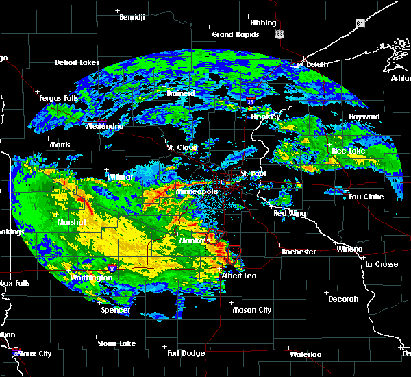 At 829 pm cdt, a severe thunderstorm capable of producing a tornado was located near hollandale, or 13 miles northwest of austin, moving northeast at 45 mph (radar indicated rotation). Hazards include tornado. Flying debris will be dangerous to those caught without shelter. mobile homes will be damaged or destroyed. damage to roofs, windows, and vehicles will occur. tree damage is likely. this dangerous storm will be near, blooming prairie around 835 pm cdt. Other locations impacted by this tornadic thunderstorm include bixby and steele center. At 829 pm cdt, a severe thunderstorm capable of producing a tornado was located near hollandale, or 13 miles northwest of austin, moving northeast at 45 mph (radar indicated rotation). Hazards include tornado. Flying debris will be dangerous to those caught without shelter. mobile homes will be damaged or destroyed. damage to roofs, windows, and vehicles will occur. tree damage is likely. this dangerous storm will be near, blooming prairie around 835 pm cdt. Other locations impacted by this tornadic thunderstorm include bixby and steele center.
|
| 7/24/2015 7:05 AM CDT |
 At 704 am cdt, severe thunderstorms were located along a line extending from brookside campground to near freeborn to near easton, moving south at 30 mph (trained weather spotters reported tree damage near ellendale). Hazards include 60 mph wind gusts. Expect damage to roofs. siding and trees. these severe storms will be near, alden around 715 am cdt. albert lea around 720 am cdt. conger around 725 am cdt. other locations impacted by these severe thunderstorms include matawan, baroda, albert lea airport, manchester and brush creek. this includes the following highways, interstate 35 between mile markers 8 and 28. Interstate 90 between mile markers 127 and 173. At 704 am cdt, severe thunderstorms were located along a line extending from brookside campground to near freeborn to near easton, moving south at 30 mph (trained weather spotters reported tree damage near ellendale). Hazards include 60 mph wind gusts. Expect damage to roofs. siding and trees. these severe storms will be near, alden around 715 am cdt. albert lea around 720 am cdt. conger around 725 am cdt. other locations impacted by these severe thunderstorms include matawan, baroda, albert lea airport, manchester and brush creek. this includes the following highways, interstate 35 between mile markers 8 and 28. Interstate 90 between mile markers 127 and 173.
|
| 7/24/2015 6:44 AM CDT |
 At 643 am cdt, severe thunderstorms were located along a line extending from near county roads 3 and 6 to otisco to near mapleton, moving south at 25 mph (radar indicated). Hazards include 60 mph wind gusts. Expect damage to roofs. siding and trees. these severe storms will be near, new richland around 655 am cdt. blooming prairie and hartland around 705 am cdt. minnesota lake and freeborn around 710 am cdt. easton around 720 am cdt. alden around 725 am cdt. albert lea and conger around 730 am cdt. other locations impacted by these severe thunderstorms include lemond, otisco, bixby, matawan, hope, steele center, baroda, albert lea airport, manchester and brush creek. this includes the following highways, interstate 35 between mile markers 8 and 38. interstate 90 between mile markers 127 and 173. u. s. Highway 14 between mile markers 180 and 182. At 643 am cdt, severe thunderstorms were located along a line extending from near county roads 3 and 6 to otisco to near mapleton, moving south at 25 mph (radar indicated). Hazards include 60 mph wind gusts. Expect damage to roofs. siding and trees. these severe storms will be near, new richland around 655 am cdt. blooming prairie and hartland around 705 am cdt. minnesota lake and freeborn around 710 am cdt. easton around 720 am cdt. alden around 725 am cdt. albert lea and conger around 730 am cdt. other locations impacted by these severe thunderstorms include lemond, otisco, bixby, matawan, hope, steele center, baroda, albert lea airport, manchester and brush creek. this includes the following highways, interstate 35 between mile markers 8 and 38. interstate 90 between mile markers 127 and 173. u. s. Highway 14 between mile markers 180 and 182.
|
| 7/24/2015 6:37 AM CDT |
 At 637 am cdt, severe thunderstorms were located along a line extending from near claremont to otisco to near good thunder, moving south at 25 mph (radar indicated). Hazards include 60 mph wind gusts and penny size hail. Expect damage to roofs. siding and trees. severe thunderstorms will be near, new richland around 650 am cdt. blooming prairie, minnesota lake and hartland around 705 am cdt. freeborn around 710 am cdt. easton around 715 am cdt. albert lea and alden around 725 am cdt. conger around 730 am cdt. other locations impacted by these severe thunderstorms include lemond, otisco, bixby, matawan, hope, steele center, baroda, albert lea airport, manchester and brush creek. this includes the following highways, interstate 35 between mile markers 8 and 39. interstate 90 between mile markers 127 and 173. u. s. Highway 14 between mile markers 175 and 182. At 637 am cdt, severe thunderstorms were located along a line extending from near claremont to otisco to near good thunder, moving south at 25 mph (radar indicated). Hazards include 60 mph wind gusts and penny size hail. Expect damage to roofs. siding and trees. severe thunderstorms will be near, new richland around 650 am cdt. blooming prairie, minnesota lake and hartland around 705 am cdt. freeborn around 710 am cdt. easton around 715 am cdt. albert lea and alden around 725 am cdt. conger around 730 am cdt. other locations impacted by these severe thunderstorms include lemond, otisco, bixby, matawan, hope, steele center, baroda, albert lea airport, manchester and brush creek. this includes the following highways, interstate 35 between mile markers 8 and 39. interstate 90 between mile markers 127 and 173. u. s. Highway 14 between mile markers 175 and 182.
|
| 7/18/2015 1:44 AM CDT |
 At 143 am cdt, severe thunderstorms were located along a line extending from near pine island to dodge center and blooming prairie, moving east at 40 mph (radar indicated). Hazards include 60 mph wind gusts. Expect damage to roofs. siding and trees. These severe thunderstorms will remain over mainly rural areas of dodge county, including the following locations, wasioja, concord, oslo and eden. At 143 am cdt, severe thunderstorms were located along a line extending from near pine island to dodge center and blooming prairie, moving east at 40 mph (radar indicated). Hazards include 60 mph wind gusts. Expect damage to roofs. siding and trees. These severe thunderstorms will remain over mainly rural areas of dodge county, including the following locations, wasioja, concord, oslo and eden.
|
| 7/18/2015 1:25 AM CDT |
 At 124 am cdt, severe thunderstorms were located along a line extending from near kenyon to near new richland, moving east at 55 mph (radar indicated). Hazards include 60 mph wind gusts. Expect damage to roofs. siding and trees. these severe storms will be near, west concord around 130 am cdt. blooming prairie and claremont around 145 am cdt. dodge center and hayfield around 155 am cdt. Other locations impacted by these severe thunderstorms include wasioja, concord, oslo and eden. At 124 am cdt, severe thunderstorms were located along a line extending from near kenyon to near new richland, moving east at 55 mph (radar indicated). Hazards include 60 mph wind gusts. Expect damage to roofs. siding and trees. these severe storms will be near, west concord around 130 am cdt. blooming prairie and claremont around 145 am cdt. dodge center and hayfield around 155 am cdt. Other locations impacted by these severe thunderstorms include wasioja, concord, oslo and eden.
|
| 7/18/2015 1:24 AM CDT |
 At 124 am cdt, severe thunderstorms were located along a line extending from ellsworth to near mazeppa to near steele center, moving east at 50 mph (radar indicated). Hazards include 70 mph wind gusts. Expect considerable tree damage. damage is likely to mobile homes, roofs and outbuildings. these severe storms will be near, ellsworth around 130 am cdt. Other locations impacted by these severe thunderstorms include lemond, frontenac state park, bixby, afton state park, owatonna airport, hader, clinton falls, diamond bluff, el paso and bellechester. At 124 am cdt, severe thunderstorms were located along a line extending from ellsworth to near mazeppa to near steele center, moving east at 50 mph (radar indicated). Hazards include 70 mph wind gusts. Expect considerable tree damage. damage is likely to mobile homes, roofs and outbuildings. these severe storms will be near, ellsworth around 130 am cdt. Other locations impacted by these severe thunderstorms include lemond, frontenac state park, bixby, afton state park, owatonna airport, hader, clinton falls, diamond bluff, el paso and bellechester.
|
| 7/18/2015 1:08 AM CDT |
 At 108 am cdt, severe thunderstorms were located along a line extending from faribault to near new richland, moving east at 50 mph (radar indicated). Hazards include 60 mph wind gusts. Expect damage to roofs. siding and trees. severe thunderstorms will be near, west concord around 120 am cdt. blooming prairie and claremont around 135 am cdt. dodge center around 140 am cdt. hayfield around 145 am cdt. Other locations impacted by these severe thunderstorms include wasioja, concord, oslo, eden and highway 57 and 570th street. At 108 am cdt, severe thunderstorms were located along a line extending from faribault to near new richland, moving east at 50 mph (radar indicated). Hazards include 60 mph wind gusts. Expect damage to roofs. siding and trees. severe thunderstorms will be near, west concord around 120 am cdt. blooming prairie and claremont around 135 am cdt. dodge center around 140 am cdt. hayfield around 145 am cdt. Other locations impacted by these severe thunderstorms include wasioja, concord, oslo, eden and highway 57 and 570th street.
|
| 7/18/2015 12:55 AM CDT |
 At 1254 am cdt, severe thunderstorms were located along a line extending from grey cloud township to near northfield to near waldorf, moving east at 45 mph (radar indicated). Hazards include 70 mph wind gusts. Expect considerable tree damage. damage is likely to mobile homes, roofs and outbuildings. severe thunderstorms will be near, northfield, cottage grove, st. paul park, stanton and randolph around 100 am cdt. hastings and cannon falls around 105 am cdt. prescott around 110 am cdt. river falls and ellendale around 120 am cdt. goodhue around 125 am cdt. ellsworth around 130 am cdt. blooming prairie around 135 am cdt. stockholm and frontenac around 145 am cdt. Other locations impacted by these severe thunderstorms include lemond, frontenac state park, bixby, afton state park, owatonna airport, hader, clinton falls, bridgewater, st paul park and diamond bluff. At 1254 am cdt, severe thunderstorms were located along a line extending from grey cloud township to near northfield to near waldorf, moving east at 45 mph (radar indicated). Hazards include 70 mph wind gusts. Expect considerable tree damage. damage is likely to mobile homes, roofs and outbuildings. severe thunderstorms will be near, northfield, cottage grove, st. paul park, stanton and randolph around 100 am cdt. hastings and cannon falls around 105 am cdt. prescott around 110 am cdt. river falls and ellendale around 120 am cdt. goodhue around 125 am cdt. ellsworth around 130 am cdt. blooming prairie around 135 am cdt. stockholm and frontenac around 145 am cdt. Other locations impacted by these severe thunderstorms include lemond, frontenac state park, bixby, afton state park, owatonna airport, hader, clinton falls, bridgewater, st paul park and diamond bluff.
|
| 6/22/2015 7:05 AM CDT |
 At 705 am cdt, severe thunderstorms were located along a line extending from near mantorville to 6 miles north of grand meadow to adams, moving southeast at 55 mph (radar indicated). Hazards include 60 mph wind gusts. Expect damage to roofs. siding and trees. these severe storms will be near, grand meadow and stewartville around 710 am cdt. spring valley, rochester and le roy around 715 am cdt. wykoff around 720 am cdt. eyota and fountain around 725 am cdt. preston and dover around 730 am cdt. chatfield around 735 am cdt. Other locations impacted by these severe thunderstorms include ramsey, fillmore, marion, high forest and lansing. At 705 am cdt, severe thunderstorms were located along a line extending from near mantorville to 6 miles north of grand meadow to adams, moving southeast at 55 mph (radar indicated). Hazards include 60 mph wind gusts. Expect damage to roofs. siding and trees. these severe storms will be near, grand meadow and stewartville around 710 am cdt. spring valley, rochester and le roy around 715 am cdt. wykoff around 720 am cdt. eyota and fountain around 725 am cdt. preston and dover around 730 am cdt. chatfield around 735 am cdt. Other locations impacted by these severe thunderstorms include ramsey, fillmore, marion, high forest and lansing.
|
| 6/22/2015 6:42 AM CDT |
 At 640 am cdt, severe thunderstorms were located along a line extending from 7 miles southwest of faribault to 10 miles west of blooming prairie to albert lea, moving east at 50 mph (radar indicated). Hazards include 60 mph wind gusts. Expect damage to roofs. siding and trees. severe thunderstorms will be near, blooming prairie around 650 am cdt. claremont around 700 am cdt. dodge center, austin and west concord around 705 am cdt. brownsdale around 710 am cdt. mantorville, kasson and hayfield around 715 am cdt. byron and pine island around 720 am cdt. rochester and grand meadow around 725 am cdt. oronoco around 730 am cdt. this warning replaces the previous severe thunderstorm warning for parts of mower and dodge counties. Strong winds can be expected behind these storms as well so be alert for that. At 640 am cdt, severe thunderstorms were located along a line extending from 7 miles southwest of faribault to 10 miles west of blooming prairie to albert lea, moving east at 50 mph (radar indicated). Hazards include 60 mph wind gusts. Expect damage to roofs. siding and trees. severe thunderstorms will be near, blooming prairie around 650 am cdt. claremont around 700 am cdt. dodge center, austin and west concord around 705 am cdt. brownsdale around 710 am cdt. mantorville, kasson and hayfield around 715 am cdt. byron and pine island around 720 am cdt. rochester and grand meadow around 725 am cdt. oronoco around 730 am cdt. this warning replaces the previous severe thunderstorm warning for parts of mower and dodge counties. Strong winds can be expected behind these storms as well so be alert for that.
|
| 6/22/2015 6:31 AM CDT |
 At 631 am cdt, severe thunderstorms were located along a line extending from st thomas to near waldorf to near mansfield, moving east at 70 mph (radar indicated). Hazards include 70 mph wind gusts and quarter size hail. Hail damage to vehicles is expected. expect considerable tree damage. Wind damage is also likely to mobile homes, roofs and outbuildings. At 631 am cdt, severe thunderstorms were located along a line extending from st thomas to near waldorf to near mansfield, moving east at 70 mph (radar indicated). Hazards include 70 mph wind gusts and quarter size hail. Hail damage to vehicles is expected. expect considerable tree damage. Wind damage is also likely to mobile homes, roofs and outbuildings.
|
| 6/22/2015 6:29 AM CDT |
 At 628 am cdt, severe thunderstorms were located along a line extending from near dodge center to near spring valley, moving northeast at 20 mph. but another line of storms with strong wind gusts was approaching behind this and will sweep into the area before 715 am (radar indicated). Hazards include 60 mph wind gusts. Expect damage to roofs. siding and trees. these severe storms will be near, kasson around 645 am cdt. Other locations impacted by these severe thunderstorms include ramsey, lansing, racine, mayville and dexter. At 628 am cdt, severe thunderstorms were located along a line extending from near dodge center to near spring valley, moving northeast at 20 mph. but another line of storms with strong wind gusts was approaching behind this and will sweep into the area before 715 am (radar indicated). Hazards include 60 mph wind gusts. Expect damage to roofs. siding and trees. these severe storms will be near, kasson around 645 am cdt. Other locations impacted by these severe thunderstorms include ramsey, lansing, racine, mayville and dexter.
|
| 6/22/2015 6:12 AM CDT |
 At 610 am cdt, a severe thunderstorm was located near adams, or 13 miles east of austin, moving northeast at 30 mph. other strong to severe storms were crossing interstate 35 with more storms coming towards the area from the west (radar indicated). Hazards include 60 mph wind gusts and nickel size hail. Expect damage to trees or power lines. this severe storm will be near, hayfield around 615 am cdt. grand meadow around 625 am cdt. Other locations impacted by this severe thunderstorm include ramsey, lansing, racine, mayville and dexter. At 610 am cdt, a severe thunderstorm was located near adams, or 13 miles east of austin, moving northeast at 30 mph. other strong to severe storms were crossing interstate 35 with more storms coming towards the area from the west (radar indicated). Hazards include 60 mph wind gusts and nickel size hail. Expect damage to trees or power lines. this severe storm will be near, hayfield around 615 am cdt. grand meadow around 625 am cdt. Other locations impacted by this severe thunderstorm include ramsey, lansing, racine, mayville and dexter.
|
| 6/22/2015 6:05 AM CDT |
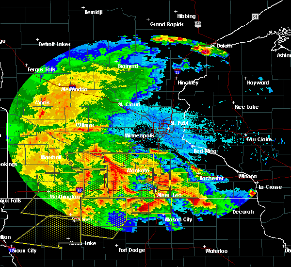 At 603 am cdt, a severe thunderstorm was located near geneva, or 14 miles northwest of austin, moving east at 35 mph (law enforcement). Hazards include 60 mph wind gusts and quarter size hail. Hail damage to vehicles is expected. expect wind damage to roofs, siding and trees. this severe storm will be near, blooming prairie around 615 am cdt. other locations impacted by this severe thunderstorm include bixby, hope and steele center. This includes interstate 35 between mile markers 21 and 34. At 603 am cdt, a severe thunderstorm was located near geneva, or 14 miles northwest of austin, moving east at 35 mph (law enforcement). Hazards include 60 mph wind gusts and quarter size hail. Hail damage to vehicles is expected. expect wind damage to roofs, siding and trees. this severe storm will be near, blooming prairie around 615 am cdt. other locations impacted by this severe thunderstorm include bixby, hope and steele center. This includes interstate 35 between mile markers 21 and 34.
|
| 6/22/2015 5:49 AM CDT |
 At 546 am cdt, a severe thunderstorm was located near rose creek, or near austin, moving east at 25 mph. other severe thunderstorms were crossing interstate 35 and will approach hayfield (radar indicated). Hazards include 60 mph wind gusts and half dollar size hail. Hail damage to vehicles is expected. expect wind damage to roofs, siding and trees. these severe thunderstorms will be near, rose creek and brownsdale around 600 am cdt. adams and hayfield around 610 am cdt. le roy around 630 am cdt. grand meadow around 635 am cdt. other locations impacted by this severe thunderstorm include ramsey, lansing, racine, mayville and dexter. Other thunderstorms will approach from the west in the next hour or so with stronger wind gusts potentially. At 546 am cdt, a severe thunderstorm was located near rose creek, or near austin, moving east at 25 mph. other severe thunderstorms were crossing interstate 35 and will approach hayfield (radar indicated). Hazards include 60 mph wind gusts and half dollar size hail. Hail damage to vehicles is expected. expect wind damage to roofs, siding and trees. these severe thunderstorms will be near, rose creek and brownsdale around 600 am cdt. adams and hayfield around 610 am cdt. le roy around 630 am cdt. grand meadow around 635 am cdt. other locations impacted by this severe thunderstorm include ramsey, lansing, racine, mayville and dexter. Other thunderstorms will approach from the west in the next hour or so with stronger wind gusts potentially.
|
| 6/22/2015 5:40 AM CDT |
 At 539 am cdt, a severe thunderstorm was located near new richland, or 14 miles north of albert lea, moving east at 35 mph (radar indicated). Hazards include golf ball size hail and 60 mph wind gusts. People and animals outdoors will be injured. expect hail damage to roofs, siding, windows and vehicles. expect wind damage to roofs, siding and trees. this severe thunderstorm will be near, ellendale and geneva around 555 am cdt. hollandale around 600 am cdt. blooming prairie around 615 am cdt. other locations impacted by this severe thunderstorm include bixby, hope and steele center. This includes interstate 35 between mile markers 20 and 35. At 539 am cdt, a severe thunderstorm was located near new richland, or 14 miles north of albert lea, moving east at 35 mph (radar indicated). Hazards include golf ball size hail and 60 mph wind gusts. People and animals outdoors will be injured. expect hail damage to roofs, siding, windows and vehicles. expect wind damage to roofs, siding and trees. this severe thunderstorm will be near, ellendale and geneva around 555 am cdt. hollandale around 600 am cdt. blooming prairie around 615 am cdt. other locations impacted by this severe thunderstorm include bixby, hope and steele center. This includes interstate 35 between mile markers 20 and 35.
|
| 6/17/2015 3:39 PM CDT |
 At 338 pm cdt, a severe thunderstorm was located near blooming prairie, or 14 miles northwest of austin, moving east at 15 mph (law enforcement earlier reported trees down near ellendale). Hazards include 60 mph wind gusts and quarter size hail. Hail damage to vehicles is expected. expect wind damage to roofs, siding and trees. this severe thunderstorm will remain over mainly rural areas of southeastern steele county. This includes interstate 35 between mile markers 26 and 28. At 338 pm cdt, a severe thunderstorm was located near blooming prairie, or 14 miles northwest of austin, moving east at 15 mph (law enforcement earlier reported trees down near ellendale). Hazards include 60 mph wind gusts and quarter size hail. Hail damage to vehicles is expected. expect wind damage to roofs, siding and trees. this severe thunderstorm will remain over mainly rural areas of southeastern steele county. This includes interstate 35 between mile markers 26 and 28.
|
| 6/17/2015 3:25 PM CDT |
 At 324 pm cdt, a severe thunderstorm was located near geneva, or 15 miles northeast of albert lea, moving east at 20 mph (law enforcement reported trees down near ellendale). Hazards include 60 mph wind gusts and quarter size hail. Hail damage to vehicles is expected. expect wind damage to roofs, siding and trees. this severe storm will be near, blooming prairie around 345 pm cdt. This includes interstate 35 between mile markers 25 and 30. At 324 pm cdt, a severe thunderstorm was located near geneva, or 15 miles northeast of albert lea, moving east at 20 mph (law enforcement reported trees down near ellendale). Hazards include 60 mph wind gusts and quarter size hail. Hail damage to vehicles is expected. expect wind damage to roofs, siding and trees. this severe storm will be near, blooming prairie around 345 pm cdt. This includes interstate 35 between mile markers 25 and 30.
|
| 6/17/2015 3:08 PM CDT |
 At 307 pm cdt, a severe thunderstorm was located over ellendale, or 14 miles south of owatonna, moving southeast at 20 mph (radar indicated). Hazards include 60 mph wind gusts and quarter size hail. Hail damage to vehicles is expected. expect wind damage to roofs, siding and trees. this severe storm will be near, blooming prairie around 335 pm cdt. other locations impacted by this severe thunderstorm include bixby and steele center. This includes interstate 35 between mile markers 25 and 33. At 307 pm cdt, a severe thunderstorm was located over ellendale, or 14 miles south of owatonna, moving southeast at 20 mph (radar indicated). Hazards include 60 mph wind gusts and quarter size hail. Hail damage to vehicles is expected. expect wind damage to roofs, siding and trees. this severe storm will be near, blooming prairie around 335 pm cdt. other locations impacted by this severe thunderstorm include bixby and steele center. This includes interstate 35 between mile markers 25 and 33.
|
| 6/17/2015 2:59 PM CDT |
 At 258 pm cdt, a severe thunderstorm was located near ellendale, or 12 miles southwest of owatonna, moving east at 20 mph (radar indicated). Hazards include golf ball size hail and 60 mph wind gusts. People and animals outdoors will be injured. expect hail damage to roofs, siding, windows and vehicles. expect wind damage to roofs, siding and trees. this severe storm will be near, blooming prairie around 335 pm cdt. other locations impacted by this severe thunderstorm include hope, steele center, lemond and bixby. This includes interstate 35 between mile markers 25 and 37. At 258 pm cdt, a severe thunderstorm was located near ellendale, or 12 miles southwest of owatonna, moving east at 20 mph (radar indicated). Hazards include golf ball size hail and 60 mph wind gusts. People and animals outdoors will be injured. expect hail damage to roofs, siding, windows and vehicles. expect wind damage to roofs, siding and trees. this severe storm will be near, blooming prairie around 335 pm cdt. other locations impacted by this severe thunderstorm include hope, steele center, lemond and bixby. This includes interstate 35 between mile markers 25 and 37.
|
| 6/17/2015 2:47 PM CDT |
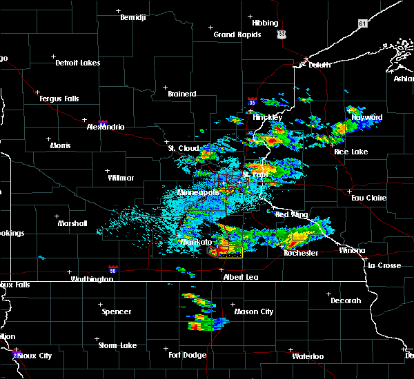 At 247 pm cdt, a severe thunderstorm was located over hope, or 12 miles southwest of owatonna, moving east at 25 mph (radar indicated). Hazards include golf ball size hail and 60 mph wind gusts. People and animals outdoors will be injured. expect hail damage to roofs, siding, windows and vehicles. expect wind damage to roofs, siding and trees. this severe storm will be near, ellendale around 300 pm cdt. blooming prairie around 330 pm cdt. other locations impacted by this severe thunderstorm include hope, steele center, lemond and bixby. This includes interstate 35 between mile markers 25 and 37. At 247 pm cdt, a severe thunderstorm was located over hope, or 12 miles southwest of owatonna, moving east at 25 mph (radar indicated). Hazards include golf ball size hail and 60 mph wind gusts. People and animals outdoors will be injured. expect hail damage to roofs, siding, windows and vehicles. expect wind damage to roofs, siding and trees. this severe storm will be near, ellendale around 300 pm cdt. blooming prairie around 330 pm cdt. other locations impacted by this severe thunderstorm include hope, steele center, lemond and bixby. This includes interstate 35 between mile markers 25 and 37.
|
| 6/17/2015 2:38 PM CDT |
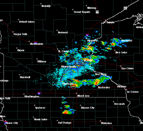 At 238 pm cdt, a severe thunderstorm was located near lemond, or 14 miles southwest of owatonna, moving east at 25 mph (radar indicated). Hazards include golf ball size hail and 60 mph wind gusts. People and animals outdoors will be injured. expect hail damage to roofs, siding, windows and vehicles. expect wind damage to roofs, siding and trees. this severe thunderstorm will be near, ellendale around 300 pm cdt. blooming prairie around 330 pm cdt. other locations impacted by this severe thunderstorm include hope, steele center, lemond and bixby. This includes interstate 35 between mile markers 25 and 37. At 238 pm cdt, a severe thunderstorm was located near lemond, or 14 miles southwest of owatonna, moving east at 25 mph (radar indicated). Hazards include golf ball size hail and 60 mph wind gusts. People and animals outdoors will be injured. expect hail damage to roofs, siding, windows and vehicles. expect wind damage to roofs, siding and trees. this severe thunderstorm will be near, ellendale around 300 pm cdt. blooming prairie around 330 pm cdt. other locations impacted by this severe thunderstorm include hope, steele center, lemond and bixby. This includes interstate 35 between mile markers 25 and 37.
|
| 5/3/2015 7:37 PM CDT | The severe thunderstorm warning for northwestern mower and southern dodge counties will expire at 745 pm cdt, the storm which prompted the warning has moved out of the area. therefore the warning will be allowed to expire. |
| 5/3/2015 7:12 PM CDT | The severe thunderstorm warning for southeastern steele and northeastern freeborn counties will expire at 715 pm cdt, the storms which prompted the warning have moved out of the area. therefore the warning will be allowed to expire. to report severe weather, contact your nearest law enforcement agency. they will relay your report to the national weather service the twin cities. |
| 5/3/2015 7:10 PM CDT | At 709 pm cdt, a severe thunderstorm was located 7 miles west of stewartville, or 13 miles south of byron, and is nearly stationary (trained weather spotters). Hazards include ping pong ball size hail was reported by spotters in hayfield at 655 pm cdt. People and animals outdoors will be injured. expect damage to roofs, siding, windows and vehicles. locations impacted include, hayfield, brownsdale, blooming prairie, lansing, mayville, dexter, oslo, waltham, sargeant, county roads 1 and 15, highway 30 and county 3, renova, interstate 90 and county 1 and brookside campground. 1. 50in. |
| 5/3/2015 7:04 PM CDT | At 703 pm cdt, a severe thunderstorm was located 7 miles southeast of hayfield, or 13 miles south of byron, and is nearly stationary (trained weather spotters). Hazards include ping pong ball size hail was reported by spotters in hayfield at 655 pm cdt. People and animals outdoors will be injured. expect damage to roofs, siding, windows and vehicles. locations impacted include, hayfield, brownsdale, blooming prairie, lansing, mayville, dexter, oslo, waltham, sargeant, county roads 1 and 15, highway 30 and county 3, renova, interstate 90 and county 1 and brookside campground. 1. 50in. |
| 5/3/2015 6:55 PM CDT | At 655 pm cdt, a severe thunderstorm was located near hayfield, or 12 miles northeast of austin, moving east at 40 mph (radar indicated). Hazards include half dollar size hail. Damage to vehicles is expected. this severe thunderstorm will remain over mainly rural areas of northwestern mower and southern dodge counties, including the following locations, lansing, mayville, dexter, oslo and waltham. 1. 25in. |
| 5/3/2015 6:51 PM CDT | At 651 pm cdt, a severe thunderstorm was located near hayfield, or 11 miles north of austin, moving east at 40 mph (radar indicated). Hazards include half dollar size hail. Damage to vehicles is expected. this severe storm will be near, hayfield around 655 pm cdt. other locations impacted by this severe thunderstorm include lansing, mayville, dexter, oslo and waltham. 1. 25in. |
| 5/3/2015 6:48 PM CDT | At 648 pm cdt, severe thunderstorms were located along a line extending from near highway 30 and county 3 to near albert lea airport, moving east at 25 mph (radar indicated). Hazards include 60 mph wind gusts and half dollar size hail. Hail damage to vehicles is expected. Expect wind damage to roofs, siding and trees. |
| 5/3/2015 6:41 PM CDT | At 640 pm cdt, a severe thunderstorm was located near blooming prairie, or 12 miles northwest of austin, moving east at 25 mph (radar indicated). Hazards include half dollar size hail. Damage to vehicles is expected. this severe thunderstorm will be near, blooming prairie around 650 pm cdt. brownsdale and hayfield around 710 pm cdt. other locations impacted by this severe thunderstorm include lansing, mayville, dexter, oslo and waltham. 1. 25in. |
| 5/19/2013 3:40 PM CDT | Power poles were blown at a 45 degree angle based on estimated 60 mph straight line wind in steele county MN, 4.2 miles SE of Blooming Prairie, MN |
Hail Maps for Blooming Prairie, MN


Connect with Interactive Hail Maps