

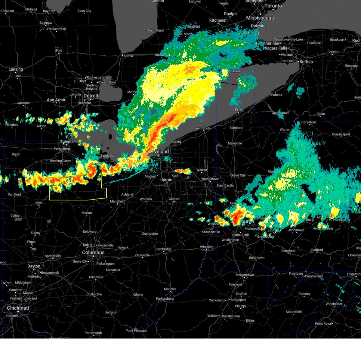
Hail Map for Bluffton, OH
The Bluffton, OH area has had 4 reports of on-the-ground hail by trained spotters, and has been under severe weather warnings 22 times during the past 12 months. Doppler radar has detected hail at or near Bluffton, OH on 36 occasions, including 1 occasion during the past year.
| Name: | Bluffton, OH |
| Where Located: | 64.5 miles ESE of Fort Wayne, IN |
| Map: | Google Map for Bluffton, OH |
| Population: | 4125 |
| Housing Units: | 1522 |
| More Info: | Search Google for Bluffton, OH |
0
The Top Recent Hail Date for Bluffton, OH is Tuesday, August 6, 2024 (23rd out of 36)

Hail and Wind Damage Spotted near Bluffton, OH
| Date / Time | Report Details |
|---|---|
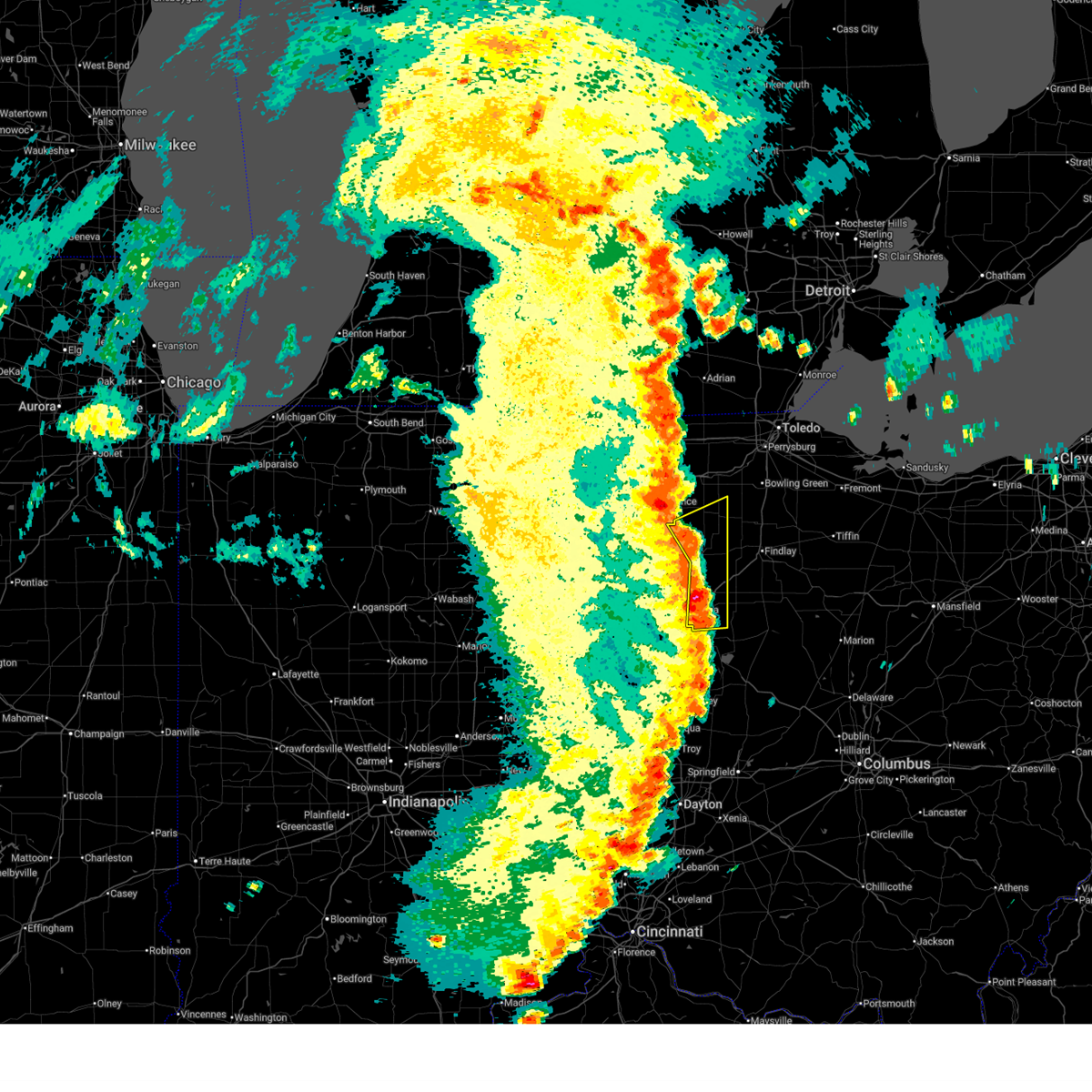
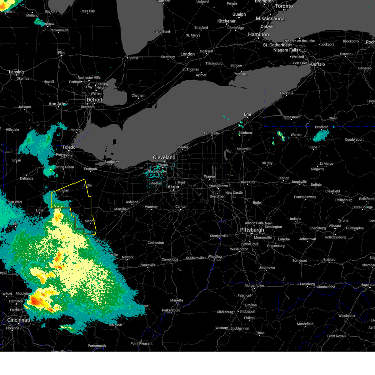
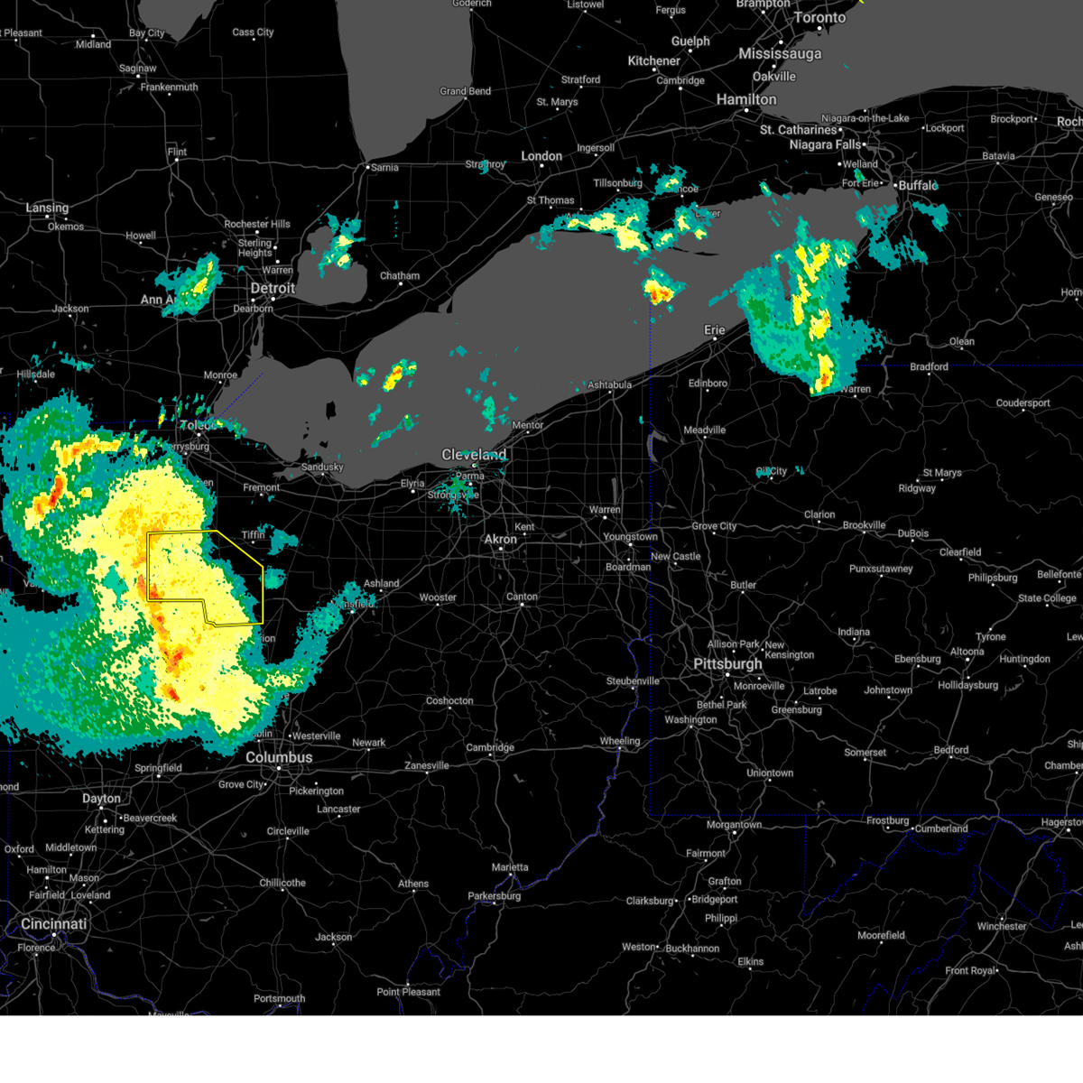
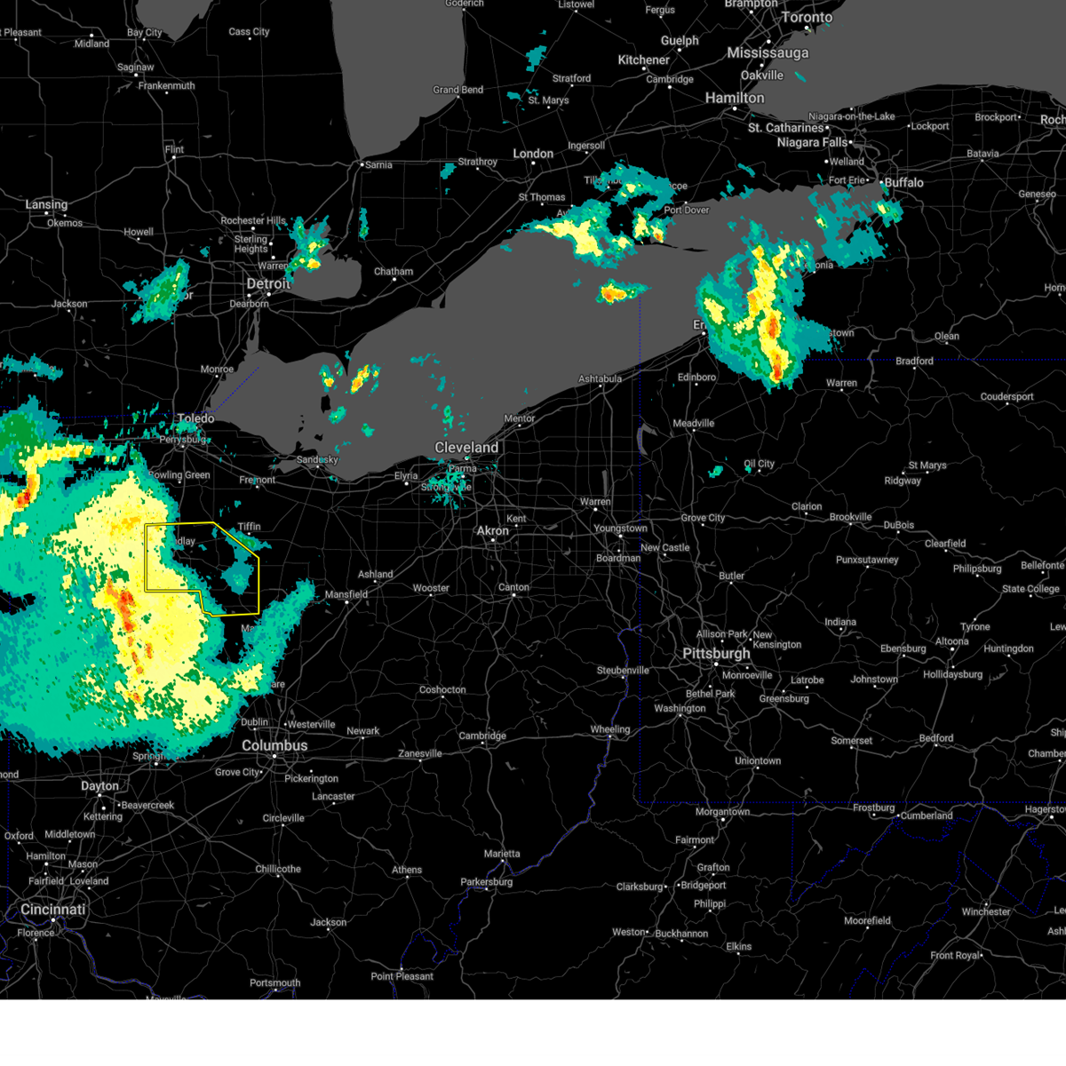
| 6/18/2025 7:17 PM EDT | At 717 pm edt, severe thunderstorms were located along a line extending from near weston to van buren to near arlington, moving east at 60 mph (radar indicated). Hazards include 70 mph wind gusts. Expect considerable tree damage. damage is likely to mobile homes, roofs, and outbuildings. Locations impacted include, toledo, findlay, bowling green, fostoria, bluffton, swanton, perrysburg, oregon, sylvania, rossford, waterville, northwood, whitehouse, north baltimore, holland, mccomb, weston, arlington, arcadia, and rawson. |
| 6/18/2025 7:12 PM EDT | the severe thunderstorm warning has been cancelled and is no longer in effect |
| 6/18/2025 7:08 PM EDT | Torcle the national weather service in cleveland has issued a * tornado warning for, southwestern seneca county in northwestern ohio, northwestern wyandot county in northwestern ohio, southern hancock county in northwestern ohio, * until 745 pm edt. * at 707 pm edt, a severe thunderstorm capable of producing a tornado was located near rawson, or near bluffton, moving east at 60 mph (radar indicated rotation). Hazards include tornado. Flying debris will be dangerous to those caught without shelter. mobile homes will be damaged or destroyed. damage to roofs, windows, and vehicles will occur. tree damage is likely. this dangerous storm will be near, findlay, arlington, and vanlue around 715 pm edt. new riegel around 725 pm edt. Other locations impacted by this tornadic thunderstorm include jenera, mount blanchard, williamstown, wharton, mount cory, and carey. |
| 6/18/2025 6:53 PM EDT |
 Svriwx the national weather service in northern indiana has issued a * severe thunderstorm warning for, eastern putnam county in west central ohio, southeastern henry county in northwestern ohio, allen county in west central ohio, * until 730 pm edt. * at 653 pm edt, severe thunderstorms were located along a line extending from near holgate to near ottawa to 6 miles east of lima, moving east at 50 mph (radar indicated). Hazards include 60 mph wind gusts. expect damage to roofs, siding, and trees Svriwx the national weather service in northern indiana has issued a * severe thunderstorm warning for, eastern putnam county in west central ohio, southeastern henry county in northwestern ohio, allen county in west central ohio, * until 730 pm edt. * at 653 pm edt, severe thunderstorms were located along a line extending from near holgate to near ottawa to 6 miles east of lima, moving east at 50 mph (radar indicated). Hazards include 60 mph wind gusts. expect damage to roofs, siding, and trees
|
| 6/18/2025 6:42 PM EDT | Svrcle the national weather service in cleveland has issued a * severe thunderstorm warning for, wood county in northwestern ohio, hancock county in northwestern ohio, lucas county in northwestern ohio, * until 745 pm edt. * at 641 pm edt, severe thunderstorms were located along a line extending from near continental to near kalida to near cridersville, moving northeast at 60 mph (radar indicated). Hazards include 60 mph wind gusts. expect damage to trees and power lines |
| 5/16/2025 9:14 PM EDT |
 Svrcle the national weather service in cleveland has issued a * severe thunderstorm warning for, western seneca county in northwestern ohio, marion county in north central ohio, wyandot county in northwestern ohio, hancock county in northwestern ohio, * until 1000 pm edt. * at 914 pm edt, severe thunderstorms were located along a line extending from near rawson to near west mansfield, moving east at 65 mph (radar indicated). Hazards include 60 mph wind gusts. expect damage to trees and power lines Svrcle the national weather service in cleveland has issued a * severe thunderstorm warning for, western seneca county in northwestern ohio, marion county in north central ohio, wyandot county in northwestern ohio, hancock county in northwestern ohio, * until 1000 pm edt. * at 914 pm edt, severe thunderstorms were located along a line extending from near rawson to near west mansfield, moving east at 65 mph (radar indicated). Hazards include 60 mph wind gusts. expect damage to trees and power lines
|
| 5/16/2025 9:11 PM EDT | the severe thunderstorm warning has been cancelled and is no longer in effect |
| 5/16/2025 8:38 PM EDT | Svriwx the national weather service in northern indiana has issued a * severe thunderstorm warning for, putnam county in west central ohio, allen county in west central ohio, * until 945 pm edt. * at 837 pm edt, showers and embedded thunderstorms producing strong wind gusts were located along a line extending from near paulding to near jackson center, moving northeast at 60 mph (broadcast media). Hazards include 70 mph wind gusts. Expect considerable tree damage. Damage is likely to mobile homes, roofs, and outbuildings. |
| 4/19/2025 7:28 AM EDT |
 At 724 am edt, severe thunderstorms were located along a line extending from pandora to alger to belle center, moving northeast at 70 mph. with this line, a 63 mph wind gust was reported at neil armstrong airport in wapakoneta and a 58 mph wind gust was reported at allen county airport in lima (radar indicated). Hazards include 60 mph wind gusts. Expect damage to trees and power lines. Locations impacted include, findlay, fostoria, upper sandusky, bluffton, mccomb, forest, arlington, sycamore, arcadia, rawson, morral, vanlue, van buren, new riegel, marseilles, carey, nevada, bloomdale, mount blanchard, and wharton. At 724 am edt, severe thunderstorms were located along a line extending from pandora to alger to belle center, moving northeast at 70 mph. with this line, a 63 mph wind gust was reported at neil armstrong airport in wapakoneta and a 58 mph wind gust was reported at allen county airport in lima (radar indicated). Hazards include 60 mph wind gusts. Expect damage to trees and power lines. Locations impacted include, findlay, fostoria, upper sandusky, bluffton, mccomb, forest, arlington, sycamore, arcadia, rawson, morral, vanlue, van buren, new riegel, marseilles, carey, nevada, bloomdale, mount blanchard, and wharton.
|
| 4/19/2025 7:15 AM EDT |
 Svrcle the national weather service in cleveland has issued a * severe thunderstorm warning for, southwestern seneca county in northwestern ohio, wyandot county in northwestern ohio, hancock county in northwestern ohio, * until 815 am edt. * at 715 am edt, severe thunderstorms were located along a line extending from near columbus grove to near waynesfield to de graff, moving northeast at 80 mph (radar indicated). Hazards include 60 mph wind gusts. expect damage to trees and power lines Svrcle the national weather service in cleveland has issued a * severe thunderstorm warning for, southwestern seneca county in northwestern ohio, wyandot county in northwestern ohio, hancock county in northwestern ohio, * until 815 am edt. * at 715 am edt, severe thunderstorms were located along a line extending from near columbus grove to near waynesfield to de graff, moving northeast at 80 mph (radar indicated). Hazards include 60 mph wind gusts. expect damage to trees and power lines
|
| 4/2/2025 11:44 PM EDT |
 the severe thunderstorm warning has been cancelled and is no longer in effect the severe thunderstorm warning has been cancelled and is no longer in effect
|
| 4/2/2025 11:43 PM EDT | Svrcle the national weather service in cleveland has issued a * severe thunderstorm warning for, ottawa county in northwestern ohio, northwestern seneca county in northwestern ohio, northwestern wyandot county in northwestern ohio, sandusky county in northwestern ohio, wood county in northwestern ohio, hancock county in northwestern ohio, central lucas county in northwestern ohio, * until 1230 am edt. * at 1143 pm edt, severe thunderstorms were located along a line extending from near weston to near van buren to dunkirk, moving northeast at 90 mph (radar indicated). Hazards include 60 mph wind gusts. expect damage to trees and power lines |
| 4/2/2025 11:26 PM EDT | At 1125 pm edt, severe thunderstorms were located along a line extending from near defiance to near glandorf to 6 miles south of kalida, moving northeast at 65 mph (radar indicated). Hazards include 60 mph wind gusts. Expect damage to roofs, siding, and trees. locations impacted include, ottoville, westminster, columbus grove, pandora, melrose, harrod, charloe, bluffton, west leipsic, rimer, dupont, wisterman, ottawa, vaughnsville, prentiss, leipsic, kieferville, miller city, glandorf, and belmore. This includes interstate 75 between mile markers 130 and 141. |
| 4/2/2025 11:26 PM EDT | the severe thunderstorm warning has been cancelled and is no longer in effect |
| 4/2/2025 11:02 PM EDT |
 the severe thunderstorm warning has been cancelled and is no longer in effect the severe thunderstorm warning has been cancelled and is no longer in effect
|
| 4/2/2025 11:02 PM EDT |
 At 1102 pm edt, severe thunderstorms were located along a line extending from near payne to near van wert to near rockford, moving northeast at 60 mph (radar indicated). Hazards include 70 mph wind gusts. Expect considerable tree damage. damage is likely to mobile homes, roofs, and outbuildings. locations impacted include, elida, ottoville, yoder, westminster, columbus grove, bluffton, cavett, haviland, west leipsic, rimer, latty, dupont, venedocia, convoy, ottawa, wetzel, vaughnsville, kieferville, glandorf, and spencerville in allen county. This includes interstate 75 between mile markers 119 and 141. At 1102 pm edt, severe thunderstorms were located along a line extending from near payne to near van wert to near rockford, moving northeast at 60 mph (radar indicated). Hazards include 70 mph wind gusts. Expect considerable tree damage. damage is likely to mobile homes, roofs, and outbuildings. locations impacted include, elida, ottoville, yoder, westminster, columbus grove, bluffton, cavett, haviland, west leipsic, rimer, latty, dupont, venedocia, convoy, ottawa, wetzel, vaughnsville, kieferville, glandorf, and spencerville in allen county. This includes interstate 75 between mile markers 119 and 141.
|
| 4/2/2025 10:43 PM EDT | Svriwx the national weather service in northern indiana has issued a * severe thunderstorm warning for, southeastern allen county in northeastern indiana, northern adams county in northeastern indiana, putnam county in west central ohio, southeastern paulding county in west central ohio, van wert county in west central ohio, allen county in west central ohio, * until midnight edt. * at 1042 pm edt, severe thunderstorms were located along a line extending from near decatur to 6 miles west of rockford to st. henry, moving northeast at 65 mph (radar indicated). Hazards include 70 mph wind gusts. Expect considerable tree damage. Damage is likely to mobile homes, roofs, and outbuildings. |
| 8/27/2024 7:34 PM EDT |
 Svrcle the national weather service in cleveland has issued a * severe thunderstorm warning for, huron county in north central ohio, seneca county in northwestern ohio, erie county in north central ohio, southwestern cuyahoga county in northeastern ohio, southern sandusky county in northwestern ohio, southern wood county in northwestern ohio, hancock county in northwestern ohio, lorain county in north central ohio, * until 815 pm edt. * at 733 pm edt, severe thunderstorm outflow winds were located along a line extending from near western vermilion to near green springs to mccomb, moving southeast at 45 mph (radar indicated). Hazards include 60 mph wind gusts. expect damage to trees and power lines Svrcle the national weather service in cleveland has issued a * severe thunderstorm warning for, huron county in north central ohio, seneca county in northwestern ohio, erie county in north central ohio, southwestern cuyahoga county in northeastern ohio, southern sandusky county in northwestern ohio, southern wood county in northwestern ohio, hancock county in northwestern ohio, lorain county in north central ohio, * until 815 pm edt. * at 733 pm edt, severe thunderstorm outflow winds were located along a line extending from near western vermilion to near green springs to mccomb, moving southeast at 45 mph (radar indicated). Hazards include 60 mph wind gusts. expect damage to trees and power lines
|
| 8/6/2024 5:02 PM EDT |
 The storms which prompted the warning have weakened below severe limits, and no longer pose an immediate threat to life or property. therefore, the warning has been allowed to expire. however, gusty winds and heavy rain are still possible with these thunderstorms. a severe thunderstorm watch remains in effect until 700 pm edt for north central and northwestern ohio. The storms which prompted the warning have weakened below severe limits, and no longer pose an immediate threat to life or property. therefore, the warning has been allowed to expire. however, gusty winds and heavy rain are still possible with these thunderstorms. a severe thunderstorm watch remains in effect until 700 pm edt for north central and northwestern ohio.
|
| 8/6/2024 4:38 PM EDT |
 the severe thunderstorm warning has been cancelled and is no longer in effect the severe thunderstorm warning has been cancelled and is no longer in effect
|
| 8/6/2024 4:38 PM EDT |
 At 438 pm edt, severe thunderstorms were located along a line extending from near sycamore to near vanlue to pandora, moving southeast at 30 mph (radar indicated). Hazards include 60 mph wind gusts. Expect damage to trees and power lines. Locations impacted include, findlay, bucyrus, upper sandusky, bluffton, forest, arlington, new washington, bloomville, sycamore, rawson, vanlue, new riegel, chatfield, carey, attica, benton, nevada, mount blanchard, wharton, and benton ridge. At 438 pm edt, severe thunderstorms were located along a line extending from near sycamore to near vanlue to pandora, moving southeast at 30 mph (radar indicated). Hazards include 60 mph wind gusts. Expect damage to trees and power lines. Locations impacted include, findlay, bucyrus, upper sandusky, bluffton, forest, arlington, new washington, bloomville, sycamore, rawson, vanlue, new riegel, chatfield, carey, attica, benton, nevada, mount blanchard, wharton, and benton ridge.
|
| 8/6/2024 3:59 PM EDT |
 Svrcle the national weather service in cleveland has issued a * severe thunderstorm warning for, seneca county in northwestern ohio, northern wyandot county in northwestern ohio, southeastern sandusky county in northwestern ohio, northern crawford county in north central ohio, hancock county in northwestern ohio, * until 500 pm edt. * at 359 pm edt, severe thunderstorms were located along a line extending from near bellevue to near new riegel to near glandorf, moving southeast at 35 mph (radar indicated). Hazards include 60 mph wind gusts and quarter size hail. Minor damage to vehicles is possible. Expect damage to trees and power lines. Svrcle the national weather service in cleveland has issued a * severe thunderstorm warning for, seneca county in northwestern ohio, northern wyandot county in northwestern ohio, southeastern sandusky county in northwestern ohio, northern crawford county in north central ohio, hancock county in northwestern ohio, * until 500 pm edt. * at 359 pm edt, severe thunderstorms were located along a line extending from near bellevue to near new riegel to near glandorf, moving southeast at 35 mph (radar indicated). Hazards include 60 mph wind gusts and quarter size hail. Minor damage to vehicles is possible. Expect damage to trees and power lines.
|
| 4/17/2024 2:45 PM EDT |
 The storms which prompted the warning have are exiting the eastern part of allen county ohio. therefore, the severe thunderstorm warning will be allowed to expire. a tornado watch remains in effect until 700 pm edt for west central ohio. The storms which prompted the warning have are exiting the eastern part of allen county ohio. therefore, the severe thunderstorm warning will be allowed to expire. a tornado watch remains in effect until 700 pm edt for west central ohio.
|
| 4/17/2024 2:27 PM EDT |
 Svrcle the national weather service in cleveland has issued a * severe thunderstorm warning for, wood county in northwestern ohio, hancock county in northwestern ohio, southwestern lucas county in northwestern ohio, * until 330 pm edt. * at 227 pm edt, severe thunderstorms were located along a line extending from near mcclure to near elida, moving northeast at 25 mph (radar indicated). Hazards include 60 mph wind gusts and penny size hail. expect damage to trees and power lines Svrcle the national weather service in cleveland has issued a * severe thunderstorm warning for, wood county in northwestern ohio, hancock county in northwestern ohio, southwestern lucas county in northwestern ohio, * until 330 pm edt. * at 227 pm edt, severe thunderstorms were located along a line extending from near mcclure to near elida, moving northeast at 25 mph (radar indicated). Hazards include 60 mph wind gusts and penny size hail. expect damage to trees and power lines
|
| 4/17/2024 2:22 PM EDT |
 Svriwx the national weather service in northern indiana has issued a * severe thunderstorm warning for, southeastern putnam county in west central ohio, allen county in west central ohio, * until 245 pm edt. * at 221 pm edt, severe thunderstorms were located along a line extending from near columbus grove to near cridersville to botkins, moving east at 30 mph (radar indicated). Hazards include 60 mph wind gusts and penny size hail. expect damage to roofs, siding, and trees Svriwx the national weather service in northern indiana has issued a * severe thunderstorm warning for, southeastern putnam county in west central ohio, allen county in west central ohio, * until 245 pm edt. * at 221 pm edt, severe thunderstorms were located along a line extending from near columbus grove to near cridersville to botkins, moving east at 30 mph (radar indicated). Hazards include 60 mph wind gusts and penny size hail. expect damage to roofs, siding, and trees
|
| 3/14/2024 7:57 PM EDT | Report of damage to houses near township road 29 and township road 1 in hancock county OH, 5.3 miles W of Bluffton, OH |
| 3/14/2024 7:30 PM EDT | Corrects previous tstm wnd dmg report from 3 wsw jenera. report of damage to houses near township road 29 and township road 12. report corrected for time based on radar in hancock county OH, 5.3 miles W of Bluffton, OH |
| 3/14/2024 7:19 PM EDT |
 Svrcle the national weather service in cleveland has issued a * severe thunderstorm warning for, southern hancock county in northwestern ohio, * until 800 pm edt. * at 719 pm edt, a severe thunderstorm was located over pandora, or near bluffton, moving east at 65 mph (radar indicated). Hazards include ping pong ball size hail and 60 mph wind gusts. People and animals outdoors will be injured. expect hail damage to roofs, siding, windows, and vehicles. Expect damage to trees and power lines. Svrcle the national weather service in cleveland has issued a * severe thunderstorm warning for, southern hancock county in northwestern ohio, * until 800 pm edt. * at 719 pm edt, a severe thunderstorm was located over pandora, or near bluffton, moving east at 65 mph (radar indicated). Hazards include ping pong ball size hail and 60 mph wind gusts. People and animals outdoors will be injured. expect hail damage to roofs, siding, windows, and vehicles. Expect damage to trees and power lines.
|
| 3/14/2024 7:18 PM EDT |
 At 718 pm edt, a severe thunderstorm was located over pandora, or near ottawa, moving east at 40 mph (radar indicated). Hazards include 60 mph wind gusts and quarter size hail. Hail damage to vehicles is expected. expect wind damage to roofs, siding, and trees. locations impacted include, bluffton, pandora, gilboa, and rockport. This includes interstate 75 between mile markers 137 and 141. At 718 pm edt, a severe thunderstorm was located over pandora, or near ottawa, moving east at 40 mph (radar indicated). Hazards include 60 mph wind gusts and quarter size hail. Hail damage to vehicles is expected. expect wind damage to roofs, siding, and trees. locations impacted include, bluffton, pandora, gilboa, and rockport. This includes interstate 75 between mile markers 137 and 141.
|
| 3/14/2024 7:14 PM EDT |
 The storm which prompted the warning has moved out of the area. therefore, the warning will be allowed to expire. a tornado watch remains in effect until midnight edt for west central ohio. remember, a severe thunderstorm warning still remains in effect for southern putnam county until 730 pm edt. The storm which prompted the warning has moved out of the area. therefore, the warning will be allowed to expire. a tornado watch remains in effect until midnight edt for west central ohio. remember, a severe thunderstorm warning still remains in effect for southern putnam county until 730 pm edt.
|
| 3/14/2024 7:12 PM EDT |
 Svriwx the national weather service in northern indiana has issued a * severe thunderstorm warning for, southeastern putnam county in west central ohio, northeastern allen county in west central ohio, * until 730 pm edt. * at 712 pm edt, a severe thunderstorm was located over columbus grove, or near ottawa, moving east at 40 mph (radar indicated). Hazards include 60 mph wind gusts and quarter size hail. Hail damage to vehicles is expected. Expect wind damage to roofs, siding, and trees. Svriwx the national weather service in northern indiana has issued a * severe thunderstorm warning for, southeastern putnam county in west central ohio, northeastern allen county in west central ohio, * until 730 pm edt. * at 712 pm edt, a severe thunderstorm was located over columbus grove, or near ottawa, moving east at 40 mph (radar indicated). Hazards include 60 mph wind gusts and quarter size hail. Hail damage to vehicles is expected. Expect wind damage to roofs, siding, and trees.
|
| 3/14/2024 7:03 PM EDT |
 At 703 pm edt, a severe thunderstorm was located near mccomb, or 10 miles east of ottawa, moving east at 65 mph (radar indicated). Hazards include 60 mph wind gusts and half dollar size hail. Hail damage to vehicles is expected. expect wind damage to roofs, siding, and trees. Locations impacted include, ottawa, bluffton, columbus grove, kalida, pandora, glandorf, gilboa, vaughnsville, rimer, and rushmore. At 703 pm edt, a severe thunderstorm was located near mccomb, or 10 miles east of ottawa, moving east at 65 mph (radar indicated). Hazards include 60 mph wind gusts and half dollar size hail. Hail damage to vehicles is expected. expect wind damage to roofs, siding, and trees. Locations impacted include, ottawa, bluffton, columbus grove, kalida, pandora, glandorf, gilboa, vaughnsville, rimer, and rushmore.
|
| 3/14/2024 6:58 PM EDT |
 At 657 pm edt, a severe thunderstorm was located near ottawa, moving east at 65 mph (at 649 pm edt, emergency management reported quarter size hail in ottoville). Hazards include 60 mph wind gusts and half dollar size hail. Hail damage to vehicles is expected. expect wind damage to roofs, siding, and trees. Locations impacted include, delphos, ottawa, bluffton, columbus grove, kalida, pandora, glandorf, ottoville, fort jennings, gilboa, cloverdale, vaughnsville, rushmore, and rimer. At 657 pm edt, a severe thunderstorm was located near ottawa, moving east at 65 mph (at 649 pm edt, emergency management reported quarter size hail in ottoville). Hazards include 60 mph wind gusts and half dollar size hail. Hail damage to vehicles is expected. expect wind damage to roofs, siding, and trees. Locations impacted include, delphos, ottawa, bluffton, columbus grove, kalida, pandora, glandorf, ottoville, fort jennings, gilboa, cloverdale, vaughnsville, rushmore, and rimer.
|
| 3/14/2024 6:51 PM EDT |
 the severe thunderstorm warning has been cancelled and is no longer in effect the severe thunderstorm warning has been cancelled and is no longer in effect
|
| 3/14/2024 6:51 PM EDT |
 At 651 pm edt, a severe thunderstorm was located over glandorf, or near ottawa, moving east at 65 mph (radar indicated). Hazards include 60 mph wind gusts and half dollar size hail. Hail damage to vehicles is expected. expect wind damage to roofs, siding, and trees. Locations impacted include, delphos, ottawa, bluffton, columbus grove, kalida, pandora, glandorf, ottoville, fort jennings, gilboa, cloverdale, vaughnsville, rushmore, and rimer. At 651 pm edt, a severe thunderstorm was located over glandorf, or near ottawa, moving east at 65 mph (radar indicated). Hazards include 60 mph wind gusts and half dollar size hail. Hail damage to vehicles is expected. expect wind damage to roofs, siding, and trees. Locations impacted include, delphos, ottawa, bluffton, columbus grove, kalida, pandora, glandorf, ottoville, fort jennings, gilboa, cloverdale, vaughnsville, rushmore, and rimer.
|
| 3/14/2024 6:40 PM EDT |
 Svriwx the national weather service in northern indiana has issued a * severe thunderstorm warning for, putnam county in west central ohio, northeastern van wert county in west central ohio, northern allen county in west central ohio, * until 715 pm edt. * at 639 pm edt, a severe thunderstorm was located near ottoville, or 8 miles north of delphos, moving east at 65 mph (radar indicated). Hazards include 60 mph wind gusts and half dollar size hail. Hail damage to vehicles is expected. Expect wind damage to roofs, siding, and trees. Svriwx the national weather service in northern indiana has issued a * severe thunderstorm warning for, putnam county in west central ohio, northeastern van wert county in west central ohio, northern allen county in west central ohio, * until 715 pm edt. * at 639 pm edt, a severe thunderstorm was located near ottoville, or 8 miles north of delphos, moving east at 65 mph (radar indicated). Hazards include 60 mph wind gusts and half dollar size hail. Hail damage to vehicles is expected. Expect wind damage to roofs, siding, and trees.
|
| 8/24/2023 2:48 AM EDT | Photo on twitter of a few large tree limbs down on main street in bluffto in allen county OH, 0.2 miles N of Bluffton, OH |
| 8/24/2023 2:27 AM EDT |
 The severe thunderstorm warning for marion, wyandot, morrow, southwestern crawford and hancock counties will expire at 230 am edt, the storms which prompted the warning have moved out of the area. therefore, the warning will be allowed to expire. however gusty winds and heavy rain are still possible with these thunderstorms. The severe thunderstorm warning for marion, wyandot, morrow, southwestern crawford and hancock counties will expire at 230 am edt, the storms which prompted the warning have moved out of the area. therefore, the warning will be allowed to expire. however gusty winds and heavy rain are still possible with these thunderstorms.
|
| 8/24/2023 1:49 AM EDT |
 At 149 am edt, severe thunderstorms were located along a line extending from 7 miles northeast of marion to near upper sandusky to near arcadia, moving southwest at 40 mph (radar indicated). Hazards include 60 mph wind gusts. expect damage to trees and power lines At 149 am edt, severe thunderstorms were located along a line extending from 7 miles northeast of marion to near upper sandusky to near arcadia, moving southwest at 40 mph (radar indicated). Hazards include 60 mph wind gusts. expect damage to trees and power lines
|
| 8/12/2023 11:57 AM EDT |
 At 1156 am edt, a severe thunderstorm was located near bluffton, moving east at 50 mph (radar indicated). Hazards include 60 mph wind gusts and quarter size hail. Minor damage to vehicles is possible. Expect damage to trees and power lines. At 1156 am edt, a severe thunderstorm was located near bluffton, moving east at 50 mph (radar indicated). Hazards include 60 mph wind gusts and quarter size hail. Minor damage to vehicles is possible. Expect damage to trees and power lines.
|
| 7/29/2023 4:13 AM EDT |
 At 412 am edt, severe thunderstorms were located along a line extending from near findlay to waynesfield, moving east at 60 mph (radar indicated). Hazards include 60 mph wind gusts. expect damage to trees and power lines At 412 am edt, severe thunderstorms were located along a line extending from near findlay to waynesfield, moving east at 60 mph (radar indicated). Hazards include 60 mph wind gusts. expect damage to trees and power lines
|
| 7/28/2023 10:47 PM EDT |
 At 1047 pm edt, a severe thunderstorm was located over columbus grove, or 7 miles south of ottawa, moving east at 25 mph (radar indicated). Hazards include 60 mph wind gusts and quarter size hail. Hail damage to vehicles is expected. expect wind damage to roofs, siding, and trees. locations impacted include, ottawa, bluffton, columbus grove, pandora, glandorf, gilboa, and rockport. this includes interstate 75 between mile markers 137 and 141. hail threat, radar indicated max hail size, 1. 00 in wind threat, radar indicated max wind gust, 60 mph. At 1047 pm edt, a severe thunderstorm was located over columbus grove, or 7 miles south of ottawa, moving east at 25 mph (radar indicated). Hazards include 60 mph wind gusts and quarter size hail. Hail damage to vehicles is expected. expect wind damage to roofs, siding, and trees. locations impacted include, ottawa, bluffton, columbus grove, pandora, glandorf, gilboa, and rockport. this includes interstate 75 between mile markers 137 and 141. hail threat, radar indicated max hail size, 1. 00 in wind threat, radar indicated max wind gust, 60 mph.
|
| 7/28/2023 10:34 PM EDT |
 At 1034 pm edt, a severe thunderstorm was located near kalida, or 8 miles northeast of delphos, moving east at 25 mph (radar indicated). Hazards include 60 mph wind gusts and quarter size hail. Hail damage to vehicles is expected. Expect wind damage to roofs, siding, and trees. At 1034 pm edt, a severe thunderstorm was located near kalida, or 8 miles northeast of delphos, moving east at 25 mph (radar indicated). Hazards include 60 mph wind gusts and quarter size hail. Hail damage to vehicles is expected. Expect wind damage to roofs, siding, and trees.
|
| 7/20/2023 7:11 PM EDT |
 At 710 pm edt, severe thunderstorms were located along a line extending from 8 miles northeast of bloomville to forest, moving east at 40 mph (radar indicated). Hazards include 60 mph wind gusts and quarter size hail. Minor damage to vehicles is possible. Expect damage to trees and power lines. At 710 pm edt, severe thunderstorms were located along a line extending from 8 miles northeast of bloomville to forest, moving east at 40 mph (radar indicated). Hazards include 60 mph wind gusts and quarter size hail. Minor damage to vehicles is possible. Expect damage to trees and power lines.
|
| 7/20/2023 7:03 PM EDT |
 At 702 pm edt, a severe thunderstorm was located near arlington, or 11 miles south of findlay, moving northeast at 50 mph (radar indicated). Hazards include 60 mph wind gusts and quarter size hail. Minor damage to vehicles is possible. expect damage to trees and power lines. locations impacted include, bluffton, arlington, vanlue, mount blanchard, jenera and williamstown. hail threat, radar indicated max hail size, 1. 00 in wind threat, radar indicated max wind gust, 60 mph. At 702 pm edt, a severe thunderstorm was located near arlington, or 11 miles south of findlay, moving northeast at 50 mph (radar indicated). Hazards include 60 mph wind gusts and quarter size hail. Minor damage to vehicles is possible. expect damage to trees and power lines. locations impacted include, bluffton, arlington, vanlue, mount blanchard, jenera and williamstown. hail threat, radar indicated max hail size, 1. 00 in wind threat, radar indicated max wind gust, 60 mph.
|
| 7/20/2023 6:47 PM EDT |
 At 647 pm edt, a severe thunderstorm was located over ada, moving northeast at 35 mph (radar indicated). Hazards include golf ball size hail and 70 mph wind gusts. People and animals outdoors will be injured. expect hail damage to roofs, siding, windows, and vehicles. expect considerable tree damage. wind damage is also likely to mobile homes, roofs, and outbuildings. locations impacted include, findlay, bluffton, arlington, rawson, vanlue, mount blanchard, benton ridge, jenera, mount cory and williamstown. thunderstorm damage threat, considerable hail threat, radar indicated max hail size, 1. 75 in wind threat, radar indicated max wind gust, 70 mph. At 647 pm edt, a severe thunderstorm was located over ada, moving northeast at 35 mph (radar indicated). Hazards include golf ball size hail and 70 mph wind gusts. People and animals outdoors will be injured. expect hail damage to roofs, siding, windows, and vehicles. expect considerable tree damage. wind damage is also likely to mobile homes, roofs, and outbuildings. locations impacted include, findlay, bluffton, arlington, rawson, vanlue, mount blanchard, benton ridge, jenera, mount cory and williamstown. thunderstorm damage threat, considerable hail threat, radar indicated max hail size, 1. 75 in wind threat, radar indicated max wind gust, 70 mph.
|
| 7/20/2023 6:36 PM EDT |
 At 636 pm edt, a severe thunderstorm was located over kalida, or 7 miles southwest of ottawa, moving southeast at 50 mph (radar indicated). Hazards include 60 mph wind gusts and penny size hail. expect damage to roofs, siding, and trees At 636 pm edt, a severe thunderstorm was located over kalida, or 7 miles southwest of ottawa, moving southeast at 50 mph (radar indicated). Hazards include 60 mph wind gusts and penny size hail. expect damage to roofs, siding, and trees
|
| 7/20/2023 6:36 PM EDT |
 At 636 pm edt, a severe thunderstorm was located near alger, or near ada, moving northeast at 35 mph (radar indicated). Hazards include golf ball size hail and 60 mph wind gusts. People and animals outdoors will be injured. expect hail damage to roofs, siding, windows, and vehicles. Expect damage to trees and power lines. At 636 pm edt, a severe thunderstorm was located near alger, or near ada, moving northeast at 35 mph (radar indicated). Hazards include golf ball size hail and 60 mph wind gusts. People and animals outdoors will be injured. expect hail damage to roofs, siding, windows, and vehicles. Expect damage to trees and power lines.
|
| 7/20/2023 6:27 PM EDT |
 At 627 pm edt, a severe thunderstorm was located near lima, moving northeast at 40 mph (radar indicated). Hazards include two inch hail and 60 mph wind gusts. People and animals outdoors will be injured. expect hail damage to roofs, siding, windows, and vehicles. Expect wind damage to roofs, siding, and trees. At 627 pm edt, a severe thunderstorm was located near lima, moving northeast at 40 mph (radar indicated). Hazards include two inch hail and 60 mph wind gusts. People and animals outdoors will be injured. expect hail damage to roofs, siding, windows, and vehicles. Expect wind damage to roofs, siding, and trees.
|
| 4/5/2023 2:38 PM EDT |
 At 237 pm edt, a severe thunderstorm was located near deshler, or 13 miles southwest of bowling green, moving northeast at 60 mph (radar indicated). Hazards include 60 mph wind gusts. Expect damage to roofs, siding, and trees. locations impacted include, lima, bluffton, fort shawnee, columbus grove, pandora, cairo, beaverdam, yoder, slabtown, rockport and kemp. This includes interstate 75 between mile markers 120 and 140. At 237 pm edt, a severe thunderstorm was located near deshler, or 13 miles southwest of bowling green, moving northeast at 60 mph (radar indicated). Hazards include 60 mph wind gusts. Expect damage to roofs, siding, and trees. locations impacted include, lima, bluffton, fort shawnee, columbus grove, pandora, cairo, beaverdam, yoder, slabtown, rockport and kemp. This includes interstate 75 between mile markers 120 and 140.
|
| 4/5/2023 2:24 PM EDT |
 At 224 pm edt, a severe thunderstorm was located near leipsic, or near ottawa, moving northeast at 60 mph (radar indicated). Hazards include 60 mph wind gusts. Expect damage to roofs, siding, and trees. locations impacted include, lima, delphos, bluffton, fort shawnee, spencerville, columbus grove, elida, kalida, pandora, spencerville in allen county, cairo, beaverdam, yoder, vaughnsville, conant, slabtown, gomer, rushmore, southworth and needmore. This includes interstate 75 between mile markers 120 and 140. At 224 pm edt, a severe thunderstorm was located near leipsic, or near ottawa, moving northeast at 60 mph (radar indicated). Hazards include 60 mph wind gusts. Expect damage to roofs, siding, and trees. locations impacted include, lima, delphos, bluffton, fort shawnee, spencerville, columbus grove, elida, kalida, pandora, spencerville in allen county, cairo, beaverdam, yoder, vaughnsville, conant, slabtown, gomer, rushmore, southworth and needmore. This includes interstate 75 between mile markers 120 and 140.
|
| 4/5/2023 2:15 PM EDT |
 At 214 pm edt, a severe thunderstorm was located near kalida, or 9 miles west of ottawa, moving northeast at 60 mph (radar indicated). Hazards include 60 mph wind gusts. Expect damage to roofs, siding, and trees. locations impacted include, lima, delphos, bluffton, fort shawnee, spencerville, columbus grove, elida, kalida, pandora, ottoville, spencerville in allen county, middle point, cairo, fort jennings, beaverdam, venedocia, elgin, yoder, gomer and rushmore. This includes interstate 75 between mile markers 120 and 140. At 214 pm edt, a severe thunderstorm was located near kalida, or 9 miles west of ottawa, moving northeast at 60 mph (radar indicated). Hazards include 60 mph wind gusts. Expect damage to roofs, siding, and trees. locations impacted include, lima, delphos, bluffton, fort shawnee, spencerville, columbus grove, elida, kalida, pandora, ottoville, spencerville in allen county, middle point, cairo, fort jennings, beaverdam, venedocia, elgin, yoder, gomer and rushmore. This includes interstate 75 between mile markers 120 and 140.
|
| 4/5/2023 2:02 PM EDT |
 At 201 pm edt, a severe thunderstorm was located near ottoville, or 7 miles northwest of delphos, moving northeast at 60 mph (radar indicated). Hazards include 60 mph wind gusts. expect damage to roofs, siding, and trees At 201 pm edt, a severe thunderstorm was located near ottoville, or 7 miles northwest of delphos, moving northeast at 60 mph (radar indicated). Hazards include 60 mph wind gusts. expect damage to roofs, siding, and trees
|
| 4/1/2023 10:42 AM EDT | Tree down on county road 33. time estimated via rada in hancock county OH, 3.1 miles W of Bluffton, OH |
| 2/27/2023 4:16 PM EST |
 At 414 pm est, severe thunderstorms were located along a line extending from near bowling green to near findlay to near arlington, moving east at 50 mph (radar indicated). Hazards include 60 mph wind gusts. Expect damage to trees and power lines. locations impacted include, findlay, tiffin, fostoria, upper sandusky, bluffton, north baltimore, mccomb, forest, arlington, arcadia, rawson, vanlue, van buren, new riegel, carey, bloomdale, mount blanchard, wharton, benton ridge and jenera. hail threat, radar indicated max hail size, <. 75 in wind threat, radar indicated max wind gust, 60 mph. At 414 pm est, severe thunderstorms were located along a line extending from near bowling green to near findlay to near arlington, moving east at 50 mph (radar indicated). Hazards include 60 mph wind gusts. Expect damage to trees and power lines. locations impacted include, findlay, tiffin, fostoria, upper sandusky, bluffton, north baltimore, mccomb, forest, arlington, arcadia, rawson, vanlue, van buren, new riegel, carey, bloomdale, mount blanchard, wharton, benton ridge and jenera. hail threat, radar indicated max hail size, <. 75 in wind threat, radar indicated max wind gust, 60 mph.
|
| 2/27/2023 4:11 PM EST |
 The severe thunderstorm warning for eastern putnam, southeastern henry and northeastern allen counties will expire at 415 pm est, the storms which prompted the warning have moved out of the area. therefore, the warning will be allowed to expire. The severe thunderstorm warning for eastern putnam, southeastern henry and northeastern allen counties will expire at 415 pm est, the storms which prompted the warning have moved out of the area. therefore, the warning will be allowed to expire.
|
| 2/27/2023 3:59 PM EST | Spotter report of a couple pine tree limbs around 5 inches in diameter were broken and fell on the road near i-75 between beaverdam and bluffton in allen county in ohio in allen county OH, 1.9 miles NE of Bluffton, OH |
| 2/27/2023 3:55 PM EST |
 At 354 pm est, severe thunderstorms were located along a line extending from near deshler to near ottawa to near lima, moving east at 50 mph (radar indicated). Hazards include 60 mph wind gusts. expect damage to trees and power lines At 354 pm est, severe thunderstorms were located along a line extending from near deshler to near ottawa to near lima, moving east at 50 mph (radar indicated). Hazards include 60 mph wind gusts. expect damage to trees and power lines
|
| 2/27/2023 3:53 PM EST |
 The severe thunderstorm warning for putnam, eastern van wert and western allen counties will expire at 400 pm est, the storms which prompted the warning havemoved out of the warned area. therefore, the warning will be allowed to expire. a tornado watch remains in effect until 600 pm est for west central ohio. The severe thunderstorm warning for putnam, eastern van wert and western allen counties will expire at 400 pm est, the storms which prompted the warning havemoved out of the warned area. therefore, the warning will be allowed to expire. a tornado watch remains in effect until 600 pm est for west central ohio.
|
| 2/27/2023 3:52 PM EST | Delayed report. extensive tree damage at a residence with some roof damage. time estimated from rada in allen county OH, 4.4 miles NE of Bluffton, OH |
| 2/27/2023 3:50 PM EST |
 At 350 pm est, severe thunderstorms were located along a line extending from near glandorf to near columbus grove, moving east at 55 mph (radar indicated). Hazards include 60 mph wind gusts. Expect damage to roofs, siding, and trees. severe thunderstorms will be near, leipsic around 355 pm est. deshler and pandora around 400 pm est. bluffton around 405 pm est. other locations impacted by these severe thunderstorms include vaughnsville, west leipsic, prentiss, belmore, gilboa, rockport and beaverdam. this includes interstate 75 between mile markers 136 and 141. hail threat, radar indicated max hail size, <. 75 in wind threat, radar indicated max wind gust, 60 mph. At 350 pm est, severe thunderstorms were located along a line extending from near glandorf to near columbus grove, moving east at 55 mph (radar indicated). Hazards include 60 mph wind gusts. Expect damage to roofs, siding, and trees. severe thunderstorms will be near, leipsic around 355 pm est. deshler and pandora around 400 pm est. bluffton around 405 pm est. other locations impacted by these severe thunderstorms include vaughnsville, west leipsic, prentiss, belmore, gilboa, rockport and beaverdam. this includes interstate 75 between mile markers 136 and 141. hail threat, radar indicated max hail size, <. 75 in wind threat, radar indicated max wind gust, 60 mph.
|
| 2/27/2023 3:26 PM EST |
 At 326 pm est, severe thunderstorms were located along a line extending from near ottoville to 6 miles east of ohio city, moving east at 65 mph (radar indicated). Hazards include 60 mph wind gusts. Expect damage to roofs, siding, and trees. severe thunderstorms will be near, ottoville around 330 pm est. delphos, spencerville and spencerville in allen county around 335 pm est. elida and kalida around 340 pm est. lima, ottawa, fort shawnee, columbus grove and glandorf around 345 pm est. pandora around 350 pm est. bluffton around 355 pm est. other locations impacted by these severe thunderstorms include yoder, westminster, harrod, gomer, rushmore, jonestown, rimer, venedocia, elgin and wetzel. this includes interstate 75 between mile markers 119 and 141. hail threat, radar indicated max hail size, <. 75 in wind threat, radar indicated max wind gust, 60 mph. At 326 pm est, severe thunderstorms were located along a line extending from near ottoville to 6 miles east of ohio city, moving east at 65 mph (radar indicated). Hazards include 60 mph wind gusts. Expect damage to roofs, siding, and trees. severe thunderstorms will be near, ottoville around 330 pm est. delphos, spencerville and spencerville in allen county around 335 pm est. elida and kalida around 340 pm est. lima, ottawa, fort shawnee, columbus grove and glandorf around 345 pm est. pandora around 350 pm est. bluffton around 355 pm est. other locations impacted by these severe thunderstorms include yoder, westminster, harrod, gomer, rushmore, jonestown, rimer, venedocia, elgin and wetzel. this includes interstate 75 between mile markers 119 and 141. hail threat, radar indicated max hail size, <. 75 in wind threat, radar indicated max wind gust, 60 mph.
|
| 1/19/2023 4:21 PM EST |
 At 421 pm est, a severe thunderstorm was located over ada, moving northeast at 35 mph (radar indicated). Hazards include 60 mph wind gusts and quarter size hail. Minor damage to vehicles is possible. Expect damage to trees and power lines. At 421 pm est, a severe thunderstorm was located over ada, moving northeast at 35 mph (radar indicated). Hazards include 60 mph wind gusts and quarter size hail. Minor damage to vehicles is possible. Expect damage to trees and power lines.
|
| 8/29/2022 6:52 PM EDT |
 The severe thunderstorm warning for hancock county will expire at 700 pm edt, the storms which prompted the warning are moving out out of the area. therefore, the warning will be allowed to expire. gusty winds remain possible with these storms until they exit the area through 700 pm. a severe thunderstorm watch remains in effect until 1000 pm edt for northwestern ohio. The severe thunderstorm warning for hancock county will expire at 700 pm edt, the storms which prompted the warning are moving out out of the area. therefore, the warning will be allowed to expire. gusty winds remain possible with these storms until they exit the area through 700 pm. a severe thunderstorm watch remains in effect until 1000 pm edt for northwestern ohio.
|
| 8/29/2022 6:09 PM EDT |
 At 608 pm edt, severe thunderstorms were located along a line extending from near deshler to 6 miles south of columbus grove, moving east at 45 mph (emergency management. multiple reports of tree damage have been receieved from this line of storms in henry and van wert counties). Hazards include 60 mph wind gusts. expect damage to trees and power lines At 608 pm edt, severe thunderstorms were located along a line extending from near deshler to 6 miles south of columbus grove, moving east at 45 mph (emergency management. multiple reports of tree damage have been receieved from this line of storms in henry and van wert counties). Hazards include 60 mph wind gusts. expect damage to trees and power lines
|
| 8/20/2022 3:29 PM EDT |
 At 328 pm edt, a severe thunderstorm was located over ada, moving northeast at 50 mph (radar indicated). Hazards include 70 mph wind gusts. Expect considerable tree damage. Damage is likely to mobile homes, roofs, and outbuildings. At 328 pm edt, a severe thunderstorm was located over ada, moving northeast at 50 mph (radar indicated). Hazards include 70 mph wind gusts. Expect considerable tree damage. Damage is likely to mobile homes, roofs, and outbuildings.
|
| 7/23/2022 10:25 AM EDT |
 At 1024 am edt, severe thunderstorms were located along a line extending from near rawson to near ada, moving east at 40 mph. at 1022 am, public reports estimated 60 mph winds just east of bluffton (public). Hazards include 60 mph wind gusts and penny size hail. expect damage to trees and power lines At 1024 am edt, severe thunderstorms were located along a line extending from near rawson to near ada, moving east at 40 mph. at 1022 am, public reports estimated 60 mph winds just east of bluffton (public). Hazards include 60 mph wind gusts and penny size hail. expect damage to trees and power lines
|
| 7/23/2022 10:20 AM EDT | Estimated frequent 50-60 mph gusts in bluffton near the hancock/allen county line... perhaps briefly stronge in hancock county OH, 1.1 miles WSW of Bluffton, OH |
| 7/23/2022 10:09 AM EDT |
 At 1009 am edt, severe thunderstorms were located along a line extending from near bluffton to fort shawnee, moving east at 50 mph (radar indicated). Hazards include 60 mph wind gusts. Expect damage to roofs, siding, and trees. locations impacted include, lima, bluffton, fort shawnee, pandora, cairo, harrod, beaverdam, yoder, westminster, hume, slabtown, rousculp and rockport. this includes interstate 75 between mile markers 119 and 141. hail threat, radar indicated max hail size, <. 75 in wind threat, radar indicated max wind gust, 60 mph. At 1009 am edt, severe thunderstorms were located along a line extending from near bluffton to fort shawnee, moving east at 50 mph (radar indicated). Hazards include 60 mph wind gusts. Expect damage to roofs, siding, and trees. locations impacted include, lima, bluffton, fort shawnee, pandora, cairo, harrod, beaverdam, yoder, westminster, hume, slabtown, rousculp and rockport. this includes interstate 75 between mile markers 119 and 141. hail threat, radar indicated max hail size, <. 75 in wind threat, radar indicated max wind gust, 60 mph.
|
| 7/23/2022 9:46 AM EDT |
 At 946 am edt, severe thunderstorms were located along a line extending from near ottoville to near spencerville, moving east at 40 mph (radar indicated). Hazards include 70 mph wind gusts. Expect considerable tree damage. Damage is likely to mobile homes, roofs, and outbuildings. At 946 am edt, severe thunderstorms were located along a line extending from near ottoville to near spencerville, moving east at 40 mph (radar indicated). Hazards include 70 mph wind gusts. Expect considerable tree damage. Damage is likely to mobile homes, roofs, and outbuildings.
|
| 6/13/2022 10:47 PM EDT |
 At 1046 pm edt, severe thunderstorms were located along a line extending from near tiffin to vanlue to near arlington, moving southeast at 70 mph (radar indicated and spotter confirmed). Hazards include 70 mph wind gusts and half dollar size hail. People and animals outdoors will be injured. expect hail damage to roofs, siding, windows, and vehicles. expect considerable tree damage. wind damage is also likely to mobile homes, roofs, and outbuildings. locations impacted include, findlay, tiffin, fostoria, upper sandusky, bluffton, forest, arlington, bloomville, sycamore, arcadia, rawson, vanlue, new riegel, carey, attica, nevada, bloomdale, mount blanchard, wharton and benton ridge. thunderstorm damage threat, considerable hail threat, radar indicated max hail size, 1. 25 in wind threat, radar indicated max wind gust, 70 mph. At 1046 pm edt, severe thunderstorms were located along a line extending from near tiffin to vanlue to near arlington, moving southeast at 70 mph (radar indicated and spotter confirmed). Hazards include 70 mph wind gusts and half dollar size hail. People and animals outdoors will be injured. expect hail damage to roofs, siding, windows, and vehicles. expect considerable tree damage. wind damage is also likely to mobile homes, roofs, and outbuildings. locations impacted include, findlay, tiffin, fostoria, upper sandusky, bluffton, forest, arlington, bloomville, sycamore, arcadia, rawson, vanlue, new riegel, carey, attica, nevada, bloomdale, mount blanchard, wharton and benton ridge. thunderstorm damage threat, considerable hail threat, radar indicated max hail size, 1. 25 in wind threat, radar indicated max wind gust, 70 mph.
|
| 6/13/2022 10:24 PM EDT | Storm damage reported in allen county OH, 3.3 miles ENE of Bluffton, OH |
| 6/13/2022 10:19 PM EDT |
 At 1019 pm edt, a severe thunderstorm was located near mccomb, or 11 miles northwest of findlay, moving southeast at 60 mph (radar indicated). Hazards include 70 mph wind gusts and quarter size hail. Minor damage to vehicles is possible. expect considerable tree damage. Wind damage is also likely to mobile homes, roofs, and outbuildings. At 1019 pm edt, a severe thunderstorm was located near mccomb, or 11 miles northwest of findlay, moving southeast at 60 mph (radar indicated). Hazards include 70 mph wind gusts and quarter size hail. Minor damage to vehicles is possible. expect considerable tree damage. Wind damage is also likely to mobile homes, roofs, and outbuildings.
|
| 5/21/2022 4:24 PM EDT |
 At 424 pm edt, a severe thunderstorm was located near vanlue, or 11 miles south of fostoria, moving east at 25 mph (radar indicated). Hazards include ping pong ball size hail and 60 mph wind gusts. People and animals outdoors will be injured. expect hail damage to roofs, siding, windows, and vehicles. expect damage to trees and power lines. locations impacted include, findlay, tiffin, fostoria, bluffton, forest, arlington, arcadia, rawson, vanlue, new riegel, carey, mount blanchard, wharton, benton ridge, jenera, mount cory, bascom and williamstown. hail threat, radar indicated max hail size, 1. 50 in wind threat, radar indicated max wind gust, 60 mph. At 424 pm edt, a severe thunderstorm was located near vanlue, or 11 miles south of fostoria, moving east at 25 mph (radar indicated). Hazards include ping pong ball size hail and 60 mph wind gusts. People and animals outdoors will be injured. expect hail damage to roofs, siding, windows, and vehicles. expect damage to trees and power lines. locations impacted include, findlay, tiffin, fostoria, bluffton, forest, arlington, arcadia, rawson, vanlue, new riegel, carey, mount blanchard, wharton, benton ridge, jenera, mount cory, bascom and williamstown. hail threat, radar indicated max hail size, 1. 50 in wind threat, radar indicated max wind gust, 60 mph.
|
| 5/21/2022 4:18 PM EDT |
 At 417 pm edt, a severe thunderstorm was located over vanlue, or 10 miles southeast of findlay, moving east at 25 mph (radar indicated). Hazards include 60 mph wind gusts and quarter size hail. Minor damage to vehicles is possible. Expect damage to trees and power lines. At 417 pm edt, a severe thunderstorm was located over vanlue, or 10 miles southeast of findlay, moving east at 25 mph (radar indicated). Hazards include 60 mph wind gusts and quarter size hail. Minor damage to vehicles is possible. Expect damage to trees and power lines.
|
| 5/21/2022 4:17 PM EDT |
 At 416 pm edt, a severe thunderstorm was located over columbus grove, or near ottawa, moving northeast at 35 mph (radar indicated). Hazards include 60 mph wind gusts and penny size hail. Expect damage to roofs, siding, and trees. locations impacted include, lima, ottawa, bluffton, fort shawnee, columbus grove, elida, kalida, pandora, glandorf, cairo, beaverdam, gilboa, vaughnsville, hume, slabtown, gomer, rimer, rockport and kemp. This includes interstate 75 between mile markers 126 and 141. At 416 pm edt, a severe thunderstorm was located over columbus grove, or near ottawa, moving northeast at 35 mph (radar indicated). Hazards include 60 mph wind gusts and penny size hail. Expect damage to roofs, siding, and trees. locations impacted include, lima, ottawa, bluffton, fort shawnee, columbus grove, elida, kalida, pandora, glandorf, cairo, beaverdam, gilboa, vaughnsville, hume, slabtown, gomer, rimer, rockport and kemp. This includes interstate 75 between mile markers 126 and 141.
|
| 5/21/2022 4:04 PM EDT |
 At 403 pm edt, a severe thunderstorm was located near elida, or 8 miles east of delphos, moving northeast at 35 mph (radar indicated). Hazards include 60 mph wind gusts and penny size hail. Expect damage to roofs, siding, and trees. locations impacted include, lima, delphos, ottawa, bluffton, fort shawnee, spencerville, columbus grove, elida, kalida, pandora, glandorf, spencerville in allen county, cairo, fort jennings, beaverdam, gilboa, miller city, rushmore, gomer and rimer. This includes interstate 75 between mile markers 126 and 141. At 403 pm edt, a severe thunderstorm was located near elida, or 8 miles east of delphos, moving northeast at 35 mph (radar indicated). Hazards include 60 mph wind gusts and penny size hail. Expect damage to roofs, siding, and trees. locations impacted include, lima, delphos, ottawa, bluffton, fort shawnee, spencerville, columbus grove, elida, kalida, pandora, glandorf, spencerville in allen county, cairo, fort jennings, beaverdam, gilboa, miller city, rushmore, gomer and rimer. This includes interstate 75 between mile markers 126 and 141.
|
| 5/21/2022 3:51 PM EDT |
 At 350 pm edt, a severe thunderstorm was located near delphos, moving northeast at 35 mph (radar indicated). Hazards include 60 mph wind gusts and penny size hail. expect damage to roofs, siding, and trees At 350 pm edt, a severe thunderstorm was located near delphos, moving northeast at 35 mph (radar indicated). Hazards include 60 mph wind gusts and penny size hail. expect damage to roofs, siding, and trees
|
| 5/3/2022 5:45 PM EDT |
 At 544 pm edt, severe thunderstorms were located along a line extending from near findlay to near arlington to near dunkirk, moving east at 60 mph (radar indicated). Hazards include 70 mph wind gusts and quarter size hail. Minor damage to vehicles is possible. expect considerable tree damage. wind damage is also likely to mobile homes, roofs, and outbuildings. locations impacted include, findlay, fostoria, bluffton, mccomb, arlington, arcadia, rawson, vanlue, van buren, mount blanchard, benton ridge, jenera, mount cory and williamstown. thunderstorm damage threat, considerable hail threat, radar indicated max hail size, 1. 00 in wind threat, radar indicated max wind gust, 70 mph. At 544 pm edt, severe thunderstorms were located along a line extending from near findlay to near arlington to near dunkirk, moving east at 60 mph (radar indicated). Hazards include 70 mph wind gusts and quarter size hail. Minor damage to vehicles is possible. expect considerable tree damage. wind damage is also likely to mobile homes, roofs, and outbuildings. locations impacted include, findlay, fostoria, bluffton, mccomb, arlington, arcadia, rawson, vanlue, van buren, mount blanchard, benton ridge, jenera, mount cory and williamstown. thunderstorm damage threat, considerable hail threat, radar indicated max hail size, 1. 00 in wind threat, radar indicated max wind gust, 70 mph.
|
| 5/3/2022 5:39 PM EDT |
 At 538 pm edt, a severe thunderstorm capable of producing a tornado was located near rawson, or near findlay, moving northeast at 45 mph (radar indicated rotation). Hazards include tornado and quarter size hail. Flying debris will be dangerous to those caught without shelter. mobile homes will be damaged or destroyed. damage to roofs, windows, and vehicles will occur. tree damage is likely. Locations impacted include, findlay, bluffton, north baltimore, mccomb, arcadia, rawson, vanlue, van buren, benton ridge, jenera, mount cory and bairdstown. At 538 pm edt, a severe thunderstorm capable of producing a tornado was located near rawson, or near findlay, moving northeast at 45 mph (radar indicated rotation). Hazards include tornado and quarter size hail. Flying debris will be dangerous to those caught without shelter. mobile homes will be damaged or destroyed. damage to roofs, windows, and vehicles will occur. tree damage is likely. Locations impacted include, findlay, bluffton, north baltimore, mccomb, arcadia, rawson, vanlue, van buren, benton ridge, jenera, mount cory and bairdstown.
|
| 5/3/2022 5:22 PM EDT |
 At 521 pm edt, a severe thunderstorm capable of producing a tornado was located over pandora, or near bluffton, moving northeast at 50 mph (radar indicated rotation). Hazards include tornado. Flying debris will be dangerous to those caught without shelter. mobile homes will be damaged or destroyed. damage to roofs, windows, and vehicles will occur. tree damage is likely. this dangerous storm will be near, rawson around 535 pm edt. findlay and van buren around 545 pm edt. arcadia around 555 pm edt. Other locations impacted by this tornadic thunderstorm include jenera, benton ridge, mount cory, bairdstown and mount blanchard. At 521 pm edt, a severe thunderstorm capable of producing a tornado was located over pandora, or near bluffton, moving northeast at 50 mph (radar indicated rotation). Hazards include tornado. Flying debris will be dangerous to those caught without shelter. mobile homes will be damaged or destroyed. damage to roofs, windows, and vehicles will occur. tree damage is likely. this dangerous storm will be near, rawson around 535 pm edt. findlay and van buren around 545 pm edt. arcadia around 555 pm edt. Other locations impacted by this tornadic thunderstorm include jenera, benton ridge, mount cory, bairdstown and mount blanchard.
|
| 5/3/2022 5:12 PM EDT |
 At 512 pm edt, severe thunderstorms were located along a line extending from near ottoville to 6 miles southwest of columbus grove to near elida, moving northeast at 45 mph (radar indicated). Hazards include 70 mph wind gusts and quarter size hail. Minor damage to vehicles is possible. expect considerable tree damage. Wind damage is also likely to mobile homes, roofs, and outbuildings. At 512 pm edt, severe thunderstorms were located along a line extending from near ottoville to 6 miles southwest of columbus grove to near elida, moving northeast at 45 mph (radar indicated). Hazards include 70 mph wind gusts and quarter size hail. Minor damage to vehicles is possible. expect considerable tree damage. Wind damage is also likely to mobile homes, roofs, and outbuildings.
|
| 5/3/2022 5:11 PM EDT |
 At 510 pm edt, a severe thunderstorm was located near elida, or 8 miles northwest of lima, moving east at 50 mph (radar indicated). Hazards include 70 mph wind gusts. Expect considerable tree damage. damage is likely to mobile homes, roofs, and outbuildings. this severe storm will be near, columbus grove around 520 pm edt. pandora around 525 pm edt. bluffton around 530 pm edt. other locations impacted by this severe thunderstorm include vaughnsville, yoder, westminster, harrod, slabtown, rushmore, gomer, beaverdam, cairo and rimer. this includes interstate 75 between mile markers 121 and 141. thunderstorm damage threat, considerable hail threat, radar indicated max hail size, <. 75 in wind threat, radar indicated max wind gust, 70 mph. At 510 pm edt, a severe thunderstorm was located near elida, or 8 miles northwest of lima, moving east at 50 mph (radar indicated). Hazards include 70 mph wind gusts. Expect considerable tree damage. damage is likely to mobile homes, roofs, and outbuildings. this severe storm will be near, columbus grove around 520 pm edt. pandora around 525 pm edt. bluffton around 530 pm edt. other locations impacted by this severe thunderstorm include vaughnsville, yoder, westminster, harrod, slabtown, rushmore, gomer, beaverdam, cairo and rimer. this includes interstate 75 between mile markers 121 and 141. thunderstorm damage threat, considerable hail threat, radar indicated max hail size, <. 75 in wind threat, radar indicated max wind gust, 70 mph.
|
| 5/3/2022 4:50 PM EDT |
 At 449 pm edt, a severe thunderstorm was located near ohio city, or near van wert, moving east at 50 mph (radar indicated). Hazards include 60 mph wind gusts. Expect damage to roofs, siding, and trees. this severe thunderstorm will be near, spencerville in allen county around 455 pm edt. delphos around 500 pm edt. elida around 510 pm edt. lima around 515 pm edt. columbus grove around 520 pm edt. pandora around 525 pm edt. bluffton around 530 pm edt. other locations impacted by this severe thunderstorm include vaughnsville, yoder, conant, westminster, hume, harrod, slabtown, fort jennings, monticello and rushmore. this includes interstate 75 between mile markers 119 and 141. hail threat, radar indicated max hail size, <. 75 in wind threat, radar indicated max wind gust, 60 mph. At 449 pm edt, a severe thunderstorm was located near ohio city, or near van wert, moving east at 50 mph (radar indicated). Hazards include 60 mph wind gusts. Expect damage to roofs, siding, and trees. this severe thunderstorm will be near, spencerville in allen county around 455 pm edt. delphos around 500 pm edt. elida around 510 pm edt. lima around 515 pm edt. columbus grove around 520 pm edt. pandora around 525 pm edt. bluffton around 530 pm edt. other locations impacted by this severe thunderstorm include vaughnsville, yoder, conant, westminster, hume, harrod, slabtown, fort jennings, monticello and rushmore. this includes interstate 75 between mile markers 119 and 141. hail threat, radar indicated max hail size, <. 75 in wind threat, radar indicated max wind gust, 60 mph.
|
| 3/6/2022 4:39 AM EST |
 The severe thunderstorm warning for southeastern putnam and allen counties will expire at 445 am est, the storms which prompted the warning have moved out of the area. therefore, the warning will be allowed to expire. however gusty winds up to 50 mph are still possible with any lingering rain showers. a severe thunderstorm watch remains in effect until 700 am est for west central ohio. The severe thunderstorm warning for southeastern putnam and allen counties will expire at 445 am est, the storms which prompted the warning have moved out of the area. therefore, the warning will be allowed to expire. however gusty winds up to 50 mph are still possible with any lingering rain showers. a severe thunderstorm watch remains in effect until 700 am est for west central ohio.
|
| 3/6/2022 4:19 AM EST |
 At 418 am est, severe thunderstorms were located along a line extending from near deshler to near pandora to cridersville, moving east at 65 mph (radar indicated). Hazards include 70 mph wind gusts. Expect considerable tree damage. damage is likely to mobile homes, roofs, and outbuildings. locations impacted include, lima, bluffton, fort shawnee, pandora, cairo, harrod, beaverdam, gilboa, yoder, westminster, hume, slabtown, rousculp and rockport. This includes interstate 75 between mile markers 119 and 141. At 418 am est, severe thunderstorms were located along a line extending from near deshler to near pandora to cridersville, moving east at 65 mph (radar indicated). Hazards include 70 mph wind gusts. Expect considerable tree damage. damage is likely to mobile homes, roofs, and outbuildings. locations impacted include, lima, bluffton, fort shawnee, pandora, cairo, harrod, beaverdam, gilboa, yoder, westminster, hume, slabtown, rousculp and rockport. This includes interstate 75 between mile markers 119 and 141.
|
| 3/6/2022 4:00 AM EST |
 At 359 am est, severe thunderstorms were located along a line extending from near holgate to 7 miles northeast of celina, moving east at 80 mph (radar indicated). Hazards include 70 mph wind gusts. Expect considerable tree damage. Damage is likely to mobile homes, roofs, and outbuildings. At 359 am est, severe thunderstorms were located along a line extending from near holgate to 7 miles northeast of celina, moving east at 80 mph (radar indicated). Hazards include 70 mph wind gusts. Expect considerable tree damage. Damage is likely to mobile homes, roofs, and outbuildings.
|
| 8/29/2021 7:33 PM EDT |
 At 732 pm edt, a severe thunderstorm was located near vanlue, or 7 miles southeast of findlay, moving northeast at 35 mph (radar indicated). Hazards include 60 mph wind gusts and penny size hail. Expect damage to trees and power lines. locations impacted include, findlay, fostoria, bluffton, forest, arlington, arcadia, rawson, vanlue, mount blanchard, wharton, jenera, mount cory and williamstown. hail threat, observed max hail size, 0. 75 in wind threat, radar indicated max wind gust, 60 mph. At 732 pm edt, a severe thunderstorm was located near vanlue, or 7 miles southeast of findlay, moving northeast at 35 mph (radar indicated). Hazards include 60 mph wind gusts and penny size hail. Expect damage to trees and power lines. locations impacted include, findlay, fostoria, bluffton, forest, arlington, arcadia, rawson, vanlue, mount blanchard, wharton, jenera, mount cory and williamstown. hail threat, observed max hail size, 0. 75 in wind threat, radar indicated max wind gust, 60 mph.
|
| 8/29/2021 7:15 PM EDT |
 At 714 pm edt, a severe thunderstorm was located over arlington, or 9 miles south of findlay, moving northeast at 35 mph (radar indicated). Hazards include 60 mph wind gusts and penny size hail. expect damage to trees and power lines At 714 pm edt, a severe thunderstorm was located over arlington, or 9 miles south of findlay, moving northeast at 35 mph (radar indicated). Hazards include 60 mph wind gusts and penny size hail. expect damage to trees and power lines
|
| 8/11/2021 3:31 PM EDT |
 At 330 pm edt, severe thunderstorms were located along a line extending from near weston to near rawson to near alger, moving east at 45 mph (radar indicated). Hazards include 60 mph wind gusts and penny size hail. Expect damage to roofs, siding, and trees. locations impacted include, lima, ottawa, bluffton, fort shawnee, spencerville, columbus grove, leipsic, elida, deshler, pandora, glandorf, spencerville in allen county, hamler, cairo, harrod, beaverdam, west leipsic, gilboa, belmore and yoder. this includes interstate 75 between mile markers 119 and 141. hail threat, radar indicated max hail size, 0. 75 in wind threat, radar indicated max wind gust, 60 mph. At 330 pm edt, severe thunderstorms were located along a line extending from near weston to near rawson to near alger, moving east at 45 mph (radar indicated). Hazards include 60 mph wind gusts and penny size hail. Expect damage to roofs, siding, and trees. locations impacted include, lima, ottawa, bluffton, fort shawnee, spencerville, columbus grove, leipsic, elida, deshler, pandora, glandorf, spencerville in allen county, hamler, cairo, harrod, beaverdam, west leipsic, gilboa, belmore and yoder. this includes interstate 75 between mile markers 119 and 141. hail threat, radar indicated max hail size, 0. 75 in wind threat, radar indicated max wind gust, 60 mph.
|
| 8/11/2021 3:18 PM EDT |
 At 318 pm edt, severe thunderstorms were located along a line extending from near holland to near mccomb to near wapakoneta, moving east at 55 mph (radar indicated). Hazards include 60 mph wind gusts. Expect damage to trees and power lines. locations impacted include, toledo, findlay, bowling green, fostoria, bluffton, swanton, perrysburg, oregon, sylvania, rossford, waterville, northwood, whitehouse, north baltimore, holland, mccomb, weston, arlington, arcadia and rawson. hail threat, radar indicated max hail size, <. 75 in wind threat, radar indicated max wind gust, 60 mph. At 318 pm edt, severe thunderstorms were located along a line extending from near holland to near mccomb to near wapakoneta, moving east at 55 mph (radar indicated). Hazards include 60 mph wind gusts. Expect damage to trees and power lines. locations impacted include, toledo, findlay, bowling green, fostoria, bluffton, swanton, perrysburg, oregon, sylvania, rossford, waterville, northwood, whitehouse, north baltimore, holland, mccomb, weston, arlington, arcadia and rawson. hail threat, radar indicated max hail size, <. 75 in wind threat, radar indicated max wind gust, 60 mph.
|
| 8/11/2021 2:48 PM EDT |
 At 247 pm edt, severe thunderstorms were located along a line extending from near defiance to near continental to 7 miles west of spencerville, moving east at 45 mph (radar indicated). Hazards include 60 mph wind gusts and penny size hail. expect damage to roofs, siding, and trees At 247 pm edt, severe thunderstorms were located along a line extending from near defiance to near continental to 7 miles west of spencerville, moving east at 45 mph (radar indicated). Hazards include 60 mph wind gusts and penny size hail. expect damage to roofs, siding, and trees
|
| 8/11/2021 2:48 PM EDT |
 At 247 pm edt, severe thunderstorms were located along a line extending from fayette to 6 miles southeast of defiance to near celina, moving east at 55 mph (radar indicated). Hazards include 60 mph wind gusts and penny size hail. expect damage to trees and power lines At 247 pm edt, severe thunderstorms were located along a line extending from fayette to 6 miles southeast of defiance to near celina, moving east at 55 mph (radar indicated). Hazards include 60 mph wind gusts and penny size hail. expect damage to trees and power lines
|
| 11/15/2020 11:09 AM EST |
 At 1108 am est, severe thunderstorms were located along a line extending from near weston to near lima, moving northeast at 55 mph (radar indicated). Hazards include 70 mph wind gusts. Expect considerable tree damage. damage is likely to mobile homes, roofs, and outbuildings. Locations impacted include, toledo, findlay, bowling green, tiffin, fremont, fostoria, port clinton, bluffton, perrysburg, oregon, rossford, northwood, north baltimore, oak harbor, gibsonburg, genoa, woodville, elmore, arcadia and rawson. At 1108 am est, severe thunderstorms were located along a line extending from near weston to near lima, moving northeast at 55 mph (radar indicated). Hazards include 70 mph wind gusts. Expect considerable tree damage. damage is likely to mobile homes, roofs, and outbuildings. Locations impacted include, toledo, findlay, bowling green, tiffin, fremont, fostoria, port clinton, bluffton, perrysburg, oregon, rossford, northwood, north baltimore, oak harbor, gibsonburg, genoa, woodville, elmore, arcadia and rawson.
|
| 11/15/2020 10:48 AM EST |
 At 1048 am est, severe thunderstorms were located along a line extending from near holgate to near cridersville, moving northeast at 55 mph (radar indicated). Hazards include 70 mph wind gusts and penny size hail. Expect considerable tree damage. Damage is likely to mobile homes, roofs, and outbuildings. At 1048 am est, severe thunderstorms were located along a line extending from near holgate to near cridersville, moving northeast at 55 mph (radar indicated). Hazards include 70 mph wind gusts and penny size hail. Expect considerable tree damage. Damage is likely to mobile homes, roofs, and outbuildings.
|
| 10/23/2020 5:28 PM EDT |
 At 527 pm edt, severe thunderstorms were located along a line extending from near woodville to 6 miles east of bluffton, moving east at 45 mph (radar indicated). Hazards include 70 mph wind gusts and penny size hail. these storms have already produced damaging wind gusts in wood and hancock counties. Expect considerable tree damage. damage is likely to mobile homes, roofs, and outbuildings. Locations impacted include, findlay, bowling green, tiffin, fremont, fostoria, upper sandusky, north baltimore, oak harbor, gibsonburg, woodville, mccomb, forest, arlington, elmore, green springs, sycamore, arcadia, rawson, vanlue and van buren. At 527 pm edt, severe thunderstorms were located along a line extending from near woodville to 6 miles east of bluffton, moving east at 45 mph (radar indicated). Hazards include 70 mph wind gusts and penny size hail. these storms have already produced damaging wind gusts in wood and hancock counties. Expect considerable tree damage. damage is likely to mobile homes, roofs, and outbuildings. Locations impacted include, findlay, bowling green, tiffin, fremont, fostoria, upper sandusky, north baltimore, oak harbor, gibsonburg, woodville, mccomb, forest, arlington, elmore, green springs, sycamore, arcadia, rawson, vanlue and van buren.
|
| 10/23/2020 5:10 PM EDT |
 At 510 pm edt, severe thunderstorms were located along a line extending from near bowling green to near columbus grove, moving east at 45 mph (radar indicated). Hazards include 60 mph wind gusts and penny size hail. expect damage to trees and power lines At 510 pm edt, severe thunderstorms were located along a line extending from near bowling green to near columbus grove, moving east at 45 mph (radar indicated). Hazards include 60 mph wind gusts and penny size hail. expect damage to trees and power lines
|
| 7/10/2020 1:08 PM EDT |
 At 107 pm edt, a severe thunderstorm was located near findlay, moving northeast at 30 mph (radar indicated). Hazards include 60 mph wind gusts and penny size hail. Expect damage to trees and power lines. Locations impacted include, findlay, fostoria, bluffton, north baltimore, mccomb, arlington, arcadia, rawson, vanlue, van buren, bloomdale, benton ridge, jenera, mount cory and bairdstown. At 107 pm edt, a severe thunderstorm was located near findlay, moving northeast at 30 mph (radar indicated). Hazards include 60 mph wind gusts and penny size hail. Expect damage to trees and power lines. Locations impacted include, findlay, fostoria, bluffton, north baltimore, mccomb, arlington, arcadia, rawson, vanlue, van buren, bloomdale, benton ridge, jenera, mount cory and bairdstown.
|
| 7/10/2020 12:53 PM EDT |
 At 1253 pm edt, severe thunderstorms were located along a line extending from near glandorf to near fort shawnee, moving east at 20 mph (radar indicated). Hazards include 60 mph wind gusts. Expect damage to roofs, siding, and trees. Locations impacted include, lima, ottawa, bluffton, columbus grove, leipsic, elida, pandora, glandorf, cairo, beaverdam, west leipsic, gilboa, belmore, miller city, vaughnsville, slabtown, gomer, rockport, kemp and rimer. At 1253 pm edt, severe thunderstorms were located along a line extending from near glandorf to near fort shawnee, moving east at 20 mph (radar indicated). Hazards include 60 mph wind gusts. Expect damage to roofs, siding, and trees. Locations impacted include, lima, ottawa, bluffton, columbus grove, leipsic, elida, pandora, glandorf, cairo, beaverdam, west leipsic, gilboa, belmore, miller city, vaughnsville, slabtown, gomer, rockport, kemp and rimer.
|
| 7/10/2020 12:32 PM EDT |
 At 1231 pm edt, severe thunderstorms were located along a line extending from near continental to near spencerville, moving east at 20 mph (radar indicated). Hazards include 60 mph wind gusts. expect damage to roofs, siding, and trees At 1231 pm edt, severe thunderstorms were located along a line extending from near continental to near spencerville, moving east at 20 mph (radar indicated). Hazards include 60 mph wind gusts. expect damage to roofs, siding, and trees
|
| 7/10/2020 12:29 PM EDT |
 At 1228 pm edt, a severe thunderstorm was located over rawson, or near bluffton, moving northeast at 20 mph (radar indicated). Hazards include 60 mph wind gusts and penny size hail. expect damage to trees and power lines At 1228 pm edt, a severe thunderstorm was located over rawson, or near bluffton, moving northeast at 20 mph (radar indicated). Hazards include 60 mph wind gusts and penny size hail. expect damage to trees and power lines
|
| 7/7/2020 6:05 PM EDT |
 At 605 pm edt, a severe thunderstorm was located near columbus grove, or near ottawa, moving east at 15 mph (radar indicated). Hazards include 60 mph wind gusts. Expect damage to roofs, siding, and trees. Locations impacted include, ottawa, bluffton, columbus grove, pandora, glandorf, gilboa, vaughnsville and rockport. At 605 pm edt, a severe thunderstorm was located near columbus grove, or near ottawa, moving east at 15 mph (radar indicated). Hazards include 60 mph wind gusts. Expect damage to roofs, siding, and trees. Locations impacted include, ottawa, bluffton, columbus grove, pandora, glandorf, gilboa, vaughnsville and rockport.
|
| 7/7/2020 5:42 PM EDT |
 At 541 pm edt, a severe thunderstorm was located over kalida, or 9 miles west of ottawa, moving east at 15 mph (radar indicated). Hazards include 60 mph wind gusts and penny size hail. expect damage to roofs, siding, and trees At 541 pm edt, a severe thunderstorm was located over kalida, or 9 miles west of ottawa, moving east at 15 mph (radar indicated). Hazards include 60 mph wind gusts and penny size hail. expect damage to roofs, siding, and trees
|
| 6/10/2020 5:31 PM EDT |
 At 531 pm edt, a severe thunderstorm was located near mccomb, or 10 miles east of ottawa, moving north at 60 mph (radar indicated). Hazards include 70 mph wind gusts and quarter size hail. Minor damage to vehicles is possible. expect considerable tree damage. wind damage is also likely to mobile homes, roofs, and outbuildings. Locations impacted include, findlay, fostoria, bluffton, mccomb, arlington, arcadia, rawson, vanlue, van buren, mount blanchard, benton ridge, jenera, mount cory and williamstown. At 531 pm edt, a severe thunderstorm was located near mccomb, or 10 miles east of ottawa, moving north at 60 mph (radar indicated). Hazards include 70 mph wind gusts and quarter size hail. Minor damage to vehicles is possible. expect considerable tree damage. wind damage is also likely to mobile homes, roofs, and outbuildings. Locations impacted include, findlay, fostoria, bluffton, mccomb, arlington, arcadia, rawson, vanlue, van buren, mount blanchard, benton ridge, jenera, mount cory and williamstown.
|
| 6/10/2020 5:30 PM EDT | 12 inch diameter tree down and several trees damaged in the vicinity of orange township road 28 at county road 1 in hancock county OH, 5.7 miles WNW of Bluffton, OH |
| 6/10/2020 5:17 PM EDT |
 At 517 pm edt, a severe thunderstorm was located near bluffton, moving northeast at 35 mph (radar indicated). Hazards include 60 mph wind gusts and quarter size hail. Hail damage to vehicles is expected. expect wind damage to roofs, siding, and trees. Locations impacted include, lima, bluffton, pandora, harrod, beaverdam, gilboa, yoder, westminster, slabtown, rockport and rousculp. At 517 pm edt, a severe thunderstorm was located near bluffton, moving northeast at 35 mph (radar indicated). Hazards include 60 mph wind gusts and quarter size hail. Hail damage to vehicles is expected. expect wind damage to roofs, siding, and trees. Locations impacted include, lima, bluffton, pandora, harrod, beaverdam, gilboa, yoder, westminster, slabtown, rockport and rousculp.
|
| 6/10/2020 5:14 PM EDT |
 At 514 pm edt, a severe thunderstorm was located near bluffton, moving north at 60 mph (radar indicated). Hazards include 70 mph wind gusts and quarter size hail. Minor damage to vehicles is possible. expect considerable tree damage. Wind damage is also likely to mobile homes, roofs, and outbuildings. At 514 pm edt, a severe thunderstorm was located near bluffton, moving north at 60 mph (radar indicated). Hazards include 70 mph wind gusts and quarter size hail. Minor damage to vehicles is possible. expect considerable tree damage. Wind damage is also likely to mobile homes, roofs, and outbuildings.
|
| 6/10/2020 5:01 PM EDT |
 At 500 pm edt, a severe thunderstorm was located near wapakoneta, moving northeast at 65 mph. at 456 pm edt, a 62 mph wind gust was recorded at the wapakoneta airport (radar indicated). Hazards include 60 mph wind gusts and quarter size hail. Hail damage to vehicles is expected. Expect wind damage to roofs, siding, and trees. At 500 pm edt, a severe thunderstorm was located near wapakoneta, moving northeast at 65 mph. at 456 pm edt, a 62 mph wind gust was recorded at the wapakoneta airport (radar indicated). Hazards include 60 mph wind gusts and quarter size hail. Hail damage to vehicles is expected. Expect wind damage to roofs, siding, and trees.
|
| 5/10/2020 3:57 PM EDT |
 At 356 pm edt, severe thunderstorms were located along a line extending from near fostoria to 7 miles southwest of la rue, moving northeast at 45 mph (radar indicated). Hazards include 60 mph wind gusts. Expect damage to trees and power lines. Locations impacted include, findlay, marion, tiffin, fostoria, upper sandusky, bluffton, north baltimore, mccomb, forest, arlington, prospect, sycamore, la rue, arcadia, rawson, morral, vanlue, waldo, van buren and new riegel. At 356 pm edt, severe thunderstorms were located along a line extending from near fostoria to 7 miles southwest of la rue, moving northeast at 45 mph (radar indicated). Hazards include 60 mph wind gusts. Expect damage to trees and power lines. Locations impacted include, findlay, marion, tiffin, fostoria, upper sandusky, bluffton, north baltimore, mccomb, forest, arlington, prospect, sycamore, la rue, arcadia, rawson, morral, vanlue, waldo, van buren and new riegel.
|
| 5/10/2020 3:18 PM EDT |
 At 318 pm edt, severe thunderstorms were located along a line extending from near morenci to lakeview, moving east at 40 mph (radar indicated). Hazards include 60 mph wind gusts. expect damage to trees and power lines At 318 pm edt, severe thunderstorms were located along a line extending from near morenci to lakeview, moving east at 40 mph (radar indicated). Hazards include 60 mph wind gusts. expect damage to trees and power lines
|
| 5/10/2020 3:16 PM EDT |
 At 314 pm edt, severe thunderstorms were located along a line extending from near mccomb to near rawson to near ada to near wapakoneta, moving northeast at 55 mph (radar indicated. at 3:02 pm edt, a 60 mph wind gust was observed at the lima airport). Hazards include 60 mph wind gusts. Expect damage to roofs, siding, and trees. Locations impacted include, lima, delphos, ottawa, bluffton, fort shawnee, spencerville, columbus grove, leipsic, elida, deshler, kalida, pandora, glandorf, ottoville, spencerville in allen county, middle point, cairo, fort jennings, harrod and beaverdam. At 314 pm edt, severe thunderstorms were located along a line extending from near mccomb to near rawson to near ada to near wapakoneta, moving northeast at 55 mph (radar indicated. at 3:02 pm edt, a 60 mph wind gust was observed at the lima airport). Hazards include 60 mph wind gusts. Expect damage to roofs, siding, and trees. Locations impacted include, lima, delphos, ottawa, bluffton, fort shawnee, spencerville, columbus grove, leipsic, elida, deshler, kalida, pandora, glandorf, ottoville, spencerville in allen county, middle point, cairo, fort jennings, harrod and beaverdam.
|
| 5/10/2020 2:46 PM EDT |
 At 245 pm edt, severe thunderstorms were located along a line extending from near ottoville to near elida to near st. marys to 6 miles west of minster, moving northeast at 55 mph (radar indicated). Hazards include 60 mph wind gusts. expect damage to roofs, siding, and trees At 245 pm edt, severe thunderstorms were located along a line extending from near ottoville to near elida to near st. marys to 6 miles west of minster, moving northeast at 55 mph (radar indicated). Hazards include 60 mph wind gusts. expect damage to roofs, siding, and trees
|
| 3/28/2020 9:13 AM EDT |
 At 912 am edt, a severe thunderstorm was located near columbus grove, or near bluffton, moving east at 60 mph (radar indicated). Hazards include ping pong ball size hail. People and animals outdoors will be injured. Expect damage to roofs, siding, windows, and vehicles. At 912 am edt, a severe thunderstorm was located near columbus grove, or near bluffton, moving east at 60 mph (radar indicated). Hazards include ping pong ball size hail. People and animals outdoors will be injured. Expect damage to roofs, siding, windows, and vehicles.
|
| 3/28/2020 9:03 AM EDT |
 At 902 am edt, a severe thunderstorm was located near elida, or near delphos, moving east at 75 mph (emergency management). Hazards include quarter size hail and wind gusts in excess of 40 mph. Damage to vehicles is expected. Locations impacted include, lima, delphos, ottawa, bluffton, columbus grove, elida, pandora, ottoville, cairo, fort jennings, beaverdam, gilboa, vaughnsville, rushmore, gomer, southworth, needmore, rimer and rockport. At 902 am edt, a severe thunderstorm was located near elida, or near delphos, moving east at 75 mph (emergency management). Hazards include quarter size hail and wind gusts in excess of 40 mph. Damage to vehicles is expected. Locations impacted include, lima, delphos, ottawa, bluffton, columbus grove, elida, pandora, ottoville, cairo, fort jennings, beaverdam, gilboa, vaughnsville, rushmore, gomer, southworth, needmore, rimer and rockport.
|
| 3/28/2020 8:51 AM EDT |
 At 850 am edt, a severe thunderstorm was located near van wert, moving east at 55 mph (trained weather spotters). Hazards include quarter size hail and wind gusts in excess of 40 mph. damage to vehicles is expected At 850 am edt, a severe thunderstorm was located near van wert, moving east at 55 mph (trained weather spotters). Hazards include quarter size hail and wind gusts in excess of 40 mph. damage to vehicles is expected
|
| 9/13/2019 5:56 PM EDT |
 At 555 pm edt, severe thunderstorms were located along a line extending from near fostoria to near findlay, moving northeast at 50 mph (radar indicated). Hazards include 60 mph wind gusts. Expect damage to trees and power lines. Locations impacted include, findlay, bowling green, tiffin, fostoria, bluffton, north baltimore, arlington, green springs, arcadia, rawson, vanlue, van buren, new riegel, pemberville, bradner, wayne, bloomdale, bettsville, risingsun and cygnet. At 555 pm edt, severe thunderstorms were located along a line extending from near fostoria to near findlay, moving northeast at 50 mph (radar indicated). Hazards include 60 mph wind gusts. Expect damage to trees and power lines. Locations impacted include, findlay, bowling green, tiffin, fostoria, bluffton, north baltimore, arlington, green springs, arcadia, rawson, vanlue, van buren, new riegel, pemberville, bradner, wayne, bloomdale, bettsville, risingsun and cygnet.
|
| 9/13/2019 5:41 PM EDT |
 The national weather service in cleveland has issued a * severe thunderstorm warning for. western seneca county in northwestern ohio. southeastern wood county in northwestern ohio. hancock county in northwestern ohio. Until 630 pm edt. The national weather service in cleveland has issued a * severe thunderstorm warning for. western seneca county in northwestern ohio. southeastern wood county in northwestern ohio. hancock county in northwestern ohio. Until 630 pm edt.
|
| 7/2/2019 9:10 PM EDT |
 At 910 pm edt, severe thunderstorms were located along a line extending from near perrysburg to near bluffton, moving east at 35 mph (radar indicated. these storms have had a history of producing 50 to 60 mph winds across northwest ohio this evening). Hazards include 60 mph wind gusts and penny size hail. expect damage to trees and power lines At 910 pm edt, severe thunderstorms were located along a line extending from near perrysburg to near bluffton, moving east at 35 mph (radar indicated. these storms have had a history of producing 50 to 60 mph winds across northwest ohio this evening). Hazards include 60 mph wind gusts and penny size hail. expect damage to trees and power lines
|
| 5/27/2019 10:34 PM EDT |
 At 1034 pm edt, a severe thunderstorm was located over fort shawnee, moving east at 40 mph (radar indicated). Hazards include 60 mph wind gusts. Expect damage to roofs, siding, and trees. Locations impacted include, lima, bluffton, fort shawnee, elida, cairo, harrod, beaverdam, yoder, conant, westminster, hume, slabtown, rousculp, rockport and kemp. At 1034 pm edt, a severe thunderstorm was located over fort shawnee, moving east at 40 mph (radar indicated). Hazards include 60 mph wind gusts. Expect damage to roofs, siding, and trees. Locations impacted include, lima, bluffton, fort shawnee, elida, cairo, harrod, beaverdam, yoder, conant, westminster, hume, slabtown, rousculp, rockport and kemp.
|
| 5/27/2019 10:24 PM EDT |
 At 1024 pm edt, a severe thunderstorm was located near spencerville, or near wapakoneta, moving east at 40 mph (radar indicated). Hazards include 60 mph wind gusts. expect damage to roofs, siding, and trees At 1024 pm edt, a severe thunderstorm was located near spencerville, or near wapakoneta, moving east at 40 mph (radar indicated). Hazards include 60 mph wind gusts. expect damage to roofs, siding, and trees
|
| 5/23/2019 6:50 AM EDT |
 The severe thunderstorm warning for eastern putnam and allen counties will expire at 700 am edt, the storms which prompted the warning have moved out of the area. therefore, the warning will be allowed to expire. The severe thunderstorm warning for eastern putnam and allen counties will expire at 700 am edt, the storms which prompted the warning have moved out of the area. therefore, the warning will be allowed to expire.
|
| 5/23/2019 6:42 AM EDT |
 The national weather service in cleveland has issued a * severe thunderstorm warning for. western seneca county in northwestern ohio. northern wyandot county in northwestern ohio. hancock county in northwestern ohio. Until 730 am edt. The national weather service in cleveland has issued a * severe thunderstorm warning for. western seneca county in northwestern ohio. northern wyandot county in northwestern ohio. hancock county in northwestern ohio. Until 730 am edt.
|
| 5/23/2019 6:38 AM EDT |
 At 637 am edt, severe thunderstorms were located along a line extending from holland to near waterville to weston to fort shawnee, moving northeast at 65 mph (radar indicated). Hazards include 60 mph wind gusts. Expect damage to roofs, siding, and trees. Locations impacted include, lima, ottawa, bluffton, fort shawnee, columbus grove, leipsic, pandora, cairo, harrod, beaverdam, gilboa, belmore, yoder, westminster, hume, slabtown, rousculp and rockport. At 637 am edt, severe thunderstorms were located along a line extending from holland to near waterville to weston to fort shawnee, moving northeast at 65 mph (radar indicated). Hazards include 60 mph wind gusts. Expect damage to roofs, siding, and trees. Locations impacted include, lima, ottawa, bluffton, fort shawnee, columbus grove, leipsic, pandora, cairo, harrod, beaverdam, gilboa, belmore, yoder, westminster, hume, slabtown, rousculp and rockport.
|
| 5/23/2019 6:29 AM EDT |
 At 628 am edt, severe thunderstorms were located along a line extending from near swanton to mcclure to near deshler to near spencerville, moving northeast at 70 mph (radar indicated). Hazards include 60 mph wind gusts. Expect damage to roofs, siding, and trees. Locations impacted include, lima, napoleon, ottawa, bluffton, fort shawnee, spencerville, columbus grove, leipsic, elida, deshler, kalida, liberty center, pandora, glandorf, mcclure, hamler, cairo, harrod, texas and beaverdam. At 628 am edt, severe thunderstorms were located along a line extending from near swanton to mcclure to near deshler to near spencerville, moving northeast at 70 mph (radar indicated). Hazards include 60 mph wind gusts. Expect damage to roofs, siding, and trees. Locations impacted include, lima, napoleon, ottawa, bluffton, fort shawnee, spencerville, columbus grove, leipsic, elida, deshler, kalida, liberty center, pandora, glandorf, mcclure, hamler, cairo, harrod, texas and beaverdam.
|
| 5/23/2019 6:07 AM EDT |
 At 607 am edt, severe thunderstorms were located along a line extending from near archbold to near defiance to near continental to near ohio city, moving northeast at 65 mph (radar indicated). Hazards include 60 mph wind gusts and penny size hail. expect damage to roofs, siding, and trees At 607 am edt, severe thunderstorms were located along a line extending from near archbold to near defiance to near continental to near ohio city, moving northeast at 65 mph (radar indicated). Hazards include 60 mph wind gusts and penny size hail. expect damage to roofs, siding, and trees
|
| 11/5/2017 5:10 PM EDT | Hancock county sheriff reported a barn destroyed near the intersection of state route 235 and county road 2 in hancock county OH, 4.7 miles NW of Bluffton, OH |
| 11/5/2017 5:01 PM EDT |
 At 401 pm est, a severe thunderstorm was located near findlay, moving east at 40 mph (radar indicated). Hazards include 60 mph wind gusts and penny size hail. expect damage to trees and power lines At 401 pm est, a severe thunderstorm was located near findlay, moving east at 40 mph (radar indicated). Hazards include 60 mph wind gusts and penny size hail. expect damage to trees and power lines
|
| 7/16/2017 6:28 PM EDT |
 The severe thunderstorm warning for southeastern putnam and northeastern allen counties will expire at 630 pm edt, the storm which prompted the warning has weakened below severe limits. however, dime sized hail, wind gusts to 50 mph, and torrential rain will be possible with these thunderstorms through 650 pm edt. do not drive across flooded roadways. The severe thunderstorm warning for southeastern putnam and northeastern allen counties will expire at 630 pm edt, the storm which prompted the warning has weakened below severe limits. however, dime sized hail, wind gusts to 50 mph, and torrential rain will be possible with these thunderstorms through 650 pm edt. do not drive across flooded roadways.
|
| 7/16/2017 6:25 PM EDT | Golf Ball sized hail reported 0.2 miles N of Bluffton, OH |
| 7/16/2017 6:19 PM EDT | Quarter sized hail reported 0.2 miles N of Bluffton, OH, spotter estimates 50 mph wind gusts. |
| 7/16/2017 6:15 PM EDT | Quarter sized hail reported 3.7 miles NE of Bluffton, OH |
| 7/16/2017 6:02 PM EDT |
 At 601 pm edt, a severe thunderstorm was located over bluffton, moving southeast at 25 mph (trained weather spotters). Hazards include 60 mph wind gusts and quarter size hail. Hail damage to vehicles is expected. expect wind damage to roofs, siding, and trees. locations impacted include, bluffton, pandora and rockport. At 551 pm edt, a trained spotter reported quarter sized hail in pandora, oh. At 601 pm edt, a severe thunderstorm was located over bluffton, moving southeast at 25 mph (trained weather spotters). Hazards include 60 mph wind gusts and quarter size hail. Hail damage to vehicles is expected. expect wind damage to roofs, siding, and trees. locations impacted include, bluffton, pandora and rockport. At 551 pm edt, a trained spotter reported quarter sized hail in pandora, oh.
|
| 7/16/2017 5:55 PM EDT |
 The severe thunderstorm warning for hancock county will expire at 600 pm edt, the storm which prompted the warning has weakened below severe limits, and no longer poses an immediate threat to life or property. therefore the warning will be allowed to expire. however gusty winds and heavy rain are still possible with this thunderstorm. The severe thunderstorm warning for hancock county will expire at 600 pm edt, the storm which prompted the warning has weakened below severe limits, and no longer poses an immediate threat to life or property. therefore the warning will be allowed to expire. however gusty winds and heavy rain are still possible with this thunderstorm.
|
| 7/16/2017 5:51 PM EDT |
 At 550 pm edt, a severe thunderstorm was located over pandora, or near bluffton, moving southeast at 25 mph (radar indicated). Hazards include 60 mph wind gusts and quarter size hail. Hail damage to vehicles is expected. Expect wind damage to roofs, siding, and trees. At 550 pm edt, a severe thunderstorm was located over pandora, or near bluffton, moving southeast at 25 mph (radar indicated). Hazards include 60 mph wind gusts and quarter size hail. Hail damage to vehicles is expected. Expect wind damage to roofs, siding, and trees.
|
| 7/16/2017 5:26 PM EDT |
 At 524 pm edt, a severe thunderstorm was located near mccomb, or near findlay, and is moving southeast at 30 mph (radar indicated. at 5:22 pm 1 inch hail was reported in mccomb). Hazards include 60 mph wind gusts and quarter size hail. Minor damage to vehicles is possible. expect damage to trees and power lines. Locations impacted include, findlay, fostoria, bluffton, north baltimore, mccomb, arlington, arcadia, rawson, vanlue, van buren, mount blanchard, benton ridge, jenera, mount cory and williamstown. At 524 pm edt, a severe thunderstorm was located near mccomb, or near findlay, and is moving southeast at 30 mph (radar indicated. at 5:22 pm 1 inch hail was reported in mccomb). Hazards include 60 mph wind gusts and quarter size hail. Minor damage to vehicles is possible. expect damage to trees and power lines. Locations impacted include, findlay, fostoria, bluffton, north baltimore, mccomb, arlington, arcadia, rawson, vanlue, van buren, mount blanchard, benton ridge, jenera, mount cory and williamstown.
|
| 7/16/2017 4:55 PM EDT |
 At 454 pm edt, a severe thunderstorm was located near deshler, or 13 miles northeast of ottawa, moving southeast at 35 mph (radar indicated). Hazards include 60 mph wind gusts and quarter size hail. Minor damage to vehicles is possible. Expect damage to trees and power lines. At 454 pm edt, a severe thunderstorm was located near deshler, or 13 miles northeast of ottawa, moving southeast at 35 mph (radar indicated). Hazards include 60 mph wind gusts and quarter size hail. Minor damage to vehicles is possible. Expect damage to trees and power lines.
|
| 7/10/2017 11:49 AM EDT |
 At 1149 am edt, a severe thunderstorm was located near rawson, or near bluffton, moving east at 35 mph (radar indicated). Hazards include 60 mph wind gusts. expect damage to trees and power lines At 1149 am edt, a severe thunderstorm was located near rawson, or near bluffton, moving east at 35 mph (radar indicated). Hazards include 60 mph wind gusts. expect damage to trees and power lines
|
| 7/7/2017 11:09 AM EDT |
 At 1107 am edt, a severe thunderstorm was located near van buren, north of findlay, moving east at 25 mph. nickel size hail was reported in van buren with this storm. Hazards include 60 mph wind gusts and quarter size hail. Minor damage to vehicles is possible. expect damage to trees and power lines. Locations impacted include, findlay, fostoria, bluffton, north baltimore, mccomb, arlington, arcadia, rawson, vanlue, van buren, bloomdale, mount blanchard, hoytville, benton ridge, jenera, mount cory, bairdstown and williamstown. At 1107 am edt, a severe thunderstorm was located near van buren, north of findlay, moving east at 25 mph. nickel size hail was reported in van buren with this storm. Hazards include 60 mph wind gusts and quarter size hail. Minor damage to vehicles is possible. expect damage to trees and power lines. Locations impacted include, findlay, fostoria, bluffton, north baltimore, mccomb, arlington, arcadia, rawson, vanlue, van buren, bloomdale, mount blanchard, hoytville, benton ridge, jenera, mount cory, bairdstown and williamstown.
|
| 7/7/2017 10:46 AM EDT |
 At 1046 am edt, a severe thunderstorm was located near deshler, or 13 miles northeast of ottawa, moving east at 50 mph (radar indicated). Hazards include 60 mph wind gusts and quarter size hail. Minor damage to vehicles is possible. Expect damage to trees and power lines. At 1046 am edt, a severe thunderstorm was located near deshler, or 13 miles northeast of ottawa, moving east at 50 mph (radar indicated). Hazards include 60 mph wind gusts and quarter size hail. Minor damage to vehicles is possible. Expect damage to trees and power lines.
|
| 7/3/2017 5:20 PM EDT |
 At 520 pm edt, a severe thunderstorm was located over mccomb, or 7 miles west of findlay, moving southeast at 30 mph (radar indicated). Hazards include 60 mph wind gusts and quarter size hail. Minor damage to vehicles is possible. Expect damage to trees and power lines. At 520 pm edt, a severe thunderstorm was located over mccomb, or 7 miles west of findlay, moving southeast at 30 mph (radar indicated). Hazards include 60 mph wind gusts and quarter size hail. Minor damage to vehicles is possible. Expect damage to trees and power lines.
|
| 6/13/2017 5:53 PM EDT |
 At 553 pm edt, a severe thunderstorm was located near dunkirk, or 11 miles northeast of ada, moving southeast at 25 mph (radar indicated). Hazards include 60 mph wind gusts and quarter size hail. Minor damage to vehicles is possible. Expect damage to trees and power lines. At 553 pm edt, a severe thunderstorm was located near dunkirk, or 11 miles northeast of ada, moving southeast at 25 mph (radar indicated). Hazards include 60 mph wind gusts and quarter size hail. Minor damage to vehicles is possible. Expect damage to trees and power lines.
|
| 3/1/2017 3:59 AM EST |
 At 358 am est, a severe thunderstorm was located near rawson, or near bluffton, moving east at 50 mph (radar indicated). Hazards include 60 mph wind gusts and quarter size hail. Hail damage to vehicles is expected. expect wind damage to roofs, siding, and trees. locations impacted include, bluffton, columbus grove, pandora, gilboa and rockport. A tornado watch remains in effect until 700 am est for west central ohio. At 358 am est, a severe thunderstorm was located near rawson, or near bluffton, moving east at 50 mph (radar indicated). Hazards include 60 mph wind gusts and quarter size hail. Hail damage to vehicles is expected. expect wind damage to roofs, siding, and trees. locations impacted include, bluffton, columbus grove, pandora, gilboa and rockport. A tornado watch remains in effect until 700 am est for west central ohio.
|
| 3/1/2017 3:59 AM EST |
 At 359 am est, severe thunderstorms were located along a line extending from 14 miles northwest of put-in-bay to 9 miles north of fostoria to near findlay, moving east at 65 mph (radar indicated). Hazards include 60 mph wind gusts and quarter size hail. Hail damage to vehicles is expected. Expect wind damage to roofs, siding, and trees. At 359 am est, severe thunderstorms were located along a line extending from 14 miles northwest of put-in-bay to 9 miles north of fostoria to near findlay, moving east at 65 mph (radar indicated). Hazards include 60 mph wind gusts and quarter size hail. Hail damage to vehicles is expected. Expect wind damage to roofs, siding, and trees.
|
| 3/1/2017 3:46 AM EST |
 At 345 am est, a severe thunderstorm was located near columbus grove, or 9 miles south of ottawa, moving east northeast at 70 mph (radar indicated). Hazards include 60 mph wind gusts and quarter size hail. Hail damage to vehicles is expected. expect wind damage to roofs, siding, and trees. locations impacted include, van wert, delphos, ottawa, bluffton, columbus grove, leipsic, kalida, pandora, glandorf, ottoville, ohio city, middle point, fort jennings, west leipsic, gilboa, venedocia, elgin, rushmore, gomer and dull. A tornado watch remains in effect until 700 am est for northwestern and west central ohio. At 345 am est, a severe thunderstorm was located near columbus grove, or 9 miles south of ottawa, moving east northeast at 70 mph (radar indicated). Hazards include 60 mph wind gusts and quarter size hail. Hail damage to vehicles is expected. expect wind damage to roofs, siding, and trees. locations impacted include, van wert, delphos, ottawa, bluffton, columbus grove, leipsic, kalida, pandora, glandorf, ottoville, ohio city, middle point, fort jennings, west leipsic, gilboa, venedocia, elgin, rushmore, gomer and dull. A tornado watch remains in effect until 700 am est for northwestern and west central ohio.
|
| 3/1/2017 3:43 AM EST |
 At 342 am est, severe thunderstorms were located along a line extending from near oregon to near weston to near columbus grove, moving east at 55 mph (radar indicated). Hazards include 60 mph wind gusts and quarter size hail. Hail damage to vehicles is expected. expect wind damage to roofs, siding, and trees. Locations impacted include, toledo, findlay, bowling green, tiffin, fremont, fostoria, bluffton, perrysburg, oregon, rossford, waterville, northwood, north baltimore, oak harbor, gibsonburg, genoa, woodville, mccomb, weston and arlington. At 342 am est, severe thunderstorms were located along a line extending from near oregon to near weston to near columbus grove, moving east at 55 mph (radar indicated). Hazards include 60 mph wind gusts and quarter size hail. Hail damage to vehicles is expected. expect wind damage to roofs, siding, and trees. Locations impacted include, toledo, findlay, bowling green, tiffin, fremont, fostoria, bluffton, perrysburg, oregon, rossford, waterville, northwood, north baltimore, oak harbor, gibsonburg, genoa, woodville, mccomb, weston and arlington.
|
| 3/1/2017 3:23 AM EST |
 At 323 am est, a severe thunderstorm was located over van wert, moving east at 70 mph (radar indicated). Hazards include 60 mph wind gusts and quarter size hail. Hail damage to vehicles is expected. Expect wind damage to roofs, siding, and trees. At 323 am est, a severe thunderstorm was located over van wert, moving east at 70 mph (radar indicated). Hazards include 60 mph wind gusts and quarter size hail. Hail damage to vehicles is expected. Expect wind damage to roofs, siding, and trees.
|
| 3/1/2017 3:18 AM EST |
 At 317 am est, severe thunderstorms were located along a line extending from 8 miles north of swanton to near holgate to near van wert, moving east at 65 mph (radar indicated). Hazards include 60 mph wind gusts and quarter size hail. Hail damage to vehicles is expected. Expect wind damage to roofs, siding, and trees. At 317 am est, severe thunderstorms were located along a line extending from 8 miles north of swanton to near holgate to near van wert, moving east at 65 mph (radar indicated). Hazards include 60 mph wind gusts and quarter size hail. Hail damage to vehicles is expected. Expect wind damage to roofs, siding, and trees.
|
| 3/1/2017 3:09 AM EST |
 At 309 am est, severe thunderstorms were located along a line extending from 6 miles southeast of morenci to 6 miles southeast of defiance to convoy, moving east at 65 mph (radar indicated). Hazards include 60 mph wind gusts. Expect damage to roofs, siding, and trees. locations impacted include, fort wayne, defiance, new haven, napoleon, bryan, wauseon, ottawa, archbold, bluffton, swanton, hicksville, paulding, delta, columbus grove, leipsic, deshler, antwerp, west unity, kalida and woodburn. this includes the following highways, interstate 469 between mile markers 10 and 22. interstate 75 between mile markers 134 and 141. interstate 80 in ohio between mile markers 17 and 48. A tornado watch remains in effect until 700 am est for northeastern indiana, and northwestern and west central ohio. At 309 am est, severe thunderstorms were located along a line extending from 6 miles southeast of morenci to 6 miles southeast of defiance to convoy, moving east at 65 mph (radar indicated). Hazards include 60 mph wind gusts. Expect damage to roofs, siding, and trees. locations impacted include, fort wayne, defiance, new haven, napoleon, bryan, wauseon, ottawa, archbold, bluffton, swanton, hicksville, paulding, delta, columbus grove, leipsic, deshler, antwerp, west unity, kalida and woodburn. this includes the following highways, interstate 469 between mile markers 10 and 22. interstate 75 between mile markers 134 and 141. interstate 80 in ohio between mile markers 17 and 48. A tornado watch remains in effect until 700 am est for northeastern indiana, and northwestern and west central ohio.
|
| 3/1/2017 2:54 AM EST |
 At 253 am est, severe thunderstorms were located along a line extending from near pioneer to 7 miles north of paulding to near monroeville, moving east at 70 mph (radar indicated). Hazards include 70 mph wind gusts and penny size hail. Expect considerable tree damage. damage is likely to mobile homes, roofs, and outbuildings. locations impacted include, fort wayne, defiance, new haven, napoleon, bryan, wauseon, delphos, ottawa, archbold, bluffton, montpelier, swanton, hicksville, paulding, delta, columbus grove, leipsic, edgerton, deshler and antwerp. this includes the following highways, interstate 469 between mile markers 9 and 24. interstate 75 between mile markers 133 and 141. interstate 80 in ohio between mile markers 2 and 48. This storm has a history of producing 70 to 80 mph wind gusts! a tornado watch remains in effect until 700 am est for northeastern indiana, and northwestern and west central ohio. At 253 am est, severe thunderstorms were located along a line extending from near pioneer to 7 miles north of paulding to near monroeville, moving east at 70 mph (radar indicated). Hazards include 70 mph wind gusts and penny size hail. Expect considerable tree damage. damage is likely to mobile homes, roofs, and outbuildings. locations impacted include, fort wayne, defiance, new haven, napoleon, bryan, wauseon, delphos, ottawa, archbold, bluffton, montpelier, swanton, hicksville, paulding, delta, columbus grove, leipsic, edgerton, deshler and antwerp. this includes the following highways, interstate 469 between mile markers 9 and 24. interstate 75 between mile markers 133 and 141. interstate 80 in ohio between mile markers 2 and 48. This storm has a history of producing 70 to 80 mph wind gusts! a tornado watch remains in effect until 700 am est for northeastern indiana, and northwestern and west central ohio.
|
| 3/1/2017 2:29 AM EST |
 At 227 am est, severe thunderstorms were located along a line extending from fremont to near auburn to 10 miles west of fort wayne, moving east at 70 mph. these are very dangerous storms (radar indicated). Hazards include 80 mph wind gusts and nickel size hail. Flying debris will be dangerous to those caught without shelter. mobile homes will be heavily damaged. expect considerable damage to roofs, windows, and vehicles. Extensive tree damage and power outages are likely. At 227 am est, severe thunderstorms were located along a line extending from fremont to near auburn to 10 miles west of fort wayne, moving east at 70 mph. these are very dangerous storms (radar indicated). Hazards include 80 mph wind gusts and nickel size hail. Flying debris will be dangerous to those caught without shelter. mobile homes will be heavily damaged. expect considerable damage to roofs, windows, and vehicles. Extensive tree damage and power outages are likely.
|
| 7/21/2016 6:20 PM EDT |
 The severe thunderstorm warning for central hancock county will expire at 630 pm edt, the storms which prompted the warning have weakened below severe limits, and no longer pose an immediate threat to life or property. therefore the warning will be allowed to expire. however gusty winds are still possible with these thunderstorms. The severe thunderstorm warning for central hancock county will expire at 630 pm edt, the storms which prompted the warning have weakened below severe limits, and no longer pose an immediate threat to life or property. therefore the warning will be allowed to expire. however gusty winds are still possible with these thunderstorms.
|
| 7/21/2016 6:06 PM EDT |
 At 606 pm edt, severe thunderstorms were located along a line extending from near arcadia to near rawson, moving southeast at 30 mph (radar indicated). Hazards include 60 mph wind gusts and penny size hail. Expect damage to roofs. siding and trees. Locations impacted include, findlay, bluffton, arcadia, rawson, vanlue, benton ridge, jenera and mount cory. At 606 pm edt, severe thunderstorms were located along a line extending from near arcadia to near rawson, moving southeast at 30 mph (radar indicated). Hazards include 60 mph wind gusts and penny size hail. Expect damage to roofs. siding and trees. Locations impacted include, findlay, bluffton, arcadia, rawson, vanlue, benton ridge, jenera and mount cory.
|
| 7/21/2016 5:56 PM EDT |
 At 556 pm edt, severe thunderstorms were located along a line extending from near north baltimore to mccomb, moving southeast at 20 mph (radar indicated). Hazards include 60 mph wind gusts and penny size hail. Expect damage to roofs. siding and trees. Locations impacted include, findlay, bluffton, north baltimore, mccomb, arcadia, rawson, vanlue, van buren, bloomdale, benton ridge, jenera, mount cory and bairdstown. At 556 pm edt, severe thunderstorms were located along a line extending from near north baltimore to mccomb, moving southeast at 20 mph (radar indicated). Hazards include 60 mph wind gusts and penny size hail. Expect damage to roofs. siding and trees. Locations impacted include, findlay, bluffton, north baltimore, mccomb, arcadia, rawson, vanlue, van buren, bloomdale, benton ridge, jenera, mount cory and bairdstown.
|
| 7/21/2016 5:29 PM EDT |
 At 529 pm edt, severe thunderstorms were located along a line extending from near weston to near deshler, moving southeast at 25 mph (radar indicated). Hazards include 60 mph wind gusts and quarter size hail. Hail damage to vehicles is expected. Expect wind damage to roofs, siding and trees. At 529 pm edt, severe thunderstorms were located along a line extending from near weston to near deshler, moving southeast at 25 mph (radar indicated). Hazards include 60 mph wind gusts and quarter size hail. Hail damage to vehicles is expected. Expect wind damage to roofs, siding and trees.
|
| 7/18/2016 4:31 AM EDT |
 At 430 am edt, a severe thunderstorm was located over findlay, moving northeast at 20 mph (radar indicated). Hazards include 60 mph wind gusts. Expect damage to roofs. Siding and trees. At 430 am edt, a severe thunderstorm was located over findlay, moving northeast at 20 mph (radar indicated). Hazards include 60 mph wind gusts. Expect damage to roofs. Siding and trees.
|
| 6/26/2016 7:34 PM EDT |
 At 734 pm edt, a severe thunderstorm was located near ada, moving northeast at 30 mph (radar indicated). Hazards include 60 mph wind gusts and quarter size hail. Hail damage to vehicles is expected. Expect wind damage to roofs, siding and trees. At 734 pm edt, a severe thunderstorm was located near ada, moving northeast at 30 mph (radar indicated). Hazards include 60 mph wind gusts and quarter size hail. Hail damage to vehicles is expected. Expect wind damage to roofs, siding and trees.
|
| 12/23/2015 5:56 PM EST | At 556 pm est, severe thunderstorms were located along a line extending from near blissfield to near columbus grove, moving east at 65 mph. these are very dangerous storms (radar indicated). Hazards include 80 mph wind gusts and quarter size hail. Flying debris will be dangerous to those caught without shelter. mobile homes will be heavily damaged. expect considerable damage to roofs, windows and vehicles. Extensive tree damage and power outages are likely. |
| 8/23/2015 6:49 PM EDT |
 At 648 pm edt, a severe thunderstorm was located near rawson, or near bluffton, moving east at 30 mph (radar indicated). Hazards include 60 mph wind gusts and quarter size hail. Hail damage to vehicles is expected. Expect wind damage to roofs, siding and trees. At 648 pm edt, a severe thunderstorm was located near rawson, or near bluffton, moving east at 30 mph (radar indicated). Hazards include 60 mph wind gusts and quarter size hail. Hail damage to vehicles is expected. Expect wind damage to roofs, siding and trees.
|
| 7/19/2015 4:16 PM EDT |
 At 415 pm edt, a severe thunderstorm was located near findlay, moving east at 35 mph. additional severe thunderstorms were located along a broken line eastward into seneca county as well (radar indicated). Hazards include 60 mph wind gusts and nickel size hail. Expect damage to roofs. Siding and trees. At 415 pm edt, a severe thunderstorm was located near findlay, moving east at 35 mph. additional severe thunderstorms were located along a broken line eastward into seneca county as well (radar indicated). Hazards include 60 mph wind gusts and nickel size hail. Expect damage to roofs. Siding and trees.
|
| 6/12/2015 1:49 PM EDT |
 At 148 pm edt, a severe thunderstorm was located near bluffton, moving east at 60 mph (radar indicated). Hazards include 70 mph wind gusts. Expect considerable tree damage. Damage is likely to mobile homes, roofs and outbuildings. At 148 pm edt, a severe thunderstorm was located near bluffton, moving east at 60 mph (radar indicated). Hazards include 70 mph wind gusts. Expect considerable tree damage. Damage is likely to mobile homes, roofs and outbuildings.
|
| 6/12/2015 1:32 PM EDT |
 At 131 pm edt, a severe thunderstorm was located over elida, or near lima, moving east at 75 mph (radar indicated). Hazards include 60 mph wind gusts. Expect damage to roofs. siding and trees. this severe storm will be near, lima around 135 pm edt. bluffton around 145 pm edt. other locations impacted by this severe thunderstorm include cairo, kemp, rousculp, conant, hume, gomer, slabtown, westminster, southworth and needmore. This includes interstate 75 between mile markers 119 and 141. At 131 pm edt, a severe thunderstorm was located over elida, or near lima, moving east at 75 mph (radar indicated). Hazards include 60 mph wind gusts. Expect damage to roofs. siding and trees. this severe storm will be near, lima around 135 pm edt. bluffton around 145 pm edt. other locations impacted by this severe thunderstorm include cairo, kemp, rousculp, conant, hume, gomer, slabtown, westminster, southworth and needmore. This includes interstate 75 between mile markers 119 and 141.
|
| 6/12/2015 1:24 PM EDT |
 At 123 pm edt, a severe thunderstorm was located near spencerville, or near delphos, moving east at 45 mph (radar indicated). Hazards include 60 mph wind gusts. Expect damage to roofs. siding and trees. this severe storm will be near, fort shawnee, fort shawnee and elida around 140 pm edt. lima around 145 pm edt. other locations impacted by this severe thunderstorm include cairo, elgin, monticello, kemp, rousculp, conant, venedocia, hume, gomer and middle point. This includes interstate 75 between mile markers 119 and 141. At 123 pm edt, a severe thunderstorm was located near spencerville, or near delphos, moving east at 45 mph (radar indicated). Hazards include 60 mph wind gusts. Expect damage to roofs. siding and trees. this severe storm will be near, fort shawnee, fort shawnee and elida around 140 pm edt. lima around 145 pm edt. other locations impacted by this severe thunderstorm include cairo, elgin, monticello, kemp, rousculp, conant, venedocia, hume, gomer and middle point. This includes interstate 75 between mile markers 119 and 141.
|
| 6/12/2015 1:06 PM EDT |
 At 104 pm edt, a severe thunderstorm was located over ohio city, or 7 miles south of van wert, moving east at 50 mph (radar indicated). Hazards include 60 mph wind gusts. Expect damage to roofs. Siding and trees. At 104 pm edt, a severe thunderstorm was located over ohio city, or 7 miles south of van wert, moving east at 50 mph (radar indicated). Hazards include 60 mph wind gusts. Expect damage to roofs. Siding and trees.
|
| 5/26/2015 5:40 PM EDT | The severe thunderstorm warning for allen, southeastern henry and putnam counties will expire at 545 pm edt, the line of storms which prompted the warning has weakened and moved out of the warned area. however, heavy rain is still possible with these thunderstorms. |
| 5/26/2015 5:18 PM EDT | At 515 pm edt, severe thunderstorms were located along a line extending from glandorf to pandora to 5 miles west of ada, and moving northeast at 55 mph (radar indicated). Hazards include 60 mph wind gusts. Expect damage to roofs. siding and trees. Locations impacted include, leipsic, deshler, gilboa, west leipsic, prentiss, gallup and belmore. |
| 5/26/2015 4:59 PM EDT | At 458 pm edt, severe thunderstorms were located along a line extending from ottoville to elida to cridersville, and moving northeast at 55 mph (radar indicated). Hazards include 60 mph wind gusts. Expect damage to roofs. Siding and trees. |
| 4/8/2013 9:12 PM EDT | Quarter sized hail reported 3.6 miles W of Bluffton, OH |
Hail Maps for Bluffton, OH


Connect with Interactive Hail Maps