

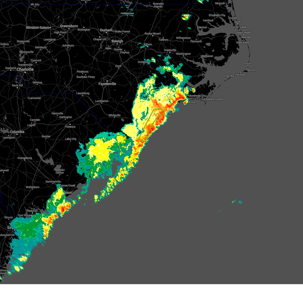
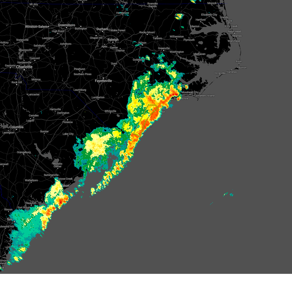
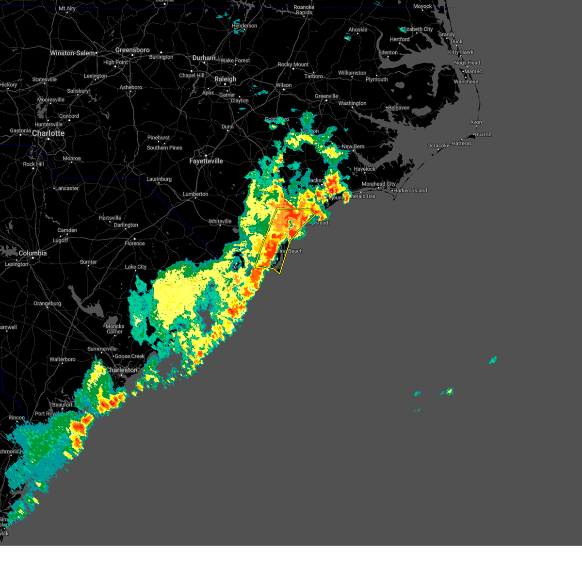
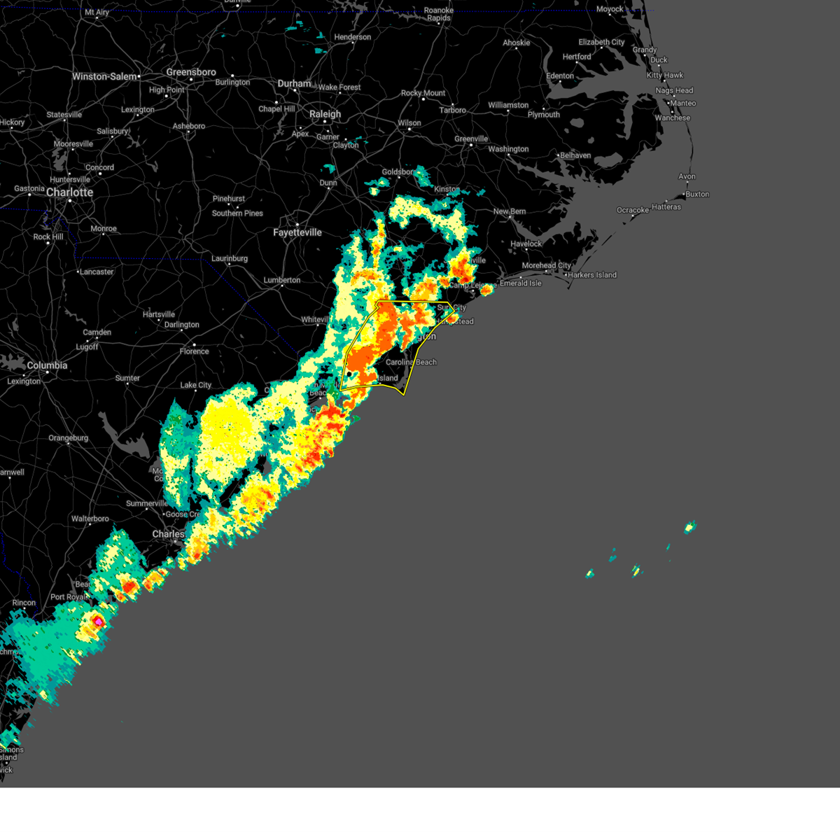
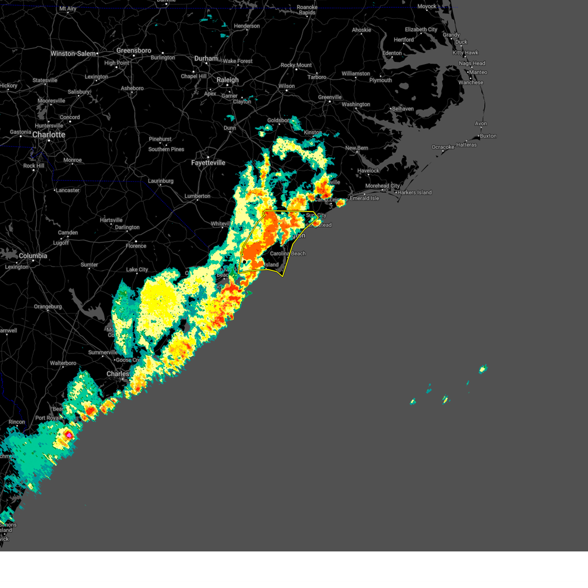
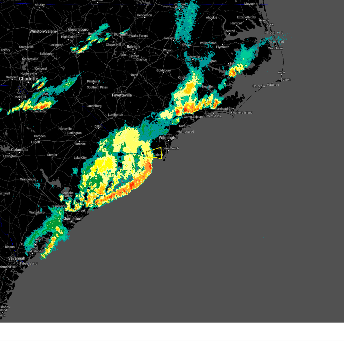
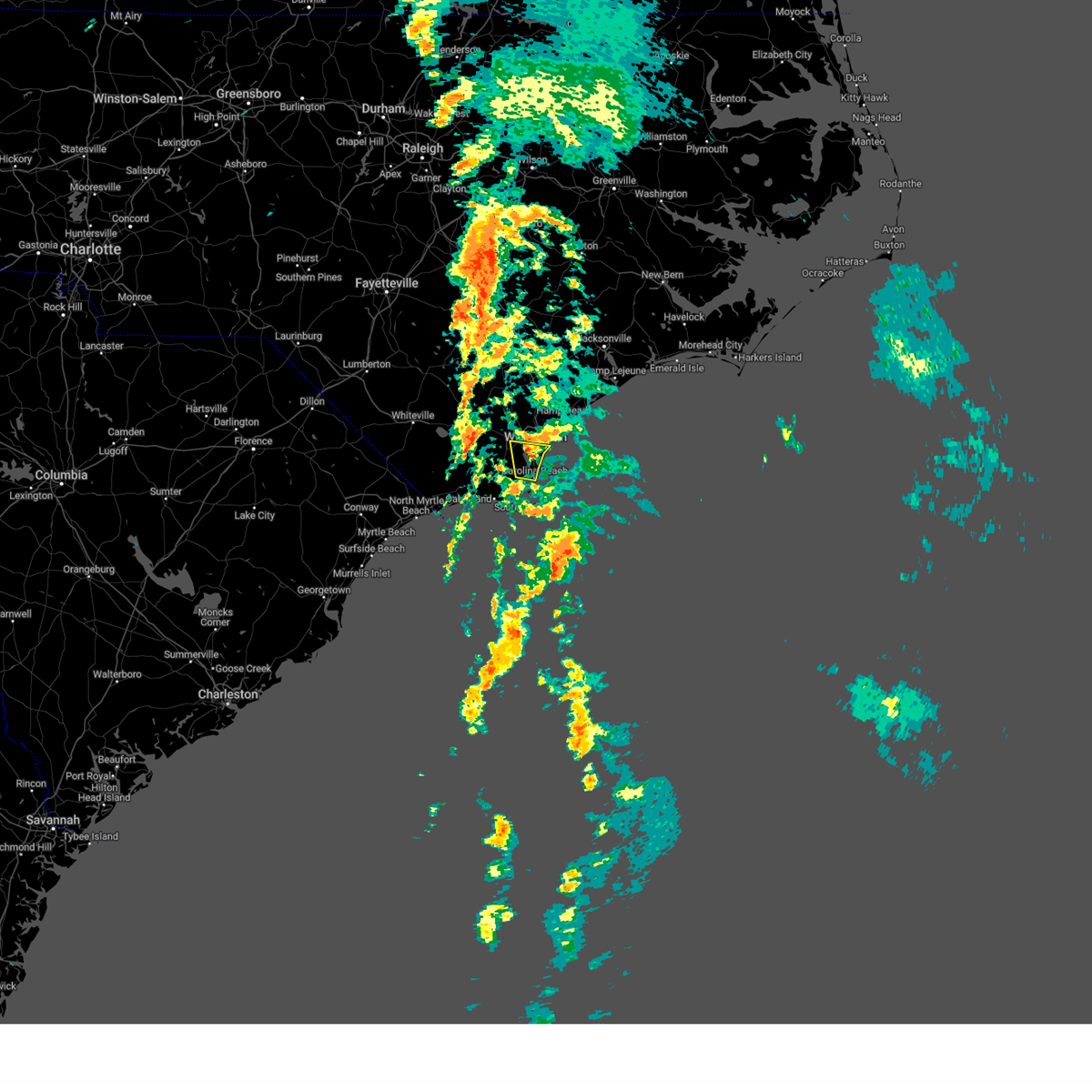
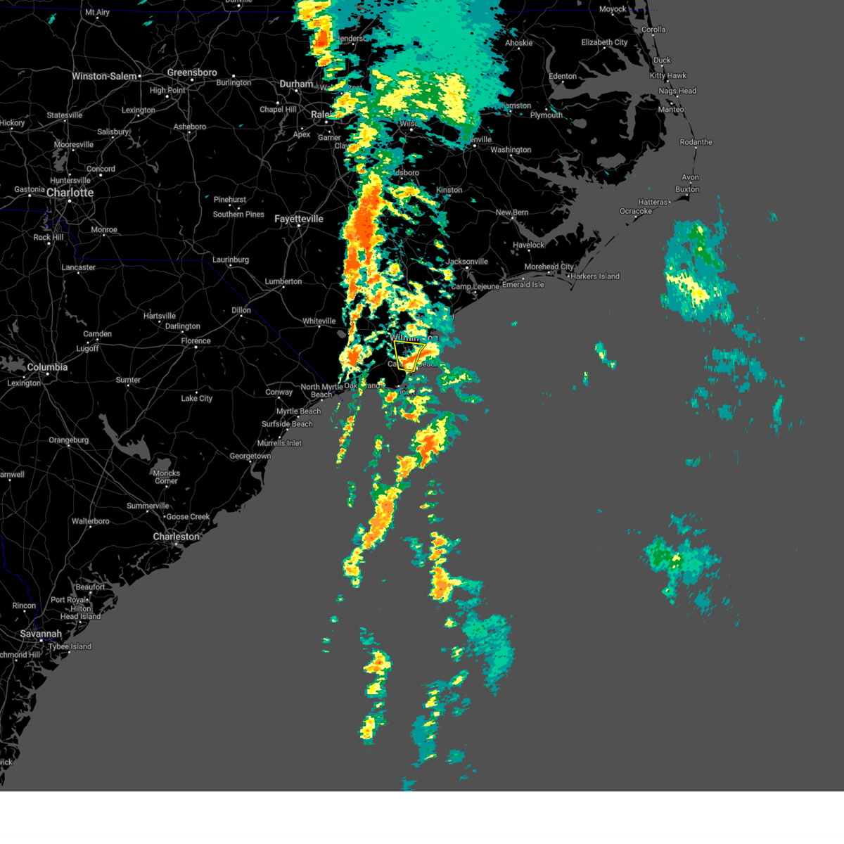
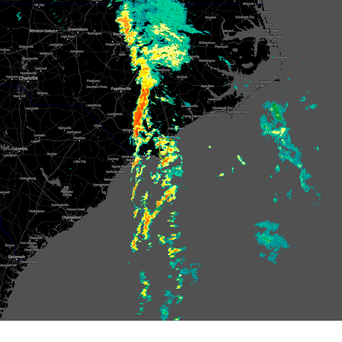
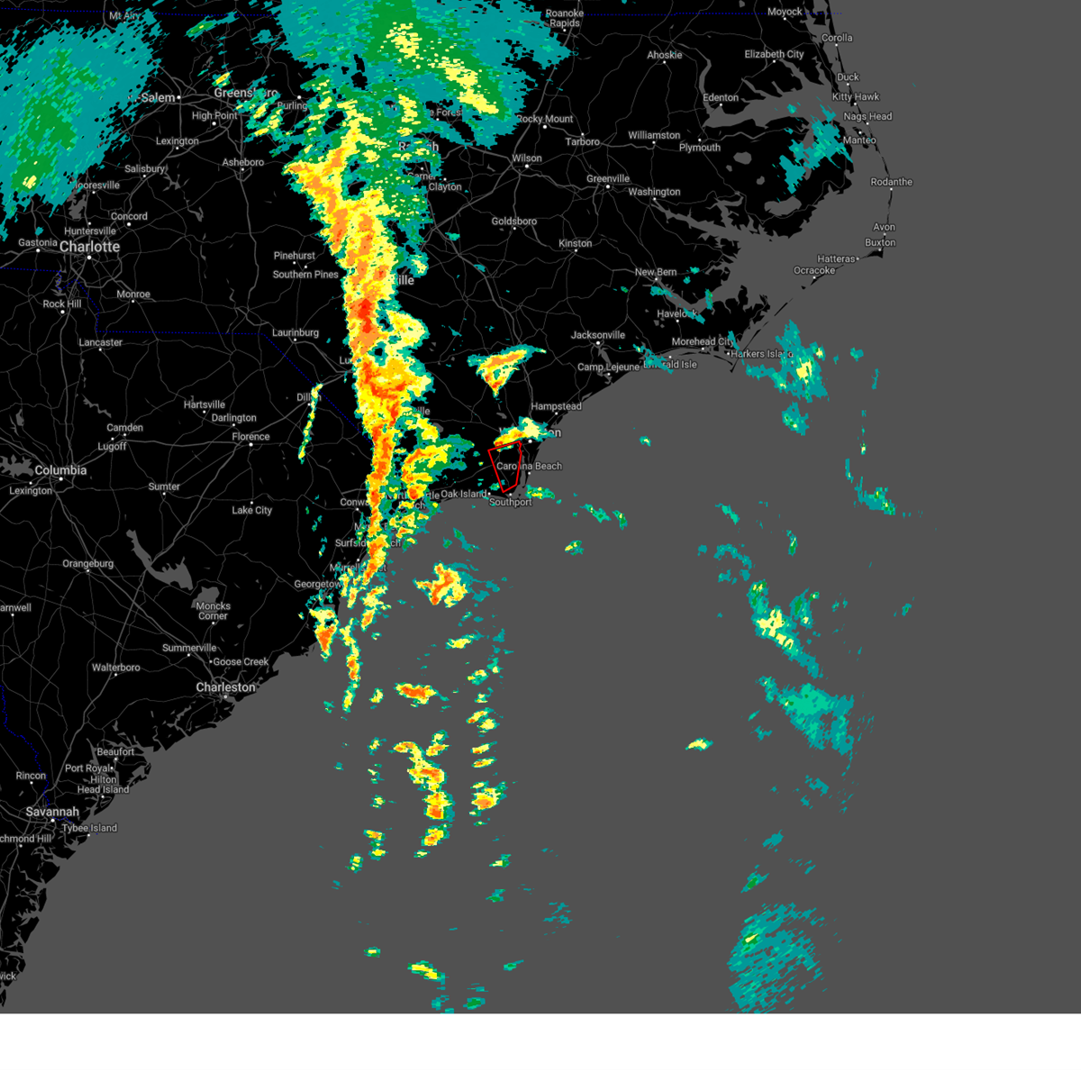
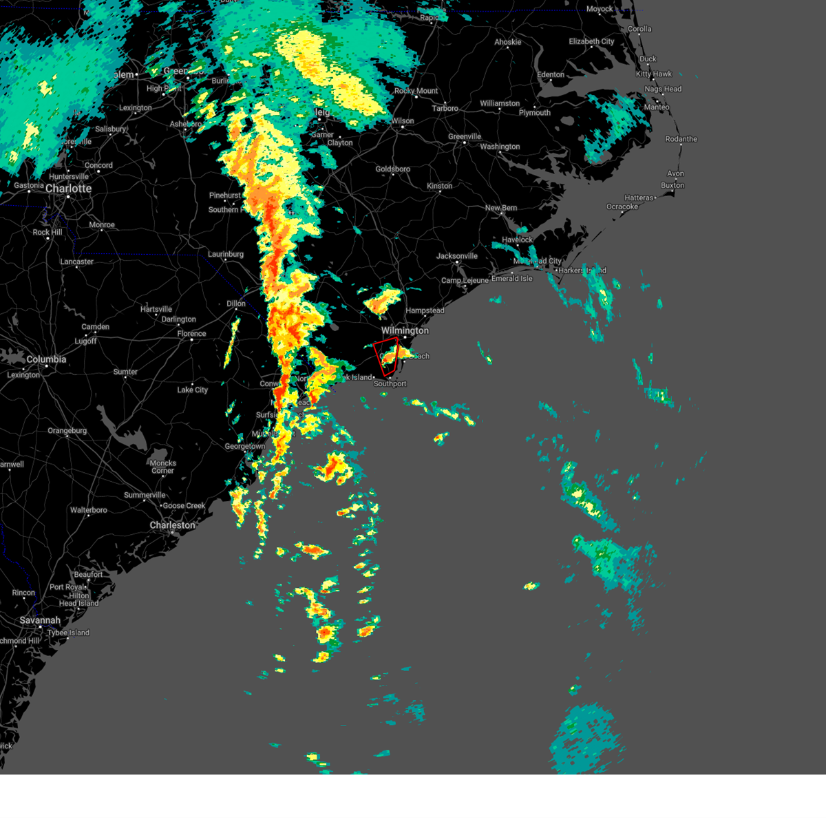
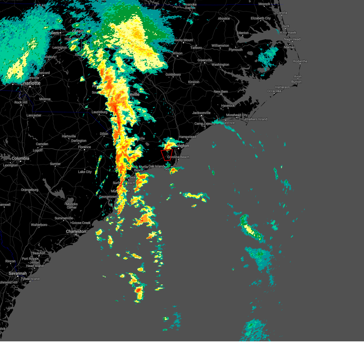
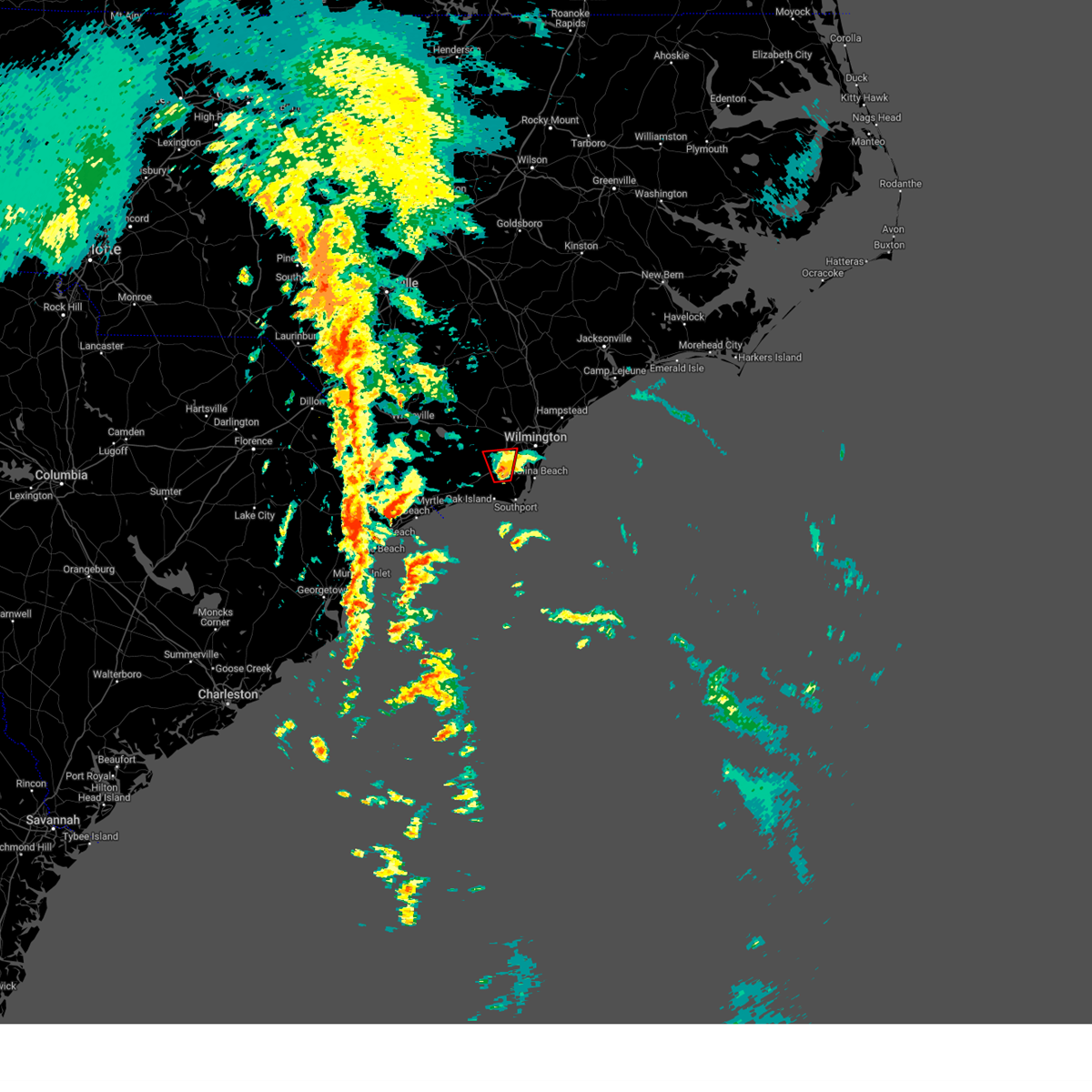
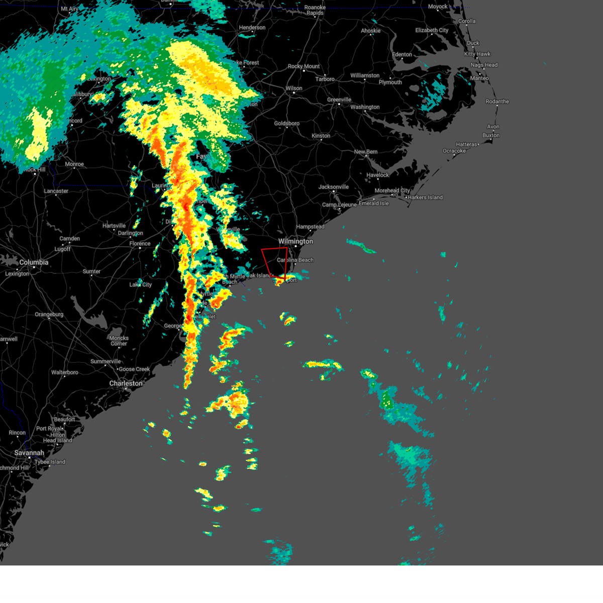
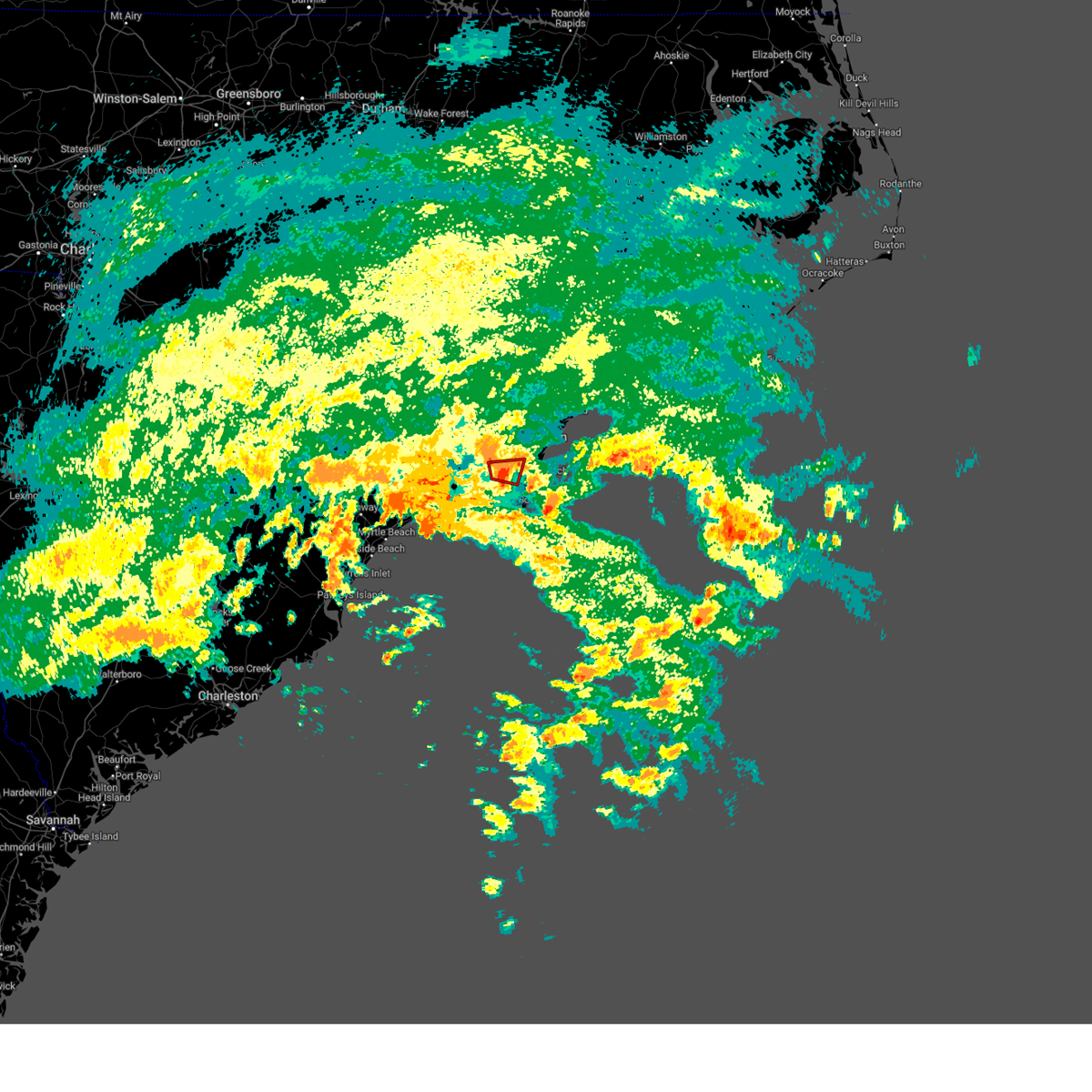
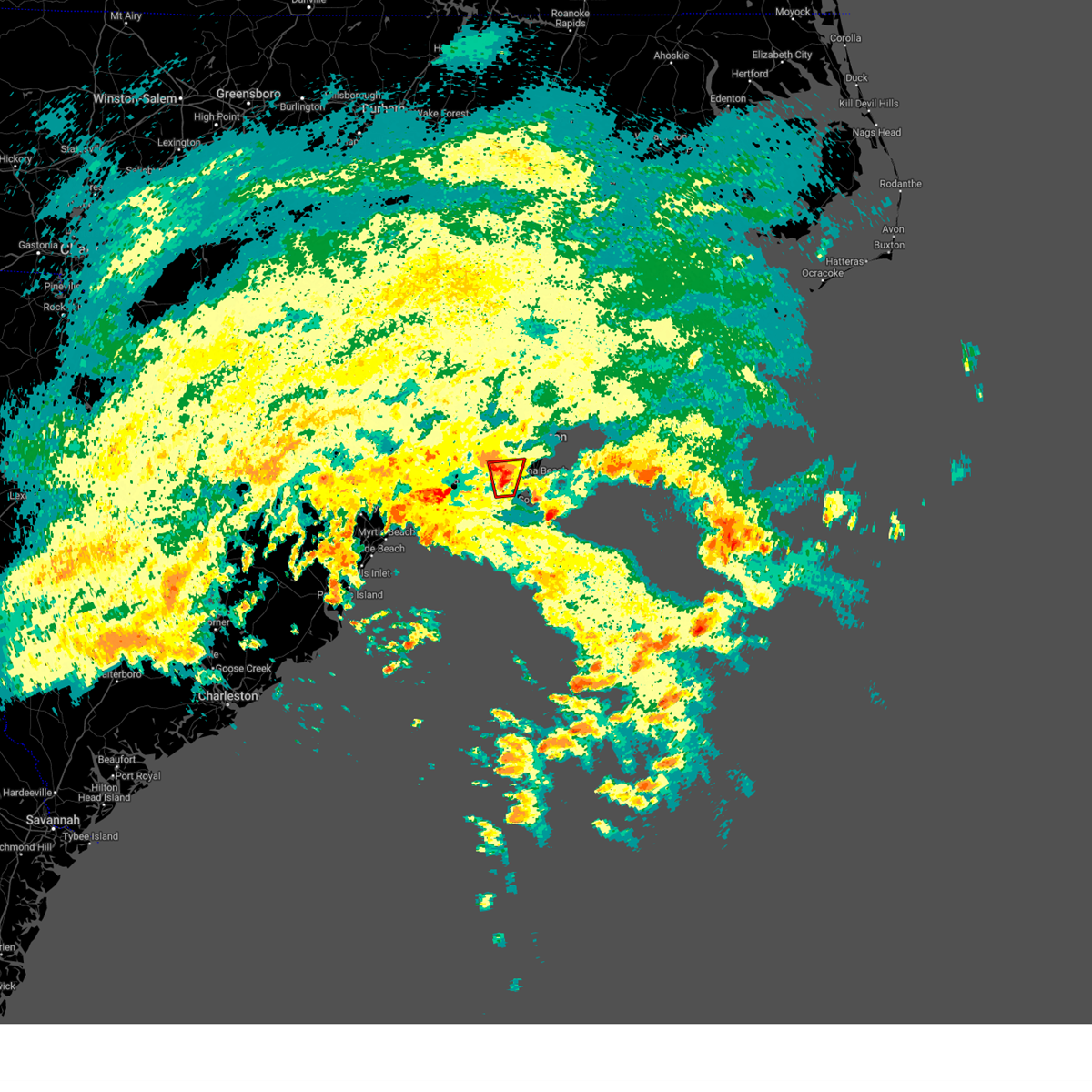
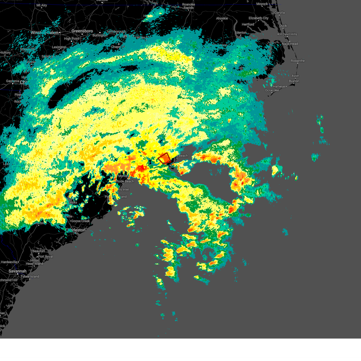
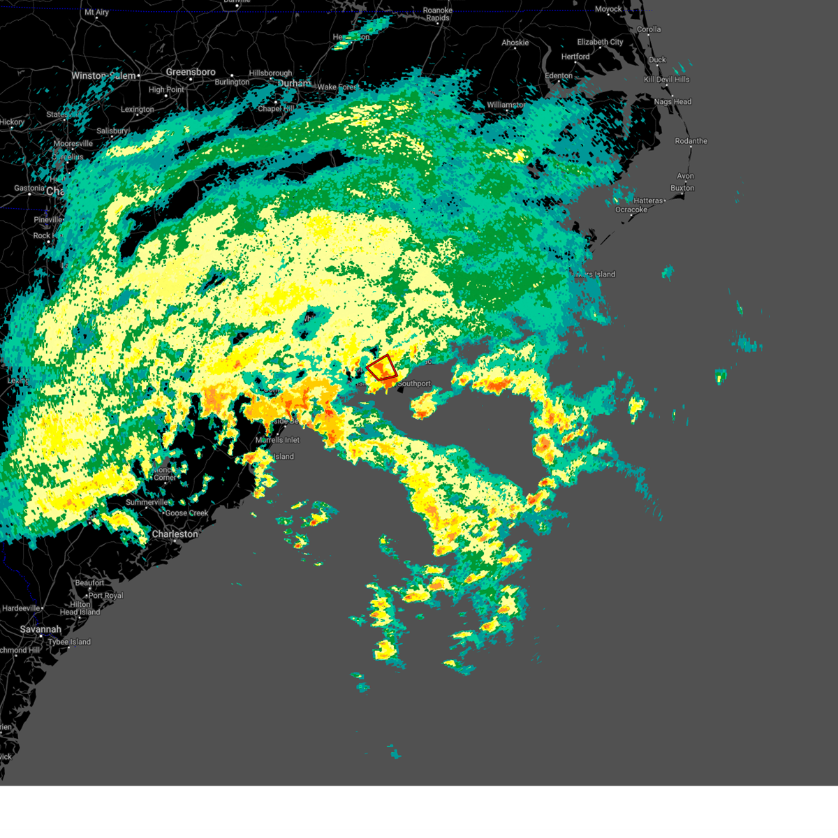
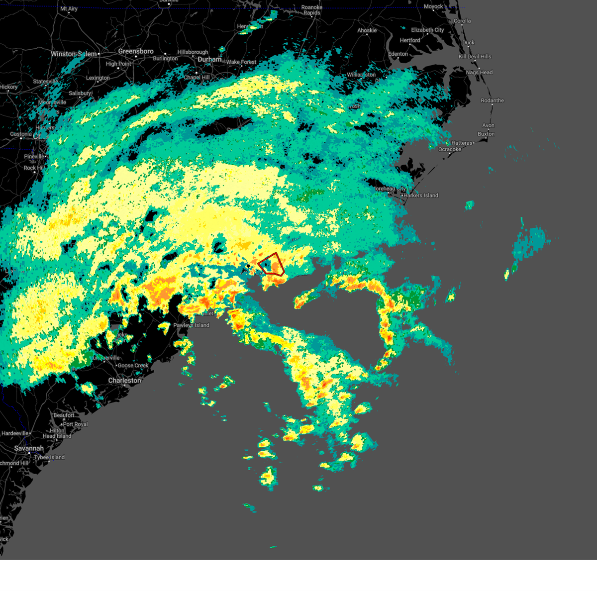
Hail Map for Boiling Spring Lakes, NC
The Boiling Spring Lakes, NC area has had 6 reports of on-the-ground hail by trained spotters, and has been under severe weather warnings 27 times during the past 12 months. Doppler radar has detected hail at or near Boiling Spring Lakes, NC on 46 occasions, including 4 occasions during the past year.
| Name: | Boiling Spring Lakes, NC |
| Where Located: | 16 miles SSW of Wilmington, NC |
| Map: | Google Map for Boiling Spring Lakes, NC |
| Population: | 5372 |
| Housing Units: | 2418 |
| More Info: | Search Google for Boiling Spring Lakes, NC |
2
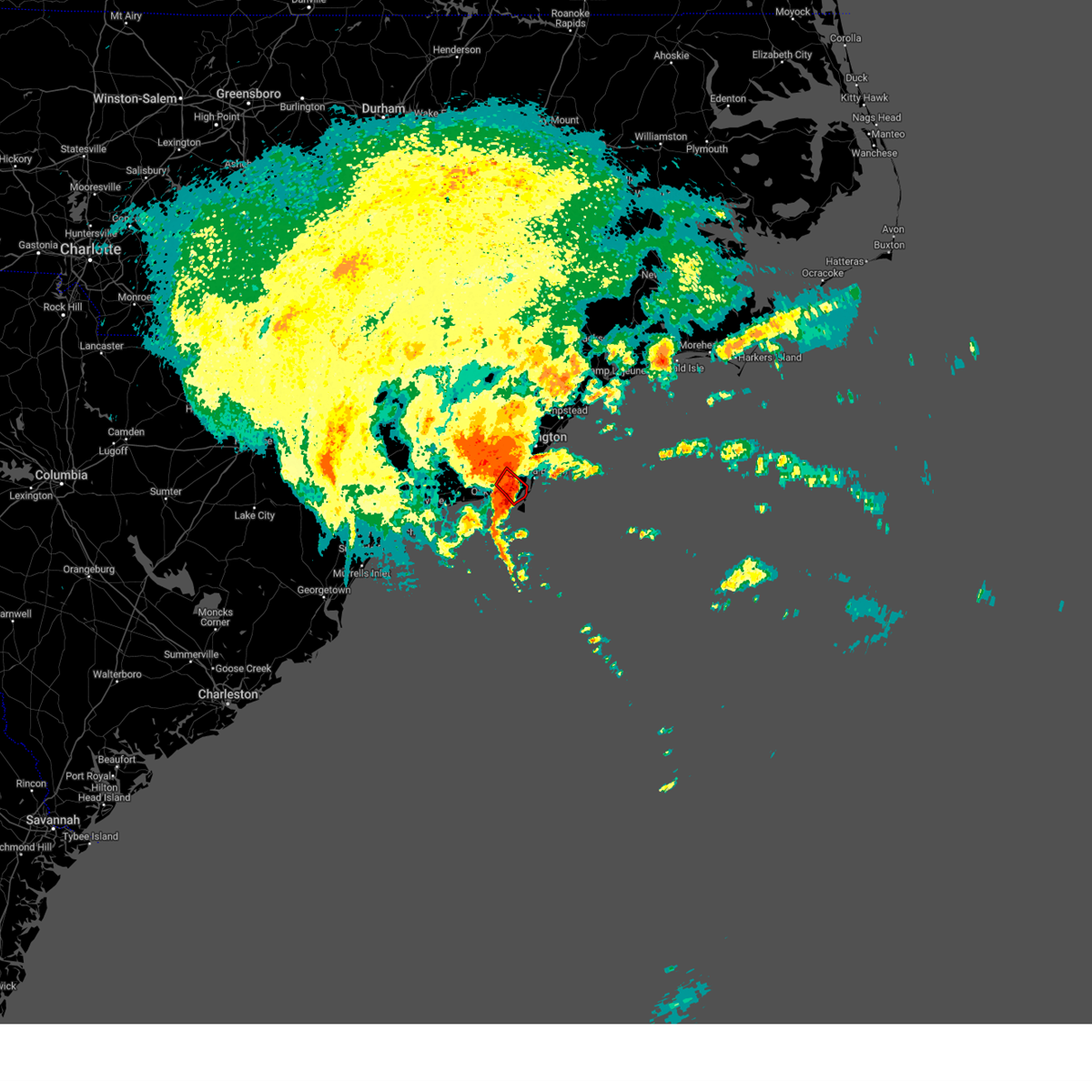
The Top Recent Hail Date for Boiling Spring Lakes, NC is Monday, September 16, 2024 (4th out of 46)

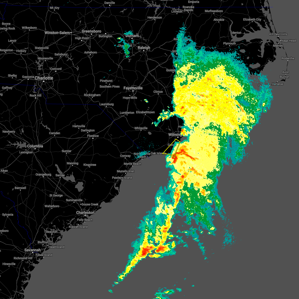
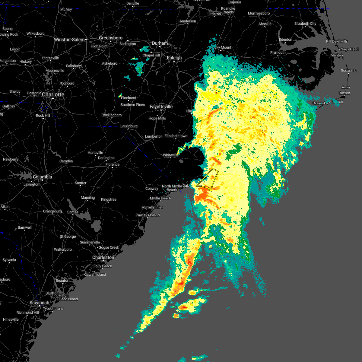
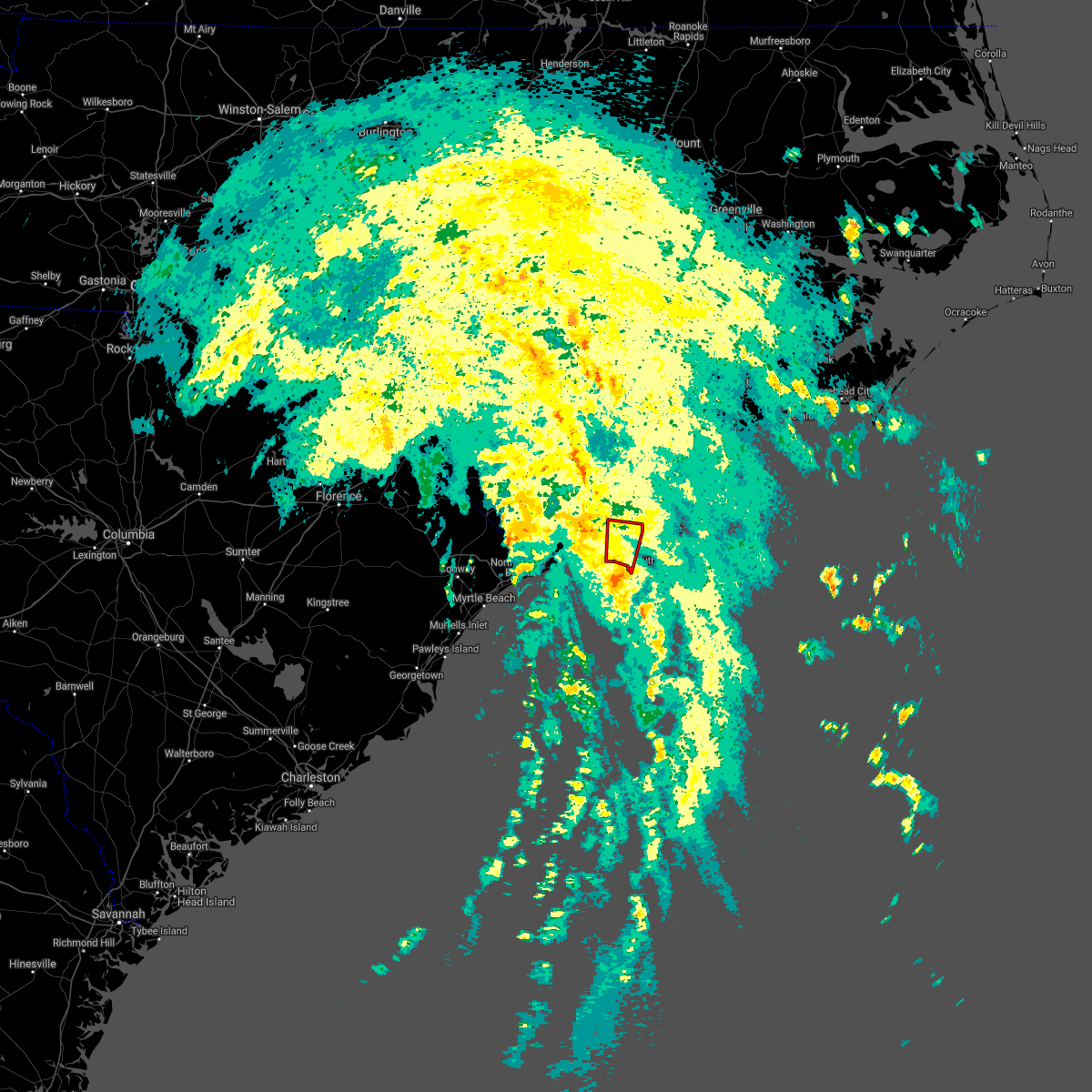
Hail and Wind Damage Spotted near Boiling Spring Lakes, NC
| Date / Time | Report Details |
|---|---|
| 6/8/2025 2:58 PM EDT |
 The storms are moving off the coast and the threat to land is diminishing. the warning will be allowed to expire. however, heavy rain is still possible with these thunderstorms. please send your reports of hail and/or wind damage, including trees or large limbs downed, by calling the national weather service office in wilmington at 1-800-697-3901. The storms are moving off the coast and the threat to land is diminishing. the warning will be allowed to expire. however, heavy rain is still possible with these thunderstorms. please send your reports of hail and/or wind damage, including trees or large limbs downed, by calling the national weather service office in wilmington at 1-800-697-3901.
|
| 6/8/2025 2:52 PM EDT |
 At 251 pm edt, severe thunderstorms were located along a line extending from near surf city to masonboro to caswell beach, moving east at 45 mph (public). Hazards include 60 mph wind gusts. Expect wind damage to trees and power lines. Locations impacted include, wilmington, oak island, carolina beach, wrightsville beach, kure beach, surf city, caswell beach, bald head island, figure eight island, rich inlet, masonboro island, hampstead, southport, topsail beach, myrtle grove, and masonboro. At 251 pm edt, severe thunderstorms were located along a line extending from near surf city to masonboro to caswell beach, moving east at 45 mph (public). Hazards include 60 mph wind gusts. Expect wind damage to trees and power lines. Locations impacted include, wilmington, oak island, carolina beach, wrightsville beach, kure beach, surf city, caswell beach, bald head island, figure eight island, rich inlet, masonboro island, hampstead, southport, topsail beach, myrtle grove, and masonboro.
|
| 6/8/2025 2:39 PM EDT |
 the severe thunderstorm warning has been cancelled and is no longer in effect the severe thunderstorm warning has been cancelled and is no longer in effect
|
| 6/8/2025 2:39 PM EDT |
 At 238 pm edt, severe thunderstorms were located along a line extending from near ashton to wilmington to oak island, moving east at 70 mph (radar indicated). Hazards include 60 mph wind gusts and quarter size hail. Minor hail damage to vehicles is possible. expect wind damage to trees and power lines. locations impacted include, wilmington, leland, oak island, carolina beach, wrightsville beach, kure beach, surf city, holden beach, caswell beach, bald head island, masonboro island, figure eight island, hampstead, boiling spring lakes, st. James, and southport. At 238 pm edt, severe thunderstorms were located along a line extending from near ashton to wilmington to oak island, moving east at 70 mph (radar indicated). Hazards include 60 mph wind gusts and quarter size hail. Minor hail damage to vehicles is possible. expect wind damage to trees and power lines. locations impacted include, wilmington, leland, oak island, carolina beach, wrightsville beach, kure beach, surf city, holden beach, caswell beach, bald head island, masonboro island, figure eight island, hampstead, boiling spring lakes, st. James, and southport.
|
| 6/8/2025 2:26 PM EDT |
 the severe thunderstorm warning has been cancelled and is no longer in effect the severe thunderstorm warning has been cancelled and is no longer in effect
|
| 6/8/2025 2:26 PM EDT |
 At 224 pm edt, severe thunderstorms were located along a line extending from currie to near riegelwood to near ocean isle beach, moving east at 35 mph (radar indicated). Hazards include 60 mph wind gusts and quarter size hail. Minor hail damage to vehicles is possible. expect wind damage to trees and power lines. Locations impacted include, wilmington, leland, oak island, carolina beach, shallotte, sunset beach, wrightsville beach, kure beach, surf city, holden beach, ocean isle beach, caswell beach, bald head island, masonboro island, figure eight island, and hampstead. At 224 pm edt, severe thunderstorms were located along a line extending from currie to near riegelwood to near ocean isle beach, moving east at 35 mph (radar indicated). Hazards include 60 mph wind gusts and quarter size hail. Minor hail damage to vehicles is possible. expect wind damage to trees and power lines. Locations impacted include, wilmington, leland, oak island, carolina beach, shallotte, sunset beach, wrightsville beach, kure beach, surf city, holden beach, ocean isle beach, caswell beach, bald head island, masonboro island, figure eight island, and hampstead.
|
| 6/8/2025 2:09 PM EDT |
 At 207 pm edt, severe thunderstorms were located along a line extending from near the borough to near honey island to near little river entrance, moving east at 50 mph (radar indicated). Hazards include 60 mph wind gusts and quarter size hail. Minor hail damage to vehicles is possible. expect wind damage to trees and power lines. Locations impacted include, wilmington, myrtle beach, north myrtle beach, leland, oak island, carolina beach, shallotte, sunset beach, wrightsville beach, kure beach, surf city, holden beach, ocean isle beach, caswell beach, bald head island, snows cut, little river entrance, south masonboro island, ocean crest pier, and figure eight island. At 207 pm edt, severe thunderstorms were located along a line extending from near the borough to near honey island to near little river entrance, moving east at 50 mph (radar indicated). Hazards include 60 mph wind gusts and quarter size hail. Minor hail damage to vehicles is possible. expect wind damage to trees and power lines. Locations impacted include, wilmington, myrtle beach, north myrtle beach, leland, oak island, carolina beach, shallotte, sunset beach, wrightsville beach, kure beach, surf city, holden beach, ocean isle beach, caswell beach, bald head island, snows cut, little river entrance, south masonboro island, ocean crest pier, and figure eight island.
|
| 6/8/2025 1:43 PM EDT |
 Svrilm the national weather service in wilmington has issued a * severe thunderstorm warning for, new hanover county in southeastern north carolina, southern pender county in southeastern north carolina, southern bladen county in southeastern north carolina, brunswick county in southeastern north carolina, columbus county in southeastern north carolina, central horry county in northeastern south carolina, * until 300 pm edt. * at 142 pm edt, severe thunderstorms were located along a line extending from near council to near williams to forestbrook, moving east at 45 mph (radar indicated). Hazards include 60 mph wind gusts and quarter size hail. Minor hail damage to vehicles is possible. Expect wind damage to trees and power lines. Svrilm the national weather service in wilmington has issued a * severe thunderstorm warning for, new hanover county in southeastern north carolina, southern pender county in southeastern north carolina, southern bladen county in southeastern north carolina, brunswick county in southeastern north carolina, columbus county in southeastern north carolina, central horry county in northeastern south carolina, * until 300 pm edt. * at 142 pm edt, severe thunderstorms were located along a line extending from near council to near williams to forestbrook, moving east at 45 mph (radar indicated). Hazards include 60 mph wind gusts and quarter size hail. Minor hail damage to vehicles is possible. Expect wind damage to trees and power lines.
|
| 5/30/2025 7:26 PM EDT |
 The storms which prompted the warning have weakened below severe limits, and have exited the warned area. therefore, the warning will be allowed to expire. a severe thunderstorm watch remains in effect until 1100 pm edt for southeastern north carolina. please send your reports of hail and/or wind damage, including trees or large limbs downed, by calling the national weather service office in wilmington at 1-800-697-3901. The storms which prompted the warning have weakened below severe limits, and have exited the warned area. therefore, the warning will be allowed to expire. a severe thunderstorm watch remains in effect until 1100 pm edt for southeastern north carolina. please send your reports of hail and/or wind damage, including trees or large limbs downed, by calling the national weather service office in wilmington at 1-800-697-3901.
|
| 5/30/2025 7:16 PM EDT |
 At 716 pm edt, severe thunderstorms were located along a line extending from supply to 8 miles south of holden beach, moving east at 45 mph (radar indicated). Hazards include 60 mph wind gusts. Expect wind damage to trees and power lines. locations impacted include, oak island, holden beach, caswell beach, ocean crest pier, boiling spring lakes, st. James, civie town, supply, brunswick county community college main campus, varnamtown, bolivia, and brunswick novant medical center. At 716 pm edt, severe thunderstorms were located along a line extending from supply to 8 miles south of holden beach, moving east at 45 mph (radar indicated). Hazards include 60 mph wind gusts. Expect wind damage to trees and power lines. locations impacted include, oak island, holden beach, caswell beach, ocean crest pier, boiling spring lakes, st. James, civie town, supply, brunswick county community college main campus, varnamtown, bolivia, and brunswick novant medical center.
|
| 5/30/2025 6:54 PM EDT |
 Svrilm the national weather service in wilmington has issued a * severe thunderstorm warning for, southern brunswick county in southeastern north carolina, * until 730 pm edt. * at 653 pm edt, severe thunderstorms were located along a line extending from near pireway to near cherry grove beach, moving east at 55 mph (radar indicated). Hazards include 60 mph wind gusts. expect wind damage to trees and power lines Svrilm the national weather service in wilmington has issued a * severe thunderstorm warning for, southern brunswick county in southeastern north carolina, * until 730 pm edt. * at 653 pm edt, severe thunderstorms were located along a line extending from near pireway to near cherry grove beach, moving east at 55 mph (radar indicated). Hazards include 60 mph wind gusts. expect wind damage to trees and power lines
|
| 3/31/2025 8:47 PM EDT |
 The storms which prompted the warning have moved out of the area. therefore, the warning has been allowed to expire. please send your reports of hail and/or wind damage, including trees or large limbs downed, by calling the national weather service office in wilmington at 1-800-697-3901. The storms which prompted the warning have moved out of the area. therefore, the warning has been allowed to expire. please send your reports of hail and/or wind damage, including trees or large limbs downed, by calling the national weather service office in wilmington at 1-800-697-3901.
|
| 3/31/2025 8:24 PM EDT |
 Svrilm the national weather service in wilmington has issued a * severe thunderstorm warning for, brunswick county in southeastern north carolina, south central columbus county in southeastern north carolina, * until 845 pm edt. * at 824 pm edt, severe thunderstorms were located along a line extending from freeland to near russtown to near ocean isle beach, moving east at 75 mph (radar indicated). Hazards include 60 mph wind gusts. expect wind damage to trees and power lines Svrilm the national weather service in wilmington has issued a * severe thunderstorm warning for, brunswick county in southeastern north carolina, south central columbus county in southeastern north carolina, * until 845 pm edt. * at 824 pm edt, severe thunderstorms were located along a line extending from freeland to near russtown to near ocean isle beach, moving east at 75 mph (radar indicated). Hazards include 60 mph wind gusts. expect wind damage to trees and power lines
|
| 9/27/2024 12:23 PM EDT |
 The storm which prompted the warning has weakened below severe limits, and no longer poses an immediate threat to life or property. therefore, the warning will be allowed to expire. a tornado watch remains in effect until 600 pm edt for southeastern north carolina. please send your reports of hail and/or wind damage, including trees or large limbs downed, by calling the national weather service office in wilmington at 1-800-697-3901. The storm which prompted the warning has weakened below severe limits, and no longer poses an immediate threat to life or property. therefore, the warning will be allowed to expire. a tornado watch remains in effect until 600 pm edt for southeastern north carolina. please send your reports of hail and/or wind damage, including trees or large limbs downed, by calling the national weather service office in wilmington at 1-800-697-3901.
|
| 9/27/2024 12:17 PM EDT |
 At 1217 pm edt, a severe thunderstorm was located near snows cut, moving north at 45 mph (radar indicated). Hazards include 60 mph wind gusts. Expect wind damage to trees and power lines. Locations impacted include, wilmington, leland, carolina beach, wrightsville beach, south masonboro island, snows cut, north masonboro island, myrtle grove, silver lake, sea breeze, masonboro, seagate, belville, new hanover regional medical center, and cape fear hospital. At 1217 pm edt, a severe thunderstorm was located near snows cut, moving north at 45 mph (radar indicated). Hazards include 60 mph wind gusts. Expect wind damage to trees and power lines. Locations impacted include, wilmington, leland, carolina beach, wrightsville beach, south masonboro island, snows cut, north masonboro island, myrtle grove, silver lake, sea breeze, masonboro, seagate, belville, new hanover regional medical center, and cape fear hospital.
|
| 9/27/2024 11:52 AM EDT |
 Svrilm the national weather service in wilmington has issued a * severe thunderstorm warning for, central new hanover county in southeastern north carolina, southeastern brunswick county in southeastern north carolina, * until 1230 pm edt. * at 1152 am edt, a severe thunderstorm was located near bald head island, moving north at 45 mph (radar indicated). Hazards include 60 mph wind gusts. expect wind damage to trees and power lines Svrilm the national weather service in wilmington has issued a * severe thunderstorm warning for, central new hanover county in southeastern north carolina, southeastern brunswick county in southeastern north carolina, * until 1230 pm edt. * at 1152 am edt, a severe thunderstorm was located near bald head island, moving north at 45 mph (radar indicated). Hazards include 60 mph wind gusts. expect wind damage to trees and power lines
|
| 9/27/2024 10:12 AM EDT |
 The storm which prompted the warning has weakened below severe limits, and has exited the warned area. therefore, the warning will be allowed to expire. a tornado watch remains in effect until 600 pm edt for southeastern north carolina. please send your reports of hail and/or wind damage, including trees or large limbs downed, by calling the national weather service office in wilmington at 1-800-697-3901. The storm which prompted the warning has weakened below severe limits, and has exited the warned area. therefore, the warning will be allowed to expire. a tornado watch remains in effect until 600 pm edt for southeastern north carolina. please send your reports of hail and/or wind damage, including trees or large limbs downed, by calling the national weather service office in wilmington at 1-800-697-3901.
|
| 9/27/2024 10:00 AM EDT |
 At 959 am edt, a severe thunderstorm capable of producing a tornado was located over boiling spring lakes, or near kure beach, moving north at 50 mph (radar indicated rotation). Hazards include tornado. Flying debris will be dangerous to those caught without shelter. mobile homes will be damaged or destroyed. damage to roofs, windows, and vehicles will occur. tree damage is likely. this dangerous storm will be near, boiling spring lakes around 1005 am edt. Bishop around 1015 am edt. At 959 am edt, a severe thunderstorm capable of producing a tornado was located over boiling spring lakes, or near kure beach, moving north at 50 mph (radar indicated rotation). Hazards include tornado. Flying debris will be dangerous to those caught without shelter. mobile homes will be damaged or destroyed. damage to roofs, windows, and vehicles will occur. tree damage is likely. this dangerous storm will be near, boiling spring lakes around 1005 am edt. Bishop around 1015 am edt.
|
| 9/27/2024 9:41 AM EDT |
 The storm which prompted the warning has weakened below severe limits, and no longer appears capable of producing a tornado. therefore, the warning will be allowed to expire. a tornado watch remains in effect until 600 pm edt for southeastern north carolina. please send your reports of hail and/or wind damage, including trees or large limbs downed, by calling the national weather service office in wilmington at 1-800-697-3901. The storm which prompted the warning has weakened below severe limits, and no longer appears capable of producing a tornado. therefore, the warning will be allowed to expire. a tornado watch remains in effect until 600 pm edt for southeastern north carolina. please send your reports of hail and/or wind damage, including trees or large limbs downed, by calling the national weather service office in wilmington at 1-800-697-3901.
|
| 9/27/2024 9:41 AM EDT |
 Torilm the national weather service in wilmington has issued a * tornado warning for, southeastern brunswick county in southeastern north carolina, * until 1015 am edt. * at 941 am edt, a severe thunderstorm capable of producing a tornado was located near bald head island, moving north at 50 mph (radar indicated rotation). Hazards include tornado. Flying debris will be dangerous to those caught without shelter. mobile homes will be damaged or destroyed. damage to roofs, windows, and vehicles will occur. tree damage is likely. this dangerous storm will be near, caswell beach and bald head island around 945 am edt. oak island and southport around 950 am edt. boiling spring lakes around 955 am edt. Other locations impacted by this tornadic thunderstorm include dosher memorial hospital. Torilm the national weather service in wilmington has issued a * tornado warning for, southeastern brunswick county in southeastern north carolina, * until 1015 am edt. * at 941 am edt, a severe thunderstorm capable of producing a tornado was located near bald head island, moving north at 50 mph (radar indicated rotation). Hazards include tornado. Flying debris will be dangerous to those caught without shelter. mobile homes will be damaged or destroyed. damage to roofs, windows, and vehicles will occur. tree damage is likely. this dangerous storm will be near, caswell beach and bald head island around 945 am edt. oak island and southport around 950 am edt. boiling spring lakes around 955 am edt. Other locations impacted by this tornadic thunderstorm include dosher memorial hospital.
|
| 9/27/2024 9:33 AM EDT |
 At 933 am edt, a severe thunderstorm capable of producing a tornado was located over mill creek, or 11 miles southwest of leland, moving north at 50 mph (radar indicated rotation). Hazards include tornado. Flying debris will be dangerous to those caught without shelter. mobile homes will be damaged or destroyed. damage to roofs, windows, and vehicles will occur. tree damage is likely. this dangerous storm will be near, bishop, winnabow, and town creek around 940 am edt. Other locations impacted by this tornadic thunderstorm include bolivia. At 933 am edt, a severe thunderstorm capable of producing a tornado was located over mill creek, or 11 miles southwest of leland, moving north at 50 mph (radar indicated rotation). Hazards include tornado. Flying debris will be dangerous to those caught without shelter. mobile homes will be damaged or destroyed. damage to roofs, windows, and vehicles will occur. tree damage is likely. this dangerous storm will be near, bishop, winnabow, and town creek around 940 am edt. Other locations impacted by this tornadic thunderstorm include bolivia.
|
| 9/27/2024 9:13 AM EDT |
 Torilm the national weather service in wilmington has issued a * tornado warning for, southeastern brunswick county in southeastern north carolina, * until 945 am edt. * at 913 am edt, a severe thunderstorm capable of producing a tornado was located near yaupon beach, moving north at 55 mph (radar indicated rotation). Hazards include tornado. Flying debris will be dangerous to those caught without shelter. mobile homes will be damaged or destroyed. damage to roofs, windows, and vehicles will occur. tree damage is likely. this dangerous storm will be near, oak island, caswell beach, yaupon beach, ocean crest pier, boiling spring lakes, st. james, southport, and long beach around 920 am edt. mill creek and winnabow around 930 am edt. bishop and town creek around 935 am edt. Other locations impacted by this tornadic thunderstorm include bolivia and dosher memorial hospital. Torilm the national weather service in wilmington has issued a * tornado warning for, southeastern brunswick county in southeastern north carolina, * until 945 am edt. * at 913 am edt, a severe thunderstorm capable of producing a tornado was located near yaupon beach, moving north at 55 mph (radar indicated rotation). Hazards include tornado. Flying debris will be dangerous to those caught without shelter. mobile homes will be damaged or destroyed. damage to roofs, windows, and vehicles will occur. tree damage is likely. this dangerous storm will be near, oak island, caswell beach, yaupon beach, ocean crest pier, boiling spring lakes, st. james, southport, and long beach around 920 am edt. mill creek and winnabow around 930 am edt. bishop and town creek around 935 am edt. Other locations impacted by this tornadic thunderstorm include bolivia and dosher memorial hospital.
|
| 9/16/2024 11:49 AM EDT |
 the tornado warning has been cancelled and is no longer in effect the tornado warning has been cancelled and is no longer in effect
|
| 9/16/2024 11:39 AM EDT |
 At 1139 am edt, a severe thunderstorm capable of producing a tornado was located near southport, or near caswell beach, moving northwest at 25 mph (radar indicated rotation). Hazards include tornado. Flying debris will be dangerous to those caught without shelter. mobile homes will be damaged or destroyed. damage to roofs, windows, and vehicles will occur. tree damage is likely. this dangerous storm will be near, boiling spring lakes around 1145 am edt. Other locations impacted by this tornadic thunderstorm include dosher memorial hospital. At 1139 am edt, a severe thunderstorm capable of producing a tornado was located near southport, or near caswell beach, moving northwest at 25 mph (radar indicated rotation). Hazards include tornado. Flying debris will be dangerous to those caught without shelter. mobile homes will be damaged or destroyed. damage to roofs, windows, and vehicles will occur. tree damage is likely. this dangerous storm will be near, boiling spring lakes around 1145 am edt. Other locations impacted by this tornadic thunderstorm include dosher memorial hospital.
|
| 9/16/2024 11:32 AM EDT |
 Torilm the national weather service in wilmington has issued a * tornado warning for, southeastern brunswick county in southeastern north carolina, * until noon edt. * at 1132 am edt, a severe thunderstorm capable of producing a tornado was located over southport, or near caswell beach, moving northwest at 25 mph (radar indicated rotation). Hazards include tornado. Flying debris will be dangerous to those caught without shelter. mobile homes will be damaged or destroyed. damage to roofs, windows, and vehicles will occur. tree damage is likely. this dangerous storm will be near, oak island, boiling spring lakes, st. james, and southport around 1135 am edt. Other locations impacted by this tornadic thunderstorm include dosher memorial hospital. Torilm the national weather service in wilmington has issued a * tornado warning for, southeastern brunswick county in southeastern north carolina, * until noon edt. * at 1132 am edt, a severe thunderstorm capable of producing a tornado was located over southport, or near caswell beach, moving northwest at 25 mph (radar indicated rotation). Hazards include tornado. Flying debris will be dangerous to those caught without shelter. mobile homes will be damaged or destroyed. damage to roofs, windows, and vehicles will occur. tree damage is likely. this dangerous storm will be near, oak island, boiling spring lakes, st. james, and southport around 1135 am edt. Other locations impacted by this tornadic thunderstorm include dosher memorial hospital.
|
| 8/18/2024 10:10 PM EDT |
 the severe thunderstorm warning has been cancelled and is no longer in effect the severe thunderstorm warning has been cancelled and is no longer in effect
|
| 8/18/2024 9:42 PM EDT |
 Svrilm the national weather service in wilmington has issued a * severe thunderstorm warning for, southwestern brunswick county in southeastern north carolina, east central horry county in northeastern south carolina, * until 1030 pm edt. * at 942 pm edt, a severe thunderstorm was located over little river, moving east at 30 mph (radar indicated). Hazards include 60 mph wind gusts. expect wind damage to trees and power lines Svrilm the national weather service in wilmington has issued a * severe thunderstorm warning for, southwestern brunswick county in southeastern north carolina, east central horry county in northeastern south carolina, * until 1030 pm edt. * at 942 pm edt, a severe thunderstorm was located over little river, moving east at 30 mph (radar indicated). Hazards include 60 mph wind gusts. expect wind damage to trees and power lines
|
| 5/15/2024 9:25 PM EDT |
 The storms which prompted the warning are weakening below severe limits and will soon pose no significant threat to life or property. therefore, the warning will be allowed to expire. however, gusty winds and heavy rain will remain possible with these thunderstorms after the warning expires. please send your reports of hail and/or wind damage, including trees or large limbs downed, by calling the national weather service office in wilmington at 1-800-697-3901. The storms which prompted the warning are weakening below severe limits and will soon pose no significant threat to life or property. therefore, the warning will be allowed to expire. however, gusty winds and heavy rain will remain possible with these thunderstorms after the warning expires. please send your reports of hail and/or wind damage, including trees or large limbs downed, by calling the national weather service office in wilmington at 1-800-697-3901.
|
| 5/15/2024 9:10 PM EDT |
 At 909 pm edt, severe thunderstorms were located along a line extending from edgecomb to sea breeze, moving east at 40 mph (radar indicated. at 0850 pm 58 mph winds were reported at wilmington airport). Hazards include 60 mph wind gusts and quarter size hail. Minor hail damage to vehicles is possible. expect wind damage to trees and power lines. Locations impacted include, wilmington, leland, carolina beach, wrightsville beach, kure beach, surf city, snows cut, south masonboro island, figure eight island, rich inlet, north masonboro island, hampstead, boiling spring lakes, topsail beach, maple hill, hightsville, cape fear community college north campus, wilmington international airport, murrayville, and castle hayne. At 909 pm edt, severe thunderstorms were located along a line extending from edgecomb to sea breeze, moving east at 40 mph (radar indicated. at 0850 pm 58 mph winds were reported at wilmington airport). Hazards include 60 mph wind gusts and quarter size hail. Minor hail damage to vehicles is possible. expect wind damage to trees and power lines. Locations impacted include, wilmington, leland, carolina beach, wrightsville beach, kure beach, surf city, snows cut, south masonboro island, figure eight island, rich inlet, north masonboro island, hampstead, boiling spring lakes, topsail beach, maple hill, hightsville, cape fear community college north campus, wilmington international airport, murrayville, and castle hayne.
|
| 5/15/2024 8:49 PM EDT |
 Svrilm the national weather service in wilmington has issued a * severe thunderstorm warning for, new hanover county in southeastern north carolina, pender county in southeastern north carolina, northeastern brunswick county in southeastern north carolina, * until 930 pm edt. * at 849 pm edt, severe thunderstorms were located along a line extending from near maple hill to near leland, moving east at 50 mph (radar indicated). Hazards include 60 mph wind gusts and quarter size hail. Minor hail damage to vehicles is possible. Expect wind damage to trees and power lines. Svrilm the national weather service in wilmington has issued a * severe thunderstorm warning for, new hanover county in southeastern north carolina, pender county in southeastern north carolina, northeastern brunswick county in southeastern north carolina, * until 930 pm edt. * at 849 pm edt, severe thunderstorms were located along a line extending from near maple hill to near leland, moving east at 50 mph (radar indicated). Hazards include 60 mph wind gusts and quarter size hail. Minor hail damage to vehicles is possible. Expect wind damage to trees and power lines.
|
| 4/20/2024 7:13 PM EDT |
 Svrilm the national weather service in wilmington has issued a * severe thunderstorm warning for, south central new hanover county in southeastern north carolina, southern brunswick county in southeastern north carolina, * until 745 pm edt. * at 713 pm edt, a severe thunderstorm was located over supply, or near shallotte, moving southeast at 30 mph (radar indicated). Hazards include 60 mph wind gusts and quarter size hail. Minor hail damage to vehicles is possible. Expect wind damage to trees and power lines. Svrilm the national weather service in wilmington has issued a * severe thunderstorm warning for, south central new hanover county in southeastern north carolina, southern brunswick county in southeastern north carolina, * until 745 pm edt. * at 713 pm edt, a severe thunderstorm was located over supply, or near shallotte, moving southeast at 30 mph (radar indicated). Hazards include 60 mph wind gusts and quarter size hail. Minor hail damage to vehicles is possible. Expect wind damage to trees and power lines.
|
| 4/20/2024 6:09 PM EDT |
 Svrilm the national weather service in wilmington has issued a * severe thunderstorm warning for, new hanover county in southeastern north carolina, southwestern pender county in southeastern north carolina, southeastern bladen county in southeastern north carolina, northern brunswick county in southeastern north carolina, central columbus county in southeastern north carolina, * until 715 pm edt. * at 609 pm edt, severe thunderstorms were located along a line extending from near redbug to near silver lake, moving east at 15 mph (radar indicated). Hazards include 60 mph wind gusts and quarter size hail. Minor hail damage to vehicles is possible. Expect wind damage to trees and power lines. Svrilm the national weather service in wilmington has issued a * severe thunderstorm warning for, new hanover county in southeastern north carolina, southwestern pender county in southeastern north carolina, southeastern bladen county in southeastern north carolina, northern brunswick county in southeastern north carolina, central columbus county in southeastern north carolina, * until 715 pm edt. * at 609 pm edt, severe thunderstorms were located along a line extending from near redbug to near silver lake, moving east at 15 mph (radar indicated). Hazards include 60 mph wind gusts and quarter size hail. Minor hail damage to vehicles is possible. Expect wind damage to trees and power lines.
|
| 1/9/2024 7:30 PM EST |
 At 728 pm est, severe thunderstorms were located along a line extending from near bowdens to 12 miles south of holden beach, moving east at 45 mph. the wilmington international airport recently observed a gust to 73 miles per hour. these are destructive storms for new hanover and pender counties (radar confirmed by automated surface observing station). Hazards include 80 mph wind gusts. Flying debris will be dangerous to those caught without shelter. mobile homes will be heavily damaged. expect considerable damage to roofs, windows, and vehicles. extensive tree damage and power outages are likely. Locations impacted include, wilmington, leland, oak island, carolina beach, burgaw, shallotte, sunset beach, wrightsville beach, kure beach, surf city, holden beach, ocean isle beach, caswell beach, bald head island, snows cut, south masonboro island, ocean crest pier, figure eight island, yaupon beach, and rich inlet. At 728 pm est, severe thunderstorms were located along a line extending from near bowdens to 12 miles south of holden beach, moving east at 45 mph. the wilmington international airport recently observed a gust to 73 miles per hour. these are destructive storms for new hanover and pender counties (radar confirmed by automated surface observing station). Hazards include 80 mph wind gusts. Flying debris will be dangerous to those caught without shelter. mobile homes will be heavily damaged. expect considerable damage to roofs, windows, and vehicles. extensive tree damage and power outages are likely. Locations impacted include, wilmington, leland, oak island, carolina beach, burgaw, shallotte, sunset beach, wrightsville beach, kure beach, surf city, holden beach, ocean isle beach, caswell beach, bald head island, snows cut, south masonboro island, ocean crest pier, figure eight island, yaupon beach, and rich inlet.
|
| 1/9/2024 7:18 PM EST |
 At 718 pm est, severe thunderstorms were located along a line extending from near bowdens to 13 miles south of ocean isle beach, moving east at 40 mph (radar indicated). Hazards include 70 mph wind gusts. Expect considerable tree damage. damage is likely to mobile homes, roofs, and outbuildings. Locations impacted include, wilmington, leland, oak island, carolina beach, burgaw, shallotte, sunset beach, wrightsville beach, kure beach, surf city, holden beach, ocean isle beach, caswell beach, bald head island, snows cut, south masonboro island, ocean crest pier, figure eight island, yaupon beach, and rich inlet. At 718 pm est, severe thunderstorms were located along a line extending from near bowdens to 13 miles south of ocean isle beach, moving east at 40 mph (radar indicated). Hazards include 70 mph wind gusts. Expect considerable tree damage. damage is likely to mobile homes, roofs, and outbuildings. Locations impacted include, wilmington, leland, oak island, carolina beach, burgaw, shallotte, sunset beach, wrightsville beach, kure beach, surf city, holden beach, ocean isle beach, caswell beach, bald head island, snows cut, south masonboro island, ocean crest pier, figure eight island, yaupon beach, and rich inlet.
|
| 1/9/2024 7:01 PM EST |
 At 701 pm est, severe thunderstorms were located along a line extending from 7 miles southwest of warsaw to 9 miles south of cherry grove beach, moving east at 45 mph (radar indicated). Hazards include 70 mph wind gusts. Expect considerable tree damage. damage is likely to mobile homes, roofs, and outbuildings. Locations impacted include, wilmington, north myrtle beach, leland, oak island, carolina beach, burgaw, shallotte, sunset beach, wrightsville beach, kure beach, surf city, holden beach, ocean isle beach, caswell beach, bald head island, snows cut, little river entrance, south masonboro island, ocean crest pier, and figure eight island. At 701 pm est, severe thunderstorms were located along a line extending from 7 miles southwest of warsaw to 9 miles south of cherry grove beach, moving east at 45 mph (radar indicated). Hazards include 70 mph wind gusts. Expect considerable tree damage. damage is likely to mobile homes, roofs, and outbuildings. Locations impacted include, wilmington, north myrtle beach, leland, oak island, carolina beach, burgaw, shallotte, sunset beach, wrightsville beach, kure beach, surf city, holden beach, ocean isle beach, caswell beach, bald head island, snows cut, little river entrance, south masonboro island, ocean crest pier, and figure eight island.
|
| 1/9/2024 5:09 PM EST |
 At 508 pm est, a severe thunderstorm was located 12 miles south of ocean crest pier, moving northeast at 65 mph (radar indicated). Hazards include 60 mph wind gusts. expect wind damage to trees and power lines At 508 pm est, a severe thunderstorm was located 12 miles south of ocean crest pier, moving northeast at 65 mph (radar indicated). Hazards include 60 mph wind gusts. expect wind damage to trees and power lines
|
| 1/9/2024 4:15 PM EST |
 At 415 pm est, a severe thunderstorm was located 13 miles south of bald head island, moving northeast at 60 mph (radar indicated). Hazards include 60 mph wind gusts and quarter size hail. Minor hail damage to vehicles is possible. Expect wind damage to trees and power lines. At 415 pm est, a severe thunderstorm was located 13 miles south of bald head island, moving northeast at 60 mph (radar indicated). Hazards include 60 mph wind gusts and quarter size hail. Minor hail damage to vehicles is possible. Expect wind damage to trees and power lines.
|
| 8/30/2023 7:13 PM EDT |
 At 713 pm edt, a severe thunderstorm capable of producing a tornado was located over town creek, or near leland, moving north at 25 mph (radar indicated rotation). Hazards include tornado. Flying debris will be dangerous to those caught without shelter. mobile homes will be damaged or destroyed. damage to roofs, windows, and vehicles will occur. tree damage is likely. this dangerous storm will be near, leland around 720 pm edt. phoenix around 725 pm edt. Other locations impacted by this tornadic thunderstorm include sandy creek and navassa. At 713 pm edt, a severe thunderstorm capable of producing a tornado was located over town creek, or near leland, moving north at 25 mph (radar indicated rotation). Hazards include tornado. Flying debris will be dangerous to those caught without shelter. mobile homes will be damaged or destroyed. damage to roofs, windows, and vehicles will occur. tree damage is likely. this dangerous storm will be near, leland around 720 pm edt. phoenix around 725 pm edt. Other locations impacted by this tornadic thunderstorm include sandy creek and navassa.
|
| 8/30/2023 7:00 PM EDT |
 At 659 pm edt, a severe thunderstorm capable of producing a tornado was located over boiling spring lakes, or 8 miles west of snows cut, moving north at 30 mph (radar indicated rotation). Hazards include tornado. Flying debris will be dangerous to those caught without shelter. mobile homes will be damaged or destroyed. damage to roofs, windows, and vehicles will occur. tree damage is likely. this dangerous storm will be near, mill creek around 705 pm edt. Other locations impacted by this tornadic thunderstorm include bolivia. At 659 pm edt, a severe thunderstorm capable of producing a tornado was located over boiling spring lakes, or 8 miles west of snows cut, moving north at 30 mph (radar indicated rotation). Hazards include tornado. Flying debris will be dangerous to those caught without shelter. mobile homes will be damaged or destroyed. damage to roofs, windows, and vehicles will occur. tree damage is likely. this dangerous storm will be near, mill creek around 705 pm edt. Other locations impacted by this tornadic thunderstorm include bolivia.
|
| 8/30/2023 6:47 PM EDT |
 At 647 pm edt, a severe thunderstorm capable of producing a tornado was located near st. james, or near oak island, moving north at 15 mph (radar indicated rotation). Hazards include tornado. Flying debris will be dangerous to those caught without shelter. mobile homes will be damaged or destroyed. damage to roofs, windows, and vehicles will occur. tree damage is likely. this dangerous storm will be near, boiling spring lakes around 655 pm edt. Other locations impacted by this tornadic thunderstorm include bolivia. At 647 pm edt, a severe thunderstorm capable of producing a tornado was located near st. james, or near oak island, moving north at 15 mph (radar indicated rotation). Hazards include tornado. Flying debris will be dangerous to those caught without shelter. mobile homes will be damaged or destroyed. damage to roofs, windows, and vehicles will occur. tree damage is likely. this dangerous storm will be near, boiling spring lakes around 655 pm edt. Other locations impacted by this tornadic thunderstorm include bolivia.
|
| 8/30/2023 6:40 PM EDT |
 The tornado warning for southeastern brunswick county will expire at 645 pm edt, the storm which prompted the warning is weakening and no longer appears capable of producing a tornado. therefore, the warning will be allowed to expire. a tornado watch remains in effect until 1000 pm edt for southeastern north carolina. to report severe weather, contact your nearest law enforcement agency. they will relay your report to the national weather service wilmington. The tornado warning for southeastern brunswick county will expire at 645 pm edt, the storm which prompted the warning is weakening and no longer appears capable of producing a tornado. therefore, the warning will be allowed to expire. a tornado watch remains in effect until 1000 pm edt for southeastern north carolina. to report severe weather, contact your nearest law enforcement agency. they will relay your report to the national weather service wilmington.
|
| 8/30/2023 6:30 PM EDT |
 At 629 pm edt, a severe thunderstorm capable of producing a tornado was located near boiling spring lakes, or 7 miles north of oak island, moving north at 30 mph (radar indicated rotation). Hazards include tornado. Flying debris will be dangerous to those caught without shelter. mobile homes will be damaged or destroyed. damage to roofs, windows, and vehicles will occur. tree damage is likely. this dangerous storm will be near, boiling spring lakes and mill creek around 635 pm edt. Other locations impacted by this tornadic thunderstorm include bolivia and brunswick novant medical center. At 629 pm edt, a severe thunderstorm capable of producing a tornado was located near boiling spring lakes, or 7 miles north of oak island, moving north at 30 mph (radar indicated rotation). Hazards include tornado. Flying debris will be dangerous to those caught without shelter. mobile homes will be damaged or destroyed. damage to roofs, windows, and vehicles will occur. tree damage is likely. this dangerous storm will be near, boiling spring lakes and mill creek around 635 pm edt. Other locations impacted by this tornadic thunderstorm include bolivia and brunswick novant medical center.
|
| 8/30/2023 6:14 PM EDT |
 At 614 pm edt, a severe thunderstorm capable of producing a tornado was located over st. james, or over yaupon beach, moving northwest at 15 mph (radar indicated rotation). Hazards include tornado. Flying debris will be dangerous to those caught without shelter. mobile homes will be damaged or destroyed. damage to roofs, windows, and vehicles will occur. tree damage is likely. this dangerous storm will be near, st. james around 620 pm edt. Other locations impacted by this tornadic thunderstorm include bolivia, varnamtown, brunswick novant medical center, and dosher memorial hospital. At 614 pm edt, a severe thunderstorm capable of producing a tornado was located over st. james, or over yaupon beach, moving northwest at 15 mph (radar indicated rotation). Hazards include tornado. Flying debris will be dangerous to those caught without shelter. mobile homes will be damaged or destroyed. damage to roofs, windows, and vehicles will occur. tree damage is likely. this dangerous storm will be near, st. james around 620 pm edt. Other locations impacted by this tornadic thunderstorm include bolivia, varnamtown, brunswick novant medical center, and dosher memorial hospital.
|
| 8/10/2023 1:50 PM EDT |
 The severe thunderstorm warning for new hanover, southeastern pender and southeastern brunswick counties will expire at 200 pm edt, the storms which prompted the warning have weakened below severe limits, and have exited the warned area. therefore, the warning will be allowed to expire. The severe thunderstorm warning for new hanover, southeastern pender and southeastern brunswick counties will expire at 200 pm edt, the storms which prompted the warning have weakened below severe limits, and have exited the warned area. therefore, the warning will be allowed to expire.
|
| 8/10/2023 1:38 PM EDT |
 At 138 pm edt, severe thunderstorms were located along a line extending from near maple hill to near sea breeze, moving northeast at 45 mph (radar indicated). Hazards include 60 mph wind gusts and penny size hail. Expect wind damage to trees and power lines. locations impacted include, wilmington, oak island, carolina beach, wrightsville beach, kure beach, surf city, caswell beach, bald head island, south masonboro island, snows cut, yaupon beach, figure eight island, north masonboro island, hampstead, boiling spring lakes, southport, topsail beach, hightsville, cape fear community college north campus, and wilmington international airport. hail threat, radar indicated max hail size, 0. 75 in wind threat, radar indicated max wind gust, 60 mph. At 138 pm edt, severe thunderstorms were located along a line extending from near maple hill to near sea breeze, moving northeast at 45 mph (radar indicated). Hazards include 60 mph wind gusts and penny size hail. Expect wind damage to trees and power lines. locations impacted include, wilmington, oak island, carolina beach, wrightsville beach, kure beach, surf city, caswell beach, bald head island, south masonboro island, snows cut, yaupon beach, figure eight island, north masonboro island, hampstead, boiling spring lakes, southport, topsail beach, hightsville, cape fear community college north campus, and wilmington international airport. hail threat, radar indicated max hail size, 0. 75 in wind threat, radar indicated max wind gust, 60 mph.
|
| 8/10/2023 1:17 PM EDT |
 At 117 pm edt, severe thunderstorms were located along a line extending from burgaw to near st. james, moving northeast at 45 mph (radar indicated). Hazards include 60 mph wind gusts and penny size hail. expect wind damage to trees and power lines At 117 pm edt, severe thunderstorms were located along a line extending from burgaw to near st. james, moving northeast at 45 mph (radar indicated). Hazards include 60 mph wind gusts and penny size hail. expect wind damage to trees and power lines
|
| 8/7/2023 9:50 PM EDT |
 The severe thunderstorm warning for new hanover, eastern pender and southeastern brunswick counties will expire at 1000 pm edt, the storm which prompted the warning has weakened below severe limits, and has exited the warned area. therefore, the warning will be allowed to expire. a severe thunderstorm watch remains in effect until midnight edt for southeastern north carolina. The severe thunderstorm warning for new hanover, eastern pender and southeastern brunswick counties will expire at 1000 pm edt, the storm which prompted the warning has weakened below severe limits, and has exited the warned area. therefore, the warning will be allowed to expire. a severe thunderstorm watch remains in effect until midnight edt for southeastern north carolina.
|
| 8/7/2023 9:39 PM EDT |
 At 939 pm edt, a severe thunderstorm was located over bald head island, moving east at 55 mph (radar indicated). Hazards include 60 mph wind gusts. Expect wind damage to trees and power lines. locations impacted include, wilmington, leland, oak island, carolina beach, wrightsville beach, kure beach, surf city, caswell beach, bald head island, snows cut, rich inlet, south masonboro island, ocean crest pier, figure eight island, yaupon beach, north masonboro island, hampstead, boiling spring lakes, st. james, and southport. hail threat, radar indicated max hail size, <. 75 in wind threat, radar indicated max wind gust, 60 mph. At 939 pm edt, a severe thunderstorm was located over bald head island, moving east at 55 mph (radar indicated). Hazards include 60 mph wind gusts. Expect wind damage to trees and power lines. locations impacted include, wilmington, leland, oak island, carolina beach, wrightsville beach, kure beach, surf city, caswell beach, bald head island, snows cut, rich inlet, south masonboro island, ocean crest pier, figure eight island, yaupon beach, north masonboro island, hampstead, boiling spring lakes, st. james, and southport. hail threat, radar indicated max hail size, <. 75 in wind threat, radar indicated max wind gust, 60 mph.
|
| 8/7/2023 9:32 PM EDT |
 At 932 pm edt, a severe thunderstorm was located over caswell beach, moving east at 55 mph (radar indicated). Hazards include 60 mph wind gusts and penny size hail. Expect wind damage to trees and power lines. Locations impacted include, wilmington, leland, oak island, carolina beach, burgaw, wrightsville beach, kure beach, surf city, holden beach, caswell beach, bald head island, snows cut, rich inlet, south masonboro island, ocean crest pier, figure eight island, yaupon beach, north masonboro island, hampstead, and boiling spring lakes. At 932 pm edt, a severe thunderstorm was located over caswell beach, moving east at 55 mph (radar indicated). Hazards include 60 mph wind gusts and penny size hail. Expect wind damage to trees and power lines. Locations impacted include, wilmington, leland, oak island, carolina beach, burgaw, wrightsville beach, kure beach, surf city, holden beach, caswell beach, bald head island, snows cut, rich inlet, south masonboro island, ocean crest pier, figure eight island, yaupon beach, north masonboro island, hampstead, and boiling spring lakes.
|
| 8/7/2023 9:19 PM EDT |
 At 919 pm edt, a severe thunderstorm was located over holden beach, moving east at 55 mph (radar indicated). Hazards include 60 mph wind gusts and penny size hail. Expect wind damage to trees and power lines. Locations impacted include, wilmington, leland, oak island, carolina beach, burgaw, shallotte, sunset beach, wrightsville beach, kure beach, surf city, holden beach, ocean isle beach, caswell beach, bald head island, snows cut, rich inlet, south masonboro island, ocean crest pier, figure eight island, and yaupon beach. At 919 pm edt, a severe thunderstorm was located over holden beach, moving east at 55 mph (radar indicated). Hazards include 60 mph wind gusts and penny size hail. Expect wind damage to trees and power lines. Locations impacted include, wilmington, leland, oak island, carolina beach, burgaw, shallotte, sunset beach, wrightsville beach, kure beach, surf city, holden beach, ocean isle beach, caswell beach, bald head island, snows cut, rich inlet, south masonboro island, ocean crest pier, figure eight island, and yaupon beach.
|
| 8/7/2023 9:03 PM EDT |
 At 903 pm edt, a severe thunderstorm was located over longwood, or 10 miles north of sunset beach, moving east at 55 mph (radar indicated). Hazards include 60 mph wind gusts and penny size hail. expect wind damage to trees and power lines At 903 pm edt, a severe thunderstorm was located over longwood, or 10 miles north of sunset beach, moving east at 55 mph (radar indicated). Hazards include 60 mph wind gusts and penny size hail. expect wind damage to trees and power lines
|
| 6/27/2023 1:52 AM EDT |
 At 151 am edt, severe thunderstorms were located along a line extending from new river station to near winnabow, moving east at 35 mph (radar indicated). Hazards include 60 mph wind gusts and penny size hail. Expect wind damage to trees and power lines. locations impacted include, wilmington, leland, burgaw, wrightsville beach, surf city, masonboro island, figure eight island, hampstead, northwest, topsail beach, makatoka, and maple hill. hail threat, radar indicated max hail size, 0. 75 in wind threat, radar indicated max wind gust, 60 mph. At 151 am edt, severe thunderstorms were located along a line extending from new river station to near winnabow, moving east at 35 mph (radar indicated). Hazards include 60 mph wind gusts and penny size hail. Expect wind damage to trees and power lines. locations impacted include, wilmington, leland, burgaw, wrightsville beach, surf city, masonboro island, figure eight island, hampstead, northwest, topsail beach, makatoka, and maple hill. hail threat, radar indicated max hail size, 0. 75 in wind threat, radar indicated max wind gust, 60 mph.
|
| 6/27/2023 1:35 AM EDT |
 At 134 am edt, severe thunderstorms were located along a line extending from near maple hill to makatoka, moving east at 25 mph (radar indicated). Hazards include 60 mph wind gusts and penny size hail. expect wind damage to trees and power lines At 134 am edt, severe thunderstorms were located along a line extending from near maple hill to makatoka, moving east at 25 mph (radar indicated). Hazards include 60 mph wind gusts and penny size hail. expect wind damage to trees and power lines
|
| 4/30/2023 3:38 PM EDT |
 At 337 pm edt, severe thunderstorms were located along a line extending from white stocking to near holden beach, moving east at 40 mph (radar indicated). Hazards include 60 mph wind gusts and quarter size hail. Minor hail damage to vehicles is possible. expect wind damage to trees and power lines. locations impacted include, wilmington, leland, oak island, burgaw, holden beach, ocean crest pier, boiling spring lakes, st. james, bishop, hightsville, long creek, ashton, rocky point, castle hayne, phoenix, winnabow, white stocking, murray town, wrightsboro and montague. hail threat, radar indicated max hail size, 1. 00 in wind threat, radar indicated max wind gust, 60 mph. At 337 pm edt, severe thunderstorms were located along a line extending from white stocking to near holden beach, moving east at 40 mph (radar indicated). Hazards include 60 mph wind gusts and quarter size hail. Minor hail damage to vehicles is possible. expect wind damage to trees and power lines. locations impacted include, wilmington, leland, oak island, burgaw, holden beach, ocean crest pier, boiling spring lakes, st. james, bishop, hightsville, long creek, ashton, rocky point, castle hayne, phoenix, winnabow, white stocking, murray town, wrightsboro and montague. hail threat, radar indicated max hail size, 1. 00 in wind threat, radar indicated max wind gust, 60 mph.
|
| 4/30/2023 3:36 PM EDT |
 At 335 pm edt, severe thunderstorms were located along a line extending from near cypress creek to near holden beach, moving east at 30 mph (radar indicated). Hazards include 60 mph wind gusts and quarter size hail. Minor hail damage to vehicles is possible. Expect wind damage to trees and power lines. At 335 pm edt, severe thunderstorms were located along a line extending from near cypress creek to near holden beach, moving east at 30 mph (radar indicated). Hazards include 60 mph wind gusts and quarter size hail. Minor hail damage to vehicles is possible. Expect wind damage to trees and power lines.
|
| 4/30/2023 3:17 PM EDT |
 At 315 pm edt, severe thunderstorms were located along a line extending from wards corner to little river entrance, moving east at 40 mph (radar indicated). Hazards include 60 mph wind gusts and quarter size hail. Minor hail damage to vehicles is possible. expect wind damage to trees and power lines. locations impacted include, wilmington, leland, oak island, burgaw, shallotte, sunset beach, holden beach, ocean isle beach, ocean crest pier, boiling spring lakes, st. james, northwest, sandyfield, penderlea, makatoka, point caswell, hightsville, long creek, exum and seaside. hail threat, radar indicated max hail size, 1. 00 in wind threat, radar indicated max wind gust, 60 mph. At 315 pm edt, severe thunderstorms were located along a line extending from wards corner to little river entrance, moving east at 40 mph (radar indicated). Hazards include 60 mph wind gusts and quarter size hail. Minor hail damage to vehicles is possible. expect wind damage to trees and power lines. locations impacted include, wilmington, leland, oak island, burgaw, shallotte, sunset beach, holden beach, ocean isle beach, ocean crest pier, boiling spring lakes, st. james, northwest, sandyfield, penderlea, makatoka, point caswell, hightsville, long creek, exum and seaside. hail threat, radar indicated max hail size, 1. 00 in wind threat, radar indicated max wind gust, 60 mph.
|
| 4/30/2023 2:49 PM EDT |
 At 249 pm edt, severe thunderstorms were located along a line extending from near rowan to near barefoot landing area of north myrtle beach, moving east at 40 mph (radar indicated). Hazards include 60 mph wind gusts and quarter size hail. Minor hail damage to vehicles is possible. Expect wind damage to trees and power lines. At 249 pm edt, severe thunderstorms were located along a line extending from near rowan to near barefoot landing area of north myrtle beach, moving east at 40 mph (radar indicated). Hazards include 60 mph wind gusts and quarter size hail. Minor hail damage to vehicles is possible. Expect wind damage to trees and power lines.
|
| 3/27/2023 4:37 AM EDT |
 The severe thunderstorm warning for south central new hanover and southeastern brunswick counties will expire at 445 am edt, the storm which prompted the warning has weakened below severe limits, and no longer poses an immediate threat to life or property. therefore, the warning will be allowed to expire. however, heavy rain and frequent lightning are still expected with this thunderstorm. The severe thunderstorm warning for south central new hanover and southeastern brunswick counties will expire at 445 am edt, the storm which prompted the warning has weakened below severe limits, and no longer poses an immediate threat to life or property. therefore, the warning will be allowed to expire. however, heavy rain and frequent lightning are still expected with this thunderstorm.
|
| 3/27/2023 4:27 AM EDT |
 At 426 am edt, a severe thunderstorm was located over brunswick county community college main campus, or 11 miles northeast of shallotte, moving east at 35 mph (radar indicated). Hazards include 60 mph wind gusts. Expect wind damage to trees and power lines. locations impacted include, oak island, carolina beach, kure beach, holden beach, caswell beach, bald head island, snows cut, ocean crest pier, yaupon beach, south masonboro island, boiling spring lakes, st. james, southport, civie town, supply, brunswick county community college main campus, winnabow, mill creek, sea breeze and long beach. hail threat, radar indicated max hail size, <. 75 in wind threat, radar indicated max wind gust, 60 mph. At 426 am edt, a severe thunderstorm was located over brunswick county community college main campus, or 11 miles northeast of shallotte, moving east at 35 mph (radar indicated). Hazards include 60 mph wind gusts. Expect wind damage to trees and power lines. locations impacted include, oak island, carolina beach, kure beach, holden beach, caswell beach, bald head island, snows cut, ocean crest pier, yaupon beach, south masonboro island, boiling spring lakes, st. james, southport, civie town, supply, brunswick county community college main campus, winnabow, mill creek, sea breeze and long beach. hail threat, radar indicated max hail size, <. 75 in wind threat, radar indicated max wind gust, 60 mph.
|
| 3/27/2023 4:01 AM EDT |
 At 401 am edt, a severe thunderstorm capable of producing a tornado was located over grissettown, or near ocean isle beach, moving east at 30 mph (radar indicated rotation). Hazards include tornado. Flying debris will be dangerous to those caught without shelter. mobile homes will be damaged or destroyed. damage to roofs, windows, and vehicles will occur. tree damage is likely. this dangerous storm will be near, ocean isle beach and russtown around 405 am edt. shallotte around 415 am edt. civie town around 420 am edt. supply around 425 am edt. holden beach, ocean crest pier, long beach and brunswick county community college main campus around 430 am edt. Other locations impacted by this tornadic thunderstorm include bolivia, varnamtown and brunswick novant medical center. At 401 am edt, a severe thunderstorm capable of producing a tornado was located over grissettown, or near ocean isle beach, moving east at 30 mph (radar indicated rotation). Hazards include tornado. Flying debris will be dangerous to those caught without shelter. mobile homes will be damaged or destroyed. damage to roofs, windows, and vehicles will occur. tree damage is likely. this dangerous storm will be near, ocean isle beach and russtown around 405 am edt. shallotte around 415 am edt. civie town around 420 am edt. supply around 425 am edt. holden beach, ocean crest pier, long beach and brunswick county community college main campus around 430 am edt. Other locations impacted by this tornadic thunderstorm include bolivia, varnamtown and brunswick novant medical center.
|
| 3/27/2023 3:39 AM EDT |
 At 339 am edt, a severe thunderstorm was located near honey island, or 11 miles north of shallotte, moving southeast at 30 mph (radar indicated). Hazards include 60 mph wind gusts and penny size hail. expect wind damage to trees and power lines At 339 am edt, a severe thunderstorm was located near honey island, or 11 miles north of shallotte, moving southeast at 30 mph (radar indicated). Hazards include 60 mph wind gusts and penny size hail. expect wind damage to trees and power lines
|
| 4/5/2022 10:25 PM EDT |
 The severe thunderstorm warning for south central new hanover and southeastern brunswick counties will expire at 1030 pm edt, the storm which prompted the warning has weakened below severe limits, and has exited the warned area. therefore, the warning will be allowed to expire. however gusty winds are still possible with this thunderstorm. The severe thunderstorm warning for south central new hanover and southeastern brunswick counties will expire at 1030 pm edt, the storm which prompted the warning has weakened below severe limits, and has exited the warned area. therefore, the warning will be allowed to expire. however gusty winds are still possible with this thunderstorm.
|
| 4/5/2022 10:13 PM EDT |
 At 1013 pm edt, a severe thunderstorm was located over bald head island, moving northeast at 35 mph (radar indicated). Hazards include 60 mph wind gusts. Expect wind damage to trees and power lines. locations impacted include, oak island, carolina beach, kure beach, caswell beach, bald head island, yaupon beach, south masonboro island, snows cut, ocean crest pier, boiling spring lakes, st. James, southport, myrtle grove, silver lake, sea breeze, long beach, fort fisher and dosher memorial hospital. At 1013 pm edt, a severe thunderstorm was located over bald head island, moving northeast at 35 mph (radar indicated). Hazards include 60 mph wind gusts. Expect wind damage to trees and power lines. locations impacted include, oak island, carolina beach, kure beach, caswell beach, bald head island, yaupon beach, south masonboro island, snows cut, ocean crest pier, boiling spring lakes, st. James, southport, myrtle grove, silver lake, sea breeze, long beach, fort fisher and dosher memorial hospital.
|
| 4/5/2022 9:59 PM EDT |
 At 959 pm edt, a severe thunderstorm was located over ocean crest pier, moving northeast at 45 mph (radar indicated). Hazards include 60 mph wind gusts. expect wind damage to trees and power lines At 959 pm edt, a severe thunderstorm was located over ocean crest pier, moving northeast at 45 mph (radar indicated). Hazards include 60 mph wind gusts. expect wind damage to trees and power lines
|
| 3/12/2022 10:00 AM EST |
 At 956 am est, severe thunderstorms were located along a line extending from mooretown to holden beach, moving east at 50 mph (radar indicated). Hazards include 70 mph wind gusts. Expect considerable tree damage. damage is likely to mobile homes, roofs, and outbuildings. these severe storms will be near, st. james around 1005 am est. boiling spring lakes, winnabow and town creek around 1010 am est. carolina beach, kure beach, snows cut, sea breeze, silver lake and fort fisher around 1020 am est. south masonboro island, north masonboro island, myrtle grove and masonboro around 1025 am est. other locations impacted by these severe thunderstorms include belville, navassa, bolivia, varnamtown, dosher memorial hospital, new hanover regional medical center, cape fear hospital and brunswick novant medical center. thunderstorm damage threat, considerable hail threat, radar indicated max hail size, <. 75 in wind threat, radar indicated max wind gust, 70 mph. At 956 am est, severe thunderstorms were located along a line extending from mooretown to holden beach, moving east at 50 mph (radar indicated). Hazards include 70 mph wind gusts. Expect considerable tree damage. damage is likely to mobile homes, roofs, and outbuildings. these severe storms will be near, st. james around 1005 am est. boiling spring lakes, winnabow and town creek around 1010 am est. carolina beach, kure beach, snows cut, sea breeze, silver lake and fort fisher around 1020 am est. south masonboro island, north masonboro island, myrtle grove and masonboro around 1025 am est. other locations impacted by these severe thunderstorms include belville, navassa, bolivia, varnamtown, dosher memorial hospital, new hanover regional medical center, cape fear hospital and brunswick novant medical center. thunderstorm damage threat, considerable hail threat, radar indicated max hail size, <. 75 in wind threat, radar indicated max wind gust, 70 mph.
|
| 3/12/2022 9:55 AM EST |
 The severe thunderstorm warning for northwestern new hanover, pender, southeastern bladen, central brunswick, eastern columbus and east central horry counties will expire at 1000 am est, the storms which prompted the warning have moved out of the area. therefore, the warning will be allowed to expire. however gusty winds are still possible behind these thunderstorms. The severe thunderstorm warning for northwestern new hanover, pender, southeastern bladen, central brunswick, eastern columbus and east central horry counties will expire at 1000 am est, the storms which prompted the warning have moved out of the area. therefore, the warning will be allowed to expire. however gusty winds are still possible behind these thunderstorms.
|
| 3/12/2022 9:36 AM EST |
 At 935 am est, severe thunderstorms were located along a line extending from near cypress creek to longwood, moving east at 60 mph (radar indicated). Hazards include 70 mph wind gusts. Expect considerable tree damage. Damage is likely to mobile homes, roofs, and outbuildings. At 935 am est, severe thunderstorms were located along a line extending from near cypress creek to longwood, moving east at 60 mph (radar indicated). Hazards include 70 mph wind gusts. Expect considerable tree damage. Damage is likely to mobile homes, roofs, and outbuildings.
|
| 3/12/2022 9:15 AM EST |
 At 914 am est, severe thunderstorms were located along a line extending from penderlea to near longs, moving east at 60 mph (radar indicated). Hazards include 70 mph wind gusts. Expect considerable tree damage. Damage is likely to mobile homes, roofs, and outbuildings. At 914 am est, severe thunderstorms were located along a line extending from penderlea to near longs, moving east at 60 mph (radar indicated). Hazards include 70 mph wind gusts. Expect considerable tree damage. Damage is likely to mobile homes, roofs, and outbuildings.
|
| 1/3/2022 6:50 AM EST |
 At 649 am est, severe thunderstorms were located along a line extending from rex to nixonville, moving east at 50 mph (radar indicated). Hazards include 60 mph wind gusts. expect wind damage to trees and power lines At 649 am est, severe thunderstorms were located along a line extending from rex to nixonville, moving east at 50 mph (radar indicated). Hazards include 60 mph wind gusts. expect wind damage to trees and power lines
|
| 7/8/2021 9:10 AM EDT |
 At 909 am edt, a severe thunderstorm capable of producing a tornado was located near caswell beach, moving north at 40 mph (radar indicated rotation). Hazards include tornado. Expect damage to mobile homes, roofs, and vehicles. this dangerous storm will be near, caswell beach and yaupon beach around 915 am edt. oak island, st. james and southport around 920 am edt. boiling spring lakes and mill creek around 935 am edt. other locations impacted by this tornadic thunderstorm include dosher memorial hospital. This includes us route 17 in brunswick county between mile markers 31 and 34. At 909 am edt, a severe thunderstorm capable of producing a tornado was located near caswell beach, moving north at 40 mph (radar indicated rotation). Hazards include tornado. Expect damage to mobile homes, roofs, and vehicles. this dangerous storm will be near, caswell beach and yaupon beach around 915 am edt. oak island, st. james and southport around 920 am edt. boiling spring lakes and mill creek around 935 am edt. other locations impacted by this tornadic thunderstorm include dosher memorial hospital. This includes us route 17 in brunswick county between mile markers 31 and 34.
|
| 5/7/2021 10:56 AM EDT |
 The severe thunderstorm warning for new hanover, eastern pender and east central brunswick counties will expire at 1100 am edt, the storms which prompted the warning have moved out of the area. therefore, the warning will be allowed to expire. The severe thunderstorm warning for new hanover, eastern pender and east central brunswick counties will expire at 1100 am edt, the storms which prompted the warning have moved out of the area. therefore, the warning will be allowed to expire.
|
| 5/7/2021 10:51 AM EDT |
 At 1027 am edt, severe thunderstorms were located along a line extending from near white stocking to near mill creek, moving east at 25 mph (radar indicated). Hazards include 60 mph wind gusts and quarter size hail. Minor hail damage to vehicles is possible. Expect wind damage to trees and power lines. At 1027 am edt, severe thunderstorms were located along a line extending from near white stocking to near mill creek, moving east at 25 mph (radar indicated). Hazards include 60 mph wind gusts and quarter size hail. Minor hail damage to vehicles is possible. Expect wind damage to trees and power lines.
|
| 5/7/2021 10:27 AM EDT |
 At 1027 am edt, severe thunderstorms were located along a line extending from near white stocking to near mill creek, moving east at 25 mph (radar indicated). Hazards include 60 mph wind gusts and quarter size hail. Minor hail damage to vehicles is possible. Expect wind damage to trees and power lines. At 1027 am edt, severe thunderstorms were located along a line extending from near white stocking to near mill creek, moving east at 25 mph (radar indicated). Hazards include 60 mph wind gusts and quarter size hail. Minor hail damage to vehicles is possible. Expect wind damage to trees and power lines.
|
| 8/3/2020 9:56 PM EDT |
 At 955 pm edt, a severe thunderstorm capable of producing a tornado was located over silver lake, or near wilmington, moving northwest at 60 mph (radar indicated rotation). Hazards include tornado. Expect damage to mobile homes, roofs, and vehicles. this dangerous storm will be near, hightsville, wilmington international airport, university of north carolina at wilmington and bishop around 1000 pm edt. leland, phoenix, wrightsboro and cape fear community college north campus around 1005 pm edt. northwest around 1010 pm edt. montague, the borough and long creek around 1015 pm edt. currie around 1020 pm edt. other locations impacted by this tornadic thunderstorm include sandy creek, navassa, belville, new hanover regional medical center and cape fear hospital. people attending nhc testing site @scottish rite may be affected by this storm and are urged to follow the precautionary measures of the onsite officials. this includes the following highways, interstate 140 us route 74 between mile markers 417 and 434. Us route 17 in brunswick county between mile markers 37 and 44. At 955 pm edt, a severe thunderstorm capable of producing a tornado was located over silver lake, or near wilmington, moving northwest at 60 mph (radar indicated rotation). Hazards include tornado. Expect damage to mobile homes, roofs, and vehicles. this dangerous storm will be near, hightsville, wilmington international airport, university of north carolina at wilmington and bishop around 1000 pm edt. leland, phoenix, wrightsboro and cape fear community college north campus around 1005 pm edt. northwest around 1010 pm edt. montague, the borough and long creek around 1015 pm edt. currie around 1020 pm edt. other locations impacted by this tornadic thunderstorm include sandy creek, navassa, belville, new hanover regional medical center and cape fear hospital. people attending nhc testing site @scottish rite may be affected by this storm and are urged to follow the precautionary measures of the onsite officials. this includes the following highways, interstate 140 us route 74 between mile markers 417 and 434. Us route 17 in brunswick county between mile markers 37 and 44.
|
| 8/3/2020 8:51 PM EDT |
 The tornado warning for western new hanover and northeastern brunswick counties will expire at 900 pm edt, the tornado warning that was previously in effect has been reissued for northern brunswick, western pender, southeastern bladen, and northeastern columbus county and is in effect until 9:15 pm edt. please refer to that bulletin for the latest severe weather information. a tornado watch remains in effect until 200 am edt for southeastern north carolina. The tornado warning for western new hanover and northeastern brunswick counties will expire at 900 pm edt, the tornado warning that was previously in effect has been reissued for northern brunswick, western pender, southeastern bladen, and northeastern columbus county and is in effect until 9:15 pm edt. please refer to that bulletin for the latest severe weather information. a tornado watch remains in effect until 200 am edt for southeastern north carolina.
|
| 8/3/2020 8:38 PM EDT |
 At 838 pm edt, a severe thunderstorm capable of producing a tornado was located over silver lake, or near wilmington, moving northwest at 45 mph (radar indicated rotation). Hazards include tornado. Flying debris will be dangerous to those caught without shelter. mobile homes will be damaged or destroyed. damage to roofs, windows, and vehicles will occur. tree damage is likely. this dangerous storm will be near, bishop and town creek around 845 pm edt. leland, wrightsboro and batarora around 850 pm edt. phoenix around 855 pm edt. other locations impacted by this tornadic thunderstorm include navassa, belville and new hanover regional medical center. People attending nhc testing site @scottish rite may be affected by this storm and are urged to follow the precautionary measures of the onsite officials. At 838 pm edt, a severe thunderstorm capable of producing a tornado was located over silver lake, or near wilmington, moving northwest at 45 mph (radar indicated rotation). Hazards include tornado. Flying debris will be dangerous to those caught without shelter. mobile homes will be damaged or destroyed. damage to roofs, windows, and vehicles will occur. tree damage is likely. this dangerous storm will be near, bishop and town creek around 845 pm edt. leland, wrightsboro and batarora around 850 pm edt. phoenix around 855 pm edt. other locations impacted by this tornadic thunderstorm include navassa, belville and new hanover regional medical center. People attending nhc testing site @scottish rite may be affected by this storm and are urged to follow the precautionary measures of the onsite officials.
|
| 8/3/2020 8:26 PM EDT |
 At 826 pm edt, a severe thunderstorm capable of producing a tornado was located 7 miles southwest of batarora, or 12 miles west of leland, moving northwest at 50 mph (radar indicated rotation). Hazards include tornado. Flying debris will be dangerous to those caught without shelter. mobile homes will be damaged or destroyed. damage to roofs, windows, and vehicles will occur. tree damage is likely. this dangerous storm will be near, honey island and delco around 835 pm edt. freeman and riegelwood around 840 pm edt. Other locations impacted by this tornadic thunderstorm include sandy creek, bolivia, brunswick novant medical center, dosher memorial hospital and varnamtown. At 826 pm edt, a severe thunderstorm capable of producing a tornado was located 7 miles southwest of batarora, or 12 miles west of leland, moving northwest at 50 mph (radar indicated rotation). Hazards include tornado. Flying debris will be dangerous to those caught without shelter. mobile homes will be damaged or destroyed. damage to roofs, windows, and vehicles will occur. tree damage is likely. this dangerous storm will be near, honey island and delco around 835 pm edt. freeman and riegelwood around 840 pm edt. Other locations impacted by this tornadic thunderstorm include sandy creek, bolivia, brunswick novant medical center, dosher memorial hospital and varnamtown.
|
| 8/3/2020 8:25 PM EDT |
 At 825 pm edt, a severe thunderstorm capable of producing a tornado was located over carolina beach, moving northwest at 45 mph (radar indicated rotation). Hazards include tornado. Flying debris will be dangerous to those caught without shelter. mobile homes will be damaged or destroyed. damage to roofs, windows, and vehicles will occur. tree damage is likely. this dangerous storm will be near, south masonboro island around 830 pm edt. north masonboro island, myrtle grove and silver lake around 835 pm edt. masonboro around 840 pm edt. wilmington, hightsville, bishop and town creek around 845 pm edt. leland and wrightsboro around 850 pm edt. phoenix and batarora around 855 pm edt. other locations impacted by this tornadic thunderstorm include navassa, belville and new hanover regional medical center. people attending nhc testing site @scottish rite may be affected by this storm and are urged to follow the precautionary measures of the onsite officials. this includes the following highways, interstate 140 us route 74 between mile markers 428 and 434. Us route 17 in brunswick county between mile markers 36 and 44. At 825 pm edt, a severe thunderstorm capable of producing a tornado was located over carolina beach, moving northwest at 45 mph (radar indicated rotation). Hazards include tornado. Flying debris will be dangerous to those caught without shelter. mobile homes will be damaged or destroyed. damage to roofs, windows, and vehicles will occur. tree damage is likely. this dangerous storm will be near, south masonboro island around 830 pm edt. north masonboro island, myrtle grove and silver lake around 835 pm edt. masonboro around 840 pm edt. wilmington, hightsville, bishop and town creek around 845 pm edt. leland and wrightsboro around 850 pm edt. phoenix and batarora around 855 pm edt. other locations impacted by this tornadic thunderstorm include navassa, belville and new hanover regional medical center. people attending nhc testing site @scottish rite may be affected by this storm and are urged to follow the precautionary measures of the onsite officials. this includes the following highways, interstate 140 us route 74 between mile markers 428 and 434. Us route 17 in brunswick county between mile markers 36 and 44.
|
| 8/3/2020 8:11 PM EDT |
 The tornado warning for eastern brunswick county will expire at 815 pm edt, the tornado warning that was previously in effect has been reissued for brunswick county and is in effect until 8:45 pm edt. please refer to that bulletin for the latest severe weather information. a tornado watch remains in effect until 200 am edt for southeastern north carolina. to report severe weather, contact your nearest law enforcement agency. they will relay your report to the national weather service wilmington. The tornado warning for eastern brunswick county will expire at 815 pm edt, the tornado warning that was previously in effect has been reissued for brunswick county and is in effect until 8:45 pm edt. please refer to that bulletin for the latest severe weather information. a tornado watch remains in effect until 200 am edt for southeastern north carolina. to report severe weather, contact your nearest law enforcement agency. they will relay your report to the national weather service wilmington.
|
| 8/3/2020 8:10 PM EDT |
 At 810 pm edt, a severe thunderstorm capable of producing a tornado was located near boiling spring lakes, or near oak island, moving northwest at 50 mph (radar indicated rotation). Hazards include tornado. Flying debris will be dangerous to those caught without shelter. mobile homes will be damaged or destroyed. damage to roofs, windows, and vehicles will occur. tree damage is likely. this dangerous storm will be near, mill creek around 815 pm edt. brunswick county community college main campus, winnabow, town creek and bishop around 820 pm edt. batarora around 830 pm edt. honey island around 835 pm edt. freeman, delco and riegelwood around 840 pm edt. other locations impacted by this tornadic thunderstorm include sandy creek, bolivia, brunswick novant medical center, dosher memorial hospital and varnamtown. this includes the following highways, us route 74 between mile markers 416 and 431. Us route 17 in brunswick county between mile markers 19 and 43. At 810 pm edt, a severe thunderstorm capable of producing a tornado was located near boiling spring lakes, or near oak island, moving northwest at 50 mph (radar indicated rotation). Hazards include tornado. Flying debris will be dangerous to those caught without shelter. mobile homes will be damaged or destroyed. damage to roofs, windows, and vehicles will occur. tree damage is likely. this dangerous storm will be near, mill creek around 815 pm edt. brunswick county community college main campus, winnabow, town creek and bishop around 820 pm edt. batarora around 830 pm edt. honey island around 835 pm edt. freeman, delco and riegelwood around 840 pm edt. other locations impacted by this tornadic thunderstorm include sandy creek, bolivia, brunswick novant medical center, dosher memorial hospital and varnamtown. this includes the following highways, us route 74 between mile markers 416 and 431. Us route 17 in brunswick county between mile markers 19 and 43.
|
| 8/3/2020 7:56 PM EDT |
 At 756 pm edt, a confirmed tornado was located over bald head island, moving northwest at 50 mph (radar confirmed tornado). Hazards include damaging tornado. Flying debris will be dangerous to those caught without shelter. mobile homes will be damaged or destroyed. damage to roofs, windows, and vehicles will occur. tree damage is likely. this tornado will be near, caswell beach, yaupon beach and southport around 800 pm edt. oak island, ocean crest pier, st. james and long beach around 805 pm edt. boiling spring lakes and mill creek around 815 pm edt. winnabow, town creek, bishop and brunswick county community college main campus around 820 pm edt. Other locations impacted by this tornadic thunderstorm include bolivia, varnamtown, brunswick novant medical center and dosher memorial hospital. At 756 pm edt, a confirmed tornado was located over bald head island, moving northwest at 50 mph (radar confirmed tornado). Hazards include damaging tornado. Flying debris will be dangerous to those caught without shelter. mobile homes will be damaged or destroyed. damage to roofs, windows, and vehicles will occur. tree damage is likely. this tornado will be near, caswell beach, yaupon beach and southport around 800 pm edt. oak island, ocean crest pier, st. james and long beach around 805 pm edt. boiling spring lakes and mill creek around 815 pm edt. winnabow, town creek, bishop and brunswick county community college main campus around 820 pm edt. Other locations impacted by this tornadic thunderstorm include bolivia, varnamtown, brunswick novant medical center and dosher memorial hospital.
|
| 8/3/2020 7:49 PM EDT |
 At 749 pm edt, a severe thunderstorm capable of producing a tornado was located near yaupon beach, moving northwest at 45 mph (radar indicated rotation). Hazards include tornado. Flying debris will be dangerous to those caught without shelter. mobile homes will be damaged or destroyed. damage to roofs, windows, and vehicles will occur. tree damage is likely. this dangerous storm will be near, oak island, ocean crest pier, st. james and long beach around 755 pm edt. brunswick county community college main campus and supply around 810 pm edt. other locations impacted by this tornadic thunderstorm include bolivia, varnamtown, brunswick novant medical center and dosher memorial hospital. This includes us route 17 in brunswick county between mile markers 19 and 40. At 749 pm edt, a severe thunderstorm capable of producing a tornado was located near yaupon beach, moving northwest at 45 mph (radar indicated rotation). Hazards include tornado. Flying debris will be dangerous to those caught without shelter. mobile homes will be damaged or destroyed. damage to roofs, windows, and vehicles will occur. tree damage is likely. this dangerous storm will be near, oak island, ocean crest pier, st. james and long beach around 755 pm edt. brunswick county community college main campus and supply around 810 pm edt. other locations impacted by this tornadic thunderstorm include bolivia, varnamtown, brunswick novant medical center and dosher memorial hospital. This includes us route 17 in brunswick county between mile markers 19 and 40.
|
| 6/28/2020 9:35 PM EDT |
 At 935 pm edt, a severe thunderstorm was located over dulah, or 13 miles north of little river, moving southeast at 30 mph (radar indicated). Hazards include 60 mph wind gusts and quarter size hail. Minor hail damage to vehicles is possible. Expect wind damage to trees and power lines. At 935 pm edt, a severe thunderstorm was located over dulah, or 13 miles north of little river, moving southeast at 30 mph (radar indicated). Hazards include 60 mph wind gusts and quarter size hail. Minor hail damage to vehicles is possible. Expect wind damage to trees and power lines.
|
| 4/13/2020 9:50 AM EDT |
 At 950 am edt, a severe thunderstorm capable of producing a tornado was located near bald head island, moving northeast at 65 mph (radar indicated rotation). Hazards include tornado. Flying debris will be dangerous to those caught without shelter. mobile homes will be damaged or destroyed. damage to roofs, windows, and vehicles will occur. tree damage is likely. This tornadic thunderstorm will remain over mainly rural areas of south central new hanover and southeastern brunswick counties, including the following locations, dosher memorial hospital. At 950 am edt, a severe thunderstorm capable of producing a tornado was located near bald head island, moving northeast at 65 mph (radar indicated rotation). Hazards include tornado. Flying debris will be dangerous to those caught without shelter. mobile homes will be damaged or destroyed. damage to roofs, windows, and vehicles will occur. tree damage is likely. This tornadic thunderstorm will remain over mainly rural areas of south central new hanover and southeastern brunswick counties, including the following locations, dosher memorial hospital.
|
| 4/13/2020 9:45 AM EDT |
 At 944 am edt, a severe thunderstorm was located over wilmington international airport, or near wilmington, moving northeast at 60 mph (radar indicated). Hazards include 60 mph wind gusts. expect wind damage to trees and power lines At 944 am edt, a severe thunderstorm was located over wilmington international airport, or near wilmington, moving northeast at 60 mph (radar indicated). Hazards include 60 mph wind gusts. expect wind damage to trees and power lines
|
| 4/13/2020 9:42 AM EDT |
 The tornado warning for south central new hanover and southeastern brunswick counties will expire at 945 am edt, the tornado warning that was previously in effect has been reissued for eastern brunswick and new hanover county and is in effect until 10:15 am edt. please refer to that bulletin for the latest severe weather information. a tornado watch remains in effect until noon edt for southeastern north carolina. The tornado warning for south central new hanover and southeastern brunswick counties will expire at 945 am edt, the tornado warning that was previously in effect has been reissued for eastern brunswick and new hanover county and is in effect until 10:15 am edt. please refer to that bulletin for the latest severe weather information. a tornado watch remains in effect until noon edt for southeastern north carolina.
|
| 4/13/2020 9:40 AM EDT |
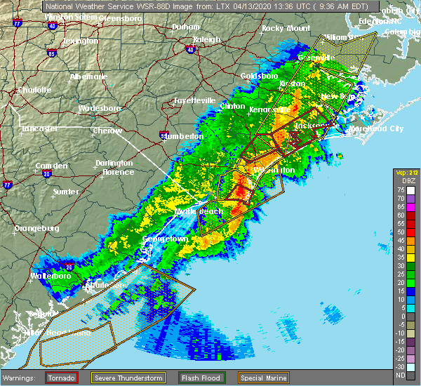 At 940 am edt, a severe thunderstorm capable of producing a tornado was located near fort fisher, or near kure beach, moving northeast at 75 mph (radar indicated rotation). Hazards include tornado. Flying debris will be dangerous to those caught without shelter. mobile homes will be damaged or destroyed. damage to roofs, windows, and vehicles will occur. tree damage is likely. this dangerous storm will be near, carolina beach, snows cut and sea breeze around 945 am edt. south masonboro island, north masonboro island and myrtle grove around 950 am edt. Other locations impacted by this tornadic thunderstorm include dosher memorial hospital. At 940 am edt, a severe thunderstorm capable of producing a tornado was located near fort fisher, or near kure beach, moving northeast at 75 mph (radar indicated rotation). Hazards include tornado. Flying debris will be dangerous to those caught without shelter. mobile homes will be damaged or destroyed. damage to roofs, windows, and vehicles will occur. tree damage is likely. this dangerous storm will be near, carolina beach, snows cut and sea breeze around 945 am edt. south masonboro island, north masonboro island and myrtle grove around 950 am edt. Other locations impacted by this tornadic thunderstorm include dosher memorial hospital.
|
| 4/13/2020 9:32 AM EDT |
 At 932 am edt, a confirmed waterspout was located just offshore near st. james, or near oak island, moving northeast at 70 mph (weather spotters confirmed waterspout moving onshore). Hazards include tornado. Flying debris will be dangerous to those caught without shelter. mobile homes will be damaged or destroyed. damage to roofs, windows, and vehicles will occur. tree damage is likely. this tornado will be near, southport around 935 am edt. boiling spring lakes around 940 am edt. kure beach around 945 am edt. Other locations impacted by this tornado include dosher memorial hospital. At 932 am edt, a confirmed waterspout was located just offshore near st. james, or near oak island, moving northeast at 70 mph (weather spotters confirmed waterspout moving onshore). Hazards include tornado. Flying debris will be dangerous to those caught without shelter. mobile homes will be damaged or destroyed. damage to roofs, windows, and vehicles will occur. tree damage is likely. this tornado will be near, southport around 935 am edt. boiling spring lakes around 940 am edt. kure beach around 945 am edt. Other locations impacted by this tornado include dosher memorial hospital.
|
| 4/13/2020 9:31 AM EDT |
 At 931 am edt, a severe thunderstorm was located over hightsville, or near leland, moving northeast at 65 mph (radar indicated). Hazards include 60 mph wind gusts. Expect wind damage to trees and power lines. locations impacted include, leland, oak island, carolina beach, kure beach, holden beach, caswell beach, bald head island, south masonboro island, snows cut, ocean crest pier, yaupon beach, boiling spring lakes, st. James, southport, bishop, civie town, supply, brunswick county community college main campus, myrtle grove and winnabow. At 931 am edt, a severe thunderstorm was located over hightsville, or near leland, moving northeast at 65 mph (radar indicated). Hazards include 60 mph wind gusts. Expect wind damage to trees and power lines. locations impacted include, leland, oak island, carolina beach, kure beach, holden beach, caswell beach, bald head island, south masonboro island, snows cut, ocean crest pier, yaupon beach, boiling spring lakes, st. James, southport, bishop, civie town, supply, brunswick county community college main campus, myrtle grove and winnabow.
|
| 4/13/2020 9:21 AM EDT |
 At 921 am edt, a confirmed waterspout was located just offshore near holden beach, moving northeast at 70 mph (weather spotters confirmed waterspout moving onshore). Hazards include tornado. Flying debris will be dangerous to those caught without shelter. mobile homes will be damaged or destroyed. damage to roofs, windows, and vehicles will occur. tree damage is likely. this tornado will be near, civie town around 925 am edt. ocean crest pier and long beach around 930 am edt. oak island, caswell beach, yaupon beach, st. james and brunswick county community college main campus around 935 am edt. boiling spring lakes and southport around 940 am edt. kure beach and fort fisher around 945 am edt. other locations impacted by this tornado include bolivia, varnamtown and dosher memorial hospital. This includes us route 17 in brunswick county between mile markers 27 and 33. At 921 am edt, a confirmed waterspout was located just offshore near holden beach, moving northeast at 70 mph (weather spotters confirmed waterspout moving onshore). Hazards include tornado. Flying debris will be dangerous to those caught without shelter. mobile homes will be damaged or destroyed. damage to roofs, windows, and vehicles will occur. tree damage is likely. this tornado will be near, civie town around 925 am edt. ocean crest pier and long beach around 930 am edt. oak island, caswell beach, yaupon beach, st. james and brunswick county community college main campus around 935 am edt. boiling spring lakes and southport around 940 am edt. kure beach and fort fisher around 945 am edt. other locations impacted by this tornado include bolivia, varnamtown and dosher memorial hospital. This includes us route 17 in brunswick county between mile markers 27 and 33.
|
| 4/13/2020 9:01 AM EDT |
 At 901 am edt, a severe thunderstorm was located near russtown, or near shallotte, moving northeast at 65 mph (radar indicated). Hazards include 70 mph wind gusts. Expect considerable tree damage. Damage is likely to mobile homes, roofs, and outbuildings. At 901 am edt, a severe thunderstorm was located near russtown, or near shallotte, moving northeast at 65 mph (radar indicated). Hazards include 70 mph wind gusts. Expect considerable tree damage. Damage is likely to mobile homes, roofs, and outbuildings.
|
| 2/7/2020 12:38 AM EST |
 The severe thunderstorm warning for central new hanover and southeastern brunswick counties will expire at 1245 am est, the storm which prompted the warning has moved out of the area. therefore, the warning will be allowed to expire. a tornado watch remains in effect until 100 am est for southeastern north carolina. The severe thunderstorm warning for central new hanover and southeastern brunswick counties will expire at 1245 am est, the storm which prompted the warning has moved out of the area. therefore, the warning will be allowed to expire. a tornado watch remains in effect until 100 am est for southeastern north carolina.
|
| 2/7/2020 12:21 AM EST |
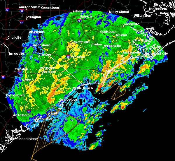 At 1221 am est, a severe thunderstorm was located over kure beach, moving northeast at 65 mph (radar indicated). Hazards include 60 mph wind gusts. expect wind damage to trees and power lines At 1221 am est, a severe thunderstorm was located over kure beach, moving northeast at 65 mph (radar indicated). Hazards include 60 mph wind gusts. expect wind damage to trees and power lines
|
| 9/9/2019 6:43 PM EDT |
 At 619 pm edt, a severe thunderstorm was located over wilmington international airport, or near wilmington, moving south at 15 mph (trained weather spotters). Hazards include 60 mph wind gusts and quarter size hail. Minor hail damage to vehicles is possible. Expect wind damage to trees and power lines. At 619 pm edt, a severe thunderstorm was located over wilmington international airport, or near wilmington, moving south at 15 mph (trained weather spotters). Hazards include 60 mph wind gusts and quarter size hail. Minor hail damage to vehicles is possible. Expect wind damage to trees and power lines.
|
| 9/9/2019 6:19 PM EDT |
 At 619 pm edt, a severe thunderstorm was located over wilmington international airport, or near wilmington, moving south at 15 mph (trained weather spotters). Hazards include 60 mph wind gusts and quarter size hail. Minor hail damage to vehicles is possible. Expect wind damage to trees and power lines. At 619 pm edt, a severe thunderstorm was located over wilmington international airport, or near wilmington, moving south at 15 mph (trained weather spotters). Hazards include 60 mph wind gusts and quarter size hail. Minor hail damage to vehicles is possible. Expect wind damage to trees and power lines.
|
| 9/5/2019 5:45 AM EDT |
 At 544 am edt, a severe thunderstorm capable of producing a tornado was located near carolina beach, moving northwest at 40 mph (radar indicated rotation). Hazards include tornado. Flying debris will be dangerous to those caught without shelter. mobile homes will be damaged or destroyed. damage to roofs, windows, and vehicles will occur. tree damage is likely. this dangerous storm will be near, carolina beach and kure beach around 550 am edt. snows cut, south masonboro island, north masonboro island, sea breeze and myrtle grove around 555 am edt. silver lake and masonboro around 600 am edt. boiling spring lakes around 605 am edt. mill creek around 610 am edt. leland, town creek, bishop and winnabow around 615 am edt. batarora around 620 am edt. other locations impacted by this tornadic thunderstorm include sandy creek, bolivia and belville. this includes the following highways, us route 74 between mile markers 425 and 434. Us route 17 in brunswick county between mile markers 28 and 44. At 544 am edt, a severe thunderstorm capable of producing a tornado was located near carolina beach, moving northwest at 40 mph (radar indicated rotation). Hazards include tornado. Flying debris will be dangerous to those caught without shelter. mobile homes will be damaged or destroyed. damage to roofs, windows, and vehicles will occur. tree damage is likely. this dangerous storm will be near, carolina beach and kure beach around 550 am edt. snows cut, south masonboro island, north masonboro island, sea breeze and myrtle grove around 555 am edt. silver lake and masonboro around 600 am edt. boiling spring lakes around 605 am edt. mill creek around 610 am edt. leland, town creek, bishop and winnabow around 615 am edt. batarora around 620 am edt. other locations impacted by this tornadic thunderstorm include sandy creek, bolivia and belville. this includes the following highways, us route 74 between mile markers 425 and 434. Us route 17 in brunswick county between mile markers 28 and 44.
|
| 9/5/2019 5:36 AM EDT |
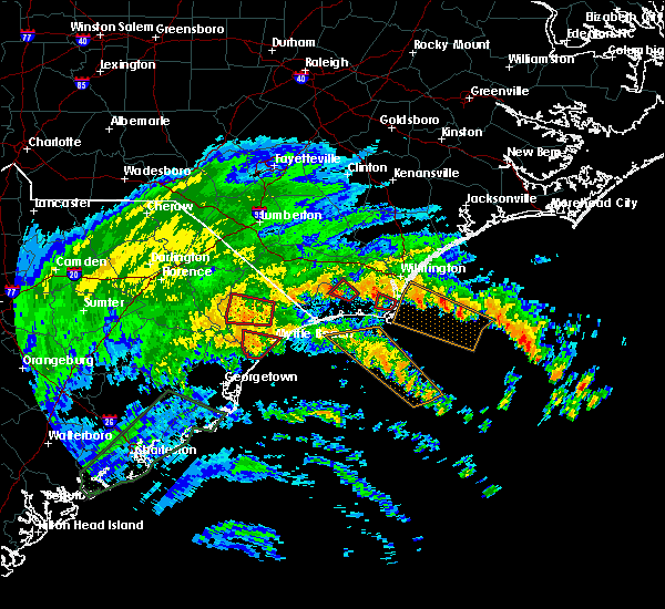 At 535 am edt, a tornado producing storm was located over boiling spring lakes, or 9 miles north of oak island, moving northwest at 35 mph (radar confirmed tornado). Hazards include damaging tornado. Flying debris will be dangerous to those caught without shelter. mobile homes will be damaged or destroyed. damage to roofs, windows, and vehicles will occur. tree damage is likely. this tornadic storm will be near, winnabow and brunswick county community college main campus around 545 am edt. honey island and makatoka around 600 am edt. other locations impacted by this tornadic thunderstorm include bolivia. This includes us route 17 in brunswick county between mile markers 25 and 37. At 535 am edt, a tornado producing storm was located over boiling spring lakes, or 9 miles north of oak island, moving northwest at 35 mph (radar confirmed tornado). Hazards include damaging tornado. Flying debris will be dangerous to those caught without shelter. mobile homes will be damaged or destroyed. damage to roofs, windows, and vehicles will occur. tree damage is likely. this tornadic storm will be near, winnabow and brunswick county community college main campus around 545 am edt. honey island and makatoka around 600 am edt. other locations impacted by this tornadic thunderstorm include bolivia. This includes us route 17 in brunswick county between mile markers 25 and 37.
|
| 9/5/2019 5:28 AM EDT |
 At 528 am edt, a severe thunderstorm capable of producing a tornado was located over boiling spring lakes, or 7 miles north of caswell beach, moving northwest at 40 mph (radar indicated rotation). Hazards include tornado. Flying debris will be dangerous to those caught without shelter. mobile homes will be damaged or destroyed. damage to roofs, windows, and vehicles will occur. tree damage is likely. This tornadic thunderstorm will remain over mainly rural areas of east central brunswick county. At 528 am edt, a severe thunderstorm capable of producing a tornado was located over boiling spring lakes, or 7 miles north of caswell beach, moving northwest at 40 mph (radar indicated rotation). Hazards include tornado. Flying debris will be dangerous to those caught without shelter. mobile homes will be damaged or destroyed. damage to roofs, windows, and vehicles will occur. tree damage is likely. This tornadic thunderstorm will remain over mainly rural areas of east central brunswick county.
|
| 9/5/2019 5:11 AM EDT |
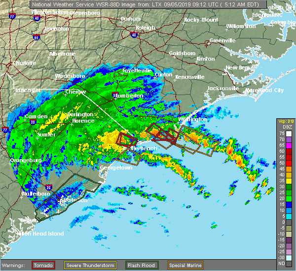 At 511 am edt, a severe thunderstorm capable of producing a tornado was located near fort fisher, or near kure beach, moving northwest at 30 mph (radar indicated rotation). Hazards include tornado. Flying debris will be dangerous to those caught without shelter. mobile homes will be damaged or destroyed. damage to roofs, windows, and vehicles will occur. tree damage is likely. this dangerous storm will be near, carolina beach, kure beach and fort fisher around 520 am edt. southport around 525 am edt. oak island, caswell beach and yaupon beach around 530 am edt. boiling spring lakes and st. james around 535 am edt. Other locations impacted by this tornadic thunderstorm include dosher memorial hospital. At 511 am edt, a severe thunderstorm capable of producing a tornado was located near fort fisher, or near kure beach, moving northwest at 30 mph (radar indicated rotation). Hazards include tornado. Flying debris will be dangerous to those caught without shelter. mobile homes will be damaged or destroyed. damage to roofs, windows, and vehicles will occur. tree damage is likely. this dangerous storm will be near, carolina beach, kure beach and fort fisher around 520 am edt. southport around 525 am edt. oak island, caswell beach and yaupon beach around 530 am edt. boiling spring lakes and st. james around 535 am edt. Other locations impacted by this tornadic thunderstorm include dosher memorial hospital.
|
| 9/5/2019 5:09 AM EDT |
 At 509 am edt, severe thunderstorms capable of producing a tornado were located along a line extending from st. james to near long beach, moving northwest at 40 mph (radar indicated rotation). Hazards include tornado. Flying debris will be dangerous to those caught without shelter. mobile homes will be damaged or destroyed. damage to roofs, windows, and vehicles will occur. tree damage is likely. these dangerous storms will be near, supply around 520 am edt. brunswick county community college main campus around 525 am edt. makatoka around 535 am edt. honey island around 540 am edt. other locations impacted by these tornadic storms include brunswick novant medical center, dosher memorial hospital and varnamtown. This includes us route 17 in brunswick county between mile markers 19 and 29. At 509 am edt, severe thunderstorms capable of producing a tornado were located along a line extending from st. james to near long beach, moving northwest at 40 mph (radar indicated rotation). Hazards include tornado. Flying debris will be dangerous to those caught without shelter. mobile homes will be damaged or destroyed. damage to roofs, windows, and vehicles will occur. tree damage is likely. these dangerous storms will be near, supply around 520 am edt. brunswick county community college main campus around 525 am edt. makatoka around 535 am edt. honey island around 540 am edt. other locations impacted by these tornadic storms include brunswick novant medical center, dosher memorial hospital and varnamtown. This includes us route 17 in brunswick county between mile markers 19 and 29.
|
| 9/5/2019 4:51 AM EDT |
 At 451 am edt, a severe thunderstorm capable of producing a tornado was located over southport, or over caswell beach, moving northwest at 35 mph (radar indicated rotation). Hazards include tornado. Flying debris will be dangerous to those caught without shelter. mobile homes will be damaged or destroyed. damage to roofs, windows, and vehicles will occur. tree damage is likely. this dangerous storm will be near, oak island and yaupon beach around 455 am edt. ocean crest pier and st. james around 500 am edt. long beach around 505 am edt. holden beach around 510 am edt. brunswick county community college main campus around 515 am edt. other locations impacted by this tornadic thunderstorm include varnamtown, dosher memorial hospital and bolivia. This includes us route 17 in brunswick county between mile markers 24 and 29. At 451 am edt, a severe thunderstorm capable of producing a tornado was located over southport, or over caswell beach, moving northwest at 35 mph (radar indicated rotation). Hazards include tornado. Flying debris will be dangerous to those caught without shelter. mobile homes will be damaged or destroyed. damage to roofs, windows, and vehicles will occur. tree damage is likely. this dangerous storm will be near, oak island and yaupon beach around 455 am edt. ocean crest pier and st. james around 500 am edt. long beach around 505 am edt. holden beach around 510 am edt. brunswick county community college main campus around 515 am edt. other locations impacted by this tornadic thunderstorm include varnamtown, dosher memorial hospital and bolivia. This includes us route 17 in brunswick county between mile markers 24 and 29.
|
| 7/3/2019 3:09 PM EDT |
 The severe thunderstorm warning for central brunswick county will expire at 315 pm edt, the storm which prompted the warning has weakened below severe limits, and no longer poses an immediate threat to life or property. therefore, the warning will be allowed to expire. however heavy rain is still possible with this thunderstorm. The severe thunderstorm warning for central brunswick county will expire at 315 pm edt, the storm which prompted the warning has weakened below severe limits, and no longer poses an immediate threat to life or property. therefore, the warning will be allowed to expire. however heavy rain is still possible with this thunderstorm.
|
| 7/3/2019 2:49 PM EDT |
 At 249 pm edt, a severe thunderstorm was located near brunswick county community college main campus, or 11 miles northeast of shallotte, moving southwest at 15 mph (radar indicated). Hazards include 60 mph wind gusts and quarter size hail. Minor hail damage to vehicles is possible. Expect wind damage to trees and power lines. At 249 pm edt, a severe thunderstorm was located near brunswick county community college main campus, or 11 miles northeast of shallotte, moving southwest at 15 mph (radar indicated). Hazards include 60 mph wind gusts and quarter size hail. Minor hail damage to vehicles is possible. Expect wind damage to trees and power lines.
|
| 7/3/2019 2:06 PM EDT |
 At 206 pm edt, a severe thunderstorm was located over silver lake, or over wilmington, moving east at 25 mph (radar indicated). Hazards include 60 mph wind gusts and quarter size hail. Minor hail damage to vehicles is possible. expect wind damage to trees and power lines. Locations impacted include, leland, batarora, bishop, mill creek, town creek, winnabow, belville and navassa. At 206 pm edt, a severe thunderstorm was located over silver lake, or over wilmington, moving east at 25 mph (radar indicated). Hazards include 60 mph wind gusts and quarter size hail. Minor hail damage to vehicles is possible. expect wind damage to trees and power lines. Locations impacted include, leland, batarora, bishop, mill creek, town creek, winnabow, belville and navassa.
|
| 7/3/2019 1:44 PM EDT |
 At 144 pm edt, a severe thunderstorm was located over bishop, or over leland, moving east at 25 mph (radar indicated). Hazards include 60 mph wind gusts and quarter size hail. Minor hail damage to vehicles is possible. Expect wind damage to trees and power lines. At 144 pm edt, a severe thunderstorm was located over bishop, or over leland, moving east at 25 mph (radar indicated). Hazards include 60 mph wind gusts and quarter size hail. Minor hail damage to vehicles is possible. Expect wind damage to trees and power lines.
|
| 6/20/2019 7:12 PM EDT |
 The severe thunderstorm warning for central new hanover and southeastern brunswick counties will expire at 715 pm edt, the storms which prompted the warning have moved out of the area. therefore, the warning will be allowed to expire. however gusty winds are still possible with these thunderstorms. a severe thunderstorm watch remains in effect until 1000 pm edt for southeastern north carolina. The severe thunderstorm warning for central new hanover and southeastern brunswick counties will expire at 715 pm edt, the storms which prompted the warning have moved out of the area. therefore, the warning will be allowed to expire. however gusty winds are still possible with these thunderstorms. a severe thunderstorm watch remains in effect until 1000 pm edt for southeastern north carolina.
|
| 6/20/2019 6:57 PM EDT |
 At 656 pm edt, severe thunderstorms were located along a line extending from wilmington to 9 miles south of ocean crest pier, moving east at 55 mph (radar indicated). Hazards include 60 mph wind gusts. Expect wind damage to trees and power lines. locations impacted include, wilmington, leland, oak island, carolina beach, wrightsville beach, kure beach, caswell beach, bald head island, south masonboro island, north masonboro island, snows cut, ocean crest pier, yaupon beach, boiling spring lakes, st. James, southport, bishop, myrtle grove, masonboro and winnabow. At 656 pm edt, severe thunderstorms were located along a line extending from wilmington to 9 miles south of ocean crest pier, moving east at 55 mph (radar indicated). Hazards include 60 mph wind gusts. Expect wind damage to trees and power lines. locations impacted include, wilmington, leland, oak island, carolina beach, wrightsville beach, kure beach, caswell beach, bald head island, south masonboro island, north masonboro island, snows cut, ocean crest pier, yaupon beach, boiling spring lakes, st. James, southport, bishop, myrtle grove, masonboro and winnabow.
|
| 6/20/2019 6:42 PM EDT |
 At 641 pm edt, severe thunderstorms were located along a line extending from mill creek to near holden beach, moving east at 50 mph (radar indicated). Hazards include 70 mph wind gusts and quarter size hail. Expect considerable tree damage. Wind damage is also likely to mobile homes, roofs, and outbuildings. At 641 pm edt, severe thunderstorms were located along a line extending from mill creek to near holden beach, moving east at 50 mph (radar indicated). Hazards include 70 mph wind gusts and quarter size hail. Expect considerable tree damage. Wind damage is also likely to mobile homes, roofs, and outbuildings.
|
| 5/31/2019 5:46 PM EDT |
 At 546 pm edt, a severe thunderstorm was located 9 miles northeast of shallotte, moving east at 20 mph (radar indicated). Hazards include 60 mph wind gusts and penny size hail. expect damage to trees and powerlines At 546 pm edt, a severe thunderstorm was located 9 miles northeast of shallotte, moving east at 20 mph (radar indicated). Hazards include 60 mph wind gusts and penny size hail. expect damage to trees and powerlines
|
| 4/19/2019 6:08 PM EDT |
 At 608 pm edt, severe thunderstorms were located along a line extending from near kenansville to 16 miles southeast of topsail beach, moving northeast at 55 mph (radar indicated). Hazards include 60 mph wind gusts. Expect wind damage to trees and power lines. Locations impacted include, wilmington, leland, oak island, carolina beach, burgaw, wrightsville beach, kure beach, surf city, caswell beach, bald head island, snows cut, rich inlet, south masonboro island, figure eight island, yaupon beach, north masonboro island, hampstead, boiling spring lakes, southport and topsail beach. At 608 pm edt, severe thunderstorms were located along a line extending from near kenansville to 16 miles southeast of topsail beach, moving northeast at 55 mph (radar indicated). Hazards include 60 mph wind gusts. Expect wind damage to trees and power lines. Locations impacted include, wilmington, leland, oak island, carolina beach, burgaw, wrightsville beach, kure beach, surf city, caswell beach, bald head island, snows cut, rich inlet, south masonboro island, figure eight island, yaupon beach, north masonboro island, hampstead, boiling spring lakes, southport and topsail beach.
|
| 4/19/2019 5:49 PM EDT |
 At 549 pm edt, severe thunderstorms were located along a line extending from near rose hill to 10 miles southeast of north masonboro island, moving northeast at 55 mph (radar indicated). Hazards include 60 mph wind gusts. Expect wind damage to trees and power lines. Locations impacted include, wilmington, leland, oak island, carolina beach, burgaw, wrightsville beach, kure beach, surf city, caswell beach, bald head island, snows cut, rich inlet, south masonboro island, figure eight island, yaupon beach, north masonboro island, hampstead, boiling spring lakes, southport and topsail beach. At 549 pm edt, severe thunderstorms were located along a line extending from near rose hill to 10 miles southeast of north masonboro island, moving northeast at 55 mph (radar indicated). Hazards include 60 mph wind gusts. Expect wind damage to trees and power lines. Locations impacted include, wilmington, leland, oak island, carolina beach, burgaw, wrightsville beach, kure beach, surf city, caswell beach, bald head island, snows cut, rich inlet, south masonboro island, figure eight island, yaupon beach, north masonboro island, hampstead, boiling spring lakes, southport and topsail beach.
|
| 4/19/2019 5:25 PM EDT |
 At 524 pm edt, severe thunderstorms were located along a line extending from 9 miles north of lagoon to southport, moving northeast at 55 mph (radar indicated). Hazards include 60 mph wind gusts. expect wind damage to trees and power lines At 524 pm edt, severe thunderstorms were located along a line extending from 9 miles north of lagoon to southport, moving northeast at 55 mph (radar indicated). Hazards include 60 mph wind gusts. expect wind damage to trees and power lines
|
| 4/19/2019 5:12 PM EDT |
 At 512 pm edt, severe thunderstorms were located along a line extending from near ammon to supply, moving east at 50 mph (radar indicated). Hazards include 60 mph wind gusts. Expect wind damage to trees and power lines. locations impacted include, oak island, whiteville, shallotte, elizabethtown, holden beach, yaupon beach, rowan, st. James, bladenboro, lake waccamaw, northwest, sandyfield, makatoka, hallsboro, ammon, exum, white oak, carvers, lisbon and honey island. At 512 pm edt, severe thunderstorms were located along a line extending from near ammon to supply, moving east at 50 mph (radar indicated). Hazards include 60 mph wind gusts. Expect wind damage to trees and power lines. locations impacted include, oak island, whiteville, shallotte, elizabethtown, holden beach, yaupon beach, rowan, st. James, bladenboro, lake waccamaw, northwest, sandyfield, makatoka, hallsboro, ammon, exum, white oak, carvers, lisbon and honey island.
|
| 4/19/2019 4:57 PM EDT |
 At 457 pm edt, severe thunderstorms were located along a line extending from 6 miles northeast of jerome to near sunset beach, moving east at 45 mph (radar indicated). Hazards include 60 mph wind gusts. expect wind damage to trees and power lines At 457 pm edt, severe thunderstorms were located along a line extending from 6 miles northeast of jerome to near sunset beach, moving east at 45 mph (radar indicated). Hazards include 60 mph wind gusts. expect wind damage to trees and power lines
|
| 9/16/2018 7:35 AM EDT |
 The tornado warning for northeastern brunswick county will expire at 745 am edt, the storm which prompted the warning has weakened below severe limits, and no longer appears capable of producing a tornado. therefore, the warning will be allowed to expire. a tornado watch remains in effect until 500 pm edt for southeastern north carolina. The tornado warning for northeastern brunswick county will expire at 745 am edt, the storm which prompted the warning has weakened below severe limits, and no longer appears capable of producing a tornado. therefore, the warning will be allowed to expire. a tornado watch remains in effect until 500 pm edt for southeastern north carolina.
|
| 9/16/2018 7:24 AM EDT |
 At 724 am edt, a severe thunderstorm capable of producing a tornado was located over mill creek, or 8 miles south of leland, moving northwest at 25 mph (radar indicated rotation). Hazards include tornado. Flying debris will be dangerous to those caught without shelter. mobile homes will be damaged or destroyed. damage to roofs, windows, and vehicles will occur. tree damage is likely. locations impacted include, leland, boiling spring lakes, bishop, batarora, mill creek, town creek, winnabow, belville and navassa. this includes the following highways, us route 74 between mile markers 429 and 434. Us route 17 in brunswick county between mile markers 34 and 44. At 724 am edt, a severe thunderstorm capable of producing a tornado was located over mill creek, or 8 miles south of leland, moving northwest at 25 mph (radar indicated rotation). Hazards include tornado. Flying debris will be dangerous to those caught without shelter. mobile homes will be damaged or destroyed. damage to roofs, windows, and vehicles will occur. tree damage is likely. locations impacted include, leland, boiling spring lakes, bishop, batarora, mill creek, town creek, winnabow, belville and navassa. this includes the following highways, us route 74 between mile markers 429 and 434. Us route 17 in brunswick county between mile markers 34 and 44.
|
| 9/16/2018 7:12 AM EDT |
 At 712 am edt, a severe thunderstorm capable of producing a tornado was located over boiling spring lakes, or near snows cut, moving north at 30 mph (radar indicated rotation). Hazards include tornado. expect damage to mobile homes, roofs, and vehicles At 712 am edt, a severe thunderstorm capable of producing a tornado was located over boiling spring lakes, or near snows cut, moving north at 30 mph (radar indicated rotation). Hazards include tornado. expect damage to mobile homes, roofs, and vehicles
|
| 9/16/2018 12:26 AM EDT |
 At 1226 am edt, a severe thunderstorm capable of producing a tornado was located over carolina beach, moving northwest at 45 mph (radar indicated rotation). Hazards include tornado. Flying debris will be dangerous to those caught without shelter. mobile homes will be damaged or destroyed. damage to roofs, windows, and vehicles will occur. Tree damage is likely. At 1226 am edt, a severe thunderstorm capable of producing a tornado was located over carolina beach, moving northwest at 45 mph (radar indicated rotation). Hazards include tornado. Flying debris will be dangerous to those caught without shelter. mobile homes will be damaged or destroyed. damage to roofs, windows, and vehicles will occur. Tree damage is likely.
|
| 6/15/2018 3:35 PM EDT |
 At 335 pm edt, a severe thunderstorm was located over bishop, or near leland, moving east at 15 mph (radar indicated). Hazards include 60 mph wind gusts and quarter size hail. Minor hail damage to vehicles is possible. Expect wind damage to trees and power lines. At 335 pm edt, a severe thunderstorm was located over bishop, or near leland, moving east at 15 mph (radar indicated). Hazards include 60 mph wind gusts and quarter size hail. Minor hail damage to vehicles is possible. Expect wind damage to trees and power lines.
|
| 6/14/2018 3:56 PM EDT |
 The severe thunderstorm warning for central new hanover and brunswick counties will expire at 400 pm edt, the storms which prompted the warning have weakened below severe limits and continue moving off the coast of southern new hanover and southern brunswick county. therefore, the warning will be allowed to expire. The severe thunderstorm warning for central new hanover and brunswick counties will expire at 400 pm edt, the storms which prompted the warning have weakened below severe limits and continue moving off the coast of southern new hanover and southern brunswick county. therefore, the warning will be allowed to expire.
|
| 6/14/2018 3:32 PM EDT |
 At 331 pm edt, severe thunderstorms were located along a line extending from 6 miles southeast of rich inlet to near supply to hammond, moving southeast at 15 mph (radar indicated). Hazards include 60 mph wind gusts and quarter size hail. Minor hail damage to vehicles is possible. expect wind damage to trees and power lines. locations impacted include, wilmington, leland, oak island, carolina beach, shallotte, sunset beach, wrightsville beach, kure beach, holden beach, ocean isle beach, caswell beach, bald head island, snows cut, south masonboro island, figure eight island, yaupon beach, north masonboro island, iredell, boiling spring lakes and st. james. This includes us route 17 in brunswick county between mile markers 1 and 44. At 331 pm edt, severe thunderstorms were located along a line extending from 6 miles southeast of rich inlet to near supply to hammond, moving southeast at 15 mph (radar indicated). Hazards include 60 mph wind gusts and quarter size hail. Minor hail damage to vehicles is possible. expect wind damage to trees and power lines. locations impacted include, wilmington, leland, oak island, carolina beach, shallotte, sunset beach, wrightsville beach, kure beach, holden beach, ocean isle beach, caswell beach, bald head island, snows cut, south masonboro island, figure eight island, yaupon beach, north masonboro island, iredell, boiling spring lakes and st. james. This includes us route 17 in brunswick county between mile markers 1 and 44.
|
| 6/14/2018 2:55 PM EDT |
 At 253 pm edt, a line of severe thunderstorms was located along a line extending from topsail to near honey island to allsbrook, moving southeast at 15 mph. the strongest storms were near leland and east of castle hayne (radar indicated). Hazards include 60 mph wind gusts and quarter size hail. Minor hail damage to vehicles is possible. Expect wind damage to trees and power lines. At 253 pm edt, a line of severe thunderstorms was located along a line extending from topsail to near honey island to allsbrook, moving southeast at 15 mph. the strongest storms were near leland and east of castle hayne (radar indicated). Hazards include 60 mph wind gusts and quarter size hail. Minor hail damage to vehicles is possible. Expect wind damage to trees and power lines.
|
| 3/1/2018 6:12 PM EST |
 At 612 pm est, strong to severe thunderstorms were located along a line extending from near atkinson, delco, and pireway, moving east at 50 55 mph. although this line has shown some weakening, a few locations in the warned area may still receive a wind gust to 60 mph (radar indicated). Hazards include 60 mph wind gusts. Some downed trees and power lines possible. Locations impacted include, burgaw, shallotte, lake waccamaw, penderlea, makatoka, long creek, exum, longwood, currie, winnabow, and rooks. At 612 pm est, strong to severe thunderstorms were located along a line extending from near atkinson, delco, and pireway, moving east at 50 55 mph. although this line has shown some weakening, a few locations in the warned area may still receive a wind gust to 60 mph (radar indicated). Hazards include 60 mph wind gusts. Some downed trees and power lines possible. Locations impacted include, burgaw, shallotte, lake waccamaw, penderlea, makatoka, long creek, exum, longwood, currie, winnabow, and rooks.
|
| 3/1/2018 5:44 PM EST |
 At 543 pm est, severe thunderstorms were located along a line extending from 7 miles east of ammon to near elizabethtown, clarkton, whiteville and green sea, moving east at 50 to 55 mph. this line of storms has a history of producing wind damage (radar indicated). Hazards include 60 mph wind gusts. expect downed trees and power lines in those areas that receive the highest winds At 543 pm est, severe thunderstorms were located along a line extending from 7 miles east of ammon to near elizabethtown, clarkton, whiteville and green sea, moving east at 50 to 55 mph. this line of storms has a history of producing wind damage (radar indicated). Hazards include 60 mph wind gusts. expect downed trees and power lines in those areas that receive the highest winds
|
| 9/21/2017 3:11 PM EDT |
 At 311 pm edt, a severe thunderstorm was located near boiling spring lakes, or 7 miles north of oak island, drifting southwest at 5 mph (radar indicated). Hazards include 60 mph wind gusts and quarter size hail. Minor hail damage to vehicles is possible. expect wind damage to trees and power lines. locations impacted include, boiling spring lakes, mill creek, brunswick county community college main campus and bolivia. This includes us route 17 in brunswick county between mile markers 24 and 33. At 311 pm edt, a severe thunderstorm was located near boiling spring lakes, or 7 miles north of oak island, drifting southwest at 5 mph (radar indicated). Hazards include 60 mph wind gusts and quarter size hail. Minor hail damage to vehicles is possible. expect wind damage to trees and power lines. locations impacted include, boiling spring lakes, mill creek, brunswick county community college main campus and bolivia. This includes us route 17 in brunswick county between mile markers 24 and 33.
|
| 9/21/2017 2:55 PM EDT |
 At 255 pm edt, a severe thunderstorm was located near boiling spring lakes, or 7 miles north of oak island, moving southwest at 10 mph (radar indicated). Hazards include 60 mph wind gusts and quarter size hail. Minor hail damage to vehicles is possible. Expect wind damage to trees and power lines. At 255 pm edt, a severe thunderstorm was located near boiling spring lakes, or 7 miles north of oak island, moving southwest at 10 mph (radar indicated). Hazards include 60 mph wind gusts and quarter size hail. Minor hail damage to vehicles is possible. Expect wind damage to trees and power lines.
|
| 9/12/2017 5:54 AM EDT |
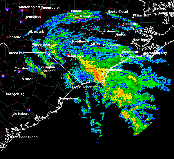 At 553 am edt, a severe thunderstorm capable of producing a tornado was located near mill creek, or 10 miles north of oak island, moving northwest at 30 mph (radar indicated rotation). Hazards include tornado. Flying debris will be dangerous to those caught without shelter. mobile homes will be damaged or destroyed. damage to roofs, windows, and vehicles will occur. tree damage is likely. locations impacted include, oak island, caswell beach, bald head island, yaupon beach, boiling spring lakes, st. james, southport, mill creek, long beach, bolivia and dosher memorial hospital. This includes us route 17 in brunswick county between mile markers 26 and 35. At 553 am edt, a severe thunderstorm capable of producing a tornado was located near mill creek, or 10 miles north of oak island, moving northwest at 30 mph (radar indicated rotation). Hazards include tornado. Flying debris will be dangerous to those caught without shelter. mobile homes will be damaged or destroyed. damage to roofs, windows, and vehicles will occur. tree damage is likely. locations impacted include, oak island, caswell beach, bald head island, yaupon beach, boiling spring lakes, st. james, southport, mill creek, long beach, bolivia and dosher memorial hospital. This includes us route 17 in brunswick county between mile markers 26 and 35.
|
| 9/12/2017 5:39 AM EDT |
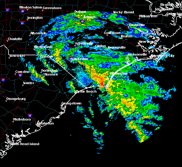 At 537 am edt, a severe thunderstorm capable of producing a tornado was located 1 mile north of yaupon beach or 9 miles south of bolivia, moving north at 20 mph (radar indicated rotation). Hazards include tornado. Flying debris will be dangerous to those caught without shelter. mobile homes will be damaged or destroyed. damage to roofs, windows, and vehicles will occur. tree damage is likely. locations impacted include, oak island, caswell beach, bald head island, yaupon beach, boiling spring lakes, st. james, southport, mill creek, long beach, bolivia and dosher memorial hospital. This includes us route 17 in brunswick county between mile markers 26 and 35. At 537 am edt, a severe thunderstorm capable of producing a tornado was located 1 mile north of yaupon beach or 9 miles south of bolivia, moving north at 20 mph (radar indicated rotation). Hazards include tornado. Flying debris will be dangerous to those caught without shelter. mobile homes will be damaged or destroyed. damage to roofs, windows, and vehicles will occur. tree damage is likely. locations impacted include, oak island, caswell beach, bald head island, yaupon beach, boiling spring lakes, st. james, southport, mill creek, long beach, bolivia and dosher memorial hospital. This includes us route 17 in brunswick county between mile markers 26 and 35.
|
| 9/12/2017 5:27 AM EDT |
 At 527 am edt, a severe thunderstorm capable of producing a tornado was located just offshore caswell beach, moving north at 35 mph (radar indicated rotation). Hazards include tornado. expect damage to mobile homes, roofs, and vehicles At 527 am edt, a severe thunderstorm capable of producing a tornado was located just offshore caswell beach, moving north at 35 mph (radar indicated rotation). Hazards include tornado. expect damage to mobile homes, roofs, and vehicles
|
| 5/28/2017 7:30 PM EDT |
 At 730 pm edt, a severe thunderstorm was located over williams, or 8 miles south of whiteville, moving east at 30 mph (radar indicated). Hazards include 60 mph wind gusts and quarter size hail. Minor hail damage to vehicles is possible. Expect wind damage to trees and power lines. At 730 pm edt, a severe thunderstorm was located over williams, or 8 miles south of whiteville, moving east at 30 mph (radar indicated). Hazards include 60 mph wind gusts and quarter size hail. Minor hail damage to vehicles is possible. Expect wind damage to trees and power lines.
|
| 5/25/2017 3:37 PM EDT |
 The severe thunderstorm warning for south central new hanover and southeastern brunswick counties will expire at 345 pm edt, the storm which prompted the warning has moved out of the area. therefore the warning will be allowed to expire. The severe thunderstorm warning for south central new hanover and southeastern brunswick counties will expire at 345 pm edt, the storm which prompted the warning has moved out of the area. therefore the warning will be allowed to expire.
|
| 5/25/2017 3:20 PM EDT |
 At 319 pm edt, a severe thunderstorm was located over caswell beach, moving east at 30 mph (radar indicated). Hazards include 60 mph wind gusts and penny size hail. expect damage trees and power lines At 319 pm edt, a severe thunderstorm was located over caswell beach, moving east at 30 mph (radar indicated). Hazards include 60 mph wind gusts and penny size hail. expect damage trees and power lines
|
| 4/5/2017 7:29 PM EDT |
 At 728 pm edt, a severe thunderstorm was located over st. james, or over oak island, moving east at 45 mph (trained weather spotters). Hazards include 60 mph wind gusts and half dollar size hail. Hail damage to vehicles is expected. Expect wind damage to roofs, siding, and trees. At 728 pm edt, a severe thunderstorm was located over st. james, or over oak island, moving east at 45 mph (trained weather spotters). Hazards include 60 mph wind gusts and half dollar size hail. Hail damage to vehicles is expected. Expect wind damage to roofs, siding, and trees.
|
| 4/5/2017 7:08 PM EDT |
 At 707 pm edt, a severe thunderstorm was located over russtown, or near ocean isle beach, moving northeast at 30 mph (radar indicated). Hazards include 60 mph wind gusts and quarter size hail. Hail damage to vehicles is expected. Expect wind damage to roofs, siding, and trees. At 707 pm edt, a severe thunderstorm was located over russtown, or near ocean isle beach, moving northeast at 30 mph (radar indicated). Hazards include 60 mph wind gusts and quarter size hail. Hail damage to vehicles is expected. Expect wind damage to roofs, siding, and trees.
|
| 2/15/2017 12:23 PM EST |
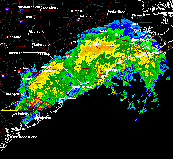 At 1223 pm est, a severe thunderstorm was located near boiling spring lakes, or near oak island, moving east at 65 mph (radar indicated). Hazards include 60 mph wind gusts. Expect damage to roofs, siding, and trees. locations impacted include, oak island, caswell beach, yaupon beach, ocean crest pier, boiling spring lakes, st. James, southport, long beach and dosher memorial hospital. At 1223 pm est, a severe thunderstorm was located near boiling spring lakes, or near oak island, moving east at 65 mph (radar indicated). Hazards include 60 mph wind gusts. Expect damage to roofs, siding, and trees. locations impacted include, oak island, caswell beach, yaupon beach, ocean crest pier, boiling spring lakes, st. James, southport, long beach and dosher memorial hospital.
|
| 2/15/2017 12:20 PM EST |
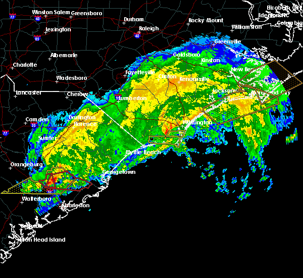 At 1220 pm est, a severe thunderstorm was located over mill creek, or 9 miles north of oak island, moving east at 60 mph (radar indicated). Hazards include 60 mph wind gusts. Expect damage to roofs, siding, and trees. locations impacted include, carolina beach, snows cut, south masonboro island, boiling spring lakes, mill creek, myrtle grove, sea breeze and bolivia. This includes us route 17 in brunswick county between mile markers 31 and 34. At 1220 pm est, a severe thunderstorm was located over mill creek, or 9 miles north of oak island, moving east at 60 mph (radar indicated). Hazards include 60 mph wind gusts. Expect damage to roofs, siding, and trees. locations impacted include, carolina beach, snows cut, south masonboro island, boiling spring lakes, mill creek, myrtle grove, sea breeze and bolivia. This includes us route 17 in brunswick county between mile markers 31 and 34.
|
| 2/15/2017 12:10 PM EST |
 At 1210 pm est, a severe thunderstorm was located near brunswick county community college main campus, or 9 miles northeast of shallotte, moving east at 55 mph (radar indicated). Hazards include 60 mph wind gusts. expect damage to roofs, siding, and trees At 1210 pm est, a severe thunderstorm was located near brunswick county community college main campus, or 9 miles northeast of shallotte, moving east at 55 mph (radar indicated). Hazards include 60 mph wind gusts. expect damage to roofs, siding, and trees
|
| 2/15/2017 12:08 PM EST |
 The national weather service in wilmington has issued a * severe thunderstorm warning for. southeastern brunswick county in southeastern north carolina. Until 115 pm est * at 1207 pm est, a severe thunderstorm was located over shallotte, moving east at 55 mph. The national weather service in wilmington has issued a * severe thunderstorm warning for. southeastern brunswick county in southeastern north carolina. Until 115 pm est * at 1207 pm est, a severe thunderstorm was located over shallotte, moving east at 55 mph.
|
| 10/8/2016 9:22 AM EDT |
 The tornado warning for bladen, northeastern columbus, eastern brunswick, western pender and east central robeson counties will expire at 930 am edt, the storm which prompted the warning has weakened below severe limits, and no longer appears capable of producing a tornado. therefore the warning will be allowed to expire. a tornado watch remains in effect until 400 pm edt for southeastern north carolina. The tornado warning for bladen, northeastern columbus, eastern brunswick, western pender and east central robeson counties will expire at 930 am edt, the storm which prompted the warning has weakened below severe limits, and no longer appears capable of producing a tornado. therefore the warning will be allowed to expire. a tornado watch remains in effect until 400 pm edt for southeastern north carolina.
|
| 10/8/2016 8:36 AM EDT |
 At 836 am edt, a severe thunderstorm capable of producing a tornado was located over boiling spring lakes, or 8 miles north of oak island, moving northwest at 45 mph (radar indicated rotation). Hazards include tornado...quarter size hail...and 60 mph wind gusts. Expect damage to mobile homes. roofs. and vehicles. this dangerous storm will be near, mill creek and brunswick county community college main campus around 840 am edt. winnabow, town creek and bishop around 845 am edt. batarora around 850 am edt. honey island around 855 am edt. freeman, delco and riegelwood around 900 am edt. sandyfield around 905 am edt. kelly around 910 am edt. carvers and council around 915 am edt. Other locations impacted by this tornadic thunderstorm include white lake, east arcadia, dublin, atkinson, clarkton, sandy creek, bolton, bolivia, bladen county hospital and navassa. At 836 am edt, a severe thunderstorm capable of producing a tornado was located over boiling spring lakes, or 8 miles north of oak island, moving northwest at 45 mph (radar indicated rotation). Hazards include tornado...quarter size hail...and 60 mph wind gusts. Expect damage to mobile homes. roofs. and vehicles. this dangerous storm will be near, mill creek and brunswick county community college main campus around 840 am edt. winnabow, town creek and bishop around 845 am edt. batarora around 850 am edt. honey island around 855 am edt. freeman, delco and riegelwood around 900 am edt. sandyfield around 905 am edt. kelly around 910 am edt. carvers and council around 915 am edt. Other locations impacted by this tornadic thunderstorm include white lake, east arcadia, dublin, atkinson, clarkton, sandy creek, bolton, bolivia, bladen county hospital and navassa.
|
| 7/19/2016 6:00 PM EDT |
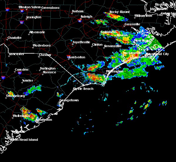 At 600 pm edt, a severe thunderstorm was located near brunswick county community college main campus, or 12 miles southwest of leland, and is nearly stationary (radar indicated). Hazards include 60 mph wind gusts and nickel size hail. Expect damage to roofs. siding. and trees. Locations impacted include, brunswick county community college main campus, supply, bolivia and brunswick novant medical center. At 600 pm edt, a severe thunderstorm was located near brunswick county community college main campus, or 12 miles southwest of leland, and is nearly stationary (radar indicated). Hazards include 60 mph wind gusts and nickel size hail. Expect damage to roofs. siding. and trees. Locations impacted include, brunswick county community college main campus, supply, bolivia and brunswick novant medical center.
|
| 7/19/2016 5:25 PM EDT |
 At 525 pm edt, a severe thunderstorm was located near winnabow, or 12 miles southwest of leland, and is nearly stationary (radar indicated). Hazards include 60 mph wind gusts and nickel size hail. Expect damage to roofs. siding. And trees. At 525 pm edt, a severe thunderstorm was located near winnabow, or 12 miles southwest of leland, and is nearly stationary (radar indicated). Hazards include 60 mph wind gusts and nickel size hail. Expect damage to roofs. siding. And trees.
|
| 7/19/2016 4:57 PM EDT |
 At 456 pm edt, a severe thunderstorm was located over bishop, or near leland, and is nearly stationary (radar indicated). Hazards include 60 mph wind gusts and nickel size hail. Expect damage to roofs. siding. and trees. Locations impacted include, wilmington, leland, carolina beach, snows cut, south masonboro island, sea breeze, bishop, town creek, myrtle grove, silver lake, winnabow and belville. At 456 pm edt, a severe thunderstorm was located over bishop, or near leland, and is nearly stationary (radar indicated). Hazards include 60 mph wind gusts and nickel size hail. Expect damage to roofs. siding. and trees. Locations impacted include, wilmington, leland, carolina beach, snows cut, south masonboro island, sea breeze, bishop, town creek, myrtle grove, silver lake, winnabow and belville.
|
| 7/19/2016 4:42 PM EDT |
 At 441 pm edt, a severe thunderstorm was located near bishop, or near leland, moving southeast at 15 mph (radar indicated). Hazards include 60 mph wind gusts and nickel size hail. Expect damage to roofs. siding. and trees. Locations impacted include, wilmington, leland, carolina beach, snows cut, south masonboro island, north masonboro island, bishop, town creek, hightsville, silver lake, seagate, sea breeze, myrtle grove, winnabow, masonboro, wilmington international airport, wrightsboro, belville, navassa and new hanover regional medical center. At 441 pm edt, a severe thunderstorm was located near bishop, or near leland, moving southeast at 15 mph (radar indicated). Hazards include 60 mph wind gusts and nickel size hail. Expect damage to roofs. siding. and trees. Locations impacted include, wilmington, leland, carolina beach, snows cut, south masonboro island, north masonboro island, bishop, town creek, hightsville, silver lake, seagate, sea breeze, myrtle grove, winnabow, masonboro, wilmington international airport, wrightsboro, belville, navassa and new hanover regional medical center.
|
| 7/19/2016 4:23 PM EDT |
 At 423 pm edt, a severe thunderstorm was located over leland, moving east at 10 mph (radar indicated). Hazards include 60 mph wind gusts and nickel size hail. Expect damage to roofs. siding. And trees. At 423 pm edt, a severe thunderstorm was located over leland, moving east at 10 mph (radar indicated). Hazards include 60 mph wind gusts and nickel size hail. Expect damage to roofs. siding. And trees.
|
| 7/12/2016 4:04 PM EDT |
 At 404 pm edt, a severe thunderstorm was located over brunswick county community college main campus, or 9 miles northeast of shallotte, moving east at 25 mph (radar indicated). Hazards include 60 mph wind gusts and quarter size hail. Hail damage to vehicles is expected. expect wind damage to roofs, siding, and trees. locations impacted include, oak island, caswell beach, yaupon beach, ocean crest pier, boiling spring lakes, st. James, southport, supply, bishop, town creek, mill creek, long beach, brunswick county community college main campus, civie town, makatoka, winnabow, varnamtown, bolivia, brunswick novant medical center and dosher memorial hospital. At 404 pm edt, a severe thunderstorm was located over brunswick county community college main campus, or 9 miles northeast of shallotte, moving east at 25 mph (radar indicated). Hazards include 60 mph wind gusts and quarter size hail. Hail damage to vehicles is expected. expect wind damage to roofs, siding, and trees. locations impacted include, oak island, caswell beach, yaupon beach, ocean crest pier, boiling spring lakes, st. James, southport, supply, bishop, town creek, mill creek, long beach, brunswick county community college main campus, civie town, makatoka, winnabow, varnamtown, bolivia, brunswick novant medical center and dosher memorial hospital.
|
| 7/12/2016 3:56 PM EDT | The severe thunderstorm warning for brunswick and new hanover counties will expire at 400 pm edt. the storm which prompted the warning has weakened below severe limits. and no longer poses an immediate threat to life or property. therefore the warning will be allowed to expire. However gusty winds are still possible with this thunderstorm. |
| 7/12/2016 3:48 PM EDT |
 At 347 pm edt, a severe thunderstorm was located near shallotte, moving east at 25 mph (radar indicated). Hazards include 60 mph wind gusts and quarter size hail. Hail damage to vehicles is expected. Expect wind damage to roofs, siding, and trees. At 347 pm edt, a severe thunderstorm was located near shallotte, moving east at 25 mph (radar indicated). Hazards include 60 mph wind gusts and quarter size hail. Hail damage to vehicles is expected. Expect wind damage to roofs, siding, and trees.
|
| 7/12/2016 3:46 PM EDT |
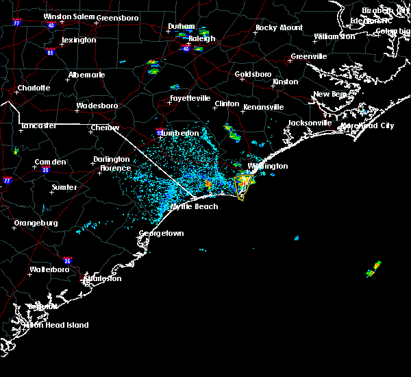 At 346 pm edt, a severe thunderstorm was located near carolina beach, moving southeast at 10 mph (radar indicated). Hazards include 60 mph wind gusts and quarter size hail. Hail damage to vehicles is expected. expect wind damage to roofs, siding, and trees. Locations impacted include, carolina beach, kure beach, bald head island, snows cut, north masonboro island, south masonboro island, boiling spring lakes, southport, fort fisher, silver lake, sea breeze, myrtle grove, masonboro and dosher memorial hospital. At 346 pm edt, a severe thunderstorm was located near carolina beach, moving southeast at 10 mph (radar indicated). Hazards include 60 mph wind gusts and quarter size hail. Hail damage to vehicles is expected. expect wind damage to roofs, siding, and trees. Locations impacted include, carolina beach, kure beach, bald head island, snows cut, north masonboro island, south masonboro island, boiling spring lakes, southport, fort fisher, silver lake, sea breeze, myrtle grove, masonboro and dosher memorial hospital.
|
| 7/12/2016 3:30 PM EDT |
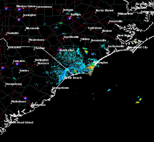 At 329 pm edt, a severe thunderstorm was located near snows cut, moving southeast at 20 mph (radar indicated). Hazards include 60 mph wind gusts and quarter size hail. Hail damage to vehicles is expected. expect wind damage to roofs, siding, and trees. Locations impacted include, carolina beach, kure beach, bald head island, snows cut, north masonboro island, south masonboro island, boiling spring lakes, southport, mill creek, fort fisher, silver lake, sea breeze, myrtle grove, masonboro and dosher memorial hospital. At 329 pm edt, a severe thunderstorm was located near snows cut, moving southeast at 20 mph (radar indicated). Hazards include 60 mph wind gusts and quarter size hail. Hail damage to vehicles is expected. expect wind damage to roofs, siding, and trees. Locations impacted include, carolina beach, kure beach, bald head island, snows cut, north masonboro island, south masonboro island, boiling spring lakes, southport, mill creek, fort fisher, silver lake, sea breeze, myrtle grove, masonboro and dosher memorial hospital.
|
| 7/12/2016 3:14 PM EDT |
 At 314 pm edt, a severe thunderstorm was located near silver lake, or 7 miles northwest of snows cut, moving southeast at 20 mph (radar indicated). Hazards include 60 mph wind gusts and quarter size hail. Hail damage to vehicles is expected. Expect wind damage to roofs, siding, and trees. At 314 pm edt, a severe thunderstorm was located near silver lake, or 7 miles northwest of snows cut, moving southeast at 20 mph (radar indicated). Hazards include 60 mph wind gusts and quarter size hail. Hail damage to vehicles is expected. Expect wind damage to roofs, siding, and trees.
|
| 7/9/2016 12:49 AM EDT |
 At 1249 am edt, a severe thunderstorm was located near south masonboro island, moving east at 60 mph (radar indicated). Hazards include 60 mph wind gusts and quarter size hail. Hail damage to vehicles is expected. expect wind damage to roofs, siding, and trees. locations impacted include, wilmington, leland, oak island, carolina beach, shallotte, kure beach, holden beach, caswell beach, bald head island, snows cut, ocean crest pier, south masonboro island, yaupon beach, boiling spring lakes, st. James, southport, supply, bishop, silver lake and phoenix. At 1249 am edt, a severe thunderstorm was located near south masonboro island, moving east at 60 mph (radar indicated). Hazards include 60 mph wind gusts and quarter size hail. Hail damage to vehicles is expected. expect wind damage to roofs, siding, and trees. locations impacted include, wilmington, leland, oak island, carolina beach, shallotte, kure beach, holden beach, caswell beach, bald head island, snows cut, ocean crest pier, south masonboro island, yaupon beach, boiling spring lakes, st. James, southport, supply, bishop, silver lake and phoenix.
|
| 7/9/2016 12:36 AM EDT |
 At 1236 am edt, a severe thunderstorm was located near silver lake, or near snows cut, moving east at 60 mph (radar indicated). Hazards include 60 mph wind gusts and quarter size hail. Hail damage to vehicles is expected. expect wind damage to roofs, siding, and trees. Locations impacted include, wilmington, leland, oak island, carolina beach, shallotte, wrightsville beach, kure beach, holden beach, ocean isle beach, caswell beach, bald head island, snows cut, south masonboro island, ocean crest pier, figure eight island, yaupon beach, johnny mercer pier, north masonboro island, iredell and boiling spring lakes. At 1236 am edt, a severe thunderstorm was located near silver lake, or near snows cut, moving east at 60 mph (radar indicated). Hazards include 60 mph wind gusts and quarter size hail. Hail damage to vehicles is expected. expect wind damage to roofs, siding, and trees. Locations impacted include, wilmington, leland, oak island, carolina beach, shallotte, wrightsville beach, kure beach, holden beach, ocean isle beach, caswell beach, bald head island, snows cut, south masonboro island, ocean crest pier, figure eight island, yaupon beach, johnny mercer pier, north masonboro island, iredell and boiling spring lakes.
|
| 7/9/2016 12:05 AM EDT |
 At 1204 am edt, a severe thunderstorm was located near lake waccamaw, or 12 miles southeast of whiteville, moving east, southeast at 40 mph (radar indicated). Hazards include 60 mph wind gusts and quarter size hail. Hail damage to vehicles is expected. Expect wind damage to roofs, siding, and trees. At 1204 am edt, a severe thunderstorm was located near lake waccamaw, or 12 miles southeast of whiteville, moving east, southeast at 40 mph (radar indicated). Hazards include 60 mph wind gusts and quarter size hail. Hail damage to vehicles is expected. Expect wind damage to roofs, siding, and trees.
|
| 7/7/2016 7:56 PM EDT | The severe thunderstorm warning for brunswick and new hanover counties will expire at 800 pm edt, the storms which prompted the warning have weakened below severe limits, therefore the warning will be allowed to expire. although the storm has weakened gusty winds of 25 to 35 mph are still possible through 830 pm edt. a severe thunderstorm watch remains in effect until 1100 pm edt for southeastern north carolina. |
| 7/7/2016 7:40 PM EDT |
 At 739 pm edt, strong to severe thunderstorms were located along a line extending from near silver lake to boiling springs and long beach, moving east at 45 mph (radar indicated). Hazards include 60 mph wind gusts. A few areas could receive wind gusts that cause damage to roofs, siding, and trees. locations impacted include, oak island, carolina beach, kure beach, caswell beach, bald head island, masonboro island, boiling spring lakes, st. James plantation, southport, myrtle grove, and town creek. At 739 pm edt, strong to severe thunderstorms were located along a line extending from near silver lake to boiling springs and long beach, moving east at 45 mph (radar indicated). Hazards include 60 mph wind gusts. A few areas could receive wind gusts that cause damage to roofs, siding, and trees. locations impacted include, oak island, carolina beach, kure beach, caswell beach, bald head island, masonboro island, boiling spring lakes, st. James plantation, southport, myrtle grove, and town creek.
|
| 7/7/2016 7:18 PM EDT |
 At 717 pm edt, severe thunderstorms were located along a line extending from 6 miles north of brunswick county community college main campus to supply to calabash, moving east at 45 mph. this line of storms has a history of producing damaging wind gusts (radar indicated). Hazards include 60 mph wind gusts. Expect damage to roofs. siding. And trees where the winds are strongest. At 717 pm edt, severe thunderstorms were located along a line extending from 6 miles north of brunswick county community college main campus to supply to calabash, moving east at 45 mph. this line of storms has a history of producing damaging wind gusts (radar indicated). Hazards include 60 mph wind gusts. Expect damage to roofs. siding. And trees where the winds are strongest.
|
| 5/3/2016 7:19 PM EDT |
 At 719 pm edt, a severe thunderstorm was located near silver lake, or near wilmington, moving east at 35 mph (radar indicated). Hazards include 60 mph wind gusts and quarter size hail. Hail damage to vehicles is expected. Expect wind damage to roofs, siding, and trees. At 719 pm edt, a severe thunderstorm was located near silver lake, or near wilmington, moving east at 35 mph (radar indicated). Hazards include 60 mph wind gusts and quarter size hail. Hail damage to vehicles is expected. Expect wind damage to roofs, siding, and trees.
|
| 5/3/2016 6:42 PM EDT |
 At 642 pm edt, a severe thunderstorm was located near honey island, or 14 miles west of leland, moving southeast at 25 mph (radar indicated). Hazards include 60 mph wind gusts and quarter size hail. Hail damage to vehicles is expected. expect wind damage to roofs, siding, and trees. Locations impacted include, leland, northwest, freeman, bishop, town creek, mill creek, delco, phoenix, batarora, winnabow, riegelwood, belville, navassa, sandy creek and bolivia. At 642 pm edt, a severe thunderstorm was located near honey island, or 14 miles west of leland, moving southeast at 25 mph (radar indicated). Hazards include 60 mph wind gusts and quarter size hail. Hail damage to vehicles is expected. expect wind damage to roofs, siding, and trees. Locations impacted include, leland, northwest, freeman, bishop, town creek, mill creek, delco, phoenix, batarora, winnabow, riegelwood, belville, navassa, sandy creek and bolivia.
|
| 5/3/2016 6:29 PM EDT |
 At 629 pm edt, a severe thunderstorm was located near freeman, or 18 miles west of leland, moving southeast at 25 mph (radar indicated). Hazards include 60 mph wind gusts and quarter size hail. Hail damage to vehicles is expected. Expect wind damage to roofs, siding, and trees. At 629 pm edt, a severe thunderstorm was located near freeman, or 18 miles west of leland, moving southeast at 25 mph (radar indicated). Hazards include 60 mph wind gusts and quarter size hail. Hail damage to vehicles is expected. Expect wind damage to roofs, siding, and trees.
|
| 7/23/2015 5:51 PM EDT |
 The severe thunderstorm warning for southeastern pender, new hanover and northeastern brunswick counties will expire at 600 pm edt, the storm which prompted the warning has moved out of the area. therefore the warning will be allowed to expire. The severe thunderstorm warning for southeastern pender, new hanover and northeastern brunswick counties will expire at 600 pm edt, the storm which prompted the warning has moved out of the area. therefore the warning will be allowed to expire.
|
| 7/23/2015 5:27 PM EDT |
 At 527 pm edt, doppler radar indicated a severe thunderstorm capable of producing quarter size hail and damaging winds in excess of 60 mph. this storm was located over leland, and moving east at 30 mph. At 527 pm edt, doppler radar indicated a severe thunderstorm capable of producing quarter size hail and damaging winds in excess of 60 mph. this storm was located over leland, and moving east at 30 mph.
|
| 7/2/2015 7:42 PM EDT |
 At 742 pm edt, doppler radar indicated a line of severe thunderstorms capable of producing damaging winds in excess of 60 mph. these storms were located along a line extending from near honey island to near dulah to allsbrook to pee dee crossroads, and moving southeast at 40 mph. At 742 pm edt, doppler radar indicated a line of severe thunderstorms capable of producing damaging winds in excess of 60 mph. these storms were located along a line extending from near honey island to near dulah to allsbrook to pee dee crossroads, and moving southeast at 40 mph.
|
| 6/18/2015 6:54 PM EDT | The severe thunderstorm warning for central brunswick and central columbus counties will expire at 700 pm edt, the storm which prompted the warning has weakened below severe limits, and no longer poses an immediate threat to life or property. therefore the warning will be allowed to expire. however gusty winds and heavy rain are still possible with this thunderstorm. |
| 6/18/2015 6:35 PM EDT | At 634 pm edt, doppler radar indicated a severe thunderstorm capable of producing quarter size hail and damaging winds in excess of 60 mph. this storm was located over ash, or 9 miles northwest of shallotte, moving southeast at 30 mph. locations impacted include, shallotte, boiling spring lakes, bethel, lake waccamaw, supply, freeman, ash, crusoe island, freeland, old dock, pireway, nakina, exum, honey island, mollie, dulah, brunswick county community college main campus, makatoka, bughill and longwood. this includes the following highways, us route 74 between mile markers 411 and 419. us route 17 in brunswick county between mile markers 13 and 33. |
| 6/18/2015 6:15 PM EDT | At 615 pm edt, doppler radar indicated a severe thunderstorm capable of producing quarter size hail and damaging winds in excess of 60 mph. this storm was located over crusoe island, or 12 miles southeast of whiteville, and moving south at 30 mph. |
| 5/21/2015 5:23 PM EDT | The severe thunderstorm warning for southeastern brunswick county will expire at 530 pm edt, the storm which prompted the warning has weakened below severe limits, and no longer poses an immediate threat to life or property. therefore the warning will be allowed to expire. |
| 5/21/2015 5:07 PM EDT | At 506 pm edt, doppler radar indicated a severe thunderstorm capable of producing quarter size hail and damaging winds in excess of 60 mph. this storm was located 9 miles north of oak island, moving southeast at 25 mph. locations impacted include, boiling spring lakes, st. james, supply, mill creek, and bolivia. |
| 5/21/2015 4:52 PM EDT | At 450 pm edt, doppler radar indicated a severe thunderstorm capable of producing quarter size hail and damaging winds in excess of 60 mph. this storm was located 7 miles north of supply, moving southeast at 25 mph. |
| 5/21/2015 4:44 PM EDT | At 442 pm edt, doppler radar indicated a line of severe thunderstorms capable of producing damaging winds in excess of 60 mph. these storms were located along a line extending from phoenix to near honey island, moving southeast at 30 mph. nickel size hail may also accompany the damaging winds. locations impacted include, leland, northwest, bishop, town creek, phoenix, winnabow, batarora, belville, navassa and sandy creek. this includes the following highways, us route 74 between mile markers 423 and 434. us route 17 in brunswick county between mile markers 32 and 44. |
| 5/21/2015 4:26 PM EDT | At 425 pm edt, doppler radar indicated a severe thunderstorm capable of producing quarter size hail and damaging winds in excess of 60 mph. this storm was located over freeman, or 14 miles west of leland, and moving east at 35 mph. |
| 10/7/2012 7:30 PM EDT | Report of several trees and powerline down on east boiling springs rd near pretty pond. time estimated by rada in brunswick county NC, 4 miles SW of Boiling Spring Lakes, NC |
| 1/1/0001 12:00 AM | Tree blown down onto a mobile home on sycamore road in brunswick county NC, 2.9 miles WSW of Boiling Spring Lakes, NC |
| 1/1/0001 12:00 AM | Quarter sized hail reported 5.2 miles S of Boiling Spring Lakes, NC |
| 1/1/0001 12:00 AM | Ping Pong Ball sized hail reported 5.6 miles SSW of Boiling Spring Lakes, NC, wway staff reported ping pong ball size hail |
| 1/1/0001 12:00 AM | Golf Ball sized hail reported 2.1 miles W of Boiling Spring Lakes, NC |
| 1/1/0001 12:00 AM | Golf Ball sized hail reported 1 miles WNW of Boiling Spring Lakes, NC, media viewer reports of quarter to golfball size near boiling spring lakes |
| 1/1/0001 12:00 AM | Half Dollar sized hail reported 5.4 miles SSW of Boiling Spring Lakes, NC |
| 1/1/0001 12:00 AM | Quarter sized hail reported 5.9 miles S of Boiling Spring Lakes, NC |
Hail Maps for Boiling Spring Lakes, NC

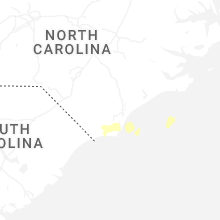


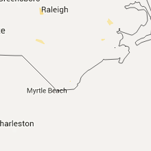

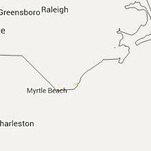


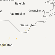


Connect with Interactive Hail Maps