

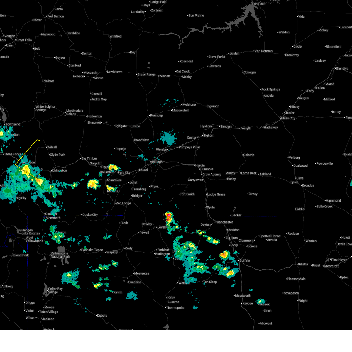
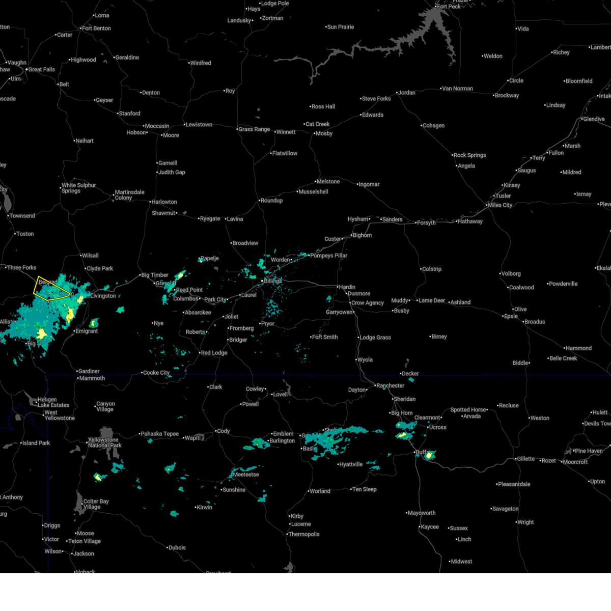
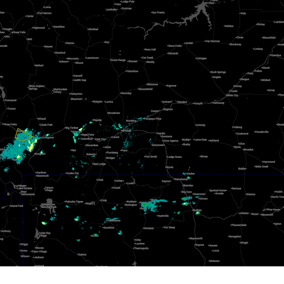
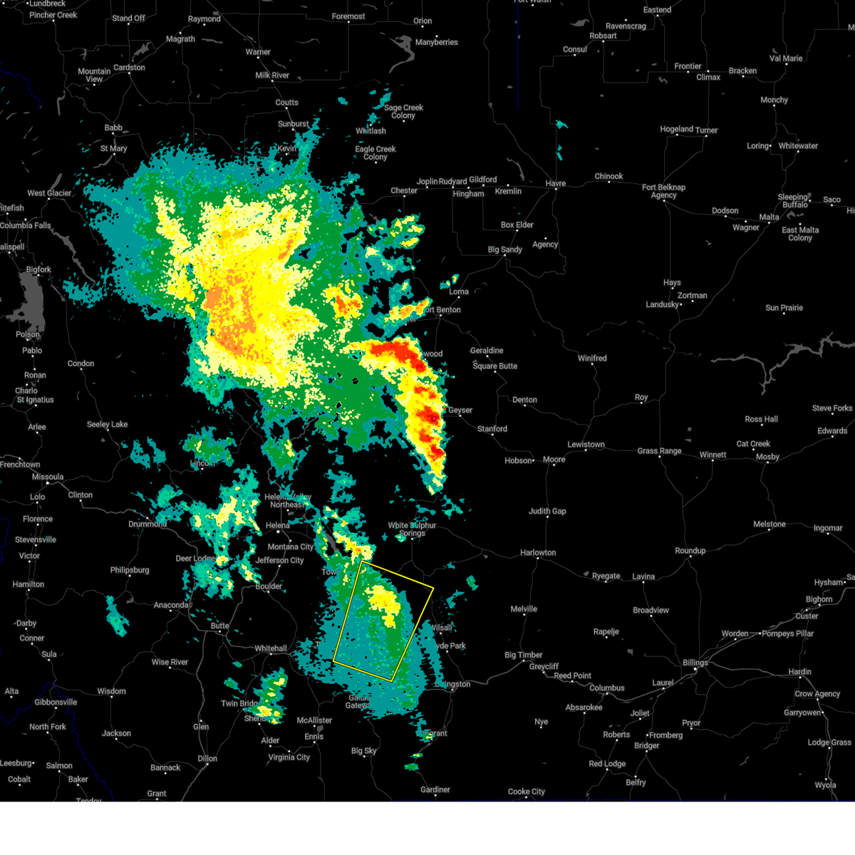
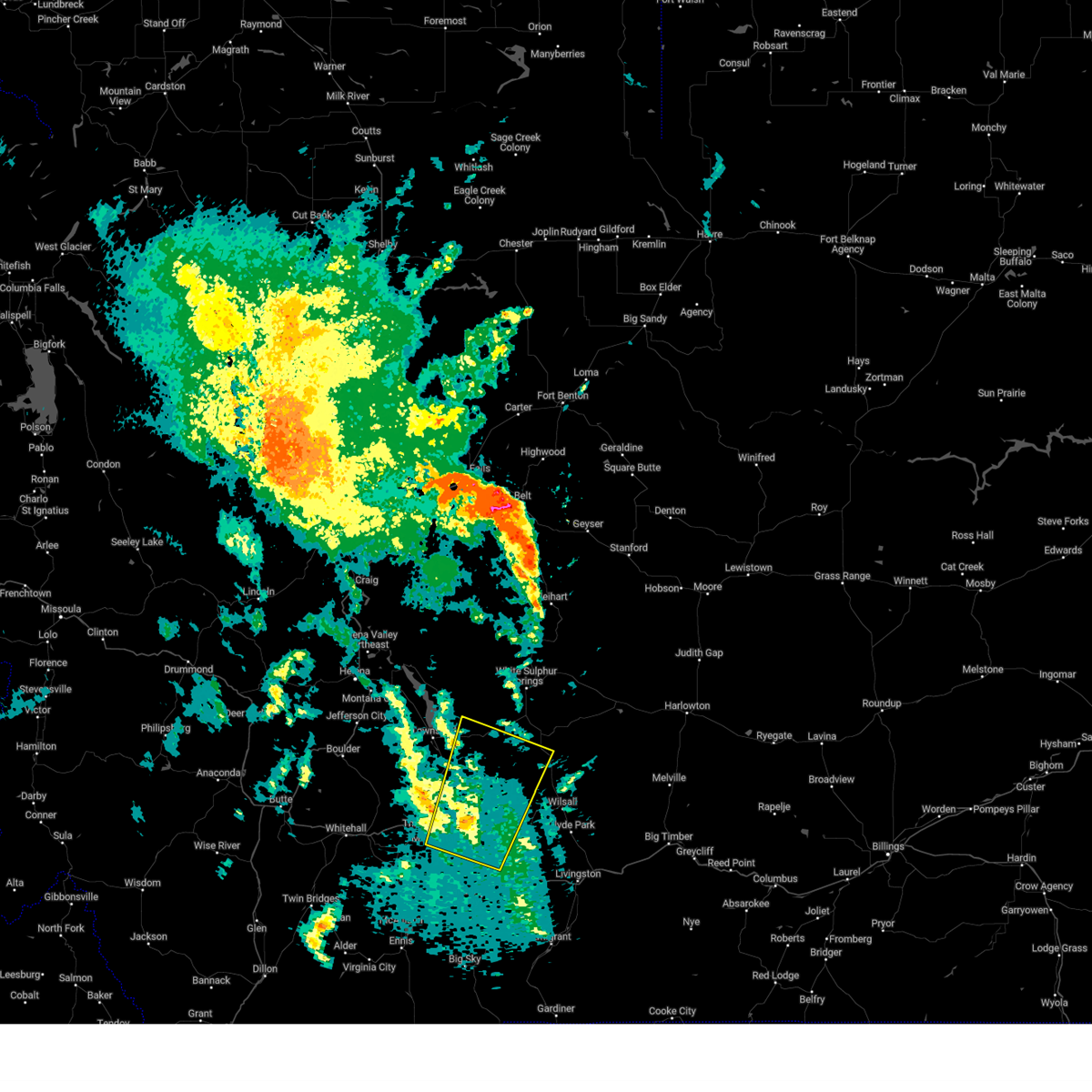
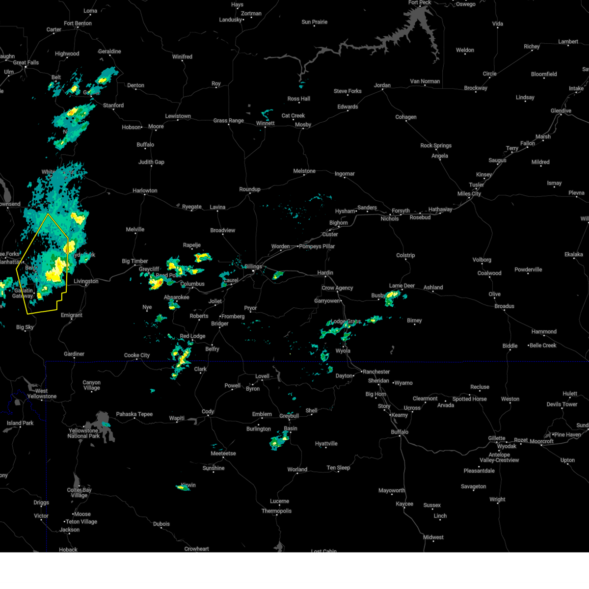
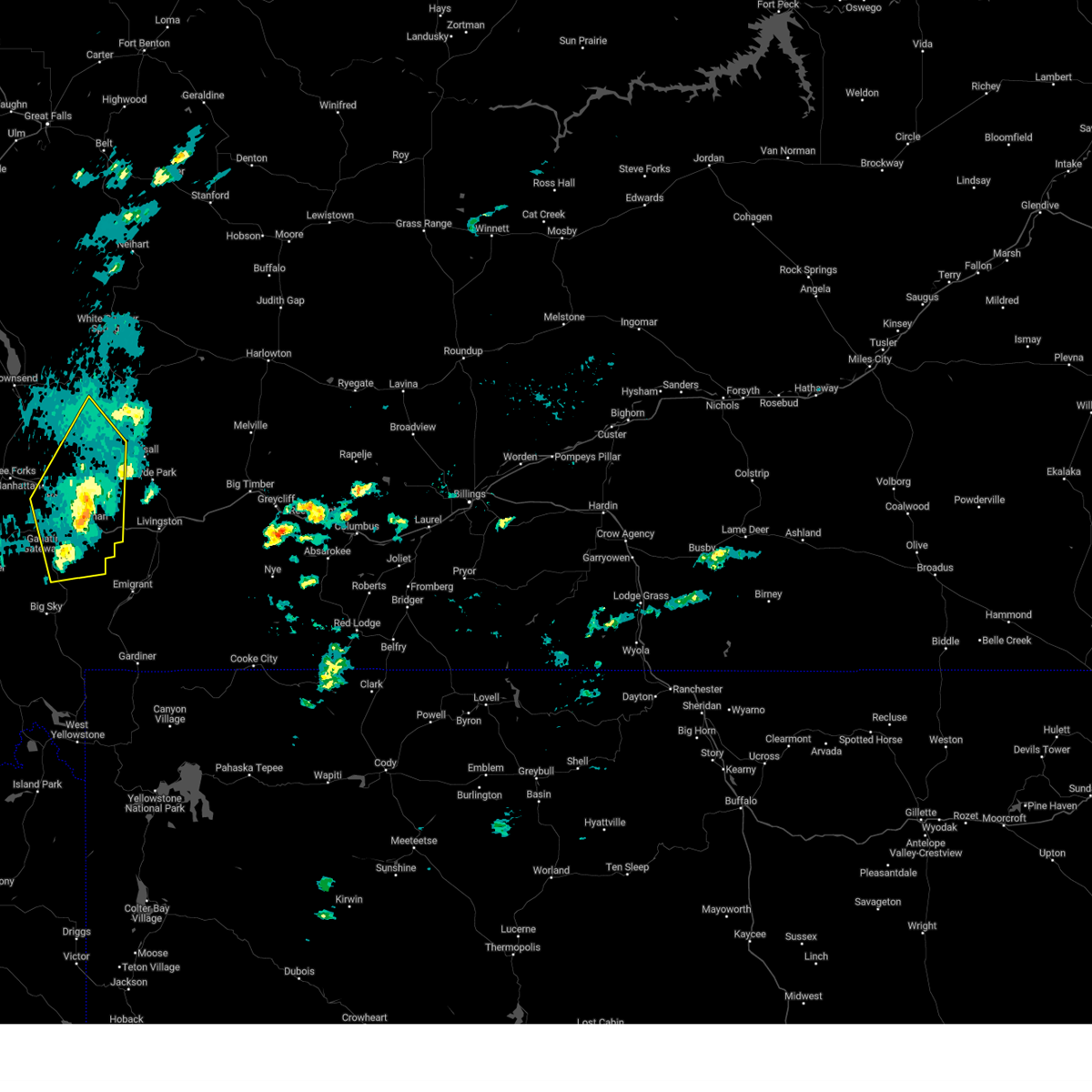
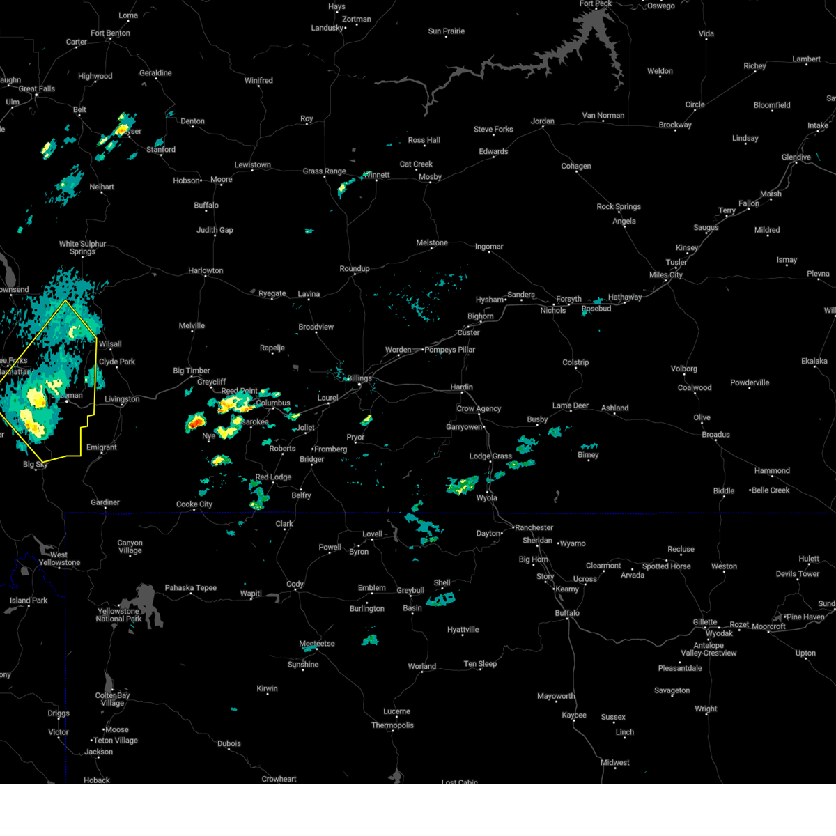
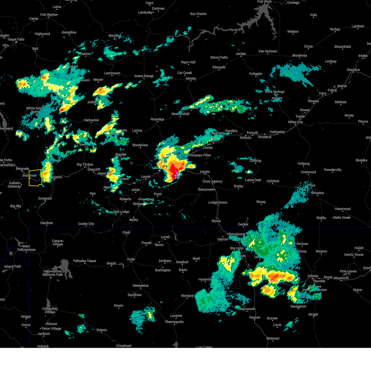
Hail Map for Bozeman, MT
The Bozeman, MT area has had 20 reports of on-the-ground hail by trained spotters, and has been under severe weather warnings 14 times during the past 12 months. Doppler radar has detected hail at or near Bozeman, MT on 14 occasions, including 1 occasion during the past year.
| Name: | Bozeman, MT |
| Where Located: | 0.9 miles NW of Bozeman, MT |
| Map: | Google Map for Bozeman, MT |
| Population: | 37280 |
| Housing Units: | 17464 |
| More Info: | Search Google for Bozeman, MT |
5
The Top Recent Hail Date for Bozeman, MT is Tuesday, August 6, 2024 (1st out of 14)

Hail and Wind Damage Spotted near Bozeman, MT
| Date / Time | Report Details |
|---|---|
| 7/1/2025 6:00 PM MDT | Mesonet station mtbzh bozeman pass (mt dot in gallatin county MT, 12.1 miles W of Bozeman, MT |
| 7/1/2025 5:38 PM MDT |
 Svrtfx the national weather service in great falls has issued a * severe thunderstorm warning for, northeastern gallatin county in south central montana, * until 615 pm mdt. * at 538 pm mdt, a severe thunderstorm was located near bozeman, moving northeast at 55 mph (radar indicated). Hazards include 60 mph wind gusts. expect damage to roofs, siding, and trees Svrtfx the national weather service in great falls has issued a * severe thunderstorm warning for, northeastern gallatin county in south central montana, * until 615 pm mdt. * at 538 pm mdt, a severe thunderstorm was located near bozeman, moving northeast at 55 mph (radar indicated). Hazards include 60 mph wind gusts. expect damage to roofs, siding, and trees
|
| 6/19/2025 4:05 PM MDT | The storm which prompted the warning has weakened below severe limits, and no longer poses an immediate threat to life or property. therefore, the warning will be allowed to expire. |
| 6/19/2025 3:59 PM MDT |
 At 359 pm mdt, a severe thunderstorm was located over bozeman, moving northeast at 15 mph (radar indicated). Hazards include 60 mph wind gusts. Expect damage to roofs, siding, and trees. Locations impacted include, bozeman, belgrade, and four corners. At 359 pm mdt, a severe thunderstorm was located over bozeman, moving northeast at 15 mph (radar indicated). Hazards include 60 mph wind gusts. Expect damage to roofs, siding, and trees. Locations impacted include, bozeman, belgrade, and four corners.
|
| 6/19/2025 3:48 PM MDT |
 Svrtfx the national weather service in great falls has issued a * severe thunderstorm warning for, northeastern gallatin county in south central montana, * until 415 pm mdt. * at 347 pm mdt, a severe thunderstorm was located near bozeman, moving northeast at 15 mph (radar indicated). Hazards include 60 mph wind gusts. expect damage to roofs, siding, and trees Svrtfx the national weather service in great falls has issued a * severe thunderstorm warning for, northeastern gallatin county in south central montana, * until 415 pm mdt. * at 347 pm mdt, a severe thunderstorm was located near bozeman, moving northeast at 15 mph (radar indicated). Hazards include 60 mph wind gusts. expect damage to roofs, siding, and trees
|
| 9/11/2024 7:56 PM MDT |
 The storm which prompted the warning has weakened below severe limits, and no longer poses an immediate threat to life or property. therefore, the warning will be allowed to expire. however, gusty winds to 50 mph are still possible with this thunderstorm. The storm which prompted the warning has weakened below severe limits, and no longer poses an immediate threat to life or property. therefore, the warning will be allowed to expire. however, gusty winds to 50 mph are still possible with this thunderstorm.
|
| 9/11/2024 7:30 PM MDT | Tree and power lines down across road via social media. time and location estimate in gallatin county MT, 7.7 miles ENE of Bozeman, MT |
| 9/11/2024 7:30 PM MDT |
 Svrtfx the national weather service in great falls has issued a * severe thunderstorm warning for, southeastern broadwater county in southwestern montana, south central meagher county in central montana, northeastern gallatin county in south central montana, * until 800 pm mdt. * at 730 pm mdt, a severe thunderstorm was located 11 miles northeast of manhattan, or 22 miles north of bozeman, moving northeast at 40 mph (radar indicated). Hazards include 70 mph wind gusts. Expect considerable tree damage. Damage is likely to mobile homes, roofs, and outbuildings. Svrtfx the national weather service in great falls has issued a * severe thunderstorm warning for, southeastern broadwater county in southwestern montana, south central meagher county in central montana, northeastern gallatin county in south central montana, * until 800 pm mdt. * at 730 pm mdt, a severe thunderstorm was located 11 miles northeast of manhattan, or 22 miles north of bozeman, moving northeast at 40 mph (radar indicated). Hazards include 70 mph wind gusts. Expect considerable tree damage. Damage is likely to mobile homes, roofs, and outbuildings.
|
| 8/20/2024 4:30 PM MDT | Mesonet station mtbzh bozeman pass (mt dot in gallatin county MT, 12.1 miles W of Bozeman, MT |
| 8/20/2024 4:28 PM MDT |
 The storm which prompted the warning has weakened below severe limits, and has exited the warned area. therefore, the warning will be allowed to expire. however, small hail and gusty winds are still possible with this thunderstorm. a severe thunderstorm watch remains in effect until 1000 pm mdt for south central, central and southwestern montana. The storm which prompted the warning has weakened below severe limits, and has exited the warned area. therefore, the warning will be allowed to expire. however, small hail and gusty winds are still possible with this thunderstorm. a severe thunderstorm watch remains in effect until 1000 pm mdt for south central, central and southwestern montana.
|
| 8/20/2024 4:22 PM MDT |
 At 420 pm mdt, a severe thunderstorm was located 7 miles northeast of bozeman, moving northeast at 60 mph (60mph winds reported on the east side of bozeman). Hazards include 60 mph wind gusts. Expect damage to roofs, siding, and trees. Locations impacted include, bozeman, belgrade, manhattan, amsterdam, four corners, bozeman hot springs, gallatin gateway, church hill, and menard. At 420 pm mdt, a severe thunderstorm was located 7 miles northeast of bozeman, moving northeast at 60 mph (60mph winds reported on the east side of bozeman). Hazards include 60 mph wind gusts. Expect damage to roofs, siding, and trees. Locations impacted include, bozeman, belgrade, manhattan, amsterdam, four corners, bozeman hot springs, gallatin gateway, church hill, and menard.
|
| 8/20/2024 4:14 PM MDT | Ambient weather sensor in bozema in gallatin county MT, 3 miles NNW of Bozeman, MT |
| 8/20/2024 4:05 PM MDT |
 Svrtfx the national weather service in great falls has issued a * severe thunderstorm warning for, southeastern broadwater county in southwestern montana, southern meagher county in central montana, northeastern madison county in southwestern montana, gallatin county in south central montana, * until 430 pm mdt. * at 404 pm mdt, a severe thunderstorm was located 2 miles southwest of belgrade, or 5 miles west of bozeman, moving northeast at 60 mph (55 mph wind gust at the bozeman airport). Hazards include 60 mph wind gusts and penny size hail. expect damage to roofs, siding, and trees Svrtfx the national weather service in great falls has issued a * severe thunderstorm warning for, southeastern broadwater county in southwestern montana, southern meagher county in central montana, northeastern madison county in southwestern montana, gallatin county in south central montana, * until 430 pm mdt. * at 404 pm mdt, a severe thunderstorm was located 2 miles southwest of belgrade, or 5 miles west of bozeman, moving northeast at 60 mph (55 mph wind gust at the bozeman airport). Hazards include 60 mph wind gusts and penny size hail. expect damage to roofs, siding, and trees
|
| 8/6/2024 5:34 PM MDT |
 The storm which prompted the warning has moved out of the area. therefore, the warning has been allowed to expire. The storm which prompted the warning has moved out of the area. therefore, the warning has been allowed to expire.
|
| 8/6/2024 5:19 PM MDT | Svrtfx the national weather service in great falls has issued a * severe thunderstorm warning for, east central gallatin county in south central montana, * until 530 pm mdt. * at 518 pm mdt, a severe thunderstorm was located 9 miles east of bozeman, moving east at 55 mph (radar indicated. at 515 pm quarter-sized hail was reported in 2 miles northeast of bozeman hot springs). Hazards include 60 mph wind gusts and quarter size hail. Hail damage to vehicles is expected. Expect wind damage to roofs, siding, and trees. |
| 8/6/2024 5:18 PM MDT | Quarter sized hail reported 1.3 miles N of Bozeman, MT, social media post included a photo of 1 inch hail measured near cooper park in bozeman. |
| 8/6/2024 5:14 PM MDT | Quarter sized hail reported 3.5 miles E of Bozeman, MT |
| 7/25/2024 5:36 PM MDT |
 The storm which prompted the warning has weakened below severe limits, and no longer poses an immediate threat to life or property. therefore, the warning will be allowed to expire. The storm which prompted the warning has weakened below severe limits, and no longer poses an immediate threat to life or property. therefore, the warning will be allowed to expire.
|
| 7/25/2024 5:22 PM MDT |
 At 522 pm mdt, a second severe thunderstorm was located 10 miles southwest of bozeman, moving east at 35 mph (radar indicated). Hazards include 60 mph wind gusts and quarter size hail. Hail damage to vehicles is expected. expect wind damage to roofs, siding, and trees. Locations impacted include, bozeman, belgrade, gallatin gateway, four corners, and bozeman hot springs. At 522 pm mdt, a second severe thunderstorm was located 10 miles southwest of bozeman, moving east at 35 mph (radar indicated). Hazards include 60 mph wind gusts and quarter size hail. Hail damage to vehicles is expected. expect wind damage to roofs, siding, and trees. Locations impacted include, bozeman, belgrade, gallatin gateway, four corners, and bozeman hot springs.
|
| 7/25/2024 4:53 PM MDT | Quarter sized hail reported 4.4 miles ENE of Bozeman, MT, report from mping: quarter (1.00 in.). |
| 7/25/2024 4:52 PM MDT |
 Svrtfx the national weather service in great falls has issued a * severe thunderstorm warning for, northeastern gallatin county in south central montana, * until 545 pm mdt. * at 452 pm mdt, a severe thunderstorm was located near bozeman, moving northeast at 25 mph (trained weather spotters). Hazards include 60 mph wind gusts and quarter size hail. Hail damage to vehicles is expected. Expect wind damage to roofs, siding, and trees. Svrtfx the national weather service in great falls has issued a * severe thunderstorm warning for, northeastern gallatin county in south central montana, * until 545 pm mdt. * at 452 pm mdt, a severe thunderstorm was located near bozeman, moving northeast at 25 mph (trained weather spotters). Hazards include 60 mph wind gusts and quarter size hail. Hail damage to vehicles is expected. Expect wind damage to roofs, siding, and trees.
|
| 7/25/2024 4:49 PM MDT | Quarter sized hail reported 2.6 miles ENE of Bozeman, MT, trained spotter reports a few 1 inch hail stones mixed in with primarily half to three quarter of an inch hailstones. |
| 6/30/2024 4:05 PM MDT |
 At 404 pm mdt, a severe thunderstorm was located near bozeman, moving northeast at 30 mph (radar indicated). Hazards include quarter size hail. Damage to vehicles is expected. Locations impacted include, bozeman. At 404 pm mdt, a severe thunderstorm was located near bozeman, moving northeast at 30 mph (radar indicated). Hazards include quarter size hail. Damage to vehicles is expected. Locations impacted include, bozeman.
|
| 6/30/2024 4:02 PM MDT |
 At 401 pm mdt, a severe thunderstorm was located 8 miles southeast of bozeman, moving northeast at 35 mph (radar indicated). Hazards include 60 mph wind gusts and quarter size hail. Hail damage to vehicles is expected. expect wind damage to roofs, siding, and trees. Locations impacted include, bozeman. At 401 pm mdt, a severe thunderstorm was located 8 miles southeast of bozeman, moving northeast at 35 mph (radar indicated). Hazards include 60 mph wind gusts and quarter size hail. Hail damage to vehicles is expected. expect wind damage to roofs, siding, and trees. Locations impacted include, bozeman.
|
| 6/30/2024 4:00 PM MDT | Quarter sized hail reported 0.7 miles NNW of Bozeman, MT, quarter sized hail and heavy rain reported in central bozeman via social media. |
| 6/30/2024 4:00 PM MDT |
 At 400 pm mdt, a severe thunderstorm was located near bozeman, moving northeast at 30 mph (radar indicated). Hazards include quarter size hail. Damage to vehicles is expected. Locations impacted include, bozeman. At 400 pm mdt, a severe thunderstorm was located near bozeman, moving northeast at 30 mph (radar indicated). Hazards include quarter size hail. Damage to vehicles is expected. Locations impacted include, bozeman.
|
| 6/30/2024 3:56 PM MDT |
 At 355 pm mdt, a severe thunderstorm was located over bozeman, moving northeast at 35 mph (radar indicated). Hazards include quarter size hail. Damage to vehicles is expected. Locations impacted include, bozeman. At 355 pm mdt, a severe thunderstorm was located over bozeman, moving northeast at 35 mph (radar indicated). Hazards include quarter size hail. Damage to vehicles is expected. Locations impacted include, bozeman.
|
| 6/30/2024 3:54 PM MDT |
 At 354 pm mdt, a severe thunderstorm was located 8 miles south of bozeman, moving northeast at 35 mph (radar indicated). Hazards include 60 mph wind gusts and quarter size hail. Hail damage to vehicles is expected. expect wind damage to roofs, siding, and trees. Locations impacted include, bozeman. At 354 pm mdt, a severe thunderstorm was located 8 miles south of bozeman, moving northeast at 35 mph (radar indicated). Hazards include 60 mph wind gusts and quarter size hail. Hail damage to vehicles is expected. expect wind damage to roofs, siding, and trees. Locations impacted include, bozeman.
|
| 6/30/2024 3:50 PM MDT |
 At 349 pm mdt, a severe thunderstorm was located 10 miles south of bozeman, moving northeast at 35 mph (radar indicated). Hazards include 60 mph wind gusts and quarter size hail. Hail damage to vehicles is expected. expect wind damage to roofs, siding, and trees. Locations impacted include, bozeman. At 349 pm mdt, a severe thunderstorm was located 10 miles south of bozeman, moving northeast at 35 mph (radar indicated). Hazards include 60 mph wind gusts and quarter size hail. Hail damage to vehicles is expected. expect wind damage to roofs, siding, and trees. Locations impacted include, bozeman.
|
| 6/30/2024 3:49 PM MDT | Quarter sized hail reported 6 miles NNE of Bozeman, MT, heavy rain with visibility estimated as low as half a mile. dime to quarter sized hail is starting to accumulate on the ground. |
| 6/30/2024 3:47 PM MDT |
 Svrtfx the national weather service in great falls has issued a * severe thunderstorm warning for, northeastern gallatin county in south central montana, * until 430 pm mdt. * at 347 pm mdt, a severe thunderstorm was located over bozeman, moving east northeast at 35 mph (radar indicated). Hazards include quarter size hail. damage to vehicles is expected Svrtfx the national weather service in great falls has issued a * severe thunderstorm warning for, northeastern gallatin county in south central montana, * until 430 pm mdt. * at 347 pm mdt, a severe thunderstorm was located over bozeman, moving east northeast at 35 mph (radar indicated). Hazards include quarter size hail. damage to vehicles is expected
|
| 6/30/2024 3:38 PM MDT |
 At 337 pm mdt, a severe thunderstorm was located 18 miles southwest of bozeman, moving east northeast at 35 mph (radar indicated). Hazards include 60 mph wind gusts and quarter size hail. Hail damage to vehicles is expected. expect wind damage to roofs, siding, and trees. Locations impacted include, bozeman and gallatin gateway. At 337 pm mdt, a severe thunderstorm was located 18 miles southwest of bozeman, moving east northeast at 35 mph (radar indicated). Hazards include 60 mph wind gusts and quarter size hail. Hail damage to vehicles is expected. expect wind damage to roofs, siding, and trees. Locations impacted include, bozeman and gallatin gateway.
|
| 6/30/2024 3:38 PM MDT |
 the severe thunderstorm warning has been cancelled and is no longer in effect the severe thunderstorm warning has been cancelled and is no longer in effect
|
| 6/30/2024 3:28 PM MDT |
 Svrtfx the national weather service in great falls has issued a * severe thunderstorm warning for, northeastern madison county in southwestern montana, east central gallatin county in south central montana, * until 430 pm mdt. * at 327 pm mdt, a severe thunderstorm was located 20 miles east of ennis, or 22 miles southwest of bozeman, moving east northeast at 35 mph (radar indicated). Hazards include 60 mph wind gusts and quarter size hail. Hail damage to vehicles is expected. Expect wind damage to roofs, siding, and trees. Svrtfx the national weather service in great falls has issued a * severe thunderstorm warning for, northeastern madison county in southwestern montana, east central gallatin county in south central montana, * until 430 pm mdt. * at 327 pm mdt, a severe thunderstorm was located 20 miles east of ennis, or 22 miles southwest of bozeman, moving east northeast at 35 mph (radar indicated). Hazards include 60 mph wind gusts and quarter size hail. Hail damage to vehicles is expected. Expect wind damage to roofs, siding, and trees.
|
| 8/29/2023 9:26 PM MDT |
 The severe thunderstorm warning for northeastern gallatin county will expire at 930 pm mdt, the storms which prompted the warning have mostly moved out of the area. therefore, the warning will be allowed to expire. however gusty winds are still possible with these thunderstorms. remember, a severe thunderstorm warning still remains in effect for far northeast gallatin and far southern meagher counties until 10 pm mdt. The severe thunderstorm warning for northeastern gallatin county will expire at 930 pm mdt, the storms which prompted the warning have mostly moved out of the area. therefore, the warning will be allowed to expire. however gusty winds are still possible with these thunderstorms. remember, a severe thunderstorm warning still remains in effect for far northeast gallatin and far southern meagher counties until 10 pm mdt.
|
| 8/29/2023 9:24 PM MDT |
 At 924 pm mdt, severe thunderstorms were located along a line extending from 19 miles east of toston to 10 miles east of bozeman, moving northeast at 25 mph (radar indicated). Hazards include 60 mph wind gusts. expect damage to roofs, siding, and trees At 924 pm mdt, severe thunderstorms were located along a line extending from 19 miles east of toston to 10 miles east of bozeman, moving northeast at 25 mph (radar indicated). Hazards include 60 mph wind gusts. expect damage to roofs, siding, and trees
|
| 8/29/2023 9:01 PM MDT |
 At 901 pm mdt, severe thunderstorms were located along a line extending from 11 miles southeast of toston to 11 miles south of bozeman, moving northeast at 60 mph (radar indicated). Hazards include 60 mph wind gusts. expect damage to roofs, siding, and trees At 901 pm mdt, severe thunderstorms were located along a line extending from 11 miles southeast of toston to 11 miles south of bozeman, moving northeast at 60 mph (radar indicated). Hazards include 60 mph wind gusts. expect damage to roofs, siding, and trees
|
| 8/29/2023 8:59 PM MDT | Measured via ambient weather sit in gallatin county MT, 5.6 miles SSE of Bozeman, MT |
| 8/29/2023 8:55 PM MDT | Two sensors along triple tree road... located about 1/4 mile apart from each other... recorded gusts of 65 mph. via ambient weathe in gallatin county MT, 4.6 miles NNW of Bozeman, MT |
| 8/29/2023 8:55 PM MDT | Measured via ambient weathe in gallatin county MT, 6.2 miles NE of Bozeman, MT |
| 8/29/2023 8:47 PM MDT | Measured via ambient weathe in gallatin county MT, 4.8 miles ENE of Bozeman, MT |
| 8/18/2023 2:26 PM MDT | Mesonet station mtbzh bozeman pass (mt dot in gallatin county MT, 12.1 miles W of Bozeman, MT |
| 7/28/2023 4:46 PM MDT | Golf Ball sized hail reported 27.1 miles SSW of Bozeman, MT, nws billings received a spotter report along our border west northwest of wilsall. in addition to hail... spotter reports estimated 70 mph wind. |
| 7/1/2023 3:05 PM MDT | Mesonet station mtbzh bozeman pass (mt dot in gallatin county MT, 12.1 miles W of Bozeman, MT |
| 7/1/2023 3:02 PM MDT |
 At 259 pm mdt, severe thunderstorms were located along a line extending from 10 miles northeast of belgrade to 7 miles southeast of bozeman to 9 miles southeast of ennis to 7 miles northeast of gilmore, moving east at 40 mph (public. at 2:54 pm multiple wind gusts to 60 mph were reported on the south side of bozeman. strong wind gusts are expected along the rest of this line). Hazards include 60 mph wind gusts. expect damage to roofs, siding, and trees At 259 pm mdt, severe thunderstorms were located along a line extending from 10 miles northeast of belgrade to 7 miles southeast of bozeman to 9 miles southeast of ennis to 7 miles northeast of gilmore, moving east at 40 mph (public. at 2:54 pm multiple wind gusts to 60 mph were reported on the south side of bozeman. strong wind gusts are expected along the rest of this line). Hazards include 60 mph wind gusts. expect damage to roofs, siding, and trees
|
| 7/1/2023 2:55 PM MDT | Numerous reports of 60 mph wind gusts from ambient weather stations just east of the city of bozema in gallatin county MT, 1.5 miles WNW of Bozeman, MT |
| 5/25/2023 5:53 PM MDT |
 The severe thunderstorm warning for northeastern gallatin county will expire at 600 pm mdt, the storm which prompted the warning has weakened below severe limits, and has exited the warned area. therefore, the warning will be allowed to expire. however small hail, gusty winds and heavy rain are still possible with this thunderstorm as it moves northeast across far northeastern gallatin county. The severe thunderstorm warning for northeastern gallatin county will expire at 600 pm mdt, the storm which prompted the warning has weakened below severe limits, and has exited the warned area. therefore, the warning will be allowed to expire. however small hail, gusty winds and heavy rain are still possible with this thunderstorm as it moves northeast across far northeastern gallatin county.
|
| 5/25/2023 5:30 PM MDT | Golf Ball sized hail reported 6.1 miles ENE of Bozeman, MT, very little rain was falling with the hail. |
| 5/25/2023 5:27 PM MDT |
 At 526 pm mdt, a severe thunderstorm was located near belgrade, or near bozeman, moving northeast at 20 mph (radar indicated). Hazards include 60 mph wind gusts and quarter size hail. Hail damage to vehicles is expected. Expect wind damage to roofs, siding, and trees. At 526 pm mdt, a severe thunderstorm was located near belgrade, or near bozeman, moving northeast at 20 mph (radar indicated). Hazards include 60 mph wind gusts and quarter size hail. Hail damage to vehicles is expected. Expect wind damage to roofs, siding, and trees.
|
| 8/24/2022 9:57 PM MDT | At 956 pm mdt, a severe thunderstorm was located 8 miles northeast of belgrade, or 12 miles north of bozeman, moving northeast at 30 mph (observed at the bozeman airport). Hazards include 60 mph wind gusts. expect damage to roofs, siding, and trees |
| 6/28/2022 5:19 PM MDT |
 At 517 pm mdt, a severe thunderstorm was located 19 miles south of bozeman, moving northeast at 45 mph. locally damaging wind gusts may also occur away from the main storm (radar indicated). Hazards include 60 mph wind gusts. Expect damage to roofs, siding, and trees. locations impacted include, bozeman, gallatin gateway, big sky and yellowstone village. hail threat, radar indicated max hail size, <. 75 in wind threat, radar indicated max wind gust, 60 mph. At 517 pm mdt, a severe thunderstorm was located 19 miles south of bozeman, moving northeast at 45 mph. locally damaging wind gusts may also occur away from the main storm (radar indicated). Hazards include 60 mph wind gusts. Expect damage to roofs, siding, and trees. locations impacted include, bozeman, gallatin gateway, big sky and yellowstone village. hail threat, radar indicated max hail size, <. 75 in wind threat, radar indicated max wind gust, 60 mph.
|
| 6/28/2022 5:08 PM MDT | Measured via ambient weather statio in gallatin county MT, 6.2 miles NE of Bozeman, MT |
| 6/28/2022 5:06 PM MDT | Measured via ambient weather statio in gallatin county MT, 7.9 miles NNE of Bozeman, MT |
| 6/28/2022 4:54 PM MDT |
 At 453 pm mdt, a severe thunderstorm was located 19 miles northwest of crescent lake, or 27 miles south of bozeman, moving northeast at 45 mph (radar indicated). Hazards include 60 mph wind gusts. expect damage to roofs, siding, and trees At 453 pm mdt, a severe thunderstorm was located 19 miles northwest of crescent lake, or 27 miles south of bozeman, moving northeast at 45 mph (radar indicated). Hazards include 60 mph wind gusts. expect damage to roofs, siding, and trees
|
| 5/16/2022 5:34 PM MDT |
 At 533 pm mdt, a severe thunderstorm was located near bozeman, moving east at 25 mph (radar indicated). Hazards include 60 mph wind gusts and quarter size hail. Hail damage to vehicles is expected. expect wind damage to roofs, siding, and trees. locations impacted include, bozeman, gallatin gateway, four corners and bozeman hot springs. hail threat, radar indicated max hail size, 1. 00 in wind threat, radar indicated max wind gust, 60 mph. At 533 pm mdt, a severe thunderstorm was located near bozeman, moving east at 25 mph (radar indicated). Hazards include 60 mph wind gusts and quarter size hail. Hail damage to vehicles is expected. expect wind damage to roofs, siding, and trees. locations impacted include, bozeman, gallatin gateway, four corners and bozeman hot springs. hail threat, radar indicated max hail size, 1. 00 in wind threat, radar indicated max wind gust, 60 mph.
|
| 5/16/2022 5:16 PM MDT |
 At 516 pm mdt, a severe thunderstorm was located 12 miles west of bozeman, moving east at 25 mph (radar indicated). Hazards include 60 mph wind gusts and quarter size hail. Hail damage to vehicles is expected. Expect wind damage to roofs, siding, and trees. At 516 pm mdt, a severe thunderstorm was located 12 miles west of bozeman, moving east at 25 mph (radar indicated). Hazards include 60 mph wind gusts and quarter size hail. Hail damage to vehicles is expected. Expect wind damage to roofs, siding, and trees.
|
| 8/8/2021 5:04 PM MDT |
 At 501 pm mdt, sporadic areas of severe wind gusts continue across the warned area. many locations within the warned area have reported wind gusts of 50 to 55 mph over the last 30 minutes. a few gusts to around 60 mph are likely (trained weather spotters). Hazards include 60 mph wind gusts. Expect damage to roofs, siding, and trees. locations impacted include, bozeman, dillon, sheridan, virginia city, belgrade, three forks, manhattan, ennis, lima, pony, alder, harrison, dell, bannack pass, cameron, missouri headwaters state park, snowline, maudlow, four corners and amsterdam. hail threat, radar indicated max hail size, <. 75 in wind threat, radar indicated max wind gust, 60 mph. At 501 pm mdt, sporadic areas of severe wind gusts continue across the warned area. many locations within the warned area have reported wind gusts of 50 to 55 mph over the last 30 minutes. a few gusts to around 60 mph are likely (trained weather spotters). Hazards include 60 mph wind gusts. Expect damage to roofs, siding, and trees. locations impacted include, bozeman, dillon, sheridan, virginia city, belgrade, three forks, manhattan, ennis, lima, pony, alder, harrison, dell, bannack pass, cameron, missouri headwaters state park, snowline, maudlow, four corners and amsterdam. hail threat, radar indicated max hail size, <. 75 in wind threat, radar indicated max wind gust, 60 mph.
|
| 8/8/2021 4:29 PM MDT |
 At 429 pm mdt, areas of severe wind gusts were located along a line extending from 11 miles southeast of toston to 6 miles north of leadore, moving northeast at 45 mph (radar indicated). Hazards include 60 mph wind gusts. expect damage to roofs, siding, and trees At 429 pm mdt, areas of severe wind gusts were located along a line extending from 11 miles southeast of toston to 6 miles north of leadore, moving northeast at 45 mph (radar indicated). Hazards include 60 mph wind gusts. expect damage to roofs, siding, and trees
|
| 7/22/2021 2:13 PM MDT |
 At 213 pm mdt, a severe thunderstorm was located over belgrade, or 9 miles northwest of bozeman, moving northeast at 30 mph (radar indicated). Hazards include 70 mph wind gusts and penny size hail. Expect considerable tree damage. Damage is likely to mobile homes, roofs, and outbuildings. At 213 pm mdt, a severe thunderstorm was located over belgrade, or 9 miles northwest of bozeman, moving northeast at 30 mph (radar indicated). Hazards include 70 mph wind gusts and penny size hail. Expect considerable tree damage. Damage is likely to mobile homes, roofs, and outbuildings.
|
| 7/7/2021 4:40 PM MDT |
 At 440 pm mdt, a severe thunderstorm was located 7 miles east of bozeman, moving east at 25 mph (public). Hazards include 60 mph wind gusts and penny size hail. Expect damage to roofs, siding, and trees. Locations impacted include, bozeman. At 440 pm mdt, a severe thunderstorm was located 7 miles east of bozeman, moving east at 25 mph (public). Hazards include 60 mph wind gusts and penny size hail. Expect damage to roofs, siding, and trees. Locations impacted include, bozeman.
|
| 7/7/2021 4:36 PM MDT |
 At 435 pm mdt, a severe thunderstorm was located near bozeman, moving east at 20 mph (public report). Hazards include 60 mph wind gusts and penny size hail. expect damage to roofs, siding, and trees At 435 pm mdt, a severe thunderstorm was located near bozeman, moving east at 20 mph (public report). Hazards include 60 mph wind gusts and penny size hail. expect damage to roofs, siding, and trees
|
| 7/7/2021 4:35 PM MDT | Storm damage reported in gallatin county MT, 5.4 miles WSW of Bozeman, MT |
| 7/7/2021 4:30 PM MDT | Report via spotter networ in gallatin county MT, 0.7 miles NNW of Bozeman, MT |
| 7/4/2021 6:26 PM MDT |
 At 626 pm mdt, a severe thunderstorm was located near bozeman, moving east at 55 mph (radar indicated). Hazards include 60 mph wind gusts. expect damage to roofs, siding, and trees At 626 pm mdt, a severe thunderstorm was located near bozeman, moving east at 55 mph (radar indicated). Hazards include 60 mph wind gusts. expect damage to roofs, siding, and trees
|
| 5/7/2021 4:20 PM MDT | Numerous trees down in the city of bozeman. trees also fell on and damaged vehicles. some fences blown down. time/location estimate in gallatin county MT, 1.3 miles NNW of Bozeman, MT |
| 5/7/2021 4:15 PM MDT | Reports of a tree down near bozeman msu. pea size hail falling... along with heavy rainfal in gallatin county MT, 2 miles N of Bozeman, MT |
| 8/3/2020 7:15 PM MDT | Quarter sized hail reported 5.6 miles ENE of Bozeman, MT |
| 7/23/2020 3:38 PM MDT | 61 mph wind gust on bozeman pas in gallatin county MT, 12.1 miles W of Bozeman, MT |
| 7/8/2020 10:27 AM MDT | Quarter sized hail reported 7.1 miles NNE of Bozeman, MT, picture from twitter of quarter sized hail. |
| 7/7/2020 3:40 PM MDT | Quarter sized hail reported 6.1 miles N of Bozeman, MT, photo sent to office of 1in hail. |
| 7/7/2020 1:57 PM MDT | Half Dollar sized hail reported 5.4 miles N of Bozeman, MT, report from mping: half dollar (1.25 in.). |
| 7/7/2020 1:54 PM MDT |
 The severe thunderstorm warning for northeastern gallatin county will expire at 200 pm mdt, the storm which prompted the warning has moved out of the area. therefore, the warning will be allowed to expire. a severe thunderstorm watch remains in effect until 900 pm mdt for south central montana. The severe thunderstorm warning for northeastern gallatin county will expire at 200 pm mdt, the storm which prompted the warning has moved out of the area. therefore, the warning will be allowed to expire. a severe thunderstorm watch remains in effect until 900 pm mdt for south central montana.
|
| 7/7/2020 1:30 PM MDT | Quarter sized hail reported 2.4 miles WNW of Bozeman, MT |
| 7/7/2020 1:30 PM MDT | Golf Ball sized hail reported 5.7 miles WSW of Bozeman, MT |
| 7/7/2020 1:27 PM MDT |
 At 126 pm mdt, a severe thunderstorm was located near bozeman, moving east at 40 mph (trained weather spotters). Hazards include 60 mph wind gusts and quarter size hail. Hail damage to vehicles is expected. Expect wind damage to roofs, siding, and trees. At 126 pm mdt, a severe thunderstorm was located near bozeman, moving east at 40 mph (trained weather spotters). Hazards include 60 mph wind gusts and quarter size hail. Hail damage to vehicles is expected. Expect wind damage to roofs, siding, and trees.
|
| 7/7/2020 1:25 PM MDT | Quarter sized hail reported 5.5 miles NNE of Bozeman, MT |
| 7/7/2020 1:18 PM MDT | Quarter sized hail reported 5.3 miles NE of Bozeman, MT |
| 6/6/2020 7:21 PM MDT |
 The severe thunderstorm warning for northeastern gallatin county will expire at 730 pm mdt, the storm which prompted the warning has weakened below severe limits, and has exited the warned area. therefore, the warning will be allowed to expire. however gusty winds and heavy rain are still possible in the wake of this thunderstorm through around 8 pm. The severe thunderstorm warning for northeastern gallatin county will expire at 730 pm mdt, the storm which prompted the warning has weakened below severe limits, and has exited the warned area. therefore, the warning will be allowed to expire. however gusty winds and heavy rain are still possible in the wake of this thunderstorm through around 8 pm.
|
| 6/6/2020 7:03 PM MDT |
 At 703 pm mdt, a severe thunderstorm was located 12 miles northeast of bozeman, moving east at 30 mph (radar indicated). Hazards include 60 mph wind gusts and penny size hail. Expect damage to roofs, siding, and trees. Locations impacted include, bozeman. At 703 pm mdt, a severe thunderstorm was located 12 miles northeast of bozeman, moving east at 30 mph (radar indicated). Hazards include 60 mph wind gusts and penny size hail. Expect damage to roofs, siding, and trees. Locations impacted include, bozeman.
|
| 6/6/2020 6:43 PM MDT |
 At 642 pm mdt, a severe thunderstorm was located near belgrade, or near bozeman, moving east at 30 mph (radar indicated). Hazards include 60 mph wind gusts and penny size hail. expect damage to roofs, siding, and trees At 642 pm mdt, a severe thunderstorm was located near belgrade, or near bozeman, moving east at 30 mph (radar indicated). Hazards include 60 mph wind gusts and penny size hail. expect damage to roofs, siding, and trees
|
| 8/11/2019 3:17 PM MDT |
 At 316 pm mdt, severe thunderstorms were located along a line extending from 6 miles north of harrison to 14 miles southwest of manhattan, moving northeast at 55 mph (radar indicated). Hazards include 60 mph wind gusts and quarter size hail. Hail damage to vehicles is expected. Expect wind damage to roofs, siding, and trees. At 316 pm mdt, severe thunderstorms were located along a line extending from 6 miles north of harrison to 14 miles southwest of manhattan, moving northeast at 55 mph (radar indicated). Hazards include 60 mph wind gusts and quarter size hail. Hail damage to vehicles is expected. Expect wind damage to roofs, siding, and trees.
|
| 8/11/2019 1:18 PM MDT | Half Dollar sized hail reported 3.8 miles NNW of Bozeman, MT, estimated size of hail from photo posted to nbc montana facebook page. time was also estimated based upon location and radar. |
| 7/14/2019 4:30 PM MDT | Storm damage reported in park county MT, 12.1 miles W of Bozeman, MT |
| 7/5/2017 5:11 PM MDT | Kbzk reported an irrigation wheel line blew into traffic and caused vehicle damage on valley center west of bozeman. time estimate in gallatin county MT, 6.5 miles SE of Bozeman, MT |
| 7/5/2017 5:11 PM MDT | Kbzk reported tree and property damage in the four corners area south of bozeman from thunderstorm winds. nw energy reported power outages. possibly caused by strong co in gallatin county MT, 7.5 miles N of Bozeman, MT |
| 4/4/2016 7:21 PM MDT | Strong winds combined with a line of thunderstorms to produce gusts to 65 mp in gallatin county MT, 3.6 miles NNW of Bozeman, MT |
| 8/23/2013 3:50 PM MDT | Tree fell on power line...knocking out power to about 800 customers in the bozeman area. time of event is estimate in gallatin county MT, 0.7 miles NNW of Bozeman, MT |
| 8/1/2013 5:37 PM MDT | Ping Pong Ball sized hail reported 0.7 miles NNW of Bozeman, MT, hail almost golfball size between highway and msu campus. |
| 8/1/2013 5:15 PM MDT | Golf Ball sized hail reported 5.2 miles SE of Bozeman, MT |
| 8/1/2013 5:10 PM MDT | Nickle sized hail and winds gusting to 61 mp in gallatin county MT, 1.4 miles NNE of Bozeman, MT |
| 1/1/0001 12:00 AM | Quarter sized hail reported 4 miles N of Bozeman, MT, measured quarter sized hail with storm. |
Hail Maps for Bozeman, MT


Connect with Interactive Hail Maps