

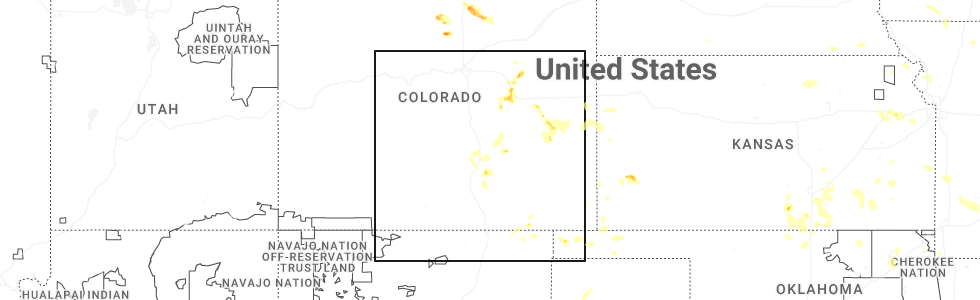
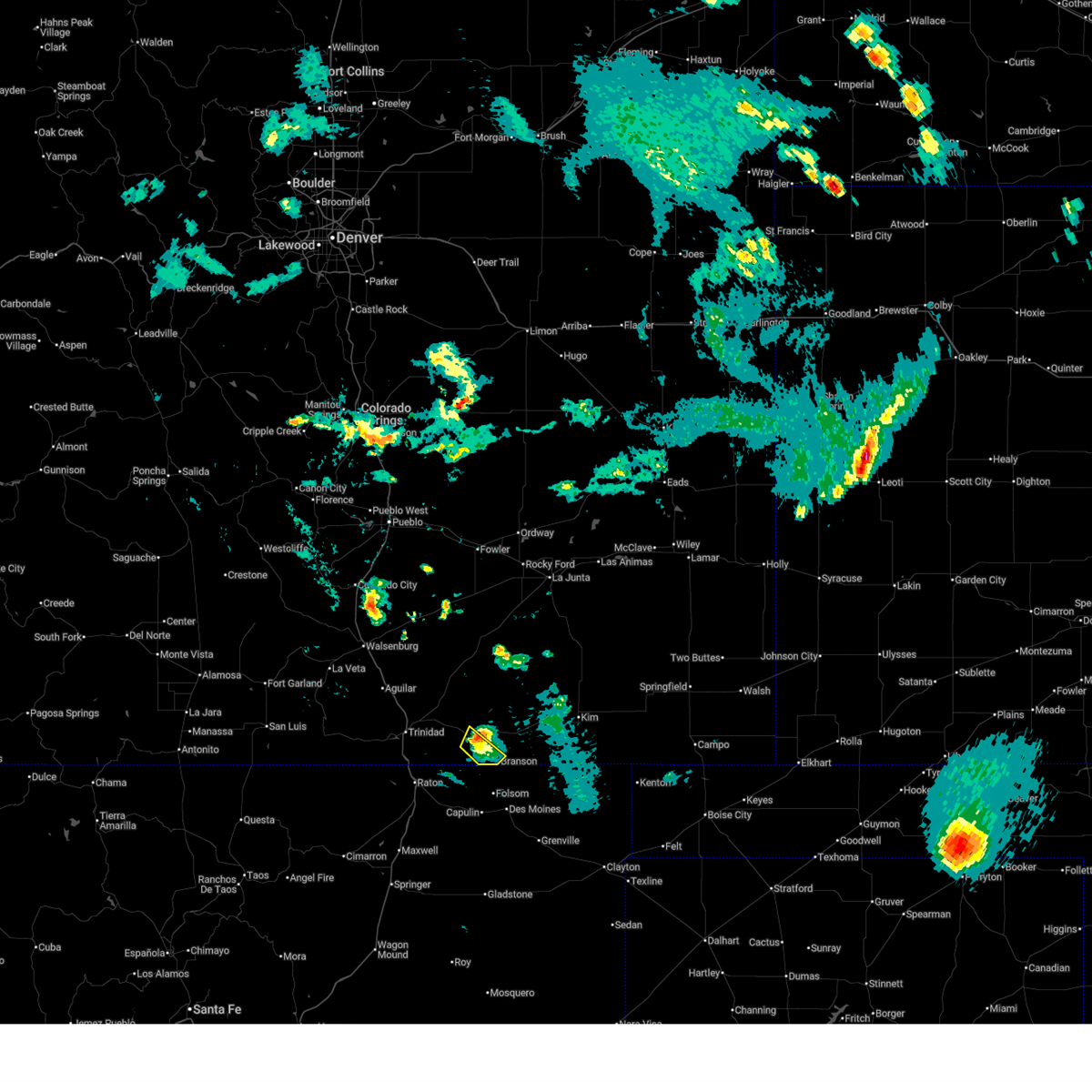
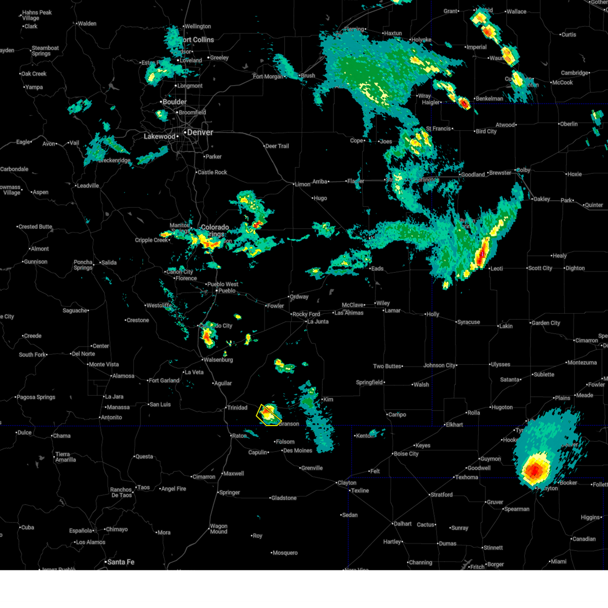
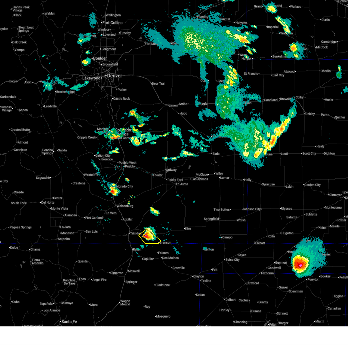
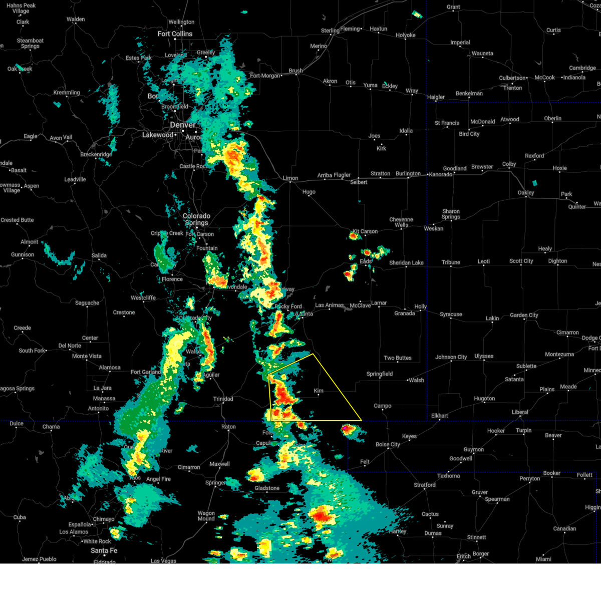
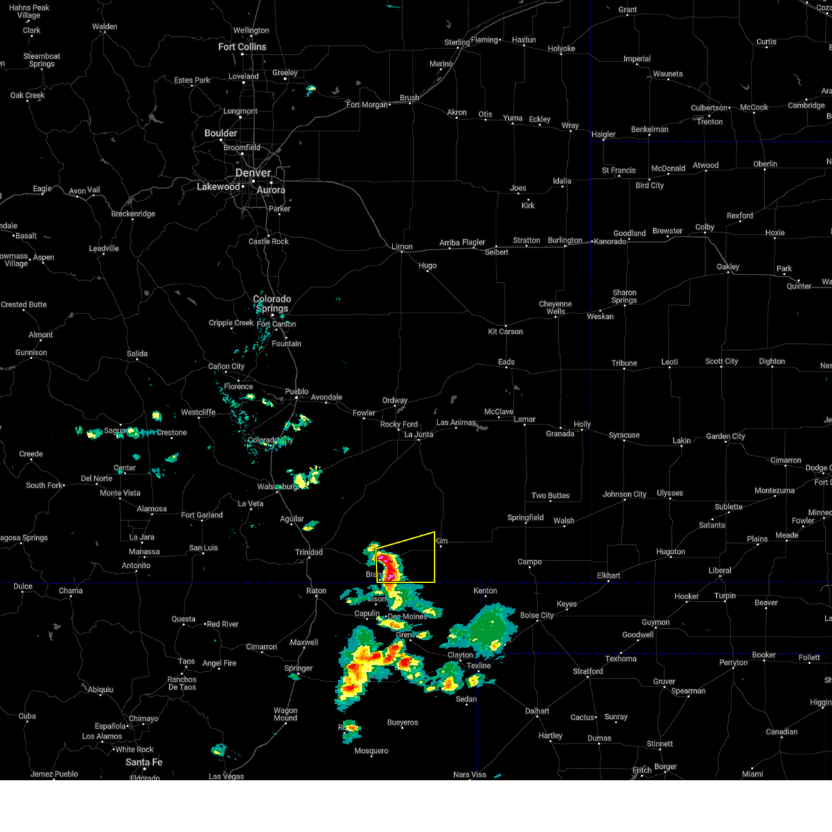
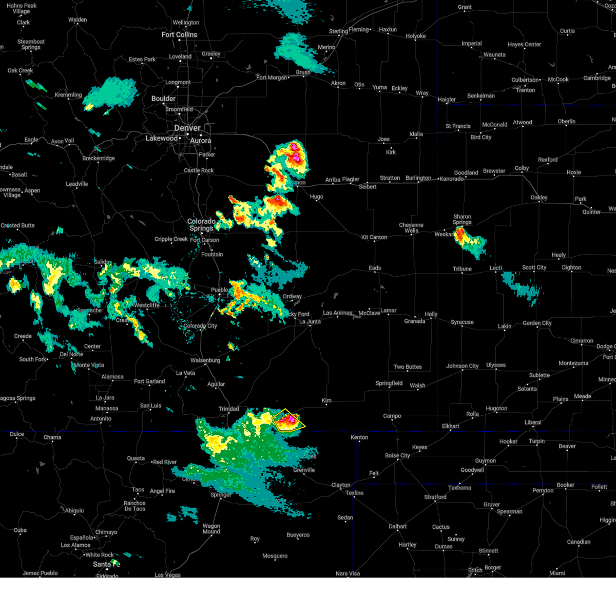
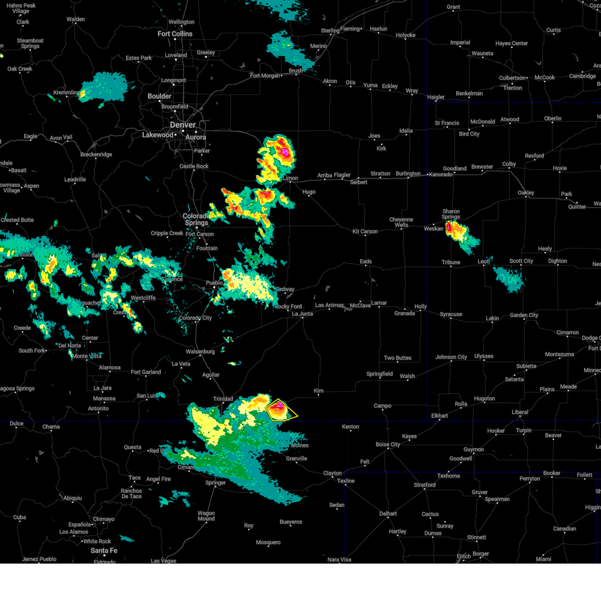
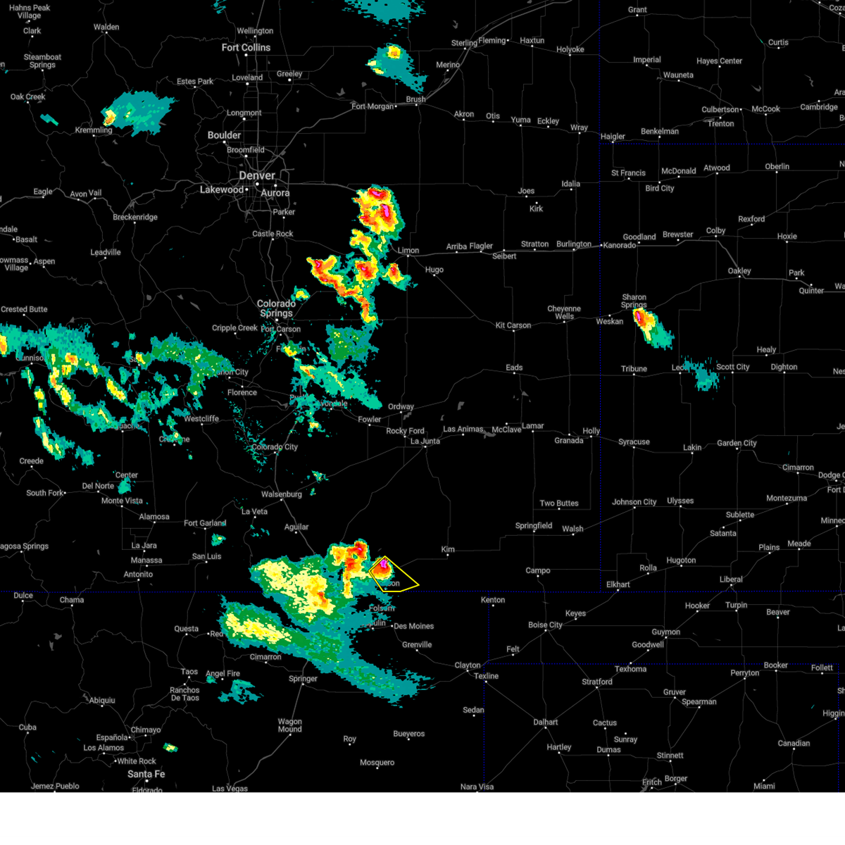
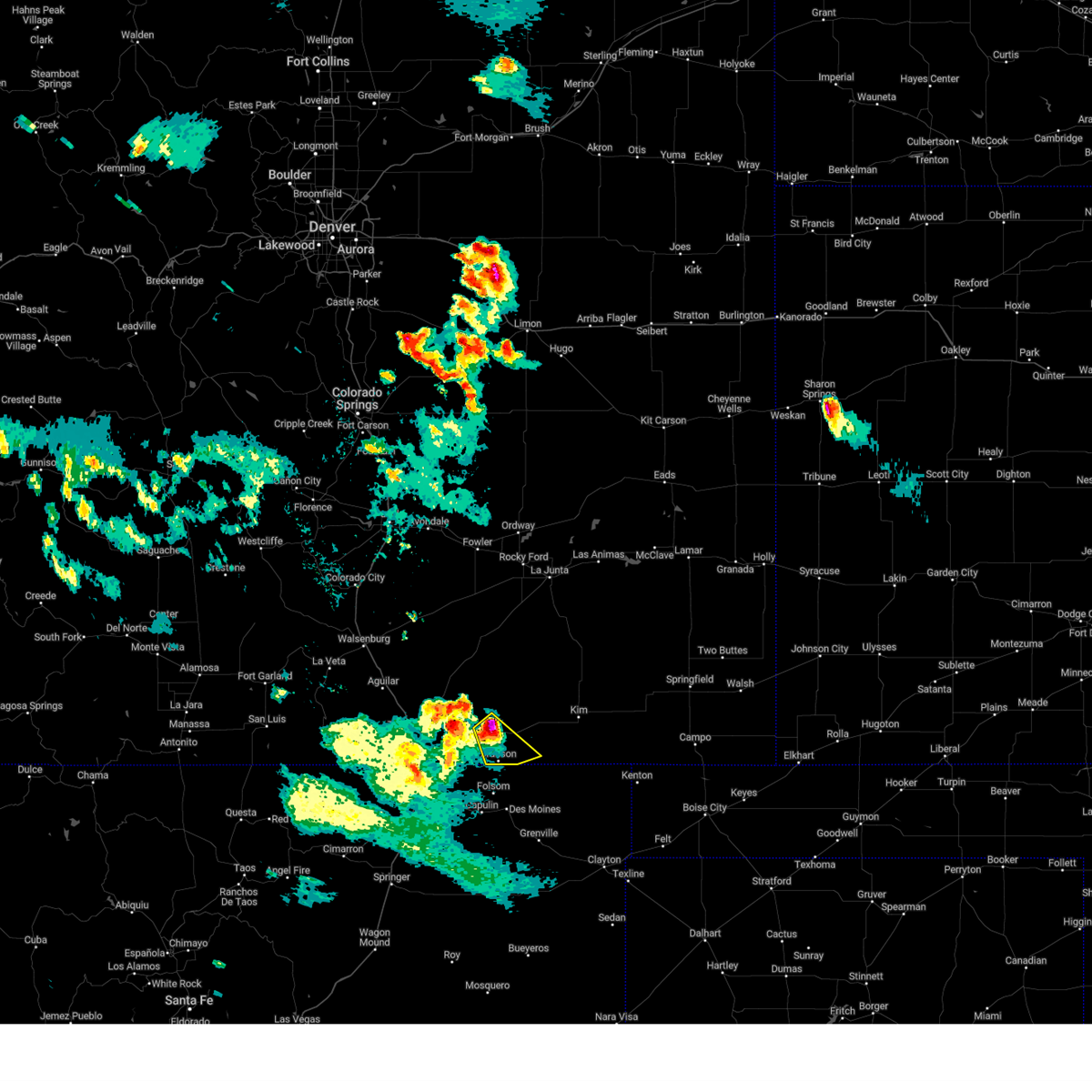
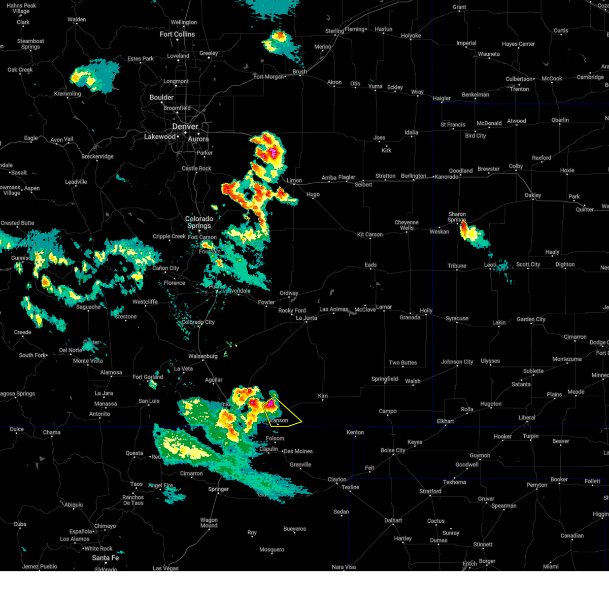
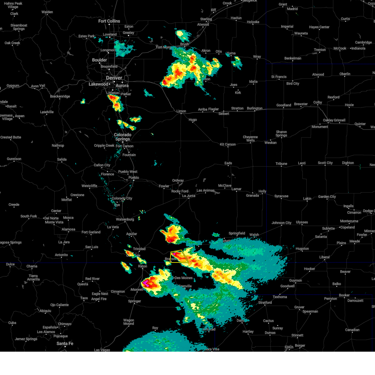
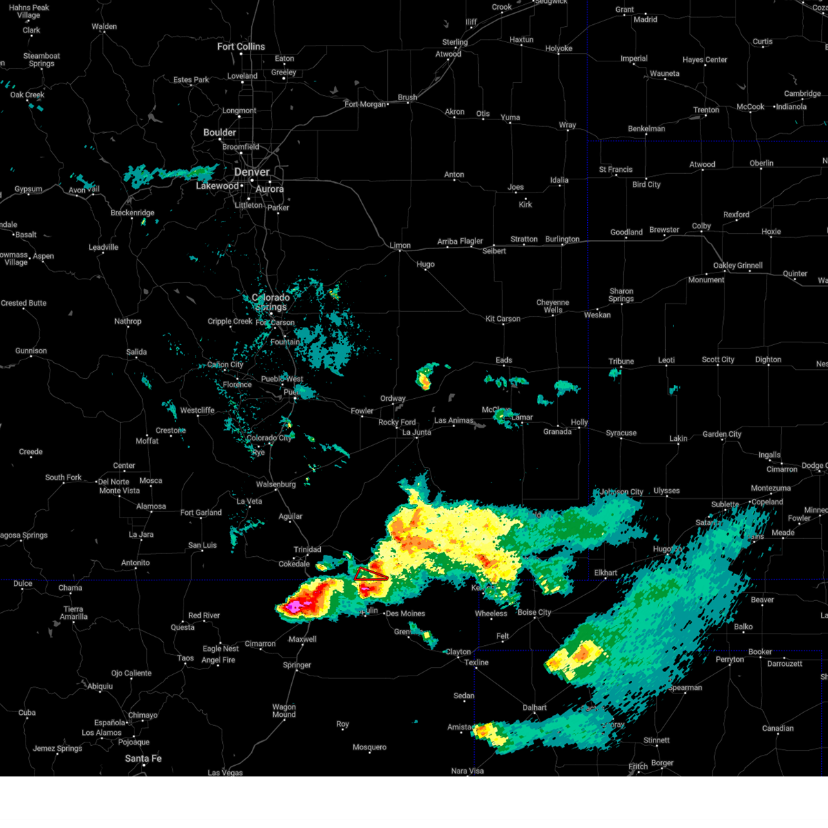
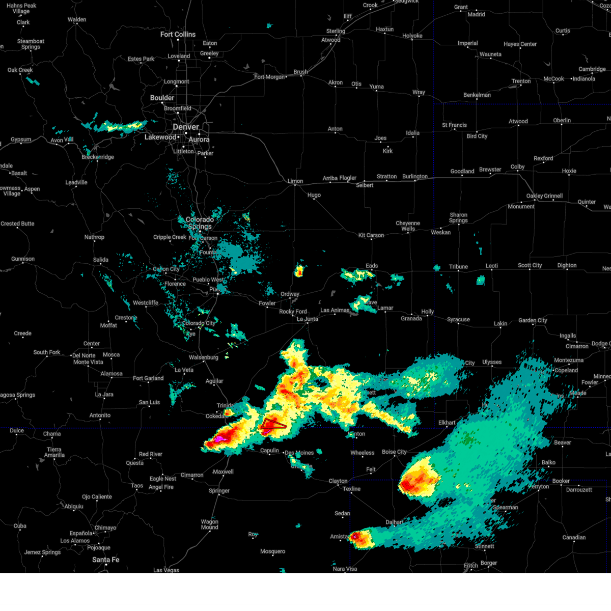
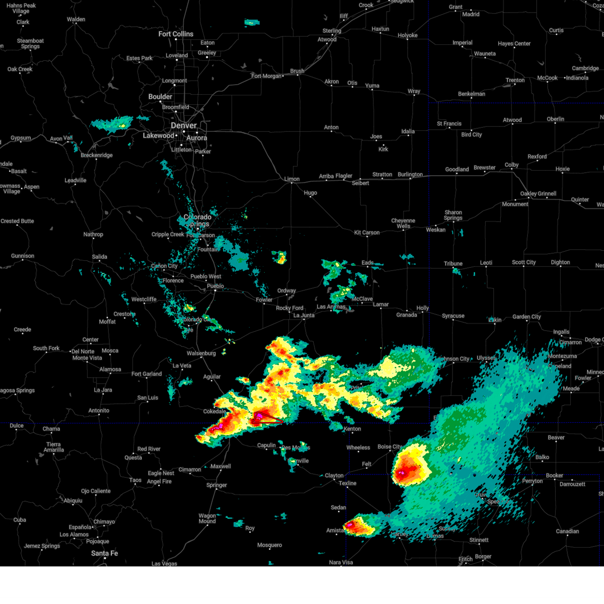
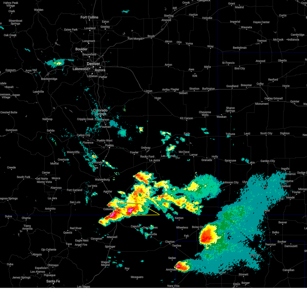
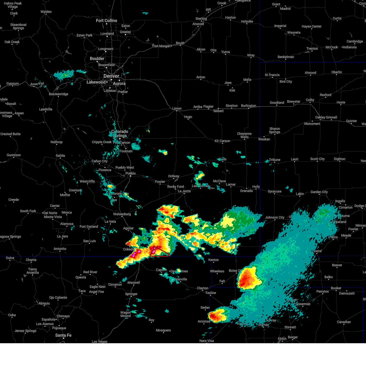
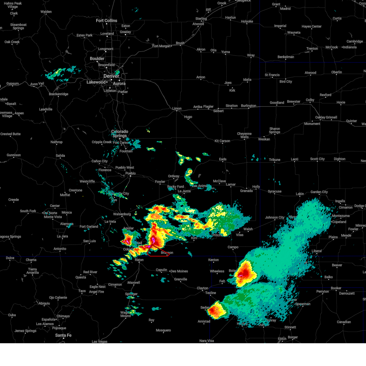
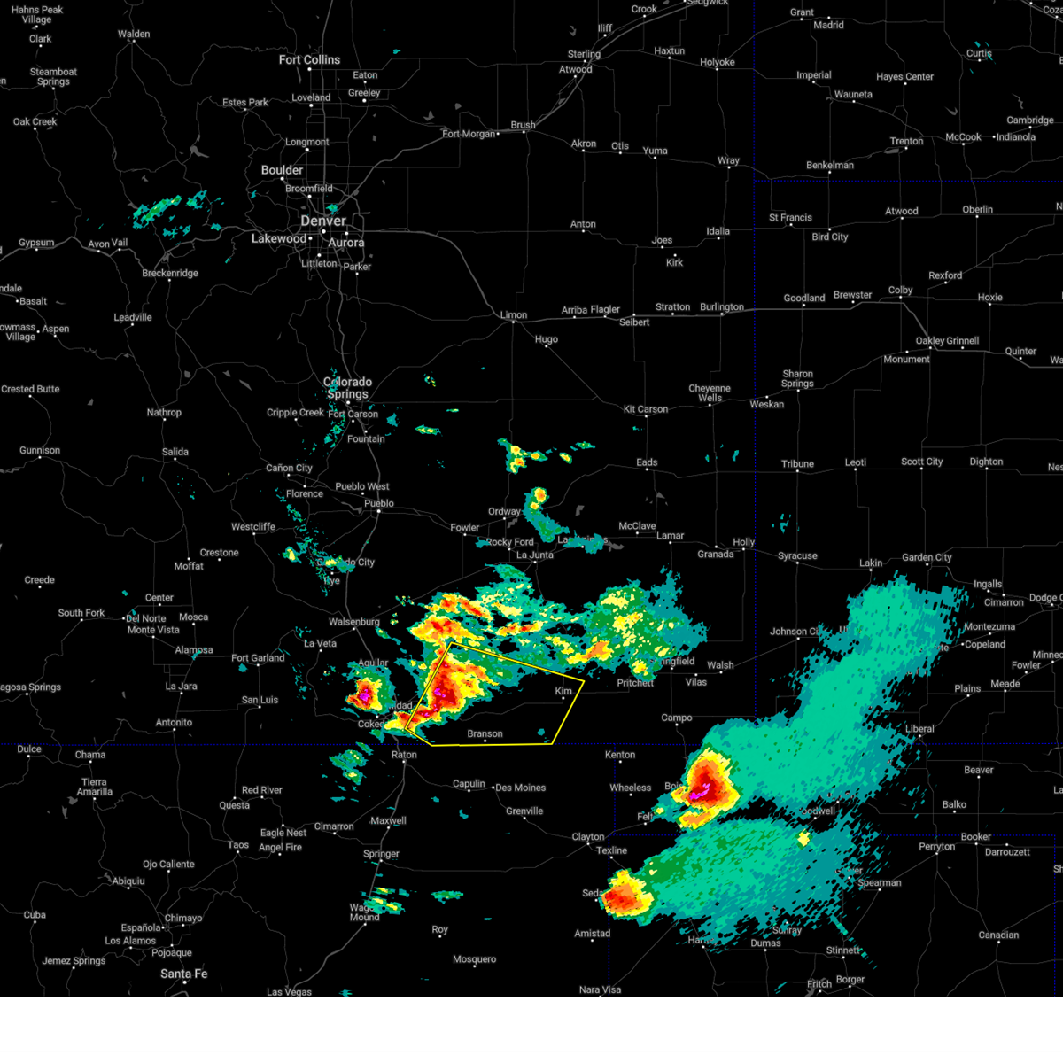
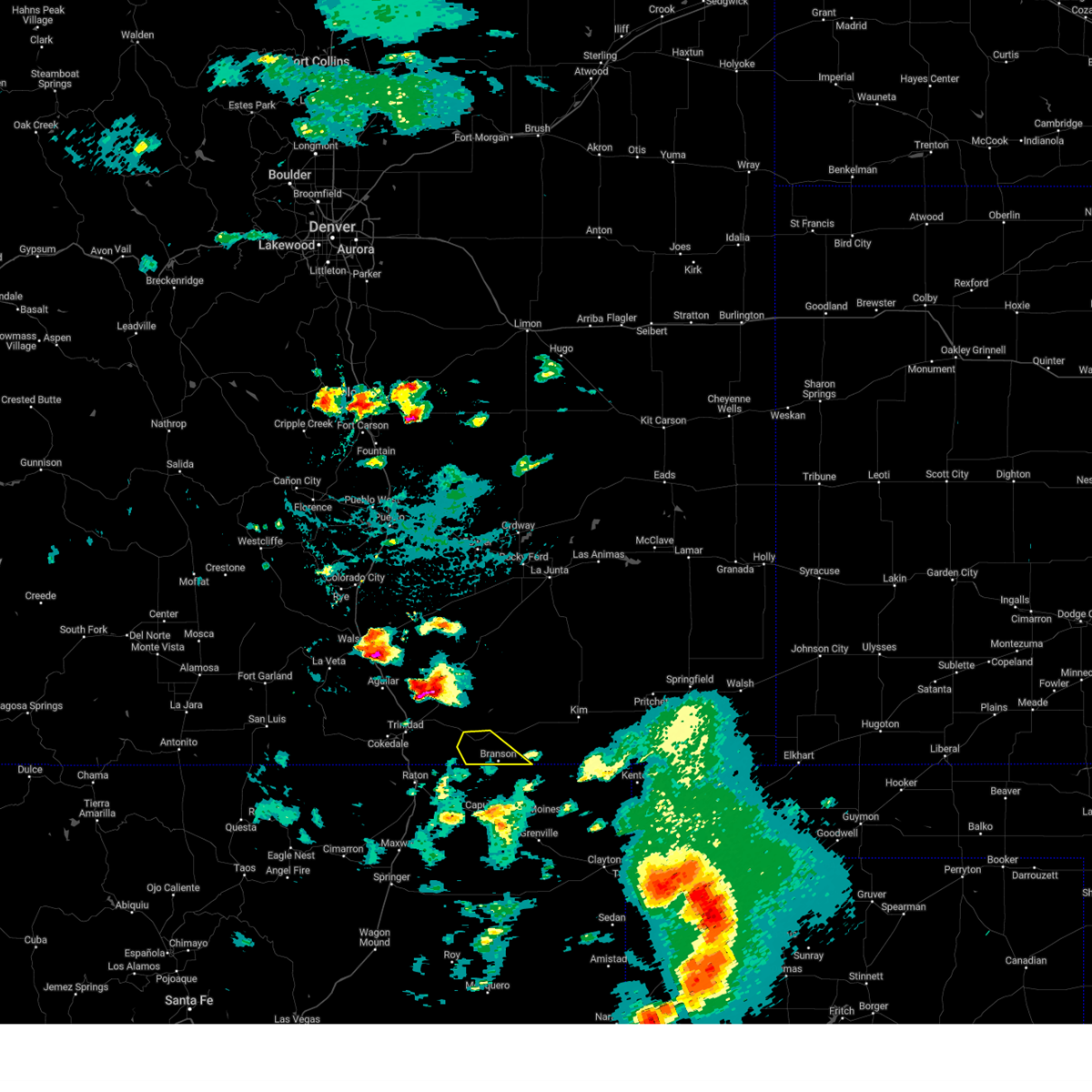
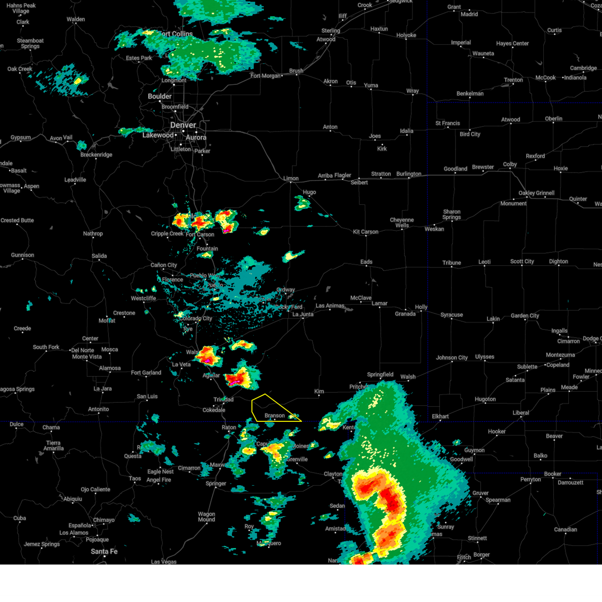
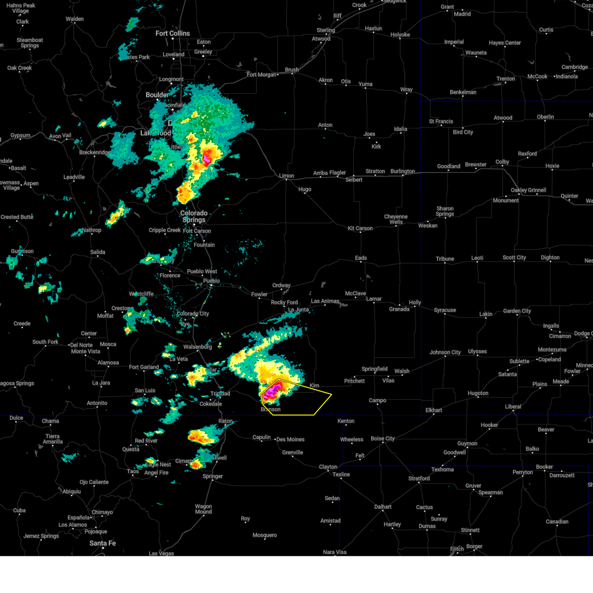
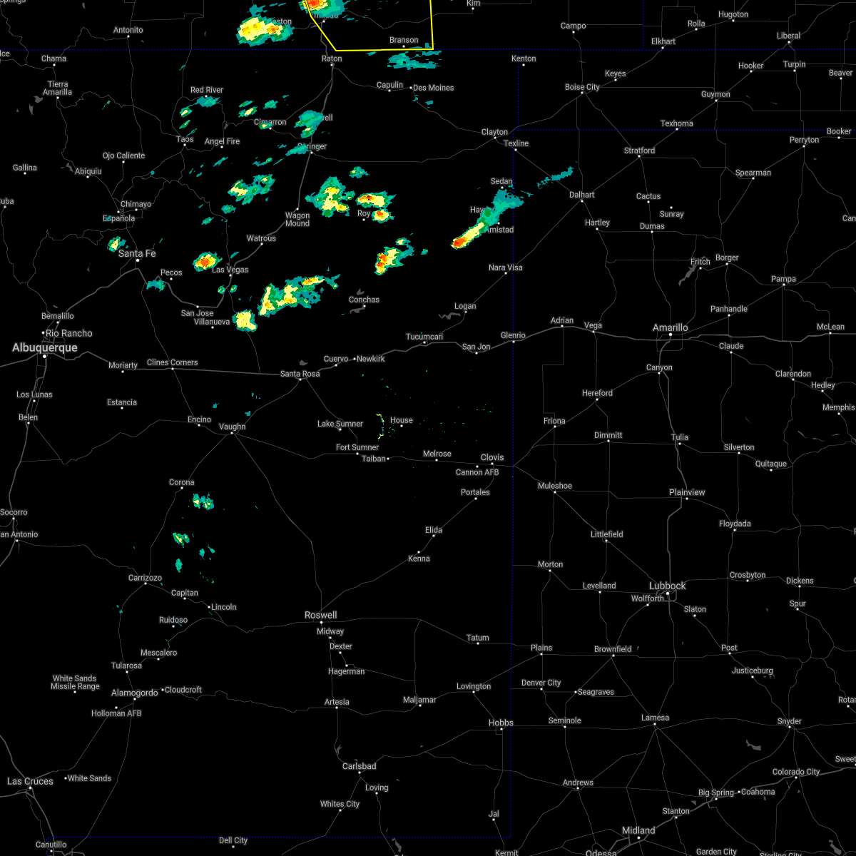
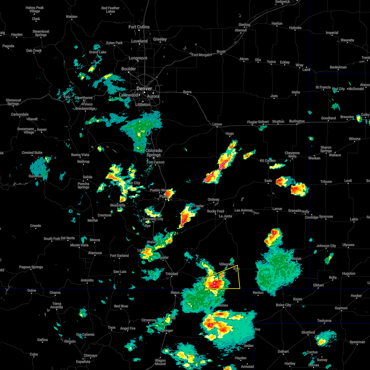
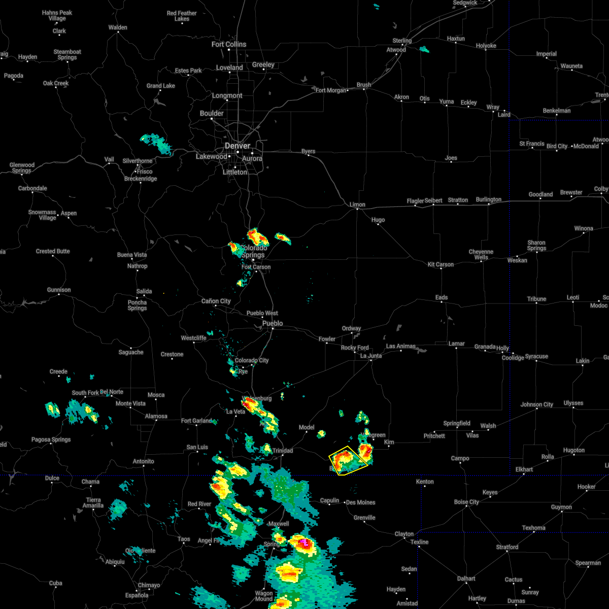
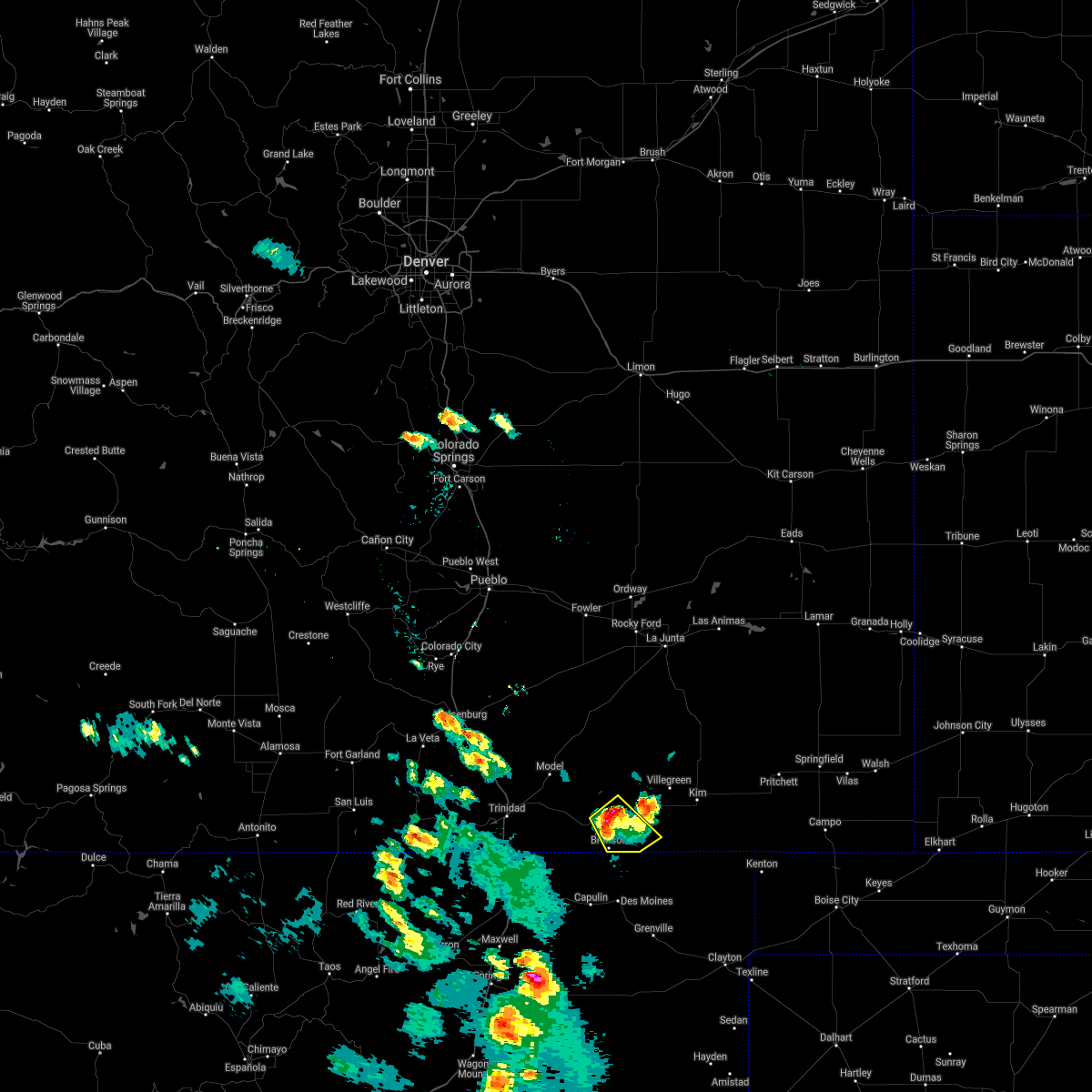
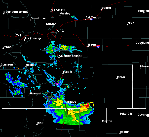
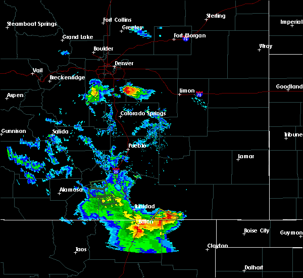
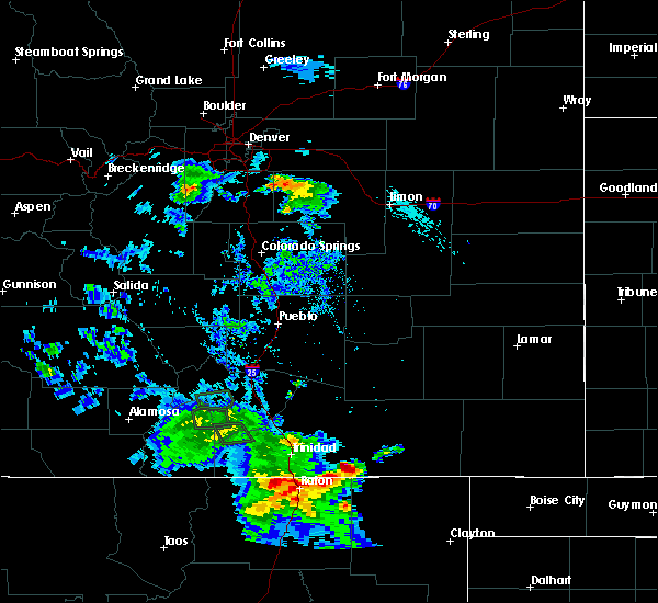
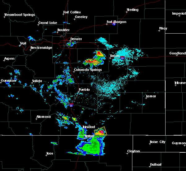
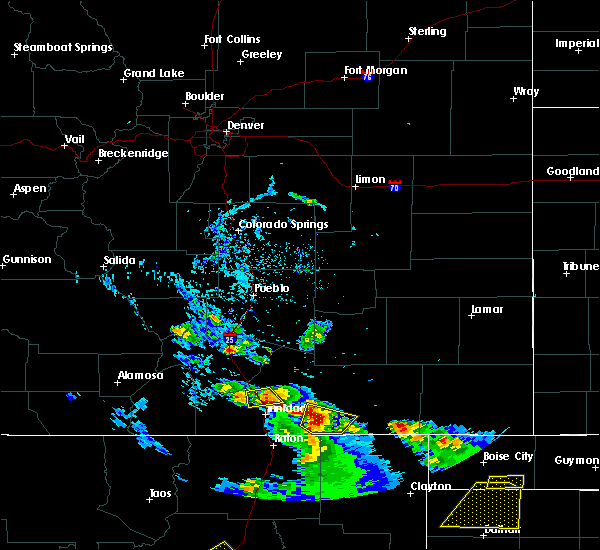
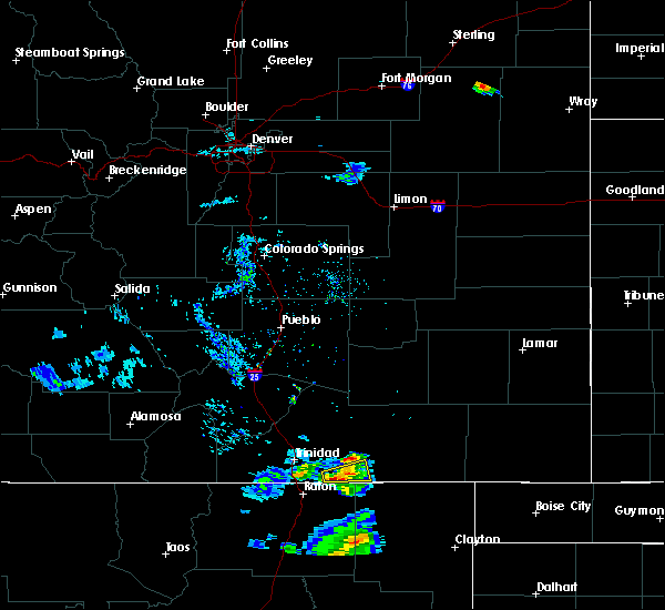
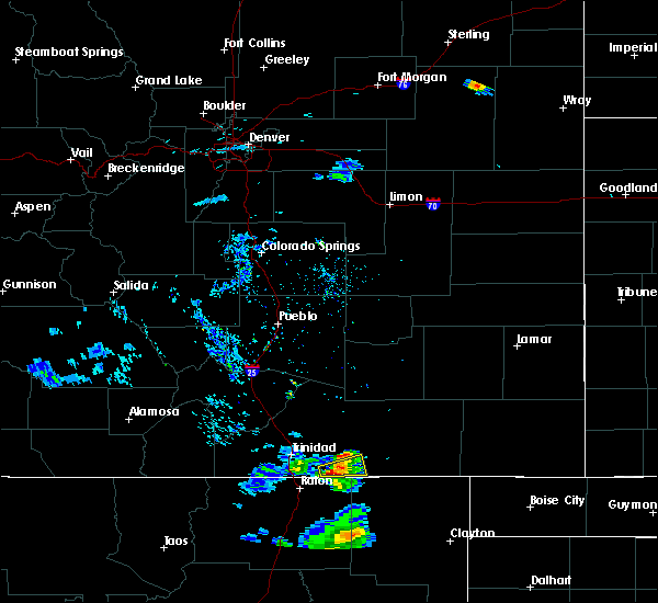
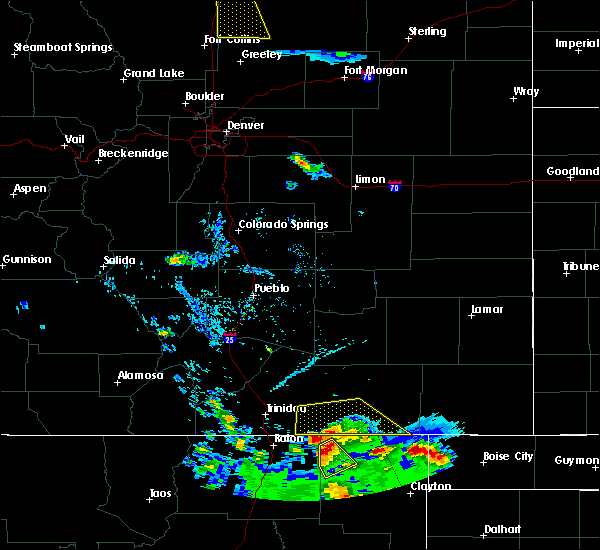
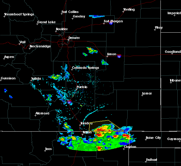
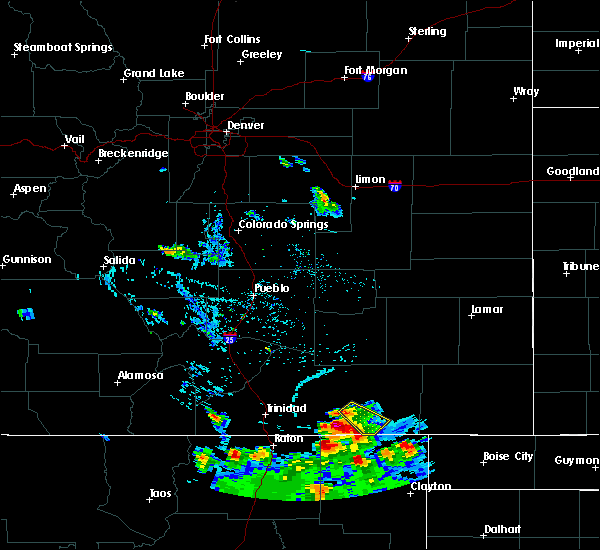
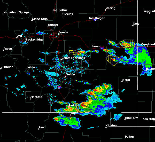
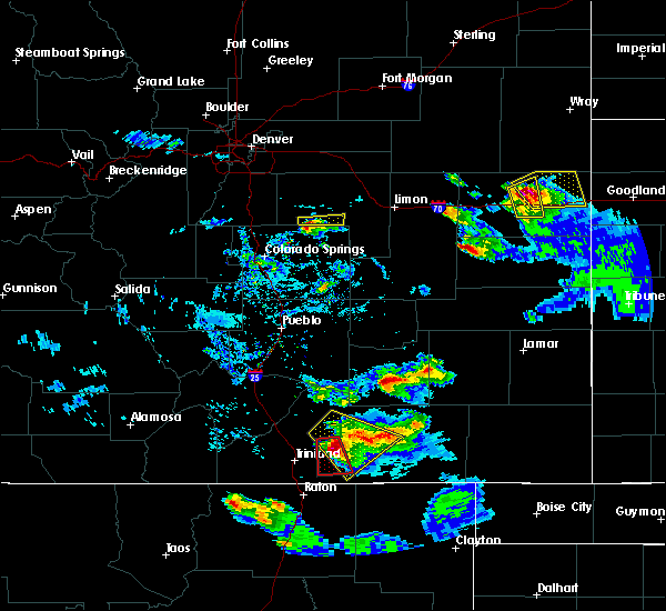
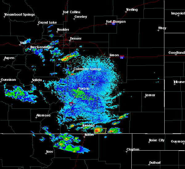
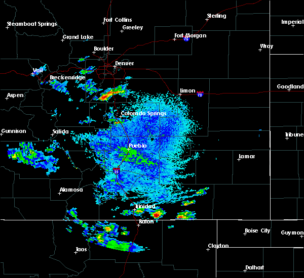
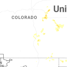
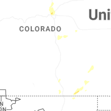
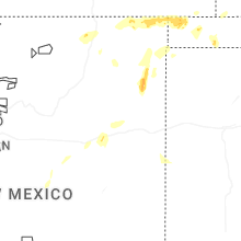
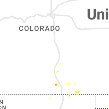
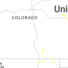
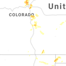
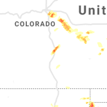
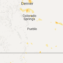
Hail Map for Branson, CO
The Branson, CO area has had 1 report of on-the-ground hail by trained spotters, and has been under severe weather warnings 10 times during the past 12 months. Doppler radar has detected hail at or near Branson, CO on 71 occasions, including 9 occasions during the past year.
| Name: | Branson, CO |
| Where Located: | 95 miles SSE of Pueblo, CO |
| Map: | Google Map for Branson, CO |
| Population: | 74 |
| Housing Units: | 45 |
| More Info: | Search Google for Branson, CO |
0
The Top Recent Hail Date for Branson, CO is Sunday, June 29, 2025 (71st out of 71)
Hail and Wind Damage Spotted near Branson, CO
| Date / Time | Report Details |
|---|---|
| 6/17/2025 5:31 PM MDT |
 the severe thunderstorm warning has been cancelled and is no longer in effect the severe thunderstorm warning has been cancelled and is no longer in effect
|
| 6/17/2025 5:25 PM MDT |
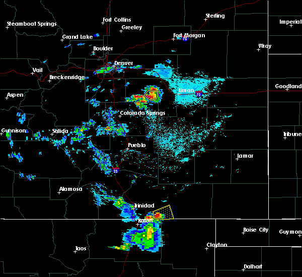
 At 525 pm mdt, a severe thunderstorm was located near trinchera, or 25 miles east of trinidad, moving east at 25 mph (radar indicated). Hazards include 60 mph wind gusts and quarter size hail. Hail damage to vehicles is expected. expect wind damage to roofs, siding, and trees. Locations impacted include, branson and trinchera. At 525 pm mdt, a severe thunderstorm was located near trinchera, or 25 miles east of trinidad, moving east at 25 mph (radar indicated). Hazards include 60 mph wind gusts and quarter size hail. Hail damage to vehicles is expected. expect wind damage to roofs, siding, and trees. Locations impacted include, branson and trinchera.
|
| 6/17/2025 5:14 PM MDT |
 Svrpub the national weather service in pueblo has issued a * severe thunderstorm warning for, south central las animas county in southeastern colorado, * until 545 pm mdt. * at 511 pm mdt, a severe thunderstorm was located 10 miles northwest of trinchera, or 18 miles east of trinidad, moving southeast at 20 mph (radar indicated). Hazards include 60 mph wind gusts and quarter size hail. Hail damage to vehicles is expected. Expect wind damage to roofs, siding, and trees. Svrpub the national weather service in pueblo has issued a * severe thunderstorm warning for, south central las animas county in southeastern colorado, * until 545 pm mdt. * at 511 pm mdt, a severe thunderstorm was located 10 miles northwest of trinchera, or 18 miles east of trinidad, moving southeast at 20 mph (radar indicated). Hazards include 60 mph wind gusts and quarter size hail. Hail damage to vehicles is expected. Expect wind damage to roofs, siding, and trees.
|
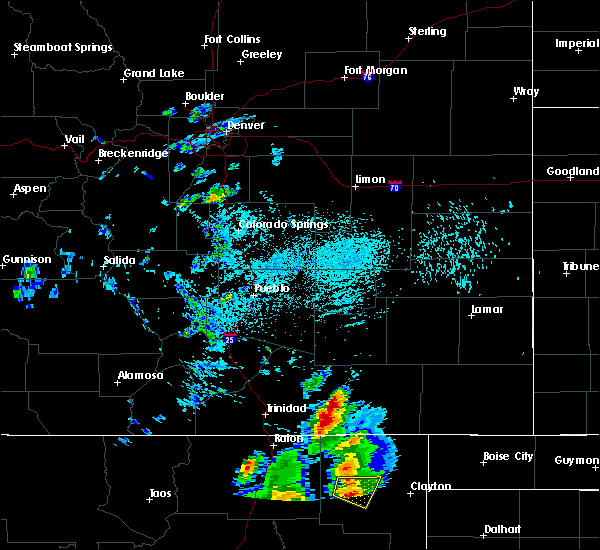
| 9/17/2024 3:56 PM MDT |
 Svrpub the national weather service in pueblo has issued a * severe thunderstorm warning for, southwestern baca county in southeastern colorado, southeastern las animas county in southeastern colorado, * until 430 pm mdt. * at 356 pm mdt, a severe thunderstorm was located 16 miles northeast of branson, or 32 miles north of des moines, moving northeast at 45 mph (radar indicated). Hazards include 70 mph wind gusts. Expect considerable tree damage. Damage is likely to mobile homes, roofs, and outbuildings. Svrpub the national weather service in pueblo has issued a * severe thunderstorm warning for, southwestern baca county in southeastern colorado, southeastern las animas county in southeastern colorado, * until 430 pm mdt. * at 356 pm mdt, a severe thunderstorm was located 16 miles northeast of branson, or 32 miles north of des moines, moving northeast at 45 mph (radar indicated). Hazards include 70 mph wind gusts. Expect considerable tree damage. Damage is likely to mobile homes, roofs, and outbuildings.
|
| 8/16/2024 5:59 PM MDT |
 Svrpub the national weather service in pueblo has issued a * severe thunderstorm warning for, southeastern las animas county in southeastern colorado, * until 645 pm mdt. * at 559 pm mdt, severe thunderstorms were located along a line extending from 16 miles northeast of trinchera to 6 miles east of branson, moving east at 20 mph (radar indicated). Hazards include 60 mph wind gusts and quarter size hail. Hail damage to vehicles is expected. Expect wind damage to roofs, siding, and trees. Svrpub the national weather service in pueblo has issued a * severe thunderstorm warning for, southeastern las animas county in southeastern colorado, * until 645 pm mdt. * at 559 pm mdt, severe thunderstorms were located along a line extending from 16 miles northeast of trinchera to 6 miles east of branson, moving east at 20 mph (radar indicated). Hazards include 60 mph wind gusts and quarter size hail. Hail damage to vehicles is expected. Expect wind damage to roofs, siding, and trees.
|
| 7/18/2024 7:15 PM MDT |
 The storm which prompted the warning has weakened below severe limits, and no longer poses an immediate threat to life or property. therefore, the warning will be allowed to expire. however, small hail, gusty winds and heavy rain are still possible with this thunderstorm. to report severe weather, contact your nearest law enforcement agency. they will relay your report to the national weather service pueblo. The storm which prompted the warning has weakened below severe limits, and no longer poses an immediate threat to life or property. therefore, the warning will be allowed to expire. however, small hail, gusty winds and heavy rain are still possible with this thunderstorm. to report severe weather, contact your nearest law enforcement agency. they will relay your report to the national weather service pueblo.
|
| 7/18/2024 7:03 PM MDT |
 At 703 pm mdt, a severe thunderstorm was located 9 miles northeast of branson, or 25 miles north of des moines, moving southeast at 20 mph (radar indicated). Hazards include ping pong ball size hail and 60 mph wind gusts. People and animals outdoors will be injured. expect hail damage to roofs, siding, windows, and vehicles. expect wind damage to roofs, siding, and trees. Locations impacted include, branson. At 703 pm mdt, a severe thunderstorm was located 9 miles northeast of branson, or 25 miles north of des moines, moving southeast at 20 mph (radar indicated). Hazards include ping pong ball size hail and 60 mph wind gusts. People and animals outdoors will be injured. expect hail damage to roofs, siding, windows, and vehicles. expect wind damage to roofs, siding, and trees. Locations impacted include, branson.
|
| 7/18/2024 6:47 PM MDT |
 At 647 pm mdt, a severe thunderstorm was located 9 miles north of branson, or 27 miles north of des moines, moving southeast at 20 mph (radar indicated). Hazards include ping pong ball size hail and 60 mph wind gusts. People and animals outdoors will be injured. expect hail damage to roofs, siding, windows, and vehicles. expect wind damage to roofs, siding, and trees. Locations impacted include, branson. At 647 pm mdt, a severe thunderstorm was located 9 miles north of branson, or 27 miles north of des moines, moving southeast at 20 mph (radar indicated). Hazards include ping pong ball size hail and 60 mph wind gusts. People and animals outdoors will be injured. expect hail damage to roofs, siding, windows, and vehicles. expect wind damage to roofs, siding, and trees. Locations impacted include, branson.
|
| 7/18/2024 6:39 PM MDT |
 At 639 pm mdt, a severe thunderstorm was located 10 miles northeast of trinchera, or 28 miles north of des moines, moving southeast at 20 mph (radar indicated). Hazards include golf ball size hail and 60 mph wind gusts. People and animals outdoors will be injured. expect hail damage to roofs, siding, windows, and vehicles. expect wind damage to roofs, siding, and trees. Locations impacted include, branson. At 639 pm mdt, a severe thunderstorm was located 10 miles northeast of trinchera, or 28 miles north of des moines, moving southeast at 20 mph (radar indicated). Hazards include golf ball size hail and 60 mph wind gusts. People and animals outdoors will be injured. expect hail damage to roofs, siding, windows, and vehicles. expect wind damage to roofs, siding, and trees. Locations impacted include, branson.
|
| 7/18/2024 6:34 PM MDT |
 Svrpub the national weather service in pueblo has issued a * severe thunderstorm warning for, south central las animas county in southeastern colorado, * until 715 pm mdt. * at 634 pm mdt, a severe thunderstorm was located 10 miles north of trinchera, or 30 miles east of trinidad, moving southeast at 20 mph (radar indicated). Hazards include 60 mph wind gusts and quarter size hail. Hail damage to vehicles is expected. Expect wind damage to roofs, siding, and trees. Svrpub the national weather service in pueblo has issued a * severe thunderstorm warning for, south central las animas county in southeastern colorado, * until 715 pm mdt. * at 634 pm mdt, a severe thunderstorm was located 10 miles north of trinchera, or 30 miles east of trinidad, moving southeast at 20 mph (radar indicated). Hazards include 60 mph wind gusts and quarter size hail. Hail damage to vehicles is expected. Expect wind damage to roofs, siding, and trees.
|
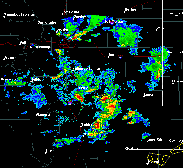
| 7/15/2023 6:45 PM MDT |
 At 644 pm mdt, a severe thunderstorm was located 8 miles northeast of branson, or 24 miles north of des moines, moving southeast at 25 mph (radar indicated). Hazards include golf ball size hail and 60 mph wind gusts. People and animals outdoors will be injured. expect hail damage to roofs, siding, windows, and vehicles. expect wind damage to roofs, siding, and trees. locations impacted include, branson. thunderstorm damage threat, considerable hail threat, radar indicated max hail size, 1. 75 in wind threat, radar indicated max wind gust, 60 mph. At 644 pm mdt, a severe thunderstorm was located 8 miles northeast of branson, or 24 miles north of des moines, moving southeast at 25 mph (radar indicated). Hazards include golf ball size hail and 60 mph wind gusts. People and animals outdoors will be injured. expect hail damage to roofs, siding, windows, and vehicles. expect wind damage to roofs, siding, and trees. locations impacted include, branson. thunderstorm damage threat, considerable hail threat, radar indicated max hail size, 1. 75 in wind threat, radar indicated max wind gust, 60 mph.
|
| 7/15/2023 6:33 PM MDT |
 At 633 pm mdt, a severe thunderstorm was located 8 miles northeast of branson, or 25 miles north of des moines, moving southeast at 15 mph (radar indicated). Hazards include 60 mph wind gusts and half dollar size hail. Hail damage to vehicles is expected. Expect wind damage to roofs, siding, and trees. At 633 pm mdt, a severe thunderstorm was located 8 miles northeast of branson, or 25 miles north of des moines, moving southeast at 15 mph (radar indicated). Hazards include 60 mph wind gusts and half dollar size hail. Hail damage to vehicles is expected. Expect wind damage to roofs, siding, and trees.
|
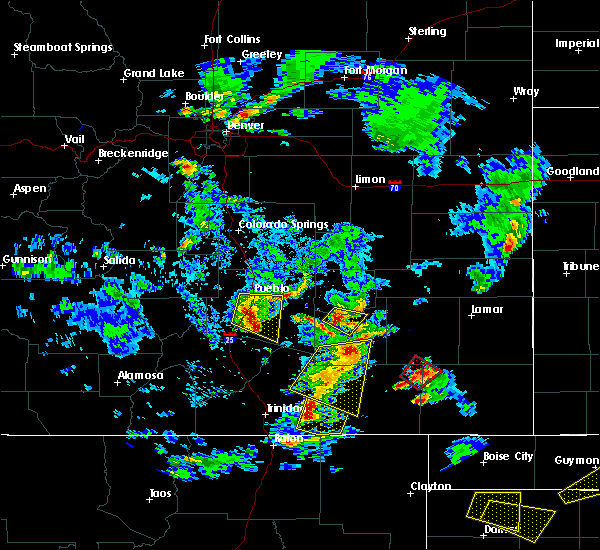
| 7/13/2023 9:55 PM MDT |
 The tornado warning for southern las animas county will expire at 1000 pm mdt, the storm which prompted the warning has weakened below severe limits, and has exited the warned area. therefore, the warning will be allowed to expire. however small hail, gusty winds and heavy rain are still possible with this thunderstorm. The tornado warning for southern las animas county will expire at 1000 pm mdt, the storm which prompted the warning has weakened below severe limits, and has exited the warned area. therefore, the warning will be allowed to expire. however small hail, gusty winds and heavy rain are still possible with this thunderstorm.
|
| 7/13/2023 9:43 PM MDT |
 At 943 pm mdt, a severe thunderstorm capable of producing a tornado was located near trinchera, or 19 miles northwest of des moines, moving southeast at 20 mph (radar indicated rotation). Hazards include tornado and half dollar size hail. Flying debris will be dangerous to those caught without shelter. mobile homes will be damaged or destroyed. damage to roofs, windows, and vehicles will occur. tree damage is likely. Locations impacted include, branson. At 943 pm mdt, a severe thunderstorm capable of producing a tornado was located near trinchera, or 19 miles northwest of des moines, moving southeast at 20 mph (radar indicated rotation). Hazards include tornado and half dollar size hail. Flying debris will be dangerous to those caught without shelter. mobile homes will be damaged or destroyed. damage to roofs, windows, and vehicles will occur. tree damage is likely. Locations impacted include, branson.
|
| 7/13/2023 9:26 PM MDT |
 At 926 pm mdt, a severe thunderstorm capable of producing a tornado was located over trinchera, or 22 miles northeast of raton, moving southeast at 20 mph (radar indicated rotation). Hazards include tornado and tennis ball size hail. Flying debris will be dangerous to those caught without shelter. mobile homes will be damaged or destroyed. damage to roofs, windows, and vehicles will occur. tree damage is likely. this dangerous storm will be near, trinchera around 935 pm mdt. Other locations in the path of this tornadic thunderstorm include branson. At 926 pm mdt, a severe thunderstorm capable of producing a tornado was located over trinchera, or 22 miles northeast of raton, moving southeast at 20 mph (radar indicated rotation). Hazards include tornado and tennis ball size hail. Flying debris will be dangerous to those caught without shelter. mobile homes will be damaged or destroyed. damage to roofs, windows, and vehicles will occur. tree damage is likely. this dangerous storm will be near, trinchera around 935 pm mdt. Other locations in the path of this tornadic thunderstorm include branson.
|
| 7/13/2023 9:20 PM MDT |
 At 920 pm mdt, severe thunderstorms were located along a line extending from 19 miles west of kim to near branson, moving southeast at 40 mph (radar indicated). Hazards include tennis ball size hail and 70 mph wind gusts. People and animals outdoors will be injured. expect hail damage to roofs, siding, windows, and vehicles. expect considerable tree damage. wind damage is also likely to mobile homes, roofs, and outbuildings. Locations impacted include, branson and trinchera. At 920 pm mdt, severe thunderstorms were located along a line extending from 19 miles west of kim to near branson, moving southeast at 40 mph (radar indicated). Hazards include tennis ball size hail and 70 mph wind gusts. People and animals outdoors will be injured. expect hail damage to roofs, siding, windows, and vehicles. expect considerable tree damage. wind damage is also likely to mobile homes, roofs, and outbuildings. Locations impacted include, branson and trinchera.
|
| 7/13/2023 9:16 PM MDT |
 At 916 pm mdt, a severe thunderstorm capable of producing a tornado was located near trinchera, or 22 miles east of trinidad, moving southeast at 15 mph (radar indicated rotation). Hazards include tornado and three inch hail. Flying debris will be dangerous to those caught without shelter. mobile homes will be damaged or destroyed. damage to roofs, windows, and vehicles will occur. tree damage is likely. Locations impacted include, branson and trinchera. At 916 pm mdt, a severe thunderstorm capable of producing a tornado was located near trinchera, or 22 miles east of trinidad, moving southeast at 15 mph (radar indicated rotation). Hazards include tornado and three inch hail. Flying debris will be dangerous to those caught without shelter. mobile homes will be damaged or destroyed. damage to roofs, windows, and vehicles will occur. tree damage is likely. Locations impacted include, branson and trinchera.
|
| 7/13/2023 9:04 PM MDT |
 At 904 pm mdt, a severe thunderstorm capable of producing a tornado was located 8 miles northwest of trinchera, or 19 miles east of trinidad, moving southeast at 15 mph (radar indicated rotation). Hazards include tornado and hail up to three inches in diameter. Flying debris will be dangerous to those caught without shelter. mobile homes will be damaged or destroyed. damage to roofs, windows, and vehicles will occur. Tree damage is likely. At 904 pm mdt, a severe thunderstorm capable of producing a tornado was located 8 miles northwest of trinchera, or 19 miles east of trinidad, moving southeast at 15 mph (radar indicated rotation). Hazards include tornado and hail up to three inches in diameter. Flying debris will be dangerous to those caught without shelter. mobile homes will be damaged or destroyed. damage to roofs, windows, and vehicles will occur. Tree damage is likely.
|
| 7/13/2023 8:52 PM MDT |
 At 851 pm mdt, severe thunderstorms were located along a line extending from 14 miles east of model to near trinchera, moving southeast at 40 mph (radar indicated). Hazards include tennis ball size hail and 70 mph wind gusts. People and animals outdoors will be injured. expect hail damage to roofs, siding, windows, and vehicles. expect considerable tree damage. Wind damage is also likely to mobile homes, roofs, and outbuildings. At 851 pm mdt, severe thunderstorms were located along a line extending from 14 miles east of model to near trinchera, moving southeast at 40 mph (radar indicated). Hazards include tennis ball size hail and 70 mph wind gusts. People and animals outdoors will be injured. expect hail damage to roofs, siding, windows, and vehicles. expect considerable tree damage. Wind damage is also likely to mobile homes, roofs, and outbuildings.
|
| 7/7/2023 5:38 PM MDT |
 The severe thunderstorm warning for southeastern las animas county will expire at 545 pm mdt, the storm which prompted the warning has moved out of the area. therefore, the warning will be allowed to expire. a severe thunderstorm watch remains in effect until 800 pm mdt for southeastern colorado. The severe thunderstorm warning for southeastern las animas county will expire at 545 pm mdt, the storm which prompted the warning has moved out of the area. therefore, the warning will be allowed to expire. a severe thunderstorm watch remains in effect until 800 pm mdt for southeastern colorado.
|
| 7/7/2023 5:27 PM MDT |
 At 526 pm mdt, a severe thunderstorm was located over branson, or 16 miles north of des moines, moving southeast at 15 mph (radar indicated). Hazards include ping pong ball size hail and 60 mph wind gusts. People and animals outdoors will be injured. expect hail damage to roofs, siding, windows, and vehicles. expect wind damage to roofs, siding, and trees. this severe thunderstorm will remain over mainly rural areas of southeastern las animas county. hail threat, radar indicated max hail size, 1. 50 in wind threat, radar indicated max wind gust, 60 mph. At 526 pm mdt, a severe thunderstorm was located over branson, or 16 miles north of des moines, moving southeast at 15 mph (radar indicated). Hazards include ping pong ball size hail and 60 mph wind gusts. People and animals outdoors will be injured. expect hail damage to roofs, siding, windows, and vehicles. expect wind damage to roofs, siding, and trees. this severe thunderstorm will remain over mainly rural areas of southeastern las animas county. hail threat, radar indicated max hail size, 1. 50 in wind threat, radar indicated max wind gust, 60 mph.
|
| 7/7/2023 5:12 PM MDT |
 At 511 pm mdt, a severe thunderstorm was located near branson, or 20 miles north of des moines, moving southeast at 15 mph. this is a destructive storm for trinchera and branson (radar indicated). Hazards include three inch hail and 60 mph wind gusts. People and animals outdoors will be severely injured. expect shattered windows, extensive damage to roofs, siding, and vehicles. this severe thunderstorm will be near, branson around 525 pm mdt. thunderstorm damage threat, destructive hail threat, radar indicated max hail size, 3. 00 in wind threat, radar indicated max wind gust, 60 mph. At 511 pm mdt, a severe thunderstorm was located near branson, or 20 miles north of des moines, moving southeast at 15 mph. this is a destructive storm for trinchera and branson (radar indicated). Hazards include three inch hail and 60 mph wind gusts. People and animals outdoors will be severely injured. expect shattered windows, extensive damage to roofs, siding, and vehicles. this severe thunderstorm will be near, branson around 525 pm mdt. thunderstorm damage threat, destructive hail threat, radar indicated max hail size, 3. 00 in wind threat, radar indicated max wind gust, 60 mph.
|
| 7/7/2023 4:59 PM MDT |
 At 459 pm mdt, a severe thunderstorm was located over trinchera, or 22 miles northwest of des moines, moving southeast at 15 mph. this is a destructive storm for trinchera and branson (radar indicated). Hazards include softball size hail and 60 mph wind gusts. People and animals outdoors will be severely injured. expect shattered windows, extensive damage to roofs, siding, and vehicles. locations impacted include, branson and trinchera. thunderstorm damage threat, destructive hail threat, radar indicated max hail size, 4. 00 in wind threat, radar indicated max wind gust, 60 mph. At 459 pm mdt, a severe thunderstorm was located over trinchera, or 22 miles northwest of des moines, moving southeast at 15 mph. this is a destructive storm for trinchera and branson (radar indicated). Hazards include softball size hail and 60 mph wind gusts. People and animals outdoors will be severely injured. expect shattered windows, extensive damage to roofs, siding, and vehicles. locations impacted include, branson and trinchera. thunderstorm damage threat, destructive hail threat, radar indicated max hail size, 4. 00 in wind threat, radar indicated max wind gust, 60 mph.
|
| 7/7/2023 4:44 PM MDT |
 At 444 pm mdt, a severe thunderstorm was located near trinchera, or 25 miles northwest of des moines, moving southeast at 10 mph. this is a destructive storm for trinchera and branson (radar indicated). Hazards include three inch hail. People and animals outdoors will be severely injured. Expect shattered windows, extensive damage to roofs, siding, and vehicles. At 444 pm mdt, a severe thunderstorm was located near trinchera, or 25 miles northwest of des moines, moving southeast at 10 mph. this is a destructive storm for trinchera and branson (radar indicated). Hazards include three inch hail. People and animals outdoors will be severely injured. Expect shattered windows, extensive damage to roofs, siding, and vehicles.
|
| 7/7/2023 4:27 PM MDT |
 At 426 pm mdt, a severe thunderstorm was located near model, or 18 miles east of trinidad, moving southeast at 20 mph. this is a destructive storm for trinchera and branson (radar indicated). Hazards include baseball size hail and 60 mph wind gusts. People and animals outdoors will be severely injured. expect shattered windows, extensive damage to roofs, siding, and vehicles. locations impacted include, branson and trinchera. thunderstorm damage threat, destructive hail threat, radar indicated max hail size, 2. 75 in wind threat, radar indicated max wind gust, 60 mph. At 426 pm mdt, a severe thunderstorm was located near model, or 18 miles east of trinidad, moving southeast at 20 mph. this is a destructive storm for trinchera and branson (radar indicated). Hazards include baseball size hail and 60 mph wind gusts. People and animals outdoors will be severely injured. expect shattered windows, extensive damage to roofs, siding, and vehicles. locations impacted include, branson and trinchera. thunderstorm damage threat, destructive hail threat, radar indicated max hail size, 2. 75 in wind threat, radar indicated max wind gust, 60 mph.
|
| 7/7/2023 4:14 PM MDT |
 At 414 pm mdt, a severe thunderstorm was located near model, or 16 miles northeast of trinidad, moving southeast at 20 mph. this is a destructive storm for trinchera and branson (radar indicated). Hazards include three inch hail and 60 mph wind gusts. People and animals outdoors will be severely injured. expect shattered windows, extensive damage to roofs, siding, and vehicles. this severe thunderstorm will remain over mainly rural areas of south central las animas county. thunderstorm damage threat, destructive hail threat, radar indicated max hail size, 3. 00 in wind threat, radar indicated max wind gust, 60 mph. At 414 pm mdt, a severe thunderstorm was located near model, or 16 miles northeast of trinidad, moving southeast at 20 mph. this is a destructive storm for trinchera and branson (radar indicated). Hazards include three inch hail and 60 mph wind gusts. People and animals outdoors will be severely injured. expect shattered windows, extensive damage to roofs, siding, and vehicles. this severe thunderstorm will remain over mainly rural areas of south central las animas county. thunderstorm damage threat, destructive hail threat, radar indicated max hail size, 3. 00 in wind threat, radar indicated max wind gust, 60 mph.
|
| 6/11/2023 4:12 PM MDT |
 At 411 pm mdt, a severe thunderstorm was located 14 miles north of branson, or 31 miles north of des moines, moving southeast at 20 mph. this is a destructive storm for areas in the vicinity and north to northeast of branson, and rurals of southeastern las animas county (radar indicated). Hazards include three inch hail and 60 mph wind gusts. People and animals outdoors will be severely injured. expect shattered windows, extensive damage to roofs, siding, and vehicles. this severe thunderstorm will remain over mainly rural areas of southeastern las animas county. thunderstorm damage threat, destructive hail threat, radar indicated max hail size, 3. 00 in wind threat, radar indicated max wind gust, 60 mph. At 411 pm mdt, a severe thunderstorm was located 14 miles north of branson, or 31 miles north of des moines, moving southeast at 20 mph. this is a destructive storm for areas in the vicinity and north to northeast of branson, and rurals of southeastern las animas county (radar indicated). Hazards include three inch hail and 60 mph wind gusts. People and animals outdoors will be severely injured. expect shattered windows, extensive damage to roofs, siding, and vehicles. this severe thunderstorm will remain over mainly rural areas of southeastern las animas county. thunderstorm damage threat, destructive hail threat, radar indicated max hail size, 3. 00 in wind threat, radar indicated max wind gust, 60 mph.
|
| 9/14/2021 6:24 PM MDT |
 At 623 pm mdt, a severe thunderstorm was located near trinchera, or 17 miles northwest of des moines, moving east at 20 mph (radar indicated). Hazards include 60 mph wind gusts and quarter size hail. Hail damage to vehicles is expected. expect wind damage to roofs, siding, and trees. locations impacted include, branson. hail threat, radar indicated max hail size, 1. 00 in wind threat, radar indicated max wind gust, 60 mph. At 623 pm mdt, a severe thunderstorm was located near trinchera, or 17 miles northwest of des moines, moving east at 20 mph (radar indicated). Hazards include 60 mph wind gusts and quarter size hail. Hail damage to vehicles is expected. expect wind damage to roofs, siding, and trees. locations impacted include, branson. hail threat, radar indicated max hail size, 1. 00 in wind threat, radar indicated max wind gust, 60 mph.
|
| 9/14/2021 6:09 PM MDT |
 At 609 pm mdt, a severe thunderstorm was located near trinchera, or 21 miles northwest of des moines, moving east at 20 mph (radar indicated). Hazards include 60 mph wind gusts and quarter size hail. Hail damage to vehicles is expected. Expect wind damage to roofs, siding, and trees. At 609 pm mdt, a severe thunderstorm was located near trinchera, or 21 miles northwest of des moines, moving east at 20 mph (radar indicated). Hazards include 60 mph wind gusts and quarter size hail. Hail damage to vehicles is expected. Expect wind damage to roofs, siding, and trees.
|
| 9/14/2021 4:46 PM MDT |
 At 446 pm mdt, a severe thunderstorm was located 7 miles north of trinidad, moving southeast at 45 mph (radar indicated). Hazards include 60 mph wind gusts and quarter size hail. Hail damage to vehicles is expected. expect wind damage to roofs, siding, and trees. this severe thunderstorm will be near, trinidad, starkville and hoehne around 455 pm mdt. other locations in the path of this severe thunderstorm include trinchera. hail threat, radar indicated max hail size, 1. 00 in wind threat, radar indicated max wind gust, 60 mph. At 446 pm mdt, a severe thunderstorm was located 7 miles north of trinidad, moving southeast at 45 mph (radar indicated). Hazards include 60 mph wind gusts and quarter size hail. Hail damage to vehicles is expected. expect wind damage to roofs, siding, and trees. this severe thunderstorm will be near, trinidad, starkville and hoehne around 455 pm mdt. other locations in the path of this severe thunderstorm include trinchera. hail threat, radar indicated max hail size, 1. 00 in wind threat, radar indicated max wind gust, 60 mph.
|
| 5/16/2021 4:23 PM MDT |
 At 423 pm mdt, a severe thunderstorm was located 8 miles east of branson, or 19 miles north of des moines, moving northeast at 15 mph (radar indicated). Hazards include 60 mph wind gusts and quarter size hail. Hail damage to vehicles is expected. Expect wind damage to roofs, siding, and trees. At 423 pm mdt, a severe thunderstorm was located 8 miles east of branson, or 19 miles north of des moines, moving northeast at 15 mph (radar indicated). Hazards include 60 mph wind gusts and quarter size hail. Hail damage to vehicles is expected. Expect wind damage to roofs, siding, and trees.
|
| 8/15/2020 3:36 PM MDT |
 At 335 pm mdt, a severe thunderstorm was located 10 miles north of branson, or 27 miles north of des moines, moving southeast at 5 mph (radar indicated). Hazards include 60 mph wind gusts and quarter size hail. Hail damage to vehicles is expected. expect wind damage to roofs, siding, and trees. Locations impacted include, mainly rural areas in eastern las animas county. At 335 pm mdt, a severe thunderstorm was located 10 miles north of branson, or 27 miles north of des moines, moving southeast at 5 mph (radar indicated). Hazards include 60 mph wind gusts and quarter size hail. Hail damage to vehicles is expected. expect wind damage to roofs, siding, and trees. Locations impacted include, mainly rural areas in eastern las animas county.
|
| 8/15/2020 3:26 PM MDT |
 At 325 pm mdt, a severe thunderstorm was located 10 miles north of branson, or 27 miles north of des moines, moving southeast at 15 mph (radar indicated). Hazards include 60 mph wind gusts and quarter size hail. Hail damage to vehicles is expected. Expect wind damage to roofs, siding, and trees. At 325 pm mdt, a severe thunderstorm was located 10 miles north of branson, or 27 miles north of des moines, moving southeast at 15 mph (radar indicated). Hazards include 60 mph wind gusts and quarter size hail. Hail damage to vehicles is expected. Expect wind damage to roofs, siding, and trees.
|
| 8/3/2020 6:39 PM MDT |
 At 639 pm mdt, a severe thunderstorm was located 9 miles northeast of branson, or 22 miles north of des moines, moving east at 15 mph (radar indicated). Hazards include 60 mph wind gusts and half dollar size hail. Hail damage to vehicles is expected. expect wind damage to roofs, siding, and trees. Locations impacted include, branson. At 639 pm mdt, a severe thunderstorm was located 9 miles northeast of branson, or 22 miles north of des moines, moving east at 15 mph (radar indicated). Hazards include 60 mph wind gusts and half dollar size hail. Hail damage to vehicles is expected. expect wind damage to roofs, siding, and trees. Locations impacted include, branson.
|
| 8/3/2020 6:14 PM MDT |
 At 614 pm mdt, a severe thunderstorm was located near branson, or 21 miles north of des moines, moving east southeast at 25 mph (radar indicated). Hazards include 60 mph wind gusts and half dollar size hail. Hail damage to vehicles is expected. Expect wind damage to roofs, siding, and trees. At 614 pm mdt, a severe thunderstorm was located near branson, or 21 miles north of des moines, moving east southeast at 25 mph (radar indicated). Hazards include 60 mph wind gusts and half dollar size hail. Hail damage to vehicles is expected. Expect wind damage to roofs, siding, and trees.
|
| 8/3/2020 5:52 PM MDT |
 At 551 pm mdt, a severe thunderstorm was located over trinchera, or 24 miles northwest of des moines, moving southeast at 15 mph (radar indicated). Hazards include 60 mph wind gusts and quarter size hail. Hail damage to vehicles is expected. Expect wind damage to roofs, siding, and trees. At 551 pm mdt, a severe thunderstorm was located over trinchera, or 24 miles northwest of des moines, moving southeast at 15 mph (radar indicated). Hazards include 60 mph wind gusts and quarter size hail. Hail damage to vehicles is expected. Expect wind damage to roofs, siding, and trees.
|
| 8/30/2019 3:56 PM MDT |
 At 356 pm mdt, a severe thunderstorm was located near trinchera, or 23 miles north of des moines, moving east at 20 mph (radar indicated). Hazards include 60 mph wind gusts and quarter size hail. Hail damage to vehicles is expected. expect wind damage to roofs, siding, and trees. Locations impacted include, branson and trinchera. At 356 pm mdt, a severe thunderstorm was located near trinchera, or 23 miles north of des moines, moving east at 20 mph (radar indicated). Hazards include 60 mph wind gusts and quarter size hail. Hail damage to vehicles is expected. expect wind damage to roofs, siding, and trees. Locations impacted include, branson and trinchera.
|
| 8/30/2019 3:39 PM MDT |
 The national weather service in pueblo has issued a * severe thunderstorm warning for. south central las animas county in southeastern colorado. until 415 pm mdt. At 339 pm mdt, a severe thunderstorm was located over trinchera, or 24 miles northwest of des moines, moving east at 20 mph. The national weather service in pueblo has issued a * severe thunderstorm warning for. south central las animas county in southeastern colorado. until 415 pm mdt. At 339 pm mdt, a severe thunderstorm was located over trinchera, or 24 miles northwest of des moines, moving east at 20 mph.
|
| 7/5/2019 3:31 PM MDT |
 At 330 pm mdt, severe thunderstorms were located along a line extending from 18 miles east of model to near trinchera, moving northeast at 10 mph (radar indicated). Hazards include 60 mph wind gusts and quarter size hail. Hail damage to vehicles is expected. Expect wind damage to roofs, siding, and trees. At 330 pm mdt, severe thunderstorms were located along a line extending from 18 miles east of model to near trinchera, moving northeast at 10 mph (radar indicated). Hazards include 60 mph wind gusts and quarter size hail. Hail damage to vehicles is expected. Expect wind damage to roofs, siding, and trees.
|
| 6/18/2019 5:05 PM MDT |
 At 504 pm mdt, a severe thunderstorm was located 8 miles north of trinchera, or 27 miles east of trinidad, moving east at 25 mph (radar indicated). Hazards include 60 mph wind gusts and quarter size hail. Hail damage to vehicles is expected. expect wind damage to roofs, siding, and trees. Locations impacted include, branson and trinchera. At 504 pm mdt, a severe thunderstorm was located 8 miles north of trinchera, or 27 miles east of trinidad, moving east at 25 mph (radar indicated). Hazards include 60 mph wind gusts and quarter size hail. Hail damage to vehicles is expected. expect wind damage to roofs, siding, and trees. Locations impacted include, branson and trinchera.
|
| 6/18/2019 4:54 PM MDT |
 At 454 pm mdt, a severe thunderstorm was located 10 miles north of trinchera, or 22 miles east of trinidad, moving southeast at 25 mph (radar indicated). Hazards include 60 mph wind gusts and quarter size hail. Hail damage to vehicles is expected. Expect wind damage to roofs, siding, and trees. At 454 pm mdt, a severe thunderstorm was located 10 miles north of trinchera, or 22 miles east of trinidad, moving southeast at 25 mph (radar indicated). Hazards include 60 mph wind gusts and quarter size hail. Hail damage to vehicles is expected. Expect wind damage to roofs, siding, and trees.
|
| 6/1/2019 1:50 PM MDT |
 At 149 pm mdt, a severe thunderstorm was located near branson, or 20 miles north of des moines, moving northeast at 25 mph (radar indicated). Hazards include 60 mph wind gusts and quarter size hail. Hail damage to vehicles is expected. expect wind damage to roofs, siding, and trees. Locations impacted include, branson and trinchera. At 149 pm mdt, a severe thunderstorm was located near branson, or 20 miles north of des moines, moving northeast at 25 mph (radar indicated). Hazards include 60 mph wind gusts and quarter size hail. Hail damage to vehicles is expected. expect wind damage to roofs, siding, and trees. Locations impacted include, branson and trinchera.
|
| 6/1/2019 1:41 PM MDT |
 The national weather service in pueblo has issued a * severe thunderstorm warning for. south central las animas county in southeastern colorado. until 230 pm mdt. At 141 pm mdt, a severe thunderstorm was located near trinchera, or 19 miles north of des moines, moving northeast at 25 mph. The national weather service in pueblo has issued a * severe thunderstorm warning for. south central las animas county in southeastern colorado. until 230 pm mdt. At 141 pm mdt, a severe thunderstorm was located near trinchera, or 19 miles north of des moines, moving northeast at 25 mph.
|
| 8/18/2018 3:53 PM MDT |
 The severe thunderstorm warning for south central las animas county will expire at 400 pm mdt, the storm which prompted the warning has weakened below severe limits, and no longer poses an immediate threat to life or property. therefore, the warning will be allowed to expire. however small hail and heavy rain are still possible with this thunderstorm. a severe thunderstorm watch remains in effect until 800 pm mdt for southeastern colorado. The severe thunderstorm warning for south central las animas county will expire at 400 pm mdt, the storm which prompted the warning has weakened below severe limits, and no longer poses an immediate threat to life or property. therefore, the warning will be allowed to expire. however small hail and heavy rain are still possible with this thunderstorm. a severe thunderstorm watch remains in effect until 800 pm mdt for southeastern colorado.
|
| 8/18/2018 3:48 PM MDT |
 At 348 pm mdt, a severe thunderstorm was located near trinchera, or 26 miles north of des moines, moving east at 30 mph (radar indicated). Hazards include 60 mph wind gusts and quarter size hail. Hail damage to vehicles is expected. expect wind damage to roofs, siding, and trees. Locations impacted include, branson and trinchera. At 348 pm mdt, a severe thunderstorm was located near trinchera, or 26 miles north of des moines, moving east at 30 mph (radar indicated). Hazards include 60 mph wind gusts and quarter size hail. Hail damage to vehicles is expected. expect wind damage to roofs, siding, and trees. Locations impacted include, branson and trinchera.
|
| 8/18/2018 3:32 PM MDT |
 At 332 pm mdt, a severe thunderstorm was located near trinchera, or 20 miles east of trinidad, moving east at 25 mph (radar indicated). Hazards include 60 mph wind gusts and quarter size hail. Hail damage to vehicles is expected. expect wind damage to roofs, siding, and trees. Locations impacted include, branson and trinchera. At 332 pm mdt, a severe thunderstorm was located near trinchera, or 20 miles east of trinidad, moving east at 25 mph (radar indicated). Hazards include 60 mph wind gusts and quarter size hail. Hail damage to vehicles is expected. expect wind damage to roofs, siding, and trees. Locations impacted include, branson and trinchera.
|
| 8/18/2018 3:21 PM MDT |
 At 320 pm mdt, a severe thunderstorm was located 10 miles west of trinchera, or 17 miles east of trinidad, moving east at 30 mph (radar indicated). Hazards include 60 mph wind gusts and half dollar size hail. Hail damage to vehicles is expected. Expect wind damage to roofs, siding, and trees. At 320 pm mdt, a severe thunderstorm was located 10 miles west of trinchera, or 17 miles east of trinidad, moving east at 30 mph (radar indicated). Hazards include 60 mph wind gusts and half dollar size hail. Hail damage to vehicles is expected. Expect wind damage to roofs, siding, and trees.
|
| 6/25/2017 6:46 PM MDT |
 At 645 pm mdt, a severe thunderstorm was located 7 miles northeast of branson, or 23 miles north of des moines, moving east at 30 mph (radar indicated). Hazards include 60 mph wind gusts and quarter size hail. Hail damage to vehicles is expected. Expect wind damage to roofs, siding, and trees. At 645 pm mdt, a severe thunderstorm was located 7 miles northeast of branson, or 23 miles north of des moines, moving east at 30 mph (radar indicated). Hazards include 60 mph wind gusts and quarter size hail. Hail damage to vehicles is expected. Expect wind damage to roofs, siding, and trees.
|
| 6/25/2017 6:38 PM MDT |
 At 637 pm mdt, a severe thunderstorm was located near branson, or 20 miles north of des moines, moving southeast at 25 mph (radar indicated). Hazards include 60 mph wind gusts and quarter size hail. Hail damage to vehicles is expected. Expect wind damage to roofs, siding, and trees. At 637 pm mdt, a severe thunderstorm was located near branson, or 20 miles north of des moines, moving southeast at 25 mph (radar indicated). Hazards include 60 mph wind gusts and quarter size hail. Hail damage to vehicles is expected. Expect wind damage to roofs, siding, and trees.
|
| 6/25/2017 6:19 PM MDT |
 At 619 pm mdt, a severe thunderstorm was located near trinchera, or 26 miles east of trinidad, moving southeast at 25 mph (radar indicated). Hazards include 60 mph wind gusts and quarter size hail. Hail damage to vehicles is expected. Expect wind damage to roofs, siding, and trees. At 619 pm mdt, a severe thunderstorm was located near trinchera, or 26 miles east of trinidad, moving southeast at 25 mph (radar indicated). Hazards include 60 mph wind gusts and quarter size hail. Hail damage to vehicles is expected. Expect wind damage to roofs, siding, and trees.
|
| 4/16/2017 6:17 PM MDT |
 At 617 pm mdt, a severe thunderstorm was centered 8 miles west of trinchera, or 17 miles northeast of raton, moving northeast at 10 mph (radar indicated). Hazards include 60 mph wind gusts and quarter size hail. Hail damage to vehicles is expected. expect wind damage to roofs, siding, and trees. Locations impacted include, branson and trinchera. At 617 pm mdt, a severe thunderstorm was centered 8 miles west of trinchera, or 17 miles northeast of raton, moving northeast at 10 mph (radar indicated). Hazards include 60 mph wind gusts and quarter size hail. Hail damage to vehicles is expected. expect wind damage to roofs, siding, and trees. Locations impacted include, branson and trinchera.
|
| 4/16/2017 6:11 PM MDT |
 At 610 pm mdt, a severe thunderstorm was centered 7 miles west of trinchera, or 17 miles northeast of raton, moving east at 15 mph (radar indicated). Hazards include 60 mph wind gusts and quarter size hail. Hail damage to vehicles is expected. Expect wind damage to roofs, siding, and trees. At 610 pm mdt, a severe thunderstorm was centered 7 miles west of trinchera, or 17 miles northeast of raton, moving east at 15 mph (radar indicated). Hazards include 60 mph wind gusts and quarter size hail. Hail damage to vehicles is expected. Expect wind damage to roofs, siding, and trees.
|
| 7/29/2016 4:47 PM MDT |
 At 446 pm mdt, a severe thunderstorm was located near branson, or 18 miles north of des moines, moving southeast at 15 mph (radar indicated). Hazards include 60 mph wind gusts and quarter size hail. Hail damage to vehicles is expected. expect wind damage to roofs, siding, and trees. Locations impacted include, branson and trinchera. At 446 pm mdt, a severe thunderstorm was located near branson, or 18 miles north of des moines, moving southeast at 15 mph (radar indicated). Hazards include 60 mph wind gusts and quarter size hail. Hail damage to vehicles is expected. expect wind damage to roofs, siding, and trees. Locations impacted include, branson and trinchera.
|
| 7/29/2016 4:33 PM MDT |
 At 430 pm mdt, a severe thunderstorm was located over branson, or 20 miles north of des moines, moving southwest at 10 mph (radar indicated). Hazards include 60 mph wind gusts and half dollar size hail. Hail damage to vehicles is expected. expect wind damage to roofs, siding, and trees. Locations impacted include, branson and trinchera. At 430 pm mdt, a severe thunderstorm was located over branson, or 20 miles north of des moines, moving southwest at 10 mph (radar indicated). Hazards include 60 mph wind gusts and half dollar size hail. Hail damage to vehicles is expected. expect wind damage to roofs, siding, and trees. Locations impacted include, branson and trinchera.
|
| 7/29/2016 4:14 PM MDT |
 At 414 pm mdt, a severe thunderstorm was located 13 miles northeast of branson, or 30 miles north of des moines, moving southeast at 20 mph (radar indicated). Hazards include 60 mph wind gusts and half dollar size hail. Hail damage to vehicles is expected. Expect wind damage to roofs, siding, and trees. At 414 pm mdt, a severe thunderstorm was located 13 miles northeast of branson, or 30 miles north of des moines, moving southeast at 20 mph (radar indicated). Hazards include 60 mph wind gusts and half dollar size hail. Hail damage to vehicles is expected. Expect wind damage to roofs, siding, and trees.
|
| 7/14/2016 7:05 PM MDT |
 At 705 pm mdt, a severe thunderstorm was located near trinchera, or 25 miles east of trinidad, moving southeast at 25 mph (radar indicated). Hazards include 60 mph wind gusts and quarter size hail. Hail damage to vehicles is expected. expect wind damage to roofs, siding, and trees. Locations impacted include, branson and trinchera. At 705 pm mdt, a severe thunderstorm was located near trinchera, or 25 miles east of trinidad, moving southeast at 25 mph (radar indicated). Hazards include 60 mph wind gusts and quarter size hail. Hail damage to vehicles is expected. expect wind damage to roofs, siding, and trees. Locations impacted include, branson and trinchera.
|
| 7/14/2016 6:44 PM MDT |
 At 643 pm mdt, a severe thunderstorm was located 8 miles southeast of model, or 20 miles east of trinidad, moving southeast at 25 mph (radar indicated). Hazards include 60 mph wind gusts and half dollar size hail. Hail damage to vehicles is expected. Expect wind damage to roofs, siding, and trees. At 643 pm mdt, a severe thunderstorm was located 8 miles southeast of model, or 20 miles east of trinidad, moving southeast at 25 mph (radar indicated). Hazards include 60 mph wind gusts and half dollar size hail. Hail damage to vehicles is expected. Expect wind damage to roofs, siding, and trees.
|
| 7/9/2015 3:03 PM MDT |
 At 302 pm mdt, a severe thunderstorm was located over trinchera, or 22 miles northwest of des moines, moving east at 15 mph (radar indicated). Hazards include 60 mph wind gusts and quarter size hail. Hail damage to vehicles is expected. expect wind damage to roofs, siding and trees. Locations impacted include, branson and trinchera. At 302 pm mdt, a severe thunderstorm was located over trinchera, or 22 miles northwest of des moines, moving east at 15 mph (radar indicated). Hazards include 60 mph wind gusts and quarter size hail. Hail damage to vehicles is expected. expect wind damage to roofs, siding and trees. Locations impacted include, branson and trinchera.
|
| 7/9/2015 2:53 PM MDT |
 At 253 pm mdt, a severe thunderstorm was located near trinchera, or 23 miles northeast of raton, moving east at 15 mph (radar indicated). Hazards include 60 mph wind gusts and quarter size hail. Hail damage to vehicles is expected. Expect wind damage to roofs, siding and trees. At 253 pm mdt, a severe thunderstorm was located near trinchera, or 23 miles northeast of raton, moving east at 15 mph (radar indicated). Hazards include 60 mph wind gusts and quarter size hail. Hail damage to vehicles is expected. Expect wind damage to roofs, siding and trees.
|
| 6/5/2015 2:20 PM MDT | At 219 pm mdt, a severe thunderstorm was located over trinchera, or 23 miles northwest of des moines, moving northeast at 30 mph (radar indicated). Hazards include 60 mph wind gusts and half dollar size hail. Hail damage to vehicles is expected. Expect wind damage to roofs, siding and trees. |
| 6/5/2014 6:46 PM MDT | Golf Ball sized hail reported 14.4 miles E of Branson, CO, hail the size of quarters to golf balls began at approximately 636 pm mdt. |
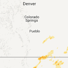
Hail Maps for Branson, CO


Connect with Interactive Hail Maps