

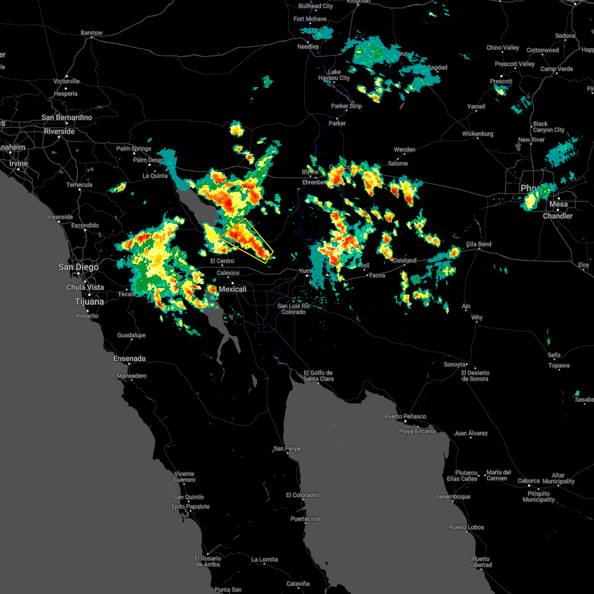
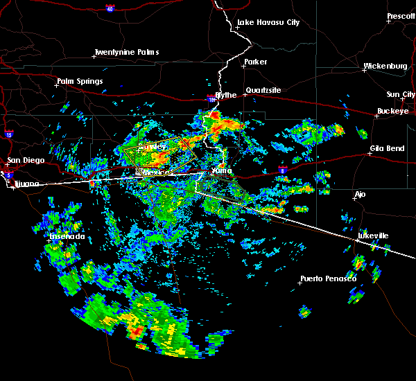
Hail Map for Brawley, CA
The Brawley, CA area has had 1 report of on-the-ground hail by trained spotters, and has been under severe weather warnings 0 times during the past 12 months. Doppler radar has detected hail at or near Brawley, CA on 6 occasions.
| Name: | Brawley, CA |
| Where Located: | 56.9 miles WNW of Yuma, AZ |
| Map: | Google Map for Brawley, CA |
| Population: | 24953 |
| Housing Units: | 8231 |
| More Info: | Search Google for Brawley, CA |
0
The Top Recent Hail Date for Brawley, CA is Friday, September 1, 2023 (6th out of 6)

Hail and Wind Damage Spotted near Brawley, CA
| Date / Time | Report Details |
|---|---|
| 9/1/2023 2:37 PM PDT |
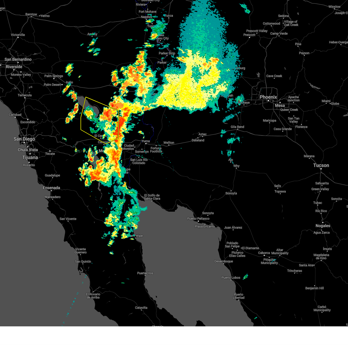 The severe thunderstorm warning for western imperial and riverside counties will expire at 245 pm pdt, the storms which prompted the warning have weakened below severe limits, and no longer pose an immediate threat to life or property. therefore, the warning will be allowed to expire. however gusty winds and heavy rain are still possible with these thunderstorms. The severe thunderstorm warning for western imperial and riverside counties will expire at 245 pm pdt, the storms which prompted the warning have weakened below severe limits, and no longer pose an immediate threat to life or property. therefore, the warning will be allowed to expire. however gusty winds and heavy rain are still possible with these thunderstorms.
|
| 9/1/2023 1:50 PM PDT |
 At 150 pm pdt, severe thunderstorms were located along a line extending from 10 miles west of westmorland to near imperial, moving north at 25 mph (radar indicated). Hazards include 60 mph wind gusts and penny size hail. expect damage to roofs, siding, and trees At 150 pm pdt, severe thunderstorms were located along a line extending from 10 miles west of westmorland to near imperial, moving north at 25 mph (radar indicated). Hazards include 60 mph wind gusts and penny size hail. expect damage to roofs, siding, and trees
|
| 8/20/2023 11:31 AM PDT |
 At 1130 am pdt, severe thunderstorms were located along a line extending from 6 miles west of mt. signal to near calexico, moving northwest at 60 mph (radar indicated). Hazards include 60 mph wind gusts. expect damage to roofs, siding, and trees At 1130 am pdt, severe thunderstorms were located along a line extending from 6 miles west of mt. signal to near calexico, moving northwest at 60 mph (radar indicated). Hazards include 60 mph wind gusts. expect damage to roofs, siding, and trees
|
| 10/15/2022 1:56 PM PDT |
 The severe thunderstorm warning for central imperial county will expire at 200 pm pdt, the storm which prompted the warning has weakened below severe limits, and no longer poses an immediate threat to life or property. therefore, the warning will be allowed to expire. however small hail is still possible with this thunderstorm. The severe thunderstorm warning for central imperial county will expire at 200 pm pdt, the storm which prompted the warning has weakened below severe limits, and no longer poses an immediate threat to life or property. therefore, the warning will be allowed to expire. however small hail is still possible with this thunderstorm.
|
| 10/15/2022 1:41 PM PDT | A power line and possibly a power pole were blown down by thunderstorm wind in imperial county CA, 8 miles SW of Brawley, CA |
| 10/15/2022 1:35 PM PDT |
 At 135 pm pdt, a severe thunderstorm was located 14 miles northeast of holtville, or 21 miles east of brawley, moving northwest at 25 mph (radar indicated). Hazards include 60 mph wind gusts and quarter size hail. Hail damage to vehicles is expected. expect wind damage to roofs, siding, and trees. locations impacted include, glamis and wiest. this includes the following highways, ca route 78 between mile markers 20 and 40. ca route 111 between mile markers 25 and 30. hail threat, radar indicated max hail size, 1. 00 in wind threat, radar indicated max wind gust, 60 mph. At 135 pm pdt, a severe thunderstorm was located 14 miles northeast of holtville, or 21 miles east of brawley, moving northwest at 25 mph (radar indicated). Hazards include 60 mph wind gusts and quarter size hail. Hail damage to vehicles is expected. expect wind damage to roofs, siding, and trees. locations impacted include, glamis and wiest. this includes the following highways, ca route 78 between mile markers 20 and 40. ca route 111 between mile markers 25 and 30. hail threat, radar indicated max hail size, 1. 00 in wind threat, radar indicated max wind gust, 60 mph.
|
| 10/15/2022 1:19 PM PDT |
 At 119 pm pdt, a severe thunderstorm was located 15 miles northwest of gordon`s well, or 25 miles east of brawley, moving northwest at 25 mph (radar indicated). Hazards include 60 mph wind gusts and quarter size hail. Hail damage to vehicles is expected. Expect wind damage to roofs, siding, and trees. At 119 pm pdt, a severe thunderstorm was located 15 miles northwest of gordon`s well, or 25 miles east of brawley, moving northwest at 25 mph (radar indicated). Hazards include 60 mph wind gusts and quarter size hail. Hail damage to vehicles is expected. Expect wind damage to roofs, siding, and trees.
|
| 8/22/2022 1:11 AM PDT | At 109 am mst/109 am pdt/, severe thunderstorms were located along a line extending from 21 miles northeast of brawley to 22 miles north of gordon`s well to 17 miles north of algodones dunes to near martinez lake, moving southwest at 25 mph (radar indicated). Hazards include 70 mph wind gusts. Expect considerable tree damage. damage is likely to mobile homes, roofs, and outbuildings. locations impacted include, yuma, somerton, martinez lake, gadsden, fortuna foothills, wellton, gordon`s well, algodones dunes, kinter, andrade, winterhaven, araby, yuma proving ground, blaisdell and ligurta. this includes the following highways, az interstate 8 between mile markers 1 and 32. ca interstate 8 between mile markers 55 and 96. az route 95 between mile markers 29 and 79. thunderstorm damage threat, considerable hail threat, radar indicated max hail size, <. 75 in wind threat, radar indicated max wind gust, 70 mph. |
| 8/22/2022 1:11 AM PDT | At 109 am mst/109 am pdt/, severe thunderstorms were located along a line extending from 21 miles northeast of brawley to 22 miles north of gordon`s well to 17 miles north of algodones dunes to near martinez lake, moving southwest at 25 mph (radar indicated). Hazards include 70 mph wind gusts. Expect considerable tree damage. damage is likely to mobile homes, roofs, and outbuildings. locations impacted include, yuma, somerton, martinez lake, gadsden, fortuna foothills, wellton, gordon`s well, algodones dunes, kinter, andrade, winterhaven, araby, yuma proving ground, blaisdell and ligurta. this includes the following highways, az interstate 8 between mile markers 1 and 32. ca interstate 8 between mile markers 55 and 96. az route 95 between mile markers 29 and 79. thunderstorm damage threat, considerable hail threat, radar indicated max hail size, <. 75 in wind threat, radar indicated max wind gust, 70 mph. |
| 8/22/2022 12:44 AM PDT | At 1243 am mst/1243 am pdt/, severe thunderstorms were located along a line extending from 22 miles west of palo verde to 12 miles south of cibola to 7 miles east of yuma proving ground, moving southwest at 30 mph (radar indicated). Hazards include 70 mph wind gusts. Expect considerable tree damage. damage is likely to mobile homes, roofs, and outbuildings. locations impacted include, yuma, somerton, martinez lake, gadsden, fortuna foothills, wellton, cibola, palo verde, gordon`s well, algodones dunes, kinter, andrade, winterhaven, araby and yuma proving ground. this includes the following highways, az interstate 8 between mile markers 1 and 32. ca interstate 8 between mile markers 55 and 96. az route 95 between mile markers 29 and 90. thunderstorm damage threat, considerable hail threat, radar indicated max hail size, <. 75 in wind threat, radar indicated max wind gust, 70 mph. |
| 8/22/2022 12:44 AM PDT | At 1243 am mst/1243 am pdt/, severe thunderstorms were located along a line extending from 22 miles west of palo verde to 12 miles south of cibola to 7 miles east of yuma proving ground, moving southwest at 30 mph (radar indicated). Hazards include 70 mph wind gusts. Expect considerable tree damage. damage is likely to mobile homes, roofs, and outbuildings. locations impacted include, yuma, somerton, martinez lake, gadsden, fortuna foothills, wellton, cibola, palo verde, gordon`s well, algodones dunes, kinter, andrade, winterhaven, araby and yuma proving ground. this includes the following highways, az interstate 8 between mile markers 1 and 32. ca interstate 8 between mile markers 55 and 96. az route 95 between mile markers 29 and 90. thunderstorm damage threat, considerable hail threat, radar indicated max hail size, <. 75 in wind threat, radar indicated max wind gust, 70 mph. |
| 8/22/2022 12:34 AM PDT | At 1234 am mst/1234 am pdt/, severe thunderstorms were located along a line extending from 20 miles west of palo verde to 9 miles south of cibola to 11 miles northeast of yuma proving ground, moving southwest at 30 mph (radar indicated). Hazards include 70 mph wind gusts. Expect considerable tree damage. Damage is likely to mobile homes, roofs, and outbuildings. |
| 8/22/2022 12:34 AM PDT | At 1234 am mst/1234 am pdt/, severe thunderstorms were located along a line extending from 20 miles west of palo verde to 9 miles south of cibola to 11 miles northeast of yuma proving ground, moving southwest at 30 mph (radar indicated). Hazards include 70 mph wind gusts. Expect considerable tree damage. Damage is likely to mobile homes, roofs, and outbuildings. |
| 8/8/2022 7:24 PM PDT |
 At 722 pm pdt, a severe thunderstorm was located over el centro, moving northeast at 15 mph (radar indicated). Hazards include 60 mph wind gusts. Expect damage to roofs, siding, and trees. locations impacted include, el centro, calexico, brawley, imperial, plaster city, ocotillo, mt. signal, el centro naval airfield, heber, coyote wells, dixieland and seeley. this includes the following highways, ca interstate 8 between mile markers 12 and 47. ca route 111 between mile markers 1 and 20. ca route 86 between mile markers 1 and 20. hail threat, radar indicated max hail size, <. 75 in wind threat, radar indicated max wind gust, 60 mph. At 722 pm pdt, a severe thunderstorm was located over el centro, moving northeast at 15 mph (radar indicated). Hazards include 60 mph wind gusts. Expect damage to roofs, siding, and trees. locations impacted include, el centro, calexico, brawley, imperial, plaster city, ocotillo, mt. signal, el centro naval airfield, heber, coyote wells, dixieland and seeley. this includes the following highways, ca interstate 8 between mile markers 12 and 47. ca route 111 between mile markers 1 and 20. ca route 86 between mile markers 1 and 20. hail threat, radar indicated max hail size, <. 75 in wind threat, radar indicated max wind gust, 60 mph.
|
| 8/8/2022 6:53 PM PDT |
 At 652 pm pdt, a severe thunderstorm was located near mt. signal, or near el centro, moving northeast at 15 mph (radar indicated). Hazards include 60 mph wind gusts. expect damage to roofs, siding, and trees At 652 pm pdt, a severe thunderstorm was located near mt. signal, or near el centro, moving northeast at 15 mph (radar indicated). Hazards include 60 mph wind gusts. expect damage to roofs, siding, and trees
|
| 9/24/2021 7:47 AM PDT |
 At 747 am pdt, a severe thunderstorm was located near holtville, or 14 miles northeast of calexico, moving south at 10 mph (radar indicated). Hazards include 60 mph wind gusts and quarter size hail. Hail damage to vehicles is expected. expect wind damage to roofs, siding, and trees. locations impacted include, holtville, gordon`s well, bonds corner, alamorio and heber. this includes the following highways, ca interstate 8 between mile markers 41 and 74. ca route 78 between mile markers 15 and 35. ca route 111 between mile markers 5 and 22. hail threat, radar indicated max hail size, 1. 00 in wind threat, radar indicated max wind gust, 60 mph. At 747 am pdt, a severe thunderstorm was located near holtville, or 14 miles northeast of calexico, moving south at 10 mph (radar indicated). Hazards include 60 mph wind gusts and quarter size hail. Hail damage to vehicles is expected. expect wind damage to roofs, siding, and trees. locations impacted include, holtville, gordon`s well, bonds corner, alamorio and heber. this includes the following highways, ca interstate 8 between mile markers 41 and 74. ca route 78 between mile markers 15 and 35. ca route 111 between mile markers 5 and 22. hail threat, radar indicated max hail size, 1. 00 in wind threat, radar indicated max wind gust, 60 mph.
|
| 9/24/2021 7:33 AM PDT |
 At 732 am pdt, a severe thunderstorm was located near holtville, or 15 miles east of imperial, and is nearly stationary (radar indicated). Hazards include 60 mph wind gusts and penny size hail. expect damage to roofs, siding, and trees At 732 am pdt, a severe thunderstorm was located near holtville, or 15 miles east of imperial, and is nearly stationary (radar indicated). Hazards include 60 mph wind gusts and penny size hail. expect damage to roofs, siding, and trees
|
| 8/31/2021 6:11 PM PDT | Power pole down and blocking traffi in imperial county CA, 6.5 miles SW of Brawley, CA |
| 8/31/2021 4:53 PM PDT | Corrects previous tstm wnd dmg report from 1 ssw wiest. power pole down and blocking traffic. time estimated from rada in imperial county CA, 6.5 miles SW of Brawley, CA |
| 8/31/2021 4:30 PM PDT |
 At 429 pm pdt, a severe thunderstorm was located near el centro naval airfield, or 7 miles northeast of plaster city, moving north at 25 mph (radar indicated). Hazards include 60 mph wind gusts and quarter size hail. Hail damage to vehicles is expected. Expect wind damage to roofs, siding, and trees. At 429 pm pdt, a severe thunderstorm was located near el centro naval airfield, or 7 miles northeast of plaster city, moving north at 25 mph (radar indicated). Hazards include 60 mph wind gusts and quarter size hail. Hail damage to vehicles is expected. Expect wind damage to roofs, siding, and trees.
|
| 3/12/2020 3:38 PM PDT |
 At 336 pm pdt, a severe thunderstorm was located near imperial, moving north at 20 mph (radar indicated). Hazards include quarter size hail. Damage to vehicles is expected. locations impacted include, el centro, imperial, holtville and heber. this includes the following highways, ca interstate 8 between mile markers 34 and 49. ca route 78 between mile markers 23 and 25. Ca route 111 between mile markers 2 and 20. At 336 pm pdt, a severe thunderstorm was located near imperial, moving north at 20 mph (radar indicated). Hazards include quarter size hail. Damage to vehicles is expected. locations impacted include, el centro, imperial, holtville and heber. this includes the following highways, ca interstate 8 between mile markers 34 and 49. ca route 78 between mile markers 23 and 25. Ca route 111 between mile markers 2 and 20.
|
| 3/12/2020 3:19 PM PDT |
 At 318 pm pdt, a severe thunderstorm was located near calexico, moving north at 20 mph (radar indicated). Hazards include quarter size hail. damage to vehicles is expected At 318 pm pdt, a severe thunderstorm was located near calexico, moving north at 20 mph (radar indicated). Hazards include quarter size hail. damage to vehicles is expected
|
| 9/25/2019 3:08 PM PDT |
 The severe thunderstorm warning for southeastern imperial county will expire at 315 pm pdt, the storm which prompted the warning has weakened below severe limits, and no longer poses an immediate threat to life or property. therefore, the warning will be allowed to expire. however gusty winds and heavy rain are still possible with this thunderstorm. The severe thunderstorm warning for southeastern imperial county will expire at 315 pm pdt, the storm which prompted the warning has weakened below severe limits, and no longer poses an immediate threat to life or property. therefore, the warning will be allowed to expire. however gusty winds and heavy rain are still possible with this thunderstorm.
|
| 9/25/2019 2:35 PM PDT |
 At 234 pm pdt, a severe thunderstorm was located 14 miles northeast of holtville, or 22 miles east of brawley, moving southwest at 30 mph (radar indicated). Hazards include 60 mph wind gusts and quarter size hail. Hail damage to vehicles is expected. expect wind damage to roofs, siding, and trees. locations impacted include, el centro, brawley, imperial, holtville, bonds corner, alamorio, glamis and wiest. this includes the following highways, ca interstate 8 between mile markers 40 and 63. ca route 78 between mile markers 14 and 50. Ca route 111 between mile markers 6 and 26. At 234 pm pdt, a severe thunderstorm was located 14 miles northeast of holtville, or 22 miles east of brawley, moving southwest at 30 mph (radar indicated). Hazards include 60 mph wind gusts and quarter size hail. Hail damage to vehicles is expected. expect wind damage to roofs, siding, and trees. locations impacted include, el centro, brawley, imperial, holtville, bonds corner, alamorio, glamis and wiest. this includes the following highways, ca interstate 8 between mile markers 40 and 63. ca route 78 between mile markers 14 and 50. Ca route 111 between mile markers 6 and 26.
|
| 9/25/2019 2:13 PM PDT |
 At 213 pm pdt, a severe thunderstorm was located 16 miles north of algodones dunes, or 28 miles northwest of yuma, moving west at 30 mph (radar indicated). Hazards include 60 mph wind gusts and quarter size hail. Hail damage to vehicles is expected. Expect wind damage to roofs, siding, and trees. At 213 pm pdt, a severe thunderstorm was located 16 miles north of algodones dunes, or 28 miles northwest of yuma, moving west at 30 mph (radar indicated). Hazards include 60 mph wind gusts and quarter size hail. Hail damage to vehicles is expected. Expect wind damage to roofs, siding, and trees.
|
| 9/30/2018 5:02 PM PDT |
 At 501 pm pdt, a severe thunderstorm was located near mt. signal, or near el centro, moving north at 25 mph (radar indicated). Hazards include 60 mph wind gusts. expect damage to roofs, siding, and trees At 501 pm pdt, a severe thunderstorm was located near mt. signal, or near el centro, moving north at 25 mph (radar indicated). Hazards include 60 mph wind gusts. expect damage to roofs, siding, and trees
|
| 9/8/2017 1:47 PM PDT |
 At 147 pm pdt, a severe thunderstorm was located near holtville, or 7 miles northeast of calexico, moving north at 10 mph (radar indicated). Hazards include 60 mph wind gusts. Expect damage to roofs, siding, and trees. Locations impacted include, el centro, calexico, brawley, imperial, holtville, bonds corner, heber, alamorio and wiest. At 147 pm pdt, a severe thunderstorm was located near holtville, or 7 miles northeast of calexico, moving north at 10 mph (radar indicated). Hazards include 60 mph wind gusts. Expect damage to roofs, siding, and trees. Locations impacted include, el centro, calexico, brawley, imperial, holtville, bonds corner, heber, alamorio and wiest.
|
| 9/8/2017 1:38 PM PDT |
 At 137 pm pdt, a severe thunderstorm was located near calexico, moving north at 10 mph (radar indicated). Hazards include 60 mph wind gusts. expect damage to roofs, siding, and trees At 137 pm pdt, a severe thunderstorm was located near calexico, moving north at 10 mph (radar indicated). Hazards include 60 mph wind gusts. expect damage to roofs, siding, and trees
|
| 9/9/2013 6:35 PM PDT | Storm damage reported in imperial county CA, 0.2 miles ENE of Brawley, CA |
| 9/9/2013 6:10 PM PDT | Quarter sized hail reported 0.4 miles W of Brawley, CA |
Hail Maps for Brawley, CA


Connect with Interactive Hail Maps