

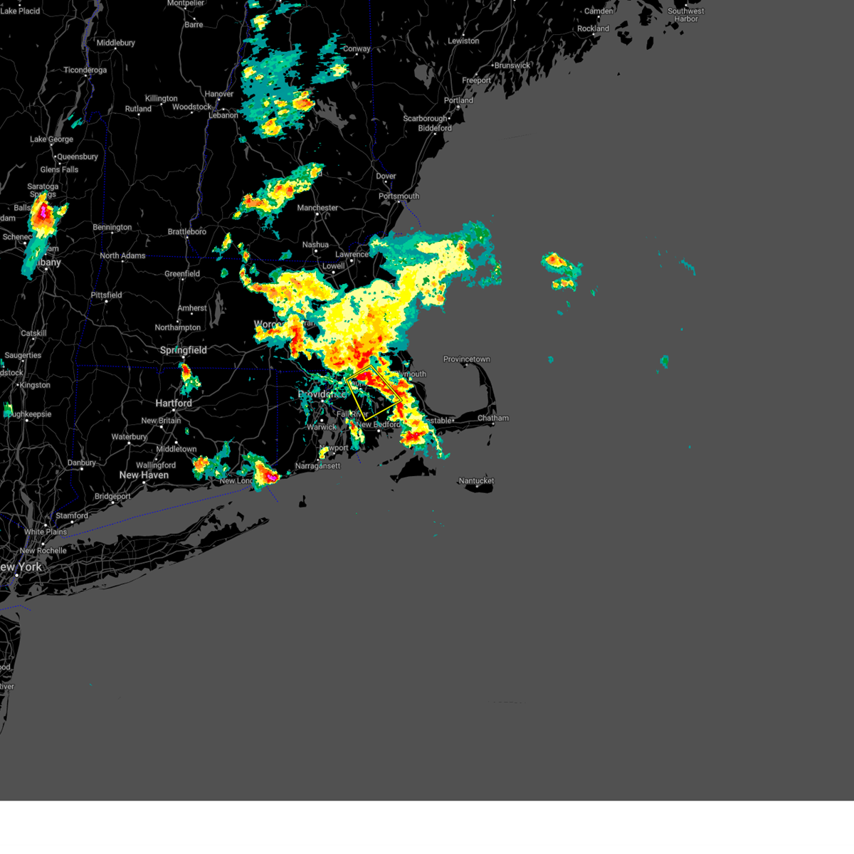
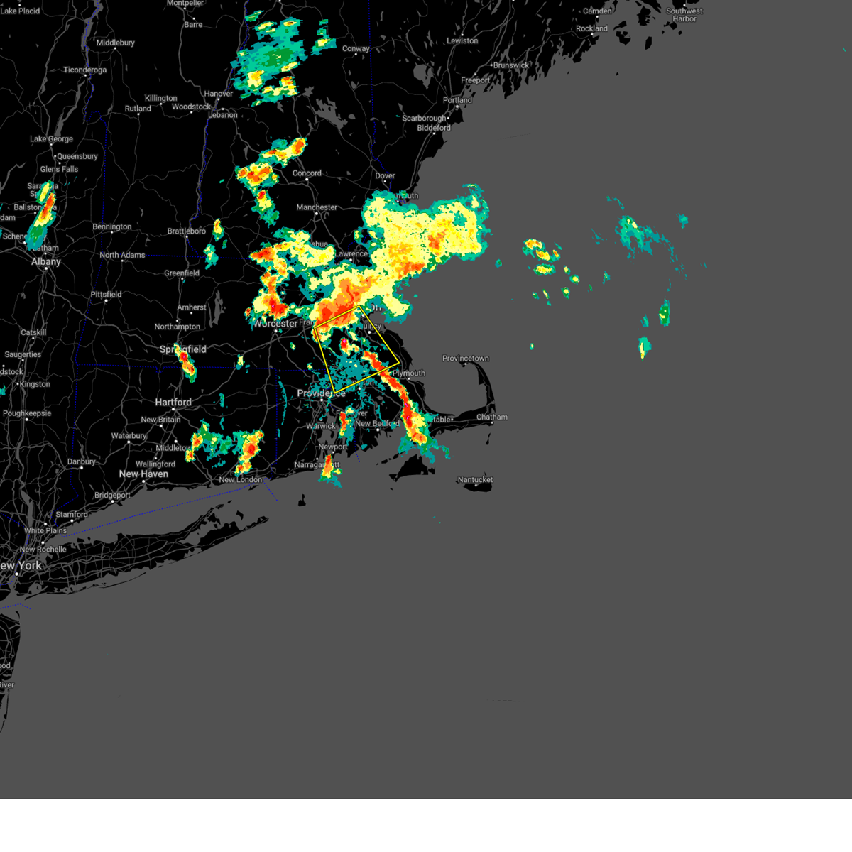
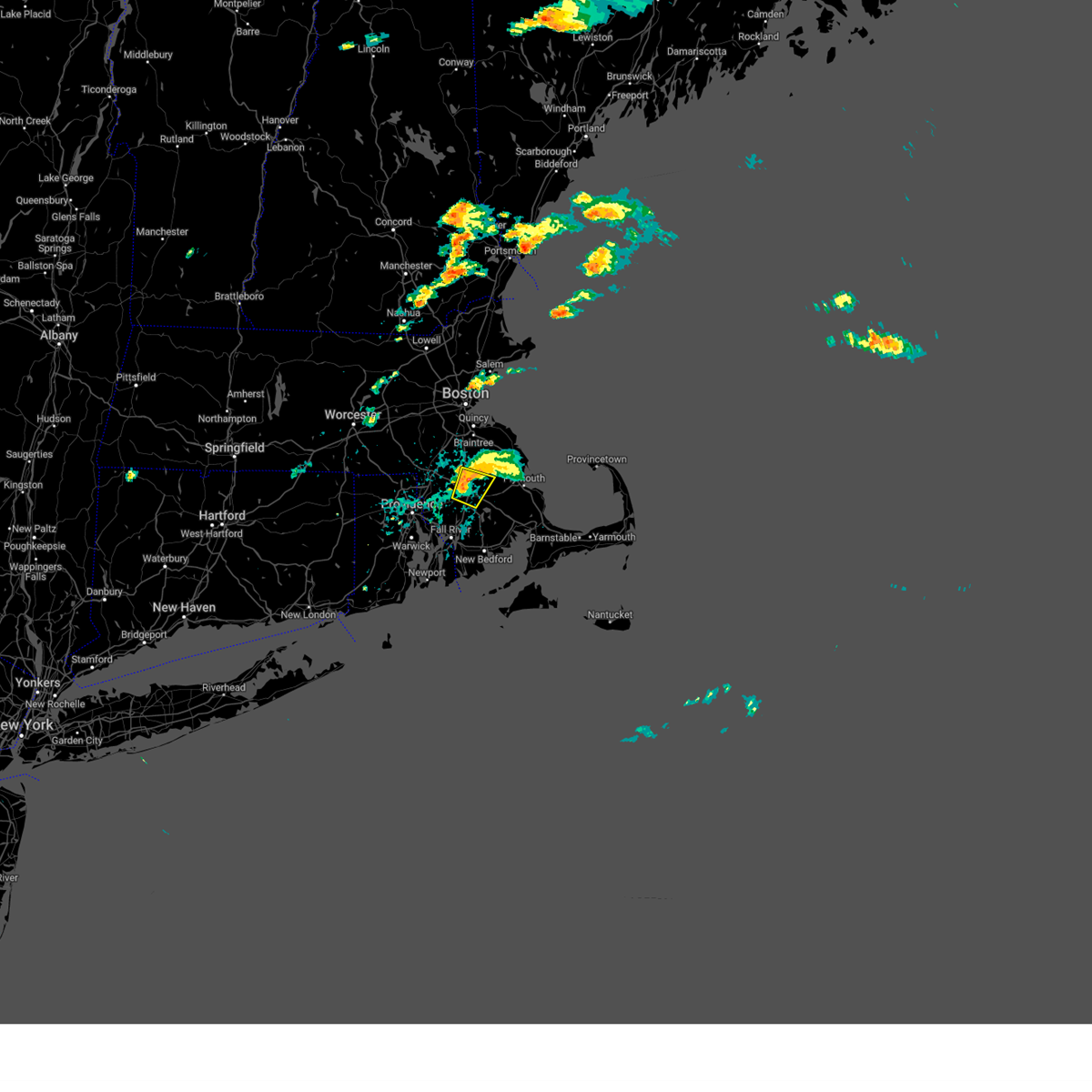
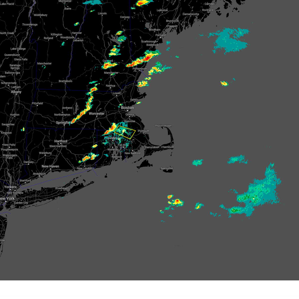
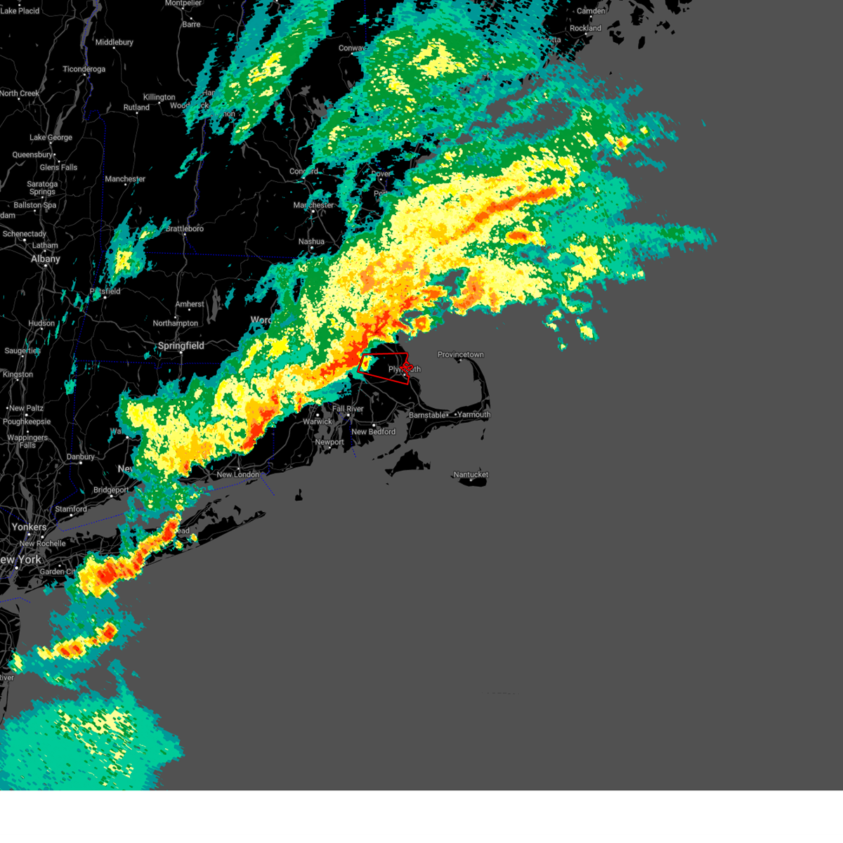
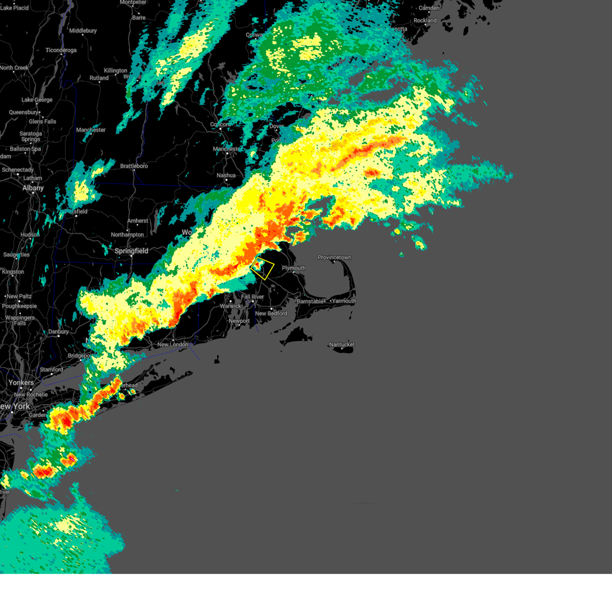
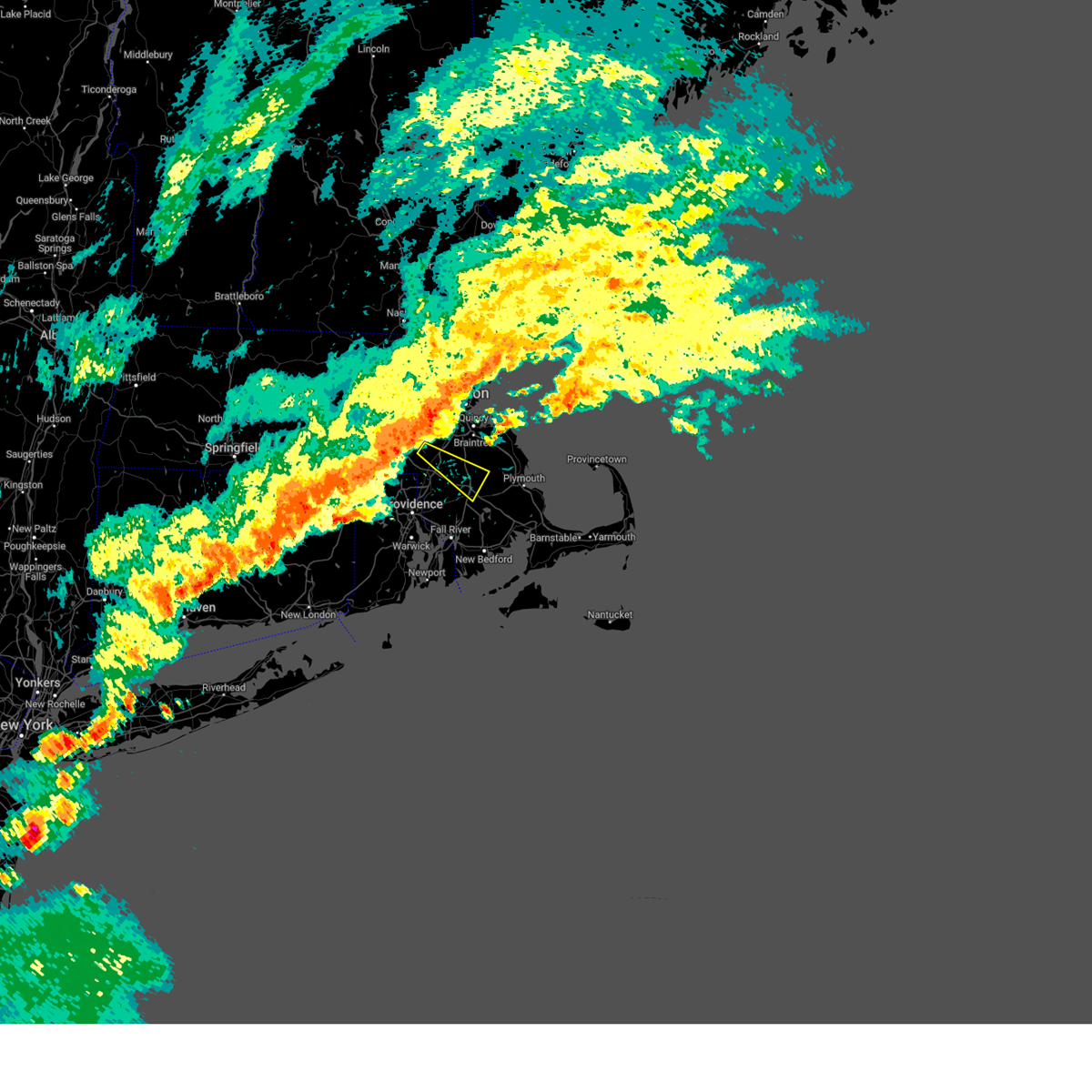
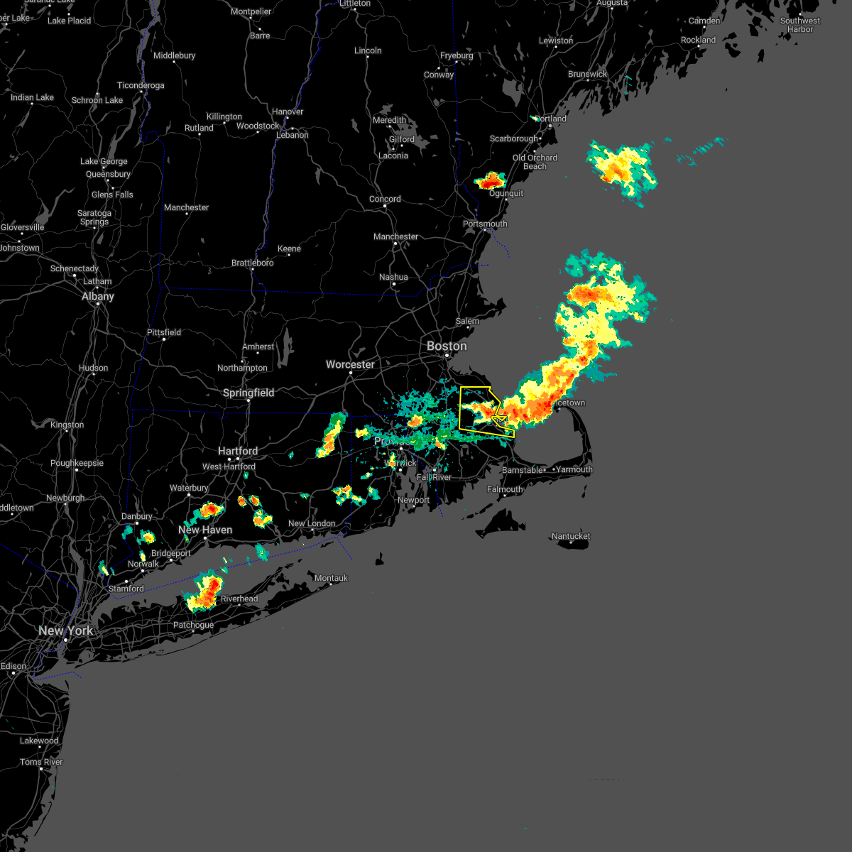
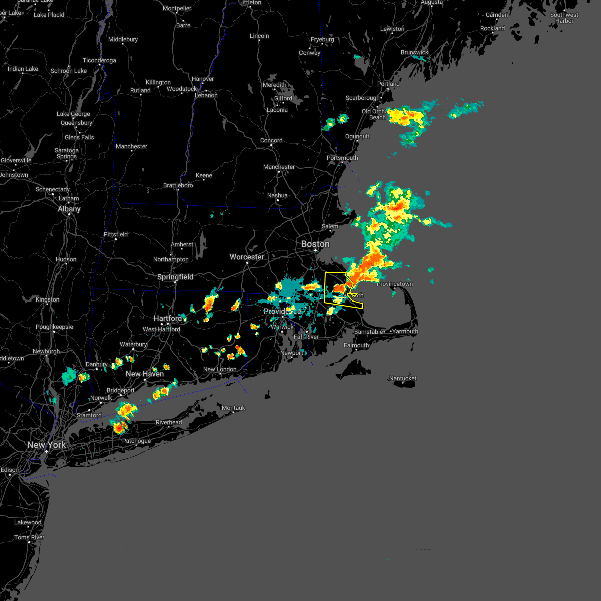
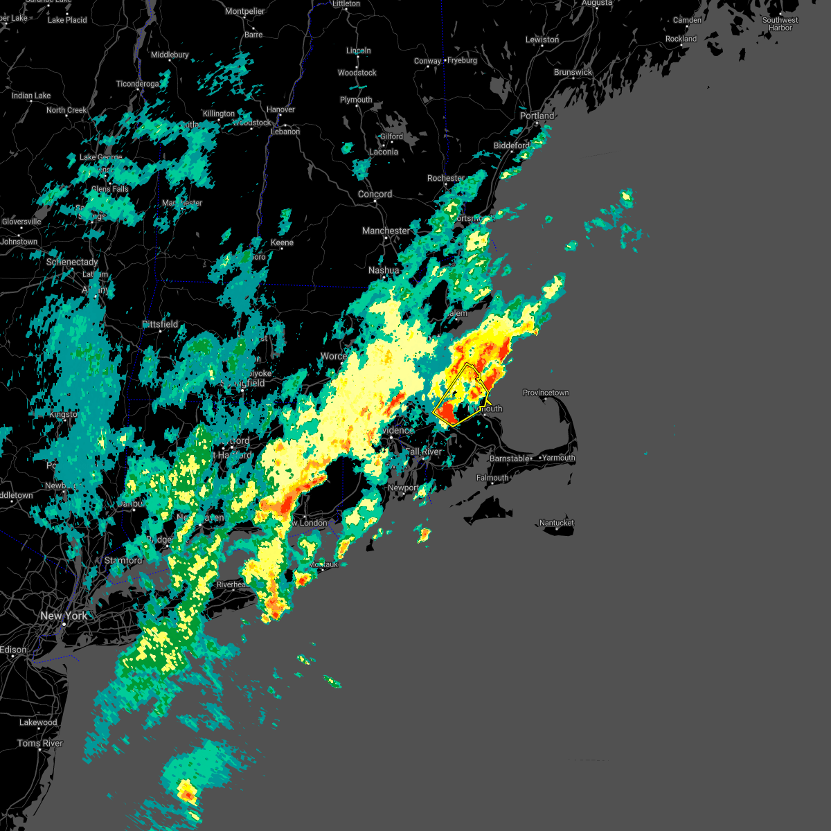
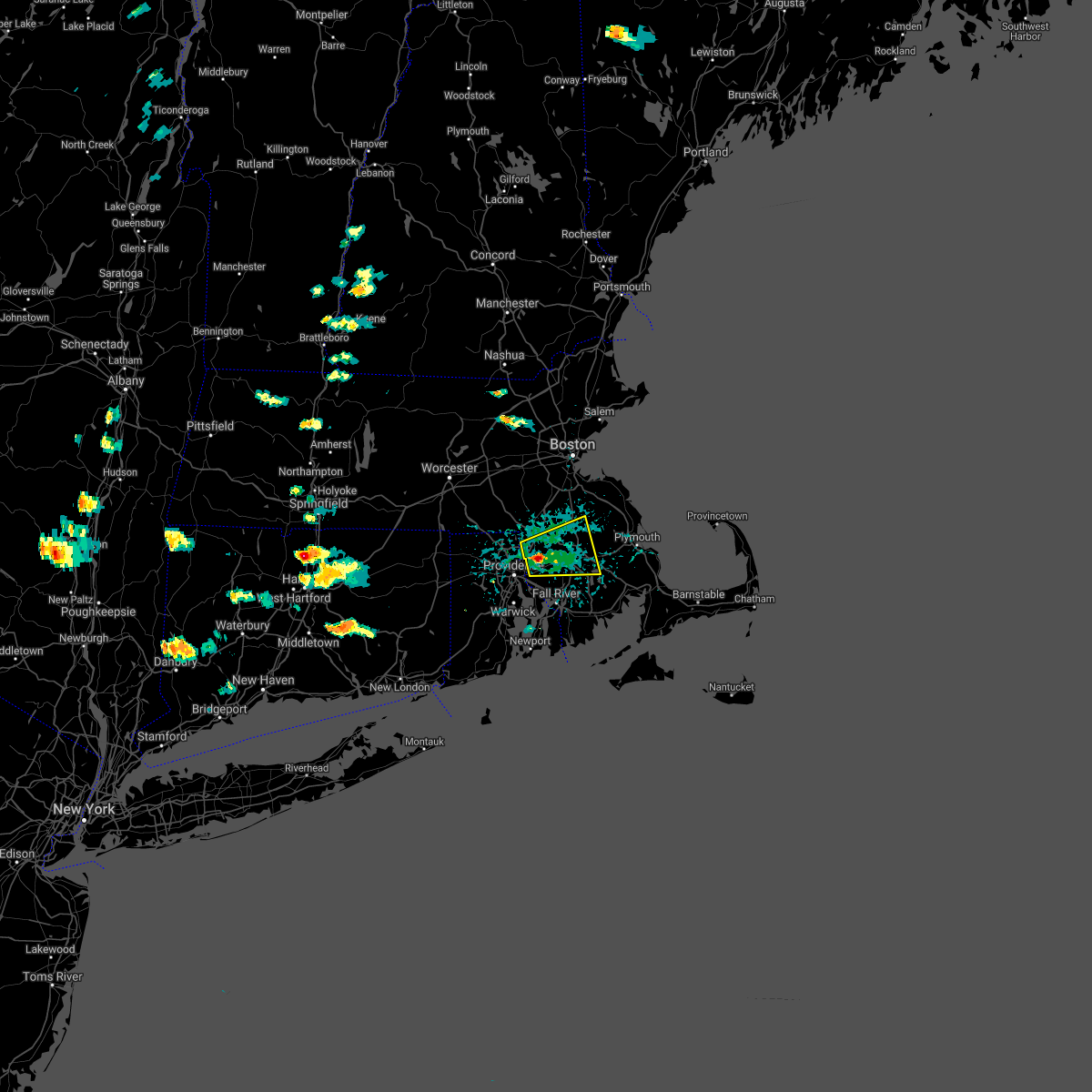
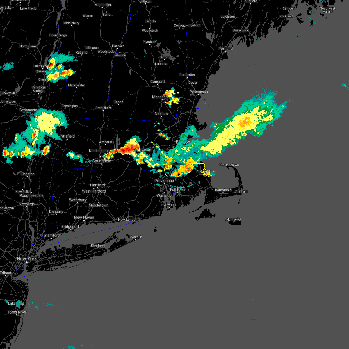
Hail Map for Bridgewater, MA
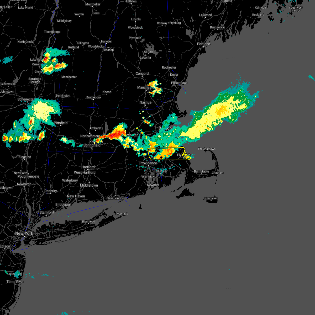
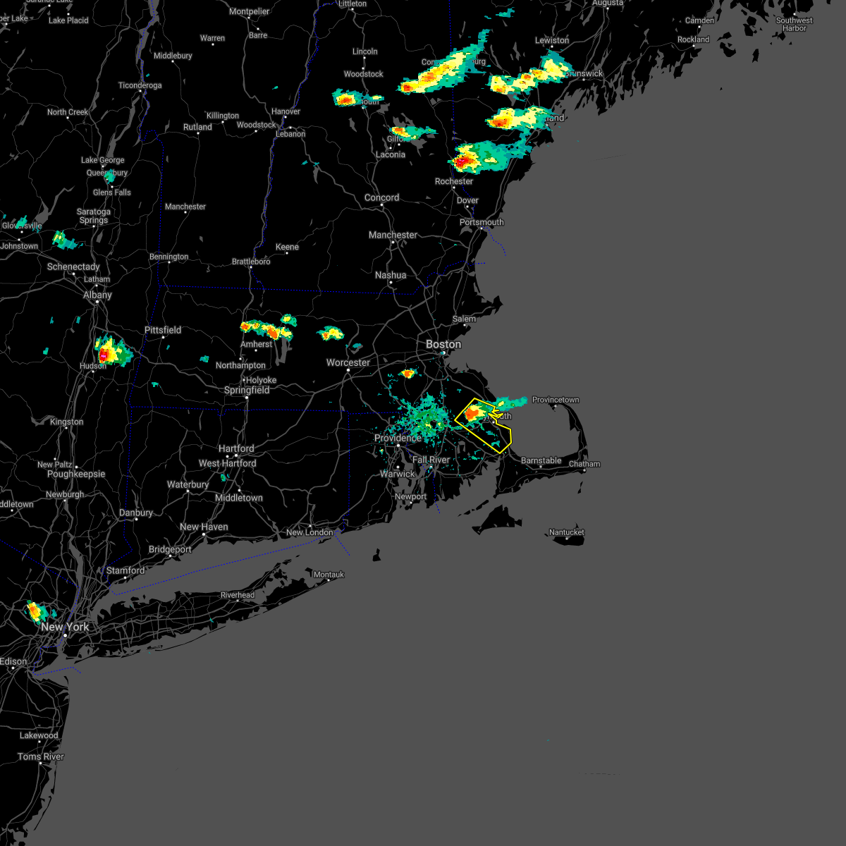
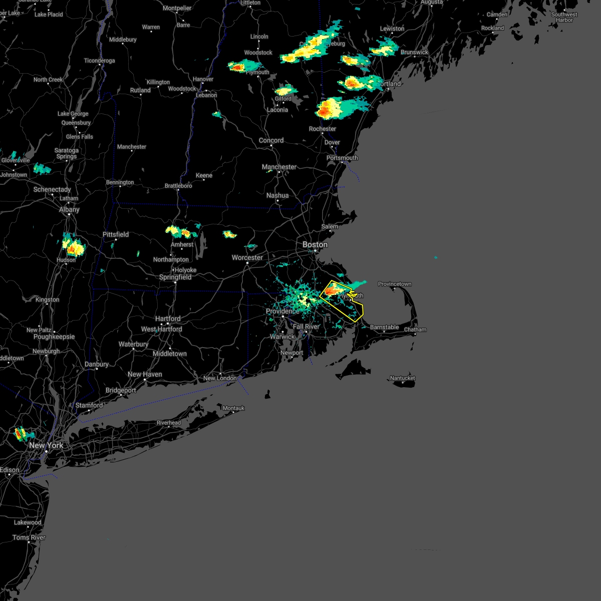
The Bridgewater, MA area has had 3 reports of on-the-ground hail by trained spotters, and has been under severe weather warnings 2 times during the past 12 months. Doppler radar has detected hail at or near Bridgewater, MA on 12 occasions, including 2 occasions during the past year.
| Name: | Bridgewater, MA |
| Where Located: | 25.5 miles ENE of Providence, RI |
| Map: | Google Map for Bridgewater, MA |
| Population: | 7841 |
| Housing Units: | 2596 |
| More Info: | Search Google for Bridgewater, MA |
0
The Top Recent Hail Date for Bridgewater, MA is Monday, August 26, 2024 (8th out of 12)

Hail and Wind Damage Spotted near Bridgewater, MA
| Date / Time | Report Details |
|---|---|
| 8/15/2024 4:55 PM EDT | In bridgewater... small tree reported down on vernon st. time estimated by rada in plymouth county MA, 3.2 miles NNE of Bridgewater, MA |
| 8/15/2024 4:44 PM EDT |
 Svrbox the national weather service in boston/norton has issued a * severe thunderstorm warning for, southwestern plymouth county in southeastern massachusetts, central bristol county in southeastern massachusetts, * until 545 pm edt. * at 444 pm edt, a severe thunderstorm was located over raynham, or near bridgewater, moving southeast at 15 mph (radar indicated). Hazards include 60 mph wind gusts and quarter size hail. Hail damage to vehicles is expected. Expect wind damage to trees and power lines. Svrbox the national weather service in boston/norton has issued a * severe thunderstorm warning for, southwestern plymouth county in southeastern massachusetts, central bristol county in southeastern massachusetts, * until 545 pm edt. * at 444 pm edt, a severe thunderstorm was located over raynham, or near bridgewater, moving southeast at 15 mph (radar indicated). Hazards include 60 mph wind gusts and quarter size hail. Hail damage to vehicles is expected. Expect wind damage to trees and power lines.
|
| 8/15/2024 4:12 PM EDT |
 Svrbox the national weather service in boston/norton has issued a * severe thunderstorm warning for, norfolk county in eastern massachusetts, suffolk county in eastern massachusetts, southeastern middlesex county in northeastern massachusetts, northwestern plymouth county in southeastern massachusetts, northwestern bristol county in southeastern massachusetts, * until 500 pm edt. * at 411 pm edt, a severe thunderstorm was located over needham, moving southeast at 35 mph (radar indicated). Hazards include 60 mph wind gusts and quarter size hail. Hail damage to vehicles is expected. Expect wind damage to trees and power lines. Svrbox the national weather service in boston/norton has issued a * severe thunderstorm warning for, norfolk county in eastern massachusetts, suffolk county in eastern massachusetts, southeastern middlesex county in northeastern massachusetts, northwestern plymouth county in southeastern massachusetts, northwestern bristol county in southeastern massachusetts, * until 500 pm edt. * at 411 pm edt, a severe thunderstorm was located over needham, moving southeast at 35 mph (radar indicated). Hazards include 60 mph wind gusts and quarter size hail. Hail damage to vehicles is expected. Expect wind damage to trees and power lines.
|
| 6/26/2024 11:48 PM EDT | Lot of trees and wires down across town. time estimated from rada in plymouth county MA, 0.1 miles NNW of Bridgewater, MA |
| 6/26/2024 11:44 PM EDT |
 At 1143 pm edt, severe thunderstorms were located along a line extending from newton to raynham to near little compton, moving east at 55 mph (radar indicated). Hazards include 60 mph wind gusts. Expect damage to roofs, siding, and trees. Locations impacted include, boston, cambridge, new bedford, brockton, quincy, fall river, newton, brookline, plymouth, taunton, weymouth, braintree, dartmouth, randolph, needham, norwood, wellesley, milton, stoughton, and bridgewater. At 1143 pm edt, severe thunderstorms were located along a line extending from newton to raynham to near little compton, moving east at 55 mph (radar indicated). Hazards include 60 mph wind gusts. Expect damage to roofs, siding, and trees. Locations impacted include, boston, cambridge, new bedford, brockton, quincy, fall river, newton, brookline, plymouth, taunton, weymouth, braintree, dartmouth, randolph, needham, norwood, wellesley, milton, stoughton, and bridgewater.
|
| 6/26/2024 11:44 PM EDT |
 the severe thunderstorm warning has been cancelled and is no longer in effect the severe thunderstorm warning has been cancelled and is no longer in effect
|
| 6/26/2024 11:36 PM EDT |
 the severe thunderstorm warning has been cancelled and is no longer in effect the severe thunderstorm warning has been cancelled and is no longer in effect
|
| 6/26/2024 11:36 PM EDT |
 At 1136 pm edt, severe thunderstorms were located along a line extending from natick to near taunton to near little compton, moving east at 55 mph (radar indicated). Hazards include 60 mph wind gusts. Expect damage to roofs, siding, and trees. Locations impacted include, boston, cambridge, new bedford, brockton, quincy, fall river, newton, framingham, brookline, plymouth, taunton, weymouth, braintree, dartmouth, natick, randolph, needham, north attleborough, norwood, and wellesley. At 1136 pm edt, severe thunderstorms were located along a line extending from natick to near taunton to near little compton, moving east at 55 mph (radar indicated). Hazards include 60 mph wind gusts. Expect damage to roofs, siding, and trees. Locations impacted include, boston, cambridge, new bedford, brockton, quincy, fall river, newton, framingham, brookline, plymouth, taunton, weymouth, braintree, dartmouth, natick, randolph, needham, north attleborough, norwood, and wellesley.
|
| 6/26/2024 11:16 PM EDT |
 Svrbox the national weather service in boston/norton has issued a * severe thunderstorm warning for, norfolk county in eastern massachusetts, suffolk county in eastern massachusetts, southeastern middlesex county in northeastern massachusetts, plymouth county in southeastern massachusetts, bristol county in southeastern massachusetts, northeastern washington county in rhode island, newport county in rhode island, northeastern kent county in rhode island, eastern providence county in rhode island, bristol county in rhode island, * until 1215 am edt. * at 1115 pm edt, severe thunderstorms were located along a line extending from near millbury to johnston to south kingstown, moving east at 55 mph (radar indicated). Hazards include 60 mph wind gusts. expect damage to roofs, siding, and trees Svrbox the national weather service in boston/norton has issued a * severe thunderstorm warning for, norfolk county in eastern massachusetts, suffolk county in eastern massachusetts, southeastern middlesex county in northeastern massachusetts, plymouth county in southeastern massachusetts, bristol county in southeastern massachusetts, northeastern washington county in rhode island, newport county in rhode island, northeastern kent county in rhode island, eastern providence county in rhode island, bristol county in rhode island, * until 1215 am edt. * at 1115 pm edt, severe thunderstorms were located along a line extending from near millbury to johnston to south kingstown, moving east at 55 mph (radar indicated). Hazards include 60 mph wind gusts. expect damage to roofs, siding, and trees
|
| 9/13/2023 5:12 PM EDT |
 At 512 pm edt, a severe thunderstorm capable of producing a tornado was located over cumberland, moving east at 20 mph (radar indicated rotation). Hazards include tornado. Flying debris will be dangerous to those caught without shelter. mobile homes will be damaged or destroyed. damage to roofs, windows, and vehicles will occur. tree damage is likely. this dangerous storm will be near, cumberland, franklin, north attleborough, attleboro, mansfield, norton, foxborough, wrentham, and plainville around 520 pm edt. Norfolk around 525 pm edt. At 512 pm edt, a severe thunderstorm capable of producing a tornado was located over cumberland, moving east at 20 mph (radar indicated rotation). Hazards include tornado. Flying debris will be dangerous to those caught without shelter. mobile homes will be damaged or destroyed. damage to roofs, windows, and vehicles will occur. tree damage is likely. this dangerous storm will be near, cumberland, franklin, north attleborough, attleboro, mansfield, norton, foxborough, wrentham, and plainville around 520 pm edt. Norfolk around 525 pm edt.
|
| 8/18/2023 9:22 AM EDT |
 At 921 am edt, a severe thunderstorm capable of producing a tornado was located over mansfield, or near north attleborough, moving east at 40 mph (radar indicated rotation). Hazards include tornado and quarter size hail. Flying debris will be dangerous to those caught without shelter. mobile homes will be damaged or destroyed. damage to roofs, windows, and vehicles will occur. Tree damage is likely. At 921 am edt, a severe thunderstorm capable of producing a tornado was located over mansfield, or near north attleborough, moving east at 40 mph (radar indicated rotation). Hazards include tornado and quarter size hail. Flying debris will be dangerous to those caught without shelter. mobile homes will be damaged or destroyed. damage to roofs, windows, and vehicles will occur. Tree damage is likely.
|
| 8/13/2023 5:08 PM EDT |
 The severe thunderstorm warning for central plymouth and central bristol counties will expire at 515 pm edt, the storm which prompted the warning has weakened below severe limits, and no longer poses an immediate threat to life or property. therefore, the warning will be allowed to expire. however gusty winds and heavy rain are still possible with this thunderstorm. The severe thunderstorm warning for central plymouth and central bristol counties will expire at 515 pm edt, the storm which prompted the warning has weakened below severe limits, and no longer poses an immediate threat to life or property. therefore, the warning will be allowed to expire. however gusty winds and heavy rain are still possible with this thunderstorm.
|
| 8/13/2023 4:53 PM EDT |
 At 453 pm edt, a severe thunderstorm was located over middleborough, or 7 miles southeast of bridgewater, moving east at 25 mph (radar indicated). Hazards include 60 mph wind gusts and quarter size hail. Hail damage to vehicles is expected. expect wind damage to roofs, siding, and trees. Locations impacted include, plymouth, taunton, bridgewater, middleborough, wareham, east bridgewater, raynham, kingston, carver, lakeville, halifax, and plympton. At 453 pm edt, a severe thunderstorm was located over middleborough, or 7 miles southeast of bridgewater, moving east at 25 mph (radar indicated). Hazards include 60 mph wind gusts and quarter size hail. Hail damage to vehicles is expected. expect wind damage to roofs, siding, and trees. Locations impacted include, plymouth, taunton, bridgewater, middleborough, wareham, east bridgewater, raynham, kingston, carver, lakeville, halifax, and plympton.
|
| 8/13/2023 4:38 PM EDT |
 The severe thunderstorm warning for west central plymouth and north central bristol counties will expire at 445 pm edt, the storm which prompted the warning has moved out of the area. therefore, the warning will be allowed to expire. however small hail, gusty winds and heavy rain are still possible with this thunderstorm. to report severe weather, contact your nearest law enforcement agency. they will relay your report to the national weather service boston/norton. remember, a severe thunderstorm warning still remains in effect for plymouth county. The severe thunderstorm warning for west central plymouth and north central bristol counties will expire at 445 pm edt, the storm which prompted the warning has moved out of the area. therefore, the warning will be allowed to expire. however small hail, gusty winds and heavy rain are still possible with this thunderstorm. to report severe weather, contact your nearest law enforcement agency. they will relay your report to the national weather service boston/norton. remember, a severe thunderstorm warning still remains in effect for plymouth county.
|
| 8/13/2023 4:35 PM EDT |
 At 435 pm edt, a severe thunderstorm was located over raynham, or over bridgewater, moving east at 25 mph (radar indicated). Hazards include 60 mph wind gusts and quarter size hail. Hail damage to vehicles is expected. Expect wind damage to roofs, siding, and trees. At 435 pm edt, a severe thunderstorm was located over raynham, or over bridgewater, moving east at 25 mph (radar indicated). Hazards include 60 mph wind gusts and quarter size hail. Hail damage to vehicles is expected. Expect wind damage to roofs, siding, and trees.
|
| 8/13/2023 4:32 PM EDT |
 At 432 pm edt, a severe thunderstorm was located over raynham, or near bridgewater, moving east at 20 mph (radar indicated). Hazards include 60 mph wind gusts and quarter size hail. Hail damage to vehicles is expected. expect wind damage to roofs, siding, and trees. locations impacted include, taunton, bridgewater, middleborough, easton, east bridgewater, raynham, lakeville, halifax, and west bridgewater. hail threat, radar indicated max hail size, 1. 00 in wind threat, radar indicated max wind gust, 60 mph. At 432 pm edt, a severe thunderstorm was located over raynham, or near bridgewater, moving east at 20 mph (radar indicated). Hazards include 60 mph wind gusts and quarter size hail. Hail damage to vehicles is expected. expect wind damage to roofs, siding, and trees. locations impacted include, taunton, bridgewater, middleborough, easton, east bridgewater, raynham, lakeville, halifax, and west bridgewater. hail threat, radar indicated max hail size, 1. 00 in wind threat, radar indicated max wind gust, 60 mph.
|
| 8/13/2023 3:59 PM EDT |
 At 358 pm edt, a severe thunderstorm was located over plainville, or near north attleborough, moving east at 30 mph (radar indicated). Hazards include 60 mph wind gusts and quarter size hail. Hail damage to vehicles is expected. Expect wind damage to roofs, siding, and trees. At 358 pm edt, a severe thunderstorm was located over plainville, or near north attleborough, moving east at 30 mph (radar indicated). Hazards include 60 mph wind gusts and quarter size hail. Hail damage to vehicles is expected. Expect wind damage to roofs, siding, and trees.
|
| 7/29/2023 8:39 PM EDT |
 At 839 pm edt, severe thunderstorms were located along a line extending from near duxbury to near seekonk, moving southeast at 30 mph (radar indicated). Hazards include 60 mph wind gusts. expect damage to trees and power lines At 839 pm edt, severe thunderstorms were located along a line extending from near duxbury to near seekonk, moving southeast at 30 mph (radar indicated). Hazards include 60 mph wind gusts. expect damage to trees and power lines
|
| 7/29/2023 8:32 PM EDT |
 At 831 pm edt, a severe thunderstorm capable of producing a tornado was located over west bridgewater, or over bridgewater, moving east at 45 mph (radar indicated rotation). Hazards include tornado. Flying debris will be dangerous to those caught without shelter. mobile homes will be damaged or destroyed. damage to roofs, windows, and vehicles will occur. tree damage is likely. this dangerous storm will be near, bridgewater, middleborough, pembroke, rockland, duxbury, whitman, hanover, east bridgewater, kingston and carver around 835 pm edt. plymouth around 840 pm edt. Marshfield around 845 pm edt. At 831 pm edt, a severe thunderstorm capable of producing a tornado was located over west bridgewater, or over bridgewater, moving east at 45 mph (radar indicated rotation). Hazards include tornado. Flying debris will be dangerous to those caught without shelter. mobile homes will be damaged or destroyed. damage to roofs, windows, and vehicles will occur. tree damage is likely. this dangerous storm will be near, bridgewater, middleborough, pembroke, rockland, duxbury, whitman, hanover, east bridgewater, kingston and carver around 835 pm edt. plymouth around 840 pm edt. Marshfield around 845 pm edt.
|
| 7/29/2023 8:25 PM EDT |
 At 824 pm edt, a severe thunderstorm was located over easton, or near brockton, moving southeast at 40 mph (radar indicated). Hazards include 60 mph wind gusts. Expect damage to trees and power lines. Locations impacted include, brockton, taunton, bridgewater, middleborough, easton, norton, east bridgewater, raynham and west bridgewater. At 824 pm edt, a severe thunderstorm was located over easton, or near brockton, moving southeast at 40 mph (radar indicated). Hazards include 60 mph wind gusts. Expect damage to trees and power lines. Locations impacted include, brockton, taunton, bridgewater, middleborough, easton, norton, east bridgewater, raynham and west bridgewater.
|
| 7/29/2023 8:03 PM EDT |
 At 802 pm edt, a severe thunderstorm was located over norfolk, or near franklin, moving southeast at 30 mph (radar indicated). Hazards include 60 mph wind gusts. expect damage to trees and power lines At 802 pm edt, a severe thunderstorm was located over norfolk, or near franklin, moving southeast at 30 mph (radar indicated). Hazards include 60 mph wind gusts. expect damage to trees and power lines
|
| 7/27/2023 6:50 PM EDT |
 At 650 pm edt, a severe thunderstorm was located over brockton, moving east at 30 mph (radar indicated). Hazards include 60 mph wind gusts. Expect damage to trees and power lines. locations impacted include, brockton, taunton, weymouth, braintree, randolph, norwood, stoughton, bridgewater, marshfield, walpole, mansfield, middleborough, easton, hingham, canton, norton, scituate, pembroke, sharon and rockland. hail threat, radar indicated max hail size, <. 75 in wind threat, radar indicated max wind gust, 60 mph. At 650 pm edt, a severe thunderstorm was located over brockton, moving east at 30 mph (radar indicated). Hazards include 60 mph wind gusts. Expect damage to trees and power lines. locations impacted include, brockton, taunton, weymouth, braintree, randolph, norwood, stoughton, bridgewater, marshfield, walpole, mansfield, middleborough, easton, hingham, canton, norton, scituate, pembroke, sharon and rockland. hail threat, radar indicated max hail size, <. 75 in wind threat, radar indicated max wind gust, 60 mph.
|
| 7/27/2023 6:37 PM EDT |
 At 636 pm edt, a severe thunderstorm was located over mansfield, or near north attleborough, moving east at 30 mph (radar indicated). Hazards include 60 mph wind gusts. expect damage to trees and power lines At 636 pm edt, a severe thunderstorm was located over mansfield, or near north attleborough, moving east at 30 mph (radar indicated). Hazards include 60 mph wind gusts. expect damage to trees and power lines
|
| 8/26/2022 4:27 PM EDT | At 427 pm edt, severe thunderstorms were located along a line extending from lynn to mansfield, moving east at 40 mph (radar indicated). Hazards include 60 mph wind gusts. expect damage to trees and power lines |
| 8/9/2022 4:09 PM EDT |
 At 408 pm edt, a severe thunderstorm was located over duxbury, or near marshfield, moving east at 15 mph (radar indicated). Hazards include 60 mph wind gusts. Expect damage to trees and power lines. locations impacted include, plymouth, weymouth, bridgewater, marshfield, middleborough, hingham, scituate, pembroke, rockland, abington, duxbury, whitman, hanover, east bridgewater, kingston, carver, norwell, hanson, halifax and plympton. hail threat, radar indicated max hail size, <. 75 in wind threat, radar indicated max wind gust, 60 mph. At 408 pm edt, a severe thunderstorm was located over duxbury, or near marshfield, moving east at 15 mph (radar indicated). Hazards include 60 mph wind gusts. Expect damage to trees and power lines. locations impacted include, plymouth, weymouth, bridgewater, marshfield, middleborough, hingham, scituate, pembroke, rockland, abington, duxbury, whitman, hanover, east bridgewater, kingston, carver, norwell, hanson, halifax and plympton. hail threat, radar indicated max hail size, <. 75 in wind threat, radar indicated max wind gust, 60 mph.
|
| 8/9/2022 3:43 PM EDT |
 At 343 pm edt, a severe thunderstorm was located over duxbury, or near marshfield, moving east at 20 mph (radar indicated). Hazards include 60 mph wind gusts. expect damage to trees and power lines At 343 pm edt, a severe thunderstorm was located over duxbury, or near marshfield, moving east at 20 mph (radar indicated). Hazards include 60 mph wind gusts. expect damage to trees and power lines
|
| 7/14/2022 5:30 PM EDT | Quarter sized hail reported 5.2 miles W of Bridgewater, MA |
| 7/14/2022 5:27 PM EDT |
 The severe thunderstorm warning for northwestern barnstable, central plymouth and central bristol counties will expire at 530 pm edt, the storm which prompted the warning has weakened below severe limits, and no longer poses an immediate threat to life or property. therefore, the warning will be allowed to expire. however gusty winds and heavy rain are still possible with this thunderstorm. The severe thunderstorm warning for northwestern barnstable, central plymouth and central bristol counties will expire at 530 pm edt, the storm which prompted the warning has weakened below severe limits, and no longer poses an immediate threat to life or property. therefore, the warning will be allowed to expire. however gusty winds and heavy rain are still possible with this thunderstorm.
|
| 7/14/2022 5:20 PM EDT | Quarter sized hail reported 0.1 miles NNW of Bridgewater, MA, relayed by amateur radio. |
| 7/14/2022 5:10 PM EDT |
 At 510 pm edt, a severe thunderstorm was located near plympton, or 9 miles west of plymouth, moving east at 35 mph (radar indicated). Hazards include 60 mph wind gusts and quarter size hail. Expect wind damage to trees and power lines. minor hail damage to vehicles is possible. locations impacted include, plymouth, taunton, bridgewater, marshfield, middleborough, wareham, pembroke, duxbury, east bridgewater, raynham, kingston, carver, lakeville, hanson, halifax, rochester and plympton. hail threat, radar indicated max hail size, 1. 00 in wind threat, radar indicated max wind gust, 60 mph. At 510 pm edt, a severe thunderstorm was located near plympton, or 9 miles west of plymouth, moving east at 35 mph (radar indicated). Hazards include 60 mph wind gusts and quarter size hail. Expect wind damage to trees and power lines. minor hail damage to vehicles is possible. locations impacted include, plymouth, taunton, bridgewater, marshfield, middleborough, wareham, pembroke, duxbury, east bridgewater, raynham, kingston, carver, lakeville, hanson, halifax, rochester and plympton. hail threat, radar indicated max hail size, 1. 00 in wind threat, radar indicated max wind gust, 60 mph.
|
| 7/14/2022 4:50 PM EDT |
 At 449 pm edt, a severe thunderstorm was located near berkley, or near taunton, moving east at 30 mph (radar indicated). Hazards include 60 mph wind gusts and quarter size hail. Expect wind damage to trees and power lines. Minor hail damage to vehicles is possible. At 449 pm edt, a severe thunderstorm was located near berkley, or near taunton, moving east at 30 mph (radar indicated). Hazards include 60 mph wind gusts and quarter size hail. Expect wind damage to trees and power lines. Minor hail damage to vehicles is possible.
|
| 11/13/2021 5:55 PM EST |
 At 555 pm est, severe thunderstorms were located along a line extending from boston to duxbury to rochester, moving east at 50 mph (radar indicated). Hazards include 60 mph wind gusts. expect damage to trees and power lines At 555 pm est, severe thunderstorms were located along a line extending from boston to duxbury to rochester, moving east at 50 mph (radar indicated). Hazards include 60 mph wind gusts. expect damage to trees and power lines
|
| 11/13/2021 5:49 PM EST |
 At 549 pm est, severe thunderstorms were located along a line extending from winchester to halifax, moving northeast at 60 mph (radar indicated). Hazards include 60 mph wind gusts and penny size hail. Expect damage to trees and power lines. Locations impacted include, boston, cambridge, brockton, quincy, newton, waltham, brookline, weymouth, arlington, braintree, natick, randolph, watertown, needham, norwood, wellesley, milton, stoughton, bridgewater and belmont. At 549 pm est, severe thunderstorms were located along a line extending from winchester to halifax, moving northeast at 60 mph (radar indicated). Hazards include 60 mph wind gusts and penny size hail. Expect damage to trees and power lines. Locations impacted include, boston, cambridge, brockton, quincy, newton, waltham, brookline, weymouth, arlington, braintree, natick, randolph, watertown, needham, norwood, wellesley, milton, stoughton, bridgewater and belmont.
|
| 11/13/2021 5:34 PM EST |
 At 534 pm est, severe thunderstorms were located along a line extending from framingham to near dighton, moving northeast at 50 mph (radar indicated). Hazards include 60 mph wind gusts and penny size hail. Expect damage to trees and power lines. Locations impacted include, boston, cambridge, brockton, quincy, newton, framingham, waltham, brookline, taunton, weymouth, arlington, braintree, natick, randolph, watertown, franklin, needham, north attleborough, norwood and milford. At 534 pm est, severe thunderstorms were located along a line extending from framingham to near dighton, moving northeast at 50 mph (radar indicated). Hazards include 60 mph wind gusts and penny size hail. Expect damage to trees and power lines. Locations impacted include, boston, cambridge, brockton, quincy, newton, framingham, waltham, brookline, taunton, weymouth, arlington, braintree, natick, randolph, watertown, franklin, needham, north attleborough, norwood and milford.
|
| 11/13/2021 5:26 PM EST |
 At 526 pm est, severe thunderstorms were located along a line extending from westborough to seekonk, moving northeast at 50 mph (radar indicated). Hazards include 60 mph wind gusts and penny size hail. expect damage to trees and power lines At 526 pm est, severe thunderstorms were located along a line extending from westborough to seekonk, moving northeast at 50 mph (radar indicated). Hazards include 60 mph wind gusts and penny size hail. expect damage to trees and power lines
|
| 9/28/2021 10:37 AM EDT |
 At 1036 am edt, a severe thunderstorm was located over whitman, or near brockton, moving east at 35 mph (radar indicated). Hazards include quarter size hail. Minor hail damage to vehicles is possible. locations impacted include, boston, brockton, quincy, weymouth, milton, stoughton, bridgewater, marshfield, dedham, hingham, scituate, pembroke, rockland, abington, duxbury, whitman, hanover, east bridgewater, norwell and hull. hail threat, radar indicated max hail size, 1. 00 in wind threat, radar indicated max wind gust, <50 mph. At 1036 am edt, a severe thunderstorm was located over whitman, or near brockton, moving east at 35 mph (radar indicated). Hazards include quarter size hail. Minor hail damage to vehicles is possible. locations impacted include, boston, brockton, quincy, weymouth, milton, stoughton, bridgewater, marshfield, dedham, hingham, scituate, pembroke, rockland, abington, duxbury, whitman, hanover, east bridgewater, norwell and hull. hail threat, radar indicated max hail size, 1. 00 in wind threat, radar indicated max wind gust, <50 mph.
|
| 9/28/2021 10:02 AM EDT |
 At 1001 am edt, a severe thunderstorm was located over whitman, or over brockton, moving east at 35 mph (radar indicated). Hazards include quarter size hail. minor hail damage to vehicles is possible At 1001 am edt, a severe thunderstorm was located over whitman, or over brockton, moving east at 35 mph (radar indicated). Hazards include quarter size hail. minor hail damage to vehicles is possible
|
| 7/27/2021 8:05 PM EDT |
 At 804 pm edt, severe thunderstorms were located along a line extending from gloucester to near pawtucket, moving southeast at 30 mph (trained weather spotters. multiple trees and powerlines were downed from these storms in greater boston and metrowest, as well as hingham and hull). Hazards include 60 mph wind gusts. Expect damage to trees and power lines. Locations impacted include, boston, brockton, quincy, taunton, weymouth, braintree, randolph, north attleborough, norwood, milton, stoughton, bridgewater, marshfield, attleboro, dedham, walpole, mansfield, middleborough, easton and hingham. At 804 pm edt, severe thunderstorms were located along a line extending from gloucester to near pawtucket, moving southeast at 30 mph (trained weather spotters. multiple trees and powerlines were downed from these storms in greater boston and metrowest, as well as hingham and hull). Hazards include 60 mph wind gusts. Expect damage to trees and power lines. Locations impacted include, boston, brockton, quincy, taunton, weymouth, braintree, randolph, north attleborough, norwood, milton, stoughton, bridgewater, marshfield, attleboro, dedham, walpole, mansfield, middleborough, easton and hingham.
|
| 7/27/2021 7:46 PM EDT |
 At 743 pm edt, severe thunderstorms were located along a line extending from near ipswich to cumberland, moving southeast at 30 mph (radar indicated. multiple trees and powerlines have been downed in newton, waltham, cambridge, brookline and dover. in addition, at 735 pm a 61 mph wind gust was reported at the boston logan international airport). Hazards include 60 mph wind gusts and nickel size hail. Expect damage to trees and power lines. Locations impacted include, boston, cambridge, brockton, quincy, lynn, newton, somerville, waltham, malden, brookline, medford, taunton, weymouth, revere, peabody, arlington, everett, salem, woonsocket and beverly. At 743 pm edt, severe thunderstorms were located along a line extending from near ipswich to cumberland, moving southeast at 30 mph (radar indicated. multiple trees and powerlines have been downed in newton, waltham, cambridge, brookline and dover. in addition, at 735 pm a 61 mph wind gust was reported at the boston logan international airport). Hazards include 60 mph wind gusts and nickel size hail. Expect damage to trees and power lines. Locations impacted include, boston, cambridge, brockton, quincy, lynn, newton, somerville, waltham, malden, brookline, medford, taunton, weymouth, revere, peabody, arlington, everett, salem, woonsocket and beverly.
|
| 7/27/2021 7:26 PM EDT |
 At 725 pm edt, severe thunderstorms were located along a line extending from rowley to woonsocket, moving southeast at 30 mph (radar indicated. these storms have a history of producing downed trees and powerlines in worcester, wellesley and westborough). Hazards include 60 mph wind gusts and nickel size hail. expect damage to trees and power lines At 725 pm edt, severe thunderstorms were located along a line extending from rowley to woonsocket, moving southeast at 30 mph (radar indicated. these storms have a history of producing downed trees and powerlines in worcester, wellesley and westborough). Hazards include 60 mph wind gusts and nickel size hail. expect damage to trees and power lines
|
| 7/23/2021 7:49 PM EDT | Large tree branch down in the road at oak street and marilyn way. relayed by amateur radi in plymouth county MA, 5.2 miles W of Bridgewater, MA |
| 7/23/2021 6:42 PM EDT |
 At 642 pm edt, a severe thunderstorm was located over brockton, moving east at 15 mph (radar indicated). Hazards include 60 mph wind gusts and quarter size hail. Expect wind damage to trees and power lines. Minor hail damage to vehicles is possible. At 642 pm edt, a severe thunderstorm was located over brockton, moving east at 15 mph (radar indicated). Hazards include 60 mph wind gusts and quarter size hail. Expect wind damage to trees and power lines. Minor hail damage to vehicles is possible.
|
| 7/6/2021 6:13 PM EDT |
 At 612 pm edt, severe thunderstorms were located along a line extending from near maynard to near holliston, moving southeast at 25 mph (radar indicated). Hazards include 60 mph wind gusts and penny size hail. expect damage to trees and power lines At 612 pm edt, severe thunderstorms were located along a line extending from near maynard to near holliston, moving southeast at 25 mph (radar indicated). Hazards include 60 mph wind gusts and penny size hail. expect damage to trees and power lines
|
| 6/30/2021 9:09 PM EDT |
 At 906 pm edt, severe thunderstorms were located along a line extending from scituate to near carver, moving east at 40 mph (radar indicated. at 845 pm large trees down in easton, ma and at 905 pm in halifax, ma multiple trees down). Hazards include 60 mph wind gusts. Expect damage to trees and power lines. Locations impacted include, quincy, plymouth, weymouth, braintree, bridgewater, marshfield, middleborough, hingham, scituate, pembroke, rockland, abington, duxbury, whitman, hanover, east bridgewater, kingston, carver, norwell and hull. At 906 pm edt, severe thunderstorms were located along a line extending from scituate to near carver, moving east at 40 mph (radar indicated. at 845 pm large trees down in easton, ma and at 905 pm in halifax, ma multiple trees down). Hazards include 60 mph wind gusts. Expect damage to trees and power lines. Locations impacted include, quincy, plymouth, weymouth, braintree, bridgewater, marshfield, middleborough, hingham, scituate, pembroke, rockland, abington, duxbury, whitman, hanover, east bridgewater, kingston, carver, norwell and hull.
|
| 6/30/2021 9:05 PM EDT | Trees down on fuller street. tree down on south street in plymouth county MA, 5.2 miles W of Bridgewater, MA |
| 6/30/2021 8:50 PM EDT | Tree down on garage on norlen park. tree and power lines down on conant street in plymouth county MA, 0.1 miles NNW of Bridgewater, MA |
| 6/30/2021 8:31 PM EDT |
 At 831 pm edt, severe thunderstorms were located along a line extending from walpole to rehoboth, moving east at 35 mph (radar indicated). Hazards include 60 mph wind gusts. expect damage to trees and power lines At 831 pm edt, severe thunderstorms were located along a line extending from walpole to rehoboth, moving east at 35 mph (radar indicated). Hazards include 60 mph wind gusts. expect damage to trees and power lines
|
| 6/22/2021 3:06 PM EDT | Tree down on route 24 southbound near the bridgewater lin in plymouth county MA, 3.8 miles NE of Bridgewater, MA |
| 6/22/2021 3:06 PM EDT |
 At 306 pm edt, a severe thunderstorm was located over halifax, or near bridgewater, moving northeast at 55 mph (radar indicated). Hazards include 60 mph wind gusts and penny size hail. expect damage to trees and power lines At 306 pm edt, a severe thunderstorm was located over halifax, or near bridgewater, moving northeast at 55 mph (radar indicated). Hazards include 60 mph wind gusts and penny size hail. expect damage to trees and power lines
|
| 11/15/2020 10:51 PM EST |
 At 1050 pm est, severe thunderstorms were located along a line extending from near burrillville to near richmond to 7 miles southeast of montauk point, moving east at 45 mph (radar indicated). Hazards include 60 mph wind gusts. Expect damage to trees and power lines. Locations impacted include, providence, new bedford, brockton, fall river, warwick, cranston, pawtucket, taunton, east providence, woonsocket, coventry, dartmouth, cumberland, north providence, franklin, south kingstown, west warwick, johnston, north attleborough and stoughton. At 1050 pm est, severe thunderstorms were located along a line extending from near burrillville to near richmond to 7 miles southeast of montauk point, moving east at 45 mph (radar indicated). Hazards include 60 mph wind gusts. Expect damage to trees and power lines. Locations impacted include, providence, new bedford, brockton, fall river, warwick, cranston, pawtucket, taunton, east providence, woonsocket, coventry, dartmouth, cumberland, north providence, franklin, south kingstown, west warwick, johnston, north attleborough and stoughton.
|
| 11/15/2020 10:24 PM EST |
 At 1024 pm est, severe thunderstorms were located along a line extending from near southbridge to preston to gardner`s island, moving east at 45 mph (radar indicated). Hazards include 60 mph wind gusts. expect damage to trees and power lines At 1024 pm est, severe thunderstorms were located along a line extending from near southbridge to preston to gardner`s island, moving east at 45 mph (radar indicated). Hazards include 60 mph wind gusts. expect damage to trees and power lines
|
| 10/7/2020 6:40 PM EDT |
 The severe thunderstorm warning for southeastern windham, central norfolk, southeastern worcester, plymouth, bristol, northeastern washington, northern newport, kent, providence and bristol counties will expire at 645 pm edt, the storms which prompted the warning have moved out of the area. therefore, the warning will be allowed to expire. The severe thunderstorm warning for southeastern windham, central norfolk, southeastern worcester, plymouth, bristol, northeastern washington, northern newport, kent, providence and bristol counties will expire at 645 pm edt, the storms which prompted the warning have moved out of the area. therefore, the warning will be allowed to expire.
|
| 10/7/2020 6:03 PM EDT |
 At 602 pm edt, severe thunderstorms were located along a line extending from canton to near killingly, moving southeast at 55 mph (radar indicated). Hazards include 60 mph wind gusts. expect damage to trees and power lines At 602 pm edt, severe thunderstorms were located along a line extending from canton to near killingly, moving southeast at 55 mph (radar indicated). Hazards include 60 mph wind gusts. expect damage to trees and power lines
|
| 8/24/2020 1:43 PM EDT |
 At 142 pm edt, a severe thunderstorm was located over attleboro, or near pawtucket, moving east at 15 mph (radar indicated). Hazards include 60 mph wind gusts and quarter size hail. Expect wind damage to trees and power lines. Minor hail damage to vehicles is possible. At 142 pm edt, a severe thunderstorm was located over attleboro, or near pawtucket, moving east at 15 mph (radar indicated). Hazards include 60 mph wind gusts and quarter size hail. Expect wind damage to trees and power lines. Minor hail damage to vehicles is possible.
|
| 8/23/2020 6:47 PM EDT |
 At 647 pm edt, a severe thunderstorm was located over wrentham, or near franklin, moving east at 15 mph (radar indicated). Hazards include 60 mph wind gusts and penny size hail. Expect damage to trees and power lines. Locations impacted include, brockton, plymouth, taunton, cumberland, franklin, north attleborough, stoughton, bridgewater, marshfield, attleboro, walpole, mansfield, middleborough, easton, norton, pembroke, sharon, rockland, foxborough and abington. At 647 pm edt, a severe thunderstorm was located over wrentham, or near franklin, moving east at 15 mph (radar indicated). Hazards include 60 mph wind gusts and penny size hail. Expect damage to trees and power lines. Locations impacted include, brockton, plymouth, taunton, cumberland, franklin, north attleborough, stoughton, bridgewater, marshfield, attleboro, walpole, mansfield, middleborough, easton, norton, pembroke, sharon, rockland, foxborough and abington.
|
| 8/23/2020 6:39 PM EDT |
 At 617 pm edt, a severe thunderstorm was located over mendon, or near milford, moving east at 15 mph (radar indicated. these storms have a history of producing pockets of significant wind damage. this includes downed trees and scattered power outages. seek an indoor shelter immediately). Hazards include 60 mph wind gusts and quarter size hail. Expect wind damage to trees and power lines. Minor hail damage to vehicles is possible. At 617 pm edt, a severe thunderstorm was located over mendon, or near milford, moving east at 15 mph (radar indicated. these storms have a history of producing pockets of significant wind damage. this includes downed trees and scattered power outages. seek an indoor shelter immediately). Hazards include 60 mph wind gusts and quarter size hail. Expect wind damage to trees and power lines. Minor hail damage to vehicles is possible.
|
| 8/23/2020 6:39 PM EDT |
 At 638 pm edt, a severe thunderstorm was located over franklin, moving east at 15 mph (radar indicated). Hazards include 60 mph wind gusts and penny size hail. Expect damage to trees and power lines. Locations impacted include, brockton, plymouth, taunton, woonsocket, cumberland, franklin, north attleborough, milford, stoughton, bridgewater, marshfield, attleboro, walpole, mansfield, middleborough, easton, smithfield, lincoln, norton and pembroke. At 638 pm edt, a severe thunderstorm was located over franklin, moving east at 15 mph (radar indicated). Hazards include 60 mph wind gusts and penny size hail. Expect damage to trees and power lines. Locations impacted include, brockton, plymouth, taunton, woonsocket, cumberland, franklin, north attleborough, milford, stoughton, bridgewater, marshfield, attleboro, walpole, mansfield, middleborough, easton, smithfield, lincoln, norton and pembroke.
|
| 8/23/2020 6:20 PM EDT |
 At 617 pm edt, a severe thunderstorm was located over mendon, or near milford, moving east at 15 mph (radar indicated. these storms have a history of producing pockets of significant wind damage. this includes downed trees and scattered power outages. seek an indoor shelter immediately). Hazards include 60 mph wind gusts and quarter size hail. Expect wind damage to trees and power lines. Minor hail damage to vehicles is possible. At 617 pm edt, a severe thunderstorm was located over mendon, or near milford, moving east at 15 mph (radar indicated. these storms have a history of producing pockets of significant wind damage. this includes downed trees and scattered power outages. seek an indoor shelter immediately). Hazards include 60 mph wind gusts and quarter size hail. Expect wind damage to trees and power lines. Minor hail damage to vehicles is possible.
|
| 8/22/2020 4:30 PM EDT | Large tree down on colonial post drive in plymouth county MA, 0.1 miles NNW of Bridgewater, MA |
| 8/22/2020 4:30 PM EDT | Large tree down on colonial post drive in plymouth county MA, 0.1 miles NNW of Bridgewater, MA |
| 8/22/2020 4:16 PM EDT |
 At 415 pm edt, a severe thunderstorm was located over middleborough, or 7 miles southeast of bridgewater, moving east at 30 mph (radar indicated). Hazards include 70 mph wind gusts and ping pong ball size hail. Expect considerable damage to trees and power lines. wind damage is also likely to mobile homes, roofs, and outbuildings. minor hail damage to vehicles is possible. Locations impacted include, plymouth, taunton, bridgewater, middleborough, wareham, pembroke, duxbury, east bridgewater, raynham, kingston, carver, lakeville, hanson, halifax, rochester and plympton. At 415 pm edt, a severe thunderstorm was located over middleborough, or 7 miles southeast of bridgewater, moving east at 30 mph (radar indicated). Hazards include 70 mph wind gusts and ping pong ball size hail. Expect considerable damage to trees and power lines. wind damage is also likely to mobile homes, roofs, and outbuildings. minor hail damage to vehicles is possible. Locations impacted include, plymouth, taunton, bridgewater, middleborough, wareham, pembroke, duxbury, east bridgewater, raynham, kingston, carver, lakeville, hanson, halifax, rochester and plympton.
|
| 8/22/2020 4:13 PM EDT | Trees and wires down blocking road on union st from pleasant st to mount pleasant st in plymouth county MA, 0.1 miles NNW of Bridgewater, MA |
| 8/22/2020 4:09 PM EDT |
 The severe thunderstorm warning for southeastern norfolk, west central plymouth and north central bristol counties will expire at 415 pm edt, the storm which prompted the warning has moved out of the area. therefore, the warning will be allowed to expire. The severe thunderstorm warning for southeastern norfolk, west central plymouth and north central bristol counties will expire at 415 pm edt, the storm which prompted the warning has moved out of the area. therefore, the warning will be allowed to expire.
|
| 8/22/2020 4:09 PM EDT |
 At 408 pm edt, a severe thunderstorm was located over halifax, or near bridgewater, moving southeast at 20 mph (radar indicated). Hazards include ping pong ball size hail and 60 mph wind gusts. Expect wind damage to trees and power lines. minor hail damage to vehicles is possible. Locations impacted include, plymouth, taunton, bridgewater, middleborough, wareham, pembroke, rockland, duxbury, whitman, east bridgewater, raynham, kingston, carver, lakeville, hanson, halifax, west bridgewater, rochester and plympton. At 408 pm edt, a severe thunderstorm was located over halifax, or near bridgewater, moving southeast at 20 mph (radar indicated). Hazards include ping pong ball size hail and 60 mph wind gusts. Expect wind damage to trees and power lines. minor hail damage to vehicles is possible. Locations impacted include, plymouth, taunton, bridgewater, middleborough, wareham, pembroke, rockland, duxbury, whitman, east bridgewater, raynham, kingston, carver, lakeville, hanson, halifax, west bridgewater, rochester and plympton.
|
| 8/22/2020 4:02 PM EDT | Trees and wires down on a car on south elm at scotland st in plymouth county MA, 2.5 miles SE of Bridgewater, MA |
| 8/22/2020 4:02 PM EDT | Trees and wires down on a car on south elm at scotland st in plymouth county MA, 2.5 miles SE of Bridgewater, MA |
| 8/22/2020 4:01 PM EDT |
 At 400 pm edt, a severe thunderstorm was located over bridgewater, moving southeast at 20 mph (radar indicated). Hazards include 60 mph wind gusts and quarter size hail. Expect wind damage to trees and power lines. minor hail damage to vehicles is possible. Locations impacted include, brockton, plymouth, taunton, bridgewater, middleborough, easton, wareham, pembroke, abington, duxbury, whitman, east bridgewater, raynham, kingston, carver, lakeville, hanson, halifax, west bridgewater and rochester. At 400 pm edt, a severe thunderstorm was located over bridgewater, moving southeast at 20 mph (radar indicated). Hazards include 60 mph wind gusts and quarter size hail. Expect wind damage to trees and power lines. minor hail damage to vehicles is possible. Locations impacted include, brockton, plymouth, taunton, bridgewater, middleborough, easton, wareham, pembroke, abington, duxbury, whitman, east bridgewater, raynham, kingston, carver, lakeville, hanson, halifax, west bridgewater and rochester.
|
| 8/22/2020 3:51 PM EDT |
 At 351 pm edt, a severe thunderstorm was located over brockton, moving southeast at 20 mph (radar indicated). Hazards include 60 mph wind gusts and quarter size hail. Expect wind damage to trees and power lines. minor hail damage to vehicles is possible. Locations impacted include, brockton, weymouth, randolph, stoughton, bridgewater, mansfield, easton, canton, sharon, rockland, foxborough, abington, whitman, hanover, east bridgewater, holbrook, hanson, west bridgewater and avon. At 351 pm edt, a severe thunderstorm was located over brockton, moving southeast at 20 mph (radar indicated). Hazards include 60 mph wind gusts and quarter size hail. Expect wind damage to trees and power lines. minor hail damage to vehicles is possible. Locations impacted include, brockton, weymouth, randolph, stoughton, bridgewater, mansfield, easton, canton, sharon, rockland, foxborough, abington, whitman, hanover, east bridgewater, holbrook, hanson, west bridgewater and avon.
|
| 8/22/2020 3:50 PM EDT |
 At 350 pm edt, a severe thunderstorm was located over west bridgewater, or near bridgewater, moving southeast at 20 mph (radar indicated). Hazards include 60 mph wind gusts and quarter size hail. Expect wind damage to trees and power lines. Minor hail damage to vehicles is possible. At 350 pm edt, a severe thunderstorm was located over west bridgewater, or near bridgewater, moving southeast at 20 mph (radar indicated). Hazards include 60 mph wind gusts and quarter size hail. Expect wind damage to trees and power lines. Minor hail damage to vehicles is possible.
|
| 8/22/2020 3:42 PM EDT |
 At 341 pm edt, a severe thunderstorm was located over stoughton, moving southeast at 20 mph (radar indicated). Hazards include 60 mph wind gusts and quarter size hail. Expect wind damage to trees and power lines. minor hail damage to vehicles is possible. Locations impacted include, brockton, quincy, weymouth, braintree, randolph, norwood, milton, stoughton, bridgewater, dedham, walpole, mansfield, easton, hingham, canton, sharon, rockland, foxborough, abington and westwood. At 341 pm edt, a severe thunderstorm was located over stoughton, moving southeast at 20 mph (radar indicated). Hazards include 60 mph wind gusts and quarter size hail. Expect wind damage to trees and power lines. minor hail damage to vehicles is possible. Locations impacted include, brockton, quincy, weymouth, braintree, randolph, norwood, milton, stoughton, bridgewater, dedham, walpole, mansfield, easton, hingham, canton, sharon, rockland, foxborough, abington and westwood.
|
| 8/22/2020 3:33 PM EDT |
 At 332 pm edt, a severe thunderstorm was located over sharon, or over stoughton, moving southeast at 20 mph (radar indicated). Hazards include 60 mph wind gusts and quarter size hail. Expect wind damage to trees and power lines. minor hail damage to vehicles is possible. Locations impacted include, brockton, quincy, weymouth, braintree, randolph, franklin, norwood, milton, stoughton, bridgewater, dedham, walpole, mansfield, easton, hingham, canton, sharon, rockland, foxborough and abington. At 332 pm edt, a severe thunderstorm was located over sharon, or over stoughton, moving southeast at 20 mph (radar indicated). Hazards include 60 mph wind gusts and quarter size hail. Expect wind damage to trees and power lines. minor hail damage to vehicles is possible. Locations impacted include, brockton, quincy, weymouth, braintree, randolph, franklin, norwood, milton, stoughton, bridgewater, dedham, walpole, mansfield, easton, hingham, canton, sharon, rockland, foxborough and abington.
|
| 8/22/2020 3:14 PM EDT |
 At 314 pm edt, a severe thunderstorm was located over walpole, or near norwood, moving southeast at 20 mph (radar indicated). Hazards include 60 mph wind gusts and quarter size hail. Expect wind damage to trees and power lines. Minor hail damage to vehicles is possible. At 314 pm edt, a severe thunderstorm was located over walpole, or near norwood, moving southeast at 20 mph (radar indicated). Hazards include 60 mph wind gusts and quarter size hail. Expect wind damage to trees and power lines. Minor hail damage to vehicles is possible.
|
| 8/22/2020 2:40 PM EDT | Tree down on pearl st in plymouth county MA, 2.9 miles SSW of Bridgewater, MA |
| 8/22/2020 1:37 PM EDT |
 At 137 pm edt, a severe thunderstorm was located over plympton, or 9 miles east of bridgewater, moving southeast at 20 mph (radar indicated). Hazards include 60 mph wind gusts and quarter size hail. Expect wind damage to trees and power lines. minor hail damage to vehicles is possible. Locations impacted include, plymouth, bridgewater, middleborough, wareham, pembroke, duxbury, east bridgewater, kingston, carver, hanson, halifax and plympton. At 137 pm edt, a severe thunderstorm was located over plympton, or 9 miles east of bridgewater, moving southeast at 20 mph (radar indicated). Hazards include 60 mph wind gusts and quarter size hail. Expect wind damage to trees and power lines. minor hail damage to vehicles is possible. Locations impacted include, plymouth, bridgewater, middleborough, wareham, pembroke, duxbury, east bridgewater, kingston, carver, hanson, halifax and plympton.
|
| 8/22/2020 1:28 PM EDT |
 At 127 pm edt, a severe thunderstorm was located over halifax, or 7 miles east of bridgewater, moving southeast at 20 mph (radar indicated). Hazards include 60 mph wind gusts and quarter size hail. Expect wind damage to trees and power lines. Minor hail damage to vehicles is possible. At 127 pm edt, a severe thunderstorm was located over halifax, or 7 miles east of bridgewater, moving southeast at 20 mph (radar indicated). Hazards include 60 mph wind gusts and quarter size hail. Expect wind damage to trees and power lines. Minor hail damage to vehicles is possible.
|
| 8/22/2020 1:22 PM EDT | Tree down on wires at west union and emerald stree in plymouth county MA, 2.9 miles SSW of Bridgewater, MA |
| 8/22/2020 1:12 PM EDT |
 At 112 pm edt, a severe thunderstorm was located over east bridgewater, or near brockton, moving southeast at 20 mph (radar indicated). Hazards include 60 mph wind gusts and quarter size hail. Expect wind damage to trees and power lines. minor hail damage to vehicles is possible. Locations impacted include, brockton, plymouth, bridgewater, marshfield, middleborough, hingham, wareham, pembroke, rockland, abington, duxbury, whitman, hanover, east bridgewater, kingston, carver, norwell, hanson, halifax and west bridgewater. At 112 pm edt, a severe thunderstorm was located over east bridgewater, or near brockton, moving southeast at 20 mph (radar indicated). Hazards include 60 mph wind gusts and quarter size hail. Expect wind damage to trees and power lines. minor hail damage to vehicles is possible. Locations impacted include, brockton, plymouth, bridgewater, marshfield, middleborough, hingham, wareham, pembroke, rockland, abington, duxbury, whitman, hanover, east bridgewater, kingston, carver, norwell, hanson, halifax and west bridgewater.
|
| 8/22/2020 1:03 PM EDT |
 At 102 pm edt, a severe thunderstorm was located over whitman, or near brockton, moving southeast at 25 mph (radar indicated). Hazards include 60 mph wind gusts and half dollar size hail. Expect wind damage to trees and power lines. minor hail damage to vehicles is possible. Locations impacted include, brockton, plymouth, weymouth, braintree, randolph, stoughton, bridgewater, marshfield, middleborough, easton, hingham, wareham, pembroke, rockland, abington, duxbury, whitman, hanover, east bridgewater and kingston. At 102 pm edt, a severe thunderstorm was located over whitman, or near brockton, moving southeast at 25 mph (radar indicated). Hazards include 60 mph wind gusts and half dollar size hail. Expect wind damage to trees and power lines. minor hail damage to vehicles is possible. Locations impacted include, brockton, plymouth, weymouth, braintree, randolph, stoughton, bridgewater, marshfield, middleborough, easton, hingham, wareham, pembroke, rockland, abington, duxbury, whitman, hanover, east bridgewater and kingston.
|
| 8/22/2020 12:50 PM EDT |
 At 1249 pm edt, a severe thunderstorm was located over brockton, moving southeast at 30 mph (radar indicated). Hazards include ping pong ball size hail and 60 mph wind gusts. Expect wind damage to trees and power lines. Minor hail damage to vehicles is possible. At 1249 pm edt, a severe thunderstorm was located over brockton, moving southeast at 30 mph (radar indicated). Hazards include ping pong ball size hail and 60 mph wind gusts. Expect wind damage to trees and power lines. Minor hail damage to vehicles is possible.
|
| 8/22/2020 12:45 PM EDT |
 At 1245 pm edt, a severe thunderstorm was located over stoughton, moving southeast at 30 mph (radar indicated). Hazards include 60 mph wind gusts and half dollar size hail. Expect wind damage to trees and power lines. minor hail damage to vehicles is possible. Locations impacted include, brockton, weymouth, braintree, randolph, stoughton, bridgewater, marshfield, middleborough, easton, canton, pembroke, sharon, rockland, abington, duxbury, whitman, hanover, east bridgewater, holbrook and norwell. At 1245 pm edt, a severe thunderstorm was located over stoughton, moving southeast at 30 mph (radar indicated). Hazards include 60 mph wind gusts and half dollar size hail. Expect wind damage to trees and power lines. minor hail damage to vehicles is possible. Locations impacted include, brockton, weymouth, braintree, randolph, stoughton, bridgewater, marshfield, middleborough, easton, canton, pembroke, sharon, rockland, abington, duxbury, whitman, hanover, east bridgewater, holbrook and norwell.
|
| 8/22/2020 12:35 PM EDT |
 At 1234 pm edt, a severe thunderstorm was located over canton, or near stoughton, moving southeast at 25 mph (radar indicated. at 1225 pm trees were reported on wires in medfield). Hazards include 60 mph wind gusts and quarter size hail. Expect wind damage to trees and power lines. minor hail damage to vehicles is possible. Locations impacted include, brockton, weymouth, braintree, randolph, norwood, stoughton, bridgewater, marshfield, walpole, middleborough, easton, canton, pembroke, sharon, rockland, foxborough, abington, duxbury, westwood and whitman. At 1234 pm edt, a severe thunderstorm was located over canton, or near stoughton, moving southeast at 25 mph (radar indicated. at 1225 pm trees were reported on wires in medfield). Hazards include 60 mph wind gusts and quarter size hail. Expect wind damage to trees and power lines. minor hail damage to vehicles is possible. Locations impacted include, brockton, weymouth, braintree, randolph, norwood, stoughton, bridgewater, marshfield, walpole, middleborough, easton, canton, pembroke, sharon, rockland, foxborough, abington, duxbury, westwood and whitman.
|
| 8/22/2020 12:27 PM EDT |
 At 1226 pm edt, a severe thunderstorm was located over norwood, moving southeast at 25 mph (radar indicated. at 1222 pm a tree was down on wires in medfield). Hazards include 60 mph wind gusts and quarter size hail. Expect wind damage to trees and power lines. minor hail damage to vehicles is possible. Locations impacted include, brockton, weymouth, braintree, randolph, norwood, stoughton, bridgewater, marshfield, dedham, walpole, middleborough, easton, canton, pembroke, sharon, rockland, foxborough, abington, duxbury and westwood. At 1226 pm edt, a severe thunderstorm was located over norwood, moving southeast at 25 mph (radar indicated. at 1222 pm a tree was down on wires in medfield). Hazards include 60 mph wind gusts and quarter size hail. Expect wind damage to trees and power lines. minor hail damage to vehicles is possible. Locations impacted include, brockton, weymouth, braintree, randolph, norwood, stoughton, bridgewater, marshfield, dedham, walpole, middleborough, easton, canton, pembroke, sharon, rockland, foxborough, abington, duxbury and westwood.
|
| 8/22/2020 12:15 PM EDT |
 At 1215 pm edt, a severe thunderstorm was located over medfield, or near norwood, moving southeast at 35 mph (radar indicated). Hazards include 60 mph wind gusts and quarter size hail. Expect wind damage to trees and power lines. Minor hail damage to vehicles is possible. At 1215 pm edt, a severe thunderstorm was located over medfield, or near norwood, moving southeast at 35 mph (radar indicated). Hazards include 60 mph wind gusts and quarter size hail. Expect wind damage to trees and power lines. Minor hail damage to vehicles is possible.
|
| 7/23/2020 5:41 PM EDT |
 The severe thunderstorm warning for southeastern norfolk, west central plymouth, northwestern bristol and northeastern providence counties will expire at 545 pm edt, the storm which prompted the warning has weakened below severe limits, and no longer poses an immediate threat to life or property. therefore, the warning will be allowed to expire. a severe thunderstorm watch remains in effect until 800 pm edt for eastern and southeastern massachusetts, and rhode island. The severe thunderstorm warning for southeastern norfolk, west central plymouth, northwestern bristol and northeastern providence counties will expire at 545 pm edt, the storm which prompted the warning has weakened below severe limits, and no longer poses an immediate threat to life or property. therefore, the warning will be allowed to expire. a severe thunderstorm watch remains in effect until 800 pm edt for eastern and southeastern massachusetts, and rhode island.
|
| 7/23/2020 5:31 PM EDT |
 At 531 pm edt, a severe thunderstorm was located over easton, or near stoughton, moving east at 40 mph (radar indicated). Hazards include 60 mph wind gusts and penny size hail. Expect damage to trees and power lines. Locations impacted include, brockton, taunton, cumberland, randolph, north attleborough, stoughton, bridgewater, attleboro, mansfield, middleborough, easton, norton, sharon, foxborough, abington, whitman, east bridgewater, raynham, holbrook and plainville. At 531 pm edt, a severe thunderstorm was located over easton, or near stoughton, moving east at 40 mph (radar indicated). Hazards include 60 mph wind gusts and penny size hail. Expect damage to trees and power lines. Locations impacted include, brockton, taunton, cumberland, randolph, north attleborough, stoughton, bridgewater, attleboro, mansfield, middleborough, easton, norton, sharon, foxborough, abington, whitman, east bridgewater, raynham, holbrook and plainville.
|
| 7/23/2020 5:15 PM EDT |
 At 515 pm edt, a severe thunderstorm was located over wrentham, or near north attleborough, moving east at 35 mph (radar indicated). Hazards include 60 mph wind gusts and penny size hail. Expect damage to trees and power lines. Locations impacted include, brockton, taunton, woonsocket, cumberland, randolph, franklin, north attleborough, stoughton, bridgewater, attleboro, walpole, mansfield, middleborough, easton, smithfield, lincoln, norton, sharon, foxborough and abington. At 515 pm edt, a severe thunderstorm was located over wrentham, or near north attleborough, moving east at 35 mph (radar indicated). Hazards include 60 mph wind gusts and penny size hail. Expect damage to trees and power lines. Locations impacted include, brockton, taunton, woonsocket, cumberland, randolph, franklin, north attleborough, stoughton, bridgewater, attleboro, walpole, mansfield, middleborough, easton, smithfield, lincoln, norton, sharon, foxborough and abington.
|
| 7/23/2020 4:38 PM EDT |
 At 438 pm edt, a severe thunderstorm was located near douglas, or 10 miles west of woonsocket, moving east at 40 mph (radar indicated). Hazards include 60 mph wind gusts and penny size hail. expect damage to trees and power lines At 438 pm edt, a severe thunderstorm was located near douglas, or 10 miles west of woonsocket, moving east at 40 mph (radar indicated). Hazards include 60 mph wind gusts and penny size hail. expect damage to trees and power lines
|
| 7/5/2020 11:56 PM EDT |
 The severe thunderstorm warning for southeastern norfolk, west central plymouth and north central bristol counties will expire at midnight edt, the storm which prompted the warning has weakened below severe limits, and no longer poses an immediate threat to life or property. therefore, the warning will be allowed to expire. however small hail, gusty winds and heavy rain are still possible with this thunderstorm. The severe thunderstorm warning for southeastern norfolk, west central plymouth and north central bristol counties will expire at midnight edt, the storm which prompted the warning has weakened below severe limits, and no longer poses an immediate threat to life or property. therefore, the warning will be allowed to expire. however small hail, gusty winds and heavy rain are still possible with this thunderstorm.
|
| 7/5/2020 11:34 PM EDT |
 At 1133 pm edt, a severe thunderstorm was located over bridgewater, moving southeast at 30 mph (radar indicated). Hazards include 60 mph wind gusts. Expect damage to trees and power lines. Locations impacted include, brockton, plymouth, taunton, weymouth, braintree, randolph, stoughton, bridgewater, mansfield, middleborough, easton, norton, pembroke, sharon, rockland, foxborough, abington, duxbury, whitman and hanover. At 1133 pm edt, a severe thunderstorm was located over bridgewater, moving southeast at 30 mph (radar indicated). Hazards include 60 mph wind gusts. Expect damage to trees and power lines. Locations impacted include, brockton, plymouth, taunton, weymouth, braintree, randolph, stoughton, bridgewater, mansfield, middleborough, easton, norton, pembroke, sharon, rockland, foxborough, abington, duxbury, whitman and hanover.
|
| 7/5/2020 11:00 PM EDT |
 At 1100 pm edt, a severe thunderstorm was located over sharon, or near norwood, moving southeast at 30 mph (radar indicated). Hazards include 60 mph wind gusts and quarter size hail. Expect wind damage to trees and power lines. Minor hail damage to vehicles is possible. At 1100 pm edt, a severe thunderstorm was located over sharon, or near norwood, moving southeast at 30 mph (radar indicated). Hazards include 60 mph wind gusts and quarter size hail. Expect wind damage to trees and power lines. Minor hail damage to vehicles is possible.
|
| 6/28/2020 4:58 PM EDT |
 The national weather service in boston/norton has issued a * severe thunderstorm warning for. norfolk county in eastern massachusetts. southeastern worcester county in central massachusetts. northwestern plymouth county in southeastern massachusetts. Northwestern bristol county in southeastern massachusetts. The national weather service in boston/norton has issued a * severe thunderstorm warning for. norfolk county in eastern massachusetts. southeastern worcester county in central massachusetts. northwestern plymouth county in southeastern massachusetts. Northwestern bristol county in southeastern massachusetts.
|
| 6/6/2020 4:26 PM EDT |
 The severe thunderstorm warning for southwestern suffolk, eastern norfolk, plymouth, northern bristol and east central providence counties will expire at 430 pm edt, the storms which prompted the warning have weakened below severe limits, and no longer pose an immediate threat to life or property. therefore, the warning will be allowed to expire. however gusty winds and heavy rain are still possible with these thunderstorms. a severe thunderstorm watch remains in effect until 800 pm edt for eastern and southeastern massachusetts, and rhode island. The severe thunderstorm warning for southwestern suffolk, eastern norfolk, plymouth, northern bristol and east central providence counties will expire at 430 pm edt, the storms which prompted the warning have weakened below severe limits, and no longer pose an immediate threat to life or property. therefore, the warning will be allowed to expire. however gusty winds and heavy rain are still possible with these thunderstorms. a severe thunderstorm watch remains in effect until 800 pm edt for eastern and southeastern massachusetts, and rhode island.
|
| 6/6/2020 4:06 PM EDT |
 At 404 pm edt, severe thunderstorms were located along a line extending from canton to near dighton, moving east at 40 mph (radar indicated. at 341 pm, trees and powerlines were downed in plainville. this storm has a prior history of downing numerous trees and power lines in southern worcester county). Hazards include 60 mph wind gusts and nickel size hail. Expect damage to trees and power lines. Locations impacted include, boston, providence, brockton, quincy, pawtucket, plymouth, taunton, weymouth, east providence, braintree, cumberland, randolph, north providence, north attleborough, norwood, milton, stoughton, bridgewater, marshfield and marion. At 404 pm edt, severe thunderstorms were located along a line extending from canton to near dighton, moving east at 40 mph (radar indicated. at 341 pm, trees and powerlines were downed in plainville. this storm has a prior history of downing numerous trees and power lines in southern worcester county). Hazards include 60 mph wind gusts and nickel size hail. Expect damage to trees and power lines. Locations impacted include, boston, providence, brockton, quincy, pawtucket, plymouth, taunton, weymouth, east providence, braintree, cumberland, randolph, north providence, north attleborough, norwood, milton, stoughton, bridgewater, marshfield and marion.
|
| 6/6/2020 3:29 PM EDT |
 At 328 pm edt, severe thunderstorms were located along a line extending from near ashland to near woonsocket, moving east at 40 mph (radar indicated. numerous trees and power lines have been downed as this storm moved through southern worcester county). Hazards include 70 mph wind gusts and quarter size hail. Expect considerable damage to trees and power lines. wind damage is also likely to mobile homes, roofs, and outbuildings. Minor hail damage to vehicles is possible. At 328 pm edt, severe thunderstorms were located along a line extending from near ashland to near woonsocket, moving east at 40 mph (radar indicated. numerous trees and power lines have been downed as this storm moved through southern worcester county). Hazards include 70 mph wind gusts and quarter size hail. Expect considerable damage to trees and power lines. wind damage is also likely to mobile homes, roofs, and outbuildings. Minor hail damage to vehicles is possible.
|
| 8/19/2019 5:14 PM EDT | Large tree limb down on wires at 162 scotland street in plymouth county MA, 1.6 miles ESE of Bridgewater, MA |
| 8/19/2019 5:08 PM EDT |
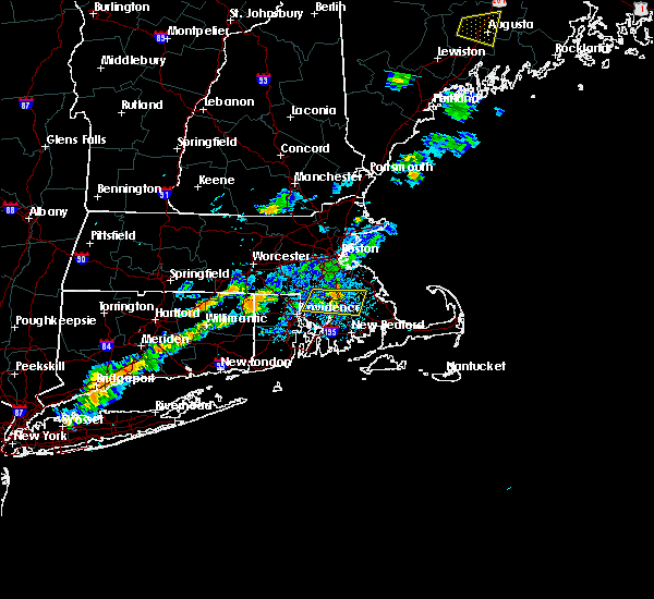 A severe thunderstorm warning remains in effect until 530 pm edt for north central bristol and west central plymouth counties. at 506 pm edt, a severe thunderstorm was located over bridgewater, moving east at 30 mph. the storm was weakening a tad but still was producing approximately 50 mph winds as it moved through norton. Trees and wires were reported down with this storm in norton. A severe thunderstorm warning remains in effect until 530 pm edt for north central bristol and west central plymouth counties. at 506 pm edt, a severe thunderstorm was located over bridgewater, moving east at 30 mph. the storm was weakening a tad but still was producing approximately 50 mph winds as it moved through norton. Trees and wires were reported down with this storm in norton.
|
| 8/19/2019 4:25 PM EDT |
 At 424 pm edt, a severe thunderstorm was located over cumberland, moving east at 30 mph. this storm has a history of downing trees (radar indicated). Hazards include 60 mph wind gusts. expect damage to trees and power lines At 424 pm edt, a severe thunderstorm was located over cumberland, moving east at 30 mph. this storm has a history of downing trees (radar indicated). Hazards include 60 mph wind gusts. expect damage to trees and power lines
|
| 8/8/2019 1:57 AM EDT |
 At 157 am edt, a severe thunderstorm was located over norwell, or near weymouth, moving northeast at 30 mph (radar indicated). Hazards include 60 mph wind gusts. Expect damage to trees and power lines. Locations impacted include, boston, brockton, quincy, taunton, weymouth, braintree, bridgewater, marshfield, middleborough, hingham, scituate, pembroke, rockland, abington, whitman, hanover, east bridgewater, raynham, holbrook and lakeville. At 157 am edt, a severe thunderstorm was located over norwell, or near weymouth, moving northeast at 30 mph (radar indicated). Hazards include 60 mph wind gusts. Expect damage to trees and power lines. Locations impacted include, boston, brockton, quincy, taunton, weymouth, braintree, bridgewater, marshfield, middleborough, hingham, scituate, pembroke, rockland, abington, whitman, hanover, east bridgewater, raynham, holbrook and lakeville.
|
| 8/8/2019 1:46 AM EDT |
 At 146 am edt, a severe thunderstorm was located over hingham, or over weymouth, moving northeast at 30 mph (radar indicated). Hazards include 60 mph wind gusts. Expect damage to trees and power lines. Locations impacted include, boston, brockton, quincy, taunton, weymouth, salem, braintree, randolph, bridgewater, marshfield, middleborough, easton, hingham, marblehead, scituate, pembroke, rockland, abington, whitman and hanover. At 146 am edt, a severe thunderstorm was located over hingham, or over weymouth, moving northeast at 30 mph (radar indicated). Hazards include 60 mph wind gusts. Expect damage to trees and power lines. Locations impacted include, boston, brockton, quincy, taunton, weymouth, salem, braintree, randolph, bridgewater, marshfield, middleborough, easton, hingham, marblehead, scituate, pembroke, rockland, abington, whitman and hanover.
|
| 8/8/2019 1:19 AM EDT |
 At 119 am edt, a severe thunderstorm was located over easton, or near brockton, moving northeast at 30 mph (radar indicated). Hazards include 60 mph wind gusts. expect damage to trees and power lines At 119 am edt, a severe thunderstorm was located over easton, or near brockton, moving northeast at 30 mph (radar indicated). Hazards include 60 mph wind gusts. expect damage to trees and power lines
|
| 6/30/2019 3:44 PM EDT | Quarter sized hail reported 5.2 miles W of Bridgewater, MA |
| 6/30/2019 3:36 PM EDT |
 At 336 pm edt, a severe thunderstorm was located over hanover, or 7 miles west of marshfield, moving southeast at 15 mph (radar indicated). Hazards include 60 mph wind gusts and quarter size hail. Hail damage to vehicles is possible. Expect damage to trees and power lines. At 336 pm edt, a severe thunderstorm was located over hanover, or 7 miles west of marshfield, moving southeast at 15 mph (radar indicated). Hazards include 60 mph wind gusts and quarter size hail. Hail damage to vehicles is possible. Expect damage to trees and power lines.
|
| 6/29/2019 4:48 PM EDT |
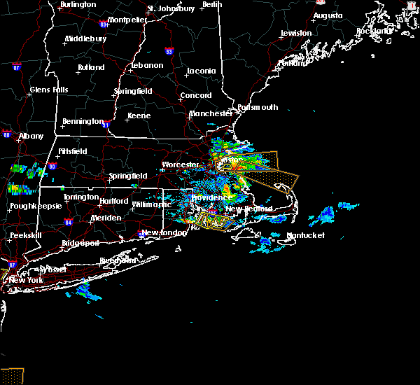 At 448 pm edt, a severe thunderstorm was located over halifax, or near bridgewater, moving east at 35 mph (radar indicated). Hazards include 60 mph wind gusts and penny size hail. expect damage to trees and power lines At 448 pm edt, a severe thunderstorm was located over halifax, or near bridgewater, moving east at 35 mph (radar indicated). Hazards include 60 mph wind gusts and penny size hail. expect damage to trees and power lines
|
| 10/29/2018 9:31 AM EDT |
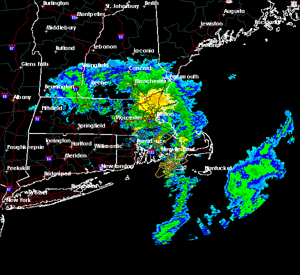 At 930 am edt, a severe thunderstorm was located over lakeville, or near taunton, moving northeast at 40 mph (radar indicated). Hazards include 60 mph wind gusts. expect damage to trees and power lines At 930 am edt, a severe thunderstorm was located over lakeville, or near taunton, moving northeast at 40 mph (radar indicated). Hazards include 60 mph wind gusts. expect damage to trees and power lines
|
| 10/23/2018 4:24 PM EDT |
 At 423 pm edt, a severe thunderstorm was located near easton, or near bridgewater, moving northeast at 20 mph (radar indicated). Hazards include 60 mph wind gusts. expect damage to trees and power lines At 423 pm edt, a severe thunderstorm was located near easton, or near bridgewater, moving northeast at 20 mph (radar indicated). Hazards include 60 mph wind gusts. expect damage to trees and power lines
|
| 10/23/2018 3:59 PM EDT |
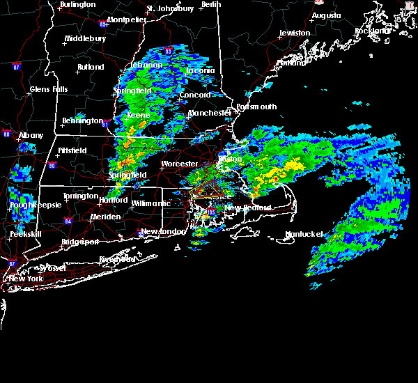 At 359 pm edt, a severe thunderstorm capable of producing a tornado was located over attleboro, or near north attleborough, moving northeast at 25 mph (radar indicated rotation). Hazards include tornado. Flying debris will be dangerous to those caught without shelter. mobile homes will be damaged or destroyed. damage to roofs, windows, and vehicles will occur. tree damage is likely. this dangerous storm will be near, mansfield around 415 pm edt. norton around 420 pm edt. taunton, easton and raynham around 425 pm edt. Brockton, bridgewater, middleborough and west bridgewater around 430 pm edt. At 359 pm edt, a severe thunderstorm capable of producing a tornado was located over attleboro, or near north attleborough, moving northeast at 25 mph (radar indicated rotation). Hazards include tornado. Flying debris will be dangerous to those caught without shelter. mobile homes will be damaged or destroyed. damage to roofs, windows, and vehicles will occur. tree damage is likely. this dangerous storm will be near, mansfield around 415 pm edt. norton around 420 pm edt. taunton, easton and raynham around 425 pm edt. Brockton, bridgewater, middleborough and west bridgewater around 430 pm edt.
|
| 10/11/2018 5:00 PM EDT |
 At 459 pm edt, a severe thunderstorm was located over walpole, or near norwood, moving east at 40 mph (radar indicated). Hazards include 60 mph wind gusts. expect damage to trees and power lines At 459 pm edt, a severe thunderstorm was located over walpole, or near norwood, moving east at 40 mph (radar indicated). Hazards include 60 mph wind gusts. expect damage to trees and power lines
|
| 9/6/2018 5:14 PM EDT |
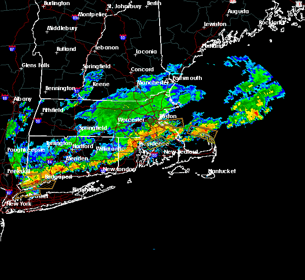 At 514 pm edt, a severe thunderstorm was located over taunton, moving southeast at 25 mph (radar indicated). Hazards include 60 mph wind gusts. Expect damage to trees and power lines. Locations impacted include, taunton, bridgewater, attleboro, middleborough, norton, swansea, east bridgewater, raynham, rehoboth, lakeville, halifax, dighton, west bridgewater, berkley and plympton. At 514 pm edt, a severe thunderstorm was located over taunton, moving southeast at 25 mph (radar indicated). Hazards include 60 mph wind gusts. Expect damage to trees and power lines. Locations impacted include, taunton, bridgewater, attleboro, middleborough, norton, swansea, east bridgewater, raynham, rehoboth, lakeville, halifax, dighton, west bridgewater, berkley and plympton.
|
| 9/6/2018 4:43 PM EDT |
 At 442 pm edt, a severe thunderstorm was located over foxborough, or near franklin, moving southeast at 50 mph (radar indicated). Hazards include 60 mph wind gusts. expect damage to trees and power lines At 442 pm edt, a severe thunderstorm was located over foxborough, or near franklin, moving southeast at 50 mph (radar indicated). Hazards include 60 mph wind gusts. expect damage to trees and power lines
|
| 7/17/2018 6:26 PM EDT |
 At 614 pm edt, a severe thunderstorm was located over pembroke, or near marshfield, moving east at 30 mph (radar indicated). Hazards include 60 mph wind gusts. Expect damage to trees and power lines. Locations impacted include, brockton, plymouth, taunton, weymouth, braintree, randolph, bridgewater, marshfield, middleborough, easton, hingham, norton, scituate, pembroke, rockland, abington, duxbury, whitman, hanover and east bridgewater. At 614 pm edt, a severe thunderstorm was located over pembroke, or near marshfield, moving east at 30 mph (radar indicated). Hazards include 60 mph wind gusts. Expect damage to trees and power lines. Locations impacted include, brockton, plymouth, taunton, weymouth, braintree, randolph, bridgewater, marshfield, middleborough, easton, hingham, norton, scituate, pembroke, rockland, abington, duxbury, whitman, hanover and east bridgewater.
|
| 7/17/2018 6:14 PM EDT |
 At 614 pm edt, a severe thunderstorm was located over pembroke, or near marshfield, moving east at 30 mph (radar indicated). Hazards include 60 mph wind gusts. Expect damage to trees and power lines. Locations impacted include, brockton, plymouth, taunton, weymouth, braintree, randolph, bridgewater, marshfield, middleborough, easton, hingham, norton, scituate, pembroke, rockland, abington, duxbury, whitman, hanover and east bridgewater. At 614 pm edt, a severe thunderstorm was located over pembroke, or near marshfield, moving east at 30 mph (radar indicated). Hazards include 60 mph wind gusts. Expect damage to trees and power lines. Locations impacted include, brockton, plymouth, taunton, weymouth, braintree, randolph, bridgewater, marshfield, middleborough, easton, hingham, norton, scituate, pembroke, rockland, abington, duxbury, whitman, hanover and east bridgewater.
|
| 7/17/2018 5:47 PM EDT |
 At 546 pm edt, a severe thunderstorm was located over easton, or near brockton, moving east at 30 mph (radar indicated). Hazards include 60 mph wind gusts. expect damage to trees and power lines At 546 pm edt, a severe thunderstorm was located over easton, or near brockton, moving east at 30 mph (radar indicated). Hazards include 60 mph wind gusts. expect damage to trees and power lines
|
| 9/6/2017 11:37 AM EDT |
 The severe thunderstorm warning for east central norfolk and plymouth counties will expire at 1145 am edt, the storms which prompted the warning have moved out of the area. therefore the warning will be allowed to expire. The severe thunderstorm warning for east central norfolk and plymouth counties will expire at 1145 am edt, the storms which prompted the warning have moved out of the area. therefore the warning will be allowed to expire.
|
| 9/6/2017 11:10 AM EDT |
 At 1109 am edt, severe thunderstorms were located along a line extending from weymouth to near wareham, moving northeast at 60 mph (radar indicated). Hazards include 60 mph wind gusts and penny size hail. expect damage to trees and power lines At 1109 am edt, severe thunderstorms were located along a line extending from weymouth to near wareham, moving northeast at 60 mph (radar indicated). Hazards include 60 mph wind gusts and penny size hail. expect damage to trees and power lines
|
| 9/6/2017 10:42 AM EDT |
 At 1041 am edt, severe thunderstorms were located along a line extending from woonsocket to dartmouth, moving northeast at 45 mph (radar indicated). Hazards include 60 mph wind gusts and penny size hail. expect damage to trees and power lines At 1041 am edt, severe thunderstorms were located along a line extending from woonsocket to dartmouth, moving northeast at 45 mph (radar indicated). Hazards include 60 mph wind gusts and penny size hail. expect damage to trees and power lines
|
| 7/12/2017 1:39 PM EDT |
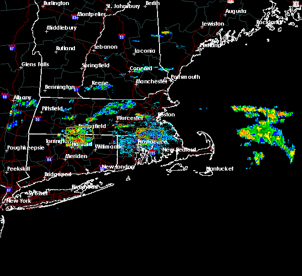 At 139 pm edt, a severe thunderstorm was located over wrentham, or near franklin, moving east at 30 mph (radar indicated). Hazards include 60 mph wind gusts and quarter size hail. Hail damage to vehicles is possible. Expect damage to trees and power lines. At 139 pm edt, a severe thunderstorm was located over wrentham, or near franklin, moving east at 30 mph (radar indicated). Hazards include 60 mph wind gusts and quarter size hail. Hail damage to vehicles is possible. Expect damage to trees and power lines.
|
| 8/22/2016 3:54 AM EDT |
 At 354 am edt, a severe thunderstorm was located over norton, or near taunton, moving northeast at 35 mph (radar indicated). Hazards include 60 mph wind gusts. Expect damage to roofs. siding. And trees. At 354 am edt, a severe thunderstorm was located over norton, or near taunton, moving northeast at 35 mph (radar indicated). Hazards include 60 mph wind gusts. Expect damage to roofs. siding. And trees.
|
| 7/22/2016 9:11 PM EDT |
 At 911 pm edt, a severe thunderstorm was located over bridgewater, moving east at 25 mph (radar indicated). Hazards include 60 mph wind gusts and penny size hail. Expect damage to roofs. siding. and trees. Locations impacted include, plymouth, taunton, bridgewater, marion, middleborough, wareham, somerset, pembroke, duxbury, east bridgewater, raynham, kingston, carver, lakeville, acushnet, hanson, freetown, halifax, berkley and rochester. At 911 pm edt, a severe thunderstorm was located over bridgewater, moving east at 25 mph (radar indicated). Hazards include 60 mph wind gusts and penny size hail. Expect damage to roofs. siding. and trees. Locations impacted include, plymouth, taunton, bridgewater, marion, middleborough, wareham, somerset, pembroke, duxbury, east bridgewater, raynham, kingston, carver, lakeville, acushnet, hanson, freetown, halifax, berkley and rochester.
|
| 7/22/2016 8:49 PM EDT |
 At 849 pm edt, a severe thunderstorm was located over easton, or near bridgewater, moving east at 25 mph (radar indicated). Hazards include 60 mph wind gusts and penny size hail. Expect damage to roofs. siding. And trees. At 849 pm edt, a severe thunderstorm was located over easton, or near bridgewater, moving east at 25 mph (radar indicated). Hazards include 60 mph wind gusts and penny size hail. Expect damage to roofs. siding. And trees.
|
| 7/17/2016 3:37 PM EDT |
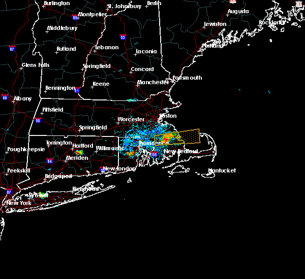 At 336 pm edt, a severe thunderstorm was located over halifax, or near bridgewater, moving east at 10 mph (radar indicated). Hazards include 60 mph wind gusts and quarter size hail. Hail damage to vehicles is expected. expect wind damage to roofs, siding, and trees. Locations impacted include, brockton, plymouth, bridgewater, marshfield, middleborough, pembroke, duxbury, whitman, east bridgewater, kingston, carver, lakeville, hanson, halifax, west bridgewater and plympton. At 336 pm edt, a severe thunderstorm was located over halifax, or near bridgewater, moving east at 10 mph (radar indicated). Hazards include 60 mph wind gusts and quarter size hail. Hail damage to vehicles is expected. expect wind damage to roofs, siding, and trees. Locations impacted include, brockton, plymouth, bridgewater, marshfield, middleborough, pembroke, duxbury, whitman, east bridgewater, kingston, carver, lakeville, hanson, halifax, west bridgewater and plympton.
|
| 7/17/2016 3:26 PM EDT |
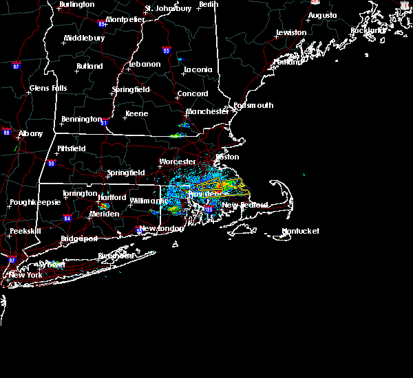 At 325 pm edt, a severe thunderstorm was located over halifax, or near bridgewater, moving east at 30 mph (radar indicated). Hazards include 60 mph wind gusts and penny size hail. Expect damage to roofs. siding. and trees. Locations impacted include, brockton, plymouth, taunton, bridgewater, marshfield, middleborough, easton, pembroke, duxbury, east bridgewater, raynham, kingston, carver, lakeville, hanson, halifax, west bridgewater, berkley and plympton. At 325 pm edt, a severe thunderstorm was located over halifax, or near bridgewater, moving east at 30 mph (radar indicated). Hazards include 60 mph wind gusts and penny size hail. Expect damage to roofs. siding. and trees. Locations impacted include, brockton, plymouth, taunton, bridgewater, marshfield, middleborough, easton, pembroke, duxbury, east bridgewater, raynham, kingston, carver, lakeville, hanson, halifax, west bridgewater, berkley and plympton.
|
| 7/17/2016 3:07 PM EDT |
 At 306 pm edt, a severe thunderstorm was located near norton, or near taunton, moving east at 15 mph (radar indicated). Hazards include 60 mph wind gusts and quarter size hail. Hail damage to vehicles is expected. Expect wind damage to roofs, siding, and trees. At 306 pm edt, a severe thunderstorm was located near norton, or near taunton, moving east at 15 mph (radar indicated). Hazards include 60 mph wind gusts and quarter size hail. Hail damage to vehicles is expected. Expect wind damage to roofs, siding, and trees.
|
| 7/17/2016 3:00 PM EDT |
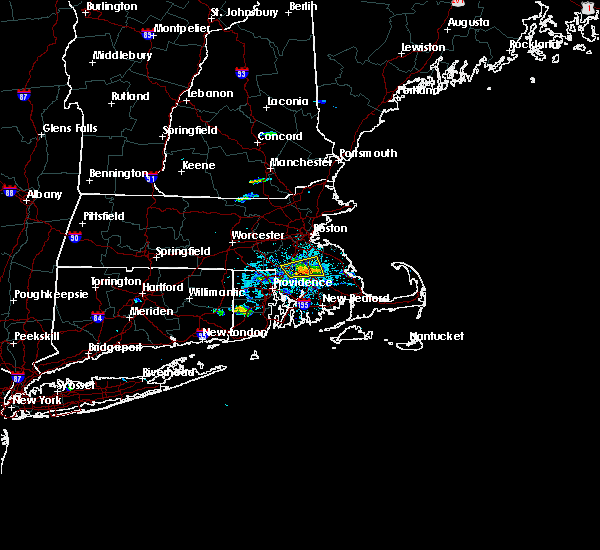 At 259 pm edt, a severe thunderstorm was located over norton, or near taunton, moving east at 35 mph (radar indicated). Hazards include 60 mph wind gusts and penny size hail. Expect damage to roofs. siding. and trees. Locations impacted include, brockton, taunton, bridgewater, attleboro, mansfield, easton, norton, abington, whitman, east bridgewater, raynham and west bridgewater. At 259 pm edt, a severe thunderstorm was located over norton, or near taunton, moving east at 35 mph (radar indicated). Hazards include 60 mph wind gusts and penny size hail. Expect damage to roofs. siding. and trees. Locations impacted include, brockton, taunton, bridgewater, attleboro, mansfield, easton, norton, abington, whitman, east bridgewater, raynham and west bridgewater.
|
| 7/17/2016 2:46 PM EDT |
 At 246 pm edt, a severe thunderstorm was located over mansfield, or 8 miles northwest of taunton, moving east at 20 mph (radar indicated). Hazards include 60 mph wind gusts and penny size hail. Expect damage to roofs. siding. And trees. At 246 pm edt, a severe thunderstorm was located over mansfield, or 8 miles northwest of taunton, moving east at 20 mph (radar indicated). Hazards include 60 mph wind gusts and penny size hail. Expect damage to roofs. siding. And trees.
|
| 7/15/2016 3:34 PM EDT |
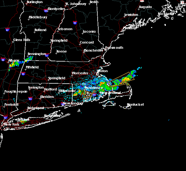 At 334 pm edt, a severe thunderstorm was located over hanson, or near bridgewater, moving east at 15 mph (radar indicated). Hazards include 60 mph wind gusts and penny size hail. Expect damage to roofs. siding. And trees. At 334 pm edt, a severe thunderstorm was located over hanson, or near bridgewater, moving east at 15 mph (radar indicated). Hazards include 60 mph wind gusts and penny size hail. Expect damage to roofs. siding. And trees.
|
| 2/25/2016 4:51 AM EST |
 The severe thunderstorm warning for central bristol, west central barnstable and plymouth counties will expire at 500 am est, the storm which prompted the warning has moved out of the area. therefore the warning will be allowed to expire. however gusty winds are still possible as showers and storms move out. time, mot, loc 0949z 204deg 121kt 4376 7040. The severe thunderstorm warning for central bristol, west central barnstable and plymouth counties will expire at 500 am est, the storm which prompted the warning has moved out of the area. therefore the warning will be allowed to expire. however gusty winds are still possible as showers and storms move out. time, mot, loc 0949z 204deg 121kt 4376 7040.
|
| 2/25/2016 4:38 AM EST | Large tree and wires dow in plymouth county MA, 5.2 miles W of Bridgewater, MA |
| 2/25/2016 4:11 AM EST |
 At 410 am est, doppler radar indicated a severe thunderstorm capable of producing destructive winds in excess of 70 mph. this storm was located over south windham, or near north windham, and was moving northeast at 50 mph. At 410 am est, doppler radar indicated a severe thunderstorm capable of producing destructive winds in excess of 70 mph. this storm was located over south windham, or near north windham, and was moving northeast at 50 mph.
|
| 2/25/2016 3:11 AM EST |
 At 310 am est, doppler radar indicated a severe thunderstorm capable of producing destructive winds in excess of 70 mph. this storm was located over smithfield, or near johnston, and was moving northeast at 140 mph. At 310 am est, doppler radar indicated a severe thunderstorm capable of producing destructive winds in excess of 70 mph. this storm was located over smithfield, or near johnston, and was moving northeast at 140 mph.
|
| 8/4/2015 7:11 AM EDT |
 The severe thunderstorm warning for bristol, southwestern plymouth, southeastern norfolk, bristol, northern newport, kent, northeastern washington and providence counties will expire at 715 am edt, the line of storms which prompted the warning have moved out of the area. therefore the warning will be allowed to expire. however heavy rain is still possible with these thunderstorms. The severe thunderstorm warning for bristol, southwestern plymouth, southeastern norfolk, bristol, northern newport, kent, northeastern washington and providence counties will expire at 715 am edt, the line of storms which prompted the warning have moved out of the area. therefore the warning will be allowed to expire. however heavy rain is still possible with these thunderstorms.
|
| 8/4/2015 6:53 AM EDT |
 At 652 am edt, doppler radar indicated a line of severe thunderstorms capable of producing destructive winds in excess of 70 mph. these storms were located along a line extending from west bridgewater to near lakeville to mattapoisett, and was moving east at 55 mph. * some locations impacted include, new bedford, brockton, plymouth, taunton, weymouth, randolph, stoughton, bridgewater, marshfield, marion, middleborough, easton, hingham, wareham, sandwich, bourne, scituate, pembroke, rockland and abington. At 652 am edt, doppler radar indicated a line of severe thunderstorms capable of producing destructive winds in excess of 70 mph. these storms were located along a line extending from west bridgewater to near lakeville to mattapoisett, and was moving east at 55 mph. * some locations impacted include, new bedford, brockton, plymouth, taunton, weymouth, randolph, stoughton, bridgewater, marshfield, marion, middleborough, easton, hingham, wareham, sandwich, bourne, scituate, pembroke, rockland and abington.
|
| 8/4/2015 6:29 AM EDT |
 At 628 am edt, a severe thunderstorm producing widespread damage was moving into the cranston and providence metro area. this is a very dangerous situation. quarter size hail and destructive winds in excess of 80 mph are possible. these storms were located along a line extending from near cumberland to near cranston to near bristol, moving northeast at 45 mph. locations impacted include, providence, new bedford, brockton, fall river, warwick, cranston, pawtucket, taunton, east providence, woonsocket, coventry, dartmouth, cumberland, randolph, north providence, south kingstown, west warwick, johnston, north attleborough and stoughton. At 628 am edt, a severe thunderstorm producing widespread damage was moving into the cranston and providence metro area. this is a very dangerous situation. quarter size hail and destructive winds in excess of 80 mph are possible. these storms were located along a line extending from near cumberland to near cranston to near bristol, moving northeast at 45 mph. locations impacted include, providence, new bedford, brockton, fall river, warwick, cranston, pawtucket, taunton, east providence, woonsocket, coventry, dartmouth, cumberland, randolph, north providence, south kingstown, west warwick, johnston, north attleborough and stoughton.
|
| 8/4/2015 6:23 AM EDT |
 At 622 am edt, trained weather spotters confirmed a line of severe thunderstorms producing quarter size hail and destructive winds in excess of 70 mph. these storms were located along a line extending from north smithfield to cranston to portsmouth, moving northeast at 45 mph. this is a dangerous situation, damage has arleady been reported with this storm. locations impacted include, providence, new bedford, brockton, fall river, warwick, cranston, pawtucket, taunton, east providence, woonsocket, coventry, dartmouth, cumberland, randolph, north providence, franklin, south kingstown, west warwick, johnston and north attleborough. At 622 am edt, trained weather spotters confirmed a line of severe thunderstorms producing quarter size hail and destructive winds in excess of 70 mph. these storms were located along a line extending from north smithfield to cranston to portsmouth, moving northeast at 45 mph. this is a dangerous situation, damage has arleady been reported with this storm. locations impacted include, providence, new bedford, brockton, fall river, warwick, cranston, pawtucket, taunton, east providence, woonsocket, coventry, dartmouth, cumberland, randolph, north providence, franklin, south kingstown, west warwick, johnston and north attleborough.
|
| 8/4/2015 6:14 AM EDT |
 At 614 am edt, doppler radar indicated a line of severe thunderstorms capable of producing quarter size hail and damaging winds in excess of 60 mph. these storms were located along a line extending from near glocester to near coventry to north kingstown, moving northeast at 45 mph. locations impacted include, providence, new bedford, brockton, fall river, warwick, cranston, pawtucket, taunton, east providence, woonsocket, coventry, dartmouth, cumberland, randolph, north providence, franklin, south kingstown, west warwick, johnston and north attleborough. At 614 am edt, doppler radar indicated a line of severe thunderstorms capable of producing quarter size hail and damaging winds in excess of 60 mph. these storms were located along a line extending from near glocester to near coventry to north kingstown, moving northeast at 45 mph. locations impacted include, providence, new bedford, brockton, fall river, warwick, cranston, pawtucket, taunton, east providence, woonsocket, coventry, dartmouth, cumberland, randolph, north providence, franklin, south kingstown, west warwick, johnston and north attleborough.
|
| 8/4/2015 6:09 AM EDT |
 At 609 am edt, doppler radar indicated a line of severe thunderstorms capable of producing damaging winds in excess of 60 mph. these storms were located along a line extending from glocester to coventry to north kingstown, and was moving northeast at 45 mph. * some locations impacted include, providence, new bedford, brockton, fall river, warwick, cranston, pawtucket, taunton, east providence, woonsocket, coventry, dartmouth, cumberland, randolph, north providence, franklin, south kingstown, west warwick, johnston and north attleborough. At 609 am edt, doppler radar indicated a line of severe thunderstorms capable of producing damaging winds in excess of 60 mph. these storms were located along a line extending from glocester to coventry to north kingstown, and was moving northeast at 45 mph. * some locations impacted include, providence, new bedford, brockton, fall river, warwick, cranston, pawtucket, taunton, east providence, woonsocket, coventry, dartmouth, cumberland, randolph, north providence, franklin, south kingstown, west warwick, johnston and north attleborough.
|
| 7/1/2015 8:25 AM EDT |
 The severe thunderstorm warning for bristol, plymouth, southern norfolk and eastern newport counties will expire at 830 am edt, the line of storms which prompted the warning will continue to move out of the area therefore the warning will be allowed to expire. The severe thunderstorm warning for bristol, plymouth, southern norfolk and eastern newport counties will expire at 830 am edt, the line of storms which prompted the warning will continue to move out of the area therefore the warning will be allowed to expire.
|
| 7/1/2015 7:51 AM EDT |
 At 751 am edt, doppler radar indicated a line of severe thunderstorms capable of producing damaging winds in excess of 60 mph. these storms were located along a line extending from north smithfield to somerset to 8 miles southeast of block island, moving northeast at 35 mph. locations impacted include, new bedford, brockton, fall river, pawtucket, plymouth, taunton, weymouth, east providence, braintree, dartmouth, randolph, franklin, north attleborough, stoughton, bridgewater, newport, marion, attleboro, walpole and mansfield. At 751 am edt, doppler radar indicated a line of severe thunderstorms capable of producing damaging winds in excess of 60 mph. these storms were located along a line extending from north smithfield to somerset to 8 miles southeast of block island, moving northeast at 35 mph. locations impacted include, new bedford, brockton, fall river, pawtucket, plymouth, taunton, weymouth, east providence, braintree, dartmouth, randolph, franklin, north attleborough, stoughton, bridgewater, newport, marion, attleboro, walpole and mansfield.
|
| 7/1/2015 7:28 AM EDT |
 At 727 am edt, doppler radar indicated a line of severe thunderstorms capable of producing damaging winds in excess of 60 mph. these storms were located along a line extending from near foster to portsmouth to 16 miles south of block island, and was moving northeast at 35 mph. * some locations impacted include, providence, new bedford, brockton, fall river, warwick, cranston, pawtucket, plymouth, taunton, weymouth, east providence, woonsocket, braintree, coventry, dartmouth, cumberland, randolph, north providence, franklin and johnston. At 727 am edt, doppler radar indicated a line of severe thunderstorms capable of producing damaging winds in excess of 60 mph. these storms were located along a line extending from near foster to portsmouth to 16 miles south of block island, and was moving northeast at 35 mph. * some locations impacted include, providence, new bedford, brockton, fall river, warwick, cranston, pawtucket, plymouth, taunton, weymouth, east providence, woonsocket, braintree, coventry, dartmouth, cumberland, randolph, north providence, franklin and johnston.
|
| 6/23/2015 6:10 PM EDT |
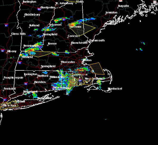 At 610 pm edt, doppler radar indicated a severe thunderstorm capable of producing a tornado. this dangerous storm was located over east bridgewater, or over bridgewater, and was moving east at 35 mph. a tornado may touch down at any time! * some locations impacted include, brockton, plymouth, bridgewater, marshfield, middleborough, pembroke, duxbury, whitman, east bridgewater, kingston, carver, hanson, halifax, west bridgewater and plympton. At 610 pm edt, doppler radar indicated a severe thunderstorm capable of producing a tornado. this dangerous storm was located over east bridgewater, or over bridgewater, and was moving east at 35 mph. a tornado may touch down at any time! * some locations impacted include, brockton, plymouth, bridgewater, marshfield, middleborough, pembroke, duxbury, whitman, east bridgewater, kingston, carver, hanson, halifax, west bridgewater and plympton.
|
| 6/23/2015 6:01 PM EDT |
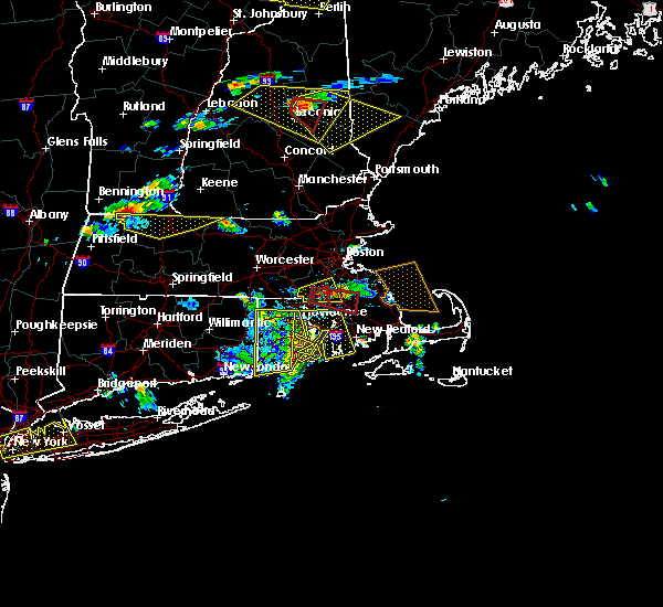 At 559 pm edt, doppler radar indicated a severe thunderstorm capable of producing a tornado. this dangerous storm was located near easton, or near taunton, moving east at 35 mph. as of 6 pm, there has been no confirmation of a tornado on the ground. however a tornado may touch down at any time! a wall cloud was visible from the national weather service office in taunton as the storm passed. locations impacted include, brockton, taunton, bridgewater, middleborough, easton, norton, east bridgewater, raynham, lakeville and west bridgewater. At 559 pm edt, doppler radar indicated a severe thunderstorm capable of producing a tornado. this dangerous storm was located near easton, or near taunton, moving east at 35 mph. as of 6 pm, there has been no confirmation of a tornado on the ground. however a tornado may touch down at any time! a wall cloud was visible from the national weather service office in taunton as the storm passed. locations impacted include, brockton, taunton, bridgewater, middleborough, easton, norton, east bridgewater, raynham, lakeville and west bridgewater.
|
| 6/23/2015 5:46 PM EDT |
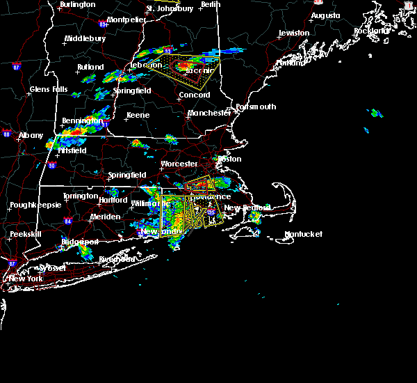 At 546 pm edt, doppler radar indicated a severe thunderstorm capable of producing a tornado. this dangerous storm was located over mansfield, or near north attleborough, and was moving east at 35 mph. * some locations impacted include, brockton, taunton, north attleborough, bridgewater, attleboro, mansfield, middleborough, easton, norton, sharon, foxborough, east bridgewater, raynham, norfolk, wrentham, lakeville, plainville and west bridgewater. At 546 pm edt, doppler radar indicated a severe thunderstorm capable of producing a tornado. this dangerous storm was located over mansfield, or near north attleborough, and was moving east at 35 mph. * some locations impacted include, brockton, taunton, north attleborough, bridgewater, attleboro, mansfield, middleborough, easton, norton, sharon, foxborough, east bridgewater, raynham, norfolk, wrentham, lakeville, plainville and west bridgewater.
|
| 8/10/2012 6:37 PM EDT | Transmission line down on mill street causing widespread power outages in plymouth county MA, 0.1 miles NNW of Bridgewater, MA |
| 1/1/0001 12:00 AM | Tree down on crescent street in plymouth county MA, 2.5 miles SE of Bridgewater, MA |
Hail Maps for Bridgewater, MA


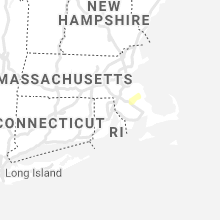


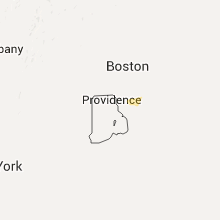

Connect with Interactive Hail Maps