

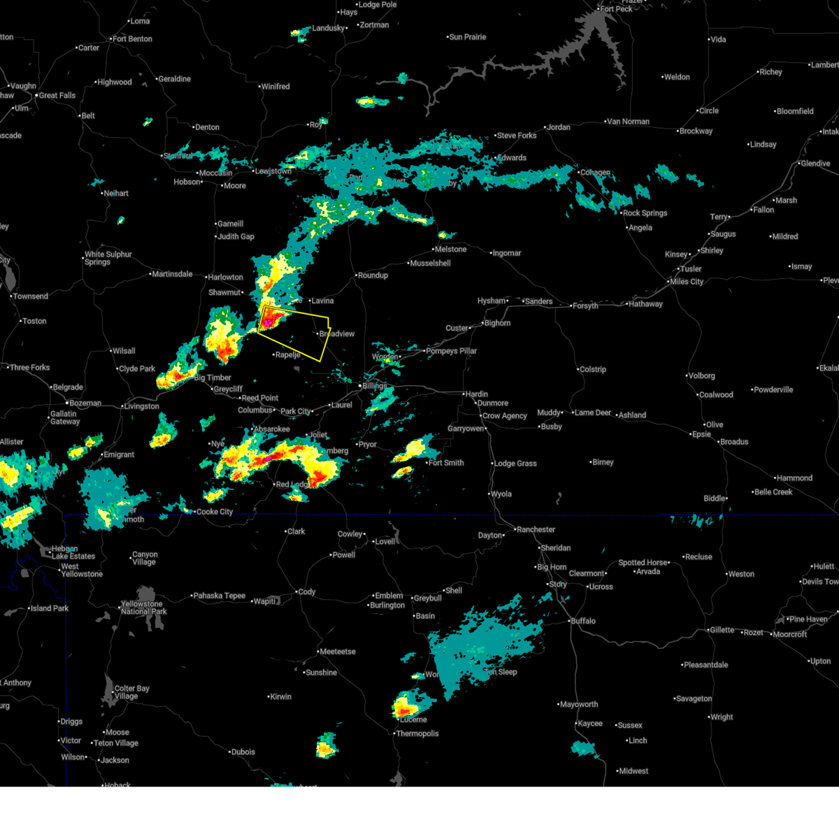
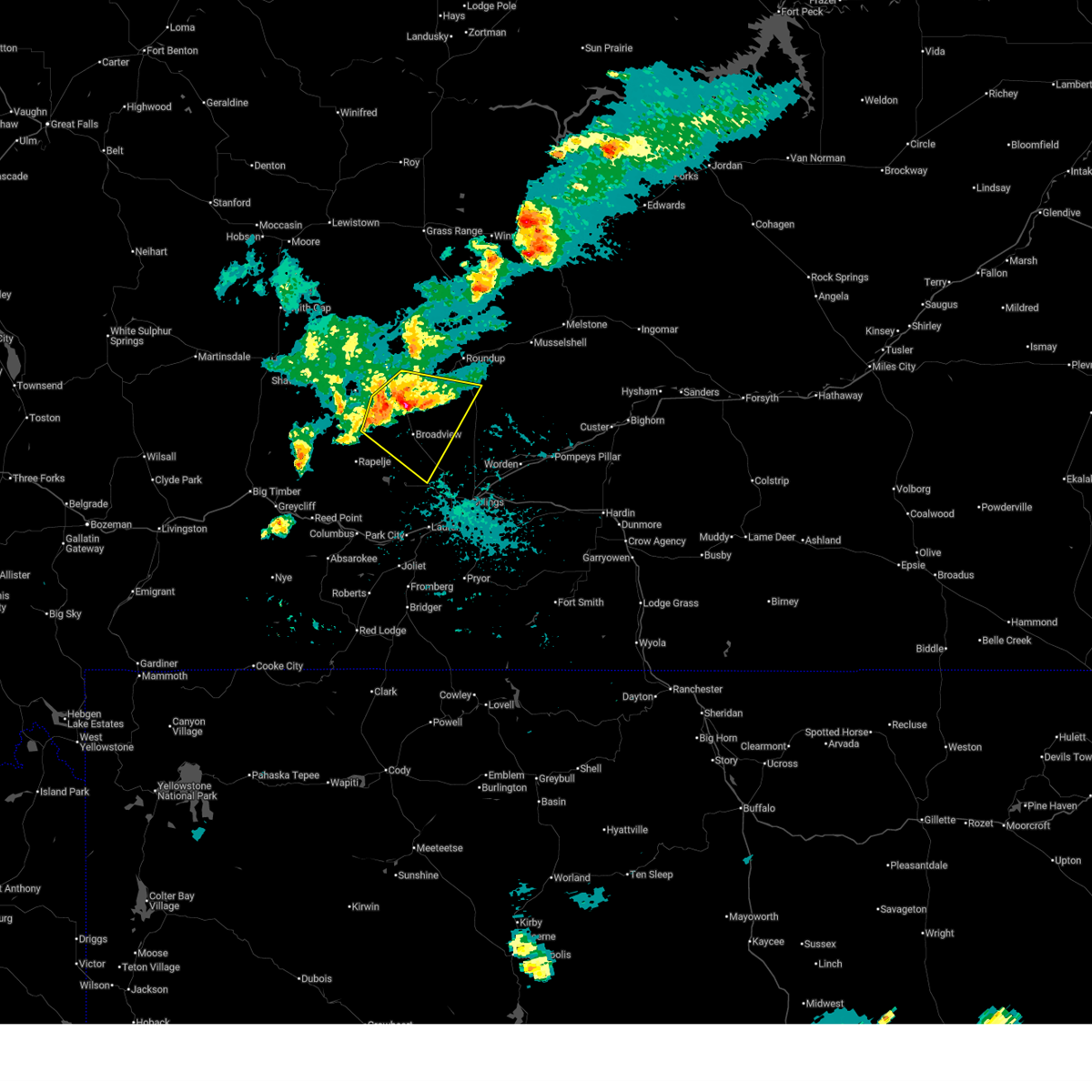
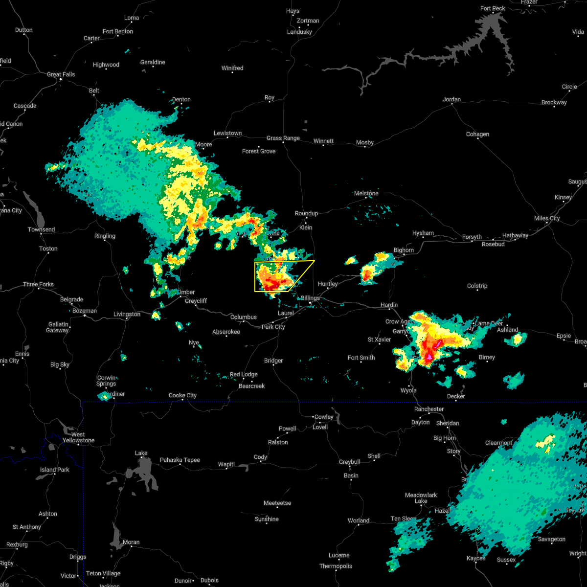
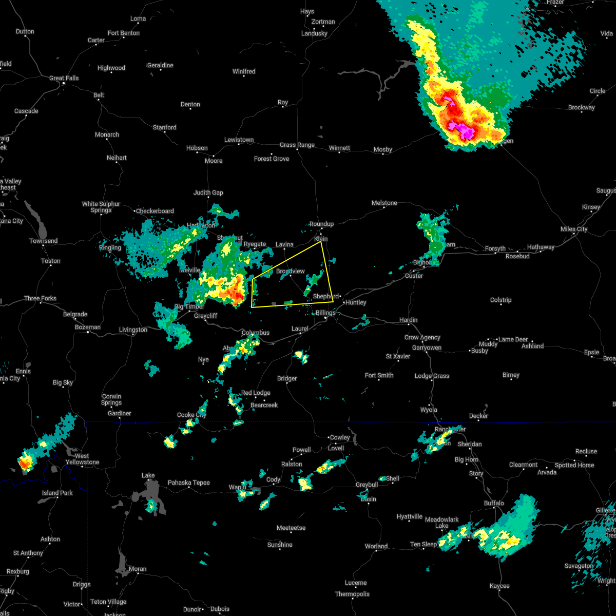
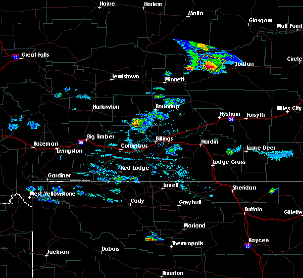
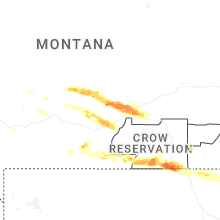
Hail Map for Broadview, MT
The Broadview, MT area has had 12 reports of on-the-ground hail by trained spotters, and has been under severe weather warnings 2 times during the past 12 months. Doppler radar has detected hail at or near Broadview, MT on 35 occasions, including 3 occasions during the past year.
| Name: | Broadview, MT |
| Where Located: | 28.2 miles NW of Billings, MT |
| Map: | Google Map for Broadview, MT |
| Population: | 192 |
| Housing Units: | 73 |
| More Info: | Search Google for Broadview, MT |
3
The Top Recent Hail Date for Broadview, MT is Wednesday, July 23, 2025 (4th out of 35)
Hail and Wind Damage Spotted near Broadview, MT
| Date / Time | Report Details |
|---|---|
| 6/7/2026 2:45 PM MDT |
 Svrbyz the national weather service in billings has issued a * severe thunderstorm warning for, eastern golden valley county in central montana, southwestern musselshell county in central montana, northeastern stillwater county in south central montana, northwestern yellowstone county in south central montana, * until 345 pm mdt. * at 245 pm mdt, a severe thunderstorm was located 17 miles southeast of ryegate, or 32 miles north of columbus, moving northeast at 35 mph (radar indicated). Hazards include 60 mph wind gusts and quarter size hail. Hail damage to vehicles is expected. Expect wind damage to roofs, siding, and trees. Svrbyz the national weather service in billings has issued a * severe thunderstorm warning for, eastern golden valley county in central montana, southwestern musselshell county in central montana, northeastern stillwater county in south central montana, northwestern yellowstone county in south central montana, * until 345 pm mdt. * at 245 pm mdt, a severe thunderstorm was located 17 miles southeast of ryegate, or 32 miles north of columbus, moving northeast at 35 mph (radar indicated). Hazards include 60 mph wind gusts and quarter size hail. Hail damage to vehicles is expected. Expect wind damage to roofs, siding, and trees.
|
| 7/23/2025 2:27 PM MDT |
 Svrbyz the national weather service in billings has issued a * severe thunderstorm warning for, west central yellowstone county in south central montana, * until 315 pm mdt. * at 227 pm mdt, a severe thunderstorm was located 21 miles northwest of billings west end, or 23 miles northwest of billings, moving southeast at 30 mph (radar indicated). Hazards include 60 mph wind gusts and small hail. expect damage to roofs, siding, and trees Svrbyz the national weather service in billings has issued a * severe thunderstorm warning for, west central yellowstone county in south central montana, * until 315 pm mdt. * at 227 pm mdt, a severe thunderstorm was located 21 miles northwest of billings west end, or 23 miles northwest of billings, moving southeast at 30 mph (radar indicated). Hazards include 60 mph wind gusts and small hail. expect damage to roofs, siding, and trees
|
| 7/23/2025 1:45 PM MDT | Quarter sized hail reported 2 miles N of Broadview, MT, quarter size hail between 130 pm and 2pm. |
| 6/16/2025 4:05 PM MDT |
 At 405 pm mdt, a severe thunderstorm was located 15 miles southeast of ryegate, or 34 miles north of columbus, moving east at 20 mph (radar indicated). Hazards include 60 mph wind gusts and half dollar size hail. Hail damage to vehicles is expected. expect wind damage to roofs, siding, and trees. Locations impacted include, broadview. At 405 pm mdt, a severe thunderstorm was located 15 miles southeast of ryegate, or 34 miles north of columbus, moving east at 20 mph (radar indicated). Hazards include 60 mph wind gusts and half dollar size hail. Hail damage to vehicles is expected. expect wind damage to roofs, siding, and trees. Locations impacted include, broadview.
|
| 6/16/2025 3:38 PM MDT |
 Svrbyz the national weather service in billings has issued a * severe thunderstorm warning for, southeastern golden valley county in central montana, northeastern stillwater county in south central montana, west central yellowstone county in south central montana, * until 430 pm mdt. * at 338 pm mdt, a severe thunderstorm was located 10 miles south of ryegate, or 32 miles southeast of harlowton, moving east at 20 mph (radar indicated). Hazards include 60 mph wind gusts and quarter size hail. Hail damage to vehicles is expected. Expect wind damage to roofs, siding, and trees. Svrbyz the national weather service in billings has issued a * severe thunderstorm warning for, southeastern golden valley county in central montana, northeastern stillwater county in south central montana, west central yellowstone county in south central montana, * until 430 pm mdt. * at 338 pm mdt, a severe thunderstorm was located 10 miles south of ryegate, or 32 miles southeast of harlowton, moving east at 20 mph (radar indicated). Hazards include 60 mph wind gusts and quarter size hail. Hail damage to vehicles is expected. Expect wind damage to roofs, siding, and trees.
|
| 6/13/2025 5:27 PM MDT |
 At 527 pm mdt, a severe thunderstorm was located 22 miles south of roundup, moving southeast at 25 mph (radar indicated). Hazards include 70 mph wind gusts and ping pong ball size hail. People and animals outdoors will be injured. expect hail damage to roofs, siding, windows, and vehicles. expect considerable tree damage. wind damage is also likely to mobile homes, roofs, and outbuildings. locations impacted include, broadview. This does not include billings. At 527 pm mdt, a severe thunderstorm was located 22 miles south of roundup, moving southeast at 25 mph (radar indicated). Hazards include 70 mph wind gusts and ping pong ball size hail. People and animals outdoors will be injured. expect hail damage to roofs, siding, windows, and vehicles. expect considerable tree damage. wind damage is also likely to mobile homes, roofs, and outbuildings. locations impacted include, broadview. This does not include billings.
|
| 6/13/2025 5:27 PM MDT |
 the severe thunderstorm warning has been cancelled and is no longer in effect the severe thunderstorm warning has been cancelled and is no longer in effect
|
| 6/13/2025 5:22 PM MDT |
 At 522 pm mdt, a severe thunderstorm was located 21 miles southwest of roundup, moving southeast at 25 mph (radar indicated). Hazards include 70 mph wind gusts and ping pong ball size hail. People and animals outdoors will be injured. expect hail damage to roofs, siding, windows, and vehicles. expect considerable tree damage. wind damage is also likely to mobile homes, roofs, and outbuildings. locations impacted include, broadview. This does not include billings. At 522 pm mdt, a severe thunderstorm was located 21 miles southwest of roundup, moving southeast at 25 mph (radar indicated). Hazards include 70 mph wind gusts and ping pong ball size hail. People and animals outdoors will be injured. expect hail damage to roofs, siding, windows, and vehicles. expect considerable tree damage. wind damage is also likely to mobile homes, roofs, and outbuildings. locations impacted include, broadview. This does not include billings.
|
| 6/13/2025 5:11 PM MDT |
 Svrbyz the national weather service in billings has issued a * severe thunderstorm warning for, southeastern golden valley county in central montana, southwestern musselshell county in central montana, west central yellowstone county in south central montana, * until 615 pm mdt. * at 511 pm mdt, a severe thunderstorm was located 22 miles southwest of roundup, moving southeast at 25 mph (radar indicated). Hazards include ping pong ball size hail and 60 mph wind gusts. People and animals outdoors will be injured. expect hail damage to roofs, siding, windows, and vehicles. Expect wind damage to roofs, siding, and trees. Svrbyz the national weather service in billings has issued a * severe thunderstorm warning for, southeastern golden valley county in central montana, southwestern musselshell county in central montana, west central yellowstone county in south central montana, * until 615 pm mdt. * at 511 pm mdt, a severe thunderstorm was located 22 miles southwest of roundup, moving southeast at 25 mph (radar indicated). Hazards include ping pong ball size hail and 60 mph wind gusts. People and animals outdoors will be injured. expect hail damage to roofs, siding, windows, and vehicles. Expect wind damage to roofs, siding, and trees.
|
| 6/13/2025 4:58 PM MDT |
 At 458 pm mdt, a severe thunderstorm was located 20 miles east of ryegate, or 23 miles southwest of roundup, moving east at 25 mph (radar indicated). Hazards include golf ball size hail and 60 mph wind gusts. People and animals outdoors will be injured. expect hail damage to roofs, siding, windows, and vehicles. expect wind damage to roofs, siding, and trees. Locations impacted include, broadview, lavina and comanche. At 458 pm mdt, a severe thunderstorm was located 20 miles east of ryegate, or 23 miles southwest of roundup, moving east at 25 mph (radar indicated). Hazards include golf ball size hail and 60 mph wind gusts. People and animals outdoors will be injured. expect hail damage to roofs, siding, windows, and vehicles. expect wind damage to roofs, siding, and trees. Locations impacted include, broadview, lavina and comanche.
|
| 6/13/2025 4:58 PM MDT |
 the severe thunderstorm warning has been cancelled and is no longer in effect the severe thunderstorm warning has been cancelled and is no longer in effect
|
| 6/13/2025 4:30 PM MDT |
 At 430 pm mdt, a severe thunderstorm was located near ryegate, or 28 miles southeast of harlowton, moving east at 35 mph (radar indicated). Hazards include 60 mph wind gusts and half dollar size hail. Hail damage to vehicles is expected. expect wind damage to roofs, siding, and trees. Locations impacted include, broadview. At 430 pm mdt, a severe thunderstorm was located near ryegate, or 28 miles southeast of harlowton, moving east at 35 mph (radar indicated). Hazards include 60 mph wind gusts and half dollar size hail. Hail damage to vehicles is expected. expect wind damage to roofs, siding, and trees. Locations impacted include, broadview.
|
| 6/13/2025 4:30 PM MDT |
 the severe thunderstorm warning has been cancelled and is no longer in effect the severe thunderstorm warning has been cancelled and is no longer in effect
|
| 6/13/2025 4:11 PM MDT |
 Svrbyz the national weather service in billings has issued a * severe thunderstorm warning for, southeastern golden valley county in central montana, southwestern musselshell county in central montana, southeastern wheatland county in central montana, northeastern stillwater county in south central montana, west central yellowstone county in south central montana, * until 515 pm mdt. * at 411 pm mdt, a severe thunderstorm was located near ryegate, or 32 miles east of harlowton, moving southeast at 35 mph (radar indicated). Hazards include two inch hail and 70 mph wind gusts. People and animals outdoors will be injured. expect hail damage to roofs, siding, windows, and vehicles. expect considerable tree damage. Wind damage is also likely to mobile homes, roofs, and outbuildings. Svrbyz the national weather service in billings has issued a * severe thunderstorm warning for, southeastern golden valley county in central montana, southwestern musselshell county in central montana, southeastern wheatland county in central montana, northeastern stillwater county in south central montana, west central yellowstone county in south central montana, * until 515 pm mdt. * at 411 pm mdt, a severe thunderstorm was located near ryegate, or 32 miles east of harlowton, moving southeast at 35 mph (radar indicated). Hazards include two inch hail and 70 mph wind gusts. People and animals outdoors will be injured. expect hail damage to roofs, siding, windows, and vehicles. expect considerable tree damage. Wind damage is also likely to mobile homes, roofs, and outbuildings.
|
| 6/13/2025 4:01 PM MDT |
 Svrbyz the national weather service in billings has issued a * severe thunderstorm warning for, southern golden valley county in central montana, southern musselshell county in central montana, southeastern wheatland county in central montana, northeastern stillwater county in south central montana, northeastern sweet grass county in south central montana, west central yellowstone county in south central montana, * until 500 pm mdt. * at 401 pm mdt, a severe thunderstorm was located 12 miles southwest of deadmans basin reservoir, or 17 miles southeast of harlowton, moving southeast at 40 mph (radar indicated). Hazards include two inch hail and 70 mph wind gusts. People and animals outdoors will be injured. expect hail damage to roofs, siding, windows, and vehicles. expect considerable tree damage. Wind damage is also likely to mobile homes, roofs, and outbuildings. Svrbyz the national weather service in billings has issued a * severe thunderstorm warning for, southern golden valley county in central montana, southern musselshell county in central montana, southeastern wheatland county in central montana, northeastern stillwater county in south central montana, northeastern sweet grass county in south central montana, west central yellowstone county in south central montana, * until 500 pm mdt. * at 401 pm mdt, a severe thunderstorm was located 12 miles southwest of deadmans basin reservoir, or 17 miles southeast of harlowton, moving southeast at 40 mph (radar indicated). Hazards include two inch hail and 70 mph wind gusts. People and animals outdoors will be injured. expect hail damage to roofs, siding, windows, and vehicles. expect considerable tree damage. Wind damage is also likely to mobile homes, roofs, and outbuildings.
|
| 7/24/2023 5:45 PM MDT | Storm damage reported in yellowstone county MT, 6 miles WSW of Broadview, MT |
| 9/7/2022 4:28 PM MDT |
 At 427 pm mdt, severe thunderstorms were located along a line extending from 10 miles northeast of ryegate to 9 miles northwest of pryor, moving northeast at 35 mph (radar indicated. gusts to 58 mph have been reported along this line). Hazards include 60 mph wind gusts. Expect damage to roofs, siding, and trees. severe thunderstorms will be near, billings around 435 pm mdt roundup around 510 pm mdt. other locations impacted by these severe thunderstorms include laurel, pompeys pillar, acton, musselshell, lavina, klein, broadview and comanche. this replaces the warning previously in effect for this area. hail threat, radar indicated max hail size, <. 75 in wind threat, radar indicated max wind gust, 60 mph. At 427 pm mdt, severe thunderstorms were located along a line extending from 10 miles northeast of ryegate to 9 miles northwest of pryor, moving northeast at 35 mph (radar indicated. gusts to 58 mph have been reported along this line). Hazards include 60 mph wind gusts. Expect damage to roofs, siding, and trees. severe thunderstorms will be near, billings around 435 pm mdt roundup around 510 pm mdt. other locations impacted by these severe thunderstorms include laurel, pompeys pillar, acton, musselshell, lavina, klein, broadview and comanche. this replaces the warning previously in effect for this area. hail threat, radar indicated max hail size, <. 75 in wind threat, radar indicated max wind gust, 60 mph.
|
| 7/24/2022 6:20 PM MDT |
 At 618 pm mdt, a severe thunderstorm was located 21 miles northwest of laurel, or 22 miles northeast of columbus, and is moving east northeastward at 10 mph (radar indicated). Hazards include 60 mph wind gusts and quarter size hail. Hail damage to vehicles is expected. expect wind damage to roofs, siding, and trees. locations impacted include, broadview, halfbreed lake wildlife, acton and comanche. hail threat, radar indicated max hail size, 1. 00 in wind threat, radar indicated max wind gust, 60 mph. At 618 pm mdt, a severe thunderstorm was located 21 miles northwest of laurel, or 22 miles northeast of columbus, and is moving east northeastward at 10 mph (radar indicated). Hazards include 60 mph wind gusts and quarter size hail. Hail damage to vehicles is expected. expect wind damage to roofs, siding, and trees. locations impacted include, broadview, halfbreed lake wildlife, acton and comanche. hail threat, radar indicated max hail size, 1. 00 in wind threat, radar indicated max wind gust, 60 mph.
|
| 7/24/2022 6:11 PM MDT |
 At 610 pm mdt, a severe thunderstorm was located 21 miles northwest of laurel, or 22 miles northeast of columbus, and is moving east northeastward at 5 mph (radar indicated). Hazards include 60 mph wind gusts and quarter size hail. Hail damage to vehicles is expected. expect wind damage to roofs, siding, and trees. locations impacted include, broadview, halfbreed lake wildlife, acton and comanche. this warning does not include the city of billings. hail threat, radar indicated max hail size, 1. 00 in wind threat, radar indicated max wind gust, 60 mph. At 610 pm mdt, a severe thunderstorm was located 21 miles northwest of laurel, or 22 miles northeast of columbus, and is moving east northeastward at 5 mph (radar indicated). Hazards include 60 mph wind gusts and quarter size hail. Hail damage to vehicles is expected. expect wind damage to roofs, siding, and trees. locations impacted include, broadview, halfbreed lake wildlife, acton and comanche. this warning does not include the city of billings. hail threat, radar indicated max hail size, 1. 00 in wind threat, radar indicated max wind gust, 60 mph.
|
| 7/24/2022 5:51 PM MDT |
 At 551 pm mdt, a severe thunderstorm was located 21 miles northwest of laurel, or 21 miles northeast of columbus, and is moving east northeastward at 5 mph (radar indicated). Hazards include 60 mph wind gusts and quarter size hail. Hail damage to vehicles is expected. Expect wind damage to roofs, siding, and trees. At 551 pm mdt, a severe thunderstorm was located 21 miles northwest of laurel, or 21 miles northeast of columbus, and is moving east northeastward at 5 mph (radar indicated). Hazards include 60 mph wind gusts and quarter size hail. Hail damage to vehicles is expected. Expect wind damage to roofs, siding, and trees.
|
| 7/24/2022 5:45 PM MDT | Quarter sized hail reported 20 miles ENE of Broadview, MT, lots of half inch and pea sized hail. |
| 7/13/2022 4:42 PM MDT |
 The severe thunderstorm warning for northeastern stillwater and southwestern yellowstone counties will expire at 445 pm mdt, the storms which prompted the warning have weakened below severe limits, and no longer pose an immediate threat to life or property. therefore, the warning will be allowed to expire. The severe thunderstorm warning for northeastern stillwater and southwestern yellowstone counties will expire at 445 pm mdt, the storms which prompted the warning have weakened below severe limits, and no longer pose an immediate threat to life or property. therefore, the warning will be allowed to expire.
|
| 7/13/2022 4:14 PM MDT |
 At 412 pm mdt, severe thunderstorms were located along a line extending from 21 miles north of columbus to 8 miles south of billings, moving northeast at 30 mph (radar indicated). Hazards include 60 mph wind gusts. Expect damage to roofs, siding, and trees. locations impacted include, billings, laurel, lockwood, billings heights, billings west end, broadview, halfbreed lake wildlife, acton, hailstone wildlife refuge, molt and comanche. hail threat, radar indicated max hail size, <. 75 in wind threat, radar indicated max wind gust, 60 mph. At 412 pm mdt, severe thunderstorms were located along a line extending from 21 miles north of columbus to 8 miles south of billings, moving northeast at 30 mph (radar indicated). Hazards include 60 mph wind gusts. Expect damage to roofs, siding, and trees. locations impacted include, billings, laurel, lockwood, billings heights, billings west end, broadview, halfbreed lake wildlife, acton, hailstone wildlife refuge, molt and comanche. hail threat, radar indicated max hail size, <. 75 in wind threat, radar indicated max wind gust, 60 mph.
|
| 7/13/2022 3:42 PM MDT |
 At 340 pm mdt, severe thunderstorms were located along a line extending from 15 miles northwest of columbus to near joliet, moving northeast at 35 mph (public. at 335 pm, 69 mph wind was reported 2 miles east southeast of columbus). Hazards include 70 mph wind gusts. Expect considerable tree damage. Damage is likely to mobile homes, roofs, and outbuildings. At 340 pm mdt, severe thunderstorms were located along a line extending from 15 miles northwest of columbus to near joliet, moving northeast at 35 mph (public. at 335 pm, 69 mph wind was reported 2 miles east southeast of columbus). Hazards include 70 mph wind gusts. Expect considerable tree damage. Damage is likely to mobile homes, roofs, and outbuildings.
|
| 7/3/2022 5:39 PM MDT |
 At 538 pm mdt, a severe thunderstorm was located 21 miles northwest of billings west end, or 23 miles northwest of billings, moving east at 35 mph (trained weather spotters). Hazards include 70 mph wind gusts and ping pong ball size hail. People and animals outdoors will be injured. expect hail damage to roofs, siding, windows, and vehicles. expect considerable tree damage. wind damage is also likely to mobile homes, roofs, and outbuildings. locations impacted include, broadview, acton and comanche. this warning does not include the city of billings. thunderstorm damage threat, considerable hail threat, observed max hail size, 1. 50 in wind threat, radar indicated max wind gust, 70 mph. At 538 pm mdt, a severe thunderstorm was located 21 miles northwest of billings west end, or 23 miles northwest of billings, moving east at 35 mph (trained weather spotters). Hazards include 70 mph wind gusts and ping pong ball size hail. People and animals outdoors will be injured. expect hail damage to roofs, siding, windows, and vehicles. expect considerable tree damage. wind damage is also likely to mobile homes, roofs, and outbuildings. locations impacted include, broadview, acton and comanche. this warning does not include the city of billings. thunderstorm damage threat, considerable hail threat, observed max hail size, 1. 50 in wind threat, radar indicated max wind gust, 70 mph.
|
| 7/3/2022 5:13 PM MDT |
 At 512 pm mdt, a severe thunderstorm was located 21 miles south of ryegate, or 25 miles north of columbus, moving east at 35 mph (trained weather spotters. at 502 pm, golf ball sized hail was reported at rapelje). Hazards include two inch hail and 70 mph wind gusts. People and animals outdoors will be injured. expect hail damage to roofs, siding, windows, and vehicles. expect considerable tree damage. wind damage is also likely to mobile homes, roofs, and outbuildings. locations impacted include, broadview, halfbreed lake wildlife, acton, hailstone wildlife refuge, rapelje and comanche. this warning does not include the city of billings. thunderstorm damage threat, considerable hail threat, observed max hail size, 2. 00 in wind threat, radar indicated max wind gust, 70 mph. At 512 pm mdt, a severe thunderstorm was located 21 miles south of ryegate, or 25 miles north of columbus, moving east at 35 mph (trained weather spotters. at 502 pm, golf ball sized hail was reported at rapelje). Hazards include two inch hail and 70 mph wind gusts. People and animals outdoors will be injured. expect hail damage to roofs, siding, windows, and vehicles. expect considerable tree damage. wind damage is also likely to mobile homes, roofs, and outbuildings. locations impacted include, broadview, halfbreed lake wildlife, acton, hailstone wildlife refuge, rapelje and comanche. this warning does not include the city of billings. thunderstorm damage threat, considerable hail threat, observed max hail size, 2. 00 in wind threat, radar indicated max wind gust, 70 mph.
|
| 7/3/2022 5:03 PM MDT | Golf Ball sized hail reported 20 miles ENE of Broadview, MT, 51 mph wind and golf ball size hail. |
| 7/3/2022 5:00 PM MDT |
 At 459 pm mdt, a severe thunderstorm was located 22 miles north of columbus, moving east at 35 mph (radar indicated). Hazards include golf ball size hail and 70 mph wind gusts. People and animals outdoors will be injured. expect hail damage to roofs, siding, windows, and vehicles. expect considerable tree damage. Wind damage is also likely to mobile homes, roofs, and outbuildings. At 459 pm mdt, a severe thunderstorm was located 22 miles north of columbus, moving east at 35 mph (radar indicated). Hazards include golf ball size hail and 70 mph wind gusts. People and animals outdoors will be injured. expect hail damage to roofs, siding, windows, and vehicles. expect considerable tree damage. Wind damage is also likely to mobile homes, roofs, and outbuildings.
|
| 7/7/2021 7:17 PM MDT |
 At 715 pm mdt, severe thunderstorms were located along a line extending from 15 miles southwest of flatwillow to 17 miles south of roundup to near lockwood to 6 miles southwest of pryor, moving east at 45 mph (radar indicated. at 710 pm a gust of 73 mph was reported at the billings airport). Hazards include 75 mph wind gusts. Expect considerable tree damage. damage is likely to mobile homes, roofs, and outbuildings. Locations impacted include, billings, roundup, laurel, fromberg, lockwood, huntley, pryor, shepherd, billings heights, worden, billings west end, ballantine, broadview, edgar, silesia, acton, rockvale, klein and comanche. At 715 pm mdt, severe thunderstorms were located along a line extending from 15 miles southwest of flatwillow to 17 miles south of roundup to near lockwood to 6 miles southwest of pryor, moving east at 45 mph (radar indicated. at 710 pm a gust of 73 mph was reported at the billings airport). Hazards include 75 mph wind gusts. Expect considerable tree damage. damage is likely to mobile homes, roofs, and outbuildings. Locations impacted include, billings, roundup, laurel, fromberg, lockwood, huntley, pryor, shepherd, billings heights, worden, billings west end, ballantine, broadview, edgar, silesia, acton, rockvale, klein and comanche.
|
| 7/7/2021 7:10 PM MDT | Storm damage reported in musselshell county MT, 8.6 miles WSW of Broadview, MT |
| 7/7/2021 7:01 PM MDT |
 At 700 pm mdt, severe thunderstorms were located along a line extending from 23 miles south of grass range to 19 miles southwest of roundup to near billings west end to fromberg, moving east at 50 mph (radar indicated. 68 mph wind gust reported in molt with this line of severe storms). Hazards include 70 mph wind gusts and penny size hail. Expect considerable tree damage. damage is likely to mobile homes, roofs, and outbuildings. Locations impacted include, billings, roundup, laurel, bridger, joliet, fromberg, lockwood, huntley, pryor, shepherd, billings heights, worden, billings west end, ballantine, broadview, lavina, edgar, molt, silesia and acton. At 700 pm mdt, severe thunderstorms were located along a line extending from 23 miles south of grass range to 19 miles southwest of roundup to near billings west end to fromberg, moving east at 50 mph (radar indicated. 68 mph wind gust reported in molt with this line of severe storms). Hazards include 70 mph wind gusts and penny size hail. Expect considerable tree damage. damage is likely to mobile homes, roofs, and outbuildings. Locations impacted include, billings, roundup, laurel, bridger, joliet, fromberg, lockwood, huntley, pryor, shepherd, billings heights, worden, billings west end, ballantine, broadview, lavina, edgar, molt, silesia and acton.
|
| 7/7/2021 7:00 PM MDT | Storm damage reported in yellowstone county MT, 6 miles WSW of Broadview, MT |
| 7/7/2021 6:35 PM MDT |
 At 634 pm mdt, severe thunderstorms were located along a line extending from 24 miles north of deadmans basin reservoir to 9 miles southeast of ryegate to 10 miles east of columbus to 12 miles north of red lodge, moving east at 50 mph (radar indicated). Hazards include 60 mph wind gusts. penny size hail is possible with the strongest storms along this line. expect damage to roofs, siding, and trees At 634 pm mdt, severe thunderstorms were located along a line extending from 24 miles north of deadmans basin reservoir to 9 miles southeast of ryegate to 10 miles east of columbus to 12 miles north of red lodge, moving east at 50 mph (radar indicated). Hazards include 60 mph wind gusts. penny size hail is possible with the strongest storms along this line. expect damage to roofs, siding, and trees
|
| 10/22/2019 5:50 PM MDT | Storm damage reported in yellowstone county MT, 6 miles WSW of Broadview, MT |
| 8/11/2019 6:56 PM MDT |
 At 655 pm mdt, a severe thunderstorm was located 7 miles northwest of billings west end, or 11 miles northwest of billings, moving east at 45 mph (radar indicated. this storm has a history of producing hail larger than golf ball size). Hazards include golf ball size hail and 60 mph wind gusts. People and animals outdoors will be injured. expect hail damage to roofs, siding, windows, and vehicles. expect wind damage to roofs, siding, and trees. Locations impacted include, billings, lockwood, shepherd, huntley, billings heights, billings west end, broadview, acton and comanche. At 655 pm mdt, a severe thunderstorm was located 7 miles northwest of billings west end, or 11 miles northwest of billings, moving east at 45 mph (radar indicated. this storm has a history of producing hail larger than golf ball size). Hazards include golf ball size hail and 60 mph wind gusts. People and animals outdoors will be injured. expect hail damage to roofs, siding, windows, and vehicles. expect wind damage to roofs, siding, and trees. Locations impacted include, billings, lockwood, shepherd, huntley, billings heights, billings west end, broadview, acton and comanche.
|
| 8/11/2019 6:35 PM MDT | Hen Egg sized hail reported 15.3 miles NNE of Broadview, MT, car windshields broken 4 house windows broken |
| 8/11/2019 6:35 PM MDT | Half Dollar sized hail reported 15.3 miles NNE of Broadview, MT, half dollar size hail reported |
| 8/11/2019 6:27 PM MDT |
 At 625 pm mdt, a severe thunderstorm was located 20 miles north of columbus, moving east at 40 mph (radar indicated. this storm has a history of producing hail larger than golf ball size). Hazards include golf ball size hail and 60 mph wind gusts. People and animals outdoors will be injured. Expect hail damage to roofs, siding, windows, and vehicles. At 625 pm mdt, a severe thunderstorm was located 20 miles north of columbus, moving east at 40 mph (radar indicated. this storm has a history of producing hail larger than golf ball size). Hazards include golf ball size hail and 60 mph wind gusts. People and animals outdoors will be injured. Expect hail damage to roofs, siding, windows, and vehicles.
|
| 7/11/2019 6:39 PM MDT |
 The severe thunderstorm warning for northeastern stillwater, northwestern yellowstone and southeastern golden valley counties will expire at 645 pm mdt, the storm which prompted the warning has weakened below severe limits, and no longer poses an immediate threat to life or property. therefore, the warning will be allowed to expire. The severe thunderstorm warning for northeastern stillwater, northwestern yellowstone and southeastern golden valley counties will expire at 645 pm mdt, the storm which prompted the warning has weakened below severe limits, and no longer poses an immediate threat to life or property. therefore, the warning will be allowed to expire.
|
| 7/11/2019 6:34 PM MDT |
 At 634 pm mdt, a severe thunderstorm was located 22 miles southeast of ryegate, or 27 miles southwest of roundup, moving east at 30 mph (radar indicated). Hazards include 60 mph wind gusts and quarter size hail. Hail damage to vehicles is expected. expect wind damage to roofs, siding, and trees. Locations impacted include, broadview. At 634 pm mdt, a severe thunderstorm was located 22 miles southeast of ryegate, or 27 miles southwest of roundup, moving east at 30 mph (radar indicated). Hazards include 60 mph wind gusts and quarter size hail. Hail damage to vehicles is expected. expect wind damage to roofs, siding, and trees. Locations impacted include, broadview.
|
| 7/11/2019 6:19 PM MDT |
 At 618 pm mdt, a severe thunderstorm was located 17 miles southeast of ryegate, or 33 miles north of columbus, moving east at 30 mph (radar indicated). Hazards include 60 mph wind gusts and quarter size hail. Hail damage to vehicles is expected. Expect wind damage to roofs, siding, and trees. At 618 pm mdt, a severe thunderstorm was located 17 miles southeast of ryegate, or 33 miles north of columbus, moving east at 30 mph (radar indicated). Hazards include 60 mph wind gusts and quarter size hail. Hail damage to vehicles is expected. Expect wind damage to roofs, siding, and trees.
|
| 7/11/2019 5:22 PM MDT | Quarter sized hail reported 20 miles ENE of Broadview, MT, just a few 1 inch hail stones. mostly dime sized hail covering ground and torrential rainfall. |
| 5/26/2019 8:38 PM MDT |
 The severe thunderstorm warning for west central yellowstone, southwestern musselshell and southeastern golden valley counties will expire at 845 pm mdt, the storm which prompted the warning has weakened below severe limits, and no longer poses an immediate threat to life or property. therefore, the warning will be allowed to expire. however small hail and heavy rain are still possible with this thunderstorm. The severe thunderstorm warning for west central yellowstone, southwestern musselshell and southeastern golden valley counties will expire at 845 pm mdt, the storm which prompted the warning has weakened below severe limits, and no longer poses an immediate threat to life or property. therefore, the warning will be allowed to expire. however small hail and heavy rain are still possible with this thunderstorm.
|
| 5/26/2019 8:22 PM MDT |
 At 821 pm mdt, a severe thunderstorm was located 14 miles north of billings heights, or 17 miles north of billings, moving east at 10 mph (radar indicated). Hazards include quarter size hail. Damage to vehicles is expected. locations impacted include, shepherd, broadview, acton and comanche. This warning does not include the city of billings. At 821 pm mdt, a severe thunderstorm was located 14 miles north of billings heights, or 17 miles north of billings, moving east at 10 mph (radar indicated). Hazards include quarter size hail. Damage to vehicles is expected. locations impacted include, shepherd, broadview, acton and comanche. This warning does not include the city of billings.
|
| 5/26/2019 7:52 PM MDT |
 At 751 pm mdt, a severe thunderstorm was located 16 miles northwest of billings heights, or 19 miles northwest of billings, moving east at 10 mph (radar indicated). Hazards include quarter size hail. damage to vehicles is expected At 751 pm mdt, a severe thunderstorm was located 16 miles northwest of billings heights, or 19 miles northwest of billings, moving east at 10 mph (radar indicated). Hazards include quarter size hail. damage to vehicles is expected
|
| 5/26/2019 7:28 PM MDT |
 At 726 pm mdt, a cluster of severe thunderstorms extending from broadview southwestward toward rapelje, or approximately 25 miles northwest of billings, and is nearly stationary. Hazards include quarter size hail. Damage to vehicles is expected. locations impacted include, broadview, halfbreed lake wildlife, hailstone wildlife refuge, rapelje, molt and comanche. This warning does not include the city of billings. At 726 pm mdt, a cluster of severe thunderstorms extending from broadview southwestward toward rapelje, or approximately 25 miles northwest of billings, and is nearly stationary. Hazards include quarter size hail. Damage to vehicles is expected. locations impacted include, broadview, halfbreed lake wildlife, hailstone wildlife refuge, rapelje, molt and comanche. This warning does not include the city of billings.
|
| 5/26/2019 7:04 PM MDT |
 At 700 pm mdt, a cluster of severe thunderstorms extending from broadview southwestward toward rapelje, or approximately 25 miles northwest of billings, and is nearly stationary. Hazards include quarter size hail. damage to vehicles is expected At 700 pm mdt, a cluster of severe thunderstorms extending from broadview southwestward toward rapelje, or approximately 25 miles northwest of billings, and is nearly stationary. Hazards include quarter size hail. damage to vehicles is expected
|
| 5/26/2019 4:30 PM MDT | Ping Pong Ball sized hail reported 20 miles ENE of Broadview, MT, dime to ping pong ball size hail. |
| 7/16/2017 3:53 PM MDT |
 The severe thunderstorm warning for stillwater, central carbon, yellowstone and central sweet grass counties will expire at 400 pm mdt, winds have weakened below severe limits over the past half hour along the outflow boundary, and are moving out of the warned area. therefore, the warning will be allowed to expire. however, gusty winds of 30 to 45 mph will remain possible through 430 pm mdt across this area. The severe thunderstorm warning for stillwater, central carbon, yellowstone and central sweet grass counties will expire at 400 pm mdt, winds have weakened below severe limits over the past half hour along the outflow boundary, and are moving out of the warned area. therefore, the warning will be allowed to expire. however, gusty winds of 30 to 45 mph will remain possible through 430 pm mdt across this area.
|
| 7/16/2017 3:20 PM MDT |
 At 316 pm mdt, a severe thunderstorm was located 5 miles east of billings, moving east at 40 mph. other severe storms extended southwest to the nye area (billings airport). Hazards include 60 mph wind gusts. Expect damage to roofs, siding, and trees. Locations impacted include, billings, columbus, laurel, joliet, fromberg, lockwood, worden, huntley, shepherd, billings heights, billings west end, absarokee, ballantine, broadview, reed point, halfbreed lake wildlife, pompeys pillar, edgar, silesia and cooney reservoir state park. At 316 pm mdt, a severe thunderstorm was located 5 miles east of billings, moving east at 40 mph. other severe storms extended southwest to the nye area (billings airport). Hazards include 60 mph wind gusts. Expect damage to roofs, siding, and trees. Locations impacted include, billings, columbus, laurel, joliet, fromberg, lockwood, worden, huntley, shepherd, billings heights, billings west end, absarokee, ballantine, broadview, reed point, halfbreed lake wildlife, pompeys pillar, edgar, silesia and cooney reservoir state park.
|
| 7/16/2017 2:58 PM MDT |
 At 255 pm mdt, severe thunderstorms were located 9 miles northwest of billings west end, to 15 miles south of fishtail. these storms were moving east at 40 mph. this replaces the warning previously in effect for this area (radar indicated). Hazards include 60 mph wind gusts and half-inch hail. expect damage to roofs, siding, and trees At 255 pm mdt, severe thunderstorms were located 9 miles northwest of billings west end, to 15 miles south of fishtail. these storms were moving east at 40 mph. this replaces the warning previously in effect for this area (radar indicated). Hazards include 60 mph wind gusts and half-inch hail. expect damage to roofs, siding, and trees
|
| 7/9/2017 4:57 PM MDT |
 The severe thunderstorm warning for yellowstone county will expire at 500 pm mdt. the severe winds which prompted the warning have weakened below severe limits, and are exiting the warned area. therefore, the warning will be allowed to expire. To report severe weather, contact your nearest law enforcement. The severe thunderstorm warning for yellowstone county will expire at 500 pm mdt. the severe winds which prompted the warning have weakened below severe limits, and are exiting the warned area. therefore, the warning will be allowed to expire. To report severe weather, contact your nearest law enforcement.
|
| 7/9/2017 4:42 PM MDT |
 At 439 pm mdt, a line of severe thunderstorm wind gusts was located from 15 miles northwest of shepherd to near lockwood 8 miles north of pryor, moving east at 40 mph (radar indicated). Hazards include 50 to 65 mph wind gusts. Expect damage to roofs, siding, and trees. Locations impacted include, billings, laurel, lockwood, huntley, shepherd, billings heights, worden, billings west end, ballantine, broadview, acton, comanche and crow indian reservation. At 439 pm mdt, a line of severe thunderstorm wind gusts was located from 15 miles northwest of shepherd to near lockwood 8 miles north of pryor, moving east at 40 mph (radar indicated). Hazards include 50 to 65 mph wind gusts. Expect damage to roofs, siding, and trees. Locations impacted include, billings, laurel, lockwood, huntley, shepherd, billings heights, worden, billings west end, ballantine, broadview, acton, comanche and crow indian reservation.
|
| 7/9/2017 4:27 PM MDT |
 At 424 pm mdt, a severe thunderstorm wind gusts were located over western yellowstone county, or near billings, moving east at 40 mph (radar indicated. at 4pm strong wind gusts of 50 to 60 mph were reported near columbus in stillwater county). Hazards include 55-65 mph wind gusts. Expect damage to roofs, siding, and trees. Locations impacted include, billings, laurel, lockwood, huntley, shepherd, billings heights, worden, billings west end, ballantine, broadview, molt, silesia, acton, park city, comanche and crow indian reservation. At 424 pm mdt, a severe thunderstorm wind gusts were located over western yellowstone county, or near billings, moving east at 40 mph (radar indicated. at 4pm strong wind gusts of 50 to 60 mph were reported near columbus in stillwater county). Hazards include 55-65 mph wind gusts. Expect damage to roofs, siding, and trees. Locations impacted include, billings, laurel, lockwood, huntley, shepherd, billings heights, worden, billings west end, ballantine, broadview, molt, silesia, acton, park city, comanche and crow indian reservation.
|
| 7/9/2017 4:05 PM MDT |
 At 404 pm mdt, a line of severe thunderstorm wind gusts were located from 11 miles northwest of laurel, or 19 miles west of billings, moving east at 40 mph (radar indicated). Hazards include 55 to 65 mph wind gusts. expect damage to roofs, siding, and trees At 404 pm mdt, a line of severe thunderstorm wind gusts were located from 11 miles northwest of laurel, or 19 miles west of billings, moving east at 40 mph (radar indicated). Hazards include 55 to 65 mph wind gusts. expect damage to roofs, siding, and trees
|
| 5/7/2017 5:06 PM MDT |
 At 506 pm mdt, a severe thunderstorm was located 15 miles east of ryegate, or 20 miles southwest of roundup, moving northeast at 30 mph (radar indicated). Hazards include 60 mph wind gusts and half dollar size hail. Hail damage to vehicles is expected. expect wind damage to roofs, siding, and trees. Locations impacted include, broadview and lavina. At 506 pm mdt, a severe thunderstorm was located 15 miles east of ryegate, or 20 miles southwest of roundup, moving northeast at 30 mph (radar indicated). Hazards include 60 mph wind gusts and half dollar size hail. Hail damage to vehicles is expected. expect wind damage to roofs, siding, and trees. Locations impacted include, broadview and lavina.
|
| 5/7/2017 4:46 PM MDT |
 At 445 pm mdt, a severe thunderstorm was located 7 miles southeast of ryegate, or 33 miles southwest of roundup, moving northeast at 20 mph (radar indicated). Hazards include 60 mph wind gusts and half dollar size hail. Hail damage to vehicles is expected. Expect wind damage to roofs, siding, and trees. At 445 pm mdt, a severe thunderstorm was located 7 miles southeast of ryegate, or 33 miles southwest of roundup, moving northeast at 20 mph (radar indicated). Hazards include 60 mph wind gusts and half dollar size hail. Hail damage to vehicles is expected. Expect wind damage to roofs, siding, and trees.
|
| 7/27/2016 5:35 PM MDT |
 At 534 pm mdt, a severe thunderstorm was located near comanche, moving southeast at 35 mph (radar indicated). Hazards include 60 mph wind gusts and quarter size hail. Hail damage to vehicles is expected. expect wind damage to roofs, siding, and trees. locations impacted include, broadview, acton and comanche. This warning does not include the city of billings. At 534 pm mdt, a severe thunderstorm was located near comanche, moving southeast at 35 mph (radar indicated). Hazards include 60 mph wind gusts and quarter size hail. Hail damage to vehicles is expected. expect wind damage to roofs, siding, and trees. locations impacted include, broadview, acton and comanche. This warning does not include the city of billings.
|
| 7/27/2016 5:13 PM MDT |
 At 512 pm mdt, a severe thunderstorm was located 19 miles southeast of ryegate, moving southeast at 35 mph (radar indicated). Hazards include 60 mph wind gusts and quarter size hail. Hail damage to vehicles is expected. Expect wind damage to roofs, siding, and trees. At 512 pm mdt, a severe thunderstorm was located 19 miles southeast of ryegate, moving southeast at 35 mph (radar indicated). Hazards include 60 mph wind gusts and quarter size hail. Hail damage to vehicles is expected. Expect wind damage to roofs, siding, and trees.
|
| 7/15/2016 8:43 PM MDT |
 At 841 pm mdt, severe thunderstorms were located along a line extending from 18 miles northwest of billings heights to near pryor, moving east at 30 mph (radar indicated). Hazards include 60 mph wind gusts and nickel size hail. Expect frequent lightning. 60 mph wind gusts and heavy downpours. street flooding is possible. Locations impacted include, billings, laurel, billings heights, lockwood, billings west end, shepherd, huntley, broadview, acton, comanche and crow indian reservation. At 841 pm mdt, severe thunderstorms were located along a line extending from 18 miles northwest of billings heights to near pryor, moving east at 30 mph (radar indicated). Hazards include 60 mph wind gusts and nickel size hail. Expect frequent lightning. 60 mph wind gusts and heavy downpours. street flooding is possible. Locations impacted include, billings, laurel, billings heights, lockwood, billings west end, shepherd, huntley, broadview, acton, comanche and crow indian reservation.
|
| 7/15/2016 8:15 PM MDT |
 At 812 pm mdt, severe thunderstorms were located along a line extending from 20 miles southeast of ryegate to near fromberg, moving east at 35 mph (radar indicated). Hazards include 60 mph wind gusts and quarter size hail. deadly lightning!. People outside should move to safety. Very heavy rain and hail are expected along with frequent lightning. At 812 pm mdt, severe thunderstorms were located along a line extending from 20 miles southeast of ryegate to near fromberg, moving east at 35 mph (radar indicated). Hazards include 60 mph wind gusts and quarter size hail. deadly lightning!. People outside should move to safety. Very heavy rain and hail are expected along with frequent lightning.
|
| 5/21/2016 3:11 PM MDT | A severe thunderstorm warning remains in effect until 345 pm mdt for western musselshell. northeastern stillwater. golden valley. west central big horn. southwestern yellowstone. north central carbon and northeastern wheatland counties. at 306 pm mdt. Severe thunderstorms were located along a line extending from 18 miles southeast of ryegate to near billings west. |
| 9/7/2013 6:30 PM MDT | Wall of dust and debris with win in stillwater county MT, 20 miles ENE of Broadview, MT |
| 8/1/2013 9:30 PM MDT | Quarter sized hail reported 20 miles ENE of Broadview, MT |
| 7/8/2013 4:35 PM MDT | Power pole snapped by strong winds. time estimated from rada in yellowstone county MT, 2.3 miles W of Broadview, MT |
| 6/19/2013 7:09 PM MDT | Quarter sized hail reported 20 miles ENE of Broadview, MT |
| 6/13/2013 6:40 PM MDT | Hen Egg sized hail reported 11.5 miles SW of Broadview, MT |
| 6/13/2013 6:25 PM MDT | Ping Pong Ball sized hail reported 0.1 miles ESE of Broadview, MT |
| 3/26/2012 5:50 PM MDT | Storm damage reported in yellowstone county MT, 10 miles NW of Broadview, MT |
| 1/1/0001 12:00 AM | Strong dust storms with this wind in yellowstone county MT, 10.3 miles N of Broadview, MT |
| 1/1/0001 12:00 AM | Golf Ball sized hail reported 14.5 miles NNE of Broadview, MT |
Hail Maps for Broadview, MT


Connect with Interactive Hail Maps