

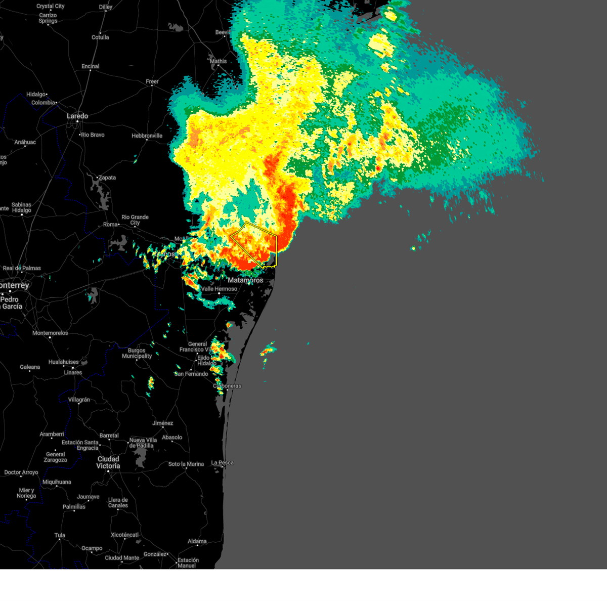
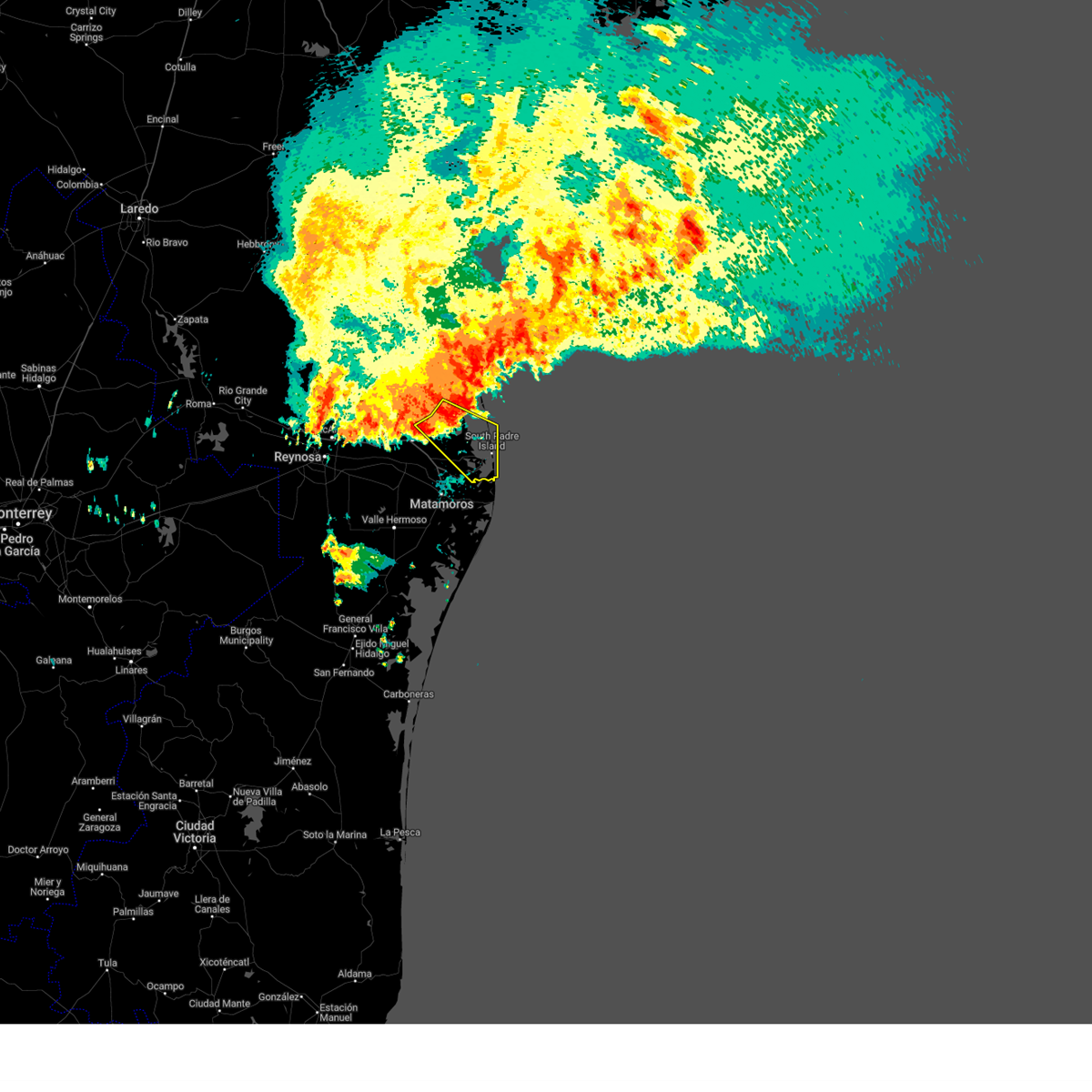
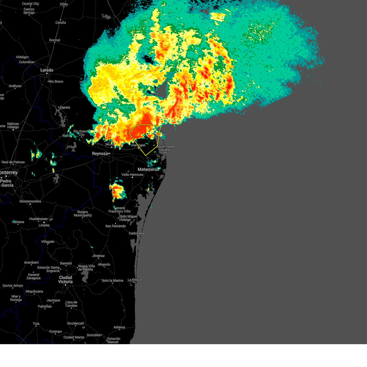
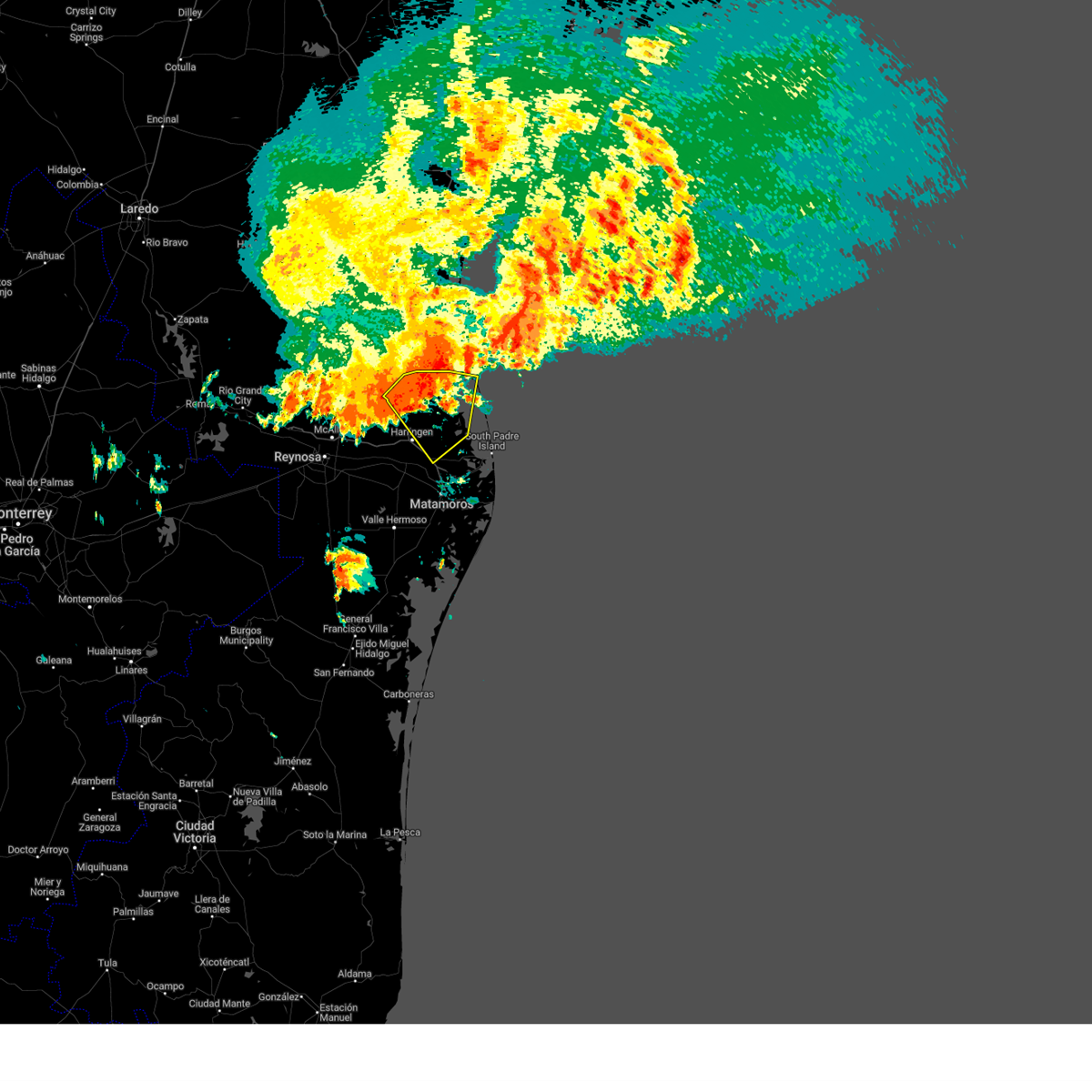
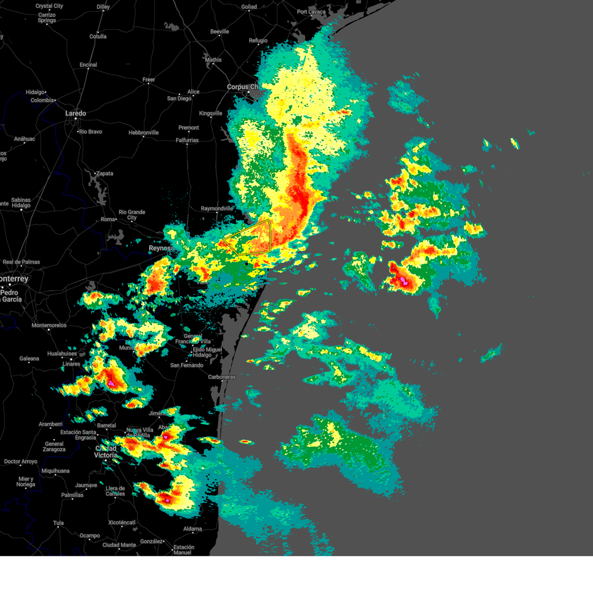
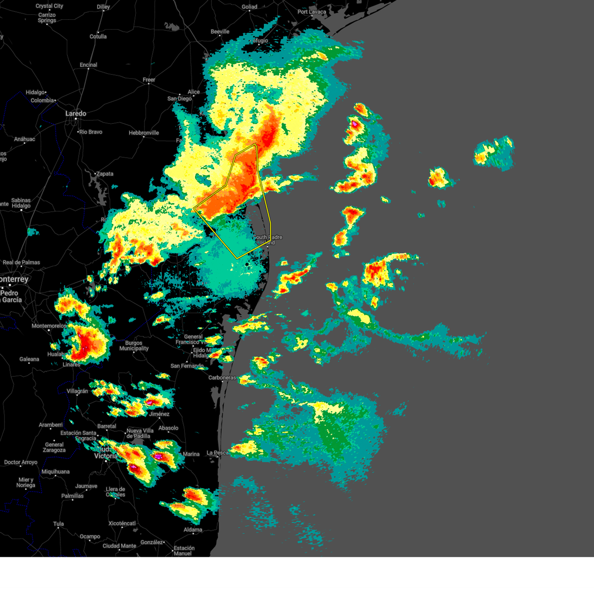
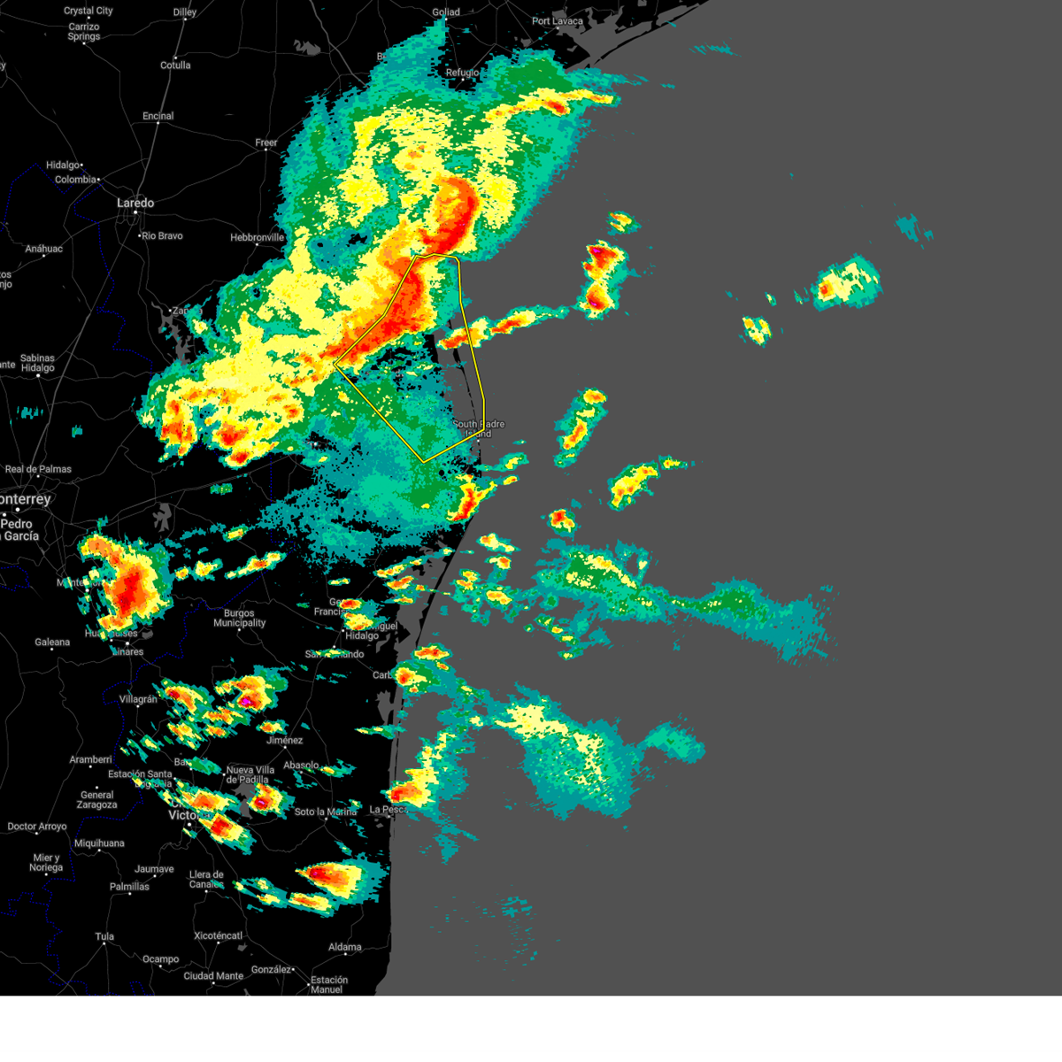
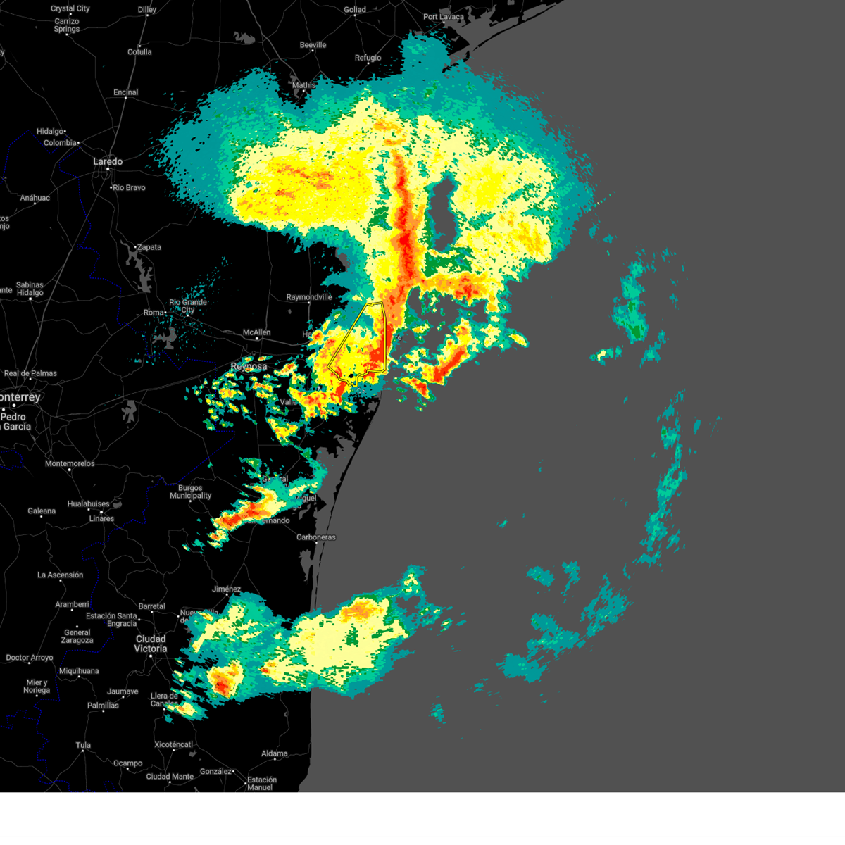
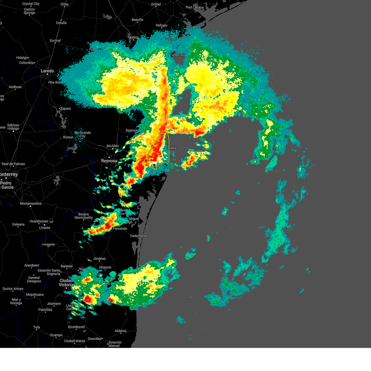
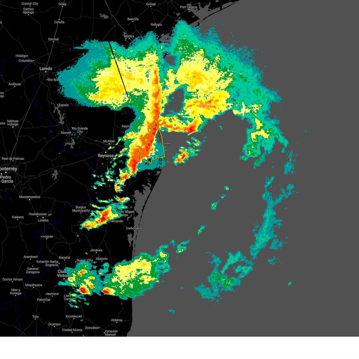
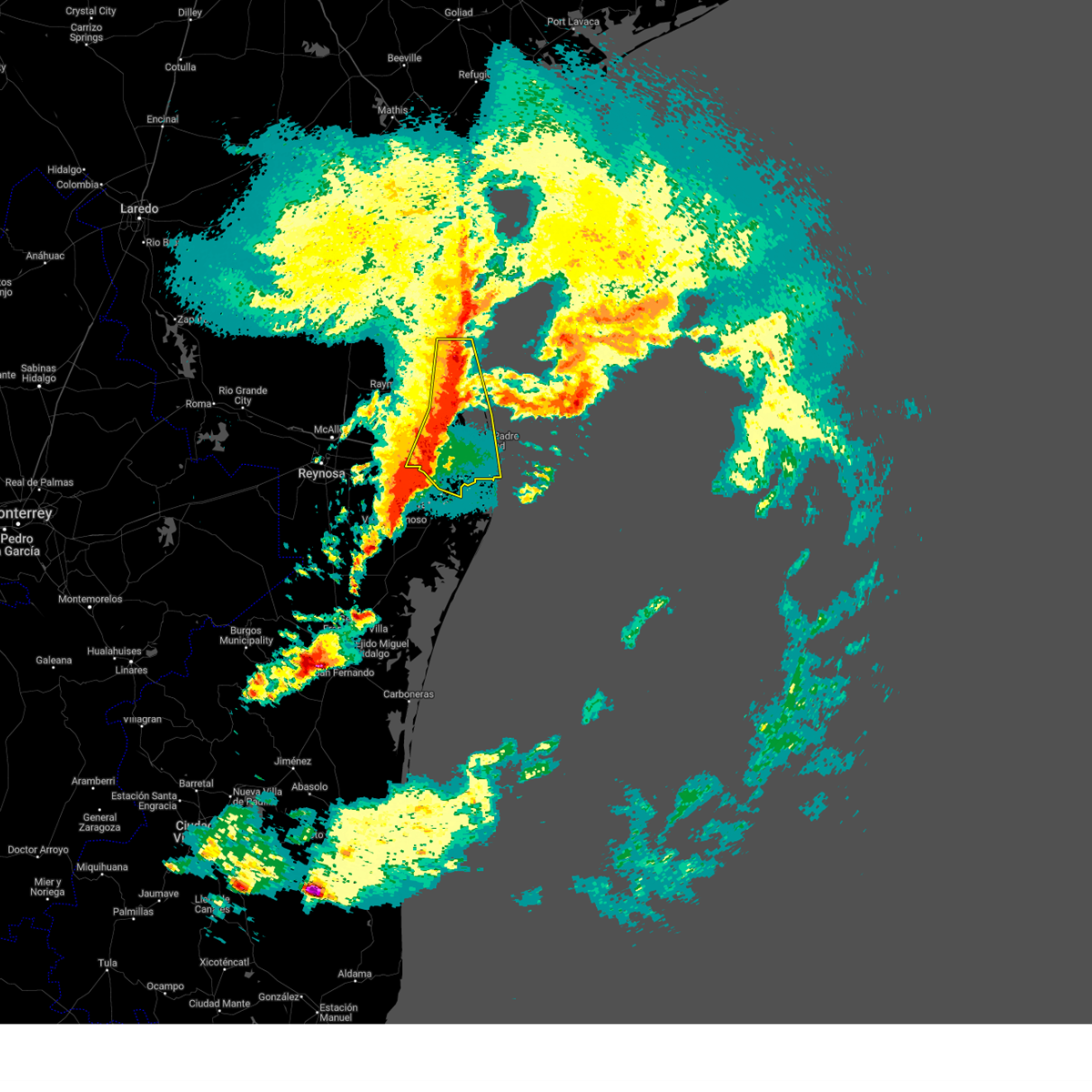
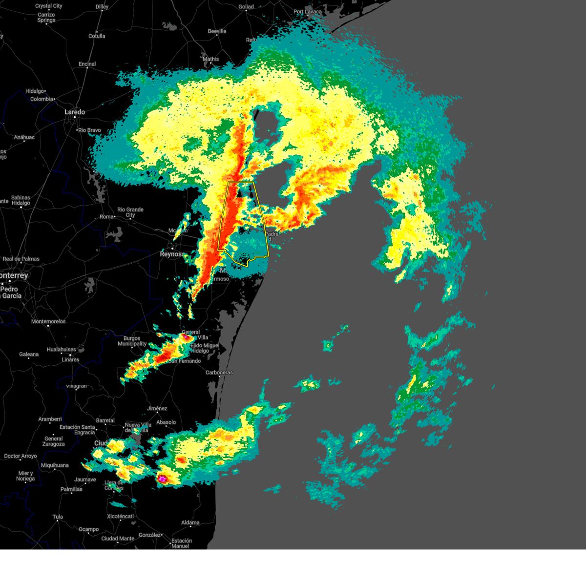
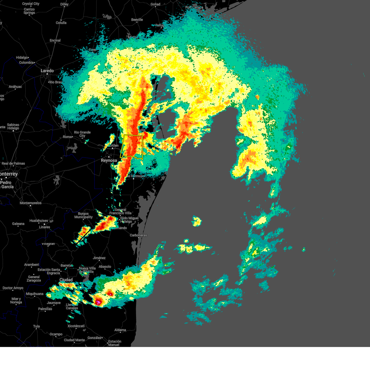
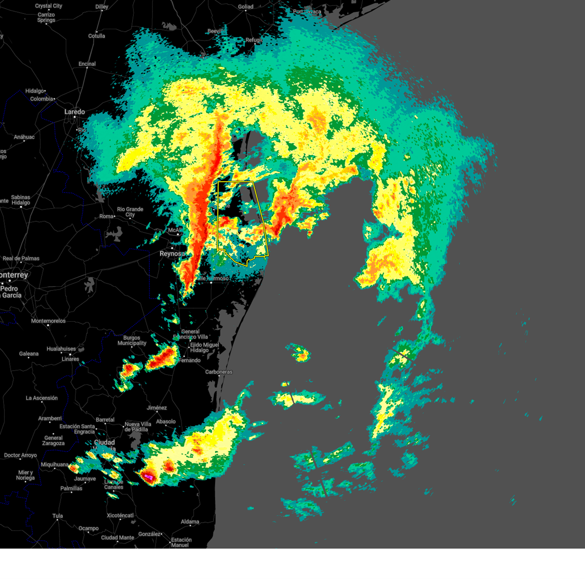
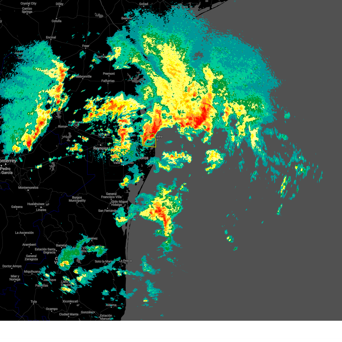
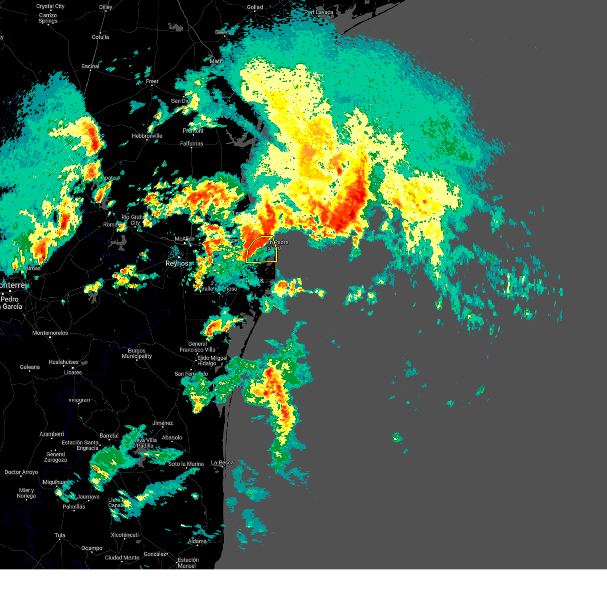
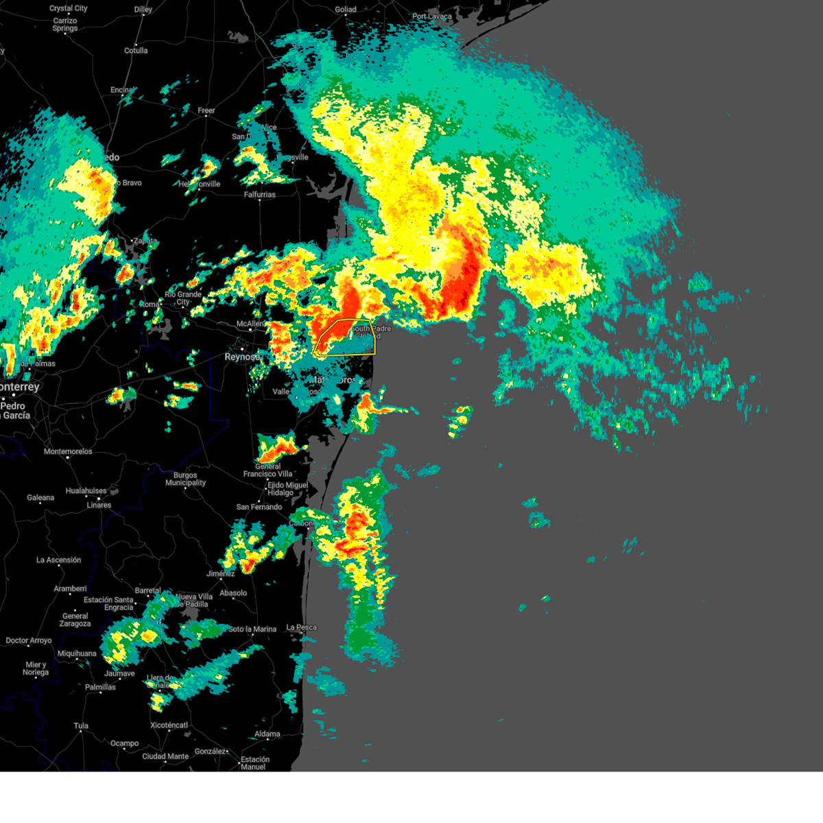
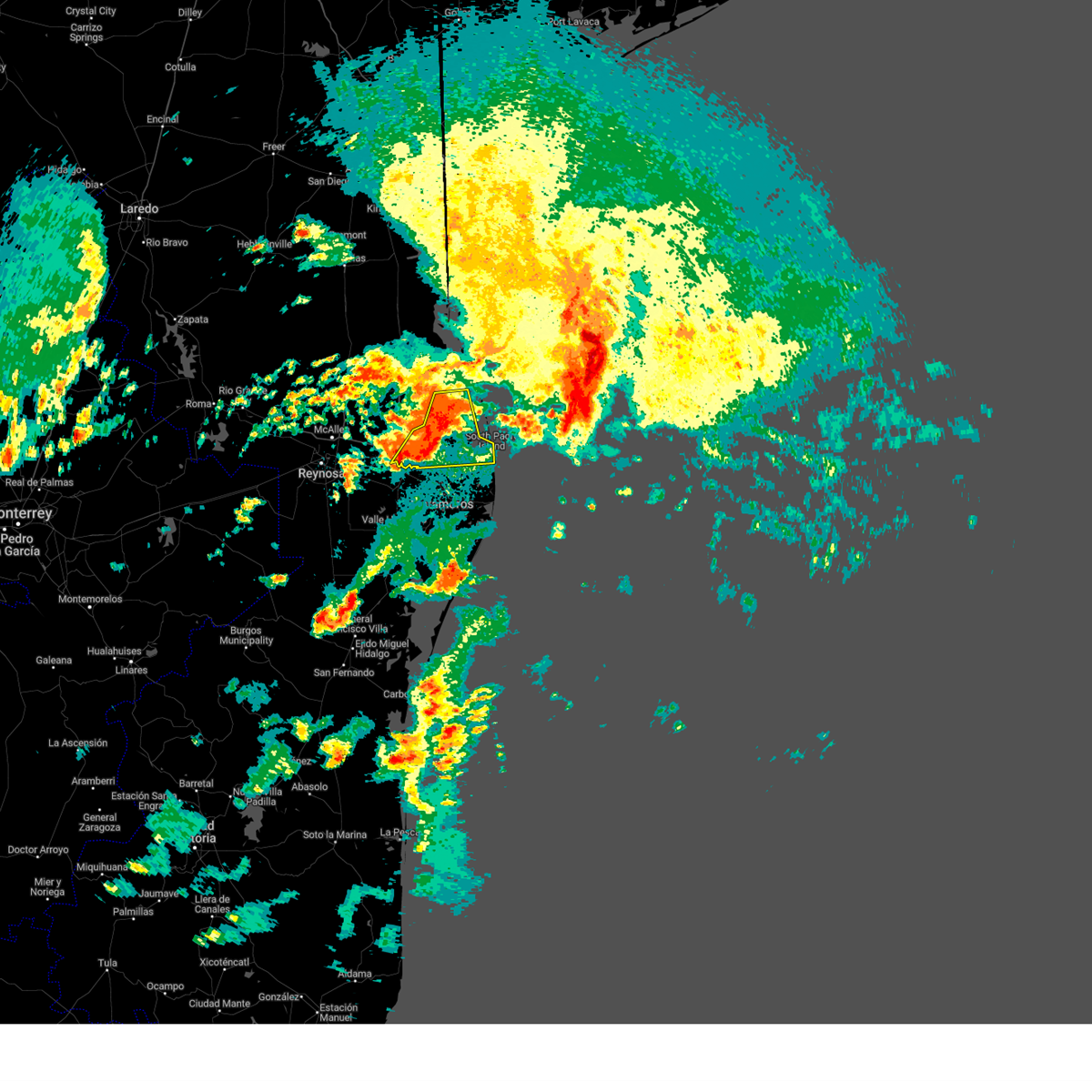
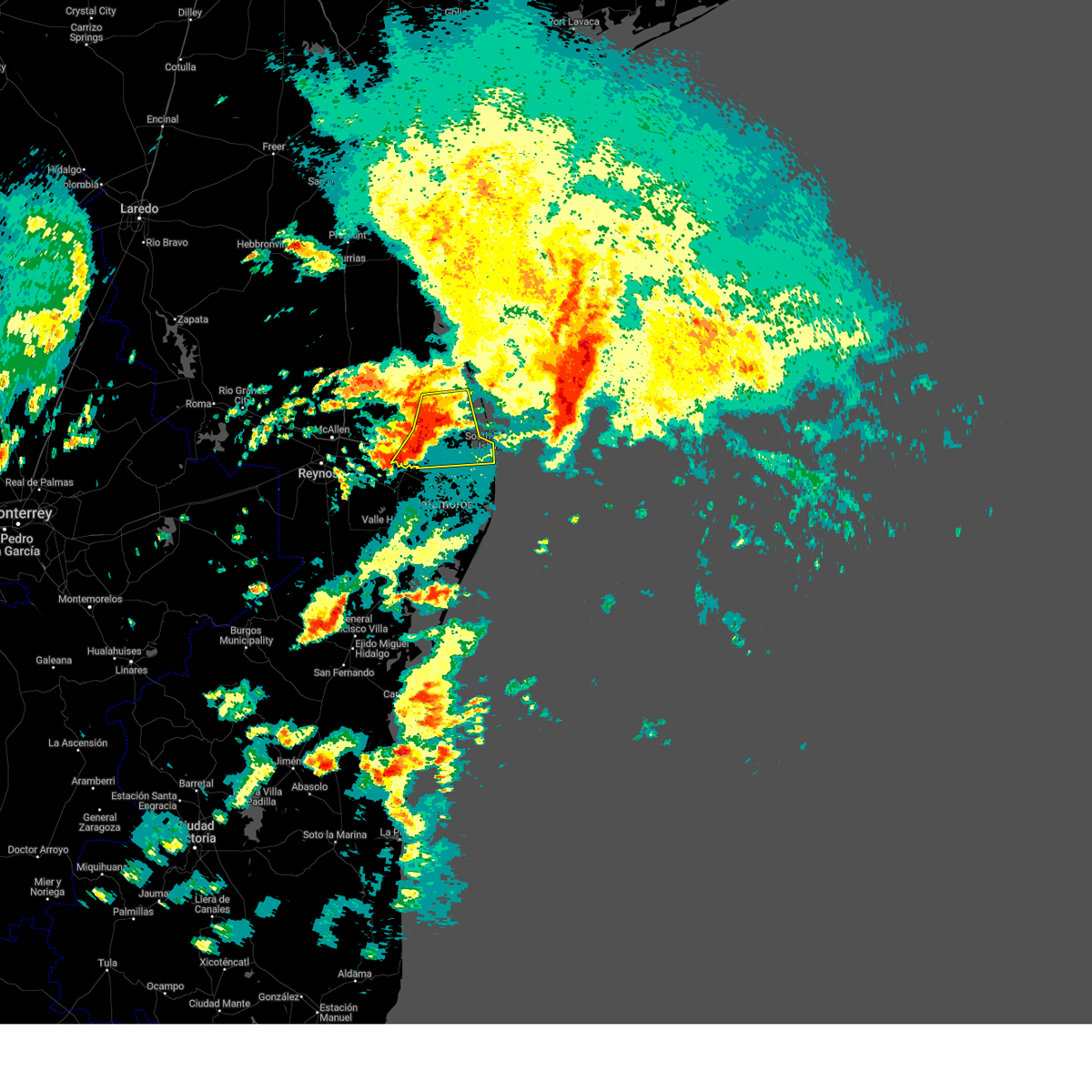
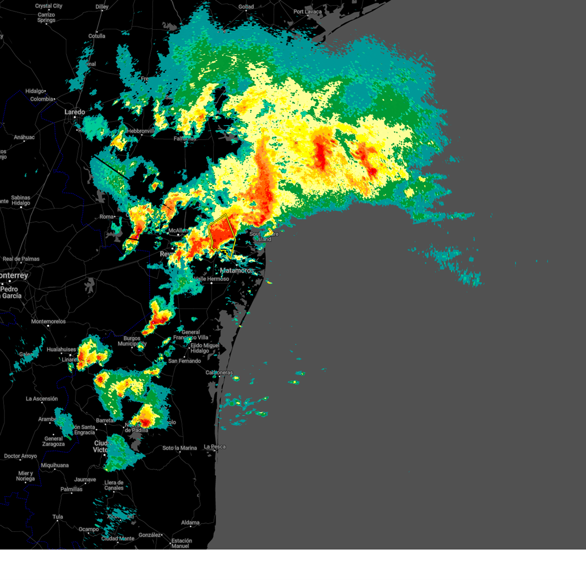
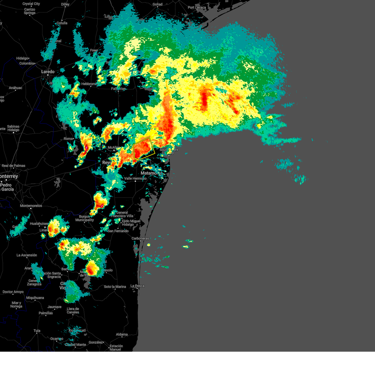
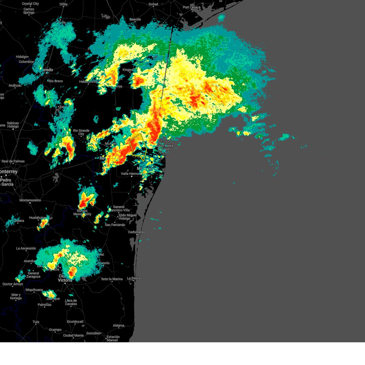
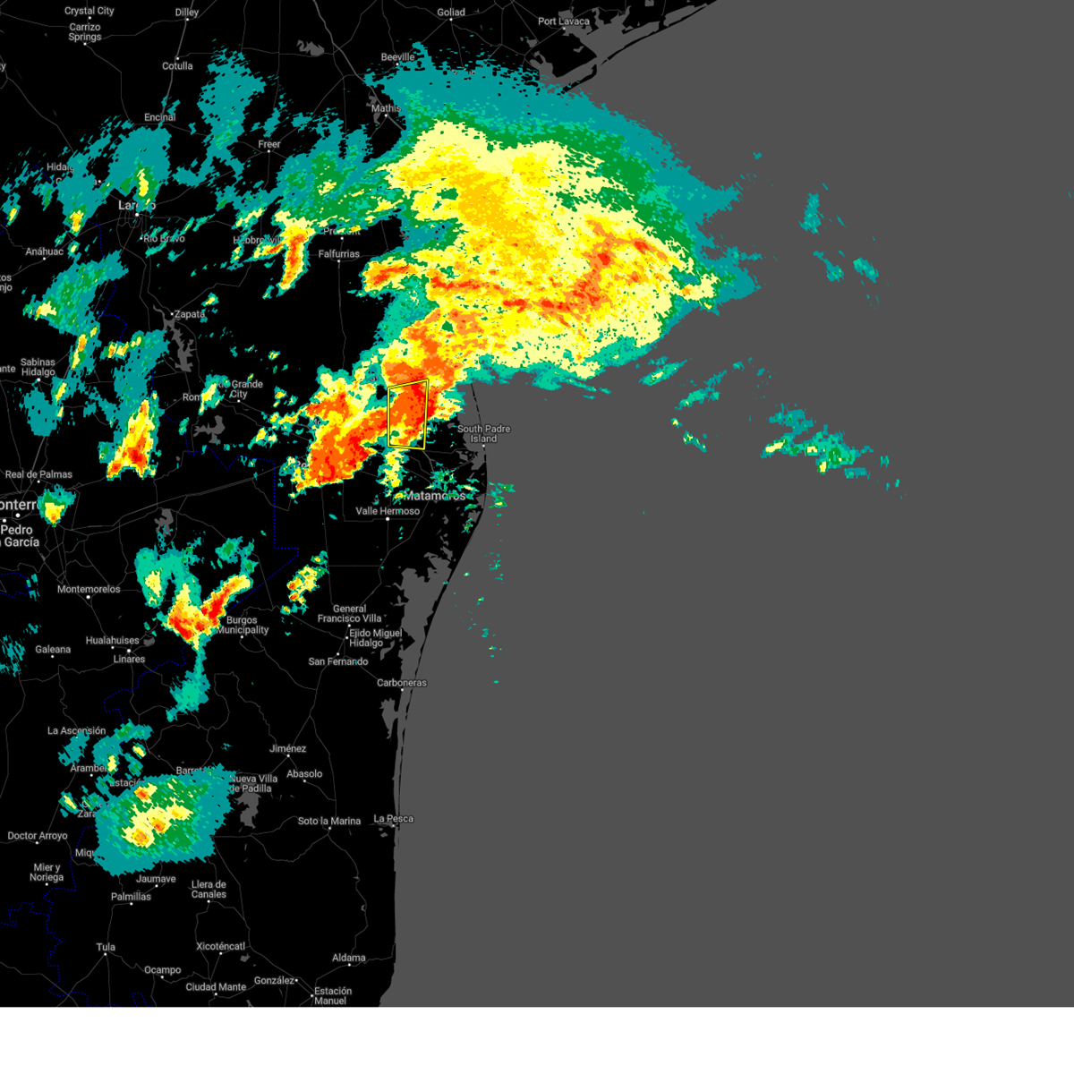
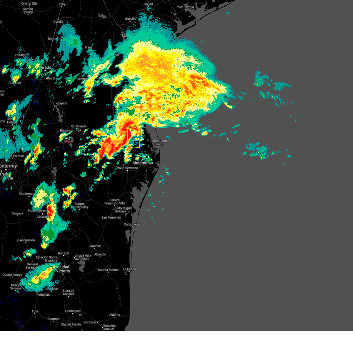
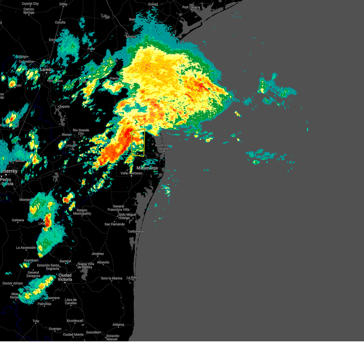
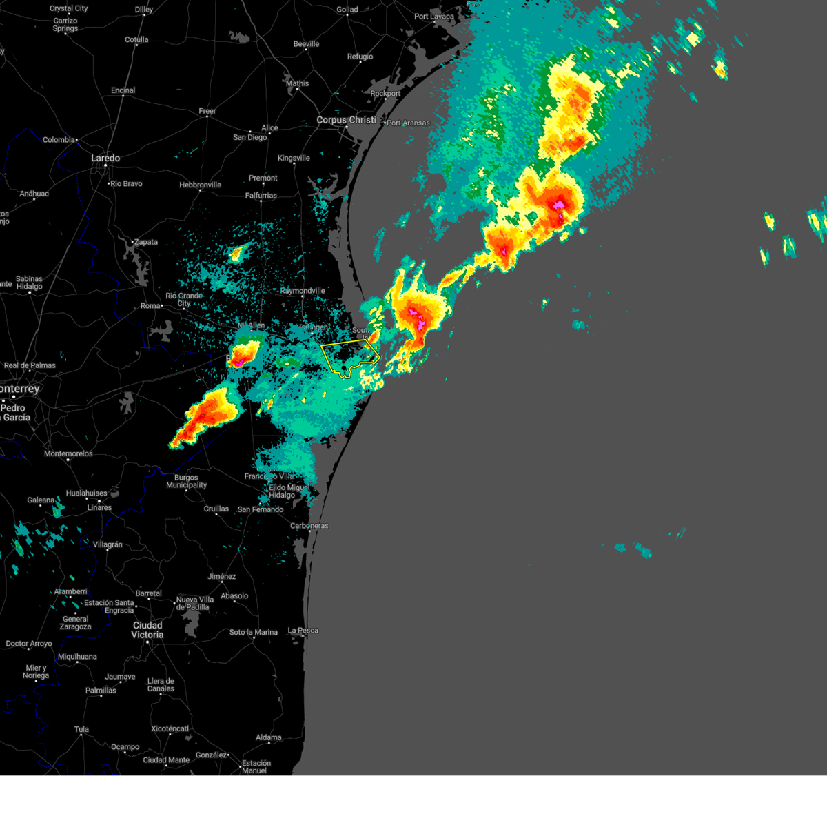
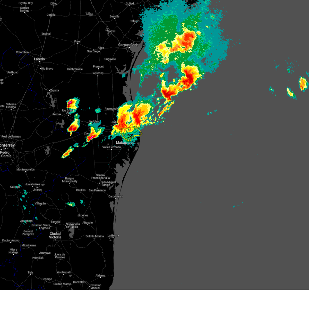
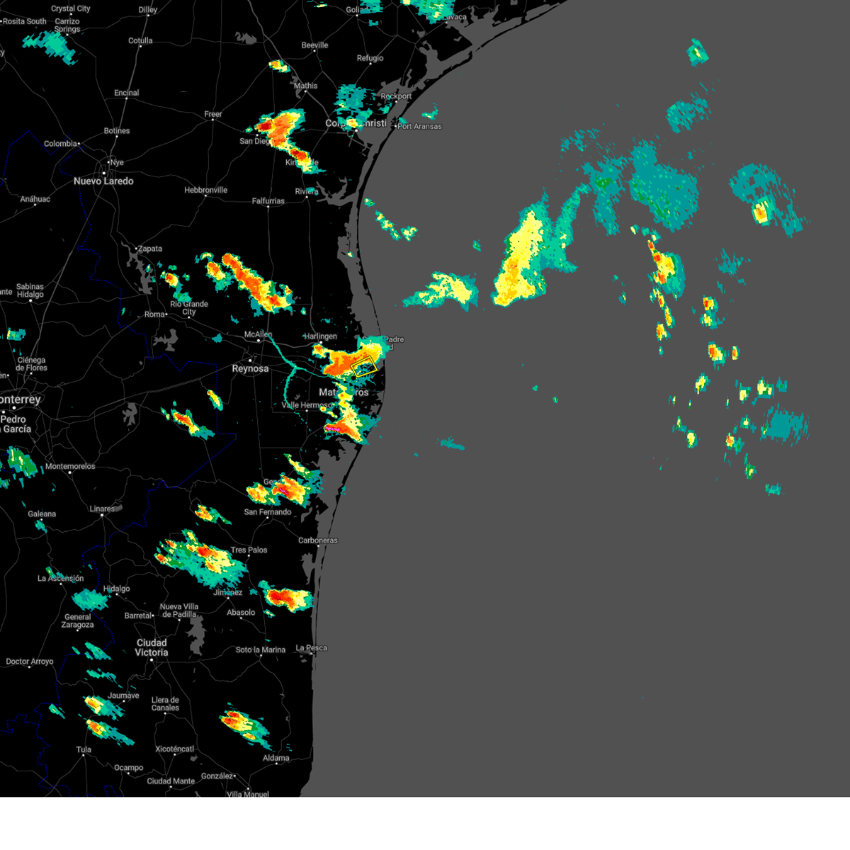
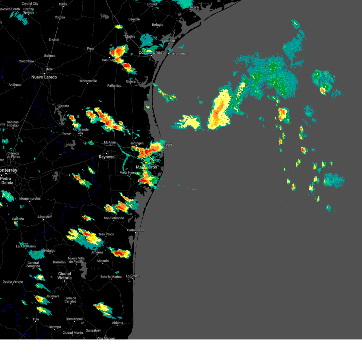
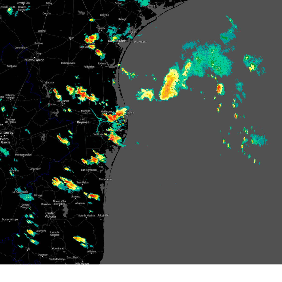
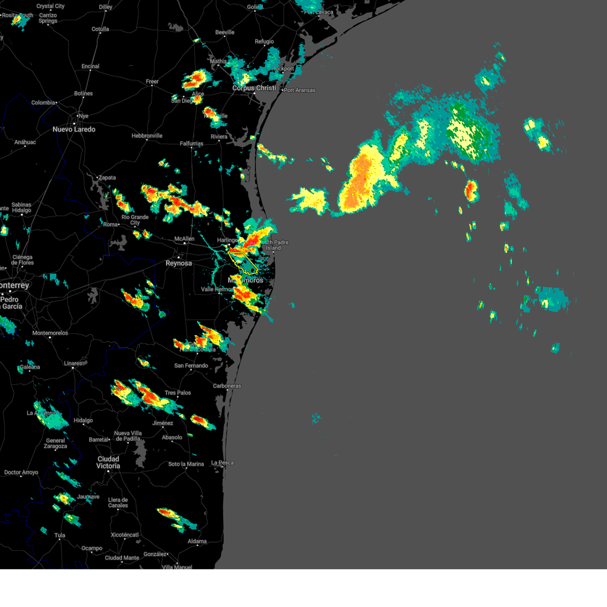
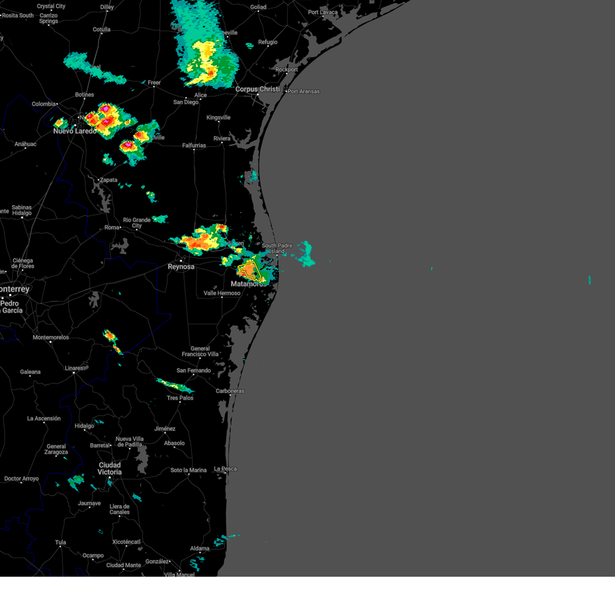
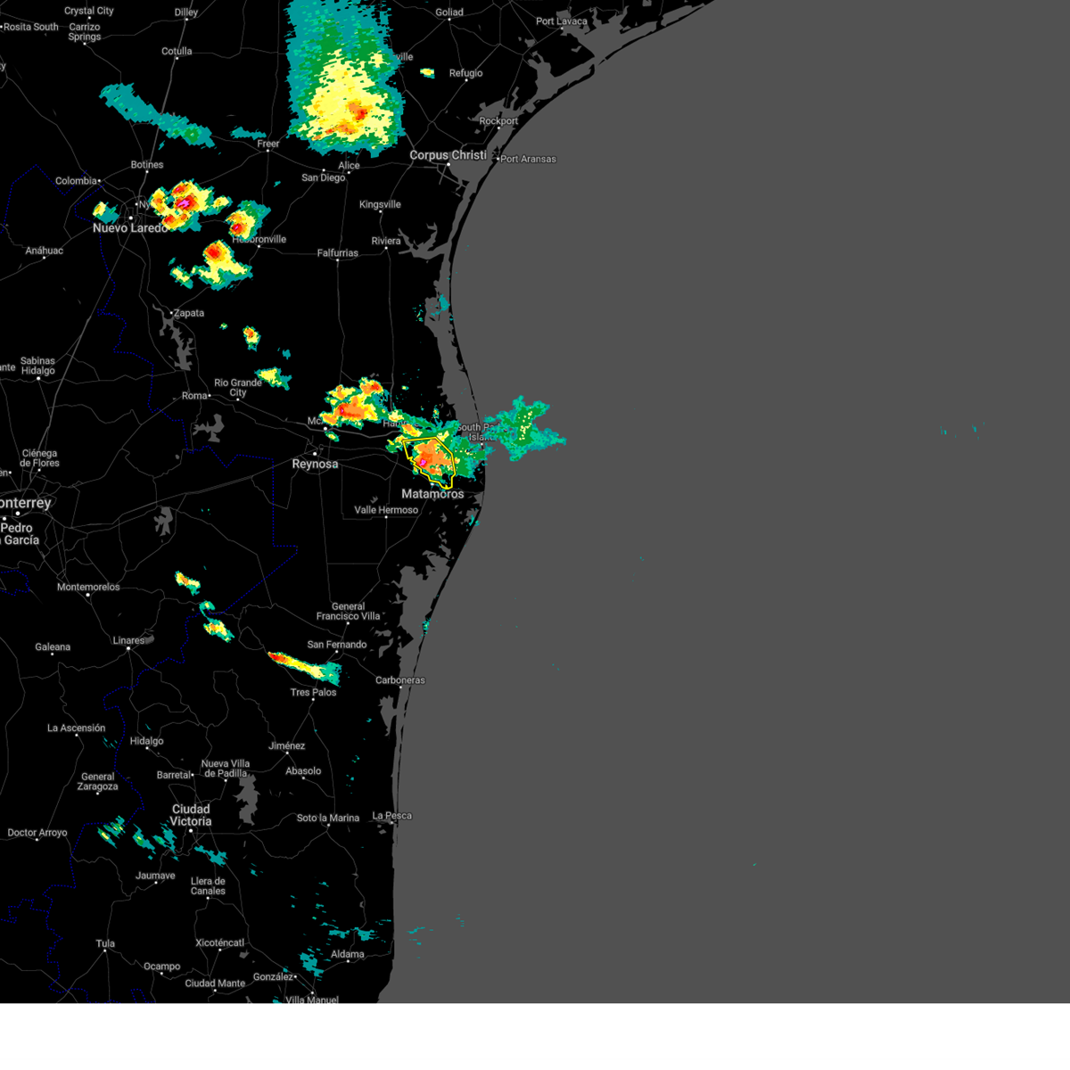
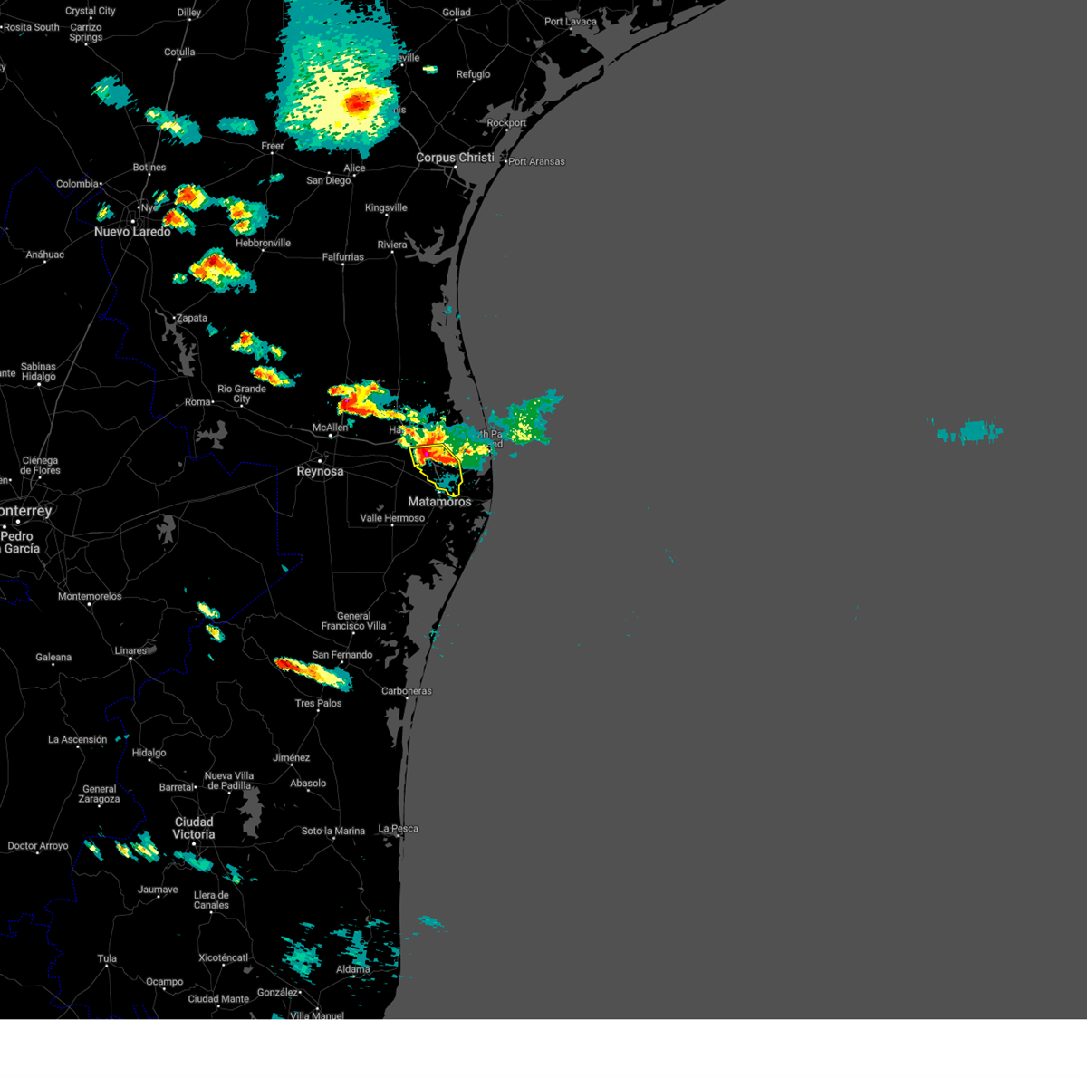
Hail Map for Brownsville, TX
The Brownsville, TX area has had 7 reports of on-the-ground hail by trained spotters, and has been under severe weather warnings 43 times during the past 12 months. Doppler radar has detected hail at or near Brownsville, TX on 47 occasions, including 5 occasions during the past year.
| Name: | Brownsville, TX |
| Where Located: | 6.2 miles N of Brownsville, TX |
| Map: | Google Map for Brownsville, TX |
| Population: | 175023 |
| Housing Units: | 53936 |
| More Info: | Search Google for Brownsville, TX |
1
The Top Recent Hail Date for Brownsville, TX is Friday, May 30, 2025 (12th out of 47)

Hail and Wind Damage Spotted near Brownsville, TX
| Date / Time | Report Details |
|---|---|
| 5/30/2025 1:15 PM CDT | Public report of small and large trees dow in cameron county TX, 0.6 miles W of Brownsville, TX |
| 5/28/2025 8:26 AM CDT |
 The storms which prompted the warning have weakened below severe limits, and no longer pose an immediate threat to life or property. therefore, the warning will be allowed to expire. however, small hail, gusty winds and heavy rain are still possible with these thunderstorms. The storms which prompted the warning have weakened below severe limits, and no longer pose an immediate threat to life or property. therefore, the warning will be allowed to expire. however, small hail, gusty winds and heavy rain are still possible with these thunderstorms.
|
| 5/28/2025 7:43 AM CDT |
 Svrbro the national weather service in brownsville has issued a * severe thunderstorm warning for, central cameron county in deep south texas, southeastern willacy county in deep south texas, * until 830 am cdt. * at 742 am cdt, severe thunderstorms were located along a line extending from 8 miles north of holly beach to near palmer laasko elementary to near downs elementary school, moving southeast at 40 mph (radar indicated). Hazards include 70 mph wind gusts and penny size hail. Expect considerable tree damage. Damage is likely to mobile homes, roofs, and outbuildings. Svrbro the national weather service in brownsville has issued a * severe thunderstorm warning for, central cameron county in deep south texas, southeastern willacy county in deep south texas, * until 830 am cdt. * at 742 am cdt, severe thunderstorms were located along a line extending from 8 miles north of holly beach to near palmer laasko elementary to near downs elementary school, moving southeast at 40 mph (radar indicated). Hazards include 70 mph wind gusts and penny size hail. Expect considerable tree damage. Damage is likely to mobile homes, roofs, and outbuildings.
|
| 5/28/2025 7:17 AM CDT |
 At 717 am cdt, severe thunderstorms were located along a line extending from 11 miles northwest of port mansfield airport to near san perlita high school to yznaga, moving southeast at 35 mph (radar indicated). Hazards include 70 mph wind gusts and penny size hail. Expect considerable tree damage. damage is likely to mobile homes, roofs, and outbuildings. Locations impacted include, harlingen arts and heritage museum, palmer laasko elementary, port mansfield, san perlita, harlingen high school, mccloud hood reservoir, willamar, harlingen fire department, raymondville fire station, and ranchette estates. At 717 am cdt, severe thunderstorms were located along a line extending from 11 miles northwest of port mansfield airport to near san perlita high school to yznaga, moving southeast at 35 mph (radar indicated). Hazards include 70 mph wind gusts and penny size hail. Expect considerable tree damage. damage is likely to mobile homes, roofs, and outbuildings. Locations impacted include, harlingen arts and heritage museum, palmer laasko elementary, port mansfield, san perlita, harlingen high school, mccloud hood reservoir, willamar, harlingen fire department, raymondville fire station, and ranchette estates.
|
| 5/28/2025 7:17 AM CDT |
 the severe thunderstorm warning has been cancelled and is no longer in effect the severe thunderstorm warning has been cancelled and is no longer in effect
|
| 5/9/2025 12:16 AM CDT |
 The storms which prompted the warning have moved out of the warned area. therefore, the warning has been allowed to expire. The storms which prompted the warning have moved out of the warned area. therefore, the warning has been allowed to expire.
|
| 5/9/2025 12:02 AM CDT |
 the severe thunderstorm warning has been cancelled and is no longer in effect the severe thunderstorm warning has been cancelled and is no longer in effect
|
| 5/9/2025 12:02 AM CDT |
 At 1201 am cdt, severe thunderstorms were located along a line extending from 21 miles northeast of beach access six to near beach access five to near los fresnos, moving southeast at 40 mph (radar indicated). Hazards include 60 mph wind gusts and quarter size hail. Hail damage to vehicles is expected. expect wind damage to roofs, siding, and trees. locations impacted include, u. s. Coast guard station, port isabel lighthouse, palmer laasko elementary, beach access four, garria elementary school, olmito lake, port isabel--laguna heights, south padre island police department, san benito, and beach access five. At 1201 am cdt, severe thunderstorms were located along a line extending from 21 miles northeast of beach access six to near beach access five to near los fresnos, moving southeast at 40 mph (radar indicated). Hazards include 60 mph wind gusts and quarter size hail. Hail damage to vehicles is expected. expect wind damage to roofs, siding, and trees. locations impacted include, u. s. Coast guard station, port isabel lighthouse, palmer laasko elementary, beach access four, garria elementary school, olmito lake, port isabel--laguna heights, south padre island police department, san benito, and beach access five.
|
| 5/8/2025 11:43 PM CDT |
 At 1143 pm cdt, severe thunderstorms were located along a line extending from 20 miles east of port mansfield to 9 miles east of arroyo city to san benito veterans memorial academy, moving southeast at 35 mph (radar indicated). Hazards include 60 mph wind gusts and quarter size hail. Hail damage to vehicles is expected. expect wind damage to roofs, siding, and trees. locations impacted include, t. george gutierrez jr. Middle school, harlingen arts and heritage museum, palmer laasko elementary, beach access four, garria elementary school, olmito lake, harlingen public library, port isabel--laguna heights, south padre island police department, and thomas jefferson elementary. At 1143 pm cdt, severe thunderstorms were located along a line extending from 20 miles east of port mansfield to 9 miles east of arroyo city to san benito veterans memorial academy, moving southeast at 35 mph (radar indicated). Hazards include 60 mph wind gusts and quarter size hail. Hail damage to vehicles is expected. expect wind damage to roofs, siding, and trees. locations impacted include, t. george gutierrez jr. Middle school, harlingen arts and heritage museum, palmer laasko elementary, beach access four, garria elementary school, olmito lake, harlingen public library, port isabel--laguna heights, south padre island police department, and thomas jefferson elementary.
|
| 5/8/2025 11:43 PM CDT |
 the severe thunderstorm warning has been cancelled and is no longer in effect the severe thunderstorm warning has been cancelled and is no longer in effect
|
| 5/8/2025 11:28 PM CDT |
 Svrbro the national weather service in brownsville has issued a * severe thunderstorm warning for, southeastern kenedy county in deep south texas, central cameron county in deep south texas, willacy county in deep south texas, * until 1215 am cdt. * at 1127 pm cdt, severe thunderstorms were located along a line extending from 15 miles northeast of port mansfield to 6 miles northeast of arroyo city to near dishman elementary school, moving southeast at 45 mph (radar indicated). Hazards include 60 mph wind gusts and quarter size hail. Hail damage to vehicles is expected. Expect wind damage to roofs, siding, and trees. Svrbro the national weather service in brownsville has issued a * severe thunderstorm warning for, southeastern kenedy county in deep south texas, central cameron county in deep south texas, willacy county in deep south texas, * until 1215 am cdt. * at 1127 pm cdt, severe thunderstorms were located along a line extending from 15 miles northeast of port mansfield to 6 miles northeast of arroyo city to near dishman elementary school, moving southeast at 45 mph (radar indicated). Hazards include 60 mph wind gusts and quarter size hail. Hail damage to vehicles is expected. Expect wind damage to roofs, siding, and trees.
|
| 5/8/2025 11:11 PM CDT |
 At 1110 pm cdt, severe thunderstorms were located along a line extending from 16 miles southeast of kenedy county wind farms to near port mansfield to lyford elementary school, moving southeast at 60 mph (radar indicated). Hazards include 60 mph wind gusts and quarter size hail. Hail damage to vehicles is expected. expect wind damage to roofs, siding, and trees. locations impacted include, t. george gutierrez jr. Middle school, harlingen arts and heritage museum, el camino angosto, palmer laasko elementary, olmito lake, harlingen public library, harlingen city reservoir, thomas jefferson elementary, san benito, and willamar. At 1110 pm cdt, severe thunderstorms were located along a line extending from 16 miles southeast of kenedy county wind farms to near port mansfield to lyford elementary school, moving southeast at 60 mph (radar indicated). Hazards include 60 mph wind gusts and quarter size hail. Hail damage to vehicles is expected. expect wind damage to roofs, siding, and trees. locations impacted include, t. george gutierrez jr. Middle school, harlingen arts and heritage museum, el camino angosto, palmer laasko elementary, olmito lake, harlingen public library, harlingen city reservoir, thomas jefferson elementary, san benito, and willamar.
|
| 5/8/2025 10:50 PM CDT |
 Svrbro the national weather service in brownsville has issued a * severe thunderstorm warning for, kenedy county in deep south texas, northeastern hidalgo county in deep south texas, central cameron county in deep south texas, willacy county in deep south texas, * until 1130 pm cdt. * at 1049 pm cdt, severe thunderstorms were located along a line extending from near kenedy county wind farms to 8 miles east of norias to near san manuel, moving southeast at 60 mph (radar indicated). Hazards include 60 mph wind gusts and quarter size hail. Hail damage to vehicles is expected. Expect wind damage to roofs, siding, and trees. Svrbro the national weather service in brownsville has issued a * severe thunderstorm warning for, kenedy county in deep south texas, northeastern hidalgo county in deep south texas, central cameron county in deep south texas, willacy county in deep south texas, * until 1130 pm cdt. * at 1049 pm cdt, severe thunderstorms were located along a line extending from near kenedy county wind farms to 8 miles east of norias to near san manuel, moving southeast at 60 mph (radar indicated). Hazards include 60 mph wind gusts and quarter size hail. Hail damage to vehicles is expected. Expect wind damage to roofs, siding, and trees.
|
| 3/28/2025 2:23 AM CDT |
 The storms which prompted the warning have moved out of the area. therefore, the warning will be allowed to expire. The storms which prompted the warning have moved out of the area. therefore, the warning will be allowed to expire.
|
| 3/28/2025 2:06 AM CDT |
 Torbro the national weather service in brownsville has issued a * tornado warning for, east central cameron county in deep south texas, * until 230 am cdt. * at 205 am cdt, a severe thunderstorm capable of producing a tornado was located over port isabel city hall, or near south padre island, moving east at 35 mph (radar indicated rotation). Hazards include tornado. Flying debris will be dangerous to those caught without shelter. mobile homes will be damaged or destroyed. damage to roofs, windows, and vehicles will occur. tree damage is likely. this dangerous storm will be near, port isabel fire and police department, south padre island birding center, port isabel city hall, south padre island, south padre island convention center, south padre island police department, port isabel lighthouse, washington park, u. s. coast guard station, and garria elementary school around 210 am cdt. Other locations impacted by this tornadic thunderstorm include port isabel--laguna heights and port isabel library. Torbro the national weather service in brownsville has issued a * tornado warning for, east central cameron county in deep south texas, * until 230 am cdt. * at 205 am cdt, a severe thunderstorm capable of producing a tornado was located over port isabel city hall, or near south padre island, moving east at 35 mph (radar indicated rotation). Hazards include tornado. Flying debris will be dangerous to those caught without shelter. mobile homes will be damaged or destroyed. damage to roofs, windows, and vehicles will occur. tree damage is likely. this dangerous storm will be near, port isabel fire and police department, south padre island birding center, port isabel city hall, south padre island, south padre island convention center, south padre island police department, port isabel lighthouse, washington park, u. s. coast guard station, and garria elementary school around 210 am cdt. Other locations impacted by this tornadic thunderstorm include port isabel--laguna heights and port isabel library.
|
| 3/28/2025 1:54 AM CDT |
 Svrbro the national weather service in brownsville has issued a * severe thunderstorm warning for, eastern cameron county in deep south texas, * until 230 am cdt. * at 154 am cdt, severe thunderstorms were located along a line extending from 14 miles southeast of port mansfield to laguna vista police department to near garden park elementary school, moving east at 35 mph (radar indicated). Hazards include 60 mph wind gusts. expect damage to roofs, siding, and trees Svrbro the national weather service in brownsville has issued a * severe thunderstorm warning for, eastern cameron county in deep south texas, * until 230 am cdt. * at 154 am cdt, severe thunderstorms were located along a line extending from 14 miles southeast of port mansfield to laguna vista police department to near garden park elementary school, moving east at 35 mph (radar indicated). Hazards include 60 mph wind gusts. expect damage to roofs, siding, and trees
|
| 3/28/2025 1:52 AM CDT |
 the severe thunderstorm warning has been cancelled and is no longer in effect the severe thunderstorm warning has been cancelled and is no longer in effect
|
| 3/28/2025 1:52 AM CDT |
 At 151 am cdt, severe thunderstorms were located along a line extending from 20 miles northeast of port mansfield to 8 miles northwest of beach access six to near el jardin elementary school, moving east at 40 mph (radar indicated). Hazards include 60 mph wind gusts. Expect damage to roofs, siding, and trees. Locations impacted include, longoria elementary school, sams memorial stadium, dancy building, palmer laasko elementary, beach access four, brownsville fire department station two, garria elementary school, brownsville fire department station seven, olmito lake, and port isabel--laguna heights. At 151 am cdt, severe thunderstorms were located along a line extending from 20 miles northeast of port mansfield to 8 miles northwest of beach access six to near el jardin elementary school, moving east at 40 mph (radar indicated). Hazards include 60 mph wind gusts. Expect damage to roofs, siding, and trees. Locations impacted include, longoria elementary school, sams memorial stadium, dancy building, palmer laasko elementary, beach access four, brownsville fire department station two, garria elementary school, brownsville fire department station seven, olmito lake, and port isabel--laguna heights.
|
| 3/28/2025 1:38 AM CDT |
 At 138 am cdt, severe thunderstorms were located along a line extending from 16 miles north of port mansfield to near arroyo city to brownsville fire department station two, moving east at 40 mph (radar indicated). Hazards include 60 mph wind gusts. Expect damage to roofs, siding, and trees. Locations impacted include, longoria elementary school, sams memorial stadium, dancy building, el camino angosto, palmer laasko elementary, beach access four, brownsville fire department station two, garria elementary school, brownsville fire department station seven, and olmito lake. At 138 am cdt, severe thunderstorms were located along a line extending from 16 miles north of port mansfield to near arroyo city to brownsville fire department station two, moving east at 40 mph (radar indicated). Hazards include 60 mph wind gusts. Expect damage to roofs, siding, and trees. Locations impacted include, longoria elementary school, sams memorial stadium, dancy building, el camino angosto, palmer laasko elementary, beach access four, brownsville fire department station two, garria elementary school, brownsville fire department station seven, and olmito lake.
|
| 3/28/2025 1:31 AM CDT |
 At 130 am cdt, severe thunderstorms were located along a line extending from 14 miles north of port mansfield airport to near arroyo city to near villa nueva elementary school, moving east at 40 mph (radar indicated). Hazards include 60 mph wind gusts. Expect damage to roofs, siding, and trees. Locations impacted include, longoria elementary school, sams memorial stadium, dancy building, el camino angosto, beach access four, olmito lake, brownsville golf center, harlingen city reservoir, willamar, and mckelvey park. At 130 am cdt, severe thunderstorms were located along a line extending from 14 miles north of port mansfield airport to near arroyo city to near villa nueva elementary school, moving east at 40 mph (radar indicated). Hazards include 60 mph wind gusts. Expect damage to roofs, siding, and trees. Locations impacted include, longoria elementary school, sams memorial stadium, dancy building, el camino angosto, beach access four, olmito lake, brownsville golf center, harlingen city reservoir, willamar, and mckelvey park.
|
| 3/28/2025 1:13 AM CDT |
 The storms which prompted the warning have moved out of the area. therefore, the warning will be allowed to expire. remember, a severe thunderstorm warning still remains in effect for eastern cameron and willacy counties until 200 am cdt. The storms which prompted the warning have moved out of the area. therefore, the warning will be allowed to expire. remember, a severe thunderstorm warning still remains in effect for eastern cameron and willacy counties until 200 am cdt.
|
| 3/28/2025 1:09 AM CDT |
 At 109 am cdt, severe thunderstorms were located along a line extending from 8 miles east of norias to near dishman elementary school to 10 miles southwest of las rusias, moving east at 40 mph (radar indicated). Hazards include 60 mph wind gusts. Expect damage to roofs, siding, and trees. locations impacted include, longoria elementary school, t. george gutierrez jr. Middle school, sams memorial stadium, dancy building, el camino angosto, beach access four, olmito lake, brownsville golf center, harlingen city reservoir, and willamar. At 109 am cdt, severe thunderstorms were located along a line extending from 8 miles east of norias to near dishman elementary school to 10 miles southwest of las rusias, moving east at 40 mph (radar indicated). Hazards include 60 mph wind gusts. Expect damage to roofs, siding, and trees. locations impacted include, longoria elementary school, t. george gutierrez jr. Middle school, sams memorial stadium, dancy building, el camino angosto, beach access four, olmito lake, brownsville golf center, harlingen city reservoir, and willamar.
|
| 3/28/2025 1:02 AM CDT |
 Svrbro the national weather service in brownsville has issued a * severe thunderstorm warning for, southeastern kenedy county in deep south texas, cameron county in deep south texas, willacy county in deep south texas, * until 200 am cdt. * at 101 am cdt, severe thunderstorms were located along a line extending from near norias to sebastian to 12 miles south of santa maria, moving east at 40 mph (radar indicated). Hazards include 60 mph wind gusts. expect damage to roofs, siding, and trees Svrbro the national weather service in brownsville has issued a * severe thunderstorm warning for, southeastern kenedy county in deep south texas, cameron county in deep south texas, willacy county in deep south texas, * until 200 am cdt. * at 101 am cdt, severe thunderstorms were located along a line extending from near norias to sebastian to 12 miles south of santa maria, moving east at 40 mph (radar indicated). Hazards include 60 mph wind gusts. expect damage to roofs, siding, and trees
|
| 3/28/2025 12:55 AM CDT |
 At 1254 am cdt, severe thunderstorms were located along a line extending from 8 miles north of lasara to ratamosa to 9 miles south of relampago, moving east at 45 mph (radar indicated). Hazards include 60 mph wind gusts. Expect damage to roofs, siding, and trees. locations impacted include, t. george gutierrez jr. Middle school, harlingen arts and heritage museum, el camino angosto, jose borrego middle school, adams gardens, weslaco mid valley airport, harlingen public library, harlingen city reservoir, lion lake, and thomas jefferson elementary. At 1254 am cdt, severe thunderstorms were located along a line extending from 8 miles north of lasara to ratamosa to 9 miles south of relampago, moving east at 45 mph (radar indicated). Hazards include 60 mph wind gusts. Expect damage to roofs, siding, and trees. locations impacted include, t. george gutierrez jr. Middle school, harlingen arts and heritage museum, el camino angosto, jose borrego middle school, adams gardens, weslaco mid valley airport, harlingen public library, harlingen city reservoir, lion lake, and thomas jefferson elementary.
|
| 3/28/2025 12:33 AM CDT |
 Svrbro the national weather service in brownsville has issued a * severe thunderstorm warning for, southeastern hidalgo county in deep south texas, northwestern cameron county in deep south texas, southwestern willacy county in deep south texas, * until 115 am cdt. * at 1232 am cdt, severe thunderstorms were located along a line extending from near san manuel to muniz to 7 miles south of santa ana national wildlife refuge, moving east at 50 mph (radar indicated). Hazards include 60 mph wind gusts. expect damage to roofs, siding, and trees Svrbro the national weather service in brownsville has issued a * severe thunderstorm warning for, southeastern hidalgo county in deep south texas, northwestern cameron county in deep south texas, southwestern willacy county in deep south texas, * until 115 am cdt. * at 1232 am cdt, severe thunderstorms were located along a line extending from near san manuel to muniz to 7 miles south of santa ana national wildlife refuge, moving east at 50 mph (radar indicated). Hazards include 60 mph wind gusts. expect damage to roofs, siding, and trees
|
| 3/27/2025 10:37 PM CDT |
 the severe thunderstorm warning has been cancelled and is no longer in effect the severe thunderstorm warning has been cancelled and is no longer in effect
|
| 3/27/2025 10:25 PM CDT |
 Svrbro the national weather service in brownsville has issued a * severe thunderstorm warning for, east central cameron county in deep south texas, * until 1100 pm cdt. * at 1024 pm cdt, a severe thunderstorm was located over laguna vista police department, or 7 miles west of south padre island, moving east at 25 mph (radar indicated). Hazards include 60 mph wind gusts. expect damage to roofs, siding, and trees Svrbro the national weather service in brownsville has issued a * severe thunderstorm warning for, east central cameron county in deep south texas, * until 1100 pm cdt. * at 1024 pm cdt, a severe thunderstorm was located over laguna vista police department, or 7 miles west of south padre island, moving east at 25 mph (radar indicated). Hazards include 60 mph wind gusts. expect damage to roofs, siding, and trees
|
| 3/27/2025 10:15 PM CDT |
 At 1014 pm cdt, severe thunderstorms were located along a line extending from 6 miles north of beach access six to near south padre island convention center to near los fresnos, moving east at 15 mph (radar indicated). Hazards include 60 mph wind gusts. Expect damage to roofs, siding, and trees. locations impacted include, port isabel city hall, u. s. Coast guard station, port isabel lighthouse, beach access four, port isabel high school, port isabel fire and police department, south padre island convention center, beach access six, laguna vista police department, and garria elementary school. At 1014 pm cdt, severe thunderstorms were located along a line extending from 6 miles north of beach access six to near south padre island convention center to near los fresnos, moving east at 15 mph (radar indicated). Hazards include 60 mph wind gusts. Expect damage to roofs, siding, and trees. locations impacted include, port isabel city hall, u. s. Coast guard station, port isabel lighthouse, beach access four, port isabel high school, port isabel fire and police department, south padre island convention center, beach access six, laguna vista police department, and garria elementary school.
|
| 3/27/2025 10:00 PM CDT |
 At 1000 pm cdt, severe thunderstorms were located along a line extending from 6 miles northwest of beach access six to holly beach to los fresnos, moving east at 15 mph (radar indicated). Hazards include 60 mph wind gusts. Expect damage to roofs, siding, and trees. locations impacted include, u. s. Coast guard station, port isabel lighthouse, palmer laasko elementary, beach access four, port isabel fire and police department, laguna vista police department, garria elementary school, port isabel--laguna heights, south padre island police department, and south padre island. At 1000 pm cdt, severe thunderstorms were located along a line extending from 6 miles northwest of beach access six to holly beach to los fresnos, moving east at 15 mph (radar indicated). Hazards include 60 mph wind gusts. Expect damage to roofs, siding, and trees. locations impacted include, u. s. Coast guard station, port isabel lighthouse, palmer laasko elementary, beach access four, port isabel fire and police department, laguna vista police department, garria elementary school, port isabel--laguna heights, south padre island police department, and south padre island.
|
| 3/27/2025 9:38 PM CDT |
 Svrbro the national weather service in brownsville has issued a * severe thunderstorm warning for, central cameron county in deep south texas, * until 1030 pm cdt. * at 937 pm cdt, severe thunderstorms were located along a line extending from 8 miles southeast of arroyo city to near holly beach to rancho viejo city hall, moving east at 15 mph (radar indicated). Hazards include 60 mph wind gusts. expect damage to roofs, siding, and trees Svrbro the national weather service in brownsville has issued a * severe thunderstorm warning for, central cameron county in deep south texas, * until 1030 pm cdt. * at 937 pm cdt, severe thunderstorms were located along a line extending from 8 miles southeast of arroyo city to near holly beach to rancho viejo city hall, moving east at 15 mph (radar indicated). Hazards include 60 mph wind gusts. expect damage to roofs, siding, and trees
|
| 3/27/2025 9:20 PM CDT |
 At 920 pm cdt, severe thunderstorms were located along a line extending from 6 miles northeast of arroyo city to near holly beach to la encantada elementary school, moving east at 30 mph (radar indicated). Hazards include 60 mph wind gusts and penny size hail. Expect damage to roofs, siding, and trees. Locations impacted include, harlingen arts and heritage museum, el camino angosto, palmer laasko elementary, beach access four, garria elementary school, harlingen public library, port isabel--laguna heights, harlingen city reservoir, south padre island police department, and thomas jefferson elementary. At 920 pm cdt, severe thunderstorms were located along a line extending from 6 miles northeast of arroyo city to near holly beach to la encantada elementary school, moving east at 30 mph (radar indicated). Hazards include 60 mph wind gusts and penny size hail. Expect damage to roofs, siding, and trees. Locations impacted include, harlingen arts and heritage museum, el camino angosto, palmer laasko elementary, beach access four, garria elementary school, harlingen public library, port isabel--laguna heights, harlingen city reservoir, south padre island police department, and thomas jefferson elementary.
|
| 3/27/2025 9:11 PM CDT |
 At 911 pm cdt, severe thunderstorms were located along a line extending from near arroyo city to near palmer laasko elementary to landrum, moving east at 30 mph (radar indicated). Hazards include 60 mph wind gusts and quarter size hail. Hail damage to vehicles is expected. expect wind damage to roofs, siding, and trees. Locations impacted include, harlingen arts and heritage museum, el camino angosto, palmer laasko elementary, beach access four, garria elementary school, harlingen public library, port isabel--laguna heights, harlingen city reservoir, south padre island police department, and thomas jefferson elementary. At 911 pm cdt, severe thunderstorms were located along a line extending from near arroyo city to near palmer laasko elementary to landrum, moving east at 30 mph (radar indicated). Hazards include 60 mph wind gusts and quarter size hail. Hail damage to vehicles is expected. expect wind damage to roofs, siding, and trees. Locations impacted include, harlingen arts and heritage museum, el camino angosto, palmer laasko elementary, beach access four, garria elementary school, harlingen public library, port isabel--laguna heights, harlingen city reservoir, south padre island police department, and thomas jefferson elementary.
|
| 3/27/2025 8:57 PM CDT |
 Svrbro the national weather service in brownsville has issued a * severe thunderstorm warning for, cameron county in deep south texas, southeastern willacy county in deep south texas, * until 945 pm cdt. * at 856 pm cdt, severe thunderstorms were located along a line extending from near porfirio to lozano to near las rusias, moving east at 30 mph (radar indicated). Hazards include 60 mph wind gusts and quarter size hail. Hail damage to vehicles is expected. Expect wind damage to roofs, siding, and trees. Svrbro the national weather service in brownsville has issued a * severe thunderstorm warning for, cameron county in deep south texas, southeastern willacy county in deep south texas, * until 945 pm cdt. * at 856 pm cdt, severe thunderstorms were located along a line extending from near porfirio to lozano to near las rusias, moving east at 30 mph (radar indicated). Hazards include 60 mph wind gusts and quarter size hail. Hail damage to vehicles is expected. Expect wind damage to roofs, siding, and trees.
|
| 3/27/2025 7:17 PM CDT |
 At 716 pm cdt, severe thunderstorms were located along a line extending from near port mansfield airport to 6 miles east of arroyo city to laguna vista police department, moving northeast at 15 mph (radar indicated). Hazards include 60 mph wind gusts. Expect damage to roofs, siding, and trees. Locations impacted include, holly beach, laureles, palmer laasko elementary, arroyo city, las yescas elementary school, la tina, bayview, las yescas, and brownsville. At 716 pm cdt, severe thunderstorms were located along a line extending from near port mansfield airport to 6 miles east of arroyo city to laguna vista police department, moving northeast at 15 mph (radar indicated). Hazards include 60 mph wind gusts. Expect damage to roofs, siding, and trees. Locations impacted include, holly beach, laureles, palmer laasko elementary, arroyo city, las yescas elementary school, la tina, bayview, las yescas, and brownsville.
|
| 3/27/2025 6:59 PM CDT |
 At 659 pm cdt, a severe thunderstorm was located over lozano, or near rio hondo, moving northeast at 25 mph (radar indicated). Hazards include 60 mph wind gusts and penny size hail. Expect damage to roofs, siding, and trees. Locations impacted include, harlingen arts and heritage museum, el camino angosto, harlingen, harlingen high school, harlingen public library, harlingen city reservoir, mccloud hood reservoir, thomas jefferson elementary, san benito, and harlingen fire department. At 659 pm cdt, a severe thunderstorm was located over lozano, or near rio hondo, moving northeast at 25 mph (radar indicated). Hazards include 60 mph wind gusts and penny size hail. Expect damage to roofs, siding, and trees. Locations impacted include, harlingen arts and heritage museum, el camino angosto, harlingen, harlingen high school, harlingen public library, harlingen city reservoir, mccloud hood reservoir, thomas jefferson elementary, san benito, and harlingen fire department.
|
| 3/27/2025 6:49 PM CDT |
 Svrbro the national weather service in brownsville has issued a * severe thunderstorm warning for, northeastern cameron county in deep south texas, eastern willacy county in deep south texas, * until 730 pm cdt. * at 649 pm cdt, severe thunderstorms were located along a line extending from near san perlita to near arroyo city to near los fresnos, moving northeast at 20 mph (radar indicated). Hazards include 60 mph wind gusts. expect damage to roofs, siding, and trees Svrbro the national weather service in brownsville has issued a * severe thunderstorm warning for, northeastern cameron county in deep south texas, eastern willacy county in deep south texas, * until 730 pm cdt. * at 649 pm cdt, severe thunderstorms were located along a line extending from near san perlita to near arroyo city to near los fresnos, moving northeast at 20 mph (radar indicated). Hazards include 60 mph wind gusts. expect damage to roofs, siding, and trees
|
| 3/27/2025 6:37 PM CDT |
 The storms which prompted the warning have moved out of the area. therefore, the warning will be allowed to expire. The storms which prompted the warning have moved out of the area. therefore, the warning will be allowed to expire.
|
| 3/27/2025 6:37 PM CDT |
 Svrbro the national weather service in brownsville has issued a * severe thunderstorm warning for, northwestern cameron county in deep south texas, south central willacy county in deep south texas, * until 715 pm cdt. * at 636 pm cdt, a severe thunderstorm was located near la feria, moving northeast at 20 mph (radar indicated). Hazards include 60 mph wind gusts and penny size hail. expect damage to roofs, siding, and trees Svrbro the national weather service in brownsville has issued a * severe thunderstorm warning for, northwestern cameron county in deep south texas, south central willacy county in deep south texas, * until 715 pm cdt. * at 636 pm cdt, a severe thunderstorm was located near la feria, moving northeast at 20 mph (radar indicated). Hazards include 60 mph wind gusts and penny size hail. expect damage to roofs, siding, and trees
|
| 3/27/2025 6:10 PM CDT |
 The storms which prompted the warning have weakened below severe limits, and have exited the warned area. therefore, the warning will be allowed to expire. The storms which prompted the warning have weakened below severe limits, and have exited the warned area. therefore, the warning will be allowed to expire.
|
| 3/27/2025 6:05 PM CDT |
 Svrbro the national weather service in brownsville has issued a * severe thunderstorm warning for, western cameron county in deep south texas, south central willacy county in deep south texas, * until 645 pm cdt. * at 605 pm cdt, severe thunderstorms were located along a line extending from lasara elementary school to near rangerville elementary school to 16 miles southwest of villa nueva elementary school, moving east at 15 mph (radar indicated). Hazards include 60 mph wind gusts and penny size hail. expect damage to roofs, siding, and trees Svrbro the national weather service in brownsville has issued a * severe thunderstorm warning for, western cameron county in deep south texas, south central willacy county in deep south texas, * until 645 pm cdt. * at 605 pm cdt, severe thunderstorms were located along a line extending from lasara elementary school to near rangerville elementary school to 16 miles southwest of villa nueva elementary school, moving east at 15 mph (radar indicated). Hazards include 60 mph wind gusts and penny size hail. expect damage to roofs, siding, and trees
|
| 3/27/2025 5:09 PM CDT |
 The storms which prompted the warning have moved out of the area. therefore, the warning will be allowed to expire. The storms which prompted the warning have moved out of the area. therefore, the warning will be allowed to expire.
|
| 3/27/2025 5:07 PM CDT |
 Svrbro the national weather service in brownsville has issued a * severe thunderstorm warning for, central cameron county in deep south texas, central willacy county in deep south texas, * until 615 pm cdt. * at 507 pm cdt, severe thunderstorms were located along a line extending from 6 miles northeast of san perlita to near santa monica to near la encantada elementary school, moving east at 15 mph (radar indicated). Hazards include 60 mph wind gusts and penny size hail. expect damage to roofs, siding, and trees Svrbro the national weather service in brownsville has issued a * severe thunderstorm warning for, central cameron county in deep south texas, central willacy county in deep south texas, * until 615 pm cdt. * at 507 pm cdt, severe thunderstorms were located along a line extending from 6 miles northeast of san perlita to near santa monica to near la encantada elementary school, moving east at 15 mph (radar indicated). Hazards include 60 mph wind gusts and penny size hail. expect damage to roofs, siding, and trees
|
| 3/27/2025 4:40 PM CDT |
 At 438 pm cdt, severe thunderstorms were located along a line extending from near lyford to dishman elementary school to santa maria high school, moving east at 20 mph (radar indicated). Hazards include 70 mph wind gusts and nickel size hail. Expect considerable tree damage. damage is likely to mobile homes, roofs, and outbuildings. locations impacted include, t. george gutierrez jr. Middle school, doctor hesiquio rodriguez elementary school, harlingen arts and heritage museum, el camino angosto, harlingen, harlingen high school, adams gardens, harlingen public library, harlingen city reservoir, and mccloud hood reservoir. At 438 pm cdt, severe thunderstorms were located along a line extending from near lyford to dishman elementary school to santa maria high school, moving east at 20 mph (radar indicated). Hazards include 70 mph wind gusts and nickel size hail. Expect considerable tree damage. damage is likely to mobile homes, roofs, and outbuildings. locations impacted include, t. george gutierrez jr. Middle school, doctor hesiquio rodriguez elementary school, harlingen arts and heritage museum, el camino angosto, harlingen, harlingen high school, adams gardens, harlingen public library, harlingen city reservoir, and mccloud hood reservoir.
|
| 3/27/2025 4:21 PM CDT |
 Svrbro the national weather service in brownsville has issued a * severe thunderstorm warning for, northwestern cameron county in deep south texas, south central willacy county in deep south texas, * until 515 pm cdt. * at 420 pm cdt, severe thunderstorms were located along a line extending from lyford high school to santa rosa high school to near relampago, moving east at 20 mph (radar indicated). Hazards include 70 mph wind gusts and nickel size hail. Expect considerable tree damage. Damage is likely to mobile homes, roofs, and outbuildings. Svrbro the national weather service in brownsville has issued a * severe thunderstorm warning for, northwestern cameron county in deep south texas, south central willacy county in deep south texas, * until 515 pm cdt. * at 420 pm cdt, severe thunderstorms were located along a line extending from lyford high school to santa rosa high school to near relampago, moving east at 20 mph (radar indicated). Hazards include 70 mph wind gusts and nickel size hail. Expect considerable tree damage. Damage is likely to mobile homes, roofs, and outbuildings.
|
| 5/17/2024 8:52 AM CDT |
 the severe thunderstorm warning has been cancelled and is no longer in effect the severe thunderstorm warning has been cancelled and is no longer in effect
|
| 5/17/2024 8:45 AM CDT |
 the severe thunderstorm warning has been cancelled and is no longer in effect the severe thunderstorm warning has been cancelled and is no longer in effect
|
| 5/17/2024 8:45 AM CDT |
 At 845 am cdt, a severe thunderstorm was located over lozano, or over rio hondo, moving east at 70 mph (radar indicated). Hazards include 60 mph wind gusts and quarter size hail. Hail damage to vehicles is expected. expect wind damage to roofs, siding, and trees. Locations impacted include, harlingen, san benito, la feria, los fresnos, santa rosa, south padre island, rancho viejo, rio hondo, palm valley, and los indios. At 845 am cdt, a severe thunderstorm was located over lozano, or over rio hondo, moving east at 70 mph (radar indicated). Hazards include 60 mph wind gusts and quarter size hail. Hail damage to vehicles is expected. expect wind damage to roofs, siding, and trees. Locations impacted include, harlingen, san benito, la feria, los fresnos, santa rosa, south padre island, rancho viejo, rio hondo, palm valley, and los indios.
|
| 5/17/2024 8:31 AM CDT |
 Svrbro the national weather service in brownsville has issued a * severe thunderstorm warning for, southeastern hidalgo county in deep south texas, cameron county in deep south texas, southeastern willacy county in deep south texas, * until 915 am cdt. * at 830 am cdt, a severe thunderstorm was located over la feria public library, or over la feria, moving east at 70 mph (radar indicated). Hazards include 60 mph wind gusts and quarter size hail. Hail damage to vehicles is expected. Expect wind damage to roofs, siding, and trees. Svrbro the national weather service in brownsville has issued a * severe thunderstorm warning for, southeastern hidalgo county in deep south texas, cameron county in deep south texas, southeastern willacy county in deep south texas, * until 915 am cdt. * at 830 am cdt, a severe thunderstorm was located over la feria public library, or over la feria, moving east at 70 mph (radar indicated). Hazards include 60 mph wind gusts and quarter size hail. Hail damage to vehicles is expected. Expect wind damage to roofs, siding, and trees.
|
| 5/13/2024 9:13 PM CDT |
 The storm which prompted the warning has weakened below severe limits, and has exited the warned area. therefore, the warning will be allowed to expire. a severe thunderstorm watch remains in effect until 1000 pm cdt for deep south texas. The storm which prompted the warning has weakened below severe limits, and has exited the warned area. therefore, the warning will be allowed to expire. a severe thunderstorm watch remains in effect until 1000 pm cdt for deep south texas.
|
| 5/13/2024 8:43 PM CDT |
 The storm which prompted the warning has weakened below severe limits, and no longer poses an immediate threat to life or property. therefore, the warning will be allowed to expire. a severe thunderstorm watch remains in effect until 1000 pm cdt for deep south texas. remember, a severe thunderstorm warning still remains in effect for cameron county. The storm which prompted the warning has weakened below severe limits, and no longer poses an immediate threat to life or property. therefore, the warning will be allowed to expire. a severe thunderstorm watch remains in effect until 1000 pm cdt for deep south texas. remember, a severe thunderstorm warning still remains in effect for cameron county.
|
| 5/13/2024 8:36 PM CDT |
 Svrbro the national weather service in brownsville has issued a * severe thunderstorm warning for, southeastern cameron county in deep south texas, * until 915 pm cdt. * at 836 pm cdt, a severe thunderstorm was located near laguna heights, or 8 miles southwest of south padre island, moving southeast at 35 mph (radar indicated). Hazards include 70 mph wind gusts and nickel size hail. Expect considerable tree damage. Damage is likely to mobile homes, roofs, and outbuildings. Svrbro the national weather service in brownsville has issued a * severe thunderstorm warning for, southeastern cameron county in deep south texas, * until 915 pm cdt. * at 836 pm cdt, a severe thunderstorm was located near laguna heights, or 8 miles southwest of south padre island, moving southeast at 35 mph (radar indicated). Hazards include 70 mph wind gusts and nickel size hail. Expect considerable tree damage. Damage is likely to mobile homes, roofs, and outbuildings.
|
| 5/13/2024 8:33 PM CDT |
 At 833 pm cdt, a severe thunderstorm was located 7 miles west of beach access six, or 10 miles southeast of arroyo city, moving east at 60 mph (radar indicated). Hazards include 60 mph wind gusts and nickel size hail. Expect damage to roofs, siding, and trees. Locations impacted include, harlingen, san benito, rio hondo, laureles, arroyo city, brownsville, port isabel lighthouse, harlingen arts and heritage museum, palmer laasko elementary, and harlingen high school. At 833 pm cdt, a severe thunderstorm was located 7 miles west of beach access six, or 10 miles southeast of arroyo city, moving east at 60 mph (radar indicated). Hazards include 60 mph wind gusts and nickel size hail. Expect damage to roofs, siding, and trees. Locations impacted include, harlingen, san benito, rio hondo, laureles, arroyo city, brownsville, port isabel lighthouse, harlingen arts and heritage museum, palmer laasko elementary, and harlingen high school.
|
| 5/13/2024 8:24 PM CDT |
 At 823 pm cdt, a severe thunderstorm was located near arroyo city, moving east at 60 mph (radar indicated). Hazards include 70 mph wind gusts and quarter size hail. Hail damage to vehicles is expected. expect considerable tree damage. wind damage is also likely to mobile homes, roofs, and outbuildings. Locations impacted include, harlingen, san benito, rio hondo, palm valley, arroyo city, laureles, brownsville, primera, combes, and harlingen arts and heritage museum. At 823 pm cdt, a severe thunderstorm was located near arroyo city, moving east at 60 mph (radar indicated). Hazards include 70 mph wind gusts and quarter size hail. Hail damage to vehicles is expected. expect considerable tree damage. wind damage is also likely to mobile homes, roofs, and outbuildings. Locations impacted include, harlingen, san benito, rio hondo, palm valley, arroyo city, laureles, brownsville, primera, combes, and harlingen arts and heritage museum.
|
| 5/13/2024 8:02 PM CDT |
 Svrbro the national weather service in brownsville has issued a * severe thunderstorm warning for, northern cameron county in deep south texas, southern willacy county in deep south texas, * until 845 pm cdt. * at 802 pm cdt, a severe thunderstorm was located over yznaga, or over santa rosa, moving east at 60 mph (radar indicated). Hazards include 70 mph wind gusts and half dollar size hail. Hail damage to vehicles is expected. expect considerable tree damage. Wind damage is also likely to mobile homes, roofs, and outbuildings. Svrbro the national weather service in brownsville has issued a * severe thunderstorm warning for, northern cameron county in deep south texas, southern willacy county in deep south texas, * until 845 pm cdt. * at 802 pm cdt, a severe thunderstorm was located over yznaga, or over santa rosa, moving east at 60 mph (radar indicated). Hazards include 70 mph wind gusts and half dollar size hail. Hail damage to vehicles is expected. expect considerable tree damage. Wind damage is also likely to mobile homes, roofs, and outbuildings.
|
| 3/16/2024 4:07 AM CDT |
 Svrbro the national weather service in brownsville has issued a * severe thunderstorm warning for, southeastern kenedy county in deep south texas, northern cameron county in deep south texas, willacy county in deep south texas, * until 515 am cdt. * at 407 am cdt, severe thunderstorms were located along a line extending from 7 miles northeast of kenedy county wind farms to 6 miles northeast of san perlita to near jose borrego middle school, moving southeast at 25 mph (radar indicated). Hazards include 60 mph wind gusts and nickel size hail. Expect damage to roofs, siding, and trees. severe thunderstorms will be near, lyford, sebastian, san perlita, port mansfield airport, san perlita high school, lyford high school, willamar, lyford elementary school, lyford city hall, and porfirio around 415 am cdt. harlingen, santa rosa, port mansfield, santa rosa high school, port mansfield chamber of commerce, tierra bonita, and santa rosa police department around 420 am cdt. santa monica around 425 am cdt. primera, combes, doctor hesiquio rodriguez elementary school, dishman elementary school, wilson elementary school, and combes community center around 430 am cdt. palm valley and palm valley police department around 435 am cdt. rio hondo, harlingen arts and heritage museum, lamar elementary school, harlingen public library, harlingen high school, marine military academy, moises vela middle school, harlingen high school south, harlingen fire department, and texas state technical college harlingen around 440 am cdt. arroyo city, rio hondo elementary school, rio hondo junior high school, rio hondo high school, treasure hills golf club, harlingen city reservoir, harligen municipal golf course, rio hondo city hall, harlingen soccer complex, and valley baptist medical center harlingen around 445 am cdt. harlingen medical center, san benito veterans memorial academy, san benito high school, south texas academy of medical technology, and san benito police department around 450 am cdt. other locations impacted by these severe thunderstorms include t. george gutierrez jr. Middle school, villa cavazos, el camino angosto, korngay private airport, los angeles subdivision, indian lake, mccloud hood reservoir, thomas jefferson elementary, stuart place, and mckelvey park. Svrbro the national weather service in brownsville has issued a * severe thunderstorm warning for, southeastern kenedy county in deep south texas, northern cameron county in deep south texas, willacy county in deep south texas, * until 515 am cdt. * at 407 am cdt, severe thunderstorms were located along a line extending from 7 miles northeast of kenedy county wind farms to 6 miles northeast of san perlita to near jose borrego middle school, moving southeast at 25 mph (radar indicated). Hazards include 60 mph wind gusts and nickel size hail. Expect damage to roofs, siding, and trees. severe thunderstorms will be near, lyford, sebastian, san perlita, port mansfield airport, san perlita high school, lyford high school, willamar, lyford elementary school, lyford city hall, and porfirio around 415 am cdt. harlingen, santa rosa, port mansfield, santa rosa high school, port mansfield chamber of commerce, tierra bonita, and santa rosa police department around 420 am cdt. santa monica around 425 am cdt. primera, combes, doctor hesiquio rodriguez elementary school, dishman elementary school, wilson elementary school, and combes community center around 430 am cdt. palm valley and palm valley police department around 435 am cdt. rio hondo, harlingen arts and heritage museum, lamar elementary school, harlingen public library, harlingen high school, marine military academy, moises vela middle school, harlingen high school south, harlingen fire department, and texas state technical college harlingen around 440 am cdt. arroyo city, rio hondo elementary school, rio hondo junior high school, rio hondo high school, treasure hills golf club, harlingen city reservoir, harligen municipal golf course, rio hondo city hall, harlingen soccer complex, and valley baptist medical center harlingen around 445 am cdt. harlingen medical center, san benito veterans memorial academy, san benito high school, south texas academy of medical technology, and san benito police department around 450 am cdt. other locations impacted by these severe thunderstorms include t. george gutierrez jr. Middle school, villa cavazos, el camino angosto, korngay private airport, los angeles subdivision, indian lake, mccloud hood reservoir, thomas jefferson elementary, stuart place, and mckelvey park.
|
| 9/16/2023 4:55 PM CDT |
 At 455 pm cdt, a severe thunderstorm was located over lozano, or near laureles, and is nearly stationary (radar indicated). Hazards include 60 mph wind gusts. Expect damage to roofs, siding, and trees. locations impacted include, rio hondo, laureles, miller jordan middle school, palmer laasko elementary, lozano, lopez - riggins elementary school, los fresnos high school, los fresnos city offices, and library memorial middle school. hail threat, radar indicated max hail size, <. 75 in wind threat, radar indicated max wind gust, 60 mph. At 455 pm cdt, a severe thunderstorm was located over lozano, or near laureles, and is nearly stationary (radar indicated). Hazards include 60 mph wind gusts. Expect damage to roofs, siding, and trees. locations impacted include, rio hondo, laureles, miller jordan middle school, palmer laasko elementary, lozano, lopez - riggins elementary school, los fresnos high school, los fresnos city offices, and library memorial middle school. hail threat, radar indicated max hail size, <. 75 in wind threat, radar indicated max wind gust, 60 mph.
|
| 9/16/2023 4:41 PM CDT |
 The severe thunderstorm warning for west central cameron county will expire at 445 pm cdt, the storm which prompted the warning has moved out of the area. therefore, the warning will be allowed to expire. however gusty winds are still possible with this thunderstorm. remember, a severe thunderstorm warning still remains in effect for central cameron county for 60 mph winds until 5:30 pm cdt. The severe thunderstorm warning for west central cameron county will expire at 445 pm cdt, the storm which prompted the warning has moved out of the area. therefore, the warning will be allowed to expire. however gusty winds are still possible with this thunderstorm. remember, a severe thunderstorm warning still remains in effect for central cameron county for 60 mph winds until 5:30 pm cdt.
|
| 9/16/2023 4:39 PM CDT |
 At 439 pm cdt, a severe thunderstorm was located over lozano, or near rio hondo, and is nearly stationary (radar indicated). Hazards include 60 mph wind gusts. expect damage to roofs, siding, and trees At 439 pm cdt, a severe thunderstorm was located over lozano, or near rio hondo, and is nearly stationary (radar indicated). Hazards include 60 mph wind gusts. expect damage to roofs, siding, and trees
|
| 9/16/2023 4:22 PM CDT |
 At 422 pm cdt, a severe thunderstorm was located over treasure hills golf club, or near rio hondo, moving southeast at 5 mph (radar indicated). Hazards include 60 mph wind gusts and penny size hail. Expect damage to roofs, siding, and trees. locations impacted include, harlingen, san benito, rio hondo, harlingen arts and heritage museum, harlingen high school, harlingen public library, harlingen fire department, rio hondo elementary school, rio hondo high school, and san benito veterans memorial academy. hail threat, radar indicated max hail size, 0. 75 in wind threat, observed max wind gust, 60 mph. At 422 pm cdt, a severe thunderstorm was located over treasure hills golf club, or near rio hondo, moving southeast at 5 mph (radar indicated). Hazards include 60 mph wind gusts and penny size hail. Expect damage to roofs, siding, and trees. locations impacted include, harlingen, san benito, rio hondo, harlingen arts and heritage museum, harlingen high school, harlingen public library, harlingen fire department, rio hondo elementary school, rio hondo high school, and san benito veterans memorial academy. hail threat, radar indicated max hail size, 0. 75 in wind threat, observed max wind gust, 60 mph.
|
| 9/16/2023 4:06 PM CDT |
 At 405 pm cdt, a severe thunderstorm was located over harlingen fire department, or near rio hondo, moving southeast at 5 mph (radar indicated and harlingen asos gusted to 70 mph). Hazards include 70 mph wind gusts and penny size hail. Expect considerable tree damage. Damage is likely to mobile homes, roofs, and outbuildings. At 405 pm cdt, a severe thunderstorm was located over harlingen fire department, or near rio hondo, moving southeast at 5 mph (radar indicated and harlingen asos gusted to 70 mph). Hazards include 70 mph wind gusts and penny size hail. Expect considerable tree damage. Damage is likely to mobile homes, roofs, and outbuildings.
|
| 9/16/2023 4:04 PM CDT |
 At 403 pm cdt, a severe thunderstorm was located over harlingen fire department, or near rio hondo, moving southeast at 5 mph (khrl gusted to 53 knots). Hazards include 60 mph wind gusts and penny size hail. expect damage to roofs, siding, and trees At 403 pm cdt, a severe thunderstorm was located over harlingen fire department, or near rio hondo, moving southeast at 5 mph (khrl gusted to 53 knots). Hazards include 60 mph wind gusts and penny size hail. expect damage to roofs, siding, and trees
|
| 6/8/2023 7:05 AM CDT | Nws employee reported sign damage at dunkin donuts and popeyes on boca chica blvd. time estimated by rada in cameron county TX, 4.9 miles N of Brownsville, TX |
| 6/8/2023 7:04 AM CDT |
 At 703 am cdt, severe thunderstorms were located along a line extending from near beach access six to near besteiro middle school, moving southeast at 60 mph (radar indicated). Hazards include 60 mph wind gusts. Expect damage to roofs, siding, and trees. locations impacted include, harlingen, san benito, los fresnos, south padre island, rancho viejo, rio hondo, los indios, southmost, olmito and port of brownsville. hail threat, radar indicated max hail size, <. 75 in wind threat, radar indicated max wind gust, 60 mph. At 703 am cdt, severe thunderstorms were located along a line extending from near beach access six to near besteiro middle school, moving southeast at 60 mph (radar indicated). Hazards include 60 mph wind gusts. Expect damage to roofs, siding, and trees. locations impacted include, harlingen, san benito, los fresnos, south padre island, rancho viejo, rio hondo, los indios, southmost, olmito and port of brownsville. hail threat, radar indicated max hail size, <. 75 in wind threat, radar indicated max wind gust, 60 mph.
|
| 6/8/2023 6:51 AM CDT |
 At 649 am cdt, severe thunderstorms were located along a line extending from near arroyo city to near san pedro, moving southeast at 60 mph (radar indicated). Hazards include 70 mph wind gusts and penny size hail. Expect considerable tree damage. damage is likely to mobile homes, roofs, and outbuildings. locations impacted include, harlingen, san benito, mercedes, la feria, los fresnos, progreso, santa rosa, south padre island, rancho viejo and rio hondo. thunderstorm damage threat, considerable hail threat, radar indicated max hail size, 0. 75 in wind threat, radar indicated max wind gust, 70 mph. At 649 am cdt, severe thunderstorms were located along a line extending from near arroyo city to near san pedro, moving southeast at 60 mph (radar indicated). Hazards include 70 mph wind gusts and penny size hail. Expect considerable tree damage. damage is likely to mobile homes, roofs, and outbuildings. locations impacted include, harlingen, san benito, mercedes, la feria, los fresnos, progreso, santa rosa, south padre island, rancho viejo and rio hondo. thunderstorm damage threat, considerable hail threat, radar indicated max hail size, 0. 75 in wind threat, radar indicated max wind gust, 70 mph.
|
| 6/8/2023 6:35 AM CDT |
 At 635 am cdt, severe thunderstorms were located along a line extending from near willamar to relampago, moving southeast at 75 mph (radar indicated). Hazards include 70 mph wind gusts and penny size hail. Expect considerable tree damage. Damage is likely to mobile homes, roofs, and outbuildings. At 635 am cdt, severe thunderstorms were located along a line extending from near willamar to relampago, moving southeast at 75 mph (radar indicated). Hazards include 70 mph wind gusts and penny size hail. Expect considerable tree damage. Damage is likely to mobile homes, roofs, and outbuildings.
|
| 6/5/2023 3:53 PM CDT | Member of the public shared a picture of a telephone pole snapped in half near perez elementary school at the corner of renfro blvd and shidler drive in brownsville. ti in cameron county TX, 4.2 miles N of Brownsville, TX |
| 6/5/2023 3:53 PM CDT | Member of the public shared a picture of a large palm tree down across the westbound lane of coffee road... just west of casa de oro. timing based on rada in cameron county TX, 3.5 miles N of Brownsville, TX |
| 6/5/2023 3:49 PM CDT | Canopy lifted from tented play area at the centro cultural of cameron park... per photos from emc. wind speed unknow in cameron county TX, 2.5 miles W of Brownsville, TX |
| 6/5/2023 3:48 PM CDT |
 At 346 pm cdt, severe thunderstorms were located along a line extending from near port of brownsville to near gallegos elementary school to brownsville fire department station six, moving south at 30 mph (radar indicated. this storm produced a wind gust of 45 mph at harlingen valley international airport at 317 pm). Hazards include 60 mph wind gusts and penny size hail. Expect minor damage to roofs, siding, and trees. locations impacted include, port of brownsville, east brownsville and loma alta lake. hail threat, radar indicated max hail size, 0. 75 in wind threat, radar indicated max wind gust, 60 mph. At 346 pm cdt, severe thunderstorms were located along a line extending from near port of brownsville to near gallegos elementary school to brownsville fire department station six, moving south at 30 mph (radar indicated. this storm produced a wind gust of 45 mph at harlingen valley international airport at 317 pm). Hazards include 60 mph wind gusts and penny size hail. Expect minor damage to roofs, siding, and trees. locations impacted include, port of brownsville, east brownsville and loma alta lake. hail threat, radar indicated max hail size, 0. 75 in wind threat, radar indicated max wind gust, 60 mph.
|
| 6/5/2023 3:44 PM CDT |
 At 343 pm cdt, a severe thunderstorm was located over valley international country club, or over cameron park, moving southeast at 30 mph (radar indicated). Hazards include 60 mph wind gusts and quarter size hail. Hail damage to vehicles is expected. expect wind damage to roofs, siding, and trees. locations impacted include, cameron park, downtown brownsville, southmost, brownsville, lincoln park, b i s d administration building, longoria elementary school, sams memorial stadium, hanna high school and brownsville public library southmost branch. this storm should pass across the rio grande by 4 pm. hail threat, radar indicated max hail size, 1. 00 in wind threat, radar indicated max wind gust, 60 mph. At 343 pm cdt, a severe thunderstorm was located over valley international country club, or over cameron park, moving southeast at 30 mph (radar indicated). Hazards include 60 mph wind gusts and quarter size hail. Hail damage to vehicles is expected. expect wind damage to roofs, siding, and trees. locations impacted include, cameron park, downtown brownsville, southmost, brownsville, lincoln park, b i s d administration building, longoria elementary school, sams memorial stadium, hanna high school and brownsville public library southmost branch. this storm should pass across the rio grande by 4 pm. hail threat, radar indicated max hail size, 1. 00 in wind threat, radar indicated max wind gust, 60 mph.
|
| 6/5/2023 3:34 PM CDT |
 At 333 pm cdt, severe thunderstorms were located along a line extending from near holly beach to los fresnos high school to rancho verde elementary school, moving south at 30 mph (radar indicated). Hazards include ping pong ball size hail and 60 mph wind gusts. People and animals outdoors will be injured. expect hail damage to roofs, siding, windows, and vehicles. Expect wind damage to roofs, siding, and trees. At 333 pm cdt, severe thunderstorms were located along a line extending from near holly beach to los fresnos high school to rancho verde elementary school, moving south at 30 mph (radar indicated). Hazards include ping pong ball size hail and 60 mph wind gusts. People and animals outdoors will be injured. expect hail damage to roofs, siding, windows, and vehicles. Expect wind damage to roofs, siding, and trees.
|
| 6/5/2023 3:25 PM CDT |
 At 324 pm cdt, a severe thunderstorm was located between san benito and rancho viejo, moving southeast at 30 mph (radar indicated). Hazards include 60 mph wind gusts and half dollar size hail. Hail damage to vehicles is expected. Expect wind damage to roofs, siding, and trees. At 324 pm cdt, a severe thunderstorm was located between san benito and rancho viejo, moving southeast at 30 mph (radar indicated). Hazards include 60 mph wind gusts and half dollar size hail. Hail damage to vehicles is expected. Expect wind damage to roofs, siding, and trees.
|
| 6/5/2023 3:19 PM CDT |
 At 318 pm cdt, a severe thunderstorm was located over lozano, or near rio hondo, moving south at 30 mph (radar indicated). Hazards include two inch hail and 70 mph wind gusts. People and animals outdoors will be injured. expect hail damage to roofs, siding, windows, and vehicles. expect considerable tree damage. wind damage is also likely to mobile homes, roofs, and outbuildings. locations impacted include, rio hondo, laureles, brownsville, palmer laasko elementary, library memorial middle school, lozano, bayview, green valley farms, las yescas elementary school and la tina. a second storm is rapidly developing near los fresnos and san benito which may require a second warning. thunderstorm damage threat, considerable hail threat, radar indicated max hail size, 2. 00 in wind threat, radar indicated max wind gust, 70 mph. At 318 pm cdt, a severe thunderstorm was located over lozano, or near rio hondo, moving south at 30 mph (radar indicated). Hazards include two inch hail and 70 mph wind gusts. People and animals outdoors will be injured. expect hail damage to roofs, siding, windows, and vehicles. expect considerable tree damage. wind damage is also likely to mobile homes, roofs, and outbuildings. locations impacted include, rio hondo, laureles, brownsville, palmer laasko elementary, library memorial middle school, lozano, bayview, green valley farms, las yescas elementary school and la tina. a second storm is rapidly developing near los fresnos and san benito which may require a second warning. thunderstorm damage threat, considerable hail threat, radar indicated max hail size, 2. 00 in wind threat, radar indicated max wind gust, 70 mph.
|
| 6/5/2023 3:11 PM CDT |
 At 310 pm cdt, a severe thunderstorm was located over rio hondo high school, or near rio hondo, moving south at 30 mph (radar indicated). Hazards include 60 mph wind gusts and quarter size hail. Hail damage to vehicles is expected. expect wind damage to roofs, siding, and trees. locations impacted include, rio hondo, laureles, brownsville, palmer laasko elementary, library memorial middle school, lozano, rio hondo elementary school, rio hondo high school, rio hondo junior high school and rio hondo city hall. hail threat, radar indicated max hail size, 1. 00 in wind threat, radar indicated max wind gust, 60 mph. At 310 pm cdt, a severe thunderstorm was located over rio hondo high school, or near rio hondo, moving south at 30 mph (radar indicated). Hazards include 60 mph wind gusts and quarter size hail. Hail damage to vehicles is expected. expect wind damage to roofs, siding, and trees. locations impacted include, rio hondo, laureles, brownsville, palmer laasko elementary, library memorial middle school, lozano, rio hondo elementary school, rio hondo high school, rio hondo junior high school and rio hondo city hall. hail threat, radar indicated max hail size, 1. 00 in wind threat, radar indicated max wind gust, 60 mph.
|
| 6/5/2023 2:50 PM CDT |
 At 249 pm cdt, a severe thunderstorm was located near santa monica, or near arroyo city, moving south at 30 mph (radar indicated). Hazards include 60 to 70 mph wind gusts and quarter size hail. Hail damage to vehicles is expected. expect considerable tree damage. Wind damage is also likely to mobile homes, roofs, and outbuildings exposed to the north. At 249 pm cdt, a severe thunderstorm was located near santa monica, or near arroyo city, moving south at 30 mph (radar indicated). Hazards include 60 to 70 mph wind gusts and quarter size hail. Hail damage to vehicles is expected. expect considerable tree damage. Wind damage is also likely to mobile homes, roofs, and outbuildings exposed to the north.
|
| 6/4/2023 8:26 PM CDT |
 The severe thunderstorm warning for south central cameron county will expire at 830 pm cdt, the storm which prompted the warning has weakened below severe limits, and is slowly exiting the warned area. therefore, the warning will be allowed to expire. however small hail and gusty winds are still possible with this thunderstorm. The severe thunderstorm warning for south central cameron county will expire at 830 pm cdt, the storm which prompted the warning has weakened below severe limits, and is slowly exiting the warned area. therefore, the warning will be allowed to expire. however small hail and gusty winds are still possible with this thunderstorm.
|
| 6/4/2023 8:19 PM CDT |
 At 818 pm cdt, a severe thunderstorm was located over besteiro middle school, or over southmost, moving southeast at 30 mph (radar indicated). Hazards include golf ball size hail and 70 mph wind gusts. People and animals outdoors will be injured. expect hail damage to roofs, siding, windows, and vehicles. expect considerable tree damage. wind damage is also likely to mobile homes, roofs, and outbuildings. locations impacted include, cameron park, downtown brownsville, southmost, brownsville, lincoln park, b i s d administration building, longoria elementary school, sams memorial stadium, hanna high school and brownsville public library southmost branch. thunderstorm damage threat, considerable hail threat, radar indicated max hail size, 1. 75 in wind threat, radar indicated max wind gust, 70 mph. At 818 pm cdt, a severe thunderstorm was located over besteiro middle school, or over southmost, moving southeast at 30 mph (radar indicated). Hazards include golf ball size hail and 70 mph wind gusts. People and animals outdoors will be injured. expect hail damage to roofs, siding, windows, and vehicles. expect considerable tree damage. wind damage is also likely to mobile homes, roofs, and outbuildings. locations impacted include, cameron park, downtown brownsville, southmost, brownsville, lincoln park, b i s d administration building, longoria elementary school, sams memorial stadium, hanna high school and brownsville public library southmost branch. thunderstorm damage threat, considerable hail threat, radar indicated max hail size, 1. 75 in wind threat, radar indicated max wind gust, 70 mph.
|
| 6/4/2023 8:15 PM CDT | Half Dollar sized hail reported 5.4 miles ENE of Brownsville, TX, trained spotter called to report half dollar sized hail at riverbend resort in brownsville... tx. |
| 6/4/2023 8:15 PM CDT | Golf Ball sized hail reported 4.2 miles NE of Brownsville, TX, a member of the public reported golf ball sized hail in west brownsville at 8:15 pm through social media. |
| 6/4/2023 8:13 PM CDT | Golf Ball sized hail reported 5.4 miles ENE of Brownsville, TX, member of the public shared pictures of three hail stones all larger than a quarter. they were estimated to be about the size of a golf ball. time estimated by radar. |
| 6/4/2023 8:12 PM CDT |
 The severe thunderstorm warning for south central cameron county will expire at 815 pm cdt, the storm which prompted the warning continues and a new severe thunderstorm warning remains in effect for southern cameron county. this does include brownsville. The severe thunderstorm warning for south central cameron county will expire at 815 pm cdt, the storm which prompted the warning continues and a new severe thunderstorm warning remains in effect for southern cameron county. this does include brownsville.
|
| 6/4/2023 8:10 PM CDT |
 At 809 pm cdt, a severe thunderstorm was located over brownsville public library southmost branch, or over southmost, moving southeast at 50 mph. this is a destructive storm for areas south of rancho viejo all the way to brownsville (radar indicated). Hazards include 80 mph wind gusts and two inch hail. Flying debris will be dangerous to those caught without shelter. mobile homes will be heavily damaged. expect considerable damage to roofs, windows, and vehicles. Extensive tree damage and power outages are likely. At 809 pm cdt, a severe thunderstorm was located over brownsville public library southmost branch, or over southmost, moving southeast at 50 mph. this is a destructive storm for areas south of rancho viejo all the way to brownsville (radar indicated). Hazards include 80 mph wind gusts and two inch hail. Flying debris will be dangerous to those caught without shelter. mobile homes will be heavily damaged. expect considerable damage to roofs, windows, and vehicles. Extensive tree damage and power outages are likely.
|
| 6/4/2023 8:08 PM CDT | Hen Egg sized hail reported 6.6 miles ESE of Brownsville, TX, member of the public shared a picture of hail with an estimated size of 2 inches from the corner of fm1421 and fm1732 in cameron county. time estimated by radar. |
| 6/4/2023 8:07 PM CDT | Quarter sized hail reported 3.4 miles ESE of Brownsville, TX, a member of the public reported quarter sized hail at 8:07 pm in north brownsville through social media. |
| 6/4/2023 7:57 PM CDT |
 At 756 pm cdt, a severe thunderstorm was located over olmito lake, or over olmito, moving south at 25 mph. this is a destructive storm for areas near san benito and rancho viejo (radar indicated). Hazards include 80 mph wind gusts and tennis ball size hail. Flying debris will be dangerous to those caught without shelter. mobile homes will be heavily damaged. expect considerable damage to roofs, windows, and vehicles. extensive tree damage and power outages are likely. locations impacted include, los fresnos, rancho viejo, southmost, olmito, port of brownsville, la paloma, cameron park, laureles, downtown brownsville and brownsville. thunderstorm damage threat, destructive hail threat, radar indicated max hail size, 2. 50 in wind threat, radar indicated max wind gust, 80 mph. At 756 pm cdt, a severe thunderstorm was located over olmito lake, or over olmito, moving south at 25 mph. this is a destructive storm for areas near san benito and rancho viejo (radar indicated). Hazards include 80 mph wind gusts and tennis ball size hail. Flying debris will be dangerous to those caught without shelter. mobile homes will be heavily damaged. expect considerable damage to roofs, windows, and vehicles. extensive tree damage and power outages are likely. locations impacted include, los fresnos, rancho viejo, southmost, olmito, port of brownsville, la paloma, cameron park, laureles, downtown brownsville and brownsville. thunderstorm damage threat, destructive hail threat, radar indicated max hail size, 2. 50 in wind threat, radar indicated max wind gust, 80 mph.
|
| 6/4/2023 7:46 PM CDT |
 At 745 pm cdt, a severe thunderstorm was located near library memorial middle school, or near san benito, moving south at 30 mph. this is a destructive storm for areas near san benito heading down us-77 (radar indicated). Hazards include 80 mph wind gusts and two inch hail. Flying debris will be dangerous to those caught without shelter. mobile homes will be heavily damaged. expect considerable damage to roofs, windows, and vehicles. extensive tree damage and power outages are likely. locations impacted include, harlingen, san benito, los fresnos, rancho viejo, rio hondo, southmost, olmito, port of brownsville, la paloma and cameron park. thunderstorm damage threat, destructive hail threat, radar indicated max hail size, 2. 00 in wind threat, observed max wind gust, 80 mph. At 745 pm cdt, a severe thunderstorm was located near library memorial middle school, or near san benito, moving south at 30 mph. this is a destructive storm for areas near san benito heading down us-77 (radar indicated). Hazards include 80 mph wind gusts and two inch hail. Flying debris will be dangerous to those caught without shelter. mobile homes will be heavily damaged. expect considerable damage to roofs, windows, and vehicles. extensive tree damage and power outages are likely. locations impacted include, harlingen, san benito, los fresnos, rancho viejo, rio hondo, southmost, olmito, port of brownsville, la paloma and cameron park. thunderstorm damage threat, destructive hail threat, radar indicated max hail size, 2. 00 in wind threat, observed max wind gust, 80 mph.
|
| 6/4/2023 7:38 PM CDT |
 The severe thunderstorm warning for northwestern cameron and south central willacy counties will expire at 745 pm cdt, the storm which prompted the warning is moving out of the area. therefore, the warning will be allowed to expire. remember, a severe thunderstorm warning still remains in effect for southern cameron county. there is still the threat for damaging winds with winds recorded at khrl of 82 mph. The severe thunderstorm warning for northwestern cameron and south central willacy counties will expire at 745 pm cdt, the storm which prompted the warning is moving out of the area. therefore, the warning will be allowed to expire. remember, a severe thunderstorm warning still remains in effect for southern cameron county. there is still the threat for damaging winds with winds recorded at khrl of 82 mph.
|
| 6/4/2023 7:34 PM CDT |
 At 733 pm cdt, a severe thunderstorm was located over lozano, or over rio hondo, moving south at 25 mph. this is a destructive storm for central cameron county (valley international airport gusted to 82 mph at 731 pm cdt). Hazards include 80 mph wind gusts and ping pong ball size hail. Flying debris will be dangerous to those caught without shelter. mobile homes will be heavily damaged. expect considerable damage to roofs, windows, and vehicles. Extensive tree damage and power outages are likely. At 733 pm cdt, a severe thunderstorm was located over lozano, or over rio hondo, moving south at 25 mph. this is a destructive storm for central cameron county (valley international airport gusted to 82 mph at 731 pm cdt). Hazards include 80 mph wind gusts and ping pong ball size hail. Flying debris will be dangerous to those caught without shelter. mobile homes will be heavily damaged. expect considerable damage to roofs, windows, and vehicles. Extensive tree damage and power outages are likely.
|
| 6/4/2023 7:32 PM CDT |
 At 732 pm cdt, a severe thunderstorm was located over lozano, or over rio hondo, moving south at 25 mph (radar indicated). Hazards include ping pong ball size hail and 60 mph wind gusts. People and animals outdoors will be injured. expect hail damage to roofs, siding, windows, and vehicles. Expect wind damage to roofs, siding, and trees. At 732 pm cdt, a severe thunderstorm was located over lozano, or over rio hondo, moving south at 25 mph (radar indicated). Hazards include ping pong ball size hail and 60 mph wind gusts. People and animals outdoors will be injured. expect hail damage to roofs, siding, windows, and vehicles. Expect wind damage to roofs, siding, and trees.
|
| 6/4/2023 7:26 PM CDT |
 At 725 pm cdt, a severe thunderstorm was located over rio hondo elementary school, or near rio hondo, moving south at 20 mph (radar indicated. harlingen airport recorded a gust of 56 mph at 719 pm cdt). Hazards include ping pong ball size hail and 60 mph wind gusts. People and animals outdoors will be injured. expect hail damage to roofs, siding, windows, and vehicles. expect wind damage to roofs, siding, and trees. locations impacted include, harlingen, san benito, rio hondo, arroyo city, harlingen arts and heritage museum, harlingen high school, harlingen public library, harlingen fire department, rio hondo elementary school and rio hondo high school. hail threat, radar indicated max hail size, 1. 50 in wind threat, observed max wind gust, 60 mph. At 725 pm cdt, a severe thunderstorm was located over rio hondo elementary school, or near rio hondo, moving south at 20 mph (radar indicated. harlingen airport recorded a gust of 56 mph at 719 pm cdt). Hazards include ping pong ball size hail and 60 mph wind gusts. People and animals outdoors will be injured. expect hail damage to roofs, siding, windows, and vehicles. expect wind damage to roofs, siding, and trees. locations impacted include, harlingen, san benito, rio hondo, arroyo city, harlingen arts and heritage museum, harlingen high school, harlingen public library, harlingen fire department, rio hondo elementary school and rio hondo high school. hail threat, radar indicated max hail size, 1. 50 in wind threat, observed max wind gust, 60 mph.
|
| 6/4/2023 7:12 PM CDT |
 At 712 pm cdt, a severe thunderstorm was located over santa monica, or 8 miles west of arroyo city, moving south at 20 mph (radar indicated). Hazards include 60 mph wind gusts and half dollar size hail. Hail damage to vehicles is expected. expect wind damage to roofs, siding, and trees. locations impacted include, harlingen, san benito, rio hondo, arroyo city, harlingen arts and heritage museum, harlingen high school, harlingen public library, harlingen fire department, rio hondo elementary school and rio hondo high school. hail threat, radar indicated max hail size, 1. 25 in wind threat, radar indicated max wind gust, 60 mph. At 712 pm cdt, a severe thunderstorm was located over santa monica, or 8 miles west of arroyo city, moving south at 20 mph (radar indicated). Hazards include 60 mph wind gusts and half dollar size hail. Hail damage to vehicles is expected. expect wind damage to roofs, siding, and trees. locations impacted include, harlingen, san benito, rio hondo, arroyo city, harlingen arts and heritage museum, harlingen high school, harlingen public library, harlingen fire department, rio hondo elementary school and rio hondo high school. hail threat, radar indicated max hail size, 1. 25 in wind threat, radar indicated max wind gust, 60 mph.
|
| 6/4/2023 6:59 PM CDT |
 At 659 pm cdt, a severe thunderstorm was located over porfirio, or 10 miles northwest of arroyo city, moving south at 20 mph (radar indicated). Hazards include 60 mph wind gusts and quarter size hail. Hail damage to vehicles is expected. Expect wind damage to roofs, siding, and trees. At 659 pm cdt, a severe thunderstorm was located over porfirio, or 10 miles northwest of arroyo city, moving south at 20 mph (radar indicated). Hazards include 60 mph wind gusts and quarter size hail. Hail damage to vehicles is expected. Expect wind damage to roofs, siding, and trees.
|
| 5/17/2023 5:08 PM CDT |
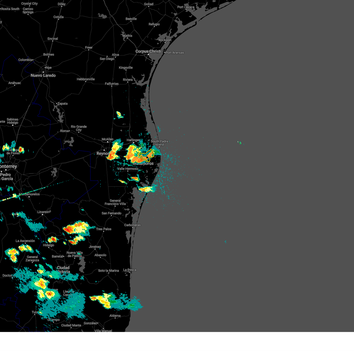 The severe thunderstorm warning for southeastern cameron county will expire at 515 pm cdt, the storm which prompted the warning has weakened below severe limits, and is exiting the warned area. therefore, the warning will be allowed to expire. however heavy rain is still possible with this thunderstorm. The severe thunderstorm warning for southeastern cameron county will expire at 515 pm cdt, the storm which prompted the warning has weakened below severe limits, and is exiting the warned area. therefore, the warning will be allowed to expire. however heavy rain is still possible with this thunderstorm.
|
| 5/17/2023 5:01 PM CDT |
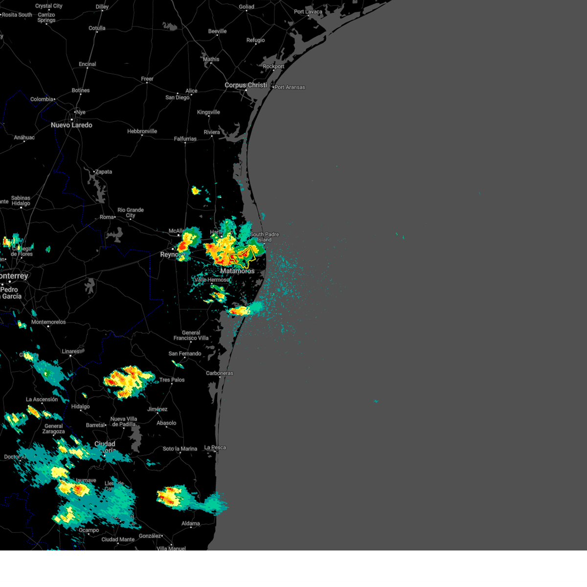 At 501 pm cdt, a severe thunderstorm was located over el jardin elementary school, or over southmost, moving south at 15 mph (radar indicated). Hazards include 60 mph wind gusts and quarter size hail. Hail damage to vehicles is expected. expect wind damage to roofs, siding, and trees. locations impacted include, cameron park, downtown brownsville, southmost, port of brownsville, brownsville, lincoln park, b i s d administration building, longoria elementary school, sams memorial stadium and hanna high school. hail threat, radar indicated max hail size, 1. 00 in wind threat, radar indicated max wind gust, 60 mph. At 501 pm cdt, a severe thunderstorm was located over el jardin elementary school, or over southmost, moving south at 15 mph (radar indicated). Hazards include 60 mph wind gusts and quarter size hail. Hail damage to vehicles is expected. expect wind damage to roofs, siding, and trees. locations impacted include, cameron park, downtown brownsville, southmost, port of brownsville, brownsville, lincoln park, b i s d administration building, longoria elementary school, sams memorial stadium and hanna high school. hail threat, radar indicated max hail size, 1. 00 in wind threat, radar indicated max wind gust, 60 mph.
|
| 5/17/2023 4:45 PM CDT |
 At 444 pm cdt, a severe thunderstorm was located over gallegos elementary school, or over cameron park, moving south at 15 mph (radar indicated). Hazards include ping pong ball size hail and 60 mph wind gusts. People and animals outdoors will be injured. expect hail damage to roofs, siding, windows, and vehicles. expect wind damage to roofs, siding, and trees. locations impacted include, los fresnos, rancho viejo, los indios, southmost, rangerville, olmito, port of brownsville, la paloma, cameron park and downtown brownsville. hail threat, radar indicated max hail size, 1. 50 in wind threat, radar indicated max wind gust, 60 mph. At 444 pm cdt, a severe thunderstorm was located over gallegos elementary school, or over cameron park, moving south at 15 mph (radar indicated). Hazards include ping pong ball size hail and 60 mph wind gusts. People and animals outdoors will be injured. expect hail damage to roofs, siding, windows, and vehicles. expect wind damage to roofs, siding, and trees. locations impacted include, los fresnos, rancho viejo, los indios, southmost, rangerville, olmito, port of brownsville, la paloma, cameron park and downtown brownsville. hail threat, radar indicated max hail size, 1. 50 in wind threat, radar indicated max wind gust, 60 mph.
|
| 5/17/2023 4:26 PM CDT |
 At 426 pm cdt, a severe thunderstorm was located over los fresnos, moving south at 15 mph (radar indicated). Hazards include 60 mph wind gusts and quarter size hail. Hail damage to vehicles is expected. Expect wind damage to roofs, siding, and trees. At 426 pm cdt, a severe thunderstorm was located over los fresnos, moving south at 15 mph (radar indicated). Hazards include 60 mph wind gusts and quarter size hail. Hail damage to vehicles is expected. Expect wind damage to roofs, siding, and trees.
|
| 5/13/2023 4:21 AM CDT |
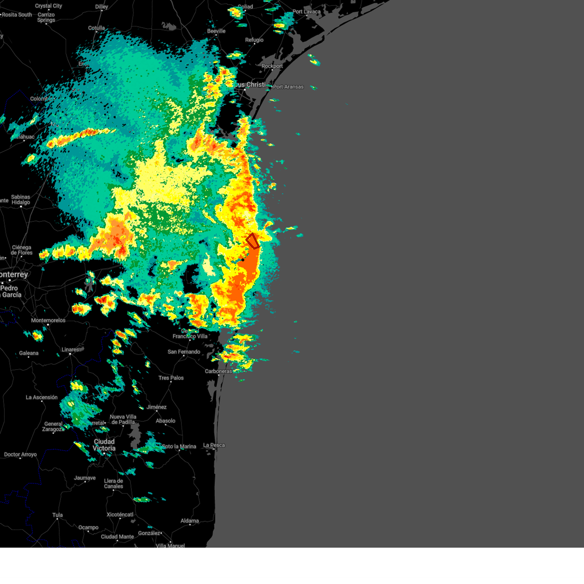 The tornado warning for east central cameron county will expire at 430 am cdt, the storm which prompted the warning has weakened below severe limits, and no longer appears capable of producing a tornado. therefore, the warning will be allowed to expire. however gusty winds and heavy rain are still possible with this thunderstorm. The tornado warning for east central cameron county will expire at 430 am cdt, the storm which prompted the warning has weakened below severe limits, and no longer appears capable of producing a tornado. therefore, the warning will be allowed to expire. however gusty winds and heavy rain are still possible with this thunderstorm.
|
| 5/13/2023 4:04 AM CDT |
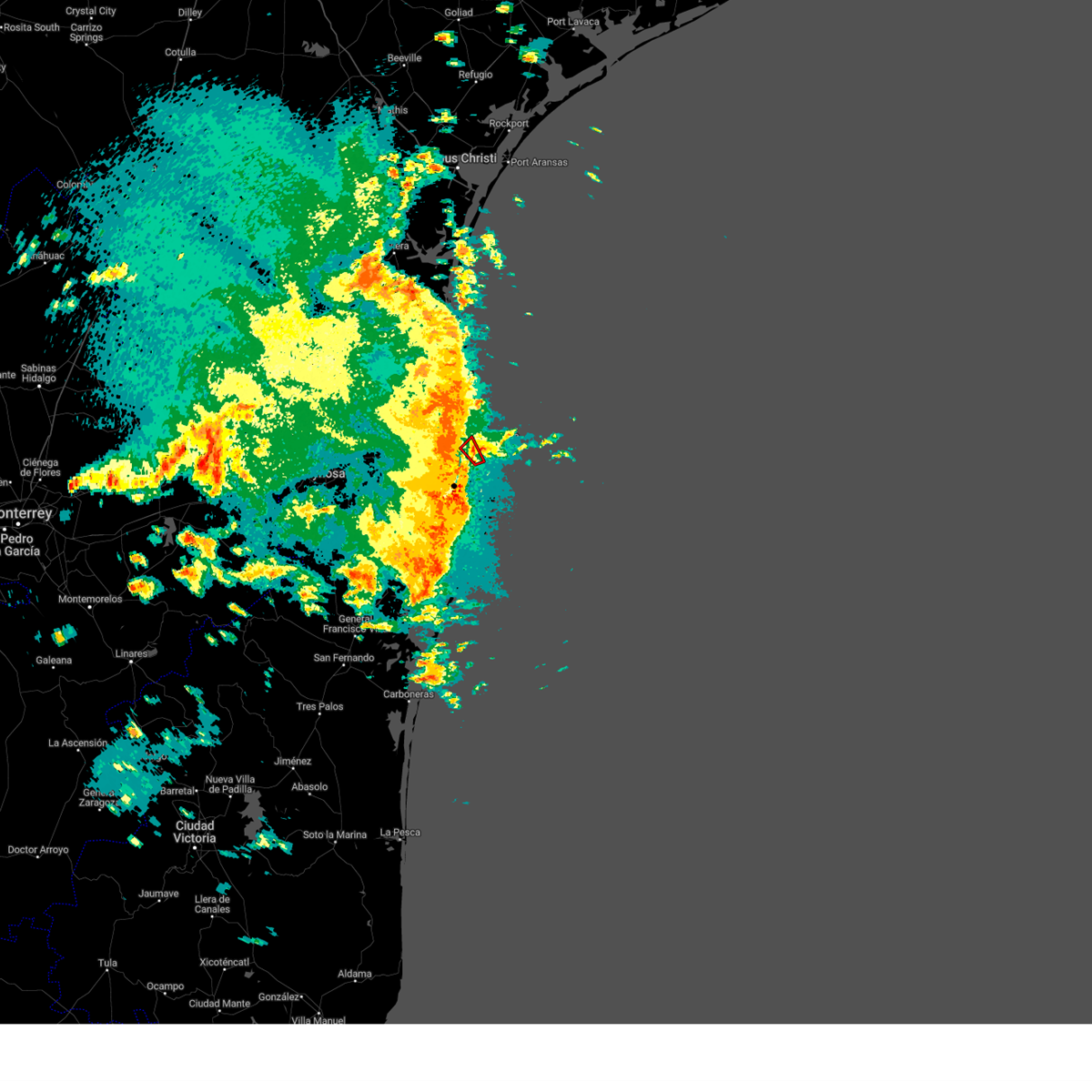 At 404 am cdt, a severe thunderstorm capable of producing a tornado was located over laguna heights, or near south padre island, moving northwest at 15 mph (radar indicated rotation). Hazards include tornado. Flying debris will be dangerous to those caught without shelter. mobile homes will be damaged or destroyed. damage to roofs, windows, and vehicles will occur. tree damage is likely. this dangerous storm will be near, laguna vista police department around 415 am cdt. holly beach around 430 am cdt. Other locations impacted by this tornadic thunderstorm include port isabel--laguna heights. At 404 am cdt, a severe thunderstorm capable of producing a tornado was located over laguna heights, or near south padre island, moving northwest at 15 mph (radar indicated rotation). Hazards include tornado. Flying debris will be dangerous to those caught without shelter. mobile homes will be damaged or destroyed. damage to roofs, windows, and vehicles will occur. tree damage is likely. this dangerous storm will be near, laguna vista police department around 415 am cdt. holly beach around 430 am cdt. Other locations impacted by this tornadic thunderstorm include port isabel--laguna heights.
|
| 5/9/2023 2:09 AM CDT |
 The severe thunderstorm warning for central cameron county will expire at 215 am cdt, the storm which prompted the warning has moved out of the area. therefore, the warning will be allowed to expire. however gusty winds are still possible with this thunderstorm. to report severe weather, contact your nearest law enforcement agency. they will relay your report to the national weather service brownsville. The severe thunderstorm warning for central cameron county will expire at 215 am cdt, the storm which prompted the warning has moved out of the area. therefore, the warning will be allowed to expire. however gusty winds are still possible with this thunderstorm. to report severe weather, contact your nearest law enforcement agency. they will relay your report to the national weather service brownsville.
|
| 5/9/2023 1:58 AM CDT |
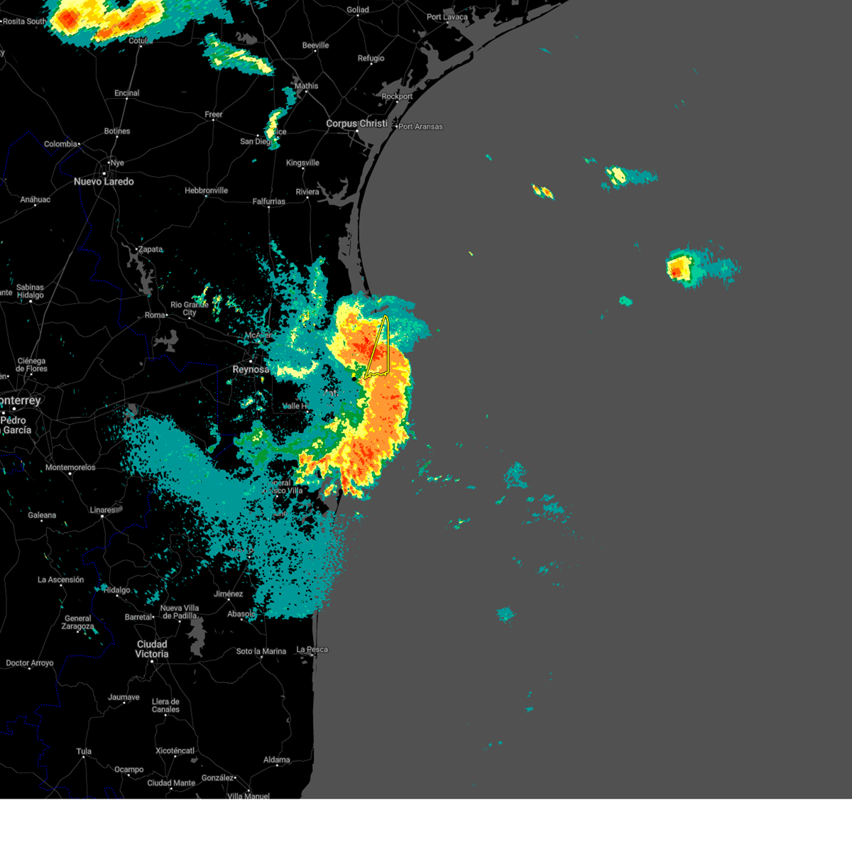 The severe thunderstorm warning for southeastern cameron county will expire at 200 am cdt, the severe thunderstorm continues for southeastern cameron county, including south padre island and port isabel, and has been replaced by a new warning. remember, a severe thunderstorm warning still remains in effect for southeastern cameron county including south padre island and port isabel. The severe thunderstorm warning for southeastern cameron county will expire at 200 am cdt, the severe thunderstorm continues for southeastern cameron county, including south padre island and port isabel, and has been replaced by a new warning. remember, a severe thunderstorm warning still remains in effect for southeastern cameron county including south padre island and port isabel.
|
| 5/9/2023 1:56 AM CDT |
 At 156 am cdt, a severe thunderstorm was located over south padre island police department, or over south padre island, moving northeast at 50 mph (radar indicated). Hazards include 70 mph wind gusts. Expect considerable tree damage. Damage is likely to mobile homes, roofs, and outbuildings. At 156 am cdt, a severe thunderstorm was located over south padre island police department, or over south padre island, moving northeast at 50 mph (radar indicated). Hazards include 70 mph wind gusts. Expect considerable tree damage. Damage is likely to mobile homes, roofs, and outbuildings.
|
| 5/9/2023 1:55 AM CDT |
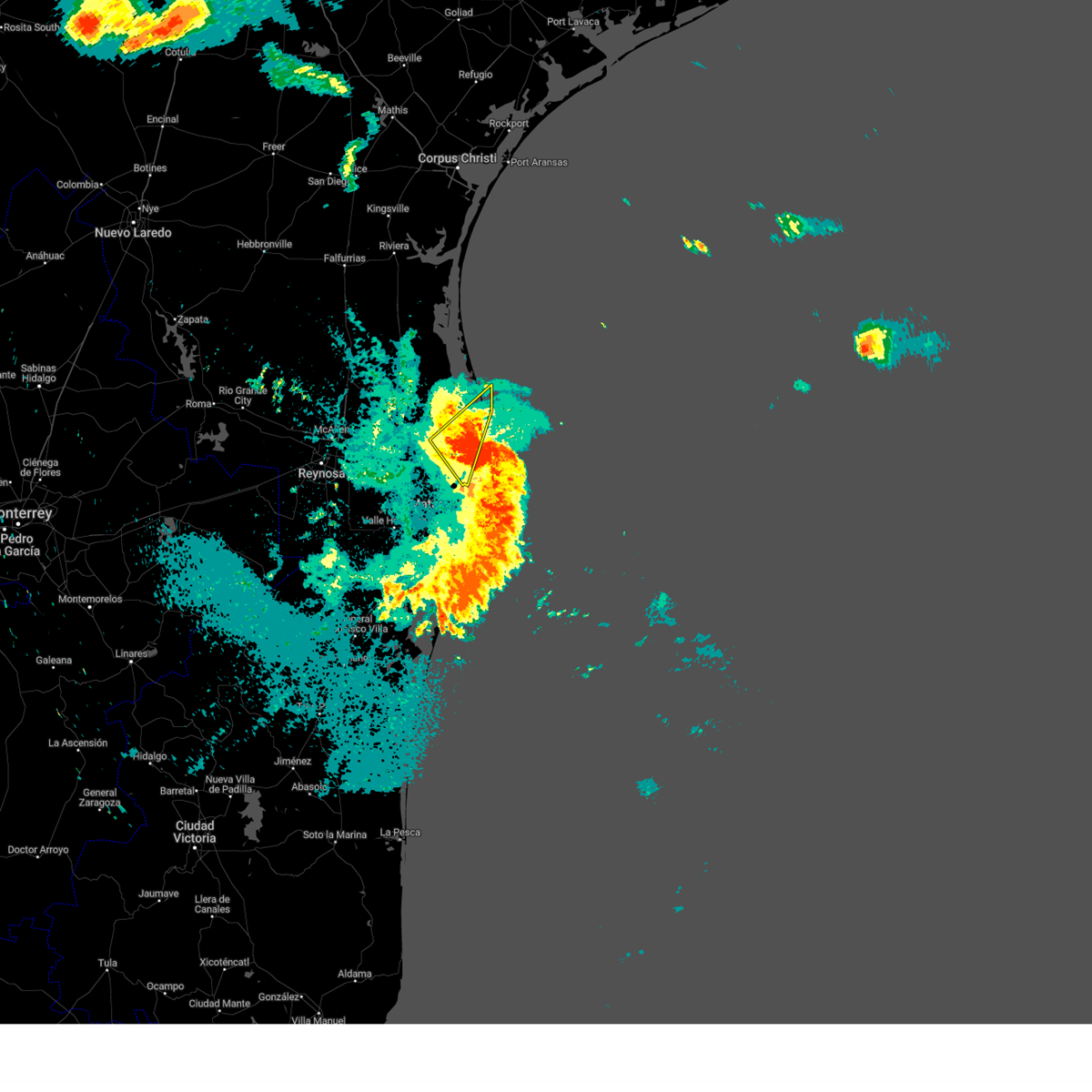 At 154 am cdt, a severe thunderstorm was located bayview moving northeast at 30 mph (radar indicated). Hazards include 70 mph wind gusts. Expect considerable tree damage. damage is likely to mobile homes, roofs, and outbuildings. locations impacted include, los fresnos, rio hondo, port of brownsville, laureles, brownsville, palmer laasko elementary, laguna vista police department, los fresnos city offices, library memorial middle school and lozano. thunderstorm damage threat, considerable hail threat, radar indicated max hail size, <. 75 in wind threat, radar indicated max wind gust, 70 mph. At 154 am cdt, a severe thunderstorm was located bayview moving northeast at 30 mph (radar indicated). Hazards include 70 mph wind gusts. Expect considerable tree damage. damage is likely to mobile homes, roofs, and outbuildings. locations impacted include, los fresnos, rio hondo, port of brownsville, laureles, brownsville, palmer laasko elementary, laguna vista police department, los fresnos city offices, library memorial middle school and lozano. thunderstorm damage threat, considerable hail threat, radar indicated max hail size, <. 75 in wind threat, radar indicated max wind gust, 70 mph.
|
| 5/9/2023 1:53 AM CDT |
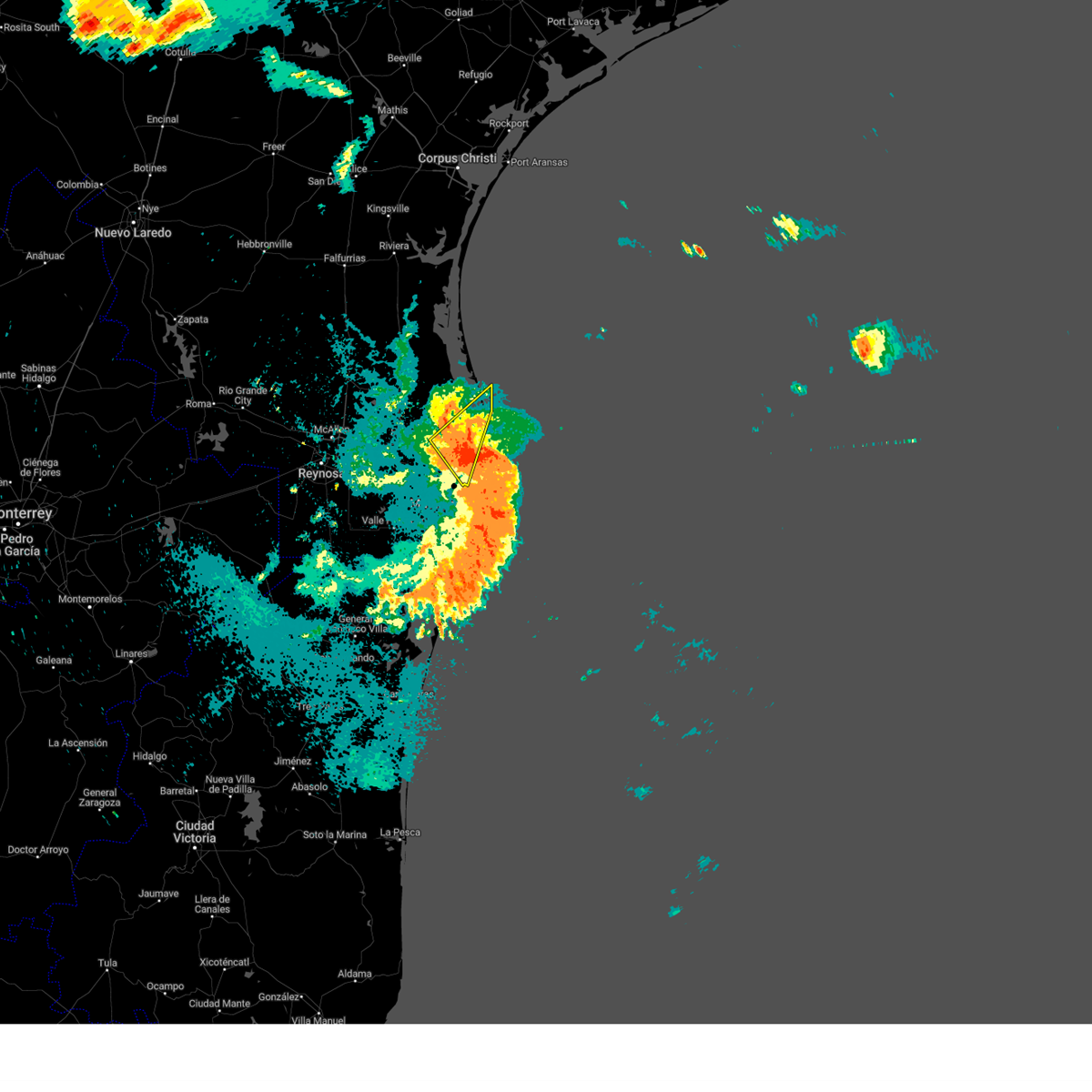 At 153 am cdt, a severe thunderstorm was located near pharr central fire station, or near south padre island, moving northeast at 30 mph (radar indicated). Hazards include 70 mph wind gusts. Expect considerable tree damage. damage is likely to mobile homes, roofs, and outbuildings. locations impacted include, los fresnos, rio hondo, port of brownsville, laureles, brownsville, palmer laasko elementary, laguna vista police department, los fresnos city offices, library memorial middle school and lozano. thunderstorm damage threat, considerable hail threat, radar indicated max hail size, <. 75 in wind threat, radar indicated max wind gust, 70 mph. At 153 am cdt, a severe thunderstorm was located near pharr central fire station, or near south padre island, moving northeast at 30 mph (radar indicated). Hazards include 70 mph wind gusts. Expect considerable tree damage. damage is likely to mobile homes, roofs, and outbuildings. locations impacted include, los fresnos, rio hondo, port of brownsville, laureles, brownsville, palmer laasko elementary, laguna vista police department, los fresnos city offices, library memorial middle school and lozano. thunderstorm damage threat, considerable hail threat, radar indicated max hail size, <. 75 in wind threat, radar indicated max wind gust, 70 mph.
|
| 5/9/2023 1:44 AM CDT |
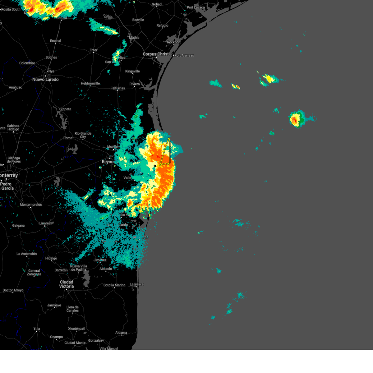 At 143 am cdt, a severe thunderstorm was located over south padre island, moving northeast at 45 mph. this is a destructive storm for south padre island and port isabel (radar indicated). Hazards include 80 mph wind gusts. Flying debris will be dangerous to those caught without shelter. mobile homes will be heavily damaged. expect considerable damage to roofs, windows, and vehicles. extensive tree damage and power outages are likely. locations impacted include, south padre island, port isabel city hall, u. s. coast guard station, port isabel lighthouse, beach access four, port isabel high school, port isabel fire and police department, south padre island convention center, beach access six and garria elementary school. thunderstorm damage threat, destructive hail threat, radar indicated max hail size, <. 75 in wind threat, radar indicated max wind gust, 80 mph. At 143 am cdt, a severe thunderstorm was located over south padre island, moving northeast at 45 mph. this is a destructive storm for south padre island and port isabel (radar indicated). Hazards include 80 mph wind gusts. Flying debris will be dangerous to those caught without shelter. mobile homes will be heavily damaged. expect considerable damage to roofs, windows, and vehicles. extensive tree damage and power outages are likely. locations impacted include, south padre island, port isabel city hall, u. s. coast guard station, port isabel lighthouse, beach access four, port isabel high school, port isabel fire and police department, south padre island convention center, beach access six and garria elementary school. thunderstorm damage threat, destructive hail threat, radar indicated max hail size, <. 75 in wind threat, radar indicated max wind gust, 80 mph.
|
| 5/9/2023 1:41 AM CDT |
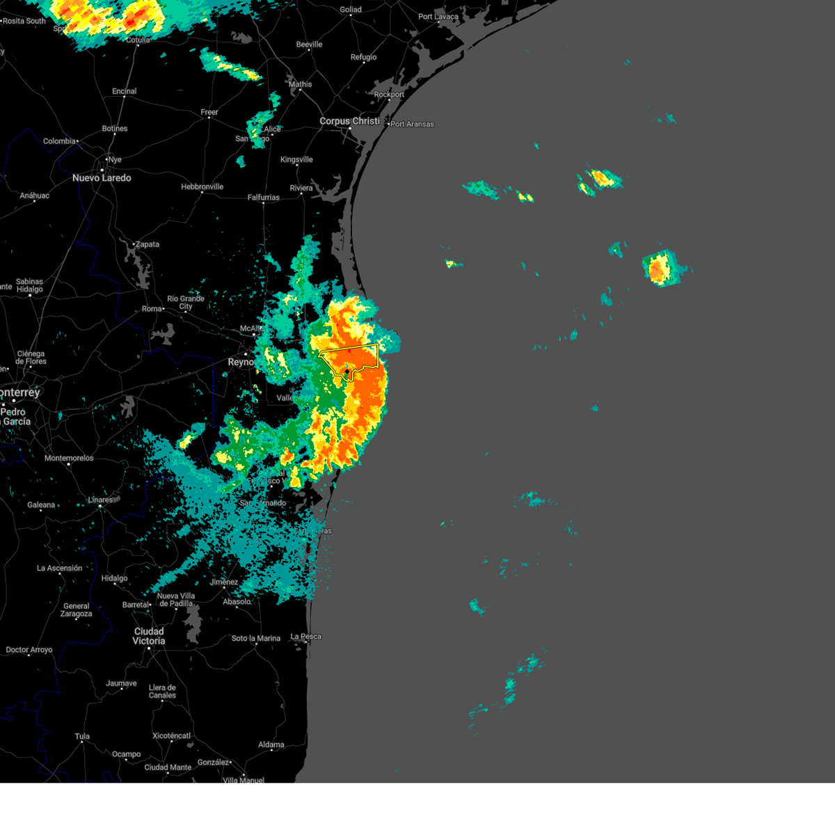 The severe thunderstorm warning for southeastern cameron county will expire at 145 am cdt, the warning has been replaced by a new warning in eastern cameron county. gusty winds are still possible with this thunderstorm on the western side of cameron county. remember, a severe thunderstorm warning still remains in effect for eastern cameron county, including port isabel and south padre island. The severe thunderstorm warning for southeastern cameron county will expire at 145 am cdt, the warning has been replaced by a new warning in eastern cameron county. gusty winds are still possible with this thunderstorm on the western side of cameron county. remember, a severe thunderstorm warning still remains in effect for eastern cameron county, including port isabel and south padre island.
|
| 5/9/2023 1:37 AM CDT |
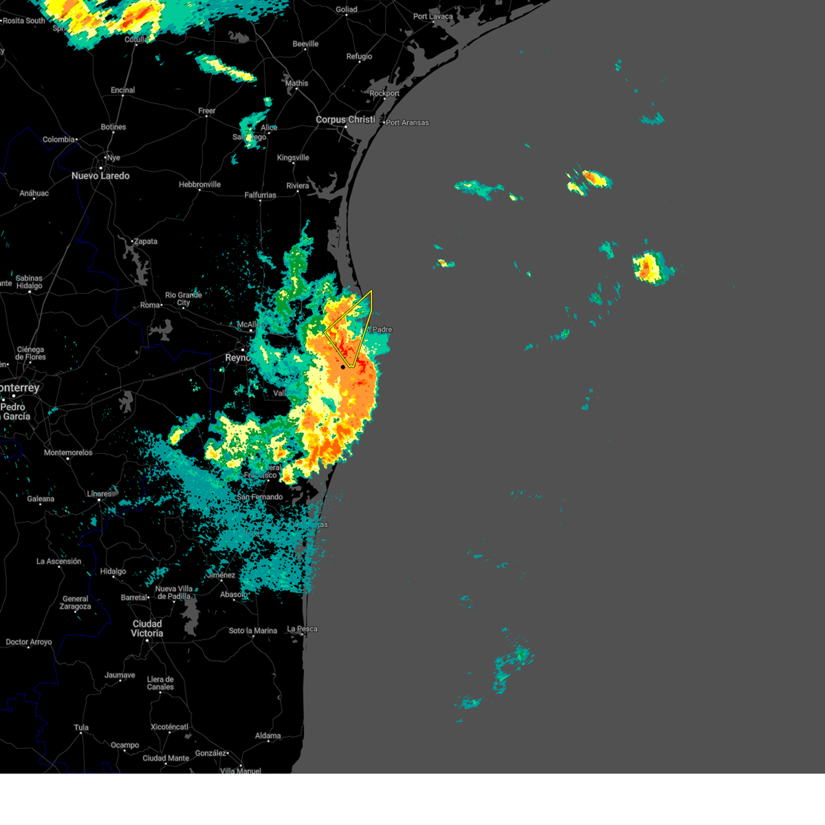 At 137 am cdt, a severe thunderstorm was located over holly beach, or 8 miles east of los fresnos, moving northeast at 30 mph (radar indicated). Hazards include 70 mph wind gusts. Expect considerable tree damage. Damage is likely to mobile homes, roofs, and outbuildings. At 137 am cdt, a severe thunderstorm was located over holly beach, or 8 miles east of los fresnos, moving northeast at 30 mph (radar indicated). Hazards include 70 mph wind gusts. Expect considerable tree damage. Damage is likely to mobile homes, roofs, and outbuildings.
|
| 5/9/2023 1:30 AM CDT |
 At 130 am cdt, a severe thunderstorm was located near boca chica beach, or 10 miles south of south padre island, moving northeast at 45 mph. this is a destructive storm for south padre island, boca chica beach, and port isabel (radar indicated). Hazards include 80 mph wind gusts. Flying debris will be dangerous to those caught without shelter. mobile homes will be heavily damaged. expect considerable damage to roofs, windows, and vehicles. Extensive tree damage and power outages are likely. At 130 am cdt, a severe thunderstorm was located near boca chica beach, or 10 miles south of south padre island, moving northeast at 45 mph. this is a destructive storm for south padre island, boca chica beach, and port isabel (radar indicated). Hazards include 80 mph wind gusts. Flying debris will be dangerous to those caught without shelter. mobile homes will be heavily damaged. expect considerable damage to roofs, windows, and vehicles. Extensive tree damage and power outages are likely.
|
| 5/9/2023 1:28 AM CDT |
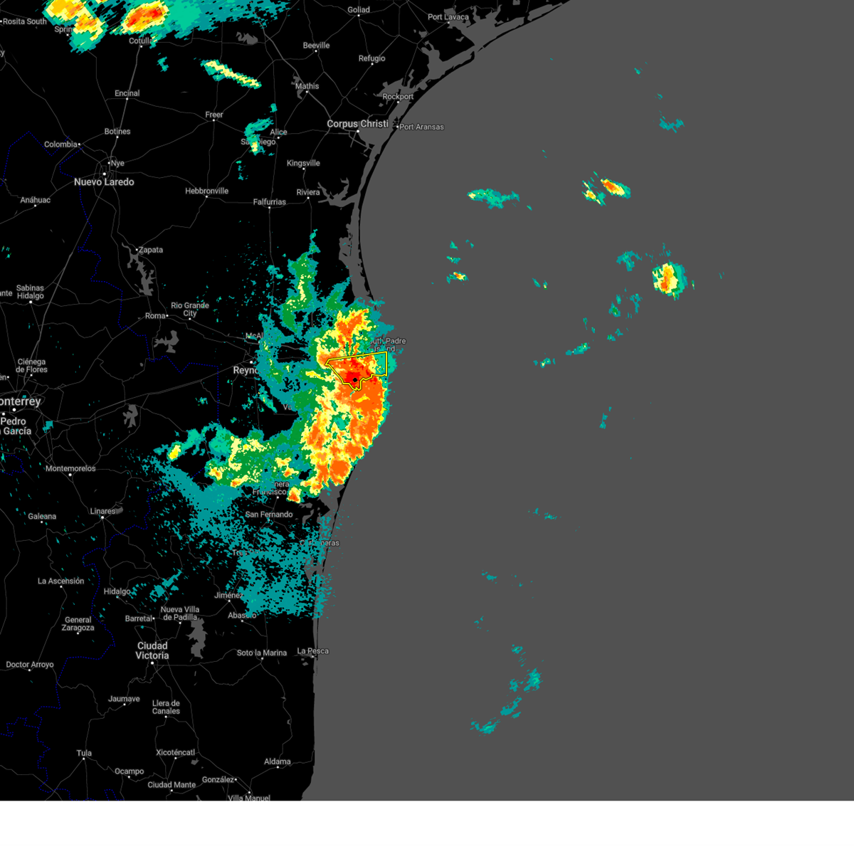 At 127 am cdt, a severe thunderstorm was located 7 miles southwest of boca chica beach, or 9 miles east of port of brownsville, moving east at 30 mph (wind sensor at nws brownsville gusted to 69 mph as storm passed). Hazards include 70 mph wind gusts. Expect considerable tree damage. damage is likely to mobile homes, roofs, and outbuildings. locations impacted include, los fresnos, south padre island, rancho viejo, southmost, olmito, port of brownsville, cameron park, downtown brownsville, brownsville and lincoln park. thunderstorm damage threat, considerable hail threat, radar indicated max hail size, <. 75 in wind threat, observed max wind gust, 70 mph. At 127 am cdt, a severe thunderstorm was located 7 miles southwest of boca chica beach, or 9 miles east of port of brownsville, moving east at 30 mph (wind sensor at nws brownsville gusted to 69 mph as storm passed). Hazards include 70 mph wind gusts. Expect considerable tree damage. damage is likely to mobile homes, roofs, and outbuildings. locations impacted include, los fresnos, south padre island, rancho viejo, southmost, olmito, port of brownsville, cameron park, downtown brownsville, brownsville and lincoln park. thunderstorm damage threat, considerable hail threat, radar indicated max hail size, <. 75 in wind threat, observed max wind gust, 70 mph.
|
| 5/9/2023 1:19 AM CDT | The asos station at brownsville-south padre international airport gusted to 64 mph at 1:19am cd in cameron county TX, 6.7 miles NW of Brownsville, TX |
| 5/9/2023 1:17 AM CDT |
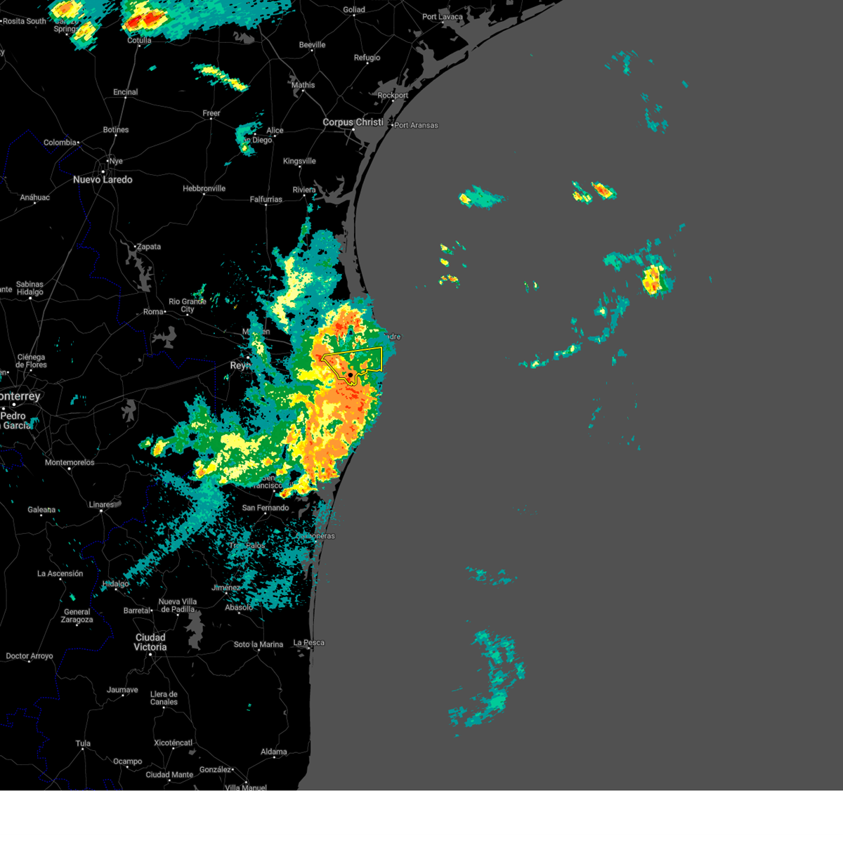 At 116 am cdt, a severe thunderstorm was located near port of brownsville, moving east at 30 mph (wind sensor at nws brownsville gusted to 59 mph). Hazards include 70 mph wind gusts and penny size hail. Expect considerable tree damage. damage is likely to mobile homes, roofs, and outbuildings. locations impacted include, los fresnos, south padre island, rancho viejo, southmost, olmito, port of brownsville, cameron park, downtown brownsville, brownsville and lincoln park. thunderstorm damage threat, considerable hail threat, radar indicated max hail size, 0. 75 in wind threat, radar indicated max wind gust, 70 mph. At 116 am cdt, a severe thunderstorm was located near port of brownsville, moving east at 30 mph (wind sensor at nws brownsville gusted to 59 mph). Hazards include 70 mph wind gusts and penny size hail. Expect considerable tree damage. damage is likely to mobile homes, roofs, and outbuildings. locations impacted include, los fresnos, south padre island, rancho viejo, southmost, olmito, port of brownsville, cameron park, downtown brownsville, brownsville and lincoln park. thunderstorm damage threat, considerable hail threat, radar indicated max hail size, 0. 75 in wind threat, radar indicated max wind gust, 70 mph.
|
| 5/9/2023 1:10 AM CDT |
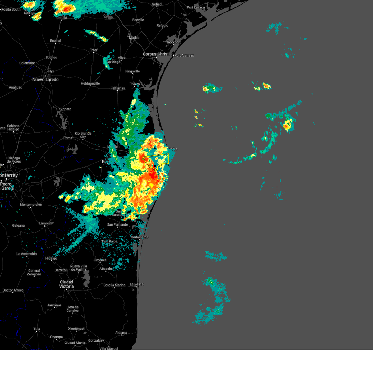 At 110 am cdt, a severe thunderstorm was located over villa pancho, or near southmost, moving east at 30 mph (radar indicated). Hazards include 70 mph wind gusts and penny size hail. Expect considerable tree damage. damage is likely to mobile homes, roofs, and outbuildings. locations impacted include, los fresnos, south padre island, rancho viejo, southmost, olmito, port of brownsville, cameron park, downtown brownsville, brownsville and lincoln park. thunderstorm damage threat, considerable hail threat, radar indicated max hail size, 0. 75 in wind threat, radar indicated max wind gust, 70 mph. At 110 am cdt, a severe thunderstorm was located over villa pancho, or near southmost, moving east at 30 mph (radar indicated). Hazards include 70 mph wind gusts and penny size hail. Expect considerable tree damage. damage is likely to mobile homes, roofs, and outbuildings. locations impacted include, los fresnos, south padre island, rancho viejo, southmost, olmito, port of brownsville, cameron park, downtown brownsville, brownsville and lincoln park. thunderstorm damage threat, considerable hail threat, radar indicated max hail size, 0. 75 in wind threat, radar indicated max wind gust, 70 mph.
|
| 5/9/2023 12:56 AM CDT |
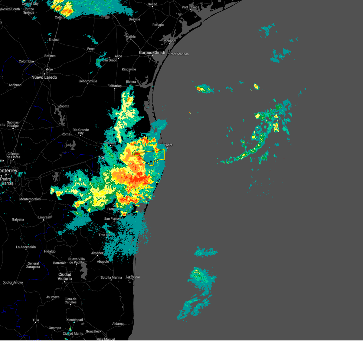 At 1255 am cdt, a severe thunderstorm was located over garden park elementary school, or over downtown brownsville, moving east at 30 mph (radar indicated). Hazards include 70 mph wind gusts and penny size hail. Expect considerable tree damage. damage is likely to mobile homes, roofs, and outbuildings. locations impacted include, los fresnos, south padre island, rancho viejo, los indios, southmost, olmito, port of brownsville, la paloma, cameron park and downtown brownsville. thunderstorm damage threat, considerable hail threat, radar indicated max hail size, 0. 75 in wind threat, radar indicated max wind gust, 70 mph. At 1255 am cdt, a severe thunderstorm was located over garden park elementary school, or over downtown brownsville, moving east at 30 mph (radar indicated). Hazards include 70 mph wind gusts and penny size hail. Expect considerable tree damage. damage is likely to mobile homes, roofs, and outbuildings. locations impacted include, los fresnos, south padre island, rancho viejo, los indios, southmost, olmito, port of brownsville, la paloma, cameron park and downtown brownsville. thunderstorm damage threat, considerable hail threat, radar indicated max hail size, 0. 75 in wind threat, radar indicated max wind gust, 70 mph.
|
| 5/9/2023 12:40 AM CDT |
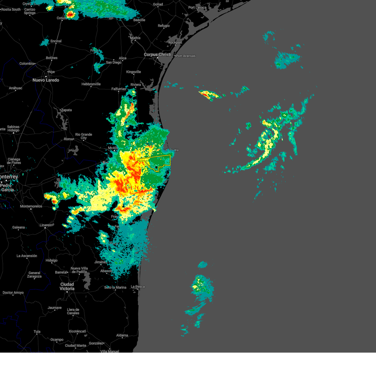 At 1240 am cdt, a severe thunderstorm was located near villa nueva elementary school, or 8 miles south of la paloma, moving east at 30 mph (radar indicated). Hazards include 70 mph wind gusts and penny size hail. Expect considerable tree damage. Damage is likely to mobile homes, roofs, and outbuildings. At 1240 am cdt, a severe thunderstorm was located near villa nueva elementary school, or 8 miles south of la paloma, moving east at 30 mph (radar indicated). Hazards include 70 mph wind gusts and penny size hail. Expect considerable tree damage. Damage is likely to mobile homes, roofs, and outbuildings.
|
| 4/29/2023 1:53 AM CDT |
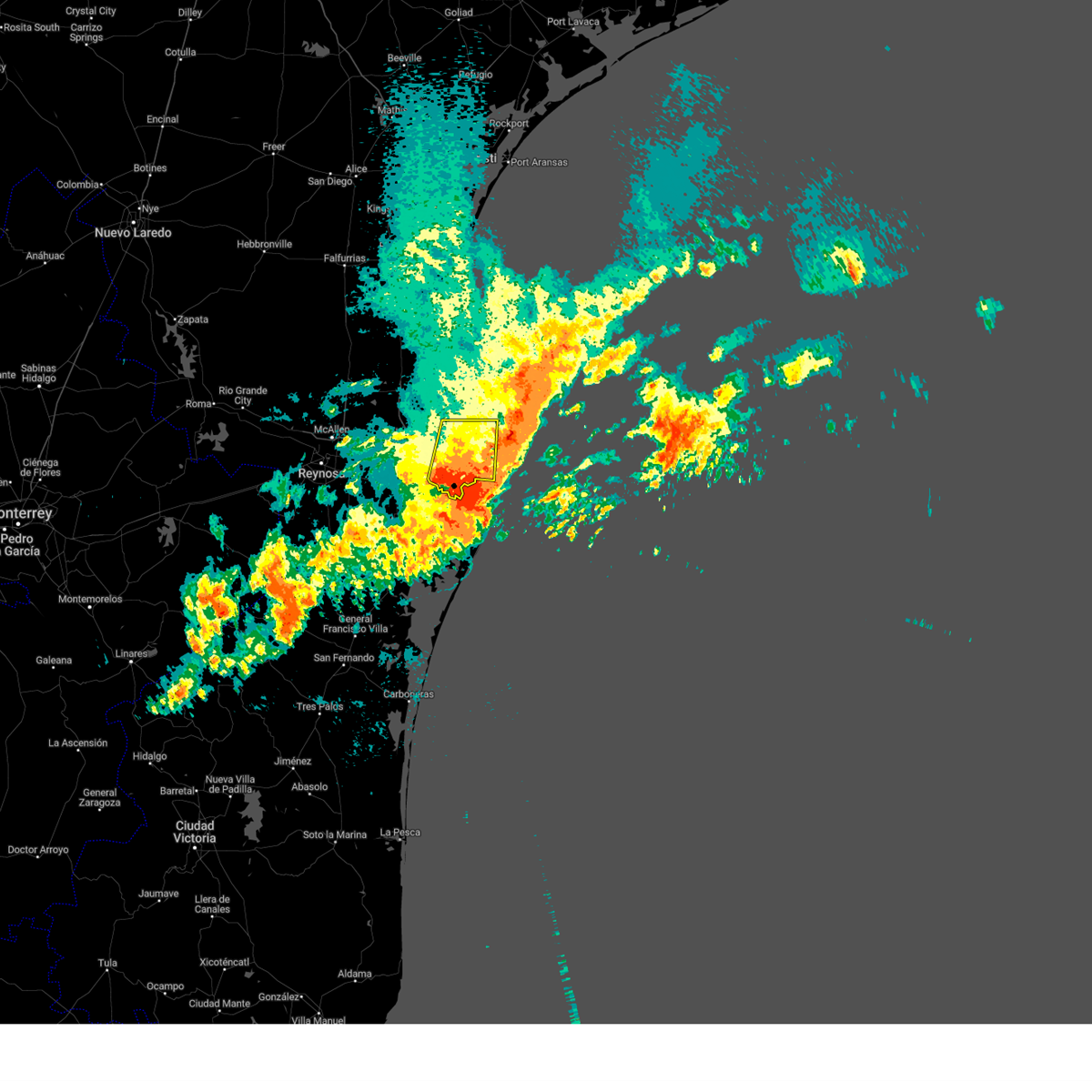 At 152 am cdt, a severe thunderstorm was located near south point, or 8 miles southeast of port of brownsville, moving southeast at 55 mph (radar indicated). Hazards include 60 mph wind gusts. expect damage to roofs, siding, and trees At 152 am cdt, a severe thunderstorm was located near south point, or 8 miles southeast of port of brownsville, moving southeast at 55 mph (radar indicated). Hazards include 60 mph wind gusts. expect damage to roofs, siding, and trees
|
| 4/29/2023 1:43 AM CDT |
 The severe thunderstorm warning for southeastern hidalgo, western cameron and south central willacy counties will expire at 145 am cdt, the severe thunderstorm which prompted the warning has weakened. moved out of the warned area. therefore, the warning will be allowed to expire. The severe thunderstorm warning for southeastern hidalgo, western cameron and south central willacy counties will expire at 145 am cdt, the severe thunderstorm which prompted the warning has weakened. moved out of the warned area. therefore, the warning will be allowed to expire.
|
| 4/29/2023 1:41 AM CDT | Brownsville/spi international airport asos in cameron county TX, 4.2 miles N of Brownsville, TX |
| 4/29/2023 1:25 AM CDT |
 At 124 am cdt, a severe thunderstorm was located over brownsville south padre island international airport, or over southmost, moving southeast at 55 mph. this is a destructive storm for eastern cameron county (radar indicated). Hazards include 80 mph wind gusts. Flying debris will be dangerous to those caught without shelter. mobile homes will be heavily damaged. expect considerable damage to roofs, windows, and vehicles. extensive tree damage and power outages are likely. locations impacted include, los fresnos, south padre island, rancho viejo, southmost, olmito, port of brownsville, cameron park, laureles, downtown brownsville and brownsville. thunderstorm damage threat, destructive hail threat, radar indicated max hail size, <. 75 in wind threat, radar indicated max wind gust, 80 mph. At 124 am cdt, a severe thunderstorm was located over brownsville south padre island international airport, or over southmost, moving southeast at 55 mph. this is a destructive storm for eastern cameron county (radar indicated). Hazards include 80 mph wind gusts. Flying debris will be dangerous to those caught without shelter. mobile homes will be heavily damaged. expect considerable damage to roofs, windows, and vehicles. extensive tree damage and power outages are likely. locations impacted include, los fresnos, south padre island, rancho viejo, southmost, olmito, port of brownsville, cameron park, laureles, downtown brownsville and brownsville. thunderstorm damage threat, destructive hail threat, radar indicated max hail size, <. 75 in wind threat, radar indicated max wind gust, 80 mph.
|
| 4/29/2023 1:08 AM CDT |
 At 107 am cdt, a severe thunderstorm was located over rangerville, moving southeast at 40 mph. this is a destructive storm for western cameron county (radar indicated). Hazards include 80 mph wind gusts. Flying debris will be dangerous to those caught without shelter. mobile homes will be heavily damaged. expect considerable damage to roofs, windows, and vehicles. Extensive tree damage and power outages are likely. At 107 am cdt, a severe thunderstorm was located over rangerville, moving southeast at 40 mph. this is a destructive storm for western cameron county (radar indicated). Hazards include 80 mph wind gusts. Flying debris will be dangerous to those caught without shelter. mobile homes will be heavily damaged. expect considerable damage to roofs, windows, and vehicles. Extensive tree damage and power outages are likely.
|
| 4/29/2023 1:01 AM CDT |
 At 101 am cdt, a severe thunderstorm was located over carricitos, or over los indios, moving southeast at 55 mph. this is a destructive storm for eastern cameron county (radar indicated). Hazards include 80 mph wind gusts. Flying debris will be dangerous to those caught without shelter. mobile homes will be heavily damaged. expect considerable damage to roofs, windows, and vehicles. Extensive tree damage and power outages are likely. At 101 am cdt, a severe thunderstorm was located over carricitos, or over los indios, moving southeast at 55 mph. this is a destructive storm for eastern cameron county (radar indicated). Hazards include 80 mph wind gusts. Flying debris will be dangerous to those caught without shelter. mobile homes will be heavily damaged. expect considerable damage to roofs, windows, and vehicles. Extensive tree damage and power outages are likely.
|
| 4/29/2023 12:56 AM CDT |
 At 1255 am cdt, a severe thunderstorm was located near carricitos, or near los indios, moving southeast at 55 mph. this is a destructive storm for southeastern hidalgo county and western cameron county (radar indicated). Hazards include 80 mph wind gusts. Flying debris will be dangerous to those caught without shelter. mobile homes will be heavily damaged. expect considerable damage to roofs, windows, and vehicles. extensive tree damage and power outages are likely. locations impacted include, harlingen, san benito, mercedes, la feria, progreso, santa rosa, rancho viejo, rio hondo, palm valley and los indios. thunderstorm damage threat, destructive hail threat, radar indicated max hail size, <. 75 in wind threat, radar indicated max wind gust, 80 mph. At 1255 am cdt, a severe thunderstorm was located near carricitos, or near los indios, moving southeast at 55 mph. this is a destructive storm for southeastern hidalgo county and western cameron county (radar indicated). Hazards include 80 mph wind gusts. Flying debris will be dangerous to those caught without shelter. mobile homes will be heavily damaged. expect considerable damage to roofs, windows, and vehicles. extensive tree damage and power outages are likely. locations impacted include, harlingen, san benito, mercedes, la feria, progreso, santa rosa, rancho viejo, rio hondo, palm valley and los indios. thunderstorm damage threat, destructive hail threat, radar indicated max hail size, <. 75 in wind threat, radar indicated max wind gust, 80 mph.
|
| 4/29/2023 12:30 AM CDT |
 At 1229 am cdt, a severe thunderstorm was located over scissors, or near donna, moving southeast at 55 mph. this is a destructive storm for southeastern hidalgo county and western cameron county (radar indicated). Hazards include 80 mph wind gusts. Flying debris will be dangerous to those caught without shelter. mobile homes will be heavily damaged. expect considerable damage to roofs, windows, and vehicles. Extensive tree damage and power outages are likely. At 1229 am cdt, a severe thunderstorm was located over scissors, or near donna, moving southeast at 55 mph. this is a destructive storm for southeastern hidalgo county and western cameron county (radar indicated). Hazards include 80 mph wind gusts. Flying debris will be dangerous to those caught without shelter. mobile homes will be heavily damaged. expect considerable damage to roofs, windows, and vehicles. Extensive tree damage and power outages are likely.
|
| 4/23/2023 2:08 PM CDT |
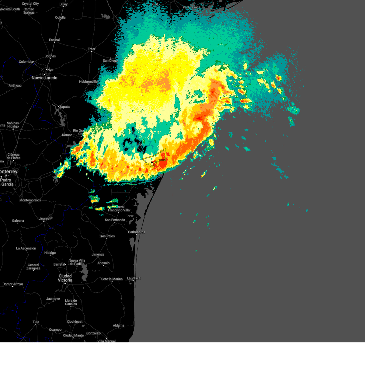 The severe thunderstorm warning for southeastern cameron county will expire at 215 pm cdt, the storms which prompted the warning have moved out of the area. therefore, the warning will be allowed to expire. however, gusty winds are still possible with this line of thunderstorms. The severe thunderstorm warning for southeastern cameron county will expire at 215 pm cdt, the storms which prompted the warning have moved out of the area. therefore, the warning will be allowed to expire. however, gusty winds are still possible with this line of thunderstorms.
|
| 4/23/2023 2:00 PM CDT | Power lines down near idea robindale schoo in cameron county TX, 3.7 miles NW of Brownsville, TX |
| 4/23/2023 1:53 PM CDT | Multiple large tree branches down in residential are in cameron county TX, 6.1 miles NW of Brownsville, TX |
| 4/23/2023 1:53 PM CDT | Wood paneled fence and gate blown down at the sa recyling facilit in cameron county TX, 5.2 miles WNW of Brownsville, TX |
| 4/23/2023 1:52 PM CDT |
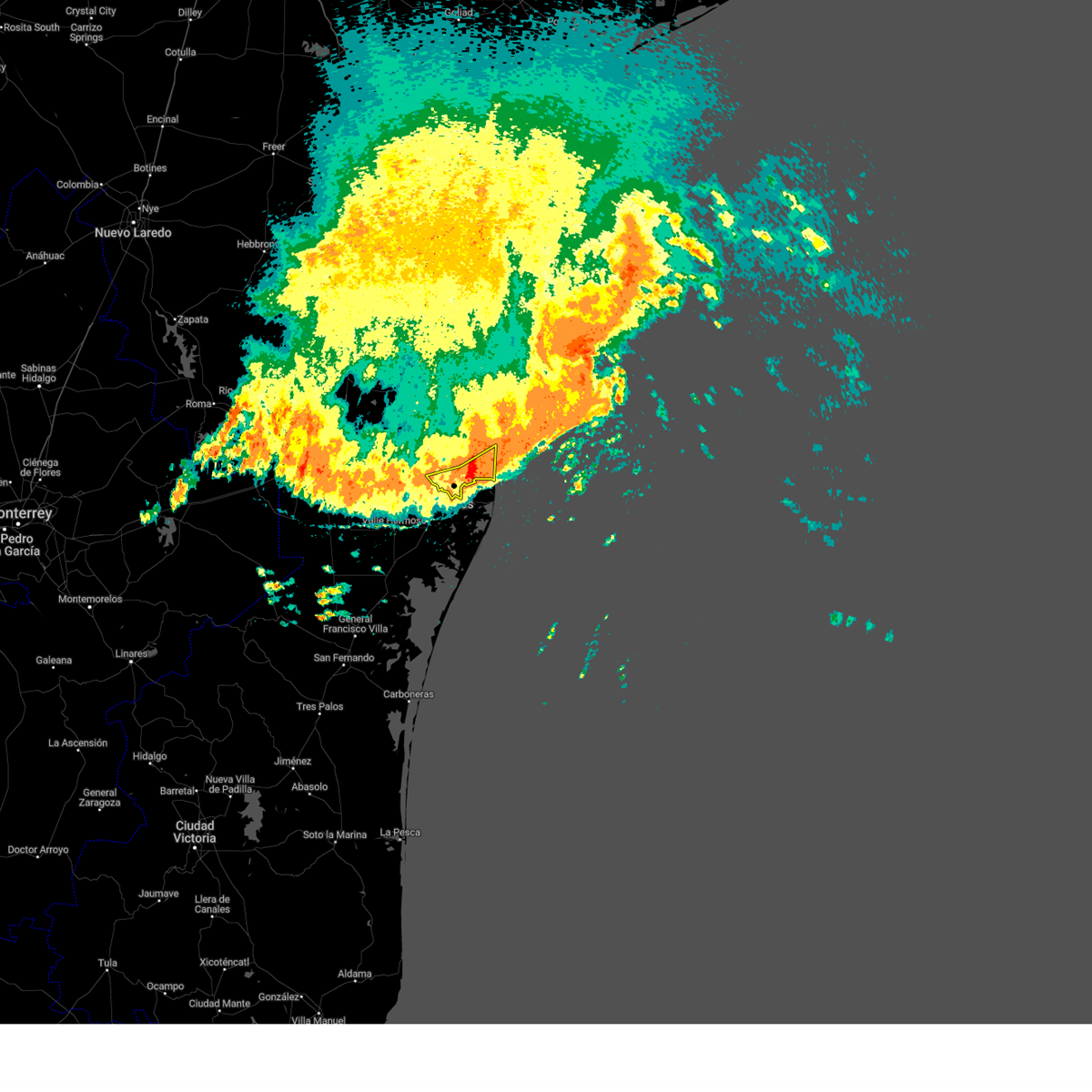 At 152 pm cdt, severe thunderstorms were located along a line extending from 41 miles northeast of beach access six to 9 miles south of boca chica beach to 23 miles south of santa ana national wildlife refuge, moving south at 35 mph (radar indicated). Hazards include 70 mph wind gusts and penny size hail. Expect considerable tree damage. damage is likely to mobile homes, roofs, and outbuildings. locations impacted include, south padre island, southmost, port of brownsville, cameron park, downtown brownsville, brownsville, lincoln park, longoria elementary school, sams memorial stadium and brownsville fire department station two. thunderstorm damage threat, considerable hail threat, radar indicated max hail size, 0. 75 in wind threat, radar indicated max wind gust, 70 mph. At 152 pm cdt, severe thunderstorms were located along a line extending from 41 miles northeast of beach access six to 9 miles south of boca chica beach to 23 miles south of santa ana national wildlife refuge, moving south at 35 mph (radar indicated). Hazards include 70 mph wind gusts and penny size hail. Expect considerable tree damage. damage is likely to mobile homes, roofs, and outbuildings. locations impacted include, south padre island, southmost, port of brownsville, cameron park, downtown brownsville, brownsville, lincoln park, longoria elementary school, sams memorial stadium and brownsville fire department station two. thunderstorm damage threat, considerable hail threat, radar indicated max hail size, 0. 75 in wind threat, radar indicated max wind gust, 70 mph.
|
| 4/23/2023 1:51 PM CDT |
 The tornado warning for southeastern cameron county will expire at 200 pm cdt, the tornado threat has diminished and the tornado warning has been cancelled. however, large hail and damaging winds remain likely and a severe thunderstorm warning remains in effect for the area. a severe thunderstorm watch remains in effect until 200 pm cdt for deep south texas. The tornado warning for southeastern cameron county will expire at 200 pm cdt, the tornado threat has diminished and the tornado warning has been cancelled. however, large hail and damaging winds remain likely and a severe thunderstorm warning remains in effect for the area. a severe thunderstorm watch remains in effect until 200 pm cdt for deep south texas.
|
| 4/23/2023 1:47 PM CDT | Storm damage reported in cameron county TX, 6.7 miles NW of Brownsville, TX |
| 4/23/2023 1:43 PM CDT |
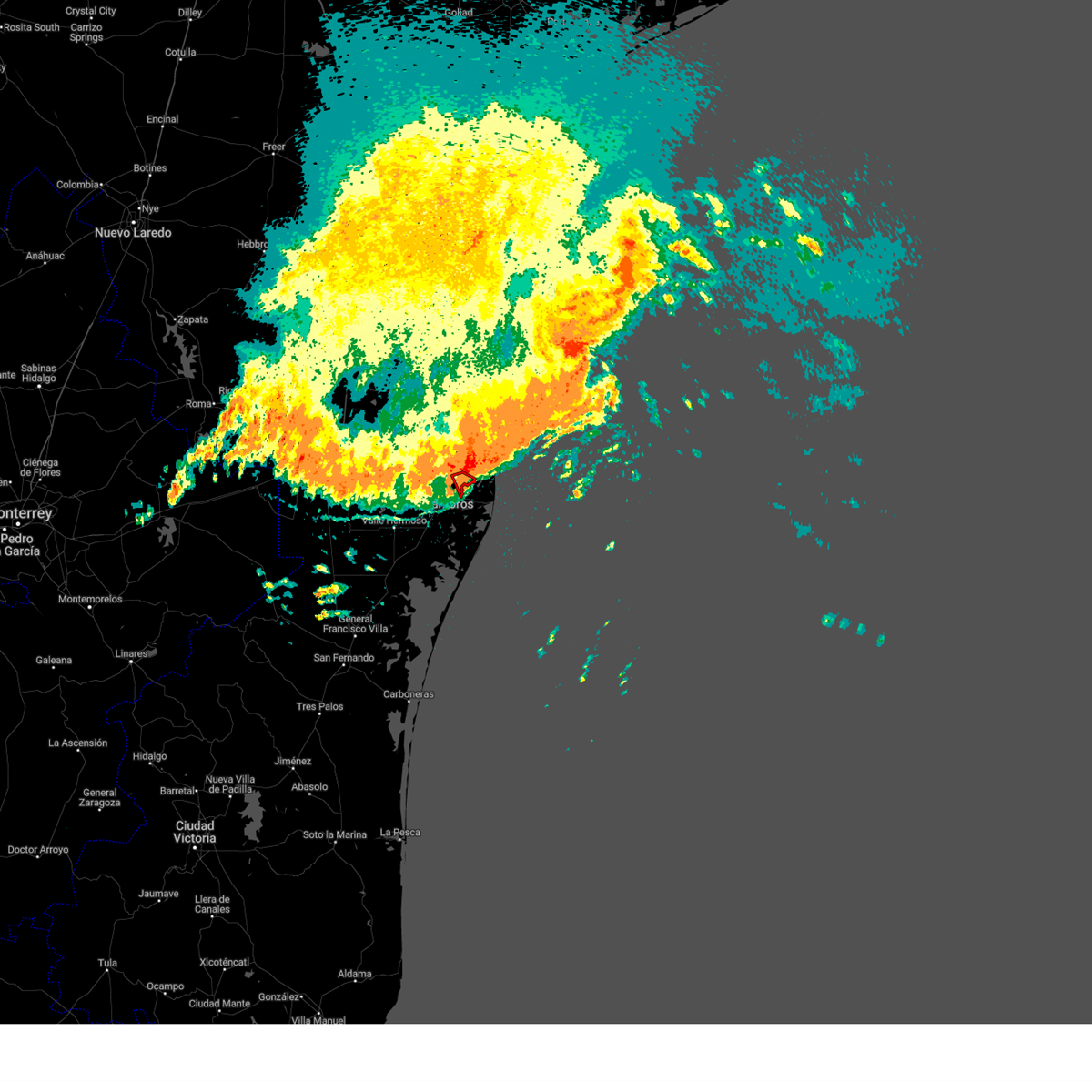 At 143 pm cdt, a severe squall line capable of producing both tornadoes and extensive straight line wind damage was located near port of brownsville, moving southeast at 35 mph (radar indicated rotation). Hazards include tornado. Flying debris will be dangerous to those caught without shelter. mobile homes will be damaged or destroyed. damage to roofs, windows, and vehicles will occur. tree damage is likely. Locations impacted include, port of brownsville, brownsville and pedro benevides county park. At 143 pm cdt, a severe squall line capable of producing both tornadoes and extensive straight line wind damage was located near port of brownsville, moving southeast at 35 mph (radar indicated rotation). Hazards include tornado. Flying debris will be dangerous to those caught without shelter. mobile homes will be damaged or destroyed. damage to roofs, windows, and vehicles will occur. tree damage is likely. Locations impacted include, port of brownsville, brownsville and pedro benevides county park.
|
| 4/23/2023 1:42 PM CDT |
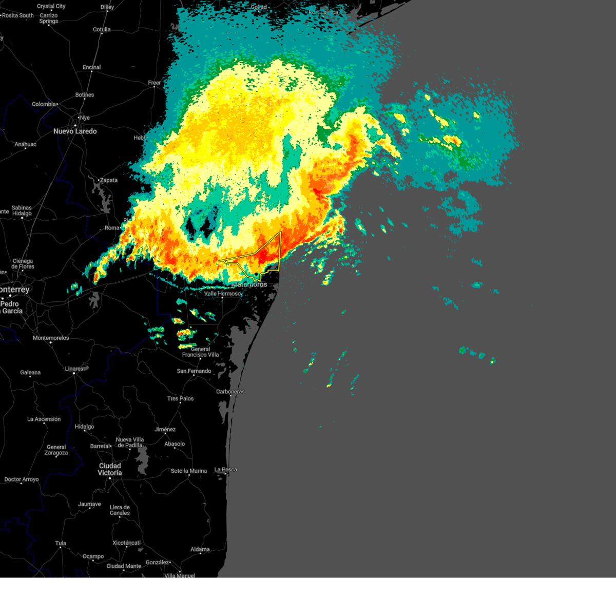 At 141 pm cdt, severe thunderstorms were located along a line extending from 43 miles northeast of beach access six to near boca chica beach to 18 miles southeast of santa ana national wildlife refuge, moving south at 35 mph. these are destructive storms for southeast cameron county (radar indicated). Hazards include 80 mph wind gusts and nickel size hail. Flying debris will be dangerous to those caught without shelter. mobile homes will be heavily damaged. expect considerable damage to roofs, windows, and vehicles. extensive tree damage and power outages are likely. locations impacted include, los fresnos, south padre island, rancho viejo, los indios, southmost, olmito, port of brownsville, la paloma, cameron park and laureles. thunderstorm damage threat, destructive hail threat, radar indicated max hail size, 0. 88 in wind threat, radar indicated max wind gust, 80 mph. At 141 pm cdt, severe thunderstorms were located along a line extending from 43 miles northeast of beach access six to near boca chica beach to 18 miles southeast of santa ana national wildlife refuge, moving south at 35 mph. these are destructive storms for southeast cameron county (radar indicated). Hazards include 80 mph wind gusts and nickel size hail. Flying debris will be dangerous to those caught without shelter. mobile homes will be heavily damaged. expect considerable damage to roofs, windows, and vehicles. extensive tree damage and power outages are likely. locations impacted include, los fresnos, south padre island, rancho viejo, los indios, southmost, olmito, port of brownsville, la paloma, cameron park and laureles. thunderstorm damage threat, destructive hail threat, radar indicated max hail size, 0. 88 in wind threat, radar indicated max wind gust, 80 mph.
|
| 4/23/2023 1:35 PM CDT |
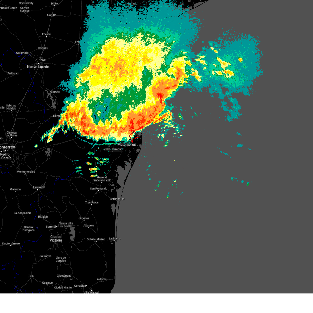 At 135 pm cdt, severe thunderstorms capable of producing both tornadoes and extensive straight line wind damage were located near port of brownsville, moving southeast at 35 mph (radar indicated rotation). Hazards include tornado. Flying debris will be dangerous to those caught without shelter. mobile homes will be damaged or destroyed. damage to roofs, windows, and vehicles will occur. tree damage is likely. This tornadic thunderstorm will remain over mainly rural areas of southeastern cameron county, including the following locations, pedro benevides county park and loma alta lake. At 135 pm cdt, severe thunderstorms capable of producing both tornadoes and extensive straight line wind damage were located near port of brownsville, moving southeast at 35 mph (radar indicated rotation). Hazards include tornado. Flying debris will be dangerous to those caught without shelter. mobile homes will be damaged or destroyed. damage to roofs, windows, and vehicles will occur. tree damage is likely. This tornadic thunderstorm will remain over mainly rural areas of southeastern cameron county, including the following locations, pedro benevides county park and loma alta lake.
|
| 4/23/2023 1:29 PM CDT |
 At 128 pm cdt, severe thunderstorms were located along a line extending from 46 miles northeast of beach access six to near garria elementary school to 11 miles southeast of santa ana national wildlife refuge, moving south at 35 mph. these are destructive storms for southeast cameron county (radar indicated). Hazards include 80 mph wind gusts and quarter size hail. Flying debris will be dangerous to those caught without shelter. mobile homes will be heavily damaged. expect considerable damage to roofs, windows, and vehicles. Extensive tree damage and power outages are likely. At 128 pm cdt, severe thunderstorms were located along a line extending from 46 miles northeast of beach access six to near garria elementary school to 11 miles southeast of santa ana national wildlife refuge, moving south at 35 mph. these are destructive storms for southeast cameron county (radar indicated). Hazards include 80 mph wind gusts and quarter size hail. Flying debris will be dangerous to those caught without shelter. mobile homes will be heavily damaged. expect considerable damage to roofs, windows, and vehicles. Extensive tree damage and power outages are likely.
|
| 4/23/2023 1:24 PM CDT |
 At 124 pm cdt, severe thunderstorms were located along a line extending from 50 miles northeast of beach access six to near boca chica beach to 17 miles south of santa maria, moving southeast at 60 mph (radar indicated). Hazards include 70 mph wind gusts. Expect considerable tree damage. damage is likely to mobile homes, roofs, and outbuildings. locations impacted include, harlingen, weslaco, san benito, mercedes, la feria, elsa, los fresnos, progreso, edcouch and santa rosa. thunderstorm damage threat, considerable hail threat, radar indicated max hail size, <. 75 in wind threat, radar indicated max wind gust, 70 mph. At 124 pm cdt, severe thunderstorms were located along a line extending from 50 miles northeast of beach access six to near boca chica beach to 17 miles south of santa maria, moving southeast at 60 mph (radar indicated). Hazards include 70 mph wind gusts. Expect considerable tree damage. damage is likely to mobile homes, roofs, and outbuildings. locations impacted include, harlingen, weslaco, san benito, mercedes, la feria, elsa, los fresnos, progreso, edcouch and santa rosa. thunderstorm damage threat, considerable hail threat, radar indicated max hail size, <. 75 in wind threat, radar indicated max wind gust, 70 mph.
|
| 4/23/2023 1:17 PM CDT |
 At 117 pm cdt, a severe squall line capable of producing both tornadoes and extensive straight line wind damage was located near palmer laasko elementary, or near laureles, moving southeast at 40 mph (radar indicated rotation). Hazards include tornado. Flying debris will be dangerous to those caught without shelter. mobile homes will be damaged or destroyed. damage to roofs, windows, and vehicles will occur. tree damage is likely. these dangerous storms will be near, palmer laasko elementary around 120 pm cdt. holly beach and laguna vista police department around 130 pm cdt. Other locations impacted by this tornadic thunderstorm include las yescas elementary school, la tina, del mar heights, bayview, las yescas and port isabel--laguna heights. At 117 pm cdt, a severe squall line capable of producing both tornadoes and extensive straight line wind damage was located near palmer laasko elementary, or near laureles, moving southeast at 40 mph (radar indicated rotation). Hazards include tornado. Flying debris will be dangerous to those caught without shelter. mobile homes will be damaged or destroyed. damage to roofs, windows, and vehicles will occur. tree damage is likely. these dangerous storms will be near, palmer laasko elementary around 120 pm cdt. holly beach and laguna vista police department around 130 pm cdt. Other locations impacted by this tornadic thunderstorm include las yescas elementary school, la tina, del mar heights, bayview, las yescas and port isabel--laguna heights.
|
| 4/23/2023 1:09 PM CDT |
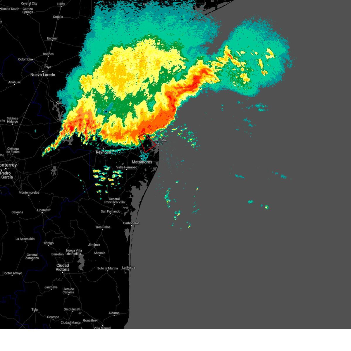 At 109 pm cdt, severe thunderstorms capable of producing both tornadoes and extensive straight line wind damage were located near arroyo city, moving southeast at 40 mph (radar indicated rotation). Hazards include tornado. Flying debris will be dangerous to those caught without shelter. mobile homes will be damaged or destroyed. damage to roofs, windows, and vehicles will occur. tree damage is likely. these dangerous storms will be near, laureles and palmer laasko elementary around 120 pm cdt. los fresnos high school around 125 pm cdt. holly beach around 130 pm cdt. laguna vista police department around 135 pm cdt. Other locations impacted by this tornadic thunderstorm include del mar heights, las yescas elementary school, la tina, bayview, las yescas, monte grande and port isabel--laguna heights. At 109 pm cdt, severe thunderstorms capable of producing both tornadoes and extensive straight line wind damage were located near arroyo city, moving southeast at 40 mph (radar indicated rotation). Hazards include tornado. Flying debris will be dangerous to those caught without shelter. mobile homes will be damaged or destroyed. damage to roofs, windows, and vehicles will occur. tree damage is likely. these dangerous storms will be near, laureles and palmer laasko elementary around 120 pm cdt. los fresnos high school around 125 pm cdt. holly beach around 130 pm cdt. laguna vista police department around 135 pm cdt. Other locations impacted by this tornadic thunderstorm include del mar heights, las yescas elementary school, la tina, bayview, las yescas, monte grande and port isabel--laguna heights.
|
| 4/23/2023 12:40 PM CDT |
 At 1240 pm cdt, severe thunderstorms were located along a line extending from 36 miles southeast of malaquite beach to 7 miles south of port mansfield chamber of commerce to near b.l. garza middle school, moving southeast at 55 mph (radar indicated). Hazards include 70 mph wind gusts and penny size hail. Expect considerable tree damage. Damage is likely to mobile homes, roofs, and outbuildings. At 1240 pm cdt, severe thunderstorms were located along a line extending from 36 miles southeast of malaquite beach to 7 miles south of port mansfield chamber of commerce to near b.l. garza middle school, moving southeast at 55 mph (radar indicated). Hazards include 70 mph wind gusts and penny size hail. Expect considerable tree damage. Damage is likely to mobile homes, roofs, and outbuildings.
|
| 4/21/2023 4:31 PM CDT |
 At 430 pm cdt, severe thunderstorms were located near sebastian and south of la feria, moving southeast at 15 mph. public has reported quarter sized hail near la feria (public). Hazards include 60 mph wind gusts and quarter size hail. Hail damage to vehicles is expected. expect wind damage to roofs, siding, and trees. locations impacted include, harlingen, mercedes, la feria, santa rosa, la villa, palm valley, los indios, rangerville, santa maria and la paloma. hail threat, radar indicated max hail size, 1. 00 in wind threat, radar indicated max wind gust, 60 mph. At 430 pm cdt, severe thunderstorms were located near sebastian and south of la feria, moving southeast at 15 mph. public has reported quarter sized hail near la feria (public). Hazards include 60 mph wind gusts and quarter size hail. Hail damage to vehicles is expected. expect wind damage to roofs, siding, and trees. locations impacted include, harlingen, mercedes, la feria, santa rosa, la villa, palm valley, los indios, rangerville, santa maria and la paloma. hail threat, radar indicated max hail size, 1. 00 in wind threat, radar indicated max wind gust, 60 mph.
|
| 4/21/2023 4:10 PM CDT |
 At 409 pm cdt, a severe thunderstorm was located over la feria, moving southeast at 15 mph (radar indicated). Hazards include 60 mph wind gusts and quarter size hail. Hail damage to vehicles is expected. Expect wind damage to roofs, siding, and trees. At 409 pm cdt, a severe thunderstorm was located over la feria, moving southeast at 15 mph (radar indicated). Hazards include 60 mph wind gusts and quarter size hail. Hail damage to vehicles is expected. Expect wind damage to roofs, siding, and trees.
|
| 5/25/2022 7:09 AM CDT |
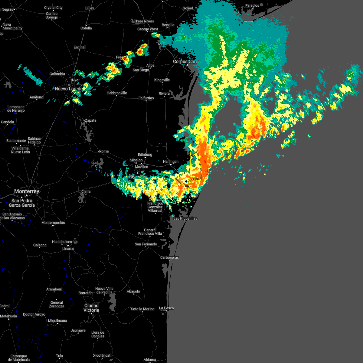 At 708 am cdt, severe thunderstorms were located along a line extending from 26 miles northeast of port mansfield to 10 miles southeast of boca chica beach to 24 miles southwest of fort brown memorial golf course, moving southeast at 40 mph (radar indicated). Hazards include 70 mph wind gusts. Expect considerable tree damage. Damage is likely to mobile homes, roofs, and outbuildings. At 708 am cdt, severe thunderstorms were located along a line extending from 26 miles northeast of port mansfield to 10 miles southeast of boca chica beach to 24 miles southwest of fort brown memorial golf course, moving southeast at 40 mph (radar indicated). Hazards include 70 mph wind gusts. Expect considerable tree damage. Damage is likely to mobile homes, roofs, and outbuildings.
|
| 5/25/2022 7:00 AM CDT | Social media report from space in cameron county TX, 19.9 miles W of Brownsville, TX |
| 5/25/2022 6:44 AM CDT | At 644 am cdt, severe thunderstorms were located along a line extending from 26 miles east of port mansfield to near laguna heights to 10 miles south of los indios, moving southeast at 40 mph (radar indicated). Hazards include 70 mph wind gusts. Expect considerable tree damage. damage is likely to mobile homes, roofs, and outbuildings. locations impacted include, harlingen, san benito, los fresnos, south padre island, rancho viejo, rio hondo, arroyo city, southmost, olmito and port of brownsville. thunderstorm damage threat, considerable hail threat, radar indicated max hail size, <. 75 in wind threat, radar indicated max wind gust, 70 mph. |
| 5/25/2022 6:29 AM CDT |
 At 629 am cdt, severe thunderstorms were located along a line extending from 27 miles northeast of port mansfield to holly beach to near santa maria, moving southeast at 40 mph (radar indicated). Hazards include 70 mph wind gusts. Expect considerable tree damage. damage is likely to mobile homes, roofs, and outbuildings. locations impacted include, harlingen, san benito, raymondville, los fresnos, south padre island, lyford, rancho viejo, rio hondo, palm valley and arroyo city. thunderstorm damage threat, considerable hail threat, radar indicated max hail size, <. 75 in wind threat, radar indicated max wind gust, 70 mph. At 629 am cdt, severe thunderstorms were located along a line extending from 27 miles northeast of port mansfield to holly beach to near santa maria, moving southeast at 40 mph (radar indicated). Hazards include 70 mph wind gusts. Expect considerable tree damage. damage is likely to mobile homes, roofs, and outbuildings. locations impacted include, harlingen, san benito, raymondville, los fresnos, south padre island, lyford, rancho viejo, rio hondo, palm valley and arroyo city. thunderstorm damage threat, considerable hail threat, radar indicated max hail size, <. 75 in wind threat, radar indicated max wind gust, 70 mph.
|
| 5/25/2022 6:26 AM CDT |
 At 624 am cdt, severe thunderstorms were located along a line extending from 27 miles northeast of port mansfield to near holly beach to santa maria, moving southeast at 40 mph (radar indicated). Hazards include 60 mph wind gusts. expect damage to roofs, siding, and trees At 624 am cdt, severe thunderstorms were located along a line extending from 27 miles northeast of port mansfield to near holly beach to santa maria, moving southeast at 40 mph (radar indicated). Hazards include 60 mph wind gusts. expect damage to roofs, siding, and trees
|
| 5/25/2022 5:56 AM CDT |
 At 556 am cdt, a severe thunderstorm was located near sebastian, moving southeast at 50 mph (radar indicated). Hazards include 60 mph wind gusts. expect damage to roofs, siding, and trees At 556 am cdt, a severe thunderstorm was located near sebastian, moving southeast at 50 mph (radar indicated). Hazards include 60 mph wind gusts. expect damage to roofs, siding, and trees
|
| 5/24/2022 2:03 AM CDT |
 At 203 am cdt, severe thunderstorms were located along a line extending from near arroyo city to 6 miles northwest of holly beach to near palmer laasko elementary, moving southeast at 20 mph (radar indicated). Hazards include 60 mph wind gusts and quarter size hail. Hail damage to vehicles is expected. expect wind damage to roofs, siding, and trees. Locations impacted include, los fresnos, rio hondo, arroyo city, laureles, brownsville, port isabel lighthouse, palmer laasko elementary, port isabel fire and police department, laguna vista police department and garria elementary school. At 203 am cdt, severe thunderstorms were located along a line extending from near arroyo city to 6 miles northwest of holly beach to near palmer laasko elementary, moving southeast at 20 mph (radar indicated). Hazards include 60 mph wind gusts and quarter size hail. Hail damage to vehicles is expected. expect wind damage to roofs, siding, and trees. Locations impacted include, los fresnos, rio hondo, arroyo city, laureles, brownsville, port isabel lighthouse, palmer laasko elementary, port isabel fire and police department, laguna vista police department and garria elementary school.
|
| 5/24/2022 1:51 AM CDT |
 At 151 am cdt, severe thunderstorms were located along a line extending from arroyo city to 6 miles east of lozano to near palmer laasko elementary, moving southeast at 20 mph (radar indicated). Hazards include 60 mph wind gusts and quarter size hail. Hail damage to vehicles is expected. Expect wind damage to roofs, siding, and trees. At 151 am cdt, severe thunderstorms were located along a line extending from arroyo city to 6 miles east of lozano to near palmer laasko elementary, moving southeast at 20 mph (radar indicated). Hazards include 60 mph wind gusts and quarter size hail. Hail damage to vehicles is expected. Expect wind damage to roofs, siding, and trees.
|
| 5/23/2022 11:58 PM CDT |
 At 1157 pm cdt, severe thunderstorms were located along a line extending from near lasara to near lyford high school to laguna seca, moving east at 30 mph (radar indicated). Hazards include 60 mph wind gusts and quarter size hail. Hail damage to vehicles is expected. Expect wind damage to roofs, siding, and trees. At 1157 pm cdt, severe thunderstorms were located along a line extending from near lasara to near lyford high school to laguna seca, moving east at 30 mph (radar indicated). Hazards include 60 mph wind gusts and quarter size hail. Hail damage to vehicles is expected. Expect wind damage to roofs, siding, and trees.
|
| 10/1/2021 7:55 PM CDT | Nws employee reports tree down on n indiana ave just north of boca chica blvd near ricks auto servic in cameron county TX, 6.9 miles NW of Brownsville, TX |
| 10/1/2021 5:39 PM CDT |
 The severe thunderstorm warning for southeastern cameron county will expire at 545 pm cdt, the storm which prompted the warning has weakened below severe limits, and no longer poses an immediate threat to life or property. therefore, the warning will be allowed to expire. however heavy rain is still possible with this thunderstorm. The severe thunderstorm warning for southeastern cameron county will expire at 545 pm cdt, the storm which prompted the warning has weakened below severe limits, and no longer poses an immediate threat to life or property. therefore, the warning will be allowed to expire. however heavy rain is still possible with this thunderstorm.
|
| 10/1/2021 5:17 PM CDT |
 At 516 pm cdt, a severe thunderstorm was located over rivera high school, or over port of brownsville, moving southeast at 10 to 15 mph (radar indicated). Hazards include 60 mph wind gusts. Expect damage to roofs, siding, and trees. locations impacted include, cameron park, southmost, port of brownsville, downtown brownsville, brownsville, b i s d administration building, longoria elementary school, hanna high school, brownsville public library southmost branch and brownsville golf center. hail threat, radar indicated max hail size, <. 75 in wind threat, radar indicated max wind gust, 60 mph. At 516 pm cdt, a severe thunderstorm was located over rivera high school, or over port of brownsville, moving southeast at 10 to 15 mph (radar indicated). Hazards include 60 mph wind gusts. Expect damage to roofs, siding, and trees. locations impacted include, cameron park, southmost, port of brownsville, downtown brownsville, brownsville, b i s d administration building, longoria elementary school, hanna high school, brownsville public library southmost branch and brownsville golf center. hail threat, radar indicated max hail size, <. 75 in wind threat, radar indicated max wind gust, 60 mph.
|
| 10/1/2021 5:05 PM CDT |
 At 504 pm cdt, a severe thunderstorm was located over gallegos elementary school, or over cameron park, moving southeast at 5 mph (radar indicated). Hazards include 60 mph wind gusts. expect damage to roofs, siding, and trees At 504 pm cdt, a severe thunderstorm was located over gallegos elementary school, or over cameron park, moving southeast at 5 mph (radar indicated). Hazards include 60 mph wind gusts. expect damage to roofs, siding, and trees
|
| 10/1/2021 4:27 PM CDT |
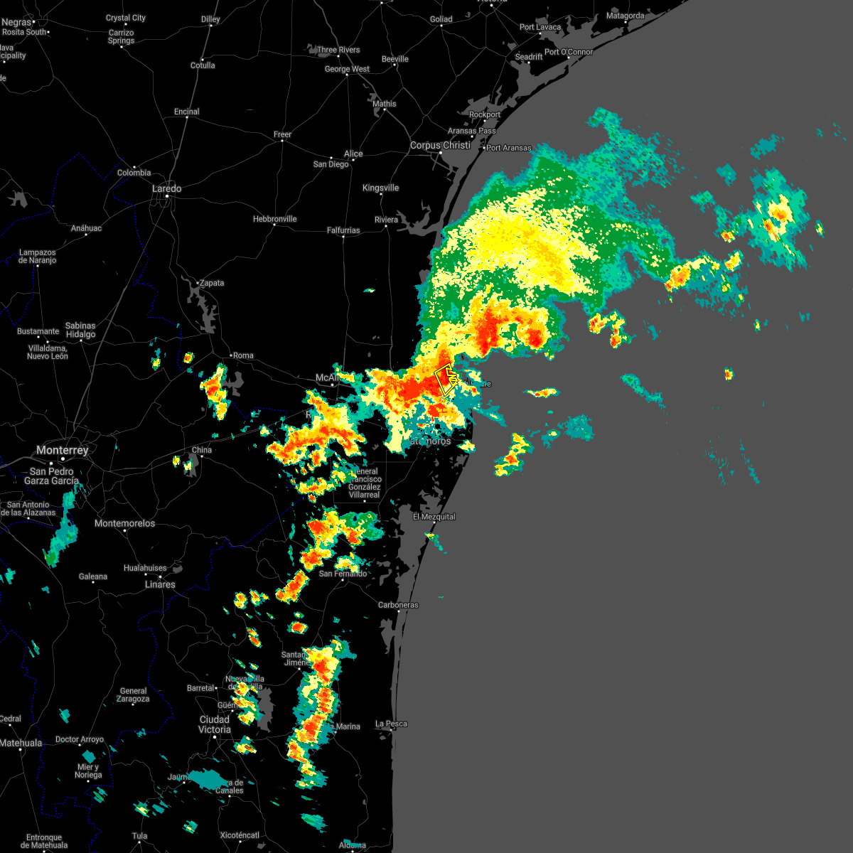 At 426 pm cdt, a severe thunderstorm was located near arroyo city, moving southeast at 15 mph (radar indicated). Hazards include 60 mph wind gusts. Expect damage to roofs, siding, and trees. This severe thunderstorm will remain over mainly rural areas of northeastern cameron county. At 426 pm cdt, a severe thunderstorm was located near arroyo city, moving southeast at 15 mph (radar indicated). Hazards include 60 mph wind gusts. Expect damage to roofs, siding, and trees. This severe thunderstorm will remain over mainly rural areas of northeastern cameron county.
|
| 7/9/2021 5:56 AM CDT |
 The severe thunderstorm warning for central cameron county will expire at 600 am cdt, the severe thunderstorm which prompted the warning has weakened below severe limits. therefore, the warning will be allowed to expire. torrential rainfall is still occurring with this storm!. The severe thunderstorm warning for central cameron county will expire at 600 am cdt, the severe thunderstorm which prompted the warning has weakened below severe limits. therefore, the warning will be allowed to expire. torrential rainfall is still occurring with this storm!.
|
| 7/9/2021 5:22 AM CDT |
 At 521 am cdt, a severe thunderstorm was located near veterans international bridge, or near downtown brownsville, moving north at 45 mph (radar indicated). Hazards include 60 mph wind gusts. expect damage to roofs, siding, and trees At 521 am cdt, a severe thunderstorm was located near veterans international bridge, or near downtown brownsville, moving north at 45 mph (radar indicated). Hazards include 60 mph wind gusts. expect damage to roofs, siding, and trees
|
| 5/19/2021 1:45 PM CDT | Report received via social media of a tree down on a vehicle. time estimate in cameron county TX, 4.6 miles NNE of Brownsville, TX |
| 5/19/2021 9:30 AM CDT |
 At 930 am cdt, severe thunderstorms were located along a line extending from near kenedy county sheriffs office to near san perlita to near relampago, moving east at 30 mph (radar indicated). Hazards include 60 mph wind gusts. Expect damage to roofs, siding, and trees. Locations impacted include, harlingen, weslaco, san juan, san benito, alamo, donna, mercedes, raymondville, la feria and elsa. At 930 am cdt, severe thunderstorms were located along a line extending from near kenedy county sheriffs office to near san perlita to near relampago, moving east at 30 mph (radar indicated). Hazards include 60 mph wind gusts. Expect damage to roofs, siding, and trees. Locations impacted include, harlingen, weslaco, san juan, san benito, alamo, donna, mercedes, raymondville, la feria and elsa.
|
| 5/19/2021 8:58 AM CDT |
 The national weather service in brownsville has issued a * severe thunderstorm warning for. kenedy county in deep south texas. hidalgo county in deep south texas. northwestern cameron county in deep south texas. Eastern brooks county in deep south texas. The national weather service in brownsville has issued a * severe thunderstorm warning for. kenedy county in deep south texas. hidalgo county in deep south texas. northwestern cameron county in deep south texas. Eastern brooks county in deep south texas.
|
| 5/12/2021 3:24 AM CDT |
 The severe thunderstorm warning for south central cameron county will expire at 330 am cdt, the storm which prompted the warning has weakened below severe limits, and no longer poses an immediate threat to life or property. therefore, the warning will be allowed to expire. however gusty winds and heavy rain are still possible with this thunderstorm. a severe thunderstorm watch remains in effect until 400 am cdt for deep south texas. The severe thunderstorm warning for south central cameron county will expire at 330 am cdt, the storm which prompted the warning has weakened below severe limits, and no longer poses an immediate threat to life or property. therefore, the warning will be allowed to expire. however gusty winds and heavy rain are still possible with this thunderstorm. a severe thunderstorm watch remains in effect until 400 am cdt for deep south texas.
|
| 5/12/2021 2:54 AM CDT |
 At 253 am cdt, a severe thunderstorm was located over olmito, moving south at 20 mph (radar indicated). Hazards include 70 mph wind gusts. Expect considerable tree damage. damage is likely to mobile homes, roofs, and outbuildings. Locations impacted include, los fresnos, rancho viejo, southmost, olmito, cameron park, downtown brownsville, brownsville, lincoln park, longoria elementary school and sams memorial stadium. At 253 am cdt, a severe thunderstorm was located over olmito, moving south at 20 mph (radar indicated). Hazards include 70 mph wind gusts. Expect considerable tree damage. damage is likely to mobile homes, roofs, and outbuildings. Locations impacted include, los fresnos, rancho viejo, southmost, olmito, cameron park, downtown brownsville, brownsville, lincoln park, longoria elementary school and sams memorial stadium.
|
| 5/12/2021 2:51 AM CDT |
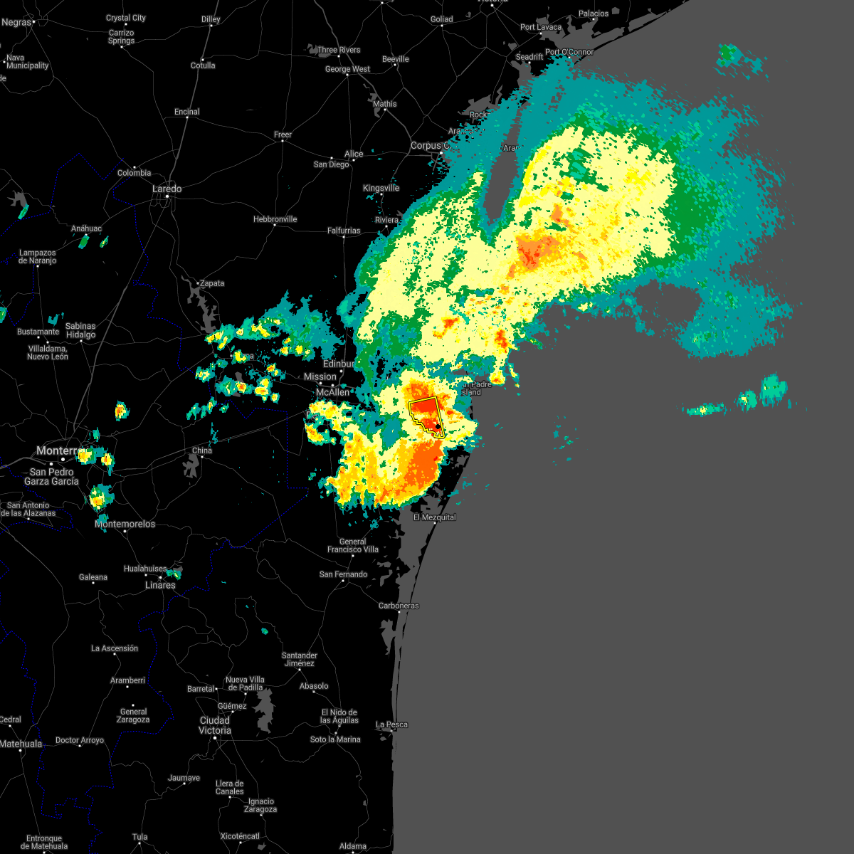 At 251 am cdt, a severe thunderstorm was located over olmito lake, or over rancho viejo, moving south at 20 mph (radar indicated). Hazards include 60 mph wind gusts. expect damage to roofs, siding, and trees At 251 am cdt, a severe thunderstorm was located over olmito lake, or over rancho viejo, moving south at 20 mph (radar indicated). Hazards include 60 mph wind gusts. expect damage to roofs, siding, and trees
|
| 5/12/2021 2:40 AM CDT |
 At 240 am cdt, a severe thunderstorm was located over rio hondo, moving south at 20 mph (radar indicated). Hazards include 60 mph wind gusts. expect damage to roofs, siding, and trees At 240 am cdt, a severe thunderstorm was located over rio hondo, moving south at 20 mph (radar indicated). Hazards include 60 mph wind gusts. expect damage to roofs, siding, and trees
|
| 5/12/2021 2:07 AM CDT |
 At 207 am cdt, a severe thunderstorm was located over miller jordan middle school, or over san benito, moving east at 30 mph (radar indicated). Hazards include 60 mph wind gusts. Expect damage to roofs, siding, and trees. Locations impacted include, harlingen, san benito, la feria, los fresnos, santa rosa, rancho viejo, rio hondo, palm valley, los indios and olmito. At 207 am cdt, a severe thunderstorm was located over miller jordan middle school, or over san benito, moving east at 30 mph (radar indicated). Hazards include 60 mph wind gusts. Expect damage to roofs, siding, and trees. Locations impacted include, harlingen, san benito, la feria, los fresnos, santa rosa, rancho viejo, rio hondo, palm valley, los indios and olmito.
|
| 5/12/2021 1:40 AM CDT |
 At 140 am cdt, a severe thunderstorm was located over santa maria high school, or near santa maria, moving east at 30 mph. this is a very dangerous storm (radar indicated). Hazards include 80 mph wind gusts. Flying debris will be dangerous to those caught without shelter. mobile homes will be heavily damaged. expect considerable damage to roofs, windows, and vehicles. Extensive tree damage and power outages are likely. At 140 am cdt, a severe thunderstorm was located over santa maria high school, or near santa maria, moving east at 30 mph. this is a very dangerous storm (radar indicated). Hazards include 80 mph wind gusts. Flying debris will be dangerous to those caught without shelter. mobile homes will be heavily damaged. expect considerable damage to roofs, windows, and vehicles. Extensive tree damage and power outages are likely.
|
| 7/26/2020 4:00 AM CDT |
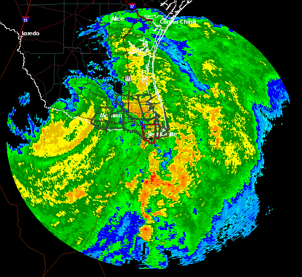 At 359 am cdt, a severe thunderstorm capable of producing a tornado was located near lozano, or 7 miles east of rio hondo, moving north at 20 mph (radar indicated rotation). Hazards include tornado. Flying debris will be dangerous to those caught without shelter. mobile homes will be damaged or destroyed. damage to roofs, windows, and vehicles will occur. tree damage is likely. this dangerous storm will be near, arroyo city around 420 am cdt. Other locations impacted by this tornadic thunderstorm include las yescas elementary school, la tina, las yescas and monte grande. At 359 am cdt, a severe thunderstorm capable of producing a tornado was located near lozano, or 7 miles east of rio hondo, moving north at 20 mph (radar indicated rotation). Hazards include tornado. Flying debris will be dangerous to those caught without shelter. mobile homes will be damaged or destroyed. damage to roofs, windows, and vehicles will occur. tree damage is likely. this dangerous storm will be near, arroyo city around 420 am cdt. Other locations impacted by this tornadic thunderstorm include las yescas elementary school, la tina, las yescas and monte grande.
|
| 7/26/2020 3:34 AM CDT | Public report of power lines down near california rd. and s dakota ave. possible tornado. time estimate in cameron county TX, 8.2 miles NNW of Brownsville, TX |
| 7/26/2020 3:27 AM CDT |
 At 327 am cdt, a severe thunderstorm capable of producing a tornado was located near besteiro middle school, or near southmost, moving north at 30 mph (radar indicated rotation). Hazards include tornado. Flying debris will be dangerous to those caught without shelter. mobile homes will be damaged or destroyed. damage to roofs, windows, and vehicles will occur. tree damage is likely. this dangerous storm will be near, south point around 330 am cdt. southmost, downtown brownsville, lincoln park, brownsville south padre island international airport, lopez high school, villa pancho, southmost elementary school, besteiro middle school, north brownsville little league and brownsville public library southmost branch around 335 am cdt. rivera high school, el jardin elementary school, perkins middle school, gonzalez elementary school, brownsville fire department station six, hanna high school, b i s d administration building, martin elementary school, dean porter park and stell middle school around 340 am cdt. port of brownsville, cameron park, gallegos elementary school, vela middle school, brownsville event center, northside transfer station, brownsville golf center, sunrise mall, valley regional medical center and driscoll childrens hospital around 345 am cdt. olmito and brownsville sports park around 350 am cdt. brownsville, rancho verde elementary school and olmito lake around 355 am cdt. los fresnos, laureles, los fresnos high school, los fresnos city offices, lopez - riggins elementary school, palmer laasko elementary, los cuates, resaca middle school, library memorial middle school and holly beach around 400 am cdt. other locations impacted by this tornadic thunderstorm include palm grove elementary school, a. x. benavides elementary school, resaca de la palma national battlefield, dancy building, rosa allala park, antonio gonzales park, indian lake, central avenue park, edelstein park and ruiz park. this includes the following highways, interstate highway 69 e between mile markers 1 and 12. Us highway 281 near mile marker 838. At 327 am cdt, a severe thunderstorm capable of producing a tornado was located near besteiro middle school, or near southmost, moving north at 30 mph (radar indicated rotation). Hazards include tornado. Flying debris will be dangerous to those caught without shelter. mobile homes will be damaged or destroyed. damage to roofs, windows, and vehicles will occur. tree damage is likely. this dangerous storm will be near, south point around 330 am cdt. southmost, downtown brownsville, lincoln park, brownsville south padre island international airport, lopez high school, villa pancho, southmost elementary school, besteiro middle school, north brownsville little league and brownsville public library southmost branch around 335 am cdt. rivera high school, el jardin elementary school, perkins middle school, gonzalez elementary school, brownsville fire department station six, hanna high school, b i s d administration building, martin elementary school, dean porter park and stell middle school around 340 am cdt. port of brownsville, cameron park, gallegos elementary school, vela middle school, brownsville event center, northside transfer station, brownsville golf center, sunrise mall, valley regional medical center and driscoll childrens hospital around 345 am cdt. olmito and brownsville sports park around 350 am cdt. brownsville, rancho verde elementary school and olmito lake around 355 am cdt. los fresnos, laureles, los fresnos high school, los fresnos city offices, lopez - riggins elementary school, palmer laasko elementary, los cuates, resaca middle school, library memorial middle school and holly beach around 400 am cdt. other locations impacted by this tornadic thunderstorm include palm grove elementary school, a. x. benavides elementary school, resaca de la palma national battlefield, dancy building, rosa allala park, antonio gonzales park, indian lake, central avenue park, edelstein park and ruiz park. this includes the following highways, interstate highway 69 e between mile markers 1 and 12. Us highway 281 near mile marker 838.
|
| 5/16/2020 9:38 AM CDT |
 The severe thunderstorm warning for east central cameron county will expire at 945 am cdt, the storms which prompted the warning have weakened below severe limits, and have exited the warned area. therefore, the warning will be allowed to expire. however gusty winds are still possible with these thunderstorms. to report severe weather, contact your nearest law enforcement agency. they will relay your report to the national weather service brownsville. The severe thunderstorm warning for east central cameron county will expire at 945 am cdt, the storms which prompted the warning have weakened below severe limits, and have exited the warned area. therefore, the warning will be allowed to expire. however gusty winds are still possible with these thunderstorms. to report severe weather, contact your nearest law enforcement agency. they will relay your report to the national weather service brownsville.
|
| 5/16/2020 9:09 AM CDT |
 At 908 am cdt, severe thunderstorms were located near bayview, moving east at 15 mph (radar indicated). Hazards include 60 mph wind gusts. Expect damage to roofs, siding, and trees. locations impacted include, south padre island, port isabel city hall, u. s. Coast guard station, port isabel lighthouse, beach access four, port isabel high school, port isabel fire and police department, south padre island convention center, beach access six and laguna vista police department. At 908 am cdt, severe thunderstorms were located near bayview, moving east at 15 mph (radar indicated). Hazards include 60 mph wind gusts. Expect damage to roofs, siding, and trees. locations impacted include, south padre island, port isabel city hall, u. s. Coast guard station, port isabel lighthouse, beach access four, port isabel high school, port isabel fire and police department, south padre island convention center, beach access six and laguna vista police department.
|
| 5/16/2020 8:52 AM CDT |
 At 851 am cdt, severe thunderstorms were located along a line extending from near los fresnos to rio hondo, moving east at 25 mph (radar indicated). Hazards include 60 mph wind gusts. expect damage to roofs, siding, and trees At 851 am cdt, severe thunderstorms were located along a line extending from near los fresnos to rio hondo, moving east at 25 mph (radar indicated). Hazards include 60 mph wind gusts. expect damage to roofs, siding, and trees
|
| 5/16/2020 8:34 AM CDT |
 At 833 am cdt, severe thunderstorms were located along a line extending from near los indios to lyford, moving east at 40 mph (radar indicated). Hazards include 60 mph wind gusts. Expect damage to roofs, siding, and trees. Locations impacted include, harlingen, san benito, la feria, los fresnos, santa rosa, lyford, rancho viejo, rio hondo, palm valley and los indios. At 833 am cdt, severe thunderstorms were located along a line extending from near los indios to lyford, moving east at 40 mph (radar indicated). Hazards include 60 mph wind gusts. Expect damage to roofs, siding, and trees. Locations impacted include, harlingen, san benito, la feria, los fresnos, santa rosa, lyford, rancho viejo, rio hondo, palm valley and los indios.
|
| 5/16/2020 8:06 AM CDT |
 At 806 am cdt, severe thunderstorms were located along a line extending from near lasara elementary school to near indian hills to progreso high school, moving east at 40 mph (radar indicated). Hazards include 60 mph wind gusts. expect damage to roofs, siding, and trees At 806 am cdt, severe thunderstorms were located along a line extending from near lasara elementary school to near indian hills to progreso high school, moving east at 40 mph (radar indicated). Hazards include 60 mph wind gusts. expect damage to roofs, siding, and trees
|
| 5/8/2020 11:06 PM CDT |
 At 1105 pm cdt, a severe thunderstorm was located over taylor elementary school, or over mercedes, moving east at 40 mph (radar indicated). Hazards include 60 mph wind gusts and quarter size hail. Hail damage to vehicles is expected. expect wind damage to roofs, siding, and trees. Locations impacted include, edinburg, mission, pharr, harlingen, weslaco, san juan, alamo, donna, mercedes and hidalgo. At 1105 pm cdt, a severe thunderstorm was located over taylor elementary school, or over mercedes, moving east at 40 mph (radar indicated). Hazards include 60 mph wind gusts and quarter size hail. Hail damage to vehicles is expected. expect wind damage to roofs, siding, and trees. Locations impacted include, edinburg, mission, pharr, harlingen, weslaco, san juan, alamo, donna, mercedes and hidalgo.
|
| 5/8/2020 10:49 PM CDT |
 At 1047 pm cdt, a severe thunderstorm was located over alamo, moving east at 40 mph (radar indicated). Hazards include 70 mph wind gusts and ping pong ball size hail. People and animals outdoors will be injured. expect hail damage to roofs, siding, windows, and vehicles. expect considerable tree damage. Wind damage is also likely to mobile homes, roofs, and outbuildings. At 1047 pm cdt, a severe thunderstorm was located over alamo, moving east at 40 mph (radar indicated). Hazards include 70 mph wind gusts and ping pong ball size hail. People and animals outdoors will be injured. expect hail damage to roofs, siding, windows, and vehicles. expect considerable tree damage. Wind damage is also likely to mobile homes, roofs, and outbuildings.
|
| 4/4/2020 9:12 AM CDT |
 At 911 am cdt, a severe thunderstorm was located over jose borrego middle school, or near arroyo city, moving southeast at 25 mph. this is a very dangerous storm (radar indicated). Hazards include three inch hail and 70 mph wind gusts. People and animals outdoors will be severely injured. Expect shattered windows, extensive damage to roofs, siding, and vehicles. At 911 am cdt, a severe thunderstorm was located over jose borrego middle school, or near arroyo city, moving southeast at 25 mph. this is a very dangerous storm (radar indicated). Hazards include three inch hail and 70 mph wind gusts. People and animals outdoors will be severely injured. Expect shattered windows, extensive damage to roofs, siding, and vehicles.
|
| 4/4/2020 8:31 AM CDT |
 At 830 am cdt, a severe thunderstorm was located over san perlita high school, or 8 miles east of raymondville, moving southeast at 30 mph (radar indicated). Hazards include two inch hail and 60 mph wind gusts. People and animals outdoors will be injured. expect hail damage to roofs, siding, windows, and vehicles. Expect wind damage to roofs, siding, and trees. At 830 am cdt, a severe thunderstorm was located over san perlita high school, or 8 miles east of raymondville, moving southeast at 30 mph (radar indicated). Hazards include two inch hail and 60 mph wind gusts. People and animals outdoors will be injured. expect hail damage to roofs, siding, windows, and vehicles. Expect wind damage to roofs, siding, and trees.
|
| 10/21/2019 2:29 AM CDT |
 At 229 am cdt, severe thunderstorms were located along a line extending from near jose borrego middle school to laguna vista police department, moving north at 40 mph (radar indicated). Hazards include 60 mph wind gusts. Expect damage to roofs, siding, and trees. locations impacted include, south padre island, port isabel city hall, u. s. Coast guard station, port isabel lighthouse, beach access four, port isabel high school, port isabel fire and police department, south padre island convention center, beach access six and laguna vista police department. At 229 am cdt, severe thunderstorms were located along a line extending from near jose borrego middle school to laguna vista police department, moving north at 40 mph (radar indicated). Hazards include 60 mph wind gusts. Expect damage to roofs, siding, and trees. locations impacted include, south padre island, port isabel city hall, u. s. Coast guard station, port isabel lighthouse, beach access four, port isabel high school, port isabel fire and police department, south padre island convention center, beach access six and laguna vista police department.
|
| 10/21/2019 2:10 AM CDT |
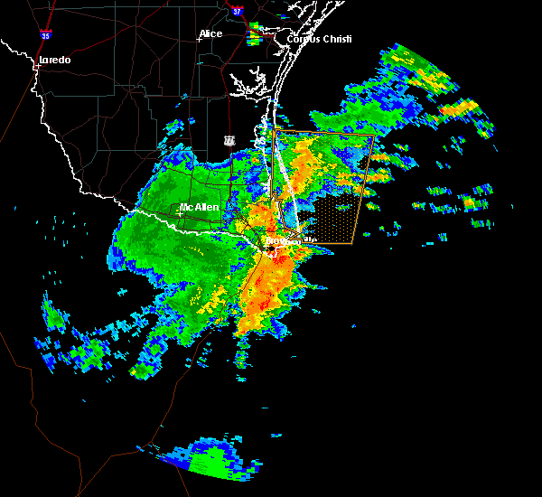 At 210 am cdt, severe thunderstorms were located along a line extending from near palmer laasko elementary to near rivera high school, moving north at 40 mph (radar indicated). Hazards include 60 mph wind gusts. expect damage to roofs, siding, and trees At 210 am cdt, severe thunderstorms were located along a line extending from near palmer laasko elementary to near rivera high school, moving north at 40 mph (radar indicated). Hazards include 60 mph wind gusts. expect damage to roofs, siding, and trees
|
| 10/21/2019 12:58 AM CDT |
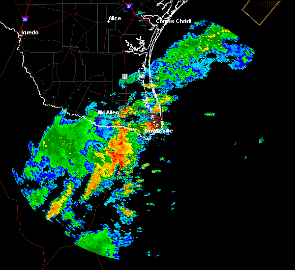 At 1258 am cdt, a severe thunderstorm capable of producing a tornado was located over laguna heights, or 7 miles southwest of south padre island, moving north at 20 mph (radar indicated rotation). Hazards include tornado. Flying debris will be dangerous to those caught without shelter. mobile homes will be damaged or destroyed. damage to roofs, windows, and vehicles will occur. tree damage is likely. this dangerous storm will be near, laguna vista police department around 105 am cdt. holly beach around 110 am cdt. pharr central fire station around 120 am cdt. Other locations impacted by this tornadic thunderstorm include port isabel--laguna heights. At 1258 am cdt, a severe thunderstorm capable of producing a tornado was located over laguna heights, or 7 miles southwest of south padre island, moving north at 20 mph (radar indicated rotation). Hazards include tornado. Flying debris will be dangerous to those caught without shelter. mobile homes will be damaged or destroyed. damage to roofs, windows, and vehicles will occur. tree damage is likely. this dangerous storm will be near, laguna vista police department around 105 am cdt. holly beach around 110 am cdt. pharr central fire station around 120 am cdt. Other locations impacted by this tornadic thunderstorm include port isabel--laguna heights.
|
| 6/25/2019 12:28 AM CDT |
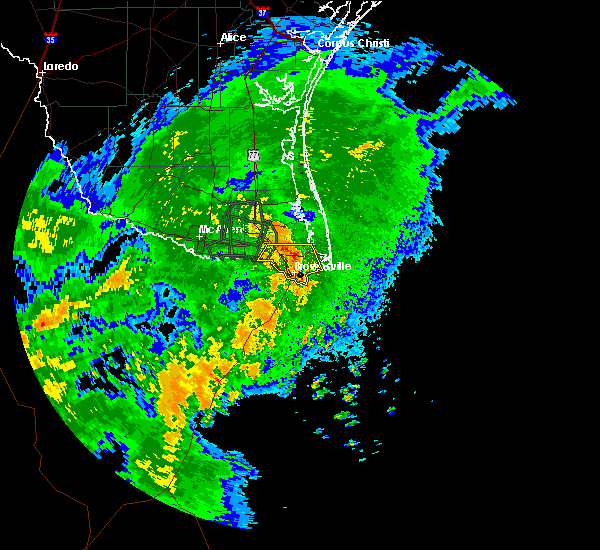 At 1228 am cdt, severe thunderstorms were located along a line extending from brownsville to san benito, moving northeast at 30 mph (radar indicated). Hazards include 60 mph wind gusts. Expect damage to roofs, siding, and trees. Locations impacted include, san benito, los fresnos, rancho viejo, los indios, southmost, olmito, la paloma, cameron park, laureles and downtown brownsville. At 1228 am cdt, severe thunderstorms were located along a line extending from brownsville to san benito, moving northeast at 30 mph (radar indicated). Hazards include 60 mph wind gusts. Expect damage to roofs, siding, and trees. Locations impacted include, san benito, los fresnos, rancho viejo, los indios, southmost, olmito, la paloma, cameron park, laureles and downtown brownsville.
|
| 6/25/2019 12:02 AM CDT |
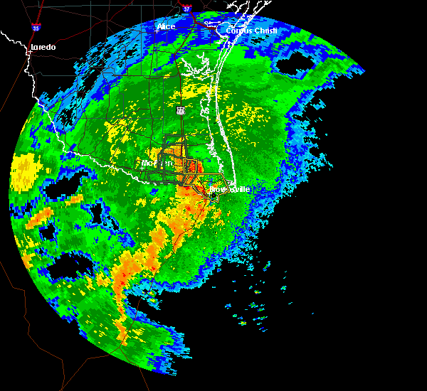 At 1202 am cdt, severe thunderstorms were located along a line extending from los indios to brownsville, moving northeast at 30 mph (radar indicated). Hazards include 60 mph wind gusts. expect damage to roofs, siding, and trees At 1202 am cdt, severe thunderstorms were located along a line extending from los indios to brownsville, moving northeast at 30 mph (radar indicated). Hazards include 60 mph wind gusts. expect damage to roofs, siding, and trees
|
| 6/5/2019 3:24 PM CDT |
 At 323 pm cdt, a severe thunderstorm was located near south padre island, moving south at 20 mph (radar indicated). Hazards include 60 mph wind gusts. Expect damage to roofs, siding, and trees. locations impacted include, south padre island, port isabel city hall, u. s. Coast guard station, port isabel lighthouse, beach access four, port isabel high school, port isabel fire and police department, south padre island convention center, beach access six and laguna vista police department. At 323 pm cdt, a severe thunderstorm was located near south padre island, moving south at 20 mph (radar indicated). Hazards include 60 mph wind gusts. Expect damage to roofs, siding, and trees. locations impacted include, south padre island, port isabel city hall, u. s. Coast guard station, port isabel lighthouse, beach access four, port isabel high school, port isabel fire and police department, south padre island convention center, beach access six and laguna vista police department.
|
| 6/5/2019 3:07 PM CDT |
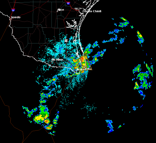 At 306 pm cdt, a severe thunderstorm was located near 8 miles northwest of south padre island, moving south at 20 mph (radar indicated). Hazards include 60 mph wind gusts. expect damage to roofs, siding, and trees At 306 pm cdt, a severe thunderstorm was located near 8 miles northwest of south padre island, moving south at 20 mph (radar indicated). Hazards include 60 mph wind gusts. expect damage to roofs, siding, and trees
|
| 4/7/2019 9:45 AM CDT |
 At 943 am cdt, severe thunderstorms were located along a line extending from near port mansfield to san pedro, moving east at 30 mph. these storms have a history of producing wind gusts in excess of 70 mph (radar indicated). Hazards include 70 mph wind gusts. Expect considerable tree damage. damage is likely to mobile homes, roofs, and outbuildings. Locations impacted include, harlingen, san benito, brownsville, los fresnos, south padre island, rancho viejo, rio hondo, arroyo city, southmost, olmito and port mansfield. At 943 am cdt, severe thunderstorms were located along a line extending from near port mansfield to san pedro, moving east at 30 mph. these storms have a history of producing wind gusts in excess of 70 mph (radar indicated). Hazards include 70 mph wind gusts. Expect considerable tree damage. damage is likely to mobile homes, roofs, and outbuildings. Locations impacted include, harlingen, san benito, brownsville, los fresnos, south padre island, rancho viejo, rio hondo, arroyo city, southmost, olmito and port mansfield.
|
| 4/7/2019 9:18 AM CDT |
 At 917 am cdt, severe thunderstorms were located along a line extending from near raymondville to la feria, moving east at 40 mph. harlingen airport just reported a measured wind gust of 73 mph at 9:15 am (harlingen airport observation). Hazards include 70 mph wind gusts. Expect considerable tree damage. damage is likely to mobile homes, roofs, and outbuildings. Locations impacted include, harlingen, san benito, raymondville, la feria, brownsville, los fresnos, santa rosa, south padre island, lyford, rancho viejo and rio hondo. At 917 am cdt, severe thunderstorms were located along a line extending from near raymondville to la feria, moving east at 40 mph. harlingen airport just reported a measured wind gust of 73 mph at 9:15 am (harlingen airport observation). Hazards include 70 mph wind gusts. Expect considerable tree damage. damage is likely to mobile homes, roofs, and outbuildings. Locations impacted include, harlingen, san benito, raymondville, la feria, brownsville, los fresnos, santa rosa, south padre island, lyford, rancho viejo and rio hondo.
|
| 4/7/2019 9:08 AM CDT |
 At 906 am cdt, severe thunderstorms were located along a line extending from near raymondville to weslaco moving east at 40 mph (radar indicated). Hazards include 60 mph wind gusts. expect damage to roofs, siding, and trees At 906 am cdt, severe thunderstorms were located along a line extending from near raymondville to weslaco moving east at 40 mph (radar indicated). Hazards include 60 mph wind gusts. expect damage to roofs, siding, and trees
|
| 6/20/2018 4:29 AM CDT |
 At 428 am cdt, a severe thunderstorm capable of producing a tornado was located over san benito high school, or over san benito, moving north at 20 mph (radar indicated rotation). Hazards include tornado. Flying debris will be dangerous to those caught without shelter. mobile homes will be damaged or destroyed. damage to roofs, windows, and vehicles will occur. tree damage is likely. Locations impacted include, harlingen, san benito, rio hondo, harlingen arts and heritage museum, harlingen high school, harlingen public library, harlingen city reservoir, harlingen fire department, harligen municipal golf course and rio hondo elementary school. At 428 am cdt, a severe thunderstorm capable of producing a tornado was located over san benito high school, or over san benito, moving north at 20 mph (radar indicated rotation). Hazards include tornado. Flying debris will be dangerous to those caught without shelter. mobile homes will be damaged or destroyed. damage to roofs, windows, and vehicles will occur. tree damage is likely. Locations impacted include, harlingen, san benito, rio hondo, harlingen arts and heritage museum, harlingen high school, harlingen public library, harlingen city reservoir, harlingen fire department, harligen municipal golf course and rio hondo elementary school.
|
| 6/20/2018 4:14 AM CDT |
 At 414 am cdt, a severe thunderstorm capable of producing a tornado was located over la paloma elementary school, or over la paloma, moving northeast at 25 mph (radar indicated rotation). Hazards include tornado. Flying debris will be dangerous to those caught without shelter. mobile homes will be damaged or destroyed. damage to roofs, windows, and vehicles will occur. Tree damage is likely. At 414 am cdt, a severe thunderstorm capable of producing a tornado was located over la paloma elementary school, or over la paloma, moving northeast at 25 mph (radar indicated rotation). Hazards include tornado. Flying debris will be dangerous to those caught without shelter. mobile homes will be damaged or destroyed. damage to roofs, windows, and vehicles will occur. Tree damage is likely.
|
| 6/5/2017 5:52 PM CDT |
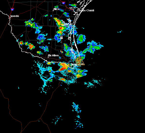 At 552 pm cdt, a severe thunderstorm was located over laguna heights, or near south padre island, moving southeast at 20 mph (radar indicated). Hazards include 60 mph wind gusts and penny size hail. Expect minor damage to mobile homes. some roofs. siding and some fences. tree limbs will blow down and small trees will be uprooted. Damage to power lines and some power poles is expected. At 552 pm cdt, a severe thunderstorm was located over laguna heights, or near south padre island, moving southeast at 20 mph (radar indicated). Hazards include 60 mph wind gusts and penny size hail. Expect minor damage to mobile homes. some roofs. siding and some fences. tree limbs will blow down and small trees will be uprooted. Damage to power lines and some power poles is expected.
|
| 6/5/2017 5:29 PM CDT |
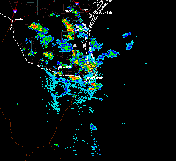 At 528 pm cdt, a severe thunderstorm was located over arroyo city, moving southeast at 30 mph (radar indicated). Hazards include 60 mph wind gusts and quarter size hail. Hail damage to vehicles. including cracked windshields and minor exterior dents can expected. some damage to crops and trees is expected. expect minor wind damage to mobile homes, some roofs, siding and some fences. tree limbs will blow down and small trees will be uprooted. damage to power lines and some power poles is expected. Locations impacted include, arroyo city, las yescas elementary school, la tina, las yescas and monte grande. At 528 pm cdt, a severe thunderstorm was located over arroyo city, moving southeast at 30 mph (radar indicated). Hazards include 60 mph wind gusts and quarter size hail. Hail damage to vehicles. including cracked windshields and minor exterior dents can expected. some damage to crops and trees is expected. expect minor wind damage to mobile homes, some roofs, siding and some fences. tree limbs will blow down and small trees will be uprooted. damage to power lines and some power poles is expected. Locations impacted include, arroyo city, las yescas elementary school, la tina, las yescas and monte grande.
|
| 6/5/2017 5:09 PM CDT |
 At 509 pm cdt, a severe thunderstorm was located near porfirio, or 8 miles northwest of arroyo city, moving southeast at 30 mph (radar indicated). Hazards include 60 mph wind gusts and quarter size hail. Hail damage to vehicles. including cracked windshields and minor exterior dents can expected. some damage to crops and trees is expected. expect minor wind damage to mobile homes, some roofs, siding and some fences. tree limbs will blow down and small trees will be uprooted. Damage to power lines and some power poles is expected. At 509 pm cdt, a severe thunderstorm was located near porfirio, or 8 miles northwest of arroyo city, moving southeast at 30 mph (radar indicated). Hazards include 60 mph wind gusts and quarter size hail. Hail damage to vehicles. including cracked windshields and minor exterior dents can expected. some damage to crops and trees is expected. expect minor wind damage to mobile homes, some roofs, siding and some fences. tree limbs will blow down and small trees will be uprooted. Damage to power lines and some power poles is expected.
|
| 4/2/2017 9:25 PM CDT |
 At 924 pm cdt, a severe thunderstorm was located near rio hondo high school, or near rio hondo, moving east at 30 mph (public). Hazards include golf ball size hail and 60 mph wind gusts. People and animals outdoors will be injured. expect hail damage to roofs, siding, windows and property. vehicle damage will include cracked or shattered windshields and major dents requiring significant repairs. expect minor wind damage to mobile homes, some roofs, siding and some fences. tree limbs will blow down and small trees will be uprooted. Damage to power lines and some power poles is expected. At 924 pm cdt, a severe thunderstorm was located near rio hondo high school, or near rio hondo, moving east at 30 mph (public). Hazards include golf ball size hail and 60 mph wind gusts. People and animals outdoors will be injured. expect hail damage to roofs, siding, windows and property. vehicle damage will include cracked or shattered windshields and major dents requiring significant repairs. expect minor wind damage to mobile homes, some roofs, siding and some fences. tree limbs will blow down and small trees will be uprooted. Damage to power lines and some power poles is expected.
|
| 4/2/2017 9:12 PM CDT |
 At 910 pm cdt, a severe thunderstorm was located over valley international airport, or over rio hondo, moving east at 40 mph. quarter size hail was reported at the harlingen airport control tower (radar indicated). Hazards include golf ball size hail and 60 mph wind gusts. People and animals outdoors will be injured. expect hail damage to roofs, siding, windows and property. vehicle damage will include cracked or shattered windshields and major dents requiring significant repairs. expect minor wind damage to mobile homes, some roofs, siding and some fences. tree limbs will blow down and small trees will be uprooted. damage to power lines and some power poles is expected. Locations impacted include, harlingen, san benito, la feria, santa rosa, rio hondo, palm valley, primera, combes, doctor hesiquio rodriguez elementary school and harlingen arts and heritage museum. At 910 pm cdt, a severe thunderstorm was located over valley international airport, or over rio hondo, moving east at 40 mph. quarter size hail was reported at the harlingen airport control tower (radar indicated). Hazards include golf ball size hail and 60 mph wind gusts. People and animals outdoors will be injured. expect hail damage to roofs, siding, windows and property. vehicle damage will include cracked or shattered windshields and major dents requiring significant repairs. expect minor wind damage to mobile homes, some roofs, siding and some fences. tree limbs will blow down and small trees will be uprooted. damage to power lines and some power poles is expected. Locations impacted include, harlingen, san benito, la feria, santa rosa, rio hondo, palm valley, primera, combes, doctor hesiquio rodriguez elementary school and harlingen arts and heritage museum.
|
| 4/2/2017 8:50 PM CDT |
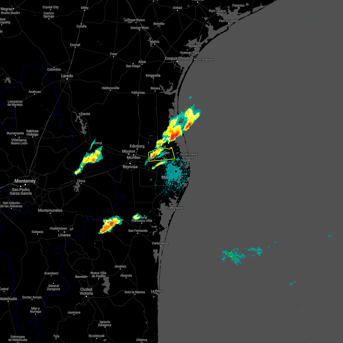 At 849 pm cdt, a severe thunderstorm was located over la feria north, or over la feria, moving east at 30 mph (radar indicated). Hazards include ping pong ball size hail and 60 mph wind gusts. People and animals outdoors will be injured. expect hail damage to roofs, siding, windows and property. vehicle damage will include cracked or shattered windshields and major dents requiring significant repairs. expect minor wind damage to mobile homes, some roofs, siding and some fences. tree limbs will blow down and small trees will be uprooted. Damage to power lines and some power poles is expected. At 849 pm cdt, a severe thunderstorm was located over la feria north, or over la feria, moving east at 30 mph (radar indicated). Hazards include ping pong ball size hail and 60 mph wind gusts. People and animals outdoors will be injured. expect hail damage to roofs, siding, windows and property. vehicle damage will include cracked or shattered windshields and major dents requiring significant repairs. expect minor wind damage to mobile homes, some roofs, siding and some fences. tree limbs will blow down and small trees will be uprooted. Damage to power lines and some power poles is expected.
|
| 6/1/2016 1:41 AM CDT |
 The severe thunderstorm warning for east central cameron county will expire at 145 am cdt, the storm which prompted the warning has weakened below severe limits, and no longer pose an immediate threat to life or property. therefore, the warning will be allowed to expire. however gusty winds and heavy rain are still possible with this thunderstorm. The severe thunderstorm warning for east central cameron county will expire at 145 am cdt, the storm which prompted the warning has weakened below severe limits, and no longer pose an immediate threat to life or property. therefore, the warning will be allowed to expire. however gusty winds and heavy rain are still possible with this thunderstorm.
|
| 6/1/2016 1:28 AM CDT |
 At 127 am cdt, a severe thunderstorm was located near rivera high school, or 7 miles southeast of los fresnos, moving south at 20 mph (radar indicated). Hazards include 60 mph wind gusts. Expect minor damage to mobile homes. some roofs. siding and some fences. tree limbs will blow down and small trees will be uprooted. damage to power lines and some power poles is expected. Locations impacted include, brownsville, holly beach, laguna vista police department, gallegos elementary school, bayview, loma alta lake, palo alto national historical park, del mar heights and port isabel--laguna heights. At 127 am cdt, a severe thunderstorm was located near rivera high school, or 7 miles southeast of los fresnos, moving south at 20 mph (radar indicated). Hazards include 60 mph wind gusts. Expect minor damage to mobile homes. some roofs. siding and some fences. tree limbs will blow down and small trees will be uprooted. damage to power lines and some power poles is expected. Locations impacted include, brownsville, holly beach, laguna vista police department, gallegos elementary school, bayview, loma alta lake, palo alto national historical park, del mar heights and port isabel--laguna heights.
|
| 6/1/2016 1:09 AM CDT |
 At 109 am cdt, a severe thunderstorm was located near holly beach, or near los fresnos, moving south at 35 mph (radar indicated). Hazards include 60 mph wind gusts. Expect minor damage to mobile homes. some roofs. siding and some fences. tree limbs will blow down and small trees will be uprooted. Damage to power lines and some power poles is expected. At 109 am cdt, a severe thunderstorm was located near holly beach, or near los fresnos, moving south at 35 mph (radar indicated). Hazards include 60 mph wind gusts. Expect minor damage to mobile homes. some roofs. siding and some fences. tree limbs will blow down and small trees will be uprooted. Damage to power lines and some power poles is expected.
|
| 5/15/2016 3:36 PM CDT |
 The severe thunderstorm warning for southwestern cameron county will expire at 345 pm cdt, the storm which prompted the warning has weakened below severe limits, and have exited the warned area. therefore the warning will be allowed to expire. however small hail and heavy rain are still possible with this thunderstorm. to report severe weather, contact your nearest law enforcement agency. they will relay your report to the national weather service brownsville. The severe thunderstorm warning for southwestern cameron county will expire at 345 pm cdt, the storm which prompted the warning has weakened below severe limits, and have exited the warned area. therefore the warning will be allowed to expire. however small hail and heavy rain are still possible with this thunderstorm. to report severe weather, contact your nearest law enforcement agency. they will relay your report to the national weather service brownsville.
|
| 5/15/2016 3:10 PM CDT |
 At 308 pm cdt, a severe thunderstorm was located over san pedro, or over rancho viejo, moving north at 15 mph (radar indicated). Hazards include quarter size hail. Damage to vehicles. including cracked windshields and minor exterior dents can expected. Some damage to crops and trees is expected. At 308 pm cdt, a severe thunderstorm was located over san pedro, or over rancho viejo, moving north at 15 mph (radar indicated). Hazards include quarter size hail. Damage to vehicles. including cracked windshields and minor exterior dents can expected. Some damage to crops and trees is expected.
|
| 4/24/2016 8:08 PM CDT |
 The severe thunderstorm warning for south central willacy and northwestern cameron counties will expire at 815 pm cdt, the storm which prompted the warning has weakened below severe limits, and no longer poses an immediate threat to life or property. therefore the warning will be allowed to expire. The severe thunderstorm warning for south central willacy and northwestern cameron counties will expire at 815 pm cdt, the storm which prompted the warning has weakened below severe limits, and no longer poses an immediate threat to life or property. therefore the warning will be allowed to expire.
|
| 4/24/2016 7:56 PM CDT |
 At 754 pm cdt, a severe thunderstorm was located 5 miles north of valley international airport, moving south at 15 mph (radar indicated). Hazards include golf ball size hail and 60 mph wind gusts. People and animals outdoors will be injured. expect hail damage to roofs, siding, windows and property. vehicle damage will include cracked or shattered windshields and major dents requiring significant repairs. expect minor wind damage to mobile homes, some roofs, siding and some fences. tree limbs will blow down and small trees will be uprooted. damage to power lines and some power poles is expected. Locations impacted include, harlingen, san benito, rio hondo, palm valley, primera, combes and valley international airport. At 754 pm cdt, a severe thunderstorm was located 5 miles north of valley international airport, moving south at 15 mph (radar indicated). Hazards include golf ball size hail and 60 mph wind gusts. People and animals outdoors will be injured. expect hail damage to roofs, siding, windows and property. vehicle damage will include cracked or shattered windshields and major dents requiring significant repairs. expect minor wind damage to mobile homes, some roofs, siding and some fences. tree limbs will blow down and small trees will be uprooted. damage to power lines and some power poles is expected. Locations impacted include, harlingen, san benito, rio hondo, palm valley, primera, combes and valley international airport.
|
| 4/24/2016 7:36 PM CDT |
 At 734 pm cdt, a severe thunderstorm was located near santa monica, or 7 miles east of sebastian, moving south at 20 mph (radar indicated). Hazards include two inch hail and 60 mph wind gusts. People and animals outdoors will be injured. expect hail damage to roofs, siding, windows and property. vehicle damage will include cracked or shattered windshields and major dents requiring significant repairs. expect minor wind damage to mobile homes, some roofs, siding and some fences. tree limbs will blow down and small trees will be uprooted. Damage to power lines and some power poles is expected. At 734 pm cdt, a severe thunderstorm was located near santa monica, or 7 miles east of sebastian, moving south at 20 mph (radar indicated). Hazards include two inch hail and 60 mph wind gusts. People and animals outdoors will be injured. expect hail damage to roofs, siding, windows and property. vehicle damage will include cracked or shattered windshields and major dents requiring significant repairs. expect minor wind damage to mobile homes, some roofs, siding and some fences. tree limbs will blow down and small trees will be uprooted. Damage to power lines and some power poles is expected.
|
| 4/21/2016 4:26 PM CDT | The severe thunderstorm warning for southwestern cameron county will expire at 430 pm cdt, the storm which prompted the warning has weakened below severe limits, and have exited the warned area. therefore the warning will be allowed to expire. |
| 4/21/2016 4:17 PM CDT |
 At 417 pm cdt, a severe thunderstorm was located near villa nueva elementary school, or 7 miles southwest of rancho viejo, moving south at 15 mph (radar indicated). Hazards include quarter size hail. Damage to vehicles. including cracked windshields and minor exterior dents can expected. some damage to crops and trees is expected. Locations impacted include, brownsville, san pedro and villa nueva elementary school. At 417 pm cdt, a severe thunderstorm was located near villa nueva elementary school, or 7 miles southwest of rancho viejo, moving south at 15 mph (radar indicated). Hazards include quarter size hail. Damage to vehicles. including cracked windshields and minor exterior dents can expected. some damage to crops and trees is expected. Locations impacted include, brownsville, san pedro and villa nueva elementary school.
|
| 4/21/2016 3:58 PM CDT |
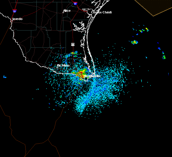 At 357 pm cdt, a severe thunderstorm was located over la encantada elementary school, or near rancho viejo, moving south at 15 mph (radar indicated). Hazards include quarter size hail. Damage to vehicles. including cracked windshields and minor exterior dents can expected. Some damage to crops and trees is expected. At 357 pm cdt, a severe thunderstorm was located over la encantada elementary school, or near rancho viejo, moving south at 15 mph (radar indicated). Hazards include quarter size hail. Damage to vehicles. including cracked windshields and minor exterior dents can expected. Some damage to crops and trees is expected.
|
| 4/21/2016 3:41 PM CDT | The severe thunderstorm warning for west central cameron county will expire at 345 pm cdt, the storm which prompted the warning has weakened below severe limits, and no longer pose an immediate threat to life or property. therefore the warning will be allowed to expire. |
| 4/21/2016 3:27 PM CDT |
 At 326 pm cdt, a severe thunderstorm was located over san benito veterans memorial academy, or near san benito, moving south at 15 mph (radar indicated). Hazards include quarter size hail. Damage to vehicles. including cracked windshields and minor exterior dents can expected. some damage to crops and trees is expected. Locations impacted include, harlingen, san benito, rio hondo, harligen municipal golf course, valley international airport, texas state technical college harlingen, harlingen soccer complex, marine military academy, treasure hills elementary school and valley baptist medical center harlingen. At 326 pm cdt, a severe thunderstorm was located over san benito veterans memorial academy, or near san benito, moving south at 15 mph (radar indicated). Hazards include quarter size hail. Damage to vehicles. including cracked windshields and minor exterior dents can expected. some damage to crops and trees is expected. Locations impacted include, harlingen, san benito, rio hondo, harligen municipal golf course, valley international airport, texas state technical college harlingen, harlingen soccer complex, marine military academy, treasure hills elementary school and valley baptist medical center harlingen.
|
| 4/19/2016 12:28 AM CDT | Nws employee reports 8 inch diameter tree limb partially blocking the road near the intersection of jaime j zapata and ray david driv in cameron county TX, 4.2 miles N of Brownsville, TX |
| 4/18/2016 11:05 PM CDT |
 At 1103 pm cdt, national weather service meteorologists detected severe thunderstorms located along a line extending from near rivera high school to southmost elementary school, moving southeast at 10 to 15 mph (radar indicated). Hazards include 60 mph wind gusts. Expect minor damage to mobile homes. some roofs. siding and some fences. tree limbs will blow down and small trees will be uprooted. damage to power lines and some power poles is expected. Locations impacted include, southmost, brownsville, lincoln park, brownsville public library southmost branch, pace high school and perkins middle school. At 1103 pm cdt, national weather service meteorologists detected severe thunderstorms located along a line extending from near rivera high school to southmost elementary school, moving southeast at 10 to 15 mph (radar indicated). Hazards include 60 mph wind gusts. Expect minor damage to mobile homes. some roofs. siding and some fences. tree limbs will blow down and small trees will be uprooted. damage to power lines and some power poles is expected. Locations impacted include, southmost, brownsville, lincoln park, brownsville public library southmost branch, pace high school and perkins middle school.
|
| 4/18/2016 10:56 PM CDT | Brownsville police reported three electical poles down along u.s. hwy 28 in cameron county TX, 4.2 miles N of Brownsville, TX |
| 4/18/2016 10:46 PM CDT |
 At 1045 pm cdt, national weather service meteorologists detected a severe thunderstorm over brownsville, moving south at 10 mph (radar indicated). Hazards include 60 mph wind gusts. Expect minor damage to mobile homes. some roofs. siding and some fences. tree limbs will blow down and small trees will be uprooted. Damage to power lines and some power poles is expected. At 1045 pm cdt, national weather service meteorologists detected a severe thunderstorm over brownsville, moving south at 10 mph (radar indicated). Hazards include 60 mph wind gusts. Expect minor damage to mobile homes. some roofs. siding and some fences. tree limbs will blow down and small trees will be uprooted. Damage to power lines and some power poles is expected.
|
| 4/18/2016 10:33 PM CDT |
 At 1031 pm cdt, national weather service meteorologists detected severe thunderstorms located along a line extending from near rivera high school to itec campus, moving south at 10 to 15 mph (radar indicated). Hazards include 60 mph wind gusts. Expect minor damage to mobile homes. some roofs. siding and some fences. tree limbs will blow down and small trees will be uprooted. damage to power lines and some power poles is expected. Locations impacted include, harlingen, san benito, los fresnos, rancho viejo, rio hondo, laureles, downtown brownsville, cameron park, la paloma and southmost. At 1031 pm cdt, national weather service meteorologists detected severe thunderstorms located along a line extending from near rivera high school to itec campus, moving south at 10 to 15 mph (radar indicated). Hazards include 60 mph wind gusts. Expect minor damage to mobile homes. some roofs. siding and some fences. tree limbs will blow down and small trees will be uprooted. damage to power lines and some power poles is expected. Locations impacted include, harlingen, san benito, los fresnos, rancho viejo, rio hondo, laureles, downtown brownsville, cameron park, la paloma and southmost.
|
| 4/18/2016 10:14 PM CDT |
 At 1013 pm cdt, national weather service meteorologists detected severe thunderstorms located along a line extending from near holly beach to stillman middle school, moving south at 10 mph (radar indicated). Hazards include 60 mph wind gusts. Expect minor damage to mobile homes. some roofs. siding and some fences. tree limbs will blow down and small trees will be uprooted. Damage to power lines and some power poles is expected. At 1013 pm cdt, national weather service meteorologists detected severe thunderstorms located along a line extending from near holly beach to stillman middle school, moving south at 10 mph (radar indicated). Hazards include 60 mph wind gusts. Expect minor damage to mobile homes. some roofs. siding and some fences. tree limbs will blow down and small trees will be uprooted. Damage to power lines and some power poles is expected.
|
| 4/18/2016 9:18 PM CDT |
 At 917 pm cdt, national weather service meteorologists detected severe thunderstorms located along a line extending from holly beach to beach access five, moving north at 10 mph (radar indicated). Hazards include 60 mph wind gusts and half dollar size hail. Hail damage to vehicles. including cracked windshields and minor exterior dents can expected. some damage to crops and trees is expected. expect minor wind damage to mobile homes, some roofs, siding and some fences. tree limbs will blow down and small trees will be uprooted. Damage to power lines and some power poles is expected. At 917 pm cdt, national weather service meteorologists detected severe thunderstorms located along a line extending from holly beach to beach access five, moving north at 10 mph (radar indicated). Hazards include 60 mph wind gusts and half dollar size hail. Hail damage to vehicles. including cracked windshields and minor exterior dents can expected. some damage to crops and trees is expected. expect minor wind damage to mobile homes, some roofs, siding and some fences. tree limbs will blow down and small trees will be uprooted. Damage to power lines and some power poles is expected.
|
| 4/18/2016 9:03 PM CDT |
 At 901 pm cdt, national weather service meteorologists detected severe thunderstorms located along a line extending from laguna vista police department to beach access four, moving north at 10 mph (radar indicated). Hazards include ping pong ball size hail and 60 mph wind gusts. People and animals outdoors will be injured. expect hail damage to roofs, siding, windows and property. vehicle damage will include cracked or shattered windshields and major dents requiring significant repairs. expect minor wind damage to mobile homes, some roofs, siding and some fences. tree limbs will blow down and small trees will be uprooted. damage to power lines and some power poles is expected. locations impacted include, south padre island, port isabel lighthouse, u. s. Coast guard station, south padre island convention center, port isabel high school, beach access five, port isabel city hall and south padre island police department. At 901 pm cdt, national weather service meteorologists detected severe thunderstorms located along a line extending from laguna vista police department to beach access four, moving north at 10 mph (radar indicated). Hazards include ping pong ball size hail and 60 mph wind gusts. People and animals outdoors will be injured. expect hail damage to roofs, siding, windows and property. vehicle damage will include cracked or shattered windshields and major dents requiring significant repairs. expect minor wind damage to mobile homes, some roofs, siding and some fences. tree limbs will blow down and small trees will be uprooted. damage to power lines and some power poles is expected. locations impacted include, south padre island, port isabel lighthouse, u. s. Coast guard station, south padre island convention center, port isabel high school, beach access five, port isabel city hall and south padre island police department.
|
| 4/18/2016 8:45 PM CDT |
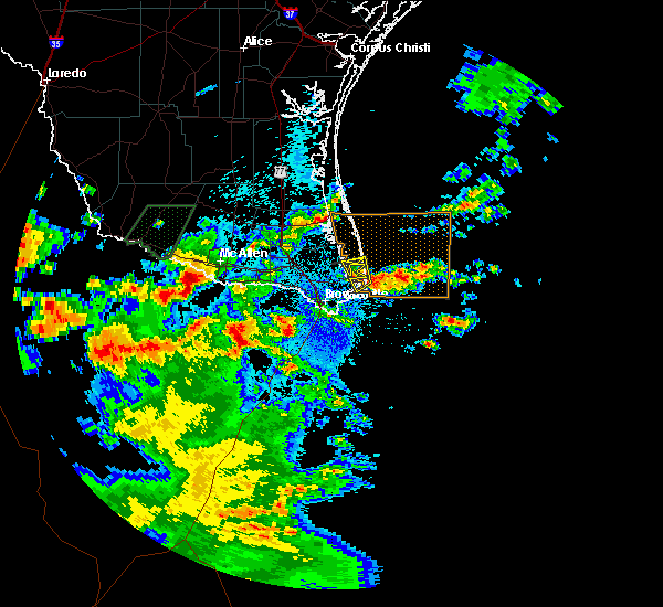 At 843 pm cdt, national weather service doppler radar indicated a severe thunderstorm over south padre island, moving north at 5 to 10 mph (radar indicated). Hazards include ping pong ball size hail and 60 mph wind gusts. People and animals outdoors will be injured. expect hail damage to roofs, siding, windows and property. vehicle damage will include cracked or shattered windshields and major dents requiring significant repairs. expect minor wind damage to mobile homes, some roofs, siding and some fences. tree limbs will blow down and small trees will be uprooted. Damage to power lines and some power poles is expected. At 843 pm cdt, national weather service doppler radar indicated a severe thunderstorm over south padre island, moving north at 5 to 10 mph (radar indicated). Hazards include ping pong ball size hail and 60 mph wind gusts. People and animals outdoors will be injured. expect hail damage to roofs, siding, windows and property. vehicle damage will include cracked or shattered windshields and major dents requiring significant repairs. expect minor wind damage to mobile homes, some roofs, siding and some fences. tree limbs will blow down and small trees will be uprooted. Damage to power lines and some power poles is expected.
|
| 4/18/2016 8:40 PM CDT |
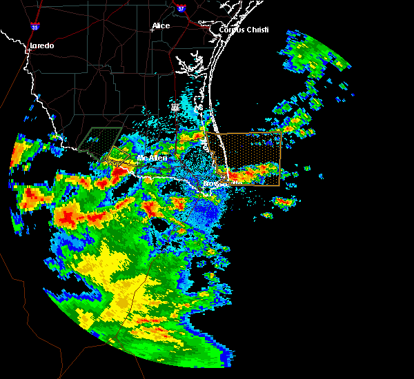 The national weather service in brownsville has issued a * severe thunderstorm warning for. east central cameron county in deep south texas. until 930 pm cdt * at 839 pm cdt. national weather service doppler radar indicated a severe thunderstorm over south padre island. Moving north at 5 to. The national weather service in brownsville has issued a * severe thunderstorm warning for. east central cameron county in deep south texas. until 930 pm cdt * at 839 pm cdt. national weather service doppler radar indicated a severe thunderstorm over south padre island. Moving north at 5 to.
|
| 8/31/2015 4:08 PM CDT |
 At 407 pm cdt, national weather service meteorologists detected a severe thunderstorm capable of producing a tornado. this dangerous storm was located over veterans international bridge moving east at 5 mph. At 407 pm cdt, national weather service meteorologists detected a severe thunderstorm capable of producing a tornado. this dangerous storm was located over veterans international bridge moving east at 5 mph.
|
| 8/20/2015 4:18 AM CDT |
 At 417 am cdt, doppler radar indicated a line of severe thunderstorms capable of producing damaging winds up to 60 mph. these storms were located along a line extending from 21 miles east of harlon block sports complex to 30 miles southeast of south point, moving east to southeast at 15 mph. locations impacted include, harlingen, weslaco, san benito, donna, mercedes, raymondville, la feria, elsa, los fresnos and progreso. At 417 am cdt, doppler radar indicated a line of severe thunderstorms capable of producing damaging winds up to 60 mph. these storms were located along a line extending from 21 miles east of harlon block sports complex to 30 miles southeast of south point, moving east to southeast at 15 mph. locations impacted include, harlingen, weslaco, san benito, donna, mercedes, raymondville, la feria, elsa, los fresnos and progreso.
|
| 8/20/2015 3:27 AM CDT |
 At 326 am cdt, doppler radar indicated a line of severe thunderstorms capable of producing torrential rain with damaging winds up to 60 mph. these storms were located along a line extending from near port mansfield airport to near los indios, and moving east to southeast at 15 mph. At 326 am cdt, doppler radar indicated a line of severe thunderstorms capable of producing torrential rain with damaging winds up to 60 mph. these storms were located along a line extending from near port mansfield airport to near los indios, and moving east to southeast at 15 mph.
|
| 5/24/2015 2:53 AM CDT | At 251 am cdt, doppler radar indicated a line of severe thunderstorms capable of producing quarter size hail and damaging winds in excess of 60 mph. these storms were located along a line extending from near arroyo city to downtown brownsville. these storms were movign east at 25 mph. |
| 5/24/2015 2:34 AM CDT | At 233 am cdt, doppler radar indicated a line of severe thunderstorms capable of producing quarter size hail and damaging winds in excess of 60 mph. these storms were located along a line extending from near arroyo city to downtown brownsville, moving east at 40 mph. |
| 5/24/2015 2:15 AM CDT | At 213 am cdt, doppler radar indicated a line of severe thunderstorms capable of producing quarter size hail and damaging winds in excess of 60 mph. these storms were located along a line extending from near arroyo city to brownsville, and moving east at 40 mph. |
| 5/12/2015 2:09 AM CDT | At 208 am cdt, doppler radar indicated a line of severe thunderstorms capable of producing damaging winds in excess of 60 mph. these storms were located along a line extending from willamar to near lozano to los fresnos high school, moving east at 35 mph. locations impacted include, harlingen, san benito, la feria, valley international airport, la paloma, laureles. |
| 5/12/2015 1:49 AM CDT | At 146 am cdt, local law enforcement reported several trees blown down in the edcouch area as a line of storms moved through. winds in excess of 80 mph can be expected. these storms were located along a line extending from santa rosa to la feria, moving east at 35 mph. locations impacted include, harlingen, san benito, la feria, valley international airport, la paloma, laureles, santa maria, harlingen, rangerville. |
| 5/12/2015 1:36 AM CDT | At 135 am cdt, doppler radar indicated a line of severe thunderstorms capable of producing destructive winds in excess of 80 mph. these storms were located along a line extending from near monte alto to los indios, and moving east at 35 mph. |
| 4/25/2015 12:09 AM CDT | At 1207 am cdt, radar is estimating nickel size hail and damaging winds in excess of 60 mph. this storm was located near san perlita high school, moving northeast at 35 mph. locations impacted include, raymondville, lyford, rio hondo, santa monica, willamar, arroyo city and lozano. |
| 4/24/2015 11:54 PM CDT | At 1152 pm cdt, doppler radar indicated a severe thunderstorm capable of producing damaging winds in excess of 60 mph. this storm was located over willamar, or near san perlita high school, moving northeast at 35 mph. nickel size hail may also accompany the damaging winds. in addition, at 1135 pm a wind gust of 58 mph was reported at valley international airport in harlingen. locations impacted include, mcallen, pharr, harlingen, weslaco, san juan, san benito, alamo, donna, mercedes, raymondville, hidalgo, la feria, edcouch, la villa, donna police department, pharr memorial library, psja high school, edcouch volunteer fire department, hidalgo high school and raymondville fire station. |
| 4/24/2015 11:40 PM CDT | At 1138 pm cdt, doppler radar indicated a severe thunderstorm capable of producing quarter size hail and damaging winds in excess of 60 mph. this storm was located over sebastian, or near lyford city hall, moving northeast at 40 mph. in addition, at 1137 pm quarter size hail was reported near los indios. locations impacted include, mcallen, pharr, harlingen, weslaco, san juan, san benito, alamo, donna, mercedes, raymondville, hidalgo, la feria, edcouch, la villa, donna police department, pharr memorial library, psja high school, edcouch volunteer fire department, hidalgo high school and raymondville fire station. |
| 4/24/2015 11:31 PM CDT | At 1130 pm cdt, doppler radar indicated a severe thunderstorm capable of producing destructive winds in excess of 70 mph. this storm was located over yznaga, or over santa rosa police department, moving northeast at 35 mph. nickel size hail may also accompany the damaging winds. locations impacted include, mcallen, pharr, harlingen, weslaco, san juan, san benito, alamo, donna, mercedes, raymondville, hidalgo, la feria, edcouch, la villa, donna police department, pharr memorial library, psja high school, edcouch volunteer fire department, hidalgo high school and raymondville fire station. |
| 4/24/2015 11:24 PM CDT | At 1122 pm cdt, doppler radar indicated a severe thunderstorm capable of producing quarter size hail and destructive winds in excess of 70 mph. this storm was located over laguna seca, or near la villa, and moving northeast at 35 mph. |
| 4/13/2015 4:51 AM CDT | The national weather service in brownsville has issued a * severe thunderstorm warning for. central cameron county in deep south texas. until 530 am cdt * at 450 am cdt. doppler radar indicated a severe thunderstorm capable of producing damaging winds in excess of 60 mph. This storm. |
| 4/13/2015 4:11 AM CDT | The national weather service in brownsville has issued a * severe thunderstorm warning for. northwestern cameron county in deep south texas. until 445 am cdt * at 410 am cdt. doppler radar indicated a severe thunderstorm capable of producing damaging winds in excess of 60 mph. This storm. |
| 4/13/2015 12:14 AM CDT | A severe thunderstorm warning remains in effect until 1230 am cdt for kenedy. cameron and willacy counties. at 1211 am cdt. doppler radar indicated a line of severe thunderstorms capable of producing damaging winds in excess of 60 mph. These storms were located along a line extending from 7 miles east of jose borrego middle school to near holly beach to 6 miles. |
| 4/12/2015 11:57 PM CDT | A severe thunderstorm warning remains in effect until 1230 am cdt for eastern hidalgo. kenedy. cameron and willacy counties. at 1153 pm cdt. doppler radar indicated a line of severe thunderstorms capable of producing damaging winds in excess of 60 mph. These storms were located along a line extending from 14 miles northeast of port of brownsville to 9 miles northeast of port. |
| 4/12/2015 11:29 PM CDT | The national weather service in brownsville has issued a * severe thunderstorm warning for. eastern hidalgo county in deep south texas. kenedy county in deep south texas. cameron county in deep south texas. Willacy county in deep south texas. |
| 5/28/2014 4:37 PM CDT | Several one to two foot diameter trees snapped. winds estimated at 60 mp in cameron county TX, 4.3 miles NNW of Brownsville, TX |
| 4/20/2012 7:10 PM CDT | Quarter sized hail reported 6.4 miles ENE of Brownsville, TX, mostly nickel sized but several stones of quarter sized embedded. |
| 4/20/2012 7:00 PM CDT | Quarter sized hail reported 5.7 miles NNW of Brownsville, TX, intersection of southmost and international blvd. nickel to quarter size stones. |
Hail Maps for Brownsville, TX
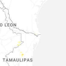
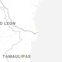

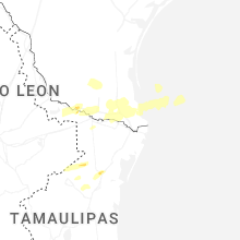


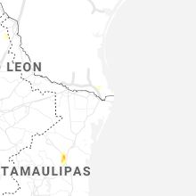
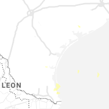


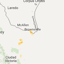


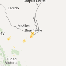


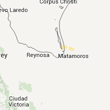


Connect with Interactive Hail Maps